Pontiac Bombing Range - WorldNow
Pontiac Bombing Range - WorldNow
Pontiac Bombing Range - WorldNow

You also want an ePaper? Increase the reach of your titles
YUMPU automatically turns print PDFs into web optimized ePapers that Google loves.
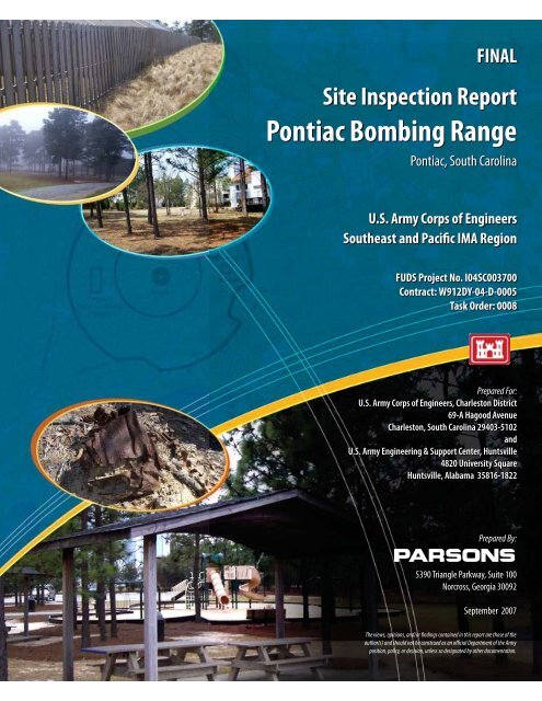
FINAL<br />
Site Inspection Report<br />
<strong>Pontiac</strong> <strong>Bombing</strong> <strong>Range</strong><br />
<strong>Pontiac</strong>, South Carolina<br />
U.S. Army Corps of Engineers<br />
Southeast and Pacific IMA Region<br />
FUDS Project No. I04SC003700<br />
Contract: W912DY-04-D-0005<br />
Task Order: 0008<br />
Prepared For:<br />
U.S. Army Corps of Engineers, Charleston District<br />
69-A Hagood Avenue<br />
Charleston, South Carolina 29403-5102<br />
and<br />
U.S. Army Engineering & Support Center, Huntsville<br />
4820 University Square<br />
Huntsville, Alabama 35816-1822<br />
Prepared By:<br />
5390 Triangle Parkway, Suite 100<br />
Norcross, Georgia 30092<br />
September 2007<br />
The views, opinions, and/or findings contained in this report are those of the<br />
author(s) and should not be construed as an official Department of the Army<br />
position, policy, or decision, unless so designated by other documentation.
CONTRACTOR STATEMENT OF INDEPENDENT TECHNICAL REVIEW<br />
Parsons has completed the Final Site Inspection report for the <strong>Pontiac</strong> <strong>Bombing</strong> <strong>Range</strong>,<br />
Richland County, SC. Notice is hereby given that an independent technical review has<br />
been conducted that is appropriate to the level of risk and complexity inherent in the<br />
project, as defined in the Quality Control Plan. During the independent technical review,<br />
compliance with established policy principles and procedures, utilizing justified and valid<br />
assumptions was verified. This included review of assumptions; methods, procedures,<br />
and material used in analyses; alternatives evaluated; the appropriateness of data used and<br />
level of data obtained; and reasonableness of the results, including whether the product<br />
meets the customer's needs consistent with law and existing Corps policy.<br />
Study/Design Team Leader and Team Members September 19, 2007<br />
Independent Technical Review Team Leader September 19, 2007<br />
Significant concerns and the explanation of the resolution are as follows:<br />
None<br />
As noted above, all concerns resulting from independent technical review of the project<br />
have been considered.<br />
Parsons Program Manager(s)<br />
September 19, 2007
Parsons<br />
Parsons Infrastructure & Technology Group, Inc.<br />
5390 Triangle Parkway • Suite 100 • Norcross, Georgia 30092 • (770) 446-4900 • Fax: (770) 446-4910 • www.parsons.com<br />
U.S. Army Engineering & Support Center<br />
ATTN: CEHNC-OE-DC (Mr. Doug Garretson)<br />
4820 University Square<br />
Huntsville, Alabama 35816-1822<br />
256-895-1696<br />
{<br />
September 19, 2007<br />
Subject: Contract W912DY-04-D-0005, Delivery Order 0008<br />
MMRP SI for SE and Pacific IMA Region – Final SI Report<br />
<strong>Pontiac</strong> <strong>Bombing</strong> <strong>Range</strong>, <strong>Pontiac</strong>, SC<br />
Dear Mr. Garretson:<br />
Parsons has prepared this Final Site Inspection (SI) Report for <strong>Pontiac</strong> <strong>Bombing</strong> <strong>Range</strong>,<br />
<strong>Pontiac</strong>, SC in accordance with the Performance Work Statement (PWS) to include the<br />
completed Munitions Response Site Prioritization Protocol (MRSPP). Two copies have been<br />
provided for your review and comment.<br />
We have simultaneously forwarded five copies of the document to Mr. Dennis McKinley of<br />
the USACE Charleston District for his review and comment. We have also submitted single<br />
copies of this Draft document to HTRW CX and MM CX. Electronic copies have also been<br />
provided.<br />
If you have any questions or comments, please contact me at (678) 969-2384 or<br />
(404) 606-0346 (cell) or the Co Program Manager (Ms. Laura Kelley) at (678) 969-2437.<br />
Sincerely,<br />
Parsons<br />
Don Silkebakken, P.E.<br />
MMRP SI Program Manager<br />
cc: Dennis McKinley (CESAC PM) – 5 copies/ 5 CDs<br />
Betina Johnson / Deborah Walker (USACE MM CX) – 1 copy/1 CD<br />
Heidi Novotny (HTRW CX) - 1 CD<br />
Laura Kelley/Project File (744647.36000)
U.S. Army Corps of Engineers<br />
Southeast and Pacific IMA Region<br />
FINAL<br />
Site Inspection Report<br />
<strong>Pontiac</strong> <strong>Bombing</strong> <strong>Range</strong><br />
Richland County, South Carolina<br />
FUDS Project No. I04SC003700<br />
September 2007<br />
In Support of<br />
FUDS MMRP Site Inspections Project<br />
Prepared By:<br />
Parsons<br />
5390 Triangle Parkway, Suite 100<br />
Norcross, Georgia 30092<br />
Prepared For:<br />
U.S. Army Corps of Engineers, Charleston District<br />
69-A Hagood Ave., Charleston, SC 29403-5102<br />
and<br />
U.S. Army Engineering & Support Center, Huntsville<br />
4820 University Square<br />
Huntsville, Alabama 35816-1822<br />
Contract: W912DY-04-D-0005<br />
Task Order: 0008
EXECUTIVE SUMMARY<br />
FINAL<br />
ES.1 The objective of the site inspection (SI) for the <strong>Pontiac</strong> <strong>Bombing</strong> <strong>Range</strong><br />
was to discern the presence or absence of munitions and explosives of concern (MEC)<br />
and munitions constituents (MC) within the three designated Munitions Response Sites<br />
(MRS) – Target No. 2, Target No. 5, and Target No. 6. The SI was conducted from<br />
March 20 through 23, 2007. The SI work involved the gathering of quantitative (i.e. MC<br />
sampling) data within these three MRSs by the site visit team (SVT). The SVT also<br />
conducted a qualitative reconnaissance (QR) by traversing the MRSs to gather general<br />
information about potential surficial presence of MEC/munitions debris (MD) and to<br />
assess the overall site conditions with regards to the implementation of a potential<br />
Remedial Investigation/Feasibility Study (RI/FS). The work was performed under<br />
Contract No. W912DY-04-D-0005, Task Order No. 0008 from the United States Army<br />
Corps of Engineers, Engineering and Support Center, Huntsville (USAESCH).<br />
ES.2 The <strong>Pontiac</strong> <strong>Bombing</strong> <strong>Range</strong> is located in Richland County, South<br />
Carolina. The three MRSs within this formerly used defense site (FUDS) are located<br />
within a residential development outside of the City of <strong>Pontiac</strong>, a suburb of Columbia,<br />
South Carolina. The MRSs are located along a surface water divide with surface water<br />
runoff going to either the Wateree River Basin or the Congaree River Basin. The<br />
property (approximately 1,980 total land acres for the FUDS) was acquired through lease<br />
agreements during 1943 and 1944 (there is confusion on actual dates in the Archive<br />
Search Report [ASR] references) with six private landowners and three right-of-way<br />
(ROW) owners. The property was acquired for the purposes of training Army Air Force<br />
squadrons in practice bombing routines. The range was officially closed in October of<br />
1945, declared surplus in December 1945, and subsequently declared a FUDS and<br />
assigned number #I04SC003700. Figure ES.1 shows the overall site map for the <strong>Pontiac</strong><br />
<strong>Bombing</strong> <strong>Range</strong>.<br />
ES.3 The SI involved the collection of 8 surface soil samples from the <strong>Pontiac</strong><br />
<strong>Bombing</strong> Gunnery <strong>Range</strong>. Three of the 8 soils samples were designated as “ambient”<br />
samples (i.e. collected from areas in the FUDS property boundary un-impacted by prior<br />
training activities) with the balance designated as “biased” samples. No surface water or<br />
sediment samples were collected. No explosive compounds were detected in any of the<br />
soil samples. No metals were detected above background levels in any of the soils. No<br />
parameters exceeded their respective comparison screening levels.<br />
ES.4 An MEC Screening Level Risk Assessment was conducted based on the<br />
QR conducted in the field and historical data regarding previous site visits (Chapter 6).<br />
Only MD, and no MEC, were observed during the SI field work in March 2007 for the<br />
three MRSs. No substantiated documented findings of MEC are known for this site;<br />
however, historic documentation as well as recent (March 2007 SI) identification of<br />
practice bombs that commonly employed the use of explosive spotting charges indicate<br />
ES-1<br />
EXECUTIVE SUMMARY.DOC REV. 2<br />
CONTRACT W912DY-04-D-0005, DELIVERY ORDER 0008 9/19/2007
FINAL<br />
the potential for MEC receptor interaction at the MRSs. Several non-World War II<br />
munitions (Hand Grenade, practice, M69; rocket, practice, 2.25-inch; and 5-inch rockets;<br />
and light anti-tank, 66mm) are mentioned in the ASR. It is unlikely these munitions were<br />
used at the <strong>Pontiac</strong> <strong>Bombing</strong> <strong>Range</strong> and may be war-time souvenirs or ordnance removed<br />
from nearby Ft. Jackson Military Reservation.<br />
ES.5 No explosives were detected in any of the surface soil samples collected,<br />
and no CERCLA-hazardous MC metals were detected above background concentrations<br />
in soil at the three MRSs. Based on these findings, it is concluded that there is no source<br />
of MC contamination at Target No. 2, Target No. 5, or Target No. 6; therefore, no<br />
increased risk to human or ecological receptors is expected.<br />
ES.6 With regards to MEC, the confirmed findings of various MD indicative of<br />
MEC within the three MRSs support a recommendation for further study in the form of<br />
an RI/FS to characterize and delineate any MEC/MD that might be present onsite and<br />
subsequent response actions. This recommendation is made in light of the fact that the<br />
risk of MEC exposure to receptors on site is considered low. RI/FS is recommended for<br />
all three of these MRSs. However, based on the results of the biased MC sampling,<br />
additional environmental sampling is not recommended for the three MRSs. Table ES.1<br />
presents a summary of recommendations.<br />
ES-2<br />
EXECUTIVE SUMMARY.DOC REV. 2<br />
CONTRACT W912DY-04-D-0005, DELIVERY ORDER 0008 9/19/2007
MRS Recommendation<br />
MRS-01<br />
Target No. 2<br />
MRS-02<br />
Target No.5<br />
MRS-02<br />
Target No.6<br />
RI/FS<br />
(additional MC<br />
sampling not<br />
recommended)<br />
RI/FS<br />
(additional MC<br />
sampling not<br />
recommended)<br />
RI/FS<br />
(additional MC<br />
sampling not<br />
recommended)<br />
Table ES.1<br />
Recommendation Summary<br />
Basis for Recommendation<br />
MEC/MD MC<br />
Several pieces of<br />
MD indicative of<br />
MEC found in<br />
MRS during March<br />
2007 SI. No MEC<br />
found in MRS<br />
during March 2007<br />
SI.<br />
Several pieces of<br />
MD indicative of<br />
MEC found in<br />
MRS during March<br />
2007 SI. No MEC<br />
found in MRS<br />
during March 2007<br />
SI.<br />
Several pieces of<br />
MD indicative of<br />
MEC found in<br />
MRS during March<br />
2007 SI. No MEC<br />
found in MRS<br />
during March 2007<br />
SI.<br />
FINAL<br />
No explosives or metals<br />
detected above applicable<br />
regulatory criteria in soils.<br />
No explosives or metals<br />
detected above applicable<br />
regulatory criteria in soils.<br />
No explosives or metals<br />
detected above applicable<br />
regulatory criteria in soils.<br />
ES-3<br />
EXECUTIVE SUMMARY.DOC REV. 2<br />
CONTRACT W912DY-04-D-0005, DELIVERY ORDER 0008 9/19/2007
3780000<br />
3778000<br />
508000<br />
508000<br />
HARD HARD SCRABBLE SCRABBLE RD RD<br />
!<br />
!( !(<br />
CLEMSON CLEMSON RD RD<br />
!<br />
Target 6<br />
(Skip <strong>Bombing</strong><br />
<strong>Range</strong>)<br />
!<br />
!( !(<br />
!<br />
! ! !<br />
!<br />
!<br />
510000<br />
!<br />
!<br />
!( !(<br />
!( !(<br />
!<br />
Target 2<br />
!( !(<br />
510000<br />
!<br />
!<br />
!( !(<br />
!<br />
!<br />
!<br />
!<br />
!( !(<br />
Target 5<br />
(Skip <strong>Bombing</strong><br />
<strong>Range</strong>)<br />
!<br />
!( !(<br />
512000<br />
512000<br />
3780000<br />
3778000<br />
General Site Overview<br />
Former <strong>Pontiac</strong> <strong>Bombing</strong> <strong>Range</strong><br />
FUDS Project No. I04SC003701<br />
DESIGNED BY:<br />
DRAWN BY:<br />
Legend<br />
!<br />
!.<br />
CHECKED BY:<br />
BT<br />
BT<br />
SC<br />
SUBMITTED BY:<br />
DS<br />
PARSONS<br />
SCALE:<br />
DATE:<br />
Figure ES.1<br />
Richland County, South Carolina<br />
Field Observation Location<br />
Soil Sample Location<br />
Approximate <strong>Bombing</strong> <strong>Range</strong> Boundary<br />
Approximate Property Boundary<br />
Qualitative Reconnaissance Track<br />
Site Location in South Carolina<br />
Image: 2005 Orthophotos<br />
Projection: UTM Zone 17 NAD83, Map Units in Meters<br />
1,200 600 0<br />
Feet<br />
1,200<br />
As Shown<br />
August 2007<br />
FILE: X:\GIS\Site_inspections_ne\Maps\<br />
pontiac_SC\FigES_1.mxd<br />
U.S. ARMY CORPS<br />
OF ENGINEERS<br />
HUNTSVILLE CENTER<br />
General Site Overview<br />
PROJECT NUMBER:<br />
PAGE<br />
NUMBER:<br />
³<br />
744647.36000
1.1 BACKGROUND<br />
CHAPTER 1<br />
INTRODUCTION<br />
FINAL<br />
1.1.1 Parsons Corporation (Parsons) received Contract No. W912DY-04-D-<br />
0005, Task Order No. 0008, from the United States Army Corps of Engineers (USACE),<br />
Engineering and Support Center, Huntsville (USAESCH) to perform a Site Inspection<br />
(SI) at the <strong>Pontiac</strong> <strong>Bombing</strong> <strong>Range</strong> site located in Richland County, South Carolina. The<br />
<strong>Pontiac</strong> <strong>Bombing</strong> <strong>Range</strong> was used from 1942 to 1945 as a practice bombing range. The<br />
range was officially closed on October 11, 1945 and declared as surplus on December 17,<br />
1945.<br />
1.1.2 As such, the <strong>Pontiac</strong> <strong>Bombing</strong> <strong>Range</strong> was declared a Formerly Used<br />
Defense Site ([FUDS] #I04SC003700) and is comprised of approximately 1,980 land<br />
acres with three target areas within the range. For the purposes of this SI report, the<br />
target areas within the <strong>Pontiac</strong> bombing <strong>Range</strong> are defined as three Munitions Response<br />
Site (MRSs); Target No. 2, Target No. 5, and Target No. 6. Figure 1.1 depicts the FUDS<br />
boundary for the overall site. The coordinates for the center point in each MRS are listed<br />
in Table 1.1. The coordinates are in meters (Universal Transverse Mercator [UTM] Zone<br />
17 North American Datum [NAD] 83).<br />
Table 1.1<br />
<strong>Pontiac</strong> <strong>Bombing</strong> <strong>Range</strong> Munitions Response Sites Coordinates<br />
Parcel X-Coordinate (meters) Y-Coordinate (meters)<br />
Target 2 510012.00 3779493.00<br />
Target 5 510866.00 3780093.00<br />
Target 6 508930.00 3779412.00<br />
1.2 PROJECT OBJECTIVES<br />
1.2.1 The Department of Defense (DoD) has established the Military Munitions<br />
Response Program (MMRP) to address DoD sites suspected of containing munitions and<br />
explosives of concern (MEC) or munitions constituents (MC). Under the MMRP, the<br />
USACE is conducting environmental response activities at FUDS for the Army, DoD’s<br />
Executive Agent for the FUDS program.<br />
1.2.2 Pursuant to USACE’s Engineer Regulation (ER) 200-3-1 (USACE, 2004)<br />
and the Management Guidance for the Defense Environmental Response Program<br />
(DERP); (Office of the Deputy Under Secretary of Defense, Installations and<br />
1-1<br />
CHAPTER 1.DOC REV. 2<br />
CONTRACT W912DY-04-D-0005, DELIVERY ORDER 0008 9/19/2007
FINAL<br />
Environment, September 2001), USACE is conducting FUDS response activities in<br />
accordance with the DERP statute (10 United States Code [USC] 2701 et seq.), the<br />
Comprehensive Environmental Response, Compensation, and Liability Act (CERCLA)<br />
(42 USC §9620), Executive Orders 12580 and 13016, and the National Oil and<br />
Hazardous Substances Pollution Contingency Plan (NCP) (40 CFR Part 300). As such,<br />
USACE is conducting remedial SIs, as set forth in the NCP, to evaluate hazardous<br />
substance releases or threatened releases from eligible FUDS.<br />
1.2.3 While not all MEC/MC constitute CERCLA hazardous substances,<br />
pollutants or contaminants, the DERP statute provides DoD the authority to respond to<br />
releases of MEC/MC, and DoD policy states that such responses shall be conducted in<br />
accordance with CERCLA and the NCP.<br />
1.2.4 The primary objective of the MMRP SI is to determine whether a FUDS<br />
project warrants further response action under CERCLA. The SI collects the minimum<br />
amount of information necessary to make this determination. Additionally, the SI: (i)<br />
determines the potential need for a removal action; (ii) collects or develops additional<br />
data, as appropriate, for Hazard Ranking System (HRS) scoring by U.S. Environmental<br />
Protection Agency (USEPA); and, (iii) collects data, as appropriate, to characterize the<br />
release for effective and rapid initiation of the Remedial Investigation and Feasibility<br />
Study (RI/FS). An additional objective of the SI is to collect the additional data<br />
necessary to complete the Munitions Response Site Prioritization Protocol (MRSPP).<br />
1.2.5 The SI was performed as a result of the MEC as well as munitions debris<br />
(MD) findings identified in the Archives Search Report (ASR) performed by TCT-St.<br />
Louis (formerly Envirodyne Engineers, Inc.) for the USACE – Huntsville Division (TCT-<br />
St. Louis, 1991). All work adhered to the DERP for FUDS and relevant U.S. Army<br />
regulations and guidance for ordnance and explosives programs. As specified in the task<br />
order, this report is prepared to summarize the SI sampling events and presents an<br />
accounting of MEC/MC identified on-site.<br />
1.3 PROJECT SCOPE<br />
1.3.1 For the <strong>Pontiac</strong> <strong>Bombing</strong> <strong>Range</strong>, the Technical Project Planning (TPP)<br />
Team agreed the SI would proceed in a manner to support either a No DoD Action<br />
Indicated (NDAI) or RI/FS recommendation prior to conducting the field portion of the<br />
SI. The site use as a practice bombing range had been verified and historical presence of<br />
MEC contamination (100-115 pond photoflash bomb found intact between 1986 and<br />
1990) has been reported in the ASR (TCT-St. Louis, 1991). Therefore, the SI for the<br />
<strong>Pontiac</strong> <strong>Bombing</strong> <strong>Range</strong> not only attempted to evaluate MEC presence in the known<br />
target areas but also evaluated MEC presence in peripheral portions of the site to provide<br />
circumstantial supporting evidence reflective of the absence of MEC in these areas.<br />
However, the TPP Team agreed that a recommendation for subsequent MC sampling<br />
during the RI/FS would not be made if sample data indicated the absence of MC<br />
contamination above site-specific screening values or appropriate background levels.<br />
1-2<br />
CHAPTER 1.DOC REV. 2<br />
CONTRACT W912DY-04-D-0005, DELIVERY ORDER 0008 9/19/2007
FINAL<br />
1.3.2 To accomplish this objective, the TPP Team concurred that the SI data<br />
collection efforts would focus on screening for MC contamination in soil. A total of<br />
eight soil samples, along with the appropriate Quality Assurance/Quality Control<br />
(QA/QC) samples were collected within the <strong>Pontiac</strong> <strong>Bombing</strong> <strong>Range</strong> site. Five of the<br />
soil samples were collected with maximum bias to coincide with site locations most<br />
likely to display evidence of residual MC contamination (such as the target areas or areas<br />
displaying munitions debris presence). The remaining three ambient soil samples were<br />
collected from anticipated “non DoD impacted” locations. Table 1.2 provides the<br />
sampling rationale.<br />
1-3<br />
CHAPTER 1.DOC REV. 2<br />
CONTRACT W912DY-04-D-0005, DELIVERY ORDER 0008 9/19/2007
Sample ID<br />
Sample Coordinates<br />
Longitude Latitude<br />
Table 1.2<br />
SAMPLING RATIONALE<br />
<strong>Pontiac</strong> <strong>Bombing</strong> <strong>Range</strong>, <strong>Pontiac</strong>, South Carolina<br />
Media Analysis Historical Use of Munitions in Area Rationale<br />
POBR-SS-06-01 -80.89140 34.15601 Soil Metals, Explosives M38A2 100-lb Practice Bombs; M1A1 Spotting Charges Sample collected within Target #2 <strong>Range</strong> near the target center to screen for MC<br />
presence in soil.<br />
POBR-SS-06-02 -80.88864 34.15838 Soil Metals, Explosives M38A2 100-lb Practice Bombs; M1A1 Spotting Charges Sample collected within Target #2 <strong>Range</strong> approximately 1500 feet northeast of the target<br />
center to screen for MC presence in soil.<br />
POBR-SS-06-03 -80.89161 34.15329 Soil Metals, Explosives M38A2 100-lb Practice Bombs; M1A1 Spotting Charges Sample collected within Target #2 <strong>Range</strong> approximately 1000 feet south of the target<br />
center to screen for MC presence in soil.<br />
POBR-SS-06-04 -80.88108 34.16141 Soil Metals, Explosives M38A2 100-lb Practice Bombs; M1A1 Spotting Charges; M75 Practice<br />
Bombs, 100-lb, hematite filled, spotting charges, bursters or fuzes not<br />
used<br />
Sample collected within Target #5 – Skip <strong>Bombing</strong> <strong>Range</strong> near the range center to<br />
screen for MC presence in soil..<br />
POBR-SS-06-05 -80.90405 34.15677 Soil Metals, Explosives M38A2 100-lb Practice Bombs; M1A1 Spotting Charges Sample collected within Target #6 – Skip <strong>Bombing</strong> <strong>Range</strong> to screen for MC presence in<br />
soil.<br />
POBR-SS-06-06 -80.89093 34.14263 Soil Metals, Explosives None Sample collected outside of all MRSs within an area with no known MEC activity to<br />
estimate ambient soil quality.<br />
POBR-SS-06-07 -80.89438 34.16809 Soil Metals, Explosives None Sample collected outside of all MRSs within an area with no known MEC activity to<br />
estimate ambient soil quality.<br />
POBR-SS-06-08 -80.87602 34.15893 Soil Metals, Explosives None Sample collected outside of all MRSs within an area with no known MEC activity to<br />
estimate ambient soil quality.<br />
1-4<br />
CHAPTER 1.DOC REV. 2<br />
CONTRACT W912DY-04-D-0005, DELIVERY ORDER 0008 9/19/2007<br />
FINAL
3790000<br />
3780000<br />
3770000<br />
500000<br />
500000<br />
£¤ 21 £¤ 21<br />
510000<br />
510000<br />
£¤ 1 £¤ 1<br />
§¨¦ 20 §¨¦ 20<br />
520000<br />
520000<br />
3790000<br />
3780000<br />
3770000<br />
Site Location<br />
Former <strong>Pontiac</strong> <strong>Bombing</strong> <strong>Range</strong><br />
FUDS Project No. I04SC003701<br />
Legend<br />
DESIGNED BY:<br />
DRAWN BY:<br />
CHECKED BY:<br />
BT<br />
BT<br />
SC<br />
SUBMITTED BY:<br />
DS<br />
PARSONS<br />
SCALE:<br />
DATE:<br />
Figure 1.1<br />
Richland County, South Carolina<br />
Approximate Property Boundary<br />
Site Location in South Carolina<br />
Image Source: USGS 7.5' Topo Quadrangles, 1990<br />
Projection: UTM Zone 17 NAD83, Map Units in Meters<br />
2 1 0<br />
Miles<br />
2<br />
As Shown<br />
August 2007<br />
X:\GIS\Site_inspections_ne\Maps\<br />
FILE:<br />
pontiac_SC\Fig1_1.mxd<br />
U.S. ARMY CORPS<br />
OF ENGINEERS<br />
HUNTSVILLE CENTER<br />
Site Location<br />
PROJECT NUMBER:<br />
PAGE<br />
NUMBER:<br />
³<br />
744647.36000
2.1 SITE DESCRIPTION<br />
CHAPTER 2<br />
PROPERTY DESCRIPTION AND HISTORY<br />
FINAL<br />
2.1.1 The <strong>Pontiac</strong> <strong>Bombing</strong> <strong>Range</strong> is located in Richland County, South<br />
Carolina. This practice bombing range is comprised of approximately 1,980 land acres<br />
with three MRS target areas – Target 2, Target 5, and Target 6. The site consists<br />
primarily of residential dwellings with additional residential development underway.<br />
Additionally, the site has an elementary school, a middle school, and a recreational area.<br />
2.1.2 For the purposes of this SI, the <strong>Pontiac</strong> <strong>Bombing</strong> <strong>Range</strong> FUDS site has<br />
been divided into three MRSs, reflecting the three areas used as bombing targets:<br />
• Target 2 MRS – 439 total acres; low, middle, and high altitude bombing<br />
• Target 5 MRS – 22 total acres; skip bombing<br />
• Target 6 MRS – 22 total acres; skip bombing<br />
2.2 SITE LOCATION AND SETTING<br />
2.2.1 Topography and Vegetation<br />
The site elevation in the <strong>Pontiac</strong> region ranges from 450 to 300 feet above sea level.<br />
The site is approximately two miles from the Fall Line which separates the Coastal Plain<br />
from the Piedmont Physiographic Province. In general, lands of this area are<br />
characterized by moderately sloped, sand hills, typified by large irregular-shaped,<br />
rounded hills which are capped with Aeolian sand. Area vegetation, in the remaining<br />
undeveloped land parcels, consists mainly of sparse growth of pine and hardwood trees.<br />
2.2.2 Geology and Soil<br />
2.2.1.1 The site is situated on the northern edge of the Upper Atlantic Coastal<br />
Plain on a shallow sequence of unconsolidated clastic deposits which overlie older<br />
Paleozoic rocks belonging in the Carolina Slate Group. The sedimentary formations of<br />
the Coastal Plain range in age from Late Cretaceous to recent. It consists of<br />
unconsolidated, coarse to medium grained sand with a kaolin matrix. At the surface the<br />
sediments are well sorted, unconsolidated, and structureless. The thickness varies from 0<br />
to 80 feet.<br />
2.2.1.2 Alluvium of recent and Pleistocene Age are found at the surface along<br />
streams and valleys and consist of sands, silts, gravels, and clays. Due to the results of<br />
stream rejuvenation, recent alluvium is located below the Pleistocene deposits along<br />
present rivers and flood plains. The older Pleistocene sediments are found at higher<br />
elevations along valley slopes and upper reaches of tributaries.<br />
2-1<br />
CHAPTER 2.DOC REV. 2<br />
CONTRACT W912DY-04-D-0005, DELIVERY ORDER 0008 9/19/2007
2.2.3 Climate<br />
FINAL<br />
Winters in the region are relatively mild, with a minimum average temperature of<br />
31°F. Summer days are warmest in July and August with an average high temperature of<br />
about 91°F. Typically, there are six days each summer that the temperature high exceeds<br />
100°F. Precipitation is greatest in July and August average over 5 inches of rain for both<br />
months. October and November are the driest months, averaging less than three inches<br />
per month. The average yearly precipitation in the area is around 44 to 48 inches<br />
annually.<br />
2.2.4 Significant Structures and Cultural Resources<br />
The <strong>Pontiac</strong> <strong>Bombing</strong> <strong>Range</strong> is located in Richland County. The entire bombing<br />
range area, with the exception of a few undeveloped land parcels, has been developed<br />
into primarily residential dwellings. Additionally, there exists an elementary school, a<br />
middle school, and church within the bombing range. According to the NRIS, NRHP,<br />
SCHD, NHL there are no cultural resources located on or near the proposed sampling<br />
locations or within the boundaries of the <strong>Pontiac</strong> <strong>Bombing</strong> <strong>Range</strong> sites. According to the<br />
SCIAA there are no known recorded archeological sites within 100 meters of any of the<br />
proposed soil sample locations. There are two known and recorded archeological sites<br />
within the site boundary. These two archeological sites are located in the extreme<br />
southeastern portion of the range. The site visit team did not encounter any cultural or<br />
archeological resources during the March 2007 visit.<br />
2.2.5 Demographics<br />
2.2.4.1 The demographics information for Richland County, South Carolina was<br />
obtained from the 2000 United States Census Bureau website<br />
(http://quickfacts.census.gov/qfd/states/45000.html).<br />
2.2.4.2 Richland County has a population of 348,226. See Figure 2.2 for a<br />
breakdown of population within a 4-mile buffer of the site. The population density for the<br />
county is 424 persons per square mile. The segment of the population under the age of<br />
18 is 23.7%, while 9.7% are over the age of 65. The median age is 35.1 years.<br />
Approximately 49.7% of the population is White, 46.6% Black or African American,<br />
2.1% Asian, and 0.3% American Indian and Alaska Native. There are 120,101<br />
households within the county with an average household size of 2.44. The occupational<br />
breakdown in the county is as follows:<br />
• Management, professional, and related occupations – 38.0%<br />
• Service occupations – 16.0%<br />
• Sales and office occupations – 28.2%<br />
• Farming, fishing, and forestry occupations – 0%<br />
• Construction, extraction, and maintenance occupations – 7.4%<br />
• Production, transportation, and material moving occupations – 10.4%<br />
2-2<br />
CHAPTER 2.DOC REV. 2<br />
CONTRACT W912DY-04-D-0005, DELIVERY ORDER 0008 9/19/2007
2.2.6 Current and Future Land Use<br />
FINAL<br />
Most of the <strong>Pontiac</strong> <strong>Bombing</strong> <strong>Range</strong> is developed as a residential subdivision with<br />
more than 26 inhabited structures within a two-mile radius of the site. The land is<br />
currently owned by numerous private owners. Future residential development is possible<br />
on the small amount of undeveloped land that remains.<br />
<strong>Range</strong> On Site<br />
Table 2.1<br />
Population within 4-Mile Buffer of the Site<br />
<strong>Pontiac</strong> <strong>Bombing</strong> <strong>Range</strong>, Richland County, South Carolina<br />
0 to ¼<br />
Mile<br />
¼ to ½<br />
Mile<br />
½ to 1<br />
Mile<br />
1 to 2<br />
Miles<br />
2 to 3<br />
Miles<br />
3 to 4<br />
Miles Total<br />
FUDS<br />
Boundary >4,000 >4,500 >5,200 >6,500 >10,000 >8,600 >10,200 >49,000<br />
Source: U.S. Census 2000 data. The population within the site, MRS, or within any buffer area is determined using a conservative<br />
approach to calculate the population of an area by including the total number of people for any census block that falls within or<br />
overlaps the site boundary, MRS boundary, or buffer line.<br />
2.2.7 Sensitive Environments<br />
The <strong>Pontiac</strong> <strong>Bombing</strong> <strong>Range</strong> is not located within a national wildlife refuge, national<br />
park, national forest, or state park. There are no sensitive environments adjacent to, or in,<br />
the FUDS.<br />
2.3 SITE OWNERSHIP AND HISTORY<br />
2.3.1 During June 1942, Columbia Army Air Base (CAAB) requested<br />
acquisition of land near <strong>Pontiac</strong>, Richland County, South Carolina to use as a practice<br />
bombing range. Army Air Force Headquarters authorized the construction of a bombing<br />
range near <strong>Pontiac</strong> in August 1942. Property was acquired through lease agreements<br />
during 1943 and 1944 (there is confusion on actual dates in the ASR references) with six<br />
private landowners and three right-of-way (ROW) owners.<br />
2.3.2 The ASR reports land leases were acquired and the practice bombing<br />
facility (at least one target) was in use during September 1943. A September 1943 report<br />
states that Targets 2 and 5 were completed. The <strong>Pontiac</strong> <strong>Bombing</strong> <strong>Range</strong> was used<br />
between 1943 and 1945 as a bombing range.<br />
2.3.3 On September 21, 1945 the bombing range was requested to be declared<br />
excess. According to records referenced in the ASR, the bombing range was declared<br />
surplus, effective December 17, 1945. All leases were cancelled effective February 28,<br />
1947, and the ROW easements were restored to the previous owners on September 24,<br />
1947. The cancelled leases returned the property to its original owners or their heirs<br />
2.3.4 Most of the bombing range property went through several ownership<br />
changes over the next thirty years with the exception of the Lorick Land Company land<br />
parcel. A majority of the <strong>Pontiac</strong> <strong>Bombing</strong> <strong>Range</strong> property (approximately 1,279 acres)<br />
became owned by the American Newland Association (now known as Newland Carolina)<br />
which began the residential development at the site during the early 1990s. Currently, the<br />
<strong>Pontiac</strong> <strong>Bombing</strong> <strong>Range</strong> property is almost completed developed into residential<br />
neighborhoods.<br />
2-3<br />
CHAPTER 2.DOC REV. 2<br />
CONTRACT W912DY-04-D-0005, DELIVERY ORDER 0008 9/19/2007
2.4 SITE OPERATIONS AND WASTE CHARACTERISTICS<br />
2.4.1 MRS-Specific Descriptions/Operations<br />
FINAL<br />
2.4.1.1 The descriptions of the MRSs at the <strong>Pontiac</strong> <strong>Bombing</strong> <strong>Range</strong> are obtained<br />
from the 2004 ASR Supplement.<br />
2.4.1.2 Target 2 MRS (439 acres) consisted of a standard annular-ring bombing<br />
target used for individual scoring at low, medium, and high altitudes during day and night<br />
practice missions. This area is currently fully developed into a single-family residential<br />
neighborhood (Pinebrook subdivision). Reportedly, only M38A2, 100-lb sand-filled,<br />
practice bombs with and without spotting charges were used on this target. Numerous<br />
MD were found during the site qualitative reconnaissance (QR) and have been<br />
historically found during construction activity in the area.<br />
2.4.1.3 Target 5 MRS (22 acres) consisted of a narrow strip of land with upright<br />
targets across the midway point. Airplanes would approach at low angle and low altitude<br />
to skip bombs into the targets. This area is currently fully developed into a residential<br />
neighborhood (Abington subdivision). Reportedly, sand-filled M38A2 100-lb practice<br />
bombs, with and without spotting charges, and 100-lb hematite-filled M75 practice<br />
bombs without bursters or fuzes were used on this target range. Some MD were noted in<br />
the area during the QR.<br />
2.4.1.4 Target 6 MRS (22 acres), another skip-bombing target, consisted of a<br />
narrow strip of land with upright targets across the midway point. As mentioned, planes<br />
would approach this target at a low angle and low altitude to skip bombs into the targets.<br />
According to the ASR Supplement, this target replaced Target 5 and was only used in<br />
early 1945. This area is substantially developed into a residential neighborhood. As with<br />
the other MRSs within this bombing range, MD was found during the QR for the site.<br />
2.4.2 Regulatory Compliance<br />
The USACE is conducting the SI at the <strong>Pontiac</strong> <strong>Bombing</strong> <strong>Range</strong> site as part of FUDS<br />
response activities pursuant to and in accordance with the guidance, regulations, and<br />
legislation listed in Chapter 1.<br />
2.5 PREVIOUS INVESTIGATIONS<br />
2.5.1 1991 Archives Search Report<br />
The ASR was completed by TCT - St. Louis in March 1991 for USAESCH. The<br />
ASR was prepared after reviewing available records, interviews, site inspection, analysis<br />
and reports that documented the history of the site. The ASR is the source of most of the<br />
historical information pertaining to site operations and identifies the key areas of focus<br />
for the SI. As part of the ASR, a site visit and residential/community interviews were<br />
conducted. MEC has historically been found on the site from 1982 through 1990<br />
especially during the construction and development of the subdivisions. Complete<br />
records concerning the specific types and quantity of ordnance used at the <strong>Pontiac</strong><br />
<strong>Bombing</strong> <strong>Range</strong> were not found in the ASR records search.<br />
2-4<br />
CHAPTER 2.DOC REV. 2<br />
CONTRACT W912DY-04-D-0005, DELIVERY ORDER 0008 9/19/2007
2.5.2 1994 Inventory Project Report<br />
FINAL<br />
An Inventory Project Report (INPR) of <strong>Pontiac</strong> <strong>Bombing</strong> <strong>Range</strong> was conducted in<br />
December 1993 under the provisions of the Defense Environmental Restoration Program,<br />
Formerly Used Defense Sites (DERP FUDS) by USACE Charleston District (CESAC).<br />
From the INPR it was confirmed that the Columbia Army Air Base was acquired in 1940<br />
and the <strong>Pontiac</strong> <strong>Bombing</strong> <strong>Range</strong> was built in 1942 and 1943. <strong>Bombing</strong> practice was<br />
conducted at the target range sites between 1943 and 1945, the base was declared excess<br />
in 1946.<br />
2.5.3 2004 Archives Search Report Supplement<br />
The ASR Supplement was prepared by USACE, St. Louis District as a supplement to<br />
the 1991 ASR. This document identified three range areas and types of munitions that<br />
may have been used.<br />
• Target No.2: Target 2 - 439 acres. Target 2 was used for low, medium<br />
and high altitude bombing practice in day or night. Munitions used include:<br />
M38A2 100-lbs, Practice Bombs with or without M1A1 Spotting Charges.<br />
• Target No.5: Target 5 – 22 acres. Target 5 was used for skip bombing<br />
practice. Munitions used include: M38A2 100 lbs, Practice Bombs with or<br />
without M1A1 Spotting Charges and 100 lbs, hematite-filled M75 practice<br />
bombs without bursters or fuzes.<br />
• Target No.6: Target 6 - 22 acres. Target 6 was used for skip bombing<br />
practice. It replaced Target 5 and was believed to have been used only in<br />
1945. Munitions used include: M38A2 100-lbs, Practice Bombs with or<br />
without M1A1 Spotting Charges.<br />
2-5<br />
CHAPTER 2.DOC REV. 2<br />
CONTRACT W912DY-04-D-0005, DELIVERY ORDER 0008 9/19/2007
3782000<br />
3780000<br />
3778000<br />
3776000<br />
STATE STATE HWY HWY 555 555<br />
N N BRICKYARD BRICKYARD RD RD<br />
506000<br />
506000<br />
508000<br />
508000<br />
HARD HARD SCRABBLE SCRABBLE RD RD<br />
Target 6<br />
(Skip <strong>Bombing</strong><br />
<strong>Range</strong>)<br />
CLEMSON CLEMSON RD RD<br />
510000<br />
Target 2<br />
510000<br />
Target 5<br />
(Skip <strong>Bombing</strong><br />
<strong>Range</strong>)<br />
CLEMSON CLEMSON RD RD<br />
512000<br />
512000<br />
£¤ 1 £¤ 1<br />
514000<br />
3782000<br />
3780000<br />
3778000<br />
3776000<br />
514000<br />
Site Setting<br />
Former <strong>Pontiac</strong> <strong>Bombing</strong> <strong>Range</strong><br />
FUDS Project No. I04SC003701<br />
Legend<br />
DESIGNED BY:<br />
DRAWN BY:<br />
CHECKED BY:<br />
BT<br />
BT<br />
SC<br />
SUBMITTED BY:<br />
DS<br />
PARSONS<br />
SCALE:<br />
DATE:<br />
Figure 2.1<br />
Richland County, South Carolina<br />
Approximate <strong>Bombing</strong> <strong>Range</strong> Boundary<br />
Approximate Property Boundary<br />
Site Location in South Carolina<br />
Image Source: USGS 7.5' Topo Quadrangles, 1990<br />
Projection: UTM Zone 17 NAD83, Map Units in Meters, Distance Units in Feet<br />
2,500 1,250 0<br />
Feet<br />
2,500<br />
As Shown<br />
August 2007<br />
X:\GIS\Site_inspections_ne\Maps\<br />
FILE:<br />
pontiac_SC\ Fig2_1.mxd<br />
U.S. ARMY CORPS<br />
OF ENGINEERS<br />
HUNTSVILLE CENTER<br />
Site Setting<br />
PROJECT NUMBER:<br />
PAGE<br />
NUMBER:<br />
³<br />
744647.36000
CLEMSON RD<br />
HARD SCRABBLE RD<br />
£¤ 1<br />
CLEMSON RD<br />
STATE HWY 555<br />
§¨¦ 77<br />
KILLIAN RD<br />
N BRICKYARD RD<br />
SLOAN RD<br />
STATE HWY 555<br />
§¨¦ 20<br />
STATE HWY 12<br />
SPARKLEBERRY LN<br />
£¤ 21<br />
Target 2<br />
Target 6<br />
(Skip <strong>Bombing</strong><br />
<strong>Range</strong>)<br />
Target 5<br />
(Skip <strong>Bombing</strong><br />
<strong>Range</strong>)<br />
0.25<br />
3<br />
2<br />
1<br />
0.5<br />
4<br />
0<br />
0<br />
0<br />
0<br />
1<br />
0<br />
9<br />
8<br />
0<br />
0<br />
0<br />
9<br />
6<br />
0<br />
5<br />
0<br />
3<br />
7<br />
0<br />
5<br />
4<br />
7<br />
0<br />
0<br />
0<br />
0<br />
0<br />
0<br />
1<br />
2<br />
0<br />
0<br />
0<br />
0<br />
0<br />
0 0 0<br />
0<br />
6<br />
0<br />
0<br />
2<br />
0<br />
0<br />
2 0<br />
9<br />
8<br />
4<br />
5<br />
4<br />
5<br />
0<br />
0<br />
0<br />
0<br />
0<br />
0<br />
0<br />
0<br />
0<br />
0<br />
0<br />
0<br />
3<br />
0<br />
0 0<br />
0<br />
5 3<br />
0<br />
0<br />
0<br />
0<br />
2<br />
0<br />
0<br />
0<br />
3<br />
1 0<br />
0<br />
7<br />
0<br />
0 7<br />
0<br />
0<br />
7<br />
9<br />
0<br />
5<br />
0<br />
2<br />
0<br />
1<br />
5<br />
0<br />
6 7<br />
0<br />
0<br />
0<br />
1<br />
0<br />
0<br />
6<br />
0<br />
0<br />
0<br />
0 0<br />
0<br />
1<br />
1 0<br />
0<br />
9<br />
0<br />
2<br />
0<br />
0<br />
0 10<br />
0<br />
7<br />
3<br />
0 0<br />
0<br />
0<br />
0<br />
6<br />
8<br />
0<br />
0<br />
1<br />
0<br />
2<br />
0<br />
0<br />
5<br />
9<br />
2<br />
0<br />
0<br />
0<br />
0<br />
0<br />
0<br />
0<br />
3<br />
4<br />
9<br />
8<br />
0<br />
0<br />
5<br />
7<br />
8<br />
0<br />
1<br />
0<br />
3<br />
0 0<br />
1<br />
0<br />
0<br />
8<br />
0 0<br />
0<br />
0 0<br />
0<br />
0<br />
4<br />
2<br />
0<br />
5<br />
8 8<br />
6<br />
0<br />
04 0<br />
0<br />
0<br />
0<br />
8<br />
0<br />
9<br />
0 0<br />
0<br />
0<br />
0<br />
0<br />
0<br />
0<br />
0<br />
0<br />
0<br />
0<br />
0<br />
0<br />
0<br />
0<br />
9<br />
3<br />
0<br />
2<br />
0<br />
0<br />
0<br />
4<br />
1<br />
0<br />
1<br />
0<br />
0<br />
0<br />
0<br />
4<br />
0<br />
3<br />
0<br />
0<br />
0<br />
0<br />
0<br />
0<br />
0<br />
0<br />
0<br />
0<br />
0<br />
0<br />
0<br />
0<br />
0<br />
0<br />
0<br />
0<br />
7<br />
4<br />
0<br />
0<br />
0<br />
0<br />
2<br />
0<br />
0<br />
0 0<br />
0<br />
2<br />
0<br />
0<br />
9<br />
0<br />
4<br />
0<br />
0<br />
8<br />
0<br />
0<br />
0<br />
2<br />
6 9<br />
9<br />
8<br />
2<br />
3<br />
0<br />
0<br />
0<br />
0<br />
8<br />
0<br />
0<br />
0<br />
0<br />
5<br />
0<br />
1<br />
8<br />
0<br />
0<br />
0<br />
4<br />
0<br />
0<br />
0<br />
0<br />
0<br />
0<br />
0<br />
0<br />
2<br />
2 3<br />
1<br />
0<br />
0<br />
0<br />
0<br />
8<br />
0<br />
0<br />
0<br />
0<br />
0<br />
0<br />
0<br />
0<br />
0<br />
0<br />
0<br />
0<br />
2<br />
7<br />
0<br />
0<br />
0<br />
2<br />
0<br />
4<br />
0<br />
1<br />
0<br />
0<br />
8 7 0<br />
5<br />
0<br />
0<br />
6<br />
0<br />
9<br />
3<br />
0<br />
7<br />
4<br />
3<br />
0<br />
0<br />
0<br />
0<br />
0<br />
0<br />
0<br />
5<br />
0<br />
0<br />
0<br />
0<br />
2<br />
4<br />
0<br />
0<br />
0<br />
0<br />
0<br />
0<br />
0<br />
0<br />
0<br />
0<br />
0 0<br />
0<br />
8<br />
0<br />
3<br />
2<br />
2<br />
0<br />
8<br />
0<br />
0<br />
2<br />
0<br />
0<br />
0<br />
1<br />
0<br />
0<br />
8<br />
9<br />
0<br />
0<br />
0<br />
0<br />
0<br />
3<br />
7<br />
5<br />
3<br />
0<br />
0<br />
8<br />
0<br />
0<br />
5<br />
5<br />
4<br />
0<br />
0<br />
0<br />
0<br />
3<br />
0<br />
0<br />
0<br />
0<br />
0<br />
0<br />
0<br />
0<br />
0<br />
0<br />
2<br />
0<br />
0<br />
0<br />
0<br />
0<br />
0<br />
3<br />
8<br />
7<br />
0 0<br />
0<br />
0<br />
0<br />
0<br />
0<br />
0<br />
0<br />
0<br />
0<br />
0<br />
0<br />
7<br />
3<br />
0<br />
2<br />
0<br />
0 0<br />
5<br />
0<br />
0<br />
0<br />
0<br />
0<br />
0<br />
0<br />
0<br />
2<br />
0<br />
0<br />
1<br />
6<br />
0<br />
3<br />
0<br />
0<br />
6<br />
3<br />
6<br />
0<br />
0<br />
0<br />
0<br />
0<br />
0<br />
0<br />
0<br />
0<br />
0<br />
7<br />
2<br />
2<br />
2<br />
0<br />
0<br />
0<br />
0 2<br />
6<br />
0<br />
0<br />
0<br />
0<br />
0<br />
0<br />
0<br />
0<br />
0<br />
0<br />
0<br />
0<br />
0<br />
7<br />
0<br />
8<br />
0<br />
0<br />
0<br />
0<br />
0<br />
0<br />
5<br />
0<br />
7<br />
3<br />
0<br />
0<br />
0<br />
9<br />
0<br />
6<br />
8<br />
4<br />
0<br />
6<br />
0<br />
0<br />
0<br />
6<br />
4<br />
0 0<br />
8<br />
1<br />
4<br />
7<br />
4<br />
7<br />
0<br />
9<br />
6<br />
4<br />
4<br />
13<br />
55<br />
47<br />
25<br />
10<br />
18<br />
97<br />
91 90<br />
23<br />
48<br />
56 63<br />
48<br />
68<br />
45 40<br />
51<br />
73<br />
69<br />
36<br />
16<br />
19<br />
11<br />
18<br />
12<br />
93<br />
14<br />
34<br />
71<br />
41<br />
60<br />
17<br />
27<br />
38<br />
59<br />
16<br />
40<br />
43<br />
61<br />
23<br />
18<br />
16<br />
34<br />
12<br />
60<br />
41<br />
43<br />
85<br />
43<br />
67<br />
22<br />
15<br />
17<br />
76<br />
10<br />
11<br />
14<br />
26<br />
62<br />
12<br />
14<br />
32<br />
15<br />
93<br />
38<br />
15<br />
13<br />
23<br />
29<br />
86<br />
14<br />
25<br />
19<br />
40<br />
54<br />
10<br />
18<br />
51<br />
51<br />
25<br />
39<br />
58<br />
25<br />
32<br />
36<br />
33<br />
35<br />
25 1218<br />
34<br />
18<br />
15<br />
60<br />
38<br />
16<br />
17<br />
36<br />
91<br />
60<br />
67<br />
66<br />
39<br />
36<br />
60<br />
34<br />
30<br />
18<br />
32<br />
66<br />
22<br />
30<br />
15<br />
52<br />
58<br />
59 22<br />
61<br />
27<br />
97<br />
13<br />
34<br />
25<br />
39<br />
37<br />
37<br />
56 71<br />
37<br />
20<br />
18<br />
29<br />
61<br />
65<br />
34<br />
51<br />
37<br />
13<br />
52<br />
99<br />
51<br />
39<br />
39<br />
38<br />
20<br />
35<br />
32 61<br />
51<br />
69<br />
39<br />
89<br />
57<br />
36<br />
41<br />
59<br />
70<br />
99<br />
40<br />
66<br />
38<br />
60<br />
56<br />
81<br />
28<br />
78<br />
28<br />
41<br />
12<br />
53<br />
49<br />
58 60<br />
42 52<br />
14<br />
16<br />
13<br />
68<br />
94<br />
17<br />
33<br />
65<br />
60<br />
30<br />
46<br />
31 26<br />
47<br />
65<br />
50<br />
20<br />
43<br />
44 70<br />
32<br />
14<br />
30<br />
27<br />
27<br />
72<br />
22<br />
31<br />
69<br />
43<br />
32<br />
46<br />
53<br />
51<br />
40<br />
61<br />
88 32<br />
32 46<br />
99<br />
33<br />
32<br />
69<br />
92<br />
11 37<br />
31<br />
47<br />
17<br />
76<br />
35<br />
27 48<br />
68<br />
46<br />
29<br />
10<br />
85<br />
51<br />
33<br />
53<br />
48<br />
78<br />
98<br />
62 62<br />
96<br />
21<br />
55<br />
53<br />
42<br />
25 74<br />
67 72<br />
67<br />
19<br />
67<br />
94<br />
37<br />
58<br />
59 3029<br />
24<br />
85<br />
88<br />
33<br />
23 78<br />
40<br />
21<br />
91<br />
46<br />
57<br />
49<br />
71<br />
67<br />
14<br />
15<br />
93<br />
63<br />
64<br />
62<br />
37 34<br />
44<br />
17<br />
67<br />
59<br />
30 47 41<br />
91<br />
53<br />
47<br />
50<br />
21<br />
47<br />
27 52<br />
29<br />
28<br />
53<br />
25<br />
68<br />
50<br />
23<br />
57<br />
40<br />
23<br />
1668 27<br />
66<br />
38 40<br />
25<br />
38<br />
30<br />
25<br />
14<br />
21<br />
46<br />
24<br />
53<br />
46<br />
29<br />
45<br />
70 98<br />
19<br />
22<br />
18<br />
33<br />
32<br />
50<br />
41<br />
50<br />
36<br />
22<br />
40<br />
53<br />
77<br />
17<br />
15<br />
3112<br />
82<br />
36<br />
46<br />
18<br />
32<br />
58<br />
26<br />
16<br />
50 73 36<br />
97<br />
2629<br />
85<br />
43<br />
85<br />
42<br />
79<br />
96<br />
88<br />
43<br />
14<br />
24<br />
38<br />
35<br />
32<br />
44<br />
12<br />
19<br />
53<br />
15<br />
22 19<br />
50<br />
47 22<br />
46<br />
46<br />
11<br />
68<br />
26<br />
25<br />
63<br />
72<br />
22<br />
98<br />
26<br />
88 30<br />
17<br />
2326<br />
54<br />
97<br />
38<br />
24<br />
13 87<br />
80<br />
56<br />
70<br />
1924 64<br />
71<br />
37<br />
43<br />
51<br />
83<br />
49<br />
10<br />
34<br />
28<br />
63<br />
40<br />
39<br />
59<br />
11<br />
51<br />
81<br />
98<br />
86<br />
75<br />
12<br />
15<br />
17<br />
19<br />
73<br />
59<br />
51<br />
31<br />
42<br />
21<br />
12<br />
76<br />
92<br />
61<br />
22<br />
32<br />
15<br />
19<br />
81<br />
42<br />
46<br />
43<br />
20<br />
25<br />
36<br />
13<br />
26<br />
36<br />
10<br />
16<br />
19<br />
41<br />
22<br />
60<br />
30<br />
11<br />
13<br />
10<br />
14<br />
19<br />
37<br />
75<br />
19<br />
43<br />
19<br />
10<br />
15<br />
24<br />
63 60<br />
62<br />
17<br />
22<br />
12<br />
11<br />
31<br />
10<br />
37<br />
26<br />
15<br />
17<br />
28<br />
38<br />
77<br />
12<br />
58<br />
69<br />
99<br />
13<br />
96<br />
23<br />
65<br />
87<br />
18<br />
29<br />
16<br />
33<br />
10<br />
18<br />
12<br />
43<br />
89<br />
41<br />
53<br />
97<br />
21<br />
13<br />
95<br />
11<br />
60<br />
44<br />
40<br />
36<br />
32<br />
72<br />
14<br />
60<br />
59<br />
78<br />
43<br />
45<br />
10<br />
30<br />
26<br />
111<br />
388<br />
776<br />
362<br />
116<br />
123<br />
152<br />
122<br />
157<br />
166<br />
309<br />
266<br />
313<br />
788<br />
128<br />
132 116<br />
376<br />
140<br />
207<br />
106<br />
153<br />
550<br />
768<br />
236<br />
398<br />
134<br />
744<br />
620<br />
851<br />
178<br />
286<br />
191<br />
569<br />
129<br />
570<br />
114<br />
119<br />
179<br />
191<br />
241<br />
108<br />
234<br />
108<br />
245<br />
128<br />
489<br />
657<br />
116<br />
227<br />
235<br />
126<br />
152<br />
207<br />
554<br />
292<br />
143<br />
218<br />
139<br />
563<br />
249<br />
910<br />
314<br />
474<br />
248 224<br />
116<br />
115<br />
216<br />
304<br />
150<br />
149<br />
899<br />
148<br />
434<br />
509<br />
299<br />
150<br />
104<br />
164<br />
147<br />
161<br />
238<br />
217<br />
392<br />
640<br />
141<br />
303<br />
182<br />
309<br />
225<br />
154<br />
241<br />
132<br />
172<br />
195<br />
147<br />
212<br />
184<br />
164<br />
340<br />
269<br />
262<br />
145<br />
157<br />
374 509<br />
510<br />
210<br />
284<br />
103<br />
228<br />
213<br />
259<br />
102<br />
288<br />
236<br />
232<br />
810<br />
136<br />
158<br />
165<br />
197<br />
143<br />
120<br />
125<br />
118<br />
127<br />
2414<br />
1104<br />
1043<br />
1336<br />
0<br />
0<br />
0<br />
0 00<br />
0<br />
1<br />
0<br />
0<br />
0<br />
0<br />
0<br />
0<br />
0<br />
0<br />
0<br />
0<br />
0<br />
12<br />
13<br />
27 13<br />
11<br />
19<br />
27<br />
11<br />
26<br />
26<br />
47<br />
30<br />
27<br />
95<br />
22<br />
94<br />
33<br />
76<br />
73<br />
14<br />
20<br />
22<br />
24<br />
51<br />
107<br />
156<br />
136<br />
102<br />
121<br />
104<br />
112<br />
176<br />
137<br />
500000<br />
500000<br />
502000<br />
502000<br />
504000<br />
504000<br />
506000<br />
506000<br />
508000<br />
508000<br />
510000<br />
510000<br />
512000<br />
512000<br />
514000<br />
514000<br />
516000<br />
516000<br />
518000<br />
518000<br />
3772000<br />
3772000<br />
3774000<br />
3774000<br />
3776000<br />
3776000<br />
3778000<br />
3778000<br />
3780000<br />
3780000<br />
3782000<br />
3782000<br />
3784000<br />
3784000<br />
3786000<br />
3786000<br />
3788000<br />
3788000<br />
CLEMSON RD<br />
HARD SCRABBLE RD<br />
£¤ 1<br />
CLEMSON RD<br />
STATE HWY 555<br />
§¨¦ 77<br />
KILLIAN RD<br />
N BRICKYARD RD<br />
SLOAN RD<br />
STATE HWY 555<br />
§¨¦ 20<br />
STATE HWY 12<br />
SPARKLEBERRY LN<br />
£¤ 21<br />
Target 2<br />
Target 6<br />
(Skip <strong>Bombing</strong><br />
<strong>Range</strong>)<br />
Target 5<br />
(Skip <strong>Bombing</strong><br />
<strong>Range</strong>)<br />
0.25<br />
3<br />
2<br />
1<br />
0.5<br />
4<br />
0<br />
0<br />
0<br />
0<br />
1<br />
0<br />
9<br />
8<br />
0<br />
0<br />
0<br />
9<br />
6<br />
0<br />
5<br />
0<br />
3<br />
7<br />
0<br />
5<br />
4<br />
7<br />
0<br />
0<br />
0<br />
0<br />
0<br />
0<br />
1<br />
2<br />
0<br />
0<br />
0<br />
0<br />
0<br />
0 0 0<br />
0<br />
6<br />
0<br />
0<br />
2<br />
0<br />
0<br />
2 0<br />
9<br />
8<br />
4<br />
5<br />
4<br />
5<br />
0<br />
0<br />
0<br />
0<br />
0<br />
0<br />
0<br />
0<br />
0<br />
0<br />
0<br />
0<br />
3<br />
0<br />
0 0<br />
0<br />
5 3<br />
0<br />
0<br />
0<br />
0<br />
2<br />
0<br />
0<br />
0<br />
3<br />
1 0<br />
0<br />
7<br />
0<br />
0 7<br />
0<br />
0<br />
7<br />
9<br />
0<br />
5<br />
0<br />
2<br />
0<br />
1<br />
5<br />
0<br />
6 7<br />
0<br />
0<br />
0<br />
1<br />
0<br />
0<br />
6<br />
0<br />
0<br />
0<br />
0 0<br />
0<br />
1<br />
1 0<br />
0<br />
9<br />
0<br />
2<br />
0<br />
0<br />
0 10<br />
0<br />
7<br />
3<br />
0 0<br />
0<br />
0<br />
0<br />
6<br />
8<br />
0<br />
0<br />
1<br />
0<br />
2<br />
0<br />
0<br />
5<br />
9<br />
2<br />
0<br />
0<br />
0<br />
0<br />
0<br />
0<br />
0<br />
3<br />
4<br />
9<br />
8<br />
0<br />
0<br />
5<br />
7<br />
8<br />
0<br />
1<br />
0<br />
3<br />
0 0<br />
1<br />
0<br />
0<br />
8<br />
0 0<br />
0<br />
0 0<br />
0<br />
0<br />
4<br />
2<br />
0<br />
5<br />
8 8<br />
6<br />
0<br />
04 0<br />
0<br />
0<br />
0<br />
8<br />
0<br />
9<br />
0 0<br />
0<br />
0<br />
0<br />
0<br />
0<br />
0<br />
0<br />
0<br />
0<br />
0<br />
0<br />
0<br />
0<br />
0<br />
9<br />
3<br />
0<br />
2<br />
0<br />
0<br />
0<br />
4<br />
1<br />
0<br />
1<br />
0<br />
0<br />
0<br />
0<br />
4<br />
0<br />
3<br />
0<br />
0<br />
0<br />
0<br />
0<br />
0<br />
0<br />
0<br />
0<br />
0<br />
0<br />
0<br />
0<br />
0<br />
0<br />
0<br />
0<br />
0<br />
7<br />
4<br />
0<br />
0<br />
0<br />
0<br />
2<br />
0<br />
0<br />
0 0<br />
0<br />
2<br />
0<br />
0<br />
9<br />
0<br />
4<br />
0<br />
0<br />
8<br />
0<br />
0<br />
0<br />
2<br />
6 9<br />
9<br />
8<br />
2<br />
3<br />
0<br />
0<br />
0<br />
0<br />
8<br />
0<br />
0<br />
0<br />
0<br />
5<br />
0<br />
1<br />
8<br />
0<br />
0<br />
0<br />
4<br />
0<br />
0<br />
0<br />
0<br />
0<br />
0<br />
0<br />
0<br />
2<br />
2 3<br />
1<br />
0<br />
0<br />
0<br />
0<br />
8<br />
0<br />
0<br />
0<br />
0<br />
0<br />
0<br />
0<br />
0<br />
0<br />
0<br />
0<br />
0<br />
2<br />
7<br />
0<br />
0<br />
0<br />
2<br />
0<br />
4<br />
0<br />
1<br />
0<br />
0<br />
8 7 0<br />
5<br />
0<br />
0<br />
6<br />
0<br />
9<br />
3<br />
0<br />
7<br />
4<br />
3<br />
0<br />
0<br />
0<br />
0<br />
0<br />
0<br />
0<br />
5<br />
0<br />
0<br />
0<br />
0<br />
2<br />
4<br />
0<br />
0<br />
0<br />
0<br />
0<br />
0<br />
0<br />
0<br />
0<br />
0<br />
0 0<br />
0<br />
8<br />
0<br />
3<br />
2<br />
2<br />
0<br />
8<br />
0<br />
0<br />
2<br />
0<br />
0<br />
0<br />
1<br />
0<br />
0<br />
8<br />
9<br />
0<br />
0<br />
0<br />
0<br />
0<br />
3<br />
7<br />
5<br />
3<br />
0<br />
0<br />
8<br />
0<br />
0<br />
5<br />
5<br />
4<br />
0<br />
0<br />
0<br />
0<br />
3<br />
0<br />
0<br />
0<br />
0<br />
0<br />
0<br />
0<br />
0<br />
0<br />
0<br />
2<br />
0<br />
0<br />
0<br />
0<br />
0<br />
0<br />
3<br />
8<br />
7<br />
0 0<br />
0<br />
0<br />
0<br />
0<br />
0<br />
0<br />
0<br />
0<br />
0<br />
0<br />
0<br />
7<br />
3<br />
0<br />
2<br />
0<br />
0 0<br />
5<br />
0<br />
0<br />
0<br />
0<br />
0<br />
0<br />
0<br />
0<br />
2<br />
0<br />
0<br />
1<br />
6<br />
0<br />
3<br />
0<br />
0<br />
6<br />
3<br />
6<br />
0<br />
0<br />
0<br />
0<br />
0<br />
0<br />
0<br />
0<br />
0<br />
0<br />
7<br />
2<br />
2<br />
2<br />
0<br />
0<br />
0<br />
0 2<br />
6<br />
0<br />
0<br />
0<br />
0<br />
0<br />
0<br />
0<br />
0<br />
0<br />
0<br />
0<br />
0<br />
0<br />
7<br />
0<br />
8<br />
0<br />
0<br />
0<br />
0<br />
0<br />
0<br />
5<br />
0<br />
7<br />
3<br />
0<br />
0<br />
0<br />
9<br />
0<br />
6<br />
8<br />
4<br />
0<br />
6<br />
0<br />
0<br />
0<br />
6<br />
4<br />
0 0<br />
8<br />
1<br />
4<br />
7<br />
4<br />
7<br />
0<br />
9<br />
6<br />
4<br />
4<br />
13<br />
55<br />
47<br />
25<br />
10<br />
18<br />
97<br />
91 90<br />
23<br />
48<br />
56 63<br />
48<br />
68<br />
45 40<br />
51<br />
73<br />
69<br />
36<br />
16<br />
19<br />
11<br />
18<br />
12<br />
93<br />
14<br />
34<br />
71<br />
41<br />
60<br />
17<br />
27<br />
38<br />
59<br />
16<br />
40<br />
43<br />
61<br />
23<br />
18<br />
16<br />
34<br />
12<br />
60<br />
41<br />
43<br />
85<br />
43<br />
67<br />
22<br />
15<br />
17<br />
76<br />
10<br />
11<br />
14<br />
26<br />
62<br />
12<br />
14<br />
32<br />
15<br />
93<br />
38<br />
15<br />
13<br />
23<br />
29<br />
86<br />
14<br />
25<br />
19<br />
40<br />
54<br />
10<br />
18<br />
51<br />
51<br />
25<br />
39<br />
58<br />
25<br />
32<br />
36<br />
33<br />
35<br />
25 1218<br />
34<br />
18<br />
15<br />
60<br />
38<br />
16<br />
17<br />
36<br />
91<br />
60<br />
67<br />
66<br />
39<br />
36<br />
60<br />
34<br />
30<br />
18<br />
32<br />
66<br />
22<br />
30<br />
15<br />
52<br />
58<br />
59 22<br />
61<br />
27<br />
97<br />
13<br />
34<br />
25<br />
39<br />
37<br />
37<br />
56 71<br />
37<br />
20<br />
18<br />
29<br />
61<br />
65<br />
34<br />
51<br />
37<br />
13<br />
52<br />
99<br />
51<br />
39<br />
39<br />
38<br />
20<br />
35<br />
32 61<br />
51<br />
69<br />
39<br />
89<br />
57<br />
36<br />
41<br />
59<br />
70<br />
99<br />
40<br />
66<br />
38<br />
60<br />
56<br />
81<br />
28<br />
78<br />
28<br />
41<br />
12<br />
53<br />
49<br />
58 60<br />
42 52<br />
14<br />
16<br />
13<br />
68<br />
94<br />
17<br />
33<br />
65<br />
60<br />
30<br />
46<br />
31 26<br />
47<br />
65<br />
50<br />
20<br />
43<br />
44 70<br />
32<br />
14<br />
30<br />
27<br />
27<br />
72<br />
22<br />
31<br />
69<br />
43<br />
32<br />
46<br />
53<br />
51<br />
40<br />
61<br />
88 32<br />
32 46<br />
99<br />
33<br />
32<br />
69<br />
92<br />
11 37<br />
31<br />
47<br />
17<br />
76<br />
35<br />
27 48<br />
68<br />
46<br />
29<br />
10<br />
85<br />
51<br />
33<br />
53<br />
48<br />
78<br />
98<br />
62 62<br />
96<br />
21<br />
55<br />
53<br />
42<br />
25 74<br />
67 72<br />
67<br />
19<br />
67<br />
94<br />
37<br />
58<br />
59 3029<br />
24<br />
85<br />
88<br />
33<br />
23 78<br />
40<br />
21<br />
91<br />
46<br />
57<br />
49<br />
71<br />
67<br />
14<br />
15<br />
93<br />
63<br />
64<br />
62<br />
37 34<br />
44<br />
17<br />
67<br />
59<br />
30 47 41<br />
91<br />
53<br />
47<br />
50<br />
21<br />
47<br />
27 52<br />
29<br />
28<br />
53<br />
25<br />
68<br />
50<br />
23<br />
57<br />
40<br />
23<br />
1668 27<br />
66<br />
38 40<br />
25<br />
38<br />
30<br />
25<br />
14<br />
21<br />
46<br />
24<br />
53<br />
46<br />
29<br />
45<br />
70 98<br />
19<br />
22<br />
18<br />
33<br />
32<br />
50<br />
41<br />
50<br />
36<br />
22<br />
40<br />
53<br />
77<br />
17<br />
15<br />
3112<br />
82<br />
36<br />
46<br />
18<br />
32<br />
58<br />
26<br />
16<br />
50 73 36<br />
97<br />
2629<br />
85<br />
43<br />
85<br />
42<br />
79<br />
96<br />
88<br />
43<br />
14<br />
24<br />
38<br />
35<br />
32<br />
44<br />
12<br />
19<br />
53<br />
15<br />
22 19<br />
50<br />
47 22<br />
46<br />
46<br />
11<br />
68<br />
26<br />
25<br />
63<br />
72<br />
22<br />
98<br />
26<br />
88 30<br />
17<br />
2326<br />
54<br />
97<br />
38<br />
24<br />
13 87<br />
80<br />
56<br />
70<br />
1924 64<br />
71<br />
37<br />
43<br />
51<br />
83<br />
49<br />
10<br />
34<br />
28<br />
63<br />
40<br />
39<br />
59<br />
11<br />
51<br />
81<br />
98<br />
86<br />
75<br />
12<br />
15<br />
17<br />
19<br />
73<br />
59<br />
51<br />
31<br />
42<br />
21<br />
12<br />
76<br />
92<br />
61<br />
22<br />
32<br />
15<br />
19<br />
81<br />
42<br />
46<br />
43<br />
20<br />
25<br />
36<br />
13<br />
26<br />
36<br />
10<br />
16<br />
19<br />
41<br />
22<br />
60<br />
30<br />
11<br />
13<br />
10<br />
14<br />
19<br />
37<br />
75<br />
19<br />
43<br />
19<br />
10<br />
15<br />
24<br />
63 60<br />
62<br />
17<br />
22<br />
12<br />
11<br />
31<br />
10<br />
37<br />
26<br />
15<br />
17<br />
28<br />
38<br />
77<br />
12<br />
58<br />
69<br />
99<br />
13<br />
96<br />
23<br />
65<br />
87<br />
18<br />
29<br />
16<br />
33<br />
10<br />
18<br />
12<br />
43<br />
89<br />
41<br />
53<br />
97<br />
21<br />
13<br />
95<br />
11<br />
60<br />
44<br />
40<br />
36<br />
32<br />
72<br />
14<br />
60<br />
59<br />
78<br />
43<br />
45<br />
10<br />
30<br />
26<br />
111<br />
388<br />
776<br />
362<br />
116<br />
123<br />
152<br />
122<br />
157<br />
166<br />
309<br />
266<br />
313<br />
788<br />
128<br />
132 116<br />
376<br />
140<br />
207<br />
106<br />
153<br />
550<br />
768<br />
236<br />
398<br />
134<br />
744<br />
620<br />
851<br />
178<br />
286<br />
191<br />
569<br />
129<br />
570<br />
114<br />
119<br />
179<br />
191<br />
241<br />
108<br />
234<br />
108<br />
245<br />
128<br />
489<br />
657<br />
116<br />
227<br />
235<br />
126<br />
152<br />
207<br />
554<br />
292<br />
143<br />
218<br />
139<br />
563<br />
249<br />
910<br />
314<br />
474<br />
248 224<br />
116<br />
115<br />
216<br />
304<br />
150<br />
149<br />
899<br />
148<br />
434<br />
509<br />
299<br />
150<br />
104<br />
164<br />
147<br />
161<br />
238<br />
217<br />
392<br />
640<br />
141<br />
303<br />
182<br />
309<br />
225<br />
154<br />
241<br />
132<br />
172<br />
195<br />
147<br />
212<br />
184<br />
164<br />
340<br />
269<br />
262<br />
145<br />
157<br />
374 509<br />
510<br />
210<br />
284<br />
103<br />
228<br />
213<br />
259<br />
102<br />
288<br />
236<br />
232<br />
810<br />
136<br />
158<br />
165<br />
197<br />
143<br />
120<br />
125<br />
118<br />
127<br />
2414<br />
1104<br />
1043<br />
1336<br />
0<br />
0<br />
0<br />
0 00<br />
0<br />
1<br />
0<br />
0<br />
0<br />
0<br />
0<br />
0<br />
0<br />
0<br />
0<br />
0<br />
0<br />
12<br />
13<br />
27 13<br />
11<br />
19<br />
27<br />
11<br />
26<br />
26<br />
47<br />
30<br />
27<br />
95<br />
22<br />
94<br />
33<br />
76<br />
73<br />
14<br />
20<br />
22<br />
24<br />
51<br />
107<br />
156<br />
136<br />
102<br />
121<br />
104<br />
112<br />
176<br />
137<br />
500000<br />
500000<br />
502000<br />
502000<br />
504000<br />
504000<br />
506000<br />
506000<br />
508000<br />
508000<br />
510000<br />
510000<br />
512000<br />
512000<br />
514000<br />
514000<br />
516000<br />
516000<br />
518000<br />
518000<br />
3772000<br />
3772000<br />
3774000<br />
3774000<br />
3776000<br />
3776000<br />
3778000<br />
3778000<br />
3780000<br />
3780000<br />
3782000<br />
3782000<br />
3784000<br />
3784000<br />
3786000<br />
3786000<br />
3788000<br />
3788000<br />
PARSONS<br />
U.S. ARMY CORPS<br />
OF ENGINEERS<br />
HUNTSVILLE CENTER<br />
PROJECT NUMBER:<br />
PAGE<br />
NUMBER:<br />
DESIGNED BY:<br />
DRAWN BY:<br />
CHECKED BY:<br />
SUBMITTED BY:<br />
SCALE:<br />
DATE:<br />
FILE:<br />
Former <strong>Pontiac</strong> <strong>Bombing</strong> <strong>Range</strong><br />
FUDS Project No. I04SC003701<br />
Figure 2.2<br />
X:\GIS\Site_inspections_ne\Maps\<br />
pontiac_SC\ Fig2_2.mxd<br />
744647.36000<br />
BT<br />
BT<br />
SC<br />
DS<br />
As Shown<br />
1 0 1<br />
0.5<br />
Miles<br />
³<br />
rojection: UTM Zone 17 NAD83, Map Units in Meters, Distance Units in Feet<br />
Richland County, South Carolina<br />
Site Location in South Carolina<br />
Legend<br />
Approximate <strong>Bombing</strong> <strong>Range</strong> Boundary<br />
Approximate Property Boundary<br />
August 2007<br />
2000 Census Data<br />
2000 Census Data<br />
2000 Census Block Boundary with<br />
Total Population<br />
6<br />
Buffer (Mile)
3.1 HISTORICAL RECORD REVIEW<br />
CHAPTER 3<br />
SI TASKS<br />
FINAL<br />
The existing body of information pertinent to the <strong>Pontiac</strong> <strong>Bombing</strong> <strong>Range</strong> site was<br />
thoroughly reviewed in advance of the TPP Project Meeting on May 11, 2006, and<br />
summarized to the TPP Project Team as part of the development and concurrence of the<br />
selected Technical Approach for the site. Sampling locations and QR planning, as<br />
presented in the Site Specific Work Plan (SS-WP) Addendum and implemented during<br />
the SI were the direct result of this review process. This information has been augmented<br />
with institutional knowledge and additional documentation provided by CESAC or<br />
obtained by Parsons during coordination of the field effort. As part of mobilization<br />
preparation, the Field Team became re-familiarized with all existing site information.<br />
3.2 TECHNICAL PROJECT PLANNING SUMMARY<br />
The <strong>Pontiac</strong> <strong>Bombing</strong> <strong>Range</strong>, falls under the purview of CESAC. A TPP meeting<br />
was facilitated by CESAC on May 11, 2006, and included representatives of CESAC,<br />
USAESCH, Parsons, and the South Carolina Department of Health and Environmental<br />
Control (SC DHEC). Unanimous TPP Project Team concurrence with the Technical<br />
Approach presented in the Final TPP Memorandum issued on August 3, 2006 was<br />
achieved (see Appendix B). Key TPP facts and decisions are summarized below:<br />
• The Project Team concurred with the Technical Approach that no obvious<br />
recommendation as to an appropriate action of an NDAI or an RI/FS is clear at<br />
this time. The Project Team was in agreement as to the number, type, and<br />
location of samples, as well as sampling methodology and laboratory analyses.<br />
Sample locations were selected based on known range activity, topographic<br />
expression and the assumption that the areas are relatively undisturbed since DoD<br />
use. Sample locations could have been modified during the SI by the SVT within<br />
reason (up to 150 feet) or following discussion with other project team members<br />
(CESAC, SC DHEC, etc.). Sample locations were not modified. In addition to the<br />
number of samples proposed to complete the SI, discretionary samples could have<br />
been added as determined by the SVT. No discretionary samples were collected.<br />
• The Project Team noted the sensitivity of this site as a potential chemical warfare<br />
material (CWM) site. Reportedly, a worker at the residential development<br />
encountered a substance that gave him a rash during work in 2001. Soil samples<br />
were collected by the Army Technical Escort Unit and South Carolina<br />
Department of Health and Environmental Control and analyzed for various<br />
chemical constituents. No chemical-related hazards were found. The project<br />
3-1<br />
CHAPTER 3.DOC REV. 2<br />
CONTRACT W912DY-04-D-0005, DELIVERY ORDER 0008 9/19/2007
FINAL<br />
field team was familiarized with the details of the previous CWM study and<br />
results but did not discuss the details in any way with the local citizens. The<br />
purpose of this SI was to determine if there is a potential for conventional MEC at<br />
the <strong>Pontiac</strong> <strong>Bombing</strong> <strong>Range</strong> site. No CWM sampling or analysis was conducted<br />
as part of this SI.<br />
• <strong>Bombing</strong> Targets (Target #2 and Skip <strong>Bombing</strong> Targets #5 and #6) were<br />
investigated and soil samples were collected from these areas to determine if MC<br />
contamination exists. Five soil samples were used to screen for MC contaminants<br />
in ranges listed and further identified in the sampling rationale table (included<br />
here as Table 1.2).<br />
• The Project Team agreed to follow the SC DHEC requirement of compositing<br />
surface soil samples from a depth of 0-6 inches instead of the 0-2 inches described<br />
in the PWP. The SS-WP Addendum documented this procedural modification.<br />
• At SC DHEC’s request, Parsons included a sample table and associated rationale<br />
in the SS-WP Addendum and herein as Table 1.2.<br />
• The Project Team did not identify any site specific issues requiring an expedited<br />
project schedule or document reviews for this site.<br />
3.3 NON-MEASUREMENT DATA COLLECTION<br />
The following sources were consulted for identifying environmental and cultural<br />
resources at the <strong>Pontiac</strong> <strong>Bombing</strong> <strong>Range</strong> site:<br />
• Topographic Map – U.S. Geological Survey (USGS)<br />
• Wetlands Online Mapper – National Wetlands Inventory (NWI), U.S. Fish<br />
and Wildlife Service (USFWS)<br />
• Threatened and Endangered Species System (TESS) – Endangered Species<br />
Program (South Carolina), USFWS<br />
• National Wildlife Refuge System (NWRS) – USFWS<br />
• South Carolina’s Rare, Threatened and Endangered Species (Newberry and<br />
Lexington Counties) – South Carolina Department of Natural Resources<br />
(SCDNR)<br />
• South Carolina Heritage Trust Program - SCDNR<br />
• National Register Information System (NRIS) (Newberry and Lexington<br />
Counties) – National Register of Historic Places, National Park Service<br />
• List of National Historic Landmarks (NHL) – National Historic Landmarks<br />
Program (Newberry and Lexington Counties) , National Park Service<br />
• South Carolina Historic Districts (SCHD) (Newberry and Lexington<br />
Counties)<br />
• List of National Heritage Areas (NHA) – National Heritage Areas Program,<br />
National Park Service<br />
3-2<br />
CHAPTER 3.DOC REV. 2<br />
CONTRACT W912DY-04-D-0005, DELIVERY ORDER 0008 9/19/2007
FINAL<br />
• South Carolina State Historic Preservation Office (SC SHPO)<br />
• South Carolina Department of Archives and History (SCDAH)<br />
• South Carolina Institute of Archeology and Anthropology (SCIAA)<br />
• South Carolina Electric & Gas Company (SCE&G)<br />
• National Oceanic and Atmospheric Administration (NOAA) – Coastal Zone<br />
Management Program (CZMP)<br />
• June 1994 ASR Findings for the Columbia Army Air Base and Associated<br />
Sites<br />
3.4 DEPARTURES FROM PLANNING DOCUMENTS<br />
3.4.1 To evaluate MC contamination and risk, the Final TPP Memorandum and<br />
Final SS-WP Addendum state the sample results will first be screened against USEPA<br />
Region 9 PRGs for Residential Soil criteria, then regional metals background data, and<br />
finally, twice the maximum ambient soil sample metal concentrations. However, the<br />
order in which the results were evaluated has been programmatically revised since the<br />
Final SS-WP Addendum was approved. Analysis of results is as discussed in Chapters 5<br />
and 6 herein. In Chapter 5, sample results are screened against established background<br />
values and assessed as to whether or not they are CERCLA-hazardous analytes and<br />
related to munitions used on site. In this case, the established background values include<br />
USGS county average concentrations of elements in Richland County and the results of<br />
the three ambient surface soil samples collected during this SI. In Chapter 6, sample<br />
results of MC-related CERCLA-hazardous metals exceeding the established background<br />
values are screened against USEPA Region 9 PRGs for Residential Soil to evaluate<br />
potential human health and ecological risk.<br />
3.4.2 No other departures from the approved planning documents (i.e. SS-WP)<br />
occurred during the SI.<br />
3-3<br />
CHAPTER 3.DOC REV. 2<br />
CONTRACT W912DY-04-D-0005, DELIVERY ORDER 0008 9/19/2007
4.1 GENERAL INFORMATION<br />
CHAPTER 4<br />
MEC FINDINGS<br />
FINAL<br />
4.1.1 Based on a preliminary assessment of the FUDS eligible targets within the<br />
<strong>Pontiac</strong> <strong>Bombing</strong> <strong>Range</strong>, it was determined that the three bombing targets potentially had<br />
MEC/MD on the surface soils or directly under the surface soils. As a result, QR was<br />
conducted on each of the MRSs. This chapter details the overall Data Quality Objectives<br />
(DQOs), MEC history, and inspection activities for the MRSs.<br />
4.1.2 The primary task of the SI was to assess the presence of MEC, MD, and<br />
MC. The mobilization for the field visit to the <strong>Pontiac</strong> <strong>Bombing</strong> <strong>Range</strong> site began on<br />
March 20, 2007. The QR of the site began on the morning of March 21, 2007. To assess<br />
the presence of MEC/MD, the field team conducted QR throughout the MRSs for a<br />
cumulative 61,640 feet. The QR consisted of visual reconnaissance of the site surface to<br />
identify indicators of suspect areas, including earthen berms, distressed vegetation,<br />
stained soil, ground scars or craters, target remnants, and visible metallic debris.<br />
4.1.3 QR involved using a Schonstedt GA-92XTi magnetometer, for safety<br />
purposes. The SVT walked to the sampling locations and collected soil samples. The<br />
field team recorded observations when collecting samples including if they observed<br />
munitions debris, munitions-related features, terrain changes, if roads were encountered,<br />
or if any variations since the last observation were encountered. MEC was not observed<br />
within the QR track, nor were any other indicators of suspect areas with the exception of<br />
MD. Extensive development of this area likely moved or covered most visual evidence<br />
of a suspect area.<br />
4.1.4 MC sampling was completed at each of the target MRSs. While the five<br />
biased soil samples were collected within the approximate original range boundaries of<br />
the MRSs, the three ambient soil samples were collected outside these MRS boundaries<br />
but inside the FUDS property boundary. Soil sample results are presented in Chapter 5.<br />
4.1.5 Figure 4.1 shows the QR paths and Appendix E contains the photodocumentation<br />
log that shows the observation locations from which digital photos were<br />
taken. As discussed in the SS-WP, the QR route was not limited to the proposed path,<br />
but was determined in the field by the field team leader based on considerations such as<br />
location, site size and complexity, vegetation, professional judgment, and areas of<br />
predetermined focus (Parsons, 2005). Table 4.1 presents the potential MEC anticipated<br />
to be present at the site based on the ASR and ASR Supplement. The potential<br />
constituents of the supposed MEC are also listed in this table. The MEC conceptual site<br />
model (CSM) and conceptual site exposure model (CSEM) are included in Appendix J.<br />
4-1<br />
CHAPTER 4.DOC REV. 2<br />
CONTRACT W912DY-04-D-0005, DELIVERY ORDER 0008 9/19/2007
4.2 DATA QUALITY OBJECTIVES (DQO)<br />
4.2.1 Introduction<br />
FINAL<br />
4.2.1.1 DQOs are qualitative and quantitative statements that clarify study<br />
objectives and specify the type and quality of the data necessary to support decisions.<br />
The development of DQOs for a specific site takes into account factors that determine<br />
whether the quality and quantity of data area adequate for project needs, such as data<br />
collection, uses, types, and needs. While developing these DQOs in accordance with the<br />
process presented in Chapter 3, paragraph 3.1.2 of the Programmatic Work Plan (PWP)<br />
(Parsons, 2005), Parsons followed the Guidance on Systematic Planning Using the Data<br />
Quality Objectives Process, EPA QA/G-4, EPA/240/B-06/001 (USEPA, 2006).<br />
4.2.1.2 The goal of the TPP process is to achieve stakeholder, USACE, and<br />
applicable state and federal regulatory concurrence with the DQOs for a given site. The<br />
TPP Project Team approved the <strong>Pontiac</strong> <strong>Bombing</strong> <strong>Range</strong> DQOs at the TPP meeting on<br />
May 11, 2006. Tables 4.2 through 4.5 present the DQO worksheets. All the DQOs for<br />
the MRSs have been met.<br />
4.2.1.3 As stated in Sub-Chapter 1.1, Paragraph 1.1.4 of this SI Report, data must<br />
be sufficient to do the following: 1) determine the potential need for a removal action; 2)<br />
enable HRS scoring by USEPA; 3) characterize the release for effective and rapid<br />
initiation of RI/FS; and 4) complete the MRSPP.<br />
4.2.1.4 DQOs cover four project objectives that SI data must satisfy: 1) evaluate<br />
potential presence of MEC; 2) evaluate potential presence of MC; 3) collect data needed<br />
to complete MRSPP scoring sheets; and 4) collect information for HRS scoring.<br />
4.2.2 Munitions and Explosives of Concern DQO<br />
The MEC DQO was achieved by evaluating potential presence of MEC at the three<br />
MRSs in the <strong>Pontiac</strong> <strong>Bombing</strong> <strong>Range</strong> site. The QR team searched for visual evidence of<br />
MEC/MD at the MRSs. Appendix D contains the field notes that detail the specific MD<br />
observations by the SVT.<br />
4.2.3 Munitions Constituents DQO<br />
The MC DQO was achieved by evaluating potential presence of MC at all the MRSs.<br />
The Parsons SI Project Chemist evaluated the composition of the munitions (and fillers)<br />
used on the site and developed the list of compounds/analytes for sample analysis. A<br />
summary of the MC known to occur in the MEC documented or suspected at the <strong>Pontiac</strong><br />
<strong>Bombing</strong> <strong>Range</strong> site is provided in Table 4.1. Chapter 5 presents the MC results.<br />
4.2.4 Munitions Response Site Prioritization Protocol DQO<br />
The MRSPP DQO was achieved by obtaining sufficient information to complete the<br />
MRSPP scoring sheets. Specific input data were collected, and the three modules for the<br />
MRSPP were populated as part of the SI. The scoring sheets for the MRSPP are included<br />
in Appendix K.<br />
4-2<br />
CHAPTER 4.DOC REV. 2<br />
CONTRACT W912DY-04-D-0005, DELIVERY ORDER 0008 9/19/2007
4.2.5 Hazard Ranking System DQO<br />
FINAL<br />
The HRS DQO was achieved by including information in the SI report necessary for<br />
the USEPA to populate the HRS score sheets. Source documents for the HRS<br />
information include the INPR, ASR, and ASR Supplement documents, as well as the MC<br />
sampling results reported in Chapter 5 and information from local and state agencies<br />
regarding population, groundwater well users, and drinking water well use.<br />
4.3 TARGET NO. 2 MRS<br />
4.3.1 Historical MEC Information<br />
Target No. 2 was used for low-, medium-, and high-altitude precision bombing<br />
practice by training squadrons primarily from Columbia Army Air Base, but also other<br />
air corps bases in South Carolina. The MRS consists of 439 land acres. Remnants of<br />
practice bombs were found by property owners in 1982, 1986, 1989, and 1990 during<br />
various activities related to development of the land into residential subdivisions. Table<br />
4.1 lists the various MEC thought to have been used on the site. The associated fillers<br />
and constituents are also included to provide a more complete picture of the potential<br />
contamination on site.<br />
4.3.2 Inspection Activities<br />
The SI effort for Target No. 2 MRS was conducted on March 21, 2007. The SVT<br />
collected biased samples POBR-SS-06-01, POBR-SS-06-02, and POBR-SS-06-03 from<br />
the range area. Due to the presence of residential dwellings and fenced property, the QR<br />
was slightly modified in an effort to maintain the focus on the proper area of concern.<br />
Numerous pieces of munitions debris were observed in Target No. 2. MEC were not<br />
observed by the SVT.<br />
4.4 TARGET NO. 5 MRS<br />
4.4.1 Historical MEC Information<br />
Target No. 5 was used for low-angle, low-altitude skip bombing practice by training<br />
squadrons primarily from Columbia Army Air Base, but also other air corps bases in<br />
South Carolina. The MRS consists of approximately 22 land acres in a rectangular shape<br />
running along a northeast-southwest axis east of Target No. 2 in the <strong>Pontiac</strong> <strong>Bombing</strong><br />
<strong>Range</strong>. Remnants of practice bombs were found by property owners in the 1980s and<br />
1990s during various activities related to development of the land into residential<br />
subdivisions. Table 4.1 lists the various MEC thought to have been used on the site. The<br />
associated fillers and constituents are also included to provide a more complete picture of<br />
the potential contamination on site.<br />
4.4.2 Inspection Activities<br />
The SI effort for Target No. 5 MRS was conducted on March 21, 2007. The SVT<br />
collected biased sample POBR-SS-06-04 from the range area. Numerous pieces of<br />
munitions debris were observed within Target No. 5. Due to the presence of residential<br />
dwellings and fenced property, the QR was slightly modified in an effort to maintain the<br />
focus on the proper area of concern. MEC were not observed by the SVT.<br />
4-3<br />
CHAPTER 4.DOC REV. 2<br />
CONTRACT W912DY-04-D-0005, DELIVERY ORDER 0008 9/19/2007
4.5 TARGET NO. 6 MRS<br />
4.5.1 Historical MEC Information<br />
FINAL<br />
Target No. 6 was used for low-angle, low-altitude skip bombing practice by training<br />
squadrons primarily from Columbia Army Air Base, but also other air corps bases in<br />
South Carolina. Target No. 6 replaced the use of Target No. 5 during early 1945. The<br />
MRS consists of approximately 22 land acres in a rectangular shape running along a<br />
north-south axis between the western side of the <strong>Pontiac</strong> <strong>Bombing</strong> <strong>Range</strong> and Target No.<br />
2. Remnants of practice bombs were found by property owners in the 1980s and 1990s<br />
during various activities related to development of the land into residential subdivisions.<br />
Table 4.1 lists the various MEC thought to have been used on the site. The associated<br />
fillers and constituents are also included to provide a more complete picture of the<br />
potential contamination on site.<br />
4.5.2 Inspection Activities<br />
The SI effort for Target No. 6 MRS was conducted on March 21, 2007. The SVT<br />
collected biased sample POBR-SS-06-05 along with corresponding quality assurance<br />
samples from the range area. Numerous pieces of munitions debris were observed in<br />
Target NO. 6, MEC were not observed by the SVT.<br />
4-4<br />
CHAPTER 4.DOC REV. 2<br />
CONTRACT W912DY-04-D-0005, DELIVERY ORDER 0008 9/19/2007
Table 4.1<br />
Chemical Composition of MEC and Potential Munitions Constituents<br />
<strong>Pontiac</strong> <strong>Bombing</strong> <strong>Range</strong><br />
<strong>Pontiac</strong> County, SC<br />
General Munition Type Type/Model<br />
Case<br />
Composition Filler Potential Constituent<br />
Bomb, Practice, 100 lbs M38A2<br />
Sheet Metal Sand, wet sand, or water; spotting<br />
w/spotting charge<br />
M1A1<br />
Black powder<br />
Sheet Steel<br />
charge contains black powder Iron, potassium<br />
Bomb, Practice, 100 lbs M75<br />
(inert) Hematite-filled Iron<br />
Grenade, Hand<br />
Cast iron, sheet<br />
TNT, iron, potassium chloride,<br />
Fragmentation MKII, MKIIA1 metal TNT, flaked or granular;<br />
magnesium<br />
Table information from ASR Supplement, CEMVR 2004.<br />
FINAL<br />
4-5<br />
CHAPTER 4.DOC REV. 2<br />
CONTRACT W912DY-04-D-0005, DELIVERY ORDER 0008 9/19/2007
TABLE 4.2<br />
MEC DATA QUALITY OBJECTIVE WORKSHEET<br />
SITE: <strong>Pontiac</strong> <strong>Bombing</strong> <strong>Range</strong>, South Carolina<br />
PROJECT: MMRP Site Inspection / FUDS Project No. I04SC003700<br />
DQO Element<br />
Number *<br />
DQO Element<br />
Description *<br />
Intended Data Use(s):<br />
1 Project Objective(s)<br />
Satisfied<br />
Intended Need Requirements:<br />
2 Data User<br />
Perspective(s)<br />
Site-Specific DQO<br />
Statement<br />
Evaluate presence/lack<br />
thereof of MEC along with<br />
physical signs (Section 4.1.2)<br />
FINAL<br />
Objective Met?<br />
Yes (Y)/No (N)<br />
Y<br />
Risk, Remedy Y<br />
3 Contaminant or<br />
Characteristic of<br />
Interest<br />
MEC, Munitions debris Y<br />
4 Media of Interest N/A<br />
5 Required Locations or Targets No.2, 5 and 6 and Y<br />
Areas<br />
6 Number of Samples<br />
Required<br />
7 Reference<br />
Concentration of<br />
Interest or Other<br />
Performance Criteria<br />
Remaining Lands<br />
QR path (total length) =<br />
61,640 feet (approximate)<br />
QR on Targets No.2, 5 and 6<br />
and Remaining Lands<br />
Appropriate Sampling and Analysis Methods:<br />
8 Sampling Method QR with magnetometer<br />
(Schonstedt GA-92-XTi)<br />
9 Analytical Method N/A<br />
* Refer to EM 200-1-2, Paragraph 4.2.1<br />
4-6<br />
CHAPTER 4.DOC REV. 2<br />
CONTRACT W912DY-04-D-0005, DELIVERY ORDER 0008 9/19/2007<br />
Y<br />
Y<br />
Y<br />
Y
TABLE 4.3<br />
MC DATA QUALITY OBJECTIVE WORKSHEET<br />
SITE: <strong>Pontiac</strong> <strong>Bombing</strong> <strong>Range</strong>, South Carolina<br />
PROJECT: MMRP Site Inspection / FUDS Project No. I04SC003700<br />
DQO Element<br />
Number *<br />
DQO Element<br />
Description *<br />
Intended Data Use(s):<br />
1 Project Objective(s)<br />
Satisfied<br />
Intended Need Requirements:<br />
2 Data User<br />
FINAL<br />
Site-Specific DQO Statement Objective<br />
Met? Yes<br />
(Y)/No (N)<br />
Evaluate presence/lack thereof of<br />
MC<br />
Risk, Remedy Y<br />
3<br />
Perspective(s)<br />
Contaminant or<br />
Characteristic of<br />
Interest<br />
See Table 4.1 Y<br />
4 Media of Interest Surface Soil Y<br />
5 Required Sampling As determined by the Project Y<br />
Locations or Areas Team, see Figure 4.1. Biased<br />
and Depths<br />
locations based on areas of<br />
concern. Soil depth to 6-inches<br />
per request by SCDHEC.<br />
6 Number of Samples 8 surface soil samples plus Y<br />
Required<br />
associated QA/QC samples.<br />
7 Reference<br />
USEPA Region 9 Industrial and Y<br />
Concentration of Residential PRGs, Ecological<br />
Interest or Other Screening Values, regional<br />
Performance Criteria background data (if available),<br />
ambient metal concentration<br />
(soil)<br />
Appropriate Sampling and Analysis Methods:<br />
8 Sampling Method Composite samples in<br />
accordance with the PSAP and<br />
PSAP Addendum<br />
Y<br />
9 Analytical Method Explosives - SW8321A;<br />
Metals (except Mercury)<br />
SW6010B or SW6020; Mercury<br />
– SW7470A/7471A<br />
Y<br />
* Refer to EM 200-1-2, Paragraph 4.2.1<br />
4-7<br />
CHAPTER 4.DOC REV. 2<br />
CONTRACT W912DY-04-D-0005, DELIVERY ORDER 0008 9/19/2007<br />
Y
TABLE 4.4<br />
MRSPP DATA QUALITY OBJECTIVE WORKSHEET<br />
SITE: <strong>Pontiac</strong> <strong>Bombing</strong> <strong>Range</strong>, South Carolina<br />
PROJECT: MMRP Site Inspection / FUDS Project No. I04SC003700<br />
DQO Element<br />
Number *<br />
DQO Element<br />
Description *<br />
Intended Data Use(s):<br />
1 Project Objective(s)<br />
Satisfied<br />
Intended Need Requirements:<br />
Site-Specific DQO<br />
Statement<br />
Completion of MRSPP<br />
Scoring sheets<br />
2 Data User Perspective(s) Risk and remedy Y<br />
3 Contaminant or Explosives, chemical, and Y<br />
Characteristic of Interest health hazards, if any,<br />
associated with SVT<br />
findings.<br />
4 Media of Interest Surface Soil Y<br />
5 Required Sampling In accordance with (IAW) Y<br />
Locations or Areas and<br />
Depths<br />
MC DQO<br />
6 Number of Samples<br />
Required<br />
IAW MC DQO Y<br />
7 Reference Concentration Completion of Explosive Y<br />
of Interest or Other Hazard Evaluation (EHE)<br />
Performance Criteria Tables 1 - 10, Chemical<br />
Hazard Evaluation (CHE)<br />
Tables 11 – 20, and Health<br />
Hazard Evaluation (HHE)<br />
Tables 21 – 25.<br />
Appropriate Sampling and Analysis Methods:<br />
8 Sampling Method N/A<br />
9 Analytical Method N/A<br />
* Refer to EM 200-1-2, Paragraph 4.2.1<br />
FINAL<br />
Objective Met?<br />
Yes (Y)/No (N)<br />
4-8<br />
CHAPTER 4.DOC REV. 2<br />
CONTRACT W912DY-04-D-0005, DELIVERY ORDER 0008 9/19/2007<br />
Y
TABLE 4.5<br />
HRS DATA QUALITY OBJECTIVE WORKSHEET<br />
SITE: <strong>Pontiac</strong> <strong>Bombing</strong> <strong>Range</strong>, South Carolina<br />
PROJECT: MMRP Site Inspection / FUDS Project No. I04SC003700<br />
DQO Element<br />
Number *<br />
DQO Element<br />
Description *<br />
Intended Data Use(s):<br />
1 Project Objective(s)<br />
Satisfied<br />
Intended Need Requirements:<br />
2 Data User<br />
Site-Specific<br />
DQO Statement<br />
Collection of<br />
USEPA HRS MCrelated<br />
information<br />
Risk, compliance, Y<br />
Perspective(s) and remedy<br />
3 Contaminant or<br />
Characteristic of<br />
Interest<br />
IAW MC DQO Y<br />
4 Media of Interest Surface Soil, Y<br />
5 Required Sampling<br />
Locations or Areas and<br />
Depths<br />
6 Number of Samples<br />
Required<br />
7 Reference<br />
Concentration of<br />
Interest or Other<br />
Performance Criteria<br />
Objective Met?<br />
Yes (Y)/No (N)<br />
Y<br />
IAW MC DQO Y<br />
IAW MC DQO Y<br />
Results of the MC<br />
findings in order<br />
for USEPA to<br />
complete the MCrelated<br />
HRS<br />
scoring.<br />
Appropriate Sampling and Analysis Methods:<br />
8 Sampling Method IAW MC DQO Y<br />
9 Analytical Method IAW MC DQO Y<br />
* Refer to EM 200-1-2, Paragraph 4.2.1<br />
Y<br />
FINAL<br />
4-9<br />
CHAPTER 4.DOC REV. 2<br />
CONTRACT W912DY-04-D-0005, DELIVERY ORDER 0008 9/19/2007
3780000<br />
3778000<br />
508000<br />
508000<br />
HARD HARD SCRABBLE SCRABBLE RD RD<br />
!<br />
3<br />
!( !(<br />
CLEMSON CLEMSON RD RD<br />
!<br />
2<br />
Target 6<br />
(Skip <strong>Bombing</strong><br />
<strong>Range</strong>)<br />
!<br />
17<br />
!( !(<br />
15<br />
!<br />
! ! 16<br />
! !<br />
!<br />
!<br />
6<br />
26<br />
7<br />
29<br />
510000<br />
!<br />
27<br />
!<br />
!( !(<br />
!( !(<br />
!<br />
5<br />
Target 2<br />
!( !(<br />
510000<br />
13<br />
!<br />
9<br />
!<br />
14<br />
!( !(<br />
28<br />
4<br />
!<br />
!<br />
!<br />
12<br />
!<br />
8<br />
!( !(<br />
Target 5<br />
(Skip <strong>Bombing</strong><br />
<strong>Range</strong>)<br />
!<br />
11<br />
!( !(<br />
512000<br />
512000<br />
3780000<br />
3778000<br />
Qualitative Reconnaissance and<br />
Field Observation Locations<br />
Former <strong>Pontiac</strong> <strong>Bombing</strong> <strong>Range</strong><br />
FUDS Project No. I04SC003701<br />
DESIGNED BY:<br />
DRAWN BY:<br />
Legend<br />
11<br />
!<br />
!.<br />
CHECKED BY:<br />
BT<br />
BT<br />
SC<br />
SUBMITTED BY:<br />
DS<br />
Site Location in South Carolina<br />
Image: 2005 Orthophotos<br />
Projection: UTM Zone 17 NAD83, Map Units in Meters<br />
1,200 600 0<br />
Feet<br />
1,200<br />
PARSONS<br />
SCALE:<br />
DATE:<br />
Figure 4.1<br />
Richland County, South Carolina<br />
Field Observation Location<br />
Soil Sample Location<br />
Approximate <strong>Bombing</strong> <strong>Range</strong> Boundary<br />
Approximate Property Boundary<br />
Qualitative Reconnaissance Track<br />
As Shown<br />
August 2007<br />
FILE: X:\GIS\Site_inspections_ne\Maps\<br />
pontiac_SC\Fig4_1.mxd<br />
U.S. ARMY CORPS<br />
OF ENGINEERS<br />
HUNTSVILLE CENTER<br />
Qualitative Reconnaissance and<br />
Field Observation Locations<br />
PROJECT NUMBER:<br />
PAGE<br />
NUMBER:<br />
³<br />
744647.36000
CHAPTER 5<br />
MIGRATION/EXPOSURE PATHWAYS AND TARGETS<br />
FINAL<br />
5.1 This section of the SI report evaluates the potential for release of MC to<br />
the environment based on site-specific conditions. It is necessary to evaluate site-specific<br />
conditions and land use to evaluate risks posed to potential receptors under current and<br />
future land use scenarios. This section of the SI Report evaluates exposure pathways for<br />
groundwater, surface water and sediment, soil, and air. The CSEM for the <strong>Pontiac</strong><br />
<strong>Bombing</strong> <strong>Range</strong> site (Appendix J) summarizes which potential receptor exposure<br />
pathways are (or may be) completed and which are (and are likely to remain) incomplete.<br />
An exposure pathway is not considered to be completed unless all four of the following<br />
elements are present (USEPA, 1989), as in the examples below for each element:<br />
• A source and mechanism for contaminant release: for example, a site has<br />
known MEC from which MC have leached and contaminated surface soil.<br />
• An environmental transport and/or exposure medium: for example, the MC<br />
in soil is mobile and can contaminate groundwater.<br />
• A point of exposure at which the contaminant can interact with a receptor:<br />
for example, a drinking water well drawing from the contaminated aquifer is<br />
located at the site.<br />
• A receptor and a likely route of exposure at the exposure point: for example,<br />
the resident lives onsite and drinks water from the well.<br />
5.2 In the above scenario, each of the four conditions is present; therefore, the<br />
groundwater exposure pathway is complete. If any single factor was absent (for example,<br />
MC contamination was not present in soil, or the resident obtained drinking water from<br />
another source), the pathway would not be complete.<br />
5.1 GENERAL INFORMATION<br />
5.1.1 Regional Geologic Setting<br />
5.1.1.1 The site is situated on the northern edge of the Upper Atlantic Coastal<br />
Plain on a shallow sequence of unconsolidated clastic deposits which overlie older<br />
Paleozoic rocks belonging in the Carolina Slate Group. The sedimentary formations of<br />
the Coastal Plain range in age from Late Cretaceous to recent. It consists of<br />
unconsolidated, coarse to medium grained sand with a kaolin matrix. At the surface the<br />
sediments are well sorted, unconsolidated, and structureless. The thickness varies from 0<br />
to 80 feet.<br />
5.1.1.2 Alluvium of recent and Pleistocene Age are found at the surface along<br />
streams and valleys and consist of sands, silts, gravels, and clays. Due to the results of<br />
5-1<br />
CHAPTER 5.DOC REV. 2<br />
CONTRACT W912DY-04-D-0005, DELIVERY ORDER 0008 9/19/2007
FINAL<br />
stream rejuvenation, recent alluvium is located below the Pleistocene deposits along<br />
present rivers and flood plains. The older Pleistocene sediments are found at higher<br />
elevations along valley slopes and upper reaches of tributaries.<br />
5.1.2 Regional Hydrogeologic Setting<br />
Groundwater is provided by two water-bearing zones which include the fractured<br />
bedrock of the Paleozoic basement complex and the Cretaceous Middendorf Formation.<br />
The Paleozoic basement complex groundwater zones are generally discontinuous and<br />
isolated and yields are relatively low. Groundwater flow is generally south-southeast<br />
along the slope of the erosional surface. The Middendorf Aquifer provides a shallow<br />
water source to the area; although, yields are generally low. Regional groundwater flow<br />
is south-southeast toward the Atlantic Ocean. There was no indication of groundwater<br />
wells at the former <strong>Pontiac</strong> <strong>Bombing</strong> <strong>Range</strong> site, with drinking water supplied for the<br />
county by the City of Columbia which processes 62 million gallons per day from the<br />
Broad River at Columbia and Lake Murray on the Saluda River just west of the city.<br />
5.1.3 Regional Groundwater Use<br />
5.1.3.1 Ground-water availability and quality in the two water-bearing zones<br />
beneath Richland County is greatly different. In the bedrock area, water wells generally<br />
are several hundred feet deep and have low yields, commonly less than 10 gallons per<br />
minute. The water is usually alkaline; moderate in total mineralization, and hard. In<br />
contrast, wells in the Coastal Plain aquifers are capable of much larger yields-depending<br />
on location, as much as 2,000 gallons per minute. The water is acidic, extremely low in<br />
mineral content, and has almost no hardness; it frequently is within the range of<br />
rainwater's chemical quality. Wells in the bedrock are widely used for domestic water<br />
supplies in the northwestern part of Richland County. Of more than 900 wells drilled in<br />
the county in the years 2001-02, one-third are bedrock wells.<br />
5.1.3.2 Wells in the Coastal Plain sediments are used for domestic and smallirrigation<br />
supplies and, in the southern end of the county, for industrial supplies. In the<br />
Eastover area, several large industrial and farm-irrigation wells pump 2,000 gallons per<br />
minute or more. The county, below the Fall Line, has considerable additional groundwater<br />
supply potential. Its development is somewhat restricted, in places, by exceedingly<br />
deep water levels that reduce the drawdown available to wells in certain aquifer zones.<br />
5.1.4 Regional Hydrologic Setting<br />
The high ground running from northeast to southeast the <strong>Pontiac</strong> <strong>Bombing</strong> <strong>Range</strong><br />
and Richland County defines the major watershed divide in Richland County. From this<br />
ridge water either flows south and west into the Broad and Congaree Rivers or north and<br />
east into the Wateree River. The entire district is part of the Santee River Basin.<br />
5.1.5 Regional Sensitive Ecological Resources<br />
5.1.5.1 The <strong>Pontiac</strong> <strong>Bombing</strong> <strong>Range</strong> is not located within a national wildlife<br />
refuge, national park, national forest, or state park. Although USFWS wetlands were<br />
identified in the SS-WP Addendum, it is likely that the mapped wetlands have changed<br />
due to the nature of the recent and extensive development of land at the <strong>Pontiac</strong> <strong>Bombing</strong><br />
5-2<br />
CHAPTER 5.DOC REV. 2<br />
CONTRACT W912DY-04-D-0005, DELIVERY ORDER 0008 9/19/2007
FINAL<br />
<strong>Range</strong>. The USFWS Wetlands Online Mapper through the National Wetlands Inventory<br />
(NWI) was used to identify the wetlands within the <strong>Pontiac</strong> <strong>Bombing</strong> <strong>Range</strong> sites. There<br />
are three basic types of wetlands onsite:<br />
• PFO1B - Palustrine, forested, broad-leaved deciduous, saturated<br />
• PSS1/4B - Palustrine, scrub-shrub, broad-leaved deciduous/needle-leaved<br />
evergreen, saturated<br />
• PEM1B - Palustrine, emergent, broad-leaved deciduous, saturated<br />
The sampling process avoided the collection of samples from any remaining wetland<br />
within the <strong>Pontiac</strong> <strong>Bombing</strong> <strong>Range</strong>.<br />
5.1.5.2 According to the USFWS the state of South Carolina supports<br />
approximately 42 threatened and endangered (T&E) species consisting of 23 animals and<br />
19 plants. In Richland County, there is one federally-listed endangered species of bird<br />
(red-cockaded woodpecker) and one federally-listed threatened species of bird (bald<br />
eagle, which is listed as endangered by South Carolina). There are three species of plants<br />
listed as endangered by both the federal system and South Carolina. The plant species<br />
are the smooth coneflower (Echinacea laevigata), rough-leaved loosestrife (lysimachia<br />
asperulifolia), and Canby’s dropwort (oxypolis canbyi). These five T&E species are or<br />
may be present on the <strong>Pontiac</strong> <strong>Bombing</strong> <strong>Range</strong> site, and are described in Table 5.1.<br />
5.1.5.3 Based on the above information, a review of the Army Checklist for<br />
Important Ecological Places (USACE, 2006) has demonstrated that the <strong>Pontiac</strong> <strong>Bombing</strong><br />
<strong>Range</strong> site is an important ecological place. Although the former <strong>Pontiac</strong> <strong>Bombing</strong><br />
<strong>Range</strong> is substantially developed into residential housing, there is enough remaining<br />
undeveloped land to keep ecological consideration in place. Therefore, ecological<br />
receptors are potential receptors for migration pathways at this site.<br />
5.1.6 Sample Locations/Methods<br />
5.1.6.1 Soil samples were collected from eight locations within the <strong>Pontiac</strong><br />
<strong>Bombing</strong> <strong>Range</strong> (Figure 4.1); including three locations within the Target No. 2 MRS, a<br />
single location each for Target No. 5 and Target No. 6 (for a total of five biased samples),<br />
and three ambient samples. The biased samples were selected to represent areas with the<br />
highest likelihood for the presence of MEC or MC contamination (per the SS-WP<br />
Addendum, Parsons, 2007). One duplicate sample was also collected. Soil samples were<br />
collected from 0 to 6 inches below ground surface (bgs) (TPP Memorandum, Parsons,<br />
2006), and each of the sampling locations was recorded with a global positioning system<br />
(GPS) unit for later reference.<br />
5.1.6.2 The sample locations were screened for potential subsurface anomalies<br />
and approved by the Unexploded Ordnance (UXO) Technician III prior to final location<br />
selection and sample collection. In accordance with the PWP, the CRREL “seven points<br />
wheel” sampling technique was employed for the soil samples. The actual GPS<br />
coordinates for each sample location were recorded and updated in the geographic<br />
information system (GIS) database.<br />
5-3<br />
CHAPTER 5.DOC REV. 2<br />
CONTRACT W912DY-04-D-0005, DELIVERY ORDER 0008 9/19/2007
FINAL<br />
5.1.6.3 Soil samples were analyzed by TestAmerica (formerly Severn Trent<br />
Laboratories) in Arvada, Colorado for explosives and total metals. The analytical<br />
methods used are listed in Table 5.2.<br />
5.1.7 Background Concentrations<br />
5.1.7.1 No site-specific statistical evaluation of background metals concentrations<br />
is available. Due to the limited scope of the SI, conducting a site-specific statistical<br />
background evaluation of metals concentrations (which typically requires collection of at<br />
least 10 background samples) was not considered practical or warranted at this stage of<br />
investigation. Two sources of information, each described in detail in the following<br />
paragraphs, were used to roughly determine soil background metals concentrations at the<br />
site:<br />
• Average concentrations of elements in Richland County, South Carolina,<br />
identified by the USGS (USGS, 2006); and<br />
• Analytical results of three ambient samples collected during the 2007 SI field<br />
activities within the FUDS boundary in areas outside the MRS that are not<br />
expected to be affected by munitions activities, used in the absence of a<br />
Richland County average concentration.<br />
5.1.7.2 The nationwide Mineral Resources Data System (MRDS) database of<br />
concentrations of elements provides county-specific background concentrations for<br />
selected metals. The MRDS includes mineral resource occurrence data covering the<br />
world, most thoroughly within the United States. This database contains the records<br />
previously provided in the MRDS of USGS and the Mineral Availability System/Mineral<br />
Industry Locator System originated by the U.S. Bureau of Mines, which is now part of<br />
the USGS. According to the USGS, the MRDS is a large and complex relational<br />
database developed over several decades by hundreds of researchers and reporters<br />
(USGS, 2006). This dataset is considered to likely be more representative of conditions<br />
within Richland County; however, the data available are limited to a select group of<br />
metals.<br />
5.1.7.3 To provide an indication of the level of metals naturally present at the site,<br />
three ambient soil samples were collected during the SI. Owing to this small number of<br />
samples, calculation of a more statistically robust site-specific background value is not<br />
possible. However, these ambient samples provide an indication of naturally occurring<br />
metals concentrations in the soil. At the <strong>Pontiac</strong> <strong>Bombing</strong> <strong>Range</strong>, samples POBR-SS-06-<br />
06, POBR-SS-06-07, and POBR-SS-06-08 were the ambient soil samples. The ambient<br />
soil samples were collected outside the MRSs, and no MEC or MD was observed in the<br />
vicinity of the ambient sample locations, suggesting that the sample locations are likely<br />
representative of the naturally occurring soils in the area. Subsequent analysis of all<br />
ambient samples did not detect any explosives.<br />
5.1.7.4 The USGS Background Concentrations for Richland County and the<br />
maximum concentrations detected in the collected ambient soil samples are summarized<br />
in Table 5.3. These concentrations are used to determine the Background Concentrations<br />
5-4<br />
CHAPTER 5.DOC REV. 2<br />
CONTRACT W912DY-04-D-0005, DELIVERY ORDER 0008 9/19/2007
FINAL<br />
for the site that is one of the criteria used to evaluate whether or not a source of<br />
contamination is present (Subchapter 5.1.8).<br />
5.1.8 Source Evaluation<br />
5.1.8.1 As explained earlier in this chapter, an exposure pathway is not considered<br />
to be complete unless there is a source of contamination present. To make this<br />
determination, analytical results for MCs are screened against the highest of several<br />
criteria to evaluate whether or not a source of MC contamination is present. In order for<br />
a chemical to be considered as a source of contamination that is potentially related to a<br />
release from munitions-related activities at the site, it is necessary for the following<br />
conditions to be true:<br />
• The chemical is detected in the sample medium, AND<br />
• The chemical is present above the background concentration (see Subchapter<br />
5.1.7), AND<br />
• The chemical is a potential constituent of the munitions formerly used at the<br />
site (see Table 4.1), AND<br />
• The chemical is CERCLA hazardous (per 40 CFR Part 302).<br />
5.1.8.2 Each of the MCs analyzed at the site were evaluated against these criteria<br />
to determine whether or not a source of MC contamination was present at the MRS.<br />
Only detections of metals that meet the conditions above are evaluated further in the<br />
Screening Level Risk Assessment (SLRA) in Chapter 6. Any detection of explosives at<br />
the site is considered to be a source of MC contamination and is evaluated in the SLRA.<br />
5.2 TARGET NO. 2 MUNITIONS RESPONSE SITE<br />
5.2.1 Historical MC Information<br />
To date, aside from the various MD discovered in the range, no data exists to<br />
indicate that MC related to these remnants have or have not impacted the MRS site. Most<br />
of the former <strong>Pontiac</strong> <strong>Bombing</strong> <strong>Range</strong> is developed with residential subdivisions. The<br />
land is currently owned by numerous private owners. Future residential development is<br />
possible on the small amount of undeveloped land.<br />
5.2.2 Groundwater Migration Pathway<br />
The TPP Team agreed that the water migration pathway was potentially incomplete<br />
for this MRS. This consensus was reached because there has been no indication, thus far,<br />
that MC within the MRSs impacted any of the exposure media, including groundwater.<br />
Groundwater is considered a secondary exposure medium since it can only be impacted<br />
through the migration of contaminants from sub-surface soil media. The SI performed in<br />
March 2007 did not include groundwater sampling as part of the SS-WP.<br />
5.2.2.1 Local Geology and Hydrologic Setting<br />
5.2.2.1.1 The site is situated on the northern edge of the Upper Atlantic Coastal<br />
Plain on a shallow sequence of unconsolidated clastic deposits which overlie older<br />
Paleozoic rocks belonging in the Carolina Slate Group. The sedimentary formations of<br />
the Coastal Plain range in age from Late Cretaceous to recent. It consists of<br />
5-5<br />
CHAPTER 5.DOC REV. 2<br />
CONTRACT W912DY-04-D-0005, DELIVERY ORDER 0008 9/19/2007
FINAL<br />
unconsolidated, coarse to medium grained sand with a kaolin matrix. At the surface the<br />
sediments are well sorted, unconsolidated, and structureless. The thickness varies from 0<br />
to 80 feet. Alluvium of recent and Pleistocene Age are found at the surface along streams<br />
and valleys and consist of sands, silts, gravels, and clays. Due to the results of stream<br />
rejuvenation, recent alluvium is located below the Pleistocene deposits along present<br />
rivers and flood plains. The older Pleistocene sediments are found at higher elevations<br />
along valley slopes and upper reaches of tributaries.<br />
5.2.2.1.2 <strong>Pontiac</strong> <strong>Bombing</strong> <strong>Range</strong> lies on a surface water divide within both the<br />
Wateree River and the Congaree River watersheds. Groundwater is provided by two<br />
water-bearing zones which include the fractured bedrock of the Paleozoic basement<br />
complex and the Cretaceous Middendorf Formation. The Paleozoic basement complex<br />
groundwater zones are generally discontinuous and isolated and yields are relatively low.<br />
Groundwater flow is generally south-southeast along the slope of the erosional surface.<br />
The Middendorf Aquifer provides a shallow water source to the area; although, yields are<br />
generally low. Regional groundwater flow is south-southeast toward the Atlantic Ocean.<br />
There was no indication of groundwater wells at the former <strong>Pontiac</strong> <strong>Bombing</strong> <strong>Range</strong> site.<br />
Drinking water is supplied by the City of Columbia. At the time of the ASR an estimated<br />
150 wells were located within a four-mile radius of the site.<br />
5.2.2.2 Releases and Potential Releases to Groundwater<br />
There are no known releases of MC to groundwater at the Practice <strong>Bombing</strong> <strong>Range</strong><br />
MRS.<br />
5.2.2.3 Groundwater Migration Pathway Receptors<br />
5.2.2.3.1 A groundwater well report was completed for the entire former <strong>Pontiac</strong><br />
<strong>Bombing</strong> <strong>Range</strong> site (Appendix L). The breakdown of wells within a four-mile radius of<br />
all of the MRSs is as follows:<br />
• Domestic use – 27<br />
• Irrigation use – 40<br />
• Public supply use – 19<br />
• Test/Observation use – 8<br />
• Industrial/abandoned/other use - 16<br />
5.2.2.3.2 There is only a single irrigation well located within the FUDS boundary.<br />
Potential receptors for exposure to MC-contaminated groundwater would include current<br />
or future onsite residents using domestic wells, current or future onsite or offsite residents<br />
using water from affected public water wells, and current or future commercial and<br />
industrial workers.<br />
5.2.2.4 Sample Locations/Methodologies<br />
Groundwater samples were not collected during the SI at the <strong>Pontiac</strong> <strong>Bombing</strong><br />
<strong>Range</strong>.<br />
5-6<br />
CHAPTER 5.DOC REV. 2<br />
CONTRACT W912DY-04-D-0005, DELIVERY ORDER 0008 9/19/2007
5.2.2.5 Groundwater Migration Pathway Analytical Results<br />
Not applicable.<br />
5.2.2.6 Groundwater Migration Pathway Conclusions<br />
FINAL<br />
As indicated in Subchapter 5.2.2, the groundwater migration pathway is incomplete<br />
and unlikely to adversely impact human or ecological receptors. This conclusion is based<br />
on the presence of a limited transport mechanism and the absence of a source of MC<br />
contamination.<br />
5.2.3 Surface Water/Sediment Migration Pathway<br />
5.2.3.1 Hydrologic Setting<br />
5.2.3.1.1 The site (pre-development) is situated in an area of a watershed divide<br />
with surface runoff draining into streams (Rice Creek, Crane Creek, and Bridge<br />
Creek/Legion Lake) and intermittent streams toward the north-northeast or toward the<br />
southwest from the area of Target No. 2. The surface water drainage toward the<br />
southwest contributes to the Congaree River basin, while the area of surface water<br />
draining toward the north-northeast contributes to the Wateree River basin. Ultimately,<br />
both surface water drainage areas contribute their volume into the Santee River Basin.<br />
With the extensive land disturbance activities at the <strong>Pontiac</strong> <strong>Bombing</strong> <strong>Range</strong> (e.g.,<br />
construction of detention ponds, irrigation ponds/lakes, broad leveling of land for roads<br />
and houses, and placement of street drainage and sewer lines) during development of the<br />
current residential areas, the surface water runoff patterns may be substantially different<br />
than those described previously.<br />
5.2.3.1.2 The MRS is located within the area of a surface water divide that directs<br />
runoff into either the drainage basin of the Congaree River or the Wateree River, both of<br />
which flow into the Santee River Basin. The land use pattern in the Santee River Basin is<br />
60% forested land, 30% agricultural land and 6% urban land, with the remaining lands as<br />
water-covered, barren, or scrub/shrub land. According to the USGS, the Santee River<br />
Basin includes 24,000 square miles in South and North Carolina. Approximately 85% of<br />
the surface water in the Santee River Basin is used for the production of electricity and<br />
the remainder is used for public water supplies, commercial and industrial uses,<br />
recreation, irrigation of crops and watering livestock. The Congaree River, the Wateree<br />
River, and the Santee River are Class B waterways suitable for recreation and drinking<br />
water supply. Lake Marion, downstream from the Congaree and Wateree Rivers is a<br />
major water source for recreation, fishing, drinking water, and hydroelectric power in<br />
South Carolina.<br />
5.2.3.2 Releases and Potential Releases to Surface Water/Sediment<br />
Based on the lack of munitions related MC in the soil (Subchapter 5.2.4), the<br />
potential for releases to surface water and sediment in the MRSs is low. Even if MC<br />
contaminants’ release did occur, the overall impact to the area surface waters and<br />
sediment would be minimal due to both the level of MC found in the soil and also the<br />
volume of water flow through the river basin drainage system.<br />
5-7<br />
CHAPTER 5.DOC REV. 2<br />
CONTRACT W912DY-04-D-0005, DELIVERY ORDER 0008 9/19/2007
5.2.3.3 Surface Water/Sediment Migration Pathway Receptors<br />
FINAL<br />
Potential receptors for exposure to MC in surface water and sediment would include<br />
current or future residents, current or future construction workers, current or future<br />
commercial and industrial workers, current or future visitors and recreational visitors, and<br />
ecological receptors.<br />
5.2.3.4 Sample Locations/Methodologies<br />
Surface water/sediment samples were not part of the sampling plan for the <strong>Pontiac</strong><br />
<strong>Bombing</strong> <strong>Range</strong>.<br />
5.2.3.5 Surface Water/Sediment Migration Pathway Analytical Results<br />
Not applicable.<br />
5.2.3.6 Surface Water/Sediment Migration Pathway Conclusions<br />
The potential for surface water or sediment contamination is low due to the absence<br />
of detected MC in soil (Subchapter 5.2.4). The surface water migration pathway is not a<br />
complete pathway that will adversely affect human or environmental receptors. This<br />
conclusion is based on the following factors:<br />
• Absence of sources of MC;<br />
• Absence of on-going MC-generating site activities.<br />
As a result, further evaluation of surface water and sediment at this MRS is not<br />
warranted.<br />
5.2.4 Soil Exposure Pathway<br />
5.2.4.1 Physical Source Access Conditions<br />
The former <strong>Pontiac</strong> <strong>Bombing</strong> <strong>Range</strong> MRSs are located within a largely residential<br />
development located near <strong>Pontiac</strong> (a suburb of Columbia), South Carolina. Access to the<br />
MRS areas is uncontrolled due to the residences built on the site. Obvious persons<br />
accessing the former bombing range are those persons living in the residences, persons<br />
conducting digging or construction activities, commercial and industrial workers at local<br />
retail establishments, and those persons visiting area playground and recreational fields.<br />
5.2.4.2 Actual or Potential Contamination Areas<br />
The site is a former bombing range and substantial MD have been discovered during<br />
site visits and development activities. As a result, the potential for munitions-related<br />
contamination on the MRSs exists.<br />
5.2.4.3 Soil Exposure Receptors<br />
5.2.4.3.1 The CSM and CSEM are presented in Appendix J. The target distance<br />
limit for soil exposure, per SI guidance, is 200 feet to the nearest resident population and<br />
residents within one-mile driving distance. The soil exposure pathway accounts for the<br />
potential threat to people and ecology on or near the <strong>Pontiac</strong> <strong>Bombing</strong> <strong>Range</strong> MRS who<br />
may come into contact with contaminated soil. Specific exposure pathways include inplace<br />
ingestion and dermal exposure.<br />
5-8<br />
CHAPTER 5.DOC REV. 2<br />
CONTRACT W912DY-04-D-0005, DELIVERY ORDER 0008 9/19/2007
FINAL<br />
5.2.4.3.2 There are several thousand residential housing units (occupied and under<br />
construction) within the FUDS boundary. For the purposes of the MRSPP scoring, there<br />
are at least 26 inhabited structures within four miles of the boundary of the MRS. The<br />
breakdown of the population around the MRS is as follows:<br />
• Population within 0.25 mile – >2,000<br />
• Population within 0.5 mile – >3,500<br />
• Population within 1 mile – >5,000<br />
5.2.4.3.3 Potential receptors for exposure to MC in surface soil would include<br />
current or future residents, current or future construction workers, current or future<br />
commercial and industrial workers, current or future visitors and recreational visitors, and<br />
ecological receptors.<br />
5.2.4.4 Sample Locations/Methodologies<br />
5.2.4.4.1 The duration of the SI field effort was four days; March 20 through 23,<br />
2007. The SI field activities at the former <strong>Pontiac</strong> <strong>Bombing</strong> <strong>Range</strong> included both MC<br />
sampling and QR. No intrusive MEC investigations, explosives handling, or MEC<br />
detonation was conducted. The MC sampling targeted confirmed impact areas where<br />
MD had previously been observed. Extensive QR of the parcels was not conducted<br />
beyond a visual assessment to further evaluate the condition of the site. Preliminary QR<br />
routes were identified by the TPP Project Team with the understanding that the SVT may<br />
determine alternate routes to accommodate conditions on the ground. Sensitive<br />
environments and culturally significant areas identified in the SS-WP were avoided.<br />
5.2.4.4.2 During the May 11, 2006 TPP meeting, the Project Team agreed to<br />
establish the sample scheme with five biased, surface soil samples, and three ambient,<br />
surface soil samples. Table 1.2 shows the sampling rationale for all the collected<br />
samples. Figure 4.1 illustrates the actual QR paths and sample locations for the entire<br />
former <strong>Pontiac</strong> <strong>Bombing</strong> <strong>Range</strong> site.<br />
5.2.4.4.3 The eight surface soil sample locations were screened and approved by the<br />
UXO Technician III (with regards to potential subsurface anomalies) prior to final<br />
location selection and sample collection. In accordance with the PWP, the Cold Regions<br />
Research and Engineering Laboratory (CRREL) “Seven-Points Wheel” composite<br />
sampling technique was employed. Each of the seven discrete sampling locations was<br />
approved by the UXO Technician prior to collection. The actual GPS coordinate for each<br />
sample location was recorded and updated in the GIS database. The process was<br />
repeated for all soil sample locations.<br />
5.2.4.4.4 The sample collection procedures presented in the Sampling and Analysis<br />
Plan (CEHNC, 2005), the Parsons Final PSAP Addendum (Parsons, 2006a), and in the<br />
PWP (Parsons, 2005) were followed.<br />
5.2.4.4.5 Target No. 2 MRS was sampled on March 21, 2007 with samples POBR-<br />
SS-06-01, POBR-SS-06-02, and POBR-SS-06-03 being collected. During the sampling<br />
activities conducted on March 21, 2007, numerous MD were observed on the MRS. No<br />
5-9<br />
CHAPTER 5.DOC REV. 2<br />
CONTRACT W912DY-04-D-0005, DELIVERY ORDER 0008 9/19/2007
FINAL<br />
deviations from the approved planning documents (i.e. SS-WP Addendum) occurred<br />
during the SI.<br />
5.2.4.4.6 The laboratory methods used to analyze for metals for all MRSs were<br />
USEPA 6010B and USEPA 6020 (with the exception of mercury which is analyzed using<br />
USEPA method 7471A).<br />
5.2.4.5 Soil Exposure Analytical Results<br />
5.2.4.5.1 The collected samples were packaged and shipped to TestAmerica<br />
(formerly Severn Trent Laboratories) on March 22, 2007, for analysis. The list of MC for<br />
analysis was based on the munitions suspected at the former <strong>Pontiac</strong> <strong>Bombing</strong> <strong>Range</strong>.<br />
Munitions were broken down by case/cartridge and filler composition and those<br />
constituents were included in the analysis list. Table 4.1 presents the potential MEC for<br />
the site as well as the fillers and case composition. These are further broken down into<br />
specific explosives and metals that would be indicative of the fillers. This table of<br />
constituents was used to develop the metals list for samples collected from the former<br />
<strong>Pontiac</strong> <strong>Bombing</strong> <strong>Range</strong> MRSs. The samples were also analyzed for the full list of<br />
explosives as presented in the PSAP. Table 5.2 shows the list of parameters that were<br />
identified for analysis.<br />
5.2.4.5.2 The analytical results are presented in Table 5.4. There were no detections<br />
of explosive MCs in any of the five biased MRS samples (plus one field duplicate) or the<br />
three ambient samples. The laboratory method used to analyze for explosives for all<br />
MRSs was SW8321A.<br />
5.2.4.5.3 Neither antimony nor sodium was detected in any of the samples collected<br />
in the MRS. Manganese was detected above the South Carolina inferred background<br />
concentration in sample POBR-SS-06-01 (160 mg/kg) and at the inferred background<br />
concentration in sample POBR-SS-06-01 (22 mg/kg). Aluminum was detected above the<br />
South Carolina inferred background level in ambient sample POBR-SS-06-07. Although<br />
manganese and aluminum were detected above established background levels, these<br />
analytes are not MCs. Based on the type of munitions used at the site (Table 4.1), only<br />
antimony, calcium, iron, lead, magnesium, molybdenum, potassium, and strontium are<br />
MCs. The analytical data for this MRS are shown in Table 5.4.<br />
5.2.4.5.4 Table 5.5 shows the source evaluation for soil in this MRS. Because no<br />
MC metals were detected at concentrations above background, the soil exposure pathway<br />
is incomplete in this MRS, and further evaluation in the SLRA is not warranted.<br />
5.2.5 Air Migration Pathway<br />
5.2.5.1 Climate<br />
In general, winters in the region are relatively mild, with a minimum average<br />
temperature of 31°F. Summer days are warmest in July and August with an average high<br />
temperature of about 91°F. Typically, there are six days each summer that the<br />
temperature high exceeds 100°F. Precipitation is greatest in July and August average<br />
over 5 inches of rain for both months. October and November are the driest months,<br />
5-10<br />
CHAPTER 5.DOC REV. 2<br />
CONTRACT W912DY-04-D-0005, DELIVERY ORDER 0008 9/19/2007
FINAL<br />
averaging less than three inches per month. The average yearly precipitation in the area<br />
is around 44 to 48 inches annually.<br />
5.2.5.2 Releases and Potential Releases to Air<br />
The potential for contaminant release to the atmosphere is low because there are no<br />
known current sources of MC contamination at the MRS site. Therefore, releases and<br />
potential releases of contaminants to air are not expected.<br />
5.2.5.3 Air Migration Pathway Receptors<br />
Based on the lack of significant munitions-related soil components found on the site,<br />
adverse effects associated with contaminated windblown particulates is considered low<br />
for targets. However, potential receptors for windblown particulates would include<br />
current or future residents, current or future construction workers, current or future<br />
commercial and industrial workers, current or future visitors and recreational visitors, and<br />
ecological receptors.<br />
5.2.5.4 Sample/Monitoring Locations/Methodologies<br />
No known air sampling has been previously performed at the former <strong>Pontiac</strong><br />
<strong>Bombing</strong> <strong>Range</strong> MRS. Air sampling was not conducted as part of this SI.<br />
5.2.5.5 Air Migration Pathway Analytical Results<br />
Not applicable.<br />
5.2.5.6 Air Migration Pathway Conclusions<br />
Based on the current information available for the site, exposure of human or<br />
ecological receptors to MC via the air migration pathway is incomplete. No munitionsrelated<br />
MC contamination was detected in the soil; therefore, the pathway for exposure to<br />
windblown exposure to contaminated particulates is incomplete, and further evaluation is<br />
not warranted.<br />
5.3 TARGET NO. 5 MUNITIONS RESPONSE SITE<br />
5.3.1 Historical MC Information<br />
To date, aside from the various MD discovered in the range, no data exists to<br />
indicate that MC related to these remnants have or have not impacted the MRS site.<br />
5.3.2 Ground Water Migration Pathway<br />
The discussion in Subchapter 5.2.2 on the Target No. 2 MRS is pertinent for the<br />
Target No. 5 MRS.<br />
5.3.2.1 Local Geology and Hydrologic Setting<br />
See Subchapter 5.2.2.1.<br />
5.3.2.2 Releases and Potential Releases to Groundwater<br />
There are no known releases or potential releases of MC to groundwater at Target<br />
No. 5 MRS site.<br />
5-11<br />
CHAPTER 5.DOC REV. 2<br />
CONTRACT W912DY-04-D-0005, DELIVERY ORDER 0008 9/19/2007
5.3.2.3 Groundwater Migration Pathway Receptors<br />
See Subchapter 5.2.2.3<br />
5.3.2.4 Sample Locations/Methodologies<br />
See Subchapter 5.2.2.4.<br />
5.3.2.5 Groundwater Migration Pathway Analytical Results<br />
Not applicable.<br />
5.3.2.6 Groundwater Migration Pathway Conclusions<br />
See Subchapter 5.2.2.6.<br />
5.3.3 Surface Water Migration Pathway<br />
5.3.3.1 Hydrologic Setting<br />
See Subchapter 5.2.3.1.<br />
5.3.3.2 Releases and Potential Releases to Surface Water<br />
See Subchapter 5.2.3.2.<br />
5.3.3.3 Surface Water/Sediment Migration Pathway Receptors<br />
See Subchapter 5.2.3.<br />
5.3.3.4 Sample Locations/Methodologies<br />
See Subchapter 5.2.3.4.<br />
5.3.3.5 Surface Water/Sediment Migration Pathway Analytical Results<br />
Not applicable.<br />
5.3.3.6 Surface Water/Sediment Migration Pathway Conclusions<br />
See Subchapter 5.2.3.6.<br />
5.3.4 Soil Exposure Pathway<br />
5.3.4.1 Physical Source Access Conditions<br />
See Subchapter 5.2.4.1.<br />
5.3.4.2 Actual or Potential Contamination Areas<br />
See Subchapter 5.2.4.2.<br />
5.3.4.3 Soil Exposure Receptors<br />
FINAL<br />
5.3.4.3.1 The CSM and CSEM are presented in Appendix J. The target distance<br />
limit for soil exposure, per SI guidance, is 200 feet to the nearest resident population and<br />
residents within one-mile driving distance. The soil exposure pathway accounts for the<br />
potential threat to people and ecology on or near the MRS who may come into contact<br />
with contaminated soil. Specific exposure pathways include in-place ingestion and<br />
dermal exposure. The likelihood of exposure is determined by the amount of<br />
contaminated soil exposed at the ground surface.<br />
5-12<br />
CHAPTER 5.DOC REV. 2<br />
CONTRACT W912DY-04-D-0005, DELIVERY ORDER 0008 9/19/2007
FINAL<br />
5.3.4.3.2 There are at least 26 inhabited structures within four miles of the boundary<br />
of the MRS. The breakdown of the population around the MRS is as follows:<br />
• Population within 0.25 mile – >1,000<br />
• Population within 0.5 mile – >2,000<br />
• Population within 1.0 mile – >4,000<br />
5.3.4.3.3 Potential receptors for exposure to MC in surface soil would include<br />
current or future residents, current or future construction workers, current or future<br />
commercial and industrial workers, current or future visitors and recreational visitors, and<br />
ecological receptors.<br />
5.3.4.4 Sample Locations/Methodologies<br />
5.3.4.4.1 See Subchapter 5.2.4.4.1.<br />
5.3.4.4.2 See Subchapter 5.2.4.4.2.<br />
5.3.4.4.3 See Subchapter 5.2.4.4.3.<br />
5.3.4.4.4 See Subchapter 5.2.4.4.4.<br />
5.3.4.4.5 On March 21, 2007, Target No. 5 was sampled, with soil sample POBR-<br />
SS-06-04 collected. No deviations from the approved planning documents (i.e., SS-WP<br />
Addendum) occurred during the SI.<br />
5.3.4.5 Soil Exposure Analytical Results<br />
5.3.4.5.1 The analysis results for the soil samples collected on the MRS are<br />
presented in Table 5.4. There were no detections of explosive MC in any of the samples<br />
collected on the MRS. The laboratory method used to analyze for explosives for all<br />
MRSs was SW8321A.<br />
5.3.4.5.2 Antimony, Silver, and Sodium were not detected in sample POBR-SS-06-<br />
04. Each of the remaining 23 metals were detected, but at levels well below the South<br />
Carolina inferred background concentration. Based on the type of munitions used at the<br />
site (Table 4.1), only antimony, calcium, iron, lead, magnesium, molybdenum,<br />
potassium, and strontium are MC constituents. The analytical data for this MRS are<br />
shown in Table 5.4.<br />
5.3.4.5.3 Table 5.6 shows the source evaluation for soil in this MRS. Because no<br />
MC metals were detected at concentrations above background, the soil exposure pathway<br />
is incomplete in this MRS, and further evaluation in the SLRA is not warranted.<br />
5.3.5 Air Migration Pathway<br />
The air migration pathway discussion is identical to Subchapter 5.2.5.<br />
5.4 TARGET NO. 6 MUNITIONS RESPONSE SITE<br />
5.4.1 Historical MC Information<br />
To date, aside from the various MD discovered in the range, no data exists to<br />
indicate that MC related to these remnants have or have not impacted the MRS site.<br />
5-13<br />
CHAPTER 5.DOC REV. 2<br />
CONTRACT W912DY-04-D-0005, DELIVERY ORDER 0008 9/19/2007
5.4.2 Ground Water Migration Pathway<br />
FINAL<br />
The discussion in Subchapter 5.2.2 on the Target No. 2 MRS is pertinent for the<br />
Target No. 6 MRS.<br />
5.4.2.1 Local Geology and Hydrologic Setting<br />
See Subchapter 5.2.2.1.<br />
5.4.2.2 Releases and Potential Releases to Groundwater<br />
There are no known releases or potential releases of MC to groundwater at Target<br />
No. 5 MRS site.<br />
5.4.2.3 Groundwater Migration Pathway Receptors<br />
See Subchapter 5.2.2.3.<br />
5.4.2.4 Sample Locations/Methodologies<br />
See Subchapter 5.2.2.4.<br />
5.4.2.5 Groundwater Migration Pathway Analytical Results<br />
Not applicable.<br />
5.4.2.6 Groundwater Migration Pathway Conclusions<br />
See Subchapter 5.2.2.6.<br />
5.4.3 Surface Water Migration Pathway<br />
5.4.3.1 Hydrologic Setting<br />
See Subchapter 5.2.3.1.<br />
5.4.3.2 Releases and Potential Releases to Surface Water<br />
See Subchapter 5.2.3.2.<br />
5.4.3.3 Surface Water/Sediment Migration Pathway Receptors<br />
See Subchapter 5.2.3.<br />
5.4.3.4 Sample Locations/Methodologies<br />
See Subchapter 5.2.3.4.<br />
5.4.3.5 Surface Water/Sediment Migration Pathway Analytical Results<br />
Not applicable.<br />
5.4.3.6 Surface Water/Sediment Migration Pathway Conclusions<br />
See Subchapter 5.2.3.6.<br />
5.4.4 Soil Exposure Pathway<br />
5.4.4.1 Physical Source Access Conditions<br />
See Subchapter 5.2.4.1.<br />
5-14<br />
CHAPTER 5.DOC REV. 2<br />
CONTRACT W912DY-04-D-0005, DELIVERY ORDER 0008 9/19/2007
5.4.4.2 Actual or Potential Contamination Areas<br />
See Subchapter 5.2.4.2.<br />
5.4.4.3 Soil Exposure Receptors<br />
FINAL<br />
5.4.4.3.1 The CSM and CSEM are presented in Appendix J. The target distance<br />
limit for soil exposure, per SI guidance, is 200 feet to the nearest resident population and<br />
residents within one-mile driving distance. The soil exposure pathway accounts for the<br />
potential threat to people and ecology on or near the MRS who may come into contact<br />
with contaminated soil. Specific exposure pathways include in-place ingestion and<br />
dermal exposure. The likelihood of exposure is determined by the amount of<br />
contaminated soil exposed at the ground surface.<br />
5.4.4.3.2 There are at least 26 inhabited structures within four miles of the boundary<br />
of the MRS. The breakdown of the population around the MRS is as follows:<br />
• Population within 0.25 mile – >2,000<br />
• Population within 0.5 mile – >3,500<br />
• Population within 1.0 mile – >5,000<br />
5.4.4.3.3 Potential receptors for exposure to MC in surface soil would include<br />
current or future residents, current or future construction workers, current or future<br />
commercial and industrial workers, current or future visitors and recreational visitors, and<br />
ecological receptors.<br />
5.4.4.4 Sample Locations/Methodologies<br />
5.4.4.4.1 See Subchapter 5.2.4.4.1.<br />
5.4.4.4.2 See Subchapter 5.2.4.4.2.<br />
5.4.4.4.3 See Subchapter 5.2.4.4.3.<br />
5.4.4.4.4 See Subchapter 5.2.4.4.4.<br />
5.4.4.4.5 On March 21, 2007, Target No. 6 was sampled with soil sample POBR-<br />
SS-06-05 collected along with a field duplicate POBR-SS-06-09. No deviations from the<br />
approved planning documents (i.e., SS-WP Addendum) occurred during the SI.<br />
5.4.4.5 Soil Exposure Analytical Results<br />
5.4.4.5.1 The analysis results for the soil samples collected on the MRS are<br />
presented in Table 5.4. There were no detections of explosive MC in any of the samples<br />
collected on the MRS. The laboratory method used to analyze for explosives for all<br />
MRSs was SW8321A.<br />
5.4.4.5.2 Antimony, silver, sodium and strontium were not detected in sample<br />
POBR-SS-06-05 or field duplicate POBR-SS-06-09. Each of the remaining 22 metals<br />
was detected at levels well below the South Carolina inferred background. Only<br />
antimony, calcium, iron, lead, magnesium, molybdenum, potassium, and strontium are<br />
MCs, based on the type of munitions used at the site (Table 4.1).<br />
5-15<br />
CHAPTER 5.DOC REV. 2<br />
CONTRACT W912DY-04-D-0005, DELIVERY ORDER 0008 9/19/2007
FINAL<br />
5.4.4.5.3 Table 5.7 shows the source evaluation for soil in this MRS. Because no<br />
MC metals were detected at concentrations above background, the soil exposure pathway<br />
is incomplete in this MRS, and further evaluation in the SLRA is not warranted.<br />
5.4.5 Air Migration Pathway<br />
The air migration pathway discussion is identical to Subchapter 5.2.5.<br />
5-16<br />
CHAPTER 5.DOC REV. 2<br />
CONTRACT W912DY-04-D-0005, DELIVERY ORDER 0008 9/19/2007
Common<br />
Name<br />
Bald Eagle<br />
Red –Cockaded<br />
Woodpecker<br />
Smooth<br />
Coneflower<br />
Table 5.1<br />
Federally and State-Listed Species Potentially Within the <strong>Pontiac</strong> <strong>Bombing</strong> <strong>Range</strong> Site<br />
Scientific<br />
Name<br />
Haliaeetus<br />
leucocephalus<br />
Picoides<br />
borealis<br />
Echinacea<br />
laevigata<br />
Federal<br />
Status<br />
Removed<br />
from Federal<br />
listing in July<br />
2007<br />
FINAL<br />
State Status Preferred Habitat Habitat<br />
Present at<br />
Site?<br />
Imperiled Preferentially roosts in conifers or other sheltered<br />
sites in winter in some areas; typically selects the<br />
larger, more accessible trees. Perching in<br />
deciduous and coniferous trees is equally<br />
common in other areas. 1<br />
Endangered Imperiled Requires mature longleaf pine ecosystems for<br />
breeding. Year-round resident. 1<br />
Endangered Critically<br />
Imperiled<br />
The habitat of smooth coneflower is open woods,<br />
cedar barrens, roadsides, clearcuts, dry limestone<br />
bluffs, and power line rights-of-way, usually on<br />
magnesium- and calcium-rich soils associated<br />
with limestone, gabbro, diabase, and marble.<br />
Optimal sites are characterized by abundant<br />
sunlight and little competition in the herbaceous<br />
layer. 2<br />
5-17<br />
CHAPTER 5.DOC REV. 2<br />
CONTRACT W912DY-04-D-0005, DELIVERY ORDER 0008 9/19/2007<br />
No<br />
No<br />
Yes
Common<br />
Name<br />
Rough-Leaved<br />
Loosestrife<br />
Canby’s<br />
Dropwort<br />
Table 5.1<br />
Federally and State-Listed Species Potentially Within the <strong>Pontiac</strong> <strong>Bombing</strong> <strong>Range</strong> Site<br />
Scientific<br />
Name<br />
Lysimachia<br />
asperulaefolia<br />
Oxypolis<br />
canbyi<br />
1 www.NatureServe.org<br />
2 http://www.fws.gov/endangered/<br />
3 http://www.ncnhp.org/Images/79.pdf<br />
Federal<br />
Status<br />
Endangered Critically<br />
Imperiled<br />
Endangered Critically<br />
Imperiled<br />
FINAL<br />
State Status Preferred Habitat Habitat<br />
Present at<br />
Site?<br />
This species is endemic to the coastal plain and<br />
sandhills of North Carolina and South Carolina. It<br />
species generally occurs in the ecotones or edges<br />
between longleaf pine uplands and pond pine<br />
pocosins, on moist to seasonally saturated sands<br />
and on shallow organic soils overlaying sand.<br />
Rough-leaved loosestrife has also been found on<br />
deep peat in the low shrub community of large<br />
Carolina bays. 2<br />
Moist areas in the coastal plain and sandhills such<br />
as Carolina bays, wet meadows, wet pineland<br />
savannas, ditches, sloughs, and edges of<br />
cypress/pine ponds. Best occurrences are in open<br />
bays and ponds with minimal cover that are wet<br />
for most of the year. It typically occurs on soils<br />
that are deep, acidic, with medium to high<br />
organic content and a high water table. 3<br />
5-18<br />
CHAPTER 5.DOC REV. 2<br />
CONTRACT W912DY-04-D-0005, DELIVERY ORDER 0008 9/19/2007<br />
Yes<br />
Yes
EXPLOSIVES<br />
Table 5.2<br />
Analytical Parameters and Methods<br />
Parameter Method<br />
Hexahydro-1,3,5-trinitro-1,3,5-triazine SW8321A<br />
Octahydro-1,3,5,7-tetranitro-1,3,5,7-tetrazocine SW8321A<br />
2,4,6-Trinitrotoluene SW8321A<br />
1,3,5-Trinitrobenzene SW8321A<br />
1,3-Dinitrobenzene SW8321A<br />
2,4-Dinitrotoluene SW8321A<br />
2,6-Dinitrotoluene SW8321A<br />
2-Amino-4,6-dinitrotoluene SW8321A<br />
2-Nitrotoluene SW8321A<br />
3-Nitrotoluene SW8321A<br />
4-Amino-2,6-dinitrotoluene SW8321A<br />
4-Nitrotoluene SW8321A<br />
Nitrobenzene SW8321A<br />
Nitroglycerin SW8321A<br />
Methyl-2,4,6-trinitrophenylnitramine SW8321A<br />
Pentaerythritol Tetranitrate (PETN) SW8321A<br />
TOTAL METALS<br />
Aluminum SW6010B<br />
Antimony SW6020<br />
Arsenic SW6020<br />
Barium SW6020<br />
Beryllium SW6020<br />
Cadmium SW6020<br />
Calcium SW6010B<br />
Chromium SW6020<br />
Cobalt SW6020<br />
Copper SW6020<br />
Iron SW6010B<br />
Lead SW6020<br />
Magnesium SW6010B<br />
FINAL<br />
5-19<br />
CHAPTER 5.DOC REV 2<br />
CONTRACT W912DY-04-D-0005, DELIVERY ORDER 0008 9/19/2007
Table 5.2<br />
Analytical Parameters and Methods<br />
Parameter Method<br />
Manganese SW6020<br />
Mercury SW7471A<br />
Molybdenum SW6020<br />
Nickel SW6020<br />
Potassium SW6010B<br />
Selenium SW6020<br />
Silver SW6020<br />
Sodium SW6010B<br />
Strontium SW6010B<br />
Thallium SW6020<br />
Vanadium SW6020<br />
Zinc SW6020<br />
*Preparation methods are included in all of the analytical methods except for SW6010B and SW6020<br />
which use preparation methods SW3050B.<br />
FINAL<br />
5-20<br />
CHAPTER 5.DOC REV 2<br />
CONTRACT W912DY-04-D-0005, DELIVERY ORDER 0008 9/19/2007
Table 5.3<br />
<strong>Pontiac</strong> <strong>Bombing</strong> <strong>Range</strong><br />
Soil Background Concentrations<br />
<strong>Pontiac</strong> <strong>Bombing</strong> <strong>Range</strong>, <strong>Pontiac</strong>, South Carolina<br />
Analyte Richland County USGS<br />
Background<br />
Concentration a<br />
Maximum<br />
Ambient Concentration<br />
FINAL<br />
Selected Background<br />
Concentration b<br />
Metals<br />
Aluminum 43,618 ND 43,618<br />
Antimony NA 0.27 0.27<br />
Arsenic 6.67 0.82 6.67<br />
Barium NA 9.1 9.1<br />
Beryllium NA 0.11 0.11<br />
Cadmium NA 0.012 0.012<br />
Calcium 13,360 98 13,360<br />
Chromium NA 5 5<br />
Cobalt NA 0.54 0.54<br />
Copper 11.1 3 11.1<br />
Iron 32,238 3,900 32,238<br />
Lead 30.600 3.6 30.6<br />
Magnesium 2354 170 2,354<br />
Manganese 1,195 31 1195<br />
Mercury 0.105 0.017 0.105<br />
Molybdenum NA 0.18 0.18<br />
Nickel NA 2.3 2.3<br />
Potassium NA 120 120<br />
Selenium 0.465 0.2 0.465<br />
Silver NA 0.024 0.024<br />
Sodium 8,009 ND 8009<br />
Strontium NA 1.1 1.1<br />
Thallium NA 0.058 0.058<br />
Titanium 7,625 82 7,625<br />
Vanadium NA 9.5 9.5<br />
Zinc 41.2 7.7 41.2<br />
Concentrations expressed as mg/kg<br />
a - USGS derived background concentration for Richland County. Value equals the mean + 2xSD<br />
(http://tin.er.usgs.gov/geochem/doc/averages/countydata.htm)<br />
b - The background concentrations are selected from those available in the column order shown (i.e., the<br />
USGS value is used if there is one; if there is no USGS value, then the site-specific value is used).<br />
ND – Analyte not detected<br />
NA - Background concentration not available.<br />
5-21<br />
CHAPTER 5.DOC REV 2<br />
CONTRACT W912DY-04-D-0005, DELIVERY ORDER 0008 9/19/2007
Table 5.4<br />
MRS Soil Sample Analytical Results<br />
<strong>Pontiac</strong> <strong>Bombing</strong> <strong>Range</strong>, Richland County, South Carolina<br />
SAMPLE ID:<br />
POBR-SS-06-<br />
06* POBR-SS-06-07* POBR-SS-06-08* POBR-SS-06-01 POBR-SS-06-02 POBR-SS-06-03 POBR-SS-06-04 POBR-SS-06-05 POBR-SS-06-09**<br />
DATE SAMPLED: 03/22/2007 03/22/2007 03/22/2007 03/21/2007 03/21/2007 03/21/2007 03/21/2007 03/21/2007 03/21/2007<br />
LAB SAMPLE ID: D7C230240007 D7C230240009 D7C230240008 D7C230240004 D7C230240003 D7C230240005 D7C230240006 D7C230240001 D7C230240002<br />
Explosives - SW8321A Units<br />
1,3,5-Trinitrobenzene ug/kg 120 U 120 U 120 U 120 U 120 U 120 U 120 U 120 U 120 U<br />
1,3-Dinitrobenzene ug/kg 120 U 120 U 120 U 120 U 120 U 120 U 120 U 120 U 120 U<br />
2,4,6-Trinitrotoluene (TNT) ug/kg 120 U 120 U 120 U 120 U 120 U 120 U 120 U 120 U 120 U<br />
2,4-Dinitrotoluene ug/kg 120 U 120 U 120 U 120 U 120 U 120 U 120 U 120 U 120 U<br />
2,6-Dinitrotoluene ug/kg 120 U 120 U 120 U 120 U 120 U 120 U 120 U 120 U 120 U<br />
2-Amino-4, 6-dinitrotouene ug/kg 120 U 120 U 120 U 120 U 120 U 120 U 120 U 120 U 120 U<br />
2-Nitrotoluene ug/kg 120 U 120 U 120 U 120 U 120 U 120 U 120 U 120 U 120 U<br />
3-Nitrotoluene ug/kg 120 U 120 U 120 U 120 U 120 U 120 U 120 U 120 U 120 U<br />
4-Amino-2,6-Dinitrotoluene ug/kg 120 U 120 U 120 U 120 U 120 U 120 U 120 U 120 U 120 U<br />
4-Nitrotoluene ug/kg 120 U 120 U 120 U 120 U 120 U 120 U 120 U 120 U 120 U<br />
Hexahydro-1,3,5-trinitro-1,3,5-triazine (RDX) ug/kg 180 U 180 U 180 U 180 U 180 U 180 U 180 U 180 U 180 U<br />
Methyl-2,4,6-trinitrophenylnitramine (Tetryl) ug/kg 300 U 300 U 300 U 300 U 300 U 300 U 300 U 300 U 300 U<br />
Nitrobenzene ug/kg 120 U 120 U 120 U 120 U 120 U 120 U 120 U 120 U 120 U<br />
Nitroglycerin<br />
Octahydro-1,3,5,7-tetranitro-1,3,5,7-tetrazocine<br />
ug/kg 500 U 500 U 500 U 500 U 500 U 500 U 500 U 500 U 500 U<br />
(HMX) ug/kg 120 U 120 U 120 U 120 U 120 U 120 U 120 U 120 U 120 U<br />
Pentaerythritol Tetranitrate (PETN)<br />
Total Metals - SW6010B/6020/7471A<br />
ug/kg 500 U 500 U 500 U 500 U 500 U 500 U 500 U 500 U 500 U<br />
Aluminum mg/kg 2800 6500 3900 4500 2800 2600 4400 2300 J 2300<br />
Antimony mg/kg 0.27 U 0.26 U 0.25 U 0.26 U 0.26 U 0.27 U 0.27 U 0.26 UJ 0.26 U<br />
Arsenic mg/kg 0.35 J 0.82 0.56 J 0.75 0.49 J 0.55 J 0.57 J 0.50 J 0.46 J<br />
Barium mg/kg 5.1 9.1 7.6 9.7 3.9 3.9 8.4 4.9 4.9<br />
Beryllium mg/kg 0.033 J 0.11 0.076 J 0.089 J 0.033 J 0.029 J 0.056 J 0.026 J 0.029 J<br />
Cadmium mg/kg 0.012 J 0.0084 J 0.10 U 0.021 J 0.0096 J 0.0079 J 0.010 J 0.020 J 0.018 J<br />
Calcium mg/kg 64 J 98 J 34 J 65 J 80 J 64 J 53 J 25 J 30 J<br />
Chromium mg/kg 2.0 5.0 3.1 3.0 2.3 2.7 3.2 2.0 2.1<br />
Cobalt mg/kg 0.18 0.54 0.50 0.67 0.17 0.14 0.34 0.15 0.14<br />
Copper mg/kg 0.95 3.0 1.4 1.9 0.93 1.1 1.4 1.1 1.1<br />
Iron mg/kg 1500 3900 2400 2600 1800 1600 2500 1500 J 1500<br />
Lead mg/kg 3.6 2.3 2.1 4.3 3.6 3.9 3.0 3.7 4.1<br />
Magnesium mg/kg 84 170 110 140 82 62 140 76 74<br />
Manganese mg/kg 6.2 31 27 160 22 7.0 18 6.6 6.9<br />
Mercury mg/kg 0.014 J 0.017 J 0.0082 J 0.021 J 0.0095 J 0.013 J 0.012 J 0.0083 J 0.011 J<br />
Molybdenum mg/kg 0.12 J 0.18 J 0.13 J 0.13 J 0.12 J 0.13 J 0.15 J 0.16 J 0.16 J<br />
Nickel mg/kg 0.90 2.3 1.7 2.0 1.0 0.84 1.5 0.86 0.80<br />
Potassium mg/kg 58 J 120 J 72 J 86 J 46 J 320 U 75 J 320 U 48 J<br />
Selenium mg/kg 0.20 J 0.18 J 0.15 J 0.18 J 0.20 J 0.17 J 0.20 J 0.20 J 0.17 J<br />
Silver mg/kg 0.11 U 0.024 J 0.10 U 0.10 U 0.11 U 0.11 U 0.11 U 0.11 U 0.10 U<br />
Sodium mg/kg 630 U 600 U 580 U 600 U 600 U 610 U 610 U 600 U 590 U<br />
Strontium mg/kg 0.65 U 1.1 J 0.61 U 1.2 J 0.68 J 0.63 U 0.81 J 0.51 U 0.51 U<br />
Thallium mg/kg 0.035 J 0.058 J 0.043 J 0.050 J 0.024 J 0.032 J 0.045 J 0.035 J 0.034 J<br />
Titanium mg/kg 59 82 57 57 57 39 66 37 40<br />
Vanadium mg/kg 4.7 9.5 6.3 6.6 5.0 5.7 6.4 4.8 4.7<br />
Zinc<br />
QA NOTES AND DATA QUALIFIERS:<br />
(NO CODE) - Confirmed identification.<br />
mg/kg 4.6 7.7 6.0 8.7 4.3 3.2 5.9 4.0 3.8<br />
U - Analyte was analyzed for but not detected above the adjusted practical quantitation limit (PQL).<br />
UJ - Analyte not detected, reported PQL may be inaccurate or imprecise.<br />
J - Analyte detected, estimated concentration.<br />
* - Ambient sample. ** - FD of sample on left.<br />
Detections are bolded.<br />
5-22<br />
CHAPTER 5.DOC REV 2<br />
CONTRACT W912DY-04-D-0005, DELIVERY ORDER 0008 9/19/2007<br />
FINAL
Analyte<br />
Metals<br />
Maximum<br />
Detected Conc.<br />
Table 5.5<br />
Target 2 Soil Source Evaluation<br />
<strong>Pontiac</strong> <strong>Bombing</strong> <strong>Range</strong>, <strong>Pontiac</strong>, South Carolina<br />
Background<br />
Conc. a<br />
Exceeds<br />
Background<br />
Conc.?<br />
Potential<br />
MC? b<br />
CERCLA<br />
Hazardous? c<br />
SLRA<br />
Required?<br />
FINAL<br />
Primary reason for exclusion from<br />
SLRA<br />
Aluminum 4,500 43,618 No No No No Not detected above background<br />
Antimony < 0.27 0.27 No Yes Yes No Not detected at MRS<br />
Arsenic 0.75 6.67 No No Yes No Not detected above background<br />
Barium 9.7 9.1 Yes No Yes No Not a potential MC<br />
Beryllium 0.089 0.11 No No Yes No Not detected above background<br />
Cadmium 0.021 0.012 Yes No Yes No Not a potential MC<br />
Calcium 80 13,360 No Yes No No Not detected above background<br />
Chromium 3 5 No No Yes No Not detected above background<br />
Cobalt 0.67 0.54 Yes No Yes No Not a potential MC<br />
Copper 1.9 11.1 No No Yes No Not detected above background<br />
Iron 2,600 32,238 No Yes No No Not detected above background<br />
Lead 4.3 30.6 No Yes Yes No Not detected above background<br />
Magnesium 140 2,354 No Yes No No Not detected above background<br />
Manganese 160 1195 No No No No Not detected above background<br />
Mercury 0.021 0.105 No No Yes No Not detected above background<br />
Molybdenum 0.13 0.18 No Yes No No Not detected above background<br />
Nickel 2 2.3 No No Yes No Not detected above background<br />
Potassium 320 120 Yes Yes No No Not CERCLA hazardous<br />
Selenium 0.2 0.465 No No Yes No Not detected above background<br />
Silver < 0.11 0.024 No No Yes No Not detected at MRS<br />
Sodium < 610 8,009 No No No No Not detected at MRS<br />
Strontium 1.2 1.1 Yes Yes No No Not CERCLA hazardous<br />
Thallium 0.05 0.058 No No Yes No Not detected above background<br />
Titanium 57 7,625 No No No No Not detected above background<br />
Vanadium 6.6 9.5 No No No No Not detected above background<br />
Zinc 8.7 41.2 No No Yes No Not detected above background<br />
Concentrations expressed as mg/kg<br />
a - Background Concentrations as established in Table 5.5<br />
b - Potential MCs as listed in Table 4.1<br />
c - Source: 40 CFR Part 302, Table 302.4--List of Hazardous Substances<br />
NA - Background concentration not available.<br />
5-23<br />
CHAPTER 5.DOC REV 2<br />
CONTRACT W912DY-04-D-0005, DELIVERY ORDER 0008 9/19/2007
Analyte<br />
Metals<br />
Maximum<br />
Detected<br />
Conc.<br />
Table 5.6<br />
Target 5 Soil Source Evaluation<br />
<strong>Pontiac</strong> <strong>Bombing</strong> <strong>Range</strong>, <strong>Pontiac</strong>, South Carolina<br />
Background<br />
Conc. a<br />
Exceeds<br />
Background<br />
Conc.?<br />
Potential<br />
MC? b<br />
CERCLA<br />
Hazardous? c<br />
SLRA<br />
Required?<br />
FINAL<br />
Primary reason for exclusion<br />
from SLRA<br />
Aluminum 4,400 43,618 No No No No Not detected above background<br />
Antimony < 0.27 0.27 No Yes Yes No Not detected at MRS<br />
Arsenic 0.57 6.67 No No Yes No Not detected above background<br />
Barium 8.4 9.1 No No Yes No Not detected above background<br />
Beryllium 0.056 0.11 No No Yes No Not detected above background<br />
Cadmium 0.01 0.012 No No Yes No Not detected above background<br />
Calcium 53 13,360 No Yes No No Not detected above background<br />
Chromium 3.2 5 No No Yes No Not detected above background<br />
Cobalt 0.34 0.54 No No Yes No Not detected above background<br />
Copper 1.4 11.1 No No Yes No Not detected above background<br />
Iron 2,500 32,238 No Yes No No Not detected above background<br />
Lead 3 30.6 No Yes Yes No Not detected above background<br />
Magnesium 140 2,354 No Yes No No Not detected above background<br />
Manganese 18 1195 No No No No Not detected above background<br />
Mercury 0.012 0.105 No No Yes No Not detected above background<br />
Molybdenum 0.15 0.18 No Yes No No Not detected above background<br />
Nickel 1.5 2.3 No No Yes No Not detected above background<br />
Potassium 75 120 No Yes No No Not detected above background<br />
Selenium 0.2 0.465 No No Yes No Not detected above background<br />
Silver < 0.11 0.024 No No Yes No Not detected at MRS<br />
Sodium < 610 8,009 No No No No Not detected at MRS<br />
Strontium 0.81 1.1 No Yes No No Not detected above background<br />
Thallium 0.045 0.058 No No Yes No Not detected above background<br />
Titanium 66 7,625 No No No No Not detected above background<br />
Vanadium 6.4 9.5 No No No No Not detected above background<br />
Zinc 5.9 41.2 No No Yes No Not detected above background<br />
Concentrations expressed as mg/kg<br />
a - Background Concentrations as established in Table 5.5<br />
b - Potential MCs as listed in Table 4.1<br />
c - Source: 40 CFR Part 302, Table 302.4--List of Hazardous Substances<br />
NA - Background concentration not available.<br />
5-24<br />
CHAPTER 5.DOC REV 2<br />
CONTRACT W912DY-04-D-0005, DELIVERY ORDER 0008 9/19/2007
Analyte<br />
Metals<br />
Maximum<br />
Detected<br />
Conc.<br />
Table 5.7<br />
Target 6 Soil Source Evaluation<br />
<strong>Pontiac</strong> <strong>Bombing</strong> <strong>Range</strong>, <strong>Pontiac</strong>, South Carolina<br />
Background<br />
Conc. a<br />
Exceeds<br />
Background<br />
Conc.?<br />
Potential<br />
MC? b<br />
CERCLA<br />
Hazardous? c<br />
SLRA<br />
Required?<br />
FINAL<br />
Primary reason for exclusion<br />
from SLRA<br />
Aluminum 2,300 43,618 No No No No Not detected above background<br />
Antimony < 0.26 0.27 No Yes Yes No Not detected at MRS<br />
Arsenic 0.5 6.67 No No Yes No Not detected above background<br />
Barium 4.9 9.1 No No Yes No Not detected above background<br />
Beryllium 0.029 0.11 No No Yes No Not detected above background<br />
Cadmium 0.02 0.012 Yes No Yes No Not a potential MC<br />
Calcium 30 13,360 No Yes No No Not detected above background<br />
Chromium 2.1 5 No No Yes No Not detected above background<br />
Cobalt 0.15 0.54 No No Yes No Not detected above background<br />
Copper 1.1 11.1 No No Yes No Not detected above background<br />
Iron 1,500 32,238 No Yes No No Not detected above background<br />
Lead 4.1 30.6 No Yes Yes No Not detected above background<br />
Magnesium 76 2,354 No Yes No No Not detected above background<br />
Manganese 6.9 1195 No No No No Not detected above background<br />
Mercury 0.011 0.105 No No Yes No Not detected above background<br />
Molybdenum 0.16 0.18 No Yes No No Not detected above background<br />
Nickel 0.86 2.3 No No Yes No Not detected above background<br />
Potassium 320 120 Yes Yes No No Not CERCLA hazardous<br />
Selenium 0.2 0.465 No No Yes No Not detected above background<br />
Silver < 0.11 0.024 No No Yes No Not detected at MRS<br />
Sodium < 600 8,009 No No No No Not detected at MRS<br />
Strontium < 0.51 1.1 No Yes No No Not detected at MRS<br />
Thallium 0.035 0.058 No No Yes No Not detected above background<br />
Titanium 40 7,625 No No No No Not detected above background<br />
Vanadium 4.8 9.5 No No No No Not detected above background<br />
Zinc 4 41.2 No No Yes No Not detected above background<br />
Concentrations expressed as mg/kg<br />
a - Background Concentrations as established in Table 5.5<br />
b - Potential MCs as listed in Table 4.1<br />
c - Source: 40 CFR Part 302, Table 302.4--List of Hazardous Substances<br />
NA - Background concentration not available.<br />
5-25<br />
CHAPTER 5.DOC REV 2<br />
CONTRACT W912DY-04-D-0005, DELIVERY ORDER 0008 9/19/2007
3780000<br />
3778000<br />
508000<br />
508000<br />
HARD HARD SCRABBLE SCRABBLE RD RD<br />
!<br />
!( !(<br />
CLEMSON CLEMSON RD RD<br />
!<br />
POBR-SS-06-05<br />
Target 6<br />
(Skip <strong>Bombing</strong><br />
<strong>Range</strong>)<br />
!<br />
!( !(<br />
POBR-SS-06-07<br />
!<br />
! ! !<br />
!<br />
!<br />
510000<br />
!<br />
!<br />
!( !(<br />
!( !(<br />
!<br />
Target 2<br />
!( !(<br />
!<br />
!<br />
!( !(<br />
!<br />
!<br />
POBR-SS-06-01<br />
510000<br />
POBR-SS-06-03<br />
!<br />
POBR-SS-06-06<br />
POBR-SS-06-02<br />
!<br />
!( !(<br />
POBR-SS-06-04<br />
Target 5<br />
(Skip <strong>Bombing</strong><br />
<strong>Range</strong>)<br />
!<br />
!( !(<br />
POBR-SS-06-08<br />
512000<br />
512000<br />
3780000<br />
3778000<br />
Sample Locations<br />
Former <strong>Pontiac</strong> <strong>Bombing</strong> <strong>Range</strong><br />
FUDS Project No. I04SC003701<br />
DESIGNED BY:<br />
DRAWN BY:<br />
Legend<br />
!<br />
!.<br />
CHECKED BY:<br />
BT<br />
BT<br />
SC<br />
SUBMITTED BY:<br />
DS<br />
PARSONS<br />
SCALE:<br />
DATE:<br />
Figure 5.1<br />
Richland County, South Carolina<br />
Field Observation Location<br />
Soil Sample Location<br />
Approximate <strong>Bombing</strong> <strong>Range</strong> Boundary<br />
Approximate Property Boundary<br />
Qualitative Reconnaissance Track<br />
Site Location in South Carolina<br />
Image: 2005 Orthophotos<br />
Projection: UTM Zone 17 NAD83, Map Units in Meters<br />
1,200 600 0<br />
Feet<br />
1,200<br />
As Shown<br />
August 2007<br />
FILE: X:\GIS\Site_inspections_ne\Maps\<br />
pontiac_SC\Fig4_1.mxd<br />
U.S. ARMY CORPS<br />
OF ENGINEERS<br />
HUNTSVILLE CENTER<br />
Sample Locations<br />
PROJECT NUMBER:<br />
PAGE<br />
NUMBER:<br />
³<br />
744647.36000
3788000<br />
3786000<br />
3784000<br />
3782000<br />
3780000<br />
3778000<br />
3776000<br />
3774000<br />
3772000<br />
500000<br />
500000<br />
502000<br />
£¤ 21 £¤ 21<br />
502000<br />
§¨¦ 77 §¨¦ 77<br />
504000<br />
STATE STATE HWY HWY 555 555<br />
KILLIAN KILLIAN RD RD<br />
504000<br />
STATE STATE HWY HWY 555 555<br />
N N BRICKYARD BRICKYARD RD RD<br />
506000<br />
506000<br />
SLOAN SLOAN RD RD<br />
508000<br />
HARD HARD SCRABBLE SCRABBLE RD RD<br />
508000<br />
Target 6<br />
(Skip <strong>Bombing</strong><br />
<strong>Range</strong>)<br />
CLEMSON CLEMSON RD RD<br />
510000<br />
4<br />
3<br />
2<br />
1<br />
0.5<br />
0.25<br />
Target 2<br />
510000<br />
Target 5<br />
(Skip <strong>Bombing</strong><br />
<strong>Range</strong>)<br />
§¨¦ 20 §¨¦ 20<br />
CLEMSON CLEMSON RD RD<br />
512000<br />
SPARKLEBERRY SPARKLEBERRY LN LN<br />
STATE STATE HWY HWY 12 12<br />
£¤ 1 £¤ 1<br />
512000<br />
514000<br />
514000<br />
516000<br />
516000<br />
518000<br />
518000<br />
3788000<br />
3786000<br />
3784000<br />
3782000<br />
3780000<br />
3778000<br />
3776000<br />
3774000<br />
3772000<br />
Water Wells within 4-Mile Buffer<br />
Former <strong>Pontiac</strong> <strong>Bombing</strong> <strong>Range</strong><br />
FUDS Project No. I04SC003701<br />
Legend<br />
DESIGNED BY:<br />
DRAWN BY:<br />
!><br />
CHECKED BY:<br />
BT<br />
BT<br />
SC<br />
SUBMITTED BY:<br />
DS<br />
PARSONS<br />
SCALE:<br />
DATE:<br />
Figure 5.2<br />
Richland County, South Carolina<br />
Water Well Location<br />
Approximate <strong>Bombing</strong> <strong>Range</strong> Boundary<br />
Approximate Property Boundary<br />
Buffer (Mile)<br />
Site Location in South Carolina<br />
rojection: UTM Zone 17 NAD83, Map Units in Meters, Distance Units in Feet<br />
1 0.5 0<br />
Miles<br />
1<br />
As Shown<br />
August 2007<br />
X:\GIS\Site_inspections_ne\Maps\<br />
FILE:<br />
pontiac_SC\ Fig5_2.mxd<br />
U.S. ARMY CORPS<br />
OF ENGINEERS<br />
HUNTSVILLE CENTER<br />
Water Wells within 4-Mile Buffer<br />
PROJECT NUMBER:<br />
PAGE<br />
NUMBER:<br />
³<br />
744647.36000
CHAPTER 6<br />
SCREENING-LEVEL RISK ASSESSMENT<br />
6.1 MEC SCREENING LEVEL RISK ASSESSMENT<br />
FINAL<br />
6.1.1 A qualitative risk evaluation was conducted to assess the explosive safety<br />
risk to the public at the <strong>Pontiac</strong> <strong>Bombing</strong> <strong>Range</strong> site. The purpose of the risk evaluation<br />
is to qualitatively communicate the magnitude of the risk at the site and the primary<br />
causes of that risk. The risk evaluation presented herein is based on historical<br />
information presented in prior studies (INPR, ASR, and ASR Supplement) and the SI QR<br />
observances for the MRSs.<br />
6.1.2 An explosive safety risk is the probability for an MEC item to detonate<br />
and potentially cause harm as a result of human activities. An explosive safety risk exists<br />
if a person can come near or into contact with an MEC item and act on it to cause a<br />
detonation. The potential for an explosive safety risk depends upon the presence of three<br />
critical elements: a source (presence of MEC), a receptor or person, and interaction<br />
between the source and receptor (such as picking up the item or disturbing the item).<br />
There is no risk if any one element is missing. Each of the three elements provides a<br />
basis for implementing effective risk-management response actions.<br />
6.1.3 The exposure route for an MEC receptor is primarily direct contact as a<br />
result of some human activity. Agricultural or construction activities involving<br />
subsurface intrusion are examples of human activities that will increase the likelihood for<br />
direct contact with buried MEC. An MEC item will tend to remain in place unless<br />
disturbed by human or natural forces, such as erosion. Movement of the MEC may<br />
increase the probability for direct human contact but not necessarily result in a direct<br />
contact or exposure.<br />
6.1.1 Conceptual Site Model<br />
CSMs can help identify risks to human health and the environment by identifying<br />
complete exposure pathways between physical media affected by site-related<br />
contamination (e.g., soil, water, air) and potential human or ecological receptors. The<br />
CSM for MEC at the <strong>Pontiac</strong> <strong>Bombing</strong> <strong>Range</strong> site is included in Appendix J.<br />
6.1.2 Definition of Risk Evaluation Factors, Categories, and Subcategories<br />
6.1.2.1 The potential risk posed by MEC was characterized qualitatively by<br />
evaluating three primary risk factors. The three primary risk factors include: 1) presence<br />
of an MEC source, 2) site characteristics that affect the accessibility or pathway between<br />
the source and human receptor, and 3) human factors that define the receptors and type of<br />
activities that may result in direct contact between a receptor and an MEC source. By<br />
6-1<br />
CHAPTER 6.DOC REV. 2<br />
CONTRACT W912DY-04-D-0005, DELIVERY ORDER 0008 9/19/2007
FINAL<br />
performing a qualitative assessment of these three factors, an overall assessment of the<br />
safety risk posed by MEC was evaluated.<br />
6.1.2.2 Target No. 2, Target No. 5, and Target No. 6 were used as bombing targets<br />
by the Army Air Corps. Target No. 2 was used as a precision target for low, medium,<br />
and high altitude bombing. Target No. 5 was used as a skip-bombing target. Target No.<br />
6 was also used as a skip-bombing target and it replaced Target No. 5 sometime during<br />
early 1945. The following paragraphs describe the components of each of the primary<br />
risk factors to be used in the assessment of all MRSs in the <strong>Pontiac</strong> <strong>Bombing</strong> <strong>Range</strong>.<br />
Presence of MEC Factors<br />
6.1.2.3 There are four categories that can be used to evaluate the presence of MEC<br />
risk. These include the MEC type, MEC sensitivity, MEC density, and MEC depth<br />
distribution. At the SI stage, MEC density and MEC depth are generally unknown and<br />
are evaluated during the RI/FS stage, therefore are not included in this report.<br />
6.1.2.4 Type. The MEC type affects the likelihood of injury and the severity of<br />
exposure. If multiple MEC items are identified in an area, that item which poses the<br />
greatest risk to public health is selected for risk evaluation. There are four subcategories<br />
of MEC type, as shown in Table 6.1. These subcategories are presented in order of<br />
severity from highest to lowest risk.<br />
Table 6.1<br />
MEC Type Subcategories<br />
Subcategory MEC Type Description<br />
Most severe<br />
Moderate severity<br />
Least severity<br />
MEC that may be lethal if detonated by an<br />
individual’s activities<br />
MEC that may cause major injury to an<br />
individual if detonated by an individual’s<br />
activities<br />
MEC that may cause minor injury to an<br />
individual if detonated by an individual’s<br />
activities<br />
No injury Munitions debris (inert), will cause no injury<br />
6.1.2.5 Sensitivity. MEC sensitivity affects the likelihood of detonation and the<br />
severity of exposure. Factors considered in evaluating sensitivity include fuzing and<br />
environmental factors such as weathering. There are four potential subcategories of<br />
MEC sensitivity. The category of sensitivity is based on the results of the SI field QR as<br />
well as the results of archival studies. When multiple subcategories of MEC types are<br />
discovered in an area, the highest risk subcategory is used in the risk evaluation. The<br />
subcategories of sensitivity are defined and presented in order from highest to lowest in<br />
Table 6.2.<br />
6-2<br />
CHAPTER 6.DOC REV. 2<br />
CONTRACT W912DY-04-D-0005, DELIVERY ORDER 0008 9/19/2007
Table 6.2<br />
MEC Sensitivity Subcategories<br />
Subcategory MEC Sensitivity<br />
Very Sensitive<br />
MEC that is very sensitive, i.e., electronic<br />
fuzing, land mines, booby traps<br />
Less sensitive MEC that has standard fuzing<br />
Insensitive<br />
MEC that may have functioned correctly, or is<br />
unfuzed, but has a residual risk<br />
Inert Munitions debris (inert), will cause no injury<br />
FINAL<br />
6.1.2.6 Density. MEC density affects the likelihood that an individual will be<br />
exposed to MEC. A direct relationship exists between density and potential for harm.<br />
For example, the more munitions per acre, the greater the likelihood of exposure to an<br />
MEC item and thereby an opportunity to create an incident. Given the absence of reliable<br />
and confirmed subsurface data at the SI stage, MEC density will not be evaluated during<br />
the SI.<br />
6.1.2.7 Depth Distribution. The MEC depth distribution refers to where the MEC<br />
is located vertically in the subsurface. The MEC depth distribution affects the likelihood<br />
that an individual will be exposed to MEC. An inverse relationship exists between the<br />
depth at which MEC are found and the likelihood of exposure to the MEC. That is, the<br />
greater the depth of the MEC, the lower the risk of exposure. There are two<br />
subcategories within the MEC depth distribution category: surface and subsurface. The<br />
surface subcategory includes those items recovered either on the ground surface,<br />
protruding from the ground surface, or beneath the leaf litter. Given the absence of<br />
reliable and confirmed subsurface data at the SI stage, the subsurface category will not be<br />
evaluated during the SI.<br />
Site Characteristics Factors<br />
6.1.2.8 There are two categories that are evaluated in the site characteristics risk<br />
factor. These are site accessibility and site stability.<br />
6.1.2.9 Site Accessibility. The accessibility of an MRS affects the likelihood of<br />
encountering MEC. Natural or physical barriers can limit the accessibility. Natural<br />
barriers can include the terrain or topography of the site as well as water barriers and<br />
vegetation. Physical barriers can include walls and fences that limit the public’s<br />
accessibility to the site. Both the physical and natural barriers found at a site are<br />
considered when evaluating this category. Site accessibility has three subcategories.<br />
These subcategories are presented in Table 6.3.<br />
6-3<br />
CHAPTER 6.DOC REV. 2<br />
CONTRACT W912DY-04-D-0005, DELIVERY ORDER 0008 9/19/2007
Table 6.3<br />
Site Accessibility Subcategories<br />
Subcategory Accessibility Description<br />
No Restriction to Site<br />
Limited Restriction to Access<br />
No man-made barriers, gently<br />
sloping terrain, no vegetation<br />
that restricts access, no water<br />
that restricts access<br />
Man-made barriers, vegetation<br />
that restricts access, water, snow<br />
or ice cover, and/or terrain<br />
restricts access<br />
Complete Restriction to Access All points of entry are controlled<br />
FINAL<br />
6.1.2.10 Site Stability. This category relates to the probability of being exposed to<br />
MEC by natural processes. These natural processes include recurring natural events (e.g.<br />
erosion and frost heave) or extreme natural events (e.g., severe wind and flooding). The<br />
local soil type, topography, climate, and vegetation affect stability of the site. The soil<br />
type and climate primarily affects the depth of penetration of the MEC. Over time, the<br />
soil type and climate will also affect the degree of erosion that takes place. Topography<br />
and vegetation in the area will also affect the rate of erosion that takes place. Site<br />
stability has three subcategories. Table 6.4 describes these subcategories.<br />
Table 6.4<br />
Site Stability Subcategories<br />
Subcategory Stability Description<br />
Site Stable MEC should not be exposed by natural events<br />
Moderately Stable Site MEC may be exposed by natural events<br />
Site Unstable MEC most likely will be exposed by natural events<br />
Human Factors<br />
6.1.2.11 There are two categories that are evaluated in the primary human risk<br />
factor. These include activities and population.<br />
6.1.2.12 Site Activity. The types of activities conducted at a site affect the<br />
likelihood of encountering MEC. The types of activities may be generally classified as<br />
recreational and occupational. This category examines whether the impact from an<br />
activity on MEC is significant, moderate or low. In order to assign such a score, the<br />
general guidelines presented in Table 6.5 were considered. First, the type of activity is<br />
identified. Then, the depth of the activity is considered. For example, at a site where<br />
MEC is at the surface, all activities that can impact MEC at the surface are considered<br />
6-4<br />
CHAPTER 6.DOC REV. 2<br />
CONTRACT W912DY-04-D-0005, DELIVERY ORDER 0008 9/19/2007
FINAL<br />
activities that have significant impact or contact level. Conversely, if all MEC is located<br />
at depths greater than 1 foot and only surface impact activities are being performed then<br />
the activities are considered as moderate or low impact. After the type of activity and<br />
depth of MEC are identified, then a score of significant, moderate or low may be<br />
assigned. Given the absence of reliable and confirmed subsurface data at the SI stage, the<br />
subsurface category cannot be evaluated during the SI.<br />
Table 6.5<br />
MEC Contact Probability Levels<br />
Examples of Activities Actual Depth of MEC Contact Level<br />
Child Play, Picnic, Short Cuts, Hunting,<br />
Hiking, Jogging, Ranching, Surveying,<br />
Off-Road Driving,<br />
Camping, Metal Detecting<br />
Construction, Archaeology<br />
Surface<br />
Below Surface -12”<br />
>12”<br />
Surface<br />
Below Surface -12”<br />
>12”<br />
Surface<br />
Below Surface -12”<br />
>12”<br />
Significant<br />
Low<br />
Low<br />
Significant<br />
Moderate<br />
Low<br />
Significant<br />
Significant<br />
Moderate<br />
6.1.2.13 Population. This category refers to the number of people that potentially<br />
access the site on a daily basis. The number of people using the site affects the likelihood<br />
of encountering MEC. A direct relationship exists between the number of people and the<br />
risk of exposure. An estimate of the number of people accessing the site on a daily basis<br />
was made using best professional judgment based on knowledge of the type of site, land<br />
use, and site accessibility.<br />
Presence of MEC Factor<br />
6.1.2.14 Type-all MRSs: Although several pieces of MD were observed on each of<br />
the MRSs during the SI, no MEC were discovered. However, the ASR indicates that at<br />
least one MEC was found on the former bombing ranges by a hunter. A photographic list<br />
of potential MEC used on the <strong>Pontiac</strong> <strong>Bombing</strong> <strong>Range</strong> is included in Table 6.6. The<br />
main types of MEC used/found are:<br />
• Bombs, 100 lb, Practice - M38A2<br />
• Bombs, 100 lb, Practice – M75, hematite filled<br />
• Spotting Charges - M1A1<br />
• Small Arms Ammunition - 0.50 caliber machine-gun<br />
Other ordnance items described as being found in Columbia, South Carolina include the<br />
following:<br />
• Rocket – 2.75-inch<br />
6-5<br />
CHAPTER 6.DOC REV. 2<br />
CONTRACT W912DY-04-D-0005, DELIVERY ORDER 0008 9/19/2007
• Rocket – Practice, 5- inch<br />
• Hand Grenade – fragmentation MkII<br />
• Hand Grenade – Practice M69<br />
• Rocket – 66mm-M72 Light Antitank Weapon (LAW)<br />
FINAL<br />
While these “other” munitions are reported in the ASR to have been found in Columbia,<br />
South Carolina; there is no evidence reviewed by Parsons that directly links these “other”<br />
munitions to historic DoD activity at the former <strong>Pontiac</strong> <strong>Bombing</strong> <strong>Range</strong>. Specifically,<br />
the M72 LAW is a Vietnam War era weapon. No visual evidence of these “other”<br />
munitions was noted during the QR.<br />
Table 6.6<br />
Suspected or Known Munitions<br />
<strong>Pontiac</strong> <strong>Bombing</strong> <strong>Range</strong>, Richland County, SC<br />
Munitions Photograph/Diagram<br />
Bomb, 100-lb,<br />
Practice, M75<br />
Bomb, 100 lb,<br />
Practice, M38A2,<br />
with spotting<br />
charge<br />
6-6<br />
CHAPTER 6.DOC REV. 2<br />
CONTRACT W912DY-04-D-0005, DELIVERY ORDER 0008 9/19/2007
Table 6.6<br />
Suspected or Known Munitions<br />
<strong>Pontiac</strong> <strong>Bombing</strong> <strong>Range</strong>, Richland County, SC<br />
Munitions Photograph/Diagram<br />
M1A1, M3 and<br />
M5 Spotting<br />
Charges (shown as<br />
examples, M3 &<br />
M5 not listed in<br />
ASR for <strong>Pontiac</strong>).<br />
Rocket, 2.75-inch<br />
(recovered from an<br />
unspecified site in<br />
Columbia, SC;<br />
likely is not related<br />
to the <strong>Pontiac</strong> BR)<br />
Rocket, 5-inch,<br />
Practice<br />
(recovered from an<br />
unspecified site in<br />
Columbia, SC,<br />
likely is not related<br />
to the <strong>Pontiac</strong> BR)<br />
FINAL<br />
6-7<br />
CHAPTER 6.DOC REV. 2<br />
CONTRACT W912DY-04-D-0005, DELIVERY ORDER 0008 9/19/2007
Table 6.6<br />
Suspected or Known Munitions<br />
<strong>Pontiac</strong> <strong>Bombing</strong> <strong>Range</strong>, Richland County, SC<br />
Munitions Photograph/Diagram<br />
Grenade, Hand,<br />
Fragmentation,<br />
MK II (recovered<br />
from an<br />
unspecified site in<br />
Columbia, SC,<br />
likely is not related<br />
to the <strong>Pontiac</strong> BR)<br />
Grenade, Hand,<br />
Practice, M69<br />
(recovered from an<br />
unspecified site in<br />
Columbia, SC,<br />
likely is not related<br />
to the <strong>Pontiac</strong> BR)<br />
Rocket, 66mm,<br />
LAW, M72<br />
(Vietnam War Era,<br />
recovered from an<br />
unspecified site in<br />
Columbia, SC,<br />
likely is not related<br />
to the <strong>Pontiac</strong> BR)<br />
FINAL<br />
6-8<br />
CHAPTER 6.DOC REV. 2<br />
CONTRACT W912DY-04-D-0005, DELIVERY ORDER 0008 9/19/2007
FINAL<br />
6.1.2.15 The ASR reported several munitions including the 66mm LAW<br />
launcher/rocket, a cannonball, small arms, hand grenades, practice rockets, and flaked<br />
TNT recovered in Columbia, SC. The actual location where the munitions were<br />
found/recovered is not reported. Therefore the relation of these other munitions to the<br />
<strong>Pontiac</strong> <strong>Bombing</strong> <strong>Range</strong> is unclear. In addition, the 66mm LAW is from the Viet Nam<br />
War era and is more than likely a discarded souvenir unrelated to the site.<br />
6.1.2.16 Based on the type of munitions used on the site, a subcategory of “Most<br />
Severe” is assigned to all the MRSs within the <strong>Pontiac</strong> <strong>Bombing</strong> <strong>Range</strong>.<br />
6.1.2.17 Sensitivity-all MRSs: Sensitivity affects the likelihood of detonation. The<br />
sensitivity subcategories used were defined in Table 6.2. A subcategory of “Very<br />
Sensitive” is assigned to all the MRSs based on the fact that the MK II, hand grenade<br />
used on the site contains sensitive fuzing.<br />
6.1.2.18 Density. MEC density cannot be evaluated during the SI although no<br />
MEC items have been confirmed onsite to date.<br />
6.1.2.19 Depth. Given the absence of reliable and confirmed subsurface data at the<br />
SI stage, the subsurface category will not be evaluated during the SI.<br />
Site Characteristics Factors<br />
6.1.2.20 Site Accessibility-Target No. 2 MRS Target No. 2 MRS is now a<br />
developed residential area of single-family homes. While much of the land has been<br />
covered by concrete slabs for housing and improved roadways, there are small pockets of<br />
undeveloped land along right-of-ways and between housing areas that have no access<br />
control. Additionally, there are parks and recreational areas adjacent to the housing areas<br />
that have no access control. There is a high concentration of people living within the<br />
residential development. Target No. 2 MRS is assigned a subcategory “No restriction to<br />
site”.<br />
6.1.2.21 Site Accessibility-Target No. 5 MRS Target No. 5 MRS, located eastnortheast<br />
from Target No. 2 is a residential development similar to Target No. 2. There<br />
is no restriction to access to the area, other than yard fencing. Target No. 5 MRS is<br />
assigned a subcategory “No restriction to site”.<br />
6.1.2.22 Site Accessibility-Target No. 6 MRS Target No. 6 MRS, located west<br />
from Target No. 2 is also covered by residential development similar to Target No. 2.<br />
This area also abuts one of the main roadways into the residential development. There is<br />
no restriction to access to the area, other than yard fencing. Target No. 6 MRS is<br />
assigned a subcategory “No restriction to site”.<br />
6.1.2.23 Site Stability-All MRSs. The site elevation in the <strong>Pontiac</strong> region ranges<br />
from 300 to 450 feet above sea level. The site is approximately two miles east from the<br />
Fall Line which separates the Coastal Plain from the Piedmont Physiographic Province.<br />
The former <strong>Pontiac</strong> <strong>Bombing</strong> <strong>Range</strong> actually lies within the Coastal Plain Physiographic<br />
Province. In general, lands of this area are characterized by moderately sloped, sand<br />
hills, typified by large irregular-shaped, rounded hills which are capped with Aeolian<br />
sand. Area vegetation, in the remaining undeveloped land parcels, consists mainly of<br />
6-9<br />
CHAPTER 6.DOC REV. 2<br />
CONTRACT W912DY-04-D-0005, DELIVERY ORDER 0008 9/19/2007
FINAL<br />
sparse growth of pine and hardwood trees. However, the <strong>Pontiac</strong> <strong>Bombing</strong> <strong>Range</strong> site<br />
has been substantially developed over the past ten years into a residential housing area.<br />
The extensive land disturbance activities at the <strong>Pontiac</strong> <strong>Bombing</strong> <strong>Range</strong> (e.g.,<br />
construction of detention ponds, irrigation ponds/lakes, broad leveling of land for roads<br />
and houses, and placement of street drainage and sewer lines) during development of the<br />
current residential areas has likely made an overall improvement to land stability.<br />
Therefore, the MRSs are assigned a “Site Stable” designation for the site stability<br />
category.<br />
Human Factors<br />
6.1.2.24 Site Activities-Target No. 2 MRS. The type of activities conducted on the<br />
MRS in combination with the potential presence of MEC helps to determine the<br />
likelihood of receptor-munitions interactions. Currently, Target No. 2 MRS is part of a<br />
heavily developed residential area, so activities that may occur are typical to such areas<br />
as gardening, children’s play, recreational sports, and continuing development. During<br />
the March 2007 SI, no MEC were found on the surface (although substantial MD were<br />
found). The potential for receptors to interact with MEC on the surface is not significant<br />
so a contact level rating of “Moderate” is assigned to the MRS.<br />
6.1.2.25 Site Activities-Target No. 5 MRS. Target No. 5 MRS has the same<br />
concerns as Target No. 2 in 6.1.2.24. A contact level rating of “Moderate” is assigned to<br />
the MRS.<br />
6.1.2.26 Site Activities-Target No. 6 MRS. Target No. 6 MRS has the same<br />
concerns as Target No. 2 in 6.1.2.24. A contact level rating of “Moderate” is assigned to<br />
the MRS.<br />
6.1.2.28 Population: Population densities based on 2000 Census Data for Richland<br />
County is 434 persons per square mile. The MRSs are located in an area of high density<br />
residential neighborhoods that is likely equivalent to, or higher than, the county average.<br />
As such, the low likelihood of occurrence for MEC in combination with the relatively<br />
high number of potential visitors (on a per acre basis) results in an overall “Moderate<br />
Contact Level” rating for the MRSs.<br />
6.1.3 Hazards Assessment<br />
Each of the primary risk factors identified above was evaluated using the data<br />
collected during the SI field investigation and the historical data available from other<br />
studies. The risk evaluation for the MRSs is presented in Table 6.7.<br />
6.1.4 MEC Risk Summary<br />
6.1.4.1 The risk to public safety associated with the presence of MEC was evaluated<br />
jointly for the three targets; Target No. 2, Target No. 5, and Target No. 6. The explosive<br />
safety risk is due to a combination of each of the primary risk factors that are presented<br />
above.<br />
6.1.4.2 Only MD, and no MEC, were observed during the SI field work in March<br />
2007 for each of the three MRSs. As a result, there is very little potential risk of MECreceptor<br />
interaction within the MRS.<br />
6-10<br />
CHAPTER 6.DOC REV. 2<br />
CONTRACT W912DY-04-D-0005, DELIVERY ORDER 0008 9/19/2007
MRS<br />
Target No. 2<br />
Target No. 5<br />
Target No. 6<br />
Potential: M38A2, 100 lb,<br />
M1A1, M3 & M5 spotting<br />
charges<br />
Potential: M38A2, 100-lb<br />
practice bomb; M75<br />
practice bombs, 100-lb<br />
hematite filled; M1A1<br />
spotting charges.<br />
Potential: M38A2, 100 lb,<br />
M1A1, M3 & M5 spotting<br />
charges<br />
Table 6.7<br />
SI MEC Risk Evaluation<br />
<strong>Pontiac</strong> <strong>Bombing</strong> <strong>Range</strong>, Richland County, South Carolina<br />
FINAL<br />
Presence of MEC Factors Site Characteristics Factors Human Factors<br />
Type Sensitivity<br />
Most<br />
Severe<br />
Most<br />
Severe<br />
Most<br />
Severe<br />
Note: MEC – Munitions and Explosives of Concern<br />
MD – Munitions Debris<br />
Very<br />
Sensitive<br />
Very<br />
Sensitive<br />
Very<br />
Sensitive<br />
Number of<br />
MEC Found<br />
No MEC<br />
found during<br />
SI<br />
No MEC<br />
found during<br />
SI<br />
No MEC<br />
found during<br />
SI<br />
Number of<br />
MEC by Depth Accessibility Stability<br />
Not Applicable No<br />
Restriction to<br />
Site Access<br />
Not Applicable No<br />
Restriction to<br />
Site Access<br />
Not applicable No<br />
Restriction to<br />
Site Access<br />
Contact Level<br />
/ Activities<br />
Stable Current:<br />
Moderate<br />
Future:<br />
Moderate<br />
Stable Current:<br />
Moderate<br />
Future:<br />
Moderate<br />
Stable Current:<br />
Moderate<br />
Future:<br />
Moderate<br />
6-11<br />
CHAPTER 6.DOC REV. 2<br />
CONTRACT W912DY-04-D-0005, DELIVERY ORDER 0008 9/19/2007<br />
Population<br />
>434/sq. mi.<br />
>434/sq. mi.<br />
>434/sq. mi.
6.2 MC HUMAN HEALTH SCREENING LEVEL RISK ASSESSMENT<br />
6.2.1 Conceptual Site Model<br />
FINAL<br />
Potential human receptors for the <strong>Pontiac</strong> <strong>Bombing</strong> <strong>Range</strong> include current or future<br />
residents, current or future construction workers, current or future commercial and<br />
industrial workers, and current or future visitors and recreational users. The MC CSEM<br />
identified impacted media, transport mechanisms, exposure routes, and potential<br />
receptors. A CSEM has been developed for each MRS and is included in Appendix J.<br />
6.2.2 Affected Media<br />
Direct release of MC from munitions activities at the site would have been to surface<br />
soil. Based on decisions made at the TPP meeting, only surface soil samples were<br />
collected during the SI. Surface soil is expected to act as an indicator of potential<br />
contamination. Since activities at the site would be expected to release MC directly to<br />
surface soil and result in the highest concentrations in the surface soil, the potential<br />
absence of MC in surface soil would be indicative of the absence of contamination in<br />
other media. No other media (groundwater, surface water, sediment, or air) were<br />
sampled at the site.<br />
6.2.3 Risk Characterization<br />
Based on currently available data, the source evaluations for all three MRSs<br />
identified at the <strong>Pontiac</strong> <strong>Bombing</strong> <strong>Range</strong> suggest that no source of MC contamination<br />
exists there. Therefore, unacceptable risk to human receptors is not expected and further<br />
evaluation of MCs in this SLRA was not required.<br />
6.3 MC SCREENING LEVEL ECOLOGICAL RISK ASSESSMENT<br />
6.3.1 Conceptual Site Model<br />
According to the NWRS, the <strong>Pontiac</strong> <strong>Bombing</strong> <strong>Range</strong> is not located within a national<br />
wildlife refuge. South Carolina supports 23 federally-listed threatened and endangered<br />
(T&E) animal species and 19 federally-listed T&E plant species. Among this diverse<br />
group of fauna and flora are species that are both federally and state-listed T&E species.<br />
They are known to exist within Richland County and, potentially, within the <strong>Pontiac</strong><br />
<strong>Bombing</strong> <strong>Range</strong> site.<br />
6.3.2 Affected Media<br />
Direct release of MC from munitions activities at the site would have been to surface<br />
soil. Based on decisions made at the TPP meeting, only surface soil samples were<br />
collected during the SI. Surface soil is expected to act as an indicator of potential<br />
contamination. Since activities at the site would be expected to release MC directly to<br />
surface soil and result in the highest concentrations in the surface soil, the potential<br />
absence of MC in surface soil would be indicative of the absence of contamination in<br />
other media. No other media (groundwater, surface water, sediment, or air) were<br />
sampled at the site.<br />
6-12<br />
CHAPTER 6.DOC REV. 2<br />
CONTRACT W912DY-04-D-0005, DELIVERY ORDER 0008 9/19/2007
6.3.3 Risk Characterization<br />
FINAL<br />
6.3.3.1 In order to complete the risk characterization for this site, the maximum<br />
detected concentration of each analyte for each MRS was evaluated against three separate<br />
criteria. First the chemical was compared to the maximum detected concentration found<br />
in the ambient samples. The maximum detected concentration was also compared to the<br />
screening levels selected during the TPP process, in this case the USEPA Region 4 ESVs.<br />
This comparison resulted in the calculation of a hazard quotient for each analyte. A<br />
hazard quotient is calculated by determining the ratio of the maximum detected site<br />
concentration to the screening value (the Region 4 ESV). If the HQ is equal or less than<br />
one, the potential for ecological risk for that receptor group is negligible. If the HQ is<br />
greater than one and on-site concentrations are above background, there is reason to<br />
believe that ecological risks are possible. Finally, if necessary, the chemical was<br />
evaluated for its potential to be a constituent of the munitions used at the site. In order<br />
for a chemical to be a potential ecological concern due to a release from munitions<br />
activities at the site, it would be necessary for the following conditions to be true:<br />
• The chemical is present above the ambient concentration, AND<br />
• The chemical present has a HQ greater than one, AND<br />
• The chemical is a potential constituent of the formerly used munitions.<br />
6.3.3.2 Because no soil source of MC contamination was detected at the three<br />
MRSs, further evaluation of soil exposures for ecological receptors in this SLERA was<br />
not required. No unacceptable ecological risks are expected for those receptors exposed<br />
to the reported MC concentrations in soil. The same conclusions apply to exposures of<br />
ecological receptors to surface water and sediment at the site, since contamination of<br />
those media would likely be a result of MC migration from soil.<br />
6.3.4 Management Goals<br />
6.3.4.1 Management goals are defined as general statements about the desired<br />
condition of ecological values of concern. The goals will vary based on the objectives of<br />
the property owner, current and reasonable future land use, regulatory requirements, the<br />
ecosystem, and the environmental needs of the community or other stakeholders<br />
(USACE, 2006). The Army has an over-arching management goal for Ecological Risk<br />
Assessments (ERA):<br />
Protect valuable biological resources from unreasonable adverse effects due to<br />
the release of hazardous substances associated with Army operations, including<br />
past Department of Defense operations for FUDS (BTAG, 2005).<br />
6.3.4.2 All site-specific management goals should be consistent with this overarching<br />
goal, especially regarding the five T&E flora & fauna species potentially present<br />
at the <strong>Pontiac</strong> <strong>Bombing</strong> <strong>Range</strong> property.<br />
6-13<br />
CHAPTER 6.DOC REV. 2<br />
CONTRACT W912DY-04-D-0005, DELIVERY ORDER 0008 9/19/2007
7.1 SUMMARY<br />
CHAPTER 7<br />
SUMMARY AND CONCLUSIONS<br />
FINAL<br />
7.1.1 Three MRSs were identified and evaluated to determine their potential to<br />
cause significant contamination to the environment or to adversely affect human and<br />
ecological receptors. The evaluation included the collection of eight surface soil samples<br />
and the implementation of a QR within each MRS.<br />
7.1.2 During the QR and sampling conducted from March 20 through March 23,<br />
2007, several MD were discovered on each of the MRSs.<br />
7.1.3 The soil sampling results indicated no significant impact of explosive or<br />
metal MCs. No explosives were detected in the surface soil on any of the MRSs. Of the<br />
metals associated with munitions used on site, potassium and strontium were the only<br />
analytes that were detected above established background levels. However, since these<br />
metals are designated “non-CERCLA” hazardous substances, a human or ecological<br />
health risk is not anticipated based on these conditions.<br />
7.2 CONCLUSIONS REGARDING POTENTIAL ORDNANCE<br />
During the SI, several MD items were identified on all three MRSs. Also, there are<br />
reports that several types of MEC (see Chapter 6.1) discovered in the vicinity over the<br />
history of the <strong>Pontiac</strong> <strong>Bombing</strong> <strong>Range</strong>. Observations were noted by the SVT and<br />
described in the field notes (Appendix E). Based on the findings of MD during the<br />
March 2007 SI as well as MEC/MD observations made during previous site visits, it is<br />
possible that MD, and more importantly, MEC exist on or below the surface of the<br />
<strong>Pontiac</strong> <strong>Bombing</strong> <strong>Range</strong>.<br />
7.3 CONCLUSIONS REGARDING POTENTIAL EXPOSURE PATHWAYS<br />
Soil is the primary exposure pathway at the <strong>Pontiac</strong> <strong>Bombing</strong> <strong>Range</strong>. Groundwater,<br />
surface water, sediment, and air pathways are considered incomplete for the <strong>Pontiac</strong><br />
<strong>Bombing</strong> <strong>Range</strong>.<br />
7.3.1 Surface Soil Pathway<br />
The soil sampling analysis data show that there is no significant impact of MC in the<br />
soil within the three MRSs found at the former <strong>Pontiac</strong> <strong>Bombing</strong> <strong>Range</strong>. Therefore, the<br />
surface soil exposure pathway is incomplete for all three MRSs.<br />
7.3.2 Overall Conclusions<br />
During various site visits there have been several discoveries of MEC/MD on the<br />
former <strong>Pontiac</strong> <strong>Bombing</strong> <strong>Range</strong>. The reported MEC occurrences and the presence of MD<br />
at the former <strong>Pontiac</strong> <strong>Bombing</strong> <strong>Range</strong> support the assumption of continued presence of<br />
MEC/MD. Although the anticipated RI/FS will not need to involve additional sampling,<br />
further investigation is required to evaluate the potential presence of additional<br />
MEC/MD.<br />
7-1<br />
CHAPTER 7.DOC REV. 2<br />
CONTRACT W912DY-04-D-0005, DELIVERY ORDER 0008 9/19/2007
CHAPTER 8<br />
RECOMMENDATIONS<br />
FINAL<br />
Based on the March 2007 SI field effort, the analysis results, and the QR conducted,<br />
the following recommendations are made for the <strong>Pontiac</strong> <strong>Bombing</strong> <strong>Range</strong>:<br />
• Target No. 2 MRS – an RI/FS is recommended based on the previous<br />
observations of MEC/MD on the MRS and recent observations of MD<br />
including M38A2 Practice Bombs some with attached (but detonated)<br />
spotting charges. No Removal Action is recommended at this time.<br />
• Target No. 5 MRS – an RI/FS is recommended based on the observations of<br />
MEC/MD on the MRS and recent observations of MD including M38A2<br />
Practice Bombs some with attached (but detonated) spotting charges. No<br />
Removal Action is recommended at this time<br />
• Target No. 6 MRS – an RI/FS is recommended based on the observations of<br />
MEC/MD on the MRS and recent observations of MD including M38A2<br />
Practice Bombs some with attached (but detonated) spotting charges. No<br />
Removal Action is recommended at this time.<br />
8-1<br />
CHAPTER 8.DOC REV. 2<br />
CONTRACT W912DY-04-D-0005, DELIVERY ORDER 0008 9/19/2007
CHAPTER 9<br />
REFERENCES<br />
BTAG 2005. Technical Document for Ecological Risk Assessment: Process for Developing<br />
Management Goals. Department of the Army. U.S. Army Biological Technical<br />
Assistance Group. August 2005.<br />
CEHNC, 2005. Sampling and Analysis Plan Military Munitions Response Program Site<br />
Inspections, September 2005.<br />
CEMVS, 2004, Archives Search Report Supplement for the <strong>Pontiac</strong> <strong>Bombing</strong> <strong>Range</strong> Site<br />
No.I04SC003700, November 2004.<br />
FINAL<br />
EPA, 2006. Guidance on Systematic Planning Using the Data Quality Objectives Process, EPA<br />
QA/G-4, EPA/240/B-06/001. 2006.<br />
National Park Service, 2005. National Register Information System, National Register of<br />
Historic Places. http://www.nr.nps.gov/ Database refreshed on June 7, 2005. Accessed<br />
December 16, 2005.<br />
National Park Service, 2005. List of National Historic Landmarks, National Historic Landmarks<br />
Program. http://www.cr.nps.gov/nhl/designations/listsofNHLs.htm List as of 2005.<br />
Accessed December 16, 2005.<br />
NAVSEA OP 1664 Volume 2, U.S. Explosive Ordnance, February 1954, Complete Round Chart<br />
#5981, October 1944.<br />
South Carolina Office of Archives and History, 2005. South Carolina Historic Sites (SHPO).<br />
http://www.ah.dcr.state.sc.us/sections/hs/sites.htm Accessed December 16, 2005.<br />
ORDATA Naval EOD Technology Division, Indian Head MD.<br />
Parsons, 2004. Basis Munitions Response Contract W912DY-04-D-0005, 27 February 2004.<br />
Parsons, 2005. Final Programmatic Work Plan for Southeast and Pacific IMA Region Military<br />
Munitions Response Program for Site Inspections at Multiple Sites. October 2005.<br />
Parsons. 2006a. Final Addendum to the Programmatic Sampling and Analysis Plan: Military<br />
Munitions Response Program Site Inspections. August.<br />
Parsons, 2006b. Final Technical Project Planning Memorandum and Associated Documentation<br />
<strong>Pontiac</strong> <strong>Bombing</strong> <strong>Range</strong>, <strong>Pontiac</strong>, South Carolina. August 2006.<br />
Parsons. 2007. Final Site-Specific Work Plan Addendum to the Programmatic Work Plan:<br />
<strong>Pontiac</strong> <strong>Bombing</strong> <strong>Range</strong>, <strong>Pontiac</strong>, South Carolina. January 2007.<br />
9-1<br />
CHAPTER 9.DOC REV. 2<br />
CONTRACT W912DY-04-D-0005, DELIVERY ORDER 0008 9/19/2007
FINAL<br />
Seiple, G.E., 1946. Progress Report on Groundwater Investigations in South Carolina. Bulletin<br />
15, Research Planning and Development Board, State of South Carolina.<br />
South Carolina Department of Natural Resources, 2005. South Carolina Rare, Threatened &<br />
Endangered Species Inventory. Species Found in Lexington County. Last updated June<br />
9, 2003. http://www.dnr.sc.gov/pls/heritage/county_species.list<br />
TCT-St. Louis, 1991. Archives Search Report Preliminary Assessment of Ordnance<br />
Contamination at the Former <strong>Pontiac</strong> <strong>Bombing</strong> <strong>Range</strong>, South Carolina March 1991.<br />
Topographic Map – U.S. Geologic Survey (USGS).<br />
TM9-1904, Ammunition Inspection Guide, March 1944.<br />
USACE, 1998. Technical Project Planning (TPP) Process Engineer Manual, 31 August 1998.<br />
USACE, 2004. ER-200-3-1, Engineer Regulations – Environmental Quality – Formerly Used<br />
Defense Sites (FUDS) Program Policy. 10 May 2004.<br />
http://www.usace.army.mil/publications/eng-regs/er200-3-1/toc.htm. Accessed April 17,<br />
2007.<br />
USACE, 2006. Screening-Level Ecological Risk Assessments for FUDS MMRP Site Inspections.<br />
U.S. Fish and Wildlife Service (USFWS), 2005a. Wetlands Online Mapper, National Wetlands<br />
Inventory.(NWI) http://wetlandsfws.er.usgs.gov/wtlnds/launch.html> Last modified<br />
September 27, 2005. Accessed December 21, 2005.<br />
U.S. Fish and Wildlife Service. Federally Listed Threatened and Endangered Species in South<br />
Carolina. Bald Eagle (Haliaeetus leucocephalus) htth//www.fws.gov/endangered. Last<br />
updated December 18, 2005. Accessed December 20, 2005.<br />
U.S. Fish and Wildlife Service. Federally Listed Threatened and Endangered Species in South<br />
Carolina. Wood Stork (Mycteria americana) htth//www.fws.gov/endangered. Last<br />
updated December 18, 2005. Accessed December 20, 2005.<br />
U.S. Fish and Wildlife Service. Federally Listed Threatened and Endangered Species in South<br />
Carolina. Eastern Coral Snake (Micrurus fulvius) htth//www.fws.gov/endangered. Last<br />
updated December 18, 2005. Accessed December 20, 2005.<br />
U.S. Fish and Wildlife Service. Federally Listed Threatened and Endangered Species in South<br />
Carolina. Crayfish (Distocambarus youngineri) htth//www.fws.gov/endangered. Last<br />
updated December 18, 2005. Accessed December 20, 2005.<br />
USGS, 2006. USGS Mineral Resources On-Line Spatial Data, Average Concentration of<br />
Elements in Richland County, South Carolina,<br />
http://tin.er.usgs.gov/geochem/doc/averages/countydata.htm Accessed May 2007.<br />
University of Georgia, Snakes of Georgia and South Carolina.<br />
http://www.uga.edu/srelherp/snakes/agkcon.htm. Accessed August 16, 2006.<br />
9-2<br />
CHAPTER 9.DOC REV. 2<br />
CONTRACT W912DY-04-D-0005, DELIVERY ORDER 0008 9/19/2007