The Breckland Pine Rows - Norfolk's Biodiversity
The Breckland Pine Rows - Norfolk's Biodiversity
The Breckland Pine Rows - Norfolk's Biodiversity

Create successful ePaper yourself
Turn your PDF publications into a flip-book with our unique Google optimized e-Paper software.
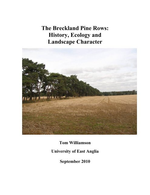
<strong>The</strong> <strong>Breckland</strong> <strong>Pine</strong> <strong>Rows</strong>:<br />
History, Ecology and<br />
Landscape Character<br />
Tom Williamson<br />
University of East Anglia<br />
September 2010
Acknowledgements<br />
Much of the fieldwork on which this report is based was carried out by Sarah Harrison,<br />
and much of the archive research by Annie Sommazzi. Thanks also to the staff of the<br />
Norfolk and Suffolk Record Offices, for their help and advice; and to Gerry Barnes, Peter<br />
Holborn, Gilbert Addison, Ian Featherstone and Scott Perkin for their comments on an<br />
initial presentation of these results in June 2010.<br />
<strong>The</strong> project was made possible with funding support from: the Norfolk <strong>Biodiversity</strong><br />
Partnership; <strong>Breckland</strong> Council; Norfolk County Council; Suffolk County Council; and<br />
Forest Heath District Council.
Introduction: <strong>Breckland</strong> and its <strong>Pine</strong> <strong>Rows</strong>.<br />
To understand the pine rows of <strong>Breckland</strong>, the subject of this short report, requires a brief<br />
discussion of the region’s wider landscape history. <strong>Breckland</strong> is a distinctive area of<br />
south west Norfolk and north west Suffolk, distinguished by particularly dry and often<br />
acidic soils which are formed in sandy Aeolian drift overlying chalk or, in places, boulder<br />
clay. It is the most agriculturally marginal region of East Anglia, idiosyncrasies of<br />
climate compounding the problems posed to cultivators by acid and infertile soils: frosts<br />
have been recorded in every month of the year (Hodge et al. 1984, 27-34). Even at the end<br />
of eighteenth century, to judge from the county maps published by Faden (for Norfolk in<br />
1797) and Hodskinson (for Suffolk in 1783) well over 40 per cent of <strong>Breckland</strong> was still<br />
occupied by heathland (Wade Martins and Williamson 1999, 13). From at least the<br />
fourteenth century, large areas were used for warrens, and the intensive grazing of the<br />
rabbits could lead to the formation of mobile sand dunes: William Gilpin, visiting the<br />
area in the 1760s, described ‘sand, and scattered gravel, without the least vegetation; a<br />
mere African desert’. <strong>The</strong>re were, nevertheless, numerous settlements, and the more<br />
calcareous soils (mainly located within the principal valleys) were, well into the postmedieval<br />
period, occupied by arable open fields, in which the strips of farmers were<br />
intermingled with varying degrees of regularity. <strong>The</strong> fields were dunged by extensive flocks<br />
of sheep, grazed by day on the heaths and close-folded on the arable by night. But in<br />
addition to the permanent areas of arable land, and the permanent heaths, large areas were<br />
farmed as temporary outfields, or ‘brecks’, the organisation of which may have become<br />
more systematic and organised from late medieval times (Bailey 1989; Postgate 1962). By<br />
the seventeenth century, regular rotations were imposed on the outfields: they were<br />
ploughed for a specified number of years and then allowed to tumble down to heath once<br />
more.<br />
<strong>The</strong> population of this marginal area declined significantly in post-medieval times, and on<br />
the worst soils some settlements experienced severe contraction. Wordwell in Suffolk was,<br />
by 1736, little more than a single farm, ‘the chief profits whereof arise from a flock of<br />
sheep, the soil being for the most part a barren dry heath, a very bleak place’ (Wade<br />
Martins and Williamson 1999, 13). Such places fell under the control of large<br />
landowners, and by the eighteenth century the area was peppered with large numbers of<br />
country houses and landscape parks. From the eighteenth century, and especially from the<br />
end of that century, such individuals engaged in ambitious schemes of improvement and<br />
land reclamation: heaths and open fields were enclosed, and replaced by a mesh of<br />
rectilinear fields, new roads were often laid out and old ones terminated, tidied up or<br />
realigned. On the better soils of the district, where larger communities survived and<br />
landholding patterns were more complex, similar schemes of enclosure and reclamation<br />
were carried out but often slightly later, in the early years of the nineteenth century, and<br />
usually effected using parliamentary enclosure acts. By the 1830s few areas of open field<br />
survived, although extensive heaths and warrens remained, on land too poor to be<br />
effectively reclaimed. Large landowners in this period also planted belts and plantations,<br />
initially around their parks and mansions, later more widely. <strong>The</strong> late eighteenth-century<br />
owner of Riddlesworth in Norfolk, the appropriately named Sylvanus Bevan, reputedly<br />
planted 996,000 trees in and around the park (Young 1804, 383). Not all ‘improvements’,<br />
and in particular the more spectacular reclamation schemes, were motivated solely by
economic considerations. When in 1774 Thomas de Grey bemoaned the costs of enclosing<br />
the heaths at Tottington in <strong>Breckland</strong> he observed that the ‘great expense ... would but ill<br />
answer, unless there was a real satisfaction in employing the labourers and bringing forth a<br />
ragged dirty parish to neatness and cultivation’ (NRO WLS XXLVII/19 415).<br />
With the onset of the agricultural depression in the 1880s much of the heathland<br />
reclaimed during the previous century or so was abandoned. A comparison of the tithe<br />
award maps of c.1840, and the First and Second Edition OS 6” maps of c.1885 and 1905,<br />
reveal numerous areas, especially in <strong>Breckland</strong>, which passed from arable back to rough<br />
grazing. Further retrenchment occurred in the course of the twentieth century and the<br />
Croxton Park estate in Norfolk was not unusual in being described in 1929 as comprising<br />
‘partly heath and partly low grade arable or pasture land which has passed, or is about to<br />
pass, out of cultivation’ (Forestry Commission Archives, Santon Downham. Croxton Park<br />
Acquisition Report, 1928 (no catalogue number). Effective abandonment of farming in the<br />
heart of <strong>Breckland</strong> did not mean complete dereliction. Many large estates diversified,<br />
becoming in effect large game farms, profitably leased for the shooting season. But many<br />
landowners, their rent rolls falling dramatically, were in serious financial difficulties.<br />
<strong>The</strong> depression had important effects upon the character of the heaths. <strong>The</strong> numbers of<br />
sheep being kept on farms often declined, so that land was less intensively grazed than<br />
before. <strong>The</strong> amount of bracken increased and so, more importantly, did the height of the<br />
heather, and in the patches of bare ground between over-mature stands hawthorn, sloe,<br />
and birch began to establish themselves and, in places, Scots pines, invading from<br />
adjacent plantations. Unchecked by grazing, these were able to grow into substantial<br />
bushes or trees. <strong>The</strong> number of belts and plantations on the heaths also seems to have<br />
increased, partly because landowners wanted to provide more cover for pheasants but<br />
also because some felt that timber would make a better long term investment than<br />
farming. But it was from the 1920s that the area under trees really began to expand. <strong>The</strong><br />
Forestry Commission was established in 1921 as a consequence of the severe timber<br />
shortages experienced during the First World War (Ryle 1969; Skipper and Williamson<br />
1997). <strong>The</strong> Commission began to acquire land in <strong>Breckland</strong> in 1922, when 1,275 hectares<br />
of the Elveden estate were purchased. This was rapidly followed by the acquisition of the<br />
4,944 Downham Hall estate in 1923; and of the 6,208 acres Lynford estate, and 822 acres<br />
of the Beechamwell estate, in 1924. By 1929 the Commission owned some 40,000 acres<br />
in the district, mostly in the area to the north and west of <strong>The</strong>tford. Almost all was<br />
purchased in the form of large continuous blocks of land - large chunks of, or the entire<br />
area of, impoverished landed estates. After a short pause, enforced by changes in<br />
government policy, acquisition of land resumed in 1934 with the purchase of the Culford<br />
estate between Bury St Edmunds and <strong>The</strong>tford. By 1939, including land held on long<br />
leases, the Commission controlled no less than 59,000 acres in <strong>Breckland</strong> (Public<br />
Records Office FC 54386/4; FC 374/24. Forestry Commission Archives, Santon<br />
Downham, FC L3/1/1; L3/3/9; L3/3/15. Skipper and Williamson 1997, 18-26).<br />
<strong>The</strong> pine rows, still often referred to locally as the ‘deal rows’, are a distinctive feature of<br />
the <strong>Breckland</strong> landscape. <strong>The</strong>y may be defined as single rows of Scots pine trees (Pinus<br />
sylvestris) which exhibit varying degrees of twisting and contortion. Some are associated<br />
with low banks but the majority are not. <strong>The</strong> rows have quite rightly been singled out by
numerous writers on topography and landscape history as a major contributor to the<br />
region’s ‘sense of place’. To Ravensdale and Muir, the ‘tattered friezes of Scots pines …<br />
are the hallmark of the landscape’ (Ravensdale and Muir 1984, 204); while to Armstrong<br />
‘the isolated rows of Scots pine trees, standing out from the bracken of the remaining<br />
heathland, remains a typical feature of the East Anglian scene’ (Armstrong 1985, 53).<br />
Most commentators agree that the rows were originally planted as hedges, which have<br />
gradually grown out. Today only a handful of examples are still recognisably hedges,<br />
mainly near Elveden in Suffolk. Of course, the rows are only one of several ways in<br />
which pines are present in the <strong>Breckland</strong> landscape. In many areas, as noted, narrows<br />
strips of woodland, usually referred to as belts, are to be found, mostly created as game<br />
cover in the middle and later nineteenth, and early twentieth, centuries; while from the<br />
1920s extensive tracts were planted up as pine plantations, usually across former heath or<br />
arable lying derelict as a consequence of the agricultural depression, by the Forestry<br />
Commission. Although Scots pines were steadily replaced by Corsican in the course of<br />
the 1930s as the Commission’s preferred tree, and were never the only tree established in<br />
the <strong>Breckland</strong> forests, extensive areas of mature sylvestris woodland still remain in the<br />
district. <strong>Pine</strong> rows, it should perhaps be emphasised, are not entirely restricted to<br />
<strong>Breckland</strong>. Within East Anglia, there is also a rather smaller concentration in the southern<br />
part of the Suffolk ‘Sandlings’ (i.e., the Suffolk coastal heaths), especially in the area<br />
immediately to the south of Butley and, widely scattered, in the triangle formed by Alderton,<br />
Hollesley, and Sutton. <strong>The</strong>re are also scattered examples elsewhere in East Anglia, in areas<br />
of relatively light and freely-draining soils: to the south of Bury St Edmunds, in the parish of<br />
Westley; and on the chalk escarpment at various places to the south west of Newmarket.<br />
Only in <strong>Breckland</strong>, however, are pine rows characteristic and common features of the<br />
landscape.<br />
As noted, there is general agreement that the pine rows represent the outgrown remains of<br />
what were originally pine hedges: indeed, a few examples survive as such, although fast<br />
growing out into lines of trees, principally on the Elveden estate. <strong>The</strong> historical ecologist<br />
Oliver Rackham discussed the rows briefly in his History of the Countryside (1986, 223-4).<br />
A definite example of hedgerow trees arising by default are the rows of Scots<br />
pines, all much the same age and all gnarled at the base, which are the<br />
characteristic field boundaries of the <strong>Breckland</strong>. When the open fields and some<br />
of the commons of the <strong>Breckland</strong> were enclosed in the early nineteenth century, it<br />
was the fashion to make new hedges of pine …[but] even a few years’ neglect<br />
causes pines to grow up irrevocably into trees.<br />
But this ‘late’ origin of the pine rows has never in fact been unequivocally demonstrated,<br />
and some writers have favoured an earlier origin. In particular, Sussams and others have<br />
noted how in 1668 Thomas Wright described his use of ‘Furre-hedges’ to reduce the<br />
progress of the famous sand blow that engulfed much of the parish of Santon Downham<br />
(Sussams 1996, 105); some have suggested that pine hedges were a traditional, long-lived<br />
feature of the local farming landscape, and that the present pines might thus perpetuate<br />
links with the Scots pine which – mixed with other native tree species – formed part of<br />
the natural vegetation of <strong>Breckland</strong> in remote prehistory. Conversely, Clarke in 1908 was
confident that the rows had only been planted on a large scale ‘since about 1840’ (Clarke<br />
1908, 563), thus implying a later date of origin than that proposed by Rackham. In<br />
addition, even a cursory examination of the pine rows reveals a considerable degree of<br />
variation in growth patterns, and presumably management history. At one extreme we<br />
have highly contorted examples, twisted into dramatic shapes, which are particularly<br />
characteristic of roadside examples; at the other, lines of trees displaying a very slight<br />
‘twist’, if any.<br />
Several questions thus remain concerning both the origins, and subsequent history, of the<br />
pine rows. Equally neglected, however, is the question of their distribution. Although the<br />
rows are often thought to be quintessential features of the <strong>Breckland</strong> landscape, they are<br />
not evenly distributed across the region. <strong>The</strong>re are noted ‘hot spots’, as we shall see, most<br />
notably in and to the south of the parish of Cockley Cley in Norfolk (in the far north of<br />
<strong>Breckland</strong>), and to the south west of Elveden, in Suffolk. Indeed, the location of the latter<br />
cluster, to either side of the A11 – one of the major gateways to East Anglia – may in part<br />
explain the prominence of the pine rows in popular images of <strong>Breckland</strong>. In contrast,<br />
many other <strong>Breckland</strong> parishes have few examples, or none. So far as we are aware, no<br />
previous attempt has been made to map the rows, and the main purpose of this project<br />
was to provide as accurate as possible a picture of their current distribution.<br />
Lastly, virtually nothing has been written in the past about the possible importance of the<br />
pines in terms of biodiversity. <strong>The</strong> research described in this report was carried out by<br />
landscape historians, and considers the pines principally in terms of their place in the<br />
cultural landscape. But we do make some comments on their possible importance in<br />
ecological terms, derived in large part from an examination of the somewhat sparse<br />
published literature.<br />
In summary, the aims of this research were thus to answer the following questions:<br />
• Where were the pine rows planted?<br />
• When were they planted?<br />
• Why were they planted?<br />
• What explains the clear variations in their form and character?<br />
• Were all surviving examples originally managed as hedges?<br />
• What is the significance of the pine rows for biodiversity?<br />
In reality these questions are not separate, but interconnected in complex ways. Thus the<br />
question of where the rows are found has, as we shall see, an important bearing on their<br />
antiquity; while the significance of the rows for biodiversity is, at least in part, a function<br />
of the age of the trees.<br />
<strong>The</strong> Distribution of the <strong>Pine</strong> <strong>Rows</strong>.<br />
Mapping Methodology. It was originally thought that the pine rows could be mapped<br />
from the air, using a combination of Google Earth images and other aerial photographs<br />
(most notably the surveys made for the respective county councils in the late 1980s). In<br />
practice this proved impossible. Although some pine rows are identified with ease from
Figure 1: <strong>The</strong> Distribution of <strong>Pine</strong> <strong>Rows</strong> in <strong>Breckland</strong><br />
the air, in most cases it proved difficult to distinguish, with any degree of confidence,<br />
lines of pines from other forms of field edge vegetation, especially outgrown hawthorn or<br />
mixed-species hedges, or even lines of scrub. Aerial photographs were employed, but in<br />
all cases the evidence they provided was supplemented by ground checking, and many<br />
rows were identified on the basis of ground observation alone, albeit often from a<br />
distance. It is important to emphasise that we do not claim to have identified every pine<br />
row surviving in <strong>Breckland</strong> today. Given the available budget, time allowed only<br />
examination from roads and footpaths. Some pine hedges in the more remote and<br />
inaccessible parts of the region may thus have been missed. In addition, the distributions<br />
presented here are likely to be biased by three other factors:<br />
• Some pine rows were expanded, after they had been planted, to form belts of pine.<br />
Although close examination usually reveals the original row running along one<br />
side of the feature – and indeed, in a large number of cases these can be identified<br />
easily even from a distance – given the nature of the survey methods it is likely<br />
that several such rows have been missed.<br />
• Some pine rows might be hidden within the large blocks of pine forest established<br />
by the Forestry Commission in the 1920s and 30s. Some examples were identified<br />
in such locations, but they were few in number. On balance, it is unlikely that<br />
large numbers will have escaped detection in this way. Many of the pine rows<br />
were probably still being managed as hedges when the forest were first planted,<br />
and may thus have been overshadowed by the surrounding plantings. Examples<br />
which were already outgrown, or which did manage to thrive and develop into
Figure 2. <strong>Pine</strong> row expanded into belt, Eriswell.<br />
trees, will either have been removed during ‘beating up’ and thinning operations,<br />
due to their misshapen form; or, if they survived, felled with their neighbours at<br />
the end of the first rotation, in the last decades of the twentieth century.<br />
• Although we have so far described the pine rows as a discrete and easily defined<br />
landscape feature, in reality there are a number of variant and intermediate forms,<br />
hard to classify. For example, in a number of cases closely parallel staggered rows<br />
of pines have been noted, difficult to categorise as either pine rows or as narrow<br />
belts. In addition, line of pines sometimes occur within a matrix of other shrubs or<br />
trees. Good examples line both sides of the road called Spalding’s Chair Hill to<br />
the south of Rushford in Suffolk: here close set-pines occur, but with no evidence<br />
that they have ever been managed as hedges, and separated by outgrown hedges<br />
featuring privet, hawthorn and blackthorn.<br />
In spite of inconsistent recording of such anomalous features, and the possible omission<br />
of genuine pine rows from the more inaccessible areas (especially within the larger<br />
forestry blocks), we are reasonably confident that at least 85% of examples have been<br />
mapped, and certain that no significant concentrations will have been missed. This makes
Figure 3: <strong>Pine</strong> rows, plantations, airfields and built-up areas<br />
r
the distribution map presented as Figure 3 particularly interesting, for it is immediately<br />
apparent that there are major discontinuities in the occurrence of the pine rows. Some of<br />
these can be explained by the presence of the Forestry Commission plantations or the<br />
large military bases at Mildenhall and Lakenheath: any rows that once existed within<br />
these areas have largely disappeared. <strong>The</strong> disappearance of pine rows from the forest<br />
areas has already been discussed; in the case of the air bases, including their associated<br />
residential areas, removal was evidently systematic and thorough (in contrast, pine rows<br />
can survive remarkably well within urban areas, in Brandon, Mildenhall and in particular<br />
within <strong>The</strong>tford, where the designers of the overspill areas in the 1960s evidently took<br />
great pains to incorporate existing planting within the new developments wherever<br />
practicable).<br />
Figure 4: <strong>The</strong> distribution of pine rows and soil type.<br />
However, while the Forestry Commission plantations and the military bases explain<br />
many of the apparent lacunae in the distribution of pine rows, as Figure 3 clearly<br />
indicates they cannot explain them all. <strong>The</strong>re are many parishes in <strong>Breckland</strong> which are<br />
characterised largely or entirely by arable fields, but which nevertheless contain few or
no examples. One possible explanation is that the pine hedges were only planted on<br />
particular types of soil and, indeed, a number of writers have suggested, or implied, that<br />
Scots pine was favoured as a hedging plant in the area because it thrives in acid<br />
conditions, implying in turn that it would be more likely to be employed for enclosing<br />
land reclaimed from heaths, than land taken out of the open fields.<br />
As Figure 3 indicates, however, there is little correlation between the distribution of pine<br />
rows, and that of particular soil types. While they are numerous on the leached, acid soils<br />
of the Newport 4, Methwold or Worlington Associations, they can also be found in some<br />
numbers on the more calcareous soils of the Newmarket 1 and 2 Associations – the better<br />
arable soils, farmed as open-field arable in the Middle Ages, and in many places up until<br />
the nineteenth century. What is more surprising is that small but significant numbers<br />
occur on the peat fens immediately to the west of <strong>Breckland</strong>, especially in Mildenhall.<br />
Evidently, the location of the pines was not determined by environmental factors, and the<br />
choice of pine as a hedging plant was one shared by landowners living well beyond the<br />
boundaries of <strong>Breckland</strong> proper.<br />
Figure 5. <strong>Pine</strong> rows and parish boundaries in the Elveden/Icklingham area.<br />
Another approach is to examine the distribution of the pine rows in terms of aspects of<br />
ownership and tenure. In this context the most notable feature is the relationship with<br />
parish boundaries. <strong>The</strong> concentrations of pine rows are nested neatly within the<br />
boundaries of ecclesiastical parishes, as these existed in the early and middle decades of<br />
the nineteenth century: and in a more general sense there are signs of dramatic<br />
discontinuities at parish boundaries. Particularly striking in this respect is the<br />
concentration, already emphasised, lying to the south west of Elevden, for this is largely
contained within Eriswell and Icklingham, and while extending into the northern parts of<br />
Mildenhall (the old township of Wangford) it stops abruptly at the boundaries of<br />
Lakenheath, Lackford, West Stow and Wordwell (Figure 4). In a similar way, the marked<br />
concentration around Cockley Cley in Norfolk – which the map reveals is actually<br />
centred more on the adjacent parish of Gooderstone – resolutely fails to extend into the<br />
adjoining parishes of Oxburgh, Foulden, and Hilborough.<br />
<strong>The</strong> Antiquity of the <strong>Pine</strong> <strong>Rows</strong><br />
<strong>The</strong> most obvious explanation for this relationship with parish boundaries is that the<br />
distribution of the pine rows reflects the planting policy of particular estates, which were<br />
themselves often conterminous with parishes or groups of parishes. At first sight such an<br />
explanation seems convincing: the two main concentrations, around Cockley Cley and<br />
Elveden, could thus be associated with the large landed estates based on Cockley Cley<br />
Hall and Elveden Hall respectively. Closer inspection, however, soon reveals that this<br />
cannot be correct. Although the Elveden estate now includes much land in Eriswell and<br />
Icklingham, this was not the case in the early and middle years of the nineteenth century.<br />
Icklingham was then owned, almost in its entirety, by the Gwilt family, while Eriswell<br />
was in divided ownership, but with the Company for the Propagation of the Gospel in<br />
New England, no less, as the main owner (Postgate 1960).<br />
An alternative explanation would link variations in distribution to the chronology of<br />
enclosure – that is, the replacement of a landscape of arable open fields, brecks and heaths,<br />
with one of enclosed fields owned and occupied in severalty: for in general terms each<br />
parish has its own enclosure chronology, different (often radically so) from that of its<br />
immediate neighbours, so that the age of field boundaries can change dramatically at<br />
parochial boundaries.<br />
<strong>The</strong> enclosure history of the <strong>Breckland</strong> parishes is complicated. Because many settlements,<br />
especially in the centre of the region, experienced severe contraction or desertion in the 14 th ,<br />
15 th and 16 th centuries, they often became the sole property of particular proprietors, and<br />
were thus technically enclosed – in the sense that they had a single freehold owner and no<br />
common rights – long before the eighteenth century. However, the date at which (and extent<br />
to which) they were enclosed in physical terms displays much variation. Some were divided<br />
into fields at an early date, such as Buckenham Tofts, shown on an estate map of 1700<br />
(NRO Petre Mss Box 8). But others often remained physically unenclosed into the<br />
nineteenth century, their arable land remained as open fields, with intermixed strips held by<br />
tenants, while their heaths continued open and unreclaimed. Such landscapes were often<br />
transformed during the early nineteenth century, when grain high prices and a fashionable<br />
concern for ‘improvement’ saw the removal of common arable, and large-scale (if often<br />
short-lived) reclamation of heathland.<br />
Other parishes, particularly towards the perimeter of <strong>Breckland</strong>, were enclosed by<br />
parliamentary act in the late eighteenth and nineteenth centuries, with the actual award –<br />
fixing the new pattern of boundaries, and dividing the land between the various proprietors<br />
and common-right holders – usually coming between three and eight years later. By the<br />
terms of each award, the allotments given to landowners in lieu of land in the open fields,
and lost common rights, generally had to be fenced or hedged within twelve month. This<br />
does not, however, mean that every boundary in a parish dates to the year of, or immediately<br />
following that of, the award. This is because the individual allotments of land were often<br />
very big, and were only later subdivided into more manageable fields by landowners.<br />
Indeed, whenever or however enclosure was achieved, further modifications to the field<br />
pattern were often made – hedges added, or taken away – throughout the nineteenth century.<br />
Figure 6. <strong>Pine</strong> rows and enclosure history. Orange: <strong>Breckland</strong> parishes enclosed by<br />
non-parliamentary means. Green: <strong>Breckland</strong> parishes enclosed by parliamentary<br />
act before 1801. Grey; parishes enclosed by parliamentary act after 1800.<br />
It is against the background provided by this brief review of local enclosure history that we<br />
need to examine the distribution of the pine rows. On Figure 6, the <strong>Breckland</strong> parishes are<br />
divided into three categories: those enclosed by parliamentary awards dating to the period<br />
before 1800; those with parliamentary enclosures after 1800; and those enclosed by nonparliamentary<br />
means. It is immediately apparent that pine rows are rare in the first category,<br />
occur to very varying extents in the third, but are very closely correlated with the second: a<br />
strong indication that they were largely, if not entirely, planted in the period after 1800. We<br />
can, however, to some extent refine this chronology further. <strong>The</strong> two parishes which contain<br />
the largest numbers of rows, Eriswell and Icklingham, were enclosed in 1818 and 1816<br />
respectively. Other parishes with significant concentrations were enclosed around the same<br />
time: Freckenham in 1820, Feltwell in 1815, and Hockwold in 1818. Indeed, only three<br />
parishes with significant concentrations of pine rows were enclosed by earlier awards:<br />
<strong>The</strong>tford in 1806, Gooderstone in 1805, and Methwold in 1807. 1 This strongly suggests<br />
1 Mundford was enclosed by an act of 1806 but the date of the actual award is unknown.
that the peak period for planting was in the years between 1815 and 1820, but leaves<br />
unresolved how much earlier the practice actually began.<br />
Figure 7. Extract from the enclosure map for Gooderstone (1805), showing modern<br />
location of pine rows. Purple; pine row on boundary of allotment. Red; pine row<br />
forming later subdivision of allotment.<br />
Closer examination of the Gooderstone enclosure map (NRO C/Sca 2/132) throws some<br />
light on this question (Figure 7). It is apparent that relatively few of the pine rows<br />
correspond with the boundaries of the actual allotments: most are subdivisions of<br />
allotments. <strong>The</strong>re are a few exceptions, but interestingly some of these only run along<br />
part of a boundary between adjacent allotments, perhaps indicating that they represent<br />
later replacements for failed hawthorn hedges. At the very least, the pattern implies that<br />
the use of pine hedges was only just beginning when the enclosure took place in 1805,
and it is noteworthy that with few exceptions the ‘rows’ are found within, or on the<br />
boundaries of, one of the several owners who received land (the Dowager Duchess of<br />
Essex): her local agent, perhaps, was an individual fully abreast of the latest agricultural<br />
fashions.<br />
As already noted, parishes enclosed by non-parliamentary means often have poorlydocumented<br />
enclosure histories, but some light can be thrown on the antiquity of their field<br />
boundaries by using larger-scale maps: most notably, William Faden’s map of the county of<br />
Norfolk, published in 1797; Hodskinson’s Suffolk map of 1783; and in particular the<br />
unpublished draft 2”:1 mile drawings prepared by the Ordnance Survey at various times<br />
between 1810 and 1820. None of these maps shows boundaries with any accuracy, although<br />
the OS shows field patterns in a partial and schematic way. All, however, carefully<br />
distinguish between roads enclosed by hedges, and those which were unenclosed; and they<br />
also show areas of surviving heathland. On Figure 6, two parishes enclosed by nonparliamentary<br />
means stand out as having particularly dense concentrations of pine rows:<br />
Elveden in Suffolk and Cockley Cley in Norfolk. In Cockley Cley, most of the pine rows<br />
occur on roadsides, although a substantial minority are field boundaries. Almost all the<br />
roads in the parish, and all the roads on which the rows appear, are shown as unenclosed on<br />
Faden’s map, and also on the Ordnance Survey 2” draft. <strong>The</strong> fact that the roads were<br />
unenclosed indicates that much if not all of the land lying in between them also lay open,<br />
and some of the pine rows clearly lie within areas shown on both maps as open heath. In<br />
Elveden the situation is similar: here, too the pine rows occur on the sides of roads shown as<br />
unenclosed both on Hodskinson’s map of 1783, and on the Ordnance Survey draft drawings.<br />
Here, however, the maps also indicate that most if not all of the areas in which the other<br />
rows were located as open heath.<br />
Less pronounced clusters of pine rows appear in Didlington, West and East Wretham, and<br />
Snarehill, and here too the pattern is repeated: pine rows occur on roadsides shown as<br />
unenclosed on the various large-scale maps, and in some cases in areas shown as open<br />
heath. Only a few examples occur in other locations, and there is little reason to doubt that<br />
these, too, still lay open at the time, as common arable. In short, the cartographic evidence<br />
from these less well documented parishes, such as it is, supports that from those enclosed by<br />
parliamentary act, suggesting strongly that few if any of the pine rows originated before<br />
1800.<br />
<strong>The</strong> only piece of evidence that has been produced to suggest an earlier date for pine hedges<br />
in the region, and which implies that they might be a ‘traditional’ form of enclosure, comes<br />
from the late seventeenth century. As already noted, Kate Sussams and others have noted<br />
how as early as 1668 Thomas Wright described his use of ‘Furre-hedges’ to reduce the<br />
progress of the famous sand blow that engulfed much of the parish of Santon Downham<br />
(Sussams 1996, 105). But it is difficult to believe that a landowner would improvise a<br />
barrier to a moving sand dune by planting a hedge of any kind – the sands were moving<br />
quickly, and would not wait while the plants matured into a significant obstacle. Almost<br />
certainly, Wright was describing the creation of dead hedges of staked gorse – locally<br />
known as furze. Gorse was widely used to make, or gap up, fences or hedges. John
Figure 8. Above: the eastern side of Cockley Cley, as depicted on William Faden’s<br />
map of Norfolk, 1797. Below, the same area today, showing location of pine rows.<br />
<strong>The</strong> maps are hard to compare closely – Faden is schematic – but it is evident that<br />
most pine rows occur today on the sides of roads which either did not yet exist, or<br />
were unbounded, at the end of the eighteenth century.
Figure 9. Above, the area to the west of Elveden, as depicted on the Ordnance<br />
Survey draft 2” drawings of c.1815. below, the area today, showing the distribution<br />
of pine rows. Note how almost all occupy areas which were still, in c.1815, open<br />
heath.
Norden, who had long experience of East Anglia, described in his Surveyors Dialogue of<br />
1618 how it was used ‘to brew withall and bake, and to stoppe a little gap in a hedge’<br />
(Norden 1618, 234). What is particularly striking in this context is that pine hedges<br />
receive no mention in Nathaniel Kent’s General View of the Agriculture of the County of<br />
Norfolk (1796) or Arthur Young’s 1804 book of the same name, the latter in particular<br />
usually keen to describe the novel or unusual. In contrast, Richard Bacon, in his Report<br />
on the Agriculture of Norfolk of 1844, refers to ‘fences of Scotch fir’ as if they were a<br />
well-established part of the <strong>Breckland</strong> scene (Bacon 1844, 392).<br />
<strong>The</strong> evidence thus suggests that pine hedges were first planted in the region some time<br />
around 1800; and that the peak period of planting was between 1815 and 1820. <strong>The</strong> fashion<br />
may have continued on some scale into the 1820s, to judge from the only surviving<br />
description of the planting of the rows so far discovered. In 1829 the Suffolk traveller<br />
David Davey described how:<br />
Within two miles of Brandon I observed a mode, to me at least new, of raising a<br />
good fence in a very bad soil; a bank is thrown up, about four or five feet high,<br />
and of a considerable thickness at the bottom; upon the top of this is planted a row<br />
of Scotch firs, as thick almost as they can stand; these seem to make rapid<br />
progress in this soil and branching out towards the sides, immediately from the<br />
ground, and have the additional very strong recommendation of affording the best<br />
shelter from storms to the sheep and cattle which are fed, or rather starved upon<br />
the land (Blatchley 1982, 136).<br />
<strong>The</strong>re are also signs that hedges continued to be established, on a sporadic basis, through<br />
the nineteenth and into the twentieth century. Those bordering the A11 to the south west<br />
of the Elveden Monument, for example, do not appear to have existed in 1880, as the<br />
road is shown on the First Edition Ordnance Survey as unenclosed.<br />
It is not entirely clear why pines should have been widely used as a hedging plant in<br />
<strong>Breckland</strong>. Scots pines grow well on the poorer soils, but so too does hawthorn: and<br />
while it is possible that the hedges were intended to provide shelter for crops and restrict<br />
soils erosion it is noteworthy that the ‘rows’ are by no means restricted to the lightest<br />
sands, but can also be found in the more calcareous areas, and even in areas of drained<br />
fen to the west of <strong>Breckland</strong> proper. As already noted, not all aspects of the aristocratic<br />
transformation of the <strong>Breckland</strong> landscape in the later eighteenth and nineteenth can be<br />
explained in practical and economically rational terms, and it is possible that – like the<br />
sporadic attempts at creating irrigated water meadows in the region in this period – the<br />
planting of pine hedges was simply a fashion, perhaps initiated by one commercial<br />
nursery: a possible candidate would by the establishment run by Mr Griffin at Mundford,<br />
more or less central to the distribution of the rows (his name appears frequently in estate<br />
accounts, but no records of his company have survived). It is possible that the difficulties<br />
involved in maintaining hedges of pine became apparent fairly quickly, explaining the<br />
relatively short period over which the majority were planted.
<strong>The</strong> Management and Development of the <strong>Pine</strong> <strong>Rows</strong>.<br />
It is usually assumed that the pine rows were all managed as hedges into the twentieth<br />
century, and then gradually allowed to ‘grow out’. Locally, many believe that neglect<br />
began during the 1914-18 war, due to a shortage of labour; and continued through the<br />
inter-War years, when agriculture was, for the most part, in a state of depression. Such a<br />
link with the fortunes of the agriculture also invites the suggestion that decline may have<br />
set in before 1914, as an intense agricultural depression occurred in the decades after<br />
1880, which affected the poor soils of <strong>Breckland</strong> more than other areas in East Anglia.<br />
Figure 10. <strong>Pine</strong> hedge at Ickburgh, Norfolk, photographed by<br />
W.G.Clarke in 1923 (NRO MC 365).
<strong>The</strong>re are a few contemporary observations which give some clues to the chronology of<br />
abandonment. In 1908, W.G.Clarke strongly implies that most of the pine hedges were<br />
still being regularly managed. ‘<strong>The</strong>se hedges are made of ordinary trees kept stunted by<br />
constant trimming’. <strong>The</strong> only exceptions he seems to note are ‘many of the lines of fir<br />
trees now bordering plantations were originally hedges, but have ceased to be trimmed’<br />
(Clarke 1908, 563-4). As late as 1925 he implied that many were still being regularly cut,<br />
noting how pines were ‘still the characteristic tree of the district, planted either in rows<br />
known as ‘belts’, or artificially dwarfed as hedges’ (Clarke 1925, 17). A photograph by<br />
Clarke in the Norfolk Record Office, dated 1923, shows an example of a managed hedge<br />
in Ickburgh (Figure 10). By the 1930s, however, Butcher implies that many had been<br />
abandoned, describing how ‘the rows of trees are in all stages of development and<br />
degeneration: there are some very fine hedges along the Barton Mills-Elveden road and<br />
some very neglected ones around Cavenham and Icklingham which no longer fulfill their<br />
primary purpose’ (Butcher 1941, 353).<br />
<strong>The</strong>re is, however, abundant evidence that a significant proportion of the rows had been<br />
allowed to grow out long before this. A number of photographs showing storm damage<br />
on the Didlington estate, taken around 1900, show what appear to be tumbled lines of<br />
pine trees (Figure 10). More importantly, a significant number of the rows are shown as<br />
lines of conifers on the First Edition Ordnance Survey 6” maps from the 1880s. <strong>The</strong><br />
surveyors were instructed only to show mature trees, well beyond the sapling stage, thus<br />
indicating that the management of the rows in question must have been abandoned many<br />
years before (Figure 11). <strong>The</strong>ir distribution is broadly similar to that displayed today by<br />
the surviving pine rows as a whole within <strong>Breckland</strong> (Figure 12).<br />
Figure 10. Didlington, Norfolk. A photograph from c.1900 showing what may<br />
be a pine row brought down by a gale (NRO MC 84/133, PH7).
Figure 11. <strong>The</strong> area between Eriswell and Elveden, as shown on the Ordnance<br />
Survey 6” First Edition of c.1880. Note the lines of Scots pines, already outgrown.<br />
Figure 12. <strong>The</strong> distribution of outgrown Scots pine rows in <strong>Breckland</strong> as shown on<br />
the First Edition 6” Ordnance Survey maps of c.1880-90.
In this context, attention should again be drawn to the marked variation in the growth<br />
pattern of the trees in different rows, ranging from almost upright, with only a slight<br />
twist; to excessively contorted (Figure 13). Without exception, it is those rows made up<br />
of trees towards the ‘straight’ end of the range which are shown as lines of conifers on<br />
the OS maps. Those composed of the more contorted examples are not so shown,<br />
indicating that they were still being managed as hedges. This raises the possibility that<br />
some of the pine rows may always have comprised lines of separate, well-spaced trees,<br />
rather than hedges, but fieldwork suggests otherwise. In many cases, lines<br />
Figure 13. Variations in the growth pattern exhibited by Scots pines in the<br />
<strong>Breckland</strong> ‘rows’. Left, straight (<strong>The</strong>tford, Norfolk). Top right, contorted (Cockley<br />
Cley, Norfolk). Bottom right, excessively contorted (Barton Mills, Suffolk).<br />
composed of ‘straight’ trees include, interspersed with the full-grown specimens, stunted<br />
examples, and dead stumps, sometimes so closely spaced that they actually touch. In the<br />
example shown in Figure 14, in Eriswell, the live pines vary in size from 0.4 to 1.6<br />
metres in circumference at waist height, with dead examples and stumps ranging from 0.3<br />
to 0.6. Although displaying only a slight twist, and already depicted as a line of trees on<br />
the OS 6” map, this row was clearly planted as a hedge but, like the others in the<br />
immediate vicinity and many others in the area, was clearly not managed as one for very<br />
long, perhaps hardly at all.
Figure 14. Detail of pine row at Eriswell, Suffolk
Some of the pine rows boast trees with rather larger circumferences, in rare cases<br />
reaching as much as 3.7 metres. It is possible that, in these cases, some of the intervening<br />
trees were actively removed at an early stage, providing extra light and space for the<br />
remainder. In most cases, however, it appears that the rows have ‘thinned’ naturally,<br />
through the success for some trees and the gradual failure of neighbours.<br />
<strong>The</strong> Significance of the <strong>Pine</strong> <strong>Rows</strong>: <strong>Biodiversity</strong> and a Sense of Place.<br />
This survey and associated documentary and cartographic research were undertaken by<br />
landscape historians, rather than ecologist, and the comments that follow should be read<br />
in this light: they are based on a search of the relevant scientific literature combined with<br />
close observation of the rows’ morphology and physical character in the field.<br />
<strong>The</strong> <strong>Breckland</strong> pine rows have the potential to contribute to regional biodiversity in two<br />
ways. Firstly, it is theoretically possible that the trees themselves are genetically distinct,<br />
and represent direct lineal descendants from the pines which, together with oaks and<br />
other trees, formed an important element in the mosaic of woodland and more open<br />
habitats that developed in <strong>Breckland</strong> at the end of the last glaciation. <strong>The</strong> distinctive<br />
assemblages of beetles and fungi associated with them have suggested to some scientists<br />
that the species never entirely died out in East Anglia, as it apparently did elsewhere in<br />
lowland England during the Roman period (Dannatt 1996, 22). Secondly, the rows may<br />
have an importance as habitats, sustaining a range of rare or uncommon flora and fauna.<br />
<strong>The</strong> first issue can be dealt with quickly. Given that the rows were all, apparently, planted<br />
in the early nineteenth century, it is almost certain that they would have been sourced<br />
from the many commercial nurseries that had developed in East Anglia (and especially in<br />
Norfolk) by this period, establishments which acquired their stock from all over England,<br />
and indeed, from all over the world. Some pine trees certainly existed in the region before<br />
1800, and are shown as hedgerow trees on some early maps, such as that of the<br />
Walsingham estates in Tottington, surveyed in 1774 (NRO WLS XVII/4). Some<br />
examples referred to in a court case at Merton in 1772 were already 27’ high (NRO WLS<br />
XXXI/15/1 417X6). But no specific references to or representations of pines dating from<br />
before the late eighteenth century have so far been discovered, and it is thus highly<br />
probable that pines did not survive in the area through the Middle Ages, and into the<br />
early modern period.<br />
<strong>The</strong> second issue – the importance of the rows as habitats - is more complex. Scots pines<br />
are not rare in <strong>Breckland</strong> – as already noted, they are a major constituent of the extensive<br />
plantations established in the course of the twentieth century by the Forestry<br />
Commission, and they also feature to a significant extent in the woodland belts planted in<br />
the area in the course of the nineteenth and twentieth centuries. <strong>The</strong>se more extensive<br />
concentrations of pines have some clear advantages over the rows: hobby for example<br />
nest in the thicker pine belts, woodlark and nightjar nest in the plantations, but neither<br />
appears to favour the more open and exposed environment of the rows. <strong>The</strong> rows are<br />
potentially important for biodiversity, however, and for two main reasons.
Figure 15. <strong>Pine</strong> row with associated unploughed strip, Elveden.<br />
Firstly, many comprise not only a line of trees, but also an associated strip of tussocky,<br />
ungrazed grass. Such field margins are not uniquely associated with the rows, but they<br />
are closely associated with them: indeed, it is probable that the presence of mature lines<br />
of pines has served to preserve many such features from destruction through field<br />
amalgamation, in what is generally an intensively arable environment. <strong>The</strong>se strips are<br />
often of such a width that their central areas, at least, are only marginally affected by<br />
chemical sprays. More importantly, they are frequently crossed by tracks or disturbed by<br />
rabbits, thus perpetuating the ruderal conditions in which the most characteristic of the<br />
<strong>Breckland</strong> flora tend to thrive, having developed not in conditions of permanent<br />
heathland, but rather in that of the shifting, periodic cultivation which characterized the<br />
arable ‘brecks’ (Dolman 1994). <strong>The</strong>y are thus home to such characteristic <strong>Breckland</strong><br />
plants as flixweed, sand catchfly, Venus looking glass, and fine-leaved fumitory and for<br />
such national rarities as perennial knawel, spring speedwell, and grape hyacinth (Rothera<br />
1997)..<br />
<strong>The</strong> grass strips are also rich in insects, including several rare moths, whilst compacted<br />
sandy situations are important for solitary wasp species, and the earth banks associated<br />
with some of the rows hold important populations of beetles including such nationally<br />
rare species as Ophonus laticollis, many of which feed in the arable fields to some extent<br />
but survive and breed in the tussocky grass beneath the pines (Telfer 2008). <strong>The</strong>se<br />
fragments of grassland are also favoured by skylarks, grey partridges and other farmland
irds, as well as by hares. <strong>The</strong> pine rows, perhaps more than other field margins in<br />
<strong>Breckland</strong>, form important feeding territories for hawfinches and crossbills. <strong>The</strong>re is also<br />
some evidence that the rows are favoured by bats (pipistrelle and barbastelle especially)<br />
and perhaps Barn Owls, while – like farmland hedges of normal form – they may serve in<br />
important role as wildlife ‘corridors’, linking larger areas of woodland and unimproved<br />
grassland<br />
<strong>The</strong> invertebrates associated with the pines themselves have received less attention. In<br />
Rothera’s words, ‘these trees and their insects are not well studied’ (Rothera 1997).<br />
Nationally, it has been calculated that Scots pines have 91 associated insect species<br />
(compared with 41 for ash, 28 for hawthorn, but 284 for oak) (Southwood 1961). <strong>The</strong>y<br />
have 132 associated lichen species - again, in the UK as a whole (Rose and Harding<br />
1978). At a local level the numbers will be less than this and, as already emphasized,<br />
pines are not themselves rare in <strong>Breckland</strong>. However, it is now well-established that the<br />
biodiversity of individual trees increases with age, as cavities and areas of rotten wood<br />
proliferate in the body of the tree (Rose 1991; Kirby and Drake 1993); and this may be<br />
especially true of Scots pines which over time develop, not only large areas of dead wood<br />
and rotten material, but also large layered plates separated by deep fissures. This is the<br />
real value of the rows in terms of their pines: the trees they contain are, almost without<br />
exception, nearly 200 years old, and thus more than twice the age of the oldest surviving<br />
Forestry Commission plantings. Dead wood is particularly abundant given the fact that,<br />
as already emphasized, the rows frequently contain the stumps and broken trunks of<br />
failed trees, squeezed out by competitors; and, in the case of the more twisted and<br />
contorted examples, an abundance of fallen and broken branches (Figure 16).<br />
Figure 16. <strong>Pine</strong> row at Tuddenham, showing large amounts of dead wood.
In short, the antiquity of the rows, and the fact that many are associated with strips of<br />
tussocky grass, probably mean that they make a significant contribution to the region’s<br />
biodiversity. But perhaps more importantly, they contribute significantly to the region’s<br />
distinctive landscape, and thus to a local ‘sense of place’, things which have been given<br />
increasing prominence over recent decades not only by national government, but also by<br />
European directives. For all these reasons, the pines should be valued, preserved, and<br />
where possible perpetuated or restored.<br />
Conclusion<br />
<strong>The</strong> principal conclusions of this project may be summarised as follows:<br />
• <strong>The</strong>re is no evidence for the planting of pine ‘rows’ in <strong>Breckland</strong> before the early<br />
nineteenth century.<br />
• <strong>The</strong> peak period for planting was probably between c.1815 and c.1820.<br />
• Many of the rows were probably managed as hedges for only a short period of<br />
time: some may never have been so managed.<br />
• <strong>The</strong>re is no evidence that the pines making up the ‘rows’ constitute a genetically<br />
distinct group. <strong>The</strong> relatively late date at which they were planted suggests that<br />
they were obtained from commercial nurseries, which - by the nineteenth century<br />
- were sourcing plants from all over the country and sometimes beyond.<br />
• <strong>The</strong> ecological significance of the pine rows is insufficiently studied, but probably<br />
derives mainly from their associated strips of grass, and the age and condition of<br />
their constituent trees.<br />
• <strong>The</strong> pine rows are an important and characteristic feature of the <strong>Breckland</strong><br />
landscape, and every attempt should be made in the future to protect and<br />
enhance surviving examples, and to establish new ones.<br />
• Further research is urgently needed into the character of the fauna, and<br />
especially the insects, associated with the mature pines which make up the<br />
‘rows’.
References<br />
Armstrong, P. 1985. <strong>The</strong> Changing Landscape, Lavenham.<br />
Bacon, R.N. 1844. <strong>The</strong> Report on the Agriculture of Norfolk, Norwich.<br />
Bailey, M 1989. A Marginal Economy? East Anglian <strong>Breckland</strong> in the Later Middle Age,<br />
Cambridge.<br />
Blatchley, J. (ed.) 1982. D.E.Davy: A Journal of Excursions through the County of Suffolk<br />
1823-1844. Suffolk Records Society Vol. 24, Woodbridge.<br />
Butcher, R.W. 1941. <strong>The</strong> Land of Britain: Suffolk. Geographical Publications, London.<br />
Clarke, W.G. 1908. ‘Some <strong>Breckland</strong> Characteristics’. Transactions of the Norfolk and<br />
Norwich Naturalists’ Society 8, 555-78.<br />
Clarke, W.G. 1925. In <strong>Breckland</strong> Wilds, Cambridge.<br />
Dannatt, N. 1996. ‘<strong>The</strong>tford Forest: its History and Development’. In P.Ratcliffe and<br />
J.Claridge (eds) <strong>The</strong>tford Forest Park: the Ecology of a <strong>Pine</strong> Forest, Edinburgh.<br />
Dolman, P. 1994. ‘<strong>The</strong> use of Soils Disturbance in the Management of Grass Heath for<br />
Nature Conservation’, Journal of Environmental Management 44, 123-40.<br />
Hodge, C, Burton, R, Corbett, W, Evans, R, and Scale, R 1984. Soils and their Uses in<br />
Eastern England, Harpenden: Soil Survey of England and Wales, 27-34.<br />
Kent, N. 1796. General View of the Agriculture of Norfolk, London.<br />
Kirby, K.J. and Drake, C.M. (eds) 1993. Dead Wood Matters, English Nature,<br />
Peterborough.<br />
Norden, J. 1618. <strong>The</strong> Surveyor’s Dialogue, London.<br />
Postgate, M.R. 1960. ‘<strong>The</strong> Historical geography of <strong>Breckland</strong>, 1600-1840’. University of<br />
London MA thesis, unpublished.<br />
Postgate, M R 1962. ‘<strong>The</strong> Field Systems of <strong>Breckland</strong>’. Agricultural History Review 10,<br />
80-101.<br />
Rackham, O. 1986. <strong>The</strong> History of the Countryside, London.<br />
Ravensdale, J. and Muir, R. 1984. East Anglian Landscapes: Past and Present, London.
Rose, F. 1991. ‘<strong>The</strong> Importance of Old Trees Including Pollards for Lichen Bryophyte<br />
and Epiphytes’, in H.J. Read (ed.) Pollard and Veteran Tree Management, London.<br />
Rose, F. and Harding, P.T. 1978. ‘Pasture and Woodlands in Lowland Britain and their<br />
importance for the conservation of the epiphytes and invertebrates associated with old<br />
trees’. Nature Conservancy Council and <strong>The</strong> Institute of Terrestrial Ecology,<br />
Peterborough.<br />
Rothera, S. 1997. ‘<strong>Breckland</strong>: Natural profile’. Available online at www.English-Nature.<br />
Ryle, G. 1969. Forest Service: the First Forty-Five Years of the Forestry Commission in<br />
Great Britian, Newton Abbot.<br />
Skipper, K. and Williamson, T. 1997. <strong>The</strong>tford Forest: Making a Landscape, 1922-1997,<br />
Norwich.<br />
Southwood, T.R.E. 1961. ‘<strong>The</strong> Numbers of Species of Insect Associated with Various<br />
Trees’. J. Animal Ecology 30, 1-8.<br />
Sussams, K. 1996. <strong>The</strong> <strong>Breckland</strong> Archaeological Survey, Ipswich.<br />
Telfer, M. 2008. ‘Monitoring Ophonus laticollis at Gallows Hill, <strong>The</strong>tford’: Final<br />
Report’. Available online at www.<strong>Breckland</strong>.gov.uk.<br />
www.<strong>Breckland</strong>.gov.uk<br />
Turner, M. 1980. English Parliamentary Enclosure, Folkstone.<br />
Wade Martins, S. and Williamson, T. 1999. Roots of Change: Farming and the<br />
Landscape in East Anglia 1700-1870. Exeter: British Agricultural History Society, 13.<br />
Williamson, T. 2005. Sandlands. Macclesfield.<br />
Young, A. 1797. General View of the Agriculture of Suffolk, London,<br />
Young, A. 1804. General View of the Agriculture of Norfolk, London.