mtnfury - slides 168 pdf - Civil Air Patrol
mtnfury - slides 168 pdf - Civil Air Patrol
mtnfury - slides 168 pdf - Civil Air Patrol

Create successful ePaper yourself
Turn your PDF publications into a flip-book with our unique Google optimized e-Paper software.
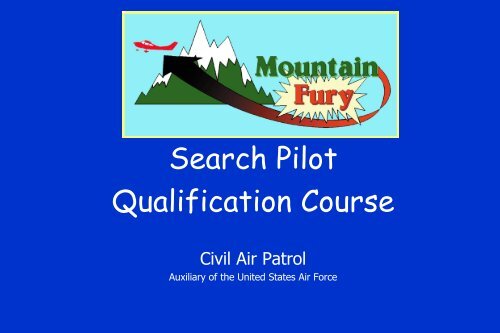
Search Pilot<br />
Qualification Course<br />
<strong>Civil</strong> <strong>Air</strong> <strong>Patrol</strong><br />
Auxiliary of the United States <strong>Air</strong> Force
Dedication<br />
Mountain Fury is dedicated<br />
to all the men and women of<br />
the <strong>Civil</strong> <strong>Air</strong> <strong>Patrol</strong> who have<br />
given their lives so that<br />
others may live
Course Objectives<br />
• Instruct <strong>Civil</strong> <strong>Air</strong> <strong>Patrol</strong> pilots to fly safely in<br />
mountainous terrain<br />
Instruct <strong>Civil</strong> <strong>Air</strong> <strong>Patrol</strong> Mission Pilots to<br />
safely and effectively search in mountainous<br />
terrain
Course Background<br />
• Specific skills are required to safely and effectively conduct<br />
mountain flight operations<br />
• The <strong>Civil</strong> <strong>Air</strong> <strong>Patrol</strong> frequently conducts flight operations in<br />
mountainous terrain<br />
• CAP pilots require academic and flight training in mountain<br />
flight operations<br />
• The Mountain Fury Process Action Team was convened from<br />
experts nationwide to develop CAP mountain search course,<br />
training requirements, and associated regulations<br />
• CAP HQ adopted course and associated regulatory changes
Process Action Team<br />
<strong>Civil</strong> <strong>Air</strong> <strong>Patrol</strong> Members<br />
Major Dave Widrig<br />
Major Bob Wright<br />
Captain Steve Philipson<br />
Captain Bill Cummings<br />
<strong>Civil</strong>ian Members<br />
Mr. Sparky Imeson<br />
Dr. John T. Lowry<br />
<strong>Air</strong> Force Members<br />
Major Mark Thompson<br />
Major Kevin Darroch
Course Content<br />
• Academic Blocks of Instruction<br />
– High Altitude Flying<br />
– Mountain Weather<br />
– Mountain Flying<br />
– Mountain Searching<br />
• Written Examination<br />
• Flight Training<br />
• Support Materials<br />
• Recurrency Training
High Altitude Flying<br />
• Pressure altitude<br />
• Density altitude<br />
• Predicting density altitude<br />
• <strong>Air</strong>craft performance<br />
• Maximum safe operating altitude<br />
• <strong>Air</strong>craft maneuvering<br />
• Physiological effects of altitude<br />
• Personal equipment
Mountain Weather<br />
• Slopes<br />
• Wind<br />
• Turbulence<br />
• Standing Wave<br />
• Clouds<br />
• Ceilings<br />
• Visibility<br />
• Thunderstorms<br />
• Weather forecasts
Mountain Flying<br />
• Flying with Mountain Winds<br />
• Exiting Downdrafts<br />
• Crossing ridges<br />
• Canyon Flying<br />
• Sensory illusions<br />
• Mountain <strong>Air</strong>port Operations<br />
• Night flying<br />
• Mountain Flying Safety
Mountain Searching<br />
• Route and ELT searching<br />
• Grid navigation<br />
• Search strategies<br />
• Contour searching<br />
• Steep valley searching<br />
• Effects of lighting<br />
• Actions upon target location<br />
• Crew consideration
Written Examination<br />
• 40 multiple-choice questions<br />
• Closed-book exam<br />
• Covers all material presented in ground school<br />
• Charts needed for reference will be provided<br />
• Seventy-percent passing score<br />
• Successful completion required prior to flying phase
Flight Training<br />
• Discover how aircraft performance changes with altitude<br />
• Learn techniques of mountain flying<br />
• Learn techniques of mountain search flying<br />
• Designed to be accomplished in four sorties<br />
• Specific but flexible training syllabus<br />
• Flown under the supervision of a Mentor Pilot<br />
• Grade sheets annotated following each flight<br />
• Concluded with Form 91 checkride
Support Materials<br />
• Ground school training presentation<br />
• Written test<br />
• Videotape<br />
• Course guide<br />
• Briefing guide<br />
• Flight training syllabus<br />
• Applicable regulations
• Recurrency Training<br />
Recurrency Training<br />
– Required every two years not involving refresher training<br />
– Review instructional material<br />
– Satisfactorily complete written examination<br />
– Satisfactorily complete Form 91 flight evaluation<br />
• Refresher/Reinstatement Training<br />
– Required every four years<br />
– Attend academic training<br />
– Satisfactorily complete written examination<br />
– Satisfactorily complete Form 91 flight evaluation
Definition: Mountain Flying<br />
For the purpose of this course,<br />
mountain flying constitutes flying<br />
and searching in close proximity to<br />
precipitous terrain
Pre-Flight Preparation<br />
• Accurate weight and balance<br />
• Weather<br />
– Current and forecast weather at departure and destination<br />
airports<br />
– Current and forecast weather, winds and temperature aloft<br />
– Density altitude at departure airport and operating altitudes<br />
• <strong>Air</strong>craft performance data<br />
– Takeoff and landing distance<br />
– Best rate and angle of climb speeds at takeoff and operating<br />
altitudes<br />
– Maximum safe search altitude, stall speed, turn radius, etc.<br />
• Thorough preparation is crucial for safe and effective<br />
mountain flying
Safety First !<br />
• Safety of flight operations in high altitude and<br />
mountain operations is paramount<br />
• To achieve this goal, a CAP mission pilot must<br />
know where and when to fly (and not to fly)<br />
• Consider density altitude, weather, terrain,<br />
aircraft performance, and the physiological<br />
limits of the crew before and during each flight<br />
• And always WATCH YOUR AIRSPEED!
BLOCK ONE<br />
High Altitude Flying
High-altitude flight operations differ significantly<br />
from those at lower flight levels, primarily due to:<br />
• Lower air pressure<br />
• Lower air temperature<br />
• Stronger winds<br />
• Different weather phenomenon
Pressure Altitude<br />
Pressure altitude is absolute<br />
altitude above mean sea level<br />
corrected for non-standard<br />
atmospheric pressure
Calculating P.A.<br />
PA = H - 925 x (S - 29.92), where<br />
PA = Pressure Altitude<br />
H = Absolute Altitude<br />
S = Barometric pressure corrected for altitude<br />
Example:<br />
9,000 absolute altitude, altimeter setting 28.50<br />
PA = 9,000 - 925 x (28.50 - 29.92)<br />
PA = 9,000 - 925 x (-1.42) Watch your ± sign!<br />
PA = 9,000 + 1,313<br />
PA = 10,313
Density Altitude<br />
Density altitude is pressure<br />
altitude corrected for non-<br />
standard temperature
Calculating D.A.<br />
DA = PA + 66 x (T - TS), where<br />
T = Actual temperature<br />
TS = Standard temperature<br />
Example:<br />
9,000 absolute altitude, 60°F, altimeter setting 28.50<br />
DA = PA + 66 x (60 °F - 22.2°F)<br />
DA = PA + 66 x 37.8<br />
DA = 10,313 (from previous example) + 2,495<br />
DA = 12,808
Predicting D.A.<br />
• Methods of determining altimeter setting<br />
– ATIS or AWOS for closest airport<br />
– Surface observation from FSS or DUATS<br />
• Methods of determining temperature aloft<br />
– Consult Winds and Temperatures Aloft forecast<br />
– Obtain local surface temperature, then subtract 3.5°F for<br />
each 1,000 feet of altitude above reporting point
Remember:<br />
As density altitude increases,<br />
the difference between<br />
indicated airspeed and true<br />
airspeed increases
Remember:<br />
As density altitude increases,<br />
available horsepower<br />
decreases
Horsepower -<br />
Cessna 182 -P Model<br />
Density Manifold Horsepower<br />
Altitude Pressure Available<br />
8,000 ft 20” 65%<br />
10,000 ft. 19” 62%<br />
12,000 ft. 17” 55%<br />
Based upon 2,400 rpm with new engine
Horsepower -<br />
Cessna 206 -G Model<br />
Density Manifold Horsepower<br />
Altitude Pressure Available<br />
8,000 ft 20” 57%<br />
10,000 ft. 19” 55%<br />
12,000 ft. 17” 52%<br />
Based upon 2,400 rpm with new engine
<strong>Air</strong>craft Performance<br />
<strong>Air</strong>craft performance at high<br />
altitude is greatly affected by two<br />
factors:<br />
1. Density Altitude<br />
2. <strong>Air</strong>craft Weight
Maximum Safe<br />
Operating Altitude<br />
For flight operations in close<br />
proximity to precipitous terrain,<br />
the maximum safe operating<br />
altitude is that altitude at which<br />
the aircraft can achieve at least<br />
300-fpm rate of climb
Remember:<br />
As density altitude increases,<br />
indicated airspeeds for best angle<br />
of climb and best rate of climb<br />
change dramatically
Remember:<br />
Stall speed increases with<br />
bank angle and aircraft weight
<strong>Air</strong>craft Maneuvering<br />
Maneuvering at high altitude and in mountainous<br />
environments is complicated and degraded by<br />
many factors:<br />
• Increased true airspeed<br />
• Increased turn radius<br />
• Vertically and horizontally confining terrain<br />
• Downdrafts, turbulence<br />
• Reduced engine power
• <strong>Air</strong>craft weight<br />
• Bank angle<br />
• True airspeed<br />
• “g” loading<br />
• Density altitude<br />
Turn Radius<br />
<strong>Air</strong>craft turn radius is affected by a number of<br />
related factors, including:
Physiological Effects of<br />
Altitude<br />
• Oxygen deprivation (hypoxia)<br />
• Sinus pressure<br />
• Ultraviolet radiation
Definition of Hypoxia<br />
Hypoxia is a lack of oxygen at the<br />
tissue level of the body due to a<br />
decrease of oxygen pressure in<br />
inspired air or because of conditions<br />
that interfere with the diffusion or<br />
absorption of oxygen within the body
• Histotoxic Hypoxia<br />
Types of Hypoxia<br />
– Interference of the tissue’s ability to absorb or metabolize<br />
delivered oxygen<br />
– Often caused by alcohol, narcotics, or poisons<br />
• Hypemic Hypoxia<br />
– Reduction of the blood’s ability to carry oxygen<br />
– Carbon monoxide is most common cause<br />
– Other causes: anemia, blood loss, and smoking<br />
• Hypoxic Hypoxia<br />
– Lack of oxygen in the tissues due to decrease in the partial<br />
pressure of oxygen at altitude
Causes of Hypoxia<br />
• Flight at an altitude where there is insufficient<br />
partial pressure of oxygen to cause oxygen transfer<br />
• Ingestion or inspiration of drugs that interfere with<br />
the blood’s ability to absorb or transport oxygen<br />
from the lungs to the cells<br />
• Malfunction of the circulatory system<br />
• Positive “g” forces preventing oxygenated blood<br />
from reaching the brain<br />
• Mechanical malfunction of supplemental oxygen<br />
equipment
Symptoms of Hypoxia<br />
The most common initial symptom is mild euphoria,<br />
making the self-detection of hypoxia less likely and<br />
more difficult. Every person’s symptoms differ in<br />
order and severity, but often include:<br />
• Decreased visual acuity<br />
• Mental confusion<br />
• Shallow, rapid breathing<br />
• Cyanosis of the fingernails<br />
• Headache<br />
• Eventual incapacitation, followed by death
Prevention of Hypoxia<br />
• Use lowest practical flight level<br />
• Minimize duration of high-altitude operations<br />
• Allow acclimatization to higher altitudes<br />
• Refrain from alcohol and tobacco products<br />
• Maintain good physical condition<br />
• Use supplemental oxygen
Supplemental Oxygen<br />
• Required for crewmembers when flying between<br />
12,500 and 14,000 MSL for over 30 minutes<br />
• Required for crewmembers at all times when flying<br />
above 14,000 MSL<br />
• Must be provided to passengers above 15,000 MSL<br />
• Will have beneficial effects at altitudes well below<br />
those required by regulation
Note:<br />
While the regulations require use of<br />
supplemental oxygen in terms of absolute<br />
altitude, the physiological effects of<br />
hypoxia result from DENSITY<br />
ALTITUDE. Base your decisions<br />
regarding exposure to hypoxia on your<br />
calculations of the density altitude at<br />
which you are operating.
Sinus Pressure<br />
<strong>Air</strong> trapped in sinus cavities and the inner ear must be<br />
equalized during climbs and descents to prevent pain<br />
and tissue damage. Yawning during ascent is usually<br />
sufficient, but use of the Valsalva Maneuver during<br />
descent may be required:<br />
• Close your mouth and keep it closed<br />
• Pinch your nostrils closed tightly<br />
• Force your tongue against the roof of your mouth<br />
• Exhale forcibly through the upper throat into your<br />
nasal cavity until pressure is equalized
Ultraviolet Radiation<br />
• Thin air at higher altitudes allows more damaging<br />
UV radiation from the sun to reach your cockpit.<br />
• Protect exposed skin with sunscreen<br />
• Wear sunglasses which block both UV-A and UV-B<br />
radiation.
Personal Equipment<br />
• Wear layers of warm clothing<br />
– <strong>Air</strong>craft heater may be ineffective or inoperative<br />
– Heater may not distribute air evenly throughout the aircraft<br />
– May be all you retain following rapid egress from aircraft<br />
• Carry water in cockpit to prevent dehydration<br />
• Augment normal aircraft survival gear<br />
– Mountains become very cold at night, even in the summer<br />
– Sleeping bag can be a lifesaver, especially if injured<br />
– High-calorie food necessary in low temperature environment<br />
– Traveling for water or shelter can be difficult in steep terrain
Block Two<br />
Mountain Weather
Slopes<br />
Most U.S. mountain ranges are oriented north-south,<br />
while the prevailing winds are from the west. This<br />
causes wind to rise over the ranges then descend on<br />
the other side.<br />
On these ranges, the west side is the “upslope” or<br />
“windward” side, while the east side is the<br />
“downslope” or “leeward” side.
Wind<br />
Visualize moving air as you would flowing water, passing<br />
over and around obstacles. Learn to predict updrafts,<br />
downdrafts, and turbulence based upon the predictable<br />
movement of air in relation to peaks, valleys, passes,<br />
and other obstructions.<br />
• Upwind slopes and updrafts tend to be relatively<br />
stable and smooth<br />
• Downwind slopes and downdrafts tend to be more<br />
random and turbulent<br />
• Wind channels and accelerates through valleys and<br />
mountain passes, also causing turbulence
Wind WARNING<br />
• When a strong wind, 20k or greater, is flowing over a mountain<br />
range, whether the flow is in the form of a standing wave or<br />
just wind flowing over a mountain, a potentially dangerous<br />
situation exists. The standing wave situation is more organized<br />
and predictable at altitudes above the summit. When there is<br />
a mountain wave or a strong wind flow, it is TOO DANGEROUS<br />
TO FLY LIGHT AIRCRAFT NEAR AND BELOW THE RIDGES.<br />
• Generally, for each 10k wind speed, fly an additional 1000 ft<br />
above terrain (Example: 20k wind, fly at 2000 ft AGL)<br />
• If wind is greater than 30k at peaks, don’t fly (including gusts)
Wind Velocity & Turbulence<br />
• While the novice mountain pilot should plan to fly 2,000 feet above<br />
the terrain along the route of flight, mission search pilots may fly<br />
as close as 1,000 ft from mountain ridges and terrain (providing<br />
the wind allows this operation).<br />
• In CAP searches, we need to get in close to the mountains in order<br />
to better scan the terrain. To do this it is necessary to fly beside<br />
and below the ridges. This is “true mountain flying” as opposed to<br />
flying over the mountains. This is where the most severe<br />
turbulence occurs. In a strong wind situation, only certain areas<br />
on the windward side can be searched, leaving the lee side for a<br />
better day.
WIND VELOCITY<br />
Knots<br />
Search Altitude Wind Restriction<br />
0 -10 Not much of a problem<br />
11 -15 Light turbulence<br />
WIND RESULT<br />
Precaution<br />
16 - 20 Use caution on the lee side, expect updrafts on<br />
the windward side & downdrafts on the lee side<br />
21 -24 Stay away from the lee side of severe slopes<br />
25 – 30 Stay 2,500 to 3000 feet above the terrain<br />
30+ Severe turbulence over and downwind from the<br />
mountains. DO NOT FLY in the Mountains<br />
WIND FLOW AND FLIGHT OPERATIONS (differs from Course Guide)<br />
This table provides standard operating procedures pertaining to<br />
wind velocity and mountain operations.
Wind Acceleration<br />
Wind will often accelerate when passing over or<br />
through mountains.<br />
Especially in the presence of an inversion layer,<br />
rising air will be “squeezed” between the mountain<br />
ridges and the overlying air mass, causing a venturi<br />
effect which can double the wind velocity.<br />
For this reason, steady-state winds aloft in excess<br />
of thirty knots can preclude mountain flying.
A similar effect occurs when wind flows<br />
through a mountain pass or valley
Convection causes wind<br />
to flow up valleys in the<br />
morning (Valley Breeze),<br />
then flow down valleys in<br />
the afternoon and<br />
evenings (Mountain<br />
Breeze).<br />
Diurnal Wind Flow
Turbulence<br />
• Turbulence in the mountains is usually the result of<br />
airflow over, around, or between obstructions<br />
• Severity is often proportional to wind velocity<br />
• Location is usually predictable<br />
– But there are many exceptions to this rule<br />
• Usually strongest on leeward side<br />
– Depends on the steepness of the downslope
Standing Wave<br />
When airflow over mountainous terrain meets certain criteria, a<br />
“Standing Wave” may result. In such cases, moving air is forced<br />
up by terrain and “bounced” off the overlying airmass, after which<br />
it descends to bounce off the flat ground and then continues in<br />
this manner, sometimes for hundreds of miles.<br />
Because the air is accelerated over the mountains and because<br />
strong rotor clouds and turbulence often form below this moving<br />
airmass on the downwind side of the mountains, extreme caution<br />
is indicated when flying in the presence of a standing wave.<br />
Meteorologists are able to forecast standing waves with a high<br />
degree of accuracy, so be sure to ask for this information during<br />
your weather briefing.
• Mountain<br />
wave<br />
• Concord,<br />
California<br />
Mountain Wave
• Standing<br />
wave<br />
• East of<br />
Mt.<br />
Mitchell<br />
Mountain Wave
Clouds<br />
• Formed from moisture present in the airmass<br />
• Useful in visualizing wind and weather patterns<br />
• Lenticular clouds unique to the mountain environment<br />
– Smooth, lens-shaped clouds above peaks and ridges<br />
– Indicate strong winds flowing up and through that area<br />
• Cap clouds form at the top of peaks and ridgelines<br />
– Appear as stationary, but actually reflect strong winds<br />
• Rotor clouds form downwind of a ridgeline<br />
– Indicate strong, violent winds moving in a rotary motion
• Lenticular<br />
clouds at<br />
sunset with<br />
rotor<br />
turbulence<br />
evident<br />
Lenticulars & Rotors
• Standing<br />
wave cap<br />
cloud over<br />
Mt.<br />
Shasta,<br />
California
Cloud Ceilings<br />
• Ceilings are reported above ground level; in the<br />
mountains, this usually means above the valley floor<br />
– Surrounding terrain often extends into the ceiling<br />
– Valley floors sometimes rise into the ceiling<br />
• All aircraft forced to fly in valleys and through passes<br />
– VOR signals may be lost or become unreliable<br />
– Radio communication will be degraded<br />
– Increased potential for mid-air collision<br />
• CAP minimum ceiling for VFR flight is 1,000 feet<br />
– A higher ceiling may be appropriate for mountain flying
Ground Fog<br />
• Typical<br />
ground<br />
fog with<br />
an<br />
inversion<br />
layer<br />
aloft
• Typical<br />
ground fog<br />
during the<br />
morning<br />
hours in a<br />
valley<br />
Ground Fog
Visibility<br />
• Reduced visibility is dangerous in the mountains<br />
– Obstructions can appear quite quickly<br />
• Power lines, towers, rock outcroppings, other aircraft<br />
– Situational awareness can be lost<br />
– Inadvertent IMC can be encountered<br />
• Use caution when flying near rain and show<br />
showers<br />
– Tend to move and appear in previously-clear areas<br />
– Creates visual illusion of excess altitude<br />
• CAP minimum for VFR flight is three miles<br />
– Greater visibility appropriate in unfamiliar terrain
<strong>Air</strong>mass Stability<br />
Stable air tends to rise over obstructions then return<br />
to its original level in a fairly orderly manner. Stable<br />
air is less likely to result in convective activity and<br />
the associated turbulence.<br />
Unstable air has a higher adiabatic lapse<br />
(temperature drop) rate when displaced, and<br />
therefore tends to continue rising. Expect greater<br />
convective activity and turbulence from a moving<br />
unstable air mass, especially if it is relatively moist.
Thunderstorm<br />
• Heavy<br />
rainstorm<br />
• Note the<br />
outflow<br />
area
Frontal Thunderstorms<br />
• Adequately forecast<br />
• Lines break up when encountering mountains<br />
– Rarely encounter imbedded thunderstorms<br />
– Diminish due to interruption of moist air inflow<br />
• Squall lines do not normally occur near mountains<br />
– Necessary downflow of cool air is interrupted<br />
• Still dangerous when present<br />
– Consider canceling flight in these conditions
Orographic Thunderstorms<br />
• Formed when air is forced up by terrain<br />
• Requires moist, unstable air to form<br />
• Usually isolated or scattered<br />
• Can build rapidly<br />
• Can occur at any time when conditions are present
Convective Thunderstorms<br />
• Result from rising unstable air<br />
– Usually forced upward by solar ground heating<br />
• Formative stage in mid-morning<br />
– Billowing cumulous clouds<br />
– Light to moderate turbulence beneath bases<br />
• Rapid development by early afternoon<br />
– Towering and thickening cumulous clouds<br />
– Increasing turbulence<br />
• Mature thunderstorms are dangerous!<br />
– Severe turbulence, hail, lightning, downdrafts<br />
– Remain well clear… at least 10 miles
• Beginning of<br />
a downburst<br />
thunder-<br />
storm cell,<br />
south of<br />
Asheville,<br />
NC<br />
Downburst
• Downburst<br />
thunderstorm<br />
cell<br />
• Asheville, NC<br />
Downburst
Downburst<br />
• Trees<br />
downed by<br />
a severe<br />
downburst
Weather Forecasts<br />
• Not as accurate as in the flatlands<br />
– Fewer reporting stations<br />
– More localized weather phenomena<br />
• Pilot reports often best source of valid information<br />
• As a general rule, weather best during the morning<br />
• Weather can change quickly in the mountains<br />
• Always have a good escape plan
BLOCK THREE<br />
Mountain Flying
Flying in Mountain Winds<br />
• Determine direction and velocity of steady winds<br />
– Observe dust, smoke, tree leaves, or aircraft drift<br />
– At 100 knots ground speed, 6° crab = 10 knot crosswind<br />
• Smoother and easier flying along windward slopes<br />
• Use caution along leeward slopes until tested<br />
– Downdrafts, turbulence, especially below passes<br />
• Always be in a position to turn toward lower terrain<br />
• Constantly monitor airspeed and vertical velocity<br />
• Slow to maneuvering speed in turbulence
Exiting Downdrafts<br />
• In a strong or sustained downdraft:<br />
– Turn towards lower terrain<br />
– Apply maximum power (throttle + propeller pitch)<br />
– Attain and maintain best rate of climb airspeed<br />
– Attempt to fly out of downdraft area (downwind usually best)<br />
• If descending faster then your calculated rate of climb:<br />
– Increase airspeed to rapidly fly out of downdraft area<br />
– Use cruise speed or, if in turbulence, use maneuvering speed<br />
– Accept temporary increase in rate of descent
Crossing Ridges<br />
• Approaching ridge from windward side:<br />
– Fly directly toward ridge<br />
– If caught in downdraft while crossing ridge, this course<br />
will be most direct path away from ridgeline<br />
• Approaching ridge from leeward side<br />
– Achieve desired altitude well before reaching ridge<br />
– Approach at 45° angle to allow shortest turn away if<br />
caught in downdraft<br />
• Determining relative height<br />
– If you see more terrain on other side of ridge as you<br />
approach, your altitude is greater than that of ridgeline
Canyon Flying<br />
• Never fly up a canyon if there is insufficient lateral<br />
width to comfortably turn around<br />
• Never fly beyond the “point of no return”<br />
• Always remain in a position to allow a turn toward<br />
lowering terrain<br />
• Fly along one side of the canyon (usually the<br />
upwind side) to provide the full canyon width to<br />
turn around<br />
• Always know your location; side canyons can look<br />
like your desired route but can lead to disaster
Course Reversal Maneuver<br />
• May be required in rapidly-rising terrain or rapidlynarrowing<br />
canyon<br />
• Pull up to gain altitude and achieve best cornering<br />
velocity<br />
• Deploy 10-20° flaps to increase lift<br />
• Rapidly achieve 60° bank and pull to achieve tightest<br />
turn radius while maintaining adequate stall margin<br />
• If vertical terrain clearance permits, accept altitude loss<br />
during turn to maintain “g” loading and safe airspeed
• False horizon<br />
Sensory Illusions<br />
– Perhaps the greatest cause of mountain mishaps<br />
– Experienced when flying toward gradually-rising terrain<br />
– Actual horizon is well below perceived horizon<br />
– <strong>Air</strong>speed decays during unperceived slow climb<br />
• High terrain hidden in shadow<br />
– Lighting from behind distant high terrain hides closer hill<br />
• Indicated versus true airspeed<br />
– Perceived airspeed margin due to high groundspeed
Night Flying<br />
• High terrain can “sneak up” on you at night<br />
• Maintain positional awareness at all times<br />
• Terrain clearance must be constantly monitored<br />
– Optical information is often insufficient<br />
– Utilize charts, radar services, local knowledge<br />
• Decreasing lights ahead indicates higher ridgeline<br />
• Isolated lights can produce vertigo<br />
• Follow lighted roads<br />
– Usually runs through lowest terrain (beware of tunnels!)<br />
– Useful in the event of power loss
Night Flying<br />
• Follow a<br />
road or<br />
lighted<br />
area when<br />
flying over<br />
rugged<br />
terrain<br />
during the<br />
night
Mountain <strong>Air</strong>port Operations<br />
• Often confined spaces and sloped runways<br />
• Plan your pattern to accommodate local conditions<br />
• Traffic patterns usually on side away from terrain<br />
• Thoroughly research local procedures<br />
• Runway surface may be questionable<br />
• Expect unpredictable air currents at low altitudes<br />
• Beware of downdrafts immediately after liftoff<br />
• Conduct circling climb above airport before heading<br />
directly toward high terrain
• <strong>Air</strong>port on<br />
top of a hill<br />
• Land<br />
upslope to<br />
the north<br />
• A portion of<br />
the runway<br />
fell down<br />
the cliff<br />
resulting in<br />
a displaced<br />
threshold<br />
Mountaintop <strong>Air</strong>port
Mountain Strip<br />
• <strong>Air</strong>port<br />
built on<br />
the side of<br />
a mountain<br />
• Shear drop<br />
offs at<br />
both ends<br />
• Avoid<br />
strips like<br />
this on<br />
windy days
Uphill vs. Downhill Takeoff<br />
Use this formula when deciding whether to takeoff<br />
downhill with a tailwind or uphill with a headwind.<br />
Elect an uphill takeoff if the actual headwind<br />
component is greater than the calculated<br />
“breakeven headwind.”<br />
Breakeven headwind =<br />
Runway slope x no-wind TO distance<br />
5 x Liftoff speed in KTAS
Mountain Flying Safety<br />
• Always exercise good judgement and caution<br />
• Always maintain positional awareness<br />
• Know your aircraft performance capabilities<br />
• Do not exceed your aircraft performance capabilities<br />
• Watch for power lines and their support structures<br />
• Determine the best emergency notification frequency<br />
– May not be 121.5<br />
– Consider remote antenna locations, ARTCC frequencies<br />
• Always have a downward path toward lower terrain<br />
• And always WATCH YOUR AIRSPEED!
BLOCK FOUR<br />
Mountain Searching
Crash<br />
• Due to the foliage,<br />
this crash is very<br />
difficult to spot from<br />
the air
ELT Searches<br />
• Conduct search at highest practical altitude<br />
– Increase chance of detecting ELT located in valley<br />
• Fly straight line along suspected route<br />
– If no detection, fly 7-mile offsets<br />
• Fly expanding circle over high-probability area<br />
• If deep canyons in area, fly over each one<br />
– Preclude missing signal confined to vertical propagation<br />
• Signals may only be detectable at certain times<br />
– Weak batteries may only transmit when warmed by sun
Sufficient Altitude Prevents Blocked Signal
ELT Signal Bounce in Mountainous Terrain
Grid Navigation<br />
• Use every means available to identify grid area<br />
– GPS, VOR, visual confirmation of terrain features<br />
• If equipped, set up GPS to remain within grid<br />
– Monitor bearing and distance from selected corner<br />
• Assess weather and winds in the search area<br />
• Assess grid to determine best search method<br />
– Will be dictated by terrain features<br />
– Take the time to plan method for searching each feature<br />
• Record searched areas on chart or hand drawing
Search Strategies<br />
• Ascertain areas of high probability, such as:<br />
– Natural pathways through the terrain<br />
• <strong>Air</strong>craft often follow valleys and fly through passes<br />
• Particularly when low ceilings were present<br />
– False canyons and gradually rising terrain<br />
• Especially if the pilot was unfamiliar with the terrain<br />
– Areas of cloud cover or thunderstorm activity<br />
– First ridge on a direct route between origin and destination<br />
• Consider focusing on these areas before conducting an<br />
exhaustive contour search of the grid
Pilot Responsibilities<br />
• Plan and clear the flight path<br />
• Assure proper terrain clearance<br />
• Maintain constant altitude<br />
• Maintain optimal airspeed (about 80 knots)<br />
• Put observers in best position to scan terrain<br />
• Keep track of areas searched<br />
• Identify areas remaining to be searched<br />
• Monitor aircraft systems and performance
Crash location<br />
• Crash in a corn field
Contour Searching<br />
• Use contour search techniques in mountainous<br />
terrain other than canyons and steep valleys<br />
• Begin at the highest elevation<br />
• Maintain a constant altitude while flying adjacent to<br />
steep terrain<br />
• Once all terrain at that altitude has been searched,<br />
descend 500 feet and continue contour searching<br />
• Put your observers in the optimal position to detect<br />
the target
14 Crashes<br />
• East face of 10mile-long<br />
mountain<br />
ridge with<br />
north/south<br />
orientation<br />
• Mountain tops<br />
6,500 feet<br />
• Valley 2,000 feet<br />
• 14 crashes have<br />
occurred on this<br />
east face … mostly<br />
due to severe<br />
downdrafts from<br />
westerly winds
Viking Crash<br />
• Crash site in<br />
center<br />
• Mountain top<br />
6,684 feet<br />
• Crash at 6,500<br />
feet<br />
• 43-knot winds<br />
• Bellanca Viking<br />
• Radar showed<br />
aircraft<br />
descending<br />
during approach<br />
to the ridge
• Crash site in<br />
center of picture<br />
• <strong>Air</strong>craft cut a<br />
swath through<br />
the trees<br />
• Note fallen &<br />
broken trees with<br />
rock outcroppings<br />
interfere with<br />
the search scan<br />
Crash
Crash<br />
• This picture is taken<br />
from the ground<br />
looking back through<br />
the path the aircraft<br />
traveled<br />
• Remember you may be<br />
searching as much for<br />
broken and sheared<br />
trees as for an actual<br />
aircraft
Contour Searching - Cont’d.<br />
• If you encounter a sub-ridge, either:<br />
– Include it in your current contour search<br />
– Return later to search it separately<br />
• Two options in searching ridge or mountain:<br />
– Contour all the way around the terrain before descending<br />
– Contour one face at a time<br />
• Resist temptation to scan when the terrain is on<br />
your side of the aircraft<br />
– Your job is to safely fly the airplane
Search Spacing<br />
• 500 feet vertically and laterally is ideal<br />
– Closer and terrain appears as a blur<br />
– Farther and objects cannot be detected<br />
• Factors which might prevent this spacing<br />
– Turbulence, downdrafts, terrain features<br />
• Generally maintain this spacing, following terrain<br />
– But do not turn into small gullies and ravines<br />
– Return later to fly a drainage search pattern
Scanning a Plateau<br />
• Normal search position and spacing inadequate<br />
– Unique feature requires specific technique<br />
– Often partially covered with vegetation<br />
– Must look down into vegetation to detect target<br />
• Interrupt contour search to search this feature<br />
– Circle back and climb if necessary to view downwards<br />
– Also attempt to scan under bases of foliage
Scanning in Foliage<br />
• Difficult to spot target in or below trees<br />
• May have to fly above, then adjacent to each area<br />
– In pass above, direct observers to look vertically<br />
– In pass adjacent, direct observers to look horizontally<br />
• Look for indications of a crash<br />
– Broken trees or limbs<br />
– Dried leaves
Searching a Cove<br />
• Be certain your aircraft turn radius will allow flying<br />
comfortably into and out of the cove<br />
• If too tight, use the drainage search method<br />
• A low-wing aircraft will block the observer’s view<br />
• Explain your plan to your crew before entering
Searching a Promontory<br />
• If the terrain cuts sharply away from your flight path, do<br />
not turn sharply to follow it in a high-wing aircraft<br />
– Temporarily exceed optimal spacing<br />
– High wing will block observer’s view<br />
– Instead, extend outward, then reverse course to re-approach<br />
• If the terrain cuts sharply into your flight path, do not<br />
turn sharply to follow it in a low-wing aircraft<br />
– Low wing will block observer’s view<br />
– Forced to conduct a drainage search pattern
Searching a Drainage<br />
• Required in narrow or steep drainages<br />
• Involves flying straight down the drainage<br />
– Both observers scan each side simultaneously<br />
• Approach from the top a low airspeed<br />
• Reduce power when beginning descent<br />
• Use partial or full flaps to increase drag<br />
• S-turns allow scanning bottom of drainage
Searching a Canyon<br />
• Reconnoiter the canyon from above<br />
– Confirm correct routing<br />
– Note presence and location of side canyons<br />
– Look for power lines and their support structures<br />
• Always fly down canyons<br />
– Reduce the chance of turning up a dead end side canyon<br />
• Maintain positional awareness at all times<br />
• Continue to look for power lines across the canyon
Crash in Trees<br />
• The crash site is in<br />
the center of the<br />
picture<br />
• Unable to see the<br />
crash because of<br />
the trees<br />
• Next pictures show<br />
importance of<br />
placing scanners to<br />
see the same<br />
terrain from<br />
different<br />
perspectives
• After<br />
flying about<br />
300 feet to<br />
the left of<br />
the<br />
previous<br />
picture<br />
• The crash<br />
is becoming<br />
visible<br />
Crash in Trees
• From 500 feet<br />
beyond previous<br />
picture the<br />
crash is visible<br />
• Another 200<br />
feet and the<br />
aircraft<br />
disappears again<br />
• Thoroughly<br />
search heavily<br />
wooded areas<br />
Crash in Trees
Effects of Lighting<br />
• Shadows can prevent sighting targets<br />
– Loss of sufficient lighting<br />
– Loss of contrast<br />
• Direct light may reflect from shiny targets<br />
• Most mountainous terrain is best searched mid-day<br />
• Steep slopes may be best early or late in the day<br />
• Flying in deepening shadows can be dangerous<br />
– Difficult to judge distance from terrain<br />
– Difficult to detect layered backlit obstructions
Front Lighting<br />
Back Lighting
Effect of Light<br />
• West slope of a<br />
mountain taken<br />
with the sun<br />
low during the<br />
evening<br />
• West slopes<br />
can be<br />
searched later<br />
• East slope<br />
should be<br />
searched early
• East slope of<br />
same mountain<br />
taken about<br />
one minute<br />
later<br />
• Note deep<br />
shadows<br />
• Dangerous to<br />
try to search<br />
Effect of Light
Target Detection<br />
• Immediately note a prominent visual landmark<br />
• Capture location on GPS (if installed)<br />
• Note exact altitude at time of acquisition<br />
• Return to the location at the same altitude<br />
– Allow time to approach the target wings-level<br />
• Use 360° racetrack or 180° teardrop pattern<br />
– Racetrack has advantage of re-creating same direction<br />
• Be cautious when turning back toward vertical terrain<br />
– Ensure adequate turning radius<br />
– Use shallow approach angle
Cessna 206<br />
• The Cessna<br />
206 in this<br />
picture looks<br />
like a trash<br />
pile … not an<br />
airplane
• Close up of<br />
the Cessna<br />
206 crash<br />
• Remember,<br />
what you<br />
are looking<br />
for may not<br />
resemble<br />
an airplane<br />
Cessna 206
Mooney Crash<br />
• Crash site of<br />
a Mooney<br />
• To the left<br />
of the crash<br />
is a small<br />
piece of<br />
aircraft<br />
lodged in the<br />
top of a tree<br />
• The piece of<br />
wreckage led<br />
to the crash<br />
site
• Photo of the<br />
Mooney<br />
crash site<br />
taken during<br />
the winter<br />
• Crash site is<br />
to the left<br />
of the strut<br />
half way<br />
between two<br />
logging roads<br />
• Crash looks<br />
like snow<br />
Mooney - Winter
Mooney – Late Spring<br />
• The same Mooney<br />
crash site<br />
• Photo taken during<br />
the late spring<br />
• Very difficult to<br />
locate under these<br />
conditions<br />
• If it was a fresh<br />
crash there may have<br />
been some tree<br />
damage to make it<br />
easier to find
• Piper<br />
Cherokee<br />
crash in<br />
trees<br />
• Visible at<br />
center of<br />
picture<br />
Cherokee Crash
Cessna Crash • We spotted<br />
the wing<br />
panel of a<br />
Cessna<br />
• The<br />
remainder of<br />
the crash was<br />
some<br />
distance away<br />
• (Indicates inflight<br />
breakup)
• Can you spot<br />
the Cessna<br />
310?<br />
• Photo from a<br />
helicopter<br />
• Snow makes the<br />
C310 difficult<br />
to see in the<br />
lower center of<br />
the photo<br />
Cessna 310 Crash
Cessna 310 Crash<br />
• Flying close to the<br />
wreckage, the<br />
helicopter blow<br />
snow away from<br />
the wreckage<br />
• Doubtful that this<br />
would have been<br />
spotted without<br />
the functioning<br />
ELT signal
Sensory Illusion Crash<br />
• A sensory illusion<br />
caused this crash<br />
• The crash site<br />
was difficult to<br />
see except in a<br />
vertical direction<br />
• The ELT signal<br />
was strong
• A Cessna 210<br />
departed for a<br />
short flight<br />
from a<br />
mountain<br />
airport in zero<br />
visibility<br />
conditions<br />
• Note the<br />
runway in the<br />
background<br />
Cessna 210 Crash
Modified Racetrack Maneuver
Modified Teardrop Turnaround Procedure
Crew Consideration<br />
• Ensure entire crew is fit for duty prior to takeoff<br />
• Consult with crew regarding mission accomplishment<br />
– Correct spacing, flight track, lighting, etc.<br />
• Take periodic breaks from searching<br />
– Relax, drink, snack, stretch<br />
– Perform ops check, switch fuel tanks, etc.<br />
• Terminate mission when appropriate<br />
– Two hours “in-grid” is a practical maximum<br />
– Upon crewmember airsickness, exhaustion, etc.
Closing Thoughts<br />
Mountain flying is demanding, yet at the same<br />
time very rewarding.<br />
Maintaining awareness of, and proficiency in,<br />
the principals and techniques described in this<br />
course will allow you to safely and effectively<br />
fly and search in the mountains<br />
“So That Others May Live.”