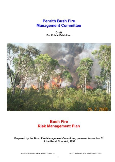
Penrith Bush Fire Management Committee Bush Fire Risk ...
Penrith Bush Fire Management Committee Bush Fire Risk ...
Penrith Bush Fire Management Committee Bush Fire Risk ...

You also want an ePaper? Increase the reach of your titles
YUMPU automatically turns print PDFs into web optimized ePapers that Google loves.
<strong>Penrith</strong> <strong>Bush</strong> <strong>Fire</strong><br />
<strong>Management</strong> <strong>Committee</strong><br />
Draft<br />
For Public Exhibition<br />
<strong>Bush</strong> <strong>Fire</strong><br />
<strong>Risk</strong> <strong>Management</strong> Plan<br />
Prepared by the <strong>Bush</strong> <strong>Fire</strong> <strong>Management</strong> <strong>Committee</strong>; pursuant to section 52<br />
of the Rural <strong>Fire</strong>s Act, 1997<br />
PENRITH BUSH FIRE MANAGEMENT COMMITTEE DRAFT BUSH FIRE RISK MANAGEMENT PLAN<br />
i
Table of Contents<br />
Chapter 1 Introduction Page<br />
1.1 Background.........................................................................................1<br />
1.2 Scope of Plan......................................................................................2<br />
1.2.1 Area.......................................................................................................2<br />
1.2.2 Purpose.................................................................................................2<br />
1.2.3 Period of Operation...............................................................................2<br />
1.3 Aim and Objectives of the Plan ........................................................3<br />
1.4 Implementation ...................................................................................3<br />
Chapter 2 Summary of <strong>Bush</strong> <strong>Fire</strong> <strong>Risk</strong><br />
2.1 Introduction.........................................................................................5<br />
2.2 <strong>Bush</strong> <strong>Fire</strong> Issues within the <strong>Penrith</strong> Council area..........................5<br />
2.2.1 <strong>Bush</strong> <strong>Fire</strong> History..................................................................................5<br />
2.2.2 Climate..................................................................................................5<br />
2.2.3 Vegetation and <strong>Fire</strong> Behaviour.............................................................6<br />
2.2.4 Ignition Pattern and Sources ................................................................7<br />
2.2.5 <strong>Bush</strong> <strong>Fire</strong> Hazard..................................................................................7<br />
2.3 Community Assets.............................................................................8<br />
2.3.1 Key Community Assets ........................................................................8<br />
2.3.2 Assets Requiring Special Protection..................................................10<br />
2.3.3 Community Profile...............................................................................10<br />
2.4 Environmental / Ecological Assets ................................................10<br />
2.4.1 Key Environmental / Ecological Assets..............................................10<br />
Chapter 3 <strong>Bush</strong> <strong>Fire</strong> <strong>Risk</strong> Description<br />
3.1 Introduction.......................................................................................14<br />
3.2 What is <strong>Bush</strong> <strong>Fire</strong> <strong>Risk</strong>? ..................................................................14<br />
3.3 <strong>Bush</strong> <strong>Fire</strong> <strong>Risk</strong> Assessment Methodology....................................14<br />
3.4 <strong>Bush</strong> fire <strong>Risk</strong> in <strong>Penrith</strong> Council area...........................................15<br />
3.4.1 <strong>Bush</strong> <strong>Fire</strong> <strong>Risk</strong> Description.................................................................15<br />
PENRITH BUSH FIRE MANAGEMENT COMMITTEE DRAFT BUSH FIRE RISK MANAGEMENT PLAN<br />
i
Chapter 4 <strong>Bush</strong> <strong>Fire</strong> <strong>Risk</strong> <strong>Management</strong> Strategies<br />
4.1 Introduction.......................................................................................16<br />
4.2 <strong>Bush</strong> <strong>Fire</strong> <strong>Risk</strong> <strong>Management</strong> Priorities..........................................16<br />
4.3 <strong>Bush</strong> <strong>Fire</strong> <strong>Risk</strong> <strong>Management</strong> Options............................................16<br />
4.4 <strong>Bush</strong> <strong>Fire</strong> <strong>Risk</strong> <strong>Management</strong> Strategies for <strong>Penrith</strong> Council area<br />
............................................................................................................17<br />
4.5 <strong>Bush</strong> <strong>Fire</strong> Hazard <strong>Management</strong>.......................................................29<br />
4.5.1 Introduction .........................................................................................29<br />
4.5.2 <strong>Bush</strong> <strong>Fire</strong> Hazard <strong>Management</strong> Zones for <strong>Penrith</strong> Council area.......29<br />
Chapter 5 Implementation<br />
5.1 Introduction.......................................................................................30<br />
5.2 Responsibility for Implementing the <strong>Bush</strong> <strong>Fire</strong> <strong>Risk</strong> <strong>Management</strong><br />
Plan.....................................................................................................30<br />
5.3 Operational Matters Influencing Implementation of Programs...31<br />
5.3.1 Environmental Assessment................................................................31<br />
5.3.2 Section 66 Notice to Reduce <strong>Bush</strong> <strong>Fire</strong> Hazards ..............................33<br />
5.3.3 Issue of Permits to Burn.....................................................................33<br />
5.3.4 Use of Appropriate <strong>Fire</strong> Regimes.......................................................34<br />
5.3.5 Smoke <strong>Management</strong>...........................................................................35<br />
5.3.6 Catchment Protection (Protection of Soil and Water Values)............36<br />
5.3.7 Pest and Weed <strong>Management</strong>.............................................................36<br />
5.3.8 Hazard Reduction & the Native Vegetation Conservation Act 1997..37<br />
5.3.9 Excluded Lands ..................................................................................39<br />
Chapter 6 Monitoring and Review<br />
6.1 Introduction.......................................................................................40<br />
6.2 Monitoring and Review....................................................................40<br />
6.2.1 Implementation of the <strong>Bush</strong> <strong>Fire</strong> <strong>Risk</strong> <strong>Management</strong> Plan by Land<br />
Managers............................................................................................40<br />
6.2.2 Implementation of the <strong>Bush</strong> <strong>Fire</strong> <strong>Risk</strong> Plan by the <strong>Fire</strong> Fighting<br />
Authorities............................................................................................42<br />
6.3 <strong>Bush</strong> <strong>Fire</strong> <strong>Risk</strong> <strong>Management</strong> Plan Effective in Reducing the<br />
Communities <strong>Risk</strong> to <strong>Bush</strong>fires......................................................42<br />
6.3.1 Effectiveness of <strong>Bush</strong> <strong>Fire</strong> <strong>Management</strong> <strong>Committee</strong>s .......................44<br />
6.3.2 Local Issues to be Monitored..............................................................44<br />
6.4 Review of the <strong>Bush</strong> <strong>Fire</strong> <strong>Risk</strong> Plan.................................................44<br />
PENRITH BUSH FIRE MANAGEMENT COMMITTEE DRAFT BUSH FIRE RISK MANAGEMENT PLAN<br />
ii
Appendices<br />
A Explanation of <strong>Bush</strong> <strong>Fire</strong> <strong>Risk</strong> Classes.........................................45<br />
B Explanation of <strong>Bush</strong> <strong>Fire</strong> <strong>Management</strong> Zones..............................46<br />
C References........................................................................................47<br />
Maps<br />
Map 1 Tenure Map<br />
Map 2 Slope Map<br />
Map 3 Vegetation Map<br />
Map 4 <strong>Bush</strong> <strong>Fire</strong> Hazard Map<br />
Map 5 Community Assets Map<br />
Map 6 Community Assets Threat Map<br />
Map 7 Community Assets <strong>Risk</strong> Map<br />
Map 8 Environmental / Ecological Assets Map<br />
Map 9 Environmental / Ecological Assets Threat Map<br />
Map 10 Environmental / Ecological Assets <strong>Risk</strong> Map<br />
Map 11 <strong>Bush</strong> <strong>Fire</strong> Hazard <strong>Management</strong> Zones<br />
Map 12 <strong>Bush</strong> <strong>Fire</strong> History Map<br />
PENRITH BUSH FIRE MANAGEMENT COMMITTEE DRAFT BUSH FIRE RISK MANAGEMENT PLAN<br />
iii
Authorisation<br />
In accordance with Part 3 Division 4 of the Rural <strong>Fire</strong>s Act 1997, this Plan has been prepared by<br />
the <strong>Penrith</strong> <strong>Bush</strong> <strong>Fire</strong> <strong>Management</strong> <strong>Committee</strong> and has been endorsed by the Members of that<br />
<strong>Committee</strong> on behalf of the authorities they represent at the meeting of the .<br />
Recommended<br />
X insert signature X insert signature<br />
Chairperson NSW RFS Officer<br />
Councillor Dion Bailey A/Superintendent John Pearson<br />
<strong>Penrith</strong> BFMC <strong>Penrith</strong> BFMC<br />
NSWFB Officer <strong>Penrith</strong> City Council Officer<br />
Superintendent Brian Johnston Garry Rumble<br />
<strong>Penrith</strong> BFMC <strong>Penrith</strong> BFMC<br />
NPWS Officer Waste Services NSW<br />
Col Davidson Allan<br />
<strong>Penrith</strong> BFMC <strong>Penrith</strong> BFMC<br />
RTA Officer ComLand Limited<br />
Peter Murphy David Aynsley<br />
<strong>Penrith</strong> BFMC <strong>Penrith</strong> BFMC<br />
DEOH Nature Conservation Council<br />
Rob Pointer Shane Grundy<br />
<strong>Penrith</strong> BFMC <strong>Penrith</strong> BFMC<br />
Approved<br />
On behalf of the<br />
NSW <strong>Bush</strong> <strong>Fire</strong> Co-ordinating <strong>Committee</strong><br />
PENRITH BUSH FIRE MANAGEMENT COMMITTEE DRAFT BUSH FIRE RISK MANAGEMENT PLAN<br />
iv
Amendment List<br />
Amendment Entered<br />
Number Date Signature Date<br />
PENRITH BUSH FIRE MANAGEMENT COMMITTEE DRAFT BUSH FIRE RISK MANAGEMENT PLAN<br />
v
PENRITH BUSH FIRE MANAGEMENT COMMITTEE DRAFT BUSH FIRE RISK MANAGEMENT PLAN<br />
1.1 Background<br />
Chapter 1 Introduction<br />
The Rural <strong>Fire</strong>s Act, 1997 requires the <strong>Bush</strong> <strong>Fire</strong> Coordinating <strong>Committee</strong> (BFCC) to establish A<br />
<strong>Bush</strong> <strong>Fire</strong> <strong>Management</strong> <strong>Committee</strong> (BFMC) in each local government area containing a rural<br />
fire district, or fire district with a bush fire risk. One role of the BFMC is to prepare a draft<br />
<strong>Bush</strong> <strong>Fire</strong> <strong>Risk</strong> <strong>Management</strong> Plan for its area of responsibility.<br />
<strong>Bush</strong> <strong>Fire</strong> <strong>Risk</strong> is defined as the chance of a bush fire igniting, spreading and causing damage<br />
to assets of value to the community. Assets of value to the community include life, property<br />
(including buildings, stock, crops and forests) and our natural and cultural heritage.<br />
<strong>Bush</strong> <strong>Fire</strong> <strong>Risk</strong> <strong>Management</strong> involves identifying the level of risk posed by bush fires to assets<br />
and establishing strategies to protect these assets from the adverse effects of bush fires. The<br />
purpose of bush fire risk management is to protect the community and its values from the<br />
adverse affects of wildfire. The outcome sought, is to achieve better integration of community<br />
preparedness and prevention strategies as key elements of bush fire management.<br />
This draft bush fire risk management plan (BFRMP) has been prepared by the <strong>Penrith</strong> <strong>Bush</strong><br />
<strong>Fire</strong> <strong>Management</strong> <strong>Committee</strong> in accordance with the Rural <strong>Fire</strong>s Act 1997. The <strong>Penrith</strong> <strong>Bush</strong><br />
<strong>Fire</strong> <strong>Management</strong> <strong>Committee</strong> comprises representatives of major land management agencies,<br />
the National Parks and Wildlife Service, Road and Traffic Authority, Transgrid, Air Services<br />
Australia, ComLand Limited, Waste Services NSW, Corrective Services Orchard Hills Defence<br />
Establishment, <strong>Penrith</strong> City Council, volunteer rural fire brigade members, fire fighting<br />
authorities, and community representatives.<br />
The plan identifies the level of bush fire risk across the <strong>Penrith</strong> Council area and establishes<br />
strategies, which the responsible land managers will implement to manage the bush fire risks<br />
identified.<br />
The strategies established in the bush fire risk management plan address the bush fire hazard,<br />
the vulnerability of assets to fire, the safety of the community and fire fighters, the protection of<br />
the land and environment from fire, and recognise that biodiversity can be managed through the<br />
application of appropriate fire regimes upon the landscape.<br />
In accordance with the Regulations to the Rural <strong>Fire</strong>s Act 1997, the draft bush fire risk<br />
management plan will be exhibited for a period of not less than 42 days during which time<br />
submissions are invited from the public.<br />
As such, members of the public, whether as private individuals or as members of community<br />
interest groups, are invited to comment on the plan. Submissions should be in writing, and as<br />
detailed and specific as possible; however any comments, no matter how brief or general are<br />
welcome. All comments received will be referred to the <strong>Bush</strong> <strong>Fire</strong> Co-ordinating <strong>Committee</strong> with<br />
the plan for their final deliberation and approval.<br />
Prior to finalising the plan, the <strong>Bush</strong> <strong>Fire</strong> <strong>Management</strong> <strong>Committee</strong> is required to consider the<br />
submissions to plan and prepare a review for consideration by the <strong>Bush</strong> <strong>Fire</strong> Co-ordinating<br />
<strong>Committee</strong>. Under the Act, the <strong>Bush</strong> <strong>Fire</strong> Co-ordinating <strong>Committee</strong> may approve the plan,<br />
amend the plan or reject the plan in the light of public submissions.<br />
If significant changes are made to the plan after public exhibition, the draft plan will be placed<br />
on further exhibition prior to its final adoption.<br />
The closing date for comments on this plan is: .?<br />
Comments should be forwarded to:<br />
Page 1
PENRITH BUSH FIRE MANAGEMENT COMMITTEE DRAFT BUSH FIRE RISK MANAGEMENT PLAN<br />
Executive Officer<br />
<strong>Penrith</strong> <strong>Bush</strong> <strong>Fire</strong> <strong>Management</strong> <strong>Committee</strong><br />
C/- NSW Rural <strong>Fire</strong> Service, <strong>Penrith</strong><br />
PO Box 60<br />
<strong>Penrith</strong><br />
NSW 2751<br />
Additional information or inquires on any aspect of the plan can be obtained from the above or<br />
by telephoning 02 4731 1199.<br />
1.2 Scope of the Plan.<br />
1.2.1 Area<br />
The plan covers the local government area of <strong>Penrith</strong> City Council, and includes public,<br />
private and Commonwealth lands.<br />
1.2.2 Purpose<br />
The plan is a strategic level document which:<br />
• identifies the level of bush fire risk across the <strong>Bush</strong> <strong>Fire</strong> <strong>Management</strong> <strong>Committee</strong>'s area<br />
• identifies strategies which will be implemented to manage the bush fire risks identified<br />
and<br />
• identifies the land managers responsible for implementing the BFRMP.<br />
1.2.3 Period of Operation<br />
Once approved by the <strong>Bush</strong> <strong>Fire</strong> Co-ordinating <strong>Committee</strong> this plan will have a life of five (5)<br />
years. It is anticipated that the plan will be refined within the 5-year time frame as necessary<br />
and in accordance with the provisions of section 52 of the Rural <strong>Fire</strong>s Act 1997.<br />
Annual bush fire risk management programmes will be developed by the responsible land<br />
managers to implement the plan.<br />
Page 2
PENRITH BUSH FIRE MANAGEMENT COMMITTEE DRAFT BUSH FIRE RISK MANAGEMENT PLAN<br />
1.3 Aim and Objectives of the Plan<br />
1.3.1 Aim<br />
The aim of the <strong>Penrith</strong> bush fire risk management plan is to provide for the co-ordinated<br />
prevention and mitigation of bush fires for:<br />
(a) the protection of life, property and the environment within the community; and<br />
(b) the protection, maintenance and wherever possible the enhancement of the natural<br />
and cultural values of the area through the management of appropriate fire regimes.<br />
To give effect to this aim, the committee has developed appropriate risk management<br />
objectives and strategies.<br />
1.3.2 Objectives<br />
The objectives of the <strong>Penrith</strong> <strong>Bush</strong> <strong>Fire</strong> <strong>Risk</strong> <strong>Management</strong> Plan are to:<br />
• reduce the risk of bush fire damage to life, property and the environment;<br />
• ensure that the community is well informed on bush fire protection measures and<br />
prepared for bush fire events;<br />
• ensure that public and private land owners and occupiers understand their bush fire<br />
management responsibilities;<br />
• minimise the risk to the safety of firefighters and the public by reducing the potential for<br />
severe bush fires;<br />
• encourage community participation in managing the bush fire risk;<br />
• reduce the impact of bush fire smoke on the community;<br />
• effectively manage bush fires for the protection and conservation of the natural, cultural,<br />
scenic and recreational features of the area;<br />
• reduce the effects of bush fire to water quality within the Nepean Hawkesbury Catchment<br />
1.3.3 <strong>Bush</strong> <strong>Fire</strong> <strong>Risk</strong> <strong>Management</strong> Strategies<br />
This plan contains a number of strategies that are directed at addressing the risk to<br />
community and environmental assets. This is generally achieved through addressing those<br />
factors which comprise the risk being the bush fire hazard (principally the fuel), the sources<br />
and pattern of ignitions and the vulnerability of the assets at risk.<br />
1.4 Implementation<br />
Implementation of the BFRMP is the responsibility of the owners or occupiers (land<br />
managers) of the land on which the bush fire risk is situated. The Rural <strong>Fire</strong>s Act imposes<br />
this responsibility on both public and private land managers.<br />
Land management agencies such as the <strong>Penrith</strong> City Council, Roads and Traffic Authority<br />
(RTA), National Parks and Wildlife Service (NPWS), Air Services Australia (ASA), ComLand<br />
Limited, Defence Establishment Orchard Hills (DEOH), <strong>Penrith</strong> Lakes Development<br />
Corporation (PLDC), Waste Services NSW, and Corrective Services, will need to develop<br />
specific programs for implementing the BFRMP strategies applicable to their land. In the<br />
case of private property, it is the responsibility of <strong>Penrith</strong> City Council to develop a program<br />
for communicating the BFRMP strategies to private land managers and ensuring that the<br />
strategies are implemented by the land managers.<br />
Page 3
PENRITH BUSH FIRE MANAGEMENT COMMITTEE DRAFT BUSH FIRE RISK MANAGEMENT PLAN<br />
Land management agencies will need to develop fire management plans to meet their own<br />
land management objectives whilst maintaining consistency with this bush fire risk<br />
management plan.<br />
Land managers will progressively implement the plan over the period of the plan (5 years)<br />
with annual reporting requirements being undertaken to monitor progress.<br />
The success of the plan will be monitored through the <strong>Bush</strong> <strong>Fire</strong> <strong>Management</strong> <strong>Committee</strong><br />
annual reporting procedures to the <strong>Bush</strong> <strong>Fire</strong> Co-ordinating <strong>Committee</strong>.<br />
1.5 Environmental considerations<br />
In exercising its functions under the Rural <strong>Fire</strong>s Act, including the preparation of a bush fire<br />
risk management plan, the <strong>Bush</strong> <strong>Fire</strong> <strong>Management</strong> <strong>Committee</strong> is required to have regard to<br />
the principles of ecologically sustainable development (referred to as ESD).<br />
The principles of ESD include the *precautionary principle in relation to the interpretation of<br />
scientific advice, inter-generational equity which seeks to ensure future generations have<br />
access to natural resources, the conservation of biodiversity and ecological processes and<br />
the recognition of the value of environmental resources.<br />
*Precautionary Principal – namely, that if any threats of serious or irreversible damage, lack<br />
of full scientific certainty should not be used as a reason for postponing measures to prevent<br />
environmental degradation.<br />
Page 4
PENRITH BUSH FIRE MANAGEMENT COMMITTEE DRAFT BUSH FIRE RISK MANAGEMENT PLAN<br />
2.1 Introduction<br />
Chapter 2 Summary of <strong>Bush</strong> <strong>Fire</strong> <strong>Risk</strong> Factors<br />
Identification of the level of bush fire risk within the <strong>Penrith</strong> Council area involved analysis of<br />
the following key components:<br />
• The bush fire issues within the <strong>Penrith</strong> Council area area;<br />
• Assets with socio-economic value to the community<br />
• Assets with environmental or cultural heritage value<br />
This chapter briefly describes each of these components and outlines how they influence the<br />
bush fire risk.<br />
2.2 <strong>Bush</strong> <strong>Fire</strong> Issues Within the <strong>Penrith</strong> Council area<br />
This section outlines the bush fire history of the <strong>Penrith</strong> Council area, and broadly identifies<br />
the climatic, vegetation (fuel), and ignition factors, which influence the bush fire problem in<br />
the area. Refer to map.12<br />
2.2.1 <strong>Bush</strong> <strong>Fire</strong> History<br />
Prior to 1948, bushfires regularly occurred in the pastoral and forested areas of the <strong>Penrith</strong><br />
Council area. From 1948 hazard reduction commenced and a fire trail network was<br />
progressively established. Major wildfires have now been virtually excluded from large parts<br />
of the <strong>Penrith</strong> Council area.<br />
Significant fire seasons have occurred in the <strong>Penrith</strong> Council area area in 1968, 1977, 1981,<br />
1990, 1993/94, 1997/8 and 2000. These seasons coincided with extended drought periods,<br />
and fires burning in these seasons burnt extensive areas. Other smaller fires, which had the<br />
potential to develop into major fires, have been contained within three to four hours. In recent<br />
times, the clearing of bush land to provide for development in the rural areas has seen the<br />
breaking up of the continuous line of bush land, which has supported fires in the past. The<br />
introduction to the district of market gardening has seen land usage change from grazing to<br />
crops. Sand Mining occurs in the North Western sector of the <strong>Penrith</strong> Council area providing<br />
breaks for fires threatening from the adjoining Blue Mountains National Park.<br />
2.2.2 Climate<br />
(a) General<br />
The climate in the <strong>Penrith</strong> <strong>Bush</strong> <strong>Fire</strong> District is warm subtropical with a well defined<br />
summer/autumn rainfall peak (January to March) and a dry winter and spring. The<br />
temperature and rainfall conditions vary across the <strong>Penrith</strong> Council area. The rainfall can be<br />
unreliable during the normal late winter/spring period. Winter and early Spring frosts<br />
generally cause the grasslands to cure rapidly.<br />
Average monthly summer temperature – High 28<br />
Average monthly winter temperature – Low 4.5<br />
Average monthly summer rainfall 64mm<br />
Page 5
PENRITH BUSH FIRE MANAGEMENT COMMITTEE DRAFT BUSH FIRE RISK MANAGEMENT PLAN<br />
Average monthly winter rainfall 13mm<br />
Average annual rainfall total
PENRITH BUSH FIRE MANAGEMENT COMMITTEE DRAFT BUSH FIRE RISK MANAGEMENT PLAN<br />
(c) Pastoral lands, grasslands and open woodlands – <strong>Fire</strong> behaviour in these<br />
vegetation types is dominated by the influence of grass fuels. <strong>Fire</strong>s occur most readily<br />
once grass is cured beyond 70%. In heavy grass fuels, fires may be intense but will<br />
only persist for a short time, and hence are less hazardous relative to forest and heath<br />
fires. Grass/woodland fires are open to the influence of wind and typically have high<br />
rates of spread (relative to forest and heath vegetation). Grass fire behaviour is<br />
reduced dramatically by reducing the height and continuity of grass fuels – most often<br />
achieved by grazing.<br />
(d) Severely disturbed forests – Dry sclerophyll forest which has had the under storey<br />
removed and has had thinning of the canopy. Low to moderate fuel levels (up to 15<br />
t/ha) and relatively open canopies allow sunlight and wind to quickly dry available fuels<br />
giving these forests the potential to support low to moderate intensity bush fires.<br />
2.2.4 Ignition Patterns and Sources<br />
Preventing the ignition of bush fires by human activities, particularly on days when severe<br />
weather conditions prevail, is an important strategy for managing bush fires. To put effective<br />
ignition management programs in place, it is important to understand the patterns and major<br />
sources of ignition in the area.<br />
The five major ignition causes in the <strong>Penrith</strong> Council area are:<br />
• Illegal burning off<br />
• Incendiarism<br />
• Escapes from Legal Burning off<br />
• Car Dumping<br />
• Lightning<br />
Illegal burning off ignitions are mainly concentrated in rural areas. Activity largely occurs from<br />
mid to late spring.<br />
Incendiarism is unfortunately an increasing trend, and is most common in the grassland and<br />
forested areas adjacent to townships, particularly Glenmore Park, Hickeys Lane, Mount<br />
Pleasant, Erskine Park. Ignition records for the area show that the incidence of incendiarism<br />
is increased during school holidays. Increasing visitation and urban growth are thought to be<br />
the main contributing factors to increased incidence of incendiarism.<br />
Escapes from legal burning off are mainly in rural areas of the City, occurring in similar areas<br />
to illegal burning activity. Activity is also largely in mid to late spring.<br />
Car dumping is a major cause of ignitions in the Vacant Crown Land areas around<br />
Londonderry, Castlereagh and Berkshire Park. This activity occurs right throughout the year<br />
representing serious potential for bush fires during the Summer months. <strong>Bush</strong> fires also<br />
occur during the Winter months particularly during dry winters.<br />
Lightning activity in the <strong>Penrith</strong> Council area is mainly associated with late spring and<br />
summer thunderstorm activity, which is normally (but not always) accompanied by rainfall.<br />
Lightning activity does not represent a significant ignition source within this <strong>Penrith</strong> Council<br />
area.<br />
2.2.5 <strong>Bush</strong> <strong>Fire</strong> Hazard See Map 4 – <strong>Bush</strong> <strong>Fire</strong> Hazard<br />
Page 7
PENRITH BUSH FIRE MANAGEMENT COMMITTEE DRAFT BUSH FIRE RISK MANAGEMENT PLAN<br />
The <strong>Bush</strong> <strong>Fire</strong> Hazard map depicting the hazard potential of the <strong>Penrith</strong> Council area is<br />
displayed on Map 4 attached. Approx10 % of the <strong>Penrith</strong> Council area has been classified<br />
high bush fire hazard, 4% moderate bush fire hazard and 86 % low bush fire hazard.<br />
The Hazard Maps were produced using the Eastern <strong>Bush</strong>land database, (NPWS) and slope<br />
data broken into three classes, (level
PENRITH BUSH FIRE MANAGEMENT COMMITTEE DRAFT BUSH FIRE RISK MANAGEMENT PLAN<br />
Settlement in <strong>Penrith</strong>’s rural areas is concentrated in the villages of Mulgoa, Wallacia,<br />
Luddenham, Londonderry and Agnes Banks, or otherwise dispersed across rural properties.<br />
Some closer settlement patterns in the form of rural-residential developments can also be<br />
found at Wallacia (‘Northumberland Green Estate’), Orchard Hills (‘The Vines Estate’), Mt<br />
Vernon and Cranebrook.<br />
(b) Primary Production<br />
Primary industry in <strong>Penrith</strong> is dominated by mining, horticulture and agriculture. Metal, sand<br />
and gravel are the major extractive industries. <strong>Penrith</strong> accounts for 80% of all Sydney’s<br />
building sand. Vineyards, turf, market gardening, cut flowers and nurseries are the<br />
predominant horticultural industries. Poultry farms, cattle and horse studs are dominant, and<br />
reflect produce worth $110 million per annum at the farm gate.<br />
The key rural production areas lie to the north and south of the <strong>Penrith</strong> urban areas. In the<br />
north, activities occur predominantly on 2-4 ha lots around Llandilo, Londonderry and<br />
Berkshire Park. Llandilo has a significant number of properties under agriculture/market<br />
gardens and several poultry farms. North of Londonderry rural uses are divided between<br />
poultry farms, dog kennels, horses and horticulture. At Berkshire Park properties are mostly<br />
under agriculture/market gardens.<br />
Rural use of land in the south is more widespread and diverse, with the majority of the larger<br />
holdings used for pastoral purposes. These occur on the low-lying to undulating land<br />
stretching from Mulgoa to the eastern City boundary, generally south of the water supply<br />
pipeline. There are also a number of poultry farms, mainly concentrated at Luddenham and<br />
Mt Vernon. Other activities include market gardens, horses, nurseries, and poultry.<br />
Council has resolved to undertake a review of its Rural Lands in the coming 12 to 18 months.<br />
A key outcome of this review will be an accurate “snapshot” of the current types and<br />
locations of rural activities and primary production. This information is supplied for the<br />
purposes of this management plan, however it may not be current and should be checked<br />
with the Department of Agriculture.<br />
(c) Timber production<br />
No significant timber production occurs in this area.<br />
(d) Industry<br />
Metal fabrication is the principal manufacturing activity in the City. Other major activities<br />
include packaging, glass products, electronics, animal vaccine production, construction,<br />
machinery distribution, concrete products, specialist manufacturers and wool products. Other<br />
significant activities include the service industry, retail and wholesale sectors, education and<br />
tourism.<br />
<strong>Penrith</strong>’s industrial zones support a variety of established businesses. The main industrial<br />
zones are located at Emu Plains, North <strong>Penrith</strong>, South <strong>Penrith</strong>, St Marys and Dunheved.<br />
Land at the southern edge of Erskine Park (Erskine Park Employment Lands) is zoned for<br />
industrial purposes but has yet to be taken up.<br />
(e) Transport Routes<br />
The area is served by a significant rail and road network. Sydney’s main western rail line is<br />
the focus of <strong>Penrith</strong>’s core residential areas and carries 70 interurban and 200 suburban<br />
passenger train movements per day, as well as around 82 freight train movements per day.<br />
<strong>Penrith</strong> LGA contains some 126 km of arterial roads including Great western Highway, M4<br />
Motorway, Elizabeth Drive, Mulgoa Road, Castlereagh Road, The Northern Road and Mamre<br />
Road.<br />
(f) Services infrastructure (gas, electricity etc)<br />
Page 9
PENRITH BUSH FIRE MANAGEMENT COMMITTEE DRAFT BUSH FIRE RISK MANAGEMENT PLAN<br />
• Electricity High Voltage transmission lines traverse the <strong>Penrith</strong> Council area, with several<br />
substations located both in the rural and urban areas.<br />
• Natural Gas, Natural Gas lines traverse the <strong>Penrith</strong> Council area.<br />
• Water pipeline, the main supply pipeline from Warragamba Dam crosses the south of the<br />
<strong>Penrith</strong> Council area.<br />
• Sewerage treatment plants (located at <strong>Penrith</strong> and North St Marys)<br />
2.3.2 Assets Requiring Special Protection<br />
• Corrective Centres (John Moroney Centre at Londonderry and Emu Plains Prison Farm).<br />
• Castlereagh Waste Disposal Centre<br />
• Other Waste disposal sites (5 privately operated non-putrescible landfill sites located at<br />
Erskine Park, Kemps Creek, Mulgoa and Londonderry).<br />
• The southern perimeter of Glenmore Park due to its proximity to the adjoining Mulgoa<br />
nature Reserve.<br />
• Emu Heights and Leonay due to their proximity to the adjoining Blue Mountains National<br />
Park.<br />
• Northern perimeter of the Village of Londonderry.<br />
• M 4 Motorway, during the Spring, and extended dry periods causing grasses to cure<br />
beyond 80%.<br />
• ADI Limited’s Test Evaluation and Centre residing on ComLand’s property at Forrester<br />
Road because of its Defence Department works and the proximity of the surrounding<br />
bushland.<br />
2.3.3 Community Profile<br />
Given the geography of the <strong>Penrith</strong> Council area , a number of communities are potentially<br />
vulnerable to high levels of bush fire risk. Localities such as Mulgoa, Glenmore Park,<br />
Londonderry, Emu Heights, and Leonay, which are adjacent to National Parks are vulnerable<br />
to major bushfire risk.<br />
While the majority of aged care facilities are located within the urban areas of <strong>Penrith</strong> and St<br />
Marys and are not subject to major bushfire risk, the aged care facilities at Erskine Park and<br />
Wallacia may require special attention in the event of localised fires causing significant<br />
smoke hazard.<br />
2.4 Environmental/Ecological Assets See Map 8 - Environmental / Ecological<br />
Assets<br />
This section provides a summary of the key ecological assets and assets with cultural and/or<br />
historical heritage within the <strong>Penrith</strong> Council area. For the purposes of the bush fire analysis,<br />
this plan has classified the community assets of the <strong>Penrith</strong> Council area into the groups<br />
outlined below.<br />
Page 10
PENRITH BUSH FIRE MANAGEMENT COMMITTEE DRAFT BUSH FIRE RISK MANAGEMENT PLAN<br />
Environmental / Ecological Assets include:<br />
• natural assets - features or areas such as landscapes, catchments and ecological<br />
communities; and<br />
• cultural assets - areas of prehistoric or historic significance dating from Aboriginal and<br />
European occupation.<br />
2.4.1 Key Environmental/Ecological Assets<br />
(a) Places of Aboriginal Significance<br />
Refer to NPWS for a list of places of Aboriginal significance in the <strong>Penrith</strong> Council area.<br />
Other sources to be checked include: "Aboriginal Resources Planning Study: City of <strong>Penrith</strong>"”<br />
Rhoads and Dunnett (1985) and “Cumberland Plain Regional Aboriginal Heritage Strategy:<br />
Stage 1” (NPWS).<br />
Whilst no direct reference is made to any Aboriginal site or place within the text they are<br />
considered during the risk and threat analysis and the results reflect their existence.<br />
(b) Historic Heritage<br />
A full list of adopted heritage items and heritage conservation areas (including maps) can be<br />
found in “<strong>Penrith</strong> Heritage Conservation LEP 1991” and “<strong>Penrith</strong> Heritage Study Inventory<br />
1987”.<br />
(c) Threatened Species, Populations, Communities and Critical Habitat<br />
Threatened Flora and Fauna<br />
This Plan has regard for the principles of ESD. An important objective of ESD is to protect<br />
the full range of native species present and to maintain viable regional populations of these<br />
species. Protection must have regard to the activities carried out on the land and measures<br />
to be taken that will influence such activities.<br />
<strong>Penrith</strong> Flora and Fauna Study 1997 compiles existing information relating to fauna and<br />
flora in the <strong>Penrith</strong> Council area. The Study also summarises the main activities, including<br />
bushfire management, which could threaten biodiversity and natural habitats in <strong>Penrith</strong><br />
Council area, and makes recommendations about how to manage those activities. Appendix<br />
H and I in the Study provide assessment guidelines for considering activities that may affect<br />
biodiversity.<br />
Within the <strong>Penrith</strong> Council area a diverse range of fauna and flora species are found. A total<br />
of 374 native vertebrate species occur or are likely to occur, comprising 17 fish, 32<br />
amphibians, 46 reptiles, 57 mammals and 222 birds. In addition, 29 introduced fauna species<br />
have been recorded (10 fish, 1 amphibians, 0 reptiles, 6 mammals and 12 birds). 37<br />
threatened fauna species occur or are likely, being about 10% of the total (excluding fish).<br />
These threatened species are reliant on the retention of native vegetation for their continued<br />
existence.<br />
There is a high diversity of native plants in the area with over 500 native species in four<br />
broad vegetation types. This includes 13 plant species listed as Rare or Threatened<br />
(ROTAP) at a national level of which one species is presumed extinct. There are 38 species<br />
which are considered to be of conservation significance in western Sydney and at least<br />
another 139 species which are vulnerable or inadequately conserved in western Sydney.<br />
Page 11
PENRITH BUSH FIRE MANAGEMENT COMMITTEE DRAFT BUSH FIRE RISK MANAGEMENT PLAN<br />
In 1996, the NSW Government enacted legislation to conserve biological diversity and<br />
threatened species. Over 500 threatened species are listed, including plants, amphibians,<br />
reptiles, birds and mammals. Many listed species occur in <strong>Penrith</strong>.<br />
The Threatened Species Conservation Act 1995 requires consideration of endangered<br />
species and their habitat in the determination of any activities, and imposes additional<br />
requirements on determining authorities, including councils.<br />
Species of threatened fauna are likely to use all areas of remnant native vegetation at one<br />
time or another. Therefore, the provisions of the Act should be applied to all proposals where<br />
remnant native vegetation exists.<br />
The Threatened Species Unit of NPWS should be consulted for information about any<br />
proposed Recovery Plans for endangered species and endangered ecological communities<br />
listed in Schedule 1 of the Threatened Species Conservation Act.<br />
Planning at the strategic level (as is the purpose of this plan) aims to protect human life and<br />
property values whilst minimising detrimental impacts on the environment of intense fire and<br />
too frequent or infrequent prescribed and wildfire fire.<br />
Where prescribed fire is used as one of the tools to achieve this, the aim is to burn:<br />
• sufficiently frequently to prevent general fuel accumulations which would present major<br />
hazard in potentially high intensity wildfires, and<br />
• at intervals far enough apart to ensure the continued survival of plant species and<br />
habitat for wildlife.<br />
This can best be achieved through a broad cyclical mosaic of hazard reduced areas across<br />
those parts of the District where fuel reduction is to be practised, (predominantly dry eucalypt<br />
forest types) with the added knowledge that most broad area fuel reduction in fact leaves a<br />
patchwork of burnt and unburnt sections.<br />
The extent of area identified for more frequent treatment (areas in hazard management<br />
zones one and two) is commensurate with the level of bush fire risk in the District (i.e. bush<br />
fire risk to specific community and environmental asset areas). These zones are strategically<br />
located to achieve the appropriate level of asset protection whilst minimising the area to be<br />
treated, thus assisting to minimise environmental impact.<br />
(d) Significant Vegetation Communities<br />
<strong>Bush</strong> <strong>Fire</strong> <strong>Risk</strong> <strong>Management</strong> in the <strong>Penrith</strong> Council area is also affected by the operation of<br />
the following planning instruments:<br />
• SEPP 19 Urban <strong>Bush</strong>land<br />
• SREP 20 – Hawkesbury – Nepean River<br />
• Draft <strong>Penrith</strong> LEP – Flora and Fauna Conservation<br />
• <strong>Penrith</strong> Heritage LEP (2 Items of Significant vegetation)<br />
• <strong>Penrith</strong> Register of Significant Trees and Gardens<br />
• <strong>Penrith</strong> Remnant Native Vegetation Inventory<br />
• Regionally significant Vegetation (as listed in any relevant Regional Vegetation<br />
<strong>Management</strong> Plan)<br />
(e) Catchments<br />
Page 12
PENRITH BUSH FIRE MANAGEMENT COMMITTEE DRAFT BUSH FIRE RISK MANAGEMENT PLAN<br />
The following areas are significant for their water catchment value:<br />
The <strong>Penrith</strong> Council area covers part of the Hawkesbury-Nepean catchment area. An<br />
important objective of fire management in the District is to minimise the occurrence of intense<br />
fires over broad areas which may produce large quantities of ash and expose soils to<br />
erosion, providing significant potential for the sedimentation/contamination of natural<br />
waterways and town water supplies.<br />
(f) Wetlands<br />
The following wetlands, of State, regional or local significance occur in the District:<br />
Werrington (refer to Heritage Inventory Item W6 in <strong>Penrith</strong> Heritage Study Inventory 1987)<br />
Page 13
PENRITH BUSH FIRE MANAGEMENT COMMITTEE DRAFT BUSH FIRE RISK MANAGEMENT PLAN<br />
Chapter 3 - <strong>Bush</strong> <strong>Fire</strong> <strong>Risk</strong> Description<br />
3.1 Introduction<br />
This chapter describes the level of bush fire risk to community and ecological/environmental<br />
assets across the <strong>Penrith</strong> Council area. It also provides a brief explanation of what is meant<br />
by the term bush fire risk, and how the level of bush fire risk across the <strong>Penrith</strong> Council area<br />
was determined.<br />
3.2. What is <strong>Bush</strong> <strong>Fire</strong> <strong>Risk</strong>?<br />
<strong>Bush</strong> fire risk is defined as the chance of a bush fire igniting, spreading and causing damage<br />
to assets of value to the community.<br />
Three main factors that contribute to the bush fire risk:<br />
1. The potential severity of the fire (or bush fire hazard). The bush fire hazard is<br />
influenced by the vegetation, slope, and weather conditions.<br />
2. How close the bush fire hazard is to an asset (or bush fire threat). The further an asset<br />
is located from a bush fire hazard, the less likely it is to be damaged or destroyed by the<br />
bush fire.<br />
3. The capacity of an asset to cope with, and recover from the expected bush fire (or<br />
vulnerability). Different types of assets have different abilities to cope with fire.<br />
3.3 <strong>Bush</strong> <strong>Fire</strong> <strong>Risk</strong> Assessment Methodology<br />
The method used to identify the level of bush fire risk across the <strong>Penrith</strong> Council area is<br />
outlined below. More detailed information about the methodology can be obtained from<br />
Coordinating <strong>Committee</strong> <strong>Bush</strong> <strong>Fire</strong> <strong>Risk</strong> <strong>Management</strong> Planning Guidelines.<br />
Step 1. Identify the <strong>Bush</strong> <strong>Fire</strong> Hazard.<br />
The bush fire hazard was assessed by combining information about the type of vegetation<br />
(and how well it burns during a bush fire), slope, and the likely weather conditions on days<br />
when major bush fires are likely to start and spread rapidly.<br />
Step 2. Identify the <strong>Bush</strong> <strong>Fire</strong> Threat.<br />
The bush fire threat to various community and ecological/environmental assets within the<br />
<strong>Penrith</strong> Council area was assessed by estimating how close these assets were located to a<br />
bush fire hazard.<br />
Step 3. Identify the <strong>Bush</strong> <strong>Fire</strong> <strong>Risk</strong>.<br />
The bush fire risk to community and ecological/environmental assets was determined by<br />
assessing how well the different types of assets within the <strong>Penrith</strong> Council area were likely to<br />
withstand and recover from the level of bush fire threat expected.<br />
Based on this assessment, the bush fire risk posed to assets was placed into one of five<br />
bush fire risk classes (extreme, major, moderate, minor, or insignificant). An explanation of<br />
what each of these bush fire risk classes mean is included in the appendices.<br />
Page 14
PENRITH BUSH FIRE MANAGEMENT COMMITTEE DRAFT BUSH FIRE RISK MANAGEMENT PLAN<br />
3.4 <strong>Bush</strong> <strong>Fire</strong> <strong>Risk</strong> in <strong>Penrith</strong> Council area<br />
Maps 7 and 10, show the level of bush fire risk to community and environmental/ecological<br />
assets across the <strong>Penrith</strong> Council area.<br />
A brief description of the bush fire risk to community and environmental/ecological assets<br />
across the <strong>Penrith</strong> Council area is provided below.<br />
3.4.1 <strong>Bush</strong> <strong>Fire</strong> <strong>Risk</strong> Description<br />
(a) Urban Areas<br />
The <strong>Penrith</strong> Council area has a number of areas facing extreme, major, moderate and minor<br />
bush fire risk, which are identified on map 7. The areas with an extreme bush fire risk are the<br />
urban/bushland interface areas, within approximately 100m of the bush, where development<br />
occurred prior to bush fire protection mechanisms being incorporated into the development.<br />
Without adequate management, there is a high probability of the loss of many houses and<br />
lives in a bush fire burning under severe conditions.<br />
Some of the urban interface areas face a major risk from bush fires. These areas are also<br />
located within 100m of the bush, but have some protection mechanisms such as housing<br />
design and perimeter roads which lower the risk from extreme to major. Without adequate<br />
management, loss of some houses and the loss of life is possible in a bush fire burning<br />
under severe conditions.<br />
Those houses located approximately 100m to 2.5km from the interface are considered to<br />
face a moderate bush fire risk, primarily from burning embers. Some chance of localised<br />
damage is possible in a severe bush fire.<br />
The remaining urban areas face an insignificant level of bush fire risk.<br />
(b) Environmental/Ecological Assets<br />
Mulgoa Nature Reserve, Castlereagh Nature Reserve, and the Crown Lands to the north<br />
west of Londonderry are also a major bush fire risk. Frequent fires over the last 20 years<br />
mean that the fire regime is already exceeded, and another major fire will result in a decline<br />
in biodiversity and possible species loss.<br />
Those environmental assets concentrated primarily in the northern portion of the District<br />
potentially could suffer longer term damage as a result of fire over the landscape, much of<br />
which includes possible habitat sites of threatened species. The bush fire risk to these areas<br />
is rated as moderate.<br />
(c) Agricultural Areas<br />
Within the cropping and grazing areas, the bush fire risk has been assessed as major; as<br />
when cured, the grasslands and crops are easily ignited and spread fire easily. A fire burning<br />
under severe weather conditions could result in widespread loss of crops, stock, pasture and<br />
fences and have an affect to the economy of the district.<br />
Page 15
PENRITH BUSH FIRE MANAGEMENT COMMITTEE DRAFT BUSH FIRE RISK MANAGEMENT PLAN<br />
Chapter 4 - <strong>Bush</strong> <strong>Fire</strong> <strong>Risk</strong> <strong>Management</strong> Strategies<br />
4.1 Introduction<br />
This chapter details:<br />
• the bush fire risk management strategies which will be put in place to manage the bush<br />
fire risk across the <strong>Penrith</strong> Council area.<br />
• how the bush fire risk management priorities were determined and<br />
• the types of bush fire risk management options available.<br />
4.2 <strong>Bush</strong> <strong>Fire</strong> <strong>Risk</strong> <strong>Management</strong> Priorities<br />
<strong>Bush</strong> fire risk management priorities have been allocated according to the bush fire risk<br />
ratings. Those areas faced with an extreme bush fire risk have been given the highest<br />
management priority, while those areas with an insignificant risk have the lowest<br />
management priority.<br />
The bush fire risk management priority influences:<br />
When the risk is likely to be treated - high priority areas will be addressed first;<br />
The resources allocated to the treatment - more resources will be allocated to manage the<br />
risk in high priority areas, as more work will be needed to reduce the risk; and<br />
The range of treatment strategies required to manage the risk- a greater range of<br />
management strategies will be implemented to manage the risk in high priority areas, as<br />
more factors contribute to the risk.<br />
4.3 <strong>Bush</strong> <strong>Fire</strong> <strong>Risk</strong> <strong>Management</strong> Options<br />
Table 4.1 describes the various options available to minimise the bush fire risk. It is important<br />
to recognise that, particularly for extreme and major risk areas, no single option is likely to<br />
provide sufficient protection from bush fires. A range of options needs to be implemented to<br />
reduce the bush fire risk to an acceptable level. For example, while hazard reduction will<br />
reduce the severity of a bush fire and therefore improve the chance of survival; houses will<br />
have an even better chance of survival if the people living in them have taken steps (such<br />
cleaning out gutters, and not storing combustibles near the house) to make their own house<br />
less vulnerable to bush fire attack.<br />
Page 16
PENRITH BUSH FIRE MANAGEMENT COMMITTEE DRAFT BUSH FIRE RISK MANAGEMENT PLAN<br />
Avoid the <strong>Risk</strong> By deciding not to proceed with the activity likely to generate the bush<br />
fire risk. This option is relevant to future land use and development<br />
decisions.<br />
Examples of risk avoidance strategies include, prohibiting certain types<br />
of development in bush fire prone areas, and requiring adequate fire<br />
protection zones to be established between developments and the bush<br />
fire hazard.<br />
Reduce the Hazard Programs to reduce the level of fuel available to burn in a bush fire.<br />
Examples of hazard reduction strategies include hazard reduction<br />
burning, slashing or ploughing of fire breaks, or manual clearing of bush<br />
fire hazards.<br />
Reduce Ignitions Programs to reduce the number of deliberate and accidental man made<br />
ignitions.<br />
Reduce<br />
Vulnerability<br />
Examples of ignition reduction strategies include total fire bans, arson<br />
investigation programs, and issuing of permits to burn during the bush<br />
fire danger season.<br />
Programs to increase the resilience of community and environmental /<br />
ecological assets to bush fires.<br />
Examples of vulnerability reduction strategies include community<br />
education programs, and building restrictions in bush fire prone areas.<br />
Residual <strong>Risk</strong> <strong>Bush</strong> fire risk management strategies are designed to reduce the level of<br />
risk; but will not eliminate the risk entirely. Some level of residual risk<br />
may remain, which will be managed with fire response strategies such as<br />
fire suppression operations, early fire detection, and evacuation.<br />
Table 4.1 - <strong>Bush</strong> <strong>Fire</strong> <strong>Risk</strong> <strong>Management</strong> Options<br />
4.4 <strong>Bush</strong> <strong>Fire</strong> <strong>Risk</strong> <strong>Management</strong> Strategies for <strong>Penrith</strong> Council area<br />
The bush fire risk management strategies, which have been identified in the <strong>Penrith</strong> Council<br />
area, are outlined on pages 17 to 26 are:<br />
• Priority 1 Extreme <strong>Risk</strong> – Western boundaries Leonay, and Emu Heights<br />
• Priority 2 Major <strong>Risk</strong> – Southern boundary Leonay<br />
• Priority 2 Major <strong>Risk</strong> – Northern Perimeter of Londonderry Village<br />
• Priority 2 Major <strong>Risk</strong> – M4 Motorway (Lapstone Hill to Ropes Creek)<br />
• Priority 2 Major <strong>Risk</strong> – Southern perimeter Glenmore Park Estate<br />
• Priority 2 Major <strong>Risk</strong> – Villages of Mulgoa and Wallacia<br />
• Priority 2 Major <strong>Risk</strong> – Environmental / Ecological Assets<br />
• Priority 3 Moderate <strong>Risk</strong> – <strong>Penrith</strong> Rural Townships<br />
• Priority 3 Moderate <strong>Risk</strong> – Environmental / Ecological Assets<br />
• Priority 4 Minor <strong>Risk</strong> – <strong>Penrith</strong> Townships<br />
• Priority 5 Insignificant <strong>Risk</strong> – <strong>Penrith</strong> Urban Areas, <strong>Penrith</strong> / St Marys.<br />
Page 17
PENRITH BUSH FIRE MANAGEMENT COMMITTEE DRAFT BUSH FIRE RISK MANAGEMENT PLAN<br />
Area: Extreme <strong>Risk</strong> - <strong>Penrith</strong> Urban Areas Emu Heights, Leonay<br />
Priority: 1<br />
<strong>Management</strong><br />
Options<br />
<strong>Risk</strong> <strong>Management</strong> Strategies Responsible Land Manager<br />
Avoid <strong>Risk</strong> Amend LEP, to prohibit development of housing estates in areas where an adequate fire<br />
protection zones cannot be established.<br />
Reduce<br />
Hazards<br />
Reduce<br />
Vulnerability<br />
Reduce<br />
Ignitions<br />
Accept Residual<br />
<strong>Risk</strong><br />
prohibit vulnerable development in areas with high bush fire hazard - for example nursing<br />
homes, hospitals, hazardous industries<br />
encourage development which provide a break between the hazard and buildings - for<br />
example, parks, golf courses, etc<br />
Implement and maintain asset protection zones around the perimeter of the urban area.<br />
Implement strategic fire advantage zones in areas where the physical constraints do not allow<br />
a full width asset protection zone to be established, and/or access problems exist, and/or<br />
existing houses are not built to withstand the bush fire expected.<br />
Establish Community <strong>Fire</strong>guard Groups in streets bordering on the bush. to involve residents<br />
in managing the bush fire hazard on and adjoining their properties.<br />
Establish development and building controls to increase the ability of new sub divisions and<br />
houses to withstand a bush fire attack.<br />
Conduct fire cause and origin investigations for each fire occurrence<br />
Regularly check fire trail gates to ensure they are secure.<br />
Suspend fire generating activities on days of very high to extreme fire danger<br />
Develop evacuation and emergency plans for residents adjoining bushland, schools, and<br />
aged and health care facilities.<br />
Maintain adequate fire service response rates<br />
Develop coordinated operations plans<br />
Implement early detection systems on days of very high and extreme fire danger<br />
Council (all strategies)<br />
Council, Private land<br />
owner/occupiers<br />
Rural <strong>Fire</strong> Service, private land<br />
owners/occupiers<br />
Council<br />
NSW Rural <strong>Fire</strong> Service<br />
NSW Rural <strong>Fire</strong> Service<br />
Council, <strong>Fire</strong> Services<br />
<strong>Fire</strong> Services<br />
BFMC<br />
Page 19
PENRITH BUSH FIRE MANAGEMENT COMMITTEE DRAFT BUSH FIRE RISK MANAGEMENT PLAN<br />
Area: Major <strong>Risk</strong> – Southern boundary Leonay<br />
Priority: 2<br />
<strong>Management</strong> Options <strong>Risk</strong> <strong>Management</strong> Strategies Responsible Land Manager/s<br />
Avoid <strong>Risk</strong> • Recommend Council enforce <strong>Bush</strong> <strong>Fire</strong> Mitigation Policy<br />
• Encourage a break between the hazard and building for any new<br />
development<br />
Reduce Hazards • Provide asset protection zones around buildings of value - houses, shearing<br />
sheds, machinery sheds, etc<br />
• Provide strategic fire advantage zones<br />
Reduce Vulnerability • Implement development and building controls for new buildings<br />
• Implement community education programs<br />
Reduce Ignitions • Education of land owner on ignition problems<br />
• Suspend fire generating activities on days of very high to extreme fire danger<br />
Council (all strategies)<br />
Owner/occupier<br />
Owner/occupier<br />
Owner/occupier<br />
Council<br />
Accept Residual <strong>Risk</strong> • Develop cooperative detection and response networks and plans BFMC<br />
NSW Rural <strong>Fire</strong> Service<br />
NSW Rural <strong>Fire</strong> Service<br />
Council, owner/occupier<br />
Page 20
PENRITH BUSH FIRE MANAGEMENT COMMITTEE DRAFT BUSH FIRE RISK MANAGEMENT PLAN<br />
Area: Major <strong>Risk</strong> – Northern Perimeter Londonderry Village<br />
Priority: 2<br />
<strong>Management</strong> Options <strong>Risk</strong> <strong>Management</strong> Strategies Responsible Land Manager/s<br />
Avoid <strong>Risk</strong> • Recommend Council enforce <strong>Bush</strong> <strong>Fire</strong> Mitigation Policy<br />
• Encourage a break between the hazard and building for any new<br />
development<br />
Reduce Hazards • Provide asset protection zones around buildings of value - houses, shearing<br />
sheds, machinery sheds, etc<br />
• Provide strategic fire advantage zones<br />
• Provide breaks around crops and fences to limit extension of a fire across<br />
paddocks<br />
Reduce Vulnerability • Provide refuge paddock for stock<br />
• Implement development and building controls for new buildings<br />
• Implement community education programs<br />
Reduce Ignitions • Maintain farm machinery<br />
• Education of land owner on ignition problems<br />
• Suspend fire generating activities on days of very high to extreme fire danger<br />
Accept Residual <strong>Risk</strong> • Develop cooperative detection and response networks and plans<br />
• Have fire suppression equipment on standby when harvesting<br />
Council (all strategies)<br />
Owner/occupier<br />
Owner/occupier<br />
Owner/occupier<br />
Owner / occupier<br />
Council<br />
NSW Rural <strong>Fire</strong> Service<br />
Owner/ occupier<br />
NSW Rural <strong>Fire</strong> Service<br />
Council, owner/occupier<br />
BFMC<br />
Owner/occupier<br />
Page 21
PENRITH BUSH FIRE MANAGEMENT COMMITTEE DRAFT BUSH FIRE RISK MANAGEMENT PLAN<br />
Area: Major <strong>Risk</strong> – M4 Motorway (Lapstone Hill to Ropes Creek)<br />
Priority: 2<br />
<strong>Management</strong> Options <strong>Risk</strong> <strong>Management</strong> Strategies Responsible Land Manager/s<br />
Avoid <strong>Risk</strong> • Recommend Council enforce <strong>Bush</strong> <strong>Fire</strong> Mitigation Policy<br />
• Encourage a break between the hazard and adjoining properties<br />
Reduce Hazards • Provide asset protection zones around significant assets<br />
• Provide strategic fire advantage zones<br />
• Provide breaks around fences to limit extension of a fire across paddocks<br />
Reduce Vulnerability • Implement community education programs RTA<br />
Council (all strategies)<br />
RTA<br />
RTA<br />
RTA<br />
RTA<br />
NSW Rural <strong>Fire</strong> Service<br />
Reduce Ignitions • Education of adjoining land owner on ignition problems NSW Rural <strong>Fire</strong> Service<br />
Accept Residual <strong>Risk</strong> • Develop cooperative detection and response networks and plans<br />
• Have fire suppression equipment on standby on high risk days<br />
BFMC<br />
NSW Rural <strong>Fire</strong> Service<br />
Page 22
PENRITH BUSH FIRE MANAGEMENT COMMITTEE DRAFT BUSH FIRE RISK MANAGEMENT PLAN<br />
Area: Major <strong>Risk</strong> – Southern perimeter Glenmore Park Estate<br />
Priority: 2<br />
<strong>Management</strong> Options <strong>Risk</strong> <strong>Management</strong> Strategies Responsible Land Manager/s<br />
Avoid <strong>Risk</strong> • Recommend Council enforce <strong>Bush</strong> <strong>Fire</strong> Mitigation Policy<br />
• Encourage a break between the hazard and building for any new<br />
development<br />
Reduce Hazards • Provide asset protection zones around heritage assets where appropriate -<br />
historical houses, sheds, flammable Aboriginal sites where appropriate<br />
(coordinate with local Land Councils) etc<br />
• Provide strategic fire advantage zones to protect critical habitat, threatened<br />
fauna areas or areas where vegetation regimes are under threat<br />
• Provide breaks around crops and fences to limit extension of a fire across<br />
paddocks<br />
Reduce Vulnerability • Implement community education programs and public awareness of<br />
environmental and cultural heritage<br />
Reduce Ignitions • Suspend fire generating activities on days of very high to extreme fire danger<br />
(eg park fire bans, bans on camping/cooking fires)<br />
• Close access to management areas where arson activity is frequent (eg<br />
national parks,)<br />
• Increase patrols in known high arson ignition locations<br />
Accept Residual <strong>Risk</strong> • Develop cooperative detection and response networks and plans<br />
• Have fire suppression equipment on standby for rapid attack<br />
• Council<br />
• Council, Owner, NPWS<br />
• NPWS<br />
• NPWS, NSW Rural <strong>Fire</strong> Service<br />
Council<br />
• NPWS<br />
• NPWS<br />
• NPWS, NSW Rural <strong>Fire</strong> Service,<br />
Police<br />
• BFMC<br />
• NSW Rural <strong>Fire</strong> Service, NSW FB,<br />
NPWS<br />
Page 23
PENRITH BUSH FIRE MANAGEMENT COMMITTEE DRAFT BUSH FIRE RISK MANAGEMENT PLAN<br />
Area: Major <strong>Risk</strong> – Villages of Mulgoa and Wallacia<br />
Priority: 2<br />
<strong>Management</strong> Options <strong>Risk</strong> <strong>Management</strong> Strategies Responsible Land Manager/s<br />
Avoid <strong>Risk</strong> • Recommend Council enforce <strong>Bush</strong> <strong>Fire</strong> Mitigation Policy<br />
• Encourage a break between the hazard and building for any new<br />
development<br />
Reduce Hazards • Provide asset protection zones around heritage assets where appropriate -<br />
historical houses, sheds, flammable Aboriginal sites where appropriate<br />
(coordinate with local Land Councils) etc<br />
• Provide strategic fire advantage zones to protect critical habitat, threatened<br />
fauna areas or areas where vegetation regimes are under threat<br />
• Provide breaks around crops and fences to limit extension of a fire across<br />
paddocks<br />
Reduce Vulnerability • Implement community education programs and public awareness of<br />
environmental and cultural heritage<br />
Reduce Ignitions • Suspend fire generating activities on days of very high to extreme fire danger<br />
(eg park/forest fire bans, bans on camping/cooking fires)<br />
• Close access to management areas where arson activity is frequent (eg<br />
national parks, state forests)<br />
• Increase patrols in known high arson ignition locations<br />
Accept Residual <strong>Risk</strong> • Develop cooperative detection and response networks and plans<br />
• Have fire suppression equipment on standby for rapid attack<br />
• Council<br />
• Owner/occupier<br />
• All Land Managers<br />
• Council, NSW Rural <strong>Fire</strong> Service,<br />
Land <strong>Management</strong> Agencies<br />
• Owner/ occupier<br />
• Land <strong>Management</strong> Agencies<br />
• Police, NSW Rural <strong>Fire</strong> Service<br />
• BFMC<br />
• NSW Rural <strong>Fire</strong> Service<br />
• Land <strong>Management</strong> Agencies<br />
• Owner/occupier<br />
Page 24
PENRITH BUSH FIRE MANAGEMENT COMMITTEE DRAFT BUSH FIRE RISK MANAGEMENT PLAN<br />
Area: Major <strong>Risk</strong> - Environmental/Ecological Assets<br />
Priority: 2<br />
<strong>Management</strong> Options <strong>Risk</strong> <strong>Management</strong> Strategies Responsible Land Manager/s<br />
Avoid <strong>Risk</strong> • Not applicable • Not applicable<br />
Reduce Hazards • Provide asset protection zones around heritage assets where appropriate -<br />
historical houses, sheds, flammable Aboriginal sites where appropriate<br />
(coordinate with local Land Councils) etc<br />
• Provide strategic fire advantage zones to protect critical habitat, threatened<br />
fauna areas or areas where vegetation regimes are under threat<br />
• Provide breaks around crops and fences to limit extension of a fire across<br />
paddocks<br />
Reduce Vulnerability • Implement community education programs and public awareness of<br />
environmental and cultural heritage<br />
Reduce Ignitions • Suspend fire generating activities on days of very high to extreme fire danger<br />
(eg park/forest fire bans, bans on camping/cooking fires)<br />
• Close access to management areas where arson activity is frequent (eg<br />
national parks, state forests)<br />
• Increase patrols in known high arson ignition locations<br />
Accept Residual <strong>Risk</strong> • Develop cooperative detection and response networks and plans<br />
• Have fire suppression equipment on standby for rapid attack<br />
• All Land Managers<br />
• Council, <strong>Fire</strong> Authority, Land<br />
<strong>Management</strong> Agencies<br />
• owner/ occupier<br />
• Land <strong>Management</strong> Agencies<br />
• Police, <strong>Fire</strong> Authorities<br />
• BFMC<br />
• <strong>Fire</strong> Authorities<br />
• Land <strong>Management</strong> Agencies<br />
• owner/occupier<br />
Page 25
PENRITH BUSH FIRE MANAGEMENT COMMITTEE DRAFT BUSH FIRE RISK MANAGEMENT PLAN<br />
Area: Moderate <strong>Risk</strong> - <strong>Penrith</strong> Rural Townships<br />
Priority: 3<br />
<strong>Management</strong> Options <strong>Risk</strong> <strong>Management</strong> Strategies Responsible Land Manager/s<br />
Avoid <strong>Risk</strong> Change LEP to prohibit the development of special protection assets such as<br />
nursing homes or hospitals within 100m of the bush fire hazard area.<br />
Council<br />
Reduce Hazards Implement asset protection zones along the interface Council<br />
Reduce Vulnerability Implement community education programs focused on managing the hazard on<br />
private property.<br />
Implement development and building controls appropriate to the level of hazard.<br />
owner/occupier<br />
<strong>Fire</strong> Services<br />
Council<br />
Reduce Ignitions Suspend fire generating activities on days of very high to extreme fire danger. <strong>Fire</strong> Services<br />
Accept Residual <strong>Risk</strong> Consider developing evacuation plans for special protection assets.<br />
Develop cooperative detection and response networks and plans.<br />
land managers (eg private, SRA)<br />
Facility managers & fire services<br />
<strong>Fire</strong> services & land managers<br />
Page 26
PENRITH BUSH FIRE MANAGEMENT COMMITTEE DRAFT BUSH FIRE RISK MANAGEMENT PLAN<br />
Area: Moderate <strong>Risk</strong> - Environmental/Ecological Assets<br />
Priority: 3<br />
<strong>Management</strong> Options <strong>Risk</strong> <strong>Management</strong> Strategies Responsible Land Manager/s<br />
Avoid <strong>Risk</strong> • Not applicable • Not applicable<br />
Reduce Hazards • Implement strategic fire advantage zones to protect critical habitat,<br />
threatened fauna areas or areas where vegetation regimes are under threat<br />
Reduce Vulnerability • Implement community education programs and public awareness of<br />
environmental and cultural heritage<br />
Reduce Ignitions • Suspend fire generating activities on days of very high to extreme fire danger<br />
(eg park/forest fire bans, bans on camping/cooking fires)<br />
• Close access to management areas where arson activity is frequent (eg<br />
national parks, state forests)<br />
• Increase patrols in known high arson ignition locations<br />
Accept Residual <strong>Risk</strong> • Develop cooperative detection and response networks and plans<br />
• Have fire suppression equipment on standby for rapid attack<br />
• Council, Land <strong>Management</strong><br />
Agencies<br />
• <strong>Fire</strong> Authorities<br />
• Council, Land <strong>Management</strong><br />
Agencies<br />
• <strong>Fire</strong> Services and Police<br />
• Land <strong>Management</strong> Agencies<br />
• BFMC<br />
• <strong>Fire</strong> Authorities<br />
• Land <strong>Management</strong> Agencies<br />
• Owner/occupier<br />
Page 27
PENRITH BUSH FIRE MANAGEMENT COMMITTEE DRAFT BUSH FIRE RISK MANAGEMENT PLAN<br />
Area: Minor <strong>Risk</strong> - <strong>Penrith</strong> Townships<br />
Priority: 4<br />
<strong>Management</strong> Options <strong>Risk</strong> <strong>Management</strong> Strategies Responsible Land Manager/s<br />
Avoid <strong>Risk</strong> Not applicable Not Applicable<br />
Reduce Hazards Encourage residents to reduce fuels on their property. Council, owner/occupier<br />
Reduce Vulnerability Implement general community education programs to inform community about<br />
bush fire danger season requirements<br />
<strong>Fire</strong> services, Council<br />
Reduce Ignitions No ignition program required beyond the general community education program. Not Applicable<br />
Accept Residual <strong>Risk</strong> Normal response networks and plans in place. NSW Rural <strong>Fire</strong> Service<br />
Area: Insignificant <strong>Risk</strong> - <strong>Penrith</strong> Urban Areas, <strong>Penrith</strong>/St Marys<br />
Priority: 5<br />
<strong>Management</strong> Options <strong>Risk</strong> <strong>Management</strong> Strategies Responsible Land Manager/s<br />
Avoid <strong>Risk</strong> Not required Not applicable<br />
Reduce Hazards Not required Not applicable<br />
Reduce Vulnerability Not required Not applicable<br />
Reduce Ignitions Not required Not applicable<br />
Accept Residual <strong>Risk</strong> Normal fire suppression services NSW <strong>Fire</strong> Brigade<br />
Page 28
PENRITH BUSH FIRE MANAGEMENTCOMMITTEE DRAFT BUSH FIRE RISK MANAGEMENT PLAN<br />
4.5 <strong>Bush</strong> <strong>Fire</strong> Hazard <strong>Management</strong><br />
4.5.1 Introduction<br />
Hazard reduction programs aim to reduce the severity of a bush fire, by reducing the amount<br />
of fuel (vegetation) available to burn during a bush fire. This makes the bush fire easier to<br />
control and reduces the level of bush fire damage to community and<br />
environmental/ecological assets. Hazard reduction burning is the most common way to<br />
reduce the bush fire hazard, as it is the most cost effective method available. However, other<br />
methods of hazard reduction such as slashing or mowing, ploughing, grazing or hand<br />
clearing are used when appropriate.<br />
Hazard reduction must be conducted with due regard to the principles of Ecologically<br />
Sustainable Development (ESD). ESD principles have been taken into account when<br />
preparing this plan. In addition, Chapter 5 of this plan identifies how ESD principles will be<br />
taken into account by the land managers who have responsibility for implementing this plan.<br />
It is important to recognise that situations may arise where the necessary objectives for life<br />
and property protection are in conflict with ESD objectives. Wherever possible, solutions<br />
which achieve both life and property protection and ESD principles will be sought.<br />
However, where both cannot be achieved, protection of life and property shall take priority.<br />
4.5.2 <strong>Bush</strong> <strong>Fire</strong> Hazard <strong>Management</strong> Zones for <strong>Penrith</strong> Council area<br />
Based on the results of the bush fire risk analysis for <strong>Penrith</strong> Council area, a series of bush<br />
fire management zones have been identified. <strong>Bush</strong> fire management zones identify those<br />
areas within the <strong>Penrith</strong> Council area where the bush fire risk management strategies will<br />
focus on the management of the bush fire hazard (or fuel).<br />
The types of bush fire management zones identified in the plan are described below. More<br />
detail regarding the specifications of each zone are contained in the appendix.<br />
Asset Protection Zone: To protect human life, property and highly valued public<br />
assets.<br />
Strategic <strong>Fire</strong> Advantage To provide strategic areas of fire protection which will<br />
Zone: reduce the speed and intensity of bush fires, and reduce the potential for spot<br />
fire development.<br />
Land <strong>Management</strong> Zone: To meet relevant land management objectives in areas<br />
where Asset Protection or Strategic <strong>Fire</strong> Advantage Zones are not appropriate.<br />
<strong>Fire</strong> Exclusion Zone: To exclude fires (both bush fire and hazard reduction burning) due to<br />
the presence of fire intolerant assets such as rainforest or pine plantations.<br />
Map 11 shows the location of the various bush fire management zones within the <strong>Penrith</strong><br />
Council area.<br />
Page 29
PENRITH BUSH FIRE MANAGEMENTCOMMITTEE DRAFT BUSH FIRE RISK MANAGEMENT PLAN<br />
Chapter 5 Implementation<br />
5.1 Introduction<br />
This chapter identifies:<br />
• who is responsible for implementing the bush fire risk management plan;<br />
• environmental assessment arrangements; and<br />
• a range of other issues which need to be considered in implementing the plan.<br />
5.2 Responsibility for Implementing the <strong>Bush</strong> <strong>Fire</strong> <strong>Risk</strong> <strong>Management</strong> Plan.<br />
Responsibility for implementation of the <strong>Bush</strong> <strong>Fire</strong> <strong>Risk</strong> <strong>Management</strong> Plan rests with the<br />
owners or occupiers of the land (land managers) on which the bush fire risk is situated. The<br />
Rural <strong>Fire</strong>s Act imposes this responsibility on both public and private land managers.<br />
In the case of private property, the Rural <strong>Fire</strong>s Act also imposes an additional requirement on<br />
Local Government Councils to ensure that the owners or occupiers of private property have<br />
taken the required steps to reduce bush fire hazards on their properties, and to take action<br />
where this has not occurred, through the issue of notices to remove bush fire hazards under<br />
section 66 of the Rural <strong>Fire</strong>s Act.<br />
In many cases land managers will cooperate to implement bush fire risk management<br />
strategies. For example, hazard reduction programs to manage a bush fire problem which<br />
crosses land management borders, and public education programs may involve the<br />
cooperation of a number of land managers.<br />
The <strong>Penrith</strong> <strong>Bush</strong> <strong>Fire</strong> <strong>Management</strong> <strong>Committee</strong> will monitor the progress of land managers in<br />
implementing the plan on an annual basis.<br />
Table 5.1 indicates the agencies responsible for implementing the <strong>Bush</strong> <strong>Fire</strong> <strong>Risk</strong><br />
<strong>Management</strong> Plan on various land tenures; and identifies where more detailed information on<br />
how various land managers will implement the strategies can be found.<br />
Page 30
PENRITH BUSH FIRE MANAGEMENTCOMMITTEE DRAFT BUSH FIRE RISK MANAGEMENT PLAN<br />
Land Tenure Agencies Responsible Implementation Program<br />
Details<br />
Council Owned and Managed<br />
Lands<br />
Private Property Owner or Occupier, but<br />
Councils are responsible to<br />
ensure that the BFRM plan is<br />
implemented on private lands<br />
Land dedicated or reserved as<br />
National Park, Nature Reserve<br />
or State Recreation area<br />
Council Council <strong>Management</strong> Plan,<br />
Annual <strong>Bush</strong> <strong>Fire</strong> <strong>Risk</strong><br />
<strong>Management</strong> Proposals<br />
National Parks and Wildlife<br />
Service (NPWS)<br />
Vacant Crown Lands Department of Land and<br />
Water Conservation<br />
Crown Lands Held Under<br />
Lease or Licence<br />
Annual bush <strong>Fire</strong> risk<br />
management proposals<br />
Mulgoa NR: Regional<br />
Operations Plan<br />
Castlereagh and Agnes Banks<br />
NR: District Plan of<br />
<strong>Management</strong>.<br />
Protocols being developed<br />
Lessee or Licensee Annual <strong>Bush</strong> <strong>Fire</strong> <strong>Risk</strong><br />
<strong>Management</strong> Proposals<br />
Railway Easements Rail Access Corporation Civil Engineering Practices<br />
and Procedures<br />
Power Line Easements Owner of the land on which<br />
the easement is located<br />
Owner/Occupier agreements<br />
Table 5.1 Agencies Responsible for Implementing the <strong>Bush</strong> <strong>Fire</strong> <strong>Risk</strong> <strong>Management</strong><br />
Plan<br />
5.3 Operational matters influencing implementation of programs<br />
There are a number of issues considered by agencies when planning and implementing <strong>Risk</strong><br />
<strong>Management</strong> activities. The following sections in this chapter outlines the major operational<br />
matters influencing the implementation of bush fire risk management programs, and details<br />
how these matters are addressed by agencies in operational planning and implementation.<br />
5.3.1 Environmental Assessment<br />
The environmental effects of any activity is an important factor to consider and evaluate prior<br />
to and as part of the implementation of this plan.<br />
Where activities are associated with the implementation of this bush fire risk management<br />
plan, then certain environmental assessment procedures must be followed. The nature of<br />
these environmental assessments will be determined on the basis of the land tenure (who<br />
owns the land) and the relevant planning instruments that operate.<br />
In general, activities of public agencies (including <strong>Penrith</strong> Council) will be undertaken in<br />
accordance with internal environmental assessment procedures. These are described below.<br />
(a) National Parks and Wildlife Service<br />
The National Parks and Wildlife Service conducts its environmental assessment in one of<br />
two ways. The presence or absence of a Reserve <strong>Fire</strong> <strong>Management</strong> plan for a national parks<br />
Page 31
PENRITH BUSH FIRE MANAGEMENTCOMMITTEE DRAFT BUSH FIRE RISK MANAGEMENT PLAN<br />
reserve will determine how the assessment is undertaken.<br />
Each proposed activity will have a Review of Environmental Factors (REF) prepared and<br />
assessed before the activity is commenced. Where there is no determined significant impact<br />
by the activity, the local NPWS Regional Manager will authorise the go ahead for the works<br />
to commence within the guidelines of the REF.<br />
If a significant impact is determined will occur if the activity proceeds, the NPWS will<br />
undertake a more thorough assessment of the activity. This assessment will be determined<br />
by the Conservation Division of the NPWS.<br />
Castlereagh, Agnes Banks, Mulgoa, Nature Reserves<br />
The Reserve Plans of <strong>Management</strong> details all works for fire management that will be<br />
undertaken in these reserves over the next 5 years. An extensive Environmental Impact<br />
Assessment has already been prepared, exhibited and assessed for works proposed within<br />
these reserves.<br />
(b) <strong>Penrith</strong> Council Reserves and Community Land<br />
<strong>Penrith</strong> Council is responsible for the care control and management of public reserves which<br />
they own or which are vested in them as trustees under the Crown Lands Act 1987. These<br />
and other public lands owned or vested in Council are referred to as Community Lands.<br />
Council is required to prepare a plan of management for the community land for which it has<br />
responsibility. In revising these plans, Council will review its fire management requirements.<br />
Council is also responsible to undertake the environmental assessments of these community<br />
lands prior to undertaking fire management activities including hazard reduction or fire trail<br />
construction.<br />
Council will therefore prepare a Review of Environmental Factors to determine the<br />
significance of the activity on the environment, including threatened species.<br />
(c) Vacant Crown Land and Crown Reserves.<br />
The Crown lands are administered through the Crown Lands Act 1987. The Department of<br />
Land and Water Conservation is responsible for ensuring all environmental assessments.<br />
Having determined the acceptability of the proposal and any ameliorative measures, the task<br />
of implementing the activity to meet the objectives of this plan will be contracted to the NSW<br />
Rural <strong>Fire</strong> Service, National Parks and Wildlife Service, or NSW <strong>Fire</strong> Brigades.<br />
(d) Private Property Requiring <strong>Bush</strong> <strong>Fire</strong> Hazard Reduction Works Under This Plan.<br />
In the case of private and leasehold lands, special approvals will not be required by land<br />
owners identified as requiring bush fire hazard reduction works unless the land has or is<br />
likely to have threatened species, endangered populations, endangered communities or<br />
critical habitat.<br />
Where threatened species, endangered populations, communities or critical habitat exist or<br />
likely to exist, the land owner/occupier may need to apply for a licence under the National<br />
Parks and Wildlife Act, 1974 prior to undertaking that activity. Contact <strong>Penrith</strong> Council for<br />
further information.<br />
In areas containing protected lands (such as steep slopes and within 20 metres of a stream),<br />
the Department of Land and Water Conservation must be consulted prior to implementing<br />
such activities to ensure protective measures are in place.<br />
During the bush fire danger period, land owners and leaseholders are still required to obtain<br />
permits (see below) prior to using fire. A document titled "Threatened Species Conservation<br />
Act, 1995 and Permits Under the Rural <strong>Fire</strong>s Act, 1997" is available from the Rural <strong>Fire</strong><br />
Page 32
PENRITH BUSH FIRE MANAGEMENTCOMMITTEE DRAFT BUSH FIRE RISK MANAGEMENT PLAN<br />
Service. This document details the owner/occupier's responsibilities under the Threatened<br />
Species Conservation Act, 1995.<br />
(e) Other Private/Leasehold Land.<br />
Prior to conducting hazard reduction activities which are not identified in this plan on<br />
private/leasehold land, approval may need to be obtained from the Department of Land and<br />
Water Conservation in rural areas subject to the Native Vegetation Conservation Act 1997.<br />
A tree preservation order exists within the <strong>Penrith</strong> Council area. Owners/occupiers of private<br />
property proposing to carry out a hazard reduction activity should check with Council to<br />
determine whether any proposed hazard reduction requires permission under the Tree<br />
Preservation Order.<br />
5.3.2 Section 66 Notice to Reduce <strong>Bush</strong> <strong>Fire</strong> Hazards<br />
The Rural <strong>Fire</strong>s Act, 1997 establishes a system under which Councils may issue notices to<br />
private land owners and leaseholders for the purpose of removing bush fire hazards from<br />
their land.<br />
The section 66 notice may set out the circumstances, conditions under which, places at<br />
which, manner and time within which the bush fire hazard reduction work must be completed.<br />
The Rural <strong>Fire</strong>s Act, 1997 requires that where the bush fire risk management plan<br />
specifically requires bush fire hazard reduction work to occur on private property, Council<br />
must issue a section 66 notice if this work is not carried out by the land owner/occupier.<br />
The owner or occupier upon whom a notice has been issued, does have the opportunity to<br />
object to the notice, under section 67 of the Rural <strong>Fire</strong>s Act, 1997. Such a person must<br />
object, to the Council, within 7 days of the notice being issued.<br />
Possible grounds for objection could include the provisions of a bush fire risk management<br />
plan, the need for the vegetation for shelter, shade, windbreak or fodder purposes, the<br />
protection of threatened species, populations, communities or critical habitat and the proper<br />
needs for conservation.<br />
If the owner/occupier fails to carry out the required hazard reduction work within the specified<br />
time, The Rural <strong>Fire</strong>s Act, 1997 permits a local authority to undertake the bush fire hazard<br />
reduction works. Council is permitted to undertake the bush fire hazard reduction works and<br />
recover the cost of the works from the owner/occupier.<br />
5.3.3 Issue of Permits to Burn<br />
Under the Rural <strong>Fire</strong>s Act, 1997, a permit is required to light a fire for land clearance or bush<br />
fire hazard reduction purposes during the bush fire danger period. These permits are issued<br />
by Permit Issuing Officers appointed by the Council.<br />
A permit is also required throughout the year to light a fire in the NSW <strong>Fire</strong> Brigade District, in<br />
circumstances where that fire is likely to be dangerous to any building. These permits are<br />
issued by the officer in charge of the closest NSW <strong>Fire</strong> Brigades fire station.<br />
Public authorities are not required to obtain a permit before burning.<br />
The permit system aims to ensure that the fire will be used safely, by imposing conditions on<br />
the way in which the fire is lit and maintained, and allowing permits to be suspended or<br />
cancelled when weather conditions are unsuitable for burning.<br />
A permit is automatically suspended when a Total <strong>Fire</strong> Ban is in force, when a No Burn Day<br />
is declared by the EPA due to air pollution concerns, or a <strong>Bush</strong> <strong>Fire</strong> Alert is declared as per<br />
the BFMC Operations Plan.<br />
Page 33
PENRITH BUSH FIRE MANAGEMENTCOMMITTEE DRAFT BUSH FIRE RISK MANAGEMENT PLAN<br />
In addition, the authority responsible for issuing permits (Council or NSW <strong>Fire</strong> Brigade) may<br />
refuse to issue any permits because of the actual or predicted seriousness of the bush fire<br />
danger in the area.<br />
The permit issuing authority may also refuse to issue permits to burn if the issue of a permit<br />
would be inconsistent with this plan. Issuing a permit to burn would be inconsistent with the<br />
plan in areas which have been designated as "<strong>Fire</strong> Exclusion Zones".<br />
Obtaining a permit to burn under the Rural <strong>Fire</strong>s Act, 1997 does not exempt the permit<br />
holder from observing the environmental laws (such as the Threatened Species<br />
Conservation Act 1995, National Parks and Wildlife Act 1974 and the Native Vegetation<br />
Conservation Act 1997) or obtaining any other permission required to conduct the activity<br />
(such as permission of the licensor).<br />
5.3.4 Use of Appropriate <strong>Fire</strong> Regimes<br />
In accordance with the principles of Ecologically Sustainable Development, and <strong>Bush</strong> <strong>Fire</strong><br />
Coordinating <strong>Committee</strong> Policy, the use of inappropriate fire regimes is to be avoided<br />
wherever possible.<br />
A fire regime is essentially the combination of fire frequency (usually measured by the<br />
number of years between fires – both wild and prescribed), fire intensity, and season of fire<br />
occurrence. To identify the fire regime of an area requires assessment of the above fire<br />
attributes over a long period of time (normally decades but in some cases centuries). For fire<br />
regime information to be useful in planning, the range of variation for each fire attribute over<br />
time needs to identified, rather than simply identifying averages (eg useful information for fire<br />
frequency is both the minimum and maximum periods between fires and the median for the<br />
period between fires). Very few areas in NSW have adequate information on fire frequency,<br />
intensity and season of occurrence, collected over a sufficient time period, to enable fire<br />
regimes to be determined with any accuracy. In many areas an ‘adaptive management’<br />
approach is used by land managers such that the fire regimes applied are determined from a<br />
combination of the best fire history and fire ecology information available.<br />
An inappropriate fire regime is considered to be one where (usually through the decisions or<br />
actions of humans) one or more of the fire attributes is occurring outside its historic range of<br />
variation for the area. Where such a change is allowed to continue, changes to the<br />
environment are likely to result. Examples of this include areas where prescribed fire is<br />
applied too frequently, areas where fire occurrence is reduced (through wildfire suppression<br />
and cessation of prescribed burning) such that fires are less frequent and more intense, and<br />
areas where the season of burning is changed.<br />
Whilst every effort has been made in this plan to select bush fire protection strategies which<br />
achieve the dual objectives of protecting life and property, and protecting environmental<br />
values, there will inevitably be areas where both objectives cannot be achieved. In these<br />
areas, in accordance with the Rural <strong>Fire</strong>s Act 1997 and <strong>Bush</strong> <strong>Fire</strong> Coordinating <strong>Committee</strong><br />
Policy, management priority is necessarily given to the protection of life and property.<br />
The areas in which these conflicting objectives occur are restricted to hazard management<br />
zones 1 and 2 (asset protection, and strategic fire advantage zones). These zones represent<br />
a relatively small proportion of the bush fire district. In many cases, the implementation of<br />
inappropriate fire regimes in Zone 2 areas is necessary to avoid the application of<br />
inappropriate fire regimes over much broader areas (primarily where inappropriate fire<br />
regimes have resulted, or are likely to result from arson or frequent accidental human ignition<br />
sources).<br />
In land areas outside hazard management zones 1 and 2, land managers are generally<br />
responsible for ensuring that fire regimes are implemented which optimise land management<br />
objectives and biodiversity outcomes. Where opportunities are available to achieve fuel<br />
management objectives in zone 2 areas without compromising appropriate fire regimes,<br />
these will be implemented.<br />
Page 34
PENRITH BUSH FIRE MANAGEMENTCOMMITTEE DRAFT BUSH FIRE RISK MANAGEMENT PLAN<br />
The following guidelines have been developed to assist land managers and fire agencies in<br />
considering appropriate fire regimes for the <strong>Penrith</strong> Council area:<br />
Vegetation<br />
Type<br />
Rainforest Rainforest<br />
System<br />
Wet sclerophyll<br />
forest<br />
Dry sclerophyll<br />
forest<br />
Description A decline in biodiversity is predicted if there is:<br />
Moist forest<br />
system<br />
Dry forest<br />
system,<br />
Severely<br />
disturbed forest<br />
system<br />
Heath Rocky Complex<br />
Cleared/non<br />
vegetated<br />
Coastal Complex<br />
Non forest<br />
system.<br />
Permanent water<br />
bodies<br />
Urban system<br />
1. Any fire<br />
occurrence<br />
1. Three or more<br />
consecutive fires,<br />
with each of the<br />
fires being less<br />
than 20 years<br />
apart<br />
1. Three or more<br />
consecutive fires<br />
with each of the<br />
fires less than 5<br />
years apart<br />
1. Three or more<br />
consecutive fires<br />
with each of the<br />
fires less than 8<br />
years apart<br />
Not applicable<br />
2. Two or more<br />
fires or high<br />
intensity fires<br />
with a scorch of<br />
the canopy<br />
within a period of<br />
100 years<br />
2. No fires for 30<br />
years<br />
2. Three or more<br />
successive fires<br />
with an interval<br />
of 15 to 20 years<br />
3. No high<br />
intensity fire<br />
within a period of<br />
one to two<br />
hundred years<br />
3.No fire for more<br />
than 30 years.<br />
Adapted from Bradstock R.A, Keith D.A, and Auld, T.D. (1995) <strong>Fire</strong> and conservation:<br />
imperatives and constraints on managing diversity. In conserving Biodiversity: Threats and<br />
Solutions<br />
5.3.5 Smoke <strong>Management</strong><br />
Table 5.2<br />
Prescribed burning generates smoke, which periodically affects the atmosphere in the region<br />
during autumn/early winter. Smoke is also generated by activities other than prescribed<br />
burning. Smoke from prescribed burning contributes only a small proportion of smoke (fine<br />
particle pollutant) emissions relative to other smoke emission sources (NEPC, 1997).<br />
Prescribed burning smoke sources are relatively isolated at any one time. Hazardous<br />
concentrations, involving smoke from prescribed burning combining with atmospheric<br />
pollutants, occur infrequently. For example, in the Sydney area, the number of days per year<br />
when such conditions has occurred (since routine fine particle monitoring began in 1994) is<br />
just one or two days per year (NEPC, 1997).<br />
Smoke is a consideration when burning close to roads, settlements or tourist areas.<br />
Frequently, favourable prescribed burning conditions coincide with holiday periods.<br />
Prescribed burning will be conducted considering the above concerns. Weather conditions<br />
will be monitored and, where practicable, consistent with the overall aims of the burning<br />
Page 35
PENRITH BUSH FIRE MANAGEMENTCOMMITTEE DRAFT BUSH FIRE RISK MANAGEMENT PLAN<br />
operation, lighting patterns will reflect the need to minimise smoke drift into smoke sensitive<br />
areas. Specific traffic control measures will be put in place where there is any likelihood of<br />
hazards due to smoke on roads.<br />
Operational measures to reduce the impact of smoke during the implementation of hazard<br />
reduction burns are to be incorporated into burning prescriptions for all hazard reduction<br />
burning operations.<br />
Areas requiring special protection from the adverse effects of smoke are listed below:<br />
• Jamison Private Hospital Jamison Road Jamisontown.<br />
• Emaus Retirement Village Bakers Lane Erskine Park.<br />
• Wallacia Retirement Village Greendale Road Wallacia<br />
5.3.6 Catchment Protection (Protection of Soil and Water values)<br />
Forests, heathlands and grasslands have a vital catchment role, providing water supplies for<br />
agricultural and domestic purposes. The vegetative cover is important in maintaining stream<br />
flow, preserving water quality and ensuring a high level of erosion control. Properly<br />
implemented prescribed burning can have positive impacts on water quality. For example,<br />
Scott and Schulze (1992), recommend that fuel management programs be implemented in<br />
eucalypt forested catchments to prevent extreme soil heating during wildfires and<br />
subsequent accelerated erosion. On the other hand, high intensity wildfires and poorly<br />
implemented prescribed fires can have detrimental effects on soil conservation and<br />
catchment protection values.<br />
Maintenance of full vegetation cover in and adjacent to drainage lines can be achieved by<br />
exclusion of fuel reduction burning from these areas, or by burning under mild conditions,<br />
using the moisture gradient from upper slope to gully. Scott and Schulze (1992) report that<br />
unburnt riparian strips are effective soil and ash traps following wildfire, and would be even<br />
more effective following low intensity prescribed fire.<br />
Operational measures to protect soil and water values during the implementation of hazard<br />
reduction burns are to be incorporated into burning prescriptions for all hazard reduction<br />
burning operations by all land management agencies.<br />
5.3.7 Pest and Weed <strong>Management</strong><br />
Many pest species are strongly influenced by the presence of fire. Weed species may spread<br />
and out compete native species after fire events whilst vertebrate pests (such as foxes and<br />
cats) may gain an advantage during post fire periods through improved competition over<br />
native species. In contrast, rabbits may be provided with harbouring areas through the lack of<br />
clearance by fire, effectively avoiding predation by foxes and native birds of prey.<br />
Agencies have in accordance with the Noxious Weeds Act the responsibility to manage weed<br />
species on their lands. Most Councils have weed eradication programs which are linked into<br />
local Landcare or bush regeneration programs.<br />
The National Parks and Wildlife Service and State Forests on NSW also have pest and weed<br />
eradication programs managed through Pest Species Officers and these programs are<br />
coordinated with fire management programs in order to minimise weed invasion and the<br />
impact from vertebrate pest species on native wildlife. Rural Lands Protection Boards provide<br />
assistance in the identification and extent of any vertebrate pest species as well as the extent<br />
of weed species.<br />
The details of vertebrate pest and weed species management programs will be found in<br />
Agency management plans. Across the <strong>Penrith</strong> Council area, the following pest and weed<br />
species are of particular concern and require management post fire:<br />
Weeds/grasses Common Name Scientific Name<br />
Weed Lantana Lantana camara<br />
Page 36
PENRITH BUSH FIRE MANAGEMENTCOMMITTEE DRAFT BUSH FIRE RISK MANAGEMENT PLAN<br />
Weed Blackberry Rubus fructosus<br />
Weed Africa Olive Olea europaea<br />
Grass Kikuyu Pennisetum clandestinum<br />
Vertebrate Pests Rabbits Oryctologus cunicuius<br />
Pests Feral Cats Felis catus<br />
Pests Foxes Vulpes vulpes<br />
Pest and weed species<br />
5.3.8 Hazard Reduction and the Native Vegetation Conservation Act, 1997.<br />
The Native Vegetation Conservation Act 1997 (NVC Act) is part of the NSW Government’s<br />
Native Vegetation Reforms and is part of a national approach to native vegetation<br />
management. The Vegetation Reforms are aimed at:<br />
• preventing inappropriate clearance of native vegetation;<br />
• sustainably managing native vegetation that remains;<br />
• preventing further economic loss from unsustainable clearing & land degradation;<br />
• encouraging revegetation and rehabilitation of land with appropriate native vegetation and<br />
• streamlining native vegetation management.<br />
Some land is totally excluded from the operation of the NVC Act, such as land zoned<br />
residential, SEPP 14 (Coastal Wetlands), national park and State forest. Some clearing is<br />
excluded from the NVC Act such as any clearing authorised under the Rural <strong>Fire</strong>s Act 1997<br />
or the State Emergency and Rescue Act 1989 in relation to an emergency or under the<br />
Noxious Weeds Act 1993. In addition, any clearing carried out in accordance with a bush fire<br />
management plan under the Rural <strong>Fire</strong>s Act 1997 is excluded from the NVC Act (ie an<br />
adopted <strong>Bush</strong> <strong>Fire</strong> <strong>Risk</strong> <strong>Management</strong> Plan). Other clearing (including burning) may require<br />
consent under the NVC Act.<br />
The NVC Act includes special provision for State protected lands. State protected lands are<br />
areas of land that were previously identified as “protected lands” under the Soil Conservation<br />
Act 1938. It includes:<br />
• land generally in excess of 18 degrees slope and mapped by Department of Land & Water<br />
Conservation (DLWC),<br />
• land within, or within 20 metres of, the bed or bank of a prescribed (listed) stream (or<br />
watercourse),<br />
• land defined as “environmentally sensitive” and mapped by DLWC.<br />
Details of State protected land are available from the Department of Land Water<br />
Conservation. The object of identifying State protect land is to protect the vegetative cover of<br />
these areas for soil and water quality management.<br />
Table 5.3 details those bush fire hazard reduction works that are excluded from the NVC Act<br />
as part of this bush fire risk management plan. <strong>Bush</strong> fire hazard reduction works and other<br />
clearing activities (e.g. fire trails) not covered by Table 5.3 may require assessment and<br />
consent under the NVC Act before they can be undertaken.<br />
For further information on other exemptions and exclusions see the Native Vegetation<br />
Conservation Act, 1997 Fact Sheet No.5, Exclusions and Exemptions, available from the<br />
Department of Land & Water Conservation.<br />
Although an exclusion may exist in relation to clearing (including fire breaks or prescribed<br />
burning) under the NVC Act, this does not mean that these activities are exempt or excluded<br />
from other legislation, such as the Threatened Species Conservation Act 1995 and any<br />
Council requirements under local environmental planning instruments.<br />
Page 37
PENRITH BUSH FIRE MANAGEMENTCOMMITTEE DRAFT BUSH FIRE RISK MANAGEMENT PLAN<br />
Table 5.3<br />
Zone Exclusions under the NVC Act<br />
Asset<br />
Protection<br />
Strategic <strong>Fire</strong><br />
Advantage<br />
Land<br />
<strong>Management</strong><br />
1) Construction and maintenance of fire breaks up to 100 metres<br />
wide in relation to habitable structures and for other community<br />
assets identified in this Plan in accordance with Planning for<br />
<strong>Bush</strong>fire Protection.<br />
2) Maintenance of existing fire trails 1 identified within this Plan.<br />
1) Maintenance of existing fire breaks 2 ,<br />
2) Maintenance of existing fire trails 1 identified within this Plan.<br />
3) Construction of a new fire trail 1 identified within this Plan<br />
except within State protected land.<br />
4) <strong>Bush</strong> fire hazard reduction works to reduce available fuel levels<br />
to within 8 to 15 tonnes/ha with a coverage of between 60-<br />
80%, except:<br />
a) within or within 20 metres of a watercourse 3 ; and/or<br />
b) within a rainforest.<br />
1) Maintenance of existing fire breaks 2 ,<br />
2) Maintenance of existing fire trails 1 identified within this Plan<br />
3) All bush fire hazard reduction works consistent with appropriate<br />
fire thresholds identified within this Plan except:<br />
a) within or within 20 metres of a watercourse 3 ; and/or<br />
b) within a rainforest.<br />
3) <strong>Fire</strong> management activities consistent with a Crown land <strong>Fire</strong><br />
<strong>Management</strong> Plan approved by DLWC.<br />
4) Construction of new firebreaks (up to 6 metres wide) along<br />
property boundaries, except:<br />
a) where the vegetation is native and contiguous with native<br />
vegetation on an adjoining property 4 , and/or<br />
b) within State protected land.<br />
<strong>Fire</strong> Exclusion 1) Maintenance of existing fire breaks 2 (by slash/tritter),<br />
2) Maintenance of existing fire trails 1 identified within this Plan.<br />
1<br />
fire trail construction is based upon a 4 metres carriageway with a 1 metre slashed/trittered edge on<br />
each side of the carriageway with an additional allowance for passing bays, (3 metres wide by 20 metres<br />
long) not less than 200 metres apart.<br />
2<br />
existing fire breaks is land that has been previously cleared for bushfire hazard reduction and contains<br />
regrowth less than 10 years old, to a maximum of 20 metres width in the Eastern Division, and 30 metres<br />
width on Western Division leasehold land except where mallee species predominate where a up to 100<br />
metres width may be maintained.<br />
3<br />
watercourse includes a ‘wetland’ as defined under the NVC Act and a ‘river’ as defined under the Rivers<br />
and Foreshores Improvement Act, 1948 (see Glossary)<br />
4<br />
other exemption or exclusions from the NVC Act may apply in this situation.<br />
“ Wetland” includes any shallow body of water (such as a marsh, billabong, swamp or sedgeland) that is:<br />
(a) inundated cyclically, intermittently or permanently with water, and<br />
(b) vegetated with wetland plant communities. (Native Vegetation Conservation Act, 1997)<br />
“river” includes any stream of water, whether perennial or intermittent, flowing channel, or in a natural<br />
channel artificially improved, or in an artificial channel which has changed the course of the stream of<br />
water and affluent, confluent, branch or other stream into or from which the river flows and, in the case of<br />
a river running to the sea or into any coastal bay or inlet or into coastal lake, includes the estuary of such<br />
river and arm or branch of the same and any part of the river influenced by tidal waters. (Rivers and<br />
Foreshores Improvement Act 1948).<br />
Page 38
PENRITH BUSH FIRE MANAGEMENTCOMMITTEE DRAFT BUSH FIRE RISK MANAGEMENT PLAN<br />
5.3.9 Excluded Lands<br />
Where Crown lands are not NPWS Estate or identified within the bush fire risk management<br />
plan as excluded land, then an adjoining land owner with a fenced common boundary may<br />
enter and undertake bush fire hazard reduction works of up to 6 metres to protect that fence.<br />
<strong>Bush</strong> fire hazard reduction works include the establishment of a fire break and appropriate<br />
hazard reduction activities having regard to environmental values.<br />
The purpose of excluded lands is to identify those areas of Crown land (including unoccupied<br />
Crown Land) which an adjoining land owner is required to gain approval before entering for<br />
the purposes of carrying out bush fire hazard reduction works along a property boundary with<br />
a fence. Adjoining land owners should approach the relevant land management agency for<br />
approval before entering the land. Excluded lands status does not exempt the land<br />
management agency from its duty to prevent bush fires.<br />
Excluded land includes all lands reserved or dedicated under the National Parks and Wildlife<br />
Act 1974 or lands acquired by or vested in the National Parks and Wildlife Service for<br />
reservation or dedication under that Act. In addition, other Crown lands may be identified<br />
within this bush fire risk management plan as being excluded land. Where new national park<br />
estate is created within the (LGA area), they will automatically be declared excluded lands.<br />
For the purpose of section 80 of the Rural <strong>Fire</strong>s Act 1997, the following lands are identified<br />
as being excluded land under this plan:<br />
(a) NPWS Estate.<br />
(b) Crown reserves<br />
(c) Unoccupied Crown land<br />
Page 39
PENRITH BUSH FIRE MANAGEMENTCOMMITTEE DRAFT BUSH FIRE RISK MANAGEMENT PLAN<br />
Chapter 6 Monitoring and Review<br />
6.1 Introduction<br />
An essential component of the <strong>Bush</strong> <strong>Fire</strong> <strong>Risk</strong> <strong>Management</strong> Planning process is the<br />
monitoring and periodic review of the plan.<br />
In monitoring and reviewing the plan, it is essential to examine and report on the<br />
performance and success of the Plan to ensure that:<br />
• The plan is being implemented by the responsible land managers and firefighting<br />
agencies;<br />
• The plan is effective in reducing the risk of bush fires;<br />
• The <strong>Bush</strong> <strong>Fire</strong> <strong>Management</strong> <strong>Committee</strong> is being effective and ensuring coordinated and<br />
cooperative implementation of the plan;<br />
• The Plan remains relevant over time.<br />
To measure the performance and success of the Plan’s implementation it will be necessary<br />
for the <strong>Bush</strong> <strong>Fire</strong> <strong>Management</strong> <strong>Committee</strong> to report annually and provide data to the<br />
Coordinating <strong>Committee</strong> to indicate the Plan’s and <strong>Committee</strong>’s effectiveness.<br />
6.2 Monitoring and Review<br />
The following system will be used to monitor the implementation and effectiveness of the<br />
<strong>Penrith</strong> <strong>Committee</strong> <strong>Bush</strong> <strong>Fire</strong> <strong>Risk</strong> <strong>Management</strong> Plan.<br />
6.2.1 Implementation of the <strong>Bush</strong> <strong>Fire</strong> <strong>Risk</strong> <strong>Management</strong> Plans by Land Managers.<br />
The <strong>Penrith</strong> <strong>Bush</strong> <strong>Fire</strong> <strong>Management</strong> <strong>Committee</strong> will report annually to the <strong>Bush</strong> <strong>Fire</strong><br />
Coordinating <strong>Committee</strong> on the progress made by the responsible Land <strong>Management</strong><br />
Agencies in implementing the <strong>Bush</strong> <strong>Fire</strong> <strong>Risk</strong> <strong>Management</strong> plan. The report will outline the<br />
progress in implementing the bush fire risk management activities carried out by each<br />
agency. The report will need to identify the reasons for any shortcomings in meeting<br />
performance standards.<br />
The <strong>Penrith</strong> <strong>Bush</strong> <strong>Fire</strong> <strong>Management</strong> <strong>Committee</strong> will report on the following performance<br />
measures:<br />
Managing the Hazard • Proportion of Asset<br />
Protection Zones in<br />
place/proposed (%<br />
kilometres in place /<br />
proposed, hectares<br />
treated / proposed.)<br />
• Proportion of Strategic<br />
<strong>Fire</strong> Advantage Zones<br />
treated/proposed (% of<br />
hectares<br />
treated/hectares<br />
proposed.) Area of Land<br />
<strong>Management</strong> Zoneshectares<br />
treated/<br />
hectares proposed<br />
• Area of <strong>Fire</strong> Exclusion<br />
Zones treated by fires in<br />
Responsible Land<br />
<strong>Management</strong> Agency (and<br />
NSW Rural <strong>Fire</strong> Service or<br />
NSW <strong>Fire</strong> Brigades) as<br />
relevant.<br />
Responsible Land<br />
<strong>Management</strong> Agency (and<br />
Page 40
PENRITH BUSH FIRE MANAGEMENTCOMMITTEE DRAFT BUSH FIRE RISK MANAGEMENT PLAN<br />
Managing the Hazard<br />
(continued)<br />
hectares and the reason<br />
for that treatment.<br />
• Total area treated in<br />
hectares.<br />
• Length of the Linear<br />
features<br />
treated/proposed in<br />
kilometers.<br />
<strong>Fire</strong> Trail Access • Length maintained<br />
(kilometres).<br />
• Number of new trails<br />
constructed and existing<br />
trails closed.<br />
• Length of closed trails<br />
rehabilitated in<br />
kilometres.<br />
Section 66 Notices • Number of notices<br />
issued.<br />
• Number of objections.<br />
• Number of appeals.<br />
• Number of Section 70<br />
actions.<br />
• Hectares treated.<br />
Environmental Reviews • Number of<br />
Environmental Reviews<br />
undertaken. (REF’s,<br />
DA’s, EIS’s, SIS’s and<br />
EIA’s.)<br />
Avoiding the <strong>Risk</strong>-<br />
Development Controls<br />
• Number of Hazard<br />
Reduction Activities<br />
undertaken without<br />
carrying out<br />
Environmental Reviews.<br />
• Number of Local<br />
Environment Plans<br />
(LEP’s) and or<br />
Development Control<br />
Plans (DCP’s) in place<br />
with <strong>Bush</strong> <strong>Fire</strong><br />
Protection measures<br />
considered.<br />
Number of Local<br />
Environment Plans (LEP’s)<br />
and or Development Control<br />
Plans (DCP’s) in place<br />
without <strong>Bush</strong> <strong>Fire</strong> Protection<br />
measures considered.<br />
NSW Rural <strong>Fire</strong> Service or<br />
NSW <strong>Fire</strong> Brigades) as<br />
relevant.<br />
Responsible Agency or<br />
Authority<br />
Council<br />
Responsible Council, Land<br />
<strong>Management</strong> Agency or<br />
Authority.<br />
Responsible Council<br />
Page 41
PENRITH BUSH FIRE MANAGEMENTCOMMITTEE DRAFT BUSH FIRE RISK MANAGEMENT PLAN<br />
6.2.2 Implementation of the <strong>Bush</strong> <strong>Fire</strong> <strong>Risk</strong> <strong>Management</strong> Plan by the firefighting<br />
Authorities.<br />
The <strong>Penrith</strong> <strong>Bush</strong> <strong>Fire</strong> <strong>Management</strong> <strong>Committee</strong> will report annually to the <strong>Bush</strong> <strong>Fire</strong><br />
Coordinating <strong>Committee</strong> on the progress made by firefighting authorities in implementing the<br />
bush fire risk management plan.<br />
The report will outline progress in the preparedness and response to bush fire activities.<br />
The <strong>Penrith</strong> BFMC will report on the following performance measures:<br />
Permits • Number of permits<br />
issued.<br />
• Number of fires escaped<br />
from permit fires (%).<br />
Period of <strong>Bush</strong> <strong>Fire</strong> Danger<br />
Community Education and<br />
Preparedness<br />
Periods.<br />
• Number of Community<br />
<strong>Fire</strong>guard Groups in<br />
place.<br />
• Number of Community<br />
<strong>Fire</strong> Unit groups in<br />
place.<br />
• Number of other<br />
education programs in<br />
place.<br />
• Number of education<br />
programs that ceased.<br />
• Number of new<br />
education programs<br />
planned.<br />
• Number of complaints<br />
about fires.<br />
• Number of local<br />
evacuation plans in<br />
place for special<br />
protection areas<br />
(hospitals, schools,<br />
nursing homes or<br />
residential areas at<br />
extreme risk).<br />
(Note: where they are<br />
available the evacuation<br />
plans from the local area<br />
DISPLAN should be used as<br />
a source)<br />
NSW Rural <strong>Fire</strong> Service<br />
and/or NSW <strong>Fire</strong> Brigades.<br />
Responsible <strong>Fire</strong>fighting<br />
Authority.<br />
6.3 <strong>Bush</strong> <strong>Fire</strong> <strong>Risk</strong> <strong>Management</strong> Plan Effectiveness in Reducing the Communities’ <strong>Risk</strong> to<br />
<strong>Bush</strong>fires.<br />
Over the life of the Plan, the <strong>Penrith</strong> <strong>Bush</strong> <strong>Fire</strong> <strong>Management</strong> <strong>Committee</strong> will monitor and<br />
report annually on the effectiveness of the Plan’s strategies in decreasing the level of bush<br />
fire risk to community, environmental and ecological assets. Monitoring the effectiveness of<br />
Page 42
PENRITH BUSH FIRE MANAGEMENTCOMMITTEE DRAFT BUSH FIRE RISK MANAGEMENT PLAN<br />
bush fire risk management activities will help judge not only whether the plan is being<br />
implemented but also that it is actually working.<br />
The <strong>Penrith</strong> BFMC will report on the following performance measures:<br />
Ignition <strong>Management</strong> • Number and percentage<br />
by type.<br />
Variation in frequency of<br />
human induced<br />
wildfires.(Historical<br />
Information)<br />
Fatalities and Injuries • Number of fatalities<br />
(Community).<br />
• Number of injuries<br />
(Community).<br />
Damage to property • Number and type of<br />
Community Asset lost.<br />
(Relationship of the<br />
zoning applied to the<br />
asset should be<br />
included)<br />
$ value lost.<br />
Damage To Land Number of hectares and<br />
type of land use<br />
affected.<br />
Damage to the Environment • Number of hectares<br />
within water supply<br />
catchment areas<br />
•<br />
affected by wildfires.<br />
Number of hectares<br />
burnt outside the biodiversity<br />
regime/<br />
threshold for hazard<br />
•<br />
reduction and wildfires.<br />
Number of fire exclusion<br />
zones burnt as a result<br />
of wildfires.<br />
• Hectares of steep land<br />
and State Protected<br />
Lands burnt by<br />
bushfire.(Where<br />
capability exists)<br />
GIS<br />
Number of hazard<br />
reduction activities not<br />
involving consultations<br />
with Aboriginal Land<br />
Councils/Communities.<br />
Smoke <strong>Management</strong><br />
• Number of burns on no<br />
burn days.<br />
• Number of complaints<br />
regarding smoke.<br />
(Reported on a BFMC<br />
basis)<br />
Responsible <strong>Fire</strong>fighting<br />
Authority.<br />
NSW Rural <strong>Fire</strong> Service<br />
and/or NSW <strong>Fire</strong> Brigades.<br />
Responsible <strong>Fire</strong>fighting<br />
Authority.<br />
Responsible <strong>Fire</strong>fighting<br />
Authority.<br />
Responsible <strong>Fire</strong>fighting<br />
Authority.<br />
Responsible <strong>Fire</strong>fighting<br />
Authority.<br />
Page 43
PENRITH BUSH FIRE MANAGEMENTCOMMITTEE DRAFT BUSH FIRE RISK MANAGEMENT PLAN<br />
6.3.1 Effectiveness of <strong>Bush</strong> <strong>Fire</strong> <strong>Management</strong> <strong>Committee</strong>s.<br />
For the <strong>Penrith</strong> <strong>Bush</strong> <strong>Fire</strong> <strong>Management</strong> <strong>Committee</strong> to be effective it is expected to meet on a<br />
regular basis and prepare an annual works program. To provide an indication that the <strong>Penrith</strong><br />
<strong>Bush</strong> <strong>Fire</strong> <strong>Management</strong> <strong>Committee</strong> is meeting and effective, the <strong>Penrith</strong> <strong>Bush</strong> <strong>Fire</strong><br />
<strong>Management</strong> <strong>Committee</strong> is to report annually on the following matters:<br />
Planning • Operational and the<br />
<strong>Bush</strong> <strong>Fire</strong> <strong>Risk</strong><br />
<strong>Management</strong> Plan status<br />
• An annual works<br />
program with proposals<br />
and outcomes for hazard<br />
reduction.<br />
Operational exercises<br />
that are undertaken.<br />
6.3.2 Local Issues to be Monitored<br />
Executive Officer of the<br />
Relevant BFMC.<br />
The Coordinating <strong>Committee</strong> is required to monitor the effectiveness of the BFMC<br />
implemented throughout the State and as a result the BFMC needs to supply<br />
data/information relevant to the implementation of the BFRM Plan.<br />
<strong>Committee</strong> Meetings • Number of <strong>Committee</strong><br />
meeting held (<br />
<strong>Committee</strong> and Sub-<br />
<strong>Committee</strong>)<br />
Attendance of members<br />
at the meetings<br />
Executive Officer of the<br />
Relevant BFMC.<br />
The <strong>Penrith</strong> BFMC has identified a number of deficiencies in the collection and collation of<br />
data/information during the preparation of the BFRMP.<br />
These matters will need to be rectified and/or implemented over the next 5 years.<br />
The issues to be rectified/implemented include<br />
• Collection of Data (List matters identified in the planning process for the BFMC<br />
6.4 Review of the <strong>Bush</strong> <strong>Fire</strong> <strong>Risk</strong> <strong>Management</strong> Plan<br />
The bush fire risk management plan will be reviewed every five (5) years by the <strong>Penrith</strong> <strong>Bush</strong><br />
<strong>Fire</strong> <strong>Management</strong> <strong>Committee</strong>. The review will incorporate the results of the monitoring<br />
program, and allow any changes in the risk environment to be rectified in the management<br />
strategies contained in the plan.<br />
Following the five (5) yearly review of the plan by the <strong>Penrith</strong> <strong>Bush</strong> <strong>Fire</strong> <strong>Management</strong><br />
<strong>Committee</strong>, the Plan will be placed on public exhibition, before being approved by the <strong>Bush</strong><br />
<strong>Fire</strong> Coordinating <strong>Committee</strong>. The <strong>Committee</strong> may also decide to review the Plan at a more<br />
frequent interval if significant changes occur within the area which need to be addressed in<br />
the <strong>Bush</strong> <strong>Fire</strong> <strong>Risk</strong> <strong>Management</strong> Plan.<br />
Page 44
PENRITH BUSH FIRE MANAGEMENT COMMITTEE ________________________________________________________________ DRAFT BUSH FIRE RISK MANAGEMENT PLAN<br />
Level of <strong>Risk</strong> Life and Property Vulnerability<br />
Criteria<br />
Extreme Life <strong>Risk</strong> Only - populated areas<br />
where the combination of threat &<br />
vulnerability expose a community<br />
to a significant likelihood of<br />
fatalities & major injuries<br />
Major Life - less likely to be fatalities or<br />
major injuries due to the presence<br />
of attributes which afford some<br />
protection.<br />
Moderate Life - loss of life or major injury<br />
highly unlikely. Medical/hospital<br />
treatment may be required.<br />
Minor Life - Minor injuries only – first aid<br />
treatment. No major injuries or<br />
fatalities likely.<br />
Appendix A Explanation of <strong>Bush</strong> <strong>Fire</strong> <strong>Risk</strong> Classes<br />
Property Vulnerability Criteria Environmental / Ecological<br />
Vulnerability Criteria<br />
Not applicable to the extreme<br />
category<br />
Property- Extensive & widespread<br />
loss of property. Major impact across<br />
a large part of the community and<br />
region. Long term external assistance<br />
required to recover.<br />
Property - Localised damage to<br />
property. Short term external<br />
assistance required to recover<br />
Property - short term, damage to<br />
individual assets. No external<br />
assistance required to recover.<br />
Insignificant Life - No injuries or fatalities likely Property-Inconsequential or no<br />
damage to property. Little or no<br />
disruption to the community.<br />
Extinction of native species.<br />
Irreversible damage to the<br />
environment.<br />
Long term damage to the environment<br />
over a landscape scale<br />
Short term, localised damage to the<br />
environment<br />
Minor impact on the environment<br />
Page 45
PENRITH BUSH FIRE MANAGEMENT COMMITTEE ______________________ DRAFT BUSH FIRE RISK MANAGEMENT PLAN<br />
Appendix B Explanation of <strong>Bush</strong> <strong>Fire</strong> <strong>Management</strong> Zones<br />
Zone Application<br />
Asset Protection • To provide Fuel Free Zones (FFZ) and Fuel Reduced Zones<br />
(FRZ) around assets or groups of assets which are adjacent to<br />
bush fire hazard areas.<br />
• Whilst Asset Protection Zones are most commonly applied in<br />
residential developments, they also have application for many<br />
other asset types.<br />
Note: The application of Asset Protection zones alone may not<br />
provide sufficient protection levels, particularly if the other essential<br />
elements of bush fire protection are inadequate - for example if<br />
buildings are not adequately constructed, and/or access to the area<br />
to area does not meet the required standard, or the asset(s) being<br />
protected is easily combustible.<br />
Strategic <strong>Fire</strong> Advantage Applications for Strategic <strong>Fire</strong> Advantage Zones include:<br />
• To provide fuel reduced areas which enable the protection of<br />
assets by firefighters when Asset Protection Zones are not in<br />
place<br />
• To complement Asset Protection Zones where these do not<br />
provide adequate protection.<br />
• To provide fuel reduced zones in areas of high ignition<br />
potential (eg along roads, rail lines, power lines etc) to slow the<br />
development of fires, reduce their spread, and provide for safe<br />
suppression.<br />
• To provide strategically located fuel reduced zones (eg across<br />
known fire paths) to reduce the potential for fires to become<br />
campaign fires and to provide advantageous areas for fire<br />
suppression.<br />
• To provide strategically located fuel reduced areas to reduce<br />
the vulnerability of assets which are susceptible to fire.<br />
Land <strong>Management</strong> • <strong>Bush</strong> <strong>Fire</strong> Hazard areas where Asset Protection or Strategic<br />
<strong>Fire</strong> Advantage Zones are not appropriate.<br />
• <strong>Fire</strong> management in this zone is as required to meet the<br />
relevant land management objectives (eg- ecological burns,<br />
post log burns, silvicultural burns).<br />
<strong>Fire</strong> Exclusion • Areas of fire intolerant assets for which it is appropriate to<br />
exclude fire (eg- rainforest, fire intolerant vegetation<br />
communities, fire sensitive cultural/historic heritage sites, pine<br />
plantation, commercial crops.<br />
Page 46
PENRITH BUSH FIRE MANAGEMENT COMMITTEE ______________________ DRAFT BUSH FIRE RISK MANAGEMENT PLAN<br />
Appendix C - References<br />
Reference: National Environmental Protection Council (1997) ‘Draft National Environment<br />
Protection Measure: Ambient Air Quality [and Impact Statement], Commonwealth of<br />
Australia.<br />
References:<br />
Hairsine P., Zierholz C. and Booker F. 1995 Runoff and Soil Erosion in <strong>Bush</strong>land Following<br />
the Sydney <strong>Bush</strong>fires. P. Hairsine, CSIRO Division of Soils, Canberra; C. Zierholz, CSIRO<br />
Division of Water Resources, Canberra; F. Booker, University of California, Berkeley, USA.<br />
In Australian Journal of Soil and Water Conservation Vol. 8, No. 4, November 1995.<br />
Scott, D.F. and Schulze, R.E. 1992 The hydrological effects of a wildfire in a eucalypt<br />
afforested catchment. South African Forestry Journal 160: 67-74.<br />
Page 47