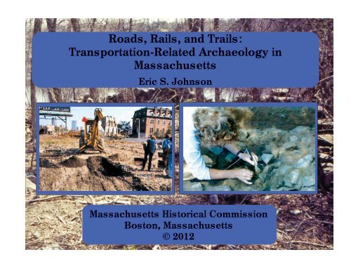
Roads, Rails, and Trails - Secretary of the Commonwealth
Roads, Rails, and Trails - Secretary of the Commonwealth
Roads, Rails, and Trails - Secretary of the Commonwealth

You also want an ePaper? Increase the reach of your titles
YUMPU automatically turns print PDFs into web optimized ePapers that Google loves.
<strong>Roads</strong>, <strong>Rails</strong>, <strong>and</strong> <strong>Trails</strong>:<br />
Transportation-Related Archaeology in<br />
Massachusetts<br />
Eric S. Johnson<br />
Massachusetts Historical Commission<br />
Boston, Massachusetts<br />
© 2012
CONTENTS<br />
Transportation <strong>and</strong> Archaeology……………………. 1<br />
The Route 495 Project Sites, Mansfield, Norton,<br />
Taunton, Raynham, <strong>and</strong> Bridgewater……………..…4<br />
The Annasnappet Pond Sites, Carver.…..………....…8<br />
The Oak Knoll Site, Lincoln……….…………………10<br />
The Hartford Avenue Rockshelter, Uxbridge…….…14<br />
The Foundry Pond Site, Hingham ……………….......18<br />
The Franklin County Bikeway Site, Deerfield …........23<br />
The Polpis Road Bicycle Path Sites, Nantucket……...27<br />
The Metropolitan Railroad Site, Roxbury……...……34<br />
The Highl<strong>and</strong> Foundry Site, Roxbury ………….........38<br />
The Sampson's Tavern Site, Lakeville………………..43<br />
The Kingsley Tavern Site, Royalston………………....48<br />
The Big Dig Sites, Boston…… ……………………......51<br />
New <strong>Roads</strong>, Old Sites, New Stories ……..…...….........55
TRANSPORTATION AND ARCHAEOLOGY<br />
Transportation <strong>and</strong> archaeology? It is definitely not a<br />
word pairing that springs to mind like "ham <strong>and</strong> cheese" or<br />
"thunder <strong>and</strong> lightning," but it describes a relationship that is<br />
interesting, important, <strong>and</strong> <strong>the</strong> subject <strong>of</strong> this booklet. In <strong>the</strong>se<br />
pages you will learn about archaeology in Massachusetts,<br />
specifically archaeology that has been done in advance <strong>of</strong><br />
transportation-related construction projects.<br />
Why is archaeology sometimes done in advance <strong>of</strong><br />
construction projects? The simple answer is that it is done<br />
because construction, whe<strong>the</strong>r <strong>of</strong> roads, railways, paths,<br />
parking lots, or buildings, can destroy archaeological sites.<br />
Doing archaeological research before building begins allows us<br />
to learn something about life in <strong>the</strong> past before that knowledge<br />
is destroyed in order to meet <strong>the</strong> needs <strong>of</strong> <strong>the</strong> present.<br />
Archaeologists have been worried about <strong>the</strong> destruction<br />
<strong>of</strong> sites for a long time. But it was not until <strong>the</strong> early 1960s,<br />
during <strong>the</strong> peak <strong>of</strong> <strong>the</strong> construction <strong>of</strong> <strong>the</strong> interstate highway<br />
system, that <strong>the</strong>se concerns became widespread enough that <strong>the</strong><br />
federal government took action. The result was national<br />
legislation <strong>and</strong> regulations requiring that when federal funds<br />
1<br />
are spent on a project, including transportation-related<br />
construction, <strong>the</strong> potential consequences <strong>of</strong> that project are<br />
evaluated. This is to make sure that <strong>the</strong> money is spent wisely,<br />
<strong>and</strong> that construction does not needlessly destroy important<br />
natural resources, sites <strong>of</strong> cultural significance, or historical<br />
sites, including buildings, bridges, l<strong>and</strong>scapes, <strong>and</strong><br />
archaeological sites (see Laws <strong>and</strong> Regulations that Protect<br />
Archaeological Sites). Many <strong>of</strong> our nation's states have added<br />
<strong>the</strong>ir own laws <strong>and</strong> regulations to protect sites <strong>of</strong> state <strong>and</strong> local<br />
significance, when state funds are spent on a construction<br />
project.<br />
These laws <strong>and</strong> regulations establish a step-by-step<br />
process, <strong>and</strong> <strong>the</strong> archaeological research that complies with<br />
<strong>the</strong>m <strong>of</strong>ten takes a corresponding phased approach. First,<br />
archaeologists must identify sites within <strong>the</strong> project area. They<br />
do this by researching historic archives <strong>and</strong> through limited,<br />
small-scale digging. If sites are found, archaeologists proceed<br />
to <strong>the</strong> next phase—evaluating <strong>the</strong> importance <strong>of</strong> any sites <strong>the</strong>y<br />
have discovered in <strong>the</strong> first phase <strong>of</strong> research. They do this<br />
with more archival research <strong>and</strong> additional excavation. Finally,<br />
if <strong>the</strong>re are significant sites that cannot be avoided,<br />
archaeologists conduct a full-scale dig to recover <strong>the</strong><br />
information that would o<strong>the</strong>rwise be destroyed.<br />
Once <strong>the</strong> laws <strong>and</strong> regulations took effect, <strong>the</strong> results<br />
were incredible. Not every transportation-related construction<br />
project has warranted an archaeological study. But when<br />
archaeology has been done in advance <strong>of</strong> road, rail, <strong>and</strong> even<br />
bike-trail construction it has brought a wealth <strong>of</strong> new insights<br />
into Massachusetts' past.<br />
The first transportation-related archaeological projects<br />
were studies <strong>of</strong> some long corridors through parts <strong>of</strong> <strong>the</strong> state<br />
that comprised <strong>the</strong> last pieces <strong>of</strong> <strong>the</strong> interstate system as well as
important state highways. These gave archaeologists an<br />
unprecedented opportunity to test big slices <strong>of</strong> <strong>the</strong> l<strong>and</strong>scape<br />
<strong>and</strong> to compare <strong>the</strong> deep histories <strong>of</strong> people's use <strong>of</strong> different<br />
environments. Gradually, <strong>the</strong> focus <strong>of</strong> transportation<br />
construction shifted to maintenance, repair, <strong>and</strong> redesign <strong>of</strong><br />
problem traffic areas. Archaeologists focused on <strong>the</strong>se smaller<br />
study areas, in which <strong>the</strong>y occasionally found truly outst<strong>and</strong>ing<br />
resources. In <strong>the</strong> Boston area, transportation construction was<br />
diverse, including commuter rail <strong>and</strong>, <strong>of</strong> course, <strong>the</strong> Big Dig.<br />
Archaeological projects associated with <strong>the</strong>se developments<br />
unear<strong>the</strong>d exciting new information about homes, businesses,<br />
<strong>and</strong> industries in our state's capital city. In suburban <strong>and</strong> rural<br />
parts <strong>of</strong> <strong>the</strong> state, bike paths were created, <strong>and</strong> some amazing<br />
new archaeological sites were discovered in <strong>the</strong> process.<br />
If you were to ask people "What is archaeology?" many<br />
might answer that it is digging up ancient artifacts—objects<br />
made or modified by people—but that is really only a small<br />
part <strong>of</strong> archaeology. Archaeologists dig, find, <strong>and</strong> study<br />
artifacts in order to learn about human behavior. People are<br />
unique in <strong>the</strong> way we make <strong>and</strong> modify materials for all sorts<br />
<strong>of</strong> purposes, from finding <strong>and</strong> preparing food, to clothing <strong>and</strong><br />
housing ourselves, to communicating ideas. Archaeologists call<br />
all <strong>the</strong>se made <strong>and</strong> modified things "material culture." Most<br />
people call it "stuff."<br />
In addition to artifacts, archaeologists also distinguish<br />
"features" as an important category <strong>of</strong> material culture.<br />
Features are basically complex artifacts or arrangements <strong>of</strong><br />
artifacts that can't be picked up in one piece. Features include<br />
things like ancient firepits where food was cooked, house<br />
floors, privies (pits dug beneath outhouses), <strong>and</strong> ditches.<br />
Archaeologists find most <strong>of</strong> this material culture<br />
concentrated in places where people have lived <strong>and</strong> worked;<br />
<strong>the</strong>y call <strong>the</strong>se concentrations "sites." Much archaeological<br />
2<br />
research is focused on sites <strong>and</strong> what <strong>the</strong> artifacts <strong>and</strong> features<br />
<strong>the</strong>y contain can tell us about <strong>the</strong> past.<br />
Laws <strong>and</strong> Regulations that Protect Archaeological Sites<br />
Laws have protected archaeological sites on federal l<strong>and</strong> since<br />
<strong>the</strong> early 1900s. Beginning in <strong>the</strong> 1960s, new laws were passed<br />
to ensure that federal projects, including road <strong>and</strong> railway<br />
construction, were reviewed to estimate <strong>the</strong>ir potential to<br />
damage or destroy archaeological sites (as well as o<strong>the</strong>r<br />
historic <strong>and</strong> natural resources) <strong>and</strong> that efforts were made to<br />
take those effects into account, perhaps by altering project to<br />
avoid, preserve, <strong>and</strong> protect an archaeological site, or having<br />
archaeologists excavate <strong>the</strong> site before <strong>the</strong> project went<br />
through it.<br />
The most important <strong>of</strong> <strong>the</strong>se laws are:<br />
♦ The National Historic Preservation Act (NHPA)<br />
♦ The National Environmental Policy Act (NEPA)<br />
♦ The Department <strong>of</strong> Transportation Act Section 4(f)<br />
A couple <strong>of</strong> important things to remember about <strong>the</strong>se laws:<br />
♦ They do not require that archaeological sites, even <strong>the</strong><br />
most important ones, be preserved, only that <strong>the</strong> effects <strong>of</strong><br />
<strong>the</strong> project “be taken into account.” This means that<br />
sometimes sites are excavated in advance <strong>of</strong> a project, <strong>and</strong><br />
sometimes, when it is feasible, projects are redesigned to<br />
avoid <strong>the</strong> destruction <strong>of</strong> <strong>the</strong> site.<br />
♦ They give states, Native American tribes, <strong>and</strong> o<strong>the</strong>r<br />
interested parties a chance to review <strong>and</strong> shape federal<br />
projects in order to identify <strong>and</strong> explore ways to protect<br />
important historic <strong>and</strong> archaeological sites.
Like historians, archaeologists study <strong>the</strong> past <strong>and</strong> tell<br />
stories about it based on <strong>the</strong>ir studies. While historians base<br />
<strong>the</strong>ir stories <strong>of</strong> <strong>the</strong> past (mostly) on documents, archaeologists<br />
base <strong>the</strong>ir stories <strong>of</strong> <strong>the</strong> past on archaeological sites <strong>and</strong><br />
material culture. But unlike historical documents, which can be<br />
read over <strong>and</strong> over again for new insights, archaeological sites<br />
can only be dug once, <strong>and</strong> once <strong>the</strong>y are dug <strong>the</strong>y are gone<br />
forever. That is why archaeologists dig so carefully, taking<br />
photos, drawing plans that show precisely where artifacts <strong>and</strong><br />
features were found in relation to one ano<strong>the</strong>r, <strong>and</strong> writing<br />
detailed notes. That is why archaeological records <strong>and</strong> artifacts<br />
must be permanently stored in a safe place so that <strong>the</strong>y can be<br />
studied or displayed in <strong>the</strong><br />
future. That is also why it is so<br />
important to protect<br />
archaeological sites so that<br />
<strong>the</strong>y, along with <strong>the</strong> stories<br />
<strong>the</strong>y contain, are not lost<br />
forever.<br />
The remainder <strong>of</strong> this<br />
booklet contains a series <strong>of</strong><br />
descriptions <strong>of</strong> some <strong>of</strong> <strong>the</strong><br />
more notable sites that have<br />
been studied in advance <strong>of</strong> a<br />
variety <strong>of</strong> transportation<br />
construction projects including<br />
roads, railways, <strong>and</strong> bike paths.<br />
Because sites are destroyed when <strong>the</strong>y are dug,<br />
archaeologists make every effort to record <strong>the</strong>ir<br />
observations in painstaking detail<br />
3<br />
Two sites: <strong>the</strong> Flagg Swamp Rockshelter in Marlborough, <strong>and</strong><br />
<strong>the</strong> Indian Crossing Site in Chicopee, are so important that<br />
each has been given its own publication in this series. You can<br />
get copies <strong>of</strong> those publications by contacting <strong>the</strong><br />
Massachusetts Historical Commission or by downloading an<br />
electronic copy directly from <strong>the</strong> MHC's web site. The sites<br />
described in this booklet range over several thous<strong>and</strong> years <strong>and</strong><br />
include ancient Native American settlements, dwellings, <strong>and</strong><br />
workshops, colonial-period homes, urban <strong>and</strong> rural taverns, <strong>and</strong><br />
nineteenth-century factories <strong>and</strong> businesses. They are found in<br />
cities, suburbs, <strong>and</strong> rural towns. The list <strong>of</strong> sites is hardly<br />
exhaustive; <strong>the</strong>re are many more known archaeological sites in<br />
Massachusetts, <strong>and</strong> many that have yet to be discovered. Enjoy<br />
<strong>the</strong> tour!<br />
This map <strong>of</strong> Massachusetts highlights <strong>the</strong> cities <strong>and</strong> towns<br />
in which <strong>the</strong> sites discussed in this booklet were found.
THE ROUTE 495 PROJECT SITES, MANSFIELD, NORTON, TAUNTON, RAYNHAM, AND<br />
BRIDGEWATER<br />
<strong>the</strong>y were occupied <strong>and</strong> what people had been doing at <strong>the</strong>m.<br />
Their goal was to reconstruct ancient “settlement systems,” <strong>the</strong><br />
way that people organized <strong>the</strong>mselves across <strong>the</strong> l<strong>and</strong>scape,<br />
adjusting <strong>the</strong> sizes <strong>of</strong> <strong>the</strong>ir groups by coming toge<strong>the</strong>r or<br />
splitting up, moving from one type <strong>of</strong> place to ano<strong>the</strong>r<br />
according to <strong>the</strong> changing seasons.<br />
Interstate 495 is a vital transportation artery that<br />
surrounds <strong>the</strong> greater Boston area like a wheel whose spokes<br />
are I-93, I-95, Massachusetts Route 3, <strong>and</strong> <strong>the</strong> Massachusetts<br />
Turnpike (I-90). It bypasses urban traffic for interstate travelers<br />
<strong>and</strong> truckers going between nor<strong>the</strong>rn <strong>and</strong> sou<strong>the</strong>rn New<br />
Engl<strong>and</strong> <strong>and</strong> helps to relieve urban congestion in Boston. It<br />
also links <strong>the</strong> metrowest suburbs <strong>and</strong> Worcester County to<br />
Cape Cod. Its construction, which began in 1958, has<br />
stimulated residential, industrial, <strong>and</strong> commercial growth all<br />
along its course. Much <strong>of</strong> Route 495’s 120 miles were<br />
completed before historic preservation regulations for Federal<br />
projects were in place. But its final phase <strong>of</strong> construction, <strong>the</strong><br />
14 miles between Mansfield <strong>and</strong> West Bridgewater, which<br />
began in <strong>the</strong> late 1970s <strong>and</strong> was completed in 1982, was<br />
preceded by archaeological studies that gave us a<br />
comprehensive picture <strong>of</strong> how people lived in this area for<br />
more than 10,000 years before Massachusetts had any paved<br />
roads.<br />
Before <strong>the</strong> 495 archaeological studies, almost all<br />
archaeology in Massachusetts had been focused on single sites,<br />
or occasionally a group <strong>of</strong> known sites in a region. But this was<br />
a chance to carefully investigate a long corridor through <strong>the</strong><br />
interior <strong>of</strong> sou<strong>the</strong>astern Massachusetts, a study area that<br />
crossed rivers, skirted lakes <strong>and</strong> wetl<strong>and</strong>s, <strong>and</strong> traversed hills<br />
<strong>and</strong> upl<strong>and</strong> forests. From 1977 to 1982 archaeologists from <strong>the</strong><br />
(<strong>the</strong>n) br<strong>and</strong>-new Public Archaeology Laboratory, which at <strong>the</strong><br />
time was affiliated with Brown University, studied, tested, <strong>and</strong><br />
excavated along <strong>the</strong> 495 route, discovering new sites, testing<br />
ideas about where sites were <strong>and</strong> were not likely to be found,<br />
<strong>and</strong> excavating many <strong>of</strong> <strong>the</strong> sites <strong>the</strong>y discovered to learn when<br />
4<br />
Mansfield, Norton, Taunton, Raynham, <strong>and</strong> Bridgewater,<br />
Massachusetts<br />
The research project also included studies <strong>of</strong> <strong>the</strong><br />
environmental history <strong>of</strong> <strong>the</strong> region. By carefully extracting<br />
<strong>and</strong> analyzing <strong>the</strong> sediments at <strong>the</strong> bottoms <strong>of</strong> lakes <strong>and</strong><br />
swamps, which contain preserved layers <strong>of</strong> ancient pollen <strong>and</strong><br />
spores, scientists can reconstruct changes in vegetation,<br />
temperature, <strong>and</strong> rainfall over thous<strong>and</strong>s <strong>of</strong> years. Comparing<br />
this to <strong>the</strong> archaeological record gave new insights into how <strong>the</strong><br />
ancient ancestors <strong>of</strong> <strong>the</strong> Native American people <strong>of</strong> this region<br />
responded to long-term changes in climate <strong>and</strong> environment<br />
over thous<strong>and</strong>s <strong>of</strong> years.
Eventually nineteen different sites were excavated.<br />
These sites combined contained a record <strong>of</strong> people’s daily lives<br />
extending from 8,000 B.C. to 1500 A.D. More than 180,000<br />
artifacts were excavated, recorded, analyzed, <strong>and</strong> curated for<br />
future study. The archaeologists also identified hundreds <strong>of</strong><br />
archaeological features.<br />
At a site named Canoe River West, located near <strong>the</strong><br />
Canoe River in Norton, <strong>the</strong> archaeologists uncovered three<br />
large platforms made <strong>of</strong> rocks. The rocks had been reddened<br />
<strong>and</strong> cracked by exposure to heat, <strong>and</strong> among <strong>the</strong> rocks <strong>the</strong><br />
archaeologists found many bits <strong>of</strong> charcoal. The archaeologists<br />
concluded that <strong>the</strong> platforms had underlain fires for cooking,<br />
smoking, <strong>and</strong> drying fish that had been caught in <strong>the</strong> river. But<br />
<strong>the</strong> platforms were only part <strong>of</strong> <strong>the</strong> story. When <strong>the</strong><br />
archaeologists dug beneath <strong>the</strong> platforms <strong>the</strong>y found many<br />
filled-in storage pits that had been used to store <strong>the</strong> smoked <strong>and</strong><br />
dried fish.<br />
Apparently, <strong>the</strong> Canoe River West site was a favorite<br />
fishing spot that was returned to year after year for thous<strong>and</strong>s<br />
<strong>of</strong> years. In those days <strong>the</strong> Canoe River, like many o<strong>the</strong>r<br />
Massachusetts rivers, would have been filled with fish every<br />
spring as shad, salmon, <strong>and</strong> o<strong>the</strong>r kinds <strong>of</strong> fish swam upstream<br />
to spawn in freshwater lakes <strong>and</strong> brooks. The Native American<br />
people trapped <strong>the</strong> fish in weirs, caught <strong>the</strong>m with nets or<br />
spears, cooked some to eat right away, <strong>and</strong> smoked <strong>and</strong> dried<br />
<strong>the</strong> rest for later. This was an important part <strong>of</strong> <strong>the</strong> settlement<br />
system, a time <strong>of</strong> year when people could ga<strong>the</strong>r toge<strong>the</strong>r in<br />
large groups, with plenty <strong>of</strong> food at h<strong>and</strong>. They built <strong>the</strong> rock<br />
platforms, or reused platforms from previous years, kindled<br />
fires on <strong>the</strong>m for smoking <strong>the</strong> fish, <strong>and</strong> dug pits in which <strong>the</strong>y<br />
stored <strong>the</strong> preserved fish (probably inside closely-woven<br />
baskets). Some <strong>of</strong> <strong>the</strong> rock platforms were built right over<br />
older, filled-in storage pits.<br />
5<br />
Rock Platform from <strong>the</strong> Canoe River West Site<br />
Ano<strong>the</strong>r site, named <strong>the</strong> Rozenas I site in Raynham,<br />
also had evidence <strong>of</strong> repeated occupation over thous<strong>and</strong>s <strong>of</strong><br />
years. At this site <strong>the</strong> archaeologists were able to distinguish<br />
some distinct activity areas for living, manufacturing stone<br />
tools, butchering animals, <strong>and</strong> preparing meals. Although <strong>the</strong><br />
site was occupied over thous<strong>and</strong>s <strong>of</strong> years, much <strong>of</strong> <strong>the</strong><br />
occupation dated to around 1500 A.D., just before contact with<br />
Europeans. The most ancient <strong>of</strong> <strong>the</strong> sites was <strong>the</strong> Double P site,<br />
which contained artifacts <strong>and</strong> features that were more than<br />
8,000 years old.
A Sample <strong>of</strong> Artifacts from <strong>the</strong> 495 Project Sites<br />
Top (left-right) Bifurcate Base (spear) point from <strong>the</strong> Double<br />
P Site; Neville point from <strong>the</strong> Bay Street I Site; Brewerton<br />
Eared Triangle point from <strong>the</strong> Snake River West Site;<br />
Squibnocket Triangle from <strong>the</strong> Canoe River West Site; Small<br />
Stemmed point from <strong>the</strong> Bay Street I Site. Bottom (left-right)<br />
Levanna Triangle point from <strong>the</strong> Rozenas I Site; awl or<br />
piercing tool from <strong>the</strong> Rozenas II Site; grooved stone<br />
netsinker from <strong>the</strong> Treatment Plant Site; ground stone adze<br />
from <strong>the</strong> Bay Street I Site<br />
6<br />
The information on ancient environments that was<br />
collected as part <strong>of</strong> <strong>the</strong> 495 project provided explanations for<br />
some <strong>of</strong> <strong>the</strong> patterns that emerged from <strong>the</strong> archaeological<br />
studies. For example, <strong>the</strong> environmental studies showed that<br />
between about 4,000 <strong>and</strong> 3,000 years ago, <strong>the</strong>re was a period<br />
when <strong>the</strong> climate became much drier. People responded to this<br />
environmental challenge by adjusting <strong>the</strong>ir settlement systems.<br />
Settlements around <strong>the</strong> largest <strong>and</strong> deepest lakes <strong>and</strong> wetl<strong>and</strong>s<br />
(those least affected by <strong>the</strong> drought), were lived in by more<br />
people at once <strong>and</strong> for longer periods <strong>of</strong> time. The sites grew<br />
large <strong>and</strong> contained a greater variety <strong>of</strong> tools <strong>and</strong> features,<br />
including food-storage features. Storing <strong>of</strong> food, as in <strong>the</strong><br />
storage pits found at <strong>the</strong> Canoe River West site, is a sensible<br />
solution to <strong>the</strong> problem <strong>of</strong> changing environment. Away from<br />
<strong>the</strong> large settlements were smaller special-purpose sites, where<br />
people lived for short periods <strong>and</strong> focused on just a few tasks.<br />
These sites are small <strong>and</strong> contain a limited variety <strong>of</strong> tools.<br />
During this time, people were settling in one place in a large<br />
group for a long period <strong>of</strong> time <strong>and</strong> sending out smaller,<br />
special-purpose expeditions from <strong>the</strong> base settlement, ra<strong>the</strong>r<br />
than living in smaller groups <strong>and</strong> moving more frequently from<br />
place to place as <strong>the</strong>y had done before.<br />
The Route 495 project was a l<strong>and</strong>mark in<br />
Massachusetts archaeology in many ways. It was <strong>the</strong> first<br />
large-scale transportation-related archaeological study in <strong>the</strong><br />
<strong>Commonwealth</strong>. It was <strong>the</strong> first modern archaeological study<br />
<strong>of</strong> a big slice <strong>of</strong> <strong>the</strong> Massachusetts l<strong>and</strong>scape. It was a<br />
multidisciplinary research project, combining archaeology <strong>and</strong><br />
environmental studies. It was a training ground for a generation<br />
<strong>of</strong> archaeologists, many <strong>of</strong> whom still contribute to New<br />
Engl<strong>and</strong> archaeology. In <strong>the</strong> end, it added greatly to our<br />
knowledge <strong>of</strong> <strong>the</strong> ancient history <strong>of</strong> <strong>the</strong> l<strong>and</strong> <strong>and</strong> <strong>the</strong> Native<br />
people <strong>of</strong> Massachusetts.
Excavations in progress at <strong>the</strong> Newcomb Site, 495 Project<br />
7
The Annasnappet Pond Sites, Carver<br />
In <strong>the</strong> late 1970s, The Massachusetts Department <strong>of</strong><br />
Transportation (<strong>the</strong>n known as <strong>the</strong> Massachusetts Department<br />
<strong>of</strong> Public Works) began planning improvements to Route 44.<br />
This road is a major east-west transportation route, running<br />
from Plymouth through Taunton <strong>and</strong> ultimately to Providence,<br />
Rhode Isl<strong>and</strong>. The route was narrow <strong>and</strong> me<strong>and</strong>ering in places,<br />
<strong>and</strong> <strong>the</strong> planned alterations were designed to cut travel time <strong>and</strong><br />
improve safety. Archaeological testing began with a group<br />
from Harvard University’s Institute for Conservation<br />
Archaeology (ICA), who began testing several alternative<br />
routes in <strong>the</strong> fall <strong>and</strong> early winter <strong>of</strong> 1978. The ICA<br />
archaeologists found several ancient sites around Annasnappet<br />
Pond, a large complex <strong>of</strong> cranberry bogs surrounded by s<strong>and</strong>y<br />
knolls in a rural part <strong>of</strong> <strong>the</strong> town <strong>of</strong> Carver.<br />
Carver, Massachusetts<br />
8<br />
Annasnappet comes from <strong>the</strong> Wampanoag word<br />
meaning “at <strong>the</strong> source <strong>of</strong> <strong>the</strong> stream,” <strong>and</strong> <strong>the</strong> pond is <strong>the</strong><br />
headwater <strong>of</strong> Annasnappet Brook, whose waters eventually<br />
flow into <strong>the</strong> Taunton River <strong>and</strong> <strong>the</strong>n into Mount Hope Bay<br />
<strong>and</strong> Rhode Isl<strong>and</strong> Sound. It was an attractive <strong>and</strong> comfortable<br />
place to live in ancient times. There was a spring that ran yearround,<br />
providing drinking water for <strong>the</strong> people <strong>and</strong> attracting<br />
game animals to <strong>the</strong> area. It was surrounded by s<strong>and</strong>y knolls<br />
<strong>and</strong> terraces. The dry s<strong>and</strong>y soils made for comfortable<br />
dwelling places that did not get muddy in rainy wea<strong>the</strong>r.<br />
Annasnappet Pond has been used for cranberry bogs for<br />
more than 100 years. Unfortunately, cranberry bog<br />
maintenance involves regularly spreading s<strong>and</strong> over <strong>the</strong> bogs,<br />
<strong>and</strong> some <strong>of</strong> <strong>the</strong> sites on <strong>the</strong> s<strong>and</strong>y knolls had been destroyed<br />
because <strong>the</strong>y had been quarried for s<strong>and</strong> over <strong>the</strong> years. Fur<strong>the</strong>r<br />
study <strong>of</strong> <strong>the</strong> sites showed that some had been badly damaged,<br />
but o<strong>the</strong>rs had not yet been disturbed. The highway planners<br />
tried to avoid as many <strong>of</strong> <strong>the</strong> intact sites as <strong>the</strong>y could, but it<br />
was not possible to avoid all <strong>of</strong> <strong>the</strong>m. Between 1992 <strong>and</strong> 1995<br />
four <strong>of</strong> <strong>the</strong> sites were excavated by <strong>the</strong> Public Archaeology<br />
Laboratory, Inc. (PAL).<br />
The PAL archaeologists made some amazing<br />
discoveries. Many <strong>of</strong> <strong>the</strong> sites around <strong>the</strong> bog dated from a time<br />
that archaeologists call <strong>the</strong> “Middle Archaic” period, about<br />
8,000 to 9,000 years ago. Among <strong>the</strong> discoveries from that<br />
period was <strong>the</strong> oldest human burial ever discovered in<br />
Massachusetts, <strong>and</strong> possibly in all <strong>of</strong> New Engl<strong>and</strong> (more than<br />
8,000 years old!). The burial included cremated human bone,<br />
red ochre (a powdery red pigment made by grinding up pieces<br />
<strong>of</strong> an iron mineral called hematite), two stone spear points, <strong>and</strong><br />
polished stone weights that were once part <strong>of</strong> spear throwers<br />
that had long since disintegrated.
The spear points were <strong>of</strong> a variety known as “Neville,”<br />
named for a site in New Hampshire where <strong>the</strong>y were first<br />
identified. The archaeologists found many Neville points at <strong>the</strong><br />
Annasnappet Pond sites. The points were found in all stages <strong>of</strong><br />
manufacture <strong>and</strong> use, so <strong>the</strong> archaeologists were able to trace<br />
<strong>the</strong> process by which <strong>the</strong>y were made, resharpened, <strong>and</strong> when<br />
broken, recycled into different kinds <strong>of</strong> tools.<br />
9<br />
A much more complete account <strong>of</strong> this fascinating<br />
archaeological district is available in a popular report titled:<br />
Annasnappet Pond: 9,000 Years in Carver, Massachusetts,<br />
written by Diana Doucette <strong>and</strong> available from <strong>the</strong> Public<br />
Archaeology Laboratory, Inc. <strong>of</strong> Pawtucket, Rhode Isl<strong>and</strong>.<br />
Left: Neville spear points from one <strong>of</strong> <strong>the</strong> Annasnappet Pond sites. Right: broken point tips <strong>and</strong> bases were recycled into new,<br />
smaller points.
THE OAK KNOLL SITE, LINCOLN<br />
Ancient Native American sites in Massachusetts present<br />
many challenges to <strong>the</strong> archaeologists who excavate <strong>and</strong><br />
interpret <strong>the</strong>m. One challenge is that most <strong>of</strong> <strong>the</strong> sites were<br />
visited again <strong>and</strong> again for thous<strong>and</strong>s <strong>of</strong> years (not surprising<br />
since <strong>the</strong>y were good places to stay). But it can be difficult to<br />
separate <strong>the</strong> artifacts <strong>and</strong> features left behind by one group <strong>of</strong><br />
occupants from those left by <strong>the</strong> next <strong>and</strong> <strong>the</strong> next. In some<br />
parts <strong>of</strong> <strong>the</strong> world, floods or volcanoes deposit layers <strong>of</strong><br />
sediment on sites that help to separate at least some <strong>of</strong> <strong>the</strong><br />
episodes <strong>of</strong> human occupation. We don’t have volcanoes in<br />
Massachusetts (knock wood) <strong>and</strong> <strong>the</strong>re are very few places<br />
where floods regularly deposit layers <strong>of</strong> silt. So at most sites all<br />
<strong>the</strong> artifacts from thous<strong>and</strong>s <strong>of</strong> years <strong>of</strong> history are contained in<br />
a fairly thin layer <strong>of</strong> soil, where <strong>the</strong>y are moved up <strong>and</strong> down<br />
by burrowing animals, frost action, <strong>and</strong> tree roots. On top <strong>of</strong><br />
that, most <strong>of</strong> <strong>the</strong> state has been plowed or harrowed at one time<br />
or ano<strong>the</strong>r, <strong>and</strong> this mixes everything up even more. So a site<br />
that contains <strong>the</strong> material from a single episode <strong>of</strong> occupation<br />
(archaeologists call this a “single-component site”) is a rare<br />
find indeed. One such site was <strong>the</strong> Oak Knoll site in <strong>the</strong> town<br />
<strong>of</strong> Lincoln.<br />
The intersection <strong>of</strong> Massachusetts Routes 2 <strong>and</strong> 2A in<br />
Lincoln—known as Crosby Corner—had long been a problem<br />
traffic area. In <strong>the</strong> late 1990s Mass Highway planned a road<br />
realignment <strong>and</strong> reconstruction to make driving through<br />
Crosby Corner safer <strong>and</strong> more convenient. In 1998,<br />
archaeologists from University <strong>of</strong> Massachusetts<br />
Archaeological Services began a study to identify any<br />
archaeological sites that might be affected by <strong>the</strong> proposed<br />
realignment. The study was completed with <strong>the</strong> excavation <strong>of</strong><br />
<strong>the</strong> Oak Knoll site in 2000.<br />
10<br />
Lincoln, Massachusetts<br />
The archaeologists excavated twenty-five square meters<br />
<strong>of</strong> <strong>the</strong> site. All <strong>the</strong> excavation squares were in a single group,<br />
giving <strong>the</strong> archaeologists a wide view <strong>of</strong> <strong>the</strong> site. The plan <strong>of</strong><br />
<strong>the</strong> Oak Knoll site on <strong>the</strong> next page shows <strong>the</strong> squares <strong>and</strong><br />
trenches <strong>the</strong> archaeologists excavated. Each is labeled “EU”<br />
(for excavation unit) followed by a number or “STP” for shovel<br />
test pit. The shovel test pits were used to discover <strong>the</strong> site; <strong>the</strong><br />
excavation units to expose <strong>the</strong> site area for mapping <strong>and</strong><br />
detailed study.<br />
As <strong>the</strong>y excavated, <strong>the</strong> archaeologists carefully noted<br />
<strong>the</strong> colors <strong>and</strong> textures <strong>of</strong> <strong>the</strong> soils <strong>the</strong>y were digging through,<br />
as well as <strong>the</strong> artifacts <strong>the</strong>y found. From <strong>the</strong> ground surface<br />
down about four to six inches was a brown soil called a<br />
plowzone. This soil is created by plowing, <strong>and</strong> is a sort <strong>of</strong><br />
“default” upper soil layer in most <strong>of</strong> Massachusetts. Below this<br />
was yellowish-brown subsoil, which got gradually lighter with
greater depth. But over a large area <strong>of</strong> <strong>the</strong> site <strong>the</strong>re was a third<br />
layer s<strong>and</strong>wiched in between <strong>the</strong> plowzone <strong>and</strong> subsoil. This<br />
was a darker soil: black, even reddened in places, <strong>and</strong> two to<br />
four inches thick. This was an ancient living surface (labeled<br />
“Feature #4" on <strong>the</strong> site plan). Scattered within Feature #4 were<br />
a number <strong>of</strong> pits, but what <strong>the</strong>y may have once held was not<br />
preserved.<br />
A Plan <strong>of</strong> <strong>the</strong> Oak Knoll Site<br />
11<br />
At <strong>the</strong> center <strong>of</strong> this area was a rock lined hearth<br />
(Feature #5), shaped like a shallow basin about seventeen<br />
inches deep <strong>and</strong> 30 inches across at <strong>the</strong> top, where it was<br />
ringed by a semi-circle <strong>of</strong> cobbles. The upper part <strong>of</strong> this basin<br />
was filled with greasy black dirt full <strong>of</strong> bits <strong>of</strong> charcoal <strong>and</strong> tiny<br />
flakes <strong>of</strong> stone, <strong>the</strong> kind that are produced when stone tools are<br />
resharpened.
But what kinds <strong>of</strong> tools were being resharpened here,<br />
<strong>and</strong> when did this happen? When was this living surface—<br />
well—lived on? And could <strong>the</strong> archaeologists answer <strong>the</strong>se<br />
questions, or was <strong>the</strong> site going to contain a mix <strong>of</strong> artifacts<br />
spanning thous<strong>and</strong>s <strong>of</strong> years so that <strong>the</strong> living floor <strong>and</strong> hearth<br />
could not even be connected? Or, was <strong>the</strong> Oak Knoll site an<br />
example <strong>of</strong> <strong>the</strong> elusive single-component site?<br />
The artifacts from <strong>the</strong> site strongly suggested <strong>the</strong> latter.<br />
The archaeologists excavated more than 3,000 artifacts from<br />
this area, nearly all <strong>of</strong> which were <strong>the</strong> stone flakes that are <strong>the</strong><br />
by-product <strong>of</strong> making or resharpening stone tools. More than<br />
99% <strong>of</strong> <strong>the</strong>se were <strong>of</strong> a single type <strong>of</strong> stone, known as a grey<br />
porphorytic rhyolite. It is dark grey to purple in color with tiny<br />
white crystals scattered throughout. Tools made from this kind<br />
<strong>of</strong> stone have been found at many sites in nor<strong>the</strong>astern<br />
Massachusetts, <strong>and</strong> outcrops <strong>of</strong> stone identical in appearance<br />
have been found in <strong>the</strong> area. So it is a material that was readily<br />
available. Even so, to find a site where more than ninety-nine<br />
out <strong>of</strong> a hundred flakes are <strong>of</strong> <strong>the</strong> same type <strong>of</strong> stone is almost<br />
unheard <strong>of</strong>, <strong>and</strong> strongly suggested that <strong>the</strong> Oak Knoll site<br />
represents a single occupation.<br />
.Of <strong>the</strong> stone tools <strong>the</strong>mselves, <strong>the</strong>re were eleven that<br />
could be classified. All <strong>of</strong> <strong>the</strong>se were <strong>of</strong> <strong>the</strong> same variety,<br />
identified as “Orient Fishtail points." This type <strong>of</strong> tool gets its<br />
name from Orient Point, at <strong>the</strong> outermost tip <strong>of</strong> Long Isl<strong>and</strong>,<br />
where it was first described. It looks something like a graceful,<br />
streamlined fish. Orient Fishtail points have been found<br />
throughout sou<strong>the</strong>rn New Engl<strong>and</strong>. In addition to <strong>the</strong> eleven<br />
Orient Fishtail points, <strong>the</strong> archaeologists found some o<strong>the</strong>r<br />
tools <strong>and</strong> tool fragments, a few <strong>of</strong> which were almost certainly<br />
fragments <strong>of</strong> Orient Fishtail points. Every one <strong>of</strong> <strong>the</strong>se was<br />
made <strong>of</strong> <strong>the</strong> same dark grey porphorytic rhyolite.<br />
12<br />
Orient Fishtail Points <strong>and</strong> Point Fragments from <strong>the</strong> Oak<br />
Knoll Site. You can see how <strong>the</strong>y got <strong>the</strong>ir name. You can<br />
also see that most <strong>of</strong> <strong>the</strong>m were broken in <strong>the</strong> same way.
When <strong>the</strong>y can be reliably associated with a<br />
radiocarbon date, Orient Fishtail points date to approximately<br />
3,000 years ago, give or take a few hundred years. A piece <strong>of</strong><br />
charcoal from <strong>the</strong> central hearth feature was radiocarbon dated<br />
to between 3155 <strong>and</strong> 2795 BP (Before Present). So now <strong>the</strong><br />
archaeologists had two pieces <strong>of</strong> evidence (that agreed with<br />
each o<strong>the</strong>r!) for <strong>the</strong> age <strong>of</strong> <strong>the</strong> site.<br />
The archaeologists noticed that almost all <strong>of</strong> <strong>the</strong> Orient<br />
Fishtail points were broken in <strong>the</strong> same way: across <strong>the</strong> middle<br />
portion <strong>of</strong> <strong>the</strong> blade. The one exception (on <strong>the</strong> upper left <strong>of</strong> <strong>the</strong><br />
photo) has a break that runs part way across <strong>the</strong> blade, <strong>the</strong>n hits<br />
a grain or flaw in <strong>the</strong> rock <strong>and</strong> follows that down toward <strong>the</strong><br />
base. Experiments with stone tools show that this kind <strong>of</strong> break<br />
is caused by cutting or sawing with <strong>the</strong> side <strong>of</strong> <strong>the</strong> blade. Close<br />
examination <strong>of</strong> <strong>the</strong> complete points showed that most had some<br />
crushing or grinding around <strong>the</strong> notches above <strong>the</strong> base:<br />
evidence that <strong>the</strong>y had been hafted, or attached to a h<strong>and</strong>le. The<br />
edges <strong>of</strong> <strong>the</strong> points were also examined for evidence <strong>of</strong> wear<br />
from use. There was some polish along <strong>the</strong> edges, but no<br />
scratches or striations. This is <strong>the</strong> kind <strong>of</strong> wear that<br />
experiments show was caused by cutting semi-hard material<br />
like lea<strong>the</strong>r. In summary, <strong>the</strong> result <strong>of</strong> <strong>the</strong> analysis was that <strong>the</strong><br />
“points” were actually used as knives!<br />
So what story does this single component Orient site<br />
tell? The site was occupied only once, for a fairly short period<br />
<strong>of</strong> time. Around 3,000 years ago, a group <strong>of</strong> people arrived<br />
here, bringing with <strong>the</strong>m several rhyolite knives with h<strong>and</strong>les<br />
probably made <strong>of</strong> wood or bone, <strong>and</strong> perhaps some unfinished<br />
pieces <strong>of</strong> <strong>the</strong> same material for making more tools. They dug<br />
out a pit, lined it with rocks, <strong>and</strong> placed cobbles around part <strong>of</strong><br />
it to create <strong>the</strong> equivalent <strong>of</strong> a stove. They used <strong>the</strong> stone tools<br />
as knives to cut something that, if any was left behind, did not<br />
preserve. They broke several tools in <strong>the</strong> process <strong>and</strong>, judging<br />
13<br />
by <strong>the</strong> density <strong>of</strong> <strong>the</strong> flakes, made some replacements. Perhaps<br />
<strong>the</strong>y used <strong>the</strong> surrounding pits to store what <strong>the</strong>y made with <strong>the</strong><br />
knives or dispose <strong>of</strong> waste products. As for exactly what <strong>the</strong>y<br />
were making, what <strong>the</strong>y may have eaten, what clothing <strong>the</strong>y<br />
might have worn, <strong>the</strong> type <strong>of</strong> dwelling <strong>the</strong>y may have built—<br />
<strong>the</strong>se remain as yet unknown.<br />
Fur<strong>the</strong>r reading: A detailed report on <strong>the</strong> Oak Knoll Site<br />
written by Christopher L. Donta, <strong>the</strong> archaeologist who<br />
directed <strong>the</strong> excavation, was published in Volume 64, number<br />
2 <strong>of</strong> <strong>the</strong> Bulletin <strong>of</strong> <strong>the</strong> Massachusetts Archaeological Society<br />
in Fall 2003.<br />
Experimental Archaeology<br />
One <strong>of</strong> <strong>the</strong> ways archaeologists can learn more about <strong>the</strong><br />
artifacts <strong>and</strong> features that <strong>the</strong>y find is by making <strong>and</strong> using<br />
<strong>the</strong>m. This can be as simple(?) as learning to flake stone, or<br />
weaving cloth on a replica <strong>of</strong> an ancient loom, or cutting wood<br />
with a stone axe, or as complicated as trying to build a<br />
pyramid in <strong>the</strong> Egyptian style. By attempting <strong>the</strong>se things<br />
archaeologists gain an appreciation for <strong>the</strong> skills <strong>and</strong><br />
knowledge <strong>of</strong> ancient peoples. Archaeologists can also learn<br />
more about <strong>the</strong> activities that went into producing <strong>the</strong><br />
materials that <strong>the</strong>y dig up <strong>and</strong> study. They also improve <strong>the</strong>ir<br />
ability to recognize different activities that are encoded in<br />
artifacts. These can be subtle, like <strong>the</strong> minute scratches <strong>and</strong><br />
chips on <strong>the</strong> edge <strong>of</strong> a tool that come from cutting hard<br />
material, or <strong>the</strong> different ways that artifacts break when used<br />
for different tasks. Experimental archaeology has contributed<br />
greatly to archaeologists' underst<strong>and</strong>ing <strong>of</strong> <strong>the</strong> past.<br />
And it can be fun!
The Hartford Avenue Rockshelter, Uxbridge<br />
Route 146 was originally built in <strong>the</strong> 1940s as a link<br />
between Worcester, Massachusetts <strong>and</strong> Providence, Rhode<br />
Isl<strong>and</strong>, cities that have at various times been linked by rivers,<br />
footpaths, cart roads, canals, <strong>and</strong> railroads. When large<br />
segments <strong>of</strong> <strong>the</strong> road were upgraded in <strong>the</strong> 1980s, <strong>the</strong> roadwork<br />
was preceded by an archaeological study. Archaeologists from<br />
<strong>the</strong> Public Archaeology Laboratory, which was <strong>the</strong>n affiliated<br />
with Brown University, began <strong>the</strong> research in <strong>the</strong> spring <strong>of</strong><br />
1978, well in advance <strong>of</strong> <strong>the</strong> scheduled construction. In <strong>the</strong><br />
town <strong>of</strong> Uxbridge, <strong>the</strong>y examined several likely looking rock<br />
faces <strong>and</strong> overhangs. Only one turned out to be an<br />
archaeological site, but what a site it was! It contained a dense<br />
deposit <strong>of</strong> well-preserved artifacts, features, <strong>and</strong> food remains.<br />
Uxbridge, Massachusetts<br />
14<br />
The Hartford Avenue rockshelter was a very small site.<br />
The shelter’s rear wall was a vertical rock face more than<br />
sixteen feet high, with an overhang near <strong>the</strong> base. The rock was<br />
somewhat exposed to <strong>the</strong> northwest, but was well protected<br />
from winds from <strong>the</strong> north <strong>and</strong> nor<strong>the</strong>ast. The total living area<br />
was only about 86 square feet (8 square meters); a slope<br />
outside <strong>the</strong> living area that also contained some artifacts <strong>and</strong><br />
features added an additional 129 square feet (12 square<br />
meters). It was a tight fit, <strong>and</strong> <strong>the</strong> rockshelter could not have<br />
held more than a small group—say, a single family—at one<br />
time.<br />
Plan <strong>of</strong> <strong>the</strong> Hartford Avenue Rockshelter Showing<br />
Excavation Squares
Food remains from <strong>the</strong> site included bones <strong>of</strong> mammals<br />
(muskrat, deer, bear, beaver, <strong>and</strong> skunk), reptiles (snake <strong>and</strong><br />
turtle), birds <strong>and</strong> fish, shells <strong>of</strong> freshwater mussels, <strong>and</strong> charred<br />
pieces <strong>of</strong> hickory nut shell. These reflected <strong>the</strong> wide range <strong>of</strong><br />
environments accessible from <strong>the</strong> site: forested hills, wooded<br />
swamps, open rivers, ponds, <strong>and</strong> marshes, where people could<br />
hunt, fish, <strong>and</strong> ga<strong>the</strong>r.<br />
Even though it was small, <strong>the</strong> Hartford Avenue<br />
rockshelter was a place where people stayed at least now <strong>and</strong><br />
<strong>the</strong>n for many thous<strong>and</strong>s <strong>of</strong> years. There were artifacts from <strong>the</strong><br />
site’s deepest deposits that were as much as 7,000 years old.<br />
One feature inside <strong>the</strong> shelter (Feature 6) was much more<br />
recent than that; it was radiocarbon dated to sometime in <strong>the</strong><br />
13 th Century AD. This feature was particularly well preserved<br />
because part <strong>of</strong> it was protected from recent disturbance by a<br />
large boulder that had fallen from <strong>the</strong> rock face <strong>and</strong> covered it.<br />
Beneath this stone were preserved nearly one hundred small<br />
pottery fragments (called sherds), which may have all been<br />
from a single vessel, as well as bone fragments from deer,<br />
skunk, muskrat, turtle, <strong>and</strong> grouse.<br />
A small firepit on <strong>the</strong> slope just outside <strong>the</strong> shelter<br />
(Feature 8) was radiocarbon dated to <strong>the</strong> 1600s. It too,<br />
contained many sherds <strong>of</strong> pottery, but not much else in <strong>the</strong> way<br />
<strong>of</strong> artifacts. Because it was so small <strong>and</strong> contained little<br />
evidence <strong>of</strong> sustained use such as burned soils, a substantial<br />
lining <strong>of</strong> rocks, or large quantities <strong>of</strong> artifacts or burned bone,<br />
<strong>the</strong> archaeologists concluded that it represented a very brief<br />
stay, perhaps a single night <strong>of</strong> a journey, during which a<br />
cooking pot broke <strong>and</strong> was left behind.<br />
15<br />
This plan <strong>of</strong> Feature 6 shows that a large rock covered <strong>and</strong><br />
helped preserve part <strong>of</strong> <strong>the</strong> feature.<br />
The cross section or pr<strong>of</strong>ile drawing <strong>of</strong> Feature 8 shows that<br />
it was a shallow firepit with a concentration <strong>of</strong> pottery sherds<br />
in its upper portion.
The pottery finds from <strong>the</strong>se two features were<br />
especially interesting because although <strong>the</strong>y were broken, <strong>the</strong>y<br />
clearly came from only two different vessels. In sites that have<br />
been plowed—that includes most Massachusetts sites—<br />
ceramics are broken into tiny pieces <strong>and</strong> scattered in <strong>the</strong> soil so<br />
that it is difficult to put toge<strong>the</strong>r a complete vessel, or even<br />
figure out much about <strong>the</strong> pots <strong>the</strong> sherds came from. But at <strong>the</strong><br />
Hartford Avenue rockshelter, careful study <strong>of</strong> <strong>the</strong> sherds from<br />
Features 6 <strong>and</strong> 8 revealed a story <strong>of</strong> two very different pots<br />
made a few hundred years apart.<br />
A clay pot contains a record <strong>of</strong> <strong>the</strong> way it was made:<br />
how <strong>the</strong> clay was prepared, how <strong>the</strong> vessel was shaped, how its<br />
surfaces were treated or decorated, <strong>and</strong> how <strong>the</strong> finished piece<br />
was fired. Even tiny sherds have some <strong>of</strong> this information. But<br />
when sherds can be fit toge<strong>the</strong>r to get a more complete vessel,<br />
<strong>the</strong>y can tell a more detailed <strong>and</strong> complete story.<br />
The sherds from Feature 6 were made from clay that<br />
had been mixed with bits <strong>of</strong> shell. Potters typically add coarser<br />
material to clay to streng<strong>the</strong>n it, to make it better able to<br />
withst<strong>and</strong> high temperatures, or to give it some o<strong>the</strong>r desirable<br />
quality. This added material is called “temper.” So-called<br />
"shell-tempered" pottery is mostly found along <strong>the</strong> coast,<br />
where shells can easily be collected <strong>and</strong> ground into temper. It<br />
is <strong>the</strong>refore likely that this pot was brought from <strong>the</strong> coast. The<br />
rockshelter is located near two ancient transportation routes.<br />
One is <strong>the</strong> Blackstone River, which leads south to Narragansett<br />
Bay; <strong>the</strong> o<strong>the</strong>r is <strong>the</strong> “Old Connecticut Path” (present-day<br />
Route 16, which follows <strong>the</strong> route <strong>of</strong> an ancient footpath<br />
linking Massachusetts Bay on <strong>the</strong> east with <strong>the</strong> Connecticut<br />
Valley on <strong>the</strong> west). If <strong>the</strong> pot that met its end at <strong>the</strong> rockshelter<br />
was indeed brought in from <strong>the</strong> coast, which coast seems <strong>the</strong><br />
more likely origin? Perhaps looking at some more <strong>of</strong> <strong>the</strong><br />
vessel’s characteristics might help to answer that question.<br />
16<br />
This vessel, dated to <strong>the</strong> 13 th century AD, had shell mixed into<br />
<strong>the</strong> clay <strong>and</strong> was decorated by pressing or beating with cordmarking<br />
<strong>and</strong> stamping with a comb-like tool.<br />
Because <strong>the</strong>re were so many sherds, some <strong>of</strong> which<br />
could be fit toge<strong>the</strong>r, <strong>the</strong> archaeologists were able to get a good<br />
idea <strong>of</strong> <strong>the</strong> vessel that broke <strong>and</strong> was discarded in Feature 6. It<br />
was a small pot, about five inches in diameter at <strong>the</strong> mouth,<br />
st<strong>and</strong>ing about ten inches high. It had a narrow collar (<strong>the</strong> area<br />
just below <strong>the</strong> rim) beneath which it exp<strong>and</strong>ed into a jar-like<br />
body with a slightly pointed base. The pointed base was ideal<br />
for setting <strong>the</strong> pot into a firepit <strong>of</strong> hot coals. Although <strong>the</strong>re<br />
were no obvious places where pieces had broken along coils,<br />
<strong>the</strong> pot was believed to have been made by coiling, which was<br />
a common manufacturing method in <strong>the</strong> region during <strong>the</strong><br />
thirteenth century, <strong>and</strong> is still widely used today for non-wheelthrown<br />
pottery.
The lower part <strong>of</strong> <strong>the</strong> pot was decorated using a<br />
technique called cord-marking, in which <strong>the</strong> not yet dry clay is<br />
pressed or beaten with a paddle wrapped with textile or cord.<br />
This creates a textured surface that is a bit easier to grip <strong>and</strong><br />
adds both visual <strong>and</strong> tactile interest. The neck <strong>and</strong> rim were<br />
decorated by stamping <strong>the</strong> still wet clay with a comb-like tool<br />
with closely-spaced triangular teeth. The potter made two<br />
b<strong>and</strong>s <strong>of</strong> parallel lines not quite perpendicular to <strong>the</strong> vessel rim.<br />
This vessel is roughly similar to vessels found on isl<strong>and</strong>s in<br />
Boston Harbor <strong>and</strong> on Martha’s Vineyard. It is markedly<br />
different from vessels from <strong>the</strong> same period found at sites<br />
around Narragansett Bay <strong>and</strong> <strong>the</strong> Taunton River. So it looks<br />
like this visit to <strong>the</strong> site was from people with connections to<br />
<strong>the</strong> east.<br />
What about <strong>the</strong> o<strong>the</strong>r pot? The one from Feature 8 that<br />
dated from <strong>the</strong> 1600s? That pot was very different. For one<br />
thing, <strong>the</strong> temper was not shell, but finely crushed rock, also<br />
known as “grit." The vessel was made by slab construction, in<br />
which a potter makes flat slabs <strong>of</strong> clay, sticks <strong>the</strong>m toge<strong>the</strong>r,<br />
<strong>and</strong> fuses <strong>the</strong>m by holding a stone or block <strong>of</strong> wood on <strong>the</strong><br />
inside <strong>and</strong> beating <strong>the</strong> outside with a paddle. The potter adds<br />
slabs <strong>and</strong> beats <strong>the</strong>m in until she has <strong>the</strong> size <strong>and</strong> shape vessel<br />
she wants. Archaeologists can recognize this construction<br />
technique by <strong>the</strong> way <strong>the</strong> sherds break along <strong>the</strong> seams <strong>of</strong> <strong>the</strong><br />
slabs. This was also a fairly small vessel; <strong>the</strong> mouth had a<br />
diameter <strong>of</strong> five <strong>and</strong> a half inches. It had thick walls around <strong>the</strong><br />
neck <strong>and</strong> rim, which thinned out a bit in <strong>the</strong> rounded body. The<br />
inside <strong>and</strong> outside surfaces <strong>of</strong> this vessel were smoo<strong>the</strong>d before<br />
it dried. The potter was especially careful to smooth it around<br />
<strong>the</strong> neck area before starting <strong>the</strong> final decorative procedure, in<br />
which she chose to cut wide, shallow grooves arranged in rows<br />
both parallel <strong>and</strong> diagonal to <strong>the</strong> rim. She also made small<br />
notches around <strong>the</strong> inside <strong>and</strong> outside <strong>of</strong> <strong>the</strong> rim.<br />
17<br />
This sherd is from a vessel dated to <strong>the</strong> 1600s. It has fine grit<br />
temper <strong>and</strong> was decorated by incising sets <strong>of</strong> lines around <strong>the</strong><br />
rim <strong>and</strong> neck <strong>of</strong> <strong>the</strong> vessel.<br />
These simple but graceful decorative motifs are<br />
common throughout sou<strong>the</strong>rn New Engl<strong>and</strong> <strong>and</strong> beyond during<br />
this period. Their meanings are not obvious; archaeologists<br />
cannot "read" anything as simple as tribal, village, or clan<br />
membership in pottery decorations. Each pot, humble or fancy,<br />
represents a unique event, in which a person, almost certainly a<br />
woman, made a vessel that had to function as a practical<br />
cooking pot but could also express something to those who saw<br />
it. To achieve this goal, she made a series <strong>of</strong> technical <strong>and</strong><br />
aes<strong>the</strong>tic choices, blending available clays <strong>and</strong> tempers,<br />
building <strong>the</strong> vessel, <strong>and</strong> treating or decorating <strong>the</strong> surface based<br />
on her knowledge <strong>of</strong> traditions, symbols, <strong>and</strong> meanings. When<br />
we look at one <strong>of</strong> those potsherds, we get an indirect glimpse<br />
into that world <strong>of</strong> humble function <strong>and</strong> subtle symbol. No<br />
wonder archaeologists like pottery so much!
The Foundry Pond Site, Hingham<br />
A priority in transportation planning for <strong>the</strong> twenty-first<br />
century is developing or exp<strong>and</strong>ing mass transit to reduce<br />
automobile congestion, noise, urban air pollution, sprawl, <strong>and</strong><br />
greenhouse gas emissions. These are all laudable goals, but <strong>the</strong><br />
expense <strong>of</strong> building commuter rail systems to cities can be<br />
challenging. One solution to this challenge is to restore existing<br />
ab<strong>and</strong>oned railroad beds for new commuter rails. That was <strong>the</strong><br />
plan for <strong>the</strong> Greenbush line, an eighteen-mile commuter rail<br />
system linking <strong>the</strong> south shore towns <strong>of</strong> Braintree, Weymouth,<br />
Hingham, Cohasset, <strong>and</strong> Scituate to Boston along routes once<br />
traveled by <strong>the</strong> Old Colony Railroad.<br />
Hingham, Massachusetts<br />
Could such a project actually affect archaeological<br />
sites? It was possible; restoring <strong>the</strong> old railroad beds would<br />
require some work that would disturb <strong>the</strong> ground both within<br />
18<br />
<strong>the</strong> old rights-<strong>of</strong> way <strong>and</strong> in adjacent areas. The old railroad<br />
beds are massive deposits <strong>of</strong> crushed rock <strong>and</strong> o<strong>the</strong>r fill that<br />
supported <strong>the</strong> old tracks. In some places <strong>the</strong>se old beds would<br />
need new or rebuilt subsurface drainage structures or retaining<br />
walls, <strong>and</strong> this would require digging beneath <strong>the</strong> old fill. But<br />
could archaeological sites actually survive under <strong>the</strong> old<br />
railroad beds? Wouldn’t <strong>the</strong>y have been destroyed during <strong>the</strong><br />
original construction? How would <strong>the</strong> archaeologists know<br />
where to look <strong>and</strong> how would <strong>the</strong>y search for <strong>the</strong> sites?<br />
How do you know where to dig? Archaeologists hear<br />
that question again <strong>and</strong> again. The answer is simple. They<br />
review where sites have been found before. In <strong>the</strong> same way a<br />
football coach reviews video <strong>of</strong> an opponent’s previous games<br />
to be able to predict what plays <strong>the</strong>y will run in certain<br />
situations, archaeologists review <strong>the</strong> locations <strong>of</strong> known sites to<br />
predict what kinds <strong>of</strong> places are likely to contain as yet<br />
undiscovered sites. Ancient Native American sites are usually<br />
found on level l<strong>and</strong>, not far from water, where <strong>the</strong> soil is not<br />
wet or overly rocky. For this project <strong>the</strong>re was, <strong>of</strong> course,<br />
ano<strong>the</strong>r consideration: were <strong>the</strong> sites destroyed when <strong>the</strong><br />
original railroad was built? Fortunately <strong>the</strong> archaeologists had<br />
information to help <strong>the</strong>m answer that question. Soil borings<br />
that had been done to evaluate <strong>the</strong> condition <strong>of</strong> <strong>the</strong> railroad<br />
beds also showed whe<strong>the</strong>r or not <strong>the</strong>re were intact soils beneath<br />
<strong>the</strong> fill. In a surprising number <strong>of</strong> places <strong>the</strong> old fill had just<br />
been piled right on top <strong>of</strong> <strong>the</strong> ground surface <strong>and</strong> any sites<br />
would still be <strong>the</strong>re, albeit maybe a bit compressed.<br />
In 2004, archaeologists from University <strong>of</strong><br />
Massachusetts Archaeological Services studied <strong>the</strong> soil borings<br />
<strong>and</strong> <strong>the</strong> locations, <strong>and</strong> pinpointed some places that warranted<br />
testing. Once <strong>the</strong> old railroad bed was removed <strong>the</strong>y began<br />
excavating. Sure enough, <strong>the</strong>y found some ancient Native
American sites beneath <strong>the</strong> old railroad bed. One <strong>of</strong> <strong>the</strong>se sites,<br />
<strong>the</strong> Foundry Pond site, was particularly interesting. It was<br />
located on a terrace by Foundry Pond, an artificial pond created<br />
by damming <strong>the</strong> Weir River. The site was near a spot on <strong>the</strong><br />
river that was suitable for a fish weir, a structure made <strong>of</strong><br />
stones or wooden stakes that funnels fish into a trap where <strong>the</strong>y<br />
can be easily caught in nets. The site was also right next to a<br />
big outcrop <strong>of</strong> a type <strong>of</strong> stone known as rhyolite. Rhyolite is a<br />
hard igneous rock, it is usually black, grey, blue, or red, shot<br />
through with tiny crystals which may be white, black, or<br />
translucent (see <strong>the</strong> Oak Knoll Site in this booklet). Rhyolite is<br />
useful material for making flaked stone tools (see Flaked Stone<br />
Technology) <strong>and</strong> can be found in outcrops <strong>and</strong> cobbles all over<br />
eastern Massachusetts. It is <strong>the</strong>refore not surprising that many<br />
ancient stone tools in this area were made from rhyolite.<br />
The archaeologists were able to begin excavating only after a<br />
backhoe had removed <strong>the</strong> old railroad bed.<br />
19<br />
Most <strong>of</strong> <strong>the</strong> artifacts at <strong>the</strong> Foundry Pond site were<br />
stone flakes <strong>and</strong> tools; <strong>the</strong>re was also some pottery. The<br />
archaeologists found several styles <strong>of</strong> stone tools, which<br />
suggested that <strong>the</strong> site was used from time to time, from about<br />
7,500 years ago up until around <strong>the</strong> time <strong>of</strong> European<br />
settlement.<br />
These stone spear points from <strong>the</strong> Foundry Pond site are all<br />
made from rhyolite. The three stemmed points on <strong>the</strong> right<br />
were made more than 7,000 years ago<br />
.
Flaked Stone Technology<br />
Tools made <strong>of</strong> flaked stone are <strong>the</strong> oldest man-made tools<br />
known to science. The earliest, found in eastern Africa, are<br />
more than two million years old. Every person living today has<br />
ancestors who made <strong>and</strong> used flaked stone tools, even though<br />
<strong>the</strong>y are rarely used <strong>the</strong>se days.<br />
Flaked stone tools are made by striking or pressing on<br />
a piece <strong>of</strong> stone (called a “core”) with ano<strong>the</strong>r stone or o<strong>the</strong>r<br />
hard object, like a piece <strong>of</strong> antler, so that smaller pieces<br />
(“flakes”) are driven <strong>of</strong>f. This is sometimes called<br />
“knapping." By striking a stone in <strong>the</strong> right spot, at <strong>the</strong> right<br />
angle, <strong>and</strong> with <strong>the</strong> right amount <strong>of</strong> force, an experienced<br />
knapper can chip <strong>of</strong>f just <strong>the</strong> right size <strong>and</strong> shape <strong>of</strong> flake he or<br />
she wants. Eventually what began as a big, irregular chunk <strong>of</strong><br />
stone can be flaked into a delicate, symmetrical <strong>and</strong> sharp<br />
knife blade or spear point. Because it begins with something<br />
large <strong>and</strong> reduces it to something smaller, flaked stone is<br />
called a “reductive” or “reduction” technology, as opposed to<br />
something like weaving which builds a large piece <strong>of</strong> fabric<br />
from smaller threads. As <strong>the</strong> knapper begins to work with a<br />
large core, he or she removes big flakes by hitting it with a<br />
hammerstone or a short length <strong>of</strong> antler. This is called<br />
“percussion flaking;” it can even sound like a percussion<br />
instrument being played. As <strong>the</strong> core is flaked, it gets smaller,<br />
<strong>and</strong> approaches its intended final form. Now <strong>the</strong> knapper<br />
drives <strong>of</strong>f smaller, finer flakes, sometimes using a technique<br />
called “pressure flaking,” pressing <strong>the</strong> edge <strong>of</strong> <strong>the</strong> nearly<br />
finished piece with a sharp piece <strong>of</strong> bone or antler to drive <strong>of</strong>f<br />
very small, thin flakes. When <strong>the</strong> process is finished <strong>the</strong><br />
craftsman has produced a tool—<strong>and</strong> a pile <strong>of</strong> many flakes.<br />
Most <strong>of</strong> <strong>the</strong>se are waste, but some <strong>of</strong> <strong>the</strong> larger flakes might be<br />
suitable for making more tools. Finally, <strong>the</strong> finished tools are<br />
20<br />
taken away to be used <strong>and</strong> a big pile <strong>of</strong> flakes is left behind for<br />
<strong>the</strong> archaeologist to find <strong>and</strong> try to make sense <strong>of</strong>.<br />
Not every kind <strong>of</strong> stone is suitable for flaking. The stone<br />
must be hard <strong>and</strong> crystalline. S<strong>of</strong>t s<strong>and</strong>stone is too crumbly.<br />
The stone must not break along plates, like mica or shale. It<br />
must be fine-grained <strong>and</strong> glassy so that when struck, <strong>the</strong> force<br />
<strong>of</strong> <strong>the</strong> blow moves through <strong>the</strong> stone in a predictable <strong>and</strong><br />
controllable way. Granite, with all its various mineral<br />
components, breaks every which way when struck.<br />
Conglomerate or puddingstone? Forget about it! In many parts<br />
<strong>of</strong> <strong>the</strong> world, flint or chert is <strong>the</strong> stone <strong>of</strong> choice for flaked stone<br />
tools. In eastern Massachusetts <strong>the</strong>re is no flint, but <strong>the</strong>re is<br />
plenty <strong>of</strong> rhyolite, quartz, quartzite, <strong>and</strong> a few o<strong>the</strong>r types <strong>of</strong><br />
stone that (with occasional imports <strong>of</strong> flint or chert) supported<br />
a flaked stone industry that developed <strong>and</strong> changed for more<br />
than ten thous<strong>and</strong> years.<br />
A<br />
B<br />
C<br />
Tools from <strong>the</strong> Foundry Pond Site Made <strong>of</strong> Rhyolite (A, B),<br />
Quartz (C, D), <strong>and</strong> Quartzite (E)<br />
D<br />
E
The Spear Thrower<br />
One interesting artifact found at <strong>the</strong> Foundry Pond Site was a rounded stone with a shallow groove carved into <strong>the</strong> surface <strong>and</strong> a hole<br />
about one-half inch in diameter drilled part-way through it. This was a weight for a spear thrower (also known as a throwing stick or<br />
by its Aztec name: atlatl). The spear thrower is used to throw a spear or large dart with terrific force. One end fits into <strong>the</strong> back end <strong>of</strong><br />
<strong>the</strong> spear <strong>and</strong> <strong>the</strong> thrower grips <strong>the</strong> o<strong>the</strong>r end <strong>and</strong> uses it to launch <strong>the</strong> spear. It’s like throwing with a longer arm <strong>and</strong> gives <strong>the</strong> throw<br />
more power. The weight can be positioned on <strong>the</strong> spear thrower to give it better balance <strong>and</strong> momentum to improve <strong>the</strong> accuracy <strong>of</strong><br />
<strong>the</strong> throw. Like anything that involves throwing, it takes practice, but <strong>the</strong> results can be impressive. Atlatl throwing is not entirely a<br />
lost art. There are groups <strong>of</strong> atlatl enthusiasts, even competitions. Information about <strong>the</strong>se is easily found on <strong>the</strong> internet.<br />
This atlatl (spear thrower) weight was found at <strong>the</strong> site.<br />
21<br />
This drawing shows how a spear thrower is used. Note <strong>the</strong><br />
weight on <strong>the</strong> shaft <strong>of</strong> <strong>the</strong> spear thrower
The Foundry Pond site had an unusually large quantity<br />
<strong>of</strong> stone flakes from making stone tools. Clearly, an important<br />
activity at this site was stone tool making. A stone tool<br />
workshop was concentrated at <strong>the</strong> top <strong>of</strong> a knoll, where <strong>the</strong><br />
archaeologists found a dense deposit <strong>of</strong> stone flakes centered<br />
around a small boulder, which was next to a larger boulder<br />
with a flat top. As <strong>the</strong> archaeologists excavated mass quantities<br />
<strong>of</strong> flakes <strong>and</strong> some broken tools from around <strong>the</strong> boulder <strong>and</strong><br />
ledge, <strong>the</strong>y realized that <strong>the</strong> smaller boulder had been used as<br />
an anvil stone: a place where stone cores (see Flaked Stone<br />
The anvil stone <strong>and</strong> seat are shown in this photograph <strong>and</strong><br />
plan drawing from <strong>the</strong> Foundry Pond site.<br />
22<br />
Technology) were held in place while flakes were struck from<br />
<strong>the</strong>m. The person doing <strong>the</strong> striking would have sat right <strong>the</strong>re<br />
on <strong>the</strong> large, flat boulder, practicing an ancient, indispensable<br />
craft.<br />
The Foundry Pond site, miraculously preserved after<br />
having a railroad built over it, was a place where for more than<br />
seven thous<strong>and</strong> years people stopped to make some <strong>of</strong> <strong>the</strong> tools<br />
that were essential to <strong>the</strong>ir survival. From this incredibly long<br />
time span, <strong>the</strong> anvil <strong>and</strong> seat feature allow us, in our<br />
imaginations, to distill a moment in time.<br />
A Moment in Time. How <strong>the</strong> anvil stone <strong>and</strong> ledge would<br />
have been used.
The Franklin County Bikeway Site, Deerfield<br />
On a sunny Saturday, bicycles me<strong>and</strong>er lazily or zip<br />
quickly along a smooth, narrow pavement. Children race one<br />
ano<strong>the</strong>r, laughing; <strong>the</strong>ir parents try to keep <strong>the</strong>m within earshot.<br />
Folks stroll on foot or glide gracefully on rollerblades (how<br />
<strong>the</strong>y manage to do that, I’ll never know!). In an adjoining<br />
clearing a family picnics on <strong>the</strong> grass. Helmeted racers pant,<br />
sweat, <strong>and</strong> push <strong>the</strong>ir limits <strong>of</strong> endurance. It’s a bikepath.<br />
In recent years, many communities have become<br />
interested in developing biking trails along existing streets <strong>and</strong><br />
within former railway corridors. One example is <strong>the</strong> Franklin<br />
County Bikeway, which runs for more than 40 miles though<br />
<strong>the</strong> towns <strong>of</strong> Greenfield, Deerfield, Montague, <strong>and</strong> Gill. Its<br />
routes <strong>of</strong>fer <strong>the</strong> rider a variety <strong>of</strong> experiences <strong>and</strong><br />
environments. There are challenging hills <strong>and</strong> easy flat<br />
sections. The Bikeway runs through old mill towns, beside<br />
pastures, through dense woods, <strong>and</strong> across a rehabilitated<br />
railroad bridge with a splendid view <strong>of</strong> <strong>the</strong> confluence <strong>of</strong> <strong>the</strong><br />
Deerfield <strong>and</strong> Connecticut Rivers.<br />
One <strong>of</strong> <strong>the</strong> highlights <strong>of</strong> <strong>the</strong> bikeway is this view <strong>of</strong> <strong>the</strong> Connecticut (right) <strong>and</strong> Deerfield (left) rivers.<br />
23<br />
Portions <strong>of</strong> <strong>the</strong><br />
Franklin<br />
County<br />
Bikeway follow<br />
country roads<br />
though a rural<br />
l<strong>and</strong>scape
Creation <strong>of</strong> a bike path along existing streets <strong>and</strong><br />
railroad beds <strong>of</strong>ten does not warrant archaeological<br />
investigation. That’s because <strong>the</strong>se areas were disturbed when<br />
<strong>the</strong> roads <strong>and</strong> rails were built, <strong>and</strong> <strong>the</strong> new bike path does not<br />
require extensive rebuilding <strong>the</strong> way a new railroad or street<br />
would. In this case, a small section <strong>of</strong> new paving was needed<br />
to connect roadway with rail bed. This segment passed right<br />
through an area in Deerfield where amateur archaeologists had<br />
found Native American artifacts in <strong>the</strong> early twentieth century.<br />
In 2004, archaeologists from <strong>the</strong> Public Archaeology<br />
Laboratory, Inc. investigated this part <strong>of</strong> <strong>the</strong> proposed bikeway<br />
route <strong>and</strong> found an ancient archaeological site.<br />
Deerfield, Massachusetts<br />
This site, which was named after <strong>the</strong> bikepath, was<br />
small in size. It measured only about 30 feet by 24 feet. In this<br />
area, <strong>the</strong> archaeologists found a few dozen stone flakes—<strong>the</strong><br />
byproducts <strong>of</strong> making or repairing stone tools. The most<br />
interesting find from <strong>the</strong> site was a pit-shaped feature. This pit<br />
contained some fire-reddened soil <strong>and</strong> charcoal, but it was not<br />
24<br />
chock full <strong>of</strong> charcoal <strong>and</strong> debris <strong>the</strong> way some features are.<br />
Because <strong>of</strong> this, <strong>and</strong> <strong>the</strong> site’s small size <strong>and</strong> limited range <strong>of</strong><br />
artifacts, <strong>the</strong> archaeologists concluded that it was <strong>the</strong> product <strong>of</strong><br />
a short stay by a small group, perhaps a single family overnight<br />
on a journey up or down one <strong>of</strong> <strong>the</strong> nearby rivers. But when did<br />
this trip happen?<br />
This drawing <strong>of</strong> a cross-section, or “pr<strong>of</strong>ile” through <strong>the</strong><br />
feature shows that it had a darker color than <strong>the</strong> surrounding<br />
soil <strong>and</strong> a shape something like a basin or bowl.
The archaeologists took samples <strong>of</strong> <strong>the</strong> charcoal <strong>and</strong><br />
sent <strong>the</strong>m to a laboratory for radiocarbon dating. The results <strong>of</strong><br />
<strong>the</strong> analysis concluded that <strong>the</strong> pit was used around 3,200 years<br />
ago. This was a time archaeologists call <strong>the</strong> Late Archaic<br />
period. During this time, <strong>the</strong> Native people <strong>of</strong> New Engl<strong>and</strong><br />
lived by hunting, ga<strong>the</strong>ring, <strong>and</strong> fishing, moving <strong>the</strong>ir<br />
dwellings from season to season, based on <strong>the</strong>ir detailed<br />
knowledge <strong>of</strong> <strong>the</strong> l<strong>and</strong>, its resources, <strong>and</strong> its seasonal changes.<br />
This point tip made <strong>of</strong> quartzite was <strong>the</strong> only finished tool<br />
found at <strong>the</strong> site.<br />
25<br />
Much Late Archaic technology does not preserve well.<br />
Baskets, fabrics, wooden objects, bone tools <strong>and</strong> ornaments,<br />
<strong>and</strong> items <strong>of</strong> lea<strong>the</strong>r all decay rapidly in our climate <strong>and</strong> soils<br />
<strong>and</strong> are only preserved under very unusual circumstances.<br />
What does preserve is stone, <strong>and</strong> we know that <strong>the</strong> people<br />
made <strong>and</strong> used a wide variety <strong>of</strong> stone tools <strong>and</strong> even<br />
ornaments. Stone was shaped by flaking to make tools for<br />
cutting, scraping, <strong>and</strong> piercing, <strong>and</strong> to tip spears. Heavier tools<br />
like axes <strong>and</strong> gouges were shaped <strong>and</strong> sharpened by grinding,<br />
<strong>and</strong> s<strong>of</strong>t soapstone was carved into bowls, pots, pipes, <strong>and</strong><br />
ornaments.<br />
The Franklin County Bikeway Site contained only one<br />
finished stone tool, <strong>the</strong> broken tip <strong>of</strong> a spearpoint, which was<br />
made <strong>of</strong> a hard stone called quartzite. This particular variety <strong>of</strong><br />
quartzite is found in many parts <strong>of</strong> Vermont <strong>and</strong> northwestern<br />
Massachusetts. The flakes included several different types <strong>of</strong><br />
stone in addition to <strong>the</strong> quartzite. Some <strong>of</strong> <strong>the</strong> material would<br />
have been available locally. O<strong>the</strong>r stone would have been<br />
brought in from <strong>the</strong> Hudson Valley. So <strong>the</strong> types <strong>of</strong> stone found<br />
here reflect something <strong>of</strong> <strong>the</strong> trade networks <strong>of</strong> <strong>the</strong> Late<br />
Archaic people.<br />
Once <strong>the</strong> archaeologists had determined <strong>the</strong> size <strong>of</strong> <strong>the</strong><br />
site <strong>and</strong> excavated <strong>the</strong> feature <strong>and</strong> a sample <strong>of</strong> artifacts, it was<br />
up to <strong>the</strong> Massachusetts Highway Department <strong>and</strong> <strong>the</strong><br />
Massachusetts Historical Commission to decide whe<strong>the</strong>r or not<br />
fur<strong>the</strong>r excavation was warranted. The archaeologists had<br />
recommended that because <strong>the</strong> site was so small, <strong>the</strong><br />
excavations that had already been done were sufficient; more<br />
excavations weren’t likely to yield important new information.<br />
The state agencies agreed that no fur<strong>the</strong>r excavation was<br />
needed. Today, bikers roll across <strong>the</strong> Franklin Country<br />
Bikeway site, where travelers once paused thous<strong>and</strong>s <strong>of</strong> years<br />
before <strong>the</strong> invention <strong>of</strong> <strong>the</strong> bicycle.
Radiocarbon dating<br />
Radiocarbon dating was developed in <strong>the</strong> late 1940s. It is a valuable tool for archaeologists because it can tell <strong>the</strong>m how old<br />
something is in years. Radiocarbon dating is based on <strong>the</strong> decay <strong>of</strong> a rare radioactive form <strong>of</strong> carbon known as “carbon 14.” Carbon<br />
is one <strong>of</strong> <strong>the</strong> most common elements in <strong>the</strong> earth, <strong>and</strong> is an important part <strong>of</strong> all living things, but carbon 14 makes up only a very<br />
small amount <strong>of</strong> <strong>the</strong> world’s total carbon. It forms high in <strong>the</strong> upper atmosphere where high-energy cosmic rays hit atoms <strong>of</strong> nitrogen<br />
gas <strong>and</strong> change <strong>the</strong>m into radioactive carbon 14. Like all radioactive materials, carbon 14 is unstable; it decays, giving <strong>of</strong>f a small<br />
amount <strong>of</strong> radiation in <strong>the</strong> process, <strong>and</strong> turning back into a more stable element (unstable carbon 14 becomes stable nitrogen).<br />
Living things take carbon (including carbon 14) into <strong>the</strong>ir bodies by eating or, in <strong>the</strong> case <strong>of</strong> plants, by photosyn<strong>the</strong>sis. When a<br />
living thing dies, it stops taking in new carbon, <strong>and</strong> its radioactive carbon 14 begins to decay. The important thing is that carbon 14<br />
decays at a known, constant rate. This rate is known as a half-life; it is <strong>the</strong> amount <strong>of</strong> time it takes for half <strong>of</strong> any given amount <strong>of</strong><br />
carbon 14 to decay. All radioactive materials have a half-life. For some it is measured in seconds; for o<strong>the</strong>rs, it takes millions <strong>of</strong><br />
years. The half-life <strong>of</strong> carbon 14 is 5,730 years. Scientists use this known, constant rate <strong>of</strong> decay like a clock. By measuring <strong>the</strong><br />
amount <strong>of</strong> carbon 14 remaining in a sample <strong>of</strong> charcoal or o<strong>the</strong>r once-living material, <strong>the</strong>y can accurately estimate when that<br />
material stopped living.<br />
Because <strong>of</strong> <strong>the</strong> way it works, radiocarbon dating can only be used on material from things that were once alive. Archaeologists<br />
<strong>of</strong>ten choose wood charcoal (from once-living trees) found in ancient cooking fires for dating. Also, because it takes "only" 5,730<br />
years for half <strong>the</strong> carbon 14 to disappear, after about 50,000 years <strong>the</strong>re isn't enough <strong>of</strong> <strong>the</strong> material left to measure accurately. So<br />
stone tools (which were never alive) <strong>and</strong> dinosaur fossils (which are millions <strong>of</strong> years old) cannot be dated using this method.<br />
If an archaeologist wants to use radiocarbon dating, he or she must find material with carbon in it (charcoal, which is nearly<br />
pure carbon, is ideal) that is clearly connected with <strong>the</strong> activities <strong>the</strong> archaeologist wants to date. Since charcoal from a feature like<br />
<strong>the</strong> pit in <strong>the</strong> Franklin County Bikeway site is most closely connected with <strong>the</strong> o<strong>the</strong>r stuff in <strong>the</strong> pit, <strong>the</strong> radiocarbon date for that piece<br />
<strong>of</strong> charcoal is probably also <strong>the</strong> date for everything else—including o<strong>the</strong>r artifacts—that was found in <strong>the</strong> pit. It is a little less securely<br />
connected in time with any o<strong>the</strong>r features or artifacts at <strong>the</strong> site, especially if <strong>the</strong> site is a large one that was occupied over many<br />
centuries. A radiocarbon date from a piece <strong>of</strong> charcoal, a bone, or o<strong>the</strong>r once-living material that is not clearly associated with any<br />
artifacts or features at a site (<strong>and</strong> by extension, to <strong>the</strong> human actions that created <strong>the</strong>m) is worthless. So archaeologists must be very<br />
careful in choosing <strong>the</strong> samples <strong>the</strong>y want to date <strong>and</strong> cautious in saying what <strong>the</strong>ir radiocarbon dates are actually dating.<br />
.<br />
26
THE POLPIS ROAD BICYCLE PATH SITES, NANTUCKET<br />
The Polpis Road Bicycle Path runs just over eight miles<br />
through <strong>the</strong> eastern part <strong>of</strong> Nantucket Isl<strong>and</strong>, from <strong>the</strong> center <strong>of</strong><br />
Nantucket to <strong>the</strong> village <strong>of</strong> Siasconset. The path follows Polpis<br />
Road, but is separated from it to make bicycle travel much<br />
safer.<br />
Nantucket, Massachusetts<br />
An archaeological study <strong>of</strong> <strong>the</strong> proposed bicycle path<br />
route was done in 1989 by <strong>the</strong> Public Archaeology Laboratory,<br />
Inc. (PAL). Background research <strong>and</strong> preliminary testing<br />
identified thirty-six archaeological sites or “findspots” (isolated<br />
items or scatters <strong>of</strong> a few artifacts) along <strong>the</strong> route. Not all <strong>of</strong><br />
<strong>the</strong> thirty-six warranted fur<strong>the</strong>r investigation; PAL<br />
recommended eight sites for excavation or avoidance.<br />
Avoidance could be difficult. It was not always easy to find a<br />
new route, for example when <strong>the</strong> road ran right next to a<br />
wetl<strong>and</strong> <strong>the</strong>re was little choice in where to run <strong>the</strong> bicycle path.<br />
27<br />
Eventually, in 1991, PAL under <strong>the</strong> direction <strong>of</strong><br />
archaeologist Mary Lynne Rainey, excavated four important<br />
sites that could not be avoided. These were <strong>the</strong> first<br />
pr<strong>of</strong>essional research-oriented digs ever done on Nantucket.<br />
Two <strong>of</strong> <strong>the</strong> sites will be discussed below: sites 19-NT-50 <strong>and</strong><br />
19-NT-68.<br />
Agreed, <strong>the</strong>se sites don’t exactly have <strong>the</strong> most<br />
interesting or evocative names. But <strong>the</strong> archaeological study <strong>of</strong><br />
<strong>the</strong> sites produced very interesting information about centuries<br />
<strong>of</strong> Native American life on Nantucket before <strong>and</strong> shortly after<br />
<strong>the</strong> arrival <strong>of</strong> European settlers. The sites were named<br />
according to a system that <strong>the</strong> Smithsonian Institution<br />
developed during <strong>the</strong> 1940s to give every archaeological site in<br />
<strong>the</strong> United States a unique designation that would also indicate<br />
its location. The first part <strong>of</strong> <strong>the</strong> number—19 in this case—<br />
st<strong>and</strong>s for <strong>the</strong> state. Massachusetts was nineteenth<br />
alphabetically (before Alaska <strong>and</strong> Hawaii were added). The<br />
second part—NT—is a county code, in this case Nantucket.<br />
The last part just numbers <strong>the</strong> sites from one to whatever as<br />
new sites are reported. So <strong>the</strong>se site “names” actually contain<br />
some basic information, though <strong>the</strong>y may lack poetry. The sites<br />
were <strong>the</strong> fiftieth <strong>and</strong> sixty-eighth sites to be reported from<br />
Nantucket County, Massachusetts.<br />
The two sites were found in different areas along <strong>the</strong><br />
route <strong>of</strong> <strong>the</strong> path. But both were in similar kinds <strong>of</strong> locations<br />
<strong>and</strong> both contained <strong>the</strong> remnants <strong>of</strong> a Native American<br />
dwelling. The excavation methods were somewhat unusual.<br />
The archaeologists established a grid over <strong>the</strong> sites <strong>and</strong><br />
excavated several one- or two-meter squares (about 10% <strong>of</strong> <strong>the</strong><br />
site area) with h<strong>and</strong> tools, screening all soils through wire mesh<br />
to recover small items, recording <strong>the</strong> precise locations <strong>of</strong>
artifacts <strong>and</strong> features, <strong>and</strong> taking samples <strong>of</strong> soil for fur<strong>the</strong>r<br />
processing in <strong>the</strong> laboratory. After this excavation was<br />
complete, <strong>the</strong> remainder <strong>of</strong> <strong>the</strong> site was stripped <strong>of</strong> topsoil<br />
using a backhoe, <strong>and</strong> <strong>the</strong> archaeologists carefully cleaned <strong>and</strong><br />
inspected <strong>the</strong> revealed subsoil surface to identify features. They<br />
especially wanted to make sure that any unmarked graves that<br />
might be near <strong>the</strong> sites would not be disturbed when <strong>the</strong> bicycle<br />
path was built. It is <strong>of</strong>ten easy to identify grave shafts once <strong>the</strong><br />
topsoil has been removed. The graves are filled in with a<br />
mixture <strong>of</strong> topsoil <strong>and</strong> subsoil, which have different colors <strong>and</strong><br />
produce a mottled, mixed fill, while <strong>the</strong> surrounding,<br />
undisturbed soil is much more uniform in color <strong>and</strong> texture.<br />
Looking down on <strong>the</strong> stripped area, it is not hard to see <strong>the</strong><br />
grave-shaped outline in <strong>the</strong> subsoil. Fortunately, no burials<br />
were disturbed in <strong>the</strong> making <strong>of</strong> <strong>the</strong> Polpis Road bicycle path.<br />
When Unmarked Graves are Encountered<br />
It sometimes happens that unmarked human graves are found. This usually occurs during ordinary ground disturbing activities<br />
like excavating foundations for homes, digging trenches for utility lines, or grading for roads. Massachusetts laws have<br />
established procedures to follow when human bones are accidentally uncovered. If you should discover bones, do not touch or<br />
disturb <strong>the</strong>m. If construction is going on near <strong>the</strong> bones it must be stopped immediately. Notify <strong>the</strong> state or local police <strong>and</strong> <strong>the</strong><br />
Chief Medical Examiner about <strong>the</strong> discovery <strong>and</strong> <strong>the</strong> location. The medical examiner will determine whe<strong>the</strong>r <strong>the</strong> bones are human<br />
<strong>and</strong> whe<strong>the</strong>r <strong>the</strong>y are recent or more than 100 years old. If <strong>the</strong>y are recent <strong>the</strong> burial may be a crime scene <strong>and</strong> require a police<br />
investigation. If <strong>the</strong>y are more than 100 years old <strong>the</strong> medical examiner contacts <strong>the</strong> Massachusetts State Archaeologist, who will<br />
conduct an archaeological investigation while <strong>the</strong> police make sure that <strong>the</strong> grave site is protected from fur<strong>the</strong>r disturbance. If <strong>the</strong><br />
State Archaeologist determines that <strong>the</strong> burial is that <strong>of</strong> a Native American, <strong>the</strong> Massachusetts Commission on Indian Affairs is<br />
notified <strong>and</strong> monitors <strong>the</strong> archaeological investigation to make sure that <strong>the</strong> remains are treated respectfully. The State<br />
Archaeologist <strong>and</strong> <strong>the</strong> Commission on Indian Affairs consult with <strong>the</strong> l<strong>and</strong>owner to determine whe<strong>the</strong>r <strong>the</strong> burial can remain<br />
where it is, undisturbed <strong>and</strong> protected from future disturbance. Often this can be accomplished, but if it appears impossible to<br />
avoid future harm to <strong>the</strong> burial <strong>the</strong> State Archaeologist may remove <strong>the</strong> remains with <strong>the</strong> consent <strong>of</strong> <strong>the</strong> Commission on Indian<br />
Affairs. The Commission on Indian Affairs sees to it that <strong>the</strong> remains are reburied in a protected location by <strong>the</strong> appropriate<br />
Native American tribe.<br />
28<br />
If unmarked graves are inadvertently found during construction<br />
<strong>the</strong>re are laws <strong>and</strong> procedures in place to insure that <strong>the</strong>y are<br />
treated with respect <strong>and</strong> are avoided if at all possible (see<br />
When Unmarked Graves Are Encountered).<br />
What was found at both <strong>of</strong> <strong>the</strong> sites was <strong>the</strong> location <strong>of</strong><br />
an identifiable Native American dwelling. Recognizable<br />
archaeological traces <strong>of</strong> Native American dwellings, known as<br />
wetus or wigwams are very rarely found in Massachusetts.<br />
There are a number <strong>of</strong> reasons for this. First, wigwams were<br />
made from a framework <strong>of</strong> poles covered with woven mats or<br />
sheets <strong>of</strong> bark. They did not include stone foundations, brick<br />
chimneys, or cellar holes, so <strong>the</strong>ir archaeological "signature" is<br />
not highly visible. Many if not most were not set up in one<br />
place for years at a time. They could be, <strong>and</strong> <strong>of</strong>ten were, taken<br />
down, moved to a new place, <strong>and</strong> set up again—<strong>the</strong> original
New Engl<strong>and</strong> mobile home. Even if people returned year after<br />
year to <strong>the</strong> same place, <strong>the</strong>y might not set up <strong>the</strong>ir dwelling in<br />
precisely <strong>the</strong> same spot, <strong>and</strong> <strong>the</strong> archaeological result is a<br />
confusing mass <strong>of</strong> postmolds, artifacts, <strong>and</strong> features, <strong>of</strong>ten<br />
made even more difficult to interpret when <strong>the</strong> site has been<br />
disturbed by plowing, as is very common in Massachusetts<br />
sites, <strong>and</strong> when <strong>the</strong> “window” through which <strong>the</strong> archaeologists<br />
view <strong>the</strong> site consists <strong>of</strong> a couple <strong>of</strong> one-meter squares.<br />
29<br />
Evidence <strong>of</strong> <strong>the</strong>se dwellings was a remarkable find!<br />
They appeared as large areas <strong>of</strong> black organic-rich soil. This<br />
soil deposit, as much as a foot thick in places, was loaded with<br />
artifacts, including stone tools <strong>and</strong> flakes, ceramic sherds, <strong>and</strong><br />
fragments <strong>of</strong> bone <strong>and</strong> shell. Outside <strong>the</strong> limits <strong>of</strong> <strong>the</strong> dwelling<br />
<strong>the</strong>re were far fewer artifacts. The dwellings contained<br />
archaeological features including fire hearths <strong>and</strong> many post<br />
molds, some large <strong>and</strong> many small.<br />
You can see <strong>the</strong> pole framework (left) <strong>and</strong> bark covering (right) <strong>of</strong> this wigwam or wetu built by Native American artist Jeff Kalim.<br />
Woven mats could also be used to cover <strong>the</strong> framework.
Pr<strong>of</strong>ile or cross section <strong>of</strong> part <strong>of</strong> <strong>the</strong> dwelling floor (shaded) This is a pr<strong>of</strong>ile <strong>of</strong> a large post mold from 19-NT-50<br />
at 19-NT-68<br />
Post molds are soil discolorations that have <strong>the</strong> form <strong>of</strong><br />
The floor <strong>of</strong> <strong>the</strong> structures were level, s<strong>and</strong>y, <strong>and</strong> free <strong>of</strong> rocks,<br />
<strong>the</strong> end <strong>of</strong> a buried post. When a post is placed in <strong>the</strong> ground<br />
unlike nearby areas that were very rocky or gravelly. They<br />
(for example, as a support for a structure) <strong>and</strong> eventually rots<br />
were situated in places that were protected by low hills from<br />
away or is pulled up <strong>and</strong> fills in, it leaves behind a “mold” <strong>of</strong><br />
southwest winds, overlooked wetl<strong>and</strong>s, <strong>and</strong> were convenient to<br />
its shape in <strong>the</strong> ground filled with soil that is different in color<br />
ancient trails leading to places where boats could be launched.<br />
<strong>and</strong>/or texture from its surroundings. The dwelling in NT-50<br />
These were obviously prime house sites. Just how desirable <strong>the</strong><br />
contained hundreds <strong>of</strong> post molds. Some were large, probably<br />
sites were was shown by how long <strong>the</strong>y were occupied.<br />
structural supports, <strong>and</strong> many were much smaller. The smaller<br />
Between radiocarbon dates from charcoal inside <strong>the</strong> dwellings,<br />
posts were probably used to support sleeping platforms,<br />
<strong>and</strong> artifacts <strong>of</strong> known age that <strong>the</strong>y found in <strong>the</strong>m, <strong>the</strong><br />
cooking vessel st<strong>and</strong>s, drying racks, weaving frames, storage<br />
archaeologists estimated that both dwellings had been occupied<br />
shelves, or o<strong>the</strong>r useful household structures (perhaps you can<br />
for as much as 3,000 years. Imagine living in a house that your<br />
think <strong>of</strong> a few more possibilities).<br />
ancestors had lived in for not decades or even centuries, but<br />
The dwellings from <strong>the</strong> two sites were remarkably<br />
millennia!<br />
similar in many respects. Both were roughly oval in shape (up<br />
The artifacts <strong>of</strong> known age were varieties <strong>of</strong> projectile<br />
to 27 feet long), considerably more elongated than <strong>the</strong> circular<br />
points. These included a few examples <strong>of</strong> points made as early<br />
wigwam or wetu that was commonly used as a dwelling in<br />
as 5,000 years ago, but which could have also been made later.<br />
sou<strong>the</strong>rn New Engl<strong>and</strong>. Two large posts (about twelve to<br />
Most common at both sites were points <strong>of</strong> <strong>the</strong> variety known as<br />
sixteen inches in diameter) were set about three feet in from <strong>the</strong><br />
Levanna. These are large triangular points that were made<br />
perimeter. These may have supported ridge poles. The many<br />
beginning about 1,000 years ago into <strong>the</strong> seventeenth century<br />
smaller posts measured about two to three inches in diameter.<br />
(<strong>and</strong> possibly into <strong>the</strong> eighteenth).<br />
30
Triangular “Levanna” points were <strong>the</strong> most common<br />
classifiable stone tool type at both sites.<br />
Of course, <strong>the</strong> dwellings were not lived in continuously<br />
for thous<strong>and</strong>s <strong>of</strong> years. They were periodically ab<strong>and</strong>oned or<br />
taken down for months or even years at a time. As evidence for<br />
periodic ab<strong>and</strong>onment <strong>the</strong> archaeologists found rodent burrows<br />
<strong>and</strong> <strong>the</strong> bones <strong>of</strong> scavengers within <strong>the</strong> living floors. The<br />
scenario <strong>the</strong>y came up with was that <strong>the</strong> house would<br />
periodically be ab<strong>and</strong>oned, with food waste left on <strong>the</strong> floor to<br />
be dealt with by scavenging animals. When people returned<br />
<strong>the</strong>y would set up a new dwelling right on <strong>the</strong> spot <strong>of</strong> <strong>the</strong> old<br />
one. They would set up new posts, coverings for <strong>the</strong> dwelling,<br />
<strong>and</strong> furnishings like sleeping platforms. They would cover <strong>the</strong><br />
floor with fresh mats. This had <strong>the</strong> effect <strong>of</strong> making a great<br />
many postmolds, some distinct, some faint, especially small<br />
ones (<strong>the</strong> larger support posts were more likely to be reused or<br />
set in <strong>the</strong> same place), <strong>and</strong> creating a deep deposit <strong>of</strong> floor<br />
sediments containing many artifacts. Over <strong>the</strong> many years <strong>of</strong><br />
foot traffic fragile artifacts like pottery, bone, <strong>and</strong> shell would<br />
be broken into tiny pieces, which is exactly what <strong>the</strong><br />
archaeologists found.<br />
31<br />
Pottery found inside <strong>the</strong> dwellings was almost<br />
invariably crushed into very small pieces. Of <strong>the</strong> more than<br />
1,000 pieces <strong>of</strong> pottery found at 19-NT-68, very few retained<br />
both exterior <strong>and</strong> interior surfaces. Most weighed less than<br />
three grams <strong>and</strong> because <strong>the</strong>y were so tiny <strong>the</strong>y provided<br />
minimal information about ceramic technology. But at 19-NT-<br />
50, <strong>the</strong> archaeologists got lucky. Here, <strong>the</strong>y found a cluster <strong>of</strong><br />
large sherds from a few broken pots that had been disposed <strong>of</strong><br />
in a shallow pit outside <strong>the</strong> dwelling, away from <strong>the</strong><br />
pulverizing foot traffic. They were able to fit some <strong>of</strong> <strong>the</strong><br />
sherds toge<strong>the</strong>r, enough to make <strong>the</strong> most complete example <strong>of</strong><br />
an ancient Native American pot yet found on Nantucket. This<br />
vessel was interesting in that it showed a wide variety <strong>of</strong><br />
designs <strong>and</strong> decorative techniques including lines incised with<br />
a sharp tool to make vertical <strong>and</strong> horizontal cross hatching<br />
around <strong>the</strong> rim. Below this was a zone <strong>of</strong> parallel horizontal<br />
incised lines. Below this zone <strong>the</strong> pot was decorated with<br />
“rocker stamping” decoration made by rocking a curved,<br />
too<strong>the</strong>d comb-like tool back <strong>and</strong> forth on <strong>the</strong> wet clay.<br />
This shallow pit where broken pots<br />
were discarded outside <strong>the</strong> dwelling<br />
yielded unusually large potsherds like<br />
this one.
Bone was found in abundance inside <strong>the</strong> dwellings. The<br />
archaeologists recovered more than 5,000 bones, mostly tiny<br />
fragments, from 19-NT-50, <strong>and</strong> nearly 9,000 were found in 19-<br />
NT-68. They found most <strong>of</strong> <strong>the</strong> fine pieces <strong>of</strong> bone using a<br />
method called “flotation." In this procedure, soil samples taken<br />
from a site are added to water; lightweight organic material<br />
such as tiny bones <strong>and</strong> seeds float <strong>and</strong> are skimmed <strong>of</strong>f <strong>the</strong> top.<br />
Because <strong>of</strong> <strong>the</strong>ir highly fragmented state only about 5% <strong>of</strong> <strong>the</strong><br />
bone bits could be identified as to species.<br />
The species that were identified were an interesting mix<br />
<strong>of</strong> marine <strong>and</strong> terrestrial animals. White tailed deer was <strong>the</strong><br />
most common, although <strong>the</strong>ir importance might be<br />
overestimated somewhat because <strong>the</strong>y have large, easily<br />
identified teeth (teeth with <strong>the</strong>ir hard enamel surfaces preserve<br />
better than o<strong>the</strong>r bones). But it was interesting that among a<br />
people known for <strong>the</strong>ir fishing <strong>and</strong> whaling prowess, deer<br />
should be <strong>the</strong> single most common species represented in <strong>the</strong><br />
bones. Certainly <strong>the</strong> Native people <strong>of</strong> Nantucket could do more<br />
than just fish. There were plenty <strong>of</strong> fish <strong>and</strong> marine mammals<br />
identified as well, including cod, tautog, seal, dogfish, <strong>and</strong><br />
sturgeon. O<strong>the</strong>r animals from l<strong>and</strong> or fresh water included<br />
raccoon, river otter, turtle <strong>and</strong> muskrat. In <strong>the</strong> dwelling at NT-<br />
68 were <strong>the</strong> bones <strong>of</strong> animals <strong>of</strong> European origin: cow, pig, <strong>and</strong><br />
sheep/goat (a term archaeologists use because sheep <strong>and</strong> goat<br />
bones are almost indistinguishable). These remains, as well as<br />
a few pieces <strong>of</strong> ceramics <strong>of</strong> English origin, <strong>and</strong> radiocarbon<br />
dates, strongly suggest that this dwelling was occupied after <strong>the</strong><br />
English first settled <strong>the</strong> isl<strong>and</strong> in 1659.<br />
One interesting find among <strong>the</strong> animal bones was <strong>the</strong><br />
talon bone <strong>of</strong> a bald eagle. This was at one time almost<br />
certainly part <strong>of</strong> an ornamental or ceremonial item. The largest<br />
bird <strong>of</strong> prey in Massachusetts, bald eagles were once common<br />
here, especially along <strong>the</strong> coast. After European settlement<br />
32<br />
<strong>the</strong>ir numbers plummeted as deforestation made nesting sites<br />
scarce, <strong>and</strong> first hunting <strong>and</strong> later pollution drove <strong>the</strong>m to<br />
extinction within <strong>the</strong> <strong>Commonwealth</strong> in <strong>the</strong> early twentieth<br />
century. In <strong>the</strong> 1980s, bald eagles were successfully<br />
reintroduced in <strong>the</strong> Quabbin Reservoir, <strong>and</strong> have spread from<br />
<strong>the</strong>re to many o<strong>the</strong>r places where <strong>the</strong>re are mature forests <strong>and</strong><br />
large bodies <strong>of</strong> water. In recent years <strong>the</strong>se magnificent birds<br />
have again been seen over Nantucket <strong>and</strong> it is hoped that <strong>the</strong>y<br />
may soon begin to nest here.<br />
This talon bone from a bald eagle evokes a time when <strong>the</strong><br />
great birds soared over <strong>the</strong> shores <strong>of</strong> Nantucket. Perhaps one<br />
day <strong>the</strong>y will nest here again.
The flotation procedure was originally developed to<br />
recover seeds from archaeological sites, <strong>and</strong> many were<br />
recovered from 19-NT-50 <strong>and</strong> 19-NT-68. Among <strong>the</strong> most<br />
important seed finds were fragments <strong>of</strong> maize. These were<br />
radiocarbon dated to <strong>the</strong> time just before <strong>and</strong> a bit after first<br />
contact with Europeans. Although only a few kernels were<br />
found, <strong>the</strong>se were <strong>the</strong> first radiocarbon dates for maize on<br />
Nantucket.<br />
This tiny carbonized kernel <strong>of</strong> maize from 19-NT-50 was<br />
harvested sometime between 1440 <strong>and</strong> 1630 AD.<br />
Of course <strong>the</strong>re were shellfish here too. Crunched into<br />
tiny fragments under <strong>the</strong> feet <strong>of</strong> generations, more than 2,000<br />
shell fragments were extracted by <strong>the</strong> archaeologists. Quahog<br />
was <strong>the</strong> most common, both by numbers <strong>of</strong> fragments <strong>and</strong> total<br />
weight, followed by oyster, s<strong>of</strong>t-shell clam (“steamers”), <strong>and</strong><br />
scallops.<br />
Because certain animals only occur in certain places at<br />
certain times <strong>of</strong> <strong>the</strong> year, by identifying <strong>the</strong> types <strong>of</strong> animals at<br />
an archaeological site archaeologists can learn what time(s) <strong>of</strong><br />
<strong>the</strong> year <strong>the</strong> site was occupied. Some <strong>of</strong> <strong>the</strong> fish species from<br />
33<br />
NT-68 (dusky shark, spiny dogfish, <strong>and</strong> sturgeon) are taken<br />
from late spring to early fall; o<strong>the</strong>r marine species (cod <strong>and</strong><br />
grey seal) are available from winter to early spring. Overall,<br />
this suggests that <strong>the</strong> site may have been occupied year-round,<br />
or sometimes one part <strong>of</strong> <strong>the</strong> year <strong>and</strong> sometimes ano<strong>the</strong>r.<br />
Maybe <strong>the</strong>re was a change over time. But change over time<br />
was impossible to track at <strong>the</strong>se sites because <strong>the</strong> living floor <strong>of</strong><br />
<strong>the</strong> dwelling was disturbed by <strong>the</strong> setting <strong>and</strong> removing <strong>of</strong><br />
posts, <strong>the</strong> activities <strong>of</strong> animal burrowers, <strong>and</strong> <strong>the</strong> trampling <strong>of</strong><br />
artifacts into <strong>the</strong> soil. These activities mixed <strong>and</strong> stirred any<br />
distinct layers representing individual occupations; finding<br />
such layers would be an archaeologists dream! The PAL<br />
archaeologists would have to be content with <strong>the</strong> finding <strong>of</strong> not<br />
one but two unprecedented Massachusetts sites that evoked a<br />
remarkable continuity <strong>of</strong> life <strong>and</strong> home.<br />
Atlantic Sturgeon<br />
Grey Seal<br />
The people who lived at <strong>the</strong>se sites fished <strong>and</strong> hunted seals in<br />
<strong>the</strong> teeming waters <strong>of</strong> Nantucket Sound.
The Metropolitan Railroad Site, Roxbury<br />
Every day <strong>the</strong> Orange Line <strong>of</strong> <strong>the</strong> MBTA carries<br />
thous<strong>and</strong>s <strong>of</strong> people through downtown Boston <strong>and</strong> areas to <strong>the</strong><br />
south <strong>and</strong> southwest. Construction <strong>of</strong> this vital mass transit<br />
route was preceded by archaeological studies that searched<br />
beneath today’s urban surfaces for traces <strong>of</strong> <strong>the</strong> city’s past. In<br />
1979, in <strong>the</strong> area around Roxbury Crossing, archaeologists<br />
from <strong>the</strong> Museum <strong>of</strong> Afro American History found a complex<br />
<strong>of</strong> sites from <strong>the</strong> infancy <strong>of</strong> urban mass transit.<br />
Roxbury, Massachusetts<br />
The archaeologists excavated by h<strong>and</strong> <strong>and</strong>, when<br />
necessary, with a backhoe, hoping to find <strong>the</strong> site <strong>of</strong> <strong>the</strong><br />
Metropolitan Railroad Company, which according to early<br />
maps existed here. The Metropolitan Railroad Company<br />
(which merged with <strong>the</strong> West End Street Railway Company in<br />
1887) was one <strong>of</strong> <strong>the</strong> original mass-transit companies that grew<br />
up in <strong>the</strong> mid 1800s. Early mass transit was run by private<br />
34<br />
businesses that built <strong>and</strong> operated street railways in <strong>the</strong><br />
growing city <strong>of</strong> Boston. Their railcars would look both familiar<br />
<strong>and</strong> strange to twenty-first century “T” riders. The car was a bit<br />
smaller than a modern subway car; it was more open in design,<br />
like a trolley, but it would be clearly recognizable as a form <strong>of</strong><br />
passenger train car. But <strong>the</strong> cars were not linked into trains<br />
powered by engines. Instead, individual cars were pulled along<br />
<strong>the</strong>ir rails by teams <strong>of</strong> horses.<br />
Above: stock certificate from <strong>the</strong> Metropolitan Railroad<br />
Company <strong>of</strong> Boston issued in <strong>the</strong> 1880s. Below: detail from<br />
<strong>the</strong> certificate <strong>of</strong> a horse-drawn street railroad car.
Beneath <strong>the</strong> surface <strong>of</strong> Roxbury Crossing, <strong>the</strong><br />
archaeologists were able to find <strong>the</strong> original walls <strong>and</strong> floors <strong>of</strong><br />
<strong>the</strong> Metropolitan Railroad Company/West End Street Railway<br />
car house <strong>and</strong> several stables, built around 1859. The company<br />
needed many stables because it used more than 3,500 horses to<br />
operate its 700 cars. The archaeologists found paint chips,<br />
railcar parts, <strong>and</strong> tools in <strong>and</strong> around <strong>the</strong> car house. Still set into<br />
Two horse-drawn cars <strong>of</strong> <strong>the</strong> Metropolitan Rail Road<br />
Company in action. This is a view <strong>of</strong> Tremont Street in 1857.<br />
35<br />
<strong>the</strong> floor <strong>of</strong> <strong>the</strong> car house were <strong>the</strong> rails on which <strong>the</strong> cars had<br />
been moved in <strong>and</strong> out. All <strong>the</strong>se finds showed that <strong>the</strong> car<br />
house was where <strong>the</strong> cars were built <strong>and</strong> maintained, <strong>and</strong> stored<br />
when not in use. The straw-colored paint chips were consistent<br />
with descriptions <strong>of</strong> <strong>the</strong> cars written during <strong>the</strong> time when <strong>the</strong>y<br />
were a common sight on <strong>the</strong> streets <strong>of</strong> Boston.<br />
Archaeologists found <strong>the</strong> rails still in place in <strong>the</strong> floor <strong>of</strong> <strong>the</strong><br />
old car house.
In a courtyard just outside <strong>the</strong> car house <strong>the</strong><br />
archaeologists found a dense deposit <strong>of</strong> lea<strong>the</strong>r items. They<br />
recovered more than 3,000 pieces <strong>of</strong> lea<strong>the</strong>r harness, including<br />
lea<strong>the</strong>r straps, bridles, <strong>and</strong> horse blinders. One <strong>of</strong> <strong>the</strong> straps was<br />
stamped with <strong>the</strong> words “West End Street Railway.”<br />
36<br />
Archaeologists like finding items labeled with <strong>the</strong> owner’s<br />
name, especially when it confirms <strong>the</strong>ir idea <strong>of</strong> <strong>the</strong> identity <strong>of</strong><br />
<strong>the</strong> site. They also found many unfinished pieces <strong>and</strong> lea<strong>the</strong>r<br />
scraps, which indicated that <strong>the</strong> harnesses were being made <strong>and</strong><br />
repaired here.<br />
This piece <strong>of</strong> lea<strong>the</strong>r was imprinted with <strong>the</strong> name <strong>of</strong> <strong>the</strong> West End Street Railway, which took over <strong>the</strong> Metropolitan Railroad<br />
business in 1887.
Accompanying all this lea<strong>the</strong>r were nearly 200 metal<br />
harness pieces such as buckles <strong>and</strong> rings. This is just what you<br />
would expect to find in a place where working horses were<br />
housed <strong>and</strong> outfitted. In <strong>the</strong> remains <strong>of</strong> a neighboring building,<br />
<strong>the</strong> archaeologists found evidence <strong>of</strong> a blacksmith shop,<br />
including horseshoes <strong>and</strong> o<strong>the</strong>r metal tack items. This may<br />
have been part <strong>of</strong> <strong>the</strong> company’s complex; if not, it is likely<br />
that <strong>the</strong> Metropolitan Railroad Company/West End Street<br />
Railway was one <strong>of</strong> this business’s most important customers.<br />
It seems entirely fitting that an archaeological research<br />
project done in advance <strong>of</strong> a modern urban mass-transit<br />
development should lead to greater knowledge about <strong>the</strong> birth<br />
37<br />
<strong>of</strong> urban mass transit. But <strong>the</strong> archaeologists’ research at <strong>the</strong><br />
Metropolitan Railroad Site ultimately went well beyond simply<br />
identifying <strong>the</strong> site <strong>and</strong> <strong>the</strong> activities that once went on <strong>the</strong>re.<br />
The finds from <strong>the</strong> excavations opened up new research<br />
opportunities. The collection <strong>of</strong> lea<strong>the</strong>r harness pieces shed<br />
light on nineteenth-century lea<strong>the</strong>rworking <strong>and</strong> “tack-nology,”<br />
<strong>and</strong> <strong>the</strong> paint chips collected from <strong>the</strong> site were analyzed to<br />
better underst<strong>and</strong> <strong>the</strong> paint chemistry <strong>of</strong> <strong>the</strong> period. In <strong>the</strong> end,<br />
<strong>the</strong> archaeologists gained a greater underst<strong>and</strong>ing <strong>of</strong> <strong>the</strong><br />
industrial growth <strong>of</strong> what is now Roxbury Crossing—how its<br />
various businesses grew, changed, moved, <strong>and</strong> competed with<br />
or depended on one ano<strong>the</strong>r.<br />
Blinders (left) <strong>and</strong> horseshoes (right) were essential equipment for horses working in urban areas.
THE HIGHLAND FOUNDRY SITE, ROXBURY<br />
Not far from <strong>the</strong> Metropolitan Railroad Site was <strong>the</strong><br />
Highl<strong>and</strong> Foundry Site, which was also discovered <strong>and</strong> studied<br />
by archaeologists from <strong>the</strong> Museum <strong>of</strong> Afro American History<br />
working in advance <strong>of</strong> <strong>the</strong> Orange Line expansion in 1979 <strong>and</strong><br />
1980. The archaeologists excavated large portions <strong>of</strong> <strong>the</strong><br />
foundry's furnace area, where scrap iron or iron ore was<br />
smelted to make molten iron, <strong>and</strong> <strong>the</strong> molding room, where <strong>the</strong><br />
liquid metal was poured into s<strong>and</strong> molds to make cast iron pots,<br />
38<br />
pans, kettles, stoves, fire grates, <strong>and</strong> o<strong>the</strong>r items. With <strong>the</strong><br />
results <strong>of</strong> <strong>the</strong>se excavations, research into documents <strong>and</strong> maps,<br />
<strong>and</strong> even a visit to a working cast iron stove factory in Maine,<br />
<strong>the</strong> archaeologists were able to tell <strong>the</strong> story <strong>of</strong> how <strong>the</strong> kinds<br />
<strong>of</strong> products made at <strong>the</strong> Highl<strong>and</strong> Foundry were determined by<br />
<strong>the</strong> needs <strong>and</strong> dem<strong>and</strong>s <strong>of</strong> <strong>the</strong> community, <strong>and</strong> how <strong>the</strong><br />
changing structure <strong>and</strong> layout <strong>of</strong> <strong>the</strong> factory reflected <strong>the</strong><br />
changing urban environment <strong>of</strong> nineteenth-century Roxbury.<br />
This 1914 plan <strong>of</strong> <strong>the</strong> Highl<strong>and</strong> Foundry shows <strong>the</strong> Cupola as a small circle (<strong>the</strong> cupola is <strong>the</strong> kind <strong>of</strong> furnace <strong>the</strong>y used to smelt<br />
<strong>the</strong> iron) <strong>and</strong> two “moulding” rooms where <strong>the</strong> molten iron was poured into molds <strong>of</strong> compacted <strong>and</strong> treated s<strong>and</strong>. Much <strong>of</strong> <strong>the</strong><br />
archaeological excavation was done around <strong>the</strong> cupola <strong>and</strong> <strong>the</strong> moulding room just to <strong>the</strong> right <strong>of</strong> <strong>the</strong> cupola.
The iron industry was one <strong>of</strong> <strong>the</strong> very first kinds <strong>of</strong><br />
manufacturing established in <strong>the</strong> American colonies. The<br />
colonists needed iron tools, pots, nails, <strong>and</strong> o<strong>the</strong>r hardware in<br />
order to build homes <strong>and</strong> cultivate crops. Massachusetts had<br />
vast forests, which could supply charcoal—a key ingredient in<br />
smelting, refining, <strong>and</strong> forging—as well as a supply <strong>of</strong> “bog<br />
iron”—iron oxide deposits that formed in wetl<strong>and</strong>s. The<br />
English iron industry, by contrast, was limited by its dwindling<br />
forests. The Saugus Ironworks, located a short distance north<br />
<strong>of</strong> Boston, began operating in 1646 <strong>and</strong> produced cast iron as<br />
well as more refined wrought iron on an impressive scale until<br />
<strong>the</strong> 1670s. A working reconstruction <strong>of</strong> this pioneering factory<br />
complex based on archaeological excavations (as well as <strong>the</strong><br />
original slag pile) is run by <strong>the</strong> National Park Service <strong>and</strong> is<br />
open to <strong>the</strong> public.<br />
After Saugus closed, smaller iron foundries grew up to<br />
serve local <strong>and</strong> regional markets for cast <strong>and</strong> wrought iron.<br />
Sou<strong>the</strong>astern Massachusetts, with its many bogs <strong>and</strong> acres <strong>of</strong><br />
forest, became known for its foundries. The development <strong>of</strong><br />
cast iron stoves in <strong>the</strong> 1700s was a fur<strong>the</strong>r stimulus to <strong>the</strong><br />
industry. The growing American iron industry worried <strong>the</strong><br />
English government, which attempted to stifle this growth by<br />
passing <strong>the</strong> Iron Act in 1750; but it was not strictly observed.<br />
With independence came fur<strong>the</strong>r growth to meet <strong>the</strong> needs <strong>of</strong><br />
<strong>the</strong> public as well as <strong>the</strong> military. The Highl<strong>and</strong> Foundry was<br />
part <strong>of</strong> New Engl<strong>and</strong>’s great nineteenth-century industrial<br />
expansion. The Highl<strong>and</strong> Foundry provides an example <strong>of</strong> a<br />
foundry in an urban environment, where industry, housing, <strong>and</strong><br />
transportation grew <strong>and</strong> affected one ano<strong>the</strong>r. The dramatic<br />
growth <strong>of</strong> industry in <strong>the</strong> nineteenth century is rightly termed a<br />
“revolution” because it revolutionized <strong>the</strong> ways people worked,<br />
lived, <strong>and</strong> consumed. The Highl<strong>and</strong> Foundry was a part <strong>of</strong> that.<br />
39<br />
Today’s urban setting <strong>of</strong> <strong>the</strong> Highl<strong>and</strong> Foundry site is<br />
<strong>the</strong> Stoney Brook Valley, along <strong>the</strong> banks <strong>of</strong> <strong>the</strong> brook. This<br />
was pasture <strong>and</strong> crop l<strong>and</strong> during <strong>the</strong> seventeenth <strong>and</strong><br />
eighteenth centuries. There wasn’t even a road through <strong>the</strong><br />
valley. This pastoral l<strong>and</strong>scape changed in <strong>the</strong> early 1800s<br />
when <strong>the</strong> Boston <strong>and</strong> Providence Railroad was built through<br />
<strong>the</strong> area. In 1847, Joseph Pratt <strong>and</strong> George Bowers opened a<br />
foundry here. Pratt <strong>and</strong> Bowers both came from Carver,<br />
Massachusetts, which was at <strong>the</strong> time located in <strong>the</strong> heart <strong>of</strong><br />
Massachusetts’ iron industry.<br />
Pratt <strong>and</strong> Bowers were successful for a time. They<br />
benefitted from <strong>the</strong>ir location between <strong>the</strong> brook, which could<br />
be harnessed for power, <strong>and</strong> <strong>the</strong> railroad, by which <strong>the</strong>ir<br />
products could be shipped to markets. But Stoney Brook<br />
proved an unstable power source <strong>and</strong> was prone to flooding.<br />
When <strong>the</strong> brook was<br />
rerouted <strong>and</strong> <strong>the</strong> nearby<br />
millpond drained in 1868,<br />
<strong>the</strong> foundry had to be<br />
completely rebuilt. Things<br />
seemed to be looking up in<br />
1870 when Joseph Pratt <strong>and</strong><br />
his current partner James H.<br />
Wentworth received a patent<br />
for an improved cooking<br />
stove, but finances proved<br />
<strong>the</strong>ir eventual undoing <strong>and</strong><br />
in 1876 <strong>the</strong> Highl<strong>and</strong><br />
Foundry Company bought<br />
<strong>the</strong>m out.<br />
The Peerless Cooking Stove was made by <strong>the</strong> Pratt <strong>and</strong><br />
Wentworth Company in this foundry during <strong>the</strong> 1870s
This initiated <strong>the</strong> factory’s period <strong>of</strong> greatest success.<br />
By 1885, <strong>the</strong> Highl<strong>and</strong> Foundry Company had gained a<br />
national reputation for <strong>the</strong> quality <strong>of</strong> <strong>the</strong>ir cast iron stoves <strong>and</strong><br />
furnaces. In <strong>the</strong> 1890s <strong>the</strong> foundry layout was changed again,<br />
when <strong>the</strong> widening <strong>of</strong> Columbus Avenue made it necessary to<br />
remove all <strong>the</strong> company’s buildings located along <strong>the</strong> street. By<br />
<strong>the</strong> beginning <strong>of</strong> <strong>the</strong> twentieth century, gas stoves (<strong>and</strong> later,<br />
electric stoves) made <strong>of</strong> steel were encroaching on <strong>the</strong> market<br />
once dominated by cast iron wood-burning stoves. In 1917 <strong>the</strong><br />
Highl<strong>and</strong> Foundry closed <strong>and</strong> was sold; its remaining buildings<br />
were used for storage for a plumbing supply company.<br />
The archaeologists used both h<strong>and</strong> tools <strong>and</strong> a backhoe<br />
to excavate <strong>the</strong> Highl<strong>and</strong> Foundry site. They found many<br />
pieces <strong>of</strong> <strong>the</strong> foundry’s products, as well as tools <strong>and</strong> structural<br />
40<br />
pieces related to <strong>the</strong> process—things like ladles, pokers, flasks<br />
(containers for <strong>the</strong> s<strong>and</strong> molds), firebricks, <strong>and</strong> heavy cast iron<br />
supports for <strong>the</strong> furnace itself. They found scrap iron that was<br />
intended for smelting in <strong>the</strong> furnace; metal recycling was<br />
st<strong>and</strong>ard procedure in those days. Included in <strong>the</strong> scrap were<br />
pieces that had been poorly cast <strong>and</strong> were being recycled back<br />
into <strong>the</strong> furnace. They also found large quantities <strong>of</strong> slag—<strong>the</strong><br />
waste product <strong>of</strong> smelting comprised <strong>of</strong> all <strong>the</strong> impurities that<br />
are separated from <strong>the</strong> pure iron. Pieces <strong>and</strong> heaps <strong>of</strong> slag are<br />
always found in abundance around old iron foundries. When<br />
<strong>the</strong> archaeologists visited <strong>the</strong> Portl<strong>and</strong> Stove Foundry, a<br />
working foundry in Portl<strong>and</strong>, Maine to learn more about<br />
foundry technology <strong>and</strong> to help identify tools found at <strong>the</strong> site,<br />
<strong>the</strong>y found that <strong>the</strong> industry technology had remained<br />
remarkably unchanged over <strong>the</strong> past 60 years.<br />
In urban settings, backhoes can be a helpful supplement to traditional h<strong>and</strong> excavation methods.
A thick layer <strong>of</strong> slag covered a large part <strong>of</strong> <strong>the</strong> room around <strong>the</strong> cupola furnace.<br />
These grates <strong>and</strong> panels are pieces from cast iron stoves made<br />
at <strong>the</strong> foundry.<br />
41<br />
Firebricks, made to withst<strong>and</strong> temperatures as high as<br />
2,700°F, were abundant at <strong>the</strong> site. This firebrick was used to<br />
line <strong>the</strong> smelting furnace.
A tapper (left) from <strong>the</strong> Highl<strong>and</strong> Foundry site was used in preparing s<strong>and</strong> molds. Identical tappers (right) were in use at <strong>the</strong><br />
Portl<strong>and</strong> Stove Foundry in 1980.<br />
The archaeology <strong>of</strong> <strong>the</strong> Highl<strong>and</strong> Foundry revealed a<br />
story <strong>of</strong> change <strong>and</strong> continuity. The foundry was established<br />
during a time when Roxbury changed seemingly overnight<br />
from a rural town to an industrial city. The business adapted to<br />
changes in its environment—<strong>the</strong> taming <strong>of</strong> Stoney Brook <strong>and</strong><br />
expansion <strong>of</strong> Columbus Avenue. It tailored its products to<br />
42<br />
consumer needs for kitchen <strong>and</strong> heating technology,<br />
specifically cast iron cooking stoves <strong>and</strong> furnaces, using<br />
manufacturing methods <strong>and</strong> tools still in use today. When<br />
consumers turned to new kinds <strong>of</strong> products, <strong>the</strong> business<br />
vanished, its story left behind in old patents, deeds, maps, <strong>and</strong><br />
an archaeological site.
THE SAMPSON’S TAVERN SITE, LAKEVILLE<br />
The area where Massachusetts Routes 18 <strong>and</strong><br />
105 meet in Lakeville is among <strong>the</strong> most scenic places in <strong>the</strong><br />
<strong>Commonwealth</strong>. Our largest natural lake—Assawompsett<br />
Pond—is here, as are three o<strong>the</strong>r large ponds: Long Pond,<br />
Pocksha Pond, <strong>and</strong> Great Quittacas Pond. These <strong>of</strong>fer acres <strong>of</strong><br />
open water. Since Assawompsett Pond is also a municipal<br />
water supply; its protected shoreline is surrounded by<br />
unspoiled marshes <strong>and</strong> forests. The area also has fields <strong>and</strong><br />
farms, <strong>and</strong> is a favorite with anglers, birdwatchers, <strong>and</strong><br />
sightseers <strong>of</strong> all kinds.<br />
Lakeville, Massachusetts<br />
At <strong>the</strong> northwest corner <strong>of</strong> Assawompsett Pond <strong>the</strong> two<br />
roads meet <strong>and</strong> travel as one along <strong>the</strong> pond’s scenic shore<br />
before dividing again. For many years <strong>the</strong>re was a tavern<br />
here—known as Sampson’s Tavern—which catered to <strong>the</strong><br />
region's visitors. By <strong>the</strong> late twentieth century <strong>the</strong>re was only<br />
dense brush <strong>and</strong> woods alongside <strong>the</strong> road. But since portions<br />
43<br />
<strong>of</strong> <strong>the</strong> roads were not safe, <strong>the</strong> Massachusetts Department <strong>of</strong><br />
Transportation planned a realignment project. They needed an<br />
archaeological study to find out whe<strong>the</strong>r traces <strong>of</strong> <strong>the</strong> old<br />
tavern remained in areas that would be needed for <strong>the</strong> new<br />
roadway. From 1992 to 1994 archaeologists from University <strong>of</strong><br />
Massachusetts Archaeological Services studied <strong>the</strong> history <strong>and</strong><br />
archaeology <strong>of</strong> what became known as <strong>the</strong> Sampson’s Tavern<br />
site, documenting nearly two centuries <strong>of</strong> changing ownership,<br />
activities, buildings, <strong>and</strong> l<strong>and</strong>scapes here.<br />
In <strong>the</strong> 1890s Sampson’s Tavern was an impressive building<br />
that could seat up to 100 customers.<br />
It wasn’t just <strong>the</strong> scenic lakes that made this spot<br />
suitable for a tavern; it was <strong>the</strong> roads. The road that ran past <strong>the</strong><br />
tavern was a main route between Boston <strong>and</strong> New Bedford,<br />
ensuring a steady supply <strong>of</strong> hungry <strong>and</strong> thirsty travelers. A<br />
tavern was in operation here by <strong>the</strong> mid 1700s; it was named
Sampson’s Tavern when <strong>the</strong> Sampson family purchased <strong>the</strong><br />
property in 1768. Over <strong>the</strong> decades, <strong>the</strong> tavern exp<strong>and</strong>ed in size<br />
<strong>and</strong> function. It became known as a resort, catering to<br />
sportsmen as well as travelers. It served <strong>the</strong> local community<br />
with a mail service <strong>and</strong> a store. It became a favorite dining spot<br />
for wealthy New Bedford whaling merchants. Important<br />
figures such as Daniel Webster <strong>and</strong> Henry David Thoreau are<br />
thought to have dined <strong>the</strong>re. Eventually <strong>the</strong> property was<br />
bought by <strong>the</strong> wealthy Perry family <strong>of</strong> New Bedford who used<br />
it as a summer home. After a devastating fire swept through <strong>the</strong><br />
This plan shows <strong>the</strong> cleared areas, excavation units <strong>and</strong><br />
identified buildings carefully mapped by <strong>the</strong> archaeologists.<br />
44<br />
complex, <strong>the</strong> buildings were ab<strong>and</strong>oned; in 1911 <strong>the</strong>y were<br />
demolished.<br />
When <strong>the</strong> archaeologists arrived in 1992, more than 70<br />
years <strong>of</strong> overgrowth had created a nearly impenetrable thicket.<br />
Trees had grown up throughout <strong>the</strong> site, <strong>and</strong> <strong>the</strong>y in turn were<br />
covered with a dense mat <strong>of</strong> bittersweet vines, some <strong>of</strong> which<br />
were as thick as a man’s arm. The first task for <strong>the</strong><br />
archaeologists was to clear <strong>the</strong> vegetation so <strong>the</strong>y could<br />
identify <strong>and</strong> map <strong>the</strong> tavern’s visible ruins.<br />
The archaeologists begin to map <strong>and</strong> photograph visible<br />
ruins. Note <strong>the</strong> thick vegetation <strong>and</strong> brush.
The cellar hole <strong>of</strong> <strong>the</strong> main house was carefully mapped <strong>and</strong><br />
photographed.<br />
45<br />
Once <strong>the</strong> brush had been cleared, many parts <strong>of</strong> <strong>the</strong><br />
tavern complex were revealed. It was a little like cutting back<br />
<strong>the</strong> jungle <strong>of</strong> <strong>the</strong> Yucatan to expose Mayan ruins (well, as close<br />
as you could get to that experience in Massachusetts). The<br />
house foundation showed <strong>the</strong> outlines <strong>of</strong> <strong>the</strong> main structure.<br />
The archaeologists were able to identify additions that enlarged<br />
<strong>the</strong> building by <strong>the</strong>ir different building techniques <strong>and</strong><br />
materials. Still in place were large stone steps leading guests<br />
<strong>and</strong> workers to <strong>and</strong> from <strong>the</strong> building.<br />
Ano<strong>the</strong>r visible feature was <strong>the</strong> foundation <strong>of</strong> a large<br />
barn. Where a tavern today would have a parking lot or garage,<br />
taverns <strong>of</strong> <strong>the</strong> pre-automobile days would have had a barn with<br />
stalls for horses. The Sampson’s Tavern barn had 30 stalls.<br />
The granite piers seen here once supported <strong>the</strong> floor <strong>of</strong> <strong>the</strong><br />
great barn, where travelers’ horses were stabled.
In a late addition to <strong>the</strong> main house that was built for<br />
<strong>the</strong> Perry family was a laundry room with a long plaster-lined<br />
basin <strong>and</strong> a round grooved stone. These were designed to direct<br />
wastewater flow outside <strong>of</strong> <strong>the</strong> building. Water for laundry <strong>and</strong><br />
o<strong>the</strong>r purposes came from a well, also visible at <strong>the</strong> surface,<br />
made <strong>of</strong> large, flat stones cemented with mortar. The well was<br />
very deep, too deep to excavate safely.<br />
Some <strong>of</strong> <strong>the</strong> water from <strong>the</strong> well (above) would have been<br />
used in <strong>the</strong> laundry (below).<br />
46<br />
The archaeologists did not limit <strong>the</strong>mselves to looking<br />
at <strong>the</strong> surface; <strong>the</strong>y dug too. The laundry was one <strong>of</strong> <strong>the</strong><br />
features that had been buried <strong>and</strong> was discovered by digging.<br />
Ano<strong>the</strong>r feature that <strong>the</strong>y excavated was a bottle dump (a pit<br />
filled with bottles) that dated from <strong>the</strong> time when <strong>the</strong> main<br />
house was a summer residence. The bottle dump is an example<br />
<strong>of</strong> a typical nineteenth-century method <strong>of</strong> trash disposal:<br />
burying it in <strong>the</strong> backyard. The bottles were made between<br />
1875 <strong>and</strong> 1900. Both liquor <strong>and</strong> medicinal bottles were<br />
included (many medicines <strong>of</strong> this period used alcohol as a main<br />
ingredient).<br />
In <strong>the</strong> 1800s trash, like <strong>the</strong>se bottles, was <strong>of</strong>ten buried in <strong>the</strong><br />
backyard.
Some artifacts were not buried on purpose but were<br />
lost, only to be found by <strong>the</strong> archaeologists, who are, in a<br />
sense, pr<strong>of</strong>essional finders. These included quite a few coins.<br />
Archaeologists like coins because <strong>the</strong>y have known dates; <strong>the</strong>y<br />
can be read right <strong>of</strong>f <strong>the</strong> coin or looked up in one <strong>of</strong> <strong>the</strong> many<br />
published guides (or nowadays on-line). They also have known<br />
points <strong>of</strong> origin. Both American <strong>and</strong> Spanish coins were found.<br />
Foreign gold <strong>and</strong> silver coins were legal tender in <strong>the</strong> United<br />
States between 1793 <strong>and</strong> 1857.<br />
These coins were among <strong>the</strong> many artifacts <strong>the</strong><br />
archaeologists found. Coins are helpful to <strong>the</strong> archaeologist<br />
because <strong>the</strong>y can be dated very precisely.<br />
47<br />
The Sampson’s Tavern site was one <strong>of</strong> quite a few<br />
tavern or inn sites that have been excavated in advance <strong>of</strong> road<br />
realignments. That really is no surprise. After all, taverns <strong>and</strong><br />
inns that serve travelers have to be located near roads. The<br />
Sampson’s Tavern site’s good condition <strong>and</strong> rich documentary<br />
record allowed <strong>the</strong> archaeologists to reconstruct a story <strong>of</strong> how<br />
<strong>the</strong> property evolved in response to changes in transportation,<br />
social classes, economy, <strong>and</strong> technology. Today <strong>the</strong> stone steps<br />
<strong>of</strong> Sampson’s Tavern have been moved to a nearby park. You<br />
can st<strong>and</strong> or sit on <strong>the</strong>se <strong>and</strong> imagine that Thoreau or Webster<br />
once stepped on <strong>the</strong> same spot. Archaeological sites are<br />
tangible links that invite us to contemplate <strong>the</strong> past.<br />
From <strong>the</strong> ruins <strong>of</strong> <strong>the</strong> Sampson's Tavern site you can look<br />
across Route 18/105 to Assawompsett Pond
THE KINGSLEY TAVERN SITE, ROYALSTON<br />
One reason it can be interesting to compare<br />
archaeological evidence with historical documents is that<br />
archaeology gives an independent source <strong>of</strong> information about<br />
<strong>the</strong> past, one based on people’s “material culture” (i.e., <strong>the</strong>ir<br />
stuff), <strong>the</strong> material products <strong>of</strong> peoples’ actions as well as<br />
material (things) that influence <strong>the</strong>ir actions. The stories<br />
archaeologists create from studying this material sometimes<br />
support those in <strong>the</strong> written record. Often archaeology fills in<br />
gaps in <strong>the</strong> documents, telling stories <strong>of</strong> mundane activities that<br />
weren’t considered important enough to write about at <strong>the</strong> time,<br />
but which today seem fascinating or even bizarre. Archaeology<br />
can tell <strong>the</strong> stories <strong>of</strong> ethnic enclaves, social classes, or o<strong>the</strong>r<br />
groups (women, for example) who may have been overlooked<br />
or misrepresented in <strong>the</strong> writings <strong>of</strong> o<strong>the</strong>rs. Archaeological<br />
study, like any science, can sometimes contradict, disprove, or<br />
simply fail to find evidence for popular beliefs based on <strong>the</strong><br />
written record alone. Sometimes, this happens inadvertently,<br />
when archaeological study raises questions that weren’t even<br />
considered in <strong>the</strong> original research plan. That is what happened<br />
in <strong>the</strong> case <strong>of</strong> <strong>the</strong> Kingsley Tavern site in Royalston.<br />
Royalston is a rural town in northwestern Worcester<br />
County. The town has been very successful in preserving <strong>the</strong><br />
material traces <strong>of</strong> its past. The Royalston Common Historic<br />
District contains a beautiful, well-preserved nineteenth-century<br />
village center, <strong>and</strong> was listed in <strong>the</strong> National Register <strong>of</strong><br />
Historic Places in <strong>the</strong> late 1970s.<br />
48<br />
Royalston, Massachusetts<br />
Massachusetts Route 32 runs north-south<br />
through <strong>the</strong> western part <strong>of</strong> <strong>the</strong> town. It is one <strong>of</strong> Royalston’s<br />
earliest roads, first appearing on a map drafted in 1754, only a<br />
year after <strong>the</strong> town was incorporated. When <strong>the</strong> Massachusetts<br />
Highway Department planned to widen <strong>the</strong> route in 1987,<br />
archaeologists from University <strong>of</strong> Massachusetts<br />
Archaeological Services researched <strong>the</strong> history <strong>of</strong> <strong>the</strong> Route 32<br />
corridor <strong>and</strong> excavated where archaeological sites were most<br />
likely to be found.
49<br />
Route 32 has served as a local trade route linking places<br />
to <strong>the</strong> south <strong>of</strong> Royalston—<strong>the</strong> small city <strong>of</strong> Athol, for<br />
example—with southwestern New Hampshire’s town <strong>of</strong><br />
Richmond <strong>and</strong> city <strong>of</strong> Keene. It was a favorable location for<br />
commerce <strong>and</strong> business; along its length stood blacksmith<br />
shops, gristmills, sawmills, <strong>and</strong>, according to town history, a<br />
tavern.<br />
The Kingsley Tavern was first noted in a narrative by<br />
local historian Linda Caswell, published in <strong>the</strong> town in 1917. It<br />
was said to have been opened around 1800 by one Peleg<br />
Kingsley, <strong>and</strong> run under a succession <strong>of</strong> owners until it closed<br />
in 1826. That for <strong>the</strong> first quarter <strong>of</strong> <strong>the</strong> nineteenth century a<br />
tavern existed in a certain spot along what is now Route 32 had<br />
become an established fact among local residents.<br />
The archaeologists found plenty <strong>of</strong> evidence <strong>of</strong><br />
nineteenth-century activity along Route 32. The nearly 2,000<br />
artifacts <strong>and</strong> several stone foundations attested to occupation<br />
both domestic <strong>and</strong> commercial—a history <strong>of</strong> farmsteads,<br />
blacksmiths, <strong>and</strong> homes—but nothing was found to indicate a<br />
tavern. In particular, kitchen refuse <strong>and</strong> features such as privies<br />
<strong>and</strong> trash pits were notably lacking. There was simply no<br />
archaeological evidence for <strong>the</strong> kinds <strong>of</strong> things one would<br />
associate with a tavern, specifically, large-scale food <strong>and</strong> drink<br />
preparation <strong>and</strong> trash disposal. Moreover, fur<strong>the</strong>r research in<br />
town records, deeds, <strong>and</strong> o<strong>the</strong>r documents found no mention at<br />
all <strong>of</strong> a tavern or restaurant here, apart from Caswell’s<br />
This map <strong>of</strong> Royalston from 1831 (five years after <strong>the</strong><br />
Kingsley Tavern would have closed) shows <strong>the</strong> roads<br />
(highlighted in orange) that would eventually become<br />
Massachusetts Route 32. The black arrows show where<br />
<strong>the</strong> archaeologists tested.
This plan shows foundations, stone fences, two wells, <strong>and</strong><br />
<strong>the</strong> places where <strong>the</strong> archaeologists dug.<br />
50<br />
historical narrative. What a difference from <strong>the</strong> Sampson’s<br />
Tavern site, with its many building foundations, features, <strong>and</strong><br />
artifacts, <strong>and</strong> its abundantly documented existence.<br />
This is an example <strong>of</strong> how archaeology is a science. It<br />
is a way <strong>of</strong> testing hypo<strong>the</strong>ses: ideas about what went on in <strong>the</strong><br />
past. In this case, <strong>the</strong> hypo<strong>the</strong>sis, based on written history, was<br />
that <strong>the</strong>re was a tavern here. Archaeological digging is a kind<br />
<strong>of</strong> science experiment—a way <strong>of</strong> getting independent evidence<br />
to test that hypo<strong>the</strong>sis—<strong>and</strong> in this case finding no evidence to<br />
support it. At <strong>the</strong> same time, <strong>the</strong> lack <strong>of</strong> evidence did not<br />
disprove <strong>the</strong> hypo<strong>the</strong>sis. While it may be disappointing to find<br />
no evidence to support a beloved local story, <strong>the</strong> upside is that<br />
it suggests new questions. For example, was <strong>the</strong>re a Kingsley<br />
Tavern somewhere else in town or in a nearby area that was<br />
mislocated by ei<strong>the</strong>r Caswell or her sources? Was <strong>the</strong> tavern<br />
located at a distance from <strong>the</strong> road so that it was outside <strong>the</strong><br />
area that was tested? This seems unlikely as it would be bad<br />
business for a tavern to be too far from <strong>the</strong> road, especially in<br />
<strong>the</strong> days when traffic was less noisy <strong>and</strong> dangerous. Perhaps<br />
<strong>the</strong> Kingsley Tavern, which only existed for 26 years<br />
(compared to <strong>the</strong> nearly 100-year lifespan <strong>of</strong> Sampson’s<br />
Tavern) was a small, informal place, that did not leave a great<br />
deal <strong>of</strong> material behind, <strong>and</strong> whose traces were obliterated by<br />
later occupations. Were <strong>the</strong>re any o<strong>the</strong>r taverns along Route 32,<br />
or in o<strong>the</strong>r parts <strong>of</strong> town? Where did thirsty Royalston residents<br />
go to get a drink in <strong>the</strong> early 1800s? In archaeology as in<br />
science in general, an experiment <strong>of</strong>ten raises more questions<br />
than it answers.
THE BIG DIG SITES, BOSTON<br />
No book about transportation in Massachusetts could be<br />
complete without some mention <strong>of</strong> <strong>the</strong> Big Dig. And no book<br />
about Massachusetts archaeology would be complete without<br />
mention <strong>of</strong> <strong>the</strong> archaeological studies that were done in<br />
advance <strong>of</strong> that massive undertaking. As anyone who has lived<br />
in <strong>the</strong> Boston area for <strong>the</strong> past decade or so well knows, <strong>the</strong> Big<br />
Dig (<strong>the</strong> burying <strong>of</strong> <strong>the</strong> Central Artery in Boston) is <strong>the</strong> largest,<br />
most complex, <strong>and</strong> in many ways <strong>the</strong> most innovative road<br />
construction project ever completed. Before <strong>the</strong> construction<br />
began, though, <strong>the</strong>re were a series <strong>of</strong> archaeological digs in<br />
Boston <strong>and</strong> Charlestown. Not only did archaeologists probe <strong>the</strong><br />
areas within <strong>the</strong> planned route <strong>of</strong> <strong>the</strong> new underground<br />
highway, <strong>the</strong>y also studied areas that would be indirectly<br />
impacted by <strong>the</strong> project, like Spectacle Isl<strong>and</strong> in Boston<br />
Harbor, where material excavated for <strong>the</strong> tunnels was to be<br />
placed.<br />
Boston, Massachusetts<br />
51<br />
The results were beyond anyone's expectations. The<br />
information from <strong>the</strong> Big Dig archaeology changed <strong>and</strong><br />
deepened our underst<strong>and</strong>ing <strong>of</strong> Boston's ancient, colonial, <strong>and</strong><br />
industrial past. Sites that were discovered <strong>and</strong> excavated<br />
included ancient Native American settlements on Spectacle<br />
Isl<strong>and</strong> <strong>and</strong> in Charlestown on what was <strong>the</strong> water's edge<br />
thous<strong>and</strong>s <strong>of</strong> years ago when sea levels were lower. Also in<br />
Charlestown, archaeologists discovered <strong>the</strong> site <strong>of</strong> <strong>the</strong> home <strong>of</strong><br />
Massachusetts' first governor, John Winthrop, <strong>and</strong> <strong>the</strong> Three<br />
Cranes Tavern, an establishment that opened in 1635 <strong>and</strong> lasted<br />
for 140 years, until it was burned in <strong>the</strong> aftermath <strong>of</strong> <strong>the</strong> Battle<br />
<strong>of</strong> Bunker Hill.<br />
Excavation <strong>of</strong> <strong>the</strong> Three Cranes Tavern site in Charlestown.
This view <strong>of</strong> City Square Park in Charlestown shows a<br />
replica <strong>of</strong> <strong>the</strong> Three Cranes Tavern foundation in <strong>the</strong><br />
Foreground.<br />
Industrial sites were prominent among those uncovered<br />
in advance <strong>of</strong> <strong>the</strong> Big Dig. These included <strong>the</strong> American Glass<br />
Company, which operated in South Boston from 1847 to 1857,<br />
<strong>and</strong> small-scale workshops that made pottery, worked metals,<br />
tanned lea<strong>the</strong>r, <strong>and</strong> distilled spirits. Old maps <strong>and</strong> records<br />
related to <strong>the</strong>se businesses allowed archaeologists to put names<br />
<strong>and</strong> histories to <strong>the</strong> artifacts <strong>the</strong>y unear<strong>the</strong>d, which in turn gave<br />
new life <strong>and</strong> meaning to flesh out <strong>the</strong> bare bones <strong>of</strong> <strong>the</strong><br />
documents. Old wharves told <strong>the</strong>ir tales <strong>of</strong> commerce <strong>and</strong><br />
shipping, <strong>and</strong> privies yielded remarkably preserved artifacts <strong>of</strong><br />
lea<strong>the</strong>r, wood, <strong>and</strong> even fine lace <strong>and</strong> silk. Among <strong>the</strong><br />
extraordinary finds was what proved to be <strong>the</strong> oldest bowling<br />
ball in North America!<br />
52<br />
Upper left: an 18th-century stoneware jug from <strong>the</strong> Parker-<br />
Harris Pottery in Charlestown. Upper right: a fashionable<br />
gentleman's riding boot found at <strong>the</strong> Mill Pond Site near<br />
Dock Square <strong>and</strong> <strong>the</strong> North End. Center: brass ornaments<br />
from <strong>the</strong> John Carnes' 18th-century workshop in <strong>the</strong> North<br />
End. Bottom: scent bottles from <strong>the</strong> American Glass<br />
Company in South Boston
The oldest bowling ball in North America. This wooden (oak)<br />
ball dates between 1660 <strong>and</strong> 1716. It had a socket into which<br />
a metal weight would have been set, to make it trickier to roll.<br />
It was called a "lawn bowle" <strong>and</strong> was used in a game similar<br />
to bocce. The Puritan establishment <strong>of</strong> Boston disapproved <strong>of</strong><br />
bowling <strong>and</strong> o<strong>the</strong>r pastimes that <strong>of</strong>ten involved betting, <strong>and</strong><br />
even outlawed bowling for a time, but archaeology provides<br />
hard evidence that such condemnation did not stop <strong>the</strong> people<br />
<strong>of</strong> Boston from having a little fun now <strong>and</strong> <strong>the</strong>n.<br />
One <strong>of</strong> <strong>the</strong> most poignant stories came from a humble<br />
privy (a pit toilet) in <strong>the</strong> North End. This was where <strong>the</strong> lawn<br />
bowle illustrated above was found. The privy was associated<br />
with <strong>the</strong> home <strong>of</strong> Ka<strong>the</strong>rine Nanny Naylor, who lived in <strong>the</strong><br />
North End from 1630 to about 1715. Court records document<br />
her divorce from her abusive second husb<strong>and</strong>, after which<br />
53<br />
Ka<strong>the</strong>rine continued to live here as a single parent. Artifacts<br />
found in her privy add fascinating details <strong>of</strong> her struggle to<br />
survive independently. Archaeologists found more than<br />
250,000 seeds <strong>and</strong> pits from several types <strong>of</strong> fruit <strong>and</strong> over 158<br />
fragments <strong>of</strong> silk, ribbon, <strong>and</strong> lace. These finds suggested that<br />
she may have cooked (possibly baking pies for sale) <strong>and</strong> sewed<br />
to make ends meet.<br />
The Privy from <strong>the</strong> Ka<strong>the</strong>rine Nanny Naylor Site<br />
Left: some <strong>of</strong> <strong>the</strong> many seeds <strong>and</strong> fruit pits preserved in <strong>the</strong><br />
privy. Right: fragments <strong>of</strong> lace <strong>and</strong> silk from <strong>the</strong> privy.
When <strong>the</strong> archaeological study was completed, that was not <strong>the</strong> end <strong>of</strong> <strong>the</strong> story. An exhibit on <strong>the</strong> archaeology <strong>of</strong> <strong>the</strong> Big Dig<br />
was created <strong>and</strong> was installed at <strong>the</strong> Massachusetts State Museum in Dorchester, where from 1999 through 2007 it hosted thous<strong>and</strong>s <strong>of</strong><br />
visitors including many school groups. A traveling kiosk board based on <strong>the</strong> exhibit went out to o<strong>the</strong>r schools <strong>and</strong> libraries, <strong>and</strong><br />
educational materials were developed <strong>and</strong> made available to teachers. A virtual museum tour is available on line at <strong>the</strong> Massachusetts<br />
Historical Commission web site (http://www.sec.state.ma.us/mhc/).<br />
Charlestown's original Town Dock emerges from centuries <strong>of</strong> mud.<br />
There is much more information about <strong>the</strong> archaeology <strong>of</strong> <strong>the</strong> Big Dig in a popular report titled: Highway to <strong>the</strong> Past: The<br />
Archaeology <strong>of</strong> <strong>the</strong> Big Dig, edited by Ann-Eliza H. Lewis, <strong>and</strong> available on <strong>the</strong> Massachusetts Historical Commission website<br />
(http://www.sec.state.ma.us/mhc/) or at many Massachusetts libraries <strong>and</strong> schools.<br />
54
NEW ROADS, OLD SITES, NEW STORIES<br />
I hope you have enjoyed reading about some <strong>of</strong> <strong>the</strong><br />
remarkable sites that archaeologists have found <strong>and</strong> studied in<br />
advance <strong>of</strong> <strong>the</strong> construction <strong>of</strong> roads, rails, <strong>and</strong> trails. Next time<br />
you drive, ride, or bike through our <strong>Commonwealth</strong>, think<br />
about <strong>the</strong> deep past that lies all around you, <strong>and</strong> <strong>the</strong> fragile,<br />
hidden, tangible remains <strong>of</strong> that past. New roads, rails, <strong>and</strong><br />
trails can take you to some old places with some new tales to<br />
tell.<br />
55<br />
Visiting Archaeological Sites<br />
Are you interested in visiting an archaeological dig in<br />
progress? There are many opportunities to visit archaeological<br />
sites here in Massachusetts. Your best time to visit a dig is in<br />
<strong>the</strong> summer or fall, when most fieldwork is done. October is<br />
Massachusetts Archaeology Month; <strong>and</strong> many sites are open to<br />
<strong>the</strong> public at that time. A schedule <strong>of</strong> events is available at <strong>the</strong><br />
Massachusetts Historical Commission’s<br />
website www.sec.state.ma.us/mhc.<br />
Colleges <strong>and</strong> universities <strong>of</strong>ten run<br />
summer field schools, where students can<br />
learn archaeological field methods. Tours<br />
for visitors are sometimes <strong>of</strong>fered. You<br />
can find out about <strong>the</strong>se through <strong>the</strong><br />
internet. The Archaeological Institute <strong>of</strong><br />
America, publishers <strong>of</strong> Archaeology<br />
magazine, maintains information on digs around <strong>the</strong> world that<br />
are open to <strong>the</strong> public, as well as opportunities to participate in<br />
fieldwork (www.archaeological.org). The Massachusetts<br />
Archaeological Society (www.massarchaeology.org) has<br />
information on how <strong>and</strong> where you can observe or participate<br />
in archaeology in Massachusetts. The Robbins Museum (in<br />
Middleboro) is dedicated to Massachusetts archaeology. Many<br />
o<strong>the</strong>r museums in Massachusetts <strong>of</strong>fer archaeology programs<br />
such as Old Sturbridge Village (www.osv.org), Historic<br />
Deerfield (www.historic-deerfield.org), The Peabody Essex<br />
Museum in Salem (www.pem.org), <strong>the</strong> R.S. Peabody Museum<br />
<strong>of</strong> Archaeology in Andover (www.<strong>and</strong>over.edu/<br />
MUSEUMS/MUSEUMOFARCHAEOLOGY), <strong>and</strong> <strong>the</strong> Peabody<br />
Museum <strong>of</strong> Archaeology <strong>and</strong> Ethnology in Cambridge<br />
(www.peabody.harvard.edu) .
If you would like to learn more about <strong>the</strong> archaeology <strong>of</strong><br />
Massachusetts, <strong>the</strong>re are several places to begin.<br />
A good introduction to <strong>the</strong> ancient Native American peoples <strong>of</strong><br />
Massachusetts is <strong>the</strong> book<br />
titled: The First Peoples <strong>of</strong> <strong>the</strong><br />
Nor<strong>the</strong>ast, written by Es<strong>the</strong>r K.<br />
Braun <strong>and</strong> David P. Braun,<br />
published by Moccasin Hill<br />
Press in 1994. This is an<br />
excellent introduction to <strong>the</strong><br />
archaeology <strong>of</strong> <strong>the</strong> region for<br />
<strong>the</strong> non-archaeologist.<br />
If you are interested in <strong>the</strong> archaeology <strong>of</strong> <strong>the</strong> industrial<br />
revolution, Living on <strong>the</strong> Boott tells <strong>the</strong> story <strong>of</strong> <strong>the</strong><br />
archaeology <strong>of</strong> <strong>the</strong> mills <strong>of</strong> Lowell,<br />
Massachusetts, one <strong>of</strong> <strong>the</strong> early<br />
textile manufacturing centers in <strong>the</strong><br />
United States. The book was written<br />
by Stephen A. Mrozowski, Mary C.<br />
Beaudry, <strong>and</strong> Grace H. Ziesing <strong>and</strong> is<br />
published by <strong>the</strong> University <strong>of</strong><br />
Massachusetts Press.<br />
56<br />
If you would like to learn more<br />
about how archaeology is done,<br />
<strong>the</strong>re are many excellent collegelevel<br />
textbooks on archaeological<br />
methods. One <strong>of</strong> <strong>the</strong> best, in my<br />
opinion, is Linking to <strong>the</strong> Past by<br />
Kenneth L. Feder, published by<br />
Oxford University Press in 2008.<br />
It is an engaging read <strong>and</strong> draws<br />
many examples from New<br />
Engl<strong>and</strong> archaeology.<br />
The Massachusetts Archaeological<br />
Society <strong>of</strong>fers a wide range <strong>of</strong><br />
resources for those interested in<br />
archaeology from <strong>the</strong> casual<br />
amateur to <strong>the</strong> pr<strong>of</strong>essional. The<br />
Society publishes a journal The<br />
Bulletin <strong>of</strong> <strong>the</strong> Massachusetts<br />
Archaeological Society, operates<br />
<strong>the</strong> Robbins Museum located in<br />
Middleborough, hosts conferences<br />
<strong>and</strong> presentations, <strong>and</strong> <strong>of</strong>fers opportunities to participate in<br />
archaeological excavations. There are several local chapters<br />
around <strong>the</strong> state. You can find more information about <strong>the</strong><br />
Society on line at www.massarchaeology.org.
ACKNOWLEDGEMENTS<br />
This publication was made possible through<br />
Transportation Enhancement Program funding provided by <strong>the</strong><br />
Federal Highway Administration (FHWA) <strong>and</strong> Massachusetts<br />
Department <strong>of</strong> Transportation (MassDOT) under an<br />
Interdepartmental Service Agreement administered by John<br />
Rempelakis, Archaeological Resources Supervisor at <strong>the</strong><br />
MassDOT <strong>and</strong> Brona Simon, Massachusetts State<br />
Archaeologist <strong>and</strong> Executive Director <strong>of</strong> <strong>the</strong> Massachusetts<br />
Historical Commission, a division <strong>of</strong> <strong>the</strong> Massachusetts<br />
<strong>Secretary</strong> <strong>of</strong> State, William Francis Galvin, <strong>Secretary</strong> <strong>of</strong> <strong>the</strong><br />
<strong>Commonwealth</strong><br />
For this booklet, I would like to especially thank Brona<br />
Simon, who provided valuable insights, guidance, <strong>and</strong><br />
encouragement. Ed Bell, Senior Archaeologist at <strong>the</strong><br />
Massachusetts Historical Commission, made many useful<br />
suggestions after reading an early draft <strong>of</strong> this booklet. Ann-<br />
Eliza Lewis wrote an early draft <strong>and</strong> outline for this booklet,<br />
which I was delighted to use. John Rempelakis wrote an<br />
elegant study <strong>of</strong> Massachusetts transportation archaeology<br />
from which I borrowed many ideas <strong>and</strong> even turns <strong>of</strong> phrase<br />
for this booklet. John also provided many helpful comments on<br />
an early draft <strong>of</strong> this booklet. Jennifer Poulsen <strong>of</strong> <strong>the</strong><br />
Massachusetts Historical Commission was incredibly helpful in<br />
locating artifacts, photographs, slides, <strong>and</strong> documents<br />
associated with many <strong>of</strong> <strong>the</strong> projects described in <strong>the</strong>se pages.<br />
Thank you also to Mitchell Mulholl<strong>and</strong> <strong>and</strong> Kathryn Curran <strong>of</strong><br />
57<br />
University <strong>of</strong> Massachusetts Archaeological Services <strong>and</strong><br />
Deborah Cox <strong>and</strong> Diana Doucette <strong>of</strong> The Public Archaeology<br />
Laboratory, Inc., who provided help with images <strong>and</strong> reports<br />
from several projects summarized in this booklet.<br />
Any errors, omissions, or o<strong>the</strong>r shortcomings are my<br />
own responsibility.<br />
Eric S. Johnson, Amherst, Massachusetts, May 2012<br />
This Report was Supported by <strong>the</strong> Federal<br />
Highway Administration<br />
This document is disseminated under <strong>the</strong> sponsorship <strong>of</strong> <strong>the</strong><br />
U.S. Department <strong>of</strong> Transportation in <strong>the</strong> interest <strong>of</strong><br />
information exchange. The United States Government assumes<br />
no liability for its contents or use <strong>the</strong>re<strong>of</strong>. The contents <strong>of</strong> this<br />
report reflect <strong>the</strong> views <strong>of</strong> <strong>the</strong> author, who is responsible for <strong>the</strong><br />
accuracy <strong>of</strong> <strong>the</strong> data presented herein. The contents do not<br />
necessarily reflect <strong>the</strong> <strong>of</strong>ficial policy <strong>of</strong> <strong>the</strong> Department <strong>of</strong><br />
Transportation. The report does not constitute a st<strong>and</strong>ard,<br />
specification, or regulation. The United States Government<br />
does not endorse products or manufacturers. Trade or<br />
manufacturers’ names appear herein only because <strong>the</strong>y are<br />
considered essential to <strong>the</strong> object <strong>of</strong> this document.
Photograph <strong>and</strong> Illustration Credits<br />
All illustrations <strong>and</strong> photographs are by <strong>the</strong> author except as<br />
noted below:<br />
Page credit<br />
cover: background University <strong>of</strong> Massachusetts Archaeological<br />
Services (UMAS)<br />
cover: left insert Museum <strong>of</strong> Afro-American History<br />
1 highway sign photograph by J. Stephen Conn<br />
3 Institute for Conservation Archaeology (ICA)<br />
5 Public Archaeology Laboratory, Inc. (PAL)<br />
6 PAL<br />
7 PAL<br />
9 PAL<br />
11 University <strong>of</strong> Massachusetts Archaeological Services<br />
(UMAS)<br />
12 UMAS<br />
14 PAL<br />
15 PAL<br />
16 PAL<br />
17 PAL<br />
19 UMAS<br />
20 UMAS<br />
21 atlatl weight: UMAS<br />
22 left: UMAS right: UMAS <strong>and</strong> <strong>the</strong> author<br />
24 PAL<br />
25 PAL<br />
30 PAL<br />
31 PAL<br />
32 talon bone: PAL<br />
bald eagle, Steve Maslowski/U.S. Fish <strong>and</strong> Wildlife<br />
Service (USFWS)<br />
58<br />
Page credit<br />
33 maize kernel: PAL<br />
Atlantic sturgeon: USFWS<br />
grey seal at Nantucket NWR photograph by Am<strong>and</strong>a<br />
Boyd, USFWS<br />
34 historicstockmarket.com<br />
35 Museum <strong>of</strong> Afro American History<br />
36 Museum <strong>of</strong> Afro American History<br />
37 horseshoes: Museum <strong>of</strong> Afro American History<br />
38 Museum <strong>of</strong> Afro American History<br />
39 Museum <strong>of</strong> Afro American History<br />
40 Museum <strong>of</strong> Afro American History<br />
41 Museum <strong>of</strong> Afro American History<br />
42 Museum <strong>of</strong> Afro American History<br />
43 UMAS<br />
44 UMAS<br />
45 UMAS<br />
46 UMAS<br />
47 UMAS<br />
49 UMAS<br />
50 UMAS<br />
51 Massachusetts Historical Commission (MHC)<br />
52 MHC<br />
53 MHC<br />
54 MHC