Opuatia Peat Bog Management Plan - Waikato Regional Council
Opuatia Peat Bog Management Plan - Waikato Regional Council
Opuatia Peat Bog Management Plan - Waikato Regional Council
SHOW LESS

Create successful ePaper yourself
Turn your PDF publications into a flip-book with our unique Google optimized e-Paper software.
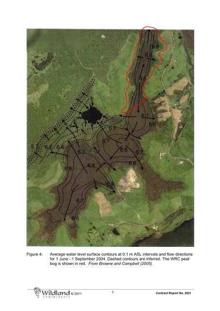
Figure 4: Average water level surface contours at 0.1 m ASL intervals and flow directions<br />
for 1 June - 1 September 2004. Dashed contours are inferred. The WRC peat<br />
bog is shown in red. From Browne and Campbell (2005).<br />
© 2011<br />
7<br />
Contract Report No. 2621