Digest of Hunting and Trapping Regulation - Pennsylvania Envirothon
Digest of Hunting and Trapping Regulation - Pennsylvania Envirothon
Digest of Hunting and Trapping Regulation - Pennsylvania Envirothon
You also want an ePaper? Increase the reach of your titles
YUMPU automatically turns print PDFs into web optimized ePapers that Google loves.
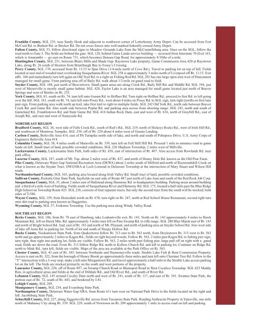
Franklin County, SGL 235, near S<strong>and</strong>y Hook <strong>and</strong> adjacent to southwest corner <strong>of</strong> Letterkenny Army Depot. Can be accessed from Fort<br />
McCord Rd. to Burkett Rd. or Bricker Rd. Do not cross fences into well-marked federally-owned Army Depot.<br />
Fulton County, SGL 53, follow directional signs to Meadow Grounds Lake from the McConnellsburg area. Once on the SGL, follow the<br />
road north to Gate 3. The fields are behind the gate. SGL 128, behind Game L<strong>and</strong>s service building — accessed from Interstate 70 (Exit 163,<br />
which is Amaranth) — go east on Route 731, which becomes Deneen Gap Road, for approximately 8/10ths <strong>of</strong> a mile.<br />
<strong>Hunting</strong>don County, SGL 251, between Blairs Mills <strong>and</strong> Shade Gap. Raystown Lake property, Game Commission Area 420 at Raystown<br />
Lake, along Rt. 26 south <strong>of</strong> Hesston from Brumbaugh Bay to Fouse’s Crossing.<br />
Perry County, SGL 170, accessed from Rt. 11/15 to Spur Drive (1/4-mile north <strong>of</strong> Cove Rd.). Travel to parking lot on top <strong>of</strong> hill. Fields<br />
located at east end <strong>of</strong> wooded tract overlooking Susquehanna River. SGL 258 is approximately 3 miles north <strong>of</strong> Liverpool <strong>of</strong>f Rt. 11/15. Exit<br />
atRt. 104 <strong>and</strong> immediately turn left again on Old Trail Rd. to a right on Fishing Rod Rd. SGL 281 has one large open area west <strong>of</strong> Duncannon<br />
managed for small game. From parking area <strong>of</strong>f <strong>of</strong> Baily Rd. walk about 1/2-mile on gated road to field.<br />
Snyder County, SGL 188, just north <strong>of</strong> Beavertown. Small game areas are along Creek Rd., Baily Hill Rd. <strong>and</strong> Middle Rd. SGL 194, just<br />
west <strong>of</strong> Meiserville is mostly small game habitat. SGL 428, Faylor Lake is an area managed for small game located just north <strong>of</strong> Beaver<br />
Springs <strong>and</strong> west <strong>of</strong> Benfer on Rt. 235.<br />
York County, SGL 83, south on Rt. 74, turn left onto Goram Rd. to Heffner Rd. Turn right on Heffner Rd., proceed to first Rd. to left going<br />
over the hill. SGL 181, south on Rt. 74, turn left onto Posey Rd., west about 4 miles on Posey Rd. to SGL sign, turn right (north) on first lane<br />
past sign. From parking area walk north up trail, take first trail to right to multiple fields. SGL 242 Old York Rd., north side between Beaver<br />
Creek Rd. <strong>and</strong> Game Rd. Also south side between Poplar Rd. <strong>and</strong> parking area across from shooting range. SGL 243, north <strong>and</strong> south <strong>of</strong><br />
Gamel<strong>and</strong> Rd., Franklintown Rd. <strong>and</strong> State Game Rd. SGL 416 Indian Rock Dam, east <strong>and</strong> west <strong>of</strong> Rt. 616, north <strong>of</strong> Graybill Rd., east <strong>of</strong><br />
Joseph Rd., <strong>and</strong> east <strong>and</strong> west <strong>of</strong> Sunnyside Rd.<br />
NORTHEAST REGION<br />
Bradford County, SGL 36, west side <strong>of</strong> Falls Creek Rd., south <strong>of</strong> Red’s Rd., SGL 219, north <strong>of</strong> Hickeys Rocks Rd., west <strong>of</strong> Irish Hill Rd.,<br />
<strong>and</strong> southwest <strong>of</strong> Montrose Turnpike. SGL 239, <strong>of</strong>f <strong>of</strong> Rt. 220 about 4 miles west <strong>of</strong> Greens L<strong>and</strong>ing.<br />
Carbon County, Beltsville Area 414, east <strong>of</strong> PA Turnpike north side <strong>of</strong> lake, <strong>and</strong> north <strong>and</strong> south <strong>of</strong> Pohopoco Drive. U.S. Army Corps <strong>of</strong><br />
Engineers Beltsville Area 414.<br />
Columbia County, SGL 58, 4 miles south <strong>of</strong> Mainville on Rt. 339, turn left on Full Mill Hill Rd. Proceed 1 mile to entrance road to game<br />
l<strong>and</strong>s on left. Small tract <strong>of</strong> l<strong>and</strong>, possible crowded conditions. SGL 226 Madison Township, 2 miles west <strong>of</strong> Millville.<br />
Lackawanna County, Lackawanna State Park, both sides <strong>of</strong> Rt. 438, east <strong>of</strong> intersection <strong>of</strong> Rt. 407. Also access from Rowl<strong>and</strong>s Rd. near<br />
park <strong>of</strong>fice.<br />
Luzerne County, SGL 187, south <strong>of</strong> Mt. Top, about 2 miles west <strong>of</strong> Rt. 437, <strong>and</strong> north <strong>of</strong> Honey Hole Rd. known as the Old Pear Farm.<br />
Pike County, Delaware Water Gap National Recreation Area (DEWA) about 2 miles south <strong>of</strong> Milford <strong>and</strong> north <strong>of</strong> Raymondskill Creek on<br />
what is known as the Snyder Tract. DWGNRA at Loch Lomond in Delaware Township at the intersection <strong>of</strong> Mary Stuart <strong>and</strong> Wilson Hill<br />
roads.<br />
Northumberl<strong>and</strong> County, SGL 165, parking area located along Irish Valley Rd. Small tract <strong>of</strong> l<strong>and</strong>, possible crowded conditions.<br />
Sullivan County, Ricketts Glen State Park, hayfields on east side <strong>of</strong> Route 487 just north <strong>of</strong> Lake Jean <strong>and</strong> south <strong>of</strong> the Red Rock Job Corp.<br />
Susquehanna County, SGL 35, about 2 miles east <strong>of</strong> Hallstead along Harmony Rd. to headquarters building. Parking areas around building<br />
<strong>and</strong> a third <strong>of</strong> a mile west <strong>of</strong> building. Fields south <strong>of</strong> Susquehanna River <strong>and</strong> Harmony Rd. SGL 175, located a half-mile past the Blue Ridge<br />
High School on Township Route 825. SGL 236, consists <strong>of</strong> four separate tracts, but only the second tract from the south will be stocked; both<br />
sides <strong>of</strong> T-588.<br />
Wayne County, SGL 159, from Honesdale north on Rt. 670, turn right on Rt. 247, north at Red School House Restaurant, second right turn<br />
onto dirt road to parking area known as Haggerties.<br />
Wyoming County, SGL 57, Forkston Township. Use the parking area along Windy Valley Road.<br />
SOUTHEAST REGION<br />
Berks County, SGL 106, from Rt. 78 east <strong>of</strong> Hamburg, take Lenhartsville exit, Rt. 143. North on Rt. 143 approximately 4 miles to Hawk<br />
Mountain Rd., left on Hawk Mtn. Rd. approximately 3 miles turn left on Pine Swamp Rd. to rifle range. SGL 280 Blue Marsh east <strong>of</strong> Rt. 183<br />
<strong>and</strong> north <strong>of</strong> Bright School Rd. And, east <strong>of</strong> Rt. 183 <strong>and</strong> north <strong>of</strong> Mt. Pleasant, <strong>and</strong> north <strong>of</strong> parking area on Snyder School Rd. Also west side<br />
<strong>of</strong> lake <strong>of</strong>f Justa Rd. to parking lot. North <strong>of</strong> lot <strong>and</strong> south <strong>of</strong> Sleepy Hollow Rd.<br />
Bucks County, Nockamixon State Park, from Quakertown follow Rt. 313 east to Rt. 563 north, from Doylestown Rt. 313 west to Rt. 563<br />
north <strong>and</strong> go approximately 2 miles to Kagen Rd., fields on right beyond woods. Follow Rt. 563, 2 miles past Kagen Rd. to fishing pier sign,<br />
turn right, then right into parking lot, fields are visible. Follow Rt. 563, 2 miles north past fishing pier, large pull <strong>of</strong>f on right with a gated<br />
road, fields are down the road. From Rt. 313 follow Ridge Rd. north to Kellers Church Rd. <strong>and</strong> left to parking lot. Continue on Ridge Rd.<br />
north to Mink Rd., turn left, fields are visible. Maps <strong>of</strong> the area are available at the Park Office on Rt. 563.<br />
Chester County, SGL 43 east <strong>of</strong> Rt. 345, between Northside <strong>and</strong> Harmoneyville roads. Struble Lake Fish & Boat Commission Property.<br />
Access is east on Rt. 322, from the borough <strong>of</strong> Honey Brook go approximately three miles <strong>and</strong> turn left onto Chestnut Tree Rd. Follow to the<br />
“Y” intersection with a 3-way stop, make a left onto Morgantown Rd. <strong>and</strong> travel approximately a half-mile to the Struble Lake access parking<br />
lot on the left. The birds are stocked primarily on the south <strong>and</strong> west portions <strong>of</strong> the property.<br />
Lancaster County, SGL 220, <strong>of</strong>f <strong>of</strong> Route 897, on Swamp Church Road or Blainsport Road in West Cocalico Township. SGL 423 Muddy<br />
Run, in agricultural areas <strong>and</strong> fields at the end <strong>of</strong> Hilldale Rd., <strong>and</strong> Old River Rd., <strong>and</strong> south <strong>of</strong> River Rd.<br />
Lebanon County, SGL 145 around Cavalry Dam north <strong>and</strong> west <strong>of</strong> Rt. 241, south <strong>of</strong> Rt. 117, <strong>and</strong> east <strong>of</strong> Rt. 341. Swatara State Park, the<br />
portion east <strong>of</strong> Rt. 72, south <strong>of</strong> Rt. 443, <strong>and</strong> bordered by I-81.<br />
Lehigh County, SGL 205.<br />
Montgomery County, SGL 234, <strong>and</strong> Evansburg State Park.<br />
Northampton County, Delaware Water Gap NRA, from Route 611 turn west on National Park Drive to the fields located on the right <strong>and</strong><br />
left. Jacobsburg State Park.<br />
Schuylkill County, SGL 227, along Taggertsville Rd. across from Tuscarora State Park. Reading Anthracite Property in Yatesville, one mile<br />
north <strong>of</strong> Mahanoy City along Rt. 339. SGL 229, south <strong>of</strong> Newtown on Rt. 209 approximately 1 mile to access road on left <strong>and</strong> parking.


