

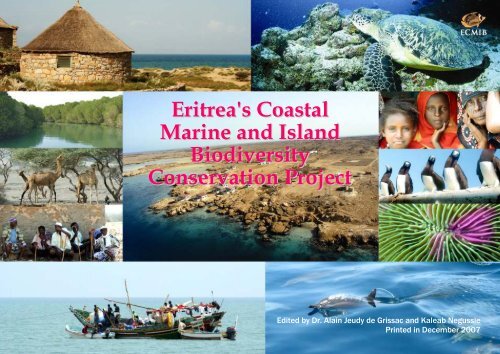
Eritrea's Coastal Marine and Island Biodiversity Conservation Project
Eritrea's Coastal Marine and Island Biodiversity Conservation Project
Eritrea's Coastal Marine and Island Biodiversity Conservation Project

You also want an ePaper? Increase the reach of your titles
YUMPU automatically turns print PDFs into web optimized ePapers that Google loves.
<strong>Eritrea's</strong> <strong>Coastal</strong><br />
<strong>Marine</strong> <strong>and</strong> Isl<strong>and</strong><br />
<strong>Biodiversity</strong><br />
<strong>Conservation</strong> <strong>Project</strong><br />
Edited by Dr. Alain Jeudy de Grissac <strong>and</strong> Kaleab Negussie<br />
Printed in December 2007
Note: This document has to be considered as a technical document. The views expressed in this document <strong>and</strong> the maps <strong>and</strong> graphs presented do not<br />
necessarily reflect the position of the Government of Eritrea or UNDP. Any questions or comments should be addressed directly to the ECMIB project<br />
in Massawa by mail to P.O. Box 58, Massawa or by Email to ecmib@yahoo.com<br />
For more information, you can also consult our website under construction (May 2007) www.eritrearedsea.org<br />
State of the Coast Eritrea, 2006-2007 1
FOREWORD<br />
With a mainl<strong>and</strong> <strong>and</strong> isl<strong>and</strong>s coastline of more than 3,300 km, Eritrea has a major asset <strong>and</strong> part of its future is along this coastline, as numerous<br />
activities are linked to the sea, including fisheries, tourism <strong>and</strong> transport.<br />
Since mid 2005, numerous meetings <strong>and</strong> national expert knowledge have allowed the preparation of the present document, the “State of the Coast of<br />
Eritrea”, of the <strong>Coastal</strong> Policy, of the “Integrated <strong>Coastal</strong> Area Management” Guidance for Implementation. At the same time, the supporting<br />
legislation is under preparation with the <strong>Coastal</strong> Proclamation <strong>and</strong> the <strong>Coastal</strong> Authority Proclamation.<br />
The Eritrea’s proposed <strong>Coastal</strong> Policy is a framework meant to serve as base for laws, rules, regulations, guides <strong>and</strong> institutional structures for<br />
sustainable management of the coastal area natural <strong>and</strong> human-made assets. It was prepared by the participation of practically all concerned<br />
ministries <strong>and</strong> organisations, inter alia, has four main objectives: sustainable use of the coastal area for multiple purposes, location of coastal<br />
facilities <strong>and</strong> development projects in consideration of the coastal process, protection of public foreshores or establishing appropriate setbacks (public<br />
property areas) <strong>and</strong> protection of natural <strong>and</strong> cultural values of the area. Any Policy is based on principles; in our case the guiding principle, as<br />
clearly stated in the Constitution is- we shall meet our needs without comprising the ability of future generations to meet their needs or we shall<br />
develop without destroying the chances of future generations to develop.<br />
In 1995, the Government of Eritrea adopted integrated opposed to sectoral development approach. The preparation of the Integrated <strong>Coastal</strong> Area<br />
Management Plan is trying to apply the overall Government development approach to the coastal area as defined above. ICAM is a mechanism that<br />
avoids <strong>and</strong> mitigates environmental damage through coordinated planning <strong>and</strong> implementation of activities <strong>and</strong> minimizes unknown risks using the<br />
precautionary principle. It can also be understood as a tool that enables conservation of ecosystems by managing development activities. In addition to<br />
ecosystem conservation benefits ICAM enhance the value of the coastal assets. ICAM will enable us to define location of facilities <strong>and</strong> development<br />
activities in line with national needs <strong>and</strong> sustainability opposed to investor preferences only in the coastal area; <strong>and</strong> to resolve <strong>and</strong> mitigates conflict<br />
of interest over the assets.<br />
Implementing specific activities is the responsibility of relevant line ministry, organisation, region, community, civil society, etc., but there will be a<br />
lead ICAM coordinating Authority. After all, as the name indicates, ICAM is coordination <strong>and</strong> integration of plans <strong>and</strong> activities of different sectors<br />
for sustainable management of the coastal area assets.<br />
Mainly because of the independence struggle, the coastal area, particularly the marine domain, is considered relatively pristine, <strong>and</strong> we need to<br />
appropriately address developmental issues in the coastal area to benefit from <strong>and</strong> safeguard its integrity.<br />
The Minister of Fisheries, H.E. Mohamed Haj Ali<br />
State of the Coast Eritrea, 2006-2007 2
ACKNOWLEDGMENT<br />
This first version of the State of the Coast report has been prepared by staff of the following Eritrean Government Institutions:<br />
- Ministry of Fisheries<br />
- Ministry of Agriculture<br />
- Ministry of L<strong>and</strong>, Water <strong>and</strong> Environment<br />
- Ministry of Justice<br />
- Ministry of Education<br />
- Ministry of Transport <strong>and</strong> Communication<br />
- Ministry of Tourism<br />
- Ministry of Defence<br />
Staff members from the various collaborating ministries were supported by personnel from the Eritrea <strong>Coastal</strong>, <strong>Marine</strong> <strong>and</strong> Isl<strong>and</strong> <strong>Biodiversity</strong><br />
(ECMIB) project.<br />
This document is part of the activities of the ECMIB project, funded by the Global Environment Facility (GEF) <strong>and</strong> the Government of Eritrea,<br />
implemented by the Ministry of Fisheries <strong>and</strong> administered by UNDP office in Eritrea.<br />
The <strong>Project</strong> Technical Committee (PTC) was the core team responsible for the preparation of this document <strong>and</strong> responsible for review <strong>and</strong> editing.<br />
Technical support was delivered by “Water, Agriculture Resources Planning, Development <strong>and</strong> Management”, an Eritrean Consulting firm. This<br />
company also provided sectoral information in particular on the water sector <strong>and</strong> participated to the editing of the first versions.<br />
The final editing has been realised by Dr. Alain Jeudy de Grissac, ECMIB Technical Adviser <strong>and</strong> by Kaleab Negussie, ECMIB National <strong>Project</strong><br />
Manager.<br />
For each section of this report, you will find the names of the main contributors.<br />
State of the Coast Eritrea, 2006-2007 3
Acronyms<br />
CBD Convention on Biological Diversity<br />
CCD Convention to Combat Desertification<br />
CITES Convention on International Trade of Endangered Species<br />
CMS <strong>Conservation</strong> of Migratory Species<br />
DAP Di-Ammonium Phosphate<br />
DOE Department of Environment<br />
ECMIB Eritrea <strong>Coastal</strong> marine Isl<strong>and</strong> <strong>Biodiversity</strong><br />
EDF Eritrean Defense Force<br />
FAO Food <strong>and</strong> Agriculture Organization (UN Agency)<br />
FCCC Frame Work Convention on Climate Change<br />
FRP Fiber Reinforced Plastic<br />
GEF Global environment facility<br />
ICAM Integrated coastal Area Management<br />
IFREMER Institut Français de la Mer<br />
IMO International Maritime Organization<br />
IOSEA Indian Ocean <strong>and</strong> South East Asia (MoU)<br />
MoA Ministry of Agriculture (MoA)<br />
MoD Ministry of Defence<br />
MoF Ministry of Finance<br />
MoFish Ministry of Fisheries<br />
MoLG Ministry of Local Government<br />
MoND Ministry of National Development<br />
MoPW Ministry of Public Works<br />
MoTC Ministry of Transport <strong>and</strong> Communications<br />
MoU Memor<strong>and</strong>um of Underst<strong>and</strong>ing<br />
MPA <strong>Marine</strong> Protected Areas<br />
MSY Maximum Sustainable Yield<br />
NEAPG National Environmental Assessment Procedures <strong>and</strong> Guidelines<br />
NEPFP National Economic Framework <strong>and</strong> Program<br />
NFC National Fishing Corporation<br />
NN No Name (used for isl<strong>and</strong>s without official or local name)<br />
NSO National Statistic Office<br />
NRSR Northern Red Sea Region (Zoba)<br />
PIC Prior Informed Consent (Rotterdam Convention)<br />
State of the Coast Eritrea, 2006-2007 4
PCC <strong>Project</strong> Coordination Committee<br />
POP Persistent Organic Pollutant (Stockholm Convention)<br />
PTC <strong>Project</strong> Technical Committee<br />
SRSR Southern Red Sea Region (Zoba)<br />
TED Turtle Exclusion Device<br />
TPR Tri Partite Review<br />
UNDP United Nations Development Program<br />
UNEP United Nations Environment Program<br />
State of the Coast Eritrea, 2006-2007 5
Table of Contents<br />
Foreword & Acknowledgement<br />
Table of contents<br />
Acronyms<br />
Introduction<br />
1. Eritrean <strong>Marine</strong> <strong>and</strong> <strong>Coastal</strong><br />
Environment<br />
1.1. Geography <strong>and</strong> Geomorphology<br />
1.2. Climate<br />
1.3. Geology<br />
1.4. Ecology<br />
1.5. Socio-Economic Information<br />
1.6. The Sea (definition <strong>and</strong><br />
bathymetry)<br />
1.7. <strong>Coastal</strong> Erosion, Climate<br />
Change, Sea Level Rise <strong>and</strong> Setback<br />
Datum<br />
2. <strong>Coastal</strong> People<br />
2.1. <strong>Coastal</strong> Settlements<br />
2.2. Freshwater Resources<br />
2.2.1. Groundwater Availability <strong>and</strong><br />
Use<br />
2.2.2. Surface Water Availability<br />
<strong>and</strong> Use<br />
2.2.3. Fresh Water Resources on the<br />
Isl<strong>and</strong>s<br />
2.3. Agriculture<br />
2.3.1. Cultivation<br />
2.3.2. Livestock <strong>and</strong> Rangel<strong>and</strong><br />
2.4. <strong>Coastal</strong> Vegetation<br />
2.5. Traditional <strong>Conservation</strong><br />
Practices<br />
3. Policies <strong>and</strong> Legal Issues<br />
3.1. Fisheries Activities <strong>and</strong><br />
Environmental Issues<br />
3.2. Agriculture <strong>and</strong> Environmental<br />
Issues<br />
3.3. Tourism <strong>and</strong> Environmental<br />
Issues<br />
3.4. Port Services <strong>and</strong> Environmental<br />
Issues<br />
3.5. Free Trade Zones <strong>and</strong><br />
Environmental Issues<br />
3.6. Infrastructure <strong>and</strong> Environmental<br />
Issues<br />
3.7. Urban Development <strong>and</strong><br />
Environmental Issues<br />
3.8. Energy <strong>and</strong> Environmental Issues<br />
3.9. Mines <strong>and</strong> Environmental Issues<br />
3.10. Petroleum Exploration <strong>and</strong><br />
Environmental Issues<br />
3.11. National Environmental<br />
Assessment Procedures <strong>and</strong><br />
Guidelines (NEAPG)<br />
3.12. <strong>Biodiversity</strong> <strong>and</strong> Biosafety<br />
3.13. International Conventions,<br />
Treaties <strong>and</strong> Agreements<br />
4. Fisheries<br />
4.1. Fisheries Resources <strong>and</strong> Potential<br />
4.2. Historical <strong>and</strong> Current Fisheries<br />
Catch Trends<br />
4.3. Artisanal Fisheries<br />
4.4. Industrial Fisheries<br />
4.5. Shrimps fishing<br />
4.6. Sea Cucumber Fishing<br />
4.7. Aquaculture <strong>and</strong> Mariculture<br />
4.8. Fisheries Management Efforts<br />
5. <strong>Marine</strong> <strong>and</strong> <strong>Coastal</strong> Resources<br />
5.1. Coral Reefs<br />
5.1.1 Threats to Coral Reefs<br />
5.2. Sea grasses <strong>and</strong> Seaweeds<br />
5.2.1 Threats to Sea grasses <strong>and</strong><br />
Seaweeds<br />
5.3. Mangroves<br />
5.3.1. Threats to Mangroves<br />
5.3.2. Mangrove Reforestation<br />
Program<br />
5.4. <strong>Marine</strong> Seabirds <strong>and</strong> Shorebirds<br />
5.4.1. Threats to <strong>Marine</strong> Seabirds<br />
<strong>and</strong> Shorebirds<br />
5.5. <strong>Marine</strong> Turtles<br />
5.5.1. Threats to <strong>Marine</strong> Turtles<br />
5.6 Dugongs, Dolphins <strong>and</strong> Whales<br />
5.6.1. Threats to Dugongs,<br />
Dolphins <strong>and</strong> Whales<br />
6. <strong>Coastal</strong> Infrastructures<br />
6.1. <strong>Coastal</strong> Setback<br />
6.2. Harbors<br />
6.2.1. Massawa Port<br />
6.2.2. Assab Port<br />
6.2.3. Threats from Harbours <strong>and</strong><br />
Maritime Routes<br />
6.3 Airport <strong>and</strong> Airstrips<br />
6.3.1. Threats<br />
6.4. Road Network <strong>and</strong> Railway<br />
6.4.1. Threats from transport<br />
infrastructures<br />
6.5. Railway<br />
6.5.1. Threats from the railway<br />
6.5. Electric Power<br />
6.5.1. Threats from Electric Power<br />
Production Centre<br />
6.6. Oil Terminals<br />
6.6.1. Threats from Oil Terminals<br />
6.7. Industries<br />
6.7.1. Threats from Industries<br />
6.8. Free Zones<br />
6.8.1. Threats from Free Zones<br />
7. Tourism<br />
7.1. Tourism <strong>and</strong> the Eritrean <strong>Coastal</strong><br />
Environment<br />
7.2. Sites of Interest for Tourism<br />
7.3. Tourism Infrastructure<br />
7.4. <strong>Coastal</strong> Tourism Development<br />
Plan 2000-2025<br />
7.5. Threats from Tourism<br />
8. The Way Forward<br />
8.1. The <strong>Coastal</strong> Policy<br />
8.2. <strong>Conservation</strong> Programs<br />
Useful References<br />
State of the Coast Eritrea, 2006-2007 6
Introduction<br />
Eritrea gained its independence in 1993 after 30 years of armed struggle with Ethiopia. Due to this situation, little or no developmental activities were<br />
carried out in the coastal area. As the result, the country owns relatively pristine coastal environment.<br />
Recent developmental activities in general infrastructure, tourism, fishing, petroleum or gas exploration, maritime transport, etc., are threatening the<br />
integrity of the coastal ecosystems. But still Eritrea has the advantage of its relatively pristine coastal environment to capitalize on <strong>and</strong> develop the<br />
coastal assets sustainably through Integrated <strong>Coastal</strong> Area Management (ICAM).<br />
Integrated coastal zone management is an on-going process involving not only planning, but implementation, monitoring <strong>and</strong> making adjustment based<br />
on monitoring results <strong>and</strong> new information or opportunities. For these reasons ICAM is a priority on the National Development Agenda of the<br />
Government of Eritrea. Its implementation requires considerable effort, including assessment of the state of the coast based on existing national<br />
policies, rules <strong>and</strong> regulations, <strong>and</strong> studies; training of managers, scientists <strong>and</strong> operatives, <strong>and</strong> identification of information gaps, specific natural<br />
resources <strong>and</strong> socio-economic surveys.<br />
The preparatory phase also requires the involvement of all stakeholders at the national, regional <strong>and</strong> community levels to create awareness <strong>and</strong> induce<br />
behavioral change in addition to the advantages of sound preparation <strong>and</strong> smooth implementation of the plan. This phase should also include the<br />
definition <strong>and</strong> establishment of the institutional mechanisms to sustain the ICAM program <strong>and</strong> the selection of tools <strong>and</strong> methodologies that will be<br />
used during the process.<br />
This first version of the “State of the Coast” is meant to serve as one of the building blocks for the preparation of the Integrated <strong>Coastal</strong> Area<br />
Management Plan <strong>and</strong> associated guidelines by sectors.<br />
State of the Coast Eritrea, 2006-2007 1
1. Eritrean <strong>Marine</strong> <strong>and</strong> <strong>Coastal</strong> Environment Overview<br />
1.1. Geography <strong>and</strong> Geomorphology<br />
Eritrea is located in between the latitudes 12°45’N <strong>and</strong> 18°03’N, <strong>and</strong> the longitudes, 37 35’E <strong>and</strong> 43 07’E. It possesses a mainl<strong>and</strong> coastline of more<br />
than 1350 km along the south-western coast of the Red Sea. The Eritrean coastline stretches from its northern border with Sudan at Ras Kesar to its<br />
southern border with Djibouti at Ras Dumera. In addition, the Red Sea of Eritrea contains more than 350 isl<strong>and</strong>s that form a shoreline of more than<br />
1,950 km. The area of the Eritrean l<strong>and</strong>mass is estimated about 124,000 km 2 <strong>and</strong> its territorial waters cover an area of about 55,000 km 2 .<br />
The continental shelf (down to a depth of about 200m) extends from the coast to a maximum distance of 120 km east of Massawa, narrowing to about<br />
20 km in the north <strong>and</strong> south of the country. It includes flat coralline isl<strong>and</strong>s such as Dahlak Kebir <strong>and</strong> Nora, some fewer isl<strong>and</strong>s of continental origin<br />
such as Hawakil <strong>and</strong> Dissei, <strong>and</strong> the volcanic isl<strong>and</strong> of Senaboor.<br />
Eritrea in numbers<br />
Country coastline: 3300 km<br />
Mainl<strong>and</strong> coastline: 1350 km<br />
Isl<strong>and</strong>s coastline: 1950 km<br />
Isl<strong>and</strong>s <strong>and</strong> islets: 354<br />
Country area: 124,000 km 2<br />
Territorial waters area: 55,000 km²<br />
Exclusive Economic Zone (EEZ): 120,000 km 2<br />
Watersheds linked with the coast: 44,000 km²<br />
Source ECMIB GIS Unit 2007<br />
1.2. Climate<br />
As a result of its morphology, lying between sea level <strong>and</strong> 2300m, Eritrea has distinct geographic features within short distance <strong>and</strong> experiences a wide<br />
range of climatic conditions. Nevertheless, semi-arid to desert climate dominates the environment with average to low rainfall at national level which is<br />
the main cause for the absence of perennial rivers with the exception of the Setit river in the western highl<strong>and</strong>s.<br />
The climatic regimes of Eritrea follow the geography. The low eastern zone is the hottest with little rainfall, average 200mm, <strong>and</strong> temperature between<br />
30 o C <strong>and</strong> 39 o C, occasionally higher during the hot season (June to September) <strong>and</strong> 25 o C to 32 o C during the cooler season (October to May). The<br />
State of the Coast Eritrea, 2006-2007 2
coastal area is also occasionally subject to dust storms <strong>and</strong> strong wind during the summer. There is no permanent river that drains the Red Sea coast of<br />
Eritrea, only a number of dry river beds (“wadis”) experience occasional flash flooding <strong>and</strong> reach the coast.<br />
In the highl<strong>and</strong> zone average temperature is about 18 o C (Asmara 17 o C). May is the hottest month when temperature reaches as high as 30 o C <strong>and</strong><br />
December to February the coldest months <strong>and</strong> temperatures reach freezing point during night. Average rainfall is 540mmm.<br />
The western zone reflects the temperature of the low eastern coastal area during hot season <strong>and</strong> rainfall of the highl<strong>and</strong>. April to June is the hottest<br />
period with temperature range of 30 o C to 41 o C; <strong>and</strong> December is the coolest month with temperature of 13 o C to 25 o C.<br />
1.3. Geology<br />
Geologically, Eritrea can be split into two different regions. The central <strong>and</strong> northern highl<strong>and</strong>s consist of complex basement formed during the<br />
Precambrian era (more than 570 million years before present), which contain some of the oldest formations (Archean) found in Africa. Similarly, a<br />
basaltic flow in the Tertiary era (Cenozoic era: 65 million years before present) formed typical flat-topped mountains in the western highl<strong>and</strong>s. In<br />
Western lowl<strong>and</strong> areas, the complex basement was later covered by young quaternary sediments that appear as rocky outcrops. The basement complex<br />
contains deposits of metallic minerals (iron, copper, gold, asbestos, magnesium, barite <strong>and</strong> sulfur).<br />
The second geological region is the Red Sea coast <strong>and</strong> its associated isl<strong>and</strong>s that have evolved from the tertiary <strong>and</strong> quaternary sediments but in some<br />
areas, such as the Zula bay <strong>and</strong> the Bada area, these sediments are overlaid with basaltic lava flows from recent volcanic activity. These volcanic<br />
formations are associated with the rift system (Red Sea <strong>and</strong> Afar Rift) that cuts from North to South <strong>and</strong> is marked by numerous fault lines. Hot springs<br />
with thermo-mineral waters <strong>and</strong> sulfur can be found in this area, which is typical for regions with young <strong>and</strong> active volcanism. Geological formations<br />
also reveal that oil <strong>and</strong> gas traces, evaporites <strong>and</strong> other non-metallic minerals, are associated with sedimentary formations (Mesozoic <strong>and</strong> Cenozoic).<br />
Most of the Dahlak archipelago isl<strong>and</strong>s are results of quaternary sediments, <strong>and</strong> in particular uplifts of fossils coral reef formations. However, Dissei<br />
Isl<strong>and</strong> near the Buri peninsula is an extension of the Precambrian basement of the mainl<strong>and</strong>, mainly composed of granitoids. Towards south there also<br />
exist some isl<strong>and</strong>s which are of volcanic origin in particular the isl<strong>and</strong>s fronting Assab.<br />
1.4. Ecology<br />
The Eritrean marine <strong>and</strong> coastal environment is characterized by an array of diversified ecosystems: coral reefs, mangroves, sea grass beds, s<strong>and</strong>y <strong>and</strong><br />
muddy flats, all important for fisheries activities <strong>and</strong> offering a significant tourism potential. The intertidal <strong>and</strong> near-shore zones support a diverse<br />
range of marine <strong>and</strong> terrestrial species <strong>and</strong> are key areas of ecological <strong>and</strong> economic importance.<br />
State of the Coast Eritrea, 2006-2007 3
Unlike most oceans of the world the Eritrean Red Sea is characterized by a lesser upwelling phenomenon <strong>and</strong> lack of permanent streams that flow into<br />
the sea. Consequently, the waters are nutrient limited with a low primary productivity. As a projection of the Indian Ocean, water exchange due to the<br />
monsoon winds is more pronounced in southern part than in the northern. This phenomenon results in a better nutrient availability, higher primary<br />
productivity <strong>and</strong> species abundance in the south. Furthermore, some species drifted from the Indian Ocean are localized only to the south. Nonetheless,<br />
due to the relatively cooler water temperature <strong>and</strong> higher sedimentation in the south, coral reefs are poorly developed <strong>and</strong> the associated communities<br />
are less diversified.<br />
The Eritrean coastal area is best known as a highly favorable ecosystem for the development of fisheries. Essential reef areas, extensive surface <strong>and</strong><br />
numerous shelters of the Dahlak archipelago plateau <strong>and</strong> aggregates of isl<strong>and</strong>s contribute to the prospect of a prosperous fishery. Despite the few<br />
researches conducted more than 600 species of fish have been recorded in the Eritrean Red Sea.<br />
Compilation of scientific surveys identified 154 species belonging to 38 genera of stony corals (Scleractinians). Eritrea’s coastal waters have favorable<br />
climatic condition for reef growth with warm waters <strong>and</strong> low rainfall. Coral reefs formation along the isl<strong>and</strong>s coastlines are in good conditions whereas<br />
reefs along the mainl<strong>and</strong> coastline are less developed mainly due to sedimentation from the rivers runoff.<br />
Mangrove forests in Eritrea are present along about 380 km of coastline <strong>and</strong> cover an area of about 70 km². Their distribution is highly patchy all along<br />
the mainl<strong>and</strong> <strong>and</strong> on the isl<strong>and</strong>s. In addition, most of the mangrove forests are found mostly in areas where some seasonal freshwater runoff occurs;<br />
<strong>and</strong> also in low lying, poorly draining areas behind dune ridges which are flooded infrequently (e.g. Lake M<strong>and</strong>alum, near Mersa Deresa <strong>and</strong> Mersa<br />
Mubarek in the north). Towards south, dense mangrove forests are found near Assab Bay <strong>and</strong> in patches around Tio. Some offshore isl<strong>and</strong>s such<br />
Museri, Norah, Harena, <strong>and</strong> Dergamman Kebir also retain dense mangrove st<strong>and</strong>s.<br />
Along with the coral <strong>and</strong> mangrove ecosystems, sea grasses also form an integral part of the coastal biodiversity. More than 12 species have been<br />
identified so far. In addition to fishes <strong>and</strong> invertebrates, sea grass communities also support sea turtles <strong>and</strong> the globally endangered dugongs.<br />
Significant sea grass beds are found around Barasole, the western side of Mantola isl<strong>and</strong> in the south, Hawakil, Debel Ali, Dergamman Kebir, Baka,<br />
Delesen, north side of Harena, west of Adjuz, Norah, Baradu <strong>and</strong> Dehil isl<strong>and</strong>s.<br />
State of the Coast Eritrea, 2006-2007 4
1.5. Socio-Economic Information<br />
Eritrea in numbers<br />
Total Population<br />
<strong>Coastal</strong> population: 95,000 (2004)<br />
Watershed population<br />
<strong>Coastal</strong> cities: Massawa <strong>and</strong> Assab<br />
<strong>Coastal</strong> villages 62<br />
Source ECMIB Socio Economic Unit 2007<br />
The coastal areas are sparsely populated with approximately 5% of the national population, the majority residing in the two main coastal cities of<br />
Massawa <strong>and</strong> Asseb. Five ethnic groups, Afar, Saho, Tigre, Rashaida, <strong>and</strong> Tigrigna dominate the rural population (see section on coastal people).<br />
Shortage of fresh water is a characteristic feature of the Eritrean coastline <strong>and</strong> isl<strong>and</strong>s. Individually owned or commercially operated wells are the<br />
primary sources of fresh water supply. Due to the meager annual precipitation <strong>and</strong> extremely harsh weather conditions, the principal agricultural<br />
activity remains small number ruminant livestock-herding. The majority of the coastal communities’ livelihoods depend on fisheries activities coupled<br />
with trade in fishery products <strong>and</strong> other goods with the neighboring Saudi Arabia <strong>and</strong> Yemen. Basic infrastructures such as schools, clinics <strong>and</strong><br />
transportation facilities are progressively improving.<br />
Although at its nascent stage of development, Eritrea’s coastal area has the potential for a range of tourism activities. Healthy coastal marine habitats<br />
with variety of species, safe, secure <strong>and</strong> enjoyable environment in addition to of hospitable population are the distinct features of the coastal area <strong>and</strong> a<br />
strong basis for developing sustainable tourism industry. Unpolluted s<strong>and</strong>y beaches, colorful underwater life, aggregated isl<strong>and</strong>s of the Dahlak<br />
archipelago, <strong>and</strong> its historic Nakura Channel <strong>and</strong> ship wrecks are few of the additional products waiting to be harnessed.<br />
Current tourism products, though at miniscule level given the potential, include recreational excursions, cruising, swimming, snorkeling, diving <strong>and</strong><br />
recreational fishing. Likewise the terrestrial biodiversity, historical sites such as Adulis-Zula, the Bada-Crater-Lake, volcanoes, thermal vents <strong>and</strong><br />
coastal villages are among the main coastal inl<strong>and</strong> spots of tourism.<br />
State of the Coast Eritrea, 2006-2007 5
1.6. The Sea (Definition <strong>and</strong> Bathymetry)<br />
The marine environment of Eritrea extends from the mean low water level, derived from the mean of lower tide in reference to the last 11 to 12 years<br />
readings. Human activities start from the highest water level, but its position is expected to change over the years (sea level rise, exceptional natural<br />
events).<br />
Countries are usually setting a distance from the highest water level for coastal protection, infrastructure, military or customs activities. This zone is<br />
named the setback. In Eritrea, following technical meetings for the preparation of the <strong>Coastal</strong> Policy, a horizontal distance of 100m from a datum<br />
(geological or biological) is the accepted but not yet formally adopted st<strong>and</strong>ard.<br />
According to the International Law of the Sea, Eritrea’s territorial waters extend to 12 nautical miles (about 22 km) from the mean low water line of<br />
the coastline of the mainl<strong>and</strong> <strong>and</strong> of the isl<strong>and</strong>s. The total area of the Eritrean territorial waters is therefore estimated to be 55,000 km².<br />
The maximum extension of the Exclusive Economic Zone (EEZ) is 200 nautical miles but is reduced to the median line between two countries’<br />
territorial waters. The area of the EEZ (including the territorial waters) is estimated to be 120,000 km².<br />
1.7. <strong>Coastal</strong> Erosion, Climate Change, Sea Level Rise <strong>and</strong> Setback Datum<br />
Natural coast is subject to changes due to sedimentation or erosion. The nature of the coast, rocky or s<strong>and</strong>y, is important in planning <strong>and</strong> implementing<br />
development activities. Rocky coast is stable but s<strong>and</strong>y coasts changes with the movements of the sea <strong>and</strong> the input of sediment, reduced in Eritrea due<br />
to the lack of permanent rivers.<br />
Low lying <strong>and</strong> s<strong>and</strong>y areas are at risk from erosion, in particular from eventual sea level rise, specific events such as equinox tides, low barometric<br />
pressure, strong wind <strong>and</strong> waves during storms or in relation with climatic changes over a longer period of time. For the impact of climate change,<br />
scientific forecasts indicate a rise of about 50 cm in the coming century with the possibility of being higher in specific areas. The impact of such sea<br />
level rise will be different on different coastal areas subject to the nature of the coast, rocky or s<strong>and</strong>y <strong>and</strong> elevation level.<br />
A coastal setback is a horizontal distance along the coastline (mainl<strong>and</strong> <strong>and</strong> isl<strong>and</strong>s) defined on the basis of coastal morphology, exposure, stability of<br />
the coastline, nature of coastal resources, nature of the activity <strong>and</strong> other relevant criteria. In Eritrea, the setback distance meant to protect development<br />
investments such as roads, industries or tourism facilities by absorbing the impact of severe storms, by allowing the shoreline movement, the global sea<br />
level rise <strong>and</strong> the fluctuation of natural coastal processes.<br />
State of the Coast Eritrea, 2006-2007 6
The proposed 100m setback will be applied from a defined line known as the horizontal setback datum (HSD). The HSD is determined with regard to<br />
physical or biological features of the different coastal types such as s<strong>and</strong>y, rocky, mangrove, wetl<strong>and</strong>, exposed to storm or with acute erosion process.<br />
2. <strong>Coastal</strong> People<br />
2.1. <strong>Coastal</strong> settlement<br />
In spite of its economic <strong>and</strong> historical importance, because of the arid climates, lack of fresh water resources <strong>and</strong> inhospitable environmental conditions,<br />
the coastal area population is very small (Hillman & Tsegay, 1997). Only 5% of the national population resides in the coastal area of the Northern <strong>and</strong><br />
Southern Red Sea Zobas.<br />
Due to shortage of water, only 10 of the offshore isl<strong>and</strong>s support human population: Abbaguba, Adjuz, Harena, Baka, Dilemmi, Dissie, Hawakil, Dehil,<br />
Dahlak Kebir <strong>and</strong> Norah, the last three being part of the Dahlak archipelago. Historical evidence suggests that more isl<strong>and</strong>s were inhabited in the past<br />
<strong>and</strong> many more used at least as temporary locations from which marine resource harvesting was conducted.<br />
According to the 2001 population estimate, the Eritrean coastline has a population of about 70,000. As per the 2004 demographic data, the estimation<br />
was 95,000 for the coastal population of which 42.1% (40,000 people) live in Massawa, 22.9% (21,800 people) resides in Assab <strong>and</strong> the rest (35%)<br />
lives scattered in other villages (70), the biggest being Tio <strong>and</strong> Ghel’alo (ECMIB survey, 2005).<br />
There are five main ethnic groups in the coastal area: Afar, Saho, Tigre, Rashaida <strong>and</strong> Tigrigna.<br />
Afar is the largest tribe on the coast <strong>and</strong> lives mainly from Ghel’alo to Rahita <strong>and</strong> the Dahlak isl<strong>and</strong>s. Saho is found dominantly in the south-east of the<br />
Northern Red Sea Region in villages such as Foro, Erafaile <strong>and</strong> in the Debub Region. Tigre is found mainly concentrated in Zula, Afta <strong>and</strong> Hirgigo <strong>and</strong><br />
in the coastal area north of Massawa up to the border with Sudan. The Rashaida is highly mobile <strong>and</strong> found scattered in different past of the coast.<br />
To support their livelihoods most coastal population depend on artisanal fishing <strong>and</strong> livestock production. These communities are usually involved in a<br />
variety of fishing practices such as shell fish collection, commercial fishing <strong>and</strong> the recently growing sea cucumber collection. Moreover, in some<br />
places, crop production with irrigation also complements the livestock rearing activities. Furthermore, trade activities, tourism opportunities <strong>and</strong> port<br />
<strong>and</strong> industrial developmental activities also create significant employment opportunities in the cities of Massawa <strong>and</strong> Assab. Nevertheless, due to the<br />
border conflict with Ethiopia, the majority of these activities slowed in Assab.<br />
Unlike those in the north, southern dwellers are the most actively engaged in fishing <strong>and</strong> are considered fisheries dependent communities. Half of the<br />
total fishing communities (representing about 30,000 people) are estimated to be engaged in fishing <strong>and</strong> processing dried marine products (snail nail,<br />
shark fin, dried mullets, sea cucumbers) for export. For them fishing is an inherited economic tradition that closely attaches them to the sea. Fishermen<br />
use traditional boats known as Houri, Sambuk or Canoes <strong>and</strong> very primitive fishing gear such as h<strong>and</strong> line <strong>and</strong> gill nets. Moreover, fishing is a<br />
State of the Coast Eritrea, 2006-2007 7
stereotypic occupation reserved only for men. By the culture of all tribes, women are not allowed to engage in fishing except to collect nails <strong>and</strong> shells<br />
in collection areas adjacent to their residences.<br />
2.2. Fresh Water Resources<br />
Diverse climatologic, topographic, <strong>and</strong> geologic features characterize the hydrology <strong>and</strong> the hydrogeology of the eastern escarpment <strong>and</strong> the coastal<br />
plains.<br />
Climatologic factors such as temperature, rainfall, <strong>and</strong> humidity directly affect the rate at which water enters <strong>and</strong> leaves the river systems that flow to<br />
the coast <strong>and</strong> to the groundwater basins <strong>and</strong> aquifers located along the coast. The average rainfall is very low along the coast, from 100 to 200 mm<br />
every year. This is far below the limit of 600-700 mm which is usually considered to be necessary to cause a substantial recharge of groundwater in<br />
this hot climate. Therefore, fresh groundwater is found only underneath the larger ephemeral rivers crossing the coastal plain, also known as wadis.<br />
There is no comprehensive study on the groundwater <strong>and</strong> surface water resources <strong>and</strong> the development potential for the coastal plains of Eritrea. Only<br />
localized hydro-geological <strong>and</strong> geophysical characterization of aquifers, which are commonly done for the purpose of identifying groundwater sources<br />
for community water supply projects are available <strong>and</strong> their coverage is very limited to describe the coastal groundwater sources.<br />
In relation with water, the coast can be divided in four domains:<br />
- The main cities of Massawa <strong>and</strong> Assab<br />
- The coastal zone North of Buri Peninsula<br />
- The coastal zone South of Buri Peninsula<br />
- The isl<strong>and</strong>s<br />
2.2.1. The main cities of Massawa <strong>and</strong> Assab<br />
The two port cities, Massawa <strong>and</strong> Assab get their water supply from boreholes <strong>and</strong> dug wells located within the wadi channel aquifers of east flowing<br />
wadis. Massawa has additional water supply from the desalination plant attached to the Hirgigo power plant with a capacity of 1000m³ per day. This<br />
facility is now under the responsibility of the Massawa Free Trade Zone.<br />
2.2.2. The coastal zone north of the Buri Peninsula<br />
State of the Coast Eritrea, 2006-2007 8
The coastal plain north of the Buri Peninsula is crossed by six major streams (of which Felket, Moga’e, Laba, Desset <strong>and</strong> Haddas) which originate<br />
from the plateau of the central <strong>and</strong> northern highl<strong>and</strong>s <strong>and</strong>/or the eastern escarpments.<br />
These wadis carry much runoff during the summer season from July to September <strong>and</strong> the Eastern Slope Agricultural Development Potential Study<br />
conducted in 1996 has estimated that a total of 730 million cubic meters of flow reaches annually the Red Sea in this area.<br />
The spate flows of most of the wadis north of Massawa are utilized for agriculture through diversion practices during the flood season. This type of<br />
irrigation is commonly known as “spate irrigation”. Irrigation water from these wadis spate flows are usually diverted using traditional diversion<br />
embankments, known as ‘Agums’ constructed across the wadis using materials from the wadi bed including bush <strong>and</strong> stones. The diverted flow are<br />
conveyed <strong>and</strong> distributed by large channels <strong>and</strong> basins.<br />
2.2.3. The coastal zone from south of the Buri Peninsula<br />
The major river (Ramod-Regalle) drains into the Danakil depression. The coastal plain is fed by small wadis that originate from the top of the ridges<br />
separating this area from the Danakil depression. These small wadis are with insignificant surface flows <strong>and</strong> have negligible impact on the groundwater<br />
of the coast. They are active during the winter season, from November to March.<br />
These types of wadis are not favorable to build up fresh groundwater by infiltration of water through the coarse-grained wadi bottom. Recent<br />
assessments have revealed that all coastal fishing villages between Tio <strong>and</strong> Marsa Fatma are getting potable water by trucking water from about 45-97<br />
km distance.<br />
2.2.4. Fresh Water Resources in the isl<strong>and</strong>s<br />
The inhabited Eritrean isl<strong>and</strong>s are suffering from critical shortages of potable water. Usually, residents excavate big holes or build cistern like on<br />
Dahlak El Kebir to capture the little run-off generated from the limited precipitation in the area <strong>and</strong> these are usually not sufficient to meet dem<strong>and</strong>s.<br />
On the long term, the only option for isl<strong>and</strong>s is to consider small scale desalination facilities (as already installed in Dahlak El Kebir) <strong>and</strong> to supply by<br />
truck potable water to these communities. On isl<strong>and</strong>s, any tourism development will have to be self sufficient for water <strong>and</strong> provide support to the local<br />
community.<br />
2.2.5. Major issues <strong>and</strong> future options<br />
State of the Coast Eritrea, 2006-2007 9
In general, availability of potable groundwater is limited <strong>and</strong> it is worst in the southern section of the Red Sea Coast. When available, groundwater at<br />
the coast is widely utilized as a source of water supply for domestic purposes (human <strong>and</strong> livestock consumption), based on dug wells with masonry<br />
lining or shallow temporary open wells to extract water from alluviums of wadi bottoms <strong>and</strong> banks.<br />
Groundwater salinity increases towards the coast, mainly due to low recharge rate towards the coast. In the Southern Part, major faults in the basement<br />
rocks associated with the formation of the Red Sea rift valley, acts as pathways along which deep circulating brackish <strong>and</strong> saline groundwater returns<br />
to the surface.<br />
Nevertheless, there is a need for a complete survey of the availability of water all along the coast <strong>and</strong> on the isl<strong>and</strong>s in order to plan for sustainable<br />
development, sharing the existing between essential activities <strong>and</strong> looking for other options for potential growth of the population <strong>and</strong> activities along<br />
the coast. Cities, isl<strong>and</strong>s, the potential development of tourism <strong>and</strong> of the Free Trade Zones in Massawa <strong>and</strong> Assab are the main areas of concern not<br />
only for supply of freshwater, but also for the treatment of sewage water, allowing the reuse of water <strong>and</strong> limiting the pollution of the groundwater. The<br />
main option to explore is desalination.<br />
2.3. Agricultural activities<br />
Agriculture forms one of the main economic bases for the Eritrean coastal communities. Nevertheless, due to the low level of precipitation, cultivation<br />
mainly relies on spate irrigation systems but supports significant production over many of the Zula <strong>and</strong> Sheib areas communities. Most importantly, the<br />
majority of the coastal communities’ agricultural practices rely on livestock which is the single most economically viable sector.<br />
2.3.1. Soils <strong>and</strong> soil association<br />
Areas suitable for agriculture are usually concentrated in the southern central highl<strong>and</strong>s <strong>and</strong> in the South-West part of the country. However, soil<br />
shallowness <strong>and</strong> permeability reduces the advancement of agricultural in significant portions of these areas. Shallowness is mostly the result of<br />
intensive farming <strong>and</strong> subsequent soil degradation, especially in the highl<strong>and</strong>s.<br />
Soils around the coastal zone have dusty <strong>and</strong> salty natures <strong>and</strong> are unfavorable for agricultural practices. They are very poor, being described as highly<br />
saline solonchaks with no agricultural potential. However, where temporary rivers carve through the mountains to the coastal plains, such as at Bada,<br />
Zula, Sheib <strong>and</strong> Wadi Labka areas, fertile alluvial soil support the livelihoods of local communities through seasonal cultivation.<br />
Little research has been carried out on coastal erosion <strong>and</strong> sea intrusion. Nevertheless, in relation with the low level of sediment transported by rivers,<br />
one can expect spontaneous transformation of the coast structure, <strong>and</strong> subsequently effect on oceanographic conditions (tides, waves, currents, storms).<br />
State of the Coast Eritrea, 2006-2007 10
Some areas have already been identified as more sensitive to coastal erosion <strong>and</strong> sea intrusion such as the Gurgussum area <strong>and</strong> the low-lying areas of<br />
Massawa used for salt extraction. Thus, taking the dynamic nature of coastal structures <strong>and</strong> the associated environmental changes into account, coastal<br />
infrastructure development plans <strong>and</strong> human settlement plans should be properly worked out <strong>and</strong> considered in future planning.<br />
2.3.2. Cultivation<br />
Agriculture in the coastal areas is essentially dependent on irrigation. Rain-fed cultivation is practically non-existent due to the fact that the amount of<br />
rain that falls in the coastal areas is not enough to support cultivation. Farming is hinged upon agro-pastoralism practices, whereby crop production<br />
(mainly sorghum) is only possible when supplemented by spate irrigation. A characteristic of the system is the yearly migration of people <strong>and</strong> livestock<br />
to the highl<strong>and</strong> areas as of mid-April <strong>and</strong> returning to the wadis as of mid-September to engage in cultivation.<br />
Sorghum being the major crop, when moisture levels permit, the sorghum crop is collected <strong>and</strong> a second harvest of grain is possible. When the floods<br />
are particularly good, farmers may plant maize instead of sorghum because of the greater yields that can be achieved. Minor crops include maize,<br />
finger millets, sesame, groundnut, beans cotton <strong>and</strong> vegetables. Moisture availability limits the productivity of crops <strong>and</strong> pests such as stink bugs, army<br />
worm, stalk borer, locust <strong>and</strong> aphids are important threats affecting agricultural harvests.<br />
Spate irrigation farming system is practiced in Sheib, Wadi Labka, Bada <strong>and</strong> Zula localities in the Northern Red Sea Zone <strong>and</strong> to a much lesser degree,<br />
in the Rahaita area of the Southern Red Sea Zone. To support local farmers’ production the Ministry of Agriculture has been developing diversion<br />
schemes in the Sheeb <strong>and</strong> Wadi Labka regions. The intention is to harness the flash floods that come from the nearby mountains <strong>and</strong> use them<br />
efficiently <strong>and</strong> effectively over the extensive cultivable l<strong>and</strong>s. In other areas, spate irrigation is practiced by the traditional method.<br />
2.3.3. Livestock <strong>and</strong> Rangel<strong>and</strong><br />
The livestock industry in the coastal areas is founded on migratory patterns, roaming from place to place in search of food <strong>and</strong> water over existing<br />
natural rangel<strong>and</strong>s. Herders predominantly rear the small ruminants, <strong>and</strong> to a lesser extent cattle, camels <strong>and</strong> donkeys. In general, the coastal area<br />
harbors 28% of the total livestock population of the country, <strong>and</strong> st<strong>and</strong>s second to the western lowl<strong>and</strong>s.<br />
It has been reported that vegetation cover of the rangel<strong>and</strong> is deteriorating because of the high pressures inflicted upon it by the excessively large<br />
numbers of livestock. The desirable carrying capacity of cattle on the Eritrean rangel<strong>and</strong>s is 1.4/ha, whereas for sheep it is 7.0/ha. But these thresholds<br />
have been exceeded by over 200% resulting in the depletion of available forage biomass. Moreover, the value of rangel<strong>and</strong>s is diminishing, as the<br />
desired grass species are being replaced by the less desirable ones.<br />
State of the Coast Eritrea, 2006-2007 11
To rehabilitate the severely affected rangel<strong>and</strong>s, the MoA under the National Livestock Development <strong>Project</strong>, is piloting a rangel<strong>and</strong> development at<br />
Gahro, at the tip periphery of the Southern Red Sea region. By ameliorating the range condition the project will serve the communities of the Rahayta<br />
administrative region with a better rangel<strong>and</strong> for animal grazing.<br />
2.5. Traditional <strong>Conservation</strong> Practices<br />
The Afar people have traditional beliefs against cutting trees <strong>and</strong> the killing of wild animals. According to their belief, cutting the entire canopy of a<br />
tree would entail anger <strong>and</strong> wrath from the heavens, <strong>and</strong> the killing of wild animals in particular the grazers <strong>and</strong> browsers, is the direct cause for<br />
drought; they believe in ‘God gives rain for the sake of wild animals, <strong>and</strong> if all wild animals are decimated, there will be no rain.’<br />
The inhabitants of Dahlak Kebir Isl<strong>and</strong> also have a cultural approach to conserve the wild Soemmerring’s gazelles. Young goats <strong>and</strong> sheep that are<br />
born in the absence of an owner are not marked for ownership. These unmarked goats <strong>and</strong> sheep remain the property of the community, <strong>and</strong> are used<br />
during public celebrations or in welcoming guests. The inhabitants of this isl<strong>and</strong> use this practice as a trade-off to save the Soemmerring’s gazelles.<br />
State of the Coast Eritrea, 2006-2007 12
3. Policies <strong>and</strong> Legal Issues<br />
3.1. Fisheries Activities <strong>and</strong> Environmental Issues<br />
The Ministry of Fisheries as the major actor in the marine <strong>and</strong> coastal environment has a relatively well organized institutional <strong>and</strong> management setup<br />
that takes sustainable development <strong>and</strong> environmental protection into account. The Ministry of Fisheries has produced regulatory proclamations <strong>and</strong><br />
legal notices (Eritrean Gazette) that govern fisheries related activities. These legal practices are in general embedded under two proclamations <strong>and</strong><br />
thirteen legal notices.<br />
The Fisheries Proclamation: Proclamation No. 104/1998<br />
The Fishery Product Proclamation No 105/1998<br />
The Foreign Fishing Vessel Regulation: Legal Notice No. 38/1998<br />
The National Fishing Vessel Regulation: Legal Notice No. 39/1998<br />
The Fishery Product Regulation: Legal Notice No. 40/1998<br />
The Fishery Product Hazard Analysis Critical Control Points Regulation: (Legal Notice No. 41/1998)<br />
The Potable Water Regulation: (Legal Notice No. 42/1998)<br />
The Aquaculture Products Regulation: (Legal Notice No. 64/2003)<br />
The Additives Regulations: (Legal Notice No. 65/2003)<br />
The Heavy Metals Regulations: (Legal Notice No. 66/2003)<br />
The Factory Vessel Regulations: (Legal Notice No. 67/2003)<br />
Potable Water Regulations in Fishery Product Activities: (Legal Notice No. 68/2003)<br />
The Fishery Product Importation <strong>and</strong> Exportation Regulations: (Legal Notice No. 69/2003)<br />
Regulations issued to amend the Foreign Fishing Vessels Regulations:(Legal Notice No. 38/1998 & Legal<br />
Notice No. 70/2003)<br />
Regulations issued to amend the Fishery Product Regulations: (Legal Notice No. 40/1998 & Legal Notice<br />
No. 71/2003)<br />
These laws provide comprehensive coverage about the development <strong>and</strong> management of the marine sector in Eritrea <strong>and</strong> contain a number of articles<br />
relevant to the protection <strong>and</strong> conservation of marine resources, including the establishment of marine protected areas. The Ministry of Fisheries is<br />
bound to ensure the proper conservation <strong>and</strong> management of marine resources (Proc.104/98 art.8 (1)). It is particularly bound to ensure that marine<br />
resources are not endangered by exploitation (Proc.104/98 art.8(1-a)).The Proclamation further provides the Ministry of Fisheries with the power of<br />
declaring closed seasons <strong>and</strong> closed areas; prohibited fishing methods <strong>and</strong> gear <strong>and</strong> specification of gear that may be used (including the mesh size of<br />
the net); the species, sizes <strong>and</strong> other characteristics of fish <strong>and</strong> other aquatic organisms that it is permitted or prohibited to catch; <strong>and</strong> schemes for the,<br />
limitations of entry into all or any specified fisheries (Proc. 104/98 art.9(2)). Before declaring a protected area the Minister may consult the occupiers<br />
of adjoining l<strong>and</strong>, the authorities responsible for other use of the area, the appropriate local government councils <strong>and</strong> the Fisheries Advisory Council (a<br />
State of the Coast Eritrea, 2006-2007 13
council set to assist the management development of fisheries). A declaration of a protected area may prohibit or restrict fishing; dredging or taking<br />
any s<strong>and</strong> or gravel; or otherwise destroy or disturb the natural habitat with in such area (Proc.104/98 art. 13).<br />
The Ministry of Fisheries is further provided to participate in environmental protection issues through the powers vested on it to license fishing vessels<br />
<strong>and</strong> reserving areas for Eritrean citizens <strong>and</strong> national vessels (Proc.104/98 art. 18 & 49). It can also set conditions to the type <strong>and</strong> method of fishing or<br />
related activities, the allowed areas, the target species, the amount to be collected, including any restrictions (such as size limit), the period (opening<br />
<strong>and</strong> closure) <strong>and</strong> measures to facilitate enforcement of this Proclamation (Proc.104/98 art.12). This further strengthens the Ministry’s role on protection<br />
of the marine resources.<br />
It may be important to point out at this stage, however, that there is lack of clarity with respect to integration of the responsibilities of the Ministry of<br />
Fisheries with other government sectors (for example the Ministry of Agriculture; the Ministry of L<strong>and</strong>, Water <strong>and</strong> Environment <strong>and</strong> the Directorate of<br />
Cultural Heritage), which in one way or another are involved in sustainable management <strong>and</strong> in particular protected area. So the potential for overlap<br />
<strong>and</strong> duplication of efforts appears to be imminent. In addition the mechanism of the creation of protected species <strong>and</strong> protected areas is not fully<br />
described. Without a formal procedure this part of the legislation may be difficult to put in practice.<br />
During 2005 <strong>and</strong> 2006, the Ministry of Fisheries has formulated a Fisheries Management Plan with FAO. This Plan is intended to define the<br />
mechanisms for sustainable fisheries.<br />
3.2 Agriculture <strong>and</strong> Environmental Issues<br />
The following legislations on agriculture have relevance of varying degree to the coastal area development <strong>and</strong> protection.<br />
Forestry <strong>and</strong> Wildlife <strong>Conservation</strong> <strong>and</strong> Development Proclamation, No 115/2006; Regulations for the Issuance of Forestry Permits, Legal Notice 111, 2006;<br />
Regulations for the Issuance of Wildlife Permits, Legal Notice 112/2006; Draft CITES Implementing Legislation, 2005<br />
The Forestry <strong>and</strong> Wildlife <strong>Conservation</strong> <strong>and</strong> Development Proclamation, No 115/2006 provides, among other things, for the establishment of protected<br />
areas (FWCDP: art. 16) national action plan for forestry <strong>and</strong> wildlife resources (art. 10); management plans protected areas <strong>and</strong> riverine forest areas,<br />
among others, which may include water shed management, as well as a permit system for sustainable utilization of these resources; further detailed in<br />
the two regulations. The proclamation accentuates the need for public participation <strong>and</strong> requires solicitation of public input in the preparation <strong>and</strong><br />
revision of the national action plan; management plans <strong>and</strong> pertinent regulations. (art 15). As a way of ensuring integration, the Proclamation further<br />
establishes the forestry <strong>and</strong> wildlife advisory board, composed of public <strong>and</strong> private actors.<br />
State of the Coast Eritrea, 2006-2007 14
Wildlife is defined such that fish <strong>and</strong> marine living organisms are excluded (art 2/9) while other wildlife, including all those in the coastal area are<br />
apparently included. Forest <strong>and</strong> forest products (e.g. mangroves) in the coastal area are also apparently covered. These aspects are no doubt areas of<br />
concern, in the interest of ensuring integration <strong>and</strong> avoiding unhealthy overlaps.<br />
The draft CITES implementation proclamation also has relevance in the sense that it is meant to give regulatory teeth to the Convention on Trade in<br />
Endangered Species of Fauna <strong>and</strong> Flora to which Eritrea is a party.<br />
3.3. Tourism <strong>and</strong> Environmental Issues<br />
Tourism related activities are governed by the Ministry of Tourism pursuant to Proclamation No. 152/2006, the Tourism Proclamation. According to<br />
this proclamation the Ministry can grant six types of permits for tourism activities (art.6). The proclamation further provides that the Ministry can<br />
“stipulate minimum st<strong>and</strong>ards <strong>and</strong> requirements for the establishments providing service to tourists <strong>and</strong> to regulate <strong>and</strong> control establishments<br />
providing such service” (art.3/g).<br />
Specific requirements to acquire permits for different types of tourism activities are addressed under;<br />
The Tourism Proclamation, No. 152/2006,Legal Notice No. 104/2006 – Permit for Operating Hotel or Tourist Supplementary Accommodation Establishment, Legal<br />
Notice No.105/2006 – Permit for Operating Restaurant <strong>and</strong> Food Catering Establishment, Legal Notice No.106/2006 – Permit of a Tour Operator of Travel Agent,<br />
Legal Notice No. 107/2006 – Permit to a Tour Guide, Legal Notice No. 108/2006 – Permit of Operating Tourist Pleasure Craft Boats.<br />
3.4. Port Services <strong>and</strong> Environmental Issues<br />
The Port Authority (established under Proclamation No. 148/2005) administers the port activities. A general port manager – chief executive officer of<br />
the port - is appointed for each port responsible for the efficient day-to-day management of the port, <strong>and</strong> establishing <strong>and</strong> implementing policies <strong>and</strong><br />
enforcement mechanisms enabling the protection of the port environment from any form of pollution ( art.9 & 10(3-m)).<br />
One of the Port Authority’s objectives is to carry out <strong>and</strong> monitor security, safety <strong>and</strong> environmental conservation activities in harmony with national<br />
laws <strong>and</strong> international conventions <strong>and</strong> agreements (art. 7)<br />
Pursuant to the Port Regulation Legal Notice (No. 103/2005) “No ship may pollute or by pollution cause the marine environment or injury to human<br />
beings <strong>and</strong>/or biodiversity. If damage or injury is caused by pollution it shall render the ship liable for compensation <strong>and</strong> other remedies under the<br />
State of the Coast Eritrea, 2006-2007 15
elevant national laws <strong>and</strong> international conventions.” (art.90).The Authority can detain a vessel suspected of discharging a marine pollutant (art. 86,<br />
89)<br />
3.5. Free Trade Zones <strong>and</strong> Environmental Issues<br />
The Ministry of Finance pursuant to the FREE ZONES PROCLAMATION (No.115/2001) may declare any part of the national territory of Eritrea,<br />
including any part of the territorial waters of the State <strong>and</strong>/or buildings thereon as free zone (art. 2, 5). An authority with not more that nine members<br />
established under this Proclamation administers activities related to this zone including granting of license (art. 6, 7 & 23). It is a zone where<br />
investment, export, <strong>and</strong> re-export is allowed without the payment of tax or customs duties (art. 31). The Minister is required to issue regulations<br />
concerning maters of physical <strong>and</strong> environmental planning <strong>and</strong> control with the consent of the relevant authorities (36(3)).<br />
The Minister declared: Assab port, Assab Airport, Assab Salt Works, All public warehouses <strong>and</strong> all public fuel deposits outside the Assab Port <strong>and</strong><br />
Assab Airport compounds but within Assab serving the Assab port <strong>and</strong> Assab Airport; Massawa Port, Massawa Airport, <strong>and</strong> All public warehouses<br />
<strong>and</strong> fuel deposits outside the Massawa Port <strong>and</strong> Massawa Airport compounds but within Massawa serving the Massawa Port <strong>and</strong> Massawa Airport as<br />
free zones (Eritrea Profile Asmara, August 18, 2006).<br />
3.6. Infrastructure <strong>and</strong> Environmental Issues<br />
During major urban construction works the Department of Infrastructure of the Ministry of Public Works has the premier authority of assuring<br />
environmental friendliness of proposed infrastructures in coordination with the Department of Environment (DOE). The Department of Infrastructure<br />
is the policy making <strong>and</strong> regulatory body in relation to all infrastructure works. Overall, this department is in charge of supervising roads, bridges,<br />
airports <strong>and</strong> railway constructions in the coastal areas. Nevertheless, the department has no formal regulations or directives regarding environmental<br />
issues <strong>and</strong> most of its practice is based on informal directives <strong>and</strong> guidelines.<br />
Besides its effort to protect the environment, the Department of Infrastructure also values the preservation of historical <strong>and</strong> cultural heritage before <strong>and</strong><br />
during infrastructure constructions. As a measure of minimizing environmental damages, EIA (Environmental Impact Assessment) is applied as a rule<br />
of thumb in certifying infrastructure endeavors. In addition, the department also engages in monitoring implementation of projects against EIA. To<br />
consolidate this strategy, the department has a plan to prepare Environmental Management guidelines in conjunction with the DOE.<br />
3.7. Urban Development <strong>and</strong> Environmental issues<br />
State of the Coast Eritrea, 2006-2007 16
Urban development plans in the major cities are governed by Urban Development Department of the cities’ administrations or municipalities. Urban<br />
Development Departments oversee whether city plans <strong>and</strong> buildings are fulfilling major regulations; placing livestock market place <strong>and</strong> solid waste<br />
disposal site outside of a town, constructing septic tanks for buildings that are not connected to sewerage systems, proper drainage of domestic liquid<br />
waste into septic tanks, dumping of excavated soil <strong>and</strong> construction wastes in proper places.<br />
Currently the urban development department at a national level is conducting an evaluation assessment of urban developmental activities in the major<br />
cities of Eritrea. This assessment will help in capturing lessons learned over many of the works so far accomplished. It will mainly focus on proposing<br />
the possible integration of multi-organizations which actively involve in developmental activities, in setting up urban plans <strong>and</strong> laying major<br />
infrastructures such as electric cables, telecommunication lines, water supply <strong>and</strong> sewerage lines, roads renovation <strong>and</strong> expansion works.<br />
3.8. Energy <strong>and</strong> Environmental Issues<br />
Energy as a major environment related endeavor is being properly dealt for its production <strong>and</strong> management processes in minimizing environmental<br />
disturbances. As part of the effort the Ministry of Energy <strong>and</strong> Mines has been practically demonstrating its role by participating in the preparation of<br />
the National Environment Management Program for Eritrea (NEMP-E) <strong>and</strong> the Environmental Impact Assessment (EIA) guidelines. Its awareness has<br />
thus helped in the installation of the largest energy producing plant in the country, Hirgigo power plant with acceptable EIA st<strong>and</strong>ards.<br />
Electricity Proclamation: (Proclamation No. 141/2004)<br />
The Eritrean Electric Corporation Establishment Proclamation: (Proclamation No. 142/2004)<br />
Currently the ministry is preparing Energy Laws Regulations <strong>and</strong> St<strong>and</strong>ards to develop an environmentally sound <strong>and</strong> sustainable energy production<br />
system. Concurrently, efforts are also being made at reducing energy wastage <strong>and</strong> finding alternative environment friendly sources of energy that can<br />
reduce desertification <strong>and</strong> air pollution. Researches are resuming on finding ways of utilizing renewable energy in the Eritrean Southern Red Sea<br />
region. The energy department is also conducting researches on solar energy harvest, such as solar heaters <strong>and</strong> solar cookers.<br />
3.9. Mines <strong>and</strong> Environmental Issues<br />
Though it is a slowly growing sector in the coastal area, mining is carried out in compliance with the mining legislative body’s theme “ensuring mining<br />
operations in Eritrea lead to the development of national capacity <strong>and</strong> optimum utilization of resources in an environmentally healthy <strong>and</strong> safe way”.<br />
Minerals are defined in the Minerals Proclamation (article 2-13) as all natural substances found on the earth’s crust, including salt, mineral water <strong>and</strong><br />
geothermal deposits, but excluding petroleum, natural gas <strong>and</strong> oil shale as defined in petroleum legislation.<br />
State of the Coast Eritrea, 2006-2007 17
A Proclamation to Promote the Development of Mineral Resources: (Proclamation No. 68/1995)<br />
Regulations on Mining Operations: (Legal Notice No. 19/95)<br />
These legislations are generally intended to regulate mining activities. They are widely applicable both in the terrestrial <strong>and</strong> marine environment. As<br />
per article 18, all mining operations in Eritrea require permission from the licensing authority of the Ministry of Energy <strong>and</strong> Mines. Besides, with the<br />
exception of petroleum operations mining license can be given for under sea mineral operations.<br />
The Department of Mines has the vested responsibility to ensure the conservation <strong>and</strong> sustainable development of mineral resources. When the<br />
competent authority permits mining, it has three operational procedures to protect the environment; (a) presenting EIA (b) assuring intended<br />
methodology <strong>and</strong> technology has no or only little impact of damage to the environment <strong>and</strong> (c) license holder shall take all environmental protection<br />
measures consummate to his operations.<br />
The Ministry of Energy <strong>and</strong> Mines is granted with the power of identifying areas as reserved or excluded for mining. Article 6 of the proclamations<br />
states ‘the Government may designate any area or mineral as reserved or excluded for particular mining operations <strong>and</strong> exclude any area from mining<br />
operations particularly as it regards sites of historical, cultural or religious interests <strong>and</strong> public buildings, infrastructure <strong>and</strong> other installations.’<br />
Legal Notice No. 19/95 further restates that it should not be even within 100 meters of these places (art. 13).<br />
Together with the Ministry of Fisheries, it has vested power to declare protected or preserved area on Eritrean marine environment. Nonetheless, both<br />
agencies fail to present any mechanism of coordination between their jurisdiction (this comment is also valid for the ministries of Agriculture, Tourism<br />
<strong>and</strong> the Directorate of Cultural Heritage).<br />
3.10. Petroleum Exploration <strong>and</strong> Environmental Issues<br />
Petroleum operations of the country lie under the jurisdiction of the Ministry of Energy <strong>and</strong> Mines. The Minister is authorized to direct the<br />
implementation of proclamations, <strong>and</strong> has the power of controlling the operations.<br />
A Revised Proclamation to Govern Petroleum Operations: (Proclamation No. 108/2000)<br />
Revised Regulations on Petroleum Operations: (Legal Notice No. 45/2000)<br />
Environmental protection measures are treated as part of the whole operation. Article 2 (10) of Proclamation No.108/2000 includes ‘environmental<br />
protection’ in the context of ‘petroleum operations’. Unlike legislations of other sectors environmental damage has been defined explicitly in under<br />
Article 2 of Legal Notice No. 45/2000 as: ‘inter alia, soil erosion, removal of vegetation, destruction of wild life <strong>and</strong> marine organisms, pollution of<br />
ground water, pollution on surface water, l<strong>and</strong> or sea contamination, air pollution, bush fire, disruption to natural drainage <strong>and</strong> damage to<br />
State of the Coast Eritrea, 2006-2007 18
archaeological, paleontological <strong>and</strong> cultural sites.’ These legislations also apply to the search, exploration <strong>and</strong> exploitation of sea-beds <strong>and</strong> the subsoil<br />
(art. 3(3)).<br />
The Petroleum Legal Notice provides detailed provisions on environmental protection. Like the mine operations it applies the principles of EIA at two<br />
stages in seismographic survey <strong>and</strong> exploration stage. The EIAs has to include; fuel storage & h<strong>and</strong>ling; use of explosives; camps & staging area;<br />
liquid & solid waste disposal; cultural & historical sites; selection of drilling sites; terrain stabilization; protection of fresh water horizons; blowout<br />
prevention plan; flaring during completion & testing of gas & oil wells; well ab<strong>and</strong>onment; rig dismantling & site completion; reclamation for<br />
ab<strong>and</strong>onment; <strong>and</strong> noise control (art. 11 (6) Legal Notice). Moreover these proclamations make a general reference to three international st<strong>and</strong>ards of<br />
environmental protection. All activities shall be in accordance with the ‘accepted international petroleum industry st<strong>and</strong>ards <strong>and</strong> practices’; it must be<br />
reasonable; <strong>and</strong> must protect anthropological, archaeological <strong>and</strong> historical objects <strong>and</strong> site (art.14 & 17 of Proclamation, <strong>and</strong> art. 2 & 11(4) of Legal<br />
Notice).<br />
3.11. National Environmental Assessment Procedures <strong>and</strong> Guidelines (NEAPG)<br />
An Environmental Impact Assessment (EIA) examines development project proposed by the public or the private sectors with respect of its potential<br />
environmental impacts including socio-cultural <strong>and</strong> economic impacts, to ensure that no serious negative impacts will result during its development<br />
<strong>and</strong> operation phases. If such impacts are likely to occur, then the project will need to have an accompanying mitigation strategy or if necessary,<br />
ab<strong>and</strong>oned.<br />
In 2000, the Eritrean National Environmental Assessment Procedures <strong>and</strong> Guidelines (NEAPG) have been officially disclosed for public use. The<br />
NEAPG dem<strong>and</strong>s that adequate level of environmental assessment take place for all development projects with potentially negative environmental<br />
consequences. According to the procedures, all proposed projects should pass through a screening process done by relevant agencies with appropriate<br />
authority for regulations, development implementation or supervision.<br />
The EIA guidelines, when applied rigorously have proved to be an effective mechanism for ensuring an integrated approach for development. The<br />
objectives of the National Environmental Assessment Procedures <strong>and</strong> Guidelines are to; assess the significance of the potential impacts of proposed<br />
projects on environments, reduce delays in project approval procedures by providing a st<strong>and</strong>ardized <strong>and</strong> transparent system for environmental<br />
assessment <strong>and</strong> promote sustainable economic development without unnecessary decline in environmental quality.<br />
Due to the sensitivity of the coast <strong>and</strong> the irreversible effects of environmental impacts on marine life <strong>and</strong> in particular coral reefs, mangroves <strong>and</strong> seagrasses,<br />
it is recommended that all proposed projects along the coast or with potential influence on the marine <strong>and</strong> coastal environment are subject to a<br />
full EIA before project environmental clearance can be considered (Category A). The full EIA process require that an EIA report <strong>and</strong> an Environmental<br />
State of the Coast Eritrea, 2006-2007 19
Management Plan (concerning the construction <strong>and</strong> operation phase <strong>and</strong> including regular monitoring procedures) are prepared by the project<br />
responsible stakeholder, public or private.<br />
3.12. <strong>Biodiversity</strong><br />
As part of the biodiversity conservation ongoing effort the Department of Environment has prepared the National <strong>Biodiversity</strong> Strategy <strong>and</strong> Action<br />
Plan (NBSAP) to promote a coordinated management of the Eritrean biodiversity resources.<br />
Following the ratification of the Convention on Biological Diversity (CBD) in 1996, Eritrea undertook the necessary measures to formulate NBSAP,<br />
which was adopted in July 2000. As part of this endeavor, Eritrea worked on preparing the inventory of biodiversity resources as categorized into three<br />
core areas that are also recognized by the NBSAP; terrestrial, marine, <strong>and</strong> agricultural biodiversity.<br />
The strategy <strong>and</strong> action plan for biodiversity conservation <strong>and</strong> sustainable use is featured from the perspectives of; integrated management, sustainable<br />
use of natural resources, alien invasive species, pollution management, in-situ conservation (protected areas), ex-situ conservation, - taxonomic<br />
knowledge, - information acquisition <strong>and</strong> storage, - public awareness <strong>and</strong> education, - legal <strong>and</strong> institutional structure (capacity building).<br />
3.13. International Conventions, Treaties <strong>and</strong> Agreements<br />
To facilitate the protection of local <strong>and</strong> regional biodiversity resources Eritrea has been committed to carry out all possible roles <strong>and</strong> responsibilities,<br />
<strong>and</strong> as concrete measures has ratified numerous International Conventions, Treaties, Agreements <strong>and</strong> Frameworks;<br />
INTERNATIONAL CONVENTION, PROTOCOL OR TREATY TO RATIFICATION<br />
WHICH ERITREA IS PARTY<br />
ACCESSION DATE<br />
Convention on Biological Diversity (CBD) May 21, 1996<br />
Convention on Migratory Species (CMS) February 01, 2005<br />
The Basal Convention on the Control of Trans-boundary Movements of<br />
Hazardous Wastes <strong>and</strong> their Disposal<br />
March 1, 2005<br />
The Rotterdam Convention on Prior Informed Consent (PIC) for Certain<br />
Hazardous Chemicals <strong>and</strong> Pesticides in International trade<br />
March 1, 2005<br />
Stockholm Convention on Persistent Organic Pollutants (POPs) March 1, 2005<br />
Vienna Convention for the Protection of the Ozone Layer March 2, 2005<br />
Cartagena Protocol on Bio-safety to the Convention on Biological Diversity March 1, 2005<br />
Framework Convention on Climate Change (FCCC) April, 24,1995<br />
State of the Coast Eritrea, 2006-2007 20
Kyoto Protocol of the Climate Change Convention July 28, 2005<br />
Montreal Protocol on Substances that Deplete the Ozone Layer March 2, 2005<br />
Convention on International Trade of Endangered Species (CITES) 14August, 1995<br />
Convention to Combat Desertification (CCD) 14August, 1999<br />
International Treaty on Plant Genetic Resources for Food <strong>and</strong> Agriculture April 10, 2002<br />
Based on the significance of the conventions <strong>and</strong> agreements, Eritrea is undertaking practical measures to implement them at a national level such as<br />
the CCD to prevent l<strong>and</strong> degradation, reducing poverty, adopting moisture retention, groundwater conservation <strong>and</strong> water recycling measures <strong>and</strong><br />
mobilizing civil society through participatory processes <strong>and</strong> so on.<br />
State of the Coast Eritrea, 2006-2007 21
4. Fisheries<br />
4.1. Fisheries Resources <strong>and</strong> Potential<br />
The Eritrean Red Sea is generally recognized as being highly favorable for the development of artisanal fisheries. Important coral reefs areas, extensive<br />
surface of soft bottoms <strong>and</strong> numerous shelters of the Dahlak archipelago plateau <strong>and</strong>, to the north <strong>and</strong> south of this plateau, short distances to the<br />
continental shelf break, are all conditions conducive to such development. Diversified coral reef communities, extensive mangrove mud flats, sea grass<br />
or seaweeds beds <strong>and</strong> st<strong>and</strong>ing kelps harbor diversified commercially important fisheries resources. Outside the coralline zones its sedimentary floors,<br />
while not particularly attractive for artisanal demersal fishing activities, offer quite favorable conditions for bottom trawling operations.<br />
Eritrea possesses a variety of fish resources as per their natural habitats:<br />
(a) Soft bottom demersal fishes <strong>and</strong> shrimps, caught by trawlers, such as lizard fishes threadfin breams <strong>and</strong> catfishes,<br />
(b) Hard bottom demersal & reef fishes (food <strong>and</strong> ornamental), found on rocky bottoms <strong>and</strong> caught by industrial trawlers <strong>and</strong> by hook & line artisanal<br />
fishermen <strong>and</strong> long-liners such as snappers, emperors, grunts, job fishes, groupers, etc.,<br />
(c) Small pelagic, such as Sardines <strong>and</strong> Anchovies that are targets for beach-seines <strong>and</strong> purse-seines<br />
(d) Large pelagic, usually caught by gill nets <strong>and</strong> occasionally as a by-catch in commercial trawlers mostly tunas <strong>and</strong> mackerels<br />
(e) The sharks that are caught for their highly valuable fins rather than the body flesh<br />
(f) Specialized fisheries such as sea cucumber, snail nail <strong>and</strong> Trochus<br />
(g) Unexploited species such as shellfish that include crabs, sepia, lobsters, squids <strong>and</strong> octopus<br />
No comprehensive quantitative surveys of the resources <strong>and</strong> the productivity of the Eritrean Red Sea have been carried out, although various short-term<br />
exploratory surveys for specific stocks were conducted between the mid-1950s <strong>and</strong> the late 1990s. Several attempts have been made to estimate the<br />
maximum sustainable yield (MSY) of the Eritrean marine fish resources <strong>and</strong> they fluctuate between a high of 79,500 <strong>and</strong> a low of 36,000 tons per year.<br />
These estimated figures are derived from catch rates, experimental fishing, extrapolation from other areas or neighboring countries <strong>and</strong> biomass<br />
estimations from limited trawled areas. Therefore they should be considered with caution as the values are very much greater than actual l<strong>and</strong>ings, even<br />
in the most productive years.<br />
4.2. Historical <strong>and</strong> Current Fisheries Catch Trends<br />
Fisheries in Eritrea started to develop in the 1960s <strong>and</strong> were active until early 1970s. The fisheries grew very quickly mainly due to the presence of<br />
fishmeal industries, <strong>and</strong> was dominated by small pelagic. Accordingly, catch records of those periods had reached 20,000 MT per year.<br />
State of the Coast Eritrea, 2006-2007 22
Fisheries yield started to decline with the Ethiopian colonization <strong>and</strong> the sector collapsed during the period 1984 to 1990. This period is marked by the<br />
closing down of pelagic fishing for fishmeal <strong>and</strong> the annual fish catches were less than 250 metric tons.<br />
Since the Independence, in 1993, fisheries started to be revitalized through the building of new or the repair of old or obsolete infrastructures along the<br />
Eritrean Red Sea coast. This was targeted at improving fisheries harvest to increase revenue both to the local fishermen <strong>and</strong> contribute to the national<br />
economy. In the attempt to maximize fisheries production new efficient resource planning <strong>and</strong> exploitation strategies were introduced, <strong>and</strong> emphasis<br />
was given to exp<strong>and</strong> both the artisanal <strong>and</strong> industrial fisheries. Consequently catch started to grow, largely dominated by the industrial catch, in<br />
particular since 1999.<br />
State of the Coast Eritrea, 2006-2007 23
2004<br />
2003<br />
2002<br />
2001<br />
2000<br />
1999<br />
1998<br />
1997<br />
1996<br />
1995<br />
1994<br />
1993<br />
1992<br />
1991<br />
1990<br />
1989<br />
1988<br />
1987<br />
1986<br />
1985<br />
1984<br />
1983<br />
1977<br />
1976<br />
1975<br />
1974<br />
1973<br />
1972<br />
1971<br />
1970<br />
1969<br />
1968<br />
1967<br />
1966<br />
1965<br />
1964<br />
1963<br />
1962<br />
0 5000 10000 15000 20000 25000<br />
Trends in Annual catches (1962 – 2004) including artisanal <strong>and</strong> industrial activities.<br />
4.3. Artisanal Fisheries<br />
Artisanal fishery is conducted by local traditional fishermen along the coast in the relatively shallow waters. It involves wooden or fiberglass boats<br />
with a maximum length of 15-18 m. Artisanal fishermen can employ a combination of different gears (beach seine, gill nets, hook <strong>and</strong> line) <strong>and</strong> stay at<br />
sea over a period of 8 to 10 days per trip.<br />
State of the Coast Eritrea, 2006-2007 24
Three traditional types of boats are common which are named by their local names <strong>and</strong> they represent about 80% of the fleet:<br />
- Canoes, non-motorized, double-ended small craft,<br />
- Houris, mid-sized units generally with open decks <strong>and</strong> fitted with outboard engines (petrol),<br />
- Sambuks, the largest units generally decked <strong>and</strong> equipped with inboard engines (diesel).<br />
In addition, Fiber Reinforced Plastic boats (FRP) are the fourth type with a length of 15-18. These are constructed locally <strong>and</strong> have an inboard engine.<br />
They are equipped with GPS <strong>and</strong> other advanced navigational equipments, trawl gears <strong>and</strong> long-lines. Some of them are involved in semi-industrial<br />
fishing.<br />
2000<br />
1800<br />
1600<br />
1400<br />
1200<br />
1000<br />
800<br />
600<br />
400<br />
200<br />
0<br />
1992<br />
1993<br />
1994<br />
1995<br />
1996<br />
1997<br />
1998<br />
1999<br />
2000<br />
2001<br />
2002<br />
2003<br />
2004<br />
12000<br />
10000<br />
8000<br />
6000<br />
4000<br />
2000<br />
0<br />
2004<br />
2003<br />
2002<br />
2001<br />
2000<br />
1999<br />
1998<br />
1997<br />
1996<br />
1995<br />
1994<br />
1993<br />
1992<br />
Artisanal annual catches 1992 – 2004 Industrial annual Catches 1992 – 2004<br />
4.4. Industrial Fisheries<br />
The industrial fishery is characterized by vessels (usually bottom trawlers) capable of fishing in deeper waters on the continental shelf (down to 200m<br />
depth). Though there are no significant trawling operations by local vessels except for shrimps, trawling has been active in Eritrea <strong>and</strong> is pursued by<br />
State of the Coast Eritrea, 2006-2007 25
foreign vessels from Egyptian <strong>and</strong> Saudi Arabia fishing companies. Such activity is based on annual contractual agreement. Currently discussions have<br />
started with European Union for fishing agreement.<br />
4.5. Shrimp Fishing<br />
During the 1960s, only about 30 tons of shrimp were l<strong>and</strong>ed from Zula <strong>and</strong> Hirgigo bays (Ben Yami, 1975). Nevertheless, various surveys showed that<br />
large quantities of shrimp exist in several areas along the Eritrean coast. Surveys conducted in 1990s with local trawlers indicates potential fishing<br />
grounds exist around Dahlak area as a result of which shrimp harvest (l<strong>and</strong>ing) showed a dramatic increase. In 1998, only 9 tons of shrimp had been<br />
harvested. By intensifying fishing in 1999, the production increased to 75 tons, then the annual catch was 520 tons in 2000, 790 in 2001, 512 in 2002,<br />
450 in 2003 <strong>and</strong> 400 in 2004 (Research <strong>and</strong> Statistics Division, Data base, 2005). Much of the shrimps being harvested are from the family of<br />
Penaeidae (such as Penaeus semisulcatus, P. japonicus <strong>and</strong> P. latisulcatus).<br />
4.6. Sea Cucumber Collection<br />
There is no custom of eating sea cucumber (local name Hedra) in Eritrea. Until 2003, sea cucumber fishing was done in small scale by some local<br />
artisanal fishermen <strong>and</strong> the harvest was sent primarily to Yemen. The collection was done by skin diving only in shallow waters. The legal l<strong>and</strong>ing<br />
never exceeded 82 tons up to 2002. Starting in 2004, local investors have become involved in the business, <strong>and</strong> hence scuba dive fishing was<br />
introduced. This is carried out using scuba equipment <strong>and</strong> air compressors from onboard fishing boats. The harvest increased to over 300 tons in 2004<br />
(National Fisheries Corporation -NFC).<br />
4.7. Aquaculture <strong>and</strong> Mariculture<br />
The first aquaculture initiative was developed during the armed struggle for Independence in the late 1980’s. Milkfish, mullet <strong>and</strong> tilapia were grown in<br />
ponds in the northern part of the Eritrean Red Sea. After independence, small-scale research oriented efforts were made to culture mullet, artemia <strong>and</strong><br />
others under the Ministry of Fisheries.<br />
The objective was to develop, produce <strong>and</strong> market aquacultural <strong>and</strong> agri-products using integrated seawater farming <strong>and</strong> proper technologies in order<br />
to generate wealth, improve human welfare <strong>and</strong> enhance environment. The concept of integrated seawater farming developed by the Seawater Farms<br />
Company claimed to be different <strong>and</strong> environmentally enhancing unlike most conventional aquaculture practice functions in three main integrated<br />
components. The front end, the aquaculture component, receives pumped seawater to grow shrimps <strong>and</strong> fish. The mid part, the halophyte agriculture,<br />
reuses effluent from the aquaculture farm to irrigate fields of salicornia, a saltwater oil-seed crop. The last component is the creation of wetl<strong>and</strong>s that<br />
State of the Coast Eritrea, 2006-2007 26
uses all excess water in the system to grow mangroves, artemia etc, create marshy areas that provides new animal habitat, <strong>and</strong> increasing biodiversity.<br />
Finally water in the wetl<strong>and</strong>s is used for the production of salt thus avoiding direct discharge of effluents to the sea. Although each unit has been<br />
projected to generate revenue <strong>and</strong> even profit, the system as a whole has generated little income <strong>and</strong> eventually led to the failure <strong>and</strong> cessation of<br />
operation at the end of 2004.<br />
4.8. Fisheries Management Efforts<br />
Following the flourishing of trawlers after independence, the Monitoring Control <strong>and</strong> Surveillance Division of the Ministry of Fisheries has been<br />
reporting that trawling operations have been concentrated to a small area of the Dahlak archipelago. Subsequently, this area has been over-exploited<br />
with habitat destructions <strong>and</strong> discards of large volumes of juvenile fishes <strong>and</strong> shrimp bycatch.<br />
As a responsible body, the Ministry of Fisheries has thus been attempting to manage the fishery through zoning <strong>and</strong> closed season approaches. The<br />
closed season extends from three to four months (July-October).<br />
The three predefined zones for fishing (see map):<br />
- Area I (Southern Fishing ground), extending from the Djibouti border Saroyta village (14° 30‘latitude);<br />
- Area II (Central Fishing ground), extending from 14°30‘N to 16°30’N (north of Mersa Gulbub), covering an important part of the Dahlak archipelago,<br />
open from January to April <strong>and</strong>,<br />
- Area III (Northern Fishing ground), between 16° 30’N <strong>and</strong> the Sudanese border.<br />
The following general <strong>and</strong> specific regulations apply:<br />
- All shrimp trawlers of less than or equal to 20 m length are allowed to fish in specific areas at specific times of the year.<br />
- Fishing is closed from July to October <strong>and</strong> each area has specific timing <strong>and</strong> number of trawlers:<br />
- Area I is closed from January to April, due to the windy season;<br />
- From May to June <strong>and</strong> from October to December, the favorable sea condition allows the majority of the trawlers to fish in Area I <strong>and</strong> the rest in<br />
areas II <strong>and</strong> III.<br />
- Any boat or vessel had to obtain a license (permit) in order to fish in the Eritrean Red Sea, delivered by the licensing unit of the Ministry of Fisheries.<br />
This requirement is valid for national or foreign vessels. The licensing fee depends on the size (length) or on the engine power.<br />
To prevent any kind of illegal fishing the Ministry of Fisheries undergoes monitoring, control <strong>and</strong> surveillance carried by the Monitoring, Control <strong>and</strong><br />
Surveillance Unit. However, illegal fishing is recorded especially by foreign artisanal vessels <strong>and</strong> trawlers from neighboring countries in areas where<br />
the frequency of patrolling is reduced.<br />
State of the Coast Eritrea, 2006-2007 27
5. <strong>Marine</strong> <strong>and</strong> <strong>Coastal</strong> Resources<br />
5.1. Coral Reefs<br />
Coral reefs are tropical shallow water ecosystem largely restricted to the areas between latitudes 30°N <strong>and</strong> 30°S. They rank among the most<br />
biologically productive <strong>and</strong> diverse of all natural ecosystems. Their high productivity stems from efficient biological recycling, high retention of<br />
nutrients <strong>and</strong> a structure that provide habitat for a vast array of other organism.<br />
Living coral reefs support thous<strong>and</strong>s of species including crustaceans, fishes, sponges, algae <strong>and</strong> molluscs. For centuries coral reefs have formed a vital<br />
component of coastal economies in many tropical countries. In 1980, the World <strong>Conservation</strong> Strategy identified coral reefs as one of the “essential life<br />
support systems” necessary for food production, health <strong>and</strong> other aspects of human survival <strong>and</strong> sustainable development. At the ecosystem level coral<br />
reefs play significant ecological <strong>and</strong> economic roles through; sheltering, feeding <strong>and</strong> breeding grounds for numerous marine species, fishing grounds<br />
for coastal communities, fostering the tourism industry, protection of coastline against wave <strong>and</strong> storm surge, prevention of erosion <strong>and</strong> contribution to<br />
the formation of s<strong>and</strong>y beach <strong>and</strong> sheltered harbors etc.<br />
5.1.1. Coral reefs in Eritrea<br />
Along the 1,350 km Eritrean coastline (18 % of the Red Sea) <strong>and</strong> around most of its 350 isl<strong>and</strong>s, coral reefs are common, occurring as patches in a<br />
relatively pristine condition. During the period between 1993 <strong>and</strong> 2006, numerous surveys <strong>and</strong> expeditions have been conducted to study the status of<br />
Eritrean coral reefs <strong>and</strong> propose an appropriate management strategy. Most important missions include: the Tel Aviv University in conjunction with<br />
Asmara University <strong>and</strong> the Research Section (Ministry of Fisheries) in 1993 for Dahlak Kebir <strong>and</strong> Norah Isl<strong>and</strong>s; the University of Wales Aberystwyth<br />
(UK) <strong>and</strong> the MoFish in 1994; the UNDP/GEF funded mission for the preparation of the ECMIB project in 1995-1997; the University of Newcastle<br />
(UK) <strong>and</strong> the MoFish in 1997 for the reefs around Massawa; <strong>and</strong> the continuous efforts of the Asmara University (Department of <strong>Marine</strong> Sciences) <strong>and</strong><br />
the specific input of the <strong>Conservation</strong> of Eritrea <strong>Coastal</strong> <strong>Marine</strong> Isl<strong>and</strong> <strong>Biodiversity</strong> project within the Ministry of Fisheries (2004 to 2007).<br />
Results of previous <strong>and</strong> recent surveys realised in November 2007 by Dr John *Charlie) Veron from Australian, the world leader taxonomist on coral<br />
reefs indicate high diversity of coral <strong>and</strong> fish in many parts of the coast <strong>and</strong> the isl<strong>and</strong>s. At least 38 existing coral genera <strong>and</strong> 220 species have been<br />
recorded such as Acropora, Echinopora, Favia, Favites, Fungia, Galaxea, Goniopora, Montipora, Platygyra, Porites, Stylophora, Tubipora, Xenia <strong>and</strong><br />
Pocillopora.<br />
The most common reef fishes are Acanthuridae, Chaetodontidea, Haemulidea, Labridea, Lutjanidae, Lethrinidae, Sphyranidae, Pomacanthide,<br />
Pomacentridae, Serranidae, Siganidae, Muraenidae <strong>and</strong> Scaridae.<br />
State of the Coast Eritrea, 2006-2007 28
5.1.2. Threats to corals<br />
In most cases, the corals are away from human influence <strong>and</strong> hence relatively unaffected, except near the most important urban centres of Massawa<br />
<strong>and</strong> Assab. The coral reefs contribute to the livelihood of the coastal communities, through artisanal fisheries, ornamental fish collection (till 1997) <strong>and</strong><br />
trade of other reef products. Current threats mainly arise from rapid coastal development like fisheries <strong>and</strong> fishing infrastructures, tourism, oil<br />
exploration, sedimentation as result of l<strong>and</strong> reclamation, road construction <strong>and</strong> coastal population increases due to the establishment of new settlements.<br />
The major threats, including permanent <strong>and</strong> occasional, are presently located near existing settlements such as the city-ports of Massawa <strong>and</strong> Assab<br />
<strong>and</strong> include:<br />
- Destructive fishing activities such as trawling in shallow waters;<br />
- Solid waste disposal, sewage from septic tanks or local activities;<br />
- Occasional oil spill (oil terminal, boat, petrol station or wreck dismantling),<br />
- Effluents from desalination station or power plants (temperature <strong>and</strong> chemicals)<br />
- Dust for industrial activities (cement dust); or,<br />
- Curios collections (shells, corals).<br />
In addition, corals are also threatened by natural factors such as the crown of thorns starfish, sea urchins or drupella infestation or from or human<br />
induced impacts such as bleaching related to global climate change.<br />
5.2. Sea grasses <strong>and</strong> Seaweeds<br />
Unlike phytoplankton, sea grasses are plants with well developed roots, stems <strong>and</strong> leaves. Usually existing in enormous quantities <strong>and</strong> often<br />
forming large, dense meadows in tropical areas, sea grasses perform a wide spectrum of biological <strong>and</strong> physiological functions, serving as<br />
nursery, shelter or feeding area for fish, invertebrates, dugong <strong>and</strong> sea turtles. Sea grass beds also produce sediments from the associated<br />
fauna <strong>and</strong> interact with coral reefs <strong>and</strong> mangroves in reducing wave energy <strong>and</strong> regulating water movement.<br />
The recent findings (ECMIB, 2005-2007) indicate that out of the 60 species existing worldwide, the 10 present in the Red Sea are found in the<br />
Eritrean waters: Thalassia hemprichii, Thalassodendron ciliatum, Halodule uninervis, Syringodiun isoetifolium, Halophila ovalis, Halophila<br />
stipulacea, Cymodocea rotundata <strong>and</strong> Enhalus acoroides XXX add the two missing. The majority of the shallow intertidal zones in Eritrea are<br />
dominated by Thallasia hemprichii <strong>and</strong> by Halodule uninervis (co-dominance). Enhalus acoroides st<strong>and</strong>s are also found covering large areas at depths<br />
below 4m in specific sites, such as Norah Isl<strong>and</strong>.<br />
State of the Coast Eritrea, 2006-2007 29
Seaweeds are non-flowering water plants, can grow from a few centimeters up to several meters long <strong>and</strong> are attached to hard bottom. Out of the 26<br />
common sea weed species identified, 9 species are green algae (Chlorophyta), 9 brown algae (Phaeophyta) <strong>and</strong> 4 red algae (Rhodophyta). Spatially, the<br />
distribution of sea weeds along the Eritrean coastline <strong>and</strong> isl<strong>and</strong> is not uniform. Sargassum <strong>and</strong> Turbinaria are the most dominant over rocky substrate<br />
such as in the southern part of Gurgussum, Dehil <strong>and</strong> Baradu, while they cover a relatively small portion of the muddy bottoms of the Southern Red<br />
Sea coastal area of Tio, Sahil, Haarasan, Morah <strong>and</strong> Mersa Fatma. Likewise, Padina gymnospora <strong>and</strong> turf algae are abundant in most parts of the<br />
Eritrean coastal waters while Caulerpa lintellifera is more frequent in the southern Red Sea.<br />
5.2.1. Threats to Sea grasses <strong>and</strong> Seaweeds<br />
The main threats to sea grasses <strong>and</strong> seaweeds are linked to human activities such as:<br />
- Changes in water quality due to different types of pollution<br />
- Building infrastructures at sea<br />
- Dredging for channels access or for s<strong>and</strong> extraction<br />
- Repetitive trawling changing the quality <strong>and</strong> stability of the sea bottom<br />
5.3. Seabirds <strong>and</strong> Shorebirds<br />
The Eritrean coasts <strong>and</strong> isl<strong>and</strong>s are well known for the large diversity of seabirds <strong>and</strong> shorebirds. The two groups are basically differentiated by their<br />
relative spatial location: seabirds spend the greater part of their lives at sea, diving to hunt for prey, where as shorebirds spend most of their time in the<br />
intertidal zone mostly feeding by scavenging fishes or invertebrates that are washed out to the shore.<br />
Many species of seabirds <strong>and</strong> shorebirds exhibit migratory life styles. Most of them are migrating from the temperate or arctic northern hemisphere<br />
before winter in search of warmer breeding places to the tropics <strong>and</strong> southern hemisphere. Eritrea being in the subtropical region, it contains a number<br />
of habitats that are suitable for migratory <strong>and</strong> resident bird population. These include the coasts from Massawa to Assab, from Massawa to Sudan, the<br />
isl<strong>and</strong>s of Dahlak Archipelago, Hawakil, Anfile <strong>and</strong> Assab Bays. These isl<strong>and</strong>s <strong>and</strong> coastlines vary from s<strong>and</strong> bars to complex ecosystems: salt diaper,<br />
which consists of salt deposit <strong>and</strong> dead coral, bare s<strong>and</strong>s, exposed uplifted coral, spare shrub <strong>and</strong> grassl<strong>and</strong> vegetation (e.g. Acacia, Panicum,<br />
Salicornia spp, Euphorbia spp, Atriplex) <strong>and</strong> mangrove vegetation. All support large number of breeding seabirds.<br />
As per 2005 <strong>and</strong> 2007 ecological surveys, 78 species of seabirds <strong>and</strong> shorebirds have been identified, of which 22 are known to breed on the isl<strong>and</strong>s,<br />
mainly in summer. While 25 species are true seabirds belonging to different families such as tropic bird, booby, gull, tern <strong>and</strong> cormorant, the remaining<br />
State of the Coast Eritrea, 2006-2007 30
utilize the marine environment partly or completely, including families such as pelican, spoonbill, heron, flamingo, duck, plover <strong>and</strong> s<strong>and</strong>piper. In<br />
addition more than 50 species of l<strong>and</strong> birds were identified on the Eritrean isl<strong>and</strong>s.<br />
Specific areas on the mainl<strong>and</strong> shore <strong>and</strong> numerous isl<strong>and</strong>s support diversified <strong>and</strong> large numbers seabirds populations such as:<br />
- In Assab Bay: Umal Bager, Delgus, Om el Assela <strong>and</strong> Gurna isl<strong>and</strong>s;<br />
- Offshore Ras Terma or Near Hanish isl<strong>and</strong>s: Harbi, Sayal, Flat, NN189, NN190 <strong>and</strong> Haycock isl<strong>and</strong>s;<br />
- Around Edi: Fanadir (near Barasole), Abeilat, Cod Ali, Sadla <strong>and</strong> NN195 isl<strong>and</strong>s;<br />
- In Hawakil Bay: Seil, Estam Aghe, Crulli (near Tio) NN043, Umm en Nayim, Laksu, Galdina, Rakh Howth <strong>and</strong> Umm Nammus isl<strong>and</strong>s<br />
- In the Dahlak Archipelago: Sheik el Abu, Mojeidi, Aucan, Museri, Entaasnu, Isratu, Awali Hutub, Abu Sherayu, Sarad, Dur Ghella, Dahret, Dohul<br />
Bahut <strong>and</strong> Madote isl<strong>and</strong>s.<br />
Areas such as from Mersa Fatma to Tio, the coast around Barasole, isl<strong>and</strong>s such as Ras Fatuma, the eastern side of Dahlak El Kebir <strong>and</strong> the isl<strong>and</strong>s of<br />
H<strong>and</strong>a, Museri, Dhu Ladhiya, Norah, Harat, Dissie <strong>and</strong> Sheik Seid are potentially important sites as primary feeding <strong>and</strong> wintering grounds <strong>and</strong> as<br />
migratory stopover for thous<strong>and</strong>s of seabirds <strong>and</strong> shorebirds such as terns, gulls, boobies, flamingos, spoonbills, herons, plovers, s<strong>and</strong>pipers, <strong>and</strong> the<br />
crab plovers.<br />
5.3.1. Threats to Seabirds <strong>and</strong> Shorebirds<br />
The potential threats to breeding seabirds are<br />
- Fishing camps (<strong>and</strong> in particular sea cucumber - bêche de mer) with disturbance by residence, processing on beaches, habitat destruction, firewood<br />
collection, egg collection or solid wastes<br />
- Tourism camps resulting in disturbance, solid waste in particular during breeding season<br />
Isl<strong>and</strong>s such as Madote, Dahret <strong>and</strong> Umm Nammus are some of the major destinations, thus limiting access to these areas during the breeding season<br />
(mainly from May to August) will help alleviate the threats.<br />
List of marine <strong>and</strong> shore birds species recorded in 2005 <strong>and</strong> 2006 missions<br />
Common Name Species name Status<br />
Red-billed Tropicbird Phaethon athereus RB (frequent)<br />
Brown Booby Sula leucogaster RB (abundant)<br />
Masked booby Sula dactylatra RB (uncommon)<br />
Pink Backed Pelican Pelecanus rufescens RB (abundant)<br />
State of the Coast Eritrea, 2006-2007 31
Socotra cormorant Phalacrocorax nigrogularis Suspected to breed (frequent)<br />
Lesser Black-backed gull Larus fuscus PM (common)<br />
Sooty gull Larus hemprichii RB (abundant)<br />
White-eyed gull Larus leucophthalmus RB (common)<br />
Black-headed gull Larus ridibndus PM (frequent)<br />
Yellow legged gull Larus cachinnas PM (frequent)<br />
Slender-billed gull Larus genei PM (frequent)<br />
Lesser-Crested Tern Sterna bengalensis RB (abundant)<br />
Greater Crested Tern Sterna bergii RB (common)<br />
Caspian Tern Sterna caspia RB (frequent)<br />
Gull-billed Tern Sterna nilotica PM (frequent)<br />
Common Tern Sterna hirundu PM (common)<br />
White-Cheeked Tern Sterna repressa RB (abundant)<br />
Bridled Tern Sterna anaethetus MB (abundant)<br />
Little Tern Sterna albifrons PM (common)<br />
Saunders` Tern Sterna saundersi RB (common)<br />
White-winged Tern Chlidonias leucopterus PM (frequent)<br />
Brown Noddy Anous stolidus RB (abundant)<br />
Osprey P<strong>and</strong>ion haliaetus RB (common)<br />
Sooty Falcon (L<strong>and</strong> bird) Falco concolor RB (common)<br />
Eurasian spoonbill Platalea leucorodi RB (common)<br />
Sacred Ibis Threskiornis aethiopicus RB (common)<br />
Western-reef Heron Egretta gularis RB (common)<br />
Little Egret Egretta garzetta R (frequent)<br />
Cattle egret Bubulcus ibis R (frequent)<br />
Goliath Heron Ardea goliath RB (common)<br />
Purple Heron Ardea purpurea R (frequent)<br />
Grey Heron Ardea cinerea RB (frequent)<br />
Black-headed Heron Ardea melanocephala R (rare)<br />
Squaco Heron Ardoela ralloides R (frequent)<br />
Red Sea Green-backed Heron Butorides striatus RB (common)<br />
Abdim`s Stork Ciconia abdimii RB (frequent)<br />
Greater Flamingo Phoenicopterus ruber roseus IAM (abundant)<br />
Egyptian Goose Alopochen aegyptiaca IAM /R (rare)<br />
Northern Shoveller Anas clypeata PM (frequent)<br />
Gargany Anas querquedula PM (rare)<br />
Crab-plover Dromas ardeola RB (abundant)<br />
Eurasian oystercatcher Haematopus ostralegus PM (common)<br />
Pied Avocet Recurvirostra avosetta PM (frequent)<br />
State of the Coast Eritrea, 2006-2007 32
Black-winged Stilt Himantopus himantopus PM (frequent)<br />
Kittlitz`s Plover Charadrius pecuarius R (uncommon)<br />
White-fronted Plover Charadrius marginatus PM (uncommon)<br />
Common Ringed Plover Charadrius hiaticula PM (common)<br />
Little Ringed Plover Charadrius dubius PM (frequent)<br />
Kentish Plover Charadrius alex<strong>and</strong>rinus RB (abundant)<br />
Mongolian S<strong>and</strong>plover Charadrius mongolus PM (abundant)<br />
Greater S<strong>and</strong>plover Charadrius leschenaultii PM (abundant)<br />
Caspian Plover Charadrius asiaticus PM (frequent)<br />
Grey Plover Pluvialis squatarola PM (common)<br />
Pacific Golden plover Pluvialis fluva PM (frequent)<br />
Green S<strong>and</strong>piper Tringa ochropus PM (frequent)<br />
Common S<strong>and</strong>piper Actis hypoleucos PM (common)<br />
Terek S<strong>and</strong>piper Xenus cinereus PM (common)<br />
Common Greenshank Tringa nebularia PM (common)<br />
Marsh S<strong>and</strong>piper Tringa stagnatilis PM (frequent)<br />
Spotted Redshank Tringa erythropus PM (frequent)<br />
Common Redshank Tringa tetanus PM (common)<br />
Broad-billed S<strong>and</strong>piper Limicola falcinellus PM (frequent)<br />
Little Stint Calidris minuta PM (common)<br />
S<strong>and</strong>erling Calidris alba PM (common)<br />
Curlew S<strong>and</strong>piper Calidris ferrugniea PM (abundant)<br />
Dunlin Calidris alpina PM (abundant)<br />
Ruddy Turnstone Arenaria interpres PM (abundant)<br />
Black-tailed Godwit Limosa limosa PM (frequent)<br />
Bar-tailed Godwit Limosa napponica PM (common)<br />
Whimbrel Numenius phaeopus PM (common)<br />
Eurasian Curlew Numenius arquata PM (common)<br />
Key Abundant - seen any day fair to large number in preferred habitat<br />
RB: Resident breeder Common - few seen almost any day<br />
PM: Palearctic migrant Frequent - quite often seen or heard<br />
R: Resident Uncommon - seldom seen or heard, ten times per year<br />
IAM: Intra-Africa Migrant Rare - very seldom seen or heard, less than once per year<br />
MB: Migrant Breeder<br />
State of the Coast Eritrea, 2006-2007 33
5.4. <strong>Marine</strong> Turtles<br />
The world oceans <strong>and</strong> seas host seven species of marine turtles representing two families, Cheloniidea <strong>and</strong> Dermochelyidea. Five of them are known to<br />
exist in the Eritrean waters: Loggerhead (Caretta caretta), Green (Chelonia mydas), Hawksbill (Eretmochelys imbricata), Olive Ridley (Lepidochelys<br />
olivacea) <strong>and</strong> Leatherback (Dermochelys coricea). They spend their lives at sea but return to the l<strong>and</strong> to lay their eggs. Sea turtles are under threat due<br />
to natural <strong>and</strong> human interferences <strong>and</strong> are considered endangered species worldwide. Since they nest in s<strong>and</strong>y beaches they are susceptive to coastal<br />
development <strong>and</strong> human activities.<br />
Common Scientific Afar IUCN Category<br />
Green Chelonia mydas Bisa’e/ Tuhu Endangered<br />
Hawksbill Eretmochelys imbricata Lida’e Critically endangered<br />
Olive Ridley Lepidochelys olivacea Zahlefa Endangered<br />
Loggerhead Caretta caretta Girfa / Sugur Endangered<br />
Leatherback Dermochelys coriacea Nea’ma Critically endangered<br />
Eritrea’s 55,000 km² of territorial waters bordering nearly 3,300 km of coastline (mainl<strong>and</strong> <strong>and</strong> 354 isl<strong>and</strong>s) provides feeding (important sea grass <strong>and</strong><br />
seaweed meadows)<strong>and</strong> breeding habitats for the five turtle species, <strong>and</strong> nesting grounds (numerous s<strong>and</strong>y beaches <strong>and</strong> little disturbance) for the green,<br />
hawksbill <strong>and</strong> olive ridley.<br />
<strong>Conservation</strong> <strong>and</strong> management efforts<br />
The status of turtles in Eritrea was first assessed in 1996-1997 during the preparation of a Global Environment Facility <strong>Project</strong>. Although stronger<br />
conservation <strong>and</strong> management efforts are underway since mid 2005 along the coast <strong>and</strong> on the isl<strong>and</strong>s of Eritrea, the conservation status of marine<br />
turtles in Eritrea remains largely unknown. Information concerning population dynamics is incomplete, while knowledge of nesting populations <strong>and</strong><br />
feeding habitats is patchy <strong>and</strong> of developmental habitats almost non-existent.<br />
Research, monitoring <strong>and</strong> awareness are underway as part of the conservation programs but a significant role in turtle protection through community<br />
involvement could be the ultimate choice.<br />
The highly relevant regional dimension to turtle movement is fundamental to conservation strategies, especially in the context of the Convention on<br />
Migratory Species, <strong>and</strong> flipper tags are used to determine turtle movements as well as inter-nesting frequency (no. of times a female nests per season)<br />
<strong>and</strong> re-migration intervals. To date (beginning 2007) about 150 turtles have been tagged. On the other side, tags have been recovered between 1992 <strong>and</strong><br />
2006 from nesting females tagged mainly in Oman.<br />
State of the Coast Eritrea, 2006-2007 34
Of the three species known to nest in Eritrea, the Hawksbill <strong>and</strong> Green turtles are the most common. But in 2005, an Olive Ridley turtle came to nest<br />
on the Ras Tarma beach. It was the first nesting record for this species for the whole Red Sea.<br />
For the Hawksbill turtles, the most common species in Eritrean waters, the main nesting season for hawksbills is during the northeast monsoon (Azieb),<br />
from December to May, although nesting has been observed at other times of the year. Nesting has been recorded on more than 120 offshore isl<strong>and</strong>s,<br />
the most important being Mojeidi, Aucan, Dhul-kuff, Entaentor, Entaasnu, Urukia, Ras Fatuma <strong>and</strong> Dissei. Many nests have been also recorded on the<br />
mainl<strong>and</strong> coast including Berasole, Ras Tarma, Gahro <strong>and</strong> Deleme.<br />
During surveys of 2005 <strong>and</strong> 2006, on Mojeidi Isl<strong>and</strong>, more than 2000 Hawksbill nests were recorded, with a peak during February <strong>and</strong> March. On<br />
Aucan Isl<strong>and</strong>, 1500 Hawksbill nests were recorded during the same period. On the contrary, no nests have been recorded in Awali Shawra. Historically<br />
this was reported to be an important nesting site, but a large sea cucumber (Hedra) fishermen camp is believed to have disrupted the nesting activity.<br />
The Green turtle is a common nesting species in Eritrea. No study has been conducted to estimate population size estimates or the total number of<br />
nesting green turtles in the whole of Eritrea. There has been nesting records in offshore isl<strong>and</strong>s such as on the s<strong>and</strong>y beaches of Mojeidi.<br />
Loggerhead turtles are relatively rare in Eritrea <strong>and</strong> there is no indication that they nest. However, evidence from skull remains have been found in<br />
Isl<strong>and</strong>s around Dahlak archipelago <strong>and</strong> Gahro beach. The turtles are often caught in traditional fishing nests of local fishermen probably showing the<br />
Eritrean Red Sea area are important foraging grounds for this species. Reports of net captures were confirmed in the reports of the Ministry of Fisheries<br />
fishing logbook recorded by observers onboard of industrial shrimp/fish trawlers.<br />
Very little information is available on Leatherback turtles in Eritrea because they are so rarely sighted <strong>and</strong> indigenous knowledge is limited. There have<br />
been no records of this species nesting in Eritrea. Rarely few leatherback turtles were observed washed up in offshore waters <strong>and</strong> on some fishing<br />
villages beaches (Information from fishermen). Fishermen suggest that the species is usually found deep down in the sea.<br />
Uses <strong>and</strong> myths<br />
Turtles <strong>and</strong> their eggs have been used for domestic consumption by local coastal communities in Eritrea (Hillman & Gebremariam, 1995). Decades ago<br />
there has also been a history of exploitation of hawksbill turtles for tortoiseshell, exporting mainly to neighboring countries such as the Kingdom of<br />
Saudi Arabia or Yemen.<br />
Although they are aware that it is illegal, many Eritreans residing in coastal villages <strong>and</strong> few navies enjoy eating turtle meat but it is occasional <strong>and</strong> the<br />
sale has rarely been considered as a valuable source of income. The meat of the green turtle is most favored, while that of hawksbill is often avoided as<br />
believed to be poisonous. Turtle predation by humans is high in Ras Terma, Barasole <strong>and</strong> Dissie which are nesting areas for turtles.<br />
State of the Coast Eritrea, 2006-2007 35
<strong>Coastal</strong> communities have a strong belief of their medical value. The blood is believed to treat skin diseases such as ‘psoriasis’; the fat <strong>and</strong> the oil<br />
could be good for diabetics, flu, rheumatism, tuberculosis <strong>and</strong> asthma. Eating the dried sexual organ of a male turtle after mixing it along with honey<br />
<strong>and</strong> cheese is believed to help stimulate sexual desire.<br />
5.4.1 Threats to <strong>Marine</strong> Turtles<br />
The main threats to marine turtles are linked to the lack of awareness, the limited of enforcement <strong>and</strong> the absence of protected areas:<br />
- Poaching by local communities for private consumption of flesh <strong>and</strong> eggs or for medical treatment<br />
- Incidental catches by fishermen in gillnets or commercial fish or shrimps trawlers<br />
- Disturbance of nesting habitats (fishermen camps or tourism) <strong>and</strong> foraging grounds<br />
- Disappearance of nesting beach (natural by erosion or human through development)<br />
- L<strong>and</strong> based development or pollution (although the use of plastic bags is forbidden in the country)<br />
Besides predation by coastal communities turtles are also endangered by fishing activities in particular by trawlers. In surveys conducted from 1994 to<br />
2004, it was found that trawlers catch all the species existing in the Eritrean waters; the incidences are high for Hawksbill <strong>and</strong> Green turtles (79%).<br />
Most turtles in the Eritrean waters are caught at depths between 30 <strong>and</strong> 60m. The introduction of Turtle Exclusion Devices (TEDs) on the trawling nets<br />
could minimize the effect.<br />
5.5. Dugongs, Dolphins <strong>and</strong> Whales<br />
Dugongs are very shy animals, rarely seen <strong>and</strong> also rarely caught (3 to 4 each year), usually accidentally in shark nets. When caught, they are eaten by<br />
the local community. The local names of Dugongs are ‘Aurum’ along the coast <strong>and</strong> ‘Abu Tewila’ in Dahlak isl<strong>and</strong>s. Dugongs (Dugon dugong) are<br />
found in Ras Tarma, Adubaro, Cod-Ali Isl<strong>and</strong>, Jerom, Baka, Saribo, Dergamman Kebir & Sekir, Arafile, Barasole, Atskoma, Abullen. Along the coast<br />
north of Massawa, they can be found in Mars Ibrahim, Marsa Teklay <strong>and</strong> Marsa Mubarak.<br />
Dolphins are locally called ‘Obari’ or ‘Abu Salama’. Different species exist, <strong>and</strong> they are the most common marine mammals in the Eritrean waters.<br />
Whales are also seen in offshore waters of Saroyta <strong>and</strong> are locally named by ‘Amber Bahr’ or ‘Bitan’ in the Dahlak isl<strong>and</strong>s. The Common dolphin<br />
(Delphinus delphis) the Spinner dolphin (Stenella longirostris), the Bottlenosed dolphin (Tursiops truncatus) <strong>and</strong> the Indo-pacific Hump-backed<br />
dolphin (Sousa plumbea) have been observed in Eritrean waters or skeleton found on the shore.<br />
Whales are not observed very frequently, the depth of the water being reduced near the shore, but skeleton can also be found. The Tropical whale or<br />
Bryde’s whale (Balaenoptera edeni) <strong>and</strong> the False Killer whale (Pseudorca crassidens) have been reported.<br />
State of the Coast Eritrea, 2006-2007 36
5.5.1. Threats to Dugongs, Dolphins <strong>and</strong> Whales<br />
For all marine mammals, two main threats have been identified:<br />
- Collision with ships<br />
- Poisoning during red tides<br />
For dugongs, the occasional harvest by coastal communities seems to be the main threat.<br />
5.6. Mangroves<br />
Mangroves are salt tolerant trees <strong>and</strong> shrubs that form the major component of the complex tropical <strong>and</strong> subtropical ecosystem. They are frequently<br />
encountered on mudflats <strong>and</strong> banks along the shores, at the outlet of rivers or ‘wadis’. Mangroves st<strong>and</strong> with their roots in salt water <strong>and</strong> they are<br />
subject to tides <strong>and</strong> irregular input of fresh water.<br />
Mangroves support a complex food web <strong>and</strong> provide a unique habitat for numerous animals. They are a breeding, nursery or feeding ground for<br />
numerous species. In addition, the presence of mangroves in numerous places stabilizes the coastline by protecting against the effects of storms <strong>and</strong><br />
wave actions. Mangroves also play an important role in the presence <strong>and</strong> functions of other ecosystems, including wetl<strong>and</strong>s, salt marshes, sea grass<br />
beds <strong>and</strong> coral reefs.<br />
5.6.1. Mangroves in Eritrea<br />
About 380 km of the Eritrean mainl<strong>and</strong> <strong>and</strong> isl<strong>and</strong>s coastlines are occupied by mangrove forests. Of the seven mangrove species present in the Red Sea<br />
area, three are present in Eritrea, on the mainl<strong>and</strong> <strong>and</strong> on numerous isl<strong>and</strong>s namely Avicennia marina, Rhizophora mucronata <strong>and</strong> Ceriops tagal.<br />
Estimation results indicate that the country’s mangroves cover about 70 km². However this coverage is found in patches all along the Eritrean coastal<br />
line <strong>and</strong> isl<strong>and</strong>s. Small mangrove st<strong>and</strong>s are frequently found in small bays (mersas), at the mouth of temporary rivers (wadis), receiving freshwater<br />
<strong>and</strong> nutrients. They form a narrow fringe usually no more than 100 meters wide. On isl<strong>and</strong>s, mangroves often occur on infrequently flooded areas,<br />
which are separate from the sea by low dune ridges<br />
The dominant species is Avicennia marina (white mangrove) with some older trees reaching 10 m high. Rhizophora mucronata have also been<br />
identified among mangrove communities <strong>and</strong> a small number of individuals of the species Ceriops tagal (yellow mangrove) are also present. Although<br />
State of the Coast Eritrea, 2006-2007 37
mangroves of the Red Sea are not as abundant as those on other tropical coasts, they play similarly important ecological roles. They are nurseries for<br />
several commercial fish species, protect coral reefs by trapping sediment loads from the seasonal rainwater influx, <strong>and</strong> also act as an important<br />
breeding, nesting <strong>and</strong> wintering sites for migratory birds, both shorebirds <strong>and</strong> seabirds. The pink-backed pelican (Pelicanus refescens), the Western<br />
reef heron (Egretta gularis) <strong>and</strong> the Goliath heron (Ardea goliath) are among the common mangrove associated birds.<br />
5.6.2. Threats to Mangroves<br />
In spite of the ecological <strong>and</strong> manifold economic benefits, the loss <strong>and</strong> degradation of mangrove areas are vast. Mangroves are used traditionally <strong>and</strong><br />
commercially in several activities e.g. as timber <strong>and</strong> domestic firewood that requires cutting <strong>and</strong> removal of trees. Furthermore, coastal developments<br />
causing pollution, alteration of the substrate <strong>and</strong> modifying hydrological regimes (in particular by road construction without culvert to allow the<br />
essential flow of freshwater <strong>and</strong> nutrients) are exerting serious stresses on mangroves. There is a growing evidence of continuous deforestation of<br />
mangroves in Eritrea as a result of numerable human activities<br />
Animal grazing mostly by camels seems one of the most serious threats. Forests found nearby to human settlements are also cut by people as a source<br />
of firewood. Pollution is confined to domestic solid-wastes, e.g. polythene bags <strong>and</strong> bottles, plastic <strong>and</strong> metal cans, which are disposed of in small<br />
quantities near population centres of the major coastal towns <strong>and</strong> villages. This may have serious physical impacts by covering the young seedlings <strong>and</strong><br />
pneumatophores (erected roots that rise above the soil <strong>and</strong> promote gas <strong>and</strong> nutrient exchanges), blocking tidal channels <strong>and</strong> causing disturbance to the<br />
mangrove-associated fauna. Alteration of hydrological patterns due to coastal development projects as depicted in Massawa have also been causing<br />
significant loss of mangroves. In addition, activities resulting in oil pollution <strong>and</strong> direct discharge of sewages to the sea may also be threatening<br />
mangrove forests found around the major coastal cities. Nevertheless, as most of the Red Sea mangroves grow in a hostile environment, they are highly<br />
vulnerable to over-exploitation.<br />
5.6.3. Mangrove Reforestation Program<br />
Since mid 1990s a project named “Manzanar <strong>Project</strong>” has been taking a mangrove reforestation initiative in the Eritrean coastline. The project’s aim is<br />
to plant inter-tidal zones with mangrove plants thereby enhance inshore fisheries <strong>and</strong> the coastal environment.<br />
Over the past several years, the project has been working to develop innovative methods to create mangrove forests in places where they never grew<br />
before. In addition, it was also involved in restoring <strong>and</strong> conserving some existing mangrove forests. To date the project has piloted a 20 hectare of<br />
intertidal area in Hirgigo (a poverty stricken coastal village located 10 km south of Massawa) planting half a million trees to restore the severely<br />
overgrazed mangrove forests. Accordingly, the project has demonstrated a remarkable success in growing the trees with the method used (Sato, 2004).<br />
State of the Coast Eritrea, 2006-2007 38
The method basically relies on low technology, <strong>and</strong> involves the input of nutrients that the sea water is deficient; iron, phosphorus <strong>and</strong> nitrogen or DAP<br />
(di-ammonium phosphate). Accordingly a local method of planting has been adopted; the mangrove seeds are planted in a tin can covered with a wire<br />
mesh, <strong>and</strong> to protect wash away by waves <strong>and</strong> tide it is tied to a physical structure (iron rod) <strong>and</strong> anchored to the ground.<br />
Over the piloted sites the mangrove forests have contributed to the enhancement of the environment at a micro level, by providing sheltering, spawning<br />
<strong>and</strong> nursery area for many living creatures <strong>and</strong> protection from coastal erosion. Its litter production provides additional nutrient supply to the system.<br />
An immediate economic benefit to the coastal communities is job creation. Local people (mainly women) are hired to work on every activity of the<br />
project. Through its projected activities, the project also demonstrated livestock can be grown with foliage <strong>and</strong> dried seeds of mangrove trees as the<br />
main food for the coastal people.<br />
5.7. <strong>Coastal</strong> Vegetation<br />
The dominant natural vegetation of the coast are sparse coverage of shrubs <strong>and</strong> grasses of different desert species including Acacia nubica, Acacia<br />
tortilis, Callotropis procera, mangrove species such as Avicennia marina or halophytes such as Suaeda monoica. Tamarix aphylla grows along water<br />
courses. Halophytic plants, which serve as animal feed during the dry season, are common in the immediate coastal areas <strong>and</strong> Dahlak Kebir Isl<strong>and</strong>. For<br />
example, the Soemmerring’s gazelles in Dahlak Kebir consume the halophytic vegetation in reasonable proportion until better feeding conditions<br />
prevail.<br />
Occasionally, small patches of some riverine species such as the ‘doum-palm’ are found in waterlogged areas or along the seasonal waterways that<br />
drain into the Red Sea. Of the existing woody vegetation, are represented by acacia species such as: Acacia laeta, Acacia ehrenbergiana, Acacia<br />
tortilis, Acacia asak, Terminalia brownii, Ziziphus spina christi, Combretum fragrans, Vangueria madagascariensis, Hyphaene thebaica, <strong>and</strong> Tamarix<br />
aphylla. The Buri peninsula on the coastal lowl<strong>and</strong>s on the other h<strong>and</strong> comprises a magnificent l<strong>and</strong>scape of semi-desert plains, Acacia woodl<strong>and</strong>s,<br />
lava flows <strong>and</strong> scenic bays <strong>and</strong> inlets of the Red Sea. On the isl<strong>and</strong>s <strong>and</strong> along the coastline, mangrove vegetation grows in various spots but mainly in<br />
two concentrations around Assab <strong>and</strong> the nearby isl<strong>and</strong>s, <strong>and</strong> between Tio <strong>and</strong> Massawa. The vegetation is composed of Avicennia marina,<br />
Rhyzophora mucronata <strong>and</strong> Ceriops tagal.<br />
5.7.1. Threats to <strong>Coastal</strong> Vegetation<br />
The main threats to the coastal vegetation are:<br />
- Destruction due to heavy grazing by pastoralists <strong>and</strong> by other livelihood related activities.<br />
- <strong>Coastal</strong> fishing camps in particular on isl<strong>and</strong>s<br />
- Clearing of coastal areas for tourism activities<br />
State of the Coast Eritrea, 2006-2007 39
5.8. <strong>Conservation</strong> efforts<br />
Despite Eritrea’s extensive coastline share in the Red Sea, majority of the stakeholder institutions lack the adequate knowledge on the dynamics of the<br />
marine ecosystems <strong>and</strong> the appropriate conservation strategies. Nevertheless, efforts are being made to establish an integrated marine <strong>and</strong> coastal<br />
environment conservation system.<br />
Even though there is lack of complete regulations, Eritrea has been practicing <strong>and</strong> enforcing some regulatory actions to preserve its corals <strong>and</strong> other<br />
marine ecosystems in a haphazard manner; since early 1990s the export of live corals <strong>and</strong> spear fishing has been banned <strong>and</strong> trawling has also been<br />
delimited to a depth of 30m <strong>and</strong> deeper. Similarly, in the sense of minimizing stresses from tourism the number of isl<strong>and</strong>s accessible to tourists has<br />
been determined only to 21.<br />
In order to conserve the nations’ major biodiversity elements <strong>and</strong> to rehabilitate some of its ecosystems, Eritrea has taken concrete actions to the<br />
establishment of <strong>Marine</strong> Protected Areas (MPAs). For this purpose, taking their ecological, research <strong>and</strong> economic significance into account four sites<br />
Dissei-Madote, Museri, Ras Fatuma <strong>and</strong> Sheik Seid (Green) isl<strong>and</strong>s have been proposed. The GEF <strong>and</strong> Government of Eritrea funded Eritrean <strong>Coastal</strong><br />
<strong>Marine</strong> <strong>and</strong> Isl<strong>and</strong> <strong>Biodiversity</strong> (ECMIB) project taking the leading role is facilitating the implementation of the MPAs. Under the same auspices the<br />
ECMIB is also working to set up Integrated <strong>Coastal</strong> Zone Management; a participatory approach that takes the interest of all partners into consideration,<br />
<strong>and</strong> defines the jurisdiction rights of each stakeholder.<br />
State of the Coast Eritrea, 2006-2007 40
6. <strong>Coastal</strong> Infrastructures<br />
6.1. Harbors <strong>and</strong> Maritime Routes<br />
Apart from the natural small harbors <strong>and</strong> ‘Mersas’ Eritrea’s major ports are found in Massawa <strong>and</strong> Assab. <strong>Coastal</strong> villages such as Tio, Edi, Dahlak,<br />
Ghel’alo have small ports <strong>and</strong> jetties that dock large ‘Sambucks’ which transport commodities <strong>and</strong> goods mainly from Saudi Arabia <strong>and</strong> Yemen.<br />
Due to geographical proximity to the remaining part of the country, most of the ship cargo reaches Massawa. In order to upgrade the capacity <strong>and</strong><br />
efficiency of the Port of Massawa, efforts are being made to exp<strong>and</strong> its rise elevation <strong>and</strong> to upgrade its equipment to service larger cargo <strong>and</strong> container<br />
vessels. In addition, Massawa is used occasionally to receive cruise ships with tourists <strong>and</strong> the area between Taulud Isl<strong>and</strong> <strong>and</strong> the mainl<strong>and</strong> serves as a<br />
mooring area for private cruising boat (mainly sailing boats) as there is no full service marina. Such a facility is planned in the future near Massawa<br />
Isl<strong>and</strong>.<br />
The international maritime routes of the Red Sea are derived from the routes marked on the nautical charts. Recently new routing measures have been<br />
suggested by the Maritime Safety Committee of the International Maritime Organization (IMO). Introduction of new traffic scheme has been a subject<br />
of negotiation for the three coastal states namely Eritrea, Yemen <strong>and</strong> Djibouti. The scheme designates traffic routes from Bab El M<strong>and</strong>eb to be divided<br />
into two lanes; the bigger traffic to be through the Haycocks while the other passage through Abu Ali <strong>and</strong> Zuquar isl<strong>and</strong>s. The purpose of this traffic<br />
routes is to improve safety in navigations.<br />
In order to assure that maritime activities are carried out with due concern to environmental issues, the Port Authority has the vested power to take<br />
measures to protect the port (a port covers a certain area of l<strong>and</strong> & sea) from any kind of damage or pollution, to deal with vessels suspected of<br />
discharging a marine pollutant <strong>and</strong> to refuse the storage of certain goods which are not convenient for h<strong>and</strong>ling <strong>and</strong> dangerous to human, property or<br />
the environment.<br />
6.1.1. Massawa <strong>and</strong> Assab Ports<br />
Massawa Port is located on 15 0 37’’N <strong>and</strong> 39 0 29’’E. It is a natural harbor, built by the Turkish in 1655. From 1888 to 1941; it was exp<strong>and</strong>ed to the<br />
current size during Italian occupation period <strong>and</strong> became a competitive port that can play an important role in commercial, trading, <strong>and</strong> economic <strong>and</strong><br />
communication developments along the Red Sea. The port is founded over an area of 204,057m 2 which consists of general-purpose berths, aprons, Port<br />
Area open shed, warehouse, cold storage, open storage facilities container stacking area <strong>and</strong> truck area. There are 6 berths with an overall length<br />
ranging from 80m to 210m <strong>and</strong> depth of 5.5m to 12m. These berths are normally used by ocean going vessels h<strong>and</strong>ling general cargo, bagged <strong>and</strong> bulk<br />
cargo.<br />
State of the Coast Eritrea, 2006-2007 41
The port of Assab which is relatively new compared to the port of Massawa with its separate break water <strong>and</strong> the seven berths on the north <strong>and</strong> south<br />
jetties was built between 1957 <strong>and</strong> 1961 by Yugoslav contractor Pomgrad. It has long side berths with depths of up to 11m. Following the Eritrean<br />
independence Assab continued to be the main port gateway for Ethiopia h<strong>and</strong>ling almost 90% of all Ethiopian exports <strong>and</strong> imports. Assab has gone<br />
from a vibrant active port prior to 1998 to a port with virtually no traffic thus the environmental threat is minimal.<br />
To increase the efficiency <strong>and</strong> capacity of the two ports a project that costs USD 57.6 has been launched. This project was focused on; extension of<br />
berth pavement, dredging <strong>and</strong> drainage system for the port of Massawa; Procurement of Cargo h<strong>and</strong>ling equipment for Massawa <strong>and</strong> Assab ports<br />
comprising of reach stackers, tug masters, trailers <strong>and</strong> mobile harbor crane; environmental components including equipments <strong>and</strong> facilities to improve<br />
operational practices at the two ports, reception of liquid <strong>and</strong> solid wastes from ships, oil spill combating equipment <strong>and</strong> improving safety st<strong>and</strong>ards of<br />
the two ports.<br />
6.1.2. Threats from Maritime Routes, Harbours <strong>and</strong> associated settlements<br />
For the coastal strip of the mainl<strong>and</strong> <strong>and</strong> isl<strong>and</strong>s, the main threats are coming from the maritime transport, loading <strong>and</strong> unloading <strong>and</strong> from the<br />
associated infrastructure <strong>and</strong> settlements.<br />
The maritime access to Eritrea is linked to the international maritime route going from Bab El Mendab in the South of the Red Sea to the Suez Canal in<br />
the North <strong>and</strong> to the East West connection between Eritrea, Saudi Arabia <strong>and</strong> Yemen. With the growing number of boat moving on these routes, there<br />
is a growing risk of ship accident. A major oil pollution will be an important issue for Eritrea, as the anti-pollution equipment is limited <strong>and</strong> the<br />
national capacity not trained for such an event.<br />
Harbours are subject to oil pollution from ships while anchoring, from different pollutions during operations (water or fuel supply, solid waste disposal,<br />
loading-unloading, storage, transport by road) <strong>and</strong> from pollution related to the associated facilities (such as oil terminal, cement factory, shipyards,<br />
fish processing plants) <strong>and</strong> nearby settlements hosting companies, warehouses <strong>and</strong> workers related to the harbours.<br />
For the settlements, the two main sources of pollution are the cities of Massawa <strong>and</strong> Assab, but all coastal villages are subject to coastal pollution, as<br />
there is no comprehensive system for liquid waste collection <strong>and</strong> treatment. One example of sewage water collection <strong>and</strong> treatment is the Massawa<br />
Housing Complex treatment plant reusing the treated water for gardening, but this facility is facing technical <strong>and</strong> maintenance issues, in relation with<br />
the variability of the load, linked to the change in the number of residents <strong>and</strong> the limited availability of water during the hot season.<br />
State of the Coast Eritrea, 2006-2007 42
6.2 Airports <strong>and</strong> Airstrips<br />
As part of the national development strategy to enhance tourism <strong>and</strong> lay ground for the free trade zone an international airport has been recently<br />
constructed in Massawa. The construction of this airport is expected to stimulate the development of tourism <strong>and</strong> trade <strong>and</strong> other business activities in<br />
Massawa <strong>and</strong> its environs. A similar airport has been realised in Assab <strong>and</strong> could serve the economic development of the Southern Red Sea Region.<br />
Moreover, though currently less active, a small airport is also available on Dahlak El Kebir Isl<strong>and</strong> but needs improvement. Other could be developed<br />
along the coastal area in the future.<br />
Airports are governed by the National Civil Aviation Department. It regulates compliance of the national airports with International Civil Aviation<br />
Organization (ICAO) management st<strong>and</strong>ards. For the newly constructed Massawa international airport, the Civil Aviation Department is in charge of<br />
supervising that the airport is meeting international st<strong>and</strong>ards. In addition for Massawa <strong>and</strong> Assab, the Urban Development Department of the<br />
Municipalities <strong>and</strong> the Regional Tourism Branch are also putting forth an overarching input to achieve the desired st<strong>and</strong>ards.<br />
There is presently no major threats that could be identified in relation with the existing airports, considering the low level of activities.<br />
6.3. Road Network<br />
The road network of Eritrea that basically constitutes primary, secondary <strong>and</strong> agricultural roads stretches to about 6000 km. Though not yet asphalted,<br />
the road connecting Massawa <strong>and</strong> Assab that goes from the central to the south tip of the Eritrean coastline has been well laid down. With the<br />
construction of this road many of the coastal villages such as Ghel’alo, Tio, Edi <strong>and</strong> other historical <strong>and</strong> recreational sites like, Zula-Adulis, the Buri<br />
Peninsula, the Danakil depression, will get better access of transportation facilities. On the other h<strong>and</strong> unlike the central <strong>and</strong> southern part road<br />
networks north off Massawa are poorly developed.<br />
6.3.1. Threats from Road Network <strong>and</strong> its development<br />
The existing network does not present any threats except the pollution from vehicles <strong>and</strong> damage related to accident, in particular trucks transporting<br />
dangerous substances for the environment such as chemicals, oil or fuel.<br />
The main threat to the environment is the lack of proper planning of the new roads, in particular along the coast. A bad planning will result in a loss of<br />
opportunities for future development, in a need for additional maintenance to the road <strong>and</strong> in the reduction or disappearance of important ecosystem<br />
such as the mangroves acting as a shoreline protection. In particular, the following elements can generate problems:<br />
State of the Coast Eritrea, 2006-2007 43
- The distance from the sea (setback) is very often too short <strong>and</strong> the infrastructure will be subject to erosion by the waves, during winter storms or on<br />
the long term with the expected sea level rise linked to climate change.<br />
- The crossing of wetl<strong>and</strong>s <strong>and</strong> the breach of the natural exchanges between sea <strong>and</strong> l<strong>and</strong> or l<strong>and</strong> <strong>and</strong> sea inducing the disappearance of ecosystem such<br />
as the mangroves protecting the shore.<br />
- The closure of temporary rivers (wadis) stopping or reducing the transport of sediment or nutrient to the sea <strong>and</strong> accelerating the natural erosion of<br />
the shoreline.<br />
6.4. Railway<br />
The railway between Massawa <strong>and</strong> Asmara (119 km) was established between 1890 <strong>and</strong> 1920. This section covers an altitude that ranges from sea<br />
level to 2,330m, with an average incline of 2% with many switchbacks, bridges <strong>and</strong> tunnels. Nonetheless, comparing its time of inception due to the<br />
continuous political instability that persisted for decades the railway system did not develop <strong>and</strong> was instead demolished.<br />
In the wake of independence, enormous efforts have been made to revitalize the railway infrastructure. The section between Massawa <strong>and</strong> Ginda has<br />
been recently rehabilitated but the remaining part is not totally operational.<br />
6.4.1. Threats from the railway<br />
There is presently no real threat form the railway but in reverse, its reactivation <strong>and</strong> use for transport of goods, in particular from Massawa harbour to<br />
Asmara, could reduce the traffic on the road <strong>and</strong> limit the number of truck accidents.<br />
6.5. Electric Power<br />
Since 1999 Massawa has become the power house of electricity for most parts of the country. With the installation of an 80Megawatts electrical power<br />
generating engines in the outskirts of Massawa namely Hirgigo; electricity is distributed from the station to the major cities such as Massawa, Ginda,<br />
Asmara, Keren, Dekemhare, Mendefera etc. However, isl<strong>and</strong>s <strong>and</strong> resorts in remote coastal areas lack electricity supply. Power generation will need to<br />
be provided on site by the resort developers or the integrated resort development company.<br />
State of the Coast Eritrea, 2006-2007 44
The Hirgigo power plant located at the vicinity of the coastline takes advantage of the nearby sea water for its cooling systems. In the operation system<br />
water is pumped from 50m offshore, <strong>and</strong> is discharged back into the coastal waters at no more than 6 0 C above the ambient temperature of the sea water.<br />
In addition the power plant has also its own desalination plant capable of producing 1000m³ per day.<br />
The future options for production of energy Eritrea are certainly in the installation of wind mills (experimental project near Assab) or the solar<br />
(everywhere) or geothermal energy (near faults <strong>and</strong> in areas of volcanic activity).<br />
6.5.1. Threats from the Electric Power Production Centres<br />
Power plants using fuel are a source of pollution <strong>and</strong> they need to be cooled. For this purpose, along the shore, the pumping of sea water <strong>and</strong> the<br />
discharge into the sea at a higher temperature is the most economic option but can generate problems in the marine environment such as damage to<br />
ecosystems <strong>and</strong> creation of red tides poisoning numerous species in the area of influence.<br />
6.6. Industries<br />
Eritrea has traditionally been a major producer <strong>and</strong> exporter of Sea-Salt. By far the largest part of the production in Massawa <strong>and</strong> Assab was oriented<br />
towards markets in the east African region, especially to Ethiopia <strong>and</strong> the Great Lakes. The nominal capacity is approximately 80,000 tons per year,<br />
but the real production varies annually, depending on natural circumstances such as hours of sun <strong>and</strong> rainfall production generally varies between 50<br />
<strong>and</strong> 70,000 tons per year. After the conflict with Ethiopia, the company has failed to export at its traditional export levels.<br />
The Eritrean cement factory is also found in the city of Massawa was erected in 1964, <strong>and</strong> produces cement using locally obtained coral limestone. The<br />
factory is designed to produce a maximum capacity of 60,000 tons of cement per year. Given its age, several part of the plant has been rehabilitated<br />
since 1964. Even so due to the old equipment in use, the present capacity is reported to be 40 to 50,000 tons per year. This level of production is not on<br />
its own enough to cover the national dem<strong>and</strong>. However, there is a great concern by environmentalists for the cement plant releasing dust <strong>and</strong> creating<br />
siltation in for the surrounding coral reefs.<br />
6.6.1. Threats from industries<br />
Industry being associated generally with pollution, each industrial activity needs to prepare its Environmental Impact Assessment (EIA), even if the<br />
installation is installed for a long time, in order to minimise the specific impacts to each sector.<br />
State of the Coast Eritrea, 2006-2007 45
6.7. Free Trade Zones<br />
The Government of the State of Eritrea has introduced the establishment of Free Trade Zones in different administrative districts of the country.<br />
Proclamation No 115/2001, also known as " The Eritrean Free Zones Proclamation" defines the objectives of the establishment of Free Zones in Eritrea<br />
in general as follows; ‘Objectives of the Free Zone program in Eritrea shall be to contribute to the development of an internationally competitive<br />
business sector in Eritrea by creating an environment in which domestic <strong>and</strong> foreign investors will be encouraged to invest in export business<br />
activities,’ thereby ; create employment, extending the technology base, developing the technical <strong>and</strong> managerial skill of the Eritrean workforce, <strong>and</strong><br />
exp<strong>and</strong>ing <strong>Eritrea's</strong> external business <strong>and</strong> marketing contacts<br />
With the plan to increase export oriented domestic production Massawa as the sea gateway of the country will play a key developmental role. For this<br />
purpose, the Eritrean Free Zones Authority gazetted the l<strong>and</strong> area of the Gherar <strong>and</strong> Abdel Kader peninsula, the Ras Dogon headl<strong>and</strong> <strong>and</strong> a substantial<br />
part of the coastal fringe as part of the Massawa free trade zone. Hence, there is a great potential of different infrastructures that support the free trade<br />
zone to be built <strong>and</strong> may affect the coastal environment. In September 2006, another Decree was issued extending the Massawa Free Zone to include<br />
Massawa Port, Airport <strong>and</strong> all public fuel deposits outside serving the Massawa port <strong>and</strong> airport compounds. For Assab, the Free Zone will include<br />
Assab port, airport, refinery salt works <strong>and</strong> all public fuel deposits outside serving the Assab port <strong>and</strong> airport compounds.<br />
6.7.1. Threats from Free Trade Zones<br />
As stated before, the main threat generated by any industrial activity is the risk of pollution. As a free zone is expected to concentrate numerous<br />
industrial activities, a proper planning is essential. Not only each Free Zone has to be considered internally for its safety, but also externally for its<br />
impact on the surrounding population, natural resources (water), transport, liquid or solid waste management, housing or on need in energy in order to<br />
avoid to destabilise a nearby municipality. It is generally recommended to prepare a Strategic Environmental Assessment (SEA) for such facilities as it<br />
is the case for tourism areas regrouping numerous resorts <strong>and</strong> associated facilities.<br />
6.8. Oil Terminals<br />
Massawa has two oil importing terminals the "Mobil/Total terminal" on Abdel Kader peninsula (enclosed by the present Navy Base) <strong>and</strong> the "Shell<br />
Terminal" in the southern part of Hirgigo bay. Petroleum is imported by the Eritrean Petroleum Corporation <strong>and</strong> unloaded by Shell <strong>and</strong> Mobil/Total<br />
companies, which are also responsible for the products once stored in the deposit tanks.<br />
State of the Coast Eritrea, 2006-2007 46
During unloading, particularly in the shell terminal (Hirgigo bay) sometimes oils leakage occurs, <strong>and</strong> is dispersed by winds creating a thin oil surface<br />
tension layer over the waters of the Sheik Seid Isl<strong>and</strong> threatening its corals <strong>and</strong> hence its tourism potential. Following agreement between the<br />
Government of Eritrea <strong>and</strong> the World Bank, a new jetty will be built at the same site (longer <strong>and</strong> safer) to replace the existing one which presents<br />
numerous weaknesses.<br />
6.8.1. Threats from the Oil Terminals<br />
Oil terminals on the seashore can be a source of oil pollution during access to the facility, during unloading the oil or during the transport from the oil<br />
terminal. A permanent review of the security <strong>and</strong> safety procedures is a normal activity in an oil terminal <strong>and</strong> they have to be more frequent when the<br />
installation is old or near a human settlement. The definition <strong>and</strong> respect of a very strict setback for oil terminals is essential for the security of the<br />
installation.<br />
State of the Coast Eritrea, 2006-2007 47
7. Tourism<br />
7.1. Tourism <strong>and</strong> the Eritrean <strong>Coastal</strong> Environment<br />
Eritrea, bestowed with more than 1,350 km of mainl<strong>and</strong> coastline <strong>and</strong> more than 350 isl<strong>and</strong>s <strong>and</strong> islets with an additional coastline of more than 1,950<br />
km, is characterized by an array of highly distinguished marine <strong>and</strong> coastal ecosystems. These ecosystems incorporate a variety of habitats which are<br />
represented by extraordinarily spectacular creatures that are of high interest for the tourism industry; the s<strong>and</strong>y beaches <strong>and</strong> the colourful coral reef<br />
communities that attract tourists for snorkelling <strong>and</strong> diving.<br />
The presence of historical <strong>and</strong> archaeological sites, such as Adulis or the necropolis on Dahlak El Kebir Isl<strong>and</strong>, the prevalence of very unique climatic<br />
features <strong>and</strong> the existence of the awesome wildlife survivors bolster related recreational <strong>and</strong> tourism activities.<br />
At a national level, future tourism in Eritrea heavily relies on the coastal environment. The establishment of different tourism centres, hotels, resorts,<br />
ecotourism opportunities <strong>and</strong> related supporting facilities; diving centres, marinas <strong>and</strong> recreation centres pulls in the tourism activities towards the<br />
coastal environment.<br />
Different from many coastal environments of the world, the pristine <strong>and</strong> unpolluted waters of Eritrea will draw the attention of many beach <strong>and</strong> sea<br />
hobbyists. Accordingly, as one the leading resources, the government is working conscientiously on developing <strong>and</strong> exp<strong>and</strong>ing coastal tourism, for it to<br />
play its role in building the national economy.<br />
7.2. Sites of Importance for Tourism<br />
In addition to numerous coastal <strong>and</strong> isl<strong>and</strong> l<strong>and</strong>scapes, the Red Sea coast of Eritrea presents specific features of interest that are described in the<br />
following paragraphs:<br />
- The Buri Peninsula is one of the areas where Dorcas <strong>and</strong> Soemmerring’s gazelle are found abundantly. More importantly, it is also a home place for<br />
the African wild ass (one of the last groups of this endangered species in the world). To the east of the Peninsula, the Hawakil Bay encompasses the<br />
rugged isl<strong>and</strong>s of the Hawakil archipelago, <strong>and</strong> a rich marine habitat of mangroves, corals <strong>and</strong> sea-grass beds. Ostrich (Struthio camelus) are also still<br />
well distributed in the Buri Peninsula, <strong>and</strong> are often found close to settlements. For such a combined importance the Ministry of Agriculture (MoA) has<br />
proposed Buri peninsula as one of the country’s protected areas.<br />
State of the Coast Eritrea, 2006-2007 48
- Despite the harsh environmental conditions the Soemmerring’s gazelle is widely distributed in the coastal plains including Dahlak Kebir Isl<strong>and</strong>.<br />
Soemmerring’s gazelles that are found in the Dahlak Kebir Isl<strong>and</strong> are referred to as a ‘dwarf’ mainly because of their smaller size as compared to their<br />
mainl<strong>and</strong> counterparts, which is attributed to environmental stresses <strong>and</strong> water <strong>and</strong> food limitations.<br />
- The Danakil Depression, proposed also as a Protected Area, extends over the NRSR <strong>and</strong> the SRSR, <strong>and</strong> includes volcanic lakes. Desert safaris could<br />
be organized including visits to Afar camps <strong>and</strong> exposure to Afar life style. Accommodation could be developed in adapted Afar Burra’s <strong>and</strong> Rashaida<br />
Bedouin tent camps in <strong>and</strong> nearby Danakil. Oryx (Oryx beisa) also used to occur in the Danakil area, but disappeared as it is suspected they were<br />
hunted during the liberation war, <strong>and</strong> could be reintroduced.<br />
- Adulis Archeological Site is the oldest port on the Red Sea, <strong>and</strong> this archeological site, presently completely covered by s<strong>and</strong> <strong>and</strong> sediment, needs to<br />
be investigated, <strong>and</strong> information <strong>and</strong> relevant facilities available for visitors.<br />
- The old prison of Nokra Isl<strong>and</strong>, near Dahlak Kebir, is ab<strong>and</strong>oned but has intact buildings of historic <strong>and</strong> architectural interest. The site will be<br />
investigated for historic value <strong>and</strong> feasibility for preservation <strong>and</strong> perhaps tourist facility use.<br />
- The city on the isl<strong>and</strong> of Massawa has an historic <strong>and</strong> architectural interest, with a mixture of Turkish, Egyptian <strong>and</strong> Italian Moorish style buildings.<br />
Rehabilitation is needed <strong>and</strong> there is a proposal for proposing the isl<strong>and</strong> as a cultural site under World Heritage UNESCO classification. With the<br />
improvement of the facilities <strong>and</strong> infrastructure on the Isl<strong>and</strong> of Taulud <strong>and</strong> the development of the city on the mainl<strong>and</strong> including the international<br />
airport, the city of Massawa has an important potential for national <strong>and</strong> foreign tourism. The relocation of the commercial harbour facilities <strong>and</strong> the<br />
creation of a marina are part of this overall improvement, as well as the declaration of the nearby Sheik Seid Isl<strong>and</strong> (also Green Isl<strong>and</strong>) as a marine <strong>and</strong><br />
terrestrial protected area for public awareness <strong>and</strong> education on the marine <strong>and</strong> coastal environment.<br />
7.3. Tourism Infrastructure<br />
The majority of the tourist oriented activities along the coastal area are presently within the Northern Red Sea Region (Zoba). The present tourism<br />
activities within this vast region includes the development of recreational centre on Dissei Isl<strong>and</strong>, the opening of a new hotel in Ghel’alo, the building<br />
of a resort hotel (Millennium Beach Hotel) at the Gurgussum area, <strong>and</strong> the maintenance as well as expansion of Dahlak Hotel in Massawa, together<br />
with the rearrangements of the coastal areas of Massawa <strong>and</strong> Taulud isl<strong>and</strong>s for the development of a large resort <strong>and</strong> a marina. This complex will<br />
allow activities such as visiting the isl<strong>and</strong>s for recreation <strong>and</strong> diving. The regional tourism office in Massawa regulates <strong>and</strong> incorporates all the tourism<br />
<strong>and</strong> tourism related activities through out the region.<br />
The Southern Red Sea Region is far from the capital of the country <strong>and</strong> the road network from Massawa to Assab is not completed. The development<br />
of tourism is therefore delayed except some minor activities South of Tio <strong>and</strong> in Assab. Other options for the future include Beilul, Barasole <strong>and</strong> Tio.<br />
State of the Coast Eritrea, 2006-2007 49
7.4. <strong>Coastal</strong> Tourism Development Plan, 2000-2020<br />
The Ministry of Tourism is the National Tourism Administration (NTA) of Eritrea. In general the Ministry has the vested responsibility to regulate<br />
tourism <strong>and</strong> any tourism related activities. As a slowly growing body the Ministry has been engaged in laying down basic tourism facilitating<br />
infrastructures <strong>and</strong> facilities, <strong>and</strong> institutionalizing <strong>and</strong> drafting management regulations <strong>and</strong> guidelines. As indicated in the Tourism proclamation (162<br />
of 2006) Chapter 3, Article 4, the Ministry is ascribed to; regulate the planning <strong>and</strong> operations of hotels, restaurants, <strong>and</strong> tourism enterprises; the<br />
enforcement of requirements for the preparation <strong>and</strong> submission of environmental impact assessments for new tourism installations <strong>and</strong> facilities;<br />
initiate new opportunities to strengthen the national tourism, ensure the achievement <strong>and</strong> maintenance of specified minimum st<strong>and</strong>ards; the<br />
enforcement of building, fire prevention, hygiene <strong>and</strong> sanitation regulations <strong>and</strong> establish regional tourism offices.<br />
For the 2000-2020 period, the Ministry of Tourism has prepared a plan for the country with special sections for the coastal areas <strong>and</strong> the isl<strong>and</strong>s. This<br />
plan, embedded in the context of national perspectives, reflects the objectives of the National Economic Framework <strong>and</strong> Program (NEPFP). From the<br />
social, economic or environmental viewpoint, the plan is firmly rooted in national policies <strong>and</strong> perspectives. At the national level the Ministry of<br />
Tourism has planed different tourism development activities including construction of basic infrastructure <strong>and</strong> different type <strong>and</strong> size of hotels <strong>and</strong> of<br />
recreational centres. Each regional has been considered separately in order to facilitate the implementation of the activities <strong>and</strong> to incorporate them into<br />
the regional administration <strong>and</strong> development policies.<br />
Within this plan, for the Northern Red Sea Region, the main sites considered are:<br />
- the war damaged seaport city of Massawa isl<strong>and</strong>,<br />
- the numerous coastal beaches, such as Gurgussum Beach Resort located north of Massawa for national tourism, Artau on the northwest coast of Buri<br />
Peninsula <strong>and</strong> in the long term, other sites such as Marsa Gulbub, Marsa Ibrahim <strong>and</strong> Ras Kubaa on the northern coast have been proposed.<br />
- the isl<strong>and</strong>s of Dahlak Kebir for natural <strong>and</strong> archaeological tourism in relation with the Necropolis of the early Islamic age <strong>and</strong> Dissie Isl<strong>and</strong> for nature<br />
oriented tourism.<br />
- Facilities are planned in the proximity of archaeological <strong>and</strong> historical sites such as Adulis or the Necropolis of Dahlak El Kebir<br />
- Also, the proposed protected areas of the Buri Peninsula area <strong>and</strong> of the Danakil depression will be considered for some infrastructure<br />
- Inl<strong>and</strong>, the Akwar <strong>and</strong> Mai-Wooi hot springs are of interest for developing spa health resorts.<br />
From Asmara <strong>and</strong> its international airport, the only access to the region is via the high scenic escarpment road. The new airport of Massawa can also<br />
provide direct international access. In the future the Massawa harbour can receive more yacht <strong>and</strong> cruise ship. The coastal road will play a major role<br />
linking Massawa <strong>and</strong> Assab <strong>and</strong> providing access to different tourist sites<br />
State of the Coast Eritrea, 2006-2007 50
The Southern Red Sea Region has an important potential for nature tourism for both national <strong>and</strong> regional markets. The coastal road is under<br />
construction <strong>and</strong> will allow for the development of tourism in the medium to long term. The tourism development plan include basic activities such as<br />
adventure safaris focused on the Danakil Depression <strong>and</strong> in relation with the Rashaida tribes cultural patterns, beach resort development at Beilul <strong>and</strong><br />
Barasole, <strong>and</strong> new tourism facilities in the Assab area <strong>and</strong> in Assab bay. Other opportunities could be defined for this region.<br />
7.5. Threats from Tourism<br />
The main threats from tourism have been identified as follows:<br />
- Lack of proper planning, in relation with the lack of legislation, regulations <strong>and</strong> enforcement.<br />
- Environmental Impact Assessment is obligatory but not implemented.<br />
- No respect of a setback for tourism or related infrastructure<br />
- Impact on limited resource such as water indicates that tourism development have to be in total autonomy for water <strong>and</strong> energy <strong>and</strong> including sewage<br />
water treatment plant<br />
- Limited consultation with local population: social impact can be positive or negative<br />
State of the Coast Eritrea, 2006-2007 51
8. The Way Forward<br />
With a coastline of more than 3,300 km (mainl<strong>and</strong> <strong>and</strong> isl<strong>and</strong>s), Eritrea has a major asset <strong>and</strong> part of its future is along this coastline, as many different<br />
activities are linked to the sea, including fisheries, tourism <strong>and</strong> transport.<br />
Commonly coast or coastal area is equated with shores of an ocean, sea, lake or any large body of water, areas surrounding such water body. For<br />
environmental sustainable management purposes coastal area means all areas that have connection to the water body. Such areas have an impact on the<br />
water body <strong>and</strong> are impacted by the water body. In our case coastal area includes the entire watershed on terrestrial/l<strong>and</strong> side <strong>and</strong> the territorial waters<br />
of Eritrea including the isl<strong>and</strong>s on the marine side.<br />
From the first draft of this document in May 2005, numerous changes have occurred along the coast <strong>and</strong> it is evident that without proper regulations<br />
<strong>and</strong> management, the country can loose numerous opportunities.<br />
For this reason, the ECMIB project has accelerated two other activities, the preparation of the <strong>Coastal</strong> Policy (final draft in December 2006) <strong>and</strong> of the<br />
Integrated <strong>Coastal</strong> Area Management Plan (ICAM - on going activity). The next step is the preparation of the legislation for the coast <strong>and</strong> the definition<br />
of the administration for its implementation.<br />
The Eritrea’s proposed <strong>Coastal</strong> Policy is a framework meant to serve as base for laws, rules, regulations, guides <strong>and</strong> institutional structures for<br />
sustainable management of the coastal area natural <strong>and</strong> human-made assets. It was prepared by the participation of practically all concerned ministries<br />
<strong>and</strong> organisations, inter alia, has four main objectives: sustainable use of the coastal area for multiple purposes, location of coastal facilities <strong>and</strong><br />
development projects in consideration of the coastal process, protection of public foreshores or establishing appropriate setbacks (public property<br />
areas) <strong>and</strong> protection of natural <strong>and</strong> cultural values of the area. Any Policy is based on principles; in our case the guiding principle, as clearly stated in<br />
the Constitution is- we shall meet our needs without comprising the ability of future generations to meet their needs or we shall develop without<br />
destroying the chances of future generations to develop.<br />
In 1995, the Government of Eritrea adopted an integrated approach for development. The preparation of the Integrated <strong>Coastal</strong> Area Management Plan<br />
is trying to apply the overall Government development approach to the coastal area as defined above.<br />
ICAM is a mechanism that avoids <strong>and</strong> mitigates environmental damage through coordinated planning <strong>and</strong> implementation of activities <strong>and</strong> minimizes<br />
unknown risks using the precautionary principle. It can also be understood as a tool that enables conservation of ecosystems by managing development<br />
activities. In addition to ecosystem conservation benefits ICAM enhance the value of the coastal assets. ICAM will enable us to define location of<br />
facilities <strong>and</strong> development activities in line with national needs <strong>and</strong> sustainability opposed to investor preferences only in the coastal area; <strong>and</strong> to<br />
resolve <strong>and</strong> mitigates conflict of interest over the assets.<br />
State of the Coast Eritrea, 2006-2007 52
Some progress has been made in preparing the ICAM plan, for example, in defining set back area (horizontal distance from a point at the sea shore<br />
where no structural development is permitted <strong>and</strong> such area is public property even for use), in collecting data <strong>and</strong> information, mapping the coastal<br />
area, etc.<br />
Implementation of the <strong>Coastal</strong> Policy requires enacting law, establishing appropriate body m<strong>and</strong>ated by law <strong>and</strong> preparation of ICAM plan. The<br />
ECMIB project, in cooperation with all key national stakeholders, is making concerted efforts to prepare this legislation (first draft under preparation).<br />
Implementing specific activities is the responsibility of relevant line ministry, organisation, region, community, civil society, etc., but there will be a<br />
lead ICAM coordinating body. After all, as the name indicates, ICAM is coordination <strong>and</strong> integration of plans <strong>and</strong> activities of different sectors for<br />
sustainable management of the coastal area assets.<br />
Mainly because of the independence struggle, the coastal area <strong>and</strong> the marine domain are considered relatively pristine, <strong>and</strong> we need to appropriately<br />
address developmental issues in the coastal area to benefit from <strong>and</strong> safeguard the integrity of the ecosystem in the area.<br />
Kaleab Negussie,<br />
National <strong>Project</strong> Manager – ECMIB - GEF<br />
May 2007<br />
State of the Coast Eritrea, 2006-2007 53