

Kharga Oasis - new valley ecotourism
Kharga Oasis - new valley ecotourism
Kharga Oasis - new valley ecotourism

You also want an ePaper? Increase the reach of your titles
YUMPU automatically turns print PDFs into web optimized ePapers that Google loves.
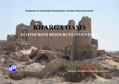
ECOTOURISM RESEOURCES INVENTORY<br />
Ecotourism for Sustainable Development in the New Valley Governorate<br />
KHARGA OASIS<br />
ECOTOURISM RESOURCES INVENTORY<br />
Environmental Design Group<br />
Architects - Landscape Architects - Environmental Planners<br />
Mostafa and Mohamed Elkhatib<br />
www.edgegypt.com<br />
CISS Egypt- International Cooperation South South<br />
KHARGA SITES Page 1
ECOTOURISM RESEOURCES INVENTORY<br />
Site Name: Temple of Nadura<br />
Site Type: Archaeological site<br />
Site coordinates: N 25 28 103 E 30 33 412<br />
Period: Ancient Egyptian, Roman.<br />
Getting there & Site accessibility: Nadura is southeast of the Temple of Hibis and<br />
1.5 kilometers north of the tourist information office at Qasr <strong>Kharga</strong>.<br />
Entrance fee\ permission: N/A<br />
Description: Two sandstone temples are located on a hill known as Nadura (“lookout”)<br />
not far from the modern town at Qasr al-<strong>Kharga</strong>, southeast of the Temple of<br />
Hibis. The main temple was dedicated to Amun-Re (but Mut and the cult of Castor<br />
and Pollux have also been suggested) and was probably built in the second century<br />
AD during the reign of Antoninus Pius (138-161 AD). Not much remains of the<br />
temple but it once had a sanctuary and a number of associated chambers with reliefs<br />
decorating the walls. The temple was surrounded by a mudbrick enclosure with an<br />
entrance in the eastern side. Within this enclosure are also the remains of a church<br />
and the whole complex was reused as a fortress by the Turks. Outside the temple<br />
complex/fortress, towards the bottom of the hill is another Roman temple (perhaps<br />
dedicated to Aphrodite).<br />
There are also some ruins of a settlement in Nadura and a Graeco-Roman cemetery.<br />
KHARGA SITES Page 2
ECOTOURISM RESEOURCES INVENTORY<br />
KHARGA SITES Page 3
ECOTOURISM RESEOURCES INVENTORY<br />
Site Name: Hibis<br />
Site Type: Archaeological site<br />
Site coordinates: N 25 28 362 E 30 33 316<br />
Period: Saite, Persian, Graeco-Roman, Coptic<br />
State: Well preserved<br />
Getting there & Site accessibility: on the paved road to the airport, 2km north of<br />
el-<strong>Kharga</strong>. 2 WD<br />
Entrance fee\ permission: Hibis Temple is currently closed to tourists and only the<br />
outer parts of the enclosure may be visited. It will be open again after the completion<br />
of the restoration and conservation works.<br />
Description: This temple, constructed of local limestone blocks, is the largest in the<br />
<strong>Kharga</strong>h oasis and is also the best preserved structure in Egypt from the Saite and<br />
Persian periods. It was built some time in the 26 th Dynasty, probably during the reign<br />
of Psamtik II (ca. 595-589 BC). Later rulers, such as Darius I (ca. 521-486 BC),<br />
Akhoris (ca. 393-380 BC), Nectanebo I and II (ca. 380-362 BC and 360-343 BC) and<br />
Ptolemy IV (221-204 BC), have left their mark on the temple through architectural<br />
additions and wall decorations. There might have been a temple here as early as the<br />
New Kingdom, but to date only a few blocks from this period have been found.<br />
The name Hibis derives from the Ancient Egyptian Hbt, which means “the plough”<br />
and was the ancient name for the whole oasis. The temple was dedicated to Amun but<br />
other important gods of the oases were also venerated here, e.g. Min and Seth. On the<br />
walls of the sanctuary are figures of an unusually large number of gods, probably<br />
representing their divine statues found in sanctuaries in various important religious<br />
KHARGA SITES Page 4
ECOTOURISM RESEOURCES INVENTORY<br />
centers around Egypt.<br />
The oldest remaining parts of the temple, the sanctuary, its associated chambers and a<br />
hypostyle hall, were decorated by Darius I but were erected already in the Saite<br />
period (26 th Dynasty). Another hypostyle hall was added in front of the earlier one by<br />
Akhoris who also added a courtyard through which the temple was entered. Later, the<br />
Nectanebos (I and II) had the enclosure wall built in addition to a kiosk which was<br />
erected in front of the entrance to the temple. In the Ptolemaic period an additional<br />
enclosure was built with a massive sandstone gateway (the Great Gateway) and from<br />
this an avenue lined by sphinxes led to the quay of a large artificial lake. In the<br />
Roman period an additional gate was built on this avenue. Inscriptions from as early<br />
as AD 49 have been found on this gate.<br />
Inside the temple, the main halls are surrounded by rooms and chapels with stairways<br />
leading to upper floors and the roof. In some rooms are trapdoors leading to<br />
underground crypts. The later additions of the temple had wooden roofs which have<br />
now disappeared. Among the many, and in some places very well-preserved, reliefs is<br />
a winged, blue figure of Seth with a falcon head and his spear, defeating the serpent<br />
Apaphis. Some scholars have suggested that this motif is a precursor of that of St.<br />
George and the Dragon.<br />
There was a settlement associated with the temple, but this is now mostly covered by<br />
the surrounding cultivation. However, some excavations made in the early 20 th<br />
century revealed a few houses (presumably of the Graeco-Roman periods). Remains<br />
of Graeco-Roman houses have also been found between the temple and the enclosure<br />
wall. In the 4 th century, a church was built against the north wall of the temple portico<br />
and a number of other structures surrounded it.<br />
Since the temple went out of use some time in the 4 th century, stones have been<br />
quarried for use elsewhere and irrigation and cultivation close to the temple have<br />
caused the ground around and beneath the temple to sink. Ancient reparations to the<br />
temple show that this was a problem already while the temple was in use, presumably<br />
due to its location on a lake. Work has been underway since the 1980‟s to rescue the<br />
KHARGA SITES Page 5
ECOTOURISM RESEOURCES INVENTORY<br />
temple from further damage. Originally there were plans to relocate the temple on<br />
drier land, but this has required that large amounts of in situ conservation work have<br />
had to be completed first. The fate of the temple is therefore yet to be decided.<br />
KHARGA SITES Page 6
ECOTOURISM RESEOURCES INVENTORY<br />
Site Name: Gebel al-Teir<br />
Site Type: Rock inscriptions<br />
Site coordinates: N 25 30 425 E 30 33 242<br />
Period: Prehistoric to Modern<br />
State: Under threat<br />
Getting there & Site accessibility: Located about 2 kilometers (1.2 miles) north of<br />
Bagawat and 8 kilometers north of Qasr <strong>Kharga</strong>. Gebel al-Teir is complicated and<br />
should not be undertaken without a local guide.<br />
Entrance fee\ permission: Not Applicable<br />
Description:<br />
Gebel al-Teir is a mountain about 8 km north of Qasr <strong>Kharga</strong>h. In one of its wadis are<br />
several areas with rock-inscriptions and graffiti. They range in date from prehistoric<br />
to modern times and are frequently found in sheltered recesses in the hills.<br />
Inscriptions are written in hieroglyphs, Demotic, Greek, Coptic and Arabic. At the<br />
entrance to the wadi is the first set of rock-inscriptions, consisting of prehistoric<br />
depictions of animals such as giraffes and gazelles, human figures with bows and<br />
arrows, a boat, Egyptian deities and numerous inscriptions. About 155 m further into<br />
the wadi is a second set of inscriptions, many dedicated to Ancient Egyptian gods,<br />
predominantly Min, and much of the writing is in hieroglyphs dating from the Late<br />
and Ptolemaic periods. These are probably connected to limestone quarrying that took<br />
place in the walls of the mountain just across the wadi. At the top of the mountain is<br />
the Cave of Mary and below this is an area with a large number of Coptic paintings<br />
and prayers from the 4th, 5th and 10th centuries, left by hermits living in caves here<br />
presumably to be near the revered cave at the top.<br />
KHARGA SITES Page 7
ECOTOURISM RESEOURCES INVENTORY<br />
Site Name: Qasr al-Ghweita<br />
Site Type: Archaeological site<br />
Site coordinates: N 25 17 117 E 30 33 297<br />
Period: Middle Kingdom - Roman<br />
State: Well preserved<br />
Getting there & Site accessibility: 3km to the east of the main road and about 18km<br />
south of the city of el-<strong>Kharga</strong>.<br />
Entrance fee\ permission: One LE for Egyptians, 25 LE for foreigners<br />
Description:<br />
The large mudbrick fortress at Ghweita probably once served as headquarters for the<br />
garrisons of Roman troops stationed in the <strong>Kharga</strong> <strong>Oasis</strong>. Not much is known of the<br />
exact function of the buildings here but remains of a settlement have been found both<br />
within and around the fortress.<br />
The most prominent building on the site is a stone temple. It was dedicated to the<br />
Theban triad (Amun, Mut and Khonsu) and may have been erected as early as the<br />
Saite period, but is more likely to date to the reign of Darius I (ca. 521-486 BC).<br />
Several Ptolemaic kings added additional structures to the original temple and may<br />
also have built a Birth House (mammisi) of which only a facade remains. The temple<br />
is entered through a sandstone gate that opens onto a courtyard. Beyond this is a<br />
hypostyle hall, and through this are the three sanctuaries. A stairway to the south of<br />
these leads to the roof. The walls are decorated with reliefs dating from both the<br />
Perisian and Ptolemaic periods and also have later Greek and Coptic graffiti. Around<br />
the temple are mudbrick structures.<br />
KHARGA SITES Page 8
ECOTOURISM RESEOURCES INVENTORY<br />
The settlement connected to the temple was called Perousekh in Ancient times and<br />
existed probably as early as the Middle Kingdom. It is well-known from tombs in<br />
Thebes where it was known for its quality wine.<br />
KHARGA SITES Page 9
ECOTOURISM RESEOURCES INVENTORY<br />
Site Name: Qasr al-Zayyan<br />
Site Type: Archaeological site<br />
Site coordinates: N 25 15 043 E 30 34 159<br />
Period: Graeco-Roman<br />
State: Ruin<br />
Getting there & Site accessibility: Near the main road, about 75km north of Dush<br />
towards <strong>Kharga</strong> City and about 30km to the south of the city of el-<strong>Kharga</strong> and not far<br />
from the fortress of Qasr el-Ghweita. It can be easily reached by 2WD road and a 4×4<br />
vehicle is not necessary.<br />
Entrance fee\ permission: 1 LE for Egyptians and 25 LE for foreigners<br />
Description:<br />
The small temple at Qasr el-Zayyan is built of sandstone and dates to the Ptolemaic<br />
period. It has an outer wall of mudbrick with a well-preserved sandstone gate. The<br />
main temple building consists of a sanctuary and an ante-chamber which are reached<br />
through a mudbrick hall. The temple was restored in the Roman period during the<br />
reign of Antoninus Pius (in AD 140). It was dedicated mainly to Amun of Hibis<br />
(Amenibis).<br />
It was once associated with one of the largest settlements in the oasis, known as<br />
Takhoneourit, “the Great Well” in Pharaonic times, and Tchonemyris in Graeco-<br />
Roman times. The settlement has not been excavated but the remains of a well which<br />
could have been the “Great Well” have been found near the temple enclosure wall. In<br />
addition to the importance the settlement would have gained from the accessibility to<br />
KHARGA SITES Page 10
ECOTOURISM RESEOURCES INVENTORY<br />
water, it was also located on a route leading to Esna during Roman times. Ruins of<br />
the Roman town are still visible and the large mudbrick walls surrounding the temple<br />
are the remains of a Roman fortress, similar to that at Qasr al-Ghweita.<br />
KHARGA SITES Page 11
ECOTOURISM RESEOURCES INVENTORY<br />
Site Name: Dush (Kysis)<br />
Site Type: Archaeological site (Fortress and Temple)<br />
Site coordinates: N 24 34 505 E 30 43 030<br />
Period: Graeco-Roman<br />
Getting there & Site accessibility: Dush is situated about 15 km north-east of el-<br />
Qasr. 2WD<br />
Entrance fee\ permission: 1 LE for Egyptians and 25 LE for foreigners<br />
Description:<br />
Dush is the most extensively investigated site in the <strong>Kharga</strong> oasis and has revealed a<br />
fortress, temples, a garrison town and a necropolis. In Graeco-Roman times this site<br />
was known as Kysis and was located in a strategic position on a hill on an important<br />
caravan route (the southern end of Darb al-„Arbain) on the southern limits of the<br />
oasis. Soldiers were sent here from the Nile Valley from probably as early as the Old<br />
Kingdom to protect the Egyptian border. The remains of the fortress visible today,<br />
however, date to the Roman period. At this time it was also an important religious<br />
center and pilgrims came from all over the Empire to visit the temple of Isis, Serapis<br />
and Osiris. The remains of this limestone temple stand just outside the fortress walls.<br />
It was built in the reign of Domitian (between AD 81 and 96) on an earlier mudbrick<br />
shrine and the emperors Trajan and Hadrian added architectural elements and<br />
decorations. It is mentioned on the Trajan Column in Rome, a testimony to its<br />
importance. On the first pylon of the temple is an inscription identifying the town as<br />
Kysis.<br />
A mudbrick temple is located about 200 m west of the main one. The date of this still<br />
remains uncertain, but it is probably also Roman.<br />
KHARGA SITES Page 12
ECOTOURISM RESEOURCES INVENTORY<br />
The mudbrick walls of the fortress still stand to a height of six meters. When it was<br />
built in the Ptolemaic period it seems to have served as protection of a series of<br />
magazines and perhaps a temple. The exact relationship between buildings within the<br />
fortress walls remains unclear as there are a jumble of walls and passages on four<br />
levels. However, it seems that at least in the late Roman period it housed a garrison.<br />
The Roman town connected to the fortress was laid out on either side of a main<br />
thoroughfare running south from the main temple. Several large houses built in the<br />
first century AD have been excavated here. They had been reused in several phases<br />
and the most recent level dates to the 4 th century. They had courts and peristyles and<br />
were decorated with frescoes. The inhabitants of these and other houses were buried<br />
in domed tombs in cemeteries to the north and west of the town. The settlement<br />
seems to have been abandoned in the 5 th century.<br />
Among the most notable finds from the Roman fortress is the Treasure of Dush<br />
discovered in 1989 by the French team excavating in one of the rooms. It consists of a<br />
collection of religious objects and jewelry from the 4 th -5 th centuries. It included a<br />
golden crown with a figure of Serapis as well as bracelets and pendants of gold and<br />
semi-precious stones. The treasures are on display in the Egyptian Museum in Cairo.<br />
Other finds include large amounts of ostraca and papyri from the 3 rd -5 th centuries.<br />
On the slopes of the hill are the remains of Persian and Ptolemaic settlements and<br />
more cemeteries and a qanat system are located in the surrounding areas.<br />
KHARGA SITES Page 13
ECOTOURISM RESEOURCES INVENTORY<br />
Site Name: Deir Al Munira<br />
Site Type: Archaeological site / Fortress<br />
Site coordinates: N 25 35 492 E 30 43 503<br />
Period: Roman<br />
Getting there & Site accessibility: lies at the foot of the eastern escarpment about<br />
20km north of el-<strong>Kharga</strong>, where it guarded the main desert route towards Farshut and<br />
the Nile Valley. A well-defined dirt track to the fortress of el-Deir leads off from the<br />
main <strong>Kharga</strong> to Asyut road but ends about two kilometres from the site. The last part<br />
over a chain of encroaching sand dunes should not be attempted unless on foot or<br />
alternatively from the south in a 4×4 vehicle. Permission from the Antiquities Office<br />
and a guide must be obtained before visiting this site.<br />
Entrance fee\ permission: N/A<br />
Description:<br />
The town at al-Deir (or Deir al-Munira) was probably occupied from the 4 th century<br />
BC to the 6 th century AD. From its location at the foot of the escarpment the fortress<br />
guarded the road that lead from the oasis to Farashut in the Nile Valley and may have<br />
been the largest of its kind in <strong>Kharga</strong>. It played a similarly important role during<br />
WWI when British soldiers reoccupied the fortress and left behind graffiti on the<br />
walls.<br />
The current brick fortress probably dates to the reign of Diocletian (AD 284-305). It<br />
has twelve round towers, two in each of the four sides and one in each corner. Inside<br />
are several rooms and in the courtyard is a large well which is now filled with sand.<br />
Water was led from the well through an underground aqueduct system to the fields<br />
KHARGA SITES Page 14
ECOTOURISM RESEOURCES INVENTORY<br />
outside the fortress walls. Several staircases lead to a parapet on the roof between the<br />
towers.<br />
About 1.5 km northwest of the fortress is a mudbrick temple from the 2nd-3rd<br />
centuries containing four chambers. It was converted to a church after it went out of<br />
use. This church may have been part of the deir (monastery) that the name refers to.<br />
Excavations have uncovered fragments of painted plaster and Demotic and Greek<br />
papyri. On the walls of the sanctuary is Coptic, Greek and Arabic graffiti. Around the<br />
temple are remains of the town, including many visible traces of the ancient irrigation<br />
system.<br />
Around the Roman fortress is a necropolis investigated by a French team since 1997.<br />
In the southern part are tombs with remains in wooden sarcophagi. In the north they<br />
found tombs with limestone sarcophagi, some with well-preserved mummies still<br />
inside. These tombs probably date to the late Roman period (3rd-5th centuries AD).<br />
In the east were Ptolemaic tombs that had been reused for the burial of mummified<br />
dogs. Finally, in the west, they have discovered Christian burials from around the 4th<br />
and 5th centuries. West of the fortress was also the remains of an embalming house of<br />
mudbrick. Vases found inside the house contained products used in embalming, such<br />
as oil and natrium.<br />
KHARGA SITES Page 15
ECOTOURISM RESEOURCES INVENTORY<br />
Site Name: Manawir<br />
Site Type: Archaeological site<br />
Site coordinates:<br />
N 24 34 300 E 30 40 351<br />
Period: Paleolithic-Old Kingdom; Persian and Roman<br />
Getting there & Site accessibility: two km from the road to Dush<br />
Entrance fee\ permission: N/A<br />
Description:<br />
The most interesting remains at Ain Manawir are the extensive underground<br />
aqueducts known as qanats constructed here by the Persians in the 5th century BC.<br />
This enormous effort to re-settle and irrigate this part of the oasis was done after it<br />
had been abandoned in the Old Kingdom, presumably because the artesian wells in<br />
the area dried up. The aqueduct system provided the settlement with water but also<br />
irrigated fields and orchards and all of these features have been uncovered in recent<br />
excavations at the site. The qanats were long underground tunnels dug through the<br />
slopes of the surrounding sandstone hills to collect the water trapped in natural<br />
aquifers and lead it to the settlement.<br />
The primary occupation layers date to the Roman and Persian periods, but around the<br />
artesian wells in the area are remains of earlier temporary camps from the Paleolithic<br />
period until the Old Kingdom.<br />
A small mudbrick temple built in the 5th century BC and dedicated to Osiris is the<br />
only shrine known on the site. It has a Nubian vault opening onto the sanctuary and a<br />
„boat chapel‟ that were originally paved with stone. Under the northern rooms are<br />
crypts originally thought to have been cenotaphs of Osiris, but are now looking<br />
KHARGA SITES Page 16
ECOTOURISM RESEOURCES INVENTORY<br />
increasingly like ordinary storage rooms. Among the finds in the temple were molded<br />
glass pieces that had been used in a mosaic relief similar to those found on the walls<br />
of the temples in Persia. These finds suggest the technique was introduced to Egypt a<br />
hundred years earlier than previously thought. Attached to and surrounding the<br />
temple are a number of mudbrick buildings that were all connected to the<br />
administration of the temple. One building which communicated directly with the<br />
temple through a doorway contained a number of ovens, suggesting it may have been<br />
the bakery or kitchen. In this area, mainly in the priests‟ quarters, the excavators have<br />
uncovered about 450 ostraca, which include a number documenting water collected<br />
from the aqueducts in the Persian period. Other deal with contracts concerning water<br />
rights, or are religious documents. They date in range from Darius I (c. 521-486 BC)<br />
and Artaxerxes I (c. 465-424 BC) in the 27 th dynasty to Amyrtaios (around 400 BC)<br />
in the 28 th , describing the time of the digging of the qanats and their use.<br />
The settlement was probably abandoned in the beginning of the 4th century and was<br />
not resettled until Roman times. The Romans reused the qanats and dug them even<br />
deeper, but eventually it seems that this source also dried out and the site was<br />
abandoned by the 3rd century AD.<br />
Source: Wuttmann, M. & Gonon, T. & Thiers C., The Qanats of „Ayn-Manâwîr)<br />
Source: Wuttmann, M. & Gonon, T. & Thiers C., The Qanats of<br />
„Ayn-Manâwîr<br />
KHARGA SITES Page 17
ECOTOURISM RESEOURCES INVENTORY<br />
Site Name: Qasr al-Labekha<br />
Site Type: Archaeological site (Temple, Fortress)<br />
Site coordinates: N 25 42 502 E30 33 120<br />
Period: Graeco-Roman<br />
Getting there & Site accessibility: Qasr el-Labekha lies in an isolated part of the<br />
desert around 12km west of the main Asyut to el-<strong>Kharga</strong> road and approximately<br />
50km north of the city itself.<br />
Entrance fee\ permission: N/A<br />
Description:<br />
Qasr Labekha is located in a wadi and was one of the largest settlements in the<br />
<strong>Kharga</strong> oasis in the Roman period. The large fortress housed a garrison and guarded<br />
the Darb „Ain Amur, the main route to Dakhla. The site also contains two temples,<br />
aqueducts, remains of the settlement and a necropolis. It was in use from at least the<br />
Ptolemaic period until the 4 th century AD.<br />
The mudbrick fortress has door posts and a lintel of limestone and each corner is<br />
fortified by a round tower. Some of the walls are still preserved to a height of 12<br />
meters. Inside are the remains of vaulted rooms and cells now filled with sand.<br />
Around the fortress are the remains of mudbrick houses, some once built up to three<br />
stories high and with domed roofs. The now silted well, located to the south of the<br />
fortress, provided the settlement with much needed water for drinking as well as for<br />
the irrigation of the surrounding cultivation, which was made possible by the digging<br />
of qanats (underground aqueducts).<br />
To the north of the fortress is a mudbrick temple from the 3 rd century AD. Inside is a<br />
KHARGA SITES Page 18
ECOTOURISM RESEOURCES INVENTORY<br />
great hall leading to an antechamber and a sanctuary in the western end. The doorway<br />
between the hall and the antechamber still has a cornice painted in red, blue, green<br />
and black. Few traces of decoration remains otherwise, but during clearance of the<br />
temple, a number of limestone fragments inscribed with the title Caesar and referring<br />
to Amun were found. There is an altar in the western part of the hall and a gate<br />
outside the temple leads to an underground chamber. A staircase may have given<br />
access to the roof.<br />
About 250 m to the south is a rock sanctuary that may have originally been the tomb<br />
of a local man called Piyiris who was deified after his death. The tomb consists of two<br />
pits with two connected antechambers. The main sanctuary is excavated into the rock<br />
next to the tomb and is preceded by two halls built of mudbrick against the cliff.<br />
Another sanctuary is partly hewn out of the rock and partly constructed of mudbrick,<br />
and also preceded by two halls. To the south of the halls is a large complex of service<br />
rooms built in mudbrick in front of the cliff. On the plastered walls are painted figures<br />
of deities such as Bes and geometrical patterns. The temple was completed in the<br />
reign of Antoninus Pius (AD 138-161) and may have been dedicated to Hercules<br />
before it became the shrine of the deified Piyiris in the 3 rd century AD. Coins of<br />
Antoninus Pius, Licinius, Septemus Severus and Constantin II have been found in the<br />
temple, as well as a limestone hawk.<br />
A large mudbrick building, possibly another temple, located to the north of the<br />
fortress contained more than one hundred Demotic ostraca, as well as one in Greek, a<br />
large bronze coin hoard and statues of Osiris, also of bronze.<br />
In the necropolis west of the fortress are tombs from the Ptolemaic and Roman<br />
periods. They contained wooden statues, jewelry, faience amulets and fragments of<br />
funerary masks and some of them had decorated chambers. In addition to this, there is<br />
another necropolis located west of the northern temple and in general, Roman tombs<br />
from the 1 st to the 5 th centuries are found all over the area. Anthropoligical studies<br />
conducted on the remains found in these tombs suggest the population was<br />
homogenous and the remains were similar to those found in Al-Dush and Al-Deir.<br />
KHARGA SITES Page 19
ECOTOURISM RESEOURCES INVENTORY<br />
Site Name: Ain Umm al-Dabadib<br />
Site Type: Archaeological site/( Fortress, Church)<br />
Site coordinates: N 25 43 459 E 30 25 180<br />
Period: Prehistoric, Persian (?), Roman<br />
Getting there & Site accessibility: The journey requires the use of a 4×4 vehicle<br />
with an expert driver, a knowledgeable guide. At around 40km north-west of el-<br />
<strong>Kharga</strong>, at the base of the northern escarpment, Ain Umm el-Dabadib is in a remote<br />
region of the oasis which lay on the Darb Ain Amur, the ancient route to Dakhla<br />
<strong>Oasis</strong>.<br />
Entrance fee\ permission: N/A<br />
Description:<br />
The ruins at Umm al-Dabadib stand at the base of an escarpment along the Darb<br />
„Ain „Amur. They are the remains of a large settlement and a fortress, probably from<br />
the Roman period, which were later inhabited by a Christian population.<br />
Underground is an extensive network of qanats (aqueducts) which once provided<br />
water for the settlement and the surrounding cultivation.<br />
The rectangular mudbrick fortress stands on the southern part of the site and although<br />
it is now largely in ruins, its walls once stood to a height of 15 meters. The entrance is<br />
in the south and each corner is fortified with a massive rectangular tower. This design<br />
sets it aside from the other fortresses in <strong>Kharga</strong> which all had round towers, perhaps<br />
suggesting a later date for its construction. Originally the fortress contained rooms on<br />
three floors, but only the much disturbed remains of the vaulted rooms of the first<br />
floor can be seen now. Around the fortress are the remains of a settlement containing<br />
houses and shops and the whole area was surrounded by a fortified enclosure wall<br />
KHARGA SITES Page 20
ECOTOURISM RESEOURCES INVENTORY<br />
which measured 100 meters in length. A Coptic chapel was later built on top of the<br />
remains of the fortress and on the plastered walls of this are traces of Coptic graffiti.<br />
A church was located to the east of the fortress but this has been almost completely<br />
destroyed by looters. Near it is a temple built in Egyptian style with walls slanting<br />
inwards. A recent survey of the site has found evidence in the form of pottery and<br />
tombs that suggest that the northern part was inhabited at an earlier date than the<br />
fortress and church on the southern part.<br />
The qanats are similar to the Persian types found in Manawir, suggesting they were<br />
constructed during the same time. They are combined with canals conducting water<br />
above ground and together ensured the constant irrigation of the surrounding<br />
cultivation. The underground tunnels run in parallel lines from the settlement towards<br />
the escarpment. In an outcrop to the east of the qanats are some rock-cut tombs and<br />
other cemeteries have also been found in the surrounding areas. The plain, which<br />
once was a lake, has revealed areas with Prehistoric remains.<br />
KHARGA SITES Page 21
ECOTOURISM RESEOURCES INVENTORY<br />
Site Name: Ain al-Dabashiya<br />
Site Type: Archaeological site (Village, temple, pigeon house, and tombs)<br />
Site coordinates: N 25 35 325 E 30 35 146<br />
Period: Late Period, Roman<br />
Getting there & Site accessibility:<br />
Entrance fee\ permission: N/A<br />
Description:<br />
The site of Ain Dabashiya is a small mound in the desert far from any modern<br />
development. It is dominated by the remains of a mudbrick temple but also contains a<br />
cemetery and remains of a settlement. The spring that has given the site its name is<br />
located on the southeastern part of the site. The temple is probably Roman in date,<br />
but other remains at the site date from as early as the 27 th dynasty (Late Period).<br />
Around the temple are modern mudbrick houses that were built on the ancient<br />
remains but have since been abandoned. Traces of ancient cultivation can be seen all<br />
around the site and a columbarium (pigeon tower) still stands to a height of about 6-7<br />
meters. Near the tower an area for food processing, grain in particular, has been<br />
identified through the find of numerous grinding stones. The cemetery is located to<br />
the west of the temple and contains simple pit graves as well as rock-cut tombs with<br />
several chambers, suggesting people from different strata of society were buried here.<br />
A canine cemetery has also been found here recently.<br />
KHARGA SITES Page 22
ECOTOURISM RESEOURCES INVENTORY<br />
Site Name: Qasr El Kashef<br />
Site Type: Archaeological site<br />
Site coordinates: N 25 29 345 E 30 33 122<br />
Period: Pharaonic to the late Roman/Coptic period<br />
State: Ruin<br />
Getting there & Site accessibility: one km north of Bagawat<br />
Entrance fee\ permission: N/A<br />
Description:<br />
Qasr Mustafa Kashif, also known as Deir (monastery) Mustafa Kashif, is said to have<br />
its name from a Mamluk governor of <strong>Kharga</strong> (Mustafa the Tax Collector). The<br />
remains on the site all date to the Coptic period, however, and consist of monastic<br />
buildings, a church and a traveler‟s lodge. Before the Christians built here, the site<br />
was occupied by people in the Middle Kingdom and the Roman period and the<br />
monastery is built over an ancient tomb.<br />
The building has two entrances, one in the north and another in the south. Inside is a<br />
church with inscriptions from the 5 th and 6 th centuries on the ceiling.<br />
Two Roman temples were recently identified among the other ruins on the site.<br />
KHARGA SITES Page 23
ECOTOURISM RESEOURCES INVENTORY<br />
Site Name: Ain al-Tarakwa<br />
Site Type: Archaeological site<br />
Site coordinates:<br />
Period: Roman<br />
- -<br />
Entrance fee\ permission: N/A<br />
Description:<br />
Ain al-Tarakwa is located on the road to Umm al-Dabadib which led to the Darb „Ain<br />
Amur. It was completely unknown until 1994 when it was revealed by a sandstorm.<br />
The site has not been excavated so it remains fairly unknown, but the pottery on the<br />
site dates to the late Roman period (3 rd and 4 th centuries).<br />
On the site is a sandstone temple with a tripartite sanctuary and a large cella. It is<br />
surrounded by a mudbrick enclosure wall which was entered through a gateway of<br />
sandstone in the southern wall. Unfortunately, the northern wall was destroyed by a<br />
front loader in recent times, when some blocks from the temple were also removed.<br />
Within the thick enclosure wall and directly in front of the temple entrance are the<br />
remains of a mudbrick church.<br />
In addition to the temple, there are traces of mudbrick walls, vaults and lintels visible<br />
in the sand both within and without the enclosure.<br />
To the south is a large cemetery with vaulted mudbrick tombs, most of which have<br />
collapsed. They contain burials from both the Roman and the Coptic periods. In the<br />
same area are two large wells.<br />
KHARGA SITES Page 24
ECOTOURISM RESEOURCES INVENTORY<br />
Site Name: Hassan Fathy Village<br />
Fathy's Baris Project for Public Housing in <strong>Kharga</strong> <strong>Oasis</strong><br />
Site Type: Culture center / local architecture<br />
Site coordinates: N 24 41 362 E 30 35 456<br />
Period: Modern<br />
State: Closed<br />
Getting there & Site accessibility: on the paved road <strong>Kharga</strong> - Paris<br />
Entrance fee\ permission: N/A<br />
Description:<br />
New Baris was built in the 1960‟s to house a <strong>new</strong> agricultural community in the<br />
<strong>Kharga</strong> oasis. Its inhabitants were destined to cultivate 1000 acres of land in the area.<br />
Hassan Fathy was commissioned to design the architecture for the village and he used<br />
the Medieval villages in <strong>Kharga</strong>h as an inspiration to solve issues with the high<br />
temperatures and sand and wind that can make the oasis near inhabitable. He solved it<br />
by building storages underground and creating architecture that allowed for maximum<br />
airflow through the rooms. He also designed the village so that the houses would<br />
provide shade on the streets during the hottest hours of the day, similar to the way the<br />
Medieval villages were laid out. The project was interrupted by the outbreak of war in<br />
1967 and was never resumed. One or two families lived in the village briefly but it is<br />
now abandoned. Among the remaining buildings are the market, two villas and a<br />
workshop.<br />
KHARGA SITES Page 25
ECOTOURISM RESEOURCES INVENTORY<br />
KHARGA SITES Page 26
ECOTOURISM RESEOURCES INVENTORY<br />
Site Name: Wadi al-Battikha<br />
Site Type: Natural Feature<br />
Site coordinates: N 26 27 217 E 30 47 320<br />
Getting there & Site accessibility: On the <strong>Kharga</strong>- Asiut road some ( ) km to the<br />
north of <strong>Kharga</strong><br />
Entrance fee\ permission: Not applicable<br />
Description:<br />
Wadi al-Batikha, Valley of Melons, has got its name from the unusually shaped<br />
stones that are found here, resembling Egyptian watermelons. It is actually three<br />
separate wadis of which the third one is the most accessible. The Lower Eocene<br />
stones have been formed by wind erosion and polished to a shine by blasting sand.<br />
The shifting temperatures have split some of them in half.<br />
No picture available<br />
KHARGA SITES Page 27
ECOTOURISM RESEOURCES INVENTORY<br />
Site Name: The Necropolis of El-Bagawat<br />
Site coordinates: N 25-28- 549 E 30-33-174<br />
Site Type: Archaeological site<br />
Period: Coptic<br />
Getting there & Site accessibility: 3 km north to <strong>Kharga</strong>h <strong>Oasis</strong> on the road of the<br />
airport<br />
Entrance fee\ permission: 2 LE for Egyptians and 30 LE for foreigners<br />
Description:<br />
This extensive cemetery now consists mostly of Christian tombs with burial chapels<br />
from the 4 th , 8 th and 10 th centuries, but it was used for burials long before this. It is<br />
believed to have served the community of the oasis from at least the time of the Hibis<br />
temple and some of the present chapels are built on earlier pit-graves. The cemetery<br />
contains 263 mudbrick chapels and covers an area of 500 by 200 meters with most of<br />
the tombs and associated chapels placed on ridges elevating them over the plain. They<br />
are clustered in eight main areas and with streets and alleyways separating the<br />
individual structures. In the middle of the area are the remains of what may have<br />
been a church or, as has also been suggested, the place where meals for the dead were<br />
held.<br />
The actual burial chambers are located underground and have shelves in the walls for<br />
the burials and funerary goods. Above these are square or rectangular chapels with<br />
one or two chambers. Some of them have a domed roof. Many had wooden doors that<br />
have now mostly withered away but many of the facades still retain their decorative,<br />
recesses and false arches. The interior walls of some chapels were plastered and<br />
painted with scenes taken from the stories of the Bible. But there are also motifs more<br />
reminiscent of Ancient Egyptian traditions. The result is an elaborate mixture of<br />
KHARGA SITES Page 28
ECOTOURISM RESEOURCES INVENTORY<br />
styles unique for Bagawat.<br />
Among the most richly decorated chapels are the Chapel of the Exodus and the<br />
Chapel of Peace. The first dates from the 4 th century AD and is one of the oldest in<br />
the cemetery. The inside of its dome is decorated with scenes from the Old<br />
Testament, including the Exodus, Noha‟s Ark, Jonah and the whale and Adam and<br />
Eve. On the walls are also graffiti from the 9 th century onwards, although much of it<br />
was removed in the 1920‟s as it was thought to be modern scribbles. The other chapel<br />
is probably from the 5 th or 6 th century and gets its name from a painting of a woman<br />
holding a scepter and a cross representing Peace. It also has scenes from the Bible,<br />
including New Testament images such as the Annunciation of the Virgin Mary. Both<br />
these chapels and their tombs had been robbed before excavation. One undisturbed<br />
chapel was excavated by an American team working on the site at the beginning of<br />
the 20 th century. Three coffins still remained in the underground chambers. One<br />
contained the remains of a woman accompanied with beads, iron bracelets, bone<br />
artifacts and glass vessels, some presumably intentionally broken during the burial in<br />
some sort of ritual. In another coffin were the mummified remains of a woman and a<br />
baby and in the third those of a man.<br />
KHARGA SITES Page 29
ECOTOURISM RESEOURCES INVENTORY<br />
References<br />
* Ahmed F. 1975. "Charga Oase". In W. Helck and E. Otto (eds.) Lexikon der Ägyptologie, Bd 1. Wiesbaden: Otto Harrassowitz. 907-910.<br />
* Arnold, D., 2009. The Monuments of Egypt. An A-Z Companion to Ancient Egyptian Architecture. Cairo: AUC Press: 190.<br />
* Arnold, D., 2009. The Monuments of Egypt. An A-Z Companion to Ancient Egyptian Architecture. Cairo: AUC Press: 190-192.<br />
* Arnold, D., 2009. The Monuments of Egypt. An A-Z Companion to Ancient Egyptian Architecture. Cairo: AUC Press: 8.<br />
* Beadnell, H.J.L.<br />
* Beadnell, H.J.L. 1909. An Egyptian <strong>Oasis</strong>. London: John Murray: 222.<br />
* Beadnell, H.J.L. 1909. An Egyptian <strong>Oasis</strong>. London: John Murray: 170-185<br />
* Beadnell, H.J.L. 1909. An Egyptian <strong>Oasis</strong>. London: John Murray: 101.<br />
* Beadnell, H.J.L. 1909. An Egyptian <strong>Oasis</strong>. London: John Murray: 103-10<br />
* Bagnall, R. and D. Rathbone (eds.). 2004. Egypt From Alexander to the Copts. London: British Museum Press: 253<br />
* Bousquet, B. 1996. Tell-Douch et sa région. Géographie d'une limite de milieu à une frontière d'Empire. DFIFAO 31. Cairo : IFAO.<br />
* Bousquet, B. 1996. Tell-Douch et sa région. Géographie d'une limite de milieu à une frontière d'Empire. DFIFAO 31. Cairo : IFAO.<br />
* Cruz-Uribe, E.<br />
* Cruz-Uribe, E.<br />
* Cruz-Uribe, E. 1995.<br />
* Cruz-Uribe, E. 1999. "<strong>Kharga</strong> <strong>Oasis</strong>, Late period and Graeco-Roman sites". In K. Bard (ed.) Encyclopedia of the Archaeology of Ancient Egypt. London and<br />
New York: Routledge. 407.<br />
KHARGA SITES Page 30
ECOTOURISM RESEOURCES INVENTORY<br />
* Cruz-Uribe, E. 1999. "<strong>Kharga</strong> <strong>Oasis</strong>, Late period and Graeco-Roman sites”. In K. Bard (ed.) Encyclopedia of the Archaeology of Ancient Egypt. London<br />
and New York: Routledge. 407.<br />
* Cruz-Uribe, E. 1986. “The Hibis Temple Project 1984-5 Field Season, Preliminary Report. JARCE 23: 157-166.<br />
* Cruz-Uribe, E. 1999. “<strong>Kharga</strong> <strong>Oasis</strong>, Late period and Graeco-Roman Sites”. In K. Bard (ed.) Encyclopedia of the Archaeology of Ancient Egypt. London<br />
and New York: Routledge. 407.<br />
* Caton-Thompson, G.<br />
* Caton-Thompson, G. 1952. <strong>Kharga</strong> <strong>Oasis</strong> in Prehistory. London: The Athlone Press. 157-158.<br />
* Chauveau, M., 1996. “Une oasis égyptienne au temps des perses”, BSFE 137, p.32-47.<br />
* Dunand, Fr. Heim, J.-L. Henein, N. Lichtenberg, R. 1992. La Nécropole de Douch. Douch I. Cairo: IFAO.<br />
* Dunand, Fr. Heim, J.-L. Henein, N. Lichtenberg, R. 1992. La Nécropole de Douch. Douch I. Cairo: IFAO.<br />
* Dunand, F. J-L Heim, R. Lichtenberg. 2002. La nécropole ď'Ayn el-Labakha (<strong>Oasis</strong> de <strong>Kharga</strong>): Recherches archéologiques et anthropologiques.<br />
* Devauchelle, D. & G. Wagner, 1984. Les graffites du Gebel Teir. Textes démotiques et grecs. Cairo: IFAO.<br />
* Fakhry, A.<br />
* Fakhry, A.<br />
* Fakhry, A. 1951. The Necropolis of el-Bagawāt in <strong>Kharga</strong> <strong>Oasis</strong>. Cairo: Service des Antiquités de l‟Égypte.<br />
* Fazzini, R. 1996. Some American Contributions to the Understanding of Third Intermediate and Late Period Egypt. In N. Thomas (ed.) The American<br />
Discovery of Ancient Egypt: Essays. 117-118.<br />
* Giddy, L. 1987. Egyptian Oases. Wiltshire: Aris & Phillips Ltd. 8-9.<br />
* Giddy, L. 1987. Egyptian Oases. Wiltshire: Aris & Phillips Ltd. 8-9.<br />
KHARGA SITES Page 31
ECOTOURISM RESEOURCES INVENTORY<br />
* Gascou, J., and Wagner, G. 1979. “Deux Voyages Archaeologiques dans l‟<strong>Oasis</strong> de Khargeh”, BIFAO 79, 1-20.<br />
* Gascou, J., and Wagner, G. 1979. “Deux Voyages Archaeologiques dans l‟<strong>Oasis</strong> de Khargeh”, BIFAO 79, 1-20.<br />
* Gascou, J., and Wagner, G. 1979. “Deux Voyages Archaeologiques dans l‟<strong>Oasis</strong> de Khargeh”, BIFAO 79, 1-20.<br />
* Gascou, J. et al. 1980. “Rapport Préliminaire des Campagnes de Fouilles de l‟Hiver 1978/1979 et de l‟Automne 1979. ». BIFAO 80, 288-345.<br />
* Gascou, J. et al. 1980. “Rapport Préliminaire des Campagnes de Fouilles de l‟Hiver 1978/1979 et de l‟Automne 1979. ». BIFAO 80, 288-345.<br />
* Gardiner, A., Egyptian Grammar, Second Edition, London 1950.<br />
* Gauthier, H., 1926. Dictionaire des Noms Geographiques, tome 4, Le Caire.<br />
* Grimal, N. 1997. “‟Ayn Manawir. Travaux de l‟IFAO en 1996-1997”, BIFAO 97, 339-56.<br />
* Grossmann, P. 1991. “Bagawāt, Al-.” In A. Atiya (ed.) The Coptic Encyclopedia Vol. 2. New York: Macmillan Publishing Company: 326-327.<br />
* Hussein, A. 2000. Le sanctuaire rupestre de Piyris à Ayn al-Labakha. MIFAO 116. Cairo: IFAO.<br />
* Hauser, W. 1932. “The Christian Necropolis in Khargeh <strong>Oasis</strong>”. Bulletin of the Metropolitan Museum of Art 1931-1932: 38-50.<br />
* Hibis Temple Project Volume II. The Demotic Graffiti of Gebel Teir. San Antonio: Van Siclen Books.<br />
* 1987. “Hibis Temple Project: Preliminary Report, 1985-1986 and Summer 1986 Field Seasons.” VA 3 (3): 215-230.<br />
* 1988. Hibis Temple Project. Volume I. San Antonio: Van Siclen Books.<br />
* Ikram, S. 2007. „The North <strong>Kharga</strong> <strong>Oasis</strong> Survey: A Brief Overview‟. In J-C. Goyon & C. Cardin, eds. Proceedings of the Ninth International Congress of<br />
Egyptologists. Leuven: Peeters: pp. 953-59.<br />
* Ikram, S. 2007. „The North <strong>Kharga</strong> <strong>Oasis</strong> Survey: A Brief Overview‟. In J-C. Goyon & C. Cardin, eds. Proceedings of the Ninth International Congress of<br />
Egyptologists. Leuven: Peeters: pp. 953-59.<br />
KHARGA SITES Page 32
ECOTOURISM RESEOURCES INVENTORY<br />
* Ikram, S. 2005. “Nile Currents”. KMT 16, no. 1: 6.<br />
* Ikram, S. 2007. „The North <strong>Kharga</strong> <strong>Oasis</strong> Survey: A Brief Overview‟. In J-C. Goyon & C. Cardin, eds. Proceedings of the Ninth International Congress of<br />
Egyptologists. Leuven: Peeters: pp. 953-959.<br />
* Ikram, S. 2007. „The North <strong>Kharga</strong> <strong>Oasis</strong> Survey: A Brief Overview‟. In J-C. Goyon & C. Cardin, eds. Proceedings of the Ninth International Congress of<br />
Egyptologists. Leuven: Peeters: pp. 953-59.<br />
* Ikram, S. 2007. „The North <strong>Kharga</strong> <strong>Oasis</strong> Survey: A Brief Overview‟. In J-C. Goyon & C. Cardin, eds. Proceedings of the Ninth International Congress of<br />
Egyptologists. Leuven: Peeters: pp. 953-59.<br />
* Ikram, S. and Rossi, C. 2004. “North <strong>Kharga</strong> <strong>Oasis</strong> Survey 2001-2002 Preliminary Report: Ain Gib and Qasr el-Sumayra. MDAIK 60: 69-92.<br />
* Ikram, S. 2005. “Nile Currents”. KMT 16, no. 1: 16.<br />
* In Z. Hawass (ed.) Egyptology at the Dawn of the Twenty-First Century. Cairo: American University in Cairo Press: 154-161.<br />
* Jackson, R.B.<br />
* Jackson, R.B. 2002. At Empire's Edge. Exploring Rome's Egyptian Frontier. New Haven & London: Yale University Press. 190-195.<br />
* Jackson, R.B. 2002. At Empire's Edge. Exploring Rome's Egyptian Frontier. New Haven & London: Yale University Press. 187-189.<br />
*Jackson, R.B. 2002. At Empire's Edge. Exploring Rome's Egyptian Frontier. New Haven & London: Yale University Press. 167-174.<br />
* Jackson, R.B. 2002. At Empire's Edge. Exploring Rome's Egyptian Frontier. New Haven & London: Yale University Press. 167-174.<br />
* Jackson, R.B. 2002. At Empire's Edge. Exploring Rome's Egyptian Frontier. New Haven & London: Yale University Press. 175-176.<br />
KHARGA SITES Page 33
ECOTOURISM RESEOURCES INVENTORY<br />
* Jackson, R.B. 2002. At Empire's Edge. Exploring Rome's Egyptian Frontier. New Haven & London: Yale University Press. 180.<br />
* Jenkins, G. D. McBride, C. Rossi. 1999. “Brief Report on the 1998 Umm el Dabadib Project.” ASAE LXXIV: 3-7.<br />
* Kurth, D. 1992. ”Antikenraub in den Oasen.” GM 130: 45-48.<br />
* Leclant, J., 1981. Ägypten. Munchen.<br />
* Leclant, J. and G. Clerc. 1994. "Fouilles et travaux en Égypte et au Soudan, 1992-1993". Orientalia 63 fasc. 4: 441-443.<br />
* Leclant, J. and G. Clerc. 1994. "Fouilles et travaux en Égypte et au Soudan, 1992-1993". Orientalia 63 fasc. 4: 441-443.<br />
* Leclant, J. and G. Clerc. 1994. "Fouilles et travaux en Égypte et au Soudan, 1992-1993". Orientalia 63 fasc. 4: 443.<br />
* Mathieu, B. 2002. "Travaux de l'Institute Francais d'Archaeologie Orientale en 2001-2002". BIFAO 102, 476-77 (439-614).<br />
* Mathieu, B. 2002. "Travaux de l'Institute Francais d'Archaeologie Orientale en 2001-2002". BIFAO 102, 476-77 (439-614).<br />
* Morkot, R.<br />
* Morkot, R. 1996. “The Darb el-Arbain, the <strong>Kharga</strong> <strong>Oasis</strong> and its forts, and other desert routes”. In D. M. Bailey (ed) Archaeological Research in Roman<br />
Egypt. Proceedings of the 17th Classical Colloqium of the Department of Greek and Roman Antiquities. Journal of Roman Archaeology Supplement 19, 82-<br />
94.<br />
* Naumann, R. 1939. ”Bauwerke der Oase Khargeh”. MDAIK 8: 1-16.<br />
* Nur el Din, M. A., 2008. The Ancient Egyptian Archaeological sites, Part II, Upper Egypt. Cairo. (in Arabic).<br />
* Naumann,. R.<br />
* Naumann,. R. 1939. "Bauwerke der Oase Khargeh". MDAIK 8: 1-16.<br />
KHARGA SITES Page 34
ECOTOURISM RESEOURCES INVENTORY<br />
* Naumann,. R. 1939. Bauwerke der Oase Khargeh. MDAIK 8: 1-16.<br />
* Naumann,. R. 1939. Bauwerke der Oase Khargeh. MDAIK 8: 1-16.<br />
* Pantalacci, L. 2005. “Travaux de l‟Institut français d‟archaeologie orientale en 2004-2005”. BIFAO 105. Le Caire: 405-544.<br />
* Pantalacci, L. 2005. “Travaux de l‟Institut français d‟archaeologie orientale en 2004-2005”. BIFAO 105. Le Caire: 405-544.<br />
* Reddé, M.<br />
* Reddé, M. 1990. “Qiunze Années de Recherches Françaises á Douch. Vers un premier bilan ». BIFAO 90, 281-301.<br />
* Reddé, M. 1990. “Qiunze Années de Recherches Françaises á Douch. Vers un premier bilan ». BIFAO 90, 281-301.<br />
* Reddé, M. 1999. "Sites Militaires Romaines de l'<strong>Oasis</strong> de <strong>Kharga</strong>". BIFAO 99, 377-396.<br />
* Rossi, C., 2000. “Umm el-Dabadib. Roman settlement in the <strong>Kharga</strong> <strong>Oasis</strong>: description of the visible remains, With a note on 'Ayn Amur”, MDAIK 56, p.<br />
235-252.<br />
* Rossi, C. 2000. Umm el-Dabadib, Roman Settlement in the <strong>Kharga</strong> <strong>Oasis</strong>: description of visible remains. With a note on „Ayn Amur. MDAIK 56:335-352.<br />
* Spencer, P. 2004. Digging Diary. EA 25:28.<br />
* Spencer, P. 2004. Digging Diary. EA 25:28.<br />
* Sauneron, S.<br />
* Sauneron, S. 1955. “Les Temples Gréco-Romains de l‟<strong>Oasis</strong> de Khargéh”. BIFAO 55, 23-31.<br />
* Sauneron, S. 1955. “Les Temples Gréco-Romains de l‟<strong>Oasis</strong> de Khargéh”. BIFAO 55, 23-31.<br />
* Sauneron, S., Les Temple Greco-Romains de l‟<strong>Oasis</strong> de Khargeh, BIFAO 55, Le Caire 1956.<br />
KHARGA SITES Page 35
ECOTOURISM RESEOURCES INVENTORY<br />
* Sauneron, S., Les Temple Greco-Romains de l‟<strong>Oasis</strong> de Khargeh, BIFAO 55, Le Caire 1956.<br />
* Schacht, I. 2003. “A Preliminary Survey of the Ancient Qanat Systems of the Northern <strong>Kharga</strong> <strong>Oasis</strong>”. MDAIK 59: 411-423.<br />
* Schacht, I. 2003. “A Preliminary Survey of the Ancient Qanat Systems of the Northern <strong>Kharga</strong> <strong>Oasis</strong>”. MDAIK 59: 411-423.<br />
* Vivian, C.<br />
* Vivian, C. 2000. The Western Desert of Egypt. Cairo: The American University in Cairo Press: 76.<br />
* Vivian, C. 2000. The Western Desert of Egypt. Cairo: The American University in Cairo Press: 79.<br />
* Vivian, C. 2000. The Western Desert of Egypt. Cairo: The American University in Cairo Press: 82-83.<br />
* Vivian, C. 2000. The Western Desert of Egypt. Cairo: The American University in Cairo Press: 87-89.<br />
* Vivian, C. 2000. The Western Desert of Egypt. Cairo: The American University in Cairo Press: 87-89.<br />
* Vivian, C. 2000. The Western Desert of Egypt. Cairo: The American University in Cairo Press: 94<br />
* Vivian, C. 2000. The Western Desert of Egypt. Cairo: The American University in Cairo Press: 96-97.<br />
* Vivian, C. 2000. The Western Desert of Egypt. Cairo: The American University in Cairo Press: 102-103.<br />
* Vivian, C. 2000. The Western Desert of Egypt. Cairo: The American University in Cairo Press: 78.<br />
* Vivian, C. 2000. The Western Desert of Egypt. Cairo: The American University in Cairo Press: 103.<br />
* Vivian, C. 2000. The Western Desert of Egypt. Cairo: The American University in Cairo Press: 84.<br />
* Vivian, C. 2000. The Western Desert of Egypt. Cairo: The American University in Cairo Press: 53.<br />
* Vivian, C. 2000. The Western Desert of Egypt. Cairo: The American University in Cairo Press: 77-78.<br />
KHARGA SITES Page 36
ECOTOURISM RESEOURCES INVENTORY<br />
* Vivian, C. 2000. The Western Desert of Egypt. Cairo: The American University in Cairo Press: 76-77.<br />
* Vivian, C. 2000. The Western Desert of Egypt. Cairo: The American University in Cairo Press: 97-101.<br />
* Wagner, G.<br />
* Wagner, G. 1987. Les <strong>Oasis</strong> d’Egypte à l’époque grecque, Romaine et Byzantine d’après les documents Grecs. Bibliothèque d‟Étude, Tome C. Cairo: IFAO<br />
* Wagner, G. 1987. Les <strong>Oasis</strong> d’Egypte a l’époque grecque, Romaine et Byzantine d’après les documents Grecs. Bibliothèque d‟Étude, Tome C. Cairo:<br />
IFAO.<br />
* Wagner, G. 1987. Les <strong>Oasis</strong> d’Egypte a l’époque grecque, Romaine et Byzantine d’après les documents Grecs. Bibliothèque d‟Étude, Tome C. Cairo:<br />
IFAO.<br />
* Wagner, G. 1987. Les <strong>Oasis</strong> d‟Egypte a l‟époque grecque, Romaine et Byzantine d‟après les documents Grecs. Bibliothèque d‟Étude, Tome C. Cairo:<br />
IFAO.<br />
* Wuttmann, M. 2003. “Ayn Manawir”. EA 22, 36-37.<br />
* Wuttman, M. et al. 1996. « Premier rapport préliminaire des travaux sur le site de „Ayn Manawir (oasis de <strong>Kharga</strong>) ». BIFAO 96, 385-451.<br />
* White, E. and Oliver, J. 1938. The temple of Hibis in el Khārgeh <strong>Oasis</strong>. Part II. Greek Inscriptions. New York: The Metropolitan Museum of Art Egyptian<br />
Expedition, Volume XIV.<br />
* Winlock, H.E. 1941. The temple of Hibis in el Khārgeh <strong>Oasis</strong>. Part I. The Excavations. New York: The Metropolitan Museum of Art Egyptian Expedition,<br />
Volume XIII.<br />
* 1999. <strong>Kharga</strong>, Late period and Graeco-Roman sites. In K. Bard (ed.) Encyclopedia of the Archaeology of Ancient Egypt. London and New York: 406-407.<br />
Routledge.<br />
* 1951. "The Rock Inscriptions of Gabal el-Teir at <strong>Kharga</strong> <strong>Oasis</strong>". ASAE 51: 401-434.<br />
* 1909. An Egyptian <strong>Oasis</strong>. London: John Murray.<br />
KHARGA SITES Page 37
ECOTOURISM RESEOURCES INVENTORY<br />
* 1931.”<strong>Kharga</strong> <strong>Oasis</strong>”. Antiquity 5: 221-226<br />
* 1952. <strong>Kharga</strong> <strong>Oasis</strong> in Prehistory. London: The Athlone Press.<br />
* 1999. "<strong>Kharga</strong> <strong>Oasis</strong>, Late period and Graeco-Roman sites." In K. Bard (ed.), Encyclopedia of the Archaeology of Ancient Egypt. London and New York:<br />
Routledge. 406-408.<br />
* 1975. “Charga Oase.” In W. Helck and E. Otto (eds.), LÄ 1. Wiesbaden:Otto Harrassowitz. 907-910.<br />
* 2002. At Empire's Edge. Exploring Rome's Egyptian Frontier. New Haven & London: Yale University Press.<br />
* 1996. “The Darb el-Arbain, the <strong>Kharga</strong> <strong>Oasis</strong> and its forts, and other desert routes.” In D. M. Bailey (ed.), Archaeological Research in Roman Egypt.<br />
Proceedings of the 17th Classical Colloqium of the Department of Greek and Roman Antiquities. Journal of Roman Archaeology Supplement 19. 82-94.<br />
* 1939. ”Bauwerke der Oase Khargeh.” MDAIK 8: 1-16.<br />
* 1955. “Les Temples Gréco-Romains de l‟<strong>Oasis</strong> de Khargéh.” BIFAO 55 : 23-31.<br />
* 1987. Les <strong>Oasis</strong> d’Egypte a l’époque grecque, Romaine et Byzantine d’après les documents Grecs. Bibliothèque d‟Étude, Tome C. Cairo: IFAO.<br />
* 2004. Kysis. Fouilles de l’Ifao à Douch oasis de <strong>Kharga</strong> (1985-1990). DFIFAO 42. Cairo: IFAO.<br />
* 2004. Kysis. Fouilles de l’Ifao à Douch oasis de <strong>Kharga</strong> (1985-1990). DFIFAO 42. Cairo: IFAO.<br />
*1999. ”Travaux de l‟IFAO en 1998-1999”, BIFAO 99, p.485-6.<br />
* 1998. "'Ayn Manawir (oasis de <strong>Kharga</strong>). Deuxième rapport préliminaire". BIFAO 98, 367-462.<br />
* 1999. "Sites Militaires Romaines de l'<strong>Oasis</strong> de <strong>Kharga</strong>". BIFAO 99, 377-396.<br />
* 2000. The Western Desert of Egypt. Cairo: The American University in Cairo Press: 93-94.<br />
* 1975. "Charga Oase". In W. Helck and E. Otto (eds.) Lexikon der Ägyptologie, Bd 1. Wiesbaden: Otto Harrassowitz. 907-910.<br />
* Cruz-Uribe, E., Piccione P., and J., Westerfeld, 2004 (2006). “<strong>Kharga</strong> <strong>Oasis</strong> Coptic Graffiti Project. Preliminary Report of the 2005 Field Season,” JSSEA<br />
KHARGA SITES Page 38
ECOTOURISM RESEOURCES INVENTORY<br />
31, pp. 37-48. [pdf]. Available at: http://jan.ucc.nau.edu/gdc/ssea/vol31/cruzarticle2.pdf (June 2011)<br />
* 2001. The Persian Presence at Qasr al-Ghuieta.[online]<br />
http://jan.ucc.nau.edu/%7Egdc/ghu/ghuieta.htm (June 2011)<br />
* The Yale Egyptological Institute in Egypt “Gebel Ghueita”. [Web site]<br />
http://www.yale.edu/egyptology/ae_gebel.htm (June 2011)<br />
* 2000."The Qanats of 'Ayn-Manâwîr <strong>Kharga</strong> <strong>Oasis</strong>, Egypt". Journal of Achaemenid Studies and Researches 2000.1. [pdf] Available at:<br />
http://www.achemenet.com/pdf/jasr/jasr2000.1.pdf (June 2011).<br />
* North <strong>Kharga</strong> <strong>Oasis</strong> Survey official web site: http://www1.aucegypt.edu/academic/northkhargaoasissurvey/home.htm<br />
* North <strong>Kharga</strong> <strong>Oasis</strong> Survey official web site: http://www1.aucegypt.edu/academic/northkhargaoasissurvey/home.htm<br />
* North <strong>Kharga</strong> <strong>Oasis</strong> Survey official web site: http://www1.aucegypt.edu/academic/northkhargaoasissurvey/home.htm<br />
* Françoise Dunand, Roger Lichtenberg, 2005. Vue générale d'Ain El-Labakha. [online] Available at: http://www.alphanecropolis.com/articles.php?zone=labakha&cmd=lire&id=1<br />
(June 2011)<br />
* North <strong>Kharga</strong> <strong>Oasis</strong> Survey official web site: http://www1.aucegypt.edu/academic/northkhargaoasissurvey/home.htm<br />
* North <strong>Kharga</strong> <strong>Oasis</strong> Survey official web site: http://www1.aucegypt.edu/academic/northkhargaoasissurvey/home.htm<br />
* North <strong>Kharga</strong> <strong>Oasis</strong> Survey official web site: http://www1.aucegypt.edu/academic/northkhargaoasissurvey/home.htm<br />
* New Baris Village” ArchNet Digital Library [online]. Available at: http://archnet.org/library/sites/one-site.jsp?site_id=3740 (June 2011).<br />
KHARGA SITES Page 39
