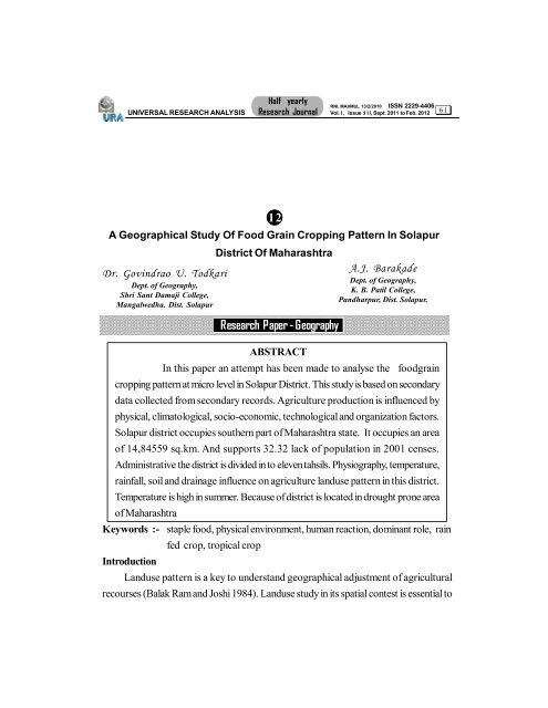
A Geographical Study Of Food Grain Cropping Pattern
A Geographical Study Of Food Grain Cropping Pattern
A Geographical Study Of Food Grain Cropping Pattern

You also want an ePaper? Increase the reach of your titles
YUMPU automatically turns print PDFs into web optimized ePapers that Google loves.
UNIVERSAL RESEARCH ANALYSIS<br />
Half yearly<br />
Research Journal<br />
RNI. MAHMUL 13/2/2010 ISSN 2229-4406<br />
Vol. I , Issue :I I I, Sept. 2011 to Feb. 2012<br />
A <strong>Geographical</strong> <strong>Study</strong> <strong>Of</strong> <strong>Food</strong> <strong>Grain</strong> <strong>Cropping</strong> <strong>Pattern</strong> In Solapur<br />
Dr. Govindrao U. Todkari<br />
Dept. of Geography,<br />
Shri Sant Damaji College,<br />
Mangalwedha. Dist. Solapur<br />
ABSTRACT<br />
In this paper an attempt has been made to analyse the foodgrain<br />
cropping pattern at micro level in Solapur District. This study is based on secondary<br />
data collected from secondary records. Agriculture production is influenced by<br />
physical, climatological, socio-economic, technological and organization factors.<br />
Solapur district occupies southern part of Maharashtra state. It occupies an area<br />
of 14,84559 sq.km. And supports 32.32 lack of population in 2001 censes.<br />
Administrative the district is divided in to eleven tahsils. Physiography, temperature,<br />
rainfall, soil and drainage influence on agriculture landuse pattern in this district.<br />
Temperature is high in summer. Because of district is located in drought prone area<br />
of Maharashtra<br />
Keywords :- staple food, physical environment, human reaction, dominant role, rain<br />
Introduction<br />
fed crop, tropical crop<br />
12<br />
District <strong>Of</strong> Maharashtra<br />
Research Paper - Geography<br />
A.J. Barakade<br />
Dept. of Geography,<br />
K. B. Patil College,<br />
Pandharpur, Dist. Solapur.<br />
Landuse pattern is a key to understand geographical adjustment of agricultural<br />
recourses (Balak Ram and Joshi 1984). Landuse study in its spatial contest is essential to<br />
6 1
UNIVERSAL RESEARCH ANALYSIS<br />
Half yearly<br />
Research Journal<br />
RNI. MAHMUL 13/2/2010 ISSN 2229-4406<br />
Vol. I , Issue :I I I, Sept. 2011 to Feb. 2012<br />
understand regionalization of the areas of optimum landuse. (Shinde S D & eatil.) landuse<br />
studies are important as they are aimed to explained to explain the occurrence of different<br />
uses in different areas. Landuse in which human efforts are applied to the land recourses<br />
for the satisfaction of human needs. It is essential to understand the variation in the landuse<br />
as a human reaction to words the satisfaction of human wants.<br />
<strong>Study</strong> Region<br />
The present study deals with the geographical perspectives of the agriculture in<br />
Solapur district. The Solapur district is bounded by 17º05' North latitudes to 18º 32'<br />
North latitudes and 74º42' east to 76º15' East longitudes. The total geographical area of<br />
Solapur district is 14895 K.m². divided into eleven tahsils.<br />
Climate of the district is dry. The daily mean maximum temperature range<br />
between 30º C to 35º C and minimum temperature range between 18ºC to 21ºC. The<br />
highest temperature is 47º C recorded in the month of May. The average annual rainfall is<br />
registered 510 mm. The soil of the district essentially derived from the Deccan trap. The<br />
soil of the district can broadly classify into three groups shallow, medium and deep soil.<br />
Objectives<br />
The following are the aims and objectives of the present study.<br />
1. To represent the agricultural landuse specially foodgrains, i.e., jowar, wheat, Maize,<br />
bajara and rice.<br />
2. To study the impact of physical and nonphysical factors on agriculture.<br />
3. For the study of spatio-temporal analysis of foodgrain crop in Solapur district.<br />
4. To find out the problems and suggest some remedies.<br />
5. To draw the conclusions regarding foodgrain cropping pattern in Solapur district.<br />
Research methodology<br />
Present study mostly relies on the secondary data collected through Agriculture<br />
Department and District statistical Department of Solapur and District socio-economic<br />
abstract of Solapur District. For the present investigation, District is selected as in general<br />
and tahsils in particular. The statistical and cartographic techqunices are used for repre-<br />
sentation of food grain cropping pattern.<br />
6 2
Explanation<br />
UNIVERSAL RESEARCH ANALYSIS<br />
Half yearly<br />
Research Journal<br />
RNI. MAHMUL 13/2/2010 ISSN 2229-4406<br />
Vol. I , Issue :I I I, Sept. 2011 to Feb. 2012<br />
<strong>Food</strong> grains play a major role in the cropping of land under tillage in Solapur<br />
district. For only, under food grains can they produce enough to sustain the dense population<br />
in the study region. Moreover, food grain crops are relatively less demanding and less<br />
exacting in their soil moisture requirements than fiber crops. High percentages under food<br />
grain are noted in the western part of the district. Overall, the cereals and pulses domi-<br />
nate the agriculture land-use crop of the region.<br />
1) Jowar<br />
Jowar is first in importance as a staple crop in Solapur district. Its botanical<br />
name is sorghum vulgare. Jowar is also known as great millet. Among all the food grains<br />
in the region, it is a staple food crop of the rural population. It is a first ranked crop.<br />
Jowar is a leading crop in the study region occupying about 60.45 percent (748200<br />
hectares) in 1980-81, but it was 51.04 percent (482400 hectares) of the total cultivated<br />
area in 2004-05. It decreased by 9.41 percent in the investigated period because non-food<br />
grains replaced the jowar area. The main improved varieties grown in the region are<br />
C5H5,CH5,M35-1 and local kharif Jowar.<br />
Environmental Requirements :-<br />
Jowar is purely a tropical crop. The crop thrives well under the condition of high<br />
temperature requiring mean temperature of over 27º c and moderate rainfall between<br />
350 mm to 900 mm. Jowar is grown on heavy and light alluvium to red ,medium black to<br />
deep black and even sandy soils. It is mostly cultivated in kharif as well as rabi season but<br />
in the study region, it is mainly cultivated in rabi season.<br />
Spatial Distribution :-<br />
Spatial distribution of jowar crop in the study region vary from tahsil to tahsil in<br />
the reference year 2004-05. The area under jowar crop was very high (74.94 percent)<br />
in Mangalwedha then followed by North Solapur(67.63 %), Sangola(63.68 %) and<br />
Mohol(60.71%). Below 30 percent, area under this crop is observed in Malshiras,<br />
Pandharpur and Karmala tahsils. The remaining tahasil has covered area between 30 to<br />
60 percent under this crop of the net sown area.<br />
6 3
UNIVERSAL RESEARCH ANALYSIS<br />
Temporal Analysis :-<br />
In general ,the area of jowar has<br />
decreased in all the tahsils in the district<br />
except Mangalwedha and Barshi tahsils.<br />
The area under jowar declined by about<br />
4 percent to 40 percent in the period from<br />
1990-91 to 2004.05 in all over the dis-<br />
trict. However, the area of this crop in-<br />
creased in Mangalwedha (14.49 percent)<br />
and Barshi (3.76 percent) tahasil.<br />
Mangalwedha is a major producer of<br />
Maldandi jowar in the study region as<br />
well as in Maharashtra. In Mangalwedha<br />
tahasil 60.45 percent area was under this<br />
crop in 1990-91 and it increased in<br />
2004-05 i.e. 74.94 percent .<br />
2) Wheat<br />
Wheat is the second important<br />
food crop in Solapur district. The bo-<br />
tanical name of wheat is Triticum Satuvum<br />
. Wheat ranks second among the food<br />
grains grown in the district. It accounted<br />
for 3.97 percent land in 1990-91, which<br />
increased by 7.01 percent of the net sown<br />
area in 2004-05.. Farmers grew wheat<br />
on small scale everywhere in the study<br />
area.<br />
Environmental Requirements:-<br />
Wheat is mainly a rabbi crop. It<br />
is adapted to varying condition of climate<br />
Half yearly<br />
Research Journal<br />
RNI. MAHMUL 13/2/2010 ISSN 2229-4406<br />
Vol. I , Issue :I I I, Sept. 2011 to Feb. 2012<br />
Table No 1<br />
6 4
UNIVERSAL RESEARCH ANALYSIS<br />
Half yearly<br />
Research Journal<br />
RNI. MAHMUL 13/2/2010 ISSN 2229-4406<br />
Vol. I , Issue :I I I, Sept. 2011 to Feb. 2012<br />
and soil. It grows better in winter temperature between 15ºc and 20ºc ; rainless days<br />
with clear and bright sunshine during ripening and harvesting period are necessary to<br />
have a better quality of grains. It can be grown in the areas where rainfall is less than 500<br />
cm , with the help of irrigation. Frost at flowering time and hailstorms when the grain is<br />
almost ripe damage the crop . Wheat is produced in the loams ,clay soils and medium<br />
black soils in the study region.<br />
Spatial Distribution :-<br />
The regional pattern of wheat distribution in table No 4.9 shows that the<br />
expansion of this crop in areas where irrigation is more developed as in 2004/05. The highest<br />
percentage of area under wheat is at Pandharpur (21.12 %) and Malshiras (20.88 %) .<br />
Temporal Analysis: -<br />
It may be observed from Fig No 4.10 that the area under wheat cultivation was<br />
3.97 percent in 1990-91, which increased to 7.01 percent of the net sown area in 2004-<br />
05. However, it did not increase in all tahsils of the district. It increased highly (above 10<br />
%) in Pandharpur and Malshiras tahsils and also increased to small extent (0.5 % to 3<br />
%) in North Solapur, South Solapur, Madha , Sangola and Akkalkot tahsil. The area<br />
under this crop highly decreased (below 4 %) in Karmala Mangalwedha, Mohol and<br />
Barshi.<br />
3) Bajara<br />
Bajara is the third food grain crop in the study region. It plays a very dominant<br />
role in the economy of the study region. It is a staple food of a very large part of the<br />
population in the district. It also provides good quality fodder for the livestock.<br />
Environmental Requirements:-<br />
Bajara is a typical tropical plant and usually thrives in warm and drier types of<br />
climate. The suitable temperature for bajara crop is 25ºc to 35ºc. The most important of<br />
all environmental factors is the fact that there should be a minimum rainfall from 150 to<br />
200 mm . Bajara thrives in poor to medium soil as well as in black cotton soils. Bajara is<br />
a kharif crop and is sown in June-July.<br />
Spatial Distribution :-<br />
Bajara crop is raised all over the study area to a small extent (4.78 %), but it is<br />
6 5
UNIVERSAL RESEARCH ANALYSIS<br />
Half yearly<br />
Research Journal<br />
RNI. MAHMUL 13/2/2010 ISSN 2229-4406<br />
Vol. I , Issue :I I I, Sept. 2011 to Feb. 2012<br />
specially concentrated in Western, Eastern and Southern parts of the study area or away<br />
from Sina, Bhima and Man rivers.<br />
Temporal Analysis: -<br />
In 1990-91, the area under bajara crop was 2.68 percent, which increased to<br />
2.90 percent of the net sown area in 2004-05 and increased by 2.10 percent of the net<br />
sown area. The area under bajara crop decreased (below 2 %) in Sangola and<br />
Mangalwedha tahsils. It decreased because the area under pomegranate and bor<br />
increased largely. It increased in all remaining tahsils of the study region by 0.50 to 5.00<br />
percent of the net sown area.<br />
4) Maize<br />
Maize is the fourth most important food grain in the study area. It is locally<br />
called Maka. It covered 1.42 percent of the net sown area in 1990-91 and 2.90 percent<br />
in 2004-05, it increased by 1.91 percent of the net sown area. Farmers grow maize on<br />
a small or large scale everywhere in the study area. It increased because it is largely<br />
used for livestock or growth of dairy farming.<br />
Environmental Requirements:-<br />
Maize is a food grain which grows well in well-drained alluvial soil and black<br />
cotton soil. It requires warm and moist geographical condition. Maize is a rabbi crop<br />
grown in the month of winter season between October and March, so it needs irrigation<br />
facility. It is entirely produced as an irrigated crop.<br />
Spatial Distribution :-<br />
The area under Maize crop covered 2.90 percent (27300 hectares) of the net<br />
sown area of the region. The highest percentage of area under this crop is at Malshiras<br />
(8.37 %) and then follow Pandharpur (6.58 %) and Sangola (6.06 %). Moderate<br />
percentage (3 to 6 %) of maize crop is at Mohol, whereas the lowest area (below 3 %)<br />
of this crop is observed in Akkalkot, South Solapur, Mangalwedha, Karmala, Madha,<br />
Barshi and North Solapur tahsil.<br />
Temporal Analysis: -<br />
Table No 4.11 and Fig No 4.11 show that in 1990-91 maize occupied about<br />
1.91 percent while in 2004-05 its area increased by 2.90 percent of the total net shown<br />
6 6
UNIVERSAL RESEARCH ANALYSIS<br />
Half yearly<br />
Research Journal<br />
RNI. MAHMUL 13/2/2010 ISSN 2229-4406<br />
Vol. I , Issue :I I I, Sept. 2011 to Feb. 2012<br />
area of the region. The area under this crop largely (above 4 %) increased in Malshiras<br />
and Sangola tahsils whereas it increased to some extent in Pandharpur (2.34 %) Mohol<br />
(0.87 %) and Barshi (0.96 %). The area under this crop decreased in Northeastern and<br />
Eastern tahsil of the district because in this area irrigation is not well developed.<br />
5) Rice<br />
Rice is most commonly known by local name Bhat. It is the most common<br />
crop in a tropics. The botanical name of rice is oriza sativa. Rice is predominantly a rain<br />
fed crop. Rice ranks fifth among the crops grown in the district and accounts for a smaller<br />
aerial coverage. The main improved varieties grown in the region are IR8, Jaya, Suhasini,<br />
Karjat 184, Ratnagiri 24 etc which give better yields.<br />
Environmental Requirements :-<br />
Rice is a tropical monsoon crop requiring high temperature and high rainfall.<br />
Distribution of rice depends on agro climatic conditions. The climate of the area plays<br />
a more important role than soil in production of rice.<br />
Spatial Distribution :-<br />
In the reference year 2004/05, rice was grown more or less in all talukas of the<br />
district. <strong>Of</strong> these high i.e. only above 0.50 percent of the net sown area was covered in<br />
Akkalkot, South Solapur and Malshiras. The remaining area under rice was very low i.e.<br />
only below 0.50 percent of the net sown area.<br />
Temporal Analysis :-<br />
During the period under consideration, a very little change has taken place in the<br />
study region as shown in Fig No 4.13 and Table No 4.12. In 1990-91, rice covered<br />
0.35 percent of the net sown area, it slightly decreased in 2004-05 and covered an<br />
area of 0.34 % of the net sown area. In general, the area under rice decreased in all<br />
talukas except Madha, Barshi, South Solapur and Mangalwedha tahsils.<br />
CONCLUSION<br />
<strong>Food</strong>grains like jowar, wheat, Maize, bajara and rice crops occupied maximum<br />
area, i.e., 72.23 % in 1991/92 and in 2004/05 it was 66.07 % out of the agriculture<br />
area. Jowar is the most important crop of the study region. Jowar crop occupied<br />
maximum area than other crops. There is slight decrease in area during investigation<br />
6 7