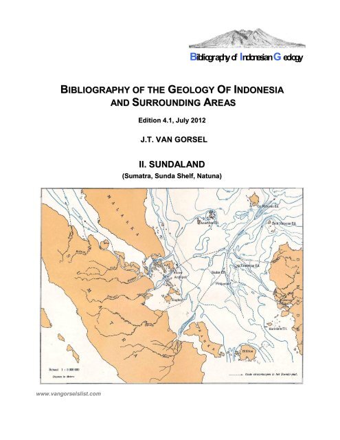
Sumatra, Sunda Shelf, Natuna - Bibliography of Indonesia Geology
Sumatra, Sunda Shelf, Natuna - Bibliography of Indonesia Geology
Sumatra, Sunda Shelf, Natuna - Bibliography of Indonesia Geology

You also want an ePaper? Increase the reach of your titles
YUMPU automatically turns print PDFs into web optimized ePapers that Google loves.
BIBLIOGRAPHY OF THE GEOLOGY OF INDONESIA<br />
www.vangorselslist.com<br />
AND SURROUNDING AREAS<br />
Edition 4.1, July 2012<br />
J.T. VAN GORSEL<br />
II. SUNDALAND<br />
(<strong>Sumatra</strong>, <strong>Sunda</strong> <strong>Shelf</strong>, <strong>Natuna</strong>)<br />
<strong>Bibliography</strong> <strong>of</strong> <strong>Indonesia</strong>n G eology
II. SUNDALAND<br />
This chapter <strong>of</strong> the bibliography combines literature on the relatively stable continental crust region<br />
<strong>of</strong> W <strong>Indonesia</strong>, a collage <strong>of</strong> continental blocks, volcanic arcs and accretionary terranes that<br />
amalgamated before Jurassic time with the Eurasia continent. It includes the large islands <strong>of</strong><br />
<strong>Sumatra</strong>, Java and Borneo, separated by a shall, broad shelfal region, the <strong>Sunda</strong> <strong>Shelf</strong>.<br />
It contains 153 pages with almost 1520 titles, subdivided in three regions:<br />
II.1. <strong>Sumatra</strong><br />
II.2. <strong>Sunda</strong> <strong>Shelf</strong> (incl. 'Tin islands', Singkep, Karimata)<br />
II.3. <strong>Natuna</strong>, Anambas.<br />
II.1. <strong>Sumatra</strong><br />
The geology <strong>of</strong> <strong>Sumatra</strong> is ably described in the recent comprehensive compilation by Barber, Crow<br />
& Milsom (2005). Additional information may be found in the over 1235 <strong>Sumatra</strong> papers listed in this<br />
bibliography.<br />
SW-NE cross-section across W part <strong>of</strong> South <strong>Sumatra</strong> (Westerveld 1941)<br />
The 'basement' geology <strong>of</strong> the large island <strong>of</strong> <strong>Sumatra</strong> is composed by complexly deformed Late<br />
Paleozoic- Mesozoic sediments and associated volcanic and igneous rocks. The presence <strong>of</strong><br />
intense compressional deformation and juxtaposition <strong>of</strong> unrelated stratigraphies was already<br />
recognized by Tobler (1917).<br />
The first broad synthesis <strong>of</strong> the <strong>Sumatra</strong> basement terranes in modern plate tectonic terms was by<br />
Pulunggono and Cameron (1984). They recognized the continuation <strong>of</strong> the geology <strong>of</strong> the Malay<br />
Peninsula and the principal Gondwana-derived terranes that amalgamated in the Late Triassic and<br />
the collision <strong>of</strong> the 'Woyla' arc/accretionary terrane in the Cretaceous. Additional microcontinental<br />
terranes may be present in the present-day fore-arc <strong>of</strong> North and C <strong>Sumatra</strong> (Natal, Sikuleh<br />
Terranes; Cameron et al. 1980, Wajzer et al. 1991, Barber 2000).<br />
A good overview <strong>of</strong> Carboniferous- Cretaceous sediments and fossils is the book by Fontaine &<br />
Gafoer (1989). Most <strong>of</strong> the Permian deposits have near-tropical faunas (fusulinid limestones) and<br />
floras (the classic 'Cathaysian 'Jambi Flora'), and can be tied to the Indochina- East Malaya group <strong>of</strong><br />
plates that separated from Gondwana probably in the Devonian. Some areas. Other areas appear to<br />
carry an Early Permian near-glacial signature ('Mergui microplate') and can be correlated to the W<br />
Thailand- West Malaya 'Sibumasu' or 'Shan-Tai' terrane that separated from Gondwana in the<br />
Permian.<br />
Pre-Tertiary 'basement' is unconformably overlain by sediments <strong>of</strong> a series <strong>of</strong> Late Eocene-<br />
Oligocene (ages poorly constrained) and younger rift basins, and, in the western half <strong>of</strong> the present<br />
island, by Oligocene- Early Miocene arc volcanics and the Late Miocene-Recent active volcanic arc.<br />
The North, Central and South <strong>Sumatra</strong> basins are prolific hydrocarbon-bearing basins. The<br />
distribution <strong>of</strong> oil and gas fields is very 'spotty': fields are found only above, or within ~50km from rift<br />
basins with Oligocene lacustrine and (less important) coaly syn-rift source rocks.<br />
<strong>Bibliography</strong> <strong>of</strong> <strong>Indonesia</strong> <strong>Geology</strong> v. 4.1 1 www.vangorselslist.com July 2012
A widespread Plio-Pleistocene compressional event inverted many <strong>of</strong> the Paleogene rift normal<br />
faults, creating most <strong>of</strong> today's surface anticlines. The oblique subduction <strong>of</strong> the Indian Ocean plate<br />
under <strong>Sumatra</strong> gave rise to the major <strong>Sumatra</strong> Fault Zone, a NW-SE trending right-lateral strike slip<br />
fault zone across the Barisan Mountains volcanic arc. A similar, parallel fault zone, the Mentawai FZ<br />
is present in the <strong>of</strong>fshore and roughly parallels the front <strong>of</strong> the accretionary prism.<br />
<strong>Sumatra</strong> has long been an important hydrocarbon province, with all oil and gas production from the<br />
North, Central and South <strong>Sumatra</strong> 'back-arc' basins. Initial exploration in the late 1800's- early<br />
1900's focused on drilling surface anticlines, many <strong>of</strong> them with surface seeps, targeting the<br />
relatively shallow M-L Miocene sandstone reservoirs.<br />
A deeper play, and volumetrically the most important, is in Late Oligocene- basal Miocene fluvialdeltaic<br />
sandstones in anticlinal structures. It was discovered accidentally by drilling 'too deep' into<br />
the thick Early Miocene marine shale section over Christmas in 1922 at Talang Akar-Pendopo in S<br />
<strong>Sumatra</strong> (Talang Akar field in the Talang Akar Fm). The first discovery in the C <strong>Sumatra</strong> basin was<br />
in 1939 in the Lirik field and is also in this play. The largest fields oil fields in <strong>Sumatra</strong> are the giant 3-<br />
5 billion barrels Duri and Minas fields in C <strong>Sumatra</strong>, discovered in 1941 and 1944.<br />
A third play, which could not be explored in the old days <strong>of</strong> surface anticline mapping, is in E-M<br />
Miocene reefal carbonate buildups, and was a main focus <strong>of</strong> 1970's- 1980's exploration. The Arun<br />
field in N <strong>Sumatra</strong>, discovered in this play in 1971, is one <strong>of</strong> <strong>Indonesia</strong>'s largest gas fields.<br />
A fourth play, in fractured and weathered Pre-Tertiary basement, has generated interest since the<br />
mid-1980's, but volumes have been relatively minor.<br />
Suggested reading<br />
A recent major review <strong>of</strong> <strong>Sumatra</strong> geology is Barber, Crow & Milsom (2005)<br />
II.2. <strong>Sunda</strong> <strong>Shelf</strong> (incl. 'Tin Islands', Karimata)<br />
Some 150 papers are in the bibliography primarily on the <strong>Sunda</strong> <strong>Shelf</strong>, a broad shallow sea, that<br />
was exposed land during the Pleistocene glacial lowstands. A pattern <strong>of</strong> Pleistocene relict river<br />
channels draining from <strong>Sumatra</strong> and Borneo into the South China Sea was mapped by Molengraaff<br />
(1919), Hanebuth et al. (2000), etc.<br />
The <strong>Sunda</strong> <strong>Shelf</strong> forms the relatively stable core <strong>of</strong> '<strong>Sunda</strong>land', an area <strong>of</strong> relatively old continental<br />
terranes (Indochina- E Malaya- SW Borneo?), that amalgamated with Asia before the Permian. Pre-<br />
Tertiary rocks outcrop extensively, or are covered by only a thin veneer <strong>of</strong> fluvial and shelfal relict<br />
sediments.<br />
The main economic interest <strong>of</strong> the region is in the 'tin islands' Lingga, Singkep, Bangka and Belitung,<br />
<strong>of</strong>f the NE coast <strong>of</strong> <strong>Sumatra</strong>, probably extending to the Karimata islands <strong>of</strong>f SW Kalimantan. They<br />
are the S part <strong>of</strong> the SE Asian tin belt, which extends from N Burma, Thailand and W Malaysia.<br />
Mining has taken place since the early 1800's and <strong>Indonesia</strong> has produced ~15% <strong>of</strong> all tin mined in<br />
the world, mainly from alluvial cassiterite placer deposits eroded from Late Triassic granite<br />
intrusives. Today, reserves are largely depleted.<br />
<strong>Bibliography</strong> <strong>of</strong> <strong>Indonesia</strong> <strong>Geology</strong> v. 4.1 2 www.vangorselslist.com July 2012
SW-NE cross-sections across Kundur-Batam (top) and Singkep- Lingga (bottom), showing imbricated Permo-<br />
Carboniferous overlain by less-deformed Triassic clastics, intruded by granite (Bothe, 1928)<br />
The oldest rocks on Bangka and Belitung are Paleozoic mica schists and low-metamorphic,<br />
isoclinally folded Carboniferous- Permian flysch-type clastics with basalts, radiolarian cherts, etc..<br />
Rare limestone blocks with Permian fusulinids. These rocks may be interpreted as an accretionary<br />
complex <strong>of</strong> Paleo-Tethys ocean-floor material, imbricated before the Triassic collision with the<br />
Sibumasu terrane (Hutchison1994, Barber & Crow 2009). This complex is unconformably overlain<br />
by less deformed probably Triassic sandstones and shales with poorly preserved Cathaysian flora.<br />
This stratigraphy highly suggests affinities with the E Malaya block and W Kalimantan.<br />
Cretaceous and Tertiary deposits are absent or very thin.<br />
Suggested reading<br />
<strong>Geology</strong>: Verbeek (1897), Molengraaff (1919, 1921), Aernout (1922), Bothe (1928),<br />
Westerveld (1936, 1941), Katili (1967, 1968), Ko (1986),<br />
Tin deposits/ mining: Bothe (1925), Wing Easton (1937), Adam (1960), Cissarz & Baum (1960),<br />
Hosking (1970), Aleva et al. (1973), Sujitno (1977), Batchelor (1979)<br />
Permian-Triassic fauna/ flora: De Neve & De Roever (1947), Kruizinga (1950), Jongmans (1951),<br />
De Roever (1951), Van Overeem (1960), Strimple & Yancey (1976),<br />
Hosking et al. (1977), Archbold (1983)<br />
Pleistocene: Molengraaff & Weber (1921), Van Baren & Keil (1950), Emery (1969),<br />
Hehuwat (1972), Hanebuth et al. (2000-2010),<br />
<strong>Bibliography</strong> <strong>of</strong> <strong>Indonesia</strong> <strong>Geology</strong> v. 4.1 3 www.vangorselslist.com July 2012
II.3. <strong>Natuna</strong><br />
The <strong>Natuna</strong> area forms the N edge <strong>of</strong> the <strong>Sunda</strong> shelf. Geologically it may be viewed as a westerly<br />
continuation <strong>of</strong> the Cretaceous active continental margin <strong>of</strong> NW Borneo with a basement <strong>of</strong><br />
metamorphic-accretionary complexes and granites.<br />
<strong>Natuna</strong> island is on the N-S trending <strong>Natuna</strong> Arch basement high, which is part <strong>of</strong> the non-extended<br />
<strong>Sunda</strong> <strong>Shelf</strong>. Its core is composed <strong>of</strong> intensely folded Jurassic- Cretaceous Bunguran Fm deep<br />
water clastics and volcanics with radiolarian cherts and gabbros-serpentinites, and is very similar to<br />
the 'Danau Fm' <strong>of</strong> C Kalimantan (Bothe 1928). It is intruded by Late Cretaceous granites, one <strong>of</strong><br />
which forms the highest mountain on the island (Mt. Tanai; 1035m). This basement complex is<br />
unconformably overlain by thin Oligocene- Miocene fluvial sediments.<br />
The <strong>Natuna</strong> islands are bordered on three sides by Oligocene rift basins, the Malay- W <strong>Natuna</strong> basin<br />
in the West, The South China Sea in the North and the E <strong>Natuna</strong> basin in the East.<br />
Most <strong>of</strong> the 80 publications on the <strong>Natuna</strong> area are on oil and gas exploration and fields in the West<br />
and East <strong>Natuna</strong> basins. The West <strong>Natuna</strong> Basin is connected to the larger Malay Basin.<br />
Exploration and production focused on Late Oligocene- Miocene fluvial-deltaic clastic reservoirs,<br />
mainly in young (~Late Miocene) inversion structures.<br />
The East <strong>Natuna</strong> basin was not affected by the young inversion tectonics. It contains large E-M<br />
Miocene reefal buildups, some <strong>of</strong> which are gas bearing, typically with high CO2 content.<br />
Suggested reading<br />
<strong>Geology</strong>: Bothe (1928), Haile (1970, 1971), Pupilli (1973), Franchino (1990),<br />
Harahap & Wiryosujono (1994), Hakim & Suryono (1994, 1997),<br />
Hakim (2004)<br />
W. <strong>Natuna</strong> Basin: Wongkosantiko & Wirojudo (1984), Daines (1985), Ginger et al. (1993),<br />
Fainstein & Meyer (1997), Phillips et al. (1997), Gunarto et al. (2000),<br />
Maynard et al. (2002), Morley et al. (2003), Hakim et al. (2008)<br />
E. <strong>Natuna</strong> Basin: Sangree (1981), Kraft & Sangree (1982), Franchino & Viotti (1986),<br />
Rudolph & Lehmann (1989), Dunn et al. (1996), Bachtel et al. (2004)<br />
,<br />
<strong>Bibliography</strong> <strong>of</strong> <strong>Indonesia</strong> <strong>Geology</strong> v. 4.1 4 www.vangorselslist.com July 2012
II. SUNDALAND<br />
II.1. <strong>Sumatra</strong><br />
Abdullah, M. & C.F. Jordan (1987)- The geology <strong>of</strong> the Arun Field Miocene reef complex. Proc. 16th Ann.<br />
Conv. Indon. Petrol. Assoc. 1, p. 65-96.<br />
(Arun gas field 1971 discovery in N <strong>Sumatra</strong>. Area 18.5 x 5 km. Lower- Middle Miocene carbonate buildup on<br />
Arun High with 1080’ <strong>of</strong> gas column)<br />
Abdullah, M. & C.F. Jordan (1988)- The geology <strong>of</strong> the Arun field Miocene reef complex. Proc. 7th Offshore<br />
South East Asia Conf., Singapore 1988, SEAPEX Proc. 8, p. 203-220.<br />
Abdurrachman, M., M.E. Suparka, C.I. Abdullah, S. Piadhy & M. Latuconsina (2008)- Pre-Tertiary basement<br />
petrography: Suban Barat-1, South <strong>Sumatra</strong>. In: <strong>Sumatra</strong> stratigraphy workshop, Duri (Riau) 2005, Indon.<br />
Assoc. Geol. (IAGI), p. 115-125.<br />
(Suban 1910 shallow gas discovery, 180km NW <strong>of</strong> Palembang. W Suban 1 well penetrated 479m <strong>of</strong><br />
hydrothermally altered granite- from 2771-3006m, and dominantly granodiorite with some spilitic basalt and<br />
marble between 3010-3250m)<br />
Abercrombie, R., M. Antolik & G. Ekström (2003)- The June 2000 Mw 7.9 earthquakes south <strong>of</strong> <strong>Sumatra</strong>:<br />
deformation in the India-Australia Plate. J. Geophys. Res. 108, B1, p.<br />
(June 2000 earthquakes S <strong>of</strong> <strong>Sumatra</strong> below Indian Ocean predominantly left-lateral strike-slip on vertical N-S<br />
trending faults, probably reactivated fracture zones. Earthquakes consistent with recent models <strong>of</strong> distributed<br />
deformation in India-Australia composite plate. Occurrence <strong>of</strong> Enggano earthquake implies stress field within<br />
Indian plate continues to depth <strong>of</strong> 50 km in subducting slab)<br />
Abidin, H.Z. (2008)- Pb-Zn-Ag Deposits at Tanjung Balit, Limapuluh Kota Regency, West Sumatera. J.<br />
Sumber Daya Geol. (GRDC) 18, 4, p. 253-263.<br />
(Epithermal Pb-Zn-Ag mineralization in district Limapuluh Kota, W <strong>Sumatra</strong>, in metasediments <strong>of</strong> Tapanuli<br />
Group/ Kuantan Fm (Permian))<br />
Abidin, H.Z. & B.H. Harahap (2007)- Indikasi mineralisasi epitermal emas bersulfi da rendah, di Wilayah<br />
Kecamatan Bonjol, Kabupaten Pasaman, Sumatera Barat. Jurnal Geol. <strong>Indonesia</strong> 2, 1, p. 55-67.<br />
(Bonjol gold prospect, Pasaman District, N <strong>of</strong> Padang, W <strong>Sumatra</strong>, several ore bodies in Early Miocene age<br />
(9.3-11.9 Ma; should be Late Miocene?;HvG) altered rhyolitic volcanics <strong>of</strong> Gunung Amas Fm. Gold deposit<br />
probably <strong>of</strong> low sulphidation epithermal type)<br />
Abidin, H.Z. & B.H. Harahap (2007)- Prospek emas Bonjol bersulfida rendah di Wilayah Kecamatan Bonjol,<br />
Kabupaten Pasaman, Sumatera Barat. J. Teknologi Min. Batubara 15, 42, p. 1-9.<br />
(Bonjol gold prospect paper, similar to above)<br />
Achiat, R., J. Guttormsen & R. Waworuntu (2009)- Complex geomodeling: Dayung Field a fractured Pre-<br />
Tertiary reservoir in the Southern <strong>Sumatra</strong> Basin, <strong>Indonesia</strong>. Proc. 33 rd Ann. Conv. Indon. Petrol., IPA09-G-<br />
148, 15p.<br />
(Dayung Field 1991 fractured basement gas field on W flank <strong>of</strong> C Palembang sub-Basin (Corridor Block), S<br />
Sumatera. Mainly Permian meta-carbonate (Leko Fm), intruded by Jurassic (175-205 Ma) granitic complex.<br />
Sourced from onlapping Paleogene sediments)<br />
Adibrata, B.W.H., Y. Hirosiadi, E. Septama & A. Rachmanto (2004)- From non-economic into producing field,<br />
a case study in Ketaling Barat field, <strong>Indonesia</strong>. Proc. 33 rd Ann. Conv. Indon. Assoc. Geol. (IAGI), p. 166-171.<br />
(Field 5 km E <strong>of</strong> Jambi discovered in 1959 in E Miocene Baturaja carbonate, reappraised in 2001)<br />
Adinegoro, U. & P. Hartoyo (1974)- Paleogeography <strong>of</strong> North East <strong>Sumatra</strong>. Proc. 3rd Ann. Conv. Indon.<br />
Petrol. Assoc., p. 45-61.<br />
<strong>Bibliography</strong> <strong>of</strong> <strong>Indonesia</strong> <strong>Geology</strong> v. 4.1 5 www.vangorselslist.com July 2012
(Broad Oligo-Miocene paleogeographic map <strong>of</strong> N <strong>Sumatra</strong> onshore, E <strong>of</strong> Barisan Range, between Tamiang<br />
River to N and Toba-Asahan River to S. Eo-Oligocene sediments in NE <strong>Sumatra</strong> basin 5000-7000 m thick. With<br />
discussion <strong>of</strong> N <strong>Sumatra</strong> geology and stratigraphy<br />
Adiwidjaja, P. & G.L. de Coster (1973)- Pre-Tertiary paleotopography and related sedimentation in South<br />
<strong>Sumatra</strong>. Proc. 2nd Ann. Conv. Indon. Petrol. Assoc., p. 89-103.<br />
Adlan, F. (2006)- Potensi hidrokarbon prospek dalam pada lapangan-lapangan tua di sub-cekungan Palembang<br />
bagian Selatan. Proc. 35th Ann. Conv. Indon. Assoc. Geol. (IAGI), Pekanbaru 2006, 7 p.<br />
(‘Hydrocarbon prospects in old fields in S part <strong>of</strong> Palembang sub-basin’. Ten old oil fields on Pendopo-Limau<br />
anticlinorium with 1340 MMBO oil and 3 TCF gas in place. Additional prospects remaining in this trend)<br />
Aernout, W.A.J. (1927)- Enkele nieuwere gegevens over de ertsafzettingen van Salida. De Mijningenieur 8, p.<br />
73-76.<br />
('Some new data on the ore deposits <strong>of</strong> Salida', W <strong>Sumatra</strong> gold-silver mine)<br />
Agus, A. Subandrio, S. Widada, Feriyanto, S. Rakimi & Wibisono (2005)- Carbonate development on the TN<br />
field in the Lematang Trough, South <strong>Sumatra</strong> basin. Proc. 13 th Ann. Conv. Indon. Petrol. Assoc., 1, 13 p.<br />
(TN 1997 gas discovery in Baturaja Fm carbonate buildup on local high in Lematang Trough at ~12,000’<br />
depth, and tested 30.7 MMSCFD from 250’ gross interval. Reef complex elongated, NNE-SSE trending, area<br />
18.8 km2 and relief approximately 600’. Carbonate porosity average 6.8-9.6%, moldic/ vuggy and<br />
intercrystalline, micr<strong>of</strong>racture type porosity in several areas with permeability between 0.32-1.7 mD)<br />
Akbar, M., B. Vissapragada, A.H. Alghamdi, D. Allen et al. (2001)- A snapshot <strong>of</strong> carbonate reservoir<br />
evaluation. Oilfield Review, Schlumberger, Winter 2000/2001, p. 20- 41.<br />
(online at: http://www.slb.com/~/media/Files/resources/oilfield_review/ors00/win00/p20_41.ashx)<br />
(Reservoir evaluation paper with example <strong>of</strong> M Miocene buildup in Sibolga basin, <strong>of</strong>f NW <strong>Sumatra</strong>, with<br />
unsuccessful 1997 well due to lack <strong>of</strong> internal seals and late top seal preventing capture <strong>of</strong> early biogenic gas)<br />
Akuanbantin, H. & D. Ardiputra (1976)- <strong>Geology</strong> <strong>of</strong> East Benakat oil field, South <strong>Sumatra</strong>. Proc. 5 th Ann.<br />
Conv. Indon. Petrol. Assoc., 1, p. 59-68.<br />
(East Benakat first drilled in 1930, testing minor oil in Talang Akar Fm <strong>of</strong> NW-SE trending anticline.<br />
Renewewed interest and development decision after Pertamina drilled E Benakat 3 in 1973)<br />
Alamsyah, M.N., S. Marmosuwito, W. Sutjiningsih, L.P. Marpaung & S. Sukmono (2008)- Seismic reservoir<br />
characterization <strong>of</strong> <strong>Indonesia</strong>'s Southwest Betara Field. The Leading Edge 27, 12, p. 1598-1607.<br />
(SW Betara Field 2005 PetroChina discovery in Talang Akar Fm <strong>of</strong> Jabung Block, S <strong>Sumatra</strong>)<br />
Alamsyah, M.N., A. Wasono Aji, Sihman M., B. Wisnu H. et al. (2006)- Reservoir characterization study to<br />
determine thin sand reservoirs using AVO Inversion and spectral decomposition analysis, 3D onshore seismic<br />
data <strong>of</strong> Ripah Field. Proc. Jakarta 2006 Int. Geosc. Conf. Exhib., Indon. Petrol. Assoc., 06-RC-04, 6p.<br />
(Identification <strong>of</strong> Late Oligocene Talang Akar Fm NNE trending deltaic channel sands in 2000 Ripah field,<br />
Jabung Basin, S <strong>Sumatra</strong>)<br />
Aldiss, D.T. & S.A. Ghazali (1984)- The regional geology and evolution <strong>of</strong> the Toba volcanotectonic<br />
depression, <strong>Indonesia</strong>. Quart. J. Geol. Soc. 141, 3, p. 487-500.<br />
(<strong>Sumatra</strong> Late Quaternary Toba volcano-tectonic depression largest resurgent cauldron and one <strong>of</strong> largest<br />
ignimbrite fields (Toba Tuffs: 3000 km3 <strong>of</strong> acid tuffs over 20,000 km2). Greater part <strong>of</strong> Toba Tuffs single<br />
ignimbrite cooling unit, formed ~100,000 years ago. Toba depression formed after lithification <strong>of</strong> Toba Tuffs<br />
by collapse along regional faults. Resurgent uplift raised lake sediments in depression by 500 m. Eruption <strong>of</strong><br />
Toba Tuffs and post-ignimbrite volcanism on line <strong>of</strong> W marginal fault <strong>of</strong> depression. This marginal fault once<br />
extended N <strong>of</strong>fshore into zone <strong>of</strong> Miocene back-arc rifting)<br />
<strong>Bibliography</strong> <strong>of</strong> <strong>Indonesia</strong> <strong>Geology</strong> v. 4.1 6 www.vangorselslist.com July 2012
Aldiss, D.T., R. Whandoyo, A.G. Sjaefudien & Kusyono (1983)- The geology <strong>of</strong> the Sidikalang quadrangle,<br />
<strong>Sumatra</strong>. Geol Res Dev. Centre Indon., Bandung, 1:250,000 scale map, 41 p. + map.<br />
Alexander, W.L. & M.R. Nellia (1993)- 3D Seismic facies analysis <strong>of</strong> a reefal buildup: NSO' A' Field, <strong>of</strong>fshore<br />
North <strong>Sumatra</strong>. Proc. 22nd Ann. Conv. Indon. Petrol. Assoc., p. 137-168.<br />
(NSO-A1 1972 gas discovery in M Miocene reefal carbonates. Three facies identified on 3D seismic and wells:<br />
reef, near-reef, inter-reef. Near-reef and inter-reef areas better reservoir properties than reef core. Reef facies<br />
with zones <strong>of</strong> vuggy porosity correlatable to lost circulation. Dolomite only in reef facies)<br />
Alford, M.E., L.L. Cargile & M.B. Siagan (1975)- Development <strong>of</strong> the Arun gas field. Proc. 4 th Ann. Conv.<br />
Indon. Petrol. Assoc., 2, p. 173-187.<br />
Almon W.R. & W.C. Dawson (2000)- Paleosols as top seals for nonmarine petroleum systems, Central <strong>Sumatra</strong><br />
Basin, <strong>Indonesia</strong>. AAPG Int. Conf. Bali 2000, AAPG Bulletin 84, 9 (Abstract)<br />
(Paleosols in nonmarine- marginal marine facies in C <strong>Sumatra</strong> Basin densely compacted, cemented, partially<br />
recrystallized clay matrix. Porosity 1.5 -9.7%, perm. 0.2 -0.007 md. Paleosols good seals capable <strong>of</strong> retaining<br />
columns up to 4,600’ oil and 5900’ gas, varying with API gravity, T, and fluid density. Sealing capacity<br />
correlates with clay content and position in soil zone. Hydrocarbons can leak across paleosol horizons along<br />
faults or where breached by fluvial-tidal channels. Thick paleosol at 25.5 Ma sequence boundary appears to<br />
focus migration toward E margin <strong>of</strong> basin)<br />
Amier, R.I. (1991)- Coals, source rocks and hydrocarbons in the South Palembang sub-basin, south <strong>Sumatra</strong>,<br />
<strong>Indonesia</strong>. M.Sc. Thesis University <strong>of</strong> Wollongong, p.<br />
Amijaya, D.H. (2005)- Paleoenvironmental, paleoecological and thermal metamorphism implications on the<br />
organic petrography and organic geochemistry <strong>of</strong> Tertiary Tanjung Enim coal, South <strong>Sumatra</strong> Basin, <strong>Indonesia</strong>.<br />
Ph.D. Thesis Rheinisch-Westfalischen Technischen Hochschule, Aachen, 170p. (online at:<br />
http://darwin.bth.rwth-aachen.de/opus/volltexte/2005/1266/pdf/Amijaya_Donatus.pdf)<br />
Amijaya, H. (2006)- Reappraisal <strong>of</strong> kerogen typing on low rank coal from South <strong>Sumatra</strong> basin, <strong>Indonesia</strong>.<br />
Proc. 35th Ann. Conv. Indon. Assoc. Geol. (IAGI), Pekanbaru 2006, PITIAGI2006-011, 6p.<br />
(Low rank coals from Tanjung Enim area, S <strong>Sumatra</strong>, mean huminite reflectance 0.35-0.46%. Dominated by<br />
huminite (34- 95%), less liptinite (4- 61%) and inertinite (0.2-44%). Lowest Hydrogen Index (HI) values <strong>of</strong> 171<br />
mg HC/g TOC; sample with high liptinite HI <strong>of</strong> 507 mg HC/g TOC. Kerogen type mainly type III)<br />
Amijaya, H. & R. Littke (2005)- Micr<strong>of</strong>acies and depositional environment <strong>of</strong> Tertiary Tanjung Enim low rank<br />
coal, South <strong>Sumatra</strong> Basin, <strong>Indonesia</strong>. Int. J. Coal Geol. 61, p. 197-221.<br />
(Tanjung Enim area, South <strong>Sumatra</strong>, low rank M-L Miocene coals <strong>of</strong> Muara Enim Fm. Sequence <strong>of</strong> maceral<br />
assemblages represents change <strong>of</strong> topogenous to ombrogenous peat and development <strong>of</strong> a raised peat bog)<br />
Amijaya, H. & R. Littke (2006)- Properties <strong>of</strong> thermally metamorphosed coal from Tanjung Enim area, South<br />
<strong>Sumatra</strong> Basin, <strong>Indonesia</strong> with special reference to the coalification path <strong>of</strong> macerals. Int. J. Coal Geol. 66, p.<br />
271-295.<br />
(Tanjung Enim Tertiary age coals thermally metamorphosed by heat from andesitic intrusion. Original coal<br />
rank subbituminous- high volatile bituminous, thermally metamorphosed coals medium volatile bituminous-<br />
meta-anthracite. Contact metamorphism Temp. 700-750 °C in most metamorphosed coal)<br />
Amijaya, H., J. Schwarzbauer & R. Littke (2006)- Organic geochemistry <strong>of</strong> the Lower Suban coal seam, South<br />
<strong>Sumatra</strong> Basin, <strong>Indonesia</strong>: palaeoecological and thermal metamorphism implications. Organic Geochem. 37, p.<br />
261-279.<br />
Amin, T.C. & S. Gafoer (1985)- Hubungan antara Cekungan Bengkulu dengan Sumatera Selatan pada awal<br />
Tersier. Proc. 14 th Ann. Conv. Indon. Assoc. Geol. (IAGI), Jakarta 1985, p. 49-60.<br />
('Relationship between the Bengkulu Basin and S <strong>Sumatra</strong> in the Tertiary')<br />
<strong>Bibliography</strong> <strong>of</strong> <strong>Indonesia</strong> <strong>Geology</strong> v. 4.1 7 www.vangorselslist.com July 2012
Amin, T.C., Kusnama, E. Rustandi & S. Gafoer (1993)- Geological map <strong>of</strong> the Manna and Enggano Sheet,<br />
<strong>Sumatra</strong>, 1:250,000. Geol. Res. Dev. Centre, Bandung.<br />
(Incl. fission track age <strong>of</strong> granite near Tanjungsakti <strong>of</strong> 9.53 +/- 0.55 Ma)<br />
Amin, T.C., Sidarto, S. Santosa & W. Gunawan (1994)- <strong>Geology</strong> <strong>of</strong> the Kotaagung Quadrangle, <strong>Sumatra</strong>. Geol.<br />
Res. Dev. Centre, Bandung, p.<br />
Amir, V., R. Achdiat, M. Meirita & J. Guttormsen (2011)- Facies architecture and depositional relationship <strong>of</strong><br />
Baturaja carbonates in Letang, Rawa, and Tengah fields, Corridor Block, South <strong>Sumatra</strong>. Proc. 35 th Ann. Conv.<br />
Indon. Petrol. Assoc., IPA11-G-090, p. 1-14.<br />
(Letang, Rawa and Tengah eqarly 1990’s gas discoveries in Corridor Block E Miocene Baturaja Fm carbonate<br />
buildups. Two main carbonate facies, muddy platform facies and coral-algal reefal buildup facies. Build-up<br />
facies commonly developed above paleo-highs. Most porosity secondary vuggy and mouldic in leached coralalgal<br />
framework. Carbonate platforms separated by deep NW-SE intra-platform channels. Karstification effect<br />
related episodes predominantly developed in upper interval)<br />
Amlan, M.H, Hendar S.M., Yarmanto & I.A. Muswar (2006)- Influence <strong>of</strong> strike-slip fault in structural<br />
deformation <strong>of</strong> Asih and Asih North fields, Central <strong>Sumatra</strong> basin. Proc. 35th Ann. Conv. Indon. Assoc. Geol.<br />
(IAGI), Pekanbaru, PITIAGI2006-048, 10p.<br />
(Asih and Asih North two structural oil fields along N-S strike slip fault, about 30 km from Minas Field.<br />
Remapping <strong>of</strong> Bekasap and Menggala Fm with 3D seismic. Left-stepping en echelon folds and faults represent<br />
flower structure formed by NNW-SSE movement along older weak zone or ‘suture’ after SW-NE compression)<br />
Anderson, B.L., J. Bon & H.E. Wahono (1993)- Reassessment <strong>of</strong> the Miocene stratigraphy, paleogeography and<br />
petroleum geochemistry <strong>of</strong> the Langsa Block in the <strong>of</strong>fshore North <strong>Sumatra</strong> Basin. Proc. 22nd Ann. Conv.<br />
Indon. Petrol. Assoc. 1, p. 169-189.<br />
(Langsa Block Miocene series <strong>of</strong> multicycles related to tectonic phases. Each multicycle several cycles: 4 in B,<br />
5 in C. Multicycle A not penetrated, but interpreted on seismic. Paleogeographic reconstructions basis for<br />
interpretation <strong>of</strong> source rock distribution. Two source rock types: (1) algal, probably lacustrine (initial A-<br />
Multicycle) and (2) mixed marine algal/terrestrial (later A-Multicycle). Younger source rocks (B and C-<br />
Multicycles) also identified but no oils typed to these. Oil generation started at beginning <strong>of</strong> Miocene in deepest<br />
grabens and still continues on graben margin. Gas generation started in Late Miocene in most basinal areas)<br />
Andi Mangga, S., Amiruddin, T. Suwarti, S. Gafoer & Sidarto (1994)- <strong>Geology</strong> <strong>of</strong> the Tanjungkarang<br />
Quadrangle, <strong>Sumatra</strong> (1:250,000). Geol. Res. Dev. Centre, Bandung, p.<br />
(SE <strong>Sumatra</strong> map sheet. With a.o. occurrence <strong>of</strong> Paleozoic? metamorphics (Gunung Kasih complex) and<br />
Menanga Fm mid-Cretacous sediments with Orbitolina, interbedded with basalts and arc volcanics. Associated<br />
amphibolite schist 125-108 Ma)<br />
Andi Mangga, S., S. Gafoer & N. Suwarna (1987)- Hubungan geologi antara Kepulauan Mentawai dan dataran<br />
<strong>Sumatra</strong> bagian Selatan.. Proc. 16th Ann. Conv. Indon. Assoc. Geol. (IAGI), p.<br />
('Geological relationships between the Mentawai islands and S <strong>Sumatra</strong>')<br />
Andi Mangga, S., Kusnama & Suryono (2006)- Stratigraphy and tectonic development <strong>of</strong> Mentawai island,<br />
West <strong>Sumatra</strong>, based on plate tectonic theory. J. Sumberdaya Geol. (GRDC) 16, 3, p. 136-143.<br />
Andi Mangga, S., K. Sutisna & Suminto (1996)- Karakteristik batuan klastika Formasi Peneta dan kaitannya<br />
dengan indikasi minyak dan gas bumi. J. Geol. Sumberdaya Min. (GRDC) 6, 52, p. 1-11.<br />
('Characteristics <strong>of</strong> the Peneta Fm clastics and its relation to oil and gas indications'. Late Jurassic- Early<br />
Cretaceous, NW side <strong>of</strong> S <strong>Sumatra</strong> basin)<br />
Andi Mangga, S., Suminto, Suyoko & K. Sutisna (1996)- Lingkungan tektonik formasi Mengkarang di daerah<br />
Dusunbaru, Jambi. J. Geol. Sumberdaya Min. 6, 60, p. 16-20.<br />
<strong>Bibliography</strong> <strong>of</strong> <strong>Indonesia</strong> <strong>Geology</strong> v. 4.1 8 www.vangorselslist.com July 2012
('Tectonic setting <strong>of</strong> the Mengkarang Fm in the Dusunbaru area, Jambi'. Permian Mengkarang Fm sediments<br />
near Duabelas Mts with warm water fauna and Cathaysian flora. Early Permian island arc volcanics)<br />
Andi Mangga, S.A. & Suyono (2007)- Perkembangan tektonik dan petrogenesis batuan ranitan Kapur hingga<br />
Tersier di daerah Lampung. In: Geologi <strong>Indonesia</strong>: dinamika dan produknya, Geol. Res. Dev. Centre, Bandung,<br />
Spec. Publ. 33, 1, p. 69-82.<br />
(Cretaceous- Tertiary granitoids exposed in Lampung, especially SE side <strong>of</strong> Barisan Mts. I and S type granites,<br />
volcanic arc granites and syn-collisional granites and volcanic rocks related to subduction)<br />
Anggayana, K., T. Indriati, Syafrizal & Y.B. Adian (1998)- Kandungan abu dan sulfur batubara Air Laya<br />
Tanjung Enim yang berasal dari type highmoor pada lingkungan Pengendapan Payau. Jurn. Teknol. Mineral 5,<br />
3, p.<br />
(Air Laya Coal, Tanjung Enim, S <strong>Sumatra</strong>, formed in ombrogenic moor, while Muara Enim coaly formation<br />
was deposited in brackish environment. Depositional environment reflected in sulfur content <strong>of</strong> ro<strong>of</strong> and<br />
underlying sediments. Air Laya A-1 and A-2 seams sulfur
(Pertamina operates 55 mature oil fields in S <strong>Sumatra</strong> in 2 areas, Pendopo and Prabumulih. Rejuvenation<br />
projects resulted in 45.6 MMBO <strong>of</strong> additional oil reserves in 12 fields)<br />
Argakoesoemah, R.M.I. & A. Kamal (2004)- Ancient Talang Akar deepwater sediments in South <strong>Sumatra</strong><br />
Basin: a new exploration play. In: R.A. Noble et al. (eds.) Proc. Int. Conf. Deepwater and frontier exploration in<br />
Asia & Australasia, Jakarta, Indon. Petrol. Assoc., p. 251-267.<br />
(Two potential areas <strong>of</strong> Talang Akar Fm deepwater play in S <strong>Sumatra</strong>: C Palembang Sub-basin in W, and<br />
Benakat Gully in E. Expected reservoir sandstone wide range <strong>of</strong> rock properties and compositions. Tuffaceous<br />
content in C Palembang sub-basin may be derived from volcaniclastics in Musi Platform and Mambang High.<br />
Source rocks mature- overmature Lemat and Talang Akar Fm shales. Sources entered oil window in middle E<br />
Miocene and began generating gas in M Miocene. Trap mainly stratigraphic with Late Miocene- Plio-<br />
Pleistocene structures. Intraformational deep marine shales provide vertical seal)<br />
Argakoesoemah, R.M.I., M. Rahardja, S. Winardhi, R. Tarigan, T.F. Maksum & A. Aimar (2005)- Telisa<br />
shallow marine sandstone as an emerging exploration target in Palembang High, South <strong>Sumatra</strong> Basin. Proc.<br />
30 th Ann. Conv. Indon. Petrol. Assoc. 1, p. 101-120.<br />
(Lowstand sands in Telisa shale Fm potential hydrocarbon target, but generally poor reservoir quality)<br />
Arham, M.A., A. Juniarti & E.F. Adji (2010)- Uranium mineralisation hosted by albite-rich granitoid rocks <strong>of</strong><br />
Sibolga- North <strong>Sumatra</strong>. Proc. 39th Ann. Conv. Indon. Assoc. Geol. (IAGI), Lombok, PIT-IAGI-2010-283,<br />
10p.<br />
(Baturaja Limestone reservoir characterization model <strong>of</strong> Medco 'F' Field, 3 km E <strong>of</strong> Soka field, S <strong>Sumatra</strong><br />
Extension Block. Ten oil producing wells, with average production <strong>of</strong> ~400 BOD. Some wells tight reservoirs)<br />
Ariani, S., A. Y. Sihombing, I.M. Gunawan, A. Setiawan, P. Adam & A. Tarmusi (2010)- Facies and sandstone<br />
distribution pattern <strong>of</strong> M sandstone reservoir in Air Benakat Formation, Sungai Gelam Field, Jambi Subbasin.<br />
Proc. 34 th Ann. Conv. Indon. Petrol. Assoc., IPA10-G-167, 12p.<br />
(M Miocene reservoir sand in lower Air Benakat Fm in Sungei Gelam field interpreted as tidal deposits)<br />
Arnold, C.W. (1992)- A classical reservoir study <strong>of</strong> the Petani Field- approach to analyzing an older complex<br />
reservoir. Proc. 21st Ann. Conv. Indon. Petrol. Assoc., 2, p. 487-515.<br />
(Caltex Petani field reservoir study)<br />
Arsadi, E.M., S. Nishimura, Suwijanto & J. Nishida (1989)- Preliminary report on magnetotelluric (MT) survey<br />
crossing the Semangko fault zone in <strong>Sumatra</strong>. Geol. <strong>Indonesia</strong> (J. Assoc. Indon. Geol.) 12, 1, p. 215-226.<br />
Aspden, J.A., W. Kartawa, D.T.Aldiss, A. Djunuddin, R. Whandoyo et al. (1982)- The geology <strong>of</strong> the<br />
Padangsidempuan and Sibolga Quadrangle. Geol. Res. Dev. Centre, Bandung, 34 p.<br />
Atmadibrata, R. (1988)- Top <strong>of</strong> abnormal pressure zone prediction in the Arun gas field, North <strong>Sumatra</strong>. Proc.<br />
17th Ann. Conv. Indon. Assoc. Geol. (IAGI), p. 1-12.<br />
Atmosudiro, H.W. (1977)- Huff & puff stimulation, Duri Field. Proc. 6th Ann. Conv. Indon. Petrol. Assoc. 2, p.<br />
143-155.<br />
(Shallow giant Duri field in C <strong>Sumatra</strong> 1941 discovery. 516 wells drilled and 270 MBO produced by 1976.<br />
Steam injection used to increase viscous oil recovery)<br />
Aulia, K., R. Soeripto, D. Sudradjat & S.P. Silaban (1990)- Geo-traverse across Central <strong>Sumatra</strong>- Post<br />
Convention field trip, 1990. Indon. Petrol. Assoc., p. 1-32.<br />
Aziz, A. & L.H. Bolt (1984)- Occurrence and detection <strong>of</strong> abnormal pressures from geological and drilling data,<br />
North <strong>Sumatra</strong> Basin. Proc. 13th Ann. Conv. Indon. Petrol. Assoc., p. 195-220.<br />
<strong>Bibliography</strong> <strong>of</strong> <strong>Indonesia</strong> <strong>Geology</strong> v. 4.1 10 www.vangorselslist.com July 2012
(On abnormal pressures in Pertamina-Mobil "B" Block in N <strong>Sumatra</strong> Basin. Along Arun-Lhok Sukon High and<br />
adjacent deeps, overpressure in U-M Miocene Lower Keutapang and Baong formation between 4,000-8,000’<br />
subsea. Overpressure believed to be related to rapid sediment deposition)<br />
Bachri, S. (2002)- Endapan danau Eosen di cekungan Ombilin, <strong>Sumatra</strong> Barat: suatu studi sedimentologi dan<br />
stratigrafi formasi yang mengandung serpih minyak. J. Geol. Sumberdaya Min. 12, 127, p. 2- .<br />
('Eocene lake deposits <strong>of</strong> the Ombilin Basin, W <strong>Sumatra</strong>: sedimentological- stratigraphic study <strong>of</strong> the oil source<br />
rock')<br />
Bahesti, F. (2011)- Palinspatic 2D seismic restoration: simple method for reconstructing inverted structure and<br />
basin history, a case study in Langkat Area, North <strong>Sumatra</strong> Basin. Berita Sedim. 20, p. 22-25.<br />
(online at: http://www.iagi.or.id/fosi/bs20-sumatra.html. Restoration <strong>of</strong> seismic cross-section <strong>of</strong> Langkat area.<br />
Oligocene rifting followed by Miocene quiescence and Plio-Pleistocene 'Barisan' inversion. Detachment depth<br />
calculated at ~ 5000 ms in time, extension factor 0.2, compression 0.63)<br />
Bachri, S. (2002)- Stratigrafi batuan sedimen Paleogen sub-cekungan Kiliiranjo, <strong>Sumatra</strong> Barat. J. Geol.<br />
Sumberdaya Min. 12, 128, p.<br />
('Stratigraphy <strong>of</strong> sedimentary rocks <strong>of</strong> the Kiliiranjo subbasin, W <strong>Sumatra</strong>')<br />
Bachtiar, A., M. Rozalli, F.I. Barus, K. Simanjuntak, H. Gultaf, I. Ansari & H.R. Melsa (2011)- Tectonics and<br />
sedimentation <strong>of</strong> Sihapas and Telisa formations based on outcrop study in Gunung Tua area, Central <strong>Sumatra</strong><br />
Basin, <strong>Indonesia</strong>. Proc. Joint 36th HAGI and 40th IAGI Ann. Conv., Makassar, JCM2011-449, 10p.<br />
(Outcrops along road from Gunung Tua to Padangsidempuan, N <strong>Sumatra</strong>, include Permian metamorphics and<br />
fusulinid limestone (Mergui microcontinent), Sihapas Fm and Telisa Fms. Provenance for synrift Sihapas Fm is<br />
Barisan area. Development <strong>of</strong> structure controlled by strike slip faulting)<br />
Bahesti, F., Taufiqurrahman & Anggoro Prima K. (2011)- Pemodelan struktur shale diapir Formasi Baoung<br />
derdasakan data seismik, singapan dan oil seepage di onshore Cekungan Sumatera Utara. Proc. 36th HAGI and<br />
40th IAGI Ann. Conv., Makassar, JCM2011-029, 10 p.<br />
('Modeling <strong>of</strong> Baong Fm shale diapir structures.., onshore N <strong>Sumatra</strong> basin')<br />
Barber, A. J. (2000)- The origin <strong>of</strong> the Woyla Terranes in <strong>Sumatra</strong> and the Late Mesozoic evolution <strong>of</strong> the<br />
<strong>Sunda</strong>land margin. J. Asian Earth Sci. 18, 6, p. 713-738.<br />
(Jurassic-Cretaceous Woyla Gp <strong>of</strong> N <strong>Sumatra</strong> includes fragments <strong>of</strong> volcanic arcs and imbricated oceanic<br />
assemblage. Arc rocks intruded by granitic batholith and separated from original margin <strong>of</strong> <strong>Sunda</strong>land by<br />
oceanic assemblage. Arc assemblage underlain by continental basement. Quartzose sediments correlated with<br />
units in Palaeozoic basement. Continental sliver separated from margin <strong>of</strong> <strong>Sunda</strong>land in Late Jurassic-Early<br />
Cretaceous in extensional strike-slip faulting regime, producing short-lived marginal basin. Separated Sikuleh<br />
and Natal microcontinents. In mid-Cretaceous extension followed by compression, crushing continental<br />
fragments back against <strong>Sunda</strong>land, with destroyed marginal basin now represented by imbricated oceanic<br />
assemblage. Volcanic assemblage and intrusive granites in Natal area part <strong>of</strong> Eocene–Oligocene volcanic arc.<br />
Radiolarian chert in Woyla Gp <strong>of</strong> Natal and Padang areas show it is part <strong>of</strong> Triassic- M Cretaceous ocean<br />
basin. Sikuleh microcontinent may be allochthonous and may have originated on N margin <strong>of</strong> Gondwana)<br />
Barber, A.J. & M.J. Crow (2003)- An evaluation <strong>of</strong> plate tectonic models for the development <strong>of</strong> <strong>Sumatra</strong>.<br />
Gondwana Res. 6, 1, p. 1-28.<br />
Barber, A.J. & M.J. Crow (2005)- Pre-Tertiary stratigraphy. In: A.J. Barber, M.J. Crow & J.S. Milsom (eds.)<br />
<strong>Sumatra</strong>- geology, resources and tectonic evolution, Geol. Soc., London, Mem. 31, p. 24-53.<br />
Barber, A.J. & M.J. Crow (2005)- Structure and structural history. In: A.J. Barber, M.J. Crow & J.S. Milsom<br />
(eds.) <strong>Sumatra</strong>- geology, resources and tectonic evolution, Geol. Soc., London, Mem. 31, p. 175-233.<br />
<strong>Bibliography</strong> <strong>of</strong> <strong>Indonesia</strong> <strong>Geology</strong> v. 4.1 11 www.vangorselslist.com July 2012
Barber, A.J. & M.J. Crow (2008)- The origin and emplacement <strong>of</strong> the West Burma- West <strong>Sumatra</strong> ribboncontinent.<br />
In: Proc. Int. Symp. Geoscience Resources and Environments <strong>of</strong> Asian Terranes (GREAT 2008), 4th<br />
IGCP 516 and 5th APSEG, p. 18-21.<br />
(online at http://www.geo.sc.chula.ac.th/<strong>Geology</strong>/Thai/News/Technique/GREAT_2008/PDF/001.pdf)<br />
(Combined W Burma-W <strong>Sumatra</strong> ribbon-continent has Cathaysian E Permian fauna and flora similar to S<br />
China and Vietnam. Evidence suggests it became separated in M-L Permian from E margin <strong>of</strong> Cathaysia as thin<br />
continental sliver and by M Triassic had moved along transcurrent fault system around Indochina into present<br />
position W <strong>of</strong> Sibumasu. In Miocene, two blocks were separated by formation <strong>of</strong> Andaman Sea)<br />
Barber, A.J. & M.J. Crow (2009)- The structure <strong>of</strong> <strong>Sumatra</strong> and its implications for the tectonic assembly <strong>of</strong><br />
Southeast Asia and the destruction <strong>of</strong> Paleotethys. Island Arc 18, 1, p. 8-20.<br />
(From E to W Malay Peninsula and <strong>Sumatra</strong> 3 continental blocks: (1) E Malaya with Cathaysian Permian<br />
fauna and flora; (2) Sibumasu (W Malay Peninsula and E <strong>Sumatra</strong>) with glaciogenic Late Carboniferous-Early<br />
Permian; (3) W <strong>Sumatra</strong>, also Cathaysian. Woyla nappe is intraoceanic arc, thrust over W <strong>Sumatra</strong> block in<br />
mid-Cretaceous. Age <strong>of</strong> Sibumasu- East Malaya collision and destruction <strong>of</strong> Paleotethys Triassic? W <strong>Sumatra</strong><br />
block derived from Cathaysia and emplaced against Sibumasu W margin by dextral transcurrent faulting. E<br />
Malaya block is part <strong>of</strong> Indochina block. W Burma block is extension <strong>of</strong> W <strong>Sumatra</strong> block, from which it<br />
separated by formation <strong>of</strong> Andaman Sea in Miocene. Woyla nappe correlated with Mawgyi nappe <strong>of</strong> Myanmar)<br />
Barber, A.J., M.J. Crow & M.E.M de Smet (2005)- Tectonic evolution. In: A.J. Barber, M.J. Crow & J.S.<br />
Milsom (eds.) <strong>Sumatra</strong>- geology, resources and tectonic evolution, Geol. Soc., London, Mem. 31, p. 234-259.<br />
Barber, A.J., M.J. Crow & J.S. Milsom (eds.) (2005)- <strong>Sumatra</strong>: geology, resources and tectonic evolution. Geol<br />
Soc., London, Mem. 31, p. 1-290.<br />
(Major overview <strong>of</strong> <strong>Sumatra</strong> geology and mineral occurrences)<br />
Barliana, A. (2002)- Oil and gas discoveries in the Baturaja carbonate play, Corridor Block, South <strong>Sumatra</strong><br />
Basin. IPA News Letter, October 2002, p. 12-16.<br />
Barliana, A., G. Burgon & C.A. Caughey (1999)- Changing perceptions <strong>of</strong> a carbonate gas reservoir: Alur<br />
Siwah Field, Aceh Timur, <strong>Sumatra</strong>. Proc. 27 th Ann. Conv. Indon. Petrol. Assoc. IPA99-G-160, p. 1-18.<br />
(1972 Alur Siwah discovery looked like substantial gas accumulation. First few wells gas column >110m in E<br />
Miocene Peutu Lst build up. OGIP estimated at 727 BCFG. Later wells found poor reservoir quality and OGIP<br />
estimates plummeted to 195 BCFG. Subsequent 3D seismic and infill drilling indicates OGIP <strong>of</strong> 717 BCFG)<br />
Barliana, A., T. Wahyudi & M. Chamberlain (1993)- Stratigraphy <strong>of</strong> outcropping Miocene deposits, Aceh<br />
Timur: implications for hydrocarbon exploration. Proc. 22nd Ann. Conv. IAGI, Bandung 1993, 2, p. 814-831.<br />
(N <strong>Sumatra</strong> Block A exposures <strong>of</strong> late Early Miocene Peutu Limestone, forming N-S ridge over 25 km)<br />
Baroek, M.P., T.L. Heidrick & K.D. Kelsch (1999)- Linked tectonics, a powerful new paradigm for deciphering<br />
the structural evolution <strong>of</strong> the Menggala North Field. In: SPE Asia Pacific Oil and Gas Conf., Jakarta 1999,<br />
26p.<br />
(Structural analysis <strong>of</strong> 3D seismic dataset <strong>of</strong> N Menggala field, C <strong>Sumatra</strong>, unraveling deformation patterns<br />
over past 30 Ma. Anticlinal trap formed by inversion <strong>of</strong> S Balam half-graben along N-S-trending S Balam<br />
Border Fault. Three episodes <strong>of</strong> deformation: (F1) Eo-Oligocene(45-28 Ma) transtension, (F2) Late<br />
Oligocene- E Miocene (~28-21 Ma) transpression and (F3) Late Pliocene (3.8 Ma)- Recent compression)<br />
Baroux, E., J.P. Avouac, O. Bellier & M. Sebrier (1998)- Slip-partitioning and fore-arc deformation at the<br />
<strong>Sunda</strong> Trench. Terra Nova 10, p. 139-144.<br />
Bartram, K. M. & L. Nugrahaningsih (1990)- A palynological study <strong>of</strong> the Sawahlunto Formation, Ombilin<br />
Basin, West <strong>Sumatra</strong>. Lemigas Scientific Contr. Petrol. Sci. Techn., Spec. Issue, p. 123-136.<br />
<strong>Bibliography</strong> <strong>of</strong> <strong>Indonesia</strong> <strong>Geology</strong> v. 4.1 12 www.vangorselslist.com July 2012
Bassoulet, J.P. (1989)- New micropaleontological data on some Upper Jurassic- Lower Cretaceous limestones<br />
<strong>of</strong> <strong>Sumatra</strong>. In: H. Fontaine & S. Gafoer (eds.) The Pre-Tertiary fossils <strong>of</strong> <strong>Sumatra</strong> and their environments,<br />
CCOP Techn. Publ. TP 19, Bangkok, p. 227-241.<br />
(Latest Jurassic- basal Cretaceous limestones with Pseudocyclammina lituus from N <strong>Sumatra</strong> (Tapaktuan,<br />
Raba Lamno) and S <strong>Sumatra</strong> (Tembesi Basin), and Early Cretaceous limestone with primitive orbitolinids from<br />
Gumai Mts, S <strong>Sumatra</strong>. All representative <strong>of</strong> 'Woyla Terranes'?; HvG))<br />
Basuki, P. & S.Z. Pane (1976)- The hydrocarbon prospects <strong>of</strong> the Baturaja Formation in South <strong>Sumatra</strong>. Proc.<br />
5 th Ann. Conv. Indon. Petrol. Assoc. 2, p. 109-131.<br />
Baumberger, E. (1922)- Uber die Valanginienfauna von Pobungo auf <strong>Sumatra</strong>. Eclog. Geol. Helv. 16, 5, p.<br />
(‘On the Valanginian fauna from Pobungo on <strong>Sumatra</strong>’ (Jambi Basin))<br />
Baumberger, E. (1925)- Die Kreidefossilien von Dusun Pobungo, Batu Kapur-Menkadai und Sungi Pobungo<br />
(Djambi, <strong>Sumatra</strong>). Verhand. Geol.-Mijnb. Gen., Geol. Ser. VIII (Verbeek volume), p. 17-47.<br />
(Lower Cretaceous fossils collected by Tobler in 1907 from 3 Jambi localities. Dark folded shales with<br />
ammonites (Neocomites, Thurmannites) and bivalves <strong>of</strong> Valanginian age in Dusun Pobungo and Batu Kapur<br />
show rel. deep marine facies with European,‘alpine’ affinities. Breccious calcareous sandstones with Nerinea<br />
in Sungi Pobungo also similar to European Valanginian species ('Himalayan Province <strong>of</strong> Uhlig 1911))<br />
Beaudouin, T., O. Bellier & M. Sebrier (1995)- Segmentation et alea sismique sur la grande faille de <strong>Sumatra</strong><br />
(Indonesie). C.R. Acad. Sci. Paris 321, 409-416.<br />
('Segmentation and seismic hazard along the Great <strong>Sumatra</strong>n Fault, <strong>Indonesia</strong>')<br />
Beaudry, D. (1983)- Depositional history and structural evolution <strong>of</strong> a sedimentary basin in a modern forearc<br />
setting, western <strong>Sunda</strong> Arc, <strong>Indonesia</strong>. Ph.D. Thesis California Univ., San Diego, 168p.<br />
(Seismic-stratigraphic interpretation <strong>of</strong> forearc basin <strong>of</strong> W <strong>Sumatra</strong>. Late Oligocene unconformity with<br />
subaerial erosion)<br />
Beaudry, D. & G. Moore (1981)- Seismic-stratigraphic framework <strong>of</strong> the forearc basin <strong>of</strong>f central <strong>Sumatra</strong>,<br />
<strong>Sunda</strong> Arc. Earth Planet. Sci. Lett. 54, p. 17-28.<br />
(Forearc basin W <strong>of</strong> C <strong>Sumatra</strong> SE <strong>of</strong> Nias six seismic-stratigraphic sequences. Paleogene prograding slope<br />
deposits onlapped by younger Paleogene(?) trough deposits. Uplift associated with rejuvenation <strong>of</strong> subduction<br />
in Late Oligocene led to erosion <strong>of</strong> shelf and formation <strong>of</strong> regional unconformity. E Miocene progradation.<br />
Buried reef zone near shelf edge. Erosional unconformity on shelf and slope in Late Miocene/E Pliocene time.<br />
Late Pliocene flexure at W boundary <strong>of</strong> basin, displacing outer-arc ridge upward. Over 1 km <strong>of</strong> Pliocene-<br />
Recent wedge in deep western portion <strong>of</strong> basin landward <strong>of</strong> outer-arc ridge. Up to 800 m <strong>of</strong> shallow-water<br />
limestone on shelf since M-Pliocene)<br />
Beaudry, D. & G. Moore (1985)- Seismic stratigraphy and Cenozoic evolution <strong>of</strong> West <strong>Sumatra</strong> forearc basin.<br />
AAPG Bull. 69, p. 742-759.<br />
(W <strong>Sumatra</strong> forearc 3 tectonic cycles: Paleogene orogeny, Neogene subsidence, Late Tertiary tectonism.<br />
Superimposed are 3 transgressive-regressive cycles. Paleogene and older metasedimentary and metamorphic<br />
rocks comprise basement beneath landward (inner) margin <strong>of</strong> forearc basin. Basement rocks and lower<br />
Tertiary sedimentary rocks deformed and eroded ~25-30 Ma. Continental shelf exposed to erosion, and basin<br />
deposits restricted <strong>of</strong>fshore, coincident with Oligocene lowstand. Paleogene orogeny prior to erosional event<br />
that cut angular unconformity on shelf. Neogene characterized by subsidence and near-continuous<br />
sedimentation. Latest Oligocene basal transgression culminated in M Miocene. Alternating limestones and<br />
shales comprise two 2nd-order cycles superimposed on overall transgression. Pliocene regressive sequence due<br />
to influx <strong>of</strong> siliciclastics from <strong>Sumatra</strong>. <strong>Shelf</strong>-slope break prograded basinward nearly 10 km)<br />
Beauvais, L. (1983)- Jurassic Cnidaria from the Philippines and <strong>Sumatra</strong>. CCOP Techn. Bull. 16, p. 39-76.<br />
<strong>Bibliography</strong> <strong>of</strong> <strong>Indonesia</strong> <strong>Geology</strong> v. 4.1 13 www.vangorselslist.com July 2012
Beauvais, L. (1985)- Donnees nouvelles sur les calcaires recifaux du Jurassique superieur de <strong>Sumatra</strong>. Mem.<br />
Soc. Geol. France, n.s., 147, p.<br />
(‘New data on the ‘reefal’ limestones <strong>of</strong> the Upper Jurassic <strong>of</strong> <strong>Sumatra</strong>’)<br />
Beauvais, L. (1989)- Upper Jurassic Madreporia and calcisponges <strong>of</strong> <strong>Sumatra</strong>. In: H. Fontaine & S. Gafoer<br />
(eds.) The Pre-Tertiary fossils <strong>of</strong> <strong>Sumatra</strong> and their environments, CCOP Techn. Publ. 19, Bangkok, p. 243-<br />
297.<br />
(Upper Jurassic corals- calcisponges from N <strong>Sumatra</strong>, C <strong>Sumatra</strong> (Tembesi River) and Gumai Mts (S <strong>Sumatra</strong>))<br />
Beauvais, L., M.C. Bernet-Rolande & A.F. Maurin (1989)- Micr<strong>of</strong>acies analysis <strong>of</strong> the Triassic limestone <strong>of</strong><br />
Sibaganding. In: H. Fontaine & S. Gafoer (eds.) The Pre-Tertiary fossils <strong>of</strong> <strong>Sumatra</strong> and their environments,<br />
CCOP Techn. Publ. 19, Bangkok, p. 195-204.<br />
(Massive Triassic reefal limestones at Sibaganding, Lake Toba area, N <strong>Sumatra</strong> with rare corals, calcisponges,<br />
and stromatolites)<br />
Beauvais, L., M.C. Bernet-Rolande & A.F. Maurin (1989)- Micr<strong>of</strong>acies analysis <strong>of</strong> the Upper Jurassic<br />
limestones <strong>of</strong> <strong>Sumatra</strong>. In: H. Fontaine & S. Gafoer (eds.) The Pre-Tertiary fossils <strong>of</strong> <strong>Sumatra</strong> and their<br />
environments, CCOP Techn. Publ. 19, Bangkok, p. 299-309.<br />
(Upper Jurassic limestones <strong>of</strong> <strong>Sumatra</strong> with common corals but are not true reefs. Most species thin, in<br />
sediments with high mud content)<br />
Beauvais, L., P. Blanc, M.C. Bernett-Rollande & A.F. Maurin (1988)- Sedimentology <strong>of</strong> Upper Jurassic<br />
deposits in the Tembesi River area, Central <strong>Sumatra</strong>. Geol. Soc. Malaysia Bull. 22, p. 45-64.<br />
(Tembesi River area interbedded black limestone with Upper Jurassic corals and black shales-sandstones)<br />
Beauvais, L., H. Fontaine, S. Gafoer & J.R. Geyssant (1989)- The Cretaceous. In: H. Fontaine & S. Gafoer<br />
(eds.) The Pre-Tertiary fossils <strong>of</strong> <strong>Sumatra</strong> and their environments. CCOP Techn. Publ. 19, Bangkok, p. 313-<br />
319.<br />
(Cretaceous rel. common on <strong>Sumatra</strong>, especially S <strong>Sumatra</strong>. Lower Cretaceous limestones hard to distinguish<br />
from Upper Jurassic. Upper Cretaceous may be absent. Several localities with E Cretaceous Orbitolina)<br />
Beauvais, L., H. Fontaine, Suharsono & D. Vachard (1984)- The Pre-Tertiary palaeontology <strong>of</strong> the Sarolangun<br />
sheet, 1:250,000, South <strong>Sumatra</strong>. Proc. Geol. SE Asia, CCOP Newsletter, p.<br />
Beck, M.E. (1983)- On the mechanism <strong>of</strong> tectonic transport in zones <strong>of</strong> oblique subduction. Tectonophysics 93,<br />
p. 1-11.<br />
(<strong>Sumatra</strong> oblique subduction created strike-slip fault that traverses magmatic arc)<br />
Beddoe-Stephens, B., T.J. Shepherd, J.F.W. Bowles & M. Brook (1987)- Gold mineralization and skarn<br />
development near Muara Sipongi, West <strong>Sumatra</strong>, <strong>Indonesia</strong>. Econ. Geol. 82, p. 1732-1749.<br />
(Gold-mineralized skarns near Muara Sipongi, W <strong>Sumatra</strong>, in Permo-Triassic limestones and andesitic<br />
volcanics into which Late Jurassic I-type diorites and granodiorites have been intruded)<br />
Behaki, W.A., A. Sukapradja, R. Siregar, S. Djaelani, B. Sjafwan & R. Wisnu Y. (2012)- 3D pore pressure<br />
prediction model in Bentu Block- Central <strong>Sumatra</strong> Basin. Proc. 36th Ann. Conv. Indon. Petrol. Assoc., Jakarta,<br />
IPA12-G-104, p. 1-13.<br />
(Several wells in Bentu and Korinci Baru PSC blocks experienced blow-outsin overpressured M-L Miocene<br />
Binio sands: Baru-1 (1951), Baru- 2(1967), Korinci-1 (1983) and Segat-1 (1965). Overpressure thought to be<br />
caused by disequilibrium compaction and exacerbated by recent uplift and erosion)<br />
Bellier, O., H. Bellon, M. Sebrier, Sutanto & R. Maury (1999)- K/Ar age <strong>of</strong> the Ranau tuffs: implications for<br />
the Ranau caldera emplacement and slip-partitioning in <strong>Sumatra</strong> (<strong>Indonesia</strong>). Tectonophysics 312, p. 347-359.<br />
<strong>Bibliography</strong> <strong>of</strong> <strong>Indonesia</strong> <strong>Geology</strong> v. 4.1 14 www.vangorselslist.com July 2012
Bellier, O. & M. Sebrier (1994)- Relationship between tectonism and volcanism along the Great <strong>Sumatra</strong>n Fault<br />
zone deduced by SPOT image analyses. Tectonophysics 233, p. 215-231.<br />
(Satellite images provide evidence for numerous stepovers, pull-apart grabens and volcanic structures along<br />
NW-trending right-lateral Great <strong>Sumatra</strong>n Fault Zone. Geometry <strong>of</strong> the strike-slip fault evolves through time.<br />
Huge volcanic calderas in large releasing stepover fault zones and bounding faults <strong>of</strong> rectangular pull-apart<br />
basins are analogous to the circular ring faults <strong>of</strong> calderas. Toba caldera elongated parallel to present trace <strong>of</strong><br />
Great <strong>Sumatra</strong>n Fault and associated with wide pull-apart basin not active at present)<br />
Bellier, O. & M. Sebrier (1995)- Is the slip rate variation on the Great <strong>Sumatra</strong>n Fault accommodated by forearc<br />
stretching? Geophys. Res. Lett. 22, p. 1969-1972.<br />
Bellier O., M. Sebrier & S. Pramumijoyo (1991)- La grande faille de <strong>Sumatra</strong>: geometrie, cinematique et<br />
quantite de déplacement mises en evidence par l'imagerie satellitaire. C.R. Acad. Sci., Paris, 312, 2, p. 1219-<br />
1226.<br />
(‘The Great <strong>Sumatra</strong> fault zone: kinematics and amount <strong>of</strong> displacement as shown by satellite imagery’)<br />
Bellier, O., M. Sebrier, S. Pramumijoyo, T. Beaudouin et al. (1997)- Paleoseismicity and seismic hazard along<br />
the Great <strong>Sumatra</strong>n Fault (<strong>Indonesia</strong>). J. Geodynamics 24, p. 169-183.<br />
Bellon, H., R.C. Maury, Sutanto, R. Soeria-Atmadja, J. Cotton & M. Polve (2004)- 65 m.y.-long magmatic<br />
activity in <strong>Sumatra</strong> (<strong>Indonesia</strong>), from Paleocene to Present. Bull. Soc. Geol. France 175, 1, p. 61-72.<br />
(NW-SE volcanic arc location closely follows Great <strong>Sumatra</strong>n Fault Zone (GSFZ). K-Ar ages show magmatic<br />
activity from Paleocene (~63 Ma) until Present. Spatial distribution increased at ~20 Ma, possibly connected to<br />
development <strong>of</strong> GSFZ. Position <strong>of</strong> Plio-Quaternary magmatic rocks shifted away from trench by few tens <strong>of</strong><br />
kilometres relative to Paleocene- Miocene arcs, consistent with Cenozoic tectonic erosion <strong>of</strong> <strong>Sunda</strong>land margin.<br />
Samples display typical subduction-related signatures, but no clear geochemical trends. Lack <strong>of</strong> regular<br />
variations reflects complex igneous petrogenesis where contribution <strong>of</strong> <strong>Sunda</strong>land continental crust overprinted<br />
those <strong>of</strong> mantle wedge and subducted slab)<br />
Benigno A.Y. (2011)- Tektonostratigrafi dan pola sedimentasi endapan "syn-rift", area Karangmakur, sub<br />
cekungan Jambi. Proc. Joint 36 th HAGI and 40th IAGI Ann. Conv., Makassar, JCM2011-003, 35 p.<br />
('Tectonostratigraphy and sedimentation patterns <strong>of</strong> 'syn-rift' deposits, Karangmakur area, Jambi sub-basin'.<br />
Descriptions <strong>of</strong> Oligocene- basal Miocene half-graben in N part <strong>of</strong> S <strong>Sumatra</strong> Basin, with four cycles <strong>of</strong> fluvial<br />
and deltaic syn-rift deposits (Lahat- Talang Akar Fms). With good seismic and well log examples and seismic<br />
attribute maps suggesting multiple deltaic systems, sourced fromW- NW)<br />
Bennett, J.D. (1978)- The structure and metamorphism <strong>of</strong> <strong>Sumatra</strong> North <strong>of</strong> Latitude 38°N. In: Proc. Second<br />
Symposium Integrated Geological Survey North <strong>Sumatra</strong>, 1977, Direct. Min. Resources, Bandung, <strong>Indonesia</strong>, 3,<br />
1, p. 5-19.<br />
Bennett, J.D., D. McC Bridge, N.R. Cameron, A. Djunuddin, S.A. Ghazali et al. (1981)- The geology <strong>of</strong> the<br />
Langsa Quadrangle, <strong>Sumatra</strong>. Geol. Res. Dev. Centre, Bandung, 15 p.<br />
Berglar, K. (2010)- The forearc <strong>of</strong>f <strong>Sumatra</strong> : basin evolution and strike-slip tectonics. Doct. Thesis Gottfried<br />
Wilhelm Leibniz Universitat, Hannover, p. 1-131.<br />
Berglar, K., C. Gaedicke, D. Franke, S. Ladage, F. Klingelhoefer, Y.S. Djajadihardja (2010)- Structural<br />
evolution and strike-slip tectonics <strong>of</strong>f north-western <strong>Sumatra</strong>. Tectonophysics 480, p. 119-132.<br />
(Model for interaction between strike-slip faulting and forearc basin evolution <strong>of</strong>f NW <strong>Sumatra</strong> between 2°N<br />
and 7°N. In Simeulue- and Aceh forearc basins strike-slip faulting controlled forearc basin evolution since<br />
Late Miocene. The Mentawai Fault Zone N <strong>of</strong> Simeulue Island and probably connected to <strong>Sumatra</strong>n Fault<br />
Zone until end Miocene. Simeulue Basin two major Neogene unconformities, documenting differences in<br />
subsidence evolution along N <strong>Sumatra</strong>n margin linked to subduction processes and strike-slip deformation)<br />
<strong>Bibliography</strong> <strong>of</strong> <strong>Indonesia</strong> <strong>Geology</strong> v. 4.1 15 www.vangorselslist.com July 2012
Berglar, K., C. Gaedicke, R. Lutz, D. Franke & Y.S. Djajadihardja (2008)- Neogene subsidence and<br />
stratigraphy <strong>of</strong> the Simeulue forearc basin, Northwest <strong>Sumatra</strong>. Marine Geol. 253, p. 1-13.<br />
(Simeulue forearc basin Neogene sedimentary fill up to 5 s TWT. Three stages <strong>of</strong> subsidence evolution after<br />
formation <strong>of</strong> regional basal Neogene unconformity. E-M Miocene stage marked by subsidence in half grabens<br />
along W border <strong>of</strong> basin. Late Miocene/Pliocene change to steadily subsiding trench-parallel trough. Present<br />
setup <strong>of</strong> forearc region under influence <strong>of</strong> strike-slip faults due to oblique subduction active at least since this<br />
time as evidenced by wrench faulting. At end <strong>of</strong> this stage subsidence expanded significantly E-ward, drowning<br />
large carbonate platform that evolved in the then shallows and E parts <strong>of</strong> basin. Central part <strong>of</strong> Simeulue basin<br />
presently subject to inversion, probably related to reactivation <strong>of</strong> E-M Miocene half grabens)<br />
Berman, A.E. (2005)- The Northern <strong>Sumatra</strong> earthquake <strong>of</strong> 2004; forty years <strong>of</strong> ignoring plate tectonics. Bull.<br />
South Texas Geol. Soc., San Antonio, 46, 1, p. 13-22.<br />
Bernheimer, F.L. (1986)- Central <strong>Sumatra</strong> seismic stratigraphy exploration model. In: Seismic Stratigraphy I,<br />
Proc. Joint ASCOPE/ CCOP Workshop I, Jakarta 1986. ESCAP CCOP Techn. Publ. 17, p. 89-114.<br />
Bianchi, N., E. Barres, R.M.I. Argakoesoemah, C. Syafri & A. Kamal (2007)- Managing uncertainties <strong>of</strong><br />
petroleum system components in basin modelling studies: an example from South <strong>Sumatra</strong> Basin, <strong>Indonesia</strong>.<br />
Proc. 31st Ann. Conv. Indon. Petrol. Assoc., 16 p.<br />
Bishop, M.G. (2000)- South <strong>Sumatra</strong> Basin Province, <strong>Indonesia</strong>: The Lahat/ Talang Akar Cenozoic total<br />
petroleum system. U.S. Geol. Survey Open File Report, 99-50S, 22 p.<br />
(Petroleum assessment S <strong>Sumatra</strong> Basin. online at http:// pubs.usgs.gov /<strong>of</strong>/1999/<strong>of</strong>r-99-0050/OF99-<br />
50S/index.html)<br />
Blow, W.H. & Banner (1966)- The morphology, taxonomy and biostratigraphy <strong>of</strong> Globorotalia barisanensis<br />
LeRoy, Globorotalia fohsi Cushman and Ellisor and related taxa. Micropaleontology 12, 3, p. 286-302.<br />
(Taxonomy <strong>of</strong> planktonic foraminifera around E-M Miocene boundary. Includes strat column <strong>of</strong> Kassikan<br />
section, Barisan mountain front, C <strong>Sumatra</strong>, originally studied by LeRoy 1952)<br />
Boettger, O. (1880)- Die Conchylien der unteren Tertiarschichten (Die Conchylien der Untereocänschichten<br />
von Westsumatra; Die Conchylien des sumatranischen Krebsmergels; Die Conchylien des sumatranischen<br />
Orbitoidenkalks; Die Conchylien der unteren Miocänschichten vom Flusse Kamoemoe, etc.) In:<br />
R.D.M.Verbeek et al., Die Tertiarformationen von <strong>Sumatra</strong> und ihre Tierreste I, Palaeontographica Suppl. 3, 8-<br />
9, p. 29-120.<br />
(Eocene- Miocene molluscs from various localities <strong>of</strong> <strong>Sumatra</strong>, collected by Verbeek)<br />
Boettger, O. (1880)- Die fossilen Mollusken von Batoe Radja am Fluss Ogan. Palaeontographica Suppl. 3, 8-9,<br />
p. 92-98.<br />
(‘The fossil molluscs from Batu Raja on the Ogan River’ (Type locality <strong>of</strong> Baturaja Limestone in S <strong>Sumatra</strong>))<br />
Boettger, O. (1883)- Die Conchylien der Obereocaen-Schichten von Suliki; Die Conchylien der oberen<br />
Tertiarschichten <strong>Sumatra</strong>s. In: R.D.M.Verbeek, O. Boettger & K. von Fritsch, Die Tertiarformationen von<br />
<strong>Sumatra</strong> und ihre Tierreste II, Palaeontographica, Suppl. 3, 10-11, p. 17-151.<br />
(Additional short papers on Eocene- Miocene molluscs from <strong>Sumatra</strong>, collected by Verbeek)<br />
Boettger, O. (1883)- Orbitoidenkalk von <strong>Sumatra</strong>s Westkuste. Palaeontographica Suppl. 3, 10-11, p. 19-34.<br />
(‘Orbitoidal foram limestone from W coast <strong>of</strong> <strong>Sumatra</strong>’)<br />
Bolt, L.H., M. Soepardi & D. Suherman (1984)- Drilling <strong>of</strong> Arun Gas Field. J. Petrol. Techn. 36, 5, p.771-778.<br />
(Arun gas field discovered in late 1971 in thick Arun limestone reef. Summary <strong>of</strong> drilling history. Problems <strong>of</strong><br />
high temperatures, high-pressured Baong shales and saltwater sands above lower-pressured Arun limestone.<br />
Gas contains 13.75% CO2 and 0.005- 0.01% H2S)<br />
<strong>Bibliography</strong> <strong>of</strong> <strong>Indonesia</strong> <strong>Geology</strong> v. 4.1 16 www.vangorselslist.com July 2012
Booi, M., I.M. van Waveren, J.H.A. van Konijnenburg-van Cittert & P.L. de Boer (2008)- New material <strong>of</strong><br />
Macralethopteris from the Early Permian Jambi flora (Middle <strong>Sumatra</strong>, <strong>Indonesia</strong>) and its palaeoecological<br />
implications. Rev. Palaeobot. Palynol. 152, 3-4, p. 101-112.<br />
(New material <strong>of</strong> E Permian Jambi flora. Comparison with related Cathaysian and Euramerican species show<br />
the isolated occurrence <strong>of</strong> alethopterid genus Macralethopteris in Cathaysian region)<br />
Booi, M., I.M. van Waveren & J.H.A. van Konijnenburg-van Cittert (2009)- Comia and Rhachiphyllum from<br />
the early Permian <strong>of</strong> <strong>Sumatra</strong>, <strong>Indonesia</strong>. Rev. Palaeobot. Palynology 156, p. 418-435.<br />
(Early Permian flora from Mengkarang Fm <strong>of</strong> Jambi with Comia, Rhachiphyllum, Supaia-like material and an<br />
Autunia fructification, corroborating peltasperm affinity. Material shows strong relationships with North China<br />
and even Angaran region, and no Gondwanan elements, suggesting a migration zone running from N China<br />
Block to W <strong>Sumatra</strong>- W Myanmar terrane)<br />
Booi, M., I.M. van Waveren & J.H.A. van Konijnenburg-van Cittert (2009)- The Jambi gigantopterids and their<br />
place in gigantopterid classification. Botanical J. Linnean Soc. 161, 3, p. 302-328.<br />
(Two gigantopterid species/genera from E Permian Mengkarang Fm <strong>of</strong> Jambi similar to other gigantopterids,<br />
but not related directly. Possible scenario for evolution <strong>of</strong> gigantopterid leaf morphology)<br />
Boomgaart, L. (1948)- Tectonics and ore deposits <strong>of</strong> Mangani (<strong>Sumatra</strong>). Geol. Mijnbouw 10, 11, p. 293-298.<br />
Boyd, J.D. & S.G. Peacock (1986)- Sedimentological analysis <strong>of</strong> a Miocene deltaic system: Air Benakat and<br />
Muara Enim Formations, Central Merangin Block, South <strong>Sumatra</strong>. Proc. 15th Ann. Conv. <strong>Indonesia</strong>n Petrol.<br />
Assoc. p. 245-258.<br />
(Outcrop study <strong>of</strong> Miocene regressive Air Benakat-Muara Enim Fm transition in Merangin Block, S <strong>Sumatra</strong><br />
suggests deposition in humid tropical deltaic system).<br />
Brady, H.B. (1875)- On some fossil foraminifera from the West-coast district, <strong>Sumatra</strong>. Geol. Mag. 2, p. 532-<br />
539.<br />
(Description <strong>of</strong> foraminifera collected by Verbeek 1873, including Eocene Nummulites and Discocyclina from<br />
Nias island, first description <strong>of</strong> U Carboniferous or Permian fusulinids from Padang Highlands)<br />
Brady, H.B. (1878)- On some fossil foraminifera from the West-coast district, <strong>Sumatra</strong>. Jaarboek Mijnwezen<br />
Nederl. Oost Indie 7 (1878), 1, p. 157-169.<br />
(Repint <strong>of</strong> 1875 paper above)<br />
Briggs, R.W., K. Sieh, A.J. Meltzner, D. Natawidjaja, J. Galetzka, B. Suwargadi et al. (2006)- Deformation and<br />
slip along the <strong>Sunda</strong> megathrust in the great 2005 Nias-Simeulue earthquake. Science 311, p. 1897-1901.<br />
(Seismic rupture produced deformation above a 400-kilometer strip <strong>of</strong> <strong>Sunda</strong> megathrust, <strong>of</strong>f N <strong>Sumatra</strong>.<br />
Trench-parallel belts <strong>of</strong> uplift up to 3 m on outer-arc islands above rupture and 1m subsidence farther from<br />
trench. More than 11 m <strong>of</strong> fault slip under islands)<br />
Brouwer, H.A. (1915)- On the granitic area <strong>of</strong> Rokan (Middle <strong>Sumatra</strong>) and on contact-phenomena in the<br />
surrounding schists. Proc. Kon. Nederl. Akad. Wetensch., Amsterdam 17, 3, p. 1190-1202.<br />
(online at: http://www.dwc.knaw.nl/DL/publications/PU00012756.pdf)<br />
Brouwer, H.A. (1916)- On the post-Carboniferous age <strong>of</strong> granites <strong>of</strong> the highlands <strong>of</strong> Padang. Proc. Kon. Akad.<br />
Wetensch., Amsterdam 18, 2, p. 1513-1520.<br />
(online at: http://www.dwc.knaw.nl/DL/publications/PU00012618.pdf)<br />
(Contact metamorphism <strong>of</strong> Carboniferous (should be Permian) fusulinid limestone around granites<br />
demonstrates younger age <strong>of</strong> granites <strong>of</strong> Padang Highlands)<br />
Brouwer, H.A. (1915)- Bijdrage tot de geologie van Boven Kampar- en Rokan streken (Midden <strong>Sumatra</strong>).<br />
Jaarboek Mijnwezen 42 (1913), Verhand., p. 130-170.<br />
<strong>Bibliography</strong> <strong>of</strong> <strong>Indonesia</strong> <strong>Geology</strong> v. 4.1 17 www.vangorselslist.com July 2012
('Contribution to the geology <strong>of</strong> the Upper Kampar and Rokan areas (C <strong>Sumatra</strong>)'. Early review <strong>of</strong> C <strong>Sumatra</strong><br />
surface geology, incl. Preteriary sediments and granites and poorly dated Tertiary)<br />
Brouwer, H.A. (1915)- Erosieverschijnselen in puimsteentuffen der Padangsche Bovenlanden Tijdschrift van<br />
Kon. Nederl. Aardrijksk. Gen. 1915, 8 p.<br />
(‘Erosional features in pumice tuffs <strong>of</strong> the Padang Highlands’)<br />
Buck, S.P. & T.H. McCulloh (1994)- Bampo-Peutu(!) Petroleum System, North <strong>Sumatra</strong>, <strong>Indonesia</strong>. In: L.B.<br />
Magoon & W.G. Dow (eds.), The Petroleum System- from source to trap, AAPG Mem. 60, p. 625- 637.<br />
(Petroleum system in N <strong>Sumatra</strong> basin discovered reserves 15 TCF <strong>of</strong> gas and 1.0 Bbbl <strong>of</strong> condensate and<br />
natural gas liquids. Oligocene Bampo Fm principal source <strong>of</strong> hydrocarbons Miocene Peutu Fm potential<br />
secondary source. Timing <strong>of</strong> peak migration 12-4 Ma. Trapping efficiency <strong>of</strong> 3.6% calculated for entire system<br />
Much higher trapping efficiency (40-70% range) characterizes Arun gas field)<br />
Bucking, H. (1904)- Zur Geologie von Nord und Ost-<strong>Sumatra</strong>. Sammlung. Geol. Reichs-Mus. Leiden, ser. 1, 8,<br />
p. 1-101.<br />
(‘On the geology <strong>of</strong> North and East <strong>Sumatra</strong>’)<br />
Budhitrisna, T. (1989)- Melange di Pulau Pagai dan Pulau Spora, Kepulauan Mentawai. Bull. Geol. Res. Dev.<br />
Centre 13, p. 1-8.<br />
(‘Melange <strong>of</strong> Pagai and Spora islands, Melawai Islands’. Islands <strong>of</strong>f W <strong>Sumatra</strong> with basal melange <strong>of</strong> sheared<br />
rocks with clasts <strong>of</strong> ophiolite, pelagic sediments, metamorphics, etc., overlain by Miocene-Pliocene sediments)<br />
Budiarto R. (1976)- <strong>Sunda</strong> Strait, a dividing line between Tertiary structural patterns in <strong>Sumatra</strong> and Java<br />
islands. Geol. <strong>Indonesia</strong> 3, p. 11-20.<br />
Budiharto, R. (1978)- Predicting source, direction <strong>of</strong> migration and accumulation <strong>of</strong> hydrocarbons within the<br />
Central and South <strong>Sumatra</strong> Basin. Geol. <strong>Indonesia</strong>, J. Indon. Assoc. Geol. (IAGI) 5, 2, p. 39-47.<br />
Budiharto, R. (1985)- Effects <strong>of</strong> the Indian Ocean plate convergent to the Central and South <strong>Sumatra</strong> Basin<br />
during Tertiary. Proc. Ann. Conv. Indon. Assoc. Geol. (IAGI), Jakarta 1985, p.<br />
Budijono, B.D. Suprihatin & M. Yunus (1993)- Geological contribution to the enhanced oil recovery project at<br />
Kenali Asam Field. Proc. 22nd Ann. Conv. Indon. Assoc. Geol. (IAGI), 2, p. 937-949.<br />
Budiman, A., A. Priyono, A. Samodra, F. Muin & M. Latuconsina (2011)- Fractures related fault analysis for<br />
basement reservoir identification in Pangea Block, South <strong>Sumatra</strong> Basin. Proc. 36th HAGI and 40th IAGI Ann.<br />
Conv., Makassar, JCM2011-124, 15p.<br />
(Structural modeling and seismic attribute analysis used to predict presence <strong>of</strong> fractures in basement rocks in S<br />
<strong>Sumatra</strong>. Main orientations <strong>of</strong> open fractures NNE-SSW and NE-SW, formed during Late Eocene extension)<br />
Budiono (1988)- Anomalous gas- water contact study, Arun field, onshore North <strong>Sumatra</strong>. Proc. 17th Ann.<br />
Conv. Indon. Petrol. Assoc. 2, p. 49-72.<br />
Budiyono, D. & Y. Suprihatin (1993)- Geological contribution to the enhanced oil recovery project at Kenali<br />
Asam Field. Proc. 22nd Ann. Conv. Indon. Assoc. Geol. (IAGI), 2, p. 937-949.<br />
Buhring, C. & M Sarnthein & Leg 184 Shipboard Scientific Party (2000)- Toba ash layers in the South China<br />
Sea: evidence <strong>of</strong> contrasting wind directions during eruption ca. 74 ka. <strong>Geology</strong> 28, 3, p. 275-278.<br />
(Two cores from southern S China Sea contain ash layers that with rhyolithic glass shards, dated ~74 ka, the<br />
age <strong>of</strong> youngest Toba eruption in N <strong>Sumatra</strong>. Composition <strong>of</strong> glass almost identical with Toba ash chemistry.<br />
Youngest Toba ash layers in S China Sea expand previously known ash-fall zone over >1800 km to E)<br />
<strong>Bibliography</strong> <strong>of</strong> <strong>Indonesia</strong> <strong>Geology</strong> v. 4.1 18 www.vangorselslist.com July 2012
Bunting, T., S. Singh, M. Bayly & P. Christie, (2008)- Seismic imaging <strong>of</strong> the fault that caused the great Indian<br />
Ocean earthquake <strong>of</strong> 26 December 2004, and the resulting catastrophic tsunami. The Leading Edge, Oct. 2008,<br />
p. 1272-1281.<br />
(Deep seismic image over area <strong>of</strong> 2004 tsunami earthquake)<br />
Bunyamin, A., T.K. Usman, B. Sutedjo, M. Latuconsina & M.F. Ma'ruf (2006)- Distribusi reservoir lapangan S<br />
Blok Japura (Lirik) pada sekuan M. Proc. 35 th Ann. Conv. Indon. Assoc. Geol. (IAGI), Pekanbaru 2006,<br />
PITIAGI2006-040, 8p.<br />
(On reservoir distribution in the 'M sequence' (main Lirik Sand) <strong>of</strong> the 'S field', Japura Block, Lirik Trend, C<br />
<strong>Sumatra</strong>. Of limited use due to lack <strong>of</strong> detail and disguised location names)<br />
Burckhardt, R. (1906)- Uber die sechs in den untern und mittlern Palembangschichten gefundenen<br />
Selachierzahne. Tijdschr. Kon. Nederl. Aaardrijksk. Gen. 2, 23, p. 241-243.<br />
('About the six Selachier (shark) teeth found in the Lower and Middle Palembang Beds'. Collected by Tobler)<br />
Burnaman, M.D., R.B. Helm & C.R. Beeman (1985)- Discovery <strong>of</strong> the Cunda Gas field, Bee Block, North<br />
<strong>Sumatra</strong>: an integrated geologic/seismic case history. Proc. 14 th Ann. Conv. Indon. Petrol. Assoc. 1, p. 453-495.<br />
Butterworth, P.J. (1995)- Lowstands and highstands in the lacustrine brown shale <strong>of</strong> Central <strong>Sumatra</strong>: field<br />
examples from the Teso block. Proc. 24th Ann. Conv. Indon. Petrol. Assoc., p. 577. (Abstract only)<br />
(Two distinct lacustrine basin-fill sequences in Pematang Fm brown shale in Teso area, C <strong>Sumatra</strong>)<br />
Cameron, N.R. (1981)- The geological framework <strong>of</strong> Northern <strong>Sumatra</strong>. Berita Direkt. Geologi, Geosurvey<br />
Newsletter 4, p. 37-39.<br />
Cameron, N.R. (1981)- The regional tectonic setting <strong>of</strong> <strong>Sumatra</strong>. Bull. Direct. Miner. Res. <strong>Indonesia</strong>, p. 137-<br />
150.<br />
Cameron, N.R. (1983)- The stratigraphy <strong>of</strong> the Sihapas Formation in the North West <strong>of</strong> the Central <strong>Sumatra</strong><br />
Basin. Proc. 12th Ann. Conv. 1983-1, p. 43-65.<br />
(Sihapas Fm mainly product <strong>of</strong> Duri-Bekasap delta system from river draining into NE <strong>of</strong> basin from<br />
<strong>Sunda</strong>land. Second and thicker Barisan-derived depocentre in W <strong>of</strong> basin, related to rapid uplift and erosion <strong>of</strong><br />
basement rocks W <strong>of</strong> Toru-Asik Wrench Fault ahead <strong>of</strong> magma which initiated E Miocene volcanic arc. Five<br />
units recognised)<br />
Cameron, N.R., J.A. Aspden & D.McC. Bridge (1982)- The geology <strong>of</strong> the Medan Quadrangle (0619),<br />
<strong>Sumatra</strong>., 1:250,000. Geol. Res. Dev. Centre, Bandung, p.<br />
Cameron, N.R., J.D. Bennett, D.McC. Bridge, M.C.G.Clarke, A. Djunuddin, S.A. Ghazali et al. (1982)- The<br />
geology <strong>of</strong> the Tapaktuan Quadrangle, <strong>Sumatra</strong>, 1: 250,000. Geol. Res. Dev. Centre, Bandung, 19p + map<br />
Cameron, N.R., J.D. Bennett, D.McC. Bridge, M.C.G.Clarke, A. Djunuddin, S.A. Ghazali et al. (1983)- The<br />
geology <strong>of</strong> the Takengon Quadrangle (0520), <strong>Sumatra</strong>, 1: 250,000. Geol. Res. Dev. Centre, Bandung, 26p +<br />
map<br />
Cameron, N. R., M.C.G. Clarke, D.T. Aldiss, J.A. Aspden & A. Djunuddin (1980)- The geological evolution <strong>of</strong><br />
Northern <strong>Sumatra</strong>. Proc. 9th Ann. Conv. Indon. Petrol. Assoc., p. 149-187.<br />
(Three pre-Tertiary and one Tertiary- Recent volcano-sedimentary sequences, separated by unconformities.<br />
Late Palaeozoic Tapanuli Gp primarily clastic, probably glaciomarine (Permian?). Two deformation periods.<br />
Metamorphism prior to deposition <strong>of</strong> Peusangan Gp Late Permian volcanic arc assemblage (E-dipping<br />
subduction) and M-L Triassic back-arc succession. Late Mesozoic Woyla Gp volcanic arc rocks and<br />
dismembered ophiolite with back-arc basin cover sequence. Late Cretaceous basin closure and Tertiary low<br />
angle plate convergence resulted in deformation <strong>of</strong> Woyla Group ophiolite. Since at least Late Eocene N<br />
<strong>Bibliography</strong> <strong>of</strong> <strong>Indonesia</strong> <strong>Geology</strong> v. 4.1 19 www.vangorselslist.com July 2012
<strong>Sumatra</strong> volcanic arc activity, with sedimentation in fore-arc. Last event, contemporary with start <strong>of</strong> Andaman<br />
Sea sea-floor spreading led to rise <strong>of</strong> Barisan Mts in Pleistocene and growth <strong>of</strong> <strong>Sumatra</strong>n Fault System.<br />
Serpentinites from Woyla Group ophiolite emplaced from latest Miocene)<br />
Cameron, N.R. & A. Djunuddin (1980)- The occurrence and structural evolution <strong>of</strong> a dismembered late<br />
Mesozoic ophiolite in N. <strong>Sumatra</strong>, <strong>Indonesia</strong>. Geol. <strong>Indonesia</strong> (J. Indon. Assoc. Geologists) 7, 1, p. 8-16.<br />
Cameron, N.R., S.A. Ghazali & S.J. Thompson (1982)- The geology <strong>of</strong> the Bengkalis and Siak Sri Indrapura-<br />
Tanjungpinang Quadrangles, <strong>Sumatra</strong>, 1: 250,000. Geol. Res. Dev. Centre, Bandung, 26p + map<br />
Carey, S., H. Sigurdsson & C. Mandeville (1996)- Sedimentology <strong>of</strong> the Krakatau 1883 submarine pyroclastic<br />
deposits. Bull. Volcanology 57, 7, p. 512-530.<br />
Carnell, A.J.H., P.J. Butterworth, B. Hamid, A.R.L. Livsey et al. (1998)- The Brown Shale <strong>of</strong> Central <strong>Sumatra</strong>:<br />
a detailed appraisal <strong>of</strong> a shallow lacustrine source rock. Proc. 26 th Ann. Conv. Indon. Petrol. Assoc., p. 51-70.<br />
(Outcrop study in Karbindo coal mine, Kiliran sub-basin, W <strong>Sumatra</strong>. From base up: 25 m thick palaeosol, 18m<br />
black vitreous coal (gas prone source rock), in upper part with brown algal rich coal and freshwater<br />
carbonates, interpreted as ephemeral lake deposits. Overlain by 90m Brown Shale facies assemblage <strong>of</strong><br />
seasonally laminated paper shales, grey shales, red weathering shales, turbidites and gastropod coquinas.<br />
Brown Shale excellent algal-rich, oil prone source rock (TOC 2.5- 8.9%, HI up to 743). Interpretation is<br />
shallow lake deposition, different from previous deep lacustrine basin interpretations)<br />
Caron, M.H. (1917)- Korte mededeelingen over Indische delfst<strong>of</strong>fen. Het zilver-gouderts voorkomen van Ajer<br />
Gedang Ilir, afdeeling Lebong der residentie Benkoelen, <strong>Sumatra</strong>. Jaarboek Mijnwezen Nederl. Oost-Indie 44<br />
(1915), Verhand. 2, p. 55- 69.<br />
(‘The silver-gold occurrence <strong>of</strong> Ayer Gedang Ilir, Lebong, Benggkulu’ Three gold-silver-bearing veins in<br />
propylitised volcanic breccia, 9 km N <strong>of</strong> Rejang Lebong mine)<br />
Carvalho, H.D.S., S. Purwoko, M. Thamrin & V. Vacquier (1980)- Terrestrial heat-flow in the Tertiary Basin <strong>of</strong><br />
Central <strong>Sumatra</strong>. Tectonophysics 69, p. 163-188.<br />
Caughey, C., T.C. Cavanagh, J.N.J. Dyer, A. Kohar et al. (eds.) (1994)- Seismic Atlas <strong>of</strong> <strong>Indonesia</strong>n Oil & Gas<br />
Fields. I: <strong>Sumatra</strong>. <strong>Indonesia</strong>n Petroleum Association, p.<br />
Caughey, C.A. & S. S<strong>of</strong>yan (eds.) (1994)- <strong>Geology</strong> <strong>of</strong> the petroliferous North <strong>Sumatra</strong> Basin. Indon. Petrol.<br />
Assoc., Post Convention Field Trip, October 1994, p. 1-129.<br />
Caughey, C.A. & T. Wahyudi (1993)- Gas reservoirs in the Lower Miocene Peutu Formation, Aceh Timur,<br />
<strong>Sumatra</strong>. Proc. 22nd Ann. Conv. Indon. Petrol. Assoc. 1, p. 191-218.<br />
(Peutu Fm outcrops along Barisan Mts foothills vary from thin planktonic shaly beds to 75 m thick skeletal<br />
carbonates. Units dip E beneath coastal plain where gas-bearing carbonate buildups reach 300-500 m. Vuggy<br />
porosity in foram grainstones and coral boundstones. Platform facies thinner (50 m), tight limestone,<br />
sandstone, and shale. Widespread gas-prone reservoirs in Peutu Lst. Exploration success depends on (1) field<br />
size: presence <strong>of</strong> buildups critical for commercial accumulations and (2) gas composition: Peutu reservoirs<br />
contain H2S (generally manageable) and CO2 (6- 82%). CO2 from thermal decomposition <strong>of</strong> carbonates,<br />
highest where Peutu deeply buried and unconformably on Tampur dolomite or pre-Tertiary basement)<br />
Cecil, C.B., F.T. Dulong, J.C. Cobb & Supardi (1993)- Allogenic and autogenic controls on sedimentation in<br />
the Central <strong>Sumatra</strong> Basin as an analogue for Pennsylvanian coal-bearing strata in the Appalachian Basin. In:<br />
J.C. Cobb & C.B. Cecil (eds.) Modern and ancient coal-forming environments, Geol. Soc. Amer. Spec. Pap.<br />
286, p. 3-22.<br />
Chacko, S. (1989)- Porosity identification using amplitude variations with <strong>of</strong>fset: examples from south <strong>Sumatra</strong>.<br />
Geophysics 54, 8, p. 942-951.<br />
<strong>Bibliography</strong> <strong>of</strong> <strong>Indonesia</strong> <strong>Geology</strong> v. 4.1 20 www.vangorselslist.com July 2012
(AVO seismic modeling used to distinguish between porous and tight E Miocene Baturaja limestone facies)<br />
Chalik, M., B. Pujasmadi, M. Fauzi & M. Bazed (2004)- Sumpal Field, South <strong>Sumatra</strong>- case history <strong>of</strong> the<br />
delineation and production <strong>of</strong> a fractured basement reservoir. In: R.A. Noble et al. (eds.) Proc. Int. Conf.<br />
Deepwater and frontier exploration in Asia & Australasia, Jakarta, Indon. Petrol. Assoc., p. 199-224.<br />
(1994 Corridor Block Sumpal Field dry gas discovery in thin Oligocene sandstones and pre-Tertiary fractured<br />
granites and metasedimentary rocks. Structure NW-SE trending anticline with fault to NE. Hydrocarbons<br />
generated from Lemat and Talang Akar shales. Brief overview <strong>of</strong> Pre-Tertiary stratigraphy <strong>of</strong> S <strong>Sumatra</strong>.)<br />
Chambers, M.J.G. & A. Sobur (1975)- The rates and processes <strong>of</strong> recent coastal accretion in the province <strong>of</strong><br />
South <strong>Sumatra</strong>, a preliminary study. In: Regional Conf. Geol. Min. Res. SE Asia, Jakarta 1975, p.<br />
(Palembang had open sea access 700 years ago, now 70km inland, suggesting coastal accretion <strong>of</strong> ~100m/ yr)<br />
Chauhan, A.P.S, S.C. Singh, N.D. Hananto, H. Carton, F. Klingelhoefer et al. (2009)- Seismic imaging <strong>of</strong><br />
forearc backthrusts at northern <strong>Sumatra</strong> subduction zone. Geophys. J. Int. 179, 3, p. 1772-1780.<br />
Chesner, C.A. (1998)- Petrogenesis <strong>of</strong> the Toba Tuffs, <strong>Sumatra</strong>, <strong>Indonesia</strong>. J. Petrol. 39, p. 397-438.<br />
(In last 1-2 my, at least 3400 km3 <strong>of</strong> magma erupted in four ash flow tuff units from Toba Caldera Complex.<br />
Activity culminated with fourth eruption at 74 ka, producing 2800 km3 <strong>of</strong> magma and 100 km x 30 km caldera.<br />
First phase two-pyroxene dacite, successive eruptions rhyodacite to rhyolite with up to 40% crystals <strong>of</strong> quartz,<br />
sanidine, plagioclase, biotite, and amphibole. Much <strong>of</strong> the crystallization <strong>of</strong> quartz-bearing tuffs between 700<br />
and 760°C at depths <strong>of</strong> 10 km. Dense welding <strong>of</strong> all units except top <strong>of</strong> youngest unit, and thick accumulations<br />
<strong>of</strong> rhyodacitic magma in the collapsing calderas)<br />
Chesner, C.A. (2012)- The Toba caldera complex. Quaternary Int. 258, p. 5-18.<br />
(Review <strong>of</strong> Toba Caldera, N <strong>Sumatra</strong>. During past 1.3 My, Toba erupted intermediate lavas, followed by<br />
intermediate pyroclastics, three quartz-bearing silicic tuffs, followed by intermediate to silicic lavas. Apparent<br />
migration <strong>of</strong> activity to W)<br />
Chesner, C.A. & J.F. Luhr (2010)- A melt inclusion study <strong>of</strong> the Toba Tuffs, <strong>Sumatra</strong>, <strong>Indonesia</strong>. J.<br />
Volcanology and Geothermal Res. 197, p. 259-278.<br />
Chesner, C.A. & W.I. Rose (1991)- Stratigraphy <strong>of</strong> the Toba tuffs and the evolution <strong>of</strong> the Toba caldera<br />
complex, <strong>Sumatra</strong>, <strong>Indonesia</strong>. Bull. Volcanology 53, p. 343-356.<br />
Chesner, C.A., W.I. Rose, A. Deino, R. Drake & J.A. Westgate (1991)- Eruptive history <strong>of</strong> Earth's largest<br />
Quaternary caldera (Toba, <strong>Indonesia</strong>) clarified. <strong>Geology</strong> 19, 3, p. 200-203.<br />
(Two youngest Toba tuffs dated as ~73 and 501 Ma. Timing <strong>of</strong> youngest and largest eruption coincident with<br />
early Wisconsin glacial advance)<br />
Chlieh, M., J.P. Avouac, K. Sieh, D.H. Natawidjaja & J. Galetzka (2008)- Heterogeneous coupling <strong>of</strong> the<br />
<strong>Sumatra</strong>n megathrust constrained by geodetic and paleogeodetic measurements. J. Geophys. Res. 113, B05305,<br />
31 p.<br />
(Heterogeneous pattern <strong>of</strong> coupling in <strong>Sunda</strong> subduction zone. Near equator, megathrust is locked over narrow<br />
width <strong>of</strong> only a few tens <strong>of</strong> km. In contrast, locked fault zone is up to about 175 km wide in areas where great<br />
interplate earthquakes have occurred in past)<br />
Clarke, M.C.G. & B. Beddoe-Stephens (1987)- Geochemistry, mineralogy and plate tectonic setting <strong>of</strong> a Late<br />
Cretaceous Sn-W granite from <strong>Sumatra</strong>, <strong>Indonesia</strong>. Miner. Mag. 51, 3, p. 371-387.<br />
(Hatapang granite in N <strong>Sumatra</strong> S-type two-mica granite with Sn and W mineralization. Rb-Sr age <strong>of</strong> 80 Ma.<br />
Identification <strong>of</strong> Cretaceous Sn-W granite in N <strong>Sumatra</strong> provides link with economically important Late<br />
Cretaceous Sn-W granites in Thailand and Burma)<br />
<strong>Bibliography</strong> <strong>of</strong> <strong>Indonesia</strong> <strong>Geology</strong> v. 4.1 21 www.vangorselslist.com July 2012
Clarke, M.C.G., S.A. Ghazali, H. Harahap, Kusyono & B. Stephenson (1982)- The geology <strong>of</strong> the<br />
Pematangsiantar Quadrangle (0718), <strong>Sumatra</strong>. Scale 1:250,000. Geol. Res. Dev. Centre, Bandung, p. + map.<br />
Clarke, M.C.G., W. Kartawa, A. Djunuddin, E. Suganda & M. Bagdja (1982)- The geology <strong>of</strong> the Pakanbaru<br />
Quadrangle (0816), <strong>Sumatra</strong>, 1:250,000. Geol. Res. Dev. Centre, Bandung, 30 p. + map.<br />
Clure, J. (1991)- Spreading centres and their effect on oil generation in the <strong>Sunda</strong> Region. Proc. 20th Ann.<br />
Conv. Indon. Petrol. Assoc., 1, p. 37-49.<br />
(High-T spreading centre subducted beneath <strong>Sumatra</strong>, making cool area warmer. Indian Ocean crustal<br />
thickness thickens away from spreading centres, affecting <strong>Sunda</strong> Craton thermal regimes as spreading centres<br />
collided with craton. Wharton Ridge paleo-spreading centre collided with <strong>Sumatra</strong>n subduction zone and<br />
created ridge/trench triple junction. Collision <strong>of</strong> <strong>Sunda</strong> Craton and W <strong>Sumatra</strong>n spreading centre results in<br />
parts <strong>of</strong> trench with thinner crust and certain locations to be hotter. Outer arc basins usually considered nonprospective<br />
due to low thermal gradients caused by extra thickness <strong>of</strong> crust, but areas where spreading centre<br />
collides will only be slightly greater than one plate thick and warmer, increasing petroleum potential)<br />
Clure, J. (2005)- Fuel resources: oil and gas. In: A.J. Barber, M.J. Crow & J.S. Milsom (eds.) <strong>Sumatra</strong>- geology,<br />
resources and tectonic evolution, Geol. Soc., London, Mem. 31, p. 131-141.<br />
Clure, J. & N. Fiptiani (2002)-Hydrocarbon exploration in the Merang Triangle, South <strong>Sumatra</strong> Basin. Proc.<br />
28th Ann. Conv. Indon. Petrol. Assoc. 1, p. 803-824.<br />
(Merang Triangle, S <strong>of</strong> Jambi, limited exploration. Talang Akar Fm production in Gelam Field in Baturaja<br />
carbonates and further stratigraphic potential highlighted. Plio-Pleistocene Sembilang High structural uplift<br />
resulted in erosion <strong>of</strong> thousands <strong>of</strong> feet. Uplift associated with regional tilt to SE, causing possible re-migration.<br />
Recent faulting broke up carbonate complex and <strong>of</strong>f-reef platform facies now structurally higher than original<br />
reef crest, which resulted in earlier drilling missing build-up)<br />
Cobbing, E.J. (2005)- Granites. In: A.J. Barber, M.J. Crow & J.S. Milsom (eds.) <strong>Sumatra</strong>- geology, resources<br />
and tectonic evolution, Geol. Soc., London, Mem. 31, p. 54-62.<br />
(Carboniferous-Permian and Late Triassic-E Jurassic cycles <strong>of</strong> syn-post collisional granites, peaking at 220-<br />
200 Ma, with tin granites. Younger plutonism associated with arc volcanism, broad age range: 203-5 Ma)<br />
Collins, J.F. & R. Barton (1994)- Arun gas field and LNG plant, geology <strong>of</strong> the petroliferous North <strong>Sumatra</strong><br />
Basin. AAPG, Pre-Conference Field Trip, p. 47-62.<br />
Collins, J.F., A.S. Kristano, J. Bon & C.A. Caughey (1996)- Sequence stratigraphic framework <strong>of</strong> Oligocene<br />
and Miocene carbonates, North <strong>Sumatra</strong> Basin, <strong>Indonesia</strong>. Proc. 25 th Ann. Conv. Indon. Petrol. Assoc. 1, p.<br />
267-279.<br />
(N <strong>Sumatra</strong> Basin Late Eocene - E Miocene early rift, E Miocene N6- N8 sag. Rifting produced N-S trending<br />
subsidence with coarse clastics (Bruksah Fm) in rifts prior to P22, followed by widespread marine shales<br />
(Bampo Fm) from P22 to N4. Foraminiferal mounds accumulated on ramps and crests <strong>of</strong> some rifts, with<br />
transgressions in P22 and N4. Marine Belumai Fm late rift (N4-N6) sands from craton filled grabens.<br />
Unconformity developed above early syn-rift sediments. Sag-phase subsidence accompanied by carbonate<br />
deposition (Peutu Fm) associated with flooding events at N7 and N8. On S structures transgressive platforms<br />
(N7) overlain by coral reefs or equivalent deep-water carbonates (N8). On craton, carbonate mounds and<br />
buildups overlie thick marine sandstones. Between these areas deep-water limestones and marls)<br />
Courteney, S., P. Cockcr<strong>of</strong>t, R. Lorentz & R. Miller (eds.) (1990)- Introduction. <strong>Indonesia</strong> Oil and Gas Fields<br />
Atlas, 1, North <strong>Sumatra</strong> and <strong>Natuna</strong>, p. 1-11, A1-A3.<br />
(Overview <strong>of</strong> N <strong>Sumatra</strong> oil-gas fields. First discovery by Zijlker in 1885 at Telaga Said (cum. production 8.4<br />
MMBO). Additional oil discoveries at Darat (1899), Perlak (1900), Serang Jaya (1926), Pulau Panjang (1928),<br />
Rantau (1929), Gebang (1936) and Palu Tabuhan (1937), all producing from Miocene Keutapang and Baong<br />
sands. Rantau field produced >200 MMB oil, over half <strong>of</strong> production from Keutapang- Baong play. Additional<br />
<strong>Bibliography</strong> <strong>of</strong> <strong>Indonesia</strong> <strong>Geology</strong> v. 4.1 22 www.vangorselslist.com July 2012
small oil fields developed in 1960's- 70's by Asamera and Pertarnina, all smaller than Rantau or Perlak. Arun<br />
giant gas field in E Miocene carbonate discovered in 1968)<br />
Courteney, S., P. Cockcr<strong>of</strong>t, R. Lorentz, R. Miller et al. (eds.) (1990)- Introduction. <strong>Indonesia</strong> Oil and Gas<br />
Fields Atlas, 3, South <strong>Sumatra</strong>, p. 1-9, A1-A2<br />
Courteney, S., P. Cockcr<strong>of</strong>t, R. Lorentz, R. Miller et al. (eds.) (1991)- Introduction. <strong>Indonesia</strong>, Oil and Gas<br />
Fields Atlas, 2, Central <strong>Sumatra</strong>, p. 1-15, A1-A4<br />
Crawley, M. & D. Ginger (1998)- Depth prediction ahead <strong>of</strong> the bit: a case study from the Singa-1 discovery<br />
well, South <strong>Sumatra</strong>: Proc. 26th Ann. Conv. Indon. Petrol. Assoc., p. 251-264.<br />
(Singa-1 Batu Raja Fm carbonate buildup prospect in Lematang PSC, S Palembang sub-basi,n at 3026 ms<br />
(~12,000’), >3,000’ deeper than previously drilled Batu Raja targets. Pre-drill depth estimates from seismic<br />
stacking velocities not accurate enough for picking casing points, so look-ahead VSP and SWD (seismic-whiledrilling)<br />
employed during drilling to predict top reservoir)<br />
Crostella, A. (1983)- Malacca Strait wrench fault controlled Lalang and Mengkapan oil fields. SEAPEX Proc.<br />
6, p. 24-34.<br />
(Two oil fields discovered in 1980-1981 in anticlinal structures along same N-trending left-lateral wrench fault,<br />
reservoired in Early Miocene Sihapas Group sandstones)<br />
Crow, M.J. (2005)- Pre-Tertiary volcanic rocks. In: A.J. Barber, M.J. Crow & J.S. Milsom (eds.) <strong>Sumatra</strong>-<br />
geology, resources and tectonic evolution, Geol. Soc., London, Mem. 31, p. 63-85.<br />
(Long range <strong>of</strong> volcanic activity in <strong>Sumatra</strong>: Carboniferous- Late Cretaceous and after. Most widespread E-M<br />
Permian and Late Jurassic- Early Cretaceous)<br />
Crow, M.J. (2005)- Tertiary volcanicity. In: A.J. Barber, M.J. Crow & J.S. Milsom (eds.) <strong>Sumatra</strong>- geology,<br />
resources and tectonic evolution, Geol. Soc., London, Mem. 31, p. 98-119.<br />
Crow, M.J. & T.M. van Leeuwen (2005)- Metallic mineral deposits. In: A.J. Barber, M.J. Crow & J.S. Milsom<br />
(eds.) <strong>Sumatra</strong>- geology, resources and tectonic evolution, Geol. Soc., London, Mem. 31, p. 147-174.<br />
Crow, M.J., I.M. Van Waveren & S.K. Donovan (2008)- Tobler's oyster and the age <strong>of</strong> the Tabir Formation,<br />
Jambi Province, Central <strong>Sumatra</strong>. Geol. Journal 44, 1, p. 117-121.<br />
(Tabir Fm <strong>of</strong> Jambi long considered to be Upper Jurassic, based on small molluscs collected by Tobler and<br />
assigned to Ostrea. These are not oysters and other fauna/flora show Tabir Fm is Late Permian)<br />
Darman, H. (2011)- Seismic expression <strong>of</strong> some geological features <strong>of</strong> Andaman- <strong>of</strong>fshore West <strong>Sumatra</strong><br />
subduction zone. Berita Sedim. 20, p. 18-21.<br />
(online at: http://www.iagi.or.id/fosi/bs20-sumatra.html. Seismic examples <strong>of</strong> accretionary prism and forearc<br />
basins <strong>of</strong>f NW <strong>Sumatra</strong> and Andaman Sea)<br />
Darmono, F.X. (1994)- Geological aspects <strong>of</strong> horizontal wells in Petani Field, Central <strong>Sumatra</strong>. Proc. 23rd Ann.<br />
Conv. Indon. Assoc. Geol. (IAGI), 2, p. 1160-1183.<br />
Darwis, A, S.E. Saputra & Drianto S. (2007)- Exploring in mature basins in <strong>Sumatra</strong> (Sumatera) Island,<br />
<strong>Indonesia</strong>: a historical review to challenge new idea. Abstract AAPG Ann. Conv., Long Beach 2007, 3 p.<br />
(online at http://www.searchanddiscovery.net/documents/2007/07114darwis/images/darwis.pdf)<br />
(<strong>Sumatra</strong> first discovery 1885 Still active exploration area, particularly South <strong>Sumatra</strong>. Three producing, 3<br />
non-producing basins)<br />
Da Silva Carvalho, H., Purwoko, Siswoyo, M. Thamrin & V. Vacquier (1980)- Terrestrial heat flow in the<br />
Tertiary basin <strong>of</strong> Central <strong>Sumatra</strong>. Tectonophysics 69, p. 163-188.<br />
<strong>Bibliography</strong> <strong>of</strong> <strong>Indonesia</strong> <strong>Geology</strong> v. 4.1 23 www.vangorselslist.com July 2012
(Heat flow in Central <strong>Sumatra</strong> basin <strong>of</strong> calculated from 92 wells. Average gradient 3.7 °F/ 100 ft (67.6°C/km)<br />
and average heat flow <strong>of</strong> 3.27 ± 0.93 HFU, twice world average. Gradient and heat flow vary inversely with<br />
depth. Heat flow in N <strong>Sumatra</strong> basin, S <strong>Sumatra</strong> Basin, <strong>Sunda</strong> Strait and W Java is 2.5 HFU, while in Java E <strong>of</strong><br />
110°E it drops to 1.9 HFU)<br />
Daulay, B. & H. Nursarya (1996)- Petrografi batubara: aplikasinya terhadap lingkungan pengendapan di daerah<br />
Bengkulu. Proc. 25th Ann. Conv. Indon. Assoc. Geol. (IAGI), 2, p. 531-541.<br />
('Coal petrography: its application towards depositional environments in the Bengkulu area')<br />
Daulay, B. & B. Santoso (2008)- Characteristics <strong>of</strong> selected Sumateran Tertiary coals regarding their<br />
petrographic analysis. Indon. Mining J. 11, 10, p. 1-18.<br />
(Type and rank variation <strong>of</strong> Ombilin and Bukit Asam Tertiary coals assessed in 170 samples. Coals dominated<br />
by vitrinite, common liptinite and rare inertinite and mineral matter. Higher vitrinite reflectance <strong>of</strong> some coals<br />
result <strong>of</strong> the local igneous intrusions in both areas)<br />
Davies, P.R. (1984)- Tertiary structural evolution and related hydrocarbon occurrences, North <strong>Sumatra</strong> Basin.<br />
Proc. 13 th Ann. Conv. Indon. Petrol. Assoc., p. 19-49.<br />
(N <strong>Sumatra</strong> along trailing edge <strong>of</strong> counterclockwise (CCW) rotating '<strong>Sunda</strong> Microplate' in Tertiary. Eocene-<br />
Lower Oligocene high-angle convergence between <strong>Sunda</strong> and Indian-Australian Plates generated Npropagating,<br />
dextral, overstepping wrench faults along W edge <strong>of</strong> microplate. Late Oligocene CCW rotation <strong>of</strong><br />
<strong>Sunda</strong> Microplate result <strong>of</strong> rifting in Thai and Malay basins. N <strong>Sumatra</strong> basin developed in Late Oligocene- E<br />
Miocene as horst and graben structures between reactivated dextral wrench faults along W edge <strong>of</strong> microplate.<br />
E-M Miocene uplift reactivated earlier rifted structures <strong>of</strong> N <strong>Sumatra</strong> basin, causing widespread erosion,<br />
followed by subsidence and first marine deposits. Second phase <strong>of</strong> <strong>Sunda</strong> CCW rotation in late M Miocene,<br />
continuing to present day, caused by emplacement <strong>of</strong> oceanic crust in Andaman Sea. Renewed convergence<br />
since late M Miocene at less acute angle, causing compression, inception <strong>of</strong> subduction complex along W edge<br />
<strong>Sumatra</strong>, uplift <strong>of</strong> Barisan Mountains, and regressive sedimentation across N <strong>Sumatra</strong> basin. Evolution <strong>of</strong> N, C<br />
and S <strong>Sumatra</strong>n basins essentially identical)<br />
Davies, P.R. (1989)- Tectonics <strong>of</strong> North <strong>Sumatra</strong>. In: B. Situmorang (ed.) Proc. 6th Reg. Conf.<strong>Geology</strong> Mineral<br />
Hydrocarbon Res. Southeast Asia, Jakarta 1987, Indon. Assoc. Geol. (IAGI), p. 207-227.<br />
(Tertiary structural evolution <strong>of</strong> N <strong>Sumatra</strong> described as consequence <strong>of</strong> its position along trailing edge <strong>of</strong><br />
counterclockwise rotating <strong>Sunda</strong> microplate, starting in Late Oligocene.)<br />
Davis, R.C., W.O. Ardjakusumah & I.S. Soemantri (1998)- Kinetic modeling <strong>of</strong> the Pematang-Sihapas(!)<br />
petroleum system, Malacca Strait PSC, Central <strong>Sumatra</strong>. Proc. 26th Ann. Conv. Indon. Petrol. Assoc. 1, p. 35-<br />
50.<br />
(Principal and probably only source rock for Malacca PSC oil is Paleogene Pematang Group lacustrine Brown<br />
Shale Mb., mature in Bengkalis Graben. Modeling indicates discovery farthest from Bengkalis kitchen likely<br />
sourced by long distance migration (~25 km), as local sub-basin (Rangsang Trough) is immature. Other subbasin<br />
(Padang Trough) highly mature due to very high geothermal gradient. Heating event responsible for<br />
petroleum expulsion extremely recent in C <strong>Sumatra</strong> Basin)<br />
Dawson, W.C. & T.H. Tankersley (1997)- Incised valley sandstone reservoirs: Kotabatak Field, Central<br />
<strong>Sumatra</strong> basin, <strong>Indonesia</strong>- case example. In: K.W. Shanley & B.F. Perkins (eds.) Shallow marine and nonmarine<br />
reservoirs, Gulf Coast Sect. SEPM, 18 th Ann. Res. Conf., Houston 1997, p. 81-91.<br />
De Beaufort, L.F. (1925)- Het voorkomen van een osteoglosside visch in het Tertiair van <strong>Sumatra</strong>. Verhand.<br />
Geol. Mijnbouwk. Gen. Nederl. Kol., Geol. Ser. 8 (Verbeek volume), p. 49-52.<br />
('The occurrence <strong>of</strong> an osteoglossid fish in the Tertiary <strong>of</strong> <strong>Sumatra</strong>'. Discussion <strong>of</strong> Eocene fresh water bone-<br />
fish in C <strong>Sumatra</strong>, collected by Verbeek and Tobler. Described in more detail by Sanders 1934)<br />
De Bruijn Kops, G.F. (1853)- Tocht naar de Reteh Rivier ter onderzoeking van steenkolenlagen. Natuurk.<br />
Tijdschr. Nederl. Indie 4, p. 611-626.<br />
<strong>Bibliography</strong> <strong>of</strong> <strong>Indonesia</strong> <strong>Geology</strong> v. 4.1 24 www.vangorselslist.com July 2012
('Trip to the Reteh River to investigate coal beds'. Mainly travel log <strong>of</strong> trip in 1849 to Reteh River (between<br />
Jambi and Indragiri rivers) <strong>Sumatra</strong> E coast, where, after 5 days sailing from Kota Baru, up to 4 feet thick<br />
coals are exposed in river bank)<br />
De Coster, G.L. (1974)- The geology <strong>of</strong> the Central and South <strong>Sumatra</strong> basins. Proc. 3 rd Ann. Conv. Indon.<br />
Petrol. Assoc., p. 77-110.<br />
(Overview <strong>of</strong> C and S <strong>Sumatra</strong> Tertiary basins structure, stratigraphy, paleogeography by Stanvac geologist)<br />
De Haan, W. (1935)- Gesteeenten van <strong>Sumatra</strong>s Westkust. De Ingen. In Nederl. Indie IV, 3, 10, p. 88-97.<br />
(Descriptions <strong>of</strong> igneous and metamorphic rocks from W <strong>Sumatra</strong>: Salida, Fort de Kock, Soeliki, Mangani. No<br />
maps or figures)<br />
De Haan, W. (1942)- Over de stratigraphie en tectoniek van het Mangani gebied, <strong>Sumatra</strong>'s Westkust. Geol.<br />
Mijnbouw 4, p. 21-23.<br />
(‘On the stratigraphy and tectonics <strong>of</strong> the Mangani area, West coast <strong>of</strong> <strong>Sumatra</strong>’)<br />
De Haan, W. (1942)- Hydrothermale veranderingen te Mangani. Geol. Mijnbouw 4, 9-10, p. 65-77.<br />
('Hydrothermal alterations at Mangani'. <strong>Sumatra</strong> gold mine)<br />
De Haan, W. (1943)- Gissingen omtrent de geologische gesteldheid in de omgeving van het Singkarak meer.<br />
Geol. Mijnbouw 5, 11-12, p. 86-89.<br />
('Speculations on the geology <strong>of</strong> the area <strong>of</strong> Singkarak Lake'. Nappe stucture proposed for Singkarak- Ombilin<br />
area; Hahn & Weber 1981)<br />
De Haan, W. (1948)- The Mangani vein system. Geol. Mijnbouw 10, 11, p. 298-300.<br />
(On mineralization at Mangani gold mine district, C <strong>Sumatra</strong>)<br />
De Haan, W. (1956)- Dekblad <strong>of</strong> autochtoon in het Ombilin gebied (<strong>Sumatra</strong>). Geol. Mijnbouw 18, 6, p.199- .<br />
('Nappes or autochtonous in the Ombilin region, C <strong>Sumatra</strong>’)<br />
De Haan, W., C. Schouten & P.M. Matthijsen (1933)- Monografie van de ertsafzettingen te Mangani (<strong>Sumatra</strong>)<br />
op de concessies der Mijnbouw-Maatschappij "Aequator". Verhand. Geol.- Mijnbouwk. Gen., Nederl. Kol.,<br />
Mijnbouwk. Ser. 3, p. 1-212.<br />
(‘Monograph on the ore deposits at Mangani (<strong>Sumatra</strong>) on the concessions <strong>of</strong> the Aequator mining company’.<br />
Detailed descriptions <strong>of</strong> geology, rocks, mineralization and mine development <strong>of</strong> Mangani mine, West <strong>Sumatra</strong>,<br />
185km from Padang. Gold in veins in steeply folded Miocene shales, related to Plio-Pleistocene volcanism)<br />
Deibert, D.H. (1961)- Geophysical exploration in <strong>Sumatra</strong>. Contr. Dept. Geol. Inst. Techn. Bandung 43, 9p<br />
(Brief Caltex paper on C <strong>Sumatra</strong> seismic acquisition)<br />
Delisle, G. & M. Zeibig (2007)- Marine heat flow measurements in hard ground <strong>of</strong>fshore <strong>Sumatra</strong>. EOS Trans.<br />
Amer. Geoph. Union 88, 4, doi:10.1029/2007EO040004, p.<br />
(Hydrocarbon potential <strong>of</strong> fore arc basins between Siberut, Nias, Simeulue islands and <strong>Sumatra</strong> investigated in<br />
2006 by BGR with marine-geophysical and marine-geological techniques)<br />
Den Berger, L.G. (1923)- Fossile houtsoorten uit het Tertiar van Zuid-<strong>Sumatra</strong>. Verhand. Geol. Mijnb. Gen.<br />
Nederl. Kol., Geol. Ser. 7, p. 143-148.<br />
('Fossil wood species from the Tertiary <strong>of</strong> South <strong>Sumatra</strong>'. Comments on identifications <strong>of</strong> Krausel (1922))<br />
De Neve, G.A. (1945)- Mizzia in Palaeozoische gesteenten uit de omgeving van Palembang. Chronica Naturae,<br />
Batavia, 106, 9, p. 224-225.<br />
(Permian calcareous algae Mizzia velebitana Pia discovered at Bukit Pendopo, S <strong>Sumatra</strong>)<br />
<strong>Bibliography</strong> <strong>of</strong> <strong>Indonesia</strong> <strong>Geology</strong> v. 4.1 25 www.vangorselslist.com July 2012
De Neve, G.A. (1961)- Mesozoic orogenies in the island <strong>of</strong> <strong>Sumatra</strong> and their ore deposits. Proc. 9th Pacific<br />
Science Congr., Bangkok 1957, Geol. Geoph. 12, p. 116. (Abstract only?)<br />
De Neve, G.A. (1961)- Correlation <strong>of</strong> fusulinid rocks from southern <strong>Sumatra</strong>, Bangka, and Borneo, with similar<br />
rocks from Malaya, Thailand and Burma. Proc. 9th Pacific Science Congr., Bangkok 1957, Geol. Geoph. 12, p.<br />
249.<br />
De Neve, G.A. (1984)- Quaternary volcanism and other associated phenomena attributed to volcanicity in the<br />
Aceh region, North <strong>Sumatra</strong>. Proc. 12th Ann. Conv. Indon. Assoc. Geol. (IAGI), p. 67-113.<br />
De Neve, G.A. (1984)- Pleistocene- Holocene volcanism <strong>of</strong> Aceh (North <strong>Sumatra</strong>). Berita Geol. 16, 18, p. 150-<br />
158.<br />
De Neve, G.A. (1993)- Preliminary outline <strong>of</strong> the inventory on the old workings and recent mining for gold<br />
and/other precious metals in the Aceh north and west <strong>Sumatra</strong> Provinces. Proc. 22nd Ann. Conv. Indon. Assoc.<br />
Geol. (IAGI),2, p. 926-936.<br />
Deplus, C., S. Bonvalot, D. Dahrin, M. Diament, H. Harjono & J. Dubois (1995)- Inner structure <strong>of</strong> the<br />
Krakatau volcanic complex (<strong>Indonesia</strong>) from gravity and bathymetry data. J. Volc. Geotherm. Res. 64, p. 23-52.<br />
(Study <strong>of</strong> inner structure <strong>of</strong> Krakatau volcano, <strong>Sunda</strong> straits, from bathymetry and gravity surveys)<br />
De Roever, W.P. (1966)- Dacitic ignimbrites with upwards increasing compactness near Sibolangit (NE<br />
<strong>Sumatra</strong>, <strong>Indonesia</strong>) and their peculiar hydrology. Bull. Volcanologique 29, p. 105-112.<br />
DeShon, H., E. Engdahl, C. Thurber & M. Brudzinski (2005)- Constraining the boundary between the <strong>Sunda</strong><br />
and Andaman subduction systems: evidence from the 2002 Mw 7.3 Northern <strong>Sumatra</strong> earthquake and<br />
aftershock relocations <strong>of</strong> the 2004 and 2005 great earthquakes. Geoph. Res. Lett. 32, 24, p.<br />
(2004 Mw 9.0 <strong>Sumatra</strong>-Andaman earthquake initiated along Andaman subduction zone. Earthquakes history<br />
suggests S extent <strong>of</strong> stable Andaman microplate is ~50-100 km NW <strong>of</strong> previously reported).<br />
De Smet, M.E.M. & A.J. Barber (2005)- Tertiary stratigraphy. In: A.J. Barber, M.J. Crow & J.S. Milsom (eds.)<br />
<strong>Sumatra</strong>- geology, resources and tectonic evolution, Geol. Soc., London, Mem. 31, p. 86-97.<br />
Dessa, J.X., F. Klingelhoefer, D. Graindorge, C. Andre, H. Permana et al. (2009)- Megathrust earthquakes can<br />
nucleate in the forearc mantle; evidence from the 2004 <strong>Sumatra</strong> event. <strong>Geology</strong> 37, 7, p. 659-662.<br />
(Seismogenic zone along subduction thrusts generally does not extend to forearc mantle below crust <strong>of</strong> upper<br />
plate. Great 2004 <strong>Sumatra</strong>-Andaman earthquake propagated downdip along interface between forearc mantle<br />
and subducting plate and nucleated along reportedly aseismic part <strong>of</strong> the interplate contact)<br />
Detourbet, C., O. Bellier & M. Sebrier (1993)- La caldera volcanique de Toba et le systeme de faille de <strong>Sumatra</strong><br />
(<strong>Indonesia</strong>) vue par SPOT. Comptes Rendus Acad. Sci., Ser II, 316, p. 1439-1445.<br />
Diament, M., C. Deplus, H. Harjono, M. Larue, O. Lassal, J. Dubois, V. Renard (1990)- Extension in the <strong>Sunda</strong><br />
Strait (<strong>Indonesia</strong>): a review <strong>of</strong> the Krakatau programme. Oceanologica Acta, Spec. Vol. 10, p. 31-42.<br />
Diament, M., H. Harjono, K. Karta, C. Deplus, D. Dahrin, M.T. Zen et al. (1992)- Mentawai fault zone <strong>of</strong>f<br />
<strong>Sumatra</strong>: a new key to the geodynamics <strong>of</strong> <strong>Indonesia</strong>. <strong>Geology</strong> 20, p. 259-262.<br />
(Oblique subduction in <strong>Sumatra</strong> region gave rise to <strong>Sumatra</strong> Fault Zone. New data show second ~600km long<br />
Mentawai strike-slip zone in fore-arc E <strong>of</strong> Mentawai islands, creating <strong>Sumatra</strong> sliver plate)<br />
Dieckmann, W. (1917)- Praetertiaire goudafzettingen en de hieruit voortgekomen stroomgoudbeddingen in het<br />
gebied tussen de rivieren Rawas (Res. Palembang) en Tabir (Res. Djambi). Jaarboek Mijnwezen Nederl. Oost-<br />
Indie 46 (1917), Verhand. 1, p. 78-153.<br />
<strong>Bibliography</strong> <strong>of</strong> <strong>Indonesia</strong> <strong>Geology</strong> v. 4.1 26 www.vangorselslist.com July 2012
(‘Pre-tertiary gold deposits and the alluvial gold deposits in the area between the Rawas and Tabir rivers', S<br />
<strong>Sumatra</strong>. Gold in veins in metamorphic rocks associated with old granodiorite intrusions and in deposits <strong>of</strong><br />
most rivers in area)<br />
Direzza, A., S.S. Surjono & E. Widianto (2011)- Analisis stratigrafi seismik endapan syn-rift area Lembak,<br />
cekungan Sumatera Selatan: preliminary study for underexplored area. Proc. Joint 36 th HAGI and 40th IAGI<br />
Ann. Conv., Makassar, JCM2011-190, 8p.<br />
('Seismic stratigraphic analysis <strong>of</strong> syn-rift deposits in the Lembak area, South <strong>Sumatra</strong> basin' Alluvial-fluviallacustrine<br />
facies interpreted from seismic in half-graben in SE part S <strong>Sumatra</strong> basin)<br />
Djamil, H. (1988)- Reservoir description <strong>of</strong> the Arun limestone in the Arun OBS-2 (A64) well. Proc. 17th Ann.<br />
Conv. Indon. Assoc. Geol. (IAGI), p. 87-97.<br />
Dobson, P.B., T. Rahardjo, C.A. Atallah, F.I. Frasse, T.D. Specht et al. (1998)- Biogenic gas exploration in<br />
Miocene carbonate, West <strong>Sumatra</strong>, <strong>Indonesia</strong>. Proc. 26th Ann. Conv. Indon. Petrol. Assoc. 1, p. 349<br />
(Poster Abstract. Nias PSC <strong>of</strong>fshore W <strong>Sumatra</strong> fore-arc basin primary exploration play was M Miocene<br />
Isolated Reefs. Low geothermal gradient favors biogenic gas generation and entrapment. Biogenic gas in<br />
Miocene pinnacle reefs in 5 <strong>of</strong> 6 wells. Ibusuma #1 dry hole failed due to poor timing between vertical gas<br />
generation and entrapment. Analogous nearby Union Oil Suma #1 and Singkel #1 discoveries likely lateral<br />
migration component. Miocene carbonate porosity >23% log, 13.4-39.6% SWC, and 16-70 mD permeability)<br />
Douville, H. (1912)- Les foraminiferes de lIle de Nias. Samml. Geol. Reichsmuseums Leiden, 1, 8, 5, p. 253-<br />
278.<br />
('The foraminifera from Nias Island'. Descriptions <strong>of</strong> larger foraminifera from Nias from samples collected by<br />
Schroder and Verbeek. Includes Middle Eocene Nummulites bagelensis, N. Pengaronensis, Discocyclina (here<br />
called Orthophragmina) and Assilina javana, also Early Miocene Lepidocyclina spp. (Eulepidina and<br />
Nepholepidina). No stratigraphy, no maps (see locality map in Van der Veen 1913; HvG))<br />
Druif, J.H. (1932)- De bodem van Deli. I. Inleiding tot de geologie van Deli. 1932. Meded. Deli Proefstation,<br />
ser. 2, 75, p. 1-158.<br />
('The soil <strong>of</strong> Deli, 1, Introduction to the geology <strong>of</strong> Deli'. North <strong>Sumatra</strong>)<br />
Druif, J.H. (1935)- Over gesteenten van Poeloe Berhala (Straat van Malakka, <strong>Sumatra</strong> Oostkust). Proc. Kon.<br />
Akad. Wetenschappen, Amsterdam, 38, 6, p. 639-650.<br />
(online at: http://www.dwc.knaw.nl/DL/publications/PU00016745.pdf)<br />
('On rocks from Pulau Berhala (Malacca Straits, <strong>Sumatra</strong> East coast)'. Island 90 km E <strong>of</strong> Belawan Deli mainly<br />
composed <strong>of</strong> granites, also aplite-pegmatite, gneiss, mica schists, hornfels. Gneiss and mica schist highly<br />
deformed, strike NE-SW, dipping ~35-40° to NW)<br />
Dufour, J. (1957)- On regional migration and alteration <strong>of</strong> petroleum in South <strong>Sumatra</strong>. Geol. Mijnbouw 19, p.<br />
172-181.<br />
Duquesnoy, T., O. Bellier, M. Sebrier, M. Kasser, C. Vigny, F. Ego, I. Baha, E. Putranto & I. Effendi (1999)-<br />
Etude geodesique d'un segment sismique de la Grande Faille de <strong>Sumatra</strong> (Indonesie). Bull. Soc. Geol. France<br />
170, 1, p. 25-30.<br />
('Geodetic study <strong>of</strong> a seismic segment <strong>of</strong> the Great <strong>Sumatra</strong> fault'. Deformation around central part <strong>of</strong> Great<br />
<strong>Sumatra</strong>n Fault determined by geodetic surveys 1991-1994. About 90 mm displacement <strong>of</strong> far field points. Fault<br />
segment is locked. Slip rate calculated from far field points (27.5 mm/yr) similar with geologically determined<br />
long term slip rate (23 mm/yr))<br />
Durham, J.W. (1940)- Oeloe Aer fault zone, <strong>Sumatra</strong>. Bull. Amer. Assoc. Petrol. Geol. 24, 2, p. 359-363.<br />
(One <strong>of</strong> earliest observations <strong>of</strong> right-lateral stream <strong>of</strong>fsets along Medan-Padang segment <strong>of</strong> Great <strong>Sumatra</strong><br />
Fault zone)<br />
<strong>Bibliography</strong> <strong>of</strong> <strong>Indonesia</strong> <strong>Geology</strong> v. 4.1 27 www.vangorselslist.com July 2012
Durham, J.W. (1940)- Triassic fossils near Rantauprapat. De Ingen. in Nederl. Indie 1940, 3, p. 41-42.<br />
Dwiyanti, R., J. Prosser & R. Sosrohadisewoyo (2001)- Integrated lith<strong>of</strong>acies characterization within carbonates<br />
<strong>of</strong> the Baturaja Formation, Soka Field, using borehole image data and conventional cores. Proc. 28 th Ann. Conv.<br />
Indon. Petrol. Assoc., 1, p. 643-663.<br />
(Soka oil field recent Medco discovery in the central part <strong>of</strong> the Musi Platform, S <strong>Sumatra</strong>, an area known for<br />
gas production from E Miocene Baturaja Fm limestone buildups. Soka 1 170' <strong>of</strong> gas column. Field on S rim <strong>of</strong><br />
NE-SW trending Pre-Tertiary high (Bungur High), composed <strong>of</strong> metavolcanics. Within limestone reservoir<br />
several upward shoaling successions; highly variable reservoir quality)<br />
Edwards, T. (2000)- Life in old oil fields: Arahan-Banjarsi Fields, South <strong>Sumatra</strong>. SEAPEX Press 3, 5, p. 12-<br />
17.<br />
Ekaninggarani F. & K. Aprianto (2011)- Define clastic stratigraphic play on 2D seismic data with field analogy<br />
and geological concept. Proc. Joint. 36 th HAGI and 40th IAGI Ann. Conv., Makassar, JCM2011-154, 11p.<br />
(On stratigraphic plays in S <strong>Sumatra</strong> basin. Ibul Field in Talangakar Fm distributary channel sand is proven<br />
stratigraphic trap with reserves <strong>of</strong> 25 MMBOE. Kalidua area N <strong>of</strong> Ibul Field may have similar traps potential)<br />
Elber, R. (1938)- Geologie des Kuestengebietes von Benkoelen zwischen Seblat (NW) und Bintoehan (SE)<br />
(Westkueste von <strong>Sumatra</strong>). BPM Report, 24p.<br />
(Unpublished BPM report on geology <strong>of</strong> W <strong>Sumatra</strong> coastal region near Bengkulu between Seblat in NW and<br />
Bintuhan in SE)<br />
Elbert, J. (1909)- Magnet- und Roteisenerzvorkommen in Sud-<strong>Sumatra</strong>. Zeitschr. Prakt. Geol. 17, p. 509-513.<br />
('Magnetite and hematite occurrences in S <strong>Sumatra</strong>'. Occurrence <strong>of</strong> iron ores in mica schist formation <strong>of</strong><br />
Lampung. Most <strong>of</strong> Lampong area composed <strong>of</strong> mica schists (more than mapped by Verbeek), mostly covered by<br />
laterite. Main strike <strong>of</strong> schist WNW-ESE, dips up to 75°. Locally significant magnetite ore bodies in schist (=<br />
banded iron ore formation <strong>of</strong> Subandrio & Tabir 2006?; HvG). Intrusions <strong>of</strong> red granites with some gold-siver<br />
mineralization. No figures)<br />
Endharto, Mac (1996)- Neogene geology <strong>of</strong> the outer-arc ridge: with a special reference <strong>of</strong> Simeuleu island,<br />
West <strong>of</strong> <strong>Sumatra</strong>. Proc. 25th Ann. Conv. Indon. Assoc. Geol. (IAGI), 3, p. 470-487.<br />
Erb, F. (1905)- Beitrage zur Geologie und Morphologie der südlichen Westküste von <strong>Sumatra</strong>. Zeitschr. Ges.<br />
Erdkunde zu Berlin 4, p. 251-284.<br />
(‘Contributions to the geology and morphology <strong>of</strong> the southern West coast <strong>of</strong> <strong>Sumatra</strong>’. Mainly summary <strong>of</strong><br />
observations on coastal geomorphology <strong>of</strong> Bengkulu province)<br />
Eubank, R.T. & A.C. Makki (1981)- Structural geology <strong>of</strong> the Central <strong>Sumatra</strong> back-arc basin. Proc. 10 th Ann.<br />
Conv. Indon. Petrol. Assoc., p. 153-194.<br />
(Key paper on C <strong>Sumatra</strong> back-arc basin and hydrocarbons by Caltex. Newly described type <strong>of</strong> fold, <strong>Sunda</strong><br />
fold. Basin with very high Temp gradient <strong>of</strong> 3.38 °F/ 100ft. Kerumutan Line separates Pre-Tertiary oceanic and<br />
continental crust)<br />
Everwijn, R. (1860)- Onderzoek naar kolen in de Residentie Palembang. Natuurk. Tijdschr. Nederl. Indie 21, p.<br />
81-88. (also in Jaarboek Mijnwezen NOI 1879, 2, p. 163-171)<br />
('Investigation into coals in the residence Palembang'. Early'Mijnwezen' survey <strong>of</strong> Miocene coal near Bali<br />
Bukit and Lematang River near Lahat, S <strong>Sumatra</strong>. Deemed to be poor quality lignite, less valuable than Borneo<br />
coals. Also oil seeps S <strong>of</strong> Bali-Bukit)<br />
Everwijn, R. (1867)- Verslag van een onderzoekingsreis in het rijk van Siak. Natuurk. Tijdschr. Nederl. Indie<br />
29, p. 289-358. (also in Jaarboek Mijnwezen NOI 1874, 1, p. 83-155)<br />
('Report on a reconnaissance trip in the state <strong>of</strong> Siak', <strong>Sumatra</strong>)<br />
<strong>Bibliography</strong> <strong>of</strong> <strong>Indonesia</strong> <strong>Geology</strong> v. 4.1 28 www.vangorselslist.com July 2012
Everwijn, R. (1873)- Onderzoek van <strong>Sumatra</strong> kolen en vergelijking van deze met andere koolsoorten. Jaarboek<br />
Mijnwezen Nederl. Oost-Indie 2 (1873), 1, p. 203-219.<br />
('Investigation <strong>of</strong> <strong>Sumatra</strong> coals and comparison with other coal types')<br />
Everwijn, R. (1876)- Over nieuwe vindplaatsen van kolen in de assistent-residentie Bengkoelen. Jaarboek<br />
Mijnwezen Nederl. Oost-Indie 5 (1876), 2, p. 223-241.<br />
('On new localities <strong>of</strong> coal in the Bengkulu province')<br />
Fahmi, M. (2010)- Sequence stratigraphy <strong>of</strong> shallow-water deposits in the Sihapas Group, Northwest Central<br />
<strong>Sumatra</strong> Basin. AAPG Hedberg Conference, Jakarta 2009, Search and Discovery Article #50254, 6 p.<br />
(Extended Abstract. Five transgressive-regressive sequences identified in shallow-water Sihapas FM in NW<br />
part <strong>of</strong> C <strong>Sumatra</strong> Basin. Depositional environments from fluvial to <strong>of</strong>fshore marine/shelf. SW-ward prograding<br />
sandy delta front/shoreface-belts)<br />
Fatchur, M. & M. Irfani (1991)- Perkembangan barrier bar pada batupasir Formasi Keutapang bawah daerah<br />
Aru, cekungan Sumatera Utara. Proc. 20th Ann. Conv. Indon. Assoc. Geol. (IAGI), p. 206-230.<br />
('Barrier bar' environment for the Lower Keutapang Fm sandstone, Aru area, N <strong>Sumatra</strong> basin')<br />
Fatimah & C.R. Ward (2009)- Mineralogy and organic petrology <strong>of</strong> oil shales in the Sangkarewang Formation,<br />
Ombilin Basin, West <strong>Sumatra</strong>, <strong>Indonesia</strong>. Int. J. Coal Geol. 77, p. 424-435.<br />
(Significant oil shale deposits in Late Eocene- E Oligocene lacustrine shales <strong>of</strong> Sangkarewang Fm, intercalated<br />
with thin laminated calcareous sandstones. Organic matter in oil shales dominated by liptinite macerals,<br />
particularly alginate (mainly lamalginite) and sporinite. Dominance <strong>of</strong> lamalginite in liptinite suggests material<br />
is lamosite. Vitrinite reflectance between 0.37- 0.55%, lower than reflectance for coal from overlying<br />
Sawahlunto Fm (0.68%). Algal abundance associated with carbonate deposition)<br />
Fauzi, R.M., R. McCaffrey, D. Wark, P.Y. Prih Haryadi & Sunarjo (1996)- Lateral variation in slab orientation<br />
beneath Toba caldera, northern <strong>Sumatra</strong>, Geophys. Res. Lett. 23, p. 443-446.<br />
(Investigator Fracture zone subducts beneath Toba caldera, suggesting relationship to volcanism)<br />
Fediaevsky, A. & Sujatmiko (1975)- Existence d'une episode climatique aride a la base du Tertiaire de <strong>Sumatra</strong>.<br />
Proc. 9 th Int. Sedimentology Congress, Nice 1975, 1, p. 79-85.<br />
('Existence <strong>of</strong> a dry climate period at the base <strong>of</strong> the Tertiary <strong>of</strong> <strong>Sumatra</strong>'. Faceted sand-blasted pebbles from<br />
basal Tertiary conglomerate near Murobungo, Barisan mountain front, C <strong>Sumatra</strong>, below Talang Akar Fm<br />
white quartz-rich sandstones)<br />
Fennema, R. (1885)- Verslag van het onderzoek van het kolenterrein rondom den Boekit Soenoer, in de<br />
Ommelanden van Benkoelen. Jaarboek Mijnwezen Nederl. Oost-Indie (1885), Techn. Ged., p. 5- 66.<br />
('Report on the coal terrains around Bukit Sunur in the Bengkulu region', W <strong>Sumatra</strong>)<br />
Fennema, R. (1887)- Topographische en geologische beschrijving van het Noordelijk gedeelte van het<br />
Gouvernement <strong>Sumatra</strong>'s Westkust. Jaarboek Mijnwezen Nederl. Oost-Indie, 1887, Wet. Ged., p. 129-252.<br />
('Topographic and geologic description <strong>of</strong> the northern part <strong>of</strong> the <strong>Sumatra</strong> West Coast province')<br />
Fennema, R. (1890)- Rapport over het voorkomen van petroleum in Beneden-Langkat, Oostkust van <strong>Sumatra</strong>.<br />
Jaarboek Mijnwezen Nederl. Oost-Indie, 1890, Techn. Admin. Ged. 2, p. 10-91.<br />
('Report on the occurrence <strong>of</strong> petroleum in the lower Langkat, E coast <strong>of</strong> <strong>Sumatra</strong>'. Indies government survey<br />
with some drilling in 1886 lead to the founding <strong>of</strong> the 'Koninklijke Maatschappij tot exploitatie van petroleumbronnen<br />
in Ned. Indië', which became 'Royal Dutch/ Shell')<br />
Ferdyanto, G., E. Sunardi & Ismawan (2003)- Analysis <strong>of</strong> sequence stratigraphy, Lemat Formation to Gumai<br />
Formation, GN Field, South <strong>Sumatra</strong> Basin. Proc. 29th Ann.Conv. Indon. Petrol. Assoc. 1, p. 1-13.<br />
(Basic paper; few specifics; no field location, not real field name ?)<br />
<strong>Bibliography</strong> <strong>of</strong> <strong>Indonesia</strong> <strong>Geology</strong> v. 4.1 29 www.vangorselslist.com July 2012
Feriyanto, F. Kamil, Y. Kusnandar & Y. Yanto (2005)- Successful identification <strong>of</strong> thin carbonate on paleobasement<br />
high: special case in Palembang High, South <strong>Sumatra</strong> Basin. Proc. 30 th Ann. Conv. Indon. Petrol.<br />
Assoc., 1, p. 91-100.<br />
(On seismic recognition <strong>of</strong> thin Baturaja Fm buildups on Palembang High, S <strong>Sumatra</strong>)<br />
Finger, K.L. & W.S. Drugg (1992)- Micr<strong>of</strong>ossils as indicators <strong>of</strong> deltaic subenvironments, Minas Field, Central<br />
<strong>Sumatra</strong>. Proc. 21st Ann. Conv. Indon. Petrol. Assoc., 1, p. 225-237.<br />
(Depositional environments <strong>of</strong> E Miocene Bekasap Fm interpreted as fluvial delta plain to distal delta front or<br />
prodelta. Biotic distributions controlled primarily by salinity and pH gradients. Association <strong>of</strong> large coastal<br />
foraminifera with minute deeper water forms implies shoreward transport <strong>of</strong> latter and supports concept <strong>of</strong><br />
tide-dominated Bekasap delta)<br />
Firmansyah D.A., A. Rifai, S. Yudho, A. Kamal & R.M.I. Argakoesoemah (2007)- Exploring shallow prospects<br />
in Iliran Basement High, South <strong>Sumatra</strong> Basin. Proc. 31 st Ann. Conv. Indon. Petrol. Assoc. IPA07-G-141, 10 p.<br />
(Hydrocarbon exploration in Iliran High region since early 1900s, when heavy oil was produced from shallow<br />
wells around asphalt, oil and gas seeps. Down flank discoveries W Iliran and S Tabuan in 1980s. Iliran High<br />
remained high since Late Oligocene and focal point for hydrocarbon migration since Late Miocene. Plio-<br />
Pleistocene tectonics resulted in tilting to SW. Three exploration plays: crest-structure, down-flank, and<br />
fractured basement. Prospects all < 2500’, and seal highest risk)<br />
Fitch, T.J. (1972)- Plate convergence, transcurrent faults, and internal deformation adjacent to Southeast Asia<br />
and the western Pacific. J. Geophys. Res. 77, p.4432-4460.<br />
Fitrianto, T., H.N. Saputra, B. Syam & A.H. Purwanto (2012)- The origin, distribution and prediction <strong>of</strong> CO2 in<br />
South <strong>Sumatra</strong>, a case study: Jabung Block and surrounding area. Proc. 36th Ann.Conv. Indon. Petrol. Assoc.,<br />
Jakarta, IPA12-G-025, p. 1-10.<br />
(Several gas discoveries in S <strong>Sumatra</strong> Jabung, South Jambi and Corridor Blocks CO2 contents 40%- 90% CO2<br />
or more. Carbon isotopes in Jabung area suggest origin <strong>of</strong> CO2 mainly from inorganic mantle degassing, with<br />
minor contribution from thermal breakdown <strong>of</strong> kerogen and carbonate)<br />
Fletcher, G. & Yarmanto (1993)- Post-Convention fieldtrip 1993- Ombilin Basin, West <strong>Sumatra</strong>. Indon. Petrol.<br />
Assoc., 71 p.<br />
Fliegel, G. (1901)- Uber Oberkarbonische Faunen aus Ost und Sudasien. I. Oberkarbonische Fauna von Padang.<br />
Palaeontographica 48, 2-3, p. 91-136.<br />
('On Upper Carboniferous faunas from East and South Asia, 1. Upper Carboniferous <strong>of</strong> Padang')<br />
Fontaine, H. (1983)- Some Permian corals from the Highlands <strong>of</strong> Padang, <strong>Sumatra</strong>, <strong>Indonesia</strong>. Publ. Geol. Res.<br />
Dev. Centre, Bandung, Paleont. Ser. 4, p. 1-31.<br />
(Middle Permian reefal limestone from Guguk Bulat and Silungkang areas E <strong>of</strong> Singkarak lake, C <strong>Sumatra</strong>.<br />
Coral faunas include Wentzelloides, etc., and similar to those from mainland SE Asia)<br />
Fontaine, H. (1986)- Micr<strong>of</strong>acies <strong>of</strong> a few Permian limestones <strong>of</strong> <strong>Sumatra</strong>, Peninsular Malaysia and Thailand.<br />
United Nations CCOP Techn. Bull. 18, p. 148-157.<br />
(Incl. photomicrographs <strong>of</strong> Permian foram-algal grainstones-packstones and oolitic limestone from Jambi<br />
Province)<br />
Fontaine, H. (1986)- Discovery <strong>of</strong> Lower Permian corals in <strong>Sumatra</strong>. In: G.H. Teh & S. Paramananthan (eds.)<br />
Proc. GEOSEA V Conf., Kuala Lumpur 1984, 1, Geol. Soc. Malaysia Bull. 19, p.183-191.<br />
(First record <strong>of</strong> E Permian corals from <strong>Sumatra</strong>, in Jambi Province (Pulau Apat, Muara Liso, Batu Gajah, Batu<br />
Impi). Associated with M-L Asselian Pseudoschwagerina zone fusulinids. Lower Permian sediments well<br />
developed in upper Mesumai River area and represent forested volcanic arc surrounded by shallow sea)<br />
<strong>Bibliography</strong> <strong>of</strong> <strong>Indonesia</strong> <strong>Geology</strong> v. 4.1 30 www.vangorselslist.com July 2012
Fontaine, H. (1989)- Lower Carboniferous corals. In: H. Fontaine & S. Gafoer (eds.) The Pre-Tertiary fossils <strong>of</strong><br />
<strong>Sumatra</strong> and their environments, CCOP Techn. Paper 19, Bangkok, p. 41-44.<br />
(Corals present but not prolific in Lower Carboniferous limestones <strong>of</strong> N and C <strong>Sumatra</strong>. Mainly solitary<br />
Rugosa (Zaphrentites) and compound Rugosa (Siphodendron). No massive Rugosa found)<br />
Fontaine, H. (1989)- Lower Permian corals <strong>of</strong> <strong>Sumatra</strong>. In: H. Fontaine & S. Gafoer (eds.) The Pre-Tertiary<br />
fossils <strong>of</strong> <strong>Sumatra</strong> and their environments, CCOP Techn. Paper 19, Bangkok, p. 95-98.<br />
(Rugose and large tabulate corals from two Lower Permian localities along Mesumai River, Jambi Province)<br />
Fontaine, H. (1989)- Middle Permian corals <strong>of</strong> <strong>Sumatra</strong>. In: H. Fontaine & S. Gafoer (eds.) The Pre-Tertiary<br />
fossils <strong>of</strong> <strong>Sumatra</strong> and their environments, CCOP Techn. Paper 19, Bangkok, p. 149-165.<br />
(M Permian tabulate and rugose corals from three localities. Guguk Bulat rich and massive tetracorallia<br />
colonies and is reefal facies)<br />
Fontaine, H. (1990)- Guguk Bulat, a very famous Permian limestone locality <strong>of</strong> <strong>Sumatra</strong>, <strong>Indonesia</strong>. In: H.<br />
Fontaine (ed.) Ten years <strong>of</strong> CCOP Research on the Pre-Tertiary <strong>of</strong> East Asia, CCOP Techn. Publ., 20, p. 43-54.<br />
(Reprint <strong>of</strong> 1982 paper in CCOP Newsletter. Classic locality 3.5 km NE <strong>of</strong> Singkarak Lake in Padang<br />
Highlands <strong>of</strong> ~150m thick grey, bedded M Permian limestone rich in corals (including massive tetracorallia <strong>of</strong><br />
Waagenophyllidae family), tubular sponges, algae and occasional fusulinids (type locality <strong>of</strong> Sumatrina, also<br />
Verbeekina). Faunas many similarities with M Permian rocks on SE Asia mainland. Limestone not<br />
metamorphosed, but some local recrystallization near ?Triassic granite intrusions)<br />
Fontaine, H., M.S. Asiah & S.H.Sanatul (1992)- Pre-Tertiary limestones found at the bottom <strong>of</strong> wells drilled in<br />
Malacca Straits. CCOP Newsl. 17, 4, p.12-17.<br />
(Four wells: Singa Besar-1 with Permian fossils, including foram genus Shanita at depth 2630’- 2740’)<br />
Fontaine, H. & L. Beauvais (1985)- Stratigraphic units, fossil localities, oil wells, radiometric dating,<br />
paleogeography. In: The Pre-Tertiary fossils <strong>of</strong> <strong>Sumatra</strong> and their environments, 22 nd CCOP Session,<br />
Guangzhou, p.<br />
Fontaine, H. & S. Gafoer (eds.) (1989)- The pre-Tertiary fossils <strong>of</strong> <strong>Sumatra</strong> and their environments. Comm. Coord.<br />
Joint Prosp. Mineral Res. Asian Offshore Areas (CCOP), Techn. Publ. TP 19, Bangkok, 356 p.<br />
(Main localities: Aceh area, Tapaktuan, Sungai Alas, Rantauprapat, Sibaganding near Lake Toba, Sawahlunto,<br />
Agam River, Kuantan Go)<br />
Fontaine, H. & S. Gafoer (1989)- Pre-Carboniferous rocks. In: H. Fontaine & S. Gafoer (eds.) The Pre-Tertiary<br />
fossils <strong>of</strong> <strong>Sumatra</strong> and their environments, CCOP Techn. Publ. TP 19, Bangkok, p. 15-17.<br />
(Pre-Carboniferous ages postulated for low-metamorphic sediments wells in C <strong>Sumatra</strong> and for metamorphics<br />
in Lampung, S <strong>Sumatra</strong> (possibly Archean; Umbgrove 1938))<br />
Fontaine, H. & S. Gafoer (1989)- The Carboniferous. In: H. Fontaine & S. Gafoer (eds.) The Pre-Tertiary<br />
fossils <strong>of</strong> <strong>Sumatra</strong> and their environments, CCOP Techn. Publ. TP 19, Bangkok, p. 19-29.<br />
(Carboniferous rel. widespread in N <strong>Sumatra</strong> and correlate with Carboniferous <strong>of</strong> westerm Malay Peninsula.<br />
Kuantan Fm shows affinities with Carboniferous <strong>of</strong> eastern Malay Peninsula. N <strong>Sumatra</strong> Bohorok Fm contains<br />
pebbly mudstones, <strong>of</strong> possible glacial origin. Lower Carboniferous limestones with cosmopolitan foram faunas)<br />
Fontaine, H. & S. Gafoer (1989)- The Lower Permian. In: H. Fontaine & S. Gafoer (eds.) The Pre-Tertiary<br />
fossils <strong>of</strong> <strong>Sumatra</strong> and their environments, CCOP Techn. Publ. TP 19, Bangkok, p. 47-51.<br />
(Lower Permian <strong>of</strong> Merangin River area W <strong>of</strong> Bangko, Jambi Province, well known since 1930's for its<br />
Cathaysian 'Jambi Flora' in Mengkarang Fm. Associated with limestones with fusulinids, incl Monodiexodina<br />
wanneri. This E Permian flora and fauna similarities with C Euroe; nothing similar in Australia)<br />
Fontaine, H. & S. Gafoer (1989)- The Middle Permian. In: H. Fontaine & S. Gafoer (eds.) The Pre-Tertiary<br />
fossils <strong>of</strong> <strong>Sumatra</strong> and their environments, CCOP Techn. Publ. TP 19, Bangkok, p. 99-112.<br />
<strong>Bibliography</strong> <strong>of</strong> <strong>Indonesia</strong> <strong>Geology</strong> v. 4.1 31 www.vangorselslist.com July 2012
(Middle Permian <strong>of</strong> Padang Highlands well-known since early 1900's. Also at Bukit Pendopo, S <strong>Sumatra</strong> and in<br />
N <strong>Sumatra</strong>. Volcanics common, associated with fusulinid limestones)<br />
Fontaine, H. & S. Gafoer (1989)- Upper Permian- Lower Triassic. In: H. Fontaine & S. Gafoer (eds.) The Pre-<br />
Tertiary fossils <strong>of</strong> <strong>Sumatra</strong> and their environments, CCOP Techn. Publ. TP 19, Bangkok, p. 167.<br />
(Upper Permian not established with certainty on <strong>Sumatra</strong>. Lower Triassic also absent or rare)<br />
Fontaine, H. & S. Gafoer (1989)- Triassic. In: H. Fontaine & S. Gafoer (eds.) The Pre-Tertiary fossils <strong>of</strong><br />
<strong>Sumatra</strong> and their environments, CCOP Techn. Publ. TP 19, Bangkok, p. 169-177.<br />
(Late Triassic sediments known from N <strong>Sumatra</strong> since 1899. Also present in Padang Highlands, Lake Toba<br />
area, Bangka and Belitung (Norian), etc. Deep water Mutus assemblage in oilwells in Pakanbaru area, C<br />
<strong>Sumatra</strong>)<br />
Fontaine, H. & S. Gafoer (1989)- The Jurassic. In: H. Fontaine & S. Gafoer (eds.) The Pre-Tertiary fossils <strong>of</strong><br />
<strong>Sumatra</strong> and their environments, CCOP Techn. Publ. TP 19, Bangkok, p. 207- 225.<br />
(Overview <strong>of</strong> Jurassic localities in N, C and S <strong>Sumatra</strong>.Almost 30 formations identified. Mainly shallow marine<br />
shelf deposits)<br />
Fontaine, H., S. Gafoer & Suharsono (1990)- Well-dated horizons <strong>of</strong> the pre-Tertiary <strong>of</strong> <strong>Sumatra</strong>. In: H.<br />
Fontaine (ed.) Ten years <strong>of</strong> CCOP research on the Pre-Tertiary <strong>of</strong> East Asia, CCOP Techn. Publ. 20, p. 55-58.<br />
(Reprint <strong>of</strong> 1988 paper in CCOP Newslett. 13, 2, p. 26-30. Table <strong>of</strong> occurrences <strong>of</strong> fossiliferous Lower<br />
Carboniferous, Permian, Triassic, Jurassic and Cretaceous outcrops on <strong>Sumatra</strong>)<br />
Fontaine, H. & D. Vachard (1981)- A note on the discovery <strong>of</strong> Lower Carboniferous (Middle Visean) in Central<br />
<strong>Sumatra</strong>. CCOP Newslett. 8, 1, p. 14-18.<br />
(Lower Carboniferous limestones with M Visean foraminifera in Agam River, E <strong>of</strong> Bukit Tinggi along road to<br />
Payakumbuh. Lower Carboniferous limestones rel. poor in fossils and darker than associated Permian fusulinid<br />
limestone. Have not undergone regional metamorphism, just local contact metamorphism around igneous<br />
intrusions)<br />
Fontaine, H. & D. Vachard (1990)- A note on the discovery <strong>of</strong> Lower Carboniferous (Middle Visean) in Central<br />
<strong>Sumatra</strong>. CCOP Techn. Publ. 20, p. 35-41.<br />
(Reprint <strong>of</strong> paper above)<br />
Fontaine, H. & D. Vachard (1984)- New palaeontological data on the Upper Paleozoic <strong>of</strong> <strong>Sumatra</strong>. Mem. Soc.<br />
Geol. France, n.s., 147, p. 49-54.<br />
(Lower Carboniferous corals in Padang Highlands may be considered part <strong>of</strong> Chinese province. Early Permian<br />
volcanics, clastics and limestone with fusulinids in Jambi Province; no evidence <strong>of</strong> glaciations)<br />
Fontaine, H. & D. Vachard (1986)- Study <strong>of</strong> Permian samples collected from <strong>Sumatra</strong>. CCOP Techn. Bull. 18,<br />
p. 112-116.<br />
(Brief review <strong>of</strong> five Permian limestone localities in Jambi Province, one Asselian, others Murgabian in age)<br />
Ford, C. (1985)- Tales from the files: an historical perspective <strong>of</strong> oil exploration in <strong>Sumatra</strong>. Proc. 14th Ann.<br />
Conv. Indon. Petrol. Assoc., p. 401-403.<br />
Franke, D., M. Schnabel, S. Ladage, D.R. Tappin, S. Neben, Y.S. Djajadihardja, C. Muller, H. Kopp & C.<br />
Gaedicke (2008)- The great <strong>Sumatra</strong>-Andaman earthquakes-imaging the boundary between the ruptures <strong>of</strong> the<br />
great 2004 and 2005 earthquakes. Earth Planet Sci Lett 269, p. 118-130.<br />
(Ridge on subducting Indo-Australian oceanic crust may exert control on margin segmentation. Ridge masked<br />
by sediment; most likely trend NNE–SSW. Interpreted as fracture zone on subducting oceanic plate)<br />
Frech, F. & O.E. Meyer (1922)- Mitteljurassische Bivalven von Sungi Temalang im Schieferbarissan<br />
(Residentschaft Djambi). Verhand. Geol. Mijnbouwk. Gen. Nederl. Kol., Geol. Ser. 5, 5. p. 223-229.<br />
<strong>Bibliography</strong> <strong>of</strong> <strong>Indonesia</strong> <strong>Geology</strong> v. 4.1 32 www.vangorselslist.com July 2012
('Middle Jurassic bivalves from Sungei Temalang, Jambi, in the ‘Schieferbarisan’. Small bivalve fauna <strong>of</strong><br />
probable M Jurassic age collected by Tobler in isoclinally folded phyllitic rocks in tributary <strong>of</strong> Limun River in S<br />
part <strong>of</strong> Jambi Residency. With Astarte, spp., Opis and Cypricardia. Ammonites-belemnites absent)<br />
Frijling, H. (1928)- Geologisch-mijnbouwkundig onderzoek in den omtrek van de Asahan- and Koealoe<br />
rivieren (Toba landen, Oost <strong>Sumatra</strong>). Jaarboek Mijnwezen Nederl.-Indie 54 (1925), Verhand. 2, p. 153-173.<br />
(‘Geological-mining investigation around the Asahan and Kualu rivers, Toba Lands, E <strong>Sumatra</strong>’. Primarily an<br />
investigation <strong>of</strong> folded Triassic limestones, unconformably overlain by Eocene conglomerates and coaly beds)<br />
Fuse, A., K. Tsukada, W. Kato, H. Honda, A. Sulaeman, S. Troyer, L. Wamsteeker, M. Abdullah, R.C. Davies<br />
& P. Lunt (1996)- Hydrocarbon kitchen and migration assessment <strong>of</strong> North Aceh Offshore Basin, North<br />
<strong>Sumatra</strong>, <strong>Indonesia</strong> from views <strong>of</strong> sequence stratigraphy and organic geochemistry. Proc. 25th Ann. Conv.<br />
Indon. Petrol. Assoc. 1, p. 15-28.<br />
(Hydrocarbon generation and migration pathways evaluated for the deep-water N Aceh Offshore Basin. Best<br />
source-rock is the transgressive marine Bampo mudstone (P21 to N4), which is primarily gas-prone. Migration<br />
pathway map defined three migration fairways from the North Lho Sukon Deep to its peripheries)<br />
Gafoer, S. (2002)- Stratigrafi dan mintakat Pra-Tersier di <strong>Sumatra</strong> bagian selatan. J. Geol. Sumberdaya Min. 12,<br />
121, p. 2- .<br />
('Stratigraphy and Pre-Tertiary in South <strong>Sumatra</strong>')<br />
Gafoer, S. & T.C. Amin (1993)- Tinjauan kembali geologi Pra-Tersier daerah Garba, Sumatera Selatan. Bull.<br />
Geol. Res. Dev. Centre 16, p. 17-26.<br />
(New geologic observations in the pre-Tertiary area <strong>of</strong> Garba, S <strong>Sumatra</strong>. Oldest rocks are low-grade<br />
metamorphics <strong>of</strong> possible Carboniferous age. Tectonically juxtaposed against Late Jurassic- E Cretaceous<br />
volcanic rocks and chert <strong>of</strong> possible oceanic affinity in E Cretaceous (mélange complex). Both rock types<br />
intruded by Late Cretaceous granites; 116-80 Ma)<br />
Gafoer S., T.C. Amin & R. Pardede (1992)- Geological map <strong>of</strong> the Bengkulu Quadrangle, <strong>Sumatra</strong>, 1: 250,000.<br />
Geol. Res. Dev. Centre, Bandung.<br />
Gafoer S., T.C. Amin & R. Pardede (1994)- Geological map <strong>of</strong> the Baturaja Quadrangle, <strong>Sumatra</strong>. Geol. Res.<br />
Dev. Centre, Bandung.<br />
Gafoer, S., G. Burhan & J. Purnomo (1986)- The geology <strong>of</strong> the Palembang Quadrangle, <strong>Sumatra</strong> (Quadrangle<br />
1013), 1:250,000. Geol. Res. Dev. Centre, Bandung, 18 p. + map<br />
Gafoer, S., T. Cobrie & J. Purnomo (1986)- The geology <strong>of</strong> the Lahat Quadrangle, <strong>Sumatra</strong> (Quadrangle 1012),<br />
1:250,000. Geol. Res. Dev. Centre, Bandung, 25 p. + map<br />
Gafoer, S. & K.D. Kusumah (2002)- Cekungan batubara paleogen daerah Pangkalan Kotabaru dan sekitarnya,<br />
<strong>Sumatra</strong> Barat-Riau. J. Geol. Sumberdaya Min. 12, 129, p. 2-<br />
('Paleogene coal basins in the area <strong>of</strong> Pangkalan Kotabaru and surroundings, <strong>Sumatra</strong> West Riau')<br />
Gafoer, S., K.D. Kusumah & N. Suryono (2001)- Kegiatan tektonik Tersier: hubunannya dengan pembentukan<br />
cekungan dan akumulasi batubara di sub-cekungan Jambi bagian Barat. Geol. Res. Dev. Centre, Bandung, Spec.<br />
Publ. 26, p. 73-97.<br />
(‘Relations between Tertiary tectonics and coal deposits in W Jambi sub-basin, S <strong>Sumatra</strong>’)<br />
Gafoer, S. & M.M. Purbo-Hadiwidjoyo (1986)- The geology <strong>of</strong> Southern <strong>Sumatra</strong> and its bearing on the<br />
occurrence <strong>of</strong> mineral deposits. Bull. Geol. Res. Dev. Centre, Bandung, 12, p. 15-30.<br />
(Oldest rocks in S <strong>Sumatra</strong> locally metamorphosed Carboniferous and Permian sediments. Silurian- Devonian<br />
granites known from two wells. Also Permian volcanics, unconformably overlain by Triassic clastics. Late<br />
<strong>Bibliography</strong> <strong>of</strong> <strong>Indonesia</strong> <strong>Geology</strong> v. 4.1 33 www.vangorselslist.com July 2012
Triassic tin-granites on Bangka-Belitung. Flysch-type U Jurassic- Lw Cretaceous. M-Late Cretaceous granites<br />
and Kikim Tuffs. Widespread Late Oligocene- earliest Miocene ‘Old Andesite’ along Barisan Range )<br />
Gasparon, M. (1994)- Origin and evolution <strong>of</strong> mafic volcanics <strong>of</strong> <strong>Sumatra</strong> (<strong>Indonesia</strong>): their mantle sources, and<br />
the role <strong>of</strong> subducted oceanic sediments and crustal contamination. Ph.D. Thesis, Univ. <strong>of</strong> Tasmania, p.<br />
Gasparon, M. (2005)- Quaternary volcanicity. In: A.J. Barber, M.J. Crow & J.S. Milsom (eds.) <strong>Sumatra</strong>:<br />
geology, resources and tectonic evolution, Geol. Soc. London, Mem. 31, Chapter 9, p. 120-130.<br />
Gasparon, M. & R. Varne (1995)- <strong>Sumatra</strong>n granitoids and their relationship to Southeast Asian terranes.<br />
Tectonophysics 251, 1-4, p. 277-299.<br />
Geinitz, H.B. (1876)- Zur Geologie von <strong>Sumatra</strong>. Palaeontographica 22, p. 399-404. (also in Jaarboek<br />
Mijnwezen 1878, 1, p. 127-137) ('On the geology <strong>of</strong> <strong>Sumatra</strong>'. One <strong>of</strong> first papers on <strong>Sumatra</strong> West coast<br />
geology, with descriptions <strong>of</strong> fusulinids, brachiopods, etc.. Companion paper by Von der Marck (1876) on<br />
Tertiary fossil fish from region, p. 405-414)<br />
Genrich, J.F., Y. Bock, R. McCaffrey, L. Prawirodirdjo, C.W. Stevens, S.S.O. Puntodewo, C. Subarya, & S.<br />
Wdowinski (2000)- Distribution <strong>of</strong> slip at the northern <strong>Sumatra</strong>n fault system. J. Geophys. Res. 105, p. 28,327-<br />
28,342.<br />
(<strong>Sumatra</strong>n fault in N <strong>Sumatra</strong> (1°S- 3°N) GPS-derived slip rates increase slightly N-ward from 23 mm/yr at<br />
0.8°S to 26 mm/yr at 2.7°N. Banda Aceh embayment is extruded to NW at 5 mm/yr. N part <strong>of</strong> back arc basin is<br />
part <strong>of</strong> rigid <strong>Sunda</strong> <strong>Shelf</strong>, while N forearc is subjected to extension nearly parallel to arc<br />
Gibbons, A. J.M. Whittaker & P. Muller (2010)- Revisiting the magnetic anomalies along the West Australian<br />
margin identifies a new continental fragment that accreted to <strong>Sumatra</strong> during the Early Eocene. American<br />
Geophysical Union, Fall Meeting 2010, Abstract #T13C-2223. (Abstract only)<br />
(Reconstruction <strong>of</strong> abyssal plains along W Australian margin reveals that, apart from Greater India and<br />
Argoland, a third continental block (Gascoyneland) must also have rifted from Australia since Jurassic. From<br />
132 Ma it formed the stretched continental crust <strong>of</strong> Exmouth Plateau and then oceanic crust <strong>of</strong> Gascoyne and<br />
Cuvier abyssal plains. At 115 Ma Gascoyneland began moving N while Greater India continued W.<br />
Gascoyneland would have reached W <strong>Sumatra</strong> at ~60 Ma. Woyla Group, consisting <strong>of</strong> the Sikuleh, Natal and<br />
Bengkulu terranes, alongW coast <strong>of</strong> <strong>Sumatra</strong>, identified as oceanic arc, which accreted in Jurassic-Early<br />
Cretaceous after formation <strong>of</strong> short-lived, narrow marginal seaand may overlie continental crust due to the<br />
presence <strong>of</strong> the Sikuleh granitoid batholith. We propose Gascoyneland now buried beneath Woyla Terrane)<br />
Ginger, D. & K. Fielding (2005)- The petroleum systems and future potential <strong>of</strong> the South <strong>Sumatra</strong> basin. Proc.<br />
30 th Ann. Conv. Indon. Petrol. Assoc., p. 67- 89.<br />
(S <strong>Sumatra</strong> Basin mixed terrigenous, volcaniclastic and carbonate fill. Five main plays: Pre-Tertiary fractured<br />
basement, Oligocene-E Miocene (Lower Talang Akar Fm) fluvio-deltaic sandstones, E Miocene (Batu Raja Fm)<br />
carbonates and E Miocene (Gumai Fm) and M Miocene (Air Benakat Fm) shallow marine sandstones.<br />
Oligocene-E Miocene age lacustrine and deltaic source rocks. Pinch-out <strong>of</strong> Oligocene and Miocene regional<br />
seals limit prospectivity on E side <strong>of</strong> basin. Cumulative oil production >2 BBO, original gas reserves 22 TCF,<br />
with
Graindorge, D., F. Klingelhoefer, J.C. Sibuet, L. McNeill, T.J. Henstock, S. Dean et al. (2008)- Impact <strong>of</strong> lower<br />
plate structure on upper plate deformation at the NW <strong>Sumatra</strong>n convergent margin from seafloor morphology.<br />
Earth Planet. Sci. Lett. 275, p. 201-210.<br />
(Multibeam bathymetric data in region <strong>of</strong> 26 Dec. 2004 earthquake providing seafloor images <strong>of</strong> NW <strong>Sumatra</strong><br />
forearc. Greatest slope gradients in frontal 30 km <strong>of</strong> forearc, at toe <strong>of</strong> accretionary wedge. N-S oriented<br />
lineaments on incoming oceanic plate, etc.)<br />
Gramberg, J.S.G. (1865)- Over aardolie van Palembang. Natuurk. Tijdschrift voor Nederlandsch Indie 28, 6, 3,<br />
p. 467-471.<br />
('On petroleum <strong>of</strong> Palembang'. First description by ship surgeon Gramberg <strong>of</strong> three oil seeps near Karang Raja<br />
along Lematang river, S <strong>of</strong> Muara Enim, S <strong>Sumatra</strong>)<br />
Gramberg, J.S.G. (1869)- De petroleum-bronnen van Palembang. De Economist 18, 1, p. 1-16.<br />
(‘The petroleum seeps <strong>of</strong> Palembang’)<br />
Graves, R.R. & A.A. Weegar (1973)- <strong>Geology</strong> <strong>of</strong> the Arun Gas Field, North <strong>Sumatra</strong>. Proc. 2nd Ann. Conv.<br />
Indon. Petrol. Assoc., p. 23-51.<br />
(Arun gas-condensate field 225 km NW <strong>of</strong> Medan in large N-S trending, E-M Miocene reefal carbonate buildup.<br />
Depth to crest ~9400’ subsea. Arun Limestone thickness ~200’ <strong>of</strong>freef to maximum 1100-1200’ at buildup.)<br />
Grey, D.W.J. (1935)- Notes on the Balimbing Mine, West Coast <strong>of</strong> <strong>Sumatra</strong>. Trans. Inst. Mining Metallurgy 45,<br />
p. 221-281.<br />
(Overview <strong>of</strong> orebodies and operations at rel. small Balimbing gold mine in Barisan Mts, 2 km E <strong>of</strong> Bonjol<br />
village and 60 km from Fort de Kock and 8 km WSW <strong>of</strong> now depleted Mangani mine. Young gold-silver<br />
hydrothermal mineralization, mainly along two N10°E-striking faults. Surrounding rocks isoclinally folded<br />
Permo-Carboniferous slates and sandstones, Eocene 'Brani-conglomerate', Early Miocene bituminous shales<br />
with Lepidocyclina, Miogypsina, etc., overlain by younger Balimbing- Mangani volcanic rocks))<br />
Gumert, W.R., V. Gratero & F. Fanani (2003)- The Central <strong>Sumatra</strong> airborne gravity and magnetic survey; an<br />
example <strong>of</strong> the usefulness <strong>of</strong> an aerogravity survey and the application <strong>of</strong> geologically constrained gravity<br />
interpretation. Proc. 32nd Ann. Conv. Indon. Assoc. Geol. (IAGI) and 28th Ann. Conv. HAGI, Jakarta, 13p.<br />
(Results <strong>of</strong> airborne gravity- magnetic survey and modeling over Kondur Petroleum Malacca Strait Block.<br />
Study confirms N-S and NW-SE oriented Tertiary basins, connected by major strike slip faults. Basins bound by<br />
normal faults, small rift basins with small inversions in central parts)<br />
Gunawan, W., A. Kadir, S. Sukmono, M.T. Zen, L. Hendrajaya & D. Santoso (1996)- Gravity evidence for the<br />
thinning <strong>of</strong> the crust around the North <strong>Sumatra</strong> area. Proc. 25th Ann. Conv. Indon. Petrol. Assoc. 1, p. 81-91.<br />
(Major structural discontinuity around N <strong>Sumatra</strong>, tied to split in descending oceanic plate along continuation<br />
<strong>of</strong> Investigator Ridge Transform. Discontinuity reflected by a change <strong>of</strong> <strong>Sumatra</strong> Fault segment's geometrical<br />
fractal dimension, volcanic line <strong>of</strong>fset and major changes to strike <strong>of</strong> Batee fault and Batee trench. Area around<br />
discontinuity characterized by very low gravity anomaly closure (up to -96 mgal) with higher anomaly in<br />
center, indicating a low density body <strong>of</strong> mantle material intruded by higher density igneous material in center)<br />
Gunther, A. (1876)- Contributions to our knowledge <strong>of</strong> the fish-fauna <strong>of</strong> the Tertiary deposits <strong>of</strong> the Highlands<br />
<strong>of</strong> Padang, <strong>Sumatra</strong>. Geol. Mag. (2), 3, p. 433-440.<br />
(First description <strong>of</strong> Ombilin Basin Eocene or younger fresh-water fish fauna, collected by Verbeek in 1874.<br />
More on this by Von der Marck 1876, Rutimeyer 1880, Sanders 1934, Musper 1935)<br />
Gunther, A. (1878)- Contributions to our knowledge <strong>of</strong> the fish-fauna <strong>of</strong> the Tertiary deposits <strong>of</strong> the Highlands<br />
<strong>of</strong> Padang, <strong>Sumatra</strong>. Jaarboek Mijnwezen Nederl. Oost Indie 7 (1878), 1, p. 171-184.<br />
(Reprint <strong>of</strong> 1876 paper above)<br />
<strong>Bibliography</strong> <strong>of</strong> <strong>Indonesia</strong> <strong>Geology</strong> v. 4.1 35 www.vangorselslist.com July 2012
Guntoro, A. & Y.S. Djajadiharja (2005)- Tectonic scenario <strong>of</strong> the <strong>Sumatra</strong> fore-arc basin in relation to the<br />
formation <strong>of</strong> petroleum systems. In: Int. Conf. <strong>Geology</strong>, Geotechnology and Mineral Resources <strong>of</strong> Indochina<br />
(GEOINDO 2005), Khon Kaen, Thailand, p.<br />
Guntur, A., S. Hastuti, B. Situmorang & B. Yulihanto (1993)- Studi fasies dan batuan asal formasi<br />
Sawahtambang cekungan Ombilin, <strong>Sumatra</strong> Barat. Proc. 22nd Ann. Conv. Indon. Assoc. Geol. (IAGI) 2, p.<br />
1028-1043.<br />
(‘Study <strong>of</strong> rocks and facies <strong>of</strong> Sawahtambang Fm, Ombilin Basin, W <strong>Sumatra</strong>’)<br />
Guntur, A., R.S. Himawan & B. Situmorang (1992)- The formation and evolution <strong>of</strong> Paleogene Talawi Graben,<br />
Ombilin Basin, West <strong>Sumatra</strong>. Proc. 21st Ann. Conv. Indon. Assoc. Geol. (IAGI), 2, p. 565-584.<br />
Gutomo, A. & M.B. Satyawan (1995)- Development concept <strong>of</strong> Rantau Field based on 3-D seismic data. Proc.<br />
24th Ann. Conv. Indon. Petrol. Assoc., 2, p. 583-<br />
Guttormsen, J. (2010)- Naturally fractured basement reservoirs: using South <strong>Sumatra</strong> to characterize the<br />
challenges <strong>of</strong> exploring and exploiting fracture basement reservoirs. Proc. 34th Ann. Conv. Indon. Petrol.<br />
Assoc., IPA10-G-183, 15p.<br />
(Data from S <strong>Sumatra</strong> fracture basement reservoirs <strong>of</strong> Suban, Sumpal, and Dayung gas fields. Fractured<br />
reservois include granite, Permian meta-limestone (Leko), quartzites and pelitic rocks (phyllites and schists). In<br />
S <strong>Sumatra</strong> metasediments dominant reservoir lithology, but better test rates in granites and meta-carbonates)<br />
Guttormsen, J., R. Achiat, R. Indrawan & R. Waworuntu (2009)- Phyllitic fractured reservoirs <strong>of</strong> Southern<br />
<strong>Sumatra</strong>. Proc. 33 rd Ann. Conv. Indon. Petrol. Assoc., IPA09-G-149, p. 257-272.<br />
(Major accumulations <strong>of</strong> hydrocarbons in fractured metasedimentary reservoirs in S <strong>Sumatra</strong> Basin. Basement<br />
composed <strong>of</strong> Permian- Cretaceous sediments, intruded by felsic magmas)<br />
Gutzwiller, E. (1914)- Petrografische beschrijving der eruptiefgesteenten van het Goemai-gebergte. Jaarboek<br />
Mijnwezen Nederl. Oost-Indie 41 (1912), Verhand., p. 50-86.<br />
(Petrographic descriptions <strong>of</strong> igneous rocks from Gumai Mountains, collected by Tobler: Pre-Tertiary granites,<br />
porphyrites, diabase, tuffs and Young Tertiary liparite, dacite, andesite, basalt)<br />
Haanstra, U. & E. Spiker (1932)- Uber jungneogene Molluskenfaunen aus den Residenzen Benkoelen und<br />
Palembang, S.W. <strong>Sumatra</strong>. Proc. Kon. Nederl. Akad. Wetensch., Amsterdam, 35, 10, p. 1313-1324.<br />
(Online at: http://www.dwc.knaw.nl/DL/publications/PU00016359.pdf)<br />
(‘On Late Neogene mollusk faunas from the Bengkulu and Palembang Residencies, SW <strong>Sumatra</strong>’. Molluscs<br />
from Bengkulu area collected by Erb in 1902 along coast between Bengkulu and Krue (72 species, 36% Recent,<br />
suggesting Late Neogene age), and from Lower Palembang Fm at Talang Akar anticline N <strong>of</strong> Talang Abab,<br />
Palembang Province (50 species, 26% Recent, suggesting Miocene age))<br />
Hadi, T. & B. Simbolon (1976)- The carbonate rocks <strong>of</strong> the Batu Raja Formation in its type locality, Batu Raja,<br />
South <strong>Sumatra</strong>. Proc. Carbonate Seminar, Jakarta 1976, Indon. Petrol. Assoc., Spec. Vol., p. 67-78.<br />
(Baturaja Fm in Baturaja area <strong>of</strong> S <strong>Sumatra</strong> bedded limestones in lower, massive limestones in upper part.<br />
Texture <strong>of</strong> limestones varies from reef (boundstone) to wackestone and wacke-packstone and suggest<br />
depositional environments from open shoal reef, fore reef, transition to open basin to open littoral back reef)<br />
Hadiyanto (1992)- Organic petrology and geochemistry <strong>of</strong> the Tertiary formations at Meulaboh area, West<br />
Aceh Basin, Sumatera, <strong>Indonesia</strong>. Ph.D. Thesis, University <strong>of</strong> Wollongong, Australia, p. 1-219.<br />
(online at: http://ro.uow.edu.au/theses/1397/) (Meulaboh forearc basin with thick succession <strong>of</strong> Oligocene-<br />
Pliocene coal-bearing sediments. Coal and clastic rocks potential source rocks but mostly immature and have<br />
not produced significant liquid hydrocarbons. Late Oligocene- E Miocene Tangla Fm shales and M Miocene<br />
Kueh Fm best source rocks. Oligocene coal and possibly Miocene coal good hydrocarbon generation potential.<br />
Onshore vitrinite reflectance gradients greater than <strong>of</strong>fshore, so oil window predicted to be shallower onshore)<br />
<strong>Bibliography</strong> <strong>of</strong> <strong>Indonesia</strong> <strong>Geology</strong> v. 4.1 36 www.vangorselslist.com July 2012
Hahn, L. (1981)- The Tertiary deposits <strong>of</strong> West Central <strong>Sumatra</strong>. Geol. Jahrbuch B47, p. 41-53.<br />
(West Central <strong>Sumatra</strong> (Ombilin basin area) Tertiary composed <strong>of</strong> Oligocene Breccia-marl formation, Oligo-<br />
Miocene Quartz sst Fm and Mio-Pliocene Telisa and Palembang Fms. Bituminous marl at base Breccia-Marl<br />
Fm with abundant freshwater fish fauna)<br />
Hahn, L. & H.S. Weber (1981)- Geological map <strong>of</strong> West Central <strong>Sumatra</strong> 1:250,000- with explanatory notes.<br />
Geol. Jahrbuch B47, p. 5-19.<br />
(Geologic map <strong>of</strong> W Central <strong>Sumatra</strong>, compiled during 1976-1978 <strong>Indonesia</strong>n- German Uranium Exploration<br />
Project. Mainly Barisan Mountains NE <strong>of</strong> Padang, including Ombilin Basin. Permian Limestones with<br />
fusulinids (at Batang Siputar with 'antitropical' Monodiexodina wanneri). Triassic clastics with Halobia and<br />
also Triassic limestones. Unconformably overlain by Oligocene lacustrine deposits rich in fish fossils and<br />
Oligo-Miocene quartz sandstones. Permian - Recent volcanics and Permian-Tertiary granitic massifs)<br />
Hahn, L. & H.S. Weber (1981)- The structure system <strong>of</strong> West Central <strong>Sumatra</strong>. Geol. Jahrbuch B47, p. 21-39.<br />
(Central Barisan Mts area four prominent NW-SE trending fault zones, main one is Central Barisan dextral<br />
strike-slip fault zone. Intimate relationship between tectonic and volcanic history. Major tectonic events M<br />
Cretaceous, M Miocene and Plio-Pleistocene)<br />
Haile, N.S. (1978)- A comment on stratigraphical relationships in the Indarung Area, Padang District, West<br />
<strong>Sumatra</strong>. Bull. Geol. Soc. Malaysia 10, p. 93-95.<br />
(McCarthy et al. 2001: Critical discussion <strong>of</strong> Yancey and Alif (1977). Inclusion <strong>of</strong> deep water radiolarian cherts<br />
with shallow-marine limestones in single formation deemed inappropriate. Cherts less extensive than shown by<br />
Yancey and Alif (no chert was seen as outcrops ~0.5 km E <strong>of</strong> Ngalau Quarry. Some rocks at Ngalau Quarry not<br />
chert, but weathered stratified rock)<br />
Haile, N.S. (1979)- Palaeomagnetic evidence for rotation and northward drift <strong>of</strong> <strong>Sumatra</strong>. J. Geol. Soc., London,<br />
136, p. 541-546.<br />
(?Permian, U Triassic, Lower Cretaceous, and Lower Tertiary rocks from 25 sites in N and C <strong>Sumatra</strong>. Results<br />
indicate 12° N-ward drift since Late Triassic, with 40° clockwise rotation. Remaining localities less reliable,<br />
but confirm low palaeolatitudes (within 26° <strong>of</strong> present latitude) and clockwise rotation since Permian.<br />
Clockwise rotation <strong>of</strong> <strong>Sumatra</strong> contrasts with anti-clockwise rotation <strong>of</strong> W Borneo, Malay Peninsula and SW<br />
Sulawesi and suggests <strong>Sumatra</strong> not coupled to '<strong>Sunda</strong>land' until mid-Tertiary).<br />
Hakim, F., C. Elders & B. September (2006)- Dextral shear induced inversion <strong>of</strong> the North <strong>Sumatra</strong> basin,<br />
<strong>Indonesia</strong>.Proc. Jakarta 2006 Int. Geosc. Conf. Exhib., Indon. Petrol. Assoc., Jakarta06-PG-22, 6p.<br />
(Extended Abstract. N <strong>Sumatra</strong> N-S trending basin formed during Late Oligocene- E Miocene rifting. Second<br />
extension phase affected Late Miocene and Pliocene, coincident with Pliocene folding. Topaz Anticline growth<br />
began in Late Miocene. Main phase <strong>of</strong> fold activity Late Pliocene to Early Pleistocene).<br />
Hakim, M.R., M. Faris & M. Yordan Y. N. (2007)- Hydrocarbon play in North Sumatera basin and sequence<br />
stratigraphy application on Keutapang reservoir formation based on well logs data. Proc. 31 st Ann. Conv. Indon.<br />
Petrol. Assoc. IPA07-SG-006, 11p.<br />
Hall, A. & S.J. Moss (1997)- The occurrence <strong>of</strong> laumontite in volcanic and volcaniclastic rocks from southern<br />
<strong>Sumatra</strong>. J. Southeast Asian Earth Sci. 15, 1, p. 55-59.<br />
(Laumontite in Tertiary and Quaternary volcanics <strong>of</strong> Gumai Mountains product <strong>of</strong> hydrothermal alteration<br />
rather than weathering or metamorphism)<br />
Hall, D.M., B.A. Duff, M.C. Courbe, B.W. Seubert, M. Siahaan & A.D. Wirabudi (1993)- The southern fore-arc<br />
zone <strong>of</strong> <strong>Sumatra</strong>: Cainozoic basin forming tectonism and hydrocarbon potential. Proc. 22nd. Ann. Conv. Indon.<br />
Petrol. Assoc. 1, p. 319-344.<br />
(Bengkulu PSC localized basins with four megasequences: (1) Paleogene syn-rift in NE-trending half grabens;<br />
(2) Major unconformity, then Late Paleogene- E Miocene in local pull-apart basins on underlying graben; (3)<br />
Unconformity, then M - Late Miocene open marine deposition in unified forearc basin; (4) regressive Pliocene-<br />
<strong>Bibliography</strong> <strong>of</strong> <strong>Indonesia</strong> <strong>Geology</strong> v. 4.1 37 www.vangorselslist.com July 2012
Recent syn-orogenic megasequence, from main Barisan Mts uplift. Basin inversion intensity increases from<br />
<strong>of</strong>fshore to mountain belt. Fore-arc tectonically heterogeneous with potential for localised Paleogene and early<br />
Neogene basins and hydrocarbons. Wells indicate mature source and migrated hydrocarbons, and contradict<br />
assumption that heat flow in fore-arc areas is insufficient to allow expulsion and migration <strong>of</strong> hydrocarbons)<br />
Hambali, H. & P. Dolan (1990)- Melibur Field: an integrated approach to reservoir development. Proc. 19 th<br />
Ann. Conv. Indon. Petrol. Assoc., p. 141-154.<br />
Hananto, N.D., S.C. Singh, M. Mukti & I. Deighton (2012)- Neotectonics <strong>of</strong> North <strong>Sumatra</strong> Forearc Proc. 36th<br />
Ann.Conv. Indon. Petrol. Assoc. IPA, Jakarta, IPA12-G-100, p. 1-13.<br />
Handayani, R.S.W., D. Setiawan & T. Afandi (2008)- Reservoir characterization <strong>of</strong> thin oil columns to improve<br />
development drilling in a carbonate reservoir: case study <strong>of</strong> Gunung Kembang Field. Proc. 32 nd Ann. Conv.<br />
Indon. Petrol. Assoc., IPA08-E-160, 15p.<br />
(Medco Gunung Kembang field in anticlinal structure in E Miocene Baturaja platform carbonate on Musi<br />
Platform, S <strong>Sumatra</strong>. Oil column 40', gas cap 120' thick. Cumulative oil production since 1988: 3.8 MMBO)<br />
Hanus, V., A. Spicak & J. Vanek (1996)- <strong>Sumatra</strong>n segment <strong>of</strong> the <strong>Indonesia</strong>n subduction zone: morphology <strong>of</strong><br />
the Wadati-Beni<strong>of</strong>f zone and seismotectonic pattern <strong>of</strong> the continental wedge. J. Southeast Asian Earth Sci. 13,<br />
1, p. 39-60.<br />
(Earthquake foci in <strong>Sumatra</strong> either in recent Beni<strong>of</strong>f zone or in continental wedge. Intermediate-depth aseismic<br />
gap in Wadati-Beni<strong>of</strong>f zone associated with young calc-alkaline volcanism. Subduction process was correlated<br />
with stratigraphy and geology. Duration <strong>of</strong> present cycle <strong>of</strong> subduction ~6-8 Ma. Oligocene volcanism and deep<br />
earthquakes point to Tertiary subduction zone underlying present slab. Seismotectonic pattern <strong>of</strong> continental<br />
wedge described by 11 seismically active fracture zones)<br />
Hanzawa, S. (1947)- Note on some species <strong>of</strong> Pseudocyclammina from <strong>Sumatra</strong>. Japan J. Geol. Geogr. 20, 2-4,<br />
p. 5-8.<br />
(Fontaine et al. 1983: Upper Jurassic or Lower Cretaceous Pseudocyclammina from Gumai Mountains and<br />
deep well in Kikim oilfield near Gumai Mts.)<br />
Harahap, B.H. (2006)- Petrology <strong>of</strong> the Upper Miocene volcanic rocks on the western Barisan Mountain<br />
Ranges, Lubuk Sikaping region, West Sumatera. Bul. Geologi (ITB) 38, 3, p. 81-108.<br />
Harahap, B.H. (2007)- Petrologi batuan magmatis Neogen daerah Pangkalan Kotabaru Limapuluh kota,<br />
Sumatera Barat. Jurn. Sumber daya Geol. (GRDC, Bandung) 17, 4, p. 207-217.<br />
('Petrology <strong>of</strong> Neogene magmatic rocks in Pangkalan Kotabaru region, W <strong>Sumatra</strong>'. Andesites- dacites are<br />
related to subduction)<br />
Harahap, B.H. (2010)- Ciri geokimia batuan vulkaniklastika di daerah Tanjung Balit, <strong>Sumatra</strong> Barat: suatu<br />
indikasi kegiatan magma pada Eosen. J. Geol. <strong>Indonesia</strong> 5, 2, p. 75-91.<br />
(online at: http://www.bgl.esdm.go.id/publication/index.php/dir/article_detail/266)<br />
('Geochemical characteristics <strong>of</strong> volcanoclastic rocks in the Tunjung Balit area, W <strong>Sumatra</strong>: some indications<br />
<strong>of</strong> magmatic activity in the Eocene'. Chemistry <strong>of</strong> ?Eocene red mudstones overlying Permian Kuantan Fm in<br />
Barisan Mts suggests altered volcanoclastic origin)<br />
Harahap, B.H. (2011)- Magma genesis in Kabanjahe region continental margin arc <strong>of</strong> <strong>Sumatra</strong>. J. Geol.<br />
<strong>Indonesia</strong> 6, 2, p. 105-127.<br />
(Volcanic rocks in Kabanjahe area, N <strong>Sumatra</strong> Province, are products <strong>of</strong> old Toba Caldera, Sibayak Volcano,<br />
and Sipiso-piso Volcano. Rhyolitic tuff most common, also basalt, andesite, dacitic, rhyolite. Rocks originated<br />
from magma <strong>of</strong> continental origin formed at subduction zone environment)<br />
Harahap, B.H. & Z.A. Abidin (2007)- Petrology <strong>of</strong> lava from Maninjau Lake, West Sumatera. Jurn. Sumber<br />
daya Geol. (GRDC, Bandung) 16, 6, p. 359-370.<br />
<strong>Bibliography</strong> <strong>of</strong> <strong>Indonesia</strong> <strong>Geology</strong> v. 4.1 38 www.vangorselslist.com July 2012
Harbury, N.A. & H.J. Kallagher (1991)- The <strong>Sunda</strong> outer-arc ridge, North <strong>Sumatra</strong>, <strong>Indonesia</strong>. J. Southeast<br />
Asian Earth Sci. 6, 3-4, p. 463-476.<br />
(Revised stratigraphy and Tertiary evolution <strong>of</strong> Nias and Simeulue islands in outer part <strong>of</strong> forearc. Oligocene<br />
and Eocene increase in subduction rate led to basin inversion and uplift <strong>of</strong> outer arc ridge. Deposits include<br />
melanges (?Eocene-Oligocene) and Neogene initially (E Miocene) deposited in deep water. Stable convergence<br />
rates through M Miocene, with deposition dominated by shallow water clastics and carbonates deposited on<br />
well-developed shelf and shelf-break. In Late Miocene, outer shelf limestones. Plio-Pleistocene clastics with<br />
volcanic detritus from rapidly eroding <strong>Sumatra</strong> volcanic arc)<br />
Harbury, N.A., B. Situmorang, Sarjono D., J. Milsom, F.T. Banner & M.G. Audley-Charles (1989)- Tectonic<br />
inversions in the <strong>Sunda</strong> forearc. In: Proc. 24 th Sess. Comm. Co-ord. Joint Prosp. Min. Res. Asian Offshore<br />
Areas (CCOP), Bangkok 1987, 2, p. 116- 122.<br />
(Simeulue island in N <strong>Sumatra</strong> forearc two compressional and two extensional phases since end <strong>of</strong> Eocene.<br />
Forearc emerged as island in Late Oligocene- E Miocene, exposing imbricated ophiolite and melange. Fringing<br />
reefs developed in E-M Miocene. Mio-Pliocene turbidites (extension) followed by re-emergence after strong<br />
Late Pliocene- Early Quaternary folding)<br />
Harding, T.P. (1983)- Structural inversion at Rambutan oil field, South <strong>Sumatra</strong> Basin. In: A.W. Bally (ed.)<br />
Seismic expression <strong>of</strong> structural styles: a picture and work atlas, AAPG Studies Geol. 15, 3, p.13-18.<br />
(Rambutan oil field shows structural inversion <strong>of</strong> a graben into a high structure)<br />
Hardjono & C.M. Atkinson (1990)- Coal resources in Central <strong>Sumatra</strong>. Directorate Mineral Res., Bandung,<br />
Spec. Publ. 30, p.<br />
Hariadi, N. & R.A. Soeparjadi (1975)- Exploration <strong>of</strong> the Mentawai Block, West <strong>Sumatra</strong>. Proc. 4 th Ann. Conv.<br />
Indon. Petrol. Assoc., p. 55-65.<br />
(Post-mortem on unsuccessful exploration <strong>of</strong> Mentawai Block, <strong>of</strong>fshore W <strong>Sumatra</strong> fore arc, by Jenney group<br />
1969-1974. Two wells drilled in 1972 Mentaeai A 1 and C1 with minor methane shows. Two onshore<br />
stratigraphic wells drilled in 1974 without hydrocarbon indicatons: Bengkulu X-1 and X2. One active onshore<br />
oil seep identified SE <strong>of</strong> Bengkulu town))<br />
Harjono, H., D. Dahrin & S. Wirasantosa (1995)- Neogene opening <strong>of</strong> the <strong>Sunda</strong> Strait: constraint from gravity<br />
data. In: Proc.Oji Seminar on Neogene Evolution <strong>of</strong> Pacific Ocean Gateways, Kyoto, IGCP-355, p. 57-61.<br />
Harjono, H., M. Diament, J. Dubois, M. Larue & M.T. Zen (1991)- Seismicity <strong>of</strong> the <strong>Sunda</strong> Strait: evidence for<br />
crustal extension and volcanological implications. Tectonics 10, p. 17-30.<br />
(<strong>Sunda</strong> Strait between Java frontal subduction and <strong>Sumatra</strong> oblique subduction. Microearthquake survey<br />
recorded 300 local events. Crustal earthquakes in the <strong>Sunda</strong> Strait area occurs in three main areas: (1) beneath<br />
the Krakatau complex, (2) in graben in W part <strong>of</strong> strait; and (3) in diffused zone to S <strong>of</strong> <strong>Sumatra</strong>. <strong>Sunda</strong> Strait is<br />
in extensional tectonic regime as result <strong>of</strong> NW movement <strong>of</strong> <strong>Sumatra</strong> sliver plate along Semangko fault zone)<br />
Harjono, H., M. Diament, L. Nouaili & J. Dubois (1989)- Detection <strong>of</strong> magma bodies beneath Krakatau volcano<br />
(<strong>Indonesia</strong>) from anomalous shear waves. J Volcanol. Geotherm. Res. 39, p.335-348.<br />
Harjono, H., M. Diament & M. Sabrier (1993)- Correction and addition to seismicity on the <strong>Sunda</strong> Strait;<br />
evidence for crustal extension and volcanological implications. Tectonics 12, 3, p. 787-790.<br />
Harris, L. (1989)- Conjugate faulting associated with orthogonal subduction in <strong>Indonesia</strong>: structural constraints<br />
for the timing <strong>of</strong> the rotation <strong>of</strong> <strong>Sumatra</strong>. SGTSG Conference, Kangaroo Island 1989, Geol. Soc. Australia,<br />
Abstracts, p. 59-60.<br />
Harsa, A.E. (1975)- Some <strong>of</strong> the factors which influence oil occurrence in the South and Central <strong>Sumatra</strong><br />
basins. Proc. Reg. Conf. Geol. Min. Res. Southeast Asia, Jakarta 1975, p.<br />
<strong>Bibliography</strong> <strong>of</strong> <strong>Indonesia</strong> <strong>Geology</strong> v. 4.1 39 www.vangorselslist.com July 2012
Harsa, A.E. & A. Kohar (1976)- Distribution <strong>of</strong> carbonate build-ups in Stanvacs South <strong>Sumatra</strong> Area. Proc.<br />
Carbonate Seminar, <strong>Indonesia</strong>n Petrol. Assoc., Spec. Vol., p. 116. (Abstract only)<br />
Harsono, D. G.J. Manchester & R. Hanschitz (1989)- Arun field reservoir management, <strong>Sumatra</strong>. Proc. 18th<br />
Ann. Conv. Indon. Petrol. Assoc. 2, p. 67-90.<br />
Harting, A. (1930)- Verslag van een mijnbouwkundig-geologisch onderzoek in de omstreken van Tambang<br />
Sawah in de jaran 1924-1927. Jaarboek Mijnwezen Nederl. Oost-Indie 58 (1929), Verhand., p. 229-264.<br />
('Report <strong>of</strong> mining-geological survey in the region <strong>of</strong> Tambang Sawah in the years 1924-1927'. Investigation <strong>of</strong><br />
additional gold-silver prospects in Bengkulu region, but no prospective localities found. Area with presumably<br />
Mesozoic granites, overlain by M-U Mioceneshales and sands, Late Miocene or Pliocene vlcanic breccias with<br />
some coal and younger andesite-liparite volcanics. With 1:20,000 geologic map)<br />
Hartanto, K., E. Widianto & Safrizal (1991)- Hydrocarbon prospect related to the local unconformities <strong>of</strong> the<br />
Kuang Area, South <strong>Sumatra</strong> Basin. Proc. 20th Ann. Conv. Indon. Petrol. Assoc., 1, p. 17-35.<br />
(Kuang area one <strong>of</strong> most stable parts <strong>of</strong> S <strong>Sumatra</strong> Basin. Three local unconformities: (1) vadose zone on top<br />
Baturaja Fm, (2) turbidite sediments during sea level drop when Gumai Fm was deposited; (3) local<br />
unconformity within Air Benakat Fm)<br />
Hartmann, E. (1917)- Over de geologie van de Lampongsche Distrikten en het zuidelijk deel der residentie<br />
Palembang, Zuid <strong>Sumatra</strong>. Jaarboek Mijnwezen Nederl. Oost-Indie 44 (1915), Verhand. 2, p. 90- 132.<br />
(‘On the geology <strong>of</strong> the Lampung Districts and the southern part <strong>of</strong> the Palembang Residency, S <strong>Sumatra</strong>’<br />
Results <strong>of</strong> 1915 reconnaissance. Pretertiary metamorphics and granites, overlain by folded ‘Eocene’ quartz<br />
sandstones with coal, Oligocene Baturaja Limestone (few 100m thick; should be E Miocene age; HvG), 500m<br />
or more marine Telisa/ Gumai clays, tuffs and limestones, 1000m <strong>of</strong> Miocene-Pliocene L-M Palembang clayssandstones<br />
(rel. little coal in this area) and 500m Upper Palembang Fm quartz-rich tuffs. Overlain by unfolded<br />
Quaternary conglomerates and volcanics)<br />
Hartmann, E. (1921)- Geologisch rapport over het kolenvoorkomen in de mijnconcessies 'Soekamarinda' en<br />
'Boenian' en het tusschen deze beide gelegen kolenveld 'Ajer Serillo', gelegen in de onderafdeeling Lematang<br />
Oeloe, Residentie Palembang. Jaarboek Mijnwezen Nederl. Oost-Indie 47 (1918), Verhand. 2, p. 108- 140.<br />
(Detailed study <strong>of</strong> Middle Palembang Fm coals in 3 mining concessions in Lematang Ulu area, Palembang<br />
Residency, S <strong>Sumatra</strong>)<br />
Hartanto, K., R. Djaafar & I. Yuswar (1990)- Evaluasi cekungan dengan metode restorasi dalam hubungannya<br />
dengan akumulasi hidrokarbon di Tinggian Kuang, <strong>Sumatra</strong> Selatan. Proc. 19th Ann. Conv. Indon. Assoc. Geol.<br />
(IAGI), 1, p. 264-291.<br />
('Basin evaluation with restoration methods in relation with hydrocarbon accumulation in Tinggian Kuang, S<br />
<strong>Sumatra</strong>')<br />
Hartono, U. (2002)- Permian magmatism in <strong>Sumatra</strong>: their tectonic setting and magmatic source. J. Geol.<br />
Sumberdaya Min. 12, 129, p.<br />
Hartono, U., S. Andi Mangga & A. Achdan (1996)- Geochemical results <strong>of</strong> the Permian and Silungkang<br />
volcanics, southern <strong>Sumatra</strong>. J. Geol. Sumberdaya Min. (GRDC Bandung), 5, 56, p. 18-24<br />
Hasan, M.A., Kamal & F.B. Langitan (1977)- The discovery and development <strong>of</strong> the Minas Field. Proc. First<br />
Ann. Conf. ASEAN Council on Petroleum, p. 323-345. (also in Oil and Gas J., 22 May 1978, p. 168-177)<br />
Hasan, M.A., Kamal & F.B. Langitan (1978)- Discovery and development <strong>of</strong> the Minas Field. SEAPEX Proc.<br />
4, Singapore 1977/78, p. 138-157.<br />
<strong>Bibliography</strong> <strong>of</strong> <strong>Indonesia</strong> <strong>Geology</strong> v. 4.1 40 www.vangorselslist.com July 2012
(Minas field 35 km N <strong>of</strong> Pekanbaru, <strong>Sumatra</strong> is largest known oil field in SE Asia. Discovered in late 1944.<br />
Field is a broad low anticline, with productive area <strong>of</strong> 57,100 acres and 425’ oil column. Main reservoirs in<br />
Miocene Sihapas Group. Five major sand units. Cumulative oil production >2 billion bbl)<br />
Hasan, M.M. & D.S. Soebandrio (1988)- The petroleum geology <strong>of</strong> Tanjung Laban Field, South Sumatera.<br />
Proc. 17 th Ann. Conv. Indon. Petrol. Assoc., p. 257-274.<br />
(Tanjung Laban 1982 discovery in Late Oligocene Talang Akar Fm sandstones in WNW-ESE trending<br />
structural closure)<br />
Hasibuan, F. (1993)- Posidonia dari Trias Sumatera Barat. Proc. 22nd Ann. Conv. Indon. Assoc. Geol. (IAGI)<br />
2, p. 1061-1074.<br />
(Open marine mollusc Posidinia from M-L Triassic Sawahlunto Limestone in W <strong>Sumatra</strong>)<br />
Hasibuan, F. (2007)- A study on pale<strong>of</strong>lora (Permian) <strong>of</strong> Jambi, South Sumatera. In: Geologi <strong>Indonesia</strong>:<br />
dinamika dan produknya, Geol. Res. Dev. Centre, Bandung, Spec. Publ. 33, 2, p. 135-147.<br />
(Revisit <strong>of</strong> Mengkarang Fm along Merangin River, W <strong>of</strong> Bangko, W Jambi, by multi-disciplinary team in 2003.<br />
Mengkarang Fm 400m thick, basal basalt overlain by fluviatile system, with marine limestone beds ands shale<br />
interbeds containing fusulinids, crinoids, ammonites, and brachiopods. Two plant associations <strong>of</strong> Jambi Early<br />
Permian pale<strong>of</strong>lora, suggesting one new local and one probable S Cathaysian affinity pale<strong>of</strong>loral domain)<br />
Hasibuan, F., S. Andi Mangga & Suyoko (2000)- Stereochia semireticulatus (Martin) dari Formasi<br />
Mengkarang, Jambi, <strong>Sumatra</strong>. Geol. Res. Dev. Centre, Paleont. Ser. 10, Bandung, p. 59-69.<br />
(Permian brachiopods from Jambi series along Mengkarang River, SW <strong>of</strong> Bangko, C <strong>Sumatra</strong>)<br />
Hastuti, S., Sukandarrumidi & S. Pramumijoyo (2001)- Kendali tektonik terhadap perkembangan cekungan<br />
ekonomi Tersier Ombilin, <strong>Sumatra</strong> Barat. Teknosains 14, 1, p. 1-12.<br />
(online at: http://i-lib.ugm.ac.id/jurnal/detail.php?dataId=7607)<br />
('Tectonic control on the develoment <strong>of</strong> the Ombilin Tertiary economic basin, West <strong>Sumatra</strong>'. Ombilin<br />
intermontane basin in Barisan Mts is pull-apart basin due to dextral movement <strong>of</strong> Silungkang and Takung<br />
Faults since Paleocene, 60 km long and 30 km wide. Two subbasins, Talawi and Sinamar. Five tectonic phases<br />
Hazairin, B., H. Wisnu & K.M. Mangold (1995)- Extracting reservoir properties from 3-D seismic attributes at<br />
Ubi-Sikladi Fields, Central <strong>Sumatra</strong>. Proc. 24th Ann. Conv. Indon. Petrol. Assoc. 1, p. 323-335.<br />
Heer, O. (1874)- Ueber fossile Pflanzen von <strong>Sumatra</strong>. Abhand. Schweiz. Pal. Ges. 1, p. 3- 19 (also in Jaarboek<br />
Mijnwezen Nederl. Oost- Indie 9 (1880), 1, p. 135-168).<br />
('On fossil plants from <strong>Sumatra</strong>'. Description <strong>of</strong> plants from Eocene marls near coalfields <strong>of</strong> Ombilin Basin,<br />
collected by Verbeek in 1874. Believed to be Miocene age by Heer. Associated with fish fauna described by<br />
Rutimeyer 1874, Sanders 1934, etc.)<br />
Heer, O. (1879)- Beitrage zur fossilen Flora von <strong>Sumatra</strong>. Neue Denkschr. Schweiz. Naturf. Ges. 1879, 1, p. 3-<br />
22. (also in Jaarboek Mijnwezen Nederl. Oost-Indie 9 (1880), 1, p. 169-202)<br />
('Contributions to the fossil flora <strong>of</strong> <strong>Sumatra</strong>')<br />
Heesterman, L.J.H. (1984)- <strong>Geology</strong> and mineralisation <strong>of</strong> the Mangani Area, West <strong>Sumatra</strong>, <strong>Indonesia</strong>. Ph.D.<br />
Thesis Univ. London, p.<br />
Hehuwat, F. (1977)- The CCOP/ IDOE <strong>Sumatra</strong> Transect: a summary <strong>of</strong> activities. Proc. 14th Sess. CCOP,<br />
Manila 1977, p. 399-406.<br />
Heidrick, T.L. & K. Aulia (1993)- A structural and tectonic model <strong>of</strong> the Coastal Plains Block, Central <strong>Sumatra</strong><br />
basin, <strong>Indonesia</strong>. Proc. 22 nd Ann. Conv. Indon. Petrol. Assoc., p. 285-317.<br />
(Coastal Plains in E C <strong>Sumatra</strong> Basin 15 oil fields. Three structural episodes: F1- Eo-Oligocene rifting along<br />
N-NNE striking basement faults and reactivation <strong>of</strong> WNW-trending basement arches; F2- E Miocene sag,<br />
<strong>Bibliography</strong> <strong>of</strong> <strong>Indonesia</strong> <strong>Geology</strong> v. 4.1 41 www.vangorselslist.com July 2012
egional dextral wrenching; F3- M Miocene-Recent WSW-directed compression along older NNW-striking<br />
wrench faults and transtension along N-NNE-striking elements)<br />
Heidrick, T.L., K. Aulia, B. Mertani & Yarmanto (1996)- Petroleum geology <strong>of</strong> <strong>Indonesia</strong>n basins, II: Central<br />
<strong>Sumatra</strong> basin. Pertamina BPPKA, 232p.<br />
Heim, A. & R. Potonie (1932)- Beobachtungen uber die Entstehung der Tertiaren Kohlen (Humolithe und<br />
Saprohumilithe) in Zentral <strong>Sumatra</strong>. Geol. Rundschau 23, p. 145-172.<br />
(‘Observations on the origin <strong>of</strong> Tertiary coals in Central <strong>Sumatra</strong>’. Rel. young Oligocene coals reach<br />
anthracite stage due to elevated temperature only)<br />
Hendrian, D. & A. Fadly (2010)- Development drilling at fault zone in Pedada field, Central <strong>Sumatra</strong> Basin.<br />
Proc. 39th Ann. Conv. Indon. Assoc. Geol. (IAGI), Lombok, PIT-IAGI-2010-219, 7p.<br />
Hennings, P., P. Allwardt, P. Paul, C. Zahm, R. Reid, H. Alley, R. Kirschner, Bob Lee & E. Hough (2012)-<br />
Relationship between fractures, fault zones, stress, and reservoir productivity in the Suban gas field, <strong>Sumatra</strong>,<br />
<strong>Indonesia</strong>. AAPG Bull. 96, 4 , p. 753-772.<br />
(Analysis <strong>of</strong> fractured Miocene carbonate and Pre-Tertiary crystalline basement reservoirs <strong>of</strong> Suban gas field,<br />
S <strong>Sumatra</strong>. Structures composite <strong>of</strong> Paleogene extensional elements, modified by Neogene contraction. Faults<br />
along W flank <strong>of</strong> field show classic oblique-compressional geometry. Reservoir potential most enhanced in<br />
areas <strong>of</strong> field that are in strike-slip stress style and lower in areas <strong>of</strong> thrust-fault stress)<br />
Henstock, T.J, L.C. McNeill & D.R.Tappin (2006)- Seafloor morphology <strong>of</strong> the <strong>Sumatra</strong>n subduction zone;<br />
surface rupture during megathrust earthquakes? <strong>Geology</strong> 34, 6, p. 485-488.<br />
(High-resolution multibeam bathymetry data from <strong>Sumatra</strong>n subduction zone)<br />
Heriana, N. (1996)- Prospektifitas hidrokarbon di tepian cekungan <strong>Sumatra</strong> Utara berdasarkan aspek batuan<br />
induk. Proc. 25th Ann. Conv. Indon. Assoc. Geol. (IAGI), 2, p. 459-477.<br />
('Hydrocarbon prospectivity on the margin <strong>of</strong> the North <strong>Sumatra</strong> basin based on aspects <strong>of</strong> source rocks')<br />
Heriana, N. (1999)- Gas habitat in the southern part <strong>of</strong> the North <strong>Sumatra</strong> Basin. In: C.A. Caughey & J.V.C.<br />
Howes (eds.) Proc. Conf. Gas Habitats <strong>of</strong> SE Asia and Australasia, Jakarta, Indon. Petrol. Assoc., p. 135-144<br />
(Gas in S part N <strong>Sumatra</strong> Basin in Keutapang, Mid-Baong Sandstone (MBS), and Belumai Fms. Usually gas<br />
with oil or condensate; Wampu Field gas without associated liquids. Gases two groups: Rantau in N with<br />
condensate, Aru-Langkat in S from non-associated sapropelic organic matter. Bampo Fm black shales reached<br />
gas generation phase and possible gas source. Traps formed in Plio-Pleistocene and may still be filling)<br />
Heriana, N. & R. Ryacudu (1993)- Structural evaluation <strong>of</strong> onshore Northern <strong>Sumatra</strong>. Proc. 22nd Ann. Conv.<br />
Indon. Assoc. Geol. (IAGI), Bandung 1993, 1, p. 112-125.<br />
Hermiyanto, H.M. (2008)- Coalbed methane potential and coal characteristics in Kuantan Singingi, Central<br />
Sumatera Basin, Riau. J. Sumber Daya Geol. (GRDC) 18, 4, p. 239-251.<br />
(Analysis <strong>of</strong> Eocene coal from Keruh Fm in small intra-montane basin at SW side <strong>of</strong> C <strong>Sumatra</strong> basin)<br />
Hermiyanto, H.M. & N.S. Ningrum (2009)- Organic petrology and Rock-Eval characteristics in selected<br />
surficial sampes <strong>of</strong> the Tertiary formation, South <strong>Sumatra</strong> basin. J. Geol. <strong>Indonesia</strong> 4, 3, p. 215-227.<br />
(Study <strong>of</strong> organic matter types and maturation <strong>of</strong> Oligocene- Miocene outcrop samples from S <strong>Sumatra</strong>)<br />
Hermiyanto, H.M. & H. Panggabean (2008)- Karakteristik oil shale di kawasan Bukit Susah, Riau. J. Sumber<br />
Daya Geol. (GRDC) 18, 1, p. 3-13.<br />
('Characteristics <strong>of</strong> oil shale in the Bukit Susah District, Riau'. C <strong>Sumatra</strong> basin Kelesa Fm at Bukit Susah with<br />
~28m <strong>of</strong> oil shale. Vitrinite reflectance 0,27- 0,43% (immature). Palynology suggests M-L Eocene age)<br />
<strong>Bibliography</strong> <strong>of</strong> <strong>Indonesia</strong> <strong>Geology</strong> v. 4.1 42 www.vangorselslist.com July 2012
Herudiyanto (2000)- Systematic geological assessment <strong>of</strong> coal and peat <strong>of</strong> the South Sumatera Basin, <strong>Indonesia</strong>.<br />
Proc. 36 th Sess. Coord. Comm. Coastal and Offshore Progr. E and SE Asia (CCOP), Hanoi 1999, p. 67-71.<br />
(Majority <strong>of</strong> <strong>Indonesia</strong>n coal in S <strong>Sumatra</strong> Basin (>70% <strong>of</strong> low-rank coal). Calculated resources <strong>of</strong> 6 areas in S<br />
<strong>Sumatra</strong> at least 2.04 billion tonnes coal and 1.59 bilion m3 <strong>of</strong> peat)<br />
Heruyono, B. & T. Villarroel (1989)- The Parum Field: an example <strong>of</strong> a stratigraphic Trap in P.T. Stanvac's<br />
Central <strong>Sumatra</strong> Kampar Block. Proc. 18th Ann. Conv. Indon. Petrol. Assoc. 1, p. 193-216.<br />
Heryanto, R., N. Suwarna & H. Panggabean (2004)- Hydrocarbon source rock potential <strong>of</strong> the Eocene-<br />
Oligocene Keruh Formation in the SW margin <strong>of</strong> the Central <strong>Sumatra</strong> basin. J. Sumber Daya Geol. (GRDC) 14,<br />
3, p. -133.<br />
Heryanto, R. (2004)- Batuan sumber dan diagenesis batupasir Formasi Talangakar di daerah Merlung, Sub<br />
Cekungan Jambi. J. Sumber Daya Geol. (GRDC) 14, 3, p. 134-147.<br />
('Source rocks and sandstone diagenesis <strong>of</strong> the Talang Akar Fm in the area <strong>of</strong> Merlung, Jambi sub-basin')<br />
Heryanto, R. (2005)- Hubungan antara reflektan vitrinit, diagenesis, dan kematangan hidrokarbon, batuan<br />
pembawa hidrokarbon Formasi Lakat di Lereng Timur laut Pegunungan Tigapuluh. J. Sumber Daya Geol.<br />
(GRDC) 15, 1, p. 111-123.<br />
('Relation between vitrinite reflectance, diagenesis and hydrocarbon maturation, Lakat Fm at Lereng Timur,<br />
Tigapuluh Mts' (Eo- Oligocene))<br />
Heryanto, R. (2006)- Diagenesis, coalification, and hydrocarbon generation <strong>of</strong> the Keruh Formation in Kuantan-<br />
Singingi Area, Central Sumatera, <strong>Indonesia</strong>. J. Sumber Daya Geol. (GRDC) 16, 1, p. 3-15.<br />
(Source potential <strong>of</strong> Eo-Oligocene Keruh Fm, which correlates to Pematang and Kelesa Fms <strong>of</strong> C <strong>Sumatra</strong>)<br />
Heryanto, R. (2006)- Karakteristik Formasi Seblat di daerah Bengkulu Selatan. Jurnal Sumber Daya Geol. 16,<br />
3, p. 179-195.<br />
('Characteristics <strong>of</strong> the E-M Miocene Seblat Fm in the South Bengkulu area'. Oldest sediments outcropping in<br />
Bengkulu Basin. Arkosic sands, derived from volcanic arc and orogenic complex, like Pretertiary <strong>of</strong> Gumai-<br />
Garba Mts)<br />
Heryanto, R. (2006)- Perbandingan karakteristik lingkungan pengendapan, batuan sumber, dan diagenesis<br />
Formasi Lakat di lereng timur laut dengan Formasi Talangakar di tenggara Pegunungan Tigapuluh, Jambi.<br />
Jurnal Geol. <strong>Indonesia</strong> 1, 4, p. 173-184.<br />
(Sedimentology <strong>of</strong> Oligocene Lakat- Talang Akar Fms in Tigapuluh Mts area, Jambi sub-basin)<br />
Heryanto, R. (2007)- Batuan sumber batupasir formasi Lemau di cekungan Bengkulu. In: Geologi <strong>Indonesia</strong>:<br />
dinamika dan produknya, Geol. Res. Dev. Centre, Bandung, Spec. Publ. 33, 2, p. 167-179.<br />
('Source rocks <strong>of</strong> Limau Fm sandstone in the Bengkulu Basin'. M-L Miocene Lemau Fm alternating claystone<br />
and sandstone with coal seams. Sandstone feldspatic litharenite and litharenite, grains dominated by rock<br />
fragments and quartz with minor feldspar. Provenance ‘magmatic arc’ and recycled orogen’, probably from<br />
Pre-Tertiary Gumai zone)<br />
Heryanto, R. (2007)- Diagenesis batupasir Formasi Lemau di Cekungan Bengkulu dan potensinya sebagai<br />
batuan reservoar hidrokarbon. Mineral dan Energi 5, p. 58-70.<br />
(Diagenesis <strong>of</strong> Limau Fm sands in the bengkulu Basin, and potential as hydrocarbon reservoir rock')<br />
Heryanto, R. (2007)- Hubungan antara diagenesis, reflektan vitrinit, dan kematangan batuan pembawa<br />
hidrokarbon batuan sedimen Miosen di Cekungan Bengkulu. Jurnal Geol. <strong>Indonesia</strong>, 2, 2, p. 99-111.<br />
('Relations between diagenesis, vitrinite reflectance and maturity for hydrocarbons <strong>of</strong> Miocene sediments <strong>of</strong> the<br />
Bengkulu basin')<br />
<strong>Bibliography</strong> <strong>of</strong> <strong>Indonesia</strong> <strong>Geology</strong> v. 4.1 43 www.vangorselslist.com July 2012
Heryanto, R. (2007)- Kemungkinan keterdapatan hidrokarbon di Cekungan Bengkulu. Jurnal Geol. <strong>Indonesia</strong>,<br />
2, 3, p. 119-131.<br />
('Hydrocarbon potential <strong>of</strong> the Bengkulu basin')<br />
Heryanto, R. & H. Hermiyanto (2006)- Potensi batuan sumber (source rock) hidrokarbon di Pegunungan<br />
Tigapuluh, Sumatera Tengah. Jurnal Geol. <strong>Indonesia</strong> 1, 1, p. 37-48.<br />
('Hydrocarbon source rock potential in the Tigapuluh Mts, C <strong>Sumatra</strong>'. Source rocks S <strong>of</strong> C <strong>Sumatra</strong> Basin<br />
margin fine grained clastics in Late Eocene Kelesa and Oligocene Lakat Fms. Kelesa Fm TOC 2.3-9.6%, Lakat<br />
Fm TOC 0.7-3.5%, Thermal maturation <strong>of</strong> Kelesa Fm late immature- early mature, kerogen types I and II,<br />
Lakat Fm late immature, kerogen types I, II, and III)<br />
Heryanto, R. & K.D. Kusamah (2001)- Sedimentasi batuan pembawa-batubara Formasi Talang Akar di daerah<br />
Lubuk Madrasah, sub-cekungan Jambi. In: Geologi formasi pembawa batubara di beberapa Cekungan Tersier<br />
<strong>Indonesia</strong>, Geol. Res. Dev. Centre, Bandung, Spec. Publ. 26, p. 99-114.<br />
(On the E Miocene fluvio-deltaic coal-bearing Talang Akar Fm in W part Jambi basin)<br />
Heryanto, R. & H. Panggabean (2006)- The Tertiary source rock potential <strong>of</strong> the Bengkulu Basin. Proc. Jakarta<br />
2006 Int. Geosc. Conf. Exhib., Indon. Petrol. Assoc., Jakarta06-PG-26, 4p.<br />
(Bengkulu forearc basin in SW <strong>Sumatra</strong> intiated in Eocene-Oligocene with deposition <strong>of</strong> Lahat equivalent Fm,<br />
unconformably overlain by Oligo Miocene Hulusimpang Fm volcanics, E-M Miocene Seblat Fm siliciclastics<br />
and carbonates, M-L Miocene Lemau Fm, etc. Geochemical analysis <strong>of</strong> outcrop, well samples and oil seeps<br />
identified organic matter <strong>of</strong> terrestrial origin. Best potential source rocks in Lemau Fm, although these are<br />
immature and oil seeps were derived from a mature source rock)<br />
Heryanto, R., N. Suwarna, & H. Panggabean (2001)- The Lakat Formation in the Northeastern flank <strong>of</strong> the<br />
Tigapuluh Mountains and its possibilities as a source rock. Proc. 30 th Ann. Conv. Indon. Assoc. Geol. (IAGI)<br />
and 10th GEOSEA Reg. Congr., p.<br />
Heryanto, R., N. Suwarna & H. Panggabean (2004)- Hydrocarbon source rock potential <strong>of</strong> the Eocene-<br />
Oligocene Keruh Formation in the Southwestern margin <strong>of</strong> the Central Sumatera Basin. J. Sumber Daya Geol.<br />
(J. Geol. Resources) 14, 3, p. 118-133.<br />
Heryanto, R. & Suyoko (2007)- Karakteristik batubara di Cekungan Bengkulu. Jurnal Geol. <strong>Indonesia</strong> 2, 4, p.<br />
247-259. (Online at http://www.bgl.esdm.go.id/dmdocuments/jurnal20070405.pdf)<br />
('Characteristics <strong>of</strong> coal in the Bengkulu Basin')<br />
Hestu S.N., Joan C.T., F. Asrul, E. Wijayati, S. Pujiastuti & T. Iswachyono (2010)- Tight carbonate platform: a<br />
new opportunity reservoir in Musi Platform a case study <strong>of</strong> Naya F4 well. Proc. 39th Conv. Indon. Assoc. Geol.<br />
(IAGI), Lombok, PIT-IAGI-2010-172, 7p.<br />
(On oil-bearing, but tight platform carbonate in 2008 Naya F4 well at NE flank <strong>of</strong> 'Naya field' buildup, SW<br />
<strong>Sumatra</strong> basin (probably not real field name; map looks like Soka field; HvG))<br />
Heyde, I., M. Block, Y.S. Djajadihardja, J.P. Hutagaol, H. Lelgemann, H.A. Roeser & B. Schreckenberger<br />
(2001)- Gravimetric measurements and their interpretation on the active convergence zone between the East<br />
Eurasian and Indo-Australian plates along <strong>Indonesia</strong>. In: Proc. CCOP 37th Ann. Sess. Bangkok 2000, 2, Techn.<br />
Repts., p. 12-26.<br />
(Free air gravity anomaly maps <strong>of</strong> forearc <strong>of</strong> SW <strong>Sumatra</strong>- W Java and <strong>Sunda</strong> Straits and comparison with<br />
satellite gravity. Marine gravity data higher resolution than satellite data)<br />
Hickman, R.G., P.F. Dobson, M. van Gerven, B.D. Sagala & R.P. Gunderson (2004)- Tectonic and stratigraphic<br />
evolution <strong>of</strong> the Sarulla graben geothermal area, North <strong>Sumatra</strong>, <strong>Indonesia</strong>. J. Asian Earth Sci. 23, p. 435-448.<br />
(Sarulla graben Plio-Pleistocene basin along <strong>Sumatra</strong> fault, where fault coincides with volcanic arc. Offset <strong>of</strong><br />
0.27 Ma rhyodacite dome by strand <strong>of</strong> <strong>Sumatra</strong> fault indicates ~9 mm/y slip, lower than previous estimates <strong>of</strong><br />
~25-30 mm/y for Holocene slip on <strong>Sumatra</strong> fault determined from stream <strong>of</strong>fsets. Discrepancy may be due to (1)<br />
<strong>Bibliography</strong> <strong>of</strong> <strong>Indonesia</strong> <strong>Geology</strong> v. 4.1 44 www.vangorselslist.com July 2012
difference between Holocene and late Quaternary rates and (2) additional slip on other faults. Sarulla area<br />
volcanic centers: Sibualbuali stratavolcano (~0.7-0.3 Ma), Hopong caldera (~1.5 Ma), and Namora-I-Langit<br />
dacitic dome field (0.8-0.1 Ma). These generated majority <strong>of</strong> tuffs and tuffaceous sediments <strong>of</strong> Sarulla graben.<br />
Geothermal systems linked to faults and volcanoes)<br />
Hinton, L.B., W.S. Atmadja & P.S. Suwito (1987)- Peusangan C1 reef interpretation with top reef transparent to<br />
seismic. Proc. 16th Ann. Conv. Indon. Petrol. Assoc. 1, p. 339-362.<br />
Hinz, K. (1980)- Malacca Strait survey 1979. Proc. 17th Sess. CCOP, Bangkok 1980, p. 212-215.<br />
Hirschi, H. (1910)- Geographisch-geologische Skizze vom Nordrand von <strong>Sumatra</strong>. Tijdschr. Kon. Ned. Aardr.<br />
Gen. 27, p. 741-763.<br />
(Early geographic-geological survey <strong>of</strong> N <strong>Sumatra</strong> coastal region)<br />
Hirschi, H. (1915)- Geologische Reiseskizze durch das Aquatoriale <strong>Sumatra</strong>. Tijdschr. Kon. Ned. Aardr. Gen.<br />
32, p. 476-508.<br />
(‘Geological travels through Equatorial <strong>Sumatra</strong>’)<br />
Hirschi, H. (1916)- Kontaktmetamorphe Tertiarkohlen in Sud-<strong>Sumatra</strong>, sudlich Muara Enim, Residenz<br />
Palembang. Tijdschr. Kon. Nederl. Aardr. Gen. 33, p. 569-577.<br />
(‘Contact-metamorphic Tertiary coals in S <strong>Sumatra</strong>, S <strong>of</strong> Muara Enim, Palembang Residency’. As already<br />
described by Tobler (1906) Miocene Middle Palembang Fm lignites altered into high- grade coal by young<br />
andesite intrusions at several localities, including Bukit Asam,Bukit Gendi and Ayer Milang. M Palembang<br />
coals associated with common tuffs with quartz crystals, typically unfossiliferous except for plants)<br />
Hochstein M.P. & S. Sudarman (1993)- Geothermal resources <strong>of</strong> <strong>Sumatra</strong>. Geothermics 22, 3, p. 181-200.<br />
Hoehn, M.H., I Arif, C. Welch, F.H. Sidi, D. Rubyanto, R. van Eykenh<strong>of</strong> et al. (2005)- Combined geostatistical<br />
inversion and simultaneous AVA inversion: extending the life <strong>of</strong> a mature area, Kotabatak Field, Central<br />
<strong>Sumatra</strong> Basin, <strong>Indonesia</strong>. Proc. 30 th Ann. Conv. Indon. Petrol. Assoc., 1, p. 25-38.<br />
(Kotabatak Field in C <strong>Sumatra</strong> 1952 discovery; produced >250 MMBO since 1971. Dense well control, but<br />
still surprises with reservoir distribution in Bekasap Fm sands. Inversion helped map reservoirs)<br />
Holis, Z., B. Sapiie, I.N. Suta, M.K. Utama & M. Hadiana (2010)- Fault characteristic and palinspastic<br />
reconstructions <strong>of</strong> the Jabung Field, South Sumatera Basin. Proc. 39th Ann. Conv. Indon. Assoc. Geol. (IAGI),<br />
Lombok, PIT-IAGI-2010-066, 20p.<br />
(Reconstruction <strong>of</strong> faults around Jabung Field, Jambi Basin, N flank S <strong>Sumatra</strong> Basin. Area dominated by NW-<br />
SE and NE-SW trending basement structures. S <strong>Sumatra</strong> Basin formed as pull-apart basin related to NW-SE<br />
trending dextral strike-slip faults. Early extensional faults formed syn-rift deposits, followed by inversion<br />
structures and cross-cut by latter extensional structurs, all formed during continuous strike-slip deformation.<br />
since Paleogene. Maximum extension in NW-SE direction and shortening in NNE-SSW direction)<br />
Hong, K.C., R.L. Schmidt & A.A. Reed (1990)- Steamflood potential <strong>of</strong> light oil in deltaic deposits <strong>of</strong> Central<br />
<strong>Sumatra</strong>. Proc. 19th Ann. Conv. Indon. Petrol. Assoc. 2, p. 155-178.<br />
(Channel sands attractive steamflood target because fining-up bedding character places lower permeabilities at<br />
top, which retard steam gravity override and result in good vertical sweep. Bar sands, with coarsening-up<br />
character accentuates steam gravity override, and not attractive. With Sihapas Gp paleogeography map)<br />
Hoogenraad, G.B. (1934)- De Salida Mijn. De Ingen. in Nederl.-Indie,1, 4, p. IV.3-IV.13.<br />
(Review <strong>of</strong> operations <strong>of</strong> Salida gold-silver mine <strong>of</strong> W <strong>Sumatra</strong>, 80km from Padang. First exploited with mixed<br />
success by the East Indies Companiy (VOC) in 1669-1735 with miners from Hungary and slaves from<br />
Madagascar, then from 1912-1928 by Salida Mining company. Two main ore veins. Peak production in 1917:<br />
427 kg gold, 8633 kg silver)<br />
<strong>Bibliography</strong> <strong>of</strong> <strong>Indonesia</strong> <strong>Geology</strong> v. 4.1 45 www.vangorselslist.com July 2012
Hopper, R.H. (1976)- The discovery <strong>of</strong> <strong>Indonesia</strong>'s Minas oilfield. Reprint from Oil- lifestream <strong>of</strong> progress,<br />
Caltex Petroleum Corporation, p. 1-11.<br />
(Caltex Minas field, N <strong>of</strong> Pekanbaru, C <strong>Sumatra</strong>, largest oil field in <strong>Indonesia</strong>. Discovery well drilled in 1944<br />
by Japanese occupation army on site selected and prepared by Caltex in 1942. Large domal structure identified<br />
by shallow corehole drilling and seismic. Waxy low-sulfur crude, producing since 1952)<br />
Houpt, J.R. & C.C. Kersting (1978)- Arun Reef, B Block, North <strong>Sumatra</strong>. Proc. Indon. Petrol. Assoc.<br />
Carbonate Seminar, Jakarta 1976, p. 42-60.<br />
(Description <strong>of</strong> large Arun gas-condensate field in large reefal buildup <strong>of</strong> late Early- early M Miocene (Lower<br />
Tf) carbonate, N <strong>Sumatra</strong>. Area <strong>of</strong> reef complex 6 x 20 km, NNW-SSE trending, thickness up to 1200'. Entire<br />
reef complex recrystallized and diagenetically altered; porosity mainly moldic and vugular)<br />
Hovig, P. (1914)- De goudertsen van de Lebongstreek (Benkoelen). Jaarboek Mijnwezen Nederl. Oost-Indie 41<br />
(1912), Verhand., p. 87-276.<br />
(‘The gold ores <strong>of</strong> the Lebong area, Bengkulu’. With detail maps <strong>of</strong> the 8 principal gold mines. Includes first<br />
description <strong>of</strong> truscottite (Ca-zeolite) from Lebong Donok mine in Bengkulu district)<br />
Hovig, P. (1917)- De beteekenis der Zuid-<strong>Sumatra</strong>sche antiklinalen. Verhand. Geol. Mijnbouwk. Gen. Nederl.<br />
Kol., Geol. Ser., II, 5, p. 233-242.<br />
(‘The significance <strong>of</strong> the South <strong>Sumatra</strong> anticlines’. Early discussion <strong>of</strong> relation between types <strong>of</strong> anticlines and<br />
oil occurrences in Jambi and Palembang sub-basins)<br />
Hovig, P. (1917)- Contactmetamorphe ijzerertsafzettingen in Nederlandsch-Indie. Natuurk. Tijdschr. Nederl.<br />
Indie 77, 3, p. 71-103.<br />
('Contact-metamorphic iron ore deposits in Netherlands Indies'. On epithermal iron ore deposits, mainly from<br />
<strong>Sumatra</strong>)<br />
Howells, C.G. (1997)- Tertiary sedimentology and stratigraphy <strong>of</strong> the Ombilin intramontane basin, West<br />
<strong>Sumatra</strong>. Ph.D. Thesis University <strong>of</strong> London, p.<br />
Howells, C.G. (1997)- Tertiary response to oblique subduction and indentation in <strong>Sumatra</strong>, <strong>Indonesia</strong> - new<br />
ideas for hydrocarbon exploration. In: A.J. Fraser, S.J. Matthews & R.W. Murphy (eds) Petroleum <strong>Geology</strong> <strong>of</strong><br />
Southeast Asia. Geol. Soc. London Spec. Publ. 126, p. 365-374.<br />
(<strong>Sumatra</strong> Tertiary basins evolution related to oblique subduction and indentation from Indo-Australian and<br />
Eurasian plates collision. Rift-sag geometry with plate-margin parallel sag basins over N-S-oriented grabens.<br />
Grabens control lacustrine source-rock distribution. Ombilin Basin three-fold evolution. Eocene sedimentation<br />
controlled by normal faults, not strike-slip, suggesting genetic relationship with N-S-oriented early Tertiary <strong>of</strong><br />
N, C and S <strong>Sumatra</strong> Basins not local pull-apart related to <strong>Sumatra</strong> Fault Zone. Oligocene sedimentation<br />
dominated by fluvial deposition at time <strong>of</strong> active volcanism and strike-slip faulting, indicating modification <strong>of</strong><br />
initial basin style by strike slip along <strong>Sumatra</strong> Fault Zone. E Miocene dominated by marine deposits and<br />
thermal subsidence. Uplift to present intramontane setting and differentiation from C and S <strong>Sumatra</strong> Basins in<br />
M Miocene or later. Similar genetic origin to C and S <strong>Sumatra</strong> Basins is suggested)<br />
Howles, A.C. (1984)- Structural and stratigraphic interpretation <strong>of</strong> the Bengkulu shelf, southwest <strong>Sumatra</strong>.<br />
M.Sc. Thesis University South Carolina, p. 1-94.<br />
Howles, A.C. (1986)- Structural and stratigraphic evolution <strong>of</strong> the southwest <strong>Sumatra</strong>n Bengkulu shelf. Proc.<br />
15 th Ann. Conv. Indon. Petrol. Assoc., 1, p. 215-243.<br />
(Paleogene basin with > 10,000’ sediment under Bengkulu shelf interpreted to be continuation <strong>of</strong> S <strong>Sumatra</strong>n<br />
graben system. Mid-Oligocene unconformity truncates basement high and signifies possible change in tectonic<br />
configuration <strong>of</strong> region. Switch <strong>of</strong> rapid subsidence from E side <strong>of</strong> basement high to W side with initiation <strong>of</strong><br />
<strong>Sumatra</strong>n forearc. Right-lateral slip along <strong>Sumatra</strong>n fault began in M Miocene. Restoring ~150 km <strong>of</strong>fset along<br />
<strong>Sumatra</strong>n fault causes graben to line up with S <strong>Sumatra</strong> Benakat Gully. Neogene transgressive cycle began with<br />
deposition <strong>of</strong> E Miocene Baturaja carbonates. M Miocene Parigi carbonate between fine clasticts and younger<br />
<strong>Bibliography</strong> <strong>of</strong> <strong>Indonesia</strong> <strong>Geology</strong> v. 4.1 46 www.vangorselslist.com July 2012
deltaic regressive sequence. Erosion <strong>of</strong> Barisan Mountains generated Plio-Pleistocene deltaic/slope deposits<br />
which prograde onto E flank <strong>of</strong> <strong>Sumatra</strong>n forearc basin)<br />
Huchon, P. & X. Le Pichon (1984)- <strong>Sunda</strong> Strait and central <strong>Sumatra</strong> fault. <strong>Geology</strong> 12, p. 668- 672.<br />
(Right-lateral Central <strong>Sumatra</strong> fault accommodates oblique subduction and terminates in SE at extensional<br />
zone <strong>of</strong> <strong>Sunda</strong> Strait)<br />
Hudya, F.D., A. Aimar, T. Afandi, D. Setiawan & R.S.W. Handayani (2008)- Recovery optimization strategy<br />
for thin oil column reservoir with large gas cap: case study <strong>of</strong> Gunung Kembang Field. Proc. SPE Asia Pacific<br />
Oil & Gas Conf., Perth 2008, 7 p.<br />
(Exploitation <strong>of</strong> thin (25’-40’) oil rim below thick gas cap in Gunung Kembang field challenging. Horizontal oil<br />
wells in upper oil rim near gas oil contact best strategy for depletion <strong>of</strong> oil rim. Oil recovery expected to rise to<br />
~ 8% while gas is being delivered)<br />
Humphreys B., et. al. (1994)- Origin <strong>of</strong> grain-coating chlorite by smectite transformation: an example from<br />
Miocene sandstones, North <strong>Sumatra</strong> back-arc basin, <strong>Indonesia</strong>. Clay Minerals 29, 4, p. 681-692.<br />
Hutapea, O.M. (1976)- Depositional environments and their control <strong>of</strong> oil accumulation in the Abab field, South<br />
<strong>Sumatra</strong>. J. Assoc. Indon. Geol. (IAGI) 3, 1, p. 37-43.<br />
Hutapea, O.M. (1978)- Pengembangan lapangan Benakat: suatu perangkap stratigrafi. Geol. Indon. (J. Indon.<br />
Assoc. Geol., IAGI) 5, 1, p. 45-57.<br />
('Development <strong>of</strong> the Benakat field; some stratigraphic traps'. S <strong>Sumatra</strong>)<br />
Hutapea, O.M. (1981)- Pewatasan lapisan waduk Formasi Tualang, di Merbau, Riau. Proc. 10th Ann. Conv.<br />
Indon. Assoc. Geol. (IAGI), p. 222-229.<br />
('Traps in the Tualang Fm at Merbau, Riau')<br />
Hutapea, O.M. (1981)- The prolific Talang Akar Formation in Raja Field South <strong>Sumatra</strong>. Proc. 10 th Ann. Conv.<br />
Indon. Petrol. Assoc., p. 251-267.<br />
(S <strong>Sumatra</strong> Raja field 1940 discovery in Late Oligocene- E Miocene deltaic- shallow marine Talang Akar Sst)<br />
Hutapea, O. (1998)- The Semoga- Kaji discoveries: large stratigraphic Batu Raja oil fields in South <strong>Sumatra</strong>.<br />
Proc. 26th Ann. Conv. Indon. Petrol. Assoc., 1, p. 313-326.<br />
(Semoga, Kaji and Sembada first E Miocene Baturaja carbonates discoveries on Palembang High and with<br />
stratigraphic trapping components. In Rimau Block only Talang Akar Fm had been productive. Good quality<br />
reef-related carbonate reservoir. Hydrocarbons from Talang Akar and Lemat Fm lacustrine shales, trapped by<br />
combination structural- stratigraphic controls, after initial migration into paleo-traps, then remigrating into<br />
present traps. Telisa shales acts as top seal, facies change <strong>of</strong> Baturaja carbonates acts as lateral seal)<br />
Hutapea, O. (2002)- What makes Kaji-Semoga field so big? In: F.H. Sidi & A. Setiawan (eds.) Proc. Giant field<br />
and new exploration concepts seminar, Indon. Assoc. Geol. (IAGI), Jakarta 2002, p. 1-5.<br />
(Extended Abstract. Small 1996 discoveries in E Miocene Baturaja Fm limestones at Semoga 1, Kaji 1 and<br />
Sembada 1 wells proved to be part <strong>of</strong> single large oil pool with recoverable reserves <strong>of</strong> ~200 MMBO. Oil below<br />
structural spill points, demonstrating stratigraphic control on hydrocarbon accumulation)<br />
Hwang, R.J., T. Heidrick, B. Mertani, Qivayanti & M. Li (2000)- Correlation and migration studies <strong>of</strong> North<br />
Central <strong>Sumatra</strong> oils. Organic Geochem. 33, 12, p. 1361-1379.<br />
(Tertiary lacustrine shale, Brown Shale, long recognized as main source rock for C <strong>Sumatra</strong> basin oils.<br />
Biomarker and carbon isotopic data from producing fields indicate oils quite similar geochemically but several<br />
genetic groups, tied to subtle differences in source facies)<br />
Icke, H. & K.Martin (1907)- Over Tertiaire en Kwartaire vormingen van het eiland Nias. Samml. Geol. Reichs-<br />
Mus. Leiden (1) 8, p. 204-252.<br />
<strong>Bibliography</strong> <strong>of</strong> <strong>Indonesia</strong> <strong>Geology</strong> v. 4.1 47 www.vangorselslist.com July 2012
(‘On Tertiary and Quaternary deposits <strong>of</strong> Nias Island’. Mainly description <strong>of</strong> molluscs. No maps)<br />
Imtihanah (2000)- Isotopic dating <strong>of</strong> igneous sequences <strong>of</strong> the <strong>Sumatra</strong> Fault System. M.Sc. Thesis, London<br />
University, p.<br />
Imtihanah (2005)- Rb/Sr geochronology and geochemistry <strong>of</strong> granitoid rocks from Western part <strong>of</strong> Central<br />
<strong>Sumatra</strong>. J. Sumber Daya Geol. (GRDC) 15, 2, p. 103-117.<br />
(Three granitoid plutons studied, Sulit Air, Lassi and Lolo. Age <strong>of</strong> Lassi is 55-52.2 Ma (Eocene) and Lolo 15.1-<br />
5.8 Ma (M-L Miocene))<br />
Indarto, S., Sudaryanto & E. Soebowo (1994)- Kualitas batubara ditinjau dari kondisi geologi dan analisis<br />
proksimat di wilayah Bengkulu, <strong>Sumatra</strong>. Proc. 23rd Ann. Conv. Indon. Assoc. Geol. (IAGI), p. 1076-1085.<br />
('Coal quality viewed from geological conditions and proximity analysis in the Bengkulu Province, <strong>Sumatra</strong>')<br />
Indranadi, V.B., L. Sitohang & Wibisono (2011)- Unconformity-bounded stratigraphic units <strong>of</strong> the Central<br />
<strong>Sumatra</strong> basin: implication for basin history and petroleum system in Bengkalis Trough. Proc. Joint 36 th HAGI<br />
and 40th IAGI Ann. Conv., Makassar, JCM2011-442, 17p.<br />
(Three main unconformity bounded units in Late Eocene- Pliocene <strong>of</strong> C <strong>Sumatra</strong>: (1) Kelesa Synthem: Late<br />
Eocene-Oligocene synrift sequence, equivalent to Lower Red Beds, Brown Shale, Upper Red Beds; (2) Sihapas<br />
Synthem: Late Oligocene- M Miocene post-rift, equivalent with Lakat, Tualang and Telisa Fms. Terminated by<br />
structural inversion <strong>of</strong> Binio Event in M Miocene and Barisan Mts uplift at 13 Ma; (3) Petani Synthem: M<br />
Miocene- Recent inverted basin sequence, equivalent to Binio and Korinci Fms. Binio Event local<br />
unconformity. Minas Event is youngest deformation in Plio-Pleistocene (~5 Ma))<br />
Iskandar, E. ( 1994)- Thermometamorphose im Bukit Asam Kohlenrevier, Sudsumatra, Indonesien. Inaugural-<br />
Dissertation, Universitat Koln, p. 1-120.<br />
('Thermal metamorphism in the Bukit Asam coal deposit, S <strong>Sumatra</strong>'. Thermal influence on Miocene coal seams<br />
up to few 100m away from E Pleistocene igneous intrusion. Coal rank increases from 0.4 Rm% (subbituminous)<br />
in uninfluenced area to 2.5 Rm% (semi-anthracite/anthracite) near contact ))<br />
Iskandar E.A.P., I.M. van Waveren & J.H.A. van Konijnenburg-van Cittert (2006)- Pecopterids from the Lower<br />
Permian <strong>of</strong> Jambi <strong>Sumatra</strong>. Trans. Royal Soc. Scotland, p.<br />
Izart, A., B.M. Kemal & J.A. Malod (1994)- Seismic stratigraphy and subsidence evolution <strong>of</strong> the northwest<br />
<strong>Sumatra</strong> fore-arc basin Marine Geol. 122, 1-2, p. 109-124.<br />
(New seismic in <strong>Sumatra</strong> margin fore-arc. Area <strong>of</strong> oblique subduction with two large strike-slip faults parallel<br />
to subduction trench, <strong>Sumatra</strong> fault on <strong>Sumatra</strong> and Mentawai fault <strong>of</strong>fshore, separating accretionary prism<br />
from fore-arc basin. Widespread Paleogene uplift and erosion followed by Miocene subsidence, evidenced by<br />
two transgressive-regressive shelf sequences. In Pliocene-Quaternary fore-arc basin segmented into several<br />
sub-basins (Aceh, Simeulue and Nias basins) by compressional zones or strike-slip faults. Subsidence rate<br />
increased, producing sequence 3 for Pliocene, and 4 for Quaternary. Local variations in sediment thickness<br />
indicate tectonics prevail over eustacy)<br />
Jacobs, S.T. (1986)- Bentayan Field: unique method <strong>of</strong> heavy oil production, South <strong>Sumatra</strong>. Proc. 15th Ann.<br />
Conv. Indon. Petrol. Assoc. 2, p. 65-76.<br />
(S <strong>Sumatra</strong> Corridor Block Bentayan Field discovered by BPM in 1932 in Talang Akar Sst. Until 1985<br />
undeveloped due to heavy crude properties (22° API, pour point 115°F). Downhole blending with low pour<br />
point crude allows production <strong>of</strong> refinery ready product)<br />
Jackson, A. (1961)- Oil exploration- a brief review with illustrations from South <strong>Sumatra</strong>. Contr. Dept. Geol.<br />
Inst. Techn. Bandung 40, 9p<br />
(Brief Shell paper on S <strong>Sumatra</strong> oil exploration)<br />
<strong>Bibliography</strong> <strong>of</strong> <strong>Indonesia</strong> <strong>Geology</strong> v. 4.1 48 www.vangorselslist.com July 2012
Janele, P.T., T.H. Tankersley, G.H. Schmit, B.C. Wibowo, A. Rahardja H. & W.C. Dawson (2000)- Stochastic<br />
modeling at Kotabatak Field, Central <strong>Sumatra</strong> Basin. Proc. 27th Ann. Conv. Indon. Petrol. Assoc., 19p.<br />
(Kotabatak oil field modeling. NE-SW trending estuarine channels in Bekasap Fm reservoirs)<br />
Jenkins, S.D., Hendar S.M. & E. J. Kodl (1994)- Integrated analysis <strong>of</strong> Petani gas sands in selected fields,<br />
Central <strong>Sumatra</strong>. Proc. 23rd Ann. Conv. Indon. Petrol. Assoc. 1, p. 373-385.<br />
(Seismic anomalies used to identify M-L Miocene Petani gas sands and allow areal mapping beyond the areas<br />
<strong>of</strong> well control. Anomalies integrated with structure maps, sand isopach maps, facies maps and log gas<br />
indications enable quick evaluation <strong>of</strong> small, shallow gas plays)<br />
Jobson, D.H., C.A. Boulter & R.P.Foster (1994)- Structural controls and genesis <strong>of</strong> epithermal gold-bearing<br />
breccias at the Lebong Tandai Mine, western <strong>Sumatra</strong>, <strong>Indonesia</strong>. J. Geochem. Expl. 50, p. 409-428.<br />
(Lebong Tandai Neogene low-sulphidation, volcanic-hosted epithermal gold deposit in foothills <strong>of</strong> Barisan Mts)<br />
Johansen, S. & H. Semimbar (2010)- Sand-rich tide-dominated deltaic systems <strong>of</strong> the Lower Miocene, Central<br />
<strong>Sumatra</strong>n Basin, <strong>Indonesia</strong>. AAPG Hedberg Conference, Jakarta 2009, Extended Abstract, 8p.<br />
(online at: www.searchanddiscovery.net/documents/2010/50255johansen/ndx_johansen.pdf)<br />
(C <strong>Sumatra</strong>n Basin >100 oil-gas fields, mainly in E Miocene Sihapas Group sand-rich, tide-dominated deltaic<br />
systems and updip fluvial equivalents. Preserved depositional systems tracts extend from updip fluvio-tidal<br />
channels into delta-front inclined tidal-marine sands and muds, then into delta front deposits interbedded with<br />
marine mudstones, sandy foram grainstones and cross-bedded glauconitic sands. Overall trend transgressive<br />
and capped by marine shales)<br />
Johari, S. (1988)- Geochemistry and tin mineralisation in northern <strong>Sumatra</strong>, <strong>Indonesia</strong>. In: C.S. Hutchison (ed.)<br />
Tin mineralisation, with emphasis on Asian deposits. Springer Verlag, Heidelberg, p. 541-556<br />
Jongmans, W.J. & W. Gothan (1925)- Beitrage zur Kenntnis der Flora des Oberkarbons von <strong>Sumatra</strong>. Verhand.<br />
Geol. Mijnbouwk. Gen. Nederl. Kol., Geol. Ser., 8 (Verbeek volume), p. 279-303.<br />
('Contibutions to the knowledge <strong>of</strong> the flora <strong>of</strong> the Upper Carboniferous <strong>of</strong> <strong>Sumatra</strong>'. First report on classic<br />
Early Permian ‘Jambi flora’. 80 species, including 14 Pecopteris spp. Interpreted here as Upper Carboniferous<br />
age, but subsequent papers all call it Permian) and <strong>of</strong> ‘European’ affinity, with no relations to Gondwana flora)<br />
Jongmans, W.J. & W. Gothan (1935)- Die Ergebnisse der paläobotanischen Djambi-Expedition 1925. 2. Die<br />
palaeobotanischen Ergebnisse. Jaarboek Mijnwezen Nederl. Indie (1930), 59, Verh. 2, p. 71-201.<br />
('The results <strong>of</strong> the 1925 paleobotanic Jambi expedition'. Rich ‘Upper Carboniferous’ plant floras collected by<br />
Tobler in Djambi many European affinities, no Gondwana elements. Later workers (van Waveren, etc.) reinterpreted<br />
as Early Permian age, and confirmed Cathaysian affinity)<br />
Jordan, C.F. & M. Abdullah (1988)- Lith<strong>of</strong>acies analysis <strong>of</strong> the Arun reservoir, North <strong>Sumatra</strong>. In: A.J.<br />
Lomando & P.M. Harris (eds.) Giant oil and gas fields, a core workshop. SEPM Core Workshop 12, p. 89-117.<br />
(Arun gas-condensate field in N <strong>Sumatra</strong>, producing from 1100' thick E-M Miocene reefal carbonate buildup.<br />
Four facies associated with patch reef complexes. All facies in communication through microporous limestone.<br />
Diagenetic reactions creating porosity far outweigh depositional controls on porosity distribution)<br />
Jordan, C.F. & M. Abdullah (1992)- Arun Field- <strong>Indonesia</strong> North <strong>Sumatra</strong> Basin. AAPG Treatise Petroleum<br />
<strong>Geology</strong>, Stratigraphic Traps III, p. 1-39.<br />
(Arun largest gas field in N <strong>Sumatra</strong> basin, with initial dry gas in place <strong>of</strong> >16 TCF. Reservoir E-M Miocene<br />
reefal buildup limestone)<br />
Kadar, D., R. Preece & J.C. Phelps (2008)- Neogene planktonic foraminiferal biostratigraphy <strong>of</strong> Central<br />
<strong>Sumatra</strong> Basin, <strong>Indonesia</strong>. In: <strong>Sumatra</strong> stratigraphy workshop, Duri (Riau) 2005, Indon. Assoc. Geol. (IAGI), p.<br />
5-51.<br />
(Six Late Oligocene- M Miocene planktonic foram zones in C <strong>Sumatra</strong> subsurface. Early M Miocene hiatus in<br />
Minas and other fields, called Duri event, spans zone N10)<br />
<strong>Bibliography</strong> <strong>of</strong> <strong>Indonesia</strong> <strong>Geology</strong> v. 4.1 49 www.vangorselslist.com July 2012
Kadir, W.G.A., S. Sukmono, M.T. Zen, L. Hendrajaya & D. Santoso (1996)- Gravity evidence for the thinning<br />
<strong>of</strong> the crust around the North <strong>Sumatra</strong> area. Proc. 25 th Ann. Conv. Indon. Petrol. Assoc., p. 81-91.<br />
(Structural discontinuity around N <strong>Sumatra</strong> effect <strong>of</strong> split in descending oceanic plate along continuation <strong>of</strong><br />
Investigator Ridge Transform Fault. Discontinuity reflected by sharp change <strong>of</strong> <strong>Sumatra</strong> Fault, volcanic line<br />
<strong>of</strong>fset and major changes to strike <strong>of</strong> Batee fault and Batee trench. Area around discontinuity low gravity<br />
anomaly with higher anomaly in center, indicating low density body <strong>of</strong> mantle material intruded by higher<br />
density igneous material in center. Gravity model pattern reflects thinning <strong>of</strong> crust beneath N <strong>Sumatra</strong> due to<br />
regional tensional stresses <strong>of</strong> mantle depth at ~20 km depth)<br />
Kalan, T., R.J. Maxwell & J.H. Calvett, (1984)- Ramba and Tanjung Laban oil discoveries, Corridor Block,<br />
South <strong>Sumatra</strong>. Proc. 13 th Ann. Conv. Indon. Petrol. Assoc., 1, p. 365-384.<br />
(Two oil discoveries in E Miocene Baturaja Limestone reservoirs. Ramba 1 with 57m reefal limestone, average<br />
porosity 19%, Tanjung Laban 1 has 63m limestone, 18m oil pay)<br />
Kallagher, H.J. (1989)- The structural and stratigraphic evolution <strong>of</strong> the <strong>Sunda</strong> Forearc Basin, North <strong>Sumatra</strong>.<br />
Ph.D. Thesis Univ. London, 387 p.<br />
Kamal, A. (2000)- Hydrocarbon potential in the Pasemah Block, a frontier area in South <strong>Sumatra</strong>. Proc. 27th<br />
Ann. Conv. Indon. Petrol. Assoc., 1, p. 49-63.<br />
(Pasemeh Block is small intra-montane basin near Pageralam in Barisan Mts, behind Gumai Mts. Miocene<br />
stratigraphy with Talang Akar quartz sandstones and baturaja Limestone suggests it was western extension <strong>of</strong> S<br />
<strong>Sumatra</strong> basin. Surface oil and gas seeps and thermogenic hydrocarbons (incl. high-CO2 gas) in first<br />
exploration well Ruas-1 suggest working petroleum system in Muara Dua area in SE <strong>of</strong> block. Quality <strong>of</strong><br />
seismic data poor, due to presence <strong>of</strong> young near-surface volcanics)<br />
Kamal, A., R.M.I. Argakoesoemah & Solichin (2008)- A proposed basin-scale lithostratigraphy for South<br />
<strong>Sumatra</strong> Basin. In: <strong>Sumatra</strong> stratigraphy workshop, Duri (Riau) 2005, Indon. Assoc. Geol. (IAGI), p. 85-97.<br />
(Description <strong>of</strong> Eocene- Pliocene stratigraphy <strong>of</strong> S <strong>Sumatra</strong> basin)<br />
Kamili, Z.A. & A.M. Naim (1973)- Stratigraphy <strong>of</strong> Lower and Middle Miocene sediments in North <strong>Sumatra</strong><br />
Basin. Proc. 2 nd Ann. Conv. Indon. Petrol. Assoc., p. 53-72.<br />
(Discussion <strong>of</strong> stratigraphy and facies <strong>of</strong> E Miocene <strong>of</strong> NE <strong>Sumatra</strong> basin)<br />
Kamili, Z.A., A. Wahab, J. Kingston, Z. Achmad, S. Sosromihardjo & C.U. Crausaz (1976)- Contribution to the<br />
Pre-Baong stratigraphy <strong>of</strong> North <strong>Sumatra</strong>. Proc. 5 th Ann. Conv. Indon. Petrol. Assoc., p. 91-108.<br />
Karig, D.E., M.K. Lawrence, G.F. Moore & J.R. Curray (1980)- Structural framework <strong>of</strong> the fore-arc basin,<br />
NW <strong>Sumatra</strong>. J. Geol. Soc. London 137, p. 77-91.<br />
(<strong>Sumatra</strong> fore-arc basin subsiding trough between rising subduction complex and elevated continental core. Up<br />
to 4 km <strong>of</strong> Miocene-Recent on E flank <strong>of</strong> basin over unconformity cut across Paleogene continental margin that<br />
was uplifted and disrupted in Late Oligocene. Large step-like <strong>of</strong>fsets <strong>of</strong> paleo-shelf edge attributed to rightlateral<br />
strike-slip faults, splaying across fore-arc from <strong>Sumatra</strong> Fault Zone. Offsets up to 100 km+, producing<br />
marginal re-entrants that became sites <strong>of</strong> turbidite-filled basins behind growing Neogene accretionary prism.<br />
Larger re-entrants may be floored with oceanic crust. Seaward flank <strong>of</strong> fore-arc basin migrated W during<br />
Neogene subduction. By late M Miocene, trench slope break was near sea level and formed shelf edge high.<br />
Thrusting and folding related to subduction probably decreased gradually upslope until LatePliocene, when<br />
large flexures and E-directed reverse faults developed)<br />
Karig, D.E., G.F. Moore, J.R. Curray & M.B. Lawrence (1980)- Morphology and shallow structure <strong>of</strong> the lower<br />
trench slope <strong>of</strong>f Nias Island, <strong>Sunda</strong> Arc. In: D.E. Hayes (ed.) The tectonic and geologic evolution <strong>of</strong> Southeast<br />
Asian seas and islands-1, AGU Geoph. Mon. 23, p. 179-208.<br />
<strong>Bibliography</strong> <strong>of</strong> <strong>Indonesia</strong> <strong>Geology</strong> v. 4.1 50 www.vangorselslist.com July 2012
Karig, D.E., S. Suparka, G.F. Moore & P.E. Hehunassa (1978)- Structure and Cenozoic evolution <strong>of</strong> the <strong>Sunda</strong><br />
Arc in the Central <strong>Sumatra</strong> region. CCOP Techn. Bull. 12, p. 43-86.<br />
(Same paper as above)<br />
Karig, D.E., S. Suparka, G.F. Moore & P.E. Hehunassa (1978)- Structure and Cenozoic evolution <strong>of</strong> the <strong>Sunda</strong><br />
Arc in the Central <strong>Sumatra</strong> region. In: Geological and geophysical investigations <strong>of</strong> continental margins, Am.<br />
Assoc. Petr. Geol., Mem. 29, p. 223-237.<br />
(W <strong>Sumatra</strong> margin reflects effects <strong>of</strong> subduction and right-lateral slip. Nias consists <strong>of</strong> mid-Tertiary melange<br />
and less deformed younger beds. Forearc basin at least 4km sediment. Unconformity around Paleogene-<br />
Miocene boundary. Inner shelf and coastal mountains common Oligocene andesitic intrusives and volcanics<br />
(farther W than younger and older volcanic centers). Major uplift <strong>of</strong> Barisan Mts in Late Miocene- Pliocene)<br />
Karig, D.E., S. Suparka, G.F. Moore & P.E. Hehunassa (1978)- Structure and Cenozoic evolution <strong>of</strong> the <strong>Sunda</strong><br />
Arc in the Central <strong>Sumatra</strong> region. UN ESCAP, CCOP Techn. Bull. 12, p. 87-108.<br />
(Same paper as above)<br />
Karta, K., Zuki & Isnawati (1998)- Geodynamics <strong>of</strong> the north <strong>Sumatra</strong> fore arc as caused by oblique<br />
subduction: results <strong>of</strong> the Sumenta expedition <strong>of</strong> R.V. Baruna Jaya III. In: J.L. Rau (ed.) Proc. 34th Sess. Sess.<br />
Co-ord. Comm. Coastal Offshore Geosc. Programs E and SE Asia (CCOP), Taejon, Korea 1997, 2, Techn.<br />
Repts, p. 172-185.<br />
Kastowo & G.W. Leo (1973)- Geologic map <strong>of</strong> the Padang Quadrangle, <strong>Sumatra</strong> (4/VIII), 1:250,000. Geol.<br />
Res. Dev. Centre, Bandung.<br />
Katili, J.A. (1960)- Geological investigations in the Lassi granite mass (Central <strong>Sumatra</strong>). Doct. Thesis Inst.<br />
Techn. Bandung, 127p. (Unpublished)<br />
Katili, J.A. (1962)- On the age <strong>of</strong> the granitic rocks in relation to the structural features <strong>of</strong> <strong>Sumatra</strong>. In: G.A.<br />
MacDonald & H. Kuno (eds.) The crust <strong>of</strong> the Pacific Basin. Am. Geoph. Union Mon. 6, p. 116-121.<br />
Most granites <strong>of</strong> <strong>Sumatra</strong> post-Triassic and pre-Tertiary in age, but some granites in S <strong>Sumatra</strong> <strong>of</strong> Cretaceous<br />
age. In C <strong>Sumatra</strong> only one definite unconformity between Triassic and Tertiary deposits. No accurate age <strong>of</strong><br />
folding can be established from field data. Radiometric age <strong>of</strong> Lassi granites in C <strong>Sumatra</strong> 112 ± 24 Ma, mid-<br />
Cretaceous= tied to folding?)<br />
Katili, J.A. (1968)- Permian volcanism and its relation to the tectonic development <strong>of</strong> <strong>Sumatra</strong>. Bull. Nat. Inst.<br />
Geol. Mining Bandung 1, 1, p. 3-13. (also in “ Geotectonics <strong>of</strong> <strong>Indonesia</strong>- a modern view’, Bandung 1980)<br />
(Extensive Permian volcanics SE <strong>of</strong> Lake Singkarak, mainly flows <strong>of</strong> hornblende and augite andesites ('diabase<br />
<strong>of</strong> Verbeek 1883). Thin-bedded limestone-shale in tuffs with Upper Permian fusulinids Doliolina lepida,<br />
Pseud<strong>of</strong>usulina padangensis, Neoschwagerina multiseptata and Fusulinella lantenoisi. Local contact<br />
metamorphism around mid-Cretaceous Lassi granites, simultaneous with main folding phase <strong>of</strong> region)<br />
Katili, J.A. (1969)- Permian volcanism and its relation to the tectonic development <strong>of</strong> <strong>Sumatra</strong>. Bull.<br />
Volcanologique 33, p. 530-540.<br />
(same paper as above)<br />
Katili, J.A. (1970)- Large transcurrent faults in Southeast Asia, with special reference to <strong>Indonesia</strong>. Geol.<br />
Rundschau 59, 2, p. 581-600.<br />
Katili, J.A. (1970)- Naplet structures and transcurrent faults in <strong>Sumatra</strong>. Bull. Nat. Inst. Geol. Mining, Bandung,<br />
3, 1, p. 11-28.<br />
(Disputes nappe structure <strong>of</strong> <strong>Sumatra</strong> Pre-Tertiary, as proposed by Tobler 1917)<br />
Katili, J.A. (1973)- Geochronology <strong>of</strong> West <strong>Indonesia</strong> and its implication on plate tectonics. Tectonophysics 19,<br />
p. 195-212.<br />
<strong>Bibliography</strong> <strong>of</strong> <strong>Indonesia</strong> <strong>Geology</strong> v. 4.1 51 www.vangorselslist.com July 2012
(Radiometric age dates from <strong>Sumatra</strong>, Java, <strong>Natuna</strong>, etc.)<br />
Katili, J.A. (1974)- <strong>Sumatra</strong>. In: A.M.Spencer (ed.) Mesozoic-Cenozoic Orogenic Belts, Geol. Soc. London,<br />
Spec. Publ. 4, p. 317-331.<br />
Katili, J.A. & F. Hehuwat (1967)- On the occurrence <strong>of</strong> large transcurrent faults in <strong>Sumatra</strong>, <strong>Indonesia</strong>. J.<br />
Geosci. Osaka City Univ. 10, 1, p. 5-17.<br />
(Several geologic features suggesting 20-25km right-lateral slip along <strong>Sumatra</strong> fault zone)<br />
Katili, J.A. & Kamal (1961)- Laporan sementara mengenai geologi daerah Ombilin Pesisir utara Danau<br />
Singkarak. Proc. Inst. Tekn. Bandung 1, 1, p. 5-23.<br />
(online at: http://journal.itb.ac.id/index.php?li=article_detail&id=836)<br />
(Geological mapping in Ombilin area N <strong>of</strong> Lake Singkarak to study Late Paleozoic- E Mesozoic Silungkang<br />
Fm volcanic-sedimentary deposits, Triassic and 'Pre-Permian' Guguk Bulat granite. Fusulinids <strong>of</strong> Silungkang<br />
Fm determined as Permian by P. Marks. Part <strong>of</strong> limestone in Lurah Tambang River not Triassic, but<br />
Silungkang Fm. Pre-Permian granite does not exist; arkosic rock <strong>of</strong> Guguk Bulat part <strong>of</strong> Tertiary quartz<br />
sandstone formation, resulting from weathering <strong>of</strong> granite <strong>of</strong> possible Cretaceous age)<br />
Kato, M., D. <strong>Sunda</strong>ri, T.C. Amin, D. Kosasih, S.L. Tobing et al. (1999)- A note on the reconfirmation <strong>of</strong> Lower<br />
Carboniferous age <strong>of</strong> the Agam River limestone <strong>of</strong> the Kuantan Formation, West <strong>Sumatra</strong>. Geol. Res. Dev.<br />
Centre, Bandung, Paleont. Ser. 9, p. 53-61.<br />
(Corals in Agam River limestone in Padang Highlands E <strong>of</strong> Bukittingi confirm E Carboniferous, Visean age)<br />
Katz, B.J. & W.C. Dawson, (1997)- Pematang-Sihapas petroleum system <strong>of</strong> Central <strong>Sumatra</strong>.. In: J.V.C. Howes<br />
& R.A. Noble (eds.) Proc. Conf. Petroleum Systems <strong>of</strong> SE Asia and Australasia, Indon. Petrol. Assoc., p. 685-<br />
698.<br />
(Lacustrine Pematang Group Brown Shale Fm generated -60 GB oil. E Miocene Sihapas sandstones principal<br />
reservoirs. Giant fields (Minas, Duri) principally along E margins <strong>of</strong> sub-basins. Smaller fields with Pematang<br />
nonmarine reservoirs in deeper troughs. Pematang Group in series <strong>of</strong> grabens, with basal fluvial/alluvial unit<br />
(Lower Red Bed), medial lacustrine unit (Brown Shale), upper fluvial/alluvial unit (Upper Red Bed). Pematang<br />
disconformably overlain by Menggala Fm with quartzose- subarkosic sandstones with average porosity >20%<br />
and permeability <strong>of</strong> 1500 md. Many oil fields associated with paleohighs, drag folds, and post mid-Miocene<br />
inversion. Hydrocarbon generation initiated in Miocene and continues currently in parts <strong>of</strong> basin)<br />
Katz, B.J., W.C. Dawson, C. Atallah, B. Gunardi et al. (1998)- Anatomy <strong>of</strong> a lacustrine source- the Brown<br />
Shale <strong>of</strong> Central <strong>Sumatra</strong>, <strong>Indonesia</strong>. AAPG Ann. Mtg., Salt Lake City 1998 (Abstract)<br />
(Brown Shale Fm <strong>of</strong> Pematang Group lacustrine source rock, with oil-prone facies in more rapidly subsiding<br />
sub-basins and more distal settings. Oil-prone facies in upper portion <strong>of</strong> sequence. Multiple oil sub-families,<br />
reflecting environmental variations (water depth, salinity, etc.) and relative proportion <strong>of</strong> allochthonous<br />
organic matter. Oil sub-families geographically restricted, and associated with distinct sub-basin)<br />
Katz, B.J. & B. Mertani (1989)- Central <strong>Sumatra</strong>- a geochemical paradox. Proc. 18th Ann. Conv. Indon. Petrol.<br />
Assoc., p. 403-425.<br />
Kavalieris, I., D.J. Turvey & L.J.L. Heesterman (1987)- The geology and mineralization <strong>of</strong> the Mangani Mine,<br />
<strong>Sumatra</strong>, <strong>Indonesia</strong>. In: E. Brennan (ed.) Proc. Pacific Rim Congress 1987, Gold Coast, Australasian Inst.<br />
Mining Metallurgy, Parkville, p. 221-225.<br />
(Historically important but small Mangani gold-silver mine was discovered in 1907, exploited between 1912-<br />
1931 and 1940-1941. Located along splay <strong>of</strong> NW-SE trending <strong>Sumatra</strong>n Fault System. Mineralization young<br />
low sulfur type epithermal system, hosted by Tertiary andesite)<br />
Keats, W. (1981)- Cainozoic sedimentation in <strong>Sumatra</strong> north <strong>of</strong> 3°N. In: Proc. Second Symp. Integrated<br />
geological survey <strong>of</strong> northern <strong>Sumatra</strong>. Laporan Simposium Direktorat Sumber Daya Mineral, Direct. Min.<br />
Res., Bandung, 3A, p. 87-101.<br />
<strong>Bibliography</strong> <strong>of</strong> <strong>Indonesia</strong> <strong>Geology</strong> v. 4.1 52 www.vangorselslist.com July 2012
(Cenozoic stratigraphy <strong>of</strong> N and E parts <strong>of</strong> N <strong>Sumatra</strong> well established, from oil and gas exploration activities.<br />
Modified formation names proposed. Depositional model postulates presence <strong>of</strong>f NW <strong>of</strong> <strong>Sumatra</strong>, <strong>of</strong> a chain <strong>of</strong><br />
non-volcanic outer arc islands between 35/32 Ma - 18/17 Ma, similar to present Nias-Mentawai islands. E-M<br />
Miocene uplift <strong>of</strong> Asahan Arch and volcanism, mid-Miocene orogeny linked to initial opening <strong>of</strong> Andaman Sea,<br />
Late Miocene- Quaternary volcanism, and latest Plio-Pleistocene orogenic pulse)<br />
Keil, K.F.G. (1931)- Over het ontstaan van karakteristieke kalk concreties in de Telisa-lagen aan den oostrand<br />
van het Goemai-gebergte. De Mijningenieur 12, p. 193-198.<br />
('On the origin <strong>of</strong> characteristic calcareous concretions in the Telisa beds at the E margin <strong>of</strong> the Gumai<br />
Mountains'. Formed by physical- chemical processes)<br />
Kelley, P.A., B. Mertani & H.H. Williams (1995)- Brown Shale Formation: Paleogene lacustrine source rocks<br />
<strong>of</strong> Central <strong>Sumatra</strong>. In: B.J. Katz (ed.) Petroleum source rocks, Springer-Verlag, Berlin, p. 283-308.<br />
Kertapati, E.K. (1984)- Penelitian seismotektonik Teluk Lampung dan sekitarnya. Proc. 13th Ann. Conv. Indon.<br />
Assoc. Geol. (IAGI), p. 65-96.<br />
('Investigation <strong>of</strong> seismotectonics <strong>of</strong> Lampung Bay and surroundings')<br />
Kesumajana, A.H.P., D. Noeradi, B. Sapiie & A. Priono (2010)- The role <strong>of</strong> hydrocarbon maturation modeling,<br />
A case study: South <strong>Sumatra</strong> Basin. Proc. 34th Ann. Conv. Indon. Petrol. Assoc., IPA10-G-147, 4 p.<br />
(Summary <strong>of</strong> thermal modeling study in S <strong>Sumatra</strong> basin from hydrocarbon maturity data. Five phases: (1)<br />
increase in heat flow during rift phase (30.5- 25 Ma), (2) decrease during sag phase (25- 20 Ma), (3) increase<br />
again due to magmatic activity (20- 10 Ma), (4) decline after cessation <strong>of</strong> magmatism (10- 1.6 Ma) and (5)final<br />
increase with final magmatic activity (1.6- 0 Ma).<br />
Khan, P.K. & P.P. Chakraborty (2009)- Bearing <strong>of</strong> plate geometry and rheology on shallow-focus mega-thrust<br />
seismicity with special reference to 26 December 2004 <strong>Sumatra</strong> event. J. Asian Earth Sci. 34, p. 480-491.<br />
Kieckhefer, R.M., G.F. Moore, F.J. Emmel & W. Sugiarta (1981)- Crustal structure <strong>of</strong> the <strong>Sunda</strong> forearc region<br />
west <strong>of</strong> central <strong>Sumatra</strong> from gravity data. J. Geophys. Res. 86, p. 7003-7012.<br />
(Gravity modeling <strong>of</strong> transect S <strong>of</strong> Nias. Free-air anomalies -100 mGal low 10-20 km landward <strong>of</strong> trench axis<br />
and +80 mGal high over outer arc ridge but also large anomalies unrelated to topography. An 80 mGal rise<br />
may be near-surface body <strong>of</strong> high-density material (oceanic crust?). This slab may be exposed on SW coast <strong>of</strong><br />
Nias, where ultramafic bodies were mapped. A -30 mGal free-air low over forearc basin modeled best if pre-<br />
Miocene mélange or continental crust underlies basin)<br />
Kieckhefer, R.M., G.G. Shor, J.R. Curray, W. Sugiarta & F. Hehuwat (1980)- Seismic refraction studies <strong>of</strong> the<br />
<strong>Sunda</strong> trench and forearc basin. J. Geophys. Res. 85, B2, p. 863-889.<br />
(Six refraction lines around Nias Island, NW <strong>Sumatra</strong>, parallel to structure)<br />
Kieft, C. & I.S. Oen (1973)- Ore minerals in the Telluride-bearing gold-silver ores <strong>of</strong> Salida, <strong>Indonesia</strong>, with<br />
special referenc to the distribution <strong>of</strong> Selenium. Mineral. Deposita 8, p. 312-320.<br />
Kieft, C. & I.S. Oen (1977)- Ore mineral parageneses in Mn-Sn-Ag-Au-Se-bearing veins <strong>of</strong> Mangani, <strong>Sumatra</strong>,<br />
<strong>Indonesia</strong>. In: Problems <strong>of</strong> ore deposition 2, 4 th IAGOD Symposium, Varna, Publ. House Bulgarian Acad. Sci.,<br />
S<strong>of</strong>ia, p. 295-302.<br />
Kimpe, W.F.M. (1944)- De eruptiva van het Siboemboen-gebergte en hun contactgesteenten (Padangsche<br />
Bovenlanden, <strong>Sumatra</strong>). Doct. Thesis University. <strong>of</strong> Amsterdam, 141p.<br />
(Descriptions <strong>of</strong> igneous rocks <strong>of</strong> Sibumbum Mountains, E <strong>of</strong> Lake Singkarak, Padang Highlands)<br />
Kingston, J. (1978)- Oil and gas generation, migration and accumulation in the North <strong>Sumatra</strong> Basin. Proc. 7th<br />
Ann. Conv. Indon. Petrol. Assoc., Jakarta, p. 75-104.<br />
<strong>Bibliography</strong> <strong>of</strong> <strong>Indonesia</strong> <strong>Geology</strong> v. 4.1 53 www.vangorselslist.com July 2012
Kingston, J. (1978)- Oil and gas generation, migration and accumulation in the North <strong>Sumatra</strong> Basin. SEAPEX<br />
Proc. 4, Singapore 1977/78, p. 158-182.<br />
(N <strong>Sumatra</strong> Tertiary source rocks are deep in basin and older than lower Middle Miocene)<br />
Kirby, G.A., R.J. Morley, B. Humphreys, C.J. Matchette-Downes, M.J. Sarginson, G.K. Lott et al. (1993)- A reevaluation<br />
<strong>of</strong> the regional geology and hydrocarbon prospectivity <strong>of</strong> the onshore central North <strong>Sumatra</strong> basin.<br />
Proc. 21 st Ann. Conv. Indon. Petrol. Assoc., 1, p. 243-264.<br />
(BGS/ LEMIGAS study <strong>of</strong> onshore central N <strong>Sumatra</strong> Basin. Results indicate possibility <strong>of</strong> hydrocarbons in<br />
stratigraphic traps and closures in Miocene sediments and Palaeogene half-grabens which are believed to have<br />
been source kitchens. Marine mudstones poor source potential for gas only. Source rocks probably lacustrine,<br />
very mature, located in Palaeogene half grabens. Oil generation began at ~11 Ma in deepest <strong>of</strong> half-grabens)<br />
Kirby, G.A., B. Situmorang & B. Setiardja (1989)- Seismic stratigraphy <strong>of</strong> the Baong and Keutapang<br />
Formations, North <strong>Sumatra</strong> Basin. Proc. 18th Ann. Conv. Indon. Petrol. Assoc. 1, p. 289-301.<br />
(Seismic stratigraphy <strong>of</strong> M-L Miocene sandstones in Pertamina Unit I area, N <strong>Sumatra</strong>. Dominantly deltaic<br />
sequences <strong>of</strong> Keutapang Fm in S and the marine Upper Baong Shale to N. Three separate phases <strong>of</strong> delta<br />
progradation. Clastic source directions mainly from SSW and SW, from rising Barisan Mountains. Besitang<br />
River Sst in NE from continental source in East)<br />
Kjellgren, G.M. & H. Sugiharto (1989)- Oil geochemistry: a clue to the hydrocarbon history and prospectivity<br />
<strong>of</strong> the southeastern North <strong>Sumatra</strong> Basin, <strong>Indonesia</strong>. Proc. 18th Ann. Conv. Indon. Petrol. Assoc., p. 363-384.<br />
(Oils from onshore and <strong>of</strong>fshore N <strong>Sumatra</strong> basin two separate phases. Oldest severely biodegraded and<br />
probably expelled from syn-rift E Oligocene Bampo Fm. Widespread post-rift Late Oligocene- M Miocene<br />
Lower Baong/Belumai Fm is source for second and final oil phase)<br />
Klein, W.C. (1916)- On a trilobite fauna <strong>of</strong> presumably Devonian age in the Dutch East Indies near Kaloee,<br />
Tamiang District, S.E. Atjeh). Proc. Kon. Nederl. Akad. Wetensch., Amsterdam, 18, 2, p. 1632-1636.<br />
(online at: http://www.dwc.knaw.nl/DL/publications/PU00012632.pdf)<br />
(Discovery <strong>of</strong> presumably Devonian limestones with trilobites W <strong>of</strong> Kaloee on Simpang Kiri River, SE Aceh, in<br />
190m thick, weakly folded limestone-shale succession. Trilobite probably <strong>of</strong> genus Proetus. Associated with<br />
brachiopods, corals and crinoids. No map or illustrations. Trilobite subsequently determined to be Permian in<br />
age by Tesch, 1916)<br />
Klein, W.C. (1918)- De Oostoever van het Toba-meer in Noord-<strong>Sumatra</strong>. Jaarboek Mijnwezen Nederl. Oost-<br />
Indie 46 (1917), Verh. 1, p. 136-187.<br />
(Geologic description <strong>of</strong> eastern shore <strong>of</strong> Lake Toba, N <strong>Sumatra</strong>, with 1:200,000 geologic map)<br />
Klein, W.C. (1918)- Voorloopige mededeeling over de geologie van den oostoever van het Tobameer in N.-<br />
<strong>Sumatra</strong>. Natuurk. Tijdschr. Nederl.-Indie 77, 3, p. 206-216.<br />
(‘Preliminary communication on the geology <strong>of</strong> the eastern shore <strong>of</strong> Lake Toba, N <strong>Sumatra</strong>’. Two amphibolebiotite<br />
granite massifs intruded into highly folded Paleozoic limestones and slates, overlain by little- folded<br />
?Eocene quartz sandstones, liparite tuffs and andesite intrusives. Old lake terraces up to 250m above present<br />
lake level)<br />
Klompe, Th.H.F. (1954)- On the supposed Upper Paleozoic unconformity in North <strong>Sumatra</strong>. Madjalah Ilmu<br />
Alam untuk <strong>Indonesia</strong> (Indon. J. Nat. Sci.) 111, p. 151-165. (also 1955 Leidsche Geol. Meded. 20, p. 120-134)<br />
(No obvious Paleozoic- Mesozoic unconformity along NE shore lake Toba, but folded Upper Triassic shales-<br />
limestones unconformably overlain by Tertiary clastics (Paleogene conglomerates, E Miocene marine shale)<br />
Knight, M.D., G.L. Walker, B.B. Ellwood & J.F. Diehl (1986)- Stratigraphy, palaeomagnetism, and magnetic<br />
fabric <strong>of</strong> the Toba tuffs: constraints on sources and eruptive styles. J. Geoph. Res. 91, p. 355-382.<br />
Kobayashi, T. & K. Masatani (1968)- Upper Triassic Halobia (Pelecypoda) from North <strong>Sumatra</strong> with a note on<br />
the Halobia facies in <strong>Indonesia</strong>. J. Geol. Geogr. Japan, 39, 2-4, p. 113-123.<br />
<strong>Bibliography</strong> <strong>of</strong> <strong>Indonesia</strong> <strong>Geology</strong> v. 4.1 54 www.vangorselslist.com July 2012
(Lake Toba area 'Kualu Fm' open marine mudstone with Carnian deeper marine bivalves Halobia tobaensis<br />
n.sp. and Halobia kwaluana. Carnian-Norian subdivided into four zones based on Halobia species)<br />
Koesoemadinata, R.P. & T. Matasak (1981)- Stratigraphy and sedimentation: Ombilin Basin, Central <strong>Sumatra</strong><br />
(West <strong>Sumatra</strong> Province). Proc. 10th Ann. Conv. Indon. Petrol. Assoc., p. 217-249.<br />
(Ombilin basin asymmetric intermontane basin, folded in E part. Carboniferous Limestones (Kuantan Fm),<br />
Permian volcanics (Silungkang Fm) and Triassic sediments, intruded by granites. Paleocene Sangkarewang Fm<br />
lacustrine shales with fish fossils, interfingering with Brani Fm alluvial fan conglomerates. In NW these units<br />
overlain by probably Eocene coal bearing Sawahlunto Fm. Paleogene ~2600 m thick, overlain by Ombilin Fm<br />
marine clay-marls (Lower Miocene), unconformably overlain by Ranau Fm Quaternary tuffs)<br />
Koning, T. (1985)- Petroleum geology <strong>of</strong> the Ombilin intermontane basin, West <strong>Sumatra</strong>. Proc. 14th Ann.<br />
Conv. <strong>Indonesia</strong>n Petrol. Assoc., 1, p. 117-137.<br />
(Sinamar No. 1 first oil exploration well in Tertiary intermontane basin in <strong>Indonesia</strong>. Ombilin Basin rel. small<br />
(~1500 km2), but up to 4600 m <strong>of</strong> M Eocene -E Miocene sediments with significant depositional hiatuses.<br />
Massive debris flows and extensive alluvial fan deposits on basin margins and large Eocene lake in center.<br />
Uplift and erosion since M Miocene reduced Ombilin Basin to present area. Located in <strong>Sumatra</strong> magmatic arc,<br />
but temperature gradients cooler than <strong>Sumatra</strong> back-arc basins. Eocene lacustrine shales and Oligocene<br />
marine shales likely source rocks for hydrocarbons tested in Sinamar 1 and oil seeps along basin margins)<br />
Koning, T. (1992)- Oil production from Pre-Tertiary basement rocks in <strong>Indonesia</strong>: examples from <strong>Sumatra</strong> and<br />
Kalimantan. AAPG Ann. Mtg. Calgary 1992 (Abstract)<br />
(Beruk NE (1976) field in C <strong>Sumatra</strong> produces from pre-Tertiary basement. Beruk NE 1 tested 1680 BOD and<br />
~2 MBO produced from metaquartzites, weathered argillites and granite. Radiometric ages E Permian- E<br />
Cretaceous. Unusual production problems due to reservoir variability, four separate oil-water contacts, and<br />
possible unrecognized water-bearing fracture systems. Tanjung field in Barito basin, S Kalimantan (1938),<br />
produced 21 MBO from Pre-Tertiary volcanics, pyroclastics and metamorphosed sandstones and claystones,<br />
locally weathered and fractured. Both fields faulted anticlines, and oil source rocks adjacent Tertiary shales)<br />
Koning, T. & K. Aulia (2000)- Exploration in the Ombilin intermontane basin, West <strong>Sumatra</strong>. AAPG Int. Conf.<br />
Bali 2000. (Abstract only)<br />
(Caltex 1984 Sinamar-1 first well in intermontane Ombilin Basin in Barisan Mts., with noncommercial oil and<br />
gas. Apache 1994 South Sinamar-1 was 1140 m dry hole. Despite small area (1500 km2), up to 4600 m <strong>of</strong><br />
Tertiary sediments. Basin initially Early Tertiary intermontane trough with debris flows and alluvial fans on<br />
margins and Eocene lake in center. Uplift-erosion since M Miocene reduced original basin extent. Although in<br />
present-day magmatic arc and partially covered by volcanics, T gradients lower than <strong>Sumatra</strong> back-arc basins.<br />
Eocene lacustrine shales likely source for hydrocarbons in Sinamar-1 and two oil seeps along basin margin)<br />
Koning, T. & F.X. Darmono (1984)- The geology <strong>of</strong> the Beruk Northeast Field, Central <strong>Sumatra</strong>; oil production<br />
from Pre-Tertiary basement rocks. Proc. 13th Ann. Conv. Indon. Petrol. Assoc., p. 385-406.<br />
(Beruk NE oil field in C <strong>Sumatra</strong> discovered in 1976, testing 1680 BOPD from Pre-Tertiary fractured<br />
metaquartzites, weathered argillites, and weathered granite. Radiometric ages mainly Jurassic- E Cretaceous.<br />
Bohorok Fm at nearby Cucut 1 well contains an E-M Carboniferous flora)<br />
Koolhoven, W.C.B. & W.A.J. Aernout (1928)- De afzettingen van Simau (Res. Benkoelen). De Mijningenieur<br />
9, p. 150-163 and p. 177-187.<br />
('The deposits <strong>of</strong> Simau, Residency <strong>of</strong> Bengkulu'. On gold-silver deposits in Simau mine area, SW <strong>Sumatra</strong>.<br />
These mines were in production by 'Simau Mijn maatschappij' from 1910-1941 and connected to the outside<br />
world only by 30km narrow guage rail line)<br />
Kopp, H.. E.R. Flueh, D. Klaeschen, J. Bialas & C. Reichert (2001)- Crustal structure <strong>of</strong> the central <strong>Sunda</strong><br />
margin at the onset <strong>of</strong> oblique subduction. Geophys. J. Int. 147, 2 p. 449-474.<br />
(Data <strong>of</strong>f S <strong>Sumatra</strong> and <strong>Sunda</strong> Strait show lateral increase in dip <strong>of</strong> subducted plate from 5° to 7° below outer<br />
high <strong>of</strong>f <strong>Sumatra</strong> to <strong>Sunda</strong> Strait. Downgoing slab traced to >30 km depth. Backstop structure underlying<br />
<strong>Bibliography</strong> <strong>of</strong> <strong>Indonesia</strong> <strong>Geology</strong> v. 4.1 55 www.vangorselslist.com July 2012
trench slope break defines landward termination <strong>of</strong> accretionary prism. Velocities <strong>of</strong> outer high moderate,<br />
suggest sediments. Reduced reflectivity beneath rugged top basement supports high degree <strong>of</strong> deformation and<br />
compaction. Several km <strong>of</strong> sediment in forearc, with distinct basin recognized <strong>of</strong>f S <strong>Sumatra</strong> but not <strong>of</strong>f <strong>Sunda</strong><br />
Strait. Bathymetric elevation <strong>of</strong> Java shelf in S <strong>Sunda</strong> Strait corresponds to increased basement high velocities<br />
and is connected to <strong>Sunda</strong> Strait transtensional basin. Velocity-depth model indicates continental-type crust<br />
under forearc basin <strong>of</strong>f S <strong>Sumatra</strong>, whereas lower velocities found beneath <strong>Sunda</strong> Strait forearc)<br />
Kopp, H., R. Weinrebe, S. Ladage, U. Barckhausen, D. Klaeschen, E.R. Flueh, C. Gaedicke, Y. Djajadihardja et<br />
al. (2008)- Lower slope morphology <strong>of</strong> the <strong>Sumatra</strong> trench system. Basin Research 20, p. 519-529.<br />
(Lower plate fabric extensively modulates upper plate morphology and morphotectonic segmentation <strong>of</strong><br />
<strong>Sumatra</strong> trench system is linked to subduction <strong>of</strong> reactivated fracture zones and aseismic ridges <strong>of</strong> Wharton<br />
Basin. In general, increasing intensity <strong>of</strong> mass-wasting processes, from S to N, correlates with oversteepening<br />
<strong>of</strong> lower slope, probably in response to alternating phases <strong>of</strong> frontal accretion and sediment underthrusting)<br />
Koulakov, I., T. Yudistira, B.G. Luhr & Wandono (2009)- P, S velocity and VP/VS ratio beneath the Toba<br />
caldera complex (Northern <strong>Sumatra</strong>) from local earthquake tomography. Geoph. J. Int. 177, 3, p. 1121-1139.<br />
Krausel, R. (1922)- Fossile Holzer aus dem Tertiar von Sud-<strong>Sumatra</strong>. Beitr. Geol. Palaont. <strong>Sumatra</strong> 4, Verhand.<br />
Geol. Mijnbouwk. Gen. Nederl. Kol., Geol. Ser. 5, 5, p. 231-287.<br />
('Fossil wood from the Tertiary <strong>of</strong> South <strong>Sumatra</strong>'. Descriptions <strong>of</strong> Miocene silicified woods collected by<br />
Tobler. Up to 10m long silicified tree trunks in tuffaceous Upper Miocene Lower Palembang Fm. Some name<br />
changes suggested by Den Berger (1923))<br />
Krausel, R. (1929)- Fossile Pflanzen aus dem Tertiar von Sud-<strong>Sumatra</strong>. Beitr. Geol. Pal. <strong>Sumatra</strong> 11, Verhand.<br />
Geol. Mijnbouwk. Gen. Nederl. Kol., Geol. Ser. 9, 1, p. 1-44.<br />
('Fossil plants from the Tertiary <strong>of</strong> South <strong>Sumatra</strong>'. Description <strong>of</strong> plants collected by Tobler from M and U<br />
Palembang Fms. Late Miocene S <strong>Sumatra</strong> forests not much different from present-day. No locality maps,<br />
stratigraphy)<br />
Kristanto, A.S. (1991)- Structural analysis <strong>of</strong> the <strong>Sumatra</strong>n Fault Zone around the Semangka Bay. Proc. 20th<br />
Ann. Conv. Indon. Assoc. Geol. (IAGI), p. 354-375.<br />
Krumbeck, L. (1914)- Obere Trias von <strong>Sumatra</strong> (Die Padang-Schichten von West-<strong>Sumatra</strong> nebst Anhang).<br />
Palaeontographica Suppl. IV, Beitr. Geologie Niederländisch-Indien II, 3, p. 195-266.<br />
(Stratigraphy- paleontology <strong>of</strong> ~200m thick Upper Triassic Padang beds. Poorly fossiliferous sandstones,<br />
shales and marls, but four layers <strong>of</strong> blue-grey, marly fossiliferous, platy limestones. Bivalve faunas look related<br />
to Carnian North-Apine Cardita facies. Absence <strong>of</strong> Misolia, despite same age as Fogi Beds <strong>of</strong> Buru?)<br />
Kugler, H. (1921)- Geologie des Sangir-Batangharigebietes (Mittel-<strong>Sumatra</strong>). Verhand. Geol. Mijnbouwk. Gen.<br />
Nederl. Kol., Geol. Ser. 5, 4, p. 135-201.<br />
(<strong>Geology</strong> <strong>of</strong> the Sangir- Batang Hari area', S part <strong>of</strong> Padang Highlands, N <strong>of</strong> Korinci volcano. Metamorphic<br />
rocks <strong>of</strong> ‘Schieferbarisan’, Permian fusulinid limestones, Late Triassic limestones with Cardita and with<br />
Gervilia and Loxonema molluscs, granites, peridotites, etc.)<br />
Kurnely, K., B. Tamtono, S. Aprilian & I. Doria (2003)- A preliminary study <strong>of</strong> development <strong>of</strong> Coalbed<br />
Methane (CBM) in South <strong>Sumatra</strong>. SPE Asia Pacific Oil and Gas Conf., Jakarta 2003, 6p.<br />
(South <strong>Sumatra</strong> onshore basin assesed potential Coal Bed Methane gas 120 TCF. Not much detail)<br />
Kurnio, H., U. Schwarz-Schampera & M. Wiedicke (2008)- Structural geological control on the mineralization<br />
on Tabuan Island, Semngko Bay, South Sumatera, <strong>Indonesia</strong>. Bull. Marine Geol. 23, 1, p. 18-25.<br />
(online at: http://isjd.lipi.go.id/admin/jurnal/231081825.pdf)<br />
(Basaltic-andesitic volcanics <strong>of</strong> Late Oligocene- earliest Miocene Hulusimpang Fm distributed in broad zone<br />
along Semangko Fault zone and are hosts for several epithermal-style gold deposits. Mineralization on Tabuan<br />
<strong>Bibliography</strong> <strong>of</strong> <strong>Indonesia</strong> <strong>Geology</strong> v. 4.1 56 www.vangorselslist.com July 2012
island in Semangko Bay, SE <strong>Sumatra</strong>, with moderate enrichments in Au, Ag, Zn, Pb, Cu, As, Sb, Ba, and Mn.<br />
Normal faults and margins <strong>of</strong> grabens may have acted as fluid channelling structures)<br />
Kusnama (2003)- The significance <strong>of</strong> sedimentary rocks <strong>of</strong> the Bengkulu Basin in the development <strong>of</strong> the fore<br />
arc basin, <strong>Sumatra</strong>. J. Geol. Sumberdaya Min. (GRDC) 12, 128, p. 2-13.<br />
Kusnama (2004)- Tertiary succession <strong>of</strong> the Gedongharta Region and its relation to the tectonics <strong>of</strong> South<br />
<strong>Sumatra</strong>. GRDC Bandung, Spec. Publ. 31, p. 14-23.<br />
Kusnama (2005)- Stratigrafi daerah Toba-Samosir, Sumatera Utara. Jurnal Sumber Daya Geol.15, 2, p. 31-48.<br />
('Stratigraphy <strong>of</strong> the Toba-Samosir area, N <strong>Sumatra</strong>'. Area in Barisan magmatic arc and Sumatera back arc.<br />
Paleozoic Tapanuli Group with Pangururan Fm slate, marble, and mudstone and (Late Carb.- E Permian)<br />
Bohorok Fm conglomeratic sandstone with schist, quartzite, granitic rocks, marble and quartz fragments.<br />
Unconformably overlain by Peusangan Gp Late Triassic Kualu Fm clastics and Sibaganding Fm bioclastic<br />
limestone. Tertiary consists <strong>of</strong> (E-M Miocene?) Parapat Fm quartz sst and conglomerate, Oligo-Miocene<br />
Haranggaol Fm welded tuff and pyroclastics and Plio-Pleistocene Simbolon and Takur-takur Fm. Pyroclastic<br />
and lava rocks are youngest rock units)<br />
Kusnama & S. Andi Mangga (2007)- Perkembangan geologi dan tektonik Pretersier pada mintakat Kuantan<br />
Pegunungan Dua Belas dan mintakat Gumai-Garba, Sumatera Bagian Selatan. J. Sumber Daya Geol. 17, 6, p.<br />
370-384.<br />
(Overview <strong>of</strong> geology <strong>of</strong> Pre-Tertiary basement <strong>of</strong> S <strong>Sumatra</strong> Kuantan-Duabelas Mts. Carboniferous-Triassic<br />
are intruded by Permian and Early Jurassic granitoids. Presence <strong>of</strong> E-M Permian Cathaysian fusulinids and<br />
floras. Gumai- Garba terrane is Jurassic-Cretaceous mélange intruded by late Cretaceous granitoids)<br />
Kusnama, S. Andi Mangga & D. Sukarna (1993)- Tertiary stratigraphy and tectonic evolution <strong>of</strong> southern<br />
<strong>Sumatra</strong>. In: G.H. Teh (ed.) Proc. Symposium on the Tectonic framework and energy resources <strong>of</strong> the western<br />
margin <strong>of</strong> the Pacific Basin, Kuala Lumpur 1992, Bull. Geol. Soc. Malaysia 33, p. 143-152.<br />
Kusnama & H. Panggabean (2009)- Karakteristik batubara dan batuan sedimen pembawanya, Formasi<br />
Talangakar, di daerah Lampung Tengah. Jurnal Geol. <strong>Indonesia</strong> 4, 2, p. 133-144.<br />
('Characteristics <strong>of</strong> coal-bearing Talang Akar Fm in the C Lampung area', SW margin S <strong>Sumatra</strong> Basin.<br />
Conglomerates and quartz sst in lower part; shale, claystone, siltstone and coal in upper part. Coal bearing<br />
unit believed to be fluvial- paralic Talang Akar Fm. coaly section overlain by E-M Miocene limestone and<br />
intruded by M-L Miocene granodiorite. Basement is Gunungkasih metamorphics and Cretaceous granite)<br />
Kusnama, R. Pardede, S. Andi Mangga & Sidarto (1993)- Geologic map <strong>of</strong> the Sungaipenuh and Ketaun sheets,<br />
<strong>Sumatra</strong>, 1: 250.000, Geol. Res. Dev. Centre, Bandung.<br />
Kusumahbrata, Y. & N. Suwarna (2003)- Characteristics <strong>of</strong> the Keruh Formation oil shale: its implication to oil<br />
shale resource assessment. Pros. Kolok. Energi dan Sumber Daya Mineral, 2003, p. 362-370.<br />
(Eo-Oligocene organic shale in Keruh Fm along Keruh River, NW <strong>of</strong> Petai, Riau Province, C <strong>Sumatra</strong> Basin)<br />
Ladage, S., C. Gaedicke, U. Barckhausen, I. Heyde, W. Weinrebe, E.R. Flueh et al. (2006)- Bathymetric survey<br />
images structure <strong>of</strong>f <strong>Sumatra</strong>. EOS Trans. Amer. Geoph. Union 87, 17, p. 165.<br />
(Fault rupture models and aftershock activities <strong>of</strong> 2004 and 2005 earthquakes postulate strong structural<br />
segmentation <strong>of</strong> the <strong>Sumatra</strong> fore arc. Bathymetric images reveal multitude <strong>of</strong> morphological features)<br />
Laing, J.E. & B.P Atmodipurwo (1992)- The Dalam Sandstone deeper EOR potential in the Duri Field,<br />
Sumatera <strong>Indonesia</strong>. Proc. 21st Ann. Conv. Indon. Assoc. Geol. (IAGI), 1, p. 91-112.<br />
Laing, J.E., B.P. Atmodipurow & A. Rauf (1995)- Structural evolution <strong>of</strong> the Pematang reservoirs, Kelabu<br />
Jingga Gas Fields, <strong>Sumatra</strong>. In: G.H. Teh (ed.) Southeast Asian Basins: oil and gas for the 21st century, Proc.<br />
AAPG-GSM Int. Conf. 1994, Bull. Geol. Soc. Malaysia 37, p. 55-75.<br />
<strong>Bibliography</strong> <strong>of</strong> <strong>Indonesia</strong> <strong>Geology</strong> v. 4.1 57 www.vangorselslist.com July 2012
Lambrecht, K. (1931)- Protoplotus beauforti n.g. n.sp., ein Schlangenhalsvogel aus dem Tertiar von W.<br />
<strong>Sumatra</strong>. Wetensch. Meded. Dienst Mijnbouw Ned. Indie 17, p. 15-24.<br />
(Long-necked bird skeleton from ?Eocene fish-rich lacustrine clays in Ombilin basin, collected by Musper in<br />
1927. Oldest known member <strong>of</strong> Anhingidae water-bird family. With common gastroliths (= stomach stones))<br />
Lange, D., F. Tilmann, A Rietbrock, R. Collings, D.H. Natawidjaja, B.W. Suwargadi et al. (2010)-The fine<br />
structure <strong>of</strong> the subducted Investigator Fracture Zone in Western <strong>Sumatra</strong> as seen by local seismicity. Earth<br />
Planet. Sci. Lett. 298, p. 47-56.<br />
(Earthquake data from dense local seismic network along segment <strong>of</strong> <strong>Sumatra</strong>n margin where Investigator<br />
Fracture Zone is subducted below <strong>Sunda</strong> plate. Well-defined linear streak <strong>of</strong> seismicity extending from 80- 200<br />
km depth along prolongation <strong>of</strong> IFZ sub-ridges. More intermediate depth seismicity to SE related to subducted<br />
rough oceanic seafloor)<br />
Lange, E. (1925)- Eine mittelpermische Fauna von Guguk Bulat (Padanger Oberland, <strong>Sumatra</strong>). Verh. Geol.<br />
Mijnbouwk. Gen. Nederl. Kol., Geol. Ser. 7, 3, p. 213-295.<br />
(‘A Middle Permian fauna from Guguk-Bulat, Padang Highlands, <strong>Sumatra</strong>’. Famous M Permian reefal<br />
limestone locality in Padang Highlands near Lake Singkarak, first decribed by Volz 1904 and interpreted as<br />
Carboniferous. Re-sampled by Tobler in 1909. Bivalves, cephalopods and trilobites are absent. Mainly<br />
description <strong>of</strong> foraminifera (incl. diverse fusulinids Verbeekina, Doliolina, Neoschwagerina), colonial corals<br />
(Lonsdaleia) and brachiopods. Part <strong>of</strong> the 'Cathaysian' West <strong>Sumatra</strong> block <strong>of</strong> Barber et al. (2005); HvG)<br />
Lashita, S., M. Radhakrishna & T.D. Sanu (2006)- Seismically active deformation in the <strong>Sumatra</strong>- Java trencharc<br />
region: geodynamic implications. Current Sci. 90, 5, p. 690-696.<br />
(Overview <strong>of</strong> crustal deformation rates for <strong>Sumatra</strong>-Java arc region)<br />
Lassal, O., P. Huchon & H. Harjono (1989)- Extension crustale dans le detroit de la Sonde (Indonesie). donnees<br />
de la sismique reflexion (Campagne Krakatau). Comptes Rendus Acad. Sci. Paris, 309, p. 205-212.<br />
('Crustal extension in <strong>Sunda</strong> Straits, <strong>Indonesia</strong>, based on seismic reflection data (Krakatau campaign)')<br />
Laumonier, Y. (1997)- The vegetation and physiography <strong>of</strong> <strong>Sumatra</strong>. Geobotany 22, Kluwer, p. 1-227.<br />
(Modern overview <strong>of</strong> geomorphology and vegetation <strong>of</strong> <strong>Sumatra</strong>)<br />
Lawless J.V., P.J. White, I. Bogie & M.J. Andrews (1995)- Tectonic features <strong>of</strong> <strong>Sumatra</strong> and New Zealand in<br />
relation to active and fossil hydrothermal systems: a comparison. In: Proc. PACRIM' 95 Conf., Australian Inst.<br />
Mining and Metallurgy, p 311-316.<br />
Lawver, L.A. & P.T. Taylor (1987)- Heat flow <strong>of</strong>f <strong>Sumatra</strong>. In E.N. Shor & C.L. Ebrahimi (eds.) Marine<br />
geophysics: a Navy symposium, p. 67-76.<br />
Lay, T., H. Kanamori, C.J. Ammon, M. Nettles, S.N. Ward, R.C. Aster et al. (2005)- The Great <strong>Sumatra</strong>-<br />
Andaman earthquake <strong>of</strong> 26 December 2004. Science 308, p 1127-1133.<br />
Leach, P.E. & S.K. Kartono (1990)- Pematang Bow Field, Central <strong>Sumatra</strong>: a case study <strong>of</strong> 3-D seismic as an<br />
effective reservoir management tool. Proc. 19th Ann. Conv. Indon. Petrol. Assoc., I, p. 209-224.<br />
Lee, R.A. (1982)- Petroleum geology <strong>of</strong> the Malacca Strait contract area (Central <strong>Sumatra</strong> Basin). Proc. 11th<br />
Ann. Conv. Indon. Petrol. Assoc., p. 243-263.<br />
Leinz, V. (1933)- Petrographische Untersuchungen der Sedimente des Toba-Sees (Nord-<strong>Sumatra</strong>). Archiv für<br />
Hydrobiologie, Suppl. Band, 12, p. 635-669.<br />
('Petrographic investigations <strong>of</strong> the sediments <strong>of</strong> Lake Toba, N <strong>Sumatra</strong>')<br />
<strong>Bibliography</strong> <strong>of</strong> <strong>Indonesia</strong> <strong>Geology</strong> v. 4.1 58 www.vangorselslist.com July 2012
Lelgemann, H., M. A. Gutscher, J. Bialas, E.R. Flueh, W. Weinrebe & C. Reichert (2000)- Transtensional<br />
basins in the western <strong>Sunda</strong> Strait. Geophys. Res. Lett., 27, p. 3545-3548.<br />
(On crustal structure and evolution <strong>of</strong> <strong>Sunda</strong> Strait, based on 1999 seismic survey. Transtensional character <strong>of</strong><br />
the area shown by faulted blocks <strong>of</strong> arc basement and active normal faults on both sides <strong>of</strong> large graben at W<br />
entrance to <strong>Sunda</strong> Strait. Over 6 km <strong>of</strong> graben fill sediment, associated with substantial crustal thinning. S part<br />
<strong>of</strong> region 50 km from trench and Moho <strong>of</strong> downgoing plate is at depth <strong>of</strong> 28 km)<br />
LEMIGAS and British Geological Survey (1993)- The North <strong>Sumatra</strong> Basin- Hydrocarbon potential <strong>of</strong> the<br />
PERTAMINA UEP-I area. 2 vols.<br />
(Marine geophysical survey 1999 shows <strong>Sunda</strong> Strait transtensional graben, with faulted arc basement blocks<br />
at both sides and >6 km <strong>of</strong> graben-fill sediment)<br />
Leo, G.W., C.E. Hedge & R.F. Marvin (1980)- Geochemistry, strontium isotope data, and potassium-argon ages<br />
<strong>of</strong> the andesite-rhyolite association in the Padang area, West <strong>Sumatra</strong>. J. Volc. Geoth. Res. 7, p. 139-156.<br />
(Quaternary volcanoes in Padang area, W coast <strong>Sumatra</strong>. Andesite compositions 55-61% SiO2. K-Ar wholerock<br />
age determinations range from 0.27 - 0.83 Ma)<br />
LeRoy, L.W. (1939)- Some small foraminifera, ostracoda and otoliths from the Neogene ("Miocene") <strong>of</strong> the<br />
Rokan-Tapanoeli area, Central <strong>Sumatra</strong>. Natuurk. Tijdschrift Nederl.- Indie 99, 6, p. 215-296.<br />
(Descriptions <strong>of</strong> 95 species <strong>of</strong> Miocene small benthic foraminifera and six species <strong>of</strong> ostracoda from Telisa and<br />
Palembang formations along E front <strong>of</strong> Barisan mountains)<br />
LeRoy, L.W. (1944)- Miocene foraminifera from <strong>Sumatra</strong> and Java, Netherlands East Indies. 1. Miocene<br />
foraminifera <strong>of</strong> Central <strong>Sumatra</strong>, NEI. Quart. Colorado School Mines 39, 3, p. 1-69.<br />
(Descriptions <strong>of</strong> 183 species <strong>of</strong> Miocene small benthic foraminifera from Telisa and L-M Palembang formations<br />
along E front <strong>of</strong> Barisan mountains. Little or no stratigraphic or locations information)<br />
LeRoy, L.W. (1952)- Orbulina universa dOrbigny in Central <strong>Sumatra</strong>. J. Paleont. 26, 4, p. 576- 584.<br />
(Lowest occurrence <strong>of</strong> planktonic foram Orbulina good base <strong>of</strong> Middle Miocene marker horizon. Some info on<br />
Kasikan section, Barisan mountain front)<br />
Lin J.Y., X. Le Pichon, C. Rangin, J.C.Sibuet & T. Maury (2009)- Spatial aftershock distribution <strong>of</strong> the 26th<br />
December 2004 great <strong>Sumatra</strong>-Andaman earthquake in the northern <strong>Sumatra</strong> area. Geochem. Geoph. Geosyst.<br />
10, Q05006, p.<br />
Lin, Y.N., K. Sieh & J. Stock (2010)- Submarine landslides along the Malacca Strait- Mergui Basin shelf<br />
margin: insights from sequence-stratigraphic analysis. J. Geophys. Res. 115, B12102, p. 1-13.<br />
(Seismic pr<strong>of</strong>iles over Pleistocene shelf margin <strong>of</strong> Malacca Strait-Mergui Basin NE <strong>of</strong> N <strong>Sumatra</strong> show three<br />
sediment packages interpreted as submarine landslides, aged 20-30 ka, 342-364 ka and 435-480 ka. Events<br />
occurred near times <strong>of</strong> sea-level lowstands, implying that high sediment influx during glacial periods is<br />
essential for basin-margin submarine landsliding)<br />
Ling, H.Y. & M.A. Samuel (1998)- Siliceous micr<strong>of</strong>ossils from Nias Island: their significance for the Tertiary<br />
paleoceanography <strong>of</strong> the northeast Indian Ocean. J. Asian Earth Sci. 16, 4, p. 407-417.<br />
(M Eocene radiolarians in red chert from SW Nias constrains oldest age <strong>of</strong> emplacement <strong>of</strong> ophiolitic<br />
basement)<br />
Liro, L.M., W.C. Dawson & Yarmanto (1977)- Alluvial fan/ fan delta sequence stratigraphy in a structurally<br />
segmented rift basin: Sidingin Field, North Aman Trough, Central <strong>Sumatra</strong> Basin , <strong>Indonesia</strong>. In: K.W. Shanley<br />
& B.F. Perkins (eds.) Shallow marine and non-marine reservoirs, Gulf Coast Sect. SEPM, 18 th Ann. Res. Conf.,<br />
Houston 1997, p. 171-181.<br />
(Sidingin Field 1989 discovery at N end Aman Trough, C <strong>Sumatra</strong>. Reservoir rocks fluvial sands, interpreted to<br />
be part <strong>of</strong> alluvial fan- fan delta complex)<br />
<strong>Bibliography</strong> <strong>of</strong> <strong>Indonesia</strong> <strong>Geology</strong> v. 4.1 59 www.vangorselslist.com July 2012
Lismawaty, K. Simanjuntak & A. Bachtiar (2010)- Studi provenance batupasir Formasi Sihapas daerah Gunung<br />
Tua- Sumatera Utara. Proc. 39th Ann. Conv. Indon. Assoc. Geol. (IAGI), Lombok, PIT-IAGI-2010-083, 15p.<br />
('Provenance study <strong>of</strong> Sihapas Fm sandstone, Gunung Tua area, North <strong>Sumatra</strong>')<br />
Liu, C.S., G.G. Shor & J.R. Curray (1991)- Velocity structure and nature <strong>of</strong> the forearc basin <strong>of</strong>f West <strong>Sumatra</strong><br />
from expanding spread experiments. Acta Oceanogr. Taiwanica 27, p. 21-39.<br />
Lohr, R. (1922) Beitrage zur Petrographie von Sud- <strong>Sumatra</strong> (West Palembang). Unpublished Dissertation<br />
Munster University, 65 p.<br />
('Contribution to the petrography <strong>of</strong> S <strong>Sumatra</strong> (W Palembang)'. Descriptions <strong>of</strong> rocks collected by H.M.E.<br />
Schurmann)<br />
Longley, I.M., R. Barraclough, M.A. Bridden & S. Brown (1990)- Pematang lacustrine petroleum source rocks<br />
from the Malacca Strait PSC, Central <strong>Sumatra</strong>, <strong>Indonesia</strong>. Proc. 19 th Ann. Conv. Indon. Petrol. Assoc., p. 279-<br />
299.<br />
(Wells on margins <strong>of</strong> Bengkalis Trough encountered Eocene-Oligocene Pematang Group lacustrine mudstones<br />
('Brown Shale') in shallow, immature sub-basin. Oil-source correlation suggests similar lacustrine sediments in<br />
Bengkalis Trough main source <strong>of</strong> oil in area. Relative 'deep' and 'shallow' lake and marginal lake sediments<br />
encountered, with characteristic palyno- and organo- facies. Anomalous low velocity and density <strong>of</strong> Brown<br />
Shale causes distinct seismic response, used to map extent <strong>of</strong> source)<br />
Longman, M.W., R.J. Maxwell, A.D.M. Mason & L.R. Beddoes (1987)- Characteristics <strong>of</strong> a Miocene intrabank<br />
channel in Batu Raja Limestone, Ramba field, South <strong>Sumatra</strong>, <strong>Indonesia</strong>. AAPG Bull. 71, p. 1261-1273.<br />
(Ramba Field produces from Lower Miocene reefal limestone buildup. Channel facies between buildups rel.<br />
tight and may act as lateral seal)<br />
Longman, M.W., C.T. Siemers & T. Siwindono (1992)- Characteristics <strong>of</strong> low-relief carbonate mudbank<br />
reservoir rocks, Baturaja Formation (Lower Miocene), Air Serdang and Mandala Fields, South <strong>Sumatra</strong> Basin,<br />
<strong>Indonesia</strong>. In: Carbonate rocks and reservoirs <strong>of</strong> <strong>Indonesia</strong>, a core workshop, Indon. Petrol. Assoc., p. 9.1 -9.11.<br />
(Air Serdang and Mandala fields reservoirs skeletal packstones in Lower Miocene Baturaja Fm at ~1500m.<br />
Reservoir rocks common fragments <strong>of</strong> branching corals with molluscs, and benthonic foraminifers in micritic<br />
and locally quite porous matrix, deposited in carbonate mudbanks draped over basement paleohigh during E<br />
Miocene marine transgression. Low-relief channels separate carbonate mudbanks)<br />
Lutz, R., K. Berglar, C. Gaedicke & D. Franke (2007)- Petroleum systems modelling in the Simeulue forearc<br />
basin <strong>of</strong>f <strong>Sumatra</strong>. AAPG Hedberg Conference, The Hague, p. (Abstract only)<br />
(Simeulue forearc basin <strong>of</strong>f N <strong>Sumatra</strong> explored by Union Oil from 1968-1978. Three wells encountered gas in<br />
carbonate reservoirs but none commercial. New 2D seismic by BGR (2006) shows 25 carbonate buildups, most<br />
in >1000 m water depth, showing backstepping geometry. Source rocks in area are not confirmed by drilling)<br />
Lutz, R., C. Gaedicke, K. Berglar, D. Franke, S. Schloemer & Y.S. Djajadihardja (2009)- Petroleum Systems <strong>of</strong><br />
the Simeulue Fore-arc Basin <strong>of</strong>f <strong>Sumatra</strong>, <strong>Indonesia</strong>. AAPG Int. Conf. Exhib., Rio de Janeiro, Brazil 2009,<br />
Expanded Abstract, 7 p.<br />
(online at: http://www.searchanddiscovery.net/documents/2010/10230lutz/ndx_lutz.pdf)<br />
(Short version <strong>of</strong> paper below)<br />
Lutz, R., C. Gaedicke, K. Berglar, S. Schloemer, D. Franke, & Y.S. Djajadihardja (2009)- Petroleum systems <strong>of</strong><br />
the Simeulue fore-arc basin, <strong>of</strong>fshore <strong>Sumatra</strong>, <strong>Indonesia</strong>. AAPG Bull. 95, 9, p. 1589-1616.<br />
(Fore-arc basins generally not considered as important petroleum provinces because <strong>of</strong> low heat flow.<br />
Simeulue fore-arc basin <strong>of</strong>f N <strong>Sumatra</strong> bright spots on seismic above potential carbonate platform reservoirs,<br />
with AVO/AVA analyses indicating presence <strong>of</strong> gas. Petroleum system modeling <strong>of</strong> assumed source rocks in<br />
Eocene and E-M Miocene reveals hydrocarbon generation is possible in main depocenters <strong>of</strong> C and S Simeulue<br />
Basin and may be more prolific than previously thought)<br />
<strong>Bibliography</strong> <strong>of</strong> <strong>Indonesia</strong> <strong>Geology</strong> v. 4.1 60 www.vangorselslist.com July 2012
MacGregor, D.S. & A.S. MacKenzie (1986)- Quantification <strong>of</strong> oil generation and migration in the Malacca<br />
Strait region Central <strong>Sumatra</strong>. Proc. 15th Ann. Conv. Indon. Petrol. Assoc., p. 303-320.<br />
Machali Muchsin, A., C.C. Johnson, M.J. Crow, A. Djumsari & Sumartono (1997)- Geochemical atlas <strong>of</strong><br />
Southern <strong>Sumatra</strong>. Regional geochemical atlas series <strong>of</strong> <strong>Indonesia</strong> 2, Direct. Miner. Res., Bandung, 63 p.<br />
(Distributions <strong>of</strong> 15 metals/ elements in 13,187 stream sediments from <strong>Sumatra</strong> S <strong>of</strong> the Equator)<br />
Madon, M. B. & M.B.Ahmad, (1999)- Basins in the Straits <strong>of</strong> Melaka. In: The Petroleum <strong>Geology</strong> and<br />
Resources <strong>of</strong> Malaysia, Petronas, Kuala Lumpur, p. 235-250.<br />
Maliki, M.A. & S. Soenarwi (1991)- South Lho Sukon-D1 discovery, North <strong>Sumatra</strong>. Proc. 20 th Ann. Conv.<br />
Indon. Petrol. Assoc., 1, p. 235-254.<br />
Malod, J. & B.M. Kemal (1996)- The <strong>Sumatra</strong> margin: oblique subduction and lateral displacement <strong>of</strong> the<br />
accretionary prism. In: R. Hall & D.J. Blundell (eds.) Tectonic Evolution <strong>of</strong> SE Asia. Geol. Soc. London, Spec.<br />
Publ. 106, p. 19-28.<br />
(Oblique convergence in <strong>Sumatra</strong> forearc partitioned into trench- perpendicular convergence and strike-slip<br />
parallel to trench. Strike-slip along two major faults, <strong>Sumatra</strong> and Mentawai FZ. Mentawai fault attenuated at<br />
N end, terminates in accretionary prism. It is relayed and connected to <strong>Sumatra</strong> fault. Pattern can be explained<br />
with two sliver plates, Mentawai and Aceh, on top <strong>of</strong> which forearc basin developed. Accretionary prism<br />
moving NW along Mentawai fault. No extension within Mentawai plate, suggesting uniform motion along<br />
<strong>Sumatra</strong> fault S <strong>of</strong> 3°N. Strike-slip along Mentawai fault explained by better coupling between subducting slab<br />
and upper plate beneath accretionary prism compared to forearc)<br />
Malod, J.A., B. M. Kemal, M.O. Beslier, C. Deplus, M. Diament et al. (1993)- Deformations du bassin davantarc<br />
au Nord-Ouest de <strong>Sumatra</strong>: une reponse a la subduction oblique. C. R. Acad. Sci. Paris 316, p. 791-797.<br />
(‘Deformation <strong>of</strong> the fore-arc basin NW <strong>of</strong> <strong>Sumatra</strong>; a response to oblique subduction’. NW <strong>Sumatra</strong> example<br />
<strong>of</strong> oblique convergence, expressed by two major strike-slip fault zones: <strong>Sumatra</strong> and Mentawai faults.<br />
Mentawai fault zone continues N-ward, and fore-arc basin segmented by strike-slip or compressional features)<br />
Manaf, N.A. & N. Mujahidin (1993)- Evaluasi migrasi hidrokarbon di sub cekungan Jambi berdasar<br />
pemelajaran biomarker dan sejarah tektoniknya. Proc 22nd Ann Conv Indon Assoc. Geol. (IAGI) 2, p. 736-746.<br />
(Evaluation <strong>of</strong> hydrocarbon migration in Jambi sub-basin, C <strong>Sumatra</strong>, using biomarkers)<br />
Mandre, D. (2000)- Coal geology <strong>of</strong> the Bengkulu Block. In: Proc. Southeast Coal <strong>Geology</strong> Conference,<br />
Directorate General <strong>of</strong> <strong>Geology</strong> and Mineral Res. <strong>Indonesia</strong>, Bandung, p.<br />
Mangold, K.M., Erlina & E.B. Hamzah (1992)- Critical aspects <strong>of</strong> 3-D seismic surveys for field development in<br />
Central <strong>Sumatra</strong>. Proc. 21st Ann. Conv. Indon. Petrol. Assoc.,1, p. 257-286.<br />
Mangunkusumo, R.I. (1982)- Infill drilling in old fields. In: SPE Offshore South East Asia Conf, Singapore<br />
1982, 16p.<br />
(On infill drilling program by Stanvac in Raja and Abab old oil fields, onshore S <strong>Sumatra</strong>, to identify and<br />
recover remaining oil not drained by existing wells. Original development on 80-acre spacing did not define all<br />
hydrocarbon bearing zones nor establish all drainage points in complex Talang Akar sandstone reservoirs)<br />
Mannhardt, F.G. (1921)- Verslag over de resultaten van geologisch- mijnbouwkundig onderzoek der Tandjoeng<br />
kolenvelden (Res. Palembang). Jaarboek Mijnwezen Nederl. Indie 47 (1918), Verh. 2, p. 67-107.<br />
(Investigation <strong>of</strong> S <strong>Sumatra</strong> Tanjung coal fields (including Bukit Asam), 13 km S <strong>of</strong> Muara Enim. Coal beds in<br />
700-800m thick Middle Palembang Fm. Coal grade locally improved by andesite intrusives)<br />
Manuyama, J.M.B., Nazirman & Haryoto (2004)- Characterization <strong>of</strong> reservoir carbonate and hydrocarbon<br />
potential Baturaja Formation on Nova structure, South <strong>Sumatra</strong>. Proc. 33 rd Ann. Conv. Indon. Assoc. Geol.<br />
(IAGI), p. 172-180.<br />
<strong>Bibliography</strong> <strong>of</strong> <strong>Indonesia</strong> <strong>Geology</strong> v. 4.1 61 www.vangorselslist.com July 2012
(Nova field in Baturaja Limestone in SW part S <strong>Sumatra</strong> basin discovered in 1998. 31 wells drilled, but 8 wells<br />
unsuccessful and 3 wells with poor flow, all due to poor reservoir quality. High porosity values in reefal<br />
buildup, rel. low value in platform facies)<br />
Marpaung, L.P., B.J. Katz & M.H. Amlan (2010)- Brown shale characterization in Kiri Trough, Central<br />
<strong>Sumatra</strong> Basin. Proc. 39th Ann. Conv. Indon. Assoc. Geol. (IAGI), Lombok, PIT-IAGI-2010-058, 12 p.<br />
(C <strong>Sumatra</strong> basin prolific hydrocarbons, with most oil sourced from Oligocene lacustrine shales-coal <strong>of</strong> Brown<br />
Shale Fm. Brown Shale in Kiri Trough TOC 0.7-13% for shales, mainly type III kerogen from higher plant<br />
material (pristane/phytane ratio >3). Kiri Trough Brown Shale deposited in more paludal setting than<br />
lacustrine Brown Shale <strong>of</strong> other troughs in C <strong>Sumatra</strong>. This facies <strong>of</strong> Brown Shale typically generates gas)<br />
Marpaung, L.P., K.A. Maryunani, I.N. Suta & C. Irawan (2007)- Quantitative biostratigraphy <strong>of</strong> Jabung Block,<br />
South <strong>Sumatra</strong> Basin: a probablilistic approach for biozonation and correlation. Proc. 31 st Ann. Conv. Indon.<br />
Petrol. Assoc. 1, p. 317-331.<br />
(Probabilistic analysis <strong>of</strong> Oligocene- lower Middle Miocene in 10 S <strong>Sumatra</strong> wells enabled higher precision <strong>of</strong><br />
correlation and biozonation. An eight-biozone scheme is proposed)<br />
Marpaung, L.P., D.H. Mulyono, A.H. Satyana, & E.A. Subroto (2005)- Oil family characterization <strong>of</strong> Jabung<br />
area, Jambi sub-basin. Proc. Joint 34 th Ann. Conv. Indon. Assoc. Geol. (IAGI), 30 th Indon. Assoc. Geoph.<br />
(HAGI), Surabaya, JCS2005-G087, p. 164-172.<br />
(Oils <strong>of</strong> Jabung area mainly sourced from higher terrestrial-land plants. Shales and coals <strong>of</strong> Talang Akar are<br />
main source rocks <strong>of</strong> oils)<br />
Marpaung, L.P., I.N. Suta & A.H. Satyana (2006)- Gumai shales <strong>of</strong> Jabung area: potential source rocks in Jambi<br />
sub-basin and their contributions to the new petroleum system. Proc. 35th Ann. Conv. Indon. Assoc. Geol.<br />
(IAGI), Pekanbaru 2006, PITIAGI2006-013, 12p.<br />
(E-M Miocene marine Gumai shales in Jambi Basin, C <strong>Sumatra</strong>, generally low TOC, dominated by Type II and<br />
III kerogen and thermally immature to early mature. However, some oils in Jabung area show close correlation<br />
to Gumai shales, showing that shales generated oils)<br />
Marpaung, L.P., I.N. Suta, A.H. Satyana & J.A. Paju (2008)- Gas geochemistry <strong>of</strong> Betara Complex, Jabung<br />
Area, South <strong>Sumatra</strong> Basin: genetic characterization and habitat <strong>of</strong> natural gases. Proc. 37th Ann. Conv. Indon.<br />
Assoc. Geol. (IAGI), Bandung, 1, p. 569-580.<br />
(Jabung area in Jambi sub-basin, N part <strong>of</strong> S <strong>Sumatra</strong> Basin, with oil and gas production since 1997 after 1995<br />
discoveries <strong>of</strong> N Geragai and Makmur Fields, 1997 NE Betara and subsequent discoveries. Gas geochemistry<br />
shows wet thermogenic gases. Locally high CO2 gas in Lower Talang Akar Fm from thermal destruction <strong>of</strong><br />
carbonate. Sources and reservoirs <strong>of</strong> gas encompass almost whole <strong>of</strong> Oligocene to Miocene sediments)<br />
Martadinata, A.H. (1999)- Gas potential <strong>of</strong> the Musi Platform, South <strong>Sumatra</strong>. In: C.A. Caughey & J.V.C.<br />
Howes (eds.) Proc. Conf. Gas Habitats <strong>of</strong> SE Asia and Australasia, Jakarta, Indon. Petrol. Assoc., p. 145-151<br />
(First field on Musi Platform in 1939 (BPM Kikim-1) discovered gas in Baturaja limestone, the main producing<br />
reservoir on platform. Over next 60 years, 20 additional wells discovered hydrocarbons: only two were oil;<br />
remainder found gas. Five types <strong>of</strong> carbonate build-up in Baturaja Fm. Exspan 1997 Soka-1 on flank <strong>of</strong> Bungur<br />
basement high substantial gas in Baturaja reefal limestone)<br />
Martadinata, A.H. & J.H. Wright (1984)- Development <strong>of</strong> Ibul stratigraphic play, South <strong>Sumatra</strong> Basin, by<br />
integration <strong>of</strong> geologic and seismic data. Proc. 13th Ann.. Conv. Indon. Petrol. Assoc. 1, p. 51-62.<br />
Martin, K. (1928)- Mollusken aus dem Neogen von Atjeh in <strong>Sumatra</strong>. Wetensch. Meded. Dienst Mijnbouw<br />
Nederl-Indie 10, p. 1-36.<br />
(Descriptions <strong>of</strong> Neogene mollusks from Aceh, N <strong>Sumatra</strong>, collected by 'Dienst Mijnwezen'. Indo-Pacific fauna)<br />
Martin, K. |(1928)- Concerning the Tertiary <strong>of</strong> Atcheen. Proc. Kon. Nederl. Akad. Wetensch., Amsterdam, 31,<br />
3, p. 300. (online at http://www.dwc.knaw.nl/DL/publications/PU00015579.pdf)<br />
<strong>Bibliography</strong> <strong>of</strong> <strong>Indonesia</strong> <strong>Geology</strong> v. 4.1 62 www.vangorselslist.com July 2012
(One-page communication summarizing work on molluscs from ~3000m thick Pliocene deposits <strong>of</strong> N Aceh.<br />
Department <strong>of</strong> Mines collected >6000 molluscs, belonging to 347 different species. Typical Indo-Pacific fauna)<br />
Martin, K. (1929)- Ein neues Argonautiden Geschlecht von <strong>Sumatra</strong>. Leidsche Geol. Meded. 3, p. 221-226.<br />
('A new Argonaut genus from <strong>Sumatra</strong>'. New octopod nautiloid shell, described as Kapal batavus, from clay<br />
nodule in M-L Miocene Lower Palembang Beds <strong>of</strong> Pangadang, 25 km W <strong>of</strong> Sekayu, S <strong>Sumatra</strong>)<br />
Ma'ruf, M.F., A. Arsyad, G. Crouzet, S. Handoko & F. Langitan (1996)- Improved reservoir geology model<br />
using seismic 3D and Well Data, a case study, Rantau Field, <strong>Indonesia</strong>. In: SPE Asia Pacific Oil and Gas<br />
Conference, Adelaide 1996, 12p.<br />
(Reservoir geology model for part <strong>of</strong> Rantau oil field, N <strong>Sumatra</strong>. Discovered by BPM in 1929, 550 oil wells<br />
and recoverable reserves ~300 MMBO, most if which has been produced)<br />
Maryanto, S. (2001)- Stratigrafi cekungan Tersier Bengkulu: kaitannya dengan keterdapatan batubara. Geol.<br />
Res. Dev. Centre, Bandung, Spec. Publ. 26, p. 53-71.<br />
(‘Stratigraphy <strong>of</strong> the Bengkulu Basin and links with coal’. Late Miocene- Pliocene Simpangaur Fm important<br />
coal formation. Coalification due to Pliocene (~3.5 Ma) dacite intrusions. Coal seams 30 cm- 7m thick)<br />
Maryanto, S. (2002)- Stratigrafi formasi pembawa batubara Paleogen di Linggapura, Padangratu, Lampung. J.<br />
Geol. Sumberdaya Min. 12, 126, p. .<br />
('Stratigraphy <strong>of</strong> the Paleogene lower coal formation in Linggapura, Lampung', S <strong>Sumatra</strong>')<br />
Maryanto, S. (2005)- Sedimentology batuan karbonat Tersier, Formasi Baturaja, di lintasan Air Napalan,<br />
Baturaja, <strong>Sumatra</strong> Selatan. J. Sumber Daya Geol. (GRDC) 15, 1, p. 83-101.<br />
('Sedimentology <strong>of</strong> Tertiary Baturaja Fm carbonate at the Air Napalan section, S <strong>Sumatra</strong>')<br />
Maryanto, S. (2007)- Petrografi dan proses diagenesis batugamping Baturaja di lintasan Air Saka, OKU Selatan,<br />
<strong>Sumatra</strong> Selatan. J. Sumber Daya Geol. (GRDC) 17, 1, p.<br />
('Petrograpy and diagenetic processes <strong>of</strong> the Baturaja Fm limestone at the Air Saka section, S <strong>Sumatra</strong>')<br />
Maryanto, S. (2008)- Hubungan antarkomponen mikr<strong>of</strong>asies lereng Terumbu dan cekungan lokal terumbu<br />
belakang batugamping bioklastika Formasi Baturaja di daerah sekitar Muaradua, Sumatera Selatan. J. Sumber<br />
Daya Geol. (GRDC) 18, 2, p. 107-120.<br />
(Micr<strong>of</strong>acies <strong>of</strong> bioclastic Baturaja Limestone in Muaradua area, S <strong>Sumatra</strong>)<br />
Masturyono, R. McCaffrey, D.A. Wark, S.W. Roecker, Fauzi, G. Ibrahim & Sukhyar (2001)- Distribution <strong>of</strong><br />
magma beneath Toba Caldera, North <strong>Sumatra</strong>, <strong>Indonesia</strong>, constrained by 3-dimensional P-wave velocities,<br />
seismicity, and gravity data. Geochem., Geoph. & Geosyst. 2, 24 p.<br />
Matasak, T. & R. Kendarsi (1980)- Geologi endapan batubara di Bukit Asam, <strong>Sumatra</strong> Selatan. Bul. Dep.<br />
Geologi Inst. Tekn. Bandung 1, p. 11-33.<br />
(‘<strong>Geology</strong> <strong>of</strong> Bukit Asam coal deposits, S <strong>Sumatra</strong>')<br />
Matchette-Downes, C.J., A.E. Fallick, Karmajaya & S. Rowland (1994)- A maturity and paleoenvironmental<br />
assessment <strong>of</strong> condensates and oils from the North <strong>Sumatra</strong> Basin, <strong>Indonesia</strong>. In: A.C. Scott & A.J. Fleet (eds.)<br />
Coal and coal-bearing strata as oil-prone source rocks?, Geol. Soc., London, Spec. Publ. 77, p. 139-148.<br />
(Five light oils-condensates from wells in N <strong>Sumatra</strong> Basin. Source facies dominantly lacustrine with<br />
subordinate ombrogenous raised peat bog palaeoenvironments. Oils and condensates mature to extremely<br />
mature. Some oils mixtures <strong>of</strong> different maturities and discrete terrestrial sources)<br />
Matson, R.G. & G.F. Moore (1992)- Structural influences on Neogene subsidence in the Central <strong>Sumatra</strong> forearc<br />
basin. In: J.S. Watkins et al. (eds.) <strong>Geology</strong> and geophysics <strong>of</strong> continental margins. AAPG Mem. 53, p. 157-<br />
181.<br />
<strong>Bibliography</strong> <strong>of</strong> <strong>Indonesia</strong> <strong>Geology</strong> v. 4.1 63 www.vangorselslist.com July 2012
(C <strong>Sumatra</strong> fore-arc Singkel and Pini subbasins eleven Neogene sequences. In Miocene- E Pliocene, two<br />
subbasins subsided independently. Initial subsidence <strong>of</strong> Singkel Basin from lateral translation <strong>of</strong> structural<br />
block between Batee and Singkel faults. Regional basin subsidence from deflection <strong>of</strong> descending oceanic plate,<br />
created when material was added to and/or redistributed in accretionary wedge. Structural influences on forearc<br />
basin subsidence: (1) location <strong>of</strong> continental margin; (2) presence <strong>of</strong> strike-slip faults traversing fore arc;<br />
and (3) local and regional deformation within accretionary wedge)<br />
Maulana, E., A. Sudarsana & S. Situmeang (1999)- Characterization <strong>of</strong> a fluvial oil reservoir in the Lemat<br />
Sandstone (Oligocene), Puyuh Field, South <strong>Sumatra</strong> Basin. Proc. 27th Ann. Conv. Indon. Petrol. Assoc., p. 83-<br />
104.<br />
(Puyuh Field produces oil from thick Lemat Sst in four-way dip closure. Basal Lemat deposits reddish brown<br />
shale unconformably over pre-Tertiary metasediment and volcanics. Reservoir sands thin updip and shale out<br />
before reaching Bertak and Kubu. Nested fluvial channels in N-S trending depocenter on W flank <strong>of</strong> field..<br />
Updip pinchout <strong>of</strong> deeper sand forms separate stratigraphic trap. High net-to-gross (50-80%) and excellent<br />
reservoir quality (av. perm. 300 md, 19% porosity). Sands mainly quartz with some lithics and feldspar. Clay<br />
content 8-15%. Oil lacustrine origin, 28° API gravity and requires blending with lighter oil for transportation)<br />
Mazumder, S., I.B. Sosrowidjojo & A. Ficarra (2010)- The Late Miocene Coalbed Methane system in the South<br />
<strong>Sumatra</strong> Basin <strong>of</strong> <strong>Indonesia</strong>. In: SPE Asia Pacific Oil and Gas Conf., Brisbane 2010, 29 p.<br />
(Review <strong>of</strong> S <strong>Sumatra</strong> coalbed methane (CBM) potential. Basin ranked high, but well testing still in earliest<br />
stages. Late Miocene Muara Enim Fm >3500 ft <strong>of</strong> paralic clastics, with 10-15 thick coal seams. Coals thickest<br />
and most numerous in SW half <strong>of</strong> basin (Lematang Depression, C Palembang sub-basin). Coals eroded over<br />
anticlines. Coals sub-bituminous rank)<br />
McArthur, A.C. & R.G. Helm (1982)- Miocene carbonate buildups, <strong>of</strong>fshore North <strong>Sumatra</strong>. Proc. 11th Ann.<br />
Conv. Indon. Petrol. Assoc., 1, p. 127-146.<br />
(Seismic mapping revealed >70 E-M Miocene Belumai Fm carbonate buildups in Mobil North <strong>Sumatra</strong><br />
<strong>of</strong>fshore area (NSO). Four oil and four gas discoveries from 12 wildcats. First gas discovery NSB-A1 in 1972.<br />
Most buildups are pinnacle-like reefs, with up to 1,100 feet <strong>of</strong> relief and 3,000 acres <strong>of</strong> areal closure, located on<br />
basement highs. Gas up to 1.5% H2S and 31% C02. High gravity, low pour point oil in NSB-L1 well)<br />
McCaffrey, R. (1991)- Slip-vectors and stretching <strong>of</strong> the <strong>Sumatra</strong> fore arc. <strong>Geology</strong> 19, p. 881-884.<br />
(Thrust earthquakes at Java trench SW <strong>of</strong> <strong>Sumatra</strong> suggest <strong>Sumatra</strong> fore arc translated to NW by oblique plate<br />
convergence. NW motion <strong>of</strong> forearc rel. to SE Asia increases from zero at <strong>Sunda</strong> Strait to 45-60 mm/yr in NW<br />
<strong>Sumatra</strong>)<br />
McCaffrey, R. (1996)- Estimates <strong>of</strong> modern arc-parallel strain rates in fore arcs. <strong>Geology</strong> 24, 1, p. 27-30.<br />
McCaffrey, R. (1996)- Slip partitioning at convergent plate boundaries <strong>of</strong> SE Asia. In: R. Hall & D. Blundell<br />
(eds.) Tectonic Evolution <strong>of</strong> Southeast Asia. Geol. Soc. Spec. Publ. 106, p. 3-18.<br />
McCaffrey, R. (2009)- The tectonic framework <strong>of</strong> the <strong>Sumatra</strong>n subduction zone. Ann. Rev. Earth Planet. Sci.<br />
37, p. 345-366.<br />
(Well-illustrated overview <strong>of</strong> <strong>Sumatra</strong> subduction zone and earthquakes)<br />
McCaffrey, R., P.C. Zwick, Y. Bock, L. Prawirodirdjo, J.F. Genrich, C.W. Stevens, S.S.O. Puntodewo & C.<br />
Surabaya (2000)- Strain partitioning during oblique plate convergence in northern <strong>Sumatra</strong>: geodetic and<br />
seismologic constraints and numerical modeling. J. Geophys. Res. 105, B12, p. 28,363-28,376.<br />
(GPS measurements along subduction zone <strong>of</strong> N <strong>Sumatra</strong> (2°S to 3°N) reveal oblique convergence strain<br />
partitioned between trench-normal contraction in forearc and trench-parallel shear strain in few tens <strong>of</strong> km <strong>of</strong><br />
<strong>Sumatra</strong>n fault. Volcanic arc can help partitioning by localizing margin-parallel shear strain in upper plate if<br />
weaker than its surroundings. Highest coupling on plate boundary beneath and seaward <strong>of</strong> forearc islands,<br />
consistent with rupture zones large earthquakes there)<br />
<strong>Bibliography</strong> <strong>of</strong> <strong>Indonesia</strong> <strong>Geology</strong> v. 4.1 64 www.vangorselslist.com July 2012
McCarthy, A.J. (1997)- The evolution <strong>of</strong> the transcurrent <strong>Sumatra</strong>n fault system, <strong>Indonesia</strong>. Ph.D. Thesis,<br />
University London, 387 p.<br />
McCarthy, A.J. & C.F. Elders (1997)- Cenozoic deformation in <strong>Sumatra</strong>: oblique subduction and the<br />
development <strong>of</strong> the <strong>Sumatra</strong>n fault system. In: A.J. Fraser & S.J. Matthews (eds.) Petroleum <strong>Geology</strong> <strong>of</strong> SE<br />
Asia. Geol. Soc., London, Spec. Publ. 126, p. 355-363.<br />
(<strong>Sumatra</strong> pre-Tertiary history <strong>of</strong> accretion was followed byPalaeogene basin formation. Strong mid-Miocene<br />
inversion event recorded in onshore part <strong>of</strong> forearc basin in S <strong>Sumatra</strong>, same time as inception <strong>of</strong> seafloor<br />
spreading in Andaman Sea and probable inception <strong>of</strong> major strike-slip movement along the SFS, possibly<br />
following clockwise rotation <strong>of</strong> <strong>Sumatra</strong> towards it present NW-SE trend. SFS complex deformation history<br />
including polyphase reactivation <strong>of</strong> fault surfaces and contemporaneous strike-slip and orthogonal compression<br />
or extension. New estimate <strong>of</strong> ~150 km <strong>of</strong>fset <strong>of</strong> Mesozoic units across SFS in C <strong>Sumatra</strong> proposed. Several<br />
basins formed along SFS in Quaternary)<br />
McCarthy, A.J., B. Jasin & N.S. Haile (2001)- Middle Jurassic radiolarian chert, Indarung, Padang District, and<br />
its implications for the tectonic evolution <strong>of</strong> western <strong>Sumatra</strong>, <strong>Indonesia</strong>. J Asian Earth Sci. 19, 1-2, p. 31-44.<br />
(Radiolaria chert in Indarung Area, E <strong>of</strong> Padang, Aalenian (lower M Jurassic) age. Carbonate in area dated as<br />
U Jurassic- E Cretaceous based occurrence <strong>of</strong> Lovcenipora (more likely Late Triassic?; HvG), and overlying<br />
tuff K/Ar age <strong>of</strong> ~105 Ma/ Albian, but suspect. Chert probably faulted into younger limestone during ENEdirected<br />
compression. This is one <strong>of</strong> best dated occurrences <strong>of</strong> allochthonous material in <strong>Sumatra</strong> and confirms<br />
accretion <strong>of</strong> oceanic material along <strong>Sunda</strong> margin in M- Late Cretaceous)<br />
McCloskey, J., D. Lange, F. Tilmann, S.S. Nalbant, A.F. Bell, D.H. Natawidjaja & A. Rietbrock (2010)- The<br />
September 2009 Padang earthquake. Nature Geoscience, doi:10.1038/ngeo753, p.<br />
McCourt, W.J. & E.J. Cobbing (1993)- The geochemistry, geochronology and tectonic setting <strong>of</strong> granitoid rocks<br />
from southern <strong>Sumatra</strong>, western <strong>Indonesia</strong>. S. <strong>Sumatra</strong> Geol. Mineral Exploration Project Report Ser. 9, Geol.<br />
Res. Dev. Centre, Bandung, p.<br />
McCourt, W.J., M.J. Crow, E.J. Cobbing & T.C. Amin (1996)- Mesozoic and Cenozoic plutonic evolution <strong>of</strong><br />
SE Asia: evidence from <strong>Sumatra</strong>, <strong>Indonesia</strong>. In: R. Hall & D. Blundell (eds.) Tectonic evolution <strong>of</strong> Southeast<br />
Asia, Geol. Soc. Spec. Publ. 106, p. 321-335.<br />
(Barisan Mts <strong>of</strong> S <strong>Sumatra</strong> four periods <strong>of</strong> plutonic activity: Miocene-Pliocene (20-5 Ma), E Eocene (60-50<br />
Ma), Mid-Late Cretaceous (117-80 Ma) and Jurassic-E Cretaceous (203-130 Ma). Also plutonic activity in<br />
Permian (287-256 Ma) and suggestions <strong>of</strong> magmatism in Late Triassic- E Jurassic (220-190 Ma) and M<br />
Jurassic-E Cretaceous (170-130 Ma). Ages from E <strong>Sumatra</strong> indicate Triassic- E Jurassic (240-195 Ma) tin-belt<br />
magmatism <strong>of</strong> Peninsular Malaysia Main Range extends into area. Plutonic suites in NW-SE trending belts.<br />
Breaks in plutonic activity correspond to changes in approach angle and/or rate <strong>of</strong> subduction, and in some<br />
instances relate to periods <strong>of</strong> collision and accretion <strong>of</strong> allochthonous material. At least two such events: early<br />
M Cretaceous collision and accretion <strong>of</strong> oceanic Woyla terranes, and latest Cretaceous possible collision <strong>of</strong><br />
continental sliver/block, the W <strong>Sumatra</strong> terrane to <strong>Sunda</strong>land margin)<br />
Meckel, L., M. Gidding, M. Banukarso, D. Sim, A. Setoputri, A. Abimanyu, M. Sompie, N. Citajaya & M.<br />
Gunarto (2012)- Hydrocarbon systems <strong>of</strong> the <strong>of</strong>fshore North <strong>Sumatra</strong> Basin, <strong>Indonesia</strong>. Proc. 36th Ann. Conv.<br />
Indon. Petrol. Assoc., IPA12-G-012, p. 1-11.<br />
(Offshore North <strong>Sumatra</strong> Basin considered under-explored, with 130 <strong>of</strong>fshore exploration wells drilled through<br />
2011. At least 5 plays, syn-rift Oligocene clastics (Parapat Fmn), Oligocene-Miocene carbonate build-ups<br />
(Tampur and Peutu Fms), and Miocene-Pliocene turbidites (Bampo, Baong, Keutapang, and Seurula Fms))<br />
Mertani, B. et al. (1996)- Petroleum geology <strong>of</strong> the Central <strong>Sumatra</strong> basins. In: Pertamina BPPKA Petroleum<br />
geology <strong>of</strong> <strong>Indonesia</strong>, II, p. 157-192.<br />
Mertosono, S. (1975)- <strong>Geology</strong> <strong>of</strong> Pungut and Tandun oil fields, Central <strong>Sumatra</strong> Basin. Proc. 5 th Ann. Conv.<br />
Indon. Petrol. Assoc., p. 156-179.<br />
<strong>Bibliography</strong> <strong>of</strong> <strong>Indonesia</strong> <strong>Geology</strong> v. 4.1 65 www.vangorselslist.com July 2012
Mertosono, S. & G.A.S. Nayoan (1974)- The Tertiary basinal area <strong>of</strong> Central <strong>Sumatra</strong>. Proc. 3 rd Ann. Conv.<br />
Indon. Petrol. Assoc., p. 63-76.<br />
Metcalfe, I. (1983)- Conodont faunas, age and correlation <strong>of</strong> the Alas Formation (Carboniferous), <strong>Sumatra</strong>.<br />
Geol. Mag. 120, 6, p. 737-746.<br />
(Alas Fm shelfal limestones reinterpreted to be <strong>of</strong> Late Visean (E Carboniferous) age rather than Permian,<br />
making it oldest dated formation on <strong>Sumatra</strong>)<br />
Metcalfe, I. (1986)- Conodont biostratigraphic studies in <strong>Sumatra</strong>: preliminary results. In: In: G.H. Teh & S.<br />
Paramananthan (eds.) Proc. GEOSEA V Conf., Kuala Lumpur 1984, 2, Geol. Soc. Malaysia Bull. 20, p. 243-<br />
247.<br />
(Samples from <strong>Sumatra</strong> Late Paleozoic- Triassic limestones analyzed for conodonts. Lower Carboniferous<br />
(Visean) in Alas Fm near Bukittinggi. M and U Triassic conodonts from several other localities, some <strong>of</strong> which<br />
(e.g. Sungei Kalue Lst) were previously considered to be Permo-Carboniferous)<br />
Metcalfe, I. (1989)- Triassic conodonts <strong>of</strong> <strong>Sumatra</strong>. In: H. Fontaine & S. Gafoer (eds.) The Pre-Tertiary fossils<br />
<strong>of</strong> <strong>Sumatra</strong> and their environments, CCOP Techn. Publ. 19, Bangkok, p. 191-194.<br />
(Six limestone localities in N <strong>Sumatra</strong> Lake Toba area with Late Triassic (Carnian) conodonts)<br />
Metcalfe, I. (1989)- Carboniferous conodonts. In: H. Fontaine & S. Gafoer (eds) The Pre-Tertiary fossils <strong>of</strong><br />
<strong>Sumatra</strong> and their environments, CCOP Techn. Publ. 19, Bangkok, p. 45-46.<br />
(Two limestone localities with E Carboniferous conodonts: Alas Fm in Alas Valley (N <strong>Sumatra</strong>; Late Visean,<br />
Metcalfe 1983) and Agam River (C <strong>Sumatra</strong> near Bukittingi; M-L Visean)<br />
Metcalfe, I., T. Koike, M.B. Rafek & N.S. Haile (1979)- Triassic conodonts from <strong>Sumatra</strong>. Paleontology 22, 3,<br />
p. 737-746.<br />
(Late Carnian conodonts from limestones 3 km N <strong>of</strong> Prapat, Lake Toba, overlying Halobia- Daonella shale.<br />
Also probably Late Triassic conodonts from limestones from C <strong>Sumatra</strong> Padang Highlands Sawahlunto area)<br />
Meyer, O.E. (1922)- Brachiopoden des Perm und Untercarbon der Residentschaft Djambi (<strong>Sumatra</strong>). Verhand.<br />
Geol. Mijnbouwk. Gen. Nederl. Kol., Geol. Ser. 5, 5, p. 203-221.<br />
('Brachiopods form the Permian and Late Carboniferous from the Jambi Residency'. 15 species <strong>of</strong> brachiopods,<br />
collected by Tobler from 6 localities in Jambi area, incl. Dalmanella, Chonetes, Productus, Spirigera, etc..<br />
Most species described also known from Timor. Little or no locality or stratigraphic information)<br />
Michel, G.W., M. Becker, C. Reigber et al. (2001)- Regional GPS data confirm high strain accumulation prior<br />
to the 2000 June 4 Mw=7.8 earthquake at southeast <strong>Sumatra</strong>. Geophys. J. Int. 146, p. 571-582.<br />
Miftah, A. & D. Hernadi (1993)- Tinjauan geologi pada perencanaan EOR dalam upaya meningkatkan<br />
perolehan minyak sekunder di struktur Kuala Simpang Barat, Lapangan Rantu. Proc. 22nd Ann. Conv. Indon.<br />
Assoc. Geol. (IAGI) 2, p. 781-792.<br />
(On secondary oil recovery in Rantu field)<br />
Mijnwezen personnel (1918)- Verslag over het onderzoek der Tertiaire petroleumterreinen in de<br />
onderafdeelingen Bireuen, Lho Seumawe en in een gedeelte van Lho Soekon, ter Noordkust van Atjeh (Terrein<br />
'Atjeh I'). Jaarboek Mijnwezen Nederl. Oost-Indie 46 (1917), Verhand. I, p. 208-275.<br />
(Description <strong>of</strong> petroleum areas <strong>of</strong> Bireuen, Llho Seumawe, etc., N coast Aceh, N <strong>Sumatra</strong>. Overview <strong>of</strong><br />
stratigraphy, descriptions and maps <strong>of</strong> 19 anticlinal structures, oil seeps, etc.)<br />
Milsom J. (1993)- Interpretations <strong>of</strong> gravity data from the vicinity <strong>of</strong> Nias. Southeast Asia Res. Group, London<br />
University, Report 119, 57 p.<br />
<strong>Bibliography</strong> <strong>of</strong> <strong>Indonesia</strong> <strong>Geology</strong> v. 4.1 66 www.vangorselslist.com July 2012
Milsom J. (2005)- Seismology and neotectonics. In: A.J. Barber, M.J. Crow & J.S. Milsom (eds.) <strong>Sumatra</strong>-<br />
geology, resources and tectonic evolution, Geol. Soc., London, Mem. 31, p. 7-15.<br />
Milsom, J., S.B.S. Dipowirjo & J. Sipahutar (1990)- Gravity surveys in the North <strong>Sumatra</strong> forearc. United<br />
Nations CCOP Techn. Bull. 21, p. 85-96.<br />
(Land gravity surveys on N <strong>Sumatra</strong> forearc Nias, Simeulue, Banyak and Butu islands. Regions <strong>of</strong> high fields<br />
and strong gradients associated with presence <strong>of</strong> mafic and ultramafic rocks)<br />
Milsom, J., S.B.S. Dipowirjo, B. Sain & J. Sipahutar (1990)- Gravity surveys in the North <strong>Sumatra</strong> forearc.<br />
Lemigas Scientific Contr. Petrol. Sci. Techn., Spec. Issue, p. 112-122.<br />
(same paper as above)<br />
Milsom, J., B. Sain & J. Sipahutar (1995)- Basin Formation in the Nias area <strong>of</strong> the <strong>Sumatra</strong> forearc, western<br />
<strong>Indonesia</strong>. In: G.H. Teh (ed.) Proc. AAPG-GSM Int. Conf. 1994, Southeast Asian basins: oil and gas for the<br />
21st century. Bull. Geol. Soc. Malaysia 37, p. 285-299.<br />
Milsom J. & A. Walker (2005)- The gravity field. In: A.J. Barber, M.J. Crow & J.S. Milsom (eds.) <strong>Sumatra</strong>-<br />
geology, resources and tectonic evolution, Geol. Soc., London, Mem 31, p. 16-23.<br />
Mitchel, R.G., B. Subiyanto & I. Arif (2006)- High-density 3D seismic for better reservoir development in<br />
CSB, <strong>Sumatra</strong>. Proc. 35 th Ann. Conv. Indon. Assoc. Geol. (IAGI), Pekanbaru 2006, PITIAGI2006-047, p.<br />
(N.A.?)<br />
Moerman, C. (1916)- Verslag van een geologisch-mijnbouwkundigen verkenningstocht in een gedeelte der<br />
residentien Benkoelen en Palembang (Zuid-<strong>Sumatra</strong>). Jaarboek Mijnwezen Nederl. Oost-Indie 44 (1915), Verh.<br />
1, p. 33-198.<br />
('Report <strong>of</strong> a geological-mining reconnaissance survey in parts <strong>of</strong> the residencies <strong>of</strong> Bengkulu and Palembang<br />
(S <strong>Sumatra</strong>)'. Traveled 6450 km in 576 field days in 1909-1911. With 4 maps at 1:200,000 scale. Reports<br />
granites, Jurassic phyllites and diabase tuffs, Eocene sst-shales, Miocene marls, Quaternary volcanics, etc.)<br />
Moore, D. E. (1997)- Mineralogical and microstructural investigations <strong>of</strong> core samples from the vicinity <strong>of</strong> the<br />
Great <strong>Sumatra</strong>n Fault, <strong>Indonesia</strong>. USGS Open-File Report 97-694, p. 1-112.<br />
(online at: http://pubs.usgs.gov/<strong>of</strong>/1997/0694/report.pdf)<br />
(Summary <strong>of</strong> petrographic investigations <strong>of</strong> core samples from geothermal wells drilled by Unocal near Great<br />
<strong>Sumatra</strong>n fault zone.)<br />
Moore, D.E., S. Hickman, D.A. Lockner & P.F. Dobson (2001)- Hydrothermal minerals and microstructures in<br />
the Silangkitang geothermal field along the Great <strong>Sumatra</strong>n fault zone, <strong>Sumatra</strong>, <strong>Indonesia</strong>. Bull. Geol. Soc.<br />
America 113, 9, p. 1179-1192.<br />
Moore, G.F. (1978)- Structural geology and sedimentology <strong>of</strong> Nias Island. <strong>Indonesia</strong>: a study <strong>of</strong> subduction<br />
zone tectonics and sedimentation. Unpublished Ph.D. Thesis. Cornell University, 142p.<br />
Moore, G.F. (1979)- Petrography <strong>of</strong> subduction zone sandstones from Nias Island, <strong>Indonesia</strong>. J. Sed. Petrol. 49,<br />
p. 71-84.<br />
(Rocks on Nias two tectonostratigraphic units: (1) deformed late Oligocene-E Miocene trench deposits (tectonic<br />
melange) and (2) Miocene-Pliocene trench slope deposits. Sandstone rich in quartz and lithic fragments.<br />
Quartzose nature <strong>of</strong> Nias sediments indicates provenance from <strong>Sumatra</strong> W coast exposures <strong>of</strong> E Tertiary<br />
quartz-rich sediments and Paleozoic/Mesozoic metamorphic and plutonic rocks. Much lower contents <strong>of</strong><br />
volcanic lithic grains than most arc-derived sandstones may be due to nonvolcanic source terrane on W coast)<br />
Moore, G.F., H.G. Billman, P.E. Hehanussa & D.E. Karig (1980)- Sedimentology and paleobathymetry <strong>of</strong><br />
Neogene trench-slope deposits, Nias Island, <strong>Indonesia</strong>. J. Geol. 88, p. 161-180.<br />
<strong>Bibliography</strong> <strong>of</strong> <strong>Indonesia</strong> <strong>Geology</strong> v. 4.1 67 www.vangorselslist.com July 2012
Moore, G.F. & J.R. Curray (1980)- Structure <strong>of</strong> the <strong>Sunda</strong> Trench lower slope <strong>of</strong>f <strong>Sumatra</strong> from multichannel<br />
seismic reflection data. J. Marine Geoph. Res. 4, p. 319-340.<br />
Moore, G.F., J.R. Curray & F.J. Emmel (1982)- Sedimentation in the <strong>Sunda</strong> trench and forearc region. In: J.K.<br />
Leggett (ed.) Trench-forearc geology, Geol. Soc. London Spec. Publ. 10, p. 245-258.<br />
(Much <strong>of</strong> <strong>Sumatra</strong> fore-arc trench sediment as far as W <strong>Sunda</strong> Straits is <strong>of</strong> Himalayan origin)<br />
Moore, G.F., J.R. Curray, D.G. Moore & D.E. Karig (1980)- Variations in geologic structure along the <strong>Sunda</strong><br />
fore arc, Northeastern Indian Ocean. In: D.E. Hayes (ed.) The tectonic and geologic evolution <strong>of</strong> Southeast<br />
Asian Seas and Islands- I. Amer. Geoph. Union, Geoph. Mon. 23, p. 145-160.<br />
(On <strong>Sunda</strong> fore arc from Birma to Sumba. Differences in styles due to oblique versus perpendicular subduction<br />
and thickness <strong>of</strong> sediments entering trench, mainly from Bengal Fan. <strong>Sumatra</strong>n Fault System apparently<br />
connected to spreading centers in Andaman Sea. Part <strong>of</strong> <strong>Sumatra</strong> SW <strong>of</strong> <strong>Sumatra</strong> Fault zone moves NW with<br />
'Burma Plate')<br />
Moore, G.F. & D.E. Karig (1976)- Development <strong>of</strong> sedimentary basins on the lower trench slope. <strong>Geology</strong> 4, p.<br />
693-697.<br />
Moore, G.F. & D.E. Karig (1980)- Structural geology <strong>of</strong> Nias Island, <strong>Indonesia</strong>: implications for subduction<br />
zone tectonics. Amer. J. Sci. 280, p. 193-223.<br />
(Nias Island exposes mid-Tertiary subduction complex. Lowest complex (Oyo) strongly sheared mélanges,<br />
overlain by deformed Neogene (Nias beds))<br />
Morton, A.C., B. Humphreys, D.A. Dharmayanti & Sundoro (1994)- Palaeogeographic implications <strong>of</strong> the<br />
heavy mineral distribution in Miocene sandstones <strong>of</strong> the North <strong>Sumatra</strong> Basin. J. Southeast Asian Earth Sci. 10,<br />
3-4, p. 177-190.<br />
(Heavy minerals record changes in provenance in N <strong>Sumatra</strong> Basin. E Miocene Belumai Mb (Peutu Fm)<br />
sandstones derived from granitic terrain in E or SE. Uplift <strong>of</strong> Barisan Mts in early M Miocene led to<br />
introduction <strong>of</strong> sand from W or SW (Keutapang Fm), from metamorphosed pelitic rocks intruded by granites.<br />
Contemporaneous intermediate- acidic volcanic rocks also involved. Chrome spinel abundant in Lower<br />
Keutapang but rare in Upper Keutapang Mb, indicating ultramafic rocks important component <strong>of</strong> Barisan<br />
Mountain source in M Miocene, but insignificant by Late Miocene)<br />
Mosher, D.C., J.A. Austin, D. Fisher & S.P.S. Gulick (2008)- Deformation <strong>of</strong> the northern <strong>Sumatra</strong> accretionary<br />
prism from high-resolution seismic reflection pr<strong>of</strong>iles and ROV observations. Marine Geol. 252, p. 89-99.<br />
(Multibeam bathymetry over 2004 earthquake site suggests 2004 tsunami not triggered by single zone <strong>of</strong> <strong>of</strong>fset,<br />
but series <strong>of</strong> small faults across broad frontal accretionary wedge)<br />
Moss, S.J. & A. Carter (1996)- Thermal histories <strong>of</strong> Tertiary sediments in western Central <strong>Sumatra</strong>, <strong>Indonesia</strong>.<br />
J. Southeast Asian Earth Sci. 14, 5, p. 351-371.<br />
(AFT and OM data suggest Tertiary sediments exposed in Ombilin Basin have low-medium thermal maturities<br />
(Ro-average 0.39–0.50%). This suggests outcrops studied were not part <strong>of</strong> main Paleogene-Neogene graben<br />
system that was subsequently inverted, but likely represent marginal, rift shoulder sedimentation)<br />
Moss, S.J. & C.G. Howells (1996) An anomalously large liquefaction structure, Oligocene, Ombilin Basin,<br />
West <strong>Sumatra</strong>, <strong>Indonesia</strong>. J Southeast Asian Earth Sci. 14, 1-2, p. 71-78.<br />
Moulds, P.J. (1989)- Development <strong>of</strong> the Bengkalis Depression, Central <strong>Sumatra</strong> and its subsequent<br />
deformation- a model for other <strong>Sumatra</strong> grabens? Proc. 18 th Ann. Conv. Indon. Petrol. Assoc., p. 217-245.<br />
(Bengkalis Depression N-S Paleogene graben complex: chain <strong>of</strong> interconnected lozenge-shaped depressions<br />
with several side grabens. It formed by extension, with complexities related to basement inhomogeneities.<br />
Neogene-Recent compression caused uplift, erosion and destruction <strong>of</strong> graben and its fill, progressively from S.<br />
Compression and tectonic overprinting <strong>of</strong> earlier extension produced major basement block uplift, normal fault<br />
<strong>Bibliography</strong> <strong>of</strong> <strong>Indonesia</strong> <strong>Geology</strong> v. 4.1 68 www.vangorselslist.com July 2012
ejuvenation and strike-slip faulting. Interplay <strong>of</strong> lines <strong>of</strong> basement weakness with structural grain and<br />
compression have produced variety <strong>of</strong> features: en echelon folds, chains <strong>of</strong> anticlines and <strong>Sunda</strong> Folds)<br />
Mount, V. & J. Suppe (1992)- Present-day stress orientations adjacent to active strike-slip faults: California and<br />
<strong>Sumatra</strong>. J. Geophys. Res. 97, B8, p. 11,995-12,013.<br />
(Present-day stress directions from well bore breakouts near crustal-scale strike-slip faults (San Andreas in<br />
California and Great <strong>Sumatra</strong>n fault in <strong>Sumatra</strong>) indicate maximum horizontal stress direction (SH) at high<br />
angle (70°-90°) to both faults. Young deformation in C and S <strong>Sumatra</strong> is compressional, indicating decoupling<br />
<strong>of</strong> strike-slip and compressional components <strong>of</strong> deformation within broadly transpressive zones)<br />
Muchsin, A.M., C.C.Johnson, M.J. Crow, A. Djumsari & Sumartono (1997)- Geochemical atlas <strong>of</strong> southern<br />
<strong>Sumatra</strong> (Atlas geokimia daerah Sumatera bagian selatan). regional geochemical Atlas series <strong>of</strong> <strong>Indonesia</strong> 2,<br />
Bandung, p.<br />
Mujito, S. Hadipandoyo & J.B. Rachmat (1990)- Middle Baong Sandstone turbidite play, North <strong>Sumatra</strong> Basin,<br />
<strong>Indonesia</strong>. In: CCOP/WRGA Play modelling exercise 1989-1990, CCOP Techn. Publ. 23, p. 17-38.<br />
(Description and hydrocarbon assessment <strong>of</strong> M-L Miocene Middle Baong Sst depwater sand play, N <strong>Sumatra</strong>)<br />
Mujito, S. Hadipandoyo & T.H. Sunarsono (1990)- Hydrocarbon resources assesment in the North <strong>Sumatra</strong><br />
Basin. United Nations CCOP Techn. Bull. 21, p. 97-116.<br />
(Lemigas assessment <strong>of</strong> undiscovered oil and gas in four plays in N <strong>Sumatra</strong> basin. Keutapang Wedge Top Play<br />
ranked highest, with undiscovered oil ranging from 0.37- 504 MMBO)<br />
Mukherjee, A.N. (1935)- Ein Beitrag zur Kenntnis der pliocanen Braunkohle des Tandjoeng Kohlenfeldes<br />
Palembang, Sud-<strong>Sumatra</strong>. Diss. Sachsischen Bergakademie Freiburg. 30 p.<br />
(‘A contribution to the knowledge <strong>of</strong> the Pliocene lignites <strong>of</strong> the Tanjung coalfield, Palembang, S <strong>Sumatra</strong>’.<br />
Early Pliocene Middle Palembang Fm lignites at Bukit Asam locally altered into coal- anthracite by heat from<br />
andesite intrusion. Coals composed <strong>of</strong> wood (incl. palm), cork, amber, leaves and cuticles, fungi, pyite. Good<br />
thin section photos)<br />
Mukti, M.M., S.C. Singh, N.D. Hananto, D. Ghosal & I. Deighton (2011)- Structural style and evolution <strong>of</strong> the<br />
<strong>Sumatra</strong>n forearc basins. Proc. 35 th Ann. Conv. Indon. Petrol. Assoc., IPA11-G-082, p. 1-7.<br />
(Crust beneath <strong>Sumatra</strong> fore arc basin thin (~20 km), thickens towards mainland. NE-SW extensional structures<br />
with probably Late Eocene- E Oligocene syn-rift sediments. Late Oligocene- E Miocene post-rift sediments in<br />
grabens and slopes. Grabens exhibit transtensional structures. Inversion <strong>of</strong> structures related to transpressional<br />
strike-slip fault zone, followed by M-L Miocene marked subsidence, overprinting older depocenters)<br />
Mukti, M.M., S.C. Singh, R. Moeremans, N.D. Hananto, H. Permana & I. Deighton (2012)- Neotectonics <strong>of</strong> the<br />
southern <strong>Sumatra</strong>n Forearc. Proc. 36th Ann.Conv. Indon. Petrol. Assoc. IPA, Jakarta, IPA12-G-074, p. 1-10.<br />
Mulhadiono (1976)- Depositional study <strong>of</strong> the Lower Keutupang sandstone in the Aru area, North <strong>Sumatra</strong>.<br />
Proc. 5 th Ann. Conv. Indon. Petrol. Assoc., p. 115-132.<br />
(U Miocene Lower Keutupang sands in coastal and shallow marine facies. Sourced from SE (Barisan Mts))<br />
Mulhadiono & S. Asikin (1989)- The pull-apart basin <strong>of</strong>fshore Bengkulu promises attractive exploration<br />
ventures. In: B. Situmorang (ed.) Proc. 6th Reg. Conf. <strong>Geology</strong>, Mineral and Hydrocarbon Res. Southeast Asia,<br />
Jakarta, 1987, IAGI, p. 271-289.<br />
(Bengkulu <strong>of</strong>fshore forearc basin probably Oligo-Miocene pull apart feature that may be attractive for<br />
exploration. Nine wells by Marathon and Aminoil, mostly away from kitchen areas. Oil and gas shows in wells,<br />
and seeps around Bengkulu town. Early and Late or Middle Miocene carbonates. Oligocene volcanics<br />
‘basement’. Traditionally thought to be ‘cold’ basin, but wells suggest normal T gradients ?)<br />
Mulhadiono, P. Hartoyo & P.A. Soedaljo (1978)- The Middle Baong Sandstone Unit as one <strong>of</strong> the most<br />
productive units in the Aru area, North <strong>Sumatra</strong>. Proc. 7 th Ann. Conv. Indon. Petrol. Assoc., p. 107-132.<br />
<strong>Bibliography</strong> <strong>of</strong> <strong>Indonesia</strong> <strong>Geology</strong> v. 4.1 69 www.vangorselslist.com July 2012
(M Miocene (N13-N14) sandstone in middle part <strong>of</strong> Baong Fm oil-bearing at Tabuhan Barat, Telaga Said,<br />
Darat oil Fields, and also at new Besitang discovery)<br />
Mulhadiono, R.P. Koesoemadinata & Rusnandar (1982)- Besitang River sand as the first turbidite reservoir in<br />
<strong>Indonesia</strong>. Proc. 11th Ann. Conv. Indon. Petrol. Assoc., 1, p. 265-298.<br />
(Productive M Miocene (zone N14) Besitang River sands in M Baong Fm, Aru area, N <strong>Sumatra</strong>, are turbidites<br />
within marine shale sequence. Fluid properties and production performance encourage further potential in<br />
structural and stratigraphic traps)<br />
Mulhadiono & Marinoadi (1977)- Notes on hydrocarbon trapping mechanism in the Aru area, North <strong>Sumatra</strong>.<br />
Proc. 6th Ann. Conv. Indon. Petrol. Assoc., p. 95-115.<br />
(N <strong>Sumatra</strong> Lower Baong and Pre-Baong are best source rocks. Vertical migration important in trapping <strong>of</strong><br />
hydrocarbon in Aru area)<br />
Mulhadiono & J.A. Sutomo (1984)- Determination <strong>of</strong> economic basement <strong>of</strong> rock formation in exploring the<br />
Langkat-Medan area, North <strong>Sumatra</strong> Basin. Proc. 13th Ann. Conv. Indon. Petrol. Assoc., p. 75-108.<br />
(In N <strong>Sumatra</strong> basin favourable reservoirs in E Miocene Belumai Fm, but Pre-Belumai rocks, especially "Basal<br />
Sandstone" strongly affected by diagnesis, have very low porosity, and should be considered "economic<br />
basement". 'Basal Sandstone' belongs to Permo-Triassic-Jurassic Kualu Fm)<br />
Mulja, T., M. Collins, H.H. Wong, R. Rizal, T. Brown & M. Zainuddin (2003)- An integrated mineral<br />
exploration programme in the Takengon tenement, Aceh magmatic arc, north <strong>Sumatra</strong>. Geochem. Expl., Env.,<br />
Analysis, 3, 4, p. 321-335.<br />
(Discovery <strong>of</strong> gold and base metals in 1996-1998 in Takengon tenement <strong>of</strong> Aceh magmatic arc, N <strong>Sumatra</strong>.<br />
NNW–SSE and NNE–SSW trending fault zones related to mineralization.)<br />
Mundt, P.A. (1983)- Miocene reefs, <strong>of</strong>fshore North <strong>Sumatra</strong>. In: Proc. Offshore SE Asia Conf. (SEAPEX) 6,<br />
Singapore, p. 1-9.<br />
(Mobil exploration and appraisal program for Miocene pinnacle reefs in NSB area <strong>of</strong>f N <strong>Sumatra</strong>. Up to 70<br />
reefs mapped in area <strong>of</strong> 1800 km2 on Malacca <strong>Shelf</strong>. Twelve wells resulted in 8 discoveries. Gas reserves 2<br />
TCF in four fields. Gas contains 1-15% H2S and 28-31% CO2)<br />
Murphy, J. (1993)- The sedimentology <strong>of</strong> the Early Miocene, Lower Sihapas Sandstone reservoirs in the Kurau<br />
Field, Malacca Strait PSC, Central <strong>Sumatra</strong> Basin, <strong>Indonesia</strong>. In: C.D. Atkinson et al. (eds.) Clastic rocks and<br />
reservoirs <strong>of</strong> <strong>Indonesia</strong>: a core workshop, Indon. Petrol. Assoc., p. 37-57.<br />
(Well MSBG-1 Early Miocene Lower Sihapas fluviodeltaic sands. Cored complete single parasequence<br />
exhibiting a 110’ thick progradational cycle from delta front through tidal flat to distributary channel deposits<br />
capped by channel abandonment facies. Sediments deposited in tide- dominated delta, with repeated stacking <strong>of</strong><br />
reservoir units. This is discovery well <strong>of</strong> Kurau Field with >150 MBO in place)<br />
Muraoka, H., M. Takahashi, H. Sundhoro, S. Dwipa, Y. Soeda, M. Momita & K. Shimada (2010)- Geothermal<br />
systems constrained by the <strong>Sumatra</strong>n Fault and its pull-apart basins in <strong>Sumatra</strong>, Western <strong>Indonesia</strong>. Proc. World<br />
Geothermal Congress 2010, Bali, 8p. (online at: http://b-dig.iie.org.mx/BibDig/P10-0464/pdf/1248.pdf)<br />
(Two types <strong>of</strong> geothermal systems in <strong>Sumatra</strong> (1) on the slope <strong>of</strong> volcanic edifices and (2) in pull-apart basins<br />
along the <strong>Sumatra</strong>n strike-slip fault zone. Thirteen pull-apart basins identified)<br />
Musgrove, F.W. & A.C. Sunaryo (1998)- Compression or strike slip along the North <strong>Sumatra</strong> mountain front:<br />
controls on fracture permeability. Proc. 26th Ann. Conv. Indon. Petrol. Assoc. 1, p. 1-15.<br />
(Production rates at Pase A field controlled by tectonically induced fractures in tight limestone reservoir. Area<br />
may have had transpressive deformation associated with oblique plate collision nearby. Much support for<br />
dominantly compressional tectonic model, little evidence for strike slip after reservoir was deposited)<br />
Musper, K.A.F.R. (1928)- Indragiri en Pelalawan. Uitkomsten van het mijnbouwkundig- geologisch onderzoek<br />
in de jaren 1922-1926. Jaarboek Mijnwezen Nederl. Oost Indie 56 (1927), Verhand. 1, p. 1-245.<br />
<strong>Bibliography</strong> <strong>of</strong> <strong>Indonesia</strong> <strong>Geology</strong> v. 4.1 70 www.vangorselslist.com July 2012
(Report on 1922-1926 geological investigations in Indragiri and Pelalawan)<br />
Musper, K.A.F.R. (1929)- Geologische waarnemingen in de Padangsche Bovenlanden II. Het Si Karikir<br />
gebergte. De Mijningenieur 10, p. 112-118.<br />
('Geological observations in the Padang Highlands II: the Si Karikir Mountains'. Mountain chain composed <strong>of</strong><br />
Upper Triassic limestone locally rich in molluscs. Adjacent granodiorite is younger, but Mesozoic age because<br />
its erosional products present in Early Tertiary)<br />
Musper, K.A.F.R. (1930)- Beknopt verslag over uitkomsten van nieuwe geologische onderzoekingen in de<br />
Padangsche bovenlanden. Jaarboek Mijnwezen Nederl. Oost-Indie 58 (1929), Verhand., p. 265-331.<br />
('Brief report on the results <strong>of</strong> new geological investigations in the Padang Highland's. Fieldwork in 1927-<br />
1928, in area surrounding Ombilin Basin Eocene fish locality. Presence <strong>of</strong> limestones <strong>of</strong> M Permian (G. Bulat<br />
and E <strong>of</strong> Lake Singkarak: fusulinid limestones; see also Lange 1925), Carboniferous (N <strong>of</strong> Moeko Moeko; with<br />
Paleozoic tabulate corals) and Triassic age (S <strong>of</strong> Sawah Loento; rich in Triassic bivalves; >500m thick). Aso<br />
Mesozoic granites and Tertiary sediments including basal Miocene/ Te limestones)<br />
Musper, K.A.F.R. (1933)- Geologische kaart van <strong>Sumatra</strong> 1:200 000. Toelichting bij Blad 15 (Praboemoelih).<br />
Dienst Mijnbouw Nederl. Indie, Bandung, 41p. + map.<br />
('Geologic map <strong>of</strong> <strong>Sumatra</strong> 1:200,000, sheet 15- Prabumulih')<br />
Musper, K.A.F.R. (1934)- Nieuwe fossielresten en de ouderdom der kalksteenen in het Pretertiair van het<br />
Goemai Gebergte. De Ingen. in Nederl. Indie 1, 8, sect. 4, p. 134-142.<br />
('New fossils and the age <strong>of</strong> the limestones in the Pre-Tertiary <strong>of</strong> the Gumai Mountains'. Limestones<br />
interbedded with volcanics in Saling River, S <strong>Sumatra</strong> contain Orbitolina, L<strong>of</strong>tusia and nerineids, suggesting E-<br />
M Cretaceous age. Earlier determination <strong>of</strong> Triassic age based on Lovcenipora wrong (Yabe 1943 suggests<br />
Late Jurassic age; HvG). Also new species <strong>of</strong> gastropod Nerinea palembangensis)<br />
Musper, K.A.F.R. (1934)- Een bezoek aan de grot Soeroeman Besar in het Goemaigebergte (Palembang, Zuid-<br />
<strong>Sumatra</strong>). Tijdschr. Kon. Nederl. Aardrijksk. Gen. 51, 4, p. 521-531.<br />
('A visit to the Suruman Besar cave in the Gumai Mountains, S <strong>Sumatra</strong>'. Extensive cave system in Cretaceous<br />
limestones. Little geology information)<br />
Musper, K.A.F.R. (1935)- Die fischfuhrende Breccien- und Mergelschieferabteilung des Tertiars der Padanger<br />
Hochlande (Mittel-<strong>Sumatra</strong>). Verhand. Geol. Mijnbouwk. Gen. Nederl. Kol., Geol. Ser. 11, 2, p. 145-188.<br />
('The fish-bearing breccia and marl-shale series <strong>of</strong> the Padang Highlands (C <strong>Sumatra</strong>)'. Detailed description <strong>of</strong><br />
area containing Paleogene lacustrine marly shales with famous fresh-water fish fossils near Talawi village on<br />
Ombilin River)<br />
Musper, K.A.F.R. (1936)- Einige Bemerkungen zur fossilen Fischfauna von Padang (<strong>Sumatra</strong>). De Ingen. In<br />
Nederl. Indie 3, 4, sect. 4, p. 70-74.<br />
('Some remarks on the fossil fish fauna from Padang (<strong>Sumatra</strong>)'. Critique <strong>of</strong> Sanders (1934) monograph <strong>of</strong><br />
Eocene fresh or brackish water fish fauna)<br />
Musper, K.A.F.R. (1937)- Geologische kaart van <strong>Sumatra</strong> 1:200 000. Toelichting bij Blad 16 (Lahat). Dienst<br />
Mijnbouw Nederl. Indie, Bandung, 110p.<br />
(Map sheet Lahat, S <strong>Sumatra</strong>, with explanatory notes)<br />
Musper, K.A.F.R. (1938)- Fundorte und stratigraphisches Lager neuer Aufsammlungen Tertiarer Landpflanzen-<br />
besonders Kiezelholzreste auf <strong>Sumatra</strong> und Java. De Ingen. in Ned. Indie 5, 12, sect. 4, p. 169-181.<br />
(Localities and stratigraphic position <strong>of</strong> 2020 samples <strong>of</strong> Tertiary land plants and silicified wood from C<br />
<strong>Sumatra</strong> (Padang Highlands, Indragiri), S <strong>Sumatra</strong> (SW <strong>of</strong> Palembang) and W Java)<br />
Musper, K.A.F.R. (1939)- Kritische Betrachtungen über Herkunft und genaueres Alter der aus dem Tertiar<br />
Niederlandisch-Indiens beschriebenen Hölzer. Natuurk. Tijdschr. Nederl. Indie 99, p. 1-21.<br />
<strong>Bibliography</strong> <strong>of</strong> <strong>Indonesia</strong> <strong>Geology</strong> v. 4.1 71 www.vangorselslist.com July 2012
('Critical notes on the origin and precise ages <strong>of</strong> Tertiary wood fossils described from Netherlands Indies')<br />
Nabasir, A., Andriyani S., Hendar S.M., Haruji M.P. & Subagio (1999)- Integrated study <strong>of</strong> the Telisa shaly<br />
sand in the Bangko Field, C Sumatera Basin. Proc. 28th Ann. Conv. Indon. Assoc. Geol. (IAGI), 2, p. 59-78.<br />
Nainggolan, D.A. (2007)- Tinjauan analisis gaya berat terhadap bentukan struktur bawah permukaan di Lembar<br />
Medan, Sumatera Utara. Jurn. Sumberdaya Geol. 17, 4, p. 243-256.<br />
(Interpretation <strong>of</strong> Medan sheet, N <strong>Sumatra</strong>, gravity data)<br />
Nainggolan, D.A. & T. Padmawijaya (2003)- Studi geodinamika lajur akresi daerah Siberut dari data gayaberat.<br />
J. Geol. Sumberdaya Min. (GRDC) 13, 143, p.<br />
('Study <strong>of</strong> geodynamics <strong>of</strong> the accretionary prism in the Siberut area from gravity data')<br />
Nakano, M., H. Kumagai, S. Toda, R. Ando, T. Yamashina, H. Inoue & Sunarjo (2010)- Source model <strong>of</strong> an<br />
earthquake doublet that occurred in a pull-apart basin along the <strong>Sumatra</strong>n fault, <strong>Indonesia</strong>. Geoph. J. Int. 181,<br />
p.141-153.<br />
(2007 earthquake doublet along <strong>Sumatra</strong>n fault near Padang Panjang, C <strong>Sumatra</strong>. Focal mechanisms indicate<br />
right-lateral strike-slip faults, consistent with geometry <strong>of</strong> <strong>Sumatra</strong>n fault. Both nucleated below N end <strong>of</strong> Lake<br />
Singkarak, which is in pull-apart basin between Sumani and Sianok segments <strong>of</strong> <strong>Sumatra</strong>n fault system)<br />
Napitupulu, H. & W.S. Sadirsan (2000)-The origin <strong>of</strong> light oil and condensates in the Musi Block- South<br />
<strong>Sumatra</strong> Basin. AAPG Ann.Mtg. New Orleans 2000, p. (Abstract only)<br />
(S <strong>Sumatra</strong> Basin oil, biomarker, carbon isotope analyses show hydrocarbons mainly from Talang Akar- Lahat<br />
Fms terrestrial source rock. Light oil and condensate formed by evaporative fractionation. Oil formed and<br />
trapped in lower formation, then light fraction migrated into overlying limestone reservoir. This process<br />
responsible for hydrocarbons in Musi and Klingi fields, located in basement high area 20 km W <strong>of</strong> kitchen)<br />
Nas, D.S. & J.B. Supandjono (1995)- Geological map <strong>of</strong> the Telo sheet, <strong>Sumatra</strong>, 1: 250,000. Geol. Res. Dev.<br />
Centre, Bandung.<br />
Nash, J.M.W. (1929)- Radiolarienhoudende gesteenten van <strong>Sumatra</strong>. De Mijningenieur 10, p. 249-255.<br />
('Radiolarian-bearing rocks from <strong>Sumatra</strong>'. New localities with radiolarians in S <strong>Sumatra</strong>; no true radiolarites)<br />
Nash, J.M.W. (1930)- De Trias ten zuiden van Sawah Loento. De Mijningenieur 11, 8, p. 159-164.<br />
(‘The Triassic S <strong>of</strong> Sawahlunto’. Triassic sediments intruded by diorite porphyry in Jurassic-Cretaceous during<br />
or after folding)<br />
Natawidjaja, D.H. (2002)- Neotectonics <strong>of</strong> the <strong>Sumatra</strong>n Fault and paleogeodesy <strong>of</strong> the <strong>Sumatra</strong>n subduction<br />
zone. Ph.D.Thesis California Inst. Technology, Pasadena, 289p.<br />
(Online at: http://etd.caltech.edu/etd/available/etd-05222003-155554/unrestricted/DHN_Thesis.pdf. Collection<br />
<strong>of</strong> typescripts; no figures)<br />
Natawidjaja, D.H., K. Sieh, S.N. Ward, H. Cheng, R.L. Edwards et al. (2004)- Paleogeodetic records <strong>of</strong> seismic<br />
and aseismic subduction from central <strong>Sumatra</strong>n microatolls, <strong>Indonesia</strong>. J. Geophys. Res. 109, B04306,<br />
doi:10.1029/2003JB002398, 34 p.<br />
(Coral microatolls in W <strong>Sumatra</strong> used to document recent vertical deformation associated with subduction)<br />
Natawidjaja, D.H., K. Sieh, J. Galetzka, B.W. Suwargadi, H. Cheng, R.L. Edwards & M. Chlieh (2007)-<br />
Interseismic deformation above the <strong>Sunda</strong> Megathrust recorded in coral microatolls <strong>of</strong> the Mentawai islands,<br />
west <strong>Sumatra</strong>, J. Geophys. Res. 112, B02404, doi:10.1029/2006JB004450, p.<br />
Natawidjaja, D.H. & W. Triyoso (2007)- The <strong>Sumatra</strong>n fault zone- from source to hazard. J. Earthquake and<br />
Tsunami 1, 1, p. 21-47.<br />
<strong>Bibliography</strong> <strong>of</strong> <strong>Indonesia</strong> <strong>Geology</strong> v. 4.1 72 www.vangorselslist.com July 2012
(Substantial portion <strong>of</strong> <strong>Sumatra</strong>n oblique convergence accommodated by <strong>Sumatra</strong>n fault. 1900 km-long active<br />
strike-slip fault, 20 major segments, which range in length from about 60 to 200 km. Slip rates along fault<br />
increase NW-ward, from ~ 5 mm/yr around <strong>Sunda</strong> Strait to 27 mm/yr around Toba Lake)<br />
Natsir, M., T. Nasiruddin & N. Hasani (2010)- Rejuvenation <strong>of</strong> Niru: an integrated subsurface re-interpretation.<br />
Proc. 34 th Ann. Conv. Indon. Petrol. Assoc., IPA10-G-103, 8p.<br />
(S <strong>Sumatra</strong> Niru field 1949 BPM discovery on flank Limau anticlinorium. Peak production <strong>of</strong> 6000 BOPD<br />
reached in 1958. 2006 step-out drilling found additional reservoir on flank, significantly increasing production)<br />
Nayoan, G.A.S., D. Arpandi & M. Sumawa (1984)- Geological notes on hydrocarbon occurences in the<br />
carbonate rocks <strong>of</strong> the Belumai Formation, North <strong>Sumatra</strong>, <strong>Indonesia</strong>. In: The hydrocarbon occurrence in<br />
carbonate rocks, Proc. Joint ASCOPE/CCOP workshop, Surabaya 1982, ASCOPE, Jakarta, p. 383-405.<br />
Neeb, E.A. (1902)- Verslag omtrent het onderzoek naar tinertsafzettingen in een gedeelte van Midden- <strong>Sumatra</strong>,<br />
omvattende de landschappen V. Kota, III. Kota Kampar, IV. Kota di Mudik, VII. Kota Kampar di Ilir, Rokan<br />
Kiri, IV. Kota, Kunto, Ramba, Dalu-Dalu, Kampennan en aangrenzende streken. Jaarboek Mijnwezen Nederl.<br />
Oost-Indie 31 (1902), p. 113-145.<br />
('Report on the investigation <strong>of</strong> tin ore deposits in a part <strong>of</strong> C <strong>Sumatra</strong>, in the areas <strong>of</strong> Kota, Kota Kampar, etc.'.<br />
Concludes that, despite some local exploitation, there are no commercial tin deposits in this part <strong>of</strong> C <strong>Sumatra</strong>.<br />
With two 1:100,000 scale geologic maps <strong>of</strong> Upper Kampar, Rokan Kiri rivers areas)<br />
Nelson, H. F., M. Abdullah, C.F. Jordan & A.J. Jenik (1982)- Petrography <strong>of</strong> the Arun gas field, Aceh Province,<br />
<strong>Indonesia</strong>. In: Joint ASCOPE/CCOP Workshop on hydrocarbon occurrences in carbonates, Surabaya 1982, 38<br />
p.<br />
Newcomb, K.R. & W.R. McCann (1987)- Seismic history and seismotectonics <strong>of</strong> the <strong>Sunda</strong> arc. J. Geophys.<br />
Res. 92, p. 421-439.<br />
Nicholson, R.A. & S. Soekapradja (1990)- Organic geochemical studies in the North <strong>Sumatra</strong> Basin. In:<br />
Scientific contribution on petroleum science and technology, Spec. Publ. LEMIGAS, Jakarta, p. 45-67.<br />
Ninkovich, D. (1976)- Late Cenozoic clockwise rotation <strong>of</strong> <strong>Sumatra</strong>. Earth Planet. Sci. Lett. 29, p. 269-275.<br />
(Clockwise rotation <strong>of</strong> <strong>Sumatra</strong> <strong>of</strong> ~20° about axis near <strong>Sunda</strong> Strait inferred from: (1) <strong>Sumatra</strong> volcanic arc at<br />
angle <strong>of</strong> 20° with volcanic arc farther E; (2) Beni<strong>of</strong>f zone maximum depth <strong>of</strong> 600 km E <strong>of</strong> <strong>Sunda</strong> Strait, but<br />
decreases to 200 km NW along <strong>Sumatra</strong> island; (3) age <strong>of</strong> volcanic activity younging to NW (?))<br />
Ninkovich, D., N.J. Shackleton, A.A. Abdel-Monem, J.D. Obradovich & G. Izett (1978)- K-Ar age <strong>of</strong> the<br />
Pleistocene eruption <strong>of</strong> Toba, North <strong>Sumatra</strong>. Nature 276, p. 574-577.<br />
(Late Pleistocene eruption <strong>of</strong> Toba is largest explosive eruption documented from Quaternary. K–Ar dating <strong>of</strong><br />
the uppermost Toba Tuff gives age <strong>of</strong> ~ 75,000 yr)<br />
Ninkovich, D., R.S.J. Sparks & M.T. Ledbetter (1978)- The exceptional magnitude and intensity <strong>of</strong> the Toba<br />
eruption, <strong>Sumatra</strong>: an example <strong>of</strong> the use <strong>of</strong> deep-sea tephra layers as a geological tool. Bull. Volcanologique<br />
41, p. 285-298.<br />
Nishimura, S., E. Abe, J. Nishida, T. Yokoyama, A. Dharma, P. Hehanussa & F. Hehuwat (1984)- A gravity<br />
and volcanostratigraphic interpretation <strong>of</strong> the Lake Toba region, North <strong>Sumatra</strong>, <strong>Indonesia</strong>. Tectonophysics,<br />
109, p. 253-261, 265-272.<br />
Nishimura, S. & H. Harjono (1992)- The Krakatau Islands: the geotectonic setting. GeoJournal 28, p. 87-98.<br />
(<strong>Sunda</strong> Strait transitional zone between Java frontal and <strong>Sumatra</strong> oblique subductions. Krakatau complex at<br />
intersection <strong>of</strong> two graben zones and N-S active fracture zone with fissure extrusion <strong>of</strong> alkali basaltic rocks<br />
commencing at Sukadana and continuing S as far as Panaitan island through Rajabasa, Sebuku and Krakatau)<br />
<strong>Bibliography</strong> <strong>of</strong> <strong>Indonesia</strong> <strong>Geology</strong> v. 4.1 73 www.vangorselslist.com July 2012
Nishimura, S., J. Nishida, T. Yokoyama & F. Hehuwat (1986)- Neotectonics <strong>of</strong> the Strait <strong>of</strong> <strong>Sunda</strong>, <strong>Indonesia</strong>.<br />
J. Asian Earth Sci. 1, p. 81-91.<br />
(<strong>Sunda</strong> Strait rapidly subsiding trough, with thick U Pliocene- Quaternary clastics from Lampung to Krakatau<br />
fracture zone. Krakatau complex at intersection <strong>of</strong> two graben zones and N-S active seismic belt. Gravity<br />
anomalies in (1) N <strong>of</strong> Ujung Kulon, indicating existence <strong>of</strong> low gravity caldera, from which Malingping and<br />
Banten tufts were ejected 0.1 Ma ago, and (2) area <strong>of</strong> Kotaagung, where graben structure was observed and<br />
ignimbrite eruption occurred at 1 Ma. Paleomagnetic studies suggest <strong>Sumatra</strong> rotated clockwise relative to<br />
Java from 2.0 Ma- present at 5-10°/ My. Difference in strike <strong>of</strong> Java and <strong>Sumatra</strong> exceeds 20 °, so rotation <strong>of</strong><br />
<strong>Sumatra</strong> and opening <strong>of</strong> Strait <strong>Sunda</strong> might have started before 2 Ma)<br />
Nishimura, S., S. Sasajima, K. Hirooka, K.H. Thio & F. Hehuwat (1978)- Radiometric ages <strong>of</strong> volcanic<br />
products in <strong>Sunda</strong> Arc. CCOP/ SEATAR Workshop on the <strong>Sumatra</strong> Transect, Parapat, p.<br />
Nocker, H. (1919)- Beitrage zur Petrographie von Sud-<strong>Sumatra</strong> (Lampong Distrikte). Inaugural Dissertation,<br />
Wilhelms Universitat, Munster, p. 1-53.<br />
('Contributions to the petrography <strong>of</strong> South <strong>Sumatra</strong> (Lampong Districts)'. Petrographic descriptions <strong>of</strong> igneous<br />
(granite, gabbro, diorite), volcanic (andesite, liparite, dacite) and metamorphic rocks (gneiss, amphibolite,<br />
muscovite schist, quartzite) collected by Elbert around Lampung Bay. No pictures; poor locality descriptions)<br />
Noeradi, D., Djuhaeni & B. Simanjuntak (2005)- Rift play in Ombilin Basin outcrop, West Sumatera. Proc. 30 th<br />
Ann. Conv. Indon. Petrol. Assoc., 1, p. 39-52.<br />
(Ombilin Basin Eo-Oligocene half-graben in Barisan Mountains. Two wells drilled in 1983 (Sinamar-1, TD<br />
3020m) and 1994 (S Sinamar 1). Both on inversion structures and with hydrocarbon shows in cuttings.<br />
Abundant Paleogene reservoir potential, but reservoir quality questionable)<br />
Noujaim, A.K. (1977)- Drilling in a high temperature and overpressured area, <strong>Sunda</strong> Straits, <strong>Indonesia</strong>. Proc. 5 th<br />
Ann. Conv. Indon. Petrol. Assoc., Jakarta, 2, p. 211-214.<br />
(1973 Aminoil C-1SX well a few km from Krakatau volcano very high temperature. Well TD still in Upper<br />
Pliocene after penetrating over 8,000’ Upper Pliocene clastics. Formation T over 450° F at TD 9860’)<br />
Nugraha, R., B. Abrar & D. Hernadi (2007)- Pemodelan geologi untuk pengembangan lapangan Beruk North,<br />
Blok Coastal plains, Pekanbaru. Proc. Simp. Nas. IATMI, UPN Veteran, Yogyakarta 2007, TS-02, 11p.<br />
(online at http://elib.iatmi.or.id/uploads/IATMI_2007-TS-02_Reza_Satria_Nugraha,_BOB_PT.pdf )<br />
(3-D geological model <strong>of</strong> 1985 North Beruk Field, Coastal Plains Block, Central <strong>Sumatra</strong>)<br />
Nugroho, S.B., Y. Hartono & R.N. Ardianto (2010)- Integrated geology, geophysics and petrophysics data to<br />
describe lateral and vertical reservoir heterogeneity to optimize field development plan Limau Field, South<br />
<strong>Sumatra</strong> Basin, <strong>Indonesia</strong>. In: Proc. SPE Int. Oil and Gas Conf. Exhibition in China, Beijing 2010, 22p.<br />
(Integrated 3D model <strong>of</strong> E Miocene Talang Akar Fm sandstone reservoirs <strong>of</strong> Limau oil field, Prabumulih, S<br />
<strong>Sumatra</strong> Basin, discovered by BPM in 1951 and still producing. Original oil in place 823 MMBO, cumulative<br />
production 265.4 MMBO))<br />
Nugroho, S.B. & U.B. Santoso (1999)- Using the resistivity and GR log to guide slimhole drilling on 415 m<br />
horizontal section <strong>of</strong> 3 to 5 m thick oil rim between gas cap and water zone within the Baturaja Limestone; an<br />
example from Musi-28 Well, Prabumulih, South Sumatera. Proc. 28th Ann. Conv. Indon. Assoc. Geol. (IAGI),<br />
Jakarta, 2, p. 147-158.<br />
Nur'aini, S., S. Martodjojo, F.W. Musgrove & J. Bon (2000)- Deep-water basin floor fans <strong>of</strong> the Lower Baong<br />
Formation, a new exploration objective, <strong>of</strong>fshore North Sumatera. Proc. 27th Ann. Conv. Indon. Petrol. Assoc.,<br />
p. 177-184<br />
(Good quality M Miocene sands penetrated on Malaka <strong>Shelf</strong> in Transgressive System Tract (TST) sheet sands,<br />
and will only be trapped structurally. Thick deep-water basin floor fans interpreted past shelf-slope break have<br />
potential to form large stratigraphic traps. Prospective stratigraphic traps ideally located next to Lho Sukon<br />
Deep kitchen known to have sourced most <strong>of</strong> N <strong>Sumatra</strong> gas. Primary risk is updip seal <strong>of</strong> stratigraphic traps)<br />
<strong>Bibliography</strong> <strong>of</strong> <strong>Indonesia</strong> <strong>Geology</strong> v. 4.1 74 www.vangorselslist.com July 2012
Nur'aini, S., S. Martodjojo, F.W. Musgrove & J. Bon (2001)- Revisiting the Middle Baong sand: basin floor fan<br />
or slope fan in origin? Berita Sediment. 15, p. 6-9.<br />
Nuryadin, H., F. Kamil, A. Kamal & R.M.I. Argakoesoemah (2006)- A challenge and future potential <strong>of</strong> basal<br />
clastic play in Paleo-Basement High, Musi Platform, South <strong>Sumatra</strong> Basin. Proc. Jakarta 2006 Int. Geosc. Conf.<br />
Exhib., Indon. Petrol. Assoc., Jakarta06-PG-23, p. 1-5.<br />
(Musi Platform traditional objective is Baturaja carbonates. Most exploration wells drilled basement, some<br />
have thin Basal Clastics unit, possibly equivalent to Upper Talang Akar Fm. Hydrocarbon potential <strong>of</strong> basal<br />
clastic play shown by successful tests in recent wells like Soka F-2, Kembar-1, and Fariz-3. Reservoir quality<br />
variable. Play mostly a combination stratigraphy- structure)<br />
Oostingh, C.H. (1941)- Over de Tertiaire molluskenfauna van Palembang. De Ingen. Nederl. Indie 8, p. 21-29.<br />
(‘On the Tertiary mollusc fauna from Palembang’)<br />
Oppenoorth, W.F. (1918)- Foraminiferen van de Noordkust van Atjeh. Verhand Geol-Mijnbouwk. Gen., Geol.<br />
ser. 2, p. 249-258.<br />
(‘Foraminifera from the North coast <strong>of</strong> Aceh’. At several localities limestone at base <strong>of</strong> Neogene, rich in<br />
Lepidocyclina Miogypsina, Cycloclypeus. Interbedded with marls with Orbulina universa. Age assumed to be<br />
Aquitanian, but more likely Middle Miocene; HvG)<br />
Oppenoorth, W.F.F. & J. Zwierzycki (1918)- Geomorfologische en tektonische waarnemingen als bijdrage tot<br />
verklaring van de landschapsvormen van Noord <strong>Sumatra</strong>. Jaarboek Mijnwezen Nederl. Oost-Indie 46 (1917),<br />
Verhand. I, p. 276-311.<br />
(‘Geomorphological and tectonic observations as a contribution to the explanation <strong>of</strong> the landforms <strong>of</strong> North<br />
<strong>Sumatra</strong>’)<br />
Osberger, R. (1954)- Die Geologie des Sibumbungebirges nebst Beschreibung der hier und in benachbarten<br />
Gebieten liegenden Ertzvorkommen (Mittel-<strong>Sumatra</strong>). Sitzungsber. Osterr. Akad.Wiss., Math.-Naturw. Kl., 1,<br />
163, 9-10, p. 689-723.<br />
('The geology <strong>of</strong> the Sibumbun Mountrains with description <strong>of</strong> the associated and nearby ore occurrences (C<br />
<strong>Sumatra</strong>)'. Summary <strong>of</strong> geology and copper and iron mineralizations associated with Carboniferous- Triassic<br />
intrusives in NE <strong>of</strong> Singkarak Lake, Padang province)<br />
Osberger, R. (1955)- Uber Deckenbau und andere geologische Probleme im Pratertiair <strong>Sumatra</strong>s. Neues Jahrb.<br />
Geol. Palaont., Monarshefte 1955, 8, p. 321-341.<br />
(‘On nappe structures and other geological problems in the Pre-Tertiary <strong>of</strong> <strong>Sumatra</strong>’. Assumes existence <strong>of</strong><br />
nappe structure in Toba area <strong>of</strong> N <strong>Sumatra</strong>)<br />
Osberger, R. (1956)- On the nappe structure and other geological problems in the Pre-Tertiary <strong>of</strong> <strong>Sumatra</strong>. 20 th<br />
Sess. Int. Geol. Congr., Mexico, 5, p. 411-420.<br />
(Assumes existence <strong>of</strong> nappe structure in Toba area <strong>of</strong> N <strong>Sumatra</strong>)<br />
Ozawa, Y. (1929)- A new occurrence <strong>of</strong> Schwagerina princeps in <strong>Sumatra</strong>. Eclogae Geol. Helv. 22, p. 51-52.<br />
(Occurrence <strong>of</strong> fusulinids in Productus limestone <strong>of</strong> Teluk Gedang on Merangin River, below plant beds with<br />
Pecopteris <strong>of</strong> Garing River)<br />
Page, B.N.G., J.D. Bennett, N.R. Cameron, D.M. Bridge, D.H. Jeffrey et al. (1979)- A review <strong>of</strong> the main<br />
structural and magmatic features <strong>of</strong> northern <strong>Sumatra</strong>. J. Geol. Soc., London, 136, 5, p. 569-579.<br />
(Three main periods <strong>of</strong> Cenozoic volcanismin N <strong>Sumatra</strong>: E Oligocene, Oligo-Miocene and Miocene- Recent.<br />
Large transcurrent movements on SFS indicated by (a) regional slivers <strong>of</strong> oceanic crust trapped at leading<br />
junction <strong>of</strong> W continental plate as it moved NW against main mass <strong>of</strong> island; (b) palaeomagnetic evidence<br />
showing E <strong>Sumatra</strong> as part <strong>of</strong> Malaya block and in equatorial position since Cretaceous, while palaeolatitude<br />
<strong>of</strong> NW tip <strong>of</strong> <strong>Sumatra</strong> (W <strong>of</strong> SFS), was farther S; (c) juxtaposition <strong>of</strong> Li-rich and Li-poor geochemical provinces<br />
<strong>Bibliography</strong> <strong>of</strong> <strong>Indonesia</strong> <strong>Geology</strong> v. 4.1 75 www.vangorselslist.com July 2012
along SFS. <strong>Sumatra</strong>n magmatic arc commenced at least in Mesozoic. Offset <strong>of</strong> current arc to E at Lake Toba<br />
ascribed to change in angle <strong>of</strong> Beni<strong>of</strong>f Zone, divided by split in descending plate coincident with prolongation<br />
<strong>of</strong> Investigator transform fault)<br />
Page, B.G.N. & R.D. Young (1981)- Anomalous geochemical patterns from northern <strong>Sumatra</strong>: their assessment<br />
in terms <strong>of</strong> mineral exploration and regional geology. J. Geochem. Expl. 15, p. 325-365.<br />
(Stream sediment geochemical survey in <strong>Sumatra</strong> N <strong>of</strong> 4°N. Linear high-copper zone along axial Barisan Mts,<br />
derived from ophiolites and copper-rich calc-alkaline intrusives. High chromium over ophiolites. High lead E<br />
<strong>of</strong> linear copper zone and along oil and gas basins <strong>of</strong> E coast strip. High tin values W <strong>of</strong> copper rich intrusives.<br />
Pattern does not conform to classic zonation <strong>of</strong> mineral deposits across simple subduction system)<br />
Panggabean, H. & R. Heryanto (2009)- An appraisal for the petroleum source rocks on oil seep and rock<br />
samples <strong>of</strong> the Tertiary Seblat and Lemau Formations, Bengkulu Basin. Jurnal Geol. <strong>Indonesia</strong> 4, 1, p. 43-55.<br />
(online at: http://www.bgl.esdm.go.id/dmdocuments/jurnal20090105.pdf)<br />
(Bengkulu Basin Eocene-Oligocene fore-arc basin. Oldest ‘Lahat-equivalent’ formation unconformably<br />
overlain by Oligocene-Miocene Hulusimpang Fm volcanic rocks, then by siliciclastics and minor carbonates <strong>of</strong><br />
E-M Miocene Seblat Fm. Geochemistry on selected outcrop samples and Padangcapo village oil seep indicates<br />
potential source rocks may occurred in Lahat- equivalent Seblat, and Lemau Fms)<br />
Panguriseng, M.J., E. Nurjadi, W.S. Sadirsan, B.W.H. Adibrata & D. Priambodo (2011)- Determination <strong>of</strong><br />
turbidite "lobe" distribtion and geometry in Middle baong sand, North <strong>Sumatra</strong> Basin: artificial neural network<br />
approach <strong>of</strong> multi-atribute analysis. Proc. Joint 36 th HAGI and 40th IAGI Ann. Conv., Makassar, JCM2011-<br />
389, 12p.<br />
(In <strong>Indonesia</strong>n. M Miocene Middle Baong Sand prolific reservoir in N <strong>Sumatra</strong> Basin. Deep marine sand, with<br />
lateral discontinuity major issue. Artificial Neural Network method <strong>of</strong> seismic multi-attribute analysis used for<br />
reservoir characterization and geometry analysis)<br />
Panjaitan, S. (2006)- Struktur dan geometri cekungan oil shale di daerah Taluk, Riau, berdasarkan metode gaya<br />
berat. J. Sumber Daya Geol. (GRDC), 16, 2, p. 75-93.<br />
('Structure and geometry <strong>of</strong> the oil shale basin in the area <strong>of</strong> Taluk, Riau, based on gravity method')<br />
Pannetier, W. (1994)- Diachronism <strong>of</strong> drowning event on Baturaja limestone in the Tertiary Palembang subbasin,<br />
South <strong>Sumatra</strong>, <strong>Indonesia</strong>. J. Southeast Asian Earth Sci. 10, 3-4, p. 143-157.<br />
(Oligocene-E Miocene transgression in Lahat and Talang Akar formations from W to E. Deposition <strong>of</strong> Baturaja<br />
carbonate on tectonic uplifts interpreted as lowstand system tract. Drowning <strong>of</strong> carbonate platform by Gumai<br />
shales diachronous. Carbonate drowning coincides with renewed volcanic and tectonic activities and cooling)<br />
Paramita, D. & R. Santoso (2011)- Sequence stratigraphy and facies distribution analyses to define reservoir<br />
lateral distribution in Meruap Field, Jambi. Proc. 35 th Ann. Conv. Indon. Petrol. Assoc., IPA11-G-154, 12p.<br />
(Meruap Field in Jambi Sub-basin, discovered in 1974. Main oil reservoir is sand <strong>of</strong> M Miocene Air Benakat<br />
Fm. Total oil produced 10.3 MMBO. Sequence stratigraphy study suggests five sequence boundaries. Sands<br />
deposited in deposited in tide- dominated delta, with three depositional facies: tidal channel, tidal sand bar,<br />
and tidal sand flat, with depositional trend oriented SW-NE)<br />
Pardede, R., T.C. Amin & S. Gafoer (1986)- Geologic map <strong>of</strong> the Bengkulu Quadrangle, <strong>Sumatra</strong>, 1:250,000.<br />
Geol. Res. Dev. Centre, Bandung, p.<br />
Pardede, R. & K. Brata (1984)- Geologic Map <strong>of</strong> the Sungaipenuh and Ketaun Quadrangles, <strong>Sumatra</strong><br />
(Quadrangle 0812 and 0813), 1:250,000. Geol. Res. Dev. Centre, Bandung, Open File.<br />
Permana, A.K. (2008)- Coal characteristics <strong>of</strong> Sarolangun- Pauh region: implication for coalbed methane<br />
potential. Jurnal Sumber Daya Geol. 14, 6, p. 351-360.<br />
<strong>Bibliography</strong> <strong>of</strong> <strong>Indonesia</strong> <strong>Geology</strong> v. 4.1 76 www.vangorselslist.com July 2012
(Muara Enim Fm coal in Sarolangun- Pauh region, Jambi Provice, S <strong>Sumatra</strong>, prospective for CBM. Coal<br />
mainly vitrinite with rare inertinite, minor exinite and mineral matter. Open microcleats dominate over closed<br />
microcleats. Coalbed methane content expected to be low- moderate)<br />
Permana, H., K. Hirata, T. Fujiwara, Udrekh, E.Z. Gaffar, M. Kawano & Y.S. Djajadihardja (2010)- Fault<br />
pattern and active deformation <strong>of</strong> outer arc ridge <strong>of</strong> Northwest <strong>of</strong> Simeulue Island, Aceh, <strong>Indonesia</strong>. Proc. 39th<br />
Ann. Conv. Indon. Assoc. Geol. (IAGI), Lombok, PIT-IAGI-2010-241, 6p.<br />
(Interpretation <strong>of</strong> structural deformation in <strong>Sumatra</strong> forearc NW Simeuleu from new bathymetry map)<br />
Pesicek, J.D. (2009)- Structure <strong>of</strong> the <strong>Sumatra</strong>-Andaman subduction zone. Ph.D. Thesis University <strong>of</strong><br />
Wisconsin, Madison, p. 1-167.<br />
(Seismic tomography studies <strong>of</strong> mantle, using new teleseismic data from aftershock sequences <strong>of</strong> 2004, 2005,<br />
and 2007 earthquakes)<br />
Pesicek, J.D., C.H. Thurber, S. Widiyantoro, E.R. Engdahl & H.R. DeShon (2008)- Complex slab subduction<br />
beneath northern <strong>Sumatra</strong>. Geoph. Res. Lett. 35, L20303, 5p.<br />
(New data from 2004-2005 <strong>Sumatra</strong>-Andaman earthquake sequences allows improved detail <strong>of</strong> P-wave velocity<br />
structure beneath <strong>Sumatra</strong> and adjacent regions. Below N <strong>Sumatra</strong> slab is folded at depth. Fold plays major<br />
role in segmentation <strong>of</strong> <strong>Sumatra</strong> megathrust, and may impede rupture propagation in region. N <strong>of</strong> <strong>Sumatra</strong>,<br />
significant slab material in mantle transition zone imaged for first time)<br />
Pesicek, J.D., C.H. Thurber, S. Widiyantoro, H. Zhang, H.R. DeShon & E.R. Engdahl (2010)- Sharpening the<br />
tomographic image <strong>of</strong> the subducting slab below <strong>Sumatra</strong>, the Andaman Islands and Burma. Geoph. J. Int. 182,<br />
1, p. 433-453.<br />
(Increased ray coverage following 2004 and 2005 earthquakes allowed improved imaging <strong>of</strong> slab geometry in<br />
upper-mantle and transition zone regions along <strong>Sumatra</strong>, Andaman and Burma subduction zones)<br />
Pesicek, J. D., C. H. Thurber, H. Zhang, H.R. DeShon, E.R. Engdahl & S. Widiyantoro (2010)- Teleseismic<br />
double-difference relocation <strong>of</strong> earthquakes along the <strong>Sumatra</strong>-Andaman subduction zone using a 3-D model. J.<br />
Geophys. Res., 115, B10303, p. 1-20.<br />
Peter, C.K. & Z. Achmad (1976)- The petrography and depositional environment <strong>of</strong> Belumai Formation<br />
Limestone in the Bohorok area, North <strong>Sumatra</strong>. In: Proc. Int. Carbonate Seminar, Jakarta 1976. Indon. Petrol.<br />
Assoc., Spec. Vol., p. 61-66.<br />
(E Miocene Belumai Fm Limestone Mbr shallow open marine shelf conglomerates and limestones accumulated<br />
on local topographic high, overlain by deeper shelf limestones. No reefal facies limestones seen in area)<br />
Petersen, M.D., J. Dewey, S. Hartzell, C. Mueller, S. Harmsen, A.D. Frankel & K. Rukstales (2004)-<br />
Probabilistic seismic hazard analysis for <strong>Sumatra</strong>, <strong>Indonesia</strong>, and across the Southern Malaysian Peninsula.<br />
Tectonophysics 390, p. 141-158.<br />
(Ground motion hazard models for <strong>Sumatra</strong> and Malay peninsula by USGS)<br />
Philippi, H. (1917)- Morphologische en geologische aantekeningen bij de kaart van Zuid-<strong>Sumatra</strong>, 1. Het Ranau<br />
Meer. Jaarverslag Topographische Dienst Nederl. Indie 1916, p, 182-207.<br />
('Morphological and geological notes with the map <strong>of</strong> S <strong>Sumatra</strong>, 1. Ranau Lake')<br />
Philippi, H. (1918)- Morphologische en geologische aantekeningen bij de kaart van Zuid-<strong>Sumatra</strong>, 2.<br />
Kolenterreinen in Benkoelen. Meded. Encyclopedisch Bureau (Batavia) 18, p. 1-86 + maps<br />
('Morphological and geological notes with the map <strong>of</strong> South <strong>Sumatra</strong>, 2. Coal terrains in Bengkulu'. Notes on<br />
coal occurrences in Bengkulu area, made during topographic survey. Coal in Bengkulu surveyed earlier by Van<br />
Dijk (1875), Verbeek (1881) and Moerman (1915). Coal in two horizons, both folded/ faulted: 'Old Miocene'<br />
(rel. good quality; locally improved by thermal metamorphism by common young igneous intrusions) and<br />
'Young Miocene' (low grade, poor quality, water content 15-19%), separated by 'Middle Miocene' interval rich<br />
in tuffs (Sekajoen Tuffs, Balai Tuffs, Kaboe andesites-breccias). Age control <strong>of</strong> formations poor)<br />
<strong>Bibliography</strong> <strong>of</strong> <strong>Indonesia</strong> <strong>Geology</strong> v. 4.1 77 www.vangorselslist.com July 2012
Philippi, H. (1923)- Contributions a la geologie de la partie meridionale de <strong>Sumatra</strong>: gisements de fer dans les<br />
districts des Lampongs. Univ. Geneve Fac. Sci., Thesis 720, 42p.<br />
('Contributions to the geology <strong>of</strong> the southern part <strong>of</strong> <strong>Sumatra</strong>; iron-bearing beds in the Lampung District.' Rel.<br />
little detailed description <strong>of</strong> iron-bearing rocks near Sukadana/ Telukbetung)<br />
Philippi, H. (1925)- Beschrijving van ijzerertsafzettingen op de hellingen van den Radjabasa (Lampongsche<br />
Districten). Verhand. Geol. Mijnbouwk. Gen. Nederl. Kol., Geol. Ser. 8 (Verbeek volume), p. 393-403.<br />
('Description <strong>of</strong> iron ore deposits on the slopes <strong>of</strong> the Rajabasa (Lampong Districts)'. On non-commercial iron<br />
ore deposits on N slope Rajabasa volcano, S <strong>Sumatra</strong>)<br />
Poerwanto, J.H., C.F. Sugembong, J.M. Bagzis & A.D. Martinez (1995)- Application <strong>of</strong> hydraulic fracturing<br />
technologies to the shallow Telisa Formation. SPE Asia Pacific Oil Gas Conf., Kuala Lumpur 1995, p. 277-284.<br />
(On fracturing treatments in shallow (600'), high permeability (10-100 mD) laminated sandstone reservoir in E<br />
Miocene Telisa Fm, South Balam Field, 50 km NW <strong>of</strong> Duri, C <strong>Sumatra</strong>)<br />
Posavec, M., D. Taylor, T. van Leeuwen & A. Spector (1973)- Tectonic controls <strong>of</strong> volcanism and complex<br />
movements along the <strong>Sumatra</strong>n fault system. Geol. Soc. Malaysia Bull. 6, p. 43-60.<br />
(Rio Tinto work along <strong>Sumatra</strong> fault zone. Igneous activity along E-W alignments suggested by magnetic<br />
lineaments. Active volcanic centers spaced at 75-100 km along active fault zone. Total horizontal <strong>of</strong>fset along<br />
fault ~130 km since inception <strong>of</strong> present volcanic cycle)<br />
Posthumus, O. (1927)- Some remarks concerning the Palaeozoic flora <strong>of</strong> Djambi, <strong>Sumatra</strong>. Proc. Kon. Acad.<br />
Wet. Amsterdam 30, 6, p. 628-634.<br />
(Carboniferous or Permian fossil plants from Jambi show most resemblance to Gigantoperis flora <strong>of</strong> E Asia,<br />
not Gondwana Glossopteris fauna)<br />
Pramumijoyo, S. (1993)- Neotectonique et sismotectonique de la terminaison meridionale de la Grande Faille<br />
de <strong>Sumatra</strong> et du Detroit de la Sonde (Indonesie). Doct. Thesis, Universite Paris XI, Paris, p.<br />
('Neotectonics and seismotectonics at the southern end <strong>of</strong> the Great <strong>Sumatra</strong> Fault and <strong>Sunda</strong> Straits')<br />
Pramumijoyo, S. & M. Sebrier (1991)- Neogene and Quaternary fault kinematics around the <strong>Sunda</strong> Strait area,<br />
<strong>Indonesia</strong>. J. Southeast Asian Earth Sci. 6, 2, p. 137-145.<br />
(<strong>Sunda</strong> Strait transition zone from orthogonal subduction <strong>of</strong>f Java to oblique subduction <strong>of</strong>f <strong>Sumatra</strong>. Opening<br />
<strong>of</strong> <strong>Sunda</strong> Strait consequence <strong>of</strong> right lateral movement <strong>of</strong> <strong>Sumatra</strong>n Fault System-SFS. Two main kinematics on<br />
faults around <strong>Sunda</strong> Strait area: dextral strike-slip and normal. Strike-slip deformations in Miocene or older<br />
rocks, Pliocene and younger formations only normal faulting. Dextral slip on SFS began during M Miocene and<br />
normal faulting prevailed in <strong>Sunda</strong> Strait since 5 Ma, controlling bathymetry <strong>of</strong> <strong>Sunda</strong> Strait)<br />
Pranyoto, U., B. Setiardja & E. Sjahbuddin (1990)- Pembentukan, migrasi dan terperangkapnya hidrokarbon di<br />
daerah Rantau, Aru dan Langkat-Medan, Cekungan <strong>Sumatra</strong> Utara. Proc. 19th Ann. Conv. Indon. Assoc. Geol.<br />
(IAGI), 1, p. 175-200.<br />
('Formation, migration and trapping <strong>of</strong> hydrocarbons in the Rantau, Aru and Langkat-Medan areas, N <strong>Sumatra</strong><br />
basin')<br />
Praptono, S.H., R. Dwiputro, I.M. Longley & R.W. Ward (1991)- Kurau: an example <strong>of</strong> the low-relief structural<br />
play in the Malacca Strait PSC, <strong>Sumatra</strong>, <strong>Indonesia</strong>. Proc. 20th Ann. Conv. Indon. Petrol. Assoc., p. 299-318.<br />
(Kurau field two separate low relief anticlinal structures on E margin <strong>of</strong> Bengkalis Trough. Traps formed by<br />
drape over structures formed in Late Oligocene. These structures, cored by basement and Pematang Group<br />
rocks, remained largely unaffected by Late Miocene- Pliocene tectonism. This later tectonism produced many<br />
high-relief structures which were focus for early exploration. Stacked oil pools, with >150 MMBO in-place,<br />
largest in PSC . Discovered late in exploration history <strong>of</strong> area due to relatively subtle nature <strong>of</strong> trap)<br />
<strong>Bibliography</strong> <strong>of</strong> <strong>Indonesia</strong> <strong>Geology</strong> v. 4.1 78 www.vangorselslist.com July 2012
Prasetyo, H., E. Suparka & D. Noeradi Darussalam (2009)- Characterization <strong>of</strong> low-permeability reservoir rock<br />
using petrography and depositional studies- case study: optimizing production from low-permeability Bekasap<br />
Sandstones in Central <strong>Sumatra</strong>, <strong>Indonesia</strong>. AAPG Int. Conf. Exh., Rio de Janeiro 2009, Search and Discovery<br />
Article #40513 (2009), 13p. (Extended Abstract)<br />
(E Miocene Bekasap Fm sandstone reservoirs in C <strong>Sumatra</strong> basin deposited in estuarine, tide-dominated delta<br />
system. Overall fining-upward: lower part m- grained, conglomeratic, cross-bedded and massive sandstones,<br />
with permeability up to 1900 mD, upper part f-vf-grained, bioturbated sandstone with permeability from 10's-<br />
200 mD. In general, reservoir quality more controlled by depositional environment than diagenetic processes.<br />
At depth both permeability and porosity reductions significantly controlled by cementation)<br />
Pratiwi, F.I., V.B. Indranadi & B. Toha (2011)- Sequence stratigraphy for facies modeling <strong>of</strong> Upper Lakat and<br />
Tualang Formation: implication for Late Oligocene to Early Miocene paleogeography <strong>of</strong> southern Bengkalis<br />
Trough. Proc. Joint 36 th HAGI and 40th IAGI Ann. Conv., Makassar, JCM2011-225, 12p.<br />
(Sequence stratigraphy <strong>of</strong> Late Oligocene-E Miocene fluvial- tidal channel reservoir intervals in field 'X'<br />
(probably Stanvac Kayuara field; HvG), at S end Bengkalis Trough, C <strong>Sumatra</strong> Basin. Sands quartz-rich and<br />
derived from N-NE part <strong>of</strong> Bengkalis, from Malacca Terrane basement high)<br />
Prawirodirdjo, L., Y. Bock, J.F. Genrich, S.S.O. Puntodewo et al. (2000)- One century <strong>of</strong> tectonic deformation<br />
along the <strong>Sumatra</strong>n fault from triangulation and Global Positioning System surveys. J. Geophys. Res. 105, p.<br />
28,343-28,361.<br />
(Analysis combining historical triangulation and recent GPS measurements in W and N <strong>Sumatra</strong> reveals<br />
detailed slip history along central part <strong>of</strong> <strong>Sumatra</strong>n fault)<br />
Prawirodirdjo, L., Y. Bock, R. McCaffrey, J. Genrich, E. Calais et al. (1997)- Geodetic observations <strong>of</strong><br />
interseismic strain segmentation at the <strong>Sumatra</strong> subduction zone. Geophys. Res. Lett. 24, 21, p. 2601-2604.<br />
(GPS suggests complete coupling <strong>of</strong> forearc to subducting plate S <strong>of</strong> 0.5°S, half as much to N)<br />
Prayitno, W., J.W. Armon & S. Haryono (1992)- The implications <strong>of</strong> basin modeling for exploration- <strong>Sunda</strong><br />
Basin case history, <strong>of</strong>fshore southeast <strong>Sumatra</strong>. Proc. 21st Ann. Conv. Indon. Petrol. Assoc., p. 379-416.<br />
Premonowati (2011)- Outcrops conservation <strong>of</strong> Tanjung Baru or Lower Talang Akar Formation, Baturaja city<br />
<strong>of</strong> Palembang area - South <strong>Sumatra</strong> Basin: how important? Berita Sedim. 20, p. 7-11.<br />
(online at: http://www.iagi.or.id/fosi/bs20-sumatra.html. Proposal to conserve quarry in Late Oligocene or<br />
basal Miocene fluvial conglomeratic quartz sst <strong>of</strong> Gritsand Mb <strong>of</strong> Lower Talang Akar Fm E <strong>of</strong> Baturaja, with<br />
proposal to rename into Tanjung Baru Fm. With overview <strong>of</strong> stratigraphy <strong>of</strong> this part <strong>of</strong> S <strong>Sumatra</strong> basin)<br />
Priwastono, D., A. Kohar, J. Layundra & D. Wanengpati (2005)- The seismic characteristics <strong>of</strong> the Langsa L<br />
carbonate build-up, the first <strong>of</strong>fshore oil production in Nanggroe Aceh Darussalam Province. Proc. 30 th Ann.<br />
Conv. Indon. Petrol. Assoc., IPA05-G-171, 10p.<br />
(L oil field discovered in 1980 by Mobil in Malacca Straits. Reservoir Early Miocene Malacca Fm carbonate<br />
buildup with av. porosities 6.4- 10.7%)<br />
Priyomarsono, S. & A. Sumarsono (1993)- Tektonik geologi daerah pegunungan Tigapuluh dan daerah<br />
sekitarnya, cekungan <strong>Sumatra</strong> selatan. Proc. 22nd Ann. Conv. Indon. Assoc. Geol. (IAGI), 1, p. 103-111.<br />
(Tectonics <strong>of</strong> Tigapuluh Mountains and surrounding area, S <strong>Sumatra</strong> Basin)<br />
Pubellier, M., C. Rangin, J.P. Cadet, I. Tjashuri, J. Butterlin & C. Mueller (1992)- Lile de Nias, un edifice<br />
polyphase sur la bordure interne de la fosse de la Sonde (Archipel de Mentawai, Indonesie). C.R. Acad. Sci.,<br />
Ser. II, 8, p. 1019-1026.<br />
(Nias Island classically regarded as emergent accretionary wedge. Complex belt affected by polyphase<br />
tectonics in Eocene and M Miocene. Sediments shelf clastics and limestone. Nias Melange extremely thin<br />
mylonites and olistostromic scaly clay at several decollement levels. Reactivation <strong>of</strong> Eocene Tethys suture zone<br />
within crustal blocks <strong>of</strong> <strong>Sunda</strong> margin could be alternative hypothesis for structure <strong>of</strong> Mentawai Islands)<br />
<strong>Bibliography</strong> <strong>of</strong> <strong>Indonesia</strong> <strong>Geology</strong> v. 4.1 79 www.vangorselslist.com July 2012
Pudjowalujo, H. (1990)- Cenozoic tectonics <strong>of</strong> North <strong>Sumatra</strong> with particular reference to the <strong>Sumatra</strong>n fault<br />
system. Proc. Pacific Rim Congress 90, Gold Coast 1990, Australasian Inst. Mining Metallurgy, Parkville, p.<br />
209-215.<br />
Pujasmadi, B., H. Alley & Sh<strong>of</strong>iyuddin (2002)- Suban gas field, South <strong>Sumatra</strong>- example <strong>of</strong> a fractured<br />
basement reservoir. In: F.H. Sidi & A. Setiawan (eds.) Proc. Giant Field and New Exploration Concepts<br />
Seminar, Indon. Assoc. Geol. (IAGI), Jakarta, October 2002, p. 25-44.<br />
(Suban gas field 1998 discovery 165km WNW <strong>of</strong> Palembang. Over 1000m gas column between 1800-3300m,<br />
straddling E Miocene Baturaja Fm reefal limestone (33% <strong>of</strong> reserves), Oligocene Talang Akar Fm sandstones<br />
and Eocene- Oligocene Lemat Fm conglomerates (19%) and fractured basement composed <strong>of</strong> M Jurassic<br />
andesites, E Cretaceous granitoids and Permo-Carboniferous marine metasediments (48% <strong>of</strong> reserves))<br />
Pujobroto, A. (1997)- Organic petrology and geochemistry <strong>of</strong> Bukit Asam coal, South <strong>Sumatra</strong>, <strong>Indonesia</strong>,<br />
Ph.D. Thesis, School <strong>of</strong> Geosciences, University <strong>of</strong> Wollongong, p.<br />
Pulunggono, A. (1969)- Basement configuration in the South Palembang basinal area: its signficance to<br />
depositional conditions and oil-trappping. In: Fourth ECAFE Symp. Development <strong>of</strong> petroleum resources Asia<br />
and Far East, Canberra 1969, 16p.<br />
Pulunggono, A. (1986)- Tertiary structural features related to extensional and compressive tectonics in the<br />
Palembang Basin, South <strong>Sumatra</strong>. Proc.15th Ann. Conv. Indon. Petrol. Assoc. 1, p. 187-213.<br />
(Tertiary basin history. Tensional phase in Late Oligocene- E Miocene, coinciding with standstill <strong>of</strong> Indian<br />
oceanic plate subduction below <strong>Sunda</strong>land. Oblique compression <strong>of</strong> N-ward converging Indian Ocean plate<br />
solely accomodated by NW-SE trending proto-Barisan by lateral movements. The early M Miocene onset <strong>of</strong><br />
compression connected with renewed subduction. Diastrophism in Palembang Basin mainly confined to narrow<br />
N-S zone with highest heatflow and most fields)<br />
Pulunggono, A. & N.R. Cameron (1984)- <strong>Sumatra</strong>n microplates, their characteristics and their role in the<br />
evolution <strong>of</strong> Central and South <strong>Sumatra</strong> basins. Proc. 13 th Ann. Conv. Indon. Petrol. Assoc., p. 121-143.<br />
(Milestone paper on <strong>Sumatra</strong> Pre-Tertiary mosaic <strong>of</strong> basement terranes. Mergui, Malacca and East Malaya<br />
continental microplates joined in Late Triassic to form <strong>Sunda</strong>land, followed by Late Cretaceous accretion <strong>of</strong> W<br />
coast Woyla volcanic arc terrain(s). Suture zone between Mergui and Malacca microplates, named Mutus<br />
assemblage, major zone <strong>of</strong> weakness during formation <strong>of</strong> Tertiary C and S <strong>Sumatra</strong> basins. It is a zone <strong>of</strong> high<br />
heat flow and underlies ~95% <strong>of</strong> two basin's oil production. Young Tertiary structures in this zone are related<br />
to wrenching in N and S, and to compressional reactivation <strong>of</strong> cross cutting WNW-ESE faults formed during the<br />
accretion <strong>of</strong> Woyla Terrains )<br />
Pulunggono, A., A. Haryo S. & C.G. Kosuma (1992)- Pre-Tertiary and Tertiary fault systems as a framework <strong>of</strong><br />
the South <strong>Sumatra</strong> Basin; a study <strong>of</strong> SAR-maps. Proc. 21st Ann. Conv. Indon. Petrol. Assoc., p. 339-360.<br />
(S <strong>Sumatra</strong> dominant trends WNW-ESE, N-S, NW-SE and ± N 30°E. Distribution <strong>of</strong> Jurassic and Cretaceous<br />
granites important to explain geological evolution <strong>of</strong> <strong>Sunda</strong>land. Paleogene initiation <strong>of</strong> S <strong>Sumatra</strong> back-arc<br />
basin by way <strong>of</strong> subsiding "block-areas" along WNW-ESE (Lematang) and N-S trending strike-slip faults <strong>of</strong><br />
Pre-Tertiary origin, rejuvenated as normal faults. Neogene compressive tectonics marked S <strong>Sumatra</strong>n back-arc<br />
basin development a.o. inducing inversion along WNW-ESE faults. NW-SE (Barisan or Semangko) trend <strong>of</strong>fsets<br />
WNW-ESE trend and presently active strike-slip fault zone at crestal parts <strong>of</strong> Barisan Mountain Range)<br />
Pulunggono, A., C.I. Abdullah, D. Noeradi, E. Suparka, Djuhaeni & L. Samuel (1999)- <strong>Sumatra</strong>n megashears;<br />
Their crucial role in (Tertiary) sedimentary basin development. In: FOSI 1st Regional Seminar: Tectonics and<br />
sedimentation <strong>of</strong> SE Asia, Bandung 1999. (Abstract only?)<br />
Purucker, M. & T. Ishihara (2005)- Magnetic images <strong>of</strong> the <strong>Sumatra</strong> region crust. EOS 86, 10, p.<br />
(Magnetic images near Great <strong>Sumatra</strong> earthquake. Along fault rupture magnetic crustal thicknesses increase to<br />
E and NE. Island arc and subducting slab are magnetic, and subducting slab is diving into mantle at steep<br />
angle, increasing magnetic thickness. Between Singapore and S coast Borneo, a previously unrecognized first-<br />
<strong>Bibliography</strong> <strong>of</strong> <strong>Indonesia</strong> <strong>Geology</strong> v. 4.1 80 www.vangorselslist.com July 2012
order feature parallels active subduction zone. Like present subduction zone, it is characterized by 2-3 fold<br />
increase in magnetic thickness in NE direction, probably reflecting past history <strong>of</strong> subduction in region)<br />
Purwaningsih, M.E.M., B. Mujihardi, L. Prasetya, W.A. Suseno & Y. Sutadiwirya (2006)- Structural evolution<br />
<strong>of</strong> the Jambi Sub-Basin: a rotated strike-slip mechanism. Proc. Jakarta 2006 Int. Geosc. Conf., Indon. Petrol.<br />
Assoc., Jakarta06-OT-60, 6p. (Extended Abstract)<br />
(Structural evolution <strong>of</strong> Jambi sub-basin three orders. Jambi sub-basin block rotation <strong>of</strong> 45° clockwise relative<br />
to Great <strong>Sumatra</strong> strike slip fault)<br />
Purwanti, Y., A. Bachtiar & A. Balfas (2003)- Petrophysics and organic geochemistry <strong>of</strong> basement section in<br />
Malacca Strait area. Proc. 32nd Ann. Conv. IAGI and 28th Ann. Conv. HAGI, Jakarta, 6p.<br />
(Basement in N-S trending Bengkalis Trough in Malacca Strait mainly meta-sediments and limestone in N,<br />
quartzite and mudstone in S. Hydrocarbon shows in some parts. TOC <strong>of</strong> basement shales from 0.11- 1.43%, Ro<br />
from 1.12- 4.33% (overmature). N area more mature than S. Tectonic uplift <strong>of</strong> block 2300' to 3850')<br />
Puspoputro, B. (1984)- Tinjauan atas hasil penyelidikan transiel di daerah kerja Pertamina. Proc. 12th Ann.<br />
Conv. Indon. Assoc. Geol. (IAGI), p. 127-134.<br />
(An overview <strong>of</strong> results <strong>of</strong> a transect study <strong>of</strong> Pertamina exploration block)<br />
Putra, D.D. (1999)- Analysis <strong>of</strong> the possible reserve in Eq. Baturaja Limestone by applying the bungin Batu<br />
geological model; a case study on the West <strong>of</strong> East Ketaling Structure, Jambi. Proc. 28th Ann. Conv. Indon.<br />
Assoc. Geol. (IAGI), 2, p. 99-114.<br />
Putrohari, R.D. (1992)- MSDC-1: a gas discovery in the Malacca Strait PSC, <strong>Sumatra</strong>, <strong>Indonesia</strong>. Proc. 21st<br />
Ann. Conv. Indon. Petrol. Assoc., p. 201-223.<br />
(MSDC-1 gas well on E margin <strong>of</strong> Bengkalis Trough, in pre-Sihapas objective. Structure Upper Oligocene<br />
inversion anticline. DC structure low relief hydrocarbon column exceeds mapped structural closure. Proposed<br />
geological model shows trapping mechanism partly stratigraphically controlled)<br />
Raguwanti, R., A. Sukotjo & B.W.H. Adibrata (2005)- Innovative approach using geostatistical inversion for<br />
carbonate reservoir characterization in Sopa Field, South <strong>Sumatra</strong>, <strong>Indonesia</strong>. Proc. 30 th Ann. Conv. Indon.<br />
Petrol. Assoc., 1, p. 61-66.<br />
(Geostatistical inversion <strong>of</strong> thin carbonate reservoir <strong>of</strong> Baturaja Fm in Sopa Field, South <strong>Sumatra</strong>)<br />
Rahmat, J. & S. Oemar (1998)- Exploration opportunities in the Bengkulu frontier basin, West <strong>Sumatra</strong>,<br />
<strong>of</strong>fshore <strong>Indonesia</strong>. In: J.L. Rau (ed.) Proc. 33 rd Sess. Co-ord. Comm. Coastal Offshore Geosc. Progr. E and SE<br />
Asia (CCOP), Shanghai 1996, 2, Techn. Reports, p. 114-127.<br />
(Hydrocarbon potential potential <strong>of</strong> Bengkulu fore-arc basin proven by presence <strong>of</strong> Oligocene or E Miocene<br />
brown shales with good TOC, onshore oil seeps and <strong>of</strong>fshore oil shows in wells. Potential reservoirs Baturaja<br />
and Parigi Fm equivalent carbonate buildups and E Miocene Talang Akar Fm equivalent sandstones.<br />
Temperature gradients in wells 2.8- 4.0 °C/ 100m)<br />
Rampino M.R. & S. Self (1992)- Volcanic winter and accelerated glaciation following the Toba super- eruption.<br />
Nature 359, 6390, p. 50-52.<br />
Rangin, C., X. Le Pichon & J. Lin (2007)- Docked or accreted Indian Ocean fracture ridges along the <strong>Sumatra</strong><br />
subduction zone northern tip. AGU 2007 Fall Mtg., EOS Trans. Amer. Geoph. Un. 88, 52, Suppl, Abstract<br />
T31G-06 (Abstract only)<br />
Rashid, H., I.B. Sosrowidjojo & F.X. Widiarto (1998)- Musi Platform and Palembang High: a new look at the<br />
petroleum system. Proc. 26th Ann. Conv. Indon. Petrol. Assoc.,1, p. 265-276.<br />
(Musi Platform and Palembang High in S <strong>Sumatra</strong> important exploration targets. Source rocks Lahat/ Lemat<br />
Fm Paleogene lacustrine shales and fluvio-deltaic to marginal marine Talang Akar shales- coals. Three oil<br />
<strong>Bibliography</strong> <strong>of</strong> <strong>Indonesia</strong> <strong>Geology</strong> v. 4.1 81 www.vangorselslist.com July 2012
groups: marine, lacustrine, deltaic. Palembang High oils fluvial-deltaic, probably mix <strong>of</strong> two oils from S and N<br />
Palembang High. Marine carbonate oil in condensate from Pre-Tertiary Basement fracture in Musi Platform)<br />
Ratman, N. & G.P. Robinson (1999)- Umur batuan sedimen meta dan batugamping Mesozoikum di daerah<br />
Tembesi, Jambi, Sumatera Bagian Selatan. J. Geol. Sumberdaya Mineral 9, 89, p. 2-9.<br />
('Age <strong>of</strong> Mesozoic metasediments and limestones in the Tembesi area, S <strong>Sumatra</strong>')<br />
Reaves, C.M. (1996)- Variations in sour gas concentrations in the NSB 'A' Field, Offshore North <strong>Sumatra</strong>. Proc.<br />
25th Ann. Conv. Indon. Petrol. Assoc. 1, p. 453-464.<br />
(NSB 'A' field gas H2S content
Richmond, W.C., H. Dwidjojuwono, A. Tastari & B. Toha (2002)- Reservoir compartmentalization: an<br />
integrated evaluation <strong>of</strong> supermature Minas oil field, Central <strong>Sumatra</strong>. Proc. 28th Ann. Conv. Indon. Petrol.<br />
Assoc. 2, p. 137-156.<br />
(Minas oil field produced more than four billion barrels <strong>of</strong> oil since early 1950’s. NW-SE trending anticline.<br />
Main producing reservoirs, originally thought to be regionally continuous fluvial/deltaic sands, are commonly<br />
compartmentalized, primarily due to complex stratigraphic and structural setting, with some post-depositional<br />
diagenetic processes. Detailed depositional framework constructed using 1430 wells. Sequence stratigraphic<br />
framework <strong>of</strong> E Miocene Bekasap Fm reservoir 11 regionally correlatable flooding surfaces and five sequence<br />
boundaries in overall regressive-transgressive package)<br />
Robinson, K.M. & A. Kamal (1988)- Hydrocarbon generation, migration and entrapment in the Kampar Block,<br />
Central <strong>Sumatra</strong>. Proc. 17 th Ann. Conv. Indon. Petrol. Assoc., p. 211-256.<br />
(Kampar Block 3 oil types. Majority <strong>of</strong> oils in fields along Merbau and Lirik Trends plus Pekan and Binio<br />
Fields, sourced from deep lacustrine, non-marine algal Kelesa shales. Panduk and N Merbau probably sourced<br />
from lake edge, mainly terrestrial/minor algal Kelesa shales. Parum Field probably sourced from Kelesa or,<br />
Lakat coals and coaly shales. Generation <strong>of</strong> oils over narrow maturity range <strong>of</strong> Ro = 0.55- 0.64%. Lacustrine<br />
Kelesa shale source rock in deepest parts <strong>of</strong> S Bengkalis half graben. Lateral extent mapped by<br />
palaeogeography <strong>of</strong> pre-29 mybp sequence. Source rock mature and in main to late phase <strong>of</strong> oil generation.<br />
Onset <strong>of</strong> major oil generation in Plio-Pleistocene, probably due to increase in heat flow. Distribution <strong>of</strong> oil<br />
fields fault controlled. Migration distance small (2-10 km). Quantification <strong>of</strong> oil charge to prospects/Fields<br />
along Lirik and Merbau Trends indicate Kelesa source can easily account for oil found in Block to date)<br />
Rock, N.M.S., D.T. Aldiss, J.A. Aspden, M.C.G. Clarke, A. Djunuddin et al. (1983)- The geology <strong>of</strong> the<br />
Lubuksikaping Quadrangle, <strong>Sumatra</strong> (Quadrangle 0716) 1:250,000. Geol. Res. Dev. Centre, Bandung, 60p.<br />
Rock, N.M.S., H.H. Syah, A.E. Davis, D. Hutchison M.T. Styles & R. Lena (1982)- Permian to Recent<br />
volcanism in northern <strong>Sumatra</strong>, <strong>Indonesia</strong>: a preliminary study <strong>of</strong> its distribution, chemistry and peculiarities.<br />
Bull. Volcanologique 45, 2, p. 127-152.<br />
(<strong>Sumatra</strong> has been volcanic arc above NE-dipping subduction zone since Late Permian. Main volcanic episodes<br />
N <strong>of</strong> Equator: Late Permian, Late Mesozoic, Paleogene, Miocene and Quaternary. Late Permian volcanic rocks<br />
are altered porphyritic basic lavas interstratified with limestones and phyllites. Late Mesozoic volcanic rocks<br />
widely distributed along and W <strong>of</strong> <strong>Sumatra</strong> Fault System, include ophiolite-related spilites, andesites and<br />
basalts. Miocene volcanic rocks widely distributed along W coast. Quaternary volcanism is irregular and<br />
anomalous in relation to S <strong>Sumatra</strong> and adjacent Java-Bali)<br />
Rodriguez, N.D. & R.P. Philp (2012)- Productivity and paleoclimatic controls on source rock character in the<br />
Aman Trough, north central <strong>Sumatra</strong>, <strong>Indonesia</strong>. Organic Geochem. 45, p. 18-28.<br />
(C <strong>Sumatra</strong> Basin oil sourced from Brown Shale Fm <strong>of</strong> Pematang Gp.. Oils in Aman Trough, variable<br />
molecular and isotopic compositions, reflecting lateral facies variations in source rock. Source rock deposited<br />
in fresh to brackish water stratified lake with CO2 limiting conditions. Isotopic data indicate changes in<br />
paleoclimatic conditions, possibly associated with Eocene-Oligocene paleoclimatic transition)<br />
Roemer, F. (1880)- Uber eine Kohlenkalk-fauna der Westkuste von <strong>Sumatra</strong>. Palaeontographica 27, p. 1-11.<br />
('On a 'coal-limestone' (=Carboniferous) fauna from the West coast <strong>of</strong> <strong>Sumatra</strong>'. Same as Roemer 1981, below)<br />
Roemer, F. (1881)- Uber eine Kohlenkalk-fauna der Westkuste von <strong>Sumatra</strong>. Jaarboek Mijnwezen Nederl.<br />
Oost-Indie 10 (1881), 1, p. 289-305.<br />
('On a 'coal-limestone' (=Carboniferous) fauna from the West coast <strong>of</strong> <strong>Sumatra</strong>'. First description <strong>of</strong> dark grey,<br />
limestone from near Padang, W <strong>Sumatra</strong>, with striking resemblance to Upper Carboniferous ‘Kohlenkalk’ <strong>of</strong><br />
NW Europe. Contains fusulinids, brachiopods (incl. Productus sumatrensis n.sp.), crinoids, nautiloids,<br />
gastropods and a trilobite (incl. Phillipsia sumatrensis n.sp.))<br />
Roezin, S. (1974)- The discovery and development <strong>of</strong> Petapahan Oil Field, Central <strong>Sumatra</strong>. Proc. 3 rd Ann.<br />
Conv. Indon. Petrol. Assoc., 1, p. 111-127.<br />
<strong>Bibliography</strong> <strong>of</strong> <strong>Indonesia</strong> <strong>Geology</strong> v. 4.1 83 www.vangorselslist.com July 2012
(Petapahan 1971 oil discovery 60km W <strong>of</strong> Pekanbaru in Lower Miocene Sihapas Group. Young NW-SE<br />
trending anticline)<br />
Rory, R. (1990)- <strong>Geology</strong> <strong>of</strong> the South Lho Sukon 'A' Field, North <strong>Sumatra</strong>, <strong>Indonesia</strong>. Proc. 19th Ann. Conv.<br />
Indon. Petrol. Assoc., 1, p. 1-40.<br />
(South Lho Sukon 'A' 1972 gas discovery,~35 km SE <strong>of</strong> Arun. Reservoir E-M Miocene Peutu Fm reefal buildup,<br />
overlain by M Miocene Baong shales. Overlying rocks mildly folded and faulted during the Barisan orogeny in<br />
Plio-Pleistocene. As at Arun, reservoir limestones deposited in reef, near-reef and "lagoonal" environments in<br />
E- M Miocene. Average porosity 8-15% )<br />
Rose, R. (1983)- Miocene carbonate rocks <strong>of</strong> Sibolga Basin, Northwest <strong>Sumatra</strong>. Proc. 12th Ann. Conv. Indon.<br />
Petrol. Assoc. 1, p. 107-125.<br />
(1970’s Union Oil exploration <strong>of</strong> Sibolga forearc basin discovered gas in six localities, five in carbonate<br />
reservoirs. Moderately deformed Neogene 1000’-15,000’ thick over folded Paleogene sediments and volcanics.<br />
Miocene carbonates primarily beneath present-day shelf on E side <strong>of</strong> basin. Oldest unit in N is M Miocene,<br />
possibly E Miocene shelf limestone with reefs, overlain by deepwater clay-mudstone-siltstone, then U Miocene<br />
shelf carbonate-clastics with reefs. In S carbonate deposition late M Miocene- Late Miocene, with fewer reefs<br />
than to N. Methane gas in U Miocene in Keudepasi 1 and Singkel 1 wells, both in reefal deposits)<br />
Rose, W.I. & C.A. Chesner (1987)- Dispersal <strong>of</strong> ash in the great Toba eruption, 75 ka. <strong>Geology</strong> 15, p. 913-917.<br />
Rose, W.I. & C.A. Chesner (1990)- Worldwide dispersal <strong>of</strong> ash and gases from earth's largest known eruption:<br />
Toba, <strong>Sumatra</strong>, 75 ka. Palaeogeogr., Palaeoclim., Palaeoecol. 89, 3, p. 269-275.<br />
(Eruption <strong>of</strong> Youngest Toba Tuffat ~75 ka in N <strong>Sumatra</strong> produced >2800 km3 <strong>of</strong> dense rock equivalent rhyolite<br />
magma. Much <strong>of</strong> volume preserved as non-welded outflow sheet covering 20,000-30,000 km2 and thick, welded<br />
intracaldera tuff. At least 800 km3 <strong>of</strong> Toba ash deposited in ash blanket over Indian Ocean and S Asia. Masses<br />
<strong>of</strong> ash and gases released nearly two orders <strong>of</strong> magnitude higher than any known historic eruption)<br />
Rozalli, M., A. Putra, A. Bachtiar, P.A. Suandhi, W. Utomo & A. Budiman (2012)- New insights into the<br />
petroleum geology <strong>of</strong> the Mountain Front area, Central <strong>Sumatra</strong> Basin. Proc. 36th Ann. Conv. Indon. Petrol.<br />
Assoc., IPA12-G-178, p. 1-15.<br />
(Mountain front area on S margin <strong>of</strong> Central <strong>Sumatra</strong> Basin no proven petroleum system)<br />
Rozeboom, J.J. (1961)- Paleontologic methods <strong>of</strong> correlation in Central <strong>Sumatra</strong>. Contr. Dept. Geol. Inst.<br />
Techn. Bandung 46, 13p<br />
(Brief Caltex paper on Central <strong>Sumatra</strong> basin stratigraphy and micropaleontology)<br />
Rosidi, H.M.D, Tjokrosaputro & B. Pendowo (1975)- Geologic map <strong>of</strong> the Painan and northeastern part <strong>of</strong> the<br />
Muarasiberut Quadrangles, <strong>Sumatra</strong>(5/VIII), 1:250,000. Geol. Res. Dev. Centre, Bandung, 10 p. + map<br />
Rusli, B., M.A. Arham, E. Wijayanti & A. Ridlo (2010)- Acceleration <strong>of</strong> thin oil rim development <strong>of</strong> Fariz<br />
Field. Proc. 34th Ann. Conv. Indon. Petrol. Assoc., IPA10-E-029 7 p.<br />
(Small S <strong>Sumatra</strong> Fariz Field 2004 Medco discovery 3 km E <strong>of</strong> Soka. with 250' gas cap, surrounded by 80' oil<br />
rim in Baturaja limestone and Talang Akar Fm conglomerate)<br />
Rustanto, B. & E. Hartono (1991)- Sekuen pengendapan dan systems tracts Formasi Belumai daerah Aru-<br />
Langkat, cekungan <strong>Sumatra</strong> Utara. Proc. 20th Ann. Conv. Indon. Assoc. Geol. (IAGI), Jakarta, p. 237-260.<br />
(Sequence stratigraphy in Belumai Fm, Aru-Langkat area, N <strong>Sumatra</strong>)<br />
Rustanto, B. & E. Hartono (1991)- Sekuen pengendapan dan systems tract Formasi Belumai daerah Aru dan<br />
Langkat Cekungan Sumatera Utara. Proc. 20th Ann. Conv. Indon. Assoc. Geol., p. 237 - 260.<br />
Rutimeyer, L. (1874)- Bemerkungen zu den fossilen Fischen aus <strong>Sumatra</strong>. Abhand. Schweiz. Pal. Ges. 1, p. 20-<br />
26.<br />
<strong>Bibliography</strong> <strong>of</strong> <strong>Indonesia</strong> <strong>Geology</strong> v. 4.1 84 www.vangorselslist.com July 2012
('Remarks on fossil fishes from <strong>Sumatra</strong>'. Description <strong>of</strong> fish fossils from Eocene lacustrine deposits <strong>of</strong> Ombilin<br />
Basin, collected by Verbeek in 1874. Associated with plants described by Heer 1874. Fish fauna re-described<br />
by Sanders 1934)<br />
Rutten, L.M.R. (1927)- <strong>Sumatra</strong>, Chapters 24-31. In: L.M.R. Rutten (1927) Voordrachten over de geologie van<br />
Nederlandsch Indie, Wolters, Groningen, p. 343-497.<br />
(1927 review <strong>of</strong> geology <strong>of</strong> <strong>Sumatra</strong> in Rutten's classic lecture series)<br />
Ruttner, F. (1935)- Kieselgur und andere lakustrische Sedimente im Tobagebiet. Archiv. Hydrobiologie, Suppl.<br />
vol. 13, Tropische Binnengewasser, 5, p. 399-461.<br />
('Diatomite and other lacustrine sediments in the Toba area'. Quaternary lake sediments in Lake Toba area, N<br />
<strong>Sumatra</strong>. See also Van der Marel 1947)<br />
Ryacudu, R. (2005)- Studi endapan syn-rift Paleogen di cekungan <strong>Sumatra</strong> Selatan. Thesis Institut Teknologi<br />
Bandung ITB, p. (Unpublished)<br />
(Study <strong>of</strong> Paleogene syn-rift deposits in the South <strong>Sumatra</strong> basin')<br />
Ryacudu, R. (2008)- Neogene tinjauan stratigrafi Paleogen Cekungan <strong>Sumatra</strong> Selatan. In: <strong>Sumatra</strong> stratigraphy<br />
workshop, Duri (Riau) 2005, Indon. Assoc. Geol. (IAGI), p. 99-114.<br />
(Stratigraphic nomenclature <strong>of</strong> Paleogene in S <strong>Sumatra</strong> basin. Clasified as pre-rift (Pre-Tertiary and Kikim<br />
Fm), syn-rift (Benakat and Lemat Fms <strong>of</strong> Lahat Group) and post-rift (Tanjungbaru and Talang Akar Fms.)<br />
Ryacudu, R., R. Djaafar & A. Gutomo (1992)- Wrench faulting and its implication for hydrocarbon<br />
accumulation in the Kuala Simpang Area- North <strong>Sumatra</strong> Basin. Proc. 21st Ann. Conv. Indon. Petrol. Assoc., 1,<br />
p. 93-116.<br />
Ryacudu, R. & E. Sjahbudin (1994)- Tampur Formation, the forgotten objective in North <strong>Sumatra</strong> basin ? Proc.<br />
21 st Ann. Conv. Indon. Petrol. Assoc., 1, p. 160-179.<br />
(Tampur Fm Late Eocene shelf carbonate on Tampur Platform. W margin <strong>of</strong> shelf marked by N-S Lokop-<br />
Kutacane Fault zone. E <strong>of</strong> fault zone, reefal buildups on shelf edge. Dolomitisation may have resulted in<br />
reservoir rocks. Formed on basin highs, adjacent to shale-rich troughs. Shales mature since Miocene.<br />
Significant gas from Tampur Fm under Peutu carbonates at Alur Siwah, Peulalu and from beneath Malacca<br />
Limestone Mb reefs <strong>of</strong>fshore. Strong gas shows also in Sembilan-A1 well in Aru onshore area)<br />
Sagita, R., Q.S. Chandra, M. Chalik, R. Achdiat, R. Waworntu & J. Guttormsen (2008)- Reservoir<br />
characterization <strong>of</strong> complex basement- Dayung. Proc. 32nd Ann. Conv. Indon. Petrol. Assoc., IPA08-G-208,<br />
12p.<br />
(Dayung Field 1991 discovery in Corridor Block, S <strong>Sumatra</strong>, with 11 wells drilled, and with >600 m gas<br />
column in fractured Lower Tertiary and basement reservoirs. Basement is Permian Leko Limestone intruded by<br />
Jurassic (~170- 205 Ma Argon ages) granitic complex. Also influenced by violent hydrothermal event intruding<br />
granite and dated at 17 Ma.)<br />
Saifuddin, F. et al. (2001)- Acoustic impedence as a tool to identify reservoir targets: a case study <strong>of</strong> the NE<br />
Betara-11 horizontal well, Jabung Block, South <strong>Sumatra</strong>. Proc. 28th Ann. Conv. Indon. Petrol. Assoc., 1, p.<br />
135-152.<br />
Saito, K. et al, (1985) Sand body correlation in deltaic setting, East Ketaling Field. Proc. 14th Ann. Conv.<br />
Indon. Petrol. Assoc., p. 499-515.<br />
Salisbury, M.J., J.R. Patton, A.J.R. Kent, C. Goldfinger, Y. Djadjadihardja & U. Hanifa (2012)- Deep-sea ash<br />
layers reveal evidence for large, late Pleistocene and Holocene explosive activity from <strong>Sumatra</strong>, <strong>Indonesia</strong>. J.<br />
Volcan. Geothermal Res. 231-232, p. 61-71.<br />
(Tephra ash layers in deep-sea sediment cores from <strong>Sunda</strong> trench area <strong>of</strong>f <strong>Sumatra</strong> reveal evidence for five<br />
previously undocumented, large explosive eruptions over last ~31,000 years, presumably from <strong>Sumatra</strong>)<br />
<strong>Bibliography</strong> <strong>of</strong> <strong>Indonesia</strong> <strong>Geology</strong> v. 4.1 85 www.vangorselslist.com July 2012
Samuel, M.A. (1994)- The structural and stratigraphic evolution <strong>of</strong> islands <strong>of</strong> the active margin <strong>of</strong> the <strong>Sumatra</strong><br />
forearc, <strong>Indonesia</strong>. Ph.D. Thesis University <strong>of</strong> London, 345 p.<br />
Samuel, M.A. & N. Harbury (1995)- Basin development and uplift at an oblique-slip convergent margin: Nias<br />
Island, <strong>Indonesia</strong>. In: G.H. Teh (ed.) Proc. AAPG-GSM Int. Conf. 1994, Southeast Asian basins: oil and gas for<br />
the 21st century, Geol. Soc. Malaysia Bull. 37, p. 101-116.<br />
Samuel, M.A. & N.A. Harbury (1996)- The Mentawai fault zone and deformation <strong>of</strong> the <strong>Sumatra</strong>n forearc in the<br />
Nias area. In: R. Hall and D. Blundell (eds.) Tectonic Evolution <strong>of</strong> Southeast Asia. Geol. Soc. London Spec.<br />
Publ. 106, p. 337-351.<br />
(<strong>Sumatra</strong>n Forearc not behaving as a rigid plate and that rate <strong>of</strong> slip increases along the right-lateral<br />
<strong>Sumatra</strong>n Fault System from southeast to northwest. Two hypotheses to explain this pattern <strong>of</strong> decoupling:<br />
(1)arc-parallel stretching;(2) major right-lateral strike slip zone, parallel to <strong>Sumatra</strong>n Fault System (Mentawai<br />
fault zone). Mentawai fault zone S <strong>of</strong> Nias can be explained as inversion <strong>of</strong> originally extensional structures<br />
and mud diapirism. Strike-slip motion is <strong>of</strong> limited importance along 600 km long Mentawai fault zone)<br />
Samuel, M.A., N.A. Harbury, A. Bakri, F.T. Banner & L. Hartono (1997)- A new stratigraphy for the islands <strong>of</strong><br />
the <strong>Sumatra</strong>n Forearc, <strong>Indonesia</strong>. J. Southeast Asian Earth Sci. 15, 4-5, p. 339-380.<br />
Samuel, M.A., N.A. Harbury, M.E. Jones & S. J. Matthews (1995)- Inversion-controlled <strong>of</strong> an outer-arc ridge:<br />
Nias Island, <strong>of</strong>fshore <strong>Sumatra</strong>. In: J.H. & P.G. Buchanan (eds.) Basin Inversion, Geol. Soc. London Spec. Publ.<br />
88, p. 473-492.<br />
(Three main sub-basins on Nias. Late Paleogene-Neogene sedimentation controlled by r extensional faults. Two<br />
inversion phases: (1) E Miocene, in W, (2 ) initiated in Pliocene, in all sub-basins. Latest Pliocene-Pleistocene<br />
rocks unconformably overlie Miocene. Uplift and deformation controlled by reactivation <strong>of</strong> extensional faults<br />
and oblique-slip movements on transecting faults. Diapiric melanges developed during inversion. Uplift <strong>of</strong> subbasins<br />
on Nias inversion <strong>of</strong> original major extensional faults rather than thrust-slices in accretionary prism.<br />
Nias not part <strong>of</strong> accretionary complex; accretionary prism SW <strong>of</strong> Nias)<br />
Sanders, M. (1934)- Die fossilen Fische der Alttertiaren Susswasser Ablagerungen aus Mittel-<strong>Sumatra</strong>.<br />
Verhand. Geol. Mijnbouwk. Gen. Nederl. en Kol., Geol. Ser. 11, 1, p. 1-144. (also Thesis University <strong>of</strong><br />
Amsterdam, 142p.)<br />
('The fossil fishes from Early Tertiary fresh water deposits from Central <strong>Sumatra</strong>'. Description <strong>of</strong> wellpreserved<br />
Eocene fresh-water fish fossils from bituminous marly shales, first discovered by Verbeek in 1874,<br />
with further collections by Musper in 1927 from S. Sipang, Ombilin basin, Padang Highlands. Includes 7<br />
species <strong>of</strong> cyprinid fish, mainly extant species. Associated with plant fossils described by Heer 1874 and a water<br />
bird described by Lambrecht 1931)<br />
Santoso, B. & B. Daulay (2005)- Vitrinite reflectance <strong>of</strong> Ombilin coal according to its petrographic analysis.<br />
Indon. Mining J. 8, 1, p. 9-20.<br />
Santoso, B. & B. Daulay (2006)- Coalification trend in South Sumatera basin. Indon. Mining J. 9, 6, p. 9-21.<br />
Santoso, D., W.G.A. Kadir & S. Alawiyah (2000)- Delineation <strong>of</strong> reservoir boundary using AVO analysis.<br />
Exploration Geophysics 31, 2, p. 409- 412.<br />
(N <strong>Sumatra</strong> Basin M Miocene Keutapang Fm sandstones- shale deposited in coastal environment, 500-1300 m<br />
thick. Top <strong>of</strong> porous sandstone reservoir zone is AVO anomaly, so can be used for delineation <strong>of</strong> reservoir)<br />
Santoso, D., S. Sukmono & H. Setyadi (1994)- The characteristics <strong>of</strong> Neogene sediments and structure in<br />
Siberuang area (Central <strong>Sumatra</strong> <strong>Indonesia</strong>) based on gravity data. Geol. Soc. Malaysia Bull. 37, p. 471-478.<br />
<strong>Bibliography</strong> <strong>of</strong> <strong>Indonesia</strong> <strong>Geology</strong> v. 4.1 86 www.vangorselslist.com July 2012
Santy, L.B. (2001)- Structural evolution <strong>of</strong> the North Bengkalis Trough, Malacca Straits, Central <strong>Sumatra</strong> Basin<br />
and its implication in creating traps for hydrocarbon accumulation. Proc. 28th Ann. Conv. Indon. Petrol. Assoc.,<br />
1, p. 739-747.<br />
(N Bengkalis Trough in Malacca Straits PSC. Exploration targets footwall traps <strong>of</strong> Padang Fault. Structural<br />
reconstruction shows four periods: (1) extension (Pematang time, Eocene -Oligocene?), creating N-S trending<br />
half graben in which Pematang Brown Shale source rock was deposited; (2) First compression (Menggala-<br />
Sihapas time, U Oligocene -E Miocene) NW- SE dextral strike-slip fault zone. Structural growth continued until<br />
Lower Sihapas time (3) Tectonic quiescence (Telisa time, E-M Miocene); (4) Second compression (M Miocene-<br />
Pliocene)<br />
Saputra, H.N. & B. Sapiie (2005)- Analogue study <strong>of</strong> basement fractured reservoirs in Kotopanjang Area,<br />
Central <strong>Sumatra</strong>. Proc. 30 th Ann. Conv. Indon. Petrol. Assoc., 1, p. 53- 60.<br />
Sardjito, E.F., Djumlati & S. Hansen (1991)- Hydrocarbon prospect <strong>of</strong> Pre Tertiary basement in Kuang Area,<br />
South <strong>Sumatra</strong>. Proc. 20th Ann. Conv. Indon. Petrol. Assoc., 1, p. 255-277.<br />
(Kuang area ~40 km S <strong>of</strong> Prabumulih, well known oil and gas producing area. Hydrocarbons structurally<br />
trapped in Baturaja and Talang Akar Fms. ASD-1 well proved hydrocarbons also in Pre-Tertiary fractured<br />
granodiorite and quartzite basement)<br />
Sarjono, S. & Sardjito (1989)- Hydrocarbon source rock identification in the South Palembang Sub-basin. Proc.<br />
18 th Ann. Conv. Indon. Petrol. Assoc., 1, p. 424-467.<br />
Sartono, S. & H. Murwanto (1990)- Kompleks melange di Sumatera Selatan, <strong>Indonesia</strong>. Proc 17th Ann. Conv.<br />
Indon. Assoc. Geol. (IAGI), Jakarta 1988 p. 65. (Abstract only?)<br />
('Melange complex in S <strong>Sumatra</strong>')<br />
Sartono, S. & R. Sinuraya (1985)- Kelompok Tapanuli di <strong>Sumatra</strong> Utara. Proc. 14th Ann. Conv. Indon. Assoc.<br />
Geol. (IAGI), p. 193-204.<br />
('The Tapanuli Group <strong>of</strong> North <strong>Sumatra</strong>')<br />
Sasajima, S, Y. Ot<strong>of</strong>uji, K. Hirook, S. Suparka & F. Hehuwat (1978)- Paleomagnetic studies on <strong>Sumatra</strong> Island:<br />
on the possibility <strong>of</strong> <strong>Sumatra</strong> being part <strong>of</strong> Gondwanaland. Rock Magnetism Paleogeoph. 5, p. 104-110.<br />
(Haile 1981: clockwise rotation <strong>of</strong> <strong>Sumatra</strong> since Triassic)<br />
Sato, K. (1991)- K-Ar ages <strong>of</strong> granitoids in Central <strong>Sumatra</strong>, <strong>Indonesia</strong>. Bull. Geol. Surv. Japan 42, p. 111-181.<br />
(online at: http://www.gsj.jp/Pub/Bull/vol_42/42-03_01.pdf)<br />
(K-Ar ages <strong>of</strong> 3 granitoid plutons in Barisan Mts, C <strong>Sumatra</strong>. Tourmaline-bearing biotite granite N <strong>of</strong> Sijunjung<br />
dated at 247 Ma,which may tie to Permian-Triassic tin granites <strong>of</strong> E Belt <strong>of</strong> Malay Peninsula.Two Late<br />
Cretaceous-Paleocene granodiorite-tonalites near <strong>Sumatra</strong>n Fault zone: Lassi pluton E <strong>of</strong> Solok (56 Ma) and<br />
Padangpanjang pluton S <strong>of</strong> Bukittinggi 64Ma. Petrography different from Late Cretaceous Hatapang pluton in<br />
N <strong>Sumatra</strong> (with tin-tungsten mineralization; 78-81 Ma age)<br />
Satrio, B. & Soejanto (1994)- Asih Field discovery: detailed structural reevalution along a wrench fault system<br />
in the Central <strong>Sumatra</strong> Basin, an exploration opportunity in a mature area. Proc. 23rd Ann. Conv. Indon. Assoc.<br />
Geol. (IAGI), 2, p. 1039-1049.<br />
Sayentika, Syafruddin & B. Sapiie (2003)- Eocene-Middle Miocene structural reconstruction <strong>of</strong> the Duri<br />
Anticline, Central <strong>Sumatra</strong> Basin, <strong>Indonesia</strong>. Proc 29th Ann. Conv. Indon. Petrol. Assoc. 1, p. 1-11.<br />
(At least four structural events in C <strong>Sumatra</strong> Basin: Pre-Tertiary basement development, Eocene-Oligocene<br />
rifting, M Miocene strike-slip and M Miocene-Recent compression. Duri Anticline reconstruction using<br />
flattened seismic lines)<br />
<strong>Bibliography</strong> <strong>of</strong> <strong>Indonesia</strong> <strong>Geology</strong> v. 4.1 87 www.vangorselslist.com July 2012
Schlueter, H.U., C. Gaedicke, H.A. Roeser, B. Schreckenberger, H. Meyer, C. Reichert et al. (2002)- Tectonic<br />
features <strong>of</strong> the <strong>Sumatra</strong>-Java forearc <strong>of</strong> <strong>Indonesia</strong>. Tectonics 21, 5, p. 1047-1062.<br />
(<strong>Sunda</strong> Arc <strong>of</strong>f S. <strong>Sumatra</strong>-E Java two accretionary wedges: inner wedge I Late Oligocene tectonic flakes and<br />
Neogene-Recent outer wedge II. Wedge I forms outer arc high and backstop for outer wedge II. Missing outer<br />
arc high <strong>of</strong> S <strong>Sunda</strong> Strait explained by Neogene transtension due to clockwise rotation <strong>of</strong> <strong>Sumatra</strong> and arcparallel<br />
strike-slip movements. Rotation created pull-apart basins along W <strong>Sunda</strong> Strait (Semangka Graben)<br />
and transpression and inversion on E <strong>Sunda</strong> Strait in Krakatau Basin. <strong>Sumatra</strong> FZ probably attached to Java<br />
Cimandiri-Pelabuhan Ratu strike-slip fault prior to <strong>Sumatra</strong> rotation)<br />
Schmidt, C. (1901)- Observations geologiques a <strong>Sumatra</strong> et a Borneo. Bull. Soc. Geol. France IV, 1, p. 260-<br />
267.<br />
(‘Geological observations on <strong>Sumatra</strong> and Borneo’. Summary description <strong>of</strong> <strong>Sumatra</strong> and Borneo geology, with<br />
cross sections through Bangka and south <strong>Sumatra</strong>)<br />
Schouten, C. (1928)- Mineragrafisch onderzoek van goudertsen van Lebong Bahroe en Tandaiberg<br />
(Mijnbouwmaatschappij Simau, <strong>Sumatra</strong>). Verhand. Geol. Mijnbouwk. Gen. Nederl. Kol., Mijnbouwk. Ser. 2,<br />
4, p. 161-233.<br />
(Minerographic study <strong>of</strong> gold ores from Lebong Baru and Tandaiberg (Mining company Simau, <strong>Sumatra</strong>)'.<br />
Miscroscopic study <strong>of</strong> gold, silver and copper minerals from hydrothermal veins associated with andesites from<br />
Lebong Baru and Lebong Tandai, complex, NE <strong>of</strong> Bengkulu, C <strong>Sumatra</strong>)<br />
Schurmann, H.M.E. (1922)- Over de Neogene synclinaal van Zuid <strong>Sumatra</strong> en het ontstaan van bruinkool. De<br />
Mijningenieur 3, 5, p. 67-70. en 6, p. 77-81.<br />
(‘On the Neogene syncline <strong>of</strong> South <strong>Sumatra</strong> and the development <strong>of</strong> lignites’)<br />
Schurmann, H.M.E. (1923)- Uber die Neogene Geosynclinale von Sud-<strong>Sumatra</strong> und das Erstehen der<br />
Braunkohle. Geol. Rundschau 14, p. 239-252.<br />
(‘On the Neogene syncline <strong>of</strong> South <strong>Sumatra</strong> and the development <strong>of</strong> lignite’. German version <strong>of</strong> 1922 Dutch<br />
paper)<br />
Schurmann, H.M.E. (1929)- Ofiolieten en abyssieten in Noord <strong>Sumatra</strong>. De Mijningenieur 10, 11, p. 235-237.<br />
(‘Ophiolites and abyssal rocks in North <strong>Sumatra</strong>’. In Barisan Mts area between Tangse and Geumpang, Aceh.<br />
Ocean crust assemblage <strong>of</strong> serpentinites and gabbro associated with red siliceous shales and radiolarites)<br />
Schurmann, H.M.E. (1930)- Geologische notities uit de Batak landen, Noord <strong>Sumatra</strong>. De Mijningenieur 11, 10,<br />
p. 197-200.<br />
(‘Geologic notes from the Batak territories, N <strong>Sumatra</strong>’. Paleogene outcrops in several areas. Pre-Eocene<br />
rocks in Wilhelmina mountains)<br />
Schwartz, M.O. & Surjono (1990)- Sungai Isahan- a new primary tin occurrence in <strong>Sumatra</strong>. Bull. Geol. Soc.<br />
Malaysia 26, p. 181-188.<br />
(New primary tin occurrence at Sg Isahan has cassiterite mineralization in hydrothermally altered muscovite<br />
granite. Radiometric age (193, 197 Ma= earliest Jurassic; HvG) and tectonic position suggests correlation<br />
with Main Range <strong>of</strong> Peninsular Malaysia)<br />
Sebrier M., S. Pramumijoyo & O. Bellier (1993)- Miocene to Recent kinematic evolution around the <strong>Sunda</strong><br />
Strait and southern end <strong>of</strong> the great <strong>Sumatra</strong> Fault: microtectonic approach. 10th Ann. French <strong>Indonesia</strong>n<br />
Cooperation in Oceanography, Jakarta, p. 37-40.<br />
Setiawan, H., P.S. Widiantoro, Hendarman & M. Primaryanta (2012)- Success story with low resistivity sand in<br />
an exploration block, western edge <strong>of</strong> Central <strong>Sumatra</strong>n Basin. Proc. 36th Ann.Conv. Indon. Petrol. Assoc.,<br />
Jakarta, IPA12-G-095, p.1-8.<br />
<strong>Bibliography</strong> <strong>of</strong> <strong>Indonesia</strong> <strong>Geology</strong> v. 4.1 88 www.vangorselslist.com July 2012
(Three exploration wells at W edge C <strong>Sumatra</strong> Basin tested oil up to 3000 BOPD <strong>of</strong> 44 API oil in E Miocene<br />
Lower Sihapas Fm sandstones. Low resistivity (6-8 Ohm m). Resistivity <strong>of</strong> Sihapas oil sands lower than older U<br />
Pematang water sands, probably result <strong>of</strong> clay minerals in dispersed and laminated shale)<br />
Setijadji, L.D. (2009)- Overview <strong>of</strong> the metallogeny <strong>of</strong> Sumatera. MGEI Bull. 1, p.<br />
Setyobudi, E.B. (1982)- Batupasir Binio; lapisan pengandung gas dangkal di lapangan minyak Merbau (Riau).<br />
Proc. 11th Ann. Conv. Indon. Assoc. Geol. (IAGI), p. 145-154.<br />
('Binio sand: shallow gas trap in the Merbau oil field')<br />
Setyobudi, E.B. & Solichin (1996)- Study <strong>of</strong> oil migration and remigration in the Southern Kampar Block,<br />
Central <strong>Sumatra</strong>. Proc. 25th Ann. Conv. Indon. Petrol. Assoc. 1, p. 1-14.<br />
(Small Paleogene Binio sub-graben between Lirik and Binio Fields likely source kitchen for Binio, Pekan and<br />
Lirik Trend Fields. Sub-graben part <strong>of</strong> larger Bengkalis Trough. Major oil generation between ~10-8 Ma, when<br />
Binio- Lirik Trend structures not yet formed. Hydrocarbons filled nearby paleo-structures, until Plio-<br />
Pleistocene inversion tectonics caused spillage to present-day traps. Remaining exploration potential in subtle<br />
folds in migration and remigration pathways)<br />
Setyowiyoto, J. (1998)- Sedimentology <strong>of</strong> the Lower Sihapas Formation identified on conventional core data,<br />
Bengkalis Trough. Proc. 27th Ann. Conv. Indon. Assoc. Geol. (IAGI), p. 146-158.<br />
Shaw, J.H., S.C. Hook & E.P. Sitohanh (1997)- Extensional fault-bend folding and synrift deposition: an<br />
example from the Central <strong>Sumatra</strong> Basin, <strong>Indonesia</strong>. AAPG Bull. 81, 3, p. 367-379.<br />
(Geometry and structural history <strong>of</strong> Paleogene half-grabens)<br />
Shell Mijnbouw (1978)- Geological map <strong>of</strong> the South <strong>Sumatra</strong> coal province, 1:250,000. (Unpublished)<br />
Sibuet, J.C., C. Rangin, X. Le Pichon, S.C. Singh, A. Cattaneo, D. Graindorge, F. Klingelhoefer, J.Y. Lin, J.<br />
Malod et al (2007)- 26th December 2004 Great <strong>Sumatra</strong>-Andaman earthquake: seismogenic zone and active<br />
splay faults. Earth Planet. Sci. Lett. 263, p. 88-103.<br />
Sieh, K. & D. Natawidjaja (2000)- Neotectonics <strong>of</strong> the <strong>Sumatra</strong>n fault, <strong>Indonesia</strong>. J. Geophys. Res. 105, p.<br />
28,295-28,326.<br />
Siemers, C.T. & R.A. Lorentz (1992)- Sedimentological/petrological analysis <strong>of</strong> reservoir units within the<br />
fluvial/estuarine/marine depositional complex <strong>of</strong> the Talang Akar Formation (Oligocene), Bentayan Field,<br />
South <strong>Sumatra</strong>, <strong>Indonesia</strong>. AAPG Int. Conf., Sydney 1992, Search and Discovery Article #91015. (Abstract<br />
only) (Bantayan field NW trending anticlinal structure on NE flank <strong>of</strong> S <strong>Sumatra</strong> basin.1932 discovery in upper<br />
Talang Akar sandstones. Up to 12 potentially productive sandstone units. Six main fluvial- shallow marine<br />
reservoir intervals, <strong>of</strong> variable quality. Stacked fluvial channel braidplain deposits are only ones with good<br />
reservoir potential; channel-fills tend to merge into well-connected braidplain type reservoir system)<br />
Silitonga, P.H. & D. Kastowo (1975)- Geologic map <strong>of</strong> the Solok Quadrangle, <strong>Sumatra</strong> (5/VIII) 1:250,000.<br />
Geol. Res. Dev. Centre, Bandung, 8p. + map<br />
Silvestri, A. (1925)- Sur quelques foraminiferes et pseud<strong>of</strong>oraminiferes de <strong>Sumatra</strong>. Verhand. Geol.-<br />
Mijnbouwk. Gen. Nederl. Kolon., Geol. Ser. 8 (Verbeek volume), p. 449-458.<br />
('On some foraminifera and pseud<strong>of</strong>oraminifera from <strong>Sumatra</strong>'. Foraminifera from Cretaceous limestones from<br />
Sungi Tuo (Korinci, Jambi) with Ch<strong>of</strong>fatella (= Pseudocyclammina; Yabe 1943) and Gumai Mts Saling series<br />
with Lacazina (=L<strong>of</strong>tusia))<br />
Silvestri, A. (1932)- Revisione di foraminiferi preterziarii del Sud-Ouest di <strong>Sumatra</strong>. Riv. Ital. Pal. 38, p. 75-<br />
107.<br />
<strong>Bibliography</strong> <strong>of</strong> <strong>Indonesia</strong> <strong>Geology</strong> v. 4.1 89 www.vangorselslist.com July 2012
('Revision <strong>of</strong> Pre-Tertiary foraminifera from SE <strong>Sumatra</strong>'. Cretaceous foraminifera from SE <strong>Sumatra</strong> described<br />
by Silvestri (1925) as Ch<strong>of</strong>fatella should be assigned to Pseudocyclammina Yabe and Hanzawa and Lacazina<br />
lamellifera is a L<strong>of</strong>tusia)<br />
Simanjuntak, T.O., Surono, S. Gafoer & T.C. Amin (1991)- Geological map <strong>of</strong> the Muara Bungo Quadrangle,<br />
Sumatera, 1: 250,000. Geol. Res. Dev. Centre, Bandung.<br />
(Jurassic K-Ar dates <strong>of</strong> 180 and 159 Ma from Tigapuluh and Duabelas Mts granites <strong>of</strong> South <strong>Sumatra</strong>, but may<br />
be reset <strong>of</strong> older granites; Pulunggono & Cameron 1984)<br />
Simoes, M., J. Avouac, R. Cattin & P. Henry (2004)- The <strong>Sumatra</strong> subduction zone: a case for a locked fault<br />
zone extending into the mantle. J. Geophys. Res. 109, B10, B10402, 16p.<br />
(Subduction interface locked between large interplate earthquakes (locked fault zone, LFZ), postulated to not<br />
extend into mantle because serpentinization <strong>of</strong> mantle wedge favors aseismic sliding. Uplift rates from coral<br />
growth and GPS indicate LFZ extends ~132 km from trench, to 35-57 km depth. LFZ extends below forearc<br />
Moho, estimated at ~30 km depth, 110 km from trench, probably into mantle)<br />
Singh, S.C., H. Carton, P. Tapponier, N.D. Hananto, A.P.S. Chauhan et al. (2008)-. Seismic evidence for broken<br />
oceanic crust in the 2004 <strong>Sumatra</strong> earthquake epicentral region. Nature Geosc. 1, p. 777-781.<br />
(<strong>Sumatra</strong> 2004 earthquake caused by sudden slip along plate interface between subducting Indo-Australian<br />
plate and overriding <strong>Sunda</strong> plate. Deep seismic section <strong>of</strong> focal region reveals subducting crust and oceanic<br />
Moho are broken and displaced by landward-dipping thrust ramps, suggesting megathrust now lies in oceanic<br />
mantle. Active thrust faults at front <strong>of</strong> accretionary wedgeconsistent with thrust aftershocks on steeply dipping<br />
planes. Brittle failure <strong>of</strong> mantle rocks accounts for initiation <strong>of</strong> exceptionally large earthquake)<br />
Singh, S.C., N.D. Hananto & A.P.S. Chauhan (2011)- Enhanced reflectivity <strong>of</strong> backthrusts in the recent great<br />
<strong>Sumatra</strong>n earthquake rupture zones, Geophys. Res. Lett. 38, L04302, p. 1-5.<br />
Singh, S.C., N.D. Hananto, A.P.S. Chauhan, H. Permana, M. Denolle, A. Hendriyana & D. Natawidjaja (2010)-<br />
Evidence <strong>of</strong> active backthrusting at the NE margin <strong>of</strong> Mentawai Islands, SW <strong>Sumatra</strong>. Geoph. J. Int. 180, 2, p.<br />
703-714.<br />
(Onshore Great <strong>Sumatra</strong> Fault takes up significant part <strong>of</strong> strike-slip motion <strong>of</strong> oblique subduction <strong>of</strong> Indo-<br />
Australian plate beneath <strong>Sunda</strong> plate, but <strong>of</strong>fshoreMentawai Fault characterized by active SW dipping<br />
backthrusts)<br />
Singh, S.C., N. Hananto, M. Mukti, H. Permana, Y. Djajadihardja & H. Harjono (2011)- Seismic images <strong>of</strong> the<br />
megathrust rupture during the 25th October 2010 Pagai earthquake, SW <strong>Sumatra</strong>: Frontal rupture and large<br />
tsunami, Geophys. Res. Lett., 38, L16313, p. 1-6.<br />
Singh, S.C., N.D. Hananto, M. Mukti, D.P. Robinson, S. Das, A. Chauhan, H. Carton, B. Gratacos, S. Midnet,<br />
Y. Djajadihardja & H. Harjono (2011)- Aseismic zone and earthquake segmentation associated with a deep<br />
subducted seamount in <strong>Sumatra</strong>. Nature Geoscience 4, p. 308-311.<br />
(Imaging <strong>of</strong> subducted seamount 3-4 km high and 40 km wide at 30–40 km below <strong>Sumatra</strong> forearc mantle.<br />
Seamount remained intact despite >160 km <strong>of</strong> subduction, and no seismic activity above or below seamount.<br />
Coupling between seamount and overriding plate appears weak and aseismic. Subduction <strong>of</strong> such a<br />
topographic feature could lead to segmentation <strong>of</strong> subduction zone)<br />
Siregar, B.S.A., Y.A. Nagarani, S.H. Sinaga & K.P. Laya (2008)- Paleogeographic & paleoenvironment<br />
reconstruction <strong>of</strong> Tertiary Leman coal-bearing formation, Bengkulu Basin. Proc. 37th Ann. Conv. Indon. Assoc.<br />
Geol. (IAGI), Bandung, 1, p. 399-409.<br />
(Mid-Miocene coal-bearing Lemau Fm in Bengkulu Fore-Arc Basin. Lower Lemau Fm sapropelic coals (durite<br />
dominated) forming lenses and thin beds in massive claystone. Upper Lemau Fm humic coals with thicker<br />
seams (>2m and significant lateral extent; dominated by vitrites and klarites; marshes on coastal plain).<br />
Paleogeographic reconstruction shows rapid shoreline progradation)<br />
<strong>Bibliography</strong> <strong>of</strong> <strong>Indonesia</strong> <strong>Geology</strong> v. 4.1 90 www.vangorselslist.com July 2012
Sitompul, N., Rudiyanto, A. Wirawan & Y. Zaim (1992)- Effects <strong>of</strong> sea level drops during Late Early Miocene<br />
to the reservoirs in South Palembang sub Basin, South <strong>Sumatra</strong>, <strong>Indonesia</strong>. Proc. 21st Ann. Conv. Indon. Petrol.<br />
Assoc. 1, p. 309-324.<br />
(Late Early Miocene sea level drops form sequence boundaries in late N6 and late N7. SB in Late N6 in Lower<br />
Talang Akar Fm, forming thick sand bodies which could be reservoirs. Late N7 sea level drop produced<br />
secondary porosity for carbonate reservoirs)<br />
Situmeang & P.R. Davies (1986)- A geochemical study <strong>of</strong> Asameras Block A Production Sharing Contract,<br />
North <strong>Sumatra</strong> Basin. Proc. 15th Ann. Conv. Indon. Petrol. Assoc., p. 321-340.<br />
(N <strong>Sumatra</strong> Block "A" with 11 commercial oil fields, which produced over 100 MBO, and one non-commercial<br />
gas field at Alur Siwah. In E part <strong>of</strong> block kerogen characterized by abundant land-derived organic material,<br />
while marine sapropelic organic matter increases to W, suggesting influx <strong>of</strong> land- derived organic matter from<br />
eastern land mass in area <strong>of</strong> Malacca Straits. Oils from Keutapang and Seureula Fm reservoirs <strong>of</strong> six different<br />
fields typically non-waxy, paraffinic, with 49.2° - 59°API gravities. Oils have common origin, probably fine<br />
grained marine sediments <strong>of</strong> M-L Miocene Baong Fm)<br />
Situmeang, S.P., C.W. Zeliff & R.A. Lorents (1992)- Characterization <strong>of</strong> low relief carbonate banks, Baturaja<br />
Formation, Ramba A and B pools, South <strong>Sumatra</strong>, <strong>Indonesia</strong>. In: C.T. Siemers et al. (eds.) Carbonate rocks and<br />
reservoirs <strong>of</strong> <strong>Indonesia</strong>: a core workshop. <strong>Indonesia</strong>n Petrol. Assoc., p 8.1 - 8.10.<br />
(Ramba Field produced 60 MBO oi1 1982-1992 from A and B pools, separated by paleochannel. Best reservoir<br />
rocks coral-rich packstones- wackestones, with 16-18% porosity)<br />
Situmorang, B., N.A. Harbury & M.G. Audley-Charles (1987)- Tectonic inversions in the <strong>Sunda</strong> Forearc:<br />
evidence from Simeulue. Proc. 16th Ann. Conv. Indon. Petrol. Assoc. 1, p. 57-63.<br />
(Cenozoic history <strong>of</strong> Simeulue, NW <strong>of</strong> Nias, includes Oligo-Miocene erosional unconformity. Repeated tectonic<br />
inversions may be related in part to transpression and transtension stresses generated by strike-slip motion<br />
interacting with sinuosities in trench and <strong>Sumatra</strong>n fault system)<br />
Situmorang, B. & Soepatono (1975)- Results <strong>of</strong> petroleum exploration in the interdeep basin <strong>of</strong>f West <strong>Sumatra</strong><br />
<strong>Indonesia</strong>. Proc. 12th Sess. CCOP, p. 255-262.<br />
Situmorang, B., S Wijaya, M. Husen & B. Yulihanto (1990)- Analisis struktur geologi Pulau Nias. Proc. 19th<br />
Ann. Conv. Indon. Assoc. Geol. (IAGI), 2, p. 27-41.<br />
('Analysis <strong>of</strong> the structure <strong>of</strong> Nias island')<br />
Situmorang, B. & B. Yulihanto (1985)- The role <strong>of</strong> strike slip faulting in structural development <strong>of</strong> the North<br />
<strong>Sumatra</strong> Basin. Proc. 14th Ann. Conv. Indon. Petrol. Assoc. 1, p. 21-38.<br />
(N <strong>Sumatra</strong> Basin development controlled by strike slip faulting. Several major N-S trending strike slip faults<br />
mainly with dextral movements formed in present back-arc region and arranged in en echelon pattern. Since<br />
then and until M Miocene, basin characterized by normal faulting. This episode corresponds to change in<br />
Indian Ocean spreading direction from N-S in E Paleogene to NE-SW. Convergence highly oblique in Late<br />
Miocene, producing compressive deformation and uplift. Compressional structures continuously affected<br />
sedimentary cover in Plio-Pleistocene due to strike slip faulting along <strong>Sumatra</strong>n Fault system)<br />
Situmorang, B. & B. Yulihanto (2007)- Formation <strong>of</strong> pull-apart basin along transcurrent fault: lesson from<br />
Sumatera. In: Geologi <strong>Indonesia</strong>: dinamika dan produknya, Geol. Res. Dev. Centre, Bandung, Spec. Publ. 33,1,<br />
p. 29-48.<br />
(Two prominent NW-SE transcurrent fault zones in <strong>Sumatra</strong>: Sumatera FZ parallel to the axis <strong>of</strong> the Barisan<br />
Mountains and Mentawai FZ along E slope <strong>of</strong> fore-arc ridge. N <strong>of</strong> Nias, MFZ and SFZ are linked by Batee<br />
Fault. Transtentional basins in back-arc (N, C, S <strong>Sumatra</strong>, Ombilin) and fore-arc (Singkel, Pini in NW, Bose,<br />
Sipora grabens in Mentawai area and Pagarjati, Kedurang in Bengkulu to SE).<br />
Situmorang, B., B. Yulihanto, A. Guntur, R. Himawan & G. J. Jacob (1991)- Structural development <strong>of</strong> the<br />
Ombilin basin, West <strong>Sumatra</strong>. Proc. 20st Ann. Conv. Indon. Petrol. Assoc.p. 1-15.<br />
<strong>Bibliography</strong> <strong>of</strong> <strong>Indonesia</strong> <strong>Geology</strong> v. 4.1 91 www.vangorselslist.com July 2012
Situmorang, B., B. Yulihanto, S. S<strong>of</strong>yan, J. F. Collins, R. Barton et al. (1994)- <strong>Geology</strong> <strong>of</strong> the petroliferous<br />
North <strong>Sumatra</strong> Basin. Indon. Petrol. Assoc. Post Convention Field Trip, October 1994, p. 1-127.<br />
(Guidebook <strong>of</strong> 4-day fieldtrip to outcrops and oilfields <strong>of</strong> N <strong>Sumatra</strong>, traverse across NE Aceh, Arun gas field<br />
and Lake Toba area)<br />
Sjahbuddin, E. & R. Djaafar (1993)- Hydrocarbon source rock characteristics and the implications for<br />
hydrocarbon maturation in the North <strong>Sumatra</strong> Basin. Proc. 22nd Ann. Conv., 1, p. 509-532.<br />
(Crude oils from Rantau, Aru and Langkat-Medan blocks very light condensates from source in reducing<br />
environment. Some difference in level <strong>of</strong> maturity)<br />
Skeels, D.D. & G.W. Cooper (1985)- North <strong>Sumatra</strong>, including centenary visit to Telaga Said Field. Guidebook<br />
14th Ann. Conv. Indon. Petrol. Assoc., Post Convention Fieldtrip, p. 1-10, 27a-108.<br />
Smit Sibinga, G.L. (1932)- The Tertiary virgations on Java and <strong>Sumatra</strong>, their relation and origin. Proc. Kon.<br />
Nederl. Akad. Wetensch. 35, 4, p. 584- 593.<br />
(online at: http://www.dwc.knaw.nl/DL/publications/PU00016261.pdf<br />
(On young anticlinal trends <strong>of</strong> <strong>Sumatra</strong> and Java)<br />
Smit Sibinga, G.L. (1951)- On the origin and age <strong>of</strong> the peneplain <strong>of</strong> Palembang (<strong>Sumatra</strong>). Geol. Mijnbouw<br />
13, p. 1-11.<br />
(On drainage sytem, fluvial terraces, etc., in SE <strong>Sumatra</strong>)<br />
Sobari, I., A. Manurung & N. Buyung (1992)- Bouguer anomaly map <strong>of</strong> the Bengkulu Quadrangle, Sumatera.<br />
Geol. Res. Dev. Centre, Bandung.<br />
Soeparjadi, R.A. (1982)- <strong>Geology</strong> <strong>of</strong> the Arun gas field. Proc. Southeast Asia Petrol. Expl. Soc. (SEAPEX) 6, p.<br />
1163-1171.<br />
(Same as paper below)<br />
Soeparjadi, R.A. (1983)- <strong>Geology</strong> <strong>of</strong> the Arun Gas Field. J. Petrol. Techn. 35, 6,, p. 1163-1172.<br />
(Arun gas field discovered in 1971 in Mobil Bee Block in Aceh, N <strong>Sumatra</strong>, W <strong>of</strong> Lho Sukon, 225 km NW <strong>of</strong><br />
Medan. Condensate-rich gas in E-M Miocene reefal carbonates, Locally over 305 m thick. Carbonates on large<br />
N-S trending paleotopographic high. Trap mainly stratigraphic, porous reef facies capped by M-U Miocene<br />
Lower Baong Fm shales. Structure ~18.5 by 5.0 km large. Abnormally high pressure <strong>of</strong> 7,100 psig (49 MPa)<br />
and 178° C) at 10,000 '. Pay thickness averages ~152 m. In place reserves 16.2 TCF)<br />
Soeria-Atmadja, R. & D. Noeradi (2005)- Distribution <strong>of</strong> Early Tertiary volcanic rocks in South <strong>Sumatra</strong> and<br />
West Java. The Island Arc 14, 4, p. 679-686.<br />
(Three phases <strong>of</strong> Tertiary- Quaternary volcanism (1) Early Tertiary (43-33 Ma) flows <strong>of</strong> island arc tholeiites;<br />
(2) tholeiitic pillow basalt at beginning <strong>of</strong> Late Miocene (11 Ma); (3) Pliocene-Quaternary medium-K calcalkaline<br />
magmatism. Paleogene volcanic rocks wider distribution than recognized. Early investigators assumed<br />
continuation from S <strong>Sumatra</strong>- Java to S Kalimantan, but E Tertiary volcanics can be traced from Java S coast<br />
East as far as Flores)<br />
Soeryowibowo, M., T.L. Heidrick & E.G. Frost (1999)- Structural development <strong>of</strong> the Eo-Oligocene Tapung<br />
half-graben, Central <strong>Sumatra</strong>, <strong>Indonesia</strong>. Proc. 27 th Ann. Conv. Indon. Petrol. Assoc., p. 127-143.<br />
(Tapung half-graben <strong>of</strong> C <strong>Sumatra</strong> 25 km x 8 km. SW <strong>of</strong> giant Minas Field and viewed as S terminus <strong>of</strong> N-Strending<br />
Aman rift system. En echelon array <strong>of</strong> NNW-SSE striking border faults. Detachment <strong>of</strong> border fault<br />
Somantri, M. (2000)- Distribution <strong>of</strong> gamma-ray values and sulphur contents in relation with depositional<br />
environment <strong>of</strong> the coals in Bayunglincir coal area, South Sumatera. Proc. 29th Ann. Conv. Indon. Assoc. Geol.<br />
(IAGI), 1, p. 155-176.<br />
Sosromihardjo, S.P.C. (1988)- Structural analysis <strong>of</strong> the North <strong>Sumatra</strong> Basin- with emphasis on Synthetic<br />
Aperture Radar data. Proc. 17th Ann. Conv. Indon. Petrol. Assoc. 1, p. 187-209.<br />
Sosrowidjojo, I.B. (2006)- Coalbed methane potential in the South Palembang Basin. Proc. Jakarta 2006 Int.<br />
Geosc. Conf. Exhib., Indon. Petrol. Assoc., 06-CH-05, 5p.<br />
Sosrowidjojo, I.B., R. Alexander & R.I. Kagi (1994)- The biomarker composition <strong>of</strong> some crude oils from<br />
<strong>Sumatra</strong>. Organic Geochem. 21, p. 303-312.<br />
(Crude oils from N, C and S <strong>Sumatra</strong> basins analysed for biomarkers. Three types: (1) N <strong>Sumatra</strong> marine<br />
carbonate depositional setting (2) C <strong>Sumatra</strong> waxy crudes from brackish- lacustrine, and (3) light oil from N<br />
<strong>Sumatra</strong> and two oils from S <strong>Sumatra</strong> from deltaic/ nearshore depositional setting)<br />
Sosrowidjojo, I.B & F.X. Djatmiko (1997)- Petroleum system di Cekungan Sumatera Selatan, suatu kajian awal<br />
eksplorasi di sistem karbonat. Proc. 26th Ann. Conv. Indon. Assoc. Geol. (IAGI), Hydrocarbons, p. 50-57.<br />
('Petroleum system in the S Sumatr basin, some early exploration studies in the carbonate system')<br />
Sosrowidjojo, I.B., B. Setiardja, Zakaria, P.G. Kralert, R. Alexander & R.I. Kagi (1994)- A new geochemical<br />
method for assessing the maturity <strong>of</strong> petroleum: application to the South <strong>Sumatra</strong> Basin. Proc. 23rd Ann. Conv.<br />
Indon. Petrol. Assoc. 1, p. 439-455.<br />
(Assessing maturity <strong>of</strong> petroleum and source rocks using vitrinite reflectance and conventional biomarker data<br />
can be problematic when source rocks subjected to rapid heating and contain abundant land plant remains or<br />
when crude oil has been biodegraded. New maturity indicator based upon reactions <strong>of</strong> cadalene proposed)<br />
Sosrowidjojo, I.B. & A. Saghafi (2009)- Development <strong>of</strong> the first coal seam gas exploration program in<br />
<strong>Indonesia</strong>: reservoir properties <strong>of</strong> the Muaraenim Formation, South <strong>Sumatra</strong>. Int. J. Coal Geol. 79, p. 145-156.<br />
(Late Miocene Muaraenim Fm thick, low rank coals (lignite to sub-bituminous) in twelve named horizons.<br />
Believed most prospective for CBM production in <strong>Indonesia</strong>. Five exploration wells in Rambutan Gas field to<br />
~1000m depth. Five major coal seams between 450-1000 m. Coals vitrinite-rich (>75%). Gas contents in<br />
samples up to 5.8m3/t, mainly methane (CH4 80-93%, CO2 6 -19%). Gas released into production well richer<br />
in CH4 (94-98%). Suitable gas recovery parameters for three <strong>of</strong> five coal seams with total thickness <strong>of</strong> >30 m)<br />
Specht, T.D., T. Rahardjo, F.I. Frasse & P.B. Dobson (2000)- A comprehensive evaluation <strong>of</strong> the exploration<br />
potential <strong>of</strong> the Offshore Sibolga Area, West Coast <strong>Sumatra</strong> Island, <strong>Indonesia</strong>. AAPG Int. Conf. Exhib., Bali<br />
2000. (Abstract only)<br />
(Caltex Sibolga PSC in Mentawai Forearc Basin acquired in 1996. Water depths from onshore to >2000’;<br />
sediments up to ~20,000’ thick. Bordered by outer arc and Mesozoic-Paleozoic core and volcanic arc <strong>of</strong><br />
<strong>Sumatra</strong>. Basin began to subside around 17 Ma and received nearly continuous Neogene sedimentation.<br />
Regional right-lateral strike-slip faults produced differences in structural and stratigraphic evolution between<br />
sub basins. Shallow burial depths limit size <strong>of</strong> biogenic accumulations and low heatflow suggests only limited<br />
thermogenic petroleum system).<br />
Stankiewicz, J., T. Ryberg, C. Haberland, Fauzi & D. Natawidjaja (2010)- Lake Toba volcano magma chamber<br />
imaged by ambient seismic noise tomography. Geoph. Res. Lett. 37, L17306, 5 p.<br />
(Ambient noise tomography used to image low-velocity body representing magma chamber under Quaternary<br />
Lake Toba caldera. Chamber complex 3-D geometry, with at least two separate sub-chambers. Deep low<br />
velocity body below 7 km depth SW <strong>of</strong> lake possibly another magma chamber. <strong>Sumatra</strong> Fault marks velocity<br />
contrast, but only down to 5 k)<br />
Stevens, S.H. & G.F. Moore (1985)- Deformational and sedimentary processes in trench slope basins <strong>of</strong> the<br />
western <strong>Sunda</strong> Arc, <strong>Indonesia</strong>. Marine Geol. 69, 1-2, p. 93-112.<br />
<strong>Bibliography</strong> <strong>of</strong> <strong>Indonesia</strong> <strong>Geology</strong> v. 4.1 93 www.vangorselslist.com July 2012
(Structure and stratigraphy <strong>of</strong> trench slope basins W <strong>of</strong> Nias Island)<br />
Stockmal G.S. (1983)- Modeling <strong>of</strong> large-scale accretionary wedge deformation. J. Geoph. Res. 88, B10, p.<br />
8271-8287.<br />
(Physical modeling <strong>of</strong> accretionary wedge deformation, loosely based on C <strong>Sumatra</strong> forearc)<br />
Streiff, A. (1877)- Over petroleum van de afdeeling Lematang Ilir, Res. Palembang. Natuurk. Tijdschrift<br />
Nederl. Indie 37, p. 238-240.<br />
('On petroleum <strong>of</strong> the Lematang Ilir department, Palembang residency', Early description <strong>of</strong> two S <strong>Sumatra</strong> oil<br />
seeps, in area subsequently explored by 'Muara Enim Petroleum Co' which became part <strong>of</strong> Royal Dutch/ Shell)<br />
Subagyo Pramumijoyo & M. Sebrier (1991)- Neogene and Quaternary fault kinematics around the <strong>Sunda</strong> Strait<br />
area, <strong>Indonesia</strong>. J. Southeast Asian Earth Sci. 6, 2, p. 137-145.<br />
Subandrio, A.S. (2006)- The possibility Archean- Proterozoic sedimentary rocks in <strong>Indonesia</strong>n island arc related<br />
to controversial discovery <strong>of</strong> banded iron formation (BIF) in Tanggumas, Lampung. Proc. 35 th Ann. Conv.<br />
Indon. Assoc. Geol. (IAGI), Pekanbaru, 20p.<br />
(Banded Iron ore Formation deposits generally associated with old craton or shield <strong>of</strong> Archaen- Proterozoic<br />
age. First discovery <strong>of</strong> thin 'BIF-like' outcrops in Tanggamus area <strong>of</strong> Lampung, SE <strong>Sumatra</strong>, presumably in<br />
Permian magmatic arc deposits. Characterized by intercalation <strong>of</strong> laminations meta-quartzite and iron oxide.<br />
Two different kinds <strong>of</strong> iron formation recognized)<br />
Subandrio, A.S. (2007)- <strong>Indonesia</strong>n Banded Iron Formation (BIF): a controversial in age and tectonic setting <strong>of</strong><br />
BIF formation in Tanggamus area- Lampung, South <strong>Sumatra</strong>. Proc. Joint Conv. 32 nd HAGI, 36 th IAGI and 29 th<br />
IATMI, Bali 2007, JCB2007-024, p. 1-12.<br />
(Banded Iron Formation mineralization in Tanggamus area, Lampung, presumably associated with Permian-<br />
Cretaceous magmatism. Classified on Algoma type iron formation, rel. small, and associated with submarine<br />
rift hydrothermalism. Oldest rock units in S <strong>Sumatra</strong> Permian (286-248 Ma))<br />
Subandrio, A.S., R. Gatzweiler & G. Friedrich (2007)- Relationship between magnetite- ilmenite series and<br />
porphyry copper-tin metallogenic province <strong>of</strong> <strong>Sumatra</strong> Island- with special aspects <strong>of</strong> Sibolga and Bangka<br />
granitoid complex. Proc. Joint Conv. 32 nd HAGI, 36 th IAGI and 29 th IATMI, Bali 2007, JCB2007-027 p. 1-10.<br />
(Sibolga granitoid plutons in area <strong>of</strong> 50 x 50 km2 along W coast <strong>of</strong> N <strong>Sumatra</strong>, intruded into Kluet Fm.<br />
Radiometric ages 257±24 Ma (K/Ar, biotite; late Permian) and 217.4±4.4 Ma (Rb/Sr, biotite; Triassic). Mainly<br />
A-type biotite granites. Most Sibolga igneous rocks in Magnetite-Series, different from SE-Asia/ Bangka tin<br />
granites, which fall in I & S-type, Ilmenite-Series)<br />
Subandrio, A.S. & R. Soeria-Atmadja (1995)- Petrologic relations and Uranium distribution in the Sibolga<br />
granitoid complex, North <strong>Sumatra</strong>, <strong>Indonesia</strong>. Eighth Reg. Congr. <strong>Geology</strong>, Mineral and Energy Resources <strong>of</strong><br />
Southeast Asia, GEOSEA 95, Manila 1995, 19p.<br />
Subandrio, A.S., A. Sudradjat, M.F. Rosana & I. Syafri (2010)- Uranium mineralisation hosted by albite-rich<br />
granitoid rocks <strong>of</strong> Sibolga- North <strong>Sumatra</strong>. Proc. 39th Ann. Conv. Indon. Assoc. Geol. (IAGI), Lombok, PIT-<br />
IAGI-2010-266, 15p.<br />
(On uranium mineralisation in albite-rich granitoids <strong>of</strong> Permo-Carboniferous crystalline- metasedimentary<br />
Tapanuli Group)<br />
Subandrio, A.S. & M.E. Suparka (1994)- Petrological and geochemical characteristics <strong>of</strong> A-type Sibolga<br />
granitoid rock, North <strong>Sumatra</strong>, <strong>Indonesia</strong>. Proc. 23rd Ann. Conv. Indon. Assoc. Geol. (IAGI), Jakarta, 1, p. 334-<br />
354.<br />
Subandrio, A.S. & K.N. Tabri (2006)- <strong>Indonesia</strong>n Banded Iron Formation (BIF): a new controversial discovery<br />
<strong>of</strong> BIF deposit associated with island arc system in Tanggamus Area- Lampung, South <strong>Sumatra</strong>. Jurnal<br />
Geoaplika 1, 1, p. 55-70. (online at http://fosi.iagi.or.id/bsarchives/geoaplika_55_70_2006.pdf)<br />
<strong>Bibliography</strong> <strong>of</strong> <strong>Indonesia</strong> <strong>Geology</strong> v. 4.1 94 www.vangorselslist.com July 2012
(Banded Iron Formation deposits generally associated with sedimentary or meta-sedimentary rift basins in<br />
Archaean- Precambrian cratons. Late Paleozoic ‘BIF-like’ meta-sedimentary rocks outcrop at Tanggamus,<br />
Lampung, over narrow, >50 km belt along depositional strike, slightly parallel to main direction <strong>of</strong> <strong>Sumatra</strong>)<br />
Subarya, C., M. Chlieh, L. Prawirodirdjo, J.P. Avouac, Y. Bock, K. Sieh et al. (2006)- Plate-boundary<br />
deformation associated with the great <strong>Sumatra</strong>-Andaman earthquake. Nature 440, p. 46-51.<br />
Subastedjo, M.T. & Sukarsono (1983)- Penyelidikan geologi untuk perencanaan tambang batubara dengan<br />
contoh kasus perencanaan tambang batubara Muara Tiga, Bukit Asam <strong>Sumatra</strong> Selatan. Proc. 12th Ann. Conv.<br />
Indon. Assoc. Geol. (IAGI), p. 209-213.<br />
('Geological investigation for coal mine planning, with example <strong>of</strong> Muara Tiga mine, Bukit Asam, S <strong>Sumatra</strong>')<br />
Subiyanto & H. Panggabean (2003)- Batuan terobosan dan pengaruhnya terhadap pematang batubara di daerah<br />
Bukit Kendi, Tanjung Enim, <strong>Sumatra</strong> Selatan. J. Geol. Sumberdaya Min. (GRDC) 13, 134, p.<br />
('Intrusive rocks and and their influence on coal seams in the Bukit Kendi area, Tanjung Enim, S <strong>Sumatra</strong>')<br />
Subiyanto & H. Panggabean (2004)- Karakteristik pematangan dan peningkatan mutu batubara di daerah Bukit<br />
Asam, Muara Enim, Sumatera selatan. Jurnal Sumber Daya Geol., GRDC Bandung, (14) 1, 1, p. 37-54.<br />
(On the enhancement <strong>of</strong> Muara Enim Fm coal quality by igneous intrusions in Bukit Asam area, S <strong>Sumatra</strong>)<br />
Subroto, E.A., R. Alexander, U. Pranyoto & R.I. Kagi (1992)- The use <strong>of</strong> 30-norhopanes series, A. Novel<br />
carbonate biomarker in source rock to crude oil correlation in the North <strong>Sumatra</strong> Basin, <strong>Indonesia</strong>. Proc. 21st<br />
Ann. Conv. Indon. Petrol. Assoc., I, p. 145-163.<br />
(N <strong>Sumatra</strong> oils two groups: shaly and coaly, with distinct biomarker distributions. The 30-norhopanes as one<br />
<strong>of</strong> carbonate biomarkers have been proposed recently. Three types <strong>of</strong> source rocks have been recognised in N<br />
<strong>Sumatra</strong> Basin: shale, carbonaceous shale and calcareous shale. Recognition <strong>of</strong> three source types can only be<br />
observed using hopane distribution. Crude oil <strong>of</strong> coaly shale type not found during this study)<br />
Sudarsana, A. & E. Maulana (2000)- Factors affecting productivity in a shallow shoreface sandstone reservoir: a<br />
case study from the Rebonjaro Field, South <strong>Sumatra</strong> Basin. Proc. 29 th Ann. Conv. Indon. Assoc. Geol. (IAGI),<br />
Bandung, 1, p. 55-69.<br />
(Oil productivity <strong>of</strong> very shallow A sand near top <strong>of</strong> M Miocene Lower Palembang Fm in 1929 field is better in<br />
cross-bedded facies than in bioturbated facies)<br />
Sudewo, B., A.R Suhendan & S. Chacko (1987)- Physical properties <strong>of</strong> carbonate reservoirs in South <strong>Sumatra</strong>.<br />
Proc. 16 th Ann. Conv. Indon. Petrol. Assoc. 1, p. 363-383.<br />
(Early Miocene Baturaja Lst in S <strong>Sumatra</strong> Basin significant oil- gas accumulation. Porosity varies widely<br />
between tight platform facies and porous reefal facies. Seismic data may provide indirect evidence <strong>of</strong> porosity.<br />
Iincreasing trend <strong>of</strong> acoustic impedance with depth is correlated with decrease in porosity, indicative <strong>of</strong><br />
compaction <strong>of</strong> limestones,)<br />
Suhendan, A.R. (1984)- Middle Neogene depositional environments in Rambutan area, South <strong>Sumatra</strong>. Proc.<br />
13th Ann. Conv. Indon. Petrol. Assoc.,1, p. 63-73.<br />
(Miocene <strong>of</strong> Rambutan area, SW part <strong>of</strong> S <strong>Sumatra</strong> basin. Rambutan field oil in M Miocene Lower Palembang<br />
Fm clastics)<br />
Sukanta, U., Yarmanto, D. Kadar, H. Semimbar & D.A. Firminsyah (2008)- Current interpretation <strong>of</strong> regional<br />
stratigraphy <strong>of</strong> Late Oligocene- Miocene Sihapas Group in the Central <strong>Sumatra</strong> Basin. In: <strong>Sumatra</strong> stratigraphy<br />
workshop, Duri (Riau) 2005, Indon. Assoc. Geol. (IAGI), p. 81-82. (Abstract only)<br />
(Summary <strong>of</strong> sequence stratigraphic study <strong>of</strong> C <strong>Sumatra</strong> Late Oligocene- E Miocene Sihapas Group. Five<br />
lithostratigraphic units (old to young: Menggala, Bangko, Bekasap, Duri and Telisa Fms.). Seven basin-wide<br />
sequence boundaries (SB 25.5, 22, 21, 17.5, 16.5, 15.5 and 13.8 Ma), bounding six 3 rd order sequences.<br />
Younger sands mainly developed in N, NE and E <strong>of</strong> basin and Telisa shale best developed to W and SW,<br />
suggesting sand sourced dominantly from N and NE, from Thailand-Malaysian Highs)<br />
<strong>Bibliography</strong> <strong>of</strong> <strong>Indonesia</strong> <strong>Geology</strong> v. 4.1 95 www.vangorselslist.com July 2012
Sukanta, U., Yarmanto, A. Susianto & H. Semimbar (2008)- Syn-rift stratigraphy and sedimentation <strong>of</strong> Eocene-<br />
Oligocene Pematang Group, Central <strong>Sumatra</strong> Basin. In: <strong>Sumatra</strong> stratigraphy workshop, Duri (Riau) 2005,<br />
Indon. Assoc. Geol. (IAGI), p. 65-79.<br />
(C <strong>Sumatra</strong> Eocene-Oligocene synrift continental deposits known as Pematang Group. Three units: Lower Red<br />
Bed (alluvial fan- fan delta; up to 1000m thick in Dalam depocenter), Brown Shale (up to 600m thick;<br />
lacustrine shales, also coal beds) and Upper Red Bed (braided stream, flood plain with paleosols. Pematang<br />
Group generally poor quality reservoirs. No documentation <strong>of</strong> ages))<br />
Sukarna, D. et al. (1998)- Batuan granitian Jura-Kapur <strong>Sumatra</strong> bagian selatan: ciri geokimika dan kaitannya<br />
dengan evolusi tektonika. Jurnal Geol. Sumberdaya Min. (Bandung) 10, 100, p.<br />
('Jurassic- Cretaceous granitic rocks and their relationship to the tectonic evolution')<br />
Suklis, J., A. Ames & E. Michael (2004)- CO2 in South <strong>Sumatra</strong>- observations and prediction. In: R.A. Noble et<br />
al. (eds.) Proc. Deepwater and Frontier Exploration in Asia and Australasia Symposium, Jakarta, Indon. Petrol.<br />
Assoc., p. 269-278.<br />
(Large quantities <strong>of</strong> gas found in S <strong>Sumatra</strong> since early 1990’s. Along with hydrocarbon gas, high % <strong>of</strong> CO2.<br />
CO2 data suggest mixing from organic and inorganic CO2 sources. Higher concentrations consistent with<br />
reservoir temperatures and isotope values expected from carbonate dissociation or magmatic sources. No<br />
simple model for high CO2 (> 40%) gases in low T reservoirs)<br />
Sukmono, S. (2007)- Application <strong>of</strong> multi-attribute analysis in mapping lithology and porosity in the Pematang-<br />
Sihapas Groups <strong>of</strong> Central <strong>Sumatra</strong> Basin, <strong>Indonesia</strong>. The Leading Edge 26, 2, p. 126-131.<br />
Sukmono, S., D. Noeradi, F. Fitris, Tafsillison, W.C. Richmond, Seffibudianti & Pujiyono (2003)- Integrated<br />
seismic multi-attribute analysis for complex fluvio-deltaic reservoir properties mapping, Minas Field, Central<br />
<strong>Sumatra</strong>. Proc. 29th Ann. Conv. Indon. Petrol. Assoc. 1, p. 1-23.<br />
(Minas field 1942 discovery, reseroirs complex fluvio-deltaic depositional system. 3D seismic used to<br />
differentiate sands from shales Five main oil-producing reservoirs. Few specific conclusions)<br />
Sukmono, S., M.T. Zen, W.G.A. Kadir, L. Hendrajaya & D. Santoso (1995)- Geometry and fractal<br />
characteristics <strong>of</strong> the <strong>Sumatra</strong> Active Fault. Proc. 24th Ann. Conv. Indon. Petrol. Assoc. 1, p. 201-214.<br />
(<strong>Sumatra</strong> Fault zone eleven segments. Six fractal discontinuities from changes <strong>of</strong> fractal dimensions and gravity<br />
anomaly patterns. Variations suggest <strong>Sumatra</strong> mainland not rigid, but segmented into several blocks. N-S to<br />
NNE-SSW-oriented discontinuities correspond to major structural breaks in <strong>Sumatra</strong> fore-arc. Segmentation<br />
may also explain discrepancy between displacement and velocity <strong>of</strong> Andaman Sea opening, <strong>Sumatra</strong> fault<br />
motion and <strong>Sunda</strong> Strait opening)<br />
Sukmono, S., M.T. Zen, W.G.A. Kadir et al. (1996)- Fractal geometry <strong>of</strong> the <strong>Sumatra</strong> active fault system and its<br />
geodynamical implications. J. Geodynamics 22, 1-2, p. 1-9.<br />
Sukodri, K. & H. Hatuwe (1982)- Evaluasi kandungan minyak: batasan parameter petr<strong>of</strong>isika dalam formasi<br />
Keutapang dan Baong, <strong>Sumatra</strong> Utara. Geol. <strong>Indonesia</strong> (IAGI) 9, 2, p. 58-70.<br />
Sulistyo, A., K. Kelsch, V. Noguera, T. Heidrick, M. Djamaludin, A. Linawati et al. (1999)- Integrated reservoir<br />
characterization <strong>of</strong> the Kulin Field- Central <strong>Sumatra</strong>. Proc. 27th Ann. Conv. Indon. Petrol. Assoc., p.105-125.<br />
(Kulin oil field 1970 discovery 135 km NW <strong>of</strong> Pekanbaru. Original oil in place (OOIP) ~500 MBO, but low<br />
recovery (13% after 25 years <strong>of</strong> production) due to high oil viscosity (20° API) and heterogeneous reservoir.<br />
Main reservoir in E Miocene deltaic Duri Fm. Detailed reservoir model lead to better understanding <strong>of</strong><br />
complex compartmentalization <strong>of</strong> stratigraphy)<br />
Sulitra, M.D. (1989)- The recognition and mapping <strong>of</strong> tight zones in the Arun reservoir, <strong>Sumatra</strong>: a synergistic<br />
effort. Proc. 18 th Ann. Conv. Indon. Petrol. Assoc., 1, p. 91-120.<br />
<strong>Bibliography</strong> <strong>of</strong> <strong>Indonesia</strong> <strong>Geology</strong> v. 4.1 96 www.vangorselslist.com July 2012
Sumardi, D. & Hertono R.P. (1990)- Kajian komposisi abu dan unsur kimia batubara Ombilin serta lingkungan<br />
geokimia pembentukan batubara. Proc. 19th Ann. Conv. Indon. Assoc. Geol. (IAGI), Bandung, 1, p. 242-463.<br />
('Study <strong>of</strong> Ombilin coal ash composition and chemical factors with geochemical environment <strong>of</strong> coal formation')<br />
Sumotarto, U. (1985)- Tambang emas rakyat di Kabupaten Rejang Lebong-Bengkulu. Proc. 14th Ann. Conv.<br />
Indon. Assoc. Geol. (IAGI), p. 233-251.<br />
('Local people's goldmines in the Rejang-Lebong district, Bengkulu')<br />
Sun, J. & T.C. Pan (1995)- Seismic characteristics <strong>of</strong> <strong>Sumatra</strong> and its relevance to Peninsular Malaysia and<br />
Singapore. J. Southeast Asian Earth Sci. 12, 1-2, p. 105-111.<br />
(Earthquake risking; little or no geology)<br />
Sunaryo, A.C. (1994)- NSO A Field: a new geological model, incorporating results <strong>of</strong> an integrated study <strong>of</strong><br />
3D seismic analysis and geologic well data. In: 10 th Offshore SE Asia Conf., Singapore 1994, p. 223-237.<br />
(Mobil NSO A 1972 <strong>of</strong>fshore N <strong>Sumatra</strong> gas discovery in M Miocene Malacca Limestone carbonate buildup<br />
Carbonate total thickness ~950’; 415’ gas column in discovery well)<br />
Sunaryo, A.C. & A.H. Djamil (1990)- Development <strong>of</strong> Arun East flank, Onshore North <strong>Sumatra</strong>. Proc. 19th<br />
Ann. Conv. Indon. Petrol. Assoc., 2, p. 517-546.<br />
Sunaryo, A.C., R. Widjanarko, F.W. Musgrove, R. Kristanto & D.G. Ward (1998)- Development <strong>of</strong> the South<br />
Lho Sukon reef fields by horizontal wells. Proc. 26th Ann. Conv. Indon. Petrol. Assoc. 1, p. 17-33.<br />
(South Lho Sukon A and D field produce gas from M Miocene Peutu Lst buildups. Reefal carbonates caused<br />
permeability substantial lateral variation, indicating preservation <strong>of</strong> original reef fabrics.)<br />
Supardi, A.D. Subekty & S.G. Neuzil (1993)- General geology and peat resources <strong>of</strong> the Siak Kanan and<br />
Bengkalis Island peat deposits, <strong>Sumatra</strong>, <strong>Indonesia</strong>. In: J.C. Cobb & C.B. Cecil (eds.) Modern and ancient coalforming<br />
environments. Geol. Soc. Amer. Spec. Pap. 286, p. 45-62.<br />
Suparka (1983)- Posisi tektonik batuan kegunungapian Musala, Sibolga, <strong>Sumatra</strong> Utara. Proc. 12th Ann. Conv.<br />
Indon. Assoc. Geol. (IAGI), p. 233-242.<br />
('Tectonic position <strong>of</strong> the Musali vocanic complex, Sibolga, N <strong>Sumatra</strong>')<br />
Suparka, S. & Sukendar Asikin (1981)- Pemikiran perkembangan tektonik Pra-Tersier di <strong>Sumatra</strong> Bagian<br />
Tengah. Riset (LIPI, Bandung) 4, p. 1-13.<br />
('Thoughts on the tectonic development <strong>of</strong> the Pre-Tertiary <strong>of</strong> Central <strong>Sumatra</strong>'. Includes reversal <strong>of</strong> direction<br />
subduction at end Mesozoic)<br />
Suparman, A., A. Asseggaf & A. Haryo S. (1991)- Garba Mtn.- South <strong>Sumatra</strong>. Indon. Petrol. Assoc., Post<br />
Convention Field Trip, 40 p.<br />
Surabaya, C., M. Chlieh, L. Prawirodirdjo, J.P. Avouac, Y. Bock, K. Sieh et al. (2006)- Plate-boundary<br />
deformation associated with the great <strong>Sumatra</strong>-Andaman earthquake. Nature 440, 2, p. 46-51.<br />
(2004 earthquake magnitude >9.0 ruptured <strong>Sunda</strong> subduction megathrust over >1500 km, with >20m <strong>of</strong> slip <strong>of</strong>f<br />
N <strong>Sumatra</strong>)<br />
Suryanto, U. & N. Said (1991)- The Sihapas porosity and hydrocarbon distribution pattern in the Pematang and<br />
Bekasap Fields, Central Sumatera. Proc. 20th Ann. Conv. Indon. Assoc. Geol. (IAGI), p. 40-60.<br />
Suryanto, U. & W.A. Wycherly (1984)- A high resolution seismic stratigraphy study, Central <strong>Sumatra</strong> Basin<br />
<strong>Indonesia</strong>. Proc. 13 th Ann. Conv. Indon. Petrol. Assoc., 1, p. 281-300.<br />
(Caltex seismic stratigraphy study <strong>of</strong> Duri sands near Bangko field, Bima 1 well)<br />
<strong>Bibliography</strong> <strong>of</strong> <strong>Indonesia</strong> <strong>Geology</strong> v. 4.1 97 www.vangorselslist.com July 2012
Suryono & M.C.G. Clarke (1982)- Primary tungsten occurrences in <strong>Sumatra</strong> and the <strong>Indonesia</strong>n tin islands. In:<br />
J.V. Hepworth (ed.) Tungsten <strong>Geology</strong> symposium, Jiangxi, China, 1981, ESCAP/RMRDC, p. 217-231.<br />
(In NE Bangka discontinuous serpentinites at Pemali Mine; viewed as trace <strong>of</strong> southern continuation <strong>of</strong> Triassic<br />
Raub-Bentong suture <strong>of</strong> Malay Peninsula by Pulunggono & Cameron 1984)<br />
Susanto, E., H. Priadi & P. Pathak (2008)- NSO Gas field simulation and production optimization. Proc. 32 nd<br />
Ann. Conv. Indon. Petrol. Assoc., IPA08-E-124, 18p.<br />
(Reservoir model <strong>of</strong> 1972 NSO gas discovery, 100km <strong>of</strong>f N <strong>Sumatra</strong>. Producing since 1999. 415' gas column in<br />
E-M Miocene Malacca Lst reefal buildup. Area ~7 x 10km, OGIP 2.7 TCF gas. NSO gas ~32.5% CO2 and<br />
1.5% H2S)<br />
Suseno, P.H., Zakaria, N. Mujahidin & E.A. Subroto (1992)- Contribution <strong>of</strong> Lahat Formation as hydrocarbon<br />
source rock in South Palembang Area, South Sumatera, <strong>Indonesia</strong>. Proc. 21st Ann. Conv. Indon. Petrol. Assoc.,<br />
1, p. 325-337.<br />
(Lahat or Lemat Fm mainly coarse volcanic rocks, but in some areas also claystone/ shale, like Benakat Shale.<br />
Such sediments organic-rich and in oil window. Mixed Type II- III kerogens may yield oil and gas. Biomarkers<br />
suggest Lahat and Talang Akar source rocks are identical)<br />
Susianto, A., E.S. Utoro & S. Grahia (2006)- Oligocene- Early Miocene paleogeography models South Balam<br />
Trough, Central <strong>Sumatra</strong> Basin. Proc. 35 th Ann. Conv. Indon. Assoc. Geol. (IAGI), Pekanbaru 2006,<br />
PITIAGI2006-053, 16p.<br />
(S Balam Trough one <strong>of</strong> most prolific petroleum systems in C <strong>Sumatra</strong> Basin. Paleogeographic maps made for<br />
three chronostratigraphic intervals. In Oligocene syn-rift time half grabens created with lake deposits in center<br />
(Pematang Brown Shale), bordered by fan deltas. Late Oligocene map <strong>of</strong> early post-rift phase illustrates<br />
Pematang Upper Red Bed formation deposition. In late post-rift Early Miocene more shallow marine influence,<br />
with fluvial and deltaic deposition (Menggala Fm))<br />
Susilawati, R. & C.R. Ward (2006)- Metamorphism <strong>of</strong> mineral matter in coal from the Bukit Asam deposit,<br />
South <strong>Sumatra</strong>, <strong>Indonesia</strong>. Int. J. Coal Geol. 68, p. 171-195.<br />
(Miocene coal <strong>of</strong> Bukit Asam in S <strong>Sumatra</strong> mostly sub-bituminous, consistent with regional burial. Effects <strong>of</strong><br />
Plio-Pleistocene igneous intrusions produced coal with vitrinite reflectance up to 4.17% (anthracite).<br />
Unmetamorphosed coals contain well-ordered kaolinite and quartz. Heat-affected coals, with Rv >1.0%,<br />
dominated by interstratified illite/smectite, poorly crystallized kaolinite and paragonite)<br />
Susilo, A., B.S. Widjiono & B. Setyanta (1999)- Gravity expression on the North end <strong>of</strong> the Bengkalis Trough.<br />
In: H. Darman & F.H. Sidi (eds.) Tectonics and Sedimentation <strong>of</strong> <strong>Indonesia</strong>, Indon. Sedim. Forum (FOSI),<br />
Spec. Publ. 1, p. 40-42.<br />
Susilohadi, S., C. Gaedicke & Y. Djajadihardja (2009)- Structures and sedimentary deposition in the <strong>Sunda</strong><br />
Strait, <strong>Indonesia</strong>. Tectonophysics 467, p. 55-71.<br />
(<strong>Sunda</strong> Strait opening initiated in early Late Miocene following M Miocene onset <strong>of</strong> <strong>Sumatra</strong> fault system.<br />
Three major graben systems/ pull-apart basins: W and E Semangko and Krakatau. Prior to Late Miocene most<br />
<strong>of</strong> <strong>Sunda</strong> Strait and surroundings probably developed in non-marine environment.)<br />
Susilohadi, S., C. Gaedicke & A. Ehrhardt (2005)- Neogene structures and sedimentation history along the<br />
<strong>Sunda</strong> forearc basins <strong>of</strong>f southwest <strong>Sumatra</strong> and southwest Java. Marine Geol. 219, 2-3, p. 133-154.<br />
(20 seismic lines in SW <strong>Sunda</strong> arc margin between Manna and W Java show fore-arc basin structures and<br />
stratigraphy since Late Paleogene. Paleomorphology <strong>of</strong> Cretaceous continental margin persisted until<br />
Oligocene and paleoshelf margin extended NW <strong>of</strong>f <strong>Sumatra</strong>. Two structural events between Late Oligocene-<br />
Pliocene. Back thrust-faulting along S border <strong>of</strong> fore-arc basin and initiation <strong>of</strong> Cimandiri FZ in Late<br />
Oligocene; <strong>Sumatra</strong> and Mentawai FZ initiated in Pliocene. Four Neogene sedimentary cycles. Volcanic<br />
activity abundant since late M Miocene. Turbidite deposition common along and seaward <strong>of</strong> basin slope during<br />
sea level lows in late M Miocene and L Miocene)<br />
<strong>Bibliography</strong> <strong>of</strong> <strong>Indonesia</strong> <strong>Geology</strong> v. 4.1 98 www.vangorselslist.com July 2012
Suta, I.N. & L. Xiaoguang (2005)- Complex stratigraphic and structural evolution <strong>of</strong> the Jabung Subbasin and<br />
its hydrocarbon accumulation: case study from Lower Talang Akar reservoir, South <strong>Sumatra</strong> basin, <strong>Indonesia</strong>.<br />
Proc. Int. Petrol. Techn. Conf., Doha 2005, IPTC 10094, 9 p.<br />
(Combined stratigraphic and young inversion structural traps in Oligocene Lower Talang Akar Fm <strong>of</strong> Betara<br />
field complex in N part <strong>of</strong> S <strong>Sumatra</strong> basin)<br />
Sutanto (1997)- Evolution temporelle du magmatisme darc insulaire: geochronologie, petrologie et geochimie<br />
des magmatismes mesozoiques et cenozoiques de <strong>Sumatra</strong> (Indonesie). Doct. Thesis, Universite de Bretagne<br />
Occidentale, Brest, 212 p.<br />
(On evolution <strong>of</strong> Mesozoic- Cenozoic arc volcanics <strong>of</strong> <strong>Sumatra</strong>)<br />
Sutanto (2005)- Palaeogene volcanic activities in Sumatera. Majalah Geol. Indon. 20, p. 51-60.<br />
Sutanto, R. Soeria Atmadja, R.C. Maury & H. Bellon (1998)- Origin <strong>of</strong> high-K Paleogene volcanics from the<br />
Natal Region, Sumatera; a response to subducted fracture zone. Proc. 27th Ann. Conv. Indon. Assoc. Geol.<br />
(IAGI), p. 37-43.<br />
Sutarwan, A. H. (1995)- Petrographical and chemical properties <strong>of</strong> coals from the Southern Peranap deposit<br />
Central <strong>Sumatra</strong> Basin, <strong>Indonesia</strong>. M.Sc. Thesis University <strong>of</strong> Wollongong, p.<br />
Sutiana, F.X. Widiarto, I. Siregar & S.M. Ulibasa (1994)- Analisis biomarker beberapa perconto Formasi<br />
Sangkarewang dan Formasi Sawahlunto di cekungan Ombilin. Proc. 23rd Ann. Conv. Indon. Assoc. Geol.<br />
(IAGI), 2, p. 1097-1106.<br />
('Biomarker analysis <strong>of</strong> some samples <strong>of</strong> the Sangkarewang and Sawahlunto Formations in the Ombilin basin')<br />
Sutopo, B., M.L. Jones & B.K. Levet (2003)- The Martabe gold discovery: a high-sulphidation epithermal goldsilver<br />
deposit, north <strong>Sumatra</strong>, <strong>Indonesia</strong>. In: NewGenGold 2003 Conference, Case histories <strong>of</strong> discovery, Perth,<br />
Gold Mining J., Proc., p. 147-158.<br />
Sutriyono, E. (1998)- Cenozoic thermotectonic history <strong>of</strong> the <strong>Sunda</strong>-Asri basin, southeast <strong>Sumatra</strong>: new insights<br />
from apatite fission track thermochronology. J. Asian Earth Sci. 16, 5-6, p. 485-500.<br />
Suwarna, N. (2000)- Tataan geologi <strong>Sumatra</strong> bagian selatan. In: N. Suwarna et al. (eds.) Evolusi tektonik<br />
Pratersier Sumatera bagian Selatan, Geol. Res. Dev. Centre, Spec. Publ., p. 15-28.<br />
('Data on the geology <strong>of</strong> S <strong>Sumatra</strong>')<br />
Suwarna, N. (2004)- Relation <strong>of</strong> organic facies to palaeoenvironmental deposition; case study in the<br />
'Papanbetupang-Kasiro Coal Measures', South Sumatera. J. Sumber Daya Geol. 14, 2, p. 61-<br />
Suwarna, N. (2004)- Shale gas potential <strong>of</strong> Tertiary oil-shale bearing formation in Central <strong>Sumatra</strong> region.<br />
Jurnal Sumber Daya Geol. 14, 2, p.<br />
Suwarna, N. (2004)- Maceral composition and rank <strong>of</strong> Kasiro coals: implications for hydrocarbon generation.<br />
Jurnal Sumber Daya Geol. 14, 2, p.<br />
(On Early Miocene coals from Kasiro-Sarolangun area <strong>of</strong> S <strong>Sumatra</strong>)<br />
Suwarna, N. (2006)- Source-rock organic geochemistry and petrography <strong>of</strong> the Eo-Oligocene Kasiro Formation,<br />
in the intramountain Papanbetupang Basin, Southern Sumatera. Proc. Jakarta 2006 Int. Geosc. Conf. Exhib.,<br />
Indon. Petrol. Assoc., Jakarta, 06-PG-25, 3p. (Abstract only)<br />
(Papanbetupang Sub-basin in Asai-Rawas region <strong>of</strong> Jambi and S Sumatera Provinces. Meta-sediments <strong>of</strong> E-M<br />
Jurassic Asai Fm and Jurassic-Cretaceous Peneta Fm and Jurassic Mersip limestone form basement. Coals<br />
and organic rich mudstones/oil shales <strong>of</strong> Eo-Oligocene Kasiro Fm good to excellent source potential. Oil shalebearing<br />
formations deposited in WNW- ESE grabens or half-grabens)<br />
<strong>Bibliography</strong> <strong>of</strong> <strong>Indonesia</strong> <strong>Geology</strong> v. 4.1 99 www.vangorselslist.com July 2012
Suwarna, N. (2006)- Permian Mengkarang coal facies and environment, based on organic petrology study.<br />
Jurnal Geol. <strong>Indonesia</strong> 1, 1, p. 1-8. (online at: http://www.bgl.esdm.go.id/dmdocuments/jurnal20060101.pdf)<br />
(Analysis <strong>of</strong> E-M Permian Mengkarang coal from Mengkarang-Merangin, Bangko Area, C Sumatera.<br />
Mengkarang coal measures up to 1000 m thick, with Cathaysian flora, brachiopods and fusulinids, and<br />
intruded by Triassic- Jurassic granite. Dominant maceral vitrinite, less inertinite. Coals formed in wet zone <strong>of</strong><br />
mire (limnic-telmatic to telmatic wet forest))<br />
Suwarna, N. & H. Hermianto (2010)- Mesozoic sediment characteristics in the Asai- Rawas region <strong>of</strong> the<br />
Southern <strong>Sumatra</strong>. Proc. IGCP 507 Project Symp. Paleoclimates in Asia during the Cretaceous, Yogyakarta<br />
2010, 2 p. (Abstract only; online at: http://igcp507.grdc.esdm.go.id/downloads/cat_view/34-documents)<br />
(Jurassic-Cretaceous <strong>of</strong> Asai- Garba Terrane in S <strong>Sumatra</strong> (= Woyla or W <strong>Sumatra</strong> Terrane?; HvG) two facies<br />
domains: shallow marine Asai (M Jurassic), Mersip (Late J) and Peneta (Late J- early K) Fms and deep marine<br />
facies Rawas Fm (Late J- Early K). All thermally mature. Paleomagnetic work suggests paleolatitudes <strong>of</strong> 30°-<br />
32°S and counterclockwise rotation)<br />
Suwarna, N. & Y. Kusumahbrata (2010)- Macroscopic, microscopic, and paleo-depositional features <strong>of</strong><br />
selected coals in Arahan, Banjarsari, Subanjeriji, and South Banko Regions, South <strong>Sumatra</strong>. J. Geol. <strong>Indonesia</strong><br />
5, 4, p. 269-290. (online at http://www.bgl.esdm.go.id/publication/index.php/dir/article_detail/283)<br />
(Coal samples from Mio-Pliocene Muaraenim Fm <strong>of</strong> Lematang Depression, S Palembang sub-basin. Nine<br />
named coal horizons. Dominant maceral group vitrinite (69- 97.4 %), less inertinite (0.4- 22 %), exinite (0.4-<br />
18 %). Vitrinite reflectance low- moderate (0.34- 0.59 %). Coals deposited in lower delta plain)<br />
Suwarna, N., H. Panggabean & R. Heryanto (2001)- Oil shale study in the Kiliranjao Sub-basin, Central<br />
Sumatera. Proc. Ann. Conv. Indon. Assoc. Geol. (IAGI) and GEOSEA 10, Yogyakarta, p.<br />
Suwarna, N., Suharsono, Amiruddin & Hermanto (1998)- Geological map <strong>of</strong> the Bangko Quadrangle, Sumatera<br />
(Quad. 0913), 1:250,000. Geol. Res. Dev. Centre, Bandung.<br />
Suwarna, N., Suharsono, S. Gafoer, T.C. Amin, Kusnama & B. Hermanto (1992)- Geologic map <strong>of</strong> the<br />
Sarolangun Quadrangle, Sumatera, 1:250,000. Geol. Res. Dev. Centre, Bandung, p.<br />
Suwarna, N. & Suminto (1999)- Sedimentology and hydrocarbon potential <strong>of</strong> the Permian Mengkarang<br />
Formation, Southern Sumatera. Proc. Southeast Asian Coal <strong>Geology</strong>, Bandung, p.<br />
Suwarna, N., Sutisna & Suharsono (1999)- Stratigraphy, sedimentology and provenance analyses <strong>of</strong> the<br />
Jurassic-Cretaceous Asai Rawas Group, southern Sumatera. In: H. Darman & F.H. Sidi (eds) Tectonics and<br />
sedimentation <strong>of</strong> <strong>Indonesia</strong> (Abstracts volume), Indon. Sedim. Forum Spec. Publ. 1, p. 36-39.<br />
Suwarti, T., S. Andi Mangga & Amiruddin (1985)- Ciri-ciri batuan granitoid daerah Tanjungbintang Lampung<br />
Selatan. Proc. 14th Ann. Conv. Indon. Assoc. Geol. (IAGI), p. 141-148.<br />
('Characteristics <strong>of</strong> granitoids in the Tanjungbintang area, South Lampung', S <strong>Sumatra</strong>)<br />
Suyoko (1996)- Penelitian sedimentologi dan paleontologi formasi Mengkarang di daerah Dusunbaru,<br />
Kabupaten Bangko, Jambi. In: Evolusi tektonik Pratertier Sumatera bagian selatan. Proyek kajian dan informasi<br />
geologi tematik Pusat Penelitian dan Pengembangan Geologi, 32 p.<br />
(Sedimentology and paleontology <strong>of</strong> Mengkareng Fm, Jambi. Incl. Early Permian brachiopods from Jambi)<br />
Syaefuddin (1998)- Studi sekuen stratigrafi sedimen Miosen cekungan muka busur Nias, Sumatera Utara. Proc.<br />
27th Ann. Conv. Indon. Assoc. Geol. (IAGI), Sed. Pal. Strat., p. 106-124.<br />
('Sequence stratigraphic study <strong>of</strong> Miocene sediments in the Nias fore-arc basin, N <strong>Sumatra</strong>')<br />
Syafri, Chairul (1997)- Geochemical evaluation <strong>of</strong> the oils and source rocks <strong>of</strong> the South Palembang Sub-Basin,<br />
South <strong>Sumatra</strong>, <strong>Indonesia</strong>. MS Thesis Univ. Texas at Dallas, p.<br />
<strong>Bibliography</strong> <strong>of</strong> <strong>Indonesia</strong> <strong>Geology</strong> v. 4.1 100 www.vangorselslist.com July 2012
Syafrin, K. Novian (1995)- Deposition <strong>of</strong> middle Baong Sandstone as post-rift incised valley sequence, Aru<br />
onshore area, North <strong>Sumatra</strong>. Proc. 24th Ann. Conv. Indon. Petrol. Assoc. 1, p. 131-145.<br />
(Basal Tortonian/ zone N14 Middle Baong Sst interpreted as incised valley system)<br />
Syafrin, K. Novian, Erwinsyah & H. Harun (2008)- Stratigrafi zona dalam di daerah Gunung Kemala,<br />
Prabumulih: suatu perspektif baru pada penegasan stratigrafi Paleogen Cekungan <strong>Sumatra</strong> Selatan. In: <strong>Sumatra</strong><br />
stratigraphy workshop, Duri (Riau) 2005, Indon. Assoc. Geol. (IAGI), p. 127-141.<br />
('Stratigraphy <strong>of</strong> the 'Zona Dalam' in Gunung Kemala area, Prabumulih'. Pertamina 1997 Tapus Field with 25<br />
oil-gas horizons in 950m <strong>of</strong> syn-rift and post-rift deposits. Subsequent deeper wells in old fields Gunung<br />
Kemala and Talang Jimar also successful ?)<br />
Syaiful, M. (1999)- Coal exploration in Mampun Pandan Area, Jambi, Sumatera. Proc. 28th Ann. Conv. Indon.<br />
Assoc. Geol. (IAGI), Jakarta, 2, p. 301-312.<br />
Syam, B., A. Aayuba, H.N. Saputra & T. Fitriano (2010)- Application <strong>of</strong> surface geochemistry for hydrocarbon<br />
detection case study: Panen Field, Jabung Block, South <strong>Sumatra</strong>. Proc. 34th Ann. Conv. Indon. Petrol. Assoc.,<br />
IPA10-G-034, 10p.<br />
(On gas anomalies from surface geochemistry sampling in Jabung Block, S <strong>Sumatra</strong>)<br />
Tamrin, M., Siswoyo & Prayitno (1981)- Heat flow in the Tertiary Basin <strong>of</strong> North <strong>Sumatra</strong>: Proc. CCOP, XVII,<br />
58, Paper 25, p. 394-408.<br />
Tamtono, B. & E. Artono (1998)- Reservoar Pra-Tersier sebagai peluang eksplorasi Abad 21 studi kasus di<br />
daerah Beringin, Cekungan Sumatera Selatan. Proc. 27th Ann. Conv. Indon. Assoc. Geol. (IAGI), p. 106-116.<br />
('Pre-Tertiary reservoirs as exploration play; Abad 21 case study in the Beringin region, S <strong>Sumatra</strong> basin')<br />
Tamtomo, B., I. Yuswar & E. Widianto (1997)- Transgressive Talang Akar sands <strong>of</strong> the Kuang area, South<br />
<strong>Sumatra</strong> basin; origin, distribution and implication for exploration play concept. In: J.V.C. Howes & R.A.<br />
Noble (eds.) Proc. Conf. Petroleum systems <strong>of</strong> SE Asia and Australasia, Indon. Petrol. Assoc., p. 699-708.<br />
(Kuang area distribution <strong>of</strong> Talang Akar reservoirs controlled by basement highs, and stratigraphic traps form<br />
as onlaps along flanks <strong>of</strong> highs. Lower Talang Akar productive in Beringin Field, Upper Talang Akar produces<br />
in Air Serdang Field)<br />
Tangkalalo, D. & M.F. Ma'ruf (1993)- Eksploitasi hidrokarbon pada endapan turbid lapisan BRS struktur PTB<br />
lapangan Pangkalan Susu. Proc. 22nd Ann. Conv. Indon. Assoc. Geol. (IAGI), Bandung, 2, p. 794-802.<br />
('Hydrocarbon exploitation in bedded turbidite deposits, BRS structure, Pangkalan Susu field', N <strong>Sumatra</strong>)<br />
Tangkalalo, D., M.F. Ma'ruf & A. Sudiono (1997)- Gas reservoir delineation <strong>of</strong> Pantai Pakam Timur field,<br />
North Sumatera - <strong>Indonesia</strong>. Proc. Soc. Petrol. Eng. (SPE) Ann. Tech. Conf., San Antonio 1997, p. 507-520.<br />
(Same as paper below)<br />
Tangkalalo, D., M.F. Ma'ruf, A. Sudiono & Widjiono (1998)- Gas reservoir delineation <strong>of</strong> Pantai Pakam Timur<br />
Field, North <strong>Sumatra</strong>, <strong>Indonesia</strong>. In: C.A. Caughey & J.V.C. Howes (eds.) Proc. Conf. Gas Habitats <strong>of</strong> SE Asia<br />
and Australasia, Jakarta 1998, Indon. Petrol. Assoc., p. 123-133.<br />
(Seismic amplitude anomaly in rel. shallow (~1250m) Lower Keutapang Fm sandstone unit used to delineate<br />
gas reservoir. Sediment sourced from SW. Not much geology)<br />
Tangkalalo, D. & A A.P. Reddy (1994)- Preliminary study <strong>of</strong> hydrocarbon potential in old oil wells <strong>of</strong> Pulau<br />
Panjang Field, North <strong>Sumatra</strong>. Proc. 23rd Ann. Conv. Indon. Assoc. Geol. (IAGI), Jakarta, 2, p. 1107-1117.<br />
Tan Sin Hok (1933)- Uber Leptodus (Lyttonia auctorum) cf. tenuis (Waagen) vom Padanger Oberland (Mittel<br />
<strong>Sumatra</strong>). Wetensch. Meded. Dienst Mijnbouw Nederl. Indie 25, p. 66-70.<br />
(Permian brachiopod Leptodus collected by Musper from Padang Highlands, C <strong>Sumatra</strong>, confirms presence <strong>of</strong><br />
rocks <strong>of</strong> younger Permian in <strong>Sumatra</strong>. Other Leptodes in <strong>Indonesia</strong> only known from Timor)<br />
<strong>Bibliography</strong> <strong>of</strong> <strong>Indonesia</strong> <strong>Geology</strong> v. 4.1 101 www.vangorselslist.com July 2012
Tan Sin Hok (1936)- Bemerkungen uber die Cycloclypeen von Sipoera (Mentawai-Inseln). Geol. Mijnbouw 15,<br />
7, p. 57-<br />
('Remarks on Cycloclypeus from Sipura, Mentawai Islands')<br />
Tappenbeck, D. (1936)- Uber Tertiare Foraminiferengesteine von Sipoera (Mentawei-Inseln). Proc. Kon.<br />
Nederl. Akad Wetensch. Amsterdam 39, 5, p. 661-670.<br />
(online at: http://www.dwc.knaw.nl/DL/publications/PU00016907.pdf)<br />
('On Tertiary foraminifera rocks from Sipura (Mentawai Islands)', W <strong>Sumatra</strong>. Larger foraminifera in M<br />
Eocene black limestone (zone Ta with Assilina, Nummulites), Early Miocene (zone Te with Spiroclypeus,<br />
Miogypsina, Nephrolepidina spp.) and Late Miocene (Tf with Pliolepidina and Cycloclypeus cf. guembelianus)<br />
marl and limestones)<br />
Tappin, D.R., L.C. McNeil , T. Henstock & D. Mosher (2007)- Mass wasting processes; <strong>of</strong>fshore <strong>Sumatra</strong>. In:<br />
V. Lykousis (ed.) Submarine mass movements and their consequences, 3 rd Int. Symp., Advances in Natural and<br />
Technological Hazards Research 27, Springer, p. 327-336.<br />
(online at: http://www.noc.soton.ac.uk/gg/sumatra/documents/tappin_etal_sumatra_mass_wasting_2007.pdf)<br />
(Mapping <strong>of</strong> convergent margin <strong>of</strong>fshore <strong>Sumatra</strong> using swath bathymetry, seismic and seabed photography<br />
reveals common seabed failures, but mainly small-scale blocky debris avalanches and sediment flows. Large<br />
landslides usually form in areas <strong>of</strong> high sediment input. Off <strong>Sumatra</strong> most sediment derived from oceanic plate,<br />
and little sediment entering system from adjacent land areas. Input from oceanic source limited due to diversion<br />
<strong>of</strong> sediment entering subduction system, attributed to Ninetyeast Ridge- <strong>Sunda</strong> Trench collision at ~1.5 Ma)<br />
Tarazona, C., J.S. Miharwatiman, A. Anita, & C. Caughey (1999)- Redevelopment <strong>of</strong> Puyuh oil field (South<br />
<strong>Sumatra</strong>): a seismic success story. Proc. 27 th Ann. Conv. Indon. Petrol. Assoc., p. 65-82.<br />
(1993 Puyuh oil discovery in small domal closure in ?Oligocene Upper Lemat Sst in NE part <strong>of</strong> Corridor PSC.<br />
Puyuh-1 tested 625 BOPD from 1582-1600 m)<br />
Tarsis A.D. (2005)- Inventarisasi bitumen padat dengan metoda "outcrop drilling" di daerah Petai Kabupaten<br />
Kuantan Singingi Provinsi Riau. Kolokium Hasil Lapangan- DIM, 2005, p. 30.1- 30.10.<br />
(online at: http://psdg.bgl.esdm.go.id/kolokium/Batubara/30.%20Pros_petai_No.9.pdf)<br />
(Evaluation <strong>of</strong> bituminous shale ('bitumen padat') deposits in the 'Lower Telisa Formation' <strong>of</strong> the Petai area,<br />
Kuantan Singingi regency, SW part <strong>of</strong> teh C <strong>Sumatra</strong> basin)<br />
Taverne, N.J.M. (1924)- Bijdrage tot de geologie van de Gajo-Lesten en aangrenzende gebieden. Jaarboek<br />
Mijnwezen Nederl. Oost-Indie, 50 (1921), Verhand. 1, p. 162- 186).<br />
('Contribution to the geology <strong>of</strong> the Gajo-Lesten and adjacent regions', Aceh, N <strong>Sumatra</strong>. Followed by<br />
petrographic rock descriptions <strong>of</strong> Taverne samples by W.F. Gisolf, p. 187-268)<br />
Teguh F. & Agus H.P. (2011)- Jabung block basement- their characteristics and their economic potential. Proc.<br />
36th HAGI and 40th IAGI Ann. Conv., Makassar, JCM2011-002, 10 p.<br />
(On hydrocarbon potential <strong>of</strong> fractured Pre-Tertiary basement rocks in Jambi sub-basin, S <strong>Sumatra</strong>. Part <strong>of</strong><br />
'Malacca Microplate', composed <strong>of</strong> granite (K/Ar age ~180 Ma, E Jurassic), Kluang Limestone and low-grade<br />
metamorphics)<br />
Teerman, S.C. & R.J. Hwang (1989)- Evaluation <strong>of</strong> the source rock potential <strong>of</strong> <strong>Sumatra</strong>n coals by artificial<br />
maturation <strong>of</strong> coal. Proc. 18th Ann. Conv. Indon. Petrol. Assoc., 1, p. 469-489.<br />
Terpstra, H. (1932)- Voorloopige mededeeling over een geologischen verkenningstocht op de eilanden Siberoet<br />
en Sipoera (Mentawi-eilanden, <strong>Sumatra</strong>'s Westkust). De Mijningenieur 13, 2, p. 16-20.<br />
('Preliminary note on a geological reconnaissance trip on the islands <strong>of</strong> Siberut and Sipura (Mentawai Islands,<br />
<strong>Sumatra</strong> W coast)'. On Siberut no Pre-tertiary rocks. On Sipura schists and amphibolites, but mainly Tertiary<br />
similar to Siberut. Between Tertiary rocks serpentinized basic volcanics and dikes <strong>of</strong> andesite and basalt)<br />
<strong>Bibliography</strong> <strong>of</strong> <strong>Indonesia</strong> <strong>Geology</strong> v. 4.1 102 www.vangorselslist.com July 2012
Terpstra, H. (1932)- The joint systems in the vicinity <strong>of</strong> the Salida Mine (West coast <strong>of</strong> <strong>Sumatra</strong>). Proc. Kon.<br />
Nederl. Akad. Wetensch., Amsterdam, 35, p. 891-897.<br />
(online at: http://www.dwc.knaw.nl/DL/publications/PU00016298.pdf)<br />
(Four groups <strong>of</strong> orientation <strong>of</strong> quartz veins in Salida mine area: N30°E, N40°W, N10°E, N90°E)<br />
Terres, R.R. & Soejanto (1995)- Central <strong>Sumatra</strong> prospect evaluation, structural and stratigraphic fluid barriers<br />
and hydrodynamic systems as indicated by wireline formation pressures. Proc. 24th Ann. Conv. Indon. Petrol.<br />
Assoc., 1, p. 19-32.<br />
Tesch, P. (1916)- Permische trilobieten van Atjeh. Tijdschr. Kon. Ned. Aardrijksk. Gen. Ser. 2, 33, p. 610-611.<br />
('Permian trilobites from Aceh'. Two species <strong>of</strong> trilobite casts in dark red, tuffaceous marly rock, associated<br />
with corals, crinoids, brachiopods and gastropods, previously reported by Klein 1916 as presumably Devonian.<br />
Species very similar those described form Permian in Timor)<br />
Thamrin, H.M. (1985)- Studi pendahuluan prospek batubara di lapangan Benuang <strong>Sumatra</strong> Selatan. Proc. 14th<br />
Ann. Conv. Indon. Assoc. Geol. (IAGI), p. 223-231.<br />
('Preliminary study <strong>of</strong> coal prospects in the Benuang field, S <strong>Sumatra</strong>')<br />
Thamrin, M. (1980)- Heat-flow in the Tertiary basin <strong>of</strong> North <strong>Sumatra</strong>, <strong>Indonesia</strong>. Proc. 17th Sess. Comm. Coord.<br />
Joint Prosp. Min. Res. in Asian Offshore Areas (CCOP), Bangkok, p. 394-408.<br />
Thamrin, M., Siswoyo, S. Sandjojo, Prayitno & S. Indra (1980)- Heat flow in the Tertiary basin <strong>of</strong> South<br />
<strong>Sumatra</strong>, <strong>Indonesia</strong>. Proc. 16th Sess. Comm. Co-ord. Joint Prosp. Min. Res. in Asian Offshore Areas (CCOP),<br />
Bandung 1979, p. 250-271.<br />
(Heat flow <strong>of</strong> S <strong>Sumatra</strong> basin determined from 358 wells in 54 oil fields. Average heatflow 2.58 Mcal/cm sec.<br />
Centre <strong>of</strong> basin rel. cool with 3 HFU)<br />
Thesly, H.D., D.S. Asra, E.I. Gartika, T. Febriwan & J.J.Wood (2010)- Integrated geology and reservoir study<br />
in determining hydrocarbon reserves in Pangkal field, South <strong>Sumatra</strong>. Proc. 39th Conv. Indon. Assoc. Geol.<br />
(IAGI), Lombok, PIT-IAGI-2010-170, 8p.<br />
(Reserves study <strong>of</strong> Pangkal field in Palembang High area, S <strong>Sumatra</strong> basin, NE <strong>of</strong> Kaji Semoga field (= Medco<br />
Langkap field). Discovered in 1987; 35 wells drilled; current production 1400 BOPD from 14 wells. Reservoir<br />
Talang Akar Fm stacked fluvial channel sandstones with 15-21% porosity. OOIP <strong>of</strong> field is 24 MMBO, EUR 7<br />
MMBO, cumulative oil production 5 MMBO)<br />
'T Hoen, C.W.A. (1922)- Verslag over het onderzoek der Tertiaire petroleumterreinen ter Oostkust van Atjeh<br />
(terrein Atjeh II). Jaarboek Mijnwezen Nederl. Indie 48 (1919), Verhand. 1, p. 163-229.<br />
('Investigation <strong>of</strong> the Tertiary petroleum terrains <strong>of</strong> the East coast <strong>of</strong> Aceh (terrain Aceh II), N <strong>Sumatra</strong>')<br />
'T Hoen, C.W.A. (1931)- Mededeeling over een vondst van diamanten in de Siaboe Rivier, ten zuiden van<br />
Bangkinang (Midden-<strong>Sumatra</strong>). De Mijningenieur 13, p. 176-178.<br />
('Communication on a discovery <strong>of</strong> diamonds in the Siabu River, S <strong>of</strong> Bangkinang (C <strong>Sumatra</strong>)'. About 150<br />
small diamonds found during exploration for tin ore. Bedrocks is Tertiary clay-shales and granite. Diamonds<br />
were found in the parts <strong>of</strong> the kaksa richest in tin ore)<br />
'T Hoen, C.W.A. (1932)- Oliesporen in het Oembilin kolenveld. De Mijningenieur 13, p. 194<br />
('Oil traces in the Ombilin coal field'. Exploration well penetrated coal between 190-208m and another thin<br />
(20cm) coal at 272m. At 283m a 4m thick oil-stained sandstone from which a few liters <strong>of</strong> oil were obtained)<br />
Thomas, L.P. (2005)- Fuel resources: coals. In: A.J. Barber, M.J. Crow & J.S. Milsom (eds.) <strong>Sumatra</strong>- geology,<br />
resources and tectonic evolution, Geol. Soc., London, Mem. 31, p. 142-146.<br />
(Brief overview <strong>of</strong> coal distribution in N, C and S <strong>Sumatra</strong>. Producing mines only in Central <strong>Sumatra</strong> (Ombilin;<br />
Eocene-Oligocene), S <strong>Sumatra</strong> (Late Miocene- Pliocene) and Bengkulu (Miocene) Basins)<br />
<strong>Bibliography</strong> <strong>of</strong> <strong>Indonesia</strong> <strong>Geology</strong> v. 4.1 103 www.vangorselslist.com July 2012
Thompson, M. L. (1936)- The fusulinid genus Verbeekina. J. Paleont. 10, 3, p. 193-201.<br />
(Eight species <strong>of</strong> Permian fusulinid genus Verbeekina from Padang Highlands, W. <strong>Sumatra</strong>)<br />
Thompson, M.L. (1936)- Lower Permian fusulinids from <strong>Sumatra</strong>. J. Paleont. 10, 7, p. 587-592.<br />
(New species <strong>of</strong> Lower Permian fusulinids Schwagerina and Pseudoschwagerina from ~100’ thick "Productus<br />
limestone" <strong>of</strong> Telok Gedang, C <strong>Sumatra</strong> (Merangin?). Overlain by Soengi Garing plant beds)<br />
Tien, N.D. (1986)- Foraminifera and algae from the Permian <strong>of</strong> Guguk Bulat and Silungkang, <strong>Sumatra</strong>. United<br />
Nations CCOP Techn. Bull. 18, p. 138-147.<br />
(Two Permian limestone localities from Padang Highlands, C <strong>Sumatra</strong>. Guguk Bulat reefal limestone with<br />
corals and diverse fusulinid and small benthic foram assemblages)<br />
Tien, N.D. (1989)- Lower Permian foraminifera. In: H. Fontaine & S. Gafoer (eds.) The Pre-Tertiary fossils <strong>of</strong><br />
<strong>Sumatra</strong> and their environments, CCOP Techn. Papers 19, Bangkok, p. 71-93.<br />
(Rel. rich Lower Permian foram assemblages <strong>of</strong> fusulinids and smaller benthic forams from W Jambi province)<br />
Tien, N.D. (1989)- Middle Permian foraminifera. In: H. Fontaine & S. Gafoer (eds.) The Pre-Tertiary fossils <strong>of</strong><br />
<strong>Sumatra</strong> and their environments, CCOP Techn. Papers 19, Bangkok, p. 113-148.<br />
(Review <strong>of</strong> M Permian foraminifera from four areas on <strong>Sumatra</strong>, incl. rich basal Murghabian fusulinid<br />
assemblage at Bukit Pendopo outcrop, S <strong>Sumatra</strong>)<br />
Tiltman, C.J. (1990)- A structural model for North <strong>Sumatra</strong>. Lemigas Scient. Contr. Petrol. Science Techn.,<br />
Spec. Issue, p. 24-44.<br />
Tissot van Patot, A. (1920)- Aanteekeningen uit de Bataklanden. Verhand. Geol. Mijnbouwk. Gen. Nederl.<br />
Kol., Geol. Ser. 5, 2, p. 37-52.<br />
(‘Notes from the Batak Lands’. Notes on volcanoes between Lakae Toba and W coast <strong>of</strong> N <strong>Sumatra</strong>)<br />
Tiwar, S. & J. Taruno P.H. (1980)- The Tanjung (South Kalimantan) and Sei Teras fields (South <strong>Sumatra</strong>): a<br />
case history <strong>of</strong> petroleum in Pre-Tertiary basement. Proc. 16th Sess. CCOP, Bandung 1979, p. 238-249.<br />
(Part <strong>of</strong> oil production in Stanvac NE Teras field, S <strong>Sumatra</strong> basin, is from Pre-Tertiary weathered and<br />
fractured volcanics and volcanoclastics. Cumulative production since 1977 about 15,000 BO)<br />
Tjia, H.D. (1970)- Nature <strong>of</strong> displacements along the Semangko fault zone, <strong>Sumatra</strong>. J. Tropical Geogr.,<br />
Singapore, 30, p. 63-67.<br />
(One <strong>of</strong> first papers to recognize Central <strong>Sumatra</strong> fault zone as major left-lateral wrench fault)<br />
Tjia, H.D. (1977)- Tectonic depressions along the transcurrent <strong>Sumatra</strong> fault zone. Geol. <strong>Indonesia</strong> 4, 1, p. 13-<br />
27.<br />
(Depressions along <strong>Sumatra</strong> fault zone tied to dextral strike slip movenment. About 25 km horizontal<br />
displacement since Late Miocene. Offset <strong>of</strong> Jurassic outcrops suggest total displacement may be 180 km. Fault<br />
zone at least 18 segments, mainly en echelon arrangement)<br />
Tjia, H.D. (1989)- Tectonic history <strong>of</strong> the Bentong- Bengkalis suture. Geol. Indon. 12, 1 (Katili Volume), p. 89-<br />
111.<br />
(Bentong suture in Peninsular Malaysia continues into Bengkalis depression <strong>of</strong> <strong>Sumatra</strong> until it abuts against<br />
Tigapuluh Mts. Suture separates Gondwana terrane in W from Cathaysian terrane in E)<br />
Tjia, H.D. & T. Boenteran (1969)- A morpho-structural study <strong>of</strong> Nias. Bull. Nat. Inst. <strong>Geology</strong> and Mining,<br />
Bandung 2, 2, p. 21-28.<br />
Tjia, H.D. & K. Kusnaeny (1976)- An Early Quaternary age <strong>of</strong> an ignimbrite layer, Lake Toba, <strong>Sumatra</strong>. Sains<br />
Malaysiana 5, 1, p. 67-70.<br />
<strong>Bibliography</strong> <strong>of</strong> <strong>Indonesia</strong> <strong>Geology</strong> v. 4.1 104 www.vangorselslist.com July 2012
Tjia, H.D. & M. Posavec (1972)- The <strong>Sumatra</strong> fault zone between Padangoenjang and Muaralabuh. Sains<br />
Malaysiana 1, 1, p. 77-105.<br />
(Study <strong>of</strong> complex fault displacements along right-lateral <strong>Sumatra</strong> Fault zone. Jurassic-Triassic outcrops<br />
suggest dextral <strong>of</strong>fset between 190-270 km)<br />
Tjia, H.D. & R.F. Muhammad (2008)- Blasts from the past impacting on Peninsular Malaysia. Geol. Soc.<br />
Malaysia Bull. 54, p. 97-102.<br />
(online at: http://geology.um.edu.my/gsmpublic/BGSM/GSM%20Bulletin%20No54%20Paper16.pdf)<br />
(At Plio-Pleistocene transition 3 large volcanic centres in Barisan Mts., <strong>Sumatra</strong>, began producing large<br />
amounts <strong>of</strong> felsic tephra and pyroclastic flows. At Toba perhaps 4 paroxysmal events between 1.9 Ma- ~30 ka.<br />
Centres marked by 100's <strong>of</strong> m <strong>of</strong> ignimbrite, pyroclastic tuffs and air-fall tephra. Air-fall tuff identified<br />
throughout Peninsular Malaysia, up to 1m thick and generally attributed to single 'Toba eruption' at 70-75 ka,<br />
but possibly multiple eruptions)<br />
Tobler, A. (1903)- Einige Notizen zur Geologie von Sudsumatra. Verhand. Naturf. Ges. Basel 15, 3, p. 272-292.<br />
(‘Some notes on the geology <strong>of</strong> South <strong>Sumatra</strong>’)<br />
Tobler, A. (1906)- Topographische und geologische Beschreibung der Petroleumgebiete bei Moeara Enim<br />
(Sud-<strong>Sumatra</strong>). Tijdschrift Kon. Nederl. Aardrijksk. Gen. 23, p. 199- 315.<br />
('Topographic and geologic descriptions <strong>of</strong> the petroleum areas near Muara Enim, S <strong>Sumatra</strong>'. With geologic<br />
maps, cross-sections, etc.)<br />
Tobler, A. (1907)- Uber das Vorkommen von Kreide- und Carbonschichten in Sudwest-Djambi (<strong>Sumatra</strong>).<br />
Centralblatt Min. Geol. Palaont. 16, p. 484-489.<br />
('On the occurrence <strong>of</strong> Cretaceous and Carboniferous beds in SW Jambi, <strong>Sumatra</strong>’. Batu Kapur locality on<br />
Limoen river steeply dipping dark limestones and claystones with Lower Cretaceous ammonites, poosibly<br />
underlain by Carboniferous and unconformably overlain by Miocene U Palembang beds. Similar Cretaceous<br />
outcrops with ammonites near Poboengo village. Macr<strong>of</strong>ossils described by Baumberger (1925))<br />
Tobler, A. (1912)- Voorlopige mededeeling over de geologie der Residentie Djambi. Jaarboek Mijnwezen<br />
Nederl. Oost-Indie 39 (1910), Verhand., p. 1-29.<br />
('Provisional note on the geology <strong>of</strong> the Jambi Residency’. Brief overview <strong>of</strong> Jambi work; subsequently reported<br />
in great detail by Tobler in 1918, 1922)<br />
Tobler, A. (1913)- Korte beschrijving der petroleum terreinen gelegen in het zuidoostelijk deel der residentie<br />
Djambi (<strong>Sumatra</strong>). Jaarboek Mijnwezen Nederl. Oost-Indie 40 (1911), Verhand., p. 12- 28.<br />
('Brief description <strong>of</strong> the petroleum terrains in the SE part <strong>of</strong> the Jambi Residency, <strong>Sumatra</strong>'. Detailed mapping<br />
<strong>of</strong> surface anticlines. Numerous oil-gas seeps)<br />
Tobler, A. (1914)- Geologie van het Goemai gebergte (Res. Palembang, Zuid <strong>Sumatra</strong>). Jaarboek Mijnwezen<br />
Nederl. Oost-Indie 41 (1912), Verhand., p. 6-49.<br />
(‘<strong>Geology</strong> <strong>of</strong> the Gumai Mountains, Palembang Residency, S <strong>Sumatra</strong>’)<br />
Tobler, A. (1917)- Uber Deckenbau im Gebiet von Djambi. Verhandl. Naturf. Ges. Basel. 28, 2, p. 123-147.<br />
('On the nappe structures in the Jambi area, <strong>Sumatra</strong>'. Classic paper on presence <strong>of</strong> large nappe structures in<br />
Pre-Tertiary <strong>of</strong> <strong>Sumatra</strong>, with 'Hoch-Barisan' and 'Vor-Barisan' thrusted over autochtonous 'Schiefer-Barisan'.<br />
Interpretation accepted by Zwierzycki, Van Bemmelen, etc., but challenged by subsequent authors (Klompe et<br />
al. 1957, Katili 1970, etc.)<br />
Tobler, A. (1918)- Korte beschrijving van het petroleum gebied van Midden-, Noordwest en Noord-Beneden-<br />
Djambi. Jaarboek Mijnwezen Nederl. Oost-Indie 45 (1916), Verhand. II, p. 141-201.<br />
(‘Brief description <strong>of</strong> the petroleum areas <strong>of</strong> Central, NW and North Lower Jambi’, C. <strong>Sumatra</strong>. Not-so-brief<br />
overview <strong>of</strong> stratigraphy and descriptions <strong>of</strong> 26 anticlinal structures. With 1:200k scale geologic map and<br />
1:25,000 scale maps <strong>of</strong> 20 anticlinal structures)<br />
<strong>Bibliography</strong> <strong>of</strong> <strong>Indonesia</strong> <strong>Geology</strong> v. 4.1 105 www.vangorselslist.com July 2012
Tobler, A. (1922)- Djambi verslag. Uitkomsten van het geologisch- mijnbouwkundig onderzoek in de residentie<br />
Djambi 1906-1912. Jaarboek Mijnwezen Nederl. Indie (1919), Verhand. III, p. 1-585 + Atlas<br />
(Extensive report on geological survey <strong>of</strong> Jambi province, including parts <strong>of</strong> the Barisan, Pre-Barisan and<br />
‘Schiefer barisan Mts., the Duabelas Mts, Tigapuluh Mts and sedimentary basins in-between. Petroleum<br />
geology already described in Tobler (1918). Cross-sections show large thrust sheets <strong>of</strong> ‘normal’ Permian-<br />
Mesozoic sediments over highly folded metamorphic Mesozoic and older rocks ('Schieferbarisan’). Upper<br />
Miocene coals autochtonous and widespread, but thinner (~3-4m) than in Muara Enim area to S, and thinning<br />
in N direction. With 1:200,000 scale geologic map on 4 sheets)<br />
Tobler, A. (1923)- Unsere palaeontologische Kenntniss von <strong>Sumatra</strong>. Eclogae Geol. Helv. 18, 2, p. 313-342.<br />
(‘Our paleontological knowledge <strong>of</strong> <strong>Sumatra</strong>’. Localities <strong>of</strong> Carboniferous- Neogene macr<strong>of</strong>ossils)<br />
Tobler, A. (1925)- Mesozoikum und Tertiar des Gumaigebirges. Verhand. Geol.-Mijnb. Gen. Nederl. Kolon.,<br />
Geol. Ser. 8 (Verbeek volume), p. 521-535.<br />
('Mesozoic and Tertiary <strong>of</strong> the Gumai Mts', S <strong>Sumatra</strong>. Anticlinorium with core <strong>of</strong> Pre-Tertiary metamorphics,<br />
tuffs, diababse and ?Triassic and Upper Cretaceous limestones. Unconformably overlain by ?Eocene quartz<br />
sandstones with fossil wood. Miocene Gumai marine shales, locally with reefal limestone (Baturaja Fm) at<br />
base; much thicker in East (1500m) than in West (300m). Capped by Mio-Pliocene Palembang Beds)<br />
Toh, E.C. (1979)- Rio Tinto's placer gold work in Sumatera. In: A. Prijono, C. Long and R. Sweatman (eds.)<br />
The <strong>Indonesia</strong>n mining industry, its present and future, Proc. First <strong>Indonesia</strong>n Mining Symposium, Jakarta<br />
1977, Indon. Mining Assoc., p. 356-386.<br />
(On gold placer exploration in in drainage basins <strong>of</strong> major E-flowing rivers <strong>of</strong> C <strong>Sumatra</strong>, Rawas-Tembesi,<br />
Batang Hari and Indragiri- Singingi. No commercially viable gold deposits found)<br />
Toha, B., K. Aulia & H. Primadi (1999)- High resolution sequence stratigraphy <strong>of</strong> the Minas oil field: a key<br />
reference for reservoir management and EOR oil field development. Proc. 28th Ann. Conv. Indon. Assoc. Geol.<br />
(IAGI), Jakarta, p. 167-182.<br />
Tonkin, P.C. & R. Himawan (1999)- Basement lithology and its control on sedimentation, trap formation and<br />
hydrocarbon migration, Widuri-Intan oilfields, SE <strong>Sumatra</strong>. J. Petrol. Geol. 22, 2, p. 141-165.<br />
(Widuri-Intan oilfields in NW Asri Basin produce from Late Oligocene Talang Akar Fm fluvial-deltaic<br />
sandstones. Oil in structural and stratigraphic traps in sinuous-meandering channel sandstones. Reservoir<br />
sands interbedded with mudstone and coal and overlie Cretaceous basement rocks. Basement lithologies: (1)<br />
hornblende granodiorite; (2) metamorphic rocks (mainly mica schist); (3) plugs <strong>of</strong> metabasalt and related<br />
volcanic rocks; (4) dolomitic limestone. Basement topography influenced subsequent distribution <strong>of</strong> fluvial<br />
channels and sand pinch-outs. Faults controlled by basement lithology, especially at boundaries <strong>of</strong> intrusives.<br />
NW-SE shear zone <strong>of</strong>fset basement between main Widuri and Intan fields. Lidya field reservoir pinch-out onto<br />
eroded areas <strong>of</strong> basement silicification along shear zone. Drape and compaction over eroded volcanic plugs<br />
enhanced structural-stratigraphic plays. Reservoir at Indri field underlain by dolomitic limestone and exhibits<br />
karst sinkhole and collapse structures)<br />
Tromp, H. (1918)- De Lematang-kolenvelden. Weekblad voor Indie 24, 22 Sept. 1918, p. 279-287.<br />
(‘The Lematang coal fields’. Popular magazine article on S <strong>Sumatra</strong> Miocene coals)<br />
Tromp, H. (1919)- De wetenschappelijke en technisch-economische beteekenis der Lematang-kolenvelden. De<br />
Ingenieur 40, p. 721-734, 41, p. 747-752 and 43, p. 767-774.<br />
('The scientific and technical-economic significance <strong>of</strong> the Lematang coalfields'. In three parts)<br />
Truscott, S.J. (1912)- Gold and silver in <strong>Sumatra</strong>. The Mining Mag. 6, 5, p. 355-364.<br />
(online at: http://www.archive.org/details/miningmagazine06londu<strong>of</strong>t)<br />
(Brief review <strong>of</strong> gold mining activities and geology <strong>of</strong> <strong>Sumatra</strong> prior to 1912)<br />
<strong>Bibliography</strong> <strong>of</strong> <strong>Indonesia</strong> <strong>Geology</strong> v. 4.1 106 www.vangorselslist.com July 2012
Tsukada, K., A. Fuse, W. Kato, H. Honda, M. Abdullah, L. Wamsteeker, A. Sulaeman & J. Bon (1996)-<br />
Sequence stratigraphy <strong>of</strong> North Aceh Offshore Basin, North <strong>Sumatra</strong>, <strong>Indonesia</strong>. Proc. 25 th Ann. Conv. Indon.<br />
Petrol. Assoc., p. 29-41.<br />
(Main results <strong>of</strong> stratigraphic prospecting: (1) 30 Ma P21 SB marks sudden break from non-marine to bathyal.<br />
A downlap or onlap surface <strong>of</strong> P22 SB represents favorable combination <strong>of</strong> porous sandstone and top-sealing<br />
compact deep-water mudstone. P21 and P22 SBs overlap on seismic sections because <strong>of</strong> thin sedimentary<br />
separation;(2) SBs <strong>of</strong> N11-N14 should be markers that identify exploration target in Baong sst. N14 Baong<br />
lowstand fan identified as stratigraphic prospect)<br />
Ubaghs, J.G.H. (1941)- The geology <strong>of</strong> Benkoelen and the oil possibilities. <strong>Indonesia</strong> Geol. Survey Bandung,<br />
Open File Report A41-2, p. 1-35.<br />
Ubaghs, J.G.H. (1941)- De geologie van de Lampongsche districten. <strong>Indonesia</strong> Geol. Survey Bandung, Open<br />
File Report, p. 1-24.<br />
(‘The geology <strong>of</strong> the Lampung districts’))<br />
Ueno, K., S. Nishikawa, I.M.van Waveren, F. Hasibuan, Suyoko et al. (2006)- Early Permian fusuline faunas <strong>of</strong><br />
the Mengkarang and Palepat Formations in the West <strong>Sumatra</strong> Block, <strong>Indonesia</strong>: their faunal characteristics, age<br />
and geotectonic implications. In: Proc. 2nd Int. Symp. Geological Anatomy <strong>of</strong> E and S Asia, Paleogeography<br />
and Paleoenvironment in Eastern Tethys (IGCP 516), Quezon City, p. 98-102.<br />
(Rel. high diversity E Permian fusulinid assemblages in Jambi, associated with famous Cathaysian 'Jambi<br />
flora')<br />
Ueno, K., S. Nishikawa, I.M.van Waveren, M. Booi, F. Hasibuan, Suyoko, E.P.A. Iskandar et al. (2007)- Early<br />
Permian fusuline faunas from Jambi, <strong>Sumatra</strong>, <strong>Indonesia</strong>: faunal characteristics and palaeobiogeographic<br />
implications. Abstracts, 16 th Int. Congr. Carboniferous and Permian, Nanjing, J. <strong>of</strong> Stratigraphy 31, Suppl. 1, p.<br />
138-139<br />
Umbgrove, J.H.F. (1928)- Neogene en Pleistoceene koralen van <strong>Sumatra</strong>. Wetensch. Meded. Dienst Mijnbouw<br />
Nederl.-Indie 4, 32, p.25- 55.<br />
(‘Neogene and Pleistocene corals from <strong>Sumatra</strong>’. Descriptions <strong>of</strong> Miocene-Pleistocene corals from N Aceh,<br />
collected by 'Mijnbouw' and from other N <strong>Sumatra</strong> localities collected by Tobler.)<br />
Umbgrove, J.H.F. (1928)- Een Zaphrentis van Kota Tengah (Padangsche Bovenlanden). Jaarboek Mijnwezen<br />
Nederl.-Indie 56 (1927), Verhand. 1, p. 246-247.<br />
('A Zaphrentis from Kota Tengah (Padang Highlands)'. Carboniferous or Permian solitary corals Zaphrentis<br />
and Caninia? from limestone collected by Zwierzycki near Kota Tengah, Lisun-Kwantan-Lalo Mts., <strong>Sumatra</strong>)<br />
Umbgrove, J.H.F. (1929)- Lepidocyclina transiens, spec. nov. van <strong>Sumatra</strong>. Wetensch. Meded. Dienst<br />
Mijnbouw Nederl.-Indie 9, p. 109-113.<br />
(New species <strong>of</strong> Lepidocyclina from marly limestone in Ayer Laje, a few km S <strong>of</strong> Bataraja, S Palembang, S<br />
<strong>Sumatra</strong>. Embryon advanced nephrolepidine to trybliolepidine. Probably Upper Tf, Middle-Late Miocene age)<br />
Untung, M., N. Buyung, E. Kertapati, Undang & C.R. Allen (1985)- Rupture along the Great <strong>Sumatra</strong>n fault,<br />
<strong>Indonesia</strong>, during the earthquakes <strong>of</strong> 1926 and 1943. Bull. Seism. Soc. Am. 76, p. 313-317.<br />
(1943 earthquake at least 2-3 m lateral displacement along 60 km segment)<br />
Utomo, W., D. Hendro H.N., K. Simanjutak, A. Krisyunianto & A. Bachtiar (2011)- Characteristic <strong>of</strong> Pematang<br />
facies at Rantauberangin and surrounding area, Riau Province. Proc. 36th HAGI and 40th IAGI Ann. Conv.,<br />
Makassar, JCM2011-466, 10p.<br />
(Late Eocene- Oligocene Pematang Fm in C <strong>Sumatra</strong> may contain reservoir rocks. Five Pematang facies<br />
identified: braided channel, meandering channel, paleosol- braided river, gravity flow (low energy), and debris<br />
flow-alluvial fan (high energy) facies. Braided channel facies good reservoir quality, debris flow facies poor.<br />
<strong>Bibliography</strong> <strong>of</strong> <strong>Indonesia</strong> <strong>Geology</strong> v. 4.1 107 www.vangorselslist.com July 2012
Deposition in semi-enclosed valleys bounded by normal fault creating alluvial fans, some <strong>of</strong> which poured into<br />
deep lakes, with braided and meandering rivers in other end <strong>of</strong> valley)<br />
Vachard, D. (1989)- Micr<strong>of</strong>ossils and micr<strong>of</strong>acies <strong>of</strong> the Lower Carboniferous limestones. In: H. Fontaine & S.<br />
Gafoer (eds.) The Pre-Tertiary fossils <strong>of</strong> <strong>Sumatra</strong> and their environments, CCOP Techn. Papers 19, p. 31-40.<br />
(Rel. rich Lower Carboniferous foraminifera assemblage from C <strong>Sumatra</strong> limestones. At least 3 biozones)<br />
Vachard, D. (1989)- A rich algal micr<strong>of</strong>lora from the Lower Permian <strong>of</strong> Jambi Province. In: H. Fontaine & S.<br />
Gafoer (eds.) The Pre-Tertiary fossils <strong>of</strong> <strong>Sumatra</strong> and their environments, CCOP Techn. Papers 19, p. 59-69.<br />
(Micr<strong>of</strong>auna <strong>of</strong> grainstone sample from Pulau Apat, with algae, oncolites, foraminifera (incl. fusulinids) and<br />
small volcanic clasts. Warm climate assemblage and probably Late Asselian age . Calcareous algae strong<br />
Tethyan affinities)<br />
Vachard, D. (1989)- Triassic micro-organisms from the Sibaganding Limestone. In: H. Fontaine & S. Gafoer<br />
(eds.) The Pre-Tertiary fossils <strong>of</strong> <strong>Sumatra</strong> and their environments, CCOP Techn. Papers 19, p. 179-189.<br />
(Illustrations <strong>of</strong> U Ladinian- Lower Carnian algae (Thaumotoporella, Globochaete) and foraminifera (lituolids,<br />
Endothyra, Duotaxis, Aulotortus) from reefal limestones with corals, oncoliths, etc. Resembles micr<strong>of</strong>auna from<br />
Kodiang Lst <strong>of</strong> NW Malay Peninsula and Namyua Gp in E Burma, but different from U Triassic <strong>of</strong> Seram)<br />
Vacquier, V. & P.T. Taylor (1966)- Geothermal and magnetic survey <strong>of</strong>f the coast <strong>of</strong> <strong>Sumatra</strong>. 1. Presentation<br />
<strong>of</strong> data. Bull. Earthquake Res. Inst. Univ. Tokyo, 44,p. 531-540. (online at http://repository.dl.itc.utokyo.ac.jp/dspace/bitstream/2261/12265/1/ji0442007.pdf)<br />
(Band <strong>of</strong> high heat flow in front <strong>of</strong> deep sea trench <strong>of</strong>f <strong>Sumatra</strong>. Magnetic anomalies trend mostly E-W; do not<br />
follow curve <strong>of</strong> <strong>Indonesia</strong>n island arc)<br />
Van Bemmelen, R.W. (1930)- The origin <strong>of</strong> Lake Toba. Proc. Fourth Pacific Science Congr., Java 1929, IIA, p.<br />
115-124.<br />
(Lake Toba in N <strong>Sumatra</strong> largest lake in <strong>Indonesia</strong>, 87x 31 km. Formed as large collapse crater, in which<br />
younger acidic volcanoes developed)<br />
Van Bemmelen, R.W. (1931)- Het Boekit Mapas-Pematang Semoet vulkanisme (Zuid-<strong>Sumatra</strong>). Verhand.<br />
Geol.-Mijnb. Gen. Nederland Kol., Geol. Ser. IX; p. 57-76.<br />
(Different types <strong>of</strong> volcanism in two nearby young volcanic centers in S <strong>Sumatra</strong>: Bt. Mapas basic andesite and<br />
basalt flows, Pg. Semoet acid tuffs)<br />
Van Bemmelen, R.W. (1932)- Geologische waarnemingen in de Gajo landen (N-<strong>Sumatra</strong>). Jaarboek Mijnwezen<br />
Ned. Indie 59 (1930), Verhand. 3, p. 71-94.<br />
(Geological observations in conjunction with road building project in ‘Gajo lands’, Aceh, in the N <strong>Sumatra</strong><br />
sector <strong>of</strong> Barisan Mts.)<br />
Van Bemmelen, R.W. (1932)- Geologische Kaart van <strong>Sumatra</strong> 1:200,000. Toelichting bij Blad 10 (Batoeradja).<br />
Dienst Mijnbouw Nederl. Indie, Bandung, 45p.<br />
(‘Geologic map <strong>of</strong> <strong>Sumatra</strong> 1:200k; Sheet 10- Baturaja’)<br />
Van Bemmelen, R.W. (1933)- Geologische Kaart van <strong>Sumatra</strong> 1:200,000. Toelichting bij Blad 6 (Kroei). Dienst<br />
Mijnbouw Nederl. Indie, Bandung, 61p.<br />
(‘Geologic map <strong>of</strong> <strong>Sumatra</strong> 1:200k, Sheet 6- Krui’)<br />
Van Bemmelen, R.W. (1934)- De tektonische structuur van Zuid-<strong>Sumatra</strong>. Natuurk. Tijdschrift Nederl. Indie<br />
94, 1, p. 7-14.<br />
(‘The tectonic structure <strong>of</strong> South <strong>Sumatra</strong>’)<br />
Van Bemmelen, R.W. (1939)- The volcano-tectonic origin <strong>of</strong> Lake Toba (North <strong>Sumatra</strong>). De Ingenieur in<br />
Nederl. Indie 6, p. 126-140.<br />
<strong>Bibliography</strong> <strong>of</strong> <strong>Indonesia</strong> <strong>Geology</strong> v. 4.1 108 www.vangorselslist.com July 2012
Van Bemmelen, R.W. (1949)- <strong>Sumatra</strong>. In: The geology <strong>of</strong> <strong>Indonesia</strong>, Government Printing Office, Nijh<strong>of</strong>f,<br />
The Hague, 1, p. 659-707.<br />
Van Bemmelen, R.W. & J. Zwierzycki (1936)- Het Paleogeen van <strong>Sumatra</strong>. De Ingen. in Nederl. Indie 3, 9,<br />
sect. IV, p. 160-161.<br />
('The Paleogene <strong>of</strong> <strong>Sumatra</strong>'. Critical discussion <strong>of</strong> <strong>Sumatra</strong> chapter <strong>of</strong> Badings (1936) review paper)<br />
Van der Marel, H.W. (1941)- Onderzoek omtrent het voorkomen van de mineralen orthiet en zirkoon in de<br />
liparietgronden van <strong>Sumatra</strong>'s Oostkust. De Ingen. in Nederl.-Indie 8 (4), 4, p. 33-38.<br />
('Investigation <strong>of</strong> the occurrence <strong>of</strong> orthite and zircon in the liparite areas <strong>of</strong> <strong>Sumatra</strong>'s E coast'. Acid volcanic<br />
liparite tuffs <strong>of</strong> <strong>Sumatra</strong> East coast, probably <strong>of</strong> Lake Toba origin, always with orthite and zircons)<br />
Van der Marel, H.W. (1947)- Diatomaceous deposits at Lake Toba. J. Sedim. Res. 17, 3, p. 129-134.<br />
(Description <strong>of</strong> Early Quaternary fresh-water diatomaceous deposits around Toba caldera lake, N <strong>Sumatra</strong>,<br />
now at 150m above lake level. Layers up to 75-100 cm thick. Some diatomites mainly composed <strong>of</strong> mainly <strong>of</strong><br />
Synedra rumpens, others mainly Denticula species)<br />
Van der Marel, H.W. (1948)- Volcanic glass, allanite and zircon as characteristic minerals <strong>of</strong> the Toba rhyolite<br />
at <strong>Sumatra</strong>'s East coast. J. Sedim. Res. 18, p.24-29.<br />
(Widespread rhyolitic tuff from Toba eruption characterized by common volcanic glass, allanite and zircon)<br />
Van der Veen, A.L.W.E. (1913)- Bijdrage tot de geologie van Nias. Sammlung. Reichs-Mus. Leiden Ser. 1, 9,<br />
p. 225-243.<br />
('Contribution to the geology <strong>of</strong> Nias'. Petrography <strong>of</strong> samples from Nias island, <strong>of</strong>f W <strong>Sumatra</strong>, collected by<br />
Schroder. Includes ultrabasic rocks (gabbro, sepentinite, basalt), metamorphics (garnet mica schist),<br />
sandstones, Eocene foram breccia and Miocene limestone (see also Douville 1912). With sample location map)<br />
Van der Vlerk, I.M. & J.H.L. Wennekers (1929)- Einige foraminiferenfuhrende Kalksteine aus Sud-Palembang<br />
(<strong>Sumatra</strong>). Eclog. Geol. Helv. 22, 2, p. 166-172.<br />
('Some foraminifera-bearing limestones from South Palembang (Suamatra)'. Larger foraminifera from Early<br />
Miocene (lower Tf) Baturaja limestones between Batu Raja and Muara Dua)<br />
Van Dijk, P. (1860)- Inleiding tot de geologie van <strong>Sumatra</strong>'s Westkust. Natuurk. Tijdschr. Nederl. Indie 22, p. -<br />
180.<br />
('Introduction to the geology <strong>of</strong> <strong>Sumatra</strong>'s West coast')<br />
Van Dijk, P. (1860)- Ontginbare kolenlagen in de ommelanden van Benkoelen. Natuurk. Tijdschr. Nederl. Indie<br />
22, p. 181-217.<br />
('Exploitable coal beds in the surroundings <strong>of</strong> Bengkulu'. Early survey <strong>of</strong> Miocene coals at Bukit Sunur, Duson<br />
Baru, etc., in Bengkulu area, SW <strong>Sumatra</strong>. Quality <strong>of</strong> coal comparable to SE Kalimantan coal and some<br />
localities attractive for exploitation)<br />
Van Dijk, P. (1864)- Zwartkolen in en nabij de Baai van Tapanoeli. Natuurk. Tijdschr. Nederl. Indie 26, p. 41-<br />
63.<br />
('Black coal in and near the Bay <strong>of</strong> Tapanuli', <strong>Sumatra</strong>. Same paper as Van Dijk 1875)<br />
Van Dijk, P. (1864)- Bruinkool van Ketaoen in Moko-Moko, Benkoelen. Natuurk. Tijdschr. Ned.Indie 27, p.<br />
259-264.<br />
('Lignite <strong>of</strong> Ketaun in Moko-Moko, Bengkulu')<br />
Van Dijk, P. (1875)- Ontginbare kolenlagen in de ommelanden van Benkoelen. Jaarboek Mijnwezen Nederl.<br />
Oost-Indie 1875, 2, p. 97-120.<br />
('Exploitable coal beds in the surroundings <strong>of</strong> Bengkulu'. Same paper as Van Dijk 1860)<br />
<strong>Bibliography</strong> <strong>of</strong> <strong>Indonesia</strong> <strong>Geology</strong> v. 4.1 109 www.vangorselslist.com July 2012
Van Dijk, P. (1875)- Zwartkolen in en nabij de Baai van Tapanoeli. Jaarboek Mijnwezen Nederl. Oost-Indie<br />
1875, 2, p. 121-157.<br />
('Black coal in and near the Bay <strong>of</strong> Tapanuli', <strong>Sumatra</strong>. Same apper as Van Dijk 1864)<br />
Van Eek, D. (1937)- Foraminifera from the Telisa and Lower Palembang beds <strong>of</strong> South <strong>Sumatra</strong>. De. Ingen. in<br />
Nederl. Indie IV, 4, p. 47-55.<br />
(Lepidocyclinids, Miogypsina from4 localities collected by Van Tuyn on Gedongratoe map, Lampong Districts.<br />
Telisa Fm Early-Middle Miocene with zones Te5, Tf1 and Tf2 larger forams (assemblage A with Lepidocyclina<br />
(N) besaiensis n. sp. and Miogypsina borneensis, assemblage B with Miogypsina indonesiensis and M<br />
borneensis and Lepidocyclina (T.) martini). Lower Palembang Fm Middle Micene zone Tf3(?), with Miogypsina<br />
indonesiensis and Lepidocyclina pilifera. Little or no stratigraphic info)<br />
Van Es, L.J.C. (1930)- Over eenige nieuwe vondsten van granite en Trias on the Beneden-Rokan en Midden-<br />
Siak streken en hare beteekenis voor de tektoniek van Midden-<strong>Sumatra</strong>. De Mijningenieur 8, p. 164-167.<br />
('On some new discoveries <strong>of</strong> granite and Triassic in the Lower Rokan and middle Siak regions, and their<br />
significance for the tectonics <strong>of</strong> C <strong>Sumatra</strong>'. Low hills <strong>of</strong> Pre-Tertiary granite and quartz sandstone at both<br />
sides <strong>of</strong> Lower Rokan River, E Central <strong>Sumatra</strong>, represent southern continuation <strong>of</strong> geology <strong>of</strong> Belitung-<br />
Bangka and W Malay Peninsula)<br />
Van Gorsel, J.T. (1988)- Geological fieldtrip to South <strong>Sumatra</strong> and Bengkulu, October 28-31, 1988. Indon.<br />
Petrol. Assoc., Jakarta, 42p.<br />
(Guidebook for S <strong>Sumatra</strong> E-W transect from Palembang to Bengkulu)<br />
Van Leeuwen, T.M., R.P. Taylor & J. Hutagalung (1987)- The geology <strong>of</strong> the Tangse porphyry coppermolybdenum<br />
prospect, Aceh, <strong>Indonesia</strong>. Econ. Geol. 82, 1, p. 27-42.<br />
(Copper-molybdenum deposit at Tangse, N <strong>Sumatra</strong>, hosted by multiphase quartz diorite intrusions, termed<br />
Tangse stock, emplaced along segment <strong>of</strong> transcurrent Sumatera fault system. Intrusive rocks belong to normal<br />
K calc-alkaline suite. Low initial strontium isotope ratios prohibit significant involvement <strong>of</strong> sialic crustal<br />
component in magma genesis. M-L Miocene K-Ar ages for intrusion-cooling (13.1 Ma) and hydrothermal<br />
alteration-mineralization (9.0 m.y.). Three intrusive phases, the older porphyries forming bulk <strong>of</strong> Tangse stock )<br />
Van Lohuizen, H.J. (1924)- Verslag over het onderzoek van het Landschap Langkat (Oostkust van <strong>Sumatra</strong>).<br />
Jaarboek Mijnwezen Nederl. Oost-Indie, 50 (1921), Verhand. 1, p. 56-94.<br />
(Early geological survey <strong>of</strong> Langkat region, E <strong>Sumatra</strong>)<br />
Van Raalten, C.H. (1932)- Geologische kaart van <strong>Sumatra</strong> 1:200,000. Toelichting bij Blad 7 (Bintoehan).<br />
Dienst Mijnbouw Nederl. Indie, Bandung, 34 p.<br />
('Geologic map <strong>of</strong> <strong>Sumatra</strong> 1:200,000, sheet 7 Bintuhan')<br />
Van Schelle, C.J. (1876)- Mededeeling over het voorkomen van aardolie bij het dorp Kollok, Padangsche<br />
Bovenlanden. Jaarboek Mijnwezen Nederl. Oost-Indie 5 (1876), 1, p. 188-189.<br />
('Note on the petroleum occurrence near the village <strong>of</strong> Kollok, Padang Highlands'. Early report <strong>of</strong> oil seep in<br />
Ombilin Basin, W <strong>Sumatra</strong>)<br />
Van Schelle, C.J. (1877)- Mededeeling over het voorkomen van koollagen in het beekje Katjang-Pai,<br />
Padangsche Bovenlanden. Jaarboek Mijnwezen Nederl. Oost-Indie 6 (1877), 1, p. 241-244.<br />
('Note on the occurrence <strong>of</strong> coal beds in the Kacang-Pai creek, Padang Highlands', W <strong>Sumatra</strong>)<br />
Van Steenis, C.G.G.J. (1938)- Exploratie in de Gajo Landen (Algemeene resultaten van de 1937 Losir<br />
Expeditie). Tijdschrift Kon. Nederl. Aardrijksk. Gen., Ser. 2, 55, 5, p. 728-801.<br />
(‘Exploration in the Gajo Lands; results <strong>of</strong> 1937 Losir expedition’)<br />
<strong>Bibliography</strong> <strong>of</strong> <strong>Indonesia</strong> <strong>Geology</strong> v. 4.1 110 www.vangorselslist.com July 2012
Von Steiger, H.G. (1922)- Resultaten van geologisch-mijnbouwkundige verkenningen van Midden-<strong>Sumatra</strong>.<br />
Jaarboek Mijnwezen Nederl. Oost-Indie 49 (1920), Verhand. 1, p. 87-200.<br />
('Results <strong>of</strong> geological-mining reconnaissance <strong>of</strong> Central <strong>Sumatra</strong>')<br />
Van Tets, G.V., P.V. Rich & H.R. Marino (1989)- A reappraisal <strong>of</strong> Protoplotus beauforti from the Early<br />
Tertiary <strong>of</strong> Sumatera on the basis <strong>of</strong> a new Pelecaniform family. Geol. Res. Dev. Centre, Bandung, Paleont. Ser.<br />
5, p. 57-75.<br />
(Suggest Eocene water bird fossil initially described by Lambrecht 1931 from lacustrine shales <strong>of</strong> Ombilin<br />
basin should be placed in new pelicaniform family, Protoplotidae)<br />
Van Tongeren, W. (1935)- Chemische analyses van gesteenten van Poeloe Berhala. Proc. Kon. Nederl. Akad.<br />
Wetensch., Amsterdam, 38, 6, p. 634-639.<br />
(online at: http://www.dwc.knaw.nl/DL/publications/PU00016744.pdf)<br />
('Chemical analyses <strong>of</strong> rocks from Poeloe Berhala', Malacca Straits. Rocks collected by Druif: granite, gneiss<br />
(very high quartz), aplite-pegmatite and lime-silica hornfels. No tin detected)<br />
Van Tongeren, W. (1936)- Mineralogical and chemical composition <strong>of</strong> the syenite-granite from Boekit Batoe<br />
near Palembang, <strong>Sumatra</strong>, Neth. East Indies. Proc. Kon. Nederl. Akad. Wetensch., Amsterdam, 39, 5, p. 670-<br />
673. (online at: http://www.dwc.knaw.nl/DL/publications/PU00016908.pdf )<br />
(Bukit Batu hill 60 km E <strong>of</strong> Palembang. Ridge 50km long, 15km wide in E <strong>Sumatra</strong> coastal swamp, and is Eward<br />
continuation <strong>of</strong> Palembang~anticline. Mainly composed <strong>of</strong> Late Miocene Lower Palembang Fm<br />
claystones. Highest hills formed by syenite, quartz-syenitic and granitic rocks, comparable in composition to<br />
other 'tin granites'. Batholithic rocks outcrop ~5 km2)<br />
Van Tuijn, J. (1931)- Geologische kaart van <strong>Sumatra</strong> 1:200.000. Toelichting bij blad 4 (Soekadana). Dienst<br />
Mijnbouw Nederl.-Indie. 20 p.<br />
('Geological map <strong>of</strong> <strong>Sumatra</strong> 1:200,000, 4 (Sukadana sheet)'. Crystalline schists massif in W, with gneiss and<br />
quartz- mica schist. Overlain by young acid tuffs and Quaternary fluvial deposits. Large olivine-bearing<br />
Sukadana plateau basalt complex in SE <strong>of</strong> map sheet (ages around 1.0 Ma; Gasparon 2005))<br />
Van Tuijn, J. (1934)- Geologische kaart van <strong>Sumatra</strong> 1:200.000. Toelichting bij blad 8 (Menggala). Dienst<br />
Mijnbouw Nederl.-Indie. 24 p.<br />
('Geological map <strong>of</strong> <strong>Sumatra</strong> 1: 200,000, 8 (Menggala Sheet)'. Coastal area <strong>of</strong> SE <strong>Sumatra</strong>, much <strong>of</strong> it coastal<br />
swamp. Slightly folded Late Miocene-Pliocene Middle Palembang lignite-bearing tuffaceous sandstones and<br />
lignite-free Upper Palembang Fm)<br />
Van Tuijn, J. (1937)- Geologische kaart van <strong>Sumatra</strong> 1:200.000. Toelichting bij blad 9 (Gedongratoe). Dienst<br />
Mijnbouw Nederl.-Indie, Bandung, p. 1-37.<br />
('Geological map <strong>of</strong> <strong>Sumatra</strong> 1: 200,000, 9 (Gedongratu Sheet)'. Map sheet West <strong>of</strong> sheet 8, Menggala in SE<br />
<strong>Sumatra</strong>)<br />
Van Tuijn, J. (1937)- Geologische kaart van <strong>Sumatra</strong> 1:200.000. Toelichting bij blad 13 (Wiralaga). Dienst<br />
Mijnbouw Nederl.-Indie, Bandung, 28 p. 1-28.<br />
(Geological map <strong>of</strong> <strong>Sumatra</strong>, Wiralaga sheet SE <strong>of</strong> Palembang. Mainly coastal plain, with low hills up to 25m<br />
elevation, composed <strong>of</strong> weakly folded, unfossiliferous (M-Late Miocene?) 'Middle Palembang Fm' tuffaceous<br />
deposits and lignites, surrounded by swamps area with near-recent sediments)<br />
Van Waveren, I. M., M. Booi, J.H.A.Konijnenburg van Cittert (2006)- Paleogeographic and ecologic aspects <strong>of</strong><br />
the Early Permian flora <strong>of</strong> <strong>Sumatra</strong> (<strong>Indonesia</strong>). In: Galtier Conference, A life <strong>of</strong> ferns and gymnosperms,<br />
Montpellier April 2006, p. 29.<br />
(Early Permian Jambi pale<strong>of</strong>lora is tropical wet flora, best matched to S Cathaysian floras, in accordance with<br />
reconstructions that place the W <strong>Sumatra</strong> Terrane in contact with the Indochina and S Cathaysia blocks)<br />
<strong>Bibliography</strong> <strong>of</strong> <strong>Indonesia</strong> <strong>Geology</strong> v. 4.1 111 www.vangorselslist.com July 2012
Van Waveren I. M., F. Hasibuan, Suyoko, P.L. de Boer, D. Chaney, K. Ueno et al. (2006)- Taphonomy,<br />
paleoecology and paleobotany and sedimentology <strong>of</strong> the Mengkarang Formation (Early Permian, Jambi,<br />
<strong>Sumatra</strong>, <strong>Indonesia</strong>). In: S.G. Lucas & K.E. Zeigler (eds.) The non-marine Permian, New Mexico Mus. Natural<br />
History & Science, Bull. 30, 333-341.<br />
(Mengkarang Fm 360-meter regressive sequence. Floodplain deposits <strong>of</strong> a meandering system follow marine<br />
and deltaic deposits. Braided river deposits in upper part, followed by alluvial fan conglomerates)<br />
Van Waveren, I.M., E.A.P. Iskandar, M. Booi & J.H.A. van Konijnenburg-van Cittert (2007)- Composition and<br />
palaeogeographic position <strong>of</strong> the Early Permian Jambi flora from <strong>Sumatra</strong>. Scripta Geol. 135, p. 1-28.<br />
(Online at www.repository.naturalis.nl/document/144475)<br />
(Revision <strong>of</strong> E Permian Jambi flora results in lower number <strong>of</strong> taxa. Brachiopods and fusulinids indicate E<br />
Permian age. Comparisons with E Asian Permian floras <strong>of</strong> Cathaysian realm indicate Jambi palae<strong>of</strong>lora most<br />
similar to relatively xeric Cathaysian flora, possibly indicative <strong>of</strong> relatively high latitude)<br />
Vazquez, J.A. & M.R. Reid (2004)- Probing the accumulation history <strong>of</strong> the voluminous Toba magma. Science<br />
305, p. 991-994.<br />
Velbel, M.A. (1985)- Mineralogically mature sandstones in accretionary prisms. J. Sedim. Res. 55, p. 685-690.<br />
(Mid-Tertiary quartz-rich sandstones from Nias Island accretionary prism mineralogically more mature than<br />
expected in this tectonic setting. Provenance petrogeneticall may be unrelated to arc-trench system)<br />
Veldkamp, J. (1957)- Mechanism <strong>of</strong> shallow and intermediate earthquakes in <strong>Sumatra</strong>. Verhand. Kon. Nederl.<br />
Geol.-Mijnbouwk. Gen., Geol. Ser. 18 (Gedenkboek Vening Meinesz), p. 295-303.<br />
Verbeek, R.D.M. (1874)- Eerste verslag over een onderzoek naar kolen op het eiland Nias. Jaarboek Mijnwezen<br />
Nederl. Oost-Indie 3 (1874), 1, p. 157-163.<br />
('First report on a survey for coal on the island <strong>of</strong> Nias', W <strong>Sumatra</strong>)<br />
Verbeek, R.D.M. (1875)- Over den ouderdom der steenkolen van het Oembilien kolenveld in de Padangsche<br />
Bovenlanden en van de sedimentaire van <strong>Sumatra</strong> in het algemeen. Jaarboek Mijnwezen Nederl. Oost-Indie 4<br />
(1875), 1, p. 135-146.<br />
('On the age <strong>of</strong> coal <strong>of</strong> the Ombilin coal field in the Padang Highlnds and <strong>of</strong> the sediments <strong>of</strong> <strong>Sumatra</strong> in<br />
general')<br />
Verbeek, R.D.M. (1875)- Het Oembilin kolenveld in de Padangsche Bovenlanden, <strong>Sumatra</strong>'s Westkust.<br />
Jaarboek Mijnwezen Nederl. Oost-Indie 4 (1875), 2, p. 3-84.<br />
('<strong>Sumatra</strong>'s West coast- Report 3. The Ombilin coal field in the Padang Highlands')<br />
Verbeek, R.D.M. (1875)- Over de beste ontginningswijze van een gedeelte van het Oembilien kolenveld.<br />
Jaarboek Mijnwezen Nederl. Oost-Indie 4 (1875), 2, p. 85-95.<br />
('On the best way to exploit part <strong>of</strong> the Ombilin coal field')<br />
Verbeek, R.D.M. (1875)- De fossielen in de kolenkalksteen van <strong>Sumatra</strong>'s westkust. Jaarboek Mijnwezen<br />
Nederl. Oost-Indie 4 (1875), 2, p. 186-189.<br />
('The fossils <strong>of</strong> the (Permian) 'kolenkalksteen' limestone <strong>of</strong> <strong>Sumatra</strong>'s west coast')<br />
Verbeek, R.D.M. (1875)- On the geology <strong>of</strong> Central <strong>Sumatra</strong>. Geol. Magazine, Decade II, 2, p. 477-486.<br />
(Introduction to series <strong>of</strong> papers on <strong>Sumatra</strong> fossils collected by Verbeek in 1873- 1874 in Padang Highlands<br />
and Nias island, Gunther, Rupert Jones, Woodward and Brady)<br />
Verbeek, R.D.M. (1876)- Geologische beschrijving van het eiland Nias. Jaarboek Mijnwezen Nederl. Oost-<br />
Indie 5 (1876), 1, p. 3-13.<br />
(‘Geological description <strong>of</strong> Nias Island, NW <strong>Sumatra</strong>’)<br />
<strong>Bibliography</strong> <strong>of</strong> <strong>Indonesia</strong> <strong>Geology</strong> v. 4.1 112 www.vangorselslist.com July 2012
Verbeek, R.D.M. (1876)- Geologische beschrijving van het Siboemboem Gebergte. Jaarboek Mijnwezen<br />
Nederl. Oost-Indie 5 (1876), 2, p. 51-79<br />
('<strong>Sumatra</strong>'s West coast- Report 6. Geologic description <strong>of</strong> the Sibumbum Mountains')<br />
Verbeek, R.D.M. (1877)- Geologische beschrijving van de landstreek tussen Siboga en Sipirok, Residentie<br />
Tapanoeli, <strong>Sumatra</strong>'s Westkust. Jaarboek Mijnwezen Nederl. Oost-Indie 6 (1877), 1, p. 21-37.<br />
('Geologic description <strong>of</strong> the area between Siboga and Sipirok, Residency Tapanuli, W <strong>Sumatra</strong>')<br />
Verbeek, R.D.M. (1877)- Yzererts bij den Goenoeng Bessie, in de nabijheid van Fort van der Capellen.<br />
Jaarboek Mijnwezen Nederl. Oost-Indie 6 (1877), 1, p. 39-44.<br />
('<strong>Sumatra</strong>'s West coast- Report 11. Iron ore near Gunung Besi, in the proximity <strong>of</strong> Batusangkar, Tanah Datar')<br />
Verbeek, R.D.M. (1877)- Kolen bij Indrapoera, <strong>Sumatra</strong>'s Westkust. Jaarboek Mijnwezen Nederl. Oost-Indie 6<br />
(1877), 1, p. 345-50.<br />
('Coal near Indrapura, <strong>Sumatra</strong>'s West coast')<br />
Verbeek, R.D.M. (1877)- Voorlopig verslag over een geologische verkenningstocht door Bengkoelen en<br />
Palembang in 1876. Jaarboek Mijnwezen Nederl. Oost-Indie 6 (1877), 2, p. 111-135.<br />
('Preliminary report on a geological reconnaissance trip through Bengkulu and Palembang in 1876')<br />
Verbeek, R.D.M. (1877)- Over een onderzoek naar kolen aan de rivier Sepoeti, Lampongsche Districten,<br />
<strong>Sumatra</strong>'s Zuidkust. Jaarboek Mijnwezen Nederl. Oost-Indie 6 (1877), 2, p. 176-179.<br />
('Investigation <strong>of</strong> coals along the Seputi River, Lampung districts, S <strong>Sumatra</strong>')<br />
Verbeek, R.D.M. (1878)- Voorlopig verslag over een geologische verkenningstocht door de Lampongse<br />
Districten en een deel van Palembang in 1877. Jaarboek Mijnwezen Nederl. Oost-Indie 7 (1878), 1, p. 185-200.<br />
('Preliminary report on a geological reconnaissance trip through Bengkulu and Palembang in 1876')<br />
Verbeek, R.D.M. (1881)- Geologische aantekeningen over de eilanden van de Nederlandsch-Indischen Archipel<br />
en over de fossielhoudende lagen van <strong>Sumatra</strong> in het bijzonder. Verhand. Kon. Akad. Wetensch. Amsterdam,<br />
Afd. Natuurk., p. 1-27.<br />
('Geologic notes on the islands <strong>of</strong> the Netherland-Indies Arcipelago and on the fossiliferous beds <strong>of</strong> <strong>Sumatra</strong> in<br />
particular'. Brief review <strong>of</strong> literature decribing Paleozoic, Eocene and Miocene fossil localities)<br />
Verbeek, R.D.M. (1881)- Topographische en geologische beschrijving van Zuid-<strong>Sumatra</strong>. Jaarboek Mijnwezen<br />
Nederl. Oost-Indie 10 (1881), 1, p. 1-215.<br />
(Early geological and topographic description <strong>of</strong> South <strong>Sumatra</strong>, including Krakatoa before the 1883 eruption)<br />
Verbeek, R.D.M. (1883)- Topographische en geologische beschrijving van een gedeelte van <strong>Sumatra</strong>s<br />
Westkust. Landsdrukkerij, Batavia, 674p. + atlas.<br />
(Early geological and topographic description <strong>of</strong> part <strong>of</strong> <strong>Sumatra</strong>’s West coast)<br />
Verbeek, R.D.M. (1914)- Die Lagerungsverhältnisse der Trias-Schichten im Padangsche Hochlande.<br />
Palaeontographica, Suppl. IV, p. 199-202.<br />
(‘Stratigraphy <strong>of</strong> the Triassic beds in the Padang Highlands’, W <strong>Sumatra</strong>. Discussion <strong>of</strong> probable Late Triassic<br />
age <strong>of</strong> dark claystones, sandstones and thin platy limestones E and NE <strong>of</strong> Lake Singkarak. Wanner noted<br />
similarities <strong>of</strong> this ‘Padang fauna’ with Upper Norian Nucula marl <strong>of</strong> Misool. Faunas subsequently described<br />
as Carnian by Krumbeck (1914). Triassic unconformably overlain by Eocene sands-conglomerates)<br />
Verbeek, R.D.M., O. Boettger & K. von Fritsch (1880)- Die Tertiarformationen von <strong>Sumatra</strong> und ihre<br />
Thierreste I, Geologische Skizze der Sedimentformationen des Niederlandisch-Indischen Archipels.<br />
Palaeontographica Suppl. 3, 8-9, p. 3-120. (also in Jaarboek Mijnwezen Ned. Oost-Indie 1881, 2, p. 3-210)<br />
('The Tertiary formations <strong>of</strong> <strong>Sumatra</strong> and its animal fossils-1 Geological overview <strong>of</strong> the sediment formations <strong>of</strong><br />
the Netherlands Indies Archipelago'. With descriptions <strong>of</strong> Lower Tertiary molluscs by Boettger)<br />
<strong>Bibliography</strong> <strong>of</strong> <strong>Indonesia</strong> <strong>Geology</strong> v. 4.1 113 www.vangorselslist.com July 2012
Verbeek, R.D.M., O. Boettger & K. von Fritsch (1883)- Die Tertiarformationen von <strong>Sumatra</strong> und ihre<br />
Thierreste 2. Palaeontographica Suppl. 3, 9-10, p.. (also in Jaarboek Mijnwezen Ned. Oost-Indie 1883, Wet.<br />
Ged., 2, p. 5-284)<br />
('The Tertiary formations <strong>of</strong> <strong>Sumatra</strong> and its animal fossils, 1. Collection <strong>of</strong> papers on molluscs by Boettger)<br />
Verstappen, H.Th. (1961)- Some volcano-tectonic depressions <strong>of</strong> <strong>Sumatra</strong>: their origin and mode <strong>of</strong><br />
development. Proc. Kon. Nederl. Akad. Wetensch., B64, 3, p. 428-443.<br />
(Lakes Kerinci, Singkarak and Toba represent volcanic features formed in pre-existing graben structures, not<br />
volcano-tectonic collapse features as proposed by Van Bemmelen)<br />
Verstappen, H.Th. (1973)- A geomorphological reconnaissance <strong>of</strong> <strong>Sumatra</strong> and adjacent islands. Wolters-<br />
Noordh<strong>of</strong>f, Groningen, 182 p.<br />
Verstappen, H.Th. (1975)- The effect <strong>of</strong> Quaternary tectonics and climates on erosion and sedimentation in<br />
<strong>Sumatra</strong>. Proc. 4th Ann. Conv. Indon. Petrol. Assoc., 1, p. 49-53.<br />
(Drier climate in glacial times reduced vegetation from rainforest to tree-savannah with more physical<br />
weathering. During interglacial tropical-humid climate and dense rainforests more confined river systems and<br />
more chemical weathering)<br />
Veth, P.J. (1881)- Midden-<strong>Sumatra</strong>. Reizen en onderzoekingen der <strong>Sumatra</strong>-expeditie, uitgerust door het<br />
Aardrijkskundig Genootschap, 1877-1879. Brill, Leiden, 4 vols.<br />
(Vol. 2, without plates, online at: http://bhl.ala.org.au/bibliography/46719#/summary)<br />
(Report <strong>of</strong> Netherlands Geographical Society expedition to C <strong>Sumatra</strong>; with minimal geological observations)<br />
Vigny, C., W.J.F. Simons, S. Abu, R. Bamphenyu, C. Satirapod, N. Choosakul, C. Subarya et al. (2005)- Insight<br />
into the 2004 <strong>Sumatra</strong>-Andaman earthquake from GPS measurements in Southeast Asia. Nature, 436, p. 201-<br />
206.<br />
(Data from 60 GPS sites in SE Asia show Rupture plane <strong>of</strong> 2004 <strong>Sumatra</strong>-Andaman earthquake must have been<br />
at least 1,000 km long. Small but significant co-seismic jumps detected more than 3,000 km from epicentre.)<br />
Villarroel T. (1985)- Observations on the sealing properties <strong>of</strong> faults in <strong>Sumatra</strong>. Proc. 14 th Ann. Conv. Indon.<br />
Petrol. Assoc., 1, p. 105-116.<br />
Vinassa de Regny, P. (1925)- Sur lage des calcaires du Barissan et des Monts Gumai a <strong>Sumatra</strong>. Verhand.<br />
Geol.-Mijnbouwk. Gen. Nederl. Kolon., Geol. Ser. 8 (Verbeek volume), p. 405-414.<br />
(On the age <strong>of</strong> the Mesozoic limestones collected by Tobler in Barisan Mts, Jambi and Gumai Mts, Palembang.<br />
Part <strong>of</strong> Gumai Mts limestones determined as Triassic based on Lovcenipora, but Musper (1934) found good<br />
Orbitolina indicating E-M Cretaceous age)<br />
Vita-Finzi, C. (2008)- Neotectonics and the 2004 and 2005 earthquake sequences at <strong>Sumatra</strong>. Marine Geol. 248,<br />
1-2, p. 47-52.<br />
(Deformation <strong>of</strong> outer-arc islands Nias and Simeulue associated with 2004 and 2005 earthquakes generally<br />
ascribed to stress release on interface between Indian and Eurasian plates at Java trench. Shallow seismicity<br />
and Holocene deformation <strong>of</strong> islands suggest also activity on imbricate faults in sediment prism behind trench)<br />
Vita-Finzi, C. & B. Situmorang (1989)- Holocene coastal deformation in Simeulue and Nias, <strong>Indonesia</strong>. Marine<br />
Geol. 89, p. 153-161.<br />
Volz, W. (1899)- Beitrage zur geologischen Kenntnis von Nord-<strong>Sumatra</strong>. Zeitschr. Deutsch Geol. Ges. 51, 61p.<br />
(Contributions to the geological knowledge <strong>of</strong> North <strong>Sumatra</strong>’. First description <strong>of</strong> 600-800m thick Upper<br />
Triassic with Daonella and Halobia molluscs in N <strong>Sumatra</strong>)<br />
<strong>Bibliography</strong> <strong>of</strong> <strong>Indonesia</strong> <strong>Geology</strong> v. 4.1 114 www.vangorselslist.com July 2012
Volz, W. (1904)- Zur Geologie von <strong>Sumatra</strong>. Beobachtungen und Studien. Geol. Palaeont. Abh., Jena, N.F. 6,<br />
2, 112, p. 87-194. (online at: http://openlibrary.org/works/OL1123202W/Zur_geologie_von_<strong>Sumatra</strong>)<br />
('On the geology <strong>of</strong> <strong>Sumatra</strong>; observations and studies'. Early description <strong>of</strong> geology, Paleozoic-Tertiary<br />
stratigraphy, Ombilin coal field, young volcanoes, etc., <strong>of</strong> W <strong>Sumatra</strong> Padang Highlands)<br />
Volz, W. (1904)- Zur Geologie von <strong>Sumatra</strong>. Beobachtungen und Studien, Anhang II, Einige neue<br />
Foraminiferen und Korallen sowie Hydrokorallen aus dem Obercarbon <strong>Sumatra</strong>s. Geol. Palaeont. Abh., Jena,<br />
N.F. 6, 2, 112, p. 177-194.<br />
('Some new foraminifera and corals as well as hydrocorals from the Upper Carboniferous <strong>of</strong> <strong>Sumatra</strong>'.<br />
Descriptions <strong>of</strong> probably Permian-age faunas from limestones <strong>of</strong> Padang Highlands, incl. smaller foraminifera<br />
Bigenerina spp. and new fusulinid foram genus/species Sumatrina annae from Bukit Bessi, NE <strong>of</strong> Lake<br />
Singkarak. Also new colonial corals Lonsdaleia frechi and L. fennemai and stromatoporid Myriopora)<br />
Volz, W. (1907)- Die Battak-Lander in Zentral <strong>Sumatra</strong>. Zeitschrift Ges. Erdkunde Berlin 1907, p. 662-693.<br />
('The Batak lands in Central <strong>Sumatra</strong>'. Mainly early geographic descriptions)<br />
Volz, W. (1907)- Vorlaufiger Bericht uber eine Forschungsreise zur Untersuchung des Gebirgsbaus und der<br />
Vulkane von <strong>Sumatra</strong> in den Jahren 1904-1906. Sitzungsber. Kon. Preuss. Akad. Wissensch., Phys.-Math. Cl.,<br />
6, p. 127-140.<br />
('Preliminary report on a research trip to investigate the mountain building and volcanoes <strong>of</strong> <strong>Sumatra</strong> in the<br />
years 1904-1906'. No maps or figures)<br />
Volz, W. (1909)- Jungpliozanes Trockenklima in <strong>Sumatra</strong> und die Landverbindung mit dem asiatischen<br />
Kontinent. Gaea 1909, 7-8, 16 p.<br />
('Late Pliocene dry climate <strong>of</strong> <strong>Sumatra</strong> and the land connection with the Asian continent)<br />
Volz, W. (1909)- Nord <strong>Sumatra</strong>. 2 vols. 1909, 1912, p.<br />
(Two books by German geographer Volz reporting on multiple reconnaissance trips to North <strong>Sumatra</strong>)<br />
Volz, W. (1913)- Oberer Jura in West-<strong>Sumatra</strong>. Centralblatt Miner. Geol. Pal. 24, p. 753-758.<br />
(‘Upper Jurassic in W <strong>Sumatra</strong>’. Stromotoparoid Myriopora verbeeki from limestones SE <strong>of</strong> Merapi volcano in<br />
Padang Highlands look identical to forms from U Jurassic in Japan)<br />
Volz, W. (1914)- Sud-China und Nord-<strong>Sumatra</strong>. Zur Charakterisierung des Zerrungs-Phanomens in<br />
Sudostasien. Mitteil. Ferdinand von Richth<strong>of</strong>en-Tages 1913, Dietrich Reimer, Berlin, p. 29-54.<br />
(Old paper on structural geology <strong>of</strong> <strong>Sumatra</strong> and comparison with South China)<br />
Von der Marck, W. (1876)- Fossile Fische von <strong>Sumatra</strong>. Palaeontographica 22, p. 405-414. (also in Jaarboek<br />
Mijnwezen Nederl. Oost-Indie 1878, 1, p. 138-155)<br />
('Fossil fish from <strong>Sumatra</strong>'. Part <strong>of</strong> Geinitz (1876) paper. Warly paper on Eocene fresh water fish fossils from<br />
Ombilin Basin, W <strong>Sumatra</strong>)<br />
Von Schwartzenberg, T. (1989)- The Air Laya coal deposit- South <strong>Sumatra</strong>. Braunkohle 38, p. 307-315.<br />
Von Steiger, H. (1922)- Resultaten van geologisch-mijnbouwkundige verkenningen in een gedeelte van Midden<br />
<strong>Sumatra</strong>. Jaarboek Mijnwezen Nederl. Oost-Indië 49 (1920), Verhand. 1, p. 87-200.<br />
(Geological-mining reconnaissance in C <strong>Sumatra</strong> in upper reaches <strong>of</strong> Kampar, Siak and Rokan Rivers. With 4<br />
sheets <strong>of</strong> 1:200,000 scale map and cross-sections)<br />
Vozenin-Serra, C. (1986)- Two gymnospermous woods from the Lower Permian <strong>of</strong> Jambi, <strong>Sumatra</strong>. In: H.<br />
Fontaine (ed.) The Permian <strong>of</strong> Southeast Asia, CCOP Tech. Bull. 18, Bangkok, p. 168-171.<br />
(Lower Permian fossil wood abundant at Telok Gedang, left bank <strong>of</strong> Merangin River. Tropical species assigned<br />
to Dadoxylon, not related to Gondwanan woods)<br />
<strong>Bibliography</strong> <strong>of</strong> <strong>Indonesia</strong> <strong>Geology</strong> v. 4.1 115 www.vangorselslist.com July 2012
Vozenin-Serra, C. (1989)- Lower Permian continental flora <strong>of</strong> <strong>Sumatra</strong>. In: H. Fontaine & S. Gafoer (eds.) The<br />
Pre-Tertiary fossils <strong>of</strong> <strong>Sumatra</strong> and their environments. CCOP Techn. Publ. 19, Bangkok, p. 53-57.<br />
(Mainly summary <strong>of</strong> Jongmans and Gothan (1925) work.Famous Lower Permian Djambi flora probably Upper<br />
Asselian, possibly Sakmarian age and corresponds to oldest stage <strong>of</strong> Cathaysian flora <strong>of</strong> N China)<br />
Wahab, A. (1986)- Hydrocarbon potential <strong>of</strong> Klingi area, South <strong>Sumatra</strong>. Geol. <strong>Indonesia</strong> 11, 2, p. 7-10.<br />
Wain, A.S. & B.A. Jackson (1995)- New Pematang depocentres on the Kampar Uplift, Central <strong>Sumatra</strong>. Proc.<br />
24 th Ann. Conv. Indon. Petrol. Assoc. 1, p. 215-233.<br />
(New Pematang depocentres recognised in Teso and Cenako PSC's, C <strong>Sumatra</strong> and include S extension to<br />
Bengkalis Trough. Bengkalis Trough extends onto Kampar Uplift, previously thought to mark its S boundary. S<br />
extension <strong>of</strong> Bengkalis Trough represented by Cenako half-graben. Seismic facies analysis indicated low<br />
velocity, high amplitude reflectors in axis <strong>of</strong> half-graben represent lacustrine "brown shales")<br />
Wajzer, M.R. (1986)- <strong>Geology</strong> and tectonic evolution <strong>of</strong> the Woyla Group, Natal Area, N. <strong>Sumatra</strong>. Ph.D.<br />
Thesis Univ. London, p.<br />
Wajzer, M.R., A.J. Barber, S. Hidayat & Suharsono (1991)- Accretion, collision and strike-slip faulting: the<br />
Woyla Group as a key to the tectonic evolution <strong>of</strong> North <strong>Sumatra</strong>. J. Southeast Asian Earth Sci. 6, p. 447-461.<br />
(Woyla Group re-interpreted as part <strong>of</strong> accretionary complex formed from ocean floor materials <strong>of</strong> Triassic to<br />
Early Cretaceous age, incorporating collided sea-mounts, plateaux and volcanic arc fragments accumulated<br />
during the subduction <strong>of</strong> major ocean, Tethys III, prior to India's collision with Asia. Time <strong>of</strong> accretion mid-<br />
Cretaceous. Langsat volcanics at W end dated as Late Oligocene, demonstrating that they are unrelated to rest<br />
<strong>of</strong> complex and emplaced along strike-slip faults prior to M Miocene)<br />
Walker, P., M. Maas & M.D. Burnaman (1986)- Structure interpretation problems <strong>of</strong> a Lower Miocene reef<br />
associated with a shallow low velocity anomaly, North <strong>Sumatra</strong>. Proc. 15th Ann. Conv. Indon. Petrol. Assoc., p.<br />
279-304.<br />
(On structure mapping <strong>of</strong> large reefal buildup <strong>of</strong> Peusangan XL structure, <strong>of</strong>f N <strong>Sumatra</strong>)<br />
Wally, G.J. (1939)- De Oembilin steenkolenmijnen. De Ingenieur in Nederl. Indie IV, 6, 10, p. 1-26.<br />
('The Ombilin coal mines', C <strong>Sumatra</strong>. General overview <strong>of</strong> C <strong>Sumatra</strong> coal mine operations)<br />
Wang, Y.F., F.M. Budijanto, M.L. Johnson & R.S.A. Siringoringo (1989)- Neogene seismic sequences and<br />
structural styles in "B" and Peusangan Blocks, North <strong>Sumatra</strong> Basin, <strong>Indonesia</strong>. Proc. 18th Ann. Conv. Indon.<br />
Petrol. Assoc., 1, p. 339-361.<br />
(Ten Neogene seismic sequences. E Miocene Peutu Fm deposited during rising sea level, with reefal buildups<br />
and subaerial erosion over highs; hemipelagic deposition in lows. M Miocene Baong Fm deep marine shales<br />
onlapped and buried highs. In Late Miocene Barisan Mts began emerging, with regressive Keutapang and<br />
Lower Seurula Fms. Pliocene U Seurula and Julu Rayeu Fms two prograding units, interrupted by four<br />
unconformities <strong>of</strong> possible eustatic origin. Sedimentation and structural style different across NW trending<br />
wrench fault on W flank <strong>of</strong> Arun-Cunda-Peusangan High. To E sedimentation more responsive to eustatic<br />
changes: sediments less disturbed and well-defined sequence boundaries. To W overpressure facilitates<br />
thrusting and slumping and wrench faults cut into shallow structures, complicating correlations)<br />
Waren, R. & Dardji Noeradi (2010)- Reservoir geometry identification <strong>of</strong> tide dominated estuarine environment<br />
deposits and its implication to reservoir qualities: case study within the upper sand <strong>of</strong> Bekasap Formation,<br />
Gadang Field, Central <strong>Sumatra</strong> Basin, <strong>Indonesia</strong>. Proc. 34th Ann. Conv. Indon. Petrol. Assoc., IPA10-SG-043,<br />
11 p.<br />
(Core description and well logs <strong>of</strong> Bekasap Fm in Gadang field, C <strong>Sumatra</strong>, suggest tide-dominated estuarine<br />
environment: WSW-ENE trending estuarine channels and tidal flat/ sand bar)<br />
Wechsler, D. & A.F. Talib (2006)- Reservoir characterization for a thermal recovery projects: North area, Duri<br />
Field. Proc. 35th Ann. Conv. Indon. Assoc. Geol. (IAGI), Pekanbaru, PITIAGI2006-045, 15p.<br />
<strong>Bibliography</strong> <strong>of</strong> <strong>Indonesia</strong> <strong>Geology</strong> v. 4.1 116 www.vangorselslist.com July 2012
(New North Duri field reservoir characterization after drilling <strong>of</strong> 20 new wells and seismic reprocessing, in<br />
advance <strong>of</strong> expansion <strong>of</strong> Duri steamflood project to more complex northern area <strong>of</strong> field. Not much detail)<br />
Wennekers. J.H.L. (1958)- South <strong>Sumatra</strong> basinal area. In: Habitat <strong>of</strong> Oil, AAPG Spec. Publ. 18, p. 1347- 1358.<br />
Westerveld, J. (1931)- Geologische kaart van <strong>Sumatra</strong> 1:200 000. Toelichting bij Blad 5 (Kotaboemi). Dienst<br />
Mijnbouw Nederl. Indie, Bandung, p. 1-28.<br />
Westerveld, J. (1933)- Geologische kaart van <strong>Sumatra</strong> 1:200 000. Toelichting bij Blad 3 (Bengkoenat). Dienst<br />
Mijnbouw Nederl. Indie, Bandung, p. 1-44.<br />
(Bengkunat map sheet, SW coastal area <strong>of</strong> <strong>Sumatra</strong>. Oldest rocks are 'Old Andesite' volcanics (Oligocene-E<br />
Miocene ?). Overlain by 700m or moreFolded 'Old Neogene' interbedded claystones, tuffs, thin coal lenses and<br />
limestones with Eulepidina and Miogypsina (=Te5, basal Miocene Baturaja equivalent; HvG). 'Young neogene'<br />
rel. undeformed and with common molluscs. Also large granite intrusion and young volcanics)<br />
Westerveld, J. (1941)- Three geological cross-sections across South <strong>Sumatra</strong>. Proc. Kon. Nederl. Akad.<br />
Wetensch., Amsterdam, 44, 9, p. 1131-1139.<br />
(online at: http://www.dwc.knaw.nl/DL/publications/PU00017672.pdf)<br />
(Three SW-NE coast-to-coast cross-sections across S <strong>Sumatra</strong>)<br />
Westerveld, J. (1942)- Welded rhyolithic tuffs or 'ignimbrites' in the Pasoemah region, West Palembang, South<br />
<strong>Sumatra</strong>. Leidsche Geol. Meded. 13, 1, p. 202-217.<br />
(In Pasumah region <strong>of</strong> Barisan Range in S <strong>Sumatra</strong> widespread young welded tuffs (‘ignimbrites’; >50m thick<br />
over >800km2), overlain by andesitic tuffs and agglomerates from young volcanoes (Dempo, Semendo<br />
Highland, Isau-Isau)<br />
Westerveld, J. (1947)- On the origin <strong>of</strong> the acid volcanic rocks around Lake Toba, North <strong>Sumatra</strong>. A further<br />
contribution to the knowledge <strong>of</strong> welded rhyolite-tuffs deposited along the <strong>Sumatra</strong>n longitudinal fault-trough<br />
system. Verhand. Kon. Nederl. Akad. Wetensch., Amsterdam, Sect. 2, 43, 1, p. 1-52.<br />
(online at: http://www.dwc.knaw.nl/DL/publications/PU00011879.pdf)<br />
(Overview <strong>of</strong> geology <strong>of</strong> Lake Toba region, N <strong>Sumatra</strong>, particularly young volcanic rocks )<br />
Westerveld, J. (1952)- Quaternary volcanism on <strong>Sumatra</strong>. Bull. Geol. Soc. America 63, p. 561-594.<br />
(Extensive sheets <strong>of</strong> acid pumice tuffs in initial stages <strong>of</strong> <strong>Sumatra</strong> Quaternary volcanism, followed by cones <strong>of</strong><br />
andesitic volcanism)<br />
Westerveld, J. (1953)- Eruptions <strong>of</strong> acid pumice tuffs and related phenomena along the Great <strong>Sumatra</strong>n faulttrough<br />
system. Proc. VIIth Pacific Science Congress, New Zealand 1953, 2, p. 411-438.<br />
Westerveld, J. & W. Uytenbogaardt (1948)- Eenige mineragrafische notities betreffende het erts van de mijn<br />
Salida, S.W.K.. Verhand. Nederl. Geol. Mijnbouwk. Gen., Mijnbouwk. Ser, 4, p. 59-69.<br />
('Some mineragraphic notes on the ore <strong>of</strong> the Salida mine, <strong>Sumatra</strong>'s West Coast'. Descriptions <strong>of</strong> ore minerals<br />
in Salida gold-silver mine in Painan District, 80 km from Padang. Initially exploited by Dutch East Indies<br />
Company between 1669-1735. Last exploitation period 1914-1928. Ore veins in E Miocene andesitic volcanics)<br />
Whateley, M.K.G. & G. Jordan (1989)- Fan-delta-lacustrine sedimentation and coal development in the Tertiary<br />
Ombilin Basin, W <strong>Sumatra</strong>, <strong>Indonesia</strong>. In: M.K.G. Whateley & K.T. Pickering (eds.) Deltas: sites and traps for<br />
fossil fuels, Geol. Soc., London, Spec. Publ. 41, p. 317-332.<br />
(Coal in Ombilin basin mined in Sawahlunto area since 1891. Basin fill ~4600 m <strong>of</strong> M Eocene- E Miocene<br />
sediments. Fan-delta sediments below oldest M Eocene seam, seam itself and sediments overlying C seam<br />
investigated along W margin. Ombilin Basin is a graben-like 'pull-apart' basin. Debris flows and fan-delta<br />
formation around margin <strong>of</strong> basin, with lake sediments in basin centre. Peat accumulation influenced by<br />
underlying fan-delta lobe geometry. In interlobe areas thick sequences <strong>of</strong> low ash peat accumulated, while<br />
central lobe areas high ash coal or carbonaceous shale formed)<br />
<strong>Bibliography</strong> <strong>of</strong> <strong>Indonesia</strong> <strong>Geology</strong> v. 4.1 117 www.vangorselslist.com July 2012
Whitten, A.J., S.J. Damanik, J. Anwar & N. Hisyam (1987)- The ecology <strong>of</strong> <strong>Sumatra</strong>. Gadjah Mada Univ.<br />
Press, Yogyakarta, 583 p. (also in The Ecology <strong>of</strong> <strong>Indonesia</strong> Series, 1, Periplus Editions (HK), 2000, 478p.)<br />
Wibiksana, H., G. Mawhinney & R.A. Lorentz (1992)- Bentayan field development- an exploitation success.<br />
Proc. 21st Ann. Conv. Indon. Petrol. Assoc. 2, p. 143-162.<br />
(Bentayan field BPM 1932 discovery in Corridor Block, S. <strong>Sumatra</strong>. Waxy, heavy oil (19.1°API) in Talang Akar<br />
Fm,. OOIP reserves 87 MBO. Long regarded as uneconomic, but now being developed by Asamera, using<br />
blend with light Jambi crude for handling/ transportation)<br />
Wibisono, R.K. & A. Fanandi (1999)- Application <strong>of</strong> sequence stratigraphy and core analysis determining well<br />
completion and stimulation treatments in Telisa Formation, Minas Field, Riau, Sumatera. Proc. 28th Ann. Conv.<br />
Indon. Assoc. Geol. (IAGI), Jakarta, 2, p. 121-146.<br />
Wibowo, B.C., D. S<strong>of</strong>yan G., T. Tankersley & W.C. Dawson (1996)- Reservoir characterization by integrating<br />
production and geological information; case study: Kotabatak pattern waterflood "high-grade" area selection.<br />
Proc. 25th Ann. Conv. Indon. Petrol. Assoc. 2, p. 329-342<br />
(Kotabatak field NW-SE trending anticline, producing since 1971, produced 182 MBO by 1996. Channelized<br />
and non-channelized sands reservoirs in Bekasap Fm)<br />
Wichmann, C.E.A. (1904)- Uber die Vulkane von Nord-<strong>Sumatra</strong>. Zeitschr. Deutsch. Geol. Ges. 56, p. 227-239.<br />
(‘On the volcanoes <strong>of</strong> North <strong>Sumatra</strong>’)<br />
Widarmayana, I.W.A. (2007)- The giant Arun gas field (North <strong>Sumatra</strong>)- gas from beneath the earth to LNG<br />
export- a 30 year success story. Proc. 31 st Ann. Conv. Indon. Petrol. Assoc. IPA 07-E-110, 11 p.<br />
(Arun gas field discovered 1971 in E-M Miocene carbonate build-up on NNE- SSW trending basement horst<br />
block associated with Paleocene-Oligocene rifting. Sea-level fluctuations in last stages <strong>of</strong> carbonate<br />
development resulted in secondary permeability in upper reservoir unit. Shape carbonate build-up controlled by<br />
antecedent topography. 118 wells. 13 TCF <strong>of</strong> dry gas produced to date)<br />
Widianto, E. & N Muskin (1989)- Seismic stratigraphy study on the Talang Akar Fm in the Selat area, Jambi.<br />
Proc. 18th Ann. Conv. Indon. Petrol. Assoc., p. 323-338.<br />
Widiyantoro, S. (2003)- Constraints on upper mantle structure and seismicity beneath the <strong>Sunda</strong> Strait from<br />
teleseismic data. Proc. 32 nd Ann. Conv. Indon. Assoc. Geol. (IAGI) and 28th HAGI Ann. Conv., Jakarta, 6p.<br />
(<strong>Sunda</strong> Strait area <strong>of</strong> active extension, marking transition from oblique subduction along <strong>Sumatra</strong> to near-<br />
perpendicular subduction along Java. Seismic tomography and seismicity pattern under Krakatau suggest (1)<br />
mantle plume ascending toward Krakatau volcano; and (2) columnar cluster <strong>of</strong> earthquakes below Krakatau<br />
trending almost vertically from Wadati-Beni<strong>of</strong>f zone)<br />
Wikarno, D.A.D. Suyatna & S. Sukardi (1988)- Granitoids <strong>of</strong> <strong>Sumatra</strong> and the tin islands In: C.S. Hutchison<br />
(ed.) <strong>Geology</strong> <strong>of</strong> tin deposits, Springer Verlag, p. 571-589.<br />
Wilkinson, M.R., S. Haszeldine, J. Gluyas & N.H. Oxtoby (1998)- Diagenesis; a short (2 million year) story;<br />
Miocene sandstones <strong>of</strong> central <strong>Sumatra</strong>, <strong>Indonesia</strong>; discussion and reply. J. Sed. Res. 68, p. 231-234.<br />
(Discussion <strong>of</strong> Gluyas & Oxtoby 1995 paper, disputing the proposed rapid cementation rates)<br />
Williams, H.H. & R.T. Eubank (1995)- Hydrocarbon habitat in the rift graben <strong>of</strong> the Central <strong>Sumatra</strong> Basin,<br />
<strong>Indonesia</strong>. In: J.J. Lambiase (ed.) Hydrocarbon habitat in rift basins. Geol. Soc. London Spec. Publ. 80, p. 331-<br />
371.<br />
(C <strong>Sumatra</strong> prolific oil attributed to graben sequences with thick organic-rich lacustrine shales, overlying<br />
marine sag sequence with excellent reservoirs, development <strong>of</strong> early structures and high heat flows. Geothermal<br />
gradient, average 6. I~ m (3.38~100'). Distribution <strong>of</strong> oilfields largely fault controlled. Oil migrated vertically<br />
out <strong>of</strong> Eocene-Oligocene Pematang lacustrine shales and laterally up flanks <strong>of</strong> graben, generally in E direction,<br />
<strong>Bibliography</strong> <strong>of</strong> <strong>Indonesia</strong> <strong>Geology</strong> v. 4.1 118 www.vangorselslist.com July 2012
filling Miocene Sihapas Fm reservoirs. Hydrocarbos also in rift-fill sequence. Migration distance up to 20 km.<br />
Differences in oils reflect different depositional and environmental histories <strong>of</strong> lake systems)<br />
Williams, H.H., P.A. Kelley, J.S. Janks & R.M. Christensen (1985)- The Paleogene rift basin source rocks <strong>of</strong><br />
Central <strong>Sumatra</strong>. Proc. 14 th Ann. Conv. Indon. Petrol. Assoc. 2, p. 58-90.<br />
Winderasta, W., K. Witjaksono, E. Mastoadji & Yarmanto (2008)- Central <strong>Sumatra</strong> and Ombilin Basin: a<br />
tectonostratigraphic approach for basin correlation. Indon. Asooc. Geol. (IAGI), <strong>Sumatra</strong> stratigraphy<br />
workshop, p. 1-4<br />
(Abstract only. General similarities in C <strong>Sumatra</strong> and Ombilin Basin fill, but Ombilin Basin development<br />
earlier: Paleocene onset, mid-Oligocene rifting. Red Beds and Brown Shale in C <strong>Sumatra</strong> are Eocene in age<br />
with Late Oligocene main rift phase)<br />
Wing Easton, N. (1889)- Geologisch onderzoek van den omtrek der Brandewijnsbaai. Jaarboek Mijnwezen<br />
Nederl. Oost-Indie 1889, Wetensch. Ged., p. 5-23.<br />
('Geological investigations around Padang Bay', W <strong>Sumatra</strong>)<br />
Wing Easton, N. (1894)- Het voorkomen van Bismuth op het schiereiland Samosir (Toba-Meer). Jaarboek<br />
Mijnwezen Nederl. Oost-Indie 1894, Techn. Admin. Ged., p. 84-93.<br />
('The occurrence <strong>of</strong> bismuth on Samosir Peninsula (Lake Toba)'. Small round spheres up to 125 grams <strong>of</strong> native<br />
bismuth in tuffaceous sandstone formation. Periodically exploited by local Batak population for manufacturing<br />
bullets. Possibly related to melting <strong>of</strong> older material during formation <strong>of</strong> older liparite deposit)<br />
Wing Easton, N. (1894)- Een geologische verkenning in de Toba-landen. Jaarboek Mijnwezen Nederl. Oost-<br />
Indie 1894, Wetensch. Ged., p. 99-164.<br />
('A geological reconnaissance in the Toba lands', N <strong>Sumatra</strong>)<br />
Wing Easton, N. (1895)- Eenige nadere opmerkingen aangaande de geologie van het Toba-Meer en omgeving.<br />
Jaarboek Mijnwezen Nederl. Oost-Indie 1895, Wetensch. Ged., p. 149-157.<br />
('Additional comments on the geology <strong>of</strong> Lake Toba and surroundings', N <strong>Sumatra</strong>)<br />
Wing Easton, N. (1896)- Der Toba See. Zeitschr. Deutsch. Geol. Ges. 48, p. 435-467.<br />
('Lake Toba', N <strong>Sumatra</strong>)<br />
Wing Easton, N. (1926)- Die wichtigsten Edelmetall-Lagerstatten <strong>Sumatra</strong>s. Archiv Lagerstattenforschung<br />
Preussischen Geol. Landesanstalt, Berlin, 35, 53p.<br />
('The most important precious metal deposits <strong>of</strong> <strong>Sumatra</strong>'. Overview <strong>of</strong> principal gold-silver occurrences <strong>of</strong> W<br />
<strong>Sumatra</strong>: Lebong Donok, Lebong Sulit (Kataun), Lebok Tandai (Simau), Karang Suluh, Lebok Husin (Kandis),<br />
Tambang Sawah, Gedang Ilir, Lebok Simpang, Sungei Pagu (Puding), Tambang Salida, Mangani, Roemput,<br />
Pait, Belimbing)<br />
Wirasantosa, S., H. Harjono & S. Suparka (1994)- Geoscientific surveys <strong>of</strong> the <strong>Sumatra</strong> margin. In: J.L. Rau<br />
(ed.) Proc. 29 th Sess. Comm. Co-ord. Joint Prosp. Min. Res. Asian Offshore Areas (CCOP), Hanoi 1992,<br />
Bangkok, 2, p. 147-150.<br />
(Brief discussion <strong>of</strong> marine cruises and pr<strong>of</strong>iles in the S part <strong>of</strong> the <strong>of</strong>fshore <strong>Sumatra</strong> forearc)<br />
Wirasatia, D., E. Arifriadi, R. Adiarsa, R. Adhitiya & Yuki A.N. (2009)- Paleogen system <strong>of</strong> Bengkulu Basin<br />
correlated with South <strong>Sumatra</strong> basin and source rock prospectivity. Proc. 38th Ann. Conv. Indon. Assoc. Geol.<br />
(IAGI), Semarang, PITIAGI2009-148, 14p. (in <strong>Indonesia</strong>n)<br />
Wirjodihardjo, K. (1992)- Seismic reef expression in the North <strong>Sumatra</strong> Basin. Proc. 21st Ann. Conv. Indon.<br />
Petrol. Assoc., 1, p. 117-144.<br />
(Criteria for E Miocene reefs recognition on N <strong>Sumatra</strong> seismic. Not much regional info)<br />
<strong>Bibliography</strong> <strong>of</strong> <strong>Indonesia</strong> <strong>Geology</strong> v. 4.1 119 www.vangorselslist.com July 2012
Wisnu, A. & Nazirman (1997)- Statistic "direct HC indicator" terhadap keberadaan HC di blok Raja, Sumatera<br />
Selatan. Proc. 26th Ann. Conv. Indon. Assoc. Geol. (IAGI), Jakarta, Hidrokarbon, p. 71-88.<br />
Wissema, G.G. (1947)- Young Tertiary and Quaternary Gastropoda from the Island <strong>of</strong> Nias (Malay<br />
Archipelago). Doct. Thesis Univ. Leiden, p. 7-212.<br />
Wongsosantiko, A. (1976)- Lower Miocene Duri Formation sands, Central <strong>Sumatra</strong> Basin. Proc. 5th Ann.<br />
Conv. Indon. Petrol. Assoc., p. 63-76.<br />
(E Miocene Duri Fm sand reservoirs productive in 12 fields in C <strong>Sumatra</strong>. Deltaic sands, derived from North)<br />
Woodward, H. (1879)- Further notes on a collection <strong>of</strong> fossil shells, etc., from <strong>Sumatra</strong> (obtained by M.<br />
Verbeek, Director <strong>of</strong> the Geological Survey <strong>of</strong> the West Coast, <strong>Sumatra</strong>), Part III. Geol. Mag. 6, p. 492-500.<br />
Xie Chuanli, Ma Ha<strong>of</strong>an, Liang Honggang, Li Dongmei et al. (2007)- Alluvial fan facies and their distribution<br />
in the Lower Talang Akar Formation, Northeast Betara Oilfield, <strong>Indonesia</strong>. Petroleum Sci. 4, 2, p. 18-28.<br />
(Lower Talang Akar Fm in NE Betara Oilfield, Jabung Block, S <strong>Sumatra</strong>, in alluvial fan facies. Bed F coarse<br />
grained, poorly sorted and low quality. Conglomerates characterized by low gamma-ray, low resistance, high<br />
density and poor physical reservoir properties)<br />
Yabe, H. (1946)- On some fossils from the Saling Limestone <strong>of</strong> the Goemai Mts., Palembang, <strong>Sumatra</strong>- part 1.<br />
Proc. Japan Acad. 22, 6, p. 200-203. (online at http://www.journalarchive.jst.go.jp/… )<br />
(On 1943 examination in Bandung <strong>of</strong> thin sections <strong>of</strong> Saling Limestone in supposedly Cretaceous volcanic<br />
Saling Series <strong>of</strong> Gumai Mts. Presence <strong>of</strong> coral-like Lovcenipora and stromatoporoid Myriophorella. Saling<br />
limestone probably same age as U Jurassic Toriosu Lst <strong>of</strong> Japan. Saling series older than mid-Cretaceous<br />
Lingsing series quartz sst, shale with Orbitolina limestone. Relative age <strong>of</strong> formations is reverse <strong>of</strong> that<br />
suggested by Musper)<br />
Yabe, H. (1946)- On some fossils from the Saling Limestone <strong>of</strong> the Goemai Mts., Palembang, <strong>Sumatra</strong>- part 2.<br />
Proc. Japan Acad. 22, 8, p. 259-264.<br />
(L<strong>of</strong>tusia bemmeleni Silvestri from Saling Lst, S <strong>Sumatra</strong>, more likely Pseudocyclammina. Corals described<br />
from here not Lovcenipora but Late Jurassic Cladocoropsis miriabilis)<br />
Yancey, T.E. & S.A. Alif (1977)- Upper Mesozoic strata near Padang, West <strong>Sumatra</strong>. Bull. Geol. Soc. Malaysia<br />
8, p. 61-74.<br />
(U Jurassic- Lw Cretaceous Indarung Fm limestones and clastics exposed near Indarung, few km E <strong>of</strong> Padang.<br />
Carbonates wth coral-like Lovcenipora near base and bedded cherts (Ngalan Mb) near top. Indarung Fm used<br />
to determine ~200km <strong>of</strong> <strong>of</strong>fset along <strong>Sumatra</strong> fault zone. N.B.: Cherts subsequently dated as Aalenian, basal M<br />
Jurassic, by McCarthy et al. 2001; Lovcenipora believed to signify Late Triassic age by several authors; HvG)<br />
Yanto, Y. & T. Febriwan (2008)- AVO-inversion for reservoir characterization <strong>of</strong> Baturaja carbonate, Gunung<br />
Kembang Field, South <strong>Sumatra</strong> basin. Proc. 32 nd Ann. Conv. Indon. Petrol. Assoc., IPA08-G-047, 11p.<br />
(Gunung Kembang gas-oil field in E Miocene Baturaja Fm carbonates in anticlinorium with max. reservoir<br />
thickness 80m, gas cap 40 m, underlain by 8-12m oil column. AVO inversion used to map oil distribution.)<br />
Yarmanto & K. Aulia (1989)- Seismic expression <strong>of</strong> wrench tectonics in the Central <strong>Sumatra</strong> Basin.<br />
Geol.<strong>Indonesia</strong> (IAGI) 12, 1 (Katili Volume), p. 145-175.<br />
(Tertiary wrench faulting dominant in C <strong>Sumatra</strong> basin. Main deformation phases Pre-Tertiary, Eo-Oligocene<br />
and Plio-Pleistocene. Plio-Pleistocene deformation NW-SE, older structures trend mostly N-S)<br />
Yarmanto, T.L. Heidrick, Indrawardana & B.L. Strong (1995)- Tertiary tectonostratigraphic development <strong>of</strong> the<br />
Balam depocenter, Central <strong>Sumatra</strong> basin, <strong>Indonesia</strong>. Proc. 24 th Ann. Conv. Indon. Petrol. Assoc., p. 33-45.<br />
(Three major Tertiary tectonic- stratigraphic episodes in Balam Depocenter. Eocene (?)- Oligocene rifting (F1,<br />
±45–25.5 Ma) created N-NNW-trending half-grabens. Balam depocenter compartmentalized. Rift margin faults<br />
N-S (Manggala) or NNW-SSE (Jakun and Balam) and dip E-ENE at low-angles. ENE-trending Antara-Nella<br />
<strong>Bibliography</strong> <strong>of</strong> <strong>Indonesia</strong> <strong>Geology</strong> v. 4.1 120 www.vangorselslist.com July 2012
Accommodation Zone (ANAZ) subdivides Balam Depocenter into shallow N and deep central sections. Regional<br />
base Miocene unconformity marks beginning <strong>of</strong> F2 tectonism (25.5–13.8 Ma). It cuts across basement platforms<br />
and F1 inversion structures and grades laterally into sag disconformities above F1 graben thicks. Isopach-<br />
lith<strong>of</strong>acies suggest N-S incised braided stream system. Final structuring (F3, 13.8 Ma-Recent) linked to<br />
widespread inversion <strong>of</strong> faults and folds. Giant Bangko and Balam S fields results <strong>of</strong> F3 structural episode)<br />
Yarmanto, I. Muswar, D. Kadar & S. Johansen (2006)- Re-appraisal <strong>of</strong> shallow marine reservoirs in the Central<br />
<strong>Sumatra</strong> basin, sixty-five years after first hydrocarbon discovery. Proc. Jakarta 2006 Int. Geosc. Conf. Exh.,<br />
Indon. Petrol. Assoc., PG-07, 3 p. (Abstract only)<br />
(Sihapas Group 5 major sequences; little or no supporting data)<br />
Yarmanto, D. Noeradi & Hendar (2010)- Telisa deposition model in the Central <strong>Sumatra</strong> Basin. Proc. 24 th Ann.<br />
Conv. Indon. Petrol. Assoc., IPA10-G-204, 11p.<br />
(On depositional environment and paleogeography <strong>of</strong> Early Miocene marine shale-dominated Telisa Fm, C<br />
<strong>Sumatra</strong>)<br />
Yeni, Y.F. (2011)- Perkembangan sedimentasi Formasi Brani, Formasi Sawahlunto dan Formasi Ombilin<br />
ditinjay dari provenance dar komposisi batupasir cekungan Ombilin. Proc. Joint. 36 th HAGI and 40th IAGI<br />
Ann. Conv., Makassar, JCM2011-070, 21p.<br />
(On composition and provenance <strong>of</strong> sandstones <strong>of</strong> Brani, Sawahlunto and Ombilin Fms in Ombilin Basin, W<br />
<strong>Sumatra</strong>)<br />
Yokoyama, T., A. Dharma & P. Hehanussa (1989)- Radiometric ages and paleomagnetism <strong>of</strong> the Sigura-Gura<br />
Formation, upper part <strong>of</strong> the 'Toba Tuffs' in <strong>Sumatra</strong>, <strong>Indonesia</strong>. Palaeogeogr. Palaeoclim. Palaeoecol. 72, p.<br />
161-175.<br />
Yokoyama, T. & P.E. Hehanussa (1981)- The age <strong>of</strong> "Old Toba Tuff" and some problems on the geohistory <strong>of</strong><br />
Lake Toba, <strong>Sumatra</strong>, <strong>Indonesia</strong>. In: Palaeolimnology <strong>of</strong> Lake Biwa, Japan, Pleistocene, 9, p. 117-186.<br />
Yokoyama, T., S. Nishimura, E. Abe, Y. Ot<strong>of</strong>uji, T. Ikeda, S. Suparka & A. Dharma (1980)- Volcano-,<br />
magneto- and chronostratigraphy and the geologic structure <strong>of</strong> Danau Toba, <strong>Sumatra</strong>, <strong>Indonesia</strong>. In: S.<br />
Nishimura (ed.) Physical geology <strong>of</strong> <strong>Indonesia</strong>n island arcs, Kyoto University, p. 122-143.<br />
Youens, S. (1986)- Porosity determination from seismic data in the Rawa area, Corridor Block PSC. CCOP<br />
Tech. Publ. 17, p. 143-155.<br />
Yulihanto, B. & B. Situmorang (1998)- Petroleum system <strong>of</strong> the Mentawai Bengkulu forearc basin, West<br />
<strong>Sumatra</strong>, <strong>Indonesia</strong>. APEA J. 38, p. 891-892. (Abstract only)<br />
(Mentawai-Bengkulu Forearc Basin two phases <strong>of</strong> development. Bengkulu Sub-basin developed as NE-SW<br />
Paleocene graben, followed by N-S Late Oligocene-E Miocene graben system. Mentawai Sub-basin N-S<br />
oriented Late Oligocene- E Miocene graben system only. Bengkulu Basin Eocene lacustrine sediments poorly<br />
documented. Onshore Late Oligocene- Early Miocene prospective petroleum source rocks. High pristane/<br />
phytane ratio and alkanes from waxy material <strong>of</strong> terrestrial plants. Potential reservoir rocks in Eocene and<br />
Late Oligocene-E Miocene fluvial-alluvial clastics, Oligo-Miocene carbonate facies and shallow marine<br />
sandstones). Other potential reservoirs early M Miocene reefal carbonates in Mentawai Sub-basin. Regional<br />
seal U Miocene-Pliocene marine shales)<br />
Yulihanto, B. & B. Situmorang (2002)- Structural inversion and its influence on depositional processes in the<br />
Aru area, North <strong>Sumatra</strong> basin, <strong>Indonesia</strong>. Proc. First Offshore Australia Conf., p. III-25- III-42.<br />
Yulihanto, B. & B. Situmorang (2002)- Tertiary inversion tectonics in the North <strong>Sumatra</strong> basin, <strong>Indonesia</strong>. Jour.<br />
Geol. Sumberdaya Min. 12, 130, p. 28-48.<br />
<strong>Bibliography</strong> <strong>of</strong> <strong>Indonesia</strong> <strong>Geology</strong> v. 4.1 121 www.vangorselslist.com July 2012
Yulihanto, B., B. Situmorang, A. Nurdjajadi & B. Sain (1995)- Structural analysis <strong>of</strong> the onshore Bengkulu<br />
basin and its implications for future hydrocarbon exploration activity. Proc. 24 th Ann. Conv. Indon. Petrol.<br />
Assoc., p. 85-96.<br />
(Two asymmetrical grabens in area, Pagarjati Graben in NW, Kedurang Graben in SE, separated by N-S<br />
trending Masmambang High. Two rift phases: NE-SW Paleogene grabens, overprinted by N-S Oligo-Miocene<br />
grabens, related to dextral motions along <strong>Sumatra</strong> Fault System. First transtensional episode in Oligo-Miocene<br />
(fluvial- shallow marine Seblat Fm sst, conglomerates, tuffaceous shales and limestones). Rejuvenation <strong>of</strong><br />
extensional faults in M-L Miocene (Lemau Fm sst, claystones, coals). Basin subsidence continued during Late<br />
Miocene-Pliocene (littoral Simpangaur Fm). Shallow marine Plio-Pleistocene Bintunan Fm deposited during<br />
Barisan orogeny basin uplift and volcanic activity. Exploration potential in Pagarjati and Kedurang Grabens in<br />
Seblat Fm sands and M Miocene limestones and potential source rocks in organically rich Lemau Fm. If<br />
Paleogene basin initiation model is accepted, may be potential for lacustrine source rocks)<br />
Yulihanto, B., S. S<strong>of</strong>yan, S. Widjaja, A. Nurdjajadi & S. Hastuti (1996)- Bengkulu forearc basin (South<br />
<strong>Sumatra</strong>). Post-Convention field trip, October 1996, Indon. Petrol. Assoc., 68p.<br />
Yulihanto, B. & I.B. Sosrowijoyo (1996)- Constraints on the new exploration strategies in the future for the<br />
Bengkulu forearc basin, <strong>Indonesia</strong>. In: Proc. 11 th Offshore SE Asia Conf., Singapore 1996, p. 169-176.<br />
(W <strong>Sumatra</strong> Bengkulu forearc basin exploration mainly targeting Miocene carbonate buildups and E Miocene<br />
basal sandstones. Prior to M Miocene Barisan Range uplift Bengkulu basin was comnnected to S <strong>Sumatra</strong>n<br />
basin. Future exploration may be concentrated in Paleo-Eocene and Oligo-Miocene grabens)<br />
Yulihanto, B. & B. Wiyanto (1999)- Hydrocarbon potential <strong>of</strong> the Mentawai forearc basin, West <strong>Sumatra</strong>. Proc.<br />
27 th Ann. Conv. Indon. Petrol. Assoc. 24 p.<br />
(Series <strong>of</strong> N-S trending Paleogene grabens, partly inverted in M-L Miocene with various potential hydrocarbon<br />
plays)<br />
Yunus, M., B. Denk & Suprihatin (1993)- Geological contributions to the enhanced oil recovery project at the<br />
Kenali Asam Field. Proc. 22nd Ann. Conv. Indon. Assoc. Geol. (IAGI), Bandung, 2, p. 793-793.<br />
Yuwono, R.W., B.S. Fitriana, P.S. Kirana, S.Djaelani & B.A. Sjafwan (2010)- Bentu & Korinci Baru block:<br />
proven and potential shallow biogenic gas in Central <strong>Sumatra</strong> Basin. Proc. 39th Ann. Conv. Indon. Assoc. Geol.<br />
(IAGI), Lombok, PIT-IAGI-2010-226, 16p.<br />
(Bentu and Korinci Baru PSC in C <strong>Sumatra</strong> contain biogenic gas fields with up to 350 BCF <strong>of</strong> biogenic gas.<br />
Formerly considered drilling hazard in search for deeper oil, now producing. Main gas sands in Late Miocene-<br />
Pliocene Binio Fm coastal deposits, in NW-SE anticlines. Reservoirs 600'-2000' below sea level, 7-25' thick,<br />
and excellent porosity. Seismic data shows strong amplitude anomalies, but some bright spots are coals or thin<br />
stacked water sands. Biogenic gas origin demonstrated by carbon isotope d13C values <strong>of</strong> -62 to -66 ‰ .)<br />
Yuwono, R.W., B.S. Fitriana, P.S. Kirana, S.Djaelani & B.A. Sjafwan (2011)- Biogenic gas exploration and<br />
development in Bentu PSC. Proc. 35 th Ann. Conv. Indon. Petrol. Assoc., IPA11-G-108. 17 p.<br />
(Same paper as above)<br />
Zachariasen, J., K. Sieh, F.W. Taylor, R.L. Edwards & W.S. Hantoro (1999)- Submergence and uplift<br />
associated with the giant 1833 <strong>Sumatra</strong>n subduction earthquake: evidence from coral microatolls. J. Geophys.<br />
Res. 104, p. 895-919.<br />
Zachariasen, J., K. Sieh, F.W. Taylor & W.S. Hantoro (2000)- Modern vertical deformation above the <strong>Sumatra</strong>n<br />
subduction sone: paleogeodetic insights from coral microatolls. Bull. Seismol. Soc. Am. 90, p. 897-913.<br />
Zaim, Y., Y. Rizal, G.F. Gunnell, T.A. Stidham & R.L. Ciochon (2011)- First evidence <strong>of</strong> Miocene avian tracks<br />
from <strong>Sumatra</strong>. Berita Sedim. 20, p. 5-6.<br />
<strong>Bibliography</strong> <strong>of</strong> <strong>Indonesia</strong> <strong>Geology</strong> v. 4.1 122 www.vangorselslist.com July 2012
(online at: http://www.iagi.or.id/fosi/bs20-sumatra.html. Ombilin Basin E Miocene intertidal beach sediments<br />
<strong>of</strong> Sawahlunto Fm with tracks <strong>of</strong> two different types <strong>of</strong> shorebirds. Represent first discovery <strong>of</strong> bird footprint<br />
fossils in <strong>Indonesia</strong>)<br />
Zeliff, C.W. & D. Bastian (2000)- New play in a mature basin: prospecting for gas. AAPG Int. Conf and Exhib.,<br />
Bali 2000, AAPG Bull. 84, 9 (Abstract only)<br />
(Dayung-1 1991 wildcat well, S <strong>Sumatra</strong> tested gas in fractured pre-Tertiary granite wash and granite. Since<br />
Dayung, Gulf discovered 8 gas fields where basement rocks represent primary reservoir)<br />
Zeliff, C.W., S.W. Trollope & E. Maulana (1985)- Exploration cycles in the Corridor Block, South <strong>Sumatra</strong>.<br />
Proc. 14th Ann. Conv. Indon. Petrol. Assoc., 1, p. 379-400.<br />
(Corridor area in S <strong>Sumatra</strong> several cycles <strong>of</strong> petroleum exploration. Exploration by BPM (Shell) in early<br />
1890's, resulted in several small, shallow oil fields. Second cycle concentrating on deep Talang Akar prospects<br />
through 1930's terminated by World War II. Low level <strong>of</strong> activity post World War II through late 1960's.<br />
Modern exploration cycle initiated by Stanvac in 1971 and Asamera after 1980, with Tanjung Laban and<br />
Ramba fields discoveries in 1982).<br />
Zen, M.T. (1970)- Origin <strong>of</strong> Lake Singkarak in the Padang Highlands (Central <strong>Sumatra</strong>). Inst. Tekn. Bandung<br />
J. Science 5, 1, p. 1-8.<br />
(Lake Singkarak in Padang Highlands previously interpreted as volcanic caldera, but Singkarak Trough is<br />
fault-bounded depression, and part <strong>of</strong> <strong>Sumatra</strong> Rift zone, stretching for 1650 km from <strong>Sumatra</strong>’s N tip to<br />
Semangko valley in SE, and already identified by Westerveld (1952), Katili (1967), etc.)<br />
Zen, M.T. (1983)- Krakatau and the tectonic importance <strong>of</strong> <strong>Sunda</strong> Strait. Bull. Jurusan Geol., 12, p. 9-22.<br />
Zen, M.T. (1989)- Seismicity <strong>of</strong> the <strong>Sumatra</strong> fault zones. In: B. Situmorang (ed.) Proc. 6th Reg. Conf. <strong>Geology</strong><br />
Mineral Hydrocarbon Res. Southeast Asia, Jakarta 1987, IAGI, p. 197-205.<br />
(Earthquakes in W <strong>Sumatra</strong> either shallow and related to subduction or related to right-lateral <strong>Sumatra</strong> Fault)<br />
Zen, M.T. (1993)- Deformation de l'avant-arc en reponse a une subduction a convergence oblique. Exemple de<br />
<strong>Sumatra</strong>. Doct. Thesis, Univ. Paris VII, Institut de Physique du Globe, p.<br />
('Deformation <strong>of</strong> the fore-arc in response to oblique convergence- example <strong>of</strong> <strong>Sumatra</strong>')<br />
Ziegler, K.G.J. (1921)- Verslag over de resultaten van geologisch- mijnbouwkundig onderzoek van het Kendi-<br />
Ringin kolenveld (Res. Palembang). Jaarboek Mijnwezen Nederl. Indie 47 (1918), Verh. 2, p. 141-189.<br />
('Report on the results <strong>of</strong> geological-mining investigation <strong>of</strong> the Kendi-Ringin coal field (Res. Palembang)'.<br />
Coal field with 12 coalbeds in Middle Palembang Fm. Coal grade improved by andesite intrusives)<br />
Ziegler, K.G.J. (1922)- Verslag over het onderzoek der asfalt-terreinen by Tandjoeng Laoet (Res. Palembang).<br />
Jaarboek Mijnwezen Nederl. Indie 47 (1920), Verh. 1, p. 33-69.<br />
('Investigation <strong>of</strong> asphalt deposits near Tanjung Laut (Res. Palembang)'. Six surface asphalt deposits 50 km<br />
WNW <strong>of</strong> Palembang, S <strong>Sumatra</strong>, which are large, degraded oil seeps in outcropping ?Pliocene clastics)<br />
Zonneveld, J. P., Y. Zaim, Y. Rizal, R.L. Ciochon, E.A. Bettis, Aswan & G.F. Gunnell (2011)- Oligocene<br />
shorebird footprints, Kandi, Ombilin Basin, <strong>Sumatra</strong>. Ichnos 18, 4, p. 221-227.<br />
(Two types <strong>of</strong> bird footprints in intertidal sand flat fine sandstone <strong>of</strong> Oligocene Sawahlunto Fm in outcrop near<br />
Kandi Ombilin Mine. Referable to ichnogenus Aquatilavipes and similar to small modern shorebirds)<br />
Zonneveld, J.P., Y. Zaim, Y. Rizal, R.L. Ciochon, E.A. Bettis, Aswan & G.F. Gunnell (2012)- Ichnological<br />
constraints on the depositional environment <strong>of</strong> the Sawahlunto Formation, Kandi, northwest Ombilin Basin,<br />
west <strong>Sumatra</strong>, <strong>Indonesia</strong>. J. Asian Earth Sci. 45, 2, p. 106-113.<br />
(Low diversity trace fossil assemblage from Oligocene Sawahlunto Fm near Kandi, NW Ombilin Basin, W<br />
<strong>Sumatra</strong>. Traces and mud-draped and bidirectional ripples imply tidally-influenced marine setting. Bird<br />
footprints (Aquatilavipes) imply periodic subaerial exposure)<br />
<strong>Bibliography</strong> <strong>of</strong> <strong>Indonesia</strong> <strong>Geology</strong> v. 4.1 123 www.vangorselslist.com July 2012
Zulkarnain, I. (2007)- Variasi geokimia batuan volkanik daerah Bengkulu di sabuk pegunungan Bukit Barisan,<br />
Sumatera dan implikasi tektoniknya, J. Tekn. Mineral (ITB) 14, 2, p. 89-102.<br />
(‘Geochemical variation <strong>of</strong> volcanic rocks in the Bengkulu area in the Barisan mountain belt and tectonic<br />
implications’. Bengkulu volcanics derived from two sources. Magma “ one” in E area indicates young (30 Ma in back-arc environment. Gold mineralization corresponded with<br />
observation from Phillippine that adakitic rocks contain higher gold concentration than calc-alkaline rocks)<br />
Zulkarnain, I. (2009)- Geochemical signature <strong>of</strong> Mesozoic volcanic and granitic rocks in Madina Regency area,<br />
North <strong>Sumatra</strong>, <strong>Indonesia</strong>, and its tectonic implication. Jurnal Geol. Indon. 4, 2, p. 117-131.<br />
(Permian-Triassic basalts, Triassic-Jurassic granitic rocks, and Miocene andesite from Madina Regency area,<br />
W <strong>Sumatra</strong> Block. Petrographic analysis <strong>of</strong> Mesozoic basaltic samples indicates island-arc/ back-arc marginal<br />
basin tectonic setting. Mesozoic granitic rocks and Miocene andesite reflect active continental margin)<br />
Zulkarnain, I. (2011)- Geochemical evidence <strong>of</strong> island-arc origin for <strong>Sumatra</strong> Island; a new perspective based<br />
on volcanic rocks in Lampung Province, <strong>Indonesia</strong>. J. Geol. <strong>Indonesia</strong> 6, 4, p. 213-225.<br />
(online at: www.bgl.esdm.go.id/publication/index.php/dir/article.../317)<br />
(Volcanic rock chemistry from Lampung volcanics suggest suggests volcanics from W are island-arc fragment<br />
and E part belongs to Eurasia continental margin. Collision zone between <strong>Sumatra</strong> island-arc fragments with<br />
Eurasia continental margin probably located along <strong>Sumatra</strong> Fault System)<br />
Zwierzycki, J. (1918)- Geologische beschrijving van het eiland Poeloe We, onderafdeeling We der afdeeling<br />
Groot Atjeh. Jaarboek Mijnwezen Nederl. Oost-Indie 48 (1916), Verh. 2, p. 1-10.<br />
(Geological description <strong>of</strong> Pulau We, Aceh. Island <strong>of</strong>f NW tip <strong>of</strong> <strong>Sumatra</strong>, composed <strong>of</strong> young andesitic<br />
volcanics only)<br />
Zwierzycki, J. (1922)- Geologische overzichtskaart van den Nederlandsch Oost Indischen Archipel, schaal 1:<br />
1000,000- Toelichting bij blad 1 (Noord <strong>Sumatra</strong>). Jaarboek Mijnwezen Nederl. Oost Indie 48 (1919), Verh.1,<br />
p. 11-71.<br />
(Part <strong>of</strong> series <strong>of</strong> 1: 1 million geological overview maps. Map 1: North <strong>Sumatra</strong>)<br />
Zwierzycki, J. (1922)- Geologische overzichtskaart van den Nederlandsch Oost Indischen Archipel, schaal 1:<br />
1000,000- Toelichting bij blad VII (Tapanoeli, <strong>Sumatra</strong>s Oostkust, <strong>Sumatra</strong>s westkust). Jaarboek Mijnwezen<br />
Nederl. Oost Indie 48 (1919), Verh. 1, p. 72-192.<br />
(Geological overview map 1: 1 million- VII: Tapanuli, C <strong>Sumatra</strong>)<br />
Zwierzycki, J. (with W.J. Twiss) (1922)- Verslag over een geologische verkenning van het Jong-Tertiaire<br />
gebied van Noordwest Atjeh in de onderafdeeling Groot-Atjeh (Terrrein Atjeh III). Jaarboek Mijnwezen<br />
Nederl. Oost Indie 48 (1919), Verh.1, p. 230-249.<br />
<strong>Bibliography</strong> <strong>of</strong> <strong>Indonesia</strong> <strong>Geology</strong> v. 4.1 124 www.vangorselslist.com July 2012
('Report on a geological reconnaissance <strong>of</strong> the Late Tertiary area <strong>of</strong> NW Aceh '. Permo-Carboniferous and<br />
Jurassic unconformably overlain by Paleogene sands and Neogene clastics and limestones With 1:100,000<br />
scale map)<br />
Zwierzycki, J. (1930)- Geologische overzichtskaart van den Nederlandsch Oost Indischen Archipel, schaal 1:<br />
1000,000- Toelichting bij blad VIII (Midden <strong>Sumatra</strong>, Bangka en de Riauw eilanden). Jaarboek Mijnwezen<br />
Nederl. Oost Indie 58 (1929), Verh., p. 73-157.<br />
('Geological overview map <strong>of</strong> the Netherlands Indies Archipelago1: 1 million- VIII, Central <strong>Sumatra</strong>, Banka<br />
and Riau islands')<br />
Zwierzycki, J. (1931)- Geologische kaart van <strong>Sumatra</strong> 1:200.000. Toelichting bij blad 1 (Teloekbetoeng).<br />
Dienst Mijnbouw Nederl.-Indie, 30 p.<br />
('Geological Map <strong>of</strong> <strong>Sumatra</strong>, 1:200,000, sheet 1- Telukbetung'. Map sheet SE tip <strong>of</strong> <strong>Sumatra</strong>. Crystalline<br />
schists, presumably pre-Carboniferous, intruded by granites, presumably Pre-Cretaceous, locally overlain by<br />
folded Cretaceous clastics with mid-Cretaceous Orbitolina in adjacent map sheet. Tertiary- Quaternary rocks<br />
exclusively volcanics)<br />
Zwierzycki, J. (1932)- Geologische kaart van Sumatera, schaal 1:200 000. Toelichting bij Blad 2 (Kotaagoeng).<br />
Dienst Mijnbouw Nederl.-Indie, 30p.<br />
('Geological Map <strong>of</strong> <strong>Sumatra</strong>, 1:200,000, sheet 2- Kota Agung'. Map sheet S tip <strong>of</strong> <strong>Sumatra</strong>. Isoclinally folded<br />
crystalline schists in NE, presumably pre-Carboniferous, locally overlain by folded marine Cretaceous shales<br />
(stike NW-SE), sandstone, radiolarian cherts and limestone with mid-Cretaceous Orbitolina. Mid Tertiary ‘Old<br />
Andesites’ and older formations overlain by transgressive Neogene clastics and reefal limestones)<br />
Zwierzycki, J. (1933)- Enkele nieuwere geologische waarnemingen op de tineilanden en op <strong>Sumatra</strong><br />
betreffende het tinvraagstuk. De Mijningenieur 14, p. 171-176.<br />
(‘Some newer geological observations on the tin islands and on <strong>Sumatra</strong> regarding the tin problem’)<br />
Zwierzycki, J. (1935)- Die Ergebnisse der palaobotanischen Djambi-Expedition 1925. 1. Die geologischen<br />
Ergebnisse. Jaarboek Mijnwezen Nederl. Indie 59 (1930), Verh. 2, p. 1-70.<br />
('The geological results <strong>of</strong> the 1925 paleobotanical Jambi expedition', C <strong>Sumatra</strong>. Expedition to sample<br />
Permian plant fossils (see Jongmans & Gothan 1935, Van Waveren et al. op. div.). Two large granite massifs:<br />
Nalo- Airbatoe (older than Upper Carboniferous; part <strong>of</strong> large nappe) and Nagan (intruded in isoclinally<br />
folded Triassic-Jurassic slates. Paleozoic Vorbarisan thrusted over Mesozoic, probably from East)<br />
Zwierzycki, J. & R.W. van Bemmelen (1936)- Het Paleogeen van <strong>Sumatra</strong>. De Ingen. in Nederl.-Indie IV, 3, 9,<br />
p. 160-161.<br />
('The Paleogene <strong>of</strong> <strong>Sumatra</strong>'. Critical review <strong>of</strong> <strong>Sumatra</strong> chapter <strong>of</strong> Badings (1936) compilation <strong>of</strong> Paleogene in<br />
<strong>Indonesia</strong>)<br />
Zwierzycki, J. & O. Posthumus (1926)- De paleobotanische Djambi-expeditie (1925). Tijdschr. Kon. Nederl.<br />
Aardrijksk. Gen. 43, 1926, p. 203-216.<br />
('The paleo-botanic Jambi expedition 1925'. First report <strong>of</strong> the expedition to the famous Jambi Early Permian<br />
flora localities on the Merangin River, ~75km W <strong>of</strong> Sarolangun, C <strong>Sumatra</strong>)<br />
<strong>Bibliography</strong> <strong>of</strong> <strong>Indonesia</strong> <strong>Geology</strong> v. 4.1 125 www.vangorselslist.com July 2012
II.2. <strong>Sunda</strong> <strong>Shelf</strong> (incl. 'Tin islands', Singkep, Karimata)<br />
Abidin, H.Z. (2000)- Penagan tin deposits, Bangka island. J. Geol. Sumberdaya Min. 10, 110, p.<br />
Abidin, H.Z. (2002)- Stratiform tin deposit at Sambung Giri, Bangka, <strong>Indonesia</strong>. J. Geol. Sumberdaya Min. 12,<br />
126, p. 2- .<br />
Abidin, H.Z. & B.H. Harahap (2005)- Petrologi granit pluton dari daerah Tenggara Palau Bangka. J. Sumber<br />
daya Geol. 15, 1, p. 102-110.<br />
('Petrology <strong>of</strong> a granite plution from the SE area <strong>of</strong> Bangka Island')<br />
Adam, J.W.H. (1960)- On the geology <strong>of</strong> the primary tin ore deposits in the sedimentary formation <strong>of</strong> Billiton,<br />
<strong>Indonesia</strong>. Geol. Mijnbouw 39, 10, p. 405-426.<br />
(Billiton Island part <strong>of</strong> belt <strong>of</strong> tin mineralization from Burma, Malaya into Java Sea. Primary cassiterite lodes<br />
emplaced in folded Permo-Carboniferous sediments, near Cretaceous granite intrusives. Most important<br />
cassiterite deposits are bedding-plane lodes at contact <strong>of</strong> shale and sandstone or radiolarite. Magnetite<br />
common in many lodes)<br />
Aernout, W.A.J. (1922)- Verslag over eene geologisch-mijnbouwkundige verkenning der Karimata-eilanden.<br />
Jaarboek Mijnwezen Nederl. Oost-Indie 49 (1920), Verh. 1, p. 305-320.<br />
(Reconnaisance geological-mining investigation <strong>of</strong> Karimata group <strong>of</strong> 50 islands <strong>of</strong>f SW Kalimantan. Mainly<br />
Lower Cretaceous granites and volcanics. Minor contact-metamorphic Triassic-Jurassic sediments (hornfels,<br />
quartzite). Regarded as western continuation <strong>of</strong> Schwaner Mountains (also related to Bangka-Billiton tin<br />
islands ?; HvG). U Cretaceous- Lower Tertiary sediments probably absent. With 1:200,000 scale map)<br />
Akkeringa, J.E. (1872)- Rapport van het Distrikt Blinjoe, eiland Bangka. Jaarboek Mijnwezen Nederl. Oost-<br />
Indie 1872, 1, p. 41-148.<br />
('Report on the Blinyu District, Bangka island')<br />
Akkeringa, J.E. (1873)- Verslag van een onderzoek naar tinaders op het eiland Billiton. Jaarboek Mijnwezen<br />
Nederl. Oost-Indie 1873, 2, p. 3-72.<br />
('Report on an investigation <strong>of</strong> tin ore veins on the island <strong>of</strong> Belitung')<br />
Aleva, G.J.J. (1956)- The grain size distribution <strong>of</strong> quartz in granitic rocks <strong>of</strong> Billiton, <strong>Indonesia</strong>. Geol.<br />
Mijnbouw 18, p. 177-187.<br />
(Chemical nature <strong>of</strong> weathering <strong>of</strong> granites in Billiton causes complete alteration <strong>of</strong> feldspar and Fe-Mg<br />
minerals, leaving residu <strong>of</strong> quartz and some accessory minerals. Lognormal size distribution <strong>of</strong> quartz in<br />
Billiton granite)<br />
Aleva, G.J.J. (1960)- The plutonic rocks from Billiton. Geol. Mijnbouw 39, 10, p. 427-436.<br />
Aleva, G.J.J. (1973)- Aspects <strong>of</strong> the historical and physical geology <strong>of</strong> the <strong>Sunda</strong> <strong>Shelf</strong>, essential to the<br />
exploration <strong>of</strong> submarine tin placers. Geol. Mijnbouw 52, p. 78-91.<br />
Aleva, G.J.J. (1985)- <strong>Indonesia</strong>n fluvial cassiterite placers and their genetic environment. J. Geol. Soc., London<br />
142, p. 815-836.<br />
(On tin placer deposits in alluvial valley systems near Belitung and Singkep island. 95% <strong>of</strong> mineable cassiterite<br />
directly on weathered bedrock)<br />
Aleva, G.J.J., E.H. Bon, J.J. Nossin & W.J. Sluiter (1973)- A contribution to the geology <strong>of</strong> part <strong>of</strong> the<br />
<strong>Indonesia</strong>n tin belt: the area between Singkep and Bangka islands and around the Karimata islands. In: Proc.<br />
Regional Conf. <strong>Geology</strong> <strong>of</strong> Southeast Asia, Bull. Geol. Soc. Malaysia 6, p. 257-271.<br />
(also in Bull. Nat. Inst. Geol. Mining, Bandung, 4, 1, p. 1-22 (1972))<br />
<strong>Bibliography</strong> <strong>of</strong> <strong>Indonesia</strong> <strong>Geology</strong> v. 4.1 126 www.vangorselslist.com July 2012
(Acoustic surveys and core holes between Singkep and Bangka and around Karimata islands. Basement<br />
covered by unconsolidated sub-horizontal sands with peat interbeds, probably Late Tertiary age. Followed by<br />
sediment-filled gullies, incised into older sediments, also with peat, also Late Tertiary. Near-horizontal<br />
planation surface at 20-30m below sea level, overlain by young marine sediments)<br />
Archbold, N.W. (1983)- A Permian nautiloid from Belitung, <strong>Indonesia</strong>. Publ. Geol. Res. Dev. Center, Bandung,<br />
Paleont. Ser. 4, p. 32-36.<br />
(Fragment <strong>of</strong> nautiloid Neorthoceras suggests E Permian age for part <strong>of</strong> NE Belitung Island 'basement' rocks.<br />
With summary <strong>of</strong> other Late Paleozoic macr<strong>of</strong>ossil occurrences)<br />
Aryanto, N.C.D., N. Sukmana & P. Rahardjo (2001)- Specific heavy minerals study on the South Bangka<br />
island: a statistical approach. In: Proc. CCOP 37th Ann. Sess. Bangkok 2000, 2, Techn. Repts., p. 65-70.<br />
Baartmans, J.A., H. Boissevain, J. van Galen, P.H. Kuenen, T. Raven, G.L. Smit Sibinga, J. Weeda & J.I.S.<br />
Zonneveld (1947)- De morfologie van de Java- en Soenda Zee. Tijdschr. Kon. Ned. Aardr. Gen. II-64, p. 442-<br />
465 and p. 555-576.<br />
('The morphology <strong>of</strong> the Java and <strong>Sunda</strong> Sea'. Overview <strong>of</strong> Java Sea morphology and morphological history)<br />
Baharuddin & Sidarto (1995)- Geologic map Belitung, <strong>Sumatra</strong>. Geol. Res. Dev. Centre, Bandung.<br />
Batchelor, B.C. (1979)- Geological characteristics <strong>of</strong> certain coastal and <strong>of</strong>fshore placers as essential guides for<br />
tin exploration in <strong>Sunda</strong>land, Southeast Asia. Bull. Geol. Soc. Malaysia 11, p. 283-313.<br />
(Over 95% <strong>of</strong> tin production in Malaysia and <strong>Indonesia</strong> from 'alluvial' placers. Discontinuously rising late<br />
Cenozoic eustatic sea-levels and accompanying climate changes main controls on <strong>Sunda</strong>land sedimentation.<br />
Late Cenozoic subdivided into <strong>Sunda</strong>land regiolith (Late Miocene- E Pliocene), Older sedimentary cover<br />
(Pliocene- E Pleistocene) and Young Alluvium (Late Pleistocene- Holocene))<br />
Batchelor, B.C. (1979)- Discontinuously rising late Cainozoic eustatic sea-levels, with special reference to<br />
<strong>Sunda</strong>land, Southeast Asia. Geologie Mijnbouw 58, 1, p. 1-20.<br />
(M Miocene- Recent cyclicity)<br />
Bellwood, P. (1990)- From Late Pleistocene to Early Holocene in <strong>Sunda</strong>land. In: C. Gamble & O. S<strong>of</strong>fer (eds.)<br />
The world at 18 000 BP; II, Low latitudes, p. 255-263.<br />
Ben-Avraham, Z. & K.O. Emery (1973)- Structural framework <strong>of</strong> <strong>Sunda</strong> <strong>Shelf</strong>. Am. Assoc. Petrol. Geol. Bull.<br />
57, p. 2323-2366.<br />
Bird, M. I., W.C. Pang & K. Lambeck (2006)- The age and origin <strong>of</strong> the Straits <strong>of</strong> Singapore. Palaeogeogr.<br />
Palaeoclimatol. Palaeoecol. 241, p. 531-538.<br />
Bodenhausen, J.W.A. (1954)- The mineral assemblage <strong>of</strong> some residual monazite- and xenotime-rich cassiterite<br />
deposits <strong>of</strong> Banka (<strong>Indonesia</strong>). Proc. Kon. Nederl. Akad. Wet. B57, 3, p. 322-328.<br />
(Heavy minerals <strong>of</strong> young clastics <strong>of</strong> Muntok District, Bangka, 30-60% cassiterite, 19-22% monazite, 11-31%<br />
ilmenite, 1-5% xenotime)<br />
Bon E.H. (1979)- Exploration techniques employed at the Pulau Tujuh tin discovery. In: A. Prijono, C. Long<br />
and R. Sweatman (eds.) The <strong>Indonesia</strong>n mining industry, its present and future, Proc. First <strong>Indonesia</strong>n Mining<br />
Symposium, Jakarta 1977, Indon. Mining Assoc., Jakarta, p 147-183.<br />
Bothe, A.C. (1924)- Enkele opmerkingen over stroomtinertsvorming op het eiland Bintan. De Mijningenieur 5,<br />
9, p. 146-151.<br />
('Some remarks <strong>of</strong> the formation <strong>of</strong> alluvial tin ore on Bintan island'. With geologic map S Bintan 1:150,000)<br />
<strong>Bibliography</strong> <strong>of</strong> <strong>Indonesia</strong> <strong>Geology</strong> v. 4.1 127 www.vangorselslist.com July 2012
Bothe, A.C.D. (1925)- Het voorkomen van tinerts in den Riau archipel en op de eilanden van Poelau Toedjoeh<br />
(Anambas en <strong>Natuna</strong> eilanden). Verslag. Meded. Indische Delfst<strong>of</strong>fen en Hare Toepassingen, Dienst Mijnbouw<br />
Nederl.- Indie 18, p. 1-42.<br />
(‘The occurrence <strong>of</strong> tin ore in the Riau Archipelago and the Anambas and <strong>Natuna</strong> islands’. Widespread<br />
indications <strong>of</strong> cassiterite ore, but no large deposits. Includes presence <strong>of</strong> Upper Triassic Halobia-bearing<br />
shales. With maps <strong>of</strong> islands <strong>of</strong> Karimon, Kundur, Bintan, Lingga, Batam and Anambas- <strong>Natuna</strong>. <strong>Geology</strong><br />
described in more detail in Bothe 1928)<br />
Bothe, A.C.D. (1928)- Geologische verkenningen in den Riouw-Lingga archipel en de eilandengroep der<br />
Poelau Toedjoeh (Anambas en Natoena eilanden). Jaarboek Mijnwezen Nederl.-Indie 54 (1925), Verhand. 2, p.<br />
101-152.<br />
(‘Geological reconnaissance in the Riau-Lingga Archipelago and Anambas and <strong>Natuna</strong> islands’.)<br />
Cissarz, A. & F. Baum (1960)- Vorkommen und Mineralinhalt der Zinnerzlagerstatten von Bangka<br />
(Indonesien). Geol. Jahrbuch 77, p. 541-580.<br />
('Occurrence and mineral content <strong>of</strong> tin ore deposits <strong>of</strong> Bangka, <strong>Indonesia</strong>'. Primary tin mineralization<br />
associated with Young Cimmerian granites in Triassic sediments)<br />
Collette, B.J. (1954)- On the gravity field <strong>of</strong> the <strong>Sunda</strong> region. Geol. Mijnbouw 16, p. 271-300.<br />
De Groot, C. (1887)- Herinneringen aan Blitong, historisch, lithologisch, mineralogisch, geographisch,<br />
geologisch en mijnbouwkundig. H.L. Smits, The Hagua, p. 1-549.<br />
('Memories <strong>of</strong> Belitung, historic, lithologic, mineralogic, geologic and mining'. One <strong>of</strong> oldest reports on<br />
geology and tin mining on Billiton/ Belitung island by mining engineer De Groot)<br />
De Neve, G.A. & W.P. de Roever (1947)- Upper Triassic fossiliferous limestones in the island <strong>of</strong> Bangka. Proc.<br />
Kon. Nederl. Akad. Wetensch., Amsterdam, 50, 10, p. 1312-1314.<br />
(online at: http://www.dwc.knaw.nl/DL/publications/PU00018447.pdf)<br />
(Upper Triassic low metamorphic limestones below Loemoet mine tin deposits, SE <strong>of</strong> Klabat Bay, folded with<br />
phyllites and fine-crystalline quartzites. First documentation <strong>of</strong> poorly preservled Norian corals (Montlivaltia<br />
molukkana), calcareous sponges (Peronidella moluccana) and crinoids (Entrochus spec., Encrinus). No<br />
illustrations)<br />
De Roever, W.P. (1950)- Over een door oplossing van kalksteen gevormde depressive in het kongoppervlak op<br />
Banka, waarin een grote hoeveelheid tinerts is geaccumuleerd (mijn 7 der Sectie Belinju). De Ingen. in<br />
<strong>Indonesia</strong>, IV, 2, 3, p. 6-16.<br />
('On a depression in the kong surface <strong>of</strong> Bangka formed by dissolution <strong>of</strong> limestone, in which a large quantity <strong>of</strong><br />
tin ore accumulated (mine 7 <strong>of</strong> Belinju sector)')<br />
De Roever, W.P. (1951)- Some additional data on the stratigraphy <strong>of</strong> Bangka. Geol. Mijnbouw 13, 10, p. 339-<br />
342.<br />
(New fossil finds on Bangka Island include: Upper Triassic in limestone bed in dynamo-metamorphic clastics<br />
and volcanics in Lumut tin mine (coral Montlivaltia molukkana Wanner, sponges Peronidella moluccana<br />
Wilckens and crinoids). Also Permian white silicified limestone interbedded in phyllite-sandstone series with<br />
fusulinids in old tin mine 17 at at Airduren, NE Bangka, including )<br />
Dickerson, R.E. (1941)- Molengraaff river; a drowned Pleistocene stream and other Asian evidences bearing<br />
upon the lowering <strong>of</strong> sea level during the ice age. Proc. Univ. Penn. Bicent. Conf., p. 13-24.<br />
(In Pleistocene a great river, here named Molengraaff River, flowed N between Malay Peninsula and Borneo,<br />
with its headwaters in <strong>Sumatra</strong>. Evidenced by distribution <strong>of</strong> similar fresh- water fish species in E <strong>Sumatra</strong> and<br />
W Kalimantan and configuration and sediments <strong>of</strong> drowned valley. Sea level was lowered by 240-300’ during<br />
last glaciation)<br />
<strong>Bibliography</strong> <strong>of</strong> <strong>Indonesia</strong> <strong>Geology</strong> v. 4.1 128 www.vangorselslist.com July 2012
Dirk, M.H.J. & U. Hartono (2003)- Kondisi yang memungkinkan mineralisasi timah pada batuan granitik: suatu<br />
analisis kasus pada batuan granitik dari Menumbing Pulau Bangka, Karimun dan Kundur. J. Geol. Sumberdaya<br />
Min. (GRDC) 13, 144, p.<br />
('Possible tin mineralization conditions from granitic rocks; analysis… Bangka, Karimun and Kundur islands')<br />
Dirk, M.H.J. (2004)- Granit Menumbing, Pulau Bangka. J. Sumber Daya Geol. (GRDC) 14, 1, p.<br />
('The Menumbing granite, Bangka Island')<br />
Dirk, M.H.J. (2004)- Lingkungan tektonik dan skenarion pembentukan batuan granitik Menumbing Pulau<br />
Bangka, Pualu Karimun, Pulau Kundur dan pulau Bintan, berdasarkan kandungan unsure jejak. J. Sumber Daya<br />
Geol. (GRDC) 14, 2, p.<br />
('Tectonic overview and intrusion scenario <strong>of</strong> Menumbing granitic rocks from the islands Bangka, Karimun,<br />
Kundur and Bintan')<br />
Doorman, W.H.C. (1910)- De tinontginningen in Nederlands Oost-Indie, in het bijzonder die op Billiton. De<br />
Indische Gids 32, 1, p. 595-619.<br />
('The tin exploitation in Netherlands East Indies, particularly those on Belitung')<br />
Edwards, G. & W.A. McLaughlin (1965)- Age <strong>of</strong> granites from the tin province <strong>of</strong> <strong>Indonesia</strong>. Nature 206, 4986,<br />
p. 814-816.<br />
(Radiometric dating <strong>of</strong> igneous rocks collected by Schurmann)<br />
Emery, K.O. (1969)- Distribution patterns <strong>of</strong> sediments on the continental shelves <strong>of</strong> western <strong>Indonesia</strong>. United<br />
Nations ECAFE, CCOP Techn. Bull. 2, p. 79-82.<br />
Emmel, F.J. & J.R. Curray (1982)- A submerged late Pleistocene delta and other features related to sea level<br />
changes in the Malacca Strait. Marine Geol. 47, p. 192-216.<br />
Esenwein, P. (1933)- Die Eruptiv-, Sediment- und Kontaktgesteine der Karimata-Inseln. Wetensch. Meded.<br />
Dienst Mijnbouw Nederl.-Indie 24, 116 p.<br />
('The volcanic, sedimentary and contact-metamorphic rocks <strong>of</strong> the Karimata islands'. Located between Belitung<br />
and W Kalimantan and considered to be western geological continuation <strong>of</strong> Kalimantan Schwaner Mountains.<br />
Common ?Triassc-Jurassic? igneous (incl. granites, gabbro, diabase) and contact-metamorphic rocks.<br />
Relatively minor ?Triassic- Jurassic? unfossiliferous sediments)<br />
Everwijn, R. (1872)- Verslag van een onderzoek naar tinerts op eenige eilanden behorende tot de residentie<br />
Riouw. Jaarboek Mijnwezen Nederl. Oost-Indie 1872, 2, p. 73-126.<br />
('Report <strong>of</strong> a survey <strong>of</strong> tin ore on some islands in the Riau residency')<br />
Germeraad, J.H. (1941)- On the rocks <strong>of</strong> the island <strong>of</strong> Koendoer, Riauw Archipelago, Netherlands East Indies.<br />
Proc. Koninkl. Nederl. Akad. Wetensch., Amsterdam 44, 10, p. 1227-1233.<br />
(online at: http://www.dwc.knaw.nl/DL/publications/PU00017687.pdf)<br />
(Brief review <strong>of</strong> Kundur island geology, probably continuation <strong>of</strong> Malay Penisula geology: granitic batholiths<br />
intruded into pre-Carboniferous schists/ amphibolites and lateritized ?Triassic sediments (red quartz-rich<br />
conglomerates, quartzites, limonite-rocks), causing contact-metamorphism. Petrography <strong>of</strong> rocks collected by<br />
Roggeveen during tin survey in 1930: amphiblolites (metamorphoesed gabbro), quartzites, greisens, granites,<br />
quartz veins with cassiterite and wolframite, etc. )<br />
Grooth<strong>of</strong>f, C.T. (1915)- De greisen-vorming in het Batoe-Besie granietmassief (Billiton). Verhand. Geol.<br />
Mijnbouwk. Gen. Nederl. Kol., Geol. Ser. 1, p. 319-336.<br />
('Greisen-formation in the Batu Besi granite massif (Belitung)')<br />
Grooth<strong>of</strong>f, C.T. (1916)- De primaire tinertsafzettingen van Billiton. Thesis Delft Technical Univ., p. 1-103.<br />
('On the primary tin deposits <strong>of</strong> Billiton Island'. Tin-bearing quartz veins associated with cooling <strong>of</strong> granites)<br />
<strong>Bibliography</strong> <strong>of</strong> <strong>Indonesia</strong> <strong>Geology</strong> v. 4.1 129 www.vangorselslist.com July 2012
Grooth<strong>of</strong>f, C.T. (1916)- Eenige merkwaardige gesteenten van Billiton. Verhand. Nederl. Geol.-Mijnbouwk.<br />
Gen. Nederl. Kol., Geol. Ser. 3 (Molengraaf Volume), p. 89-106.<br />
('Some remarkable rocks from Belitung'. Includes descriptions <strong>of</strong> granite with primary cassiterite, granite with<br />
fluorite, topaze-bearing rocks, tourmaline greisen, etc.)<br />
Haile, N.S. (1971)- Quaternary shorelines in West Malaysia and adjacent parts <strong>of</strong> the <strong>Sunda</strong> <strong>Shelf</strong>. Quaternaria<br />
15, p. 333-343.<br />
Haile, N.S. (1973)- The geomorphology and geology <strong>of</strong> the northern part <strong>of</strong> the <strong>Sunda</strong> shelf and its place in the<br />
<strong>Sunda</strong> mountain system. Pacific Geol. 1973, 6, p. 73-89.<br />
Hamzah, Y. (1995)- Tin placer deposits <strong>of</strong>f the Rebo area, East coast <strong>of</strong> Bangka Island, <strong>Indonesia</strong>. In: J. Ringis<br />
(ed.) Proc. 31st Sess. Comm. Co-ord. Joint Prospecting Min. Res. Asian Offshore Areas (CCOP), Kuala<br />
Lumpur 1994, 2, p. 79-89.<br />
Hamzah, Y. (1998)- Geophysical survey <strong>of</strong> tin placer deposits in West Singkep <strong>of</strong>fshore, Riau Archipelago,<br />
<strong>Indonesia</strong>. In: J.L. Rau (ed.) Proc. 34th Sess. Sess. Co-ord. Comm. Coastal Offshore Geosc. Programs E and SE<br />
Asia (CCOP), Taejon, Korea 1997, 2, Techn. Repts, p. 55-63.<br />
(Geophysical survey W <strong>of</strong> Singkep, NW <strong>of</strong> Bangka, to map cassiterite-bearing channels on biotite granite<br />
basement surface)<br />
Hanebuth, T.J.J. & K. Stattegger (2003)- The stratigraphic evolution <strong>of</strong> the <strong>Sunda</strong> <strong>Shelf</strong> during the past fifty<br />
thousand years. In: F.H. Sidi, D. Nummedal et al. (eds.) Deltas <strong>of</strong> Southeast Asia and vicinity-sedimentology,<br />
stratigraphy and petroleum geology, SEPM Spec. Publ. 76, p. 189-200.<br />
(<strong>Sunda</strong> shelf extensively exposed during last glaciation, with soil formation and sediment bypass. Subsequent<br />
sea level rise caused stepwise drowning)<br />
Hanebuth, T.J.J. & K. Stattegger (2004)- Depositional sequences on a late Pleistocene-Holocene tropical<br />
siliciclastic shelf (<strong>Sunda</strong> <strong>Shelf</strong>, Southeast Asia). J. Asian Earth Sci. 23, p.113-126.<br />
(<strong>Sunda</strong> <strong>Shelf</strong> tropical siliciclastic shelf with low gradient, extreme width, huge paleo-valley systems, high<br />
sediment input due to large catchment area. Four systems tracts during last glacial sea-level fall and<br />
subsequent deglacial rise: (a) wide, partly detached deltaic clin<strong>of</strong>orms indicate forced regression; (b) shoreline<br />
deposits and soil formation <strong>of</strong> lowstand systems tract; (c) backstepping coastline deposits form confined<br />
transgressive systems tract and mainly restricted to paleo-valley system; (d) thin marine mud cover as<br />
condensed section over whole shelf (base <strong>of</strong> HST))<br />
Hanebuth, T.J.J., K. Stattegger & A. Bojanowski (2009)- Termination <strong>of</strong> the Last Glacial Maximum sea-level<br />
lowstand: the <strong>Sunda</strong>-<strong>Shelf</strong> data revisited. Global Planet. Change 66, p. 76-84.<br />
(<strong>Sunda</strong> <strong>Shelf</strong> Late Pleistocene paleo-coastal relict forms indicating older lowstand 5 m deeper than sea level<br />
during Last Glacial Maximum (LGM; 21-19 ka BP). <strong>Sunda</strong> shelf LGM sea level recalculated to 123 ± 2 m<br />
below modern water depth)<br />
Hanebuth, T.J.J., K. Stattegger & P.M. Grootes (2000)- Rapid flooding <strong>of</strong> the <strong>Sunda</strong> <strong>Shelf</strong>- a late-glacial sealevel<br />
record. Science 288, p.1033-1035.<br />
(Sea level rise after last glacial maximum at ~20 ka derived from siliciclastic shoreline facies. Record generally<br />
confirms reconstructions from coral reefs (~ -115m at 20 ka). Rise <strong>of</strong> sea level during meltwater pulse 1A was<br />
16 m in 300 years between 14.6 to 14.3 ka)<br />
Hanebuth, T.J.J., K. Stattegger & Y. Saito (2002)- The stratigraphic architecture <strong>of</strong> the central <strong>Sunda</strong> <strong>Shelf</strong> (SE<br />
Asia) recorded by shallow-seismic surveying. Geo-Marine Lett. 22, p. 86-94.<br />
(Shallow seismic identified units and surfaces <strong>of</strong> last three 100 ka Pleistocene sea-level cycles)<br />
<strong>Bibliography</strong> <strong>of</strong> <strong>Indonesia</strong> <strong>Geology</strong> v. 4.1 130 www.vangorselslist.com July 2012
Hanebuth, T.J.J., K. Stattegger, A. Schimanski, T. Ludmann & H.K. Wong (2003)- Late Pleistocene forced<br />
regressive deposits on the <strong>Sunda</strong> <strong>Shelf</strong> (SE Asia). Marine Geol. 199, p. 139-157.<br />
Hanebuth, T.J.J., H.K. Voris, Y. Yokoyama, Y. Saito & J. Okuno (2011)- Formation and fate <strong>of</strong> sedimentary<br />
depocentres on Southeast Asia's <strong>Sunda</strong> <strong>Shelf</strong> over the past sea-level cycle and biogeographic implications. Earth<br />
Sci. Rev.104, p. 92-110.<br />
(Review <strong>of</strong> sedimentary-biogeographic history <strong>of</strong> tropical <strong>Sunda</strong> <strong>Shelf</strong> as end-member <strong>of</strong> continental shelves <strong>of</strong><br />
extreme width, enormous sediment supply and high biodiversity in response to rapid sea-level fluctuations)<br />
Hantoro, W.S., P.A. Pirazzoli, H. Faure, R. Djuwansah & L. Faure-Denard (1995)- The <strong>Sunda</strong> and Sahul<br />
continental platform: lost land <strong>of</strong> the last glacial continent in SE Asia. Quatern. Int. 29-30, p. 129-134.<br />
Hardjawidjaksana, K. & B. Dwiyanto (1998)- Submarine surface sediment distribution and mineral resources<br />
map <strong>of</strong> <strong>Indonesia</strong>. Proc. 33 rd Sess. Co-ord. Comm. Coastal Offshore Geosc. Progr. E and SE Asia (CCOP),<br />
Shanghai 1996, 2, p. 231-245.<br />
(Broad <strong>Sunda</strong> shelf region in <strong>Indonesia</strong> marked by complex depositional and erosional patterns. In addition to<br />
tin, large <strong>of</strong>fshore deposits <strong>of</strong> detrital heavy minerals zircon and rutile <strong>of</strong>fshore S Kalimantan and Java Sea)<br />
Hardjawidjaksana, K., N.A. Kristanto & M. Salahudin (2000)- Offshore mineral deposits, an assessment <strong>of</strong> seabed<br />
resources <strong>of</strong> <strong>Indonesia</strong>. Proc. 29th Ann. Conv. Indon. Assoc. Geol. (IAGI), 2, p. 45-60.<br />
Harsono, R.A.F. (1975)- Pengaruh gerak Kwarter terhadap akumulasi sekunder bijih timah di Bangka. Geol.<br />
<strong>Indonesia</strong> 2, 3, p. 1-9.<br />
(On Quaternary secondary tin accumulations <strong>of</strong> Bangka island)<br />
Harsono, R. (1987)- General aspects <strong>of</strong> the granitoids in the <strong>Indonesia</strong>n Tin islands and the surroundings.<br />
SEATRAD Bull. VIII, 2, p. 17-27.<br />
Hehuwat, F. (1973)- The significance <strong>of</strong> zircon and rutile distribution pattern on the <strong>Sunda</strong> shelf. UN ESCAP<br />
Repts. 9th Session CCOP, Bandung 1972, p. 164-171.<br />
(<strong>Sunda</strong> <strong>Shelf</strong> locally covered by thin veneer <strong>of</strong> Quaternary relict and residual sediments. Zircon and rutile<br />
derived from metamorphic and igneous rocks. Main concentrations <strong>of</strong> heavy minerals at S side <strong>of</strong> <strong>Sunda</strong> <strong>Shelf</strong><br />
platform)<br />
Hermes, J.J. & D.R. de Vletter (1942)- Contribution to the petrography <strong>of</strong> Bintan (Riouw Lingga Archipelago).<br />
Proc. Kon. Nederl. Akad. Wetensch., Amsterdam, 45, 1, p. 82-88.<br />
(online at: http://www.dwc.knaw.nl/DL/publications/PU00017703.pdf)<br />
(Petrography <strong>of</strong> rocks collected at Bintan island by Roggeveen in 1930. Bintan dominated by granitic rocks.<br />
Sediments two formations: Triassic highly folded phyllites, liparite- dacite-tuffs and quartz schists, intruded by<br />
granite and unconformably overlain in S and SW by much less folded clastics with streaks <strong>of</strong> coal)<br />
Hinde, G.J. (1897)- Note on a radiolarian chert from the island <strong>of</strong> Billiton. In: Verbeek (1897) Geologische<br />
beschrijving van Bangka en Billiton, Jaarboek Mijnwezen in Nederl. Oost-Indie 26 (1897), p. 223-227.<br />
(Radiolarian cherts in folded Triassic shales-sands <strong>of</strong> Billiton/ Belitung Island)<br />
Holt, R.A. (1998)- The gravity field <strong>of</strong> <strong>Sunda</strong>land- acquisition, assessment and interpretation. Ph.D. Thesis.<br />
Birkbeck College and University College, University <strong>of</strong> London, p. .<br />
Hosking, K.F.G., T.E. Yancey, H.L. Strimple & M.T. Jones (1977)- The discovery <strong>of</strong> macr<strong>of</strong>ossils at Selumar,<br />
Belitung, <strong>Indonesia</strong>. Bull. Geol. Soc.Malaysia 8, p. 113-116.<br />
Hosking, K.F.G. & T.B.A. Rabelink (1978)- Galena-bearing grains from the Lenggang stanniferous placers,<br />
Belitung, <strong>Indonesia</strong>. Geol. Soc. Malaysia Bull. 10, p. 63-72.<br />
<strong>Bibliography</strong> <strong>of</strong> <strong>Indonesia</strong> <strong>Geology</strong> v. 4.1 131 www.vangorselslist.com July 2012
Houtz, R.E. & D.E. Hayes (1984)- Seismic refraction data from <strong>Sunda</strong> <strong>Shelf</strong>. Am. Assoc. Petrol. Geol. Bull. 68,<br />
12, p. 1870-1878.<br />
(Seismic refraction data along 2 <strong>Sunda</strong>land pr<strong>of</strong>iles, one NW <strong>of</strong> <strong>Natuna</strong> island, one <strong>of</strong>f N Borneo. Offshore<br />
Sarawak Basin underlain by oceanic crust and now covered by 8 km <strong>of</strong> undisturbed sediment, implying that<br />
shelf edge has advanced about 300 km N-ward over oceanic crust as result <strong>of</strong> post-Eocene progradation)<br />
Hovig, P. (1920)- Banka, the geology and the tin ores. Gen. Engin. Congr., Batavia May 1920, 41 p.<br />
Huguenin, J.A. (1877)- Rapport van het district Toboali, eiland Bangka. Jaarboek Mijnwezen Nederl. Oost-<br />
Indie 6 (1877), 1, p. 81-185.<br />
(Early geological- mining survey <strong>of</strong> Bangka island. With rel. detailed 1:60,000 scale geologic map)<br />
Hutchison, C.S. (1968)- Invalidity <strong>of</strong> the Biliton granite, <strong>Indonesia</strong>, for determining the Jurassic/ Upper Triassic<br />
boundary in the Thai-Malayan orogen. Geol. Mijnbouw 47, 1, p. 56-60.<br />
Isaacs, K.N (1963)- Interpretation <strong>of</strong> geophysical pr<strong>of</strong>iles between Singapore and Labuan, North Borneo.<br />
Geophysics 28, 5, p. 805-811.<br />
(Airborne magnetometer pr<strong>of</strong>ile and gravity pr<strong>of</strong>ile from Singapore to Labuan, N Borneo, indicates shallow<br />
basement along W half <strong>of</strong> pr<strong>of</strong>ile, except for minor sedimentary basins ~50 miles W <strong>of</strong> Tambelan Islands and in<br />
W Borneo. East <strong>of</strong> Kuching, Sarawak, major basin, with ~10,000’ sediment)<br />
Johnson, H.D., F.A. Alqahtani, C.A.L. Jackson, M.R.B. Som, D.P. Ghosh & W.K.W. Sulaiman (2010)- Fluvial<br />
reservoir analogues in the Malay Basin: analysis <strong>of</strong> shallow 3D seismic data <strong>of</strong> Pleistocene rivers on the <strong>Sunda</strong><br />
<strong>Shelf</strong>. In: L.J. Wood et al. (eds.) Seismic imaging <strong>of</strong> depositional and geomorphic systems, Gulf Coast Sect.<br />
SEPM, Ann. Perkins Research Conf. 30, Houston, p. 328-329.<br />
Johnson, R.F. & Marjono (1963)- <strong>Geology</strong> and bauxite deposits <strong>of</strong> the central Riau Islands, <strong>Indonesia</strong>.<br />
Direktorat Geologi, Bandung, Publ. Teknik, Seri Geologi Ekonomi 6, p. 1-54.<br />
(Occurrence <strong>of</strong> bauxite on several islands <strong>of</strong> Riau Archipelago (Lobam, Ngenang), in addition to known Bintan<br />
occurrences. Some laterites residual on granitic rocks, some in marine terraces)<br />
Jones, M.T., B.L. Reed, B.R. Doe & M.A. Lanphere (1977)- Age <strong>of</strong> tin mineralization and plumbotectonics,<br />
Belitung, <strong>Indonesia</strong>. Econ. Geol. 72, p. 745-752.<br />
(Primary tin deposits on Belitung related to Upper Triassic granites with Rb-Sr isochron age <strong>of</strong> 213 + - 5 Ma.<br />
Average K-Ar age <strong>of</strong> muscovite from two cassiterite-bearing greisens 198 Ma, suggesting tin mineralization is<br />
not simple late-stage event in emplacement <strong>of</strong> plutons)<br />
Jongmans, W.J. (1951)- Fossil plants <strong>of</strong> the Island <strong>of</strong> Bintan. Proc. Kon. Nederl. Akad. Wetensch., B54, 2, p.<br />
183-190.<br />
(First description <strong>of</strong> latest Triassic 'Bintan flora', Riau islands. More comparable to Neocomian <strong>of</strong> W Malaysia<br />
according to Kon’no (1972), but still considered to be Rhaetian-Liassic by Wade (2008))<br />
Junker, H.W. (1936)- Bauxit und Laterit auf Banka. Ein Beitrag zur Kenntnis der Geologie von Banka. De<br />
Ingen. in Nederl. Indie IV, 3, p. 15-23.<br />
('Bauxite and laterite on Bangka; a contribution to the knowledge <strong>of</strong> the geology <strong>of</strong> Bangka')<br />
Kanayama, S. (1973)- Tin bearing granites and tin placers in Bangka and Billition islands, in <strong>Indonesia</strong>. Kyoto<br />
University, Southeast Asian Studies 11, 3, p. 321-337.<br />
(Online at: http://kyoto-seas.org/pdf/11/3/110302.pdf kyoto-seas. Mainly in Japanese)<br />
(Tin in <strong>Indonesia</strong> mainly exploited from placers with cassiterite. Source rocks are tin granites <strong>of</strong> collision type,<br />
which are more common in Europe and USA than Cardilleran type <strong>of</strong> Japan. Economic cassiterite<br />
concentrations limited to area within 14-15 km from edges <strong>of</strong> granitic mother rocks)<br />
<strong>Bibliography</strong> <strong>of</strong> <strong>Indonesia</strong> <strong>Geology</strong> v. 4.1 132 www.vangorselslist.com July 2012
Katili, J.A. (1967)- Structure and age <strong>of</strong> the <strong>Indonesia</strong>n tin belt with special reference to Bangka.<br />
Tectonophysics 4, p. 403-418.<br />
(Radiometric ages Billiton-Singkep granites Late Jurassic (too young?; HvG). Oldest rocks in Bangka<br />
fossiliferous Permo-Carboniferous and Triassic; locally metamorphosed. Folding in Bangka probably also Late<br />
Jurassic)<br />
Katili, J.A. (1968)- Cross-folding in Bangka, West <strong>Indonesia</strong>. Contr. Dept. Geol. Inst. Tekn. Bandung 68, p. 61-<br />
70.<br />
(Cross-folds in N Bangka result <strong>of</strong> two orogenic movements.: NW-SE trending folds formed in Late Jurassic,<br />
superimposed on NE-SW structures probably Paleozoic)<br />
Keller, G.H. & A.F. Richards (1967)- Sediments <strong>of</strong> the Malacca Strait, Southeast Asia. J. Sedim. Petrology 37,<br />
p. 102-127.<br />
Kieft, C. (1952)- Accessory transparent minerals in tin granites <strong>of</strong> North Banka, <strong>Indonesia</strong>. Proc.Kon. Nederl.<br />
Akad. Wetensch. B55, p. 140-149.<br />
(Accessory heavy minerals in Banka tin granites include zircon, orthite, xenotime, monazite and allanite)<br />
Kiel, B.A. & L.J. Wood (2010)- Correlations among seismic attributes and incised valley thicknesses in recent<br />
stratigraphy <strong>of</strong> the <strong>Sunda</strong> <strong>Shelf</strong>, <strong>Indonesia</strong>. In: L.J. Wood, T.T. Simo & N.C. Rosen (eds.) Seismic imaging <strong>of</strong><br />
depositional and geomorphic systems, Gulf Coast Sect. SEPM, Ann. Perkins Research Conf. 30, Houston, p.<br />
23-48.<br />
Ko, U. Ko (1986)- Preliminary synthesis <strong>of</strong> the geology <strong>of</strong> Bangka Island, <strong>Indonesia</strong>. In: In: G.H. Teh & S.<br />
Paramananthan (eds.) Proc. GEOSEA V Conf., Kuala Lumpur 1984, 2, Geol. Soc. Malaysia Bull. 20, p. 81-96.<br />
(Stratigraphy Bangka 4 main units: (1) U Paleozoic Pemali Gp deep marine sediments, (2) M-U Triassic<br />
marine Tempilang Sst, (3) Lw Tertiary Fan Fm fluvial deposits and (4) U Tertiary- Quaternary Ranggam Gp.<br />
Thrusting and granitizaton and uplift in Late Triassic- E Cretaceous, followed by N-S high-angle cross faulting.<br />
At Toboali in S Bangka, Permo-Carboniferous with glaciogenic ‘pebbly mudstones'?)<br />
Koesoemadinata, R.P.K. & A. Pulunggono (1975)- <strong>Geology</strong> <strong>of</strong> the southern <strong>Sunda</strong> <strong>Shelf</strong> in reference to the<br />
tectonic framework <strong>of</strong> Tertiary sedimentary basins <strong>of</strong> Western <strong>Indonesia</strong>. J. Indon. Assoc. Geol. (IAGI) 2, 2, p.<br />
1-11.<br />
Kruizinga, A. (1950)- Agathiceras sundaicum Han., a Lower Permian fossil from Timor (should be Billiton).<br />
Proc. Kon. Akad. Wetensch. Amsterdam 53, 7, p. 1056-1063.<br />
(online at: http://www.dwc.knaw.nl/DL/publications/PU00018850.pdf)<br />
(First Paleozoic fossil found on Billiton island is small ammonite in lump <strong>of</strong> cassiterite from Lenggang district.<br />
Identified as Agathiceras sundaicum, also common in Lower Permian <strong>of</strong> Timor (Bitauni). New find indicates<br />
presence <strong>of</strong> Lower Permian sediments, subsequently intruded/ metamorphosed by post-Triassic 'tin granites')<br />
Kudrass, H.R. & H.U. Schluter (1994)- Development <strong>of</strong> cassiterite-bearing sediments and their relation to Late<br />
Pleistocene sea-level changes in the Straits <strong>of</strong> Malacca. Marine Geol. 120, p. 175-202.<br />
(Survey <strong>of</strong> tin-bearing sediments in central parts <strong>of</strong> Straits <strong>of</strong> Malacca by seismic pr<strong>of</strong>iling and vibrocoring.<br />
Placer deposits found in tidal scour channel <strong>of</strong> Cape Rachado and Pleistocene river valley. Cassiterite derived<br />
from local primary mineralization <strong>of</strong> granite and from long-distance fluvial transport)<br />
Kusnama, K. Sutisna, T.C. Amin & Sidarto (1995)- <strong>Geology</strong> <strong>of</strong> the Batam and Bintan area. Geol. Res. Dev.<br />
Centre, Bandung, Bull. 18, p. 56-67.<br />
(Batam and Bintan islands, S <strong>of</strong> Singapore. Outcrops <strong>of</strong> Permo-Carboniferous Berakit Fm metamorphics,<br />
intruded by Late Triassic 'tin granites' (~225-230 Ma). Unconformably overlain by latest Triassic fluvialshallow<br />
marine Duriangkang Fm sands-shales with 'Bintan flora' (see also Wade-Murphy et al. 2008),<br />
?Jurassic redbeds, E Cretaceous Pancur Fm and Late Cretaceous Semarung Fm clastics)<br />
<strong>Bibliography</strong> <strong>of</strong> <strong>Indonesia</strong> <strong>Geology</strong> v. 4.1 133 www.vangorselslist.com July 2012
Lehmann, B. & Harmanto (1990)- Large scale tin depletion in the Tanjung Pandang tin granite, Belitung Island,<br />
<strong>Indonesia</strong>. Economic Geol. 85, p. 99-111.<br />
(M Triassic Tanjungpandan batholith on Belitung associated with major alluvial tin ore deposits. Two rock<br />
suites: widespread biotite granite and more restricted quartz syenite. Hydrothermal removal <strong>of</strong> tin by high-T<br />
fluids allowed exceptional degree <strong>of</strong> redistribution <strong>of</strong> tin)<br />
Mainguy, M. & L.W. Stach (1968)- Regional geology and petroleum prospects for mineral resources on the<br />
northern part <strong>of</strong> the <strong>Sunda</strong> <strong>Shelf</strong>. United Nations ECAFE CCOP Techn. Bull. 1, p. 129-142.<br />
Martin, K. (1880)- On a post-Tertiary fauna from the stream tin deposits <strong>of</strong> Blitong (Biliton). Notes from the<br />
Leyden Museum 3, p. 17-22.<br />
Menten, J.H. (1877)- Verslag van een onderzoek naar tinerts op het eiland Singkep. Jaarboek Mijnwezen<br />
Nederl. Oost-Indie 1877, 2, p. 145-171.<br />
(Early geological- mining survey for tin ore <strong>of</strong> Singkep Island, <strong>of</strong>f NE <strong>Sumatra</strong>. With rel. detailed 1:75,000<br />
scale map <strong>of</strong> survey areas. Results not encouraging for commercial exploitation)<br />
Meyer, H.C. (1975)- Mineralogy <strong>of</strong> the primary tin deposits <strong>of</strong> Kelapa Kampit, Belitung, <strong>Indonesia</strong>. Bull. Nat.<br />
Inst. Geol. Mining 5, 1, p. 1-12.<br />
Molengraaff, G.A.F & M. Weber (1919)- Het verband tusschen den Plistoceenen ijstijd en het ontstaan der<br />
Soenda-zee (Java- en Zuid-Chineesche Zee) en de invloed daarvan op de verspreiding der koraalriffen en op de<br />
land-en zoetwater-fauna. Kon. Ned. Akad. Wet., Verslag Vergad. Wis- en Natuurk. Afd., 28, p. 497-544.<br />
(Early paper explaining origin <strong>of</strong> continental shelves as drowned coastal peneplains during Pleistocene<br />
lowered sea level. <strong>Sunda</strong> shelf averages 40-50m depth and has remnants <strong>of</strong> river valleys. Coral reefs relatively<br />
rare in <strong>Sunda</strong> Sea, probably because <strong>of</strong> rapid drowning. Line <strong>of</strong> coral islands in S China Sea follows 40<br />
fathoms contour, believed to follow paleo-coastline <strong>of</strong> Pleistocene <strong>Sunda</strong> land. Similarly, modern reefs lining<br />
Borneo Bank (=Paternoster Platform) near Makassar Straits mark NE margin <strong>of</strong> Pleistocene <strong>Sunda</strong>land)<br />
Molengraaff, G.A.F. & M. Weber (1921)- On the relation between the Pleistocene glacial period and the origin<br />
<strong>of</strong> the <strong>Sunda</strong> Sea (Java- and South China Sea), and its influence on the distribution <strong>of</strong> coral reefs and on the<br />
land- and freshwater fauna. Proc. Kon. Nederl. Akad. Wetensch., Amsterdam, 23, 1, p. 395-439.<br />
(online at: http://www.dwc.knaw.nl/DL/publications/PU00014627.pdf) (English version <strong>of</strong> above paper)<br />
Osberger, R. (1967)- Prospecting tin placers in <strong>Indonesia</strong>. Mining Mag., Aug. 1967, 117, p.. 97-103.<br />
Osberger, R. (1967)- Dating <strong>Indonesia</strong>n cassiterite placers. Mining Mag., Oct. 1967, 117, p. 260-264.<br />
Osberger, R. (1968)- Billiton tin placers: type occurence and how they were formed. World Mining, June 1968,<br />
p. 34-40.<br />
Osberger, R. (1968)- Uber die Zinnseifen Indonesiens und ihre genetische Gliederung. Zeitschrift Deutsch.<br />
Geol. Ges. 117, 2-3, p. 749-766.<br />
('On the tin deposits <strong>of</strong> <strong>Indonesia</strong> and their genetic formation'. In German. On distribution and types <strong>of</strong><br />
cassiterite-bearing deposits on 'Tin islands' Bangka, Belitung, Singkep; less on Karimun, Kundur)<br />
Padmanegara, S. & R.P. Johnson (1964)- Geologic investigations on the Singkep island and adjacent islands.<br />
Bull. Geol. Survey Inonesia 1, 23 p.<br />
Pelejero, C., M. Kienast, L. Wang & J.O. Grimalt (2000)- The flooding <strong>of</strong> <strong>Sunda</strong>land during the last<br />
deglaciation: imprints in hemipelagic sediments from the southern South China Sea. Earth Planet. Sci. Lett. 171,<br />
4, p. 661-671.<br />
(Postglacial sea level rise <strong>of</strong> last 30 kyrs modified hydrography <strong>of</strong> S China Sea, including submergence <strong>of</strong><br />
<strong>Sunda</strong>land in S and opening <strong>of</strong> channels connecting it to tropical Indo-Pacific. Main changes at ~15-13.5 ka<br />
<strong>Bibliography</strong> <strong>of</strong> <strong>Indonesia</strong> <strong>Geology</strong> v. 4.1 134 www.vangorselslist.com July 2012
BP, when sea surface temperatures rose and clay content dropped, reflecting rapid retreat <strong>of</strong> coastline and<br />
initial flooding <strong>of</strong> <strong>Sunda</strong>land. Second change at ~11.5 ka, culminating at 10 ka, establishment <strong>of</strong> modern<br />
hydrographic conditions)<br />
Posewitz, T. (1885)- Geologische Notizen aus Bangka, 1. Das geotektonische Verhalten der Granitmassive und<br />
das Maarasgebirge. Natuurk. Tijdschr. Nederl. Indie 44, p. 108-115.<br />
('Geologic notes from Bangka: the geotectonic behaviour <strong>of</strong> the granite massifs and the Maras Mountains')<br />
Posewitz, T. (1885)- Die Zinninseln im Indischen Oceane. 1. Geologie von Banka. Mitteil. Jahrbuch kon.<br />
Ungar. Geol. Anstalt 7, p. 153-182.<br />
('The tin islands in the Indian Ocean, 1. <strong>Geology</strong> <strong>of</strong> Bangka')<br />
Posewitz, T. (1886)- Die Zinninseln im Indischen Oceane. 2. Das Zinnertzvorkommen und die Zinngewinnung<br />
in Banka. Mitteil. Jahrbuch kon. Ungar. Geol. Anstalt 8, p. 55-106.<br />
('The tin islands in the Indian Ocean, 2. The tin ore occurrences and tin mining on Bangka')<br />
Posewitz, T. (1887)- Das Laterit-Vorkommen in Bangka. Petermann Geogr. Petrogr.Mitt. 1887, 1, p. 20-25.<br />
('The laterite occurrence <strong>of</strong> Bangka')<br />
Posewitz, T. (1887)- Die geologischen-montanistischen Verhaltnisse der Insel Billiton (Blitong). Petermann<br />
Geogr. Petrogr. Mitt. 1887, p. 108-116.<br />
(The geologic-'montanistic(?) relationships <strong>of</strong> Belitung island'. Summary <strong>of</strong> geology <strong>of</strong> Belitung and occurrence<br />
and mining <strong>of</strong> tin)<br />
Praditwan, J. (1989)- Mineral distribution study for cassiterite associated heavy minerals in Belitung Island,<br />
<strong>Indonesia</strong>. SEATRAD Centre, Ipoh, Malaysia, Report <strong>of</strong> Investigation 76, p. 1-33.<br />
Priem, H.N.A., N.A.I.M. Boelrijk, E.H. Bon, E.H. Hebeda, A.E.T. Verdurmen & R.H. Verschure (1975)-<br />
Isotope geochronology in the <strong>Indonesia</strong>n tin belt. Geol. Mijnbouw 54, 1, p. 61-70.<br />
(Granite from Karimata Islands 78 Ma, Late Cretaceous, etc. )<br />
Priem, H.N.A. & E.H. Bon (1982)- A calibration point in the Late Triassic: the tin granites <strong>of</strong> Bangka and<br />
Belitung, <strong>Indonesia</strong>. In: G.S. Odin (ed.) Numerical dating in stratigraphy, Wiley, p.501-507.<br />
(Bangka steeply folded Late Carboniferous- Triassic (incl. Norian limestones) deep-water low-grade<br />
metasediments, intruded by Latest Triassic- Early Jurassic tin granites. These rocks unconformably overlain by<br />
weakly folded Bintan Fm molasse series; originally thought to be Late Triassic age based on plants, but more<br />
likely Early Cretaceous. Radiometric ages <strong>of</strong> tin granites most likely ~216 Ma= Late Triassic)<br />
Richards, G.H. & A.F. Keller (1967)- Sediments <strong>of</strong> the Malacca Strait, Southeast Asia. J. Sedim. Petrol. 37, p.<br />
102-127.<br />
Roggeveen, P.M. (1932)- Tektonik des Zinnertzgrubengebietes von Klappa Kampit, Billiton, Niederlandisch<br />
Ost-Indien. Proc. Kon. Nederl. Akad. Wetensch. Amsterdam 35, p. 575-579.<br />
(online at: http://www.dwc.knaw.nl/DL/publications/PU00016259.pdf)<br />
('Tectonics <strong>of</strong> the tin ore quarry area <strong>of</strong> Klappa-Kampit, NE Belitung'. Steeply dipping (generally to S),<br />
isoclinally folded unfossiliferous quartzites and shales, generally striking 90-110°, with veins <strong>of</strong> tin ore)<br />
Roggeveen, P.M. (1932)- Mesozoisches Koniferenholz (Protocupressinoxylon malayense n.s.) von der Insel<br />
Soegi im Riouw Archipel, Niederlandisch Ost-Indien. Proc. Kon. Nederl. Akad. Wetensch. 35, p. 580-584.<br />
(online at: http://www.dwc.knaw.nl/DL/publications/PU00016260.pdf)<br />
(‘Mesozoic conifer wood from Sugi Island, Riau Archipelago’. Silicified conifer wood in probably Triassic-age<br />
sandstone-shale-conglomerate series at cliff <strong>of</strong> Tanjung Riau, S coast <strong>of</strong> Sugi island. )<br />
<strong>Bibliography</strong> <strong>of</strong> <strong>Indonesia</strong> <strong>Geology</strong> v. 4.1 135 www.vangorselslist.com July 2012
Ronojudo, A. (1972)- Offshore exploration <strong>of</strong> the cassiterite placers <strong>of</strong> Belitung, <strong>Indonesia</strong>. UN ESCAP Repts.<br />
9th Session CCOP, Bandung, p. 149-158.<br />
Sathiamurthy, E. & H.K. Voris (2006)- Maps <strong>of</strong> Holocene sea level transgression and submerged lakes on the<br />
<strong>Sunda</strong> <strong>Shelf</strong>. Nat. Hist. J. Chulalongkorn Univ., Suppl. 2, p.1-43.<br />
Schuurman, J.A. (1898)- Historische schets van de tinwinning op Bangka. Jaarboek Mijnwezen Nederl. Oost-<br />
Indie 48 (1919), Techn. Admin. Ged., 2, p. 1-112.<br />
(Detailed early history <strong>of</strong> tin mining on Bangka island, <strong>of</strong>f <strong>Sumatra</strong> (1710-1816))<br />
Schuurman, J.A. (1922)- Historische schets van de tinwinning op Bangka, II: Tijdperk loopende van 1816-<br />
1900. Jaarboek Mijnwezen Nederl. Oost-Indie 48 (1919), Verhand. 2, p. 1-365.<br />
(Part 2 <strong>of</strong> history <strong>of</strong> tin mining on Bangka island, <strong>of</strong>f <strong>Sumatra</strong>, 1816-1900)<br />
Schwartz, M.O. (1990)- Geochemical criteria for distinguishing magmatic and metasomatic albite-enrichment<br />
in granitoids- examples from the Ta-Li granite Yichun (China) and the Sn-W deposit Tikus (<strong>Indonesia</strong>).<br />
Mineral. Deposita 27, 2, p. 101-108.<br />
(On Late Triassic Tikus granite, Belitung)<br />
Schwartz, M.O., S.S. Rajah, A.K. Askury, P. Putthapiban & S. Djaswadi (1995)- The Southeast Asian tin belt.<br />
Earth Science Rev. 38, p. 95-290.<br />
(Major review <strong>of</strong> SE Asian tin belt, including <strong>Indonesia</strong>n tin islands)<br />
Schwartz, M.O. & Surjono (1990)- Greisenization and albitization at the Tikus tin-tungsten deposit, Belitung,<br />
<strong>Indonesia</strong>. Econ. Geol. 85, p. 691-713.<br />
(Tikus is most important granite-hosted primary tin-tungsten deposit on Belitung island. Deposition<br />
mechanism for cassiterite and wolframite was pH increase and temperature decrease in both greisen and<br />
moderately albitized granite)<br />
Schwartz, M.O. & Surjono (1990)- The strata-bound tin deposit Nam Salu, Kelapa Kampit, <strong>Indonesia</strong><br />
Economic Geol. 85, 1, p. 76-98.<br />
(Nam Salu horizon at Kelapa Kampit on Belitung Island is richest stratabound tin mineralization in SE Asia. It<br />
is in Carboniferous-Permian sediments and volcanics, intruded by Triassic granitoids. Most likely source <strong>of</strong><br />
Sn-bearing fluids is granitic magmatism)<br />
Schwartz, M.O. & Surjono (1990)- Sungai Isahan- a new primary tin occurrence in <strong>Sumatra</strong>. Geol. Soc.<br />
Malaysia Bull. 26, p. 181-188.<br />
Schwartz, M.O. & Surjono (1991)- The Pemali tin deposit, Bangka, <strong>Indonesia</strong>. Mineral. Deposita 26, 1, p. 18-<br />
25.<br />
(Pemali tin deposit <strong>of</strong> NE Bangka in Triassic two-mica granite pluton. Mineralization consists <strong>of</strong> disseminated<br />
cassiterite and greisen-bordered veins)<br />
Setiagraha, D (1993)- Granit Bukit Limau, P. Karimun Besar, Riau. J. Geol. Sumberdaya Mineral (GRDC) 3,<br />
23, p. 10- .<br />
(Granite <strong>of</strong> Bukit Limau, Karimun Besar, Riau')<br />
Simatupang, M. (1979)- <strong>Indonesia</strong>n <strong>of</strong>fshore tin development. In: A. Prijono, C. Long and R. Sweatman (eds.)<br />
The <strong>Indonesia</strong>n mining industry, its present and future, Proc. First <strong>Indonesia</strong>n Mining Symposium, Jakarta<br />
1977, Indon. Mining Assoc., Jakarta, p. 93-103.<br />
Siregar, D.A. & M. Situmorang (1994)- The C-14 carbon dating and age <strong>of</strong> Quaternary deposits in <strong>Sunda</strong> <strong>Shelf</strong>.<br />
J. Geol. Sumberdaya Min. (GRDC), 4, p.<br />
<strong>Bibliography</strong> <strong>of</strong> <strong>Indonesia</strong> <strong>Geology</strong> v. 4.1 136 www.vangorselslist.com July 2012
Sitanggang, J.M. (1983)- The use <strong>of</strong> alkali elements as a guide to tin mineralization in some granite rocks in the<br />
island <strong>of</strong> Bangka. Proc. 12th Ann. Conv. Indon. Assoc. Geol. (IAGI), p. 163-167.<br />
Sitanggang, J.M. (1986)- Distribution <strong>of</strong> major and some trace elements <strong>of</strong> some granites from Bangka,<br />
<strong>Indonesia</strong>. In: G.H. Teh & S. Paramananthan (eds.) Proc. GEOSEA V Conf., Kuala Lumpur 1984, 2, Geol. Soc.<br />
Malaysia Bull. 20, p. 401-422.<br />
Sitha, K., L.D. Setijadji, K. Sanematsu, T. Ikuno, A. Imai, A. Dimara & K. Watanabe (2009)- REE in monzogranites<br />
in Bangka Island, <strong>Indonesia</strong>. Proc. 2nd Reg. Conf. Interdisc. Res. Natural Resources and Materials<br />
Engineering, Yogyakarta 2009, p.<br />
Slik, JW.F., S. Aiba, M. Bastian, F.Q. Brearley, C.H. Cannon, K.A.O. Eichhorng, G. Fredriksson et al. (2011)-<br />
Soils on exposed <strong>Sunda</strong> shelf shaped biogeographic patterns in the equatorial forests <strong>of</strong> Southeast Asia. Proc.<br />
Nat. Acad. Sci. USA 108, 30, p. 12343-12347.<br />
(Marked present-day biogeographic difference between W (Malay Peninsula, <strong>Sumatra</strong>) and E <strong>Sunda</strong>land<br />
(Borneo) surprising as these areas formed single landmass for long time in Pleistocene. Dry savanna corridor<br />
dispersal barrier during glacial maxima proposed to explain this, but short duration <strong>of</strong> dry savanna conditions<br />
make it an unlikely sole cause. Analysis <strong>of</strong> tree inventories suggest exposed sandy sea-bed soils acted as<br />
dispersal barrier; no confirmation <strong>of</strong> savanna corridor)<br />
Smit Sibinga, G.L. (1949)- Pleistocene eustasy and glacial chronology in Java and <strong>Sumatra</strong>. Verhand. Nederl.<br />
Geol.-Mijnbouwk. Gen., Geol. Ser. 15, p. 1-31.<br />
Soeria-Atmadja, R., D. Darda & D. Hasanuddin (1986)- Some aspects <strong>of</strong> southern granitoid complex and tin<br />
mineralization in the northern part <strong>of</strong> Bangka, <strong>Indonesia</strong>. In: G.H. Teh & S. Paramananthan (eds.) Proc.<br />
GEOSEA V Conf., Kuala Lumpur 1984, 1, Geol. Soc. Malaysia Bull. 19, p. 349-367.<br />
(Petrographic details <strong>of</strong> S-type granitoids <strong>of</strong> Bangka. Tin mineralization mostly along WNW, NNE and N-S<br />
directions, seem related to Late Triassic deformation)<br />
Stattegger, K., W. Kuhnt, H.K. Wong, C. Buhring, C. Haft, T. Hanebuth et al. (1997)- Sequence stratigraphy,<br />
Late Pleistocene- Holocene sea level fluctuations and high resolution record <strong>of</strong> the Post-Pleistocene<br />
transgression on the <strong>Sunda</strong> <strong>Shelf</strong>. Cruise Report Sonne 115, <strong>Sunda</strong>flut, Univ. Kiel, Geol.-Pal. Institut, Reports<br />
86, 211p.<br />
Steinke, S., T.J.J. Hanebuth, C. Vogt & K. Stattegger (2008)- Sea level induced variations in clay mineral<br />
composition in the southwestern South China Sea over the past 17,000 yr. Marine Geol. 250, p. 199-210.<br />
(Variations in clay mineral composition <strong>of</strong> <strong>Sunda</strong> <strong>Shelf</strong> margin and slope cores over past 17,000 yrs. Deglacial<br />
sea level rise principal factor driving changes. Late Glacial high kaolinite reflect higher contribution <strong>of</strong> clays<br />
from soils formed on exposed <strong>Sunda</strong> <strong>Shelf</strong>. After coastline retreated close to present-day position in mid-<br />
Holocene stronger influence <strong>of</strong> illite-rich sources (e.g. Borneo))<br />
Steinke, S., M. Kienast & T. Hanebuth (2003)- On the significance <strong>of</strong> sea-level variations and shelf paleomorphology<br />
in governing sedimentation in the southern South China Sea during the last deglaciation. Marine<br />
Geol. 201, p. 179-206.<br />
(Quaternary deglacial sedimentation on outer <strong>Sunda</strong> <strong>Shelf</strong>, shelf margin and slope controlled by shelf paleophysiography<br />
and changes in sea level and sediment supply. Five sites along transect across outer shelf and<br />
continental slope document four intervals <strong>of</strong> significant depositional changes in last 20 000 years: drowning <strong>of</strong><br />
lower course <strong>of</strong> North <strong>Sunda</strong> (Molengraaff) River (16.5-14.5 ka), rapid rise in sea level with flooding <strong>of</strong> middle<br />
part <strong>of</strong> paleo-valley at 14.5-14 ka and flooding <strong>of</strong> surrounding plains <strong>of</strong> river valley (14-8.5 ka). Coastline<br />
reached modern position between ca. 8.5- 6 ka)<br />
Strimple, H.L. & T.E. Yancey (1976)- Moscovicrinus preserved in magnetite from Selumar, Belitung Island,<br />
<strong>Indonesia</strong>. J. Paleontology 50, 6 p. 1195-1202.<br />
<strong>Bibliography</strong> <strong>of</strong> <strong>Indonesia</strong> <strong>Geology</strong> v. 4.1 137 www.vangorselslist.com July 2012
(Rare, probably Early Permian age crinoid from folded, E-W trending sandstones-shales in Selumar open pit<br />
mine on E side <strong>of</strong> Billiton Island, near margin <strong>of</strong> magnetite-cassiterite vein)<br />
Sudibyo, H.T. (1984)- Paleotopografi dan endapan timah sekunder di daerah air Bara, Bangka. Proc. 13th Ann.<br />
Conv. Indon. Assoc. Geol. (IAGI), p. 439-454.<br />
('Paleogeography and secondary tin deposits in the area <strong>of</strong> Bara waters, Bangka')<br />
Sujitno, S. (1977)- Some notes <strong>of</strong> <strong>of</strong>fshore exploration for tin in <strong>Indonesia</strong>. CCOP Techn. Bull. 11, p. 169-182.<br />
(<strong>Indonesia</strong>n tin belt on islands Riau-Lingga, Singkep, Bangka and Belitung, Karimata are S part <strong>of</strong> the SE<br />
Asian tin belt extending from N Burma- Thailand- W Malaysia. Tin tied to Late Triassic granites, except<br />
Karimata, where granite dated as Late Cretaceous (74 Ma))<br />
Sujitno, S. & M.K. Ginting (1980)- Search for tin <strong>of</strong>fshore the Riau Islands, <strong>Indonesia</strong>. Proc.17th Sess. CCOP,<br />
Bangkok 1980, p. 141-156.<br />
Sujitno, S. & M. Simatupang (1981)- Review <strong>of</strong> discoveries <strong>of</strong> new tin deposits in <strong>Indonesia</strong>. Proc. 5 th World<br />
Conf. on Tin, Kuala Lumpur 1981, 44 p.<br />
Sujitno, S., Ronojudo, A. and Muljadi (1981)- The occurrences <strong>of</strong> complex tin-iron in Belitung, <strong>Indonesia</strong>. In:<br />
A.H.H. Hasbi & H. van Wees (eds.) Complex tin ores and related problems. SEATRAD Centre Techn. Publ., 2,<br />
p. 107-136.<br />
Sun X., X. Li, Y. Luo, X. Chen (2000)- The vegetation and climate at the last glaciation on the emerged<br />
continental shelf <strong>of</strong> the South China Sea. Palaeogeogr. Palaeoclim. Palaeoecol. 160, p. 301-316.<br />
Surjono & M.C.G. Clarke (1982)- Primary tungsten occurrences in <strong>Sumatra</strong> and the <strong>Indonesia</strong>n tin islands.<br />
Proc. Tungsten <strong>Geology</strong> Symp., Jiangxi 1981, UN ESCAP, p. 217-231.<br />
Sutedjo & Sujitno (1979)- Some notes on <strong>of</strong>fshore exploration for tin in <strong>Indonesia</strong> 1966-1976. In: A. Prijono, C.<br />
Long and R. Sweatman (eds.) The <strong>Indonesia</strong>n mining industry, its present and future, Proc. First <strong>Indonesia</strong>n<br />
Mining Symposium, Jakarta 1977, Indon. Mining Assoc., Jakarta, p. 124-146.<br />
Syamsudin, Z (1994)- Deep seated alluvial tin exploration in <strong>of</strong>fshore areas <strong>of</strong> Bangka- <strong>Indonesia</strong>, status and<br />
problems. In: J.L. Rau (ed.) Proc. 29 th Sess. Comm. Co-ord. Joint Prosp. Min. Res. Asian Offshore Areas<br />
(CCOP), Hanoi 1992, Bangkok, 2, p. 253- 261.<br />
Tjia, H.D. (1964)- Topographic lineaments in Riauw and Lingga Archipelagoes, <strong>Indonesia</strong>. Their structural<br />
significance 22nd Int. Geol Congr., New Delhi, p.<br />
Tjia, H.D. (1970)- Quaternary shorelines <strong>of</strong> the <strong>Sunda</strong> Land, Southeast Asia. Geol. Mijnbouw 49, 2, p. 135-144.<br />
(<strong>Sunda</strong>land elevated shorelines at +10-12m, 16-18m 30-33m and 50m. Submarine strandlines at -82-90m, -<br />
67m, -60m, -50m, -45m, -36m, -30-33m, -28m, -22m, -18m, -13m, -10m and -7m. Sea levels <strong>of</strong> last 6000 years<br />
up to +6m)<br />
Tjia, H.D. (1980)- The <strong>Sunda</strong> <strong>Shelf</strong>, Southeast Asia. Zeitsch. Geomorph., N.F. 24, p. 405-427.<br />
Tjia, H. (1996)- Sea-level changes in the tectonically stable Malay-Thai Peninsula. Quatern. Int. 31, p. 95-101.<br />
Tjia, H.D., S. Asikin & R. Soeria-Atmadja (1968)- Coastal accretion in western <strong>Indonesia</strong>. Bull. Nat. Inst. Geol.<br />
Min. 1, 1, p. 15-46.<br />
Tjia, H.D., S. Fujii & K. Kigoshi (1977)- Changes <strong>of</strong> sea-level in the southern China Sea area during<br />
Quaternary times. In: Quaternary geology <strong>of</strong> the Malay-<strong>Indonesia</strong>n coastal and <strong>of</strong>fshore areas, UN ESCAP,<br />
CCOP Techn. Publ. 5, p. 11-35.<br />
<strong>Bibliography</strong> <strong>of</strong> <strong>Indonesia</strong> <strong>Geology</strong> v. 4.1 138 www.vangorselslist.com July 2012
(Review <strong>of</strong> shoreline indicators on and around <strong>Sunda</strong> <strong>Shelf</strong> (Malay Peninsula, Bangka- Belitung, etc.).<br />
Drowned Pleistocene shorelines traced to depths <strong>of</strong> 82-90m and raised shorelines at elevations up to 50m<br />
above sea level)<br />
Tjia, H.D., S. Sujintno, Y. Suklija, R.A.F. Harsono, A. Rachmat et al. (1984)- Holocene shorelines in the<br />
<strong>Indonesia</strong>n tin islands. Modern Quat. Res. South- East Asia 8, A.A. Balkema, Rotterdam.p. 103-117.<br />
Untung, M. (1967)- Results <strong>of</strong> a sparker survey for tin ore <strong>of</strong>f Bangka and Belitung islands, <strong>Indonesia</strong>. United<br />
Nations ECAFE, CCOP Reports <strong>of</strong> 4 th Sess., p. 61-67.<br />
Van Baren, F.A. & H. Kiel (1950)- Contribution to the sedimentary petrology <strong>of</strong> the <strong>Sunda</strong> <strong>Shelf</strong>. J. Sed. Petr.<br />
20, 4, p. 185-213.<br />
(As sugggested by Molengraaff, <strong>Sunda</strong> <strong>Shelf</strong> is drowned peneplain. Abundant quartz in area around Borneo and<br />
Malacca, low-quartz sediments N <strong>of</strong> Java. Heavy minerals in seafloor sediments suggest ten petrological<br />
provinces. Along shore <strong>Sumatra</strong> and Java augites, hypersthenes and hornblendes <strong>of</strong> probable Tertiary volcanic<br />
source. Metamorphic andalusite and staurolite along Borneo coast, epidote and blue-green hornblende<br />
prominent in S China Sea area. Epidote, glaucophane, zircon, and rutile common in Meratus-Pulau Laut group,<br />
derived from dynamic metamorphic rocks <strong>of</strong> Bobaris-Meratus Mts. Also picotite from ultrabasic rocks)<br />
Van Bemmelen, R.W. (1940)- Komen op Bangka pretriadische kristallijne schisten voor? De Ingen. in Nederl<br />
Indie 7, 5, p. 67-68.<br />
('Are pre-Triassic crystalline schists present on Bangka?')<br />
Van Bemmelen, R.W. (1949)- The <strong>Sunda</strong> shelf. In: The geology <strong>of</strong> <strong>Indonesia</strong>, Government Printing Office,<br />
Nijh<strong>of</strong>f, The Hague, 1, p. 298-325.<br />
Van den Bold, W.A. & J.P. van der Sluys (1942)- On rocks from the isle <strong>of</strong> Batam (Riouw Archipelago). Proc.<br />
Kon. Nederl. Akad. Wetensch., Amsterdam, 45, 10, p. 1003-1009.<br />
(online at: http://www.dwc.knaw.nl/DL/publications/PU00017847.pdf)<br />
(Petrographic descriptions <strong>of</strong> rocks collected by Roggeveen. Mainly post-Triassic granites, Carboniferous-<br />
Triassic 'Pahang Volcanic Series' and Upper Triassic 'Central Batam Fm' sandstones-shales)<br />
Van Diest, P.H. (1872)- Inleiding tot de geognostische mijnbouwkundige rapporten der distrikten van Bangka.<br />
Jaarboek Mijnwezen Nederl. Oost-Indie 1872, 1, p. 3-40.<br />
(Introduction to geognostic- mining reports <strong>of</strong> the districts <strong>of</strong> Bangka'. Part <strong>of</strong> series <strong>of</strong> mining evaluations on<br />
Bangka Island)<br />
Van Diest, P.H. (1872)- Rapport van het distrikt Soengei-liat, eiland Bangka. Jaarboek Mijnwezen Nederl.<br />
Oost-Indie 1872, 2, p. 3-71.<br />
('Report on the district Sungei-Liat, Bangka island')<br />
Van Diest, P.H. (1873)- Rapport van het distrikt Merawang, eiland Bangka. Jaarboek Mijnwezen Nederl. Oost-<br />
Indie 1873, 1, p. 3-104 and 242-243.<br />
('Report on the district Merawang, Bangka island')<br />
Van Dijk, P. (1879)- Obsidiaan van Billiton. Jaarboek Mijnwezen Nederl.-Oost-Indie 2, p. 225<br />
('Obsidian from Billiton'. First? description <strong>of</strong> Pleistocene tektites, locally common on Belitung island (part <strong>of</strong><br />
large SE Asian- Australia tektite-strewn field, dated at ~0.7 Ma; HvG))<br />
Van Lohuizen, H.J. (1918)- Over de wijze van voorkomen van het tinerts in het district Blinjoe op Bangka.<br />
Jaarboek Mijnwezen Nederl. Oost-Indie, 46 (1917), Verhand. 1, p. 192-207.<br />
('On the mode <strong>of</strong> occurrence <strong>of</strong> tin ore in the district Blinjoe on Bangka')<br />
<strong>Bibliography</strong> <strong>of</strong> <strong>Indonesia</strong> <strong>Geology</strong> v. 4.1 139 www.vangorselslist.com July 2012
Van Overeem, A.J.A. (1960)- The geology <strong>of</strong> the cassiterite placers <strong>of</strong> Billiton, <strong>Indonesia</strong>. Geol. Mijnbouw 39,<br />
10, p. 444-457.<br />
(Probable Cathaysian Permian plant assemblages on Billiton and Cathaysian Permian schwagerinid fusulinids<br />
in borehole <strong>of</strong>f North Billiton)<br />
Van Raadshoven, B. & J. Swart (1942)- On rocks from Karimon (Riouw Archipelago). Proc. Kon. Nederl.<br />
Akad. Wetensch., Amsterdam, 45, 1, p. 89-96.<br />
(online at: http://www.dwc.knaw.nl/DL/publications/PU00017704.pdf)<br />
(Karimun island, SW <strong>of</strong> Singapore. Rocks collected by Roggeveen. Most <strong>of</strong> island post-Triassic biotite granites.<br />
Sediments in NE <strong>of</strong> island contact-metamorphic slates, quartzites, limestone, etc., possibly <strong>of</strong> Carboniferous and<br />
Triassic age. Basic plutonic rocks and associated metamorphics (metagabbros, diallagites, micr<strong>of</strong>olded<br />
hornblende schists identical to schists <strong>of</strong> Singkep lsland) on small islands Temblas and Merak, <strong>of</strong>f S coast <strong>of</strong><br />
Karimun. Interpreted to be trace <strong>of</strong> Raub-Bentong Triassic suture zone by Pulunggono and Cameron 1984)<br />
Van Wessem, A. (1941)- On rocks from the islands <strong>of</strong> Soegi, Tjombol and Tjitlim, Riouw Archipelago,<br />
Netherlands East Indies. Proc. Kon. Nederl. Akad. Wetensch., Amsterdam, 44, 10, p. 1219-1226.<br />
(online at: http://www.dwc.knaw.nl/DL/publications/PU00017686.pdf)<br />
(Petrographic descriptions <strong>of</strong> rocks collected by Roggeveen: schists, radiolarian chert as pebbles in<br />
conglomerate, quartzite, sandstones, greywackes, porphyrite, diotite, etc.) )<br />
Verbeek, R.D.M. (1897)- Geologische beschrijving van Bangka en Billiton. Jaarboek Mijnwezen Nederl. Oost-<br />
Indie 26, Verh., p. 1-272.<br />
(Geological description <strong>of</strong> Bangka and Billiton (Belitung) Islands, E <strong>Sumatra</strong>, with focus on occurrences <strong>of</strong> tin)<br />
Verbeek, R.D.M. (1897)- Glaskogels van Billiton. Jaarboek Mijnwezen Nederl. Oost-Indie, Wet. Ged., 1897, p.<br />
235-272<br />
('Glass pebbles from Billiton'. Early description <strong>of</strong> Pleistocene tektites, locally common on Belitung island (part<br />
<strong>of</strong> large SE Asian- Australia tektite-strewn field, dated at ~0.7 Ma; see also Krause (1898), Wing Easton<br />
(1915), Von Koenigswald (1935), Chapman (1964), etc.; HvG)<br />
Von Koenigswald. G.H.R. (1933)- Soenda-plat en poolverplaatsing. De Mijningenieur. 14, p. 124-130.<br />
(‘The <strong>Sunda</strong> <strong>Shelf</strong> and polar wandering’)<br />
Wade-Murphy, J. & J.H.A. van Konijnenburg-van Cittert (2008)- A revision <strong>of</strong> the Late Triassic Bintan flora<br />
from the Riau Archipelago (<strong>Indonesia</strong>). Scripta Geologica 136, p. 73-105.<br />
(Online at: http://dpc.uba.uva.nl/08/nr136/a04) (Flora from SW Bintan Island, Riau Archipelago, partly<br />
described by Jongmans in 1951. Additional taxa determined. Absence <strong>of</strong> fern and sphenophytes and dominance<br />
<strong>of</strong> diminutive Pterophyllum and Ptilophyllum leaves. Stronger similarities between Bintan and SW Asian than<br />
with SE Asian floras. Differences may point to slightly younger age (E-M Jurassic), but unlikely to be Early<br />
Cretaceous as suggested by Kon’no 1972)<br />
Wang, X.M., X.J. Sun, P.X. Wang & K. Stattegger (2007)- A high-resolution history <strong>of</strong> vegetation and climate<br />
history on <strong>Sunda</strong> <strong>Shelf</strong> since the last glaciation. Science in China Ser., D- Earth Sci., 50, p. 75-80.<br />
(16,500-year high-resolution pollen and spore records from sediments <strong>of</strong> core 18287 on continental slope <strong>of</strong><br />
southern S China Sea. Between 16.5-13.9 ka BP low-mountain rainforest dominated. In 13.9-10.2 ka BP<br />
lowland rainforest and ferns expanded, indicating warming at last deglaciation and pollen sedimentation rates<br />
reduced, implying rise <strong>of</strong> sea level/ sub-mergence <strong>of</strong> shelf. After 10.2 ka BP, decreasing fern indicates early<br />
Holocene (10.2- ka B.P.) cold period, while increasing <strong>of</strong> fern marks rising temperature (7-3.6 ka BP).<br />
Warburg, O. (1897)- Zwei neu fossile Phanerogamen-Gattungen von der Insel Bangka. Jaarboek Mijnwezen<br />
Neder. Oost Indie 26, p. 229-234.<br />
('Two new phanerogam species from Bangka island'. Pliocene plant fossils)<br />
<strong>Bibliography</strong> <strong>of</strong> <strong>Indonesia</strong> <strong>Geology</strong> v. 4.1 140 www.vangorselslist.com July 2012
Westerveld, J. (1936)- On the geology <strong>of</strong> North Banka (Djeboes). Proc. Kon. Nederl. Akad. Wetensch.,<br />
Amsterdam, 39, 9, p. 1122-1132. (online at: http://www.dwc.knaw.nl/DL/publications/PU00016981.pdf)<br />
(Survey <strong>of</strong> NW Banka Island. Monotonous series <strong>of</strong> presumably Triassic intensely folded dark shales and<br />
yellowish sandstones with a large (~100km) intrusive granite mass. Presence <strong>of</strong> radiolaria similar to Triassic<br />
rocks in Malaya, etc.)<br />
Westerveld, J. (1936)- The granites <strong>of</strong> the Malayan tin belt compared with tin granites from other regions. Proc.<br />
Kon. Ned. Akad. Wetensch., Amsterdam 39, p. 1199-1209.<br />
(Brief overview, without figures, <strong>of</strong> tin granites <strong>of</strong> <strong>Sumatra</strong> (Banka, Billiton, etc.), Malay Peninsula, Cornwall,<br />
Saxony, Bolivia and South Africa)<br />
Westerveld, J. (1937)- The tin ores <strong>of</strong> Banca, Billiton and Singkep, Malay Archipelago- a discussion. Econ.<br />
Geol. 32, p. 1019-1041.<br />
(Discussion <strong>of</strong> Wing Easton 1937 paper, arguing that (1) there is one granite instead <strong>of</strong> two; depth <strong>of</strong> granitic<br />
intrusion and mineralization was deep; some contact-metamorphism is present; tin mineralization is not<br />
Pliocene but is post-Triassic and probably pre-Cenomanian, etc.)<br />
Westerveld, J. (1941)- Mineralisatie op de tineilanden. Jaarboek Mijnbouwk. Stud. Delft 1938-1941, p. 187-<br />
233.<br />
('Mineralization on the tin islands'. Rel. comprehensive review <strong>of</strong> geology and tin mineralization on Banka and<br />
Billiton)<br />
Wikarno, U., A.D. Suyatna & S. Sukardi (1988)- Granitoids <strong>of</strong> <strong>Sumatra</strong> and the tin islands. In: C.S. Hutchison<br />
(ed.) <strong>Geology</strong> <strong>of</strong> tin deposits in Asia and the Pacific, Springer Verlag, Berlin, p. 572-589.<br />
Wilhelm, C.H.J. (1928)- De tinertsafzettingen van het eiland Singkep en de genese der alluviale afzettingen.<br />
Thesis University <strong>of</strong> Delft, Waltman, Delft, 126 p.<br />
('The tin ore deposits <strong>of</strong> Singkep island (E <strong>Sumatra</strong>) and the genesis <strong>of</strong> the alluvial deposits')<br />
Wing Easton, N. (1925)- Billiton- herinneringen. Verhand. Geol. Mijnbouwk. Gen. Ned. Kol., Geol. Ser. VIII,<br />
(Verbeek volume), p. 125- 154.<br />
('Billiton memories'. Geological observations on geology and tin mineralization <strong>of</strong> Belitung island, made in<br />
1919/1920)<br />
Wing Easton, N. (1921)- The billitonites (an attempt to unravel the tectite puzzle). Verhand. Kon. Akad.<br />
Wetensch. Amsterdam, sect. 2, 22, 2, 32 p.<br />
(On 'billitonites' (tektites; glass pebbles associated with meteorite impacts) from Belitung Island (also known<br />
from Malaysia, Indochina, Philippines; HvG). First reported by Verbeek (1887) and Krause (1898))<br />
Wing Easton, N. (1937)- The tin ores <strong>of</strong> Banca, Billiton and Singkep, Malay Archipelago, Part I. Economic<br />
Geol. 32, 1, p. 1-30.<br />
(First overview in English languge <strong>of</strong> geology and tin mining on Bangka, Belitung and Singkep- part 1. Most <strong>of</strong><br />
tin produced from secondary placer deposits, but primary mineralization in veins in granite. WE believes there<br />
are two groups <strong>of</strong> granites, one older than the folded sediments without tin and one younger, Cretaceous age<br />
with tin mineralizion. Mineralization age believed to be Pliocene. Conclusions disputed by Westerveld 1937)<br />
Wing Easton, N. (1937)- The tin ores <strong>of</strong> Banca, Billiton and Singkep, Malay Archipelago, part II. Economic<br />
Geol. 32, 2, p. 154-182.<br />
(Overview in English languge <strong>of</strong> geology and tin mining on Bangka, Belitung and Singkep- part 2. On ore<br />
deposits, mainly formation and distribution <strong>of</strong> valley placer deposits called 'kaksa beds')<br />
Wisoko (1981)- Geologi endapan timah primer di Pemali, Bangka. Proc. 10th Ann. Conv. Indon. Assoc. Geol.<br />
(IAGI), p. 193-203.<br />
('<strong>Geology</strong> <strong>of</strong> primary tin deposits in Pemali, Bangka')<br />
<strong>Bibliography</strong> <strong>of</strong> <strong>Indonesia</strong> <strong>Geology</strong> v. 4.1 141 www.vangorselslist.com July 2012
Wisoko (1983)- Pengaruh kipas aluvial terhadap penyebaran bijih timah sekunder daerah Mentok Selatan<br />
Bangka. Proc. 12th Ann. Conv. Indon. Assoc. Geol. (IAGI), p. 293-300.<br />
('Influence <strong>of</strong> alluvial fan deposition on secondary tin ore deposition in the South Mentok area, Bangka')<br />
Wong, H.K., T. Ludmann, C. Haft & A.M. Paulsen (2003)- Quaternary sedimentation in the Molengraaff Paleodelta,<br />
Northern <strong>Sunda</strong> <strong>Shelf</strong> (Southern South China Sea). In: F.H. Sidi, D. Nummedal et al. (eds.) Tropical<br />
deltas <strong>of</strong> Southeast Asia- sedimentology, stratigraphy and petroleum geology, SEPM Spec. Publ. 76, p. 201-<br />
216.<br />
(Seven seismic units)<br />
Wu, S.G., H.K. Wong, Y.L. Luo & Z.R. Liang (1999)- Distribution and origin <strong>of</strong> sediments on the northern<br />
<strong>Sunda</strong> <strong>Shelf</strong>, South China Sea. Chinese J. Oceanology Limnology 17, p. 28-40.<br />
(77 surface sediment samples and seismic pr<strong>of</strong>iles from outer <strong>Sunda</strong> <strong>Shelf</strong> analyzed. Seismic shows thick,<br />
prograding Pleistocene deltaic sequence near shelf-break and thin Holocene sediment layer on outer shelf. Five<br />
sedimentary areas distiguished: modern Mekong sediments, insular shelf area receiving sediments from Borneo<br />
rivers, shelf area near <strong>Natuna</strong>-Anambas islands, area <strong>of</strong> relict sediments on outer shelf N <strong>of</strong> <strong>Natuna</strong> Islands,<br />
and coral reefs and detritus)<br />
Zwartkruis, T.C.J. (1962)- Orbicule-bearing blastopsammitic hornfelses from southern Bangka, <strong>Indonesia</strong>.<br />
Ph.D. Thesis University <strong>of</strong> Amsterdam, 94 p.<br />
(Descriptions <strong>of</strong> contactmetamorphic hornfels, adjacent to probably E-M Jurassic-age tin granites. Material<br />
collected by De Roever in 1947. Orbicular structures probably metamorphosed calcareous concretions in<br />
clastic precursor rock)<br />
Zwierzycki, J. (1933)- Enkele nieuwere geologische waarnemingen op de tineilanden en op <strong>Sumatra</strong><br />
betreffende het tinvraagstuk. De Mijningenieur 14, p. 171-176.<br />
('Some newer observations on the tin islands and on <strong>Sumatra</strong> regarding the tin problem')<br />
<strong>Bibliography</strong> <strong>of</strong> <strong>Indonesia</strong> <strong>Geology</strong> v. 4.1 142 www.vangorselslist.com July 2012
II.3. <strong>Natuna</strong>, Anambas<br />
Adrian, H., L. Andria & A. Sudarsana (2005)- Horizontal well placements using V shale and facies geomodel:<br />
an example from Belanak Field, South <strong>Natuna</strong> Sea, <strong>Indonesia</strong>. Proc. 30 th Ann. Conv. Indon. Petrol. Assoc., 1, p.<br />
145-162.<br />
(Main reservoirs in Belanak Field, S <strong>Natuna</strong> Sea Block ‘B’ are U Oligocene Gabus Massive Sand and Gabus<br />
Zone-3. Massive Sand gas with thin oil rim, deposited in a fluvial channel environment. Multi-storied channel<br />
sands. Porosity ranges similar throughout field, but permeabilities are variable)<br />
Alyadrus, M.A. & R.L. Coates (1990)- Successful marginal feld development, Ikan Pari Field, <strong>Natuna</strong> Sea.<br />
Proc. 19th Ann. Conv. Indon. Petrol. Assoc., p. 345-351.<br />
(Ikan Pari Field, discovered in 1983, 50 miles NE <strong>of</strong> Udang Field. Developed with four seafloor completions)<br />
Bachtel, S.L., R.D. Kissling, D. Martono, S.P. Rahardjanto, P. Dunn & B.A. MacDonald (2004)- Seismic<br />
stratigraphic evolution <strong>of</strong> the Miocene-Pliocene Segitiga platform, East <strong>Natuna</strong> Sea, <strong>Indonesia</strong>: the origin,<br />
growth, and demise <strong>of</strong> an isolated carbonate platform. In: G. Eberli et al. (eds.) Seismic imaging <strong>of</strong> carbonate<br />
reservoirs and systems, AAPG Mem. 81, p. 309-328.<br />
(High-res 2D seismic survey over Segitiga Platform (1400 km2), E <strong>Natuna</strong>-Sarawak Sea. Terumbu Fm<br />
carbonate up to 1800 m thick, subdivided into 12 seismic sequences, showing (1) initial isolation; (2)<br />
progradation /coalescence; (3) backstepping; (4) terminal drowning. Platform originated as 3 smaller<br />
platforms on highs, separated by deep intraplatform seaways. Three platforms merged into composite platform<br />
in M-U Miocene. Rapid end Miocene sea level riset caused major backstepping <strong>of</strong> carbonate margins (and<br />
drowning <strong>of</strong> <strong>Natuna</strong> field carbonate platform to E) resulting in smaller platform in Lower Pliocene. Rapid<br />
subsidence at end <strong>of</strong> E Pliocene, caused terminal drowning)<br />
Ben-Brahmin, L. et al. (1999)- Characterization <strong>of</strong> seismic anomalies using converted waves: a case <strong>of</strong> history<br />
from East <strong>Natuna</strong> Basin. Proc. 27th Ann. Conv. Indon. Petrol. Assoc., p. 295-302.<br />
Bennett, M. (1999)- Intra-Muda shallow gas in Cumi-Cumi PSC, <strong>Natuna</strong> Sea- a driller's nightmare becomes a<br />
geophysicist's dream. Proc. 27th Ann. Conv. Indon. Petrol. Assoc., p. 303-321.<br />
(M Miocene age Intra-Muda Fm. sandstones draped over inversion feature. Strong seismic amplitude anomaly<br />
over crest, with 'flatspots' around flanks <strong>of</strong> structure and gas-charged in Tenggiri 1 and Mako 1 wells)<br />
Bhikuningputra, D. (1986)- Seismic stratigraphic study to evaluate reservoirs and seals <strong>of</strong> the <strong>Natuna</strong> area. In:<br />
Seismic Stratigraphy I, Proc. Joint ASCOPE/ CCOP Workshop, Jakarta 1986.CCOP Tech. Publ. 17, p. 157-180.<br />
Bothe, A.C. (1928)- Geologische verkenningen in den Riouw-Lingga archipel en de eilandengroep der Poelau<br />
Toedjoeh (Anambas- en Natoena-eilanden). Jaarboek Mijnwezen Nederl. Oost-Indie 54 (1925), Verh. 2, p. 101-<br />
152.<br />
(Geological reconnaissance surveys <strong>of</strong> Riau Archipelago (common granites), Anambas Islands (mainly<br />
granites) and <strong>Natuna</strong> islands (metamorphic rocks, possibly Jurassic radiolarian chert, serpentinites, granites))<br />
Budiyono (2002)- Forel field reservoir characterization and field assessment, West <strong>Natuna</strong> Basin <strong>Indonesia</strong>.<br />
M.Sc. Thesis Univ. Texas, Austin, p. (Unpublished)<br />
Burton, D. & L.J. Wood (2010)- Seismic geomorphology and tectonostratigraphic fill <strong>of</strong> half grabens, West<br />
<strong>Natuna</strong> Basin, <strong>Indonesia</strong>. AAPG Bull. 94, 11, p. 1695-1712.<br />
(Study <strong>of</strong> Eo-Oligocene synrift architectures <strong>of</strong> Cenozoic grabens in W <strong>Natuna</strong> Basin (WNB) from Gabus and<br />
Belanak 3D seismic surveys. Five facies: fluvial, deltaic, alluvial fan, shallow lacustrine and deep lacustrine.<br />
Synrift stratigraphy shows strong tectonic control. Hydrocarbon in basin restricted to upper synrift- postrift<br />
reservoirs in M Miocene inversion anticlines, but synrift may have potential)<br />
<strong>Bibliography</strong> <strong>of</strong> <strong>Indonesia</strong> <strong>Geology</strong> v. 4.1 143 www.vangorselslist.com July 2012
Burton, D. & L.J. Wood (2010)- Interpreting the rift stratigraphy and petroleum systems elements <strong>of</strong> the West<br />
<strong>Natuna</strong> Basin using 3D seismic geomorphology. In: L.J. Wood et al. (eds.) Seismic imaging <strong>of</strong> depositional and<br />
geomorphic systems, Gulf Coast Sect. SEPM, Ann. Perkins Research Conf. 30, Houston, p. 376-395.<br />
Chalik, M. (2001)- Sealing and non-sealing faults along a major wrench trend in the Kakap area, West <strong>Natuna</strong><br />
Basin. Proc. 28th Ann. Conv. Indon. Petrol. Assoc., p. 757-778.<br />
Challis, M., R. Adhyaksawan & V. Ball (2006)- Seismic prediction <strong>of</strong> thin sand intervals for development<br />
drilling at North Belut Field, Block B, South <strong>Natuna</strong> Sea. Proc. Jakarta 2006 Int. Geosc. Conf. Exhib., Indon.<br />
Petrol. Assoc., Jakarta06-CH-06, 5 p.<br />
Dajczgewand, D. (2005)-Tectonic evolution and structural styles <strong>of</strong> deformation <strong>of</strong> southern Kakap Blocks,<br />
West <strong>Natuna</strong> Basin, <strong>Indonesia</strong>. In: Proc. 6th Congr. Exploracion y desarrollo de hidrocarburos, Mar del Plata,<br />
Argentina, 2005, 12p.<br />
(Structural evolution <strong>of</strong> Kakap oilfield area, W <strong>Natuna</strong> basin, based on work done in 2003 M.Sc Thesis at<br />
University <strong>of</strong> London. Extension started in Late Eocene, creating E-W trending half-graben with N-dipping<br />
normal faults. Second extensional phase began in M Oligocene. Compression started in latest Late Oligocene,<br />
initial stage being mild, and was stronger in E. Strongest compression/ tectonic inversion in M Miocene. Muda<br />
regional unconformity developed during late Middle Miocene and early Late Miocene and was subsequently<br />
deformed by compression, continuing to recent times)<br />
Daines, S.R. (1985)- Structural history <strong>of</strong> the West <strong>Natuna</strong> Basin and the tectonic evolution <strong>of</strong> the <strong>Sunda</strong><br />
Region. Proc. 14th Ann. Conv. Indon. Petrol. Assoc. 1, p. 39-61.<br />
(Structures in W <strong>Natuna</strong> Basin formed during two deformation periods: (1) extension from ~38-29 Ma,<br />
resulting in graben development in Boundary area; (2) compression, resulting in 2 stages basin inversion, 29-<br />
20 Ma left-lateral wrench movement and !5- 10 Ma when most NE-SW oil-bearing anticlines formed. Extensive<br />
Jurassic suture, separating Indochina and <strong>Sunda</strong>, responsible for propagation <strong>of</strong> Malay-<strong>Natuna</strong>-Lupar shear<br />
zone, and facilitated basin development in area)<br />
Darmadi,Y., E. Hartadi, B. Pangarso, I. Sihombing & R. Wijayanti (2011)- Reservoir characterization <strong>of</strong> the<br />
Gabus-1 reservoir in North Belut Field: an integration <strong>of</strong> core,well logs and seismic, <strong>Natuna</strong> Sea Basin,<br />
<strong>Indonesia</strong>. Proc. 35 th Ann. Conv. Indon. Petrol. Assoc., IPA11-G-196, 19p.<br />
(N Belut 1974 gas discovery with stacked sand reservoirs across 1700’ interval deposited in fluvio-deltaic<br />
environments in Oligo-Miocene Udang and Gabus formations. Gabus 1 interval two major sequences with<br />
sharp erosional base and shale on top. NNE-SSW trending incised valley system)<br />
Darmadi, Y, B.J. Willis & S.L. Dorobek (2007)- Three-dimensional seismic architecture <strong>of</strong> fluvial sequences on<br />
the low-gradient <strong>Sunda</strong> <strong>Shelf</strong>, Offshore <strong>Indonesia</strong>. J. Sedim. Res. 77, p. 225-238.<br />
(Sequence stratigraphy <strong>of</strong> Belida Field area, W <strong>Natuna</strong> Basin. Upper Muda Fm Pliocene-Holocene fluvial<br />
architecture study from high-resolution seismic. 225m dominantly fluvial section. Five main sequences <strong>of</strong><br />
episodic channel incision and bypass alternating with periods <strong>of</strong> floodplain aggradation)<br />
Dash, B.P. (1971)- Preliminary report on seismic refraction survey southeast <strong>of</strong> <strong>Natuna</strong> Islands and seismic<br />
pr<strong>of</strong>iling in the vicinity <strong>of</strong> the <strong>Natuna</strong> and Tioman Islands on the <strong>Sunda</strong> <strong>Shelf</strong>. United Nations ECAFE, 8th<br />
Session CCOP, p. 168-174.<br />
Dash, B.P., C.M. Shepstone, S. Dayal, S. Guru, B.L.A. Hains, G.A. King & G.A. Ricketts (1972)- Seismic<br />
investigations on the northern part <strong>of</strong> the <strong>Sunda</strong> shelf South and East <strong>of</strong> Great <strong>Natuna</strong> Island. United Nations<br />
ECAFE CCOP Techn. Bull. 6, p. 179-196.<br />
(Regional shallow seismic survey <strong>of</strong> 1160km, SE <strong>of</strong> Great <strong>Natuna</strong> island, showing basinal and ridge-like<br />
features. Khorat- <strong>Natuna</strong> swell may be linked with mainland Asia and NW Kalimantan)<br />
Dickerman, K.M. (1993)- The utilization <strong>of</strong> 3D seismic for small fields in the South <strong>Natuna</strong> Sea Block B. Proc.<br />
22nd Ann. Conv. Indon. Petrol. Assoc., 1, p. 659-678.<br />
<strong>Bibliography</strong> <strong>of</strong> <strong>Indonesia</strong> <strong>Geology</strong> v. 4.1 144 www.vangorselslist.com July 2012
Dunn, P.A., M.G. Kozar & Budiyono (1996)- Application <strong>of</strong> geoscience technology in a geologic study <strong>of</strong> the<br />
<strong>Natuna</strong> gas field, <strong>Natuna</strong> Sea, <strong>of</strong>fshore <strong>Indonesia</strong>. Proc. 25 th Ann. Conv. Indon. Petrol. Assoc. 1, p. 117-130.<br />
Eric, M. & A. Hendro (1996)- The petroleum systems <strong>of</strong> west Block 'B' PSC, South <strong>Natuna</strong> Sea, <strong>Indonesia</strong>.<br />
Proc. 25th Ann. Conv. Indon. Petrol. Assoc, 1, p. 465-479.<br />
Evans, H. (1998)- New life in an old basin, an example from <strong>Natuna</strong> Sea Block A. In: Proc. SEAPEX Expl.<br />
Conf. OFFSEA 98, Singapore 1998, p. 141-154.<br />
Eyles, D.R. & J.A. May (1984)- Porosity mapping using seismic interval velocities, <strong>Natuna</strong> L structure. Proc.<br />
13 th Ann. Conv. <strong>Indonesia</strong>n Petrol. Assoc., p. 301-316.<br />
Fachmi, M. & L.J. Wood (2005)- Seismic geomorphology: a study from West <strong>Natuna</strong> Basin, <strong>Indonesia</strong>. Proc.<br />
30 th Ann. Conv. Indon. Petrol. Assoc., 1, p. 163-<br />
(Two types <strong>of</strong> U-M Miocene fluvial/ fluvial-deltaic systems can be identified on 3D seismic horizon slices from<br />
Belanak and Gabus areas in W <strong>Natuna</strong> basin: a meandering river system and distributary channel system)<br />
Fahman, M., Faisal Nur, J.S. Djalal, Subagio & Kasjati (1991)- An overview <strong>of</strong> the Anoa field development.<br />
Proc. 20 th Ann. Conv. Indon. Petrol. Assoc., p. 293-313.<br />
Fainstein, R. & J. Meyer (1997)- Structural interpretation <strong>of</strong> the <strong>Natuna</strong> Sea, <strong>Indonesia</strong>. SEG 1997 Conv.<br />
Abstract, p. 639-642.<br />
(W <strong>Natuna</strong> Basin extensional episodes in Eocene and Oligocene, followed by compression/ inversion peaking in<br />
Late Miocene, with oil fields in syn-rift clastics and inversion anticlines. East <strong>Natuna</strong> basin major features are<br />
Miocene carbonate buildups)<br />
Fairburn, J.R. (1994)- Conoco Belida Field- directional driling case study. Proc. 23rd Ann. Conv. Indon. Petrol.<br />
Assoc. Jakarta 1994, 2, p. 315-325.<br />
Franchino, A. (1990)- Notes sur les Iles <strong>Natuna</strong>. Archipel 39, p. 47-63.<br />
('Notes on the <strong>Natuna</strong> islands'. Mainly geographic description with notes and map on geology. Core <strong>of</strong> island<br />
E-W trending high composed <strong>of</strong> Jurassic- Cretaceous sediments and volcanics <strong>of</strong> Bunguran Beds, with cherts<br />
and gabbros-serpentinites. Late Cretaceous granite intrusions, the largest Mount Ranai (1035m). Overlain by<br />
Oligocene <strong>Natuna</strong> Sandstone)<br />
Franchino, A. & P. Liechti (1983)- Geological notes on the stratigraphy <strong>of</strong> the island <strong>of</strong> <strong>Natuna</strong>, <strong>Indonesia</strong>.<br />
Mem. Scienze Geol. (Padova) 36, p. 171-193.<br />
Franchino, A. & C. Viotti (1986)- Stratigraphic notes on Middle Miocene-Recent sequence in East <strong>Natuna</strong><br />
Basin (<strong>Indonesia</strong>). Mem. Scienze Geol. (Padova) 38, p. 111-127.<br />
Gaynor, J., G. Hepler & M. Thornton (1995)- the importance <strong>of</strong> reservoir characterization and sedimentology in<br />
the Belida Field development. Proc. 24th Ann. Conv. Indon. Petrol. Assoc. 2, p. 361-375.<br />
(On reservoir characterization <strong>of</strong> 214 MMBO Belida Field. Oil in two major units separated by 200’ thick<br />
Barat shale: Oligocene Udang Fm fine-grained in lacustrine delta sandstone, and E Miocene Lower Arang Fm<br />
m-grained tide dominated marine shelf sandstones)<br />
Ginger, D.C., W.O. Ardjakusumah, R.J. Hedley & J. Pothecary (1993)- Inversion history <strong>of</strong> the West <strong>Natuna</strong><br />
Basin: examples from the Cumi-Cumi PSC. Proc. 22nd Ann. Conv. Indon. Petrol. Assoc. I, p. 635-658.<br />
(W <strong>Natuna</strong> Basin similar to many <strong>Sunda</strong>land basins with Late Eocene- E Oligocene extension creating complex<br />
system <strong>of</strong> rift basins. From earliest Miocene times basins progressively inverted in right-lateral stress regime.<br />
Wrench zones also developed by reactivation <strong>of</strong> NW-SE faults in earlier rift system. Displacement across faults<br />
<strong>Bibliography</strong> <strong>of</strong> <strong>Indonesia</strong> <strong>Geology</strong> v. 4.1 145 www.vangorselslist.com July 2012
elatively small, 1-2 km in Cumi-Cumi PSC. Magnitude <strong>of</strong> graben inversion depends on initial size and<br />
orientation <strong>of</strong> original half graben. Each graben unique inversion history in framework <strong>of</strong> Miocene inversion)<br />
Grabowski, G.J., R.M. Kick & D.A. Yurewicz (1985)- Carbonate dissolution during late-burial diagenesis <strong>of</strong><br />
the Terumbu Limestone (Miocene), East <strong>Natuna</strong> Basin, South China Sea, <strong>Indonesia</strong>. AAPG Bull. 69, 2, p. 258<br />
(Abstract only. Terumbu Lst reservoir 200 TCF (72% CO2), 1500 m <strong>of</strong> M-L Miocene platform-reef carbonates<br />
with complex diagenetic history. Partial marine cementation and micritization in platform environments during<br />
deposition. Freshwater diagenesis below subaerial unconformities within and at top Terumbu. Aragonitic<br />
grains leached, pores partially cemented by low-Mg calcite. Pressure solution and cementation during burial to<br />
~3,000m left minor porosity. Late burial leaching high-Mg calcite. Ferroan-calcite and dolomite cements line<br />
pores and fluorite crystals occlude many pores. Whole-rock isotopes suggest high-T carbonate alteration. CO2<br />
derived from dissolved Terumbu Lst. Fluoride-bearing hydrothermal fluids from granitic basement selectively<br />
dissolved constituents in deeply buried Terumbu)<br />
Gunarto, M.O., B.P. Istadi & H.R. Siregar (2000)- Sequence stratigraphy study in Northwest <strong>Natuna</strong>. Proc. 29 th<br />
Ann. Conv. Indon. Assoc. Geol. (IAGI), Bandung, 1, p. 103-139.<br />
(11 sequences in Late Eocene- M Miocene between basement and base Muda unconformity (M-L Miocene<br />
boundary. Geological history <strong>Natuna</strong> basin 4 phases: syn-rift (seq. 1-2; Late Eocene- E Oligocene), post-rift<br />
(seq. 3-4; Late Oligocene), syn-inversion (seq. 5-10; E-M Miocene), post-inversion (Late Miocene- Recent)<br />
Haile, N.S. (1970)- Radiocarbon dates <strong>of</strong> Holocene emergence and submergence in the Tambelan and Banguran<br />
Islands, <strong>Indonesia</strong>. Geol. Survey Malaysia Bull. 3, p. 135-137.<br />
(C14 dates from <strong>Natuna</strong> islands suggest sea level was higher by at least 0.3m at ~5600 BP and 0.4m at ~5270<br />
BP. Wood from peat below tide level indicates sea level 0.7m lower at ~6260 BP)<br />
Haile, N.S. (1970)- Notes on the geology <strong>of</strong> Tambelan, Anambas and Bunguran (<strong>Natuna</strong>) islands, <strong>Sunda</strong> shelf,<br />
including radiometric age determinations. United Nations ECAFE, CCOP Techn. Bull. 3, p. 55-90.<br />
(Tambelan Islands S <strong>of</strong> <strong>Natuna</strong> composed <strong>of</strong> basic-intermediate igneous rocks and tuffs, intruded by Late<br />
Cretaceous (84 Ma) granite. Anambas Islands, SW <strong>of</strong> <strong>Natuna</strong>, composed <strong>of</strong> granite, andesite, etc. Bunguran-<br />
<strong>Natuna</strong> Islands composed <strong>of</strong> probably Mesozoic folded cherts and metasediments, with three granite intrusions,<br />
one dated as 73 Ma. Unconformably overlain by flat-lying Tertiary <strong>Natuna</strong> sandstone)<br />
Haile, N.S. (1971)- Late Cretaceous age based on K/Ar dates <strong>of</strong> granitic rock from the Tambelan and Bunguran<br />
Islands, <strong>Sunda</strong> <strong>Shelf</strong>, <strong>Indonesia</strong>. Geol. Mijnbouw 50, 5, p. 687-690.<br />
Haile, N.S. (1971)- Confirmation <strong>of</strong> the Late Cretaceous age for granite from the Bunguran and Anambas<br />
islands, <strong>Sunda</strong> shelf, <strong>Indonesia</strong>. Geol. Soc. Malaysia Newsl. 30, p. 6-8.<br />
(Late Cretaceous radiometric ages for granites from <strong>Natuna</strong>- Anambas islands)<br />
Hakim, A.S. (2004)- The occurrence <strong>of</strong> the dismembered ophiolite in the Bunguran islands, Riau Province,<br />
<strong>Sumatra</strong>. J. Sumber Daya Geol. 14, 3, p. 1-<br />
Hakim, M.R., M.Y.Y. Naiola, Y.R.A. Simangunsong, K.P. Laya & T.Y.W. Muda (2008)- Hydrocarbon play <strong>of</strong><br />
West <strong>Natuna</strong> basin and challenge for new exploration related to structural setting and stratigraphic succession.<br />
Proc. 32 nd Ann. Conv. Indon. Petrol. Assoc., IPA08-SG-039, 11 p.<br />
(W <strong>Natuna</strong> Basin started to form in Late Eocene by SW-NE trending half-graben rifting within <strong>Sunda</strong> Platform.<br />
M Oligocene- E Miocene tectonic quiescence followed by M Miocene tectonic inversion. Significant inversion<br />
in N part <strong>of</strong> basin, none in main area. Eo-Oligocene lacustrine source rocks. Primary reservoir M-L Oligocene<br />
Gabus Sst. Still remaining hydrocarbon potential.<br />
Hakim, A.S. & N. Suryono (1994)- Geological map <strong>of</strong> the Teluk Butun and Ranai Sheet, Sumatera. Geol. Res.<br />
Dev. Centre, Bandung.<br />
(Includes <strong>Natuna</strong> Islands surface geology. Mainly E-M Cretacoeus Bunguran Fm melange sediments and Late<br />
Cretaceous granites)<br />
<strong>Bibliography</strong> <strong>of</strong> <strong>Indonesia</strong> <strong>Geology</strong> v. 4.1 146 www.vangorselslist.com July 2012
Hakim, A.S. & N. Suryono (1997)- Geologi Kepulauan Bunguran, Riau. J. Geol. Sumberdaya Min. 7, 73, p. 17-<br />
28.<br />
('<strong>Geology</strong> <strong>of</strong> the Bunguran islands, Riau', E <strong>Sumatra</strong>)<br />
Harahap, B.H. (1994)- Middle to Late Cretaceous age based on K/Ar dating <strong>of</strong> granitic rocks from the Serasan<br />
Islands, South <strong>Natuna</strong>. J. Geol. Sumberdaya Min. (GRDC, Bandung) 4, 31, p. 2-4.<br />
Harahap, B.H., S.A. Mangga & U. Hartono (1996)- High Nb content basalts from Midai Island South <strong>Natuna</strong>:<br />
evidence for intraplate volcanism? J. Geol. Sumberdaya Min. (GRDC, Bandung) 6, 54, p. 6-11.<br />
Harahap, B.H. & S. Wiryosujono (1994)- <strong>Geology</strong> <strong>of</strong> the South <strong>Natuna</strong> sheet. J. Geol. Sumberdaya Min.<br />
(GRDC, Bandung) 4, 30, p. 15-23.<br />
Harahap, B.H., S. Wiryosudjono & S.A. Mangga (1995)- Geological map <strong>of</strong> South <strong>Natuna</strong> sheet, scale<br />
1:250,000. Geol. Res. Dev. Centre, Bandung.<br />
Hutomo, P. & W.V. Jordan (1985)- Wireline pressures detect fluid contacts, Ikan Pari Field, <strong>Natuna</strong> Sea. Proc.<br />
14 th Ann. Conv. Indon. Petrol. Assoc., p. 543-563.<br />
Ilona, S. (2006)- 3D structural architecture <strong>of</strong> the KRA Field, West <strong>Natuna</strong> Basin, <strong>Indonesia</strong>. Proc. Jakarta 2006<br />
Int. Geosc. Conf. Exhib., Indon. Petrol. Assoc., Jakarta 06-PG-14 3D, 5p. (Extended Abstract)<br />
(KRA Field large structure in W <strong>Natuna</strong> Basin, formed by NNW-SSE trending Eocene-E Oligocene extension,<br />
followed by E-M Miocene compression)<br />
Ilona, S. (2006)- 3D structural architecture and evolution <strong>of</strong> the West <strong>Natuna</strong> Basin, <strong>Indonesia</strong>. AAPG Int.<br />
Conf. Exhibition, Perth 2006, 6p. (extended abstract)<br />
Jonklaas, P. (1991)- Integration <strong>of</strong> depth conversion, seismic inversion and modelling over the Belida Field,<br />
South <strong>Natuna</strong> Sea Block B, <strong>Indonesia</strong>. Proc. 20th Ann. Conv. Indon. Petrol. Assoc. I, p. 557-585.<br />
(Belida 1989 oil-gas field in S <strong>Natuna</strong> Sea with 190 MB oil and 75 GCF <strong>of</strong> recoverable gas. Structure broad<br />
low relief anticline, ~10x5 km with 160’ <strong>of</strong> vertical closure)<br />
Koswara, A. & N. Suryono (2000)- Struktur geologi kepulauan <strong>Natuna</strong>, Riau Kepulauan, <strong>Sumatra</strong>. J. Geol.<br />
Sumberdaya Min. 11, 115, p.<br />
('Structural geology <strong>of</strong> the <strong>Natuna</strong> islands, Riau')<br />
Kraft, M.T. & J.B. Sangree (1982)- Seismic stratigraphy in carbonate rocks: depositional history <strong>of</strong> the <strong>Natuna</strong><br />
D-Alpha block (L-structure): stage II. Proc. 11 th Ann. Conv. Indon. Petrol. Assoc., p. 299-321.<br />
Krause, P.G. (1898)- Verzeichniss einer Sammlung von Mineralien und Gesteinen aus Bunguran (Gross<br />
<strong>Natuna</strong>) und Sededap im <strong>Natuna</strong>-Archipel. Sammlung. Geol. Reichsmus. Leiden 5, 5, p. 221-236 (also in<br />
Jaarboek Mijnwezen Nederl. Oost-Indie 1898, Wet. Ged., p. 1-16)<br />
('Description <strong>of</strong> a collection <strong>of</strong> minerals and rocks from Bunguran (<strong>Natuna</strong> Besar) and Sededap in the <strong>Natuna</strong><br />
Archipelago'. Brief descriptions <strong>of</strong> granite, quartzite, serpentine, etc. )<br />
Mattes, E.M. (1979)- Udang Field: a new <strong>Indonesia</strong>n development. Proc. 8 th Ann. Conv. Indon. Petrol. Assoc.,<br />
p. 177-184.<br />
(Conoco Udang field in <strong>Natuna</strong> Sea discovered in 1974. Reservoir is GabusFm alluvial fan sands. Production<br />
start January 1979)<br />
Mattes, E.M. (1981)- <strong>Indonesia</strong>'s Udang field developed. Oil Gas J. 79, 18, p. 127-132.<br />
<strong>Bibliography</strong> <strong>of</strong> <strong>Indonesia</strong> <strong>Geology</strong> v. 4.1 147 www.vangorselslist.com July 2012
Maubeuge, F. & I. Lerche (1994)- Geopressure evolution and hydrocarbon generation in a North <strong>Indonesia</strong>n<br />
basin: two dimensional quantitave modelling. Marine Petrol. Geol. 11, 1, p. 105-115.<br />
(Unnamed basin = ?)<br />
May, J.A. & D.R. Eyles (1985)- Well log and seismic character <strong>of</strong> Tertiary Terumbu carbonate, South China<br />
Sea, <strong>Indonesia</strong>. AAPG Bull. 69, 9, p. 1339-1358.<br />
Maynard, K. & I. Murray (2003)- One million years from the Upper Arang Formation, West <strong>Natuna</strong> Basin,<br />
Implications for reservoir distribution and facies variation in fluvial deltaic deposits. Proc. 29th Ann. Conv.<br />
Indon. Petrol. Assoc., 1, p. 270-276.<br />
(M Miocene Upper Arang Fm important reservoir, comprising fluvial deltaic deposits with gas sourced from<br />
interbedded coals. Periodic marine flooding events provide intra-formational seals. Series <strong>of</strong> horizon slices<br />
over a 1 million year time interval, at ~4,800’ illustrate major changes in reservoir distribution and facies.<br />
Lateral and vertical complexity <strong>of</strong> these reservoir not resolved by limited well penetrations)<br />
Maynard, K., W. Prabowo, J. Gunawan, C. Ways & R. Brotherton (2003)- Maximising the value <strong>of</strong> a mature<br />
asset, the Belida Field, West <strong>Natuna</strong>- can a detailed subsurface re-evaluation really add value late in field life?<br />
Proc. 29th Ann. Conv. Indon. Petrol. Assoc. 2, p. 291-305.<br />
(Belida Field 1989 discovery, EUR ~350 MMBO developed in 1992, with peak oil production <strong>of</strong> 135,000 bopd<br />
in 1994 from two fluvial deltaic sandstone reservoirs,E Miocene Lower Arang Fm and Oligocene Udang Fm)<br />
Maynard, K., P. Siregar & L. Andria (2002)- Seismic stratigraphic interpretation <strong>of</strong> a major 3D, the Gabus Subbasin,<br />
Blocks B and Tobong, West <strong>Natuna</strong> Sea, <strong>Indonesia</strong>: getting the geology back into seismic. Proc. 28th<br />
Ann. Conv. Indon. Petrol. Assoc. 1, p. 87-104.<br />
(Conoco 2000 large regional 3D survey in Gabus Sub-Basin, W <strong>Natuna</strong>. Interpretation focused on stratigraphy.<br />
Source rock distribution re-interpreted based on seismic facies)<br />
Meirita, M.F. (2003)- Structural and depositional evolution, KH Field, West <strong>Natuna</strong> Basin, Offshore <strong>Indonesia</strong>.<br />
M.Sc. Thesis Texas A&M University, 56p. (online at http://txspace.tamu.edu/..)<br />
(3D seismic study. KH structure formed by N-S trending Eo-Oligocene rifting, reactivated by E-M Miocene<br />
inversion)<br />
Michael, E. & H. Adrian (1996)- The petroleum systems <strong>of</strong> West Block B PSC, South <strong>Natuna</strong> Sea, <strong>Indonesia</strong>.<br />
Proc. 25 th Ann. Conv. Indon. Petrol. Assoc., p. 465-479.<br />
(Two petroleum systems in Conoco West Block 'B': (1) coals and coaly shales <strong>of</strong> Arang and Gabus Fms and (2)<br />
lacustrine synrift Belut/Gabus Fms. Synrift organic facies divided into "deep" lacustrine and shallow lacustrine.<br />
Early synrift sections expel as early as 29-19 Ma, shallower; more gas prone synrift sections expel from 26-12<br />
Ma and 23-0 Ma. Coals and coaly shales in Arang and Gabus expulsion below 7,500’ (0.7% Ro) suggesting<br />
charging from 8 Ma- present. Late formed traps (
Mone, A. & S. Samsidi (1993)- A successful gas injection project in the Kakap KF Field: design,<br />
implementation and results. Proc. 22nd Ann. Conv. Indon. Petrol. Assoc. 1, p. 323-340.<br />
Morley, R.J., H.P. Morley & P. Restrepo-Pace (2003)- Unravelling the tectonically controlled stratigraphy <strong>of</strong><br />
the West <strong>Natuna</strong> Basin by means <strong>of</strong> palaeo-derived Mid-Tertiary climate changes. Proc. 29 th Ann. Conv. Indon.<br />
Petrol. Assoc. 1, p. 561- 584.<br />
(15 climate cycles interpreted from Late Eocene- M Miocene. Arang Fm climate cycles reflect mainly very wet<br />
climates, but with cool lowstand phases, and warm climate highstands. Barat, Udang and Gabus cycles<br />
characterized by cool and dry lowstands and warm and slightly wetter highstands. Belut Group cycles trend<br />
from drier to wetter with little temperature change)<br />
Morley, R.J., P. Salvador, M.I. Challis, W.R. Morris & I.R. Adhyaksawan (2007)- Sequence biostratigraphic<br />
evaluation <strong>of</strong> North Belut Field, West <strong>Natuna</strong> Basin. Proc. 31 st Ann. Conv. Indon. Petrol. Assoc. IPA07-G-120,<br />
p. 357-375.<br />
(Stratigraphic model <strong>of</strong> N Belut field reservoir interval from foraminiferal and palynological analysis <strong>of</strong> Barat,<br />
Udang and Gabus Fms. Fourteen bi<strong>of</strong>acies in lacustrine and coastal plain facies. Shales either allocyclic or<br />
autocyclic. 15 cycles, capped by allocyclic shale and interpreted as 4th-order sequences, identified through U<br />
Gabus and Udang Fms. Packages can be differentiated into 3 groups, thought to reflect 3rd-order sequences)<br />
Mujito, S. Hadipandoyo & Suprijanto (1995)- Hydrocarbon assesment <strong>of</strong> the carbonate play, East <strong>Natuna</strong> basin.<br />
In: J. Ringis (ed.) Proc. 31st Sess. Comm. Co ord. Joint Prospecting Min. Res. Asian Offshore Areas (CCOP),<br />
Kuala Lumpur 1994, 2, p. 10-19.<br />
(E <strong>Natuna</strong> basin considered to form W part <strong>of</strong> large Sarawak Basin. N-S trending Oligo-Miocene rift-basin.<br />
Middle-Late Miocene carbonates with local buildups in N half <strong>of</strong> E <strong>Natuna</strong> basin (Terumbu Fm). Risked total<br />
resources in carbonate paly may be as high as 1,196 MT oil and 3,110 Gm3 <strong>of</strong> gas)<br />
Murbini, S. (2000)- Technology challenge for <strong>Natuna</strong> gas development. Proc. 27th Ann. Conv. Indon. Petrol.<br />
Assoc, 2, p. 339-351.<br />
Nagura, H., H. Honda & S. Katori (2000)- Tertiary inversion tectonics and petroleum systems in West <strong>Natuna</strong><br />
Sea Basins, <strong>Indonesia</strong>. J Japanese Assoc. Petrol. Techn. 65, 1, p. 91-102.<br />
(online at: http://www.journalarchive.jst.go.jp/...)<br />
(In Japanese, with English summary. W <strong>Natuna</strong> Sea Basins inverted Tertiary intra-continental rift-basins on<br />
<strong>Sunda</strong> <strong>Shelf</strong>. Basin deposits include M-U Eocene lacustrine, Oligocene fluvial-deltaic, E Miocene muddy facies,<br />
M Miocene sand-dominant deposits, and Late Miocene-Recent mud-sand deposits. No E-M Miocene<br />
carbonates. Four petroleum systems identified: 1A (Belida oil field), 1B (Tembang, Buntal and Bintang Laut<br />
gas pools), 2B (Forel oil pool, Belanak oil and gas field) and 2A (Udang oil field))<br />
Nugraha, R.S., R. Wijayanti & H. Mohede (2012)- Geological concept to geomodel: lessons learned from the<br />
Belanak Field Arang-3 development. Proc. 36th Ann. Conv. Indon. Petrol. Assoc., Jakarta, IPA12-G-182, p. 1-<br />
13.<br />
(Reservoir model <strong>of</strong> Late to M Miocene Arang-3 secondary gas reservoir in Belanak oil-gas field in Block B,<br />
<strong>Natuna</strong> Sea. Interpreted as NNE-SSW trending lower delta plain distributary channel complex)<br />
Pangarso, B., J. Guttormsen, P. Schmitz, I. Sihombing & H. Eko (2010)- North Belut Field- complex clastic<br />
diagenesis in an inverted paleo-structure. Proc. 34 th Ann. Conv. Indon. Petrol. Assoc. IPA10-G-184, 16 p.<br />
(W <strong>Natuna</strong> Basin Belut 1974 discovery undeveloped until 2009. Structure originally paleo-tilted fault block,<br />
which flooded, filled, then inverted. Hydrocarbon zones in Udang and Gabus Fms fluvial- deltaic clastics. Crest<br />
<strong>of</strong> structure good porosity- permeability sands; downdip portions <strong>of</strong> field tight due to ferroan cement)<br />
Phillips, S., L. Little, E. Michael & V. Odell (1997)- Sequence stratigraphy <strong>of</strong> Tertiary petroleum systems in the<br />
West <strong>Natuna</strong> Basin, <strong>Indonesia</strong>. In: J.V.C. Howes & R.A. Noble (eds.) Proc. Petroleum Systems <strong>of</strong> SE Asia and<br />
Australasia Conf., Indon. Petrol. Assoc., Jakarta, p. 381-389.<br />
<strong>Bibliography</strong> <strong>of</strong> <strong>Indonesia</strong> <strong>Geology</strong> v. 4.1 149 www.vangorselslist.com July 2012
(W <strong>Natuna</strong> Tertiary 3-4 megasequences (Oligocene syn-rift, Late Oligocene- earliest Miocene post-rift, E-M<br />
Miocene syn-inversion, Late Miocene-Recent post inversion), subdivided into third-order sequences. Two major<br />
Tertiary petroleum systems: syn-rift and syn-inversion. Two source intervals in syn-rift <strong>of</strong> larger rift halfgrabens:<br />
(1) early syn-rift open lacustrine, with algal organic matter, and (2) late syn-rift shallow lacustrine/<br />
shoreline,with mixed algal- terrestrial organic matter. Source rocks <strong>of</strong> syn-inversion coals and coaly shales)<br />
PND- Patra Nusa Data (2006)- Cakalang, Kerapu and Baronang Blocks, Northwest <strong>Natuna</strong>. Inameta J. 3, p. 28-<br />
32 (online at: www.patranusa.com) (Overview <strong>of</strong> geology and prospectivity <strong>of</strong> W <strong>Natuna</strong> Basin tender blocks)<br />
Pollock, R.E., J.B. Hayes, K.P. Williams, & R.A. Young (1984)- The petroleum geology <strong>of</strong> the KH Field,<br />
Kakap, <strong>Indonesia</strong>. Proc. 13th Ann. Conv. Indon. Petrol. Assoc., 1, p. 407-424.<br />
(KH oil-gas field in SW corner <strong>of</strong> Kakap discovered in 1980 in faulted anticline with four-way dip. Reservoirs<br />
fluvial channel sands <strong>of</strong> Late Oligocene Gabus Formation. Overlying E Miocene Arang Fm sands reservoirs for<br />
nonassociated gas. Hydrocarbon generation and migration very late (5 Ma), postdating regional unconformity<br />
at base Muda Fm. Light, waxy crudes with gravities <strong>of</strong> 42-47.5° API at 65°F)<br />
Prasetyo, B. (2002)- Source rock evaluation and crude oil characteristics, West <strong>Natuna</strong> Area, <strong>Indonesia</strong>. Proc.<br />
28th Ann. Conv. Indon. Petrol. Assoc. 1, p. 825-837.<br />
(W <strong>Natuna</strong> Basin source rock candidates Keras, Benua and Barat Shales. Only effective source is Benua Shale<br />
at P-13 (10,295-10,895’) and P-15 wells (11,138-11,280’). Hydrocarbon generation started at 17.5 Ma and is<br />
still occuring in Lower Gabus Fm. Source rock environment shallow lacustrine with terrestrial input)<br />
Prasetyo, T., S. Danudjaja & Y. Budiningsih (2000)- Reservoir characterization study to improve future field<br />
development plans, Tembang Field, West <strong>Natuna</strong> basin. Proc. 29 th Ann. Conv. Indon. Assoc. Geol. (IAGI),<br />
Bandung, 1, p. 35-54.<br />
(Tembang 1981 discovery, with gas in 13 deltaic sand horizons in E-M Miocene Arang Fm)<br />
Prasetyo, T., S. Danudjaja & Y. Budiningsih (2001)- Application <strong>of</strong> reservoir characterization to better handle<br />
reservoir management plan for Belida shallow gas. Proc. 28th Ann. Conv. Indon. Petrol. Assoc., 1, p. 581-596.<br />
(E-M Miocene Beta-1A zone is shallowest gas reservoir in Oligocene- Miocene clastics reservoirs <strong>of</strong> 1989<br />
Conoco Belida oil-gas Field. Lower delta plain sandstones with general channel direction trend N to NE)<br />
Pribadi, A. & B. Simbolon (1984)- Penyelidikan atas distribusi overpressure dan salinitas di cekungan<br />
sedimentasi Tersier daerah <strong>Natuna</strong>. Proc. 13th Ann. Conv. Indon. Assoc. Geol. (IAGI), p. 463-480.<br />
('Study <strong>of</strong> distribution <strong>of</strong> overpressure and salinity in the Tertiary sedimentary basin <strong>of</strong> the <strong>Natuna</strong> area')<br />
Rodriguez, F.H. & B. Peribere (1986)- A proposed solution to the challenge <strong>of</strong> producing oil reserves from<br />
<strong>of</strong>fshore marginal fields in the <strong>Natuna</strong> Sea <strong>of</strong> <strong>Indonesia</strong>. Proc. 15th Ann. Conv. Indon. Petrol. Assoc., 2, p. 79-<br />
85.<br />
Rudolph, K.W. & P.J. Lehmann (1989)- Platform evolution and sequence stratigraphy <strong>of</strong> the <strong>Natuna</strong> Platform,<br />
South China Sea. In: P.D. Crevello, J.L. Wilson et al. (eds.) Controls on carbonate platform and basin<br />
development, SEPM Spec. Publ. 44, p. 353-361.<br />
(Seven depositional sequences in Miocene Terumbu Fm carbonates <strong>of</strong> <strong>Natuna</strong> Platform. Highest porosity in<br />
grain-prone carbonates <strong>of</strong> late highstand-systems tract on platform crest. Porosity also downdip in onlapping<br />
lowstand-systems tract. Increased subsidence from M Miocene caused retreat <strong>of</strong> platform, more on W (lowproductivity,<br />
shelfward) side. Eustatic sea-level rise in E Pliocene, combined with continued subsidence,<br />
drowned platform and ended carbonate sedimentation)<br />
Ryer, T.A., J. Meyer, M. Bagge, N.J. Comrie-Smith & G.Van Mechelen (2000)- Sequence stratigraphy and<br />
depositional history, Upper Sandy Member <strong>of</strong> Gabus Formation (Miocene), Kerisi-Hiu area, West <strong>Natuna</strong><br />
Basin, South China Sea, <strong>Indonesia</strong>. Proc. 14th Ann. Conv. AAPG, New Orleans, Search and Discovery Art.<br />
90914 (Abstract only)<br />
<strong>Bibliography</strong> <strong>of</strong> <strong>Indonesia</strong> <strong>Geology</strong> v. 4.1 150 www.vangorselslist.com July 2012
Salvador, P., W.R. Morris, R.J. Morley, M. Gunarto, R. Adhyaksawan & M. Challis (2008)- Managing<br />
reservoir uncertainty at the North Belut Field, Offshore <strong>Indonesia</strong>, <strong>Natuna</strong> Sea: an integrated analysis <strong>of</strong><br />
biostratigraphy, core, wireline and seismic data. Proc. 32 nd Ann. Conv. Indon. Petrol. Assoc., IPA08-G-205,<br />
14p.<br />
(Reservoir study <strong>of</strong> North Belut gas field in Udang and Gabus sands. 1500 ft section <strong>of</strong> thin, stacked lacustrine<br />
and deltaic sands with significant variation in vertical and lateral reservoir development)<br />
Sangree, J.B. (1981)- Use <strong>of</strong> seismic stratigraphy in carbonate rocks, <strong>Natuna</strong> D-Alpha Block Example. Proc.<br />
10th Ann. Conv. Indon. Petrol. Assoc., p. 135-152.<br />
(<strong>Natuna</strong> D-Alpha "L" structure large Late Miocene reef complex, 5,250’ gas column, 67%- 82%CO2. Arang<br />
Fm considered source <strong>of</strong> methane; CO2 believed to be from deep igneous activity. E-M Miocene Arang and<br />
Barat-Gabus shale widespread and uniform thickness, suggesting stable nonmarine-shallow marine shelf<br />
conditions. Post-Arang normal faulting resulted in rotation and faulting <strong>of</strong> "L" structure and Terumbu (U<br />
Miocene) carbonate development Further downfaulting in Lt Miocene- E Pliocene resulted in widespread<br />
carbonate deposits with local reef development on W shelf area and local buildups on crest <strong>of</strong> 'L' structure)<br />
Satriawan, R.W., T. Read & H. Baskara (2005)- Applying seismic attribute analysis and inversion techniques to<br />
understand the trapping mechanism in the Gajah Abu Abu Field, West <strong>Natuna</strong> Offshore. Proc. 30 th Ann. Conv.<br />
Indon. Petrol. Assoc., 1, p. 135- 144.<br />
(Gajah Abu Abu field in W <strong>Natuna</strong> Basin 1992 discovery in faulted Late Miocene inversion anticline.<br />
Significant stratigraphic component in Gajah Abu Abu trap)<br />
Subono, S, Siswoyo & A. Firman (1995)- Heat flow in border areas <strong>of</strong> <strong>Indonesia</strong>, Malaysia and Vietnam. In: J.<br />
Ringis (ed.) Proc. 31st Sess. Comm. Co ord. Joint Prospecting Min. Res. Asian Offshore Areas (CCOP), Kuala<br />
Lumpur 1994, 2, p. 59-75.<br />
(Mainly on heatflow from 46 wells in West and 24 wells in East <strong>Natuna</strong> basins. Av. T gradient 39.7 °C/km)<br />
Sugihardjo, S.S. Aprilian, A. Yusuf & S Sumardan (2000)- Investigations <strong>of</strong> the storage efficiency <strong>of</strong> CO2 in<br />
carbonate aquifers. Proc. 27th Ann. Conv. Indon. Petrol. Assoc., 2, p. 79-93.<br />
Suryono, N. (1997)- Analisa struktur P. Laut dan P. Sekatung, Kepulauan <strong>Natuna</strong> besar. J. Geol. Sumberdaya<br />
Min. 7, 74, p. 2-24.<br />
('Analysis <strong>of</strong> the structure <strong>of</strong> the Laut and Sekatung islands, <strong>Natuna</strong> Besar island group')<br />
Sutoto, A. (1991)- Reservoir geology <strong>of</strong> the Belida Field South <strong>Natuna</strong> Sea, Block B. Proc. 20th Ann. Conv.<br />
Indon. Petrol. Assoc., 1, p. 453-478.<br />
(1989 Conoco Belida oil field with 187 MBO and 130 BCF gas. Trap four-way closure, a structural inversion <strong>of</strong><br />
half-graben during E Miocene (later?; HvG) regional compression. Age <strong>of</strong> sediments over Cretaceous granite<br />
Oligocene- Holocene. Oil reservoirs Oligocene Udang and E Miocene Lower Arang Sands, gas in E Miocene<br />
Arang Fm. Udang Fm sands stacked fluvial channels, Lower Arang sands distributary mouth bars in<br />
progadational lacustrine delta. Good vertical and lateral reservoir continuity. Sands ~30% porosity)<br />
Thamrin, M., Prayitno, S. Tiwar & Solichin (1983)- Heatflow investigation in the Tertiary basins <strong>of</strong> <strong>Natuna</strong><br />
Sea. Proc. 19 th Sess. CCOP, Tokyo 1982, 2, Techn. Repts., p. 153-166.<br />
(Heatflow data from 29 wells in <strong>Indonesia</strong>n sector <strong>of</strong> <strong>Natuna</strong> Sea. Heatflow in W area <strong>of</strong> <strong>Natuna</strong> Arch (av. 2.03<br />
HFU, T gradient av. 3.45 248 °C/100m) higher than in E (av. 1.59 HFU, T gradient av. 3.36 °C/100m))<br />
Tjia, H.D. (1997)- Regional northwest to west-northwest lineaments in the southern part <strong>of</strong> the South China Sea<br />
Basin. Warta Geologi, Geol. Soc. Malaysia Newsl. 23, 5, p. 297-302.<br />
Van Mechelen, G., J. Meyer & R. Gir (1998)- Correlation mapping technique, a powerful tool to minimize risk<br />
and to guide future development plans. Proc. 26th Ann. Conv. Indon. Petrol. Assoc., p. 175-196.<br />
(Geophysical study over two gas fields in W <strong>Natuna</strong> Basin)<br />
<strong>Bibliography</strong> <strong>of</strong> <strong>Indonesia</strong> <strong>Geology</strong> v. 4.1 151 www.vangorselslist.com July 2012
Wagimin, N. & E.A. Sentani (2009)- Opportunities (II), East <strong>Natuna</strong> area. Inameta J. 7, p. 24-27.<br />
(online at: www.patranusa.com)<br />
(Brief overview <strong>of</strong> E <strong>Natuna</strong> Basin, in conjunction with tender round <strong>of</strong>fering)<br />
Wirojudo, G.K. & A. Wongsosantiko (1985)- Tertiary tectonic evolution and related hydrocarbon potential in<br />
the <strong>Natuna</strong> area. Energy 10, 3/4, p. 433-455.<br />
Wongkosantiko, A. & P. Prijosoesilo (1995)- Geologic summary <strong>of</strong> the <strong>Natuna</strong> Sea. In: Seismic Atlas <strong>of</strong><br />
<strong>Indonesia</strong>n Oil and Gas Fields, II: Java, Kalimantan, <strong>Natuna</strong>, Irian Jaya, Indon. Petrol. Assoc., Jakarta, 6p.<br />
Wongkosantiko, A. & G.K. Wirojudo (1984)- Tertiary tectonic evolution and related hydrocarbon potential in<br />
the <strong>Natuna</strong> area. Proc. 13 th Ann. Conv. Indon. Petrol. Assoc., p. 161-183.<br />
(W and E <strong>Natuna</strong> Basins separated by N-S trending <strong>Natuna</strong> basement Arch. W <strong>Natuna</strong> Basin started in E<br />
Oligocene by rifting/ pull-apart, producing SW-NE half-grabens filled with non-marine sediments. Extension in<br />
W <strong>Natuna</strong> little effect on E <strong>Natuna</strong> Basin, where Oligocene sediments more uniform thickness. Compressive<br />
forces started in W <strong>Natuna</strong> in E Miocene, resulting in inversions <strong>of</strong> former half grabens)<br />
<strong>Bibliography</strong> <strong>of</strong> <strong>Indonesia</strong> <strong>Geology</strong> v. 4.1 152 www.vangorselslist.com July 2012