Groundwater Flow Modelling Applications in Mining: Scopes and ...
Groundwater Flow Modelling Applications in Mining: Scopes and ...
Groundwater Flow Modelling Applications in Mining: Scopes and ...

Create successful ePaper yourself
Turn your PDF publications into a flip-book with our unique Google optimized e-Paper software.
270<br />
CHAPTER 05<br />
LIMITATIONS<br />
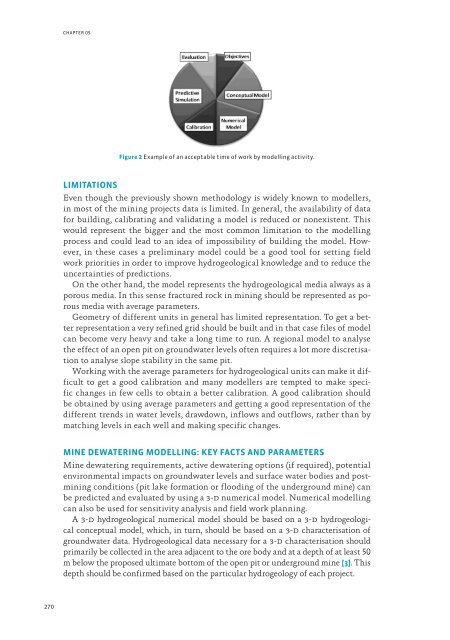
Figure 2 Example of an acceptable time of work by modell<strong>in</strong>g activity.<br />
Even though the previously shown methodology is widely known to modellers,<br />
<strong>in</strong> most of the m<strong>in</strong><strong>in</strong>g projects data is limited. In general, the availability of data<br />
for build<strong>in</strong>g, calibrat<strong>in</strong>g <strong>and</strong> validat<strong>in</strong>g a model is reduced or nonexistent. This<br />
would represent the bigger <strong>and</strong> the most common limitation to the modell<strong>in</strong>g<br />
process <strong>and</strong> could lead to an idea of impossibility of build<strong>in</strong>g the model. However,<br />
<strong>in</strong> these cases a prelim<strong>in</strong>ary model could be a good tool for sett<strong>in</strong>g field<br />
work priorities <strong>in</strong> order to improve hydrogeological knowledge <strong>and</strong> to reduce the<br />
uncerta<strong>in</strong>ties of predictions.<br />
On the other h<strong>and</strong>, the model represents the hydrogeological media always as a<br />
porous media. In this sense fractured rock <strong>in</strong> m<strong>in</strong><strong>in</strong>g should be represented as porous<br />
media with average parameters.<br />
Geometry of different units <strong>in</strong> general has limited representation. To get a better<br />
representation a very ref<strong>in</strong>ed grid should be built <strong>and</strong> <strong>in</strong> that case files of model<br />
can become very heavy <strong>and</strong> take a long time to run. A regional model to analyse<br />
the effect of an open pit on groundwater levels often requires a lot more discretisation<br />
to analyse slope stability <strong>in</strong> the same pit.<br />
Work<strong>in</strong>g with the average parameters for hydrogeological units can make it difficult<br />
to get a good calibration <strong>and</strong> many modellers are tempted to make specific<br />
changes <strong>in</strong> few cells to obta<strong>in</strong> a better calibration. A good calibration should<br />
be obta<strong>in</strong>ed by us<strong>in</strong>g average parameters <strong>and</strong> gett<strong>in</strong>g a good representation of the<br />
different trends <strong>in</strong> water levels, drawdown, <strong>in</strong>flows <strong>and</strong> outflows, rather than by<br />
match<strong>in</strong>g levels <strong>in</strong> each well <strong>and</strong> mak<strong>in</strong>g specific changes.<br />
MINE DEWATERING MODELLING: KEY FACTS AND PARAMETERS<br />
M<strong>in</strong>e dewater<strong>in</strong>g requirements, active dewater<strong>in</strong>g options (if required), potential<br />
environmental impacts on groundwater levels <strong>and</strong> surface water bodies <strong>and</strong> postm<strong>in</strong><strong>in</strong>g<br />
conditions (pit lake formation or flood<strong>in</strong>g of the underground m<strong>in</strong>e) can<br />
be predicted <strong>and</strong> evaluated by us<strong>in</strong>g a 3-d numerical model. Numerical modell<strong>in</strong>g<br />
can also be used for sensitivity analysis <strong>and</strong> field work plann<strong>in</strong>g.<br />
A 3-d hydrogeological numerical model should be based on a 3-d hydrogeological<br />
conceptual model, which, <strong>in</strong> turn, should be based on a 3-d characterisation of<br />
groundwater data. Hydrogeological data necessary for a 3-d characterisation should<br />
primarily be collected <strong>in</strong> the area adjacent to the ore body <strong>and</strong> at a depth of at least 50<br />
m below the proposed ultimate bottom of the open pit or underground m<strong>in</strong>e [3]. This<br />
depth should be confirmed based on the particular hydrogeology of each project.