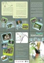
Tacklers Trail 6pp Lft_v3.qxd - Visit Lancashire
Tacklers Trail 6pp Lft_v3.qxd - Visit Lancashire
Tacklers Trail 6pp Lft_v3.qxd - Visit Lancashire

Create successful ePaper yourself
Turn your PDF publications into a flip-book with our unique Google optimized e-Paper software.
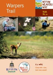
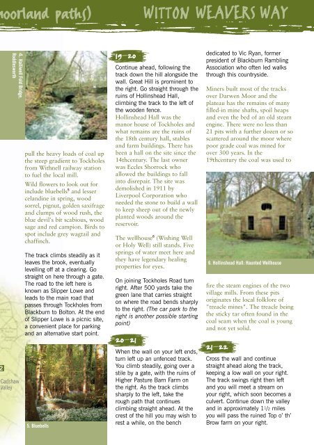
oorland paths) WITTON WEAVERS WAY<br />
4. Halliwell Fold Bridge,<br />
Roddlesworth<br />
Cadshaw<br />
Valley<br />
pull the heavy loads of coal up<br />
the steep gradient to Tockholes<br />
from Withnell railway station<br />
to fuel the local mill.<br />
Wild flowers to look out for<br />
include bluebells 5 and lesser<br />
celandine in spring, wood<br />
sorrel, pignut, golden saxifrage<br />
and clumps of wood rush, the<br />
blue devil's bit scabious, wood<br />
sage and red campion. Birds to<br />
spot include grey wagtail and<br />
chaffinch.<br />
The track climbs steadily as it<br />
leaves the brook, eventually<br />
levelling off at a clearing. Go<br />
straight on here through a gate.<br />
The road to the left here is<br />
known as Slipper Lowe and<br />
leads to the main road that<br />
passes through Tockholes from<br />
Blackburn to Bolton. At the end<br />
of Slipper Lowe is a picnic site,<br />
a convenient place for parking<br />
and an alternative start point.<br />
5. Bluebells<br />
19–20<br />
Continue ahead, following the<br />
track down the hill alongside the<br />
wall. Great Hill is prominent to<br />
the right. Go straight through the<br />
ruins of Hollinshead Hall,<br />
climbing the track to the left of<br />
the wooden fence.<br />
Hollinshead Hall was the<br />
manor house of Tockholes and<br />
what remains are the ruins of<br />
the 18th century hall, stables<br />
and farm buildings. There has<br />
been a hall on the site since the<br />
14thcentury. The last owner<br />
was Eccles Shorrock who<br />
allowed the buildings to fall<br />
into disrepair. The site was<br />
demolished in 1911 by<br />
Liverpool Corporation who<br />
needed the stone to build a wall<br />
to keep sheep out of the newly<br />
planted woods around the<br />
reservoir.<br />
The wellhouse 6 (Wishing Well<br />
or Holy Well) still stands. Five<br />
springs of water meet here and<br />
they have legendary healing<br />
properties for eyes.<br />
On joining Tockholes Road turn<br />
right. After 500 yards take the<br />
green lane that carries straight<br />
on where the road bends sharply<br />
to the right. (The car park to the<br />
right is another possible starting<br />
point)<br />
20–21<br />
When the wall on your left ends,<br />
turn left up an unfenced track.<br />
You climb steadily, going over a<br />
stile by a gate, with the ruins of<br />
Higher Pasture Barn Farm on<br />
the right. As the track climbs<br />
sharply to the left, take the<br />
rough path that continues<br />
climbing straight ahead. At the<br />
crest of the hill you may wish to<br />
rest a while, on the bench<br />
dedicated to Vic Ryan, former<br />
president of Blackburn Rambling<br />
Association who often led walks<br />
through this countryside.<br />
Miners built most of the tracks<br />
over Darwen Moor and the<br />
plateau has the remains of many<br />
filled-in mine shafts, spoil heaps<br />
and even the bed of an old steam<br />
engine. There were no less than<br />
21 pits with a further dozen or so<br />
scattered around the moor where<br />
poor grade coal was mined for<br />
over 300 years. In the<br />
19thcentury the coal was used to<br />
6. Hollinshead Hall: Haunted Wellhouse<br />
fire the steam engines of the two<br />
village mills. From these pits<br />
originates the local folklore of<br />
"treacle mines". The treacle being<br />
the sticky tar often found in the<br />
coal seam when the coal is young<br />
and not yet solid.<br />
21–22<br />
Cross the wall and continue<br />
straight ahead along the track,<br />
keeping a low wall on your right.<br />
The track swings right then left<br />
and you will meet a stream on<br />
your right, which soon becomes a<br />
culvert. Continue down the valley<br />
and in approximately 1 1/2 miles<br />
you will pass the ruined Top o’ th’<br />
Brow farm on your right.