Palaeolithic Research Framework for the Bristol Avon basin (pdf, 2.3 ...
Palaeolithic Research Framework for the Bristol Avon basin (pdf, 2.3 ...
Palaeolithic Research Framework for the Bristol Avon basin (pdf, 2.3 ...

You also want an ePaper? Increase the reach of your titles
YUMPU automatically turns print PDFs into web optimized ePapers that Google loves.
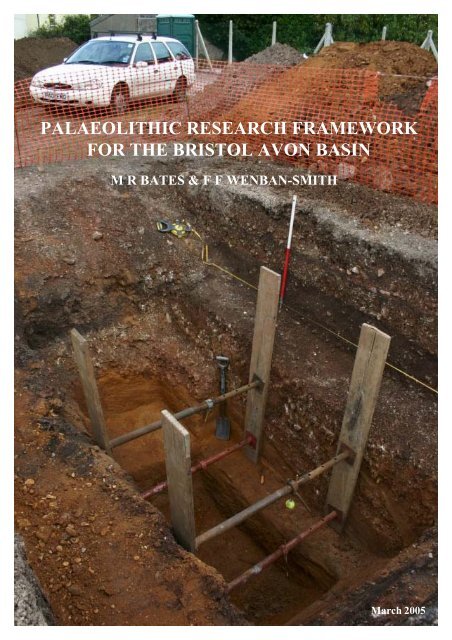
PALAEOLITHIC RESEARCH FRAMEWORK<br />
FOR THE BRISTOL AVON BASIN<br />
M R BATES & F F WENBAN-SMITH<br />
March 2005
PALAEOLITHIC RESEARCH FRAMEWORK FOR THE<br />
BRISTOL AVON BASIN<br />
MR Bates<br />
Brynawelon,<br />
Ciliau Aeron,<br />
Lampeter,<br />
Ceredigion,<br />
Wales.<br />
SA48 7SE<br />
01570-471015<br />
bullybates@fsmail.net<br />
&<br />
FF Wenban-Smith<br />
Department of Archaeology<br />
University of Southampton<br />
Southampton<br />
SO17 1BJ<br />
07771-623 096<br />
ffws@soton.ac.uk<br />
March 2005
CONTENTS<br />
SUMMARY<br />
Acknowledgements<br />
1 INTRODUCTION<br />
1.1 Project background<br />
1.2 The Pleistocene<br />
1.3 The <strong>Palaeolithic</strong><br />
2 STUDY REGION — THE BRISTOL AVON BASIN<br />
3 PLEISTOCENE GEOLOGY<br />
3.1 Overview<br />
3.2 Headwaters, north of Malmesbury<br />
3.3 Upper <strong>Avon</strong>, from Malmesbury to Brad<strong>for</strong>d-on-<strong>Avon</strong><br />
3.4 Upper Middle <strong>Avon</strong>, Brad<strong>for</strong>d-on-<strong>Avon</strong> to Bathampton<br />
3.5 Bathampton–Keynsham (entrance of Hanham Gorge)<br />
3.6 <strong>Bristol</strong>, Keynsham to Clifton<br />
3.7 Shirehampton, Clifton to Severn<br />
3.8 Severn, <strong>Avon</strong>mouth–Weston-in-Gordano<br />
3.9 High level gravels of <strong>the</strong> <strong>Avon</strong> system<br />
4 PALAEOLITHIC ARCHAEOLOGY<br />
4.1 Overview<br />
4.1.1 Sources and quantification<br />
4.1.2 Distribution and depositional context<br />
4.1.3 Period and cultural tradition<br />
4.1.4 Raw material<br />
4.2 Headwaters, north of Malmesbury<br />
4.3 Upper <strong>Avon</strong>, from Malmesbury to Brad<strong>for</strong>d-on-<strong>Avon</strong><br />
4.4 Upper Middle <strong>Avon</strong>, Brad<strong>for</strong>d-on-<strong>Avon</strong> to Bathampton<br />
4.5 Bathampton–Keynsham (entrance of Hanham Gorge)<br />
4.6 <strong>Bristol</strong>, Keynsham to Clifton<br />
4.7 Shirehampton, Clifton to Severn<br />
4.8 Severn, <strong>Avon</strong>mouth–Portishead<br />
5 RESEARCH FRAMEWORK<br />
5.1 National <strong>Palaeolithic</strong> research framework<br />
5.1.1 <strong>Research</strong> <strong>the</strong>mes and priorities<br />
5.1.2 The resource<br />
5.2 <strong>Palaeolithic</strong> research priorities in <strong>the</strong> <strong>Bristol</strong> <strong>Avon</strong> <strong>basin</strong><br />
5.2.1 Key regional <strong>the</strong>mes and priorities (R)<br />
5.2.2 Landscape zone objectives
5.3 Strategic projects<br />
5.4 Dissemination, education and community involvement<br />
6 DEVELOPMENT CONTROL: A STRATEGY FOR THE PALAEOLITHIC<br />
RESOURCE<br />
6.1 Development control and <strong>Palaeolithic</strong> archaeology<br />
6.2 The <strong>Palaeolithic</strong> resource<br />
6.2.1 Pleistocene deposits<br />
6.2.2 <strong>Palaeolithic</strong> remains and relevant in<strong>for</strong>mation<br />
6.<strong>2.3</strong> Disturbance and integrity<br />
6.3 Proposals <strong>for</strong> action<br />
6.3.1 Strategy<br />
6.3.2 Curatorial awareness<br />
6.3.3 Baseline resource characterisation<br />
6.3.4 Desk-based assessment<br />
6.3.5 Evaluation<br />
6.3.6 Mitigation<br />
6.3.7 Complementary projects<br />
TABLES<br />
Table 1. Quaternary epochs and <strong>the</strong> Marine Isotope Stage framework.<br />
Table 2. <strong>Palaeolithic</strong> period in Britain.<br />
Table 3. Identified Pleistocene deposits in <strong>the</strong> <strong>Bristol</strong> Region<br />
Table 4. Stratigraphical correlation of deposits in <strong>the</strong> <strong>Bristol</strong> region<br />
Table 5. Key Pleistocene sites in <strong>the</strong> study area<br />
Table 6. <strong>Palaeolithic</strong> finds by river stretch and depositional context.<br />
Table 7. <strong>Bristol</strong> region key research <strong>the</strong>mes/priorities.<br />
Table 8. Landscape zone research objectives.<br />
Table 9. Classes of Pleistocene deposit.<br />
Table 10. <strong>Palaeolithic</strong> remains and relevant in<strong>for</strong>mation.<br />
Table 11. English Heritage criteria <strong>for</strong> <strong>Palaeolithic</strong> importance adapted from<br />
English Heritage, 1991; English Heritage/Prehistoric Society, 1999).<br />
FIGURES<br />
Figure 1. Site location plan showing main sites discussed in text.<br />
Figure 2. Reconstructed palaeogeography in <strong>the</strong> West Midlands and <strong>the</strong> Marches<br />
prior to <strong>the</strong> Anglian glaciation (based on Maddy 1997).<br />
Figure 3. A:Horsecombe Vale transect showing main sediment units. B: detailed<br />
cross section of Pit 1 containing late glacial molluscs. Based on<br />
Chandler et al. 1976.
Figure 4. Main sites discussed in text within <strong>the</strong> Bath region.<br />
Figure 5. Section at Victoria Pit, Twerton, Bath, 1948 (from Chandler et al. 1976).<br />
Figure 6. Main sites discussed in text within <strong>the</strong> Shirehampton/Chapel Pill area.<br />
Red dotted line shows <strong>the</strong> approximate location of transverse section<br />
shown in Figure 5A.<br />
Figure 7. A: transverse section of <strong>Avon</strong> Terrace 2 at Shirehampton (<strong>the</strong> 100-foot<br />
terrace) (from ApSimon and Boon, 1959). 1: Portway A4; 2: Burnham<br />
Road; 3: Walton Road and Allotments; 4: Shirehampton Burial<br />
Ground; 5: High Street and West Camp Site. Stipples: stratified fluvial<br />
sediments; triangles: Head; ORS: Old Red Sandstone; LST: Limestone<br />
Shales; Trias: Keuper Marl etc. B: West Camp, Shirehampton sketch<br />
section from manhole cutting (ApSimon and Boon, 1959). C:<br />
<strong>Palaeolithic</strong> implements from <strong>the</strong> Shirehampton area (Lacaille, 1954).<br />
1: Cleaver made on chert from Grove Leaze; 2: chert handaxe from<br />
Station Road; 3: chert handaxe in heavily rolled condition.<br />
Figure 8. <strong>Palaeolithic</strong> artefacts from Chapel Pill Farm, Abbots Leigh (after<br />
Lacaille, 1954). 1: Triangular handaxe of brown sandstone; 2: chert<br />
handaxe; 3: ovate handaxe made of sandstone; 4 and 5 rolled flint<br />
flakes; 6: rolled chert flake.<br />
Figure 9. A collection of <strong>Palaeolithic</strong> artefacts from Chapel Pill Farm, Abbots<br />
Leigh (after Lacaille, 1954). 1-4, 6: flakes; 5 and 7: blades; 8 and 9:<br />
cores; 10: handaxe; 11-13: compound tools.<br />
Figure 10. Distribution of borehole records held in British Geological Survey<br />
GeoIndex <strong>for</strong> <strong>the</strong> area of Bath town centre and environs.<br />
Figure 11. Distribution of borehole records held in British Geological Survey<br />
GeoIndex <strong>for</strong> <strong>the</strong> Shirehampton area.<br />
PLATES<br />
Plate 1. General view of Bath urban area.<br />
Plate 2. Unmapped terrace surface downstream of Bath.<br />
Plate 3. Former Somerset and Dorset Railway cutting (now a linear park) at<br />
Twerton. This cutting exposed gravels containing animal bones.<br />
Plate 4. Possible <strong>for</strong>mer quarry site at Larkhall, Bath (now a municipal park).<br />
Plate 5. Chapel Pill Farm area and south side of <strong>Avon</strong>.<br />
Plate 6. View towards Clifton Gorge showing area of Terrace 2 deposits on south<br />
side of <strong>Avon</strong> at Chapel Pill Farm.<br />
Plate 7. Excavations at Twy<strong>for</strong>d House, Shirehampton into Terrace 2 deposits.<br />
Note shoring method and access to sequences at base of trench.<br />
Plate 8. Detailed view of sediments beneath Terrace 2 in Shirehampton showing<br />
basal gravelly sands overlain by mollusc rich sands and, towards <strong>the</strong> top,<br />
cold climate solifluction deposits.
APPENDICES<br />
1. PALAEOLITHIC SITES IN THE BRISTOL AVON BASIN<br />
2. PROFORMA METHOD STATEMENT FOR PALAEOLITHIC/<br />
PLEISTOCENE FIELD EVALUATION<br />
3. RECORDING OF PLEISTOCENE SEDIMENTS<br />
4. PALAEOLITHIC ARTEFACT RECOGNITION AND TYPOLOGY
SUMMARY<br />
This document was commissioned by <strong>the</strong> City Archaeologist, <strong>Bristol</strong> City<br />
Council to review <strong>the</strong> <strong>Palaeolithic</strong> archaeological potential of <strong>the</strong> <strong>Bristol</strong> <strong>Avon</strong><br />
region. This report describes <strong>the</strong> main features of both <strong>the</strong> <strong>Palaeolithic</strong><br />
archaeological resource <strong>for</strong> <strong>the</strong> region and <strong>the</strong> Pleistocene record that<br />
contextualises this resource.<br />
Key points to emerge from <strong>the</strong> review are:<br />
Pleistocene geology<br />
- Surviving Pleistocene deposits are unevenly distributed throughout <strong>the</strong><br />
system<br />
- Deposits in two areas — around Bath and Shirehampton — are already<br />
proven to contain significant archaeological and biological remains. O<strong>the</strong>r<br />
areas, not yet identified, are also likely to contain similar evidence<br />
- Faunal remains are relatively common in <strong>the</strong> Bath region but are also<br />
known from o<strong>the</strong>r areas such as Shirehampton and Sutton Benger<br />
- Dating is poorly understood but most deposits probably date to different<br />
parts of <strong>the</strong> Middle Pleistocene, between 500,000 and 125,000 BP,<br />
corresponding with <strong>the</strong> Lower and Middle <strong>Palaeolithic</strong><br />
- Additional work remains to be undertaken to determine <strong>the</strong> precise<br />
number of fluvial aggradations and terraces<br />
- Slope deposits and Head are also present and may include buried<br />
landsurfaces of Late Pleistocene age, corresponding with <strong>the</strong> late Middle<br />
and Upper <strong>Palaeolithic</strong><br />
<strong>Palaeolithic</strong> archaeology<br />
- Artefacts exhibit considerable variation in <strong>the</strong> raw material used in tool<br />
production, with significant use of non-flint lithologies<br />
- One major finds ‘hot spot’ has been identified in Terrace 2 gravels at<br />
Shirehampton, representing intensive activity in <strong>the</strong> Lower/Middle<br />
<strong>Palaeolithic</strong><br />
- Finds from o<strong>the</strong>r areas — such as Kelston and above <strong>the</strong> Hanham Gorge —<br />
also indicate <strong>the</strong> presence of Lower/Middle <strong>Palaeolithic</strong> activity in o<strong>the</strong>r<br />
parts of <strong>the</strong> region. Fur<strong>the</strong>r investigation of surviving deposits across <strong>the</strong><br />
region is likely to produce more widespread evidence <strong>for</strong> <strong>Palaeolithic</strong><br />
activity, even where no remains have yet been found
- There is a predominance of handaxes in <strong>the</strong> collections, but flake-tool and<br />
Levallois technology are present where more extensive collections exist<br />
from certain locations, particularly Shirehampton<br />
- There is a curious absence of artefacts from <strong>the</strong> Bath area despite <strong>the</strong><br />
major degree of investigation of <strong>the</strong> fossil and o<strong>the</strong>r biological remains in<br />
<strong>the</strong> Pleistocene deposits of <strong>the</strong> area; it remains to be demonstrated whe<strong>the</strong>r<br />
this is a real feature of <strong>the</strong> record or a case of collecting bias<br />
- None of <strong>the</strong> sites from which <strong>Palaeolithic</strong> material has come is well dated<br />
While present knowledge is restricted due to limited previous investigations, <strong>the</strong><br />
<strong>Palaeolithic</strong> and fossil remains that have been found demonstrate that<br />
considerable potential exists <strong>for</strong> <strong>Palaeolithic</strong> study in <strong>the</strong> <strong>Bristol</strong> <strong>Avon</strong> region.<br />
Besides potential <strong>for</strong> developing an improved understanding of <strong>the</strong> regional<br />
<strong>Palaeolithic</strong> record, <strong>the</strong>re is also potential to contribute to addressing a number<br />
of key national research objectives, as outlined by English Heritage in Exploring<br />
our Past (1991) and in <strong>the</strong> more recent national <strong>Palaeolithic</strong> <strong>Research</strong><br />
<strong>Framework</strong> (English Heritage/Prehistoric Society 1999).<br />
A framework is outlined by which <strong>the</strong> <strong>Palaeolithic</strong> potential of <strong>the</strong> region can be<br />
investigated through mitigation of any impacts caused by development,<br />
supported by description of suitable methods of investigation, and <strong>the</strong> relation of<br />
any mitigating works to national/regional research objectives. A number of<br />
suggestions are also made <strong>for</strong> specific projects that could be carried out to<br />
develop understanding of <strong>the</strong> overall <strong>Palaeolithic</strong>/Pleistocene chronological and<br />
stratigraphic framework in <strong>the</strong> region, to provide a baseline characterisation of<br />
<strong>the</strong> resource and a context <strong>for</strong> <strong>the</strong> <strong>Palaeolithic</strong> remains already known, and yet to<br />
be discovered, from <strong>the</strong> region.
Acknowledgements<br />
The authors would like to thank <strong>Bristol</strong> City Council <strong>for</strong> funding <strong>the</strong> research and in<br />
particular staff in <strong>the</strong> Archaeology section <strong>for</strong> help when putting <strong>the</strong> document<br />
toge<strong>the</strong>r. The comments of Gail Boyle, Curator of Prehistoric and Roman<br />
Archaeology, <strong>Bristol</strong> Museum and Art Gallery and David Evans, Historic<br />
Environment Officer, South Gloucestershire Council on <strong>the</strong> draft of <strong>the</strong> document are<br />
gratefully acknowledged.<br />
All photographs and illustrations are by <strong>the</strong> authors except where o<strong>the</strong>rwise credited.<br />
© M. R. Bates and F. F. Wenban-Smith, 2005<br />
The right of M. R. Bates and F. F. Wenban-Smith to be identified as <strong>the</strong> Authors of this work has been<br />
asserted by <strong>the</strong>m in accordance with <strong>the</strong> Copyrights, Designs and Patents Act 1988. The Authors have<br />
granted a licence to <strong>Bristol</strong> City Council and <strong>the</strong>ir agents to use and reproduce <strong>the</strong> material contained<br />
within.<br />
The Ordnance Survey maps within this document are reproduced with <strong>the</strong> permission of Ordnance<br />
Survey on behalf of <strong>the</strong> Controller of Her Majesty’s Stationery Office © Crown copyright.<br />
Unauthorised reproduction infringes Crown copyright and may lead to prosecution or civil<br />
proceedings. <strong>Bristol</strong> City Council 100023406, 2005.
1. INTRODUCTION<br />
1.1 Project background<br />
This project was commissioned by <strong>the</strong> <strong>Bristol</strong> City Archaeologist in July 2004. The<br />
impetus <strong>for</strong> <strong>the</strong> study was initiated by work in <strong>the</strong> Shirehampton district of <strong>Bristol</strong> in<br />
2003 when a site of potential <strong>Palaeolithic</strong> importance was investigated by <strong>the</strong> <strong>Avon</strong><br />
Archaeological Unit. During <strong>the</strong> course of investigation Terra Nova Ltd. was called<br />
upon to provide specialist services to <strong>the</strong> archaeological unit in <strong>Palaeolithic</strong><br />
archaeology and Pleistocene geology and environments. Despite <strong>the</strong> absence of<br />
sequences of <strong>Palaeolithic</strong> or Pleistocene significance a report was prepared on <strong>the</strong><br />
<strong>Palaeolithic</strong> archaeological potential of <strong>the</strong> region (Bates, 2003). This report<br />
highlights some of <strong>the</strong> key issues relating to <strong>the</strong> <strong>Palaeolithic</strong> archaeology of <strong>the</strong> area<br />
and draws attention to <strong>the</strong> relatively poorly understood sequences and lack of recent<br />
investigation in <strong>the</strong> region.<br />
Following consideration of <strong>the</strong> report and its distribution via <strong>the</strong> <strong>Bristol</strong> City Council<br />
web pages (www.bristol-city.gov.uk/archaeology) a meeting was held in November<br />
2003 to progress work and understanding of <strong>the</strong> <strong>Palaeolithic</strong> resources in <strong>the</strong> wider<br />
<strong>Avon</strong> region. An outcome of this meeting was <strong>the</strong> desire to provide additional<br />
in<strong>for</strong>mation on <strong>the</strong> <strong>Palaeolithic</strong> and Pleistocene potential of <strong>the</strong> river system in <strong>the</strong><br />
Bath/<strong>Bristol</strong> region. This report provides that detailed overview.<br />
1.2 The Pleistocene<br />
The initial <strong>Palaeolithic</strong> occupation and subsequent settlement of Britain has taken<br />
place against <strong>the</strong> backdrop of <strong>the</strong> Quaternary period, characterised by <strong>the</strong> onset and<br />
recurrence of a series of alternating cold–warm/glacial–interglacial climatic cycles<br />
(Lowe and Walker 1997). Over 60 cycles have been identified during <strong>the</strong> last 1.8<br />
million years, corresponding with fluctuations in proportions of <strong>the</strong> Oxygen isotopes<br />
O 16 and O 18 in deep-sea sediment sequences. These marine isotope stages (MIS) have<br />
been numbered by counting back from <strong>the</strong> present-day interglacial or Holocene period<br />
(MI Stage 1), with (usually) interglacials having odd numbers and glacials even<br />
numbers, and dated by a combination of radiometric dating and tuning to <strong>the</strong><br />
astronomical timescale of orbital variations, which have been a fundamental causative<br />
agent of <strong>the</strong> Quaternary climatic fluctuations. The Quaternary is divided into two<br />
epochs – <strong>the</strong> Holocene and <strong>the</strong> Pleistocene – where <strong>the</strong> Holocene represents <strong>the</strong><br />
present-day interglacial and <strong>the</strong> Pleistocene represents <strong>the</strong> remainder of <strong>the</strong><br />
Quaternary that is divided into Early, Middle and Late parts (Table 1). The Middle<br />
and Late Pleistocene are of most relevance to British <strong>Palaeolithic</strong> archaeology, with<br />
<strong>the</strong> first occupation of Britain occurring circa 700,000 BP in <strong>the</strong> Middle Pleistocene,<br />
and continuing <strong>the</strong>reafter, albeit with occasional gaps.<br />
Middle and Late Pleistocene climatic oscillations were sufficiently marked to have a<br />
major impact on sea level and terrestrial sedimentation regimes. In <strong>the</strong> colder periods<br />
ice sheets grew across much of <strong>the</strong> country, and arboreal <strong>for</strong>ests disappeared, to be<br />
replaced by steppe or tundra. Sea levels dropped across <strong>the</strong> globe due to <strong>the</strong> amount of<br />
water locked up as ice, exposing wide areas offshore as dry land, and enhancing river<br />
channel downcutting. In <strong>the</strong> warmer periods sea levels rose as ice melted, river<br />
channels tended to be stable and prone to silting up and <strong>the</strong> development of alluvial<br />
floodplains (Gibbard and Lewin 2002), and <strong>for</strong>ests regenerated. The range of faunal<br />
species inhabiting Britain changed in association with <strong>the</strong>se climatic and<br />
environmental changes, with both evolution of species in situ to adapt to <strong>the</strong>se
changes and local extinction/recolonisation of species in response to changing<br />
environmental conditions.<br />
Britain has been particularly sensitive to <strong>the</strong>se changes, being i) situated at a latitude<br />
that has allowed <strong>the</strong> growth of ice sheets in cold periods and <strong>the</strong> development of<br />
temperate <strong>for</strong>ests in warm periods, and ii) periodically isolated as an island by rising<br />
sea levels and <strong>the</strong>n rejoined to <strong>the</strong> continent when sea level falls (White and Shreeve<br />
2000). This has led to different climatic stages having reasonably distinctive sets of<br />
associated fauna and flora. These both reflect in general terms <strong>the</strong> climate and<br />
environment, and may also identify in specific terms <strong>the</strong> MI Stage represented. The<br />
study of such evidence — such as large mammals, small vertebrates, molluscs,<br />
ostracods, insects and pollen — is an integral part of Pleistocene, and <strong>Palaeolithic</strong>,<br />
research <strong>for</strong> its role in dating early hominid occupation and recreating <strong>the</strong> associated<br />
palaeo-environment.<br />
The evidence from different MI Stages is contained in terrestrial deposits <strong>for</strong>med<br />
during <strong>the</strong> stage. In contrast to <strong>the</strong> deep-sea bed, where <strong>the</strong>re has been continuous<br />
sedimentation, terrestrial deposition only occurs in specific, limited parts of <strong>the</strong><br />
landscape. It is also takes place as a series of short-lived depositional events such as<br />
land-slips or river-floods interrupted by long periods of stability and erosion. Thus <strong>the</strong><br />
terrestrial record is relatively piecemeal, and <strong>the</strong> challenge <strong>for</strong> both Pleistocene and<br />
<strong>Palaeolithic</strong> investigation is to integrate <strong>the</strong> terrestrial evidence into <strong>the</strong> global MIS<br />
framework, based on relatively few direct stratigraphic relationships, and making<br />
maximum use of biological evidence and inferences about <strong>the</strong> sequence of deposition<br />
in major systems such as river valleys (Bridgland et al. 2004).<br />
Present understanding is summarised in Table 1. The current interglacial began circa<br />
10,000 BP (years be<strong>for</strong>e present) and it is generally agreed that MI Stages 2–5d,<br />
dating from circa 10,000–115,000 BP cover <strong>the</strong> last glaciation (Devensian), and that<br />
Stage 5e, dating from circa 115,000–125,000 BP, correlates with <strong>the</strong> short-lived peak<br />
warmth of <strong>the</strong> last interglacial (Ipswichian). Beyond that disagreement increases,<br />
although many British workers feel confident in accepting that MI Stage 12, which<br />
ended abruptly circa 425,000 BP, correlates with <strong>the</strong> major British Anglian glaciation<br />
when ice-sheets reached as far south as <strong>the</strong> nor<strong>the</strong>rn outskirts of London (Bridgland<br />
1994).<br />
It is also important to remember that <strong>the</strong> MI Stage framework only reflects major<br />
climatic trends. Within each MI Stage <strong>the</strong>re were also numerous climatic oscillations,<br />
represented by maybe only a few centimetres within sediment cores 10–20 metres<br />
long, that have not been recognised as distinct numbered stages. These still potentially<br />
correspond to a few thousand years of climatic change, with potential <strong>for</strong> associated<br />
changes in environment and sedimentary deposition. Some of <strong>the</strong> larger diversions<br />
have been recognised as distinct sub-stages with <strong>the</strong> MIS framework (such as Stage<br />
5e), but many have not, and <strong>the</strong>ir presence has <strong>the</strong> potential to confound overly<br />
simplistic correlations of isolated terrestrial sequences with peaks or troughs on <strong>the</strong><br />
continuous marine record. Colder diversions within predominantly warm stages are<br />
known as stadials, and warmer diversions within cold stages as interstadials.<br />
1.3 The <strong>Palaeolithic</strong><br />
The <strong>Palaeolithic</strong> covers <strong>the</strong> time span from <strong>the</strong> initial colonisation of Britain in <strong>the</strong><br />
Middle Pleistocene, possibly as long ago as 700,000 years ago (Wymer 2003), to <strong>the</strong><br />
end of <strong>the</strong> Late Pleistocene, corresponding with <strong>the</strong> end of <strong>the</strong> last ice age circa 10,000<br />
years ago. Thus <strong>the</strong> <strong>Palaeolithic</strong> period occupies almost 700,000 years, and includes at
least eight major glacial–interglacial cycles (Table 1), accompanied by dramatic<br />
changes in climate, landscape and environmental resources. At <strong>the</strong> cold peak of glacial<br />
periods, ice-sheets 100s of metres thick would have covered most of Britain, reaching<br />
on occasion as far south as London, and <strong>the</strong> country must have been uninhabitable. At<br />
<strong>the</strong> warm peak of interglacials, mollusc species that now inhabit <strong>the</strong> Nile were abundant<br />
in British rivers, and fauna such as hippopotamus and <strong>for</strong>est elephant were common in<br />
<strong>the</strong> landscape. For <strong>the</strong> majority of <strong>the</strong> time, however, <strong>the</strong> climate would have been<br />
somewhere between <strong>the</strong>se extremes.<br />
After <strong>the</strong> <strong>for</strong>mation of <strong>the</strong> Channel probably some time in <strong>the</strong> later Middle Pleistocene<br />
(Gibbard 1995) human access to Britain was only possible during periods of cold<br />
climate when sea levels were lower and consequently early hominids were only<br />
periodically present in Britain (White and Schreeve 2000), which was at <strong>the</strong> nor<strong>the</strong>rn<br />
margin of <strong>the</strong> inhabited world. The archaeological evidence of <strong>the</strong> period mostly<br />
comprises flint tools, and <strong>the</strong> waste flakes left from <strong>the</strong>ir manufacture. These are very<br />
robust and resistant to decay, and, once made and discarded, persist in <strong>the</strong> landscape,<br />
eventually becoming buried or transported by sedimentary processes related to climatic<br />
change and landscape evolution. O<strong>the</strong>r <strong>for</strong>ms of evidence include faunal dietary<br />
remains of large animals, sometimes cut-marked reflecting <strong>the</strong> stripping of flesh <strong>for</strong><br />
food or broken open <strong>for</strong> marrow extraction and, very rarely, wooden artefacts. These<br />
<strong>for</strong>ms of evidence are, however, more vulnerable to decay, and it is only very rarely that<br />
burial conditions were suitable <strong>for</strong> <strong>the</strong>ir preservation through to <strong>the</strong> present day.<br />
Hominid skeletal remains have also been found on occasion although, again, <strong>the</strong>se are<br />
very rare and require exceptional conditions <strong>for</strong> <strong>the</strong>ir preservation.<br />
The British <strong>Palaeolithic</strong> has been divided into three broad, chronologically successive<br />
stages — Lower, Middle and Upper — based primarily on changing types of stone<br />
tool (Table 2). This framework was developed in <strong>the</strong> 19th century, be<strong>for</strong>e any<br />
knowledge of <strong>the</strong> types of human ancestor associated with <strong>the</strong> evidence of each<br />
period, and without much knowledge of <strong>the</strong> timescale. This tripartite division has<br />
none<strong>the</strong>less broadly stood <strong>the</strong> test of time, proving both to reflect a general<br />
chronological succession across Britain and northwest Europe, and to correspond with<br />
<strong>the</strong> evolution of different ancestral human species.<br />
Evidence of very early occupation of Britain has recently been discovered on <strong>the</strong><br />
Norfolk coast at Pakefield (Wymer 2003), dating to possibly as old as MIS 17, circa<br />
700,000 BP. The evidence consists of very simple cores and flakes, and was<br />
presumably made by a <strong>for</strong>m of Homo erectus/ergaster, known to be present in<br />
Central/Eastern Europe from over 1,000,000 BP. Following this, at present, isolated<br />
occurrence of very early hominid presence, <strong>the</strong>re are a number of sites dating from MIS<br />
13, circa 500,000 BP associated with <strong>the</strong> later western European Homo heidelbergensis,<br />
particularly at Boxgrove in Sussex, where an extensive area of undisturbed evidence is<br />
associated with abundant faunal remains and palaeo-environmental indicators (Roberts<br />
and Parfitt 1999). It is worth noting here that <strong>the</strong> impact of <strong>the</strong> Anglian glacial advance<br />
in MI Stage 12 has had considerable impact on <strong>the</strong> geographical structure of <strong>the</strong><br />
landscape associated with <strong>the</strong>se early hominid sites in Britain. Major re-modelling of<br />
<strong>the</strong> major drainage <strong>basin</strong>s such as <strong>the</strong> Thames (Gibbard 1985) and <strong>the</strong> creation of <strong>the</strong><br />
Severn and Fen <strong>basin</strong>s (Rose, 1994) have resulted in <strong>the</strong> destruction of much of <strong>the</strong><br />
landscape associated with <strong>the</strong> earliest phases of human activity (Wymer 2001) while<br />
elsewhere, e.g. central East Anglia, <strong>the</strong> evidence remains deeply buried by <strong>the</strong> till<br />
deposits associated with <strong>the</strong> Anglian ice advance (e.g. Lewis 1998).<br />
From <strong>the</strong> Anglian onwards <strong>Palaeolithic</strong> occupation becomes more frequent in Britain,<br />
although probably not continuous. There was gradual evolution of an Archaic hominid
lineage from Homo heidelbergensis into Neanderthals (Homo neanderthalensis) during<br />
<strong>the</strong> period from 500,000 BP up to <strong>the</strong> middle of <strong>the</strong> last glaciation (circa 35,000 BP).<br />
Very broadly speaking, <strong>the</strong> Lower <strong>Palaeolithic</strong> is associated with early Archaics and<br />
handaxe manufacture (Acheulian), and <strong>the</strong> Middle <strong>Palaeolithic</strong> with <strong>the</strong> development of<br />
Neanderthals and increasingly sophisticated flake-tool based lithic technology<br />
(Levalloisian and Mousterian), alongside one distinctive <strong>for</strong>m of handaxe, <strong>the</strong> bout<br />
coupé. It has, however, become clear with improved dating of several key sites, as<br />
well as <strong>the</strong> recent discovery of <strong>the</strong> Pakefield site, that <strong>the</strong> definition and distinction of<br />
Lower and Middle <strong>Palaeolithic</strong> are less clear-cut than was originally thought.<br />
The Lower <strong>Palaeolithic</strong> embraces a variety of lithic technologies besides handaxe<br />
manufacture. At Pakefield, <strong>the</strong>re is not a hint of handaxe manufacture, and <strong>the</strong> lithic<br />
industry consists entirely of small flint cores and flakes. Following this, most early<br />
sites are dominated by <strong>the</strong> manufacture of handaxes, although usually alongside a<br />
small component of core/flake production. However, <strong>the</strong>re are also a number of<br />
contemporary early sites without handaxe manufacture that can be included as Lower<br />
<strong>Palaeolithic</strong> — particularly <strong>the</strong> manifestations of crude cores, flakes and notched<br />
flake-tools that occur at several sites in Kent and East Anglia and are labelled as<br />
Clactonian. It is also uncertain to what extent <strong>the</strong> manufacture of handaxes persisted<br />
alongside <strong>the</strong> uptake of “Middle <strong>Palaeolithic</strong>” Levalloisian and Mousterian<br />
technology, whe<strong>the</strong>r different human groups were involved, and whe<strong>the</strong>r a transition<br />
from Lower to Middle <strong>Palaeolithic</strong> took place contemporaneously across <strong>the</strong> whole of<br />
Britain. Handaxes are scarce, but present, at most of <strong>the</strong> few Levalloisian sites known<br />
in Britain. These may be derived from earlier deposits, or contemporary with <strong>the</strong><br />
Levalloisian material. The problem is that our understanding of <strong>the</strong> Lower and Middle<br />
<strong>Palaeolithic</strong> archaeological record is restricted by:<br />
- Poor provenance of most finds<br />
- Difficulty of dating deposits of this age<br />
- Uncertainties over <strong>the</strong> extent of earlier derived material in assemblages<br />
After 35,000 BP, Neanderthals were suddenly replaced in Britain and northwest Europe<br />
by anatomically modern humans (Homo sapiens sapiens), who are associated with <strong>the</strong><br />
later, Upper part of <strong>the</strong> <strong>Palaeolithic</strong>. The Upper <strong>Palaeolithic</strong> is also characterised by<br />
cultural changes such as <strong>the</strong> development of bone and antler tools and <strong>the</strong> representation<br />
of images of animals painted on cave walls or as small antler or bone carvings. The<br />
suddenness of this change and <strong>the</strong> physiological differences between Neanderthals and<br />
modern humans, as well as recent DNA studies, suggest that modern humans did not<br />
evolve from Neanderthals, but evolved elsewhere, probably in Africa or western Asia<br />
circa 125,000 BP, be<strong>for</strong>e colonising o<strong>the</strong>r parts of <strong>the</strong> world.<br />
In contrast to <strong>the</strong> Lower and Middle <strong>Palaeolithic</strong> periods, <strong>the</strong> relatively recent age of <strong>the</strong><br />
Upper <strong>Palaeolithic</strong>, and <strong>the</strong> fact that, at least in Britain, <strong>the</strong> period is within <strong>the</strong> range of<br />
radiocarbon dating, means that our understanding of <strong>the</strong> period is good. It is clear that,<br />
at least in Britain, <strong>the</strong>re is a well-defined and clear break between <strong>the</strong> Middle and <strong>the</strong><br />
Upper <strong>Palaeolithic</strong>. Upper <strong>Palaeolithic</strong> evidence is very sparse in Britain. The climate<br />
was in <strong>the</strong> second half of a major glacial episode, and human presence was probably<br />
limited to occasional parties venturing to <strong>the</strong> edge of <strong>the</strong>ir habitable range. Some<br />
material has been recovered from deposits accumulated in cave sites on <strong>the</strong> Welsh<br />
coast, in Devon, in Here<strong>for</strong>dshire and in <strong>the</strong> Peak District dating to <strong>the</strong> milder climatic
phase be<strong>for</strong>e <strong>the</strong> Last Glacial Maximum of circa 20,000–15,000 BP (Barton and<br />
Collcutt 1986).<br />
There was no human presence in Britain during <strong>the</strong> Last Glacial Maximum, and<br />
recolonisation did not take place until a short phase of climatic amelioration<br />
(Windermere Interstadial) from circa 13,000 to 12,000 BP towards <strong>the</strong> end of <strong>the</strong> last<br />
ice age. Again, <strong>the</strong> majority of <strong>the</strong> evidence comes from cave deposits. This short-lived<br />
episode of Upper <strong>Palaeolithic</strong> settlement/recolonisation, characterised by a blade-based<br />
technology with distinctive backed points — Creswell, Cheddar and Penknife points —<br />
was brought to an end by a renewed climatic deterioration (Loch Lomond re-advance),<br />
marking <strong>the</strong> final stage of <strong>the</strong> last glaciation. After this climate improved at <strong>the</strong> onset of<br />
<strong>the</strong> Holocene, and Britain was recolonised again, by people with a characteristic Long<br />
Blade technology, which rapidly developed into Mesolithic.<br />
2 STUDY REGION: THE BRISTOL AVON BASIN<br />
The river <strong>Avon</strong> (Figure 1) drains parts of Gloucestershire, Wiltshire and Somerset as<br />
well as <strong>the</strong> City and County of <strong>Bristol</strong>. Today <strong>the</strong> river rises on <strong>the</strong> dip slope of <strong>the</strong><br />
Middle Jurassic limestone in <strong>the</strong> sou<strong>the</strong>rn Cotswolds near Chipping Sodbury. The<br />
river <strong>the</strong>n runs east and subsequently south through Wiltshire be<strong>for</strong>e turning through<br />
Brad<strong>for</strong>d-on-<strong>Avon</strong>. Upstream of Bath Pleistocene sediments have been noted to<br />
occur as a series of remnants of fluvial sediments resting on ei<strong>the</strong>r side of <strong>the</strong> river<br />
where <strong>the</strong> river is excavated into <strong>the</strong> Jurassic sediments between Brad<strong>for</strong>d-on-<strong>Avon</strong><br />
and Malmesbury. From Bath <strong>the</strong> river follows a generally north west trending route<br />
across Lower Jurassic rocks to a gorge at Hanham that has been cut into Pennant<br />
sandstone (Kellaway and Welch 1993). The river subsequently flows westwards<br />
across <strong>the</strong> soft, low lying Triassic rocks in central <strong>Bristol</strong> be<strong>for</strong>e entering a second<br />
gorge at Clifton that is cut into <strong>the</strong> Carboniferous Limestone. Today <strong>the</strong> river is<br />
confluent with <strong>the</strong> Severn at <strong>Avon</strong>mouth and is tidal as far as St. Anne’s.<br />
The influence of <strong>the</strong> two major gorges at Hanham and Clifton has a considerable<br />
impact on <strong>the</strong> operation of <strong>the</strong> river and effectively divides <strong>the</strong> river into a series of<br />
river stretches (Table 3) where floodplains exist on ei<strong>the</strong>r side of <strong>the</strong> river separated<br />
by reaches of <strong>the</strong> river within <strong>the</strong> gorges that have no floodplain associated with <strong>the</strong><br />
river. The presence of <strong>the</strong> gorges makes correlation between individual sectors of <strong>the</strong><br />
river difficult if not impossible without independent means of correlation.<br />
3 PLEISTOCENE GEOLOGY<br />
3.1 Overview<br />
The river <strong>Avon</strong> has been shown to contain a rich variety of sites containing<br />
Pleistocene sediments some of which contain faunal, floral and archaeological<br />
remains (Davies and Fry 1929; Lacaille 1954, Wessex Archaeology 1994; Campbell<br />
et al. 1998).<br />
The Pleistocene development of <strong>the</strong> <strong>Avon</strong> system is considered to have its origin as a<br />
superimposed river developed on a <strong>for</strong>mer Triassic age landscape (Barton et al. 2002).<br />
During <strong>the</strong> Pleistocene lowered sea levels probably resulted in <strong>the</strong> stripping of much<br />
of <strong>the</strong> Triassic cover to reveal <strong>the</strong> underlying Carboniferous limestone. Local<br />
glaciation at <strong>the</strong> western end of <strong>the</strong> system occurred during <strong>the</strong> (?)Middle Pleistocene
(Kellaway and Welch 1993; Campbell et al. 1998) when glacial deposits consisting of<br />
poorly sorted sand and gravel were deposited in <strong>the</strong> vicinity of Clevedon.<br />
Fluvial sediments, deposited by <strong>the</strong> <strong>Avon</strong> during <strong>the</strong> Pleistocene, are well known<br />
between Bathampton and <strong>the</strong> coast and previous authors to work in <strong>the</strong> area include<br />
Oriel (1904), Davies and Fry (1929), Palmer (1931), Lacaille (1954), Chandler et al.<br />
(1976) and Kellaway and Welch (1993). The most recent overview of <strong>the</strong> nature of<br />
<strong>the</strong> sequences have been produced by Campbell et al. (1999) who considered <strong>the</strong><br />
distribution of <strong>the</strong> sediments associated with <strong>the</strong> river and identified three distinct<br />
members within <strong>the</strong> <strong>Avon</strong> Valley Formation (Table 3). This tripartite system has<br />
been applied to <strong>the</strong> entire valley system despite <strong>the</strong> difficulties encountered in tracing<br />
deposits between different sections of <strong>the</strong> valley through <strong>the</strong> gorges at Clifton and<br />
Hanham. The three-fold subdivision of sequences can also be traced in <strong>the</strong> work of<br />
o<strong>the</strong>r authors such as Davies and Fry (1929) and <strong>the</strong> British Geological Survey<br />
(1965). Fur<strong>the</strong>rmore Davies and Fry (1929) indicate that fluvial gravels also rest on<br />
<strong>the</strong> plateau surfaces adjacent to <strong>the</strong> main valley.<br />
Un<strong>for</strong>tunately because of <strong>the</strong> presence of <strong>the</strong> deep gorges at Clifton and Hanham it is<br />
impossible to trace <strong>the</strong>se deposits as continuous spreads along <strong>the</strong> course of <strong>the</strong> river.<br />
Consequently correlation of <strong>the</strong> sediments is difficult. Kellaway and Welch (1993),<br />
following Chandler et al. (1976), suggest that <strong>the</strong> three groups of sediments may be<br />
broadly correlated with <strong>the</strong> Ipswichian, Middle Devensian and Late Devensian<br />
periods. However, this scheme is difficult to equate with <strong>the</strong> deposits of <strong>the</strong> Severn<br />
(Maddy 1999). Fur<strong>the</strong>rmore <strong>the</strong> acceptance of such as scheme would not easily fit <strong>the</strong><br />
models currently accepted to be responsible <strong>for</strong> fluvial sand and gravel aggradation<br />
and terracing (e.g. as considered by Bridgland 1996, 2000; Maddy 1997). It should<br />
however be noted that <strong>the</strong> presence of 2 bedrock gorge sections are likely to impact on<br />
such conventional models.<br />
The most recently published in<strong>for</strong>mation on <strong>the</strong> area (Campbell et al., 1998, 1999)<br />
would indicate that <strong>the</strong> sediments lying between <strong>the</strong> mouth of <strong>the</strong> <strong>Avon</strong> and<br />
Bathampton can all be accommodated within <strong>the</strong> <strong>Avon</strong> Formation (Campbell et al.<br />
1999) (Tables 3 and 4). This consists of fluvial gravels and o<strong>the</strong>r related sediments<br />
that have been grouped into a series of morphological terraces with three individual<br />
members identified as <strong>the</strong>:<br />
1. Ham Green Member. The stratotype <strong>for</strong> this member is at Ham Green (ST<br />
539768) where 3-4 metres of gravel with a surface elevation about 30 metres<br />
above <strong>the</strong> present valley base (Hunt 1998a). These deposits are compared<br />
with those known to have contained large mammal remains in <strong>the</strong> basal<br />
gravels at <strong>the</strong> Victoria Pit, Twerton (Winwood 1889; Davies and Fry 1929) as<br />
well as sands containing interglacial or interstadial mollusc from beneath<br />
gravels in <strong>the</strong> railway cutting at Twerton (Winwood 1875). Campbell et al<br />
(1999) suggest correlation with MIS 12.<br />
2. Stidham Member. The stratotype of this Member is at Stidham Farm, Salt<strong>for</strong>d<br />
(ST 674 684) where <strong>the</strong> gravels comprise 2 metres of trough cross-bedded<br />
gravels with a coarse basal lag containing animal bones including mammoth<br />
(Moore, 1870, Woodward 1876, Davies and Fry 1929; Hunt 1998b). The<br />
surface of <strong>the</strong> gravels lie at about 12 metres above <strong>the</strong> modern river. A<br />
possible correlation of MIS 8 is suggested by Campbell et al (1999).
3. Bathampton Member. The stratotype <strong>for</strong> this Member is at Hampton Rocks<br />
Railway cutting (ST 778 667) where up to 3 metres of trough cross-bedded<br />
gravels are noted to contain a cold stage mollusc fauna (Weston 1850,<br />
Woodward 1876; Hunt 1998c). The gravels are overlain by an interglacial soil<br />
and coversands (Hunt 1990). The sediments lie about 3 metres above <strong>the</strong><br />
modern floodplain. The presence of <strong>the</strong> interglacial soil indicates a minimum<br />
age of MIS 6 <strong>for</strong> <strong>the</strong> underlying gravels of <strong>the</strong> Bathampton Member.<br />
The weakness of this tripartite sequence is that it does not take into consideration <strong>the</strong><br />
influence of <strong>the</strong> gorges and <strong>the</strong> difficulties of correlating between different sectors of<br />
<strong>the</strong> river as separated by <strong>the</strong> gorges. Consequently it is felt that <strong>the</strong> stratigraphy and<br />
age of <strong>the</strong> gravels of <strong>the</strong> <strong>Avon</strong> are at present poorly understood. All authors would<br />
agree that <strong>the</strong> sediments ascribed to <strong>the</strong> <strong>Avon</strong> Formation all post-date <strong>the</strong> major<br />
glaciation of <strong>the</strong> area (perhaps occurring during MIS 16, Campbell et al. 1998, 1999)<br />
but despite attempts to date <strong>the</strong> sediments no clear inferences can presently be made.<br />
Most significantly because of urban sprawl many of <strong>the</strong> supposedly rich fossil sites<br />
are no longer visible and recent observations have been restricted to key views in<br />
pipe/foundation trenches, cemeteries etc. Because of <strong>the</strong>se difficulties and <strong>the</strong> major<br />
palaeogeographical changes associated with glaciation of <strong>the</strong> Midlands during MIS 12<br />
it is very difficult to reconstruct <strong>the</strong> local palaeogeographies of <strong>the</strong> region and <strong>the</strong><br />
relationship between <strong>the</strong> <strong>Avon</strong> drainage patterns and those of <strong>the</strong> ancestral Thames<br />
and Severn rivers (Figure 2) (see Maddy 1997 <strong>for</strong> discussion).<br />
Elsewhere within <strong>the</strong> <strong>Bristol</strong> region o<strong>the</strong>r types of sediments exist that are likely to<br />
correlate with <strong>the</strong> sequences associated with <strong>the</strong> fluvial deposits. For example<br />
marine/estuarine sediments have been described at Kennpier (Gilbertson and Hawkins<br />
1978; Hunt 1981; Hunt 1998d), Kenn Church (Gilbertson and Hawkins 1978; Hunt<br />
1998e) and Weston-in-Gordano (ApSimon and Donovan 1956; Hunt 1998f) while<br />
terrestrial and freshwater deposits occur at Yew Tree Farm (Gilbertson and Hawkins<br />
1978; Hunt 1981, 1998g). Currently <strong>the</strong> age of <strong>the</strong>se deposits remains somewhat<br />
problematic and <strong>the</strong>y are difficult to relate to <strong>the</strong> fluvial deposits.<br />
As a consequence of <strong>the</strong> study a number of key sites of importance to <strong>the</strong><br />
understanding of <strong>the</strong> Pleistocene geology and landscape evolution have been<br />
identified within <strong>the</strong> study region. These are summarised in Table 5.<br />
3.2 Headwaters, north of Malmesbury<br />
Little evidence exists within <strong>the</strong> region of Malmesbury <strong>for</strong> fluvial deposition in <strong>the</strong><br />
headwaters of <strong>the</strong> <strong>Avon</strong> system. This is unsurprising as fluvial deposition, terrace<br />
<strong>for</strong>mation and <strong>the</strong> preservation of such deposits are unlikely high within <strong>the</strong><br />
headwaters of a major drainage <strong>basin</strong>. Cave (1977) has reported on <strong>the</strong> Pleistocene<br />
sediments of <strong>the</strong> area but little useful in<strong>for</strong>mation pertains to issues directed towards<br />
<strong>the</strong> <strong>Palaeolithic</strong> resource of <strong>the</strong> area.<br />
Davies and Fry (1929) note that a number of sections exhibited fine limestone gravels<br />
around Brokenborough and on <strong>the</strong> Sherston Road about a mile west of Malmesbury.<br />
Here <strong>the</strong> gravel was nearly 4 feet thick and caps low tracts of rising ground above <strong>the</strong><br />
river.
3.3 Upper <strong>Avon</strong>, from Malmesbury to Brad<strong>for</strong>d-on-<strong>Avon</strong><br />
At least two distinct terraces exist in this stretch of <strong>the</strong> <strong>Avon</strong>. The associated deposits<br />
are extensive, relatively well-mapped and overlie impermeable Ox<strong>for</strong>d Clay bedrock.<br />
Most extensively preserved are deposits associated with Terrace 1 that <strong>for</strong>m extensive<br />
spreads around Melksham, Chippenham and Sutton Benger. Terrace 2 shows a<br />
considerably reduced distribution but occurs around Melksham. The presence of <strong>the</strong><br />
clay bedrock may be of significance when considering <strong>the</strong> preservation potential of<br />
<strong>the</strong> sediments as <strong>the</strong> impermeable nature of <strong>the</strong> clay should enhance likelihood of<br />
preservation of floral remains. Faunal remains are already known to be present in<br />
Terrace 1 at <strong>the</strong> Pyramid Pit, Sutton Benger while a fossil skull of an ox was noted to<br />
have been found by Henry Woods in 1839 (Davies and Fry 1929).<br />
Occasional spreads of material classified by <strong>the</strong> BGS alluvial cone material (e.g. at<br />
Middle Lodge Farm, NGR ST 93000 71000). In part <strong>the</strong>se deposits appear to rest on<br />
<strong>the</strong> surface of <strong>the</strong> Terrace 1 deposits and are consequently likely to post-date <strong>the</strong><br />
deposition of this terrace in certain locations. However, it remains possible that <strong>the</strong><br />
core of <strong>the</strong>se fans may be considerably older than <strong>the</strong> margins of <strong>the</strong> fans and<br />
consequently pre-date Terrace 1.<br />
3.4 Upper Middle <strong>Avon</strong>, Brad<strong>for</strong>d-on-<strong>Avon</strong> to Bathampton<br />
Hardly any Pleistocene deposits have been mapped in this area. There is a small patch<br />
of T1 gravel at <strong>the</strong> sou<strong>the</strong>rn end of <strong>the</strong> stretch, and a couple of patches of Head gravel<br />
(which may none<strong>the</strong>less overlie fluvial terrace remnants) at several places beside <strong>the</strong><br />
river course, <strong>for</strong> instance under <strong>the</strong> Roman Villa at Holcombe. The majority of <strong>the</strong><br />
valley flanks are covered by undifferentiated landslip deposits, which may mask more<br />
extensive Pleistocene fluvial deposits. For example at Fresh<strong>for</strong>d solifluction deposits<br />
have been found overlying a thin gravel body Moore 1870; Woodward 1876;<br />
Winwood 1889a) that contained a fauna with Elephas primigenius tusk and teeth,<br />
Rhinoceros tichorinus, Equus caballus, Bison europoeus, Cervus tarandus and Ovibos<br />
moschatus.<br />
It is likely that <strong>the</strong> landslip deposits are complex and as yet poorly understood<br />
however, Chandler et al. (1976) have considered <strong>the</strong> patterns of landslips in <strong>the</strong> Bath<br />
area within <strong>the</strong> Jurassic strata and were able to demonstrate that some slides occurred<br />
during <strong>the</strong> late Pleistocene (e.g. at Horsecombe Vale, NGR ST 75300 62000) where<br />
late glacial molluscs were located in association with buried soils in <strong>the</strong> head deposits<br />
(Figure 3). Elsewhere <strong>the</strong>y argue that landslides may have occurred earlier in <strong>the</strong><br />
Devensian. The evidence presented by Chandler et al. clearly suggests that a number<br />
of different types of material exists in association with <strong>the</strong> landslips and illustrate this<br />
at Horsecombe Vale (Figure 3) where both a basal limestone head and an overlying<br />
clay-rich head occurs.<br />
3.5 Bathampton–Keynsham (entrance of Hanham Gorge)<br />
This is one of <strong>the</strong> most important reaches of <strong>the</strong> river system <strong>for</strong> <strong>the</strong> preservation of<br />
sequences of Pleistocene sediments (Plate 1). Typically three terraces have been<br />
mapped within <strong>the</strong> area by <strong>the</strong> British Geological Survey (1965). The main sites are<br />
illustrated in Figure 4.<br />
Although a number of important sites occur within <strong>the</strong> region (Table 5) <strong>the</strong><br />
distribution of mapped terraces and sediments is relatively restricted (BGS, 1965)<br />
with narrow ribbons of Terrace 1 and 2 restricted to patches along <strong>the</strong> valley margins
and occasional patches of higher elevation material ascribed to Terrace 3, e.g. at<br />
Twerton. Elsewhere clear morphological terraces (Plate 2).<br />
The highest patches of terrace gravel within <strong>the</strong> area occur at Twerton in <strong>the</strong> old<br />
Victoria Gravel quarry where deposits lie at approximately 45 metres O.D. (27 metres<br />
above <strong>the</strong> modern alluvium) (Winwood 1889b; Palmer 1931) (Figure 5). The deposits<br />
present consist of some 3 metres of horizontally bedded gravels overlain by clay and<br />
sand beds below head (Chandler et al. 1976). The faunal assemblage consists of<br />
Mammuthus primigenius (Mammoth), Palaeoloxodon antiquus (straight-tusked<br />
elephant), Equus caballus (horse), Coelodonta antiquitatis (Woolly rhinoceros), Sus<br />
scrofa (pig), Cervus elephas (red deer) and Bision priscus (bison) (Palmer 1931).<br />
This fauna is indicative of cool, perhaps late interglacial, conditions. Similar deposits<br />
including fauna and molluscs were also recorded from Terrace 3 at <strong>the</strong> nearby<br />
Moorfield cutting (Winwood 1875) (Plate 3). According to Campbell et al (1999)<br />
<strong>the</strong>se deposits may be ascribed to MIS 12.<br />
Terrace 2 has also produced faunal remains at Hampton Rock (Hunt 1998d), Newton<br />
St. Loe (Owen 1846; Dawkins 1866; Moore 1870; Woodward 1876; Winwood 1889;<br />
Hunt 1998b), Lambridge (Woodward 1876; Winwood 1889a), <strong>the</strong> Bellott Road Pit,<br />
Twerton (Palmer 1931) and at Larkhall (Moore 1870; Winwood 1889a; Palmer 1931).<br />
At Larkhall (Plate 4) molluscs as well as <strong>the</strong> remains of Elephas primigenius<br />
(Mammuthus primigenius), Elephas antiquus tusk and teeth, Rhinoceros tichorinus,<br />
reindeer, bison and horse have also been found. Campbell et al (1999) have<br />
suggested a possible correlation with MIS 8 <strong>for</strong> <strong>the</strong>se deposits.<br />
Terrace 1 has been investigated at Hampton Rocks Railway cutting (ST 778 667)<br />
where up to 3 metres of trough cross-bedded gravels are noted to contain a cold stage<br />
mollusc fauna (Weston 1850, Woodward 1876; Hunt 1998c). The gravels are<br />
overlain by an interglacial soil and coversands (Hunt 1990). The sediments lie about<br />
3 metres above <strong>the</strong> modern floodplain. Here <strong>the</strong> presence of <strong>the</strong> interglacial soil<br />
indicates a minimum age of MIS 6 <strong>for</strong> <strong>the</strong> underlying gravels of <strong>the</strong> Bathampton<br />
Member.<br />
Elsewhere faunal material has been reported from <strong>the</strong> vicinity of <strong>the</strong> Royal Crescent<br />
(Woodward 1876) where <strong>the</strong>re appears to be no evidence <strong>for</strong> <strong>the</strong> presence of<br />
Pleistocene deposits according to <strong>the</strong> BGS map.<br />
3.6 <strong>Bristol</strong>, Keynsham to Clifton<br />
The plateau above Hanham Gorge contains thin spreads of gravel that are currently<br />
mapped as soliflucted Head gravels, but which were originally mapped as fluvial<br />
terrace remnants, relating to courses of <strong>the</strong> <strong>Avon</strong> prior to downcutting into <strong>the</strong><br />
Hanham Gorge. Given <strong>the</strong> thinness of <strong>the</strong> gravel bodies, and <strong>the</strong>ir angular and clayrich<br />
nature (Fry 1955, 124) it is likely that <strong>the</strong>se gravel bodies are mostly <strong>the</strong><br />
soliflucted remnants of fluvial deposits, although undisturbed fluvial deposits may be<br />
preserved in isolated pockets under <strong>the</strong> Head deposits. Although <strong>the</strong>se spreads occur<br />
over a wide height range and probably relate to more than one original terrace, <strong>the</strong><br />
subsequent derivation of material means that surface finds cannot now be reliably<br />
attributed to a particular terrace.<br />
Fluvial sediments associated with terraces within <strong>the</strong> <strong>Bristol</strong> <strong>basin</strong> area are rare.<br />
Occasional patches mapped as Terrace 1 are present (e.g. 359400 172350) whilst<br />
more extensive areas of Terrace 1 are mapped in a tributary valley extending south<br />
west towards Long Ashton and Cambridge Batch.
Occasional patches of head gravel are also present above Clifton gorge on <strong>the</strong> south<br />
side of <strong>the</strong> river.<br />
At present <strong>the</strong> age of any of <strong>the</strong>se deposits cannot be determined.<br />
3.7 Shirehampton, Clifton to Severn<br />
This sector of <strong>the</strong> river (Plates 5 and 6) preserves sediments ascribed to both Terraces<br />
1 and 2 (Figure 6). Extensive spreads of Terrace 2 exist at Shirehampton, Chapel Pill<br />
Farm and Ham Green while Terrace 1 occurs on <strong>the</strong> lower slopes at Shirehampton.<br />
Head deposits occur at <strong>the</strong> mouth of <strong>the</strong> <strong>Avon</strong> where it enters <strong>the</strong> floodplain of <strong>the</strong><br />
Severn. Although not known <strong>for</strong> <strong>the</strong> presence of faunal material in recent years one<br />
of <strong>the</strong> earliest published references to <strong>the</strong> Pleistocene sequences of <strong>the</strong> area report <strong>the</strong><br />
discovery of large molars of an elephant in <strong>the</strong> diluvial gravel (Rutter 1829).<br />
Un<strong>for</strong>tunately <strong>the</strong> location and context of discovery of <strong>the</strong>se finds are unknown.<br />
Known as an area rich in handaxe finds <strong>the</strong> description of sequences in <strong>the</strong> area are<br />
often linked to <strong>the</strong>se <strong>Palaeolithic</strong> discoveries. For example at Shirehampton Lacaille<br />
(1954) describes sediments beneath Terrace 2 (with surface elevations of circa 30<br />
metres O.D.) consisting of bedded sands and gravels up to 10 feet thick. On <strong>the</strong> south<br />
bank he recorded similar sequences at Chapel Pill Farm. Some of <strong>the</strong> observations<br />
from <strong>the</strong> Shirehampton area were assembled into a cross section through <strong>the</strong> Terrace<br />
and <strong>the</strong> underlying sediments by ApSimon and Boon (1959) and <strong>the</strong>ir illustration is<br />
presented here (Figure 7).<br />
Recent archaeological investigations at <strong>the</strong> Health Centre (ST 53100 76900) revealed<br />
<strong>the</strong> presence of bedded gravels below solifluction deposits (Wessex Archaeology<br />
2004). Most recently (October 2004) an archaeological evaluation conducted by <strong>the</strong><br />
<strong>Avon</strong> Archaeological Unit at <strong>the</strong> site of Twy<strong>for</strong>d House has revealed a sequences of<br />
bedded sands and gravels beneath solifluction deposits containing molluscan remains<br />
(Plates 7 and 8).<br />
Campbell et al (1999) suggest correlation of <strong>the</strong> Terrace 2 deposits with MIS 12<br />
although this is based on correlations made with Terrace 3 upstream at Twerton.<br />
3.8 Severn, <strong>Avon</strong>mouth–Weston-in-Gordano<br />
The oldest deposits within this region are sands and gravels preserved in a depression<br />
or channel at Court Hill (NGR ST 43650 72250) that are of probable glacial origin<br />
(Kellaway and Welch 1993; Hunt 1998h). Ano<strong>the</strong>r sequence of probable glacial<br />
sediments are located at Portishead Down (NGR ST 45000 75100), however, <strong>the</strong><br />
difference in gravel content between <strong>the</strong>se two sequences suggest that <strong>the</strong>y belong to<br />
different phases of glaciation.<br />
Terrace 1 deposits are mapped extensively around Sheepway and Portbury. Davies<br />
and Fry (1929) note that while sections through <strong>the</strong>se deposits are rare 4 foot of gravel<br />
has been noted during cable laying between 1927 and 1929 in <strong>the</strong> area. Terrace 1<br />
deposits at Sheepway were noted by Fry (1955) to consist of a thin covering of sandy<br />
loam containing chert, flint and quartzite pebbles. Hawkins (1968) draws attention to<br />
<strong>the</strong> fact that <strong>the</strong>se gravels appear to occupy similar elevations to those discovered at<br />
Weston-in-Gordano (see below). Two sub-alluvium gravel bodies at different<br />
elevations are also noted by Hawkins (1968) suggesting a more complex sequence of<br />
events are recorded in <strong>the</strong> downstream elements of <strong>the</strong> <strong>Avon</strong>.<br />
An important sequence of marine and terrestrial deposits were discovered by<br />
ApSimon and Donovan (1956) at Weston-in-Gordano where a sequence of deposits
consisting of sand and gravels beneath head deposits were noted. Hunt (1998i) has<br />
demonstrated that <strong>the</strong> sediments contain molluscs as well as pollen and <strong>the</strong> faunal<br />
remains indicate a marine to terrestrial trend in <strong>the</strong> deposits. Hunt (1998i) ascribes<br />
<strong>the</strong>se deposits to MIS 7. Raised beach deposits (of <strong>the</strong> 50-foot beach) have been<br />
noted (Palmer 1931) just below <strong>the</strong> Pier Hotel.<br />
3.9 High level gravels of <strong>the</strong> <strong>Avon</strong> system<br />
High level gravels have been reported from some areas of <strong>the</strong> <strong>Avon</strong> catchment,<br />
particularly around Bathampton Down and Kingsdown and some authors (Oriel 1904;<br />
Hawkins and Kellaway 1971) have ascribed <strong>the</strong>se deposits to an early stage of fluvial<br />
history. O<strong>the</strong>r examples are provided by Davies and Fry (1929).<br />
4 PALAEOLITHIC ARCHAEOLOGY<br />
4.1 Overview<br />
4.1.1 Sources and quantification<br />
This review of <strong>the</strong> <strong>Palaeolithic</strong> of <strong>the</strong> region is based on a syn<strong>the</strong>sis of published<br />
material, primarily <strong>the</strong> Sou<strong>the</strong>rn Rivers Project survey (Wessex Archaeology 1994)<br />
supported by Sites and Monuments Record data <strong>for</strong> <strong>the</strong> <strong>Bristol</strong> region and a number of<br />
o<strong>the</strong>r papers (Davies and Fry 1929; Lacaille 1954; Fry 1955; Brown 1956; Roe 1974).<br />
In total 39 sites are known in <strong>the</strong> <strong>Bristol</strong> <strong>Avon</strong> region with Lower/Middle <strong>Palaeolithic</strong><br />
finds, which include almost 300 handaxes. The region has been divided <strong>for</strong> this<br />
review into seven stretches, from <strong>the</strong> headwaters northwest of Malmesbury to <strong>the</strong><br />
river mouth at Portishead (Section 3). Finds from each stretch are discussed below,<br />
and summarised by depositional context (Table 6).<br />
Present understanding of <strong>the</strong> <strong>Palaeolithic</strong> in <strong>the</strong> region is based on handaxe finds. The<br />
majority of sites comprise handaxe find-spots, although o<strong>the</strong>r types of lithic artefact<br />
have also been collected and attributed to <strong>the</strong> <strong>Palaeolithic</strong> when found alongside<br />
handaxes. Handaxes are quite distinct and can reliably be attributed to <strong>the</strong><br />
Lower/Middle <strong>Palaeolithic</strong>, whereas flakes and cores are more ambiguous as to<br />
period. Almost all finds have been recovered from <strong>the</strong> surface of ploughed fields, and<br />
so any flakes, cores and flake-tools could also have come from later prehistoric<br />
periods, such as Mesolithic, Neolithic or Bronze Age. Thus o<strong>the</strong>r manifestations of<br />
<strong>the</strong> <strong>Palaeolithic</strong> such as flake-tools and flake/core technologies, such as Clactonian,<br />
Mousterian and Levalloisian remain relatively invisible, if ever present.<br />
4.1.2 Distribution and depositional context<br />
Finds are scarce in <strong>the</strong> middle and upper parts of <strong>the</strong> <strong>Avon</strong>, from <strong>Bristol</strong> eastward,<br />
despite extensive tracts of Pleistocene fluvial terrace deposits in places. Finds are,<br />
however, abundant in patches of terrace gravel on both banks of <strong>the</strong> river at<br />
Shirehampton to <strong>the</strong> west of <strong>Bristol</strong>. Finds are also present in small patches of gravel<br />
west of Shirehampton and on Portishead Down, although <strong>the</strong> date and origin of <strong>the</strong>se<br />
deposits is still uncertain.<br />
The majority of finds are from fluvial terrace deposits of sand and gravel, or from<br />
colluvial/solifluction deposits mapped as Head. These latter in many cases most likely
include material derived from terrace deposits, and also may overlie unrecognised<br />
remnants of terrace deposit. There are also a number of finds not related to mapped<br />
Pleistocene deposits, generally from high ground above <strong>the</strong> river valley. These are<br />
probably from residual deposits of plateau or high terrace gravel that are too small to<br />
feature on geological mapping, although <strong>the</strong>y may alternatively have been imported to<br />
where <strong>the</strong>y were found by later human action — <strong>the</strong> two handaxe finds at Solsbury<br />
Hill may be related to <strong>the</strong> hill<strong>for</strong>t that tops <strong>the</strong> hill, and it has been suggested that <strong>the</strong><br />
handaxe find at Hilperton (Stretch 2, Upper <strong>Avon</strong>) may have been a collector’s throwout.<br />
The great majority of material in <strong>the</strong> survey (90%) comes from Terrace 2 sites at<br />
Shirehampton, and in particular Chapel Pill Farm. This probably reflects increased<br />
collecting activity in <strong>the</strong> area, and increased examination of exposures created by<br />
building work. It is probable that <strong>the</strong> apparent absence of finds in o<strong>the</strong>r parts of <strong>the</strong><br />
region is due to a relative lack of investigation, and a systematic investigation of<br />
exposures of deposits in <strong>the</strong> Middle and Upper <strong>Avon</strong> stretches would produce<br />
substantial quantities of material.<br />
Ano<strong>the</strong>r relevant factor may be <strong>the</strong> use of a variety of non-flint raw materials <strong>for</strong><br />
<strong>Palaeolithic</strong> artefacts (Section 4.1.4). Artefacts made of materials such as sandstone,<br />
quartzite and chert would (a) be less easily found in gravel deposits than flint<br />
artefacts, (b) be less easily distinguished from natural gravel due to being more<br />
rapidly abraded during incorporation in fluvial gravels and (c) probably not have been<br />
sought by collectors. Subsequent research in <strong>the</strong> region should pay particular attention<br />
to identifying <strong>the</strong> range of non-flint raw materials potentially usable <strong>for</strong> stone tools,<br />
considering <strong>the</strong> likely impact of Pleistocene depositional processes upon <strong>the</strong>se<br />
materials and seeking artefacts made of <strong>the</strong>m (Section 5.3).<br />
4.1.3 Period and cultural tradition<br />
As has been discussed in Section 3, nowhere along <strong>the</strong> <strong>Avon</strong> has a <strong>for</strong>mation of more<br />
than three terraces been identified within any particular stretch of <strong>the</strong> river. In fact<br />
only two separate terraces have been identified along most stretches, although <strong>the</strong>re<br />
are hints of higher level unmapped deposits in places. Due to <strong>the</strong> peculiarities of <strong>the</strong><br />
<strong>Avon</strong> <strong>basin</strong>, with a series of constricting gorges separating different stretches of <strong>the</strong><br />
river, a more extended terrace sequence, such as in <strong>the</strong> Thames Valley, has not<br />
developed. This means (a) that individual terraces may regularly have been reworked<br />
without <strong>the</strong> usual downcutting, and may contain channelling of different periods and<br />
(b) that it is problematic correlating terraces between different river stretches.<br />
<strong>Palaeolithic</strong> remains are present in Terrace 2 in <strong>the</strong> Shirehampton stretch, and in<br />
Terrace 1 in <strong>the</strong> Upper <strong>Avon</strong>, Shirehampton and Severn stretches. Due to <strong>the</strong> abovementioned<br />
problems, we presently have little clear idea of how old <strong>the</strong>se terrace<br />
deposits are however, it is likely that <strong>the</strong>y date to <strong>the</strong> later parts of <strong>the</strong> Middle<br />
Pleistocene (Table 4). Many of <strong>the</strong> finds on which present knowledge is based are,<br />
however, in fresh condition, indicating a minimal history of derivation and that <strong>the</strong>y<br />
are probably contemporary with <strong>the</strong> deposit in which <strong>the</strong>y are found. It is likely that<br />
<strong>the</strong>y are no older than <strong>the</strong> Anglian glaciation (MI Stage 12), since small patches of<br />
glacial till in <strong>the</strong> region indicate local glaciation at some point, which would have<br />
scoured away previous terrace remnants, and must have been ei<strong>the</strong>r <strong>the</strong> Anglian or a<br />
subsequent glaciation, since maximum ice-sheet expansion took place in <strong>the</strong> Anglian.<br />
O<strong>the</strong>r <strong>Palaeolithic</strong> find-spots have occurred in high-level residual or plateau gravel<br />
contexts, or Head deposits, about which we have even less idea of date than <strong>for</strong> <strong>the</strong>
terrace deposits. Overall, finding some means of dating and correlating <strong>the</strong><br />
Pleistocene deposits along different stretches of <strong>the</strong> <strong>Avon</strong> (and also in its major<br />
tributaries such as <strong>the</strong> Frome and Biss) is a priority <strong>for</strong> <strong>Palaeolithic</strong> archaeology of <strong>the</strong><br />
region (Sections 5.2 and 5.3).<br />
As mentioned above, present understanding of <strong>the</strong> <strong>Palaeolithic</strong> of <strong>the</strong> region is very<br />
much based on <strong>the</strong> recovery of handaxes. These are typically present in <strong>the</strong> Lower and<br />
Middle <strong>Palaeolithic</strong> of Britain, from <strong>the</strong> pre-Anglian interglacial (MIS 13, circa<br />
500,000 BP) through to at least MIS 7, circa 200,000 BP. The prevalence and<br />
recovery of handaxes from at least some locations indicates presence in <strong>the</strong> region in<br />
this broad period. Un<strong>for</strong>tunately it is not possible to use <strong>the</strong> shape of <strong>the</strong> handaxes to<br />
pin down more precisely <strong>the</strong> date and period of occupation. It is clear from o<strong>the</strong>r<br />
studies that handaxe-shape is very varied through <strong>the</strong> <strong>Palaeolithic</strong>, and as yet we do<br />
not have any clear-cut rules relating shape to period, bar <strong>the</strong> exclusive presence of<br />
assemblages dominated by flat-butted, rounded tip bout coupé <strong>for</strong>ms in <strong>the</strong> later<br />
Devensian, in MIS 3, circa 65,000–40,000 BP.<br />
There is a great variety of handaxe <strong>for</strong>ms and sizes in <strong>the</strong> material from <strong>the</strong> <strong>Avon</strong><br />
region. Based on published material, <strong>the</strong> most common <strong>for</strong>m seems to be sub-cordates<br />
of medium size, with a blunt point <strong>for</strong>med by quite convex sides, and with a thick<br />
partially worked butt. A number of smaller <strong>for</strong>ms are more triangular than this, with a<br />
sharper point and unworked butt. A number are also more cordate, with a more fully<br />
worked butt. There seem to be no, or very few, true ovates. Generally, <strong>the</strong> handaxes<br />
that have been found in <strong>the</strong> region to-date are not as large or finely made as many<br />
from <strong>the</strong> more prolific regions of south-east England such as <strong>the</strong> Thames Valley,<br />
Solent Basin and East Anglia. This does not necessarily indicate a contrast in lithic<br />
industrial traditions. Raw material could have been an important factor in this<br />
expressed typological variation, since few handaxes from <strong>the</strong> region are made of flint.<br />
Most are made of chert, and o<strong>the</strong>r materials used include indurated sandstone and<br />
quartzite (Section 4.1.4).<br />
It is not possible to say without a more detailed study whe<strong>the</strong>r <strong>the</strong>re is any patterning<br />
in handaxe shape in <strong>the</strong> region, possibly related to terrace level, raw material or river<br />
stretch. Carrying out an investigation of this, to characterise <strong>the</strong> resource in more<br />
detail would be a useful part of developing a coherent <strong>Palaeolithic</strong> research<br />
framework <strong>for</strong> <strong>the</strong> <strong>Avon</strong> region (Section 5.3).<br />
There is very little in<strong>for</strong>mation on non- handaxe material. Artefacts o<strong>the</strong>r than<br />
handaxes cannot reliably be attributed to <strong>the</strong> <strong>Palaeolithic</strong> when found as surface finds,<br />
which are <strong>the</strong> basis of our present understanding. A few apparently-worked flakes<br />
have been found from several sites, and interpreted as flake-tools. However, <strong>for</strong> such<br />
material, it is hard to distinguish deliberate working from post-depositional abrasion<br />
and most of <strong>the</strong>se may well be merely abraded waste debitage. Uniquely, <strong>the</strong><br />
collections from Chapel Pill Farm, on Terrace 2 of <strong>the</strong> <strong>Avon</strong> at Shirehampton, include<br />
substantial quantities of cores and flakes (Lacaille 1954, 18). These are mostly<br />
technologically undiagnostic, and may have come from ei<strong>the</strong>r early stages of handaxe<br />
reduction or non-handaxe simple flake/core reduction, which is often carried out<br />
alongside handaxe manufacture.<br />
There is, however, also a convincing manifestation of Levalloisian prepared core<br />
technique in <strong>the</strong> material from Chapel Pill Farm. Several cores seem to have been<br />
deliberately shaped to facilitate removal of a single large flake from one face, and<br />
<strong>the</strong>re are also several complementary flakes in <strong>the</strong> collection, showing signs of radial<br />
working and core preparation on <strong>the</strong>ir dorsal surface. Similar material is also present<br />
in <strong>the</strong> collection from <strong>the</strong> Cemetery site in <strong>the</strong> same terrace at Shirehampton, but on
<strong>the</strong> opposite side of <strong>the</strong> river. Levalloisian material is only reported from <strong>the</strong>se two<br />
sites. This is, however, <strong>the</strong> most intensely collected location in <strong>the</strong> <strong>Avon</strong> region.<br />
Similar levels of collecting at o<strong>the</strong>r locations in <strong>the</strong> region might produce a greater<br />
variety of material than <strong>the</strong> ubiquitous handaxe. Levalloisian technology first appears<br />
in England early in <strong>the</strong> Middle <strong>Palaeolithic</strong>, probably late in MIS 8 circa 250,000 BP<br />
although <strong>the</strong>re may be some earlier manifestations, and does not appear to have been<br />
used at <strong>the</strong> few bout coupé sites that are dated to after <strong>the</strong> peak last interglacial (MIS<br />
5e, circa 125,000 BP). There<strong>for</strong>e <strong>the</strong> Levalloisian evidence in <strong>the</strong> <strong>Bristol</strong> region<br />
probably reflects early Neanderthal occupation in <strong>the</strong> period MIS 8 to MIS 6. No bout<br />
coupé handaxe finds are known from <strong>the</strong> region, but <strong>the</strong> finds from Wales (Coygan<br />
Cave), Wiltshire (Fisherton), Somerset (Cheddon Fitzpaine, Pitminster and West<br />
Quantoxhead) and Dorset (Bournemouth and Sherbourne) suggest that <strong>the</strong>re was a<br />
late Neanderthal population in southwestern England in <strong>the</strong> later Devensian.<br />
Only two Upper <strong>Palaeolithic</strong> find-spots are present in <strong>the</strong> study region, both surface<br />
finds in <strong>the</strong> South Gloucestershire region. One of <strong>the</strong>m (SMR ref. 4522) is a<br />
trapezoidally retouched blade segment from Bury Hill<strong>for</strong>t, Winterbourne (NGR ST<br />
652 791). The recovery of o<strong>the</strong>r later prehistoric lithic material including a stone<br />
mace-head from <strong>the</strong> surface of <strong>the</strong> site casts some doubt as to whe<strong>the</strong>r this is truly an<br />
Upper <strong>Palaeolithic</strong> piece, or whe<strong>the</strong>r of later prehistoric date. The o<strong>the</strong>r (SMR ref.<br />
4767) is a backed blade from Freezing Hill, Cold Ashton (NGR ST 721 715), from<br />
high ground on <strong>the</strong> nor<strong>the</strong>rn side of <strong>the</strong> Bathampton–Keynsham stretch of <strong>the</strong> <strong>Avon</strong>.<br />
This is slightly more convincing, although not definitive, evidence of occupation in<br />
<strong>the</strong> region in <strong>the</strong> Upper <strong>Palaeolithic</strong>. Despite this lack of evidence, <strong>the</strong> quantity of<br />
Upper <strong>Palaeolithic</strong> remains from nearby areas such as Wales (Gower Caves),<br />
Here<strong>for</strong>dshire (Wye Valley) and Devon (Torquay and Torbryan Valley) indicates that<br />
<strong>the</strong>re would have been Upper <strong>Palaeolithic</strong> presence in <strong>the</strong> <strong>Bristol</strong> <strong>Avon</strong> region. This is<br />
most likely to be preserved in cave or rockshelter sites, if any can be found in <strong>the</strong><br />
<strong>Bristol</strong> <strong>Avon</strong> or its tributaries. There may also be occasional open-air situations where<br />
unusual circumstances have led to <strong>the</strong> deposition and burial of Upper <strong>Palaeolithic</strong><br />
material, possibly within alluvial floodplains.<br />
4.1.4 Raw material<br />
Only a few of <strong>the</strong> finds from <strong>the</strong> region are made of flint. The majority of finds are<br />
made of pale brown or golden (“honey-coloured”) chert. O<strong>the</strong>r materials reported<br />
include indurated sandstone and quartzite. Those made of flint would have stood out<br />
from <strong>the</strong> chert-rich gravels that predominate in <strong>the</strong> region, making <strong>the</strong>m easier to spot<br />
and recover. Although flint is present in Pleistocene deposits in <strong>the</strong> region, <strong>the</strong> nearest<br />
outcrop of fresh nodular flint from Chalk is at Westbury, at <strong>the</strong> sou<strong>the</strong>ast edge of <strong>the</strong><br />
<strong>Avon</strong> Basin. The majority of flint raw material in deposits along <strong>the</strong> route of <strong>the</strong> <strong>Avon</strong><br />
Valley would have been derived as <strong>the</strong> product of fluvial, solifluction or glacial<br />
transport. Thus flint raw material would have been scarce, degraded by frost action<br />
and rolling, and pieces of size and quality suitable <strong>for</strong> handaxe manufacture would<br />
have been rare.<br />
Little work has been done investigating <strong>the</strong> range of non-flint raw materials suitable<br />
<strong>for</strong> lithic manufacture, and <strong>the</strong> restrictions <strong>the</strong> nature of <strong>the</strong>se materials might impose<br />
on refinement and typological <strong>for</strong>m. Artefacts made of at least three o<strong>the</strong>r materials<br />
— chert, sandstone and quartzite — are reported in <strong>the</strong> literature (see especially<br />
Lacaille 1954, 12–13). Given <strong>the</strong> varied geological bedrock of <strong>the</strong> <strong>Avon</strong> <strong>basin</strong>, it is<br />
possible that a considerable number of lithological types might be potentially usable
<strong>for</strong> lithic technology. These are unlikely to flake as nicely as flint, and may also be<br />
found as raw material of restricted size and shape that would constrain <strong>the</strong> size and<br />
typological outcome of any handaxes made. Some work has been done investigating<br />
non-flint raw material in <strong>the</strong> Upper Thames Valley (MacRae and Moloney 1988), and<br />
some knapping experiments with Bunter quartzite have indicated <strong>the</strong> restrictions this<br />
material imposes (Moloney et al. 1988). Flakes made from knapping bunter quartzite<br />
are also much less recognisable than those made from flint, lacking many of <strong>the</strong> key<br />
features <strong>for</strong> recognition such as conchoidal ripples and a point of percussion.<br />
Some knapping work has also been carried out on Greensand Chert from <strong>the</strong> Axe<br />
Valley (Wenban-Smith, unpublished). This material, which does not necessarily have<br />
similar properties to <strong>the</strong> chert raw material used in <strong>the</strong> <strong>Bristol</strong> region, can flake very<br />
nicely, although <strong>the</strong>re is a wide variety of knapping quality between individual pieces.<br />
However, its generally coarse grain makes it prone to knapping errors such as step<br />
fractures, and much less resistant to post-depositional degradation. Artefacts made of<br />
it would <strong>the</strong>re<strong>for</strong>e quickly become rolled and battered, and appear less refined when<br />
found than when made.<br />
There<strong>for</strong>e it is unsurprising that <strong>the</strong> known handaxes from <strong>the</strong> <strong>Avon</strong> region do not<br />
approach <strong>the</strong> size and refinement of those from <strong>the</strong> flint-rich Chalklands of <strong>the</strong><br />
sou<strong>the</strong>ast. A significant area <strong>for</strong> fur<strong>the</strong>r work would be a systematic survey of <strong>the</strong><br />
range of clast lithology of terrace deposits in <strong>the</strong> <strong>Avon</strong> region, <strong>the</strong> potential of<br />
different lithologies as raw material <strong>for</strong> stone artefact manufacture and <strong>the</strong> potential<br />
<strong>for</strong> raw material sourcing studies to investigate <strong>Palaeolithic</strong> mobility. These research<br />
avenues should be supported by consideration of <strong>the</strong> recognisability of waste debitage<br />
and of how Pleistocene depositional and post-depositional processes might affect this<br />
recognisability. Finally, armed with this knowledge, one could commence a<br />
programme of investigation that would ultimately lead to a fuller understanding of<br />
<strong>Palaeolithic</strong> presence in <strong>the</strong> region (Section 5.3).<br />
4.2 Headwaters, north of Malmesbury<br />
There is only one <strong>Palaeolithic</strong> find-spot in this stretch of <strong>the</strong> <strong>Avon</strong>. A fragment of a<br />
chert handaxe was found at Brook Farm, Hankerton. This area is at <strong>the</strong> watershed<br />
between <strong>the</strong> headwaters of <strong>the</strong> Thames <strong>basin</strong> and <strong>the</strong> <strong>Avon</strong>/Severn <strong>basin</strong>s. No fluvial<br />
terrace deposits are mapped at <strong>the</strong> find-spot location, although small patches may be<br />
present. Terrace sequences would, however, be poorly differentiated and developed so<br />
far upstream in a river system. It is most likely that <strong>the</strong> find is derived from a<br />
degraded terrace remnant.<br />
4.3 Upper <strong>Avon</strong>, from Malmesbury to Brad<strong>for</strong>d-on-<strong>Avon</strong><br />
There are only two <strong>Palaeolithic</strong> find-spots in this stretch of <strong>the</strong> <strong>Avon</strong>, despite <strong>the</strong><br />
extensive spreads of Pleistocene terrace deposits. The first of <strong>the</strong>se, which is a pointed<br />
handaxe from Terrace 1 deposits at <strong>the</strong> Pyramid Pit, Sutton Benger, is of particular<br />
significance due to <strong>the</strong> abundant associated presence of mammalian remains,<br />
including horse, wolf and elephant. If <strong>the</strong> elephant identification is correct, and <strong>the</strong><br />
remains are not mammoth, <strong>the</strong>n this would date <strong>the</strong> deposits to at least as old as MIS<br />
6, and most likely MIS 8 or be<strong>for</strong>e.<br />
The o<strong>the</strong>r find from this stretch is a cordate handaxe from <strong>the</strong> Rectory garden at<br />
Hilperton. No Pleistocene deposits are mapped at this location. The site is, however,<br />
near extensive spreads of Head deposits, and above stretches of Terrace 1 deposits.
The scarcity of <strong>Palaeolithic</strong> finds may well be due to a lack of investigation, ra<strong>the</strong>r<br />
than reflecting a genuine lack of <strong>Palaeolithic</strong> remains. Despite <strong>the</strong> lack of finds todate,<br />
this is a promising area <strong>for</strong> fur<strong>the</strong>r investigation. Secondly, <strong>the</strong> sou<strong>the</strong>rn part of<br />
<strong>the</strong> area, sou<strong>the</strong>ast of Hilperton, is <strong>the</strong> nearest area within <strong>the</strong> <strong>Bristol</strong> <strong>Avon</strong> region to a<br />
source of fresh Chalk nodular flint, at <strong>the</strong> edge of <strong>the</strong> Wiltshire Downs near Westbury.<br />
The area north of Westbury contains extensive spreads of, probably flint-rich, Head<br />
deposits that extend towards <strong>the</strong> <strong>Avon</strong> via <strong>the</strong> Semington Brook <strong>basin</strong>. These deposits,<br />
and <strong>the</strong> Chalk exposures to <strong>the</strong>ir sou<strong>the</strong>ast, would probably have been an important<br />
destination in <strong>the</strong> <strong>Palaeolithic</strong> landscape. Although most finds from within <strong>the</strong> Head<br />
deposits would have a complex derivational provenance, <strong>the</strong>re might be zones of<br />
relatively undisturbed material. A very similar location on <strong>the</strong> Hampshire Downs has<br />
produced <strong>the</strong> significant undisturbed <strong>Palaeolithic</strong> site of Red Barns in Hampshire,<br />
which was contained under unmapped Head deposits at a location mapped as Chalk<br />
bedrock (Wenban-Smith et al. 2000). The calcareous environment of deposition<br />
would also enhance <strong>the</strong> likelihood of preservation of biological evidence, particularly<br />
molluscs and faunal remains.<br />
4.4 Upper Middle <strong>Avon</strong>, Brad<strong>for</strong>d-on-<strong>Avon</strong> to Bathampton<br />
There is only a single <strong>Palaeolithic</strong> find-spot from this short northward stretch of <strong>the</strong><br />
<strong>Avon</strong> Valley. The single artefact from this stretch is a handaxe from a ploughed field<br />
surface on high ground at Farleigh Down. According to Davies and Fry (1929, 164)<br />
pockets of flint-rich Plateau Gravel at least 3 feet thick outcrop on <strong>the</strong> surface here.<br />
The handaxe is almost certainly a residual find associated with one of <strong>the</strong>se pockets,<br />
which may contain fur<strong>the</strong>r evidence. Although dating and provenance from a residual<br />
context such as this is problematic, one can be confident that spatial disturbance has<br />
been minimal, so <strong>the</strong> location of <strong>the</strong> find does indicate <strong>Palaeolithic</strong> presence. Fur<strong>the</strong>r<br />
work could investigate <strong>the</strong> presence/prevalence of handaxe-making evidence in <strong>the</strong>se<br />
Plateau Gravel pockets, as well as <strong>the</strong> balance between manufacturing debitage and<br />
finished tools, which would contribute to understanding tool-transport and mobility at<br />
this period.<br />
4.5 Bathampton–Keynsham (entrance of Hanham Gorge)<br />
There are only two <strong>Palaeolithic</strong> find-spots along this stretch of <strong>the</strong> river. At one of<br />
<strong>the</strong>se (Little Solsbury Hill) two handaxes were found as surface finds on <strong>the</strong> slope<br />
beneath <strong>the</strong> hill, which is capped by a late prehistoric hill<strong>for</strong>t. No Pleistocene deposits<br />
are mapped. The handaxes may originate from a pocket of residual Plateau Gravel, as<br />
at Farleigh Down, or may have been brought <strong>the</strong>re, ei<strong>the</strong>r in <strong>Palaeolithic</strong> or later<br />
times.<br />
The o<strong>the</strong>r find-spot is at <strong>the</strong> Manor Farm, Kelston. This is a relatively prolific site on<br />
a patch of Terrace 2 gravel at circa 45 metres OD. Six handaxes from <strong>the</strong> site are in<br />
<strong>the</strong> collections of <strong>the</strong> <strong>Bristol</strong> City Museum and <strong>the</strong> University Spelaeological Society<br />
Museum. Twelve artefacts, no doubt including many of <strong>the</strong> same handaxes, were<br />
recorded resulting from a phase of field-surface collecting in 1930 (Fry 1955, 121–<br />
123). All artefacts were made of Greensand Chert, and all bar one were in fresh<br />
condition. The handaxes illustrated by Fry (ibid.) are generally thick-butted subcordate<br />
<strong>for</strong>ms, with some butts trimmed around <strong>the</strong> base to <strong>for</strong>m a blunt, crudely<br />
convex basal edge.
The gravel terrace from which <strong>the</strong>se finds were made outcrops at several o<strong>the</strong>r<br />
locations downstream of Manor Farm, and <strong>the</strong>re are wide spreads (a) on <strong>the</strong> left bank<br />
of <strong>the</strong> <strong>Avon</strong> east of Keynsham, and (b) on <strong>the</strong> right bank in <strong>the</strong> sharp bend north of<br />
Keynsham. However, no finds are known from <strong>the</strong>se more extensive spreads. It is<br />
unknown whe<strong>the</strong>r this absence is due to a lack of investigation, or a genuine absence<br />
of <strong>Palaeolithic</strong> remains. There are no obvious differences between <strong>the</strong> outcrops or<br />
<strong>the</strong>ir geomorphological situation which would favour one particular patch <strong>for</strong><br />
presence of <strong>Palaeolithic</strong> remains. Establishing whe<strong>the</strong>r this apparent patterning is real<br />
or not is a necessary part of investigating <strong>the</strong> <strong>Palaeolithic</strong> of <strong>the</strong> region.<br />
4.6 <strong>Bristol</strong>, Keynsham to Clifton<br />
There are five <strong>Palaeolithic</strong> find-spots in this stretch of <strong>the</strong> river, four of <strong>the</strong>m clustered<br />
on <strong>the</strong> Tennant Sandstone plateau above <strong>the</strong> southwest bank of <strong>the</strong> Hanham Gorge, to<br />
<strong>the</strong> east of <strong>Bristol</strong>, and one isolated find-spot at Henleaze Junior School, in <strong>the</strong><br />
nor<strong>the</strong>rn part of <strong>Bristol</strong>.<br />
The thin gravel spreads above <strong>the</strong> Hanham Gorge are relatively rich in <strong>Palaeolithic</strong><br />
remains. Surface-collecting from ploughsoil nor<strong>the</strong>ast of Brislington House led to <strong>the</strong><br />
recovery of over 20 <strong>Palaeolithic</strong> artefacts in 1930, presumably mostly handaxes, of<br />
which five (three handaxes and two retouched flakes) are still extant in <strong>the</strong> collection<br />
of <strong>the</strong> <strong>Bristol</strong> University Spelaeological Society Museum. A number of o<strong>the</strong>r<br />
handaxes and worked flakes were also found during building work at <strong>the</strong> St. Anne's<br />
Park Housing Estate, as well as a single handaxe from a ploughed field-surface beside<br />
<strong>the</strong> main A4175 at <strong>the</strong> entrance to Hanham Gorge. All of <strong>the</strong> Brislington House<br />
artefacts were made of Greensand Chert. The material of <strong>the</strong> o<strong>the</strong>r is unknown, prior<br />
to examination, although <strong>the</strong> finely flaked handaxe from St. Anne’s Park illustrated by<br />
Davies and Fry (1929, 168, Figure 2.5) is probably from flint, based on <strong>the</strong><br />
description of <strong>the</strong> “skin of <strong>the</strong> nodule”. Typologically, <strong>the</strong> handaxes are<br />
predominantly pointed and sub-cordate. Generally <strong>the</strong> butts are thick and unworked or<br />
crudely worked, although <strong>the</strong> finely flaked handaxe from St. Anne's Park mentioned<br />
above has <strong>the</strong> butt well-thinned by flaking from one face.<br />
4.7 Shirehampton, Clifton to Severn<br />
In contrast to o<strong>the</strong>r stretches of <strong>the</strong> <strong>Avon</strong>, <strong>the</strong>re are numerous (n=21) find-spots along<br />
this short stretch, which contains 90% of <strong>the</strong> <strong>Palaeolithic</strong> finds in <strong>the</strong> region. Almost<br />
all <strong>the</strong>se find-spots are from a restricted area of terrace deposits at <strong>the</strong> confluence of<br />
<strong>the</strong> river <strong>Avon</strong> with Severn Estuary, particularly from a patch of Terrace 2 deposits on<br />
<strong>the</strong> north bank at Shirehampton, and a patch on <strong>the</strong> south bank (Chapel Pill Farm and<br />
Ham Green). Over half of <strong>the</strong> find-spots (Table 6) are associated with mapped patches<br />
of fluvial terrace 1 or 2, and <strong>the</strong> remainder are from colluvial/solifluction deposits that<br />
are most likely derived from <strong>the</strong>se nearby fluvial terraces. Eight sites are specifically<br />
associated with <strong>the</strong> higher Terrace 2, including <strong>the</strong> prolific site of Chapel Pill Farm,<br />
and three sites with <strong>the</strong> lower Terrace 1. It is, however, possible that material<br />
associated with Terrace 1 has been derived from Terrace 2. It should also be pointed<br />
out that, although Chapel Pill Farm is currently mapped as a fluvial terrace, Lacaille<br />
(1954) considered it a soliflucted Head deposit — this merits fur<strong>the</strong>r investigation<br />
(Section 5.2) in light of <strong>the</strong> significant quantities of material recovered from <strong>the</strong> site.<br />
In summary, <strong>the</strong> great majority of <strong>the</strong> <strong>Palaeolithic</strong> material comes from Terrace 2,
with artefact-rich deposits on both north and south banks of <strong>the</strong> <strong>Avon</strong>, although <strong>the</strong>re<br />
is some uncertainty over <strong>the</strong> chrono-stratigraphic integrity of <strong>the</strong> collection.<br />
Typologically, <strong>the</strong> artefacts are dominated by small pointed and sub-cordate<br />
handaxes, with thick partly worked butts. There is also a component of Levalloisian<br />
core/flake technology, with single flakes being removed from one face of a prepared<br />
core. A range of raw materials have been used <strong>for</strong> artefact manufacture, including<br />
chert, flint, sandstone and quartzite. Restrictions on <strong>the</strong> size and knapping quality of<br />
available pieces of raw material may have been a major factor in <strong>the</strong> typological and<br />
technological characteristics of <strong>the</strong> collection, and this needs to be taken into account<br />
when making comparisons with o<strong>the</strong>r areas where, <strong>for</strong> instance in <strong>the</strong> Middle Thames<br />
Valley, good quality flint was much more abundant.<br />
The condition of artefacts is varied. Many are in fresh condition, suggesting a<br />
minimum of depositional and post-depositional disturbance. Some, however, are in<br />
more abraded condition, reflecting a history of disturbance and, possibly, derivation.<br />
4.8 Severn, <strong>Avon</strong>mouth–Portishead<br />
There are seven find-spots in this small area. Three of <strong>the</strong>se are associated with<br />
Terrace 1 in <strong>the</strong> Sheepway/Portbury district. One of <strong>the</strong>m (River Kenn, south of<br />
Clevedon) is associated with <strong>the</strong> Burtle Beds — which are likely of Pleistocene fluvial<br />
origin, and may be equivalent to Terrace 1. And <strong>the</strong> remaining three are associated<br />
with <strong>the</strong> outcrop of Portishead Beds on <strong>the</strong> side of <strong>the</strong> Severn Estuary between<br />
Clevedon and Portishead.<br />
The patch of Terrace 1 gravel at Sheepway produced a reasonably large collection of<br />
six handaxes as surface-finds from a single episode of fieldwalking in 1931 (Fry<br />
1955). These are, as <strong>for</strong> o<strong>the</strong>r stretches of <strong>the</strong> river, generally pointed and sub-cordate<br />
with thick unworked or partly worked butts. The collection was of varied condition,<br />
with some fresh and unabraded, and o<strong>the</strong>rs moderately or very abraded. The more<br />
abraded specimens may have been derived from nearby Terrace 2 deposits. Recovery<br />
of more finds in situ from within <strong>the</strong> Terrace 1 outcrop may help develop knowledge<br />
of any whe<strong>the</strong>r <strong>the</strong>re are any contrasts between material from Terraces 1 and 2.<br />
The relatively large number of finds from <strong>the</strong> Sheepway gravel patches, which<br />
presently outcrop from <strong>the</strong> Severn Estuary alluvium, may have been derived from<br />
upstream, or may represent <strong>Palaeolithic</strong> activity at that spot. This could have been<br />
associated with exploitation of <strong>the</strong> now-submerged Severn Estuary area, which, when<br />
exposed, would no doubt have been a significant plain suitable <strong>for</strong> large mammal<br />
grazing.<br />
Finally, <strong>the</strong>re are three finds, two of <strong>the</strong>m handaxes from <strong>the</strong> surface of <strong>the</strong><br />
outcropping strip of Portishead Beds flanking <strong>the</strong> Severn between Clevedon and<br />
Portishead. No Pleistocene deposits are presently mapped in this area, bar a tiny patch<br />
of “Sand and Gravel of Uncertain Age” capping Portishead Down, close to one of <strong>the</strong><br />
handaxe find-spots. This is most likely a residual Plateau Gravel. There may also be<br />
degraded remnants on <strong>the</strong> northwest-facing slope of Portishead Down of Severn<br />
terrace deposits, or material derived from <strong>the</strong>m. Without examining <strong>the</strong> artefacts it is<br />
not possible to speculate fur<strong>the</strong>r on <strong>the</strong>ir likely origin and derivational history. The<br />
quantity of finds is, however, high <strong>for</strong> an area without Pleistocene deposits, and <strong>the</strong><br />
area would merit an investigative survey (Section 5.2).
5 RESEARCH FRAMEWORK<br />
5.1 National <strong>Palaeolithic</strong> research framework<br />
It was recognised in <strong>the</strong> 1980s that <strong>the</strong> present structure of archaeological curation and<br />
investigation in advance of development requires a framework of academic and<br />
research priorities against which to consider <strong>the</strong> significance of sites and to guide <strong>the</strong>ir<br />
investigation. The seminal English Heritage publication Exploring our Past (1991)<br />
identified three main <strong>the</strong>mes — physical evolution, cultural development and global<br />
colonisation. More recently a working party of <strong>the</strong> Prehistoric Society has defined<br />
three main strands <strong>for</strong> a national <strong>Palaeolithic</strong> <strong>Research</strong> <strong>Framework</strong> (English<br />
Heritage/Prehistoric Society 1999):<br />
- Identification of research <strong>the</strong>mes and priorities<br />
- Development of specific projects of immediate relevance<br />
- Education and dissemination initiatives<br />
5.1.1 <strong>Research</strong> <strong>the</strong>mes and priorities<br />
While regularly under review, and subject to changing emphasis in light of new<br />
discoveries and research directions, a comprehensive list of core national research<br />
<strong>the</strong>mes and priorities (NR) comprises:<br />
NR 1 Documentation and dating of regional sequences of material cultural<br />
change<br />
NR 2 Dating artefact-bearing deposits within regional, national and<br />
international Quaternary frameworks<br />
NR 3 Behaviour of Archaic (pre-anatomically modern) hominids (a) at specific<br />
sites, (b) across <strong>the</strong> wider landscape<br />
NR 4 Behaviour of anatomically modern hominids (a) at specific sites, (b)<br />
across <strong>the</strong> wider landscape<br />
NR 5 Extent of contrasts in Archaic and anatomically modern human behaviour<br />
and adaptations, and in fundamental cognitive capacities<br />
NR 6 Patterns of colonisation, settlement and abandonment through <strong>the</strong><br />
Pleistocene<br />
NR 7 The climatic and environmental context of Archaic settlement, and <strong>the</strong><br />
relationship between climate/environment and colonisation<br />
NR 8 The history of isolation/connection between Britain and <strong>the</strong> continental<br />
mainland, and <strong>the</strong> relationship/implications <strong>for</strong> <strong>Palaeolithic</strong> settlement<br />
and cultural development/expression
NR 9 Improved documentation and understanding of hominid physiological<br />
evolution<br />
NR 10 Investigation of <strong>the</strong> relationship between evolutionary, behavioural and<br />
material cultural change<br />
NR 11 Social organisation, behaviour and belief systems<br />
5.1.2 The resource<br />
The main resource <strong>for</strong> addressing <strong>the</strong>se <strong>the</strong>mes is <strong>the</strong> lithic and faunal archaeological<br />
evidence contained in Middle and Late Pleistocene contexts. Undisturbed horizons<br />
have been rightly highlighted (Roe 1980; English Heritage 1991) as of particular<br />
significance <strong>for</strong> <strong>the</strong>ir stratigraphic and chronological integrity, and <strong>the</strong>ir fascinating<br />
glimpses into short-lived episodes of activity. Disturbed and transported material,<br />
such as predominates in fluvial contexts, has in contrast been widely downgraded in<br />
its potential significance, to <strong>the</strong> extent that some in <strong>the</strong> current curatorial environment<br />
would regard such material as being of insufficient significance to merit any<br />
protection or research in advance of destruction. However, besides avoiding <strong>the</strong> risk<br />
of writing off large quantities of <strong>the</strong> finite <strong>Palaeolithic</strong> resource just because we don't<br />
yet know what to do with it (Chippindale 1989), it is becoming clear that <strong>the</strong> study of<br />
such material in fact complements <strong>the</strong> evidence from undisturbed sites by bringing a<br />
different chronological and spatial perspective to bear. Collections of transported<br />
artefacts represent a time and space-averaged sample, giving a more representative<br />
view of lithic production and diversity than <strong>the</strong> evidence from a few square metres<br />
representing one afternoon in <strong>the</strong> distant past. Such evidence may in fact be of more<br />
value in documenting and explaining general patterns of material cultural change,<br />
since it is less vulnerable to local heterogeneity caused by, <strong>for</strong> instance, specific tasks<br />
or raw material availability.<br />
Besides <strong>the</strong> direct evidence of human activity, such as artefacts and cut-marked faunal<br />
remains, associated biological evidence also plays a central role. It can be used to:<br />
- Reconstruct <strong>the</strong> palaeo-climate and local environmental context of early hominid<br />
activity<br />
- Date <strong>the</strong> sedimentary context of any archaeological evidence, both through<br />
chronometric means such as Uranium series (<strong>for</strong> mammal bones) or Amino acid<br />
dating (<strong>for</strong> molluscs) and by biostratigraphic comparison (particularly <strong>for</strong><br />
mammalian assemblages)<br />
- Identify <strong>the</strong> depositional and post-depositional processes of sedimentary contexts<br />
Even at Middle and Late Pleistocene sites where direct archaeological evidence is<br />
absent, <strong>the</strong> study of any biological evidence has a major contribution to make to<br />
<strong>Palaeolithic</strong> research. As mapping and lithostratigraphic correlations of depositional<br />
units become more detailed in an area, accurate dating of even a few key units can<br />
provide foundations to tie in <strong>the</strong> whole sequence, and its contained archaeological<br />
horizons, with <strong>the</strong> wider national and international frameworks. This dating will most<br />
likely be achieved from <strong>the</strong> study of biological evidence — pollen, large vertebrates,<br />
molluscs or small vertebrates — from archaeologically sterile Pleistocene deposits.
Thus a central aspect of <strong>the</strong> <strong>Palaeolithic</strong> archaeological agenda in any region has to be<br />
<strong>the</strong> discovery and study of such deposits.<br />
In summary, <strong>the</strong> following key points can be made concerning how national<br />
<strong>Palaeolithic</strong> research goals can be addressed:<br />
- The main evidence is lithic artefacts and dietary faunal remains<br />
- It is essential to know <strong>the</strong> stratigraphic context of such material<br />
- Evidence from both undisturbed primary context and disturbed secondary context<br />
sites is significant<br />
- The interpretative potential of any archaeological material depends upon<br />
understanding of depositional and post-depositional processes that have affected it<br />
- Dating is essential to document <strong>the</strong> degree and spatial scale of contemporary<br />
variability, and <strong>the</strong> trajectories of cultural stasis and change through <strong>the</strong> changing<br />
climatic framework of <strong>the</strong> Pleistocene<br />
- Biological palaeo-environmental evidence plays a fundamental role in<br />
<strong>Palaeolithic</strong> research, even on sites without artefacts, by contributing to <strong>the</strong><br />
construction of chrono- and climato-stratigraphic frameworks<br />
- Geological evidence to <strong>for</strong>m litho-stratigraphic frameworks<br />
5.2 <strong>Palaeolithic</strong> research priorities in <strong>the</strong> <strong>Bristol</strong> <strong>Avon</strong> <strong>basin</strong><br />
Within <strong>the</strong> context of overall national research priorities, a number of key <strong>the</strong>mes and<br />
priorities can be identified as particularly relevant in <strong>the</strong> <strong>Bristol</strong> <strong>Avon</strong> region (Table<br />
7), leading to some specific landscape zone objectives (Section 5.2.2). Some of <strong>the</strong>se<br />
are taken <strong>for</strong>ward as proposals <strong>for</strong> strategic projects (Section 5.3)<br />
5.2.1 Key regional <strong>the</strong>mes and priorities (R)<br />
R 1 — Quaternary framework<br />
A fundamental necessity <strong>for</strong> <strong>Palaeolithic</strong> work in <strong>the</strong> region is developing an<br />
improved understanding of <strong>the</strong> Quaternary deposits of <strong>the</strong> region, in particular:<br />
- Mapping of <strong>the</strong>ir distribution<br />
- Investigation of origin and <strong>for</strong>mation processes<br />
- Dating of major sediment bodies in each stretch of <strong>the</strong> <strong>Avon</strong> and its<br />
tributaries<br />
- Correlation between deposits from different stretches of <strong>the</strong> <strong>Avon</strong> and<br />
tributaries
The fluvial deposits of <strong>the</strong> region — that have produced <strong>the</strong> bulk of <strong>the</strong> <strong>Palaeolithic</strong><br />
archaeological evidence — are known to contain mammalian remains at a number of<br />
locations, although this has never been exploited <strong>for</strong> dating and correlation. There is<br />
also <strong>the</strong> possibility of recovery of o<strong>the</strong>r biological evidence such as molluscs, and <strong>the</strong><br />
application of absolute chronometric techniques such as OSL dating (Section 5.3).<br />
Many finds have also come from areas where Pleistocene deposits are not mapped, or<br />
where it is uncertain whe<strong>the</strong>r <strong>the</strong>y are of residual, fluvial or solifluction origin.<br />
Resolving this uncertainty is necessary <strong>for</strong> assessing <strong>the</strong> depositional history and<br />
stratigraphic integrity of any archaeological material, which is itself a necessary prerequisite<br />
<strong>for</strong> considering <strong>the</strong> history of cultural development and settlement (see<br />
below).<br />
R 2 — Cultural framework and settlement history<br />
Although <strong>the</strong>re is a reasonable amount of <strong>Palaeolithic</strong> material from <strong>the</strong> region, it is<br />
(a) mostly surface finds, and (b) disproportionately dominated by finds from <strong>the</strong><br />
mouth of <strong>the</strong> <strong>Avon</strong> at Shirehampton and Chapel Pill Farm. Even where finds are<br />
associated with mapped patches of terrace deposits, we are uncertain whe<strong>the</strong>r <strong>the</strong>y<br />
originate from fluvial sediments or are from overlying derived solifluction sediments.<br />
Even if we were confident that <strong>the</strong>y originated from <strong>the</strong> fluvial sediments, we would<br />
have little idea of <strong>the</strong>ir date (RT 1 — Quaternary framework). Thus we really are at<br />
square one in <strong>the</strong> <strong>Bristol</strong> region <strong>for</strong> this area of <strong>Palaeolithic</strong> research, and building up<br />
understanding of <strong>the</strong> basic typological and technological character of <strong>the</strong> <strong>Palaeolithic</strong><br />
archaeological record through time needs to be a key <strong>the</strong>me <strong>for</strong> research in <strong>the</strong> <strong>Bristol</strong><br />
region, be<strong>for</strong>e moving on to o<strong>the</strong>r priorities such as behaviour and social organisation.<br />
This can be addressed through increased collection of material in situ from exposures<br />
of gravel, and even targeted excavation at known sites — which needs to combine<br />
investigation of <strong>the</strong> geological context of finds with recovery of archaeological<br />
material. Under PPG 16 archaeological evaluation be<strong>for</strong>e determination of Planning<br />
applications can identify where <strong>the</strong>re will be an impact on Pleistocene deposits and<br />
archaeological conditions attached to a consent provide <strong>the</strong> means <strong>for</strong> more detailed<br />
investigation of archaeological material (Section 6), where <strong>the</strong>re is impact upon<br />
Pleistocene deposits. Particular opportunities <strong>for</strong> investigation arise from aggregate<br />
extraction that (a) impacts upon large areas of fluvial terrace deposit and (b) creates<br />
substantial exposures <strong>for</strong> study.<br />
R 3 — Landscape context and settlement distribution<br />
The <strong>Bristol</strong> region contains a very diverse bedrock landscape, with concomitant<br />
potentialities/constraints <strong>for</strong> <strong>Palaeolithic</strong> exploitation. At <strong>the</strong> heart of <strong>the</strong> region is <strong>the</strong><br />
drainage pattern of <strong>the</strong> <strong>Avon</strong> and its tributaries, leading out to <strong>the</strong> plain of <strong>the</strong> Severn<br />
Estuary. Besides being water sources, <strong>the</strong>se waterways would be distinctive <strong>for</strong> <strong>the</strong>ir<br />
associated terrace spreads (with raw material <strong>for</strong> tool manufacture) and <strong>the</strong>ir impact<br />
on game and plant resource availability. On higher ground above <strong>the</strong> main drainage<br />
arteries, varied bedrock geology may have affected raw material and bio-resource<br />
availability. At its sou<strong>the</strong>rn margin <strong>the</strong>re is Chalk downland with abundant fresh<br />
Chalk flint, and substantial spreads of Head deposits spreading northwestward into <strong>the</strong><br />
<strong>Bristol</strong> <strong>Avon</strong> <strong>basin</strong>. A major <strong>the</strong>me in study of <strong>the</strong> <strong>Palaeolithic</strong> in <strong>the</strong> <strong>Bristol</strong> region<br />
should be attempting to understand how occupation and activities were distributed and<br />
organised within this landscape. The complex and diverse bedrock landscape of <strong>the</strong><br />
region, and <strong>the</strong> unusually wide range of raw-materials available <strong>for</strong> tool manufacture
(RT 4 — Raw material), make it a particularly suitable region <strong>for</strong> addressing <strong>the</strong>se<br />
issues.<br />
It is unclear whe<strong>the</strong>r our present pattern of <strong>Palaeolithic</strong> find-spot distribution and<br />
artefact concentration bears any relation to <strong>the</strong> archaeological reality, or is merely a<br />
result of accidents of investigation and exposure. This can be addressed by a twopronged<br />
approach combining (a) attempted normalisation of <strong>the</strong> present distribution<br />
through analysis of intensity of collector activity and ground disturbance and (b)<br />
implementation of a systematic programme of investigation of all deposits (Sections<br />
5.3 and 6).<br />
R 4 — Raw material and mobility<br />
The <strong>Bristol</strong> region is notable <strong>for</strong> <strong>the</strong> variety of raw material employed in <strong>the</strong><br />
manufacture of <strong>Palaeolithic</strong> artefacts. This creates both problems and opportunities.<br />
Current understanding of <strong>the</strong> British <strong>Palaeolithic</strong> is probably disproportionately<br />
dominated by collection and analysis of flint artefacts from sou<strong>the</strong>astern England,<br />
although an attempt has been made to redress this in <strong>the</strong> Upper/Middle Thames<br />
(MacRae and Moloney 1988). In <strong>the</strong> <strong>Bristol</strong> region, <strong>the</strong> recognition and recovery of<br />
artefacts has probably been hindered by <strong>the</strong> less easy recognisability and greater<br />
vulnerability to abrasion of non-flint artefacts. Fur<strong>the</strong>rmore <strong>the</strong> knapping properties<br />
and nodule size of some of <strong>the</strong> raw material used may have limited <strong>the</strong> quality of<br />
artefacts produced, fur<strong>the</strong>r reducing <strong>the</strong>ir ease of recognition.<br />
However, this lithological variety makes <strong>the</strong> <strong>Bristol</strong> region of potential national<br />
significance <strong>for</strong> <strong>the</strong> opportunity provided to investigate <strong>the</strong> mobility of <strong>Palaeolithic</strong><br />
people around <strong>the</strong> landscape. If an understanding can be developed of <strong>the</strong> full range of<br />
lithologies used <strong>for</strong> tool manufacture, and <strong>the</strong>ir availability and distribution in <strong>the</strong><br />
landscape, <strong>the</strong>n <strong>the</strong> organisation of <strong>Palaeolithic</strong> tool manufacture and transport can be<br />
tracked through <strong>the</strong> present distribution of artefacts with distinctive lithologies — far<br />
more so than in o<strong>the</strong>r regions with ubiquitous Chalk flint (Section 5.3).<br />
R 5 —Mammalian and biological evidence<br />
A number of sites in <strong>the</strong> region have produced mammalian remains, although most of<br />
<strong>the</strong> records are from <strong>the</strong> 19 th and early 20 th centuries. Only one site has been reported<br />
(<strong>the</strong> Pyramid Sand and Gravel Pit at Sutton Benger) in <strong>the</strong> headwater area in<br />
association with lithic artefacts. Biological evidence is known from a few sites in <strong>the</strong><br />
region (Table 5), however, it has not yet been properly studied <strong>for</strong> its potential<br />
contribution to dating and reconstruction of Quaternary climate and environment.<br />
Identification and study of sites with Pleistocene mammalian and o<strong>the</strong>r biological<br />
evidence should be a research priority throughout <strong>the</strong> <strong>Bristol</strong> region, and <strong>the</strong> study of<br />
such sites has a significant contribution to make to <strong>the</strong> fundamental task of<br />
constructing a chrono-stratigraphic framework <strong>for</strong> <strong>the</strong> <strong>Palaeolithic</strong> archaeology of <strong>the</strong><br />
region, whe<strong>the</strong>r or not artefacts are actually present at a specific site (Section 5.1.2).<br />
R 6 —Undisturbed living surfaces<br />
Although this document has emphasised <strong>the</strong> importance and potential contribution of<br />
artefacts from more disturbed contexts such as fluvial gravel deposits, <strong>the</strong><br />
complementary importance of undisturbed sites should not be overlooked (Section<br />
5.1.2), both of Lower/Middle and Upper <strong>Palaeolithic</strong> age. No such sites are presently<br />
known in <strong>the</strong> <strong>Bristol</strong> <strong>Avon</strong> region. Discovery and excavation of <strong>the</strong>se sites, besides<br />
providing direct behavioural evidence, can help provide a framework of
typological/technological change to rein<strong>for</strong>ce that derived from analysis of material<br />
from more disturbed contexts.<br />
Some thought should be given to modeling where such sites are most likely to occur.<br />
Fine-grained alluvial or intertidal zone lagoonal deposits are generally regarded as <strong>the</strong><br />
most promising source <strong>for</strong> Lower and Middle <strong>Palaeolithic</strong> sites, and have produced<br />
undisturbed evidence at a number of locations (eg. Swanscombe and Boxgrove).<br />
However, colluvial deposits may also bury evidence with minimum disturbance (eg.<br />
Red Barns, Hampshire and Harnham, Wiltshire). Ano<strong>the</strong>r factor to bear in mind is<br />
that lenses of deposit with undisturbed remains may be present within large sediment<br />
bodies of much coarser grained material, laid down under high energy conditions and<br />
not thought of as a source of undisturbed landsurfaces (eg. Lyn<strong>for</strong>d, Norfolk).<br />
For Late Middle and Upper <strong>Palaeolithic</strong> sites, fine-grained lenses within fluvial<br />
deposits are also a possibility. There may also be caves and rock-shelters in areas of<br />
suitable bedrock terrain, as well as open-air location where evidence has accumulated<br />
in short-lived depressions in <strong>the</strong> landscape, and <strong>the</strong>n been buried by aeolian or<br />
colluvial processes.<br />
5.2.2 Landscape zone objectives<br />
Following from <strong>the</strong> key regional research <strong>the</strong>mes and priorities, a number of specific<br />
objectives <strong>for</strong> fur<strong>the</strong>r research can be identified in <strong>the</strong> different areas of <strong>the</strong> <strong>Bristol</strong><br />
region (Table 8). This is, of course, not an exclusive list, but a starting point based on<br />
current knowledge, within <strong>the</strong> context of overall national and regional priorities,<br />
which are applicable in all <strong>the</strong> landscape zones.<br />
5.3 Strategic projects<br />
A number of strategic projects can be identified that follow from <strong>the</strong>se regional<br />
research priorities and landscape zone objectives. This list is not intended to<br />
exhaustive or prescriptive. Many o<strong>the</strong>r worthy projects could be developed, and<br />
aspects from <strong>the</strong> different projects suggested could be extracted and woven toge<strong>the</strong>r to<br />
<strong>for</strong>m projects of different focus. All serve <strong>the</strong> multiple and complementary aims of:<br />
- Improving <strong>the</strong> ability to curate <strong>the</strong> archaeological heritage in <strong>the</strong> <strong>Bristol</strong> <strong>Avon</strong><br />
region<br />
- Developing understanding of <strong>the</strong> character and distribution of <strong>the</strong> Pleistocene<br />
archaeological resource in <strong>the</strong> <strong>Bristol</strong> <strong>Avon</strong> region<br />
- Addressing national and regional research priorities<br />
<strong>Palaeolithic</strong>/Pleistocene resource characterisation and Pleistocene chronostratigraphy<br />
The project would entail a combination of: examination of all known artefacts from<br />
<strong>the</strong> region in museum collections, geological data collection/modelling and new<br />
fieldwork. The geological data collection and modelling would collate all available<br />
in<strong>for</strong>mation on <strong>the</strong> Pleistocene deposits of <strong>the</strong> region, leading to improved<br />
understanding of <strong>the</strong>ir nature and distribution. The fieldwork would be targeted at key<br />
deposits in <strong>the</strong> region to try and date <strong>the</strong>m by OSL and/or biostratigraphic means,<br />
leading to improved correlation and dating of deposits (a) with each o<strong>the</strong>r in different
stretches of <strong>the</strong> <strong>Avon</strong> <strong>basin</strong> and (b) with <strong>the</strong> wider national and international<br />
Pleistocene MIS framework. Once this framework had been developed <strong>the</strong> analysis of<br />
<strong>the</strong> artefacts would lead to construction of a new framework of cultural change and<br />
settlement history. It will <strong>the</strong>n be possible to explore how it compares and contrasts<br />
with <strong>the</strong> pictures in o<strong>the</strong>r regions such as <strong>the</strong> Thames Valley and <strong>the</strong> Solent River<br />
Basin, where studies of this nature have already been carried out and where our<br />
understanding is relatively good. The project would also lead to identification of key<br />
areas of potential <strong>for</strong> <strong>Palaeolithic</strong> archaeological remains.<br />
Predictive <strong>Palaeolithic</strong>/Pleistocene GIS model<br />
Building on <strong>the</strong> results of <strong>the</strong> suggested framework project above, a desirable<br />
aspiration <strong>for</strong> improving management of <strong>the</strong> <strong>Palaeolithic</strong> archaeological resource in<br />
<strong>the</strong> <strong>Bristol</strong> region would be a 3D GIS model of <strong>the</strong> Pleistocene lithostratigraphy, with<br />
additional layers and drop-down menus concerning previous <strong>Palaeolithic</strong> finds,<br />
depositional interpretation and assessment of potential. A pilot project developing a<br />
similar model along <strong>the</strong>se lines has recently been carried out by Kent and Essex<br />
County Councils <strong>for</strong> a restricted region of <strong>the</strong> Thames Estuary, working with a range<br />
of specialist and <strong>the</strong> British Geological Survey. While <strong>the</strong> pilot scheme highlighted a<br />
number of practical problems with developing such a model, <strong>the</strong> end-product did give<br />
an indication of <strong>the</strong> potential of such an approach.<br />
Systematic fieldwalking of Pleistocene terrace exposures<br />
Most of our current understanding of <strong>the</strong> <strong>Palaeolithic</strong> of <strong>the</strong> region comes from<br />
surface finds from ploughed fields. However this knowledge results from <strong>the</strong><br />
unstructured research activities of a few individuals, mostly many decades ago. A few<br />
areas have been intensively searched on a regular basis, a few on a one-off basis but<br />
most have not been searched at all, particularly <strong>the</strong> extensive terrace spreads in <strong>the</strong><br />
Middle and Upper <strong>Avon</strong>. The region is primarily agricultural with a significant<br />
quantity of arable fields that may regularly be available <strong>for</strong> fieldwalking. A project<br />
could be developed that applies a systematic and controlled fieldwalking survey of<br />
Pleistocene deposits through <strong>the</strong> <strong>Avon</strong> region. This may (a) pick up entirely new<br />
significant concentrations/sites (<strong>for</strong> instance <strong>the</strong> major new Wiltshire site of Harnham<br />
was found following identification of a concentration of handaxe finds in a ploughed<br />
field) and (b) would lead to a more balanced view of <strong>the</strong> distribution of <strong>Palaeolithic</strong><br />
remains and settlement across <strong>the</strong> region. Such a project would need to be in<strong>for</strong>med<br />
by awareness of <strong>the</strong> use of non-flint raw materials and identification of non-flint<br />
artefacts (below).<br />
Lithology, raw material sourcing and use of non-flint raw material<br />
The <strong>Bristol</strong> region is notable <strong>for</strong> <strong>the</strong> diversity of bedrock geology and raw material<br />
suitable <strong>for</strong> lithic artefact manufacture. Museum collections from <strong>the</strong> region include<br />
artefacts made of at least four materials — flint, chert, sandstone and quartzite. There<br />
needs to be a more systematic investigation of <strong>the</strong> full range of lithologies in <strong>the</strong><br />
region that are available as raw material <strong>for</strong> artefact manufacture. This needs to be<br />
complemented by an experimental analysis of how well <strong>the</strong>se respond to knapping,<br />
leading to an understanding of which ones may have been used, and any implications<br />
<strong>for</strong> recognising artefacts from different raw materials. Once this basic work has been<br />
done, it will be possible to start building more complete collections of artefacts in <strong>the</strong><br />
region, with less danger of failing to recognise artefacts from a range of non-flint raw<br />
materials. The final element of this basic plat<strong>for</strong>m is developing a model of <strong>the</strong>
distribution and availability of different raw materials. Where distribution/availability<br />
is restricted, it will be possible to gain an insight into tool transport and mobility<br />
across <strong>the</strong> landscape.<br />
<strong>Research</strong> excavation programme<br />
There are a number of sites, <strong>for</strong> instance Chapel Pill and Farleigh Down, where we are<br />
already aware that <strong>Palaeolithic</strong> remains are present, but we lack in<strong>for</strong>mation on <strong>the</strong>ir<br />
context and provenance. These would benefit from excavations and a machine-dug<br />
test pit programme aimed at (a) providing more controlled in<strong>for</strong>mation on artefact<br />
context, presence, density and intra-site distribution, (b) better understanding of <strong>the</strong><br />
nature, sequence and extent of Pleistocene deposits at <strong>the</strong> site, and (c) application of<br />
dating studies such OSL to date <strong>the</strong> deposits.<br />
5.4 Dissemination, education and community involvement<br />
The English Heritage/Prehistoric Society <strong>Palaeolithic</strong> <strong>Research</strong> <strong>Framework</strong> (1999)<br />
emphasised <strong>the</strong> importance of disseminating results to <strong>the</strong> wider community, and<br />
encouraged a more proactive role in this through education and outreach initiatives.<br />
Early prehistory, even more possibly than o<strong>the</strong>r areas of archaeology, is an area that<br />
stimulates <strong>the</strong> public imagination with its combination of Ice Age climate, exotic<br />
extinct animals and Early Man. However, general awareness is limited of <strong>the</strong> nature of<br />
<strong>the</strong> evidence, its presence all around and <strong>the</strong> potential <strong>for</strong> public contribution to<br />
advances in knowledge. In general, mechanisms are already in place, with an existing<br />
framework of professionals in <strong>the</strong> museum and education world whose remit already<br />
covers promoting wider appreciation and understanding of <strong>the</strong> archaeological<br />
heritage. There is, however, perhaps a need to get <strong>the</strong> <strong>Palaeolithic</strong> and Pleistocene<br />
higher on <strong>the</strong> agenda of those whose work already lies in this area. There are a<br />
number of avenues that could be developed.<br />
Portable Antiquities Scheme<br />
This scheme is already in place with officers based at regional centres around <strong>the</strong><br />
country. While originally conceived in relation to metal-detecting, it can also serve as<br />
a first point of contact <strong>for</strong> reporting <strong>the</strong> recovery of lithic antiquities. This aspect can<br />
be flagged up in <strong>the</strong> outreach publicity material <strong>for</strong> <strong>the</strong> scheme and <strong>the</strong> antiquities<br />
officers can be given basic training in <strong>the</strong> identification of lithic artefacts. The Lithic<br />
Studies Society has held training days and developed a standardised recording<br />
pro<strong>for</strong>ma <strong>for</strong> lithic antiquities. Details are available from Elizabeth Walker at <strong>the</strong><br />
National Museums and Galleries of Wales, Cardiff.<br />
Popular dissemination and community/educational outreach<br />
Perhaps greater ef<strong>for</strong>ts should be made, and resources applied, as part of <strong>the</strong> reporting<br />
requirements of both small and large projects, to working with museum and education<br />
officers in disseminating results in more publicly accessible <strong>for</strong>m. This could include:<br />
- Wider reporting of even small finds/projects in local media<br />
- Visits to schools with artefacts and fossils to give short talks<br />
- Teacher packs with visual resources and in<strong>for</strong>mation summaries<br />
- Public access open-days to sites<br />
- Collaboration with museums over exhibitions and web resources
- Web-sites<br />
- Production/distribution of leaflets, posters and CDs<br />
- Public lectures, knapping demonstrations, artefact identification sessions<br />
All of <strong>the</strong>se have been applied in a number of recent projects [<strong>Palaeolithic</strong><br />
Archaeology of <strong>the</strong> Sussex/Hampshire Coastal Corridor (Bates et al. 2004), Stopes<br />
<strong>Palaeolithic</strong> Project (Wenban-Smith 2004b) and excavation in <strong>the</strong> Ebbsfleet Valley,<br />
Kent, in advance of <strong>the</strong> Channel Tunnel Rail Link]. Experience has shown that <strong>the</strong><br />
most successful activities/approaches are those which are well-publicised, and which<br />
are timetabled and located so as to be easily accessible to <strong>the</strong> widest target audience.<br />
This has been most successfully achieved through liaison and collaboration with<br />
bodies such as museums and education departments who already have <strong>the</strong><br />
infrastructure and expertise in place. Fur<strong>the</strong>rmore, it is advantageous if <strong>the</strong>re is <strong>the</strong><br />
maximum possible crossover and integration between different approaches.<br />
Specific recommendations <strong>for</strong> action<br />
- Contact with Portable Antiquities Officer, training in lithics identification<br />
and development/application of a standardised pro<strong>for</strong>ma <strong>for</strong> recording lithic<br />
finds<br />
- Increased emphasis in development control work <strong>for</strong> reporting requirements<br />
concerning public/community dissemination<br />
- Increased emphasis in reporting objectives <strong>for</strong> larger strategic and<br />
development control projects of public/popular dissemination and<br />
museum/education liaison<br />
- A specific strategic project whose prime objective is promoting<br />
understanding and appreciation of <strong>the</strong> <strong>Palaeolithic</strong> in <strong>the</strong> wider community<br />
6 DEVELOPMENT CONTROL: A STRATEGY FOR THE<br />
PALAEOLITHIC RESOURCE<br />
6.1 Development control and <strong>Palaeolithic</strong> archaeology<br />
PPG 16 serves as a powerful tool to ensure that <strong>the</strong> impacts of any development<br />
activity upon <strong>the</strong> archaeological resource are appropriately mitigated. For this to take<br />
place it is, <strong>the</strong>re<strong>for</strong>e, vital that those who carry out <strong>the</strong> curatorial functions of<br />
developing archaeological programmes and imposing archaeological planning<br />
conditions have a confident understanding of:<br />
- The nature of <strong>the</strong> <strong>Palaeolithic</strong> resource<br />
- <strong>Palaeolithic</strong> research priorities (both national and regional)<br />
- Appropriate methods of investigation to realise <strong>the</strong> potential of <strong>the</strong> resource
The <strong>Palaeolithic</strong> poses particular problems since, unlike all o<strong>the</strong>r archaeological<br />
periods, <strong>the</strong>re is no direct evidence of human activity o<strong>the</strong>r than artefacts <strong>the</strong>mselves.<br />
These are contained within natural geological deposits, ra<strong>the</strong>r than man-made features<br />
and structures that <strong>for</strong>m <strong>the</strong> conventional archaeological resource. It has in <strong>the</strong> past<br />
often been easy, <strong>the</strong>re<strong>for</strong>e, <strong>for</strong> those in <strong>the</strong> curatorial environment to focus on artefacts<br />
from undisturbed occupation surfaces as <strong>the</strong> only type of <strong>Palaeolithic</strong> evidence worthy<br />
of mitigation, and disregard <strong>the</strong> evidence from a wide range of o<strong>the</strong>r contexts.<br />
This document has set out to emphasise that, alongside undisturbed remains, <strong>the</strong><br />
significant <strong>Palaeolithic</strong> resource also embraces disturbed/transported artefacts, as well<br />
as faunal remains, palaeo-environmental evidence and artefactually sterile deposits<br />
(Section 6.2). All <strong>the</strong>se types of evidence contribute to addressing national and<br />
regional research priorities (Sections 5.1 and 5.2). Even though <strong>the</strong> importance of a<br />
patch of Pleistocene river gravel may be less immediately apparent than a welldefined<br />
Roman villa, both have <strong>the</strong>ir role to play in studying <strong>the</strong> respective periods,<br />
and both are worthy of appropriate evaluation and mitigation under PPG 16.<br />
It is not, however, possible to provide a recipe book of methods <strong>for</strong> each and every<br />
situation. The <strong>Palaeolithic</strong> resource is too diverse. Ra<strong>the</strong>r, <strong>the</strong> purpose of this section<br />
is to provide <strong>for</strong> reference a baseline statement of <strong>the</strong> nature and diversity of <strong>the</strong><br />
significant <strong>Palaeolithic</strong> resource, and to outline a coherent strategy <strong>for</strong> <strong>the</strong> curatorial<br />
community to oversee <strong>the</strong> collaboration of all involved in development and<br />
archaeology — regional authority curators, developers, archaeological consultants,<br />
commercial archaeological contractors, <strong>Palaeolithic</strong>/Quaternary specialists,<br />
geotechnical engineers and building contractors — to approach <strong>the</strong> recognition,<br />
evaluation and mitigation of <strong>Palaeolithic</strong> remains within <strong>the</strong> context of <strong>the</strong> current<br />
curatorial environment.<br />
6.2 The <strong>Palaeolithic</strong> resource<br />
6.2.1 Pleistocene deposits<br />
The <strong>Palaeolithic</strong> resource comprises all material remains and deposits that contribute<br />
to investigating <strong>the</strong> <strong>Palaeolithic</strong> period, and addressing national and regional research<br />
priorities. <strong>Palaeolithic</strong> occupation has taken place through <strong>the</strong> Pleistocene period, thus<br />
<strong>the</strong> artefactual and faunal evidence of human behaviour and occupation is contained<br />
within Pleistocene deposits. These also contain biological, lithological and palaeoenvironmental<br />
evidence that help in dating <strong>the</strong> deposit, and providing in<strong>for</strong>mation of<br />
<strong>the</strong> local climate and environment at any particular time. Such in<strong>for</strong>mation is essential<br />
if we are to carry out core research objectives such as dating sites, constructing a<br />
framework of cultural change and development, and understanding human activity<br />
and behaviour in its environmental and landscape context.<br />
The core resource <strong>for</strong> <strong>the</strong> <strong>Palaeolithic</strong> is, <strong>the</strong>re<strong>for</strong>e, all Pleistocene deposits. All of<br />
<strong>the</strong>se are not necessarily significant, but all have <strong>the</strong> potential to be so. The types of<br />
deposit likely to be present in <strong>the</strong> <strong>Bristol</strong> region are summarised in Table 9. It is <strong>the</strong>n<br />
necessary to consider, <strong>for</strong> any preserved patch of Pleistocene deposits, what<br />
<strong>Palaeolithic</strong> remains are present, and what is <strong>the</strong> potential in<strong>for</strong>mation available <strong>for</strong><br />
addressing <strong>Palaeolithic</strong> research priorities.
6.2.2 <strong>Palaeolithic</strong> remains and relevant in<strong>for</strong>mation<br />
The most widely recognised type of <strong>Palaeolithic</strong> remains are lithic artefacts. Handaxes<br />
are <strong>the</strong> most commonly found and easily recognised type of lithic artefact, but <strong>the</strong><br />
earliest lithic technology embraces simple core and flake strategies and attention<br />
should also be paid to <strong>the</strong>ir recognition. However, lithic artefacts are just one of a<br />
wide range of evidence that is relevant to <strong>Palaeolithic</strong> research. This can be divided<br />
into three main categories: human activity, biological/palaeoenvironmental evidence<br />
and intrinsic sedimentological data (Table 10).<br />
Human activity<br />
Besides lithic artefacts, which also include stones with batter marks used as<br />
percussors, <strong>the</strong>re are several o<strong>the</strong>r ways in which <strong>the</strong> direct evidence of human<br />
activity can leave traces. Artefacts can be made from o<strong>the</strong>r material such as wood,<br />
bone and antler. These are much more perishable, and so rarely found. They are only<br />
preserved under certain combinations of swift burial, waterlogging and alkalinity of<br />
<strong>the</strong> sedimentary context. However, because of this rarity, one should be particularly<br />
aware of <strong>the</strong> possibility of <strong>the</strong>ir recovery from suitable contexts. O<strong>the</strong>r <strong>for</strong>ms of<br />
activity can also leave direct traces, such as cut-marks on dietary faunal remains or<br />
decoration of stones. Although no decorated/carved objects are yet known from <strong>the</strong><br />
Lower/Middle <strong>Palaeolithic</strong>, <strong>the</strong>re is some evidence of a capacity <strong>for</strong> ritual behaviour<br />
at this period (<strong>for</strong> instance <strong>the</strong> deposition of Neanderthal and Homo erectus skeletons<br />
in association with grave goods in Spain), so it is not out of <strong>the</strong> question that evidence<br />
of this type could be found.<br />
Secondly, humans can move or re-arrange natural objects. Pieces of lithic raw<br />
material can be collected and transported, without any sign of knapping. And <strong>the</strong>re is<br />
also <strong>the</strong> possibility of simple features and structures, such as stone pavements. Again,<br />
none are known from Britain as yet, and <strong>the</strong> claims <strong>for</strong> this type of evidence from<br />
Africa and sou<strong>the</strong>rn France are questionable, but one should still be open to <strong>the</strong><br />
possibility of such evidence.<br />
Finally, <strong>the</strong>re is <strong>the</strong> question of <strong>the</strong> earliest evidence of fire. On <strong>the</strong> continent and <strong>the</strong><br />
Middle East, <strong>the</strong>re is reliable evidence <strong>for</strong> <strong>the</strong> controlled use of fire <strong>for</strong> at least <strong>the</strong> last<br />
100,000 years, ie. coincident with <strong>the</strong> occupation of northwestern Europe by <strong>the</strong><br />
Neanderthals in <strong>the</strong> last Ice Age. However <strong>the</strong>re is little evidence of this period in<br />
Britain, and no evidence of <strong>the</strong> use of fire be<strong>for</strong>e <strong>the</strong> Upper <strong>Palaeolithic</strong>. Claims are<br />
regularly made <strong>for</strong> use of fire earlier than this but <strong>the</strong>se are without exception highly<br />
problematic. There is no doubt that natural fires were a regular occurrence through <strong>the</strong><br />
Pleistocene, probably often caused by lightning strikes. The evidence of <strong>the</strong>se fires is<br />
preserved in deposits of <strong>the</strong> time, in <strong>the</strong> <strong>for</strong>m of burnt out tree stumps, spreads of<br />
charcoal and <strong>the</strong>n reworked charcoal fragments that enter fluvial sedimentary systems.<br />
There has never been any evidence that reliably links any of this evidence, which<br />
regularly crops up on <strong>Palaeolithic</strong> sites, with human control of fire. None<strong>the</strong>less, one<br />
should still recognise <strong>the</strong> possibility of more satisfactory evidence occurring at some<br />
point.<br />
Biological/palaeo-environmental<br />
One of <strong>the</strong> key categories of evidence <strong>for</strong> researching <strong>the</strong> <strong>Palaeolithic</strong> is<br />
biological/palaeo-environmental evidence. This is often large mammalian, small<br />
vertebrate or molluscan, but <strong>the</strong>re is a wide range of o<strong>the</strong>r evidence that may be<br />
present (Table 10). This may be present at <strong>the</strong> same sites as artefactual remains, ei<strong>the</strong>r<br />
in <strong>the</strong> same horizon or in stratigraphically related horizons. Or it may be present at
sites where direct evidence is absent. In all <strong>the</strong>se cases, <strong>the</strong> evidence has <strong>the</strong> same<br />
value and potential <strong>for</strong> <strong>Palaeolithic</strong> research, and should be recognised as significant.<br />
It can help in dating <strong>the</strong> deposit, and providing in<strong>for</strong>mation of <strong>the</strong> local climate and<br />
environment at any particular time. Such in<strong>for</strong>mation is essential if we are to carry out<br />
core research objectives such as dating sites, constructing a framework of cultural<br />
change and development, and understanding human activity and behaviour in its<br />
environmental and landscape context<br />
Intrinsic sedimentological<br />
Besides artefactual and environmental evidence, <strong>the</strong>re is a range of o<strong>the</strong>r in<strong>for</strong>mation<br />
associated with Pleistocene deposits that is relevant to <strong>Palaeolithic</strong> research objectives<br />
(Table 10). In<strong>for</strong>mation on <strong>the</strong>ir height above OD, <strong>the</strong>ir three-dimensional geometry,<br />
<strong>the</strong>ir position in <strong>the</strong> landscape and <strong>the</strong>ir sedimentary characteristics are all integral to<br />
interpreting <strong>the</strong>ir origin and date. O<strong>the</strong>r factors such as <strong>the</strong> range of lithologies<br />
represented in <strong>the</strong> solid clasts, heavy mineral signatures and <strong>the</strong> occurrence of sand<br />
bodies suitable <strong>for</strong> OSL dating also have a role to play.<br />
6.<strong>2.3</strong> Disturbance and integrity<br />
The burial and preservation of <strong>Palaeolithic</strong> remains is dependent upon where <strong>the</strong>y<br />
have been deposited in <strong>the</strong> landscape, and which depositional processes have acted<br />
upon that part of <strong>the</strong> landscape. A wide range of processes are possible (Table 9),<br />
ranging from total dispersal by glacial action, solifluction or high energy fluvial<br />
torrents, to gentle burial by fine-grained aeolian, colluvial or alluvial processes,<br />
leaving evidence essentially undisturbed. Thus <strong>Palaeolithic</strong> remains, and lithic<br />
artefacts in particular which are relatively indestructible, have <strong>the</strong> potential to be<br />
preserved and recognisable, although usually showing signs of wear-and-tear, after<br />
substantial transport and disturbance. It is also possible that <strong>the</strong>y may have been acted<br />
upon by multiple events, tens of thousands of years apart, as <strong>the</strong> landscape was<br />
continually resculpted through <strong>the</strong> climatic upheavals of <strong>the</strong> Pleistocene.<br />
Consequently, understanding and interpretation of <strong>Palaeolithic</strong> remains is heavily<br />
dependent upon interpretation of <strong>the</strong> depositional and post-depositional processes that<br />
have affected <strong>the</strong>m between <strong>the</strong>ir original deposition and <strong>the</strong>ir present context. As has<br />
been discussed in Section 5.1.2, evidence from both disturbed and undisturbed sites<br />
has a role to play in addressing <strong>Palaeolithic</strong> research priorities. What is most<br />
important is, <strong>the</strong>re<strong>for</strong>e, not necessarily to identify a lack of disturbance, but to be<br />
confident about <strong>the</strong> degree of disturbance. This knowledge <strong>the</strong>n underpins <strong>the</strong><br />
spatial/chronological scale at which <strong>the</strong> evidence can be interpreted.<br />
The range of Pleistocene depositional groups that are likely to be present in <strong>the</strong> <strong>Bristol</strong><br />
region are summarised in Table 9, which also shows how disturbed any contained<br />
<strong>Palaeolithic</strong> remains are likely to be. This table demonstrates that many types of<br />
deposit have <strong>the</strong> potential to contain material of various degrees of spatial disturbance<br />
and chronological integrity. Assessing <strong>the</strong> type/s of Pleistocene deposit present,<br />
spatial disturbance and chronological integrity must be a key aspect of field<br />
evaluation, and one usually requiring specialist input.<br />
6.2.4 Significance<br />
English Heritage (1998) have published eleven criteria, any of which are deemed<br />
sufficient to identify a <strong>Palaeolithic</strong> site as of national importance (Table 11).
Assessment of significance depends upon <strong>the</strong> extent to which <strong>the</strong> evidence in a<br />
particular deposit can contribute to addressing national and regional research<br />
priorities. The English Heritage criteria successfully pinpoint a number of situations<br />
where <strong>the</strong>re is particularly high potential to address a number of research priorities. It<br />
should be noted that remains in a primary undisturbed context represent just one of<br />
<strong>the</strong>se criteria. Many sites without undisturbed remains may meet <strong>the</strong>se criteria <strong>for</strong><br />
national importance. Thus, by <strong>the</strong>se guidelines, <strong>the</strong> absence of undisturbed primary<br />
context remains is not a basis <strong>for</strong> disregarding <strong>the</strong> potential of a <strong>Palaeolithic</strong> site, and<br />
failing to carry out mitigating archaeological works.<br />
Fur<strong>the</strong>rmore, national importance should not serve as <strong>the</strong> bar <strong>for</strong> initiating mitigating<br />
works. It provides a useful means of measuring <strong>the</strong> relative significance of sites <strong>for</strong>,<br />
<strong>for</strong> instance, dispersing grant-aid funds, considering whe<strong>the</strong>r to preserve remains in<br />
situ or <strong>for</strong> attributing some <strong>for</strong>m of statutory protection. Many sites that are not of<br />
national importance in <strong>the</strong>mselves may contain good evidence that contributes to<br />
addressing national and regional research priorities, and impacts upon <strong>the</strong>se should be<br />
mitigated.<br />
Finally, significant knowledge — that contributes to both national and regional<br />
research priorities — can also be acquired, not only from single sites with high quality<br />
evidence, but also from repeated observations at sites with evidence that is in itself of<br />
little apparent potential. The incremental accumulation of in<strong>for</strong>mation from, <strong>for</strong><br />
instance, a single mapped fluvial terrace can lead, over time, to a reliable picture of<br />
<strong>the</strong> density, distribution and nature of <strong>Palaeolithic</strong> remains. This can not be achieved<br />
o<strong>the</strong>r than through a coherent strategy of investigation that recognises this from <strong>the</strong><br />
outset, and sets in place a standardised methodology that leads to systematic smallscale<br />
data ga<strong>the</strong>ring exercises at every impact occasion. A single event may involve<br />
excavation of a couple of test pits, sieving of eight 100 litre gravel samples and<br />
recovery of no evidence (Sections 6.3.5 and 6.3.6). This in itself fails to provide<br />
sufficient in<strong>for</strong>mation to make a more general summary of <strong>the</strong> <strong>Palaeolithic</strong> remains in<br />
a body of gravel that may cover several hundred hectares. However, once this exercise<br />
has been repeated a hundred times over a period of maybe 20 years, <strong>the</strong>n we will<br />
actually begin to learn something that can make a major contribution to core national<br />
and regional research objectives.<br />
An important corollary is to recognise <strong>the</strong> significance of finding no <strong>Palaeolithic</strong><br />
artefacts. When investigating patterns of human colonisation and settlement,<br />
identifying <strong>the</strong> absence of human presence at particular periods is just as important as<br />
identifying presence. Thus, as discussed above (Section 6.2), it is necessary to focus<br />
upon Pleistocene deposits as <strong>the</strong> core resource <strong>for</strong> <strong>Palaeolithic</strong> investigation, and <strong>the</strong>n<br />
one relevant fact <strong>for</strong> a body of sediment is <strong>the</strong> presence/prevalence of artefacts — a<br />
result of “no artefacts” would be just as significant an observation as “many pointed<br />
handaxes”. The significance and potential of this data is tied in with <strong>the</strong> degree of<br />
spatial disturbance and chronological integrity of a deposit, which is why assessing<br />
this is such an important aspect of evaluation (Section 6.<strong>2.3</strong>).<br />
6.3 Proposals <strong>for</strong> action<br />
6.3.1 Strategy<br />
The core aim of <strong>the</strong>se proposals is to ensure that <strong>the</strong> maximum and optimum<br />
<strong>Palaeolithic</strong> archeological knowledge is recovered from deposits impacted by<br />
development. There is already a strong curatorial framework concerned with
mitigating <strong>the</strong> archaeological impact of development, and involving <strong>the</strong> collaboration<br />
of three principal parties: developers and <strong>the</strong>ir consultants, <strong>the</strong> Local Planning<br />
Authority advised by <strong>the</strong> archaeological curators and commercial contractors. Custom<br />
and practice within this framework have, however, developed in relation to <strong>the</strong> needs<br />
of <strong>the</strong> post-<strong>Palaeolithic</strong> archaeological heritage. None<strong>the</strong>less <strong>the</strong> current framework is<br />
also suitable <strong>for</strong> mitigating impact upon <strong>the</strong> <strong>Palaeolithic</strong> resource. Thus <strong>the</strong> overall<br />
strategy adopted is not <strong>for</strong> revolution in law or planning guidance, but <strong>for</strong> evolution of<br />
current practices and curatorial thinking. The potential of <strong>the</strong> existing curatorial and<br />
legislative framework <strong>for</strong> effective recognition and mitigation of <strong>the</strong> <strong>Palaeolithic</strong> can<br />
<strong>the</strong>n be fully realised.<br />
6.3.2 Curatorial awareness<br />
Perhaps <strong>the</strong> most important issue is to raise awareness and understanding of <strong>the</strong><br />
<strong>Palaeolithic</strong> amongst <strong>the</strong> key players in <strong>the</strong> curatorial system — namely local<br />
authority curators, consultants and contractors. Ultimately it is <strong>the</strong> local authority<br />
curators who have <strong>the</strong> role of advising on <strong>the</strong> extent of archaeological conditions on<br />
planning applications under PPG 16. However consultants often also have a major<br />
role in advance of planning applications in determining <strong>the</strong> amount and scope of<br />
archaeological work that accompanies planning applications, as well as in determining<br />
archaeological programmes that satisfy <strong>the</strong> requirements of local authority curators. In<br />
most regions good communications between those involved in <strong>the</strong>se two functions are<br />
an integral part of delivering satisfactory archaeological mitigation. There<strong>for</strong>e it is<br />
vital that those active in <strong>the</strong>se functions, as well archaeological contractors, recognise<br />
that <strong>the</strong> <strong>Palaeolithic</strong> is as much a part of <strong>the</strong> heritage as <strong>the</strong> Neolithic, <strong>the</strong> Roman or<br />
<strong>the</strong> Medieval, and have a good and shared understanding of (a) <strong>the</strong> nature of <strong>the</strong><br />
resource, (b) <strong>the</strong> types of evidence that contribute to addressing national and regional<br />
research priorities and (c) appropriate methods of investigation.<br />
Hopefully dissemination of documents such as this, alongside maximum engagement<br />
with bodies such as <strong>the</strong> Association of Local Government Archaeological Officers<br />
(ALGAO), English Heritage, <strong>the</strong> Council <strong>for</strong> British Archaeology and <strong>the</strong> Institute of<br />
Field Archaeologists, can play a role in developing awareness and evolving curatorial<br />
practice and thinking.<br />
6.3.3 Baseline resource characterisation<br />
The core resource <strong>for</strong> <strong>Palaeolithic</strong> archaeology is Pleistocene deposits. An essential<br />
tool in managing <strong>the</strong> impact of development upon <strong>the</strong> <strong>Palaeolithic</strong> heritage is <strong>the</strong> best<br />
possible understanding of <strong>the</strong> nature and distribution of this resource and of<br />
<strong>Palaeolithic</strong> remains already known to have been recovered. Sites and Monuments<br />
Records contain a certain amount of in<strong>for</strong>mation of this type, and, <strong>for</strong> <strong>Palaeolithic</strong><br />
remains, <strong>the</strong> Sou<strong>the</strong>rn Rivers <strong>Palaeolithic</strong> Project has provided a useful survey of<br />
known find-spots. However this in<strong>for</strong>mation still needs specialist input, and<br />
Pleistocene geological knowledge, to make maximum use of it to consider <strong>the</strong><br />
potential of specific development plans to impact upon <strong>Palaeolithic</strong> remains. A<br />
particular problem is <strong>the</strong> coarse nature of Pleistocene geological mapping, with facies<br />
variations within major <strong>for</strong>mations unmapped, and with many potentially significant<br />
geological outcrops unmapped. Fur<strong>the</strong>rmore, a great deal of significant geological<br />
in<strong>for</strong>mation recovered from geo-technical ground investigations remains<br />
unassimilated into models of Pleistocene lithostratigraphy.
A useful step to address this problem would be development of a GIS model <strong>for</strong> <strong>the</strong><br />
Pleistocene geology and <strong>Palaeolithic</strong> archaeology of <strong>the</strong> region. This should<br />
incorporate all available lithostratigraphic data and find-spot data, and highlight areas<br />
of predicted sediment preservation, and hence possible <strong>Palaeolithic</strong> significance. The<br />
model should be constructed so, like SMR records, it can grow organically as new<br />
data becomes available. Steps should be taken to create a structure of in<strong>for</strong>mation<br />
flow that ensures that relevant Pleistocene lithostratigraphic in<strong>for</strong>mation ga<strong>the</strong>red by<br />
<strong>the</strong> myriad geo-technical investigations carried out in advance of development feed<br />
into this model.<br />
6.3.4 Desk-based assessment<br />
From previous experience outside <strong>the</strong> <strong>Bristol</strong> region, we are not confident that DBAs<br />
always correctly identify <strong>the</strong> potential <strong>Palaeolithic</strong> impact of developments or<br />
infrastructural projects. The scope and accuracy of DBAs are clearly heavily<br />
dependent upon initial baseline resource characterisation (Section 6.3.3). They are<br />
also affected by (a) access and availability of <strong>the</strong> best possible in<strong>for</strong>mation and (b) use<br />
made of this in<strong>for</strong>mation.<br />
A GIS model could be developed in <strong>the</strong> future to integrate in<strong>for</strong>mation about <strong>the</strong><br />
<strong>Palaeolithic</strong> resource. In <strong>the</strong> present, <strong>the</strong> Sou<strong>the</strong>rn Rivers <strong>Palaeolithic</strong> Project report<br />
and British Geological Survey mapping are <strong>the</strong> two key sources of in<strong>for</strong>mation. To be<br />
most effective, <strong>the</strong>re has to be full access to, or obligatory consultation of, this<br />
baseline in<strong>for</strong>mation by all who are involved in preparing initial DBAs, and not just<br />
local authority curators.<br />
There is one o<strong>the</strong>r particularly fruitful source of in<strong>for</strong>mation that should also be taken<br />
account of at <strong>the</strong> DBA stage. Most development projects, and particularly larger ones,<br />
have a range of geo-technical investigations that are carried out early in project cycle.<br />
These often involve excavation of test pits and bore-holes. Besides <strong>the</strong> point that <strong>the</strong>se<br />
in <strong>the</strong>mselves have archaeological impact, and perhaps should be monitored, <strong>the</strong>y also<br />
provide an excellent opportunity <strong>for</strong> archaeological knowledge to be ga<strong>the</strong>red on a<br />
site piggy-backing on <strong>the</strong> geo-technical investigations. These investigations provide<br />
exposures that reveal <strong>the</strong> presence and nature of any Pleistocene sediments present.<br />
All that is required is monitoring by a person with appropriate expertise, who can<br />
record <strong>the</strong> stratigraphic sequence, and observe and recover <strong>Palaeolithic</strong> remains if<br />
present.<br />
We suggest that good practice <strong>for</strong> DBAs should include in<strong>for</strong>mation from<br />
archaeological monitoring of geo-technical investigations. Implementation of this<br />
suggestion requires engagement with <strong>the</strong> consultancies and archaeological contractors<br />
who habitually carry out DBAs be<strong>for</strong>e large development projects. This is currently<br />
<strong>the</strong> case in Kent <strong>for</strong> instance, where consultancies such as CGMS Ltd now habitually<br />
organise monitoring of geo-technical investigations in sensitive <strong>Palaeolithic</strong><br />
landscapes. The results have in many cases obviated <strong>the</strong> need <strong>for</strong> a <strong>Palaeolithic</strong> aspect<br />
to conventional evaluation, and thus resulted in cost reductions ra<strong>the</strong>r than increases.<br />
Access to <strong>the</strong> best in<strong>for</strong>mation <strong>the</strong>n needs to be complemented by appropriate<br />
interpretation. Again, in <strong>the</strong> future, this could substantially be addressed through a<br />
GIS model. Presently, this is probably most effectively carried out by specialists who<br />
can combine interpretation of geological mapping with understanding of <strong>the</strong> potential<br />
of <strong>the</strong> <strong>Palaeolithic</strong> remains found, or potentially likely to be present, to contribute to<br />
current research priorities. Hopefully those involved in DBA preparation can be
encouraged to assimilate in<strong>for</strong>mation in documents such as this, and take fur<strong>the</strong>r<br />
account of <strong>the</strong> <strong>Palaeolithic</strong> resource. Key factors to identify and consider are:<br />
- Presence/nature of Pleistocene deposits<br />
- Presence/nature <strong>Palaeolithic</strong> remains<br />
- Relevance to national/regional research priorities<br />
6.3.5 Evaluation<br />
It is necessary, in areas where <strong>the</strong>re is potential <strong>for</strong> Pleistocene deposits and<br />
<strong>Palaeolithic</strong> remains, that special methods are applied to investigating <strong>the</strong>ir presence<br />
and potential. Identification of such areas depends in <strong>the</strong> first place on <strong>the</strong> quality of<br />
<strong>the</strong> baseline resource characterisation and <strong>the</strong> DBA. In <strong>the</strong>se areas deeper test pits<br />
need to be dug. A detailed pro<strong>for</strong>ma method statement <strong>for</strong> <strong>Palaeolithic</strong> evaluation test<br />
pits is given in Appendix 1. A key aspect of this is <strong>the</strong> application of standardised<br />
sedimentological recording (Appendix 2) and volume controlled sieving.<br />
In areas where <strong>the</strong>re is not thought to be even <strong>the</strong> possibility of Pleistocene deposits,<br />
<strong>the</strong>re is no need to carry out a full <strong>Palaeolithic</strong>/Pleistocene evaluation. However, it<br />
would be good practice to at least ask <strong>the</strong> question as part of conventional evaluation:<br />
"Have Pleistocene deposits been encountered, and if so what is <strong>the</strong>ir nature and<br />
<strong>Palaeolithic</strong> potential?". Significant deposits may be found in unsuspected areas, and<br />
<strong>the</strong>se may <strong>the</strong>n require fur<strong>the</strong>r evaluation specifically in relation to <strong>the</strong>ir <strong>Palaeolithic</strong><br />
potential. This has been <strong>the</strong> case in a number of recent projects, which make useful<br />
case studies.<br />
At Red Barns (Hants), an undisturbed floor of <strong>Palaeolithic</strong> artefacts was found 2.5<br />
metres beneath <strong>the</strong> ground surface, in an area mapped as Chalk bedrock, but in fact<br />
covered by a thick layer of colluvial deposits (Wenban-Smith et al. 2000). The<br />
remains were identified during monitoring of drainage works <strong>for</strong> later archaeological<br />
remains during construction of a housing development. At <strong>the</strong> Swan Valley<br />
Community School (Kent), <strong>the</strong> development was over half a km from <strong>the</strong> nearest<br />
mapped boundary of Pleistocene deposits, yet a handaxe and fluvial sands/gravels<br />
were found in <strong>the</strong> base of <strong>the</strong> conventional 30-metre evaluation trenches. Fur<strong>the</strong>r<br />
deeper test pits identified artefact-bearing fluvial deposits across <strong>the</strong> site, and<br />
ultimately a full archaeological programme was requested by Kent County Council to<br />
mitigate <strong>the</strong> <strong>Palaeolithic</strong> impact <strong>the</strong> school construction (Wenban-Smith and<br />
Bridgland 2001). Finally, at Harnham (Wilts), handaxes were found on a ploughed<br />
field surface adjacent to a conventional trench, and varied Pleistocene deposits of<br />
uncertain origin were present in <strong>the</strong> base of <strong>the</strong> trenches. Subsequent deeper test pits<br />
<strong>the</strong>n led to discovery of a complex suite of deposits in a restricted area, with abundant<br />
<strong>Palaeolithic</strong> artefacts, humanly modified faunal remains and undisturbed primary<br />
context material (Bates and Wenban-Smith 2003; Whittaker et al. 2004).<br />
As discussed above, much relevant in<strong>for</strong>mation can be ga<strong>the</strong>red from monitoring of<br />
geo-technical investigations. If this has not been carried out <strong>for</strong> <strong>the</strong> DBA, <strong>the</strong>n such<br />
monitoring should be carried out and <strong>the</strong> in<strong>for</strong>mation fed into <strong>the</strong> evaluation stage of<br />
<strong>the</strong> archaeological curation cycle.<br />
6.3.6 Mitigation<br />
If <strong>Palaeolithic</strong> remains are present, it is advisable to take specialist advice on <strong>the</strong>ir<br />
potential and suitable methods <strong>for</strong> fur<strong>the</strong>r study or mitigation of any impact. As
discussed above (Section 6.2.4) significant contributions to <strong>Palaeolithic</strong> knowledge<br />
can be gained from both one-off studies of single high quality sites and <strong>the</strong><br />
incremental long term accumulation of relevant data from sites that in <strong>the</strong>mselves are<br />
of very little significance, and possibly lacking in evident remains altoge<strong>the</strong>r. The best<br />
example of this is fluvial terrace deposits. Although it is in fact uncertain (and a<br />
subject of current research) how long a time period is represented by <strong>the</strong>ir deposition,<br />
material within such deposits is generally thought to be datable to <strong>the</strong> level of <strong>the</strong><br />
marine isotope stage, ie. a period of circa 30,000 years. Far from being <strong>the</strong> disaster<br />
that some used to <strong>the</strong> more precise dating of later periods might think, <strong>the</strong>se deposits<br />
thus represent relatively tightly defined time capsules within a period of 600,000 or<br />
700,000 years of possible <strong>Palaeolithic</strong> occupation. There is a lot of knowledge to be<br />
gained from large-scale and long term sampling of such terrace deposits, leading to a<br />
full picture of <strong>the</strong> nature and prevalence of any contained <strong>Palaeolithic</strong> archaeological<br />
remains. This can easily be achieved through accumulated evaluation and mitigation<br />
test pit investigations. Urbanised regions, where <strong>the</strong>y overlie Pleistocene terraces, are<br />
particularly suitable <strong>for</strong> development of such a programme, since <strong>the</strong>re is likely to be<br />
regular development scattered over <strong>the</strong> terrace, and works such as foundations or<br />
services trenches will provide regular opportunities <strong>for</strong> sampling.<br />
6.3.7 Complementary projects<br />
A number of projects have been identified (Section 5.3) that could usefully be taken<br />
<strong>for</strong>ward to improve <strong>the</strong> ability of regional curators to manage <strong>the</strong> <strong>Palaeolithic</strong> resource<br />
and at <strong>the</strong> same time increase our understanding of <strong>the</strong> <strong>Palaeolithic</strong>. Two of <strong>the</strong>se<br />
seem particularly timely:<br />
- Baseline resource characterisation, Pleistocene mapping and chronostratigraphic<br />
framework<br />
- Predictive GIS model of <strong>Palaeolithic</strong>/Pleistocene resource
REFERENCES<br />
Anon. 1958. Kenn Pier Handaxe. News Sheet of <strong>the</strong> Clevedon District Archaeological<br />
Society 15, 4.<br />
Anon. 1978. Annual Report of <strong>the</strong> National Museums and Galleries of Wales.<br />
Anon. 1980. Wiltshire archaeological register <strong>for</strong> 1976–7. Wiltshire Archaeological<br />
Magazine 72–73, 201.<br />
Anon. 1982. Wiltshire archaeological register <strong>for</strong> 1980. Wiltshire Archaeological<br />
Magazine 76, 174.<br />
ApSimon, A.M. and Donovan, D.T. 1956 Marine Pleistocene deposition <strong>the</strong> Vale of<br />
Gordano, Somerset. Proceedings of <strong>the</strong> University of <strong>Bristol</strong> Spelaeological Society<br />
7, 130-136.<br />
Arkell, W.J. 1944. Palaeoliths from <strong>the</strong> gravels at Sutton Benger. Wiltshire<br />
Archaeological Magazine 50, 290.<br />
Barton, C.M., Strange, P.J., Royse, K.P. and Farrant, A.R. 2002 Geology of <strong>the</strong><br />
<strong>Bristol</strong> district. A brief explanation of <strong>the</strong> geological map Sheet 264 <strong>Bristol</strong>. British<br />
Geological Survey: Keyworth.<br />
Barton, R.N.E and Collcutt, S.N. 1986. A Survey of <strong>Palaeolithic</strong> Cave Sites in<br />
England and Wales. Unpublished report <strong>for</strong> English Heritage and CADW. English<br />
Heritage: London.<br />
Bates, M.R. 2003 A brief review of deposits containing <strong>Palaeolithic</strong> artefacts in <strong>the</strong><br />
Shirehampton area of <strong>Bristol</strong> and <strong>the</strong>ir regional context. Unpublished report. Terra<br />
Nova Limited: Brecon. Also at: http://www.bristol-city.gov.uk/archaeology<br />
Bates, M.R. and Wenban-Smith, F.F. 2003. Harnham Relief road — IHRR 02:<br />
Investigation of <strong>the</strong> <strong>Palaeolithic</strong> Archaeology and Palaeoenvironmental Potential.<br />
Unpublished report submitted to Gif<strong>for</strong>d and Partners.<br />
Bates, M.R., Wenban-Smith, F.F., Briant, R. and Marshall, G. 2004. <strong>Palaeolithic</strong><br />
Archaeology of <strong>the</strong> Sussex/Hampshire Coastal Corridor. University of Wales,<br />
unpublished report submitted to English Heritage, March 2004.<br />
British Geological Survey 1965 Bath. England and Wales Sheet 265. Solid and Drift<br />
Edition.<br />
Brown, J.C. 1956. <strong>Palaeolithic</strong> and o<strong>the</strong>r implements from <strong>the</strong> Shirehampton district.<br />
Proceedings of <strong>the</strong> University of <strong>Bristol</strong> Spelaeological Society 8, 43–44.<br />
Bridgland, D.R. 1994. Quaternary of <strong>the</strong> Thames. Chapman and Hall: London.
Bridgland, D.R. 1996 Quaternary river terrace deposits as a framework <strong>for</strong> <strong>the</strong> Lower<br />
<strong>Palaeolithic</strong> record. 23 – 39. In: Gamble, C.S. and Lawson, A.J. (eds.) The English<br />
<strong>Palaeolithic</strong> Reviewed. Wessex Archaeology: Salisbury.<br />
Bridgland, D.R. 2000 River terrace systems in north-west Europe: an archive of<br />
environmental change, uplift and early human occupation. Quaternary Science<br />
Reviews 19, 1293 – 1303.<br />
Bridgland, D.R., Maddy, D. and Bates, M.R. 2004 River terrace sequences: templates<br />
<strong>for</strong> Quaternary geochronology and marine-terrestrial correlation. Journal of<br />
Quaternary Science 19, 203 – 218.<br />
Campbell, S., Hunt, C.O., Scourse, J.D., Keen, D.H. and Stephens, N. 1998<br />
Quaternary of South-West England. Geological Conservation Review Series.<br />
Chapman and Hall: London.<br />
Campbell, S., Hunt, C.O., Scourse, J.D., Keen, D.H. and Croot, D.G. 1999 Southwest<br />
England. 66 – 78. In: Bowen, D.Q. (ed.) A revised correlation of Quaternary<br />
deposits in <strong>the</strong> British Isles. Geological Society Special report No. 23. The Geological<br />
Society: London.<br />
Cave, R. 1977 Geology of <strong>the</strong> Malmesbury District. Memoir of <strong>the</strong> Geological Survey<br />
of Great Britain. HMSO: London.<br />
Chandler, R.J., Kellaway, G.A., Skempton, A.W. and Wyatt, R.J. 1976 Valley slope<br />
sections in Jurassic strata near Bath, Somerset. Philosophical Transactions of <strong>the</strong><br />
Royal Society of London Series A 283, 527 – 556.<br />
Chippindale, C. 1989. Editorial. Antiquity 63, 413 – 416.<br />
Davies, J.A. and Fry, T.R. 1929. Note on <strong>the</strong> gravel terraces of <strong>the</strong> <strong>Bristol</strong> <strong>Avon</strong>.<br />
Proceedings of <strong>the</strong> University of <strong>Bristol</strong> Spelaeological Society 3, 162 – 172.<br />
Dobson, D.P. 1931. The Archaeology of Somerset. The County Archaeologies.<br />
Methuen: London.<br />
English Heritage. 1991. Exploring our Past: Strategies <strong>for</strong> <strong>the</strong> Archaeology of<br />
England. Historic Buildings and Monuments Commission <strong>for</strong> England: London.<br />
English Heritage. 1998. Identifying and Protecting <strong>Palaeolithic</strong> Remains:<br />
Archaeological Guidance <strong>for</strong> Planning Authorities and Developers. English Heritage:<br />
London.<br />
English Heritage/Prehistoric Society. 1999. <strong>Research</strong> <strong>Framework</strong>s <strong>for</strong> <strong>the</strong><br />
<strong>Palaeolithic</strong> and Mesolithic of Britain and Ireland. English Heritage: London<br />
Fry, T.R. 1955. Fur<strong>the</strong>r notes on <strong>the</strong> gravel terraces of <strong>the</strong> <strong>Bristol</strong> <strong>Avon</strong> and <strong>the</strong>ir<br />
Palaeoliths. Proceedings of <strong>the</strong> University of <strong>Bristol</strong> Spelaeological Society 7 (3), 121<br />
– 129.
Gardner, J.W. 1987. Archaeological notes: a hand-axe from Farleigh Down, Bath.<br />
Proceedings of <strong>the</strong> Somerset Archaeology and Natural History Society 130, 163.<br />
Gibbard, P.L. 1985 Pleistocene history of <strong>the</strong> Middle Thames Valley. Cambridge<br />
University Press: Cambridge.<br />
Gibbard, P.L. 1995 The <strong>for</strong>mation of <strong>the</strong> Strait of Dover. 15 – 26. In: Preece, R.C.<br />
(ed.) Island Britain. Geological Society of London Special Publications 96.<br />
Geological Society of London: London.<br />
Gibbard, P.L. and Lewin J. 2002 Climate and related controls on interglacial fluvial<br />
sedimentation in lowland Britain. Sedimentary Geology 151, 187 – 210.<br />
Gilbertson, D.D. and Hawkins, A.B. 1978 The Pleistocene succession at Kenn,<br />
Somerset. Bulletin of <strong>the</strong> Geological Survey of Great Britain, No. 66. Institute of<br />
Geological Sciences. HMSO: London.<br />
Hack, B. 1992. A distinctive "chopping tool" element on <strong>the</strong> 100 ft terrace at Abbots<br />
Leigh, <strong>Avon</strong>. Proceedings of <strong>the</strong> University of <strong>Bristol</strong> Spelaeological Society 19 (2),<br />
273 – 275.<br />
Hack, B. and Cornish, A.P. 1991. Preliminary report on a recent collection of stone<br />
artefacts from <strong>the</strong> 100 ft terrace at Abbotts Leigh, <strong>Avon</strong>. Proceedings of <strong>the</strong><br />
University of <strong>Bristol</strong> Spelaeological Society 19 (1), 33 – 41.<br />
Hunt, C.O. 1998a Ham Green. 355 – 356. In: Campbell, S., Hunt, C.O., Scourse,<br />
J.D., Keen, D.H. and Stephens, N. 1998 Quaternary of South-West England.<br />
Geological Conservation Review Series. Chapman and Hall: London.<br />
Hunt, C.O. 1998b Stidham Farm. 357 – 358. In: Campbell, S., Hunt, C.O., Scourse,<br />
J.D., Keen, D.H. and Stephens, N. 1998 Quaternary of South-West England.<br />
Geological Conservation Review Series. Chapman and Hall: London.<br />
Hunt, C.O. 1998c Hampton Rocks Cutting. 359 – 360. In: Campbell, S., Hunt, C.O.,<br />
Scourse, J.D., Keen, D.H. and Stephens, N. 1998 Quaternary of South-West England.<br />
Geological Conservation Review Series. Chapman and Hall: London.<br />
Hunt, C.O. 1998d Kennpier. 343 – 346. In: Campbell, S., Hunt, C.O., Scourse, J.D.,<br />
Keen, D.H. and Stephens, N. 1998 Quaternary of South-West England. Geological<br />
Conservation Review Series. Chapman and Hall: London.<br />
Hunt, C.O. 1998e Kenn Church. 349 – 352. In: Campbell, S., Hunt, C.O., Scourse,<br />
J.D., Keen, D.H. and Stephens, N. 1998 Quaternary of South-West England.<br />
Geological Conservation Review Series. Chapman and Hall: London.<br />
Hunt, C.O. 1998f Weston-in-Gordano. 352 – 354. In: Campbell, S., Hunt, C.O.,<br />
Scourse, J.D., Keen, D.H. and Stephens, N. 1998 Quaternary of South-West England.<br />
Geological Conservation Review Series. Chapman and Hall: London.
Hunt, C.O. 1998g Yew Tree Farm. 347 – 349. In: Campbell, S., Hunt, C.O., Scourse,<br />
J.D., Keen, D.H. and Stephens, N. 1998 Quaternary of South-West England.<br />
Geological Conservation Review Series. Chapman and Hall: London.<br />
Iles, R. 1983. <strong>Avon</strong> Archaeology 1982. <strong>Bristol</strong> <strong>Avon</strong> Archaeology 2, 48 – 57.<br />
Iles, R. and Kidd, A. 1988. <strong>Avon</strong> archaeology in 1986 and 1987. <strong>Bristol</strong> and <strong>Avon</strong><br />
Archaeology 6, 44 – 58.<br />
Iles, R. and White, H. 1985. <strong>Avon</strong> archaeology. <strong>Bristol</strong> and <strong>Avon</strong> Archaeology 4, 56 –<br />
65.<br />
Kellaway, G.A. and Welch, F.B.A. 1993 Geology of <strong>the</strong> <strong>Bristol</strong> district. Memoir <strong>for</strong><br />
1:63 360 geological special sheet. HMSO: London.<br />
Lacaille, A.D. 1954. Palaeoliths from <strong>the</strong> lower reaches of <strong>the</strong> <strong>Bristol</strong> <strong>Avon</strong>.<br />
Antiquaries Journal 34, 1 – 27.<br />
Lowe, J.J. and Walker, M.J.C. 1997 Reconstructing Quaternary Environments.<br />
Longman: Harlow. 2 nd Edition.<br />
MacRae, R.J. and Moloney, N., (ed's). 1988. Non-flint Stone Tools and <strong>the</strong><br />
<strong>Palaeolithic</strong> Occupation of Britain. BAR British Series 189. British Archaeological<br />
Reports: Ox<strong>for</strong>d.<br />
Maddy, D. 1997. Uplift-driven valley incision and river terrace <strong>for</strong>mation in sou<strong>the</strong>rn<br />
England. Journal of Quaternary Science 12, 539-545.<br />
Maddy, D. 1999 English Midlands. 28 – 44. In: Bowen, D.Q. (ed.) A revised<br />
correlation of Quaternary deposits in <strong>the</strong> British Isles. Geological Society Special<br />
report No. 23. The Geological Society: London.<br />
Moloney, N., Bergman, C., Newcomer, N. and Wenban-Smith, F.F. 1988.<br />
Experimental replication of bifacial implements using quartzite pebbles. 25 – 47. In:<br />
R.J. MacRae and N. Moloney (ed's). Non-flint Stone Tools and <strong>the</strong> <strong>Palaeolithic</strong><br />
Occupation of Britain. BAR British Series 189. British Archaeological Reports:<br />
Ox<strong>for</strong>d.<br />
Moore, C. 1870 The Mammalia and o<strong>the</strong>r remains from Drift Deposit in <strong>the</strong> Bath<br />
Basin. Proceedings of <strong>the</strong> Bath History and Antiquarian Field Club 2, 37 – 55.<br />
Oriel, R.B. 1904 The <strong>Avon</strong> and its gravels. Proceedings of <strong>the</strong> <strong>Bristol</strong> Naturalists<br />
Society, N.S.10, 233 – 240.<br />
Palmer, L.S. 1931 On <strong>the</strong> Pleistocene succession of <strong>the</strong> <strong>Bristol</strong> district. Proceedings<br />
of <strong>the</strong> Geologists’ Association 42, 345 – 361.<br />
Roberts, M.B. and Parfitt, S.A. 1999. Boxgrove: a Middle Pleistocene Hominid Site.<br />
English Heritage: London.
Roe, D.A. 1968. A Gazetteer of British Lower and Middle <strong>Palaeolithic</strong> sites. CBA<br />
<strong>Research</strong> Report 8. Council <strong>for</strong> British Archaeology: London.<br />
Roe, D.A. 1974. <strong>Palaeolithic</strong> artefacts from <strong>the</strong> River <strong>Avon</strong> terraces near <strong>Bristol</strong>.<br />
Proceedings of <strong>the</strong> University of <strong>Bristol</strong> Spelaeological Society 13 (3), 319 – 326.<br />
Roe, D.A. 1980. Introduction: precise moments in remote time. World Archaeology<br />
12 (2), 107–108.<br />
Rose, J. 1994 Major river systems of central and sou<strong>the</strong>rn Britain during <strong>the</strong> Early and<br />
Middle Pleistocene. Terra Nova 6, 435 – 443.<br />
Wenban-Smith, FF. 2004a. Bringing behaviour into focus: Archaic landscapes and<br />
lithic technology. 48 – 56. In: E.A. Walker, F.F. Wenban-Smith and F. Healy (ed's)<br />
Lithics in Action: Proceedings of <strong>the</strong> Lithic Studies Society Conference held in<br />
Cardiff, September 2000. Lithic Studies Society Occasional Paper No. 8. Oxbow<br />
Books: Ox<strong>for</strong>d.<br />
Wenban-Smith, F.F. 2004b. The Stopes <strong>Palaeolithic</strong> Project: Final Report.<br />
Unpublished report prepared <strong>for</strong> English Heritage, March 2004.<br />
Wenban-Smith, F.F. and Bridgland, D.R. 2001. <strong>Palaeolithic</strong> archaeology at <strong>the</strong> Swan<br />
Valley Community School, Swanscombe, Kent. Proceedings of <strong>the</strong> Prehistoric<br />
Society 67, 219 – 259.<br />
Wenban-Smith, F.F., Gamble C.S. and ApSimon, A.M. 2000. The Lower <strong>Palaeolithic</strong><br />
site at Red Barns, Portchester, Hampshire: bifacial technology, raw material quality<br />
and <strong>the</strong> organisation of Archaic behaviour. Proceedings of <strong>the</strong> Prehistoric Society 66,<br />
209 – 255.<br />
Wessex Archaeology. 1994. The Sou<strong>the</strong>rn Rivers <strong>Palaeolithic</strong> Project, Report No. 3<br />
— The Sussex Raised Beaches and <strong>the</strong> <strong>Bristol</strong> <strong>Avon</strong>. Wessex Archaeology, Salisbury.<br />
Weston, C.H. 1850 On <strong>the</strong> Diluvia and Valleys in <strong>the</strong> vicinity of Bath. Quarterly<br />
Journal of <strong>the</strong> Geological Society of London 6, 449 – 451.<br />
White, M.J. and Schreve, D.C. 2000. Island Britain-Peninsula Britain:<br />
palaeogeography, colonisation and <strong>the</strong> Lower <strong>Palaeolithic</strong> settlement of <strong>the</strong> British<br />
Isles. Proceedings of <strong>the</strong> Prehistoric Society 66, 1 - 28<br />
Whittaker, K., Beasley, M., Bates, M.R. and Wenban-Smith, F.F. 2004. The lost<br />
valley. British Archaeology 74 (January 2004), 22 – 27.<br />
Winwood, H.H. 1875 Notes on some railway sections near Bath. Proceedings of <strong>the</strong><br />
Bath History and Antiquarian Field Club 3, 129 – 130.<br />
Winwood, H.H. 1889 Recent finds in <strong>the</strong> Victoria gravel pit. Proceedings of <strong>the</strong> Bath<br />
History and Antiquarian Field Club 6, 327 – 332.
Woodward, H.B. 1876 Geology of <strong>the</strong> East Somerset and <strong>the</strong> <strong>Bristol</strong> Coal-Fields.<br />
Memoir of <strong>the</strong> Geological survey of England and Wales. HMSO: London.<br />
Wymer, J.J. 2003. The Earliest Human Presence in Britain — Current State of <strong>the</strong><br />
Evidence. Unpublished paper given at <strong>the</strong> <strong>Palaeolithic</strong>–Mesolithic Day Meeting held<br />
at <strong>the</strong> British Museum, London, 10 th April 2003.<br />
Wymer, J.J. 2001 Palaeoliths in a lost pre-Anglian landscape. 174 – 179. In: Miliken.<br />
S. and Cook, J. (eds.) A very remote period indeed. Oxbow Books: Ox<strong>for</strong>d.<br />
Wymer, J.J. 2003 The Earliest Human Presence in Britain – Current State of <strong>the</strong><br />
evidence. Unpublished paper given at <strong>the</strong> <strong>Palaeolithic</strong>-Mesolithic Day Meeting held<br />
at <strong>the</strong> British Museum, London, 10 th April 2003.
TABLES<br />
Epoch<br />
Table 1. Quaternary epochs and <strong>the</strong> Marine Isotope Stage framework<br />
Holocene<br />
Late<br />
Pleistocene<br />
Middle<br />
Pleistocene<br />
Early<br />
Pleistocene<br />
Age<br />
(Years BP)<br />
Present-<br />
10,000<br />
MI<br />
Stage<br />
25,000 2<br />
50,000 3<br />
70,000 4<br />
110,000 5a-d<br />
Traditional Stage<br />
(Britain)<br />
Climate<br />
1 Flandrian Warm – full interglacial.<br />
Devensian<br />
Mainly cold; coldest in MI Stage<br />
2 when Britain depopulated and<br />
maximum advance of Devensian<br />
ice sheets; occasional short-lived<br />
periods of relative warmth<br />
(“interstadials”), and more<br />
prolonged warmth in MI Stage 3.<br />
125,000 5e Ipswichian Warm – full interglacial.<br />
190,000 6<br />
240,000 7<br />
300,000 8<br />
340,000 9<br />
380,000 10<br />
Wolstonian<br />
complex<br />
Alternating periods of cold and<br />
warmth; it has recently been<br />
recognised that this period<br />
includes more than one glacial–<br />
interglacial cycle; changes in<br />
faunal evolution and assemblage<br />
associations through <strong>the</strong> period<br />
help distinguish its different<br />
stages.<br />
425,000 11 Hoxnian Warm – full interglacial.<br />
480,000 12 Anglian<br />
620,000 13-16<br />
780,000 17-19<br />
1,800,000 20-64<br />
Cromerian<br />
complex and<br />
Beestonian<br />
glaciation<br />
Cold – maximum extent<br />
southward of glacial ice in<br />
Britain; may incorporate<br />
interstadials that have been<br />
confused with Cromerian complex<br />
interglacials.<br />
Cycles of cold and warmth; still<br />
poorly understood due to<br />
obliteration of sediments by<br />
subsequent events.<br />
Cycles of cool and warm, but<br />
generally not sufficiently cold <strong>for</strong><br />
glaciation in Britain.
Archaeological<br />
Period<br />
Upper<br />
<strong>Palaeolithic</strong><br />
Middle<br />
<strong>Palaeolithic</strong><br />
Lower<br />
<strong>Palaeolithic</strong><br />
Table 2. <strong>Palaeolithic</strong> period in Britain<br />
Human Species<br />
Anatomically<br />
modern Homo<br />
sapiens sapiens<br />
Early pre-<br />
Neanderthals<br />
initially, evolving<br />
into Homo<br />
neanderthalensis<br />
after MI Stage 5e<br />
Archaic Homo –<br />
Homo cf<br />
heidelbergensis<br />
initially, evolving<br />
towards Homo<br />
neanderthalensis<br />
?? Homo<br />
erectus/ergaster<br />
Lithic artefacts and o<strong>the</strong>r<br />
cultural material<br />
Dominance of blade<br />
technology and<br />
standardised tools<br />
made on blade blanks<br />
Development of personal<br />
adornment, cave art,<br />
bone/antler points and<br />
needles<br />
Continuation of<br />
handaxes, but growth<br />
of more standardised<br />
flake and blade<br />
production techniques<br />
(Levalloisian and<br />
Mousterian)<br />
Development of a wider<br />
range of more<br />
standardised flaketools,<br />
and towards <strong>the</strong><br />
end, <strong>the</strong> development<br />
of bout coupé handaxes<br />
Handaxe dominated,<br />
unstandardised flake<br />
core production<br />
techniques and simple<br />
unstandardised flaketools<br />
Occasional industries<br />
without handaxes,<br />
based on large flake<br />
blanks made by<br />
unstandardised core-<br />
reduction techniques<br />
Very simple core and<br />
flake industries – one<br />
site on Norfolk coast at<br />
Pakefield<br />
MI<br />
Stage<br />
2–3<br />
3–5e<br />
5e–8<br />
8–13<br />
14–19<br />
Date<br />
(years<br />
BP)<br />
10,000-<br />
35,000<br />
35,000–<br />
125,000<br />
125,000–<br />
240,000<br />
240,000–<br />
500,000<br />
500,000–<br />
780,000<br />
Geological<br />
period<br />
Late<br />
Pleistocene<br />
Middle<br />
Pleistocene<br />
(later part<br />
of)<br />
Middle<br />
Pleistocene<br />
(early part<br />
of)
Table 3. Identified Pleistocene deposits in <strong>the</strong> <strong>Bristol</strong> Region<br />
West of <strong>Avon</strong> Gorge 1 Central <strong>Bristol</strong> East of Hanham Gorge 2<br />
10-foot terrace<br />
50-foot terrace *<br />
100-foot terrace *<br />
Floodplain terrace<br />
1 Based on Kellaway and Welch 1993<br />
2 Based on Chandler et al. 1976<br />
3 Based on Campbell et al. 1999<br />
* see Figure 6<br />
Floodplain (No.1) terrace<br />
Salt<strong>for</strong>d (No.2) terrace<br />
Twerton (No.3) terrace<br />
<strong>Avon</strong> Valley Formation 3<br />
Bathampton Member<br />
Stidham Member<br />
Ham Green Member
MI Stage<br />
Table 4. Stratigraphical correlation of deposits in <strong>the</strong> <strong>Bristol</strong> region<br />
* as argued by Hunt 1998d/1998g. However David Keen, pers. comm.<br />
(October 2004) has suggested on <strong>the</strong> basis of <strong>the</strong> molluscan faunas that<br />
<strong>the</strong>se sites are more likely to date to <strong>the</strong> later parts of <strong>the</strong> Middle<br />
Pleistocene.<br />
Age<br />
(ka BP)<br />
<strong>Avon</strong> (fluvial) <strong>Avon</strong> (glacial) North-west Somerset<br />
1 10 Holocene<br />
2 24<br />
3 59 Devensian<br />
4 71<br />
5a–d 116<br />
5e 128<br />
6 186<br />
7 245<br />
Bathampton<br />
palaeosol<br />
Bathampton Member<br />
Newton St. Loe<br />
8 303 Stidham Member<br />
9 339<br />
10<br />
Middle Hope (raised beach) Ipswichian<br />
Kenn Church (sands and gravels)<br />
Weston-in-Gordano (sands and silts)<br />
11 423 Hoxnian<br />
12 478 Ham Green Member Anglian<br />
13 Cromerian<br />
14<br />
15<br />
16<br />
Bath University<br />
(glacigenic<br />
sediments)<br />
? Kenn Pier (estuarine sediments *<br />
? Yew Tree Farm (channel fill) *<br />
? Kenn Pier diamictons *<br />
? Yew Tree Farm (glacigenic gravels)<br />
Nightingale Valley (glacigenic<br />
sediments) *
Table 5. Key Pleistocene sites in <strong>the</strong> study area. * Elephas primigenius now known as Mammuthus primigenius (Mammoth)<br />
Fauna Age Ascription References<br />
Stratigraphic<br />
Association<br />
Site Grid Reference Stratigraphy<br />
2 – Upper <strong>Avon</strong>, Malmesbury to Brad<strong>for</strong>d-on-<strong>Avon</strong><br />
Arkell 1944<br />
Roe 1968<br />
Anon 1980<br />
ST 9550 7830 Gravel Terrace 1 Horse, wolf and elephant<br />
Pyramid Sand and<br />
Gravel Co. Pit,<br />
Sutton Benger<br />
Melksham Gravel Bison remains? Davies and Fry 1929<br />
3 – Upper Middle <strong>Avon</strong>, Brad<strong>for</strong>d-on-<strong>Avon</strong> to Bathampton<br />
Moore 1870<br />
Woodward 1876<br />
Winwood 1889a<br />
Elephas primigenius tusk and teeth * ,<br />
Rhinoceros tichorinus, Equus caballus,<br />
Bison europoeus, Cervus tarandus, Ovibos<br />
moschatus<br />
Solifluction deposits<br />
over thin gravel<br />
Fresh<strong>for</strong>d<br />
Horsecombe Vale ST 7530 6200 Solifluction deposits Late MIS 2 Chandler et al. 1976<br />
4 – Bathampton to Keynsham<br />
Hunt 1998d<br />
MIS 6 with soil in<br />
MIS 5e<br />
Fragmentary mammal remains, cold stage<br />
mollusc fauna<br />
Terrace 2<br />
(Lower<br />
Terrace)<br />
Solifluction deposits<br />
and palaeosol over<br />
thin gravel body<br />
ST 7780 6670<br />
Hampton Rocks<br />
Cutting<br />
Moore 1870<br />
Winwood 1889a<br />
Palmer 1931<br />
Molluscs, Elephas primigenius * and Elephas<br />
antiquus tusk and teeth, Rhinoceros<br />
tichorinus, reindeer, bison, horse<br />
Terrace 2<br />
Solifluction deposits<br />
over gravel<br />
Larkhall, Bath c.ST 7630 6640<br />
Fragments of mammal remains Woodward 1876<br />
Solifluction deposits<br />
over gravel<br />
c.ST 7450 6540<br />
South Royal<br />
Crescent, Bath
Owen 1846<br />
Dawkins 1866<br />
Moore 1870<br />
Woodward 1876<br />
Winwood 1889<br />
MIS 6<br />
Elephant (Elephas primigenius * tusk and<br />
teeth) and horse remains<br />
Chalky Head<br />
overlying<br />
Terrace 2?<br />
Newton St. Loe ST 7130 6555 Thin gravel<br />
Hunt 1998b<br />
Woodward 1876<br />
Winwood 1889a<br />
Lambridge c.ST 7660 6670 Gravel Terrace 2 Elephant tusk, Rhinoceros tichorinus<br />
Winwood 1875<br />
Elephas primigenius * molar, Bos sp., deer<br />
horn. Molluscs also present<br />
c.ST 7370 6410 Gravel Terrace 3<br />
Moorfield Cutting,<br />
Twerton<br />
Winwood 1889b<br />
Palmer 1931<br />
Elephas primigenius * bones and tusks,<br />
Elephas antiquus, Rhinoceros tichorinus<br />
molar, Bos sp. Teeth, horse bones, pig and<br />
deer<br />
Terrace 3<br />
Interbedded sands<br />
and gravels<br />
c.ST 7365 6410<br />
Victoria Gravel Pit,<br />
Twerton<br />
Terrace 2 Mammalian remains noted Palmer 1931<br />
Solifluction deposits<br />
overlying gravel<br />
c.ST 7330 6470<br />
Bellott Road Pit,<br />
Twerton<br />
Palmer 1931<br />
Lion, Irish deer, reindeer, Bos primigenius,<br />
bison, horse, woolly rhinoceros, mammoth<br />
Locksbrook, Bath c.ST 7300 6500<br />
Davies and Fry 1929<br />
Lion, horse, woolly rhinoceros and<br />
mammoth<br />
Hartlip, Bath<br />
6 – Shirehampton, Clifton–Severn<br />
Davies and Fry 1929<br />
Hunt 1998a<br />
Moore 1870<br />
Woodward 1876<br />
Winwood 1889<br />
Davies and Fry 1939<br />
Palmer 1931<br />
Hunt 1998c<br />
Terrace 2 MIS 10-12<br />
Solifluction deposits<br />
over gravel<br />
Ham Green ST 5390 7680<br />
ST 6740 6840 Silt over gravel Terrace 2 Mammoth remains MIS 8<br />
Stidham (or<br />
Steedham Farm)
ST 5290 7690 Gravel beneath clay Terrace 2 Davies and Fry 1929<br />
Shirehampton<br />
Cemetery<br />
Terrace 2 ApSimon and Boon 1959<br />
Bedded sands and<br />
gravels<br />
c.ST 5300 7700<br />
West Camp, High<br />
Street/The Ridge,<br />
Shirehampton<br />
Terrace 2 Wessex Archaeology 2004<br />
Bedded gravels<br />
beneath solifluction<br />
ST 5310 7690<br />
Shirehampton Health<br />
Centre<br />
Terrace 2 Molluscs Bates et al. in prep.<br />
deposits<br />
Bedded sands and<br />
gravels beneath<br />
solifluction deposits<br />
ST 5290 7700<br />
Twy<strong>for</strong>d House,<br />
Shirehampton
<strong>Avon</strong> area<br />
Table 6. <strong>Palaeolithic</strong> finds by river stretch and depositional context<br />
Deposit<br />
type<br />
Sites H-A F-T C Deb Lev Notes<br />
1. Headwaters Residual? 1 1 - - - -<br />
2. Upper <strong>Avon</strong><br />
Fluvial T1 1 1 - - - - Fluvial deposits with faunal remains<br />
Residual 1 1 - - - -<br />
3. Upper<br />
Middle<br />
<strong>Avon</strong><br />
Residual? 1 1 - - - -<br />
4. Bath – Residual? 1 2 - - - -<br />
Keynsham Fluvial T? 1 6 - - - -<br />
5. <strong>Bristol</strong><br />
6. Shirehampton<br />
7. Severn<br />
Coll./sol. 4 12 2 - - -<br />
Residual 1 1 - - - -<br />
Fluvial T2 8 238 42 49 301 5<br />
Fluvial T1 3 2 1 - - -<br />
Fluvial T? 2 8 1 1 - -<br />
Coll./sol. 8 9 3 2 5 -<br />
Fluvial T1 2 9 - - - -<br />
Almost all Chapel Pill Farm<br />
Two sites with Levallois – one of<br />
<strong>the</strong>m Chapel Pill Farm, <strong>the</strong> o<strong>the</strong>r<br />
Shirehampton Cemetery<br />
Uncertain which terrace, probably a<br />
mixture of T2 and T1<br />
Probably mostly derived from T2<br />
and T1<br />
Coll./sol. 1 - - - 1 - Probably derived from T1<br />
Burtle<br />
Beds<br />
1 1 - - - - Possibly equivalent to T1<br />
Residual? 3 2 - 1 - -<br />
Total 39 294 49 53 307 5<br />
Overlying Portishead Beds –<br />
possibly remnant of Severn<br />
terrace, colluvial/solifluction<br />
deposits derived from degraded<br />
Severn terrace or residual Plateau<br />
Gravel deposit capping high<br />
ground<br />
Majority of material from Chapel Pill<br />
Farm Levallois sites are only in<br />
T2, Shirehampton
Table 7. <strong>Bristol</strong> region key research <strong>the</strong>mes/priorities<br />
Number Theme<br />
R1 Quaternary framework<br />
R2 Cultural framework and settlement history<br />
R3 Landscape context and settlement distribution<br />
R4 Raw material and mobility<br />
R5 Mammalian and biological evidence<br />
R6 Undisturbed living surfaces<br />
Table 8. Landscape zone research objectives<br />
Landscape zone <strong>Research</strong> objectives<br />
Headwaters, north of<br />
Malmesbury<br />
Upper <strong>Avon</strong>, from<br />
Malmesbury to<br />
Brad<strong>for</strong>d-on-<strong>Avon</strong><br />
Upper Middle <strong>Avon</strong>,<br />
Brad<strong>for</strong>d-on-<strong>Avon</strong> to<br />
Bathampton<br />
Bathampton–Keynsham<br />
(entrance of Hanham<br />
Gorge)<br />
<strong>Bristol</strong>, Keynsham to<br />
Clifton<br />
Shirehampton, Clifton to<br />
Severn<br />
Severn, <strong>Avon</strong>mouth to<br />
Portishead<br />
• Identification of any terrace remnants and attribution to Thames, Severn or <strong>Bristol</strong><br />
systems<br />
• Identification of undisturbed material in hilltop residual deposits<br />
• Investigation of Pyramid Sand and Gravel Pit at Sutton Benger<br />
• Investigation of major spreads of terrace deposits between Lacock, Melksham and<br />
Trowbridge<br />
• Investigation of major spreads of Head deposit northwest of Wiltshire Downs<br />
• Investigation of material in residue Plateau Gravel sites such as Farleigh Down<br />
• Investigation of terrace deposits at Manor Farm, Kelston and large patch on left<br />
bank, opposite Bitton<br />
• Investigation of spreads mapped as Head on Pennant Sandstone above left bank of<br />
Hanham Gorge<br />
• Investigation at Chapel Pill Farm – nature of Pleistocene deposits, context of<br />
artefacts and provenance of collection<br />
• Investigation of Pleistocene deposits at Portishead Down – residual Plateau Gravel,<br />
High Terrace, o<strong>the</strong>r terrace remnants<br />
• Investigation of Sheepway terrace remnant – whe<strong>the</strong>r Severn or <strong>Avon</strong>, and<br />
prevalence/condition/derivational history of any archaeological remains contained<br />
• Investigation of Burtle Beds
Table 9. Classes of Pleistocene deposit<br />
General class Context Spatial disturbance 1<br />
Chronological integrity 2<br />
Prevalence/location in <strong>Bristol</strong> <strong>Avon</strong><br />
Glacigenic Tills Major Poor Rare/western end of system<br />
Fluvio-glacial Outwash sands/gravels Major Poor Rare/western end of system<br />
Gravel Minor to major Moderate to poor Intermittent throughout system<br />
Fluvial<br />
Sands Minimal to minor High to moderate Intermittent throughout system<br />
Alluvial floodplain None to minor High Intermittent throughout system<br />
Loess None High None known<br />
Aeolian<br />
Dunes None to moderate High to moderate None known<br />
Clays, silts None to minor High None known<br />
Lacustrine<br />
Peats None to minor High None known<br />
Storm beach None to moderate Moderate to poor Rare/western end of system<br />
Coastal marine<br />
Scree, rockfalls None to moderate Poor to high Rare/western end of system<br />
Intertidal sands/silts None to moderate High None known<br />
Intertidal sands/silts None to moderate High None known<br />
Estuarine<br />
Peats None to minor High None known<br />
Solifluction gravels Minor to major Moderate to poor Intermittent throughout system<br />
Colluvial<br />
Slopewash None to major High to poor Intermittent throughout system<br />
Occupational debris None to minor High None known<br />
Scree, rockfalls None to moderate High to poor None known<br />
Cave/rockshelter deposits<br />
Cave earth None to minor High to moderate None known<br />
Mass-movement infill Minor to major Moderate to poor None known<br />
Intermittent throughout eastern/central parts<br />
Plateau gravels None to minimal Poor<br />
Residual deposits<br />
of system<br />
Clay-with-flints None to minimal Poor None known<br />
Buried land surfaces Soils None to minor High None known<br />
1<br />
Five classes of spatial disturbance, in increasing order – None, minimal, minor, moderate, major<br />
2<br />
Three classes of chronological integrity, in decreasing order – High, moderate, poor
Table 10. <strong>Palaeolithic</strong> remains and relevant in<strong>for</strong>mation<br />
Category Range Examples/Comments<br />
Human<br />
activities/artefacts<br />
Biological/palaeoenvironmental<br />
Intrinsic<br />
sedimentological<br />
Lithic artefacts Flaked stone tools and debitage, percussors<br />
Wooden artefacts Spears, tool-hafts<br />
Bone/antler artefacts<br />
Cut-marked faunal remains<br />
Percussors, handaxes (known from Italy from<br />
elephants bone)<br />
Decorated/carved objects<br />
Generally Upper <strong>Palaeolithic</strong>, but not out of <strong>the</strong><br />
question <strong>for</strong> Lower/Middle <strong>Palaeolithic</strong><br />
Cave art Upper <strong>Palaeolithic</strong> only<br />
Manuports Unused raw material<br />
Features, structures Hearths, stone pavements, pits<br />
Fire<br />
Large vertebrates<br />
Small vertebrates<br />
Plant macro-fossils<br />
Pollen and diatoms<br />
Molluscs<br />
Insects<br />
Ostracods and <strong>for</strong>aminifera<br />
Charcoal concentrations in association with<br />
hearths<br />
Mammals (rhino, elephant, lion, deer, horse,<br />
carnivores, etc., birds)<br />
Mammals (bats, mice, voles, lemmings etc.),<br />
fish, reptiles, birds, amphibians<br />
3D location Geometry, morphology, landscape context<br />
Sediment description<br />
Sedimentary structures Bedding, faulting, post-depositional distortion<br />
Sand bodies Potential <strong>for</strong> OSL dating<br />
Clast lithology<br />
Heavy mineral content
Table 11. English Heritage criteria <strong>for</strong> <strong>Palaeolithic</strong> importance (adapted from English<br />
Heritage 1991; English Heritage/Prehistoric Society 1999)<br />
Criterion Notes<br />
- Any human bone is present<br />
- <strong>Palaeolithic</strong> remains in primary<br />
undisturbed context<br />
- Remains from a period or<br />
geographic area where evidence<br />
is rare or previously unknown<br />
- Organic artefacts<br />
- Well-preserved associated<br />
biological/palaeo-environmental<br />
evidence<br />
- Evidence of lifestyle<br />
- Remains from different<br />
stratigraphic horizons<br />
- Artistic evidence<br />
- Evidence of hearths or structures<br />
- Site can be related to exploitation<br />
of a particular resource<br />
- Artefacts are abundant<br />
The only Lower/Middle <strong>Palaeolithic</strong> remains from Britain are:<br />
- one partial skull (occipital region) from Swanscombe (Kent)<br />
- two incisors and a shin bone (two individuals) from Boxgrove (Sussex)<br />
- molar tooth from Pontnewydd (Wales)<br />
There are about a dozen British sites with undisturbed <strong>Palaeolithic</strong> remains.<br />
Less than half have been both faunal and lithic remains, and have had<br />
areas of more than a few square metres excavated (cf. Wenban-Smith<br />
2004a)<br />
The only organic artefacts known <strong>for</strong>m Britain from <strong>the</strong> Lower/Middle<br />
<strong>Palaeolithic</strong> are a wooden spear-point from Clacton and bone and antler<br />
percussors from Boxgrove<br />
These are important on two counts:<br />
- They may provide direct behavioural/dietary in<strong>for</strong>mation<br />
- They provide environmental/climatic/biostratigraphic data<br />
Can include cut-marked faunal remains, particular topographic situation,<br />
artefacts when interpreted in light of <strong>the</strong>ir context/distribution<br />
Can include decorated or carved objects and rock-art. Not presently known<br />
be<strong>for</strong>e <strong>the</strong> Upper <strong>Palaeolithic</strong>, although should not be ruled out as a<br />
possibility <strong>for</strong> earlier periods<br />
No evidence in Britain be<strong>for</strong>e <strong>the</strong> Upper <strong>Palaeolithic</strong>, but might be expected<br />
<strong>for</strong> <strong>the</strong> Middle <strong>Palaeolithic</strong><br />
For instance raw material source, cave/rock-shelter, lake<br />
No absolute guidelines on how abundance should be assessed. Needs to be<br />
considered toge<strong>the</strong>r with level of investigation. If investigation is<br />
limited, even low numbers of artefacts may indicate abundance
FIGURES<br />
Figure 1. Site location plan showing main sites discussed in text.
Severn<br />
<strong>Avon</strong><br />
Thames<br />
Figure 2. Reconstructed palaeogeography in <strong>the</strong> West Midlands and <strong>the</strong> Marches prior<br />
to <strong>the</strong> Anglian glaciation (based on Maddy, 1997).
Figure 3. A: Horsecombe Vale transect showing main sediment units. B: detailed cross section of Pit 1 containing late<br />
glacial molluscs. Based on Chandler et al. 1976.
Figure 4. Main sites discussed in text within <strong>the</strong> Bath region.
Figure 5. Section at Victoria Pit, Twerton, Bath. 1948. From Chandler et al. (1976).
1 Chapel Pill Farm 10 Portway<br />
2 Ham Green Farm 11 Meadow Grove<br />
3 Station Hill 12 West Town Lane<br />
4 Station Road 13 Lawrence Weston<br />
5 Walton Road 14 Kings Weston Park<br />
6 Shirehampton Cemetery 15 Lawrence Weston<br />
7 Old Barrow Hill 16 Grove Leaze<br />
8 Myrtle Hall 17 Ham Green<br />
9 Cotswold Estate<br />
Figure 6. Main sites discussed in text within <strong>the</strong> Shirehampton/Chapel Pill area. Red<br />
dotted line shows <strong>the</strong> approximate location of transverse section shown in Figure 5A.
A<br />
B C<br />
Figure 7. A: Transverse section of <strong>Avon</strong> Terrace 2 at Shirehampton (<strong>the</strong> 100-foot terrace) (from ApSimon and Boon, 1959). 1: Portway A4; 2: Burnham Road; 3: Walton<br />
Road and allotments; 4: Shirehampton Burial Ground; 5: High Street and West Camp Site. Stipples: stratified fluvial sediments; triangles: Head; ORS: Old Red<br />
Sandstone; LST: Limestone Shales; Trias: Keuper Marl etc. B: West Camp, Shirehampton sketch section from manhole cutting (ApSimon and Boon, 1959). C:<br />
<strong>Palaeolithic</strong> implements from <strong>the</strong> Shirehampton area (Lacaille, 1954). 1: Cleaver made on chert from Grove Leaze; 2: chert handaxe from Station Road; 3: chert handaxe<br />
in heavily rolled condition.
5cm<br />
Figure 8. <strong>Palaeolithic</strong> artefacts from Chapel Pill Farm, Abbots Leigh (after Lacaille,<br />
1954). 1: Triangular handaxe of brown sandstone; 2: chert handaxe; 3: ovate handaxe<br />
made of sandstone; 4 and 5 rolled flint flakes; 6: rolled chert flake.
5cm<br />
Figure 9. A collection of <strong>Palaeolithic</strong> artefacts from Chapel Pill Farm, Abbots Leigh<br />
(after Lacaille, 1954). 1-4, 6: flakes; 5 and 7: blades; 8 and 9: cores; 10: handaxe; 11-<br />
13: compound tools.
Figure 10. Distribution of borehole records held in British Geological Survey<br />
GeoIndex <strong>for</strong> <strong>the</strong> area of Bath town centre and environs.
Figure 11. Distribution of borehole records held in British Geological Survey<br />
GeoIndex <strong>for</strong> <strong>the</strong> Shirehampton area.
PLATES<br />
Plate 1. General view of Bath urban area<br />
Plate 2. Unmapped terrace surface downstream
Plate 3. Former Somerset and Dorset Railway cutting (now a linear park) at Twerton.<br />
This cutting exposed gravels containing animal bones.<br />
Plate 4. Possible <strong>for</strong>mer quarry site in Larkhall area, Bath (now a municipal park).
Plate 5. Chapel Pill Farm area and south side of <strong>the</strong> River <strong>Avon</strong>.<br />
Plate 6. View towards Clifton Gorge showing area of Terrace 2 deposits on south side<br />
of <strong>the</strong> River <strong>Avon</strong> at Chapel Pill Farm.
Plate 8. Detailed view of<br />
sediments beneath Terrace 2 in<br />
Shirehampton, showing basal<br />
gravely sands overlain by<br />
mollusc rich sands and towards<br />
<strong>the</strong> top, cold climate<br />
solifluction deposits.<br />
Plate 7. Excavations at<br />
Twy<strong>for</strong>d House, Shirehampton<br />
into Terrace 2 deposits. Note<br />
shoring methods and access to<br />
sequence at base of trench.
If you would like this in<strong>for</strong>mation in a different <strong>for</strong>mat, <strong>for</strong> example<br />
Braille, audiotape, large print or computer disc, or community languages,<br />
please contact:<br />
The City Archaeologist,<br />
City Centre Projects and Urban Design Team,<br />
Department of Planning, Transport and Sustainable Development,<br />
Brunel House,<br />
St George's Road,<br />
<strong>Bristol</strong>,<br />
BS1 5UY<br />
Tel. 0117 922 3044<br />
Fax. 0117 922 3101<br />
email: archaeology@bristol-city.gov.uk.