Java Methods for Radar & Satellite Data Ingest - LAPS - NOAA
Java Methods for Radar & Satellite Data Ingest - LAPS - NOAA
Java Methods for Radar & Satellite Data Ingest - LAPS - NOAA

Create successful ePaper yourself
Turn your PDF publications into a flip-book with our unique Google optimized e-Paper software.
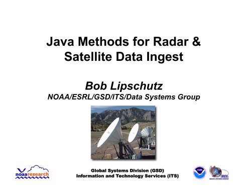
<strong>Java</strong> <strong>Methods</strong> <strong>for</strong> <strong>Radar</strong> &<br />
<strong>Satellite</strong> <strong>Data</strong> <strong>Ingest</strong><br />
Bob Lipschutz<br />
<strong>NOAA</strong>/ESRL/GSD/ITS/<strong>Data</strong> Systems Group<br />
Global Systems Division (GSD)<br />
In<strong>for</strong>mation and Technology Services (ITS)
GSD’s Central Facility<br />
• Acquires conventional and experimental weather<br />
data <strong>for</strong> GSD’s R&D projects, e.g.,<br />
Rapid Update Cycle (RUC), Rapid Refresh, HRRR, FIM<br />
Local Analysis and Prediction System (<strong>LAPS</strong>)<br />
Meteorological Assimilation <strong>Data</strong> <strong>Ingest</strong> System (MADIS)<br />
• Local ground station capability <strong>for</strong> “raw” GOES<br />
Variable (GVAR) data (terminated Oct 7, 2010!)<br />
Originally <strong>for</strong> GOES I-M Product Assurance Plan (GIMPAP) activities,<br />
as well as support <strong>for</strong> initial AWIPS development<br />
• Level-II/III NEXRAD, WSI NowRAD, NSSL mosaics<br />
• Numerous data sets from NCEP, NESDIS, NASA,<br />
SSEC, Aviation Wx Center (AWC),...<br />
Global Systems Division (GSD)<br />
In<strong>for</strong>mation and Technology Services (ITS)<br />
2
NEXRAD Level-II <strong>Ingest</strong><br />
• Evolution of methods: 90’s – 4/2010<br />
• LDM “Client” to capture Level-II data stream to disk<br />
LdmNexrad2Tar(GZ)<br />
LdmNexrad2Flat – “raw” <strong>for</strong>mat ala Unidata’s motherload server<br />
o Readable in IDV<br />
• Nexrad2NetCDF methods to prepare data <strong>for</strong> <strong>LAPS</strong><br />
& other applications<br />
LdmNexrad2NetCDF – tilt-by-tilt, on-the-fly<br />
ArchiveNexrad2NetCDF – by volume scan<br />
o Currently configured <strong>for</strong> 104 radars<br />
Now in testing: Unidata’s java netcdf, aka toolsUI (netcdfAll.jar)<br />
FSL4 ^FSL\.TEXT\.MMXX55\.KBOU\..*\.Nexrad2Flat\.(KFTG)\.(K.*)\.raw<br />
java -cp /usr/local/rtsys/bin/netcdfAll.jar ucar.nc2.dataset.Netcdf<strong>Data</strong>set -out /public/data/radar/wsr88d/wideband/\1/nc/\2.nc -in<br />
Global Systems Division (GSD)<br />
In<strong>for</strong>mation and Technology Services (ITS)<br />
3
GOES <strong>Satellite</strong> <strong>Ingest</strong><br />
• Evolution of methods at GSD: ~1980 – 10/2010<br />
• Historically, C/C++ ingest clients to capture “raw”<br />
GOES (GVAR) from downlink<br />
• Gvar(Imager|Sounder)2NetCDF to prepare data <strong>for</strong><br />
<strong>LAPS</strong> & other applications<br />
• Now: McArea2NetCDF java program<br />
Cron job acquires data from NESDIS McIDAS/ADDE servers<br />
Creates “GVAR netCDF” files ~identical to earlier methods<br />
Uses java netCDF package (including McIDAS classes)<br />
ncML instead of cdl <strong>for</strong> file content definition<br />
Also can acquire MSG, MTSAT, FY-2 data from NESDIS (but not in<br />
GVAR-style <strong>for</strong>mat)<br />
Global Systems Division (GSD)<br />
In<strong>for</strong>mation and Technology Services (ITS)<br />
4
Configuring McArea2NetCDF<br />
• McIDASArea2NetCDF.pl wrapper script <strong>for</strong> java<br />
program<br />
• Command line (15-min cron job)<br />
/usr/local/rtoper/scripts/McIDASArea2NetCDF.pl -c /usr/local/rtoper/etc/<br />
McArea2NetCDF_gvar_goes-west_fsl-pacus.cfg -l /usr/local/rtoper/log/gvar/goeswest/fsl-pacus<br />
<br />
-p McArea2NetCDF.GOESWest.fsl-pacus<br />
• Config file – McArea2NetCDF_gvar_goes-west_fsl-pacus.cfg<br />
channel = 11u <br />
xmlpath = /usr/local/rtoper/etc/area2nc_gvar_goes-west_fsl-pacus_ir.xml <br />
outpath = /tmp_data/gvar/goes-west/raw/image/fsl-pacus/netcdf <br />
areafile = adde://SATEPSDIST3E.NESDIS.<strong>NOAA</strong>.GOV/imagedata?<br />
group=GWR&descr=GWPACU04I4&cal=raw&unit=raw&size=all&debug=true<br />
Global Systems Division (GSD)<br />
In<strong>for</strong>mation and Technology Services (ITS)<br />
5
Configuring McArea2NetCDF - 2<br />
• ncML file – area2nc_gvar_goes-west_fsl-pacus_ir.xml<br />
<br />
<br />
<br />
<br />
<br />
<br />
<br />
<br />
<br />
<br />
<br />
[SNIP] <br />
<br />
Global Systems Division (GSD)<br />
In<strong>for</strong>mation and Technology Services (ITS)<br />
6
Merged GOES-11/-13 IR Image*<br />
* Using MergeConusImages, a java netCDF program<br />
Global Systems Division (GSD)<br />
In<strong>for</strong>mation and Technology Services (ITS)<br />
7
Final Thoughts<br />
• Community moving to CF (Climate and Forecasting)<br />
standards <strong>for</strong> netCDF<br />
• Makes using/sharing data easier (e.g, THREDDS)<br />
• Glaps2CF java program converts G<strong>LAPS</strong> output to CF<br />
<strong>for</strong>mat <strong>for</strong> SOS user<br />
• toolsUI/ncML methods facilitate virtualizing data (e.g.,<br />
remote files, munged attributes and variable names)<br />
• Ultimately, compatibility w/ NWS’ 4D Wx Cube (see<br />
Chris M.’s talk tomorrow)<br />
Global Systems Division (GSD)<br />
In<strong>for</strong>mation and Technology Services (ITS)<br />
8
Questions?<br />
Global Systems Division (GSD)<br />
In<strong>for</strong>mation and Technology Services (ITS)