

Download
Download
Download

Create successful ePaper yourself
Turn your PDF publications into a flip-book with our unique Google optimized e-Paper software.
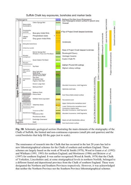
Fig. 3B. Schematic geological section illustrating the main elements of the stratigraphy of the<br />
Chalk of Suffolk, the limited and non-continuous exposures (small pits and quarries) and the<br />
cored boreholes that help fill the gaps (not to scale).<br />
The renaissance of research into the Chalk that has occurred in the last 20 years has led to<br />
new lithostratigraphical schemes for the Chalk of southern and northern England. These<br />
schemes are largely based on the work of Wood & Smith (1978), Wood in Gaunt et al. (1992)<br />
and Whitham (1991, 1993) for northern England; and Mortimore (1986) and Bristow et al.<br />
(1997) for southern England. It was earlier recognised (Wood & Smith, 1978) that the Chalk<br />
of Yorkshire, Lincolnshire and, at some stratigraphical levels in northern Norfolk, belonged to<br />
a different faunal and depositional province from the Chalk of southern England. These were<br />
designated the Northern and Southern Provinces respectively. However, it was acknowledged<br />
that neither the Northern Province nor the Southern Province lithostratigraphical schemes


