

Oakland ARTCC Intro Briefing
Oakland ARTCC Intro Briefing
Oakland ARTCC Intro Briefing

Create successful ePaper yourself
Turn your PDF publications into a flip-book with our unique Google optimized e-Paper software.
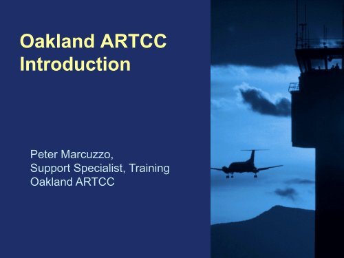
<strong>Oakland</strong> <strong>ARTCC</strong><br />
<strong>Intro</strong>duction<br />
Peter Marcuzzo,<br />
Support Specialist, Training<br />
<strong>Oakland</strong> <strong>ARTCC</strong>
<strong>Oakland</strong> Air Route Traffic Control Center<br />
Fremont, California<br />
<strong>ARTCC</strong> <strong>Briefing</strong> Slide 2
Air Route Traffic Control Centers<br />
<strong>ARTCC</strong> <strong>Briefing</strong> Slide 3
High Altitude Enroute Sectors<br />
<strong>ARTCC</strong> <strong>Briefing</strong> Slide 4
ZOA Low Altitude Sectorization<br />
<strong>ARTCC</strong> <strong>Briefing</strong> Slide 5
ZOA Airspace Configuration<br />
Control Responsibility for 18.8 Million<br />
Square<br />
Miles of Airspace:<br />
–140,000 Square Miles Domestic<br />
–18.7 Million Square Miles Oceanic – Flight Information Region (FIR)<br />
Within <strong>Oakland</strong> Center’s oceanic boundaries<br />
–Largest oceanic airspace in the world controlled by one facility -<br />
9.7% of world’s surface<br />
–Interface with 21 different foreign and domestic facilities<br />
<strong>ARTCC</strong> <strong>Briefing</strong> Slide 6
Naha FIR<br />
Manila FIR<br />
Tokyo FIR<br />
Port Moresby<br />
FIR<br />
Ujung Pandang<br />
FIR<br />
Brisbane FIR<br />
Anchorage FIR<br />
Nadi FIR<br />
<strong>Oakland</strong> FIR<br />
Auckland FIR<br />
Vancouver FIR<br />
Tahiti FIR<br />
Open Area<br />
<strong>Oakland</strong> Oceanic Airspace
MANILA<br />
FIR<br />
<strong>Oakland</strong> Center Oceanic Sectorization<br />
NAHA<br />
FIR<br />
OC5<br />
UJUNG PANDANG<br />
FIR<br />
TOKYO<br />
FIR<br />
PGUM<br />
Port Moresby<br />
FIR<br />
BRISBANE<br />
FIR<br />
Honiara<br />
OC6<br />
ANC<br />
FIR<br />
OC6<br />
245<br />
OC2<br />
OAKLAND<br />
FIR<br />
PKWA<br />
NAURU<br />
NADI<br />
FIR<br />
OC9<br />
OC1<br />
PHNL<br />
OC3<br />
AUCKLAND<br />
FIR<br />
OC4<br />
OC7<br />
OC4<br />
280<br />
TAHITI<br />
FIR<br />
OC3<br />
290<br />
YVR<br />
FIR<br />
•ZOA<br />
OPEN<br />
AREA<br />
EASTER IS.<br />
FIR
<strong>Oakland</strong> <strong>ARTCC</strong> Facility Operations<br />
• Domestic Control Room<br />
– 3 Areas of Specialization<br />
– 8 High Altitude and 10 Low Altitude Sectors<br />
– Traffic management complex<br />
– National Airspace System Operations Manager<br />
(NOM) complex<br />
– Center Weather Service Unit (CWSU)<br />
• ATOP Control Room<br />
– 2 oceanic areas of specialization<br />
– 8 Oceanic Sectors and 4 Coastal High Altitude<br />
Radar Sectors<br />
<strong>ARTCC</strong> <strong>Briefing</strong> Slide 9
<strong>ARTCC</strong> <strong>Briefing</strong> Slide 10
What does an Air Traffic<br />
Controller DO?<br />
<strong>ARTCC</strong> <strong>Briefing</strong> Slide 11
Air Traffic Control is the<br />
directing and separation<br />
of aircraft from other<br />
aircraft and obstructions.<br />
Air Traffic Controllers<br />
also provide weather<br />
and other services as<br />
necessary to assist the<br />
flying public and<br />
military operations<br />
Controller Perspective<br />
Turn Left,<br />
Turn Right,<br />
Go There<br />
The Bottom Line<br />
Air Traffic Controllers are your “traffic cops” of the sky,<br />
keeping aircraft safely apart as they travel around the<br />
world!<br />
I want to go<br />
to <strong>Oakland</strong>!<br />
<strong>ARTCC</strong> <strong>Briefing</strong> Slide 12
<strong>ARTCC</strong> ATC Positions<br />
Hand-off/<br />
Tracker<br />
Radar or<br />
“R Side”<br />
Radar Associate (Data)<br />
Or “D Side”<br />
Teamwork<br />
Flexibility<br />
Assistant<br />
or “ATA”<br />
<strong>ARTCC</strong> <strong>Briefing</strong> Slide 13
En Route Sector Controller Roles<br />
• R-side (Radar controller) - provides separation<br />
between all IFR flights in the sector; communicates<br />
directly with pilots; during light traffic works the<br />
sector alone also performing D-side duties<br />
• D-side – (Radar associate controller – data):<br />
handles flight strips data and URET; detects<br />
potential traffic conflicts; coordinates with other<br />
sectors; supports R-side controller<br />
• ATA – (Assistant) delivers flight strips to sectors<br />
• Tracker – third controller at the sector during heavy<br />
traffic periods; detects conflicts; coordinates with<br />
other sectors<br />
• Supervisor – manages controllers, trainees,<br />
equipment and other resources in the area of<br />
specialization<br />
<strong>ARTCC</strong> <strong>Briefing</strong> Slide 14
Enroute Training<br />
• FAA Academy (Oklahoma City) - 11 weeks<br />
– Fundamentals of aviation and ATC<br />
– Classroom and simulation labs<br />
• Field Facility – typically 3 years to CPC<br />
– Classroom (local airspace and procedures) –10<br />
weeks<br />
– Assistant controller assignment<br />
– Radar Associate Training – 50 weeks<br />
• Simulation lab (DYSIM) -<br />
• On the Job Training (OJT)<br />
<strong>ARTCC</strong> <strong>Briefing</strong> Slide 15
Training (cont’d)<br />
• Field Facility (cont’d)<br />
– Radar training – 100 weeks<br />
• Simulation lab (DYSIM)<br />
• On the Job Training (OJT)<br />
• Typical progression: An enroute controller<br />
spends 3 years from the start of academy<br />
training to complete all ATC training<br />
(certified professional controller – CPC).<br />
During this period, trainees are used, at<br />
times for operational staffing on positions<br />
for which they have been certified.<br />
<strong>ARTCC</strong> <strong>Briefing</strong> Slide 16
Surveillance Systems (En Route)<br />
• The Air Route Surveillance Radar (ARSR) is a longrange<br />
radar system designed to provide a display<br />
of aircraft over large areas controlled by Air Route<br />
Traffic Control Centers.<br />
• Each ARSR site can monitor aircraft flying within a<br />
200-mile radius of the antenna, although some<br />
stations can monitor aircraft as far away as 600<br />
miles.<br />
• ARSR antenna rotate at 5rpm providing sweeps at<br />
12 second intervals.<br />
• Data from multiple ARSR sites is presented on<br />
controller displays in a mosaic, providing radar<br />
coverage over a large geographic area.<br />
• There are approximately 100 ARSR sites in the US.<br />
<strong>ARTCC</strong> <strong>Briefing</strong> Slide 17
Display System Replacement (DSR)<br />
Console<br />
<strong>ARTCC</strong> <strong>Briefing</strong> Slide 18
Radar Target Symbols<br />
+<br />
(Radar updates every 12 seconds)<br />
Primary Target<br />
Uncorrelated Beacon<br />
Correlated Beacon<br />
# Coast Track<br />
Secondary (Beacon) Targets:<br />
Flat Track<br />
Free Track<br />
<strong>ARTCC</strong> <strong>Briefing</strong> Slide 19
En Route Radar Target Display<br />
Beacon Target<br />
Histories<br />
Position Symbol<br />
Vector Line<br />
1 minute projection<br />
AAL278<br />
330↑294<br />
R068 490<br />
H030 M78<br />
Leader Line<br />
Full Data Block<br />
<strong>ARTCC</strong> <strong>Briefing</strong> Slide 20
En Route Full Data Block<br />
Assigned Altitude FL330<br />
Computer ID<br />
Destination<br />
Airport<br />
Coded<br />
American 278<br />
AAL278<br />
330↑294<br />
068D490<br />
H030 M78<br />
Mode C Altitude FL294<br />
Assigned heading 030 0<br />
Ground Speed 490kts<br />
‘4 th Line’ (for coordination)<br />
Assigned speed Mach .78<br />
<strong>ARTCC</strong> <strong>Briefing</strong> Slide 21
Flight Progress Strips<br />
Aircraft Identification<br />
Type<br />
aircraft<br />
Filed<br />
true airspeed<br />
Ground<br />
speed<br />
Number of times flight plan has been amended<br />
AAL278 1<br />
B762/R<br />
T468 G500<br />
21<br />
068 09<br />
Sector<br />
number<br />
Computer Identification<br />
Strip<br />
number<br />
Coordination<br />
fix time<br />
Type Equipment<br />
TXK<br />
1930<br />
Time at fix<br />
19<br />
LIT<br />
Previous fix<br />
45<br />
Fix posting for<br />
Sector 21<br />
Control Symbology<br />
Red/Black Strip Marking<br />
330<br />
Altitude<br />
Route of flight<br />
Remarks section<br />
DFW.\.TXK LIT J6<br />
HVQ LDN JASEN1<br />
IAD<br />
o AAL278 SPL FLT<br />
Beacon code<br />
6262<br />
*ZTL<br />
Coordination Symbol to<br />
adjacent ATC facility<br />
<strong>ARTCC</strong> <strong>Briefing</strong> Slide 22
URET Panel<br />
(User Request Evaluation Tool)<br />
• At D-side position<br />
• Provides electronic flight strip data<br />
• Provides conflict detection (separate from<br />
DSR conflict alert system)<br />
• Includes trial planner function – checks that<br />
clearances issued are conflict-free<br />
<strong>ARTCC</strong> <strong>Briefing</strong> Slide 23
URET Panel<br />
(User Request Evaluation Tool)<br />
<strong>ARTCC</strong> <strong>Briefing</strong> Slide 24
En Route Radar Separation<br />
5 NM*<br />
1000 feet<br />
1000 feet<br />
* 3NM when within 40NM or more from antenna or<br />
when using single (non-mosaic) radar data source.<br />
Ref: FAAO 7110.65, 5-5-4 Radar Minima<br />
<strong>ARTCC</strong> <strong>Briefing</strong> Slide 25
Vertical Separation<br />
• Standard – 1000’ up to FL290<br />
– 2000’ at or above FL290<br />
– 5000’ at or above FL600<br />
• Reduced Vertical Separation Minima (RVSM)<br />
– 1000’ from FL290 to FL 410<br />
– First introduced over Oceanic Airspace<br />
– <strong>Intro</strong>duced over Domestic US (and internationally) on<br />
1/20/05 (DRVSM)<br />
– Cruise operation within D/RVSM airspace requires<br />
specific avionics (more accurate altimetry and collision<br />
avoidance system), plus pilot training<br />
– ATC can grant exceptions to these requirements for<br />
transit through RVSM airspace to higher/lower altitudes.<br />
<strong>ARTCC</strong> <strong>Briefing</strong> Slide 26
En Route Radar Separation - Airspace<br />
• Flights must be separated from other sectors and<br />
Special Use Airspace.<br />
En route Stage A/DARC or Stage A/EDARC:<br />
(a) Below Flight Level 600− 2 1/2 miles.<br />
(b) Flight Level 600 and above− 5 miles.<br />
Special Use Airspace<br />
• Alert Area<br />
• Air Traffic Control<br />
• Assigned Airspace<br />
• Controlled Firing Area<br />
• Military Operating Areas<br />
• Prohibited Area<br />
• Restricted Area<br />
• Warning Area<br />
<strong>ARTCC</strong> <strong>Briefing</strong> Slide 27
Conflict Alert - DSR<br />
• Tactical conflict prediction<br />
• Alerts controller to potential loss of standard<br />
separation 3 minutes ahead<br />
• Both aircraft data blocks flash (brighten then<br />
normal intensity)<br />
Conflict Probe - URET<br />
• Strategic conflict prediction<br />
• Projects loss of standard separation up to 20<br />
minutes ahead<br />
• URET display and data blocks are highlighted to<br />
indicate potential conflict<br />
<strong>ARTCC</strong> <strong>Briefing</strong> Slide 28
Radar Handoff /<br />
Communications Transfer<br />
• No aircraft can enter another controller’s<br />
airspace without that controller’s<br />
permission. That permission being<br />
automation or verbal coordination.<br />
– Letters of Agreement<br />
– Automated Information Transfer<br />
<strong>ARTCC</strong> <strong>Briefing</strong> Slide 29
Contact for more information:<br />
Peter Marcuzzo<br />
Training Support Specialist<br />
peter.marcuzzo@faa.gov<br />
510 745-3474<br />
<strong>ARTCC</strong> <strong>Briefing</strong> Slide 30