Faster, cheaper, safer; - Nav Canada
Faster, cheaper, safer; - Nav Canada
Faster, cheaper, safer; - Nav Canada

Create successful ePaper yourself
Turn your PDF publications into a flip-book with our unique Google optimized e-Paper software.
<strong>Faster</strong>, <strong>cheaper</strong>, <strong>safer</strong>;<br />
Made-in-<strong>Canada</strong> technology is ready for takeoff, and will take air traffic control to new<br />
heights. Ian MacLeod explains<br />
Sat Jun 4 2011 Page: B1 / Front<br />
Section: Saturday Observer<br />
Byline: Ian MacLeod<br />
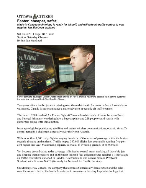
Senior software developer Daniel Charbonneau shows off <strong>Nav</strong> <strong>Canada</strong>’s new trans-oceanic flight control system at<br />
the technical centre on Hunt Club Road in Ottawa.<br />
Two years after a jumbo jet went missing over the mid-Atlantic for hours before a formal alarm<br />
was raised, <strong>Canada</strong> is set to announce a major advance in oceanic air traffic control.<br />
The June 1, 2009 crash of Air France flight 447 into a desolate patch of ocean between Brazil<br />
and Senegal left many wondering how a huge airplane and 228 people could vanish with<br />
authorities taking little initial notice.<br />
In an age of global positioning satellites and instant wireless communications, oceanic air traffic<br />
control remains a challenge, especially over the North Atlantic.<br />
With more than 1,000 daily flights carrying hundreds of thousands of passengers, it is the busiest<br />
oceanic airspace on the planet. Traffic topped 367,000 flights last year and is running five-percent<br />
higher this year. Maximizing capacity is crucial to avoiding gridlock at 35,000 feet.<br />
Yet because ground-based radar coverage is limited to coastal areas, tracking all those big jets<br />
and keeping them separated and on the most timeand fuel-efficient routes requires 61 specialized<br />
air traffic controllers stationed in Gander, Newfoundland and dozens more in Prestwick,<br />
Scotland with Britain's NATS (formerly the National Air Traffic Service).<br />
On Monday, <strong>Nav</strong> <strong>Canada</strong>, the company that controls <strong>Canada</strong>'s civilian airspace and the skies<br />
over the western half of the North Atlantic, is to announce a dazzling leap in technology that
automates much of the job once done by controllers with grease pencils, paper flight data strips<br />
and analog-era plastic "wiz wheels" for speed, distance and time calculations.<br />
<strong>Faster</strong>, <strong>safer</strong>, <strong>cheaper</strong> and cleaner trans-Atlantic travel is expected to follow.<br />
Called the Gander Automated Air Traffic System Plus, or GAATS+, the system's high degree of<br />
automation and integration allows the current 10-minute longitudinal separation standard<br />
between same-speed planes in non-radar airspace to be cut in half, to five minutes. That's<br />
equivalent to a much closer 50-mile separation for eastbound planes 40 miles for westbound<br />
ones, opening the possibility for far more planes to exploit the most efficient routes. It also<br />
allows for earlier climbs to higher, more fuel-efficient altitudes and easier transitions from one<br />
flight level to another. The system was commissioned April 14.<br />
About 60 per cent of trans-Atlantic jets are equipped with the latest GPS position-reporting and<br />
text-based communications avionics to take advantage of GAATS+.<br />
<strong>Nav</strong> <strong>Canada</strong> estimates the technology will save client airlines $1 million in fuel costs in the first<br />
year and reduce engine emissions by 3,000 metric tonnes.<br />
Air traffic control has, "come a long ways," says Chris Mouland, general manager of <strong>Nav</strong><br />
<strong>Canada</strong>'s Gander Flight Information Region. "We know within 30 seconds where that aircraft is<br />
going to be in an hour."<br />
While the industry has little trouble commissioning or purchasing off-the-shelf equipment such<br />
as radar and landing systems for its navigation and surveillance needs, building software to<br />
interact with the highly complex and real-time demands of controllers has always been a<br />
problem.
"You can write a specification," and contract out the development work, says Sid Koslow, <strong>Nav</strong><br />
<strong>Canada</strong>'s vice-president and chief technology officer. "But it's very difficult to get all the details<br />
straight and you often end up with systems where it takes longer and costs more than you would<br />
expect."<br />
A decade ago, <strong>Nav</strong> <strong>Canada</strong> decided to start building its own air traffic management (ATM) gear<br />
by putting computer specialists on staff and teaming them up with controllers.<br />
The daily flow of trans-Atlantic traffic begins at night in North America as planes, up to 120 an<br />
hour, move up the eastern seaboard and from points southwest and funnel into a narrow band of<br />
airspace off Newfoundland's east coast.<br />
Routing for each plane has already been assigned, based on flight plans filed earlier by the<br />
airlines. The routing "profile" for each must ensure "conflict free" separation from the<br />
Newfoundland-Labrador coast to landfall in Europe.<br />
By the time they reach the oceanic entry point, "we know exactly where they need to be, what<br />
speed they need to be at, the flight level that they need to be at and the track that they need to be<br />
on," says Mouland.<br />
Controllers compress the traffic into a handful of eastbound "tracks" mapped out daily in Gander<br />
and based primarily on the route of the jet stream and its fuel-saving tail winds. The planes return<br />
the next morning and afternoon, this time on routes mapped by Prestwick that minimize the jet<br />
stream's headwinds.<br />
Air traffic control, meanwhile, relies on two types of navigation: positive and procedural.<br />
Positive control tracks a plane on a radar scope. When radar is not available, procedural control<br />
is used, with pilots reporting their positions to the oceanic centres every several minutes,<br />
typically via High Frequency (HF) radio.<br />
But procedural control means controllers have had to put bigger "safety bubbles" -lateral and<br />
vertical separation -around planes, since their exact, real-time position can't be tracked until it<br />
reaches radar-controlled airspace.<br />
GAATS+ lessens reliance solely on procedural control - therefore allowing reduced separation -<br />
by extending positive control using traditional radar feeds from the Department of National<br />
Defence's North Warning System along the northeast coast.<br />
It also exploits newer GPS surveillance technologies, such as Automatic Dependent<br />
Surveillance-Broadcast (ADS-B), which allows ADS-B-equipped planes to automatically<br />
broadcast their GPS positions every second. In place over Hudson Bay since 2009, <strong>Nav</strong> <strong>Canada</strong><br />
plans to open more ADS-B stations in southern Greenland this fall and shrink the oceanic<br />
separation standard in that area even further, from five minutes to five nautical miles.
Meanwhile, in mid-ocean where ADS-B is not available, most planes use a surveillance aid<br />
called ADS-C, which automatically transmits the plane's position every 18 minutes, in addition<br />
to voice and datalink communications.<br />
When Mouland began as a controller 33 years ago, the backbone of the system was paper flight<br />
data strips containing crucial flight details.<br />
"You had all of these strips and as a new strip came out of the printer, you may get four or five at<br />
a time, (you) would put them physically in the flight data board to try and get them to fit, it was a<br />
very manual process."
Over the same period, an initial GAATS system was evolving that gave controllers some<br />
automated tools to monitor and direct aircraft. As recently as 2006, Britain's NATS adapted<br />
GAATS for its oceanic needs and is now looking at GAATS+.<br />
But the older system still required many manual inputs via keyboards and HF voice<br />
communications, which could be time-consuming and open to potential keystroke and "readback"<br />
errors.<br />
"What the system allows (now) is to very quickly look at what profiles are available to this<br />
aircraft (and) tell right away, I can give this guy exactly what he wants, I can give him 1,000 feet<br />
higher with a slight speed adjustment and I can do it very, very quickly," says Mouland.<br />
Key GAATS+ features include: ??Colour-coded electronic flight strips on a touch screen replace<br />
conventional paper strips and any flight changes are automatically updated, meaning less typing<br />
for controllers. If something in the flight profile does not conform to the controller's clearances<br />
or the original flight plan, the "strip" is highlighted in bright yellow, signalling a "conflict," and<br />
an icon representing the plane on the controller's main situational display also turns yellow.<br />
The paperless strips were first introduced into <strong>Nav</strong> <strong>Canada</strong>'s domestic air traffic control towers<br />
and the system has been sold and licensed internationally to a handful of other air navigation<br />
services.<br />
To resolve a conflict or determine whether, for example, a pilot's request to climb to a higher<br />
altitude or change speed will put him in conflict with nearby craft, controllers activate the<br />
"BORG" function.<br />
The Bilateral Option Resolution Grid is a simple graphical display offering up to 25<br />
combinations of speeds and altitudes available to a particular flight. Options that would put the<br />
flight in conflict or some other nonconformance are highlighted in yellow. Allowable options are<br />
displayed in green.<br />
The controller simply touches the preferred green option and the instructions to the flight crew<br />
can be issued automatically by a datalink text message or, if the controller prefers, by issuing an<br />
HF radio clearance.<br />
Before BORG, the controller would have to manually calculate all the possibilities while<br />
handling all the other traffic in his sector.<br />
If a pilot's request to change a flight profile can't be immediately fulfilled, GAATS+ stores the<br />
request and continually monitors traffic. When the requested clearance becomes available, it<br />
alerts the controller, who has final say before issuing a clearance.<br />
Another time-saver is a "click-and-drag" function that allows controllers to move onscreen icons<br />
representing real flights to different tracks and instantly see whether there's a conflict anywhere<br />
along the potential new route.<br />
The system also is capable of sending electronic oceanic clearances to aircraft, with electronic<br />
readbacks.
"All of these things are huge in terms of time-savers and service delivery," says Mouland. "We're<br />
very proud of what we've accomplished."<br />
VIDEO TRANSCRIPT<br />
The following video accompanied the story on the Ottawa Citizen web site:<br />
http://www.ottawacitizen.com/business/<strong>Faster</strong>+<strong>cheaper</strong>+<strong>safer</strong>/4891167/story.html?tab=VID<br />
KIM TROUTMAN (VP Engineering, NAV <strong>Canada</strong>): NAV <strong>Canada</strong> provides air traffic control<br />
and other services in <strong>Canada</strong> and the North Atlantic. We just completed our enhanced oceanic system called GATS-<br />
plus. This system was developed internally by NAV <strong>Canada</strong>, and we consider GAATS-plus to be the most advanced<br />
oceanic system in operation. The system has advanced pictures and tools to assist our air traffic controllers as they<br />
manage traffic in the North Atlantic, the busiest oceanic airspace in the world. GAATS-plus provides the foundation<br />
that will allow us to add additional functionality in the future for the benefits of our controllers and our customers.


![[ cac ] canadian airport charts - Nav Canada](https://img.yumpu.com/12328212/1/190x252/-cac-canadian-airport-charts-nav-canada.jpg?quality=85)