Part 4 Soil.pdf
Part 4 Soil.pdf
Part 4 Soil.pdf

You also want an ePaper? Increase the reach of your titles
YUMPU automatically turns print PDFs into web optimized ePapers that Google loves.
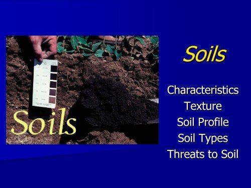
<strong>Soil</strong>s<br />
Characteristics<br />
Texture<br />
<strong>Soil</strong> Profile<br />
<strong>Soil</strong> Types<br />
Threats to <strong>Soil</strong>
<strong>Soil</strong> Characteristics<br />
3 characteristics of soil that affect its value for<br />
farming and growing vegetation are:<br />
1. Organic Content<br />
2. Mineral Content<br />
3. <strong>Soil</strong> Texture
<strong>Soil</strong> Characteristics<br />
1. Organic Content<br />
- A soil's fertility is determined as a ratio<br />
of the organic content to the content of<br />
ground bed rock. Amount of dead and<br />
decomposing material.
<strong>Soil</strong> Characteristics<br />
2. Mineral Content<br />
- Varies with precipitation because<br />
heavy rains tend to leech soils removing<br />
minerals from the root region of soil.
<strong>Soil</strong> Characteristics<br />
3. <strong>Soil</strong> Texture (pg. 138)<br />
- refers to the mixture of fine particles<br />
(sand), very fine particles (silt) and<br />
extra fine particles (clay). The best<br />
texture for agriculture is an even<br />
mixture of each (loam).
Triangular graph of <strong>Soil</strong> Texture<br />
Pg. 139
O Horizon – “Organic”<br />
HUMUS: dead or<br />
decaying plant matter,<br />
leaf litter and other<br />
organic material lying<br />
on the surface.<br />
dark because of the<br />
decomposition.<br />
decompose into<br />
nutrients that enrich the<br />
soils.<br />
<strong>Soil</strong> Profile<br />
(pg. 135-136)
<strong>Soil</strong> Profile<br />
A Horizon – “Topsoil”<br />
darker than the lower<br />
layers.<br />
loose and crumbly with<br />
varying amounts or<br />
organic matter.<br />
most productive layer of<br />
soil.
B Horizon – “Subsoil”<br />
Light colored, dense,<br />
and low in organic<br />
matter.<br />
materials leached from<br />
the topsoil accumulate<br />
here.<br />
<strong>Soil</strong> Profile
<strong>Soil</strong> Profile<br />
C Horizon –<br />
“Weathered Parent<br />
Material”<br />
transition area between<br />
soil and parent material.<br />
<strong>Part</strong>ially disintegrated<br />
parent material.<br />
mineral particles.<br />
less organic/living matter.
<strong>Soil</strong> Formation/Advancement<br />
: the process by which rocks are gradually broken down into<br />
smaller particles and mixed with decaying organic material.
Differentiate among the terms humus, leaching,<br />
eluviation and capillary action.<br />
Humus is the accumulation of dead and decayed plant and animal<br />
matter that makes up the organic nature of soil. Occurs where<br />
there is substantial plant and animal growth.<br />
Leaching is the process where nutrients are washed down through<br />
the soil with the movement of water down the soil profile. Occurs<br />
where there is substantial rainfall.<br />
Eluviation is the lateral or downward movement of clay and<br />
other fine materials in suspension. Occurs where there is<br />
substantial rainfall.<br />
Capillary action results when water molecules are attracted to clay<br />
particles and drawn upward through the soil profile. Occurs where it<br />
is substantially dry.<br />
(Pg. 135)
Using the triangular graph of soil texture, which combination would make the<br />
poorest soil?<br />
A) 20% sand, 70% clay, 10% silt B) 60% sand, 30% clay, 10% silt<br />
*<br />
C) 40% sand, 30% clay, 30% silt D) 50% sand, 10% clay, 40% silt
Using the triangular graph of soil texture, which condition would make the<br />
least favourable soil for farming?<br />
(A) 40% sand, 20% clay, 40% silt (B) 30% sand, 10% clay, 60% silt<br />
(C) 25% sand, 60% clay, 15% silt (D) 50% sand, 10% clay, 40% silt<br />
*
Using the triangular graph of soil texture, a soil texture combination of<br />
20% sand, 10% clay and 70% silt would constitute which soil type?<br />
(A) sandy clay (B) sandy loam<br />
(C) silty clay (D) silty loam *
Using the triangular graph of soil texture below, which combination would<br />
make the most favourable soil for farming?<br />
(A) 10% sand, 15% clay, 75% silt (B) 15% sand, 55% clay, 30% silt<br />
(C) 20% sand, 70% clay, 10% silt (D) 50% sand, 20% clay, 30% silt *
Which process transports insoluble inorganic matter downward<br />
through the soil?<br />
A) accumulation of humus<br />
B) capillary action<br />
C) eluviation<br />
D) leaching<br />
Which term refers to the process by which particles of insoluble<br />
inorganic matter are transported downward through the soil?<br />
(A) accumulation of humus<br />
(B) capillary action<br />
(C) eluviation<br />
(D) leaching
Which refers to the upward movement of soluble material<br />
through the soil by water?<br />
(A) capillary action<br />
(B) eluviation<br />
(C) erosion<br />
(D) leaching<br />
Which term refers to the process by which minerals and<br />
dissolved salts are transported upward through the soil?<br />
(A) accumulation of humus<br />
(B) capillary action<br />
(C) eluviation<br />
(D) leaching
3 types of <strong>Soil</strong><br />
pg. 136-137<br />
1. Latosol<br />
2. Podzol<br />
3. Chernozem
Latosol<br />
Typically in tropical rainforest.<br />
Very deep, very well drained,<br />
homogeneous.<br />
Infertile due to….<br />
- Highly weathered and<br />
leached soils because of high<br />
amounts of rainfall.<br />
They tend to have medium to<br />
very high clay contents.
Podzol<br />
Typically found in the Boreal<br />
forest.<br />
Extends immediately south<br />
of the tundra regions of the<br />
Northern Hemisphere.<br />
Gray in color, ashy appearance.<br />
Often severely leached and<br />
highly acidic.<br />
They are low in agricultural<br />
value, forests being their most<br />
common and practical coverage.
Chernozem<br />
Rich in organic matter in the<br />
form of humus.<br />
True chernozem is black in<br />
color.<br />
They are found in grasslands<br />
which are semi-arid…<br />
Resulting in less leaching and a<br />
mineral rich soil.<br />
It is very suitable for<br />
agriculture.
Threats to <strong>Soil</strong><br />
Environmental Factors:<br />
1. Temperature<br />
- affects humus (low temps. slow the decay<br />
of organic matter).<br />
2. Precipitation<br />
- affects mineral content (rain causes<br />
minerals to be eluviated).
• Poor soil management<br />
- agricultural areas and<br />
grasslands.<br />
Threats to <strong>Soil</strong><br />
pg. 140-143<br />
• Urban Expansion<br />
- settling in rich farmland
Threats to <strong>Soil</strong><br />
• Desertification – the spread of desert-like<br />
conditions in semi-arid environments
• Erosion<br />
Threats to <strong>Soil</strong><br />
• Flooding<br />
• Overgrazing<br />
• Deforestation
Reducing <strong>Soil</strong> Erosion<br />
Pg. 142<br />
<strong>Soil</strong> Erosion can be reduced by:<br />
1. Strip cropping<br />
• Alternating strips of<br />
open-growing crops<br />
and close-growing<br />
crops.<br />
• If the open-growing<br />
crops are eroded by<br />
wind or water, the<br />
close-growing crops<br />
will not be affected.
Reducing <strong>Soil</strong> Erosion<br />
2. Cover cropping<br />
• Planting close-growing<br />
crop in soil while it rebuilds<br />
its nutrients.<br />
• When soil is<br />
ready to use,<br />
this crop gets<br />
ploughed back<br />
into the soil,<br />
increasing the<br />
humus content.
Reducing <strong>Soil</strong> Erosion<br />
3. Contour ploughing<br />
• Respects the<br />
natural shape of<br />
the land and<br />
forms miniterraces<br />
which<br />
discourages<br />
water run-off.
Reducing <strong>Soil</strong> Erosion<br />
4. Terracing<br />
• Constructing<br />
steps or shelves<br />
in the sides of<br />
hills or sloping<br />
land to reduce<br />
water run-off<br />
and retain<br />
moisture.