Flat Rock Boating Facility, Augusta - Shire of Augusta-Margaret River
Flat Rock Boating Facility, Augusta - Shire of Augusta-Margaret River
Flat Rock Boating Facility, Augusta - Shire of Augusta-Margaret River

You also want an ePaper? Increase the reach of your titles
YUMPU automatically turns print PDFs into web optimized ePapers that Google loves.
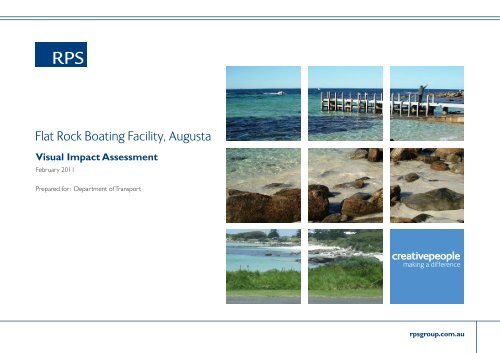
<strong>Flat</strong> <strong>Rock</strong> <strong>Boating</strong> <strong>Facility</strong>, <strong>Augusta</strong><br />
Visual Impact Assessment<br />
February 2011<br />
Prepared for: Department <strong>of</strong> Transport<br />
creativepeople<br />
making a difference<br />
rpsgroup.com.au
2<br />
blue with grid
Consultant Name:<br />
RPS Pty Ltd<br />
Contents<br />
PART A:<br />
Introduction & Executive Summary<br />
Visual Landscape Evaluation<br />
1.1 Planning Context<br />
1.2 Physical Context<br />
1.3 Project Description<br />
2.0 Visual Landscape Character<br />
2.1 Experience <strong>of</strong> Visual Landscape Character<br />
2.1.1 Granny Pool / Barrack Point<br />
2.1. 2 Leeuwin Road<br />
2.1. 3 Skippy <strong>Rock</strong> Road<br />
2.1. 4 Roadside Lookout 1<br />
2.1. 5 Roadside Lookout 2<br />
2.1. 6 Cape Leeuwin Lighthouse<br />
2.1. 7 View from Ocean<br />
3.0 Visual Landscape Strategies<br />
PART B: Visual Impact Assessment<br />
4.0 Visual Impacts <strong>of</strong> <strong>Boating</strong> <strong>Facility</strong><br />
4.1 Conclusions<br />
Phone: 08 9211 1111<br />
Fax: 08 9211 1122<br />
Contact: Craig Lovering<br />
craig.lovering@rpsgroup.com.au<br />
rpsgroup.com.au<br />
3
4<br />
Figure 1 - Location Plan
Introduction & Executive Summary<br />
The site <strong>of</strong> Flinders Bay is located between the township <strong>of</strong> <strong>Augusta</strong> and Cape Leeuwin at the south western most tip <strong>of</strong> Australia. It marks the junction <strong>of</strong> the Southern<br />
and Indian Ocean. It is a site <strong>of</strong> great natural beauty with a unique coast heath / woodland and is a great example <strong>of</strong> the rugged Western Australian coastline. This<br />
document has been prepared by RPS for the Department <strong>of</strong> Transport to conduct a Visual Impact Assessment <strong>of</strong> a proposed boating facility at <strong>Flat</strong> <strong>Rock</strong>, Flinders Bay.<br />
5 This visual impact assessment has been prepared<br />
with reference to the following planning documents:<br />
1. West Australian Planning Commission (WAPC)<br />
guidelines for Visual Landscape Planning in Western<br />
Australia (Referred to as VLPWA)<br />
2. Leeuwin – Naturaliste Ridge, Statement <strong>of</strong><br />
Planning Policy Report (Referred to as LNRSPP)<br />
The assessment also references the Environmental<br />
Referral Document (Oceanica: <strong>Shire</strong> <strong>of</strong> <strong>Augusta</strong>-<br />
<strong>Margaret</strong> <strong>River</strong>: <strong>Flat</strong> <strong>Rock</strong> <strong>Boating</strong> <strong>Facility</strong>) and<br />
design drawings supplied by the Department <strong>of</strong><br />
Transport (1554-02-01, -02 and -03).<br />
This report is based upon the Visual Landscape<br />
Planning guidelines contained within VLPWA and<br />
as per the diagram opposite. The first phase <strong>of</strong><br />
the report is a Visual Landscape evaluation which<br />
defines and describes the sites context in relation<br />
to planning, landscape character and environmental<br />
characteristics. The report will then assess how<br />
the landscape is viewed and experienced as this<br />
greatly affects the way it is perceived. This stage will<br />
influence other key components <strong>of</strong> the process.<br />
The second phase <strong>of</strong> the report will use the Visual<br />
Impact Assessment guidelines to critically review<br />
the proposed boating facility. The report will<br />
develop visual management objectives, initiatives<br />
and measures to mitigate impacts that are outlined<br />
throughout the study.<br />
Many phases <strong>of</strong> the report will overlap and<br />
interrelate as per the model opposite.<br />
Executive Summary<br />
The conclusions <strong>of</strong> the Visual Impact Assessment<br />
are described in detail in Section 4.1. In short the<br />
findings <strong>of</strong> this study are as follows:<br />
Natural colours to be used for ro<strong>of</strong>ing and<br />
building materials to blend with vegetation and rock<br />
formations.<br />
<br />
outside <strong>of</strong> the required construction area.<br />
This should be fenced <strong>of</strong>f with no access unless<br />
approved by the superintendent.<br />
<br />
local native species in accordance with the ‘Site<br />
Rehabilitation and Environmental Management Plan,<br />
Onshore Environmental Consultants,’ 2011.<br />
<br />
east<br />
<br />
colour (grey brown), form (rounded) and irregular<br />
in size and shape.<br />
Visual Landscape Planning<br />
Visual Landscape Evaluation Visual Impact Assessment<br />
Define Scope & Set Context<br />
Describe visual landscape character<br />
Evaluate how visual landscape character is<br />
viewed experienced and valued<br />
Develop strategies for managing<br />
visual character<br />
Implementation Methodologies<br />
Development Options<br />
Consultation and Review<br />
Figure 2 - Visual Landscape Planning Model<br />
Source: Visual Landscape Planning in Western Australia, 2007<br />
Determine Visual management objectives<br />
Describe proposed development<br />
Describe potential visual impacts<br />
Develop visual management measures<br />
Prepare final recommendations and<br />
monitoring options
PART A - Visual Landscape Evaluation<br />
1.1 Planning Context<br />
This section outlines key objectives and relevant policies contained within the VLPWA and LNRSPP that relate to the region <strong>of</strong> South Western Australia, site <strong>of</strong> <strong>Augusta</strong> and<br />
proposed development at Cape Leeuwin adjacent to Flinders Bay. This will define the key visual management issues for the ongoing phases <strong>of</strong> this report.<br />
6 The State Planning Strategy states that one <strong>of</strong> the criteria for plans is<br />
to ensure that :<br />
<br />
<br />
landscape elements and vegetation.<br />
State Planning Policy No 2: Environment and Natural Resource Policy<br />
elaborates on the importance <strong>of</strong> protecting and enhancing landscapes<br />
by stating that planning strategies, schemes and decision making<br />
should:<br />
<br />
(such as ecological, aesthetic or geological) and encourage the<br />
restoration <strong>of</strong> degraded landscapes;<br />
<br />
need for careful planning, siting and design <strong>of</strong> new development in a<br />
way which is sensitive to the character <strong>of</strong> the landscape;<br />
<br />
development proposals that may impact upon sensitive landscapes.<br />
These items outline the importance <strong>of</strong> maintaining significant<br />
landscapes with the need for sensitive planning and design <strong>of</strong> new<br />
developments to preserve these elements.<br />
The vision <strong>of</strong> the LNRSPP is ~ Creative, vital and sustainable<br />
communities living in balance with economic development and the<br />
unique landscape and environmental values <strong>of</strong> the Leeuwin-Naturaliste<br />
Ridge Policy Area.<br />
The overall objectives <strong>of</strong> the LNRSPP are to:<br />
<br />
elements that form the fabric <strong>of</strong> the region.<br />
<br />
and environmental values<br />
<br />
the LNRSPP and provide a range <strong>of</strong> settlement options located to<br />
enhance the economic, social and environmental functions, while<br />
promoting quality and innovation in urban design and built form.<br />
<br />
social values<br />
<br />
land uses<br />
<br />
<br />
The LNRSPP classes this landscape as a Travel Route Corridor –<br />
‘Key areas which allow people opportunities to access and experience<br />
adjoining areas along the Primary Transport Network. These corridors<br />
may include areas where rural or natural significance have been<br />
identified.’<br />
with Natural Landscape Significance –<br />
‘Areas in this class include all the natural characteristics which<br />
contribute to significant natural landscapes’.<br />
The following policies from LNRSPP apply directly to the preservation<br />
<strong>of</strong> Landscape Character relating to the above classification :<br />
PS3.3 states that ‘Development will have due regard for the landscape<br />
integrity and value <strong>of</strong> Ridge backdrops when viewed from the<br />
coastline, bays or travel route corridors’.<br />
PS3.4 states that ‘In areas <strong>of</strong> Natural Landscape Significance, including<br />
where they are in Travel Route Corridors, the significant natural<br />
characteristics will be protected and provide adequate development<br />
setbacks. In these areas development will be screened from Travel<br />
Route Corridors except public recreation or safety facilities which may<br />
be seen in the foreground.’<br />
PS3.5 states that ‘The environmental integrity and natural landscape<br />
values <strong>of</strong> the Western Coastal and Eastern Slopes <strong>of</strong> the Leeuwin-<br />
Naturaliste Ridge as identified in figure 4 and near shore waters will be<br />
given high priority in land use decisions.<br />
GS3.2 states that ‘In all Travel Route Corridors where the local<br />
government has not prepared and adopted a ‘local landscape<br />
management strategy’, the following should be used as a guide:<br />
<br />
than 500m intervals in natural areas; and<br />
<br />
lot in natural areas and be at no less than 500m intervals. Local<br />
governments are encouraged to develop design guidelines for signage,<br />
including limits on size, number and location.<br />
Changes to road reserve vegetation should be undertaken only in<br />
accordance with an adopted ‘local landscape management strategy’.<br />
These policies and objectives define the key visual management<br />
objectives that relate to the site <strong>of</strong> Cape Leewuin, Flinders Bay and<br />
the proposed <strong>Boating</strong> <strong>Facility</strong>. They will be used to develop the visual<br />
management measures and recommendations in later stages <strong>of</strong> this<br />
report.
1.2 Physical Context<br />
The site has a mix <strong>of</strong> permanent residents and a large tourist population which visit the region each year to immerse<br />
themselves in the rural coastal landscape and the recreational opportunities it provides. The area is exposed to the<br />
extremes <strong>of</strong> weather and climate in a landscape which is large unmodified and perfectly adapted to the conditions. An<br />
increasing number <strong>of</strong> people escape to the south west each year to enjoy this landscape.<br />
Increasing visitation and a growing permenant population in<br />
the South West <strong>of</strong> Western Australia has placed pressure on<br />
the region to effectively retain the rural coastal values and<br />
character it possesses.<br />
Future development in the region needs to be seen to be<br />
respectful and sensitive to these qualities and ensure that they<br />
are maintained for future generations to enjoy.<br />
Recent upgrades to Perth to Busselton highway has increased<br />
accessibility to the region from Perth which comprise the areas<br />
major visitor catchment. This is also relevant for interstate and<br />
international visitors travelling from the Perth Airport.<br />
The area defined as the Leewuin Naturaliste Ridge<br />
encompasses the South Westernmost strip <strong>of</strong> land that runs<br />
from Dunsborough in the north to <strong>Augusta</strong> in the south. It is<br />
characterised by a combination <strong>of</strong> rural agricultural landscape,<br />
viticulture, eucalypt woodland and rugged and high varied<br />
coastline.<br />
Cape Leeuwin and Flinders Bay are located at the southern<br />
Boundary <strong>of</strong> the Leeuwin Naturaliste Ridge adjacent to the<br />
principle centre <strong>of</strong> <strong>Augusta</strong>. The town overlooks Hardy Inlet<br />
and the Blackwood <strong>River</strong> which defines its landscape character,<br />
recreation opportunities and identity. Cape Leeuwin connects<br />
these townships to the south western tip <strong>of</strong> the continent<br />
which is marked by the valued cultural heritage feature <strong>of</strong> the<br />
Cape Leeuwin Lighthouse. It is a popular tourist destination<br />
which is accessed along Cape Leeuwin Drive. The road<br />
meanders along the coastline through the heathland vegetation<br />
taking in views <strong>of</strong> the distant ocean, variable shoreline and the<br />
Leeuwin Naturaliste Ridge. It provides a memorable journey<br />
for visitors both to and from the Lighthouse.<br />
As described in the environmental referral document, the<br />
limitations <strong>of</strong> existing boating facilities at Hardy Inlet and<br />
Flinders Bay and the sustained growth in community demand<br />
for the past decade has necessitated the need for a new<br />
boating facility that services existing residents as well as the<br />
large visitor population. The intent for the facility is to allow<br />
small craft to operate more safely in the ocean waters <strong>of</strong><br />
Flinders Bay and <strong>of</strong>fshore from Cape Leeuwin. Many sites were<br />
investigated but through extensive community consultation the<br />
location identified on figure 1 was agreed on.<br />
The Department <strong>of</strong> Environment and Conservation and <strong>Shire</strong><br />
<strong>of</strong> <strong>Augusta</strong> - <strong>Margaret</strong> <strong>River</strong> were consulted to discuss relevant<br />
visual character issues for this project.<br />
Feedback is as follows:<br />
<br />
<br />
<br />
examined.<br />
<br />
These comments are in accordance with the planning policies<br />
identified in Section 1.1.<br />
See Figure 1<br />
Figure 3 - Leeuwin Naturaliste Ridge<br />
Source - LNRSPP, 1998<br />
rpsgroup.com.au<br />
7
8<br />
Carpark entry Rare and endangered<br />
Harbour related buildings<br />
Bund wall to be<br />
vegetation<br />
revegetated<br />
Figure 4 - Site Plan. Source: Department <strong>of</strong> Transport WA<br />
Breakwater to be constructed<br />
<strong>of</strong> quarried material adjacent<br />
Leeuwin Drive
1.3 Project Description - Proposed <strong>Boating</strong> <strong>Facility</strong><br />
This section describes the proposed development and assesses it against the visual landscape management strategies outlined in section 3 <strong>of</strong> this document to test<br />
compliance against relevant planning policy.<br />
As described in ‘Oceanica: <strong>Shire</strong> <strong>Augusta</strong>-<strong>Margaret</strong> <strong>River</strong>:<br />
<strong>Flat</strong> <strong>Rock</strong> <strong>Boating</strong> <strong>Facility</strong>, Environmental Referral Document’,<br />
August 2008<br />
‘The concept design for the <strong>Flat</strong> <strong>Rock</strong> boating facility has<br />
its marine entrance at the northern end <strong>of</strong> the harbour.<br />
Vehicular access to the harbour is from the southern end<br />
with the road running north parallel to the existing shoreline<br />
for approximately 200 m. Vehicular access from the<br />
southern end <strong>of</strong> the facility was chosen as the access point<br />
from Leeuwin Road has a good level <strong>of</strong> road visibility.<br />
The facility is primarily targeted towards support for the<br />
trailer boating group, but will have a service jetty and<br />
50 pens for boats up to 20 m in length. The land-based<br />
development is relatively small, with a basic toilet block and<br />
harbour-related support buildings and services (e.g. water<br />
and lighting) being provided.<br />
A key feature <strong>of</strong> this concept design is that the breakwater<br />
rock is to be quarried on-site (seaward <strong>of</strong> the Leeuwin Road<br />
reserve), with the parking and service area to be located<br />
on the “quarry floor”. This reduces the cost <strong>of</strong> finding and<br />
transporting other rock material, no land reclamation is<br />
necessary and allows the development to be lowered such<br />
that views from Barrack Point and the tourist drive (Leeuwin<br />
Road) are not significantly interrupted.’<br />
Figure 5 - Cross Sections<br />
Source: Department <strong>of</strong> Transport WA<br />
rpsgroup.com.au<br />
9
10<br />
Figure 6 - Visual Landscape Character Plan. Base Plan Source: Department <strong>of</strong> Transport WA. Photographs: Craig Lovering RPS 2010
2.0 Visual Landscape Character<br />
This section describes the visual landscape character <strong>of</strong> the region relating to vegetation, topography, coastal landscape and land use.<br />
Cape Leeuwin is a natural landscape remaining largely<br />
unmodified. It is a dramatic representation <strong>of</strong> the rugged<br />
Western Australian coastline. The Cape has a backdrop <strong>of</strong><br />
a prominent Leeuwin Naturaliste ridgeline which contains<br />
the view shed to the north. The landform slopes down<br />
at a gentle to moderate slope to the coastline which is<br />
characterised by a series <strong>of</strong> sandy coves with prominent<br />
granite outcrops and shelves. These rocky outcrops extend<br />
out into the ocean at various locations to capture and limit<br />
views along the coast and define the somewhat protected<br />
sandy beaches and coves.<br />
The region is part <strong>of</strong> the Boranup vegetation system and is<br />
relatively consistent from the ridgeline transitioning down<br />
to the ocean. The vegetation is classed as West Coastal<br />
(in LNRSPPR) and broadly consists <strong>of</strong> an uninterrupted low<br />
coastal heath consisting <strong>of</strong> a dense shrub layer up to 2m in<br />
height with an understorey <strong>of</strong> coastal grasses and sedges.<br />
A tree canopy layer exists up to approximately 4-5m in<br />
height back from the coastline, shallow soils and buffeting<br />
winds <strong>of</strong> the shoreline. Predominant species in the tall<br />
shrub / small tree layer are Agonis flexuosa, shrub layer are<br />
Olearia axillaris and Rhagodia baccata with examples <strong>of</strong> the<br />
understorey consisting <strong>of</strong> Lepidosperma gladiatum, Scaevola<br />
crassifolia and Poa poiformis. This gives the landscape an<br />
expansive grey green coverage with accents <strong>of</strong> lime green,<br />
blue grey and straw yellow when viewed in closer proximity.<br />
The shoreline and coastal interface varies from gently sloping<br />
sandy beaches to flat granite shelves and outcrops to steep<br />
rocky headlands. This variation creates a highly interesting<br />
and diverse shoreline which has differing levels <strong>of</strong> accessibility.<br />
This affects the distance from and how each area is viewed<br />
and perceived. The headlands create sheltered coves with<br />
shallower water and sandy bottoms which create a beautiful<br />
green appearance contrasted against the darker blues <strong>of</strong> the<br />
deeper waters. The frequent strong wings and break along<br />
the Cape creates a large amount <strong>of</strong> ‘chop’ and white water<br />
which is visible and dramatic at the shoreline as well as out<br />
to sea. <strong>Rock</strong> formations located out from the Cape create<br />
visual focal points for this activity.<br />
<strong>Rock</strong> formations along the Cape consist <strong>of</strong> exposed granite<br />
in a variety <strong>of</strong> forms from flat shelves with rounded features,<br />
irregular, rounded and monolithic boulders as well as steep<br />
to vertical headlands. When viewed from a distance the<br />
predominant colours are light grey brown to charcoal grey<br />
and when in close proximity detailed bronze features and<br />
areas <strong>of</strong> lichen are prominent. The shelf areas have rock<br />
pools developed in fissures and depressions which ripple in<br />
the winds and glisten in the sunlight.<br />
This area has no built form other than that associated with<br />
the Lighthouse. The only other built embellishments are<br />
electricity poles which follow Cape Leeuwin Drive.<br />
The township <strong>of</strong> Flinders Bay is the western most point <strong>of</strong><br />
habitation and housing. The township is small in size and<br />
consists mainly <strong>of</strong> one to two storey houses which address<br />
the ocean. Housing is nestled amongst introduced vegetation<br />
such as Norfolk Island Pines which are visually prominent<br />
along the coastline. The appearance <strong>of</strong> mown lawns, edged<br />
garden beds and informal streets give the feel <strong>of</strong> a rural<br />
coastal community. A coastal park with a playground BBQ<br />
facilities, a boat ramp, small jetty and a sandy beach connect<br />
Flinders Bay with the ocean and display high scenic amenity.<br />
Heading eastwards to the Township <strong>of</strong> <strong>Augusta</strong> continues<br />
this rural coastal aesthetic with the addition <strong>of</strong> some<br />
commercial shopfronts and activity along the main street.<br />
Short residential streets physically and visually connect the<br />
main street to the Hardy Inlet to the east and National Park<br />
to the west.<br />
rpsgroup.com.au<br />
11
12<br />
Figure 7 - Visual Landscape Character Plan. Base Plan Source: Department <strong>of</strong> Transport WA. Photographs: Craig Lovering RPS 2010<br />
ROADSIDE VEGETATION
2.1 Experience <strong>of</strong> Visual Landscape Character<br />
This section describes how the visual landscape character <strong>of</strong> the region is experienced and perceived by the users <strong>of</strong> the area.<br />
As the motorist arrives at <strong>Augusta</strong> it is apparent that<br />
the rural and pastoral character has shifted to a coastal<br />
environment with views to and along the coastline. From<br />
<strong>Augusta</strong>, the landscape character remains coastal in nature<br />
with a focus on outward views over the ocean to the<br />
horizon.<br />
There is one access route along Cape Leeuwin Drive from<br />
the townships <strong>of</strong> <strong>Augusta</strong> and Flinders Bay which hugs the<br />
coastline on its journey to the point <strong>of</strong> the Cape. The south<br />
western point <strong>of</strong> the Cape is marked by the prominent<br />
historic and cultural heritage feature, the Cape Leeuwin<br />
Lighthouse. It is a popular tourist location with visitor and<br />
interpretation facilities, lighthouse tours as well as providing a<br />
vantage point which <strong>of</strong>fers elevated 360 degree views <strong>of</strong> the<br />
region.<br />
Along Cape Leeuwin Drive there are many opportunities<br />
to pull from the roadway and stop at lookouts as well other<br />
areas to walk down onto the sandy beaches and sheltered<br />
coves. This creates a variety <strong>of</strong> experiences from exposed<br />
and open areas which enable the subject to take in long<br />
expansive views <strong>of</strong> the rugged coastline to those <strong>of</strong> sheltered<br />
and intimate connections with the ocean, sandy beaches,<br />
rock pools and boulders. The roadway is undulating and<br />
winding in nature hugging the terrain and landform. These<br />
qualities create an experience <strong>of</strong> discovery with the differing<br />
views <strong>of</strong> the landscape being revealed around each bend,<br />
crest or valley in the road.<br />
The landform and limited accessibility control the viewing<br />
points and the way the landscape is perceived and<br />
experienced along Cape Leeuwin Drive and the coastline.<br />
As stipulated in VLPWA:<br />
‘visibility from key points including roads and recreation<br />
sites) should be minimised as much as possible’.<br />
As also stipulated in the LNRSPP:<br />
PS3.4 states that ‘In areas <strong>of</strong> Natural Landscape Significance,<br />
including where they are in Travel Route Corridors, the<br />
significant natural characteristics will be protected and<br />
provide adequate development setbacks. In these areas<br />
development will be screened from Travel Route Corridors<br />
except public recreation or safety facilities which may be<br />
seen in the foreground.’<br />
These factors define the points <strong>of</strong> interest relating to the<br />
<strong>Boating</strong> <strong>Facility</strong> proposal as to ‘Travel Route Corridors’ and<br />
‘Recreational Sites’. These directly relate to the entire length<br />
<strong>of</strong> Cape Leeuwin Drive and each <strong>of</strong> the recreational sites<br />
along the journey.<br />
Four key viewing sites were identified in the Environmental<br />
Referral Document (Oceanica, 2008). These sites are located<br />
at :<br />
1. Granny Pool / Barrack Point<br />
2. Cnr Skippy <strong>Rock</strong> Road and Cape Leeuwin Drive<br />
3. Lookouts and beaches along Cape Leeuwin Drive<br />
4. Cape Leeuwin Lighthouse<br />
It is at these elevated and accessible sites as well as along<br />
Leeuwin Drive where the visual impact <strong>of</strong> the boating facility<br />
is to be assessed to comply with the relevant planning<br />
policies and documents. In addition to this, consideration will<br />
also be given as to how the facility will be viewed from the<br />
ocean by passing craft and returning boats.<br />
These sites as are shown on Figure 7 with the viewing<br />
characteristics illustrated at each location. The following<br />
pages will analyse the detailed landscape character elements<br />
and viewing opportunities at each location to define the<br />
visual management issues.<br />
rpsgroup.com.au<br />
13
14<br />
Figure 8 - Granny Pool: View East. Photographs: Craig Lovering RPS 2010
2.1.1 Granny Pool / Barrack Point<br />
Source: Google Earth<br />
Views to South & South West<br />
Barrack Point<br />
Granny Pool<br />
Boat <strong>Facility</strong><br />
Visitor Bay<br />
View South. Photographs: Craig Lovering RPS 2010 Flinders Bay Housing<br />
Leeuwin Road<br />
sheltered views<br />
Views possible to the South and east.<br />
<br />
coastline to the west over Granny Pool.<br />
<br />
area. Motorists park their cars and walk to the railing at the<br />
edge <strong>of</strong> hardstand to enjoy the views. It is a popular spot for<br />
photography;<br />
<br />
o Views into Granny Pool with turquoise water and<br />
sandy beach<br />
o Rounded granite boulders, shelves, formations and<br />
outcrops<br />
o Low heathland vegetation with grasses, low shrubs<br />
and rushes<br />
o Houses consistent with the rural coastal feel <strong>of</strong><br />
Flinders Bay<br />
<br />
the ocean<br />
Boat <strong>Facility</strong> – will be visible to the west (approx. 500m)<br />
<strong>of</strong> this location along the shoreline.<br />
rpsgroup.com.au<br />
15
16<br />
Figure 9 - Leewuin Road: East <strong>of</strong> Skippy <strong>Rock</strong> Road. View South. Photographs: Craig Lovering RPS 2010
2.1.2 Leeuwin Road - Granny Pool to Skippy <strong>Rock</strong> Road<br />
Source: Google Earth<br />
Boat <strong>Facility</strong><br />
Roadside<br />
vegetation<br />
Views to along<br />
road corridor<br />
Roadside vegetation to the eastern side <strong>of</strong> Leeuwin Road. Photographs: Craig Lovering RPS 2010<br />
Leeuwin Road<br />
Skippy <strong>Rock</strong> Road<br />
contained views<br />
Views possible to south. View to East not possible ~<br />
screened by vegetation.<br />
<br />
flexuosa (that range in height from 1.5 to 1.8m in height)<br />
to each side <strong>of</strong> road which contain views to along the road<br />
corridor.<br />
<br />
the roadway against the views along the ridgeline.<br />
<br />
to the western side <strong>of</strong> Leeuwin Road along the vegetated<br />
slopes. These views are limited by the ridgeline running<br />
parallel with the coastline.<br />
Boat <strong>Facility</strong> – Not visible in this location due to roadside<br />
vegetation blocking views to the east. Roadside vegetation<br />
must be retained to screen views in this location.<br />
rpsgroup.com.au<br />
17
18<br />
Figure 10 - Skippy <strong>Rock</strong> Road. View East. Photographs: Craig Lovering RPS 2010
2.1.3 Skippy <strong>Rock</strong> Road<br />
Source: Google Earth<br />
Roadside<br />
vegetation<br />
Vegetation to each side <strong>of</strong> Skippy <strong>Rock</strong> Road. View South.<br />
Boat <strong>Facility</strong><br />
Leeuwin Road<br />
contained views<br />
Views possible to the east.<br />
<br />
flexuosa to each side <strong>of</strong> Skippy <strong>Rock</strong> Road frame a view<br />
southwards (in line with the road) over the ocean.<br />
<br />
the eastern side <strong>of</strong> Leeuwin Drive screen the view <strong>of</strong> the<br />
shoreline. Distant views with moderate scenic amenity to<br />
the ocean and horizon are possible.<br />
Boat <strong>Facility</strong> – Not visible in this location due to the<br />
roadside vegetation to the eastern side <strong>of</strong> Leeuwin Road.<br />
Roadside vegetation must be retained to screen views in this<br />
location.<br />
rpsgroup.com.au<br />
19
20<br />
Figure 11 - Roadside Lookout 1. View North. Photographs: Craig Lovering RPS 2010
2.1.4 Roadside Lookout 1<br />
Source: Google Earth<br />
View to north blocked by<br />
low vegetated headland<br />
Leeuwin Road<br />
Boat <strong>Facility</strong><br />
View South. Photographs: Craig Lovering RPS 2010 View North.<br />
Panoramic Views<br />
shoreline view<br />
View possible to north east, south and east<br />
<br />
stop and walk down to the sandy beach and granite rock<br />
shelves.<br />
<br />
intimate experiences <strong>of</strong> the shoreline.<br />
<br />
views along the coast<br />
<br />
possible.<br />
<br />
o Views into shallow turquoise water and small sandy<br />
beach<br />
o Rounded granite boulders, shelves, formations and<br />
outcrops with rock pools<br />
o Low heathland vegetation with grasses, low shrubs<br />
and rushes<br />
<br />
area creates a sheltered feeling and promotes outward views<br />
over the ocean to the south and east.<br />
Boat <strong>Facility</strong> – Not visible in this location due to the low<br />
headland to the north <strong>of</strong> this location.<br />
rpsgroup.com.au<br />
21
22<br />
Figure 12 - Roadside Lookout 2. View South East. Photographs: Craig Lovering RPS 2010
2.1.5 Roadside Lookout 2<br />
Source: Google Earth<br />
View South. Photographs: Craig Lovering RPS 2010<br />
Leeuwin Road<br />
Views to Lighthouse<br />
Boat <strong>Facility</strong><br />
Views blocked by landform<br />
View West<br />
Panoramic Views<br />
Views blocked by<br />
Vegetation and landform<br />
open exposed<br />
Views possible to the west and south.<br />
<br />
headland.<br />
<br />
and <strong>of</strong>fshore rock outcrops have a high scenic amenity.<br />
Views are also possible to the rocky shoreline.<br />
<br />
the Cape Leeuwin Lighthouse have a high scenic amenity.<br />
Views along the meandering shoreline highlight the variations<br />
in rock outcrops, sandy beaches and vegetation.<br />
Boat <strong>Facility</strong> – Not visible from this location due to<br />
vegetation located along the eastern edge <strong>of</strong> the viewing<br />
area.<br />
rpsgroup.com.au<br />
23
24<br />
Figure 13 - Cape Leeuwin Lighthouse. View East. Photographs: Craig Lovering RPS 2010
2.1.6 Cape Leeuwin Lighthouse<br />
Source: Google Earth<br />
Leeuwin Road<br />
Boat <strong>Facility</strong><br />
View South East. Lighthouse<br />
View North<br />
Views to east blocked<br />
by landform<br />
Panoramic 360 degree Views<br />
Views possible in all directions.<br />
open exposed<br />
<br />
display all landscape character elements <strong>of</strong> the region relating<br />
to the variable coastline <strong>of</strong> sandy beaches, granite rock<br />
formations, heathland vegetation and the elevated ridgeline.<br />
<br />
extend to the horizon taking in <strong>of</strong>f shore rock formations,<br />
granite rock shelves and formations along the shoreline and<br />
heathland vegetation.<br />
<br />
the Leeuwin Naturaliste Ridge and coastline with dramatic<br />
geological landforms and cliffs, rugged shoreline, vegetated<br />
slopes and open ocean.<br />
<br />
o Views into shallow turquoise water and breaking<br />
waves<br />
o Rounded granite boulders, shelves, formations and<br />
outcrops with rock pools. The detailed variation in<br />
rock displaying bronze colours through to greys, veins<br />
and fissures are all visible from lookout areas.<br />
o Low heathland vegetation with grasses, low shrubs<br />
and rushes<br />
o Cultural Heritage features such as the Cape Leeuwin<br />
Lighthouse, viewing decks made <strong>of</strong> weathered timber<br />
and historic stone cottages with whitewashed walls.<br />
Boat <strong>Facility</strong> – Not visible in this location due to elevated<br />
landform and headland<br />
rpsgroup.com.au<br />
25
26<br />
Figure 14 - Affected view sheds<br />
views <strong>of</strong> breakwater<br />
Views to quarried<br />
embankment<br />
views <strong>of</strong> breakwater<br />
Distant views will take in<br />
ro<strong>of</strong> line <strong>of</strong> buildings<br />
Views to quarried<br />
embankment
2.1.7 View from Ocean<br />
Views from west<br />
limited by landform<br />
Source: Google Earth<br />
Views into breakwater and<br />
quarried embankment<br />
Boat <strong>Facility</strong><br />
Views possible from south, east, and north<br />
<br />
the variable shoreline, rock formations and headlands,<br />
vegetated slopes and Leeuwin Naturaliste Ridge<br />
<br />
context with the deep blue <strong>of</strong> the ocean, white sands and<br />
grey rocks at the shoreline, grey green vegetation and blue<br />
<strong>of</strong> the expansive sky.<br />
Boat <strong>Facility</strong> – Visible from ocean. Views to breakwater,<br />
ro<strong>of</strong> tops <strong>of</strong> buildings and quarried embankment<br />
rpsgroup.com.au<br />
27
28<br />
Figure 15 - Affected view sheds<br />
map to be prepared to show affected views
3.0 Visual Landscape Strategies<br />
As demonstrated through on Figure 15, the boating facility<br />
is not visible from any areas to the south <strong>of</strong> the low knoll<br />
/ headland visible from Roadside Lookout 1. Landform<br />
effectively screens the boating facility from the formal<br />
recreation locations as well as the motorist along Cape<br />
Leeuwin Drive. This area therefore complies with the<br />
relevant planning policies that are identified in Section 1.1 <strong>of</strong><br />
this document.<br />
The study has identified that the boating facility will be visible<br />
from Granny Pool / Barrack Point and could also be visible<br />
from Cape Leeuwin Drive (east <strong>of</strong> Lookout 1) if roadside<br />
vegetation to the east <strong>of</strong> the road is removed or damaged.<br />
In this instance the recreation facility will be located in the<br />
foreground <strong>of</strong> the view which is in compliance with policy<br />
PS3.4 <strong>of</strong> the LNRSPP. The facility will also be visible from<br />
water borne craft as shown in Figure 14.<br />
The visual impact <strong>of</strong> the proposed boating facility at each <strong>of</strong><br />
these locations will be assessed in Part B <strong>of</strong> this report. The<br />
following Visual Landscape Strategies will be reviewed and<br />
applied at each <strong>of</strong> these locations:<br />
1. Minimise roadside clearing works to maintain<br />
visual character and sheltered views along Cape<br />
Leeuwin Drive.<br />
<br />
maintain the low heathland vegetation<br />
character.<br />
3. Maintain the variable and natural pr<strong>of</strong>ile and<br />
alignment <strong>of</strong> the shoreline.<br />
4. Maintain the natural appearance <strong>of</strong> rounded<br />
rocky granite outcrops, shelves and formations<br />
along the coastline.<br />
5. Development is to stay close to the shoreline<br />
and nestle into the existing landform <strong>of</strong> the site.<br />
6. Ro<strong>of</strong> and wall materials for harbour related<br />
buildings to be natural in colour to blend<br />
with browns and greens <strong>of</strong> landscape.<br />
rpsgroup.com.au<br />
29
30<br />
PART B - Visual Impact Assessment<br />
4.0 Visual Impacts <strong>of</strong> <strong>Boating</strong> <strong>Facility</strong><br />
The section <strong>of</strong> the report will analyse the potential visual impacts from the two areas identified in section 2 <strong>of</strong> this report. The visual management measures identified in<br />
section 3 will be applied to develop outcomes and initiatives to mitigate visual impacts.<br />
The following three pages illustrate a composite view (3D<br />
imagery from Oceanica, 2008) <strong>of</strong> each <strong>of</strong> the identified<br />
areas where the boating facility could be viewed from either<br />
a ‘Transit Route Corridor’ (Cape Leeuwin Drive & Skippy<br />
<strong>Rock</strong> Road) or a recreation facility (Granny Pool).<br />
Figure 16 (Refer to Page 31)<br />
The image shows that the breakwater will be visible from<br />
Granny Pool. In accordance with the visual management<br />
guideline 3, 4 & 5 the following outcomes are to be<br />
observed in the detailed design and construction <strong>of</strong> the<br />
breakwater.<br />
<br />
<br />
(grey brown), form (rounded) and irregular in size<br />
and shape.<br />
Figure 17 (Refer to Page 32)<br />
The image shows that the breakwater is obscured by<br />
the existing vegetation located on the eastern side <strong>of</strong><br />
Leeuwin Road. Should this vegetation be removed during<br />
construction as (indicated on the current concept plan) the<br />
breakwater with then be visible.<br />
In accordance with visual management measures 1 & 2<br />
the following outcomes are to be observed in the detailed<br />
design and construction works adjacent to Cape Leeuwin<br />
Drive:<br />
<br />
required construction area. This should be fenced <strong>of</strong>f<br />
will no access unless approved by the superintendent.<br />
<br />
species in accordance with the ‘Site Rehabilitation<br />
and Environmental Management Plan, Onshore<br />
Environmental Consultants,’ 2011.<br />
Figure 18 (Refer to Page 33)<br />
The image shows that there are no views possible to<br />
the shoreline or ocean (other than glimpsed views <strong>of</strong> the<br />
horizon) due to the consistent screen provided by the<br />
roadside vegetation.<br />
The visual management measures 1 & 2 and the objectives<br />
outlined are to be observed for the detailed design and<br />
construction works for the project.<br />
Refer to page 32 for the translation <strong>of</strong> these design and<br />
management objectives in plan view.
Figure 16 - Photomontage <strong>of</strong> development as viewed from Granny Pool visitor bay<br />
Extent <strong>of</strong> breakwater to be<br />
visible from Granny Pool<br />
rpsgroup.com.au<br />
31
32<br />
Breakwater viewed from Skippy <strong>Rock</strong> Road (behind vegetation)<br />
Figure 17 - Photomontage View from Cnr Skippy <strong>Rock</strong> Road and Leeuwin Road
Dense continuous screen provided by roadside vegetation<br />
Figure 18 - View from Leeuwin Road (North <strong>of</strong> Skippy <strong>Rock</strong> Road)<br />
rpsgroup.com.au<br />
33
34<br />
Follow natural undulations in shoreline<br />
Figure 19 - Visual Mitigation strategies<br />
Natural colours to be used for<br />
ro<strong>of</strong>ing and building materials<br />
to blend with vegetation and<br />
rock formations<br />
Protective Fencing Protective Fencing<br />
Breakwater to be constructed and<br />
formed to emulate naturalistic granite<br />
outcrops, shelves and headlands<br />
Revegetation to all disturbed<br />
areas with local native<br />
vegetation consistent with<br />
the existing structure<br />
Follow natural undulations in shoreline<br />
Maintain all roadside plantings<br />
outside <strong>of</strong> construction areas.<br />
Fence <strong>of</strong>f protected vegetation<br />
Existing vegetation<br />
to be retained<br />
Protective Fencing
4.1 Conclusions<br />
In accordance with LNRSPP classifications <strong>of</strong> this landscape<br />
and site as a Travel Route Corridor which is defined as –<br />
‘Key areas which allow people opportunities to access and<br />
experience adjoining areas along the Primary Transport<br />
Network. These corridors may include areas where rural or<br />
natural significance have been identified.’<br />
with Natural Landscape Significance which is defined as –<br />
‘Areas in this class include all the natural characteristics which<br />
contribute to significant natural landscapes’.<br />
The following policies from LNRSPP apply directly to the<br />
preservation <strong>of</strong> Landscape Character relating to the above<br />
classification :<br />
PS3.3 states that ‘Development will have due regard for<br />
the landscape integrity and value <strong>of</strong> Ridge backdrops when<br />
viewed from the coastline, bays or travel route corridors’.<br />
PS3.4 states that ‘In areas <strong>of</strong> Natural Landscape Significance,<br />
including where they are in Travel Route Corridors, the<br />
significant natural characteristics will be protected and<br />
provide adequate development setbacks. In these areas<br />
development will be screened from Travel Route Corridors<br />
except public recreation or safety facilities which may be<br />
seen in the foreground.’<br />
PS3.5 states that ‘The environmental integrity and natural<br />
landscape values <strong>of</strong> the Western Coastal and Eastern Slopes<br />
<strong>of</strong> the Leeuwin-Naturaliste Ridge as identified in figure 4<br />
and near shore waters will be given high priority in land use<br />
decisions.<br />
GS3.2 states that ‘In all Travel Route Corridors where the<br />
local government has not prepared and adopted a ‘local<br />
landscape management strategy’, the following should be<br />
used as a guide:<br />
<br />
or no less than 500m intervals in natural areas; and<br />
<br />
per lot in natural areas and be at no less than 500m intervals.<br />
Local governments are encouraged to develop design<br />
guidelines for signage, including limits on size, number and<br />
location.<br />
Changes to road reserve vegetation should be undertaken<br />
only in accordance with an adopted ‘local landscape<br />
management strategy’.<br />
This report has reviewed the visual impact from the relevant<br />
viewing points in accordance with these policies. RPS<br />
conclude that through the following mitigation measures<br />
as shown on Figure 19, the visual impact <strong>of</strong> the Proposed<br />
<strong>Facility</strong> at <strong>Flat</strong> <strong>Rock</strong>, Flinders Bay can be effectively managed<br />
to comply with the planning policies outlined:<br />
Natural colours to be used for ro<strong>of</strong>ing and building<br />
materials to blend with vegetation and rock<br />
formations.<br />
<br />
required construction area. This should be fenced <strong>of</strong>f<br />
will no access unless approved by the superintendent.<br />
<br />
species in accordance with the ‘Site Rehabilitation<br />
and Environmental Management Plan, Onshore<br />
Environmental Consultants,’ 2011.<br />
<br />
<br />
(grey brown), form (rounded) and irregular in size<br />
and shape.<br />
rpsgroup.com.au<br />
35