S Leyte QStat COMPLETE - dilg-8
S Leyte QStat COMPLETE - dilg-8
S Leyte QStat COMPLETE - dilg-8

Create successful ePaper yourself
Turn your PDF publications into a flip-book with our unique Google optimized e-Paper software.
QuickStat QuickStat QuickStat QuickStat<br />
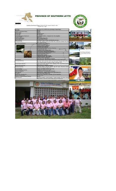
PROVINCE OF SOUTHERN LEYTE<br />
Legal Basis of the Province's Creation : Republic Act 2227 enacted on May 22, 1959<br />
Founded: July 1, 1960<br />
Land Area 1,734.8 sq. km. or 8.09% of the entire Eastern Visayas Region<br />
Population 390,847<br />
Total No. of Registered Voters 222,646<br />
Mother Tongue Cebuano<br />
Income Class 3rd class Province<br />
FY 2010 IRA PhP 463.99 M<br />
Political/Geographical Subdivision 1 congressional district; 1 component city; 18 municipalities<br />
Provincial Capital Maasin City<br />
Total No. of Barangays 500 (Including Maasin City)<br />
Smallest Municipality Limasawa Island (6 brgys.)<br />
Major Livelihood employment, fishing, farming, manufacturing and trade<br />
Fishing Grounds Sogod Bay, Cabalian Channel, Hinunangan Bay, Surigao Sea, Camiguin Sea, Bohol<br />
Strait, Canigao Channel<br />
Major Tourist Destinations * Guinsohotan Cave, Maasin City<br />
* Monte Cueva, Maasin City<br />
* Danao Forest Park, Maasin City<br />
* Banahaw Spring, Macrohon<br />
* Cambaro Caves, Macrohon<br />
* Molopolo-Sta.Cruz Marine Sanctuary, Macrohon<br />
* Kuting Reef, Macrohon<br />
* Magellan's Cross, Limasawa Island<br />
* Diving Range, Padre Burgos & Sogod Bay<br />
* Coral Canyons, Tangkaan Point, Padre Burgos<br />
* Agas-Agas Adventure Park, Sogod<br />
* Uwan-Uwanan Falls, Libagon<br />
* Biasong Spring, Libagon<br />
* Napantao Dive Site, San Francisco<br />
* Whale Shark Basin, Liloan & Pintuyan<br />
* Hindag-an Falls, Saint Bernard<br />
* San Pedro & San Pablo Islands, Hinunangan<br />
Road Network Maharlika Highway; Mahaplag-Baybay-Maasin Road; Abuyog-Silago Road<br />
Financing Institutions Allied Bank, BDO, China Bank, DBP, Green Bank, LBP, Metrobank, PNB, RCBC, So.<br />
<strong>Leyte</strong> Cooperative Bank, Rural Bank of Maasin, SLEMCoop, MCCI<br />
Communication Services postal communication, Bayantel, BuTel, Globelines, PLDT, Smart Communications,<br />
Globe Telecom, Sun Cellular<br />
Internet Service Provider (Bayantel) Skyinet, Globelines Broadband<br />
Broadcast Facilities DYDM-AM (Maasin); DYSL-FM (Sogod); Viper FM (Ichon, Macrohon); Maasin,<br />
Sogod & San Juan Cable Television<br />
Local Print Media Southern <strong>Leyte</strong> Balita, Southern <strong>Leyte</strong> Times<br />
Land Transportation Facilities megataxi/van, jeepney, bus, tricycle<br />
Total No. of Seaports 5 national ports, 9 municipal ports, 2 fish ports<br />
Ferry Services Maharlika Ferry, Cokaliong Shipping Lines, Bohol Shuttle Ferry<br />
Air Facility Panan-awan Airport (Maasin City)<br />
Distance from Tacloban City 184 kms./3 hrs. travel time by megataxi; 4 hrs bus travel time<br />
Distance from Cebu City 6-7 hrs. by ship<br />
Total No. of Tertiary Education Facilities Nine (9)<br />
Health Facilities 1 provincial hospital, 3 district hospitals, 2 private hospitals, 28 C/RHUs, 98 Brgy.<br />
Health stations, more than a dozen private clinics (out-patient only)<br />
Limasawa Island at the background,<br />
as seen from Malitbog-Padre Burgos<br />
road
QuickStat<br />
MUNICIPALITY OF ANAHAWAN<br />
Legal Basis of the Town's Creation : _____________________________<br />
Land Area 5,809 hectares<br />
Population 8,032<br />
Total No. of Registered Voters 4,916<br />
Mother Tongue Visayan ( Cebuano & Boholano)<br />
Income Class 5th Class Municipality<br />
FY 2010 IRA Php 27.1 M<br />
Political/Geographical Subdivision Fourteen (14) barangays<br />
Total No. of Barangays Fourteen (14)<br />
Smallest Barangay (in terms of population) Barangay MANIGAWONG<br />
Biggest Barangay Barangay POBLACION<br />
Major Livelihood Farming, Fishing, Employment Buy & Sell<br />
Fishing Grounds Municipal Waters<br />
Major Tourist Destinations Anahawan Mainit Hot Spring<br />
Anahawan Tagaytay Site<br />
Anahawan Lake Danao<br />
Road Network National Highway<br />
Financing Institutions Sts. Peter and Paul Multi-Purpose Cooperative, Palawan Pawnshop &<br />
Money Remittance<br />
Communication Services Telecom, Postal Services, Globe, Smart<br />
Internet Service Provider SmartBro, Globe Tattoo<br />
Broadcast Facilities None<br />
Local Print Media None<br />
Land Transportation Facilities Bus, van, Jeepney, tricycle<br />
No. of Seaports None<br />
Distance from Tacloban City 120 km. / 3 hour travel (Anahawan - Silago -Tacloban)<br />
Distance from Cebu City Land trip from Hinundayan - Hilongos (120kms.), 5 hrs. by ship<br />
Hilongos - Cebu<br />
Total No. of Tertiary Education Facilities None<br />
Health Facilities 1 District Hospital, 1 Rural Health Unit (Out patient & in-patient), 2<br />
Barangay Health Stations
QuickStat<br />
Land Area 11,985 has.<br />
Population 28,535 (2007 Census)<br />
Total No. of Registered Voters 16,003 (as of Oct. 2011)<br />
Mother Tongue Cebuano<br />
Income Class 4th Class<br />
FY 2010 IRA Php 46.719 M<br />
Political/Geographical Subdivision Composed of coastal, riverside, highland barangays<br />
Total No. of Barangays 40<br />
Smallest Barangay (in terms of population) Barangay OLISIHAN<br />
Biggest Barangay Barangay HILAAN<br />
Major Livelihood Farming & Fishing<br />
Fishing Grounds Sogod Bay<br />
Alejos Falls<br />
Major Tourist Destinations<br />
MUNICIPALITY OF BONTOC<br />
Legal Basis of the Town's Creation : Republic Act 522 dated June 15, 1950<br />
Botong Falls<br />
Anahao Cave<br />
Catmon Cave<br />
Road Network 142 kms of national, provincial, municipal road network<br />
Financing Institutions Rural Bank of Hindang, Rural Bank of Maasin, BCCI<br />
Communication Services Postal Services, 1 Cable TV, 2 telephone services, 3 cell sites<br />
Internet Service Provider 4 ISPs<br />
Broadcast Facilities None<br />
Local Print Media None<br />
Land Transportation Facilities bus, jeepney, van, tricycle, motorcycle<br />
No. of Seaports 1<br />
Distance from Tacloban City 124 kms.<br />
Distance from Cebu City 5-8 hrs travel time<br />
Total No. of Tertiary Education Facilities 1 (SLSU-Bontoc)<br />
Health Facilities 1 Rural Health Unit & 8 Barangay Health Stations
QuickStat<br />
Land Area 17,336.75 Hectares<br />
Population 28,505<br />
Total No. of Registered Voters 15,839<br />
Mother Tongue Boholano and Cebuano dialects<br />
Income Class 3rd Class<br />
FY 2010 IRA Php. 50,610,015.00<br />
Political/Geographical Subdivision none<br />
Total No. of Barangays 40<br />
Smallest Barangay (in terms of population) Brgy. Upper Bantawon<br />
Biggest Barangay Brgy. Nava<br />
Major Livelihood Farming & Fishing<br />
Fishing Grounds Facific Ocean<br />
San Pedro and San Pablo Islands<br />
Caves<br />
Major Tourist Destinations<br />
MUNICIPALITY OF HINUNANGAN<br />
Legal Basis of the Town's Creation : NO RECORD<br />
Rice fields<br />
water falls<br />
13 kilometers coast of fine sand facing the pacific ocean<br />
Fish sanctuaries<br />
Road Network Concrete National Highways, all weather roads mun.& Brgys.<br />
Financing Institutions SPPMPC, Cebuana Lhullier, EY Pawnshop<br />
Communication Services Smart and Globe<br />
Internet Service Provider Smart and Globe<br />
Broadcast Facilities None<br />
Local Print Media None<br />
Land Transportation Facilities Bus, Vans, Jeepneys, Tricycles, Habal-habal<br />
No. of Seaports 1<br />
Distance from Tacloban City 180 kilometers<br />
Distance from Cebu City<br />
Total No. of Tertiary Education Facilities 1 (Southern <strong>Leyte</strong> State University)<br />
Health Facilities 2 Hospitals and 1 Health Center
QuickStat<br />
MUNICIPALITY OF HINUNDAYAN<br />
Legal Basis of the Town's Creation : Executive Order No. 59 signed by Governor W. Cameron Forbes on July 31, 1909<br />
Land Area 6,108 hectares<br />
Population 13,364 as of 2010<br />
Total No. of Registered Voters 7,091 as of August 18, 2011 ERB<br />
Mother Tongue Visayan ( Cebuano & Boholano)<br />
Income Class 5th Class Municipality<br />
FY 2010 IRA Php 29,404,706.00<br />
Political/Geographical Subdivision Seventeen (17) barangays<br />
Total No. of Barangays seventeen (17)<br />
Smallest Barangay (in terms of population) Barangay AMAGA<br />
Biggest Barangay Barangay LUNGSODAAN<br />
Major Livelihood Farming, Fishing, Employment, & trade<br />
Fishing Grounds Surigao Strait<br />
Ambao Fish Sanctuary<br />
Mabaho Cave<br />
Abutanan Cave<br />
Major Tourist Destinations<br />
Cabulisan Waterfalls<br />
An-an White beaches<br />
sandy beaches<br />
Road Network National Highway (34.95kms.)<br />
Financing Institutions<br />
Rural Bank Of Hinundayan<br />
San Jose Parish Multi-Purpose Cooperative<br />
Communication Services Postal communication, Butel, Globe, Smart<br />
Internet Service Provider SmartBro, Globe Tattoo<br />
Broadcast Facilities None<br />
Local Print Media None<br />
Land Transportation Facilities Bus, van, Jeepney, tricycle<br />
No. of Seaports 1 (Municipal Seaport)<br />
Distance from Tacloban City 111 km. / 3 hour travel (Hinundayan - Silago -Tacloban)<br />
Distance from Cebu City Land trip from Hinundayan - Hilongos (120kms.), 5 hrs. by ship<br />
Hilongos - Cebu<br />
Total No. of Tertiary Education Facilities None<br />
Health Facilities 1 Rural Health Unit (Out patient & in-patient), 4 Barangay Health<br />
Stations & 2 Private clinics
QuickStat<br />
MUNICIPALITY OF LIBAGON<br />
Legal Basis of the Town's Creation : No record<br />
Land Area 9.860.78 hectares<br />
Population 14,283 (2007 Census)<br />
Total No. of Registered Voters 8,637 (2010 Elections)<br />
Mother Tongue Cebuano<br />
Income Class 5th<br />
FY 2010 IRA PhP 32,312,099<br />
Political/Geographical Subdivision 14 barangays<br />
Total No. of Barangays 14 barangays<br />
Smallest Barangay (in terms of population) Punta<br />
Biggest Barangay Mayuga<br />
Major Livelihood Farming<br />
Fishing Grounds Sogod Bay<br />
Major Tourist Destinations Uwan-Uwanan Falls, Brgy. Kawayan<br />
Biasong Spring, Brgy Biasong<br />
Road Network Maharlika Highway (Mahaplag-Sogod-Libagon-Liloan)<br />
Financing Institutions LAMP-COOP<br />
Communication Services Postal, Cellphones, Landline Telephone, Newly installed internet<br />
service<br />
Internet Service Provider Broadband Internet (Wi-Fi) service<br />
Broadcast Facilities none<br />
Local Print Media none<br />
Land Transportation Facilities Multi-cab, Bus<br />
No. of Seaports none<br />
Distance from Tacloban City 234 kms.<br />
Distance from Cebu City 4 hrs. by boat + 1.5 hrs. by land<br />
Total No. of Tertiary Education Facilities none<br />
Health Facilities RHU, Main Health Center, 3 Health Units, 8 Brgy. Health Centers
QuickStat<br />
Land Area 9,630.00 hectares<br />
Population 22,823<br />
Total No. of Registered Voters 12,236<br />
Mother Tongue Cebuano<br />
Income Class 4th class<br />
FY 2010 IRA 37,461,650.00<br />
Political/Geographical Subdivision 1st of the 4 towns in panaon island<br />
Total No. of Barangays 24<br />
Smallest Barangay (in terms of population)<br />
Catig<br />
Biggest Barangay Poblacion<br />
Major Livelihood Agriculture<br />
Fishing Grounds Sogod Bay, Cabalian Bay<br />
Tagbac Islet<br />
Major Tourist Destinations<br />
Color Falls<br />
Tabugon Dive Site<br />
Molopolo Sunken Garden<br />
Road Network Magaupas to Cagbungalon fully<br />
accesible all weather road<br />
concreted, San Roque to Bahay<br />
Financing Institutions<br />
MUNICIPALITY OF LILOAN<br />
Legal Basis of the Town's Creation : Founded in 1820 by the Royal Spanish Government<br />
1 rural bank, 4 cooperatives, several lending groups<br />
Communication Services Globelines landline, smart, globe and sun cellular facilities<br />
Internet Service Provider Globelines, Smart, & Sun<br />
Broadcast Facilities none<br />
Local Print Media none<br />
Land Transportation Facilities Bus, Vans, Tricycle and single motorcycle<br />
No. of Seaports 2<br />
Distance from Tacloban City 156 kms.<br />
Distance from Cebu City: 230 kms (estimated)<br />
Total No. of Tertiary Education Facilities 0<br />
Health Facilities 1 health center, 1 infirmary, 14 barangay health centers
QuickStat<br />
MUNICIPALITY OF LIMASAWA<br />
Legal Basis of the Town's Creation : PD 1549<br />
Land Area 632.5465 Hectares<br />
Population 5, 745<br />
Total No. of Registered Voters 3,491<br />
Mother Tongue Boholano/leyteno<br />
Income Class 6th class<br />
FY 2010 IRA P 20, 259, 134.00<br />
Political/Geographical Subdivision 1 municipality<br />
Total No. of Barangays 6 barangays<br />
Smallest Barangay (in terms of population)<br />
San Agustin<br />
Biggest Barangay Magallanes<br />
Major Livelihood Fishing<br />
Fishing Grounds Sogod Bay, Surigao Strait, Camiguin Sea, Bohol Strait,<br />
Major Tourist Destinations Magellan's Cross, Limasawa Island<br />
Road Network Triana to San Agustin, Cabulihan to Magallanes & Lugsongan<br />
Provincial Road<br />
Financing Institutions<br />
Islander Cooperative Multipurpose cooperative, Triana<br />
Multipurpose Cooperative, San Bernardo Samahang Nayon<br />
Communication Services Postal station,Globelines, Smart Communications & Globe<br />
Telecom<br />
Internet Service Provider None<br />
Broadcast Facilities None<br />
Local Print Media None<br />
Land Transportation Facilities Habal-habal, motorized pot-pot, tricycle and trisikad<br />
No. of Seaports 1 municipal ports<br />
Distance from Tacloban City<br />
1 hr motorized boat ride limasawa island to Padre Burgos, 220<br />
kms./5 hrs bus travel time Padre Burgos to Tacloban City<br />
Distance from Cebu City 1 hr motorized boat ride limasawa island to Padre Burgos, So.<br />
<strong>Leyte</strong>, 35 minutes ride multicab and 6-7 hrs. by ship<br />
Total No. of Tertiary Education Facilities None<br />
Health Facilities 1 RHU and 6 barangay health centers
QuickStat<br />
MUNICIPALITY OF MACROHON<br />
Legal Basis of the Town's Creation : Resolution No. 356 s. 2003 Adopting Res. No. 395 s. 2003 enacting Mun. Order<br />
No. 2003-18 declaring October 31, 1860 as the Founding Date<br />
Land Area 12, 639.47 hectares<br />
Population 25, 657<br />
Total No. of Registered Voters 15, 629<br />
Mother Tongue Cebuano<br />
Income Class 4th class<br />
FY 2010 IRA P45, 154, 956.00<br />
Political/Geographical Subdivision<br />
Total No. of Barangays 30<br />
Smallest Barangay (in terms of population) Bagong Silang<br />
Biggest Barangay Ichon<br />
Major Livelihood Farming and Fishing<br />
Fishing Grounds Mindanao Sea<br />
Cambaro Caves<br />
Molopolo-Sta. Cruz Mun. Fish Sanctuary<br />
Banahaw Spring<br />
Kuting Reef Resort<br />
Manaya Beach resort<br />
Major Tourist Destinations<br />
Amparaiso Hotel and Resort<br />
Southern <strong>Leyte</strong> Divers<br />
Cristina Beach Resort<br />
Whale Shark Divers<br />
Seven Falls<br />
Fatima Hills<br />
Road Network 17.50 km National Road<br />
Financing Institutions<br />
San Roque Multi-Purpose Cooperative<br />
Laray Multi-Purpose Cooperative<br />
Communication Services Globe, Smart & Sun Cell Site<br />
Internet Service Provider Papia Donaire Internet, Sta.Cruz, Macrohon<br />
Broadcast Facilities DYAS (FM), Ichon, Macrohon<br />
Local Print Media none<br />
Land Transportation Facilities Multicab, tricycle, habal2x,van, jeepney & mini-bus<br />
No. of Seaports Ichon Fishport<br />
Distance from Tacloban City 200 kms/3 1/2 hrs travel time by van<br />
Distance from Maasin City 15 kms<br />
Distance from Cebu City 6-7 hrs travel time by boat via Maasin City<br />
Total No. of Tertiary Education Facilities none
QuickStat<br />
Land Area 9,340 hectares<br />
Population 2 1, 463<br />
Total No. of Registered Voters 10, 220 (2009)<br />
Mother Tongue Bisaya is commonly spoken in the municipality<br />
Income Class 4th Class<br />
FY 2010 IRA P37,374,507.00<br />
Political/Geographical Subdivision<br />
Presently, the municipality has 37 barangays; 21 of which are coastal,<br />
4 are inland and 12 are mountain barangays<br />
Total No. of Barangays 37<br />
Smallest Barangay (in terms of population)<br />
(in terms of population) Barangay Fatima with 173 total population<br />
as per CBMS survey conducted last month , September 2011.<br />
Biggest Barangay Barangay San Vicente with 1,485 total population as per CBMS<br />
Major Livelihood<br />
Fishing Grounds<br />
Major Tourist Destinations<br />
Road Network<br />
MUNICIPALITY OF MALITBOG<br />
Legal Basis of the Town's Creation : Maura Law of 1893<br />
survey .<br />
fishing, farming, employment<br />
17th century Baluarte or watch towers<br />
Sto. Nino Roman Catholic Church<br />
Casa Escano<br />
Mausoleum<br />
Lorenzo Baybay Beach Resort in Brgy. San Vicente<br />
Junio Beach Resort at Baranngay Sto. Nino<br />
the Wishy-Washy Beach Resort, the Dai-Dai Beach Resort in Barangay<br />
San Roque<br />
Bag-ao Clan Beach and the Ingko Mino’s Beach Resorts in Barangay<br />
Juangon<br />
Dive sites in Barangay Cabul-anonan<br />
Highway- 17 kms<br />
Provincial-- 13.5 kms.<br />
Municipal- 5.114 kms<br />
Financing Institutions<br />
Barangays- 29.102 kms<br />
Malitbog Rural Bank and Malitbog Fisherfolks Cooperative .<br />
Communication Services Postal communication, Butel, Globe, Smart<br />
Internet Service Provider SmartBro, Globe Tattoo<br />
Broadcast Facilities none<br />
Local Print Media none<br />
Land Transportation Facilities cars, buses, jeepneys, tricycles, motorcycles and bicycles.<br />
No. of Seaports 1 (Municipal Seaport)<br />
Distance from Tacloban City 228 kilometers<br />
Distance from Maasin City 42kms<br />
Distance from Cebu City 1 hour travel by bus & 7 hours travel by boat<br />
Total No. of Tertiary Education Facilities none<br />
Health Facilities<br />
two private clinics<br />
five (5) BArangay Health Stations
QuickStat<br />
MUNICIPALITY OF PADRE BURGOS<br />
Legal Basis of the Town's Creation : E.O 265<br />
Land Area October 22,1957<br />
Population 10,703<br />
Total No. of Registered Voters 6,442<br />
Mother Tongue Cebuano, Boholano<br />
Income Class 5th<br />
FY 2010 IRA P 25,577,767.00<br />
Political/Geographical Subdivision by barangay<br />
Total No. of Barangays 11<br />
Smallest Barangay (in terms of population)<br />
Bunga<br />
Biggest Barangay Sta. Sofia<br />
Major Livelihood Farming & Fishing<br />
Fishing Grounds Sogod Bay, Surigao Strait, Camiguin Sea, Bohol Strait,<br />
Major Tourist Destinations Tangkaan Beach, Max Climax Level 3 Dive Spot @ Brgy.<br />
Lungsodaan and other divespots in Brgys. Tangkaan, Sta. Sofia,<br />
Poblacion & Bunga<br />
Road Network San Juan-Laca, Buenavista-Bairan, Sta. Sofia-Tangkaan, Sta. Sofia-<br />
Core, Poblacion-Anas-Bairan<br />
Financing Institutions Padre Burgos Credit Cooperative (PCCI), Rural Bank of Padre<br />
Burgos, CARD Inc.<br />
Communication Services Postal station,Globelines, Smart Communications & Globe<br />
Telecom<br />
Internet Service Provider Globe/Smart Mobile Internet<br />
Broadcast Facilities Local Cable Network<br />
Local Print Media none<br />
Land Transportation Facilities<br />
16 multi-cabs operate in Maasin- Burgos route with 30 minute<br />
interval. There are buses and air conditioned vans passing<br />
through from Tacloban and vice- versa with irregular schedule.<br />
Registered Tri-cycles reaches up to 54 operators. Habal-habal<br />
and motorcycle are likewise a means of transport.<br />
No. of Seaports 1<br />
Distance from Tacloban City<br />
220 kms./5 hrs bus travel time Padre Burgos to Tacloban City<br />
Distance from Cebu City 45 minutes ride multicab to Maasin and 6-7 hrs. by boat from<br />
Maasin Port to Cebu<br />
Total No. of Tertiary Education Facilities 1<br />
Health Facilities 1 RHU and 2 brgy health stations, Padre Burgos Community<br />
Hospital
QuickStat<br />
MUNICIPALITY OF PINTUYAN<br />
Legal Basis of the Town's Creation : On June 17, 1961 Republic Act 3088<br />
Land Area 3,697.3188HA<br />
Population 9,911<br />
Total No. Of Registered Voters 5,721<br />
Mother Tongue Cebuano<br />
Income Class 5th Class<br />
FY 2010 IRA Php 26,467,802.00<br />
Political/Geographical Subdivision 1 Municipality, 23 Barangays<br />
Total No. Of Barangays 23<br />
Smallest Barangay (in terms of population) Balongbalong<br />
Biggest Barangay Son-ok I<br />
Major Livelihood Fishing, farming<br />
Fishing Grounds 216 km2 MW<br />
Major Tourist Destinations<br />
Whaleshark interaction, scuba diving and snorkeling, dolhins<br />
watching, waterfalls<br />
safari. Festival on the revival of Pintuyan's traditional arts NCCAfunded.<br />
Road Network Maharlika Highway<br />
Financing Institutions PNVS Multi-Purpose Cooperative<br />
Communication Services Postal Communication, Globe & Smart Communication<br />
Internet Service Provider LPStar<br />
Broadcast Facilities None<br />
Local Print Media None<br />
Land Transportation Facilities Bus, Habal-Habal<br />
No. Of Seaports None<br />
Distance from Tacloban City 183 Km<br />
Distance from Cebu City<br />
Total No. Tertiary Education Facilities<br />
195 miles<br />
Health Facilities RHU, 4 Barangay Health Stations
QuickStat<br />
Land Area 10,020 hectares<br />
Population (NSO 2007): 25,252<br />
Total No. of Registered Voters<br />
Mother Tongue Cebuano with boholano twang<br />
Income Class 4th class<br />
FY 2010 IRA Php 43,233,080.00<br />
Atuyan<br />
Ayahag (RELOCATED to Magbagacay)<br />
Bantawon(RELOCATED to Catmon)<br />
Bolodbolod<br />
Carnaga<br />
Catmon<br />
Guinsaugon(RELOCATED to Magbagacay)<br />
Himbangan<br />
Himos-onan<br />
Hinabian(RELOCATED to Catmon)<br />
Hindag-an<br />
Kauswagan(RELOCATED to Catmon)<br />
Libas<br />
Lipanto<br />
Political/Geographical Subdivision<br />
Magatas (RELOCATED to Catmon)<br />
Magbagacay<br />
Cabagawan(Maria Asuncion)<br />
New Nueva Esperanza(RELOCATED to Magbagacay)<br />
Himatagon(Poblacion)<br />
Panian<br />
Santa Cruz<br />
New Sug-angon(RELOCATED to Magbagacay)<br />
Tambis I<br />
Tambis II<br />
Mahayag<br />
Mahayahay<br />
Malibago<br />
Malinao<br />
Total No. of Barangays 30<br />
Smallest Barangay (in terms of population)<br />
This is a gray area. According to NSO standard, Guinsaugon<br />
will be the smallest barangay in terms of population due to the<br />
fact that it registered 0 in the 2007 NSO population survey. This<br />
was so because the old site became a ghost barangay after the<br />
2006 Guinsaugon tragedy. It was also the major cause of their<br />
IRA share reduction, making it more difficult to recover and<br />
rehabilitate from disaster.<br />
But as to real situation (as in actual population count), it will be<br />
Kauswagan having only 27<br />
Biggest Barangay Himbangan (NSO 2007: 2,316)<br />
Major Livelihood Farming, fishing, commercial and service centers<br />
Fishing Grounds Lipanto, Hindag-an, Himbangan and Panian area with certain<br />
declared marine protected area; then Himatagon, San Isidro,<br />
Malibago<br />
Major Tourist Destinations<br />
GROUND ZERO<br />
(Guinsaugon Landslide)<br />
new guinsaugon resettlement<br />
lipanto fish sanctuary<br />
hindag-an falls and forest park<br />
lahus-lahus & alpha caves<br />
mangrove and fish sanctuaries<br />
Road Network<br />
MUNICIPALITY OF SAINT BERNARD<br />
Legal Basis of the Town's Creation : EXECUTIVE ORDER NO. 84<br />
ROUTE/MODE DISTANC<br />
E (kms.)<br />
AIR/SKY<br />
Manila to Tacloban City Airport<br />
Cebu to Tacloban<br />
SEA<br />
Cebu City to Hilongos<br />
Cebu City to Bato<br />
LAND<br />
Quezon City to Saint Bernard<br />
Tacloban City to Saint Bernard (private car/van)<br />
Tacloban City to Saint Bernard (bus)<br />
Maasin City to Saint Bernard (private car/van)<br />
Maasin City to Saint Bernard (bus)<br />
Hilongos to Saint Bernard (private car/van)<br />
Hilongos to Saint Bernard (bus)<br />
Bato to Saint Bernard (private car/van)<br />
Bato to Saint Bernard (bus)<br />
TRAVEL<br />
TIME (hrs.)<br />
Financing Institutions 1 Cooperative with ATM service[San Isidro Parish Multi-<br />
Purpose Cooperative (SIPCCI)]<br />
Communication Services Smart, Globe, Sun, Internet shops, Municipal Hall w/ WIFI<br />
service<br />
Internet Service Provider Internet shops, Municipal Hall w/ WIFI service<br />
Broadcast Facilities None<br />
Local Print Media<br />
Land Transportation Facilities<br />
Bugjong (Municipal Official Print Media)<br />
1 Public Terminal<br />
3 Gasoline stations<br />
Jeepneys<br />
Tricycles<br />
Trisikad<br />
Bus<br />
habal-habal<br />
Car rentals, motorcycles, motorcabs, pedicabs or pot-pot<br />
No. of Seaports 1<br />
Distance from Tacloban City 111<br />
Distance from Cebu City not determined<br />
Total No. of Tertiary Education Facilities none<br />
Health Facilities<br />
Health/Medical Center<br />
1 private, 1 public (RHU) & 8 Health<br />
Stations, 20 Satellite Stations<br />
Dental Clinic 1 private, 1 public<br />
(1) Doctor, (1) Nurse, (8) Midwife, (1)<br />
Personnel (RHU)<br />
Medtech, (1) RSI, (1) Dentist,<br />
(1) Pharmacy Aide (Clerk I- Casual),<br />
(1) Encoder (JO), (1) Janitor (JO)<br />
565<br />
-<br />
111<br />
111<br />
91<br />
91<br />
84<br />
84<br />
1.2<br />
0.5<br />
4<br />
6<br />
24<br />
3<br />
5<br />
3<br />
5<br />
2<br />
2.5<br />
1.5<br />
2
QuickStat<br />
Land Area 7,021.93<br />
Population 12,850<br />
Total No. of Registered Voters 7,266<br />
Mother Tongue Bisaya, Tagalog<br />
Income Class 5th class<br />
FY 2010 IRA 30,392,254.00<br />
Political/Geographical Subdivision Good relationship/harmonious<br />
Total No. of Barangays 22<br />
Smallest Barangay (in terms of population) Sta. Paz sur<br />
Biggest Barangay Dakit<br />
Major Livelihood Agriculture and Fishing<br />
Fishing Grounds Sogod Bay and Surigao Straight<br />
Major Tourist Destinations<br />
MUNICIPALITY OF SAN FRANCISCO<br />
Legal Basis of the Town's Creation : _Executive Order No 292<br />
Napantao Dive Site<br />
Marayag Beach Resort<br />
Road Network Maharlika Highway, Provincial,Municipal and Brgy. Roads<br />
Financing Institutions St. Peters and Paul Cooperatives, PNVS Cooperatives<br />
Communication Services Globe, Smart<br />
Internet Service Provider Via Satellite<br />
Broadcast Facilities Smart Broadcasting thru text<br />
Local Print Media None<br />
Land Transportation Facilities Bus, Van, motorcycles<br />
No. of Seaports None<br />
Distance from Tacloban City 178 kms.<br />
Distance from Cebu City 93 KMS. To hilongos then 4 hrs boat fr. Hilongos to cebu<br />
Total No. of Tertiary Education Facilities None<br />
Health Facilities 1 rural health center and 3 sub stations
QuickStat<br />
MUNICIPALITY OF SAN JUAN<br />
Legal Basis of the Town's Creation : On June 17, 1961 Republic Act 3088<br />
Land Area 4,956<br />
Population 14,442 (2007)<br />
Total No. of Registered Voters 7,251 (As of July 18, 2011 ERB Meeting)<br />
Mother Tongue Cebuano<br />
Income Class 5th Class Municipality<br />
FY 2010 IRA 34,564,645.00<br />
Political/Geographical Subdivision 1 Municipality with 3 barangays compel the town proper and 15 brgys<br />
outside the town<br />
Total No. of Barangays 18 Barangays<br />
Smallest Barangay (in terms of population)<br />
Bobon A<br />
Biggest Barangay Sto. Nińo<br />
Major Livelihood Farming and Fishing<br />
Fishing Grounds Cabalian Bay<br />
Major Tourist Destinations Lake Danao<br />
Busay Falls<br />
Road Network<br />
Himay-angan- Silago Road to Abuyog-Maharlika Road to Tacloban<br />
Financing Institutions Rural Bank of San Juan, San Juan Multi Purpose Cooperative, Green<br />
Bank, PNVS, OCCI, Slem Coop, Taytay<br />
Communication Services Postal communication, Smart Communications, Globe Telecom, Sun<br />
Cellular<br />
Internet Service Provider Smart Internet Provider<br />
Broadcast Facilities San Juan Cable Television<br />
Local Print Media none<br />
Land Transportation Facilities bus, jeepney, tricycle<br />
No. of Seaports 1<br />
Distance from Tacloban City 4 hrs. bus travel time<br />
Distance from Cebu City 9-10 hours by ship<br />
Total No. of Tertiary Education Facilities 1<br />
Health Facilities RHU
QuickStat<br />
Legal Basis of the Town's Creation : R.A. 6360 enacted July 23, 1971<br />
Proclaimed: January 2, 1792<br />
Land Area 4,756.18 ha / 47,561.8 sq.m.<br />
Population 10,600<br />
Total No. of Registered Voters<br />
5,751<br />
MUNICIPALITY OF SAN RICARDO<br />
Mother Tongue cebuano<br />
Income Class 5th class<br />
FY 2010 IRA 25,060,590<br />
Political/Geographical Subdivision 1 municipality and 15 barangays<br />
Total No. of Barangays 15 barangays<br />
Smallest Barangay (in terms of population)<br />
Cabutan<br />
Biggest Barangay Pinut-an<br />
Major Livelihood Camote mining, Fishing, Farming<br />
Fishing Grounds Surigao straight<br />
Major Tourist Destinations * Bil-atan Beach at Barangay Camang<br />
* V2 Falls at Barangay Looc<br />
Road Network Maharlika Highway<br />
Financing Institutions PNVS Multi-Purpose Cooperative<br />
Communication Services Postal Communication, Globelines & Smart Communication<br />
Internet Service Provider IPStar<br />
Broadcast Facilities none<br />
Local Print Media none<br />
Land Transportation Facilities Bus, Tricycle, Habal-habal<br />
No. of Seaports 1 national port & Municipal port<br />
Distance from Tacloban City 175 kms<br />
Distance from Maasin City 152 kms<br />
Distance from Cebu City 98 miles<br />
Total No. of Tertiary Education Facilities none<br />
Health Facilities 1 RHU & 3 BHS
QuickStat<br />
Land Area 21, 505 hectares<br />
Population 13, 639<br />
Total No. of Registered Voters 7, 541<br />
Mother Tongue Cebuano with Boholano accent<br />
Income Class 5th Class<br />
FY 2010 IRA 40, 344, 306.00<br />
Political/Geographical Subdivision 15 Barangays<br />
Total No. of Barangays 15 barangays<br />
Smallest Barangay (in terms of population)<br />
Bgy. Catmon<br />
Biggest Barangay Bgy. Hingatunggan<br />
Major Livelihood Farming and Fishing<br />
Fishing Grounds Municipal Waters, <strong>Leyte</strong> Gulf<br />
Pelada Rock<br />
Major Tourist Destinations<br />
MUNICIPALITY OF SILAGO<br />
Legal Basis of the Town's Creation : Executive Order No. 236<br />
Whale Shark Complete Bone<br />
Tres Marias Falls<br />
Municipal Tree Park<br />
Road Network Liloan-Hinunangan-Silago Road; Abuyog-Silago Road<br />
Financing Institutions None<br />
Communication Services Postal communication, Smart Communications & Globe Telecom<br />
Internet Service Provider None<br />
Broadcast Facilities Sicocu Cable<br />
Local Print Media None<br />
Land Transportation Facilities jeepney, bus, tricycle<br />
No. of Seaports none<br />
Distance from Tacloban City 108 kms.<br />
Distance from Maasin City 160 kms.<br />
Distance from Cebu City 193.6 kms. (via Ormoc); 203 kms. (via Bato/Hilongos)<br />
Total No. of Tertiary Education Facilities none<br />
Health Facilities 1 RHU
QuickStat<br />
Land Area 19,270 hectares<br />
Population 42,460<br />
Total No. of Registered Voters 23,059<br />
Mother Tongue Cebuano<br />
Income Class 2nd Class<br />
FY 2010 IRA PhP 49,668,302.00<br />
Political/Geographical Subdivision coastal & mountain brgys.<br />
Total No. of Barangays 45<br />
Smallest Barangay (in terms of population) Lum-an<br />
MUNICIPALITY OF SOGOD<br />
Legal Basis of the Town's Creation : Sogod became a municipality on June 10,1853 by virtue of the decree signed<br />
by then Governor-General Antonio de Urbiztondo<br />
Biggest Barangay Zone V<br />
Major Livelihood Agriculture<br />
Fishing Grounds Sogod Bay<br />
Agas-Agas Bridge, Brgy. Kahupian<br />
Major Tourist Destinations<br />
Zip Southern <strong>Leyte</strong>, Brgy. Kahupian<br />
Ka Inting Cave, Brgy SF Mabuhay<br />
Brgy. Lum-an Waterfall<br />
Road Network 86,733 kms of road network that includes the maharlika highway,<br />
Financing Institutions<br />
LBP, Metrobank, Rural Bank of Hindang, Greenbank, Coconut Planters<br />
Bank, BCCI<br />
Communication Services BuTel, Globe, Smart, Sun<br />
Internet Service Provider Globelines, Bayantel<br />
Broadcast Facilities DYSL, Radyo Natin, Sogod Cable Television<br />
Local Print Media None<br />
Land Transportation Facilities megataxi, jeepney, bus, tricycle<br />
No. of Seaports 1<br />
Distance from Tacloban City 120 kms.<br />
Distance from Maasin City 71 kms.<br />
Distance from Cebu City 5-8 hours travel time<br />
Total No. of Tertiary Education Facilities 2 (SLSU & STAC)<br />
Health Facilities 1 district hospital, 3 private hospitals, RHU
QuickStat<br />
MUNICIPALITY OF TOMAS OPPUS<br />
Legal Basis of the Town's Creation : Republic Act 5777<br />
Land Area 5,611,374.5 sq. m.<br />
Population 15,847<br />
Total No. of Registered Voters 9,110 (2010)<br />
Mother Tongue Tagalog, Bisayan, English<br />
Income Class 5th Class<br />
FY 2010 IRA 32,926,722.00<br />
Political/Geographical Subdivision coastal & mountain brgys.<br />
Total No. of Barangays 29<br />
Smallest Barangay (in terms of population)<br />
Biasong, Higosoan, & Luan<br />
Biggest Barangay Maslog, San Isidro, & Tinago<br />
Major Livelihood Farming and Fishing<br />
Fishing Grounds Sogod Bay<br />
Major Tourist Destinations<br />
Municipal Fish Sanctuary<br />
Municipal Park<br />
Road Network 12 kms national road, 17 kms provincial road, 2,028.6 kms municipal<br />
road & 49.62 kms barangay road<br />
Financing Institutions Cooperatives (TOEMCO & TOMPCO)<br />
Communication Services Postal communication, Smart Communications, Globe Telecom & Sun<br />
Cellular<br />
Internet Service Provider None<br />
Broadcast Facilities None<br />
Local Print Media None<br />
Land Transportation Facilities motorcab, multicab, jeep, bus, v-hire<br />
No. of Seaports none<br />
Distance from Tacloban City 134 kms.<br />
Distance from Maasin City 50 kms.<br />
Distance from Cebu City 160 kms.<br />
Total No. of Tertiary Education Facilities 1 (SLSU-Tomas Oppus Campus)<br />
Health Facilities 1 RHU