The Philippines - usaid/ofda
The Philippines - usaid/ofda
The Philippines - usaid/ofda

You also want an ePaper? Increase the reach of your titles
YUMPU automatically turns print PDFs into web optimized ePapers that Google loves.
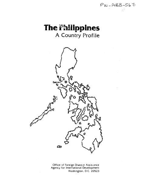
<strong>The</strong> <strong>Philippines</strong><br />
A Country Profile<br />
IQ~<br />
Office of Foreign Disastar Assis~ance<br />
Agency for International Development<br />
Washington, D.C. 20523
BABUYAN<br />
ISLANDS<br />
HA rAN<br />
ISLANDS<br />
Basco<br />
PortSan<br />
A- arri , PVincnle<br />
<strong>Philippines</strong><br />
-.. adroad<br />
Road<br />
Laoag I0 50 100 150K.Iometnr,<br />
SBungued TIuguoarao<br />
Vigan Taljk h<br />
*eBnfloc<br />
San<br />
Ilagn<br />
Farnandao i<br />
Bolinan. Baguio [lJyvoIliboing Luzon<br />
Tariack<br />
a'Angle<br />
C. ba b aI,<br />
Scadbotoug h<br />
r) P 1<br />
ShoI OlOnga po Ma nila<br />
SI A Ni's<br />
Pasij<br />
Marve les" C.,IniiB<br />
. *,Santa Crur<br />
Nasughn \ 1Pandan+ bt<br />
atnta'Lucena-• i:laulns~n<br />
llat~inia1'( Naga \ I/A,<br />
Boac. Vitae<br />
Mam b ur n ' I , Le g a, P S o s og l<br />
Mindoro ER mln Bulan.'2 .. Paapag<br />
,,, Mansalq" M'sbate. Allen' "Citarman<br />
Mandaon*<br />
0 50 100 150MleS<br />
Samar<br />
Placer l<br />
CALAMIAN aron, oar, •<br />
GROUP •Ka!ibuo~sa lcr Catbalogin<br />
! , oxz.s I'orongan<br />
-,Puerto Princesa<br />
/<br />
Panay 1 Vaanb ritayan L acban \O<br />
San Josedo<br />
Buenavisla, h Leyte<br />
\ ,<br />
Nii e g tos<br />
!<br />
,Ia Car~lolaI , , uCnballan M a' Io ,<br />
a<br />
t o , ic h I Snurg,, r<br />
Queaan / Palawan N roDnmaguela T<br />
',bamaueto Ta/rIddg<br />
Brokes Point MBatoao<br />
Isa1 Sni'i.n _ Pagadian<br />
.Sandakan ,<br />
Malaysia,", '.a<br />
Dipolog. Mindanao 6ingonn Prosperidad<br />
'Cagayande Ora<br />
Marawi O Malaybalay<br />
f<br />
'Tagum<br />
'•.+. .#=y. Sun) Cotabaln.a : $ Davao. at<br />
Wd Zoe.a, a,u,, bali<br />
*Basilan -1~<br />
i t'3 I,,'<br />
+<br />
Jab<br />
General<br />
Santos<br />
IndoneP aakeloa 0<br />
" .(Indones)ia '<br />
ldase 504521 9-50(545164)
PHILIPPLINES: A COUNTRY PROFILE<br />
prepared for<br />
<strong>The</strong> Office of U.S. Foreign Disaster Assistance<br />
Agency for International Development<br />
Department of State<br />
Washington, D.C. 20523<br />
by<br />
Faye I. Henderson<br />
Production by: Waverly Jackson, Jr. and Wesley Mossburg<br />
Labat-Anderson Incorporated<br />
Arlington, Virginia<br />
under contract AID/PDC-0000-C-00-8153<br />
<strong>The</strong> country profile of the <strong>Philippines</strong> is part of a series designed to<br />
provide baseline country data in support of the planning and relief<br />
operations of the Office of U.S. Foreign Disaster Assistance (OFDA).<br />
Content, scope, and sources have evolved over the course of the last<br />
several years and the relatively narrow focus is intentional.<br />
We hope that the information provided will also be useful to others in<br />
the disaster assistance and development communities. Every effort is<br />
made to obtain current, reliable data; unfortunately it is not possible<br />
to issue updates as fast as changes would warrant.<br />
We invite ycur comments and c:orrections. Address these and other queries<br />
to OFDA. A.I.D., as given above.<br />
December 1988
AFRICA<br />
OFDA COUNTRY PROFILES:<br />
Burkina Faso (1982)<br />
Cape Verde (1984)<br />
Chad (1989)<br />
East Africa Regional Profile (1981)<br />
Djibouti<br />
Ethiopia<br />
Kenya<br />
Somalia<br />
Sudan<br />
Tanzania<br />
Uganda<br />
Gambia-Senegal (1983)<br />
Ghana (1985)<br />
Mali (1988)<br />
Mauritania (1984)<br />
Mozambique (1987)<br />
Niger (1985)<br />
Zaire (1986)<br />
Zambia (1982)<br />
ASIA<br />
Bangladesh (1983)<br />
Burma (1980)<br />
India (1983)<br />
indonesia (1983)<br />
Nepal (1983)<br />
Pakistan (1983)<br />
<strong>Philippines</strong> (1988)<br />
Sri Lanka (1983)<br />
NEAR EAST<br />
Turkey (1982)<br />
SOUTH PACIFIC<br />
Fiji (1986)<br />
Papua New Guinea (1985)<br />
Tonga (1986)<br />
Western Samoa (1987)<br />
ii<br />
NOVEMBER 1988<br />
CARIBBEAN<br />
CARICOM Regional Profile (1983)<br />
Antigua<br />
Barbados<br />
Belize<br />
Dominica<br />
Grenada<br />
Guyana<br />
Montserrat<br />
St. Kitts-Nevis--Anguilla<br />
St. Lucia<br />
St. Vincent<br />
Trinidad and Tobago<br />
Dominican Republic (1984)<br />
Haiti (1984)<br />
Jamaica (1986)<br />
CENTRAL/SOUTH AMERICA<br />
Bolivia (1984)<br />
Chile (1987)<br />
Costa Rica (1987)<br />
Ecuador (1983)<br />
El Salvador (1984)<br />
Guatemala (1982)<br />
Honduras (1981)<br />
Nicaragua (1981)<br />
Peru (1983)<br />
INDIAN OCEAN<br />
Island Countries of the<br />
Indian Ocean (1984)<br />
<strong>The</strong> Comoros<br />
Madagascar<br />
Maldives<br />
Mauritius<br />
Reunion<br />
Seychelles
Acknowledgments<br />
I acknowledge with gratitude the support provided by the staff of<br />
USAID/<strong>Philippines</strong> in the preparation of this country profile, and<br />
especially the invaluable assistance provided by Brydnt George and Orly<br />
Cabrega. My deep appreciation is also extended to Dr. Mita Pardo de<br />
Tavera, GOP Secretary of Social Welfare and Development, Col. Victor R.<br />
Pagulayan, Jr., Administrator of the Philippine Office of Civil Defense<br />
and Executive Officer of the National Disaster Coordinating Council, Dr.<br />
Roman L. Kintanar, Administrator of PAGASA, Dr. Raymundo S. Punongbayan,<br />
Director of PHIVOLCS, Dr. G.C. Caridad, Secretary General of the<br />
Philippine National Red Cross; a 1id other Dhilippine agency heads, and PVO<br />
directors and their staffs whose warm reception and willing sharing of<br />
information greatly contributed to this report.<br />
iii
PHILIPPINES Contents<br />
Preface ......................................................... i<br />
OFDA Country Profile List ......................................... ii<br />
1. General Information .......................................... 1-47<br />
1.1 Geographic Codes ..................................... 1<br />
1.2 Host Mission to the U.S .............................. 1<br />
1.3 U.S. Mission to the <strong>Philippines</strong> ...................... 1<br />
1.4 Time Zones ........................................... 1<br />
1.5 Currency ............................................. 2<br />
1.6 Travel and Visa Requirements .. .................... 2<br />
1.7 Holidays and Calendar................................. 3<br />
1.8 Treaties and Agreemerts ......... .................... 3<br />
1.9 Int. :national Organizations .......................... 4<br />
1.10 Geography ............................................ 5<br />
1.11 History .............................................. 8<br />
1.12 Government ........................................... 13<br />
1.13 Ethnic Groups ........................................ 21<br />
1.14 Languages ............................................ 24<br />
1.15 Religion ............................................. 24<br />
1.16 Education............................................ 25<br />
1.17 Population ........................................... 26<br />
1.18 Health, Nutrition, and Diet .......................... 29<br />
1.19 Economy ........................................... ... 34<br />
1.20 Power supply ................. ....................... 43<br />
1.21 Communications ....................................... 43<br />
1.22 Transportation ....................................... 45<br />
2. Disaster Vulnerability ....................................... 48-84<br />
2.1 Overview of the Environment .......................... 48<br />
z.2 Disaster History ..................................... 54<br />
2.3 Typhoons and Storm Surges ............................ 57<br />
2.4 Volcanism ............................................ 62<br />
2.5 Seismicity ........................................... 69<br />
2.6 Floods ............................................... 75<br />
2.7 Landslides ........................................... 78<br />
2.8 Drought .............................................. 78<br />
2.9 Deforestation and Enviro-imental Degradation .......... 79<br />
2.10 Fires ................................................ 80<br />
2.11 Other Disaster !ypes ................................. 81<br />
2.12 Vulnerability of Infrastructure, Housing,<br />
and Agriculture .................................... 82<br />
3. Disaster Preparedness and Assistance ......................... 85-146<br />
3.1 Host Country Disaster Organization ................... 85<br />
3.2 Host Country Non-governmental Organizations (NGOS)... 88<br />
3.3 Host Country Contact List ............................ 89<br />
3.4 Problems in Disaster Response in the <strong>Philippines</strong> ..... 93<br />
3.5 Warning Systems ...................... ............... 93<br />
3.6 Mitigation Efforts/Preparedness ...................... 103<br />
3.7 Host Country Resources ............................... 109<br />
3.8 Food Resources ....................................... 109<br />
3.9 Medical Resources .................................... 110<br />
iv
PHILIPPINES Contents<br />
3.10 Housing Resources .................................... 112<br />
3.11 communications ....................................... 115<br />
3.12 Ground Transportation ................................ 120<br />
3.13 Ports ................................................ 122<br />
3.14 Airports ............................................. 129<br />
3.15 U.S. Mission Plan .................................... 133<br />
3.16 Other USG Resources .................................. 134<br />
3.17 U.S. Government Contact List ......................... 136<br />
3.18 U.S. Voluntary Agencies .............................. 137<br />
3.19 USG Disaster Relief and Preparedness Assistance ...... 140<br />
3.20 International Community .............................. .145<br />
Appendices ........................................................ 147 -178<br />
Appendix A: 1987 Typhoon .................................... 147<br />
Appendix B: Crop Dates ...................................... 157<br />
Appendix C: Crop Maps<br />
158<br />
Appendix D: Modified Mercalli Intensity Scale ............... 160<br />
Appendix E: Rossi-Forel Scale of Earthquake Intensity<br />
Adapted ....................................... 162<br />
Appendix F: Government-Licensed Hospitals 1987 163<br />
Appendix G: Amateur Radio Operators in the <strong>Philippines</strong> ...... 175<br />
Appendix H: Agencies With Point-To-Point Communications ..... 177<br />
Appendix 1: Telephone Numbers for Radio and Television<br />
Networks ...................................... 178<br />
Bibliography ......................................................<br />
V<br />
179-184
PHILIPPINES L General Information<br />
I. General Information<br />
1.1 Geographic Codes<br />
1.2 Host Mission to the U.S.<br />
1.3 U.S. Mission to the <strong>Philippines</strong><br />
1.4 Time Zones<br />
AID Standard 492<br />
AID Region ANE/EA/P<br />
State Region EAP/PHL<br />
Embassy of the Republic of the <strong>Philippines</strong><br />
1617 Massachusetts Avenue, N.W.<br />
Washington, D.C. 20036<br />
Tel: (202) 483-1414<br />
Consulates general are located in New York,<br />
Chicago, New Orleans, Seattlc, San<br />
Francisco, Los Angeles, Houston, Honolulu,<br />
and Agana (Guam).<br />
Embassy of the United States<br />
1201 Roxas Blvd.<br />
Manila<br />
APO San Francisco 96528-8600<br />
Tel.: [63] (2) 521-7116<br />
Telex: 722-27366 AME PH<br />
Consulate<br />
Philippine American Life Insurance Bldg.<br />
3rd Fl.<br />
Jones Avenue<br />
Cebu<br />
APO San Francisco 96528-4230<br />
Tel: [63] (32) 52044 or 52984<br />
Telex 712-6226 AMCON PU<br />
GMT + 8 hours<br />
EST + 13 hours<br />
1
PHILIPPINES 1. General Information<br />
1.5 Curiency<br />
1.6 Travel and Visa Requirements<br />
<strong>The</strong> monetary unit is the peso (P), divided<br />
into 100 centavos.<br />
U.S. $1 = 21.12 pesos (Sept. 30, 1988)<br />
Visa: For entry at Manila (Ninoy Aquino)<br />
International Airport: No visa is necessary<br />
for transit/ tourisL stays up to 21 days;<br />
however, a traveler must have a passport<br />
valid for at least 6 months and onward/<br />
return tickcts. Authorities require a visa<br />
(no charge), one photo, and onward/return<br />
tickets for stays over 21 days and up to a<br />
maximum stay of 59 days. If applying by<br />
mail, include a stamped, self-addressed<br />
envelope. For entry at military bases of<br />
military personnel and dependents and for<br />
other types of visas, check Embassy<br />
(202-483-1414) or consulates general for<br />
specific requirements.<br />
Health: Inoculations are not generally required, but<br />
yellow fever vaccination is required of<br />
traveleLz over one year of age arriving from<br />
infected areas. Children under one year of<br />
age arriving frcm an infected area are<br />
subject to isolation and surveillanre.<br />
Malaria is largely confined to rural areas.<br />
Areas with chloroquine resistance include<br />
the islands of Luzon, Basilan, Mindoro,<br />
Palawan, Mindanao, and Sulu Archipelago.<br />
2
PHILIPPINES 1. General Information<br />
1.7 Holidays and Calendar<br />
1.8 Treaties and Agreements<br />
New Year's Day ................... January 1<br />
Bataan Day ....................... April 9<br />
Labor Day ........................ May 1<br />
Araw ng Kagitingan<br />
(Day of Bravery) ................ May 6<br />
Independence Day ................. June 12<br />
Philippine-American<br />
Friendship Day .................. July 4<br />
All Saints Day ................... November 1<br />
Bonifacio Day .................... November 30<br />
Christmas Day .................... December 25<br />
Rizal Day ........................ December 30<br />
Maundy Thursday and Good Friday are moveable<br />
religious holidays in March or April.<br />
Governent offices are closed during this<br />
long weekend which culminates in Easter<br />
Sunday.<br />
Agriculture<br />
Atomic Energy<br />
Aviation<br />
Claims<br />
Consuls<br />
Copyright<br />
Customs<br />
Defense (includes agreements concerning<br />
military bases and military<br />
assistance)<br />
Economic and Technical Cooperation<br />
Employment<br />
Finance<br />
General Relations<br />
Health<br />
Informational Madia Guaranties<br />
Investment Guaranties<br />
Judicial Assistance<br />
Maritime Matters<br />
Military Cemeteries and Monuments<br />
Mutual Security<br />
Patents<br />
Peace Corps<br />
Postal Matters<br />
Publications<br />
3
PHILIPPINES<br />
1.8 Treaties and Agreements (cont'd)<br />
1.9 International Organizations<br />
1. 'General Information<br />
Relief Supplies and Packages<br />
(agreement providing for duty-free entry<br />
into the <strong>Philippines</strong> and exemption from<br />
internal taxation of relief supplies and<br />
packages)<br />
Social Security<br />
Taxation<br />
Telecommunications<br />
Tourism<br />
Trade and Commerce<br />
Visas<br />
Asian Development Bank (ADB)<br />
ALiociation of South East Asian Nations<br />
(ASEAN)<br />
Colombo Plan<br />
Economic and Social Commission for Asia<br />
and the Pacific (ESCAP)<br />
Food and Agriculture Organization (FAO)<br />
General Agreement on Tariffs and Trade (GATT)<br />
Group of 77/Non-Aligned Movement<br />
International Atomic Energy Agency (IAEA)<br />
International Bank for Reconstruction and<br />
Development (IBRD)<br />
International Civil Aviation Organization<br />
(ICAO)<br />
International Development Association (IDA)<br />
International Fund for Agricultural<br />
Development (IFAD)<br />
International Labor Organization (ILO)<br />
International Monetary Fund (IMF)<br />
International Maritime Organization (IMO)<br />
International Telecommunications Satellite<br />
Organization (INTELSAT)<br />
INTERPOL<br />
Inter-Parliamentary Union (IPU)<br />
Internat.onal Sugar Organization (ISO)<br />
International Telecommunications Union (ITU)<br />
United Nations (UN)<br />
United Nations Economic, Social, and Cultural<br />
Organization (UNESCO)<br />
Universal Postal Union (UPU)<br />
World Federation of Trade Unions (WFTU)<br />
World Health Organization (WHO,<br />
4
PHILIPPINES 1. General Information<br />
1.9 International Organizations (cont'd)<br />
1.10 Geography<br />
World Intellectual Property Organization<br />
(WIPO)<br />
World Meteorological Organization (WMO)<br />
World Tourism Organization' (WTO)<br />
Location and Area: <strong>The</strong> Philippine archipelago, located in the<br />
western Pacific between latitudes 4*23'N and<br />
21 0 25'N and longitudes 116uE and 127 0 E,<br />
consists of over 7,100 islands and extends<br />
more than 1,800 km. north to south. Eleven<br />
islands account for 94% of the total land<br />
area of nearly 300,000 square km.<br />
Geographic Regions: <strong>The</strong> <strong>Philippines</strong> is part of a western Pacific<br />
island arc system that is characterized by<br />
active volcanism and strong seismicity.<br />
Less than 160 km. to the east of the<br />
islands, the Philippine Trough (Dtnden Deep)<br />
descends to a depth of 10,430 m.; the deep<br />
oceanic basins of the South China Sea and<br />
the Sulu Sea lie off the western Philippine<br />
coasts. Owing to the large number of<br />
islands and the irregular coastal features,<br />
the <strong>Philippines</strong> has one of the longest<br />
coastlines of any country in the world.<br />
Over 65% of the country is highlands, the<br />
interior mountain masses being bordered by<br />
coastal lo ,lands and interspersed with<br />
alluvial valleys. Most rivers are short,<br />
many are seasonal in flow and are subject to<br />
flooding in the monsoon and typhoon seasons.<br />
<strong>The</strong> islands can be divided into three main<br />
groupings: Luzon, the Visayan Islands, and<br />
Mindanao. <strong>The</strong> Luzon region consists of<br />
Luzon Island (104,688 sq. km. and 35% of the<br />
total land surface), numerous smaller<br />
islands, and Batanes and Babuyan islands in<br />
the north. Luzon Island has seven major<br />
physiographic regions: the Cordillera<br />
Central, the Sierra Madre and Eastern<br />
Cordillera, the Cagayan Valley, the Zambales<br />
Mountains, the Central Plain, the southwestern<br />
volcanic area, and the Bicol<br />
Peninsula in the southeast. Luzon's largest<br />
5
PHILIPPINES<br />
I. General Information<br />
river is the cagayan, which drains the<br />
Cagayan Valley. <strong>The</strong> Agno, Pampanga, and<br />
Pasig are other important rivers. Two of<br />
the rountry's largest lakes are in Luzon:<br />
Laguna de Bay and Taal Lake.<br />
<strong>The</strong> seven large Visayan Islands, grouped<br />
around the Visayan Sea, are Masbate, Samar,<br />
Bohol, Cebu, Leyte, Panay, and Negros.<br />
Together with numerous smaller Islands, they<br />
make up 21% of the total land area. Most<br />
have mountainous 4 nteriors, the only sizable<br />
lowland areas being Leyte Valley, Iloilo<br />
Plain on Panay, and the plains of western<br />
and northern Negros.<br />
Mindanao (94,630 sq. km. and 34% of the land<br />
surface) has six major physiographic<br />
regions: the Eastern or Pacific Cordillera,<br />
the Davao-Aguson Valley, the Central<br />
Mindanao Highlands (central Cordillera), the<br />
Bukidnon-Lanao Plateau, the Cotabato<br />
Basin-Tiruray Highlands, and the Zamboanga<br />
Peninsula. <strong>The</strong> longest rivers are the<br />
Agusan and the Rio Grande de Mindanao<br />
(Cotabato) rivers, and the largest lake is<br />
Lake Lanao in Lanao del Sur. <strong>The</strong> Sulu<br />
Archipelago (over 800 islands for a total of<br />
4,144 sq. km.) is the island chain<br />
protrusion of the submarine ridge joining<br />
Mindanao with Sabah in Borneo.<br />
Mindoro (9.733 sq. km.), Palawan (11,655 sq.<br />
km.), the Calamian group, Balabac, and the<br />
Cuyo Islands make up a unit that is<br />
geologically different from the rest of the<br />
archipelago, being part of an ancient<br />
continental shelf on which the island of<br />
Borneo is also located. Adminiistratively,<br />
these islands are part of the Southern<br />
Tagalog region.<br />
Climate: <strong>The</strong> climate of the <strong>Philippines</strong> is described<br />
as maritime and tropical. Despite the<br />
extent of land area, the insular and oceanic<br />
nature of the country assures considerable<br />
uniformity of temperature. <strong>The</strong> mean annual<br />
temperature of 27.1'C in the lowlands has<br />
only about one degree variation between<br />
north and south. Seasonal variations<br />
between the hottest and coolest months are<br />
6
PHILIPPINES 1. General Information<br />
small with an average annual range of 2.90C.<br />
<strong>The</strong> greater variations coLrespond with<br />
different altitudes: Baguio, at 1,482 m. in<br />
the Cordillera Central of Luzon, has mean<br />
monthly temperatures 8 0 C below Manila's.<br />
Most of Luzon has a short "cold wave" during<br />
December and January from cold Asian air<br />
masses. <strong>The</strong> summer months of April, May,<br />
and June are dry and hot. With the<br />
beginning of the rainy season at the end of<br />
June, temj.eratures are lower but humidity is<br />
more oppressive. <strong>The</strong> average annual<br />
humidity in the <strong>Philippines</strong> is about 82%.<br />
More variable than temperature, rainfall has<br />
a significant effect on the distribution of<br />
vegetation and crops. Local precipitation<br />
is conditioned by exposure, topography,<br />
altitude, and prevailing winds and their<br />
associated aii masses. <strong>The</strong> principal air<br />
stteams affecting the <strong>Philippines</strong> are the<br />
northeast monsoon (October to March, but<br />
most domirant during January aid February),<br />
the southwest monsoon (May to October), and<br />
the north Pacific trades (over the entire<br />
country in April and early May and over<br />
central and southern <strong>Philippines</strong> in October).<br />
<strong>The</strong> position of the Intertropical<br />
Convergence Zone (ITCZ), the zone of<br />
convergence of southern and no them<br />
hemisphere air, determines the direction of<br />
the air masses flowing over the <strong>Philippines</strong>.<br />
Average annual rainfall amounts of close to<br />
4,000 mm. are experienced in the more<br />
exposed areas of eastern Samar, northeastern<br />
Mindanao, the Mountnin Province, and western<br />
Panay Island. Areas having annual averages<br />
of ].ess than 2,000 mm. are in valleys or<br />
plains and in regions sheltered by high<br />
mountains, such as Southern Mindanao,<br />
Central Visayas, parts of the Southern<br />
Tagalog provinces, the Central Plain of<br />
Luzon, and Cagayan Valley.<br />
Tropical cyclones or typhoons (locally<br />
"baguios") are extremely important in<br />
Philippine weather. <strong>The</strong> majority originate<br />
near the Mariana Islands and bring strong<br />
winds and heavy rains to the <strong>Philippines</strong>,<br />
most frequently between July and November.<br />
7
PHIUPPINES I. General Information<br />
1.11 History<br />
Early History:<br />
Spanish Period:<br />
<strong>The</strong> coasts of eastern and northern Luzon and<br />
the eastern Visayan Islands of Samar and<br />
Leyte are struck with greatest frequency and<br />
severity. Southern Visayas and Palawan are<br />
affected less often and Suthern Mindanao<br />
only rarely. About 20 such storms occur<br />
yearly in the Pacific in the Philippine Area<br />
of Responsibility.<br />
<strong>The</strong> Negritos, who are believed to have<br />
arrived from the As*ari continent some 25,000<br />
to 30,000 years ago via a then existing<br />
landbiidge, are generally considered the<br />
aboriginal inhabitants of the <strong>Philippines</strong>.<br />
Human life may have existed in the islands<br />
much earlier than this, however, as<br />
evidenced by recent archeological researcn<br />
in the Cagayan Valley. Successive waves of<br />
Malay-Indonesian immigration over several<br />
thousand years before and after the<br />
beginning of the christian era were the<br />
principal contributors to the Philippine<br />
population. A lively trade flourished<br />
between the islands and the Indo-Chinese<br />
states by 1000 A.D., and the Chinese had<br />
established residence in a few centeis by<br />
the 12th century. Islam was introduced in<br />
the Sulu Islands in 1380 and spread from<br />
there to Miaidanao. By 'he early 16th<br />
century, Moslem power extended as far north<br />
as Manila Bay.<br />
Ferdinand Magellan, a Portuguese explorer in<br />
the service of Spain, opened the islands to<br />
the western world in 152]. Landing on Cebu,<br />
Magellan claimed the land for Spain, but he<br />
was killed soon after in a battle with the<br />
legendary Mactan chief, Lapu-Lapu. It was<br />
not until Miguel Lopez de Legaspi landed<br />
with a fleet in 1565 that a permanent<br />
Spanish settlement was established in the<br />
country, named "Filipinas" in honor of King<br />
Philip II of Spain. By 1571, the entire<br />
cou, 1 try, with the exception of Islamic<br />
Mindanao and the Sulu Islands and some of<br />
tf'e upland areas of the north, was under<br />
Spanish domination.<br />
8
PHILIPPINES 1. General Information<br />
Settlement proved less lucrative than the<br />
Spanish had hoped, for the colony had little<br />
apparent wealth in spiCEs and precious<br />
metals. A second objective of the conquest<br />
was largely realized, however, in the<br />
conversion of most lowland Filipinos to<br />
Christianity. This was accomplished by the<br />
friars ot several religious orders who not<br />
only exercised control over the cultural and<br />
intellectual life of the people but became<br />
major landowners as well. Finding no easily<br />
exploitable treasure in the islands and<br />
lacking any interest in native agriculture,<br />
the upper-class Spanish turned to the China<br />
trade. Thus, Manila became the link between<br />
China and the New World in a government<br />
shipping moncpoly that lasted 250 years. In<br />
tne galleon trade, Chinese traders exchanged<br />
Oriental goods for domestic products and the<br />
silver bullion that came from Mexico and<br />
Peru.<br />
<strong>The</strong> Spanish employed a system of indirect<br />
rule for rural government, drawing from a<br />
hereditary native elite, the principalia.<br />
<strong>The</strong> barangay (renamed barrio), under the<br />
leadership of a local headman, the datu,<br />
remained the basic administrative unit.<br />
Filipinos also served at the next highest<br />
level, the pueblo, forerunner of the<br />
municipality, which was administered by a<br />
gobernadocillo (petty governor). This<br />
method of colonial, rule thus perpetuated a<br />
local oligarchic system that had its origin<br />
in pre-Hispanic times.<br />
Chinese rmestizos, who were to become the<br />
most important socia! and political group in<br />
the <strong>Philippines</strong> in the 19th century, often<br />
married into the native gentry. Chinese<br />
traders arid immigrants had long comprised a<br />
small but economically powerful segment of<br />
society. To escape persecution, many of<br />
them coverted to Catholicism and took local<br />
wives. <strong>The</strong> offspring of these unions, who<br />
were able to move easily in both cultures,<br />
enjoyed a special position in society. Many<br />
acquired great iealth in land investments or<br />
moncy lending. By mid-century, the Chinese<br />
mestizo population had grown to some 250,000,<br />
out of a total population of four million.<br />
9
PHILIPPINES 1. General information<br />
American Period:<br />
Chinese immigration increased in the late<br />
19th century as a more tolerant ofricial<br />
attitude toward them was adopted, and a<br />
distinct unassimilated ethnic community also<br />
emerged.<br />
It was from the mestizo elite, kno,,m<br />
collectively as ilustrados (enlightened<br />
ones), that the first expression of national<br />
consciousness developed. <strong>The</strong> Europeaninspired<br />
liberal thinking of this group<br />
merged with an? earlier tradition of rural<br />
revolt to set the stage for an independence<br />
movement that climaxed in 1896. In December<br />
of that year, Dr. Jose Rizal was executed by<br />
the Spanish authorities f-r his alleged<br />
involvement in an armed ebellion that had<br />
broken nut in August. Dr. Rizal, son of a<br />
wealthy Chinese inestizo family, was the most<br />
prominent of the nationalist thinkers.<br />
Filled with new determination after Rizal's<br />
death, the rebels continued the struggle<br />
under the leadership of Emilio Aguinaldo.<br />
After the Spanish fleet was defeated in<br />
Manila Bay by an American force, Aguinaldo<br />
proclaimed Philippine independence on June<br />
12, 1898.<br />
Independence was not to be realized at this<br />
time, however, Foi under the terms of the<br />
Treaty of Paris, which ended the Spanish-<br />
American War, the <strong>Philippines</strong> was ceded to<br />
the United States. Insurrection against the<br />
United States erupted in 1899 and continued<br />
until 1902 when the Filipinos laid down<br />
their arms.<br />
From the outset, the U.S. administration<br />
worked for the eventual independence of the<br />
islands. To support future self-government,<br />
U.S. officials emphasized public education<br />
and a sound lega! system. <strong>The</strong> Catholic<br />
Church was disestablished and its landholdings<br />
were purchased and redistributed.<br />
Filipino autonomy was extended by a series<br />
cf acts passed by the U.S. Congress, most<br />
notably the Jones Act of 1.9i6 which gave<br />
Filipinos control of their bicameral<br />
legislature. Real democracy proved elusive,<br />
however, as the Filipino elite gained<br />
political power through kinship ties and<br />
ecoiiomic influence. As large landowners,<br />
10
PHILIPPINES 1. General Information<br />
the political leaders cared little for<br />
social reform, and the continuing problems<br />
of land ownership and the inequitable<br />
distribution of wealth went unaddressed<br />
during this period.<br />
<strong>The</strong> 1935 Tydings-McDuffie Act established<br />
the <strong>Philippines</strong> as a self-governing<br />
commonwealth under President Manuel Quezon<br />
and promised complete independence after a<br />
10-year transition period. World War II<br />
intervened, however, and U.S. forces in the<br />
<strong>Philippines</strong> surrendered to the Japanese<br />
after the fall of Corregidor in May 1942.<br />
In the jcint U.S.-Philippine struggle to<br />
regain control of the country after 1944,<br />
Manila was largely destroyed dnd an<br />
estimated one million Filipinos lost their<br />
lives. Faced with the enormous task of<br />
national reconstruction, the <strong>Philippines</strong><br />
became an independent republic on July 4,<br />
1946, with Manuel Rocas as its first<br />
president. <strong>The</strong> official Independence Day<br />
was later moved to June 12 to commemorate<br />
the date when General. Aguinaldo proclaimed<br />
the country's independence from Spain.<br />
<strong>The</strong> transition to independence was<br />
complicated by the moral dilemma the country<br />
experienced in choosivg legitimate postwar<br />
leadership. Anti-collaborationist sentiment<br />
ran high, though those who-had supported the<br />
Japanese during the occupation argued that<br />
they had done so to protect the people. <strong>The</strong><br />
wartime collaborators were challenged by<br />
Filipino leaders returning from exile and by<br />
those who had fought the Japanese as<br />
guerrillas. In choosing Roxas as president,<br />
a compromise of sorts was reached, for<br />
though he had served in the wartime<br />
government, he had maintained contact with<br />
Allied Intelligence and thus seemed<br />
exonerated. <strong>The</strong> issue of postwar economic<br />
relations with the United States raised<br />
additional difficult questions. Especially<br />
disturbing to Filipinos was the linkage of<br />
U.S. rehabilitation aid tc Philippine<br />
acccance of "parity" rights, which gave<br />
U.S. citizens equal access to previously<br />
protected Philippine resources.<br />
11
PHILIPPINES<br />
Post-Independence<br />
Period:<br />
1. General Information<br />
During the 1940s and early 1950s, the new<br />
government was threatened by 3 communistinspired<br />
peasant revolt in central Luzon<br />
under the ,iukbalahaps (Huks). <strong>The</strong> rebellion<br />
was put down by Defense Secretary Ramon<br />
Magsaysay with U.S. help. Nfagsaysay became<br />
president in 1953 and remal.ned a popular<br />
figure until his untimely ieath in a plane<br />
crash in 1957.<br />
In the 1965 elections, thE incumbent<br />
preqident, Diosdado Macap4,gal of the Liberal<br />
Party, was defeated by Feidinand Marcos, who<br />
had switched to the Natiorialista Party.<br />
Marcos won reelection in '969, but his<br />
second term was marked by economic<br />
difficulties and gro4ing :.nsurgencies - in<br />
the north, by the New People's Army (NPA),<br />
the armed wing of the out.awed Communist<br />
Party of the <strong>Philippines</strong> !KCCP), and in the<br />
south, by the Moro Nationil Liberation Front<br />
(MNLF), a Muslim separatist movement. In<br />
response to this perceivei threat to<br />
national security and a prevailing climate<br />
of violence, President Marcos proclaimed<br />
martial law in 1972. He jailed most of his<br />
political foes and critics, including<br />
Liberal Party leader Benigno Aquino,<br />
suspended the national assembly, and began<br />
to rule by decree. A ne constitution<br />
ratified in 1973 providek for a change to a<br />
parliamentary form of gov'ernment and<br />
extended Marcos's term ir office. Major<br />
constitutional changes, lastilY drawn up in<br />
1980, gave the. president even greater power<br />
in a French-style presiduntial system and<br />
allowed him to serve an unlimited number of<br />
terms.<br />
A number of new politica':. institutions were<br />
established to strengthen central government<br />
during the Marcos years. Political power<br />
and wealth were concentrited in a new<br />
national elite headed by the president and<br />
his wife, Imelda Romauldez Marcos. Several<br />
referenda approved the extension of Marcos's<br />
presidency, but popular dissatisfaction was<br />
growing in the late 1970s in the face of a<br />
deteriorating economy and the evidence of<br />
official corruption. <strong>The</strong> Roman Catholic<br />
Church, as the only independent institution<br />
12
PHILIPPINES 1. General Information<br />
1.12 Government<br />
in the country, became increasingly critical<br />
of the regime. A process of normalization<br />
began in 1978 with the election of an<br />
interim national assembly. This was<br />
followed by local elections in 1980 and by<br />
a presidential election in 1981. <strong>The</strong><br />
government party, the New Society Movement,<br />
won overwhelming majorlties in these<br />
contests. Though martial law was officially<br />
lifted in January 1981, Marcos retained<br />
strong control over the government.<br />
<strong>The</strong> turning point came with the 1983 assassination<br />
of the leader of the opposition,<br />
Benigno Aquino, as he returned to the<br />
<strong>Philippines</strong> from exile. Popular outrage<br />
with the Marcos government, suspected by<br />
many of complicity in the assassination,<br />
expressed itself in protest demonstrations,<br />
now joined by middle class elements. Marcos<br />
called a presidential electicn for February<br />
1986, 18 months before 'he scheduied time,<br />
to restore confidence in his administration.<br />
Corazon Aquino, widow of the slain former<br />
senator, and Salvador Laurel, leader of the<br />
United Nationalist Democratic Organization<br />
(UNIDO), headed the opposition ticket. Both<br />
sides claimed victory in the election, but<br />
independent election observers found evidence<br />
of fraue on the part of Marcos and his<br />
supporters and declared that Aquino and<br />
Laurel had actually won the greater number<br />
of votes. <strong>The</strong> showdown came shortly after,<br />
when a peaceful. civilian-military uprising<br />
forced Marcos to flee the <strong>Philippines</strong>.<br />
Praising "people power," President Aquino<br />
took office on February 25, 1986.<br />
National Government: After taking office in Februiry 1986,<br />
President Aquino suspended the 1973<br />
constitution and governed the country under<br />
an interim "freedom" charter, pending the<br />
adoption of a new constitution, on February<br />
2, 1987, a U.S.-style constitution was<br />
formally approved by plebiscite, restoring a<br />
presidential form of government and a<br />
two-house Congress, and providing for an<br />
13
PHILIPPINES 1. General Information<br />
independent judiciary. <strong>The</strong> new constitution,<br />
which contains broad civil rights<br />
guarantees, also trims executive power and<br />
gives greater power to Congress. For<br />
example, legislative approval Is required to<br />
impose martial law beyond a 60-day period<br />
and to lease Filipino territory to a foreign<br />
power. <strong>The</strong> document Jibo authorizes local<br />
autonomy for Muslim-dominated areas and<br />
declares a nuclear-free policy for the<br />
country.<br />
1. Executive Branch<br />
<strong>The</strong> president and vice president are<br />
chosen by direct election. Undec the new<br />
constitution, President Aquino and<br />
Vice-President Laurel will re,-ain ii<br />
office until 1992. Presidential terms<br />
thereafter will be for a single six-year<br />
term. <strong>The</strong> president governs with the<br />
assistance of an appointed Cabinet, which<br />
has undergone considerdble reshuffing<br />
since the revolution. During the period<br />
after President Aquino took office and<br />
before the new Congress convened, the<br />
chief executive sIgned 302 decrees, the<br />
most important of which placed all Lublic<br />
and private agricultural lands under<br />
agrarian reform.<br />
2. Legislative Branch<br />
<strong>The</strong> 1987 constitution provides for a<br />
bicameral Congress consisting of a Senate<br />
of 24 members elected for six-year terms<br />
and a House of Representatives of 250<br />
members serving three-year terms. Two<br />
hundred members of the House are directly<br />
elected from legislative districts: the<br />
remainder are chosen from a party list<br />
system. In the congressional election of<br />
May 11, 1987, President Aguino's<br />
supporters won 162 of the House seats and<br />
22 Senate seats. Former Defense Minister,<br />
,Juan Ponce Enrile, who had supported<br />
Aquino in the February revolution, ran<br />
for the Senate in 1987 and is one of the<br />
two opposition members in that body.<br />
14
PHILIPPINES 1. General Information<br />
3. Judicial Branch<br />
After a reorganization of the judiciary<br />
in the mid-1980s, a 15-member supreme<br />
court heads a three-tiered system<br />
comprising local, regional trial, and<br />
intermediate appellate courts. All<br />
judges are appointed by the president.<br />
<strong>The</strong> judicial system is influenced by<br />
Spanish and American legal principles.<br />
Regional Government: <strong>The</strong> country is divided into 12 regions, 73<br />
provinces, 61 chartered cities, about 1,600<br />
municipaliLies, and over 40,000 barangays<br />
(barrios until 1974). Metro Manila<br />
(National Capital Region), comprising the<br />
city of Manila and 16 surrounding<br />
communities, is governed by a Metropolitan<br />
Manila Commission.<br />
<strong>The</strong> province is the largest administrative<br />
unit. Provinciai governors, though elected<br />
locally, are the principal execttive agents<br />
of the central government. Major government<br />
departmertts on both the provincial and<br />
chartered city levels are also responsible<br />
to their respective national departments.<br />
Unlike chartered cities, which are<br />
administratively independent, municipalities<br />
come under the jurisdiction of the province<br />
in which they are located. Both cities and<br />
municipalities arE headed by mayors. <strong>The</strong><br />
lowest subdivision is the barangay,<br />
inhabited by about 35 families and found in<br />
both municipalities and cities. Barangay<br />
officials, consisting of an elected council<br />
chaired by a captain, are responsible<br />
primarily for maintaining law and order.<br />
A cabinet-level Department of Local<br />
Government was established in 1972 to assist<br />
the president in the supervision of local<br />
affairs. Local elections for governors and<br />
mayors were held on January 18, 1988.<br />
Village elections will be held in late 1988<br />
or ealy 1989.<br />
15
12 REGIONS<br />
. .. I.....<br />
PHILIZPP INE AD I141STRAT IVE DIVI:SIONS<br />
B<br />
7--<br />
NATIONAL GOVERNMENT<br />
II<br />
14<br />
AR ABARANSAIS<br />
NATIONAL CAPITAL REGION<br />
(METRO MANILA)<br />
I-<br />
--- - 3 -<br />
CITIES 113 MUNICIPALITIES<br />
Figure l.a. 0<br />
1-4<br />
'=1<br />
0
I liocos<br />
I Ilocos Nofle<br />
2 Abra<br />
3 flocos Sur<br />
4 Mountai,<br />
5 La Unon<br />
6 rer quet<br />
PHILTPPINES<br />
Viii Eastern VisdyPhl<br />
47 Northern Samar<br />
48 Sw-,iar<br />
49 Eastrn Sama<br />
50 Leyte<br />
5! Soutthen Le<br />
7 Panlasnan IX Western Mindonac I 0-<br />
II Cagayan Valley<br />
8 Batanes<br />
5.2ZAmboanga "e Norio<br />
53 lamhoa del Sur<br />
5,4B la,2<br />
/006<br />
K29 9 l(aino-,kDayao<br />
10 0.ag~fon<br />
55 Sulu<br />
f5 Totawi<br />
3<br />
12 tfugo<br />
11<br />
1"bot1<br />
X Northern Mindanao<br />
6<br />
13<br />
13 Nueva Vizcaya 57 Carnigun 7 1<br />
I i fiu 58 Sunpo def Norto ,21<br />
III CeItral Luzon 60 Warris Or.nUl<br />
15 Zaba-<br />
6 larl<br />
61 60M18t Lanmo dl Oi~oi Norte<br />
62 Bukidno<br />
18 P~arnongiusndt NCR 23 %43<br />
19 BatUn<br />
20 Butcan<br />
X1 Souther Nfindurno<br />
64 Sorigoodel S.t.<br />
" 5-4/f "32<br />
IV SoutleMrn Tagalog<br />
ES Oavwo Oriental<br />
66 Davao<br />
2% 2<br />
21 Aurot a 67 Davao "~ Str2<br />
22 R'..ca<br />
6a SouthI Cot.2tato<br />
23 Cavite<br />
24 Laguna XII Central Mindanao<br />
25 Batangas<br />
26 27 QL~zon Mindoro Occidental<br />
69 Laneo del Norte<br />
70 71 LnAro Mmundano del Sur<br />
.<br />
.<br />
0 40i<br />
28 Mindoro Oriental 72 North C4tabato<br />
29 Marnouque<br />
30 Romb<br />
73 Sattan Kudarat /1-4.<br />
31 PBaawn<br />
V 8icol Vsc<br />
National Capital (NCR)425<br />
Manila 3<br />
20<br />
1. General information<br />
8P i<br />
Adnnittrative Divisions<br />
Rgon boundary<br />
- rvon boundary<br />
4n<br />
Province boindary<br />
4<br />
0 -<br />
32 Camannes Norte<br />
33 Cbanduanes 6061 (<br />
34 Comannre Su<br />
35 AJbay<br />
36 Soagon<br />
37 Masbto<br />
52507 e<br />
59X<br />
6 6<br />
VI Wostern Vtsayas 1X 7<br />
38 Antique<br />
39 Ak4an<br />
40 Cizr<br />
42 Negro,, Ocidentl,-<br />
VII Central Visayas<br />
43 Negnis orotal<br />
44Cebu<br />
45 BoWo<br />
46soquifo,<br />
46 S~qUI83040<br />
17<br />
4 X117 6<br />
6<br />
-S 10'. WO-<br />
Map . b.<br />
(A0J67) 417
PHILIPPINES 1. General Information<br />
Political Parties: <strong>The</strong> two traditional parties, the Liberal and<br />
the Naticnalista, were inactive during tht<br />
martial law period when the personality of<br />
President Marcos dominated the political<br />
scene. <strong>The</strong> New Society Movement (Kilusan ng<br />
Bagong Lipunan -- KBL) was organized as the<br />
government party in 1978 prior to elections<br />
for an interim National Assembly. When<br />
legal opposition resumed that year, former<br />
senators Benigno Aquino, Jr.--then in<br />
prison--and Lorenzo M. Tanada organized<br />
People's Power (Lakas ng Bayan - LABAN) to<br />
contest the elections, LABAN failed to<br />
return a single seat, and other opposition<br />
parties Eared little better.<br />
After the KBL won another lop-sided victory<br />
in local elections in 1980, the opposition<br />
turned to coalition-building. <strong>The</strong> United<br />
Nationalist Democratic Opposition (UNIDO),<br />
an alliance of moderate opposition groups<br />
which included the Li5eral and LABAN<br />
parties, was the result. Failing in its<br />
attempt to get the Commission on Elections<br />
to change electiot, rules to guarantee honest<br />
elections, UNIDO boycotted the 1981<br />
presidential election. A successor to UNIDO<br />
--a 10-party coalition using the same<br />
acronym--was formed in April of the<br />
following year as the strategy of party<br />
realignment continued. Assemblyman Salvador<br />
H. Laurel led the alliance.- <strong>The</strong> Philippine<br />
Democratic Party (PDP), organized in<br />
February 1982, merged with LABAN.<br />
Several new parties were formed and new<br />
alliances forged after the Aquino<br />
assassination. In the 1984 National<br />
Assembly elections, PDP-LABAN broke with the<br />
pro-boycott group to which it was allied and<br />
participated in the balloting under the<br />
UNIDO banner. UNIDO was divided in choosing<br />
a candidate to run against Marcos in the<br />
presidential election expected in 1987.<br />
Delegates to a party convention in June 1985<br />
chose Laurel as their candidate; however,<br />
UNIDO's LABAN component drafted Mrs. Aquino<br />
in November. When plans for an early<br />
election in February 1986 were announced,<br />
Aquino and Laurel agreed to stand as<br />
candidates for president and vice-president,<br />
respectively.<br />
18
PHILIPPINES 1. General Information<br />
Current Issues:<br />
Pro-Aquino canidates running in a LABANcentered<br />
coalition won the majority of votes<br />
in the legislative balloting of March 1987<br />
and the, local elections of January 1988.<br />
Illegal political groups include the Moscoworiented<br />
Philippine Comimunist Party (PKP);<br />
the more radical coimnunist Party of the<br />
<strong>Philippines</strong>--Marxi.st-Leninist (CPP-ML) and<br />
its military wing, the New People's Army<br />
(NPA); and the Moro National Liberation<br />
Front (MNLF), a group representing<br />
Philippine Muslims.<br />
<strong>The</strong> process of redemocratization has been<br />
challenged by extremists within and outside<br />
the gc', ernment. Tbe two insurgencies -<br />
Muslim and communist - continue in 19H,<br />
although the Muslim rebellion in southern<br />
provinces has been relatively quiescen: in<br />
recent years. Peace talks in 1981 between<br />
the government and the MNLF collapsed when<br />
the two sides failed to resolve their<br />
differences. Non-MNLF factions within the<br />
Muslim population were also unhappy because<br />
they had not been included in the<br />
negotiations. In keeping with the<br />
constitutional provision, a Regional<br />
Consultative Commission (RCC) was convened<br />
in March 1988 to "assist in the enactment by<br />
Congress of the Organic Act for the<br />
Autonomous Region in Muslim Mindanao."<br />
Under the RRC Act, a plebiscite will be<br />
required in the projected autonomous area to<br />
determine if autonomy is desired. <strong>The</strong> MNLF<br />
rejected the RRC's creation, calling instead<br />
for autonomy by executive decree. <strong>The</strong><br />
communist insurgency is currently the more<br />
active of the two rebellions, with the New<br />
People's Army operating in over<br />
three-quarters of the country's provinces<br />
and In urban assassination squads known as<br />
"sparrow units." After peace initiatives<br />
failed, President Aquino adopted a more<br />
hardline approach, even tolerating the use<br />
of civilian volunteers in counterinsurgency<br />
activities.<br />
In addition to opposition from these fronts,<br />
the Aquino government was challenged by<br />
three unsuccessful coup attempts in 1987.<br />
<strong>The</strong> first two were initiated by troops loyal<br />
19
PHILIPPINES 1. General Information<br />
to Marcos; tha third and most serious<br />
attempt was led by Colonel Gregorio "Gringo"<br />
Honasan who had supported Aquino in the<br />
February revolution.. Although the uprisings<br />
may have represented a rejection of civilian<br />
authority by some politicized elements in<br />
the military, i:hey also called attention to<br />
morale problems among soldiers because of<br />
low pay and promotion policies. <strong>The</strong> Aquino<br />
government has tried to reduce the<br />
possibility of future coup attempts by<br />
addressing legitimate grievances.<br />
Agrarian reform is a lingering and<br />
potentially explosive issue. A<br />
Comprehensive Agrarian Reform Program (CARP)<br />
was instituted by executive decree, but the<br />
retention limit, the amount of compensation<br />
for landowners, and other details were to be<br />
decided by congress. Though the concept of<br />
land reform is widely supported in the<br />
<strong>Philippines</strong>, the final law passed by<br />
Congress in June 1988 reflects several<br />
compromises to landowners that were<br />
necessary for passdge. Implementation may<br />
be slowed, too, by the decisions of local<br />
land reform conittees or by court cases<br />
testing the law. <strong>The</strong> conunists, on the<br />
other hand, decry the law aE too<br />
conservative and threatcn to lead the poor<br />
in confiscating land on their owp.<br />
<strong>The</strong> five-year review of the 1947 Philippine-<br />
U.S. Military Bases Agreement (MbA)<br />
concluded in October 1988 with the signing<br />
of an accord that commLtted the U.S. to a<br />
sizable increase in payment fc7r the bases<br />
during the years 1989-91 ($480 million in<br />
cash grants yearly vs. $180 million). <strong>The</strong><br />
treaty which gives the U.S. conditional<br />
rights to large military bases in the<br />
<strong>Philippines</strong> expires in 1991 and can De<br />
terminated by either side with one y!ar's<br />
notice. From the U.S. point of view, the<br />
bases are strategically vital; however, they<br />
are viewed with ambivalence by many<br />
Filipinos. Key topics in the 1991<br />
negotiations will include the length of a<br />
new treaty, the question of operational<br />
control, and the amount of payment. A<br />
clause in the Philippine constitution<br />
20
PHILIPPINES 1. General Information<br />
1.13 Ethnic Groups<br />
declaring a policy of freedom from nuclear<br />
weapons in its territory may present another<br />
difficult issue.<br />
With the exception of small minorities of<br />
ethnic Chinese, Negritos (islands' earliest<br />
people), and Caucasians (WLainly of Spanish<br />
and American origin), most Filipinos are<br />
Malay-indonesian. Centuries of intermarriage<br />
among the principal groups who have<br />
inhabited the inlan.Is has resulted in a<br />
unique ethnic blend and general cultural<br />
homogeneity. <strong>The</strong> Spanish succeeded in<br />
converting most of the lowland inhabitants<br />
to Cnristianity, but three grooup have<br />
remained distinct and apart the Muslims who<br />
live in parts o& Mindanao and the Sulu<br />
Archipelago; the upland tribal groups; and<br />
the unassimilated Chinese.<br />
Lowland Christians: Lowland Christians make up the 9:eat<br />
majority of the population (about 90%).<br />
Sharing common social values and a common<br />
history, the various groups who make up the<br />
lowland Christians are differcntiated mainly<br />
i' language. <strong>The</strong> eight major linguistic<br />
groups are Tagalogs (Central Luzon Plain);<br />
Cebuanos (leading Visayan group)" Ilokanos<br />
(western coast of Luzon and Central Luzon<br />
Plain); Ilongos (second to Cebuanos in the<br />
Visayas); Bikolanos (bico! Peninsula,<br />
Catanduanes, Burias, Ticao, and adjacent<br />
parts of Masbate); Waray-Waray (Samar and<br />
eastern Leyte); and Pampangans and<br />
Pangasinans (interspersed with Tagalogs and<br />
Ilokanos). Living in Metro Manila and<br />
adjacent provinces, the Tagalogs are the<br />
most visible group. <strong>The</strong>ir language is<br />
practically indistinguishable from Pilipino<br />
which has been designated one of the<br />
national languages.<br />
Muslims: <strong>The</strong> Muslims, or Moros, are the largest<br />
cultural minority, accounting for about 5%<br />
of the population. Fiercely independent and<br />
divided among themselves b" different<br />
languages and political structures, the<br />
2].
PHILIPPINES 1. General Information<br />
Tribal Groups:<br />
Moros share a common separatist viewpoint.<br />
<strong>The</strong> pacification of the Muslim <strong>Philippines</strong><br />
in the last years of Spanish rule did not<br />
put an end to the traditional hostility.<br />
Throughout the American colonial period,<br />
Muslim leaders pressed for a separate state.<br />
<strong>The</strong> governm nt policy after national<br />
independence of encouraging the migration of<br />
lowland Christians into the frontier of<br />
Mindanao confirmed Muslim fears that their<br />
land and culture could be lost. <strong>The</strong> response<br />
was increased insurgency that reached a peak<br />
in the years before martial law was declared.<br />
A cease fire in the way between the Moro<br />
National Liberation Front (MNLF) and<br />
government troops followed talks in 1976.<br />
Under the terms of an agreement signed by<br />
the GOP and the MNLF in Tripoli, a measure<br />
of autonomy was granted to two regions in<br />
Mindanao. This action helped to defuse<br />
Muslim nationalism but did not satifty the<br />
demands of the more militant factions and<br />
fighting broke out again in 1977. Later the<br />
MNLF called for secession. <strong>The</strong> new<br />
Philippine constitution authorizes local<br />
autonomy for Muslim areas, and negotiations<br />
continue (See also 1.12 Government: Current<br />
Issues). <strong>The</strong> major Muslim groups are the<br />
Tausug (Jolo Island in the Sulu Archipelago);<br />
the Maranao (Lake Lanao area); the<br />
Maguindanao (largest Muslim group - Cotabato<br />
Province); the Samal and the Badjao (both<br />
sea-oriented in the Sulu Archipelago); and<br />
the Yakan (Basilan Island).<br />
Over 100 tribal groups live in isolated<br />
pockets in upland regions of Luzon, Mindoro,<br />
Mindanao, and other islands. A degree of<br />
acculturation with lowland Christians has<br />
occurred in some groups; others have had<br />
little contact with the outside world. <strong>The</strong><br />
principal cultural groups living in the<br />
Cordillera Central of Luzon are collectively<br />
known as Igorots (Tagalog foi mountaineer).<br />
<strong>The</strong>y include the Ifugao (Ifugao Province)<br />
whose ancestors built the famous rice<br />
terraces of Banaue 2,000 to 3,000 years ago;<br />
the Bontoc (Mountain Province arid Kalinga-<br />
Apayo Province); the Kankanay and Ibaloi<br />
22
PHILIPPINES 1. General Information<br />
<strong>The</strong> Chinese:<br />
Socio-Economic<br />
Groups:<br />
(Benguet Province); the Kalingas (Kalinga-<br />
Apayo); the Tinguin (Abra Province); the<br />
Isneg (northern Kalinga-Apayo); the Gaddang<br />
(border between Kalinga-Apayo and Isabela<br />
provinces); and the Ilongot (Nueva Vizcaya<br />
Province). Some 40,000 Negritos live in<br />
widely scattered locations in the eastern<br />
range of the mountains.<br />
Outside Luzon, the upland tribal groups are<br />
concentrated in Mindanao. <strong>The</strong> main<br />
populations are the Manobo (comprising<br />
several tribal groups in southern Bukidnon<br />
and Agusan del Sur provinces); the Bukidnon<br />
(Bukidnon Province); the Bagobo, Mandaya,<br />
Ata, and Mansaka (mountain areas around<br />
Davao Gulf); the Mamanua (Agusan-Surigao<br />
border region); and the Tiruary, Bila-an,<br />
T'Boli, and Tasaday (Cotabato provinces).<br />
A special fo:indation called Presidential<br />
Assistance on National Minorities (PANAMIN)<br />
was created in 1967 to give aid and<br />
protection to tribal groups.<br />
<strong>The</strong> Chinese population, though relatively<br />
small, has made a significant contribution<br />
through the centuries, both culturally and<br />
economically. Active in commerce, Chinese<br />
have dominated the retail trade. Chinese<br />
mestizos, the offspring of Chinese-Filipino<br />
marriages, emerged as the most influential<br />
social and political figures in the country<br />
in the 19th century. Unassimilated Chinese<br />
have maintained a cultural separatism and<br />
have often faced discrimination. Ethnic<br />
Ch 4 nesE numbered over 700,000, by unofficial<br />
count, in the early 1980s.<br />
A class division with its roots in<br />
pre-Hispanic culture has characterized<br />
Philippine society. <strong>The</strong> division in the<br />
barangay was originally between datu (chief)<br />
and sakop (follower). Through the years the<br />
relationship evolved into landlord and<br />
tenant, or patron and client. <strong>The</strong> upper<br />
wealthy class has included local political<br />
figures and professional and business<br />
leaders as well as the holders of large<br />
estates. At the other end of the economic<br />
spectrum, making up the vast majority of the<br />
23
PHILIPPINES I. General Information<br />
1.14 Lanqges<br />
1.15 Religion<br />
Philippine population, are the small<br />
landowners, tenants, and landless workers.<br />
<strong>The</strong> great disparity in income level has been<br />
a source of civil unrest and accounts for<br />
the preoccupation with the issue of land<br />
reform that continues to the present time.<br />
A multiplicity of indigenous languages (more<br />
than 70 languages and dialects) of the<br />
Malayo-Polynesian language family are spoken.<br />
Each of the major languages has several<br />
di.alects, which in some cases are mutually<br />
unintelligible. Most Filipinos are multilingual.<br />
Goverinment policy has promoted use<br />
of two official languages: Pilipino (a form<br />
of Tagalog), Lne national language<br />
understood by about 55% of the population,<br />
and English, the language of government,<br />
commerce, mass communication, and education,<br />
understood by about 45% of the population.<br />
A third official language, Spanish, spoken<br />
by about 3.6% of the population, is popular<br />
among a small landed and commercial elite.<br />
<strong>The</strong> Moros generally use native vernaculars<br />
rather than English or Pilipino. Chinese is<br />
the language c'f a small minority.<br />
Approximately 85% of the people belong to<br />
the Roman Catholic Church. Muslims make up<br />
5% of the population, and members of the<br />
Iglesia Filipina Independiente (Philippine<br />
Independent Church) account for another 5%.<br />
<strong>The</strong> remaining 5% is divided among various<br />
Protestant denominations, animistic tribal<br />
groups, and the iglesia ni Kristo. <strong>The</strong><br />
latter with its distinctive church<br />
architecture, is a fast-growing, highly<br />
authoritarian church that looks out for the<br />
interests and welfare of its adherents.<br />
<strong>The</strong> Roman Catholic Church hierarchy has<br />
spoken out str-ngly in recent years on<br />
social and political issues. High rank~ng<br />
churchmen, including the nation's highest<br />
24
PHILIPPINES 1. General Information<br />
1.16 Education<br />
prelate, Jaime Cardinal Sin, adopted a<br />
policy of "critical colldboration" during<br />
the Marcos years and finally encouraged -he<br />
popular rebellion against the former<br />
president. Some polarization has occurred<br />
within the ranks of the clergy on the issue<br />
of social activism. A minority of clergy<br />
are members of the Basic Christian<br />
Communities whik.h are suspected by some of<br />
being allied with the Communists. Most<br />
activist clergy reject violence, however,<br />
and disassociate themselves from the NPA.<br />
At the other end of the scale are the<br />
conservative clergy who oppose church<br />
involvement in politics as a general<br />
principle.<br />
Philippine society places a high value on<br />
education, and the public school system has<br />
been enlarged through the years to include<br />
even remote areas. <strong>The</strong> national literacy<br />
rate of about 90%--one of the highest in the<br />
East Asia and Pacific area--shows little<br />
difference between the sexes. <strong>The</strong> quality<br />
of education varies, however, and poor rural<br />
areas have literacy levels considerably<br />
below the national level.<br />
<strong>The</strong> central government funds near 'y all<br />
elementary education. Private schomols<br />
predominate at the secondary level,<br />
enrolling about 40% of all students.<br />
Barangay schools make up the largest number<br />
of publlcly-Zunded secondary schools, which<br />
also includp national and city and<br />
provincial h.gh schools. Education is<br />
viewed as a means of upward mobility, and<br />
parents are often willing to sacrifice to<br />
send children to secondavy school and<br />
college. In addition to the more than 10<br />
million children in government schools in<br />
1984-85, nearly two million were being<br />
educated in private and religious schools<br />
(Roman Catholic and Muslim). <strong>The</strong> country<br />
has over 1,100 schools at the tertiary level<br />
of which about 800 are privately run. Metro<br />
Manila boasts several highly respected<br />
institutions of higher learning, including<br />
25
PHILIPPINES 1. General Information<br />
the University of Santo Tomas and the<br />
University of the <strong>Philippines</strong>. <strong>The</strong> large<br />
number of students graduating from college<br />
each year has created a white-collar<br />
unemployment problem in the cities.<br />
School Enrollment in the <strong>Philippines</strong> 1984-85<br />
Student/Teacher<br />
Total government Private Ration<br />
Pre-School 177,593 74,136 103,457<br />
Elementary 8,793,773 8,269,825 523,948 30.7<br />
Secondary 3,323,063 1,957,444 1,365,619 32.1<br />
Tertiary 1,127,968 33.2<br />
1.17 Population<br />
Source: Ministry oE Education, Culture, and Sports<br />
National Total Population (1980 census) ..... 48,091,000<br />
Demographics: Projected Population (1988) ........ 58,721,307<br />
Density/sq. km (1980 census) ......... 160.3<br />
Estimated Density/sq km (1987) ....... 191.2<br />
Life Expectancy (1987)<br />
Males .............................. 61.9<br />
Females ............................ 65.5<br />
Average Growth Rate .................... 2.41<br />
Sources: <strong>Philippines</strong> National Census and<br />
Statistics Office (projections for 1.988);<br />
Encyclopedia Britannica; and <strong>Philippines</strong><br />
Department of Health<br />
<strong>The</strong> Philippine is the 17th most populous<br />
country in the world. <strong>The</strong> population grew<br />
dramatically from 27 million in 1960 to an<br />
estimated 58.7 million in 1988, and,<br />
assuming an average annual growth rate of<br />
2%, is expected to reach about 75 million by<br />
the year 2000. An annual growth rate of 3%<br />
between 1950 and 1970 fell to about 2.7%<br />
during the 1970s, possibly influenced by<br />
emigration whici was about 150,000 annually<br />
between 1975 and 1980. <strong>The</strong> present growth<br />
rate can only be estimated, but because of<br />
26
PHILIPPINES 1. General Information<br />
Regional<br />
Distribution:<br />
Urbanization:<br />
the youthful age structure, declining<br />
mortality, and the slow decline in fertility,<br />
the momentum for future growth continues.<br />
Recognizing that high population growth<br />
rates affected the national health status<br />
and impeded develop;ttent progress, the<br />
Philippine government adopted a population<br />
policy in the late 1960s. A national<br />
Commission on Population (POPCOM) was<br />
created in 1970 to coordinate<br />
population-related activities of the various<br />
sectors. Since that time, numerous<br />
agencies, both public and private, havc<br />
become involved in the delivery of family<br />
planning services. <strong>The</strong> Aquino government<br />
has authorized a continuation of the family<br />
planning program. As evidence of progress<br />
from thes- efforts, the total fertility rate<br />
declined Lrom about 5.2 in 1975 to around<br />
4.8 in 1984, and the crude birth rate<br />
dropped from 34.8 to 31.8 per one thousand<br />
during that same time period. Wide regional<br />
differences have been noted, however, with<br />
the l..ist developed and least urbanized<br />
regions showing the slowest decline in<br />
fertility rates. Strong socioeconomic<br />
incentives for large families continue to be<br />
present in the <strong>Philippines</strong>, especially in<br />
the rural areas.<br />
An overall population density of 160 persons<br />
per sq. km. in 1980 had grown to an<br />
estimated 191.2 in 1987. Of the three<br />
principal regions, popuiation density was<br />
lowest in Mindanao in 1980, although that<br />
region had a higher growth rate than either<br />
Luzon or the Visayas durinq the 1975-80<br />
period as a result of substantial<br />
immigration from the Visayas. Density was<br />
highest in the Visayas (196 persons per sq.<br />
km.). With 9.317 persons per sq. km. in<br />
1980 (42,571.4 per sq km. in Manila and<br />
20,702.9 per sq. km. in Quezon City), the<br />
national capital region had a much higher<br />
concentration than the rest of Luzon or the<br />
Visayas.<br />
<strong>The</strong> urban population doubled between 1960<br />
and 1980, mainly from rural to urban<br />
migration but aiso from natural growth and<br />
the reclassification of adjacent areas. In<br />
27
PHILIPPINES 1. General Information<br />
1980, 37% of the population lived in urban<br />
areas; by 1987, the propo:tion had grown to<br />
an estimated 41%. <strong>The</strong> primary metropolis is<br />
the Metro Manila area which had a population<br />
of nearly six million in 1960. <strong>The</strong> national<br />
capital area is expccted to have a population<br />
of 13 million by the year 2000. Davao, in<br />
Mindanao, is the second largest urban<br />
center, with a population of 6610C) in<br />
1980. <strong>The</strong> concentration of population in<br />
urban areas places a far greater demard on<br />
services--housing, water, saTbltation, and<br />
transportation--than the government is able<br />
to provide. <strong>The</strong> result has been an increase<br />
in overcrowded, unsanitary squatter<br />
settlements. <strong>The</strong>re are regional differences<br />
in urbanization. Besides Metro Manila, the<br />
most urbanized regions are Central Luzon and<br />
Southern Tagalog. Ths least urbanized<br />
regions are Cagayan Valley, Western and<br />
Central Mindanao, and Eastern Visayas.<br />
POPULATION REGION AREA (2)<br />
(1985 EstL-.ates)<br />
Cagayan, Valley<br />
Central Luzon<br />
8io<br />
Central ir Inanao<br />
Centrij Visayai V10 L<br />
((locos<br />
kdtional Capital Ri*qaon<br />
Aiorthern miridarao<br />
Southern.4inreanao<br />
Sou thrn 1a~dlco<br />
ROTOR ~Wstern tjrudanao L\<br />
28<br />
r, .- 0" L"<br />
Figure 1.c.
PHILIPPINES 1. General Information<br />
1.18 Health, Nutrition, and Diet<br />
Basic Indicators: Crude Birth Rate/l,000 (1984) ........... 31.8<br />
Crude Death Rate/l,000 (1984) .............. 7<br />
Life Expectancy (1987)<br />
Males ................................ 61.9<br />
Females ............................. 65.5<br />
Infant Mortality Rate ..................... 54<br />
Number of Physicians (1986) ............ 9,599<br />
(public sector)<br />
Number of Nurses (1986) ............... 11,585<br />
(public sector)<br />
Number of Hospital Beds (1987) ........ 86,222<br />
Bed/Population Ratio (1987) ............ 1:628<br />
Sources: USAID/Manila; World Bank Report No.<br />
4650-PH (1984); Encyclopedia Britannica;<br />
<strong>Philippines</strong> Department of Health<br />
Health Overview: <strong>The</strong> crude death rate fell from 20 per 1,000<br />
in 1950 to about 7 per 1.000 in the early<br />
1980s, reflecting improvements in national<br />
health care and environmental conditions.<br />
<strong>The</strong> proportion of deaths from communicable<br />
diseases declined during that period, while<br />
deaths from degenerative diseases showed a<br />
steady increase. As in previous years, the<br />
leading killer for all ages in 1984 was<br />
pneumonias. This was followed by diseases<br />
of the heart, tuberculosis, diseases of the<br />
vascular system, malignancies, gastro-enteritis,<br />
and accidents. Respiratory<br />
aliments (including tuberculosis with<br />
prevalence rate of 6.6/!,000 population)<br />
were the leading causes of morbidity the<br />
same year: gastrcerteritis, malaria,<br />
accidents, measles, diseases of the heart:<br />
and malignant neoplasms were other<br />
afflictions. <strong>The</strong> infant mortality rate of<br />
about 54 per 1,000 live births compares<br />
favorably with other developing countries.<br />
Deaths mainly from pneumonias and other<br />
respiratory conditioig, gastronenteritis,<br />
malnutrition, measles, and perinatal causes<br />
suggest that infant death rates could be<br />
lowered still further with improvements in<br />
maternal and child health care.<br />
29
PHILIPPINES I. General Information<br />
While most diseases occur throughout the<br />
country, some regional variaCions in<br />
morbidity are noted. Malaria is the chief<br />
cause of illness in endemic regions, with<br />
the highest prevalence found in the Western<br />
and Certral Mindanao regions and the island<br />
of Palawan. About 15 million Filipinos are<br />
at risk in affected ar. as, and the incidence<br />
appeared to be on the increase in 1984. <strong>The</strong><br />
growing resistance of p. falciparum to<br />
chloroquine makes the problem more intractable.<br />
Next to China, the Philipptes is the<br />
main endemic area for schistosomiasis<br />
japonicum.. <strong>The</strong> disease affects about<br />
620,000 people out of an exposed population<br />
of four million in 22 erdemni provinces.<br />
Leyte and Samar report nearly half of all<br />
cases. Fi]arias.s arid leprosy occur in some<br />
areas but are not widespread.<br />
Public health expenditures emphasized<br />
curative services in the past and favored<br />
urban areas. However, since the early<br />
1970s, the GOP has reoriented priorities<br />
toward primary, preventive health care for<br />
the poor, establishing a network of Rural<br />
Health Units (RHUs) and Barangay Health<br />
Stations (BHSs) 'to deliver those servict.s<br />
even to remote areas. In a series of fiveyear<br />
plans initiated in 1978, the GOP's<br />
emphasis on primary health care (PHC)<br />
focused on communicable diseases end<br />
malnutrition. pcor sanitation, the<br />
increasing incidence of degenerative<br />
diseases and accidents, and the problems of<br />
rapid population growth. Specific programs<br />
were directed toward malaria, schistosomiasis,<br />
hypertension, and drug abuse.<br />
<strong>The</strong> health delivery system in the Department<br />
of Health (DOll) operates on five levels:<br />
central, regional, provincial, municipal,<br />
and barangay. Hospitals under the DOH and<br />
other government agencies in 1987 numbered<br />
some 566 and were supplemented by over 1,000<br />
privately-run hospitals. Government<br />
hospitals are of three types: primary,<br />
secondary or district, and tertiary<br />
(provincial, regional, and medical centers).<br />
<strong>The</strong> GOP reserves at least 70% of the beds in<br />
government hospitals free for indigent<br />
30
PHILIPPINES 1. General Information<br />
Nutrition:<br />
patients and subsidizes care for the poor in<br />
private hospitals in areas with difficult<br />
access to public institutions. In addition,<br />
there were about 2,000 RHUs and over 8,800<br />
BHSs. <strong>The</strong> number cf physicians and nurses<br />
in government service in 1986 were 9,599 and<br />
11,585, respectively. Figures are lacking<br />
for health personnel in private practice,<br />
but a World Bank study assumed that in 1981<br />
about 10,000 of the 17,000 physicians then<br />
in practice were in the private sector.<br />
Though there is no shortage of health<br />
manpower (the <strong>Philippines</strong> was the largest<br />
contributor in 19'79 to the world's migrant<br />
physician and nurse population according to<br />
a WHO report), there has been a problem of<br />
maldistribution. Metro Manila, Southern<br />
Tagalog, and Central Luzon had more than 5G%<br />
of the country's physicians in the early<br />
1980s. Nevertheless, doctors of all<br />
specialities are found even at the district<br />
level. (See section 3.9 Health Resources<br />
and Appendix F for a detailed description of<br />
the health infrastructure and resources.)<br />
Malnutrition in the <strong>Philippines</strong> is more a<br />
function of buying power than of food<br />
availability. Data show that caloric<br />
consumption increases substantially with<br />
income, particularly in non-staple foods.<br />
<strong>The</strong> population segments most d sv ayrd<br />
are the families of fishermen, landless farm<br />
laborers, and the unemployed. Regionally,<br />
the prevalence of malnutrition is greatest<br />
in the Visayas, intermediate in Mindanao,<br />
and lowest in Luzon. A particularly serious<br />
problem developel in Negros Occidental<br />
(Visayas) after the collapse of world sugar<br />
prices in 1984 forced growers to abandon<br />
production. Unemployment among sugar<br />
workers, who had no alternative means of<br />
livelihood, caused a further deterioration<br />
in the already fragile health and nutritional<br />
state of their children. A study conducted<br />
by the provincial government in 1985 with<br />
UNICEF's help showed that more than 140,000<br />
children were moderately or severely<br />
malnourished. covernment and private<br />
agencies cooperated to provide emergency<br />
feeding and to encourage home food production<br />
while longer-term solutions were being<br />
devised.<br />
31
PHILIPPINES 1. General Information<br />
A strong association is seen to exist<br />
between malnutrition and poor sanitation.<br />
Similarly, there is a link between nutrition<br />
and childhood resistance to infectious<br />
diseases. Extreme defici .cy diseases o-cur<br />
in some areas of the country: beriberi in<br />
regions where the diet consists mainly of<br />
polished rice; xerophthalmia, an eye disease<br />
often leading to blindness, in regions where<br />
vitamin A is seriously lacking; and goiter<br />
in mountainous areas.<br />
Nutritional Status of <strong>Philippines</strong> Children Under Aqe Six (1987)<br />
Weight Status Number Percent<br />
Severely Underweight (3rd degree) 164,599 2.82<br />
Moderately Underweight (2nd degree) 1,025,103 17.59<br />
Mildly Underweight (ist degree) 2,376,361 40.79<br />
Normal 1,944,563 33.38<br />
Overweight 314,832 5.40<br />
TOTAL 5,825,458 100.0<br />
<strong>The</strong> National Nutrition Council (NC)<br />
outlined objectives to reduce malnutrition<br />
in a series of Philippine Nutrition Plans<br />
(PNP) in the 1980s. Similar goals have been<br />
incorporated into agricultural and development<br />
programs. PNP activities, to be<br />
carried out by line agencies, include food<br />
assistance, nutrition education, health<br />
protection, and food production. <strong>The</strong><br />
supporting programs are manpower development,<br />
promotion of income-generating<br />
activities, and program monitoring and<br />
nutritional surveillance. (<strong>The</strong> Philippine<br />
Nutritional Surveillance System was started<br />
in 1982 to provide comprehensive nutritional<br />
information.) <strong>The</strong> delivery of services by<br />
public and private sector agencies is<br />
coordinated by nutrition cornmtttees at the<br />
various administrative levels, with the NNC<br />
at the national level. A 1984 World Bank<br />
report pointed out the need for better<br />
coordination of PNP activities at the<br />
central level and for more effective<br />
targeting of programs.<br />
32
PHILIPPINES I. General Information<br />
Diet: Rice is the most Important staple, used in<br />
the diets of more than 70% of the population<br />
(per capita consumption just under 100 kg.<br />
in 1980). More corn than rice is eaten in<br />
the Visayas and certain other regions where<br />
rice cultivation is not possible. Corn and<br />
root crops are generally considered inferior<br />
foods, however, in rice-producing regions.<br />
Diets tend to be high in carbohydrates with<br />
fish beinc the most imrortant source of<br />
protein.<br />
<strong>The</strong> following foods, grouped under general<br />
headings, are included in the Philippine<br />
diet:<br />
Cereals: rice, rice noodles, rice cakes,<br />
corn grits, white corn, green sweet corn,<br />
corn flour/meal, yellow cakes, pan de sal,<br />
bread, cookies, pies, stuffed baked bread,<br />
lumpia wrappers<br />
Meat/Fish/Pouitry: pork, beef, carabeef,<br />
poultry, mutton, numerous species of fish<br />
(scad, anchovies, sardines, slipmouths,<br />
herring, bisugo, shrimp, crabs), eggs, balut<br />
(embryo duck eggs)<br />
Vegetables and Fruits: Vegetables - leaf<br />
camote tops, 'abbage, kangkong, pechay,<br />
malunggay, carrots, musta:d, amagosa leaves,<br />
lettuce, eggplant, tomatoes, okra, banana<br />
blossoms. Legumes - sitao, mongo, oaguio<br />
beans, peanuts. Roots and tubers - sweet<br />
potatoes, onions, Irish potatoes, garlic,<br />
cassava roots. Fruits - bananas, mangoes,<br />
papayas, citrus, calamansi, pineapples,<br />
lansones, melons, avocados, coconuts<br />
Beverages: coffee, cocoa, soft drinks,<br />
alcoholic beverages made from fermented<br />
coconut, rice, or sugarcane.<br />
33
PHILIPPINES<br />
1.19 Economv<br />
I. General Information<br />
Basic Indicators: Gross Domestic Product (GDP) (1986)<br />
$30,540,000<br />
Distribution of GDP (%) (1986)<br />
Agriculture .......................... 26<br />
Industry ............................. 32<br />
Serviceo ............................. 42<br />
Average Grcwth Rate of GDP (%)<br />
1965-19 0 ........................... 5.9<br />
]980-1985 .......................... -0.5<br />
..... ................................ 1.5<br />
19q .............................. 5.1<br />
Public Expenditures (%) (1987)<br />
Economic Services .................. 17.8<br />
Social arv',ices .................... 19.5<br />
Defense ............................. 5.1<br />
General Public Services ............ 11.3<br />
Net Lending ......................... 5.1<br />
Debt Service ....................... 41.1<br />
Overview: <strong>The</strong> Philippine economy expanded at a fairly<br />
constant pace during the 1970s, with the GNP<br />
growth rate averaging 6%. <strong>The</strong> seeds of a<br />
future crisis were being sown, however, as<br />
GOP policies created an inefficient, importdependent<br />
industrial sector while neglecting<br />
agricultural investment. A large buila-up<br />
of foreign debt to finance a growing current<br />
account deficit left the country extremely<br />
vulnerable to external events. <strong>The</strong> sharp<br />
deterioration in the terms of trade after<br />
the oil price shock of the late 1970s, and<br />
the ensuing global recession, revealed the<br />
underlying structural weaknesses.<br />
<strong>The</strong> GOP's expansionary expenditure program<br />
undertaken as a counter-recessionary measure<br />
proved untenable as the economic crisis<br />
deepened. Political events further<br />
complicated the picture. <strong>The</strong> country was<br />
forced to adjust to severely reduced levels<br />
of foreign capital Liflows after the Aquino<br />
assassination in 1983 triggered a crisis of<br />
business confidence.<br />
34
PHILIPPINES 1. General Information<br />
In October 1983, the GOP declared a<br />
moratorium on certain categories of xternal<br />
debt repayments and introduced an auscerity<br />
program. <strong>The</strong> adjustment program was<br />
supported by a Stand-by Agreement with the<br />
International Monetary Fund (IMP) concluded<br />
in December 1984. Stabilization measures<br />
included import restrictions, cuts in public<br />
consumption and investment, and depreciation<br />
of the peso. <strong>The</strong> economic and social<br />
implications of these actions were soon<br />
felt. Inflation, resulting from currency<br />
devaluati-ns, surged to a postwar record of<br />
nearly 50% in 1984, unrieiployuient rose to 22%<br />
in Metro Manila in 1985, and real per capita<br />
income declined by 14.8% between 1983 and<br />
1985. <strong>The</strong> economic slowdown was most<br />
apparent in the manufacturing, mining, and<br />
construction subsectors which experienced<br />
general declines in their contributions to<br />
the GNP between 1984 and 1986. <strong>The</strong><br />
agricultural sector showed greater<br />
resilience and recoded small increases<br />
during those years.<br />
<strong>The</strong> Aquino covernmelt has added new reform<br />
measures to those begun under the previous<br />
administration. High priority is given to<br />
the privatization of public sector<br />
ccrporations acquired during che M-rcos<br />
years. <strong>The</strong> full extent of the government's<br />
involvement in industry and Lusiness, iih a<br />
complex a&cbitecture of crony capitalism,<br />
only came to light .'uring the waning years<br />
of the former regime. In 1.987, a quarter of<br />
the national budget was going to public<br />
corporate accounts. <strong>The</strong> Aquino government<br />
created the Asset Privatization Trust to<br />
carry out divestiture. Other measures to<br />
strengthen the economy and provide a more<br />
equitable distribution of benefitE inciude<br />
tax reform, the liberalizing of import<br />
restrictions to create a more exportoriented<br />
manufacturing sector, business<br />
incentives to bring in foreign exchange, and<br />
a sweeping program of agrarian reform. In<br />
contrast to the policies of the previous<br />
government, the ncw administration's Medium-<br />
Term Development Plan (1987--1992) focuses on<br />
the rural sector and the creation of laborintensive<br />
employment proqrams.<br />
35
PHILIPPINES i. General Information<br />
Unemployment and<br />
Poverty:<br />
<strong>The</strong> statistics for 1987 show encouraging<br />
evidence of a reversal in the downward trend<br />
of the crizis years. AlthouSi growth was<br />
below the GOP target, possibly because of<br />
continuing political instability, real CNP<br />
increased by 5.7% and real per capita income<br />
rose by 3.2%.* Agriculture grew by only<br />
0.72%, reflecting adverse weather conditions;<br />
industry fared better, posting an 8% gain<br />
overall, with the construction subsector<br />
showing the most dramatic improvement.<br />
Prices edged up again in 1987 after<br />
stablizing the previous year, but the<br />
inflation rate remained well below the<br />
i'unaway level of 1984. <strong>The</strong> external debt<br />
stood at $28 billion in 1987; however,<br />
rescheduling a,-reements covering $13.2<br />
billion eased the burden of debt servicing.<br />
A continuing tight budget situation limits<br />
the GOP's ability to provide essential<br />
services and carry out investment projects.<br />
An intractable problem in the <strong>Philippines</strong> is<br />
the high level of unemployment and<br />
underemployment and the highly skewed<br />
distribution of wealth. <strong>The</strong> labor force<br />
grew from just under 11 million in 1970 to<br />
over 20 million in 1986. Generating<br />
sufficient employment to meet such growth<br />
has been a difficult challenge for the GOP.<br />
Although the situation has eased since the<br />
crisis years and shows continuing improvement,<br />
the unemployment rate remained high at<br />
9.5% at the end of 1987. <strong>The</strong> underemployment<br />
rate wis estimated at 30% in mid-1987. <strong>The</strong><br />
traditional answer to the unemployment<br />
problem--the export of skilled Filipino<br />
workers to other countries--became a less<br />
viable option during the early ]980s because<br />
of the worldwide depression.<br />
As real wages fell during the recession, an<br />
upsurge in industrial disputes occurred.<br />
<strong>The</strong> number of strikes went down In 1987<br />
after reaching a record total of 581 in<br />
1986. Work days lost to such disputes<br />
dropped by half.<br />
* <strong>The</strong> outlook for 1988 is even more<br />
encouraging, with GNP reportedly expanding<br />
by 6.8% during the first half of the year.<br />
36
PHILIPPINES 1. General Information<br />
Analysts have not used a standard methodology<br />
for measuring poverty in the <strong>Philippines</strong>;<br />
hence figures vary. According to the 1985<br />
Family Income and Expenditures Survey, about<br />
60% of the population is below the poverty<br />
line, with the incidence of p,verty greatest<br />
in rural areas. <strong>The</strong> bottoma 40% of the<br />
population receives less than 18% of income,<br />
while the 20% at the top receives about 50%<br />
of total income.<br />
Industry: Manufacturing accounts for about a quarter<br />
of GDP, but because of the capital-intensive<br />
nature of much of the sector, it has<br />
contributed little toward absorbing the<br />
growing labor force. Industry was<br />
especially hard hit by the economic<br />
recession.. <strong>The</strong> high cost of energy, the<br />
restrictions on imports, and the<br />
unavailability of foreign exchange and<br />
credit forced the collapse of many<br />
structurally inefficient industries. <strong>The</strong><br />
capital goods industries (metals, transport<br />
equipment, and electric machinery) suffered<br />
the most, [ollowed by intermediate goods<br />
(paper, pharmaceuticals, chemicals, and<br />
cement). L)ghter industries with low<br />
capital intensities (electronics, garments)<br />
fared best.<br />
After two years of negative growth (over<br />
7%), manuEacturing rebounded slightly in<br />
1986 and grew by 7.1% in 1987. Construction<br />
posted a growth rate of 17.2% in 1987 after<br />
three years of greatly slowed activity.<br />
Although iLhe <strong>Philippines</strong> ranks among the top<br />
10 mining countries fox gold, copper,<br />
nickel, and chromite, the mining sector also<br />
fell in hard times in the 1980s due to<br />
steady declines in world commodity prices.<br />
With the exception of gold, the value of<br />
mine production fell after 1980, and many of<br />
the mining projects developed during the<br />
boom years of the 1970s collapsed during the<br />
economic crisis. Mining and quarrying<br />
continued to experience negative growth in<br />
1987 (down 2.4% over 1986)<br />
37
PHILIPPINES 1. General Information<br />
international Trade: <strong>The</strong> balance-of-payments position was<br />
critical by 1983 and the international<br />
exchange reserves had fallen to $865 million<br />
from the 1980 level of $3.15 billion. <strong>The</strong><br />
relief afforded by the rescheduling of debts<br />
along with adjustments in the level of<br />
imports permitted an overall balance-ofpayments<br />
surplus after 1984. Before inflows<br />
of new money and the rescheduling of debt<br />
obligations, the year-end balance of<br />
payments deficit in 1987 was $1,758 million;<br />
after exceptional financing, the balance of<br />
payments showed a suplus of $264 million.<br />
Exports amounted to $5,720 million in 1987,<br />
and imports totaled $6,737 million, leaving<br />
a trade deficit of $1,017 million.<br />
Key:<br />
o<br />
2.8<br />
2.6<br />
2.4<br />
2.2<br />
2<br />
1.6<br />
1.4<br />
I-C1.2 1 <br />
0.8<br />
0.6<br />
0.4<br />
Exports by Commodity Groups<br />
(f.o.b. value In millions of U.S. 5)<br />
0.2 % ,<br />
0 -<br />
Coco Sugor Agri For-wt Mineral Nor--T-d Other<br />
VZI 1Q75 00 ao 1Q85<br />
Coca - Coconut Products<br />
Sugar - ogcr and Products Mineral - iieral Products<br />
Non-Trad - Non-Traditional Manufactures<br />
Agri - Other Agricultural Products Othr - thqr<br />
Forests - Forest Products<br />
38<br />
Figure I.d.
PHILIPPINES 1. General Information<br />
Ke y:<br />
2.4 <br />
2.2<br />
2<br />
1.8 <br />
1.6<br />
1.4<br />
1.2<br />
0.8<br />
0.6<br />
0.4<br />
<strong>The</strong> structure of exports has changed in the<br />
last few decades. Trad'Itional exporcs<br />
(copra, sugar, bananas. logs, iumber,<br />
desiccated coconut, coconut oil, abaca,<br />
copper concentrates, and gold) accounted for<br />
85% of total exports in 1950. <strong>The</strong>ir share<br />
had dropped to 71% in 1975 and to 24% in<br />
1985. <strong>The</strong> change was due to falling prices<br />
of these commodities in the world market and<br />
to the promotion of manufactured goods as<br />
exports in the 1970s. Non-traditional<br />
exports consist largely of electrical<br />
components. garments, and handicralts.<br />
Exports rose 18% in 1987 but remained below<br />
import levels. Export cxpansion is<br />
considered essential to long-term recovery<br />
of the economy.<br />
Imports by Commodity Groups<br />
0.2 A/.L<br />
(f.o.b. volue In millions of U.S. S)<br />
Food Bev Crude Monu A,"i Chem Mnch cI4o, Othor Min<br />
-1Q75 150 185<br />
Food - Food and Food Products Chem - Chemicals<br />
Bev - Beverages and Tobacco Mach - Machinery and Transport Equipncn<br />
Crude - Crude Materials, Inedible f:isc - Miscellaneous<br />
Eanu - Nanufactured Goods (by Material) Other - Other<br />
Ani - Animal and Vegetable Oilt and Fats Min - 2lineral Oils and Lubricants<br />
39<br />
7<br />
Figure I.e.
PHILIPPINES 1. General Information<br />
Agriculture:<br />
<strong>The</strong> structure of imports has likewise<br />
changed through the years. Reflecting the<br />
emphasis on import substitution, the share<br />
of consumer goocs in total imports fell from<br />
90% in 1950 to 30% in 1984 after reaching a<br />
low of 11% in 1980. <strong>The</strong> share of capital<br />
and intermediate goods rose correspondingly.<br />
A fall in capital goods imports since 1975<br />
reflects greater import substitution in that<br />
area as well as the slump in manufacturing<br />
during the economic crisis. Begirning in<br />
1984, both volume and dollar value of<br />
imports declined dramatically as a result of<br />
quantitative controls and the depressed<br />
state of the economy. Art increase in<br />
imports is now occurring; (34% in 1987) with<br />
the trade liberalization policy and the<br />
beginni.ng of economic recovery.<br />
<strong>The</strong> principal markets for PhilippLne exports<br />
and the main suppliers are the United States,<br />
Japan, the ASEAN countries, and the European<br />
Conemunity.<br />
Agriculture, including forestry and<br />
fisheries, Is the mainstay of the Philippine<br />
economy, accounting or approximately half<br />
of total employment and nearly a third of<br />
domestic exports and GDP. About one-third<br />
of the country's 300,000 sq. km., or about<br />
9.7 to 10.0 million ha., is under cultivation.<br />
Since the area presently cultivated<br />
represents 99% of arable land, the amount of<br />
arable land per capita continues to decline.<br />
Ownership of farm land is highly skewed:<br />
about 50% of farmers cultivate only 16% of<br />
land, while 3% grow crops on 26% of land.<br />
Despite policy biases toward industry and<br />
away from agricultitre in the 1970s,<br />
agricultural production grew by about 4% a<br />
year. <strong>The</strong> sector also demonstrated greater<br />
resilience than the rest of the economy<br />
during t:ie crisis of the early 1980s.<br />
Vitual self-sufficiency has been achieved in<br />
basic food production with the use of new<br />
technologies to raise yields. <strong>The</strong> area of<br />
irrigated land has nearly doubled since<br />
40
PHILIPPINES 1. General Information<br />
1968, reaching about 1.5 million ha. in<br />
1986--or about 47% of the potentially<br />
irrigable area. Reduced allocations in<br />
public expenditures during the recession<br />
caused cutbacks in new developmenc as well<br />
as in maintenance of irrigation and other<br />
agricultural infrastructure. <strong>The</strong> Aquino<br />
government recognizes the critical role f<br />
the sector -';hceconomy and intends to<br />
increase its share in total investment.<br />
Of the major food crops, rice occupied about<br />
28% of the total harvested aria in 1986 and<br />
corn about 29%. <strong>The</strong> traditional export<br />
crops, coconuts and sugar, were planted on<br />
about 3.2 million ha. and 321,000 ha.,<br />
respectively. <strong>The</strong> drop in world sugar<br />
prices in 1984 caused a precipitous decline<br />
in sugar production and area harvested.<br />
Other important crops are fruit (especially<br />
bananas and pineapples), nuts, arid, to a<br />
lesser extent, root crops, abaca, tobacco,<br />
coffee, vegetables, rubber, cacao, and<br />
ramie. Although "other crops" occupied less<br />
than 15% of cultivated land in 1986, the<br />
accounted for about 40% of crop value. <strong>The</strong><br />
output in forestry has declined in recent<br />
years as a result of the governmerit's<br />
interest in conservation. Poultry<br />
production has expanded rapidly, as has<br />
fisheries. Since 1964, fisheries production<br />
has grown by an average of about 10% a year<br />
and aquaculture production by 12% a year.<br />
Climate, terrain, and soils influence<br />
distribution of crops. Major rice<br />
production regions are Central Luzon<br />
(including provinces of Pangasinan, Tarlac,<br />
Nueva Ecija, and Bulacan), Cagayan Valley in<br />
northeastern Luzon, Bicol Peninsula, Western<br />
Visayas, and Southern and Western Mindanao.<br />
Rice generally has a year-round growing<br />
season. More than half of all corn is grown<br />
in the Visayan Islands and the upland areas<br />
of Mindanao. Coconuts are grown mainly in<br />
Mindanac (about 50% of nuk-s harvested), the<br />
Southern Tagalog region, and the eastern<br />
Visayan Islands, while sugarcane cultivation<br />
is concentrated in Western Visayas. Almost<br />
half of banana production comes from the<br />
41
PHILIPPINES 1. General Information<br />
Visayan Islands; tobacco is grown mainly in<br />
western Luzon. (See Appendix B, Crop Dates<br />
and Appendix C, Crop Maps.)<br />
Land Reform: Poverty in the <strong>Philippines</strong> is concentrated<br />
in rural areas and in agriculture. <strong>The</strong><br />
inequality of access to resources,<br />
especially land, is seen as a major factor<br />
in rural poverty. Of the total agricultural<br />
population, about 35% own the land they<br />
till; 27% are tenants or part tenants: and<br />
35% are landless laborers. Agrarian reform<br />
has become a highly visible political issue<br />
in the <strong>Philippines</strong>, perceived as the key to<br />
a more equitable society and as necessary to<br />
political stability.<br />
A program of agrarian reform undertaken by<br />
the Marcos government in 1972 was limited in<br />
scope, focusing on tenanted rice and corn<br />
lands. <strong>The</strong> Comprehensive Agrarian Reform<br />
Program (CARP) instituted by presidential<br />
decree in July 1987 covers all public and<br />
private agricultural land regardless of<br />
tenurial arrangements or crops produced. A<br />
Presidential Agarian Reform Council (PARC)<br />
was established to oversee the program. <strong>The</strong><br />
ultimate target for land reform under CARP<br />
is 5.5 million ha, beginning with the<br />
completion of the rice and corn program.<br />
<strong>The</strong> progrdm is then scheduled to expand to<br />
idle and abandoned lands and finally to<br />
private and public landholdings. Land<br />
reform became law in June 1988 when Congress<br />
passed a compromise bill setting land<br />
retention limits and fixing the amount of<br />
payment to landowners. <strong>The</strong> law will be<br />
phased in over a period of ten years.<br />
Financing the program will be difficult for<br />
the GOP given the present economic<br />
constraints. Besides the cost or compensating<br />
landowners, support services will have<br />
to be provided to farmer beneficiaries to<br />
ensure the program's success. President<br />
Aquino is looking to foreign donors for<br />
assistance with financing.<br />
42
PHILIPPINES 1. General Information<br />
1.20 Power Supply<br />
1.21 Communications<br />
General:<br />
<strong>The</strong> total installed generating capacity was<br />
about 6,600 MW at the end of 1986. <strong>The</strong><br />
government-owned National Power Corporation<br />
operated about 88% of that total. Reflecting<br />
the GOP's efforts to reduce dependence on<br />
imported oil by developing indigenous<br />
sources of energy, the NPC's installed<br />
capacity consisted of diverse sources: 41%<br />
oil-fired and diesel t1'2rmal plants: 37%<br />
hydropower plants; 15% geothermal plants;<br />
and '7%coal-fired thermal plants. A 620 MW<br />
nuclear power plant completed in Bataan in<br />
1985 has been permanently "mothballed."<br />
<strong>The</strong> NPC supplies power to most of the<br />
country's utility companies, cooperatives,<br />
and industrial customers. <strong>The</strong> largest<br />
utility company is the Manila Electric<br />
Company (MEHALCO) whose franchise covers<br />
nine cities and 96 municipalities within a<br />
60 km. radius <strong>The</strong> National Electrification<br />
Administration is responsible for the<br />
government's rural electrific&tion program.<br />
Electric ;ervice was available to about<br />
one-half tne country's population in 198!;<br />
pet capita power generation was about 363<br />
kwh (370 kWh in 1986). <strong>The</strong> availability of<br />
service is skewed, however, with Luzon being<br />
better served than the other regions. <strong>The</strong><br />
majority of transmission facilities and<br />
generating plants are in Luzon.<br />
Electric current is generally 220 volts, 60<br />
cycles, although 110 volts current is also<br />
found in some areas. Power system blackouts<br />
are common outside tourist areas.<br />
<strong>The</strong> communications capability of the<br />
<strong>Philippines</strong> includes telephone, telegraph,<br />
telex. radio, television, and the print<br />
media. Some data transmission services are<br />
also avilable. International communications<br />
are possible through satellite connections,<br />
submarine cable networks, and a troposcatter<br />
system. <strong>The</strong> <strong>Philippines</strong> is a member of<br />
INTELSAT, with the local entity, the<br />
41
PHILIPPINES 1. General information<br />
Telephone:<br />
Radio:<br />
Philippine Comnunications Satellite<br />
Corporation (?HlLCOMSAT), operating the<br />
Philippine earth station in Rizal Province.<br />
<strong>The</strong> Department of Transportation and<br />
Communications formulates policies<br />
concerning telecommunictions. <strong>The</strong> National<br />
Telecommunications Commission regulates the<br />
activities of all private domestic and<br />
international carriers, except PHILCOMSAT.<br />
<strong>The</strong> Philippine Long Distance Telephone<br />
Company (PLDT) is thc country's largest<br />
private telephone operator, handling about<br />
94% of the telephone stations and all<br />
international voice telecommunications. <strong>The</strong><br />
Bureau of Telecoimnunications (BUTEL) is<br />
responsible for the operation of most of the<br />
government's telecommunications facilities<br />
While international telephone service is<br />
described as excellent, local service is<br />
less reliable. <strong>The</strong> national transmission<br />
network consists mainly of a microwave<br />
terrestrial system which is vulnerable to<br />
storm damage. Moreover, telephone service<br />
is virtually non-existent in rural areas.<br />
Of the more than 920,000 telephones in<br />
operation at the end of 1986, 73% were in<br />
Metro Manila and the remainder were in other<br />
major cities and municipalities. <strong>The</strong><br />
<strong>Philippines</strong> has one of the lowest telephone<br />
densities in Asia (5.3 main stations/100<br />
population in Metro Manila but only 0.99<br />
main stations/100 population over all).<br />
International telegraph service is handled<br />
by four carriers, including the Philippine<br />
Global Communications (PHILCOM); domestic<br />
telegraph service is provided by both<br />
government (BUTEL) and private companies.<br />
<strong>The</strong> latter include the Philippine Telegraph<br />
and Telephone Co. (PT&T) and Radio<br />
Communications of the <strong>Philippines</strong> (RCPI).<br />
Radio reaches more people than any other<br />
medium and is the main source of information<br />
and entertainment for rural dwellers. An<br />
estimated 7.5 million receivers were in<br />
operation in 1986 (1 per 7.5 persons).<br />
Licenses were issued to 294 AM stations in<br />
1986 and to 80 FM stations. Most stations<br />
are commercially financed, although a few<br />
are subsidized by the government or other<br />
institutions.<br />
44
PHILIPPINES 1. General Information<br />
Television:<br />
Newspapers:<br />
1.22 Transportation<br />
General:<br />
Television is also a popular medium but is<br />
less widely available than radio. Over 3.9<br />
million receivers were in operation in 1986<br />
(I per 14 persons). <strong>The</strong>re were 68 licensed<br />
television stations in 1986 and five major<br />
networks.<br />
Strict controls were placed on content and<br />
comment in the written media during the<br />
period of martial law. With the lifting of<br />
those controls, the <strong>Philippines</strong> once again<br />
has a lively and diverse press. About half<br />
of the country's 26 daily newspapers are<br />
published in Metro Manila. <strong>The</strong> major<br />
newspapers of national circulation are the<br />
Manila Bulletin, the Daily Express, the<br />
Times Journal, the at,~ila Times, and the<br />
Daily Tribune. <strong>The</strong> Bulletin, Manila Times,<br />
and Times Journal are published in English;<br />
the Daily Tribune and the Daily Express are<br />
published in both English and Pilipino.<br />
<strong>The</strong>se major dailies hiave tabloid counterparts<br />
which enjoy an even wider circulation.<br />
(See also section 3.11, Communications.)<br />
Because of the country's archipelagic<br />
character, both road and sea transport play<br />
major roles in the movement of freight and<br />
passengers. For the shipment of goods, road<br />
transport accounts for about 65%, shipping<br />
for about 35%, and rail and air transport<br />
for less than 1% each. Passenger traffic is<br />
primarily by road (90%); shipping accounts<br />
for 7% and air and rail combined for about<br />
3%.<br />
<strong>The</strong> existing transport infrastructure,<br />
though fairly extensive, requires<br />
considerable rehabilitation. <strong>The</strong> lack of<br />
public funds for maintenance has resulted in<br />
the deterioration of port facilities,<br />
highways, railways, and bridges.<br />
45
PHILIPPINES 1. General Information<br />
Roads: Of a total 162,325 km. of roads in 1986,<br />
over 26,000 km. were classified as national<br />
roads and some 136,000 km. were local<br />
roads. <strong>The</strong> latter included provincial roads<br />
(over 28,000 km.), city and municipal roads<br />
(nearly 17,000 km.), and barangay roads<br />
(over 90,000 km.), serving as feeder or farm<br />
to market roads. Less than one-half of the<br />
total road network is of all--weather<br />
standards. <strong>The</strong> major routes follow the<br />
north-south pattern of popiulation<br />
distribution, and other systems have evolved<br />
around these major -outes. <strong>The</strong><br />
Pan-Philippine llighhay is the main artery,<br />
extending from Apa'r:i in northern Luzon<br />
throug'h 'i-mar and Leyt,- to Davao in<br />
Mindanao. <strong>The</strong>r- are over 11,000 bridges in<br />
the country, totaling 230,226 meters. To<br />
support development objeccives, the<br />
medium--Lefm development plan puts a high<br />
priority on improving the road subsector.<br />
Responsibi ilty for transport planning and<br />
regulation is shared by the National<br />
Economic ani Development Authority (NEDA),<br />
the Department of Transportation and<br />
Communications, tie Department of Public<br />
Works and Highways, and the Department of<br />
Local. ,overnment.<br />
Railways: A railway network of 750 km. operates in<br />
Luzon. <strong>The</strong> Philippine National Railwa,.s<br />
(PNR) comprises a northern line between<br />
Manila and Da(upan city and a southern line<br />
between Manila and Legaspi. <strong>The</strong> railway is<br />
in a generally deteriorated condition, but<br />
because rail has been an important mode of<br />
transport in% the Bicol corridor, especially<br />
in freight traffic, the GOP is rehabilitating<br />
the southern line. A 16 km.-long light rail<br />
transit system (electrically driven) began<br />
operations in 1984 in Metro Manila.<br />
Ports: Being a country of over 7,100 islands, the<br />
<strong>Philippines</strong> has a long coastline and a great<br />
many ports. <strong>The</strong> exact number is uncertain<br />
as various sources give different totals.<br />
<strong>The</strong> largest estimate is 622 public ports and<br />
314 private ports. <strong>The</strong> public ports consist<br />
of 19 major ports, 75 subports (national/<br />
municipal), and 528 minor municipal ports.<br />
Manila is the largest international and<br />
46
PHILIPPINES 1. General Information<br />
domestic port, handing 31% of the total 63.3<br />
million tons of traffic in 1986. Other<br />
major ports include Batangas, Cebu, Cagayan<br />
de Oro, Davao, Tacloban, and Iloilo,. <strong>The</strong><br />
physical facilities at most of the national<br />
ports need improvements. A project to<br />
rehabilitate North and South Harbors in the<br />
port of Manila is being implemented with<br />
assistance from the Asian Development Bank.<br />
<strong>The</strong> Philippine Ports Authority supervises<br />
port operations; the Maritime Industry<br />
Authority sets policies and regulations<br />
concerning shipping.<br />
Airports: <strong>The</strong>re were 230 registered airports in the<br />
country in 1986: 87 national and 143 private.<br />
Domestic air transport has a significant<br />
role in passenger traffic and high-value<br />
cargo traffic. <strong>The</strong> Manila (Ninoy Aquino)<br />
International Airport is the primary airport<br />
in the country; five other international<br />
airports are located in Cebu, Davao, Puerto<br />
Princesa, Zainboanga, and Laoag City (Ilocos<br />
Norte). Philippine Airlines (PAL) provides<br />
domestic and international services around<br />
the world. A smaller domestic airline, Aero<br />
Filipinas, conducts charter flights to<br />
several countries in Asia and the Near<br />
East. <strong>The</strong> Bureau of Air Transportation is<br />
the regulatory body in the aviation sector.<br />
(See sections 3.12, 3.13, and 3.14 for a<br />
more detailed discussion of transportation<br />
resources in the <strong>Philippines</strong>.)<br />
47
BAOUYAN<br />
ISLANDS<br />
BA TAN<br />
ISLAND'S<br />
Bosco <strong>Philippines</strong><br />
Per San<br />
Vinuante<br />
Aparri /<br />
-Railroad<br />
Road<br />
Laoag V 0 50 100 150 Kilometers<br />
Doangued *Tu.uegaraho<br />
Vigan /* "rbuk -<br />
S n / , liegan<br />
Fernendo.,<br />
Bollnao* ( 'ugr " '~ s~ uzr<br />
ohnoo. a 0ainbamno Luzon<br />
'<br />
i Tarlai' Calrnarudn<br />
NOAngoan 'Snd<br />
OlongaIpt,_(:"NI<br />
4 anis<br />
VtIt1<br />
ISLANDS<br />
Maivelels' I'sl e<br />
Santa Cruz<br />
Nasuh ' . k aaet .Pandan<br />
Hli r0as -' ico Bota A-l_<br />
t atad~e<br />
No<br />
• 8ooc.t_ \, ., "Vitae<br />
lelamburae - l .a - ..<br />
0 50 100 150Mile3<br />
Mmndoro<br />
M*ninlemblon "alpualan.<br />
P. , M naeiy ?.ar Ao Allen'"I.t:F'rjman<br />
M'e Ian' Samar<br />
CALAMIAN Coron<br />
GROUP<br />
Pi. 'my<br />
Kalit<br />
i." nays<br />
f / "<br />
"u Calualogean"'<br />
I , Borongan<br />
iDnbantayan aclobav)<br />
San Jose do C/"u "Gujn<br />
cn,,o Bruenavista (' .... / ," . i<br />
,. An,<br />
~1 fac0/4 /Ce Ce,) Cebu<br />
", /Leyte<br />
J<br />
' I<br />
',.Cabeilan<br />
)" ,/1 1 '- Ma eiI<br />
Pr s<br />
,Puerto inceaa ( I' S t,1a<br />
n ,j/ Palawan<br />
, T,anialaran-,.<br />
Ouezon '-. "-urneaiu<br />
Btookes Point 2" \ip 'Suano e n l ind n<br />
*utuan i"Tandall<br />
n l>n andad<br />
Mg.. Mindanao . ingaogl \.. .<br />
Pioiper lea<br />
..polog I<br />
O r- \ , ;' Coayeyan<br />
Ozarniz<br />
doOre<br />
-1 1 b I<br />
W' San'.n n Pegedien" - erewi I<br />
""' "{ / •Togunt<br />
~~~~Catabatou* "<br />
a " Oavao, Mei<br />
°Kuihit I Ind Zamboarnga " .<br />
*Basilan ._ Digos<br />
W-d , General<br />
Santos<br />
*Sanilkii<br />
Malaysia / ,P.,,<br />
Indonesia<br />
513'<br />
IMor<br />
Ijiand<br />
'(<br />
PuI.uKlAIong<br />
(indonesia)
PHILIPPINES 2. Disaster Vulnerability<br />
2. Disaster Vulnerability<br />
2.1 Overview of the Physical Environment<br />
<strong>The</strong> <strong>Philippines</strong> exhibits considerable regional diversity--both in<br />
geography and climate. <strong>The</strong> main island groupings of Luzon, the Visayan<br />
Islands, and Mindanao and ti smaller islands of Mindoro and Palawan are<br />
treated as separate regions in an examination of the physical environment.<br />
Luzon<br />
<strong>The</strong> main island of Luzon, representing about 35% of the total land<br />
surface of the archipelago, has both the country's largest lowlands and<br />
the highest mountain ranges. <strong>The</strong> major lowland areas are the economically<br />
important Central Plain north of Manila, covering approximately .5,000 sq.<br />
km., the broad and fertile Cagaywn Valley in the northeastern part of the<br />
island, about 11,000 sq. km. in area; ano the Bicol PlaLn, extending 96<br />
km. between San Miguel Bay and Albay Gulf in the southeastern peninsula.<br />
Smaller lowland areas are found in a narrow coastal strip in the Ilocos<br />
region of rorthwestern Luzon and in the alluvial plains bordered by<br />
volcanic uplands in the southwest<br />
Luzon has three major mountain systems, trending no-th-south. <strong>The</strong><br />
massive Central Cordillera, with three parallel sub-ranges, contains Mt.<br />
Pulog (2,930 m.), the highest point "An Luzon and the second highest in the<br />
<strong>Philippines</strong>. A transverse range, the Caraballo Mountains, at the southern<br />
end of the Cagayan Valley, connects the Cordillera Central and the<br />
easternmost system, the Sierra Madre. <strong>The</strong> rugged Sierra Madre continues<br />
south as the Eastern Ccurdillera, forming Tayabas Isthmus and the Bondoc<br />
Peninsula. <strong>The</strong> third major range is the Western Cordillera or Zambales<br />
Mountains, extending frem Lirgayan Bay through the Bataan Peninsula.<br />
Numerous volcanic peaks are scattered throughout Luzon, particularly in<br />
the southwestern and southeasLrn regions. Mt. Mayon (2,462 m.) and Mt.<br />
Bulusan (t,559 m.), located In the Bicol Peninsula, are two of the most<br />
active volcanoes in the country.<br />
Luzon's largest river is the 320-km.-long, northward-flowing Cagayan<br />
which drains Cgayan valley. <strong>The</strong> Magat, Chico, and Ilagan rivers are<br />
major tributaries. In the northwest, the Abra and Laoag rivers, with<br />
their headwaters in the Cordillera Central, empty into the South China<br />
Sea. <strong>The</strong> Bicol River, flowing north to San Miguel Bay, drains the Bicol<br />
Plain. 7'wo important rivers of the Central Luzon Plain are the Agno,<br />
flowing northward to Lingayan Gulf, and the Pampanga which empties into<br />
Manila Bay. <strong>The</strong> 16-km.-long Pasig River flows through Manila and connects<br />
with Laguna de Bay, the country's largest lake. Located near Laguna de<br />
Bay in southwestern Luzon is Lake Taal which occupies an ancient caldera<br />
and has an active volcano on an island in its center.<br />
48
PHILIPPINES 2. Disaster Vulnerability<br />
Two small island groups north of Luzon--the Batanes and Babuyan<br />
islands--are the northern outposts of the <strong>Philippines</strong>. Volcanism created<br />
many of the islands in these groups, which are characterized by extremely<br />
rugged topography.<br />
Luzon has several climatic regions. <strong>The</strong> Cagayan Valley and the<br />
Central Plain, both closed off by highlands to moisture-bearing air<br />
masses, have lower rainfall than the more exposed coastal areas.<br />
Precipitation is strongly seasonal in the Central Plain. <strong>The</strong> Ilocos coast<br />
receives the full brunt of the southwest monsoon, as does the Zambales<br />
coast, in a seasonal pattern of rainfall. <strong>The</strong> climatic regime of the<br />
Cordillera Central is characterized by cooler temperatures than that of<br />
the lowlands and by abundant precipitation in the higher sections. <strong>The</strong><br />
Bicol region is generally well-watered and frequently in the path of<br />
destructive typhoons.<br />
<strong>The</strong> Visayan Islands<br />
<strong>The</strong> Visayan group in the central <strong>Philippines</strong> includes the larger<br />
islands of Samar, Leyte, Panay, Negros, Cebu, Bohol, and Masbate as well<br />
as the smaller islands of Tablas, Marinduque, Romblon, Sibuyan, Ticao,<br />
Burias, and Sequijor. <strong>The</strong> deep waters of the Sulu, Sibuyan, and Mindanao<br />
seas separate this group from the rest of the <strong>Philippines</strong>.<br />
Samar, in the eastern Visayas, is the third largest island in the<br />
archipelago. <strong>The</strong> rugged hills of the interior are not a true mountain<br />
range. Lowlands are limited to coastal and riverine plains.<br />
<strong>The</strong> narrow San Juanico Strait separates Samar from Leyte to the<br />
south. Leyte has three nearly parallel mountain ranges and extensive<br />
lowlands. Leyte Valley, between the northeastern and central ranges, is<br />
one of the largest contiguous lowland areas in the Visayas.<br />
Bohol Island, midway between southern Leyte and the island of Cebu,<br />
consists largely of low mountains surrounding an interior plateau. A<br />
maximum elevation of about 854 m. is reached near the southeastern coast.<br />
Several small alluvial lowlands have formed where the island's many short<br />
streams reach the sea.<br />
<strong>The</strong> long narrow island of Cebu, at the geographical center of the<br />
archipelago, has very little level land. <strong>The</strong> central uplands are highly<br />
dissected and denuded. Cebu City, on the island's eastern coast, is a<br />
major urban area.<br />
<strong>The</strong> Tanon Strait separates Cebu from boot-shaped Negros, the fourth<br />
largest island in the <strong>Philippines</strong>. Some of the highest mountain peaks in<br />
the Visayas are on Negros in the volcanic main central range (Mt. Canlaon,<br />
2,465 m.) and in the southeastern peninsula (Cuenos de Negros, 1,904 m.).<br />
<strong>The</strong> western plains of Negros, which are among the country's largnst<br />
lowlands, are drained by the Ilog, Binalbagan, and Bago rivers.<br />
'9
PHILIPPINES 2. Disaster Vulnerability<br />
Panay, in the western Visayas, ranks sixth in size among the<br />
country's islands. A high, rugged mountain system in the western part of<br />
the island contains two of the highest peaks in the Visayas (Mt. Madiac,<br />
2,180 m. and Mt. Nangtud, 2,050 m.). <strong>The</strong> island also has an extensive<br />
lowland area in the Iloilo Basin whose principal rivers are the Jalaud,<br />
Jaro, and the Sibalum.<br />
Masbate, eleventh in size nationally and the largest of the islands<br />
in the Sibuyan Sea region, has two relatively low mountain ranges and a<br />
broad band of lowlands on the west coast. <strong>The</strong> smaller islands in the<br />
Sibuyan Sea--Marinduque, Burias, Ticao, and the Romblon group--form a<br />
physiographic and cultural link between Luzon and the Visayas.<br />
<strong>The</strong>re is n) strong seasonal pattern to precipitation in the eastern<br />
Visayan islands, which receive moisture from both the northeastern and<br />
southwestern monsoons and are often in the path of destructive typhoons.<br />
<strong>The</strong> western Visayas receive maximum rainfall during the dominance of the<br />
southwestern air masses and experience a drier season from November<br />
through May. <strong>The</strong> Central Visayas are partially sheltered from the full<br />
effects of moist air masses and thus rcceive lower rainfall than many<br />
other areas in the <strong>Philippines</strong>. Droughts may even occur in the early<br />
months cf the year in this region.<br />
Mlndanao<br />
With several deep embayments and large peninsulas, the island of<br />
Mindanao has -inirregular shape and a long coastline. This second largest<br />
island in the <strong>Philippines</strong> (34% of total land area) also has a varied<br />
topography. Hundreds of small islands make up the Sulu Archipelago, which<br />
extends southwestward from Zamboanga Peninsula. Basilan and Jolo are the<br />
two largest islands in this chain.<br />
<strong>The</strong> main island of Mindanao has at least five major mountain systems.<br />
<strong>The</strong> 400-km.-long Pacific Cordillera on the eastern coast, known as the<br />
Diuata Mountains in the northern massif, crests at the southern end of the<br />
range in Mt. Tagdalit (2,800 m.). Valley-like passes west of Lianga and<br />
Bislig bays permit access westward between the two neavily wooded masses.<br />
<strong>The</strong> much dissected Central Cordillera (400 km. lon2) has clusters of<br />
volcanic peaks in the south, including Mt. Apo (2,953 m.), the highest<br />
peak in the <strong>Philippines</strong>, and active Mt. Matutum (2,293 m.). In the<br />
volcanic Bukidnon-Lanao Plateau of the northcentral area, Mt. Kaatoan<br />
(Katanglad) and Mt. Catatungan (Kalatungan) reach 2,938 m. and 2,865 m.,<br />
respectively. Two volcanoes (Mt. Makaturing and Mt. Ragang) in this<br />
plateau region have erupted within historical times, and Mt. Hibok-Hibok<br />
on Camiguin Island, off the north coast of the plateau, is one of the<br />
country's most active volcanoes. <strong>The</strong> Tiruray Highlands, or Cotabato<br />
Cordillera, in southwest Mindanao, contains Parker Volcano (1,842 m.), now<br />
inactive. In the Zamboanga Cordillera, the volcanic highlands reach their<br />
highest point in Mt. Malindang (2,425 m.), also an inactive volcano.<br />
50
PHILIPPINES 2. Disaster Vulnerability<br />
<strong>The</strong> principal lowlands of Mindanao are the Davao-Agusan Valley,<br />
extending more than 160 km. north and south between the eastern and<br />
central cordilleras; and the Cotabato Plain, stretching some 96 km.<br />
northwest-southeast between Illana and Sarangani bays.<br />
Mindanao's two longest rivers, both over 320 km., are the Agusan,<br />
which flows northward through the Agusan Valley to the Mindanao Sea, and<br />
the Rio Grande de Mindanao, which drains the Cotabato Plain and empties<br />
into Moro Gulf. <strong>The</strong> Rio Grande has several main tributaries and is<br />
variously known as the Cotabato, Mindanao, and Pulangi. <strong>The</strong> second<br />
largest lake in the <strong>Philippines</strong>, Lake Lanao, is located at an elevation of<br />
700 m. in the southwestern corner of the Bukidnon-L.anao Plateau. Lake<br />
Buluan, in the southern Cotabato Plain, and Lake Mainit, in Surigao del<br />
Norte, are other sizable inland bodies of water.<br />
Except for sheltered locations along the north and south coasts and<br />
in the Cotabato Valley, most of Mindanao receives abundant precipitation.<br />
Typhoons are not unknown, but most of the island is located south of the<br />
usual tracks.<br />
Mindoro and Palawan<br />
Along wi~h the Calamian group, Balabac, and the Cuyo Islands, the<br />
islands of Mindoro and Palawan make up a separate geological unit from the<br />
rest of the archipelago. All lie on the Sunda Shelf, an ancient landform<br />
also underlying Borneo.<br />
Oval-shaped Mindoro has a mountainous interior, with Mt. Halcon<br />
(2,582 m.) and Mt. Ba-o (2,361 m.) the loftiest peaks. Narrow lowland<br />
strips extend along the eastern and western coasts. Lake Naujan in<br />
northeastern Mindoro is one of the largest lakes in the <strong>Philippines</strong>.<br />
<strong>The</strong> long and narrow island of Palawan is the fifth largest in the<br />
Philippine archipelago. Its mountainous interior is broken at Honda Bay<br />
where a narrow lowland crosses the island. Other lowlands are confined to<br />
coastal strips. Mt. Matalingajan (2,085 m.) is the island's highest peak.<br />
Northern and western Palawan and the Calamian group receive<br />
sufficient seasonal rain; however, the eastern regions of Palawan and<br />
Balabac Island are subject to periodic drought.<br />
51
Mean Monthly and Annual Temperature ( 0 C) for Selected Stations<br />
REGIOj STATION Jan Feb Mar Apr May Jun Jul Auq Sep Oct Nov Dec Annual<br />
n<br />
LUZON Aparri<br />
Bagulo<br />
Baler<br />
Basco<br />
Cabanatuan<br />
Casiguran<br />
Coron<br />
Cuyo<br />
Daet<br />
Iba<br />
Infanta<br />
Laoag<br />
Legasp.<br />
Masbata<br />
Manila<br />
Pto. Princesa<br />
Virac<br />
23.4<br />
17.8<br />
24.4<br />
22.0<br />
25.8<br />
23.7<br />
26.8<br />
26.9<br />
25.3<br />
25.6<br />
24.5<br />
24.4<br />
25.3<br />
26.4<br />
25.4<br />
26.7<br />
25.9<br />
24.1<br />
18.3<br />
24.8<br />
22.6<br />
26.3<br />
23.7<br />
26.8<br />
26.6<br />
25.5<br />
25.8<br />
24.8<br />
24.8<br />
25.6<br />
26.5<br />
26.2<br />
27.0<br />
26.0<br />
25.8<br />
19.4<br />
25.7<br />
24.2<br />
27.6<br />
24.9<br />
27.7<br />
27.6<br />
26.2<br />
26.9<br />
25.9<br />
26.3<br />
26.1<br />
27.4<br />
27.4<br />
27.6<br />
26.5<br />
2.7<br />
20.3<br />
27.0<br />
26.2<br />
29.1<br />
26.4<br />
28.5<br />
28.8<br />
27.4<br />
28.2<br />
27.2<br />
28.<br />
27.1<br />
28.7<br />
29.0<br />
28.6<br />
27.3<br />
29.0<br />
20,4<br />
28.1<br />
27.8<br />
29.5<br />
27.6<br />
28.6<br />
28.9<br />
28.3<br />
28.4<br />
28.2<br />
28.9<br />
28.0<br />
29.4<br />
29.5<br />
28.5<br />
28.0<br />
29.2<br />
20.0<br />
28.3<br />
28.3<br />
28.5<br />
27.9<br />
27.4<br />
28.1<br />
28.5<br />
27.6<br />
28.4<br />
28.2<br />
28.1<br />
29.2<br />
28.5<br />
27.6<br />
28.2<br />
28.9<br />
19.5<br />
28.3<br />
28.3<br />
27.9<br />
27.7<br />
26.6<br />
27.7<br />
28.0<br />
27.0<br />
28.2<br />
27.7<br />
27.6<br />
28.7<br />
27.7<br />
27.3<br />
28.0<br />
28.5<br />
18.9<br />
28.1<br />
27.8<br />
27.4<br />
27.6<br />
26.7<br />
27.7<br />
28.0<br />
26.6<br />
28.1<br />
26.9<br />
27.6<br />
28.5<br />
27.3<br />
27.0<br />
28.2<br />
27.7<br />
19.2<br />
27.9<br />
27.5<br />
27.6<br />
27.3<br />
26.8<br />
27.6<br />
27.7<br />
26.9<br />
27.8<br />
27.3<br />
25.4<br />
28.5<br />
27.5<br />
27.2<br />
27.9<br />
27.0<br />
19.4<br />
27.1<br />
26.4<br />
27.6<br />
26.5<br />
27.1<br />
27.8<br />
27.2<br />
27.3<br />
26.9<br />
29.4<br />
27.1<br />
28.2<br />
27.3<br />
27.3<br />
27.3<br />
25.5<br />
18.9<br />
26.1<br />
24.7<br />
26.9<br />
25.4<br />
27.2<br />
27.9<br />
26.7<br />
27.1<br />
26.3<br />
26.5<br />
26.6<br />
27.8<br />
26.7<br />
27.2<br />
27.1<br />
24.1<br />
18.4<br />
25.1<br />
22.9<br />
26.2<br />
24.4<br />
27.0<br />
27.5<br />
25.9<br />
26.3<br />
25.3<br />
25.4<br />
25.8<br />
26.9<br />
25.8<br />
27.0<br />
26.4<br />
27.1<br />
19.2<br />
26.7<br />
25.7<br />
27.5<br />
26.1<br />
27.3<br />
27.8<br />
27.1<br />
26.9<br />
26.8<br />
26.9<br />
2b.9<br />
28.0<br />
27.3<br />
27.4<br />
27.2<br />
P-4<br />
'0<br />
z<br />
VISAYAS<br />
MINDANAO<br />
Borongan<br />
Catarman<br />
Catbalogan<br />
Cebu<br />
Dumaguet<br />
Iloilo<br />
Romblon<br />
Roxas<br />
Tacloban<br />
Cag. de Oro<br />
Davao<br />
Gen. Santos<br />
Hinatuan<br />
Jolo<br />
Malaybalay<br />
Surigao<br />
Zamboanga<br />
25.7<br />
25.2<br />
26.1<br />
26.5<br />
26.8<br />
25.8<br />
25.8<br />
26.4<br />
26.0<br />
26.0<br />
26.4<br />
26.9<br />
25.5<br />
26.2<br />
22.8<br />
25.5<br />
26.6<br />
25.6<br />
25.4<br />
26.2<br />
26.7<br />
26.8<br />
26.1<br />
26.4<br />
26.5<br />
26.0<br />
25.9<br />
26.5<br />
27.0<br />
25.2<br />
25.9<br />
22.7<br />
25.4<br />
26.5<br />
26.4<br />
25.9<br />
26.9<br />
27.4<br />
27.6<br />
26.9<br />
27.0<br />
27.3<br />
26.6<br />
26.7<br />
27.2<br />
27.7<br />
25.9<br />
26.4<br />
23.4<br />
26.2<br />
27.2<br />
27.2<br />
26.6<br />
27.9<br />
28.4<br />
28.6<br />
28.2<br />
28.4<br />
28.6<br />
27.5<br />
27.7<br />
27.9<br />
28.0<br />
22.4<br />
26.9<br />
24.3<br />
26.6<br />
27.5<br />
27.7<br />
27.5<br />
28.6<br />
28.8<br />
28.9<br />
28.6<br />
29.0<br />
29.0<br />
28.0<br />
28.3<br />
27.8<br />
27.6<br />
27.2<br />
27.3<br />
24.3<br />
27.8<br />
27.6<br />
27.8<br />
27.7<br />
28.4<br />
28.1<br />
28.3<br />
27.8<br />
28.4<br />
28.5<br />
27.9<br />
27.8<br />
27.3<br />
26.8<br />
22.7<br />
27.1<br />
24.6<br />
27.8<br />
27.2<br />
27.7<br />
27.5<br />
28.2<br />
27.7<br />
28.0<br />
27.3<br />
27.8<br />
28.2<br />
27.8<br />
27.5<br />
27.0<br />
26.4<br />
27.1<br />
27.1<br />
24.0<br />
27.6<br />
26.9<br />
27.9<br />
27.7<br />
28.3<br />
27.7<br />
28.1<br />
27.2<br />
27.7<br />
28.1<br />
28.0<br />
27.6<br />
27.1<br />
26.4<br />
27.3<br />
27.3<br />
23.5<br />
27.9<br />
27.0<br />
27.9<br />
27.5<br />
28.2<br />
27.7<br />
28.1<br />
27.2<br />
27.7<br />
27.8<br />
28.0<br />
27.5<br />
27.2<br />
26.6<br />
2-.2<br />
27.0<br />
23.5<br />
27.9<br />
27.0<br />
27.3<br />
26.9<br />
27.9<br />
27.6<br />
27.9<br />
27.3<br />
27.5<br />
27.7<br />
27.7<br />
27.4<br />
27.4<br />
26.9<br />
27.1<br />
26.8<br />
23.7<br />
27.3<br />
27.0<br />
26.8<br />
26.4<br />
27.1<br />
27.4<br />
27.8<br />
27.0<br />
27.1<br />
27.7<br />
27.2<br />
27.1<br />
27.3<br />
27.1<br />
26.7<br />
26.7<br />
23.7<br />
26.7<br />
27.1<br />
26.3<br />
25.7<br />
26.5<br />
26.8<br />
27.3<br />
26.4<br />
26.3<br />
27.0<br />
26.5<br />
26.5<br />
26.9<br />
27.1<br />
26.1<br />
26.5<br />
23.2<br />
26.1<br />
26.9<br />
27.0<br />
26.7<br />
27.5<br />
27.8<br />
28.2<br />
27.2<br />
27.4<br />
27.8<br />
21.3<br />
27.2<br />
27.2<br />
27.0<br />
25.9<br />
26.8<br />
23.8<br />
26.9<br />
27.0<br />
0<br />
Source: Adapted from Climate of the <strong>Philippines</strong>, PAGASA, September 1984.
Mean Monthly and Annual Rainfall (mm) for Selected Stations (1951 - 1981)<br />
REGION STATION Jan Feb Mar Apr May Jun Jul Aug ep Oct Nov Dec Annual<br />
MINDANAO Aparri 133 82 39 31 93 152 195 232 273 354 386 198 2168<br />
Baguio 11 8 29 96 339 457 739 838 613 339 163 26 3658<br />
Baler 186 151 196 252 307 285 235 221 306 372 451 313 3275<br />
Basco 171 129 101 82 130 262 258 425 392 342 335 291 2918<br />
Cabanatuan 7 3 15 29 173 257 306 398 307 167 134 44 1840<br />
Casiguran 218 164 206 134 229 247 247 249 294 375 649 443 3455<br />
Diet 320 189 163 131 148 181 220 235 261 511 593 625 3577<br />
Iba 3 2 9 31 320 528 768 1098 655 220 87 27 3748<br />
Infanta 353 232 187 175 240 264 247 207 299 539 604 56f,, 3915<br />
Laoag 5 1 2 14 123 373 407 529 371 101 48 11 1985<br />
Legaspi 305 201 202 168 192 232 246 278 254 328 475 520 3401<br />
Manila 13 4 6 54 112 240 335 426 323 192 128 55 1890<br />
Virac 223 134 120 123 199 234 2!; 186 239 400 478 435 2989<br />
VISAYAS Borongan 601 419 315 270 326 223 220 216 193 297 587 691 4358<br />
Catarman 414 247 212 158 143 183 208 154 194 374 480 509 3276<br />
Catbalogan 261 191 209 161 166 140 182 261 234 264 277 295 2641<br />
, Cebu 122 88 88 71 88 151 194 200 196 173 182 165 1718<br />
Coron 28 8 4 18 84 343 484 539 429 297 140 91 2465<br />
Cuyo 18 3 6 32 192 393 448 405 360 274 151 57 2339<br />
Dumaguet 81 70 60 37 77 133 144 113 130 169 170 118 1302<br />
Iloilo 46 25 30 46 122 258 302 341 263 252 173 101 1959<br />
Pto. Princessa 33 20 41 40 157 180 181 182 193 216 212 146 1601<br />
Romblon 118 51 59 76 126 202 245 242 234 312 240 214 2119<br />
Roxas 109 53 70 54 140 259 259 237 238 333 244 188 2184<br />
Taghilaran 109 82 72 63 80 139 122 105 128 178 185 113 1376<br />
MINDANAO Cag. de Oro 105 66 50 32 108 205 220 216 213 176 129 119 1639<br />
Cotabato 71 91 95 132 256 252 248 327 219 243 175 98 2207<br />
Davao 115 104 81 143 217 198 176 176 181 175 145 112 1823<br />
Gen. Santos 64 64 40 48 87 99 92 90 82 32 82 74 914<br />
Hinatuan 631 546 454 335 286 262 210 198 201 223 348 590 4286<br />
Jolo 105 99 86 153 224 232 198 163 197 248 237 141 2053<br />
Kabacan 95 119 70 103 202 222 178 183 191 196 217 163 1939<br />
Mati 184 129 98 68 110 155 117 112 114 137 133 121 1478<br />
Malaybalay 164 124 110 118 239 330 321 316 319 313 193 154 2701<br />
Surigao 632 495 373 244 171 133 173 151 155 267 433 592 3819<br />
Zamboanga 45 46 42 55 95 141 141 138 144 178 114 77 1216<br />
Source: Adapted from Climate of the <strong>Philippines</strong>, PAGASA, September 1984.<br />
tn
PHILIPPINES 2. Disaster Vulnerability<br />
2.2 Disaster History<br />
<strong>The</strong> Philippine archipelago is subject to virtually every type of<br />
natural disaster. Typhoons hit with the greatest regularity, with an<br />
average of 20 entering the Philippine Area of Responsibility (PAR) each<br />
year and five or six making landfall. Flooding and landslides result from<br />
heavy rains associated with typhoons and the southwest monsoon. Because<br />
of its location in the circum-pacific seismic belt, the <strong>Philippines</strong> also<br />
experiences devastating earthquakes and volcanic eruptions. Tsunamis and<br />
storm surges overrun coastal areas. Drought occurs periodically, with the<br />
western and central sections of the archipelago most often affected.<br />
Epidemics, fires, and accidents also affect the nation.<br />
Selected Disasters since 1975<br />
Date<br />
05/17/76<br />
Disaster<br />
Type<br />
Flood<br />
08/16/76 Earthquake<br />
09/03/76<br />
03/19/77<br />
Volcanic<br />
Eruption<br />
Earthquake<br />
11/14/77 Typhoon<br />
04/09/78 Fire<br />
05/00/78<br />
10/26/78<br />
Volcanic<br />
Eruption<br />
Typhoon<br />
04/15/79 Typhoon<br />
11/06/80 Typhoon<br />
Location<br />
Central<br />
Luzon<br />
Gulf of Moro<br />
Taal Volcano<br />
Northeastern<br />
Luzon<br />
Northern<br />
Luzon<br />
3 cities,<br />
including<br />
Manila<br />
Albay<br />
Province<br />
Central Luzop<br />
Leyte<br />
Northern<br />
Provinces<br />
54<br />
# # Damage<br />
Killed Affected Homeless ($000)<br />
274 2,700,000 n.a. 85,000<br />
Comments: Typhoon Olga (Didang)<br />
6,000 175,000 n.a 134,000<br />
Comments: Earthquake followed by<br />
tsunami; 6,348 injured<br />
0<br />
1<br />
Comments:<br />
102<br />
Comments:<br />
1<br />
Comments:<br />
15,000 n.a. n.a.<br />
60,000 n.a. 100<br />
30 Injured<br />
30,000 30,000 3,600<br />
Typhoon Kim (Unding)<br />
12,000 12,000 7,500<br />
3 fires<br />
0 25,000 n.a. n.a.<br />
Comments: Mt. Mayon<br />
340 1,500,000 n.a. 115,000<br />
Comments: Typhoon Rita; 148 injured<br />
18 480,000 44,500 10,000<br />
Comments: Typhoon Cecil; .) injured<br />
101 775,000 229,000 102,300<br />
Comments: Typhoon Betty
PHILIPPINES 2. Disaster Vulnerability<br />
Selected Disasters since 1975 (cont'd)<br />
Disaster<br />
Date Type<br />
01/00/81 Flood<br />
11/25/81 Typhoon<br />
12/25/81 Typhoon<br />
03/23/82 Typhoon<br />
00/00/83 DrouJht<br />
08/27/84 Typhoon<br />
09/10/84 Volcanic<br />
Eruption<br />
11/03/84 Typhoon<br />
03/00/85 Fire<br />
10/18/85 Typhoon<br />
10/21/85 Landslide<br />
07/09/86 Typhoon<br />
# # # Damage<br />
Location Killed Affected Homeless ($000)_<br />
Mindanao 228 300,000 n.a. 27,000<br />
5 islands 261 840,078 n.a. 35,000<br />
Comments: Typhooon Irma; 95 injured<br />
Samar/Mindoro/ 250 180,000 180,000 26,000<br />
LUizon Comments: Typhoon Lee<br />
6 Central 250 485,000 304,000 69,000<br />
Provinces Comments: Typhoon Nelson: 31 injured<br />
Misamis 0 200,000 0 n.a.<br />
Or i en t a1<br />
Northern 1,062 768,329 328,341 125,300<br />
Luzcn and Comments: Typhoons June and Ike;<br />
Central Ike was worst Lyphoon<br />
<strong>Philippines</strong> since 1970<br />
Albay 0 70,000 n.a. n.a.<br />
Province Comments: Mt. Mayon; damage to<br />
crops, water springs and<br />
roads<br />
Visayas 862 1,495,738 765,965 96,400<br />
Comments: Typhoon Agnes (Undang);<br />
217 missing; 191 injured<br />
Manila 0 15,000 10,000 n.a.<br />
Comments: Paco District; more than<br />
2,000 families homeless<br />
Central Luzon 81 1,183,600 n.a. 27,000<br />
Comments: Typhoon Dot; Nueva Ecija,<br />
Tarlac, and Pampanga; 24<br />
injured<br />
Southern 300 n.a. n.a. n.a.<br />
Mindanao Comments: Gold mining camps<br />
Luzon 106 730,357 ti.a. 33,700<br />
Comments: Typhoon Peggy; northern<br />
and central Luzon,<br />
including Manila,<br />
extensive damage<br />
55
PHILIPPINES __ 2. Disaster Vulnerability<br />
Selected Disasters since 1975int<br />
Date<br />
08/27/86<br />
Disaster<br />
Type<br />
Typhool<br />
Location<br />
Luzon<br />
#<br />
Killed<br />
23<br />
#<br />
Affected<br />
482,100<br />
# Damage<br />
Homeless__$000)<br />
rn.a. 13,150<br />
Com.ments: Typhoon Miding; affected<br />
area included Metro Manila<br />
00/00/87 Drought 18 Provinces 0 n.a. 0 n.a.<br />
Comments: Primary effect on<br />
employment<br />
66/18/87 narthquake Kalinga-Apayo 7 n.a. n.a. n.a.<br />
Comments: 1 injured<br />
06/12/87 Tyiphoon Central 85 97i,500 297,900 98,600<br />
<strong>Philippines</strong> Coments: Typhoon Betty (Herming);<br />
9 missing; 425 injured<br />
11/25/87 Typhoon Bico] 882 1,818,185 n a. 56,000<br />
Comments: Typhoon Nina (Sisang)<br />
and storm surge:<br />
especially Albay,<br />
Sorsogon, and Camarines<br />
Sur: damage to homes,<br />
crops, infrastructure<br />
12/20/87 Ferry Off Mindoro 4,000 n.a. 0 n.a.<br />
Accident Comments: Ferry Doha Paz collided<br />
with tanker in century's<br />
worst peacetime marine<br />
disaster<br />
Source: OFDA Disaster History on file at the Office of U.S. Foreign<br />
Disaster Assistance in Washington, D.C. Covers 1900 to present.<br />
56
PHILIPPINES 2. Disaster Vulnerability<br />
2.3 Typhoons and Storm Surges<br />
Typhoons -Typhoons are a yearly hazard in the <strong>Philippines</strong>. Most<br />
storms originate in the Caroline-Mariana Islands in the Pacific Ocean and<br />
move west-northwestwardly, often bringing very strong winds and heavy<br />
rains to the Philippine archipelago. Although these storms leave death<br />
and destruction in their wake, the beneficial aspects of typhoons must<br />
also be consider!d. About half of the country's rainfall is associated<br />
with typhoons and the less intense tropical storms and depressions. Even<br />
areas at considerable distance from a storm's center may experience<br />
increased precipitation.<br />
Some areas are more exposed to typhoons than others. <strong>The</strong> eastern<br />
and northern sections of Luzon and the eastern Visayan I:lands are struck<br />
with greatest frequency and severity. Samar, Leyte, and the Bicol<br />
Peninsula, located in "typhoon alley," often receive the full brunt of<br />
these storms. Most of Mindanao, the southern Visayan Is''ands, and Palawan<br />
are outside the normal tracks, but even these areas are hit by an<br />
occasional severe typhoon.<br />
140 -By<br />
130 -<br />
120<br />
110<br />
100 -X<br />
go<br />
80<br />
70<br />
60<br />
50<br />
40<br />
30<br />
Frequency of Cyclones in <strong>Philippines</strong><br />
Month (1948-1986)<br />
20-<br />
0 Xx.. -X' . .<br />
10<br />
JAN FEB MAR APR MAY JUN JUL AUG SEP OCT NOV DEC<br />
Frequency of Tropical Cyclones in the Philipptnca Area of ResponsiLility<br />
Source: Adapted from data in Progran for DisLeminating Public Information<br />
on Natiral Hazards in the <strong>Philippines</strong><br />
57<br />
Fig. 2.a.
PHILIPPINES 2. Disaster Vulnerability<br />
°<br />
ll" I lef, I:. i" lt" III iI i I * Ii.* i2j iZl I 1iT " l~i<br />
-, . ' )- \<br />
PHI' LCS<br />
-77~ -------<br />
_ "\-J 6 S' %I. C- F.L I. o<br />
,t''N " -i,<br />
I'L A<br />
Source: Geoloic Hazards and Preparedness<br />
Sjysterns, PIIIVOLCS<br />
58<br />
,<br />
1 ll<br />
Map 2.b.
PHILIPPINES<br />
L<br />
L.<br />
L.<br />
Frequency of Typhoons in the <strong>Philippines</strong> by Area<br />
- , -<br />
LI4L<br />
PP<br />
2. Disaster Vulnerability<br />
Source: Adapted from Climate of the <strong>Philippines</strong>, PAGASA<br />
59<br />
Map 2.c.
PHILIPPINES 2. Disaster Vulnerability<br />
<strong>The</strong> tropical cyclone season in the <strong>Philippines</strong> ranges from June to<br />
December, with August the month of maximum frequency. Typhoons are rare<br />
but not unheard of during the January-to-May period. Early season (June<br />
to September) storms tend to pass through, or north of, the northern<br />
<strong>Philippines</strong>. As the season advances, storms follow more southerly<br />
tracks. iccording to OFDA's Tropical Cyclone Disasters in the<br />
<strong>Philippines</strong>, many of the more disastrous typhoons occur during the later<br />
months (October and November).<br />
Typhoons surpass all other types of disasters in the <strong>Philippines</strong> in<br />
the number of lives lost and degree of damage inflicted. <strong>The</strong> Philifpine<br />
Office of Civil Defense (OCD) compiled figures for the 1970-1986 period<br />
for all disasters. For those years the average annual damages from<br />
typhoons were as follows:<br />
Dead 403.8<br />
Missing 193.3<br />
Injured - 638<br />
Houses destroyed - 142,736<br />
Hnuses damaged - 299,925<br />
Agricultural losses - P634,137,000 (about $31.7 million)<br />
Government property - P356,105,000 (abcit $17.8 million)<br />
Private )roperty - P243,377,000 (about $12.2 million)<br />
Storm Surge - <strong>The</strong> majority of victims of tropical cyclones worldwide<br />
are claimed by storm suilges rather than by winds. <strong>The</strong> <strong>Philippines</strong> has<br />
many areas subject to these deadly waves on both the eastern and western<br />
coasts. <strong>The</strong> surge occurs when the approaching storm's powerful winds<br />
cause the ocean water to literally pile up against the coastline. <strong>The</strong><br />
coincidence of the storm with high tides exacerbates the surge. Other<br />
factors contributing to the height of the wave include (1) a concave<br />
coastline that prevents the rising water from moving laterally; (2) a<br />
fast-moving storm that does not allow time for the water to spread; and<br />
(3) shallow coastal waters.<br />
Historically, numerous instances of damage and loss of life from a<br />
storm surge have been recorded in the <strong>Philippines</strong>. <strong>The</strong> storm surge<br />
accompanying a typhoon in October 1897 destroyed several towns and killed<br />
over 1,500 people in zouthern Samar and northern Leyte. More recently, a<br />
storm surge generated by Typhoon Irma in November 1981 swamped a village<br />
in Camarines Sur, killing at least 100 people. Many of the deaths from<br />
Typhoon Ike (Nitang) in September 1984 were from storm surge, and about<br />
200 of the 882 victims of Typhoon Nina (Sisang) in the Bicol area in<br />
November 1987 drowned in a storm surge.<br />
60
PHILIPPINES 2. Disaster Vulnerability<br />
Areas Affected by Storm Surge in the <strong>Philippines</strong><br />
(Height in Meters)<br />
* ,<br />
1972 912 :3M<br />
1962<br />
1908:2-4MH<br />
1913<br />
1968:106x<br />
1970:3.6-:<br />
,t<br />
.- 1970<br />
1983: 1-2m 1983:4-5H; 1985:3.6H<br />
1970) 1960;'196.';1965 .68M0 1925.%<br />
-<br />
9 ( -- -9 I: .<br />
1972;1.83 -. 981: 2-4X<br />
1971 -4960;196O;1970<br />
1968<br />
196815 . 970:1 2H;1983:38<br />
1981:.5K-1970<br />
96 ,-1923<br />
1-1914:2-3H<br />
* ~~I1916-.2 9 0<br />
1931- 1.397:7.3M;1.5X;<br />
=.7M ;!984:2.8.4<br />
1964<br />
1967 1971<br />
:<br />
A<br />
912:1.5m<br />
197:4.9m; 19% .<br />
1984<br />
/<br />
9',--- 12 : Z<br />
1984:2.9H L 1984 .6H -<br />
' -1 972:3<br />
1934:2.4-3.5<br />
l_975:2.4'1<br />
,1974<br />
972:3m<br />
-1912:5.-9 ;<br />
1984:2-4H<br />
Sources: Arafiles, C.P. et al. (1978); PAGASA Storm Surge Field<br />
Survey Reports (1981-1985), as cited in Progrqm For<br />
Disseminating Public Information on Natural Hazards in<br />
the <strong>Philippines</strong><br />
61<br />
Map 2.d.
PHILIPPINES 2. Disaster Vulnerability<br />
According to OCD figures, the average annual losses from storm surge<br />
(1970-1986) were as follows:<br />
2.4 Volcanism<br />
Dead - 24.5<br />
Missing - 6.2<br />
Injured 70.7<br />
Agricultural losses - P19,363,000 (about $968,000)<br />
Government property P4,337,000 (about $217,000)<br />
Frequency of occurrence: 3/16 (three instances during the<br />
16-year period)<br />
<strong>The</strong> plate tectonics theory explains much of tiie earth's volcanism.<br />
Volcanoes are usually concentrated at the boundaries of the huge moving<br />
plates that make up the earth's outer layer. When ocean plates converge<br />
along a subduction trench, magma (molten rock material) is generated and<br />
spurts to tne earth's surface in parailel chains of coastal volcanoes.<br />
Diverging plates associated .ith ocean ridges trigger volcanic actcivity by<br />
allowing magma to rise through the resulting fractures. Volcanism riay<br />
also occur in "leaky" transform faults in which crustai plates slide past<br />
one another.<br />
In the case of the <strong>Philippines</strong>, some volcanism may be explained by<br />
leaky transform faults, but most is associated with the deep oceanic<br />
trenches bounding the archipelago. Several types of eruption are<br />
exhibited by Philippine volcanoes, the following five types being the most<br />
common: (1) strombolian - effusion of molten lava in a weak to violent<br />
eruption and showers of ejecta (bombs, cinders) but relatively minor<br />
amount of ash; (2) vuicanian - explosive eruption of ash and block in a<br />
high voluminous cloud, propelled by the release of large quantities of<br />
accumulated magmatic' gas; (3) pel an - eruption of pyrcclastic materials<br />
resulting from tne release of large quantities of gas from extremely<br />
viscous magma and characterized by the presence of a nuee ardente or<br />
glowing avalanche (a fiery cloud of ash and pumice suspended in hot<br />
gases); (4) phreatomagmatic - eruption caused by the ejection of magmatic<br />
gases and steam, maixed with water, ash, and fresh magmatic ejecta in a<br />
high eruption column, having a radially spreading ring-shaped horizontal<br />
cloud at the base; and (5) phreatic - exp]osion driven by steam, involving<br />
the ejection of water, steam, and ash but no fresh magmatic material.<br />
Most volcanoes have a characteristic habit of eruption, although more than<br />
one type may occur in a particular volcano. Lahars--mudflows of volcanic<br />
debris during periods of heavy precipitation----are another hazard in some<br />
Philippine volcanoes.<br />
62
PHILIPPINES 2. Disaster Vulnerability<br />
<strong>The</strong> Philippine archipelago has more than 200 volcanoes, 21 of which<br />
have erupted in historic times and are considered active. Mayon and Taal<br />
are the most active, followed by Hibok-Hibok, Bulusan, and Canlaon. An<br />
examination of the geology and history of each of these five most active<br />
volcanoes, as well as of the density of population in thr(u.;tened areas,<br />
will give an indication of the potential for disaster.<br />
Mt. Mayon, in Albay Province some 300 km. southeast of Manila,<br />
dominates the landscape of the region with its nearly symmetrical cone. A<br />
stratovolcano, or composite cone, reaching about 2,462 m. above sea level,<br />
Mayon consists of deposits formed by four types of volcanic activity:<br />
airfall deposition, pyroclastic flows, rain-triggered debris flows, and<br />
lava flows. Mayon's eruptions are typically "vulcanian," characterized by<br />
the emission of fine ash and ash--iadeiL gases in high "cauliflower" clouds.<br />
Mayon has erupted at least 43 times since 1616, the most violent<br />
explosion having occurred on February 1, 1814, when over 1,200 people were<br />
killed and the towns of Camalig, Caqsawa, Budiao, and Guinobatan were<br />
severely damaged. A population of about 74,000 people living in a 6-10<br />
km. radius of tiie volcano was affected to some degree by the most recent<br />
eruption in 1984. Thousands of homes were destroyed. <strong>The</strong> towns bordering<br />
Mt. Mayon and potentially at ri3 include Camalig, Guinobatan, Daraga,<br />
Legaspi, Santo Domingo, Ligao. and Malilipot.<br />
Taal Volcano is located in the province of Batangas in the volcanic<br />
region of southwest Luzon. One of the lowest volcanoes in the world at a<br />
height of 311 m. above sea level, Taal is situated on an island in Taal<br />
Lake, itself a caldera formed by the collapse of pre-historic volcanic<br />
centers.<br />
Taal has 35 identified cones formed by different types of volcanic<br />
activity: base surges (rapidly moving mixtures of volcanic debris and<br />
steam), airfalls, and effusion of lava. Twelve of Taal's eruptions<br />
occurred at the main crater in the central portion of the island between<br />
1749 and 191.1. <strong>The</strong>re are also five major flank eruptive centers from<br />
which more recent eruptions have emanated. Most of Taal's eruptions are<br />
believed to have been phreatic (steam-driven explosions) or phreatomagmnatic<br />
(steam and molten lava). <strong>The</strong> 1968 and 1969 eruptions, however,<br />
were strombolian with lava fountaining and effusions of molten rock.<br />
Taal has had 33 recorded eruptions since 1572, the most catastrophic<br />
of which occurred in 1754 and 1911. <strong>The</strong> 1754 eruption destroyed the towns<br />
of Sala, Tanauan, and Taal on the lake shore. Volcano Island was<br />
devastated by the 1911 eruption which killed 1,334 people. Ash fall-out<br />
covered an area of 2.000 sq. km., extending as far as Manila (about 60<br />
km.'.
PHILIPPINES 2. Disaster Vulnerability<br />
Volcano Island had a population of 3,631 in 1987 and a high growth<br />
rate. Evacuation in the case of an impending eruption would be<br />
complicated by the need to transport the entire population across the lake<br />
to the mainland, Coastal barangays potentially at risk had a total<br />
population of E1,333 in 1987.<br />
Bulusan Volcano, in south-central Sorsogon Province, is part of the<br />
Bicol volcanic chain, extendinj from Camarines Norte in the north to<br />
Sorsogon in the south. <strong>The</strong> 1,559-m.-high volcano is classified as<br />
composite and is made up of lava flows and domes.<br />
Bulusan's eruptive history shows periods of activity alternating<br />
with relatively long periods or quiescence. A lull in activity of 34<br />
years followed the first recorded eruption in 1852. Eruptions in 1886,<br />
1892, and 1894 were followed by a lapse of 22 years before new activity<br />
began in 1916. A series of eruptions occurred between 1916 and 1933,<br />
after -hich the volcano rested for another 45 years. A sudden ejection of<br />
ash-laden steam clouds on June 28, 1978, was blown by winds as far as<br />
Barcelona, 15 km. to the northeast. Mild phreatic eruptions have<br />
continued intermittently to the present time.<br />
About 60 barangays in six municipalities (Barcelona, Bulusan,<br />
Casiguran, Gubat, Irosin, and Juban), with a combined population of over<br />
78,000, lie within a 4-10 km. vulnerability zone.<br />
Canlaon Volcano, rising to 2,435 m. in the north-central part of<br />
Negros Island, is part of the volcanic arc related to subduction along the<br />
Negt s Trench. <strong>The</strong> volcano has a sumit-collapse caldera at its center<br />
and numerous craters and parasitic cones. <strong>The</strong> edifice was formed by<br />
airfall deposits, lava and pyroclastic flows, and lahars.<br />
Canlaon has erupted at least 21 times since the earliest recorded<br />
activity in 1866. A March 1985 phreatic eruption was followed by several<br />
more ash and steam explosions. Higher levels of seismic activity since<br />
that time and a general inflation trend may portend a future magmatic<br />
eruption.<br />
Settlers on Canlaon's slopes and in the barangays of La Castellana,<br />
La Carlotta City, and Canlaon City are potentially at risk from future<br />
eruptions. <strong>The</strong> total population of these areas in 1987 (based on<br />
projections of the National Census and Staiistics Office) was 34,614.<br />
Hibok-Hibok is one of several volcanoes on Camiguin Island, located<br />
about 10 km. off the north coast of Mindanao. Other prominent peaks<br />
include Mt. Vulcan, Mt. Mambajao, Mt. Uhay, and Guinsiliban Peak. After a<br />
long period of dormancy (since 1902), Hibok-Hibok suddenly erupted in<br />
September 1948 and continued its activity until 1953. <strong>The</strong> most<br />
destructive phase of this eruptive period occurred on December 4, 1951,<br />
when a glowing avalanche, or nu6e ardente, rushed downslope toward the<br />
municipality of Mambajao. <strong>The</strong> speed and intense heat (800 0 C) of the nude<br />
ardente meant that nothing in its path could escape. Trees and houses<br />
64
PHILIPPINEiS 2. Disaster Vulnerability<br />
were incinerated and people and animals were charred or mni~iuiified.<br />
Possibly as many as 3,000 lives were lost. This typically "pelean"<br />
eruption is considered the most dangerous type of eruption. Other hazards<br />
posed by Hibok-Hibok include steam blasts, lava flows, earthquakes, and<br />
mudflows.<br />
<strong>The</strong> area within a radius of 3 km. from HiDok-Hibok's crater is<br />
considered a high risk zone, but the entire portion of Camiguin Island<br />
north of a line connecting barangay Tangaro in Catarman municipality and<br />
barangay Tupsan in Mambajao is considered a potentially dangerous area. A<br />
total of 588 people lived within 4 km. of the volcano in 1987, part of the<br />
nearly 20,000 population within a 10-km. radius.<br />
<strong>The</strong> following are active volcanoes that have erupted since 1800:<br />
Height Above Last<br />
Name Sea Level (im.) Location Eruption<br />
Babuyan Claro 837 North of Luzon 1931<br />
Bulusan Volcano 1,559 Southeast Luzon 1.988 (mild)<br />
Mt. Cagua 1,158 Northeast Luzon 1907<br />
Calayo (!Musuan) 646 Mindanao 1886-87<br />
Camniguin de<br />
Babuyanes 712 Luzon 1857<br />
Canlaon Volcano 2,435 Negros 1986<br />
Didicas Volcano 240 (edifice- North of Luzon 1978<br />
800)<br />
Mt. Hibok-Hibok 1,332 Mindanao 1948-53<br />
Jolo Volcano 811 Sulu Islands 1897 (submarine)<br />
Mt. Mayon 2,462 Southeast Luzon 1984<br />
Mt. Ragang 2,815 Mindanao 1916<br />
Smith Volcano 6 (edifice- North of Luzon 1924<br />
610)<br />
Taal Volcano 311 Luzon (Volcano 1976--77<br />
Island)<br />
Although the hazards associated with the five most active volcanoes<br />
are well known, the potential danger associated with other active<br />
volcanoes or the reawakening of an inactive volcano is a matter of great<br />
concern to Philippine volcanologists. Some of the most violent eruptions<br />
have occurred after a volcano has ha a long period of repose.<br />
<strong>The</strong> average annual losses from volcanic eruptian, according to OCD figures<br />
(1970-1986):<br />
Dead - 0<br />
Agricultural losses - P 2,750,000 (about $138,000)<br />
Government property - P 1,312,000 (about $66,000)<br />
Frequency of occurrence: 3/16<br />
65
PHILIPPINES<br />
20N<br />
Is ,6<br />
,<br />
12<br />
4 0 so 100 200<br />
2. Disaster Vulnerability<br />
flit 1,3I 124 126 1-1o<br />
I0<br />
C ml<br />
SULU SEA<br />
$<br />
'C<br />
p<br />
_4P<br />
a •<br />
lei i 0<br />
'.<br />
-,<br />
)I<br />
-. ,<br />
S C1LJLUS SEA<br />
DISTRIBUTION OF ACTIVE<br />
AND INACTIVE VOLCANOES<br />
IN THE PI1LIPPINES 20<br />
(" -a~n<br />
;:,7,<br />
LEGEND<br />
* Active volcano<br />
* Inactive voicno<br />
Source: eolof._ Ic -,l rs -dJ a]n___d Prelparedne !3 Syste , Pil V I.C<br />
66<br />
'Inc<br />
Map 2.e.<br />
-<br />
i<br />
,7<br />
6<br />
,
DESTRUCTIVE VOLCANIC EVENTS IN THE PHILIPPINES<br />
YEAR VOLCANO ACTIVITY CASUALTIES PROPERTY DAMAGE<br />
1572<br />
1628<br />
Taal<br />
Iriga<br />
Eruption<br />
Avalanche ?<br />
Crops destroyed<br />
Old Buhi buried<br />
1716 Taal Eruption Fish killed<br />
1730<br />
1731<br />
1740<br />
Banahao<br />
Taal<br />
Taal<br />
Eruption<br />
Eruption<br />
Eruption<br />
? Old Sariaya damaged<br />
Fish killed<br />
Agricultural lands damaged; fish<br />
kil.led<br />
1754 Taal Eruption Dead: 12 All animals on the island killed;<br />
total damage to old Taal, Lipa.<br />
Tallsay and Sala<br />
1776 Mayon Eruption Dead: 46<br />
(Mudflow) Dead: more Agricultural areas damaged<br />
1800<br />
1808<br />
1814<br />
Mayon<br />
Taal<br />
Mayon<br />
Eruption<br />
Eruption<br />
Eruption<br />
than 1,000<br />
Dead: 1,200<br />
Budiao and Cagsawa destroyed<br />
Much damage to neighboring towns<br />
Three barrios totally damaged;<br />
heavy damage to Santo Domingo,<br />
1827<br />
1835<br />
1853<br />
Mayon<br />
Mayon<br />
Mayon<br />
Eruption<br />
Eruption<br />
Eruption Dead: more<br />
than 34<br />
Ligao, Guinobatan, Tabaco and Tiwi<br />
Thousands rendered homeless<br />
Carabaos and oxen killed<br />
1866 Canlaon<br />
Mudflow<br />
Eruption<br />
Plantations destroyed<br />
1871 Mayon Eruption Dead: 3 Farmlands in Camalig and<br />
1871 Hibok-Hibok Eruption Considerable<br />
Guinobatan damaged<br />
Complete destruction within 3 km.<br />
1874<br />
1875<br />
Taal<br />
Mayon<br />
Eruption<br />
Mudflow Dead: 1,500<br />
from volcano<br />
All livestock killed<br />
Heavy destruction<br />
1886 Mayon Eruption Dead: 15 Santo Domingo and Legaspi severely<br />
damaged; 500 carabaos killed<br />
1897 Mayon Eruption Dead: 350 Completely destroyed 4 barrios and<br />
part of 3 barrios in Sar.,o<br />
Domirngo; houses buried and<br />
farmlands became wastelands<br />
C-<br />
Cl)<br />
L)
YEAR VOLCANO<br />
1911 Taal<br />
1915 Mayon<br />
1948 Hibok-Hibok<br />
1951 Hibok-Hibok<br />
1965 Taal<br />
1968 Mayon<br />
1969 Didicas<br />
1978 Mayon<br />
1980 Malinao<br />
1981 Mayon<br />
1984 Mayon<br />
1985 Canlaon<br />
1986 Canlaon<br />
DESTRUCTIVE VOLCANIC EVENTS IN THE PHILIPPINES<br />
ACTIVITY<br />
Eruption<br />
Mudflow<br />
Eruption<br />
Eruption<br />
Eruption<br />
Eruption<br />
Mudflow<br />
Eruption<br />
Eruption<br />
Tiwi hotspring<br />
hydrothermal<br />
eruption<br />
Mudglow<br />
Eruption<br />
Mudflow<br />
Eruption<br />
Eruption<br />
CASUALTIES<br />
Dead: 1,335<br />
Injured: 199<br />
Dead: 500<br />
Dead: 235<br />
Dead: I<br />
Dead: 3<br />
Dead: 40<br />
Injured: 7<br />
Missing: 9<br />
Injured: 4<br />
Source: Philippine Institute of Volcanology and Seismology (PHIVOLCS),<br />
PROPERTY DAMAGE<br />
Devastated 360 km. area<br />
Property damaged<br />
Trees and houses burned<br />
Destruction within 50 km.<br />
Thousands evacuated<br />
Damaged part of Camalig and<br />
Guinobatan<br />
23,000 evacuated<br />
Total damage to 2<br />
buildings; partial<br />
damage to Tiwi Hotsprings National<br />
Park; 7 families resettled<br />
Heavy damage in Legaspi<br />
70,000 evacuated;<br />
thousands rendered homeless;<br />
damage to crops, infrastructure,<br />
livestock, and houses totaled mcre<br />
than 55 million pesos<br />
z<br />
U)<br />
(D<<br />
I.
PHILIPPINES 2. Disaster Vulnerability<br />
2.5 Seismicity<br />
<strong>The</strong> Philippine archipelago is one of the most seismically active<br />
areas in th3 world, experiencing at least five imperceptible to<br />
perceptible earthquakes a day. <strong>The</strong> tectonic features generating this<br />
seismicity are the extensive subduction zones east and west of the<br />
islands and a major left-lateral, strike-slip fault, known as the<br />
Philippine Fault, extending nearly the length of the archipelago.<br />
Various studies have been conducted to delineate seismic source<br />
zones in the <strong>Philippines</strong>. <strong>The</strong> following chart is based on the work of<br />
Father Sergio Su of the Manila Observatory in preparing seismic zone maps<br />
and on that of Lolita Garcia and co-workers at the Philippine Atmospheric,<br />
Geophysical, and Astronomical Services Administration (PAGASA) in<br />
preparirg a seismotectonic map.<br />
Division Earthquake Generator Philippine SeismicityjI<br />
Zone 1 East Luzon Subduction Zone 6.61<br />
Zone 2 Philippine Trench 60.50<br />
Zone 3 Philippine Fault 0.86<br />
Zone 4 Double forearc associated with 12.08<br />
Manila Trench<br />
Zone 5 Manila Trench 1.57<br />
Zone 6 Negros and Sulu Trenches 4.31<br />
Zone 7 Cotabato Trench and the northern 14.07<br />
extension of the Molucca Sea<br />
plate<br />
As can be seen from the above list, the Philippine trench system is<br />
the most active of the major tectonic features. Many of thle most<br />
destructive earthquakes in the <strong>Philippines</strong> have been associated with this<br />
subduction system, including major quakes in the Bicol region and in<br />
Samar, Leyte, and Mindanao. This trench is capable of producing great<br />
earthquakes (8.0 and above on the Richter scale).<br />
Seismic activity is also high in the double forearc system<br />
associated with the Manila trench. Damaging earthquakes have been<br />
generated by this subduction system, which poses the major threat to the<br />
densely populated Metro Manila. Because of Manila's location on a thick<br />
alluvial plain, soil amplification in a strong earthquake is likely to be<br />
high.<br />
seismicity is relatively low in the Negros-Su].u arc systems, but<br />
major earthquakes have occurred there. <strong>The</strong> system extends from the<br />
island of Panay in the north to Sabah on the island of Borneo and<br />
includes Negros, the Zamboanga Peninsula, and the Sulu Archipelago.<br />
69
PHILIPPINES 2. Disaster Vulnerability<br />
Activity is infrequent along the Philippine fault which, however,<br />
is capable of generating devastating earthquakes. Since this fault<br />
extends from northwest Luzon to southern Mindanao and beyond, the area<br />
and population potentially at risk is great.<br />
<strong>The</strong> possibility for catastrophe increases when there are large<br />
concentrations of people in an urban area that is subject to earthquake.<br />
In addition to Manila, cities "at risk" (having an average return period<br />
for occurrences of intensity VII MM* of less than four years) include the<br />
following:<br />
Bacolod<br />
Cagayan de Oro<br />
Davao<br />
Population<br />
Island (1980)<br />
Negros<br />
Mindanao<br />
Mindanao<br />
262,400<br />
227,300<br />
610,400<br />
Iloilo Panay 244,800<br />
Zamboanga Mindanao 343,700<br />
Cebu, with a population of 490,300 in an urban area of 1-2 million,<br />
is less at risk than the above cities but is not exempt f.-om the<br />
possibility of a damaging earthquake.<br />
<strong>The</strong> OCD figures (1970-1986) for the average annual losses from<br />
earthquakes are as follows:<br />
Dead - 5.3<br />
Missing - 0<br />
Combined government and private<br />
property losses - P 1,403,000 (about $70,000)<br />
Frequency of occurrence: 4/16<br />
A thick catalog of Philippine earthquakes compiled as part of the<br />
SEASEE project is a disturbing reminder of the recurring nature of this<br />
type of disaster. As part of that comprehensive study, a total of 63<br />
events were included ini a catalog of the most destructive earthquakes in<br />
the <strong>Philippines</strong> between 1589 and 1983. <strong>The</strong> following is a sampling of<br />
the earthquakes included on the "most destructive" list.<br />
* <strong>The</strong> Modifled Mercalli scale (MM) was used in the reports prepared for<br />
the project titled "An Earthquake Hazards Mitigation Program in Southeast<br />
Asia", begun in 1982 under the auspices of the Southeast Asia<br />
Association of Seismology and Earthquake Engineering (SEASEE). (See<br />
Appendix D). <strong>The</strong> <strong>Philippines</strong> usually uses an adapted Rossi-Forel<br />
scale to measure intensity (Appendix E).<br />
70
Aroas Highest<br />
Date Affected Intensity<br />
f<br />
(MM)<br />
Selected Earthquake Disasters in the <strong>Philippines</strong><br />
Casualties<br />
Nov. 30, 1645 Manila and x Dead: 3,000 Toppled stone buildings, including<br />
nolghborinS, Manila Cathedral<br />
provinces<br />
July 13, 1789 Panay Island; X Several Stone churches and houses<br />
Iloi'o and casualties destroyed; fissures In<br />
Capiz the earth<br />
March 22, 1840 Sorsogon, Albay x Dead: 17 Churches and homes destroyed<br />
Injured: 200<br />
June 3, 1863 Manila, Bulacan, X Dead: 320 1,170 structures destroyed or<br />
Pampanga (Manila) damaged in Manila, Including<br />
Cathedral<br />
July I, 1879 Mindanao; Surigao, x Damage to structures; earth<br />
Anaoan, MianIt dislocations; part of lake sank<br />
July 18, 188)<br />
(strong aftershock<br />
on July 20) area<br />
Luzon;<br />
felt over wide<br />
Sept. 21, 1897 Mindanao! Zamboanga,<br />
Basi lan, Jolo,<br />
x San Antonio destroyed; 230<br />
buildings daaged In Manila NJ<br />
IX Heavy danage to stone buildings;<br />
tsunami generated by second earth<br />
Cotahlt:o; also Panay quake swept away villages<br />
and Negros (D<br />
July 12, 1911 Agusan Valley; X Damrage to structures, even to those<br />
felt throughout made of wood and thatch; trees thrown<br />
all of Mindanao, down; ground fissured; river waters<br />
Sulu and Visayas disturbed<br />
Aug. 15, 1918 Southern Mindanao IX - So. Cctabato Dead: at least 100 All houses destroyed or damaged in<br />
X - Glen S. C.tabato; landlaloes, tsunami<br />
caused many deaths<br />
'V<br />
ZI-I<br />
M
Date<br />
Areas<br />
Affected<br />
April 14, 1924 Kati inaX<br />
SE Mindanao<br />
Jan. 25, 1948 Panay; Iloiio City,<br />
Anfiaue<br />
July 2, 1954 Sor5o on, B con,<br />
Legaspi<br />
April 1, '955 Mindanao; Linao,<br />
Ozami s City'--<br />
(i,400 sq. kmn.ara<br />
affected)<br />
Aug. 2, 1963 Casiguran, Nueva<br />
Vizcaya, Manila,<br />
(felt throughout<br />
Selec-ed Earthuake Disasters in the <strong>Philippines</strong><br />
Highest<br />
Inte-nsi ty Casualties Damage<br />
(MM)<br />
IX<br />
IX Dead: 13<br />
Injured: 101<br />
Fissures and landslips; tsunami<br />
damaging along coast of Surigao and<br />
in northern Agusan Valley<br />
Reppated shocks over 47 days left 55<br />
churches in ruins; historic buildings<br />
in Iloilo anid Antique destroyed<br />
Dage to old structi-res, water pipes,<br />
commun;carlon lines<br />
X Dead: 400 Seiche in Lake Lanac and lands!ides;<br />
85% of buildings in Lanwc town<br />
derlished; many deaths from drowning<br />
when portion of town slipped into lake<br />
IX Dead: at least 200<br />
Injured: 261<br />
Landslides, arth fissures, upheaval<br />
in Maoiglad River; severe damage to<br />
many modern muli-story buildings In<br />
Luzon and N.<br />
Visayas) Manil, ospecially those on alluvial<br />
deposits; heavy casualties In loal<br />
collapse of six-story Ruby Tor<br />
April 7, 1970 Eastern Lu'on IX Dead: 14<br />
Seavy damage to builldings, roads in<br />
(shook all of Luzon<br />
and N. Visayas) Injured: hundreds Baler and other towns close to<br />
epicenter; scores of buildings<br />
March 17, 1973 Ragay Gulf<br />
(mcro0;eismIc area<br />
of 157,000 sq. km.)<br />
XI<br />
daiaged In central Manila;<br />
ccrrmnications lines disrupted;<br />
railway water tank (40,COO gal.)<br />
col lapsed in Naga; tsunami on Pacific<br />
coast<br />
Damage to buildings, roads, bridges,<br />
rail tracks, coTrmunications lines,<br />
electric and water systems in Tayabas<br />
Isthmus; 98 buildings destroyed, 270<br />
damaged in worst-hit town of Calauag;<br />
minor dmago in Manila at Intensity VI<br />
t<br />
I-
Selected Earthquake Disasters in the <strong>Philippines</strong><br />
Areas Highest<br />
Date Affected Intensity Casualties Damage<br />
(MM)<br />
Aug. 17, 1976 Moro Gulf, x Dead: up to 6,000 Strong earthquake damaged buildings<br />
Zaroango &r-lSur, Injured: over 6,000 and infrastructure; great destruction<br />
Lanao del Norte, (figures vary in and loss of life from tsunami<br />
Lanao dul Sur, different reorts)<br />
Cotabato, Sultan<br />
Kudarat,<br />
Maguirdanao<br />
-Jn<br />
ha<br />
(D<br />
'1<br />
K)
PHILIPPINES 2. Disaster Vulnerability<br />
REPUB3LIC<br />
.. '. . .OF<br />
THE<br />
REGION I<br />
flocoe<br />
S..REGION II<br />
Cagayan Valley<br />
PHILIPPINES<br />
i''".°...RETURN PERIOD<br />
Y~..:( 1.6<br />
r1.4 2.4<br />
~Eh 2.6 - 4.0<br />
REGION III :-4.1 - 5.0<br />
Central Luton 6.1<br />
Sit Regional Boundaries<br />
OfREGION<br />
Me lropolitan Me I a Ma % lcdl Provincial Boundu rie<br />
REGION IV<br />
Soulthern Tagalog X<br />
REGION VI<br />
n ster iVsa ity /Al<br />
a lea LI<br />
SCAL4<br />
withouther r asesmic data<br />
withoutl<br />
data oraasriic<br />
etr Mnaa<br />
ee<br />
It<br />
REGIONili<br />
Eastern Vsay e<br />
Source: SEASEE, Series on Seismology, Vol. 1, Summary, 1986.<br />
74<br />
Map 2. f.<br />
.(YEARS)
PHILIPPINES 2. Disaster Vulnerability<br />
Tsunami and Seiche - As can be observed in the above list of past<br />
damaging earthquakes in the <strong>Philippines</strong>, tsunamis have often been a<br />
secondary hazard. <strong>The</strong>se large sea waves are generated by underwater or<br />
near-shore earthquakes or volcanic eruptions. <strong>The</strong> source may be a distant<br />
seismic event or a local one. Typically, the large waves of a tsunami are<br />
preceded b., the lowering of the water level beyond the lowest tidal levels<br />
a-tained for an area. <strong>The</strong> several cycles of large waves following the<br />
initial retreat may reach heights of several meters above normal sea level<br />
and extend considerable distances inland.<br />
<strong>The</strong> coastal areas of Miidanao facing the Celebes Sea are particularly<br />
vulnerable to tsunamis. (See map of tsunami-prone areas.) Inundation<br />
heights of 2.0 m. to 4.5 in.were reached by the tsunami following the Moro<br />
Gulf earthquake in 1976.<br />
A seiche is an oscillation of Lhe surface of an inland body of water<br />
generated by an earthquake, volcanic eruption, or landslide. <strong>The</strong> April<br />
1955 Lanao earthquake produced a dramatic seiche in Lake Lanao.<br />
<strong>The</strong> average annual losses from tsunamis as compiled by the OCD (1970<br />
1986) are as follows:<br />
Dead - 237<br />
Missing - 1,121<br />
Injured - 577.5<br />
Agricultural losses - P 128,000 (about $6,000)<br />
Government property - P 11,432,000 (about $572,000)<br />
Private property - P 3,873,000 (about $194,000)<br />
Frequency of occurrence: 1/16 (includes Moro Gulf tsunami)<br />
2.6 Floods<br />
<strong>The</strong> <strong>Philippines</strong> suffers considerable flood damage every year arid is<br />
subject to all the major types of flooding: flash flooding in torrential<br />
rains of short duration; coastal flooding in areas affected by storm surge<br />
and tsunamis; river flooding caused by the heavy and continuous rains<br />
associated with typhoons and cyclical monsoons; and dam breaks and spill<br />
flooding resulting from prolonged rainy conditions.<br />
Most of the country is vulnerable to this type of disaster, with the<br />
flood plains of major rivers most frequently affected. Metro Manila is<br />
espec.ally prone to flooding because of ics topographic and hydrologic<br />
conditions (low-level areas and low gradient of the Pasig River) combined<br />
with an inadequate drainage system. <strong>The</strong> removal of protective cover of<br />
forests in many watershed areas in the <strong>Philippines</strong> has aggravated flooding<br />
75
PHILIPPINES<br />
°<br />
I-J<br />
o<br />
.2<br />
2. Disaster Vulnerability<br />
u u o<br />
iI" Ill" I l1 *' 119 IU I2 I1F 122 13 lj4o 11 UI 1270 4)9o<br />
u<br />
t~ .<br />
IIS<br />
2"<br />
Pfti<br />
ISLOOAO.0 50tA9Ct<br />
AT T.E COAST<br />
& 07a--.
PHILIPPINES 2. Disaster Vulnerability<br />
by allowing the rapid runoff of rainfall from hillside. and by contributing<br />
to silting in rivers and reservoirs. <strong>The</strong> presence of squatter<br />
communities on riverbanks increases the danger by diminishing the storage<br />
capacity of rivers and putting large numbers of people immediately at risk.<br />
A brief description of some of the floods of recent years will give<br />
an indication of the great loss of life and damage associated with this<br />
type of disaster.<br />
One of the worst floods in Philippine history occurred in July 1972<br />
as a result of record-breaking mWiiLbly rainfall. in some stations in<br />
Manila and Baguio, total rainfall was about five times the mean value for<br />
the month. <strong>The</strong> increase in precipitation was attributed partly to an<br />
increase in tropical disturbances (four in July) which enhanced an already<br />
intense monsoon flow. Most affected was the Pampanga River Basin in the<br />
Central Luzon Plain. Low-lying areas in Pampanga and Bulacan were<br />
transfcrmed into one vast sea in which only thie rooftops of houses and<br />
treetops were discernible. All streets In Manila were submerged. Laguna<br />
de Bay in southwestern Luzon, the country's largest lake, overflowed its<br />
Dai~ks and inundated surrounding towns. Over 600 people died in the<br />
flools, 370,64/ were left homeless, and 250,000 ha. of rice arid other<br />
crops were damaged. <strong>The</strong> same general area of Central Luzon was affected<br />
by floods again Tn August 1974 during prolonged and intense monsoon rains.<br />
<strong>The</strong> most serious flooding in 1974 was along Manila's drainage canals which<br />
were congested by thousands o squatter shanties.<br />
In October 1978, severe flooding associated with a typhoon and<br />
aggravated by the release of impounded water from Angat Dam took hundreds<br />
of lives and caused heavy damage downstream of the damsite in Bulacan.<br />
Floods caused by si) Yeelrs of continuous rain killed more than 200<br />
people and covered 200,00(? 1,.of aqricultural land in Nindanao in January<br />
1981.<br />
Manila ad other areas of I,!zon were inundated by floodwaters after<br />
Typhoons Gading and Miding cros;sed tie country in the summer of 1986 and<br />
caused monsoon rains to inten:ify. Thousands of hectares of cropland were<br />
damaged and at least 50,000 people had to be evacuated from their homes.<br />
<strong>The</strong> OCD compiled the following figures for the average losses from<br />
floods (1970-1986):<br />
Dead - 39.18<br />
Missing - 16.6<br />
Injured - 90.6<br />
Agricultural losses - P 9,357,000 (about $468,000)<br />
Government property - P 18,563,000 (about $928,000)<br />
Private property - P 5,839,000 (about $292,000)<br />
Frequency of occurrence: 11/16<br />
77
PHILIPPINES 2. Disaster Vulnerability<br />
2.7 Landslides<br />
<strong>The</strong> upheaval of the lr'nd in earthquakes and the deluges produced by<br />
heavy and prolonged rains often loosen rocks and soil on hillsides to<br />
create landslides or mudflows. Many areas are at risk in this mountainous<br />
county.<br />
<strong>The</strong> area around Baguio, a popular resort city at an elevation of<br />
1,460 m. in the Central Cordillera, is prone to landslides, but there are<br />
similar risks elsewhere in Luzon and the rest of the archipelago.<br />
,.n a recen. ev nt in October 1985, a landslide following downpours<br />
in southern Mindanao buried 300-400 people (prospectors and their families<br />
in the gold mining area of Davao del Norte.<br />
Debris flowF !lahars) associated with volcanoes are a related<br />
hazard. This geo. ;ai *! phenomenon occurs when exceptional rainfall<br />
induces slope failure and sends water and volcanic debris rushing down<br />
river channels. (See also suction 2.4, Volcanism.)<br />
iiayon Volcano, in the typhoon-prone Bicol Peninsula, has a history<br />
of iahars. <strong>The</strong> worst damage caused by Tropical Storm Kelley (Daling) in<br />
July 1981 was from a mudlflow on Mayon Volcano unleashed by rain and<br />
winds. Bou]de s and volcanic debris cascaded down the slopes of the<br />
volcano to a distance of 6 km. from the foot of the mountain, taking many<br />
lives and destroying property. Lahars following the 1984 eruption of<br />
Mayon also caused considerable damage.<br />
<strong>The</strong> following are the OCD figures for average annual landslide<br />
damage (1970-1986):<br />
2.8 Drouqht<br />
Dead - 5.2<br />
Missing - 0<br />
Injuied - 6<br />
Frequency of occurrence: 7/16<br />
(Note: <strong>The</strong>se figures may not include lahars.)<br />
Drought is less common in the <strong>Philippines</strong> than many other natural<br />
disasters. Hicever, droughts do occur periodically, affecting most often<br />
the western and central locations that normally expe. ience a fairly long<br />
dry season.<br />
78
PHILIPPINES 2. Disaster Vulnerability<br />
<strong>The</strong> usual year-to-year variations in precipitation have significant<br />
effects on agricultural production, particularly for lowland rice which<br />
requires a great amount of moisture. <strong>The</strong> expansion of irrigation in<br />
recent years has provided some protection against inadequate rainfall and<br />
increased the area cultivated. Although the country has achieved selfsufficiency<br />
in rice production, imports have been necessary in years<br />
following particularly severe droughts such as those in 1983 and 1987.<br />
<strong>The</strong> <strong>Philippines</strong> expected to import some 200,000 MT of rice in 1988.<br />
Scientists have observed a connection between drought conditions in<br />
the western Pacific and El Nifio events. El Nifio is a periodically<br />
occurring phenomenon characterized by higher than normal sea surface<br />
temperatures over a large expanse of the central and eastern equatorial<br />
Pacific. <strong>The</strong> phenomenon has been linked with climatic anomalies on a<br />
global scale. <strong>The</strong> two major periods of drought in the <strong>Philippines</strong> in this<br />
decade have been during El Nino years. Some areas of the <strong>Philippines</strong><br />
experienced a prolonged drought in 1982--83, resulting in extensive crop<br />
failure. In 1987, a total of 183,600 ha. of rice and corn crop area were<br />
affected by drought, of which 41,900 ha. were totally ruined. Most of thse<br />
country suffered some effects during the six-month period from December<br />
1986 to June 1987; however, the most seriously affected areas were regions<br />
V (Bicol), VI (Western Visayas), VII (Central Visayas), VIII (Eastern<br />
Visayas), and IX (Western Mindanao) and portions of regions IV (Southern<br />
Tagalog), III (Central Luzon), II (Cagayan Valley), and I (Ilocos).<br />
Forty-four provinces were declared calamity areas, requiring<br />
rehabilitation programs for the affected farmers. Besides the damage to<br />
crops, the drought lowered water levels in dams and reservoirs, affecting<br />
the water supply and threatening to cut down production from hydroelectric<br />
plants.<br />
<strong>The</strong> average annual loEses from drought, according to OCD figures<br />
(1970-1986) were:<br />
Human damage - 0<br />
Agricultural losses - P 47,696,000 (about $2,385,000)<br />
Frequency of occurrence: 2/16<br />
2.9 Deforestation and Environmental Degradation<br />
A clear link exists between the deterioration of natural resources<br />
and the incidence of natural disasters. This is especially evident in the<br />
destruction of forest lands in many developing countries.<br />
<strong>The</strong> <strong>Philippines</strong> is richly endowed with tropical forests which once<br />
covered an estimated 17 million ha. Forest products have long been an<br />
important source of foreim7 exchange, the main exports being pine, several<br />
kinds of hardwood, and Philippine mahogany. Rapid deforestation, however,<br />
as a result of commercial logging and slash-and-burn agriculture >Js<br />
79
PHILIPPINES 2. Disaster Vulnerability<br />
depleted forest reserves and created a serious soil erosion problem. An<br />
estimated 5.0 million ha. of forests had been clear cut in the <strong>Philippines</strong><br />
by 1980, of which 1.4 million ha. were in critical watershed areas. <strong>The</strong><br />
removal of protective forest cover has contributed to flooding and la.slides<br />
by reducing the water-holding capacity of the soil on hillsides.<br />
<strong>The</strong> soil erosion that results from the loss of vegetation not only<br />
depletes the soil of nutrients but also allows rapid runoff of rainwater<br />
and sediment build-up in rivers, reservoirs, and drainage channels.<br />
Siltation decreases the storage capacity of riverbeds and reservoirs and<br />
reduces the life span of dams associated with the reservoirs.<br />
Exports of forest products have declined in recent years as a result<br />
of conservation policies and the inaccessibility of much of the remaining<br />
commercially valuable forests. <strong>The</strong> government has enacted laws to protect<br />
forest resourc' and to require reforestation. <strong>The</strong>se measures are not<br />
strictly enforced, however, particularly in remote areas, and illegal<br />
cutting continues.<br />
Water and air pollution are other environmental problems aggravated<br />
by population growth and Industrialization. <strong>The</strong> discharge of industrial<br />
wastes into rivers had created an environmental hazard by the 1970s,<br />
especially around urban centers. Air pollution t[om mctot vchiicles and<br />
industry was also a serious threat to health. Numerous government<br />
agencLes have been created and laws passed to clean up the environment and<br />
regulate the use of natural resources. <strong>The</strong> task is great, however, and<br />
much remains to be done.<br />
2.10 Fires<br />
Fire is a constant hazard, especially in urban areas. <strong>The</strong> greatest<br />
risk is in squatter communities where there are large concentrations of<br />
people living in makeshift structures of highly combustible materials.<br />
Although the older slum settlements such as Tondo in Manila have fire<br />
hydrants, the new ones springing up daily are in areas not serviced by<br />
piped water. Two recent fire disasters in the <strong>Philippines</strong> occurred itsquatter<br />
communities. A fire on April 28, 1988, razed an estimated 800<br />
houses in Pandacan, a slum area in Manila, leaving up to 10,000 people<br />
homeless. Many small businesses were destroyed as well. A few weeks<br />
later, on May 3, a ;ire broke out in a sauatter section of Iloilo City on<br />
the island of Panay. Some 1,200 people were left homeless by this<br />
conflagration.<br />
Forest fires and industrial fires could cause major disasters as<br />
well. Only a shift in the wind kept the Manila fire described above from<br />
reaching nearby oil storage tanks.<br />
80
PHILIPPINES 2. Disaster Vulnerability<br />
A total of 4,222 fires were reported in the <strong>Philippines</strong> in 1987, of<br />
which 42% were structural, 21% were grass/forest, 6% were vehicular/ships,<br />
and 31% were other types. While the total number of fires went down ny<br />
2.56% between 1986 and 1987, the total property loss increased by 24.7%,<br />
reflecting the greater value of industrial and commerical buildings in<br />
which fires occurred.<br />
2.11 Other Disaster Types<br />
<strong>The</strong> list of disaster types which this very disaster-prone country<br />
may experience also includes tornadoes and such man-made disasters as<br />
accidenits and civil strife.<br />
Land tornadoes are a weather phenomenon occurring with some<br />
frequency, often accompanying typhoons. <strong>The</strong> average annual losses from<br />
twis ters (ipo-iro) as compiled by the OCD for the 1970-1986 period are as<br />
follows:<br />
Dead - 1.6<br />
Missing - 0<br />
Injured - 9.2<br />
Property danmage - P 721,000 (about $36,000)<br />
Frequency oi occurrence: 11/16<br />
Accidents (motor vehicles, marine) ta .2 a high toll annually. More<br />
than 4,800 people died in Philippine road accidents in 1986 alone. Marine<br />
accidents attract greater attention, however, because of the large number<br />
of people affected in a single incident. <strong>The</strong> century's worst peacetime<br />
marine disaster occurred in thie <strong>Philippines</strong> in December 1987 when the<br />
ferry Dofia Paz collided with a tanker off Mindoro Island. Some 4,000<br />
lives were lost in this disaster, which called dramatic attention to the<br />
hazards of interisland travel.<br />
Industrial accidents (e.g., oil spills, chemical pollution) pose a<br />
threat as well. <strong>The</strong> only nuclear power plant in the <strong>Philippines</strong> has never<br />
been permitted to operate, and the Philippine constitution calls for a<br />
"nuclear-free" policy to reduce the possibility of nuclear accidents.<br />
<strong>The</strong> most prevalent type of man-made disaster is civil strife. <strong>The</strong><br />
continuing iiisurgencies (the Moro and Communist rebellions) have the<br />
potential to cause widespread human suffering and social displacement.<br />
81
PHILIPPINES 2. Disaster Vulnerability<br />
2.12 Vulnerability of Infrastructure, Housing, and Agriculture<br />
<strong>The</strong> annuil property and agriculture losses from natural and man-made<br />
disasters represent a serious and recurring setback to Philippine efforts<br />
to achieve self-sufficiency and economic stability. Damage is most often<br />
associated with typhoons end floods. Strong earthquakes, particularly<br />
those striking urban areas, may cause major, if less fre'uent,<br />
destruction. Damage from volcanic eruption, fires, and accidents is<br />
generally localized but no less devastating to the area affec-ed.<br />
<strong>The</strong> transportation and communications links are susceptible to<br />
damage in many types of disasters. <strong>The</strong> failure of these systems often<br />
hampers damage assessment and relief efforts. Roads, bridges, and rail<br />
lines may be submerged by floodw.aters or volcanic flows or dislocated by<br />
the ground shaking and upheaval of the earth that characterize a major<br />
earthquake. Port and airport facilities may be put out of service by<br />
typhoons or earthquakes. <strong>The</strong> approach to some ports is normally difficult<br />
during the monsoon seasons, and some are safe only during favorable<br />
weather conditions. Fishing boats ana other small craft have frequently<br />
been lost in storms and e\,n oceani-going vessels have been damaged or run<br />
aground during typhoons or tsunamis. Communications service, which is<br />
inadequate in rural areas of the <strong>Philippines</strong> under normal conditions, is<br />
often knocked out completely when telephone lines are downed by the high<br />
winds of a typhoon. Earthquakes may also cut power and telephone lines<br />
and cause water arid gas lines to rupture. Man-made events add to the<br />
destiuction of infrastructure. Relief shipments to the Bicol area after<br />
the devastating typhoons of late 1987 were hampered by the loss of the<br />
Tara bridge in Sipicot, Camarines Sur, which had been blown up by<br />
communist insu:gents in September. <strong>The</strong> bridge has since been rebuilt.<br />
Dwellings and other buildings, such as schools, hospitals, and<br />
commercial structures, are also vulnerable in virtually every type of<br />
disaster. <strong>The</strong> concentration of populations in urban areas, on<br />
well-watered plains, and on the fertile slopes of volcanoes practically<br />
assures that many people will be displaced in a major disaster. <strong>The</strong><br />
houses of traditional construction (i.e., of nipa palm, bambco, and other<br />
indigenous materials) are usually not sturdy enough to withstand<br />
hurricane-force winds. Roofs of galvanized iron sheeting, which have<br />
replaced the traditional thatch on some houses, are frequently blown off<br />
in high winds, and even buildings with steel framing are susceptible to<br />
damage if not designed to resist wind forces. Trdditional structures are<br />
also susceptible to water damage and fire, as are the makeshift structures<br />
of the urban poor. On the other hand, dwellings built of wood, palm, and<br />
bamboo are more resilient in earthquakes and less likely than unreinforced<br />
masonry structures to collapse or sustain serious damage. Residential<br />
areas in vulnerable zones are also at risk in volcanic eruptions.<br />
Pyroclastic flows or lahars may bury entire villages, and ash showers may<br />
cause unsound structures to collapse.<br />
82
PHILIPPINES 2. Disaster Vulnerability<br />
<strong>The</strong> history of earthquakes in the <strong>Philippines</strong> is filled with<br />
descriptions of damaged structures. <strong>The</strong> old stone and masonry buildings<br />
of Spanish design--churches, municipal buildings, and dwellings--were not<br />
built to be seismic-resistant, and many, including the Roman Catholic<br />
Cathedral in Manila, suffered repeated damage or total destruction. <strong>The</strong><br />
architecture of many single-family homes in Manila today shows the Spanish<br />
influence in the use of masonry to give greater permanence to the<br />
buildings; however, the second story is often constructed of wood. This<br />
seems to reflect the dilemma of the Filipino: whether to build a masonry<br />
house that resists fire and wind damage or a wooden house that is less<br />
likely to collapse and injure its inhabitants in an earthquake.<br />
Mclerr buildings, even those with reinforced concrete frames, have<br />
also sufferea bLrctural damage in earthquakes. Many of the multi-story<br />
buildings damaged in the August 1968 earthquake, including the Ruby Tower<br />
that collapsed, had reinforced concrete frames. Most of the damage in<br />
that earthquake was confined to Manila and to structures built o, alluvial<br />
deposits. Other modern structures, built generally without seismic<br />
consideration, were damaged or collapsed in the Moro Gulf earthquake of<br />
August 1976 and the northern Luzon earthquake of August 1983.<br />
Agricultural loss-b from natural disasters have a serious economic<br />
impact on the country, aid most of the major disaster types are<br />
potentially damaginkg to farminds. <strong>The</strong> heaviest losses to crops,<br />
livestock, and irrigation systems are from floods .nd typhoons because of<br />
the greater frequency of those disasters. <strong>The</strong> efLect of drought on crops<br />
may be more widespread, however, in those years when droughts occur.<br />
Through burial by mudflows, singeing of vegetation, or settling of<br />
volcanic ash, volcanic eruption may also damage croplands and destroy farm<br />
animals in a localized area. Exien earthquakes may affect agricultural<br />
production by uprooting tree crops such as coconuts and by damaging<br />
irrigation systems and other farm infrastructure. Damage to coconut and<br />
other tree crops can represent a severe economic hardship because of the<br />
length of time required to develop new stands.<br />
83
PHILIPPINES<br />
a<br />
rl a<br />
Fig. 2.h. Damaged house in Sorsogon after Typhoon Sisang<br />
- .j ..$ . - '' /<br />
2. Disaster Vulnerability<br />
Fig. 2.i. Collapsed house with roofing still<br />
intact near Iarangay Marioc<br />
Source: DamagesurveyRepNortonTyphoonSisang in the<strong>Philippines</strong>,<br />
November 25, 1987.<br />
84
PHILIPPINES 3. Disaster Preparedness and Assistance<br />
3. Disaster Preparedness and Assistance<br />
3.1 Host Country Disaster Organization<br />
A Calamities and Disaster Preparedness Plan was drawn up in September<br />
1976 following the disastrous Mindanao earthquake and tsunami. <strong>The</strong> plan<br />
established a naional organization to serve as a vehicle for a concerted<br />
and coordinated disaster control effort at all administrative levels.<br />
Under the plan, the National Disaster Coordinating Council (NDCC),<br />
comprising the heads of major government departments and agencies,<br />
exercises direction over all emergency operations through the Office of<br />
Civil Defense (OCD) NDCC members contribute assistance (manpower,<br />
facilities, expertise) to carry out disaster operations. <strong>The</strong> NDCC uses<br />
OCD facilities at Camp General Emilio Aguinaldo, Quezon City, as its<br />
headquarters and operations center during disasters. Among other<br />
functions, the NDCC recommends to the President the declaration of a state<br />
of calamity when conditions warrant and sets priorities on resource<br />
allocations.<br />
<strong>The</strong> NDCC is composed of the following members: the Secretaries of<br />
National Defense (Chairman), Public Works and Highways, Transportation and<br />
Communications, Social Welfare and Development, Agriculture, Education<br />
(Culture and Sports), Finance, Labor and Employment, Trade and Industry,<br />
Health, Environment and Natural Rcourccs, Local Government, Budget and<br />
Management, and Justice; also the Director of the <strong>Philippines</strong> Information<br />
Agency, the Presidential Executive Secretary, the Chief of Staff of the<br />
Armed Forces of the <strong>Philippines</strong>, the Secretary General of the Philippine<br />
Red Cross, and th. Administrator of the Office of Civil Defense (Executive<br />
Officer). <strong>The</strong> NDCC is scheduled to meet quarterly under normal<br />
conditions, and an Action Group is slated to meet monthly.<br />
Disaster Coordinating Councils (DCCs), each having an operations<br />
center, have been established at the regional, provincial, municipal/city,<br />
and barangay levels throughout the country to complement the NDCC. Each<br />
council has a staff consisting of three major units: Intelligence and<br />
Disaster Analysis: Plans and Operations; and Resources. <strong>The</strong> functions of<br />
the various councils include the following services (not necessarily<br />
applicable at all levels): communications and warning, transportation,<br />
evacuation, rescue and engineering, health, fire and police, relief,<br />
public information, and rehabilitation.<br />
<strong>The</strong> direction and control of disaster operations are exercised at the<br />
lowest level having the capability to manage such operations. When<br />
necessary, request for support is forwarded to the next highest level.<br />
When several towns or cities are affected by a disaster, operational<br />
control is the responsibility of the provincial governor. Each agency<br />
involved in disaster response must prepare an action plan.<br />
85
DISASTER COORDINATING COUNCIL<br />
INTELLIGENCE<br />
DISASTER<br />
ANALYSIS<br />
PLANS &<br />
OPERATION<br />
Action Team<br />
ORGANIZATION AND FUNCTION OF DCC<br />
DISASTER<br />
OPERATING<br />
CENTER<br />
<strong>The</strong> regional provincial and munlipal DCC. do not hold the<br />
functions specified an No. 2 and 4 among the 11 functions.<br />
barangay DC handles all 11 functions.<br />
RESOURCES (staff)<br />
<strong>The</strong><br />
(Lie)9<br />
Source: Office of Civil Defense<br />
.<br />
2<br />
3<br />
4<br />
5<br />
6<br />
7<br />
F'CTION$<br />
ct vit ies<br />
Comuntcatlon and warning<br />
Evacuat ion<br />
Transportation<br />
Damage control<br />
Relief and rehabilitation<br />
Ruocue and recovery<br />
Health<br />
Sv eifar, and rehabilitation<br />
110<br />
II<br />
Fire<br />
Police or security<br />
Public Information<br />
Fig. 3.a.<br />
n
PHILIPPINES 3. Disaster Preparedness and Assistance<br />
<strong>The</strong> responsibilities of some of the GOP agencies having a role in<br />
disaster response and preparedness are summarized below:<br />
<strong>The</strong> Department of Aqriculture (DA) maintains data on crops and livestock<br />
in disaster-prone areas; conducts surveys to determine losses after a<br />
disaster; and provides technical assistance to disaster victims suffering<br />
agricultural losses. <strong>The</strong> National Food Ai'-hority (NFA), under the DA,<br />
maintains grain warehouses and releases food for emergency feeding during<br />
disasters.<br />
<strong>The</strong> Department of Education, Culture and Sports (DECS) organizes disaster<br />
control groups and reaction tearis in all schools; makes school buildings<br />
available as evacuation stations; provides emergency food supplies from<br />
school feeding program stocks; and assists in rublic education campaigns.<br />
<strong>The</strong> Department of Health (DOH) organizes disaster control groups and<br />
reaction teams in all hospitals and other health institutions; provides<br />
for the provincial, city/municipal, and rural health services to support<br />
their respective DCCs during emergencies; and maintains sanitary<br />
conditiors in affected areas and issues warnings to the public on health<br />
hazards.<br />
<strong>The</strong> Department of Local Government (DLG) oversees the DCCs of the<br />
provinces, cities/municipalities, and barangays in coordination with the<br />
OCD; and conducts training of the DCCs in cooperation with the OCD, the<br />
Department of Socil Welfare and Development (DSWD), and the Philippine<br />
National Red Cross (PNRC).<br />
<strong>The</strong> Department of National Defense (DND) performs a variety of functions<br />
through three agencies: the Armed Forces of the <strong>Philippines</strong> (AFP), the<br />
Office of Civil Defense (OCD), and the Philippine Constabulary/Integrated<br />
National Police (PC/INP). <strong>The</strong> AFP establishes communications linkages and<br />
-covides transportation when needed for evacuation of people or the<br />
movement of relief supplies; assists with the reconstruction of damaged<br />
infrastructure; and helps with security coverage in disaster areas. <strong>The</strong><br />
OCD makes its operations center available to the NDCC; helps organize DCCs<br />
a id reaction teams; trains DCC members in coordination with the ESWD and<br />
the DLG; and receives bulletins from warning agencies which it<br />
disseminates to the public. <strong>The</strong> PC/INP organizes police and fire<br />
auxiliary services in cities, municipalities, and barangays; and provides<br />
security coverage in disaster zones.<br />
<strong>The</strong> Department of Social Welfare and Development (DSWD) assists in the<br />
training of DCCs at all levels; organizes relief and rehabilitation<br />
services in coordination with local DCCs to provide immediate and<br />
longer-term assistance to disaster victims; and distributes relief<br />
donations. <strong>The</strong> DSWD, with workers at the grassroots level (over 6,000<br />
nationwide and usually one social worker per municipality), is likely to<br />
be the agency most familiar with the area and people affected by a<br />
disaster and therefore able to help with assessments of housing and<br />
personal property needs. According to national policy, the National Red
PHILIPPINES 3. Disaster Preparedness and Assistance<br />
Cross conducts initial relief operations, after which the DSWD takes<br />
over. <strong>The</strong> DSWD works with local churches and non-go\-rnmental<br />
organizations (NGOs) to deliver relief assistance. <strong>The</strong> DSWD's Bureau of<br />
Assistance is the planning and implementing office for disaster assistance.<br />
<strong>The</strong> Department of Transportation and Communications (DOTC) coordinates<br />
emergency transport services; makes comlTunications and transportation<br />
facilities available for disaster operations; and restores destroyed<br />
facilities. Through the Air Transportation Office, the DOTC conducts<br />
aerial search and rescue operations; repairs damaged airport facilities;<br />
and initiates interagency planning for air crashes outside airports.<br />
<strong>The</strong> Department of Science and Technology (DOST) piays a major role in<br />
monitoring environmental conditions and issuing advisories on potentially<br />
destructive events. Under DOST, the Philippine Atmospheric, Geophysical,<br />
and Astronomical Services Administration (PAGASA) maintains a network of<br />
weather statiotis and prepares forecasts and severe weather warnings. Also<br />
under DOST, the Philippine Institute of Volcanology and Seismology<br />
(PHIVOLCS) issues advisories on earthquakes, volcanic activities, and<br />
tsunamis and helps determine suitable evacuation sites. (See also section<br />
3.5 Warning Systems, and section 3.6, Mitigation/Preparedness.)<br />
<strong>The</strong> National Economic and Development Authority (NEDA) analyzes the effect<br />
of disasters on socio--economic programs and develops damage assessment<br />
guidelines.<br />
<strong>The</strong> National Housing Authority (NHA) assesses housing requirements of<br />
displaced persons, prcvides emergency shelter, and rebuilds destroyed<br />
areas.<br />
<strong>The</strong> Philippine Information Agency (PIA) coordinates with the mass media to<br />
educate the public on disaster preparedness and to warn of impending<br />
disasters.<br />
3.2 Host Country Non-Governmental Organizations (NGOs)<br />
<strong>The</strong> Philippine National Red Cross (PNRC), established in 1947, has 83<br />
chapters in provinces and cities throughout the country. <strong>The</strong> national<br />
society operates six service programs: disaster preparedness and relief<br />
services; a blood program; safety and first aid services; Red Cross Youth;<br />
nursing services; and social services.<br />
<strong>The</strong> local chapter of the PNRC is expected to be first on the scene<br />
after a disaster, providing emergency relief (food, clothing, temporary<br />
shelter, and medical and nursing aid) and tracing services. National<br />
headquarters may assign a representative to assist the local staff in<br />
relief operations. Relief and rehabilitation services are normally taken<br />
over by the DSWD in three to five days.<br />
88
PHILIPPINES 3. Disaster Preparedness and Assistance<br />
In preparedness activities, the PNRC conducts training courses in the<br />
DCCs and elsewhere. <strong>The</strong> PNRC maintains small stockpiles consisting of<br />
rice, canned goods, blankets, and medicines. In the event of a major<br />
disaster, the PNR' can appeal to the League of Red Cross Societies for<br />
assistance. <strong>The</strong> PNRC also works closely with the International Committee<br />
of the Red Cioss to provide short-term relief assistance to displaced<br />
persons in insurgency areas.<br />
T'he <strong>Philippines</strong> has numerous smaller NGOs. Many of them serve as<br />
partner organizations to O.S. private voluntary agencies in implementing<br />
rehabilitation projects at the local level. CARE, for example, normally<br />
works with 40 to 50 local NGOs in carrying out its development programs.<br />
To implement a USG--funded housing rehabilitation pioject in Albay Province<br />
after the 1987 typhoons, CARE worked with three of these organization: the<br />
International Institute of Rural Reconstruction (IIRR), Lingap Para Sa<br />
Kalusugan ng Sambayan (LIKAS), and Small Industries for Rural Development.<br />
Philippine Business for Social Progress (PBSP), A national NGO<br />
comprising 125 businesses, has also channeled USG assistance after<br />
disasters, using partner organization; to work directly with the<br />
beneficiaries at the local level.<br />
<strong>The</strong> church netwo,rks are similarly active at the community level in<br />
providing disaster relief and rehabilitation. (See also section 3.18 U.S.<br />
Private Voluntary Agencies.)<br />
3.3 Host Country Contact List<br />
PHILIPPINE GOVERNMENT AGENCIES<br />
MALACANANG 521-23-01<br />
Catalino Macaraig, Jr., Executive Secretary 742-16-45<br />
DEPARTMENT OF SOCIAL WELFARE AND DEVELOPMENT (DSWD) 922-18-11<br />
Dr. Mita Pardo de Tavera, Secretary 96-30-01<br />
Ms. Milagros Llanes, Assistant Director<br />
Bureau of Assistance 96-29-40<br />
Ms. Rita Roque, National Capital Region<br />
Legarda 741-95-59<br />
Ms. Lourdes Peres, In Charge of DSWD Relief<br />
Operations Center (ROC), Villamor Air Base 832-09-77<br />
89
PHILIPPINES 3. Disaster Preparedness and Assistance<br />
REGIONAL DSWID CENTERS<br />
Ms. Gloria Galvez, Director, Region I -<br />
San Fernando, La Union<br />
Ms. Consolacion Arafiles, Director, Region II -<br />
Tuguegarao, Cagayan<br />
Ms. Celia Yanco, Director, Region III -<br />
San Fernando, Pampanga<br />
Ms. Cloria Mallari, Director, Region IV -<br />
Sampaloc, Eanila<br />
Ms. Aida Domingo, Director, Region V -<br />
Legaspi City<br />
Ms. Lucila Marcaida, Director, Region VI -<br />
Iloilo City<br />
Ms. Lily Talagon, Director, Region VII -<br />
Cebu Ci !<br />
Ms. Martiniana Mercado, Director, Region VIII -<br />
Tacloban City<br />
Ms. Patricia Taracji, Director, Region IX -<br />
Zamboanga City<br />
Ms. Leticia Gumabao, Director, Region X -<br />
Cagayan de Oro City<br />
Ms. Lina Laigo, Director, Region XI -<br />
Davao City<br />
Mr. Kunasa Sekak, Director, Region XII -<br />
Cotabato City<br />
OFFICE OF CIVIL DEFENSE (National Disaster<br />
Coordinaling Council/NDCC)<br />
Col. Victor Pagulayan, Administrator<br />
Engr. Fortunato Dejoras, Deputy Administrator<br />
90<br />
41-25-05<br />
446-16-36<br />
61-29-81<br />
741-40-03<br />
2926 DSWD<br />
Radio (SSB)<br />
77-481 DSWD<br />
Radio (SSB)<br />
74-577 DSWD<br />
Radio (SSB)<br />
321-3322 DSWD<br />
Radio (SSB)<br />
3044 DSWD<br />
Radio (SSB)<br />
3339 DSWD<br />
Radio (SSB)<br />
71-964 DSWD<br />
Radio SSB)<br />
2388 DSWD<br />
Radio (SSB)<br />
79-21-12<br />
77-49-71<br />
78-68-58<br />
77-49-71<br />
70-77-69<br />
77-49-71<br />
i9-42-66
PHILIPPINES 3. Disaster Preparedness and Assistance<br />
REGIONAL NDCC CENTERS<br />
Mr. Vicente Tomasar, Director, Region I -<br />
San Fernando, La Union<br />
Ms. Elvira Calina, Director, Region II -<br />
Tuguegarac, Cagayan<br />
Mr. Armando Duque, Cierctsr, Region III-<br />
San Fernando, Pa.pnga<br />
Mr. Hermenigildo Ehayle, Director, Region IV -<br />
Batangas City<br />
M-. Renato Arevaio, Dire:tor, Region V -<br />
Legaspi City<br />
Mr. Rodrigo Roldan, Diractor, Region VI -<br />
Iloilo City<br />
Mr. Angel Gaviola, Director, Region VII -<br />
Cebu City<br />
Capt. Salvador [sttlilo, Director, Region VIII -<br />
Tacloban City<br />
Mr. Modesto Ancheta, Director, Region IX -<br />
Zamboanga City<br />
Mr. Isabelo Fiomeno, Director, Region X -<br />
Cagayan de Oro City<br />
Mr. Ernesto Rivera, Director, Rcgion XI -<br />
Davao City<br />
Mr. Carlos Saladero, Director, Region X1I -<br />
Cotabato City<br />
DEPARTMENT OF HEALTH (DOH)<br />
Allredo Bengzon, Secretary<br />
Mr. Mario Taguiwalo, Chief of Ftaff,<br />
Office of the secretary<br />
Dr. Antonio Periquet, Office of Hospital<br />
and Facilities Services<br />
91<br />
Military Line<br />
2348<br />
180-R<br />
37V<br />
725-3748<br />
4566 or 4660<br />
76-671<br />
71-912<br />
2877<br />
2361<br />
3860<br />
77-641<br />
2879<br />
711-60-80<br />
711-60-55<br />
711-60-80<br />
711-60-55<br />
711-95-72
PHILIPPINES 3. Disaster Preparedness and Assistance<br />
DEPARTMENT OF AGRICULTURE<br />
Carlos Dominguez, Secretary 99-89-46<br />
Mr. Emile L. Ong, Administrator 71-16-29<br />
N&tional Food Authority<br />
PHILIPPINE INSTITUTE OF VOLCANOLOGY & SEISMOLOGY (PHIVOLCS)<br />
Dr. Raymundo Punongbayan, Director 712-46-69<br />
712-46-56<br />
711-30-66<br />
711-34-44<br />
711-3" -77<br />
PHILIPPINE ATMOSPEERIC, GEOPHYSICAL & ASTRONOMICAL SERVICE ADMINISTRATION<br />
(PAGASA)<br />
Dr. Roman Kintanar, Administrator 922-84-01<br />
Atty. Crisostomo Reyes, Administrative Officer 922-84-01<br />
ext. 213<br />
Climatology<br />
98-06-61<br />
loc. 246<br />
Weather Forecasting 922-77-44<br />
Earthquake 97-74-76<br />
97-44-77<br />
Rainfall 97-42-50<br />
NATIONAL TRUCKING & FORWARDING CORPORATION (NTFC) 60-47-01<br />
Antonio Ruiz, Warehouse Manager 60-37-29<br />
PHILIPPINE NATIONAL RED CROSS<br />
PRIVATE VOLUNTARY ORGANIZATIONS<br />
Dr. Generoso C. Caridad, Secretary General 48-32-69<br />
Ms. Lourdes C. Masing, Director 48-32-69<br />
Disaster Preparedness and Relief Services<br />
Mr. Edu Irdo Angco, Public Information Officer 48-14-86<br />
92
PHILIPPINES 3. Disaster Preparedness and Assistance<br />
3.4 Problems in Disaster Response in the <strong>Philippines</strong><br />
<strong>The</strong> disaster response organization described above represents a<br />
serious national effort to bring together the resources of the country in<br />
times of disaster in a coordinated fashion and to involve government and<br />
private agencies at all levels in relief and preparedness activities. It<br />
seems clear that the national response capability has been significantly<br />
enhanced by the steps taken so far.<br />
It should be pointed out, however, that despite the existence of an<br />
elaborate and sophisticated plan, relief operations are not always carried<br />
out effectively. That at least is the perception of many donors and<br />
government agencies. <strong>The</strong> principal complaint is that the effort lacks<br />
coordination and central direction. From the donors' point of view,<br />
response often appears to be ad hoc, with no designated organization<br />
determining what, if any, assistance is needed.<br />
Several reasons can be suggested for the problems in implementing the<br />
national plan. Besides the apparent lack of de;pth in critical<br />
organizations, the failure of communications systems during disasters is<br />
often a constraint to effective reaction. <strong>The</strong> difficulty in getting good<br />
damage assessments is acknowledged by disaster relief officials. At the<br />
local level, officials have been unfamiliar with disaster response systems<br />
in recent disasters due to government reorganization since the recent<br />
elections. This has required extensive retraining.<br />
3.5 Warning Systems<br />
<strong>The</strong> timely dissemination of warnings of potentially destructive<br />
phenomena can help avert disaster by giving people timc to leave the<br />
threatened area or take other protective action. <strong>The</strong> warning systems in<br />
existence in the <strong>Philippines</strong> are described below by disaster type.<br />
Advisories are issued by the warning agencies, PAGASA and PHIVOLCS, to the<br />
Office of Civil Defense which decides on a course of action to mitigate<br />
the effects of the impending event.<br />
Typhoons<br />
PAGASA maintains a network of surface and upper air synoptic stations,<br />
agrometeorological, and radar stations to monitor environmental conditions<br />
that might portend weather disturbances. <strong>The</strong> stations around the country<br />
feed information into PAGASA's central offices. PAGASA tracks tropical<br />
storms by means of satellite (the geostationary satellite of Japan) and<br />
radar. U.S. aircraft surveillance, formerly used in tracking, has been<br />
discontinued. Warnings are issued as long as a typhoon is within the<br />
Philippine Area of Responsibility (PAR) - i.e., between 135' and 115'E<br />
longitude and 5' and 25'N latitude. Public storm warnings are normally<br />
issued every six hours when a typhoon threatens (5 and 11 a.m. and 5 and<br />
1i p.m.). Storm alerts are disseminated via three routes: the broadcast<br />
Q*1
PHILIPPINES 3. Disaster Preparedness and Assistance<br />
- -- II' I'[ N TI O N L TFI T Y LI M17S. . . . -<br />
Ito. .<br />
I "b , REPUBLIC OF TIC FhILIPPINES<br />
I DEPAIROLIhNT Or SCIENCE F- TE fl, .O-GY<br />
17,1 __ PAGA S A<br />
D A L I11 TA N CHINNEL rARtCL-I I4RCATOR PhIJECTIo.,<br />
Y.r_1 HT I CAL LISIS<br />
II _____WC&THIR SURVEILLANCE RADAR<br />
' LU<br />
S.b<br />
,-1. '7 i -1: w w ' '! ,<br />
/V<br />
S7 'O<br />
- fiI. W.. Wi ,Yii7iF<br />
...<br />
.. o S . .. Ca.p,.b<br />
117-" ' -- " - " " ----- -- - --<br />
94..<br />
94<br />
Map 3. b.
PHILIPPINES 3. Disaster Preparedness and Assistance<br />
0 0 R N,E 0<br />
_ W . '. _<br />
zi, ______ _____ _____<br />
IIO<br />
II ___ ___ ~4AlAC I.N<br />
I<br />
1<br />
"1 ' -<br />
Oili<br />
,AM-A<br />
><br />
p<br />
1<br />
€<br />
,T<br />
,,
PHILIPPINES 3. Disaster Preparedness and Assistance<br />
it<br />
----<br />
Lo,<br />
)<br />
/C°<br />
__<br />
S-Pilot<br />
IK7.P... ,O. I L,TREATY L,--, ITS<br />
ALI TA N<br />
' T.# ..<br />
I<br />
I 1,,...J i<br />
". I~b.REPUBLIC<br />
CH NNEL<br />
OFf-T PHILIPPINES<br />
OPARTENT OF SCIENCE & TECONLOG<br />
PAGA S A<br />
C"RTCL- I WACATUR PJOjEC IO<br />
NAUTICAL<br />
UPPER-AIR NETWORK<br />
Blloon O srain<br />
(6 stations conducting<br />
(3 .Po stations soIIoon condct~ing Observoion I<br />
-Rodioonde<br />
' hA Rodiowind<br />
A - Windfanding I Ifolin<br />
(53 sttons conducting<br />
So,_ I<br />
96<br />
Observation)<br />
Radar<br />
Map 3.d.
PHILIPPINES 3. Disaster Preparedness and Assistance<br />
I.<br />
I<br />
If<br />
I~._______ _____ ______.L<br />
T.1 -- oSURFACE<br />
.P , PH . -. T<br />
REPU[3LIC OF TtL PLHLIFVINES<br />
Or~~DPARTMECl " OF SCIENCLETE OK<br />
C<br />
97SR I<br />
97<br />
P A GA 5 A<br />
A~rTCL- I L(ICATDUR PRO:j[C I ,.,<br />
IT<br />
SYNOfIC STATION IW,-Ri<br />
'Map 3e<br />
Map 3. e.<br />
i
PHILIPPINES 3. Disaster Preparedness and Assistance<br />
media and the government radio station DZCA, local weather stations, and<br />
local disaster control centers. PAGASA issues bulletins to the OCD which<br />
alerts the regional DCC(s) in the affected area. <strong>The</strong> regional DCC(s), or<br />
PAGASA field personnel, contact local officials and local broadcasting<br />
stations. In addition to public warnings, PAGASA also issues warnings for<br />
shipping and aviation. Visual storm signals are used for ships at sea,<br />
using standard international signals and lights at night.<br />
<strong>The</strong> effectiveness of PAGASA typhoon warnings has been questioned in<br />
view of the continuing large number of deaths and heavy losses from<br />
typhoons and storm surge. PAGASA's typhoon warning service is hampered by<br />
inoperative equipment in some of the radar and surface observation<br />
stations and by inadequate telecommunications. <strong>The</strong> warnings issued are<br />
not always well understood at the village level - either because they have<br />
not been translated into local dialects or because the phrasing is such<br />
that the danger to a particular locality is not well conveyed. Moreover,<br />
the war.iings do not carry explicit advice on measures to take to avoid<br />
danger. Experts from Science Applications International Corporation<br />
(SAIC) have studied PAGASA's typhoon warning and mitigation programs<br />
(OFDA--funde1 preparedness projects) and offe-red recommendations. Among<br />
other suggestions, the reports submitted by SAIC advise that sociological<br />
surveys be conducted to develop more effective message content and that<br />
educational programs be expanded to increase the public's understanding of<br />
the nature of typhoons and storm surge and the meaning of the warnings<br />
issued. Another recommendation is that warning message updates be issued<br />
between the normally scheduled releases. PAJASA agrees with the need to<br />
look at the frequency of issuance but cautions that the information given<br />
at more frequent intervals must be current and not just a repeat of old<br />
messages. PAGASA is looking into ways to make typhoon warnings more<br />
meaningful.<br />
Volcanic Eruptions<br />
PHIVOLCS maintains monitoting stations at the five most active<br />
volcanoes: Mayon, Taal, Bulusan, Canlaon, and Hibok-Hibok. Through<br />
seismic or visual methods, volcanic indicators such as seismicity,<br />
steaming, temperature, chemistry of lake and hotspring waters, and ground<br />
deformation are constantly being watcned. Equipment employed includes<br />
seismographs to measure earth vibrations, tiltmeters and EDH (electronic<br />
Jistance meter) devices to measure ground deformation, and instruments to<br />
gauge chemical and thermal changes. Philippine volcanologists<br />
periodically inspcct the country's other active volcanoes but are unable<br />
at the present time to constantly monitor more than the five mentioned<br />
above. Mobile equipment is available for emergency monitoring. Studies<br />
are being conducted to determine the eruptive history of all Philippine<br />
volcanoes so as to improve forecasting. <strong>The</strong>se profiles have not been<br />
completed, however, because of the large number of volcanoes.<br />
98
PHILIPPIRE INSTITUTE OF VOLCANOLll2 ,<br />
OFFICE ANDOVOLCANOLOGICAL OUSERVMOIES AV4D<br />
THEIR ACTIVITIES<br />
KAIN01i la<br />
Ch--1<br />
c. N - lc .lo.t-to y<br />
- .plpk<br />
.t$.- C-opAYokc.Il-1<br />
R. Link t. Al<br />
-Trip-it-<br />
+<br />
-~~~~~~~~ t.-N~~3.r~t~<br />
S-ttli- -gf<br />
-4<br />
(<br />
.j~,.<br />
vi- 3 _<br />
CANANRVOCNOMj<br />
~ NIdtk<br />
- Tr ip.tit. Seitmig ofI -<br />
HHIIVJOlVK VOLCAW)LOGICAL<br />
-Trp-io. Settjn 1<br />
W- T~~t- LVi....:7<br />
,f<br />
99<br />
AYOtVOLC~ANOGCAL.OtISFRVATOffY<br />
ip t .S fI f<br />
5C..-t Sitlng o<br />
INAUSt<br />
-T,.pM<br />
~-<br />
_fi<br />
VOLCANOOGICAL<br />
It. Slt1r.g of<br />
. k Tt. I1I ftt.<br />
Map 3.f.
PHILIPPINES 3. Disaster Preparedness and Assistance<br />
PHIVOLCS issues daily bulletins on the current state of the most<br />
active volcanoes. When a volcanic eruption is deemed likely, PHIVOLCS<br />
notifies the OCD, which passes the information on to the regional DCC.<br />
<strong>The</strong> local DCC disseminates warnings to the cities/municipalities/baranaays<br />
likely to be affected. In coordination with PHIVOLCS, the DCC determines<br />
when evacuation should begin.<br />
Issuing warnings for lahars/debris flows presents special problems.<br />
Although the initiation of lahars can usually be detected by the seismic<br />
stations on the slopes of volcanoes, the lead time for these events tends<br />
to be very short. As long as the weather is conducive to mudflows after<br />
an eruption, populations are urged to avoid at-risk areas.<br />
Earthquakes and Tsunamis<br />
Through the initiative of the United Nations Development Program<br />
(UNDP), a seismological program was undertaken in 1971 by several<br />
Southeast Asia countries to study earthquake hazards in the region. As<br />
part of the program, seismic stations were established in participating<br />
countries. By 1985, there were 17 stations in the <strong>Philippines</strong>, which, for<br />
logistical reasons, were sited close to urban centers or existiny<br />
meteorolooilcal :tatlons rather than in the most seismically active areas.<br />
With the use of a satellite navigator obtained by the Southeast Asia<br />
Association of Seismology and Earthquake Engineering (SEASER), an<br />
outgrowth of the UNDP program, the exact ground position of the seismic<br />
stations has been determined. This makes it possible to plot the location<br />
of earthquakes more accurately. No precise techniques exist, however, for<br />
predicting earthquakes.<br />
PHIVOLCS has been managing seismological research and activities<br />
since 1985 when the geophysical and astronomical office of PAGASA was<br />
transferred to PHIVOLCS and both agencies were placed under the Department<br />
of Science and Technology. PHIVOLCS maintains about 20 seismic stations,<br />
a number it considers inadequate to cover the large number of seismic<br />
zones. Few of the stations are equipped with radio telemetry to permit<br />
data to be transmitted from an unmanned station to a receiving station for<br />
recording. Most stations are manned by one person so that 24-hour<br />
coverage is not possible. <strong>The</strong> expanded use of radio telemetry seems<br />
desirable since the establishment of future seismic stations will likely<br />
be in more seismically suitable and therefore more remote areas where<br />
trained technicians may be unwilling to go.<br />
Because tsunamis travel in all directions and to great distances from<br />
the source site, the <strong>Philippines</strong> could be affected by a tsunami generated<br />
as far away as Japan or the west codst of the Americas. <strong>The</strong> <strong>Philippines</strong>,<br />
therefore, depends on the Pacific Tsunami Warning System, with its<br />
headquarters in Hawaii, for notification when a tsunamigenic earthquake<br />
has occurred. PHIVOLCS thus has time to issue warnings for distant<br />
earthquakes. Locally generated tsunamis give very little lead time,<br />
however, making it almost impossible to warn residents of tsunami-prone<br />
100
t F 1.10<br />
iI ]gl l) 220" I2l2" * I:2O 222' t;ll I124 i2 '~ Ilia0 '<br />
PHI VOLCS0<br />
SZ 0<br />
. IAO<br />
L.JV•<br />
::""<br />
TC<br />
Nap<br />
""<br />
I '<br />
" 0<br />
¢'<br />
I.t'NP<br />
SA4<br />
+" i'<br />
*<br />
n<br />
" "<br />
0)a<br />
-*<br />
"'<br />
-'.<br />
A<br />
'1SZP<br />
PNIV OLC$ SEISM1C<br />
STATIONS<br />
111 117. Ills I lO I I) I* l ids 5Ma 1g<br />
L0<br />
-, .<br />
.4<br />
)°BAG<br />
USP<br />
- Bagu io<br />
- (vicinity of Bislig)<br />
C P - Ca;ayan De Oro<br />
Cf-P - Catarman. Samar<br />
CVP - Callao Caves<br />
DAV - Davoo<br />
Lr-P - Legaspi<br />
MAN - Manila<br />
2)'P - Mactan. Cebu<br />
MP (vicinity of Angat)<br />
NBP - (vicinity of Angat)<br />
2 PGP - Puerta Galera<br />
PIP - Pasquin<br />
7<br />
PLP - Palo. Leyte<br />
PPR - Puerto Princesa<br />
SAP - (vicinity of Sibalom,<br />
- San ta<br />
TCP (vicinity of Tallsay)<br />
TOP - (vicinity of<br />
U4~ZP - Zamboanga<br />
Tayabas)<br />
Panay)<br />
Map 3. g.<br />
:<br />
F.,.<br />
tn<br />
InU
PHILIPPINES 3. Disaster Preparedness and Assistance<br />
areas. PHIVOLVS stresses that at the present time the best protection<br />
against tsunuiti damage is the recognition of precursors (earthquakes,<br />
unusual tidal conditionF) and the avoidance of coastal areas during the<br />
danger period.<br />
Floods<br />
A flood forecasting and warning system (FFWS) is operational in four<br />
major river systems in Luzon: the Pampanga, Agno, Bicol, and Cagayan.<br />
Under normal conditions, the stations in this system transmit rainfall and<br />
water level data by telemetry to the National Flood Forecasting Oifice<br />
(NFFO) of PAGASA every 12 hours. When tropical. cyclones or other weather<br />
disturbances are threatening, hydrological data can be transmitted at<br />
shorter intervals. <strong>The</strong> NFFO issues three kinds of bulletins: an outlook<br />
(when water level at a particular pcint reaches 40% of maximtul channel<br />
capacity); an advisory (when water level is 60% of channel capacity); and<br />
a warning (when water level threatens to reach or surpass the critical<br />
level, or 100% of channel capacity, in about 13 hours). After the initial<br />
flooc bulletins are issued, subsequent bulletins are issued twice a day (5<br />
a.m. Lna 5 p.m.) for major river basins and every three hours for major<br />
damsites. Messages are relayed to the NDCC, the Department of Public<br />
Works and Highways and other concerned agencies, and the broadcast and<br />
print media.<br />
Phase I of a Flood Forecasting and Warning System for Dam Operations<br />
(FFWSDO) was inagurated in 1986 to prevent recurrence of a disaster such<br />
as occurred in the 1978 flooding downstream of Angat Dam. Phase I covers<br />
the Angat and Pantabangan areas and the upgrading of the existing Pampanga<br />
FFWS. <strong>The</strong> second phase will establish a FFWS for Magat and Binga/Ambuklao<br />
dams and a PAGASA Data Information Center. <strong>The</strong> project includes a network<br />
of telemetering gauge stations; warning stations; supervisory control<br />
offices at the damsites; overa-l supervisory centers in the central<br />
offices of the National Power Corporation, the National Irrigation<br />
Administracion, and PAGASA; and monitoring stations at the Department of<br />
Public Works and Highways, the OCD, and the National Water Resources<br />
Council. <strong>The</strong> telemetering system of the forecasting component consists of<br />
rain and water level gauge stations in watershed and reservoir areas as<br />
well as a communications system for transmitting data. <strong>The</strong> warning<br />
component includes fixed point stations installed with speakers and radio<br />
telephones for use in densely populated areas and mobile warning stations<br />
w:th loudspeakers and portable radio telephones for more remote areas.<br />
While PGASA's forecasting network covers major river basins in<br />
Luzon, there are many other flood-prone regions in the <strong>Philippines</strong> that<br />
are not as well monitored at present.<br />
102
PHILIPPINES 3. Disaster Preparedness and Assistance<br />
Drought<br />
A Drought Early Warning and Monitoring System (DEWMS) has recently<br />
been added to the meteorological services provided by PAGASA. To assess<br />
the degree of dryness, monthly cumulative moi3ture indices are computed.<br />
(<strong>The</strong> moiscure index is the ratio of rainfall amount to the estimated<br />
potential evapotranspiration.) <strong>The</strong> effect of other climatic features,<br />
such as temperature and humidity, on the rate of evaporation is also<br />
assessed. <strong>The</strong> DEWMS issues a series of drought advisories to the<br />
potentially affected regions. During the 1987 drought, copies of the<br />
advisories were sent initially to the governors of each of the provinces<br />
in the Bicol, on? of the hardest-hit areas. Information was also<br />
disseminated through press releases.<br />
PAGASA's drought fo-ecasting service hopes to benefit from the<br />
international scientific research presently being conducted to develop<br />
techniques for forecasting global-scale climate changes associated with<br />
phenomena such as El Nifio. <strong>The</strong> Philippine Department of Science and<br />
Technology also has a program with Australia to develop a means of using<br />
remote sensing to detect early signs of unusually dry conditions.<br />
Landslides<br />
PHIVOLCS Is responsible for monitoring lahars/debris flows on<br />
volcanoes, but the short lead time for these events is not usually<br />
sufficient to warn people on lower slopes. (see Warning Systems -<br />
Volcanic Eruptions.) Assessing the vulnerability to landslides for<br />
non-volcanic terrain is a function of the Bureau of Mines and Geosciences.<br />
At the present time, the risk from landslides has not been well studied,<br />
and therefore the predictability of this hazard is at an early stage.<br />
3.6 Mitigation Efforts/Preparedness<br />
<strong>The</strong> adverse effects of natural hazards can often be lessened if the<br />
risks are understood and steps are taken to delineate danger zones and<br />
provide protection. Philippine agencies have made significant progress in<br />
disaster mitigation and preparedness, but serious weaknesses remain. <strong>The</strong><br />
problems are partly technological (inadequate resources), partly<br />
educational, and partly the lack of an integrated national effort to<br />
establish policies and priorities. <strong>The</strong> accomplishments and weaknesses are<br />
discussed by disaster type.<br />
Typhoons and Storm Surge<br />
One way to mitigate the damage and loss of life from typhoons is to<br />
make dwellings more wind-resistant. <strong>The</strong> cost of reconstruction of typhoondamaged<br />
homes represents a recurring national expense and a great hardship<br />
for the mostly poor people who are displaced. <strong>The</strong> houses most likely to<br />
be destroyed are those built of light-weight indigenous materials (palm,<br />
103
PHILIPPINES 3. Disaster Preparedness and Assistance<br />
bamboo, and thatch), but even these structures can be made stronger by the<br />
use of building techniques to resist wind forces. Such techniques were<br />
employed on a small scale in the reconstruction of homes in the provinces<br />
affected by Typhoon Sisang in 1987. An investigation should be made into<br />
the feasibility of using these techniques in future construction/<br />
reconstrucLin, pirhaps with a training component to extend the benefits<br />
to a larger population. A study to determine the susceptibility of<br />
housing types to various wind magnitudes would be a useful first step.<br />
Efforts are being made to better define the risk from one of the most<br />
dangerous features of typhoons, which is storm surge. Maps have been<br />
drawn up showing surge potentials for Philippine basins. It is probably<br />
unrealistic to expect that poor people who depend on the sea for a<br />
livelihood will avoid settlement in these areas even if the risk is known.<br />
If an effective storm surge prediction technique could be developed,<br />
coastal populations could escape death and injury, in most cases, by<br />
moving a few kilometers inland before the storm strikes. Local<br />
instruction is needed as to when and where to go, perhaps through the use<br />
of drills. <strong>The</strong> situation in the <strong>Philippines</strong> is not comparable to that in<br />
Bangladesh, for example, where low-lying terrain extends great distances<br />
beyond the coastal regions.<br />
Volcanic Eruption<br />
PHIVOLCS has prepared a guide called "Operation Volcano" for each of<br />
the five volcanoes being monitored. <strong>The</strong> guides include evacuation plans<br />
and other recommendations for coping with the hazards of an eruption, as<br />
well as a listing of the duties and responsibilities of concerned<br />
government agencies.<br />
As a basis for the operational. plans, PHIVOLCS drew up hazard<br />
zonation maps showing the areal extent of possible eruptive products, such<br />
as ashfall and lahar flows. Hazard risk maps were then prepared which<br />
delineated high riskzzones in which human settlement should be prohibited,<br />
and potentially vulnerable zones whose inhabitants should be prepared to<br />
evacuate when an eruption is imminent. For Mayon, for example, the area<br />
within 6 km. of the summit is considered a permanent danger zone unfit for<br />
habitation; a moderate risk zone exists within d km. in which the<br />
population is alerted for possible evacuation when an eruption begins; and<br />
the area within 10 km. is endangered if Mayon erupts violently.<br />
<strong>The</strong> prohibition against settlement near active volcanoes bas not been<br />
strictly heeded. Volcano Island (Taal Volcano), though declared a<br />
permanent danger zone, continues to be home to a growing population.<br />
Other volcanoes have sizeable populations in historically affected areas.<br />
This adds to the urgency for a timely warning system and well-drawn<br />
evacuation plans. <strong>The</strong> efforts of PHIVOLCS to provid3 these have mitigated<br />
the hazards associated with the five most active volcanoes. <strong>The</strong> agency is<br />
concerned, however, with the possible danger posed by other active and<br />
inactive volcanoes that are not being monitored.<br />
104
PHILIPPINES 3. Disaster Preparedness and Assistance<br />
Two mitigation projects have been developed at Mayon Volcano to<br />
provide protective barriers. <strong>The</strong> JABO Works (constructed with Japanese<br />
technical and financial assistance) built spur dikes and other engineering<br />
structures to keep lahars from spreading toward nearb.y settlements. After<br />
the 1984 eruption of Mayon, the Department of Public Works built permanent<br />
and semi-permanent earthdikes in lahar-prone areas. <strong>The</strong>se projects have<br />
been only partially successful.<br />
Earthquakes<br />
<strong>The</strong> <strong>Philippines</strong> is one of four member countries of SEASEE, along with<br />
Indonesia, Thailand, and Malaysia, to participate in an earthquake hazards<br />
mitigation program begun in 1981 with ORDA funding. <strong>The</strong> U.S. Geological<br />
Survey (USGS) coordinated activities and provided technical assistance.<br />
<strong>The</strong> objective was to better define the earthquake risk so that governments<br />
could establish building and land-use codes and builders coul6 design<br />
safer structures.<br />
As part of the mitigation program, the Philippine chapter of SEASEE<br />
compiled a catalog of earthquakes for that country going back to 1589 to<br />
serve as a seismological data base. This included catalogs of<br />
instrumental epicenters and intensity surveys for as many historical<br />
events as possible. From this data, seismic source zones were proposed<br />
and seismotectonic maps were prepared. <strong>The</strong> average return period for an<br />
MM intensity VII earthquake for each region was calculated to give some<br />
indications of the risk. (See Map 2.f.) <strong>The</strong> refinement of hazard maps,<br />
including microzoning of vulnerable areas, was planned for a later phase<br />
of research.<br />
A review of existing building codes will be a necessary follow-up to<br />
th.e SEASEE research. <strong>The</strong> National Structural Code for Buildings presently<br />
in use considers earthquake forces in the design criteria. <strong>The</strong> code<br />
provides that every building or structure over 7.5 meters in height be<br />
designed and constructed to resist stresses produced by lateral forces.<br />
<strong>The</strong> code also requires certain types of buildings to be instrumented with<br />
strong-motion accelerographs (SMAS). <strong>The</strong> latter p7ovision has never been<br />
implemented, and the code in general is not strictly enforced. Morever,<br />
the design earthquake is the 1940 El Centro (Calif.) earthquake which is<br />
considered inappropriate because of the different soil conditions in the<br />
<strong>Philippines</strong>. <strong>The</strong> few SMA: presently in place in Manila were Installed<br />
under the UNDP program in 1975. Since the instruments have a life-span of<br />
about 10 years, the network needs to be updated and augmented.<br />
<strong>The</strong>re is also a need for further study of the risk from tsunamis and<br />
for the prepara-ion of tsunami hazard-zonation maps.<br />
<strong>The</strong> NeCional Society for Peismology and Earthquake Engineering in the<br />
<strong>Philippines</strong>, comprising governmental and non-governmental agencies and<br />
structural engineers, is the national body of SEASEE. <strong>The</strong> <strong>Philippines</strong><br />
participates in the continuinc activities of SEASEE, including the<br />
workshops and training courses held under SEASEE auspices to promote<br />
105
PHILIPPINES 3. Disaster Preparedness and Assistance<br />
cooperation between scientists and engineers in the f eld of earriquake<br />
engineering. One such activity - a Training Course in Aseismic Design and<br />
Construction of Structures - was conducted by the Asian Disaster<br />
Preparedness Center of the Asian Institute of Technology in Bangkok. <strong>The</strong><br />
course, which was held in the <strong>Philippines</strong> in October 1987, taught builders<br />
and engineers the theory and techniques of designing earthquake-resistant<br />
structures, PHIVOLCS and the University of the <strong>Philippines</strong> were<br />
collaborating agencies. (See section 3.19, USG Disaster Relief and<br />
Preparedness Assistance.) This course was viewed as the first in a series<br />
of educational programs on hazards mirtigation which SEASEE could continue<br />
to assist.<br />
Floods<br />
<strong>The</strong> Bureau of Public Works of the Department of Public Works and<br />
Highways is the agency responsible for developing and implementing flood<br />
control programs. Seven major flood control projects are being<br />
implemented, three of which are receiving priority attention: the Agno<br />
River Control Project in Pangasinan, the Pampanga River Control Project in<br />
Pampanga and Nueva Ecija, and the Metro Manila Flood Control Project. <strong>The</strong><br />
other four the Bicol River Control. Project in Camarines Sur, the<br />
Cotabato River Control Project in Cotabato Province, the Hog-Hilabayan<br />
River Control Project -,,Negros Oriental, and the Agusan River Control<br />
Project in Agusan Province - are in an early stage of implementati.- n. In<br />
addition to the major projects, there are 434 minor protection schemes<br />
throughout the country, consisting cf dikes, levees, embaniments,<br />
diversion channels, dredging, spur dikes and others.<br />
Including the water projects of several other agencies, some 50<br />
impounding dams and reservoirs are in existence or under construction.<br />
<strong>The</strong>se include eight major projects: Panitabangan, Angat, Ambuklao, Binga,<br />
Bustos, Caliraya, Tagoloan, and Magat. Three of these - the Pantabangan,<br />
Angat, and Magat dams - are multipurpose dams, providing irrigation,<br />
power, water supply, ad flood control.<br />
Flood risk mapping studies have been undertaken but are not<br />
completed. <strong>The</strong> data bases on people and property at risk in flood-prone<br />
areas have yet to be developed.<br />
Drought<br />
<strong>The</strong> use of irrigation provides protection against drought as long as<br />
dry conditions are not prolonged. <strong>The</strong> irrigated area in the <strong>Philippines</strong><br />
has expanded significantly during the last two decades, reaching a total<br />
of about 1.5 million ha. in 2986. <strong>The</strong> percentage of irrigated<br />
agricultural land is still reiatively small, however.<br />
106
PHILIPPINES 3. Disaster Preparedness and Assistance<br />
To mitigate the effects of drought and other climatic conditions on<br />
rainfed agriculture, the Climate Application and Impact Assessment Center<br />
(CAIAC) of PAGASA's National Institute of Climatology issues a monthly<br />
bulletin with information on the current and potential effects of weather<br />
on rainfed crops. <strong>The</strong> impact assessments employ agroclimatic indices<br />
derived from historical rainfall data, as well as current meteorological<br />
data, and reports from PAGASA field stations. <strong>The</strong> bulletin includes<br />
regional assessments for upland and lowland palay and dry an' wet season<br />
corn crops. Tabulated values of normal rainfall and generalized monsoon<br />
and yield moisture indices are provided for ready reference. <strong>The</strong> purpose<br />
of the assessments is to give food security managers, economists, and<br />
agricultural experts reliable early warning on potential food shortages so<br />
that they can plan alternate cropping or other strategies to reduce the<br />
adverse impact of climate anomalies. <strong>The</strong> assessment program dates from<br />
the mid-1980s when the <strong>Philippines</strong> was one of the countries benefitting<br />
from the training in agroclimatic assessment methods provided by the<br />
Assessment and Information Services of the U.S. Nat-inal Oceanic and<br />
Astronomical Administration (NOAA), with support from OFDA and the U.N.<br />
Economic and Social Commission for Asia and the Pacific (ESCAP).<br />
<strong>The</strong> Department of Agriculture's Bureau of Agricultural Statistics is<br />
another monitoring agency which is responsible for coordinating statistics<br />
on crop conditions.<br />
Other measures are taken to counter the general effects of drought.<br />
During the drought of 1987, an Interagency Water Crisis Management<br />
Committee was formed to monitor the drought and its effect on agriculture<br />
and the country's water supply. On the recommendation of the committee,<br />
the Metropolitan Waterworks and Sewerage System (MWSS) reduced water<br />
production and stepped up efforts to repair leaks and reactivate old<br />
wells. Users of both urban and rural water supply systems were urged to<br />
conserve water. <strong>The</strong> MWSS, the National Power Corporation, and the<br />
National Irrigation Administration monitored the operations of reservoirs/<br />
dams and regulated the withdrawal of water.<br />
Fires<br />
Fire protection is the responsibility of the Integrated National<br />
Police (INP). <strong>The</strong> fire suppression function of the INP is carried out by<br />
some 8,442 firefiy!ters nationwide (as of December 1987). Equipment<br />
consists of 967 operational firetrucks, including pumper trucks with 1,000<br />
gallon capacity and trucks with aerial ladders. Helicopters would be<br />
needed for rescue in high-rise buildings.<br />
<strong>The</strong>re were $50 fire stations in 1,200 Philippine towns at the end of<br />
1987. A 10-year program to expand service had to be curtailed because of<br />
economic conditions. Some of the Chinese communities have organized their<br />
own fire departments, manned by volunteers. A n~uItber of large cciumercial<br />
companies also have their own fire bridgades for fighting fires on their<br />
premises.<br />
107
PHILIPPINES 3. Disaster Preparedness and Assistance<br />
Fire prevention is espoused - March is fire safety month each year <br />
but the effort is inadequate, according to Genei'al Cordeta, Chief Fire<br />
Marshall of the <strong>Philippines</strong>. Most of the fire protection budget goes for<br />
fire suppression with little left for educational activities. Fire codes<br />
exist for large buildings, but they are not well enforced. Much of the<br />
home building occurs without the permits that would require inspection<br />
during construction for fire safety.<br />
Forest fire suppression is the responsibility of the Forestry<br />
Service. Military support or outside assistance would probably be<br />
required for a major conflagration since the Forestry Service does not<br />
have spray planes.<br />
fires.<br />
<strong>The</strong> Bureau of Air Transportation is responsible for fighting airport<br />
Public Awareness<br />
<strong>The</strong> <strong>Philippines</strong> has L.robably done more than most developing countries<br />
to promote public ewareness of the threats posed by natural hazards. <strong>The</strong><br />
OCD and other agencies have conducted educational campaigns using printed<br />
material and the broadcast media. Schools have incorporated information<br />
on disaster types into the curricula. Periodic drills and exercises are<br />
conducted in schools, hospitals, and other establishments to prepare<br />
people for an emergency.<br />
Despite these efforts, the number of people killed or injured in<br />
disasters each year continues to be high, and the Philippine agencies<br />
concerned with disaster response and preparedness are frank to admit that<br />
much more needs to be done.<br />
<strong>The</strong> ineffectiveness of past programs may be explained in part by the<br />
limited distribution of educational materials due to budgetary constraints<br />
and by the absence or poor enforcement of building and land-use codes. A<br />
certain apathy and fatalism in many Eilipincs, the "bahala na" atitude<br />
("God will take care of us"), is mentioned by disaster officials as a<br />
possible factor in the failure of people to heed warnings or otherwise<br />
prepare for emergencies.<br />
<strong>The</strong> problem of poor public awareness is being addressed by a recently<br />
(May 1988) initiated public information dissemination program under PAGASA<br />
auspices. <strong>The</strong> program, to be implemented in pilot regions, will enlist<br />
the cooperation of public and private agencies in developing and<br />
disseminating multi-media materials to targeted audiences, both in schools<br />
and in communities at large. <strong>The</strong> ultimate goal is to establish an<br />
institutional framework for public education on natural hazards to<br />
recommend for government adoption. (See section 3.19, USG Disaster Relief<br />
and Preparedness Assistance.)<br />
108
PHILIPPINES 3. Disaster :ieparedness and Assistance<br />
3.7 Host Country Resources<br />
<strong>The</strong> effectiveness of disaster response depends to a large degree on<br />
the availability of resources to meet the needs of the affected population<br />
and on the country's ability to move goods and people as may be required<br />
during disaster operations. <strong>The</strong> next several sections will examine the<br />
adequacy of Philippine resources to provide some of the common<br />
requirements: emergency food, medical infrastructure and supplies to treat<br />
the injured, and building supplies and the technical capability to repair<br />
and rebuid damaged homes and other structures. Logistical capabilities<br />
and constraints will also be examined in sections on transportation and<br />
communications resources.<br />
Other assets 'n the country that could be provided by the U.S.<br />
government or other donors to augment Philippine resources will be<br />
discussed in the final sections of this country profile.<br />
3.8 Food Resources<br />
Food supplies in-country are likely to be adequate for most<br />
emergencies. <strong>The</strong> more probable constraint would be in transporting those<br />
supplies to the victims of the disaster if roads and other infrastructure<br />
have been damaged.<br />
<strong>The</strong> <strong>Philippines</strong> is generally self-sufficient in the production of<br />
major grain staples - rice and corn. Imports may be required some years<br />
(as in 1988 after drought and typhoons lowered production) to replenish<br />
government-held stocks. <strong>The</strong> National Food Authority (NFA), which is<br />
involved in rice and corn marketing to achieve price and supply stability,<br />
maintains warehouses of reserve stocks throughout the country from which<br />
grains can be released for emergency feeding. <strong>The</strong> DSWD has a standing<br />
agreement with the NFA to withdraw such stocks front the warehouses nearest<br />
a disaster site when the need arises.<br />
<strong>The</strong> DSWD itself maintains food stocks and other supplies at central<br />
warehouses in Metro Manila (Camp Aguinaldo and Villamor Air Base). After<br />
access to the Villamor warehouse was cut off during the August 1987 coup<br />
attempt, the DSWD has been considering decentralizing its stockpiles. In<br />
addition to the central stocks, each provincial social worker has limited<br />
emergency funds for the local purchase of food supplies. <strong>The</strong> DSWD<br />
administers occasional food-for-work projects during the disaster<br />
rehabilitation phase.<br />
<strong>The</strong> PNRC also maintains small stockpiles, including some food<br />
supplies (rice and canned goods). Like the DSWD, the PNRC has access to<br />
NFA stocks when its is involved in an extended disaster operation such as<br />
that required by the evacuation of residents of the Mayon Volcano area in<br />
1984. Food stocks may be available in limited quantities in evacuation<br />
centers (e.g., schools which have regular feeding programs).<br />
109
PHILIPPINES 3. Disaster Preparedness and Assistance<br />
3.9 Medical Resources<br />
<strong>The</strong> <strong>Philippines</strong> has a well-developed health infrastructure in a<br />
nationwide network of public and private hospitals, Rural Health Units<br />
(RHUs), and Barangay Health Stations (BHSs). Health services are underutilized,<br />
however, and not well coordinated, as a number of agencies<br />
provide parallel services.<br />
Despite the outreach to the rural population in the Primary Health<br />
Care (PHC) program instituted in the 1970s, there continues to be an<br />
inequitable distribution of health services. This is particularly true of<br />
facilities for curative care which are largely concentrated in urban<br />
areas. Of the total 89,081 hospital beds in the country in 1986, in both<br />
public and private hospitals, over 29,000, or about one-third, were in the<br />
National Capital Region (NCR). <strong>The</strong> bed population ratio of 1:246 in the<br />
NCR was considerably lower than the national average of 1:628 and in<br />
contrast to those regions having the highest ratios - Region VI (Western<br />
Visayas - 1:1075) and Region VIII (Eastern Visayas - 1:1040). Trained<br />
health manpower, in both the public and private sectors, is also<br />
concentrated in the more developed and urban areas. Despite an oversupply<br />
of physicians nationwide, vacancies continue to exist for rural health<br />
doctors (400 in 1986).<br />
<strong>The</strong> PHC program, which is largely implemented by the RHUs and BHSs,<br />
has improved tLj accessibility of preventive care. According to a World<br />
Bank study, an estimated 70% of the population had access to primary<br />
health care in 1984, but even the RHUs and primary clinics were often<br />
beyond the reach of the urban poor and the more remote rural regions.<br />
<strong>The</strong>re were 1,962 RHUs in the country in 1986, each serving some 20,000 to<br />
30,000 people. Each RHU is typically staffed with a doctor, a public<br />
health nurse, two or three midwives, a sanitary inspector, and sometimes a<br />
public dentist. Services include maternal and child care, family planning<br />
and nutrition, control of communicable diseases, and environmental<br />
sanitation. Trained~midwives assisted by volunteer barangay health<br />
workers are the main hPalth providers in the BHSs, of which there were<br />
8,844 in 1986. Each midwife is responsible for a population o_: 3,000 to<br />
5,000 in three to four barangays. <strong>The</strong> midwives are supervised by RHU<br />
doctors and nurses. Over half of the RHUs and BHSs were in need of repair<br />
and poorly equipped in the mid-1980s.<br />
<strong>The</strong> inadequacy of allocations for health infrastructure in general<br />
has resulted in the deterioratio-n of public facilities. <strong>The</strong> imbalances in<br />
allocations in the past that favored urban areas and certain regions is<br />
beginning to be redressed, however, in the policy changes of the new<br />
government.<br />
<strong>The</strong> medical task unit of the DCC is responsible for identifying<br />
medical resources and coordinating assistance after a disaster. Medical<br />
services would normally be rendered by DOH personnel, Red Cross firstaiders,<br />
and volunteers, with local staffs augmented by health workers from<br />
higher administrative levels, if needed. <strong>The</strong> seriously injured would be<br />
transported to hospitals.<br />
I0
REGION POPULATION<br />
DOH<br />
HOSP. BEDS<br />
BED-POPULATON RATIO OF GOVERMENT & PRIVATE HOSPITALS<br />
BY REGION, PHILIPPINES, 1986<br />
OTHER GOV'T<br />
AGENCIES<br />
HOSP. BEDS<br />
T01AL<br />
GOVERNMENT<br />
HOSP. BEDS<br />
-AL PRIVATE<br />
iOSP. BEDS<br />
TOTAL<br />
GOV'T & PRIVATE<br />
HOSP. BEDS<br />
BED<br />
POPULATION<br />
RATIO<br />
PHILIPPINES 56,004,130 537 40,269 ao 8,547 617 48,816 1,229 40,265 1,846 89,081 1:628<br />
N C R 7,147,435 19 12,253 25 6,089 44 18,342 147 10,707 191 29,049 1:246<br />
I 3,978,553 46 2,550 2 115 48 2,665 I00 2,065 148 4,730 1:841<br />
2 2.583,857 49 2,205 0 0 49 2,205 69 998 li8 3,203 1:806<br />
3 5,589,840 43 2,985 II 720 54 3,705 134 2,669 188 6,374 1:877<br />
4 7,287,400 76 4,135 7 330 83 4,465 154 4,534 237 8,999 1:810<br />
5<br />
6<br />
4,012,381<br />
5,207,175<br />
43<br />
48<br />
2,150<br />
2,575<br />
I<br />
I<br />
24<br />
25<br />
44<br />
49<br />
7 4,278,191 36 2,785 3 262 39 3,047 58 3,022 97 6,069 1:705 *1<br />
8 3,128,592 47 2,060 3 100 50 2,160 28 849 78 3,009 1:1040 0<br />
9 2,928,391 36 1,891 4 250 40 2,141 46 942 86 3,083 1:949<br />
10 3,263,617 38 1,795 21 557 59 2,352 103 2,763 162 5,115 1:638 Lfl<br />
II 3,933,806 33 1,670 - - 33 1,670 166 4,511 199 6,181 1:636<br />
12 2,664,892 23 1,215 2 75 25 1,290 82 2,152 107 3,442 1:774<br />
Source: Bureau of Medical Servicts, List of Government Hospitals, 1986<br />
<strong>Philippines</strong> Departr-unt of Health<br />
2,174<br />
2,600<br />
110<br />
32<br />
2,811<br />
2,242<br />
i54<br />
at<br />
4,985<br />
4,842<br />
1:805<br />
1:1075<br />
M<br />
Li
PHILIPPINES 3. Disaster Preparedness and Assistance<br />
Rapid action is required after a major disaster to protect the water<br />
supply and provide medical treatment. <strong>The</strong> DOH does not stockpile drugs,<br />
and procurement might be a problem. With the exception of vaccines and<br />
oral rehydration salts (ORS), most pharmdceuticals are produced by the<br />
private sector using imported materials. <strong>The</strong> public sector, with limited<br />
production capacity, manufactures ORS (UNICEF and USAID also supply ORS).<br />
Polio and measles vaccine are entirely imported.<br />
Although there is a sizable distribution network for phar 'aceuticals,<br />
about 70% of the outlets are in Metro Manila and the rest are mainly in<br />
provincial towns. Each BHS has a stock of basic drugs and there are a<br />
number of village pharmacies, but drugs are often scarce and badly<br />
distributed outside urban areas.<br />
Most public hospitals are equipped with emergency generators to<br />
maintain patient care even if the power supply is disrupted. Hospitals do<br />
not have reserve water supplies, however, if the public supply becomes<br />
contaminated.<br />
3.10 Housing Resources<br />
Rapid family formation, increasing land and construction costs, and<br />
the financial inability of many families to own homes are factors in the<br />
growing scarcity of housing. <strong>The</strong> housing shortage is particularly acute<br />
in urban areas and especially in Metro Manila where a high population<br />
growth rate is intensified by urban to rural migration. Tiie competition<br />
for affordable housing units in major cities has resulted in a<br />
proliferation of overcrowded, unsanitary squatter communities. <strong>The</strong> annual<br />
losses in housing stock from natural disaster. exacerbates the already<br />
severe housing shortage.<br />
Faced with the growing housing deficit, especially in the low-income<br />
area, the cOP established the National Housing Authority (NHA) in 1975 to<br />
focus on low-cost housing and the resettlement of slum dwellers. A<br />
housing finance system, involving several agencies, was initiated in 1978<br />
and placed with the NHA under the newly created Ministry of Human<br />
Settlements. Two of the agencies directly involved in the financing<br />
aspect of home construction were the Home Development Mutual Fund (HDMF),<br />
popularly known as Pag-IBIG, which waas a mandatory provident/savings fund<br />
civerino all employed persons, and the National Home Mortgage Finance<br />
Corporation ("HMFC), which established a secondary mortgage market to<br />
provide liquidity to home financing institutions.<br />
<strong>The</strong> government's housing programs in the late 1970s and early 1980s<br />
did not have the desired etfect of easing the low-cost housing shortage.<br />
<strong>The</strong> expanded financial system served the private sector and upper income<br />
groups almost exclusively. A lack of coordination between the production<br />
and financial arms of the 3OP's housing agencies gave the NWA only limited<br />
access to housing funds. <strong>The</strong> NHA emphasized the upgrading of squatter<br />
112
PHILIPPINES 3. Disaster Preparedness and Assistance<br />
settlements through sites and services projects but added little to lowincome<br />
housing stock. A Housin§ and Urban Development Coordinating<br />
Council (HUDCC) has recently been set up to try to elimindte some of the<br />
institutional problems.<br />
<strong>The</strong> GOP's housing policy for the Medium Term Development Plan<br />
(1987-1992) seeks to redress the imbalances of the preceding decade by<br />
redirecting the focus to low-cost shelter production and encouraging<br />
private sector participation in the enterprise. <strong>The</strong> Plan will try also to<br />
achieve a better regional balance, as past activity has been largely<br />
concentrated in Manila. <strong>The</strong> Plan's goal of increasing the number of new<br />
units by 104,500 a year appears unrealistic to a World Barnk study, when<br />
this is compared to the 1982-1986 average production of 17,800 a year.<br />
<strong>The</strong> Bank proposes a more modest version of the Plan (24,900 units a year).<br />
<strong>The</strong> majority of households (over 93%), both rural and urban, occupy<br />
single family dwellings, according to the 1980 Census of Population and<br />
Housing. <strong>The</strong> number of dwelling units (one household) occupied at that<br />
time was 8.5 million, an increase of 41.4% over the 1970 census figure of<br />
6 million. About 6.9 million (or 80.2%) households owned their own homes<br />
but not necessarily the land on which the homes were situated.<br />
<strong>The</strong> census also surveyed the types of building materials used in<br />
dwellings. Over 4.4 million houses (52.1%) had roofs of galvanized izon<br />
or aluminum; most of the others (3.6 million or 42.6%) had roofs of cagon<br />
or nipa (indigenous natural materials). <strong>The</strong> outer walls of over half of<br />
the dwellings (about 5 million or 59.1%) were of "strong" materials, such<br />
as galvanized iron, aluminum, tile, concrete, brick, stone, wood, or<br />
plywood. Most of the other houses (3.5 million or 40.9%) had walls of<br />
"light" materials, i.e., bamboo, sawali, cogon, nipa, or makeshift/<br />
salvaged. A total of 3.2 million households in 1980 (37.2%) used<br />
electricity for lighting, an increase of 125% since the previous census.<br />
<strong>The</strong> households with access to electricity were concentrated in urban<br />
areas, and especially in Metro Manila. (Electricity was available to<br />
about one-half the country's population in 1985.)<br />
<strong>The</strong> architectural styles found in the <strong>Philippines</strong> reflect traditional<br />
craftmanship and colonial influences. Regional variations exist but the<br />
typical rural dwelling is a nipa hut or "bahay kubo". <strong>The</strong> typical Igarot<br />
house in mountainous areas is built high off the ground as p-tection from<br />
cold, rain, and landslides. Tree trunks with roots intact are used as<br />
support columns; walls are of solid wood panels and roofs are of tightly<br />
woven thatch. In the Batanes Islands, north of Luzon, houses are built of<br />
tile or stone to resist severe storms. In fishing villages in southern<br />
<strong>Philippines</strong>, where typhoons are less common, houses are often built on<br />
stilts over a body of water. In other areas, dwellings may be houseboats<br />
or built on rafts to enable them to float during flood conditions. <strong>The</strong><br />
bahay kubo is of simple lay-out and construction, the choice of materials<br />
and orientation based on cultural preferco.ce. An enclosed elevated space<br />
functions as a sleeping and storage area. Domestic animals and farm<br />
implements are kept in the space underneath. <strong>The</strong> roof extension in front<br />
of the house is the area used for social activities.<br />
113
PHILIPPINES 3. Disaster Preparedness and Assistance<br />
Fig. 3.. Typical Nipa hut<br />
I_<br />
Fig. 3.h. Nipa house construction<br />
... Source: Damage Survey Eeport on<br />
-~ Typhoon Sisanc' J3 the<br />
<strong>Philippines</strong>, Noveimber 25, 1987<br />
114<br />
//
PHILIPPINES 3. Disaster Preparedness and Assistance<br />
<strong>The</strong> basic rectangular shape of traditional houses is retained in<br />
modern dwellings, which, however, have partitioned interiorE. <strong>The</strong> Sparin_,h<br />
influence is apparent in the use of masonry for the foundation or first<br />
floor level. Tron grillwork and sliding panels over the windows are other<br />
Spanish elements. Tile roofs were also introduced by the Spanish, but the<br />
more modest single family homes today are more likely to have galvanized<br />
iron roofs.<br />
Labor and materials are in adequate supply in the <strong>Philippines</strong>.<br />
Imported materials in conventional residential construction make up only<br />
6-10% of total building costs and even less in low-cost construction. <strong>The</strong><br />
principal imported products are iron and steel, industrial machinery and<br />
parcs, and general hardware items. Dmestically available building<br />
materials, supplied mainly by numerous small-scale firms, include bamboo<br />
goods, various vegetable materials such as nipa and cogon, timber<br />
products, and small precast concrete products. <strong>The</strong> cement industry is<br />
capable of producing enough concrete to meet demand. Timber products<br />
could eventually be in short supply if present deforestation trends<br />
continue.<br />
Although some structural adaptation to environmental conditions has<br />
naturally evolved, a great: many homes remain highly vulnerable to typhoon<br />
and earthquake damage. Every effort should be made, within the<br />
constraints imposed by economic conditions, to alter construction methods<br />
and/or materials to increase the resistance of such structures to wind and<br />
earthquake forces. (See section 2.12, Vulnerability of Infrastructure,<br />
Housing, and Agriculture.)<br />
3.11 Communications<br />
Telecommunications services are inadequate in the <strong>Philippines</strong> and<br />
especially unreliable during and after a disaster. Telephone installations<br />
ate concentrated in Metro Manila (73%) and other major cities, and access<br />
to service outside those centers is limited. Maritime and meteorological<br />
telecommunications facilities are in need of modernization as are air<br />
navigation instruments at many airports. <strong>The</strong> national telephone transmission<br />
network consists mainly of a microwave terrestial system that is<br />
highly vulnerable to typhoon damage. Power outages caused by storm damage<br />
may interrupt normal radio broadcasting as well. <strong>The</strong> breakdown in<br />
communications with threatened or affected areas frustates attempts to<br />
issue warnings or to get reliable assessments after a storm or other<br />
disaster has hit.<br />
About 94% of all telephone installations in the country are provided<br />
by one company - the Philippine Long Distance Telephone Company (PLDT).<br />
Some 54 smaller private companies and the government-owned Bureau of<br />
Telecommunications (BUTEL) serve the remaining subscribers. <strong>The</strong> records<br />
(telex, telegraph) services and data communications are handled by a<br />
number of private companies. <strong>The</strong> four international record carriers (as<br />
115
PHILIPPINES 3. Disaster Preparedness and Assistance<br />
of 1985) are Philippine Global Comnunications (PHILCOM), Eastern<br />
Telecommunications <strong>Philippines</strong>, Inc. (ETPl), Globe Mackay and Radio<br />
Communications (GMRC), and Capitol Wireless (CAPWIRE). BUTEL a.so<br />
provides some domestic telegraphic services and oversees maritime<br />
communications provided by 21 public and about 160 private coastal<br />
stations. PAGASA is responsible for developing meteorological<br />
communications, and the Bureau of Air Transportation is in charge of<br />
maintaining air navigation facilities. <strong>The</strong> Department of Transportation<br />
and Communications (DOTC) is responsible for policy formulation and<br />
planning in the telecommunications sector, as well as for regulation of<br />
the system through its regulatory entity, the National Telecommunications<br />
Commission (NTC).<br />
<strong>The</strong> lack of a balanced telecommunications network serving all areas<br />
of the country is recognized by the GOP as a constraint to economic<br />
development, <strong>The</strong> Medium Term Development Plan outlines government<br />
objectives for upgrading and expanding the industry. Private sector<br />
investment in telecommunications is strongly encouraged in the<br />
implementation of the Plan. T'he public investment program for the 1987-92<br />
period is directed mainly toward telephone services (77?%). Other programs<br />
coming in for a share include the rehabLlitation and development of radio<br />
monitoring an(d direction-finding facilities (lu%); an ongoing matitime<br />
communications project (6%) to develop a coastal coimmunications network to<br />
provide ship to shore and emergency cornrunications; and a meteorological<br />
telecommunications project (3%) to modernize the system for transmitting<br />
data frcm weather stations throughout the country to the PAGASA forecast<br />
center for processing, analysis, iand dissemination.<br />
Although existing domestic telephone services are inadequate outside<br />
the major urban areas, international communications are generally<br />
described as excellent. PLDT's overseas services link the <strong>Philippines</strong> to<br />
all parts of the world via cable and satellite communications systems.<br />
<strong>The</strong> <strong>Philippines</strong> is a member of INTELSAT. and its natlonal entity,<br />
PHILCOMSAT, oper[ates, an earth station in Pinugay, Rizal, some 45 km. east<br />
of Manila. <strong>The</strong> terminal stations for the submarine cable network are<br />
located in Baler, Quezon Province, and Currimao, Ilocos Norte.<br />
116
0<br />
SAN FERNANDO, LA UNION<br />
1200E 1240<br />
2 SANTO TOMAS PLY<br />
3 BAGUIO<br />
4<br />
5<br />
6<br />
7<br />
I<br />
DAOUPAN<br />
TARLAC<br />
DAU PLY<br />
SIERRA MADFIE PLY<br />
SAN FERNAN)O. PAMPANGA<br />
180N-<br />
9 BALER TPC STATION<br />
30 ZAMBALE-S EL Y<br />
31 SUBIC<br />
12 MA ILAO RLY<br />
13 MANIL-A.SAMPAI OC C.O.<br />
14 ANTIPOLO RL e<br />
15 TANAY EARTI STATION<br />
16 TAGAYTAY PLY<br />
17 MARIVELES<br />
I' CAND ELRIA ILY<br />
20 SAPIAYA PLY<br />
21 LUCENA P L D T<br />
22 SAN PABLO<br />
23 LUCBAN PLY TOLL BACKBONE NETWORK<br />
24 QUEZON PLY<br />
25 NAGA RLY<br />
26 ALBAY PLY<br />
27 LEGASPI<br />
28<br />
'9<br />
MASBATE PLY<br />
PANAY PLY<br />
30<br />
31<br />
BACOLOD<br />
BACOLOO PLY *5<br />
32 ILO'LO<br />
33 CEBU PLY<br />
34<br />
35<br />
CEBU JONES<br />
3O-01L PLY /<br />
3t<br />
3,<br />
SM.'I- A()WPLY<br />
V"AN T I C A P L Y<br />
3a C':' AN DE OkO<br />
31 PA C,. '),AN PLY<br />
43 CC T.I[A T PLY<br />
41 C ET C.BA<br />
43<br />
44<br />
OA AO PIL Ir<br />
3A.AO<br />
45<br />
4..<br />
7 A M3I'A tNlGA<br />
CLA# (<br />
2A~<br />
41 CAAI'EhA PLY c)Q<br />
8 P:CANCC PLY<br />
4. .ThC[A PLY "<br />
ZA3 ' FE A S PLY<br />
11( Q3"LA PLY<br />
t.I<br />
-25A 4,NG DALAGA M<br />
53 *.E,. MAtITICAO<br />
s4EAV 53C 5*<br />
5<br />
5b<br />
TIGBALIAN<br />
T y8}ULI .EACHf<br />
.,.,DE 'L.<br />
-o<br />
A ESOQP<br />
SA 15A 5 D<br />
10N<br />
5q P-A i MA 62 PENARANDA<br />
N<br />
5i J'NZ<br />
63 A L<br />
f_ 64<br />
65<br />
MAPAGONDON<br />
TERNATE<br />
r<br />
6 6 BALIUIAG<br />
65 LIMAY<br />
69<br />
70<br />
71<br />
CARAINATUAN<br />
GA"AN<br />
/<br />
MUNOZ<br />
Is<br />
72 OUMAGUETE<br />
73<br />
74<br />
DIPCLOG<br />
,CP(2 75<br />
TAGBILARAN<br />
N AI<br />
110u$<br />
16<br />
LEGEND ,<br />
76<br />
77<br />
78<br />
79<br />
CAN LUBAtG<br />
ESTANCIA<br />
MACTAN<br />
MALOLOS S<br />
0<br />
Existing Statlors as of No-tw4 1997 "DUA<br />
Exastinq I'llo.- , -o E~ju,Pnnwnt<br />
, UP4 p n 93 A/.01J~4 nt Prooic7 , n 3 AUC Loan'<br />
St~tlon" ,t "" IblI.A ' I", 39""-1 90o<br />
4t.d.l ADB Lja~n<br />
C'IAsNnL CirpCITY<br />
3500<br />
3200<br />
960<br />
300<br />
120 Note IBoundarle not neiMiry S&Uth6rjtUy<br />
24.72<br />
(Cable<br />
1200!f 12401<br />
.<br />
/<br />
Map 3. J.<br />
Source: Appraisal of a Proposed Loan to the Philippine Long Distance<br />
Telephone Co., Inc., for an Expansion and Service<br />
Imp.Lovement Program in the <strong>Philippines</strong>. Asian Development<br />
Bank. Used with permission of the ADB Desk Officer<br />
(Washington).<br />
117<br />
14 0 N -
PHILIPPINES 3. Disaster Preparedness and Assistance<br />
Owing partly to the unavailability of telephone service in many rural<br />
areas, radio is a popular medium for information and entertainment. An<br />
estimated 7.5 million receivers were in use in 1986 (1 per 7.5 persons),<br />
and about half as many television receivers were in operation - 3.9<br />
million (I per 14 persons).<br />
1986.<br />
<strong>The</strong> following chart gives the number of licensed stations by type in<br />
Type of Station Number<br />
Total 64,717<br />
Government 10,567<br />
Private 54,150<br />
Broadcast radio stations 378<br />
Broadcast AM 294<br />
Broadcast FM 80<br />
Broadcast HF 4<br />
Television Stations 68<br />
Fixed point to point stations 19,130<br />
Commercial 10,443<br />
Non-commercial 8,687<br />
Coastal stations 477<br />
Aircratt radio stations 1,122<br />
Land base radio stations 3,494<br />
Land mobile radio stations 15,094<br />
Citizens band radio statioiij 3,663<br />
Amateur radio stations 4,983<br />
Radio training stations 357<br />
Fixed aeronautical ..tations 210<br />
Ship stations 5,138<br />
Maritime portable stations 36<br />
Source: National Telecommunications Commission as cited in the<br />
NEDA Statistical Yearbook 1987.<br />
Emergency Communications<br />
<strong>The</strong> GOP agencies responsible for issuing disaster warnings and<br />
monitoring disaster situations have established emergency communications<br />
networks. Each of the PHIVOLCS monitoring stations is equipped with<br />
two-way single side band (SSB) tranceivers to maintain contact with<br />
headquarters in Quezon city. PHIVOLCS transmits bulletins to the OCD when<br />
a volcanic eruption is imminent. <strong>The</strong> meteorological communications system<br />
established by PAGASA links weather stations around the country with the<br />
agency's forecast center. <strong>The</strong> communications equipment now in use is<br />
inadequate, however, both for internal tansmission and for receiving<br />
weather data from outside sources. Transmission is principally by SSB<br />
which is subject to interference between sunset and sumiriseo <strong>The</strong> Low<br />
118
PHILIPPINES 3. Disaster Preparedness and Assistance<br />
Fcequency (3650 KHz) radio transceivers in the radar stations are less<br />
susceptible to interference but require a suitable antenna presently<br />
lacking in PAGASA's central office. <strong>The</strong> upgrading of the meteorological<br />
telecommunications system (planned with Japanese assistance) should<br />
greatly facilitate data colletion and dissemination. <strong>The</strong> telecommunications<br />
equipment (radio network, telephone/facsimile system) installed<br />
under the Flood Forecasting and wbarnirg System for Dam Operations provides<br />
another link in the country's warnina systems. (See section 3.5 Warning<br />
Systems: Floods)<br />
<strong>The</strong> vCD's networK throughout: 13 r,'gional centers and some provinces<br />
and municipalities consists of SSB and very high frequency (VHF) units.<br />
<strong>The</strong> relay system used to establish contact with local officials after a<br />
disaster is riot always effective, however. <strong>The</strong> SSB equipment used by the<br />
OCD is also susceptible to interference problems. <strong>The</strong> OCD depends on the<br />
telephone system landlines and on the long lines of the Armed Forces of<br />
the <strong>Philippines</strong> (AFP) as well as on its own network. Additionally, the<br />
communications facilities of the government and private agencies making up<br />
the Comittee on Warning Systems (COWS) and the broadcasting stations of<br />
the members of the Emergency Broadcasting System can be used to<br />
disseminate disaster warnings. Radio station DZCA (AM 1170), a tri-agency<br />
broadcasting station of the OCD, PAGASA, and the Bureau of roadcast, airs<br />
continuously to bring weather-related information to the public. All of<br />
Metro Manila is within the station's range.<br />
<strong>The</strong> communications linkages of the Philippine Constabulary/Integrated<br />
National Police and other agencies may also be made available for disaster<br />
operations. Ai-ateur radio stations are another possible resource for<br />
establishing communications when normal channels are inoperative after a<br />
disaster. <strong>The</strong> Philippir.as had nearly 5,000 licensed amateur radio<br />
stations in 1986.<br />
See Appendix G, Amateur Radio Operators; Appendix H, Agencies with<br />
Point to Point Communications; and Appendix I, Telephone Numbers for Radio<br />
and Television Networks.<br />
119
PHILIPPINES 3. Disaster Preparedness and Assistance<br />
3.12 Ground Transportation<br />
Roads<br />
<strong>The</strong> public road network of 162,325 km. in 1986 consisted of 26,230<br />
km. of national roads (primary and secondary) and 136,095 km. of local<br />
roads. Abcut 45% of the national roads the main roads linking<br />
provinces, cities, and larger towns - had concrete or asphalt surfaces;<br />
the remainder were of earth or macadam construction. Only 7% of local<br />
roads were hard surfaced (concrete or bituminous pavement).<br />
1986 Public Road Network - Surface Types (km.)<br />
Road Types Earth Macadam Bituminous Concrete<br />
National<br />
26,229.68 747.13 13,702.00 5,618.34 6,162.21<br />
Local<br />
136,095.45 8,937.06 117,639.60 6,315.44 3,203.35<br />
Total<br />
162o325.14 9,684.19 131,341.61 11,933.78 9,365.56<br />
Source: Department of Public Works and Highways as cited in National<br />
Economic and Development Authority (NEDA) Yearbook 1987<br />
<strong>The</strong> existing networks of national, provincial, city, and municipal<br />
roads are considered generally adequate in extent and location; however,<br />
many roads are in a poor state of repair due to lack of maintenance aad<br />
original low design standards in relation to actual use. Earth-surfaced<br />
barangay roads are in generally poor condition.<br />
Recurring natural disasters, particularly floods, contribute to the<br />
deterioration of the road network. (See section 2.12, Vulnerability of<br />
Infrastructure, Housing, and Aqriculture.)<br />
<strong>The</strong> Medium Term Development Plan (MTDP) (1987-92) recognizes the<br />
significant role of the transport sector in stimulating agricultural<br />
activity and in strengthening interregional linkages. About one-fourth of<br />
total investment under the MTDP was allocated to the transport sector. By<br />
far the largest share of the transport sector's allocation (71%) is to go<br />
for road improvements. <strong>The</strong> emphasis is on maintaining and improving the<br />
existing road network and on upgrading and expanding rural roads,<br />
120
PHILIPPINES 3. Disaster Preparedness and Assistance<br />
including the replacement of weak and temporary bridges with permanent<br />
structures. A target of the MTDP is to raise the percentage of<br />
all-weather roads to about 60 and the percentage of paved national roads<br />
to about 5.<br />
A road improvement project being carried out with the assistance of<br />
the Asian Development Bank will upgrade 715 km. ot national roads - 123<br />
km. in Cebu, 295 km. in Mindanao, and 297 km. in Negros. This component<br />
of the project involves strengthening of pavement, raising road embankments<br />
in flood-prone areas, improving drainage, restoring sea walls in<br />
coastal areas, and replacing bridges where needed. <strong>The</strong> project also<br />
includes road maintenance of selected national roads as well as a rural<br />
roads component for 710 km. in over 12 provinces.<br />
<strong>The</strong> DPWH is responsible for the planning, construction and maintenance<br />
of national and barangay roads. Most urban highways are part of the<br />
national network and are therefore under the DPWH. Provincial, city, and<br />
municipal governments are responsi.ble for roads in their respective<br />
jurisdictions, with all planning subject to DLG approval. <strong>The</strong> Department<br />
of Transportation and Communications has overall authority for transport<br />
policy, regulations, and administration.<br />
Vehicles<br />
In 1986, there were 1,185,832 registered vehicles in the country.<br />
Less than 10% of the trucks reqistered (93,798) held public utility<br />
licenses legally entitling them to operate for hire. <strong>The</strong> ubiquitous<br />
jeepneys provide short-haul passenger service arid also connect with buses<br />
for longer trips. Buses provide both long distance and intraurban<br />
services. <strong>The</strong> Metro Manila Transit Corporation opeates the city's<br />
largest fleet:.<br />
Although the average ownership of vehicles in the <strong>Philippines</strong> is<br />
relatively low - 20 vehicles per 1,000 population - traffic congestion is<br />
a serious problem in Metro Manila which has about 40% of the total number<br />
of registered vehicles in the country.<br />
Railroads<br />
<strong>The</strong> government-owned Philippine National Railways (PNR) operates a<br />
750-km.-long rail network in Luzon, extending from Dagupan City (1.95 km.<br />
north of Luzon) via Manila to Legaspi (475 km. southeast of Manila).<br />
Because of low utilization, a strctch of rail line beyond Daqupan to San<br />
Fernando (La Union) was closed in 1984. <strong>The</strong> present operating network<br />
consists of about 670 km. of main llne and 80 m. of single-track branch<br />
lines, including the 55 kin. line from Tarlac to San Jose. Some of the<br />
branch lines, such as that between Cavite and Batangas, are no longer<br />
operating. <strong>The</strong> Panay Railways Incorporated, which mainly served the sugar<br />
industry, has also ceased operations.<br />
121
PHILIPPINES 3. Disaster Preparedness and Assistance<br />
<strong>The</strong> rail system has deteriorated and traffic volumes have declined<br />
over the past years. At the end of 1986, the PNR's network carried about<br />
75,000 mt (17 mil)ion freight ton-km) and 4 million passengers (205<br />
million passenger-km) a year. About 80% of the passengers were commuters<br />
travelinn within Metro Manila.<br />
A rehabilitation program was undertaken in 1.976, chiefly for the<br />
southern line from Manila to Legaspi. <strong>The</strong> objective of the program,<br />
assisted by the Asian Development Bank, was to rehabilitate track and<br />
bridges and the telecommunications system (for train nvement monitoring)<br />
and to improve PNR's operational practices, and management and<br />
organization. <strong>The</strong> project was about '75% completed in June 1986, but some<br />
of the rehabilitated assets were not being well maintained. Under new<br />
management since eariy I87, the PNR has embarked on a revitalization<br />
program to improve operational performance.<br />
A light rail transit (LRT) system, consisting of a 16-km.-long<br />
elevated rail line, began operating in Manila in 1984-85. <strong>The</strong> LRT carried<br />
93 million passengers in 1986.<br />
3.13 Ports<br />
Owing to the country's archipelagic character, the transport system<br />
includes hundreds of ports, and shipping is the principal mode of the<br />
interisland movement of goods and passengers. Most imports and exports<br />
also pass through the nation's ports.<br />
<strong>The</strong> public network comprises 19 major or base ports, 7'- subports<br />
(national/municipal), and 528 minor municipal ports, Obsolete or poorly<br />
maintained facilities restrict ship and cargo handling activities at many<br />
of the public ports. <strong>The</strong> cargo carried by the more than 300 private ports<br />
is usually bulk comm6dities such as sugar, bananas, or copper<br />
concentrate. Total traffic handled at all Philippine potts in 1986 was<br />
63.6% million tons - 56% domestic cargo and 44% foreign cargo.<br />
<strong>The</strong> port of Manila is the primary por l-<br />
Jn the <strong>Philippines</strong>. About 31%<br />
of all traffic was handled by that port in 1986. Other major ports<br />
include Batangas (15% of total traffic); Cebu (13%); Cagayan de Oro (11%);<br />
Davao (5%); T.cloban (5%); and Iloilo (5%). <strong>The</strong> port of Cebu accounted<br />
for the largest number of passengers embarking and disentbarking in 1986<br />
(3.5 million), followed by the port of Manila (3.1 million).<br />
<strong>The</strong> port of Manila consists of three parts: North Harbor, north of<br />
the Pasig River, handles domestic trade; South Harbor, south of the Pasig<br />
River, manages international trade; and the Manila International Container<br />
Terminal (MICT), west of North Harbor, handles international containerized<br />
cargo. Physical facilities at both North and South Harbors have<br />
deteriorated and are in need of rehabilitation. MICT was converted in<br />
122
PHILIPPINES 3. Disaster Preparedness and Assistance<br />
1974 for the use of international container vessels. With the improvements<br />
MICT is currently undergoing, the infrastructure in that part of the<br />
port will be generally adequate. In 1986, about 21.4% of all<br />
international cargo and 42.4% of all containerized cargo passing through<br />
the port of Manila was handled at MICT.<br />
About 15% of the allocation proposed for the transport sector in the<br />
MTDP will go for ports. Tne improvement strategy includes feeder ports as<br />
well as major and secondary ports. A high priority is accorded to the<br />
rehabilitation of Manila Port. <strong>The</strong> Asian Development Bank (ADB) is<br />
assisting the GOP in a project to upgrade both North and South Harbors.<br />
<strong>The</strong> ADB project, due to be completed in mid-1993, will deepen entrance<br />
channels, basins, and slips at both North and South Harbors, provide<br />
navigational aids and passenger facilities, rehabilitate deteriorated<br />
wharves and buildings, and improve port access/egress. <strong>The</strong> project will<br />
also provide cargo handling and other port equipment, such as communications<br />
systems, a patrol vessel, firefighting equipment, and garbage<br />
disposal equipment.<br />
<strong>The</strong> Philippine Ports Authority (PPA) establishes and enforces<br />
regulations, sets tariffs (e.g., pilotage, wharfage, cargo handling), and<br />
monitors port operations. Frivate companies are responsible for cargo<br />
handling operations within the broad policies established by PPA. <strong>The</strong><br />
Maritime Industry Authority (MARINA) is charged with developing shipping,<br />
determining passenger fares and freight rates, and coordinating maritime<br />
training. <strong>The</strong> setting of maritime safety standards is being transferred<br />
from the Philippine Coast Guard to MARINA.<br />
Principal Poit<br />
BATANGAS/Luzon<br />
lat. 13 0 45'N; long. 121 0 03'E<br />
Approach: Semi-circular Lody of water between Cazador Point and Matoco<br />
Point, 14.4 km. wide. Anchorage for large vessels southeast of<br />
Santa Clara pier in 27.5 m. to 33 m.<br />
Pilotage: Compulsory for vessels in ioreign trade<br />
Largest Vessel: Maximum length 170 m.<br />
Accommodation: Santa Clara pier - northeast corner 5.18 m. depth and<br />
south-east corner 5.49 m. depth, decreasing shorewards.<br />
Caltex cargo wharf, 1.6 km. northwest, is 164.6 m. long<br />
at seaward face, with depths of 7.62 m. to 8.53 m.<br />
Storage/Equipment: Seven private warehouses with total of 14,193 sq. m.<br />
One 25-ton capacity crane<br />
Development: Reclamation of land to increase port area to 2"1 ha.<br />
Radio Information: Local marine radio station 2 km. from port<br />
Airport: Manila International, about 111 kn.<br />
123
PHILIPPINES 3. Disaster Preparedness and Assistance<br />
CAGAYA. DE ORO/Mindanao<br />
lat. 08 0 29'N; long. 124 0 39'E<br />
Approach: Wharf located on west shore at heal of Macajalar Bay, south of<br />
Cagayan Light<br />
Pilotage: Compulsory<br />
Largest Vessel: Maximum length 186 m.; maximuit, depth 9 m.<br />
Accommodation: 2oncrete wharf 151.8 m. long, 9.14 m. depth at north end<br />
and 7.92 m. depth at south end<br />
Storage/Equipment: Seven copra warehouses with total 3,000 ton capacity.<br />
One 25-ton capacity crane<br />
Development: Reclamation of 10 ha. land; 415 m. quay extension;<br />
construction of 4,600 sq. m. open transit shed and 5,000 sq.<br />
m. container f eight station<br />
Airport: Local airport; domestic flights<br />
CEBU/Cebu Island<br />
lat. 10'18'N; long. 123054'E<br />
Approach: Temporary light. Harbor located on east side of Cebu Island in<br />
strait between Cebu and Mactan islands; entrance through either<br />
northeast or south ends of strait, but latter generally<br />
preferred<br />
Pilotage: Compulsory<br />
Largest Vessel: Maximum length 186 m.<br />
Accommodation: Nine berths at Marginal Wharf and six berths at finger<br />
piers (max. depth 7.92 m.). International port north side<br />
of harbor has berths with total length of 690 m. and<br />
container freight station of 6,480 sq. m.<br />
Storaqe/Equ~pment: Most storage in open, under tarpaulins; private export<br />
sheds with capacities up to 6,000 tons.<br />
Level luffing cranes of 25-ton and 35-ton capacity and<br />
25-ton capacity floating crane<br />
Radio Information: Globe MacKay Cable and Radio, 4328, 6492, or 8556 K/C<br />
Airport: Mactan Airport, Cebu City; several flights daily to Manila<br />
124
PHILIPPINES 3. Disaster Preparedness and Assistance<br />
DAVAO/Mindanao<br />
lat. 7 0 04'N; long. 125 0 37'E<br />
Approach: Gulf and course to Davao are clear and free from hazards;<br />
archorage at either side of fairway<br />
Pilotage: Compulsory<br />
Largest Vessel: Maximum length 186 nt.; maximum depth 9 m.<br />
Ticcommodation: Four government wharves 3.66 m. to 9.6 m. depth alongside<br />
and lengths up to 900 in.; 11 private berths 5.18 m. to<br />
10.67 m. depth alongside and lengths to 400 m.<br />
Storage/Equipment: Waehousing being increased on 10 ha. reclaimed land.<br />
Cranes of 20-to 60-ron capacity. Three berths<br />
available for containers, with ro/ro facilities.<br />
Development: Upgrading in process. Proposed Free Zone 3.2 km. north of<br />
port would provide new wharf of approximately 170 m.<br />
Radio Informatlon: Messages can be routed through RCA and Globe MacKay.<br />
Airport: Sasa, 3 km. from Sasa Government Wharf<br />
ILOILO/Panay Island<br />
lat. 10'42'N; long. 122°34'E<br />
Approach: Larce vessels anchor off the river mouth; entrance to river<br />
impossible until further dredging is completed<br />
Pilotage: Compulsory<br />
Largest Vessel: Maximum length 1'71 m.<br />
Accommodation: Iloilo Straits wharf is 160 m. long and 9.14 m. deep<br />
alongside; ample tugs and lighters for loading and<br />
discharging in the roadstead.<br />
New port area comprising 400 m.-long quay, ro/ro facilities<br />
and 6,000 sq. m. container freight station at Loboc Point<br />
Storage/Equipment: No shed accommodation.<br />
One mobile crane and three forklift trucks of 18-ton<br />
capacity<br />
Airport: Local airport, 6.4 km. from port, with services to Cebu<br />
International Airport<br />
125
PHILIPPINES 3. Disaster Preparedness and Assistance<br />
MANILA/Luzon<br />
lat. 14'35'N; long. 120 0 58-E<br />
Aoproach: Entrance to Manila Bay either by channel north of Corregidor or<br />
through south channel: latter not recommended during hours of<br />
darkness or in poor visibility.<br />
Pilotage: Compulsory<br />
Largest Vessel: Queen Elizabeth 267,140 git<br />
Accommodation: South HArb:C t ha. arca: fivc finger piers with total<br />
berth length of 4,331.18 m., providing docking for 26<br />
vessels<br />
North Harbor -- 30 ha. area; eight main piers and total quay<br />
length of 4,000 m.<br />
International Port 94 ha. area between North and South<br />
Harbors; designed for container traffic, breakbulk and<br />
ro/ro vessels; quay length of 98B m. with depth alongside<br />
of 13.7 .m.<br />
Storage/Equipmerlt: Six public and i1 private bonded warehouses.<br />
Floating cranes of 24, 40, 60, and 75 tons available<br />
Development: Plans to upgrade North and South Harbors<br />
Airport: Manila International Airport<br />
TACLOBAN/Leyte Island<br />
lat. 1115'N; long. 125*00'E<br />
Approach: Approach hazardous because of islets, reefs, shoals, and fish<br />
traps in the bay. If bound for Tacloban pier, vessels should<br />
anchor off Egbert shoal and await pilot: if not bound for the<br />
pier, good anchorage will be found in the vicinity of Dio Islet<br />
in 9.1 m. to 11 m., mud bocton. Maximum depth in San Pedro<br />
channel is 5.79 in., liabl.- to silting.<br />
Pilotage: Compulsory for vessels oler 100 grt entering or leaving port<br />
through Sari Pedro Bay<br />
Largest Vessel: Maximum length !54 m.; maximum depth 6 m.<br />
Accommodation: City Wharf divided into four secLions: north end - 114 m.<br />
long; west end - 411 m. long; south end - 102 m. long; and<br />
fourth section - 58 m. long connecting to shore<br />
Storage/Equipment: Three warehouses with a total area of 2,448 sq. m.<br />
No cranes available.<br />
Development: Project planned to improve existing wharf and upyrade<br />
entrance channel<br />
Radio Information: Available through local marine radio stations<br />
Airport: Tacloban Airport, 9 km. from port<br />
126
PHILIPPINES 3. Disaster Preparedness and Assistance<br />
Other major ports include the following:<br />
Port/Island<br />
Aparri/Luzon<br />
Bataan/Luzon<br />
Dumaguete/Negros<br />
General Santos/<br />
Mindanao<br />
iligan/Mindanao<br />
Isabela/Basilan<br />
Island<br />
Jolo/Jolo Island<br />
Legaspi/Luzon<br />
Puerto Princesa/<br />
Palawan Island<br />
San Fernando/Luzon<br />
Tabaco/Luzon<br />
Zamboanga/Mindanao<br />
Coordinates<br />
lat. 18'21'N; long. 121'38'E<br />
lat. 14'32'N; long. 120*37'E<br />
lat. 9'18'N; long. 123 0 18'E<br />
lat. 6'06'N: long. 125 0 9'E<br />
lat. 8 0 14N; long. 124014'E<br />
lat. 6'42'N; long. 121 0 58'E<br />
lat. 6 0 03'N; long. 121 0 00'E<br />
lat. 13'09'N; long. 123 0 45'E<br />
lat. 9 0 45'N; long. 118 0 44'E<br />
lat. 16037'N; long. 120 0 19'E<br />
lat. 13 0 22'N; long. 123 0 44'E<br />
bat. 6 0 54'N; bat. 122 0 04'E<br />
Largest Vessel<br />
maximum length 139 m.<br />
maximum depth 6 m.<br />
maximum length 236 m.<br />
maximum depth 12 m.<br />
maximum length 101 m.<br />
maximn depth 6 m.<br />
maximum length 1.68 m.<br />
maximum depth 8 m.<br />
maximum length 117 m.<br />
maximum depth 6 m.<br />
maximum length 99 m.<br />
maximum depth 6 m.<br />
maximum length 50 m.<br />
maximum dwt 30,000<br />
maximum depth 8 m.<br />
maximum length 109 m.<br />
maximum depth 4 in.<br />
maximum dwt 30,000<br />
at anchorage, 10,000<br />
at pier.<br />
vessels with depth up<br />
to 7.01 m.<br />
maximum length lqo m.<br />
maximum depth 7 m.<br />
(Consult Lloyd's of London, Ports of the World, for more detailed<br />
information on Philippine ports.)<br />
127
PHILIPPINES 3. Disaster Preparedness and Assistance<br />
Shipping<br />
<strong>The</strong> domestic fleet comprises some 740 vessels of more than 50 gross<br />
tons (GT), including about 100 passenger/cargo ships of more than 250 GT,<br />
200 ferries of generally less than 250 GT, 400 cargo ships, and 40 tankers.<br />
<strong>The</strong>re are also numerous barges and smaller vessels in use in interisland<br />
traffic. About 15 companies dominate the liner fleet. <strong>The</strong> following are<br />
some of the larger companies:<br />
Aboitiz Jebsen Bulk Transport Corp.<br />
3rd Floor, King's Court Bldg.<br />
2129 Pasong Tamo St., Makati (Metro Manila)<br />
tel: (02) 887451 telex: 63201<br />
36 vessels: services worldwide<br />
Aboitiz Shipping Corp.<br />
7th Floor, King's Court Bldg.<br />
2129 Pasong Tamo St.<br />
POB 4446, Makati (Metro Manila)<br />
tel: (02) 208332 e]ex: 64363<br />
29 vessels<br />
Sulpico Lines, Inc.<br />
415 San Fernando St., Binondo (Metro Manila)<br />
tel: (02) 479620<br />
Sweet Lines, Inc.<br />
Pier 6, North Harbor, Manila<br />
tel: (32) 92401 telex: 2397<br />
6 passenger and multi-purpose vessels<br />
William Lines, Inc.<br />
POB 147, Cebu City<br />
tel: (032) 92471 telex: 48031<br />
22 passenger/cargo vessels<br />
<strong>The</strong> oceangoing fleet consisted of 397 vrssels in 1986, with total<br />
deadweight tonnage of 12.7 million. About 60 international liner vessels<br />
call at Manila Port, connecting with Asia, Europe, Middle Eaut, North<br />
Airerica, and Australia.<br />
128
PHILIPPINES 3. Disaster Preparedness and Assistanice<br />
3.14 Airports<br />
<strong>The</strong> <strong>Philippines</strong> has 87 national airports, some 121 private airports<br />
and landing strips, and 20 heliports (mostly in Metro Manila). <strong>The</strong><br />
national airport network consists of two international airports - Manila<br />
(Ninoy Aquino) International Airport (NAIA) and Macten (Cebu); four<br />
alternative international airoorts - Davao, Zamboanga, Laoag, and Puerto<br />
Princesa; 10 trunkline airports serving major commercial centers; 37<br />
secondary airports serving smaller towns and cities; and 34 feeder<br />
airports serving towns and rural communities. NAIA is the only<br />
international airport with scheduled international flights.<br />
In 1987, there were only 10 runways that were 2,000 m. or longer and<br />
only five that could support aircraft heavier than the BAC I-Il. About<br />
one-half of all national airports have the necessary navigational aids and<br />
meteorological equipment to be considered all-weather airports.<br />
<strong>Philippines</strong> Airlines (PAL), a government corporation, is the sole<br />
domestic carrier, serving 42 airports throughout the country. PAL's<br />
domestic fleet consists of 11 3AC 1-11 aircraft (turbo-fan) and 12 HS-748<br />
aircraft (turbo prop). PAL also provides international services to over<br />
20 countries, including Australia, the People's Republic of China, France,<br />
the Federal Republic of Germany, Indonesia, Japan, Singapore, Taiwan,<br />
Thailand, the United Kingdom, and the United States. <strong>The</strong> aircraft used in<br />
international flights include two DC-10-30s, four B-747s, and five<br />
A-300s. <strong>The</strong> Airbus 300s are sornetime3 released from international routes<br />
to supplement domestic operations, especially between Manila and Mactan.<br />
International passenger traffic originating from and desti.ned to, the<br />
<strong>Philippines</strong> reached 3.2 million in 1985. During the same year, PAL<br />
carried 3.3 million passengers on domestic scheduled flights.<br />
Aero Filipinas, with a fleet of two Boeing 707s, provides charter<br />
passenger flights fron Manila to Dubai, Hong Kong, Iraq, Jordan, Malaysia,<br />
Qatar, and Singapore.<br />
<strong>The</strong> Bureau of Air Transportation (BAT) is the national regulatory<br />
body responsible for safety and airport operations. <strong>The</strong> Manila<br />
International Airport Authority (MIAA) controls expenditures for that<br />
airporc.<br />
<strong>The</strong> Relief Operations Center (ROC) at Villamor Air Base in Manila is<br />
'he GOP starj.rig point for aircraft operations after disasters.<br />
Aircraft Entry Requirements<br />
All private and non-scheduled commercial aircraft overflying or<br />
landing for technical or non-commercial purposes, or for commercial<br />
purposes for the first time, must obtain prior diplomatic clearance from<br />
the Philippine Department of Foreign Affairs. Permission may be requested<br />
through local firms acting as representatives or supplying aircraft<br />
services, through Philippine diplomatic or consular offices abroad or, if<br />
129
PHILIPPINES 3. Disaster Preparedness and Assistance<br />
necessary, through the American Embassy in Manila for relay to approving<br />
officials. Applications for clearances must be received by the Department<br />
of Foreign Affairs at least seven working days in advance of the proposed<br />
flight. Once a clearance is issued, strict adherence to the itinerary is<br />
requested, and any changes in flight schedule of more than 24 hours or in<br />
data provided must be reported at least 24 hours in advance to the<br />
Philippine Air Force, Division Commander, First Air Division, Colonel<br />
Jesus A. Villamor Air Base.<br />
All requests must include (a) aircraft registration marks anO radio<br />
calls, if different; (b) owner of a:rcraft; (c) '.ype of aircraft;<br />
(d) departure point and date and time of departure; (e) planned route;<br />
(f) time of penetration of Philippine ADIZ and tine over checkpoints;<br />
(g) name and citizenship of pilot and crew; (h) purpose of flight, number<br />
of passengers and/or description and pounds of cargo; (i) name of local<br />
agent, if any; (j) name, address, and business of charterer, if any;<br />
(k) requirements for Fuel and lubricants while in the <strong>Philippines</strong>,<br />
specifying type and quantity desired; and (I) certification from operator<br />
that the aircraft will follow the approved route, that the aircraft will<br />
be used only for tne purpose stated, that while over Philipppine<br />
territory, the aircraft will maintain radio cortact with <strong>The</strong> Bureau of Air<br />
Transportation facilities and will follow instructions and that if<br />
intercepted by air defense units, the aircraft will follow theiir<br />
instructions.<br />
Non-scheduled ccrnxmercial flights discharging or picking up revenue<br />
passengers, cargo, or w~ail in the <strong>Philippines</strong>, other than those flights<br />
landing for commercial purposes for the first time, must obtain a permit<br />
from the Philippine Civil Aeronautics Boitrd. Requests must be submitted<br />
at least 7 working days in advance to the Executive Director, Philippine<br />
Civil Aeronautics Board, 1414, L&S Building, Roxas 9lvd., Ermita Manila<br />
2801 (TELEGRAPHIC ADDRESS; AVIOBOARD MANILA/TELEX: NONE)-and must include<br />
the same information as listed above, submitted in triplicate with the<br />
first copy addressed to the attention of the Division Commander, First Air<br />
Division, Philippine Air Force, Villamor Air Base and the second copy to<br />
the attention of the Flight Safety Division. Bureau of Air Transportation,<br />
Pasay City.<br />
Sgecial Notices<br />
1. An aircraft making a commercial flight for-the first time must<br />
submit its application through the U.S. Embassy, 1201 Roxas Blvd., Manila<br />
(TELEGRAPHIC ADDRESS; AMEMBASSY MANILA/TELEX; 7227366).<br />
2. All IFR rated passenger carrying aircraft below, 5,682 kg. (12,500<br />
lb.) gross weight on a flight in excess of one hour duration, regardless<br />
of type of flight plan filed, shall be provided with a rated co-pilot on<br />
board.<br />
130
Location Airport Nom Coordinates<br />
Interndtiondl Airports<br />
i.ongeslt<br />
Runway*<br />
Aircraft<br />
Acconirndated<br />
Field<br />
Lighting<br />
Fuel<br />
Availability<br />
Oavao Francimco Bangoy Int'l 07-08-N, 125 0 39EC 2013 m. B-747 Low, intensity lunway lights 100, JAI<br />
LOW inlensity approach lights<br />
* ~ I;Uptb iilJ'Caior<br />
Laoag Laoag Int'l 18-11-N, 120-32'E 1983 M. B-747 Low i~itonsity runway lights JAI<br />
Visual approach slope Indicated<br />
Lapu-Lapu (Cebo) Mactan int'l 10-19-N, 123-59'E 2593 M. B-747 Lc>. "itensiiy -unway lights 100, JAI<br />
Low .tensity approach lights<br />
Vis-,J approach slope indicator<br />
Metro Manila KMeln Int'l 14-31'N, 12101'E 3355 m. B-747 P.agh intensity runway lights<br />
High intensity approach lights<br />
Visual approach slope indicator<br />
Puerto Princesa Puerto Princesa Int'l 09*43'N, 118 0 46'E 2593 B. 8-747<br />
Zeboonga Zamboanga 0<br />
Int'l 06 55'N. 122*G4'E 259 m.<br />
100, JAI<br />
100, JAI<br />
Low intensity runway lights 100, JAI fD<br />
Visual approach slope Indicator<br />
P1<br />
PO<br />
* Coverted frau feet *xpressed in rearest hundred; all aro hard-surfaced<br />
*E Fuel<br />
runways.<br />
availability of other than 100 octane and 0oOoctane with low lead content (100 LL) is not cited. JAI indicates jet fuel ASTM type Al with additives<br />
and icing inhibitor. JA2 indicates jet fuel ASTN type Al without icing inhibitor.<br />
r<br />
'-<br />
Lfl<br />
("D<br />
Inl<br />
CA<br />
En<br />
P.-<br />
En
tfs 9-80ya<br />
VI t, TabWk_ N<br />
ter<br />
Lutonv So Rfoc<br />
C. Road<br />
ISLA$ICOS R3 It port h<br />
PoriSon<br />
Fernando E43 -fialra,*<br />
001ai.1 Boveanm Luzon<br />
~~ >QUip ~1 ja d \ " Sa n Js t<br />
a-<br />
.. I~v*)I4 0 SO 00 50 U.,<br />
0141ena.-)_ Sea<br />
Ca.<br />
,<br />
VeD"<br />
Mindoro 1 ~ ~e ~ uea<br />
0.0-.9. mapielay' AT IiP,~iae<br />
~ Samar<br />
CALAIAN ea - -<br />
GROUP 't W.,~itteA~se~ la~<br />
h.oJu.#4<br />
Ana) ,entavem ~ Taclebon)<br />
Sa~rg Pe &dr.,<br />
f* Zaujearg ) Cetaa ..<br />
PalGawana<br />
Bfilkes PontESuluSSe<br />
1~~*Ones~<br />
E j -- Leyfe<br />
Q<br />
\Gl'.tiuI<br />
S 111;e Outua<br />
0052<br />
d245C64<br />
m~am '.61slal132a<br />
ot
PHILIPPINES 3. Disaster Preparedness and Assistance<br />
3.15 U.S. Mission Plan<br />
<strong>The</strong> eighth revision (provisional) of the U.S. Mission Disaster Relief<br />
Plan was issued in July 1988. <strong>The</strong> Plan serves as a guide to the U.S.<br />
Mission in the conduct ,)f emergency relief operations in the <strong>Philippines</strong>,<br />
describing the responsibilities of the Mission staff in coordinating U.S.<br />
relief activities and outlining the accounting and reporting requirements.<br />
<strong>The</strong> Chief of Mission (CM), who is the principal liaison with the GOP,<br />
is responsible for determining that an emergency exists warranting USG<br />
assistance. <strong>The</strong> CM designates a Mission Disaster Relief Officer (MDRO) to<br />
maintain contact with GOP disaster authorities on an on-going basis and to<br />
act as the chief operating officer for the Mission during a disaster<br />
situation. Under the direction of the CM, the MDRO also coordinates with<br />
international organizations, otner donor governments, U.S. private<br />
voluntary agencies, and the U.S. Department of Defense officials, as<br />
appropriate. <strong>The</strong> MDRO maintains continua.' contact with OFDA throughout a<br />
disaster operation, requesting additional USG assistance as required.<br />
According to the Mission Plan, the MDRO must assess damage and needs,<br />
analyze resources available, and engage in commodity/service procurement.<br />
<strong>The</strong> CM also appoints an alternate MDRO and a Mission Disaster Relief Team<br />
(MDRT) to support the CM and the MDRO in the provision of an appropriate<br />
response. <strong>The</strong> HDRT is composed of officers from various sections of the<br />
Mission whose expertise may be useful during a disaster operation.<br />
<strong>The</strong> Plan notes that additional resources may be employed during a<br />
disaster. This includes consulate officials to respond to inquiries about<br />
the welfare and whereabouts of U.S. citizens and the U.S. Information<br />
Service (USIS) to maintain liaison with the national and international<br />
media concerning the USG relief effort.<br />
<strong>The</strong> measures to be taken to implement the Plan are described in some<br />
detail. <strong>The</strong> response measures cover the use of the CM's disaster<br />
assistance authority; the procedure for requesting additonal USG<br />
assistance through OFDA; the mobilization of the MDRT; the types of<br />
assessment the USG might conduct (often in conjunction with GOP officials<br />
and representatives of voluntary agencies and other donors): the analysis<br />
of available resources (e.g., local market, U.S. Mission assets, OFDA<br />
stockpiles, voluntary agencies capabilities); the provision of relief<br />
supplies and services and the logistical factors to be considered; and the<br />
monitoring of the distribution and use of relief supplies to ensure<br />
accountability.<br />
<strong>The</strong> annexes to the Plan include a disaster preparedness checklist for<br />
the USAID director, deputy director, and MDRO; model cables; guidelines<br />
for recipients in the use of emergency relief grant funds; a survey and<br />
assessment guide; descriptions of civil relief opera-ions at Clark Air<br />
Base (USG) and at the relief operations center at Villamor Air Base (GOP);<br />
a description of the GOP disaster organization; and a telephone contact<br />
list for key disaster relief organizations and persons in the <strong>Philippines</strong>.<br />
133
PHILIPPIJES 3. Disaster Preparedness and Assistance<br />
3.16 Other USG Resources<br />
<strong>The</strong> extensive A.I.D. development program in the <strong>Philippines</strong> and the<br />
large American community associated with the U.S. military bases, the<br />
Peace Corps, and the numerous U.S. private voluntary organizations (PVOs)<br />
in the country provide the U.S. Mission with a substantial fund of<br />
resources from which to draw in coordinating disaster .3llef and<br />
rehabilitation assistance.<br />
U.S. Mission Assets<br />
<strong>The</strong> Mission Plan notes that other U.S. assets include supplies,<br />
equipment, and commodities intended for normal A.I.D. programs, including<br />
P.L. 480 Title II food stocks. Mission transport and communications<br />
equipment can be employed in relief operations, and Mission personnel can<br />
lend their expertise to administering certain aspects of the relief<br />
effort. 7or instance, the USAID Science and Technology Office may be able<br />
to assist in locating equipment for monitoring volcanic and seismic<br />
events, or the USAID Health Office may play a role in the local<br />
procurement of medical supplies.<br />
With USAID/<strong>Philippines</strong> approval, P.L. 480 Title II foods can be<br />
diverted from regular programs for emergency feeding. Free distribution<br />
is normally permitted until GOP-approved food-for-work programs are<br />
developed. Cooperative for American Relief Everywhere (CARE) and Catholic<br />
Relief Services (CRS) are the PVO sponsors of the P.L. 480 Title II<br />
program in the <strong>Philippines</strong>. A total of some 62,000 MT is the approved<br />
program level for FY 1989. CARE will administer approximately 30,800 MT<br />
(flour, bulgur wheat, and green peas) and CRS will handle about 31,400 MT<br />
(corn soy blend and bulgur wheat). (See also 3.18 U.S. Voluntary<br />
Agencies.)<br />
U.S. Military Resources<br />
<strong>The</strong> USG maintains two large military bases in the <strong>Philippines</strong> - Clark<br />
Air Force Base (13th Air Force) and Subic Bay Naval Base - and four<br />
smaller installations. <strong>The</strong> bases are responsible, through CINCPACREFIL,<br />
for providing assistance when civil resources are inadequate to cope with<br />
a disaster and when such assistance is requested by the U.S. Chief of<br />
Diplomatic Mission. (OFDA must approve the provision of supplies/services<br />
by the DOD if funded from OFDA-administered accounts.)<br />
Duri.ng and following a disaster, USAID may deploy a Disaster Relief<br />
Officer (DRO) to the operational centers at the bases to provide on-site<br />
liaison with U.S. military authorities and to assist in monitoring and<br />
coordinating the USG response. USAID maintains regular contact with the<br />
disaster preparedness officers at the bases.<br />
134
PHILIPPINES 3. Disaster Preparedness and Assistance<br />
<strong>The</strong> following are some of the services the U.S. military can perform<br />
in support of relief operations. Disaster Area Survey Teams (DAST) can be<br />
supplied by the military at OFDA's request. Both Clark Air Base and the<br />
Subic Naval Base can provide C-130 cargo planes and helicopters to<br />
transport relief supplies to stricken areas. (U.S. military air support<br />
for reconnaisance and transport is a frequently required service in a<br />
majoi disaster.) <strong>The</strong> military can assist with search and rescue and<br />
helicopter emergency evacuation. (Most SAR requests to Subic are for<br />
marine accidents or missing vessels.) Military doctors, equipped with<br />
essential medicines and supplies, can be made available to care for<br />
disaster victims. <strong>The</strong> Navy Seabees, whose activities are usually confined<br />
to local construction projects near the base, can be assigned to the<br />
disaster area to help in the repair and rebuilding of vital infrastructure.<br />
<strong>The</strong> Civic Action offices at the bases can perform a variety of services.<br />
Following Typhoon Sisang, for example, medcap (medical civic action<br />
program) units from Clark and Subic provided medical treatment to an<br />
average of 1,700 victims a day at the height of the relief operation.<br />
<strong>The</strong> voluntary activities of U.S. military personnel and dependents<br />
can also make an important contribution to the relief effort. As part of<br />
the Sisang disaster response, the U.S. military airlifted to the Bicol<br />
about 80 MT of supplies that had been collected by military families at<br />
the U.S. bases.<br />
Peace Corps<br />
<strong>The</strong> <strong>Philippines</strong> hosts one of the largest Peace Corps (PC) programs in<br />
the world. About 300 volunteers are located in all regions of the country<br />
except Mindanao and some of the areas most threatened by insurgency. <strong>The</strong><br />
PC works with three government departments: Agriculture (agricultural<br />
production, marine and fresh water fishing); Education (teacher training,<br />
deaf education); and Natural Resources (integrated forestry, hillside<br />
farming). In addition, several water and environmental sanitation<br />
projects have interagency support.<br />
<strong>The</strong> Peace Corps can chiefly provide manpower in disaster response.<br />
Volunteers work with USAID, UNICEF, or other organizations channeling<br />
resources into the affected area. Activities include feeding disaster<br />
victims in evacuation centers and helping people rebuild homes and replant<br />
crops. After typhoons in 1984, PC volunteers formed chain-saw teams to<br />
help produce lumber to rebuild homes.<br />
135
PHILIPPINES 3. Disaster Preparedness and Assistance<br />
3.17 U.S. Government Contact List<br />
UNITED STATES EMBASSY 521-71-16<br />
Mr. Nicholas Platt, Ambassador<br />
Mr. Kenneth Quinn, Minister Ext. 2276/<br />
2372<br />
Col. Richard T. Ryer, Defense Attache Ext. 2623/<br />
2624<br />
Capt. Roger D. Wyckoff, ClNCPACREPHIL, Ext. 2395/<br />
Liaison Officer 2396<br />
JOINT U.S. MILITARY ADVISORY GROUP (JUSMAG)<br />
Maj. Chuck Nelson, Maintenance Officer 922-88-66<br />
Ext. 6155<br />
CLARK AIR FORCE BASE<br />
Capt. Gregory Williams, Base Director 71, then<br />
Preparedness Officer dial 33951<br />
Capt. Don. C. Clements, Base Director 71, then<br />
Preparedness Officer dial 33951<br />
MILITARY CIVIC ACTION DIVISION<br />
Maj. Robert A. Jones, Chief, MCAD/CAB 71, 55291<br />
Weather Wing 71, 46249<br />
SUBIC NAVAL BASE Dial 728 and<br />
extension<br />
Lt. Cdr. John Hayes, Chief 46704<br />
Staff Command, Subic Center<br />
Capt. M.A. Atwell, Asst. Chief of Staff 43105<br />
Operations and Plans<br />
Lt. Cdr. J.D. Van Sickle, Public Affairs Officer 43161<br />
U.S. PEACE CORPS<br />
Ms. Barbara Pabotoy, Acting Director Ext. 2692<br />
59-24-21<br />
136
PHILIPPINES 3. Disaster Preparedness and Assistance<br />
UNITED STATES AGENCY FOR INTERNATIONAL DEVELOPMENT 521-71-16<br />
Ext. 2448 to<br />
Mr. Malcolm Butler,<br />
Mission Director<br />
Mr. Bryant Ge.rge,<br />
Mission Disaster Relief Officer<br />
Mr. Clark Billings,<br />
Alternate Mission Disaster Relief Officer<br />
UNITED STATES INFORMATION SERVICE (USIS)<br />
2451<br />
521-69-04/<br />
521-71-16<br />
Ext. 2448<br />
521-52-44/<br />
521.-71-16<br />
Ext. 2444 to<br />
46<br />
(Home) 58-34-12<br />
521-52-44/<br />
521-71-16<br />
Ext. 2444 to<br />
46<br />
(Home) 833-79-21<br />
Mr. Robert F. Jordan, Director 521-71-16<br />
Ext.<br />
2230, 2258<br />
Mr. Gerald Huchel, Press Attach6 521-71-16<br />
Ext. 2363<br />
3.18 U.S. Voluntary Agencies<br />
A large number of U.S. private voluntary agencies (PVOs) are involved<br />
in development and social programs in the <strong>Philippines</strong> (109 listed in the<br />
TAICH* Directory in 1983). In a co-funding arrangement, USAID's Office of<br />
Food for Peace and Voluntary Cooperation supports selected U.S. and<br />
Philippine PVO development subprojects judged to be consistent with U.S.<br />
and GOP development assistance strategies. Two U.S. PVOs, CARE and CRS,<br />
are spcnsoring organizations for the P.L. 480 Title II program in the<br />
<strong>Philippines</strong>. (See also 3.16 Other USG Resources.)<br />
USAID also works closely with U.S. PVOs in delivering relief<br />
assistance after disasters as those organizations have established<br />
distribution systems throughout the country. Emergency feeding is often<br />
part of that assistance and can be accomplished through the release of<br />
Title II stocks from regular progrars. <strong>The</strong> following PVOs are among those<br />
that have been particulirly active in helping to implement USG disaster<br />
relief and rehabilitation projects.<br />
* Technical Assistance Information Clearing House (TAICH).<br />
III7
PHILIPPINES 3. Disaster Preparedness and Assistance<br />
ADVENTIST DEVELOPMENT AND RELIEF AGENCY (ADRA)<br />
John Sipkins, Director<br />
ADRA/<strong>Philippines</strong> 401<br />
645 Quirino Ave.<br />
Paranaque, Metro Manila Tel: 828-43-71<br />
ADRA, with a staff of about five, works through 15 response units<br />
(five each in Luzon, Visayas, and Mindanao), which are part of the<br />
Adventist Church but not of ADRA per se. ADRA helps those church units<br />
with organization, planning, funding, and training (also disaster<br />
training) to carry out development projects (e.g., health, village<br />
infrastructure, income-generation, agriculture) at the local level.<br />
Additionally, there are nine Adventist hospitals in the <strong>Philippines</strong> (three<br />
in each of the three main divisions) and three church-run colleges.<br />
ADRA is active in disaster reponse, not only in USG-declared<br />
disasters but in numerous smaller ones that affect a particular locality.<br />
After Typhoon Sisang (November 1987), ADRA carried out a housing<br />
rehabilitation program in Albay funded by OFDA. To assist the DSWD's goal<br />
of providing cooked food to disaster victims iLn the initial aftermath of a<br />
calamity, ADRA hopes to develop mass feeding units (portable kitchens<br />
that can be strategically placed in the 15 response areas and in Manila to<br />
be quickly transpor:ed to the disaster site.<br />
CATHOLIC RELIEF SERVICES (CRS)<br />
Kenneth Hac!,ett, Country Representative<br />
CBCP Bldg., Corner Arzobispo and Real Streets<br />
Intramuros, Metro Manila Tel: 47-55-91 to 93<br />
CRS works through the welfare and project units (e.g., Caritas and<br />
Social Action Commission) of 74 Dioceses and also collaborates with DSWD<br />
and other GOP departments and private groups. In its health and nutrition<br />
program, CRS distributes P.L. 480 commodities throughout the country to<br />
some 440,000 beneficiaries in the Targeted Maternal and Child Health<br />
Program (TMCHP) of the Dioceses and to an equal number in the DSWD's Day<br />
Care Program. <strong>The</strong> soclo-economic development projects assisted by CRS<br />
incl-ide food production, cooperative and rural development, and microindustry<br />
and skills training. <strong>The</strong> CRS staff numbers 42 in Manila and six<br />
in zhe provinces.<br />
5les diverting food for emergency feeding in times of disaster,<br />
CRS can provide medicines and cash for the purchase of shelter supplies,<br />
chain saws, seeds, and other relief items. <strong>The</strong> widespread church network<br />
facilitates distribution and also provides credible assessments of the<br />
number of people affected, based on population figures for each Diocese.<br />
I In
PHILIPPINES 3. Disaster Preparedness and Assistance<br />
COOPERATIVE FOR AMERICAN RELIEF EVERYWHERE (CARE)<br />
Stanley Dunn, Director<br />
Room 1400 Victoria Bldg.<br />
429 United Nations Ave.<br />
Manila Tel: 521-01-86 to 87<br />
CARE has nutritional programs in all 12 regions (school feeding in<br />
nine and MCH in all 12), reaching nearly 2 million beneficiaries. CARE's<br />
economic development program focuses on four types of activity: crops,<br />
livestock, agroforestry, and micro-enterprise. Recipients of the food<br />
distribution program are targeted especially for income-generating<br />
assistance so as to promote self-sufficiency among those in greatest need.<br />
Since 1985, CARE has operated an emergency program in Negros,<br />
involving both supplementary feeding and income-generation activities.<br />
After Typhoon Sisang, CARE administered an OFDA-funded housing/livelihood<br />
program, benefiting over 2,000 disaster victims.<br />
CARE's headquarters are in Manila, but its operations are<br />
decentralized and concentrated in four areas: Negros Occidential (Region<br />
VI); Cebu (Region VII); northern Mindanao (Region X); and southern Luzon<br />
and Mindoro (Region IV). Staff comprises three expatriates and 88<br />
nationals.<br />
Other PVO contacts:<br />
SALVATION ARMY<br />
Capt. Emeline Urbien, Officer for Social Affairs Tel: 50-00-86 to 88<br />
WORLD VISION INTERNATIONAL (Asia Regional Office)<br />
Roy Challberg<br />
3Ad Floor Union Church Bldg.<br />
Corner Legaspi and Rada Streets<br />
Legaspi Village<br />
Makati, Metro Manila Tel: 817-77-57<br />
139
PHILIPPINES 3. Disaster Preparedness and Assistance<br />
3.19 USG Disaster Relief and Preparedness Assistance<br />
Disaster Relief<br />
<strong>The</strong> USG has responded to 26 disasters in the <strong>Philippines</strong> (as of the<br />
end of fiscal yedr 1988) in the years since the Office of U.S. Foreign<br />
Disaster Assistance was created in 1964. <strong>The</strong> following chart summarizes<br />
the assiitance provided in selected emergencies.<br />
Strike Date Disaster<br />
09/28/65 VOLCA4O<br />
(Taal)<br />
10/13/70 TYPHOON<br />
(Joan, Kate)<br />
11/19/70 TYPHOON<br />
(Patsy)<br />
Commodity/<br />
Service<br />
1,000 cots and 100<br />
tents<br />
200 MT Title II food<br />
66 MT Title II food<br />
Other food<br />
(baking costs)<br />
Water purfication<br />
units<br />
Volcanologist<br />
Airlift<br />
Local purchase food<br />
959 MT Title II food<br />
1.0,400 MT Title II<br />
food and transport:<br />
School building<br />
project<br />
Baking cost of<br />
nutribuns<br />
Personnel support<br />
Seeds<br />
U.S. Civil Defense<br />
biscuits<br />
797 MT Title II<br />
food and transport<br />
Generators<br />
Baking costs of<br />
nutribuns<br />
Personnel support<br />
140<br />
Provided<br />
Through Cost<br />
DOD $47,234<br />
$13,600<br />
CRS/CARE/CWS $15,068<br />
CRS $250<br />
$1,916<br />
$600<br />
Total ............. $78,668<br />
DOD $21,827<br />
$4,496<br />
CRS/CSW/CARE $155,254<br />
WFP $2,184,000<br />
$1,500,000<br />
$2,356<br />
DOD $100,000<br />
$11,566<br />
Total .......... $3,979,499<br />
$200,000<br />
CRS/CWS $176,838<br />
$3,078<br />
$3,032<br />
DOD $16,864<br />
Total ............ $399,812
PHILIPPINES 3. Disaster Preparedness and Assistance<br />
Strike Date Disaster<br />
07/00/72 FLOOD<br />
08/16/76 EARTHQUAKE<br />
08/27/84 TYPHOON<br />
(June and<br />
Ike)<br />
09/10/84 VOLCANO<br />
(Mt. Mayon)<br />
Commodity/<br />
Service<br />
Assessment team,<br />
rescue and relief<br />
activities<br />
52,415 MT Title Ii<br />
food<br />
Supplemental funds<br />
Medicines<br />
Relief supplies<br />
Road project<br />
99 MT Title II food<br />
Grant<br />
Ambassador's<br />
authority<br />
5,040 MT Title II<br />
food and transport<br />
Grants for rehabilitation<br />
projects<br />
Project to restore<br />
electric power<br />
Seeds<br />
Ambassador's<br />
authority<br />
Volcanic monitoring<br />
and surveying<br />
equipment<br />
Volcanologist<br />
141<br />
Provided<br />
Through Cost<br />
DOD $5,820,000<br />
GOP/WFP/ $13,258,300<br />
CARE/CRS<br />
$43,975,000<br />
UNDRO $5,000<br />
PNRC $145,000<br />
$55,000<br />
Total ......... $63,258,300<br />
CRS $54,286<br />
PNRC $1.25,000<br />
Total ............ $179,286<br />
GOP $25.000<br />
CRS $2,200,000<br />
Local PVO/ $1,156,500<br />
CRS/CARE<br />
GOP $865,500<br />
Local PVO $27,500<br />
Total .......... $4,274,500<br />
PNRC $30,000<br />
$28,251<br />
USGS $17,500<br />
Total ............. $75,751
PHILIPPINES 3. Disaster Preparedness and Assistance<br />
Preparedness Activities<br />
In addition to providing relief assistance, OFDA has supported<br />
several preparedness and mitigation projects to enhance the GOP's early<br />
warning capability and help the nation be better prepared to cope with<br />
disasters. Philippine nationals engaged in disaster-related services have<br />
also participated in workshops and conferences supported by OFDA.<br />
<strong>The</strong> major preparedness activities benefiting the <strong>Philippines</strong> include<br />
the following:<br />
Typhoon Threat Assessment Program for the <strong>Philippines</strong> (FY 1984--85) -<br />
This program, which was carried out by Science Applications<br />
International Corporation (SAIC), analyzed PAGASA's warning system<br />
and provided technical assistance arid technology transfer and<br />
equipment (hardware and software) to the GOP to improve the country's<br />
ability to monitor and predict life-threatening storms and<br />
disseminate timely w-iarnings. A consultant was later contracted by<br />
OFDA to evaluate progress under the program. (See section 3.5,<br />
Warning Systems:_Typhoons.)<br />
Earthquake Hazard Mitiqation Proqrams in Southeast Asia (FY 1981-85) -<br />
<strong>The</strong> U.S. Geological Survey provided technical assistance to the<br />
program, which was undertaken by the Southeast Asia As:ociation of<br />
Seismology and Earthquake Engineering (SEASEE) and funded by OFDA.<br />
<strong>The</strong> purpose was to improve earthquake preparedness and mitigation in<br />
Malaysia, Thailand, Indonesia, and the <strong>Philippines</strong> through a program<br />
that generated earthquake catalogs and technical summaries of the<br />
seismicity, tectonics, reologic structure, and seismic source zones<br />
of each country, with accompanying maps. (See section 3.6,<br />
Mitigation Efforts/Preparedness: Earthquakes.)<br />
Agroclimatic Assessment Program for South and Southeast Asia (FY<br />
1984-85) - OFDA provided a grant to the Economic and Social<br />
Commission for Asia and the Pacific (ESCAP) to purchase computer<br />
systems as part of the National Oceanic and Atmospheric<br />
Administration/Assessment and Information Services center (NOAA/AISC)<br />
technology transfer program on Drought and Food Shortage Assessment<br />
for South and Southeast Asia. <strong>The</strong> <strong>Philippines</strong> was a benefiting<br />
country. (See Section 3.6, Mitigation Efforts/Preparedness: Drought.)<br />
Program for Disseminpting Public Information on Natural Hazards (FY<br />
1988-89) - An OFDA grant to PAGASA will fund an 18-month project<br />
(phase I) to provide information on natural hazards to targeted<br />
populations in selected geographic regions. <strong>The</strong> goal is to promote<br />
public awareness of the causes of disasters and of the strategies<br />
that can be employed to mitigate their effects. PAGASA will<br />
coordinate with the OCD and other GOP agencies. (See also section<br />
3.6, Mitigation Efforts/Preparedness: Public Awareness.)<br />
142
PHILIPPINES 3. Disaster Preparedness and Assistance<br />
Regional Disaster Preparedness Training (FY 1985-86) - OFDA awarded a<br />
grant to the Asian Institute of Technology (AIT) in Bangkok as seed<br />
money for a regional disaster preparedness program. <strong>The</strong> Asian<br />
Disaster Preparedness Center (ADPC), established at AIT to carry out<br />
the program, conducts courses for regional participants to develop<br />
disaster management skills. Filipinos have attended these courses.<br />
<strong>The</strong> ADPC also conducted a specialist training course in the<br />
<strong>Philippines</strong> in October 1987 on Aseismic Design and Construction 0f<br />
Structures. Major funding for this technical course was provided by<br />
the USG. (See section 3.6, Mitigation Efforts/Preparedness:<br />
Earthquakes.)<br />
Filipinos were among those receiving training in the OFDA-supported<br />
workshops and conferences listed below:<br />
Number<br />
of<br />
Filipino<br />
Project Dates Place Trainees<br />
OFDA/PVO Oct. 26-28, 1983 Reston, VA 1<br />
Conference<br />
USGS Geologic Mar. 5-30, 1984 Denver, CO 3<br />
Hazards Program<br />
Pacific Congress Apr. 24-27, 1984 Honolulu, HI n.a.<br />
on Marine<br />
Technology<br />
NFPA Fire Training May 20-June 15, 1984 Washington, DC 1<br />
Seminar<br />
Pacific June 9-11, 1984 Hilo, HI n.a.<br />
Volcanology<br />
Seminar<br />
Earthquake July 21-28, 1984 San Francisco, CA 4<br />
Engineering<br />
Conference<br />
International Nov. 12-16, 1984 Ocho Rios, Jamaica n.a.<br />
Conference on<br />
Disaster<br />
Mitigation<br />
Emergency '85 May 21-24, 1985 Washington, DC 1<br />
143
PHILIPPINES 3. Disaster Preparedness and Assistance<br />
Prolect<br />
ABA Housing and<br />
Urban Development<br />
Symposium<br />
WMO Tropical<br />
Cyclone Forecasting<br />
Workshop<br />
2nd International<br />
Assembly Emergency<br />
Medical Services<br />
NFPA Fire Safety<br />
Seminar<br />
NFPA Fire Command<br />
Seminar<br />
ADPC Disaster<br />
Management Course<br />
First International<br />
Seminar/Workshop<br />
on Lahars and<br />
Landslides (OFDA<br />
sent trainers)<br />
National Hurricane<br />
Conference<br />
2nd Annual<br />
International<br />
Earthquake<br />
Conference<br />
USTTI Emergency<br />
Comrmunications<br />
Course<br />
NFPA Seminar:<br />
Organizing for<br />
Major Emergencies<br />
ADPC Disaster<br />
Management<br />
Course (III)<br />
Dates<br />
Oct. 23-26, 1985<br />
Nov. 25-Dec. 6, 1985<br />
Mar. 31-Apr. 5, 1986<br />
Sept. 1-2, 1986<br />
Sept. 3-5, 1986<br />
Oct. 20-Nov. 29, 1986<br />
Dec. 8-13, 1986<br />
Apr. 1-3, 1987<br />
Apr. 6-10, 1987<br />
Apr. 29-June 20, 1987<br />
June 1-5, 1987<br />
June 22-Aug. 2, 1987<br />
144<br />
Number<br />
of<br />
Filipino<br />
Place Trainees<br />
Miami, FL 1<br />
Bangkok, Thailand 3<br />
Baltimore, MD 1<br />
Manila, <strong>Philippines</strong> 126<br />
Manila, <strong>Philippines</strong> 99<br />
Bangkok, Thailand I<br />
Legaspi City, n.a.<br />
<strong>Philippines</strong><br />
Orlando, FL I<br />
Los Angeles, CA 1<br />
Washington, DC 1<br />
Manila, <strong>Philippines</strong> 52<br />
Bangkok, Thailand I
PHILIPPINES 3. Disaster Preparedness and Assistance<br />
Number<br />
of<br />
Filipino<br />
Project Dates Place Trainees<br />
First Disaster Mar. 6-18, 1988 Tagaytay, <strong>Philippines</strong> 29<br />
Management<br />
Workshop<br />
NFPA International. Aug. 27-Sept. 2, 1988 Washington, DC 2<br />
Fire Chiefs<br />
Conference/OFDA<br />
Study Tour<br />
3.20 International Community<br />
Several governments and international organizations represented in<br />
the <strong>Philippines</strong> are assisting disaster mitiqation programs and are likely<br />
to be active in relieY operations. <strong>The</strong> government of Japar !- a major<br />
donor. Loans from the Japanese Over-seas Economic Cooperatio, Pund (OECF)<br />
are helping to finance three large projects to assist PAGASA: the<br />
installation of a basic workstation to receive, process, and display<br />
satellite imagery from the Japanese geostationary satellite; the<br />
construction of a Data Information Center in connection with the Flood<br />
Forecasting and Warning System for Dam Operations (See section 3.5,<br />
Warning Systems: Floods and section 3.11, Communications); and the<br />
upgrading of the meteorological telecommunications network connecting<br />
field stations with PA&ASA's central office. Japan also helped finance<br />
the building o protective structures to divert lahars on Mayon Volcano.<br />
Australia plans to finance a project that will help the <strong>Philippines</strong> make<br />
more extensive use of remote sensing technology for drought monitoring and<br />
typhoon surveillance. France is considering a loan to support PAGASA's<br />
plan to establish a regional forecast center, having satellite and<br />
facsimile receivers and a direct connection to provincial broadcasL<br />
stations for faster dissemination of typhoon warnings.<br />
<strong>The</strong> follcwing international organizations with programs in the<br />
<strong>Philippines</strong> could be expected to assist relief efforts in some types of<br />
disasters.<br />
INTERNATIONAL COMMITTEE OF THE RED CROSS (ICRC)<br />
Erechem Bldg. Cor. Herrera and Salcedo Streets<br />
Legaspi Village<br />
Makati, Metro Mm'i.la Tel: 87-89-51 or 815-84-46<br />
J.P. Laurel Ave.<br />
Bajada<br />
P.O. Box 377<br />
Davao City Tel: 79-441 or 79-447
PHILIPPINES 3. Disaster Preparedness and Assistance<br />
ICRC, whose mandate is to work in situations of armed conflict, has<br />
had a delegation in Manija since 1982 (Regional Delegation in East Asia)<br />
and in Mindanao (Davao City, Cagayan de Oro, and Zamboanga) since 1986.<br />
ICRC's activities include protection (visits to persons detained in<br />
connection with insurgency-related incidents): assistance (with the PNRC.<br />
relief operations for civilians affected by insurgency but not by natural<br />
calamities); and dissemination (with the PNRC, information drives to<br />
increase understanding of Red Cross objectives).<br />
UNITED NATIONS DEVELOPMENT PROGRAM (UNDP)<br />
Turhan Nanqun, Director<br />
P.O. Box 7285<br />
ADC Mia Rd.<br />
Pasay City, Metro Manila 3120 Tel: 85-06-11 or 85-06-25<br />
UNITED NATIONS CHILDREN'S FUND (UNICEF)<br />
P.O. Box 7429<br />
ADC<br />
Pasa City, Metro Manila Tel: 86-42-45<br />
WORLD HEALTH ORGYANIZAT1ON (WHO)<br />
P.O. Box 2932<br />
Manila Tel: 59--20-41<br />
WORLD FOOD PROGRAM (WFP)<br />
Freeman Hudson, jirector<br />
P.O. Box 1864<br />
Manila Tel: 816-1'098 or 810-6131<br />
<strong>The</strong> WFP, with a total yesarly ptogram of about 10,000 MT of rice, is<br />
involved in child feeding and food-for-woik projects (F'W). Some 150,000<br />
pre-school children identified by the DOH arnd DSWL receive "wet feedings"<br />
from WFP comnodities. WFP carried out a pilot FFW project in Negros to<br />
rehabilitate at least 33,000 sugar workers and families. WFP can respond<br />
in disasters by 1) diverting food from regular programs, 2) providing<br />
food-for-work as in Negros, or 3) donating up to $50,000 in cash for the<br />
emergency purchase of food.<br />
146
PHILIPPINES<br />
Date: Nov. 25-26, 1987<br />
PHILIPPINES - Typhoon<br />
Appendix A<br />
Location: <strong>The</strong> administrative divisions of Central Luzon (III), Southern<br />
Tagalog (IV), the Bicol (V), and Eastern Visayas (VIII) with several<br />
provinces in Division V hardest hit<br />
No. Dead: 882<br />
No. Affected: 363,637 families<br />
Damage: Total damage amounted to $56,000,000. In all, 175,507 homes<br />
were lost. Most damage occurred in the typhoon belt--Region V (the Bicol<br />
Division), particulariy in Albay, Sorsogon, and Camarines Sur provinces.<br />
Roofs were ripped off, teaditional homes collapsed and disintegrated; 493<br />
schools sustained damage: coconut trees were decapitated or uprooted;<br />
rice and vegetab'e fields were inundated; electric and water sLpplies<br />
were cut; and bridges were destroyed.<br />
<strong>The</strong> Disaster<br />
Super Typhoon Nina (Philippine name "Sisang") slammed into the<br />
<strong>Philippines</strong> on Nov. 25 and 26. <strong>The</strong> storm first struck the Bicol<br />
Administrative Division and traversed the country in a northwest path,<br />
crossing Southern Tagalog and Central Luzon divisions before moving into<br />
the South China Sea. Nina compounded the destruction and deaths left in<br />
the wake of Typhoon Betty. (For more information on Typhoon Betty, see<br />
OFDA Annual Report FY 1987.)<br />
Nina and Betty, the worst in 30 and 20 years respectively, were two of<br />
the nine damaging typhoons which all crossed the same areas in Southern<br />
Luzon between August and December 1987. Typhoon Phyllis (Philippine name<br />
"Trining") added insult to injury plowing through the provinces of Samar,<br />
Leyte, Masbate, and Biliran only three weeks after Nina.<br />
Winds and rains from the storms tore corrugated iron roofs from schools<br />
and clinics, caused the woven-leaf walls of traditional homes to<br />
disintegrate, decapitated or uprooted coconut trees (the staple crop<br />
important to the economy of the Bicol), sunk or swept to sea fishing<br />
equipment, and inundated fields of rice and vegetables. Typhoon Nina<br />
compounded outages of power and communications, much of which had not yet<br />
been restored after Typhoon Betty swept through the islands. Three ships<br />
plying the waters near the southern islands were forced aground.<br />
14:'
PHILIPPINES Appendix A<br />
Typhoon Nina rammed into coastal Bicol at peak wind speeds of 220 km. per<br />
hour and was followed by a storm surge on Nov. 26 which measured an<br />
average of three meters. <strong>The</strong> storm surge alone killed 200 residents of<br />
Matnog, a ferry port in Sorsogon Province along the San Bernardino<br />
straits, as the wave drew its victims Into the sea. Falling coconut<br />
trees and debris were responsible for many other deaths throughout the<br />
affected areas.<br />
Electricity in the Bicol Division and communications to remote areas<br />
within the affected administrative divisions were cut. Ham operators in<br />
Sorsogon provided initial disaster information. A major bridge on the<br />
route between the mainland and the Bicol Province was structually<br />
damaged, impeling vehicular movement across the bridge. As a result,<br />
initial efforts to assess damage were hampered and immediate relief<br />
distributions depended upon air transport.<br />
In the wake of the disaster, water and food were lacking. Sorsogon<br />
residents relied on manually obtained water which carried high levels of<br />
bacteria. In addition, the National Food Authority (NFA) warehouse in<br />
Sorsogon collapsed under the strain of water on its roof. A mixture of<br />
salt water, sewage, and rain inundated 45,000 bags of rice and palay<br />
being stored in the building. Philippine officials claimed that the<br />
palay couid be dried and milled but thac the rice could not be salvaged<br />
for human consumption. <strong>The</strong> strong winds and inundating waters damaged<br />
364,000 ha. of coconut land, and more than 2,000 ha. of other<br />
agricultucal land. In Sorsogon, 80% of the provincial banana and abaca<br />
plantations were devastated. Livestock and poultry were killed. In all,<br />
crop and livestock damage was reported to be $17.4 million.<br />
Private property damage totaled $2.7 million and the public sector<br />
sustained $14.5 million in damage.<br />
Throughout the early typhoon season, Bicol Administrative Division was<br />
particularly hard hit and Typhoon Nina proved especially destructive for<br />
the following reasons:<br />
- pre-Nina typhoons weakened structures so that they succumbed to<br />
subsequent attacks;<br />
- there was little time between typhoons to allow for recovery<br />
and repair;<br />
- due to a government re-organization, officials were often<br />
unfamiliar with disaster preparedness systems, and they failed<br />
to activate warning systems; as a result, many people did not<br />
evacuate coastal areas;<br />
- insurgency problems had weakened local community groups and<br />
hampered government access to certain areas;<br />
148
PHILIPPINES Appendix A<br />
- communication links with the rest of the country were destroyed<br />
for several days so that damage could not be assessed;<br />
- municipal water systems were highly vulnerable to contamination;<br />
- typhoons coincided with the period of maximum growth of tropical<br />
crops and the r'.ce harvest, amplifying the economic impact;<br />
- the poor, who constitute 89% to 93% of the population in the<br />
affected areas, hpid built homes in marginal, unsafe locations<br />
and relied on export mono-crops, such as copra, for their<br />
subsistence, rather than food production.<br />
- environmental denudation (forests, mangrove swamps, reefs)<br />
eliminated natural barriers which restrain flooding or storm<br />
surges.<br />
Action Taken by the Government of the <strong>Philippines</strong> (GOP) and Non-<br />
Governmental Org nizations (NGO)<br />
<strong>The</strong> government of Corazon Aquino quickly mobilized relief operations as<br />
the storm swept off the eastern coast and as it received preliminary<br />
reports of the destructicn ind!cating an immediate need for shelter,<br />
clothing, and food for thousands of victims. On Nov. 27, President<br />
Aquino promulgated Proclamation No. 1ll designating the following<br />
provinces as disaster areas: Bataan Province (Division III); Quezon,<br />
Cavite, Batangas, and Marinduque provinces (Division IV); the provinces<br />
of Albay, Sorgoson, Masbate (including Burias Island), and Camarines Sur<br />
(Division V); and Leyte and Northern Samar provinces (Division VIII). A<br />
second proclamation, No. 193, added the Rizal, Laguna, Romblon, Oriental<br />
Mindoro, and Mirndoro Occidental provinces (Division IV) and the provinces<br />
of Camarines Norte and Catanduanes (Division V) to the list of nationally<br />
declared disaster areas. T~ne declaration of calamity allowed the<br />
government to commandeer food and other supplies needed for relief and<br />
rehabilitation.<br />
Soon after reports 3f damage began trickling into Manila, various GOP<br />
offices rallied to formulate a relief implementation and distribution<br />
plan. On Dec. 3, the National Disaster Coordinating Council (NDCC)<br />
Action Group chaired a meeting of official Philippine agencies at the<br />
Office of Civil Defense. Participants reviewed incoming assessments and<br />
discussed the implementation of programs aimed at relieving the suffering<br />
of citizens who lost property, means of livelihood, and family members.<br />
Represented were the GOP departments of Agriculture, Education, Health,<br />
Labor, Justice, Natural Resources, Public Works, Transportation and<br />
Communications, Trade and Industry, and the Armed Forces. Local<br />
governments, the media, the presidential management staff, and the<br />
149
PHILIPPINES Appendix A<br />
Philippine National Red Cross (PNRC) also participated. Initial relief<br />
plans, as outlined by this group, involved the provision of food,<br />
medicine, transportation of supplies, and rehabilitation of housing and<br />
livelihood.<br />
A Dec. 2 presidential tour through Sorsogon Province and assessments<br />
performed by the secretaries of Agriculture and 'he Department of Social<br />
Welfare and Development (DSWD) convinced President Aquino that food was<br />
desperately needed. As a result, she ordered the Department of<br />
Agriculture to release 1,000 MT of rice from Southern Luzon stocks for<br />
disaster victims throughout the Bicol Division. <strong>The</strong> GOP also authorized<br />
the regional directors of the Bicol and Eastern Visayas divisions to<br />
withdraw 5 MT of rice for each affected province from the National Food<br />
Authority (NFA).<br />
Health became a major concern after the r ins ceased as water became<br />
contaminated and medicine ran in short supply. An assessment performed<br />
by the Sorsogon provincial health officer indicated that a critical<br />
shortage of such medicine as antipyretics, anti-diarrheal, and IV<br />
solution existed. As a result, the Philippine Department of Health (DOH)<br />
sent medicine, valued a $90,000, to Bicol Division and authorized an<br />
additional $189,600 for the local purchase of medicine in the Bicol.<br />
Because offkcials feared possible outbreaks of various diseases in the<br />
region, the DOH sent a surveillance team to monitor health conditions in<br />
the Bicol and authorized Bicol field offices to use their small emergency<br />
budgets in support of the affected population.<br />
Since the major bridge ]inking the main island and the Bicol Province was<br />
damaged, the movement of relief goods depended on air shipments.<br />
However, the lack of an airstrip in Sorsogon hampered relief f~ights and<br />
forced a dependence on helicopter shuttles to many areas. <strong>The</strong> DSWD<br />
airlifted about 1,500 boxes of assorted food items, candles, and clothing<br />
to Bicol residents early during disaster operations from Manila. DSWD<br />
Secretary Mita Pardo de Tavera accompanied the first mercy flight to<br />
Legaspi.<br />
<strong>The</strong> GOP also supported various non-governmental attempts to supply<br />
housing and livelihood inputs to typhoon victims. One GOP NGO and three<br />
U.S. private voluntary organizations implemented such programs in order<br />
to restore housing, to grow food crops, or to get other livelihood<br />
activities underway.<br />
On Dec. 8, the Philippine Business for Social Progress (PBSP)--a local<br />
NGO---presented an emergency relief and livelihood proposal to USAID/Manila<br />
OFDA agreed to grant the PBSP $500,000 in support of the program which<br />
was implemented over a three-month period and provided relief to victims<br />
of TyiLhron Nina in 40 municipalities located throughout Marinduque,<br />
Albay, Camarines Stir, and Sorsogon provinces. <strong>The</strong> program featured three<br />
components: (1) providing of seeds, nets, and othc:r livelihood inputs to<br />
replace those destroyed; (2) rebuilding houses with traditional materials<br />
150
PHILIPPINES Appendix A<br />
either retrieved from debris resulting from the storm or through the<br />
local purchase ot zuch materials; and (3) incorporating typhoon-resistance<br />
features into rehabi'itated housing. As a result of the program, 2,717<br />
households received income-generating assistance, 2,400 families rebuilt<br />
their homes with donated or salvaged traditional materials, and 1,300<br />
additional families received assistance in rebuilding their homes to<br />
withstand future typhoon damage.<br />
<strong>The</strong> PBSP worked closely with its local partners such as the Mazbate and<br />
Sorsogon dioceses, Naga Social Action Center for Camarines Sut, the<br />
social jction commission of the Diocese of Boac, and COPSDEN/Bicol<br />
University of Albay Province. <strong>The</strong>se local non-goverinertal volunteer<br />
groups salvaged wood from the sea, acquired access to military<br />
stockpiles, and procured lumber confiscated from illegal logging<br />
operations. <strong>The</strong> PBSP stored the materials and transported them to<br />
beneficiaries who paid a fraction of the cost of materials according to<br />
their ability to pay. <strong>The</strong> funds collected by the PBSP were spent on<br />
other typhoon rehabilitation activities not covered by the OFDA grant.<br />
During the immediate post-disaster phase, Philippine private voluntary<br />
agencies played crucial roles in the collection, dispersal, and<br />
monitoring of relief. <strong>The</strong> PNRC issued an appeal to the LRCS and managed<br />
incoming donations generated from the LRCS request. <strong>The</strong> PNRC also<br />
channeled the U.S. disaster assistance authority to the Sorsogon City Red<br />
Cross which purchased locally available food for the victims. By Jan. 2,<br />
the Sorsogon City Red Cross Chapter had extended relief assistance to<br />
22,902 families. <strong>The</strong> commodities comprised 1,800 sacks of rice, 400<br />
cases of sardines, and 900 packages of noodles; the cost of commodities<br />
and transport totaled $37,851. <strong>The</strong> Diocese of Sorsogon, the archdioceses<br />
of Nueva Caceres and Naga, and Mother <strong>The</strong>resa's Order (the Missionaries<br />
of Charity) aided in the monitoring and distribution of USG relief goods<br />
transported by the U.S. military to affected areas. Numerous Manila<br />
newspapers held a fund drive for those affected by the disaster and<br />
raised $128,000 in pledges. <strong>The</strong> Manila Chamber of Commerce and Industry<br />
collected relief items for the typhoon victims.<br />
Assistance Provided by the U.S. Government (USG)<br />
.<br />
On the same day that President Aquino declared a disaste - in 11 provinces,<br />
U.S. Ambassador Nicholas Platt exercised his disaster assistance<br />
authority, releasing $25,000, to the Sorsogon City Red Cross for the<br />
local purchase of food.<br />
On Nov. 27, USAID officials arrived in Sorsogon Province and worked with<br />
local disaster relief teams in assessing damage and planning how to best<br />
use U.S. emergency funds. U.S. Mission Disaster Relief Officer Bryant<br />
George toured Sorsogon, the hardest hit of the central provinces, with<br />
DSWD Secretary Dr. Mita Pardo de Tavera the next day. USAID dispatched<br />
two additional assessment officials to the Bicol on Dec. 7. One<br />
151
PHILIPPINES Appendix A<br />
representative visited Albay and Camarines Sur provinces while the<br />
second, ar, engineer, joined the GOP Department of Public Works employees<br />
who assessed infrastructural damage, particularly to the Bicol electrical<br />
cooperatives.<br />
Based on the available assessments, OFDA agreed to fund relief, recovery,<br />
and livelihood projects by PBSP, ADRA, and CARE. <strong>The</strong> prime objeztives of<br />
all three programs were to restore housing to habitable condition at<br />
minimal cost and to get fast-growing food crops cultivated or other<br />
livelihood activitles underway in order to ensure shelter and food to<br />
beneficiaries within three months. OFDA provided a $500,000 grant to the<br />
PBSP for housing and livelihood projects in Marinduque, Aibay, Camarines<br />
Sur, and Sorsogon provinces. For more information on this program, refer<br />
to the previous section, "Assistance Provided by the Government of the<br />
<strong>Philippines</strong> and Non-Governmental Organizations."<br />
A $26,000 grant by OFDA supported a threet- nnth housing rehabilitation<br />
program designed and implemented by ADRA. <strong>The</strong> funding covered the cost<br />
of construction materials, transportation, and overhead for ADRA<br />
officials. Although the ADRA proposal initially targeted 500 families,<br />
the program assisted 992 families, principally victi,s residinq on five<br />
small islands off the coast of Luzon and two barangays in Division III.<br />
Building materials were purchased locally by ADRA officials. <strong>The</strong> Seventh<br />
Day Adventists' Southern Luzon Mission assisted ?DRA relief officials in<br />
distributing OFDA-funded construction material free of charge. <strong>The</strong><br />
Filipino beneficiaries provided the labor.<br />
CARE received en OFDA grant of $270,5)5 which was used to provide core<br />
housing for 2,727 families and seeds for 1,792 familier in Albay<br />
Province. CARE targeted cormunities where more than 60% of the homes<br />
were destroyea. <strong>The</strong> program lasted four months. Additional local<br />
currency for the program was available due to the depreciation of the<br />
peso against the dollar during tht. implementation period and an<br />
unexpected savings in the procurement of commodities for the program.<br />
On Dec. 4, A.I.D.'s Office of Food for Peace (FFP) concurred with a CRS<br />
proposal to distribute CRS in-country stocks of P.L. 480 Title II food in<br />
Southern Tagalog and the Bicol administrative divisions. <strong>The</strong> food<br />
comprised 82 MT of NFDM and 218 MT CSM and was valued at $161,480<br />
(including ocean freight). FFP also agreed to the diversion of $97,948<br />
worth of in-country P.L. 480 Title II food from CARE's regular projects<br />
to an emergency relief program.<br />
OFDA agreed on Feb. 4 to provide $6,000 for 4.5 MT of rice and vegetable<br />
seeds to the International Rice Research Institute (IRRI) for<br />
distribution among the neediest farmers in the Bicol region. <strong>The</strong> program<br />
would have also involved the GOP Department of Agriculture and the<br />
Philippine National Rice Research Institute. However, IRRI did not<br />
purchase the commodities within the required timeframe and the money was<br />
remand d to OFDA.<br />
152
PHILIPPINES Appendix A<br />
DOD personnel and their families stationed throughout the Philippine<br />
islands not only coordinated with USAID/Manila in distributing relief<br />
goods but held their own collections and dispersal of relief goods. On<br />
Dec. 5, USAID and U.S. military authorities from Clark, Subic Bay, San<br />
Miguel, John Hay, and Capas U.S. military bases coordinated an airlift of<br />
54.5 MT of relief supplies to Legaspi City aboard U.S. C-130s. Much of<br />
the donated goods, including medicine, food, and clothing, was collected<br />
by U.S. military personnel and their families stationed on the islands.<br />
Two Navy and Marine H-53 helicopters ferried items from Legaspi to the<br />
remote areas of Pilar, Dansol, Kasiguran, Magallanes, and Juban in<br />
Sorsogon Province. U.S. service personnel voluntarily flew the aircraft<br />
and distributed relief items directly to the victims at each landing<br />
site. U.S. military and Philippine constabulary officials trucked some<br />
of the availablp relief goods from Legaspi to Sorsogon City. OFDA<br />
provided $50,000 to cover fuel costs for the operation, By Dec. 23,<br />
military personnel and their families stationed in th <strong>Philippines</strong> had<br />
airlifted and distributed a total of 59 MT of rice, used clothing,<br />
medicine, and canned goods in Sorsogon and service personnel had<br />
assembled approximately 15,000 family-sized food packets.<br />
A joint U.S. Navy-USAlD distribution effort occurred on Jen. 20. U.S.<br />
personnel distributed 21.8 MT of food, clothing, essential medicine, and<br />
books to tie affected population in Camarines Sur Province; the goods<br />
were collected through volunteer donations from the Subic Bay elementary<br />
schools, naval stations in Japan and Okinawa, USS Jason personnel, and<br />
naval chaplains serving in the region. <strong>The</strong> goods were divided among<br />
approximately 3,000 families in the towns and cities of Naga, Iriga,<br />
Concepcion, Pasacao, Sangay, Balatan, and Minalabac.<br />
DOD was partic'ularly involved in the provision of medical relief. <strong>The</strong><br />
Clark and Subic Bay medical civil action program (medcap) services were<br />
mobilized and by Jan. 4, medcap units were treating an average of 1,700<br />
Filipinos per day, including pregnant and lactating women, malnourished<br />
children, those with dental problems, and those complaining of ailments<br />
which were aggravated by exposure. OFDA provided an additonal grant of<br />
$12,000 to DOD on Dec. 25 for gas and oil used by the medcap units.<br />
Clark AFB personnel also provided medicine and transport support in<br />
December and January for the GOP Department of Health which was treating<br />
the sick in five affected provinces. <strong>The</strong> U.S. Air Force flew small<br />
trucks filled with medicine into Legaspi. On Jan. 4, Ambassador Platt<br />
visited several provinces in the Bicol Peninsula which had been severely<br />
affected by typhoons Betty (mid-August) and Nina.<br />
Summary of USG Assistance<br />
Ambassador's authority channeled through the PNRC for the local<br />
purchase of relief supplies ........................................ $25,000<br />
Support of DOD airlift of donated relief supplies .................. $50,000<br />
153
PHILIPPINES Appendix A<br />
Gas and oil for DOD medcaps ........................................ $12,000<br />
Grant to ADRA/<strong>Philippines</strong> for an emergency shelter relief<br />
program ............................................................ $26,650<br />
Grant to PBSP for an emergency relief program ..................... $500,000<br />
Grant to CARE for emergency family shelter and livelihood<br />
rehabilitation program ............................................ $270,515<br />
82 MT of NFDM and 218 MT of CSM from CRS P.L.-480 Title II<br />
stocks diverted for emergency feeding program and ocean<br />
freight (FFP funds) ............................................... $161,480<br />
P.L. 480 Title II stocks diverted from CARE's regular programs<br />
to CARE's emergency relief program (FFP funds) ..................... $97,948<br />
Total OFDA ...................................................... $884,165<br />
Total FFP .........................................................$259,428<br />
Assistance Provided by U.S. Private Voluntary Agencies<br />
TOTAL $1,143,593<br />
ADRA - implemented a housing rehabilitation program in Albay Province<br />
utilizing OFDA funding to purchase construction supplies, with assistance<br />
from the GOP agencies in identifying qualified recipients. ADRA<br />
contributed two full-time staff and in-country transportation costs.<br />
(See "Assistance Provided by the U.S. Government" for a detailed<br />
description.)<br />
CARE - dispatched an assessment team to the Bicol on Dec. 10. Based on<br />
the team's recommendations, CARE implemented a housing and livelihood<br />
program through an OFDA grant. (Refer to "Assistance Provided by the<br />
U.S. Government" for a description of the program.) CARE personnel also<br />
diverted in-country FFP P.L. 480 Title II food from regular feeding<br />
programs to Sorsogon residents. Five full-time CARE employees worked on<br />
emergency food distributions and the housing and livelihood program.<br />
CRS - distributed 82 MT of NFDM and 218 MT of CSM from P.L. 480 Title II<br />
stocks for distribution in Southern Tagalog Administrative Division on<br />
Dec. 4.<br />
154
PHILIPPINES Appendix A<br />
Assistance Provided by the International Community<br />
International Organizations<br />
EEC - channeled $434,062 through the Danish Red Cross and the PNRC for<br />
the local puichase of rice. canned food, clothing, blankets, and roofing<br />
materials. <strong>The</strong> EEC also sent food, medicine, and a medical team, worth<br />
$186,035, through MSF/Belgium.<br />
ILO - dispatched a team to assess damage sustained by small handicraft<br />
workshops.<br />
LRCS - the following national Red Cross chapters channeled contributions<br />
through the LRCS:<br />
Australia -- $3,448<br />
Canada $3,817<br />
Iceland - $1,471<br />
Sweden - $49,587<br />
Switzerland - 2,600,000 water purification tablets<br />
U.K. - $17,615<br />
UNICEF -- provided $100,000 to purchase medicine, tarpaulins, supplementary<br />
food, and 5-liter water containers. UNICEF also sent two assessment<br />
teams to Bicol Division on December 3 and 7; the teams delivered initial<br />
supplies of medicine to the area. UNICEF coordinated donor contributions.<br />
Governments<br />
Australia - channeled $37,586 through UNICEF and $41,379 through PBSP.<br />
<strong>The</strong> Australian Embassy designated the PBSP donation for northern Samar<br />
Province where Australia sponsors bilateral development programs.<br />
Belgium - provided $60,000.<br />
Canada - provided $76,336 through the Canadian Red Cross.<br />
Germany, Fed. Rep. - donated $60,100 to the PNRC for food and clothing<br />
and gave a matching sum to West German NGO counterparts working in the<br />
affected areas.<br />
Japan - contributed $300,000.<br />
New Zealand -- donated $62,500 through UNICEF.<br />
Norway - provided $10r, 7 70 through UNICEF for the purchase of food and<br />
medicine.<br />
Sweden - channeled a grant through the LRCS (See International<br />
Organizations).<br />
155
PHILIPPINES Appendix A<br />
Switzerland - gave water purification tablets through LRCS.<br />
United Kingdom - purchased local medicine (primarily antibiotics and<br />
vitamin A) and channeled the donaticn through the GOP Department of<br />
Health for distribution in Bicol Division; goods were valued at $18,018.<br />
<strong>The</strong> U.K. also provided a matching cash contribution to UNICEF, $18,000<br />
through NEDA, and a cash grant through LRCS.<br />
Non-Governmental Organizations<br />
Caritas/Germany, Fed. Rcp. -- gave $60,606.<br />
MSF/Belgium - dispatched a 5-member team which worked with the Philippine<br />
IX partment of Health for 120 days dispensing medicine, monitoring the<br />
outbreak of epidemics, and providing food to children and lactating and<br />
pregnant women in the affected areas. <strong>The</strong> program targeted 380,000<br />
people for assistance.<br />
156<br />
TOTAL $1,691,450
PHILIPPINES Appendix B<br />
Crop Dates<br />
Crops Harvest Period Bulk of Harvest<br />
Maize ........................ June - September August<br />
Rice:<br />
Lowland .................... October - December November*<br />
Palagad .................... May - July June<br />
Upland ..................... September - Novenber October<br />
Sugarcane .................... October - April March<br />
Sugar ........................ Campaign from September<br />
through August<br />
Potatoes ..................... September - October October<br />
Sweet potatoes ............... September - October October<br />
Cassava ...................... September - October October<br />
Onions .......................January - April April<br />
Tomatoes ..................... March - June June<br />
Watermelons .................. January - March March<br />
Cabbage...................... November - May May<br />
Green peas and beans ......... August - September September<br />
Dry beans .................... August -- October October<br />
Dry peas ..................... July - Sept. and ---<br />
Nov. - Jan.<br />
Cowpeas ...................... Aug. - Sept. and<br />
Dec. - Jan.<br />
Oranges, mandarins,<br />
tangerines, lemons ......... January - November February<br />
Grapefruit ................... Whole year round ---<br />
Bananas .......... ........... Whole year round ---<br />
Avccados ..................... June - August August<br />
Mangoes ...................... May - July July<br />
Pineapples................... June -- August August<br />
Groundnuts ................... September - October October<br />
Soybeans..................... October - January ---<br />
Coconuts .................... Whole year round ---<br />
Coffee ....................... January - April March<br />
Tea .......................... January - April ---<br />
Cacao ........................ October - December December<br />
Tobacco ...................... January - April March<br />
Cotton ....................... January - March ---<br />
Abaca, ramie and kapok ....... Whole year round<br />
Rubber ....................... Whole year round<br />
*Lowland paddy accounts for more than two thirds of the total crop.<br />
157
J,<br />
.<br />
I,<br />
\\,<br />
I<br />
c<br />
RICE<br />
PHILIPPINES<br />
AND CORN DISTIBUTION<br />
* .I--I--<br />
S."<br />
/, ,<br />
/<br />
*f"<br />
.<br />
. .<br />
14*<br />
10<br />
1.2'.<br />
"<br />
I.<br />
" / ,.' -<br />
,,,,,. , ,<br />
, ,-I I ,<br />
11°12 39 1196 (= 123,<br />
Distrfbution of Rie and Maize Crov'n in the Philippiiics.<br />
Source: Proposed Agroclimatic Assessment !,odels for Policy Decision,Making, Economic<br />
Planning and Rural Develojpment in the <strong>Philippines</strong><br />
.<br />
-<br />
.<br />
. ..<br />
Z
PHILIPPINES<br />
COCONUT AND SUGARCANE DISTRIBUTION<br />
COCONUT IB S U G ARC A N E--<br />
A<br />
S1.<br />
.,.,: -.. . . , - ,<br />
>-<br />
/.,.,1.,<br />
. I•I ' I /<br />
S. 10 C27 \Pt<br />
123 , 11g,,<br />
"- ,~- "" . -..<br />
e '<br />
11g" 123' 11g 123 *Q. C.<br />
Distribution of Coconut and Sugarcane Grovi in the <strong>Philippines</strong>.<br />
Source: Proposed Agroclimatic Assessment Models for Policy Decision Making, Econo;iic<br />
Planning and Rural Development in the <strong>Philippines</strong><br />
ci
PHILIPPINES Appendix D<br />
MODIFIED MERCALLI INTENSITY SCALE<br />
(1956 VERSION)<br />
I. hot felt. Marginal and long-period effects of large earthquakes.<br />
II. Felt by persons at rest, on upper floors, or favorably placed.<br />
III. Felt indoors. Hanging objects swing. Vibration like passing of<br />
light trucks. Duration estimated. May not be recognized as an<br />
earthquake.<br />
IV. Hanging objecis swing. Vibration like passing of heavy trucks; or<br />
sensation of a jolt like a heavy ball striking the walls. Standing<br />
cars rock. Windows, dishes, doors rattle. Glasses clink.<br />
Crockery clashes. In the upper range of IV, wooden walls and<br />
frames creak.<br />
V. Felt outdoors; dir *tion estimated. Sleepers awakened. Liquids<br />
disturbed, some spilled. Small unstable objects displaced or<br />
upset. Doors swing, close, open. Shutters, pictures move.<br />
Pendulum clocks stop, start, change rate.<br />
VI. Felt by all. Many frightened and run outdoors. Persons wall:<br />
unsteadily. Windows, dishes, glassware broken. Knickknacks,<br />
books, etc. fall off shelves. Pictures fall off walls. Furniture<br />
moved or overturned. Weak plaster and masonry D cracked. Small<br />
bells ring (church and school). Trees, bushes shaken visibly, or<br />
heard to rustle.<br />
VII. Difficult to stand. Noticed by drivers. Hanging objects quiver.<br />
Furniture broken. Damage to masonry D, including cracks. Weak<br />
chimneys broken at roof line. Fall of plaster, loose bricks,<br />
stones, tiles, cornices, also unbraced parapets and architectural<br />
ornaments. Some cracks in masonry C. Waves on ponds, water turbid<br />
with mud. Small slides and caving-in along sand or gravel banks.<br />
Large bells ring. Concrete irrigation ditches damaged.<br />
VIII. Steering of cars affected. Damage to masonry C; partial collapse.<br />
Some damage to masonry B; none to masonry A. Fall of stucco and<br />
some masonry walls. Twisting, fall of chimneys, factory stacks,<br />
monuments, towers, elevated tanks. Frame houses moved on<br />
foundations if not bolted down; loose panel walls thrown out.<br />
Decayed piling broken off. Branches broken off trees. Changes in<br />
flow or temperature of springs and wells. Cracks in wet ground and<br />
on steep slopes.<br />
160
PHILIPPINES Appendix D<br />
IX. General panic. Masonry D destroyed; masonry C heavily damaged,<br />
sometimes wi.th complete collapse; masonry B seriously damaged.<br />
General damage to foundations. Frame structures, if not bolted,<br />
shifted off foundations. Frames racked. Seric-is damage to<br />
reservoirs. Underground pipes broken. Conspicuous crack in<br />
ground. In alluvial areas, sand and mud ejected, earthquake<br />
fountains, sand craters.<br />
X. Most masonry and frame structures destroyed with their<br />
foundations. Some well-built wooden structures and bridges<br />
destroyed. Serious damage to dams, dikes, embankments. Large<br />
landslides. Water thrown on banks of canals, rivers, lakes, etc.<br />
Sand and mud shifted horizontally on beaches and flat land. Rails<br />
bent slightly.<br />
XI. Rails bent greatly. Underground pipelines completely out of<br />
service.<br />
XII. Damage nearly total. Large rock masses displaced. Lines of sight<br />
and level distorted. Objects thrown into the air.<br />
To avoid anbiguity of language, the quality of masonry, brick or otherwise,<br />
is specified by the following letters:<br />
Masonry A - Good workmanship, mortar and design; reinforced, especially<br />
laterally, and bound togethe" by using steel, concrete, etc.;<br />
designed to resist lateral forces.<br />
Masonry B - Good workmanship and mortar; reinforced but not designed in<br />
detail to resist lateral forces.<br />
Masonry C - Ordinary workmanship and mortar; no extreme weaknesses like<br />
failing to tie-in at corners, but neither reinforced nor<br />
designed against horizoiital forces.<br />
Masonry D - Weak materials, such as adobe; poor mortar; low standards of<br />
workmanship; weak horizontally.<br />
Source: SEASEE. Series on Seismology. Vol. IV. <strong>Philippines</strong>.<br />
161
PHILIPPINES<br />
ROSSI-FOREL SCALE OF EARTHQUAKE INTENSITIES<br />
ADAPTED<br />
I. Hardly perceptible shock felt only by an experienced observer<br />
under favorable conditions.<br />
Appendix E<br />
II. Extremely feeble shock felt by a small nuitbeL of persons at rest.<br />
III. Very feeble shock felt by several persons at rest. Duration and<br />
direction may be perceptible. Sometimes dizziness or nausea<br />
experienced.<br />
IV, Feeble shock - felt generally indoors, outdoors by a few. Hanging<br />
objects swing slightly. Creaking of frames of houses.<br />
V. Shock of moderate intensity - felt generally Dy everyone. Hanging<br />
objects swiny freely. Overturning of all tall vases and unstable<br />
objects.<br />
VI. Fairly strong shock - general awakening of those asleep. Some<br />
frightened persons leave their houses. Stopping of pendulum<br />
clocks. Oscillation of hanging lamps. Slight damage to very old or<br />
poorly-built structures.<br />
I'II. Strong shock - overturning of movable objects. General alarm, all<br />
run outdoors. Damage slight in well-built houses, considerable in<br />
old or poorly-built structures, old walls, etc. Some landslides<br />
frot hills and steep banks. Cracks in road surfaces.<br />
VIII. Very strong shock - people panicky. Trees shaken strongly. Changes<br />
in the flow of springs and wells. Sand and mud ejected from<br />
fissures in soft ground. Small landslides.<br />
IX. Extremely strong shock - panic general. Partial or total<br />
destruction of some buildings. Fissures in ground. Landslides and<br />
rock falls.<br />
Source: SEASEE. Series on Seismology. Vol. IV. <strong>Philippines</strong>.<br />
162
REGIONAL HEALTH OFFICE NO.<br />
San Fernando, La Union<br />
LOCATION-<br />
PROVINCE<br />
(Town or City)<br />
ABRA<br />
Bangued<br />
BENGUET<br />
Baguio City<br />
La Trinidad<br />
ILO S NORTE<br />
Batac<br />
Laoag City<br />
ILOCOS SUR<br />
Vigan<br />
Narvacan<br />
Tegudin<br />
LA UNION<br />
San Fernando<br />
Agoo<br />
?4T.PROVINCE<br />
Bontoc<br />
Bauco<br />
PANGAS!INAN<br />
D5gupan City<br />
San Carlos<br />
Tayug<br />
Urdaneta<br />
Alaminos<br />
BENGUET<br />
Bagulo City<br />
GOVERN;:-T HOSPITALS LICENSED BY THE DEPARTMENT OF HEALTH *<br />
Calendar YaFT!98<br />
I<br />
HOSPITAL<br />
I. Abra Provincial Hospital<br />
I. Dr. Efraim Montemayor Medical Center<br />
2. Benguet General Hospital<br />
I. Batac General Hospital<br />
2. Ilocos Norte Provincial Hasp.<br />
I. Gabriela Siland Memorial Hospital<br />
2. Central llocos Sur General Hosp.<br />
3. Southern llocos Sur District Hosp.<br />
I. Ilocos Regional Hospital<br />
2. Dona Gregoria Memorial Hospital<br />
I. Bontoc General Hospital<br />
2. Luis Hora Menorial'Hospital<br />
I. Gov. Teofilo Sison Mem. Hospital<br />
2. San Carlos City General Hospital<br />
3. Eastern Pangasinan District Hospit!l<br />
4. Amadeo J. Perez Hem. General Hospital<br />
5. Weslern Pangasinan General Hospital<br />
I. Phil. Military Academy Station Hoso.<br />
BED<br />
CAP.<br />
100<br />
350<br />
100<br />
203<br />
100<br />
100<br />
50<br />
50<br />
150<br />
100<br />
100<br />
75<br />
200<br />
150<br />
150<br />
50<br />
75<br />
50<br />
CLASSIFICATION<br />
Provincial<br />
Medical Center<br />
Provincial<br />
Provincial<br />
Provincial<br />
Provincial<br />
District<br />
District<br />
Regional<br />
Provincial<br />
Provincial<br />
District<br />
Provincial<br />
District<br />
District<br />
District<br />
District<br />
Military<br />
CATEGORY<br />
T<br />
T<br />
T<br />
T<br />
T<br />
T<br />
S<br />
S<br />
T<br />
T<br />
T<br />
S<br />
T<br />
T<br />
T<br />
S<br />
S<br />
S<br />
'4<br />
i•
LOCATION<br />
PROVINCE<br />
(Town or City) HOPTLBEL<br />
r C HOSPITAL<br />
REGIONAL HEALTH OFFICE NO. II<br />
Tugueg~ro, Cagayan<br />
BATANES<br />
Basco<br />
CAGAYAN<br />
Tugue!qaro<br />
Aparri<br />
Lasmn<br />
Piat<br />
IFUGAO<br />
REGIONAL HEALTH OFFICE NO. III<br />
San Fernando, Pampanga<br />
BATAAN<br />
Lagawe<br />
ISABELAI<br />
Ilagan<br />
Cabagan<br />
Cauayan<br />
Roxas<br />
Tumauini<br />
KALINGA-APAYAO<br />
Tabuk<br />
Lubuagan<br />
NUEVA VISCAYA<br />
Bayonbong<br />
Panbang<br />
Q&JIRINQ<br />
Cabaroquis<br />
I. Batanes Provincial Hospital<br />
I. Cagayan Regional Hospital<br />
2. Cagayan Di;trict Hospital (IPHO)<br />
3. Lasam District Hospital<br />
4. Nuestra Sonora de Piat General Hasp.<br />
I. Ifugao General Hospital<br />
I. Isabla Provincial Hospital (IPHO)<br />
2. Milagros General Hospital<br />
3. Cauayan District Hospital<br />
4. Panuel Roxas District Hospital<br />
5. Turauini District Hospital<br />
I. Kalinga-Apayao Provincial Hospital<br />
2. Kalinga District Hospital<br />
I. Nueva Viscaya Provincial Hospital<br />
2. Magsaysay General Hospital<br />
I. Quirino Provincial Hospital<br />
Balanga I. Balanga Provincial Hospital 200 Provincial<br />
CAP.<br />
75<br />
400<br />
50<br />
50<br />
50<br />
75<br />
100<br />
50<br />
50<br />
50<br />
50<br />
150<br />
50<br />
200<br />
50<br />
Io<br />
CLASSIFICATION<br />
Provincial<br />
Regional<br />
Provincial<br />
District<br />
District<br />
Provincial<br />
Provincial<br />
District<br />
District<br />
District<br />
District<br />
Provincial<br />
District<br />
Provincial<br />
District<br />
Provincial<br />
CATEGORY<br />
S<br />
T<br />
S<br />
S<br />
S<br />
S<br />
T<br />
S<br />
S<br />
S<br />
S<br />
S<br />
S<br />
T<br />
S<br />
T<br />
T<br />
x<br />
m
LOCAlION<br />
PROVINCE BED<br />
(Town or City) IX)SPITAL CAP. CLASSIFICATION CATEGORY<br />
BULACAN<br />
Malolos I. Bulacan Provincial Hospital 200 Provincial T<br />
Sta. Maria 2. Sta. Maria District Hospital 100 District S<br />
Baliuag 3. Baliuag District Hospi al 75 District S<br />
Calumpit 4. Calumpit District Hospital 50 District S<br />
Hageney 5. Mayor Emilio G. Perez Mem. Hospital 50 District S<br />
San Jose 6. Sapang Palay District Hospital 50 bistrict S<br />
San Miguel 7. San Miguel District Hospital 50- District S<br />
NUEVA ECIJA<br />
Cabanatuan I. Dr. Pauline J. Garcia Mem. Research 300 Medical Center T<br />
& Medical Center<br />
San Jose 2. Nueva Ecija Provincial Hospital 50 Provincial T<br />
San Antonio 3. San Antontio District Hospital 50 District S<br />
PAMPANGA<br />
San Fernando I. Central Luzon Regional Hospital 250 Regional T<br />
Lubao 2. Escolastica Romero District Hasp. 50 District S<br />
Floridablenca 3. Romana Pangan District Hospital 50 District S<br />
TARLAC<br />
Tarlac I. Tarlac Provincial Hospital 200 Provincial T<br />
ZAMBALES<br />
Iba I. Pres. Ramon Magsaysay Mom. Hosp. 150 Provincial T<br />
San Marcellno 2. San Marcelino District Hospital 50 District S<br />
HOSPTIALS UNDER THE DEPARTMENT OF NATiG14AL DEFENSE<br />
Floridablanca, Parp. I. Basa Airbase Station Hasp. (AFP) 100 Military S<br />
San Miguel, Tarlac 2. Camp Aquino Station Hospital 100 Military S<br />
Palayan City, N. Ecija 3. Army Station Hospital Fort Magsaysay I00 Military S<br />
HOSPITALS OF CHARTERED CITIES<br />
Angeles City, Parp. I. Angeles City General Hospital 50 General S<br />
Olongapo Cliy 2. Olongapo City General Hospital 150 General T<br />
HOSPITALS UNDER THE PROVINCIAL GOVERNOR<br />
Cabanatuan City I. Nueva Ecija General Hospital I00 General T
LOCATION<br />
PROVINCE<br />
(Town or City)<br />
PETRO MANILA AREA<br />
NATIONAL CAPITAL REGION<br />
MANILA<br />
Lope de Vega<br />
Quiricada<br />
Rizal Avenue<br />
1Balut, Tondo<br />
QUEZON CITY<br />
Banaw<br />
East Avenue<br />
E. Rodriguez<br />
Project 4<br />
Quezon Avenue<br />
Quezcn Avenue<br />
East Avenue<br />
E. Rodriguez Sr.<br />
Quezon Avenue<br />
RIZAL<br />
Mandaluyong<br />
Marikina<br />
Pasig<br />
CALCOCAN<br />
Tala<br />
Caloocan City<br />
Mandaluyong<br />
Mandaluvong<br />
V. Luna, Q.C.<br />
North Ave., Q.C.<br />
Camp Crame<br />
Fort Bonifacio<br />
Fort Bonifacio<br />
Pasay City<br />
Camp Bonlfacio<br />
HOSPITAL<br />
I. Dr. Jca Fabella Memorial Hospital<br />
2. San Lazaro Hospital<br />
3. Dr. Jose Reyes Mem. Medica: Center<br />
4. Tondo Medical Center<br />
I. National Orthopedic Hospital<br />
2. East Avenue Medical Center<br />
3. National Children's Hospital<br />
4. Qtirino Memorial General Hospital<br />
5. Nntional Kidney Institute<br />
6. Lung Center of the <strong>Philippines</strong><br />
7. Philippine Heart Center for Asia<br />
8. Quezon Institute<br />
9. Phil. Children's Medical Center<br />
I. National Cenier for Mental Health<br />
2. Eul o io Rodrigues Sr. Mam. Hosp.<br />
3. Rizal Medical Center<br />
I. Dr. Jose . Rodrigues Memorial Hospital<br />
HOSPITAL UNDER OTHER GOVERNMENT AGENCIES<br />
I. Col. Salvador T. Villa Memorial Hosp.<br />
HOSPITAL UNDER THE DEPT. OF JUSTICE<br />
I. Bilibid Prisons Hospital<br />
HOSPITAL UNDER THE DEPT. OF NATIONAL DEFSENSE<br />
I. Pres. Security Group Hospital<br />
2. A.F.P. Medical Center<br />
3. Veterans Memorial Medical Center<br />
4. Constabulary General Hospital<br />
5. Marines Barracks Hospital<br />
6. Fort Bonifacio General Hospital<br />
7. Phil. Airforce General Hospital<br />
8. Metropolitan Police Force Hospital<br />
BED<br />
CAP.<br />
700<br />
900<br />
450<br />
200<br />
700<br />
350<br />
250<br />
200<br />
117<br />
303<br />
200<br />
760<br />
200<br />
5,200<br />
100<br />
300<br />
2,000<br />
115<br />
50<br />
to<br />
1,700<br />
760<br />
150<br />
100<br />
750<br />
100<br />
50<br />
CLASSIFICATION<br />
Special<br />
Special<br />
Medical Center<br />
Regional<br />
Special<br />
Medical Center<br />
Special<br />
Regional<br />
Specialty<br />
Specialty<br />
Specialty<br />
Special<br />
Specialty<br />
Special<br />
District<br />
Medical Center<br />
Sanitarla<br />
Provincial<br />
Generai<br />
General<br />
General<br />
General<br />
General<br />
General<br />
General<br />
General<br />
General,<br />
CATEGORY<br />
T<br />
T<br />
T<br />
T<br />
T<br />
T<br />
T<br />
T<br />
T<br />
T<br />
T<br />
T<br />
T<br />
T<br />
T<br />
T<br />
T<br />
S<br />
T<br />
T<br />
T<br />
T<br />
T<br />
T x<br />
T
LOCATION<br />
PROVINCE<br />
(Town or City)<br />
MANILA<br />
Pres. Quirino<br />
RIZAL<br />
Pasay Cify<br />
QUEZON CITY<br />
Seminary Road<br />
MUNTINLUPA<br />
Mandaluyong<br />
REGIONAL HEALTH OFFICE NO. IV<br />
Quezon City<br />
BATANGAS<br />
Batangas City<br />
Lemery<br />
Lipa City<br />
Balayan<br />
Nasugbu<br />
CAVITE<br />
Trem Martirez City<br />
Cavite City<br />
LAGUNA<br />
Sta. Cruz<br />
San Pablo<br />
Calamba<br />
Luisiana<br />
Pakil<br />
MAR INDUQJE<br />
Boac<br />
MINDORO OCCIDENTIAL<br />
Namburao<br />
BED<br />
HOSPITAL CAP.<br />
HOSPITAL OF C14ARTERED CITIES<br />
I. Hospital ng Maynila 300<br />
3. Pasay City General Hospital 100<br />
I. Quezon City General Hospital 250<br />
HOSPITAL UNDER THE CITY GOVERNMENT<br />
I. Mandaluyng Medical Center 50<br />
I. Batangas Regional Hospital 200,<br />
2. Batangas Provincial Hospital 50<br />
S. Lipa City District Hospital 75<br />
4. Don Manuel Lopez Menm. District Hospital 50<br />
5. Apacible Pemorial District Hospital 50<br />
I. Andres Bonifacio Monorial Hospital 150<br />
2. Dr. Olivia Salamanca Mem. District Hosp. 50<br />
I. Laguna Provincial Hospital 150<br />
2. San Pablo City District Hospital 160<br />
3. Dr. Jose P. Rizal Mem. District Hospital 50<br />
4. Luisiana District Hospital 50<br />
5. Gen. Juan P. Cailles Mem. District Hosp. 50<br />
I. Marinduque Provincial Hospital 100<br />
I. Occidental Mindoro Provincial Hosp. 100<br />
CLASSIFICATION<br />
Medical Center<br />
General<br />
Regional<br />
General<br />
Regional<br />
Provincial<br />
District<br />
District<br />
District<br />
Provincial<br />
District<br />
Provincial<br />
District<br />
District<br />
District<br />
Disirict<br />
Provincial<br />
Provincial<br />
CATEGORY<br />
T<br />
S<br />
T<br />
S<br />
T<br />
T<br />
S<br />
S<br />
S<br />
T<br />
T<br />
T<br />
T<br />
S<br />
S<br />
S<br />
T<br />
T<br />
M<br />
(D~<br />
x
LOCAT ION<br />
PROVINCE<br />
(Town or City) HOSPIIAL<br />
MINDORO ORIENTAL<br />
Calapan<br />
PALAWAN<br />
Cuyo<br />
Puerto Princesa<br />
QUEZON<br />
Lopez<br />
Gumaca<br />
Lucena City<br />
RIZAL<br />
Morong<br />
Angono<br />
ROMBLON<br />
Odiongan<br />
Romblon<br />
BATANGAS<br />
BED<br />
CAP. CLASSIFICATION CATEGORY<br />
I. Oriental Mindoro Provincial Hasp. 100 Provincial T<br />
I. Cuyo District Hosptial<br />
2. Puerto Princesa City District Hasp.<br />
. Magsaysay Memorial District Hasp.<br />
2. Gumaca District t1oSpitAl<br />
3. Quezon Memorial District Hospital<br />
I. Morong General Hospital<br />
2. Angono District Hospital<br />
I. Rcmblon Provincial Hospital<br />
2. Romblon District Hospital<br />
HOSPITALS UNDER THE DEPT. OF NATIONAL DEFENSE<br />
50<br />
50<br />
75<br />
50<br />
200<br />
75<br />
50<br />
100<br />
75<br />
District<br />
District<br />
District<br />
District<br />
Provincial<br />
Provincial<br />
District<br />
Provincial<br />
District<br />
Lipa City I. Fernando Airbase Station Hospital 100 General S<br />
CAV ITE<br />
Cavite City 2. Naval Station Hospital 50 General S<br />
RIZAL<br />
Tana. I. Carrp Capinpin Station Hospital 50 General S<br />
REGIONAL HEALTH OFFICE NO. V<br />
Legaspi City<br />
ALBAY<br />
Legaspi City<br />
Tabaco<br />
CAMARINES NORTE<br />
I. Albay Provincial Hospital<br />
2. Ziga Merorial Hospital<br />
150<br />
50<br />
Provincial<br />
District<br />
Daet I. Camarires Norte Provincial Hosp. 150 Provincial T<br />
S<br />
S<br />
S<br />
S<br />
S<br />
S<br />
S<br />
T<br />
S<br />
T<br />
S<br />
M<br />
(<br />
X
PROVINCE<br />
(Town or City)<br />
CAMARINES SUR<br />
Naga City<br />
Libmanan<br />
CATANDUANES<br />
Virac<br />
Bato<br />
MASBATE<br />
Masbate<br />
SORSOGON<br />
Sorsogon<br />
REGIONAL HEALTH OFFICE NO. VI<br />
Iloilo City<br />
PkKLAN<br />
% Palibe<br />
ANT I QUE<br />
San Jose<br />
CAPIZ<br />
Poilan<br />
Roxas City<br />
Mantusao<br />
ILOILO<br />
Iloilo City<br />
Pototan<br />
Almodian<br />
Cabatuan<br />
Dumangas<br />
Guimbal<br />
Lambunao<br />
Sara<br />
Sta. Barbara<br />
HOSPITAL<br />
1. Bicol Regional Hospital<br />
2. Libmanan District Hospital<br />
I. Eastern Bicol Medical Center<br />
2. Bato Maternity & Children's Hosp.<br />
I. Masbate Provincial Hospital<br />
I. Sorsogon Provincial Hospital<br />
1. Dr. Rafael Tumbokon Memorial Hosp.<br />
I. Angel Salazar Memorial Hospital<br />
I. Capiz Provincial Hospital<br />
2. Roxas Memorial General Hospital<br />
3. Mambusao District Hospital<br />
I. Western Visayas Medical Center<br />
2. Iloilo Provincial Hospital<br />
3. Aloosan District Hospital<br />
4. Ramon Tlbiana Memorial District Hosp.<br />
5. Dumangas District Hospital<br />
6. Rep. Pedro Trono Memorial lospital<br />
7. Dr. Ricardo L. Ladrito Memorial Hasp.<br />
8. Sara District Hospital<br />
14. Western Visay Sanitarium<br />
BED<br />
CAP.<br />
450<br />
50<br />
200<br />
50<br />
100<br />
100<br />
100<br />
100<br />
50<br />
75<br />
50<br />
300<br />
100<br />
50<br />
50<br />
50<br />
50<br />
50<br />
50<br />
300<br />
CLASSIFICATION CATEGORY<br />
Regional T<br />
District S<br />
Provincial TO<br />
District S<br />
Provincial T<br />
Provincial T<br />
Provincial T<br />
Provincial T<br />
Provincial T<br />
Provincial T<br />
District S<br />
Medical Center T<br />
Provincial T<br />
District S<br />
District S<br />
District S<br />
District S<br />
District S<br />
District S<br />
Sanitaria S
C<br />
LOCATION<br />
PROVINCE<br />
(Town or City)<br />
NEGROS OCCIDENTIAL<br />
Bacolod City<br />
Silay City<br />
Himaymayland<br />
Escalante<br />
E. Lopez St. Jaro,<br />
Iloilo<br />
REGIONAL HEALTH OFFICE NO.<br />
Cebu City<br />
BOHOL<br />
Tagbilaran City<br />
Talibon<br />
Carmen<br />
CEBU<br />
Cebu City<br />
Lapu-Lapu<br />
Minglanilla<br />
Mandaue<br />
NEGROS ORIENTAL<br />
Dumaguete City<br />
Bayawan<br />
Guihulugan<br />
SIQUIJOR<br />
CEBU<br />
Siquijor<br />
Cebu City<br />
HOSPITAL<br />
I. Corazon Locsin Memorial Hosptial<br />
(Weslern Visayas Regional Hasp.)<br />
2. Dr. Jose Locsin Memiorial Hosptial<br />
3. Goy. Valeriano Gatus ao Mcm. Hospital<br />
4. Vicente Gusiillo Meirial Hosptial<br />
HOSPITAL UNDER OTHER GOVERNMENT AGENCIES<br />
UNIVERSITY HOSPITAL<br />
I. West Visayas State University Hospital<br />
(Gov. Benito Lopez Meimorial Hospital)<br />
VII<br />
I. Gov. Celestino Gallares Memorial Hasp.<br />
2. Cong. Maximo Garcia Memorial Hospital<br />
3. Cong. Simeon Toribio Memorial Hosp.<br />
I. Southern Islands Medical Center<br />
2. Lapu-Lapu City District Hospital<br />
3. Minglanilla District Hospital<br />
(Opon District Hospital)<br />
4. Severo Verallo emiorifl Hospital<br />
5. Eversly Child Sanitarium<br />
I. Negros Oriental Provincial Hospital<br />
2. Bayawsn District Hospital<br />
3. Guihulugan District Hospital<br />
I. Siquijor Provincial Hospital<br />
HOSPITAL OF CHARTERED CITIES<br />
1. Cebu City Medical Center<br />
BED<br />
CAP.<br />
400<br />
75<br />
75<br />
50<br />
150<br />
200<br />
75<br />
50<br />
350<br />
75<br />
50<br />
50<br />
1,000<br />
250<br />
50<br />
50<br />
I00<br />
200<br />
CLASSIFICATION CATEGORY<br />
Regional T<br />
Provincial T<br />
District<br />
District<br />
S<br />
T<br />
General T<br />
Regional T<br />
Provincial T<br />
District S<br />
1edical Center T<br />
District S<br />
District S<br />
District T<br />
Sanitaria S<br />
Provincial T<br />
District S<br />
District S<br />
Provincial T<br />
General T
LOCATION<br />
PROVINCE BED<br />
(Town or City) HOSPITAL CAP.<br />
HOSPITALS UNDER THE DEPARTMENT OF NATIONAL DEFENSE<br />
Cebu City I. Army Statlon Hospital 100<br />
REGIONAL HEALTH OFFICE NO. VIII<br />
Tacloban City<br />
LEYTE DEL NORTE<br />
Tacloban City<br />
Ormoc City<br />
Abuyog<br />
Buruaen<br />
Calubian<br />
Palcripon<br />
Baybay<br />
SOUTHERN LEYTE<br />
Maasim<br />
Anahawan<br />
Sogod<br />
EASTERN SA4AR<br />
Borongan<br />
Guian<br />
NORTHWESTERN SAMAR<br />
Catarman<br />
Allen<br />
Laoang<br />
WESTERN SAMAR<br />
Catbalogan<br />
REGIONAL HEALTH OFFICE NO. IX<br />
Zam~boanga City<br />
SULU<br />
I. Tacloban City Medical Center 250<br />
2. Orioc District Hospital<br />
3. Abuyog District Hospital<br />
4. Buruaen District Hospital<br />
5. Calubian District Hospital<br />
(Northwestern Leyte Provil.<br />
6. PaloMpon District Hospital<br />
Hosp.)<br />
125<br />
75<br />
75<br />
75<br />
(Dr. Manuel Veloso Merr. Hosp.)<br />
7. Western Leyte Provincial Hospital 100<br />
I. Southern Leyte Provincial Hospital 100<br />
2. Anahawan District Hospital 50<br />
3. Sogod District Hospital 50<br />
I. Eastern Sanar Provincial Hospital 100<br />
2. Southern Samar District Hospital 50<br />
I. Nothern Samar Provincial Hospital 100<br />
2. Allen District Hospitai 50<br />
3. Dr. Gregorio B. Tan Mom. Medical Center 50<br />
I. Sarnar Provincial Hospital 100<br />
Jolo I. Sulu Hospital 100<br />
75<br />
CLASSIFICATION<br />
General<br />
Regional<br />
Provincial<br />
District<br />
District<br />
District<br />
Dis;rict<br />
Provincial<br />
Provincial<br />
District<br />
District<br />
Provincial<br />
District<br />
Provincial<br />
District<br />
District<br />
Provincial<br />
Provincial<br />
CATEGORY<br />
S<br />
T<br />
T<br />
S<br />
S<br />
S<br />
S<br />
T<br />
T<br />
S<br />
S<br />
T<br />
S<br />
T<br />
S<br />
S<br />
T<br />
T<br />
U)
LOCAT I ON<br />
PROVINCE<br />
(Town or City) HOSPITAL<br />
TAW I-TAW I<br />
BED<br />
CAP. CLASSIFICATION CATEGORY<br />
Bongao I. Da-u Halum SakiIan Memorial Hosp. 50 Provincial S<br />
ZAMOANGA DEL SUR<br />
Zamboanga City<br />
Pagadian City<br />
Aurora<br />
ZAMBOANGA DEL NORTE<br />
Dipolog City<br />
Sindangan<br />
Dapitan City<br />
Zaroanga City<br />
Sulu, Jolo<br />
I. Zanboanga General Hospital<br />
2. Zamboanga del Sur Provincial Hospital<br />
3. Aurorej Gereral Hospital<br />
I. Zamboanga del Norte Provincial Hosp.<br />
2. Sindangan District Hospital<br />
3. Rizal Memorial Hospital<br />
HOSPITALS UNDER THE DEPT. OF NATIONAL DEFENSE<br />
I. Southern Comand, AFP<br />
(RUC 9 General Hosp., NAFP)<br />
2. RUC 9 Hospital, Jolo, Sulu AFP<br />
(Soutf-ern Commard Hospital)<br />
200<br />
50<br />
150<br />
100<br />
!00<br />
75<br />
100<br />
100<br />
Regional<br />
Provincial<br />
District<br />
Provincial<br />
District<br />
District<br />
General<br />
General<br />
REGIONAL HEALTH OFFICE NO. X<br />
Cagayan de Oro City<br />
AGUSAN DEL NORTE<br />
Butuan City I. Butuan Hospital 100 Provincial T<br />
AGUSAN DEL SUR<br />
Prosperidad<br />
Bunawan<br />
BUKIDNON<br />
I. Agusan del Sur Provincial Hospital<br />
2. Bunawan District Hospital<br />
100<br />
50<br />
Provincial<br />
Distric<br />
Malaybalay I. Bukidroa Hospital !00 Provincial T<br />
CAMIGUIN<br />
MwbaJao I. Camiguin Island Provinciai Hospital 100 Provincial S<br />
MISAMIS OCCIDENTIAL<br />
Ozamis City<br />
Tangub City<br />
Calamba<br />
Oroquieta City<br />
I. Mayor Hilario A. Ramiro Sr., Gen. Hosp.<br />
2. Dona Maria Tan Memorial Hospital<br />
3. Calamba District Hospital<br />
4. Misamis Occidental Provincial Hosp.<br />
100<br />
75<br />
50<br />
100<br />
District<br />
District<br />
District<br />
Provinclal<br />
T<br />
T<br />
T<br />
T<br />
S<br />
S<br />
S<br />
S<br />
T<br />
S<br />
T<br />
S<br />
S<br />
T<br />
m<br />
x<br />
rn
LOCATION<br />
PROVINCE BED<br />
(Town or City) HOSPITAL CAP. CLASSIFICATION CATEGORY<br />
MISAMI S ORIENTAL<br />
Cagayan 6 Oro I. Northern Mindanao Regional Training Hosp. 200 Regional T<br />
Gingoog Ci-y 2. Gingoog District Hospital 75 District S<br />
Talisayan 3. lalisayan District Hospital 50 District S<br />
SURIGAO DEL NORTE<br />
Dapa I. Siargao District Hospital 75 District S<br />
Dinagat 2. Dinalgat Island District Hospital 75 District S<br />
Placer 3. Placer District Hospital 75 District S<br />
Surigao City 4. Surigao Provincial Hospital 150 Provincial T<br />
HOSPITALS UNDER THE CITY GOVERNMENT<br />
Agusan del Norte I. Butuan Cit,; General Hosp. & Modical 150 General T<br />
Center<br />
Misais Occidental 2. S.M. Lao Moxmorial City Emergency Hosp. 150 Genera! S<br />
HOSPITALS UNDER THE DEPARTMENT OF NATIONAL DEFENSE<br />
Cagayan de Oro City I. Carp Evangelista General Hospital & 100 General S<br />
Medical Center (Army Station Hosp.)<br />
REGIONAL HEALTH OFFICE NO. Xl<br />
Davao City<br />
DAVAO DEL NORTE<br />
Tagun I. Davao del Norte Regional Hospital 150 Regional T<br />
DAVAO ORIENTAL<br />
Maii 1. Davao Oriental Provincial Hospital 100 Provincial T<br />
DAVAO DEL SUR<br />
Davao City I. Davao Medical. Center 350 Medical Center T<br />
Digos 2. Davao del Sur Provincial Hospital 100 Provincial T<br />
(Southern Davao Provincial Hosp.)<br />
SOUTH COTABATO<br />
Koronadal I. South Cotabato Provincial Hospital 100 Provincial T<br />
Gen. Santos Cimy 2. Gen. Santos Emergency Hospital & 100 District T<br />
TB PavilIon<br />
SURIGAO DEL SUR<br />
Tandag I. Surigao del Sur Provincial Hospital 100 Provincial T
PROViNCE BED<br />
(Town or City) HOSPITAL CAP. CLASSIFICATION CATEGORY<br />
REGIONAL HEALTH OFFICE NO. XII<br />
Cotabato City<br />
LANAO DEL NORTE<br />
Baroy<br />
Kolambugan<br />
Iligan City<br />
LANAO DEL SUR<br />
Mawawi City<br />
MAGUINDANAO<br />
Maganoy<br />
NORTH COTABATO<br />
Cotabato City<br />
Kidepawan<br />
SULTAN KUDARAT<br />
Isulan<br />
I. Lanao del Norte Provincial Hospital<br />
2. Kolambugan District Hospital<br />
3. Mindanao Sanitarium & Hospital<br />
(fligan City Hospital)<br />
I. Amai Pak-Pak General Hospital<br />
I. Maguindanao Provincial Hospital<br />
I. Cotabato 2gicnal - Hospital<br />
2. Kidapawan Provincial Hospital<br />
I. Sultan Kudarat Provincial Hospital<br />
T = tertiary<br />
S = secondary<br />
* Includes only tertiary &nd secondary hospitals with 50 or more bed capacity; does not include the numerous<br />
government-licensed primary facilities. A complete list of government hospitals in 1987 is on file in the<br />
OFDA library.<br />
100<br />
75<br />
75<br />
Provincial<br />
District<br />
75 Provincial T<br />
50 Frovincial S<br />
200<br />
50<br />
Regional<br />
Provincial<br />
50 Provincial T<br />
T<br />
'-4<br />
T Ef<br />
T<br />
S
PHILIPPINES Appendix G<br />
Amateur Radio Operators in the <strong>Philippines</strong><br />
<strong>The</strong> following clubs and individuals are among the 885 names listed for<br />
the <strong>Philippines</strong> in the 1987 Radio Amateur Cdllbook.<br />
DUIBSP Boy Scouts of the <strong>Philippines</strong><br />
DUlDBT Don Bosco Technical College<br />
Amateur Radio Club<br />
DUIGIE Guzman inst. of Electronics, GIT<br />
DUIGSP GSP Radio Society<br />
DUIM'PC Philippine Constabulary<br />
DUIMRC Mabuhay Amateur Radio Club, Inc.<br />
DUlPAR PARA 17th Floor Philcomcen Bldg.<br />
DU9MVC Mountain View College<br />
DU9WB William G. Bones<br />
DUODM PARA<br />
DUOPAR PARA<br />
DXIL Philippine Amateur Radio League<br />
DU3BS Philippine Baptist <strong>The</strong>ological Sem.<br />
and Bible School, Inc.<br />
DU3LUTS La Union Technical School Arc<br />
175<br />
181 Concepcion St.<br />
Ermita, Manila 2801<br />
c/o Mario Ricardo Maipid<br />
Box SM 29 Santa Mesa 2806<br />
Cinerama Bldg. CM Recto<br />
Manila 2805<br />
901 Padre Fa,.ra<br />
Manila 2801<br />
Camp Crame<br />
Quezon city 3003<br />
Arcegas Bldg. Cubao<br />
Quezon City 3005<br />
Ortigas Ave.<br />
Pasig 3130 MM<br />
Valencia, Bukidnon<br />
668 Plaridel St.<br />
Davao City 9501<br />
Box 4083<br />
Manila 2801<br />
Box 4083<br />
Manila 2801<br />
Box SM 159<br />
Manila 2806<br />
19 Tacay Rd.<br />
Baguio City 0201<br />
700 Quezon Ave.<br />
San Fernando 0501<br />
La Union
PHILIPPINES Appendix G<br />
DU5AK Romeo 13.Reyes Naga City 4701<br />
DU5AR Renatr Q. Lazaru Camaligan 4705<br />
Camarines Sur<br />
DU6BB Joze G. Chua Iznart St.<br />
Iloilo City 5901<br />
DU7GJ Dan P. Ridad P.O. Box 59<br />
Dumaguete City 6501<br />
Negros Oriental<br />
DU7NAR Negros Amateur Radio Club Box 596<br />
Bacolod City 6001<br />
DU7TPC Third :, Zone, Signal Station Cebu City 6401<br />
DU8AA Alvin L. Sebastian 596 A. Moret Field<br />
Canelar<br />
Zamboanga City 7801<br />
DU9FC Fourth PC Zone Cagayan de Oro City 8401<br />
176
PHILIPPINES Appendix H<br />
I. AGENCIES WITH POINT-TO-POINT COMMUNICATIONS<br />
A. PUBLIC<br />
1. Armed Forces of the <strong>Philippines</strong><br />
2. Economic Intelligence Investigation Bureau<br />
3. Bureau of Telecommunications<br />
4. Bureau of Air Transportation<br />
5. Philippine Informatior Agency<br />
6. Philippine Constabulary/Integrated National Police<br />
7. National Bureau of Investigation<br />
8. National Telecommunications Commission<br />
9. Office of Civil Defense<br />
10. Philippine Atmospheric Geophysical Astronomical Services<br />
Administration (PAGASA)<br />
11. Others that may be designated<br />
B. PRIVATE<br />
1. Amateug Radio Associations<br />
2. Philippine Long Distance Telephone Co.<br />
3. Philippine Chamber of Communications, Inc. (PCCI)<br />
4. Radio Communications of the <strong>Philippines</strong>,<br />
5. Republic Tlephone Co.<br />
6. Citizens Band Operators<br />
7. Others that may be designated<br />
II. AGENCIES WITH WARNING CAPAILITIES<br />
A. FOR DETECTION<br />
Inc. (RCPI)<br />
1. Philippine Institute of Volcanolcgy and Seismology<br />
2. Disease Intelligence Center<br />
3. Philippine Constabulary/Integrated National Police<br />
4. Environmental Management Bureau<br />
5. Philippine Atmospheric Geophysical and Astronomical Services<br />
Administration (PAGASA)<br />
6. Philippine Nuclear Research Institute<br />
7. National Power Corporation<br />
8. Philippine Coast Guard<br />
9. Bureau of Coast and Geodetic Survey<br />
B. FOR PUBLIC DISSEMINATION<br />
1. Bureau of Broadcasts<br />
2. Philippine Constabulary/Integrated National Police<br />
3. Kapisanan ng mga Broadkaster sa Pilipinas<br />
4. Local Governments<br />
5. Philippine Information Agency<br />
6. Office of C±il Defense - DZCA<br />
Source: Calamities and Disaster Preparedness Plan. OCD.
PHILIPPINES Appendix I<br />
RADIO<br />
ABS-CBN (101.9 FM, DZMM)<br />
DWFM 92.3<br />
DZFX - FM<br />
Filipinas Broadcasting Network<br />
GMA<br />
TELEVISION<br />
Kanlaon Broadcasting System<br />
Manila Broadcasting Company<br />
National Broadcasting Corporation<br />
Philippine Broadcasting Service<br />
Radio Mindanao Network<br />
Radio <strong>Philippines</strong> Network<br />
Radio Veritas<br />
Radyo Pilipino<br />
ABS-CBN (Channel 2)<br />
TELEPHONE NUMBERS FOR<br />
RADIO AND TELEVISION NETWORKS<br />
National Media Prod. Ctr. (Channel 4)<br />
Channel 7<br />
Radio <strong>Philippines</strong> Network (Channel 9)<br />
Inter Continental Broadcasting<br />
Corporation (Channel 13)<br />
922-7954<br />
85-63-49<br />
810-0549<br />
817-3321<br />
817-3848<br />
817-7135<br />
99-70-21<br />
97-23-93<br />
97-76-61<br />
97-75-71<br />
815-9131<br />
88-l6--60<br />
86-79-36<br />
87-31-39<br />
40-89-76<br />
47-92-54<br />
70-34-10<br />
97-76-61<br />
90-26-66 to 69<br />
816-1312<br />
922-7954<br />
96-48-04<br />
99-70-21<br />
97-76-61 to 69<br />
922-1745<br />
Source: Provisional Mission Disaster Relief 1lan, USAID. July 1988.<br />
!78
PHILIPPINES Bibliography<br />
Bibliography<br />
Ang, A. H-S. Evaluation of SEASEE Project: Earthquake Hazard Mitigation<br />
Program in Southeast Asia. Report to AID/OFDA, April 1985.<br />
Asia Yearbook 1988. Far Eastern Economic Review. Hong Kong: Review<br />
Publishirlg Co., Ltd., 1988.<br />
Asian Development Bank. Appraisal of the Fourth Road Improvement Project<br />
in the <strong>Philippines</strong>. Report No. PHI:68. Manila: ADB, Novembher 1986<br />
_ Appraisal of a Proposed Loan to the Philippine Lone Distance<br />
Telephone Company, Inc., for an Expansion arid service Improvement<br />
Program in the <strong>Philippines</strong>. RRP/AR--843' PHI. Manila: ADB, March<br />
8, 198t.<br />
Appraisa. of a Second Manila Port Project in the i±lippines.<br />
Report No. PHI: AP-72, Manila: ADB, November 1987.<br />
. Appraisal of the Third Power System Development Project in the<br />
<strong>Philippines</strong>. Report No. 2!i: T,0-71. Manila: ADB, November 1986.<br />
Economic Memorandum on the <strong>Philippines</strong>. Report No. PHI:<br />
EC-5s-3. Manila: ADB, November 4, 1986.<br />
__ Project Completioi1 Report: Philippine National Railways.<br />
Manila: ADB, January 23, 1987.<br />
Bacho, Peter. "Can U.S. Keep Its Bases in the <strong>Philippines</strong>?"<br />
Christian Science Monitor. February 18, 1988. p. 13.<br />
Banks, Arthur S., ed. Political Handbook of the World 1987.<br />
N.Y.: CSA Publicaticns, 1987.<br />
<strong>The</strong><br />
BInghampton,<br />
Boynes, Wynta, ed. U.S. Nonprofit Orqanizations in Development Assistance<br />
Abroad. TAICH Directory 1983. 8th Edition. New York: Technical<br />
Assistance Infoiation Clearing House, 1983.<br />
Bunge, Frederica M., ed. <strong>Philippines</strong>: A Country Study. American<br />
University Area Handbook Series. Washington, D.C.: GPO, 1983.<br />
Catholic Relief Services. Philippine Program: Annual Report 1986.<br />
Manila: CRS, 1986.<br />
Concepcion, Leonardo. "Aspects of Philippine Culture: Architecture in<br />
the <strong>Philippines</strong>." (Transcription of a lecture delivered October<br />
24, 1967, in a series presented by the Philippine National Museum).<br />
Encyclopedia Britannica. 1988 Britannica Book of the Year. Chicago:<br />
Encyclopedia Britannica Press, 1988.<br />
179
PHILIPPINES Bibliography<br />
Europa Publications. <strong>The</strong> Europa Yearbook 1986. Vol. II. London: Europa<br />
Publications, Limited, 1986.<br />
_ Europa: <strong>The</strong> Far East and Australasia 1988. 19th Edition.<br />
London: Europa Publications, Limited, 1988.<br />
Gonzalez, Raul V. "Tara Bridge Opened." Manila Bulletin, March 27, 1988.<br />
Gupta, Satyendra P. Damage Survey Report on Typhoon Sisang in the<br />
<strong>Philippines</strong>, November 25, 1987. Asian Disaster Preparedness<br />
Center. Asian Institute of Technology. Bangkok: AIT, January 1988.<br />
Hernandez, Carolina G. "<strong>The</strong> <strong>Philippines</strong> in 1987: Challenges of<br />
Redemocratization." Asian Survey. Vol. XXVIII, No. 2. Berkeley,<br />
Calif.: University of California Press, February 1988.<br />
Hoefer, Hans Johannes, et al. insiqht Guides: <strong>Philippines</strong>. Singapore:<br />
APA Productions Ltd., 1986.<br />
Holliday, Charles R. PhiLippines Typhoon Warning Service Assessment.<br />
Trip Report (Draft) Prepared for AID/OFDA, August 1988.<br />
_ _ Science Applications International Corporation (SAIC). Review<br />
of the PAGASA Tropical Cyclone Warning System. Report Submitted to<br />
AID/OFDA, October 1985.<br />
International Civil Aviation Organization. Air Navigation Plan: Middle<br />
East and Asia Regions. 14th Edition. Montreal: ICAO, 1985.<br />
<strong>The</strong> International Committee of the Red Cross (ICRC): What It Is - Its<br />
Worldwide Mission; What It Does in the <strong>Philippines</strong>. ICRC, January<br />
1988. (Xerox)<br />
Jones, Clayton. "Despite New Law, <strong>Philippines</strong> Land Reform Faces<br />
Obstacles." <strong>The</strong> Christian Science Monitor. June 13, 1988. p. 10.<br />
Jose, Aida M. Proposed Agroclimatic Assessment Models for Policy Decision<br />
Making, Economic Planning and Rural Development in the <strong>Philippines</strong>.<br />
Report Prepared for USAID/OFDA, December 1982.<br />
Library of Congress. Science and Technology Div.son. Draft Environmental<br />
Report on the <strong>Philippines</strong>. Prepared for the U.S. Agency for<br />
International Development, January 1980.<br />
Lim, Lydia B. "<strong>The</strong> Excessive Rainfall Over Luzon in July 1972."<br />
Proceedings of the India-<strong>Philippines</strong> Symposum on Tropical Cyclones<br />
and Tropical Meteorology. Technical Series No. 23. WMO/UNDP<br />
Project, July 1973. pp, 83-92.<br />
Lloyd's of London. Ports of the World: 1988. Essex, U.K.: Lloyd's of<br />
London Press Ltd., 1988.<br />
180
PHILIPPINES Bibliography<br />
Lobo, Fred M. "Aquino Convenes Mindanao Council: Leads Cotabato Rites."<br />
Manila Bulletin, March 27, 1988.<br />
<strong>The</strong> Philippine National Red Cross. Manual: Disaster Preparedness and<br />
Relief. Manila: PNRC. Revised July 31, 1980.<br />
. *Annual Report 1986. Manila: PNRC, 1986.<br />
Radio Amateur Callhook 1987: International Listings. Vol. 65, No. 1.<br />
Lake Bluff, Illinois: Radio Amateur Callbook, Inc., 1987.<br />
Republic of the <strong>Philippines</strong>. "Current Earthquake Mitigation Practices in<br />
the <strong>Philippines</strong>." (Xerox)<br />
. Department of National Defense. Office of Civil Defense (OCD).<br />
Calamities and Disaster Preparedness Plan. Revision II. Quezon<br />
City: OCD, 1987.<br />
-. Department of Science and Technology. A Brief History of the<br />
Philippine Atmospheric, Geophysical and Astronomical Services<br />
Administration. Public Information Services. Fourth Printing,<br />
April 1987.<br />
_____ "Flood Foiecasting and Warning System fc: Dam Operation<br />
(Phase I)." (Inaugural Brochure). October A, 1986.<br />
__ National Economic and Development Authority (NEDA). National<br />
Census and Statistics Office. Philippine Yearbook 1985. Manila:<br />
NEDA, 1985.<br />
__ NEDA. Philippine Statistical Yearbook 1986. Manila: NEDA,<br />
1986.<br />
_ OCD. Towards Self-Sufficiency in Disaster Response in a<br />
Developing Country: the Philippine Experience. V.R. Pagulayan,<br />
Jr. (Draft)<br />
Philippine Atmospheric, Geophysical and Astronomical Services<br />
(PAGASA). Climate Impact Assessment for Agriculture in the<br />
<strong>Philippines</strong>: February 1988. Quezon City, March 1988.<br />
PAGASA. Climate of the <strong>Philippines</strong>. Dr. Roman L. Kintanar.<br />
Manila: PAGASA, September 1984.<br />
____ PAGASA. "A Preliminary Assessment of the El Nino-Related<br />
Drought of 1986-87 in the <strong>Philippines</strong>." R.L. Kintanar and Aida M.<br />
Jose. (Xerox)<br />
_ _ PAGASA. Program for Disseminating Public Information on Natural<br />
Hazards. (Proposal to USAID/OFDA for Funding). 1987.<br />
181
PHILIPPINES Bibliography<br />
_ _ Philippine Institute of Volcanology and Seismology (PHIVOLCS)<br />
Camiguin Island. (Pamphlet)<br />
PHIVOLCS. Earthquake and Tsuanmi. (Pamphlet)<br />
PHIVOLCS. Geologic Hazards and Preparedness Systems. 1987.<br />
PHIVOLCS. Volcanoes and Geothermal Areas in Mindanao.<br />
(Pamphlet)<br />
PHIVOLCS. Volcanoes and Philippine Volcanology. (Pamphlet)<br />
Safety Organization of the <strong>Philippines</strong>, Inc. Report of the 15th<br />
National Fire Safety Convention. Baguio City, March 24-25, 1988.<br />
Sanders, John F. Science Applications International Corporation.<br />
Framework for a National Typhoon Mitigatl.on Program in the<br />
<strong>Philippines</strong>. Report submittted to AID/OFDA, March 1984.<br />
Shaplen, Robert. "<strong>The</strong> Thin Edge." A Reporter at Large, Parts I and II.<br />
<strong>The</strong> New Yorker. September 21 and September 28, 1987.<br />
Southeast Asia Association of Seismology and Earthquake Engineering<br />
(SEASEE). Report of the Eighth SEASEE Executive Committee<br />
Meeting. Bangkok, Thailand, October 24, 1987.<br />
. *Seri.s on Seismology. E.P. Arnold, ed. (U.S. Geological<br />
Survey, Vol. I. Summary. SEASEE, April 1986.<br />
__ Series cn Seismology. E.P. Arnold, ed. (USGS). Vol. IV.<br />
<strong>Philippines</strong>. SEASEE, June 1985.<br />
Steinberg, David Joel. <strong>The</strong> <strong>Philippines</strong>: A Singular and a Plural Place.<br />
Bouldet, Colorado: WeUtview Press, 1982.<br />
United Nations. Food and Agri.culture Organization. Foodcrops and<br />
Shortages. Special Report No. 7. Rome: FAO, July 1988.<br />
__ _ Office of the U.N. Disaster Relief Coordinator (UNDRO).<br />
"ADPC: First Technical Training Course." UNDRO News.<br />
March/April 1988. p. 25.<br />
United Nations Children's Fund (UNICEF). Children of Negros. (Brochure)<br />
U.S. Agency for international Development. Agrarian Reform: Program<br />
Assistance initial Proposal. Manila: USAID, May 1988.<br />
•_ Country Development Strategy Statement: <strong>Philippines</strong> 1988.<br />
Manila: USAID, April 1987.<br />
•_ Provisional Mission Disaster Relief Plan. Revision No. 8.<br />
Manila: USAID, July 1988.<br />
182
PHILIPPINES Bibliography<br />
__ Officc of U.S. Foreign Disaster Assistance (OFDA). Disaster<br />
Case Reports: <strong>Philippines</strong> - Five Typhoons, August 31 to November<br />
19, 1970; Philippine Islands - Floods, July/August 1972;<br />
<strong>Philippines</strong> - Floods, August 1974.<br />
. OFDA. Disaster History: Significant Data on Major Disasters<br />
Worldwide, 1900--Present. Washington, D.C.: OFDA, May 1988.<br />
. OFDA. Tropical Cyclone Disasters in the <strong>Philippines</strong>: A Listing<br />
of Major Typhoons by Monthl Through 1979.<br />
U.S. Central Intelligence Agency. <strong>The</strong> World Factbook 1987. Washington,<br />
D.C.: CIA, 1987.<br />
U.S. Department of Health and Human Services. Public Health Service.<br />
Centers for Disease Control. Health Information for International<br />
Travel 1988. Atlanta: CDC, 1988.<br />
U.S. Department of State. American Embassy/Manila Cables: No. 15074,<br />
July 6, 1981. "Information Report: Storm 'Daling' (English<br />
Codename 'Kelley')"; No. 0811, October 30, 1987. "Food Security<br />
Monitoring Data Requirements"; No. 8026, February 12, 1988.<br />
Philippine Budget for 1988"; No. 29083, September 9, 1988.<br />
Half Growth at 6.8 Percent."<br />
Background Notes. Washington, D.C.: GPO, August 1986.<br />
Treaties in Force. Washington, D.C.: GPO, January 1, 1987.<br />
Vis' Requirements of Foreign Governments. Washington, D.C:<br />
GOP, December 1986.<br />
U.S. Department of Transportation. Federal Aviation Administration.<br />
International Flight Information Manual. Vol. 35. Washington,<br />
D.C.: GPO, April 1987.<br />
"<strong>The</strong><br />
"First<br />
U.S. Department of the Treasury. Financial Management Service. Treasury<br />
Reporting Rates of Exchange. Washington, D.C., September 30, 1988.<br />
Wernstedt, Frederick L. and J.E. Spencer. <strong>The</strong> Philippine Island World:<br />
A Physical, Cultural, and Regional Geography. Berkeley and Los<br />
Angeles: University of California Press, 1967.<br />
Whipple, A.B.C. Planet Earth Series. Storm. Alexandria, Virginia:<br />
Time-Life Books, 1982.<br />
World Bank. <strong>Philippines</strong>: Agricultural Sector Strateqy Review. Report<br />
No. 6819-PH. Two volumes. Washington, D.C.: IBRD, October 21,<br />
1987.<br />
__ <strong>The</strong> <strong>Philippines</strong>: A Framework for Economic Recovery. Report No.<br />
6350-PH. Three volumes. Washington, D.C.: IBRD, November 5, 1986.<br />
183
PHILIPPINES Bibliography<br />
_ _ <strong>The</strong> <strong>Philippines</strong> Mining Sector Review. Report No. 6898-PH.<br />
Washington, D.C.: IBRD, October 30, 1987.<br />
-. <strong>The</strong> <strong>Philippines</strong>: Selected Issues in Public Resource Management.<br />
Report No. 6887-PH. Two volumes. Washington, D.C.: IBRD, March<br />
31, 1988.<br />
. *<strong>The</strong> <strong>Philippines</strong>: Transport Sector Review. Report No. 7098-PH.<br />
Washington, D.C.: IBRD, March 31, 1988.<br />
_ Population, Health and Nutrition in the <strong>Philippines</strong>: A Sector<br />
Review. Report No. 4650-PH. Two volumes. Washington, D.C.:<br />
IBRD, January 13, 1984.<br />
__ World Development Report 1988. New York: Oxford University<br />
Press, 1988.<br />
184