

Download Leaflet - Chester-le-Street Heritage Trail
Download Leaflet - Chester-le-Street Heritage Trail
Download Leaflet - Chester-le-Street Heritage Trail

Create successful ePaper yourself
Turn your PDF publications into a flip-book with our unique Google optimized e-Paper software.
28 57 - 59 Front <strong>Street</strong> (Plaque)<br />
Built in 1895 this building was a British (Penny) Bazaar until about<br />
1923. The original sign was for a time used in Newcast<strong>le</strong> Grainger<br />
Market (Marks and Spencer’s stall)<br />
27 74 Front <strong>Street</strong> (Plaque)<br />
Until the 1960s this building was the Board Inn. Note the<br />
woodcarvings of fruits at the Low Chare side of the building.<br />
26 61 Front <strong>Street</strong><br />
Dutch sty<strong>le</strong> building dated 1896 (possibly earlier) restored in 1992.<br />
The Great North Road was narrowest at this point.<br />
25 The Queen’s Head<br />
The main building is 18th century and is Grade II listed. It was<br />
a coaching inn and the Bishop’s Halmote Court met here.<br />
24 The Crown Inn, 82 Front <strong>Street</strong> (Plaque)<br />
A public house stood here in 1827 and was rebuilt in 1924.<br />
A crown can still be seen near the top of the building. Stage<br />
coaches travelling to Durham or Newcast<strong>le</strong> stopped here twice a day.<br />
Converted into shops in the 1970s.<br />
23 The Lambton Arms<br />
This is a former Coaching Inn. At one time six coaches a day stopped<br />
here. In 1827 the building was also used as a Posting House..<br />
22 114 Front <strong>Street</strong> (Plaque)<br />
Shrove Tuesday Football was a tradition in the town until 1930.<br />
The ball in later years was thrown from the upper windows of<br />
114 Front <strong>Street</strong> (Dalkin’s the Sadd<strong>le</strong>rs) where the ball was made.<br />
21 The Library, Station Road (Plaque)<br />
The library stands on the site of the 1858 police station and court.<br />
The Government offices are where the catt<strong>le</strong> market and general<br />
market were from c1920 to 1957. The catt<strong>le</strong> were herded from here<br />
down the Front <strong>Street</strong> to the Co-op and other butchers’ slaughter<br />
houses.<br />
Photographs <strong>le</strong>ft to right:<br />
Front <strong>Street</strong>, Queen’s Head.<br />
Canada & North Burns.<br />
The Bridge & Chalmers’ House<br />
Wes<strong>le</strong>yan Chapel from the<br />
Railway Station.<br />
29 66 Front <strong>Street</strong><br />
This building was once a lodging house frequented by Charlie Chaplin<br />
and other repertory players when they performed at theatres in the<br />
town.<br />
30 Cestrian Club , 58-60 Front <strong>Street</strong> (Plaque)<br />
The doors to the private members club conceal Smugg<strong>le</strong>rs’ Al<strong>le</strong>y<br />
where contraband was brought up from the River Wear.<br />
31 Former Co-op Store (rebuilt in 1933)<br />
A Co-operative Society was formed in 1862 by workers from Murray’s<br />
Engine Works who were incensed at paying high prices in the town’s<br />
shops. The present building replaced the one which was burnt down<br />
in 1932. The Co-operative store closed in 2007.<br />
32 Co-operative <strong>Street</strong><br />
A fine examp<strong>le</strong> of Victorian housing built by the <strong>Chester</strong>-<strong>le</strong>-<strong>Street</strong><br />
Co-operative Society in 1885 on land purchased from the Church.<br />
33 Viaduct (Board 7)<br />
34 South Burns, The Brewery & Maltings (Board 7)<br />
35 North Burns (Board 7)<br />
36 Methodist Church & Schoolrooms (Plaque)<br />
In 1902 the Primitive Methodist Central Chapel was opened adjoining<br />
the Schoolrooms built in 1886. In 1980 the three Methodist churches<br />
in the town amalgamated in this church. The schoolrooms were rebuilt<br />
in 2010.<br />
37 The Bridge (Board 8)<br />
If you stand on the roadside by information board 8 you are standing<br />
on 2000 years of history. This area is known as Bridge End although<br />
no sign of the bridge has been visib<strong>le</strong> since it was altered in the<br />
1950s. The bridge under your feet was once the heart of the town.<br />
38 Mi<strong>le</strong> House / Mechanics’ Institute 1826<br />
The original Mechanics’ Institute was the source of education<br />
for working men, the community centre of its day.<br />
Photographs:<br />
Canada, Viaduct<br />
and North Burns.<br />
20 Murray’s Engine Works / Horner’s Dainty Dinah Factory (Board 6)<br />
19 Wes<strong>le</strong>yan Methodist Chapel / Station Road 1880 (Plaque)<br />
An examp<strong>le</strong> of fine Victorian architecture on an imposing site, this<br />
replaced the original building in Low Chare. John Wes<strong>le</strong>y visited and<br />
preached in <strong>Chester</strong>-<strong>le</strong>-<strong>Street</strong> a number of times. The Chapel is now<br />
a private residence.<br />
18 Turnbull’s Field (Board 6)<br />
17 Railway Station 1868 (Board 6)<br />
16 One Ash, Oakda<strong>le</strong> & Finchda<strong>le</strong> Terraces (Plaque)<br />
Look <strong>le</strong>ft to view One Ash (large white house) built in 1884 and the<br />
oldest house in the area. Oakda<strong>le</strong> Terrace was built in 1899; turn right<br />
into Finchda<strong>le</strong> Terrace to see other Victorian street houses.<br />
15 Dawson Cottages 1890, West Lane (Plaque)<br />
Well preserved Victorian sty<strong>le</strong> cottages.<br />
14 Workhouse (Board 5)<br />
13 Ropery (Board 5)<br />
12 The Grove, 168 Front <strong>Street</strong> (Plaque)<br />
A superior 18th century building with architecture linked to Sir John<br />
Vanbrugh (1674-1726) who altered Lum<strong>le</strong>y Cast<strong>le</strong> in the 1720s.<br />
The date on the building refers to the Durham Aged Mineworkers’<br />
Homes Association.<br />
11 Post Office, 137 Front <strong>Street</strong> (1936 Edward VIII) (Plaque)<br />
Typical of 1930s architecture, the building bears Edward VIII’s<br />
insignia (the King who was never crowned) one of only 5 in the<br />
country.<br />
A facsimi<strong>le</strong> of the Lindisfarne Gospels is on view in the church - the<br />
pages show the first English translation of the Gospels written by<br />
monks living here at <strong>Chester</strong>-<strong>le</strong>-<strong>Street</strong><br />
10 The Parish Church of St Mary & St Cuthbert (Board 4)<br />
The Church was founded in 883 when the religious community from<br />
Lindisfarne brought the remains of St Cuthbert and set them in the<br />
centre of the Roman Fort. Most of the present church was built in the<br />
13th century.<br />
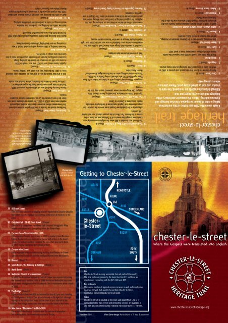
Getting to <strong>Chester</strong>-<strong>le</strong>-<strong>Street</strong><br />
Car<br />
<strong>Chester</strong>-<strong>le</strong>-<strong>Street</strong> is easily accessib<strong>le</strong> from all parts of the country.<br />
The A1M motorway passes by the town (Junction 63) and there are<br />
direct routes connecting with the A19, A66 and A68.<br />
Bus or Coach<br />
There are a number of regional express services as well as the extensive<br />
local bus network that operate to and from <strong>Chester</strong>-<strong>le</strong>-<strong>Street</strong>.<br />
Information from TRAVELINE 0870 608 2608.<br />
Train<br />
<strong>Chester</strong>-<strong>le</strong>-<strong>Street</strong> is situated on the main East Coast Main Line so is<br />
easily reached by train. Direct and connecting services are availab<strong>le</strong> to<br />
and from all parts of the country. National Rail Enquiries 08457 484950.<br />
Published: 01.09.11<br />
Front Cover Image: Parish Church of St Mary & St Cuthbert<br />
9 Anker’s House Museum (Board 4)<br />
8 Midd<strong>le</strong> Chare (Board 4)<br />
7 Bethel Chapel / United Reform Church, Low Chare<br />
Built in 1814 in a then densely populated area. Nearby was the<br />
Wes<strong>le</strong>yan Methodist Chapel (1807) which is now the site of the<br />
Salvation Army Citadel<br />
6 Roman Fort (Board 3)<br />
5 Round School Wall (Plaque)<br />
The remaining curved wall of the Deanery dovecote or maltings,<br />
which was used as a school c.1812 to 1860.<br />
4 Oaks Field (Board 2)<br />
3 Bridge Hotel<br />
The Bridge Hotel was rebuilt in 1895 and replaced the public<br />
house which had been in existence from at <strong>le</strong>ast 1827.<br />
2 Hopgarth (Board 2)<br />
1 Civic Centre (Board 1)<br />
Built by <strong>Chester</strong>-<strong>le</strong>-<strong>Street</strong> District Council and opened in 1982 by<br />
HRH The Duke of Gloucester, the building has won many awards.<br />
A walk around the 2000-year history of this market town,<br />
taking in sites of Roman occupation, Christian heritage and<br />
Victorian industry. Take in the character and history of the<br />
buildings and sites as you enjoy your tour.<br />
Although information boards are numbered, the route is<br />
circular and can be joined at any point. P<strong>le</strong>ase take care<br />
when crossing roads.<br />
heritage trail<br />
chester-<strong>le</strong>-street<br />
chester-<strong>le</strong>-street<br />
where the Gospels were translated into English<br />
www.chester-<strong>le</strong>-street-heritage.org
Photography archive courtesy of:<br />
George Nairn & <strong>Chester</strong>-<strong>le</strong>-<strong>Street</strong> <strong>Heritage</strong> Group<br />
<strong>Heritage</strong> <strong>Trail</strong> Directional Coins<br />
Directional studs in the pavement show<br />
the route of the trail. Follow the plume<br />
on the Roman’s helmet.<br />
Car Park<br />
Main Roads<br />
Route avoiding steps for<br />
wheelchair users / buggies<br />
<strong>Heritage</strong> <strong>Trail</strong> Route<br />
Buildings / Places of Interest<br />
www.chester-<strong>le</strong>-street-heritage.org<br />
Research: <strong>Chester</strong>-<strong>le</strong>-<strong>Street</strong> <strong>Heritage</strong> Group<br />
with thanks, for Roman information, to the<br />
Archaeology Section of Durham County Council<br />
Planning Service.<br />
Railway line<br />
Minor Roads<br />
& Footpaths<br />
Alternative Route when<br />
Civic Centre closed<br />
Information Display Boards<br />
B1<br />
KEY<br />
Opening Times<br />
33<br />
Civic Centre<br />
Monday - Thursday 8.30am - 5.00pm<br />
Friday - 8.30am - 4.30pm<br />
MILL LANE<br />
PELAW BANK<br />
CANADA<br />
B7<br />
SUPERMARKET<br />
SOUTH BURNS<br />
35<br />
1<br />
36<br />
Anker’s House Museum<br />
Open Easter Monday - October 31st<br />
Monday - Saturday (excluding Thursday mornings)<br />
10.00am - 3.30pm<br />
Groups / Parties Welcome, P<strong>le</strong>ase pre-book<br />
Admission Free<br />
Tel: 0191 388 3295<br />
VILLIERS PLACE<br />
34<br />
B1<br />
NEWCASTLE RD<br />
NORTH BURNS<br />
32<br />
17<br />
B6<br />
38<br />
B8<br />
31<br />
37<br />
20<br />
30<br />
2<br />
26<br />
28<br />
25<br />
23 29<br />
7<br />
18<br />
STATION ROAD<br />
PICKTREE LANE<br />
3<br />
CONE TERRACE<br />
19<br />
AVONDALE TERRACE<br />
FINCHDALE TERRACE<br />
16<br />
OSBORNE RD<br />
FRONT STREET<br />
B2<br />
CLARENCE TCE<br />
16<br />
4<br />
B3<br />
LOW CHARE<br />
27<br />
24<br />
21<br />
6<br />
11<br />
WEST LANE<br />
5<br />
B4<br />
8<br />
MIDDLE CHARE<br />
22<br />
FRONT STREET<br />
9<br />
HIGH CHARE<br />
WEST LANE<br />
15<br />
10<br />
12<br />
14<br />
B5<br />
ROPERY LANE<br />
13<br />
LUMLEY TCE<br />
chester-<strong>le</strong>-street heritage trail<br />
1 Civic Centre<br />
31 Former Co-op Store<br />
32 Co-operative <strong>Street</strong><br />
33 Viaduct<br />
34 South Burns, The Brewery & Maltings<br />
35 North Burns<br />
36 Methodist Church & Schoolrooms<br />
37 The Bridge<br />
38 Mi<strong>le</strong> House / Mechanics’ Institute 1826<br />
24 The Crown Inn,<br />
82 Front <strong>Street</strong><br />
25 The Queen’s Head<br />
26 61 Front <strong>Street</strong><br />
27 74 Front <strong>Street</strong><br />
28 57 - 59 Front <strong>Street</strong><br />
29 66 Front <strong>Street</strong><br />
30 Cestrian Club, 58-60 Front <strong>Street</strong><br />
17 Railway Station<br />
18 Turnbull’s Field<br />
19 Wes<strong>le</strong>yan Methodist Chapel / Station Road<br />
20 Murray’s Engine Works / Horner’s<br />
Dainty Dinah Factory<br />
21 The Library, Station Road<br />
22 114 Front <strong>Street</strong><br />
23 The Lambton Arms<br />
9 Anker’s House Museum<br />
10 The Parish Church of St Mary & St Cuthbert<br />
11 Post Office, 137 Front <strong>Street</strong><br />
12 The Grove, 168 Front <strong>Street</strong><br />
13 Ropery<br />
14 Workhouse<br />
15 Dawson Cottages 1890, West Lane<br />
16 One Ash, Oakda<strong>le</strong> & Finchda<strong>le</strong> Terraces<br />
2 Hopgarth<br />
3 Bridge Hotel<br />
4 Oaks Field<br />
5 Round School Wall<br />
6 Roman Fort<br />
7 Bethel Chapel / United Reformed Church<br />
8 Midd<strong>le</strong> Chare<br />
Points of<br />
interest<br />
DESIGN: CHRIS FAIRLEY<br />
E: c_fair<strong>le</strong>y@mac.com