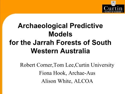
Archaeological Predictive Models for the Jarrah Forests of South ...
Archaeological Predictive Models for the Jarrah Forests of South ...
Archaeological Predictive Models for the Jarrah Forests of South ...

You also want an ePaper? Increase the reach of your titles
YUMPU automatically turns print PDFs into web optimized ePapers that Google loves.
<strong>Archaeological</strong> <strong>Predictive</strong><br />
<strong>Models</strong><br />
<strong>for</strong> <strong>the</strong> <strong>Jarrah</strong> <strong>Forests</strong> <strong>of</strong> <strong>South</strong><br />
Western Australia<br />
Robert Corner,Tom Lee,Curtin University<br />
Fiona Hook, Archae-Aus<br />
Alison White, ALCOA
Aims<br />
• Build inductive and deductive predictive<br />
models <strong>of</strong> likely aboriginal archaeological<br />
site locations<br />
• Used to select sample areas <strong>for</strong> heritage<br />
surveys prior to mining to reduce <strong>the</strong> risk <strong>of</strong><br />
disturbing potential sites<br />
• Used <strong>for</strong> <strong>Archaeological</strong> research to<br />
discover sites and preserve <strong>the</strong>ir heritage<br />
value.
Impact <strong>of</strong> sites on mining operations<br />
• Discovery <strong>of</strong> sites during mine development<br />
causes problems (eg; delays - need approval<br />
(3-6 months) to disturb sites, redesign <strong>of</strong><br />
roads or mining boundary)<br />
• If identified early sites can be avoided<br />
• Sites commonly occur near water course so<br />
higher risk <strong>of</strong> site disturbance when roads<br />
cross water courses<br />
• Ore bodies are located on <strong>the</strong> flanks <strong>of</strong> hills<br />
(mid slope) so risk <strong>of</strong> disturbance is lower
Impact <strong>of</strong> mining on <strong>Archaeological</strong> sites<br />
• Disturbance <strong>of</strong> site which is an <strong>of</strong>fence<br />
under <strong>the</strong> Western Australian Aboriginal<br />
Heritage Act 1972.<br />
• Sites are evidence <strong>of</strong> habitation and are<br />
<strong>the</strong>re<strong>for</strong>e used in research by archaeologists.<br />
• Sites are important and significant to local<br />
Aboriginal people as <strong>the</strong>y indicate past use<br />
<strong>of</strong> <strong>the</strong> Darling Range area by <strong>the</strong>ir ancestors.
• Alcoa’s Huntly Mine<br />
site 75km SE <strong>of</strong> Perth.<br />
• Medium to dense<br />
<strong>Jarrah</strong> <strong>for</strong>est<br />
• Mediterranean climate<br />
(cool, wet winter and<br />
hot, dry summer).<br />
• Study area is 25km x<br />
25km.<br />
Study area
Evidence <strong>of</strong> Occupation<br />
• Only evidence <strong>of</strong> sites is stone artefacts as<br />
organic material has degraded.<br />
• Radiocarbon dating <strong>of</strong> selected sites<br />
indicates that artefacts were deposited at<br />
least 5,000 years ago on <strong>the</strong> Darling Range,<br />
however <strong>the</strong>re are Pleistocene dates (30,000<br />
years ago) <strong>for</strong> archaeological sites on <strong>the</strong><br />
Swan Coastal Plain.<br />
• Most sites on <strong>the</strong> Darling Range are<br />
artefacts scatters.
Site definition<br />
• A site is <strong>the</strong> occurrence <strong>of</strong> artefacts or o<strong>the</strong>r<br />
evidence <strong>of</strong> human occupation <strong>of</strong> an area.<br />
– The type <strong>of</strong> activity at a site is interpreted from<br />
artefacts types, lithologies and number <strong>of</strong><br />
artefacts present.<br />
• Site data was obtained from multiple<br />
sources<br />
– Different site databases recorded different site<br />
attributes<br />
• For modelling purposes each artefact scatter<br />
is defined as a site and recorded as a point.
• Affected by <strong>the</strong> amount<br />
<strong>of</strong> leaf litter on <strong>the</strong><br />
ground.<br />
• Poor visibility greatly<br />
reduces chance <strong>of</strong> site<br />
discovery.<br />
• Forest that has been<br />
recently burnt has<br />
improved ground<br />
visibility due to<br />
minimal leaf litter<br />
Ground Visibility
Deductive <strong>Models</strong><br />
• Knowledge driven<br />
• Use expert opinion <strong>of</strong> subjects known<br />
activity and habits to determine likely site<br />
location.<br />
• Only data required are <strong>the</strong> environmental<br />
variables identified by <strong>the</strong> expert.<br />
• Can be quickly and cheaply implemented in<br />
an unexplored area without extensive<br />
sampling.
Deductive models<br />
• Activity <strong>of</strong> past Aboriginal groups based on<br />
<strong>the</strong>ory<br />
• Statistics compiled from archaeologists<br />
notes on DIA database<br />
• Activity seasonally dependant
• Data driven<br />
Inductive <strong>Models</strong><br />
• Analyse relationships between known<br />
existing sites and environmental variables to<br />
determine factors that affect site location.<br />
• Requires extensive sampling<br />
• More difficult to produce than deductive<br />
models but potentially more accurate.
Winter Deductive Model<br />
• Cold wea<strong>the</strong>r created bias towards areas <strong>of</strong><br />
nor<strong>the</strong>rn aspect.<br />
• High rainfall made water readily available<br />
in all streams.<br />
• Rainfall created bias towards well drained<br />
soil.<br />
• Edible vegetation grew near rock outcrops.
Winter Model Input<br />
• Sites likely to be:<br />
– Within 500m <strong>of</strong> water,<br />
– Within 1000m <strong>of</strong> granite or dolerite outcrops,<br />
– Nor<strong>the</strong>rn aspect,<br />
– Slope less than 10 degrees,<br />
– Within 500m <strong>of</strong> sandy or gravelly soil,<br />
– Within 500m <strong>of</strong> well draining soil.
Summer Deductive Model<br />
• Low water supply, drinkable water in only<br />
fourth or above order streams.<br />
• Warm wea<strong>the</strong>r creates a bias towards<br />
sou<strong>the</strong>rn aspects <strong>for</strong> shade.
Summer model input<br />
• Sites are likely to be:<br />
– Within 1000m <strong>of</strong> fourth or higher order streams,<br />
– Sou<strong>the</strong>rn aspect,<br />
– Slope less than 10 degrees,<br />
– Within 500m <strong>of</strong> sandy or gravelly soils.
• Primary data<br />
– Surface Hydrology<br />
– Roads<br />
– 5m contours<br />
– Rock outcrops<br />
– Vegetation<br />
– Soils (low resolution)<br />
– Sites on DIA database<br />
– Sites found by Alcoa<br />
Available Data<br />
• Derived data :<br />
–DEM<br />
– Slope Aspect<br />
– Hydrology with dam<br />
removed and streams<br />
interpolated and Strahler<br />
stream ordering carried<br />
out.
Building deductive models<br />
• Weighted overlay model.<br />
• Binary ( likely/unlikely) data layers<br />
produced <strong>for</strong> each attribute<br />
• Arithmetic Overlay to produce final result.
4 th +5 th order<br />
streams<br />
Aspect<br />
Slope<br />
Streams<br />
Aspect<br />
Slope<br />
Outcrop<br />
Buffer<br />
Buffer<br />
Reclass<br />
Buffer<br />
Reclass<br />
Reclass<br />
Buffer<br />
Model schemas<br />
Summer Model<br />
Within 1000m <strong>of</strong> water<br />
Sou<strong>the</strong>rn aspect<br />
Slope
Summer Model
Inductive model<br />
• 67 known sites, 56 used in building model,<br />
11 used in testing.<br />
• Variables available <strong>for</strong> analysis:<br />
– Slope<br />
– Aspect<br />
– Distance to Water<br />
– Distance to outcrop
Slope<br />
• Mean slope (study area):<br />
4.31 degrees<br />
• Mean slope (known sites):<br />
3.61 degrees<br />
• 95% <strong>of</strong> sites on slopes<br />
less than 7.5 degrees<br />
• Less than 7.5 degrees<br />
adopted as threshold<br />
Slope (degrees)<br />
Cross tabulation <strong>of</strong> Slope and Sites<br />
14<br />
12<br />
10<br />
8<br />
6<br />
4<br />
2<br />
0<br />
slope
• Aspect may be<br />
seasonally<br />
dependant.<br />
• No clear bias<br />
towards any aspect.<br />
• Aspect not used in<br />
<strong>the</strong> model.<br />
Aspect<br />
Number <strong>of</strong><br />
Sites<br />
9<br />
8<br />
7<br />
6<br />
5<br />
4<br />
3<br />
2<br />
1<br />
0<br />
north<br />
north-east<br />
east<br />
south-east<br />
south<br />
south-west<br />
Aspect<br />
Aspe ct<br />
west<br />
north-west<br />
flat
Distance to rock outcrop<br />
• Mean distance to rock<br />
outcrop (study area):<br />
5344 m.<br />
• Mean distance to rock<br />
outcrop (known sites):<br />
6827.37m.<br />
• 8 sites within 1900m<br />
<strong>of</strong> outcrop,<br />
• 2000m adopted as<br />
threshold<br />
12000<br />
10000<br />
8000<br />
6000<br />
4000<br />
2000<br />
0<br />
Outcrop distance
Distance to water courses<br />
• Mean distance to<br />
water <strong>of</strong> sites: 150m<br />
• 82% <strong>of</strong> sites are<br />
within 210m <strong>of</strong><br />
streams.<br />
• 210m adopted as<br />
threshold<br />
Distance (m)<br />
600<br />
500<br />
400<br />
300<br />
200<br />
100<br />
0<br />
Distance <strong>of</strong> Sites from Water
Distance to 4 th /5 th order streams.<br />
• Summer water only<br />
available in 4 th <strong>of</strong><br />
higher order streams.<br />
• Sites where<br />
Dallwater ≡ Dhigh order<br />
are within 370m <strong>of</strong> water.<br />
• 500m adopted as<br />
threshold <strong>for</strong> fourth or<br />
higher order streams.<br />
Distance (m)<br />
6000<br />
5000<br />
4000<br />
3000<br />
2000<br />
1000<br />
Distance to Streams compared to 4th and 5th<br />
order Streams<br />
0<br />
Site ID<br />
0-5th order<br />
4th and 5th<br />
Order
Inductive model schema<br />
Digital Elevation<br />
Model<br />
Derive<br />
Slope<br />
Slope Distance to water<br />
(1 st –5 th order)<br />
Slope
Field Verification<br />
• Two days, four people<br />
• Four transects 50m wide and 4680m long<br />
combined, covering 26.72ha.<br />
• Sample area dependant on ground visibility.<br />
• High ground visibility in an area effected by<br />
fire 2001/2002.<br />
• Medium to low ground visibility in area <strong>of</strong><br />
burn<strong>of</strong>f in 2001.
Sampling and testing<br />
• Transects covered variation <strong>of</strong><br />
environmental variables and site probability.<br />
• Three new sites were found.<br />
• Deductive models were tested using all<br />
known sites (67 sites).<br />
• Inductive model tested using sites not used<br />
in model building (11 sites).
Summer model testing<br />
Verification <strong>of</strong> summer model<br />
Value Class Total Sites Total Sites (%) Background Sites per sq. km<br />
0 V. Low 1 1.50% 2.29% 0.067<br />
1 Low 49 73.10% 64.03% 0.117<br />
2 Medium 12 17.90% 30.47% 0.06<br />
3 High 5 7.50% 3.21% 0.239<br />
Total 67 100.00% 100.00%<br />
• 7.5% <strong>of</strong> sites in high probability class which<br />
takes up only 3.2% <strong>of</strong> <strong>the</strong> area resulting in a<br />
high density <strong>of</strong> sites.<br />
• Many sites in low probability classes
Winter model testing<br />
Verification <strong>of</strong> Winter Model<br />
Value Class Total Sites Total Sites (%) Background Sites per km^2<br />
0 V. Low 0 0.00% 0.21% 0<br />
1 Low 3 4.50% 14.22% 0.032<br />
2 Medium 40 59.70% 63.87% 0.096<br />
3 High 23 34.30% 20.43% 0.173<br />
4 V. High 1 1.50% 1.27% 0.121<br />
Total 67 100.00% 100.00%<br />
• Fairly even distribution <strong>of</strong> densities across<br />
classes.<br />
• High class 34% <strong>of</strong> sites in 20%<br />
• Very high class does not cover much area.
Inductive model testing<br />
Verification <strong>of</strong> inductive model<br />
Value Class Sites Total Sites (%) Background Sites per km^2<br />
0 V. Low 1 9.09% 0.39% 0.395<br />
1 Low 2 18.18% 49.95% 0.006<br />
2 Medium 4 36.36% 38.88% 0.016<br />
3 High 2 18.18% 9.48% 0.032<br />
4 V. High 2 18.18% 1.30% 0.236<br />
Total 11 100.00% 100.00%<br />
• Very high class has high density <strong>of</strong><br />
sites18% in 1.3% <strong>of</strong> <strong>the</strong> area<br />
• 36% <strong>of</strong> <strong>the</strong> sites are predicted in 10% <strong>of</strong> <strong>the</strong><br />
model area( high and very high classes)
Comparison <strong>of</strong> models<br />
• The summer and <strong>the</strong> inductive models have <strong>the</strong><br />
greatest area covered by <strong>the</strong> low probability<br />
classes, which is representative <strong>of</strong> current<br />
understanding <strong>of</strong> <strong>the</strong> area.<br />
• All models have high densities in <strong>the</strong> high<br />
probability classes.<br />
• Inductive model has <strong>the</strong> best distribution <strong>of</strong><br />
densities across class boundaries, and distribution<br />
<strong>of</strong> class boundaries across <strong>the</strong> study area.
Future work<br />
• Use conditional probabilistic networks<br />
– Data driven, expert moderated approach<br />
• Separate sites<br />
– Stone working sites<br />
–O<strong>the</strong>rs<br />
• Investigate landscape evolution
Acknowledgements<br />
• Tom and o<strong>the</strong>r co-authors <strong>for</strong> doing <strong>the</strong><br />
work!<br />
• Christine and Bruce <strong>for</strong> helping with field<br />
verification<br />
• ALCOA <strong>for</strong> provision <strong>of</strong> data<br />
• PNC 2003 <strong>for</strong> letting us present <strong>the</strong> work