Athabascan Language.ed.pdf
Athabascan Language.ed.pdf
Athabascan Language.ed.pdf

You also want an ePaper? Increase the reach of your titles
YUMPU automatically turns print PDFs into web optimized ePapers that Google loves.
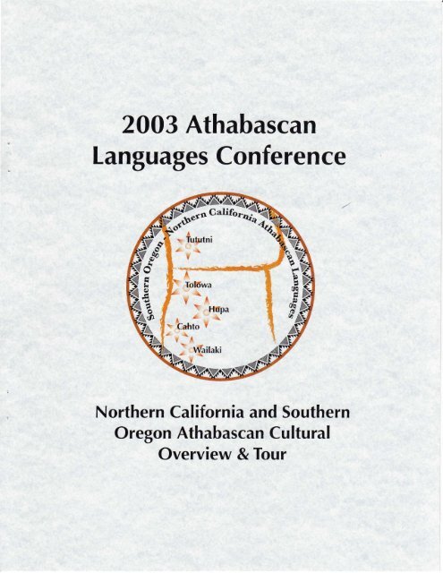
2003 <strong>Athabascan</strong><br />
<strong>Language</strong>s Conference<br />
Northern California and Southern<br />
Oregon <strong>Athabascan</strong> Cultural<br />
Overview & Tour
2003 <strong>Athabascan</strong> <strong>Language</strong>s Conference<br />
Humboldt State University<br />
Arcata, California<br />
June 5-7, 2003<br />
A Short Guide to the Tribes of Northwestern California<br />
and Southwestern Oregon<br />
Compil<strong>ed</strong> by<br />
Victor Golla<br />
Ruth Bennett<br />
ZoDevine<br />
and<br />
Staff of the Center for Indian Community Development<br />
Humboldt State University
INTRODUCTION<br />
Many participants in the 2003 <strong>Athabascan</strong> <strong>Language</strong>s Conference will be unfamiliar with the<br />
Indian geography ofNorthwestem California and Southwestern Oregon. This region, which was<br />
home to two quite distinct <strong>Athabascan</strong> subgroups, the California <strong>Athabascan</strong>s and the Oregon<br />
<strong>Athabascan</strong>s, is very different in climate, plants and animals, and traditional culture from most of<br />
the rest of <strong>Athabascan</strong> territory in North America. In this short guide we try to give you an<br />
overview ofthe Indian groups ofthe area, from the perspective both of aboriginal culture and of<br />
contemporary life.<br />
The feature that newcomers to the area are most often struck by is its extraordinary diversity. The<br />
landscape is divid<strong>ed</strong> into a multitude ofmicroregions, each with its own ecological profile. To a<br />
considerable extent aboriginal Indian cultures and,languages were link<strong>ed</strong> to these small regions.<br />
To illustrate: Here in Arcata, in the flatlands around Humboldt Bay, we are on traditional Wiyot<br />
territory. In aboriginal times the Wiyot people had a lifestyle focus<strong>ed</strong> on collecting shellfish and<br />
on fishing in the marshy areas at the mouths of the Mad and Eel Rivers. However, if you drive<br />
north from Arcata on Highway 101, by the time you reach Trinidad, about 15 miles distant, the<br />
low sandy shoreline of the Humboldt Bay area has given way to steep and rocky cliffs. You have<br />
pass<strong>ed</strong> into Yurok territory. The cultural focus of the traditional Yuroks was on coastal sea<br />
mammal hunting and riverine fishing, and their language, although historically relat<strong>ed</strong> to Wiyot,<br />
was as different from Wiyot as English is from Sw<strong>ed</strong>ish. If you travel east on Highway 299<br />
rather than north on Highway 101, 10 miles will take you to the small town ofBlue Lake, which<br />
lies at the foot of the first major ridge in the Coast Range. In aboriginal times this was the<br />
furthest inland extent ofWiyot settlement. As you ascend the mountain (which us<strong>ed</strong> to be<br />
cover<strong>ed</strong> with a thick old-growth r<strong>ed</strong>wood forest) you enter what was <strong>Athabascan</strong> territory-in<br />
this particular area, the territory of the Mad River Whilkut, a hunting and foraging people. This<br />
pattern repeats again and again throughout northwestern California and southwestern Oregon: a<br />
·different culture and language is encounter<strong>ed</strong> every twep.ty or thirty miles.<br />
Yet alongside this close attachment to small, well-defin<strong>ed</strong> regions, the aboriginal peoples of this<br />
area were also-almost paradoxically-great travellers and sharers. Hupa people, for instance,<br />
regularly travell<strong>ed</strong> from Hoopa Valley to the coast to trade, or went over the mountains to Karuk<br />
country to attend ceremonies, or went up into the high peaks to the east to hunt. This<br />
combination of an intensely local identity (and language) with wide networks of intergroup<br />
contact l<strong>ed</strong> to a great respect for diversity, which persists to this day.<br />
Our intention in designing this booklet is to give the reader a feel both for the ecological, cultural,<br />
and linguistic diversity of this area, and also for some of its unifYing themes, particularly the<br />
religious and ceremonial aspects of traditional life. In addition to a general catalogue of facts and<br />
figures, we have includ<strong>ed</strong> a tour guide to some important Native American sites in the area. We<br />
hope you will have the time to explore our region while you are here, and come to know<br />
something of its unique charm.
ABORIGINAL AND CONTEMPORARY TRIBAL GROUPS<br />
OF NORTHWESTERN CALIFORNIA AND<br />
SOUTHWESTERN OREGON<br />
I. <strong>Athabascan</strong> Groups<br />
Hupa:<br />
Aboriginal Territmy- The main group ofHupa-speaking people traditionally liv<strong>ed</strong> along a<br />
25-mile course of the lower Trinity River, from the mouth of South Fork north to the<br />
confluence of the Trinity and Klamath. In the lower part of this course the Trinity winds<br />
through Hoopa Valley (na:tinixw 'where the trails go back'), which was the center ofHupa<br />
territory. The Hupas call<strong>ed</strong> themselves na:tinixwe: 'the people of Hoopa Valley'. To the<br />
south and southeast, upstream on South Fork and the main Trinity, liv<strong>ed</strong> the Tsnungwe<br />
(tse:ningxwe: 'the people oflronside Mountain'), who had their own leaders but also spoke<br />
Hupa. To the west, along R<strong>ed</strong>wood Creek and the upper Mad River, liv<strong>ed</strong> the Chilula and<br />
Whilkut (xwiylq 'idxwe: 'the people of R<strong>ed</strong>wood Ridge'), who also spoke dialects ofHupa.<br />
To the north, traditional Hupa territory border<strong>ed</strong> on Yurok (k 'ina') territory just south of<br />
the Yurok village ofWeitspus or Weitchpec. The Hupa were also in close contact with the<br />
Karuks (k'inasni) who liv<strong>ed</strong> to the northeast, upstream on the Klamath River.<br />
Contemporary Territory- Today, most ofthe descendants of the Hupa-speaking groups live<br />
on the Hoopa Valley Reservation in northwestern Humboldt County. The reservation, one<br />
of the largest in California, covers 144 square miles-a square, 12 miles on each<br />
side-bisect<strong>ed</strong> by the Trinity River. It includes all of Hoopa Valley. During the 1850s and<br />
1860s most of the Tsnungwe, Chilula, and Whilkut people were relocat<strong>ed</strong> in Hoopa Valley,<br />
and many of their descendants are members ofthe Hoopa Tribe. Some Tsnungwe<br />
descendants, including some wl1.0 live in traditional Tsnungwe territory, are petitioning for<br />
separate f<strong>ed</strong>eral recognition oftheir tribe.<br />
<strong>Language</strong> 1 Hupa, Tsnungwe, Chilula, and Whilkut were minimally different varieties of a<br />
single language, and were sharply different from the varieties of California <strong>Athabascan</strong><br />
spoken by the groups to the south of the Hupa-speaking area. Whatever differences may<br />
originally have exist<strong>ed</strong> among the local varieties of Hupa, little of them has surviv<strong>ed</strong> the<br />
dialect mixture and leveling of the reservation period. Hupa continues to be spoken, but all<br />
fluent native speakers are elderly. <strong>Language</strong> retention and revival efforts have been ongoing<br />
since the 1970s and the language is currently taught at both primary and secondary school<br />
levels. Several learners have acquir<strong>ed</strong> moderate fluency. A dictionary and a variety of<br />
teaching materials exist.<br />
Groups south of the Hupa:<br />
Aboriginal Territory- At the time of white contact in 1850 at least half a dozen distinct<br />
<strong>Athabascan</strong>-speaking groups liv<strong>ed</strong> in drainage of the Eel River and its tributaries, or in the<br />
vicinity of Cape Mendocino. These includ<strong>ed</strong> the Mattole and Bear River groups ofthe<br />
Mattole Valley and Cape Mendocino; the Sinkyone, who liv<strong>ed</strong> along the present route of<br />
1
Highway 101 from Scotia to south of Garberville; the Nongatl, who liv<strong>ed</strong> along the Van<br />
Duzen River around Bridgeville, along the present route of Highway 36; the Lassik and<br />
Wailaki ofthe Eel River Canyon, along the Northwestern Pacific railroad line; and the<br />
Cab to, who liv<strong>ed</strong> in the valley around Laytonville. Each group spoke a distinct variety of<br />
California <strong>Athabascan</strong>, with the Mattole-Bear River dialects the most differentiat<strong>ed</strong>. Much<br />
of this territory is heavily forest<strong>ed</strong> or quite mountainous, sometimes both, and nearly all of<br />
these groups were small and relatively isolat<strong>ed</strong>. The Cahto were an exception, living in a lush<br />
valley in close contact with the Yukis of Round Valley and the Northern Porno of the Willits<br />
area.<br />
Contemporazy Territory- Of the <strong>Athabascan</strong>s of this area only the descendents ofthe Cahto<br />
have a reservation of their own, the Laytonville Rancheria, a few miles west of the town of<br />
Laytonville. A number ofWailaki and Lassik descendents are enroll<strong>ed</strong> in the Round Valley<br />
Reservation, a large reservation similar in situation and early history to the Hoopa Valley<br />
Reservation. The conf<strong>ed</strong>erat<strong>ed</strong> Round Valley Tribe also includes descendents of the Yukis,<br />
the Nornlakis, and the Konkow Maidus (relocat<strong>ed</strong> from the other side of Sacramento Valley).<br />
A few descendents of the Mattole and Bear River groups are enroll<strong>ed</strong> at the Rohnerville<br />
Rancheria, between Scotia and Fortuna.<br />
<strong>Language</strong>- Although Mattole (with Bear River) and Cahto stand apart from the other<br />
varieties, and may be consider<strong>ed</strong> emergent languages, it is likely that there was some degree of<br />
mutual intelligibility among all California <strong>Athabascan</strong> languages other than Hupa. With the<br />
possible exception of one or more W ailakis who claim a very restrict<strong>ed</strong> command of their<br />
language, no one survives who has native fluency in any variety of these languages. Over<br />
the last decade individuals have made efforts to acquire some second-language knowl<strong>ed</strong>ge of<br />
Mattole, Cahto, or Wailaki, but it is not known how successful these have been.<br />
Tolowa:<br />
Aboriginal Territory- The Totowa people (xtts or xeshe ')traditionally liv<strong>ed</strong> in the coastal<br />
r<strong>ed</strong>wood forest of the extreme north westernmost comer of California, from just north of the<br />
mouth of Smith River to Wilson Creek, between Crescent City and the mouth of the<br />
Klamath. North of the Tolowas in the area around Brookings, Oregon, liv<strong>ed</strong> the Chetco,<br />
who were closely alli<strong>ed</strong> to the Tolowas and spoke a slightly different dialect ofthe same<br />
language. To the south, Tolowa territory adjoin<strong>ed</strong> that of the Yuroks, with whom the<br />
Tolowas trad<strong>ed</strong> and intermarri<strong>ed</strong>. To the east, the Tolowas shar<strong>ed</strong> the high country with<br />
several surrounding tribes, including the Yuroks, Karuks, and Hupas.<br />
Contemporary Territory- Today, many Tolowa people are enroll<strong>ed</strong> members of one of two<br />
f<strong>ed</strong>erally recogniz<strong>ed</strong> tribes, the Elk Valley Rancheria. locat<strong>ed</strong> offUS Highway 101 southeast<br />
of Crescent City, and the Smith River Rancheria, on Highway 101 a few miles south ofthe<br />
California-Oregon border, and either live on the rancherias or in the nearby area. Other<br />
Totowa people are members of an as yet unrecogniz<strong>ed</strong> group, the Totowa Nation. In the<br />
1850s the Chetcos, together with most of the Indian people of southwestern Oregon, were<br />
forcibly remov<strong>ed</strong> to the Siletz and Grand Ronde Reservations in northern Oregon, and their<br />
descendents live there or in non-Indian communities.<br />
2
Ceremonial Dances<br />
I. Hoopa, Karuk, Yurok<br />
These tribes hold world renewal ceremonies conduct<strong>ed</strong> by tribal leaders. These ceremonies include<br />
rituals conduct<strong>ed</strong> by a m<strong>ed</strong>icine person With assistants and one or more dances with participation<br />
from a number of camps. The major world renewal ceremonies include the White Deerskin Dance,<br />
at which deerskins and obsidian blades are incorporat<strong>ed</strong> into a display of ceremonial regalia, and the<br />
Jump Dance, where woodpecker headdresses and woven hoods with elaborate designs are worn by<br />
men, and deerskin dresses decorat<strong>ed</strong> with abalone, c<strong>ed</strong>ar nut beads, dentalia, and porcupine quills are<br />
worn by adolescent women. Each dance is held at specific locations and lasts ten days with a ,<br />
distinct sch<strong>ed</strong>ule for each day. Individuals with group accompaniment sing the songs. Each dance<br />
has its own songs. Songs of the White Deerskin Dance have a solemn and dignifi<strong>ed</strong> quality so<br />
striking that even the first-time listener is likely to recognize their sacr<strong>ed</strong> purpose. Jump Dance<br />
songs have a slow, irregularrhythrn that gives the music a spiritual ecstatic quality. Xonsil ch 'idilye<br />
is the Hupa name for White Deerskin Dance. Ya:xo: 'awh is the Hupa name for Jump Dance.<br />
Vuhvtihi, is the Karuk name for the Jump Dance, and Sahvuhvtiha, the name for the Deerskin Dance.<br />
Pyeweg is the Yurok name for White Deerskin Dance. Wonikwulegoh is the Yurok name for Jump<br />
Dance.<br />
The Brush Dance (Xon 'na 'we, in Hupa; Ihvunaa in Karuk, and Melih in Yurok) is traditionally held<br />
to heal and bless sick children. In the center of a pit, a m<strong>ed</strong>icine woman and her helper work on the<br />
baby while the mother holds it. Adolescent young women, children, and men of all ages participate<br />
in the singing and dancing. Singing consists of sets that alternate between "heavy songs, slow<br />
songs, and "light songs," fast songs. Individual singers lead the songs, with the rest of the dancers<br />
joining in. All the dancers do the basic dance step for the Brush Dance. While the dancers are<br />
dancing, individual male dancers or pairs of dancers do displays of male expertise, term<strong>ed</strong> "jump<br />
center."<br />
Dresses for the girls and young women are the northwestern California style of deerskin dresses with<br />
aprons decorat<strong>ed</strong> with abalone, c<strong>ed</strong>ar nut beads, glass beads, dentalia, and porcupine quills. They<br />
wear basket hats and necklaces made from abalone, glass beads, and dentalia. Boys and men wear<br />
deerskin hides, hold otter hide quivers and arrows, wear necklaces made from abalone, pine nuts, and<br />
dentalia, and have headrolls made from woodpecker scalps and adorn<strong>ed</strong> with many feathers.<br />
5
Food<br />
For the Hoopa, Karuk, Tolowa, Wiyot and Yurok tribes food has historically been plentiful on the<br />
mountains and valleys of northwest California. All the tribal people made good use of it all. Their<br />
way of life was sustain<strong>ed</strong> by river and creek fishing for salmon and trout and for trading for coastal<br />
shellfish, sea lions, and whales. Deer and elk were hunt<strong>ed</strong>. Acorns were a staple and were most<br />
commonly eaten as acorn soup, a thick soup with a consistency of mush. Berries, such as<br />
blackberries and huckleberries were an important food source, as were roots, such as wild potatoes.<br />
Cooking and eating baskets were made from a combination of willow, pine, or hazel. Distinctive<br />
designs were woven into the twin<strong>ed</strong> baskets. Dome-shap<strong>ed</strong> baskets, rather than peak<strong>ed</strong> or flat<br />
shapes, are common throughout Northwestern California. Today people of these tribes still weave<br />
baskets and eat traditional foods and use traditional basket utensils on special occasions.<br />
Housing<br />
For the Hoopa, Karuk, Tolowa, Wiyot and Yurqk tribes houses were, historically, rectangular in<br />
shape, made from split planks, with a plank roof (Hoopa us<strong>ed</strong> c<strong>ed</strong>ar, other tribes r<strong>ed</strong>wood), a smoke<br />
hole at the top, and a round side entrance with a sliding door. Inside the house was a fire pit and<br />
extending all around the outer <strong>ed</strong>ges was a shelf us<strong>ed</strong> for storage. Women and children always siept<br />
in the living house, but men usually occupi<strong>ed</strong> sweathouses. Sweathouses were us<strong>ed</strong> for sleeping,<br />
gambling, and for ceremonial purposes. They were like the living house, except smaller, and with<br />
roof planks often extending to the ground.<br />
Most tribal people today live in contemporary, western style dwelling spaces. The Department of<br />
Health and Urban Development (HUD) usually supplements the costs of constructing housing on the<br />
reservation. HUD's mission is to rem<strong>ed</strong>y unsafe and unsanitary housing conditions and to alleviate<br />
the acute shortage of decent, safe, and sanitary dwellings for of low-income people while promoting<br />
and sustaining the culture, <strong>ed</strong>ucation, language, health, welfare, self-sufficiency, and economic<br />
· independence of its residents.<br />
Transportation<br />
The Hoopa, Karuk, Tolowa, Wiyot and Yurok tribes had a strong transportation system along the<br />
river systems that ran through their respective territories using dugout canoes construct<strong>ed</strong> from<br />
r<strong>ed</strong>wood. Canoes were construct<strong>ed</strong> with stone tools by a process of burning out the inside and<br />
hacking out a blunt-end<strong>ed</strong> outer shape and a round<strong>ed</strong>-out interior. Boats were steer<strong>ed</strong> with paddles,<br />
also construct<strong>ed</strong> from r<strong>ed</strong>wood. Boats were thought of as living beings and parts of the boats were<br />
nam<strong>ed</strong> with the names for human organs. For example, in the Hoopa language, the back seat of the<br />
boat is call<strong>ed</strong>, Me:neq' miq'it dahya'wing'ay its back-on it-it extends upward. The inside of the boat<br />
is call<strong>ed</strong> mi!cyunsa 'a:n, its heart, or its insides-it lies there. The foothold in the boat is call<strong>ed</strong><br />
k'ijonjo/, its kidney.<br />
Today, motorboats are more common on the Trinity than boats that are paddl<strong>ed</strong>. However, dug out<br />
canoes are still made and us<strong>ed</strong> for ceremonial purposes. Transportation is primarily via motor<br />
7
vehicles on state and tribally maintain<strong>ed</strong> roads systems. In rural areas, public transportation is<br />
limit<strong>ed</strong>.<br />
Doctoring<br />
The Hoopa, Karuk, Tolowa, Wiyot and Yurok tribes parallel<strong>ed</strong> many California indigenous groups in<br />
their theories relating to disease. Traditionally they held that sickness was caus<strong>ed</strong> by the intrusion of<br />
poison into the body, caus<strong>ed</strong> by persons train<strong>ed</strong> in creating illness in others, or by other evil forces.<br />
To counter the effects of these forces, Indian doctors practic<strong>ed</strong> one or more types of doctoring. Herb<br />
doctors gave herbs and recit<strong>ed</strong> curative prayers. Dream doctors dream<strong>ed</strong> of the taboo that had been<br />
breach<strong>ed</strong> or the cause of the illness. Singing doctors recit<strong>ed</strong> curative formulas and sang. Laying on<br />
hands doctors transferr<strong>ed</strong> powers from themselves into the patient through their hands. Tracing<br />
doctors found the locations that people were seeking, such as where people were lost in the<br />
mountains. Sucking doctors remov<strong>ed</strong> poison objects through a pipe that was shap<strong>ed</strong> like two cones,<br />
one invert<strong>ed</strong> and on top of the other, join<strong>ed</strong> at their narrow points. There was also a doctor who<br />
could do all of the types of doctoring.<br />
In 1892, John Slocum found<strong>ed</strong> the Shaker Church, a doctoring religion in the state of Washington<br />
that spread among indigenous people. The Indian Shaker religion spread to northwestern California<br />
soon after, and remains there today. Shaker doctors are equivalent to Protestant ministers who<br />
combine the laying on of hands with group rituals such as the ringing of bells and step dancing in a<br />
circle and include some Christian elements.<br />
Today, Indian Health Service (IHS), an agency within the US Dept. of Health and Human Services,<br />
is the principal f<strong>ed</strong>eral health care provider and health advocate for Indian people. Its goal is to<br />
assure that comprehensive, culturally acceptable personal and public health services are available<br />
and accessible to American Indians and Alaska Natives. The IHS provision of health services to<br />
members of f<strong>ed</strong>erally recogniz<strong>ed</strong> tribes grew out of the special government to government<br />
relationship between the f<strong>ed</strong>eral government and Indian tribes. This relationship, establish<strong>ed</strong> in 1787;<br />
is bas<strong>ed</strong> on Article I, Section 8 of the Constitution, and has been given form and substance by<br />
numerous treaties, laws, Supreme Court decisions, and Executive Orders.<br />
On the Northcoast, IHS has compact<strong>ed</strong> with the Unit<strong>ed</strong> Indian Health Services (UIHS) to provide<br />
m<strong>ed</strong>ical services to American Indians. A new UIHS health complex, Potawot Health Village, being<br />
built in Arcata will be the largest Indian health facility in California when complet<strong>ed</strong>. The Hoopa<br />
Tribe operates its own health services and operates the only hospital in the eastern Humboldt area.<br />
Education<br />
Today, most tribal children attend public schools. However, traditionally, <strong>ed</strong>ucating Indian children<br />
depend<strong>ed</strong> on the family. Elders took charge of children's <strong>ed</strong>ucation with stories as a central focus in<br />
their teaching. After contact, Indian <strong>ed</strong>ucation came under control ofthe f<strong>ed</strong>eral government, which<br />
has had a variety of policies and practices regarding the <strong>ed</strong>ucation oflndian people. For a period of<br />
time from the mid-1800s to the early 1900s, Indian children, including children from local tribes,<br />
were sent to distant boarding schools, sometimes as young as age 7. There they were <strong>ed</strong>ucat<strong>ed</strong> in<br />
vocations and trades and punish<strong>ed</strong> for speaking their ancestral languages.<br />
8<br />
....
Indian Law<br />
Traditionally, The Hoopa, Karuk, Tolowa, Wiyot and Yurok people resolv<strong>ed</strong> most conflicts by a<br />
system of payments, where if both parties agre<strong>ed</strong> upon the payment, the matter was settl<strong>ed</strong> and<br />
couldn't be brought up again.<br />
Today Indian law is a comprehensive body of knowl<strong>ed</strong>ge within a historical, factual, and legal<br />
framework. Lawyers and other advocates train in this field to address the complexities fac<strong>ed</strong> by<br />
states, Indian tribes, and the f<strong>ed</strong>eral government when dealing with Indians, Tribes and tribal<br />
resources. Tribal courts, or law departments within tribes have been establish<strong>ed</strong> for researching<br />
Indian law issues, and there are a number of organizations, such as the California Indian Legal<br />
Service, whose work is devot<strong>ed</strong> to legal issues relating to tribes. The Hoopa Valley Tribe has a<br />
Tribal court which exercises general civil jurisdiction and limit<strong>ed</strong> criminal jurisdiction relating to<br />
reservation resources. The Yurok Tribe has a limit<strong>ed</strong> jurisdiction tribal court that has principally<br />
handl<strong>ed</strong> issues relat<strong>ed</strong> to regulation of the tribe's fishery. The Blue Lake Rancheria, the Big Lagoon<br />
Rancheria, and the Rohnerville Rancheria participate in a consortium that operates the Northwest<br />
Intertribal Court, establish<strong>ed</strong> to handle child welfare issues.<br />
HOOPA<br />
SOURCES<br />
Bennett, Ruth. 1994. Ya:na:'a'awh. Four Hupa Songs by Alice Pratt. Arcata, CA: Center for Indian<br />
Community Development.<br />
Goddard, Pliny Earle. 1903. Hupa Texts. Vol. 1. and 1905. Morphology of the Hupa <strong>Language</strong>. Vol.<br />
3. University of California Publications in American Archeology and Ethnology.<br />
Golla, Victor. 1996. Hupa <strong>Language</strong> Dictionary. Hoopa, CA.: Hoopa Valley Tribe. 1<br />
Tiller, Veronica E. Velarde. 1996. American Indian Reservations and Trust Areas. Washington, D.C.:<br />
U.S. Dept. of Commerce.<br />
Wallace, William. 1980. Hupa, Chilula, and Whilkut. In Robert F. Heizer, <strong>ed</strong>. California. Vol. 8.<br />
Indians ofNorth America. Washington, D.C.: Smithsonian Institution.<br />
KARUK<br />
Bright, William. 1957. The Karok <strong>Language</strong> University of California Publications in Linguistics 13.<br />
Bright, William. 1980. Karok. In Robert F. Heizer, <strong>ed</strong>. California. Vol. 8. Indians ofNorth America.<br />
Washington, D.C.: Smithsonian Institution.<br />
Tiller, Veronica E. Velarde. 1996. American Indian Reservations and Trust Areas. Washington, D.C.:<br />
U.S. Dept. of Commerce.<br />
TOLOWA<br />
Bommelyn, Loren. 1989. Xus we-yo'. Tolowa <strong>Language</strong>. Second Edition. Center for Indian<br />
Community Development.<br />
9
Gould, Richard. 1980. Tolowa. In Robert F. Heizer, <strong>ed</strong>. California. Vol. 8. Indians ofNorth America.<br />
Washington, D.C.: Smithsonian.<br />
Tiller, Veronica E. Velarde. 1996. American Indian Reservations and Trust Areas. Washington, D.C.:<br />
U.S. Dept. of Commerce.<br />
WIYOT<br />
Elsasser, Albert B. 1980, Wiyot. Robert F. Heizer, <strong>ed</strong>. California. Vol. 8. Indians of North America.<br />
Washington, D.C. Smithsonian Institution.<br />
Loud, Llewellyn. 1918. Ethnogeography and Archeology ofWiyot Territory. Berkeley, University of<br />
California Press.<br />
Teeter, Karl, and John Nichols. 1993. Wiyot Handbook I and Wiyot Handbook II. Winnipeg:<br />
Algonquian and lroquian Linguistics.<br />
Tiller, Veronica E. Velarde. 1996. American Indian Reservations and Trust Areas. Washington, D.C.:<br />
U.S. Dept. of Commerce.<br />
YUROK<br />
Kroeber, Alfr<strong>ed</strong> L. 1976. Yurok Myths. Berkeley, University of California Press.<br />
Pilling, Arnold. 1980. Yurok. In Robert F. Heizer, <strong>ed</strong>. California. Vol. 8. Indians ofNorth America.<br />
Washington, D.C.: Smithsonian. ·<br />
Robins . . 1958. The Yurok <strong>Language</strong>. Grammar, Texts, Lexicon. Berkeley, University of California<br />
Press.<br />
Tiller, Veronica E. Velarde. 1996. American Indian Reservations and Trust Areas. Washington, D.C.:<br />
U.S. Dept. of Commerce.<br />
10
<strong>Athabascan</strong> Sites Tours<br />
By Ruth Bennett, PhD<br />
ARCATA TO TOLOWA ANCESTRAL TERRITORY<br />
Crescent City: Tolowa ancestral lands are set in the stunningly beautiful and diverse<br />
natural environs near Crescent City, about an hour and a half north of Arcata. These<br />
environs include the Lake Earl lagoon, Smith River estuary, and Elk Valley. Tolowa<br />
history, traditions, and legends were liv<strong>ed</strong> in ancient thriving villages, locat<strong>ed</strong> throughout<br />
the area. Today the f<strong>ed</strong>erally recogniz<strong>ed</strong> Tolowa tribes are the Smith River Rancheria<br />
and Elk Valley Rancheria. The Tolowa Nation is seeking recognition.<br />
How to find it: The road to Tolowa territory is Highway 101 north from Arcata, running<br />
first through Wiyot territory. Seven miles north of Arcata, the road crosses the Mad<br />
River. The ancient Wiyot village of Kolik'me on the north bank of the mouth of the Mad<br />
River was a ceremonial site where Wiyot people once held the Jump Dance. Continuing<br />
north through and past McKinleyville, Highway 101- north crosses over the Little River at<br />
its mouth. This is the border of Wiyot and Yurek territories.<br />
The highway continues north through Yurek territory, from Trinidad (Tolowa:<br />
Tumshrayme'), to Orick and into R<strong>ed</strong>wood National Park. The road north crosses the<br />
Klamath River at Requa (Tolowa: Tachit), a major Yurek ceremonial center where the<br />
Brush Dance is held annually. Highway 101 north enters Tolowa territory at the mouth<br />
of Wilson Creek (Dageet'U'sa). It continues north through to Tolowa lands to Crescent<br />
City (Ta'atdun).<br />
Ancient Tolowa Villages: North of Crescent City the road passes into the heart of<br />
Tolowa territory, and the ancient village sites of Eechulet on Lake Earl and Yan'daakut,<br />
the Tolowa center of the universe, on the Smith River. Further upstream is<br />
Ninglichuundun, another important Tolowa village.<br />
How to find them: Highway 101 continues north from Crescent City toward the Smith<br />
River. Near the Crescent City northern city limits on Highway 101, a right turn leads into<br />
the Elk Valley road. Continuing north on Highway 101 , a left turn connects onto Lake<br />
Earl Drive, and access to Lake Earl. Eechulet is an ancient Tolowa village on a<br />
peninsula on Lake Earl. A left turn farther north leads to Fort Dick and to Yan'daakut,<br />
the Tolowa Center of the World, on the Smith River downstream from Highway 101. Or,<br />
continuing north on Highway 101, at Dr. Fine Bridge the highway crosses the Smith<br />
River. The village of Yan'daakut is downstream, to the west. Gushchume' is at the<br />
mouth of Elk Creek. Ninglichuundt:m is on the Smith River, to the east, upstream from<br />
Highway 10.<br />
The road continues north into towards Brookings, Oregon, the territory of Chetco<br />
people.<br />
13
Ketan-nahchting (Chilula, Whilkut) is on a flat bordering R<strong>ed</strong>wood Creek on the east,<br />
about mile N of Tom Bair's Ranch house near where the road crosses the Creek.<br />
Nolehding (Hupa: waterfalls-place), Nolehting (Chilula, Whilkut) is the largest Xwiytq'it<br />
village, about 12 miles upriver from mouth of R<strong>ed</strong>wood Creek.<br />
Windy Point: Windy Point is visible from the Berry Summit rest stop on Highway 299.<br />
The point is to the south. This was an important training ground for stick game players.<br />
To obtain luck, they ran from the summit to the end of the point in one breath.<br />
How to find it: Continue east on Highway 299. The road ascends to Berry Summit, the<br />
watersh<strong>ed</strong> between R<strong>ed</strong>wood Creek and the Trinity River.<br />
The site there is Tse:tsoxa:tinteht (Hupa: rock-[a plant]-wide).<br />
Willow Creek: Willow Creek is next to the small town of Willow Creek. Some ancient<br />
Hupa village sites are locat<strong>ed</strong> on and around the creek.<br />
How to find it: Highway 299 intersects with Highway 96 north in Willow Creek. Take a<br />
left turn at this junction and follow Highway 96 north to the Hoopa Valley. The road<br />
crosses over Willow Creek. The village Xo'xohding is at the mouth of Willow Creek and<br />
the village of Xo'xohding yinuq' is upstream from the mouth of Willow Creek.<br />
Sugar Bowl: At this site there was a miy, a rain rock that was a powerful place where<br />
Rain Rock m<strong>ed</strong>icine was made.<br />
How to find it: Following Highway 96 north, the road proce<strong>ed</strong>s through a forest, cuts<br />
across hillsides, and skirts a canyon. Five and a half miles north of Willow Creek there<br />
is a view of a circular valley known as Sugar Bowl Ranch .<br />
The sites there are Xayahme' (fishing place) and Miyme' (rain rock place).<br />
The Hoopa Valley: California's largest Indian reservation is locat<strong>ed</strong> in a strikingly<br />
beautiful wild river valley. This valley is the destination of the exploratory tour. Some<br />
important Hupa villages are near Highway 96, such as Diyshta:ng'a:ding, Me'dilding,<br />
and Ta'k'imitding. The Hupa name for Hoopa Valley is Na:tinixw (where trails go<br />
back). The people call themselves Na:tinixwe (those of Hoopa Valley)<br />
How to find it: Continuing north past Sugar Bowl, Highway 96 enters the Hoopa Valley.<br />
Diyshta:ng'a:ding (grouse-promontory- place): This village is at the upriver end of the<br />
Hoopa Valley on the eastern side of the Trinity River. This important Hupa village was at<br />
the entrance to the Hoopa Valley coming from upstream and the people were sociable,<br />
friendly, and skillful in uniting the people of the valley with the Tsnungwe <strong>Athabascan</strong><br />
15
people, their upstream neighbors coming from be:lding and other South Fork Trinity<br />
River villages.<br />
How to find it: As you continue north on Highway 96 and pass the turnoff to Tish Tang<br />
Campground. A sign, paint<strong>ed</strong> with Hupa basket designs marks the entrance to the<br />
Hoopa Indian Reservation. After about a half mile, the highway reaches a vista point.<br />
Across the river are the xontah (traditional Hupa houses and former homes of Hupa<br />
families) of the ancient Diyshta:ng'a:ding village. This village is one of three such<br />
reconstruct<strong>ed</strong> village sites in the Hoopa Valley.<br />
Me'dilding (boat-place): This village is across the Trinity River from Blue Slide just<br />
downriver from the turn onto Shoemaker Road at its northern end. Me'diling is the site<br />
of the Hupa Brush Dances.<br />
How to find it: Past Diyshta:ng'a:ding, continue north on Highway 96. Me'dilding above<br />
the far riverbank at the next pullout place to the right.<br />
Pliny Earle Goddard's House: The linguist Pliny Earle Goddard (1868-1928) was<br />
originally a missionary to the Hupas. His church, now call<strong>ed</strong> the Church of the<br />
Mountains, still stands. (It is now Presbyterian; in Goddard's day it was<br />
interdenominational, and Goddard himself was a Quaker). Just north of the church is<br />
the parsonage where Goddard and his family liv<strong>ed</strong> between 1896 and 1899. Goddard<br />
supervis<strong>ed</strong> the construction of both the church and the parsonage.<br />
How to find it: From Highway 96, take a left turn onto the road that Hoopa Elementary<br />
School and Hoopa High School are on (these are visible from the highway). At the end<br />
of the block there is a stop sign, turn right. The Presbyterian Church of the Mountains is<br />
1/3 mile on the right.<br />
Hoopa Valley Tribal Museum: During open hours, it is possible to visit the Hoopa<br />
Tribal Museum and view their extensive collection of Indian dresses, baskets, and other<br />
ceremonial artifacts from the tribe's extensive heritage.<br />
How to find it: North on Highway 96, past the turn of to the schools, take a right turn at<br />
the Hoopa Valley Shopping Center. The Museum is locat<strong>ed</strong> in between the supermarket<br />
and the casino. See the map at the end of this section.<br />
Ta'k'imilding: (acorn cooking place): This is a Hupa village on the eastern side of the<br />
Trinity River downriver from the Trinity River bridge. It is the site for four principal<br />
ceremonies: the Jump Dance, the White Deerskin Dance, the Flower Dance, and the<br />
Brush Dance. Ta'k'imiting is today's spiritual center for the Hoopa Valley Tribe.<br />
How to find it: Going north on Highway 96, the road crosses the Trinity River bridge. It<br />
passes the Hoopa Valley Shopping Center and other Hoopa Valley businesses. One-<br />
16<br />
....