
Create successful ePaper yourself
Turn your PDF publications into a flip-book with our unique Google optimized e-Paper software.
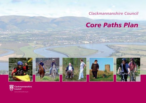
Clackmannanshire Council<br />
Core Paths Plan
Contents<br />
1. Introduction<br />
Clackmannanshire Council<br />
Core Paths Plan<br />
2. Preparing the Core Paths Plan<br />
3. Links<br />
4. Strategic Environmental Assessment<br />
5. Next steps<br />
6. Future review<br />
June 2009<br />
7. List of core paths in the Clackmannanshire Council area<br />
8. Index map of core paths in the Clackmannanshire Council area<br />
9. Maps showing core paths in the Clackmannanshire Council area
1. Introduction<br />
The Land Reform (Scotland) Act 2003 came into effect in<br />
February 2005 and introduced a right of non-motorised<br />
access to most land and inland water in Scotland. It placed<br />
a statutory duty on local authorities to draw up a plan for<br />
a network of paths, to be known as core paths, which<br />
would be “sufficient for the purpose of giving the public<br />
reasonable access throughout their area”.<br />
Core Paths Plans should provide for a range of recreational<br />
access e.g. walking, cycling, horse riding, canoeing etc and<br />
cater for people with disabilities, but not all individual core<br />
paths are required to cater for every type of user.<br />
Core paths do not have to have any sort of previous<br />
designation e.g. right of way and can comprise of a variety<br />
of different path types, ranging from natural grassy swards,<br />
to high-specification constructed paths, to satisfy the<br />
needs of all users.<br />
2. Preparing the Core Paths Plan<br />
A number of steps were taken in developing the Final Draft<br />
Plan, in keeping with those detailed in Core Paths Plans –<br />
A guide to good practice produced by the Paths For All<br />
Partnership and Scottish Natural Heritage.<br />
An initial informal consultation took place between 22nd<br />
April 2006 and 1st July 2006, and visited 10 communities<br />
across Clackmannanshire. The purpose of this was to find<br />
out where people took, or would like to take, access. This<br />
generated a total of 353 responses, the majority coming<br />
from local walkers and dog walkers, aged 45-64, who used<br />
the existing path network on a daily basis.<br />
A number of criteria were then identified, with the<br />
assistance of the Clackmannanshire Local Access Forum<br />
(a body that the Council has a duty to establish under<br />
the Land Reform (Scotland) Act 2003 and which advises<br />
the local authority on matters relating to access) to help<br />
identify which paths (identified in the initial informal<br />
consultation) should become candidate core paths.<br />
Essential criteria for a core path included:<br />
v Easily accessible from where people live or links 2<br />
communities<br />
v Joins 2 public places – roads/pavements/rights of way/<br />
established paths/public open space. Note: Could be<br />
circular if starting/finishing from a public place<br />
v Is unlikely to adversely impact upon biodiversity<br />
v Where a cross-border path, there is consistency with<br />
the neighbouring authority<br />
Desirable criteria for a core path included:<br />
v Was identified in the first round of consultations and/or<br />
is a right of way/established path<br />
v Capable of supporting multi-use i.e. is a surfaced path<br />
v Capable of supporting all abilities use i.e. surfaced, flat,<br />
free from barriers such as steps<br />
v Unaffected by land management issues e.g. sports<br />
pitches, golf courses, enclosed fields of crops/livestock<br />
v Unaffected by curtilage/privacy issues e.g. farm yards,<br />
dwelling houses<br />
v Free from significant maintenance issues – poor<br />
surface, infrastructure e.g. bridges/steps/railings<br />
v Is likely to be used in travel to/from school/work<br />
v Gives access to places of interest – natural and built<br />
heritage e.g. country parks, nature reserves, castles,<br />
towers<br />
v Gives access to facilities e.g. shops<br />
v Provides links to other paths<br />
Candidate core paths were required to meet all relevant<br />
essential criteria and at least half of the desirable criteria.<br />
A total of 174 paths were identified as candidate core<br />
paths, including one on water at Gartmorn Dam. Core<br />
paths on public roads were included to provide links<br />
between other core paths where there is a footway or<br />
where traffic calming measures are in, or are to be put in,<br />
place.<br />
A second informal consultation then took place between<br />
9th October 2007 and 29th November 2007, and visited<br />
9 communities. The consultations were advertised on<br />
the Council Noticeboard, on the Council website, via e<br />
mail (to community councils, Clubs, organisations and<br />
individuals), in libraries and on paths around settlements.<br />
106 comments were received, of which 23% approved<br />
the plan, 47% approved it with exceptions and 16% did<br />
not approve it. 14% did not comment on whether they<br />
approved the Plan. These comments were posted on the<br />
Council website at www.clacksweb.org.uk/site/documents/<br />
countryside/commentsonconsultativedraftcorepathsplan/
The comments were analysed, communication/meetings<br />
held with all known landowners to discuss specific<br />
issues and with neighbouring local authorities (to ensure<br />
continuity of routes which go to the Council boundary),<br />
and the plan amended to produce the Final Draft Core<br />
Paths Plan.<br />
The Final Draft Core Paths Plan had a total of 178<br />
core paths with a distance of 213 km/132 miles. (For<br />
comparison, Stirling Council proposed 355 km/222 miles<br />
and Falkirk Council proposed 368 km/230 miles of core<br />
paths). One core path, at Gartmorn Dam, was on water.<br />
At the Council meeting of 5th June 2008 it was agreed<br />
that the Final Draft Core Paths Plan be progressed towards<br />
adoption by being subjected to a formal consultation.<br />
The formal consultation was in keeping with Section 18<br />
of the Land Reform (Scotland) Act 2003 which requires<br />
local authorities to publicise their Plan and any maps, and<br />
to make them available for public inspection for at least 12<br />
weeks. They must also consult the Local Access Forum for<br />
their area, persons representative of those living, working<br />
or carrying out recreational activities on the land proposed<br />
to be affected by the Plan, Scottish Natural Heritage and<br />
any other persons it deems appropriate.<br />
The formal consultation was for a 12 week period and<br />
took place between 21st July 2008 and 13th October<br />
2008. Notice of the consultations was posted on the<br />
Council Noticeboard and a copy of the Final Draft Plan<br />
(including maps and comments/objection forms) was made<br />
available for viewing at the Council’s Kilncraigs office, at<br />
public libraries, at 3 drop-in sessions (organised in Alloa,<br />
Alva and Dollar) and on the Council website.<br />
The formal consultation on the Final Draft Plan attracted<br />
6 formal objections, all of which have been resolved. 2<br />
paths were removed from the Plan, 1 was rerouted and 1<br />
extended. The other 2 formal objections were withdrawn.<br />
A number of other minor amendments have been made to<br />
the Final Draft Plan, all relating to paths which meet with<br />
core paths of neighbouring authorities. The above changes<br />
were made in keeping with the advice received from the<br />
Clackmannanshire Access Forum and the views of the<br />
local Community Council/Group and, where appropriate,<br />
land manager. The objections were posted on the Council<br />
website at http://www.clacksweb.org.uk/site/documents/<br />
countryside/finaldraftcorepathsplan/<br />
The finalised Plan, which takes account of the above<br />
formal objections and amendments, proposes 210<br />
km/131 miles of core paths and a core path on water at<br />
Gartmorn Dam. Of this, 138 km/86 miles are on land<br />
that is privately owned, 36 km/23 miles are on Council<br />
land and 35 km/22 miles are on public roads. Care has<br />
been taken to ensure that all core paths which end at<br />
the Clackmannanshire boundary connect with core paths<br />
proposed by the neighbouring authority.<br />
The list of core paths in Clackmannanshire provides<br />
information regarding the surface and nature of each path,<br />
so providing information to users on which paths are<br />
suitable for their needs.<br />
3. Links<br />
The Core Paths Plan will help the Council deliver on<br />
broader objectives.<br />
It has the potential to reduce car use by providing paths<br />
which can be used for active travel to school, work and<br />
other destinations.<br />
Core paths can also be used for a range of recreations<br />
which can generate associated health benefits.<br />
The Core Paths also have the potential to attract visitors to<br />
the area and so contribute to tourism initiatives.<br />
The Scottish Government has recently published Scottish<br />
Planning Policy 11 on Open Space and Physical Activity.<br />
This emphasises the importance of quality open spaces<br />
and sets out national planning policy on the provision<br />
and protection of open space within and on the edges<br />
of settlements, and on sports and recreation facilities in<br />
urban and rural settings.<br />
It confirms that access rights and core paths plans<br />
are material considerations in determining planning<br />
applications and highlights that local authority departments<br />
should ensure compatibility between the core paths plan<br />
and the open space strategy, local transport strategy and<br />
development plan.<br />
4. Strategic Environmental<br />
Assessment<br />
It is a Statutory requirement that a Strategic Environmental<br />
Assessment (SEA) is undertaken on the Final Draft Core<br />
Paths Plan, as per the requirements of the Environmental<br />
Assessment (Scotland) Act 2005, in order to assess the<br />
effects that the Plan could have on the environment.<br />
The Environmental Report concluded that the Plan has<br />
both positive and neutral impacts, and does not predict<br />
any significant cumulative environmental impacts. It<br />
does propose some mitigation, suggesting signage to<br />
help protect sensitive areas from disturbance and also<br />
highlighting the need for ongoing monitoring.<br />
The Environmental Report was subjected to public<br />
consultation, which ran (concurrently with the formal<br />
consultation on the Final Draft Plan) for a 12 week period<br />
from 21st July 2008 to 13th October 2008. Notice of<br />
the consultations was posted on the Council Noticeboard<br />
and a copy of Strategic Environmental Assessment<br />
Environmental Report was made available for viewing<br />
at the Council’s Kilncraigs office, at 3 drop-in sessions<br />
(organised in Alloa, Alva and Dollar) and on the Council<br />
website. 3 comments of an advisory nature were received.<br />
5. Next steps<br />
There is an expectation from the Scottish Government and<br />
the public that all the core paths will be signposted and<br />
usable by walkers, as a minimum, within 1-2 years of the<br />
Plan being adopted.<br />
6. Future review<br />
Under Section 20 of the Land Reform (Scotland) Act<br />
2003, “local authorities have a duty to review the core<br />
paths plan for their area, either when they consider<br />
appropriate or by virtue of a Ministerial direction”.<br />
Following a review, a core path can be diverted, removed<br />
or added.
Clackmannanshire Council Core Paths Plan<br />
List of Core Paths<br />
Path<br />
Number<br />
Location<br />
Surface<br />
Gates, Stiles etc.<br />
Gradient, Steps etc.<br />
Length<br />
(km)<br />
1 West End Park Tarmac Flat 1.42 0.88<br />
2 Greenfield Park Tarmac Flat 0.37 0.23<br />
3 Waggonway Tarmac Flat 0.57 0.35<br />
4 Alloa Tower Slabbed at north end<br />
tarmac elsewhere<br />
Flat 0.81 0.50<br />
5 Hawkhill Tarmac Steep, with steps, at south east<br />
end and at west end<br />
0.83 0.52<br />
6 Riverside View/ Track. Can be muddy Vehicle barrier with adjacent gap Flat except at east end where 2.61 1.62<br />
Craigrie Road immediately east of river at west end. Kissing gate next to<br />
bridge over River Black Devon<br />
gentle slopes<br />
7 Riverside View Grass Flat 0.80 0.49<br />
8 Pond Wood Earth Flat 1.00 0.62<br />
9 Parkmill Track with some potholes Gentle slopes 0.18 0.11<br />
10 Forth Crescent/ Tarmac except for short Vehicle barriers with adjacent gap Flat 1.33 0.83<br />
Alloa Road section at east end<br />
where gravel<br />
next to public roads<br />
11 A907 Alloa/<br />
Clackmannan<br />
Tarmac footway Flat 0.75 0.46<br />
12 Gubber Hill / Earth. Can be muddy Stiles at Gubber Hill Steep at west end, 1.59 0.99<br />
Branshill Road gentle slopes elsewhere<br />
13 Gubber Hill Earth. Can be muddy Moderate slopes 0.35 0.22<br />
14 Ormiston Drive/ Track. Tarmac at west end Vehicle barriers with adjacent Gentle slopes 1.22 0.76<br />
Branshill Road gaps at each end<br />
15 Tullibody Road/ Earth path. Short section Flat 0.62 0.39<br />
Claremont of slabs in middle<br />
16 B9096 at Lornshill Tarmac footway Flat 0.40 0.25<br />
17 Lornshill Earth. Can be muddy Flat or gentle slopes 0.97 0.60<br />
18 Ramsey Tullis Drive/ Grass at west end. Gentle slopes at west end, 2.21 1.37<br />
Pleasure Grounds Gravel at east end moderate slopes at east end<br />
19 A907 Cambus/Alloa Gravel footway Flat 1.78 1.11<br />
20 Cambus/<br />
The Pavilions<br />
Tarmac Vehicle barriers with adjacent gap Flat 1.83 1.14<br />
21 Longcarse Tarmac Flat 0.64 0.40<br />
22 Smithfield Loan Earth Flat 0.40 0.25<br />
23 Cambus/Kelliebank Earth. Can be muddy Several kissing gates Flat 2.91 1.80<br />
24 Orchard Farm Track Flat 0.84 0.52<br />
Length<br />
(miles)<br />
Path<br />
Number<br />
Location<br />
Surface<br />
Gates, Stiles etc.<br />
Gradient, Steps etc.<br />
Length<br />
(km)<br />
25 The Pavillions<br />
Birchwood<br />
Earth Stile at west end Flat 0.97 0.60<br />
26 Blackgrange/ Tarmac at west end. Vehicle barrier in middle Flat 3.07 1.91<br />
Cambus Earth at east end.<br />
East end can be muddy<br />
and at east end<br />
27 Manor Steps/<br />
Tullibody<br />
Tarmac Vehicle barriers with adjacent gaps Flat 1.69 1.05<br />
28 River Devon/ Earth at north end. Tar at Vehicle barrier at south end Flat 1.67 1.04<br />
Cambus south end. Can be muddy<br />
at north end<br />
29 Woodside Road Earth Flat 0.51 0.31<br />
30 Delph Pond Tar at north end.<br />
Earth at south end<br />
Flat 0.95 0.41<br />
31 Removed from the Plan during the consultation process.<br />
32 A91 Menstrie Tarmac footway Flat 0.38 0.24<br />
33 A91/Ochil Road Tarmac Flat 0.66 0.41<br />
34 Ochil Road Grass at south end.<br />
Track at north end<br />
Moderate slopes 0.19 0.12<br />
35 Hillfoots Road/ Tarmac road at west end. Vehicle barrier with adjacent gap Flat 1.87 1.16<br />
Beauclerc Street Potholed track at east end<br />
36 Loaningbank/<br />
Hillfoots Road<br />
Track Gentle slopes 0.23 0.14<br />
37 Balquharn Tarmac Flat 0.22 0.14<br />
38 A91 Menstrie/Alva Tarmac footway Flat 1.75 1.08<br />
39 Tullibody/Menstrie Gravel footway Moderate slopes 0.90 0.56<br />
40 A91/B908 The Boll Track at west and east ends.<br />
Field margin in middle<br />
Flat 2.28 1.42<br />
41 Cobblecrook Place/ Track<br />
River Devon<br />
Flat 0.53 0.33<br />
42 George Street Track Flat 1.18 0.73<br />
43 Cochrane Park Tarmac Flat 1.01 0.63<br />
44 Glenochil Field margin at west end.<br />
Track at east end<br />
Gentle slopes 1.33 0.82<br />
45 Menstrie Road/ Grass at west end. Flat at each end. Moderate 1.07 0.66<br />
North Wood Gravel path elsewhere slopes with steps in middle<br />
46 Blackmuir Wood Earth. Can be muddy Flat 0.16 0.10<br />
47 Blackmuir Wood Earth. Can be muddy Moderate slopes at south end.<br />
Flat at north end<br />
1.21 0.75<br />
Length<br />
(miles)
Path<br />
Number<br />
Location<br />
Surface<br />
Gates, Stiles etc.<br />
Gradient, Steps etc.<br />
Length<br />
(km)<br />
48 Lornshill/Glenochil Track. Can be muddy Vehicle barrier with adjacent gap Moderate slopes at south end. 0.97 0.60<br />
at north end Flat at north end<br />
49 Sauchie/Alva Gravel footway Gentle slopes 2.08 1.30<br />
50 Removed from the Plan during the consultation process.<br />
51 Removed from the Plan during the consultation process.<br />
52 Auchinbaird Grass Gate at south end Flat. Steps at north end 0.34 0.21<br />
53 Fishcross/Howetown Earth at south end.<br />
Track at north end<br />
Some vehicle inhibitor bollards Gentle and moderate slopes 0.96 0.59<br />
54 Equestrian Centre/<br />
Bankhead<br />
Gravel track Barrier with adjacent gap in middle Flat 0.47 0.30<br />
55 Alva Glen Gravel paths at south end. Gate at south east corner. Very steep at north end and at 2.86 1.78<br />
Earth at north end.<br />
Rocky in places<br />
Stile at south west corner west side. Several flights of steps<br />
56 Alva Glen/ Grass at west end. Gates at west end and in middle Moderate slopes 1.28 0.79<br />
Woodland Park Earth at east end<br />
57 Alva/Tillicoultry Earth at both ends.<br />
Tarmac in middle<br />
Gentle slopes 2.84 1.76<br />
58 Woodland Park Gravel paths Moderate slopes and some steps 1.21 0.75<br />
59 Alva/Tillicoultry Track at west end. Crosses Gates in middle Flat 2.09 1.30<br />
Golf Course golf course at east end<br />
60 A91 Alva/Tillicoultry Tarmac footway Flat 2.08 1.29<br />
61 Tillicoultry Glen Earth Gates at south end Steep. Several flights of steps 1.33 0.83<br />
62 Tillicoultry/<br />
Maddy Moss<br />
Earth/grass Gate at south end Very steep. Steps at south end 4.48 2.78<br />
63 Upper Mill Street/ Track Gates at west end and in middle Gentle slopes at the west end. 1.78 1.12<br />
Dollar Road Moderate slopes at the east end<br />
64 Fir Park Earth Moderate slopes 0.35 0.22<br />
65 Dollar Road/<br />
Kingseat Drive<br />
Gravel Gentle slopes 0.25 0.16<br />
66 Tillicoultry Park Gravel Gates at access points into Park Flat 0.77 0.48<br />
67 Marchglen/<br />
Tillicoultry<br />
Tarmac footway Flat 0.72 0.46<br />
68 Glenfoot/ Grass Gates at each end. Flat 0.82 0.51<br />
Sterling Mills Narrow bridge at west end<br />
69 Alloa Station/<br />
Hospital<br />
Tarmac Flat 1.06 0.66<br />
70 Sauchie/Tillicoultry Tarmac at south end.<br />
Gravel at north end<br />
Some vehicle inhibitor bollards Flat or gentle slopes 4.59 2.67<br />
71 Sterling Mills Gravel Flat 0.40 0.25<br />
72 Blackfaulds/<br />
Coalsnaughton<br />
Tarmac road Flat 1.54 0.96<br />
Length<br />
(miles)<br />
Path<br />
Number<br />
Location<br />
Surface<br />
Gates, Stiles etc.<br />
Gradient, Steps etc.<br />
Length<br />
(km)<br />
73 Coalsnaughton/<br />
Devonside<br />
Tarmac Moderate slopes 0.14 0.08<br />
74 Hazel Avenue/<br />
Brook Street<br />
Tarmac Vehicle inhibitor bollards Flat 0.23 0.15<br />
75 Wardlaw Street/<br />
Blackfaulds Street<br />
Earth Flat 0.35 0.22<br />
76 B9140/<br />
Blackfaulds Street<br />
Track Several gates Gentle slopes 0.71 0.44<br />
77 B9140 Fishcross/<br />
Coalsnaughton<br />
Gravel footway Gentle slopes 1.61 0.99<br />
78 Fishcross/<br />
Devon Village<br />
Track Gentle slopes 0.63 0.39<br />
79 Schawpark/ Gravel track at west end. Gentle slopes 1.09 0.68<br />
Hamilton Wood Earth path at east end<br />
80 Dovecote Gravel Moderate slopes.<br />
Steps at east end<br />
0.34 0.21<br />
81 Beechwood/ Grass Gentle slopes at west end. 0.47 0.29<br />
Schaw Park Flat elsewhere<br />
82 A908/Deerpark Gravel track at west end.<br />
Gravel path at east end<br />
Gentle slopes 1.26 0.78<br />
83 Schaw Park/<br />
Cowpark Wood<br />
Grass Gentle slopes 0.50 0.31<br />
84 Cowpark Wood Gravel Gentle slopes 0.60 0.38<br />
85 Cowpark Wood/ Gravel at south end. Gentle slopes 1.08 0.66<br />
Coalpots Wood Earth at north end<br />
where it can be muddy<br />
86 Gartmorn Dam/ Gravel at south end. Gate with adjacent gap in middle Gentle slopes 1.30 0.81<br />
B9140 Earth in middle and<br />
gravel track at north end<br />
87 Mount William Gravel Moderate and steep slopes 0.76 0.47<br />
88 Gartmorn Road/<br />
Gartmorn Dam<br />
Gravel footway Flat 0.65 0.40<br />
89 Cats Close Gravel Vehicle inhibitor bollard Flat 0.37 0.23<br />
90 Carsebridge Road/<br />
Jellyholm<br />
Gravel track Gentle slopes 1.60 1.00<br />
91 Jellyholm Works<br />
Road<br />
Tarmac Gentle slopes 0.14 0.09<br />
92 B909/<br />
Carsebridge Road<br />
Gravel track Flat 0.35 0.22<br />
93 Carsebridge/<br />
Brothie Burn<br />
Earth Several narrow bridges Flat. Some steps at east end 1.07 0.66<br />
Length<br />
(miles)
Path<br />
Number<br />
Location<br />
Surface<br />
Gates, Stiles etc.<br />
Gradient, Steps etc.<br />
Length<br />
(km)<br />
94 A907 Clackmannan Track. Tarmac at north end<br />
/Jellyholm<br />
Flat 1.48 0.92<br />
95 Brothie Burn Gravel Some narrow bridges Flat. Steps in middle 0.66 0.41<br />
96 Mary Wood Earth Gentle slopes 0.52 0.32<br />
97 Parkmill/ Earth at west end. Some narrow bridges Flat 0.80 0.50<br />
Back Wood Gravel track at east end<br />
98 Back Wood Earth Moderate slopes 0.50 0.31<br />
99 Clakmannanan Grass at west end. Stiles at west end. Moderate slopes at west end. 0.77 0.48<br />
Tower/High Street Gravel track at east end Kissing gate at east end Gentle slopes at east end<br />
100 Craigrie/Back Wood Track Kissing gate at north end Flat 0.91 0.57<br />
101 Clackmannan/ Tarmac road Flat at south end. 2.84 1.76<br />
Canal Burn Gentle slope at north end<br />
102 Kennet Pans/ Track Gate in middle Flat at south end. 3.00 1.87<br />
Kennet Gentle slopes at north end<br />
103 Clackmannan/<br />
Kennet<br />
Tarmac footway Flat 0.43 0.26<br />
104 Kennet Wood Earth Flat 1.10 0.69<br />
105 Lady’s Brae/<br />
Alloa Road<br />
Track. Can be muddy Gate with adjacent gap at north end Gentle slopes 0.82 0.51<br />
106 Chapelhill/<br />
Kennet Woods<br />
Earth Stone bollard at east end Flat 0.79 0.49<br />
107 Lookaboutye Earth Gentle slope 0.73 0.45<br />
108 Alloa Road/ Tarmac footway at west Flat 0.77 0.48<br />
Cherryton Drive end. Track at east end<br />
109 Riccarton Tarmac at west end.<br />
Earth path at east end<br />
Gentle slopes 0.91 0.56<br />
110 Cycle path/B910 Earth Very narrow bridge at south end Gentle slopes. Steps at south end 0.34 0.21<br />
111 Riccarton/Cycle path Gravel footway Gentle slopes 0.40 0.25<br />
112 Cycle path/Linn Mill Gravel footway Flat 0.65 0.40<br />
113 Clackmannan/Slack Tarmac Some gates with adjacent gaps Steep ramp at west end.<br />
Flat elsewhere<br />
5.22 3.25<br />
114 Slack/Gartgreenie Tarmac road Gentle slopes 2.29 1.42<br />
115 Aitkenhead/ Track Barrier with adjacent gap in middle Gentle slopes at west end. 1.26 0.78<br />
Forestmill Flat at east end<br />
116 Lade/Aberdona Track Moderate slopes 1.77 1.10<br />
117 Gartmorn Dam/<br />
Forestmill<br />
Earth. Can be muddy Flat 2.78 1.72<br />
118 Linn Mill/<br />
Gartmorn Dam<br />
Track Gate with adjacent gap in middle Moderate slopes 1.36 0.84<br />
Length<br />
(miles)<br />
Path<br />
Number<br />
Location<br />
Surface<br />
Gates, Stiles etc.<br />
Gradient, Steps etc.<br />
Length<br />
(km)<br />
119 Gartmorn Dam Grass at west end. Moderate slopes 1.17 0.73<br />
Community<br />
Woodland south<br />
Gravel at east end<br />
120 Gartmorn Dam<br />
Community<br />
Woodland north<br />
Grass Moderate slopes 1.10 0.68<br />
121 Gartmorn Dam Gravel Vehicle inhibitor bollard on north Flat 4.80 3.00<br />
shore. Narrow bridge at east side<br />
122 Gartmorn Dam Water<br />
123 Gartmornhill Wood/ Track Gentle slopes 0.55 0.34<br />
Sheriffyards Wood<br />
124 Gartmorn Dam/ Earth at south end. Gate with adjacent gap at north end Steep slope with steps at south 1.33 0.83<br />
Coalnaughton Gravel tack at north end end. Gentle slopes at north end<br />
125 Gartmornhill Wood Earth Moderate slopes at west end. 0.96 0.66<br />
Gentle slopes at east end<br />
126 Longriggs Gravel track Gentle slopes 0.80 0.49<br />
127 Gartinny/ Earth Gentle slopes at south end. 0.27 0.17<br />
Woodhead Place Flat at north end<br />
128 Ramsay Street Gravel footway Gentle slope 0.59 0.36<br />
129 Devonside/B9140 Earth at west end. Track at Moderate slopes 1.22 0.75<br />
south end. Can be muddy<br />
130 Devonside Grass Gentle slopes. Steps at west end 0.83 0.52<br />
131 Melloch Wood/ Track - narrow and Gentle slopes 1.64 1.02<br />
Lawmuir Wood muddy in places<br />
132 Aberdona/ Track Some gates Flat at south end. 3.12 1.94<br />
Devon Way Moderate slopes at north end<br />
133 Haugh Farm Track Flat 1.29 0.80<br />
134 Devon Way Gravel Vehicle inhibitor bollards in places Flat 4.83 3.19<br />
135 A91<br />
Tillicoultry/Dollar<br />
Gravel footway Flat 2.76 1.72<br />
136 Devon Way/A91 Track Gentle slope 0.19 0.12<br />
137 Harviestoun Mine Track Gate at east end Gentle slopes 0.78 0.49<br />
138 Harviestoun Gravel track Gentle slopes 0.87 0.54<br />
139 Removed from the Plan during the consultation process.<br />
140 Belmont/Back Road Earth, which can be muddy<br />
at west end.<br />
Tarmac at east end<br />
Gentle slopes 1.12 0.69<br />
141 Quarrel Dean Gravel. Narrow bridge Gentle slopes. Steps at north end 0.27 0.17<br />
142 Mill Green Gravel Gentle slopes 0.76 0.48<br />
143 Dollar Glen Earth. Boardwalk on<br />
east side<br />
Steep slopes and steps 1.62 1.01<br />
Length<br />
(miles)
Path<br />
Number<br />
Location Surface<br />
Gates, Stiles etc.<br />
144 Removed from the Plan during the consultation process.<br />
Gradient, Steps etc.<br />
Length<br />
(km)<br />
145 Gloom Hill/Hillfoot Earth at west end. Flat at west end. 0.94 0.58<br />
Gravel track at east end Moderate slopes at east end<br />
146 Castle Road/<br />
High Street<br />
Earth Moderate slopes 0.37 0.23<br />
147 Castle Road/ Tarmac road Cattle grid with adjacent Steep slopes 0.75 0.47<br />
Castle Campbell gate in middle<br />
148 Dollar/Anchorage Tarmac road Moderate slopes 2.76 1.72<br />
149 Lawhill Community Grass. Can be muddy<br />
Woodland<br />
Moderate slopes 1.68 1.04<br />
150 A91 Dollar/Pitgober Gravel footway Flat 0.28 0.18<br />
151 Pitgober Tarmac road Gentle slope 0.19 0.12<br />
152 Lovers Loan/<br />
Kelly Bridge<br />
Grass Gentle slope 0.43 0.27<br />
153 South of A91 Dollar Grass Gentle slope 0.43 0.27<br />
154 Westerton Farm/<br />
A91 Muckhart Road<br />
Track Gentle slope 0.41 0.26<br />
155 Lovers Loan/ Track at west end. Grass/ Several gates Gentle slopes at west end, 5.14 3.19<br />
Muckhart earth in middle and which steep slopes at east end<br />
can be muddy, and gravel<br />
track at east end<br />
156 Blairhill Farm/ Track Flat at west end, steep in middle 1.33 0.83<br />
Merryhills and moderate slopes at east end<br />
157 Cowden Farm/ Track at west end and Several gates. Narrow bridge with Gentle slopes at west and east 2.22 1.38<br />
School Road which can be muddy, grass adjacent ford in middle at Hole Burn<br />
in middle and tarmac at<br />
east end<br />
ends, and steep in middle<br />
158 Drumburn Road/ Track. Gentle slopes 0.80 0.50<br />
Golf Club Can be muddy at west end<br />
159 Drumburn Track Gate at east end Gentle slopes 0.52 0.33<br />
160 Muckhart<br />
Community<br />
Woodland<br />
Grass. Can be muddy Flat 1.08 0.67<br />
161 Community<br />
Woodland/A823<br />
Track. Can be muddy Gate at west end Flat 0.37 0.23<br />
162 Yetts o’ Muckhart/<br />
A823<br />
Track Gentle slopes 1.03 0.64<br />
163 Yetts o’ Muckhart/<br />
Lendrick Muir<br />
Tarmac. Earth in middle Gates in middle Flat 2.34 1.45<br />
164 Removed from the Plan during the consultation process.<br />
165 Pool of Muckhart/<br />
Auchlinsky Burn<br />
Grass Gates at south end Moderate slopes 2.33 1.45<br />
Length<br />
(miles)<br />
Path<br />
Number<br />
Location Surface<br />
Gates, Stiles etc.<br />
166 Removed from the Plan during the consultation process.<br />
167 Removed from the Plan during the consultation process.<br />
Gradient, Steps etc.<br />
Length<br />
(km)<br />
168 Dollar Glen/ Track at south end. Earth at Several gates Moderate slopes 1.55 0.97<br />
Glen Quey north end. Can be muddy<br />
169 Pitgober/<br />
Vicars Bridge<br />
Tarmac road Moderate slopes 1.15 0.71<br />
170 A91/Newbondrig Earth path at west end.<br />
Tarmac road at east end<br />
Gentle slopes 1.28 0.79<br />
171 Birkhill/Community Earth<br />
Woodland<br />
Flat 0.48 0.30<br />
172 A91 Pool of<br />
Muckhart/A91<br />
Yetts o’ Muckhart<br />
Gravel footway Flat 0.47 0.29<br />
173 B9140 Muirside/<br />
B9140 Glenochil<br />
Gravel footway Flat 1.45 0.90<br />
174 Alloa Road/ Earth. Can be muddy Moderate slopes at south end. 0.82 0.50<br />
B9140 Glenochil at north end Gentle slopes at north end<br />
175 Menstrie Wood Earth Steep slopes 0.63 0.39<br />
176 River Devon/ Grass. Can be muddy Moderate slopes 0.72 0.45<br />
Boghall at east end<br />
177 Cambus Road/ Earth at west end. Flat 1.12 0.70<br />
Victoria Terrace Tarmac at east end<br />
178 Knowfaulds/ Grass at west end. Flat at west end. 0.92 0.57<br />
Muirside Track at east end Gentle slopes at east end<br />
179 B913 Dollar/<br />
Rackmill<br />
Gravel footway Flat 0.79 0.49<br />
180 Dollarbeg/<br />
Blairingone<br />
Track Flat 1.03 0.64<br />
181 Rackmill/ Path at west end. Several gates at east end. Flat 2.62 1.63<br />
Vicars Bridge Track at east end Very narrow bridge in middle<br />
182 Sauchie Tower Tarmac Flat 0.20 0.12<br />
183 Devonknowes Track at south end. Stile at south end. Steep slope with steps 0.33 0.20<br />
Earth at north end Narrow bridge in middle at north end<br />
184 Gartenkeir/B9140 Gravel track at west end.<br />
Tarmac at east end<br />
Gentle slopes 1.60 0.99<br />
185 Bardsway Grass Flat 0.16 0.10<br />
Length<br />
(miles)
0 10.25 2 0.5 3 0.75 4 1 5<br />
Kilometres Kilometres<br />
Miles<br />
Miles<br />
00 0.1 0.21 0.3 0.4 2 0.5<br />
3<br />
Scale : 1:70,000<br />
Paper Size : A3<br />
MAP 2<br />
Date : September 2010<br />
Reproduced by permission of Ordnance Survey on behalf of HMSO.<br />
© Crown copyright and database right 2010. All rights reserved.<br />
Ordnance Survey Licence number 100020783.<br />
MAP 3<br />
MAP 1<br />
Clackmannanshire Council Core Paths Plan<br />
Index Map<br />
Core path over land<br />
Core path over water<br />
MAP 5<br />
Link to neighbouring authority<br />
MAP 4<br />
MAP 6<br />
MAP 7<br />
MAP 8<br />
Services to Communities<br />
Kilncraigs<br />
Greenside Street<br />
Alloa<br />
FK10 1EB<br />
Tel: 01259 450 000 Fax: 01259 727 453<br />
development_services@clacks.gov.uk
46<br />
47<br />
23<br />
18<br />
21<br />
174<br />
47<br />
16<br />
20<br />
15<br />
22<br />
48<br />
48<br />
14<br />
18<br />
12<br />
13<br />
0 0.25 0.5 0.75 1<br />
Kilometres<br />
0 0.1 0.2 0.3 0.4<br />
Miles<br />
0.5<br />
Date : September 2010<br />
Reproduced by permission of Ordnance Survey on behalf of HMSO.<br />
© Crown copyright and database right 2010. All rights reserved.<br />
Ordnance Survey Licence number 100020783.<br />
1<br />
14<br />
12<br />
2<br />
3<br />
4<br />
6<br />
Alloa and Surrounding Area<br />
Map 1<br />
Core path over land<br />
Core path over water<br />
69<br />
5<br />
7<br />
52<br />
Path Demarcation<br />
70<br />
70<br />
89<br />
Link to neighbouring authority<br />
80<br />
90<br />
10<br />
8<br />
92<br />
92<br />
82<br />
81<br />
9<br />
10<br />
97<br />
100<br />
79<br />
90<br />
96<br />
93<br />
82<br />
88<br />
11<br />
84<br />
97<br />
98<br />
99<br />
77<br />
91<br />
83<br />
94<br />
10<br />
6<br />
79<br />
87<br />
88<br />
85<br />
90<br />
94<br />
77<br />
85<br />
95<br />
121<br />
108<br />
86<br />
121<br />
86<br />
126<br />
121<br />
113<br />
111<br />
127<br />
125<br />
122<br />
119<br />
109<br />
120<br />
112<br />
124<br />
124<br />
121<br />
119<br />
110<br />
121<br />
123<br />
120<br />
Services to Communities<br />
Kilncraigs<br />
Greenside Street<br />
Alloa<br />
FK10 1EB<br />
118<br />
121<br />
Tel: 01259 450 000 Fax: 01259 727 453<br />
development_services@clacks.gov.uk<br />
118
27<br />
32<br />
175<br />
26<br />
0 0.25 0.5 0.75 1<br />
Kilometres<br />
0 0.1 0.2 0.3 0.4<br />
Miles<br />
0.5<br />
27<br />
Date : September 2010<br />
Reproduced by permission of Ordnance Survey on behalf of HMSO.<br />
© Crown copyright and database right 2010. All rights reserved.<br />
Ordnance Survey Licence number 100020783.<br />
33<br />
74<br />
28<br />
34<br />
29<br />
26<br />
28<br />
177<br />
39<br />
35<br />
38<br />
23<br />
36<br />
173<br />
178<br />
Tullibody and Surrounding Area<br />
Map 2<br />
Core path over land<br />
Core path over water<br />
Path Demarcation<br />
Link to neighbouring authority<br />
30<br />
20<br />
45<br />
18<br />
35<br />
38<br />
19<br />
24<br />
173<br />
174<br />
25<br />
20<br />
17<br />
40<br />
37<br />
46<br />
47<br />
23<br />
35<br />
18<br />
21<br />
38<br />
174<br />
47<br />
16<br />
20<br />
15<br />
40<br />
44<br />
173<br />
22<br />
Services to Communities<br />
Kilncraigs<br />
Greenside Street<br />
Alloa<br />
FK10 1EB<br />
48<br />
42<br />
Tel: 01259 450 000 Fax: 01259 727 453<br />
development_services@clacks.gov.uk<br />
48
40<br />
37<br />
46<br />
47<br />
35<br />
18<br />
38<br />
174<br />
47<br />
16<br />
15<br />
40<br />
44<br />
173<br />
48<br />
42<br />
48<br />
43<br />
14<br />
41<br />
12<br />
13<br />
0 0.25 0.5 0.75 1<br />
Kilometres<br />
0 0.1 0.2 0.3 0.4<br />
Miles<br />
0.5<br />
Date : September 2010<br />
Reproduced by permission of Ordnance Survey on behalf of HMSO.<br />
© Crown copyright and database right 2010. All rights reserved.<br />
Ordnance Survey Licence number 100020783.<br />
40<br />
14<br />
12<br />
55<br />
49<br />
56<br />
52<br />
53<br />
182<br />
Alva and Surrounding Area<br />
Map 3<br />
Core path over land<br />
Core path over water<br />
57<br />
57<br />
Path Demarcation<br />
70<br />
59<br />
70<br />
89<br />
Link to neighbouring authority<br />
53<br />
80<br />
90<br />
58<br />
54<br />
70<br />
82<br />
81<br />
60<br />
78<br />
79<br />
90<br />
70<br />
82<br />
88<br />
84<br />
72<br />
77<br />
91<br />
83<br />
94<br />
57<br />
59<br />
79<br />
87<br />
88<br />
67<br />
85<br />
90<br />
Services to Communities<br />
Kilncraigs<br />
Greenside Street<br />
Alloa<br />
FK10 1EB<br />
76<br />
Tel: 01259 450 000 Fax: 01259 727 453<br />
development_services@clacks.gov.uk<br />
77<br />
85<br />
95<br />
121