Download now - Tapir Specialist Group
Download now - Tapir Specialist Group
Download now - Tapir Specialist Group

Create successful ePaper yourself
Turn your PDF publications into a flip-book with our unique Google optimized e-Paper software.
points (springs, lagoons) persist year-round in all but the driest<br />
years. A single road crosses the area, from the city of Roboré<br />
to the northeast, passing through Ravelo military outpost, and<br />
on to Paraguay. Several overgrown roads also exist, unused<br />
for over 10 years: one leads west to the large salt pans within<br />
the Kaa-Iya National Park and from there north to Tucavaca<br />
and San José, others were opened in a grid of oil exploration<br />
lines. We re-opened several of these roads as footpaths/study<br />
trails, as well as cutting additional new study trails 3-5 km long<br />
to cover the study area. The dozen soldiers at the Ravelo<br />
military outpost maintain a small number of cattle (30) and<br />
several donkeys, while the nearest cattle ranch 15 km to the<br />
southeast at Palmar de las Islas maintains roughly 300 cattle.<br />
Livestock is not fenced in and therefore strays between Ravelo<br />
and Palmar along the main road.<br />
2. The San Miguelito Private Reserve comprises approximately<br />
25 km 2 within a 400 km 2 cattle ranching property 200 km<br />
to the east of Santa Cruz, and north of the Kaa-Iya National<br />
Park (17° 05.52’ S, 61° 47.32’ W). The landscape system is<br />
Chiquitano dry forest, with an average annual rainfall from<br />
1000 to 1500 mm (Rumiz et al., 2002). Cattle ranching is<br />
the principal economic activity outside the private reserve<br />
itself, with patches of forest cleared for pasture. The ranch<br />
maintains a system of roads through the reserve, in addition<br />
to which we opened a number of study trails 1-3 km in length.<br />
A small river runs through the private reserve, and several permanent<br />
springs and artificial ponds also provide surface water<br />
for wildlife during the 6-month dry season.<br />
26<br />
Methods<br />
Radio Telemetry<br />
The radio telemetry study at Cerro Cortado of five individual<br />
tapirs followed standard procedures and has been described<br />
previously by Ayala (2002; 2003). However, we continued<br />
to track the tapirs for 15 months after Ayala completed his<br />
fieldwork (Barrientos & Maffei, in press), until the radio-collar<br />
batteries failed. We tracked animals for 4-6 hour periods<br />
both day and night, registering location information every<br />
hour, and activity every 15 minutes. Radio collars marked<br />
activity by varying the number of pulses per 30 seconds from<br />
26 (no movement of the collar) to 52 (maximum movement).<br />
We determined locations by triangulation from three separate<br />
marked points along study trails or the road, estimating position<br />
using the Locate II software (Version 1.5, Pacer-Canada).<br />
We then analysed positions in Arcview 3.2, estimating home<br />
range from minimum convex polygons described by 95% of<br />
the positions for each animal (eliminating outliers). We estimated<br />
density in turn based on the observed home ranges for<br />
individual animals and overlap among home ranges.<br />
Contributed Papers<br />
Camera Trapping<br />
The camera trapping methodology consisted of a systematic<br />
camera trap survey, whose primary objective was to survey<br />
jaguar Panthera onca populations and estimate population<br />
densities of this species (Maffei et al., 2002, under review;<br />
Silver et al., under review). Cameras were active continuously<br />
(24 hours a day). We set them in pairs facing each other<br />
across a trail/road in order to simultaneously photograph both<br />
sides of any animal passing between them along the trail/road,<br />
with a distance of 1-2 km between camera sets. In addition,<br />
the cameras function continuously and record the date and<br />
time of photographs, allowing us to describe activity patterns<br />
by counting records per time period.<br />
At Tucavaca, during eight months (May-December, 2001),<br />
we rotated 12 camera traps among sites on the study trails and<br />
the gas pipeline, for a total of 2520 trap-nights. During an<br />
intensive 60-day survey period (19 January-20 March 2002),<br />
we installed 32 pairs of camera traps on the same study trails<br />
and pipeline road, for a total of 1920 trap-nights. Following<br />
the intensive survey a set of seven cameras continue to be<br />
rotated around the study trails.<br />
At Cerro Cortado, we have conducted two intensive 60day<br />
surveys. During the first survey (1 April-30 May 2002),<br />
we installed 34 pairs of camera traps along the road and study<br />
trails, in addition to two single cameras at water holes and<br />
two single cameras at salt licks. During the second survey<br />
(28 November 2002-28 January 2003), we installed 26 pairs<br />
of camera traps along the road and on the study trails. We<br />
installed one single camera at a salt lick and another single<br />
camera at a pond. Trapping effort totaled 2280 and 1680 trap<br />
nights respectively.<br />
At Ravelo, we conducted pilot camera trapping efforts<br />
(May-December, 2001) on study trails and at seasonal ponds<br />
for a total of 1248 trap-nights. During a single intensive 58day<br />
survey (February 10-April 10, 2003), we installed 37 pairs<br />
of camera traps: 10 on roads, 17 on study trails, 8 around a<br />
saltpan, and 2 at ponds. Trapping effort totaled 2170 trap<br />
nights.<br />
At San Miguelito we conducted an intensive 60-day survey<br />
(20 September-20 November, 2002), installing 22 pairs<br />
of camera traps on existing roads and study trails. We also<br />
installed four pairs of cameras along the edge of the river, one<br />
pair at a salt lick and one pair at a spring. Trapping effort totaled<br />
1695 trap nights (Rumiz et al., 2003).<br />
We used the time information recorded on all camera trap<br />
photographs of tapirs to describe activity patterns at each site,<br />
according to the proportion of photographs of the species during<br />
each time period. We also compared capture frequencies<br />
at different types of locations within each site: roads, trails, salt<br />
licks, and ponds.<br />
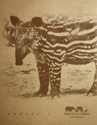
A number of unique features serve to distinguish individuals:<br />
scars, white spots and stripes on the stomach or legs,<br />
black spots on the face or sides, white markings at the base<br />
and fringe of the ears, torn or missing ears, toenail markings<br />
or colour, tail length and white markings on the tail (Emmons,<br />
June 2003 Vol. 12 / No. 1 n <strong>Tapir</strong> Conservation n Newsletter of the IUCN/SSC <strong>Tapir</strong> <strong>Specialist</strong> <strong>Group</strong>