- Page 1: EXECUTIVE SUMMARY STATE PARTY Greec
- Page 4 and 5: EXECUTIVE SUMMARY The early date of
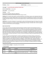
- Page 6 and 7: IDENTIFICATION OF THE PROPERTY 1a.
- Page 8 and 9: DESCRIPTION 2a i. DESCRIPTION OF TH
- Page 12 and 13: DESCRIPTION ∗ Open areas - Square
- Page 14 and 15: DESCRIPTION After 1830 things chang
- Page 16 and 17: DESCRIPTION The church of Agios Spy
- Page 18 and 19: DESCRIPTION ♦ British Rule The ur
- Page 20 and 21: DESCRIPTION Corfiots imported stone
- Page 22 and 23: DESCRIPTION • Ancient agora : Par
- Page 24 and 25: DESCRIPTION ♦ The Church of Agios
- Page 26 and 27: DESCRIPTION Sarocco Today it is dif
- Page 28 and 29: DESCRIPTION 2b. HISTORY AND DEVELOP
- Page 30 and 31: DESCRIPTION In 1214 Corfu broke awa
- Page 32 and 33: DESCRIPTION The constitution of 180
- Page 34 and 35: DESCRIPTION The Greeks included the
- Page 36 and 37: DESCRIPTION among which the most im
- Page 38 and 39: DESCRIPTION However, even more isol
- Page 40 and 41: DESCRIPTION form with the typical s
- Page 42 and 43: DESCRIPTION The next natural thicke
- Page 44 and 45: DESCRIPTION 2b v. Social - Intellec
- Page 46 and 47: DESCRIPTION During the 17 th centur
- Page 48 and 49: DESCRIPTION Foreign personalities a
- Page 50 and 51: JUSTIFICATION FOR INSCRIPTION 3. a
- Page 52 and 53: JUSTIFICATION FOR INSCRIPTION Crite
- Page 54 and 55: JUSTIFICATION FOR INSCRIPTION The e
- Page 56 and 57: JUSTIFICATION FOR INSCRIPTION Evide
- Page 58 and 59: JUSTIFICATION FOR INSCRIPTION The t
- Page 60 and 61:
JUSTIFICATION FOR INSCRIPTION Valet
- Page 62 and 63:
JUSTIFICATION FOR INSCRIPTION ♦ T
- Page 64 and 65:
JUSTIFICATION FOR INSCRIPTION 3d .
- Page 66 and 67:
STATE OF CONSERVATION AND FACTORS A
- Page 68 and 69:
STATE OF CONSERVATION AND FACTORS A
- Page 70 and 71:
STATE OF CONSERVATION AND FACTORS A
- Page 72 and 73:
STATE OF CONSERVATION AND FACTORS A
- Page 74 and 75:
STATE OF CONSERVATION AND FACTORS A
- Page 76 and 77:
PROTECTION AND MANAGEMENT OF THE PR
- Page 78 and 79:
PROTECTION AND MANAGEMENT OF THE PR
- Page 80 and 81:
PROTECTION AND MANAGEMENT OF THE PR
- Page 82 and 83:
PROTECTION AND MANAGEMENT OF THE PR
- Page 84 and 85:
PROTECTION AND MANAGEMENT OF THE PR
- Page 86 and 87:
PROTECTION AND MANAGEMENT OF THE PR
- Page 88 and 89:
PROTECTION AND MANAGEMENT OF THE PR
- Page 90 and 91:
PROTECTION AND MANAGEMENT OF THE PR
- Page 92 and 93:
PROTECTION AND MANAGEMENT OF THE PR
- Page 94 and 95:
ID. No. INDICATORS SIZE/YEAR PERIOD
- Page 96 and 97:
MONITORING • in the Revision Stud
- Page 98 and 99:
DOCUMENTATION 7 b. TEXTS RELATING T
- Page 100 and 101:
DOCUMENTATION ii. Approved Plans GO
- Page 104 and 105:
For the purposes of the present law
- Page 106 and 107:
Content of protection 1. The protec
- Page 108 and 109:
. . 4. L: -*\ ,.L 'A F -;'.A> ' . .
- Page 111 and 112:
mentioned authority. If the antiqui
- Page 113 and 114:
ODltgea ro allow tts vlsrt unaer co
- Page 115 and 116:
e, rolrowlng an opinlon or ule c;ou
- Page 117 and 118:
VUILUI P uy a UGC.IJIUI I ~UUIIDI I
- Page 119 and 120:
, ISSU~U IUIIUWIIIY arl oplrllurl o
- Page 121 and 122:
. . " 4 - - . -. ...... ,--. J -. u
- Page 123 and 124:
Article 18 Expropriation Where nece
- Page 125 and 126:
privation of the original use of an
- Page 127 and 128:
excavations or other archaeological
- Page 129 and 130:
$1 imprescriptible right of ownersh
- Page 131:
C, i legislation I L l L 1'' signif
- Page 134 and 135:
-- - W -- d paid to the person who
- Page 136 and 137:
evenues. 3. If the holder of a mova
- Page 138 and 139:
Duties of holders and owners of mov
- Page 141 and 142:
or me oqecrs OT me colrectlon anct
- Page 143 and 144:
dJ b4 LIIW l~~Ul1Ultl~llL~ Ul SIIW
- Page 145 and 146:
ue the requisite legal papers, wher
- Page 147 and 148:
-. . -..- . .,. 'S-' '0". "V", . "'
- Page 149 and 150:
- -- bition in museums or similar i
- Page 151 and 152:
-P--'-"-"- ..v ,w""-..'..."J, ..,..
- Page 153 and 154:
. - . - --. - --- I. r the completi
- Page 155 and 156:
use of metal detectors or other sca
- Page 157 and 158:
l other archaeological research sha
- Page 159 and 160:
members and decorative elements. Ur
- Page 161 and 162:
l ! I ' sion of the Minister of Cul
- Page 163 and 164:
nually or any cnange In me cclnalrl
- Page 165:
A.decision of the Minister of Cultu
- Page 168 and 169:
t~ullt up archaeological zone and w
- Page 170 and 171:
.'a COLLECTIVE BODIES Article 49 Lo
- Page 172 and 173:
g"'!"-' aurriutlry, wllarrlal w~~lp
- Page 174:
aspecrs or me prurel;uori o~ tr~e ~
- Page 177 and 178:
- reuprucxty, In cne evenr or loan
- Page 179 and 180:
I, I I~WWW-. 8 I -wa#av nu4by dna-a
- Page 181 and 182:
uthorization or notification, requi
- Page 183 and 184:
S 5. - 7- - -6'- ..'-..-..'Y'I. .."
- Page 185 and 186:
- ".- ,-- --.--.-. . -. -.- ... . -
- Page 187 and 188:
CHAPTER TEN SPECIAL, TRANSITIONAL.
- Page 189:
t 1; l uuItbauut1 LIIW IIIILI~~ p~e
- Page 194 and 195:
DOCUMENTATION 7 c. FORM AND DATE OF
- Page 196 and 197:
DOCUMENTATION 7 d. ADDRESS WHERE IN
- Page 198 and 199:
DOCUMENTATION GRASSET SAINT SAUVER
- Page 200 and 201:
DOCUMENTATION CHARALAMPIDIS, A. : C
- Page 202 and 203:
DOCUMENTATION ENVIPLAN “Pilot pro
- Page 204 and 205:
PREPARE 8 a. CONTACT INFORMATION Na
- Page 208 and 209:
The Management Plan for the Old Tow
- Page 210 and 211:
Foreword by the Mayor of Corfu The
- Page 212:
CONTENTS 1. INTRODUCTION 1.1. Τhe
- Page 215 and 216:
INTRODUCTION 1 The modern town 1.1.
- Page 217 and 218:
INTRODUCTION 1 Contents of the Mana
- Page 219 and 220:
INTRODUCTION 1 Need for the Managem
- Page 222 and 223:
DESCRIPTION & SIGNIFICANCE OF THE S
- Page 224 and 225:
DESCRIPTION & SIGNIFICANCE OF THE S
- Page 226 and 227:
DESCRIPTION & SIGNIFICANCE OF THE S
- Page 228 and 229:
DESCRIPTION & SIGNIFICANCE OF THE S
- Page 230 and 231:
DESCRIPTION & SIGNIFICANCE OF THE S
- Page 232 and 233:
DESCRIPTION & SIGNIFICANCE OF THE S
- Page 234 and 235:
DESCRIPTION & SIGNIFICANCE OF THE S
- Page 236 and 237:
DESCRIPTION & SIGNIFICANCE OF THE S
- Page 238 and 239:
DESCRIPTION & SIGNIFICANCE OF THE S
- Page 240 and 241:
DESCRIPTION & SIGNIFICANCE OF THE S
- Page 242 and 243:
DESCRIPTION & SIGNIFICANCE OF THE S
- Page 244 and 245:
DESCRIPTION & SIGNIFICANCE OF THE S
- Page 246 and 247:
DESCRIPTION & SIGNIFICANCE OF THE S
- Page 248 and 249:
DESCRIPTION & SIGNIFICANCE OF THE S
- Page 250 and 251:
DESCRIPTION & SIGNIFICANCE OF THE S
- Page 252 and 253:
DESCRIPTION & SIGNIFICANCE OF THE S
- Page 254 and 255:
DESCRIPTION & SIGNIFICANCE OF THE S
- Page 256 and 257:
DESCRIPTION & SIGNIFICANCE OF THE S
- Page 258 and 259:
DESCRIPTION & SIGNIFICANCE OF THE S
- Page 261 and 262:
MANAGEMENT ISSUES AND OBJECTIVES 3.
- Page 263 and 264:
MANAGEMENT ISSUES AND OBJECTIVES
- Page 265 and 266:
MANAGEMENT ISSUES AND OBJECTIVES 3.
- Page 267 and 268:
MANAGEMENT ISSUES AND OBJECTIVES PR
- Page 269 and 270:
MANAGEMENT ISSUES AND OBJECTIVES PR
- Page 271 and 272:
MANAGEMENT ISSUES AND OBJECTIVES PR
- Page 273 and 274:
MANAGEMENT ISSUES AND OBJECTIVES PR
- Page 275 and 276:
MANAGEMENT ISSUES AND OBJECTIVES PR
- Page 277 and 278:
MANAGEMENT ISSUES AND OBJECTIVES PR
- Page 279 and 280:
MANAGEMENT ISSUES AND OBJECTIVES 3.
- Page 281 and 282:
MANAGEMENT ISSUES AND OBJECTIVES PR
- Page 283 and 284:
MANAGEMENT ISSUES AND OBJECTIVES PR
- Page 285 and 286:
MANAGEMENT ISSUES AND OBJECTIVES PR
- Page 287 and 288:
MANAGEMENT ISSUES AND OBJECTIVES PR
- Page 289 and 290:
MANAGEMENT ISSUES AND OBJECTIVES 3
- Page 291 and 292:
MANAGEMENT ISSUES AND OBJECTIVES PR
- Page 293 and 294:
MANAGEMENT ISSUES AND OBJECTIVES 3.
- Page 295 and 296:
MANAGEMENT ISSUES AND OBJECTIVES PR
- Page 297 and 298:
MANAGEMENT ISSUES AND OBJECTIVES PR
- Page 299 and 300:
MANAGEMENT ISSUES AND OBJECTIVES PR
- Page 301 and 302:
MANAGEMENT ISSUES AND OBJECTIVES PR
- Page 303 and 304:
MANAGEMENT ISSUES AND OBJECTIVES 3.
- Page 305 and 306:
MANAGEMENT ISSUES AND OBJECTIVES PR
- Page 307 and 308:
MANAGEMENT ISSUES AND OBJECTIVES PR
- Page 310 and 311:
Α CTION PLAN 4.1. INTRODUCTION 4.1
- Page 312 and 313:
Α CTION PLAN 4.1.10. Securing the
- Page 314 and 315:
Α CTION PLAN OBJECTIVES Objective
- Page 316 and 317:
Α CTION PLAN OBJECTIVES Objective
- Page 318 and 319:
Α CTION PLAN OBJECTIVES Objective
- Page 320 and 321:
Α CTION PLAN OBJECTIVES Objective
- Page 322 and 323:
Α CTION PLAN OBJECTIVES Objective
- Page 324 and 325:
Α CTION PLAN 4.3. PROTECTION AND C
- Page 326 and 327:
Α CTION PLAN OBJECTIVES Objective
- Page 328 and 329:
Α CTION PLAN OBJECTIVES Objective
- Page 330 and 331:
Α CTION PLAN OBJECTIVES ACTIONS 17
- Page 332 and 333:
Α CTION PLAN OBJECTIVES ACTIONS 18
- Page 334 and 335:
Α CTION PLAN OBJECTIVES Objective
- Page 336 and 337:
Α CTION PLAN 4.5. PHYSICAL ACCESS
- Page 338 and 339:
Α CTION PLAN OBJECTIVES Objective
- Page 340 and 341:
Α CTION PLAN OBJECTIVES Objective
- Page 342 and 343:
Α CTION PLAN OBJECTIVES Objective
- Page 344 and 345:
Α CTION PLAN OBJECTIVES Objective
- Page 346:
Α CTION PLAN OBJECTIVES Objective
- Page 349 and 350:
APPENDIX HISTORY : BRAUDEL, F. : La
- Page 351 and 352:
APPENDIX LASKARI, CH.N. : Corfu: a
- Page 353 and 354:
APPENDIX COMMISSION EUROPEENNE DGXX
- Page 355 and 356:
APPENDIX 5.2. HISTORY 5.2.1. The fo
- Page 357 and 358:
APPENDIX erected, proving the trium
- Page 359 and 360:
APPENDIX 5.3. ARCHITECTURE 5.3.1. L
- Page 361 and 362:
5.3.1. LIST OF CHURCHES Εvaghelism
- Page 363 and 364:
5.3.1. LIST OF CHURCHES Agioi Pante
- Page 365 and 366:
5.3.1. LIST OF CHURCHES Εvaghelist
- Page 367 and 368:
5.3.1. LIST OF CHURCHES Church of P
- Page 369 and 370:
5.3.2. LIST OF BUILDINGS PUBLIC BUI
- Page 371 and 372:
5.3.2. LIST OF BUILDINGS Building o
- Page 373 and 374:
5.3.2. LIST OF BUILDINGS Mansion at
- Page 375 and 376:
5.3.2. LIST OF BUILDINGS Palace at
- Page 377 and 378:
5.3.2. LIST OF BUILDINGS OUTSTANDIN
- Page 379 and 380:
Α PPENDIX 5.4.4. The most importan
- Page 381 and 382:
Α PPENDIX were carried out during
- Page 383 and 384:
Α PPENDIX Sarocco 5.4.11. Today it
- Page 385:
Α PPENDIX 5.5.EXISTING PLANS RELAT
- Page 388 and 389:
The Property T he ‘Old Town of Co
- Page 390 and 391:
The urban structure, combined with
- Page 392 and 393:
T Inscription on the World Heritage
- Page 394 and 395:
T Preparation of the Management Pla
- Page 396 and 397:
Boundaries of the Property and the
- Page 398 and 399:
The Management Plan is divided into
- Page 400 and 401:
Objectives Unit 1 IMPLEMENTATION AN
- Page 402 and 403:
P R O T E C T I O N A N D C O N S E
- Page 404 and 405:
Objectives Unit 3 D O C U M E N T A
- Page 406 and 407:
29 To improve visitor facilities in
- Page 408 and 409:
Steering Group : composed of repres
- Page 410 and 411:
Fax requ de : 2188654287 -. .- - -
- Page 412 and 413:
Fax repu de : 2168654287 . -- - -..
- Page 414 and 415:
Fax repu de : 2168654287 that lead
- Page 416 and 417:
Fax repu de : 2168654287 Important
- Page 418 and 419:
Fax repu de : 2188654287 Butrint (B
- Page 420 and 421:
MONIMH ANTinPOZQHEIA THZ EAAAAOI ZT
- Page 422 and 423:
Fax reçu de : 21BB011I* • It bel
- Page 424 and 425:
a broad ditch and two bastions pres
- Page 426 and 427:
3. OUTSTANDING UNIVERSAL VALUE, INT
- Page 428 and 429:
ICOMOS considers that the Outstandi
- Page 430 and 431:
public transport); and on the estab
- Page 432 and 433:
Map showing the boundaries of the n
- Page 434 and 435:
Street of Corfu Venetian dwellings
- Page 436 and 437:
anciennes geôles vénitiennes, sur
- Page 438 and 439:
âtiments militaires aux dépens de
- Page 440 and 441:
continua de se développer au XIXe
- Page 442 and 443:
L’ICOMOS considère que le systè
- Page 444 and 445:
Plan indiquant les délimitations d
- Page 446:
Rue de Corfou Habitations vénitien