South Africa - Inkaba.org
South Africa - Inkaba.org
South Africa - Inkaba.org

Create successful ePaper yourself
Turn your PDF publications into a flip-book with our unique Google optimized e-Paper software.
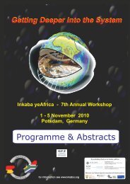
Getting Getting Deeper Deeper into into into the the System<br />
System<br />
<strong>Inkaba</strong> ye<strong>Africa</strong> - 7th Annual Workshop<br />
1 - 5 November 2010<br />
Potsdam, Germany<br />
hosted by<br />
GFZ German Research hosted Centre by for Geosciences<br />
GFZ German Research Centre for Geosciences<br />
Programme & Abstracts<br />
for information see www.inkaba.<strong>org</strong>
i<br />
IMPRESSUM<br />
Helmholtz-Zentrum Potsdam – Deutsches GeoForschungsZentrum GFZ<br />
Stiftung des Öffentlichen Rechts des Landes Brandenburg<br />
Telegrafenberg<br />
14473 Potsdam<br />
www.gfz-potsdam.de
7th <strong>Inkaba</strong> ye<strong>Africa</strong> Workshop<br />
1-5 November, 2010<br />
GFZ German Research Centre<br />
for Geosciences<br />
Telegrafenberg, Potsdam<br />
Agenda<br />
Sunday October 31: Arrival and Orientation<br />
16:00 Student registration and orientation workshop led by Robert<br />
Kriger (NRF) and Robert Trumbull (GFZ)<br />
18:00 Welcome reception – ice breaker at GFZ Telegrafenberg<br />
Monday November 1: Registration and Opening Ceremonies<br />
13:00 Welcome and opening address by Prof. Reinhard Hüttl<br />
(Director, GFZ German Research Centre for Geosciences)<br />
13:30 Greetings from the <strong>South</strong> <strong>Africa</strong>n Embassy, Berlin and the<br />
Brandenburg Ministry of Science, research and Culture<br />
13:50 “Celebrating 6 years of <strong>Inkaba</strong>” by Prof. Maarten deWit<br />
(University of Cape Town and director, AEON Institute)<br />
14:10 Introduction to Workshop by Prof. Brian Horsfield (GFZ German<br />
Research Centre for Geosciences)<br />
14:30 <strong>Inkaba</strong> Showcase Lecture: “Heart of <strong>Africa</strong>” by Dr. Monika Korte<br />
(GFZ German Research Centre for Geosciences)<br />
15:00 <strong>Inkaba</strong> Showcase Lecture: “Margins of <strong>Africa</strong>” by Dr. Gabriele<br />
Uenzelmann-Neben (Alfred-Wegener Institute for Marine and<br />
Polar Research)<br />
15:30 Tea break<br />
16:00 <strong>Inkaba</strong> Showcase Lecture: “Living <strong>Africa</strong>” by PD Dr. Heinz<br />
Wilkes (GFZ German Research Centre for Geosciences)<br />
16:30 Invited Lecture: “Topo-<strong>Africa</strong>” by Prof. Francois Guillocheau<br />
(University of Rennes, France)<br />
17:00 Invited Lecture: “Development of <strong>South</strong> Atlantic Rifted Margins”<br />
by Dr. Ulrich Glasmacher (University of Heidelberg)<br />
18:00 Dinner (reception) at GFZ cantine<br />
19:30 Evening Lecture: “Planetary Evolution and Life” by Prof. Tilman<br />
Spohn (DLR German Aerospace Center, Institute of Planetary<br />
Research Berlin-Adlershof)<br />
ii
20:30 Concert: “Baroque music and the Prussian Court” La<br />
Prosperina Ensemble (Berlin University of Fine Arts)<br />
21:30 Shuttle to Hotels<br />
Tuesday November 2: Scientific Sessions<br />
Session 1: Living <strong>Africa</strong><br />
Theme A: habitat, climate and ecosystem evolution<br />
08:30 keynote Cotterill, F. P. D.<br />
Geodynamics and geobiological fingerprints of the Kalahari<br />
epeirogeny<br />
09:00 Hoffmann, V.<br />
Tracking geobiological linkages between speciation and<br />
landscape evolution through space and time<br />
09:15 Schmidt, F.<br />
Environmental changes in Lake Tswaing during the last 84 ka BP<br />
09:30 Steyn, S. A.<br />
Statistical downscaling of climate change projections to daily<br />
temperatures, Upper Olifants River catchment<br />
09:45 Roberts, D.<br />
Climate/sealevel fluctuations along the <strong>South</strong>ern <strong>Africa</strong>n West<br />
Coast: regional and global context<br />
Theme B: Natural resources and sustainability<br />
10:00 van Huysteen, C. W.<br />
A framework for soil-based wetland research in <strong>South</strong> <strong>Africa</strong><br />
10:15 Kotze, E.<br />
Effect of Long-term residue management on <strong>org</strong>anic matter in a<br />
Plinthosol cropped annually with wheat<br />
10:30 du Preez, C. C.<br />
Fate of soil <strong>org</strong>anic matter in <strong>South</strong> <strong>Africa</strong> crop and pasture land<br />
10:45 Tea break<br />
11:15 Chevallier, L.<br />
The geothermal potential of <strong>South</strong> <strong>Africa</strong> – New Challenges for<br />
Geoscientists<br />
11:30 Tan, J. Q.<br />
Shale gas in <strong>South</strong> <strong>Africa</strong><br />
11:45 Mikes, D.<br />
Karoo sequence stratigraphy and facies modelling for improved<br />
reservoir characterisation and upscaling<br />
iii
12:00 Boyd, D.<br />
Seismic Interpretation, distribution, and numerical modelling of<br />
natural gas leakage in Block 2 of the Orange Basin<br />
12:15 Güntner, A.<br />
New tools for hydrologic research at Sutherland observatory:<br />
superconducting gravimetry and satellite gravimetry<br />
12:30 Poster presentations for Session 1<br />
13:30 Lunch, GFZ cantine<br />
14:30 keynote Tredoux, M.<br />
The Platinum Value Chain – A PGE-rich rock from the<br />
Barberton greenstone belt: core formation or extraterrestrial?<br />
15:00 Lekgetho, T. B.<br />
Can base metal sulphides be used as a proxy for platinumgroup<br />
mineral flotation of UG2 ore?<br />
15:15 Reid, D. L.<br />
Towards a magmatic reaction model for iron-rich ultramafic<br />
pegmatites in the Rustenburg Layered Suite<br />
15:30 Durrheim, R. J.<br />
Observational studies to mitigate seismic risks in mines: a new<br />
Japanese – <strong>South</strong> <strong>Africa</strong>n collaborative research project<br />
Session 2: Heart of <strong>Africa</strong><br />
Theme A: Deep-earth processes and surface response<br />
15:45 keynote Bell, D.<br />
Evolution of Proterozoic mantle lithosphere: petrological and<br />
geophysical evidence from the Kaapvaal – Namaqua boundary<br />
16:15 Weckmann, U.<br />
Defining the Kaapvaal Craton boundary - new electrical<br />
conductivity images<br />
16:30 Tea break<br />
16:45 Kotze, P. B.<br />
<strong>South</strong>ern <strong>Africa</strong>’s geomagnetic field secular variation since<br />
2005<br />
17:00 Geese, A.<br />
Improvements to <strong>South</strong>ern <strong>Africa</strong>n geomagnetic field and<br />
secular variation descriptions from different modelling<br />
techniques<br />
17:15 Decker, J. E.<br />
Cosmogenic nuclide-based perspectives on long-term<br />
landscape evolution and short-term soil erosion rates<br />
17:30 Poster presentations for Session 2<br />
18:15 Poster Session 1 + 2<br />
iv
19:00 Dinner at GFZ cantine<br />
20:00 Evening lecture by A. Lindeque (AWI) & J. Stankiewicz (GFZ):<br />
Two postgraduates experiences in <strong>Inkaba</strong> ye<strong>Africa</strong><br />
21:00 Shuttle to hotels<br />
Wednesday November 3: Scientific Sessions and Project meetings<br />
Session 2, Theme B: Earth in space<br />
09:00 Combrinck, W. L.<br />
Using satellite laser ranging data to test general relativity<br />
09:15 Botai, O. J.<br />
Statistical exploration of underlying geophysical signals and<br />
noise components in space geodetic data<br />
09:30 Botha, R. C.<br />
Experimental development of a high-power laser suitable for<br />
Lunar Laser Ranging<br />
Session 3: Margins of <strong>Africa</strong><br />
09:45 keynote Gohl, K.<br />
Growth and dispersal of a southeast <strong>Africa</strong>n large igneous<br />
province<br />
10:15 Uenzelmann-Neben, G.<br />
Palaeoceanographic changes from seismic and radiogenic<br />
isotope data from the Mozambique Ridge<br />
10:30 Trumbull, R. B.<br />
New insights on the role of mantle plumes in <strong>South</strong> Atlantic<br />
breakup<br />
10:45 Backeberg, N. R.<br />
Petrogenesis of the False Bay dyke swarm, Cape Peninsula,<br />
<strong>South</strong> <strong>Africa</strong><br />
11:00 Tea break<br />
11:15 Scheck-Wenderoth, M.<br />
3D lithosphere-scale models of the conjugate margins in the<br />
<strong>South</strong> Atlantic<br />
11:30 Andreoli, M. A. G.<br />
Post-Gondwana tectonics of western <strong>South</strong> <strong>Africa</strong><br />
Session 4: Capacity Building<br />
12:00 Fourie, C. J. S.<br />
Development of a Science and Technology Train<br />
v
12:15 Erwee, M.<br />
Training science educators – Investigating the problem areas<br />
and misconceptions<br />
12:30 Poster presentations for Sessions 3 + 4<br />
13:00 Poster Session<br />
13:30 Lunch, GFZ cantine<br />
Project meetings + strategy sessions<br />
14:30 Plenary discussion: Quo Vadis, <strong>Inkaba</strong>?<br />
15:30 ad-hoc strategy sessions (GASHsa, PGE, SPACES)<br />
17:30 Plenary, closing discussion<br />
19:00 Dinner banquet in Potsdam: Alter Stadtwächter<br />
vi
Poster contributions<br />
vii
Poster Session 1: Living <strong>Africa</strong><br />
Theme A: Habitat, climate & ecosystem evolution<br />
Poster Author Title<br />
1-1 Browning, C. Quaternary dune gastropods of the <strong>South</strong> <strong>Africa</strong>n west coast:<br />
Implications for climate change<br />
1-2 Clark, J.H.A. The morphology and development of palaeoterraces of the<br />
Orange River in the Hopetown-Douglas-Prieska area<br />
1-3 MacDonald, N. Aspects of palaeo-terrace formation and stream sediment<br />
petrography of the Orange and Vaal River confluence in the<br />
Douglas Area, northern Cape province, <strong>South</strong> <strong>Africa</strong><br />
1-4 Mthembi, P. Palaeoclimate & ecosystems of the Pleistocene in <strong>South</strong> <strong>Africa</strong><br />
as archived in the Kalkop Crater Lake deposits<br />
1-5 Völkel, J. Records of Late Quaternary environmental changes preserved<br />
in eolian and fluvial sediment geoarchives of the SW-Kalahari,<br />
<strong>South</strong> <strong>Africa</strong><br />
Theme B: Natural resources & sustainability: water, soil, energy<br />
Poster Author Title<br />
1-6 Lebenya, R.M. Quantification of the soil-plant carbon stock in the Weatherley<br />
catchment eight years after conversion from grassland to<br />
forestry<br />
1-7 Loke, P.F. Influence of long-term wheat residue management on soil<br />
fertility indicators of an Avalon soil at Bethlehe<br />
1-8 Mahed, G. Hydrogeological Conceptual model development in the vicinity<br />
of the Superconducting Gravimeter, Sutherland, <strong>South</strong> <strong>Africa</strong><br />
1-9 Mathiva, R.T. Carbonate alteration of dolerite intruding coal seams:Natural<br />
carbon sequestration during fossil fuel combustion?<br />
1-10 May, F. Characterization and quantification of preferential flow in<br />
fractured rock systems, using resistivity tomography<br />
1-11 Nape, K.M. Economic benefits of varying maize production strategies under<br />
various seasonal rainfall scenarios in the Modder River<br />
catchment, <strong>South</strong> <strong>Africa</strong><br />
1-12 Ntholi, T. Low Enthalpy Geothermal Energy purification of Acid Mine<br />
Drainage, and storage of potable water in the deep gold mines<br />
of <strong>South</strong> <strong>Africa</strong><br />
1-13 Nthejane, M.M. Correlation between agronomic and environmental phosphorus<br />
analyses of selected soils<br />
1-14 Onaneye, A.O. A new approach to upscaling in resevoir modelling<br />
1-15 Snyman, P.E. Monitoring the 2-D urban heat island for Bloemfontein, <strong>South</strong><br />
<strong>Africa</strong><br />
1-16 Tharaga, P.C. Downscaling climate change scenarios to daily maximum<br />
temperatures over Bloemfontein, <strong>South</strong> <strong>Africa</strong><br />
1-17 Vogeli, J. Investigation of the potential for mineral carbonation of <strong>South</strong><br />
<strong>Africa</strong>n PGM tailings<br />
1-18 Nformi, E. Sequence Stratigraphic Characterisation of Petroleum<br />
Reservoirs in block 11B/12B of the <strong>South</strong>ern Outeniqua Basin,<br />
<strong>South</strong> <strong>Africa</strong><br />
1-19 Opwani, M. Petrophysical evaluation of the Albian Age Gas Bearing<br />
Sandstone reservoirs of the O-M field, Orange Basin, <strong>South</strong><br />
<strong>Africa</strong><br />
viii
Theme B: Natural resources & sustainability: mineral resources<br />
Poster Author Title<br />
1-20 Chabangu, N. An Investigation of Nickel Mineralization in the Northwestern<br />
Part of the Barberton Greenstone Belt, <strong>South</strong> <strong>Africa</strong><br />
1-21 Kennedy, B. Investigation of the behaviour of platinum group elements<br />
(PGE), in synthetic sulphide systems<br />
1-22 Madalal, F. Mineralogical and geochemical investigations of the nickel Bon<br />
Accord deposit, Barberton, <strong>South</strong> <strong>Africa</strong><br />
1-23 Mandiwana, M.T. The role of footwall reconstitution in the genesis of Merensky<br />
reef types at Northam Platinum Mine<br />
1-24 Milanzi, K.S.R. The Mineralogy and PGE Geochemistry of the Middle Group<br />
Chromitite Seams of the Western Bushveld Complex at<br />
Kroondal Mine<br />
1-25 Nethsitungulwana, R. An Investigation of the Trace Element Compositions of<br />
Gold from the Zimbabwe and <strong>South</strong> <strong>Africa</strong> : Implications<br />
for tracing the source of archeological gold<br />
1-26 Jack, S. Some aspects of late magmatic replacement phenomena<br />
developed in the layered sequence exposed at Northam<br />
Platinum mine<br />
1-27 Shadi, O. Investigation of the Merensky Reef and the associated Iron Rich<br />
Ultramafic Pegmatite replacement bodies, Bafokeng Rasimone<br />
Platinum Mine, Rustenburg, SA<br />
Poster Session 2: Heart of <strong>Africa</strong><br />
Theme A: Deep-earth processes & surface response<br />
A1 The Barberton Belt<br />
Poster Author Title<br />
2-1 MacLennan, S. Structural and geophysical transect across an Archean suture<br />
zone, Barberton Greenstone Belt<br />
2-2 Engelhart, J. Dating Archean sedimentary processes and rates in the<br />
Moodies Basin, Barberton Supergroup, Barberton Greenstone<br />
belt<br />
2-3 Kütter, S. Overview and preliminary results of magnetotelluric<br />
experiments across the southern Barberton greenstone belt<br />
A2 The Cape Fold Belt & Karoo Basin<br />
Poster Author Title<br />
2-4 Chen, X. Study of the geo-electrical anisotropy in the Cape Fold Belt<br />
using magnetotelluric<br />
2-5 Arenz, R. The application of facies analysis on sedimentary evolution and<br />
changes in sea-level on the Kookfontein and Waterford<br />
Formation in the Permian Ecca Group, Tanqua, Karoo Basin<br />
2-6 Arnold, A. Lithostratigraphic correlation of the Ecca Palaeo-slope and<br />
shelf-edge deltaic deposits: Phase 1<br />
2-7 Black, D.E. The stratigraphy of the lower and middle Karoo Supergroup,<br />
north of Paterson, Eastern Cape, <strong>South</strong> <strong>Africa</strong><br />
2-8 Brunsdon, G. Structural features of the Bokkeveld Group (Cape Supergroup)<br />
in the Eastern Cape, <strong>South</strong> <strong>Africa</strong><br />
ix
2-9 Chere, N. Exploring the Origin of Breccia Pipes in the Karoo Basin, <strong>South</strong><br />
<strong>Africa</strong><br />
2-10 Esterhuizen, L. Comparing 1960's Karoo basin seismic data with recent data<br />
(<strong>Inkaba</strong> ye<strong>Africa</strong> Line), to identify and correlate Karoo seismic<br />
stratigraphy on a more regional basis<br />
2-11 Lombard, D. Facies architecture and reservoir quality of Fan B, Permian<br />
Laingsburg Formation, southwestern Karoo Basin, <strong>South</strong> <strong>Africa</strong><br />
2-12 Loots, L. Investigation of the crust in the <strong>South</strong>ern Karoo using the<br />
seismic reflection technique<br />
2-13 Sonibare, W.A. Deterministic approach to geological and petrophysical<br />
modelling of field analogue data: Tanqua-Karoo deltaic<br />
sequence, SW Karoo Basin<br />
2-14 Olivier, W.C. Mineralogical, geochemical and structural characteristics of<br />
quartz-arenites of the middle Witteberg Group (Cape<br />
Supergroup) near Kirkwood, Eastern Cape, SA<br />
2-15 Patel, M. Paleo-environmental reconstruction of the Tanqua Basin, SW Karoo,<br />
<strong>South</strong> <strong>Africa</strong><br />
2-16 Malephane, H.R. Seismicity and Seismic Hazard Assessment of the arid western<br />
regions of <strong>South</strong> <strong>Africa</strong>: a Neotectonic Perspective<br />
2-17 Mielke, C. Topographic imprint of Geomorphology in southern <strong>Africa</strong><br />
2-18 Scharf, T. Denudation rates and geomorphic evolution of the Cape<br />
Mountains determined through cosmogenic dating using 10 Be<br />
and 21 Ne in quartz<br />
Theme B: Earth in Space<br />
Poster Author Title<br />
2-19 Botai, M.C. Investigating the accuracy of gravity field models using satellite<br />
Laser Ranging data<br />
2-20 Croukamp, L.A Lunar Geotechnical GIS as an aid for exploration and<br />
settlement construction<br />
2-21 Munghemezulu, C. A proposal for the determination of intercontinental plate<br />
velocities in <strong>Africa</strong> to support the establishment of the<br />
<strong>Africa</strong>n Geodetic Reference Frame (AFREF)<br />
2-22 Nickola, G.L. High-precision steering and pointing control of a satellite/ lunar<br />
laser ranging telescope<br />
2-23 Nickola, M. Site characterisation: Astronomical seeing from a turbulenceresolving<br />
model<br />
Poster Session 3: Margins of <strong>Africa</strong> and Capacity-building<br />
Poster Author Title<br />
3-1 Curtis, C. Low- 18 O magmas of the Cretaceous Koegel Fontein Complex,<br />
<strong>South</strong> <strong>Africa</strong><br />
3-2 Frei, O. Model-enhanced geothermobarometry of mafic dikes of the<br />
Henties Bay Outjo dike swarm, Etendeka Igneous Province<br />
Namibia<br />
3-3 Khoele, K. The design of a pressurised clean water supply system for the<br />
Science and Technology Train<br />
3-4 Matsepe, T. The design of a Stirling engine system for the Science and<br />
Technology Train<br />
3-5 van Tonder, D.M. The development and evaluation of solar desalination<br />
technology<br />
x
Post-Gondwana Tectonics of Western <strong>South</strong> <strong>Africa</strong><br />
M A G Andreoli 1, 2 , G Viola 3 , A Kounov 4 , O Heidbach 5 , J Scheepers 6 , I Stengel 7, 11 ,<br />
CE Clarke 8 , F Netterberg 9 , R Durrheim 10, 2 , A Logue 1 , H Malephane 2<br />
1. <strong>South</strong> <strong>Africa</strong>n Nuclear Energy Corporation, <strong>South</strong> <strong>Africa</strong>, marco@necsa.co.za<br />
2. University of the Witwatersrand, <strong>South</strong> <strong>Africa</strong>.<br />
3. Geological Survey of Norway, Norway, Giulio.Viola@ngu.no<br />
4. University of Basel, Switzerland, A.Kounov@unibas.ch<br />
5. GFZ, Germany, heidbach@gfz-potsdam.de<br />
6. Impala Platinum Rustenburg Mine, <strong>South</strong> <strong>Africa</strong>, johann.scheepers@implats.co.za<br />
7. University of Pretoria, <strong>South</strong> <strong>Africa</strong>, Ingrid.stengel@up.ac.za<br />
8. University of Stellenbosch, <strong>South</strong> <strong>Africa</strong>, cdowding@sun.ac.za<br />
9. F Netterberg, <strong>South</strong> <strong>Africa</strong>, fnetterberg@absamail.co.za<br />
10. CSIR, <strong>South</strong> <strong>Africa</strong>, RDurrhei@csir.co.za<br />
11. Namibgeovista GeoConsult & Imaging, Namibia, Ingrid@namibgeovista.com<br />
ABSTRACT<br />
The Namaqualand complex is a gneissic terrane of NW <strong>South</strong> <strong>Africa</strong> stabilized at ca. 1.03 Ga. For its array of<br />
favourable conditions a Low and Intermediate Level Radioactive Waste Disposal Facility was established in 1986<br />
at Vaalputs, on the Bushmanland plateau of the Namaqualand complex. In spite of its great age and assumed<br />
tectonic stability, the region was later found to display the characteristics of a moderately active intraplate seismic<br />
province.<br />
To monitor this type of weak neotectonics, the authors developed a multidisciplinary research program that<br />
involves recording seismic events within a radius of 100 km around Vaalputs using two TELS 3-components<br />
seismometers. All available seismic data will be interpreted in parallel with focal mechanism solutions for the<br />
larger seismic events recorded from Bushmanland, orientation of maximum horizontal stress SHmax derived from<br />
off-shore wells caliper logs from the Petroleum Agency, geomorphic-pedogenetic-palaeoclimate-geotechnical<br />
investigations of the Cenozoic Vaalputs Formation, palaeostress analysis of brittle structures in the pre-Cenozoic<br />
Namaqualand basement, and investigations of Post-Gondwana (neo)tectonic and dyking phenomena in the<br />
southern Kalahari/ SW Namibia.<br />
The seismic data show swarms in 1996, 2001 and 2010, and a trend of increasingly frequent seismicity in<br />
Namaqualand since 1989. Furthermore, the Vaalputs area displays km-long lineaments in the geomorphic setup,<br />
atypical pedogenic structures in Quaternary (?) palaeosoils, and numerous slickensided faults in Cretaceous<br />
silcretes. Such features point to persistent, albeit perhaps punctuated, tectonic instability in Namaqualand and<br />
Bushmanland since the break-up of West Gondwana. Our data also suggest that this intraplate tectonic activity<br />
peaked between ~100 Ma and the Palaeocene, being at one stage accompanied by kimberlitic intrusions and by<br />
multiple changes in the tectonic regime. Other areas affected by this evolution include southwestern Namibia, the<br />
southern Cape basins and the western Kaapvaal craton<br />
In summary, the seismicity in western southern <strong>Africa</strong> reflects a long-lived, post-Gondwana crustal instability<br />
and strain arising out of the interaction, through time, between the complex mosaic structure of the southern<br />
<strong>Africa</strong>n lithosphere with changing regional stresses both compressive and extensional in nature. Whereas the<br />
former originate from plate boundaries, the latter may arise from the upward propagation of the <strong>Africa</strong>n<br />
superplume. More complex, localized stress patterns appear to arise from the southward propagation of the East<br />
<strong>Africa</strong>n Rift. However, this interpretation cannot yet explain the Wegener stress anomaly, the contemporary NNWoriented<br />
strike-slip regime in western southern <strong>Africa</strong>.<br />
KEYWORDS: Neotectonics, Namaqualand, Bushmanland, Seismicity, Stress, Vaalputs.<br />
1
The application of facies analysis on sedimentary evolution<br />
and changes in sea-level on the Kookfontein and Waterford<br />
Formation in the Permian Ecca Group, Tanqua, Karoo Basin<br />
R. Arenz¹, D.Mikeš²<br />
1. Stellenbosch University, <strong>South</strong> <strong>Africa</strong>, renitia@gmail.com<br />
2. Stellenbosch University, <strong>South</strong> <strong>Africa</strong>, mikes@sun.ac.za<br />
ABSTRACT<br />
Facies are considered as deposited by a unique set of physical processes which can be interpreted from lithologies,<br />
textures, primary sedimentary structures, fossil content and stratigraphic position. In many cases the observed<br />
sedimentary structures alone are not sufficient to unequivocally assert the mode of deposition and in places comparison<br />
with models described in literature may even be misleading.<br />
The aim if this study was thus to; Analyse the sequence in which the facies occur, providing information about the<br />
facies itself; the relationship between depositional environments and stratigraphic sequences developed through time as<br />
a result of transgressions and regressions. Evaluating controls on sedimentary facies architecture, incorporating facies<br />
analysis and interpretation. Evaluating the use of facies architecture to infer sea-level change. Using facies architecture<br />
to determine depositional setting.<br />
During a month long period of field work Phase 1 in the Tanqua and Laingsburg depocenters, an outcrop field study<br />
was carried out to facilitate compilation of detailed sedimentary logging, and vertical profiles accompanied by outcrop<br />
gamma log data facilitating easy comparison with subsurface data sets for correlation of the Waterford and Kookfontein<br />
formations’ lithologies and radioactive decay properties. Detailed stratigraphic mapping was carried out using a<br />
portable multi-channel scintillation spectrometer, SGR data collected is used as a correlation tool. The spectral gamma<br />
ray (SGR) tool measured the total gamma ray (GR) and the individual contribution from the three major radioactive<br />
sources, namely 40K, 238U and 232Th, in a given time. Data collected will be presented in seconds (sec). The<br />
sedimentary successions were then logged by measuring the gamma radiation at an average vertical spacing of 50 - 75<br />
cm over a selected time interval, namely 180 seconds for the argillaceous units and 240 seconds for sandstone.<br />
Sedimentological and gamma ray profiles were measured from the basin-floor deposits to the base of the deltaic<br />
successions in the Tanqua sub basin. The locations for these profiles were chosen on best outcrop positions for regional<br />
correlation by using arial photographs geological and topographic maps. Samples were collected from fresh outcrop<br />
surfaces where possible, concentrating mudstone sampling between fans/units, and sandstone samples at the start and<br />
end of major depositional facies. Samples were taken at vertical intervals for the purpose of constraining regional<br />
correlations.<br />
Through a collaborative study at Stellenbosch University sedimentology research group, interpretation of facies, based<br />
on spatial relations and internal characteristics (lithology and sedimentary structures) using information from<br />
stratigraphic units and facies subdivision will be used to construct a new facies model for the Kookfontein and<br />
Waterford Formations of the upper Ecca shelf to slope succession in the Tanqua depocentre .<br />
KEYWORDS: Facies architecture ;sea- level change; Kookfontein Formation; Waterford Formation; Tanqua sub-<br />
basin.<br />
2
Lithostratigraphic correlation of the Ecca Palaeo-slope and<br />
shelf-edge deltaic deposits: Phase 1<br />
Andy Arnold 1 , Daniel Mikeš 2 , Willem Van Der Merwe 3<br />
1. University of Stellenbosch, <strong>South</strong> <strong>Africa</strong>, 15905845@sun.ac.za<br />
2. University of Stellenbosch, <strong>South</strong> <strong>Africa</strong>, mikes@sun.ac.za<br />
3. STRATgroup, University of Liverpool, United Kingdom, W.Van-Der-Merwe@liverpool.ac.uk<br />
ABSTRACT<br />
The Permian Ecca Group of the Karoo Basin, <strong>South</strong> <strong>Africa</strong> preserves an extensive well-exposed siliciclastic basin<br />
floor, slope and shelf- edge deltaic succession. These subaqueous depositional systems form a major component of<br />
most marine and many lacustrine basin fills, and constitute primary targets for hydrocarbon exploration and<br />
development.<br />
Detailed regional mapping and correlation of the upper Ecca Group, Kookfontein, Fort Brown and Waterford<br />
Formations has never been undertaken before. The current study hopes to contribute to the new understanding of:<br />
(1) the stratigraphic development of the Karoo Basin margin during the late Permian, (2) shelf-margin construction<br />
and (3) the internal facies architecture of these sought after deposits.<br />
The first phase of field work has recently been undertaken over a period of six weeks, during which vertical<br />
profiles were measured at cm-scale in both strike and dip sections. These were then used to construct the first of<br />
many correlation panels, on which the palaeogeographic interpretations will be based. Correlation of the upper<br />
Ecca succession will be done across the Tanqua and Laingsburg depocentres.<br />
Expected deliveries: The study will produce the first detailed regional mapping of the upper Ecca group across<br />
both depocentres and contribute to the knowledge of the development of the basin margin.<br />
KEYWORDS: Karoo Basin, Shelf-edge deltas, Sequence stratigraphy, Correlation, Lowstand deposits<br />
3
Petrogenesis of the False Bay dyke swarm, Cape Peninsula,<br />
<strong>South</strong> <strong>Africa</strong><br />
N R Backeberg 1 , D L Reid 1 , R B Trumbull 3 , R L Romer 4<br />
1. University of Cape Town, <strong>South</strong> <strong>Africa</strong>, nils.backeberg@gmail.com<br />
2. University of Cape Town, <strong>South</strong> <strong>Africa</strong>, david.reid@uct.ac.za<br />
3. Deutsches GeoForschungsZentrum, 14473 Potsdam, Germany, bobby@gfz-potsdam.de<br />
4. Deutsches GeoForschungsZentrum, 14473 Potsdam, Germany, romer@gfz-potsdam.de<br />
ABSTRACT<br />
The False Bay dyke swarm is the southern NW-SE trending end-member of the Cretaceous dolerite dyke intrusions<br />
on the western <strong>Africa</strong>n margin, associated with rifting of Gondwana and opening of the <strong>South</strong> Atlantic Ocean. This<br />
southern dyke swarm has been associated with a low-flux, passive rifting end member compared to its northern<br />
high-flux, active rifting counterpart: the Henties Bay-Outjo dyke swarm in Namibia. The contrast in basaltic<br />
magma types and magma flux between north and south has been related to different tectonic settings (i.e. magma<br />
sources) along the current coast line during Cretaceous rifting. Further, the False Bay dyke swarm is characterised<br />
by olivine-tholeiites with quite extreme differentiation to ferro-tholeiites within a monogenetic magma system. The<br />
finer details of the differentiation process identified through trace element analysis and major element modelling<br />
are presented here. Both crystal fractionation and assimilation trends are identified for the False Bay dolerites<br />
during magma evolution. Crustal assimilation processes are only identified in samples with less than 5 wt% MgO.<br />
This observation is consistent with trace elements and Sr and Nd radiogenic isotopes, while initial differentiation<br />
(greater than 5wt% MgO) is characterised by pure fractional crystallisation. Initial variation in conserved trace<br />
element ratios, prior to assimilation, is not correlated to differentiation and is assumed as a result of variations<br />
within the enriched source rock.<br />
KEYWORDS: dolerite dykes, trace element ratios, Sr and Nd isotopes, Gondwana rifting, differentiation<br />
4
Evolution of Proterozoic mantle lithosphere: petrological and<br />
geophysical evidence from the Kaapvaal – Namaqua boundary<br />
D. Bell 1,3 , U. Weckmann 2 ,P. Janney 1 , M. de Wit 3<br />
1. SESE, Arizona State University, Tempe, AZ, USA, David.R.Bell@asu.edu<br />
2. GeoForschungsZentrum Potsdam, Germany, uweck@gfz-potsdam.de<br />
3. AEON, University of Cape Town, <strong>South</strong> <strong>Africa</strong>, Maarten.deWit@uct.ac.za<br />
ABSTRACT<br />
The subcontinental lithospheric mantle (SCLM) beneath Proterozoic and Archean crustal provinces differs in<br />
composition, temperature, and thickness. To shed light on the origins of these differences we combined<br />
petrological data from xenocrysts, megacrysts, and xenoliths in kimberlites with a lithospheric resistivity model<br />
derived from a new high-resolution magnetotelluric (MT) traverse, to examine the transition between Archean and<br />
Proterozoic lithosphere at the SW margin of the Kaapvaal Craton. Highly resistive SCLM persists up to 100 km<br />
west of the Brakbos fault zone, confirming inferences from garnet xenocrysts of craton-like mantle beneath<br />
Proterozoic crust (Kobussen et al. 2008). Xenolith thermobarometry also suggests craton-like mantle temperatures<br />
in this region prior to Mesozoic disturbance (Bell et al. 2003; Janney et al. 2010). Surface and body-wave seismic<br />
tomography studies reveal craton-like high-velocity domains within the SCLM beneath the Namaqua Belt.<br />
Average whole-rock Mg#, Al2O3 contents, and Os isotope model ages of Kaapvaal and Namaqua mantle xenoliths<br />
differ, but many individual off-craton xenoliths overlap the cratonic population and suggest complex multistage<br />
history. Clinopyroxene megacrysts from the Pofadder kimberlites suggest interaction of deep melts with mantle<br />
lithosphere similar to that beneath the Archean craton at Kimberley. The MT study reveals prominent vertical<br />
zones of low resistivity within the high-resistivity SCLM in the boundary region. These may be metasomatized<br />
zones that formed during the focused ascent of melts generated beneath the SCLM and have been inferred from<br />
xenocryst compositions (Begg et al. 2009). Some kimberlite eruptions occur earlier in the boundary region than<br />
would be predicted from their broader regional eruptive patterns, trace elements suggest some have mixed source<br />
regions, and evolved megacrysts indicate local magma infiltration to shallow levels. These results support models<br />
of (1) melt-refertilized Archean SCLM beneath Proterozoic crust, and (2) the focusing of mantle–derived magmas<br />
into ancient shear zones that serve as repeating loci of tectonic reactivation. This model allows for tectonic<br />
obduction of relatively young Namaqua arc crust across subducting Archean SCLM during arc-continent collision,<br />
as is presently observed in the Banda Arc (Fichtner et al., 2010) [335 words]<br />
KEYWORDS: mantle, lithosphere, kimberlite, conductivity, megacryst, xenolith, subduction-accretion.<br />
5
The stratigraphy of the lower and middle Karoo Supergroup,<br />
north of Paterson, Eastern Cape, <strong>South</strong> <strong>Africa</strong><br />
Dawn E. Black 1 , P.W.K. Booth 2 , M.J. de Wit 3<br />
1. NMMU, <strong>South</strong> <strong>Africa</strong>, dblack@geoscience.<strong>org</strong>.za<br />
2. NMMU, <strong>South</strong> <strong>Africa</strong>, peter.booth@nmmu.ac.za<br />
3. UCT, <strong>South</strong> <strong>Africa</strong>, Maarten.DeWit@UCT.ac.za<br />
ABSTRACT<br />
Strata of the Karoo Supergroup (Karoo Basin) in an area north of Paterson, Eastern Cape, <strong>South</strong> <strong>Africa</strong>, are being<br />
mapped in order to better define the litho and chrono-stratigraphy of the Ecca and Beaufort Groups. The southeast<br />
Karoo Basin displays a thick section of Karoo Supergroup sediments that record deepening and shallowing of the<br />
basin throughout the Permian.<br />
Fieldwork to date has shown that mainly thinly-bedded deltaic deposits (Prince Albert, Whitehill and Collingham<br />
Formations) are overlain by thick deltaic units of sandstone and mudrock (Ripon, Fort Brown and Waterford<br />
Formations). Stratigraphically upwards the deltaic deposits of the Ecca Group give way to mudrock and lesser<br />
sandstones of the Beaufort Group that represent fluvial sedimentation in an inland sea, with a provenance in the<br />
south and east.<br />
Once fieldwork is complete detailed lithostratigraphic columns will be constructed and geological sections drawn.<br />
Features such as sedimentary structures, unit thicknesses and mineralogy will provide the basis for the<br />
reconstruction of the palaeo-environment. The sections produced will form the basis for correlating Karoo strata<br />
with the western part of the basin, albeit that such long range correlations may not be accurate.<br />
Radiometric age dating especially of zircons in tuffaceous beds which occur throughout the Ecca and Beaufort<br />
Groups will be determined by mass spectrometry (U/Pb isotropic method). Samples collected and analysed should<br />
provide improved time constraints of the Permian-Triassic boundary in the south-eastern Karoo Basin, and will add<br />
to the existing chronostratigraphic data base for the Karoo Basin. This approach should make for improved<br />
interpretations of paleao-environments which previously relied on lithostratigraphy, but can now be modified or redefined<br />
through the chronostratigraphy.<br />
An additional aim of this project is to give a measure of the extent of deformation of the rocks, especially at their<br />
southernmost outcrops, and thereby provide a better understanding of the relationship between Cape Supergroup<br />
rocks and those of the overlying Karoo Supergroup.<br />
KEYWORDS: Stratigraphy, Karoo Basin, ashfall tuffs.<br />
6
Investigating the accuracy of gravity field models using<br />
Satellite Laser Ranging data<br />
M. C. Botai 1, 2 1, 2<br />
, W. L. Combrinck<br />
1. Space Geodesy, Hartebeesthoek Radio Astronomy Observatory, <strong>South</strong> <strong>Africa</strong>, christina@hartrao.ac.za<br />
2. Department of Geography, Geoinformatics and Meteorology, University of Pretoria, <strong>South</strong> <strong>Africa</strong>,<br />
ludwig@hartrao.ac.za<br />
ABSTRACT<br />
Continuous observations of geodetic satellites using the Satellite Laser Ranging technique have provided<br />
unprecedented opportunity in the long- to medium-wavelength gravity field modeling. As a result, numerous<br />
gravity field models have been derived from these observations and have been made freely available to the science<br />
community for research purpose. The accuracy of most of these models in terms of precise orbit determination is<br />
currently at cm level. Improvement in the modeling of the long wavelength components of the Earth is anticipated<br />
as quantitative and qualitative data (in particular from low earth orbit satellites) become available in the future.<br />
Such expectations require that the accuracy and precision of existing gravity field models be assessed. The<br />
validation of gravity field models in terms of satellite orbit determination is based on the difference between the<br />
observed (SLR measurements) and the computed range. The resulting O-C range residuals can be considered as an<br />
important index when determining the accuracy of the gravity models and hence the satellite orbits. In this<br />
contribution we investigate the accuracy of ten selected gravity field models (both satellite-only and combined<br />
models) analyzed using LAGEOS 1 and 2 data. Preliminary results show that the gravity field models developed<br />
over the years have improved by a factor of 2 per year.<br />
Keywords: Satellite Laser Ranging, LAGEOS, gravitational field, Global Geopotential Models.<br />
7
Inferences of α-stable Lévy distributions in long-range<br />
dependent geodetic data<br />
O. J. Botai 1 , W. L. Combrinck 1, 2 1, 3<br />
, V. Sivakumar<br />
1. Department of Geography, Geoinformatics and Meteorology, University of Pretoria, <strong>South</strong> <strong>Africa</strong>,<br />
joel.botai@up.ac.za<br />
2. Space Geodesy Programme, Hartebeesthoek Radio Astronomy Observatory, <strong>South</strong> <strong>Africa</strong>,<br />
Ludwig@hartrao.ac.za<br />
3. National Laser Centre (NLC), Council for Scientific and Industrial Research (CSIR), Pretoria,<br />
<strong>South</strong> <strong>Africa</strong>, SVenkataraman@csir.co.za<br />
ABSTRACT<br />
Recent analysis of geodetic data demonstrated that the oscillatory modes of geophysical signals exhibit self-similar<br />
behaviour. This scaling behaviour could be viewed as a manifestation of scale-invariant non-linear dynamics<br />
whose fractal structures and multi-fractal statistics are typical of a turbulent atmosphere and the Earth’s variable<br />
interior and complex topography. In order to explore the characteristics of the underlying geophysical signals and<br />
noise components in the geodetic data, assessing the stability of the inherent frequency distribution is often<br />
required. In the research presented here, the properties of a long-range α-stable Lévy distribution with long tails<br />
and infinite moments in geodetic data are investigated by way of statistically testing their distribution. The choice<br />
of stable distribution is based on the ease with which the statistical properties of the non-Gaussian processes are<br />
defined. Results show that the independent geophysical components reconstructed from geodetic data exhibit<br />
distributions that have asymptotic power-law decay whose underlying process can be modelled as a long-range<br />
dependent process with an α-stable Lévy distribution (i.e., the stable variates have small characteristic exponents).<br />
This an important contribution to geodetic data analysis because if the frequency distribution of geodetic data is<br />
inferred as stable, then the noise characteristics present in the data would be understood and modelled. In<br />
particular, if the presence of an α-stable noise component is inferred, it could imply that such a noise component is<br />
triggered by single extreme events which could be statistically modelled and therefore corrected.<br />
KEYWORDS: Geodetic data, long-range, self-similar, random process, α-stable Lévy.<br />
8
A high-power 2 crystal Nd:YLF laser at 1314 nm<br />
R. C. Botha 1, 2, 3 , H. Strauss 2 , W. S. Koen 2 , C. Bollig 2 , W.L. Combrinck 1<br />
1. Space Geodesy Programme, HartRAO, <strong>South</strong> <strong>Africa</strong>, roelf@hartrao.ac.za<br />
2. Laser Sources Group, CSIR National Laser Centre, <strong>South</strong> <strong>Africa</strong><br />
3. Laser Research Institute, Stellenbosch University, <strong>South</strong> <strong>Africa</strong><br />
ABSTRACT<br />
A new fundamental space geodetic observatory for <strong>South</strong> <strong>Africa</strong> has been proposed. Lunar Laser Ranging (LLR) is<br />
one of the space geodetic techniques to be hosted on-site. LLR requires a pulsed laser that can operate at 100 to<br />
400 mJ energy per ~ 20 pico-second pulses, at a pulse repetition frequency in the kHz region. It must also have<br />
excellent beam quality at M 2 < 1.1. Since no commercial laser matching the exact specifications could be obtained,<br />
it was decided to investigate into the possible development of such a laser.<br />
The most feasible candidate for such laser parameters was found to be a crystal-based diode pumped system.<br />
Nd:YLF was identified as a suitable candidate for the gain medium crystal. Investigating this material with is a 2crystal<br />
system operating at 1314 nm rather than the usual 1053 nm, will be our last experimental setup. The<br />
investigation primarily focuses on the power scaling of this material at this specific wavelength. A smaller (relative<br />
to previous efforts) pump beam diameter of 1.0 mm is used to increase the efficiency. This however increases the<br />
risk of thermal fracture. A total output power of this initial continuous wave laser is expected to be above 50 W.<br />
KEYWORDS: High-power, pico-second, laser, ranging, lunar<br />
9
Seismic Interpretation, Distribution, and Numerical Modelling<br />
of Natural Gas Leakage in Block 2 of the Orange Basin,<br />
Offshore <strong>South</strong> <strong>Africa</strong><br />
Donna Boyd 1 , Maarten de Wit 2 ,Zahie Anka 3 , Rolando di Primio 4<br />
1. AEON, University of Cape Town, <strong>South</strong> <strong>Africa</strong>, boyd.donna@gmail.com<br />
2. AEON, University of Cape Town, <strong>South</strong> <strong>Africa</strong>, maarten.dewit@uct.ac.za<br />
3. GFZ German Research Centre for Geosciences. Potsdam, Germany, zahie@gfz-potsdam.de<br />
4. GFZ German Research Centre for Geosciences. Potsdam, Germany, dipri@gfz-potsdam<br />
ABSTRACT<br />
300 2D seismic profiles and 10 wells were analysed from the study area of 18750 km 2 in exploration Block 2 of<br />
the Orange Basin located offshore the <strong>South</strong> <strong>Africa</strong>n continental margin. The aims of this study are to: (1)<br />
characterize different natural gas leakage features present throughout the basin, and (2) understand the relationship<br />
of natural gas leakage with structural and stratigraphic elements, and (3) quantify liquid/gas hydrocarbon<br />
generation, migration and seepage dynamics through the post-rift history of the basin. Methane gas escaping across<br />
the sea floor into the exosphere may contribute to Earth’s climate fluctuations. Since a significant volume of<br />
escaping gas was cut off when at least half of identified structurally-controlled chimneys were sealed within the<br />
Miocene sequence, retention of gas along this continental margin may have to be factored into global cooling<br />
models.<br />
KEYWORDS: volcanic continental margin, <strong>South</strong> Atlantic, Orange Basin, natural gas leakage, gas chimneys,<br />
<strong>South</strong> <strong>Africa</strong><br />
10
Quaternary dune gastropods of the <strong>South</strong> <strong>Africa</strong>n west coast:<br />
Implications for climate change<br />
Claire Browning 1 , Dr Dave Roberts 2 , Dr Fenton ‘Woody’ Cotterill 3 , Prof Chris Harris 4<br />
1. Council for Geoscience, <strong>South</strong> <strong>Africa</strong>, cbrowning@geoscience.<strong>org</strong>.za<br />
2. Council for Geoscience, <strong>South</strong> <strong>Africa</strong>, cbrowning@geoscience.<strong>org</strong>.za<br />
3. AEON (UCT), <strong>South</strong> <strong>Africa</strong>, Fenton.Cotterill@uct.ac.za<br />
4. Department of Geological Sciences (UCT), <strong>South</strong> <strong>Africa</strong>, Chris.Harris@uct.ac.za<br />
ABSTRACT<br />
Fossilized terrestrial gastropods are widespread in the geological record and can be used in the identification and<br />
delineation of Quaternary geological formations in <strong>South</strong> <strong>Africa</strong>. They may also be used to determine the<br />
environmental conditions at the time of death. Both the species composition and the stable isotopes are employed<br />
in this regard. Some species, for example Trigonephrus globulus, are temporally distributed from the Miocene to<br />
the present. Individuals of this species vary greatly in size over time, with fossil examples from certain horizons<br />
being twice the size of present day specimens. The present distribution of T. globulus is along the West Coast of<br />
<strong>South</strong> <strong>Africa</strong> within the Mediterranean, winter rainfall climatic regime. The climate along the <strong>South</strong> <strong>Africa</strong>n<br />
coastline is sensitive and diverse and climatic fluctuations would have played a role in the distribution and size of<br />
gastropods within the dune system. Dune snails are thus good potential palaeo-environmental indicators.<br />
Oxygen isotope analysis of both fossil material and host lithologies will be done in order to elucidate<br />
palaeoclimatic information. Seasonal growth rings of calcareous shell material will also be sampled in order for<br />
high resolution climatic data to potentially be obtained. Comparisons with other gastropod fossils within different<br />
climatic regimes along the <strong>South</strong> <strong>Africa</strong>n coastline could be drawn, i.e. Acatina zebra along the south-eastern<br />
coast. A better understanding of dune gastropods as indicators of palaeoclimates along the West Coast will add to<br />
our ability to understand and properly map the Quaternary deposits of <strong>South</strong> <strong>Africa</strong> as well as contribute to our<br />
understanding of global climate change.<br />
KEYWORDS: Climate change, dune gastropod, Quaternary, west coast <strong>South</strong> <strong>Africa</strong>, Trigonephrus globulus.<br />
11
Structural features of the Bokkeveld Group (Cape Supergroup)<br />
in the Eastern Cape, <strong>South</strong> <strong>Africa</strong><br />
Gideon Brunsdon 1 , P.W.K. Booth 2 , J.A. Mondon 3<br />
1. NMMU, <strong>South</strong> <strong>Africa</strong>, gideon.brunsdon@nmmu.ac.za<br />
2. NMMU, <strong>South</strong> <strong>Africa</strong>, peter.booth@nmmu.ac.za<br />
3. NMMU, <strong>South</strong> <strong>Africa</strong>, jean-luc.mondon@nmmu.ac.za<br />
ABSTRACT<br />
Previous studies of the Bokkeveld Group focussed mostly on the sedimentation and sedimentary features of this<br />
group with a view to interpreting the depositional environment. This study aims to contribute new information on<br />
the structural features of the Bokkeveld Group north-west of Uitenhage in the Eastern Cape, where there is<br />
evidence of folding and thrust faulting, similar to that occurring in the under- and overlying groups of the Cape<br />
Supergroup.<br />
Field work to date shows that predominantly argillaceous beds of siltstones and mudstones, with lesser arenites and<br />
thin conglomerates make up the Bokkeveld Group. This group conformably overlies the Table Mountain Group of<br />
predominantly arenaceous beds. Both groups have been folded into asymmetric anticlines and synclines, with a<br />
prominent, south-dipping pervasive cleavage developed in the Bokkeveld Group. The fissile nature of argillaceous<br />
beds on outcrop have required that very careful observations of the all important bedding-cleavage relationship in<br />
the field are made, so that correct interpretations of facing direction of strata can be applied. Thrust faults showing<br />
fore-and backthrusts in the Bokkeveld Group are interpreted to have formed during a main deformation phase of<br />
the Cape Orogeny, during the Permian.<br />
Samples of mainly argillaceous rocks have been collected and mineral compositions identified with the aid of a<br />
petrographic microscope and a scanning electron microscope (SEM). Bedding in argillaceous shales of the Gydo<br />
Formation shows a graded texture with layers of coarse grained silicate minerals alternating with fine grained<br />
chlorite. Chlorite, muscovite and quartz make up the major minerals in the shales, and accessories include zircon,<br />
Rare Earths minerals and opaques (iron ore).<br />
In places bedding planes dip predominantly to the northeast, but this is probably a function of poor outcrop because<br />
bedding does dip in the opposite direction elsewhere in the study area, indicating the presence of folding in the<br />
Bokkeveld Group. A pervasive cleavage dips consistently to the southeast, and appears to be thrust fault related. It<br />
is however possible that some of the cleavage development might also be closely related to folding in the<br />
Bokkeveld Group. This relationship needs to be carefully verified through further microscopic studies. The results<br />
of this study will inevitably point to the fact that strata have been disrupted by structures such as folds, thrust faults<br />
and cleavages to the extent that the stratigraphic order of the Bokkeveld Group in this area will have to be reassessed.<br />
KEYWORDS: Bokkeveld Group, cleavage, folded, faulted strata<br />
12
An Investigation of Nickel Mineralization in the Northwestern<br />
Part of the Barberton Greenstone Belt, <strong>South</strong> <strong>Africa</strong><br />
N. Chabangu, M. Tredoux, F. Madala<br />
University of the Free State, P. O. Box 339, Bloemfontein, 9300, <strong>South</strong> <strong>Africa</strong><br />
chabangun@ufs.ac.za, mtredoux@ufs.ac.za, fulufhelomadala@yahoo.com<br />
ABSTRACT<br />
The scope of this research is to evaluate the most probable origin of the Bon Accord (BA) Nickel-Oxide body and<br />
the possible mechanisms responsible for its formation, since it appears to be the only type of this deposit found in<br />
the world. Its occurrence seems to be confined to the Bon Accord farm near Barberton in Mpumalanga, <strong>South</strong><br />
<strong>Africa</strong>. It may represent a very rare type of rock.<br />
The Barberton Greenstone Belt (BGB) formed during the Archean Eon. It represents > 3.0 Ga rocks in a<br />
greenschist facies belt which might contain remnants of ancient oceanic crust. The BGB consists of a strongly<br />
folded, ENE-trending, mid-Archean (3.6-3.1 Ga), volcano-sedimentary remnant, entirely surrounded by a variety<br />
of granitoids of the Kaapvaal Craton. Geophysical data has shown that the greenstone belt reaches a maximum<br />
thickness of 7.5 km and on average 3-5 km.<br />
The objectives of the study include researching the following:<br />
1) The relationship between the Nickel-Oxide BA body and the associated low grade sulphide mineralizations.<br />
2) The evaluation of the full set of major elements found in BA using modern methods and the implication of these<br />
data for BA and its probable origin.<br />
3) How the current data can be reconciled with previously proposed models for the formation of BA.<br />
The work done to date:<br />
Eleven samples were analysed, ten of these samples were collected from the BA body during this current research<br />
program. The extra sample was derived from a previous research program and was donated to this study by Prof<br />
Grant Cawthorn. The analysis done on the ten samples from BA, include mineralogical investigations, XRD, XRF<br />
work while susceptibility readings were taken on all the eleven samples because of the high magnetic remanence of<br />
BA. The work done until now also includes field trips to the BA deposit. A new geological map of BA and the<br />
surrounding areas is currently under production. Future work includes sample analysis and interpretation using the<br />
SEM, EMP and ICP-MS.<br />
KEYWORDS: Barberton Greenstone Belt, Bon Accord, Nickel Oxide, Sulphides<br />
13
Study of the geo-electrical anisotropy in the Cape Fold Belt<br />
using magnetotelluric<br />
X. Chen 1, 2 , U. Weckmann 1<br />
1. Helmholtz Centre Potsdam – German Research Centre for Geosciences, Potsdam, Germany<br />
2. Institute of Earth and Environmental Sciences, University of Potsdam, Potsdam, Germany<br />
xiaoming@gfz-potsdam.de , uweck@gfz-potsdam.de<br />
ABSTRACT<br />
Within the framework of the German - <strong>South</strong> <strong>Africa</strong>n geo-scientific research initiative <strong>Inkaba</strong> ye<strong>Africa</strong> a series of<br />
magnetotelluric (MT) field experiments were conducted along the Agulhas-Karoo Transect in <strong>South</strong> <strong>Africa</strong>. This<br />
transect crosses several continental collision zones between the Cape Fold Belt, the Namaqua Natal Mobile Belt<br />
and the Kaapvaal Craton. Along the Cape Fold Belt profile we can identify areas (> 10km) where MT sites exhibit<br />
phases over 90 degrees. This phenomenon usually occurs in presence of electrical anisotropy. Due to the dense site<br />
spacing we are able to observe this behaviour consistently at several sites.<br />
With isotropic 2D inversion we are able to explain most features in the MT data but not the abnormal phase<br />
behaviour. In order to explain the abnormal phase behaviour we have to include zones of electrical anisotropy.<br />
Currently, we can use 2D anisotropic forward modelling to reproduce the general trend of phases leaving the<br />
quadrant. To explain the MT data in more detail, 2D anisotropic inversion would be desirable. In this presentation<br />
we focus on a spatially constraint 2D anisotropic inversion. In a first step, we use simple 2D models with<br />
embedded zones of electrical anisotropy to study the general influence of anisotropy parameters. In a second step,<br />
isotropic 2D inversion results are used as background models in which we include anisotropic zones in order to fit<br />
the abnormal phase curves in the data. For these forward modelling studies we implemented the 2D anisotropic<br />
code by Pek & Verner (1997) into the modular EM modelling and inversion software (Egbert, 2006; Egbert &<br />
Siripunvaraporn, 2008). The modular system provides an ideal environment to implement this inversion scheme.<br />
KEYWORDS: Cape Fold Belt, magnetotelluric, anisotropy, modelling, constraint inversion.<br />
14
Exploring the Origin of Breccia Pipes in the Karoo Basin,<br />
<strong>South</strong> <strong>Africa</strong><br />
Naledi Chere 1 Maarten De Wit 2 , Dave Reid 3<br />
1. Geological Sciences Department & AEON, University of Cape Town, <strong>South</strong> <strong>Africa</strong>, chrnal001@uct.ac.za,<br />
2. maarten.dewit@uct.ac.za, 3. dave.reid@uct.ac.za<br />
ABSTRACT<br />
In the Karoo Basin enigmatic pipes occur in the western sector of the sedimentary basin-here and elsewhere in the<br />
Karoo Bain, the pipes are closely associated with the Mid Jurassic (~180Ma) Karoo Large Igneous Province. It has<br />
been suggested that these pipes resulted from the interaction of hot igneous intrusions such as dolerite sills and the<br />
surrounding sedimentary units. This project aims to test this model. 21 breccia pipes across Loriesfontein and<br />
Calvinia in the Northern Province (<strong>South</strong> <strong>Africa</strong>) have been investigated. The pipes outcrop in the sediments of the<br />
Ecca Group and occur as low lying circular hills (average height of 15 m) ranging from 20m to 80m in diameter.<br />
The centre of the hills are characterised by rocks with calcite infill in the vesicles. The contact between the<br />
vesiculated rock at the centre and the country rock is sharp in most pipes. The surrounding rocks either shallowly<br />
dip (dip angles 5 to 10 degrees) towards or dome away the centre of the breccia pipe. The rocks display variation in<br />
the degree of vesiculation (approximately a maximum of 20%) and calcite infilling across the breccia pipes but<br />
long axes of the vesicles typically had a preferred orientation. Microscopic studies of the breccia matrix rock reveal<br />
a mineral assemblage of predominantly calcite, quartz and plagioclase laths. The increased porosity of the rock due<br />
to its vesicular nature makes them optimal groundwater targets in the Karoo Basin. The further aims of the research<br />
are to (1) construct detailed geological maps of at least 10 pipes based on field work using the QuantumGIS<br />
system, (2) Petrological analyses of breccia and host rock samples for mineralogy studies using conventional<br />
optical microscopy and XRD (3) Bulk rock geochemistry of the samples ( XRF, ICPMS). On the basis of this data,<br />
a possible model for the pipes will be constructed.<br />
KEYWORDS: Vesicular breccia pipes, Karoo Sedimentary Basin, dolerite dykes/sills<br />
15
The Geothermal potential of <strong>South</strong> <strong>Africa</strong><br />
New Challenges for Geoscientists<br />
L. Chevallier 1 , C.Musekiwa 2<br />
1. Council for Geoscience, <strong>South</strong> <strong>Africa</strong>, lchevallier@geoscience.<strong>org</strong>.za<br />
2. Council for Geoscience, <strong>South</strong> <strong>Africa</strong>, cmusekiwa@geoscience.<strong>org</strong>.za<br />
ABSTRACT<br />
Research and exploration in geothermal energy effectively started in many countries more than 30 years ago. These<br />
countries are now technologically well advanced and able to generate power or build thermal stations for a wide<br />
range of applications.<br />
Geothermal energy is now receiving scrutiny in <strong>South</strong> <strong>Africa</strong> and the geoscientific community is therefore facing a<br />
major challenge. Indeed, <strong>South</strong> <strong>Africa</strong> is lagging behind in this technological field and researchers are acting in a<br />
relatively unknown environment. However, if such research is to start now, it can utilise knowledge and<br />
experiences gained from other <strong>org</strong>anisations around the world.<br />
The scope of the investigation should focus on which types of geothermal source can be targeted in <strong>South</strong> <strong>Africa</strong><br />
and for which type of application? A geothermal potential map will represent the first step towards resource<br />
assessment and its applicability. Geology plays an essential role in defining the geothermal potential of a country.<br />
Favourable geological conditions such as rock types, degree of fracturing, structural framework, deep groundwater<br />
circulation, recent tectonics, heat flow or abnormal temperature gradient, must be present for these various<br />
geothermal systems to occur.<br />
<strong>South</strong> <strong>Africa</strong> shows some potential: granites with light abnormal heat flow, hot springs some of them exceeding<br />
50°C, deep sedimentary basins with a thermal gradient above normal, proximity to the possible extension of the<br />
rift system. The hot dry rock (HDR) technology, for instance, which has recently been successfully implemented<br />
for production of electricity in other countries, represents a real challenge for application in <strong>South</strong> <strong>Africa</strong>.<br />
The geothermal potential map of <strong>South</strong> <strong>Africa</strong> and the inventory of geothermal resources is the basic<br />
tool for a long term geothermal exploration programme in the country. The initiative nevertheless needs<br />
to be driven by extensive national and international collaboration in order to deliver leading expertise<br />
and solutions.<br />
KEYWORDS: Geothermal potential map, geothermal energy.<br />
16
The morphology and development of palaeo-terraces of the<br />
Orange River in the Hopetown-Douglas-Prieska area<br />
Clark, J.H.A 1 , MacDonald, N. 1 , Holmes P.G. 2 , Gauert C. 1<br />
1. Dept. of Geology, University of the Free State, Bloemfontein, R.S.A., johnsupermanclark@gmail.com<br />
2. Dept. of Geology, University of the Free State, Bloemfontein, R.S.A., holmespg.sci@ufs.ac.za<br />
3. Dept. of Geology, University of the Free State, Bloemfontein, R.S.A., gauertcdk@ufs.ac.za<br />
ABSTRACT<br />
The field study was carried out along the Orange River between Hopetown-Douglas-Prieska. This<br />
geomorphological study obtained information on river morphology and terrace development along the Orange<br />
River and how the findings relate to previous work. The methods used in the study were sampling techniques,<br />
satellite imagery, field sketches and photographs of the river terraces, notes on the geology, pebbles, gravels and<br />
sediments were obtained and GPS positions.<br />
There were six localities having different geomorphology investigated between Hopetown and Prieska. All six<br />
localities displayed different fluvial sediment deposits. Pump Station differed from the Orange-Vaal Confluence<br />
which in turn differed from the Wouterspan locality both in terms of geomorphology as well as sediment deposits.<br />
Various river terraces were identified at all localities which showed different physiognomy.<br />
At the Pump station only fine sediments were deposited, Bucklands displayed pebbles and fine sediments and<br />
Wouterspan was mainly made up of pebbles and minor fine sediments. The different terrace deposits are dependent<br />
on climate variations over geological time, by bedrock and by elevation gradient. Climate changes from wetter to<br />
drier climatic phase’s affects river flow, causing the velocity of water to decrease and making it impossible for<br />
pebbles to move downstream whereas fine sediments can still move. A difference in bedrock causes a change in<br />
hardness, resulting in a change in erosional development. A change in elevation gradient will cause a change in<br />
erosive action. A steeper gradient will cause higher erosion and a more incised river valley whereas a flatter<br />
gradient will cause a more meander type river course.<br />
The Pump Station on the Orange River, northwest of Hopetown is more incised and has a steeper gradient<br />
compared to the Orange-Vaal confluence. The different factors cited above led to the formation of the different<br />
deposits found along the Orange River in the Hopetown-Douglas-Prieska area.<br />
KEYWORDS: Orange River, geomorphology, river morphology, river terrace,<br />
17
Evaluation of GRT scale coefficients as an indicator of PPN<br />
formalism test accuracy<br />
W.L. Combrinck<br />
Hartebeesthoek Radio Astronomy Observatory (HartRAO) Space Geodesy programme, <strong>South</strong> <strong>Africa</strong>,<br />
ludwig@hartrao.ac.za<br />
ABSTRACT<br />
Parameterised Post Newtonian (PPN) parameters γ and β (which should equal unity if general relativity is valid)<br />
are estimated through the analyses of four years of LAGEOS 1 and LAGEOS 2 data. To reduce the possibility of<br />
possible imprinting of general relativistic effects which could be contained in the gravity model used, several low<br />
order spherical harmonic coefficients are solved in the orbit estimation and propagation process. After convergence<br />
is reached, the solved PPN parameters γ and β are kept fixed at their solved values and scaling coefficients are<br />
introduced to explore the possibility of open parameter space in the accelerations due to the Schwarzschild field,<br />
frame dragging and de Sitter (geodesic) precession. It is found that some parameter space is available in the radial<br />
acceleration component, which could be taken up by including post Post-Newtonian components of general<br />
relativity, or it could be due to some other radial acceleration component that is not adequately modeled. The<br />
inclusion of scale coefficients in the least-squares process proves to be a valuable tool in evaluating the solutions<br />
for γ and β . A comparison with results obtained for the PPN parameters by other authors utilising different<br />
techniques such as VLBI and radar measurements to planets and probes are made.<br />
KEYWORDS: Love number, elasticity of Earth, satellite laser ranging<br />
18
Geoecodynamics and geobiological fingerprints of the<br />
Kalahari epeirogeny: linking tectonism, drainage, and<br />
phylogeography<br />
F.P.D. Cotterill 1,2 , M.J. de Wit 1<br />
1 AEON - <strong>Africa</strong> Earth Observatory Network<br />
Department of Geological Sciences, University of Cape Town, Rondebosch 7701, <strong>South</strong> <strong>Africa</strong><br />
2 Department of Molecular and Cell Biology, University of Cape Town, Rondebosch 7701, <strong>South</strong> <strong>Africa</strong><br />
ABSTRACT<br />
This paper summarises recent progress in geoecodynamics research on landscape evolution of the Kalahari Plateau.<br />
Expanding the scope of geobiology, the theory and methods of geoecodynamics quantifies the tenures of geobiotic<br />
entities in landscapes, within the framework of geomorphological and geospheric evolution. Geoecodynamics<br />
centres on deciphering phylogeographic records of stenotopic species; molecular dating of DNA sequences<br />
constrains timings of speciation and dispersal events in these biotic indicators, and quantifies each event as an<br />
individualistic response to disruption of a landform. Our studies of biotic indicators reveal how geobiological<br />
signatures across <strong>Africa</strong>’s Kalahari plateau can decipher the tempo and mode of late Cenozoic landscape evolution.<br />
We demonstrate that this novel methodology obtains spatio-temporal constraints on episodes of tectonism.<br />
Quantified geobiological signatures revealed in these biotic indicators of landscape evolution constrain where and<br />
when both the drainage and biogeography of the Kalahari plateau changed. We interpret these signatures, preserved<br />
in the biosphere, to reflect impacts of deep geosphere processes on landscapes; so these tight links between biotic<br />
and palaeo-drainage dynamics constitute synergistic responses to the pulses of tectonics that altered river topology<br />
and lacustrine environments. A synthesis of these biotic histories reveals how biodiversity dynamics responded to<br />
changes in depocentres and drainage nets. We employ a synthesis of phylogeographic evidence to tighten spatiotemporal<br />
resolution on these events. It enables us to map where and when geospheric processes impacted on earth<br />
surface processes. In combination, phylogeography and molecular dating of biotic indicators confers both<br />
geochronological resolution, and spatial precision, to quantify geobiological events as fingerprints of tectonic<br />
pulses. This narrative of geobiological history is interpreted to reflect recurrent epeirogeny across the <strong>Africa</strong>n plate,<br />
which has reconfigured the Kalahari Plateau through the Plio-Pleistocene. Its unprecedented spatio-temporal<br />
resolution quantifies a southwest spreading propagation of tectonics, to constrain the rate of individuation of the<br />
Kalahari subplate.<br />
KEYWORDS: Kalahari epeirogeny, tectonism, speciation, fishes, phylogeography, molecular clocks, drainage<br />
evolution, <strong>Africa</strong>n biogeography, geomorphology, molecular dating<br />
19
A Lunar Geotechnical GIS as an aid for exploration and<br />
settlement construction<br />
Leon Croucamp 1, Ludwig Combrinck 2, Marius de Wet 3<br />
1. University of Stellenbosch, <strong>South</strong> <strong>Africa</strong>, lcroukamp@sun.ac.za<br />
2. HartRAO, <strong>South</strong> <strong>Africa</strong>, ludwig@hartrao.ac.za<br />
3. University of Stellenbosch, <strong>South</strong> <strong>Africa</strong>, mdw1@sun.ac.za<br />
ABSTRACT<br />
We present the case for a Lunar Geotechnical GIS and the Earth based methods and instruments required to<br />
support a geo-referenced framework for such a GIS.<br />
During discussions with various role-players (NASA/ESA/etc) it was determined that the Lunar community have<br />
the need for a Lunar GIS system as well as a Space Geodesy system to create a single world-wide (lunar-wide)<br />
geo-referenced framework for the moon. Initially the biggest user of such a system would be the Constellation<br />
Programme (CxP) of NASA plus other space faring nations of the world who are currently undertaking satellite<br />
missions to the moon and are planning future missions. The Moon will eventually become a springboard for future<br />
missions to Mars and beyond, in addition it will play a significant role as laboratory for the determination and<br />
creation of better technologies for space travel and space material manufacturing.<br />
A new space geodesy site is being developed at Matjiesfontein and will be known as the Matjiesfontein<br />
Observatory (MO). This observatory will house the various Satellite Laser Ranging and Lunar Laser Ranging<br />
instruments to track the GPS/GNSS/GALILEO type systems placed in orbit around the earth. Tracking of orbiters<br />
around the moon (such as Lunar Reconnaissance Orbiter) and interplanetary probes will also be supported. The<br />
most recent launch of a satellite to the moon was on Friday 1 October 2010 by China. The ability to track these<br />
satellites accurately is vital to create a geo-referenced framework for the correct referencing of any data collected<br />
on the moon, be it geotechnical, geochemical or other.<br />
KEYWORDS: GIS, Geotechnical, Lunar, Space Geodesy<br />
20
Low-δ 18 O magmas of the Cretaceous Koegel Fontein Complex,<br />
<strong>South</strong> <strong>Africa</strong><br />
Catherine Curtis 1 , Chris Harris 1 , Coenraad de Beer 2 , David Reid 1 , Robert B. Trumbull 3 ,<br />
Rolf Romer 3<br />
1. Department of Geological Sciences, University of Cape Town, Rondebosch, <strong>South</strong> <strong>Africa</strong><br />
2. Council for Geoscience, Bellville, <strong>South</strong> <strong>Africa</strong><br />
3. GeoForschungsZentrum Potsdam, Telegrafenberg, Potsdam, Germany<br />
ABSTRACT<br />
Koegel Fontein is a relatively unstudied, Cretaceous, large, silicic complex associated with the opening of the<br />
<strong>South</strong> Atlantic. This paper reports O,- H-, Nd-, Pb- and Sr-isotope data for the complex. O- and H-isotope ratios for<br />
Koegel Fontein are unusually low (δ 18 O 6‰) for quartz and quartz<br />
phenocrysts and low δ 18 O values for feldspar separates have been hydrothermally altered. Koegel Fontein has the<br />
lowest known magmatic δ 18 O values in <strong>South</strong>ern <strong>Africa</strong>. O- and Sr-isotope assimilation models and the initial Srisotope,<br />
Pb-isotope and εNd results rule out assimilation as a possible mechanism for the generation of the lowδ<br />
18 O magmas.<br />
We suggest that the source of the low-δ 18 O magmas is low-δ 18 O crust, hydrothermally altered before the<br />
emplacement of the Koegel Fontein Complex. Hydrothermal alteration did occur synchronously with the<br />
emplacement of the complex. The hydrothermal fluid responsible was meteoric in origin with a calculated δ 18 O<br />
value of -9.9‰.<br />
KEYWORDS: Koegel Fontein, Cretaceous, Silicic Complex, Stable Isotopes, Radiogenic Isotopes, Low d18O<br />
Magmas<br />
21
Cosmogenic nuclide-based perspectives on long-term<br />
landscape evolution models and short-term soil erosion rates<br />
in southern <strong>Africa</strong><br />
J.E. Decker 1* , S. Niedermann 2 , M.J. de Wit 3<br />
1. AEON and Department of Geological Sciences, University of Cape Town, Rondebosch 7700, <strong>South</strong> <strong>Africa</strong>,<br />
geojedenator@gmail.com<br />
2. Deutsches GeoForschungsZentrum, 14473 Potsdam, Germany, nied@gfz-potsdam.de<br />
3. AEON and Department of Geological Sciences, University of Cape Town, Rondebosch 7700, <strong>South</strong> <strong>Africa</strong>,<br />
Maarten.DeWit@uct.ac.za<br />
*Present address: Petroleum Agency SA, 7 Mispel Road, Tygerpoort Building, Bellville 7789, <strong>South</strong> <strong>Africa</strong>,<br />
deckerj@petroleumagencysa.com<br />
ABSTRACT<br />
<strong>South</strong>ern <strong>Africa</strong>’s landscape is characterised by a high plateau (elevation > 1,000 m) bound by escarpments and<br />
extensional continental margins, and the region has been influential in the development of geomorphological<br />
theory. The abundances of cosmogenic noble gas nuclides ( 3 He, 21 Ne and 38 Ar) in pyroxene separates from 22<br />
Early Jurassic (~183 Ma) Karoo dolerite surface samples from southern <strong>Africa</strong> indicate minimum exposure ages<br />
that range from ~20 ka to ~500-700 ka. Corresponding maximum erosion rates range from ~0.6 m/Myr to ~20<br />
m/Myr, with most values < ~4 m/Myr. This data implies a decline in denudation rates over time, as these recent<br />
surface process rates are too low to account for the form of topographic features. Low maximum erosion rates are<br />
interpreted as weathering rates, but do not correlate with lithological and present-day climatic variables. However,<br />
dolerite weathering rates are similar to theoretical basalt weathering fluxes modelled as a function of present-day<br />
temperature and run-off. Regional discrepancies between measured and model values may be interpreted as an<br />
indication of a variable late Quaternary palaeoclimate. Dolerite weathering rates are also similar to stratigraphically<br />
determined Holocene denudation rates, suggesting that denudation has been weathering-limited over this time<br />
period. Finally, if Karoo dolerite maximum erosion rates are interpreted as soil production rates, it is estimated that<br />
modern rates of soil erosion in southern <strong>Africa</strong> are up to two orders of magnitude higher than rates of soil<br />
production, implying that modern land-use practices are unsustainable.<br />
Key words: cosmogenic nuclides, Karoo dolerite, landscape evolution, soil erosion, noble gases<br />
22
Fate of soil <strong>org</strong>anic matter in <strong>South</strong> <strong>Africa</strong>n crop and pasture<br />
land<br />
C.C. du Preez 1 , W. Amelung 2<br />
1. Department of Soil, Crop and Climate Sciences, University of the Free State, P O Box 339,<br />
Bloemfontein 9300, Republic of <strong>South</strong> <strong>Africa</strong>, dpreezcc@ufs.ac.za<br />
2. Department of Soil Science and Soil Ecology, Rheinische Friedrich-Wilhelms-Universität Bonn,<br />
Nussallee 13, Bonn, Germany, wulf.amelung@uni-bonn.de<br />
ABSTRACT<br />
Organic matter influences properties of mineral soils disproportionately to the quantities present. It is thus not<br />
surprising that <strong>org</strong>anic matter is regarded as the most important indicator of soil quality and health. Soil with good<br />
quality and health usually promotes sustainable land use in agriculture. A proper knowledge on the fate of <strong>org</strong>anic<br />
matter in agricultural soils is therefore essential in the design of management practices enhancing sustainable land<br />
use. Several studies were conducted over the past 10 years to establish the fate of <strong>org</strong>anic matter in <strong>South</strong> <strong>Africa</strong>n<br />
crop (0-98 years old) and pasture (0-31 years old) land. These studies were done in three agro-ecosystems<br />
dominated by plinthic soils (clay ~ 14%), namely Harrismith (MAP ~ 625 mm and MAT ~ 13.8°C), Kroonstad<br />
(MAP ~ 563 mm and MAT ~ 16.6°C), and Tweespruit (MAP ~ 516 mm and MAT ~ 15.9°C). Representative soil<br />
samples were collected for analyses. The concentrations of <strong>org</strong>anic carbon and nitrogen were determined in bulk<br />
soil, particle size separates, and water-stable aggregate classes. In addition, lignin derived phenols and amino<br />
sugars as markers for plant and microbial residues were measured. Long-term cultivation of native grassland<br />
reduced <strong>org</strong>anic matter in bulk soil by 60%, reaching equilibrium after 30 years. Losses of <strong>org</strong>anic matter occurred<br />
from all particle sizes, with increasing rates as particle size increased. Aggregates decreased in size into finer<br />
classes. However, <strong>org</strong>anic matter contents decreased in all aggregate classes, but fastest in the 2.8 to 8.0 mm class.<br />
Increased ratios of phenolic acids to aldehydes suggested that side chains were increasingly oxidized. Amino sugar<br />
analyses suggested that fungal residues were better preserved than bacterial residues, while microbial residues<br />
declined by 60%. It appears that these losses and changes in <strong>org</strong>anic matter cannot easily be rectified by the<br />
conversion of crop to pasture land.<br />
KEYWORDS: aggregate size, amino sugar, microbial residue, phenolic aldehyde<br />
23
Observational studies to mitigate seismic risks in mines:<br />
a new Japanese - <strong>South</strong> <strong>Africa</strong>n collaborative research project<br />
R J Durrheim 1,3,4 , H Ogasawara 1,2 , M Nakatani 1,5 , Y Yabe 1,6 , A Milev 1,4 , A Cichowicz 1,7 , H<br />
Kawakata 1,2 , H Moriya 1,6 and the SATREPS 1 research group<br />
1 JST-JICA Science and Technology Research Partnership for Sustainable Development<br />
2 Ritsumeikan University, Japan<br />
3 University of the Witwatersrand, <strong>South</strong> <strong>Africa</strong><br />
4 Council for Scientific and Industrial Research, <strong>South</strong> <strong>Africa</strong><br />
5 Earthquake Research Institute of the University of Tokyo, Japan<br />
6 Tohoku University, Japan<br />
7 Council for Geoscience, <strong>South</strong> <strong>Africa</strong><br />
ABSTRACT<br />
Mining-induced earthquakes pose a risk to workers in deep <strong>South</strong> <strong>Africa</strong>n mines, while natural earthquakes pose a<br />
risk to people living close to plate boundaries. We introduce a 5-year Japanese - <strong>South</strong> <strong>Africa</strong>n collaborative<br />
project entitled "Observational studies to mitigate seismic risks in mines" that commenced in 2010. The project,<br />
which seeks to develop human and instrumental capacity in <strong>South</strong> <strong>Africa</strong>, will build on previous studies carried out<br />
by Japanese and <strong>South</strong> <strong>Africa</strong>n seismologists in deep gold mines. Some aspects of the study will also cast light on<br />
the mechanisms that generate tectonic earthquakes.<br />
The project has five major work streams:<br />
1. Determination of rock properties. We intend to map the rock mass and collect rock samples to probe mechanical<br />
properties in both the impending seismic sources and surrounding host rock. Measurements of basic parameters<br />
(elastic constants, fracture strength and elastic wave velocities) will be made in both <strong>South</strong> <strong>Africa</strong> and Japan,<br />
while more advanced experiments (temporal changes in the micro-fracturing activity and the physical properties<br />
during fracture process) will be conducted in Japan.<br />
2. Sensitive close monitoring. We seek to investigate the preparation processes preceding earthquakes, and<br />
especially the occurrence of forerunners. However, quasi-static stress changes and high-frequency seismic<br />
waves decay very rapidly with distance. Consequently, arrays of instruments designed to monitor subtle change<br />
associated with preparation of earthquakes must be installed as close as possible to the likely source region.<br />
3. Seismic hazard assessment methods. We will rigorously test seismic hazard assessment methods currently used<br />
in <strong>South</strong> <strong>Africa</strong>n mines. We will also apply the stress inversion method that was recently used by Japanese<br />
seismologists to delineate the fine detail of stress distribution<br />
4. Strong ground motion monitoring. The evolution of fault rupture has not yet been monitored in situ at scales<br />
greater than the centimetre dimension of a laboratory rock sample. Consequently, it is not known how rupture<br />
evolves or how strong ground motion is generated in great tectonic earthquakes. In order to improve mine<br />
design strategies and the effectiveness of support elements and systems, we have to clarify the geometrical<br />
attenuation of strong motion and the site amplification factor at the stope.<br />
5. Upgrading of the <strong>South</strong> <strong>Africa</strong>n National Seismological Network (SANSN) in the mining districts. Large<br />
earthquakes (M>4.0) occur several times a year in mining districts and sometimes cause damage to surface<br />
structures. However, these important earthquakes are inadequately recorded by either the sparse SANSN or<br />
mine networks that are equipped with short period geophones. This limits an accurate evaluation of the faulting<br />
process of such big earthquakes.<br />
A program of exploratory drilling began in 2010 to delineate the fault zones that the mining face will approach in<br />
2012-2013. Additional holes will be drilled in 2011 to install sensors.<br />
KEYWORDS: seismic hazard, mine seismology, rockbursts, deep gold mines<br />
24
Dating Archean sedimentary processes and rates in the<br />
Moodies Basin, Barberton Supergroup, Barberton Greenstone<br />
belt<br />
J. Engelhardt, C. Heubeck, J. Kirstein, M. Gröschke<br />
Department of Geological Sciences, Freie Universität Berlin, Berlin, Germany, jfengel@web.de><br />
ABSTRACT<br />
The Moodies Group (ca. 3.23 Ga) is the youngest sedimentary sequence of the Barberton Greenstone Belt (BGB).<br />
Within its approximately 2.5 km–thick sandy and conglomeratic stratigraphic column, abundant sedimentary<br />
structures, e.g., crossbedding, ripple marks and desiccation cracks record alluvial, fluvial, deltaic and shallow<br />
marine environments. Petrography and sedimentary style clearly indicate a synorogenic setting of the Moodies<br />
Basin, and much its sediments may have been deposited within a short time, raising the tantalizing possibility of<br />
preserving a high-resolution time signal of the Archean surface record.<br />
We mapped at 1:2000 scale the Moodies Lava (MdL), a unique 10-60 m thick effusive basaltic flow rock that<br />
forms a distinctive marker unit throughout the BGB in the middle Moodies Group. The MdL overlies large-scale<br />
cross-bedded coarse-grained sandstones interpreted as an offshore subaqueous dune field, and in places also an<br />
enigmatic discontinuous cobble and boulder conglomerate that may reflect a sudden base-level fall. The lava is<br />
strongly altered in most places and consists of a nearly homogeneous mass of illite, sericite, chlorite and very-fine<br />
grained quartz in thin section. Ghost phenocrysts of feldspar, however, are recognizable in well-preserved samples.<br />
In the eastern part of the Saddleback Syncline, the unit can be subdivided in two members representing individual<br />
effusive events, separated by shales and cherts 8 to 15 m thick. Amygdules are common towards the top of the<br />
MdL; the rare presence of pillow lavas attests to a submarine origin. The lower MdL shows magnetite-rich zones<br />
and overlies banded magnetic shale in at least one site. A thin tuff unit overlying the MdL be datable, yield a direct<br />
age of the Moodies Group, and constrain duration of Moodies sedimentation.<br />
Keywords: Barberton Greenstone Belt, Moodies Group, sedimentology, volcanism.<br />
25
Comparing 1960’s Karoo basin seismic data with recent data<br />
(<strong>Inkaba</strong> ye<strong>Africa</strong> Line), to identify and correlate Karoo seismic<br />
stratigraphy on a more regional basis<br />
1 Lynise Esterhuizen, 2 Ge<strong>org</strong>e Smith<br />
1 Department of Geological Sciences, University of Cape Town, Rondebosch 7701, <strong>South</strong> <strong>Africa</strong><br />
lynise04@hotmail.co.za,<br />
2 Department of Geological Sciences, University of Cape Town, Rondebosch 7701, <strong>South</strong> <strong>Africa</strong><br />
ge<strong>org</strong>e.smith@uct.ac.za<br />
ABSTRACT<br />
The project entails comparing 1960’s Karoo basin seismic data with recent data (<strong>Inkaba</strong> ye<strong>Africa</strong> Line), to identify<br />
and correlate Karoo seismic stratigraphy on a more regional basis.<br />
Due to the recent interest in shale gas exploration in the Karoo basin of <strong>South</strong> <strong>Africa</strong>, there is an interest in reinterpreting<br />
old 1960's seismic lines of SOEKOR (now archived by PASA). This project entails comparing these<br />
lines with a recent <strong>Inkaba</strong> ye<strong>Africa</strong> near vertical reflection line across the southern Karoo Basin (Lindeque, 2008),<br />
and tying the reflections to the known litho-stratigraphy, based on outcrop mapping and borehole data. It forms<br />
part of a shale gas project to identify the location and depths of the Whitehill and Prince Albert Formations. The<br />
differences in appearance and quality between the old and new data are outlined.<br />
The old Karoo seismic images are of poor quality, but were enhanced by two-dimensional convolutional filtering.<br />
Thereafter, the sections were re-interpreted using the recent seismic data and existing well-data as a guide.<br />
The <strong>Inkaba</strong> ye<strong>Africa</strong> seismic line shows much deeper penetration, with depths of up to 50km through the crust and<br />
across the Moho. The older data only shows the upper most crustal layers down to approximately 10km.<br />
The comparison of the two sets of data shows the differences in processing and how seismic acquisition quality has<br />
improved since the early 1960's. The data also indicate where the old data can still be of good use after significant<br />
but time-consuming enhancement using modern filtering techniques.<br />
Reference:<br />
Lindeque, A.S, 2008, Deep Crustal profile across the southern Karoo Basin, <strong>South</strong> <strong>Africa</strong>, Unpublished Masters Thesis in the<br />
Department of Geological Sciences, University of Cape Town<br />
KEYWORDS: Karoo basin, seismic data, image enhancement<br />
26
Development of a Science and Technology Train<br />
C.J.S. Fourie 1<br />
1 Department of Environmental, Water and Geosciences, Faculty of Science, Tshwane University of<br />
Technology, Pretoria, <strong>South</strong> <strong>Africa</strong>, E-mail:fouriecjs@tut.ac.za<br />
ABSTRACT<br />
The proposed Science and Technology (S&T) Train facility will promote research, science advancement,<br />
accumulation of scientific knowledge, service delivery of a geoscientific nature in rural areas and training as its<br />
main objectives. It will attempt to reach <strong>South</strong> <strong>Africa</strong>ns from all walks of life, but special attention will be given to<br />
rural areas and communities.<br />
Similar to a research vessel at sea, this facility will move across <strong>South</strong> <strong>Africa</strong> by rail. Although this facility will<br />
concentrate on the geological sciences in its beginning, it will be developed to accommodate other scientific<br />
disciplines, due to the modular nature of the train. As a mobile science and science centre entity, it will promote<br />
science awareness, by hosting science exhibitions on board that will move with the train from town to town. More<br />
children and adults will be reached who would otherwise not have had the means or opportunity to view these<br />
science exhibitions.<br />
Training of students (to PhD level) through Research and Mapping of areas visited by the Science and Technology<br />
Train will contribute directly to education and economic development of the rural areas in <strong>South</strong> <strong>Africa</strong>. The<br />
Science and Technology Train will create an avenue for international research consortiums (e.g. <strong>Inkaba</strong> ye<strong>Africa</strong><br />
and SAMTEX) to make direct contributions towards the training of <strong>South</strong> <strong>Africa</strong>ns, while creating opportunities<br />
for their own students. This will improve the understanding of the resources of <strong>South</strong> <strong>Africa</strong>.<br />
Services by the Science and Technology Train will be geared as training and service delivery. Day to day<br />
problems of rural communities and municipalities, such as clean drinking water, sources of suitable local building<br />
materials and the placement of waste sites and cemeteries will also be addressed from this facility.<br />
The train can provide access to a post box of the Department of Home Affairs, making it possible for persons in the<br />
rural areas to do applications for documents (I.D., birth certificates etc.). The contents of the post box will be<br />
delivered to the Department upon the return of the Geo-Science Train to Pretoria, approximately once every 3<br />
months. Funding should be from government and industry. The first step in creating this facility is to move the<br />
old donated rolling stock to the workshop at Koedoespoort in Pretoria.<br />
KEYWORDS: Science and Technology Train, Education, Training, Rural Communities, Service Delivery.<br />
27
Model-enhanced Geothermobarometry of mafic dikes of the Henties Bay<br />
Outjo dike swarm, Etendeka Igneous Province, Namibia<br />
O. Frei 1 , A. Renno 1 R.B. Trumbull 2<br />
1. TU Bergakademie Freiberg, Institute of Mineralogy, Freiberg, Germany, frei@mailserver.tu-freiberg.de<br />
2. GFZ German Research Centre for Geosciences, Potsdam, Germany, bobby@gfz-potsdam.de<br />
ABSTRACT<br />
The Henties Bay – Outjo dike swarm is one of largest Mesozoic dike swarms along the western coast of southern<br />
<strong>Africa</strong>. It represents magmatic remnants of the Cretaceous opening of the <strong>South</strong> Atlantic during Gondwana<br />
breakup. At least parts of the dikes are interpreted to have functioned as feeder channels for Etendeka lavas. The<br />
dike swarm is situated in the Damara belt between the Kalahari and Congo Shield and extends about 400 km<br />
inland, more or less perpendicular to the coastline. Although the dikes cover a complete tholeiitic differentiation<br />
trend from picritic, basaltic to andesitic and more felsic composition, the most prominent rock type is a basaltic<br />
dolerite, comprising plagioclase, clinopyroxene, olivine and Fe-Ti oxides. The texture is intergranular to<br />
subophitic. Rudimentary quenching features are visible, such as plagioclase glomerophyres. Chromian spinel<br />
occurs rarely. However, if it is present, then very abundant and often hosted in olivine crystals. In addition to an<br />
oscillatory zoned plagioclase microphenocryst generation, olivine crystals partly resemble a cumulate texture and<br />
therefore appear to be formed before the dike emplacement as well.<br />
Comparing the olivine and whole rock Mg content clearly indicates that most of the olivines are too low in Mg<br />
to have crystallized from melts with the composition of the host rocks. In other words, the rocks are too rich in<br />
magnesium to be in equilibrium with the olivine phenocrysts, which we attribute to olivine accumulation. This has<br />
severe implications for magma classification and for geochemical or geothermometric interpretations since the<br />
whole rock compositions do not equal the melt composition. In particular, the mere Mg-rich character of the<br />
picritic samples does not qualify them as near-primary magmas. This is further supported by the plagioclase<br />
microphenocrysts, proving crustal fractionation.<br />
To better understand the magmatic history of these samples a combination of forward and inverse modeling<br />
was used, with focus on the Mg-rich dikes of mafic. First, model melt compositions have been calculated by<br />
subtraction of olivine until equilibrium between olivine crystals and bulk composition was achieved. Since the<br />
olivine population shows a range of forsterite contents, a set of melt-olivine pairs for each sample was calculated<br />
and using these, a range of olivine-melt equilibrium temperatures were calculated. According to this, the observed<br />
olivines crystallized from magmas with up to 11.5 % MgO at temperatures from about 1000 to 1280 °C. Since<br />
olivine appears to be the liquidus phase in the rocks, the crystallization depth is less than about 30 km, or to 8 kbar<br />
(based on phase relations for dry tholeiitic basalt). Forward modeling using the COMAGMAT program tested<br />
fractional crystallization at different pressure scenarios until the predicted mineralogy fit best the observations.<br />
These models confirm fractionation and crystallization in the upper crust. Despite the petrographic indication of<br />
olivine as the liquidus phase, the Ca-Mg variations of the magmas suggest either non- peridotitic origin or early<br />
fractionation of clinopyroxene, which is, however, not recorded in the rocks. Trace element modeling is planned to<br />
further constrain crystallization processes, especially with respect to possible involvement of clinopyroxene.<br />
KEYWORDS: Namibia, Large Igneous Province, dolerite dykes, geothermobarometry, olivine.<br />
28
Genetic aspects of the PGE-bearing MG Chromitite layers of<br />
the Bushveld complex - are those the world-class PGE ore<br />
bodies of the future?<br />
Gauert, C.D.K<br />
Dept. of Geology, University of the Free State, Bloemfontein, R.S.A., gauertcdk@ufs.ac.za<br />
ABSTRACT<br />
Traditionally UG2 chromitite layer and Merensky Reef (MR) have been mined for platinum, whereas the MG1 as<br />
well as the LG6 layers for chrome. This is due to the higher PGE and base metal sulphide content of the former and<br />
the large chrome concentrations of the latter. Lately mining companies took interest in the so far neglected PGEs in<br />
the LG6 and MG1, mostly as by-products to chrome.<br />
A closer look at whole rock and PGE geochemistry, cumulate textures, and cumulus mineral chemistry at selected<br />
intersections both in the eastern as well as the western Bushveld Complex indicates a lateral homogeneity of the<br />
observed features.<br />
Highest total PGE concentrations of more than 5000 ppb are measured in the MG1, whereas PGE enrichment<br />
above 3000 ppb was also achieved in the MG2, MG3 and MG4. This applies both to the Tweefontein as well as to<br />
the Kroondal sections indicating a relative homogeneous effectivity of enrichment processes in laterally over wide<br />
distances separated layers both of the western and eastern Bushveld Complex.<br />
Variable incompatible trace element ratios indicate mixing of liquids of distinct magma lineage below and above<br />
the MG2, a phenomenon which is observed both at Kroondal and Tweefontein.<br />
Although the MG chromitite layers due to their stratigraphic and absolute vicinity to UG2 and MR and their<br />
regular intersection in exploration programmes, would be an easy target to mine, extraction seems to be not yet<br />
feasible due to the still existing more feasible upper layers, i.e. UG2 and MR. Extraction as by-product to chromite<br />
is aggravated by the abundance of chromite causing difficult flotation, and the complex liberation textures in<br />
interstices, requiring a very fine grain size to grind down to.<br />
Scavenging of PGEs by exsolved sulphide globules from the magma at the elevation of the MG layers and the<br />
LG7/6 was deteriorated by hampered magma mixing due to missing density contrasts between resident and<br />
subsequent magma pulses. Thus PGE concentrations in the above layers are still regarded as sub-economic,<br />
although this status might change with time.<br />
KEYWORDS: Bushveld Complex, MG chromitite layers, magma mixing, cumulus minerals, PGE-bearing<br />
potential.<br />
29
Improvements to <strong>South</strong>ern <strong>Africa</strong>n<br />
geomagnetic field and secular variation descriptions<br />
from different modelling techniques<br />
A Geese 1,2 , P Kotzé<br />
3 , M Korte 2<br />
1. TU Braunschweig, Germany, a.geese@tu-bs.de<br />
2. GFZ German Research Centre for Geosciences, Germany, monika@gfz-potsdam.de<br />
3. Hermanus Magnetic Observatory, Republic of <strong>South</strong> <strong>Africa</strong>, pkotze@hmo.ac.za<br />
ABSTRACT<br />
Over the <strong>South</strong>ern <strong>Africa</strong>n area, the changes of the Earth's magnetic field are striking but cannot be described by<br />
global field models. In the frame of the <strong>Inkaba</strong> ye <strong>Africa</strong> project, five subsequent regional magnetic field surveys<br />
were conducted between fall 2005 and fall 2009 over <strong>South</strong> <strong>Africa</strong>, Namibia and Botswana in order to monitor<br />
these field variations. At 21 field stations measurements were taken during all five campaigns, more than forty<br />
stations were visited alltogether. The data were used in two different modeling approaches: On the one hand,<br />
accurate epoch-based field models were constructed based on a polynomial spatial fit. Furthermore, a continuous<br />
model covering the timespan from 2005.0 to 2010.0 relying on harmonic splines allows for a detailed description<br />
of the temporal evolution. Both models offer new insights in the field's behaviour on a regional scale. A<br />
comparison of the two regional models to the global field model GRIMM-2 highlights their enhanced accuracy that<br />
is required to understand the underlying driving processes.<br />
KEYWORDS: Regional modelling, magnetic field, secular variation, <strong>South</strong>ern <strong>Africa</strong><br />
30
Growth and dispersal of a southeast <strong>Africa</strong>n large igneous<br />
province<br />
K. Gohl 1 , G. Uenzelmann-Neben 2 , N. Parsiegla 1,3<br />
1. Alfred Wegener Institute for Polar and Marine Research, Germany, karsten.gohl@awi.de<br />
2. Alfred Wegener Institute for Polar and Marine Research, Germany, uenzel@awi.de<br />
3. now at: RWE Dea AG, Germany, nicole.parsiegla@rwe.com<br />
ABSTRACT<br />
The Mozambique Ridge (MOZR) and the Agulhas Plateau (AP) are prominent bathymetrically elevated rises off<br />
south-eastern <strong>Africa</strong> connected by a rise of less bathymetric expression. Intuitively, this observation would imply<br />
that the plateaus and rises underwent a related crustal formation. Deep crustal ocean-bottom seismometer data and<br />
a multichannel seismic reflection profile from the southern MOZR show evidence for its predominantly oceanic<br />
crustal origin with excessive volcanic eruption and magmatic accretion phases. The lower two-thirds of the crustal<br />
column exhibit P-wave velocities of more than 7.0 km/s, increasing to 7.5-7.6 km/s at the crustal base. These<br />
velocities suggest that the lower crust was accreted by large volumes of mantle-derived material to form an overthickened<br />
equivalent of an oceanic layer 3. When comparing the velocity-depth model and the observations of the<br />
seismic reflection data with those of the AP, a resemblance can be established which concludes that a greater<br />
<strong>South</strong>east <strong>Africa</strong>n Large Igneous Province (LIP) must have formed between 140 and 95 Ma in phases of highly<br />
varying magmatic and volcanic activities. The timing, size, and formation history of the <strong>South</strong>east <strong>Africa</strong>n LIP is<br />
almost analog to that of the Kerguelen-Heard Plateau, which provokes speculation about related processes of<br />
periodic magma generation at that time.<br />
KEYWORDS: Agulhas Plateau, Mozambique Ridge, seismics, geodynamics, magmatism<br />
31
New tools for hydrologic research at Sutherland Observatory,<br />
western Karoo: superconducting gravimetry and satellite<br />
gravimetry<br />
A. Güntner, Ch. Förste<br />
GFZ German Research Centre for Geosciences, Telegrafenberg, Potsdam, Germany, andreas.güntner@gfzpotsdam.de<br />
ABSTRACT<br />
The existence of water and its distribution are of major importance for the environmental well-being and<br />
economical prosperity of a region. Semi-arid areas such as the western Karoo depend on the availability of<br />
groundwater. Therefore it is of essential interest to gain comprehensive information on the groundwater recharge<br />
and discharge. The goal of this project is to improve the understanding of hydrological processes in the western<br />
Karoo on different spatial and temporal scales by deploying gravity observations and gravimetric/hydrological<br />
modelling. Investigation of the interrelation between hydrology and geodesy is done by the following worksteps:<br />
(1) a 4-D simulation of the influence of water storage changes on the superconducting gravimeter installed at the<br />
Sutherland Observatory SAGOS, (2) measuring and modelling of the water storages at the Sutherland site; namely<br />
groundwater, soil moisture and snow, (3) transformation of the changes in water storage to a gravimetric signal,<br />
and (4) comparison between the measured gravity change by the SG and the estimated hydrological gravity<br />
response.<br />
On a regional scale, the hydrological effects on gravity can be assessed by comparison of GRACE satellite gravity<br />
data with regional-scale hydrological models that integrate information from the small-scale monitoring and<br />
modelling at the Sutherland and other test sites. The results will help for an improved local and regional<br />
quantification of hydrological dynamics and thus establish additional means for the management of the valuable<br />
resource water.<br />
KEYWORDS: Hydrology, superconducting gravimeter, GRACE, groundwater management<br />
32
Tracking geobiological linkages between speciation and landscape<br />
evolution through space and time – Are plants timekeepers of<br />
formative events in the geomorphic history of the Cape Fold Belt?<br />
V Hoffmann 1,2 , F.P.D. Cotterill 2 , G.A. Verboom 3<br />
1. Botany Department, University of Cape Town, <strong>South</strong> <strong>Africa</strong>, vera.hoffmann@uct.ac.za<br />
2. <strong>Africa</strong> Earth Observatory Network (AEON), Department of Geosciences, Department of Molecular and Cell<br />
Biology, University of Cape Town, <strong>South</strong> <strong>Africa</strong>, fenton.cotterill@uct.ac.za<br />
3. Botany Department, University of Cape Town, <strong>South</strong> <strong>Africa</strong>, tony.verboom@uct.ac.za<br />
ABSTRACT<br />
The southern tip of the <strong>Africa</strong>n continent (the Cape Floristic Region) hosts a diverse and highly endemic flora,<br />
whose distribution coincides closely with the Cape Fold Belt (CFB) of mountainous terrain. The geomorphological<br />
evolution of the CFB is poorly understood, not least because the region awaits low temperature thermochronology<br />
studies. Moreover, despite several theories that focus on palaeo-climatic forcing, the causes of “hyper-endemism”<br />
of the Cape flora remain enigmatic. Most recently, Cowling et al. (2008) hypothesized that the geomorphological<br />
evolution of the CFB could have driven pulses of speciation since the Mid-Cenozoic, such that the origin of new<br />
landscapes fostered the origin of local endemics restricted to habitat patches which are characterized by particular<br />
lithological/edaphic conditions. Teasing apart these environmental controls will enable us to test the spatial and<br />
temporal aspects of ‘substrate-tracking’ by plants through a timescale of geomorphological evolution. This study<br />
uses a cross-disciplinary synthesis of time-calibrated plant phylogenies, detailed spatial distribution maps of<br />
individual taxa and fine-scale lithology/climate datasets to evaluate geobiological history of selected fynbos clades;<br />
our key question asks whether formative events in the geomorphological evolution of the CFB created new<br />
opportunities for speciation events and/or range expansions for these Cape plant species. The ability to date these<br />
events with a molecular clock on plant phylogenies can not only resolve the turnover of floral habitats, but is<br />
expected to provide novel insights into first appearances of particular geomorphological conditions in the CFB.<br />
KEYWORDS: Cape Floristic Region, Cape Fold Belt, geomorphology, speciation, molecular dating<br />
33
Some aspects of late magmatic replacement phenomena<br />
developed in the layered sequence exposed at Northam<br />
Platinum mine<br />
S. Jack 1 , DL Reid 2 , C. Van Jaarsveld 3<br />
1. University of Cape Town, Department of Geological Science, <strong>South</strong> <strong>Africa</strong>, jcksiy001@uct.ac.za<br />
2. University of Cape town, Department of Geological Science, <strong>South</strong> <strong>Africa</strong>, David.reid@uct.ac.za<br />
3. Northam Platinum Pty Ltd<br />
ABSTRACT<br />
Iron rich ultramafic pegmatites (IRUP) are due to a post magmatic event that affected the cumulate horizons of the<br />
Rustenburg Layered Suite in the Bushveld Complex. It has been proposed that the IRUP bodies are products of a<br />
complex replacement process perhaps involving a ferrobasaltic melt derived by liquid immiscibility in the Upper<br />
Zone. Transport of ferrobasaltic melt from the Upper Zone to parts of the Upper Critical Zone lead to disruption of<br />
the layered sequence that hosts PGE mineralization in the Merensky Reef and UG2 Chromitite. Large distributions<br />
of IRUP in some mine sequences are suggested to have migrated through weak zones (e.g. faults and fractures), but<br />
also by reaction infiltration through certain lithologies such as plagioclase rich cumulates (norites and<br />
anorthosites).<br />
The present study is being conducted at Northam Platinum Mine, where access to underground exposures and drill<br />
core was made possible by the management. Good exposures of IRUP development occur in the footwall drives of<br />
many levels, where the noritic footwall of the UG1 chromitite has been extensively replaced. The aim of the study<br />
is to characterize IRUP petrographically, mineralogically and geochemically, so we can understand their nature,<br />
distribution controls and origin, as well as their role in mobilization of Platinum Group Elements (PGE). Major and<br />
trace element analysis were obtained using X-ray Fluorescence (XRF) and mineral analysis data obtained from the<br />
Electron Microprobe (EMP).<br />
KEYWORDS: ultramafic; pegmatite; Bushveld.<br />
34
Investigation of the behaviour of platinum group elements<br />
(PGE), in synthetic sulphide systems<br />
Kennedy, B. 1 , Tredoux, M. 2<br />
1. Dept. of Geology, University of the Free State, Bloemfontein, R.S.A., kennedybia@gmail.com<br />
2. Dept. of Geology, University of the Free State, Bloemfontein, R.S.A., mtredoux@ufs.ac.za<br />
ABSTRACT<br />
The research aims to verify whether the binding mechanism of PGE in a magmatic environment is primarily a<br />
chemical or physical/-mechanical process. The existence of small Pt clusters (10-100 atoms) within a monosulphide<br />
phase would inevitably prove that an initial primary mechanical binding process is dominant and this<br />
possibility was investigated.<br />
Several experiments were conducted using variable quantities and ratios of Pt, As, Cu and Fe to mimic the manner<br />
in which Pt binds in a high pressure, high temperature and highly reducing magmatic environment. The<br />
experiments were done using a silica-vacuum technique. The samples were cooled down at different tempos to<br />
ensure that various formation conditions were achieved. This was done to test if the same results (clusters) would<br />
be obtained in every case, for if so a physical model is very probable.<br />
The charges were made into polished sections which were analysed using several analytical methods including oremicroscopy<br />
and SEM. It was found that the Pt forms Pt2As3 clusters within the mono-sulphide (crystalline) phase<br />
of both slowly and faster cooled monsters. The presence of the clusters (10-100 atoms) in the faster cooled<br />
monsters confirms that they must form as a primary phase. This behaviour cannot be explained by sub-solidus<br />
immiscibility properties as has been suggested as an explanation for the frequent presence of PGE minerals in base<br />
metal sulphide minerals.<br />
Preliminary results seem to indicate that Pt as a proxy for the PGE forms clusters of about 10-100 atoms during the<br />
early stages of magma differentiation, probably due to their siderophile behaviour. The clusters can easily be taken<br />
up into an immiscible sulphide fraction or in oxide or silicate phases. This mechanism may explain the high<br />
enrichment of PGE in cumulus (olivine and chromite) phases of the Bushveld Igneous Complex.<br />
KEYWORDS: PGE, experimental petrology, PGE clusters<br />
35
The design of a pressurised clean water supply system for the<br />
Science and Technology Train<br />
K. Khoele 1,2 , CJS Fourie 2 , M. Ranyaoa 1<br />
1. Department of metallurgical Engineering, Faculty of Engineering at Tshwane University of<br />
Technology, <strong>South</strong> <strong>Africa</strong>, khotsokhoele@gemail.com, ranyaoams@tut.ac.za<br />
2. Department of Environmental, Water and Earth Sciences, Faculty of Science at Tshwane University<br />
of Technology, <strong>South</strong> <strong>Africa</strong>, fouriecjs@tut.ac.za<br />
ABSTRACT<br />
The Science and Technology (S&T) Train will be a self sustaining entity. At any given time at least 50 persons<br />
will be on board. A clean supply of water is essential to the facility. This design project will be the development<br />
of a system that will use a 40 000 litre stainless steel water tanker as a base. The purpose of the project is to<br />
establish the best approach to pressurise the water supply to the coaches of the train (4 Bar) and how to treat the<br />
water supply to be safe for drinking water, using as inline water purification and filtering system.<br />
Different design configurations will be investigated, by employing different pressure pumps and different filters for<br />
purification. This will be done to find the best cost effective and lowest maintenance options. An investigation<br />
will also include the usage of solar power to drive the system.<br />
KEYWORDS: S&T Train, pressure pump, inline water purification, water filter<br />
36
<strong>South</strong>ern <strong>Africa</strong>’s Geomagnetic Field Secular Variation<br />
since 2005<br />
P B Kotze(1), M Korte(2), M Mandea(2,3)<br />
(1) Hermanus Magnetic Observatory, Box 32, <strong>South</strong> <strong>Africa</strong>, pkotze@hmo.ac.za<br />
(2) GFZ German Research Centre for Geosciences, Potsdam, Germany<br />
(3) IPGP, Paris, France<br />
ABSTRACT<br />
It is well known that secular change is a comparatively local phenomenon and that it does not proceed in a<br />
regular and uniform pattern all over the Earth, giving rise to regions where the field changes more rapidly than<br />
elsewhere, like for instance southern <strong>Africa</strong>.<br />
As part of a cooperative project between Germany and <strong>South</strong> <strong>Africa</strong>, called <strong>Inkaba</strong> ye <strong>Africa</strong>, the COMPASS<br />
(COmprehensive Magnetic Processes under the <strong>Africa</strong>n <strong>South</strong>ern Sub-continent) program aims to study the<br />
geomagnetic field and in particular its evolutionary behaviour. Secular variation observations over southern<br />
<strong>Africa</strong>, including countries like <strong>South</strong> <strong>Africa</strong>, Namibia, and Botswana, have been conducted since 2005 as part<br />
of this collaboration between the Hermanus Magnetic Observatory (HMO) in <strong>South</strong> <strong>Africa</strong> and the German<br />
Research Centre for Geosciences in Germany.<br />
For this purpose a total of 40 repeat stations were identified, separated by distances ranging between 300 and<br />
400 km. These stations form part of a network of 75 repeat stations, established by the HMO during the last 60<br />
years, and visited at regular intervals of 5 years till 2000. Due to the rapid secular variation change over this<br />
area, it was necessary to conduct annual surveys at a reduced number of repeat stations. The stations were also<br />
selected to form two independent sets of 20 beacons each, enabling one to visit these at alternative years<br />
respectively.<br />
During these field surveys 2 teams, consisting of both HMO and GFZ observers, using similar DI Flux<br />
theodolites and fluxgate variometers, obtained geomagnetic field data over southern <strong>Africa</strong>. These<br />
measurements were processed to remove daily variations etc. and then modelled using various techniques like<br />
polynomial fitting and spherical cap harmonics to derive geomagnetic field models for southern <strong>Africa</strong>.<br />
Results will be shown and compared with other global field models such as GRIMM and IGRF11.<br />
KEYWORDS: geomagnetic field modelling, secular variation<br />
37
Effect of long-term residue management on <strong>org</strong>anic matter in a<br />
Plinthosol cropped annually with wheat<br />
E. Kotzé 1 , C.C. du Preez 2<br />
1. Department of Soil, Crop and Climate Sciences, University of the Free State, P.O. Box 339, Bloemfontein,<br />
Republic of <strong>South</strong> <strong>Africa</strong>, kotzee@ufs.ac.za<br />
2. Department of Soil, Crop and Climate Sciences, University of the Free State, P.O. Box 339, Bloemfontein,<br />
Republic of <strong>South</strong> <strong>Africa</strong>, dpreezcc@ufs.ac.za<br />
ABSTRACT<br />
Understanding the role of <strong>org</strong>anic matter in maintaining a healthy soil is essential for developing ecologically<br />
sound agricultural practices. A long-term trial at the ARC-Small Grain Institute near Bethlehem in the Eastern<br />
Free State, <strong>South</strong> <strong>Africa</strong> offered the oppurtunity to establish the role of various agricultural practices on some soil<br />
fertility indicators in a Plinthosol, and to establish whether differences in wheat grain yield could be attributed to<br />
changes in the fertility indicators. The trial has been running since 1979 and the treatments that were applied are<br />
two methods of straw disposal (burned and unburned) x three methods of tillage (ploughing, stubble mulch and no<br />
tillage) x two methods of weed control (mechanical and chemical). Soil samples were collected at various depth<br />
intervals every 10 years since the trial has commenced in 1979, and various fertility indicators were then analyzed<br />
and compared. Organic C and total N were used as indices of <strong>org</strong>anic matter. The different tillage practices had a<br />
larger effect on <strong>org</strong>anic matter than either straw burning or weeding method, especially in the upper 100 mm soil.<br />
No tillage and to a lesser extent mulch tillage, especially when combined with chemical weeding were more<br />
beneficial to soil <strong>org</strong>anic matter than when ploughing was combined with mechanical weeding. The combination<br />
of no tillage and chemical weeding is therefore recommended to maintain and even increase the <strong>org</strong>anic matter<br />
content of this Plinthosol when cropped annually with wheat. The response of soil enzymes to <strong>org</strong>anic matter<br />
changes as a result of residue management is being investigated now.<br />
KEYWORDS: <strong>org</strong>anic matter, plant nutrients, straw disposal, tillage practices, weed control methods.<br />
38
Overview and preliminary results of magnetotelluric<br />
experiments across the southern Barberton greenstone belt<br />
S. Kuetter 1,2 , U. Weckmann 1 , X. Chen 1,2 , M. de Wit 3 , N. Ebel 4 , D. Eydam 1 , R. Klose 1 ,<br />
B. Lob 5 , S. McLennan 6 , P. Sass 1 , G. Schmidt 1 , E. Witbooi 4<br />
1. Helmholtz Centre Potsdam GFZ German Research Centre for Geosciences, Germany,<br />
kuetter@gfz-potsdam.de, xiaoming@gfz-potsdam.de, uweck@gfz-potsdam.de<br />
2. Institute of Earth and Environmental Sciences, University of Potsdam, Germany<br />
3. AEON – <strong>Africa</strong> Earth Observatory Network, University of Cape Town, <strong>South</strong> <strong>Africa</strong>,<br />
Maarten.DeWit@uct.ac.za<br />
4. Technical University of Berlin, Germany<br />
5. Tshwane University of Technology, <strong>South</strong> <strong>Africa</strong><br />
6. University of Cape Town, <strong>South</strong> <strong>Africa</strong><br />
ABSTRACT<br />
The Barberton greenstone belt (BGB) is one of the oldest and well-preserved tectonic remnants from the Archean,<br />
possibly originating from continental collision. The identification of several Archean suture zones has led to a<br />
controversial discussion about the onset of present day plate tectonics. Hence, examining the deep roots of these<br />
suture zones will help to understand the tectonic evolution of the BGB and the role of plate tectonics on Early<br />
Earth.<br />
Within the framework of the German-<strong>South</strong> <strong>Africa</strong>n geo-scientific research initiative <strong>Inkaba</strong> ye<strong>Africa</strong> two high<br />
resolution magnetotelluric (MT) field experiments, Barberton 1 and ELIBABA, were carried out in April/May<br />
2009 and in July/August 2010 in the Barberton/Badplaas area (eastern Mpumalanga, <strong>South</strong> <strong>Africa</strong>). A 110 km long<br />
profile and several shorter profiles with almost 200 MT sites provide a good areal coverage of the Barberton<br />
sutures and the complex geological structures. We acquired 5-component MT data in a period range from 0.001 s<br />
to 1000 s to resolve the deep roots of the BGB.<br />
Because of nearby mining activities and the DC railway line connecting Johannesburg with Maputo, the natural<br />
electromagnetic field variations are overprinted by these strong cultural electromagnetic signals. Improving the<br />
data quality by applying, e.g., the remote reference technique is therefore a crucial task. For the first experiment we<br />
have to rely on magnetic observatory data from Hermanus and Sutherland (<strong>South</strong> <strong>Africa</strong>). MT data at two reference<br />
sites in the Little and Great Karoo were recorded during the second experiment.<br />
We will present data examples from both experiments and preliminary two-dimensional inversion models of the<br />
crustal electrical conductivity distribution. While the comparatively younger formations towards NW and the SE<br />
exhibit extremely high resistivities, we observe intermediate resistivities for formations of the BGB. High electrical<br />
conductivities down to the mid crust seem to correlate with the location of known faults in the area.<br />
KEYWORDS: Magnetotellurics, Barberton Greenstone Belt, Crustal structure, Lithospheric structure, Archean<br />
tectonics<br />
39
Quantification of the soil-plant carbon stock in the Weatherley<br />
catchment eight years after conversion from grassland to<br />
forestry<br />
R.M. Lebenya 1 , C.W. van Huyssteen 2 , C.C. du Preez 3<br />
1. Department of Soil, Crop and Climate Sciences, University of the Free State, P.O. Box 339, Bloemfontein<br />
9300, Republic of <strong>South</strong> <strong>Africa</strong>, r.lebenya@yahoo.com.<br />
2. Department of Soil, Crop and Climate Sciences, University of the Free State, P.O. Box 339, Bloemfontein<br />
9300, Republic of <strong>South</strong> <strong>Africa</strong>, vhuystc@ufs.ac.za<br />
3. Department of Soil, Crop and Climate Sciences, University of the Free State, P.O. Box 339, Bloemfontein<br />
9300, Republic of <strong>South</strong> <strong>Africa</strong>, dpreezcc@ufs.ac.za<br />
ABSTRACT<br />
The Weatherley catchment was dominated by grassland before being converted to commercial forestry in 2002.<br />
Three tree species were planted: Pinus patula, Pinus elliotii, and Eucalyptus nitens. A baseline study was<br />
conducted before planting to quantify the soil <strong>org</strong>anic matter content in the different soils and to characterize the<br />
grassland vegetation and its biomass yield. Twenty five sample sites were selected and two control sites outside the<br />
afforested area. Four replicates were taken at each site. Organic carbon and total nitrogen were determined on all<br />
soil samples. The bulk densities of these soil layers were also quantified for every site. A linear decrease from<br />
0.015-0.020 Mg m -3 to 0.005 Mg m -3 <strong>org</strong>anic carbon was observed from the surface to a depth of 650 mm followed<br />
by a uniform decrease to 0.003 Mg m -3 at 1150 mm. The total <strong>org</strong>anic carbon content to a depth of 1200 mm for<br />
the different soil groups and tree species areas were: 111, 85, 97, and 88 Mg ha -1 for soil groups A, B, C, and H<br />
respectively; and 90, 93, 74, and 75 Mg ha -1 for the P. Patula, P. Elliottii, E. Nitens areas, and control sites<br />
respectively. Carbon sequestration efficiency by the grassland in the catchment was estimated to be 2.1 kg C ha -1<br />
yr -1 mm -1 rain. The present study is conducted eight years after afforestation of the catchment. The first objective is<br />
to quantify whether the soil-plant carbon stock in the Weatherley catchment have changed significantly after eight<br />
years of afforestation. The second objective is to establish whether changes in soil-carbon stock in the Weatherley<br />
catchment are related to either tree species or soil types. It is hypothesised that the soil-plant carbon stock will<br />
increase on account of afforestation of grassland.<br />
KEYWORDS: forestry, grassland, nitrogen, <strong>org</strong>anic carbon, vegetation<br />
40
Can base metal sulphides be used as a proxy for platinumgroup<br />
mineral flotation of UG2 ore?<br />
Lekgetho T.B. 1,2 , Chetty D. 2 , Tredoux M. 1<br />
1. Geology department, University of the Free State, P.O. Box 339, Bloemfontein, 9300, <strong>South</strong> <strong>Africa</strong>,<br />
thelmal@mintek.co.za<br />
2. Mineralogy division, Mintek, Private Bag x3015, Randburg, 2125, <strong>South</strong> <strong>Africa</strong>.<br />
ABSTRACT<br />
Exhaustion of shallow Merensky Reef (MR) resources led to increased attention towards the Upper Group 2<br />
chromitite (UG2), following the metallurgical advances in its processing by the 1970s. Both MR and UG2 are<br />
recovered by sulphide flotation regardless of their different compositions. In this research project, mineralogy was<br />
used to optimise the platinum group minerals (PGM) beneficiation of UG2 ore by investigating whether flotation<br />
of the base metal sulphides (BMS) can be used as a proxy to predict the flotation behaviour of the PGM as done<br />
conventionally in the industry. The mineralogy and chemical composition of the primary feed, various concentrator<br />
cells and primary tailings of a UG2 concentrator plant were analysed using a mineral liberation analyser (MLA),<br />
X-ray diffraction (XRD), wavelength dispersive-X ray fluorescence (WD-XRF), inductively coupled plasmaoptical<br />
emission spectroscopy (ICP-OES) and LECO combustion.<br />
The PGM (~80% PGE-sulphides), BMS and silicates showed positive response to sulphide flotation. However, the<br />
BMS and PGM indicated negative correlation in grain size distribution as well as significant difference in grain<br />
size range (BMS range from 1µm to >45µm, while the PGM range between 1µm and 15µm). Mineral association<br />
and liberation thus played a major role in the flotation of the PGM, as most of the PGM lost to the tailings in the<br />
samples studied were not fully liberated and were associated with the BMS that are attached to the gangue.<br />
The study has shown that BMS flotation cannot be used as a proxy to predict the PGM flotation, as the PGM<br />
appear not to be wholly dependent on the BMS flotation. Liberating the PGM by finer grinding and floating the<br />
material in particle size classes may optimise recovery of the PGM.<br />
KEYWORDS: Platinum-group minerals (PGM), base metal sulphides (BMS), UG2 flotation, mineral liberation<br />
analyser (MLA).<br />
41
Investigation of the crust in the <strong>South</strong>ern Karoo using the seismic<br />
reflection technique<br />
L. Loots 1,2 , R.J. Durrheim 2,3 , T. Ryberg 4<br />
1. Council for Geoscience, <strong>South</strong> <strong>Africa</strong>, lloots@geoscience.<strong>org</strong>.za<br />
2. University of Witwatersrand, <strong>South</strong> <strong>Africa</strong><br />
3. CSIR, <strong>South</strong> <strong>Africa</strong>, rdurrhei@csir.co.za<br />
4. GeoForschungsZentrum Potsdam, Germany, trond@gfz-potsdam.de<br />
ABSTRACT<br />
A deep seismic reflection survey was conducted in September 1992 as part of the National Geophysics<br />
Programme. The data were re-processed at GFZ using ProMax TM . The 100.5 km profile (running from Beaufort<br />
West in the north to Klaarstroom in the south along the N12 national road) presents a high quality seismic image of<br />
the crust down to the Moho. The profile traverses the southern Karoo Basin and the northern part of the Cape Fold<br />
Belt (CFB). The upper crust is characterized by strong reflectors that dip gently to the south up to where the CFB<br />
starts. The reflections are produced by the bedded strata of the Karoo and Cape Supergroups. The Karoo and Cape<br />
Supergroups are separated by an unconformity, which has a very strong seismic signal. The upper and the lower<br />
crust are also separated by an unconformity which can be traced from the north of the profile to where the Cape<br />
Fold Belt starts. The lower crust is not very reflective, but is likely part of the Bushmanland sub-province of the<br />
Namaqua-Natal Mobile Belt. It is also here that the most probably source for the Beattie magnetic anomaly (BMA)<br />
is hosted. A ~10 km wide, highly reflective zone coinciding with the location of the BMA occurs at a depth of 7 –<br />
15 km. The seismic fabric of the lower crust exhibits both northerly and southerly dips. A strong continuous<br />
seismic signal can be seen at 20 – 25 km from the north of the profile at a depth of ~ 37 km. This is interpreted to<br />
be the boundary between the crust and the mantle. All this preliminary results are in accord with other published<br />
results.<br />
KEYWORDS: Seismic reflection, crust, Beattie magnetic anomaly, Moho.<br />
.<br />
42
Integrated Interpretation of the Deep Crustal Geophysical<br />
Profile Across the <strong>South</strong>ern Karoo Basin and Beattie Magnetic<br />
Anomaly, <strong>South</strong> <strong>Africa</strong><br />
A. Lindeque 1,2 , M.J. de Wit 2 , T. Ryberg 3<br />
1. Currently at the Alfred Wegener Institute for Polar and Marine Research, Am Alten Hafen 26, 27568<br />
Bremerhaven, Germany ansa.lindeque@awi.de<br />
2. AEON - <strong>Africa</strong> Earth Observatory Network and Department of Geological Sciences, University of<br />
Cape Town, Rondebosch 7701, <strong>South</strong> <strong>Africa</strong><br />
3. GeoForschungsZentrum Potsdam, Germany, trond@gfz-potsdam.de<br />
ABSTRACT<br />
Between 2004 and 2007, several geophysical experiments were conducted along transects on the southern margin<br />
of <strong>Africa</strong> as part of the <strong>Inkaba</strong> ye<strong>Africa</strong> initiative. One of these, the Agulhas-Karoo (AK) transect, crosses<br />
prominent tectonic features such as the Paleozoic-Mesozoic Karoo Basin, Paleozoic Cape Fold Belt Front and<br />
Beattie Magnetic Anomaly. The acquired geophysical data provide the opportunity to adjust the last published<br />
crustal model of 1993, based on sparse gravity and magnetic data, with a one derived from the joint interpretation<br />
of archive data (surface geology, aeromagnetic data, nearby deep boreholes, teleseismic receiver functions,<br />
regional seismic reflection profiles), and the acquired high-resolution geophysical data (impedance spectroscopy<br />
measurements on borehole samples, near vertical reflection data (NVR), shallow P- and S-wave velocity data, wide<br />
angle refraction data and magnetotelluric data), at the centre 100 km of the western AK-transect. The integrated<br />
model differentiates four components in the ~42 to 45 km thick crust: (1) the ~2 to 5 km thick folded Karoo<br />
Supergroup with low-angle thrust faults rooted in a zone of local, resting paraconformably on (2), the ~2.5 to 12<br />
km thick non-folded sandstone/shale Cape Supergroup (CSG) - represented by a distinctive band of horizontal<br />
reflectors ending in a flat base, or seismic unconformity, separating it from (3), the ~13 to 21 km underlying midcrust<br />
with a distinct north dipping seismic fabric, interpreted as ~1.2 Ga Mesoproterozoic Namaqua-Natal<br />
Metamorphic Belt (NNMB). The NNMB continues below the CFB tectonic front, possibly to the continental<br />
margin and contains the two-part BMA. The BMA is constrained to a ~10 to 12 km wide northern zone, and a ~5<br />
to 7 km wide southern zone, both at ~7 to 8 km below surface, continuing for a depth of ~5 km. The BMA source<br />
is interpreted to be a Namaqua-like massive to disseminated, deformed/metamorphosed strataform sulfide ore<br />
body. A mid-crustal detachment interpreted as a thrust or shear plane, separates the mid-crust from component (4),<br />
the highly reflective ~10 to 24 km thick lower crust, interpreted as older Palaeo-Proterozoic NNMB basement, and,<br />
a ~2 to 5 km thick highly reflective layer, sub-parallel to a clear Moho, interpreted as mafic underplating. The<br />
model presents evidence in support of a thin-skinned tectonic thrust model for the evolution of the flat-based CFB<br />
and shows no significant fore-deep stratigraphic thickening in the Karoo Basin towards the CFB front. The tectonic<br />
model suggests a Meso-Proterozoic collision orogen setting, overprinted by a mid-Phanerozoic thin-skinned fold<br />
and thrust belt coupled to the far-field accretion/subduction margin to the south.<br />
KEYWORDS: Seismic Reflection, crust, Beattie Magnetic Anomaly, Karoo Basin, Cape Fold Belt, <strong>South</strong> <strong>Africa</strong>,<br />
Namaqua Natal Metamorphic Belt<br />
43
Influence of long-term wheat residue management on soil<br />
fertility indicators of an Avalon soil at Bethlehem<br />
P.F. Loke 1 , E. Kotzé 2 , C.C. du Preez 3<br />
1. Department of Soil, Crop and Climate Sciences, University of the Free State, P.O. Box 339, Bloemfontein,<br />
Republic of <strong>South</strong> <strong>Africa</strong>, lokepf@yahoo.com<br />
2. Department of Soil, Crop and Climate Sciences, University of the Free State, P.O. Box 339, Bloemfontein,<br />
Republic of <strong>South</strong> <strong>Africa</strong>, kotzee@ufs.ac.za<br />
3. Department of Soil, Crop and Climate Sciences, University of the Free State, P.O. Box 339, Bloemfontein,<br />
Republic of <strong>South</strong> <strong>Africa</strong>, dpreezcc@ufs.ac.za<br />
ABSTRACT<br />
Awareness of the environmental aspects of soil quality and crop production has been increasing in recent years,<br />
which has led to renewed interest in crop residues as a source of soil <strong>org</strong>anic matter (SOM) and nutrients. Some<br />
residue management practices have been examined since 1979 in a long-term wheat trial at the ARC-Small Grain<br />
Institute near Bethlehem on an Avalon soil. This trial provides thus an excellent opportunity to evaluate the longterm<br />
effects of residue management on some soil fertility indicators and hence wheat response. The treatments that<br />
were applied are: straw disposal (burned and unburned), tillage (ploughing, stubble mulch and no-tillage) and weed<br />
control (chemical and mechanical). Soil samples were collected every 10 years at depth intervals of 0-50, 50-100,<br />
100-150, 150-250, 250-350 and 350-450 mm, and analysed for various soil fertility indicators. In 1999 tillage<br />
influenced SOM more than straw burning or weeding method, particularly in the upper 100 mm soil. No- and<br />
mulch tillage, especially when combined with chemical weeding increased SOM more than when ploughing was<br />
combined with mechanical weeding. Soil acidification was suppressed by burning and a combination of mulch or<br />
no-tillage with chemical weeding. P, K, Cu, Fe, Mn and Zn were higher in the burned plots than in unburned. This<br />
was also true for no- and mulch tillage in the upper 150 mm soil compared to ploughing. Grain yield did not<br />
correspond with the higher <strong>org</strong>anic matter and pH resulting from mulch and no-tillage. This could be attributed to<br />
low availability of nutrients in the upper 150 mm soil. The 30 year measurements confirm to a large extent the<br />
results of 1999.<br />
KEYWORDS: nutrients, <strong>org</strong>anic matter, soil acidity, straw disposal, tillage<br />
44
Facies architecture and reservoir quality of Fan B, Permian<br />
Laingsburg Formation, southwestern Karoo Basin, <strong>South</strong><br />
<strong>Africa</strong><br />
D. Lombard 1 , D. Mikeš 2 , P. Carey 3<br />
1. Department of Geology, Stellenbosch University, Private Bag X1, Matieland 7602, <strong>South</strong> <strong>Africa</strong>,<br />
15956717@sun.ac.za<br />
2. Department of Geology, Stellenbosch University, Private Bag X1, Matieland 7602, <strong>South</strong> <strong>Africa</strong>, <strong>South</strong><br />
<strong>Africa</strong>, mikes@sun.ac.za<br />
3. University of Western Cape, Private Bag X17, Bellville 7535, <strong>South</strong> <strong>Africa</strong>, pcarey@uwc.ac.za<br />
ABSTRACT<br />
In recent years hydrocarbon exploration companies have shifted their attention to slope areas and associated<br />
depositional environments. Slope fans develop at the base-of-slope and downlap onto the basin floor. Slope fans<br />
are characterized by channel-levee complexes and are predicted to be dominated by mud-rich systems. The proven<br />
and prolific Gulf of Mexico, offshore Angola, Nile and Niger delta slope reservoirs stands testament to the great<br />
potential contained within slope hydrocarbon reservoirs.<br />
Presently while the Karoo Basin is strongly compacted, it can nevertheless be used as an outcrop reservoir analog.<br />
Facies outcrop characterization studies provides a means to obtain vertical and lateral attributes of strata and their<br />
bounding surfaces, help reduce uncertainty in lithology prediction, and bridge the gap between wireline logs and<br />
seismic scales of resolution.<br />
The main aim of this study is to provide a clear understanding and description on reservoir heterogeneity in terms<br />
of facies, porosity and permeability variations, within Fan B (base-of-slope) of the Laingsburg Formation based on<br />
petrographic data. The objectives of the study are to 1) determine lateral continuity and vertical connectivity of<br />
sedimentary units, 2) mitigate the effect of baffles and barriers to oppose flow capabilities, 3) describe textural and<br />
compositional characteristics 4) establish the distribution of diagenetic alterations and their impact on reservoir<br />
quality.<br />
A sedimentological and stratigraphical study will be undertaken, which will include the description of facies and<br />
depositional elements within the upper, middle and lower parts of Fan B. Descriptions will include lithotype,<br />
sedimentary structures, bouma divisions, bounding surfaces and connectivity, thicknesses, net-to-gross ratios, grain<br />
size, geometry, process of deposition and interpretation, identification of baffles and barriers to oppose flow,<br />
construction of sedimentary logs, and hand sampling from surface outcrops. The various samples taken at the<br />
different locations will be subjected to XRD, thin-sectioning, and SEM analyses. The XRD will be used to<br />
quantitatively identify minerals in rock samples. XRD provides reliable mineralogical abundance data and allows<br />
for accurate calculations to be made from mineralogical constituents that make up the rock. Thin sections will be<br />
used to determine mineralogical and textural features, including porosity and connectivity of pore spaces.<br />
Descriptions will include the degree of sorting, mean grain size of samples, grain shape, mineral constituents,<br />
mineral alterations, dominant cements, and compaction effects. SEM will be used to provide valuable insight on<br />
the structure of major diagenetic products effecting pore spaces and pore throats at pore/ grain scale.<br />
The expected outcomes/- deliverables of the study include 1) sedimentological and stratigraphical model 2)<br />
reservoir characteristic and comparison of lower, middle and upper fan facies, 3) development of 2D or 3D model<br />
from outcrop profiles, 4) unravelling the main controls on mud-rich fans and 5) reservoir implications of outcrop<br />
and petrographical characteristics, and possible application to other similar depositional settings.<br />
KEYWORDS: Karoo Basin, slope turbidite channels, reservoir quality, diagenesis<br />
45
Structural and geophysical transect across an archean suture<br />
zone, Barberton Greenstone Belt<br />
Scott MacLennan 1 , Ute Weckmann 2 , Oliver Ritter 3 Maarten De Wit 4<br />
1. AEON, UCT, GFZ, <strong>South</strong> <strong>Africa</strong>, scottangusmac@gmail.com<br />
2. GFZ, Germany, uweck@gfz-potsdam.de<br />
3. GFZ, Germany, Oliver.Ritter@gfz-potsdam.de<br />
4. AEON, UCT, <strong>South</strong> <strong>Africa</strong>, Maarten.dewit@uct.ac.za<br />
ABSTRACT<br />
In 2009 a magnetotelluric field campaign was carried out in the southern part of Barberton Greenstone Belt. The<br />
profile was positioned at right angles to the NE-SW structural grain of the Greenstone Belt. While initial results<br />
showed that there are vertical zones of high conductivity that correspond to major Archean shear zones, the data<br />
quality was poor. A second field campaign August 2010 was conducted to collect more robust data.<br />
Previously the southern extent of the Moodies- Inyoka fault system was investigated using structural techniques,<br />
with a particular focus on the Stolzberg layered ultra mafic complex, which lies directly adjacent to the Moodies<br />
fault. This serpentinised ultramafic complex has a complicated history and the less resistant serpentinite units have<br />
many different generations of deformation. The serpentinites are now composed of many separate blocks, which<br />
are separated by fault surfaces. These surfaces show a multitude of slickenfibres of different orientations. A series<br />
of abandoned Asbestos mines within these serpentinites serves as an ideal location to study this deformation in<br />
detail, owing to the excellent exposure. This analysis revealed that the deformation in this ultramafic unit was not<br />
uniform, where the south western extent of the complex showed more strike slip motion, while in the north east<br />
low to high angle reverse faults dominate. This change happens on the km scale. The data are not well constrained<br />
though, showing low precision. This is attributed to the ease in which these serpentinites are deformed, creating<br />
complex structural patterns.<br />
Samples of major lithologies and rocks associated with shear zones from within the greenstone belt were collected<br />
to test their electrical conductivity. This data will be used to constrain some of the modeling results from the<br />
magnetotelluric survey and attempt to determine which material is responsible for the high conductivities observed<br />
within these Archean suture zones.<br />
KEYWORDS: archean, tectonics, magnetotellurics, serpentinites<br />
46
Mineralogical and geochemical investigations of the nickel Bon<br />
Accord deposit, Barberton, <strong>South</strong> <strong>Africa</strong><br />
Fulufhelo Madala1, Marian Tredoux2<br />
1. University of the Free State, P.O. Box 339, Bloemfontein, 9300, <strong>South</strong> <strong>Africa</strong>, fulufhelomadala@yahoo.com<br />
2. University of the Free State, P.O. Box 339, Bloemfontein, 9300, <strong>South</strong> <strong>Africa</strong>, mtredoux.sci@ufs.ac.za<br />
ABSTRACT<br />
The Barberton greenstone belt in the Mpumalanga, <strong>South</strong> <strong>Africa</strong>, covers an area of some 6 000 km to the south-east<br />
of the town of Nelspruit. The Bon Accord Ni-oxide deposit is located in the central-east of the belt. It is extremely<br />
Ni-rich and contains high levels of the PGEs and Sb. The host rock of BA consists of ultramafic rocks of the 3.2 Ga<br />
Onverwacht Group belonging to the Jamestown ophiolite complex. The BA deposit has a unique mineralogy of rare<br />
Ni-rich minerals, such as liebenbergite (olivine), trevorite (spinel), willemsite (talc), nimite (chlorite), and<br />
bonaccordite (borate).<br />
This study obtained mineralogical and geochemical data on eight samples supposedly taken of the Bon Accord body<br />
and surrounding rocks. Four samples were positively identified as Bon Accord material and one probably represents<br />
the host rock. Two samples were identified as belonging to the overlying Moodies Group and one sample represents<br />
a hematitic rock and probably comes from an Fe-rich body close to Bon Accord.<br />
KEYWORDS: Bon Accord<br />
47
Hydrogeological Conceptual model development in<br />
the vicinity of the Superconducting Gravimeter,<br />
Sutherland, <strong>South</strong> <strong>Africa</strong><br />
Gaathier Mahed* 1,2 , Andreas Güntner 3 ,Theresa Blume 3 Maarten de Wit 1 and<br />
Mouctar Doucoure 1<br />
1) <strong>Africa</strong>n Earth Observatory Network (AEON), University of Cape Town, <strong>South</strong> <strong>Africa</strong>,<br />
Gaathier@gmail.com<br />
2) Department of Geological Sciences, University of Cape Town, <strong>South</strong> <strong>Africa</strong>,<br />
Gaathier@gmail.com<br />
3) GFZ German Research Centre for Geosciences, Potsdam, Germany, Section 5.4<br />
ABSTRACT<br />
Stable isotope data stemming from streamflow, rain as well as groundwater was used in order to better<br />
understand the hydrogeology of the vicinity of the Superconducting Gravimeter in Sutherland, <strong>South</strong><br />
<strong>Africa</strong>.. This was done in conjunction with the macro chemistry of the previously mentioned waters in<br />
order to better understand the hydrogeochemistry of the area. The aforementioned information is<br />
complimented with the interpretation of drilling logs and field geological data. Lastly the addition of<br />
soil moisture information and interpretation of tracer experiments performed in the near-surface vadose<br />
zone aids in completing the conceptual model and gives greater insight into recharge and groundwater<br />
behaviour in the area.<br />
KEYWORDS:<br />
48
Seismicity and Seismic Hazard Assessment of the arid western<br />
regions of <strong>South</strong> <strong>Africa</strong>: a Neotectonic Perspective<br />
H R Malephane 1 , R J Durrheim 1, 2 1, 3<br />
, M A G Andreoli<br />
1. University of Witwatersrand, <strong>South</strong> <strong>Africa</strong>, hlompho.malephane@students.wits.ac.za<br />
2. Council for Scientific and Industrial Research, <strong>South</strong> <strong>Africa</strong>, rdurrhei@csir.co.za<br />
3. <strong>South</strong> <strong>Africa</strong>n Nuclear Energy Corporation, <strong>South</strong> <strong>Africa</strong>, marco@necsa.co.za<br />
ABSTRACT<br />
There are two nuclear reactors in <strong>South</strong> <strong>Africa</strong>, a research reactor at Pelindaba near Pretoria and a powergenerating<br />
reactor at Koeberg near Cape Town. High level radioactive waste (HLW) in the form of spent fuel is<br />
currently stored in the designated spent-fuel pools on the Koeberg site. The shorter lived, low- and intermediatelevel<br />
waste (half-life ≤31 years) is sent to the Vaalputs National Radioactive Waste Disposal Facility in the<br />
Northern Cape Province, currently managed by the <strong>South</strong> <strong>Africa</strong>n Nuclear Energy Corporation (Necsa). In<br />
addition, the <strong>South</strong> <strong>Africa</strong>n government is currently formulating plans to construct additional nuclear power<br />
stations to meet future demands for energy. According to the Radioactive Waste Management Policy and Strategy<br />
for the Republic of <strong>South</strong> <strong>Africa</strong> it is prudent to begin gathering the data needed to assess future HLW disposal<br />
sites, and explore other options like the reprocessing of spent nuclear fuel.<br />
Site selection criteria for a nuclear waste disposal site include proximity to settlements, agricultural potential of<br />
land, geological stability and seismic activity. This study will make a detailed investigation of the seismic activity<br />
in the arid western region of <strong>South</strong> <strong>Africa</strong>, as this region is likely to prove suitable, in principle, for the disposal of<br />
radioactive waste. It is planned to expand and link the existing seismic network at Vaalputs to the National<br />
Seismograph Network stations which should improve the sensitivity and location accuracy of the Bushmanland<br />
region.<br />
The current Necsa seismic database shows that the Vaalputs site is seismically stable, yet there has been sporadic<br />
seismic activity in Namaqualand with swarms in 1996, 2001, and again (near Augrabies) in 2010. The network will<br />
be used to assess the reliability of the reported magnitudes, to define active faults and seismotectonic zones, and to<br />
derive seismic source mechanisms. This will yield more accurate seismic hazard assessments.<br />
KEYWORDS: nuclear waste disposal, <strong>South</strong> <strong>Africa</strong>, seismicity, neotectonics, seismic hazard assessment<br />
49
The role of footwall reconstitution in the genesis of Merensky<br />
reef types at Northam Platinum Mine<br />
Moses Takalani Mandiwana 1 , D. Reid 2 , C. Van Jaarsveld 3<br />
1. Department of Geological Sciences, University of Cape Town, <strong>South</strong> <strong>Africa</strong>, mndmos001@uct.ac.za<br />
2. Department of Geological Sciences, University of Cape Town, <strong>South</strong> <strong>Africa</strong>, david.reid@uct.ac.za<br />
3. Northam Platinum Pty Ltd, <strong>South</strong> <strong>Africa</strong>, charl.vanjaarsveld@norplats.co.za<br />
ABSTRACT<br />
In spite of their variations in absolute grain size and modal mineralogy, the pegmatitic harzburgites, pyroxenites<br />
and melanorites in the P2 and Normal Merensky reef types at Northam Platinum mine share many similarities. The<br />
stratigraphic horizon equivalent to the P2 reef type is preserved along strike at the Normal reef elevation, where the<br />
original P2 cyclic unit is preserved. Interaction between the P2 cyclic unit norites and the Merensky magma<br />
resulted in replacement by the pegmatitic lithologies listed above and represents an example of footwall<br />
reconstitution. A similar process acting to reconstitute the 4X cyclic unit to produce the Normal reef type is<br />
therefore worthy of consideration.<br />
This project focuses on investigating the P2 cyclic unit at both reef elevations to identify the mineral-magma<br />
interactions that produced the mineralised pegmatitic horizons that form the footwall to the Merensky chromitite<br />
(4A unit). Results will be utilized to gain an insight to the possible origins of the similar lithologies that now<br />
occupy the 4X cyclic unit.<br />
Our approach has been to examine the Normal and P2 reef exposures underground and collect samples for detailed<br />
mineralogical and geochemical analysis. Core obtained from exploration and cover drilling has also been selected<br />
to augment the collection with the unreplaced P2 cyclic unit. Laboratory methods include Optical Microscopy,<br />
XRF and EPMA for comparison of textures, whole rock geochemistry and mineralogy.<br />
KEYWORDS: Normal Merensky Reef; P2 Merensky Reef; P2 Cyclic Unit; 4X Cyclic Unit; Pegmatitic;<br />
Reconstituted Footwall; Merensky (4A) chromitite; 4X chromitite<br />
50
Carbonate alteration of dolerite intruding coal seams: Natural<br />
carbon sequestration during fossil fuel combustion?<br />
Reginald T Mathivha 1 , J. Vogeli 2,3 , D. Reid 4<br />
1. Department of Geological Sciences, University of Cape Town, <strong>South</strong> <strong>Africa</strong>, mthreg003@uct.ac.za<br />
2. Centre for Minerals Research, Department of Chemical Engineering, University of Cape Town,<br />
vgljac001@uct.ac.za<br />
3. Department of Geological Sciences, University of Cape Town, <strong>South</strong> <strong>Africa</strong>, vgljac001@uct.ac.za<br />
4. Department of Geological Sciences, University of Cape Town, <strong>South</strong> <strong>Africa</strong>, david.reid@uct.ac.za<br />
ABSTRACT<br />
Recent investigations of Karoo dolerite intrusions into coal seams have revealed the operation of what seems to be<br />
a natural carbon sequestration process perhaps significant in our understanding of industrial methods designed to<br />
curb the buildup of greenhouse gases in the atmosphere.<br />
Significant carbonation of the dolerite intrusions in the vicinity of coal points to redox reactions driven by<br />
magmatic temperatures, abundant fluids and geological time scales. A principal aim of the current study is<br />
determine whether the carbonates are derived from reactions involving olivine, pyroxenes and feldspars that<br />
constitute the original magmatic assemblage. An insight to these reactions could aid in devising possible industrial<br />
processes that could be applied.<br />
Acid leaching and gasimetry analysis have been done in order to determine the amount of CO2 in the samples.<br />
Optical microscopy, QEMSCAN, XRD and EMP techniques has been used to determine the textural relations,<br />
carbonate - silicate interactions, mineral structure and compositional patterns.<br />
While it is clear that Karoo dolerite has the potential to absorb significant carbon dioxide (25-35%) given the right<br />
circumstances and environment, alternative but mineralogically similar reservoir materials are abundantly available<br />
in the form of mine tailings.<br />
KEYWORDS: Dolerite Dyke, carbon sequestration<br />
51
.<br />
.<br />
The design of a Stirling engine system for the Science and<br />
Technology Train<br />
T. Matsepe 1,2 , CJS Fourie 2 , L. Beneke 1<br />
1. Department of metallurgical Engineering, Faculty of Engineering at Tshwane University of<br />
Technology, <strong>South</strong> <strong>Africa</strong>, tebohomatsepe@yahoo.com, benekelw@tut.ac.za<br />
2. Department of Environmental, Water and Earth Sciences, Faculty of Science at Tshwane University<br />
of Technology, <strong>South</strong> <strong>Africa</strong>, fouriecjs@tut.ac.za<br />
ABSTRACT<br />
The Science and Technology (S&T) Train will need a constant electrical power supply. Although it is possible to<br />
use a diesel generator system to maintain a constant electricity supply, it will result in an unnecessary use of diesel<br />
and pollution. Alternative ways of electricity generation was investigated and it was decided that the best<br />
alternative solution will be a Stirling motor that uses solar energy. The diesel generator system will only be used as<br />
a backup system.<br />
A design model of an Alpha V-type Stirling Engine has to be done and built, to supply approximately an amount of<br />
100kw of electrical power, for household purposes on the Science and Technology Train. It is a double acting,<br />
twelve cylinder engine with the hot cylinders and pistons at ninety degrees out of phase with cold and hot sides (six<br />
cylinders each side). According to the Stirling thermodynamic cycle studies, an efficiency of more that 30% can be<br />
achieved (in our design 33%), therefore an amount of 300kw plus is predicted to be captured from a source of heat.<br />
The source of heat for this system is a solar parabolic dish collector, with the receiver that has been designed<br />
purposely for better capacity and large amount of heat capturing. The collector is a super corrosive resistant<br />
stainless steel tank filled with salt, with a heat exchanger and a synthetic oil fluid inside. The concentrated radiation<br />
will then be transmitted to the oil in the receiver and some be kept as a thermal energy storage, from which it can<br />
be drawn for use at night and, or cloudy days. The thermal energy storage will be achieved by pumping the heated<br />
fluid to an insulated storage tank.<br />
The receiver will be absorbing the incoming solar radiation, converting it into heat, and transferring this heat to a<br />
fluid (synthetic oil) flowing through to the reservoir and finally to the engine. Cold Water will be used to cool the<br />
cold side of the cylinders, thus absorbing some of the heat energy from the working fluid. The energy shall be<br />
disposed to heat water in the geysers, by running it through a heat exchanger.<br />
KEYWORDS: S&T Train, Stirling Engine, parabolic dish, salt heat exchanger,<br />
52
Characterization and quantification of preferential flow in<br />
fractured rock systems, using resistivity tomography<br />
F May 1 , D Mikeš 2 , A Rozanov 3 , R Bugan 4 , N Jovanovic 5<br />
1. University of Stellenbosch, <strong>South</strong> <strong>Africa</strong>, fabianmay@gmail.com<br />
2. University of Stellenbosch, <strong>South</strong> <strong>Africa</strong>, mikes@sun.ac.za<br />
3. University of Stellenbosch, <strong>South</strong> <strong>Africa</strong>, dar@sun.ac.za<br />
4. Council for Scientific and Industrial Research (CSIR), <strong>South</strong> <strong>Africa</strong>, rbugan@csir.co.za<br />
5. Council for Scientific and Industrial Research (CSIR), <strong>South</strong> <strong>Africa</strong>, njovanovic<br />
ABSTRACT<br />
This study is part of a broader scope project focussed on the development of improved process-based estimates of<br />
groundwater recharge. The proposed study will be conducted in the Kogelberg Biosphere Reserve, which is<br />
located east of Cape Town in the Palmiet river basin, just north of Bettys Bay (<strong>South</strong> <strong>Africa</strong>). This catchment area<br />
is typified by groundwater recharge mechanisms in a fractured rock environment. Various studies are being<br />
conducted as part of this broader scope study, with the end result being an improved process-based recharge model<br />
for the Kogelberg Biosphere Reserve, but more generally for the Table Mountain Aquifer type in the region.<br />
The focus of the study is to develop an improved methodology on quantifying preferential flow in fractured rock<br />
environments. It is envisaged to better understand and quantify the role of preferential flow in recharge estimations<br />
using a geophysical method, i.e. resistivity tomography. Resistivity tomography is a non-invasive geophysical<br />
method which determines the subsurface resistivity distribution by making measurements on the surface. The<br />
method is relatively inexpensive and the ground resistivity can be related to various geological parameters. These<br />
geological parameters can be used to identify the subsurface geology as well as the fluid content, porosity and<br />
degree of water saturation in the rock.<br />
The aim of the investigation is to take snap shots of the subsurface by using resistivity tomography to identify<br />
preferential pathways. Resistivity changes in the subsurface are influenced by the movement of the wetting front<br />
during and after rainfall. Therefore, resistivity measurements will be taken at 2 hour intervals to produce profiles<br />
of the subsurface before, during and after rainfall events.<br />
The anticipate end result would be to differentiate/indentify fast flowing (by-pass through fractures) and slow<br />
flowing (water in matrix) conduits.<br />
KEYWORDS: Resistivity, Preferential Flow, Fractured systems, Recharge,<br />
53
Topographic imprint of Geomorphology in southern <strong>Africa</strong><br />
Ch. Mielke 1 , M. J. de Wit 2<br />
1. AEON, Department of Geological Sciences (UCT), <strong>South</strong> <strong>Africa</strong>, chmielkepju967@yahoo.de<br />
2. AEON, Department of Geological Sciences (UCT), <strong>South</strong> <strong>Africa</strong>, maarten.dewit@uct.ac.za<br />
ABSTRACT<br />
The geomorphology of southern <strong>Africa</strong> has been a subject of debate for over a hundred years (Penck 1905, du Toit<br />
1933, King 1945 and 1967, Partridge and Maud 2000 and Burke 2009). Most of these studies attempt to<br />
differentiate landscape elements based on assumed contiguous weathering surfaces (e.g. King, 1967) or delineation<br />
of geomorphological provinces according to river base-levels (e.g. Partridge et al. 2010).To date there is still no<br />
agreement about the origin or values of these features (Decker 2010).<br />
Global digital elevation models have become valuable for quantitative geomorphology, and it is now possible to<br />
use these models to test links between geological processes, geomorphology and their impact on the topography<br />
across the <strong>Africa</strong>n Plate. The SRTM-V4 data set produced by CIGAR (Jarvis et al. 2009), from the Shuttle Radar<br />
Topographic Mission, presents a new tool for the geomorphometric characterisation of the <strong>Africa</strong>n landscapes.<br />
Statistical analysis of geomorphometric parameters such as the hypsometric integral, slope and the terrain<br />
ruggedness index in combination with geological data will provide a more robust base for a reappraisal of the<br />
landscape of southern <strong>Africa</strong>.<br />
KEYWORDS: Digital Elevation Models, Geomorphology, <strong>Africa</strong>n Plate<br />
54
Karoo sequence stratigraphy and facies modelling for<br />
improved reservoir characterisation and upscaling<br />
Mikes, Daniel 1<br />
1 Department of Earth Sciences, Stellenbosch University, <strong>South</strong> <strong>Africa</strong>, mikes@sun.ac.za<br />
ABSTRACT<br />
The overall aim of this project is to better understand the internal architecture of deltaic systems and the main research<br />
question concentrates on the response of the deltaic depositional system to internal and external forcing. Sedimentary<br />
systems are traditionally described using well-established techniques on three discrete scales: (1) Bedding analysis; (2)<br />
Facies analysis ; (3) Basin analysis. But to date there is no adequate method for describing 4D behaviour of a<br />
sedimentary system. It seems that the third spatial dimension might be a critical factor in addressing the issue. Our pilot<br />
studies of physical experiments show that 1D/2D sections from an artificial delta system show great variability and<br />
ambiguous interpretation, but they give us insight into proper interpretation of the rock record in the field.<br />
The focus in the fieldwork has been on the Pienaarsfontein se Berge, presumably exhibiting a sequence of 13<br />
depositional cycles deposited by shelf-edge and shelf-margin deltas. These depositional cycles consist of a variety of<br />
facies resulting from tidal, wave, current, storm and gravity processes. The existing facies models seem to be<br />
inappropriate, simply because they assume the passive margin terminology of a continental shelf – continental slope –<br />
oceanic basin. The Tanqua Depocenter is an intracratonic basin and seems to form a transition from shelf – shelf-margin<br />
–slope – continental basin.<br />
By (re)constructing an adequate facies model for this depositional system we intend to demonstrate three things: (1)<br />
existing facies models are inadequate and (2) adequate facies models are unique. By doing so we will also demonstrate<br />
that proper analysis of a sedimentary system is still the crucial and most powerful tool of a sedimentologist. The pilot<br />
study shows that this approach is promising.<br />
We will use the results from this study to improve on the building of a geological model, fundamental element in a<br />
reservoir modelling study, in its turn crucial to the production estimate. We will implement our findings into an<br />
upscaling procedure that we propose and will test against existing upscaling procedures on a producing reservoir.<br />
Numerous students involved in <strong>Inkaba</strong> will continue to work on different aspects of this work, largely falling into three<br />
categories: (1) conceptual facies models for sedimentary systems, (2) geometrical geological models, (3) reservoir<br />
characterization for use in upscaling and flow simulation.<br />
KEYWORDS: sedimentary systems, geometrical geological models, upscaling, reservoir characterisation<br />
55
The Mineralogy and PGE Geochemistry of the Middle Group<br />
Chromitite Seams of the Western Bushveld Complex at<br />
Kroondal Mine<br />
Milanzi, K.S.R. 1 , Gauert, C.D.K., Mphatse C.T.<br />
University of the Free State, P.O. Box, 9300, <strong>South</strong> <strong>Africa</strong><br />
kenzolanzi@gmail.com, Gauertcdk.sci@ufs.ac.za, thibos4geology@yahoo.com<br />
ABSTRACT<br />
This investigation serves to establish textural and geochemical relationships between chromitites and PGEs in the<br />
Middle Group chromitite layers MG1 to MG4 in selected drillholes of Xstrata’s Kroondal Chrome Mine. The<br />
project forms part of <strong>Inkaba</strong> phase 2 sub-programme “Platinum value chain”. Total PGE concentrations in the<br />
chromitite layers UG6 to MG4 range from 1400 to 3500 ppb, as determined by fire assay/ICP-MS finish, with<br />
highest concentrations of more than 5000 ppb being measured in the MG1 at Kroondal. This applies both to the<br />
Tweefontein as well as to the Kroondal section indicating a relative homogeneous effectivity of enrichment<br />
processes in laterally over wide distances separated layers both of the western and eastern Bushveld Complex.<br />
Rock textures show a permanent change from intercumulus to cumulus plagioclase textures between the MG2 and<br />
MG3 forming meso- to adcumulates, however cumulus plagioclase at Tweefontein already occurs at the elevation<br />
of MG1 (to be checked and adapted). The modal mineral proportions show a change from pyroxene to plagioclasedominance<br />
already at a stratigraphic elevation shortly above the MG2.<br />
Decreasing Mg# and increasing V/Cr ratio upwards in the cumulate sequence indicates nearly almost ‘closed<br />
system’-conditions, whereas incompatible trace element contents upwards increases steadily.<br />
Chondrite-normalised (Anders and Grevesse, 1988) PGE patterns range from 1 to 10 and show a continuous<br />
increase from Au to Rh, compared to MR and UG2.<br />
Results indicate that PGE enrichment in between periods of sole appearance of plagioclase on the liquidus strongly<br />
coincides with intervals of chromite precipitation and only to a lesser degree of limited sulphide exsolutions.<br />
Tredoux et al’s (1995) PGE-cluster model in an S-poor environment appears a viable explanation for the PGE<br />
mineralization in the MG chromitite layers.<br />
KEYWORDS: Middle Group Chromitite, Platinum Group Elements, Kroondal, Western Bushveld<br />
Complex<br />
56
Palaeoclimate and ecosystems of the Pleistocene in <strong>South</strong><br />
<strong>Africa</strong> as archived in the Kalkop Crater Lake deposits<br />
P Mthembi 1 , D Roberts 1 , C Harris 2 , M De Wit 2 , R Smith 3<br />
1. Council for Geoscience, <strong>South</strong> <strong>Africa</strong>, pmthembi@gescience.<strong>org</strong>.za, droberts@geoscience.<strong>org</strong>.za<br />
2. University of Cape Town, <strong>South</strong> <strong>Africa</strong>, Chris.Harris@uct.ac.za, Maarten.DeWit@uct.ac.za<br />
3. Iziko <strong>South</strong> <strong>Africa</strong>n Museum, <strong>South</strong> <strong>Africa</strong>, rsmith@iziko.<strong>org</strong>.za<br />
ABSTRACT<br />
Both cosmic impact and endogenic Crater Lake deposits of various ages occur in <strong>South</strong> <strong>Africa</strong>. Impact cratering is one<br />
of the fundamental surface forming and modifying processes on all solid bodies on the solar system. In <strong>South</strong> <strong>Africa</strong>,<br />
impact craters include the Palaeoproterozoic Vredefort Structure in the Witwatersrand basin, Early Cretaceous<br />
Morokweng crater in North West Province, Middle Pleistocene Tswaing crater north northwest of Pretoria and Kalkkop<br />
crater in the <strong>South</strong>-Eastern Cape dated by U-series to ~250 ka (Middle Pleistocene).<br />
The main focus for this project is the Kalkkop impact crater situated south of Graaff Reinet town and formed in Permo-<br />
Triassic lower Beaufort strata of the Karoo Supergroup. The crater is 0.64 km in diameter, smaller than Tswaing crater<br />
at 1.13km. Drill cores show that the Kalkkop Crater Lake deposits mainly comprise finely laminated carbonate with<br />
thin debris flows, underlain by a breccia succession formed during the impact. The latest core was drilled in mid-1992<br />
and this 89 m long core will be studied in detail.<br />
Ancient crater lakes deposits, like those formed in the Kalkkop crater, whether formed by impacts or endogenic<br />
processes provide rare long and high resolution records of fluctuating palaeo-environments and are used as a tool to<br />
investigate the link between terrestrial/atmospheric palaeodata and marine record to supplement, refine regional and<br />
broader models of palaeoclimate and ecosystem evolution. Therefore the aims of the study is to extract palaeodata,<br />
with emphasis on critical time intervals, like past warm periods as an analogue for present and future regional/global<br />
climate change to inform policy-making in terms of prevention, mitigation and adaptation and develop the site to<br />
enhance its value in terms of ecotourism and education. These will be done by geological mapping of the area,<br />
combined with sedimentological, palaeontological and stable isotope studies of existing drilled bore holes.<br />
KEYWORDS: <strong>South</strong> <strong>Africa</strong>, impact cratering, Kalkkop crater, paleodata, stable isotopes<br />
57
A proposal for the determination of intercontinental plate velocities in<br />
<strong>Africa</strong> to support the establishment of the <strong>Africa</strong>n Geodetic Reference<br />
Frame (AFREF)<br />
C. Munghemezulu 1 1, 2<br />
, W. L. Combrinck<br />
1. Department of Geography, Geoinformatics and Meteorology, University of Pretoria, <strong>South</strong> <strong>Africa</strong>,<br />
s27201211@tuks.co.za<br />
2. Space Geodesy Programme, Hartebeesthoek Radio Astronomy Observatory, <strong>South</strong> <strong>Africa</strong>,<br />
Ludwig@hartrao.ac.za<br />
ABSTRACT<br />
We propose to derive a velocity field map over the <strong>Africa</strong>n continent derived from Global Navigation Satellite<br />
System (GNSS) station coordinates as determined in the International Terrestrial Reference Frame. Such a velocity<br />
field map will contribute towards a better understanding of the current intercontinental sub-plate movement and<br />
will therefore support the future establishment and maintenance of a unified geodetic reference frame for <strong>Africa</strong>.<br />
This work will be incorporated into the <strong>Africa</strong>n Geodetic Reference Frame (AFREF) project as supported at<br />
HartRAO; it will entail densification of the GNSS network in <strong>Africa</strong>, data processing, archiving, GNSS station<br />
metadata log files maintenance and development of a software system for managing these activities. Data will be<br />
processed with the GAMIT GPS software and estimated parameters will be utilised to describe crustal motion as a<br />
function of time to enable the development of datum transformation parameters for different countries on the<br />
<strong>Africa</strong>n continent.<br />
KEYWORDS: Global Navigation Satellite Systems, geodetic reference frames.<br />
58
Economic benefits of varying maize production strategies<br />
under various seasonal rainfall scenarios<br />
in the Modder River catchment, <strong>South</strong> <strong>Africa</strong><br />
K.M. Nape 1,2 and A.S. Steyn 1<br />
1. Department Soil, Crop and Climate Sciences, University of the Free State, <strong>South</strong> <strong>Africa</strong>,<br />
dr.bean@webmail.co.za<br />
2. Agricultural Research Council – Institute for Soil, Climate and Water, <strong>South</strong> <strong>Africa</strong><br />
ABSTRACT<br />
The Modder River catchment is characterised by high rainfall variability which leads to a mismatch between water<br />
demand by crops and water supply by rainfall. It is understood that farmers aim to employ a farming system that<br />
maximizes production and minimizes risk whilst making a profit. Reducing the risk associated with rainfall<br />
variability could have significant impacts on crop production. The main objective of this study was therefore to<br />
investigate the economic benefits of different maize production strategies using a crop model against the backdrop<br />
of various seasonal rainfall scenarios.<br />
Seasonal rainfall totals were calculated from 1950-1999 for selected quaternary catchments within the Modder<br />
River catchment for two 3-month periods (October, November, December and January, February, March)<br />
comprising the maize growing season. Each 3-month period were subsequently categorized as above-normal (AN),<br />
near-normal (NN) or below-normal (BN). A crop model (APSIM) was used to simulate maize yields under various<br />
management strategies (i.e. choice of cultivar, plant density, planting dates, fertilizer application and weeding<br />
frequency) for all the seasons. The simulated maize yields were analysed in order to determine the economic<br />
benefit of applying different management decisions.<br />
During above-normal rainfall seasons (AN-AN) the best practices involved a plant density of 21 000 plants/ha, a<br />
fertiliser application of 50 kg/ha N and weeding twice for a crop planted during 16-30 November. This would lead<br />
to a 50% probability of obtaining a profit of R2 319/ha. During dry seasons (BN-BN) the most productive<br />
combination included a plant density of 12 000 plants/ha, fertiliser application of 35 kg/ha N and weeding twice for<br />
a crop planted during 1-15 November. This would lead to a 50% probability of obtaining a mere profit of R497/ha.<br />
The results indicate that management strategies guided by seasonal rainfall forecasts could aid in achieving<br />
sustainable rainfed maize production.<br />
KEYWORDS: maize production strategies, seasonal rainfall scenarios; crop model<br />
59
An Investigation of the Trace Element Compositions of Gold<br />
from the Zimbabwe and <strong>South</strong> <strong>Africa</strong> : Implications for tracing<br />
the source of archeological gold<br />
Robert Netshitungulwana 1 , M. Tredoux 2 , L. Jacobson 3<br />
1. Council for Geoscience, <strong>South</strong> <strong>Africa</strong>, robertn@geoscience.<strong>org</strong>.za<br />
2. University of Free State, <strong>South</strong> <strong>Africa</strong>, mtredoux@ufs.ac.za<br />
3. McGregor Museum, <strong>South</strong> <strong>Africa</strong>, jake@museumsnc.co.za<br />
ABSTRACT<br />
The early Bantu farmers who settled in southern <strong>Africa</strong> were involved in trading and metal technology, and the<br />
history of mining for metals like iron, copper, tin and gold in southern <strong>Africa</strong> spans at least the past 2000 years.<br />
The main aim of the research was to test the viability of using gold chemistry to compare the composition of gold<br />
ores in <strong>South</strong> <strong>Africa</strong> and Zimbabwe with those of the archaeological gold artefacts in Thulamela, Mapungubwe,<br />
Bosutswe and Great Zimbabwe. Samples from Archaean greenstone belt in <strong>South</strong> <strong>Africa</strong> and Zimbabwe, as well as<br />
samples from ores associated with the Witwatersrand Supergroup, were used in the study.<br />
Trace element signatures were determined by laser ablation inductively coupled plasma mass spectrometry (LA-<br />
ICP-MS), a technique whereby low concentration (down to low ppb levels) can be detected. In addition, Ag<br />
concentrations (wt. %) were determined using scanning electron microprobe, so that Ag could be used as an<br />
internal standard during the LA-ICP-MS runs to give semi-quantitative data. The most commonly occurring<br />
isotopes in gold, namely, 56 Fe, 59 Co, 60 Ni 63 Cu, 66 Zn, 75 As, 188 Os, 105 Pd, 195 Pt, 202 Hg, 107,109 Ag, and 204, 206,207,208 Pb<br />
and 209 Bi, were used to construct the signatures, using their intensities in the mass spectra in counts per second<br />
(cps). Isotopic ratios were used to compare the gold ores with the gold artefacts.<br />
The results show some variations in the signatures of gold from the greenstone belts and the Witwatersrand Basin.<br />
The 107 Ag and 202 Hg cps in gold from the Witwatersrand Basin are high compared to the greenstone belts. These<br />
differences have implications for the various models of gold deposition in these environments, pointing to different<br />
geochemical histories. Multivariate correspondence analysis plots for the major gold deposits show the wide group<br />
of the Barberton samples with little or no distinctive characteristics compared to the Zimbabwean gold samples.<br />
The Witwatersrand gold plot differently to the Barberton greenstone belt but closely related to the Zimbabwean<br />
greenstone belts. The ratio plot of 56 Fe (10 5 )/ 107 Ag versus 202 Hg (10 5 )/ 107 Ag shows that archaelogical gold artefacts<br />
differ completely from the natural gold, indicating that the gold could not merely have been gold-worked, as has<br />
been suggested. This suggests that gold from any one archaeological site could not be related to any particular or<br />
even regional source. The problem could be associated with the possibility of mixing of gold from multiple<br />
sources, recycling, contamination in melting, and trade in items.<br />
KEYWORDS: Archaeology, Gold, Trace element analysis, <strong>South</strong>ern <strong>Africa</strong>, Zimbabwe<br />
Netshitungulwana Robert. 1 received his Bachelor of Science (Honours) (BSc.H) degree<br />
in Geology from the University of Venda, <strong>South</strong> <strong>Africa</strong> in 2003. He is currently doing his MSc.<br />
Degree at the University of Free State, <strong>South</strong> <strong>Africa</strong>, with research interest geared towards<br />
“trace elements geochemistry in southern <strong>Africa</strong>n gold and artefacts”. He has done<br />
geochemical fieldwork, compiling geochemical maps and data interpretation in <strong>South</strong> <strong>Africa</strong><br />
and internationally with Council for Geoscience, <strong>South</strong> <strong>Africa</strong>.<br />
. 1 Department of Geology, University of Free State -Bloemfontein , SA<br />
Email: robertn@geoscience.<strong>org</strong>.za / Mobile +27 73 339 9917<br />
60
Sequence Stratigraphic Characterisation of Petroleum Reservoirs in<br />
block 11B/12B of the <strong>South</strong>ern Outeniqua Basin, <strong>South</strong> <strong>Africa</strong><br />
E.Nformi 1 , P. Carey 2 ,<br />
1. University of the Western Cape, <strong>South</strong> <strong>Africa</strong>, E-mail: 2801278@uwc.ac.za<br />
2. University of the Western Cape, <strong>South</strong> <strong>Africa</strong>, E-mail: pcarey@uwc.ac.za<br />
ABSTRACT<br />
Deep water depositional systems are the one type of system that cannot be easily reached, observed and studied in<br />
the modern environment, in contrast to other siliclastic and carbonate reservoir systems (Weimer and Slatt, 2004).<br />
Going past conventional routes of exploration, this study uses the invaluable tool of sequence stratigraphy to<br />
effectively prognose the huge, vast, unique and unexplored potential of the <strong>South</strong>ern Outeniqua Basin.<br />
Using standard sequence stratigraphy techniques, including amongst others (seismic analysis/interpretation, cores,<br />
and logs) and the Wheeler diagram, lithology constrains and time relationships between basin margin and basin<br />
axis depositional packages is established.<br />
This established relationship for the deepwater <strong>South</strong>ern Outeniqua Basin and the landward-adjacent Pletmos<br />
Basin is hereby used in predicting the location of reservoirs in this frontier basin and thus prospectivity in the<br />
undrilled areas by correlation (in time) with the landward-adjacent Pletmos sub-basin.<br />
Seismic, log and core data analyses and interpretation have been used to match shallow water and deepwater<br />
depositional packages thus predict reservoir location in the deepwater <strong>South</strong>ern Outeniqua basin. A close look at<br />
systems tracts, their geometries and lithologies shows how sequence stratigraphy can be used to foretell reservoir<br />
location and contents (Neal et al., 1993).<br />
Sequence stratigraphy has proven and is proving successful in screening for reservoirs in frontier basins and the<br />
<strong>South</strong>ern Outeniqua Basin hasn’t proven it wrong nor made the exception.<br />
KEYWORDS: Sequence stratigraphy, Wheeler diagram, frontier basin, depositional package, deepwater<br />
61
High-precision steering and pointing control of a satellite/lunar<br />
laser ranging telescope<br />
G.L. Nickola 1 and W.L. Combrinck 2<br />
1. University of <strong>South</strong> <strong>Africa</strong> (UNISA) and Tshwane University of Technology, <strong>South</strong> <strong>Africa</strong>,<br />
lnickola@unisa.ac.za<br />
2. Hartebeesthoek Radio Astronomy Observatory (HartRAO) Space Geodesy programme, <strong>South</strong> <strong>Africa</strong>,<br />
ludwig@hartrao.ac.za<br />
ABSTRACT<br />
A Satellite Laser Ranging System (SLRS) enhanced for Lunar Laser Ranging (LLR) is being developed as part of<br />
geodetic instrumentation to be located at a new fundamental space geodetic station for <strong>South</strong> <strong>Africa</strong>.<br />
The project under discussion here, will involve the development of high-precision steering and pointing control for<br />
the LLR telescope. The role of the pointing system is to safely point the telescope towards the desired target and to<br />
track the target in spite of internal and external disturbances. With the need for high-precision accuracy and<br />
regulation, feedback control is required. The basis of a telescope’s closed-loop system consists of continuously<br />
comparing the actual pointing direction to the desired pointing direction and feeding back any difference to the<br />
drive system for correction.<br />
An emphasis on safety aspects will be the most important design consideration of all. This will include hard-wired<br />
safety interlocks as well as software protection for humans as well as the equipment. The mechanical design of the<br />
telescope will determine some of the control design criteria. Compensation for mechanical behaviour will be<br />
required in the control software.<br />
National Instruments (NI) LabVIEW is a graphical programming language that is ideal for use in developing<br />
engineering applications. LabVIEW programs use virtual instruments which have the look and feel of physical<br />
systems or instruments. A working model using LabVIEW and an NI CompactRIO interface will be developed. NI<br />
9514 motion control modules with encoder feedback will be used for control of the telescope’s two axes (azimuth<br />
and elevation). An NI 9401 8-channel input/output module will be used for other circuitry. Vagon AC-drive units<br />
with 3-phase asynchronous motors will be used to drive the model.<br />
KEYWORDS: lunar laser ranging, telescope control.<br />
62
Site characterisation:<br />
Astronomical seeing from a turbulence-resolving model<br />
M. Nickola 1,2 , I. Esau 3 , G.D. Djolov 2 , W.L. Combrinck 1 and R.C. Botha 1<br />
1. Hartebeesthoek Radio Astronomy Observatory (HartRAO) Space Geodesy programme, <strong>South</strong> <strong>Africa</strong>,<br />
marisa@hartrao.ac.za<br />
2. University of Pretoria (UP), Department of Geography, Geoinformatics and Meteorology, <strong>South</strong> <strong>Africa</strong>,<br />
ge<strong>org</strong>e.djolov@up.ac.za<br />
3. Nansen Environmental and Remote Sensing Center (NERSC), Bergen, Norway<br />
igor.ezau@nersc.no<br />
ABSTRACT<br />
A Lunar Laser Ranging (LLR) system is to form part of geodetic instrumentation to be located at a new<br />
fundamental space geodetic observatory for <strong>South</strong> <strong>Africa</strong>. LLR requires optical seeing (or astronomical seeing)<br />
conditions at ~ 1 arc second resolution level in order to deliver usable data. Site characterisation should include a<br />
description of astronomical seeing for various locations on-site as well as atmospheric conditions.<br />
Atmospheric turbulence degrades astronomical seeing. In-situ methods of determining astronomical seeing are<br />
difficult, time-consuming and costly. We propose the use of a turbulence-resolving model to determine and predict<br />
astronomical seeing at a site.<br />
Large Eddy Simulation NERSC (Nansen Environmental and Remote Sensing Centre) Improved Code (LESNIC) is<br />
a turbulence-resolving simulation code with which to model atmospheric turbulence. It has been used to compile a<br />
database of turbulence-resolving simulations, referred to as DATABASE64. This database consists of a collection<br />
of LESNIC runs for a stably stratified planetary boundary layer (SBL) over a homogeneous aerodynamically rough<br />
surface.<br />
Results from DATABASE64 for the nocturnal boundary layer are employed to render profiles of the vertical<br />
C profiles). Seeing parameter values are also obtained by making use of<br />
2<br />
distribution of optical turbulence ( N<br />
2<br />
DATABASE64 results. The C profiles and seeing parameters values obtained from DATABASE64 results are<br />
N<br />
compared with observational results that have been published in the literature. These values obtained are<br />
consistent with results from field campaigns as reported in the literature.<br />
Turbulence-resolving models, such as LESNIC, show potential for delivering and predicting profiles and<br />
parameters to characterise astronomical seeing, which are essential prerequisites for establishing an LLR system at<br />
the most suitable site and most suitable on-site location.<br />
KEYWORDS: astronomical seeing, atmospheric turbulence, LESNIC, LLR.<br />
63
Low Enthalpy Geothermal Energy purification of Acid Mine<br />
Drainage, and storage of potable water in the deep gold mines<br />
of <strong>South</strong> <strong>Africa</strong><br />
1 T.Ntholi, 2 M.de Wit<br />
1. AEON- University of Cape Town, <strong>South</strong> <strong>Africa</strong>, thakane.ntholi@gmail.com<br />
2. AEON- University of Cape Town, <strong>South</strong> <strong>Africa</strong>, maarten.dewit@uct.ac.za<br />
ABSTRACT<br />
The total volume of interconnected voids beneath the Witwatersrand, as a result of more than a century of deep<br />
gold mining, is ≈ 6x10 6 -9x10 6 ML, at least double the volume of the Vaal dam. Most Witwatersrand mines<br />
experience undesired water inflow from overlying aquifers. Operating mines invest resources to pump out the<br />
water but abandoned mines are left to fill. The inflowing water evolves into acid mine water (AMW) as a result of<br />
acid mine drainage (AMD). The AMD results from the hydrolysis and oxidation of pyrite and other sulphide<br />
minerals, producing high acidity, sulphate ions and dissolution of heavy metal ions from their host minerals. The<br />
AMW will continue to fill the mines until it eventually intersects the overlying water table and contaminate ground<br />
water. In the East and Far West Rand, AMW is already decanting into natural rivers systems while in areas like the<br />
Central Rand, it will do so in the near future.<br />
We explore the viability of an in-situ, geothermally driven AMW purification system that can treat the AMW<br />
within the mines before it reaches the water table. With such a scheme the voids can be allowed to naturally fill up<br />
with water without posing a threat to the fresh ground water resources. The mines can then be used as underground<br />
water reservoirs for the Gauteng region. The added benefit is that residual gold and other metals could be<br />
chemically recovered from this system, and there will be no evaporation loss from this water reservoir.<br />
The Witwatersrand basin has low geothermal gradient ≈18⁰C/km. The mines reach depths up to 4000m, and the<br />
available geothermal energy is near renewable if exploited carefully. Whilst this low enthalpy geothermal energy<br />
may not be high enough for electricity generation, it is enough to drive localised chemical purification systems.<br />
KEYWORDS: Gauteng, deep gold mines, geothermal energy, Acid Mine Drainage, Geochemistry, fresh water<br />
reservoirs<br />
64
Correlation between agronomic and environmental<br />
phosphorus analyses of selected soils<br />
M.M. Nthejane 1 , C.C. du Preez 2 , C W van Huyssteen 3<br />
1. Department of Soil, Crop and Climate Sciences, University of the Free State, P O Box 339, Bloemfontein<br />
9300, Republic of <strong>South</strong> <strong>Africa</strong>, mabatho@rocketmail.com<br />
2. Department of Soil, Crop and Climate Sciences, University of the Free State, P O Box 339, Bloemfontein<br />
9300, Republic of <strong>South</strong> <strong>Africa</strong>, dpreezcc@ufs.ac.za<br />
3. Department of Soil, Crop and Climate Sciences, University of the Free State, P O Box 339, Bloemfontein<br />
9300, Republic of <strong>South</strong> <strong>Africa</strong>, vhuystc@ufs.ac.za<br />
ABSTRACT<br />
Phosphorus from cropped soils is regarded as a major contributor to the eutrophication of water. The challenge is<br />
therefore to manage soil phosphorus so that crop productivity is maintained and if possible increased without<br />
severe pollution of water. Many reliable soil phosphorus tests have been developed from a crop nutritional<br />
viewpoint. This is not the case from a water protection angle, mainly due to a lack of suitable soil phosphorus tests<br />
for this purpose. This study thus aimed to establish whether alignment between the many agronomic and few<br />
environmental soil phosphorus tests are possible. Bulk soil samples from orthic A horizons were collected in three<br />
distinct cropping areas in the Free State Province of <strong>South</strong> <strong>Africa</strong>. The areas are Jacobsdal (MAP ~ 250 mm and<br />
soil pH >7), Bloemfontein (MAP ~ 500 mm and soil pH ± 6), and Ficksburg (MAP ~ 750 mm and soil pH
Mineralogical, geochemical and structural characteristics of<br />
quartz-arenites of the middle Witteberg Group (Cape<br />
Supergroup) near Kirkwood, Eastern Cape, <strong>South</strong> <strong>Africa</strong><br />
Wernich C. Olivier 1 , P.W.K. Booth 2 , C.R. Anderson 3<br />
1. Nelson Mandela Metropolitan University, <strong>South</strong> <strong>Africa</strong>, wcolie4@gmail.com<br />
2. Nelson Mandela Metropolitan University, <strong>South</strong> <strong>Africa</strong>, peter.booth@nmmu.ac.za<br />
3. Nelson Mandela Metropolitan University, <strong>South</strong> <strong>Africa</strong>, Callum.anderson@nmmu.ac.za<br />
ABSTRACT<br />
A study of Late Palaeozoic Witteberg Group rocks (Cape Supergroup) near Kirkwood, Eastern Cape was carried<br />
out to determine the viability of extracting silica for solar cell production. Mineralogical, geochemical and<br />
structural analyses of selected outcrops of quartz-arenites showed that source rocks in the study area do not possess<br />
the appropriate chemical attributes to warrant extraction of silica. Despite this finding the study presents valuable<br />
information on strata composition and structural data which are compared and interpreted with known regional<br />
structural patterns of the Cape Fold Belt in the Eastern Cape.<br />
Samples from the Witpoort Formation were analyzed using petrographic light microscopy, scanning electron<br />
microscopy and X-ray fluorescent spectroscopy. Analyses indicate that samples are composed almost entirely of<br />
quartz, with accessory biotite, muscovite, sericite, baryte, apatite, rutile and monazite. Haematite occurs most<br />
frequently along fractures, and is more prevalent in the Rooirand Member than the Perdepoort member, giving the<br />
former a reddish brown colour on outcrop. The presence of chemical impurities is thought to be partly controlled<br />
by the original depositional environment, namely, near-shore and beach environments. However, certain<br />
impurities, especially Fe, were most probably emplaced during episodes of faulting related to the Cape Orogeny.<br />
Rocks in the study area display a range of fold styles, mostly showing northward vergence. Low angle thrust faults<br />
dip south and some thrusts dip north. In general, the orientation of fore-thrusts and folds in the study area indicate a<br />
northward-directed compression event during the Late Palaeozoic. This pattern conforms to the structural<br />
development in other parts of the Cape Fold Belt in the Eastern Cape. The south-dipping normal faults and strikeslip<br />
faults that formed during the Mesozoic break-up of Gondwana transect all other structures in the study area.<br />
KEYWORDS: Cape Fold Belt, deformation, silica.<br />
66
A new approach to upscaling in reservoir modelling<br />
A.O. Onaneye 1 , W.A. Sonibare 2 , D. Mikeš 3<br />
1. Dept of Earth Sciences, Stellenbosch University, <strong>South</strong> <strong>Africa</strong>, alfred.onaneye@gmail<br />
2. Dept of Earth Sciences, Stellenbosch University, <strong>South</strong> <strong>Africa</strong>, shoniwas@yahoo.com<br />
3. Dept of Earth Sciences, Stellenbosch University, <strong>South</strong> <strong>Africa</strong>, mikes@sun.ac.za<br />
ABSTRACT<br />
Why do we need a geological based reservoir model?<br />
Reservoir engineers over the years use upscaling as a tool in simulating reservoir performance and optimizing oil<br />
recovery. Upscaling in concept is all about averaging and replacing a number of heterogeneous fine grids with a<br />
homogenous block. A lot of upscaling procedures have been proposed, but many of them are complex, speculative<br />
and often based on stochastic realizations. Therefore, they lack an approach that is simple and straightforward in<br />
incorporating heterogeneities from the geological record down to the simulation phase.<br />
Hence, we propose an approach that focuses on building our geological model in a fashion that it incorporates<br />
heterogeneities on the one hand and also integrate the geological model into a new upscaling approach on the<br />
other. Reservoir heterogeneities are known to be controlled by the arrangement of various hierarchies of<br />
sedimentary facies and internal bounding surface. To this end, a hierarchical procedure would be a natural way to<br />
build and upscale a geological-based reservoir model in a deterministic manner. In this regard, we initiate a fourstep<br />
upscaling procedure: (1) Model construction: Assignment of flow cells and flow unit, (2) Parameter<br />
assignment: Calculation of capillary pressure and relative permeabilities of laminae, (3) Micro simulation: Steady<br />
state flow simulation on flow cells, and (4) Macro simulation: Assignment of the ensuing effective phase<br />
permeabilities and capillary pressure to the flow units. The flow cell and flow unit are the key elements in this<br />
procedure, while the laminae is the REV (Representative elementary volume) for the flow cell.<br />
Implementation of this new upscaling approach should improve translation of the geological model into<br />
reservoir model, capture necessary geological details and reflect reservoir heterogeneity. This approach lends itself<br />
a simple and straightforward procedure to upscale all scales of heterogeneity for a full field flow prediction and<br />
development plan.<br />
KEYWORDS: Geological model, Reservoir heterogeneities, Upscaling, Reservoir simulation.<br />
67
Petrophysical evaluation of the Albian Age Gas Bearing Sandstone<br />
reservoirs of the O-M field, Orange Basin <strong>South</strong> <strong>Africa</strong><br />
Opuwari, Mimonitu 1 , Paul Carey 2 , Escordia de Poquioma 3<br />
1.<br />
Department of Earth Sciences, University of the Western Cape - Cape Town, SA -<br />
mopuwari@uwc.ac.za, opusabem@gmail.com<br />
2.<br />
Department of Earth Sciences, University of the Western Cape - Cape Town, SA - pcarey@uwc.ac.za, paulcarey@live.com<br />
3.<br />
ABSTRACT<br />
Petrophysical Evaluation of the Albian age gas bearing sandstone reservoirs of the O-M field,Orange basin has been<br />
performed. The main goal of the research is to evaluate the reservoir potential of the field through the integration and<br />
comparison of results from core analysis,production data and petrography studies for the evaluation and correction of<br />
key petrophysical parameters from wireline logs which could be used to generate an effective reservoir model.A total of<br />
ten (10) wells were evaluated and twenty eight sandstone reservoirs were encountered of which twenty four are gas<br />
bearing and four are wet within the Albian age depth interval of 2800 to 3500m. six lithofacies (A1,A2,A3,A4,A5 and<br />
A6 ) were grouped according to textural and structural and grain size .This study identifies the different rock types that<br />
comprise reservoir and non reservoirs. Pore throat was estimated with the application of the winland’s method for<br />
assessment of reservoir rock quality on bases of pore throat radius.Results from the winland method presents five<br />
petrofacies (mega porous,macro porous,meso porous,micro porous and nanno porous).The best petrofacies is the mega<br />
porous rock type which corresponds to lithofacies A1 and A2. The nanno porous rock type corresponds to lithofacies<br />
A6 and was classified as non reservoir rock. The volume of clay model from log was taken from the gamma-ray model<br />
corrected by the Steiber equation which was based on the level of agreement between the log data and the X-Ray<br />
Diffraction clay data. The field average grain density of 2.67 g/cc was determined from core data and was used to<br />
estimate porosity from the density log. Reservoir rock properties are generally good with reservoir average porosities<br />
between 10 – 22 %, and permeability ranges from 6 to 1000mD. Log calculated water saturation models were calibrated<br />
with capillary pressure and conventional core determined water saturations, and the Simandoux shaly sand model best<br />
agree with capillary and conventional core water saturations and was used to determine field water saturations. The<br />
study also revealed quartz as being the dominant mineral in addition to abundant chlorite as the major clay mineral. The<br />
reservoirs evaluated in the field are characterized as normally pressured with an average reservoir pressure of 4800 psi<br />
and temperature of 220 o F. An interpreted field aquifer gradient of 0.44 psi/ft (1.01 g/cc) and gas gradient of 0.09 psi/ft<br />
(0.2 g/cc) were obtained from repeat formation test measurements.<br />
KEYWORDS: Petrophysical, Gas Bearing Sandstone, O-M field, Orange Basin<br />
68
Paleonenvironmental reconstruction of the Tanqua Basin, SW<br />
Karoo, <strong>South</strong><br />
M Patel 1 & D Mikeš 2<br />
1. Stellenbosch University, <strong>South</strong> <strong>Africa</strong>, malikahpatel@gmail.com<br />
2. Stellenbosch University, <strong>South</strong> <strong>Africa</strong>, mikes@sun.ac.za<br />
ABSTRACT<br />
Deltaic build-out into the south-western Karoo Basin represents the last major phase of Ecca deposition. This study<br />
focuses on the Ecca Group of the Tanqua depocentre which consists of a progradational siliciclastic succession<br />
from submarine fan, prodelta, delta front to delta plain systems. The deltaic system has only been studied by few<br />
and then only regionally. This study therefore focuses on the nature of the deltaic depositional environment and its<br />
evolution through time. A detailed facies analysis is conducted to build a suitable facies model for the Tanqua<br />
depocentre, which will then be used as a comparative study with existing facies models.<br />
The Kookfontein formation is comprised of 13 cycles, dominant processes operating on the Tanqua submarine<br />
slope vary temporally and spatially, which directly influences the distribution of facies and architecture. Cycles 1-<br />
3 have been studied in detail. Cycle 1 is dominantly composed of thin-bedded, very fine grained- graded sandstone<br />
and siltstone (heterolithic sst) interbedded with fine siltstones and mudstone facies consisting of four thickening<br />
and coarsening-upwards units which is capped by a thinning and fining-upward unit. Cycle 2 attains an average<br />
thickness of 30m, exhibiting a profile which generally coarsens and thickens upwards whilst the top most layers<br />
have a thin, fining- upwards sequence. Cycle 3 exhibits a more symmetrical profile with units of mudstone (siltyclaystone)<br />
and heterolithic very fine grained sandstone.<br />
These cycles which characterise the proximal pro-delta/distal delta front deposits often contain distal distributary<br />
mouth bar deposits as well as slumped units. Large-scale failure events and slumps observed within cycles 2 and 3,<br />
typically occur in a lower to base of slope setting, but which has been demonstrated within the study area to occur<br />
on the mid to upper slope.<br />
KEYWORDS: Facies analysis; deltaic succession; Tanqua Depocentre; southwest Karo<br />
69
Towards a magmatic reaction model for iron-rich ultramafic<br />
pegmatites in the Rustenburg Layered Suite<br />
David L. Reid 1 , I. Veksler 2 , J. Jakobsen 3 , R. Trumbull 4<br />
1. Department of Geological Sciences, University of Cape Town, <strong>South</strong> <strong>Africa</strong>, david.reid@uct.ac.za<br />
2. GFZ German Research Centre for Geosciences, Potsdam, Germany, veksler@gfz-potsdam.de<br />
3. GFZ German Research Centre for Geosciences, Potsdam, Germany, jakob@gfz-potsdam.de<br />
4. GFZ German Research Centre for Geosciences, Potsdam, Germany, bobby@gfz-potsdam.de<br />
ABSTRACT<br />
Iron-rich ultramafic pegmatite (IRUP) occurs as irregular bodies replacing the layered sequence associated with the<br />
Merensky Reef and has fascinated workers with their unusual mineralogy, geochemistry and morphology. A<br />
simple magmatic origin is precluded by the extreme iron-rich composition and the highly irregular morphology, the<br />
latter also being inconsistent with injection as a crystal mush. Most workers have proposed some sort of<br />
replacement origin, involving a ferrobasaltic melt reacting with cumulate assemblages to produce the range of<br />
lithologies present in the IRUP bodies (olivine - clinopyroxene ± plagioclase ± magnetite)<br />
Ferrobasaltic magmas are thought to be responsible for the Upper Zone of the Rustenburg Layered Suite and<br />
certain highly differentiated melt fractions are thought to have migrated to the Critical Zone, causing replacement<br />
and disruption of the Merensky Reef, the UG2 chromitite and elsewhere in the layered sequence exposed in the<br />
platinum mines. Liquid immiscibility in the ferrobasaltic system is known to result in separate ultraferrous and<br />
felsic melts, the former being perhaps capable of migrating through and reacting with country rock of variable<br />
compositions to produce IRUP assemblages. The main question has been the composition of this ultraferrous melt<br />
and recognition of its reaction products in the rock record.<br />
While it is possible to characterize the starting materials (pre-exisiting layers of plagioclase - orthopyroxene ±<br />
olivine ± chromite cumulates) and the final products (IRUP suite), the lack of recognisable introduced reactant<br />
preserved in exposures examined requires an inductive approach. The most common lithology in the layered series<br />
is norite (sensu lato) and shows transformation to a wehrlite, often with a transition zone of olivine-gabbro or<br />
troctolite.<br />
We are currently pursuing a mass balance approach to estimate the composition of the introduced ultraferrous melt<br />
(UFM) and the residual melt (RM) that would satisfy the reaction equation below:<br />
NORITE + UFM = OL-GABBRO + WEHRLITE + RM<br />
Other approaches involve trying to derive possible ultraferrous melt compositions from liquid immiscibility<br />
experiments, and studies of melt inclusions in suitable minerals.<br />
KEYWORDS: IRUP, Merensky Reef, magmas, ultraferrous, UFM, RM<br />
70
Climate/sealevel fluctuations along the <strong>South</strong>ern<br />
<strong>Africa</strong>n West Coast: regional and global context<br />
D Roberts 1<br />
1. Council for Geoscience, <strong>South</strong> <strong>Africa</strong>, droberts@gescience.<strong>org</strong>.za<br />
ABSTRACT<br />
Long term global trends in Cenozoic climatic/oceanographic evolution are mediated by fundamental<br />
geological processes such as the changing configuration of landmasses. These in turn have major<br />
impacts on ecosystems at all scales. However, the underlying forces driving some global trends remain<br />
obscure. Whereas the Oligocene lowstand can be attributed to the final separation of Gondwana<br />
landmasses allowing free flow of the Antarctic Circumpolar Current, neither the subsequent Early-<br />
Middle Miocene recovery, nor the early Piocene warm period have obvious main causes.<br />
Superimposed on these fundamental (global) trends are regional events such as tectonism, which<br />
impinge on local climate and relative sea levels. The <strong>South</strong> <strong>Africa</strong>n west and southern coasts form an<br />
ideal field laboratory for studying late Cenozoic climatic/oceanographic histories because of the<br />
extremely rich palaeorecord contained in the onshore littoral and fluvio-estuarine deposits, as<br />
represented in a large number of well studied sites. The manner and extent to which they link with the<br />
regional and global record may illuminate some of these important issues. In particular, many new<br />
dates of major events based on palaeontology, radiometric methods, palaeomagnetics and luminescence<br />
have provided fresh insights into the chronological sequence of events. Regionally, the southern<br />
<strong>Africa</strong>n subcontinent represents a passive intraplate, trailing edge setting, which is also removed from<br />
glacial influence and has experienced no Cenozoic volcanic activity. Rates of vertical crustal motion<br />
are consequently low and late Cenozoic shoreline datums chiefly reflect glacio-eustatic sea level<br />
history. The tectonic stability of this region is therefore highly favourable for the study of glacioeustatic<br />
sea level fluctuations. However, some authors have suggested otherwise, positing that the<br />
region has undergone sharp and asymetric periodic uplift in the Neogene and the evidence cited for this<br />
viewpoint is critically reviewed. This paper is essentially a critical review of the literature, but includes<br />
some unpublished novel observations.<br />
Keywords: Sea level; climate; late Cenozoic; southern <strong>Africa</strong>; chronology<br />
71
Denudation rates and geomorphic evolution of the Cape<br />
Mountains determined through cosmogenic dating using<br />
10 Be and 21 Ne in quartz<br />
1 T.Scharf, 2 A. Codilean, 3 M.J de Wit, S. 4 Niedermann,<br />
1. AEON-University of Cape Town, <strong>South</strong> <strong>Africa</strong>, taryns1@gmail.com<br />
2. Earth Surface Geochemistry, GFZ, Potsdam, Germany, codilean@gfz-potsdam.de<br />
3. AEON-University of Cape Town, <strong>South</strong> <strong>Africa</strong>, maarten.dewit@uct.ac.za<br />
4. In<strong>org</strong>anic and Isotope Geochemistry, GFZ, Potsdam, Germany, nied@gfz-potsdam.de<br />
ABSTRACT<br />
The Cape Mountains, consisting of resistant quartzite, sandstones, as well as argillaceous material, form a<br />
distinctive high relief area in comparison to the adjacent Karoo region to the north. The river systems draining the<br />
southern ranges of the mountain system consist almost exclusively of short, near-linear rivers that have cut down<br />
into the resistant rocks of the mountain ranges, leaving behind incised meanders and abandoned river terraces<br />
within steep sided canyons.<br />
The origin and timing of this Cape landscape remains unresolved. Fission track data suggests that the region was<br />
largely exhumed in the Cretaceous, followed by possible further uplift in the Cenozoic. Whether this second-order<br />
uplift took place continuously as an isostatic phenomenon, or as isolated tectonic uplift events, is unknown.<br />
Previous cosmogenic data further inland of the Cape Mountains have yielded low recent erosion rates (
Environmental changes in Lake Tswaing during the last 84 ka<br />
BP<br />
Frauke Schmidt 1 , Hedi Oberhänsli 2 , Heinz Wilkes 3<br />
1. Helmholtz-Zentrum Potsdam, Deutsches GeoForschungsZentrum GFZ, Germany, fschmidt@gfzpotsdam.de<br />
2. Helmholtz-Zentrum Potsdam, Deutsches GeoForschungsZentrum GFZ, Germany, oberh@gfz-potsdam.de<br />
3. Helmholtz-Zentrum Potsdam, Deutsches GeoForschungsZentrum GFZ, Germany, wilkes@gfz-potsdam.de<br />
ABSTRACT<br />
The lacustrine sediments from Lake Tswaing provide the longest continuous record of palaeoenvironmental change<br />
from the southern <strong>Africa</strong>n subcontinent. The lake formed in an impact crater by the inflow of groundwater and<br />
precipitation and at present, the lake is a highly saline and anoxic environment partly due to enhanced evaporation<br />
during the dry winter months. For a comprehensive understanding of the climatic influence on the evolution of the<br />
lake environment and for insights into the adaption of the lake <strong>org</strong>anisms to the extreme and changing<br />
environmental conditions during the last 84 ka BP, the <strong>org</strong>anic matter in a 35 m long sediment core from Lake<br />
Tswaing was investigated by several geochemical methods.<br />
Lipid biomarkers, i.e., <strong>org</strong>anism-specific chemical compounds, and their stable carbon and hydrogen isotopic<br />
signatures provided information about the dominant <strong>org</strong>anisms and the environmental conditions in Lake Tswaing.<br />
The total <strong>org</strong>anic carbon (TOC) content varied strongly throughout the core ranging from 0.3% up to 9.8% TOC.<br />
Hydrogen isotopic composition of plant-derived n-alkanes indicated that low TOC contents corresponded to dry<br />
climatic conditions which reduced the allochthonous input and the productivity in the lake. In general, algae and<br />
bacteria were the predominating <strong>org</strong>anisms in Lake Tswaing. Both groups showed strong variations and a temporal<br />
succession in response to changing nutrient conditions in the lake during specific intervals; e.g., dinoflagellates<br />
were most prominent in the time before 66 ka BP followed by an period with higher bacterial activity. Alkenoneproducing<br />
algae appeared between 37 and 31 ka BP and showed strong shifts in their abundance which is possibly<br />
related to salinity effects and will be further investigated.<br />
KEYWORDS: Tswaing Crater Lake, palaeoenvironment, <strong>org</strong>anic matter, lipid biomarkers.<br />
73
Structural mapping and analysis of Rietvlei silica mine with<br />
associated alteration zones and their relationship to the<br />
Rustenburg fault<br />
W. Sebone 1 , W. Colliston 2<br />
1. Department of Geology, University of the Free State, P.O. Box 339, Bloemfontein 9300, Republic of <strong>South</strong><br />
<strong>Africa</strong>, wsebone@gmail.com<br />
2. Department of Geology, University of the Free State, P.O. Box 339, Bloemfontein 9300, Republic of <strong>South</strong><br />
<strong>Africa</strong>, colliswp@ufs.ac.za<br />
ABSTRACT<br />
The hard mature quartzites of the quarry Rietvlei silica mine is located on one of Magaliesberg mountain ranges.<br />
This rocks marks the floor of the Bushveld Complex and outcrops as prominent mountain ranges of the<br />
Magaliesburg formation in the Western Transvaal supergroup. The quartzite varies from coarse-grained to finegrained,<br />
and each with distinct alteration characteristics that are primarily controlled by variation in<br />
mineralogy/composition. The structures were mapped out, their spatial orientations were also measured and plotted<br />
on to the mine plan. Local structures include shear zones and joints, however detailed characteristics of the former<br />
are not fully recorded. Three sets of joints can be distinguished based on their geometry and have general strikes of<br />
NNW-SSE (which is a dominant pattern) and NNE-SSW. The dominant pattern is that of the former. The joints<br />
also range from being vertical-subvertical and horizontal-subhorizontal. The joints appear to be all of the same age<br />
and are tension joints. The quartzite layer dip gently to the north and part of the range has been offset by fault<br />
activity, probably by the Rustenburg mega-structure, which is a NNW-SSE striking dextral strike-slip fault zone.<br />
This fault may be somewhat coincident with the local structures, and therefore it is for this reason that the author<br />
investigates the controls of alteration within the quartzite, the structural history of the study area and the<br />
relationship between local structures and the Rustenburg fault.<br />
KEYWORDS: quartzite, silica mine, Magaliesberg, Rustenburg<br />
74
Rich Ultramafic Pegmatite replacement bodies, Bafokeng<br />
Investigation of the Merensky Reef and the associated Iron<br />
Rasimone Platinum Mine, Rustenburg, <strong>South</strong> <strong>Africa</strong><br />
Olaotse Shadi 1 , D. Reid 2<br />
1. Department of Geological Sciences, University of Cape Town, <strong>South</strong> <strong>Africa</strong>. shdola001@uct.ac.za<br />
2. Department of Geological Sciences, University of Cape Town, <strong>South</strong> <strong>Africa</strong>. David.reid@uct.ac.za<br />
ABSTRACT<br />
Iron Rich Ultramafic Pegmatite replacement bodies (IRUP) are abundantly distributed throughout the Rustenburg<br />
layered mafic sequence of the Bushveld Complex and have been encountered at Bafokeng Rasimone Platinum<br />
Mine (BRPM) during underground operations. In the NW sector of BRPM North Shaft, extensive IRUP<br />
replacement of the Merensky Reef and underlying footwall norites cause physical displacement and redistribution<br />
of the PGE.<br />
The current study focuses on the replacement phenomena observed in the Merensky Reef sequence adjacent to a<br />
large IRUP pipe with the aim to track the mineralogical and geochemical changes associated with the<br />
transformation. In addition the study also address structural implications linked to the replacement bodies observed<br />
at the mine.<br />
A sample traverse was conducted from unreplaced reef, through a zone of mixing into the centre of the IRUP pipe.<br />
Field characteristics shows that IRUPs preferentially replaces leucocratic lithologies and they occur in close<br />
proximity to areas marked by extensive faulting and folding. Systematic chemical analysis conducted along the<br />
transition shows that the IRUP is more evolved with a higher Fe content whilst depleted in Mg relative to the<br />
norites.<br />
KEYWORDS: IRUP; Merensky reef; mineralogical; geochemical; textural; characterization<br />
75
Monitoring the 2-D urban heat island<br />
for Bloemfontein, <strong>South</strong> <strong>Africa</strong><br />
P.E. Snyman and A.S. Steyn<br />
Department of Soil, Crop and Climate Sciences, University of the Free State, <strong>South</strong> <strong>Africa</strong>,<br />
2004168643@ufs4life.ac.za<br />
ABSTRACT<br />
The urban heat island (UHI) is the phenomenon where a city’s temperatures are warmer than those of the<br />
surrounding countryside. It owes its existence to the contrasting surface areas since the materials used in build-up<br />
environments are prone to retain more heat and thus warm up the air as this heat is re-radiated. The UHI is<br />
responsive to the city size and anthropogenic activities. The objectives of this study included determining the<br />
spatial extent and intensity of the Bloemfontein UHI as well as its diurnal variation.<br />
Temperature sensor were placed inside Davis radiation screens and connected to HOBO U12 data loggers. 28<br />
Sensors were subsequently mounted at a height of 2 m above the ground at various locations in and around the city.<br />
The loggers were programmed to record the temperature readings at hourly intervals for a period spanning 14 July<br />
to 16 August 2010. In addition, temperature data were also obtained from 5 permanent weather stations in the area.<br />
Hourly averages and temperature anomalies were calculated for all the sensors. These hourly anomalies were<br />
plotted on a map of the city and visually analysed to determine the position of the observed hotspots and cold<br />
pools. Areas of intense temperature gradients were also identified.<br />
The results revealed a well-developed UHI over even a relatively small city like Bloemfontein. The UHI is more<br />
intense during the night and early morning hours when it exhibits a horseshoe shape running through the city centre<br />
and the higher lying ground in the immediate vicinity. The strongest temperature gradients were observed to the<br />
eastern side of the city with an observed temperature difference of up to 7.9 ºC between the city centre and the<br />
surrounding countryside at 00:00 GMT.<br />
KEYWORDS: urban heat island, temperature, Bloemfontein<br />
76
Deterministic approach to geological and petrophysical<br />
modelling of field analogue data: A case study of Tanqua-<br />
Karoo (Kookfontein Formation) deltaic sequence, SW Karoo<br />
Basin (<strong>South</strong> <strong>Africa</strong>)<br />
W.A. Sonibare 1 , D. Mikeš 2 , A.O. Onaneye 3<br />
1. Dept of Earth Sciences, Stellenbosch University, <strong>South</strong> <strong>Africa</strong>, shoniwas@yahoo.com<br />
2. Dept of Earth Sciences, Stellenbosch University, <strong>South</strong> <strong>Africa</strong>, mikes@sun.ac.za<br />
3. Dept of Earth Sciences, Stellenbosch University, <strong>South</strong> <strong>Africa</strong>, Alfred.onaneye@gmail.com<br />
ABSTRACT<br />
In recent years, the use of three-dimensional digital computer models to characterise and manage hydrocarbon<br />
reservoirs with regards to resource evaluation and fluid flow prediction has become a widely accepted technique<br />
within the oil industry. These geological reservoir models are often stochastically derived from sparse subsurface<br />
datasets with poor resolution and inability to properly capture all scales of heterogeneity particularly small-scale<br />
heterogeneities. The resultant models are not robust in terms of realistic geological and sedimentological<br />
information. They lack accurate prediction of sediment-body geometry, internal facies architecture and spatial and<br />
temporal distribution of facies and their petrophysical values (i.e. porosity and permeability). Therefore, central to<br />
the success of any reservoir management technique (be it net-to-gross estimation for resource evaluation or<br />
upscaling of petrophysical properties in a reservoir simulator to predict field-scale fluid flow behaviour) is the<br />
accurate construction of a facies-dependent geological model.<br />
At the exploration and development stage of an oilfield when there exists little geological information,<br />
reconstruction of 3D stratigraphic and geometric elements from well-exposed outcrops could be a valuable tool.<br />
This study, therefore, presents an outcrop analogue study of the excellently exposed Permian Kookfontein deltaic<br />
succession in almost seven type-localities (Katjiesberg, Syfer, Skoorsteenberg, Bitterberg, Vaalberg<br />
Pienaarsfontein and Roosterberg ) with a lateral extent of about 72 km. Quantitative outcrop data will be analysed<br />
using facies, petrographic thin-section, gamma-ray log and photopanel analyses. A facies-dependent geological<br />
model will be constructed hierarchically honouring all scales of heterogeneity. Modelling of petrophysical<br />
properties will be based on the established facies distribution in our geological model, and performed in two steps:<br />
(1) estimation or measurement of porosity values from thin-section analysis, and (2) grain size-based empirical<br />
modelling of permeability values using Kozeny-Carman and Berg predictive methods. A correlation will then be<br />
established between Kozeny-Carman and Berg models. This deterministic procedure will allow evaluation of the<br />
relationships between depositional and diagenetic controls on the distribution of petrophysical properties in our<br />
study area.<br />
KEYWORDS: Geological and Petrophysical modelling, Field analogue data, Permian Kookfontein deltaic<br />
succession, Kozeny-Carman and Berg models.<br />
77
Statistical Downscaling of Climate Change Projections to<br />
daily temperatures within the Upper Olifants River Catchment,<br />
<strong>South</strong> <strong>Africa</strong><br />
A.S. Steyn<br />
Department of Soil Crop and Climate Science, University of the Free State, <strong>South</strong> <strong>Africa</strong>,<br />
steynas@ufs.ac.za<br />
ABSTRACT<br />
Climate change could have far reaching consequences for all spheres of life. Continued greenhouse gas (GHG)<br />
emissions at or above current rates will cause further warming and induce further changes in the global climate<br />
system. This is particularly true for southern <strong>Africa</strong> where an ever-increasing population is already causing an<br />
increase in the demand for fresh water and much of the agricultural food production depends on rain. Global<br />
Circulation Models (GCMs) are the main source of climate projections under varying GHG emission scenarios.<br />
However, agrohydrological application models often require information at a network of point locations, implying<br />
the need to downscale the GCM output. Downscaling approaches have subsequently emerged as a means of<br />
employing large-scale atmospheric predictor variables (such as the 500 hPa geopotential heights) to develop<br />
station-scale meteorological series. Variables such as daily minimum and maximum temperature, which are not<br />
always accurately represented by the GCMs, can be derived using statistical approaches to build relationships<br />
between the required forecast parameter and variables that are simulated more accurately.<br />
Previous investigators have used the statistical downscaling model (SDSM) to downscale climate projections of<br />
daily rainfall over North America and Europe. A similar methodology was adopted to downscale daily temperature<br />
projections under the A2 and B2 emission scenarios at five selected quaternary catchments (QCs) within the Upper<br />
Olifants River catchment in <strong>South</strong> <strong>Africa</strong>. Results include a list of the predictors variables identified as well as the<br />
projected changes in minimum and maximum temperatures for the future climate as expressed in terms of several<br />
delta-statistics (i.e. changes between the future time period and the current baseline period). The fact that the<br />
downscaling procedure provides similar results for the A2 and B2 scenarios suggests that it is at least to some<br />
extent robust and stable.<br />
KEYWORDS: Statistical downscaling; climate change; temperature<br />
78
Downscaling climate change scenarios to daily maximum<br />
temperatures over Bloemfontein, <strong>South</strong> <strong>Africa</strong><br />
P.C. Tharaga and A.S. Steyn<br />
Department of Soil Crop and Climate Science, University of the Free State, <strong>South</strong> <strong>Africa</strong>,<br />
2005162884@ufs4life.ac.za<br />
ABSTRACT<br />
Climate change refers to a change in the state of the climate that can be recognised by changes in the mean and/or<br />
the variability of its properties and that continues for an extended period, typically decades or longer. Climate<br />
change may be limited to a specific region, or may occur across continents or the whole planet. Global Circulation<br />
Models (GCMs) are the main source of climate projections under varying greenhouse gas emission scenarios, but<br />
their output needs to be downscaled before it can be interpreted for point stations. The main objective of this study<br />
was to downscale and quantify the projected changes in maximum temperatures that can be expected in<br />
Bloemfontein within the 21 st century.<br />
A statistical downscaling model (SDSM) was employed. SDSM reduces the task of statistical downscaling into the<br />
following discrete steps: quality control, predictor screening, model calibration, generation of ensembles of future<br />
data for the baseline climatic period using observed predictors, statistical analysis, generating of ensembles of<br />
future weather data using GCM-derived predictors, and time series analysis. The model was calibrated and tested<br />
with the use of observed datasets of daily temperature as the predictand and normalised NCEP variables as the<br />
predictors. SDSM was then used to construct downscaled daily temperature projections under the A2 and B2<br />
emission scenarios as obtained from the HadCM3 model. The projected changes for the future climate were<br />
assessed by means of delta statistics.<br />
Predictor screening revealed that the most important predictors for maximum temperature were mean sea level<br />
pressure and 500 hPa height, probably because of the relationship to column thickness (which were not available as<br />
a predictor variable). Wind direction was also included as a predictor variable because of its apparent influence on<br />
temperatures in mid-latitudes. Preliminary results of the downscaling model will be presented.<br />
KEYWORDS: climate change, statistical downscaling, maximum temperature<br />
79
New insights on the role of a mantle plume in <strong>South</strong> Atlantic<br />
breakup<br />
R.B. Trumbull, J.K. Keiding, I.V. Veksler<br />
GFZ German Research Centre for Geosciences, Telegrafenberg, 14473 Potsdam, Germany, bobby@gfzpotsdam.de,<br />
jakob@gfz-potsdam.de, ilya.veksler@gfz-potsdam.de<br />
ABSTRACT<br />
There is controversy surrounding the existence and possible role of a deep-seated mantle plume associated with the<br />
Paraná-Etendeka large igneous province. Observational evidence is limited to the erupted and intruded magmatic<br />
rocks of mantle derivation: flood basalts, central complexes and mafic dyke swarms. Key information needed is<br />
pressure-temperature conditions of mantle melting (how hot? how deep?) and composition of primary magmas.<br />
Estimating primary magma compositions from geochemical models based on mineral and rock data is subject to<br />
large uncertainties because rocks are often poor proxies for melt compositions. Preferable is direct analysis of melt<br />
inclusions trapped within early-formed crystals and isolated from the rest of the magma during ascent and eruption.<br />
Here we present data from melt inclusions and host olivines from the Henties Bay-Outjo (HOD) dyke swarm and<br />
Tafelkop lavas in the Etendeka province of NW Namibia. The prime target for this study are dykes of high- MgO<br />
(picritic) compositions, which are thought to be plume-derived, and are therefore of considerable significance for<br />
understanding mantle dynamics and magmatism in this province.<br />
Preliminary microprobe results show that olivines with 85 mol.% forsterite or higher are common in the HOD<br />
dykes, while olivine in the lavas analyzed are less magnesian (Fo78 or lower). We reconfirmed extremely Mg-rich<br />
olivines (up to Fo93.4) that were reported by Thompson and Gibson (2000) from SW of the Brandberg Complex,<br />
and we have discovered more localities with exceptionally Mg-rich olivines (up to Fo93.6), so the distribution of<br />
such high-Mg olivines appears to be larger than previously thought. Most olivines with Fo >85 are too Mg-rich to<br />
be in equilibrium with the whole-rock composition, indicating that the grains are entrained xenocrysts which<br />
crystallized from an earlier, much more magnesian melts.<br />
Most important is the finding that melt inclusions are abundant in the xenocrysts with Fo > 90, so we have access<br />
to melt compositions from which these enigmatic olivines formed. The inclusions range in size from 10-70<br />
microns, are typically round in shape and are partly or completely crystallized, with Al-rich clinopyroxene , Al-rich<br />
orthopyroxene, and spinel (chromite). Trapped melts are tholeiitic picritic basalts with maximum 17.5 wt. % MgO.<br />
Olivine-melt themometry using these compositions yields estimates of mantle potential temperature of 1520°, in<br />
contrast to the 1700°C proposed by Thompson et al. (2000) based on whole-rock models and more in line with<br />
petrologic estimates for plume temperatures in Hawaii and Iceland. Further analysis of trace element compositions<br />
from these inclusions will give potentially important information on magma type and mantle source composition.<br />
Reference: Thompson, R. N. & Gibson, S. A. (2000). Transient high temperatures in mantle plume heads inferred<br />
from magnesian olivines in Phanerozoic picrites. Nature 407, 502-506<br />
KEYWORDS: Etendeka Province, mantle temperature, olivine, melt inclusions<br />
80
A PGE-rich rock type from the Barberton greenstone belt,<br />
<strong>South</strong> <strong>Africa</strong><br />
Tredoux, M. 1 , Chabangu, N. 1 , Wildau, A. 1 , Miller, D.E. 2 and Madala. F. 1<br />
1. Geology Dept, Univ. of the Free State, PO Box 339, Bloemfontein, 9300 <strong>South</strong> <strong>Africa</strong>; mtredoux@ufs.ac.za<br />
2. C.M.E., Univ. of Cape Town, Rondebosch, 7701 <strong>South</strong> <strong>Africa</strong>; embo@telkomsa.net<br />
ABSTRACT<br />
The mafic and ultramafic rocks of the Barberton greenstone belt can be interpreted as the remnant of an Archean<br />
ophiolite, named the Jamestown complex. Ultramafic rocks of the lowermost stratigraphic unit of this ophiolite is<br />
exposed in the northwestern flank of the belt. All the contacts are sheared; its geochemistry shows a severe<br />
depletion in the LILEs, and Sm-Nd and Pb-Pb systematics point to ~3.5 Ga as the most likely time for the<br />
depletion. This rock is therefore interpreted as the depleted upper mantle restite from which the overlying<br />
komatiites were extracted at an Archean ridge system. In 1920, a very Ni-rich body (>30% NiO, whole rock),<br />
containing unusual Ni minerals such as trevorite and nepourite, was discovered embedded in the ultramafite. It has<br />
been described as an oxidized meteorite or of a deep mantle origin, potentially from the D” layer. Investigation of<br />
sub-mm sized phases in the trevorite has indicated the presence of Fe-Ni alloy, and metallic Si. The body is highly<br />
enriched in the PGE (PGEtot > 5000 ppb).<br />
KEYWORDS: Archean, ophiolite, PGE.<br />
81
Palaeoceanographic changes identified using seismic and<br />
radiogenic isotope data from the Mozambique Ridge, SW<br />
Indian Ocean<br />
Gabriele Uenzelmann-Neben 1 , Michael K. Watkeys 2 , Warren Kretzinger 2 , Martin Frank 3<br />
and Lasse Heuer 3<br />
1. Alfred-Wegener-Institute for Polar and Marine Research, Am Alten Hafen, 27568 Bremerhaven, Germany,<br />
Gabriele.Uenzelmann-Neben@awi.de<br />
2.School of Geological Sciences, University KwaZulu-Natal, Private Bag X54001, Durban 4000, Republic<br />
of <strong>South</strong> <strong>Africa</strong>, Watkeys@ukzn.ac.za, 202521809@uknz.ac.za<br />
3. IfM-Geomar, Leibniz Institute of Marine Sciences at the University of Kiel, Wischhofstr. 1-3, 24148 Kiel,<br />
Germany, mfrank@ifm-geomar.de<br />
ABSTRACT<br />
Seismic reflection data from the southern Mozambique Ridge, SW Indian Ocean, show indications for a<br />
modification in the oceanic circulation system. In the absence of an age-depth model based on a drill site we used<br />
information gathered from the study of radiogenic isotopes of ferromanganese nodules and crusts. Those were<br />
recovered via dredges from the Mozambique Ridge to gain knowledge on the origin of the modifications of the<br />
oceanic circulation system, which is documented in the distinct change in reflection characteristics. This is found to<br />
have occurred at 9 Ma.<br />
KEYWORDS: Mozambique Ridge, seismic data, re<strong>org</strong>anisation of circulation system, isotopic signatures of water<br />
masses, NADW.<br />
82
A framework for soil-based wetland research in <strong>South</strong> <strong>Africa</strong><br />
C.W. van Huyssteen<br />
Department of Soil, Crop and Climate Sciences, University of the Free State, P.O. Box 339, Bloemfontein<br />
9300, Republic of <strong>South</strong> <strong>Africa</strong>, vhuystc@ufs.ac.za<br />
ABSTRACT<br />
Wetlands are protected through legislation, but the legislation fails to adequately define these wetlands, stating<br />
only that wetlands are transitory between terrestrial and aquatic ecosystems. Current indicators use soil<br />
morphology, topography, and vegetation to delineate wetlands. These indicators are, however, not based on<br />
comprehensive soil-based research. Limited attempts have been made, but were usually an outcome of other<br />
studies. The aim of this paper is to elucidate soil-based wetland research and the opportunities that exist for future<br />
studies in this regard.<br />
An initial attempt was made in the Grabouw district, based on one year’s soil water measurement. The 160 ha<br />
Weatherley catchment houses 29 measurement sites that have been monitored since January 1997. The catchment<br />
was coved by grass until September 2002, when the catchment was planted with commercial forest. Twenty six<br />
neutron access tubes were monitored for five years In the Cathedral Peak VI catchment, 2000 m above sea level<br />
with basalt parent material and an annual rainfall of 1300 mm. In the Two Streams catchment were monitored at 24<br />
neutron probe and 14 tensiometer sites, in well drained soils from sandstone parent material and an annual rainfall<br />
of 1200 mm. Ad hoc measurements have also been made in the St Lucia, northern Maputaland Coastal Aquifer,<br />
and Bokong (Lesotho) wetlands.<br />
Concerted and coordinated soil-based measurements are required to adequately quantify soil wetland indicators<br />
that can be used for delineation. This will ensure adequate protection of these valuable ecosystems whilst still<br />
allowing other land use practices on the remaining land.<br />
KEYWORDS: hydric soils, redoximorphic features, reduced conditions, water saturation<br />
83
The development and evaluation of solar desalination<br />
technology<br />
DM van Tonder 1,2 , CJS Fourie 1<br />
1. Department of Environmental, Water and Earth Sciences, Faculty of Science at Tshwane University<br />
of Technology, <strong>South</strong> <strong>Africa</strong>, dvtonder@geoscience.<strong>org</strong>.za; fouriecjs@tut.ac.za<br />
2. Council for Geoscience, Environmental Division, Pretoria, <strong>South</strong> <strong>Africa</strong><br />
ABSTRACT<br />
<strong>South</strong> <strong>Africa</strong> has limited water resources and many parts of the country have limited access to water. Almost all of<br />
its national available water resources (98%) already allocated. Predictions suggest that <strong>South</strong> <strong>Africa</strong> would have a<br />
serious water allocation problem in the very near future. In the semi-arid to arid regions of the country significant<br />
salt loading in groundwater occurs where anthropogenic influences can be excluded. Other areas are heavily<br />
impacted by mining, which results in the degradation of surface and ground water quality, specifically with respect<br />
to salinity and acidification. The energy crisis in <strong>South</strong> <strong>Africa</strong> has highlighted the need for alternative energy<br />
sources. Although solar energy has been utilsed to some extent in <strong>South</strong> <strong>Africa</strong>, the full potential for alternative<br />
uses of solar power has not been exploited. Desalination has become an accepted water treatment process around<br />
the world and is becoming a price-competitive option. Distillation involves heating a liquid until it vaporizes, and<br />
condensing the vapor and collecting it in a separate container. The most widely used solar desalination system is a<br />
simple solar still. The main disadvantage of the current simple solar still is its low yield efficiency, which rarely<br />
exceeds 50% of the input volume (10-20 l) during a day. Research on alternative designs within the <strong>South</strong> <strong>Africa</strong>n<br />
context and particularly on increasing the effectiveness of solar distillation technology is lacking. This study will<br />
focus on the development of an alternative solar desalination technology which will endeavour to improve the<br />
effectiveness of solar distillation and its application for rural water supply (to be distributed by the Science &<br />
Technology Train) by utilising solar heating panels as an alternative heat source. The project will also be applied<br />
in the mining industry in an attempt to provide an alternative, cost effective and sustainable way of improving the<br />
water quality in mining impacted areas. The proposed solar desalination technology will attempt to effectively<br />
eliminate all waterborne pathogens, salts, and heavy metals. The proposed project has the following steps: (a) the<br />
development of a laboratory set-up for testing the efficiency of the removal of salts and heavy metals from brackish<br />
drinking water and mine water, (b) the evaluation of the effectiveness and application limitations of the proposed<br />
solar distillation method and (c) the evaluation of the potential for a pilot solar desalination system.<br />
KEYWORDS: Solar, desalination, distillation, water quality, sustainable<br />
84
Investigation of the potential for mineral carbonation of <strong>South</strong><br />
<strong>Africa</strong>n PGM tailings<br />
1 J. Vogeli, 2 D.L. Reid, 1 M. Becker, 1 J. Broadhurst, 1 J-P. Franzidis<br />
1 Minerals to Metals Initiative, University of Cape Town, Rondebosch, 7700, SA, vgljac001@uct.ac.za<br />
2 Department of Geological Sciences, University of Cape Town, Rondebosch, 7700, SA<br />
david.reid@uct.ac.za<br />
ABSTRACT<br />
Increasing atmospheric CO2 concentration is currently of considerable concern in terms of global warming. A<br />
possible technology that can contribute to the reduction of CO2 emissions is its sequestration by mineral<br />
carbonation. In this study, tailings from several different platinum mines in <strong>South</strong> <strong>Africa</strong> will be mineralogically<br />
characterised and their potential for mineral carbonation reviewed. Mg and Ca-rich minerals (plagioclase, olivine,<br />
orthopyroxene, clinopyroxene) present in the tailings are good candidates for mineral carbonation, which mimics<br />
natural weathering processes in which these minerals react with gaseous CO2 to form Ca or Mg carbonates. Since<br />
the reaction is influenced by particle surface area, the ultra fine grained nature of the PGM tailings provides<br />
another reason for the promise of PGM tailings for mineral carbonation. A preliminary ranking of the tailings<br />
samples and their efficacy for mineral carbonation has been developed according to whether the samples showed<br />
harzburgtic (eg. Northam Platinum mine), pyroxenetic (eg. BRPM) or noritic mineral assemblages. This<br />
information and understanding will assist in identifying opportunities and guiding the development of engineered<br />
facilities for the sequestration of CO2 by means of mineral carbonation.<br />
KEYWORDS: global warming, mineral carbonation, PGM tailings<br />
85
Records of Late Quaternary environmental changes<br />
preserved in eolian and fluvial sediment geoarchives<br />
of the SW-Kalahari, <strong>South</strong> <strong>Africa</strong><br />
J. Völkel 1 , K. Hürkamp 1 , K. Heine 2 , O. Bens 3 , M. Leopold 1 , J. Winkelbauer 1<br />
1. Technische Universität München, Department of Geomorphology and Soil Science,<br />
85350 Freising - Weihenstephan, Germany, geo@wzw.tum.de<br />
2. University of Regensburg, 93040 Regensburg, Germany, klaus.heine@geographie.uni-regensburg.de<br />
3. Helmholtz Centre Potsdam, GFZ German Research Centre for Geosciences,<br />
14473 Potsdam, Germany, oliver.bens@gfz-potsdam.de<br />
ABSTRACT<br />
Precipitation in southern <strong>Africa</strong> – tropical summer rains in the north and the east and extratropical winter rains in<br />
the southwest – is strongly influenced by the seasonal shift of the Intertropical Convergence Zone (ITCZ). Little is<br />
known so far about the displacement since the Last Glacial Maximum (LGM; ~22-18 ka BP). Geomorphological<br />
and sedimentological field work and laboratory analyses were carried out on fluvial, colluvial and eolian<br />
geoarchives (valley, pan and terrestrial slope sediments, as well as dunes) in the catchment of the southern lower<br />
Molopo River within the southwest Kalahari and were paleoclimatically interpreted. This area is very suitable for<br />
terrestrial research on paleoclimatic and environmental change. Here dunes and pans coexist as major Kalahari<br />
geomorphological types in an ideal way with the Molopo River valley, including different fluvial sediment facies<br />
interbedded with slope and eolian sediments, as well as the confluence of the Molopo and Orange River systems.<br />
The results are discussed in the context of existing literature about terrestrial and marine southern <strong>Africa</strong>n<br />
paleoenvironmental geoarchives. Literature evaluation, earlier research, results of field trips in 2009, as well as first<br />
sediment age determinations support the hypothesis of a contemporaneous southward shift of the ITCZ during the<br />
LGM along with a northward relocation of the westerlies. As a result, the southwest Kalahari (~25°30’S) was<br />
influenced by summer and winter rains during the LGM. This leads to new ideas about the reconstruction of glacial<br />
climate circulation patterns over the southern <strong>Africa</strong>n subcontinent and is of major importance for modelling of<br />
past and future climate scenarios.<br />
KEYWORDS: ITCZ, paleoclimate, geoarchives, SW-Kalahari, Molopo River<br />
86
Defining the Kaapvaal Craton boundary - new electrical<br />
conductivity images<br />
U. Weckmann 1 , O. Ritter 1 , M. Becken 1,2 & M. de Wit 3<br />
1 Helmholtz Centre Potsdam - German Research Centre for Geosciences GFZ, Potsdam, Germany<br />
2 University of Potsdam, Institute of Geosciences, Potsdam, Germany<br />
3 AEON – <strong>Africa</strong> Earth Observatory Network, University of Cape Town, Cape Town, <strong>South</strong> <strong>Africa</strong><br />
ABSTRACT<br />
Within the framework of <strong>Inkaba</strong> ye<strong>Africa</strong> several MT field experiments were conducted along the Agulhas-Karoo<br />
Transect in <strong>South</strong> <strong>Africa</strong>. This 650 km long transect is designed to cross several continental collision zones, in<br />
particular the boundary of the Kaapvaal Craton with the Namaqua Natal Mobile Belt.<br />
MT data from 120 sites along the northernmost section were inverted to obtain a two dimensional electrical<br />
conductivity image on a lithospheric scale. The most intriguing feature of the inversion model is the distinct<br />
difference between relatively high conductivities of the metamorphic rocks of the mobile belt und the extremely<br />
resistive rocks of the Kaapvaal Craton. The area of the craton transition is characterized by resistive blocks<br />
extending into the Earth’s mantle intersected by zones of higher conductivity which seem to correlate with thrust<br />
and fault systems of the Gordonia Subprovince and the Marydale Terrane. Both tectonic units are believed to have<br />
experienced a similar stress field compared with the adjacent Kaapvaal Craton.<br />
Based on the electrical conductivity imaged in the Gordonia Subprovince, the Marydale Terrane and parts of the<br />
Eastern Namaqualand, we would either define the craton boundary to be located approximately 80 km farther SW<br />
than existing tectonic models suggest or rocks in this region are more related to those of the Archean Kaapvaal<br />
Craton in terms of their composition than to rocks of the Namaqua Natal Mobile Belt.<br />
KEYWORDS: Magnetotellurics, Kaapvaal Craton, Namaqua Natal Mobile Belt, electrical conductivity image<br />
87