Blythburgh walks - Suffolk Coast and Heaths
Blythburgh walks - Suffolk Coast and Heaths
Blythburgh walks - Suffolk Coast and Heaths

Create successful ePaper yourself
Turn your PDF publications into a flip-book with our unique Google optimized e-Paper software.
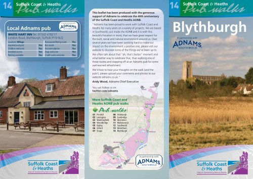
14<br />
Local Adnams pub<br />
In partnership with<br />
WHITE HART INN Tel: 01502 478217<br />
London Road, <strong>Blythburgh</strong>, <strong>Suffolk</strong> IP19 9LQ<br />
Location: Village Restaurant/dining room Yes<br />
Garden/courtyard Yes Bar meals Yes<br />
Children welcome Yes Accommodation Yes<br />
Disabled access Yes Dogs welcome Yes<br />
Parking available Yes Credit cards welcome Yes<br />
This leaflet has been produced with the generous<br />
support of Adnams to celebrate the 40th anniversary<br />
of the <strong>Suffolk</strong> <strong>Coast</strong> <strong>and</strong> <strong>Heaths</strong> AONB.<br />
“Adnams has been proud to work with <strong>Suffolk</strong> <strong>Coast</strong> <strong>and</strong><br />
<strong>Heaths</strong> for many years on a variety of projects. We are based<br />
in Southwold, just inside the AONB <strong>and</strong> it is with this<br />
beautiful location in mind, that we have great respect for<br />
the built, social <strong>and</strong> natural environment around us. Over<br />
several years we have been working hard to make our<br />
impact on the environment a positive one, please visit our<br />
website to discover some of the things we’ve been up to.<br />
We often talk about that “ah, that’s better” moment <strong>and</strong><br />
what better way to celebrate that, than walking one of<br />
these routes <strong>and</strong> stopping off at an Adnams pub for some<br />
well-earned refreshment.<br />
We’d love to hear your thoughts on the walk (<strong>and</strong> the<br />
pub!), please upload your comments <strong>and</strong> photos to our<br />
website adnams.co.uk.”<br />
Andy Wood, Adnams Chief Executive<br />
You can follow us on<br />
twitter.com/adnams<br />
More <strong>Suffolk</strong> <strong>Coast</strong> <strong>and</strong><br />
<strong>Heaths</strong> AONB pub <strong>walks</strong><br />
01 Pin Mill<br />
02 Levington<br />
03 Waldringfield<br />
04 Woodbridge<br />
05 Butley<br />
06 Orford<br />
07 Snape<br />
Ipswich<br />
08 Aldeburgh<br />
09 Eastbridge<br />
10 Westleton<br />
11 Walberswick<br />
12 Southwold<br />
13 Wrentham<br />
14 <strong>Blythburgh</strong><br />
Woodbridge<br />
Harwich<br />
Felixstowe<br />
Beccles<br />
North Sea<br />
Southwold<br />
Lowestoft<br />
Aldeburgh<br />
In partnership with<br />
14<br />
<strong>Blythburgh</strong><br />
In partnership with<br />
<strong>Blythburgh</strong> Church
14<br />
<strong>Blythburgh</strong><br />
This scenic 2.5 mile walk follows the River Blyth downstream<br />
towards Walberswick, following the river wall, before returning via<br />
<strong>Blythburgh</strong> village. There is an optional diversion to take in<br />
<strong>Blythburgh</strong> Church, <strong>and</strong> an alternative start, enabling you to visit<br />
the pub half way round the route. The path along the river wall may<br />
be muddy in wet weather, but the route is otherwise flat <strong>and</strong><br />
undem<strong>and</strong>ing. The diversion to <strong>Blythburgh</strong> Church involves crossing<br />
the busy A12 road – please be careful.<br />
There is parking at the pub but please check with the l<strong>and</strong>lord<br />
before leaving your car there, especially if you plan to walk first, <strong>and</strong><br />
visit the pub on your return.<br />
4<br />
Crown copyright. All rights reserved.<br />
© <strong>Suffolk</strong> County Council. Licence LA100023395<br />
BLYTHBURGH<br />
A12<br />
Priory<br />
5<br />
A<br />
Water<br />
Tower<br />
THE<br />
WHITE<br />
HART<br />
Dunwich Rd<br />
3<br />
B1125<br />
1<br />
Lodge Lane<br />
B1387<br />
Further information<br />
<strong>Suffolk</strong> <strong>Coast</strong> <strong>and</strong> <strong>Heaths</strong> AONB<br />
Tel: 01394 384948 www.suffolkcoast<strong>and</strong>heaths.org<br />
East of Engl<strong>and</strong> Tourism<br />
www.visiteastofengl<strong>and</strong>.com<br />
Public transport:<br />
www.suffolkonboard.com, 0845 606 6171<br />
Dogs will enjoy both <strong>walks</strong>, but please do not allow them to disturb<br />
the estuary birds, for whom these marshes are a scarce <strong>and</strong> muchprized<br />
habitat.<br />
Bulcamp Marshes<br />
River Blyth<br />
Deadman’s<br />
Covert<br />
Long Walk<br />
Optional loop<br />
Public House<br />
Points of<br />
interest<br />
0 0.5km 1km<br />
2<br />
1<br />
Car Park/Layby<br />
Place of<br />
worship<br />
Woods<br />
A/B/C Roads<br />
Path, track or<br />
other road<br />
Footpath/<br />
bridleway<br />
B<br />
<strong>Blythburgh</strong><br />
Main walk – 2.5 miles/3.8 km<br />
From the White Hart Inn A , turn right<br />
towards the bridge then right again down the<br />
lane to left of pub. At gateway to house, turn right<br />
(signed “Walberswick”) <strong>and</strong> enter the Walberswick<br />
National Nature Reserve. Alternatively, start by<br />
going to the bottom of the pub garden, through<br />
the gate onto the river wall <strong>and</strong> turn right.<br />
<strong>Blythburgh</strong>’s location at the first practical crossing point of<br />
the River Blyth, <strong>and</strong> at the navigable head of the tidal river<br />
meant that it was once a much more important settlement<br />
than it is today. There has been a bridge here since the 12th<br />
century, <strong>and</strong> it was a significant site for the Anglo-Saxons.<br />
The White Hart Inn was the court house for the port of<br />
<strong>Blythburgh</strong> in medieval times, while the house opposite was<br />
a customs house. Its red brick ‘Dutch’ gable end was a<br />
fashionable addition, added in the seventeenth century to a<br />
building that has been changed considerably over the years<br />
– much as the village has. Today there are few signs that<br />
<strong>Blythburgh</strong> was once a thriving minor port <strong>and</strong> market
town, larger <strong>and</strong> more important than nearby Lowestoft,<br />
Halesworth or Southwold. Its decline began following the<br />
arrival of the Black Death in 1349, although the port<br />
continued to trade in coal, timber <strong>and</strong> stone until the<br />
beginning of the 20th century.<br />
In 1759, work began on the Blyth Navigation, a series of<br />
locks <strong>and</strong> other works built to enable boat traffic to reach<br />
as far as Halesworth, although little survives today. Later,<br />
the narrow gauge Southwold Railway line operated<br />
between Halesworth <strong>and</strong> Southwold, via <strong>Blythburgh</strong>, from<br />
1879 to 1929.<br />
The path follows the track of the Southwold<br />
Railway. After approx 1km, a path leads left,<br />
into reedbeds, to a public bird hide 1 .<br />
Compared to the rest of the <strong>Suffolk</strong> coast, l<strong>and</strong><br />
reclamation in the Blyth valley occurred comparatively late,<br />
taking place mainly during the 18th century. Many of the<br />
walls in this part of the river have since been ab<strong>and</strong>oned, or<br />
damaged beyond economic repair, allowing the river to<br />
spread once more across the valley floor. The walls were<br />
constructed by driving wooden stakes into the river, which<br />
were then covered with clay to build up a protective bank.<br />
You can still see the remains of some of these walls today,<br />
<strong>and</strong> the Ordnance Survey still record them as Rights of Way<br />
– though it would be unwise to venture along them!<br />
At low tide the bird life Redshank (FLPA)<br />
of the river can be<br />
enjoyed, <strong>and</strong> Redshank,<br />
Dunlin <strong>and</strong> Lapwing are<br />
among the species likely<br />
to be seen. There has<br />
been a great increase in<br />
the number of overwintering<br />
wading birds<br />
here since English<br />
Nature obtained most of<br />
the shooting rights in<br />
1989. The river, coastal<br />
marshes <strong>and</strong> heathl<strong>and</strong> between <strong>Blythburgh</strong>, Dunwich <strong>and</strong><br />
Walberswick collectively form Walberswick National Nature<br />
Reserve, one of the outst<strong>and</strong>ing wildlife sites for which the<br />
<strong>Suffolk</strong> coast is famous.<br />
At cross tracks, where a path comes in from<br />
the right (<strong>and</strong> continues onto the old river<br />
wall), go straight across, leaving an area of fenced<br />
woodl<strong>and</strong> known as Deadman’s Covert to your<br />
right. At the end of this section of the wood you<br />
will reach a sign marking an area of Open Access<br />
ahead, but turn right here, curving round the end<br />
of Deadman’s Covert, <strong>and</strong> soon at a T-junction<br />
with a larger track, turn right <strong>and</strong> to return along<br />
the southern side of the Covert 2 , <strong>and</strong> keeping<br />
right through gateposts.<br />
Alternative starting point. There is a small car<br />
park on the Walberswick Road B1387, allowing<br />
the option to start from there <strong>and</strong> make the visit to<br />
Blythbugh the half way point on the walk. From the<br />
car park B , take the wide ride to the left <strong>and</strong> walk<br />
gently downhill through the heathl<strong>and</strong> for<br />
approximately 500m until you reach point 2 .<br />
Lodge Lane keeps to the higher ground on the edge of the<br />
S<strong>and</strong>lings, a low, narrow plateau of s<strong>and</strong>y, acidic soils that<br />
run, almost unbroken, from Ipswich to Southwold. Unlike<br />
the river valleys, where cattle were frequently grazed, the<br />
S<strong>and</strong>lings were better suited to sheep. Huge flocks once<br />
roamed this country, giving rise to the distinctive heathl<strong>and</strong><br />
l<strong>and</strong>scape that can, in places, still be seen today.<br />
Stay on this unpaved track (Lodge Lane)<br />
until it reaches the Dunwich Road 3 . For a<br />
quick route back to the pub from here, turn right<br />
along road.<br />
The <strong>Suffolk</strong> <strong>Coast</strong> <strong>and</strong> <strong>Heaths</strong> Area of Outst<strong>and</strong>ing<br />
Natural Beauty (AONB) is one of Britain’s finest<br />
l<strong>and</strong>scapes. Located on the coast of East Anglia <strong>and</strong><br />
covering 403 square kilometres, the AONB extends<br />
from the Stour estuary in the south to the eastern<br />
fringe of Ipswich <strong>and</strong> to Kessingl<strong>and</strong> in the north.<br />
www.suffolkcoast<strong>and</strong>heaths.org
<strong>Blythburgh</strong><br />
Optional loop – 0.75 miles/1.2 km<br />
For the optional loop to <strong>Blythburgh</strong> Church,<br />
(adding a further 1.2 km) cross the road <strong>and</strong><br />
take the bridleway. At the busy A12 road 4 , cross<br />
<strong>and</strong> continue on the footpath (slightly to right),<br />
<strong>and</strong> stay on this path as it bends right towards the<br />
church, eventually to join Church Lane, bringing<br />
you to the church 5 .<br />
Holy Trinity Church, is one of the most famous l<strong>and</strong>marks on<br />
the A12, <strong>and</strong> fully justifies its popular nickname ‘The Cathedral<br />
of the Marshes’. It was completed in 1480 <strong>and</strong> had a spire<br />
until 1577. Its site is reputed to be the burial place of the Anglo<br />
Saxon King Anna, a Christian, who died after being defeated<br />
by the pagan Penda at nearby Bulcamp in AD654. The church<br />
has a ceiling featuring beautifully carved wooden angels that<br />
bear damage from lead shot fired at them during the Civil War.<br />
<strong>Blythburgh</strong> Church is one of the sites in <strong>Suffolk</strong> associated<br />
with the Black Shuck myth. It’s said that on a fateful night<br />
in 1577, what was described as a fiery dog the size of a<br />
small pony, tore through the congregation, bringing<br />
mayhem <strong>and</strong> death to two worshippers. Legend says that<br />
the evil hell hound left deep scorch marks on the door as it<br />
fled from the Church. Could this explain the burn marks<br />
uncovered in 1933 when the door was cleaned? A more<br />
likely, if still extraordinary, explanation is that the church<br />
spire was struck by lightning.<br />
Just around the corner from the church, in the garden of a<br />
house called The Priory <strong>and</strong> not currently open to the<br />
public, are the remains of <strong>Blythburgh</strong>’s Augustinian<br />
Priory. The Priory was founded 1125 <strong>and</strong> was never very<br />
large, but continued until 1537 when King Henry VIII<br />
suppressed it. The rushes <strong>and</strong> turf from the fen were<br />
valuable produce <strong>and</strong> the priory was often granted rights to<br />
take these, from long rectangular pits.<br />
The safest way back to the White Hart from<br />
the church is to turn right <strong>and</strong> follow Church<br />
Lane until it joins the A12. Here, cross <strong>and</strong><br />
continue along Chapel Road opposite until the Tjunction<br />
with Dunwich Road is reached. Cross the<br />
road, turn left <strong>and</strong> continue through the village<br />
back to the pub, taking care on the road where<br />
there is no footpath. This is not the shortest way<br />
back, but it avoids crossing the A12 on the<br />
dangerous corner in front of the White Hart Inn.