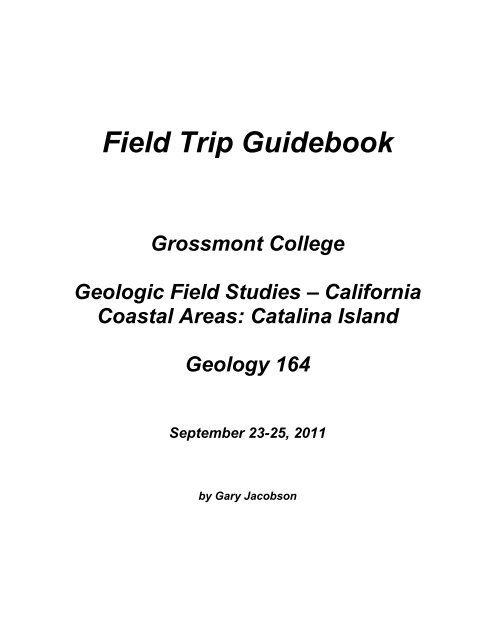
Field Trip Guidebook and Worksheets - Grossmont College
Field Trip Guidebook and Worksheets - Grossmont College
Field Trip Guidebook and Worksheets - Grossmont College

Create successful ePaper yourself
Turn your PDF publications into a flip-book with our unique Google optimized e-Paper software.
<strong>Field</strong> <strong>Trip</strong> <strong>Guidebook</strong><br />
<strong>Grossmont</strong> <strong>College</strong><br />
Geologic <strong>Field</strong> Studies – California<br />
Coastal Areas: Catalina Isl<strong>and</strong><br />
Geology 164<br />
September 23-25, 2011<br />
by Gary Jacobson
<strong>Field</strong> <strong>Trip</strong> Guide<br />
PART 1: Port of Los Angles / Long Beach <strong>and</strong> the Catalina Channel<br />
Figure 1: Signal Hill aka "Porcupine Hill" May 1, 1923<br />
Figure 2: Types of Oil Traps<br />
Figure 4: Long Beach Subsidence Caused by Oil Withdrawal<br />
Figure 3: Exposed Anticline <strong>and</strong> Oil S<strong>and</strong><br />
Figure 5: Subsidence-frustrated Long Beach Local
Figure 6: Port of Los Angeles/Long Beach <strong>and</strong> 8.5 mile breakwater<br />
Figure 7: Angles Gate Lighthouse on the San Pedro Breakwater was built in 1913.<br />
1. From where was most of the rock quarried that was used to make the breakwater?<br />
2. What kind of rock is the breakwater made of?
Figure 8. San Onofre Breccia in sea cliff at<br />
Aliso Beach<br />
Figure 9. Reconstructed paleogeography of the borderl<strong>and</strong> during<br />
deposition of the San Onofre Breccia (early <strong>and</strong> middle Miocene).<br />
Locations of isl<strong>and</strong>s are shown for reference; they were not isl<strong>and</strong>s<br />
at the time. After Howell <strong>and</strong> others, 1974.<br />
3. What is the geological significance of the San Onofre Breccia?<br />
4. How is Catalina geologically different than the other Channel Isl<strong>and</strong>s?<br />
5. In Figure 10, indicate<br />
with arrows the stress<br />
patterns which contributed<br />
to the uplift of<br />
Catalina Isl<strong>and</strong>.<br />
Figure 10: Index map of the northern part of the California Continental<br />
borderl<strong>and</strong>. Modified from Kies <strong>and</strong> Abbott, 1982.
PART 2: The Walk to/from Big Fisherman’s Cove<br />
Fill in the table below based upon the characteristics observed in the outcrops visited.<br />
ROCK UNIT COLOR<br />
Dacite dome<br />
Volcaniclastic<br />
breccia<br />
Andesite<br />
flows<br />
Tuffaceous<br />
claystone <strong>and</strong><br />
diatomaceous<br />
shale<br />
Schist breccia<br />
Andesite flow<br />
breccias<br />
TEXTURE /<br />
STRUCTURE<br />
COMPOSITION ORIGIN
Figure 11: Geologic Map of the Isthmus Cove <strong>and</strong> Big Fisherman's Cove area.
THE DACITE DOME:<br />
Figure 12. Close-up of volcanic dome within the crater of<br />
Mt. Saint Helens.<br />
Figure 13. Mt. Saint Helens.<br />
1. How is the light color of this rock related to the fact that it formed as a volcanic dome?<br />
2. How might this dacite be genetically related to the quartz diorite pluton that comprises<br />
much of the southwestern portion of Catalina Isl<strong>and</strong>?<br />
Figure 14. A simplified classification of igneous rocks.
THE BIG FISHERMAN’S COVE BRECCIAS:<br />
Figure 15: Tuffaceous S<strong>and</strong>stone <strong>and</strong> Volcaniclastic Tuff-Breccia at Big Fisherman's Cove L<strong>and</strong>ing. (Photo by Alex<br />
Barber)<br />
3. Where these rocks deposited above or below sea level?<br />
4. What evidence supports that conclusion?<br />
5. Is this unit younger or older than the dacite dome? How can you tell?<br />
THE TOE OF THE BIG LANDSLIDE<br />
6. Sketch a diagram below that indicates what caused this l<strong>and</strong>slide:<br />
ANDESITE FLOWS (There are no questions for this unit. Just fill in the rock chart.)
DIATOMACEOUS SHALE AND TUFFACEOUS DIATOMITE:<br />
7. What causes these rocks to be so light in color?<br />
8. What is the genetic relationship between volcanic ash<br />
<strong>and</strong> diatoms?<br />
9. Why are these rocks relatively free of terrigenous<br />
(l<strong>and</strong> derived) sediments?<br />
Figure 16. Diatoms enlarged about 300X.<br />
Figure 17. Schematic east-west cross section of the southern California borderl<strong>and</strong>. The relations shown in this<br />
figure are diagrammatic <strong>and</strong> largely speculative. Letter symbols indicate sedimentary rock sequences as follows: K,<br />
Upper Jurassic (?) <strong>and</strong> Cretaceous; K? , Cretaceous or Paleocene; P, Paleocene; E, Eocene; O, Oligocene; M,<br />
Miocene; Pl, Pliocene <strong>and</strong> younger. From Howell <strong>and</strong> Vedder, 1981.
Figure 18: Faulted diatomaceous rock between Big <strong>and</strong> Little Fisherman's Coves. (Photo by Alex Barber)<br />
10. In the photo above, label the hanging wall (HW) <strong>and</strong> footwall (FW) for the main fault. If the<br />
layers at A correlate with the layers A’ <strong>and</strong> layer B correlates with layer B’, draw arrows on<br />
either side of the fault to indicate the direction of displacement. What kind of fault is it?<br />
11. What kind of stress produces this type of fault?<br />
12. If the right lateral faults in figures 19 <strong>and</strong> 20 represent the NW-SE trending faults of the<br />
California Continental Borderl<strong>and</strong> <strong>and</strong> the faulting in the diatomaceous rocks here represent<br />
their associated “flower structure” faults, then in what direction should these faults be<br />
oriented?<br />
13. Refer to the geologic map in Figure 11where these faults are labeled. Are these faults<br />
aligned in a direction that supports the hypothesis proposed in question #12?<br />
14. What is the genetic relationship between diatoms <strong>and</strong> this type of faulting?
Figure 19: Right-stepping bend on right lateral fault produces tension <strong>and</strong> normal or negative flower structure.<br />
Figure 20: Left-stepping bend on right lateral fault produces compression <strong>and</strong> reverse or positive flower structure.<br />
15. Use the diagram on the right to explain why<br />
some diatomite layers recrystallize into chert<br />
while others remain friable (powdery).<br />
Figure 21: Silica Solubility vs. pH
THE ROAD-CUT BRECCIAS:<br />
16. Examine the volcaniclastic, flow, <strong>and</strong><br />
schist breccias in the road cut here.<br />
Which ones are polymictic (made of<br />
more than one rock type)?<br />
17. What important S. California rock<br />
unit correlates with the schist breccia<br />
here?<br />
THE CAMPGROUND:<br />
Figure 22. Diagrammatic reconstruction of Fisherman’s Cove<br />
sequence showing interrelations of Miocene rocks <strong>and</strong> their<br />
relation to the Catalina Schist.<br />
18. What evidence suggests that the campground is placed on an ancient l<strong>and</strong>slide?<br />
Figure 23. Google Earth view of campground <strong>and</strong> Fisherman's Cove area<br />
with geology overlay. Patterns used are as in figure 24.<br />
Figure 24. Generalized stratigraphic<br />
column of the Cenozoic rocks<br />
exposed in the central part of the<br />
Santa Catalina Isl<strong>and</strong>.
19. What are some of the factors that make l<strong>and</strong>slides common on Catalina?<br />
20. Why are s<strong>and</strong>y beaches uncommon on Catalina?<br />
LITTLE FISHERMAN’S COVE:<br />
21. What evidence suggests that this<br />
rock is extrusive?<br />
22. What evidence suggests that it<br />
formed as a flow breccia?<br />
23. Why is this <strong>and</strong>esite unusually dark?<br />
Figure 25. Basaltic aa lava flow forming a flow breccia with<br />
accretionary lava balls.<br />
Figure 26. Guadalupe Isl<strong>and</strong> (off Baja California) - a present day analog of Miocene Catalina.
PART 3: Bison <strong>and</strong> Blueschist - Catalina’s Interior<br />
STOP 1 - THE HUNT FOR AMPHIBOLITE (part 1) <strong>and</strong>/or SERPENTINITE:<br />
1. Compare <strong>and</strong> contrast blueschist,<br />
greenschist, <strong>and</strong> amphibolite facies<br />
(grade) metamorphism in terms or<br />
temperature <strong>and</strong> pressure.<br />
2. What were the probable parent<br />
rocks for the metamorphic rocks<br />
exposed here?<br />
Arrival of East Pacific Rise<br />
Under-thrusting in accretionary wedge.<br />
Figure 27. Metamorphic facies boundaries largely as defined by<br />
Fyfe, Terner, <strong>and</strong> Verhoogan (1958). Metamorphic facies are<br />
designated by boldface type.<br />
Figure 28: Potential uplift mechanisms for the Catalina Schist.<br />
Shear-stress rotation.<br />
Restraining bend transpression.
STOP 2 - THE BIG GREEN ROCK:<br />
3. What minerals color this rock green?<br />
4. What was the probable parent rock for this metamorphic rock?<br />
Figure 29: 3D perspective Google Earth view with geologic map overlay <strong>and</strong> approximate location of Stops 1-3.<br />
Teeth point towards upper plate of thrust faults. Striped pattern represents blueschist.<br />
STOP 3: GREENSCHIST - BLUESCHIST THRUST FAULT<br />
5. As we went deeper into Catalina’s geologic structure, what happened to the temperature of<br />
metamorphism indicated by the rocks? Why?
Figure 30: Diagrammatic cross section of Santa<br />
Catalina Isl<strong>and</strong> after J. Platt (1976). Lines up roughly<br />
with the big “A” in Figure 24<br />
Figure 31: Structural scenario for the structural relationships<br />
observed in the Catalina Schist, central Santa Catalina Isl<strong>and</strong>.<br />
Adapted from Platt, 1975.<br />
Figure 32: Sequential development of the structural relationships seen in central Catalina.<br />
(Erosion of “D” yields Figure 30.)
6. Using Figure 29, try to draw in Figure 33 (below) the approximate position of the<br />
Greenschist-Blueschist Thrust.<br />
Figure 33: Looking north from Little Harbor overlook. (Photo by Alex Barber)<br />
STOP 4 – MARINE TERRACES:<br />
7. Is there any evidence for marine<br />
terracing here? If so, what?<br />
8. Why are marine terraces<br />
uncommon on Catalina but<br />
common on other Channel<br />
Isl<strong>and</strong>s?<br />
Figure 34. Block diagram to illustrate development of topographic<br />
forms by wave erosion along steeply sloping shore. The older,<br />
emerged, wave-cut terrace is being destroyed as new terrace is<br />
widened. Two stacks also are shown.
STOP 5: SOMEWHERE ON THE DIORITE:<br />
9. This was not a previewed stop, so there are no predetermined questions to answer here.<br />
We may, however, discover something of interest, <strong>and</strong> you might want to jot down a few<br />
notes about it below:<br />
Figure 35: Geologic cross sections highlighting the relationships between Catalina's igneous <strong>and</strong> metamorphic rocks.
STOP 6: DACITE AND BLACK JACK:<br />
10. Are there any differences between the dacite here<br />
<strong>and</strong> the one at Big Fisherman’s Cove? If so, what<br />
are they <strong>and</strong> how did they originate?<br />
11. What is the genetic relationship between the ore<br />
deposits <strong>and</strong> igneous rocks on Catalina Isl<strong>and</strong>?<br />
STOP 7: SAVE AN ECLOGITE, EAT A BISON (lunch):<br />
Originally published Friday, August 31, 2007, PRESS TELEGRAM<br />
By Hanna Chu - Staff Writer<br />
Hiker gored by Catalina bison<br />
Figure 37: Territorial Little Harbor local <strong>and</strong> victim.<br />
Figure 36: Ore processing plant at Wight’s<br />
Cove for the Black Jack mine (circa 1925).<br />
The man says he made eye contact with one in the herd near Little Harbor. Then it started charging him.<br />
It wasn't exactly the running of the bulls. But for Jardrec Anangos, it became the running of the bison. The 24year-old<br />
Cerritos resident was gored by a bison Wednesday while backpacking on Catalina Isl<strong>and</strong> <strong>and</strong> lived to tell<br />
the story from his hospital bed at Long Beach Memorial Medical Center.<br />
It was another warm summer day, <strong>and</strong> Anongos was backpacking on the isl<strong>and</strong> with two of his friends at about 10<br />
a.m. The group trekked into Little Harbor to go snorkeling when they approached a herd of about 15 bison<br />
st<strong>and</strong>ing between the s<strong>and</strong> <strong>and</strong> grass, blocking the pathway to the beach.<br />
Anongos said he was st<strong>and</strong>ing ahead of his friends, about 20 feet from the herd, <strong>and</strong> unintentionally made eye<br />
contact with one bison. "One (bison) didn't like me st<strong>and</strong>ing that close <strong>and</strong> charged me," Anongos said.<br />
He turned around <strong>and</strong> ran in the opposite direction, but was unable to outrun the animal.<br />
"There was no real chance of me escaping," he said. "They're way faster than humans."<br />
Anongos was gored from behind <strong>and</strong> lifted on top of the animal.
"I was pretty much on top of his head," he said.<br />
The bison then flicked his head <strong>and</strong> hurled Anongos behind him.<br />
The herd moved away as Anongos lay on his back.<br />
Spokesman Bob Rhein of the Catalina Isl<strong>and</strong> Conservancy said he has never heard of a bison attacking a person in<br />
the three years he has worked for the conservancy.<br />
"There have been cases in the past that a dog was injured," he said. "A horse was injured a year ago, but this is the<br />
first time that we know of that a human has been hurt by a bison."<br />
In Wednesday's attack, the horn had pierced the right side of Anongos' upper thigh area, but did not puncture any<br />
major arteries. Campers in the area who knew first aid put gauze over his wound <strong>and</strong> gave him water <strong>and</strong><br />
Gatorade while he waited for paramedics. The Los Angeles County Fire paramedics arrived, treated the wound<br />
<strong>and</strong> airlifted Anongos to the hospital.<br />
Anongos said he was not provoking the animals <strong>and</strong> was st<strong>and</strong>ing near the herd.<br />
"I saw people feeding buffalo the day before, <strong>and</strong> nothing happened to them," he said.<br />
Rhein said that it was his underst<strong>and</strong>ing that Anongos had been walking through the herd <strong>and</strong> said the bison might<br />
have felt threatened.<br />
However, Anongos insisted he was not walking through the herd. He was closer to the herd than his two friends,<br />
but he was still about 20 feet from the animals, he said.<br />
"We don't like for anyone to get hurt, <strong>and</strong> we're very sorry that this happened," Rhein said.<br />
The bison are not native to the isl<strong>and</strong>. They were said to be brought in for a silent movie, "The Vanishing<br />
American," in the 1920s. Fourteen bison were brought originally, but over the decades, the herd multiplied. About<br />
200 bison roam the isl<strong>and</strong> today.<br />
"Stay away from the bison," Rhein said. "They're wild animals, <strong>and</strong> they are dangerous. Don't interact or feed<br />
them." Anongos was left with a sore back, a fractured pelvic bone <strong>and</strong> an open wound.<br />
"All I can say is I'm happy to be alive," he said.<br />
USER COMMENTS<br />
"Bison Attach"<br />
We were actually at the campsite when the attack happened. Unfortunately, we saw the whole thing play out.<br />
We would have to disagree with the victim when he says he did not provoke the incident. He did walk in the<br />
middle of the herd between some calves, mothers <strong>and</strong> the males. One of the big males warned him. Unforunate<br />
for the victim that he was just in the wrong place at the wrong time. The night before my wife did the same thing<br />
walking to the bathroom, but was not hurt. For a couple of days the Bison had been roaming the campsite <strong>and</strong><br />
didn't seem to care about any of the campers. It just seemed like the Bison were a little anxious that morning <strong>and</strong><br />
the victim should have stayed away from them when he saw that he would be walking through the middle of the<br />
herd. Thank god the victim was not hurt more <strong>and</strong> that many of us came to help him out before the paramedics<br />
came. We have definitely have never seen anything like it before. It looked like something from the running of<br />
the bulls!<br />
- A Witness<br />
posted: Friday, August 31st at 15:47 PM<br />
STOP 8: SOAPSTONE AND GARNETS:<br />
12. Of what mineral is soapstone made? How is it formed?
Serpentine + Carbon Dioxide → Talc + Magnesite + Water<br />
Chlorite + Quartz → Kyanite + Talc + H2O<br />
13. What is the geological significance of eclogite?<br />
STOP 9: THE HUNT FOR AMPHIBOLITE (part 2) <strong>and</strong>/or METASOMATISM:<br />
14. What is metasomatism?<br />
STOP 10: BLUESCHIST BEACH <strong>and</strong> BAD ATTITUDE BISON:<br />
15. What kinds of earth materials are most susceptible to metamorphism?<br />
16. What kinds of earth materials are least susceptible to metamorphism?
PART 4 – COASTAL GEOLOGY<br />
Figure 38: Folded blueschist <strong>and</strong> meta-greywacke at Lion Head. (Photo by Alex Barber)<br />
1. Measure the orientation of the fold axis <strong>and</strong> record it here:<br />
2. According to your measurement, in what direction would the compression had to have<br />
been applied to these rocks to make the folds?<br />
3. Is that direction consistent with orientation of the subduction zone in which these rocks<br />
formed? Explane.<br />
3. According to the diagram below, how do these folds classify?<br />
Figure 39: From left to right - symmetrical, asymmetrical, overturned <strong>and</strong> recumbent fold types.
4. What does the low dip angle of their axial planes indicate about their origin?<br />
5. What would happen to these folds at higher metamorphic grades?