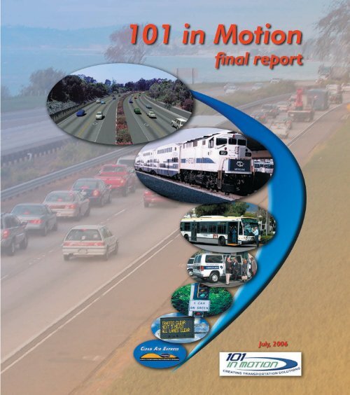
101 In Motion Final Report - Santa Barbara County Association of ...
101 In Motion Final Report - Santa Barbara County Association of ...
101 In Motion Final Report - Santa Barbara County Association of ...

Create successful ePaper yourself
Turn your PDF publications into a flip-book with our unique Google optimized e-Paper software.
<strong>101</strong> <strong>In</strong> <strong>Motion</strong><br />
<strong>Final</strong> <strong>Report</strong><br />
Prepared for:<br />
SANTA BARBARA COUNTY<br />
ASSOCIATION OF GOVERNMENTS<br />
<strong>In</strong> cooperation with:<br />
<strong>County</strong> <strong>of</strong> <strong>Santa</strong> <strong>Barbara</strong><br />
Caltrans District 5<br />
Cities <strong>of</strong> <strong>Santa</strong> <strong>Barbara</strong>, Goleta, Carpinteria, <strong>Santa</strong> Maria, Lompoc and Buellton<br />
Air Pollution Control District<br />
<strong>Santa</strong> <strong>Barbara</strong> Metropolitan Transit District<br />
Prepared by:<br />
PARSONS BRINCKERHOFF QUADE & DOUGLAS, INC.<br />
<strong>In</strong> <strong>Association</strong> with<br />
Mary Rose & Associates<br />
Com3 Consulting, <strong>In</strong>c.<br />
RBF Consulting<br />
Sharon Greene Associates<br />
ESTC<br />
Transportation Management & Design<br />
David Black and Associates<br />
July, 2006
TABLE OF CONTENTS<br />
ES EXECUTIVE SUMMARY...................................................................................................................... ES-1<br />
S.0 REPORT SUMMARY.................................................................................................................RS-1<br />
Purpose <strong>of</strong> the <strong>101</strong> <strong>In</strong> <strong>Motion</strong> Project................................................................................................ RS-1<br />
Adopted Improvement Plan............................................................................................................... RS-1<br />
Primary Benefits, Costs and Impacts <strong>of</strong> th eSdopted Improvement Plan..........................................RS-3<br />
Image <strong>of</strong> Proposed Highway <strong>101</strong> Widening.......................................................................................RS-7<br />
Study Process ................................................................................................................................... RS-8<br />
Community <strong>In</strong>put ............................................................................................................................... RS-9<br />
<strong>101</strong> Corridor Problems and Needs.................................................................................................... RS-9<br />
Development and Evaluation <strong>of</strong> Alternative Solutions..................................................................... RS-10<br />
<strong>Final</strong> 4 Alternative Packages........................................................................................................... RS-11<br />
Conclusions from Evaluation <strong>of</strong> <strong>Final</strong> 4 Alternatives ....................................................................... RS-14<br />
Financing and Implementation Plan.................................................................................................RS-15<br />
1.0 1.0 INTRODUCTION........................................................................................................................ 1<br />
1.1 Historical Background................................................................................................................ 1<br />
1.2 Study Process ........................................................................................................................... 2<br />
1.2.1 How <strong>101</strong> <strong>In</strong> <strong>Motion</strong> Fits into the Larger Project Development Context ...................2<br />
1.3 Role <strong>of</strong> Community Outreach .................................................................................................... 3<br />
2.0 EXISTING AND FUTURE CONDITIONS ................................................................................................ 5<br />
2.1 <strong>101</strong> <strong>In</strong> <strong>Motion</strong> Analysis Area...................................................................................................... 5<br />
2.2 Existing and Future Conditions............................................................................................5<br />
2.2.1 Demographic and Socioeconomic Trends .............................................................5<br />
2.2.1.1 Population .................................................................................................... 6<br />
2.2.1.2 Employment Forecast .................................................................................. 7<br />
2.2.1.3 Age Distribution............................................................................................ 7<br />
2.2.1.4 Jobs-Housing Relationship .......................................................................... 8<br />
2.2.2 Transportation Systems and Travel Characteristics..................................................... 8<br />
2.2.2.1 Magnitude <strong>of</strong> Travel ..................................................................................... 8<br />
2.2.2.2 24-Hour Distribution <strong>of</strong> Traffic ...................................................................... 9<br />
2.2.2.3 Travel Patterns........................................................................................... 11<br />
2.2.2.4 Mode Choice.............................................................................................. 12<br />
2.2.2.5 Goods Movement....................................................................................... 12<br />
2.2.2.6 Safety Characteristics ................................................................................ 14<br />
2.2.2.7 Air Quality .................................................................................................. 16<br />
2.2.3 Existing Facilities and Services .................................................................................. 16<br />
2.2.3.1 Roadways .................................................................................................. 16<br />
2.2.3.2 System Performance ................................................................................. 17<br />
2.2.3.3 Existing Transit Services............................................................................ 20<br />
2.2.3.4 Rideshare Programs .................................................................................. 20<br />
2.2.3.5 Passenger and Freight Rail ....................................................................... 21<br />
2.2.3.6 Bicycle-Pedestrian Facilities ...................................................................... 21<br />
2.2.3.7 Programmed Improvements ...................................................................... 22<br />
i
2.3 Summary <strong>of</strong> Problems and Need for Improvements................................................................ 23<br />
2.3.1 Goals and Objectives ................................................................................................. 24<br />
2.3.2 SBCAG Board Policy Direction .................................................................................. 25<br />
2.3.3 Evaluation Criteria ...................................................................................................... 26<br />
3.0 EVALUATION METHODOLOGY .......................................................................................................... 27<br />
3.1 Development and Evaluation <strong>of</strong> Alternative Solutions............................................................. 27<br />
3.2 Evaluation Criteria and How They Were Applied .................................................................... 28<br />
3.2.1 Development <strong>of</strong> Technical Data ................................................................................. 28<br />
3.2.2 Evaluation Criteria ...................................................................................................... 29<br />
4.0 ALTERNATIVES CONSIDERED .......................................................................................................... 31<br />
4.1 Community Ideas Phase .......................................................................................................... 31<br />
4.1.1 Public Outreach.......................................................................................................... 31<br />
4.1.1.1 Summary <strong>of</strong> Public <strong>In</strong>put Received ............................................................ 32<br />
4.1.2 Technical Screening Process and Eliminated Solution Concepts…………………..... 32<br />
4.1.2.1 Eliminate Shoulders and Re-Stripe Existing Pavement ............................ 33<br />
4.1.2.2 New Bypass Freeway………………………………………………………….33<br />
4.1.2.3 Elevated Guideway Transit ...................................................................... 34<br />
4.2 Development and <strong>In</strong>itial Evaluation <strong>of</strong> 8 Alternative Packages ................................................ 34<br />
4.2.1 Elements Not <strong>In</strong>cluded in the 8 Alternative Packages................................................ 39<br />
4.2.2 Public Outreach.......................................................................................................... 39<br />
4.2.3 <strong>In</strong>itial Evaluation Findings and Elimination <strong>of</strong> 2 Alternatives ...................................... 39<br />
4.2.3.1 Rationale for Terminating Further Analysis <strong>of</strong> Alternative<br />
Package #4 - Reversible HOV Lane .......................................................................... 40<br />
4.2.3.2 Rationale for Terminating Further Analysis <strong>of</strong> Alternative Package #6<br />
– Peak Period Bus Only Lanes .................................................................................. 40<br />
4.3 Evaluation <strong>of</strong> the Remaining 6 Alternative Packages............................................................... 42<br />
4.3.1 General Conclusions from Evaluation <strong>of</strong> the 6 Alternative Packages........................... 43<br />
4.3.1.1 Transportation Performance –General Conclusions................................... 43<br />
4.3.1.2 Community/ Environmental Considerations – General Conclusions .......... 43<br />
4.3.1.3 Implementation Related Criteria – General Conclusions............................ 44<br />
4.3.2 Elements Selected to be <strong>In</strong>cluded and Elements Selected to be Dropped<br />
from Consideration in Developing the <strong>Final</strong> 4 Alternative Packages............................. 45<br />
4.3.2.1 Capacity Enhancements and Alternative Mode Elements.......................... 45<br />
4.3.2.2 Demand Management Elements ................................................................ 47<br />
4.3.2.3 Operational Improvement Elements ........................................................... 48<br />
5.0 DEVELOPMENT AND EVALUATION OF FINAL 4 ALTERNATIVES ................................................. 50<br />
5.1 Development <strong>of</strong> <strong>Final</strong> 4 Alternative Packages.......................................................................... 50<br />
ii
5.1.1 Public Outreach.......................................................................................................... 53<br />
5.2 Evaluation <strong>of</strong> the <strong>Final</strong> 4 Alternative Packages........................................................................ 54<br />
5.2.1 General Findings from Evaluation <strong>of</strong> the <strong>Final</strong> 4 Alternatives Packages.................... 59<br />
5.2.1.1 Transportation Performance – General Conclusions.................................. 59<br />
5.2.1.2 Community/ Environmental Considerations – General Conclusions………63<br />
5.2.1.3 Implementation Related Criteria – General Conclusions……………………66<br />
5.3 Potential Effects <strong>of</strong> Land Use Changes.................................................................................... 67<br />
5.4. Conclusions from Technical Evaluation and Land Use Sensitivity Analysis ............................. 68<br />
6.0 ADOPTED IMPROVEMENT PLAN....................................................................................................... 71<br />
6.1 Adopted Improvement Plan..........................................................................................71<br />
6.2 Primary Benefits, Costs and Impacts <strong>of</strong> the Adopted Improvement Plan.....................81<br />
6.3 Public Outreach ...........................................................................................................82<br />
7.0 FUNDING ANALYSIS ........................................................................................................................... 84<br />
8.0 IMPLEMENTATION PLAN..................................................................................................................... 84<br />
Table<br />
LIST OF TABLES<br />
Table RS-1 <strong>101</strong> Corridor Problems and Needs ......................................................................................RS-9<br />
Table 1-1 SBCAG/Caltrans Project Development Process........................................................................ 3<br />
Table 2-1 2000-2030 Regional Population Growth Forecast by Subregion............................................... 7<br />
Table 2-2 2000-2030 Employment Forecast by Subregion........................................................................ 7<br />
Table 2-3 2000-2030 Age Distribution (<strong>Santa</strong> <strong>Barbara</strong> <strong>County</strong>) ................................................................ 8<br />
Table 2-4 Highway <strong>101</strong> Corridor Short Term Projects ............................................................................. 22<br />
Table 2-5 Highway <strong>101</strong> Corridor Problems and Needs............................................................................ 23<br />
Table 2-6 <strong>101</strong> <strong>In</strong> <strong>Motion</strong> Goals and Objectives........................................................................................ 25<br />
Table 2-7 Evaluation Criteria.................................................................................................................... 26<br />
Table 3-1 Evaluation Criteria Used in Evaluating the Alternative Improvement Packages...................... 29<br />
Table 5-1 <strong>Final</strong> Alternative Packages for Evaluation ............................................................................... 51<br />
Table 5-2 Evaluation <strong>of</strong> <strong>Final</strong> Year 2030 Alternative Solution Packages................................................. 55<br />
Table 5-3 Estimated Duration <strong>of</strong> Congestion at LOS F Based on Peak Spreading Analysis................... 60<br />
Table 5-4 Estimated Reduced Person Hours <strong>of</strong> Congestion per Weekday ............................................. 61<br />
Table 5-5 Highway <strong>101</strong> Ramps Requiring Additional Capacity................................................................ 62<br />
Table 5-6 Estimated Capital Costs .......................................................................................................... 66<br />
Table 5-7 Estimated Annual Net Operating and Maintenance Costs ...................................................... 67<br />
Figure<br />
LIST OF FIGURES<br />
Figure RS-1 Adopted Improvement Plan ................................................................................................. RS-3<br />
Figure RS-2 Visual Simulation <strong>of</strong> Possible Widening Looking North Beyond Olive Mill Road................. RS-8<br />
Figure RS-3 <strong>101</strong> <strong>In</strong> <strong>Motion</strong> Technical Process......................................................................................... RS-8<br />
Figure RS-4 Package A: Commuter Rail................................................................................................ RS-13<br />
Figure RS-5 Package B: HOV/HOT Lanes + Commuter Rail ................................................................ RS-13<br />
Figure RS-6 Package C: HOV +Aux Lanes + Commuter Rail ............................................................... RS-14<br />
Figure RS-7 Package D: General Purpose Lanes ................................................................................. RS-14<br />
Figure 1-1 <strong>101</strong> <strong>In</strong> <strong>Motion</strong> Technical Process............................................................................................... 2<br />
Figure 2-1 Project Setting ........................................................................................................................... 5<br />
Figure 2-2 2000 Population Density by Census Block Group in South Coast............................................. 6<br />
iii
Figure 2-3 15-Minutes Traffic Counts on US <strong>101</strong> at Bailard Avenue in December 2004.......................... 10<br />
Figure 2-4 15 Minutes Traffic Counts on US <strong>101</strong> at Cabrillo Boulevard in December 2004 ..................... 10<br />
Figure 2-5 15 Minutes Traffic Counts on US <strong>101</strong> at Las Positas Road in December 2004 ...................... 11<br />
Figure 2-6 15 Minutes Traffic Counts on US <strong>101</strong> at Los Carneros Road in December 2004 ................... 11<br />
Figure 2-7 Existing Mode Split .................................................................................................................. 12<br />
Figure 2-8 Highway <strong>101</strong> Weekly Traffic Mix (Las Positas)........................................................................ 13<br />
Figure 2-9 Highway <strong>101</strong> Weekday Truck Traffic Mix (Las Positas)........................................................... 14<br />
Figure 2-10 US <strong>101</strong> Accidents (1999-2003)................................................................................................ 15<br />
Figure 2-11 US <strong>101</strong> Significant Accident Concentrations (2000-2003)....................................................... 15<br />
Figure 2-12 US <strong>101</strong> Significant Accident Types (2000-2003) ..................................................................... 15<br />
Figure 2-13 <strong>Santa</strong> <strong>Barbara</strong> <strong>County</strong> Ozone Exceedance Days.................................................................... 16<br />
Figure 2-14 Levels <strong>of</strong> Services for Multi-Lane Highways ............................................................................ 18<br />
Figure 2-15 2000 P.M. Peak Hour Traffic on Highway <strong>101</strong>......................................................................... 19<br />
Figure 2-16 Forecast 2030 P.M. Peak Hour Traffic on Highway <strong>101</strong>.......................................................... 19<br />
Figure 4-1 Package #1 – General Purpose Lanes.................................................................................... 36<br />
Figure 4-2 Package #2 – Operational Improvements/Gap Closures......................................................... 36<br />
Figure 4-3 Package #3 – HOT Lanes........................................................................................................ 37<br />
Figure 4-4 Package #5 – Commuter Rail.................................................................................................. 37<br />
Figure 4-5 Package #7 – Dedicated Busway ............................................................................................ 38<br />
Figure 4-6 Package #8– Commuter Rail + HOV Lanes ............................................................................ 38<br />
Figure 4-7 Bus Only Lane Example in Ottawa, Canada............................................................................ 41<br />
Figure 5-1 Package A – Commuter Rail.................................................................................................... 52<br />
Figure 5-2 Package B – HOV/HOT Lanes + Commuter Rail .................................................................... 52<br />
Figure 5-3 Package C – HOV + Aux Lanes + Commuter Rail .................................................................. 53<br />
Figure 5-4 Package D – General Purpose Lanes ..................................................................................... 53<br />
Figure 6-1 Adopted Improvement Plan ..................................................................................................... 73<br />
Figure 6-2 Visual Simulation <strong>of</strong> Possible Widening Looking North Beyond Olive Mill Road..................... 78<br />
Figure 6-3 Visual Simulation <strong>of</strong> Possible Widening Looking North Approaching San Ysidro Road<br />
- Option 1 ................................................................................................................................. 78<br />
Figure 6-4 Visual Simulation <strong>of</strong> Possible Widening Looking North Approaching San Ysidro Road -<br />
Option 2 ................................................................................................................................... 79<br />
Figure 6-5 Visual Simulation <strong>of</strong> Possible Widening Looking South Approaching Carpinteria................... 79<br />
Figure 6-6 Projected 2030 A.M. Peak Hour Traffic Volumes and V/C Ratios for Adopted Improvement<br />
Plan……………………………………………………………………………………………………..80<br />
Figure 6-7 Projected 2030 P.M. Peak Hour Traffic Volumes and V/C Ratios for Adopted Improvement<br />
Plan……………………………………………………………………………………………………..81<br />
Appendix A <strong>In</strong>itial Concepts and Screening Results<br />
APPENDICES<br />
Appendix B Back-Up Tables for Table 5-2 and 2030 Peak Hour Flow Maps<br />
Appendix C Estimated Costs for Highway <strong>101</strong> Widening<br />
Appendix D Commuter Rail Preliminary Analysis<br />
Appendix E Public Outreach Documentation<br />
Appendix F 2030 Demographic Growth Forecast Assumptions<br />
Appendix G Potential Transit Oriented Land Use Policies for the South Coast<br />
Appendix H Summary <strong>of</strong> <strong>101</strong> in <strong>Motion</strong> – Model Adjustment Factors and Assumptions<br />
Appendix I Traffic Impact Analysis, Travel Delay Analysis and Peak Spreading Methodologies<br />
Appendix J Connecting Transit Service Concept Plan<br />
Appendix K List <strong>of</strong> Stakeholder Advisory Committee and Technical Advisory Group Members<br />
iv
Executive Summary<br />
Based on a policy directive to find long term solutions to the growing congestion<br />
problem along 27 miles <strong>of</strong> the Highway <strong>101</strong> corridor in Southern <strong>Santa</strong> <strong>Barbara</strong> <strong>County</strong>,<br />
the <strong>101</strong> in <strong>Motion</strong> Team worked for over two years to develop a package <strong>of</strong> solutions<br />
that has broad based community support.<br />
An extensive Stakeholders Advisory Committee (SAC) was recruited from throughout the <strong>County</strong>.<br />
Members <strong>of</strong> the SAC include representatives <strong>of</strong> the business community, major employers,<br />
commuters, environmental interests, automobile advocates, alternative transportation advocates,<br />
non-pr<strong>of</strong>it community organizations, neighborhood and homeowner’s associations. A Technical<br />
Advisory Group (TAG) composed <strong>of</strong> technical experts from the local jurisdictions and emergency<br />
services providers, performed review and analysis <strong>of</strong> data. Public workshops allowed the public to<br />
express their ideas on possible solutions to be studied.<br />
After two years <strong>of</strong> study, public outreach, and consensus building the final <strong>101</strong> in <strong>Motion</strong> consensus<br />
package, unanimously recommended and approved by the SAC, TAG, and Steering Committee,<br />
a subcommittee <strong>of</strong> the SBCAG Board. The consensus package was approved by the SBCAG<br />
Board in October 2005, and is described on the next page.<br />
“This is a model <strong>of</strong> how transportation planning should be done.”<br />
— R. Gregg Albright, Caltrans District Director<br />
<strong>101</strong> in <strong>Motion</strong> Planning Process<br />
Community<br />
Ideas<br />
8<br />
Alternative<br />
Packages and<br />
Early Action<br />
Projects<br />
4<br />
Screened<br />
Packages<br />
One<br />
Preferred<br />
Package <strong>of</strong><br />
Projects<br />
Action Plan
<strong>Final</strong><br />
Adopted<br />
Consensus<br />
Package<br />
The final <strong>101</strong> in <strong>Motion</strong><br />
long-term solution to<br />
solve congestion on the<br />
Highway <strong>101</strong> Corridor in<br />
southern <strong>Santa</strong> <strong>Barbara</strong><br />
<strong>County</strong> is the result <strong>of</strong><br />
over 2 years <strong>of</strong> study and<br />
community consensus<br />
building, which involved:<br />
5 community workshops,<br />
over 60 presentations to<br />
organized groups, outreach<br />
at 14 different activity<br />
centers (<strong>County</strong> Fair, Earth<br />
Day Festival, farmer’s<br />
markets, etc), 30 Technical<br />
Advisory Committee<br />
Meetings, 12 Stakeholder<br />
Advisory Committee<br />
Meetings, and 12 Steering<br />
Committee Meetings.<br />
Add a Lane and a Train Cost: $626 million<br />
• Add a carpool/HOV lane both directions south <strong>of</strong> Milpas to Ventura <strong>County</strong> Line<br />
• Add commuter Rail from Camarillo/Oxnard to Goleta with stops in Carpinteria,<br />
<strong>Santa</strong> <strong>Barbara</strong> and Goleta<br />
Facilitate Transit and Carpool Use Cost: $62 million<br />
• Designate new lanes south <strong>of</strong> Milpas as HOV/Carpool<br />
• <strong>In</strong>crease express bus services to North <strong>County</strong><br />
• Connect local bus and shuttles with rail and regional services<br />
• Bus priority on selected streets through signal priority, queue jumps, bulb-outs<br />
at bus stops, etc.<br />
Manage Demand Cost: $27 million<br />
• Provide vanpool/carpooling/trip reduction incentives<br />
• Encourage telecommuting and flexwork/flextime<br />
• Vary parking rates as feasible by jurisdiction<br />
• <strong>In</strong>dividualize Marketing<br />
Improve Operations and Communications Cost: $28 million<br />
• Add capacity and install meters at selected ramps<br />
• Use <strong>In</strong>telligent Transportation System technology to inform the traveling public<br />
and smooth operations including:<br />
• Freeway service patrol<br />
• 511 phone and internet traffic and transit reports<br />
• Variable message signs<br />
• GPS real-time <strong>of</strong> arrival information at bus stops<br />
Phase Improvements North <strong>of</strong> Milpas Cost: $90 million<br />
• Implement operational improvements required to address current congestion<br />
hot spots<br />
• Proactively work to reduce peak period traffic through aggressive demand<br />
management and rideshare programs<br />
• Monitor need for additional <strong>101</strong> improvements following implementation <strong>of</strong><br />
operational improvements, commuter rail, TDM and rideshare, ITS and General<br />
Plan updates<br />
• Add auxiliary lanes and/or additional lanes if needed, funds are available, and<br />
there is community support<br />
Project Implementation & Monitoring<br />
Due to the time required to implement many <strong>of</strong> the projects in this consensus<br />
package, SBCAG shall conduct an annual evaluation to ensure that all the projects<br />
are being implemented in a timely and cost effective manner.<br />
Funding Plan<br />
The total cost <strong>of</strong> the Program is $833 million (in 2006 dollars). This cost includes both<br />
project development and capital costs <strong>of</strong> $610 million (73 percent <strong>of</strong> the total) and<br />
$223 million in on-going operation <strong>of</strong> the proposed transit and demand management<br />
services (27 percent).<br />
The proposed funding plan for the <strong>101</strong> <strong>In</strong> <strong>Motion</strong> Program is part <strong>of</strong> a larger<br />
30-year proposed expenditure plan under consideration by SBCAG and the cities<br />
<strong>of</strong> <strong>Santa</strong> <strong>Barbara</strong> <strong>County</strong>. The expenditure plan maximizes all major existing local,<br />
state, and federal sources, and supplements existing sources with regional funding<br />
from the renewal <strong>of</strong> Measure D.
Add a Lane and a Train<br />
Key <strong>101</strong> in <strong>Motion</strong> Project Elements<br />
Add Carpool Lanes Milpas to <strong>County</strong> Line<br />
This element will widen the two-lane section from the <strong>County</strong> line to Cabrillo/Hot Springs Road<br />
interchange by adding one carpool lane in each direction. Also, it will convert the approved northbound<br />
auxiliary lanes to full lanes between Cabrillo/Hot Springs and Milpas Street interchanges and<br />
make these carpool lanes. With widening <strong>of</strong> Highway <strong>101</strong> a number <strong>of</strong> bridges, undercrossings and<br />
overcrossings will need to be lengthened or rebuilt in order to accommodate the additional lanes.<br />
Use <strong>of</strong> the new lanes will be restricted to vehicles with two or more persons, including carpools,<br />
vanpools and buses, to encourage increased ridesharing and transit use, and discourage solo auto<br />
use. These lanes can also be used by single-occupant <strong>In</strong>herently Low Emission Vehicles (ILEV).<br />
A new lane south <strong>of</strong> Milpas to the Ventura <strong>County</strong> Line<br />
presents two possible alternative design solutions;<br />
several concepts for one location are shown above and<br />
at right. The community will have extensive opportunities<br />
to discuss the design options prior to a final decision.<br />
<strong>In</strong>terchange and Ramp Improvements<br />
As part <strong>of</strong> the widening <strong>of</strong> Highway <strong>101</strong> between the <strong>County</strong> Line and Milpas, the interchanges at<br />
Cabrillo/Hot Springs and at Sheffield Drive will be reconstructed to replace the left-hand on-and <strong>of</strong>framps<br />
with standard right-hand ramps. Some other ramps will need to be lengthened and/or widened<br />
to accommodate the added traffic by 2030 and to correct geometric deficiencies. There are<br />
already plans to reconfigure the Linden and Casitas Pass interchanges as operational improvements<br />
independent <strong>of</strong> the <strong>101</strong> <strong>In</strong> <strong>Motion</strong> project.<br />
The initial construction includes the widening <strong>of</strong> the mainline on Highway <strong>101</strong> to permit two general<br />
purpose lanes plus a carpool lane in each direction. During the mainline widening phase some<br />
shoulders may temporarily be substandard where the narrow bridges and undercrossings occur. Construction<br />
<strong>of</strong> mainline widening will consist <strong>of</strong> three approximately 4-mile segments that will be<br />
sequenced to reduce delays to the traveling public.<br />
Commuter Rail<br />
This element is a commuter rail line from Camarillo to Goleta with stops in Oxnard, Ventura,<br />
Carpinteria, and <strong>Santa</strong> <strong>Barbara</strong>, for a total <strong>of</strong> 47.8 miles (20 miles within <strong>Santa</strong> <strong>Barbara</strong> <strong>County</strong>). <strong>In</strong><br />
order to implement a commuter rail system in the South Coast region, improvements to the existing<br />
rail corridor will need to be constructed. These will include installing passing sidings in Summerland<br />
and Oxnard, layover tracks in Oxnard and Goleta which will likely require additional right-<strong>of</strong>-way,<br />
purchase <strong>of</strong> rolling stock, and constructing improvements such as additional parking at existing<br />
stations. Vehicles could be standard commuter rail cars like those used by Metrolink that are connected<br />
to a diesel locomotive, or self propelled diesel powered vehicles (DMUs) that can<br />
operate as single units or coupled as train sets.<br />
u
Commuter rail systems are typically less<br />
expensive to construct than other fixed rail<br />
systems when they use existing rail tracks.<br />
The proposed right-<strong>of</strong>-way is owned by<br />
Union Pacific Railroad who will have to<br />
agree to use <strong>of</strong> their R/W for commuter<br />
service.<br />
The Commuter Rail element is entirely contingent<br />
on renewal <strong>of</strong> Measure D, the<br />
transportation sales tax measure. To enable an early start-up, the <strong>101</strong> <strong>In</strong> <strong>Motion</strong> Implementation<br />
Plan assumes an initial pilot service, the pilot service will comprise two round<br />
trips per day with minimal capital acquisition. Rolling stock would be leased and track<br />
expansion/modifications will be help to a minimum. Agreements with Union Pacific on<br />
any required capital improvement and the use <strong>of</strong> their tracks, as well as agreements<br />
with a service operator (Metrolink) and the <strong>County</strong> <strong>of</strong> Ventura must be secured prior to<br />
the start <strong>of</strong> the pilot service.<br />
Facilitate Transit and Carpool Use<br />
Commuter Express Bus Service<br />
This element will significantly increase the number<br />
<strong>of</strong> commuter express buses <strong>of</strong>fered between north<br />
<strong>Santa</strong> <strong>Barbara</strong> <strong>County</strong> and major work sites on the<br />
South Coast. Commuter Express Bus service between<br />
Ventura <strong>County</strong> and the South Coast will also continue. Phased implementation <strong>of</strong> this<br />
expanded service will begin as soon as a renewal <strong>of</strong> Measure D is approved by voters.<br />
Connecting Services at Rail Stations and Transit Hubs<br />
Connecting bus and shuttle van services to major employment sites will be provided to<br />
complete commuter rail trips and are assumed in this package <strong>of</strong> improvements. Additionally,<br />
connecting local bus service between express bus transit hubs and the major<br />
employment centers will be improved. Implementation <strong>of</strong> this element is entirely contingent<br />
on approval <strong>of</strong> renewal <strong>of</strong> Measure D transportation sales tax measure. This<br />
service will begin with the introduction <strong>of</strong> the Pilot Commuter Rail Program (estimated<br />
to be 2011).<br />
Bus Priority Treatments<br />
This element provides both facilities and service for<br />
upgraded express and local bus operations by giving<br />
buses priority on selected streets. Priority treatment<br />
will be through the extension <strong>of</strong> a green light<br />
by several seconds at selected intersections to allow<br />
a bus to continue through, an extra lane at<br />
appropriate intersections to allow buses to skip<br />
ahead <strong>of</strong> the queue, bulb-outs at bus stops, and<br />
transfer facilities at rail stations to transition passengers to local bus collector-distributor<br />
lines. Implementation <strong>of</strong> this element is largely at the discretion <strong>of</strong> the local jurisdictions<br />
along with involvement from Metropolitan Transit District.<br />
Carpool / Vanpool Pricing <strong>In</strong>centives<br />
This component <strong>of</strong> the package will increase financial<br />
incentives to carpoolers and vanpoolers by providing<br />
monthly payments to <strong>of</strong>fset a portion <strong>of</strong> the<br />
start-up costs and in maintaining an active carpool<br />
or vanpool. Although incentives are currently being<br />
used to some degree on the South Coast, the
continuation and possible expansion <strong>of</strong> this element is entirely contingent on voter approval<br />
<strong>of</strong> a renewal <strong>of</strong> the transportation sales tax (Measure D). Implementation responsibility<br />
for this element lies with SBCAG’s Traffic Solutions.<br />
Manage Demand<br />
Work Schedule Adjustments<br />
A number <strong>of</strong> non-traditional schedules are in use by many South Coast companies,<br />
agencies, institutions and other employers throughout areas affected by congestion.<br />
These schedules include options such as the “4/40,” where employees<br />
work 10 hours a day, 4 days a week, or the “9/80,” where employees<br />
work 9 hours a day, and work 9 days over a two-week period. Flextime<br />
is another option, where employees work with their employer to set<br />
their own convenient hours, which could include working from home<br />
or remote facilities. Many working parents appreciate the flexibility<br />
<strong>of</strong> these non-traditional schedules. A flexible work schedule program<br />
is currently being implemented on a targeted based with some South<br />
Coast employers, however the continuation and expansion <strong>of</strong> the program is entirely<br />
contingent on renewal <strong>of</strong> Measure D, the county’s transportation sales tax measure.<br />
Variable Parking Rates as Feasible by Location<br />
With this element, at the discretion <strong>of</strong> the jurisdiction, cars that arrive<br />
during <strong>of</strong>f-peak periods at designated locations would pay less to park<br />
than cars arriving during peak periods. Implementation <strong>of</strong> this element<br />
is at the discretion <strong>of</strong> the City <strong>of</strong> <strong>Santa</strong> <strong>Barbara</strong>, <strong>County</strong> <strong>of</strong> <strong>Santa</strong> <strong>Barbara</strong>,<br />
City <strong>of</strong> Goleta and UCSB.<br />
<strong>In</strong>dividualized Marketing<br />
The concept <strong>of</strong> <strong>In</strong>dividualized Marketing is a simple step-by-step approach to changing<br />
personal travel behavior through direct contact with households. It encourages people<br />
to consolidate their trip-making and make greater use <strong>of</strong> public transport, walking and<br />
cycling as alternatives to car travel by <strong>of</strong>fering them personalized travel information<br />
and a package <strong>of</strong> incentives to try out new ways <strong>of</strong> getting around. Current SBCAG<br />
initiatives will be continued and expanded with measures tailored specifically to encourage<br />
ridesharing and use <strong>of</strong> alternative modes. This element is completely contingent<br />
on renewal <strong>of</strong> Measure D, and implementation is assumed to be immediately<br />
following voter approval.<br />
Improve Operations and Communications<br />
Ramp Metering<br />
This element will signalize and meter many <strong>of</strong> the on-ramps along the<br />
entire 27-mile Highway <strong>101</strong> Corridor to more efficiently regulate the<br />
entry <strong>of</strong> <strong>101</strong> traffic and buffer freeway flow from the adverse effects<br />
<strong>of</strong> random traffic surges and peaking at on-ramps. Ramp widening<br />
and some interchange reconfiguration will be necessary to adequately<br />
store ramp metered vehicles for periodic release, and minimize backup<br />
and queuing on surface streets. The plan for this element assumes<br />
implementation in geographic increments and will require extensive<br />
coordination with the respective local jurisdictions.<br />
<strong>In</strong>telligent Transportation System Elements<br />
<strong>In</strong>telligent Transportation Systems (ITS) will include highway and transit components.<br />
The highway components will comprise: vehicle detectors, closed circuit video cameras,
advanced traveler systems (ATS) including providing real time traffic information to<br />
motorists via Highway Advisory Radio (HAR), changeable message signs, cell phones<br />
and the <strong>In</strong>ternet. A Traffic Management Center, the center <strong>of</strong> a comprehensive ITS system,<br />
would tie all the ITS field elements together.<br />
The purpose <strong>of</strong> these ITS elements are to improve communications with motorists as to<br />
the conditions on the freeway to allow them to make routing choices before they enter<br />
the congested zones. Freeway service patrol is also included to reduce the time needed<br />
to remove vehicles from the roadway following a breakdown or accident. The ITS Transit<br />
component will comprise GPS based vehicle locating<br />
to provide passengers real time information<br />
on arrival times for the next bus or train.<br />
Delivery <strong>of</strong> ITS elements will in part be guided by<br />
the Central Coast Strategic Deployment Plan approved<br />
by SBCAG and Caltrans in 2000. Two ITS elements<br />
have recently been installed. Closed circuit<br />
cameras allow travelers to monitor Highway <strong>101</strong> at<br />
Patterson avenue via the internet (http://video.dot.ca.gov/), and<br />
variable message signs at the Highway <strong>101</strong>/Highway 154 Northbound<br />
intersection/<strong>of</strong>framp. These two elements are part <strong>of</strong><br />
Phase 1 <strong>of</strong> the ITS implementation, which is funded through<br />
existing Federal Earmark funds. Subsequent phases will be<br />
funded through the renewal <strong>of</strong> Measure D, and potentially<br />
State Highway Operation and Protection Program (SHOPP)<br />
funds.<br />
Phase Improvements North <strong>of</strong> Milpas<br />
By proactively working to reduce peak period traffic through aggressive demand management<br />
and rideshare programs it is hoped that the need for major improvements<br />
North <strong>of</strong> Milpas can be eliminated or delayed. Part <strong>of</strong> the <strong>101</strong> in <strong>Motion</strong> Program will<br />
be to monitor the need for additional <strong>101</strong> improvements following implementation <strong>of</strong><br />
operational improvements at “hot spots”, commuter rail, TDM and rideshare, ITS and<br />
General Plan updates.<br />
Operational Improvements<br />
This component will improve the flow and safety on the US-<strong>101</strong> travel lanes by making<br />
operational improvements at existing and near-term congestion “hot spots” north <strong>of</strong><br />
Milpas. Operational improvements will include adding auxiliary lanes or full lanes between<br />
on-ramps and <strong>of</strong>f-ramps, modifications to ramps and ramp locations, and/or additional<br />
over crossings or under crossings for local traffic.<br />
Existing and projected near-term congestion hot spot locations<br />
include the area between Las Positas Road and Castillo<br />
Street.<br />
The <strong>101</strong> <strong>In</strong> <strong>Motion</strong> Implementation Plan assumes immediate<br />
implementation <strong>of</strong> the demand management and<br />
rideshare programs, and two sequential phases <strong>of</strong> operational<br />
improvements for the area north <strong>of</strong> Milpas. The first<br />
phase <strong>of</strong> this work would commence with the completion<br />
<strong>of</strong> the widening <strong>of</strong> <strong>101</strong> south <strong>of</strong> Milpas.<br />
For More <strong>In</strong>formation about <strong>101</strong> <strong>In</strong> <strong>Motion</strong>, visit www.<strong>101</strong><strong>In</strong><strong>Motion</strong>.com<br />
or contact <strong>Santa</strong> <strong>Barbara</strong> <strong>County</strong> <strong>Association</strong> <strong>of</strong> Governments at 805-961-8900.
REPORT SUMMARY<br />
Purpose <strong>of</strong> the <strong>101</strong> <strong>In</strong> <strong>Motion</strong> Project<br />
Recognizing that congestion has diminished the quality <strong>of</strong> life and economic vitality <strong>of</strong> the South Coast, the<br />
purpose <strong>of</strong> the <strong>101</strong> <strong>In</strong> <strong>Motion</strong> project has been to develop an action plan consisting <strong>of</strong> short-term and longterm<br />
solutions that will reduce congestion along the Highway <strong>101</strong> corridor in <strong>Santa</strong> <strong>Barbara</strong> <strong>County</strong>. The<br />
project has been designed to engage the local community in a dialogue about the present and future <strong>of</strong> the<br />
<strong>101</strong> corridor with the intent <strong>of</strong> developing a consensus-based, implementable strategy for solving current and<br />
future transportation deficiencies.<br />
This <strong>Final</strong> <strong>Report</strong> documents the process used to develop and evaluate alternative solutions for reducing<br />
congestion in the <strong>101</strong> Corridor, and presents the adopted solution package and Action Plan for funding and<br />
implementing these improvements.<br />
The <strong>101</strong> in <strong>Motion</strong> project has been governed by the <strong>Santa</strong> <strong>Barbara</strong> <strong>County</strong> <strong>Association</strong> <strong>of</strong> Governments<br />
(SBCAG) Board <strong>of</strong> Directors (Board), who are the decision making body who adopted the set <strong>of</strong> improvement<br />
projects described in this <strong>Final</strong> <strong>Report</strong>. Policy direction for <strong>101</strong> in <strong>Motion</strong> was provided by a Steering Committee<br />
(SC), which consists <strong>of</strong> eight members <strong>of</strong> the SBCAG Board. There was also a Technical Advisory Group (TAG),<br />
consisting <strong>of</strong> member agency staff, who provided technical direction; a Stakeholder Advisory Committee (SAC)<br />
whose purpose was to represent the diversity <strong>of</strong> interests in the community and provide feedback and advice to<br />
the consultant team, TAG, SC and SBCAG Board on the <strong>101</strong> in <strong>Motion</strong> program; and a consultant team who was<br />
hired to provide technical and public outreach expertise in conducting the <strong>101</strong> in <strong>Motion</strong> program for SBCAG.<br />
Adopted Improvement Plan<br />
After two years <strong>of</strong> study, public outreach, and consensus building the final <strong>101</strong> <strong>In</strong> <strong>Motion</strong> consensus package<br />
recommended by the Steering Committee, SAC and TAG, and unanimously adopted by the SBCAG Board<br />
following a public hearing is a hybrid <strong>of</strong> elements from the final four alternative packages.<br />
The adopted package includes a major highway capacity improvement south <strong>of</strong> Milpas Street, widening to six<br />
lanes between Milpas Street and Carpinteria, to accommodate a new High Occupancy Vehicle (HOV) lane in<br />
each direction, and commuter rail between Ventura <strong>County</strong> and Goleta. These flagship projects are<br />
complemented with enhancements to the bus system, including express bus service to North <strong>County</strong>, better<br />
connecting services to the rail stations, and improved regional bus services from Ventura <strong>County</strong> and within<br />
the South Coast. Expanded demand management programs are included to promote flexible work hours and<br />
telecommuting and include other marketing measures directed at individuals in order to encourage single<br />
occupant vehicle drivers into carpools and onto buses. <strong>In</strong>telligent Transportation System (ITS) technologies<br />
are also added to improve the flow <strong>of</strong> information about traffic conditions to allow drivers to make better<br />
informed choices about traveling in the <strong>101</strong> corridor. Examination <strong>of</strong> the sensitivity <strong>of</strong> the travel forecasts to<br />
potential land use changes suggest that improvements to the highway north <strong>of</strong> Milpas to Goleta should be<br />
targeted at current congestion hot spots since impending changes to General Plans could significantly impact<br />
future traffic growth. Possible steps that could be taken in these land use plan updates to encourage<br />
alternatives to automobile use are presented in the <strong>Report</strong> appendices. Progress on all the elements in the<br />
Adopted Improvement Plan for the <strong>101</strong> Corridor will be evaluated on an annual basis to insure the elements<br />
are being implemented in an expeditious manner.<br />
The adopted package <strong>of</strong> improvements is fully consistent with the policy direction given by the SBCAG Board<br />
at the outset <strong>of</strong> the <strong>101</strong> <strong>In</strong> <strong>Motion</strong> project and consists <strong>of</strong>:<br />
Add a Lane and a Train<br />
• Add a Carpool/HOV lane both directions south <strong>of</strong> Milpas to <strong>County</strong> Line<br />
• Add commuter rail, Camarillo/Oxnard to Goleta<br />
RS - 1
Facilitate Transit and Carpool Use<br />
• Designate new lanes south <strong>of</strong> Milpas as HOV (Carpool)<br />
• <strong>In</strong>crease express bus services to North <strong>County</strong><br />
• Connect local bus and shuttles with rail and regional services<br />
• Bus priority on selected streets through signal priority, queue jumps, bulb-outs at bus stops, etc.<br />
Manage Demand<br />
• Provide vanpool/carpool/trip reduction incentives<br />
• Encourage telecommuting and flexwork/flextime<br />
• Vary parking rates as feasible by jurisdiction<br />
• <strong>In</strong>dividualize marketing<br />
Improve Operations and Communications<br />
• Add capacity and install meters at selected ramps<br />
• Use <strong>In</strong>telligent Transportation System technology to inform the traveling public and smooth operations<br />
including:<br />
Freeway service patrol<br />
511 phone and internet traffic and transit reports<br />
Changeable message signs<br />
GPS real-time <strong>of</strong> arrival information at bus stops<br />
Phase improvements north <strong>of</strong> Milpas<br />
• Implement operational improvements required to address current congestion hot spots<br />
• Proactively work to reduce peak period traffic through aggressive demand management and rideshare<br />
programs<br />
• Monitor need for additional Highway <strong>101</strong> improvements following implementation <strong>of</strong> operational<br />
improvements, commuter rail, TDM and rideshare, ITS and General Plan updates<br />
• Add auxiliary lanes and/or additional lanes if needed, funds are available, and there is community<br />
support<br />
Project Implementation and Monitoring<br />
Due to the time required to implement many <strong>of</strong> the projects in the adopted package, SBCAG shall conduct an<br />
annual evaluation to insure that all <strong>of</strong> the projects are being implemented in a timely and cost-effective<br />
manner.<br />
Figure RS-1 shows the main physical elements in the Adopted Improvement Plan.<br />
RS - 2
Figure RS-1 Adopted Improvement Plan<br />
Primary Benefits, Costs and Impacts <strong>of</strong> the Adopted Improvement Plan<br />
The main benefits <strong>of</strong> the adopted set <strong>of</strong> improvement projects are a major reduction in delays to travelers,<br />
increased safety, enhanced modal choices, and improved regional economy. More specifically, by 2030 the<br />
Adopted Improvement Plan is projected to:<br />
• Keep the duration <strong>of</strong> congestion on Highway <strong>101</strong> to only 1-2 hours per day, rather than from early<br />
morning to eight at night, which would be the case if nothing is done.<br />
RS - 3
• Shave 15-20 minutes <strong>of</strong>f <strong>of</strong> the commute time from Carpinteria to Downtown <strong>Santa</strong> <strong>Barbara</strong> via<br />
either the freeway or commuter rail.<br />
• Reduce traffic on local streets in neighborhoods that parallel Highway <strong>101</strong>.<br />
• Eliminate a total <strong>of</strong> 16,500 person hours <strong>of</strong> delay each day.<br />
• Significantly reduce the accident potential along Highway <strong>101</strong> by providing much smoother flow.<br />
• <strong>In</strong>crease modal choices that will give commuters increased options to driving alone and result in<br />
3,800 fewer single occupant vehicle trips on Highway <strong>101</strong> each day.<br />
• Allow for continued economic prosperity in the South Coast, that otherwise would be stymied by<br />
the extreme levels <strong>of</strong> congestion in the corridor.<br />
• The relative contribution <strong>of</strong> the individual elements in reducing congestion South <strong>of</strong> Milpas are:<br />
Commuter Rail/Transit 15 %, Demand Management 4%, HOV lane designation 13%, and<br />
Highway <strong>101</strong> widening 68%.<br />
The costs and impacts associated with the Adopted Improvement Plan consist primarily <strong>of</strong>:<br />
• Funding the approximately $600 million in capital costs and on-going operations and<br />
maintenance costs will require funding from a combination <strong>of</strong> sources including the existing and<br />
renewed Measure D local transportation sales tax and matching funds from state and federal<br />
sources.<br />
• Visual impacts are expected due to reduced landscaping within the Highway <strong>101</strong> right-<strong>of</strong>-way and<br />
the addition <strong>of</strong> noise walls in certain locations. The extent <strong>of</strong> visual impacts can be s<strong>of</strong>tened<br />
through the careful application <strong>of</strong> context sensitive design and a replacement landscaping<br />
program.<br />
• <strong>In</strong>creased traffic will occur on streets that intersect with the Highway <strong>101</strong> on and <strong>of</strong>f-ramps.<br />
Improvements to these cross-streets, and/or new freeway crossings at selected locations will be<br />
needed, and programmed for outside <strong>of</strong> the <strong>101</strong> in <strong>Motion</strong> improvements.<br />
• <strong>In</strong>creased noise and traffic delays can be expected during construction <strong>of</strong> the new lanes on<br />
Highway <strong>101</strong>.<br />
• Approvals from the UPRR, Coastal Commission and other agencies are needed for the Adopted<br />
Improvement Plan to be implemented.<br />
Each <strong>of</strong> the elements in the Adopted Improvement Plan is described in more detail below:<br />
Add Carpool Lanes Milpas to <strong>County</strong> Line<br />
The existing Highway <strong>101</strong> typical cross section between the <strong>County</strong> Line and Milpas Street consists <strong>of</strong> two 12foot<br />
lanes in each direction. This element will widen the two-lane section from the <strong>County</strong> line to Cabrillo/Hot<br />
Springs Road interchange by adding one High Occupancy Vehicle (HOV) carpool lane in each direction (for<br />
11.3 miles). Also, it will convert the northbound auxiliary lanes that are currently programmed as operational<br />
improvements to full lanes between Cabrillo/Hot Springs and Milpas Street interchanges and makes these<br />
carpool lanes (1.5 miles). With widening <strong>of</strong> Highway <strong>101</strong> a number <strong>of</strong> bridges, undercrossings and<br />
overcrossings will need to be lengthened or rebuilt in order to accommodate the additional lanes.<br />
Existing<br />
R/W<br />
Varies<br />
10’<br />
SHLD<br />
2 @ 12’ = 24 HOV Lane<br />
10’<br />
SHLD<br />
Median<br />
varies<br />
2’ – 10’<br />
Add 1 HOV lane in each direction<br />
RS - 4<br />
10’<br />
SHLD<br />
HOV Lane 2 @ 12’ = 24’<br />
10’<br />
SHLD<br />
Varies<br />
Existing<br />
R/W
Use <strong>of</strong> the HOV lanes will be restricted to vehicles with two or more persons, including carpools, vanpools and<br />
buses, to encourage increased ridesharing and transit use, and discourage solo auto use. HOV lanes can<br />
also be used by single-occupant <strong>In</strong>herently Low Emission Vehicles (ILEV).<br />
<strong>In</strong>terchange and Ramp Improvements<br />
As part <strong>of</strong> the widening <strong>of</strong> Highway <strong>101</strong> between the <strong>County</strong> Line and Milpas, the<br />
interchanges at Cabrillo/Hot Springs and at Sheffield Drive will be reconstructed to<br />
replace the left-hand on-and <strong>of</strong>f-ramps with standard right-hand ramps. Some other<br />
ramps will need to be lengthened and/or widened to accommodate the added traffic<br />
by 2030 and to correct geometric deficiencies. There are already plans to reconfigure<br />
the Linden and Casitas Pass interchanges as operational improvements independent<br />
<strong>of</strong> the <strong>101</strong> <strong>In</strong> <strong>Motion</strong> project.<br />
Commuter Rail<br />
This element is a commuter rail line from Camarillo to Goleta with<br />
stops in Oxnard, Ventura, Carpinteria, and <strong>Santa</strong> <strong>Barbara</strong>, for a total<br />
<strong>of</strong> 47.8 miles (20 miles within <strong>Santa</strong> <strong>Barbara</strong> <strong>County</strong>). <strong>In</strong> order to<br />
implement a commuter rail system in the South Coast region,<br />
improvements to the existing rail corridor will need to be<br />
constructed. These will include installing passing sidings in<br />
Summerland and Oxnard, layover tracks in Oxnard and Goleta<br />
which will likely require additional right-<strong>of</strong>-way, purchase <strong>of</strong> rolling<br />
stock, and constructing improvements such as additional parking at<br />
existing stations. Vehicles could be standard commuter rail cars like those used by Metrolink that are<br />
connected to a diesel locomotive, or self propelled diesel powered vehicles (DMUs) that can operate as single<br />
units or coupled as train sets.<br />
Commuter rail systems are typically less expensive to construct than other fixed rail systems when they use<br />
existing rail tracks. The proposed right-<strong>of</strong>-way is owned by Union Pacific Railroad who will have to agree to<br />
use <strong>of</strong> their R/W for commuter service<br />
Commuter Express Bus Service<br />
This element will significantly increase the number <strong>of</strong> commuter<br />
express buses <strong>of</strong>fered between north <strong>Santa</strong> <strong>Barbara</strong> <strong>County</strong> and<br />
major work sites in the City <strong>of</strong> <strong>Santa</strong> <strong>Barbara</strong> and Goleta. Commuter<br />
Express Bus service between Ventura <strong>County</strong> and the South Coast<br />
will also continue.<br />
Connecting Services at Rail Stations and Transit Hubs<br />
Connecting bus and shuttle van services to major employment sites will be provided to complete commuter<br />
rail trips and are assumed in this package <strong>of</strong> improvements. Additionally, connecting local bus service<br />
between express bus transit hubs and the major employment centers would be improved.<br />
Bus Priority<br />
This element provides both facilities and service for upgraded express<br />
and local bus operations by giving buses priority on selected streets.<br />
Priority treatment will be through the extension <strong>of</strong> a green light by several<br />
seconds at selected intersections to allow a bus to continue through, an<br />
extra lane at congested intersections to allow buses to skip ahead <strong>of</strong> the<br />
queue, bulb-outs at bus stops, and transfer facilities at rail stations to<br />
transition passengers to local bus collector-distributor lines.<br />
RS - 5
Carpool / Vanpool Pricing <strong>In</strong>centives<br />
Currently, ridesharing and alternative modes <strong>of</strong> transportation are<br />
subsidized in part. This component <strong>of</strong> the package will increase<br />
financial incentives to carpoolers and vanpoolers by providing monthly<br />
payments to <strong>of</strong>fset a portion <strong>of</strong> the start-up costs and in maintaining an<br />
active carpool or vanpool.<br />
Work Schedule Adjustments<br />
A number <strong>of</strong> non-traditional schedules are in use by many South Coast companies,<br />
agencies, institutions and other employers throughout areas affected by<br />
congestion. These schedules include options such as the “4/40,” where<br />
employees work 10 hours a day, 4 days a week, or the “9/80,” where<br />
employees work 9 hours a day, and work 9 days over a two-week period.<br />
Flextime is another option, where employees work with their employer to<br />
set their own convenient hours, which could include working from home or<br />
remote facilities. Many working parents appreciate the flexibility <strong>of</strong> these non-traditional<br />
schedules. This component will comprise a focused effort on expanding the existing programs in the South<br />
Coast.<br />
Variable Parking Rates as Feasible by Location<br />
With this element, at the discretion <strong>of</strong> the jurisdiction, cars that arrive during <strong>of</strong>f-peak periods at designated<br />
locations would pay less to park than cars arriving during peak periods.<br />
<strong>In</strong>dividualized Marketing<br />
The concept <strong>of</strong> <strong>In</strong>dividualized Marketing is a simple step-by-step approach to<br />
changing personal travel behavior through direct contact with households. It<br />
encourages people to consolidate their trip-making and make greater use <strong>of</strong><br />
public transport, walking and cycling as alternatives to car travel by <strong>of</strong>fering<br />
them personalized travel information and a package <strong>of</strong> incentives to try out<br />
new ways <strong>of</strong> getting around. Current SBCAG initiatives will be continued and<br />
expanded to target potential opportunities and match the opportunities with<br />
measures tailored specifically to encourage ridesharing and use <strong>of</strong> alternative<br />
modes.<br />
Ramp Metering<br />
This element will signalize and meter many <strong>of</strong> the on-ramps along the 27- mile Highway <strong>101</strong><br />
Corridor to more efficiently regulate the entry <strong>of</strong> <strong>101</strong> traffic and buffer freeway flow from the<br />
adverse effects <strong>of</strong> random traffic surges and peaking at on-ramps. Ramp widening and<br />
some interchange reconfiguration will be necessary to adequately store ramp metered<br />
vehicles for periodic release, and minimize back-up and queuing on surface streets.<br />
<strong>In</strong>telligent Transportation System Elements<br />
<strong>In</strong>telligent Transportation Systems (ITS) will include highway and transit<br />
components. The highway components will comprise: vehicle detectors,<br />
closed circuit video cameras, advanced traveler systems (ATS) including<br />
providing real time traffic information to motorists via Highway Advisory<br />
Radio (HAR), changeable message signs, cell phones and the <strong>In</strong>ternet. A<br />
Traffic Management Center, the center <strong>of</strong> a comprehensive ITS system,<br />
would tie all the ITS field elements together.<br />
RS - 6<br />
Source: Social Data
The purpose <strong>of</strong> these ITS elements is to improve communications with motorists as to the conditions on the<br />
freeway to allow them to make routing choices before they enter the congested zones. Freeway service patrol<br />
is also included to reduce the time needed to remove vehicles from the roadway following a breakdown or<br />
accident. The ITS Transit component will comprise GPS based vehicle locating to provide passengers real<br />
time information on arrival times for the next bus or train.<br />
Highway <strong>101</strong> between Milpas and Fairview<br />
Highway <strong>101</strong> has already been widened to 3-lanes in each direction between Milpas Street and Fairview<br />
Avenue..<br />
Existing<br />
R/W<br />
R/W<br />
10’ – 45’<br />
Varies (10’-16’ less than<br />
existing each side)*<br />
10’<br />
SHLD<br />
8’-10’<br />
SHLD<br />
3 @ 12’ = 36’<br />
12’ Aux Lane 3 @ 12’ = 36’<br />
8’<br />
SHLD<br />
10’<br />
SHLD<br />
This component will improve the flow and safety on the US-<strong>101</strong> travel lanes by<br />
making operational improvements at existing and near-term congestion “hot<br />
spots”. Operational improvements will include adding auxiliary lanes or full lanes<br />
between on-ramps and <strong>of</strong>f-ramps, modifications to ramps and ramp locations,<br />
and/or additional over crossings or under crossings for local traffic. Existing and<br />
projected near-term congestion hot spots include locations between Las Positas<br />
Road and Castillo Street.<br />
Auxiliary lanes help to smooth the flow <strong>of</strong> traffic by buffering the mainline flow from the friction experienced at<br />
interchange on-ramps and <strong>of</strong>f-ramps, especially where exits and entries are closely spaced. Auxiliary lanes<br />
would be done instead <strong>of</strong> adding a continuous lane. Its effectiveness in reducing congestion would be about<br />
one-third <strong>of</strong> a full lane, but could be converted to a full lane in the future by rebuilding and widening through<br />
the interchange.<br />
Any further capacity improvements <strong>of</strong> <strong>101</strong> north <strong>of</strong> Milpas will be evaluated following implementation <strong>of</strong><br />
commuter rail and the TDM and ITS measures, and the improvements at the “hot spot” locations. This will also<br />
allow a re-evaluation based on pending updates to the General Plans in the western portion <strong>of</strong> the corridor.<br />
Median<br />
varies<br />
2’ – 10’<br />
Typical Existing 6-Lane Section<br />
2’<br />
10’<br />
SHLD<br />
RS - 7<br />
8’<br />
SHLD<br />
Add Auxiliary Lanes at Existing<br />
Congestion Hot Spots<br />
3 @ 12’ = 36’<br />
8’-10’<br />
SHLD<br />
3 @ 12’ = 36’ 12’ Aux Lane<br />
Varies 10’ – 45’<br />
10’<br />
SHLD<br />
Varies (10’-16’<br />
less than existing<br />
each side)*<br />
*May require additional R/W<br />
Existing<br />
R/W<br />
R/W
Monitoring Program<br />
Due to the time required to implement many <strong>of</strong> the projects in the <strong>101</strong> <strong>In</strong> <strong>Motion</strong> Improvement Program,<br />
SBCAG will conduct an annual evaluation to insure that all <strong>of</strong> the projects are being implemented in a timely<br />
and cost-effective manner.<br />
Image <strong>of</strong> Proposed Highway <strong>101</strong> Widening<br />
Figure RS-2 show an artist’s view <strong>of</strong> what the widening <strong>of</strong> Highway <strong>101</strong> south <strong>of</strong> Milpas Street might look like.<br />
Study Process<br />
Figure RS-2 Visual simulation <strong>of</strong> possible widening looking North beyond Olive Mill Road<br />
The <strong>101</strong> <strong>In</strong> <strong>Motion</strong> process consisted <strong>of</strong> an integrated set <strong>of</strong> technical and public outreach activities aimed at<br />
identifying an implementation program consisting <strong>of</strong> community supported solution elements that best solve<br />
the corridor’s existing and long range deficiencies. As depicted in Figure RS-3 an iterative screening/<br />
consensus building process was used to first mix and match a broad range <strong>of</strong> solution ideas to form 8<br />
alternative packages <strong>of</strong> improvements (Round 1), from which 4 <strong>Final</strong> Alternative Packages were picked<br />
(Round 2), with the final implementation Plan being selected in the end (Round 3). The final step in the<br />
process involved development <strong>of</strong> a funding/implementation plan for the adopted package <strong>of</strong> improvements.<br />
RS - 8<br />
Figure RS-3 <strong>101</strong> <strong>In</strong> <strong>Motion</strong> Technical Process
Community <strong>In</strong>put<br />
Based on a broad policy directive to find long term solutions to the growing congestion problem along 27 miles<br />
<strong>of</strong> the Highway <strong>101</strong> corridor in Southern <strong>Santa</strong> <strong>Barbara</strong> <strong>County</strong>, the <strong>101</strong> in <strong>Motion</strong> Team worked for over two<br />
years to develop a package <strong>of</strong> solutions that has broad based community support.<br />
A diverse Stakeholders Advisory Committee (SAC) was recruited from throughout the <strong>County</strong>. Members <strong>of</strong><br />
the SAC included representatives <strong>of</strong> the business community, major employers, commuters, environmental<br />
interests, automobile advocates, alternative transportation advocates, non-pr<strong>of</strong>it community organizations,<br />
neighborhood and homeowner’s associations.<br />
A Technical Advisory Group (TAG) composed <strong>of</strong> technical experts from the local jurisdictions and emergency<br />
services providers, provided review and analysis <strong>of</strong> data.<br />
Building strong community support into the process <strong>of</strong> making technical decisions was essential to reaching<br />
consensus. The public outreach effort strived to educate and involve the diversity <strong>of</strong> stakeholders affected by<br />
congestion on the Highway <strong>101</strong> Corridor.<br />
The public outreach plan had several key themes:<br />
• Early involvement <strong>of</strong> the public prior to the development <strong>of</strong> any plans or alternatives<br />
• A “go to them” effort that will enable stakeholders to involve themselves with minimal effort<br />
• Proactive public relations activities to spread the word extensively<br />
• Casting a wide net to reach the many people whose voices are rarely heard, while maintaining contact<br />
with those who are regular participants on transportation issues<br />
Community Outreach<br />
Since the initiation <strong>of</strong> the <strong>101</strong> in <strong>Motion</strong> Project in November 2003, SBCAG staff and the consulting team<br />
actively worked with the community to provide education about the process, the results <strong>of</strong> the analyses during<br />
each step, and the consensus recommendations.<br />
Community input included:<br />
• Five community workshops (4 in the South Coast, 1 in North <strong>County</strong>)<br />
• 13 activity center booths<br />
• 54 community presentations<br />
• Broad based <strong>County</strong>wide Stakeholder Advisory Committee (SAC) held 11 meetings open to the public<br />
• Technical Advisory Committee (TAG), with representation from Cities, <strong>County</strong>, MTD, Caltrans,<br />
SBCAPCD, CHP and VCTC, held 31 meetings to review data and make recommendations.<br />
• The Steering Committee (SC) <strong>of</strong> the Board met to receive information and give direction 11 times.<br />
Additionally, members <strong>of</strong> the community were encouraged to attend the South Coast Subregional Committee<br />
(which served as the <strong>101</strong> <strong>In</strong> <strong>Motion</strong> Steering Committee) and the SBCAG Board meetings to express their<br />
views on the <strong>101</strong> in <strong>Motion</strong> project.<br />
<strong>101</strong> Corridor Problems and Needs<br />
Corridor problems and needs are summarized in the table below:<br />
A. Recurrent Traffic Congestion<br />
Travel demand is overwhelming existing capacity <strong>of</strong> the South Coast<br />
segment <strong>of</strong> US <strong>101</strong>. Most current congestion is in the section south <strong>of</strong><br />
Milpas Street. This pattern is projected to worsen over the next<br />
twenty-five years and spread to much <strong>of</strong> the day unless ways can be<br />
found to address the supply-demand imbalance.<br />
RS - 9
B. Constraints <strong>of</strong> the Physical<br />
Setting<br />
C. Design Deficiencies<br />
D. Discontinuity <strong>of</strong> Arterial<br />
Network<br />
E. <strong>In</strong>sufficient Mode Choice<br />
F. System Management<br />
G. Population and Employment<br />
Density and Growth<br />
H. Jobs-Housing Imbalance<br />
I. Safety<br />
The natural setting <strong>of</strong> the corridor with the mountains on one side and<br />
the ocean on the other, along with distinctive vegetation in the<br />
median and along much <strong>of</strong> the right-<strong>of</strong>-way makes driving along US<br />
<strong>101</strong> a scenic experience. These natural features coupled with the<br />
built environment in the corridor present challenges to physically<br />
widening <strong>101</strong>.<br />
Non-standard highway design features such as inadequate weave<br />
distances, acceleration lanes that are too short, insufficient ramp<br />
storage, left-side egress and entry locations, reduced shoulder<br />
widths, and missing interchange ramps and access points contribute<br />
to congestion and result in operational and safety problems on<br />
Highway <strong>101</strong>.<br />
The street system in the corridor <strong>of</strong>fers limited alternative parallel<br />
routes to US <strong>101</strong> for many trips. This lack <strong>of</strong> continuous alternative<br />
routes via the arterial street network contributes to excessive US <strong>101</strong><br />
traffic.<br />
Due to funding limits there is a lack <strong>of</strong> alternative transportation<br />
modes with sufficient geographic coverage, frequent service, and<br />
reasonable cost serving the travel markets that use the <strong>101</strong> Corridor.<br />
This plus free or inexpensive parking provided at worksites has<br />
contributed to a high level <strong>of</strong> auto dependency in the corridor.<br />
The <strong>101</strong> corridor lacks a comprehensive deployment <strong>of</strong> freeway<br />
management, incident management and travel information<br />
electronic/communication devices needed to make full use <strong>of</strong> it’s<br />
capacity potential.<br />
Population in the <strong>County</strong> has been forecast to increase by 30 percent<br />
between 2000 and 2030. <strong>County</strong>wide employment is projected to<br />
increase by 44 percent over the same period. Even with this growth,<br />
the relatively low density <strong>of</strong> jobs and housing in the <strong>County</strong> presents<br />
challenges to effectively serving trips by transit.<br />
Long distance work commutes from Ventura <strong>County</strong> and north <strong>Santa</strong><br />
<strong>Barbara</strong> <strong>County</strong> are increasingly necessary due to the limited supply<br />
and the high cost <strong>of</strong> housing on the South Coast, forcing those drawn<br />
to local jobs to commute longer and longer distances in search <strong>of</strong><br />
affordable housing.<br />
Development and Evaluation <strong>of</strong> Alternative Solutions<br />
The number and severity <strong>of</strong> accidents on the section <strong>of</strong> US <strong>101</strong> from<br />
Milpas to the <strong>County</strong> Line are high when compared to similar<br />
highways state-wide. Congestion on US <strong>101</strong> is a major contributor to<br />
these accidents and impedes access to accident scenes by<br />
emergency vehicles.<br />
The process used to develop and then evaluate alternative solution concepts and packages <strong>of</strong> concepts was<br />
iterative and dove-tailed with the public outreach process. During the project development/evaluation process<br />
a wide range <strong>of</strong> possible solutions identified at the outset <strong>of</strong> the project was sequentially screened through a<br />
series <strong>of</strong> steps to result in a final adopted consensus package.<br />
The individual steps in the solution identification/ evaluation process consisted <strong>of</strong>:<br />
Community Ideas Phase. After the Consultant Team had compiled a long list <strong>of</strong> solution concepts that had<br />
been proposed in the past for relieving congestion in the <strong>101</strong> Corridor, and added concepts that have been<br />
used elsewhere, three community open house/workshops were held at different locations throughout the<br />
<strong>County</strong>. At these open house/public workshops attendees were briefed on the nature <strong>of</strong> the corridor’s<br />
problems and the projects goals and objectives, were provided a summary <strong>of</strong> potential solution concepts, and<br />
were asked to state their preferences and suggest additional concepts. Following the workshops, the ideas<br />
RS - 10
that emerged were sorted into “big idea” solution concepts and “complementary” solution concepts. There<br />
were over 30 concepts in each category.<br />
<strong>In</strong>itial Screening. The intent <strong>of</strong> the initial phase <strong>of</strong> the screening process was tw<strong>of</strong>old; 1) to evaluate the broad<br />
range <strong>of</strong> “big idea” or “primary” solution concepts generated during the Community Ideas phase in terms <strong>of</strong><br />
how well each alternative concept could be expected to perform against a comprehensive set <strong>of</strong> evaluation<br />
criteria, and 2) to identify those solution concepts that are seriously flawed by reason <strong>of</strong> multiple low rankings<br />
across a range <strong>of</strong> evaluation criteria, or, in some cases, by exceptionally low performance potential,<br />
overwhelming community/environmental negatives or a total lack <strong>of</strong> implementation feasibility. The initial<br />
screening was used to help guide stakeholders and decision makers when they went about combining the “big<br />
idea” solution concepts into logical packages <strong>of</strong> improvements for more detailed comparative evaluation. The<br />
initial screening resulted in several concepts being dropped so that only the most reasonable and feasible<br />
concepts advanced into the packaging phase.<br />
Development <strong>of</strong> 8 Alternative Packages. To develop alternative packages <strong>of</strong> solution concepts separate<br />
roundtables were held with the TAG and SAC, and then jointly with both committees to reach consensus on<br />
the 8 alternative packages to be evaluated. The roundtables consisted <strong>of</strong> a Delphi/ consensus building<br />
process where the groups filled out the cells in a large matrix that had 8 “titles” or themes that they picked for<br />
each <strong>of</strong> the packages across the top as column headings and the four categories <strong>of</strong> solution options (capacity<br />
enhancement, alternative modes, demand management, and operational management/ land use) as the row<br />
headings. Prior to these roundtables, a package <strong>of</strong> read aheads was provided that contained information on<br />
the magnitude <strong>of</strong> the congestion; further descriptions <strong>of</strong> each <strong>of</strong> the 33 candidate solution elements; a<br />
spreadsheet <strong>of</strong> the candidate solutions showing information for each <strong>of</strong> the 33 solution concepts relative to<br />
their rough order <strong>of</strong> magnitude costs, approximate level <strong>of</strong> congestion relief expected, most significant<br />
adverse impacts or other consequences, and how long they would take to implement.<br />
Once the SAC and TAG identified the 8 alternative packages the broader public was then queried as to their<br />
reactions to these 8 packages. The recommended packages from the SAC, TAG and public outreach were<br />
presented to the SC for selection <strong>of</strong> the 8 packages to go through the screening process.<br />
Evaluation <strong>of</strong> the 8 Alternative Packages. Technical analyses were performed for the 8 Alternative Packages<br />
selected by the SC for evaluation. Each package was put through a screening process wherein the package<br />
as a whole was evaluated against the 22 performance criteria that had been developed by the TAG and SAC<br />
for use on the project. Two <strong>of</strong> the 8 packages showed serious flaws early in the analysis and based on the<br />
recommendations <strong>of</strong> the TAG and SAC were dropped by the SC from further consideration. A series <strong>of</strong><br />
meetings with the TAG and SAC wherein the results <strong>of</strong> the evaluation <strong>of</strong> the remaining 6 packages were<br />
discussed eventually led to recommendations as to which elements <strong>of</strong> the 6 Alternative Packages should be<br />
used to develop the final 4 packages. Another round <strong>of</strong> public outreach was used to obtain public input on the<br />
TAG and SAC recommendations and resulted in the SC adopting a set <strong>of</strong> project elements that were to be<br />
used in developing the final 4 packages.<br />
Development <strong>of</strong> the <strong>Final</strong> 4 Alternative Packages. Using a similar process as was described for developing<br />
the 8 Alternative Packages, the TAG and SAC separately and then jointly identified 4 packages for detailed<br />
evaluation. The 4 packages were hybrids <strong>of</strong> the previous 6 packages. These packages were presented to the<br />
public at various forums before being adopted by the SC and then the full SBCAG Board for evaluation.<br />
Evaluation <strong>of</strong> the <strong>Final</strong> 4 Alternative Packages. Each <strong>of</strong> the final alternative packages was screened against<br />
the 22 performance criteria that were used in the Round 2 evaluation, although at a more robust level <strong>of</strong><br />
detail. The results <strong>of</strong> the evaluation showed how each <strong>of</strong> the elements in the package performed as well as<br />
how each package overall performed.<br />
Selection <strong>of</strong> the Consensus Improvement Package. The Adopted Improvement Plan for the <strong>101</strong> Corridor is a<br />
composite <strong>of</strong> the best elements <strong>of</strong> the <strong>Final</strong> 4 Alternative Packages. It was arrived at after 8 meetings <strong>of</strong> the<br />
TAG, 3 meetings <strong>of</strong> the SAC, two meetings <strong>of</strong> the SC and numerous public forums with local government<br />
decision makers and neighborhood, business and institutional stakeholder groups. The SBCAG Board<br />
unanimously adopted the Consensus Plan on October 20, 2005.<br />
RS - 11
Proposed Funding Plan<br />
The Adopted Improvement Plan is estimated to require $833 Million in 2006 Dollars to construct and operate. As<br />
shown in Figure RS-8, the proposed funding plan calls for 43 percent <strong>of</strong> funding to be derived from the Regional<br />
Program component <strong>of</strong> the renewal <strong>of</strong> Measure D, 35 percent from the Regional Improvement Program<br />
component <strong>of</strong> the State Transportation Improvement Program (STIP-RIP), 13 percent from the <strong>In</strong>terregional<br />
Improvement Program component <strong>of</strong> the State Transportation Improvement Program (STIP-IIP), with the<br />
remaining 9 percent from Federal Earmarked funding and Other sources.<br />
Figure RS-9 shows the cost by program element:<br />
Commuter Rail<br />
$226 M<br />
27%<br />
<strong>In</strong>terregional Bus<br />
Service<br />
$62 M<br />
7%<br />
<strong>101</strong> Operational<br />
Improvements North <strong>of</strong><br />
Milpas<br />
$90M<br />
11%<br />
Figure RS -8<br />
<strong>101</strong> <strong>In</strong> <strong>Motion</strong> Improvement Program<br />
Proposed Funding Sources<br />
With Measure D Regional Funding<br />
Total: $833 Million (2006 Dollars)<br />
Federal Earmark<br />
$30 M<br />
4%<br />
Other<br />
$50M<br />
5%<br />
Measure D<br />
$355M<br />
STIP-IIP<br />
$107M<br />
13%<br />
43%<br />
STIP - RIP<br />
$291 M<br />
35%<br />
Figure RS – 9<br />
<strong>101</strong> <strong>In</strong> <strong>Motion</strong> Improvement Program<br />
Cost by Program Element<br />
Total: $833 Million (2006 Dollars)<br />
Carpool , Vanpool<br />
27 M<br />
3%<br />
ITS Improvements<br />
$28M<br />
3%<br />
Of the $833 million cost <strong>of</strong> the <strong>101</strong> <strong>In</strong> <strong>Motion</strong> Program, 73 percent is for capital costs related to highway widening,<br />
operational improvements, and commuter rail, and 27 percent for on-going operations and maintenance <strong>of</strong><br />
commuter rail, connecting bus, interregional bus, and carpool/vanpool services.<br />
RS - 12<br />
Widen Highway <strong>101</strong><br />
$400M<br />
49%
Approximately 52 percent <strong>of</strong> the cost <strong>of</strong> the <strong>101</strong> <strong>In</strong> <strong>Motion</strong> Program is for Highway <strong>101</strong> Widening and ITS<br />
improvements south <strong>of</strong> Milpas; 27 percent for initiation and on-going operation <strong>of</strong> Commuter Rail and connecting<br />
bus service to rail stations and transit hubs; 11 percent for Highway <strong>101</strong> Operational Improvements north <strong>of</strong><br />
Milpas; with the remaining 10 percent for operation <strong>of</strong> <strong>In</strong>terregional Bus and Carpool/Vanpool services and<br />
construction <strong>of</strong> Priority Treatments.<br />
Assuming voter approval <strong>of</strong> the Measure D renewal, all <strong>of</strong> the capital components <strong>of</strong> the <strong>101</strong> <strong>In</strong> <strong>Motion</strong> Program<br />
would be implemented by 2027, with operation <strong>of</strong> proposed commuter rail, bus, and carpool/vanpool services<br />
continuing through the 2040 sunset year <strong>of</strong> the Measure. Many <strong>of</strong> the components will be <strong>of</strong>fering congestion<br />
relief well before 2027.<br />
The renewal <strong>of</strong> Measure D will be pivotal in the ability to implement the <strong>101</strong> <strong>In</strong> <strong>Motion</strong> Improvement Program.<br />
<strong>In</strong> addition to contributing 43 percent <strong>of</strong> total proposed funding for the <strong>101</strong> <strong>In</strong> <strong>Motion</strong> Improvement Program,<br />
Measure D regional funding is the only potential source that is both fungible (interchangeable) and flexible with<br />
regard to use. Measure D regional funds are the only source that can be pledged for repayment <strong>of</strong> debt service<br />
on bonds issued to accelerate implementation <strong>of</strong> the <strong>101</strong> <strong>In</strong> <strong>Motion</strong> Program. <strong>In</strong> addition, with commuter rail, bus,<br />
and vanpool operating costs comprising 27 percent <strong>of</strong> the cost <strong>of</strong> the Program, the ability to flexibly use these<br />
funds for both capital and for on-going operations is critical.<br />
Consequence on Funding Plan if Measure D is Not Renewed<br />
SBCAG would be unable to implement the <strong>101</strong> <strong>In</strong> <strong>Motion</strong>’s comprehensive multimodal improvement program<br />
without funding from the renewal <strong>of</strong> Measure D. With its annual funding from the State Transportation<br />
Improvement Program-Regional Improvement Program (STIP-RIP) limited to an estimated $15 million per year,<br />
SBCAG would have to commit 85 percent <strong>of</strong> the STIP-RIP funds it is projected to receive over the next three<br />
decades to the <strong>101</strong> <strong>In</strong> <strong>Motion</strong> Program. Even with this level <strong>of</strong> funding committed, only three <strong>of</strong> the six project<br />
elements in the <strong>101</strong> <strong>In</strong> <strong>Motion</strong> Program could be completed by 2040: Highway <strong>101</strong> Widening, ITS Improvements,<br />
and Operational Improvements North <strong>of</strong> Milpas.<br />
More realistically, in the absence <strong>of</strong> Measure D funding for other priority projects, there would be competing<br />
county-wide projects in need <strong>of</strong> STIP-RIP funding that could reduce the annual funding available for the <strong>101</strong><br />
improvements. As a result, even the <strong>101</strong> Widening, ITS, and Operational Improvement elements might not be<br />
completed within the 2007-2040 timeframe. Beyond these, there would be insufficient funding for implementation<br />
<strong>of</strong> the other elements <strong>of</strong> the <strong>101</strong> <strong>In</strong> <strong>Motion</strong> Program or for other high priority projects county-wide.<br />
<strong>In</strong> the absence <strong>of</strong> regional funding from renewal <strong>of</strong> Measure D, the <strong>101</strong> Commuter Rail, <strong>101</strong> <strong>In</strong>terregional Bus<br />
Service, and <strong>101</strong> Carpool and Vanpool services would not be implementable. <strong>In</strong> addition to funding being<br />
insufficient for capital costs, there would be no source <strong>of</strong> funds that could be used for the operating costs <strong>of</strong> these<br />
services. With all other sources <strong>of</strong> transit operating funds already over-subscribed, SBCAG would have no other<br />
source <strong>of</strong> funds for operations. These three elements <strong>of</strong> the <strong>101</strong> <strong>In</strong> <strong>Motion</strong> Program would not be implementable.<br />
As shown in Figure RS-10, in the absence <strong>of</strong> funding from the renewal <strong>of</strong> Measure D, completion <strong>of</strong> the Highway<br />
<strong>101</strong> Widening would be delayed by a minimum <strong>of</strong> 11 years. With Measure D funding, the <strong>101</strong> Widening is<br />
projected to be completed in three phases: 2019. 2021, and 2023. <strong>In</strong> the absence <strong>of</strong> Measure D funding, each<br />
phase would take longer to fund and construct, with completion extended to 2030, 2032, and 2034 respectively.<br />
RS - 13
$60<br />
$50<br />
$40<br />
$30<br />
$20<br />
$10<br />
$0<br />
Figure RS - 10<br />
Highway <strong>101</strong> Widening<br />
Implementation Timeline<br />
With and Without Measure D Regional Funding<br />
( in 2006 Dollars, Millions)<br />
2007 2009 2011 2013 2015 2017 2019 2021 2023 2025 2027 2029 2031 2033 2035 2037 2039<br />
WITH Measure D WITHOUT Measure D<br />
<strong>In</strong> the absence <strong>of</strong> funding from the renewal <strong>of</strong> Measure D, completion <strong>of</strong> the ITS Improvements and Operational<br />
Improvements North <strong>of</strong> Milpas would also take longer to complete. Completion <strong>of</strong> the ITS Improvements would<br />
be extended by four years, from 2012 to 2016. Completion <strong>of</strong> the Operational Improvements would be extended<br />
by 12 years, from 2028 to 2040.<br />
Tolling was evaluated but is not proposed as a source <strong>of</strong> funding for the Highway <strong>101</strong> Widening. Consideration<br />
was given to constructing the new High Occupancy Vehicle lanes on Highway <strong>101</strong> as High Occupancy Toll<br />
(HOT) lanes and tolling vehicles with one or two occupants. HOT lane toll revenues were projected to generate<br />
only a small portion (12.5 percent) <strong>of</strong> the funding for the widening, without significantly reducing the time needed<br />
to fund project completion. <strong>In</strong> addition, tolling would reduce the congestion relief and cost-effectiveness <strong>of</strong> the<br />
widening project by diverting users from the highway to local streets as a result <strong>of</strong> removing an incentive to form<br />
2-person carpools.<br />
<strong>In</strong> November 2006, the Statewide ballot will include a proposal to authorize up to $19.9 billion in general<br />
obligation bonds for transportation capital improvements. If approved by the voters, the Highway <strong>101</strong> Widening<br />
could potentially compete for an estimated $22.5 million in bond funding county-wide through this measure. Even<br />
if all <strong>of</strong> the State bonds were used for the <strong>101</strong> widening it would only represent approximately 5 percent <strong>of</strong> the<br />
project cost. The bond measure would also provide an estimated $48 million county-wide to assist in funding<br />
repair <strong>of</strong> local streets and roads and transit capital projects.<br />
While this analysis has focused on costs and revenues in constant 2006 dollars, the findings without Measure D<br />
being renewed would be more onerous if considered in terms <strong>of</strong> Year <strong>of</strong> Expenditure (YOE) dollars inclusive <strong>of</strong><br />
inflation. <strong>In</strong> the absence <strong>of</strong> revenue streams such as Measure D that grow with inflation, the remaining revenue<br />
sources available to SBCAG through the STIP Regional and <strong>In</strong>terregional Improvement Programs do not keep<br />
pace with inflation.<br />
RS - 14
Implementation Plan<br />
The Implementation Plan for <strong>101</strong> <strong>In</strong> <strong>Motion</strong> reflects the steps required to deliver each <strong>of</strong> the thirteen elements<br />
contained in the Adopted Improvement Plan. The thirteen elements are:<br />
#1 Widening <strong>of</strong> Highway <strong>101</strong> from Milpas to Ventura <strong>County</strong> Line<br />
#2 Commuter Rail between city <strong>of</strong> Camarillo and City <strong>of</strong> Goleta<br />
#3 Operational Improvements on Highway <strong>101</strong> between Milpas and Fairview<br />
#4 Commuter Express Bus Service<br />
#5 Connecting Bus Service at Rail Stations and Transit Hubs<br />
#6 Bus Priority Treatments<br />
#7 Carpool/Vanpool Pricing <strong>In</strong>centives<br />
#8 Work Schedule Adjustments<br />
#9 Variable Parking Rates as Feasible by Location<br />
#10 <strong>In</strong>dividualized Marketing<br />
#11 Ramp Metering<br />
#12 <strong>In</strong>telligent Transportation System Elements<br />
#13 Monitoring Program<br />
Implementation Steps and Responsible Agencies<br />
The Implementation Plan reflects a proactive step by step approach to project delivery and assumes voter<br />
approval <strong>of</strong> the Measure D sales tax renewal in November 2006. The plan identifies key decision points and<br />
issues that must be addressed in the future as implementation occurs. Several <strong>of</strong> the elements are to be<br />
implemented soon after the renewal <strong>of</strong> Measure D and will require further planning, refinement, design,<br />
environmental review, and permitting etc. As the Financial Plan shows, all <strong>of</strong> the projects/elements require some<br />
degree <strong>of</strong> sales tax funding for timely implementation. A few elements such as Commuter Rail, Connecting Bus<br />
Service, and all the demand management elements are entirely dependent on the sales tax for funding <strong>of</strong><br />
operation and maintenance costs.<br />
It should be noted that the dates and timelines shown in the Implementation Plan are tentative and the project<br />
scopes shown are conceptual. Both are based on a planning level analysis using information available at the time<br />
the study was conducted. The implementation schedule will be refined on an on-going basis as the improvement<br />
program progresses.<br />
#1 Widening <strong>of</strong> Highway <strong>101</strong> from Milpas to Ventura <strong>County</strong> Line:<br />
The Implementation Plan for this element assumes early start activities such as surveying and traffic analyses to<br />
be funded by existing Measure D Sales Tax Revenue. <strong>In</strong> an effort to accelerate project delivery, some design<br />
and right-<strong>of</strong>-way would proceed at-risk after consensus is reached on the preferred alternative treatments and the<br />
Draft Environmental Document is approved yet prior to a Record <strong>of</strong> Decision on the <strong>Final</strong> EIR/EIS. The initiation<br />
<strong>of</strong> right <strong>of</strong> way at risk is considered particularly beneficial given the potential for extensive right-<strong>of</strong>-way<br />
requirements from UPRR. To allow opening <strong>of</strong> the widened sections <strong>of</strong> Highway <strong>101</strong> as soon as possible, design<br />
and construction is proposed to be implemented in two overlapping phases. The initial construction includes the<br />
widening <strong>of</strong> the mainline on Highway <strong>101</strong> to permit two general purpose lanes plus an HOV lane in each<br />
direction. During the mainline widening phase some shoulders may temporarily be substandard where the<br />
narrower bridges and undercrossings occur. Construction <strong>of</strong> mainline widening will consist <strong>of</strong> three approximately<br />
4-mile segments. Opening to traffic <strong>of</strong> the first segment <strong>of</strong> the mainline widening is projected to occur by 2019<br />
and completion <strong>of</strong> all mainline construction is projected to occur by 2023. HOV designation for the new third lane<br />
will not be applied until completion <strong>of</strong> the mainline widening <strong>of</strong> all three segments. Prior to completion, as<br />
mainline segments are completed, the new third lane will be used as a general purpose lane. The replacement<br />
<strong>of</strong> substandard overcrossings/undercrossings and reconstruction <strong>of</strong> interchanges as necessary will occur in<br />
parallel and subsequent to the mainline widening. Completion <strong>of</strong> all <strong>of</strong> overcrossings/undercrossings/interchange<br />
work is projected to occur by 2024. Implementation responsibility for this element lies with Caltrans/SBCAG in<br />
close coordination with the local jurisdictions.<br />
RS - 15
#2 Commuter Rail between City <strong>of</strong> Camarillo and City <strong>of</strong> Goleta:<br />
The Commuter Rail line is entirely contingent on approval <strong>of</strong> the new transportation sales tax measure. For<br />
purposes <strong>of</strong> the Implementation Plan it is assumed that Metrolink will be responsible for operations and<br />
maintenance for the Commuter Rail line. Other options are discussed in Appendix D. To enable an earlier startup<br />
the Implementation Plan assumes an initial pilot service. The pilot service will comprise 2-round trips per day<br />
with minimal capital acquisition. Rolling stock will be leased and track expansion/modifications will be kept to a<br />
minimum. Agreements with UPRR on any required capital improvements and use <strong>of</strong> UPRR tracks as well as<br />
agreements with a service operator (Metrolink) and the <strong>County</strong> <strong>of</strong> Ventura must be secured prior to start <strong>of</strong> the<br />
pilot service. Implementation responsibility for this element is as yet to be defined however it will likely at a<br />
minimum include SBCAG and VCTC or a joint powers agency represented by both agencies. Opening <strong>of</strong> the pilot<br />
service is proposed for FY 2010/2011, and full service by FY 2016/2017.<br />
#3 Operational Improvements on Highway <strong>101</strong> between Milpas and Fairview:<br />
The Operational Improvements on Highway <strong>101</strong> between Milpas Street and Fairview Avenue will be implemented<br />
in phases, with the first phase focused on existing and near-term “hot spot” locations. Since the west end <strong>of</strong> the<br />
<strong>101</strong> corridor will be more affected by future land use decisions than the already built up east end, the nature and<br />
extent <strong>of</strong> further operational improvements will be gauged through the on-going monitoring program (Element<br />
#13). The Implementation Plan proposes two sequential phases <strong>of</strong> operational improvements. Each <strong>of</strong> these<br />
phases could include one or more individual improvement projects consisting <strong>of</strong> adding auxiliary lanes, full lanes,<br />
and/or interchange improvements . Completion <strong>of</strong> this element would coincide with completion <strong>of</strong> Element #1<br />
(Widening <strong>of</strong> Highway <strong>101</strong> south <strong>of</strong> Milpas) in 2022. Implementation responsibility for this element lies with<br />
Caltrans/SBCAG in close coordination with the local jurisdictions.<br />
#4 Commuter Express Bus Service:<br />
This element expands commuter bus service between North <strong>County</strong> and the Cities <strong>of</strong> Goleta and <strong>Santa</strong> <strong>Barbara</strong>.<br />
It will provide additional alternative transportation capacity between North <strong>County</strong> and the cities <strong>of</strong> <strong>Santa</strong> <strong>Barbara</strong><br />
and Goleta in the same way that the Commuter Rail program will do between Ventura and the cities <strong>of</strong> <strong>Santa</strong><br />
<strong>Barbara</strong> and Goleta. The Implementation Plan proposes moving forward with a phased bus expansion program<br />
as soon as the new Measure D Sales Tax is approved.<br />
#5 Connecting Bus Service at Rail Stations and Transit Hubs:<br />
This element is entirely contingent on approval <strong>of</strong> the new transportation sales tax measure. It is required to<br />
support the proposed commuter rail service and as such its timing coincides with the completion <strong>of</strong> the pilot<br />
Commuter Rail service. Implementation responsibility for this element lies with MTD.<br />
#6 Bus Priority Treatments:<br />
While regional funding will be used, the implementation <strong>of</strong> this element is largely at the discretion <strong>of</strong> the local<br />
jurisdictions along with involvement by MTD. The scope <strong>of</strong> improvements will include upgrading existing buses to<br />
allow buses an extended green light at select intersections. <strong>In</strong> addition, possible infrastructure improvements at<br />
intersections will include providing an extra lane to allow a bus to skip ahead through an intersection, bulb-outs at<br />
bus stops, and transfer facilities at rail stations. Implementation timeline will occur as funding is available and<br />
local jurisdictions and MTD elect to implement these bus priority improvements.<br />
#7 Carpool/Vanpool Pricing <strong>In</strong>centives:<br />
Although incentives are currently being used to some degree on the South Coast, the continuation and perhaps<br />
expansion <strong>of</strong> this program is entirely contingent on approval <strong>of</strong> the new transportation sales tax measure. The<br />
implementation <strong>of</strong> this element which includes carpool subsidies as well is proposed to be immediate following<br />
approval <strong>of</strong> the new transportation sales tax measure. Implementation responsibility for this element lies with<br />
SBCAG’s Traffic Solutions.<br />
#8 Work Schedule Adjustments:<br />
A flexible work schedule program is currently being implemented on a targeted scale with South Coast<br />
employers, however the continuation and expansion <strong>of</strong> this program is entirely contingent on approval <strong>of</strong> the new<br />
transportation sales tax measure. The continuity <strong>of</strong> this element is proposed to be immediate following approval<br />
<strong>of</strong> the new transportation sales tax measure. Implementation responsibility for this element lies with SBCAG’s<br />
Traffic Solutions.<br />
RS - 16
#9 Variable Parking Rates as Feasible by Location:<br />
Implementation <strong>of</strong> this element is at the discretion <strong>of</strong> the City <strong>of</strong> <strong>Santa</strong> <strong>Barbara</strong>, <strong>County</strong> <strong>of</strong> <strong>Santa</strong> <strong>Barbara</strong>, City <strong>of</strong><br />
Goleta and UCSB. It is a voluntary program. The Implementation Plan proposes that initial assessment studies<br />
would occur in 2007. Implementation responsibility for this element would fall to the respective local jurisdictions.<br />
#10 <strong>In</strong>dividualized Marketing:<br />
This demand management element would be a new program and is entirely contingent on approval <strong>of</strong> the new<br />
transportation sales tax measure. The implementation <strong>of</strong> this element is proposed to be immediate following<br />
approval <strong>of</strong> the new transportation sales tax measure. Implementation responsibility for this element would be<br />
SBCAG’s Traffic Solutions.<br />
#11 Ramp Metering:<br />
Ramp metering applies to the entire <strong>101</strong> corridor from the Ventura <strong>County</strong> line to Winchester Canyon in Goleta.<br />
Ramp metering can only occur where there is sufficient ramp length and width to accommodate the queues that<br />
accompany ramp metering. Also, ramp meters need to be installed in such a way that they don’t result in<br />
overloading the non-metered locations if traffic shifts due to the meters. The Implementation Plan for the ramp<br />
metering therefore reflects the need for the identification <strong>of</strong> problem areas and the subsequent implementation <strong>of</strong><br />
a phased ramp metering program. The plan proposes implementation in geographic increments and will require<br />
extensive coordination with the respective local jurisdictions. Implementation responsibility for this element lies<br />
with Caltrans/SBCAG in close coordination with the local jurisdictions.<br />
#12 <strong>In</strong>telligent Transportation Systems Elements:<br />
The implementation plan for this element uses a phased approach. Each phase will be sequential and will be<br />
delivered through contracts administered by SBCAG, Caltrans, or local agencies. SBCAG and Caltrans will refer<br />
to the “Central Coast Strategic Plan Deployment Plan”, approved in June 2000 when determining an<br />
implementation schedule. A master cooperative agreement between Caltrans and SBCAG will be developed and<br />
close involvement by Caltrans will be ongoing. The first phase (Phase I) will be funded through existing Federal<br />
Earmark funds. Subsequent phases will be funded through the new transportation sales tax measure and<br />
potentially SHOPP funding.<br />
#13 Monitoring Program:<br />
The objective <strong>of</strong> the Monitoring Program is to assess on an annual basis the progress and phasing<br />
requirements for the various <strong>101</strong> <strong>In</strong> <strong>Motion</strong> elements. The outcome <strong>of</strong> each annual monitoring effort will<br />
shape future implementation priorities. The initial step will be to develop performance measures for each<br />
element in <strong>101</strong> in <strong>Motion</strong>. The monitoring effort will be led by SBCAG but will involve members <strong>of</strong> all the<br />
jurisdictions who participated in defining the <strong>101</strong> Improvement Plan.<br />
RS - 17
1.0 INTRODUCTION<br />
The purpose <strong>of</strong> the <strong>101</strong> <strong>In</strong> <strong>Motion</strong> project is to develop an action plan consisting <strong>of</strong> short-term and long-term<br />
solutions that will reduce congestion along the Highway <strong>101</strong> corridor in <strong>Santa</strong> <strong>Barbara</strong> <strong>County</strong>. This<br />
congestion has diminished the quality <strong>of</strong> life and economic vitality on the South Coast. The project was<br />
designed to engage the local community in a dialogue about the present and future <strong>of</strong> the <strong>101</strong> corridor with<br />
the intent <strong>of</strong> developing a consensus-based, implementable strategy for solving current and future<br />
transportation deficiencies.<br />
This <strong>Final</strong> <strong>Report</strong> documents the process used to develop and evaluate alternative solutions for reducing<br />
congestion in the <strong>101</strong> Corridor, and presents the adopted solution package and Action Plan for implementing<br />
these improvements.<br />
1.1 Historical Background<br />
Concerns about growing congestion on Highway <strong>101</strong> in <strong>Santa</strong> <strong>Barbara</strong> <strong>County</strong> go as far back as 1974, when<br />
Caltrans sponsored a study to examine the feasibility <strong>of</strong> expanding the existing road system from four to six<br />
lanes between the Ventura <strong>County</strong> Line and the Hollister Avenue Overcrossing (P.M. 26.9). Ten years later,<br />
in 1983, after limited infrastructure improvement, SBCAG continued examination <strong>of</strong> the area, developing a<br />
corridor study that identified Highway <strong>101</strong> capacity deficiencies along the South Coast. As a result <strong>of</strong> this<br />
study, by 1992, Caltrans had expanded Highway <strong>101</strong> to six lanes between Fairview Avenue in Goleta and<br />
Milpas Street in <strong>Santa</strong> <strong>Barbara</strong>, and was prepared to continue widening from Milpas Street to Carpinteria.<br />
Over $70 million in State Transportation Improvement Program (STIP) funds and $15 million in Measure D<br />
sales tax revenue had been set aside for widening south <strong>of</strong> Milpas Street. However, on releasing a Draft<br />
EIS/EIR for widening in 1993, Caltrans met with substantial community opposition to the plan and, in response<br />
to local concerns, SBCAG commissioned an alternatives analysis that examined the deployment <strong>of</strong> multimodal<br />
solutions that did not require widening <strong>of</strong> Highway <strong>101</strong>. <strong>In</strong> 1995, the Highway <strong>101</strong> Alternatives Study<br />
was completed and, shortly after, SBCAG approved a program <strong>of</strong> operational improvements in lieu <strong>of</strong><br />
previously programmed widening. By 1999, SBCAG was prepared to go one step further, funding a<br />
supplementary program <strong>of</strong> enhanced transit and Transportation Demand Management (TDM) services.<br />
Recognizing that these initiatives, while improving conditions, did not address the full extent <strong>of</strong> the congestion<br />
problem on Highway <strong>101</strong>, SBCAG directed the preparation <strong>of</strong> the South Coast Highway <strong>101</strong> Deficiency Plan.<br />
The Deficiency Plan by SBCAG was prepared in cooperation with the <strong>County</strong> <strong>of</strong> <strong>Santa</strong> <strong>Barbara</strong>, the cities <strong>of</strong><br />
<strong>Santa</strong> <strong>Barbara</strong> and Carpinteria, the Air Pollution Control District, Caltrans, and the Metropolitan Transit<br />
District. The Deficiency Plan documented the existing problems and <strong>of</strong>fered short-term strategies aimed at<br />
improving transit, managing travel demand, and providing intelligent transportation system enhancements as<br />
well as previously programmed operational improvements Highway <strong>101</strong> and adjacent roads. The deficiency<br />
plan proposed 34 short-term improvement projects which were adopted by SBCAG and local cities in 2002.<br />
<strong>In</strong> adopting these 34 short-term projects, the Highway <strong>101</strong> Deficiency Plan 1 acknowledged that the plan did<br />
not address the long-term freeway congestion issues <strong>of</strong> the South Coast. Within the 5-10 years that these<br />
projects were to be implemented, traffic volumes were expected to increase, and that more freeway sections,<br />
if not all, within the study area were expected to reach LOS E during peak travel times. With this<br />
understanding, the Deficiency Plan recommended that a community consensus process and implementation<br />
process be developed to comprehensively address longer-term Highway <strong>101</strong> deficiencies from the Ventura<br />
<strong>County</strong> Line to Winchester Canyon.<br />
The <strong>101</strong> <strong>In</strong> <strong>Motion</strong> project evolved from this recommendation with the goal <strong>of</strong> bringing together the full range<br />
<strong>of</strong> South Coast community members to formulate and implement a long-range improvement strategy based<br />
on local values. Once approved, the projects resulting from <strong>101</strong> <strong>In</strong> <strong>Motion</strong> will be incorporated into the<br />
Highway <strong>101</strong> Deficiency Plan and the Regional Transportation Plan for <strong>Santa</strong> <strong>Barbara</strong> <strong>County</strong>.<br />
1 The South Coast Highway <strong>101</strong> Deficiency Plan. June 2002. p. vi.<br />
1
The<strong>101</strong> in <strong>Motion</strong> project has been governed by the <strong>Santa</strong> <strong>Barbara</strong> <strong>County</strong> <strong>Association</strong> <strong>of</strong> Governments<br />
(SBCAG) Board <strong>of</strong> Directors (Board), who are the decision making body who adopted the set <strong>of</strong> improvement<br />
projects described in this <strong>Final</strong> <strong>Report</strong>. Policy direction for <strong>101</strong> in <strong>Motion</strong> was provided by a Steering<br />
Committee (SC), which consists <strong>of</strong> eight members <strong>of</strong> the SBCAG Board. There was also a Technical<br />
Advisory Group (TAG), consisting <strong>of</strong> member agency staff, who provided technical direction; a Stakeholder<br />
Advisory Committee (SAC) whose purpose was to represent the diversity <strong>of</strong> interests in the community and<br />
provide feedback and advice to the consultant team, TAG, SC and SBCAG Board on the <strong>101</strong> in <strong>Motion</strong><br />
program; and a consultant team who was hired to provide technical and public outreach expertise in<br />
conducting the <strong>101</strong> in <strong>Motion</strong> program for SBCAG.<br />
1.2 Study Process<br />
The <strong>101</strong> <strong>In</strong> <strong>Motion</strong> process consisted <strong>of</strong> an integrated set <strong>of</strong> technical and public outreach activities aimed at<br />
identifying an implementation program consisting <strong>of</strong> community supported solution elements that best solve<br />
the corridor’s existing and long range deficiencies. As depicted in Figure 1-1 an iterative screening/ consensus<br />
building process was used to first mix and match a broad range <strong>of</strong> solution ideas to form 8 alternative<br />
packages <strong>of</strong> improvements (Round 1), from which 4 <strong>Final</strong> Alternative Packages were picked (Round 2), with<br />
the final implementation Plan being selected in the end (Round 3). The final step in the process involved<br />
development <strong>of</strong> a funding/implementation plan for the adopted package <strong>of</strong> improvements.<br />
The process used during <strong>101</strong> in <strong>Motion</strong> was consistent with an “Alternatives Analysis” (AA) that is part <strong>of</strong> the<br />
federally mandated metropolitan transportation planning process as specified by 23 CFR Part 150 FTA/FHWA<br />
Joint <strong>Final</strong> Rule on Metropolitan and Statewide Planning. An Alternatives Analysis is a locally managed study<br />
that relies to a large extent on the information on regional travel patterns, problems and needs generated by<br />
the regional transportation planning process. The Federal Transit Administration (FTA) requires that an AA be<br />
performed for a project to be considered eligible for “New Starts” funding. The identification, consideration,<br />
and analysis <strong>of</strong> alternatives are key to the National Environmental Protection Act (NEPA) process as well.<br />
An Alternatives Analysis is required to:<br />
• Develop a well-justified purpose and need statement.<br />
• Rigorously explore and objectively evaluate all reasonable alternatives and for alternatives which were<br />
eliminated from detailed study, briefly discuss the reasons for their having been eliminated.<br />
• Devote substantial treatment to each alternative considered in detail including the proposed action so that<br />
reviewers may evaluate their comparative merits.<br />
• <strong>In</strong>clude reasonable alternatives not within the jurisdiction <strong>of</strong> the lead agency.<br />
• <strong>In</strong>clude the alternative <strong>of</strong> no action.<br />
• <strong>In</strong>dicate how and why the range <strong>of</strong> alternatives was developed and screened, what criteria were used,<br />
and what kind <strong>of</strong> public and agency input was used in the development and screening <strong>of</strong> alternatives.<br />
2
Figure 1-1 <strong>101</strong> <strong>In</strong> <strong>Motion</strong> Technical Process<br />
1.2.1 How <strong>101</strong> <strong>In</strong> <strong>Motion</strong> Fits into the Larger Project Development Context<br />
<strong>101</strong> <strong>In</strong> <strong>Motion</strong> fits into a larger framework <strong>of</strong> transportation project development in California. Table 1-1<br />
outlines the general process that SBCAG and Caltrans follow in order to develop major transportation projects<br />
related to freeways and highways such as Highway <strong>101</strong>. Major transit or rail projects follow a slightly different<br />
series <strong>of</strong> steps, but the project phases and general principles are approximately the same. Consequently, <strong>101</strong><br />
<strong>In</strong> <strong>Motion</strong> represents an important bridge between the region-wide long range transportation planning efforts<br />
led by SBCAG and the project development activities that are typically undertaken by Caltrans, the Federal<br />
Highway Administration, and other responsible agencies.<br />
Table 1-1<br />
SBCAG/Caltrans Project Development Process<br />
Project Phase Steps<br />
Planning / Feasibility<br />
Studies<br />
1. Identify Project Need and Scope. Work at this stage focuses on transportation problems and<br />
solutions. It establishes objectives and preliminary scoping. If a major project such as added<br />
lanes to a freeway or highway is involved, studies <strong>of</strong> alternative corridor level solutions are<br />
performed to compare potential transportation investments before deciding what to build (e.g.,<br />
“<strong>101</strong> <strong>In</strong> <strong>Motion</strong>” Corridor Study).<br />
2. Prepare Project <strong>In</strong>itiation Document or Project Study <strong>Report</strong>. Project initiation documents for<br />
larger, more complex projects are called Project Study <strong>Report</strong>s (PSRs). Before a PSR can be<br />
approved, sufficient information is needed to determine the project’s cost, design concept and<br />
scope, and schedule. One <strong>of</strong> the purposes <strong>of</strong> <strong>101</strong> <strong>In</strong> <strong>Motion</strong> is to determine which projects<br />
should be included in the overall corridor solution package and be advanced into PSRs<br />
3. Secure Project Programming. Before formal project studies can commence for State-funded<br />
projects, the project must be programmed. Funding sources are identified and projects are<br />
included in the Regional Transportation Plan , Regional Transportation Improvement Program<br />
(RTIP) and State Transportation Improvement Program (STIP).<br />
3
Project Phase Steps<br />
Environmental /<br />
Preliminary<br />
Engineering<br />
<strong>Final</strong> Design /<br />
Right <strong>of</strong> Way<br />
Construction<br />
4. Prepare Draft Project <strong>Report</strong>. Work activities in this step include preliminary engineering and<br />
various studies, including surveys and mapping, traffic forecasts and modeling, value analysis,<br />
hydraulic studies, right <strong>of</strong> way and utilities issues, railroad issues, geotechnical information, and<br />
multi-modal issues.<br />
5. Perform Environmental Impact Studies. Environmental effects that must be considered include<br />
those on the natural environment, architectural and cultural issues, relocation impact studies,<br />
social issues, and hazardous materials, involving as many as a dozen separate studies<br />
depending upon the project. Less intrusive projects may achieve environmental approval with a<br />
short form, whereas more intrusive projects will require a full Environmental Impact <strong>Report</strong><br />
(EIR) in accordance with the California Environmental Quality Act (CEQA), and if federal funds<br />
are involved, an Environmental Impact Statement (EIS) in accordance with the National<br />
Environmental Protection Act (NEPA).<br />
6. Secure Project Approval. For projects with significant environmental effects, a formal review<br />
and comment period is required, which may include a public hearing. Selection <strong>of</strong> a preferred<br />
alternative must be documented as well as any changes in the project as a result <strong>of</strong> public<br />
comment. If federal funding is involved, the project must be approved by FHWA. Approval <strong>of</strong> a<br />
state project (no federal funds involved) is by the California Transportation Commission.<br />
7. Prepare Plans, Specifications, and Estimates (PS & E). <strong>In</strong> this step, detailed plans,<br />
specifications, and estimates are prepared and final right <strong>of</strong> way requirements are determined.<br />
8. Obtain Approvals, Agreements, and Permits. Public agencies protect resources under their<br />
jurisdiction by requiring mitigation <strong>of</strong> project effects or through approvals and permits.<br />
Examples include: Section 404 Permit and National Pollutant Discharge Elimination System<br />
Permit for water resources or Concurrence with the National Historic Preservation Act for<br />
cultural issues. If the project results in Caltrans’ ceding a portion <strong>of</strong> a state highway back to a<br />
local agency, a Relinquishment Agreement is executed at this stage.<br />
9. Acquire Rights <strong>of</strong> Way. Key activities include appraisals, railroad and utility involvement,<br />
negotiations, and purchase.<br />
10. Complete Project Design. Plans, specifications, and estimates are finalized.<br />
11. Prepare & Advertise Contract. Funds requests are approved and final project documents and<br />
bid package are assembled for advertising for award <strong>of</strong> construction contract.<br />
12. Conduct & Complete Construction Project. <strong>In</strong>cludes construction activities, completed as-built<br />
plans, final contract estimate, completion <strong>of</strong> right <strong>of</strong> way activities, and completion <strong>of</strong> project<br />
mitigation measures.<br />
Source: Adapted from Caltrans Publication “How Caltrans Builds Projects,” October 1998.<br />
As can be gathered from Table 1.1, <strong>101</strong> in <strong>Motion</strong> is in a relatively early step in project development. The<br />
SBCAG and Caltrans processes integrate engineering requirements, public involvement, state and federal<br />
approvals and funding commitments, and is governed by a multitude <strong>of</strong> laws and regulations pertaining to<br />
programming, environmental effects, right <strong>of</strong> way acquisition, and contracting for construction. Some <strong>of</strong> these<br />
steps can overlap and <strong>of</strong>ten do; however, a project must obtain key approvals at different intermediate stages<br />
before it is ultimately implemented in its final form. At each stage, the specificity <strong>of</strong> the project definition and<br />
level <strong>of</strong> analyses become more detailed. This means that alternatives examined in the <strong>101</strong> <strong>In</strong> <strong>Motion</strong> project<br />
are at a “broad-brush” or conceptual level. <strong>In</strong> addition, environmental analysis during a corridor study is<br />
preliminary and tends to focus on identifying environmental constraints and providing “order <strong>of</strong> magnitude”<br />
evaluative information from an environmental perspective on the different alternative packages under<br />
consideration. Following the completion <strong>of</strong> the <strong>101</strong> <strong>In</strong> <strong>Motion</strong> Study the preferred package <strong>of</strong> improvements<br />
that has been selected will then undergo further analysis and public scrutiny in the formal National<br />
Environmental Policy Act (NEPA)/California Environmental Quality Act (CEQA) process. This approach helps<br />
ensure that the more costly detailed environmental and engineering studies are devoted to only those<br />
alternative concepts that are reasonable and acceptable to the community.<br />
4
1.3 Role <strong>of</strong> Community Outreach<br />
Public participation was core to <strong>101</strong> in <strong>Motion</strong>, which had as an objective building strong community support<br />
into the process <strong>of</strong> making technical decisions. The public outreach effort strived to educate and involve the<br />
diversity <strong>of</strong> stakeholders affected by congestion on the Highway <strong>101</strong> Corridor in order to reach agreement on<br />
a package <strong>of</strong> improvements.<br />
The public outreach plan had several key themes:<br />
• Early involvement <strong>of</strong> the public prior to the development <strong>of</strong> any plans or alternatives<br />
• A “go to them” effort that will enable stakeholders to involve themselves with minimal effort<br />
• Proactive public relations activities to spread the word extensively<br />
• Casting a wide net to reach the many people whose voices are rarely heard, while maintaining contact<br />
with those who are regular participants on transportation issues<br />
Community <strong>In</strong>put<br />
Since the initiation <strong>of</strong> the <strong>101</strong> in <strong>Motion</strong> Project in November 2003, SBCAG staff and the consulting team<br />
actively worked with the community to provide education about the process, the results <strong>of</strong> the analyses during<br />
each step, and the consensus recommendations.<br />
Community input included:<br />
• Five community workshops (4 in the South Coast, 1 in North <strong>County</strong>)<br />
• 14 activity center booths<br />
• 54 community presentations<br />
• Broad based <strong>County</strong>wide Stakeholder Advisory Committee (SAC) held 11 meetings open to the public<br />
• Technical Advisory Committee (TAG), with representation from Cities, <strong>County</strong>, MTD, Caltrans,<br />
SBCAPCD, CHP and VCTC, held 31 meetings to review data and make recommendations.<br />
• The Steering Committee <strong>of</strong> the Board met to receive information and give direction 11 times.<br />
Additionally, members <strong>of</strong> the community were encouraged to attend the South Coast Subregional Committee<br />
(which served as the <strong>101</strong> <strong>In</strong> <strong>Motion</strong> Steering Committee) and the SBCAG Board meetings to express their<br />
views on the <strong>101</strong> in <strong>Motion</strong> project.<br />
Outreach activities during each <strong>of</strong> the four phases <strong>of</strong> <strong>101</strong> in <strong>Motion</strong> are discussed in subsequent sections <strong>of</strong> this<br />
<strong>Report</strong>.<br />
5
2.0 EXISTING AND FUTURE CONDITIONS<br />
2.1. <strong>101</strong> in <strong>Motion</strong> Analysis Area<br />
As shown in Figure 2-1, the primary corridor examined in this project is a 2-mile band on each side <strong>of</strong> U.S.<br />
<strong>101</strong>, stretching from the Ventura <strong>County</strong> Line on the south to Winchester Canyon on the north, a distance <strong>of</strong><br />
approximately 27 miles. Because many trips that occur in the 27-mile corridor begin and end elsewhere, a<br />
larger area is included for analysis purposes. The larger area includes north <strong>Santa</strong> <strong>Barbara</strong> <strong>County</strong> and west<br />
Ventura <strong>County</strong>.<br />
2.2 Existing and Future Conditions<br />
2.2.1 Demographic and Socioeconomic Trends<br />
Figure 2-1 Project Setting<br />
This section describes past, current, and future projections <strong>of</strong> demographic and socioeconomic data for<br />
communities inside the <strong>101</strong> <strong>In</strong> <strong>Motion</strong> project focus area from Winchester Canyon to the Ventura <strong>County</strong> Line.<br />
It briefly touches on data for Ventura <strong>County</strong> as well. Among the factors examined are population,<br />
employment, age, land use forecasts, and jobs-housing data. An analysis <strong>of</strong> this information provided a basis<br />
for determining trends and factors which could influence the need for and type <strong>of</strong> transportation improvements<br />
to be made in the corridor. Better understanding <strong>of</strong> the market segments demanding transportation service in<br />
<strong>Santa</strong> <strong>Barbara</strong> <strong>County</strong> aided in development <strong>of</strong> effective, fiscally responsible solutions to existing and future<br />
congestion.<br />
5
2.2.1.1 Population<br />
Census data for 2000 shows that population in <strong>Santa</strong> <strong>Barbara</strong> <strong>County</strong> is clustered around five main city<br />
centers: <strong>Santa</strong> <strong>Barbara</strong> (154,500), <strong>Santa</strong> Maria (110,700), Lompoc (58,300), Goleta (27,500), and Carpinteria<br />
(19,100). Smaller clusters <strong>of</strong> people are located in Solvang (18,000), Guadalupe (6,100), and Buellton<br />
(3,800). Of the 399,000 people living in the county in 2000, 201,000 lived in the South Coast with the greatest<br />
concentrations <strong>of</strong> people in the cities <strong>of</strong> <strong>Santa</strong> <strong>Barbara</strong> and Goleta. Figure 2-2 shows the population density<br />
by census block groups in the South Coast.<br />
Figure 2-2 2000 Population Density by Census Block Group in South Coast<br />
Source: ESRI, GDT 2001, US Census 2002<br />
Between 2000 and 2030 the South Coast is expected to increase by 39,500 people—an increase <strong>of</strong> 20<br />
percent. North <strong>County</strong> is expected to grow by 82,000 people—an increase <strong>of</strong> 41 percent. A further<br />
breakdown by jurisdiction in the South Coast shows that the cities <strong>of</strong> Carpinteria, <strong>Santa</strong> <strong>Barbara</strong>, and Goleta<br />
are expected to increase by 11, 14, and 25 percent, respectively, between 2000 and 2030. The<br />
unincorporated areas in the South Coast are forecast to grow by 27 percent. 2 (See Table 2-1).<br />
6
2000-2030 Regional Population Growth Forecast by Subregion – <strong>Santa</strong> <strong>Barbara</strong> <strong>County</strong><br />
Jurisdiction 2000 2005 2010 2015 2020 2025 2030<br />
South Coast Subregion 201,000 208,900 216,800 224,900 232,100 236,300 240,500<br />
City <strong>of</strong> Carpinteria 14,200 14,800 15,000 15,300 15,500 15,800 16,000<br />
City <strong>of</strong> <strong>Santa</strong> <strong>Barbara</strong> 89,600 90,500 92,700 94,900 97,200 99,400 <strong>101</strong>,700<br />
City <strong>of</strong> Goleta 27,500 29,900 32,300 33,000 33,400 33,900 34,300<br />
Carpinteria - Unincorporated 4,900 5,200 5,600 5,900 6,200 6,600 6,900<br />
<strong>Santa</strong> <strong>Barbara</strong> - Unincorporated 64,900 68,500 71,200 75,800 79,700 80,500 81,400<br />
Remainder <strong>of</strong> <strong>County</strong> 198,300 226,300 245,500 262,500 272,500 276,600 280,300<br />
<strong>County</strong> Total 399,300 435,200 462,300 487,400 504,600 512,900 520,800<br />
Table 2-1 2000-2030 Regional Population Growth Forecast by Subregion<br />
Source: Regional Growth Forecast 2000-2030. December 2002.<br />
<strong>In</strong> Ventura <strong>County</strong>, population is expected to grow as well, with over 30 percent growth expected county-wide<br />
by 2030.<br />
2.2.1.2 Employment Forecast<br />
A number <strong>of</strong> key trends are expected to impact employment growth in the South <strong>County</strong>. First, <strong>Santa</strong> Maria is<br />
expected to remain an important retail-service center and increase its share <strong>of</strong> total county employment. At<br />
the same time, in absolute terms, more individuals are predicted to live in the <strong>Santa</strong> Maria area and commute<br />
to South <strong>County</strong> for jobs. Second, Lompoc will likely serve as a source <strong>of</strong> affordable housing for those who<br />
work in the South Coast, resulting in increased commutes from this area. <strong>Final</strong>ly, employee densities in<br />
downtown <strong>Santa</strong> <strong>Barbara</strong> are projected to continue to increase as businesses respond to high rents and<br />
maximization <strong>of</strong> available space. 3 While the number <strong>of</strong> jobs is expected to grow, fewer and fewer employees<br />
for the South Coast job pool are expected to reside locally. Table 2-2 illustrates the forecasted employment<br />
by subregion over time.<br />
2000–2030 Employment Forecast by Subregion<br />
Jurisdiction<br />
Total<br />
(Subregion) 2000 2005 2010 2015 2020 2025 2030 Change<br />
South Coast 108,207 116,678 124,539 132,245 140,081 147,622 155,331 47,124<br />
Lompoc 20,157 21,602 22,990 24,377 25,775 26,941 28,293 8,136<br />
<strong>Santa</strong> Maria* 41,508 45,075 48,121 51,322 54,393 57,847 60,927 19,419<br />
<strong>Santa</strong> Ynez 8,528 9,145 9,770 10,396 11,011 11,630 12,249 3,721<br />
<strong>County</strong> Total 178,000 193,000 205,000 218,000 231,000 244,000 257,000 79,000<br />
* includes Guadalupe and Cuyama areas<br />
Table 2-2 2000-2030 Employment Forecast by Subregion<br />
Source: Regional Growth Forecast 2000-2030. December 2002.<br />
The percent <strong>of</strong> all <strong>County</strong> jobs within each subregion forecast over 30 years is expected to remain the same,<br />
with the South Coast subregion maintaining 60percent <strong>of</strong> the employment through 2030.<br />
Employment is expected to grow more rapidly between 2000 and 2010, and then as available land is<br />
developed, employment growth is expected to slow. Overall, the <strong>County</strong>’s employment is expected to grow by<br />
44 percent by 2030.<br />
2.2.1.3 Age Distribution<br />
Table 2-3 shows the percent distribution <strong>of</strong> population by age group for <strong>Santa</strong> <strong>Barbara</strong> <strong>County</strong> in both 2000<br />
and as projected for 2030.<br />
3 Regional Growth Forecast 2000-2030. December 2002. p. 6.<br />
7
2000-2030 Age Distribution (<strong>Santa</strong> <strong>Barbara</strong> <strong>County</strong>)<br />
Age 0-19 Age 20-44 Age 45-59 Age 60+<br />
2000 28% 36% 19% 17% 100%<br />
2030 31% 30% 14% 25% 100%<br />
Table 2-3 2000-2030 Age Distribution (<strong>Santa</strong> <strong>Barbara</strong> <strong>County</strong>)<br />
Source: Regional Growth Forecast 2000-2030. December 2002.<br />
As in many parts <strong>of</strong> the country, the population is getting older in <strong>Santa</strong> <strong>Barbara</strong> <strong>County</strong> as the Baby Boomer<br />
generation ages. <strong>County</strong>wide, those individuals age 60 and over are predicted to increase from 17 to 25<br />
percent <strong>of</strong> the population between 2000 and 2030. While the 0-19 age groups is projected to increase<br />
slightly, the in-between age groups, from 20-44 and 45-59 are both expected to decrease as a percent <strong>of</strong> total<br />
population. This suggests that, in the future, <strong>Santa</strong> <strong>Barbara</strong> <strong>County</strong> will experience increased demand for<br />
services aimed at the elderly population and, simultaneously, a relative percent decline in working age<br />
population. Furthermore, as long-time residents living in the South Coast age, less <strong>of</strong> the working population<br />
will live near where 60 percent <strong>of</strong> the jobs are in the <strong>County</strong>, the South Coast, forcing more individuals to<br />
commute long distances in search <strong>of</strong> jobs. 4<br />
2.2.1.4 Jobs-Housing Relationship<br />
The South Coast is one <strong>of</strong> the least affordable housing markets in the United States, with an average home<br />
price in excess <strong>of</strong> $1 million in 2005. By contrast, housing prices have escalated more slowly in northern<br />
<strong>Santa</strong> <strong>Barbara</strong> <strong>County</strong>, increasing 22.3 percent over the past decade, and are lower than on the South Coast,<br />
with an average home price <strong>of</strong> $356,000 in 2004 in the <strong>Santa</strong> Maria area. 5 Homes in Ventura <strong>County</strong> to the<br />
south have a median price <strong>of</strong> $596,000 (October 2005 sales). 6 While less expensive than homes on the<br />
South Coast, they are more expensive than in northern <strong>Santa</strong> <strong>Barbara</strong> <strong>County</strong>.<br />
Rental rates on the South Coast have also increased dramatically during the past decade, exceeding $1,200<br />
per month on the South Coast, compared to approximately $730/month in <strong>Santa</strong> Maria and $660/month in<br />
Lompoc. These statistics help to explain the growing numbers <strong>of</strong> people residing far from their work place on<br />
the South Coast, affecting the region's travel patterns and increasing work trip lengths. 7<br />
Forecasts for commercial, retail, and industrial employment compared to theoretical build-out under existing<br />
regulations indicate that the South Coast region will face a shortage <strong>of</strong> space as it approaches 2030. Experts<br />
forecast that employment densities will continue to increase and that additional capacity will be developed in<br />
some areas through redevelopment. As new employees require more housing, household size is expected to<br />
increase, reflecting both higher housing costs and ethnic and cultural changes in the population. 8 As jobs and<br />
affordable housing move farther apart, and congestion worsens, more and more workers will be forced into<br />
spending more time in their commutes.<br />
2.2.2 Transportation Systems and Travel Characteristics<br />
This section describes the transportation systems and travel characteristics <strong>of</strong> the project area for the base<br />
case in the past, present, and expected in the future forecast year <strong>of</strong> 2030.<br />
4 Regional Growth Forecast 2000-2030. December 2002. pp. 28-33.<br />
5 www.homescentralcoast.com, Accessed March 15, 2004<br />
6 DataQuick Research, www.DataQuick.com, Accessed November 15, 2005<br />
7 Regional Growth Forecast 2000-2030. December 2002. pp. 96-100 and Regional Housing Needs for <strong>Santa</strong> <strong>Barbara</strong> <strong>County</strong>, December 2002.<br />
8 Regional Growth Forecast 2000-2030. December 2002. pp. 9-10.<br />
8
2.2.2.1 Magnitude <strong>of</strong> Travel<br />
At the regional level, between 1991 and 2001, annual traffic growth on all State routes in <strong>Santa</strong> <strong>Barbara</strong><br />
<strong>County</strong> remained relatively steady at approximately 1-2 percent per year. As the principal north-south<br />
roadway, US <strong>101</strong>, however, experienced significant growth in the mid-1990s (over 6 percent between 1996<br />
and 1997). While growth has slowed in recent years, the ten-year average remains 4.7 percent for the entire<br />
corridor—well above that <strong>of</strong> other routes in <strong>Santa</strong> <strong>Barbara</strong> <strong>County</strong>. At the Ventura <strong>County</strong> line, the increase<br />
was as high as 10 percent during this two-year period, with volumes climbing to 66,000 vehicles per day.<br />
Highway <strong>101</strong> between Mission Street and Las Positas continues to have the highest traffic volumes in the<br />
county. Over the 1991-2001 period, the average annual traffic growth in this segment was 2.3 percent, with<br />
current average daily traffic (ADT) reaching 141,000 vehicles per day. 9<br />
Between 2000 and 2030 average daily traffic on Highway <strong>101</strong> is forecast to grow by approximately 30 percent<br />
south <strong>of</strong> Milpas Street, 20 percent between Milpas Street and Turnpike Road, and 45 percent north <strong>of</strong><br />
Turnpike Road.<br />
2.2.2.2 24-Hour Distribution <strong>of</strong> Traffic<br />
Traffic distribution for interregional travel is characterized by two distinct peaks (7-9 a.m. and 4-6 p.m.). A<br />
typical weekday distribution <strong>of</strong> traffic in the South Coast on Highway <strong>101</strong> can be seen at the four locations<br />
shown in Figures 2-3 to 2-6. As can be seen in these Figures, the directional distribution <strong>of</strong> traffic along<br />
Highway <strong>101</strong> varies with the location in the corridor, with a pronounced directional split occurring at the more<br />
outlying locations (in the vicinity <strong>of</strong> Los Carneros Road and at Bailard Avenue), and a more balanced<br />
directional split closer in (in the vicinity <strong>of</strong> Las Positas Road and near Cabrillo Boulevard/ Hot Springs Road).<br />
Also <strong>of</strong> significance is that the relative magnitude <strong>of</strong> the peak period traffic compared to mid-day traffic is less<br />
pronounced in the vicinity <strong>of</strong> Las Positas and near Cabrillo/ Hot Springs compared to near Los Carneros Road<br />
and Bailard Avenue.<br />
The peak periods for traffic volume are generally associated with the commute to work and the commute<br />
home. Home to work trips generally occur between 7-9 a.m. and work to home trips between 4-6 p.m. The<br />
afternoon period tends to have a greater diversity in trip types, including more shopping, recreational, and<br />
other discretionary trips. As a result, P.M. Peak period volumes tend to be higher than those in the morning.<br />
9 2001 Travel Trends <strong>Report</strong> for <strong>Santa</strong> <strong>Barbara</strong> <strong>County</strong>. October 2002. p. 2.<br />
9
Traffic Counts<br />
Traffic Counts<br />
1200<br />
1000<br />
800<br />
600<br />
400<br />
200<br />
0<br />
1000<br />
900<br />
800<br />
700<br />
600<br />
500<br />
400<br />
300<br />
200<br />
100<br />
0<br />
Dec 2004<br />
15-min Counts at Station 501, N <strong>of</strong> Rte 150 ramps (Between Rte 150 ramps and the Bailard Ave ramps)<br />
0:00 1:00 2:00 3:00 4:00 5:00 6:00 7:00 8:00 9:00 10:00 11:00 12:00 13:00 14:00 15:00 16:00 17:00 18:00 19:00 20:00 21:00 22:00 23:00<br />
Time<br />
Dec 2004<br />
15-min Counts at Station W3, Rte <strong>101</strong> North <strong>of</strong> Cabrillo Blvd Ramps<br />
0:00 1:00 2:00 3:00 4:00 5:00 6:00 7:00 8:00 9:00 10:00 11:00 12:00 13:00 14:00 15:00 16:00 17:00 18:00 19:00 20:00 21:00 22:00 23:00<br />
Time<br />
10<br />
Thur-NB<br />
Thur-SB<br />
Thur-NB<br />
Thur-SB<br />
Figure 2-3 15-Minute Traffic Counts on US <strong>101</strong> at Bailard Avenue in December 2004<br />
Figure 2-4 15-Minute Traffic Counts on US <strong>101</strong> at Cabrillo Boulevard in December 2004
Traffic Counts<br />
Traffic Counts<br />
1800<br />
1600<br />
1400<br />
1200<br />
1000<br />
800<br />
600<br />
400<br />
200<br />
0<br />
1200<br />
1000<br />
800<br />
600<br />
400<br />
200<br />
0<br />
15-min Counts at Station 502, N <strong>of</strong> Los Positas Rd Overcrossing (Between Los Positas Ramps and the Hope/La Cumbre Ramps)<br />
Dec 2004<br />
Thur-NB<br />
Thur-SB<br />
0:00 1:00 2:00 3:00 4:00 5:00 6:00 7:00 8:00 9:00 10:00 11:00 12:00 13:00 14:00 15:00 16:00 17:00 18:00 19:00 20:00 21:00 22:00 23:00<br />
Time<br />
Dec 2004<br />
15-min Counts at Station 120, N <strong>of</strong> Los Carneros Rd ramps (northbound after NB On; southbound before SB Off)<br />
0:00 1:00 2:00 3:00 4:00 5:00 6:00 7:00 8:00 9:00 10:00 11:00 12:00 13:00 14:00 15:00 16:00 17:00 18:00 19:00 20:00 21:00 22:00 23:00<br />
Time<br />
11<br />
Thur-NB<br />
Thur-SB<br />
Figure 2-5 15-Minute Traffic Counts on US <strong>101</strong> at Las Positas Road in December 2004<br />
Figure 2-6 15-Minute Traffic Counts on US <strong>101</strong> at Los Carneros Road in December 2004<br />
Source: Caltrans Traffic Counts.<br />
2.2.2.3 Travel Patterns<br />
Data compiled from the 2002 Commuter Pr<strong>of</strong>ile aids in describing travel patterns in the South Coast.<br />
Because the worst congestion occurs during the morning and evening commute times, analyses focus on<br />
these peak periods.<br />
The most significant number <strong>of</strong> peak period commute round-trips are: internal to the City <strong>of</strong> <strong>Santa</strong> <strong>Barbara</strong><br />
(38,620), from Goleta to <strong>Santa</strong> <strong>Barbara</strong> (10,300), <strong>Santa</strong> <strong>Barbara</strong> to Goleta (8,780), internal to Goleta (6,360),<br />
Lompoc to <strong>Santa</strong> <strong>Barbara</strong> (3,940), Lompoc to Goleta (3,480), Caprinteria to <strong>Santa</strong> <strong>Barbara</strong> (2,420), internal to<br />
Carpinteria (1,820), <strong>Santa</strong> <strong>Barbara</strong> to Montecito (1,800), and <strong>Santa</strong> Maria to Goleta (1,500). 10<br />
<strong>In</strong> addition, there are large numbers <strong>of</strong> trips commuting from Ventura <strong>County</strong> to <strong>Santa</strong> <strong>Barbara</strong> <strong>County</strong><br />
(15,600 round trips). Of these, 8,640 are destined to the City <strong>of</strong> <strong>Santa</strong> <strong>Barbara</strong>, 3,800 to Carpinteria, 2,070 to<br />
Goleta, 700 to Montecito and Summerland, and the balance to elsewhere in the <strong>County</strong>. 11 These trips by<br />
Ventura <strong>County</strong> commuters to the South Coast represent a significant contribution to overall congestion each<br />
day.<br />
10 2002 Commute Pr<strong>of</strong>ile, SBCAG 2002<br />
11 2002 Commute Pr<strong>of</strong>ile, SBCAG 2002
Caltrans traffic counts on Highway <strong>101</strong> in the South Coast show that average weekend traffic volumes are<br />
actually higher than average weekday traffic volumes. Weekend traffic is highly directional, strongly favoring<br />
the northbound direction on Saturday, with a correspondingly heavy southbound flow on Sunday. The highest<br />
number <strong>of</strong> observed vehicles on Highway <strong>101</strong> occurs southbound during the Sunday peak period. This<br />
weekend peak period use is typically higher during the summer and/or holiday weekends.<br />
Previous studies have shown that during the weekday peak periods approximately 5 to 8 percent <strong>of</strong> traffic on<br />
Highway <strong>101</strong> is traveling through the South Coast with no origins or destinations within the South Coast. The<br />
previous surveys also found that during the weekday midday period, 35 percent <strong>of</strong> drivers heading<br />
southbound were traveling through the South Coast with no origins or destinations within the South Coast.<br />
During the Sunday afternoon peak period, 25 percent <strong>of</strong> southbound <strong>101</strong> drivers traveling through the South<br />
Coast had no origins or destinations within the South Coast. 12<br />
This suggests that, by far, the most effective strategies for reducing congestion and improving service on<br />
Highway <strong>101</strong> will emphasize the reduction <strong>of</strong> intra-county commute trips and commute trips by Ventura<br />
<strong>County</strong> residents. Trips passing completely through <strong>Santa</strong> <strong>Barbara</strong> <strong>County</strong> during the commuter peak hours<br />
are relatively small by comparison, and weekend congestion is strongly contributed to by through travelers for<br />
which local measures may have little effect. Potential solutions however were evaluated from the standpoint <strong>of</strong><br />
reducing weekend congestion as well as weekday congestion.<br />
2.2.2.4 Mode Choice<br />
Mode choice is the means <strong>of</strong> transportation chosen by commuters. When asked in 2000 how they traveled to<br />
work the previous week, just over 7 out <strong>of</strong> 10 <strong>Santa</strong> <strong>Barbara</strong> and Goleta commuters responded that they drive<br />
alone. Of the remaining commuters, 14.8 percent carpool and vanpool, 6.9 percent bicycle or walk, 4.1<br />
percent take transit, 0.2 percent telecommute, and 0.65 percent are part <strong>of</strong> a trip elimination or compressed<br />
work week program. (See Figure 2-7).<br />
2.2.2.5 Goods Movement<br />
Figure 2-7 Existing Mode Spilt<br />
12<br />
Drive Alone<br />
Carpool or<br />
Vanpool<br />
Bicycle or<br />
Walk<br />
Transit<br />
<strong>In</strong> addition to acting as a major commute corridor, Highway <strong>101</strong> is the primary goods movement route along<br />
the South Coast. Freight volumes along this route, while less than on the parallel I-5 through the Central<br />
Valley, are nonetheless critical to the State’s economy and to national and international trade. This is<br />
especially true for fresh-packed produce grown in the area and for wines bottled in the region. These<br />
commodities are generally moved by truck to Los Angeles or San Francisco where they meet final demand or<br />
continue towards final markets. The lack <strong>of</strong> sea or air cargo facilities in the county means local goods shipped<br />
out <strong>of</strong> Southern California must be transported by trucks along Highway <strong>101</strong> or by rail using the Union Pacific<br />
track that parallels Highway <strong>101</strong> for much <strong>of</strong> the corridor.<br />
12 Alternatives Analysis <strong>of</strong> Highway <strong>101</strong> Corridor: <strong>Final</strong> <strong>Report</strong>. May 1995. pp. 20-28.<br />
Other
Figure 2-8 Highway <strong>101</strong> Weekday Traffic Mix (Las Positas)<br />
Source: SBCAG 2001 Travel Trends <strong>Report</strong>. October 2002.<br />
As indicated in Figure 2-8, approximately 95 percent <strong>of</strong> vehicles on Highway <strong>101</strong> are automobiles, pickups,<br />
and panel trucks. Commercial truck traffic with 2 to 5+ axles and semi’s make up most <strong>of</strong> the remaining 5<br />
percent <strong>of</strong> corridor traffic, with buses constituting about one-tenth <strong>of</strong> one percent and motorcycles constituting<br />
about two-tenths <strong>of</strong> one percent. Between 2000 and 2001, total truck traffic on a 24-hour basis has remained<br />
extremely stable with no indication that increased truck volumes are a key factor in increased corridor<br />
congestion.<br />
As shown in Figure 2-9, within the truck-based 5 percent <strong>of</strong> total corridor traffic, semis (3-6 axle) and unit<br />
trucks (2 axle) dominate, each constituting about 40 percent <strong>of</strong> total truck traffic. Twenty-four counts at Las<br />
Positas indicates the highest truck volumes occur between 7:00 a.m. and 3:00 p.m.<br />
Given that trucks account for only 5 percent <strong>of</strong> all trips on Highway <strong>101</strong> in the South Coast, and with most<br />
truck trips occurring in times other than the evening commute peak period, there appears to be limited<br />
potential for significantly reducing congestion through better truck freight management in the <strong>101</strong> corridor.<br />
13
2.2.2.6 Safety Characteristics<br />
Figure 2-9 Highway <strong>101</strong> Weekday Truck Traffic Mix (Las Positas)<br />
Source: SBCAG 2001 Travel Trends <strong>Report</strong>. October 2002.<br />
The number <strong>of</strong> accidents occurring on Highway <strong>101</strong> between the Ventura <strong>County</strong> Line and Winchester<br />
Canyon increased commensurate with traffic growth over the last five years (Figure 2-10). Accidents typically<br />
occurred on weekdays (Monday-Friday) with the highest percentage during the evening peak hour (4 p.m. to 5<br />
p.m.). Several facts derived from recent accident data reveal characteristics <strong>of</strong> a freeway experiencing<br />
congested peak hour commuter conditions. One characteristic is that 47 percent <strong>of</strong> the collisions occur during<br />
the commute hours (6 a.m. to 9 a.m. and 3 p.m. to 6 p.m.). Also pointing to congestion being a source <strong>of</strong><br />
accidents is that accidents were more prevalent in the southbound direction <strong>of</strong> travel in areas north <strong>of</strong><br />
downtown and more prevalent in the northbound direction <strong>of</strong> travel in areas south <strong>of</strong> downtown (see Figure 2-<br />
10). Another characteristic related to congestion, shown in Figure 2-11, is that most accidents were rear-end<br />
accidents. Additionally, congestion on Highway <strong>101</strong> and local major arterials can impede access to accident<br />
scenes by emergency vehicles.<br />
14
Accidents<br />
500<br />
450<br />
400<br />
350<br />
300<br />
250<br />
200<br />
150<br />
100<br />
50<br />
0<br />
Accidents<br />
600<br />
500<br />
400<br />
300<br />
200<br />
100<br />
0<br />
Accidents<br />
1000<br />
900<br />
800<br />
700<br />
600<br />
500<br />
400<br />
300<br />
200<br />
100<br />
0<br />
Ventura CL to S.<br />
Padaro Ln<br />
587<br />
Route <strong>101</strong> Accidents 1999-2003<br />
670<br />
15<br />
773<br />
861<br />
913<br />
1999 2000 2001 2003 2004<br />
Figure 2-10 US <strong>101</strong> Accidents (1999-2003)<br />
Source: Caltrans TASAS Selective Records<br />
Highway <strong>101</strong> - Significant Accident Concentrations (5/1/00 - 4/3/03)<br />
S. Padaro Ln to<br />
Sheffield Dr<br />
Northbound Southbound<br />
Sheffield Dr to<br />
Milpas St<br />
Milpas St to SR<br />
154<br />
SR 154 to<br />
Fairview Ave<br />
Figure 2-11 US <strong>101</strong> Significant Accident Concentrations (2000-2003)<br />
Source: Caltrans TASAS Selective Records.<br />
Highway <strong>101</strong> - Significant Accident Types (5/1/00 - 4/3/03)<br />
Head-on Sideswipe Rear End Broadside Hit Object Overturn Other<br />
Ventura CL to S. Padaro Ln S. Padaro Ln to Sheffield<br />
Dr<br />
Fairview Ave to<br />
Winchester Cyn<br />
Sheffield Dr to Milpas St Milpas St to SR 154 SR 154 to Fairview Ave Fairview Ave to Winchester<br />
Cyn<br />
Figure 2-12 US <strong>101</strong> Significant Accident Types (2000-2003)<br />
Source: Caltrans TASAS Selective Records.
2.2.2.7 Air Quality<br />
<strong>Santa</strong> <strong>Barbara</strong> <strong>County</strong> met the federal standards for all pollutants in 2004, and met the state standards for all<br />
pollutants except for ozone. As shown in Figure 2-13, <strong>Santa</strong> <strong>Barbara</strong> <strong>County</strong> has significantly lowered the<br />
number <strong>of</strong> state and federal ozone exceedance days over the past fifteen years. 13<br />
Figure 2-13 <strong>Santa</strong> <strong>Barbara</strong> <strong>County</strong> Ozone Exceedance Days<br />
Source: Air Pollution Control District 2004 Annual Air Quality <strong>Report</strong>, 2005.<br />
2.2.3 Existing Facilities and Services<br />
2.2.3.1 Roadways<br />
Highway <strong>101</strong> is the major thoroughfare for the South Coast, spanning the entire length <strong>of</strong> <strong>Santa</strong> <strong>Barbara</strong><br />
<strong>County</strong> as the backbone to the area’s street and highway network. It is also the principal intercity highway<br />
connecting coastal cities between Los Angeles and San Francisco. Highway <strong>101</strong> is six lanes wide from the<br />
Ventura-<strong>Santa</strong> <strong>Barbara</strong> <strong>County</strong> line to just north <strong>of</strong> State Route 150, a distance <strong>of</strong> 1.1 miles. From here to<br />
Milpas Street (11.2 miles), Highway <strong>101</strong> is a four-lane facility. At Milpas Street, the freeway widens to six<br />
lanes until Fairview Avenue. From Fairview Avenue northward to Winchester Canyon Road, it is a four-lane<br />
freeway again. There are 26 full or partial interchanges on Highway <strong>101</strong> within the South Coast, spaced an<br />
average <strong>of</strong> 1.1 miles apart.<br />
Highway <strong>101</strong> carries about two-thirds <strong>of</strong> all east-west traffic along the South Coast. A system <strong>of</strong> arterial<br />
streets complements Highway <strong>101</strong> by serving shorter trips and distributing traffic between Highway <strong>101</strong> and<br />
the local street system. Many arterials have limited continuity and capacity and do not provide a viable<br />
13 Air Pollution Control District 2002 Annual Air Quality <strong>Report</strong>, www.sbcapcd.org/sbc/2002aqrpt.htm.<br />
16
alternative route for most trips made on Highway <strong>101</strong>. The primary parallel arterials to Highway <strong>101</strong> are Via<br />
Real / Ortega Hill Road / Jameson Lane / Coast Village Road/ Old Coast Highway from <strong>Santa</strong> Ynez Avenue in<br />
Carpinteria to Hot Springs Road in western Montecito; Cabrillo Boulevard / State Street/ Hollister Avenue from<br />
eastern <strong>Santa</strong> <strong>Barbara</strong> to Ellwood; and Cathedral Oaks Road/ SR 192 from SR 150 to Glen Annie Road.<br />
Sections <strong>of</strong> Calle Real, Carpinteria Avenue, and Modoc Road are also used as alternative routes for shorter<br />
trips. Among the arterial gaps are the discontinuities on Calle Real between Glen Annie Road and Los<br />
Carneros Road; and Calle Real between Patterson Avenue and Turnpike Road.<br />
2.2.3.2 System Performance<br />
Roadway Capacity is defined as the maximum hourly rate at which persons or vehicles can reasonably be<br />
expected to traverse a point or uniform section <strong>of</strong> a lane or during a given time period under prevailing<br />
roadway, traffic and control conditions.<br />
◊ Roadway conditions refer to the geometric characteristics <strong>of</strong> the street or highway, including: the<br />
type <strong>of</strong> facility (e.g. freeway, rural highway, urban street, etc.) and it’s surrounding environs; the<br />
number <strong>of</strong> lanes; lane and shoulder widths; lateral clearances; design speed; distance between<br />
on and <strong>of</strong>f-ramps and horizontal and vertical alignments.<br />
◊ Traffic conditions refer to the characteristics <strong>of</strong> the traffic stream using the roadway. This is<br />
defined by the distribution <strong>of</strong> vehicle types (e.g. large trucks, small trucks and autos) in the traffic<br />
stream; the distribution <strong>of</strong> traffic amongst the available lanes; and the amount <strong>of</strong> weaving<br />
between lanes particularly between on and <strong>of</strong>f-ramps.<br />
◊ Control conditions refer to the types <strong>of</strong> specific design <strong>of</strong> traffic control devices and restrictions on<br />
use <strong>of</strong> a given roadway. Traffic control devices on non-limited access roadways include traffic<br />
signals, stop signs, roundabouts, etc. Use restrictions include special lanes such as carpool lanes<br />
on freeways, and turn restrictions on city streets.<br />
The capacity <strong>of</strong> a section <strong>of</strong> roadway can vary significantly depending on the combination <strong>of</strong> roadway, traffic<br />
and control conditions applicable to that section. <strong>In</strong> planning studies such as <strong>101</strong> in <strong>Motion</strong> generalized<br />
assumptions must be made regarding capacity values. A set <strong>of</strong> assumed capacity values for Highway <strong>101</strong><br />
was established by the project’s Technical Advisory Group (TAG) and consists <strong>of</strong> :<br />
• Pre-widened conditions South <strong>of</strong> Milpas: 1,900 vehicles per hour per lane (vphpl)<br />
• Remaining general purpose lanes South <strong>of</strong> Milpas post-widening: 2,150 vphpl<br />
• Existing lanes North <strong>of</strong> Milpas: 2,150 vphpl.<br />
• Carpool lanes: 1,850 vphpl<br />
• Auxiliary lanes: 900 vphpl<br />
Roadway level-<strong>of</strong>-service (LOS) is a qualitative measure describing operational conditions within a traffic<br />
stream. LOS definition generally describes these conditions in terms <strong>of</strong> such factors as speed, freedom to<br />
maneuver, stability <strong>of</strong> traffic flow, and delays. Six levels <strong>of</strong> service are defined using letter designations, from<br />
A to F, with LOS A representing the best operating conditions and LOS F the worst. LOS D is the minimum<br />
service level acceptable in the SBCAG Congestion Management Program. Figure 2-14 depicts the density <strong>of</strong><br />
traffic that occur at each LOS level.<br />
Figure 2-15 shows the P.M. Peak Hour traffic volumes as recorded in 2000 compared to the available<br />
capacity at different points along Highway <strong>101</strong>. The volumes (shown in the bars) reflect northbound separately<br />
from southbound. Based on Caltrans annual count data, between 2000 and 2004 peak hour traffic has grown<br />
by 3.4 percent in the stretch from the Ventura <strong>County</strong> Line to Milpas Street; 4.8 percent between Milpas and<br />
Fairview; and 14.2 percent between Fairview and Winchester Canyon. The capacity (shown as the red<br />
horizontal line) varies for the different segments <strong>of</strong> Highway <strong>101</strong> consistent with the number <strong>of</strong> lanes and<br />
operational conditions. Actual freeway capacity varies segment by segment depending on whether the<br />
segment is basic freeway, a weave area, merge area or has other conditions that affect capacity such as<br />
curves and grades. The TAG established generalized capacity values for planning purposes on the <strong>101</strong> in<br />
17
<strong>Motion</strong> project that assume a per lane capacity <strong>of</strong> 1,900 vehicles per hour in the four-lane section south <strong>of</strong><br />
Milpas Street, 2,150 vehicles per hour per lane for the existing six-lane segment, and 2,150 vehicles per hour<br />
per lane for the four-lane segment north <strong>of</strong> Fairview Avenue. Where auxiliary lanes occur they were assigned<br />
a capacity value <strong>of</strong> 900 vehicles per hour.<br />
Where new lanes are added to the existing<br />
four lane segment, they are assumed to<br />
bring the per lane capacity up to 2,150<br />
vehicles per hour for the entire cross<br />
section, with the assumption being that<br />
existing geometric constraints in south <strong>of</strong><br />
Milpas would be corrected along with the<br />
widening. High Occupancy Vehicle (HOV)<br />
lanes where proposed in the future are<br />
assumed to have a capacity value <strong>of</strong> 1,850<br />
to reflect the need to keep these lanes free<br />
flowing.<br />
As shown in Figure 2-15, using these<br />
capacity values the southbound segment <strong>of</strong><br />
Highway <strong>101</strong> south <strong>of</strong> Milpas is highly<br />
congested (operating at LOS F conditions)<br />
during the afternoon peak hour. There are<br />
some sections that exceed the design<br />
capacity (where the bars extend beyond the<br />
capacity line) causing the peak to spread<br />
into adjacent hours. During the afternoon<br />
peak hour the southbound lanes in the<br />
existing 6-lane section are operating at LOS<br />
E between Turnpike Road and Mission<br />
Street, with some segments approaching<br />
LOS F. While it doesn’t show in Figure 2-<br />
15, the segment between Mission Street<br />
and Garden Street <strong>of</strong>ten operates at LOS F<br />
during a portion <strong>of</strong> the peak hours. North <strong>of</strong><br />
Turnpike Road the freeway is operating at<br />
LOS C during the afternoon peak hour,<br />
although there are some times when traffic<br />
backs-up here as well for brief periods. The<br />
morning peak levels <strong>of</strong> service are similar<br />
Figure 2-14 Levels <strong>of</strong> Service for Multi-Lane<br />
although the peak direction <strong>of</strong> travel is<br />
opposite the afternoon peak direction. Figure 2-15 also shows the effects <strong>of</strong> the added capacity that will occur<br />
with the operational improvements scheduled between Milpas Street and Cabrillo/Hot Springs Road. The<br />
operational improvements include the addition a full lane southbound, an auxiliary lane northbound between<br />
Cabrillo/Hot Springs and Salinas Street, and a third lane added between Salinas Street and the existing six<br />
lane segment north <strong>of</strong> Milpas Street. Whereas this segment is operating at LOS F today, with the Operational<br />
Improvements the LOS southbound in the P.M. Peak will improve to LOS C, and the northbound LOS will<br />
improve to LOS D in the A.M. Peak.<br />
If improvements and enhancements are not made to the transportation system in the South Coast to reduce<br />
vehicles trips or increase system capacity, travel demand will exceed capacity in a growing number <strong>of</strong> areas,<br />
creating well below-standard LOS on a daily basis.<br />
Projections <strong>of</strong> future conditions on Highway <strong>101</strong> are shown in Figure 2-16, and indicate that without<br />
improvements the LOS will be F for almost the entire corridor, with the section south <strong>of</strong> Milpas exceeding the<br />
freeway capacity by 20 percent or more. Under these strained conditions stop-and-go congestion would start<br />
early in the morning and continue all day until 8:00 p.m.<br />
18
Figure 2-15 2000 P.M. Peak Hour Traffic on Highway <strong>101</strong><br />
Figure 2-16 Forecast 2030 P.M. Peak Hour Traffic on Highway <strong>101</strong><br />
19
2.2.3.3 Existing Transit Services<br />
Transit serving the South Coast is provided by one fixed route operator, one demand response service, three<br />
regional commuter transit services and one inter-city transit service. The largest operator, <strong>Santa</strong> <strong>Barbara</strong><br />
Metropolitan Transit District (MTD), provides fixed route service in the South Coast area. Easy Lift<br />
Transportation provides demand-response service within MTD's service area. The Vista Coastal Express<br />
provides bi-directional service between Ventura <strong>County</strong> and the South Coast, the Clean Air Express <strong>of</strong>fers<br />
weekday uni-directional commuter service between Lompoc and <strong>Santa</strong> Maria and the South Coast, and the<br />
MTD Valley Express provides peak period commuter service between the <strong>Santa</strong> Ynez Valley and Goleta/<br />
<strong>Santa</strong> <strong>Barbara</strong>.<br />
By far the largest transit program in the South Coast is that provided by MTD with almost 97 percent <strong>of</strong> all<br />
South Coast transit ridership in FY 2004/05.<br />
MTD’s fixed route service uses a fleet <strong>of</strong> 96 buses with total annual ridership over 7 million. This service<br />
includes bus routes throughout the area and shuttle operations serving downtown, the waterfront, commuter<br />
lots, and the zoo. The farebox recovery ratio in FY 2004/05 was 47 percent, which is better than the industry<br />
average.<br />
The Clean Air Express is a commuter bus program that currently provides service to residents <strong>of</strong> northern<br />
<strong>Santa</strong> <strong>Barbara</strong> <strong>County</strong> who commute to jobs in <strong>Santa</strong> <strong>Barbara</strong> and Goleta with 11 roundtrips each weekday..<br />
<strong>In</strong> FY 2004/05, the Clean Air Express had 127,435 boardings and a farebox recovery ratio <strong>of</strong> 63 percent.<br />
Vista Coastal Express is an intercommunity bus service operating between Ventura <strong>County</strong> and <strong>Santa</strong><br />
<strong>Barbara</strong>, with peak hour service to Goleta. Vista Coastal Express provides 12 daily northbound trips and 15<br />
southbound trips on weekdays and 9 roundtrips on weekends. Vista Coastal Express is a joint program<br />
administered between SBCAG and the Ventura <strong>County</strong> Transportation Commission (VCTC) as part <strong>of</strong> the<br />
VISTA intercity bus program, and had 113,895 boardings in FY 2004/05 which is a 25 percent increase from<br />
FY 2003/04. Vista Coastal Express has a farebox recovery ratio <strong>of</strong> 63 percent.<br />
2.2.3.4 Rideshare Programs<br />
Traffic Solutions, a division <strong>of</strong> SBCAG, is responsible for implementing the Ridesharing and Transportation<br />
Demand Management (TDM) programs throughout <strong>Santa</strong> <strong>Barbara</strong> <strong>County</strong>. Traffic Solutions integrates its'<br />
rideshare function (rider matching services and vanpool formation) and the <strong>County</strong>wide TDM Program<br />
implementation function. Promotional campaigns intended to facilitate <strong>Santa</strong> <strong>Barbara</strong>'s City/<strong>County</strong> TDM<br />
Program include radio advertisements, email campaigns, individualized marketing, and employer outreach.<br />
These promotional efforts are also intended to generate TV, radio and newspaper coverage to enhance the<br />
TDM marketing campaigns.<br />
Traffic Solutions manages a free web-based carpool match list service to provide potential carpoolers with the<br />
contact information <strong>of</strong> other commuters with a similar commute pattern. Potential carpoolers can receive a<br />
carpool match list instantly by visiting the Traffic Solutions website ( and creating an account, which can be<br />
updated at any time. Traffic Solutions staff handles anyone interested in carpooling who do not have access to<br />
the internet. <strong>In</strong> FY2005, the carpool match list service eliminated an estimated 1.15 million vehicle miles traveled<br />
in SB Co.<br />
Vanpools carry seven to fifteen commuters and are normally leased from a vanpool vehicle provider and<br />
operated by private individuals (UCSB operates and subsidizes its own vanpool program). Traffic Solutions<br />
<strong>of</strong>fers several vanpool incentive programs, including a New Rider Rebate and a Quick Start subsidy, and<br />
facilitates vanpool formation by acting as a liaison between vanpool companies and groups <strong>of</strong> commuters<br />
interested in starting a vanpool. Traffic Solutions also maintains a list <strong>of</strong> known vanpools operating in the region,<br />
contact information for these vanpools, and any available seats the vanpools have on the Traffic Solutions<br />
website.<br />
20
2.2.3.5 Passenger and Freight Rail<br />
Amtrak’s Coast Starlight and Pacific Surfliner trains are operated by Amtrak under an agreement with the<br />
state, and operate on the Union Pacific rail alignment in the South Coast. There are six round trips between<br />
Goleta and San Diego on the Pacific Surfliner, with two trains continuing to San Luis Obispo. There is one<br />
daily roundtrip by the Coast Starlight which travels between Los Angeles and Seattle. Buses connect the<br />
<strong>Santa</strong> <strong>Barbara</strong> station to north county communities. A daytime feeder bus links <strong>Santa</strong> <strong>Barbara</strong> <strong>County</strong> with<br />
Amtrak San Joaquin trains at Bakersfield.<br />
Between 1992 and 2000, total annual rail ridership in the corridor increased from 239,000 to 412,000 persons,<br />
an increase <strong>of</strong> over 20 percent per year. Highest ridership levels typically come in spring and summer months<br />
as tourist and leisure travel to the area increases.<br />
<strong>In</strong> addition to the existing Amtrak passenger service, rail freight operations in the county are provided along<br />
the same rail line by the Union Pacific Railroad Company.<br />
Existing freight and intercity passenger service levels utilize most <strong>of</strong> the all available track time slots through<br />
the predominately single track sections in <strong>Santa</strong> <strong>Barbara</strong> <strong>County</strong>. (From the Tamien Caltrain station in <strong>Santa</strong><br />
Clara <strong>County</strong> south to Raymer in the San Fernando Valley the line is basically single track). Between Goleta<br />
and the Ventura/ <strong>Santa</strong> <strong>Barbara</strong> <strong>County</strong> line the only passing siding is in the City <strong>of</strong> <strong>Santa</strong> <strong>Barbara</strong>. The next<br />
passing sidings to the south are in Seacliff and in the City <strong>of</strong> Ventura. The rail line through the South Coast is<br />
owned by Union Pacific. Some reduction in current utilization and/or increase in track capacity would likely be<br />
needed to accommodate new passenger trains.<br />
2.2.3.6 Bicycle-Pedestrian Facilities<br />
The 2005 SBCAG Metropolitan Transportation Plan includes a system <strong>of</strong> bikeways providing access<br />
throughout major population centers as well as linkages among such centers and recreational destinations in<br />
the region. The bikeway system can provide inter-modal access to park-and-ride facilities for inter-city transit<br />
or rail users in addition to accommodating single-mode trips related to work, education, shopping or<br />
recreation. <strong>In</strong> the South Coast communities especially, the bikeway system provides an alternative to intracity<br />
automobile travel. Because Highway <strong>101</strong> can act as a barrier to pedestrians and bicyclists, appropriate<br />
facilities for multi-modal cross-highway movements need to be taken into account in planning and design work<br />
related to highway interchanges and over and under-crossings.<br />
The City <strong>of</strong> <strong>Santa</strong> <strong>Barbara</strong> and the <strong>County</strong> have adopted bicycle master plans. These master plans comprise<br />
a comprehensive bikeway network which includes existing and planned bicycle routes. The majority <strong>of</strong> the<br />
bicycle routes in the county are designated as Class II bike lanes (i.e., a bike lane indicated by a painted line<br />
on the road). The Regional Bikeway Plan in the SBCAG MTP identifies a system <strong>of</strong> regionally significant<br />
bikeways within the county that links the major population centers and, within centers, major trip origin and<br />
destinations.<br />
<strong>In</strong> its efforts to promote bicycling as a commute alternative, the <strong>Santa</strong> <strong>Barbara</strong> Bicycle Coalition was formed<br />
by grassroots bicycle advocates in 1991. The Coalition provides bicycle commuting information, distributes<br />
legislative updates pertaining to bicycling, promotes bicycle path maintenance, and interfaces with local<br />
agencies and SBCAG to promote better bicycle planning in <strong>Santa</strong> <strong>Barbara</strong> <strong>County</strong>.<br />
South Coast cities and the county have a commitment to improve bicycle routes and provide bicycling<br />
incentives. The jurisdictions actively pursue state, federal, and local funding to complete missing segments in<br />
their adopted Bikeway Elements and Bicycle Master Plans. Several programs in the county are being<br />
implemented which provide incentives for bicycling. The <strong>County</strong> and the City <strong>of</strong> <strong>Santa</strong> <strong>Barbara</strong> have both<br />
programmed funds to provide consistent bikeway signage. The City <strong>of</strong> <strong>Santa</strong> <strong>Barbara</strong> continue to install<br />
secure bicycle lockers at various activity centers, transit stops, <strong>of</strong>f-street parking structures, park-and-ride lots<br />
and in public parking lots in an effort to encourage bicycle parking in the downtown area. Bicycle racks are<br />
provided on most MTD buses. Bike transport is also provided on Clean Air Express, Valley Express and Vista<br />
Coastal Express buses. The purpose <strong>of</strong> these facilities is to encourage the use <strong>of</strong> the bicycle as a feeder to<br />
21
transit service. The <strong>County</strong> has a policy <strong>of</strong> installing detector loops sensitive to bicycles at intersections with<br />
bike lanes when signal installation or modification is planned at intersections. The City <strong>of</strong> <strong>Santa</strong> <strong>Barbara</strong> uses<br />
loop detectors in the bike lane where there are separate bike lanes at signalized intersections. All <strong>of</strong> the citymaintained<br />
loop detectors are sensitive to bicycles if they are positioned directly over them.<br />
2.2.3.7 Programmed Improvements<br />
<strong>In</strong> all areas <strong>of</strong> <strong>Santa</strong> <strong>Barbara</strong> <strong>County</strong>, the focus is on maintaining the existing roadway and transit systems<br />
and completing the already programmed regional Measure D projects and the bikeway network.<br />
Enhancements to the intercity rail service and application <strong>of</strong> technological improvements to the transportation<br />
system are other parts <strong>of</strong> the countywide improvement strategy. <strong>In</strong> the South Coast the regional strategy<br />
initially emphasizes implementation <strong>of</strong> the operational improvements already programmed by SBCAG, travel<br />
demand management, and alternative mode choices based on the expressed preferences in regional policies<br />
and community plans.<br />
The South Coast Highway <strong>101</strong> Deficiency Plan, working with both public agency staff and the general public,<br />
identified 36 potential short-term improvement projects. These projects span the full range <strong>of</strong> potential<br />
solutions: Transportation System Management; Transportation Demand Management; <strong>In</strong>telligent<br />
Transportation Systems; transportation and rail improvements; and capacity enhancement. Each project’s<br />
potential effectiveness at peak hour congestion relief, systemwide circulation enhancement, collision<br />
reduction, aesthetic sensitivity, and environmental sensitivity, was then evaluated. The resultant project list is<br />
shown in Table 2-4.<br />
<strong>In</strong> the short term, the South Coast Strategy involves a three-pronged approach: travel demand management;<br />
development <strong>of</strong> alternative modes; and, selective capacity expansion <strong>of</strong> the existing roadway system.<br />
Completing missing links in the regional bikeway network and implementing the MTD's South Coast Transit<br />
Plan projects will serve to promote use <strong>of</strong> alternative modes. <strong>In</strong>creased advertising <strong>of</strong> alternative modes,<br />
employer inducements for shifting to <strong>of</strong>f peak travel, and selective operational improvements such as ramp<br />
metering and auxiliary lanes are the travel demand management strategies. Capacity expansion projects are<br />
proposed to close gaps or increase facility capacity, for example, the Highway <strong>101</strong> Operational Improvements.<br />
These improvements include auxiliary lanes on the north bound sections <strong>of</strong> Highway <strong>101</strong> between Evans and<br />
Sheffield, Hot Springs and Salinas, and Salinas and Milpas, lengthening <strong>of</strong> the south bound on ramp at<br />
Eucalyptus Lane, interchange improvements to Hot Springs/Cabrillo Blvd., and, extension <strong>of</strong> the third lane<br />
southbound from Milpas to Hot Springs. Other roadway improvements include the Los Carneros Road<br />
widening, improvements to Cathedral Oaks and Hollister Avenue (arterials parallel to Highway <strong>101</strong>). Table 2-<br />
4 shows the current status <strong>of</strong> the short-term projects.<br />
Table 2-4<br />
Highway <strong>101</strong> Corridor Short Term Projects<br />
Project Classification Project Sponsors<br />
US <strong>101</strong> Operational Improvements – Currently Programmed<br />
22<br />
Scale <strong>of</strong><br />
Benefit<br />
Effectiveness<br />
(Qualitative)<br />
a. Add 3 rd SB lane on Milpas Overcrossing and construct new SB loop<br />
<strong>of</strong>f-ramp &<br />
Milpas to ¼ mile beyond Cabrillo – add 3<br />
Caltrans/City <strong>of</strong> SB Spot Medium<br />
rd SB lane; a NB auxiliary lane<br />
from Cabrillo Blvd to Salinas Street and a 3 rd NB lane from Salinas St to<br />
beyond Milpas St to conform to the downtown 6-lane section &<br />
Caltrans/City <strong>of</strong> SB Spot Medium<br />
Improve US <strong>101</strong> / Hot Springs / Cabrillo interchange Caltrans/City <strong>of</strong> SB Spot Low<br />
b. Improve Evans / Ortega Hill intersection <strong>County</strong> <strong>of</strong> SB Spot Low<br />
Project Status 1<br />
Construction begins in<br />
07<br />
Construction begins in<br />
07<br />
Construction begins in<br />
07<br />
c. Evans to Sheffield – add NB auxiliary lane & bike lane <strong>County</strong> <strong>of</strong> SB Spot Low/Medium<br />
Construction begins<br />
early 06<br />
d. Lengthen SB on-ramp at Eucalyptus Lane Caltrans/<strong>County</strong> <strong>of</strong> SB Spot Low Completed<br />
e. Reconstruct, connect, and improve US <strong>101</strong> interchanges at Casitas Pass<br />
Road and Linden Avenue<br />
Caltrans/City <strong>of</strong> Carpinteria Spot Low<br />
f. Construct road extension <strong>of</strong> Via Real east <strong>of</strong> Casitas Pass Road Caltrans/City <strong>of</strong> Carpinteria Spot Low<br />
Transportation Demand Management<br />
Enhance TDM Data Collection, TDM Program Coverage Promotional<br />
Activities, Monitoring & Education<br />
Construct Freeway Express Transit Stops in Bailard/Casitas/Linden I/C<br />
Reconstruction<br />
SBCAG/City <strong>of</strong> SB/<strong>County</strong> <strong>of</strong> SB Regional Low/Medium<br />
Caltrans/ City <strong>of</strong> Carpinteria/<br />
<strong>County</strong> <strong>of</strong> SB<br />
Corridor Low/Medium<br />
EIR to be completed in<br />
late 07; Construction<br />
begins in 11<br />
EIR to be completed in<br />
late 07; Construction<br />
begins in 11
Project Classification Project Sponsors<br />
23<br />
Scale <strong>of</strong><br />
Benefit<br />
Effectiveness<br />
(Qualitative)<br />
Construct Park-and-Ride Lot at the Junction <strong>of</strong> US <strong>101</strong> and Route 33 Caltrans Corridor Low/Medium<br />
Transit<br />
<strong>Santa</strong> <strong>Barbara</strong> / Fairview Express Bus Service SBMTD/<strong>County</strong> <strong>of</strong> SB Corridor Medium<br />
Carpinteria / Goleta Express Bus Service SBMTD/<strong>County</strong> <strong>of</strong> SB Corridor Medium<br />
Commuter Rail Study - LA / Ventura to <strong>Santa</strong> <strong>Barbara</strong> SBCAG/City <strong>of</strong> SB/<strong>County</strong> <strong>of</strong> SB <strong>In</strong>direct Medium<br />
<strong>Santa</strong> <strong>Barbara</strong> / Carpinteria Express Bus Service<br />
SBMTD/City <strong>of</strong> Carpinteria/City <strong>of</strong><br />
SB<br />
Corridor Medium<br />
Develop Scheduled Public Transit Service Between Ventura and Carpinteria /<br />
<strong>Santa</strong> <strong>Barbara</strong> / Goleta<br />
SBCAG/Ventura Ct Trans<br />
Commission<br />
Corridor High<br />
Westside/Goleta Express Bus Service SBMTD/<strong>County</strong> <strong>of</strong> SB Corridor Medium<br />
<strong>Santa</strong> <strong>Barbara</strong> / UCSB / Express Line 24 Service Extension SBMTD/<strong>County</strong> <strong>of</strong> SB Corridor Medium<br />
Clean Air Express Service Expansion Between Ventura and Carpinteria /<br />
<strong>Santa</strong> <strong>Barbara</strong> / Goleta<br />
APCD/SBCAG Corridor Medium<br />
Enhanced Clean Air Express Promotion and Marketing APCD/SBCAG <strong>In</strong>direct Low/Medium<br />
Goleta Feeder Shuttle SBMTD/<strong>County</strong> <strong>of</strong> SB Spot Low/Medium<br />
Goleta Noon Hour Shuttle SBMTD/<strong>County</strong> <strong>of</strong> SB Spot Low/Medium<br />
Carpinteria Noon Hour Shuttle<br />
SBMTD/City <strong>of</strong> Carpinteria/City <strong>of</strong><br />
SB<br />
Spot Low/Medium<br />
Patterson / Turnpike Shuttle SBMTD/<strong>County</strong> <strong>of</strong> SB Spot Low/Medium<br />
If Demand Warrants - Purchase Smaller Capacity Vehicles (20 to 25<br />
Passengers) for CAE Service<br />
Establish Clean Air Express Stops With Signage and Amenities<br />
<strong>In</strong>telligent Transportation Systems<br />
Traffic Management Center - <strong>In</strong>tegrated Freeway and Arterial Control -Traffic<br />
<strong>In</strong>formation<br />
Transit Operations - Vehicle Tracking / Passenger Counts / Electronic Fare<br />
Collection / Surveillance / Communications<br />
Transit Traveler <strong>In</strong>formation (Real-Time Scheduling <strong>In</strong>formation / <strong>In</strong>teractive<br />
Traveler <strong>In</strong>fo)<br />
Highway Advisory Radio - Junction <strong>of</strong> US <strong>101</strong> / Route 154 (north and south<br />
junctures)<br />
Network Surveillance - CCTV & Loop Detectors on US <strong>101</strong> Between Ventura<br />
Cty Line and Buellton<br />
Road Weather <strong>In</strong>formation Sign - Sensors on US <strong>101</strong> Between Ventura Cty<br />
Line and Buellton<br />
APCD/SBCAG Corridor Low/Medium<br />
SBCAG/Ventura Ct Trans<br />
Commission<br />
Corridor Low<br />
Caltrans/CHP/SBCAG Regional Medium/High<br />
SBMTD Spot See Transit<br />
SBMTD/AMTRAK Regional See Transit<br />
Caltrans/CHP/SBCAG Corridor See TMC<br />
Caltrans/CHP/SBCAG Corridor See TMC<br />
SBCAG (40 Boxes) Corridor See TMS<br />
Smart Call Boxes on US <strong>101</strong> Between Ventura Cty Line and Hollister Avenue CHP/SBCAG (5 Locations) Corridor See TMS<br />
Changeable Message Sign - Junction <strong>of</strong> US <strong>101</strong> / Route 154 & Junction <strong>of</strong><br />
US <strong>101</strong> / Route 1<br />
Caltrans/CHP Regional See TMS<br />
<strong>In</strong>cident Management System - CAD System for US <strong>101</strong> SBCAG/CHP Corridor See TMS<br />
1<br />
Programming dates sourced from 2002 STIP. Due to budgetary issues, dates will most likely change when 2004 STIP is adopted.<br />
Source: SBCAG, October 2005.<br />
2.3 Summary <strong>of</strong> Problems and Needs for Improvements<br />
Project Status 1<br />
Planned for <strong>101</strong> and<br />
154 (N & S)<br />
interchanges.<br />
Analysis <strong>of</strong> current and projected conditions in the Highway <strong>101</strong> corridor, as well as stakeholder input, has led<br />
to the identification <strong>of</strong> eight problem areas that were addressed in the <strong>101</strong> <strong>In</strong> <strong>Motion</strong> project. These are<br />
presented in Table 2-5.<br />
Problem/Need<br />
A. Recurrent Traffic Congestion<br />
Table 2-5 Highway <strong>101</strong> Corridor Problems and Needs<br />
Description<br />
Travel demand is overwhelming the existing design capacity <strong>of</strong> the<br />
South Coast segment <strong>of</strong> US-<strong>101</strong> and related interchanges in the peak<br />
periods. Under current conditions, high volumes have led to<br />
congested levels <strong>of</strong> peak hour service throughout 22 lane-miles 14 in<br />
the A.M. Peak and 27 lane-miles in the P.M. Peak <strong>of</strong> the 128 lanemiles<br />
in the South Coast corridor. Most <strong>of</strong> the current congestion is in<br />
the 51 lane-miles south <strong>of</strong> Milpas Street. The traffic overload causes<br />
backups both on and <strong>of</strong>f the freeway. This pattern is projected to<br />
worsen over the next twenty-five years and spread to much <strong>of</strong> the day<br />
14 Lane-miles refer to the number <strong>of</strong> lanes times the highway segment length (e.g. a four-lane, 3 mile segment <strong>of</strong> US-<strong>101</strong> has 12 lane-miles.)
Problem/Need<br />
B. Constraints <strong>of</strong> the Physical Setting<br />
C. Design Deficiencies<br />
D. Discontinuity <strong>of</strong> Arterial Network<br />
E. <strong>In</strong>sufficient Mode Choice<br />
F. System Management<br />
G. Population and Employment<br />
Density and Growth<br />
H. Jobs-Housing Imbalance<br />
I. Safety<br />
24<br />
Description<br />
unless ways can be found to address the supply-demand imbalance.<br />
The natural setting <strong>of</strong> the corridor with the mountains on one side and<br />
the ocean on the other, along with distinctive vegetation in the<br />
median and along much <strong>of</strong> the right-<strong>of</strong>-way makes driving along US<br />
<strong>101</strong> a scenic experience. These natural features coupled with the<br />
built environment in the corridor present challenges to physically<br />
widening <strong>101</strong> as well as to creating alternative highway, roadway or<br />
rail solutions.<br />
Non-standard highway design features such as inadequate weave<br />
distances, acceleration lanes that are too short, insufficient ramp<br />
storage, left-side egress and entry locations, reduced shoulder<br />
widths, and missing interchange ramps and access points contribute<br />
to congestion and result in operational and safety problems in the<br />
South Coast section <strong>of</strong> U.S. <strong>101</strong>.<br />
The street system in the corridor <strong>of</strong>fers limited alternative parallel<br />
routes to U.S. <strong>101</strong> for many trips. This lack <strong>of</strong> continuous alternative<br />
routes via the arterial street network contribute to excessive US <strong>101</strong><br />
traffic.<br />
A lack <strong>of</strong> alternative transportation modes with sufficient geographic<br />
coverage, frequent service, and reasonable cost serving the travel<br />
markets that use the <strong>101</strong> Corridor has contributed to a high level <strong>of</strong><br />
auto dependency in the corridor. There are insufficient operating<br />
fund subsidies to permit expansion <strong>of</strong> the bus network. One reason<br />
for this is that during the work trip 70% <strong>of</strong> autos have one occupant,<br />
and free or inexpensive parking is provided at worksites.<br />
The <strong>101</strong> corridor lacks a comprehensive deployment <strong>of</strong> freeway<br />
management, incident management and travel information<br />
electronic/communication devices needed to make full use <strong>of</strong> it’s<br />
capacity potential. These and other <strong>In</strong>telligent Transportation System<br />
(ITS) features have proven effective in improving operations on<br />
transportation facilities and services elsewhere.<br />
Population in the <strong>County</strong> is forecast to increase in absolute terms by<br />
121,000 people (30 percent) between 2000 and 2030. <strong>County</strong>wide<br />
employment is projected to increase by 44 percent over the same<br />
period. Even with this growth, the relatively low density <strong>of</strong> jobs and<br />
housing in the <strong>County</strong> presents challenges to effectively serving trips<br />
by transit.<br />
Long distance work commutes are increasingly necessary due to the<br />
limited supply and the high cost <strong>of</strong> housing on the South Coast,<br />
forcing those drawn to local jobs to commute longer and longer<br />
distances in search <strong>of</strong> affordable housing. While South <strong>County</strong> is<br />
growing slowly, North <strong>County</strong>’s growth is accelerating, resulting in an<br />
overall shift in population to the north.<br />
The number and severity <strong>of</strong> accidents on the section <strong>of</strong> US <strong>101</strong> from<br />
Milpas to the <strong>County</strong> Line are high when compared to similar<br />
highways state-wide. Congestion on US-<strong>101</strong> is a major contributor to<br />
these accidents and impedes access to accident scenes by<br />
emergency vehicles.
2.3.1 Goals and Objectives<br />
Understanding the overall challenges involved in addressing recurrent traffic congestion, physical constraints;<br />
design, system management, and safety deficiencies; discontinuity <strong>of</strong> the arterial network; insufficient mode<br />
choice; continued population and employment growth; and the jobs-housing imbalance, combined with the<br />
overarching community outreach goals for the <strong>101</strong> <strong>In</strong> <strong>Motion</strong> project and goals established in existing<br />
countywide and South Coast city/community planning documents led to a set <strong>of</strong> objectives that were used to<br />
identify potential solutions. The objectives also reflect input during the public outreach process. The set <strong>of</strong><br />
objectives, shown in Table 2-6 in no particular order, reflect what will be needed to correct the real-world<br />
problems identified above and reflect the values and aspirations <strong>of</strong> the South Coast Communities. These<br />
goals and objectives were used in the development <strong>of</strong> alternative solutions and are embodied in the Adopted<br />
Improvement Plan.<br />
Table 2-6 <strong>101</strong> <strong>In</strong> <strong>Motion</strong> Goals and Objectives<br />
Objective Description<br />
Objective<br />
1<br />
Objective<br />
2<br />
Objective<br />
3<br />
Objective<br />
4<br />
Objective<br />
5<br />
Objective<br />
6<br />
Objective<br />
7<br />
Objective<br />
8<br />
Objective<br />
9<br />
Objective<br />
10<br />
Provide a comprehensive multimodal transportation system <strong>of</strong> facilities and services that is<br />
balanced, coordinated, safe, cost effective, environmentally sound and meets the public’s need for<br />
the movement <strong>of</strong> people, goods and services.<br />
Improve the transportation linkages between communities in the corridor, and between the South<br />
Coast communities, North <strong>County</strong> and Ventura <strong>County</strong>.<br />
Provide demand management strategies and viable mode choice options that encourage changes<br />
in behavior that result in reduced travel by single occupant vehicles during peak periods.<br />
Assure that all transportation system improvements emphasize safety, efficiency, and preserving<br />
the visual ambience and history and heritage <strong>of</strong> the communities in the corridor.<br />
Promote alternative transportation modes to reduce traffic congestion and air pollution<br />
Seek new revenue/ funding sources and make efficient use <strong>of</strong> limited local transportation funds<br />
where possible to obtain federal funds.<br />
Encourage land use and growth patterns that enhance the livability <strong>of</strong> corridor communities for<br />
current and future generations.<br />
Encourage sustainability <strong>of</strong> the natural environment by minimizing the use <strong>of</strong> non-renewable<br />
natural resources during construction and operations.<br />
Assure balance by ensuring equitable distribution <strong>of</strong> benefits and impacts for individual<br />
communities or stakeholder groups.<br />
Provide solutions that <strong>of</strong>fer lasting benefits, and are capable <strong>of</strong> being phased over time.<br />
2.3.2 SBCAG Board Policy Direction<br />
On October 16, 2003, the SBCAG Board adopted policy direction for the Highway <strong>101</strong> Implementation Plan,<br />
which was later renamed “<strong>101</strong> in <strong>Motion</strong>”.<br />
The policy directed that:<br />
1) The Implementation Plan shall result in a project or set <strong>of</strong> projects that will increase the capacity<br />
by adding lanes and reduce congestion on Highway <strong>101</strong>.<br />
2) Highway <strong>101</strong> widening options shall include a minimum additional mixed flow lanes, High<br />
Occupancy Vehicle lanes, High Occupancy Toll lanes, reversible lanes and/or use <strong>of</strong> the highway<br />
shoulders and re-striping for additional lanes within the present right-<strong>of</strong>-way.<br />
25
3) <strong>In</strong> addition to widening Highway <strong>101</strong>, the Implementation Plan shall include other projects<br />
providing congestion relief including those that increase corridor capacity (e.g. rail and bus<br />
transit), reduce regional travel demand, expand alternative transportation modes and improve<br />
operation and management <strong>of</strong> the transportation system.<br />
4) The Implementation Plan shall include an analysis <strong>of</strong> alternative congestion relief projects which<br />
may be used in support <strong>of</strong> the NEPA and/or CEQA environmental review process during the next<br />
phases <strong>of</strong> project development.<br />
These directives served to shape the alternative solutions that were considered and are met by the Adopted<br />
Improvement Plan.<br />
2.3.3 Evaluation Criteria<br />
Having identified the nature and magnitude <strong>of</strong> transportation problems in the <strong>101</strong> <strong>In</strong> <strong>Motion</strong> corridor and the<br />
objectives for correcting these problems, criteria were developed by the TAG, with the SAC’s input, for<br />
evaluating success at attaining the objectives. Three major categories <strong>of</strong> evaluation criteria were developed:<br />
transportation performance, community and environmental considerations, and implementation feasibility.<br />
Within each category, key criteria were identified and are shown in Table 2-7. This set <strong>of</strong> criteria evolved<br />
through input from the public and decision makers and were applied during each step <strong>of</strong> the screening<br />
process.<br />
Table 2-7 Evaluation Criteria<br />
Category Evaluation Criteria<br />
Transportation<br />
Performance<br />
Community/<br />
Environmental<br />
Considerations<br />
Implementation<br />
Feasibility<br />
• Improve Mobility<br />
• Reduce Duration <strong>of</strong> Congestion<br />
• Reduce Duration <strong>of</strong> Travel Delays<br />
• Improve Safety<br />
• Provide Options/<strong>In</strong>crease Choices<br />
• Improve Trip Reliability<br />
• Provide Longevity <strong>of</strong> Improvements<br />
• Reduce Goods Movement Delays<br />
• Minimize Impacts to Natural Environment<br />
• Minimize Neighborhood Impacts<br />
• Minimize Air Quality Impacts<br />
• Minimize Noise Impacts<br />
• Minimize Visual Impacts<br />
• Contribute to Economic Vitality<br />
• Provide Equity Among Stakeholders<br />
• Contribute to Sustainability<br />
• Provide Cost-Effective Projects<br />
• Achieve Physical & Operational Feasibility<br />
• Achieve Technological Feasibility<br />
• Minimize <strong>In</strong>stitutional Constraints<br />
• Minimize Impacts During Construction<br />
• Provide Project Phaseability (<strong>In</strong>cluding Early Action<br />
Alternatives)<br />
26
3.0 EVALUATION METHODOLOGY<br />
3.1. Development and Evaluation <strong>of</strong> Alternative Solutions<br />
The identification <strong>of</strong> problems through an evaluation <strong>of</strong> existing and projected future baseline performance<br />
combined with the overarching goals <strong>of</strong> the <strong>101</strong> <strong>In</strong> <strong>Motion</strong> project and goals contained in existing South Coast<br />
planning documents resulted in the formulation <strong>of</strong> an initial set <strong>of</strong> objectives and criteria that were used to<br />
identify and then evaluate the relative merits <strong>of</strong> alternative solutions in the <strong>101</strong> corridor. Working with the<br />
community and decision makers to identify a package <strong>of</strong> solutions to longstanding and growing problems<br />
(recurrent traffic congestion; physical constraints; design, system managements, and safety deficiencies;<br />
discontinuity <strong>of</strong> the arterial street network; insufficient mode choice; operational deficiencies; continued<br />
population and employment growth; and the jobs-housing imbalance) was the focus <strong>of</strong> <strong>101</strong> <strong>In</strong> <strong>Motion</strong>. The ten<br />
objectives described in Section 2.3 were used to identify and define candidate solutions to address the<br />
deficiencies in the South Coast Highway <strong>101</strong> Corridor. These alternative solutions were then evaluated using<br />
criteria for transportation performance, community/ environmental considerations, and implementation<br />
feasibility as a way to assist the community and decision makers to reach consensus on a specific set <strong>of</strong><br />
improvements and action steps that will help solve the problems while being responsive to the community’s<br />
values.<br />
The process used to develop and then evaluate alternative solution concepts and packages <strong>of</strong> concepts was<br />
iterative and dove-tailed with the public outreach process. During the project development/evaluation process<br />
a wide range <strong>of</strong> possible solutions identified during the Community Ideas Phase was sequentially screened<br />
through a series <strong>of</strong> steps to result in a final adopted consensus package.<br />
Community Ideas Phase. After the Consultant Team had compiled a long list <strong>of</strong> solution concepts that had<br />
been proposed in the past for relieving congestion in the <strong>101</strong> Corridor, and added concepts that have been<br />
used elsewhere, three community open house/workshops were held at different locations throughout the<br />
<strong>County</strong>. At these open house/public workshops attendees were briefed on the nature <strong>of</strong> the corridor’s<br />
problems and the projects goals and objectives, were provided a summary <strong>of</strong> potential solution concepts, and<br />
were asked to state their preferences and suggest additional concepts. Following the workshops, the ideas<br />
that emerged were sorted into “big idea” solution concepts and “complementary” solution concepts. There<br />
were over 30 concepts in each category.<br />
<strong>In</strong>itial Screening. The intent <strong>of</strong> the initial phase <strong>of</strong> the screening process was tw<strong>of</strong>old; 1) to evaluate the broad<br />
range <strong>of</strong> “big idea” or “primary” solution concepts generated during the Community Ideas phase in terms <strong>of</strong><br />
how well each alternative concept could be expected to perform against a comprehensive set <strong>of</strong> evaluation<br />
criteria, and 2) to identify those solution concepts that are seriously flawed by reason <strong>of</strong> multiple low rankings<br />
across a range <strong>of</strong> evaluation criteria, or, in some cases, by exceptionally low performance potential,<br />
overwhelming community/environmental negatives or a total lack <strong>of</strong> implementation feasibility. The initial<br />
screening was used to help guide stakeholders and decision makers when they went about combining the “big<br />
idea” solution concepts into logical packages <strong>of</strong> improvements for more detailed comparative evaluation. The<br />
initial screening resulted in several concepts being dropped so that only the most reasonable and feasible<br />
concepts advanced into the packaging phase.<br />
Development <strong>of</strong> 8 Alternative Packages. To develop alternative packages <strong>of</strong> solution concepts separate<br />
roundtables were held with the TAG and SAC, and then jointly with both committees to reach consensus on<br />
the 8 alternative packages to be evaluated. The roundtables consisted <strong>of</strong> a Delphi/ consensus building<br />
process where the groups filled out the cells in a large matrix that had 8 “titles” or themes that they picked for<br />
each <strong>of</strong> the packages across the top as column headings and the four categories <strong>of</strong> solution options (capacity<br />
enhancement, alternative modes, demand management, and operational management/ land use) as the row<br />
headings. Prior to these roundtables, a package <strong>of</strong> read aheads was provided that contained:<br />
• The magnitude <strong>of</strong> the congestion problem (using the peak hour maps and bar charts <strong>of</strong> projected<br />
volumes vs. capacity by direction and location from the 2000 and 2030 model forecasts), and an<br />
explanation <strong>of</strong> the underlying assumptions and how the forecasts should be used;<br />
27
• Further descriptions <strong>of</strong> each <strong>of</strong> the 33 candidate solution elements including photos <strong>of</strong> the different<br />
technologies and conceptual cross-sections <strong>of</strong> the highway alternatives;<br />
• A spreadsheet <strong>of</strong> the candidate solutions showing information for each <strong>of</strong> the 33 solution concepts<br />
relative to their rough order <strong>of</strong> magnitude costs, approximate level <strong>of</strong> congestion relief expected, most<br />
significant adverse impacts or other consequences, and how long they will take to implement. These<br />
data while broad-brush at this point were viewed as necessary so that the mixing and matching <strong>of</strong><br />
individual elements could be done with an appreciation <strong>of</strong> their relative costs, effectiveness and<br />
consequences.<br />
• Some broad guidelines to be used in creating the alternative packages.<br />
The broader public was then queried as to their reactions to the 8 packages. The recommended packages<br />
from the SAC, TAG and public outreach were presented to the SC for selection <strong>of</strong> the 8 packages to go<br />
through the screening process.<br />
Evaluation <strong>of</strong> the 8 Alternative Packages. Technical analyses were performed for the 8 Alternative Packages<br />
selected by the SC for evaluation. Each package was put through a screening process wherein the package<br />
as a whole was evaluated against the 22 performance criteria that had been developed by the TAG and SAC<br />
for use on the project. Two <strong>of</strong> the 8 packages showed serious flaws early in the analysis and based on the<br />
recommendations <strong>of</strong> the TAG and SAC were dropped by the SC from further consideration. A series <strong>of</strong><br />
meetings with the TAG and SAC wherein the results <strong>of</strong> the evaluation were discussed eventually led to<br />
recommendations as to which elements <strong>of</strong> the 6 Alternative Packages should be used to develop the final 4<br />
packages. Another round <strong>of</strong> public outreach was used to obtain public input on the TAG and SAC<br />
recommendations and resulted in the SC adopting a set <strong>of</strong> project elements that were to be used in<br />
developing the final 4 packages.<br />
Development <strong>of</strong> the <strong>Final</strong> 4 Alternative Packages. Using a similar process as was described for developing<br />
the 8 Alternative Packages, the TAG and SAC separately and then jointly identified 4 packages for detailed<br />
evaluation. The 4 packages were hybrids <strong>of</strong> the previous 8 packages. These packages were presented to the<br />
public at various forums before being adopted by the SC and then the full SBCAG Board for evaluation.<br />
Evaluation <strong>of</strong> the <strong>Final</strong> 4 Alternative Packages. Each <strong>of</strong> the final alternative packages was screened against<br />
the same 22 performance criteria that were used in the Round 2 evaluation, although at a more robust level <strong>of</strong><br />
detail. These performance criteria are grouped into three categories, Transportation;<br />
Community/Environmental Considerations; and Implementation Related Criteria. The results <strong>of</strong> the evaluation<br />
showed how each <strong>of</strong> the elements in the package performed as well as how the package overall performed.<br />
Selection <strong>of</strong> the Consensus Improvement Package. The Adopted Improvement Plan for the <strong>101</strong> Corridor is a<br />
composite <strong>of</strong> the best elements <strong>of</strong> the <strong>Final</strong> 4 Alternative Packages. It was arrived at after 8 meetings <strong>of</strong> the<br />
TAG, 3 meetings <strong>of</strong> the SAC, two meetings <strong>of</strong> the SC and numerous public forums with local government<br />
decision makers and neighborhood, business and institutional stakeholder groups. The SBCAG Board<br />
unanimously adopted the Consensus Plan on October 20, 2005.<br />
The methodologies used during each phase <strong>of</strong> screening <strong>of</strong> the alternatives is described in the remainder <strong>of</strong><br />
Section 3.0. Section 4.0 presents the alternatives that were evaluated and the evaluation findings.<br />
3.2 Evaluation Criteria and How They Were Applied<br />
Screening <strong>of</strong> the initial concepts and the subsequent evaluations <strong>of</strong> alternative improvement packages<br />
involved the application <strong>of</strong> the same set <strong>of</strong> 22 performance criteria. The purpose <strong>of</strong> the screening was to elicit<br />
the technical information needed to identify which alternatives and elements within the alternatives were most<br />
competitive and should therefore be carried into the subsequent evaluation stage <strong>of</strong> the project.<br />
3.2.1 Development <strong>of</strong> Technical Data<br />
Two initial steps were taken to create the baseline for the evaluation:<br />
28
1. Travel Demand Forecasts. Forecasts <strong>of</strong> how each <strong>of</strong> the alternative solution packages would perform<br />
from a transportation usage and level <strong>of</strong> service standpoint were accomplished by running the<br />
recently developed and validated TransCad regional transportation forecasting model.<br />
2. Physical Analyses. To assist in the evaluation <strong>of</strong> impacts and costs, the physical features <strong>of</strong> the<br />
alternative packages were defined and compared to corridor level opportunities and constraints. The<br />
opportunities and constraints include locations <strong>of</strong> sensitive plant and wildlife habitats, significant<br />
cultural resource sites, sensitive noise receptors, visual and aesthetic resources (including a rating <strong>of</strong><br />
the relative quality <strong>of</strong> each landscape segment along Highway <strong>101</strong>), and the location <strong>of</strong> low-income<br />
and minority populations. Additionally locations along Highway <strong>101</strong> and the UPRR alignment where<br />
the rights-<strong>of</strong>-way are most restricted and where the geometrics are most deficient were documented.<br />
Prototypical cross-sections and interchange improvement concepts were developed that best<br />
characterized each <strong>of</strong> the solution options at a conceptual level <strong>of</strong> detail. These were used to<br />
generalize the potential impacts and costs <strong>of</strong> the entire corridor.<br />
3.2.2 Evaluation Criteria<br />
Table 3-1 summarizes the measures for each criterion used in the screening <strong>of</strong> the initial concepts and each<br />
<strong>of</strong> the alternative improvement packages. The criteria are grouped under three categories: Transportation<br />
Performance, Community/Environmental Considerations, and Cost/Implementation.<br />
Table 3-1<br />
Evaluation Criteria Used in Evaluating the Alternative Improvement Packages<br />
Transportation<br />
Performance Criteria Objectives<br />
Improve Mobility/ <strong>In</strong>crease<br />
Capacity<br />
Reduce Congestion<br />
Reduce Travel Delays<br />
Improve Safety<br />
Provide Options/<strong>In</strong>crease<br />
Choices<br />
Improve Trip Reliability<br />
Improvement Longevity<br />
• <strong>In</strong>crease Peak Hour Person Trip Capacity<br />
• Reduce Peak Hour Corridor Person Trip<br />
Demand<br />
• <strong>In</strong>crease Network Connectivity<br />
• Improve LOS to "D" or Better<br />
• Reduce Person Hours <strong>of</strong> Congestion<br />
29<br />
Measures<br />
Added Person Trip Capacity, PPH<br />
Reduced Demand, PPH<br />
Reduced Number <strong>of</strong> Gaps and Lane<br />
Drops<br />
Number <strong>of</strong> "D" or Better Locations,<br />
Freeway and Arterials (identify areas<br />
that improve and those that worsen)<br />
Total Reduced Hours <strong>of</strong> Congestion<br />
• Reduce Person Hours <strong>of</strong> Travel Delays<br />
Reduced Peak Period Travel Times<br />
Between Selected Origins and<br />
Destinations<br />
Reduced Person Hours <strong>of</strong> Delay<br />
• Reduce Corridor Accident Potential Rating From 1-5 Based<br />
Representative Accident Rates<br />
on<br />
• <strong>In</strong>crease Utilization <strong>of</strong> Alternatives to SOVs<br />
• <strong>In</strong>crease On-time Trip Consistency<br />
• Lasting Congestion Relief and Other<br />
Transportation Benefits<br />
% Change in Projected Peak Hour<br />
Peak Direction Usage <strong>of</strong> Non-SOVs at<br />
Selected Screenlines<br />
Roadways: Reduced Potential for<br />
Unforeseen Delays Based on Improved<br />
LOS Non-Roadway Elements: Degree<br />
<strong>of</strong> Separation From Conflicts<br />
Rating From 1-5 Based on Expected<br />
Benefits <strong>of</strong> Major Components beyond<br />
2030
Improve Goods Movement<br />
Community /<br />
Environmental<br />
Considerations<br />
Natural Environment • Minimize Impacts<br />
• <strong>In</strong>creased Goods Movement Capacity and<br />
Reduced Conflicts<br />
30<br />
Added Highway and/or Rail Capacity<br />
Usable for Freight Reduced Conflicts/<br />
Regulatory Constraints<br />
Objectives Measures<br />
Type and Range <strong>of</strong> Acres Significantly<br />
Impacted and Requiring Mitigation<br />
Neighborhoods • Minimize Displacements<br />
Range <strong>of</strong> Number <strong>of</strong> Buildings Taken by<br />
Category<br />
Number <strong>of</strong> “D” or Better Arterial<br />
• Minimize Traffic Impacts<br />
Locations, as an <strong>In</strong>dicator <strong>of</strong> Reduced<br />
Pressure for Use <strong>of</strong> Local<br />
Air Quality • Minimize Impacts<br />
Neighborhood Streets<br />
Range <strong>of</strong> Emissions Reductions<br />
Noise Impacts • Minimize Impacts<br />
Visual Impacts • Minimize Impacts<br />
Economic Vitality • Minimize Impacts<br />
Stakeholder Equity • Minimize Impacts<br />
Rating From 1-5 Based on Expected<br />
Major Changes in Noise Levels at<br />
Sensitive Receptors<br />
Extent <strong>of</strong> Major New or Modified Visual<br />
Elements Affecting Existing Overall<br />
Community Visual Character and View<br />
sheds<br />
Congestion Relief<br />
Potential Pricing and Job Creation<br />
Impacts<br />
Rating From 1-5 <strong>of</strong> Degree <strong>of</strong><br />
Disproportionate Impacts on Low<br />
<strong>In</strong>come or Minority Populations<br />
Sustainability • Minimize Impacts Rating From 1-5 <strong>of</strong> Consumption <strong>of</strong><br />
Non-Renewable Resources<br />
Implementation<br />
Related Criteria<br />
Objectives Measures<br />
Cost Effectiveness • Maximize Congestion Relief Benefits in<br />
Relation to Costs<br />
Physical Feasibility • Appropriate to Context<br />
Technological Feasibility • Use Proven Technology Applications<br />
<strong>In</strong>stitutional Constraints • Minimize Obstacles<br />
Construction Impacts • Minimize Impacts<br />
Phaseability • <strong>In</strong>dependent Utility<br />
Annualized Capital Cost and O&M Cost<br />
/ Reduced Congestion (PHPDPCE)<br />
Rating From 1 to 5 <strong>of</strong> Degree <strong>of</strong> Fit<br />
Rating From 1 to 5 <strong>of</strong> Extent <strong>of</strong> Proven<br />
Technology<br />
Rating From 1 to 5 <strong>of</strong> Degree to Which<br />
<strong>In</strong>stitutional Issues Are Minimized<br />
Rating From 1 to 5 <strong>of</strong> Degree to Which<br />
Disruption Is Minimized During<br />
Construction<br />
Rating From 1 to 5 <strong>of</strong> Degree to Which<br />
Progressive <strong>In</strong>cremental Improvements<br />
Can Be Implemented As Needed
4.0 ALTERNATIVES CONSIDERED<br />
4.1. Community Ideas Phase<br />
The Community Ideas Phase began when the public outreach was launched in February 2004.This included<br />
the introduction <strong>of</strong> the new project name, logo, website, and hotline. During this phase a series <strong>of</strong> outreach<br />
activities was conducted, including community workshops, elected <strong>of</strong>ficial briefings, media activities, and visits<br />
to activity centers and community events, throughout <strong>Santa</strong> <strong>Barbara</strong> <strong>County</strong>.<br />
The initial round <strong>of</strong> public outreach reached stakeholders from <strong>Santa</strong> <strong>Barbara</strong> <strong>County</strong> and into Ventura<br />
<strong>County</strong>. The community was asked to identify issues <strong>of</strong> most importance to them when considering<br />
transportation solutions and what possible solutions they would like considered.<br />
To generate further ideas from the public as well as get their reaction to previously proposed solutions, a<br />
comprehensive list <strong>of</strong> previous ideas for solving congestion in the <strong>101</strong> corridor were compiled from prior<br />
reports, studies and plans. Additionally, state-<strong>of</strong>-the-art solution ideas from other corridor projects that were<br />
considered potentially applicable to the <strong>101</strong> corridor were added to the list. The comprehensive list <strong>of</strong> possible<br />
solutions was presented to the public at open houses, workshops, community events and activity centers.<br />
Ideas not on the list that surfaced at these public outreach activities were added.<br />
4.1.1 Public Outreach<br />
The goal <strong>of</strong> the public outreach effort during the Community Ideas Phase was to gather and better understand<br />
the values <strong>of</strong> a broad spectrum <strong>of</strong> the community in order to determine what long-term solutions might be<br />
acceptable. These values were considered in developing screening criteria and a comprehensive list <strong>of</strong> possible<br />
solutions.<br />
Outreach activities during the Community Ideas Phase included:<br />
• 4 workshops were held to provide an opportunity for the pubic to<br />
learn more about the project and share ideas and opinions on<br />
values, problem areas and possible solutions. Each workshop<br />
included an open house with individual project information stations<br />
and experts available to answer questions, a brief presentation,<br />
and a community brainstorming session.<br />
• 13 activity centers where people gather were visited to provide<br />
information the <strong>101</strong> in <strong>Motion</strong> project and elicit feedback on issues<br />
and potential solutions. By going to places where community<br />
members shop, conduct business, and congregate, the project team<br />
was able to gather feedback from those stakeholders who may not<br />
normally get involved through a process that does not require them<br />
to go to meetings. Fact sheets and questionnaires were provided<br />
in English and Spanish, and Spanish speaking team members<br />
were available.<br />
• 15 city, county and state <strong>of</strong>ficials were briefed and contributed<br />
strategies for reaching their local constituencies.<br />
• A Stakeholder Advisory Committee was formed from local leaders<br />
representing and serving as liaisons between their various<br />
constituencies and the project team. During this phase an informal<br />
31
etreat and three <strong>of</strong>ficial meetings were held.<br />
• Website in English and Spanish was created to provide information to the general public about the<br />
project. The website linked to the SBCAG website and the websites <strong>of</strong> partner agencies. The SBCAG<br />
website also featured information on <strong>101</strong> in <strong>Motion</strong>.<br />
• Hotline, a toll free information line was established to solicit input to the project.<br />
• Printed Materials: Printed materials used during this phase included outreach cards and a fact sheet in<br />
English & Spanish.<br />
• SBCAG Newswire provided information on the launch <strong>of</strong> the project and periodic updates during the<br />
project.<br />
• Database, over 2,400 individuals were included in the initial outreach data base. The database was used<br />
for communicating information on meetings and workshops to stakeholders and community groups via<br />
direct mail, email and fax.<br />
• Media, the <strong>101</strong> in <strong>Motion</strong> public outreach program was launched at a press conference on February 20,<br />
2004.<br />
Over 1,800 stakeholders were reached during the Community Ideas Phase, and 509 stakeholders submitted<br />
feedback through the various outreach activities, via e-mail, mail, website and the hotline.<br />
4.1.1.1 Summary <strong>of</strong> Public <strong>In</strong>put Received<br />
There is a high level <strong>of</strong> awareness <strong>of</strong> transportation problems in the <strong>101</strong> Corridor. People who regularly<br />
participate in <strong>Santa</strong> <strong>Barbara</strong>’s transportation issues were likely to do so again in every possible venue.<br />
Generally, participants in the Phase 1 outreach wanted to see alternatives to automobiles to help alleviate<br />
congestion on Highway <strong>101</strong>. Commuter rail is the alternative mode that received the most mention. About 35%<br />
<strong>of</strong> the participants, who filled out comment sheets at the workshops and activity centers mentioned that they<br />
would like to see a third lane added to Highway <strong>101</strong> in both directions. 10% <strong>of</strong> the comments from workshop<br />
participants residing within close proximity to the highway indicated the importance <strong>of</strong> avoiding construction to<br />
add lanes, and would rather designate an existing lane for carpools. About 5% <strong>of</strong> the workshop and activity<br />
center participants indicated that they were skeptical <strong>of</strong> the process because <strong>of</strong> pervious <strong>101</strong> planning efforts, but<br />
have said they would participate more actively as the alternative solution packages were developed and more<br />
detailed information became available.<br />
4.1.2 Technical Screening Process and Eliminated Solution Concepts<br />
The comprehensive list <strong>of</strong> solution ideas that emerged from the public outreach were then classified by the<br />
Consultant Team and project’s Technical Advisory Group (TAG) into “big idea” or primary concepts (Appendix<br />
A Table 4.1) and complementary solutions (Appendix A Table 4.2).<br />
The intent <strong>of</strong> the initial phase <strong>of</strong> the screening process was tw<strong>of</strong>old; 1) to evaluate the 36 “big idea” solution<br />
concepts generated during the Community Ideas phase in terms <strong>of</strong> how well each alternative concept could<br />
be expected to perform against the comprehensive set <strong>of</strong> 22 evaluation criteria, and 2) to identify those<br />
solution concepts that are seriously flawed by reason <strong>of</strong> multiple low rankings across a range <strong>of</strong> evaluation<br />
criteria, or, in some cases, by exceptionally low performance potential, overwhelming<br />
community/environmental negatives or a total lack <strong>of</strong> implementation feasibility.<br />
For the initial screening the ratings by the Consultant Team was in one <strong>of</strong> three levels from better to medium<br />
or neutral to worse using each <strong>of</strong> the 22 performance criterion as the bases for establishing the ratings. Since<br />
there was little quantitative information to base the ratings on at that point in the process, the results were<br />
32
documented in a Consumer <strong>Report</strong>s type matrix <strong>of</strong> filled-in circles, half-filled-in circles and open circles. Filledin<br />
circles reflect the best rating (either most benefits or least adverse impacts); open circles the worst rating<br />
(either low benefits or high adverse impacts); and the half filled-in circles reflect a rating in between these two<br />
extremes. Appendix A Table 4.3 presents the Consultant Team’s ratings <strong>of</strong> the 36 concepts.<br />
Overall only three <strong>of</strong> the solution concepts generated through the public outreach process were deemed by<br />
the Consultant Team and TAG to be “seriously flawed”. The SC agreed and the following solution concepts<br />
were dropped from further consideration:<br />
Eliminating the Shoulders and Re-striping the Existing Pavement on US <strong>101</strong> as the means <strong>of</strong> adding<br />
a lane;<br />
Building a New Bypass Freeway; and<br />
Implementing Elevated Guideway Transit<br />
The remaining 33 solution concepts were approved by the SC to be carried forward into the next round <strong>of</strong><br />
public outreach and evaluation where they were mixed and matched by the TAG and SAC into 8 alternative<br />
solution packages.<br />
The rationale for recommending that the three solution concepts indicated above be dropped from further<br />
consideration is presented below:<br />
4.1.2.1 Eliminate Shoulders and Re-stripe Existing Pavement<br />
The existing pavement width in each direction on Highway <strong>101</strong> in the designated segment consists <strong>of</strong> two 12foot<br />
travel lanes plus a 2 to 5 foot paved inside shoulder and a 4 to 8 foot paved outside shoulder. The<br />
existing pavement width is therefore around 30 to 37 feet in each direction. Assuming a minimum 2 foot inside<br />
shoulder and minimum 4 foot outside shoulder, the least pavement section that could be considered for<br />
accommodating three lanes in each direction would be 42 feet per direction. Travel lanes cannot be reduced<br />
below 12 feet in width.<br />
At a minimum therefore it is not possible to merely re-stripe the existing pavement to accommodate an<br />
additional lane in each direction. There would need to be some widening <strong>of</strong> the existing pavement. The<br />
additional amount needed would vary between 5 and 12 feet in each direction. This would typically require<br />
widening into the median and modifications to bridge structures to provide adequate clearances.<br />
The primary reason that this concept is “seriously flawed” is the danger it would pose to motorists and<br />
Caltrans maintenance workers. There would be no refuge area on either side <strong>of</strong> the freeway in the event <strong>of</strong> a<br />
vehicle malfunction or collision and for Caltrans workers doing roadside maintenance. At a minimum there<br />
needs to be at least one shoulder on the outside <strong>of</strong> the roadway. There is one alternative that calls for<br />
retaining the outside shoulders and using the inside shoulders as travel lanes as a means <strong>of</strong> minimizing the<br />
amount <strong>of</strong> pavement widening required. Another alternative that would reduce the amount <strong>of</strong> widening<br />
required calls for converting the median to a reversible travel lane while retaining the inside and outside<br />
shoulders on both sides <strong>of</strong> the roadway. Both <strong>of</strong> these are included among the concepts being recommended<br />
for further evaluation during the next round <strong>of</strong> screening.<br />
4.1.2.2 New Bypass Freeway<br />
This concept would involve either constructing a totally new freeway along the foothills adjacent to Los Padres<br />
National Forest, an <strong>of</strong>f-shore freeway, an elevated viaduct over the existing <strong>101</strong> freeway, or significantly<br />
altering some existing highways (e.g. SR 166 and SR 33) to divert through traffic <strong>of</strong>f <strong>of</strong> Highway <strong>101</strong> in the<br />
South Coast.<br />
Justification for eliminating this alternative<br />
33
The terrain that a new highway would have to traverse whether in-land, <strong>of</strong>f-shore or elevated on a viaduct<br />
would make it extremely costly to construct, in excess <strong>of</strong> $2 billion. An inland highway would require major<br />
earthwork and structures that on similar highways (such as on the Orange <strong>County</strong> toll roads) has resulted in<br />
construction costs over $100 million per mile. An <strong>of</strong>f-shore viaduct would be even more costly to construct.<br />
Additionally there would be severe environmental impacts, whether in the mountains above <strong>Santa</strong> <strong>Barbara</strong> or<br />
<strong>of</strong>f shore. A mountain route would impact the Los Padres National Forest and an <strong>of</strong>f shore route would have<br />
serious visual impacts and potential impacts on marine and coastal ecology. Also, the implementation time for<br />
such a project, assuming that it could achieve environmental and other regulatory clearances as well as<br />
funding would be decades. Additionally, there does not appear to be the demand for such a costly facility.<br />
Prior surveys in the <strong>101</strong> corridor indicate that the level <strong>of</strong> through traffic during the weekday commute peak<br />
hours is only around 5-8 percent <strong>of</strong> the traffic stream using Highway <strong>101</strong>. Solving the weekday commute peak<br />
problems is the primary focus <strong>of</strong> the <strong>101</strong> <strong>In</strong> <strong>Motion</strong> project.<br />
4.1.2.3 Elevated Guideway Transit<br />
This includes technologies such as AVT, APM, and PRT. It does not include an elevated monorail system<br />
that uses a slender mono-beam and proven technology. That is a separate alternative. These technologies<br />
could follow an alignment along the <strong>101</strong> freeway corridor, or could follow the parallel Union Pacific (UP) rail<br />
corridor.<br />
Advanced Vehicle Transit (AVT) is a concept in which automobiles and passengers are transported in private<br />
train compartments at high speeds along an elevated guideway following existing highway alignments. For<br />
more information refer to http://www.avt-train.com/main.html. Automated People Mover (APM) generally<br />
consists <strong>of</strong> vehicles having capacities between 12 to 100 people which run along dedicated guideways in a<br />
line-haul, fixed-schedule configuration. Examples <strong>of</strong> this technology are seen in major airports’ people-mover<br />
systems (e.g. Dallas/Fort Worth, Miami, and Seattle). Personal Rapid Transit (PRT) consists <strong>of</strong> small (1 to 6<br />
passenger), fully automated vehicles captive to an exclusive guideway with multiple stations available to all<br />
vehicles regardless <strong>of</strong> point <strong>of</strong> origin. It is a demand-based, direct origin-to-destination service that does not<br />
require transfers or stops. For more information refer to http://en.wikipedia.org/wiki/Personal_rapid_transit.<br />
Justification for eliminating this alternative<br />
Drawbacks to AVT, PRT and similar systems include:<br />
• Visual: These systems require a dedicated, exclusive guideway. Exclusive guideways cannot interact<br />
with other modes <strong>of</strong> transportation and as such, must be either elevated or underground systems.<br />
Elevated structures and stations would be visually intrusive in a corridor that has previously expressed<br />
great concern over the preservation <strong>of</strong> existing vegetation and views.<br />
• Right-<strong>of</strong>-Way: An alignment on either the <strong>101</strong> Highway Corridor or the UPRR right-<strong>of</strong>-way would<br />
require some acquisitions or easements for the column footings and air rights. Additional acquisitions/<br />
easements would be necessary for the station platform base, parking, maintenance facilities, and<br />
possibly propulsion stations, depending on the technology.<br />
• Proven Technology: There are no full-scale examples <strong>of</strong> AVT. APM systems are, for the most part,<br />
limited to private or single jurisdiction properties such as airports. Examples <strong>of</strong> PRT are limited to a<br />
small test site in Wales that was recently shut down due to lack <strong>of</strong> funding. There are no<br />
manufacturers <strong>of</strong> guideway systems or rolling stock for these technologies, which would require that<br />
the system be custom built.<br />
The initial screening findings were used to help guide the TAG, SAC, stakeholders and decision makers when<br />
they went about combining the remaining “big idea” solution concepts into logical packages <strong>of</strong> improvements<br />
for more detailed comparative evaluation. The 33 primary solutions that remained included major physical<br />
projects such as adding lanes to the <strong>101</strong> freeway, interchange and ramp improvements, arterial gap closures,<br />
commuter rail, light rail, high speed ferries/catamarans, and bus rapid transit, as well as significant demand<br />
management, operational and land use policy solutions. <strong>In</strong> addition there were “add on” solutions, such as<br />
designating a new lane as a High Occupancy Vehicle (HOV) or High Occupancy Toll (HOT) lane.<br />
34
4.2. Development and <strong>In</strong>itial Evaluation <strong>of</strong> 8 Alternative Packages<br />
Using the findings from the initial screening <strong>of</strong> the 36 “big idea” solution concepts and additional technical<br />
data, 8 alternative packages <strong>of</strong> solutions were jointly developed by the TAG and SAC using a<br />
Delphi/consensus process. The 8 alternative packages were reviewed by the public and approved by the SC<br />
and SBCAG Board in November, 2004 for evaluation. Each <strong>of</strong> the packages contains a combination <strong>of</strong><br />
capacity enhancement, alternative modes, demand management, and operational improvement elements.<br />
Table 4-1 shows the elements included in the Alternative Packages. A brief description follows:<br />
Package #1 – ‘Add General Purpose Freeway Lanes’, would add one general purpose travel lane to<br />
Highway <strong>101</strong> in each direction from the Ventura <strong>County</strong> Line to Patterson Avenue. It would be paired with<br />
doubling express bus service from Ventura <strong>County</strong> to <strong>Santa</strong> <strong>Barbara</strong>/ Goleta, and from North <strong>County</strong> to <strong>Santa</strong><br />
<strong>Barbara</strong>/ Goleta (Figure 4-1).<br />
Package #2 – ‘Operational Improvements & Gap Closures’, would add auxiliary lanes to Highway <strong>101</strong><br />
between on-and-<strong>of</strong>f ramps from Milpas Street to Evans Avenue, and would complete the Calle Real gaps<br />
between Turnpike Road and Patterson Avenue, and Los Carneros Road and Glen Annie Road. It would be<br />
paired with doubling express bus service from Ventura <strong>County</strong> to <strong>Santa</strong> <strong>Barbara</strong>/ Goleta, and from North<br />
<strong>County</strong> to <strong>Santa</strong> <strong>Barbara</strong>/ Goleta (Figure 4-2).<br />
Package #3 – ‘High Occupancy Toll (HOT) Lanes’, would add one standard HOT lane in each direction <strong>of</strong><br />
Highway <strong>101</strong> from the Ventura <strong>County</strong> Line to Mipas, and auxiliary lanes in the existing six lane section from<br />
Milpas Street to Patterson avenue. It would be paired with doubling express bus service from Ventura <strong>County</strong><br />
to <strong>Santa</strong> <strong>Barbara</strong>/ Goleta, and from North <strong>County</strong> to <strong>Santa</strong> <strong>Barbara</strong>/ Goleta (Figure 4-3).<br />
Package #4 – ‘Reversible High Occupancy Vehicle (HOV) Lane’, would add one reversible HOV lane in<br />
the median <strong>of</strong> Highway <strong>101</strong> from the Ventura <strong>County</strong> Line to Milpas Street, and would complete the Calle Real<br />
gaps between Turnpike Road and Patterson Avenue, and Los Carneros Road and Glen Annie Road. It would<br />
be paired with doubling express bus service from Ventura <strong>County</strong> to <strong>Santa</strong> <strong>Barbara</strong>/ Goleta, and from North<br />
<strong>County</strong> to <strong>Santa</strong> <strong>Barbara</strong>/ Goleta.<br />
Package #5 – ‘Commuter Rail & Complete Calle Real’, would add auxiliary lanes between on-and-<strong>of</strong>f<br />
ramps to Highway <strong>101</strong> from Milpas Street to Evans Avenue and from Carrillo Street to Hope Avenue/La<br />
Cumbre Road; and would complete the Calle Real gaps between Turnpike Road and Patterson Avenue, and<br />
Los Carneros Road and Glen Annie Road. The transit element would be commuter rail service between<br />
Oxnard and Goleta, and doubling express bus service from North <strong>County</strong> to <strong>Santa</strong> <strong>Barbara</strong>/ Goleta (Figure 4-<br />
4).<br />
Package #6 – ‘Bus Rapid Transit’, would convert the inside freeway shoulders for use as peak period bus<br />
lanes from Ventura <strong>County</strong> Line to Patterson Avenue, and would complete the Calle Real gaps between<br />
Turnpike Road and Patterson Avenue, and Los Carneros Road and Glen Annie Road. It would be paired with<br />
doubling express bus service from Ventura <strong>County</strong> to <strong>Santa</strong> <strong>Barbara</strong>/ Goleta, and from North <strong>County</strong> to <strong>Santa</strong><br />
<strong>Barbara</strong>/ Goleta. Additionally, selected arterial lanes would be converted for bus priority use during peak<br />
periods.<br />
Package #7 – ‘Dedicated Busway’, would have no freeway capacity improvements, and instead would<br />
create a busway mostly within the UPRR right-<strong>of</strong>-way from the <strong>County</strong> Line to Goleta. It would include<br />
doubling express bus service from Ventura <strong>County</strong> to <strong>Santa</strong> <strong>Barbara</strong> / Goleta and from North <strong>County</strong> to <strong>Santa</strong><br />
<strong>Barbara</strong>/ Goleta. Additionally, selected arterial lanes would be converted for bus priority use during peak<br />
periods (Figure 4-5).<br />
Package #8 – ‘HOV lanes + Commuter Rail’, would add HOV lanes to Highway <strong>101</strong> from the Ventura<br />
<strong>County</strong> Line to Patterson Avenue, and commuter rail service between Oxnard and Goleta. It would also<br />
double express bus service from North <strong>County</strong> to <strong>Santa</strong> <strong>Barbara</strong>/ Goleta (Figure 4-6).<br />
<strong>In</strong> addition, all <strong>of</strong> the 8 Alternative Solution Packages would have demand management and operational<br />
improvements that include: Adjusting Work Schedules (FlexTime and FlexWork), <strong>In</strong>dividualized Marketing,<br />
35
Ramp Metering, and Reducing Bus and Vanpool Fares. Some <strong>of</strong> the packages would also include: <strong>In</strong>telligent<br />
Transportation Systems, Regulating Truck Delivery Hours, Transit Oriented Development, Variable Parking<br />
Rates, and Variable Speed Limits. Appendix ‘A’ provides further descriptions <strong>of</strong> these elements.<br />
Figure 4-1 Package #1 – General Purpose Lanes Figure 4-2 Package #2 – Operational Improvements/<br />
Gap Closures<br />
36
Figure 4-3 Package #3 - HOT Lanes Figure 4-4 Package #5 – Commuter Rail<br />
37
Figure 4-5 Package #7 – Dedicated Busway Figure 4-6 Package #8 – Commuter Rail + HOV Lanes<br />
38
4.2.1 Elements Not <strong>In</strong>cluded in the 8 Alternative Packages<br />
Not all <strong>of</strong> the 33 “big idea” solution concepts identified during the <strong>In</strong>itial Phase were selected by the TAG and<br />
SAC for inclusion in the 8 Alternative Packages. Most notably Light Rail and High Speed Ferries/ Catamarans<br />
were not chosen. Light Rail was not selected by the TAG and SAC due to its high cost and its not fitting the<br />
travel demand pr<strong>of</strong>ile <strong>of</strong> the corridor. Light Rail costs on the order <strong>of</strong> $15-35 million per mile to construct and<br />
generally runs all day with service every 10 -20 minutes. The need in the corridor was judged to be more<br />
effectively met with commuter rail or express bus service in priority lanes.<br />
While not included in any <strong>of</strong> the packages due to its expected relatively high cost per passenger to operate,<br />
the concept <strong>of</strong> high speed ferries was not rejected. <strong>In</strong>stead it is assumed to be a potential element in all <strong>of</strong> the<br />
packages, if the economics can be worked out so that the public subsidy is no greater per passenger than for<br />
commuter rail or express bus service. The TAG and SAC were particularly interested in further looking into the<br />
viability <strong>of</strong> using high speed ferry service as an option during construction <strong>of</strong> new lanes on Highway <strong>101</strong>.<br />
Additionally, while not specifically singled out in any <strong>of</strong> the alternative packages, the role <strong>of</strong> land use policies<br />
in affecting transportation patterns and usage is clearly recognized and included in all <strong>of</strong> the alternatives.<br />
Appendix G identifies some potential land use policies that could help reduce single occupant automobile<br />
travel in the South Coast.<br />
4.2.2 Public Outreach<br />
Following the identification <strong>of</strong> the 8 alternative packages by the SAC and the TAG in September 2004, the<br />
SBCAG Staff and consulting team presented the packages to the community by way <strong>of</strong> City Council and<br />
community organization meetings. Members <strong>of</strong> the public were invited and encouraged to attend these<br />
presentation and <strong>of</strong>fer comments on which alternative packages should move forward for further analysis. <strong>In</strong><br />
addition to the pubic meeting and organization presentations, the public was encouraged to participate through<br />
general media outreach, an email newsletter update, the website, and public events.<br />
Tools:<br />
• PowerPoint Presentations<br />
• Website<br />
• Hotline<br />
• Media<br />
• Email newsletter (October 2004)<br />
• Fall 2004 Fact Sheet and Feedback Form<br />
Between September 2004 and April 2005, 30 public outreach presentations were held.<br />
The South Coast Subregional Planning Committee (SCSPC) is a Board subcommittee <strong>of</strong> the <strong>Santa</strong> <strong>Barbara</strong><br />
<strong>County</strong> <strong>Association</strong> <strong>of</strong> Governments and also serves as the steering committee for <strong>101</strong> in <strong>Motion</strong>. The Steering<br />
Committee met five times during Phase II: Evaluation <strong>of</strong> 8 Alternative Solution Packages, each <strong>of</strong> these meetings<br />
were open to the public and time was allowed for public comment<br />
<strong>In</strong> addition, the SBCAG Board held a Public Hearing on September 18, 2004.<br />
Five <strong>of</strong> the outreach presentations were televised on public access television.<br />
4.2.3 <strong>In</strong>itial Evaluation Findings and Elimination <strong>of</strong> 2 Alternatives<br />
During the technical evaluation each <strong>of</strong> the 8 packages was put through a similar yet more rigorous screening<br />
process than was used in the initial screening <strong>of</strong> “big idea” concepts. As a first step during this phase <strong>of</strong><br />
screening each <strong>of</strong> the 8 packages as a whole was evaluated against the 22 performance criteria that had<br />
been developed by the TAG and SAC to determine whether any <strong>of</strong> the packages were seriously flawed and<br />
should be dropped. This was consistent with the Steering Committee direction in November 2004 when the<br />
39
SC adopted the TAG and SAC joint recommendations regarding the 8 Alternative Improvement Packages<br />
which were to receive further technical analysis. The SC also accepted the TAG and SAC recommendation<br />
that: “If an alternative was found to be seriously flawed during early evaluation steps, that the information be<br />
brought to the Steering Committee for consideration that the alternative(s) be dropped.”<br />
Two <strong>of</strong> the eight initial packages showed serious flaws in the early stages <strong>of</strong> the screening process. The TAG<br />
and SAC at their respective January 2005 meetings recommended that both Package #4 (Reversible HOV<br />
lane) and Package #6 (Add Peak Period Bus Only Lanes) be dropped from further consideration, with the<br />
understanding that this was to terminate further study or consideration <strong>of</strong> the major capacity enhancement<br />
options <strong>of</strong> these two packages, but that complementary (demand management and operational management)<br />
features would remain under consideration. There was also concern that the concept <strong>of</strong> Bus Rapid Transit<br />
not be lost, but be considered in conjunction with HOT/HOV lanes. The SC and SBCAG Board adopted the<br />
dropping <strong>of</strong> Packages #4 and #6 in February 2005. The rationale for dropping these two packages is<br />
presented below:<br />
4.2.3.1 Rationale for Terminating Further Analysis <strong>of</strong> Alternative Package #4 – Reversible HOV Lane<br />
Background:<br />
This Alternative Solution Package features adding a reversible HOV lane in the median <strong>of</strong> Highway <strong>101</strong><br />
between Milpas Street and the Ventura <strong>County</strong> line. The primary reasons for considering this alternative was<br />
that on first analysis it appeared that a reversible lane could be accomplished in the existing median, and thus<br />
would require less physical widening than adding a new lane in each direction, while still meeting the peak<br />
hour demands that are directional in nature.<br />
<strong>In</strong>itial Evaluation Findings:<br />
To provide a safe refuge for a vehicle that breaks down and a physical barrier between traffic traveling in<br />
opposing directions, the width between barriers straddling the reversible lane needs to be a minimum <strong>of</strong> 20feet.<br />
As it turned out, the difference in overall pavement width between the reversible lane alternative and a<br />
cross-section which adds a lane in each direction is only 2-feet.<br />
The reversible lane would have the following drawbacks:<br />
• Eliminates any possibility <strong>of</strong> retaining median landscaping<br />
• Requires replacement <strong>of</strong> all bridges due to interference <strong>of</strong> center supports<br />
• Predominantly operates during the peak periods, thus would not provide congestion relief in non-peak<br />
commute hours without additional operational costs<br />
• Has entry and exit points only at each end and at one intermediate point so that it would mostly serve<br />
Ventura <strong>County</strong> commuters and through traffic<br />
• Adds operating costs to set-up and take down safety barriers at each end when traffic direction is<br />
changed<br />
• Adds to the length <strong>of</strong> time required for emergency vehicles and tow trucks to reach an accident<br />
location<br />
• Offers no capital cost savings over other alternative packages that add highway capacity<br />
Alternative Packages #1, #3 and #8, which add travel lanes in both directions, provide similar or better<br />
operational and congestion relief benefits as Alternative Package #4 without the drawbacks cited above. As a<br />
result, Alternative #4 was dropped from further consideration.<br />
4.2.3.2 Rationale for Terminating Further Analysis <strong>of</strong> Alternative Package #6 – Peak Period Bus Only<br />
Lanes<br />
Background:<br />
Alternative Solution Packages #6 added a peak period dedicated bus only lane in each direction on Highway<br />
<strong>101</strong> between Milpas Street and the Ventura <strong>County</strong> line. Along this section <strong>of</strong> <strong>101</strong> the existing inside<br />
shoulders would be widened to 16-feet (vs. 5-feet typically today), repaved to handle bus axle loads, and redesignated<br />
and signed for peak period bus only lane in each direction. The northbound lane would only be<br />
40
used during the morning peak period and the southbound lane during the afternoon peak period. The bus only<br />
lanes would revert to be shoulders at all other times. This concept does not exist anywhere in California on<br />
the State Highway system (other than as a trial “interim” solution along one corridor in San Diego <strong>County</strong>) and<br />
would require design exceptions by Caltrans and FHWA for its non-standard features. (See photo in Figure 4-<br />
2 <strong>of</strong> a bus only lane using the shoulder in Ottawa, Canada).<br />
The rationale for this alternative in the first place was that a bus only lane that uses a converted shoulder<br />
during peak periods would require less physical widening (approximately 6-feet less on each side <strong>of</strong> Highway<br />
<strong>101</strong>) than adding a new general purpose or HOV/HOT lane in each direction. A new general purpose or<br />
HOV/HOT lane would add a 12-foot lane plus widen the existing inside shoulder to 10-feet to bring it up to<br />
current standards. A bus only lane as proposed would add 11-feet to the existing 5-foot shoulder rather than<br />
adding a whole new lane. This bus only lane would serve as a 16-foot wide shoulder during the <strong>of</strong>f-peak hours<br />
when it wasn’t being used as a bus only lane.<br />
Figure 4-7 Bus Only Lane Example in Ottawa, Canada<br />
<strong>In</strong>itial Evaluation Findings:<br />
At present the Coastal Express carries approximately 200 commuters per day (400 boardings). <strong>In</strong> Alternative<br />
#6 with a peak period bus only lane and no other capacity enhancement to Highway <strong>101</strong>, by 2030, projected<br />
ridership <strong>of</strong> the commuter and express bus services that would use the peak period bus only lanes would<br />
increase approximately eight-fold to around 1,700 commuters riding each weekday in each direction (3,400<br />
boardings). Since the peak hour ridership is expected to be approximately 37 percent <strong>of</strong> the daily, this<br />
translates into approximately 630 peak hour passengers. This number <strong>of</strong> passengers would be carried in 14<br />
buses during the peak hour which means that there would be one bus every 4.25 minutes during the peak<br />
hour on average. Typical standards in the industry used as thresholds to warrant a bus only lane is a<br />
minimum <strong>of</strong> 30 buses per hour with at least 60 buses per hour considered preferable by many agencies. For<br />
example, the El Monte busway along the I-10 freeway in Los Angeles carries over 50 buses per hour. The<br />
Shirley Highway bus lane in Washington D.C. and the bus only lanes in New Jersey leading to the Lincoln<br />
Tunnel in New York carry well in excess <strong>of</strong> 60 buses per hour during the peak period. The reason that<br />
thresholds have been established by transportation pr<strong>of</strong>essionals is to avoid the empty lane syndrome, where<br />
motorists perceive that there is insufficient use to justify the expenditure <strong>of</strong> public funds. Also, providing a lane<br />
that appears usable by autos regardless <strong>of</strong> how it is signed and marked creates a temptation for motorists to<br />
use it to bypass congestion.<br />
41
Another standard practice that is used in the transportation industry to establish whether priority should be<br />
given to specific users <strong>of</strong> a travel lane (e.g. buses, carpools, vanpools) is comparing the number <strong>of</strong> people<br />
who would use the lane if the priority were given vs. if the lane were a general purpose lane. <strong>In</strong> other words<br />
comparing the number <strong>of</strong> people using the lane rather than the number <strong>of</strong> vehicles. <strong>In</strong> the case <strong>of</strong> a bus lane<br />
vs. a general purpose or HOV lane being added along Highway <strong>101</strong> the bus only lane is projected to carry<br />
630 people per hour, whereas a general purpose or HOV/HOT lane would likely serve 2,000 to 3,000 people<br />
per hour during the peak hour.<br />
Moreover, even if all <strong>of</strong> the bus passengers were former drivers, diverting 630 auto drivers from the existing<br />
lanes on Highway <strong>101</strong> would not be sufficient to <strong>of</strong>fset the projected congestion, even when all <strong>of</strong> the corollary<br />
transportation demand measures included in Alternative Package #6 are taken into consideration.<br />
<strong>In</strong> summary, the shortcomings <strong>of</strong> the bus only lane concept in Alternative Package #6 are:<br />
• Projected usage <strong>of</strong> the bus only lanes falls well below standard thresholds used in the transportation<br />
industry<br />
• Only operates during peak periods, thus eliminating any congestion relief in non-peak hours , such as<br />
Summer Sunday afternoons<br />
• Low usage <strong>of</strong> the bus only lanes could entice motorists to use them illegally to bypass congestion,<br />
thereby adding safety hazards and adding to enforcement costs<br />
• Does not provide sufficient increases in corridor capacity or demand reduction to solve the congestion<br />
problem on Highway <strong>101</strong><br />
• Offers no benefit to others traveling by HOV in carpools and vanpools<br />
Based on a qualitative assessment <strong>of</strong> the foreseeable benefits and estimated costs, constraints and<br />
limitations in comparison to the initial findings <strong>of</strong> other packages cited above, further consideration <strong>of</strong><br />
Alternative Package # 6 was terminated.<br />
4.3. Evaluation <strong>of</strong> the Remaining 6 Alternative Packages<br />
Appendix A Table 4.4 presents the results <strong>of</strong> the evaluation <strong>of</strong> the 6 Alternative Packages for all 22 evaluation<br />
criteria. Appendix ‘A’ provides back-up information on the assumptions and rationale behind the rating in each<br />
cell <strong>of</strong> the matrix.<br />
Between January and March 2005, the TAG had eight meetings to review the results from this phase <strong>of</strong><br />
technical evaluation, and the SAC had two meetings. Based on these reviews, nine <strong>of</strong> the 22 evaluation<br />
criteria appeared to provide the most useful information in identifying differences between the alternative<br />
packages (the key differentiators are in bold on the list below). Appendix A Table 4.5 shows the evaluation<br />
results for just this set <strong>of</strong> 9 criteria.<br />
Transportation:<br />
A. Improve Mobility/<strong>In</strong>crease Capacity<br />
B. Reduce Congestion<br />
C. Reduce Travel Delays<br />
D. Improve Safety<br />
E. Provide Options/<strong>In</strong>crease Choices<br />
F. Improve Trip Reliability<br />
G. Improvement Longevity<br />
H. Improve Goods Movement<br />
Community/Environmental Considerations:<br />
I. Natural & Built Environment<br />
J. Neighborhoods<br />
K. Air Quality<br />
L. Noise Impacts<br />
M. Visual Impacts<br />
N. Economic Vitality<br />
O. Shareholder Equity<br />
P. Sustainability<br />
Implementation Related Criteria<br />
Q. Cost Effectiveness<br />
R. Physical Feasibility<br />
S. Technological Feasibility<br />
T. <strong>In</strong>stitutional Constraints<br />
U. Construction Impacts<br />
V. Phaseability<br />
42
4.3.1 General Conclusions from Evaluation <strong>of</strong> the 6 Alternative Packages<br />
The following are general conclusions that can be drawn from the Technical Evaluation <strong>of</strong> the 6 Alternative<br />
Packages shown in Appendix A Table 4.4, and summarized for a reduced set <strong>of</strong> criteria in Appendix A Table<br />
4.5. Presentation <strong>of</strong> the evaluation general conclusions follows the three categories <strong>of</strong> criteria in sequence, 1)<br />
Transportation Performance; 2) Community/Environmental Considerations; and 3) Implementation Related<br />
Criteria.<br />
4.3.1.1 Transportation Performance – General Conclusions<br />
• Only Alternative Package #8 (Commuter Rail + HOV Lanes) would fully relieve congestion forecast by<br />
2030 on Highway <strong>101</strong>. Alternative Package #1 (General Purpose Lanes) would provide significant<br />
relief, but not meet the performance standard <strong>of</strong> LOS D. Package #3 (HOV Lanes South <strong>of</strong> Milpas)<br />
would provide congestion relief close to Package #1 for the area south <strong>of</strong> Milpas, but the auxiliary<br />
lanes on the existing 6 lane section would not produce significant congestion relief in this area.)<br />
Alternative Packages #7 (Dedicated Busway) and #2 (Operational Improvements/Gap Closures)<br />
would provide the least congestion relief. (See Appendix A Figures 4.1 to 4.6 for FY 2030 P.M. Peak<br />
Hour Flows & V/C Ratios)<br />
• Alternative Packages #7 (Dedicated Busway) and #5 (Commuter Rail) would attract the most<br />
motorists out <strong>of</strong> their autos on to transit, but not in sufficient numbers to eliminate congestion on<br />
Highway <strong>101</strong>.<br />
• Projected commuter rail ridership in Alternative Package #5 would be comparable to some existing<br />
Metrolink lines. The level <strong>of</strong> commuter rail ridership in Alternative #8, although less than with<br />
Alternative #5, would be significant.<br />
• Alternative Package #8, which provides for more stable traffic flow on the freeway than any <strong>of</strong> the<br />
other alternatives, while also attracting a significant number <strong>of</strong> motorists out <strong>of</strong> their cars in to transit,<br />
vanpools and carpools is rated as having the best safety performance. Alternative #7 (Dedicated<br />
Busway) is rated the poorest from a safety standpoint because it would do the least to reduce<br />
congestion on Highway <strong>101</strong> and introduces potential conflicts between buses and cross-street traffic<br />
at grade crossings and between buses and trains wherever the buses access and leave the busway.<br />
• The HOV/HOT lanes in Alternative Packages #3 (HOT Lanes) and #8 (Commuter Rail + HOV Lanes)<br />
are projected to be well utilized and effective in helping to reduce congestion. Both Alternatives are<br />
projected to exceed Caltrans minimum usage guidelines for consideration <strong>of</strong> HOV lanes.<br />
• The Calle Real extensions in Alternative Packages #2 and #5 between Glenn Annie and Los<br />
Carneros would be lightly used attracting approximately 150 P.M. Peak Hour trips, and between<br />
Patterson and Turnpike would attract approximately 270 P.M. Peak Hour trips. This would help<br />
reduce the traffic on Highway <strong>101</strong>, but not enough to <strong>of</strong>fset the projected freeway congestion.<br />
• While primarily an operational and safety improvement, adding auxiliary lanes would provide about<br />
one-third the capacity <strong>of</strong> a full lane. A drawback is that the auxiliary lanes would require widening to<br />
the outside <strong>of</strong> the existing travel lanes, whereas full lanes can be added to either the inside or the<br />
outside. Widening to the outside <strong>of</strong>ten poses increased right-<strong>of</strong>-way impacts.<br />
4.3.1.2 Community/Environmental Considerations – General Conclusions<br />
As is standard for a corridor study, no detailed environmental impact analyses were performed. These more<br />
detailed environmental studies typically occur in conjunction with the environmental document once a<br />
preffered concept has been selected upon the conclusion <strong>of</strong> <strong>101</strong> in <strong>Motion</strong>. However, an environmental<br />
screening analysis was performed to identify environmental constraints and to provide “broad brush”<br />
evaluative information on the different proposals under consideration. Based on the relative importance to the<br />
community <strong>of</strong> different criteria as established through public outreach, and based on the preliminary screening<br />
analysis, three environmental concerns received a great deal <strong>of</strong> attention and scrutiny at this stage in the<br />
43
corridor study: (1) potential for right-<strong>of</strong>-way impacts, (2) visual quality, and (3) noise. The following discussion<br />
summarizes the key environmental findings associated with these three issues and indicates areas where<br />
further environmental analysis is needed to distinguish among the alternatives in the next round <strong>of</strong> alternatives<br />
analysis.<br />
• <strong>In</strong> general, a new roadway on a new location is more disruptive to neighborhoods and to natural<br />
environmental resources compared to expanding or widening existing transportation facilities.<br />
Construction <strong>of</strong> new transportation infrastructure where none previously exists introduces noise and<br />
changes the existing visual context in a way that is markedly noticeable to the community. <strong>In</strong> addition,<br />
a new roadway on a new alignment is more apt to bisect or impact undisturbed biological resources <strong>of</strong><br />
higher value due to the imposition <strong>of</strong> new structures and construction activities. This is especially true<br />
<strong>of</strong> the Calle Real Gap Closure segment between Patterson Avenue and Turnpike Road, in the vicinity<br />
<strong>of</strong> Patterson Avenue, which is included in Alternative Packages #2 and #5. It is also true <strong>of</strong> the new<br />
dedicated busway contained in Alternative Package #7 as new roadway facilities (bridges, retaining<br />
walls, sound walls) would be constructed adjacent to residential properties that line the UPRR right-<strong>of</strong>way<br />
next to a single railroad track that is relatively unobtrusive. Because Alternative Packages #2 &<br />
#7 contain the gap closures, and Alternative #7 introduces traffic where none currently exists, these<br />
generally did not compare favorably to the other alternatives.<br />
• The larger the footprint <strong>of</strong> the proposed alternative relative to available state highway or UPRR right<strong>of</strong>-way,<br />
the greater the potential right-<strong>of</strong>-way impact. This pattern is largely related to the freeway<br />
options (General Purpose vs. HOT vs. HOV lanes) in those areas where the existing width <strong>of</strong> the state<br />
ROW is narrow and constrained. The addition <strong>of</strong> auxiliary lanes to the outside <strong>of</strong> the freeway could be<br />
especially problematic in some sections (Alternative Packages #2, #3, and #5) for residents living<br />
close to the existing freeway.<br />
• <strong>In</strong>terchange modifications to Highway <strong>101</strong> were not defined and were therefore not included in the<br />
right-<strong>of</strong>-way/environmental assessment at the screening level. It was also assumed that the<br />
dedicated busway (Alternative Package #7) would entirely fit within the UP ROW and that any tracks<br />
would be relocated entirely within the existing UP ROW. Whether this turns out to be the case will<br />
influence the right-<strong>of</strong>-way impact assessment in subsequent study evaluations.<br />
• <strong>In</strong> the environmental evaluation, Alternative Packages #1 and #8 benefited from assumed centerline<br />
shifts <strong>of</strong> the roadway as a method <strong>of</strong> widening to minimize impacts.<br />
• With regard to the potential for visual impacts, the length <strong>of</strong> the proposed transportation facilities<br />
included in Alternative Packages #1 (General Purpose Lanes), #7 (Busway), and #8 (HOV Lanes)<br />
worked against these alternatives. Alternative Package #2 (Operational Improvements) and<br />
Alternative Package #5 (Commuter Rail) fared the best. Replacement landscaping was assumed as<br />
mitigation in the environmental evaluation for all alternatives.<br />
• Proposed changes to Highway <strong>101</strong> (e.g., added travel lanes) would incrementally increase noise<br />
levels for adjacent sensitive receivers, but it will be difficult for residents to perceive this difference due<br />
to the high amount <strong>of</strong> traffic noise that they currently experience along the freeway. Caltrans protocol<br />
states that if noise levels along the freeway approach or exceed 67 dBA or if there is a substantial<br />
increase in noise levels (12 dBA), then noise attenuation must be considered. Since existing noise<br />
levels already exceed or approach 67 dBA in several areas, the various highway proposals included<br />
in the alternative packages for Highway <strong>101</strong> would meet this criterion and most neighborhoods would<br />
be eligible for sound walls based on previous noise analysis conducted in the Highway <strong>101</strong> Corridor.<br />
Several neighborhoods located adjacent to <strong>101</strong> do not currently have sound walls. If sound walls<br />
were to be constructed as part <strong>of</strong> the proposed project, many sensitive receivers would experience a<br />
reduction in existing freeway noise levels (i.e., a beneficial environmental impact). However, the<br />
construction <strong>of</strong> sound walls could result in a significant negative visual impact depending upon the<br />
views <strong>of</strong> the affected community. Because <strong>of</strong> the visual impacts, some communities might elect to not<br />
have the sound walls constructed if the increase in noise level was not significant and /or the added<br />
noise level at sensitive receivers could be mitigated through other means.<br />
44
4.3.1.3 Implementation Related Criteria – General Conclusions<br />
• Alternative Packages # 8 (Commuter Rail + HOV), #1 (General Purpose Lanes) and #3 (HOT Lanes)<br />
are the most cost-effective in terms <strong>of</strong> the relative travel time benefits vs. cost to construct and<br />
operate. Alternative Package #7 (Dedicated Busway) is the least cost effective by far. Cost<br />
effectiveness is defined as the annualized capital and annual operating cost <strong>of</strong> each alternative<br />
divided by the weekday average daily person hours <strong>of</strong> delay reduced. Capital costs were amortized<br />
over 30 years.<br />
• From the standpoint <strong>of</strong> constraints to overcome, Alternative Package #2 (Operational Improvements)<br />
would be the easiest to implement, and Alternative Packages #1, #7 and #8 the most difficult.<br />
• As far as the various Transportation Demand Measures included in the alternative packages, a<br />
comprehensive flexible work schedule program could have the greatest impact on reducing<br />
congestion at relatively low cost. <strong>In</strong>dividualized marketing and ridesharing incentives could also be<br />
effective, but are comparatively more costly to implement.<br />
• Controlling the amount <strong>of</strong> parking in Downtown <strong>Santa</strong> <strong>Barbara</strong> and/or using pricing incentives to<br />
encourage <strong>of</strong>f-peak arrivals and departures would need to be done in a modest way so as not to<br />
affect businesses. As a result the relative impact on reducing congestion would also be modest.<br />
• <strong>In</strong>creasing bus service would be more effective than reducing bus fares for attracting riders to express<br />
buses.<br />
• Ramp metering can be an effective means <strong>of</strong> providing more stable flow to a freeway, but can only be<br />
implemented where the ramps are sufficient in length, width, and grade. There are many ramps in the<br />
corridor that do not presently have sufficient capability for ramp metering, and would require widening<br />
and/or lengthening.<br />
• <strong>In</strong>telligent Transportation System (ITS) elements would be comparatively cost effective in helping to<br />
provide congestion relief.<br />
4.3.2 Elements Selected to be <strong>In</strong>cluded and Elements Selected to Be Dropped From Consideration<br />
in Developing the <strong>Final</strong> 4 Alternative Packages<br />
Based on the foregoing evaluation findings and after much discussion, the TAG and SAC developed a set <strong>of</strong><br />
recommendations to the Steering Committee as to which elements should be dropped and which should be<br />
retained and included in the final 4 alternative packages for further detailed evaluation. <strong>In</strong> addition, both<br />
committees continued to recognize the ability to intermix elements <strong>of</strong> one package with another in order to<br />
obtain the best final implementation strategy.<br />
Following another round <strong>of</strong> public input, the Steering Committee adopted the following SAC and TAG<br />
recommendations at their April 2005 meeting:<br />
4.3.2.1 Capacity Enhancements and Alternative Mode Elements<br />
Capacity Enhancement and Alternative Mode Elements Advanced for Further Evaluation:<br />
The SC agreed with the TAG and SAC that the following elements should be included in one or more <strong>of</strong> the<br />
final 4 alternative solution packages:<br />
• Add 1 HOV/HOT Lane in each direction<br />
• Add 1 General Purpose Lane in each direction<br />
• Add Auxiliary Lanes (Milpas to Winchester Canyon)<br />
• Commuter Rail<br />
• Double Express Bus Service (North to <strong>Santa</strong> Maria & South to Ventura)<br />
• <strong>In</strong>crease Connecting Local Bus Service<br />
• Bus Priority on Selected Arterials<br />
45
Capacity Enhancement and Alternative Mode Elements Dropped from Further Evaluation:<br />
Calle Real Gap Closures: Calle Real Gap Closures has been thoroughly analyzed and, while it might result in<br />
a marginal increase in MTD route efficiencies, the SC agreed with the TAG and SAC recommendations that<br />
construction <strong>of</strong> two segments <strong>of</strong> Calle Real (between Turnpike and Patterson, and between Los Carneros and<br />
Glenn Annie) not be included in any future package for the following reasons:<br />
1. The segment <strong>of</strong> Turnpike to Patterson would only result in use by approximately 270 P.M. Peak Hour<br />
trips, and the segment from Los Carneros to Glenn Annie would only result in use by 150 P.M. Peak<br />
Hour trips.<br />
2. Not all <strong>of</strong> those trips would come from Highway <strong>101</strong>, however all 270 would be added to surface street<br />
intersections resulting in more surface street congestion.<br />
3. There could be extensive environmental impacts involved, including the need to construct a bridge to<br />
cross a wetland/stream west <strong>of</strong> Patterson, and loss <strong>of</strong> agricultural/orchard land west <strong>of</strong> Glenn Annie.<br />
4. There would be impacts to existing residential areas including visual and noise impacts.<br />
5. <strong>In</strong> order to attain an alignment with the existing Calle Real Patterson intersection alignment, it would<br />
be necessary to acquire several single family residences.<br />
6. The estimated cost to construct both <strong>of</strong> these roadway segments, including bridge construction is $50<br />
to $60 million.<br />
7. The benefit <strong>of</strong> the Calle Real segment between Los Carneros and Glen Annie would not be fully<br />
realized until and if the Bishop Ranch were developed. As such, and since this development is not<br />
assumed in the travel model forecast, the extension <strong>of</strong> Call Real was shown to have limited value to<br />
congestion relief on Highway <strong>101</strong>.<br />
Dedicated Busway: This alternative contemplated the construction <strong>of</strong> a single, reversible lane busway<br />
between the Ventura <strong>County</strong> line and Garden Street, and a bi-directional busway between Garden Street and<br />
Patterson Avenue. The busway would be located within the Union Pacific Railroad (UPRR) right-<strong>of</strong>-way and/or<br />
other dedicated right-<strong>of</strong>-way. After extensive discussion, it was determined that the Dedicated Busway not be<br />
included in any <strong>of</strong> the final packages for the reasons listed below. However if commuter rail was deemed to be<br />
infeasible, it was agreed that the dedicated busway would be re-examined.<br />
1. The Dedicated Busway (Alternative Package #7) was the worst performer in terms <strong>of</strong> congestion<br />
relief, and while it would attract the highest percentage <strong>of</strong> motorists out <strong>of</strong> their autos on to transit,<br />
they would not be in sufficient numbers to eliminate congestion on Highway <strong>101</strong>.<br />
2. The Dedicated Busway was rated the poorest from a safety standpoint because it would do the least<br />
to reduce congestion on Highway <strong>101</strong> and introduces potential conflicts between buses and crossstreet<br />
traffic at grade crossings and between buses and trains wherever the buses access and leave<br />
the busway.<br />
3. The Dedicated Busway could have significant noise and visual impacts to adjacent residential<br />
neighborhoods and some <strong>of</strong> the sensitive natural environments that the UPRR traverses.<br />
4. The Dedicated Busway was the least cost-effective alternative package, and had the highest cost per<br />
hour <strong>of</strong> congestion relieved <strong>of</strong> all <strong>of</strong> the potential alternatives.<br />
5. Unlike the HOV/HOT lane, the dedicated busway provides no incentive for those who might choose to<br />
use a carpool or vanpool.<br />
6. The Dedicated Busway presents the risk that if it did not attract sufficient ridership, little potential use<br />
could be made <strong>of</strong> the busway. By comparison if express buses were to operate in a HOV or HOT<br />
lane, even if express bus ridership was not as great as expected the lanes would still be usable by<br />
other HOVs (i.e., carpools and vanpools), or even SOVs if that was determined to be the best course<br />
<strong>of</strong> action.<br />
46
7. There are concerns that the UPRR might not be willing to permit the use <strong>of</strong> their right-<strong>of</strong>-way for a<br />
busway.<br />
8. While there are a number <strong>of</strong> busways operating successfully in the U.S. and elsewhere, there are no<br />
known busways that operate in an active railroad right-<strong>of</strong>-way. This adds another element <strong>of</strong> risk to<br />
this particular application <strong>of</strong> the busway concept.<br />
4.3.2.2 Demand Management Elements<br />
Demand Management Elements Advanced for Further Evaluation:<br />
Based on the technical evaluation, several Demand Management elements appear to significantly reduce<br />
traffic congestion, at a relatively low cost. Several <strong>of</strong> them could potentially be initiated as Early Results<br />
projects. Based on the preliminary findings the SC adopted the TAG and SAC recommendations that the<br />
following Demand Management elements continue as a part <strong>of</strong> all packages in the next phase <strong>of</strong> analysis<br />
(Evaluation <strong>of</strong> <strong>Final</strong> 4 Alternative Packages):<br />
<strong>In</strong>dividualized Marketing: There are two components to <strong>In</strong>dividualized Marketing which show promise to<br />
reduce congestion. 1) Work with individual commuters to understand current travel behavior and develop<br />
personalized advice on how to use mode alternatives, better chain trips, change trip timing, etc.; and 2)<br />
develop a targeted marketing campaign to build or increase ridership on the specific transit improvements<br />
being proposed in each package. The goal <strong>of</strong> this latter component is to fill seats on these new services<br />
by targeting key origins and destinations via direct mail, free trial rides, etc.<br />
Provide Ridesharing <strong>In</strong>centives: This includes Reducing Vanpool Fees by 20% and <strong>of</strong>fering Financial<br />
<strong>In</strong>centives for Carpooling.<br />
• Reducing Vanpool Fees. Vanpool demand, with respect to fares, is fairly elastic 15 . A recent<br />
study by the Florida Department <strong>of</strong> Transportation estimated the price elasticity <strong>of</strong> vanpool fares<br />
as -1.5. Thus a 20 percent reduction in fares could increase vanpooling by as much as 30<br />
percent.<br />
• Carpooling Financial <strong>In</strong>centives. <strong>In</strong>volves working with employers and Traffic Solutions to<br />
implement an alternative mode subsidy equal to $2 per day. The subsidy could be in form <strong>of</strong><br />
cash, gasoline cards, debit cards, scrip at retailers, or cash equivalent prize drawings. The<br />
subsidy could be <strong>of</strong>fered to any qualifying commuter willing to “try” or “switch” from driving alone<br />
to an alternative mode. It would be limited to three month eligibility with some “club” membership<br />
arrangement for private sector subsidy after the public incentive period.<br />
Adjust Work Schedules (FlexWork): A significant reduction in peak hour traffic appears feasible by<br />
working with major employers and Traffic Solutions to implement compressed work weeks (3/36, 4/40,<br />
and 9/80), “telecommuting” part-time, and flex-time to reduce peaking issues for commute traffic using<br />
Highway <strong>101</strong>.<br />
Variable Parking Rates: Under the variable parking rate system proposed, discounts could be <strong>of</strong>fered to<br />
commuters who arrive and park prior to the peak hour. Many buildings in downtown Los Angeles<br />
successfully use this strategy. This strategy may also work at UCSB, where large numbers <strong>of</strong> staff and<br />
faculty pay for parking. Loss <strong>of</strong> parking revenue would need to be considered or countered with a peak<br />
price increase. <strong>In</strong> addition, this would need to be tied to residential parking restrictions (new or<br />
expanded) to minimize impacts to neighboring residential areas, from people seeking “free” parking within<br />
reasonable walking distance.<br />
“Rapid Bus”: The concept <strong>of</strong> a “Rapid Bus” consists <strong>of</strong> strategies that provide preferential treatment for<br />
buses on arterials, and include traffic signal priority, queue jumpers and bus bulb-outs at stops. Signal<br />
priority extends the green light for 10 seconds when activated by a bus within 100 feet <strong>of</strong> the intersection,<br />
enabling it to avoid having to wait for the next signal cycle. Queue-jumpers are separate lanes added to<br />
15 If demand is elastic, a price decline will cause usage to rise. If demand is inelastic, a change in price will not cause a change in usage.<br />
47
an intersection that allow a bus to advance before other traffic proceeds. Bulb-outs are located on streets<br />
with curb parking, and are used to form bus stops by extending the sidewalk in place <strong>of</strong> the curb parking<br />
at the bus stop location.<br />
These strategies would be coupled with limited-stop service, use <strong>of</strong> low floor buses for faster boarding,<br />
and other low cost strategies that reduce travel times and improve schedule reliability.<br />
Demand Management Elements Dropped from Further Evaluation:<br />
Based on the technical evaluation, three Demand Management elements did not appear to have the potential<br />
to significantly reduce traffic congestion, or would result in disruption to the business community. As a result<br />
<strong>of</strong> the preliminary findings, the SC adopted the TAG and SAC recommendations that the following Demand<br />
Management elements not proceed into the next phase <strong>of</strong> analysis:<br />
Limit Number <strong>of</strong> All-Day Parking Spaces: The study assumed a reduction <strong>of</strong> 500 future <strong>of</strong>f-street “free”<br />
parking spaces in downtown <strong>Santa</strong> <strong>Barbara</strong> and major employment centers, over what would have been<br />
required under current parking/zoning for new development. Reducing the number <strong>of</strong> parking spaces also<br />
allows valuable downtown real estate to be used for other purposes. Reducing 500 future spaces was<br />
projected to result in a 100 fewer A.M. Peak Hour trips inbound and 100 fewer P.M. Peak Hour trips<br />
outbound per day in 2030. Not all <strong>of</strong> these <strong>of</strong> course would be users <strong>of</strong> Highway <strong>101</strong>, so the effect <strong>of</strong><br />
reducing congestion on the freeway would be small.<br />
Limiting the number <strong>of</strong> spaces downtown has been strongly opposed by the downtown business<br />
community in the past, and current input from the business community indicates continuing opposition. <strong>In</strong><br />
addition, limiting the number <strong>of</strong> all day parking spaces does not eliminate the need for other capacity<br />
enhancement elements. Also, limiting the number <strong>of</strong> all day parking spaces could instead increase impacts<br />
on downtown residential neighborhoods. Of additional concern was that this policy would not apply equally<br />
to all jurisdictions in the South Coast. It was agreed that while this element should not be included in any<br />
package, it should be considered as a tool in the “planner’s tool kit” for each jurisdiction to consider in the<br />
context <strong>of</strong> their general plans.<br />
Reduce Bus Fares by 20%: Transit demand, with respect to fares is fairly inelastic. Transit fare elasticities<br />
from numerous studies indicate that a 20 percent reduction in fare might increase ridership by 6 to 7<br />
percent. Many studies have shown that reducing fares for commuter bus riders has less impact on<br />
increasing ridership than does increasing service and making service more reliable. The SC approved that<br />
reduction <strong>of</strong> bus fares by 20 percent not receive any further analysis, but that future analysis considers the<br />
benefits <strong>of</strong> funding increased commuter express services and route enhancements.<br />
4.3.2.3 Operational Improvement Elements<br />
Operational Improvement Elements Advanced for Further Evaluation:<br />
Based on the technical evaluation <strong>of</strong> the alternatives, several Operational Management elements appear to<br />
have the potential to significantly reduce traffic congestion. Based on the preliminary findings, the SC<br />
adopted the TAG and SAC recommendations that the following Operational Management elements continue<br />
as a part <strong>of</strong> all packages in the next phase <strong>of</strong> analysis:<br />
Ramp Metering: Ramp Metering has the capacity to reduce congestion by regulating traffic flow onto the<br />
freeway. Ramp metering will require physical modifications at some ramp locations to accommodate<br />
queue storage requirements and their associated right-<strong>of</strong>-way and construction costs.<br />
<strong>In</strong>telligent Transportation System: (ITS) elements, consisting <strong>of</strong> surveillance cameras, loop detectors,<br />
smart call boxes, changeable message signs, radio communications, and tow trucks in ready coordinated<br />
through the Caltrans traffic management center, would be comparatively cost effective in providing<br />
congestion relief.<br />
48
Voluntary Restrictions on Delivery Hours: Restrictions on delivery hours is opposed as a mandatory<br />
program because <strong>of</strong> impact to businesses and adjoining neighborhoods by moving delivery time into early<br />
morning or evening hours. The business community, as represented by the <strong>Santa</strong> <strong>Barbara</strong> <strong>In</strong>dustry<br />
<strong>Association</strong> is strongly opposed to this measure as a mandatory program. They are not necessarily<br />
opposed to a voluntary program. While recognizing that its effectiveness will likely be minimal, it was<br />
agreed that this be carried forward as a strictly voluntary measure. It could be used as an element <strong>of</strong> a<br />
marketing campaign to relieve congestion.<br />
Operational Improvement Elements Dropped from Further Evaluation:<br />
Variable Speed Limits: One element <strong>of</strong> ITS, variable speed limits was evaluated as an element in several<br />
packages. It appears to have a relatively low level <strong>of</strong> effectiveness (increasing capacity <strong>of</strong> a roadway by<br />
approximately 50 vehicles per hour), and a very small range <strong>of</strong> usefulness (i.e. once the roadway becomes<br />
over capacity it has no impact). <strong>In</strong> addition, there are enforcement issues, and as was pointed out by the<br />
CHP representatives on the TAG, stopping someone to ticket them produces further slowing as drivers<br />
“rubberneck.” <strong>In</strong> addition, instituting variable speed limits would require a change in state legislation. For<br />
these reasons, variable speed limits was dropped from further consideration in any <strong>of</strong> the packages.<br />
49
5.0 DEVELOPMENT AND EVALUATION OF FINAL 4 ALTERNATIVES<br />
5.1 Development <strong>of</strong> <strong>Final</strong> 4 Alternative Packages<br />
Using a similar consensus process as in the Round 2 alternatives development, the TAG and SAC identified<br />
separately and then jointly a set <strong>of</strong> four final alternative solution packages for detailed technical evaluation.<br />
The process involved mixing and matching the elements which passed the screening in the previous round.<br />
All <strong>of</strong> the resultant alternative packages are hybrids rather than exact matches with the previous round’s<br />
alternatives. Figures 5-1 through 5-4 depict the <strong>Final</strong> 4 Alternative Packages for evaluation in Round 3<br />
recommended by the TAG and the SAC and approved by the Steering Committee and SBCAG Board in April<br />
2005 following a round <strong>of</strong> public input. Table 5-1 summarizes the elements in each package. The <strong>Final</strong> 4<br />
Alternative Packages consist <strong>of</strong>:<br />
Package A – ‘Commuter Rail’, would add commuter rail service between Oxnard/Camarillo and Goleta,<br />
and double express bus service from North <strong>County</strong> to <strong>Santa</strong> <strong>Barbara</strong>/ Goleta. There is no highway<br />
widening with this package. (Figure 5-1)<br />
Package B – ‘HOV/HOT Lanes + Commuter Rail’, would add a High Occupancy Vehicle (HOV) or a<br />
High Occupancy Toll (HOT) lane in each direction on Highway <strong>101</strong> from the Ventura <strong>County</strong> Line to<br />
Patterson Avenue. It would be paired with commuter rail service between Oxnard/Camarillo and Goleta,<br />
and doubling express bus service from North <strong>County</strong> to <strong>Santa</strong> <strong>Barbara</strong>/ Goleta. (Figure 5-2).<br />
Package C – ‘HOV South/ Auxiliary Lanes North + Commuter Rail’, would add a High Occupancy<br />
Vehicle (HOV) lane in each direction on Highway <strong>101</strong> from the Ventura <strong>County</strong> Line to Milpas Street;<br />
auxiliary lanes in the existing 6 lane section; commuter rail service between Oxnard/Camarillo and<br />
Goleta, and doubling express bus service from North <strong>County</strong> to <strong>Santa</strong> <strong>Barbara</strong>/ Goleta. (Figure 5-3).<br />
Package D – ‘General Purpose Lanes’, would add a General Purpose lane in each direction on<br />
Highway <strong>101</strong> from the Ventura <strong>County</strong> Line to Patterson Avenue. It would be paired with doubling<br />
express bus service from North <strong>County</strong> to <strong>Santa</strong> <strong>Barbara</strong>/ Goleta. (Figure 5-4).<br />
50
Package Theme A - Commuter Rail<br />
Capacity<br />
Enhancement<br />
Alternative Modes<br />
Demand Management<br />
Table 5-1<br />
<strong>Final</strong> 4 Alternative Packages for Evaluation<br />
B - HOV/HOT Lanes +<br />
Commuter Rail<br />
Add 1 HOV/HOT Lane each<br />
direction - Milpas South<br />
Add HOV/HOT Lane each<br />
direction - Carrillo to<br />
Patterson<br />
Add Auxiliary Lane NB -<br />
Fairview to Los Carneros &<br />
SB - Carrillo to Garden<br />
51<br />
C - HOV South/Aux<br />
Lanes North + Commuter<br />
Rail<br />
Add 1 HOV Lane each<br />
direction - Milpas South<br />
Add Auxiliary Lanes in<br />
Existing 6-lane Section<br />
Commuter Rail Commuter Rail Commuter Rail<br />
Double Express Bus Service<br />
to North <strong>County</strong><br />
<strong>In</strong>crease Connecting Local<br />
Bus Service<br />
Bus Priority on Selected<br />
Arterials<br />
Double Express Bus Service<br />
to North <strong>County</strong><br />
<strong>In</strong>crease Connecting Local<br />
Bus Service<br />
Bus Priority on Selected<br />
Arterials<br />
Double Express Bus Service<br />
to North <strong>County</strong><br />
<strong>In</strong>crease Connecting Local<br />
Bus Service<br />
Bus Priority on Selected<br />
Arterials<br />
D - General Purpose<br />
Lanes<br />
Add 1 General Purpose Lane<br />
each direction- Milpas South<br />
Add 1 General Purpose Lane<br />
each direction - Carrillo to<br />
Patterson<br />
Add Auxiliary Lane NB -<br />
Fairview to Los Carneros &<br />
SB - Carrillo to Garden<br />
Double Express Bus Service<br />
Both North and South<br />
<strong>In</strong>crease Connecting Local<br />
Bus Service<br />
Bus Priority on Selected<br />
Arterials<br />
<strong>In</strong>dividualized Marketing <strong>In</strong>dividualized Marketing <strong>In</strong>dividualized Marketing <strong>In</strong>dividualized Marketing<br />
Ridesharing <strong>In</strong>centives Ridesharing <strong>In</strong>centives Ridesharing <strong>In</strong>centives Ridesharing <strong>In</strong>centives<br />
Adjust Work Schedules<br />
(FlexWork)<br />
Adjust Work Schedules<br />
(FlexWork)<br />
Adjust Work Schedules<br />
(FlexWork)<br />
Adjust Work Schedules<br />
(FlexWork)<br />
Variable Parking Rates Variable Parking Rates Variable Parking Rates Variable Parking Rates<br />
Ramp Metering Ramp Metering Ramp Metering Ramp Metering<br />
Operational Mgmt /<br />
Policy <strong>In</strong>telligent Transportation<br />
System<br />
<strong>In</strong>telligent Transportation<br />
System<br />
<strong>In</strong>telligent Transportation<br />
System<br />
Note: 1) If commuter rail is found to be infeasible, the busway concept should be reconsidered as a substitution.<br />
<strong>In</strong>telligent Transportation<br />
System
Additionally, each <strong>of</strong> the four alternative solution packages would have further transit elements and<br />
demand management and operational improvements. All <strong>of</strong> the packages would include: <strong>In</strong>creasing<br />
Connecting Local Bus Service, Bus Priority on Selected Streets, Adjusting Work Schedules (FlexWork),<br />
<strong>In</strong>dividualized Marketing, Ramp Metering, Ridesharing <strong>In</strong>centives, <strong>In</strong>telligent Transportation Systems,<br />
Voluntary Adjustments to Truck Delivery Hours, and Variable Parking Rates.<br />
Figure 5-1 Package A – Commuter Rail Figure 5-2 Package B – HOV/HOT Lanes + Commuter Rail<br />
52
Figure 5-3 Package C – HOV + Aux Lanes + Commuter Rail Figure 5-4 Package D – General Purpose Lanes<br />
5.1.1 Public Outreach<br />
At the April 6 th , the <strong>101</strong> <strong>In</strong> <strong>Motion</strong> Steering Committee (SBCAG South Coast Subregional Planning<br />
Committee) voted unanimously to approve the recommendation from the SAC and the TAG on the<br />
makeup <strong>of</strong> the four alternative solution packages which were to receive additional analysis and public<br />
input.<br />
53
Following the Steering Committee adoption <strong>of</strong> the 4 alternative solution packages, the SBCAG staff and<br />
consulting team continued to update the community on the screening process by way <strong>of</strong> City Council and<br />
community organization meetings. Members <strong>of</strong> the public were invited and encouraged to attend these<br />
presentation and <strong>of</strong>fer comments on the packages. <strong>In</strong> addition to the pubic meeting and organization<br />
presentations, the public was encouraged to participate through general media outreach, the website, and public<br />
events.<br />
Between April and August the outreach focused on the process to reach the four solution packages. On August<br />
3, 2005 the Steering Committee received the consultant team’s evaluation <strong>of</strong> the <strong>Final</strong> Four Packages, and new<br />
presentation and information materials were developed to reflect the findings and conclusions about the four<br />
alternative packages.Tools used included:<br />
• PowerPoint Presentations<br />
• Website<br />
• Hotline<br />
• Media<br />
• Spring 2005 Fact Sheet and Feedback Form<br />
Between April and September 2005, 23 public outreach presentations were held. Four <strong>of</strong> these meetings were<br />
televised on public access television.<br />
5.2 Evaluation <strong>of</strong> the <strong>Final</strong> 4 Alternative Packages<br />
As part <strong>of</strong> the technical evaluation, each <strong>of</strong> the final alternative packages was screened against the same 22<br />
performance criteria that were used in the Round 2 evaluation, although at a more robust level <strong>of</strong> detail.<br />
Table 5-2 presents a summary <strong>of</strong> the evaluation findings. Back-up information for the technical evaluation <strong>of</strong><br />
the <strong>Final</strong> 4 Alternative Packages summarized in Table 5-2 is presented in Appendix B. These include a<br />
summary <strong>of</strong> the Highway<strong>101</strong> widening assumptions (Appendix B Table 5.1), P.M. Peak Hour Flow Maps and<br />
Levels <strong>of</strong> Service, and supporting documentation for each <strong>of</strong> the evaluation criteria (Appendix B Tables A-1 to<br />
V-1). Additionally Appendix C provides back-up information for the highway widening conceptual capital cost<br />
estimates, and Appendix D presents the preliminary commuter rail assessment.<br />
During the Round 2 evaluation, nine <strong>of</strong> the criteria were found to provide the most useful information in<br />
identifying differences between the alternative packages. The summary <strong>of</strong> general conclusions <strong>of</strong> the <strong>Final</strong> 4<br />
Alternative packages focus on these nine key differentiators.<br />
Before presenting the evaluation findings it should be understood that the transportation analyses performed<br />
during <strong>101</strong> <strong>In</strong> <strong>Motion</strong> relied on planning level working assumptions regarding roadway design features and the<br />
capacity values associated with these concept designs. <strong>In</strong> reality, highway capacity values vary sub-segment<br />
by sub-segment based on a number <strong>of</strong> factors including physical attributes such as lane and shoulder widths,<br />
type <strong>of</strong> terrain, significant grades, frequency and distance between on-and-<strong>of</strong>f ramps, and operational aspects<br />
such as the proportion <strong>of</strong> trucks. To the degree appropriate during planning, these factors were taken into<br />
consideration in the transportation analyses. More definitive traffic analyses will be performed during the<br />
subsequent environmental and design phases <strong>of</strong> project advancement.<br />
Also, it should be noted that the technical evaluation is based on the currently adopted regional growth<br />
forecasts (summarized in Appendix F). These forecasts envision a 20 percent growth in population for the<br />
South Coast by 2030 and a 40 percent growth in employment. The effects <strong>of</strong> a significantly constrained<br />
growth forecast were analyzed in a sensitivity analysis performed by SBCAG. The findings from the sensitivity<br />
analysis are summarized in Section 5.3 <strong>of</strong> this <strong>Report</strong>. The land use sensitivity analysis indicated that if land<br />
development in the western portion <strong>of</strong> the corridor were significantly constrained, it could affect future travel<br />
patterns and thereby transportation facility needs in the western portion <strong>of</strong> the corridor where the greatest<br />
amount <strong>of</strong> vacant land planned for development exists. The findings indicate however that the projected<br />
congestion in the existing 4-lane section <strong>of</strong> Highway <strong>101</strong> south <strong>of</strong> Milpas Street would not be avoided even if<br />
there was only minimal population and employment growth in the South Coast.<br />
54
PERFORMANCE<br />
CRITERIA<br />
Transportation<br />
A. Improve<br />
Mobility/<br />
<strong>In</strong>crease<br />
Capacity<br />
B. Reduce<br />
Congestion<br />
C. Reduce Travel<br />
Delays<br />
OBJECTIVES MEASURES<br />
• <strong>In</strong>crease Peak<br />
Hour Person Trip<br />
Capacity<br />
• Reduce Peak Hour<br />
Corridor Person<br />
Trip Demand<br />
• <strong>In</strong>crease Network<br />
Connectivity<br />
• Improve LOS to "D"<br />
or Better<br />
• Reduce Duration <strong>of</strong><br />
Congestion<br />
• Reduce Person<br />
Hours <strong>of</strong> Travel<br />
Delays<br />
Added Person Trip Capacity, Person Trips per<br />
Hour (See Appendix B Table A.1)<br />
South <strong>of</strong> Milpas<br />
North <strong>of</strong> Carrillo<br />
Reduced Peak Hour Demand, Person Trips per<br />
Hour (See Appendix B Table A.2) South <strong>of</strong> Milpas<br />
North <strong>of</strong> Carrillo<br />
Table 5-2<br />
Evaluation <strong>of</strong> <strong>Final</strong><br />
Year 2030 Alternative Solution Packages<br />
YEAR 2030 BASELINE<br />
CONDITION<br />
Reduced Number <strong>of</strong> Gaps and Lane Drops 0 gaps reduced<br />
0 lane drops reduced<br />
Number <strong>of</strong> "D" or Better Locations, Freeway and<br />
Arterials (identify areas that improve and those<br />
that worsen) (See Appendix B Tables B.1 for 34<br />
intersections, and Table B.2 for 30 freeway, 24<br />
ramp, and 15 arterial roadway segments)<br />
Peak Hours <strong>of</strong> Congestion on U.S. <strong>101</strong> (See<br />
Appendix B Figures B-1 to B-20)<br />
South <strong>of</strong> Hot Springs Rd.<br />
AM Southbound<br />
PM Southbound<br />
AM Northbound<br />
PM Northbound<br />
North <strong>of</strong> Carrillo<br />
AM Southbound<br />
PM Southbound<br />
AM Northbound<br />
PM Northbound<br />
Reduced Peak Period Travel Times by Auto<br />
Between Selected Origins and Destinations<br />
(minutes) (See Appendix B Table C.1)<br />
Reduced Peak Period Travel Times by Transit<br />
Between Selected Origins and Destinations<br />
(minutes) (See Appendix B Table C.2)<br />
Reduced Daily Person Hours <strong>of</strong> Delay (See<br />
Appendix B Table C.3)<br />
0<br />
0<br />
0<br />
0<br />
0 intersections improved<br />
0 intersections worsened<br />
0 freeway segments improved<br />
0 freeway segments worsened<br />
0 ramps improved<br />
0 ramps worsened<br />
0 arterial segments improved<br />
0 arterial segments worsened<br />
No Congestion<br />
11.75 hours<br />
13.5 Hours<br />
13.5 Hours<br />
2.25 Hours<br />
3.75 Hours<br />
1.75 Hours<br />
Minimal Congestion<br />
Stearn’s Wharf to Ventura: 59<br />
Goleta to Carpinteria: 54<br />
Dntn SB to Buellton: 67<br />
Stearn’s Wharf to Ventura: 102<br />
Goleta to Carpinteria: 98<br />
Dntn SB to Buellton: 113<br />
55<br />
A<br />
Commuter Rail<br />
1,200<br />
90<br />
-800<br />
-130<br />
0 gaps reduced<br />
0 lane drops reduced<br />
12 intersections improved<br />
0 intersections worsened<br />
9 fwy segments improved<br />
0 fwy segments worsened<br />
2 ramps improved<br />
0 ramps worsened<br />
3 arterial segments improved<br />
0 arterial segments worsened<br />
No Congestion<br />
9.5 hours<br />
12.5 Hours<br />
12.5 Hours<br />
2.25 Hours<br />
2.25 Hours<br />
1.5 Hours<br />
Minimal Congestion<br />
55<br />
49<br />
67<br />
88<br />
64<br />
111<br />
B<br />
HOV/HOT Lanes +<br />
Commuter Rail<br />
4.685<br />
3,600<br />
-770<br />
-290<br />
0 gaps reduced<br />
1 lane drop reduced/ 2<br />
added<br />
3 intersections improved<br />
7 intersections worsened<br />
19 fwy segments improved<br />
1 fwy segments worsened<br />
0 ramps improved<br />
6 ramps worsened<br />
5 arterial segments<br />
improved<br />
2 arterial segments<br />
worsened<br />
No Congestion<br />
1 Hour<br />
Minimal Congestion<br />
Minimal Congestion<br />
1 Hour<br />
Minimal Congestion<br />
45 Minutes<br />
Minimal Congestion<br />
39<br />
35<br />
64<br />
88<br />
64<br />
107<br />
C<br />
HOV South/ Aux Lanes<br />
North + Commuter Rail<br />
4,685<br />
990<br />
-750<br />
-130<br />
0 gaps reduced<br />
1 lane drop reduced<br />
1 intersection improved<br />
8 intersections worsened<br />
15 fwy segment improved<br />
3 fwy segments worsened<br />
0 ramps improved<br />
7 ramps worsened<br />
3 arterial segments<br />
improved<br />
3 arterial segments<br />
worsened<br />
No Congestion<br />
3.75 Hours<br />
Minimal Congestion<br />
Minimal Congestion<br />
2.25 Hours<br />
3 Hours<br />
1.5 Hours<br />
Minimal Congestion<br />
40<br />
36<br />
65<br />
88<br />
64<br />
109<br />
D<br />
General Purpose Lanes<br />
2,500<br />
2,410<br />
-180<br />
-120<br />
0 gaps reduced<br />
1 lane drop reduced/ 2<br />
added<br />
2 intersections improved<br />
10 intersections worsened<br />
20 fwy segments improved<br />
1 fwy segment worsened<br />
0 ramps improved<br />
7 ramps worsened<br />
5 arterial segments<br />
improved<br />
3 arterial segments<br />
worsened<br />
No Congestion<br />
3.5 Hours<br />
Minimal Congestion<br />
Minimal Congestion<br />
45 Minutes<br />
Minimal Congestion<br />
3 Hours<br />
Minimal Congestion<br />
0 5,630 18,680 14,360 15,730<br />
43<br />
39<br />
64<br />
95<br />
73<br />
108
PERFORMANCE<br />
CRITERIA<br />
D. Improve Safety • Reduce Corridor Accident<br />
Potential<br />
E. Provide Options/<br />
<strong>In</strong>crease<br />
Choices<br />
F. Improve Trip<br />
Reliability<br />
G. Improvement<br />
Longevity<br />
H. Improve Goods<br />
Movement<br />
OBJECTIVES MEASURES<br />
• <strong>In</strong>crease Utilization <strong>of</strong><br />
Alternatives to SOVs<br />
• <strong>In</strong>crease On-time Trip<br />
Consistency<br />
• Lasting Congestion Relief<br />
and Other Transportation<br />
Benefits<br />
• <strong>In</strong>creased Goods<br />
Movement Capacity and<br />
Reduced Conflicts<br />
Rating From 1-5 Based on Relative Accident<br />
Potentials (See Appendix B Table D.1)<br />
Reduce Accident Potentials = 1<br />
Baseline Rating/No Change = 3<br />
<strong>In</strong>crease Accident Potentials = 5<br />
Change in Projected Daily Usage <strong>of</strong> Non-SOVs<br />
(Commuter Bus/ Rail and HOV) on U.S. <strong>101</strong><br />
(See Appendix B Table E.1)<br />
Roadways: Reduced Potential for Unforeseen<br />
Delays Based on Improved LOS for Freeway<br />
and Arterial Segments LOS D or Worse in Base<br />
Case (See Appendix B Table B.2)<br />
Transit Elements: Degree <strong>of</strong> Separation From<br />
Conflicts (See Appendix B Table F.2)<br />
Reduce Conflicts = 1<br />
Baseline Rating/No Change = 3<br />
<strong>In</strong>crease Conflicts = 5<br />
Rating From 1-5 Based on Expected Useful Life<br />
<strong>of</strong> Major Components (See Appendix B Table<br />
G.1)<br />
Added Highway and/or Rail Capacity Usable for<br />
Freight (See Appendix B Table H.1)<br />
<strong>In</strong>crease Capacity = 1<br />
Baseline Rating/No Change = 3<br />
Decrease Capacity = 5<br />
Reduced Conflicts/ Regulatory Constraints (See<br />
Appendix B Table H.2)<br />
Reduce Regulatory Constraints = 1<br />
Baseline Rating/No Change = 3<br />
<strong>In</strong>crease Regulatory Constraints = 5<br />
Table 5-2<br />
Evaluation <strong>of</strong> <strong>Final</strong><br />
Year 2030 Alternative Solution Packages<br />
YEAR 2030 BASELINE<br />
CONDITION<br />
3<br />
0 segments improved<br />
0 segments worsened<br />
56<br />
A<br />
Commuter Rail<br />
0 <strong>In</strong>crease in Commuter<br />
Bus and Rail Usage =<br />
2,960 Reduced SOVs<br />
<strong>In</strong>crease in HOV Usage<br />
= 900 Reduced SOVs<br />
Total Reduction in SOVs<br />
= 3,860<br />
3<br />
12 segments improved<br />
0 segments worsened<br />
B<br />
HOV/HOT Lanes +<br />
Commuter Rail<br />
<strong>In</strong>crease in Commuter<br />
Bus and Rail Usage =<br />
1,740 Reduced SOVs<br />
<strong>In</strong>crease in HOV Usage<br />
= 2,700 Reduced SOVs<br />
Total Reduction in SOVs<br />
= 4,440<br />
1<br />
24 segments improved<br />
2 segment worsened<br />
C<br />
HOV South/ Aux Lanes<br />
North + Commuter Rail<br />
<strong>In</strong>crease in Commuter Bus<br />
and Rail Usage = 1,430<br />
Reduced SOVs<br />
<strong>In</strong>crease in HOV Usage =<br />
2,000 Reduced SOVs<br />
Total Reduction in SOVs =<br />
3,430<br />
2<br />
18 segments improved<br />
5 segments worsened<br />
D<br />
General Purpose<br />
Lanes<br />
<strong>In</strong>crease in Commuter<br />
Bus and Rail Usage =<br />
610 Reduced SOVs<br />
<strong>In</strong>crease in HOV Usage<br />
= 900 Reduced SOVs<br />
Total Reduction in SOVs<br />
= 1,510<br />
1<br />
25 segments improved<br />
4 segments worsened<br />
3 2 1 2 3<br />
5 4 1 3 2<br />
3 2 1 1 1<br />
3 3 4 4 2
PERFORMANCE<br />
CRITERIA<br />
COMMUNITY/<br />
ENVIRONMENTAL<br />
CONSIDERATIONS<br />
I. Natural & Built<br />
Environment<br />
OBJECTIVES MEASURES<br />
• Minimize Impacts Qualitative Rating Based on Level/ Quality <strong>of</strong><br />
Environmental Resources Impacted (See<br />
Appendix B Tables I.1 and I.2)<br />
J. Neighborhoods • Minimize Neighborhood<br />
Traffic Impacts<br />
K. Air Quality • Minimize Regional Air<br />
Quality Impacts<br />
Number <strong>of</strong> “D” or Better Arterial Locations, as<br />
an <strong>In</strong>dicator <strong>of</strong> Reduced Pressure for Use <strong>of</strong><br />
Local Neighborhood Streets (See Appendix B<br />
Tables J.1 and J.2)<br />
% Change from No-Build:<br />
(See Appendix B Table K.4):<br />
Rating: Significant Improvement =1<br />
Significant Worsening = 5<br />
Table 5-2<br />
Evaluation <strong>of</strong> <strong>Final</strong><br />
Year 2030 Alternative Solution Packages<br />
VMT<br />
CO<br />
NOx<br />
ROG<br />
PM10<br />
L. Noise Impacts • Minimize Impacts Rating From 1-5 Based on Expected Major<br />
Changes in Noise Levels at Sensitive Receivers<br />
(See Appendix B Table L.1)<br />
Existing Condition = 1<br />
Noise Levels <strong>In</strong>crease = 5<br />
M. Visual Impacts • Minimize Impacts Extent <strong>of</strong> Major New or Modified Visual<br />
Elements Affecting Existing Overall Community<br />
Visual Character and Viewsheds (See Appendix<br />
B Table M.1)<br />
Existing Condition = 1<br />
Visual Elements Affected = Up to 5<br />
N. Economic Vitality • Minimize Impacts Congestion Relief: Reduced Person Hours <strong>of</strong><br />
Delay per Day<br />
(See Appendix B Table C.3)<br />
Potential Pricing and Job Creation Impacts<br />
(Direct Construction Person-Years <strong>of</strong> Jobs<br />
Created)<br />
O. Stakeholder Equity • Minimize Impacts Rating From 1-5 <strong>of</strong> Degree <strong>of</strong> Disproportionate<br />
Impacts on Low <strong>In</strong>come or Minority Populations<br />
(See Appendix B Table O.1)<br />
P. Sustainability • Minimize Impacts Rating From 1-5 <strong>of</strong> Consumption <strong>of</strong> Non-<br />
Renewable Resources (Appendix B Table P.1)<br />
YEAR 2030 BASELINE<br />
CONDITION<br />
Natural Environment 1<br />
Built Environment 1<br />
0 intersections improved<br />
0 intersections worsened<br />
0 segments improved<br />
0 segments worsened<br />
NA<br />
NA<br />
NA<br />
NA<br />
NA<br />
3<br />
W/ No Mitigation 3<br />
W/ Mitigation NA<br />
57<br />
A<br />
Commuter Rail<br />
2<br />
1<br />
12 intersections<br />
improved<br />
0 intersections<br />
worsened<br />
3 segments improved<br />
0 segments worsened<br />
2%<br />
-1%<br />
12%<br />
1%<br />
1%<br />
4<br />
3<br />
NA<br />
B<br />
HOV/HOT Lanes +<br />
Commuter Rail<br />
4<br />
4<br />
3 intersections improved<br />
7 intersections<br />
worsened<br />
5 segments improved<br />
2 segment worsened<br />
1%<br />
-5%<br />
14%<br />
0%<br />
0%<br />
4<br />
4<br />
2<br />
C<br />
HOV South/ Aux Lanes<br />
North + Commuter Rail<br />
4<br />
3<br />
1 intersection improved<br />
8 intersections worsened<br />
3 segment improved<br />
3 segments worsened<br />
3%<br />
-2%<br />
14%<br />
2%<br />
1%<br />
4<br />
4<br />
2<br />
D<br />
General Purpose Lanes<br />
4<br />
4<br />
2 intersections improved<br />
10 intersections worsened<br />
5 segments improved<br />
3 segments worsened<br />
1 1 4 3 4<br />
0<br />
5,630<br />
18,680<br />
14,360<br />
5%<br />
-1%<br />
9%<br />
2%<br />
2%<br />
4<br />
4<br />
2<br />
15,730<br />
0 400 4,100 – 4,900 3,200 – 3,900 2,900 – 3,600<br />
3<br />
2 3 HOV<br />
4 HOT<br />
3 4<br />
NA 2 4 4 4
PERFORMANCE<br />
CRITERIA<br />
IMPLEMENTATION<br />
RELATED CRITERIA<br />
Q. Cost Per Peak<br />
Hour <strong>of</strong> Delay<br />
Reduced<br />
OBJECTIVES MEASURES<br />
• Maximize Congestion<br />
Relief in Relation to Costs<br />
Annualized Capital Cost and Annualized O&M<br />
Cost divided by Annual Person Hours <strong>of</strong> Delay<br />
Reduced (See Appendix B Tables Q.2 and Q.4)<br />
R. Physical Feasibility • Appropriate to Context Rating From 1 to 5 <strong>of</strong> Degree <strong>of</strong> Fit (See<br />
Appendix B Table R.1)<br />
Ideal Condition = 1<br />
Least Appropriate to Context = 5<br />
S. Technological<br />
Feasibility<br />
T. <strong>In</strong>stitutional<br />
Constraints<br />
U. Construction<br />
Impacts<br />
• Use Proven Technology<br />
Applications<br />
Rating From 1 to 5 <strong>of</strong> Extent <strong>of</strong> Proven<br />
Technology (See Appendix B Table S.1)<br />
Proven Technology = 3<br />
Technology Not Proven = 5<br />
• Minimize Obstacles Rating From 1 to 5 <strong>of</strong> Degree to Which<br />
<strong>In</strong>stitutional Issues Are Minimized (See Appendix<br />
B Table T.1)<br />
Ideal Condition = 1<br />
Obstacles Not Minimized = 5<br />
• Minimize Impacts Rating From 1 to 5 <strong>of</strong> Degree to Which<br />
Disruption Is Minimized During Construction<br />
(See Appendix B Table U.1)<br />
Minimum Disruption = 1<br />
Significant Disruption = 5<br />
V. Phaseability • <strong>In</strong>dependent Utility Rating From 1 to 5 <strong>of</strong> Degree to Which<br />
Progressive <strong>In</strong>cremental Improvements Can be<br />
Implemented as needed (See Appendix B Table<br />
V.1)<br />
Ideal Condition = 1<br />
<strong>In</strong>terrelated Improvements = Up to 5<br />
Table 5-2<br />
Evaluation <strong>of</strong> <strong>Final</strong><br />
Year 2030 Alternative Solution Packages<br />
YEAR 2030 BASELINE<br />
CONDITION<br />
58<br />
A<br />
Commuter Rail<br />
B<br />
HOV/HOT Lanes +<br />
Commuter Rail<br />
C<br />
HOV South/ Aux Lanes<br />
North + Commuter Rail<br />
D<br />
General Purpose Lanes<br />
Not applicable $8.64 $12.18 – 15.72 $12.95 – 16.61 $10.25 – 13.76<br />
1 2 5 4 5<br />
3 3 3 3 3<br />
1 4 5 5 4<br />
1 2 4 3 5<br />
NA 3 3 3 4
5.2.1 General Findings from Evaluation <strong>of</strong> the <strong>Final</strong> 4 Alternative Packages<br />
The following are general findings that can be drawn from the technical evaluation <strong>of</strong> the <strong>Final</strong> 4 Alternative<br />
Packages:<br />
5.2.1.1. Transportation Performance – General Conclusions<br />
• As can be seen in the 2030 A.M. and P.M. Peak Hour Flow & V/C Ratio maps in Appendix B Figures<br />
5.1 to 5.10, Alternative Package B (Commuter Rail + HOV Lanes) would do the most to relieve<br />
congestion forecast by 2030 on Highway <strong>101</strong>. Alternative Package D (General Purpose Lanes) would<br />
provide significant relief, but not meet the performance standard <strong>of</strong> LOS ‘D’ in a number <strong>of</strong> locations,<br />
including during the afternoon peak hour southbound between Milpas Street and S. Padaro Lane.<br />
Alternative Package C (HOV Lanes South <strong>of</strong> Milpas/Auxiliary Lanes North + Commuter Rail) would<br />
provide congestion relief close to Package B for the segment <strong>of</strong> Highway <strong>101</strong> south <strong>of</strong> Milpas Street,<br />
but the auxiliary lanes added in the existing 6-lane section would not <strong>of</strong>fer sufficient congestion relief<br />
in this area, particularly between Las Positas Road and La Cumbre/Las Palmas Road during the P.M.<br />
Peak Hour. The No Build and Alternative Package A (Commuter Rail) would provide the least<br />
congestion relief with extreme congestion (LOS ‘F’ conditions) South <strong>of</strong> Cabrillo/Hot Springs Road<br />
northbound during the A.M. Peak Hour and in both directions during the P.M. Peak Hour. With<br />
Alternative A, the existing 6-lane section would be at LOS ‘E’ during the A.M. Peak Hour, and LOS ‘E<br />
‘and ‘F’ during the P.M. Peak Hour.<br />
• It is important to recognize in looking at the Peak Hour Flow & V/C Ratio maps that any <strong>of</strong> the<br />
locations shown as LOS F would in fact be “choke points” with queues <strong>of</strong>ten extending well beyond<br />
the limits shown in orange and red at each location. Also, it should be understood that the projected<br />
traffic volumes reflect expected changes in the distribution <strong>of</strong> traffic using the freeways vs. surface<br />
streets with each alternative, but do not reflect a possible reduction in peak hour trips by people who<br />
would shift the time <strong>of</strong> their trip to avoid peak hour congestion or avoid making their trip entirely in a<br />
highly congested situation, as projected in the No-Build condition and with Alternative A.<br />
• The flow maps and Appendix B Table B.2 show the spot locations where congestion is projected by<br />
2030 on Highway <strong>101</strong> with each <strong>of</strong> the alternative packages, but don’t reflect the duration <strong>of</strong> time over<br />
which these conditions would occur. The Duration <strong>of</strong> Congestion at LOS F at two critical locations is<br />
shown for 2030 conditions in Table 5.3 and graphically in Appendix B Figures B-1 to B-20 that<br />
accompany Table 5-3 for each Alternative. What is most significant from Table 5.3 and the “peak<br />
spreading” graphics is the effect that Alternative A would have on extending the duration <strong>of</strong> peak<br />
period congestion compared to today.<br />
By spreading the peak congestion (assuming no trip diversion) for the section south <strong>of</strong><br />
Cabrillo/ Hot Springs to the <strong>County</strong> line, by 2030 with Alternative A (Commuter Rail) extreme<br />
stop-and-go congestion in the northbound direction is projected almost continuously from 7:00<br />
a.m. to 8:00 p.m. daily, and continuously from 10:30 a.m. to 10:00 p.m. in the southbound<br />
direction (see Appendix B Figures B-2 and B-7). The duration <strong>of</strong> congestion with the No Build<br />
would be even more severe. With the other Alternatives the duration <strong>of</strong> the congestion would<br />
be much less than with either the No Build or Alternative A. <strong>In</strong> fact with Alternative B<br />
(Commuter Rail + HOV Lanes), the congestion would only be for a short period <strong>of</strong> time (less<br />
than an hour) in the southbound direction during the afternoon peak in 2030 (see Appendix B<br />
Figure B-3). The duration <strong>of</strong> congestion with Alternatives C (HOV Lanes South <strong>of</strong><br />
Milpas/Auxiliary Lanes North + Commuter Rail) and D (General Purpose Lanes) would be<br />
between 3.5 and 4 hours (from 2:00 p.m. to 6:00 p.m.) in the southbound direction, with no<br />
congestion northbound in 2030. The reason that the duration <strong>of</strong> congestion is projected to be<br />
so long south <strong>of</strong> Cabrillo/Hot Springs Road with Alternative A in 2030 is that existing volumes<br />
approach capacity for much <strong>of</strong> the day today, and volumes are projected to grow by 25<br />
percent by 2030, yet no additional capacity is added with this alternative.<br />
The peak spreading analysis does not take into account that under extremely congested<br />
conditions, such as shown for Alternative A (Commuter Rail), some residents, workers and<br />
59
visitors would choose to not make their trips at all. Further, if this level <strong>of</strong> congestion was<br />
allowed to exist over an extended period <strong>of</strong> time, some people would leave the area and<br />
some would choose not to move to or work in the South Coast in the first place.<br />
For the existing 6-lane section north <strong>of</strong> Carrillo, by 2030 the duration <strong>of</strong> congestion would be<br />
2.25 hours in the A.M. Peak and 2.25 hours in the P.M. Peak southbound with Alternative A<br />
(Commuter Rail), and 1.5 hours northbound in the A.M. Peak. The duration <strong>of</strong> congestion<br />
would be similar with the No Build, although even longer in the P.M. Peak southbound. For<br />
Alternative B (HOV/HOT Lanes + Commuter Rail) the only congestion would be southbound<br />
during an hour in the A.M. Peak. Congestion with Alternative C (HOV/ Auxiliary Lanes +<br />
Commuter Rail) would last 2.25 hours southbound in the a.m. and 3 hours in the p.m.; in the<br />
northbound direction the congested period would be 1.5 hours in the a.m. For Alternative D<br />
(General Purpose Lanes) congestion would last 45 minutes in the a.m. southbound and 3<br />
hours northbound in 2030.<br />
Table 5.3<br />
Estimated Duration <strong>of</strong> Congestion at LOS ‘F’ Based on Peak Spreading Analysis<br />
Existing No Build Alternative A Alternative B Alternative C Alternative D<br />
S. <strong>of</strong> Hot Springs<br />
AM Southbound<br />
No<br />
Congestion<br />
No<br />
Congestion<br />
No Congestion No Congestion No Congestion No Congestion<br />
PM Southbound 1.25 Hours 11.75 Hours 9.5 Hours 1 Hour 3.75 Hours 3.5 Hours<br />
AM Northbound 1.25 Hours 13.5 Hours<br />
(Continuous<br />
from 6 AM –<br />
7:30 PM)<br />
PM Northbound Minimal<br />
Congestion<br />
13.5 Hours<br />
(Continuous<br />
from 6 AM –<br />
7:30 PM)<br />
12.5 Hours<br />
(Continuous<br />
from 7:15 AM<br />
– 7:45 PM)<br />
12.5 Hours<br />
(Continuous<br />
from 7:15 AM<br />
– 7:45 PM)<br />
60<br />
Minimal<br />
Congestion<br />
Minimal<br />
Congestion<br />
Minimal<br />
Congestion<br />
Minimal<br />
Congestion<br />
Minimal<br />
Congestion<br />
Minimal<br />
Congestion<br />
N. <strong>of</strong> Carrillo<br />
AM Southbound 1 Hour 2.25 Hours 2.25 Hours 1 Hour 2.25 Hours 45 Minutes<br />
PM Southbound 30 Minutes 3.75 Hours 2.25 Hours Minimal<br />
Congestion<br />
AM Northbound Minimal<br />
Congestion<br />
PM Northbound Minimal<br />
Congestion<br />
3 Hours Minimal<br />
Congestion<br />
1.75 Hours 1.5 Hours 45 Minutes 1.5 Hours 3 Hours<br />
Minimal<br />
Congestion<br />
Minimal<br />
Congestion<br />
Minimal<br />
Congestion<br />
Minimal<br />
Congestion<br />
Minimal<br />
Congestion<br />
See Back-up Figures in Appendix B (Appendix B Figures 5.1 to 5.10) for derivation <strong>of</strong> projected peak spreading.
The difference in the level <strong>of</strong> congestion with each <strong>of</strong> the Alternatives is also reflected in the<br />
amount <strong>of</strong> person hours <strong>of</strong> delay forecast to be reduced. The daily hours <strong>of</strong> delay projected to<br />
be reduced in 2030 compared to the No Build condition is 5,600 with Alternative A, 18,700<br />
with Alternative B, 14,400 with Alternative C, and 15,700 with Alternative D.<br />
TABLE 5.4<br />
ESTIMATED REDUCED PERSON HOURS OF CONGESTION PER WEEKDAY<br />
Total Vehicle Hours <strong>of</strong> Delay (hours)<br />
Total Reduced Vehicle Hours <strong>of</strong><br />
Delay<br />
Persons per Vehicle<br />
1.15<br />
Total Reduced Person Hours <strong>of</strong><br />
Delay in Autos<br />
61<br />
FY<br />
2030 Alt A Alt B Alt C Alt D<br />
24,603<br />
20,123<br />
4,479<br />
5,151<br />
8,880<br />
15,723<br />
18,081<br />
12,572<br />
12,031<br />
13,836<br />
11,251<br />
13,351<br />
15,354<br />
Total Reduced Person Hours <strong>of</strong><br />
Delay in Transit 0 480 600 520 380<br />
TOTAL PERSON HOURS OF<br />
DELAY REDUCED 0 5,631 18,681 14,356 15,734<br />
• The volume/capacity analyses indicate that by 2030 the southbound section <strong>of</strong> Highway <strong>101</strong> south <strong>of</strong><br />
the SR 150 interchange would be over capacity with all the Alternatives. There are presently 3 lanes<br />
northbound but only 2 lanes southbound between SR 150 and Bates Road. Additionally, even with the<br />
most aggressive alternative, Alternative B (HOV/HOT Lanes + Commuter Rail), there are several<br />
other locations on Highway <strong>101</strong> where additional improvements may be needed, even though they<br />
don’t show up as LOS ‘F’ in the current analysis. Further operational analyses are needed to<br />
determine this, but the suspect locations are those that are shown as LOS ‘E” conditions on the flow<br />
maps. Additionally, with Alternative C (HOV/ Auxiliary Lanes + Commuter Rail), an operational<br />
analysis would be needed to better determine whether the proposed conditions would be adequate<br />
between the Las Positas and Hope Avenue/Las Palmas interchanges. This section shows up as LOS<br />
F in both directions during the P.M. Peak Hour using the broad brush capacity criteria.<br />
• The traffic assignments using the SBCAG model show that by 2030 a number <strong>of</strong> the on-and-<strong>of</strong>f ramps<br />
in the corridor will be over capacity ((6 ramps with Alternative A (Commuter Rail), 7 ramps with<br />
Alternatives B (HOV/HOT Lanes + Commuter Rail) and C (HOV/ Auxiliary Lanes + Commuter Rail),<br />
and 8 ramps with Alternative D (General Purpose Lanes)). The same 2 on-ramps and 3 <strong>of</strong>f-ramps<br />
shown with ‘’s in Table 5-5 will need to be widened to two lanes to accommodate the projected<br />
volumes with all the Alternatives. Those shown with ‘O’s will need capacity improvements, but may<br />
not require adding a full lane for the entire ramp. It should be noted that there may be other ramps<br />
that require capacity improvements, since not all ramps were included in the comparative analysis.
Table 5-5 Highway <strong>101</strong> Ramps Requiring Additional Capacity<br />
Ramp Location Alternative A Alternative B Alternative C Alternative D<br />
Garden NB On-Ramp <br />
Mission NB On-Ramp <br />
Las Positas NB Off-Ramp <br />
Carrillo SB Off-Ramp <br />
Mission SB Off-Ramp <br />
Las Positas SB On-Ramp O O<br />
Patterson SB On-Ramp O O O<br />
Fairview SB On-Ramp O O O O<br />
= Needs to be widened to 2 lanes O = Capacity improvement could be less than a full lane<br />
• Relieving congestion on the freeway mainline by adding capacity would result in higher volumes at the<br />
freeway ramps and result in a degradation <strong>of</strong> the LOS on many <strong>of</strong> the surface streets that intersect<br />
with these ramps. Some parallel streets will benefit however from the freeway congestion being<br />
reduced. This would result from motorists who used the surface streets to avoid the freeway<br />
congestion returning to the freeway. The projected conditions are reflected in Appendix B Table B.1<br />
for intersections and in Appendix B Table B.2 for arterial segments. Most <strong>of</strong> the intersections are at<br />
Highway <strong>101</strong> ramp locations. Out <strong>of</strong> the 34 intersections analyzed, with Alternative A 12 intersections<br />
that would be at LOS ‘E’ or ‘F’ with the No-Build would improve due to the diversion to commuter rail<br />
and transportation demand measures; 3 would improve and 7 would worsen with Alternative B; one<br />
would improve and 8 would worsen with Alternative C; and 2 would improve and 10 worsen with<br />
Alternative D. Further, there are 10 locations projected to be at LOS ‘F’ with Alternative A, 17 with<br />
Alternative B, 19 with Alternative C, and 18 with Alternative D. Fifteen <strong>of</strong> the intersections analyzed<br />
would be at LOS ‘F’ with No-Build conditions.<br />
• Compared to the No-Build conditions, by 2030 travel times by auto would be substantially improved in<br />
Alternatives B (HOV/HOT Lanes + Commuter Rail), C (HOV/Auxiliary Lanes +Commuter Rail) and D<br />
(General Purpose Lanes); and improved minimally with Alternative A (Commuter Rail). Savings <strong>of</strong> 15<br />
to 20 minutes in driving time would be possible during the peak hours between <strong>Santa</strong> <strong>Barbara</strong> and<br />
Carpinteria/Ventura <strong>County</strong> with Alternatives B, C and D compared to Alternative A or the No-Build<br />
condition. Travel times by transit between these same locations would improve significantly with<br />
Alternatives A, B and C with commuter rail; and less so with Alternative D.<br />
• With regard to safety performance, information on highway accident trends statewide and in the<br />
Highway <strong>101</strong> corridor in the South Coast collected by Caltrans indicates that recurrent congestion is a<br />
major contributor to accidents. <strong>In</strong> particular, rear end collisions increase with congestion related queue<br />
formation and unstable flow. Accident rates for a given volume on urban freeways (in accidents per<br />
million vehicle miles <strong>of</strong> travel) are 40 – 50 percent higher on 4-lane freeways compared to 6-lane<br />
freeways. Even as both the 4-lane and 6-lane freeways approach their capacity limits the accident<br />
rates are higher on average for 4-lane freeways than the 6-lane freeways (1.25 vs. 1.10 accidents per<br />
million vehicle miles <strong>of</strong> travel). Additionally, the severity <strong>of</strong> accidents in the <strong>101</strong> corridor (measured by<br />
the percent fatal and injury accidents <strong>of</strong> total accidents), has been lower both as a rate and as an<br />
absolute number for the existing 6-lane segment compared to the 4-lane segment south <strong>of</strong> the Milpas<br />
interchange. Based on these Caltrans data, Alternative Package B (HOV/HOT Lanes + Commuter<br />
Rail), which provides for more stable traffic flow than any <strong>of</strong> the other alternatives is rated as having<br />
the best safety performance. The No Build and Alternative A (Commuter Rail) are rated the poorest<br />
from a safety standpoint because they would do the least to reduce congestion on Highway <strong>101</strong>.<br />
62
Alternatives A, B and C introduce potential conflicts between commuter rail trains and cross-street<br />
traffic at grade crossings.<br />
• Alternative Packages B (Commuter Rail + HOV Lanes), A (Commuter Rail), and C (HOV Lanes South<br />
<strong>of</strong> Milpas/Auxiliary Lanes North + Commuter Rail) would attract the most single occupant motorists<br />
out <strong>of</strong> their autos on to transit and HOVs. The No Build and Alternative D (General Purpose Lanes)<br />
would do the least to reduce SOVs. (See Appendix B Table E.1).<br />
• The HOV lanes in Alternative Packages B (HOV/HOT Lanes + Commuter Rail) and C (HOV/ Auxiliary<br />
Lanes + Commuter Rail) are projected to be well utilized and effective in helping to reduce congestion<br />
and exceed Caltrans minimum usage guidelines for consideration as HOV lanes. The projected HOV<br />
volumes by 2030 are so high (over 1,600 vph) during the A.M. and P.M. Peak Hours, that there would<br />
be little available capacity to allow SOVs paying a toll to use the HOV Lane if it was a HOT lane. By<br />
2030 only about 20 percent <strong>of</strong> the 1,600 multi-occupant vehicles projected to use the HOV lanes<br />
during the peak hours would be in 3+ vehicles as opposed to 2+ occupant vehicles. If only 3+ vehicles<br />
were allowed to use the HOT lanes for free, the number <strong>of</strong> 3+ occupant vehicles would undoubtedly<br />
increase. Data from Houston, where they converted 2+ HOT lanes on I-10 to 3+ during specific peak<br />
hours resulted in far more 2+ carpoolers shifting to the shoulders <strong>of</strong> the peak hours where they could<br />
travel for free as 2+ HOVs rather than forming 3+ carpools. If the intent <strong>of</strong> considering HOT lanes is<br />
to generate revenue, it should be recognized that most existing HOT lane projects in the U.S. barely<br />
cover their operating and maintenance costs let alone generate surplus revenue to amortize capital<br />
costs. Moreover, no single lane HOT lane where there are adjacent free lanes has been able to<br />
generate surplus revenue.<br />
Taking these factors into consideration, the context in the Highway <strong>101</strong> corridor through the South<br />
Coast does not indicate that HOT lanes would be viable as a long-term means <strong>of</strong> reducing congestion<br />
or for paying for the capital costs <strong>of</strong> adding the lanes. HOV lanes on the other hand could be expected<br />
to be well utilized during the peak hours. Further analysis needs to be done in the subsequent project<br />
development phases to determine whether the HOV lanes should be designated as all–day or peak<br />
period only HOV lanes that are open to general traffic at other times.<br />
5.2.1.2 Community/Environmental Considerations – General Conclusions<br />
As is standard for a corridor study, no detailed environmental impact analyses were performed. These more<br />
detailed environmental studies occur in conjunction with the environmental assessment document once a<br />
preferred concept has been selected. <strong>In</strong> general however based on the relative importance to the community<br />
<strong>of</strong> different criteria as established through public outreach, and based on a broad-brush analysis <strong>of</strong><br />
environmental factors and the amount <strong>of</strong> potential impact to the natural and built environment, the<br />
environmental issues <strong>of</strong> greatest concern at this stage are: (1) right-<strong>of</strong>-way impacts, (2) visual quality, and (3)<br />
noise. At this level <strong>of</strong> broad-brush screening for environmental impacts, the other environmental criteria were<br />
not found to readily distinguish among the elements in the alternative packages.<br />
• The larger the footprint <strong>of</strong> the proposed alternative relative to available state highway or UPRR right<strong>of</strong>-way,<br />
the greater the potential right-<strong>of</strong>-way impact. This pattern is largely related to the freeway<br />
options (General Purpose vs. HOV/HOT lanes vs. Auxiliary Lanes vs. No Widening) in those areas<br />
where the existing width <strong>of</strong> the state ROW is narrow and constrained. Reconstruction <strong>of</strong> interchanges<br />
also presents ROW impacts.<br />
• <strong>In</strong> the environmental evaluation, Alternative Packages B (HOV/HOT Lanes + Commuter Rail), C<br />
(HOV/ Auxiliary Lanes + Commuter Rail) and D (General Purpose Lanes) benefited from assumed<br />
centerline shifts <strong>of</strong> the roadway as a method <strong>of</strong> widening to minimize impacts. Further reductions <strong>of</strong><br />
environmental impacts might be achieved if reduced cross-sections rather than standard crosssections<br />
are implemented in the most constrained locations. These would require design exceptions<br />
from Caltrans and FHWA, which are only considered when a project is further along in the project<br />
development process than the stage that <strong>101</strong> <strong>In</strong> <strong>Motion</strong> is at.<br />
63
• With regard to potential impacts on the Natural Environment, no direct impacts would occur with the<br />
No Build and minimal impacts are anticipated with Alternative Package A (Commuter Rail). With<br />
Alternative Packages B (HOV/HOT Lanes + Commuter Rail), C ( HOV/ Auxiliary Lanes + Commuter<br />
Rail) and D (General Purpose Lanes) there would likely be some impacts to the natural environment<br />
resulting from the centerline shifts toward the UPRR ROW. <strong>In</strong> the section from Sheffield Drive to<br />
South Padaro Lane, Highway <strong>101</strong> comes close to the coast, and there may be some impacts to the<br />
coastal bluff areas, which can lead to geologic instability as well as visual issues to this sensitive<br />
habitat area. <strong>In</strong> the vicinity <strong>of</strong> the Memorial Oaks, it is likely that there will be impacts to some <strong>of</strong> the<br />
15 trees that are located on the south side <strong>of</strong> the freeway. The freeway also crosses several<br />
channels and natural waterways. Some <strong>of</strong> these contain small areas <strong>of</strong> wetland and/or associated<br />
riparian habitat. (See Appendix B Table I.1) Further environmental assessment will be performed at<br />
later stages <strong>of</strong> project development to fully determine impacts to the natural environment.<br />
• Relative to potential impacts to the Built Environment, they would be no direct impacts with the No<br />
Build. There are a number <strong>of</strong> publicly owned park, recreational areas, and wildlife and waterfowl<br />
refuge areas that qualify as Section 4(f) resources in the <strong>101</strong> Study Area and that are currently<br />
situated close to the UPRR right-<strong>of</strong>-way. These could be affected indirectly by commuter rail service<br />
being added in Alternative Packages A, B and C. More direct impacts will occur where the proposed<br />
footprint <strong>of</strong> Highway <strong>101</strong> is predicted to exceed available state right-<strong>of</strong>-way and extends into adjacent<br />
properties. These occur with Alternative Packages B, C and D.<br />
<strong>In</strong> the area <strong>of</strong> southbound <strong>101</strong> between San Ysidro Road and Sheffield Drive, four residential<br />
parcels would likely be impacted (partial acquisition) due to the added lanes.<br />
<strong>In</strong> the Memorial Oaks area, preliminary studies show that the trees in the median would be<br />
preserved (approximately 21 trees), but there is a strong likelihood that up to 15 Memorial<br />
Oaks trees on the southbound side would need to be relocated or removed due to the added<br />
lanes.<br />
The proposed auxiliary lane on the southbound side <strong>of</strong> Highway <strong>101</strong> between Carrillo Street<br />
and Garden Street would directly impact Montecito Street for a short section by as much as<br />
12’ in width depending upon how Highway <strong>101</strong> would be reconfigured to accommodate the<br />
proposed auxiliary lane. To minimize these direct impacts to Montecito Street as well as any<br />
related effects to the commercial properties that line Montecito Street, on-street parking could<br />
be relocated to <strong>of</strong>f-street lots. The proposed auxiliary lane in conjunction with Montecito Street<br />
would be located very close to the Moreton Bay Fig (historic tree, planted in 1877), located at<br />
the corner <strong>of</strong> Chapala Street and Montecito Street. There is a risk that this local landmark<br />
would be directly impacted, unless a reduced cross-section rather than a standard crosssection<br />
is incorporated.<br />
Encroachment into the UPRR right-<strong>of</strong>-way is predicted to occur in approximately seven<br />
segments, the level <strong>of</strong> encroachment ranges from approximately 4 feet to as much as 26 feet.<br />
<strong>In</strong> three <strong>of</strong> these seven segments, the level <strong>of</strong> encroachment into the UP right-<strong>of</strong>-way would<br />
likely require that the existing tracks be relocated (shifted south) within the existing UP right<strong>of</strong>-way<br />
to accommodate the necessary separation between highway lanes. Any impacts to the<br />
UPRR right-<strong>of</strong>-way adds a level <strong>of</strong> complexity and cost to the project, as approval <strong>of</strong> the right<strong>of</strong>-way<br />
acquisition and any track relocation would require the full cooperation <strong>of</strong> the Union<br />
Pacific Railroad.<br />
The <strong>101</strong> Operational Improvements Project at Cabrillo/Hot Springs Road will eliminate the<br />
current median on-ramp to southbound Highway <strong>101</strong>. However, two left-side median ramps<br />
will remain, and reconfiguration <strong>of</strong> this interchange into a full-diamond would likely require<br />
realignment <strong>of</strong> some adjacent arterials as well as have right <strong>of</strong> way impacts both north and<br />
south <strong>of</strong> the freeway. The impacts on the north side could be avoided if only the southbound<br />
ramp improvements are installed.<br />
<strong>In</strong> general terms, Alternative C has fewer instances <strong>of</strong> encroachment into the UPRR right-<strong>of</strong>way<br />
compared to Alternatives B (HOV/HOT Lanes + Commuter Rail) and D (General Purpose<br />
Lanes) (2 vs. 7). However, Alternative C (HOV/ Auxiliary Lanes + Commuter Rail) is more apt<br />
64
to affect properties near the existing state right-<strong>of</strong>-way line because the auxiliary lanes that<br />
are added are added to the outside <strong>of</strong> Highway <strong>101</strong>. (See Appendix B Table I.2).<br />
• Proposed changes to Highway <strong>101</strong> (e.g., added travel lanes) with Alternative Packages B, C and D<br />
would incrementally increase noise levels for adjacent sensitive receivers, but it will be difficult for<br />
residents to perceive this difference due to the high amount <strong>of</strong> traffic noise that they currently<br />
experience along the freeway. (Alternative A is not predicted to result in marked change in noise<br />
levels compared to the Year 2030 Baseline Condition). Caltrans protocol states that if noise levels<br />
along the freeway approach or exceed 67 dBA or if there is a substantial increase in noise levels (12<br />
dBA), then noise attenuation must be considered. Since existing noise levels already exceed or<br />
approach 67 dBA in most areas without sound walls today, it is expected that implementation <strong>of</strong><br />
Alternatives B, C or D would meet the criterion and affected neighborhoods would be eligible for<br />
sound walls next to sensitive receivers where none currently exist. The construction <strong>of</strong> these sound<br />
walls would not only help mitigate the increased noise levels attributable to the new HOV/HOT lanes,<br />
general purpose or auxiliary lanes, but would also provide a marked benefit to those neighborhoods<br />
already experiencing high levels <strong>of</strong> freeway noise. With mitigation, the net result would be an<br />
improvement upon the 2030 Baseline Condition. However, the construction <strong>of</strong> sound walls could<br />
result in a significant negative visual impact depending upon the views <strong>of</strong> the affected community.<br />
Because <strong>of</strong> the visual impacts, some communities might elect to not have the sound walls constructed<br />
if the increase in noise level was not significant and /or the added noise level at sensitive receivers<br />
could be partially mitigated through other means. (See Appendix B Table L.1).<br />
• With regard to the potential for Visual Impacts, the physical aspects <strong>of</strong> the added lanes in Alternative<br />
Packages B (HOV/HOT Lanes + Commuter Rail) and D (General Purpose Lanes) would affect<br />
approximately 20 segments out <strong>of</strong> the 28 segments between interchanges on Highway <strong>101</strong> in the<br />
South Coast. Alternative C (HOV/ Auxiliary Lanes + Commuter Rail) would affect 17 <strong>of</strong> the 28<br />
segments. Adjustments were made in laying out the concept designs to preserve the existing<br />
vegetation to the greatest extent feasible either through freeway centerline shifts or through the<br />
provision <strong>of</strong> replacement landscaping. A minimum 6-foot landscaped median was assumed for this<br />
study and would be provided in most <strong>of</strong> the widened segments. This would be contingent upon<br />
adequate inside shoulders being provided to maximize future maintenance worker safety. A centerline<br />
shift towards the UPRR ROW is assumed for six <strong>of</strong> the 20 segments in Alternatives B and D, and two<br />
<strong>of</strong> the 17 segments in Alternative C. <strong>In</strong> these cases, one side <strong>of</strong> the freeway would remain<br />
untouched, a new 6-foot landscaped median would be provided, and the existing visual buffer on the<br />
southbound side between the freeway and the UPRR would be reduced or eliminated. <strong>In</strong> the<br />
remaining segments, it is presumed that the freeway would be widened symmetrically. <strong>In</strong> some<br />
cases, there would be no noticeable impact or only a minor impact to outside vegetation. <strong>In</strong> most<br />
cases, the existing vegetation on both sides <strong>of</strong> the freeway would be reduced and/or replaced leaving<br />
a thin visual buffer on either side. <strong>In</strong> a few segments, where it is particularly tight (e.g., Olive Mill Rd.<br />
to Sheffield Drive), landscaping in the median and most <strong>of</strong> the vegetation on the outsides <strong>of</strong> the<br />
freeway would need to be eliminated to avoid impacts to adjacent properties. These alternatives<br />
would also entail the provision <strong>of</strong> sound walls on both sides <strong>of</strong> the freeway next to sensitive receivers<br />
where none currently exist. These added noise barriers could be perceived as visually intrusive to<br />
both residents and motorists. HOV and HOT lanes (Alternatives B and C) require a buffer between<br />
them and the general purpose lanes which result in a somewhat wider cross-section than when<br />
adding a general purpose lane (Alternative D). Design exceptions to permit a reduced cross-section<br />
and/or context sensitive design elements will need to be considered to help reduce the visual impacts<br />
in the particularly tight areas. (See Appendix B Table M.1).<br />
• The regional Air Quality analysis indicates that there are only slight differences in the air quality<br />
impacts that would be produced by the respective alternatives. For all the Alternatives compared to<br />
the No Build, carbon monoxide (CO) levels are forecast to improve slightly due to higher speeds on<br />
the roadway. Nitrogen dioxide (NO2) levels are projected to worsen slightly for all <strong>of</strong> the Alternatives<br />
compare to the No Build due to both an increase in Vehicle Miles Traveled and the contribution from<br />
the diesel commuter rail locomotives. However, the differences between the air quality impacts <strong>of</strong> the<br />
alternatives appear to be within the error band <strong>of</strong> the methods used in the analysis. Based on the<br />
analysis, air quality was found not to be a key differentiating factor between the alternatives.<br />
65
• From a neighborhood traffic impact standpoint, relieving congestion on the freeway mainline by<br />
adding capacity as in Alternatives B, C and D would result in higher volumes at the freeway ramps<br />
and result in a degradation <strong>of</strong> the LOS on many <strong>of</strong> the surface streets that intersect with these ramps.<br />
With Alternatives B, C and D, some parallel streets would have reductions in traffic compared to the<br />
No-Build and Alternative A conditions resulting from motorists being able to use the freeway that<br />
would otherwise use parallel surface streets. The net result would be that some residents would incur<br />
increases in traffic, while some others would have reductions depending on whether they are located<br />
on streets that intersect with freeway ramps or are parallel to the freeway.<br />
5.2.1.3 Implementation Related Criteria – General Conclusions<br />
Tables 5-6 and 5-7 show the estimated Capital Costs and estimated Annual O & M Costs in millions <strong>of</strong> current<br />
(2005) dollars for each <strong>of</strong> the Alternative Packages. The capital costs are expressed as a range <strong>of</strong> costs to<br />
reflect different assumptions regarding contingencies and design features for highway widening. (See the<br />
Preliminary Capital Cost Estimate Tables in Appendix C for highway widening and in Appendix D for<br />
commuter rail). The cost for the commuter rail in Alternative A is more than in Alternatives B and C since<br />
longer trains would be needed to accommodate the higher number <strong>of</strong> passengers. This adds to both the<br />
capital cost for equipment and to the operating and maintenance cost. However, the higher operating cost is<br />
more than <strong>of</strong>fset by the increased fare revenue from the added riders.<br />
Table 5-6 Estimated Capital Costs (in Millions <strong>of</strong> 2005 Dollars)<br />
Alternative A Alternative B Alternative C Alternative D<br />
Highway<br />
Construction $0 $332 - 377 $249 - 289 $289 – 327<br />
ROW 0 68 - 75 57 - 59 25 - 31<br />
Design/Const Adm 0 135 -155 102 - 119 117 - 133<br />
Contingency 0 54 – 213 41 - 166 48 – 179<br />
Subtotal $0 $589 - 820 $449 - 633 $478 - 671<br />
Commuter Rail<br />
Constr & Equip 76 62 62 0<br />
ROW 7 7 7 0<br />
Design/Const Adm 7 7 7 0<br />
Contingency 3 3 3 0<br />
Subtotal $93 $79 $79 $0<br />
Other<br />
Bus Capital 9 12 12 13<br />
ITS 28 28 28 28<br />
Subtotal $34 $37 $37 $41<br />
TOTAL<br />
$130<br />
$708 – 939<br />
66<br />
$568 – 752<br />
$519 – 712
Table 5-7 Estimated Annual Net Operating and Maintenance Costs<br />
(in Millions <strong>of</strong> 2005 Dollars)<br />
Alternative A Alternative B Alternative C Alternative D<br />
Highway 0.0 3.2 2.8 3.2<br />
Transit<br />
Commuter Rail 3.3 4.1 4.1 0.0<br />
Commuter Express<br />
Bus & Connecting<br />
Shuttles<br />
1.3 1.1 1.1 0.7<br />
Demand<br />
Management<br />
0.4 0.4 0.4 0.4<br />
TOTAL<br />
$5.0<br />
$8.8<br />
$8.4<br />
$4.3<br />
Net <strong>of</strong> 2030 Base Case (No-Build) for highways, transit and demand management. Transit O&M costs are net <strong>of</strong> fare<br />
revenue.<br />
• A full benefit/cost analysis is beyond the scope <strong>of</strong> this corridor study. Appendix B Table Q.1 however<br />
presents one measure <strong>of</strong> relative cost-effectiveness, the Cost per Peak Hour <strong>of</strong> Delay Reduced.<br />
Using this metric Alternative A actually achieves the best ratio, mostly because the costs to implement<br />
and operate it are so much less than the highway widening alternatives. These costs are in line with<br />
the minimal level <strong>of</strong> congestion relief <strong>of</strong>fered with Alternative A (Commuter Rail). While the other<br />
alternatives <strong>of</strong>fer much greater delay reduction, their costs to implement and operate are also much<br />
greater. Alternatives B (HOV/HOT Lanes + Commuter Rail), C (HOV/ Auxiliary Lanes + Commuter<br />
Rail) and D (General Purpose Lanes) are similar in the level <strong>of</strong> cost per peak hour <strong>of</strong> delay reduced<br />
using this formula.<br />
• The cost per peak hour <strong>of</strong> delay reduced is limited as a metric and should not be taken as indicative <strong>of</strong><br />
cost-effectiveness since it does not reflect other benefits that are expected to accrue from travel time<br />
savings, reduced accident costs, reduced fuel consumption, reduced parking costs due to diversions<br />
to transit and HOVs, or the effects on the local economy <strong>of</strong> each <strong>of</strong> the alternative packages. Benefits<br />
in reducing week-end congestion are also not reflected. All <strong>of</strong> these would point to benefits <strong>of</strong><br />
Alternatives B, C and D compared to Alternative A (Commuter Rail) or the No Build.<br />
• From the standpoint <strong>of</strong> Phaseability, measured by the independent utility <strong>of</strong> individual elements and<br />
ability to phase major elements, Alternative Packages A (Commuter Rail), B (HOV/HOT Lanes +<br />
Commuter Rail) and C (HOV/ Auxiliary Lanes + Commuter Rail) would be the easiest to phase.<br />
Alternative Package D (General Purpose Lanes) would be the most difficult. (See Appendix B Table<br />
V.1)<br />
5.3 Potential Effects <strong>of</strong> Land Use Changes<br />
From the outset <strong>of</strong> <strong>101</strong> <strong>In</strong> <strong>Motion</strong> it was recognized that solving the congestion problem in the corridor will take<br />
a combination <strong>of</strong> capacity enhancement and modal options to auto supported by an array <strong>of</strong> ridesharing,<br />
transportation demand management and transportation system operational improvements. <strong>In</strong> addition, the<br />
project’s TAG and SAC recognized that complementary land use policies are essential for encouraging trip<br />
reduction and a shift to alternative modes <strong>of</strong> travel.<br />
A subcommittee <strong>of</strong> the TAG and SAC was convened to perform a “sensitivity” analysis to address the effect<br />
land use changes might have on transportation needs. The purpose <strong>of</strong> this effort was to assess if major<br />
changes in local land use policies could impact traffic growth patterns and if these changes in traffic growth<br />
could impact the need for infrastructure improvements.<br />
67
The Alternative Land Use scenario that was hypothesized by the subcommittee for sensitivity analysis was a<br />
significant departure from the present regional growth forecast in that it assumed there would be no further<br />
increases in vacant land devoted to housing or employment, rather jobs would increase based on increased<br />
density at existing job sites and household population would increased based on more people per household.<br />
The resulting increases in population and employment are substantially less (approximately 75 percent less)<br />
than assumed in the SBCAG Regional Growth Forecast 2000 – 2030. While the SBCAG Regional Growth<br />
Forecast estimates an increase <strong>of</strong> approximately 47,000 jobs and 8,000 housing units in the South Coast<br />
between 20000 and 2030, the Alternative Land Use Scenario would provide for just 12,000 new jobs and no<br />
new housing units. Approximately 8,700 new jobs would result from density increase. Employment due to<br />
pending and approved projects (620 new jobs) as described by the “<strong>County</strong> Open Lands <strong>Report</strong>” is also<br />
added for a grand total <strong>of</strong> 9,320 new jobs. The original South Coast year 2030 employment forecast is for<br />
47,000 new jobs, so this would reflect an 80 percent reduction in forecasted employment growth.<br />
These revised assumptions about future growth were fed into the regional travel model. The results <strong>of</strong> this<br />
analysis indicated that while the existing congestion problem in the eastern portion <strong>of</strong> the Highway <strong>101</strong><br />
corridor would not be alleviated, a significant reduction in new development occurring in the west end <strong>of</strong> the<br />
corridor may forestall the need for major highway capacity improvements in the Goleta area.<br />
The forecasts showed that during the P.M. Peak, Highway <strong>101</strong> between Milpas to Ventura <strong>County</strong> line would<br />
still expect to be in LOS E/F range since the 2030 Alternative Land Use Scenario would only reduce the traffic<br />
growth on Highway <strong>101</strong> by approximately 2-4 percent in this segment <strong>of</strong> the freeway.<br />
<strong>In</strong> contrast, congestion on Highway <strong>101</strong> in the Goleta area could be expected to improve by at least one<br />
service level (from LOS E/F to LOS D/E). This is because traffic growth on Highway <strong>101</strong> between Milpas and<br />
Turnpike with the Alternative Land Use Scenario is forecast to drop 5 – 7 percent when compared to the 2030<br />
Base Case forecast. The most notable reduction <strong>of</strong> traffic growth on Highway <strong>101</strong> (approximately 20 percent)<br />
would occur between Patterson Avenue and Glen Annie/ Storke Road.<br />
Since the greatest amount <strong>of</strong> development potential in the South Coast is in the west end <strong>of</strong> the Highway <strong>101</strong><br />
corridor, this area has the potential to be most significantly affected by significant changes in future land use.<br />
A conclusion therefore is that dramatic changes in local build out potential in land use plans could significantly<br />
affect the extent and timing <strong>of</strong> the need for new infrastructure improvements in the western portion <strong>of</strong> the<br />
corridor. The land use sensitivity analysis results suggest that with reductions in the potential job growth<br />
between now and 2030, proposed improvements to Highway <strong>101</strong> could be staged with the capacity<br />
improvements from Milpas Street South occurring first.<br />
5.4 Conclusions from Technical Evaluation and Land Use Sensitivity Analysis<br />
Conclusions that were drawn from the technical evaluation <strong>of</strong> the final 4 Alternative Packages and land use<br />
sensitivity analysis are:<br />
• Based on the transportation performance and land use sensitivity analysis it is evident that widening<br />
<strong>of</strong> Highway <strong>101</strong> south <strong>of</strong> Milpas is needed now and will be needed more in the future if severe<br />
congestion is to be avoided. Even with implementation <strong>of</strong> the proposed TDM measures, operational<br />
improvements, and addition <strong>of</strong> commuter rail, widening would be needed. Without widening, stop-andgo<br />
congestion would not only occur during the peak hours, but it would extend to adjacent hours such<br />
that severe congestion would be continuous daily from 7:00 a.m. to 8:00 p.m. Even assuming<br />
constrained population and employment growth in the South Coast, the land use sensitivity analysis<br />
indicates that widening <strong>of</strong> Highway <strong>101</strong> south <strong>of</strong> Milpas will be needed in the future.<br />
• Commuter rail service from Ventura <strong>County</strong> to <strong>Santa</strong> <strong>Barbara</strong> and Goleta would attract a substantial<br />
number <strong>of</strong> motorists out <strong>of</strong> their cars and serve as an alternative to Highway <strong>101</strong>, particularly while the<br />
additional lanes were being constructed. Implementing commuter rail service will require lead time to<br />
obtain approvals and enter into operating agreements with UPRR and Ventura <strong>County</strong>, secure<br />
funding, construct the necessary capital improvements and purchase rolling stock before this service<br />
can begin. Realistically, this may take 4-5 years to accomplish.<br />
68
• Improvements to many <strong>of</strong> the freeway ramps and intersections at the ends <strong>of</strong> these ramps will be<br />
required.<br />
• There are a number <strong>of</strong> Transportation Demand Management (TDM) and operational improvements<br />
that can be implemented at relatively low cost that will help to reduce congestion early on and in the<br />
long-term. Some <strong>of</strong> these can be early start projects and serve to relieve congestion until more capital<br />
intensive improvements are implemented. They include:<br />
TDM<br />
Adjustments to work schedules (FlexWork and FlexTime)<br />
<strong>In</strong>dividualized marketing<br />
Ridesharing pricing incentives (reducing vanpool fees and start-up reimbursements for<br />
carpooling)<br />
Variable parking rates at public lots and garages<br />
<strong>In</strong>creased transit service<br />
Bus priority on selected streets<br />
Voluntary adjustments to freight delivery hours<br />
Operational Improvements<br />
Ramp Metering<br />
<strong>In</strong>telligent Transportation Systems (surveillance and communications)<br />
Ramp improvements and auxiliary lanes at bottleneck locations<br />
• HOV lanes instead <strong>of</strong> HOT lanes are recommended for new lanes. Also, more people would be<br />
served by the added capacity with new HOV lanes than with new general purpose lanes. The<br />
projected usage <strong>of</strong> the HOV lanes would be substantial and would meet Caltrans warrants. The<br />
conditions which must be present for high occupancy toll (HOT) lanes to be financially successful are<br />
not projected to be present in the <strong>101</strong> corridor. Whether the HOV lanes are HOV lanes all day or peak<br />
period HOV and <strong>of</strong>f-peak general purpose lanes needs further analysis during project development.<br />
• Widening <strong>of</strong> Highway <strong>101</strong> could result in substantial impacts to the natural and built environment.<br />
Steps should be taken to design and construct the widening to minimize these impacts. Some ways to<br />
minimize these impacts include:<br />
Avoiding displacement <strong>of</strong> residents and businesses<br />
Adjusting the centerline <strong>of</strong> the freeway to avoid significant environmental constraints<br />
Maintaining a reduced landscaped median to the maximum extent possible (6 foot is<br />
assumed) in areas where adequate shoulders can be constructed to assure maximum safety<br />
for future maintenance workers.<br />
Considering reduced cross-section width involving design exceptions from applicable design<br />
standards at the most restricted locations where appropriate and only after adhering to the<br />
design exception process that requires that there be no compromise <strong>of</strong> safety <strong>of</strong> any<br />
stakeholder group.<br />
Maintaining landscaping to the maximum extent possible on both sides <strong>of</strong> the freeway in<br />
accordance with the <strong>101</strong> Design Guidelines for the South Coast, including replacement<br />
landscaping where existing landscaping needs to be reduced<br />
Giving the affected communities the option <strong>of</strong> sound walls where noise criteria indicate that<br />
there will be a sufficient increase in noise levels at sensitive receivers to warrant<br />
consideration <strong>of</strong> sound walls. Where implemented, these sound walls would significantly<br />
improve noise conditions for neighborhoods already impacted by freeway noise, but are<br />
considered by some communities as visually obtrusive. “Green walls” (ivy covered sound<br />
walls) have been an acceptable solution in some communities for resolving the trade-<strong>of</strong>f<br />
between noise or visual affects.<br />
Using design elements that preserve the unique character <strong>of</strong> the corridor while meeting all<br />
applicable safety, operational and maintenance requirements.<br />
• With regard to the existing 6-lane section <strong>of</strong> Highway <strong>101</strong>, only the addition <strong>of</strong> full lanes as currently<br />
reflected in Alternatives B (HOV Lanes + Commuter Rail) or D (General Purpose Lanes) could<br />
69
potentially fully resolve projected 2030 congestion. However, the land use sensitivity modeling<br />
suggests that reductions in growth assumptions could lessen the need for freeway capacity<br />
improvements west <strong>of</strong> Milpas. The type <strong>of</strong> improvements needed in the existing 6-lane section should<br />
be revisited in the future to take into account changes in land use plans and policies by the <strong>County</strong>,<br />
City <strong>of</strong> Goleta, City <strong>of</strong> <strong>Santa</strong> <strong>Barbara</strong> and UCSB prior to undertaking major capital projects. This<br />
applies to the existing 4-lane section <strong>of</strong> Highway <strong>101</strong> west <strong>of</strong> Fairview Avenue as well.<br />
70
6.0 ADOPTED IMPROVEMENT PLAN<br />
After two years <strong>of</strong> study, public outreach, and consensus building, the final <strong>101</strong> <strong>In</strong> <strong>Motion</strong> consensus package<br />
recommended by the Steering Committee, SAC and TAG, and unanimously adopted by the SBCAG Board<br />
following a public hearing is a hybrid <strong>of</strong> elements from the final four alternative packages.<br />
6.1 Adopted Improvement Plan<br />
The adopted package includes a major highway capacity improvement south <strong>of</strong> Milpas Street, widening to six<br />
lanes between Milpas Street and Carpinteria, to accommodate a new High Occupancy Vehicle (HOV) lane in<br />
each direction, and commuter rail between Ventura <strong>County</strong> and Goleta. These flagship projects are<br />
complemented with enhancements to the bus system, including express bus service to North <strong>County</strong>, better<br />
connecting services to the rail stations, and improved regional bus services from Ventura <strong>County</strong> and within<br />
the south coast. Expanded demand management programs are included to promote flexible work hours and<br />
telecommuting and include other marketing measures directed at individuals in order to encourage single<br />
occupant vehicle drivers into carpools and onto buses. Telecommunications technologies are also added to<br />
improve the flow <strong>of</strong> information about traffic conditions to allow drivers to make better informed choices about<br />
traveling in the <strong>101</strong> corridor. Examination <strong>of</strong> the sensitivity <strong>of</strong> the travel forecasts to potential land use<br />
changes suggest that improvements to the highway north <strong>of</strong> Milpas to Goleta should be targeted at current<br />
congestion hot spots since impending changes to General Plans could significantly impact future traffic<br />
growth. Potential land use policies that could support reduced travel by automobiles are discussed in<br />
Appendix G. Progress on all the elements contained in the Adopted Improvement Plan will be evaluated on an<br />
annual basis to insure the projects are being implemented in an expeditious manner.<br />
The consensus package <strong>of</strong> improvements is fully consistent with the community defined goals and objectives,<br />
and the policy direction given by the Board at the outset <strong>of</strong> the <strong>101</strong> <strong>In</strong> <strong>Motion</strong> project and consists <strong>of</strong>:<br />
Add a Lane and a Train<br />
• Add a Carpool/HOV lane both directions south <strong>of</strong> Milpas to <strong>County</strong> Line (Bates Road)<br />
• Add commuter rail, Camarillo/Oxnard to Goleta<br />
Facilitate Transit and Carpool Use<br />
• Designate new lanes south <strong>of</strong> Milpas as HOV (Carpool)<br />
• <strong>In</strong>crease express bus services to North <strong>County</strong><br />
• Connect local bus and shuttles with rail and regional services<br />
• Bus priority on selected streets through signal priority, queue jumps, bulb-outs at bus stops, etc.<br />
Manage Demand<br />
• Provide vanpool/carpool/trip reduction incentives<br />
• Encourage telecommuting and flexwork/flextime<br />
• Vary parking rates as feasible by jurisdiction<br />
• <strong>In</strong>dividualize marketing<br />
Improve Operations and Communications<br />
• Add capacity and install meters at selected ramps<br />
• Use <strong>In</strong>telligent Transportation System technology to inform the traveling public and smooth operations<br />
including:<br />
Freeway service patrol<br />
511 phone and internet traffic and transit reports<br />
Changeable message signs<br />
71
GPS real-time <strong>of</strong> arrival information at bus stops<br />
Phase Improvements North <strong>of</strong> Milpas<br />
• Implement operational improvements required to address current congestion hot spots<br />
• Proactively work to reduce peak period traffic through aggressive demand management and rideshare<br />
programs<br />
• Monitor need for additional <strong>101</strong> improvements following implementation <strong>of</strong> operational improvements,<br />
commuter rail, TDM and rideshare, ITS and General Plan updates<br />
• Add auxiliary lanes and/or additional lanes if needed, funds are available, and there is community<br />
support<br />
Project Implementation and Monitoring<br />
• Due to the time required to implement many <strong>of</strong> the projects in the adopted package, SBCAG shall<br />
conduct an annual evaluation to insure that all <strong>of</strong> the projects are being implemented in a timely and<br />
cost-effective manner. Figure 6-1 shows the main physical elements in the Adopted Improvement<br />
Plan.<br />
72
Figure 6-1 Adopted Improvement Plan<br />
Each <strong>of</strong> the elements in the Adopted Improvement Plan is described in more detail below:<br />
Add Carpool Lanes Milpas to <strong>County</strong> Line<br />
The existing Highway <strong>101</strong> typical cross section between the <strong>County</strong> Line and Milpas Street consists <strong>of</strong> two 12foot<br />
lanes in each direction. Outside shoulders are typically 8 to 10-feet wide, and inside shoulders are<br />
typically five-feet wide. The median varies from approximately 16-feet to 32-feet in width. The distance from<br />
the outside paved shoulder to the existing right-<strong>of</strong>-way varies between 10-feet and 45-feet on both sides <strong>of</strong> the<br />
freeway.<br />
This element will widen the two-lane section from the <strong>County</strong> line to Cabrillo/Hot Springs Road interchange by<br />
adding one High Occupancy Vehicle (HOV) carpool lane in each direction (for 11.3 miles). Also, it will convert<br />
73
the northbound auxiliary lanes that are currently programmed as operational improvements to full lanes<br />
between Cabrillo/Hot Springs and Milpas Street interchanges and makes these carpool lanes (1.5 miles).<br />
(The currently programmed operational improvement project will add a full southbound lane between Milpas<br />
Street and Cabrillo/Hot Springs, so an additional lane is not required in this section). The addition <strong>of</strong> one lane<br />
in each direction will require widening the travelway pavement by at least 12-feet on each side and increasing<br />
the inside shoulders to be 10-feet each. The outside shoulders will also be increased to 10-feet in width<br />
where it is less than that today. To accommodate the new lanes and wider paved shoulders, some<br />
combination <strong>of</strong> the median and roadside vegetation will be removed. Where the vegetation is taken from<br />
would not have to be the same all along the 12.8 miles. It will vary to avoid losing the most valued<br />
landscaping.<br />
<strong>In</strong> the most restricted locations in the corridor, consideration will be given to narrowing the inside shoulder<br />
width to reduce environmental impacts. The reduction in width <strong>of</strong> the inside shoulders would compromise<br />
safety by eliminating a refuge area for disabled vehicles and buffer area for Caltrans maintenance workers. A<br />
Design Exception will be required to justify an inside shoulder width <strong>of</strong> less than 10 feet. Caltrans has<br />
indicated that a 10 foot minimum inside shoulder width will be required where there is vegetation in the<br />
median, so a reduced inside shoulder width will only be considered where there is no landscaping in the<br />
median.<br />
With widening <strong>of</strong> Highway <strong>101</strong> a number <strong>of</strong> bridges, undercrossings and overcrossings will need to be<br />
lengthened or rebuilt in order to accommodate the additional lanes. These will be at Bailard Avenue OC,<br />
Franklin Creek Bridge, <strong>Santa</strong> Ynez Avenue OC, Toro Canyon Creek Bridge, North Padaro Lane OC, Romero/<br />
Buena Vista Creek Bridge, San Ysidro Creek Bridge, Oak Creek Bridge, Montecito Creek Bridge, Olive Mill<br />
Road OC, and possibly the <strong>Santa</strong> Monica Creek Bridge. Additionally, the Sycamore Creek Bridge and the<br />
Casitas Pass and Linden Avenue overcrossings will be replaced with longer spans prior to implementation <strong>of</strong><br />
the <strong>101</strong> <strong>In</strong> <strong>Motion</strong> improvements as operational improvement projects.<br />
Existing<br />
R/W<br />
Varies<br />
10’<br />
SHLD<br />
2 @ 12’ = 24 HOV Lane<br />
Use <strong>of</strong> the HOV lanes will be restricted to vehicles with two or more persons, including carpools, vanpools and<br />
buses, to encourage increased ridesharing and transit use, and discourage solo auto use. HOV lanes can<br />
also be used by single-occupant <strong>In</strong>herently Low Emission Vehicles (ILEV). Access and egress to the US-<strong>101</strong><br />
HOV lanes from adjacent mixed flow lanes will typically be provided at two to three mile intervals.<br />
<strong>In</strong>terchange and Ramp Improvements<br />
10’<br />
SHLD<br />
Median<br />
varies<br />
2’ – 10’<br />
Add 1 HOV lane in each direction<br />
As part <strong>of</strong> the widening <strong>of</strong> Highway <strong>101</strong> between the <strong>County</strong> Line and Milpas, the<br />
interchanges at Cabrillo/Hot Springs and at Sheffield Drive will be reconstructed to<br />
replace the left-hand on-and <strong>of</strong>f-ramps with standard right-hand ramps. Some other<br />
ramps will need to be lengthened and/or widened to accommodate the added traffic<br />
by 2030 and to correct geometric deficiencies. There are already plans to<br />
reconfigure the Linden and Casitas Pass interchanges as operational<br />
improvements independent <strong>of</strong> the <strong>101</strong> <strong>In</strong> <strong>Motion</strong> project. Appendix C Table C- identifies the<br />
overcrossing and bridge locations requiring improvements.<br />
74<br />
10’<br />
SHLD<br />
HOV Lane 2 @ 12’ = 24’<br />
10’<br />
SHLD<br />
Varies<br />
Existing<br />
R/W
Commuter Rail<br />
This element is a commuter rail line from Camarillo to Goleta with stops in Oxnard, Ventura, Carpinteria, and<br />
<strong>Santa</strong> <strong>Barbara</strong>, for a total <strong>of</strong> 47.8 miles (20 miles within <strong>Santa</strong> <strong>Barbara</strong> <strong>County</strong>). <strong>In</strong> order to implement a<br />
commuter rail system in the South Coast region, improvements to the existing rail corridor will need to be<br />
constructed. These will include installing passing sidings in Summerland and Oxnard, layover tracks in<br />
Oxnard and Goleta which will likely require additional right-<strong>of</strong>-way, purchase <strong>of</strong> rolling stock, and constructing<br />
improvements such as additional parking at existing stations. Vehicles could be standard commuter rail cars<br />
like those used by Metrolink that are connected to a diesel locomotive, or self propelled diesel powered<br />
vehicles (DMUs) that can operate as single units or coupled as train sets.<br />
Commuter Express Bus Service<br />
This element will significantly increase the number <strong>of</strong> commuter<br />
express buses <strong>of</strong>fered between north <strong>Santa</strong> <strong>Barbara</strong> <strong>County</strong> and major<br />
work sites in the City <strong>of</strong> <strong>Santa</strong> <strong>Barbara</strong> and Goleta. Commuter Express<br />
Bus service between Ventura <strong>County</strong> and the South Coast will also<br />
continue.<br />
Commuter rail systems are typically less expensive to construct than<br />
other fixed rail systems when they use existing rail tracks. The<br />
proposed right-<strong>of</strong>-way is owned by Union Pacific Railroad who will<br />
have to agree to use <strong>of</strong> their R/W for commuter service. Appendix D<br />
presents the preliminary feasibility assessment that was prepared as<br />
part <strong>of</strong> the <strong>101</strong> <strong>In</strong> <strong>Motion</strong> project for commuter rail service between<br />
Ventura <strong>County</strong> and the South Coast. Additional study <strong>of</strong> commuter<br />
rail is being performed as part <strong>of</strong> the LOSSAN Corridor Strategic<br />
Plan.<br />
Connecting Services at Rail Stations and Transit Hubs<br />
Connecting bus and shuttle van services to major employment sites will be provided to complete commuter<br />
rail trips and are assumed in this package <strong>of</strong> improvements. Additionally, connecting local bus service<br />
between express bus transit hubs and the major employment centers would be improved. Appendix J<br />
provides a summary <strong>of</strong> the proposed connecting services.<br />
Bus Priority<br />
This element provides both facilities and service for upgraded express<br />
and local bus operations by giving buses priority on selected streets.<br />
Priority treatment will be through the extension <strong>of</strong> a green light by several<br />
seconds at selected intersections to allow a bus to continue through, an<br />
extra lane at congested intersections to allow buses to skip ahead <strong>of</strong> the<br />
queue, bulb-outs at bus stops, and transfer facilities at rail stations to<br />
transition passengers to local bus collector-distributor lines.<br />
Carpool / Vanpool Pricing <strong>In</strong>centives<br />
Currently, ridesharing and alternative modes <strong>of</strong> transportation are<br />
subsidized in part. This component <strong>of</strong> the package will increase financial<br />
incentives to carpoolers and vanpoolers by providing monthly payments<br />
to <strong>of</strong>fset a portion <strong>of</strong> the start-up costs and in maintaining an active<br />
carpool or vanpool.<br />
Work Schedule Adjustments<br />
Traditional work schedules are 8 hour days, typically between 8 a.m. and 5 p.m. A number<br />
<strong>of</strong> non-traditional schedules are in use by many South Coast companies, agencies,<br />
institutions and other employers throughout areas affected by congestion. These<br />
schedules include options such as the “4/40,” where employees work 10 hours a day, 4<br />
days a week, or the “9/80,” where employees work 9 hours a day, and work 9 days over a<br />
two-week period. Flextime is another option, where employees work with their employer to<br />
75
set their own convenient hours, which could include working from home or remote facilities. Many working<br />
parents appreciate the flexibility <strong>of</strong> these non-traditional schedules. This component will comprise a focused<br />
effort on expanding the existing programs in the South Coast.<br />
Variable Parking Rates as Feasible by Location<br />
With this element, at the discretion <strong>of</strong> the jurisdiction, cars that arrive during <strong>of</strong>f-peak<br />
periods at designated locations would pay less to park than cars arriving during peak<br />
periods.<br />
<strong>In</strong>dividualized Marketing<br />
The concept <strong>of</strong> <strong>In</strong>dividualized Marketing is a simple step-by-step approach<br />
to changing personal travel behavior through direct contact with households.<br />
It encourages people to consolidate their trip-making and make greater use<br />
<strong>of</strong> public transport, walking and cycling as alternatives to car travel by<br />
<strong>of</strong>fering them personalized travel information and a package <strong>of</strong> incentives to<br />
try out new ways <strong>of</strong> getting around. This motivates individuals to think about<br />
how they travel on a daily basis and provides support in the form <strong>of</strong><br />
information to enable them to use environmentally friendly modes <strong>of</strong><br />
transport when it is best for them. This concept is successful in Europe,<br />
Australia, and Portland, and pilot programs have begun in Bellingham WA,<br />
Cleveland, Sacramento, and Triangle Park NC.<br />
Current SBCAG initiatives will be continued and expanded to target potential opportunities and match the<br />
opportunities with measures tailored specifically to encourage ridesharing and use <strong>of</strong> alternative modes.<br />
<strong>In</strong>dividualized Marketing is a fairly new program to the United States, and will be most effective in conjunction<br />
with other demand reduction and alternative mode elements.<br />
Ramp Metering<br />
This element will signalize and meter many <strong>of</strong> the on-ramps along the 27- mile Highway <strong>101</strong><br />
Corridor to more efficiently regulate the entry <strong>of</strong> <strong>101</strong> traffic and buffer freeway flow from the<br />
adverse effects <strong>of</strong> random traffic surges and peaking at on-ramps. Ramp widening and<br />
some interchange reconfiguration will be necessary to adequately store ramp metered<br />
vehicles for periodic release, and minimize back-up and queuing on surface streets.<br />
<strong>In</strong>telligent Transportation System Elements<br />
<strong>In</strong>telligent Transportation Systems (ITS) will include highway and transit<br />
components. The highway components will comprise: changeable message<br />
signs, vehicle detectors, closed circuit video cameras, advanced traveler<br />
systems (ATS) including<br />
providing real time traffic information to motorists via Highway Advisory<br />
Radio (HAR), cell phones and the <strong>In</strong>ternet. A Traffic Management Center,<br />
the center <strong>of</strong> a comprehensive ITS system, would tie all the ITS field elements together.<br />
The purpose <strong>of</strong> these ITS elements are to improve communications with motorists as to<br />
the conditions on the freeway to allow them to make routing choices before they enter<br />
the congested zones. Freeway service patrol is also included to reduce the time needed<br />
to remove vehicles from the roadway following a breakdown or accident. The ITS Transit<br />
component will comprise GPS based vehicle locating to provide passengers real time<br />
information on arrival times for the next bus or train.<br />
76<br />
Source: Social Data
Highway <strong>101</strong> between Milpas and Fairview<br />
Highway <strong>101</strong> has already been widened to 3-lanes in each direction between Milpas Street and Fairview<br />
Avenue. The typical existing cross section consists <strong>of</strong> three 12-foot lanes in each direction, with 8-foot inside<br />
shoulders and outside shoulders that vary between 8 and 10 feet in width. The median is narrower here,<br />
varying from two-feet to 10- feet in width. The distance from the outside paved shoulder to the existing right<strong>of</strong>-way<br />
varies between 10-feet and 45-feet on both sides <strong>of</strong> the freeway.<br />
Existing<br />
R/W<br />
R/W<br />
10’ – 45’<br />
Varies (10’-16’ less than<br />
existing each side)*<br />
10’<br />
SHLD<br />
8’-10’<br />
SHLD<br />
3 @ 12’ = 36’<br />
12’ Aux Lane 3 @ 12’ = 36’<br />
8’<br />
SHLD<br />
10’<br />
SHLD<br />
This component will improve the flow and safety on the US-<strong>101</strong> travel lanes by<br />
making operational improvements at existing and near-term congestion “hot<br />
spots”. Operational improvements will include adding auxiliary lanes or full lanes<br />
between on-ramps and <strong>of</strong>f-ramps, modifications to ramps and ramp locations,<br />
and/or additional over crossings or under crossings for local traffic. Existing and<br />
projected near-term congestion hot spots include locations between Las Positas<br />
Road and Castillo Street.<br />
Auxiliary lanes help to smooth the flow <strong>of</strong> traffic by buffering the mainline flow from the friction experienced at<br />
interchange on-ramps and <strong>of</strong>f-ramps, especially where exits and entries are closely spaced. Auxiliary lanes<br />
would be done instead <strong>of</strong> adding a continuous lane. Its effectiveness in reducing congestion would be about<br />
one-third <strong>of</strong> a full lane, but could be converted to a full lane in the future by rebuilding and widening through<br />
the interchange.<br />
Any further capacity improvements <strong>of</strong> <strong>101</strong> north <strong>of</strong> Milpas will be evaluated following implementation <strong>of</strong><br />
commuter rail and the TDM and ITS measures, and the improvements at the “hot spot” locations. This will also<br />
allow a re-evaluation based on pending updates to the General Plans in the western portion <strong>of</strong> the corridor.<br />
Monitoring Program<br />
Due to the time required to implement many <strong>of</strong> the projects in the <strong>101</strong> <strong>In</strong> <strong>Motion</strong> Improvement Program,<br />
SBCAG will conduct an annual evaluation to insure that all <strong>of</strong> the projects are being implemented in a timely<br />
and cost-effective manner.<br />
Median<br />
varies<br />
2’ – 10’<br />
Typical Existing 6-Lane Section<br />
2’<br />
10’<br />
SHLD<br />
77<br />
8’<br />
SHLD<br />
Add Auxiliary Lanes at Existing<br />
Congestion Hot Spots<br />
3 @ 12’ = 36’<br />
8’-10’<br />
SHLD<br />
3 @ 12’ = 36’ 12’ Aux Lane<br />
Varies 10’ – 45’<br />
10’<br />
SHLD<br />
Varies (10’-16’<br />
less than existing<br />
each side)*<br />
*May require additional R/W<br />
Existing<br />
R/W<br />
R/W
Figures 6-2 through 6-5 show an artist’s views <strong>of</strong> what the widening <strong>of</strong> Highway <strong>101</strong> south <strong>of</strong> Milpas Street<br />
might look like at three locations. Two possible treatment alternatives for the segment near San Ysidro Road<br />
are shown.<br />
Figure 6-2 Visual simulation <strong>of</strong> possible widening looking North beyond Olive Mill Road<br />
Figure 6-3 Visual simulation <strong>of</strong> possible widening looking North approaching San Ysidro Road – Option 1<br />
78
Figure 6-4 Visual simulation <strong>of</strong> possible widening looking North approaching San Ysidro Road – Option 2<br />
Figure 6-5 Visual simulation <strong>of</strong> possible widening looking south approaching Carpinteria<br />
Figures 6-6 and 6-7 show the projected 2030 traffic volumes and Levels <strong>of</strong> Service on Highway <strong>101</strong> with the<br />
Adopted Improvement Plan.<br />
79
Figure 6-6 Projected 2030 A.M. Peak Hour Volumes and V/C Ratios for Adopted Improvement Plan<br />
80
Figure 6-7 Projected 2030 P.M. Peak Hour Volumes and V/C Ratios for Adopted Improvement Plan<br />
6.2 Primary Benefits, Costs and Impacts <strong>of</strong> the Adopted Improvement Plan<br />
The main benefits <strong>of</strong> the adopted set <strong>of</strong> improvement projects are a major reduction in delays to travelers,<br />
increased safety, enhanced modal choices, and improved regional economy. More specifically, by 2030 the<br />
Adopted Improvement Plan is projected to:<br />
• Keep the duration <strong>of</strong> congestion on Highway <strong>101</strong> to only 1-2 hours per day, rather than from early morning<br />
to eight at night, which would be the case if nothing is done.<br />
• Shave 15-20 minutes <strong>of</strong>f <strong>of</strong> the commute time from Carpinteria to Downtown <strong>Santa</strong> <strong>Barbara</strong> via either the<br />
freeway or commuter rail.<br />
• Eliminate a total <strong>of</strong> 16,500 person hours <strong>of</strong> delay each day.<br />
• Significantly reduce the accident potential along Highway <strong>101</strong> by providing much smoother flow.<br />
• <strong>In</strong>crease modal choices that will give commuters increased options to driving alone and result in 3,800<br />
fewer single occupant vehicle trips on Highway <strong>101</strong> each day.<br />
• Allow for continued economic prosperity in the South Coast, that otherwise would be stymied by the<br />
extreme levels <strong>of</strong> congestion in the corridor.<br />
81
• The relative contribution <strong>of</strong> the individual elements in reducing congestion South <strong>of</strong> Milpas are: Commuter<br />
Rail/Transit 15 %, Demand Management 4%, HOV lane designation 13%, and Highway <strong>101</strong> widening<br />
68%.<br />
The costs and impacts associated with the Adopted Improvement Plan consist primarily <strong>of</strong>:<br />
• Funding the approximately $600 million in capital costs and on-going operations and maintenance costs<br />
will require extending the existing ½ cent sales tax allocated to transportation in the <strong>County</strong> and<br />
increasing it to ¾ cents.<br />
• Visual impacts are expected due to reduced landscaping within the Highway <strong>101</strong> right-<strong>of</strong>-way and the<br />
addition <strong>of</strong> noise walls in certain locations. The extent <strong>of</strong> visual impacts can be s<strong>of</strong>tened through the<br />
careful application <strong>of</strong> context sensitive design and a replacement landscaping program.<br />
• <strong>In</strong>creased traffic will occur on streets that intersect with the Highway <strong>101</strong> on and <strong>of</strong>f-ramps. Improvements<br />
to these cross-streets, and/or new freeway crossings at selected locations will be needed, and<br />
programmed for outside <strong>of</strong> the <strong>101</strong> in <strong>Motion</strong> improvements.<br />
• <strong>In</strong>creased noise and traffic delays can be expected during construction <strong>of</strong> the new lanes on Highway <strong>101</strong>.<br />
• Approvals from the UPRR, Coastal Commission and other agencies are needed for the Adopted<br />
Improvement Plan to be implemented.<br />
6.2 Public Outreach<br />
Between July and September, 2005 the Stakeholder Advisory Committee and Technical Advisory Group met and<br />
sought to develop a consensus recommendation based on the technical data and public input received to date.<br />
The emerging consensus was a hybrid <strong>of</strong> elements from the <strong>Final</strong> Four Solution Packages.<br />
The public was introduced to the emerging consensus recommendation, starting at a public workshop on<br />
September 15, 2005. The data was presented to the SBCAG Board the next day. The emerging consensus was<br />
presented to the public until the recommendation was finalized at a joint meeting <strong>of</strong> the SAC and the TAG on<br />
September 27, 2005, and adopted by the <strong>101</strong> in <strong>Motion</strong> Steering Committee on October 5, 2005.<br />
Tools used to communicate with the public included:<br />
• PowerPoint Presentations<br />
• Workshop invitation flyer<br />
• Workshop Materials including View Simulations for Freeway widening options, and Feedback Form<br />
• Website<br />
• Hotline<br />
• Media<br />
• Email invitation to Workshop<br />
• Fact Sheet and Feedback Form<br />
Public Workshop<br />
On September 14, 2005, <strong>Santa</strong> <strong>Barbara</strong> <strong>County</strong> <strong>Association</strong> <strong>of</strong> Governments and the <strong>101</strong> in <strong>Motion</strong> consultant<br />
team held a public workshop to present the results <strong>of</strong> the screening <strong>of</strong> the <strong>Final</strong> Four Alternative Solution<br />
Packages and the emerging consensus which was being developed by the Stakeholders Advisory Group and the<br />
Technical Advisory Group. The workshop was widely publicized in the News Press, flyers were available in<br />
public places, and were distributed via email to concerned individuals and transportation advocacy groups. The<br />
pubic workshop was televised live on government access television and repeated during the following week. All<br />
materials from the workshop presentations were available on the website. Approximately 60 members <strong>of</strong> the<br />
82
public attended the Workshop, fourteen people spoke and twenty three concerned residents filled out feedback<br />
forms.<br />
<strong>In</strong> addition to the public workshop additional public presentations were made at:<br />
<strong>Santa</strong> <strong>Barbara</strong> <strong>County</strong> <strong>Association</strong> <strong>of</strong> Governments Board <strong>of</strong> Directors<br />
City <strong>of</strong> <strong>Santa</strong> <strong>Barbara</strong> Transportation & Circulation Committee<br />
Montecito Planning Commission<br />
City <strong>of</strong> <strong>Santa</strong> <strong>Barbara</strong> Planning Commission<br />
<strong>Santa</strong> <strong>Barbara</strong> <strong>County</strong> Planning Commission<br />
<strong>Santa</strong> <strong>Barbara</strong> <strong>County</strong> Economic Vitality Committee<br />
Carpinteria Planning Commission<br />
Goleta City Council<br />
<strong>Santa</strong> <strong>Barbara</strong> City Council<br />
Carpinteria City Council<br />
<strong>Santa</strong> <strong>Barbara</strong> <strong>County</strong> Planning Commission<br />
Eight <strong>of</strong> these meetings were televised on government access television.<br />
83
7.0 <strong>101</strong> IN MOTION FUNDING PLAN<br />
7.1 Funding Plan Context<br />
As adopted by the SBCAG Board, the <strong>101</strong> <strong>In</strong> <strong>Motion</strong> Improvement Program consists <strong>of</strong> an integrated set <strong>of</strong><br />
multimodal transportation improvement projects and demand management elements including Highway <strong>101</strong><br />
Widening from the <strong>Santa</strong> <strong>Barbara</strong>/Ventura county line to Milpas; Operational Improvements north <strong>of</strong> Milpas;<br />
initiation <strong>of</strong> Commuter Rail service; and initiation and expansion <strong>of</strong> <strong>In</strong>terregional Bus and demand managements<br />
services. The total cost <strong>of</strong> the Program is $833 million (in 2006 dollars). This cost includes both capital costs <strong>of</strong><br />
$610 million (73 percent <strong>of</strong> the total) and $223 million in on-going operation <strong>of</strong> the proposed transit and demand<br />
management services (27 percent).<br />
The proposed funding plan for the <strong>101</strong> <strong>In</strong> <strong>Motion</strong> Program is part <strong>of</strong> a larger 30-year proposed expenditure plan<br />
under consideration by SBCAG and the communities <strong>of</strong> <strong>Santa</strong> <strong>Barbara</strong> <strong>County</strong>. The expenditure plan maximizes<br />
all major existing local, state, and federal sources, and supplements existing sources with regional funding from<br />
the renewal <strong>of</strong> Measure D. Of the proposed funding for the <strong>101</strong> <strong>In</strong> <strong>Motion</strong> Program, regional funding from the<br />
renewal <strong>of</strong> Measure D comprises 43 percent <strong>of</strong> the total.<br />
7.2 Summary <strong>of</strong> Key Findings<br />
• The proposed funding plan for the $833 Million (2006 Dollars) <strong>101</strong> <strong>In</strong> <strong>Motion</strong> Program calls for 43 percent <strong>of</strong><br />
funding to be derived from the Regional Program component <strong>of</strong> the renewal <strong>of</strong> Measure D, 35 percent from<br />
the Regional Improvement Program component <strong>of</strong> the State Transportation Improvement Program (STIP-<br />
RIP), 13 percent from the <strong>In</strong>terregional Improvement Program component <strong>of</strong> the State Transportation<br />
Improvement Program (STIP-IIP), with the remaining 9 percent from Federal Earmarked funding and Other<br />
sources.<br />
• Of the $833 million cost <strong>of</strong> the <strong>101</strong> <strong>In</strong> <strong>Motion</strong> Program, 73 percent is for capital costs related to highway<br />
widening, operational improvements, and commuter rail, and 27 percent for on-going operations and<br />
maintenance <strong>of</strong> commuter rail, connecting bus, interregional bus, and carpool/vanpool services.<br />
• Approximately 52 percent <strong>of</strong> the cost <strong>of</strong> the <strong>101</strong> <strong>In</strong> <strong>Motion</strong> Program is for Highway <strong>101</strong> Widening and ITS<br />
improvements south <strong>of</strong> Milpas; 27 percent for initiation and on-going operation <strong>of</strong> Commuter Rail and<br />
connecting bus service to rail stations and transit hubs; 11 percent for Highway <strong>101</strong> Operational<br />
Improvements north <strong>of</strong> Milpas; with the remaining 10 percent for operation <strong>of</strong> <strong>In</strong>terregional Bus and<br />
Carpool/Vanpool services and construction <strong>of</strong> Priority Treatments.<br />
• Assuming voter approval <strong>of</strong> the Measure D renewal, all <strong>of</strong> the capital components <strong>of</strong> the <strong>101</strong> <strong>In</strong> <strong>Motion</strong><br />
Program would be implemented by 2027, with operation <strong>of</strong> proposed commuter rail, bus, and carpool/vanpool<br />
services continuing through the 2040 sunset year <strong>of</strong> the Measure. Many <strong>of</strong> the component will be <strong>of</strong>fering<br />
congestion relief well before 2027.<br />
• The renewal <strong>of</strong> Measure D will be pivotal in the ability to implement the <strong>101</strong> <strong>In</strong> <strong>Motion</strong> Improvement Program.<br />
• <strong>In</strong> addition to contributing 43 percent <strong>of</strong> total proposed funding for the <strong>101</strong> <strong>In</strong> <strong>Motion</strong> Improvement Program,<br />
Measure D regional funding is the only potential source that is both fungible (interchangeable) and flexible<br />
with regard to use. Measure D regional funds are the only source that can be pledged for repayment <strong>of</strong> debt<br />
service on bonds issued to accelerate implementation <strong>of</strong> the <strong>101</strong> <strong>In</strong> <strong>Motion</strong> Program. <strong>In</strong> addition, with<br />
commuter rail, bus, and vanpool operating costs comprising 27 percent <strong>of</strong> the cost <strong>of</strong> the Program, the ability<br />
to flexibly use these funds for both capital and for on-going operations is critical.<br />
• SBCAG would be unable to implement the <strong>101</strong> <strong>In</strong> <strong>Motion</strong>’s comprehensive multimodal improvement program<br />
without funding from the renewal <strong>of</strong> Measure D. With its annual funding from the State Transportation<br />
84
Improvement Program-Regional Improvement Program (STIP-RIP) limited to an estimated $15 million per<br />
year, SBCAG would have to commit 85 percent <strong>of</strong> the STIP-RIP funds it is projected to receive over the next<br />
three decades to the <strong>101</strong> <strong>In</strong> <strong>Motion</strong> Program. Even with this level <strong>of</strong> funding committed, only three <strong>of</strong> the six<br />
project elements in the <strong>101</strong> <strong>In</strong> <strong>Motion</strong> Program could be completed by 2040: Highway <strong>101</strong> Widening, ITS<br />
Improvements, and Operational Improvements North <strong>of</strong> Milpas.<br />
• More realistically, in the absence <strong>of</strong> Measure D funding for other priority projects, there would be competing<br />
county-wide projects in need <strong>of</strong> STIP-RIP funding that could reduce the annual funding available for the <strong>101</strong><br />
improvements. As a result, even the <strong>101</strong> Widening, ITS, and Operational Improvement elements might not<br />
be completed within the 2007-2040 timeframe. Beyond these, there would be insufficient funding for<br />
implementation <strong>of</strong> the other elements <strong>of</strong> the <strong>101</strong> <strong>In</strong> <strong>Motion</strong> Program or for other high priority projects countywide.<br />
• <strong>In</strong> the absence <strong>of</strong> regional funding from renewal <strong>of</strong> Measure D, the <strong>101</strong> Commuter Rail, <strong>101</strong> <strong>In</strong>terregional Bus<br />
Service, and <strong>101</strong> Carpool and Vanpool services would not be implementable. <strong>In</strong> addition to funding being<br />
insufficient for capital costs, there would be no source <strong>of</strong> funds that could be used for the operating costs <strong>of</strong><br />
these services. With all other sources <strong>of</strong> transit operating funds already over-subscribed, SBCAG would<br />
have no other source <strong>of</strong> funds for operations. These three elements <strong>of</strong> the <strong>101</strong> <strong>In</strong> <strong>Motion</strong> Program would not<br />
be implementable.<br />
• <strong>In</strong> the absence <strong>of</strong> funding from the renewal <strong>of</strong> Measure D, completion <strong>of</strong> the Highway <strong>101</strong> Widening would be<br />
delayed by a minimum <strong>of</strong> 11 years. With Measure D funding, the <strong>101</strong> Widening is projected to be completed<br />
in three phases: 2019. 2021, and 2023. <strong>In</strong> the absence <strong>of</strong> Measure D funding, each phase would take longer<br />
to fund and construct, with completion extended to 2030, 2032, and 2034 respectively.<br />
• <strong>In</strong> the absence <strong>of</strong> funding from the renewal <strong>of</strong> Measure D, completion <strong>of</strong> the ITS Improvements and<br />
Operational Improvements North <strong>of</strong> Milpas would also take longer to complete. Completion <strong>of</strong> the ITS<br />
Improvements would be extended by four years, from 2012 to 2016. Completion <strong>of</strong> the Operational<br />
Improvements would be extended by 13 years, from 2027 to 2040.<br />
• Tolling was evaluated but is not proposed as a source <strong>of</strong> funding for the Highway <strong>101</strong> Widening.<br />
Consideration was given to constructing the new High Occupancy Vehicle lanes on Highway <strong>101</strong> as High<br />
Occupancy Toll (HOT) lanes and tolling vehicles with one or two occupants. HOT lane toll revenues were<br />
projected to generate only a small portion (12.5 percent) <strong>of</strong> the funding for the widening, without significantly<br />
reducing the time needed to fund project completion. <strong>In</strong> addition, tolling would reduce the congestion relief<br />
and cost-effectiveness <strong>of</strong> the widening project by diverting users from the highway to local streets as a result<br />
<strong>of</strong> removing an incentive to form 2-person carpools.<br />
• <strong>In</strong> November 2006, the Statewide ballot will include a proposal to authorize up to $19.9 billion in general<br />
obligation bonds for transportation capital improvements. If approved by the voters, the Highway <strong>101</strong><br />
Widening could potentially compete for an estimated $22.5 million in bond funding county-wide through this<br />
measure. Even if all <strong>of</strong> the State bonds were used for the <strong>101</strong> widening it would only represent approximately<br />
5 percent <strong>of</strong> the project cost. The bond measure would however provide an estimated $48 million for nonregional<br />
projects county-wide to assist in funding repair <strong>of</strong> local streets and roads and transit capital projects.<br />
• While this analysis has focused on costs and revenues in constant 2006 dollars, the findings without Measure<br />
D being renewed would be more onerous if considered in terms <strong>of</strong> Year <strong>of</strong> Expenditure (YOE) dollars<br />
inclusive <strong>of</strong> inflation. <strong>In</strong> the absence <strong>of</strong> revenue streams such as Measure D that grow with inflation, the<br />
remaining revenue sources available to SBCAG through the STIP Regional and <strong>In</strong>terregional Improvement<br />
Programs do not keep pace with inflation. Thus, the annual costs <strong>of</strong> the <strong>101</strong> <strong>In</strong> <strong>Motion</strong> Program would<br />
increase at a faster rate than the annual revenues available. This differential in the annual rates <strong>of</strong> growth <strong>of</strong><br />
costs and revenues would further extend the implementation timeline for the <strong>101</strong> <strong>In</strong> <strong>Motion</strong> Program.<br />
85
7.3 <strong>101</strong> <strong>In</strong> <strong>Motion</strong> Improvement Program<br />
The <strong>101</strong> <strong>In</strong> <strong>Motion</strong> Improvement Program is an $833 million (in 2006 dollars) program consisting <strong>of</strong> six project<br />
elements:<br />
• Highway <strong>101</strong> Widening, from the <strong>Santa</strong> <strong>Barbara</strong>/Ventura county line to Milpas;<br />
• <strong>In</strong>itiation <strong>of</strong> Commuter Rail Service and connecting bus service to rail stations and transit hubs;<br />
• <strong>In</strong>telligent Transportation System (ITS) Improvements in conjunction with widening;<br />
• Expanded Demand Management through Carpooling, Vanpooling, and Telecommuting;<br />
• Expanded and New <strong>In</strong>terregional Bus Services; and Priority Treatments;<br />
• Highway <strong>101</strong> Operational Improvements North <strong>of</strong> Milpas, between <strong>Santa</strong> <strong>Barbara</strong> and Goleta.<br />
7.3.1 <strong>101</strong> <strong>In</strong> <strong>Motion</strong> Estimated Costs<br />
Figure 7-1 illustrates the breakdown <strong>of</strong> costs by program element. As shown in the figure, $428 Million (52<br />
percent) <strong>of</strong> the program costs are for Highway <strong>101</strong> Widening and related ITS Improvements; $226 Million (27<br />
percent) for Commuter Rail capital and operations; $90 Million (11 percent) for Highway <strong>101</strong> Operational<br />
Improvements North <strong>of</strong> Milpas; and $89 Million (10 percent) for <strong>In</strong>terregional Bus and TDM-related services.<br />
Commuter Rail <strong>101</strong><br />
$226M<br />
27%<br />
<strong>In</strong>terregional Bus <strong>101</strong><br />
Service<br />
$62M<br />
7%<br />
<strong>101</strong> Operational<br />
Improvements North <strong>of</strong><br />
Milpas<br />
$90M<br />
11%<br />
Figure 7-1<br />
<strong>101</strong> <strong>In</strong> <strong>Motion</strong> Improvement Program<br />
Cost by Program Element<br />
Total: $833 Million (2006 Dollars)<br />
Carpool, Vanpool <strong>101</strong><br />
$27M<br />
3%<br />
ITS Improvements<br />
$28M<br />
3%<br />
86<br />
Widen Highway <strong>101</strong><br />
$400M<br />
49%<br />
Figure 7-2 shows the proposed breakdown <strong>of</strong> costs between capital and on-going operations over the 30-year<br />
program period <strong>of</strong> Fiscal Year 2007 through 2036. Of the total $833 million in cost, 73 percent is for capital and<br />
27 percent for on-going operations.
Operating Costs<br />
(Commuter Rail-Feeder<br />
and <strong>In</strong>terregional Bus-<br />
Carpool/Vanpool<br />
Support)<br />
27%<br />
Figure 7-2<br />
<strong>101</strong> <strong>In</strong> <strong>Motion</strong> Improvement Program<br />
Costs for Capital and Operations<br />
Total: $833 Million (2006 Dollars)<br />
87<br />
Capital Costs<br />
(Highway <strong>101</strong> Widening,<br />
ITS-Operational<br />
Improvements,<br />
Commuter Rail, Buses,<br />
Priority Treatment)<br />
73%<br />
Note: Highway operating costs are paid for outside <strong>of</strong> the <strong>101</strong> <strong>In</strong> <strong>Motion</strong> Project as part <strong>of</strong> the Caltrans State<br />
Highway Operations and Protection Program (SHOPP)<br />
7.3.2 <strong>101</strong> <strong>In</strong> <strong>Motion</strong> Proposed Funding Sources<br />
The proposed funding sources for the <strong>101</strong> <strong>In</strong> <strong>Motion</strong> Program are displayed in Figures 7-3 and 7-4. As shown in<br />
Figure 7-3, $355 Million (43 percent) <strong>of</strong> the overall program is proposed to be funded with Regional Program<br />
funds from the renewal <strong>of</strong> Measure D. This is followed by $291 Million in STIP-Regional Improvement Program<br />
(STIP-RIP) funds (35 percent), $107 Million in STIP-<strong>In</strong>terregional Improvement Program (STIP-IIP) funds (13<br />
percent), and $100 Million in Federal Earmark and Other funds combined (9 percent). <strong>In</strong> addition to the<br />
magnitude <strong>of</strong> revenue provided, Measure D funds are <strong>of</strong> key importance as 1) they are the only source that can<br />
be pledged for repayment <strong>of</strong> bonds issued to accelerate project delivery and 2) the funds can be used for both<br />
capital and operations.<br />
STIP-IIP<br />
$107M<br />
13%<br />
Figure 7-3<br />
<strong>101</strong> <strong>In</strong> <strong>Motion</strong> Improvement Program<br />
Proposed Funding Sources<br />
With Measure D Regional Funding<br />
Total: $833 Million (2006 Dollars)<br />
Federal Earmark<br />
Other<br />
$30M<br />
$50M<br />
4% 5%<br />
Measure D<br />
STIP-RIP<br />
$291M<br />
35%<br />
With respect to the individual program elements, there are significant differences with regard to the composition<br />
<strong>of</strong> revenues proposed to fund each element. As shown in Figure 7-4, the $355 million in Measure D funds are<br />
allocated across five <strong>of</strong> the six program elements: Highway <strong>101</strong> Widening, <strong>101</strong> Commuter Rail and connecting<br />
bus services to transit hubs and stations, ITS Improvements, <strong>101</strong> <strong>In</strong>terregional Bus and Priority Treatment, and<br />
$355M<br />
43%
Carpool/Vanpool services. For the Highway <strong>101</strong> Widening and <strong>101</strong> Commuter Rail elements, Measure D funds<br />
constitute 28 percent and 56 percent <strong>of</strong> proposed funding respectively. For the ITS Improvements, Measure D<br />
funds comprise over 95 percent <strong>of</strong> proposed funding; and for <strong>101</strong> <strong>In</strong>terregional Bus and Carpool/Vanpool<br />
services, which are chiefly related to operations, Measure D funds are the sole source <strong>of</strong> proposed funding for<br />
these programs. With its ability to be used for both capital and operations, Measure D is one <strong>of</strong> the few sources<br />
<strong>of</strong> funds available to SBCAG that can be used to fund transit and commuter rail operations as well as capital. For<br />
this reason, areas elsewhere in California with expanded transit and commuter rail services are dependent on<br />
sales taxes such as Measure D.<br />
$450<br />
$400<br />
$350<br />
$300<br />
$250<br />
$200<br />
$150<br />
$100<br />
$50<br />
$0<br />
Widen Highway<br />
<strong>101</strong><br />
Other $50<br />
Figure 7-4<br />
<strong>101</strong> <strong>In</strong> <strong>Motion</strong> Improvement Program<br />
Proposed Funding Sources by Element<br />
With Measure D Regional Funding<br />
Total: $833 Million (in 2006 Dollars, Millions)<br />
Federal Earmark $29 $1<br />
STIP-IIP $107<br />
<strong>101</strong> Commuter Rail ITS Improvements<br />
<strong>101</strong> Operational<br />
Improvements N <strong>of</strong><br />
Milpas<br />
STIP-RIP $151 $50 $90<br />
Measure D $113 $126 $27 $62 $27<br />
88<br />
<strong>101</strong> <strong>In</strong>terregional<br />
Bus Service and<br />
Priority Treatment<br />
<strong>101</strong> Carpool,<br />
Vanpool<br />
With respect to STIP-RIP funding, the $291 million in RIP funds are allocated across three <strong>of</strong> the six program<br />
elements. For the Highway <strong>101</strong> Widening and Commuter Rail elements, RIP funds constitute 38 and 22 percent<br />
<strong>of</strong> proposed funding respectively. The <strong>101</strong> Operational Improvements North <strong>of</strong> Milpas are 100 percent funded<br />
with this source.<br />
Of the three remaining sources, all <strong>of</strong> the $107 million in STIP-IIP funds and $29 million <strong>of</strong> the $30 million in<br />
potential future federal earmarked funding are proposed for the Highway <strong>101</strong> Widening, with all <strong>of</strong> the $50 million<br />
in Other funds proposed for the <strong>101</strong> Commuter Rail element.<br />
7.3.3 <strong>101</strong> <strong>In</strong> <strong>Motion</strong> Proposed Funding Implementation Plan<br />
Figure 7-5 illustrates the proposed implementation plan for the <strong>101</strong> <strong>In</strong> <strong>Motion</strong> Program, assuming Measure D<br />
Regional funding. As shown in Figure 7-5, the major construction phase <strong>of</strong> the <strong>101</strong> <strong>In</strong> <strong>Motion</strong> Program would be<br />
fully completed by 2024, with completion <strong>of</strong> the Highway <strong>101</strong> Widening, ITS Improvements, and Commuter Rail<br />
construction and vehicle purchase. Construction <strong>of</strong> Operational Improvements North <strong>of</strong> Milpas would be<br />
completed by 2027. Operating costs for Commuter Rail, <strong>In</strong>terregional Bus, and Carpool/Vanpool services would<br />
continue through the 2040 sunset year <strong>of</strong> the Measure D renewal.
$80<br />
$70<br />
$60<br />
$50<br />
$40<br />
$30<br />
$20<br />
$10<br />
$0<br />
2007<br />
2009<br />
Figure 7-5<br />
<strong>101</strong> <strong>In</strong> <strong>Motion</strong> Improvement Program<br />
Proposed Implementation Plan by Element<br />
With Measure D Regional Funding<br />
Fiscal Year 2007 - 2040 (in 2006 Dollars, Millions)<br />
2011<br />
2013<br />
2015<br />
2017<br />
2019<br />
2021<br />
2023<br />
2025<br />
2027<br />
2029<br />
2031<br />
2033<br />
2035<br />
2037<br />
2039<br />
89<br />
<strong>101</strong> Carpool,<br />
Vanpool<br />
<strong>101</strong> Commuter<br />
Rail<br />
<strong>101</strong> <strong>In</strong>terregional<br />
Bus Service and<br />
Priority Treatment<br />
<strong>101</strong> Operational<br />
Improvements N <strong>of</strong><br />
Milpas<br />
ITS Improvements<br />
Widen Highway<br />
<strong>101</strong><br />
The following sections describe the proposed costs, funding sources, and funding and implementation plans for<br />
the individual modal elements <strong>of</strong> the <strong>101</strong> <strong>In</strong> <strong>Motion</strong> Program.<br />
7.3.4 Highway <strong>101</strong> Widening South <strong>of</strong> Milpas<br />
As the largest single component <strong>of</strong> the <strong>101</strong> <strong>In</strong> <strong>Motion</strong> Improvement Program, the Highway <strong>101</strong> Widening element<br />
is a $400 million (in 2006 dollars) project that comprises approximately 50 percent <strong>of</strong> the total <strong>101</strong> <strong>In</strong> <strong>Motion</strong><br />
Program.<br />
Highway <strong>101</strong> Widening Estimated Costs<br />
Figure 7-6 illustrates the breakdown <strong>of</strong> costs <strong>of</strong> the Highway <strong>101</strong> Widening element by component. As shown in<br />
the figure, approximately 73 percent <strong>of</strong> the cost is for construction, with project environmental/design, right <strong>of</strong><br />
way, and structures comprising the remaining 27 percent <strong>of</strong> cost.<br />
Highway <strong>101</strong> Widening Proposed Funding Sources<br />
Figure 7-7 illustrates the proposed funding sources for the Highway <strong>101</strong> Widening element. As shown in the<br />
figure, $113 million (28 percent) in funding is proposed from the renewal <strong>of</strong> Measure D, with STIP-RIP, STIP-IIP,<br />
and Federal Earmarked funding <strong>of</strong> $151 million (38 percent), $107 million (27 percent), and $29 million (7<br />
percent) respectively.
STIP-IIP, $107.0, 27%<br />
Figure 7-6<br />
<strong>101</strong> Highway Widening<br />
Cost by Component (Percent Share)<br />
Total: $400 Million (2006 Dollars)<br />
Construction<br />
(Structures)<br />
9%<br />
Construction<br />
(Widening)<br />
73%<br />
90<br />
PA/ED + Design<br />
10%<br />
Right <strong>of</strong> Way<br />
8%<br />
Figure 7-7<br />
Highway <strong>101</strong> Widening<br />
Proposed Funding Sources<br />
With Measure D Regional Funding<br />
Total: $400 Million (2006 Dollars, Millions)<br />
Federal Earmark,<br />
$29.0, 7%<br />
STIP-RIP, $151.0, 38%<br />
Highway <strong>101</strong> Widening Proposed Funding and Implementation Plan<br />
Measure D, $113.0,<br />
28%<br />
Figure 7-8 illustrates the proposed funding and implementation plan for the Highway <strong>101</strong> Widening element. As<br />
shown in the figure, with funding from Measure D, the major construction phase <strong>of</strong> the Highway <strong>101</strong> Widening<br />
would be from a combination <strong>of</strong> funds from Measure D, STIP-RIP, STIP-IIP, and Federal Earmarks. The<br />
widening <strong>of</strong> Highway <strong>101</strong> will be constructed in three segments, with segment 1 opening in 2019, segment 2 in<br />
2021, and segment 3 in 2023.<br />
With the ability to use Measure D funds for repayment <strong>of</strong> bonded indebtedness, the implementation timeline for<br />
the Widening element can be accelerated, with a highly peaked construction phase over the 2016-2023 period.
$50<br />
$45<br />
$40<br />
$35<br />
$30<br />
$25<br />
$20<br />
$15<br />
$10<br />
$5<br />
$0<br />
2007 2009 2011 2013 2015 2017 2019 2021 2023 2025<br />
7.3.5 Commuter Rail<br />
Figure 7-8<br />
Highway <strong>101</strong> Widening<br />
Conceptual Funding Plan<br />
With Measure D Regional Funding<br />
Total: $400 Million (in 2006 Dollars, Millions)<br />
91<br />
Federal Earmark<br />
STIP-IIP<br />
STIP-RIP<br />
Measure D<br />
As the second largest component <strong>of</strong> the <strong>101</strong> <strong>In</strong> <strong>Motion</strong> Improvement Program, the <strong>101</strong> Commuter Rail element is<br />
a $226 million (in 2006 dollars) project that comprises approximately 27 percent <strong>of</strong> the total <strong>101</strong> <strong>In</strong> <strong>Motion</strong><br />
Program.<br />
Commuter Rail Estimated Costs<br />
Figure 7-9 illustrates the breakdown <strong>of</strong> costs <strong>of</strong> the <strong>101</strong> Commuter Rail Program by component. As shown in the<br />
figure, the program includes capital and operating costs for a pilot and a permanent commuter rail service, with<br />
connecting bus service. Approximately 21 percent <strong>of</strong> the cost is for project environmental/design, right <strong>of</strong> way,<br />
and construction, 17 percent for rolling stock, and 62 percent <strong>of</strong> the cost for operation <strong>of</strong> commuter rail and<br />
connecting bus services.<br />
Commuter Rail Proposed Funding Sources<br />
Figure 7-10 illustrates the proposed funding for the <strong>101</strong> Commuter Rail Program. As shown in the figure, $126<br />
million (56 percent) in funding is proposed from the renewal <strong>of</strong> Measure D, with STIP-RIP and Other funding each<br />
comprising $50 million (22 percent).
Connecting Bus<br />
Service Operating<br />
10%<br />
Connecting Bus<br />
Service Capital<br />
2%<br />
Operating<br />
Permanent<br />
42%<br />
Figure 7-9<br />
<strong>101</strong> Commuter Rail Program<br />
Cost by Component (Percent Share)<br />
Total: $226 Million (2006 Dollars)<br />
PA/ED + Design<br />
2% Right <strong>of</strong> Way<br />
2%<br />
92<br />
Construction Pilot<br />
2%<br />
Operating Pilot<br />
10%<br />
Figure 7-10<br />
Proposed Funding Sources for <strong>101</strong> Commuter Rail<br />
With Measure D Regional Funding<br />
Total: $126 Million (2006 Dollars)<br />
Other<br />
$50M<br />
22%<br />
STIP-RIP<br />
$50M<br />
22%<br />
Commuter Rail: Proposed Funding and Implementation Plan<br />
Measure D<br />
$126M<br />
56%<br />
Construction<br />
Permanent<br />
13%<br />
Rolling Stock<br />
17%<br />
Figure 7-11 illustrates the proposed funding and implementation plan for the <strong>101</strong> Commuter Rail Program. As<br />
shown in the figure, with funding from Measure D, the implementation phase <strong>of</strong> the program would be completed<br />
by 2018 using a combination <strong>of</strong> funds from Measure D, STIP-RIP, and Other funds. Implementation would be in<br />
two phases: a pilot service beginning in 2011 and a permanent service beginning in 2018.<br />
Operating costs would continue annually from the pilot project and extend through the 2040 period, with funding<br />
from fares, Measure D, and other contributions.
$30<br />
$25<br />
$20<br />
$15<br />
$10<br />
$5<br />
Figure 7-11<br />
<strong>101</strong> Commuter Rail Program<br />
Proposed Funding Plan<br />
Total Cost: $226 Million (2006 Dollars, Millions)<br />
$0<br />
2007 2009 2011 2013 2015 2017 2019 2021 2023 2025 2027 2029 2031 2033 2035 2037 2039<br />
7.3.6 ITS Improvements<br />
93<br />
Other<br />
STIP-RIP<br />
Measure D<br />
Related to the Highway <strong>101</strong> Widening are proposed <strong>In</strong>telligent Transportation System (ITS) Improvements. This<br />
is a $28 million (in 2006 dollars) project that comprises approximately 3 percent <strong>of</strong> the total <strong>101</strong> <strong>In</strong> <strong>Motion</strong><br />
Program.<br />
ITS Program Estimated Costs<br />
Figure 7-12 illustrates the breakdown <strong>of</strong> costs <strong>of</strong> the ITS Program. As shown in the figure, approximately 15<br />
percent <strong>of</strong> the cost is for design and 85 percent for construction.<br />
ITS Program Proposed Funding and Implementation Plan<br />
Figure 7-13 illustrates the proposed funding and implementation plan for the ITS improvements. As shown in the<br />
figure, the improvements would be funded with Measure D funds (96 percent) and existing Federal earmarked<br />
funds (4 percent) over the 2007-2011 period. This program may also be eligible for Caltrans State Highway<br />
Operation and Protection Program (SHOPP) funding.
25<br />
20<br />
15<br />
10<br />
5<br />
0<br />
Construction (Widening)<br />
85%<br />
Figure 7-12<br />
Cost by Component: ITS Program (Percent Share)<br />
Total: $28 Million (2006 Dollars)<br />
Figure 7-13<br />
ITS Improvements<br />
Proposed Funding Plan<br />
94<br />
PA/ED + Design<br />
15%<br />
2007 2008 2009 2010 2011 2012<br />
7.3.7 Operational Improvements North <strong>of</strong> Milpas<br />
PA/ED + Design<br />
Construction (Widening)<br />
Measure D<br />
Federal<br />
The <strong>101</strong> <strong>In</strong> <strong>Motion</strong> Program includes $90 million (in 2006 dollars) in proposed Operational Improvements North <strong>of</strong><br />
Milpas. These will consist <strong>of</strong> eliminating congestion “hot spots” through the addition <strong>of</strong> auxiliary lanes, through<br />
lanes, and ramp improvements. This component comprises 11 percent <strong>of</strong> the overall program.<br />
Operational Improvements North <strong>of</strong> Milpas: Estimated Costs<br />
Figure 7-14 illustrates the breakdown <strong>of</strong> costs <strong>of</strong> the Operational Improvements by component. Approximately 71<br />
percent <strong>of</strong> the cost is for construction, with project environmental/design, right <strong>of</strong> way, and structures comprising<br />
the remaining 29 percent.
Operational Improvements North <strong>of</strong> Milpas Funding and Implementation Plan<br />
Figure 7-15 illustrates the proposed funding and implementation plan for the Operational Improvements. As<br />
shown in the figure, the improvements would be funded with STIP-RIP funds and constructed in two phases:<br />
2016-2017 and 2026-2027.<br />
$25<br />
$20<br />
$15<br />
$10<br />
$5<br />
Figure 7-14<br />
Highway <strong>101</strong> Operational Improvements North <strong>of</strong> Milpas<br />
Cost by Component (Percent Share)<br />
TOTAL: $90 Million (2006 Dollars)<br />
Construction<br />
$67M<br />
74%<br />
PA/ED + Design $9M<br />
10%<br />
$0<br />
2007 2009 2011 2013 2015 2017 2019 2021 2023 2025 2027<br />
95<br />
Right <strong>of</strong> Way<br />
$14M<br />
16%<br />
Figure 7-15<br />
Highway <strong>101</strong> Operational Improvements North <strong>of</strong> Milpas<br />
Conceptual Funding Plan<br />
With Measure D Regional Funding<br />
Total: $90 Million (in 2006 Dollars, Millions)<br />
7.3.8 <strong>In</strong>terregional Bus and Carpool/Vanpool Services<br />
STIP/RIP<br />
Supporting the <strong>101</strong> <strong>In</strong> <strong>Motion</strong> Improvement Program are the operation <strong>of</strong> expanded <strong>In</strong>terregional Bus and Priority<br />
Treatments on local arterials and Carpool/Vanpool Services. These programs comprise approximately $89<br />
million (10 percent) <strong>of</strong> the total <strong>101</strong> <strong>In</strong> <strong>Motion</strong> Program.
<strong>In</strong>terregional Bus and Carpool/Vanpool Service Estimated Costs<br />
Of the approximately $89 million in cost for these services, <strong>In</strong>terregional Bus and Priority Treatment and<br />
Carpool/Vanpool Services comprise $62 million (70 percent) and $27 million (30 percent) respectively. These<br />
costs are primarily for operation <strong>of</strong> service, with $8.7 million for buses and Priority Treatment capital<br />
improvements.<br />
<strong>In</strong>terregional Bus and Carpool/Vanpool Proposed Funding and Implementation<br />
Figure 7-16 illustrates the proposed funding and implementation plan for the <strong>101</strong> <strong>In</strong>terregional Bus and<br />
Carpool/Vanpool services. As shown in the figure, the on-going operation <strong>of</strong> these programs would extend<br />
through 2040 with funding from renewal <strong>of</strong> the Measure D Regional Program.<br />
$10.0<br />
$9.0<br />
$8.0<br />
$7.0<br />
$6.0<br />
$5.0<br />
$4.0<br />
$3.0<br />
$2.0<br />
$1.0<br />
Figure 7-16<br />
<strong>101</strong> <strong>In</strong>terregional Bus and Carpool/Vanpool Services<br />
Proposed Funding Plan<br />
With Measure D Regional Funding<br />
Total: $62 Million <strong>In</strong>terregional Bus Services (100% Measure D)<br />
Total: $27 Million - Carpool/Vanpool Services (100% Measure D)<br />
$0.0<br />
2007 2010 2013 2016 2019 2022 2025 2028 2031 2034 2037 2040<br />
7.4 Funding the <strong>101</strong> <strong>In</strong> <strong>Motion</strong> Program Without Measure D<br />
96<br />
Carpool/Vanpool<br />
<strong>In</strong>terregional Bus Operations<br />
<strong>In</strong>terregional Bus Capital<br />
The previous sections <strong>of</strong> this chapter have focused on the proposed funding plan for the overall <strong>101</strong> <strong>In</strong> <strong>Motion</strong><br />
Program and the individual project elements assuming voter approval <strong>of</strong> the proposed Measure D half-cent<br />
renewal and quarter cent increase. As the outcome <strong>of</strong> the Measure D ballot measure will not be known until<br />
November 2006, consideration was also given to how the <strong>101</strong> <strong>In</strong> <strong>Motion</strong> Program would be impacted in the<br />
absence <strong>of</strong> proposed Measure D regional funding with regard to proposed funding, ability to implement the<br />
project elements, and implementation timeline.<br />
Figure 7-17 illustrates the monetary impact that elimination <strong>of</strong> $355 million in Measure D funding would have on<br />
the <strong>101</strong> <strong>In</strong> <strong>Motion</strong> Program. As shown in the figure, the total magnitude <strong>of</strong> the <strong>101</strong> <strong>In</strong> <strong>Motion</strong> Program would be<br />
reduced by 38 percent, from an $833 million program to a $518 million program. As the loss <strong>of</strong> Measure D<br />
funding would eliminate the major source <strong>of</strong> funding for capital and operation <strong>of</strong> the <strong>101</strong> Commuter Rail project,<br />
loss <strong>of</strong> Measure D funds would be further accompanied by a loss <strong>of</strong> $50 million in Other revenues proposed for<br />
Commuter Rail.
$1,000<br />
$800<br />
$600<br />
$400<br />
$200<br />
$0<br />
-$200<br />
-$400<br />
-$600<br />
Figure 7-17<br />
<strong>101</strong> <strong>In</strong> <strong>Motion</strong> Improvement Program<br />
Proposed Funding Sources<br />
With and Without Measure D Regional Funding<br />
(in 2006 Dollars, Millions)<br />
Loss <strong>of</strong> Other -$50.0<br />
Other $50<br />
With Measure D (Total: $833 M) Without Measure D (Total: $518M)<br />
Federal Earmark $30 $30<br />
STIP-IIP $107 $107<br />
STIP-RIP (Transferred) $140<br />
STIP-RIP $291 $241<br />
Loss <strong>of</strong> Measure D -$355<br />
7.4.1 Impact on <strong>101</strong> <strong>In</strong> <strong>Motion</strong> Program Elements<br />
Figure 7-18 illustrates the proposed sources that would be available to fund the capital and operating costs <strong>of</strong> the<br />
individual modal elements in the absence <strong>of</strong> Measure D funding. As shown in the figure, the major source <strong>of</strong><br />
funding would be SBCAG’s STIP-RIP funds, followed by STIP-IIP, and Federal Earmarked funds.<br />
All three <strong>of</strong> these sources are assumed to be used for the <strong>101</strong> Highway Widening South <strong>of</strong> Milpas. The balance<br />
<strong>of</strong> funding available would be STIP-RIP funds. As these funds can be used for capital costs only and not for<br />
operations, the balance <strong>of</strong> STIP-RIP funds would likely be used for the ITS Improvements and the <strong>101</strong><br />
Operational Improvements North <strong>of</strong> Milpas. The STIP-RIP funds could also applied toward the capital costs <strong>of</strong> a<br />
Commuter Rail Pilot Program. However, in determining the priorities for funding, SBCAG would have to consider<br />
whether it would initiate such a program in the absence <strong>of</strong> funding for operations. While the assumption in this<br />
analysis is that the STIP-RIP funds would continue to be used for the <strong>101</strong> <strong>In</strong> <strong>Motion</strong> Program, they could also be<br />
diverted from the <strong>101</strong> Corridor and used for high priority capital projects similarly affected by the absence <strong>of</strong><br />
Measure D funding.<br />
97
$450<br />
$400<br />
$350<br />
$300<br />
$250<br />
$200<br />
$150<br />
$100<br />
$50<br />
$0<br />
Widen Highway<br />
<strong>101</strong><br />
Figure 7-18<br />
<strong>101</strong> <strong>In</strong> <strong>Motion</strong> Program<br />
Proposed FundingSources by Element<br />
Without Measure D Regional Funding<br />
Total: $518 Million (in 2006 Dollars, Millions)<br />
Federal Earmark $29 $1<br />
STIP-IIP $107<br />
<strong>101</strong> Commuter<br />
Rail<br />
ITS<br />
Improvements<br />
STIP-RIP $264 $27 $90<br />
<strong>101</strong> Operational <strong>101</strong><br />
Improvements N <strong>In</strong>terregional<br />
<strong>of</strong> Milpas Bus Service and<br />
Measure D $0 $0 $0 $0 $0 $0<br />
7.4.2 Impact on the Proposed Funding Implementation Plan<br />
98<br />
<strong>101</strong> Carpool,<br />
Vanpool<br />
Figure 7-19 illustrates the proposed funding implementation plan for the project elements <strong>of</strong> the <strong>101</strong> <strong>In</strong> <strong>Motion</strong><br />
Program without Measure D regional funding. As shown in the figure, only three <strong>of</strong> the six project elements<br />
would be implementable within the 2007-2040 period: <strong>101</strong> Highway Widening, ITS Improvements, and the<br />
Operational Improvements North <strong>of</strong> Milpas. Due to the estimated $15 million in the annual limitation on the level<br />
<strong>of</strong> STIP-RIP funding that would be available to SBCAG, all three elements would take longer to fund and<br />
complete. Assuming current annual levels <strong>of</strong> STIP-RIP funding with 85 percent <strong>of</strong> SBCAG’s STIP-RIP funds<br />
used for the <strong>101</strong> Highway Widening through over three decades through 2040, completion <strong>of</strong> the widening would<br />
take a minimum <strong>of</strong> 11 additional years.
$40<br />
$30<br />
$20<br />
$10<br />
$0<br />
Figure 7-19<br />
<strong>101</strong> <strong>In</strong> <strong>Motion</strong> Improvement Program<br />
Proposed Implementation Plan<br />
Without Measure D Regional Funding<br />
Fiscal Year 2007 - 2040 (in 2006 Dollars, Millions)<br />
2007<br />
2009<br />
2011<br />
2013<br />
2015<br />
2017<br />
2019<br />
2021<br />
2023<br />
2025<br />
2027<br />
2029<br />
2031<br />
2033<br />
2035<br />
2037<br />
2039<br />
99<br />
<strong>101</strong> Carpool,<br />
Vanpool<br />
<strong>101</strong> Commuter<br />
Rail<br />
<strong>101</strong> <strong>In</strong>terregional<br />
Bus Service and<br />
Priority Treatment<br />
<strong>101</strong> Operational<br />
Improvements N <strong>of</strong><br />
Milpas<br />
ITS Improvements<br />
Widen Highway<br />
<strong>101</strong><br />
Figure 7-20 illustrates the proposed implementation timeline for the <strong>101</strong> <strong>In</strong> <strong>Motion</strong> Program with and without<br />
Measure D regional funding. As shown in Figure 7-20 and previously in Figure 7-5, with regional funding from<br />
Measure D, the major construction phases <strong>of</strong> the <strong>101</strong> <strong>In</strong> <strong>Motion</strong> Program would be accelerated and completed in<br />
three segments by 2024, with construction <strong>of</strong> Operational Improvements North <strong>of</strong> Milpas completed by 2027.<br />
Operating costs for Commuter Rail, <strong>In</strong>tercity Bus, and Carpool/Vanpool services would continue through the 2040<br />
sunset year <strong>of</strong> the Measure D renewal period. Without Measure D funding, construction <strong>of</strong> Highway <strong>101</strong><br />
Widening could only be completed by 2035 at the earliest even with 85 percent <strong>of</strong> available funding being<br />
diverted from other county-wide projects and focused on the <strong>101</strong> corridor. ITS Improvements would be funded<br />
with STIP-RIP funds and would be completed over an additional four years. Construction <strong>of</strong> the Operational<br />
Improvements North <strong>of</strong> Milpas would continue to 2040. There would be no funding available for capital and<br />
operating costs for commuter rail or other transit-related services.
$90<br />
$80<br />
$70<br />
$60<br />
$50<br />
$40<br />
$30<br />
$20<br />
$10<br />
$0<br />
2007<br />
2008<br />
2009<br />
2010<br />
2011<br />
2012<br />
2013<br />
2014<br />
2015<br />
Figure 7-20<br />
<strong>101</strong> <strong>In</strong> <strong>Motion</strong> Improvement Program<br />
Implementation Timeline<br />
With and Without Measure D Regional Funding<br />
Fiscal Year 2007-2040 (in 2006 Dollars, Millions)<br />
2016<br />
2017<br />
2018<br />
2019<br />
2020<br />
2021<br />
2022<br />
2023<br />
2024<br />
With Measure D (Construction and New Transit Operations)<br />
Without Measure D (Construction Only. No New Transit Operations)<br />
7.4.3 Funding Highway <strong>101</strong> Widening Without Measure D<br />
2025<br />
2026<br />
As the largest single component <strong>of</strong> the <strong>101</strong> <strong>In</strong> <strong>Motion</strong> Improvement Program, the Highway <strong>101</strong> Widening element<br />
is a $400 million (in 2006 dollars) project that comprises approximately 50 percent <strong>of</strong> the total <strong>101</strong> <strong>In</strong> <strong>Motion</strong><br />
Program. Given the significance <strong>of</strong> this element to the overall program, the <strong>101</strong> Widening Program is considered<br />
in greater detail in the sections below.<br />
Highway <strong>101</strong> Widening Proposed Funding Sources<br />
Figure 7-21 illustrates the proposed funding sources for the Highway <strong>101</strong> Widening element with and without<br />
Measure D regional funding. As shown in the figure for the With Measure D scenario, $113 million in such<br />
funding is proposed for the Highway <strong>101</strong> Widening, with STIP-RIP, STIP-IIP, and Federal Earmarked funding <strong>of</strong><br />
$151 million, $107 million, and $29 million respectively.<br />
Without Measure D regional funding, the total funding required for the Widening element could potentially be<br />
made available by extending the number <strong>of</strong> years <strong>of</strong> STIP-RIP accrual and increasing the level <strong>of</strong> STIP-RIP funds<br />
by $113 million or by combining increased levels <strong>of</strong> STIP-RIP funding with Other funding. Other funding could<br />
potentially include toll revenue bond proceeds. Either approach would require that SBCAG focus its annual<br />
STIP-Regional Improvement Program funding over three decades for the Highway <strong>101</strong> Widening. At the same<br />
time, SBCAG would be faced with increased competition for its limited STIP-RIP money due to the loss <strong>of</strong> the<br />
Measure D funding for other high priority regional projects. If reprogrammed from within the <strong>101</strong> <strong>In</strong> <strong>Motion</strong><br />
Program, the STIP-RIP funding needed to replace the $113 million in Measure D funds could be obtained from<br />
the Highway <strong>101</strong> Operational Improvements North <strong>of</strong> Milpas and from <strong>101</strong> Commuter Rail, leaving these program<br />
elements either deferred and/or unfunded, or from other high priority regional projects that are not part <strong>of</strong> the <strong>101</strong><br />
<strong>In</strong> <strong>Motion</strong> Program.<br />
An alternative source <strong>of</strong> funding considered in this analysis but not proposed as a source was the potential for toll<br />
revenue bond funding. This would require the High Occupancy Vehicle lanes recommended in the adopted <strong>101</strong><br />
<strong>In</strong> <strong>Motion</strong> package to be implemented as High Occupancy Toll (HOT) lanes, with vehicles carrying less than three<br />
persons paying a toll. Preliminary estimates conducted for the <strong>101</strong> <strong>In</strong> <strong>Motion</strong> Study indicate that such tolling<br />
100<br />
2027<br />
2028<br />
2029<br />
2030<br />
2031<br />
2032<br />
2033<br />
2034<br />
2035<br />
2036<br />
2037<br />
2038<br />
2039<br />
2040
could potentially generate $4.2 million annually. At this level, tolls could potentially support $50 million in bond<br />
proceeds that could be used for the Highway <strong>101</strong> Widening under the following assumptions: 1) annual highway<br />
maintenance costs would be paid by Caltrans and not from toll revenues; 2) the $4.2 million in annual revenues<br />
would provide a coverage ratio <strong>of</strong> 1.2 times the annual debt service payment (1.2X); 3) toll revenue bonds would<br />
be issued at 5.75 percent interest for a 30 year period; and 4) backstop revenues would also be pledged in the<br />
event <strong>of</strong> revenue shortfalls. This level <strong>of</strong> funding from tolls (12.5 percent) would not significantly reduce the<br />
implementation time and would have serious consequences to the congestion relief and cost-effectiveness <strong>of</strong> the<br />
widening project. Drivers who otherwise would form 2-person carpools with HOV lanes would have no incentive<br />
to do so with HOT lanes.<br />
It should be noted that additional analysis would be required if HOT lanes were proposed for either operational or<br />
revenue generation purposes. While tolling <strong>of</strong> vehicles carrying less than three persons could potentially<br />
generate revenue for the Highway <strong>101</strong> Widening, tolling could serve to divert users to parallel free lanes and/or to<br />
other roadways, with no incentive to form two-person carpools. Such diversion could reduce the effectiveness <strong>of</strong><br />
the widening project in reducing congestion. <strong>In</strong> light <strong>of</strong> real and perceived disincentives to carpools with 3 or<br />
more persons, tolling <strong>of</strong> vehicles carrying less than three persons is projected to have minimal effect on diverting<br />
single occupant and/or two-person carpool users to 3+carpools. Such route and modal diversion has already<br />
been assumed in the preliminary revenue analysis.<br />
$400<br />
$350<br />
$300<br />
$250<br />
$200<br />
$150<br />
$100<br />
$50<br />
$0<br />
Figure 7-21<br />
Highway <strong>101</strong> Widening<br />
Proposed Funding Sources<br />
With and Without Measure D Regional Funding<br />
Total: $400 Million (2006 Dollars)<br />
WITH MEASURE D WITHOUT MEASURE D<br />
Highway <strong>101</strong> Widening Proposed Funding and Implementation Plan<br />
<strong>101</strong><br />
Other<br />
STIP-RIP (Transferred)<br />
Measure D<br />
Federal Earmark<br />
STIP-IIP<br />
STIP-RIP<br />
Figures 7-22 and 7-23 illustrate the proposed funding and implementation plans for the Highway <strong>101</strong> Widening<br />
element by year, without Measure D regional funding. As shown in the figures and described previously, while<br />
reprogrammed STIP-RIP funds are assumed to replace the Measure D funding, SBCAG’s annual funding from<br />
this program is limited to an estimated $15 million per year. Due to annual limitations on the levels <strong>of</strong> funding that<br />
would be available to SBCAG, the Highway <strong>101</strong> Widening project would take at minimum an additional 11 years<br />
to complete.
$50<br />
$45<br />
$40<br />
$35<br />
$30<br />
$25<br />
$20<br />
$15<br />
$10<br />
$5<br />
Figure 7-22<br />
Highway <strong>101</strong> Widening<br />
Conceptual Funding Plan<br />
Without Measure D Regional Funding<br />
TOTAL: $400 Million (in 2006 Dollars, Millions)<br />
$0<br />
2007 2009 2011 2013 2015 2017 2019 2021 2023 2025 2027 2029 2031 2033 2035<br />
102<br />
Federal Earmark<br />
STIP-IIP<br />
STIP-RIP<br />
Figure 7-23 illustrates the cumulative significance <strong>of</strong> Measure D regional funding to the implementation timeline<br />
for the Highway <strong>101</strong> Widening element. As shown in the figure, with Measure D funding and the ability to use<br />
such funds for repayment <strong>of</strong> bonded indebtedness, the implementation timeline for the Widening element could<br />
be accelerated, with a highly peaked construction period over the 2016-2023 period. Without Measure D regional<br />
funding, the implementation timeline illustrates the limited annual levels <strong>of</strong> STIP-RIP funding over an extended<br />
implementation period. <strong>In</strong>stead <strong>of</strong> completion by 2024, the widening would be completed at the earliest by 2035.
$60<br />
$50<br />
$40<br />
$30<br />
$20<br />
$10<br />
$0<br />
2007<br />
2009<br />
2011<br />
2013<br />
Figure 7-23<br />
Highway <strong>101</strong> Widening<br />
Implementation Timeline<br />
With and Without Measure D Regional Funding<br />
(in 2006 Dollars, Millions)<br />
2015<br />
2017<br />
2019<br />
2021<br />
2023<br />
2025<br />
2027<br />
103<br />
2029<br />
2031<br />
2033<br />
WITH Measure D WITHOUT Measure D<br />
7.4.4 Funding ITS and Operational Improvements North <strong>of</strong> Milpas Without Measure D<br />
<strong>In</strong> addition to the Highway <strong>101</strong> Widening, the absence <strong>of</strong> Measure D regional funding would affect the funding<br />
sources and/or implementation schedule for the ITS Improvements and the Operational Improvements North <strong>of</strong><br />
Milpas.<br />
Figures 7-24 and 7-25 illustrate the implementation timeline for the ITS Improvements and the Operational<br />
Improvements North <strong>of</strong> Milpas respectively, with and without Measure D regional funding. As shown in Figure 7-<br />
24, without Measure D the timeline for implementation <strong>of</strong> the ITS Improvements would be extended an additional<br />
four years, from completion by 2012 to completion by 2016. <strong>In</strong> addition to change in implementation timeline, the<br />
source <strong>of</strong> funding in the absence <strong>of</strong> Measure D would be STIP –RIP funds.<br />
As shown in Figure 7-25, without Measure D, 13 additional years would be required for completion <strong>of</strong> the<br />
Operational Improvements North <strong>of</strong> Milpas. The two-phased implementation <strong>of</strong> the Operational Improvements<br />
with Measure D would be replaced with a one-phase implementation, with completion by 2040.<br />
2035<br />
2037<br />
2039
$10<br />
$9<br />
$8<br />
$7<br />
$6<br />
$5<br />
$4<br />
$3<br />
$2<br />
$1<br />
$0<br />
$18<br />
$16<br />
$14<br />
$12<br />
$10<br />
$8<br />
$6<br />
$4<br />
$2<br />
$0<br />
Figure 7-24<br />
Implementation Timeline for<br />
ITS Improvements<br />
With and Without Measure D Regional Funding<br />
Fiscal Year 2007 - 2040 (2006 Dollars, Millions)<br />
2007 2008 2009 2010 2011 2012 2013 2014 2015 2016<br />
With Measure D Without Measure D<br />
Figure 7-25<br />
Implementation Timeline for<br />
Operational Improvements North <strong>of</strong> Milpas<br />
With and Without Measure D Regional Funding<br />
Fiscal Year 2007 - 2040 (in Millions, 2006 Dollars)<br />
2007<br />
2009<br />
2011<br />
2013<br />
2015<br />
2017<br />
2019<br />
2021<br />
2023<br />
2025<br />
2027<br />
2029<br />
2031<br />
2033<br />
2035<br />
2037<br />
2039<br />
With Measure D Without Measure D<br />
104
Conclusion<br />
<strong>In</strong> summary, the key findings from this analysis <strong>of</strong> funding the <strong>101</strong> Improvement Program without Measure D<br />
renewal confirm that the renewal <strong>of</strong> Measure D will be pivotal in the ability to implement the <strong>101</strong> <strong>In</strong> <strong>Motion</strong><br />
Improvement Program.<br />
105
8.0 IMPLEMENTATION PLAN<br />
The Implementation Plan for <strong>101</strong> <strong>In</strong> <strong>Motion</strong> reflects the steps required to deliver each <strong>of</strong> the thirteen elements<br />
contained in the Adopted Improvement Plan. The thirteen elements are:<br />
#1 Widening <strong>of</strong> Highway <strong>101</strong> from Milpas to Ventura <strong>County</strong> Line<br />
#2 Commuter Rail between City <strong>of</strong> Camarillo and City <strong>of</strong> Goleta<br />
#3 Operational Improvements on Highway <strong>101</strong> between Milpas and Fairview<br />
#4 Commuter Express Bus Service<br />
#5 Connecting Bus Service at Rail Stations and Transit Hubs<br />
#6 Bus Priority Treatments<br />
#7 Carpool/Vanpool Pricing <strong>In</strong>centives<br />
#8 Work Schedule Adjustments<br />
#9 Variable Parking Rates as Feasible by Location<br />
#10 <strong>In</strong>dividualized Marketing<br />
#11 Ramp Metering<br />
#12 <strong>In</strong>telligent Transportation System Elements<br />
#13 Monitoring Program<br />
Section 8.1 presents the implementation steps, responsible agencies, anticipated start and completion dates and<br />
key issues and decision points for each <strong>of</strong> the 13 elements contained in the Adopted Improvement Plan. Section<br />
8.2 identifies the early action steps for each <strong>of</strong> the elements.<br />
8.1 Implementation Steps and Responsible Agencies<br />
The Implementation Plan reflects a proactive step by step approach to project delivery and assumes voter approval<br />
<strong>of</strong> the Measure D sales tax renewal in November 2006. The plan identifies key decision points and issues that<br />
must be addressed in the future as implementation occurs. Several <strong>of</strong> the elements are to be implemented soon<br />
after the renewal <strong>of</strong> Measure D and will require further planning, refinement, design, environmental review, and<br />
permitting etc. As the Financial Plan in Chapter 7 shows, all <strong>of</strong> the projects/elements require some degree <strong>of</strong> sales<br />
tax funding for timely implementation. A few elements such as Commuter Rail, Connecting Bus Service, and all the<br />
demand management elements are entirely dependent on the sales tax for funding <strong>of</strong> operation and maintenance<br />
costs.<br />
#1 Widening <strong>of</strong> Highway <strong>101</strong> from Milpas to Ventura <strong>County</strong> Line:<br />
The Implementation Plan for this element (See Table 8-1) assumes early start activities such as surveying and<br />
traffic analyses to be funded by existing Measure D Sales Tax Revenue. <strong>In</strong> an effort to accelerate project delivery,<br />
some design and right-<strong>of</strong>-way would proceed at-risk after consensus is reached on the preferred alternative<br />
treatments and the Draft Environmental Document is approved yet prior to a Record <strong>of</strong> Decision on the <strong>Final</strong><br />
EIR/EIS. The initiation <strong>of</strong> right <strong>of</strong> way at risk is considered particularly beneficial given the potential for extensive<br />
right-<strong>of</strong>-way requirements from UPRR. To allow opening <strong>of</strong> the widened sections <strong>of</strong> Highway <strong>101</strong> as soon as<br />
possible, design and construction is proposed to be implemented in two overlapping phases. The initial<br />
construction includes the widening <strong>of</strong> the mainline on Highway <strong>101</strong> to permit two general purpose lanes plus an<br />
HOV lane in each direction. During the mainline widening phase some shoulders may temporarily be substandard<br />
where the narrower bridges and undercrossings occur. Construction <strong>of</strong> mainline widening will consist <strong>of</strong> three<br />
approximately 4-mile segments that will be sequenced so as to improve bidability, reduce delays to the traveling<br />
public, and minimize potential for construction claims. Opening to traffic <strong>of</strong> the first segment <strong>of</strong> the mainline<br />
widening is projected to occur by 2019 and completion <strong>of</strong> all mainline construction is projected to occur by 2023.<br />
HOV designation for the new third lane will not be applied until completion <strong>of</strong> the mainline widening <strong>of</strong> all three<br />
segments. Prior to completion, as mainline segments are completed, the new third lane will be used as a general<br />
purpose lane. The replacement <strong>of</strong> substandard overcrossings/undercrossings and reconstruction <strong>of</strong> interchanges<br />
as necessary will occur in parallel and subsequent to the mainline widening. Completion <strong>of</strong> all <strong>of</strong><br />
overcrossings/undercrossings/interchange work is projected to occur by 2024. Implementation responsibility for this<br />
element lies with Caltrans/SBCAG in close coordination with the local jurisdictions.<br />
106
#2 Commuter Rail between City <strong>of</strong> Camarillo and City <strong>of</strong> Goleta:<br />
The Commuter Rail line is entirely contingent on approval <strong>of</strong> the new transportation sales tax measure. For<br />
purposes <strong>of</strong> the Implementation Plan it is assumed that Metrolink will be responsible for operations and<br />
maintenance for the Commuter Rail element. Other options are discussed in Appendix D. To enable an earlier<br />
start-up the Implementation Plan assumes an initial pilot service. The pilot service will comprise 2-round trips per<br />
day with minimal capital acquisition, starting in 2011. Rolling stock will be leased and track expansion/modifications<br />
will be kept to a minimum. Agreements with UPRR on any required capital improvements and use <strong>of</strong> UPRR tracks<br />
as well as agreements with a service operator (Metrolink) and the <strong>County</strong> <strong>of</strong> Ventura must be secured prior to start<br />
<strong>of</strong> the pilot service. Implementation responsibility for this element is as yet to be defined however it will likely at a<br />
minimum include SBCAG and VCTC or a joint powers agency represented by both agencies. See Table 8-2<br />
#3 Operational Improvements on Highway <strong>101</strong> between Milpas and Fairview:<br />
As shown in Table 8-3, the Operational Improvements on Highway <strong>101</strong> between Milpas Street and Fairview<br />
Avenue will be implemented in phases, with the first phase focused on existing and near-term “hot spot” locations.<br />
Since the west end <strong>of</strong> the <strong>101</strong> corridor will be more affected by future land use decisions than the already built up<br />
east end, the nature and extent <strong>of</strong> further operational improvements will be gauged through the on-going monitoring<br />
program (Element #13). The Implementation Plan assumes two sequential phases <strong>of</strong> operational improvements.<br />
Each <strong>of</strong> these phases could include one or more individual improvement projects consisting <strong>of</strong> adding auxiliary<br />
lanes, full lanes, and/or interchange improvements . Completion <strong>of</strong> this element would coincide with completion <strong>of</strong><br />
Element #1 (Widening <strong>of</strong> Highway <strong>101</strong> south <strong>of</strong> Milpas) in 2022. Implementation responsibility for this element lies<br />
with Caltrans/SBCAG in close coordination with the local jurisdictions.<br />
#4 Commuter Express Bus Service:<br />
This element expands commuter bus service between North <strong>County</strong> and the Cities <strong>of</strong> Goleta and <strong>Santa</strong> <strong>Barbara</strong>. It<br />
will provide additional alternative transportation capacity between North <strong>County</strong> and the cities <strong>of</strong> <strong>Santa</strong> <strong>Barbara</strong> and<br />
Goleta in the same way that the Commuter Rail program will do between Ventura and the cities <strong>of</strong> <strong>Santa</strong> <strong>Barbara</strong><br />
and Goleta. The Implementation Plan shown in Table 8-4 proposes moving forward with a phased bus expansion<br />
program as soon as the new Measure D Sales Tax is approved.<br />
#5 Connecting Bus Service at Rail Stations and Transit Hubs:<br />
This element is entirely contingent on approval <strong>of</strong> the new transportation sales tax measure. It is required to<br />
support the proposed commuter rail service and as such its timing coincides with the start <strong>of</strong> the pilot Commuter<br />
Rail service in 2011. Implementation responsibility for this element lies with MTD. See Table 8-5.<br />
#6 Bus Priority Treatments:<br />
While regional funding will be used, the implementation <strong>of</strong> this element is largely at the discretion <strong>of</strong> the local<br />
jurisdictions along with involvement by MTD. The scope <strong>of</strong> improvements will include upgrading existing buses to<br />
allow buses an extended green light at select intersections. <strong>In</strong> addition, possible infrastructure improvements at<br />
intersections will include providing an extra lane to allow a bus to skip ahead through an intersection, bulb-outs at<br />
bus stops, and transfer facilities at rail stations. Implementation timeline will occur as funding is available and local<br />
jurisdictions and MTD elect to implement these bus priority improvements. See Table 8-6.<br />
#7 Carpool/Vanpool Pricing <strong>In</strong>centives:<br />
Although incentives are currently being used to some degree on the South Coast, the continuation and perhaps<br />
expansion <strong>of</strong> this program is entirely contingent on approval <strong>of</strong> the new transportation sales tax measure. The<br />
implementation <strong>of</strong> this element which includes carpool subsidies as well is proposed to be immediate following<br />
approval <strong>of</strong> the new transportation sales tax measure. Implementation responsibility for this element lies with<br />
SBCAG’s Traffic Solutions. See Table 8-7.<br />
#8 Work Schedule Adjustments:<br />
A flexible work schedule program is currently being implemented on a targeted scale with South Coast employers,<br />
however the continuation and expansion <strong>of</strong> this program is entirely contingent on approval <strong>of</strong> the new transportation<br />
sales tax measure. The continuity <strong>of</strong> this element is proposed to be immediate following approval <strong>of</strong> the new<br />
transportation sales tax measure. Implementation responsibility for this element lies with SBCAG’s Traffic<br />
Solutions. See Table 8-8<br />
#9 Variable Parking Rates as Feasible by Location:<br />
Implementation <strong>of</strong> this element is at the discretion <strong>of</strong> the City <strong>of</strong> <strong>Santa</strong> <strong>Barbara</strong>, <strong>County</strong> <strong>of</strong> <strong>Santa</strong> <strong>Barbara</strong>, City <strong>of</strong><br />
Goleta and UCSB. The Implementation Plan shown in Table 8-9 proposes that initial assessment studies would<br />
occur in 2007. Implementation responsibility for this element would fall to the respective local jurisdictions.<br />
107
#10 <strong>In</strong>dividualized Marketing:<br />
This demand management element would be a new program and is entirely contingent on approval <strong>of</strong> the new<br />
transportation sales tax measure. The implementation <strong>of</strong> this element is proposed to be immediate following<br />
approval <strong>of</strong> the new transportation sales tax measure. Implementation responsibility for this element would be<br />
SBCAG’s Traffic Solutions. See Table 8-10<br />
#11 Ramp Metering:<br />
Ramp metering applies to the entire <strong>101</strong> corridor from the Ventura <strong>County</strong> line to Winchester Canyon in Goleta.<br />
Ramp metering can only occur where there is sufficient ramp length and width to accommodate the queues that<br />
accompany ramp metering. Also, ramp meters need to be installed in such a way that they don’t result in<br />
overloading the non-metered locations if traffic shifts due to the meters. The Implementation Plan for the ramp<br />
metering therefore reflects the need for the identification <strong>of</strong> problem areas and the subsequent implementation <strong>of</strong> a<br />
phased ramp metering program. The plan assumes implementation in geographic increments and will require<br />
extensive coordination with the respective local jurisdictions. Implementation responsibility for this element lies with<br />
Caltrans/SBCAG in close coordination with the local jurisdictions. See Table 8-11.<br />
#12 <strong>In</strong>telligent Transportation Systems Elements:<br />
The implementation plan for this element takes a phased approach. The make up <strong>of</strong> specific ITS elements within<br />
each phase is at this time undetermined. Each phase will be sequential and will be delivered through contracts<br />
administered by SBCAG, Caltrans, or local agencies. SBCAG and Caltrans will refer to the “Central Coast<br />
Strategic Plan Deployment Plan”, approved in June 2000 when determining an implementation schedule. A master<br />
cooperative agreement between Caltrans and SBCAG will be developed and close involvement by Caltrans will be<br />
ongoing. The first phase (Phase I) will be funded through existing Federal Earmark funds. Subsequent phases will<br />
be funded through the new transportation sales tax measure and potentially SHOPP funding. See Table 8-12.<br />
#13 Monitoring Program:<br />
The objective <strong>of</strong> the Monitoring Program is to assess on an annual basis the progress and phasing requirements for<br />
the various <strong>101</strong> <strong>In</strong> <strong>Motion</strong> elements. The outcome <strong>of</strong> each annual monitoring effort will shape future<br />
implementation priorities. The initial step will be to develop performance measures for each element in <strong>101</strong> in<br />
<strong>Motion</strong>. The monitoring effort will be led by SBCAG but will involve members <strong>of</strong> all the jurisdictions who<br />
participated in defining the <strong>101</strong> Improvement Plan. See Table 8-13.<br />
The information reflected in the following tables address activities and timelines projected for each <strong>of</strong> the 13<br />
elements <strong>of</strong> the Adopted Improvement Plan. The dates and timelines shown are tentative and the project scopes<br />
shown are conceptual. Both are based on a planning level analysis using information available at the time the study<br />
was conducted. The implementation schedule will be refined on an on-going basis as the improvement program<br />
progresses.<br />
108
Table 8-1<br />
Element #1: Widening <strong>of</strong> Highway <strong>101</strong> from Milpas to Ventura <strong>County</strong> Line<br />
Scenario: A (Measure D Reauthorized)<br />
Overall Timeline: start date = 09/2006 completion date = 06/2024<br />
Assumptions:<br />
1 New Measure D is approved in November 2006<br />
2<br />
Under “Responsible” column below, “All” = all effected jurisdictions between Milpas Street and<br />
Ventura/<strong>Santa</strong> <strong>Barbara</strong> <strong>County</strong> line which include SBCAG, Caltrans (CT), <strong>County</strong> <strong>of</strong> <strong>Santa</strong> <strong>Barbara</strong>, city<br />
<strong>of</strong> <strong>Santa</strong> <strong>Barbara</strong>, City <strong>of</strong> Carpinteria<br />
No differentiation has been made whether certain project development activities are to be performed by<br />
3 Caltrans staff and/or by Consultants. If Caltrans takes on project development responsibility, it is<br />
assumed that they will assign the appropriate level <strong>of</strong> staffing to expeditiously advance the project.<br />
4 First bond against renewal Measure D becomes available by 06/2007.<br />
5 Project delivery through Design/Build contracts will be considered.<br />
6 No Phase II archaeological studies are needed.<br />
7 All operating costs are assumed to be responsibility <strong>of</strong> Caltrans.<br />
8 Other assumptions are listed in appendix at the end <strong>of</strong> this Section 8.<br />
Proposed Funding:<br />
1 Existing Measure D Funds for early-start PA&ED tasks<br />
2 Renewal Measure D funds<br />
3 First Bond against new Measure D Revenue<br />
4<br />
Swap existing STIP funds from Milpas to Hot Springs Operational Improvement Project with “Corridor<br />
Mobility Improvement Bond” funds<br />
5 2008 STIP-RIP + STIP IIP funds<br />
6 2010 STIP-RIP + STIP-IIP funds<br />
7 2012 STIP-RIP + STIP-IIP funds<br />
8 2014 STIP-RIP + STIP-IIP funds<br />
9 2016 STIP-RIP + STIP-IIP funds<br />
10 2018 STIP-RIP + STIP-IIP funds<br />
Implementation Steps: responsible<br />
109<br />
start<br />
date<br />
compl<br />
date<br />
PA&ED:<br />
1 <strong>Final</strong>ize Project Study <strong>Report</strong> CT 09/2006 01/2007<br />
2 2006 Measure D Strategic Plan approved SBCAG 08/2006 08/2006<br />
3<br />
Approve Cooperative Agreement between<br />
SBCAG and Caltrans defining project<br />
development responsibilities<br />
SBCAG/CT 08/2006 12/2006<br />
4 New Measure D Approved SBCAG 11/2006 11/2006<br />
5 Perform early-start PA&ED tasks SBCAG/CT 08/2006 12/2007<br />
6<br />
Prepare/Complete 2007 Measure D<br />
SBCAG 01/2007 06/2007<br />
Strategic Plan<br />
7<br />
Develop project alternatives and reach<br />
consensus on which alternatives to include<br />
for full analysis in the Env.Doc.<br />
All 01/2007 12/2008<br />
8<br />
Prepare Draft Environmental Document and<br />
release to Public<br />
SBCAG/CT 12/2008 12/2010<br />
9 Reach consensus on preferred alternative All 12/2008 12/2010<br />
10<br />
Divide project into design/construction<br />
packages<br />
SBCAG/CT 12/2008 12/2010<br />
11 <strong>Final</strong>ize/approve Environmental Document SBCAG/CT 12/2010 12/2011<br />
issues/<br />
decision points<br />
Determine if any<br />
remaining Measure D<br />
funds available for<br />
early-start PA&ED<br />
tasks<br />
Decision re: trade<strong>of</strong>fs<br />
on widening to<br />
inside or outside
Design:<br />
12 At-Risk Design on Mainline & I/C + O/C’s SBCAG/CT 12/2010 12/2011<br />
13 Design - Mainline SBCAG/CT 12/2011 06/2015<br />
14 Design – I/C + O/C’s SBCAG/CT 12/2011 12/2017<br />
Right <strong>of</strong> Way:<br />
15<br />
At-Risk Right <strong>of</strong> Way on Mainline & for I/C +<br />
O/C’s<br />
SBCAG/CT 12/2011 12/2014<br />
16 Right <strong>of</strong> Way - Mainline SBCAG/CT 12/2011 12/2014<br />
17 Right <strong>of</strong> Way - I/C + O/C’s<br />
Construction – Mainline:<br />
SBCAG/CT 12/2011 12/2017<br />
18 Construction – Segment #1 CT 06/2015 06/2019<br />
19<br />
Opening <strong>of</strong> first widened section <strong>of</strong> Rte<br />
<strong>101</strong><br />
CT 06/2019<br />
20 Construction – Segment #2 CT 06/2017 06/2021<br />
21<br />
Opening <strong>of</strong> second widened section <strong>of</strong><br />
Rte <strong>101</strong><br />
CT 06/2021<br />
22 Construction – Segment #3 CT 06/2019 06/2023<br />
23<br />
Opening <strong>of</strong> third widened section <strong>of</strong> Rte<br />
<strong>101</strong><br />
CT 06/2023<br />
Construction –<br />
<strong>In</strong>terchanges/Overcrossings:<br />
24 Construction (multiple packages) CT 06/2016 06/2024<br />
110<br />
Proceed w/ At-Risk<br />
Design after<br />
DEIR/DEIS<br />
Proceed w/ At-Risk<br />
ROW Design after<br />
DEIR. This activity is<br />
especially applicable<br />
to UP R/W<br />
acquisition<br />
For Element #1, Widening <strong>of</strong> Highway <strong>101</strong> from Milpas to Ventura <strong>County</strong> Line the following additional<br />
assumptions apply:<br />
1. The environmental document and project report will only study the area between the Ventura <strong>County</strong> line<br />
and the Milpas Street Undercrossing.<br />
2. Consensus on a preferred alternative is reached in a timely manner and the cost for this alternative is<br />
within the available funding amount.<br />
3. Local design review and changes resulting from reviews do not exceed the time required to complete<br />
design or increase the cost <strong>of</strong> the project beyond the funding amount.<br />
4. The Coastal Development Permit is granted within the anticipated project schedule and does not provide<br />
additional improvements or constraints that lengthen the project schedule or increase the cost <strong>of</strong> the project<br />
beyond the available funding amount.<br />
5. Changes in <strong>County</strong> and City <strong>of</strong> <strong>Santa</strong> <strong>Barbara</strong> staff and changes in elected <strong>of</strong>ficials do not affect decisions<br />
agreed upon during the course <strong>of</strong> the project development period.<br />
6. Funding streams allocated to the project are available, consistent and stable to carry the project through<br />
PA&ED, PS&E, R/W and construction.<br />
7. The biological assessment/opinion does not extend beyond the review period published by the review<br />
agencies.<br />
8. Local road improvements are developed as separate projects to allow priority implementation <strong>of</strong> the key<br />
mainline improvements.<br />
9. No significant impacts to 4f/historic sites are identified.<br />
10. There are no significant hazardous waste sites discovered that would need to be addressed as part <strong>of</strong> the<br />
project.<br />
11. Railroad involvement, where required, occurs in a timely manner and does not delay achievement <strong>of</strong> key<br />
project delivery milestones.
Table 8-2<br />
Element #2: Commuter Rail<br />
Scenario: A (Measure D Reauthorized)<br />
Overall Timeline: start date = 11/2006 completion date = 01/2017<br />
Assumptions:<br />
1 Renewal Measure D is approved in November 2006<br />
Under “Responsible” column below, “All” = all effected jurisdictions between City <strong>of</strong> Goleta and City <strong>of</strong><br />
2 Camarillo which include SBCAG, Caltrans (CT), <strong>County</strong> <strong>of</strong> <strong>Santa</strong> <strong>Barbara</strong>, VCTC, <strong>County</strong> <strong>of</strong> Ventura, City <strong>of</strong><br />
<strong>Santa</strong> <strong>Barbara</strong>, City <strong>of</strong> Carpinteria, City <strong>of</strong> Goleta, City <strong>of</strong> Oxnard, City <strong>of</strong> Ventura and SBMTD<br />
3 Metrolink will be responsible for Operations and Maintenance <strong>of</strong> Commuter Rail equipment and facilities<br />
4 All track improvements under Pilot Project are assumed to be within Railroad Right <strong>of</strong> Way<br />
5<br />
First bond against renewal Measure D becomes available by 06/2007. Funding prior to issuance <strong>of</strong> first<br />
bond will come from SBCAG discretionary funds.<br />
Proposed Funding:<br />
1 SBCAG discretionary funds<br />
2 Renewal Measure D funds<br />
3 First Bond against renewal Measure D Revenue<br />
4 Small Starts Program Funding<br />
5 2008 STIP-RIP funds<br />
6 2010 STIP-RIP funds<br />
7 2012 STIP-RIP funds<br />
8 2014 STIP-RIP funds<br />
Implementation Steps: responsible<br />
1<br />
2<br />
3<br />
Start Up Activities:<br />
<strong>In</strong>itiate re-scheduling <strong>of</strong> Surfliner service to<br />
simulate a minimal “Commuter Service”<br />
Complete LOSSAN North Corridor Plan<br />
train capacity model scenarios.<br />
Set up Commuter Rail Task Force with<br />
representatives from all affected<br />
jurisdictions<br />
4 Secure services <strong>of</strong> rail consultant<br />
5<br />
Establish “Sponsoring Agency” and define<br />
scope <strong>of</strong> “Pilot Project Service” and follow<br />
on “Permanent Service”<br />
111<br />
start<br />
date<br />
compl<br />
date<br />
SBCAG/ VCTC 11/2006 06/2007<br />
LOSSAN Team 01/2006 06/2007<br />
All 11/2006 01/2007<br />
SBCAG/Task<br />
Force<br />
01/2007 04/2007<br />
Task Force 04/2007 08/2007<br />
6<br />
Perform analysis <strong>of</strong> DMU vs. conventional<br />
equipment<br />
Rail Consultant 06/2007 12/2007<br />
7 Prepare Uniform Transit Application Rail Consultant 06/2007 12/2007<br />
8<br />
Prepare application for Small-Starts<br />
program<br />
Rail Consultant 06/2007 12/2007<br />
9<br />
Evaluate sufficiency <strong>of</strong> LOSSAN capacity<br />
analysis<br />
Pilot Project Service:<br />
Rail Consultant 06/2007 10/2007<br />
10<br />
Identify new capital improvements that will<br />
provide basis for joint passenger and freight<br />
operations<br />
Sponsoring<br />
Agency<br />
06/2007 12/2007<br />
11<br />
Develop multi-year funding plan for capital<br />
and operations/maintenance + secure<br />
funding sources for Pilot Service<br />
Sponsoring<br />
Agency<br />
08/2007 12/2007<br />
issues/<br />
decision points<br />
Study will provide<br />
capacity analysis and<br />
new basis for<br />
consultation w/<br />
UPRR<br />
Determine<br />
Sponsoring Agency<br />
make-up. Could be<br />
SBCAG, VCTC, a<br />
JPA, or Caltrans
Implementation Steps (continued): responsible<br />
12<br />
13<br />
14<br />
15<br />
16<br />
17<br />
18<br />
19<br />
Design <strong>of</strong> Temporary Layover facility in Goleta<br />
and in Ventura <strong>County</strong><br />
Negotiate use <strong>of</strong> land for Temporary Layover<br />
Facilities<br />
Negotiate agreement with UP on capital<br />
improvements needed to permit commuter rail<br />
to access UP tracks<br />
Negotiate Track Right agreement with Union<br />
Pacific establishing Capital Maintenance,<br />
Dispatch & Maintenance <strong>of</strong> Way, and Track<br />
Rental costs.<br />
Negotiate Operating agreement with Metrolink<br />
for operate the Pilot Service and maintain the<br />
rolling stock<br />
Design sidings and other capital<br />
improvements<br />
Construct sidings and other capital<br />
improvements<br />
Negotiate lease <strong>of</strong> new or used rolling stock<br />
from Metrolink or directly from manufacturer<br />
20 Secure Rolling Stock<br />
21<br />
22<br />
23<br />
24<br />
Secure all permits/approvals to commence<br />
Pilot Service<br />
Develop performance measures for Pilot<br />
Project<br />
Commence Pilot Project Service – 2<br />
roundtrips per peak hour per week day<br />
Continue Pilot Project Service and implement<br />
established performance measures<br />
Sponsoring<br />
Agency<br />
Sponsoring<br />
Agency/<br />
VCTC<br />
Sponsoring<br />
Agency<br />
Sponsoring<br />
Agency<br />
Sponsoring<br />
Agency<br />
Sponsoring<br />
Agency<br />
Sponsoring<br />
Agency<br />
Sponsoring<br />
Agency<br />
Sponsoring<br />
Agency<br />
Sponsoring<br />
Agency<br />
Sponsoring<br />
Agency<br />
Sponsoring<br />
Agency<br />
Sponsoring<br />
Agency<br />
112<br />
start<br />
date<br />
compl<br />
date<br />
08/2007 06/2008<br />
08/2007 12/2007<br />
01/2007 12/2008<br />
12/2007 02/2009<br />
06/2008 06/2009<br />
12/2007 06/2009<br />
06/2009 12/2010<br />
02/2009 09/2009<br />
09/2009 12/2009<br />
12/2009 12/2010<br />
12/2009 12/2010<br />
01/2011<br />
01/2011 12/2016<br />
25<br />
Pilot Service expanded into Permanent<br />
Service<br />
Permanent Commuter Rail:<br />
Sponsoring<br />
Agency<br />
12/2015<br />
26 Secure environmental and design consultants Sponsoring<br />
Agency<br />
03/2010 06/2010<br />
27<br />
Amend multi-year funding plan for capital and<br />
operations/maintenance + secure funding<br />
sources for Permanent Service<br />
Sponsoring<br />
Agency<br />
06/2010 06/2012<br />
28<br />
Prepare Environmental Document for track<br />
improvements associated with Permanent<br />
Service<br />
Sponsoring<br />
Agency<br />
06/2010 06/2012<br />
29 Amend Regional Transportation Plan SBCAG 06/2012 12/2012<br />
30 Develop design <strong>of</strong> track improvements<br />
Sponsoring<br />
Agency<br />
06/2012 12/2013<br />
issues/<br />
decision points<br />
Determine what track<br />
capacity (sidings) will<br />
be required with the<br />
Pilot Project for UP<br />
approval<br />
Decision whether to<br />
use Metrolink or other<br />
operator<br />
This start date is well<br />
before start <strong>of</strong> <strong>101</strong><br />
widening (2015) and<br />
is the middle <strong>of</strong> the<br />
Milpas to Hot Spring<br />
Operational Imp<br />
project. Any<br />
acceleration <strong>of</strong> this<br />
date will be<br />
beneficial.<br />
Assess performance<br />
<strong>of</strong> Pilot Project<br />
Service
Implementation Steps (continued): responsible<br />
31<br />
Secure Right <strong>of</strong> way as necessary for track<br />
improvements<br />
32 Construct Track Improvements<br />
33<br />
34<br />
Amend agreement with UP to reflect<br />
Permanent Service<br />
Amend agreement with Metrolink to operate<br />
the Permanent Service and maintain the<br />
rolling stock<br />
35 Purchase Rolling Stock<br />
36 Long lead delivery time for Rolling Stock<br />
37<br />
Secure all permits/approvals to commence<br />
Permanent Service<br />
38 Commence Permanent Service<br />
Sponsoring<br />
Agency<br />
Sponsoring<br />
Agency<br />
Sponsoring<br />
Agency<br />
Sponsoring<br />
Agency<br />
Sponsoring<br />
Agency<br />
Sponsoring<br />
Agency<br />
Sponsoring<br />
Agency<br />
Sponsoring<br />
Agency<br />
113<br />
start<br />
date<br />
compl<br />
date<br />
06/2012 12/2013<br />
12/2013 06/2015<br />
12/2013 06/2015<br />
12/2013 06/2015<br />
06/2012 12/2012<br />
12/2012 12/2016<br />
06/2015 12/2016<br />
01/2017<br />
issues/<br />
decision points
Table 8-3<br />
Element #3: Operational Improvements to <strong>101</strong> between Milpas and Fairview<br />
Scenario: A (Measure D Reauthorized)<br />
Overall Timeline:<br />
Assumptions:<br />
start date = 06/2007 completion date = 01/2028<br />
1 Renewal <strong>of</strong> Measure D is approved in November 2006<br />
2<br />
Under “Responsible” column below, “All” = all effected jurisdictions between Milpas Street and Fairview<br />
Avenue which include SBCAG, Caltrans (CT), <strong>County</strong> <strong>of</strong> <strong>Santa</strong> <strong>Barbara</strong>, City <strong>of</strong> <strong>Santa</strong> <strong>Barbara</strong>, City <strong>of</strong> Goleta<br />
3<br />
No differentiation has been made whether certain project development activities are to be performed by<br />
4<br />
Caltrans staff and/or by Consultants<br />
Improvements north <strong>of</strong> Milpas are limited to Operational Improvements at existing and near term congestion<br />
“hot spots”. Improvements will include auxiliary lanes or full lanes between interchanges, modifications to<br />
ramps and ramp locations, and/or additional Freeway overcrossings or undercrossings for local traffic.<br />
5 This element is not funded through the New Measure D.<br />
6 All operating costs are assumed to be the responsibility <strong>of</strong> Caltrans<br />
Proposed Funding:<br />
1 Apply for 2008 STIP-RIP funds<br />
2 Apply for 2010 STIP-RIP funds<br />
3 Apply for 2012 STIP-RIP funds<br />
4 Apply for 2014 STIP-RIP funds<br />
5 Apply for 2016 STIP-RIP funds<br />
6 Apply for 2018 STIP-RIP funds<br />
Implementation Steps: responsible<br />
1<br />
Perform traffic analysis, identify “hot spot”<br />
projects, and assess/prioritize “hot spot”<br />
projects<br />
114<br />
start<br />
date<br />
compl<br />
date<br />
SBCAG/CT 06/2007 12/2007<br />
2 Select Phase I “hot spot” project(s) SBCAG/CT 12/2007 03/2008<br />
3<br />
PA&ED – Phase I Project(s):<br />
Prepare/approve Project Study <strong>Report</strong><br />
Approve Cooperative Agreement between<br />
CT 03/2008 12/2009<br />
4 SBCAG and Caltrans defining project<br />
development responsibilities<br />
SBCAG/CT 12/2009 06/2010<br />
5<br />
Prepare Draft Environmental Document and<br />
release to Public<br />
SBCAG/CT 06/2010 06/2012<br />
6 <strong>Final</strong>ize/approve Environmental Document SBCAG/CT 06/2012 06/2013<br />
7 Amend Regional Transportation Plan SBCAG 06/2013 12/2013<br />
Design + Right <strong>of</strong> Way:<br />
8 Design SBCAG/CT 06/2013 06/2015<br />
9 Right <strong>of</strong> Way Acquisition SBCAG/CT 06/2013 06/2015<br />
Construction:<br />
10 Construction CT 01/2016 01/2018<br />
PA&ED – Phase II Project(s):<br />
11 Prepare/approve Project Study <strong>Report</strong> CT 03/2018 12/2019<br />
12<br />
Approve Cooperative Agreement between<br />
SBCAG and Caltrans defining project<br />
development responsibilities<br />
SBCAG/CT 12/2019 06/2020<br />
issues/<br />
decision points<br />
Determination <strong>of</strong><br />
whether to move<br />
forward with project<br />
implementation at<br />
this time.
13<br />
PA&ED – Phase II Project(s) (continued):<br />
Prepare Draft Environmental Document and<br />
release to Public<br />
SBCAG/CT 06/2020 06/2022<br />
14 <strong>Final</strong>ize/approve Environmental Document SBCAG/CT 06/2022 06/2023<br />
15 Amend Regional Transportation Plan<br />
Design + Right <strong>of</strong> Way:<br />
SBCAG 06/2023 12/2023<br />
16 Design SBCAG/CT 06/2023 06/2025<br />
17 Right <strong>of</strong> Way Acquisition<br />
Construction:<br />
SBCAG/CT 06/2023 06/2025<br />
18 Construction CT 01/2026 01/2028<br />
115
Table 8-4<br />
Element #4: Commuter Express Bus Service<br />
Scenario: A (Measure D Reauthorized)<br />
Overall Timeline: start date = 06/2007 completion date = 05/2010<br />
Assumptions:<br />
1 Renewal <strong>of</strong> Measure D is approved in November 2006<br />
2<br />
3<br />
This element assumes the expansion <strong>of</strong> commuter bus service between north <strong>County</strong> and major work sites in<br />
the Cities <strong>of</strong> <strong>Santa</strong> <strong>Barbara</strong> and Goleta. The two commuter bus services that will be expanded are the Valley<br />
Express between the <strong>Santa</strong> Ynez Valley and south <strong>County</strong> and the Clean Air Express between <strong>Santa</strong><br />
Maria/Lompoc and south <strong>County</strong>.<br />
No expansion <strong>of</strong> the Coastal Express between Ventura and south <strong>County</strong> is anticipated since the Commuter<br />
Rail element will address increases in alternative travel within this corridor.<br />
Proposed Funding:<br />
1 Renewal Measure D funds<br />
2 First Bond against new Measure D Revenue<br />
3 Secure Federal “Earmark” funding as appropriate<br />
116<br />
start<br />
date<br />
compl<br />
date<br />
Implementation Steps:<br />
Valley Express:<br />
Assess existing and projected ridership –<br />
responsible<br />
1 determine required service frequency and<br />
quantity <strong>of</strong> new buses required<br />
Prepare multi-year funding plan for capital and<br />
MTD 06/2007 12/2007<br />
2 operations/maintenance + secure funding<br />
sources expanded service<br />
MTD 12/2007 06/2008<br />
3 Contract with Bus Manufacturer for new buses MTD 06/2008 12/2008<br />
4<br />
Long Lead time for bus manufacture and<br />
delivery<br />
MTD 12/2008 05/2010<br />
5<br />
Implement expanded Valley Express Bus<br />
Service<br />
Clean Air Express:<br />
MTD 05/2010<br />
6 Complete North <strong>County</strong> Transit Plan SBCAG 01/2006 08/2006<br />
7 Determine operating entity SBCAG 08/2006 06/2007<br />
8<br />
Assess existing and projected ridership –<br />
determine required service frequency and<br />
quantity <strong>of</strong> new buses required<br />
North <strong>County</strong><br />
Operator<br />
06/2007 12/2007<br />
9<br />
Prepare multi-year funding plan for capital and<br />
operations/maintenance + secure funding<br />
sources expanded service<br />
North <strong>County</strong><br />
Operator<br />
12/2007 06/2008<br />
10 Contract with Bus Manufacturer for new buses<br />
North <strong>County</strong><br />
Operator<br />
06/2008 12/2008<br />
11<br />
Long Lead time for bus manufacture and<br />
delivery<br />
North <strong>County</strong><br />
Operator<br />
12/2008 05/2010<br />
12<br />
Implement expanded Clean Air Express Bus<br />
Service<br />
North <strong>County</strong><br />
Operator<br />
05/2010<br />
issues/<br />
decision points<br />
<strong>In</strong>cludes Federal<br />
Earmark Funds?<br />
<strong>In</strong>cludes Federal<br />
Earmark Funds?
Table 8-5<br />
Element #5: Connecting Bus Services at Rail Stations and Transit Hubs<br />
Scenario: A (Measure D Reauthorized)<br />
Overall Timeline: start date = 01/2008 completion date = 01/2011<br />
Assumptions:<br />
1 Renewal <strong>of</strong> Measure D is approved in November 2006<br />
2<br />
3<br />
This element assumes the expansion <strong>of</strong> MTD connecting bus service between rail stations/transit hubs and<br />
major employment sites. It also includes the coordination <strong>of</strong> shuttle van service provided by employers<br />
between rail stations/transit hubs and major employment sites.<br />
The timing for implementation <strong>of</strong> this element would coincide with the start up <strong>of</strong> the Pilot Commuter Rail<br />
Service.<br />
Proposed Funding:<br />
1 Renewal Measure D funds<br />
2 First Bond against renewal Measure D Revenue<br />
Implementation Steps: responsible<br />
1<br />
2<br />
Assess existing and projected ridership – identify<br />
routes and determine quantity <strong>of</strong> new buses<br />
required<br />
Prepare multi-year funding plan for capital and<br />
operations/maintenance + secure funding sources<br />
expanded service<br />
117<br />
start<br />
date<br />
compl<br />
date<br />
MTD 01/2008 06/2008<br />
MTD 06/2008 10/2008<br />
3 Contract with Bus Manufacturer for new buses MTD 10/2008 12/2008<br />
4 Long Lead time for bus manufacture and delivery MTD 12/2008 12/2010<br />
5<br />
Implement Connecting Service at Rail Stations and<br />
Transit Hubs<br />
MTD 01/2011<br />
issues/<br />
decision points<br />
No Federal Earmark<br />
Funds assumed – all<br />
funding through<br />
Measure D
Table 8-6<br />
Element #6: Bus Priority Treatments<br />
Scenario: A (Measure D Reauthorized)<br />
Overall Timeline: start date = 01/2009 completion date = 12/2012<br />
Assumptions:<br />
1 Renewal <strong>of</strong> Measure D is approved in November 2006<br />
2<br />
3<br />
This element includes two parts. The first provides an upgrade to existing buses to allow buses an extended<br />
green light at select intersections. The second relates to infrastructure improvements at select intersections<br />
such as an extra lane to allow a bus to skip ahead <strong>of</strong> a queue, bulb-outs at bus stops, and transfer facilities at<br />
rail stations.<br />
Responsibility for bus upgrades would lie with the transit districts, - MTD and SMAT. Responsibility for the<br />
signal upgrade and infrastructure improvements at intersections would be the responsibility <strong>of</strong> the local<br />
jurisdictions.<br />
Funding:<br />
1 Renewal Measure D funds<br />
2 Measure D funds assigned to local agencies<br />
Implementation Steps: responsible<br />
1<br />
2<br />
3<br />
4<br />
Assess conditions at existing intersections on<br />
major arterials and identify/prioritize intersections<br />
and bus stops that warrant priority treatment<br />
Prepare multi-year funding plan for capital funding<br />
+ secure funding sources<br />
Based on available funding from Local Agencies,<br />
develop implementation schedule for intersection<br />
and bus stop improvements and signal upgrades.<br />
Bus and Signal Upgrades:<br />
Upgrade buses with hardware for signal<br />
prioritization.<br />
5 Upgrade signals at selected intersections<br />
6<br />
7<br />
8<br />
9<br />
<strong>In</strong>tersection/ Bus Stop Improvements:<br />
Phase I - Design <strong>of</strong> intersection and bus stop<br />
improvements<br />
Phase I - Construction <strong>of</strong> intersection and bus<br />
stop improvements<br />
Phase II - Design <strong>of</strong> intersection and bus stop<br />
improvements<br />
Phase II - Construction <strong>of</strong> intersection and bus<br />
stop improvements<br />
MTD/Local<br />
Agencies<br />
MTD/Local<br />
Agencies<br />
MTD/Local<br />
Agencies<br />
118<br />
start<br />
date<br />
compl<br />
date<br />
01/2009 06/2009<br />
06/2009 09/2009<br />
09/2009 12/2009<br />
MTDT 01/2010 06/2010<br />
Local<br />
Agencies<br />
Local<br />
Agencies<br />
Local<br />
Agencies<br />
Local<br />
Agencies<br />
Local<br />
Agencies<br />
01/2010 09/2010<br />
01/2010 01/2011<br />
01/2011 12/2011<br />
01/2011 01/2012<br />
01/2012 12/2012<br />
issues/<br />
decision points
Table 8-7<br />
Element #7: Carpool/Vanpool Pricing <strong>In</strong>centives<br />
Scenario: A (Measure D Reauthorized)<br />
Overall Timeline: start date = 06/2007 completion date = 12/2040<br />
Assumptions:<br />
1 Renewal <strong>of</strong> Measure D is approved in November 2006<br />
2 This element will provide financial incentives to carpoolers and vanpoolers.<br />
3 Responsibility for implementation <strong>of</strong> this program is with SBCAG’s Traffic Solutions.<br />
Proposed Funding:<br />
1 Renewal Measure D funds<br />
2 First Bond against new Measure D Revenue<br />
Implementation Steps: responsible<br />
1<br />
2<br />
Prepare multi-year funding plan for subsidy <strong>of</strong><br />
Vanpool and Carpool incentive program through<br />
life <strong>of</strong> Measure D Program<br />
Develop/maintain distribution <strong>of</strong> promotional and<br />
outreach materials<br />
119<br />
start<br />
date<br />
compl<br />
date<br />
SBCAG 06/2007 12/2007<br />
SBCAG 12/2007 12/2040<br />
3 Implement Vanpool/Carpool incentive program SBCAG 12/2007 12/2040<br />
Table 8-8<br />
Element #8: Work Schedule Adjustments<br />
issues/<br />
decision points<br />
Continue program till<br />
end <strong>of</strong> Measure D or<br />
budget runs out.<br />
Continue program till<br />
end <strong>of</strong> Measure D or<br />
budget runs out.<br />
Scenario: A (Measure D Reauthorized)<br />
Overall Timeline: start date = 06/2007 completion date = 02/2011<br />
Assumptions:<br />
1 Renewal <strong>of</strong> Measure D is approved in November 2006<br />
This element will provide a focused effort to promote “flex-time” schedules for workers at employment centers<br />
2<br />
in the South <strong>County</strong>.<br />
3 Responsibility for implementation <strong>of</strong> this program is with SBCAG’s Traffic Solutions.<br />
4 This program is already in place.<br />
Proposed Funding:<br />
1 Renewal Measure D funds<br />
2 First Bond against new Measure D Revenue<br />
Implementation Steps: responsible<br />
1<br />
2<br />
Amend contract with existing Consultant to<br />
continue “flexwork” promotions and consulting<br />
Implement continued “flexwork” promotions and<br />
consulting<br />
start<br />
date<br />
compl<br />
date<br />
SBCAG 06/2007 09/2007<br />
SBCAG 09/2007 02/2011<br />
issues/<br />
decision points<br />
Budget extend for<br />
four years only
Table 8-9<br />
Element #9: Variable Parking Rates as Feasible by Location<br />
Scenario: A (Measure D Reauthorized)<br />
Overall Timeline: start date = 06/2007 completion date = 06/2008<br />
Assumptions:<br />
1 Renewal <strong>of</strong> Measure D is approved in November 2006<br />
2 This element will provide, at the discretion <strong>of</strong> local jurisdictions, a reduced parking fee for “<strong>of</strong>f-hour” parking.<br />
3 This element is not dependent on approval <strong>of</strong> the New Measure D.<br />
Proposed Funding:<br />
1 None<br />
Implementation Steps: responsible<br />
1<br />
2<br />
Assess fiscal viability <strong>of</strong> a reduced parking fee<br />
for “<strong>of</strong>f-hour” parking at <strong>County</strong> and city parking<br />
lots<br />
Based on viability study, implement new parking<br />
fee structure<br />
Local<br />
Agencies<br />
Local<br />
Agencies<br />
120<br />
start<br />
date<br />
compl<br />
date<br />
06/2007 06/2008<br />
06/2008<br />
Table 8-10<br />
Element #10: <strong>In</strong>dividualized Marketing<br />
issues/<br />
decision points<br />
Scenario: A (Measure D Reauthorized)<br />
Overall Timeline: start date = 06/2007 completion date = 06/2009<br />
Assumptions:<br />
1 Renewal <strong>of</strong> Measure D is approved in November 2006<br />
This element will provide a focused effort <strong>of</strong> “individualized” marketing to attempt to try and change travel<br />
2<br />
behavior through direct contacts with household.<br />
3 Responsibility for implementation <strong>of</strong> this program is with SBCAG’s Traffic Solutions.<br />
4 It is the intension <strong>of</strong> SBCAG that this program focus on the community <strong>of</strong> the City <strong>of</strong> Carpinteria.<br />
Proposed Funding:<br />
1 Renewal Measure D funds<br />
2 First Bond against new Measure D Revenue<br />
Implementation Steps: responsible<br />
1<br />
2<br />
3<br />
Secure services <strong>of</strong> specialized “individualized<br />
marketing” consultant<br />
Develop/finalize scope “individualized<br />
marketing” program<br />
Implement “individualized marketing” program in<br />
City <strong>of</strong> Carpinteria<br />
start<br />
date<br />
compl<br />
date<br />
SBCAG 06/2007 12/2007<br />
SBCAG/City<br />
<strong>of</strong> Carpinteria<br />
12/2007 06/2008<br />
SBCAG 06/2008 06/2009<br />
issues/<br />
decision points<br />
Budget for one year<br />
only
Table 8-11<br />
Element #11: Ramp Metering<br />
Scenario: A (Measure D Reauthorized)<br />
Overall Timeline:<br />
Assumptions:<br />
start date = 06/2007 completion date = 12/2023<br />
1 Renewal <strong>of</strong> Measure D is approved in November 2006<br />
Under “Responsible” column below, “All” = all effected jurisdictions between Winchester Canyon and<br />
2 Ventura/<strong>Santa</strong> <strong>Barbara</strong> <strong>County</strong> line which include SBCAG, Caltrans (CT), <strong>County</strong> <strong>of</strong> <strong>Santa</strong> <strong>Barbara</strong>, City <strong>of</strong><br />
<strong>Santa</strong> <strong>Barbara</strong>, City <strong>of</strong> Carpinteria, and City <strong>of</strong> Goleta<br />
3<br />
No differentiation has been made whether certain project development activities are to be performed by<br />
Caltrans staff and/or by Consultants<br />
4<br />
Ramp metering will provide metering signals at select on-ramps. Ramp metering regulate the entry <strong>of</strong> traffic<br />
on Highway <strong>101</strong> and will include some ramp widening, ramp lengthening and interchange reconfigurations.<br />
5 This element is not dependent on approval <strong>of</strong> the New Measure D.<br />
6 All operating costs are assumed to be responsibility <strong>of</strong> Caltrans.<br />
Proposed Funding:<br />
1 Renewal Measure D funds<br />
2 2008 STIP-RIP funds<br />
3 2010 STIP-RIP funds<br />
4 2012 STIP-RIP funds<br />
5 2014 STIP-RIP funds<br />
6 2016 STIP-RIP funds<br />
7 2018 STIP-RIP funds<br />
Implementation Steps: responsible<br />
1<br />
2<br />
Perform traffic analysis, identify potential ramp<br />
metering locations, and assess/prioritize<br />
location<br />
Approve Cooperative Agreement between<br />
SBCAG and Caltrans defining project<br />
development responsibilities<br />
121<br />
start<br />
date<br />
compl<br />
date<br />
All 06/2007 06/2008<br />
SBCAG/CT 06/2008 12/2008<br />
From Milpas north:<br />
3 Prepare/approve Project Study <strong>Report</strong> CT 12/2008 12/2010<br />
4 Prepare Environmental Document SBCAG/CT 12/2010 12/2012<br />
5 Design SBCAG/CT 12/2012 06/2014<br />
6 Construction CT 06/2014 06/2016<br />
Milpas to Ventura <strong>County</strong> Line:<br />
7 Prepare/approve Project Study <strong>Report</strong> CT 06/2016 06/2018<br />
8 Prepare Environmental Document SBCAG/CT 06/2018 06/2020<br />
9 Design SBCAG/CT 06/2020 12/2021<br />
10 Construction CT 12/2021 12/2023<br />
issues/<br />
decision points
Table 8-12<br />
Element #12: <strong>In</strong>telligent Transportation System Elements<br />
Scenario: A (Measure D Reauthorized)<br />
Overall Timeline: start date = 09/2006 completion date = 05/2011<br />
Assumptions:<br />
1 Renewal <strong>of</strong> Measure D is approved in November 2006<br />
2<br />
The purpose <strong>of</strong> ITS is to improve communications with travelers as to the conditions <strong>of</strong> the Freeway and<br />
transit vehicles to allow the travelers to make routing and mode choices. The element includes changeable<br />
message signs, vehicle detectors, closed circuit video cameras, advanced traveler systems (ATS), TMC and<br />
a 511 program, and for buses or trains a GPS based vehicle location information system.<br />
3<br />
This element is partially dependent on approval <strong>of</strong> the New Measure D and would be implemented in concert<br />
with delivery <strong>of</strong> all other <strong>101</strong> IM Elements.<br />
4 All operating costs are assumed to be responsibility <strong>of</strong> Caltrans<br />
5<br />
Delivery <strong>of</strong> ITS projects will in part be guided by the Central Coast Strategic Deployment Plan approved by<br />
Caltrans in 2000.<br />
Proposed Funding:<br />
1 Existing Federal earmark funds<br />
2 Renewal Measure D funds<br />
3 SHOPP funds<br />
Implementation Steps: responsible<br />
start<br />
date<br />
compl<br />
date<br />
issues/<br />
decision points<br />
1<br />
Develop cooperative agreement with Caltrans<br />
on delivery <strong>of</strong> ITS elements<br />
SBCAG/CT 09/2006 12/2007<br />
2 Develop ITS Master Plan<br />
ITS - Phase 1:<br />
SBCAG/CT 06/2007 06/2008<br />
3 Prepare/Release RFP Phase 1 scope SBCAG 06/2008 09/2008<br />
4 Select and Award Phase 1 contract(s) SBCAG 09/2008 01/2009<br />
5 Deliver ITS - Phase 1 SBCAG 01/2009 03/2010<br />
ITS - Phase 2:<br />
6 Prepare/Release RFP Phase 2 scope SBCAG 01/2009 04/2009<br />
7 Select and Award Phase 2 contract(s) SBCAG 04/2009 08/2009<br />
8 Deliver ITS - Phase 2 SBCAG 08/2009 10/2010<br />
Phase 3:<br />
9 Prepare/Release RFP Phase 3 scope SBCAG 08/2009 11/2009<br />
10 Select and Award Phase 3 contract(s) SBCAG 11/2009 03/2010<br />
11 Deliver ITS - Phase 3 SBCAG 03/2010 05/2011<br />
122
Table 8-13<br />
Element #13: Monitoring Program<br />
Scenario: A (Measure D Reauthorized)<br />
Overall Timeline: start date = 01/2007 completion date = 06/2024<br />
Assumptions:<br />
1 Renewal <strong>of</strong> Measure D is approved in November 2006<br />
The purpose <strong>of</strong> the Monitoring Program is for SBCAG to perform an annual evaluation <strong>of</strong> the performance <strong>of</strong><br />
2 the <strong>101</strong> <strong>In</strong> <strong>Motion</strong> recommended projects and to make recommendations on how to improve or change future<br />
implementation <strong>of</strong> the <strong>101</strong> <strong>In</strong> <strong>Motion</strong> Program.<br />
3 This element is not dependent on approval <strong>of</strong> the New Measure D.<br />
Proposed Funding:<br />
1 None<br />
2<br />
Implementation Steps: responsible<br />
1<br />
2<br />
3<br />
4<br />
Define performance measure for each <strong>of</strong> the<br />
<strong>101</strong> <strong>In</strong> <strong>Motion</strong> elements<br />
Perform bi-annual evaluation <strong>of</strong> the performance<br />
<strong>of</strong> the <strong>101</strong> <strong>In</strong> <strong>Motion</strong> projects<br />
Share results <strong>of</strong> evaluations with Caltrans and<br />
Local Agencies<br />
Develop actions for modifications to on-going<br />
<strong>101</strong> <strong>In</strong> <strong>Motion</strong> elements<br />
Develop actions for modifications to the future<br />
scope/implementation <strong>of</strong> <strong>101</strong> <strong>In</strong> <strong>Motion</strong><br />
elements<br />
123<br />
start<br />
date<br />
compl<br />
date<br />
SBCAG 01/2007 12/2007<br />
SBCAG<br />
SBCAG/CT/<br />
Local<br />
Agencies<br />
SBCAG/CT/<br />
Local<br />
Agencies<br />
SBCAG/CT/<br />
Local<br />
Agencies<br />
Sept<br />
2009<br />
2011<br />
2013<br />
2015<br />
2017<br />
2019<br />
2021<br />
2023<br />
Jan<br />
2010<br />
2012<br />
2014<br />
2016<br />
2018<br />
2020<br />
2022<br />
2024<br />
Feb<br />
2010<br />
2012<br />
2014<br />
2016<br />
2018<br />
2020<br />
2022<br />
2024<br />
Feb<br />
2010<br />
2012<br />
2014<br />
2016<br />
2018<br />
2020<br />
2022<br />
2024<br />
Dec<br />
2009<br />
2011<br />
2013<br />
2015<br />
2017<br />
2019<br />
2021<br />
2023<br />
Feb<br />
2010<br />
2012<br />
2014<br />
2016<br />
2018<br />
2020<br />
2022<br />
2024<br />
June<br />
2010<br />
2012<br />
2014<br />
2016<br />
2018<br />
2020<br />
2022<br />
2024<br />
June<br />
2010<br />
2012<br />
2014<br />
2016<br />
2018<br />
2020<br />
2022<br />
2024<br />
issues/<br />
decision points
8.2 Proposed Early Actions<br />
Presented below are Early Start Projects proposed to be started and/or implemented within the next 1 to 1.5<br />
years assuming passage <strong>of</strong> the Measure D Renewal. Those highlighted in bold could proceed in advance <strong>of</strong> the<br />
vote on Measure D renewal.<br />
The following Hwy <strong>101</strong> Widening early action projects are proposed to be implemented through use <strong>of</strong> existing<br />
and/or new funding:<br />
1. Build Milpas to Hot Springs/Cabrillo Boulevard operational improvements<br />
2. Complete Hwy <strong>101</strong>/Ortega Hill auxiliary lane and bike path project.<br />
3. <strong>Final</strong>ize Project Study <strong>Report</strong>.<br />
4. Approve Cooperative Agreement between SBCAG and Caltrans.<br />
5. Reach consensus on which alternatives are to be evaluated in the Environmental Document.<br />
6. Start mapping and surveying.<br />
7. Perform technical studies for the environmental document.<br />
8. Prepare 2007 Measure D Strategic Plan.<br />
The following Commuter Rail early action projects are proposed to be implemented through use <strong>of</strong> existing<br />
and/or new funding:<br />
1. Examine re-scheduling Surfliner trains and/or extending Metrolink trains to serve as a minimal<br />
commuter rail service.<br />
2. Complete LOSSAN North Corridor Plan train capacity analysis.<br />
3. Establish Commuter Rail Task Force.<br />
4. Meet with representatives <strong>of</strong> other communities who have started commuter rail service.<br />
5. Meet with FTA and congressional delegates to explore federal funding.<br />
6. Secure services <strong>of</strong> rail consultant.<br />
7. Continue discussions with Ventura <strong>County</strong> on roles and responsibilities.<br />
8. Establish “Sponsoring Agency” and scope <strong>of</strong> pilot service.<br />
9. Perform analysis <strong>of</strong> DMU vs. conventional equipment.<br />
10. Prepare Uniform Transit Application.<br />
11. Apply for FTA “Small Starts” funding.<br />
12. Identify new capital improvements required for joint passenger and freight operations.<br />
13. Develop multi-year funding plan.<br />
14. Start negotiations with UPRR on capital and operating agreements.<br />
The following Systemwide Transit improvements early action projects are proposed to be implemented through<br />
use <strong>of</strong> existing and/or new funding:<br />
1. Update MTD long range service expansion plan.<br />
2. Implement remaining South Coast Transit Plan service expansion projects.<br />
3. Provide real time bus schedule information at MTD bus stops.<br />
4. Add new Clean Air Express commuter bus routes.<br />
5. Implement new South Coast Transit Plan service expansion project.<br />
6. Perform Transit Village planning.<br />
The following Alternative Transportation early action projects are proposed to be implemented through use <strong>of</strong><br />
existing and/or new funding:<br />
1. Update Regional Bikeway Master Plan.<br />
2. Prepare multi-year funding plan for Vanpool and Carpool incentives using Measure D funds.<br />
3. Construct additional segments <strong>of</strong> Regional Bikeway Master Plan.<br />
4. Work with Ventura <strong>County</strong> to add new commuter park and ride lots in Ventura and north <strong>Santa</strong> <strong>Barbara</strong><br />
<strong>County</strong>.<br />
5. Enhance pedestrian links to transit stops.<br />
124
6. Develop South <strong>County</strong> Car Share Program.<br />
The following Operational Improvements and <strong>In</strong>telligent Transportation Systems (ITS) early action projects<br />
are proposed to be implemented through use <strong>of</strong> existing and/or new funding:<br />
1. Develop cooperative agreement between Caltrans and SBCAG on implementation <strong>of</strong> ITS.<br />
2. Prepare ITS Master Plan.<br />
3. Continue freeway service patrol on Hwy <strong>101</strong> in South <strong>Santa</strong> <strong>Barbara</strong> <strong>County</strong>.<br />
4. Work with cities and county to expand local arterial street signal synchronization effort.<br />
5. Expand South Coast <strong>101</strong> Transportation Management System.<br />
6. Identify ramp metering locations and prioritize.<br />
The following Demand Management early action projects are proposed to be implemented through use <strong>of</strong><br />
existing or new funding:<br />
1. Continue on-line carpool matching service.<br />
2. Continue vanpool start-up assistance.<br />
3. Continue “guaranteed ride home” program.<br />
4. Assist local leaders with Employer Transportation Summit.<br />
5. As part <strong>of</strong> Hwy <strong>101</strong> Operational Improvements Project, <strong>of</strong>fer matching employee transportation<br />
incentives for vanpoolers and transit users.<br />
6. Continue rideshare promotional events.<br />
7. Continue to promote <strong>Santa</strong> <strong>Barbara</strong> Car Free marketing.<br />
8. Continue VISTA Coastal Express transit pass promotions.<br />
9. Secure services <strong>of</strong> specialized “individualized marketing” consultant.<br />
10. Offer EPA Best Places commuter program.<br />
11. Offer consulting services for a countywide Flexwork program.<br />
12. Develop telephone accessible real-time carpool matching system.<br />
13. Develop electronic carpool incentive system.<br />
Additionally, performance measures for monitoring the implementation phasing and effectiveness <strong>of</strong> each <strong>of</strong> the<br />
<strong>101</strong> in <strong>Motion</strong> elements will be prepared.<br />
Figure 8-1 shows the overall schedule for implementing the Adopted Improvement Plan.<br />
125
Figure 8-1 <strong>101</strong> <strong>In</strong> <strong>Motion</strong> - Implementation Plan Schedule<br />
ID Task Name Duration Start Finish Predecessors<br />
1<br />
2 FUNDING/OTHER 2512 days 11/7/2006 6/22/2016<br />
3 Approval <strong>of</strong> Measure D Renewal 0 days 11/7/2006 11/7/2006<br />
4 Prepare/Approve First Strategic Plan for<br />
Measure D Renewal<br />
159 days 11/7/2006 6/15/2007 3<br />
5 Approval by CTC <strong>of</strong> 2008 STIP 0 days 6/25/2008 6/25/2008<br />
6 Approval by CTC <strong>of</strong> 2010 STIP 0 days 6/23/2010 6/23/2010<br />
7 Approval by CTC <strong>of</strong> 2012 STIP 0 days 6/20/2012 6/20/2012<br />
8 Approval by CTC <strong>of</strong> 2014 STIP 0 days 6/18/2014 6/18/2014<br />
9 Approval by CTC <strong>of</strong> 2016 STIP 0 days 6/22/2016 6/22/2016<br />
10<br />
11 #1 - Widening <strong>of</strong> Hwy <strong>101</strong> from Milpas to Ventura 4655 days 8/16/2006 6/17/2024<br />
12 PA&ED 1393 days 8/16/2006 12/16/2011<br />
13 <strong>Final</strong>ize Project Study <strong>Report</strong><br />
(PSR)/Project Dev Support (PDS)<br />
99 days 9/1/2006 1/17/2007<br />
14 Perform early Start PAED Activities 347 days 8/16/2006 12/13/2007<br />
15 Develop project Alternatives and Reach<br />
Consensus<br />
16 Divide project into design/construction<br />
packages<br />
500 days 1/18/2007 12/17/2008 3,13<br />
521 days 12/18/2008 12/16/2010 15<br />
17 Draft Environmental Document 520 days 12/18/2008 12/15/2010 14,15,4<br />
18 <strong>Final</strong> Environmental Document 261 days 12/17/2010 12/16/2011 17,16<br />
19 Design 1829 days 12/16/2010 12/18/2017<br />
20 At -Risk Design - Mainline + I/C + O/C's 261 days 12/16/2010 12/15/2011 17<br />
21 Design - Mainline 913 days 12/19/2011 6/16/2015 20,18<br />
22 Design - I/C + O/C's 1568 days 12/16/2011 12/18/2017 20<br />
23 Right <strong>of</strong> Way 1829 days 12/16/2010 12/18/2017<br />
24 At-Risk R/W - Mainline + I/C + O/C's 261 days 12/16/2010 12/15/2011 17<br />
25 R/W - Mainline 784 days 12/16/2011 12/16/2014 24<br />
26 R/W - I/C + O/C's 1568 days 12/16/2011 12/18/2017 24<br />
27 Construction - Mainline 2086 days 6/17/2015 6/14/2023<br />
28 Construction Segment #1 1043 days 6/17/2015 6/14/2019 21<br />
29 First Highway Widening Segment Open 0 days 6/14/2019 6/14/2019 28<br />
30 Construction Segment #2 1043 days 6/19/2017 6/16/2021<br />
31 Second Highway Segment Open 0 days 6/16/2021 6/16/2021 30<br />
32 Construction Segment #3 1043 days 6/17/2019 6/14/2023<br />
33 Third Highway Segment Open 0 days 6/14/2023 6/14/2023 32<br />
2006 2007 2008 2009 2010 2011 2012 2013 2014 2015 2016 2017 2018 2019 2020 2021 2022 2023 2024 2025 2026 2027 2028 2029 20<br />
H1 H2 H1 H2 H1 H2 H1 H2 H1 H2 H1 H2 H1 H2 H1 H2 H1 H2 H1 H2 H1 H2 H1 H2 H1 H2 H1 H2 H1 H2 H H2 H1 H2 H1 H2 H1 H2 H1 H2 H1 H2 H1 H2 H1 H2 H1 H2 H1<br />
Approval <strong>of</strong> Measure D Renewal<br />
Prepare/Approve First Strategic Plan for Measure D Renewal<br />
Approval by CTC <strong>of</strong> 2008 STIP<br />
Approval by CTC <strong>of</strong> 2010 STIP<br />
Approval by CTC <strong>of</strong> 2012 STIP<br />
<strong>Final</strong>ize Project Study <strong>Report</strong> (PSR)/Project Dev Support (PDS)<br />
Perform early Start PAED Activities<br />
Develop project Alternatives and Reach Consensus<br />
Page 127<br />
Approval by CTC <strong>of</strong> 2014 STIP<br />
Divide project into design/construction packages<br />
Draft Environmental Document<br />
<strong>Final</strong> Environmental Document<br />
At -Risk Design - Mainline + I/C + O/C's<br />
Design - Mainline<br />
At-Risk R/W - Mainline + I/C + O/C's<br />
R/W - Mainline<br />
Approval by CTC <strong>of</strong> 2016 STIP<br />
Design - I/C + O/C's<br />
R/W - I/C + O/C's<br />
Construction Segment #1<br />
6/14 First Highway Widening Segment Open<br />
Construction Segment #2<br />
6/16 Second Highway Segment Open<br />
Construction Segment #3<br />
6/14 Third Highway Segment Open<br />
6/19/2006
Figure 8-1 <strong>101</strong> <strong>In</strong> <strong>Motion</strong> - Implementation Plan Schedule<br />
ID Task Name Duration Start Finish Predecessors<br />
34 Construction - I/C's + O/C's 2088 days 6/16/2016 6/17/2024<br />
35 Construction (multiple packages) 2088 days 6/16/2016 6/17/2024 22FS-393<br />
days,26FS-393<br />
36<br />
37 #2 - COMMUTER RAIL 2871 days 1/16/2006 1/16/2017<br />
38 Start-up Activities 502 days 1/16/2006 12/18/2007<br />
39 Re-Scheduling <strong>of</strong> Existing Surfliner<br />
Service<br />
40 Complete LOSSAN north corridor plan<br />
train capacity scenarios<br />
160 days 11/7/2006 6/18/2007 3<br />
370 days 1/16/2006 6/15/2007<br />
41 Set up Commuter Rail Task force 60 days 11/7/2006 1/29/2007 3<br />
42 Secure Rail Consultant 55 days 1/30/2007 4/16/2007 41<br />
43 Establish Sponsoring Agency 86 days 4/17/2007 8/14/2007 42<br />
44 Consultant performs analysis <strong>of</strong> DMU vs.<br />
conventional equipment<br />
45 Consultant prepares UniformTransit<br />
Application<br />
46 Consultant prepares Small Starts<br />
Application<br />
132 days 6/18/2007 12/18/2007 42,4<br />
132 days 6/18/2007 12/18/2007 42,4<br />
132 days 6/18/2007 12/18/2007 42<br />
47 Evaluate sufficiency LOSSAN Capacity Ana 132 days 6/18/2007 12/18/2007 42,40<br />
48 Pilot Project Commuter Rail Service 2578 days 1/30/2007 12/14/2016<br />
49 Identify new capital improvements that will<br />
provide basis for joint passenger/freight<br />
operations<br />
50 Develop multi-year funding plan + secure<br />
funds for Pilot Service<br />
131 days 6/18/2007 12/17/2007 40<br />
89 days 8/15/2007 12/17/2007 43<br />
51 Design temporary layover facilities 219 days 8/15/2007 6/16/2008 43<br />
52 Negotiate use <strong>of</strong> land for Temporary Layov 89 days 8/15/2007 12/17/2007 43<br />
53 Negotiate agmt with UP on capital<br />
improvements<br />
490 days 1/30/2007 12/15/2008 41<br />
54 Negotiate Track Right Agmt with UPRR 305 days 12/19/2007 2/17/2009 47<br />
55 Negotiate Operating Agmt with Metrolink 262 days 6/17/2008 6/17/2009 51<br />
56 Design <strong>of</strong> sidings and other capital<br />
improvements<br />
57 Construction <strong>of</strong> sidings and other capital<br />
improvements<br />
58 Negotiate lease <strong>of</strong> new or used rolling<br />
stock<br />
390 days 12/18/2007 6/15/2009 52<br />
390 days 6/16/2009 12/13/2010 56<br />
145 days 2/18/2009 9/8/2009 54<br />
59 Secure Rolling Stock through Leases 70 days 9/9/2009 12/15/2009 55,58<br />
60 Secure all permits/approvals to<br />
commence Pilot Service<br />
260 days 12/16/2009 12/14/2010 59,53,54<br />
61 Develop performance measures for Pilot Se 260 days 12/16/2009 12/14/2010 59<br />
62 Commence Pilot Service 0 days 1/12/2011 1/12/2011 61,60,57<br />
63 Continue demonstration service 1547 days 1/12/2011 12/14/2016 62<br />
64 Permanent Commuter Rail Project 1784 days 3/17/2010 1/16/2017<br />
65 Secure environmental + design consultants 66 days 3/17/2010 6/16/2010<br />
2006 2007 2008 2009 2010 2011 2012 2013 2014 2015 2016 2017 2018 2019 2020 2021 2022 2023 2024 2025 2026 2027 2028 2029 20<br />
H1 H2 H1 H2 H1 H2 H1 H2 H1 H2 H1 H2 H1 H2 H1 H2 H1 H2 H1 H2 H1 H2 H1 H2 H1 H2 H1 H2 H1 H2 H H2 H1 H2 H1 H2 H1 H2 H1 H2 H1 H2 H1 H2 H1 H2 H1 H2 H1<br />
Re-Scheduling <strong>of</strong> Existing Surfliner Service<br />
Complete LOSSAN north corridor plan train capacity scenarios<br />
Set up Commuter Rail Task force<br />
Secure Rail Consultant<br />
Establish Sponsoring Agency<br />
Consultant performs analysis <strong>of</strong> DMU vs. conventional equipment<br />
Consultant prepares UniformTransit Application<br />
Consultant prepares Small Starts Application<br />
Evaluate sufficiency LOSSAN Capacity Analysis<br />
Identify new capital improvements that will provide basis for joint passenger/freight operations<br />
Develop multi-year funding plan + secure funds for Pilot Service<br />
Design temporary layover facilities<br />
Negotiate use <strong>of</strong> land for Temporary Layover Facilities<br />
Negotiate agmt with UP on capital improvements<br />
Negotiate Track Right Agmt with UPRR<br />
Negotiate Operating Agmt with Metrolink<br />
Design <strong>of</strong> sidings and other capital improvements<br />
Construction <strong>of</strong> sidings and other capital improvements<br />
Negotiate lease <strong>of</strong> new or used rolling stock<br />
Secure Rolling Stock through Leases<br />
Secure all permits/approvals to commence Pilot Service<br />
Develop performance measures for Pilot Service<br />
1/12 Commence Pilot Service<br />
Page 128<br />
Secure environmental + design consultants<br />
Continue demonstration service<br />
Amend Multi-year funding plan + secure funding for permanent service<br />
Construction (multiple packages)<br />
6/19/2006
Figure 8-1 <strong>101</strong> <strong>In</strong> <strong>Motion</strong> - Implementation Plan Schedule 6/19/2006<br />
ID Task Name Duration Start Finish Predecessors 2006 2007 2008 2009 2010 2011 2012 2013 2014 2015 2016 2017 2018 2019 2020 2021 2022 2023 2024 2025 2026 2027 2028 2029 20<br />
H1 H2 H1 H2 H1 H2 H1 H2 H1 H2 H1 H2 H1 H2 H1 H2 H1 H2 H1 H2 H1 H2 H1 H2 H1 H2 H1 H2 H1 H2 H H2 H1 H2 H1 H2 H1 H2 H1 H2 H1 H2 H1 H2 H1 H2 H1 H2 H1<br />
67 Prepare Environmental Document 522 days 6/17/2010 6/15/2012 65<br />
Prepare Environmental Document<br />
68 Amend Regional Transportation Plan 129 days 6/18/2012 12/13/2012 67<br />
69 Design <strong>of</strong> track improvements 391 days 6/18/2012 12/16/2013 67<br />
70 Secure necessary R/W track<br />
improvements<br />
391 days 6/18/2012 12/16/2013 67<br />
71 Construct track improvements 392 days 12/17/2013 6/16/2015 70<br />
72 Amend Agmt with UPRR to reflect<br />
Permanent Service<br />
73 Amend Agmt with Metrolink to operate<br />
Permanent Service<br />
391 days 12/17/2013 6/15/2015 70<br />
391 days 12/17/2013 6/15/2015 70<br />
74 Purchase Rolling Stock 130 days 6/18/2012 12/14/2012 67<br />
75 Long-lead delivery <strong>of</strong> Rolling Stock 1000 days 12/17/2012 10/13/2016 74<br />
76 Secure all permits/approvals for Permanent 260 days 6/17/2015 6/14/2016 70,72,71,73<br />
77 Commence Permanent Service 0 days 1/16/2017 1/16/2017 76,75,63<br />
78<br />
79 #3 - Operational Improvements between Milpas an 5371 days 6/18/2007 1/14/2028<br />
80 Evaluation 198 days 6/18/2007 3/19/2008<br />
81 Perform Traffic Analysis to ID Hot Spots 133 days 6/18/2007 12/19/2007 4<br />
82 Select Hot Spots 65 days 12/20/2007 3/19/2008 81<br />
83 Phase I Projects - Project Development: 2564 days 3/20/2008 1/15/2018<br />
84 Prepare Project Study <strong>Report</strong> 457 days 3/20/2008 12/18/2009 82<br />
85 Cooperative Agreement between Caltrans<br />
and SBCAG<br />
130 days 12/21/2009 6/18/2010 84<br />
86 Prepare Environmental Documents 783 days 6/21/2010 6/19/2013 85,84<br />
87 Amend Regional Transportation Plan 131 days 6/20/2013 12/19/2013 86<br />
88 Design 522 days 6/20/2013 6/18/2015 86<br />
89 Right <strong>of</strong> Way 522 days 6/20/2013 6/18/2015 86<br />
90 Construction 524 days 1/13/2016 1/15/2018 88,89<br />
91 Phase II Projects - Project Development: 2567 days 3/15/2018 1/14/2028<br />
92 Prepare Project Study <strong>Report</strong> 457 days 3/15/2018 12/13/2019 90<br />
93 Cooperative Agreement between Caltrans<br />
and SBCAG<br />
132 days 12/16/2019 6/16/2020 92<br />
94 Prepare Environmental Documents 783 days 6/17/2020 6/16/2023 92,93<br />
95 Amend Regional Transportation Plan 132 days 6/19/2023 12/19/2023 94<br />
96 Design 522 days 6/19/2023 6/17/2025 94<br />
97 Right <strong>of</strong> Way 522 days 6/19/2023 6/17/2025 94<br />
98 Construction 523 days 1/14/2026 1/14/2028 96,97<br />
99<br />
Perform Traffic Analysis to ID Hot Spots<br />
Select Hot Spots<br />
Prepare Project Study <strong>Report</strong><br />
Amend Regional Transportation Plan<br />
Design <strong>of</strong> track improvements<br />
Secure necessary R/W track improvements<br />
Purchase Rolling Stock<br />
Construct track improvements<br />
Cooperative Agreement between Caltrans and SBCAG<br />
Amend Agmt with UPRR to reflect Permanent Service<br />
Amend Agmt with Metrolink to operate Permanent Service<br />
Long-lead delivery <strong>of</strong> Rolling Stock<br />
Secure all permits/approvals for Permanent Service<br />
1/16 Commence Permanent Service<br />
Prepare Environmental Documents<br />
Amend Regional Transportation Plan<br />
Design<br />
Right <strong>of</strong> Way<br />
Construction<br />
Prepare Project Study <strong>Report</strong><br />
Cooperative Agreement between Caltrans and SBCAG<br />
Prepare Environmental Documents<br />
Amend Regional Transportation Plan<br />
Design<br />
Right <strong>of</strong> Way<br />
Construction
Figure 8-1 <strong>101</strong> <strong>In</strong> <strong>Motion</strong> - Implementation Plan Schedule<br />
ID Task Name Duration Start Finish Predecessors<br />
100 #4 - Commuter Express Bus Service 1137 days 1/18/2006 5/27/2010<br />
<strong>101</strong> Valley Express: 769 days 6/18/2007 5/27/2010<br />
102 Assess existing ridership - determine<br />
expanded service<br />
130 days 6/18/2007 12/14/2007 3,4<br />
103 Prepare multi-year funding plan 130 days 12/17/2007 6/13/2008 102<br />
104 Contract w/ Bus Manufacturers 129 days 6/16/2008 12/11/2008 103<br />
105 Long Lead time for bus delivery 380 days 12/12/2008 5/27/2010 104<br />
106 Implement expanded service 0 days 5/27/2010 5/27/2010 105<br />
107 Clean Air Express: 1137 days 1/18/2006 5/27/2010<br />
108 Complete North <strong>County</strong> Transit Plan 150 days 1/18/2006 8/15/2006<br />
109 Determine new operator <strong>of</strong> Clean Air X 218 days 8/16/2006 6/15/2007 108<br />
110 Assess existing ridership - determine<br />
expanded service<br />
130 days 6/18/2007 12/14/2007 109,4<br />
111 Prepare multi-year funding plan 130 days 12/17/2007 6/13/2008 110<br />
112 Contract w/ Bus Manufacturers 129 days 6/16/2008 12/11/2008 111<br />
113 Long Lead time for bus delivery 380 days 12/12/2008 5/27/2010 112<br />
114 Implement expanded service 0 days 5/27/2010 5/27/2010 113<br />
115<br />
116 #5 - Connecting Service at Rail Stations +<br />
Transit Hubs<br />
117 Assess existing ridership - determine expanded<br />
service<br />
780 days 1/16/2008 1/12/2011<br />
107 days 1/16/2008 6/12/2008 3,4<br />
118 Prepare multi-year funding plan 89 days 6/13/2008 10/15/2008 117<br />
119 Contract w/ Bus Manufacturers 43 days 10/16/2008 12/15/2008 118<br />
120 Long Lead time for bus delivery 522 days 12/16/2008 12/15/2010 119<br />
121 Implement expanded service 0 days 1/12/2011 1/12/2011 120,62<br />
122<br />
123 #6 - Bus Priority 1021 days 1/19/2009 12/17/2012<br />
124 Evaluation: 239 days 1/19/2009 12/17/2009<br />
125 Assess conditions at existing I/S's 108 days 1/19/2009 6/17/2009 3,4<br />
126 Prepare multi-year funding plan 65 days 6/18/2009 9/16/2009 125<br />
127 Develop implementation schedule 66 days 9/17/2009 12/17/2009 126<br />
128 Bus + Signal Upgrades: 175 days 1/13/2010 9/14/2010<br />
129 Upgrade buses w/ hardware for signal<br />
prioritization<br />
110 days 1/13/2010 6/15/2010 127<br />
130 Upgrade signals at I/S's 175 days 1/13/2010 9/14/2010 127<br />
131 <strong>In</strong>tersection Bus Stop Improvements: 764 days 1/13/2010 12/17/2012<br />
132 Phase I - I/S improvements design 261 days 1/13/2010 1/12/2011 127<br />
2006 2007 2008 2009 2010 2011 2012 2013 2014 2015 2016 2017 2018 2019 2020 2021 2022 2023 2024 2025 2026 2027 2028 2029 20<br />
H1 H2 H1 H2 H1 H2 H1 H2 H1 H2 H1 H2 H1 H2 H1 H2 H1 H2 H1 H2 H1 H2 H1 H2 H1 H2 H1 H2 H1 H2 H H2 H1 H2 H1 H2 H1 H2 H1 H2 H1 H2 H1 H2 H1 H2 H1 H2 H1<br />
Assess existing ridership - determine expanded service<br />
Prepare multi-year funding plan<br />
Contract w/ Bus Manufacturers<br />
Complete North <strong>County</strong> Transit Plan<br />
Long Lead time for bus delivery<br />
5/27 Implement expanded service<br />
Determine new operator <strong>of</strong> Clean Air X<br />
Assess existing ridership - determine expanded service<br />
Prepare multi-year funding plan<br />
Contract w/ Bus Manufacturers<br />
Long Lead time for bus delivery<br />
5/27 Implement expanded service<br />
Assess existing ridership - determine expanded service<br />
Prepare multi-year funding plan<br />
Contract w/ Bus Manufacturers<br />
Long Lead time for bus delivery<br />
1/12 Implement expanded service<br />
Assess conditions at existing I/S's<br />
Prepare multi-year funding plan<br />
Page 130<br />
Develop implementation schedule<br />
Upgrade buses w/ hardware for signal prioritization<br />
Upgrade signals at I/S's<br />
Phase I - I/S improvements design<br />
6/19/2006
Figure 8-1 <strong>101</strong> <strong>In</strong> <strong>Motion</strong> - Implementation Plan Schedule<br />
ID Task Name Duration Start Finish Predecessors 2006 2007 2008 2009 2010 2011 2012 2013 2014 2015 2016 2017 2018 2019 2020 2021 2022 2023 2024 2025 2026 2027 2028 2029 20F<br />
H1 H2 H1 H2 H1 H2 H1 H2 H1 H2 H1 H2 H1 H2 H1 H2 H1 H2 H1 H2 H1 H2 H1 H2 H1 H2 H1 H2 H1 H2 H H2 H1 H2 H1 H2 H1 H2 H1 H2 H1 H2 H1 H2 H1 H2 H1 H2 H1<br />
133 Phase I - Construction 242 days 1/13/2011 12/16/2011 132<br />
Phase I - Construction<br />
134 Phase II - I/S improvements design 261 days 1/13/2011 1/12/2012 132<br />
135 Phase II - Construction 242 days 1/13/2012 12/17/2012 134<br />
136<br />
137 #7 - Car/Vanpool Pricing <strong>In</strong>centives 131 days 6/18/2007 12/17/2007<br />
138 Prepare multi-year funding plan 131 days 6/18/2007 12/17/2007 3,4<br />
139 Develop and continue distribution <strong>of</strong><br />
promotional materials<br />
0 days 12/17/2007 12/17/2007 138<br />
140 Start implementation <strong>of</strong> Car/Vanpool incentive p 0 days 12/17/2007 12/17/2007 138<br />
141<br />
142 #8 - Work Schedule Adjustments 960 days 6/18/2007 2/18/2011<br />
143 Amend contract w/ Consultant for "flexwork"<br />
promotions + consulting<br />
144 Implement continued "flexwork" promotions +<br />
consulting<br />
145<br />
68 days 6/18/2007 9/19/2007 3,4<br />
892 days 9/20/2007 2/18/2011 143<br />
146 #9 - Variable Parking Rates 260 days 6/18/2007 6/13/2008<br />
147 Assess fiscal viability <strong>of</strong> reduced parking fees 260 days 6/18/2007 6/13/2008 3,4<br />
148 Implement new parking fee 0 days 6/13/2008 6/13/2008 147<br />
149<br />
150 #10 - <strong>In</strong>dividualized Marketing 264 days 6/18/2007 6/19/2008<br />
151 Secure services <strong>of</strong> specialized "individualized<br />
marketing" consultant<br />
133 days 6/18/2007 12/19/2007 3,4<br />
152 Develop/finalize scope <strong>of</strong> services <strong>of</strong> program 131 days 12/20/2007 6/19/2008 151<br />
153 Implement "individualized marketing" program<br />
in City <strong>of</strong> Carpinteria<br />
154<br />
0 days 6/19/2008 6/19/2008 152<br />
155 #11 - Ramp Metering 4308 days 6/18/2007 12/19/2023<br />
156 Evaluation 393 days 6/18/2007 12/17/2008<br />
157 Perform Traffic Analysis to potential<br />
locations for ramp metering<br />
158 Approve Coop Agmt between SBCAF &<br />
Caltrans<br />
262 days 6/18/2007 6/17/2008 4<br />
131 days 6/18/2008 12/17/2008 157<br />
159 From Milpas north: 1957 days 12/18/2008 6/16/2016<br />
160 Prepare/approve Project Study <strong>Report</strong> 520 days 12/18/2008 12/15/2010 158<br />
161 Prepare Environmental Documents 522 days 12/16/2010 12/14/2012 160<br />
162 Design 392 days 12/17/2012 6/16/2014 161<br />
163 Construction 523 days 6/17/2014 6/16/2016 162<br />
164 Milpas to Ventura <strong>County</strong> Line: 1958 days 6/17/2016 12/19/2023<br />
165 Prepare/approve Project Study <strong>Report</strong> 522 days 6/17/2016 6/18/2018 158,163<br />
Prepare multi-year funding plan<br />
Phase II - I/S improvements design<br />
Phase II - Construction<br />
12/17 Develop and continue distribution <strong>of</strong> promotional materials<br />
12/17 Start implementation <strong>of</strong> Car/Vanpool incentive program<br />
Amend contract w/ Consultant for "flexwork" promotions + consulting<br />
Implement continued "flexwork" promotions + consulting<br />
Assess fiscal viability <strong>of</strong> reduced parking fees<br />
6/13 Implement new parking fee<br />
Secure services <strong>of</strong> specialized "individualized marketing" consultant<br />
Develop/finalize scope <strong>of</strong> services <strong>of</strong> program<br />
6/19 Implement "individualized marketing" program in City <strong>of</strong> Carpinteria<br />
Perform Traffic Analysis to potential locations for ramp metering<br />
Approve Coop Agmt between SBCAF & Caltrans<br />
Page 131<br />
Prepare/approve Project Study <strong>Report</strong><br />
Prepare Environmental Documents<br />
Design<br />
Construction<br />
Prepare/approve Project Study <strong>Report</strong><br />
6/19/2006
Figure 8-1 <strong>101</strong> <strong>In</strong> <strong>Motion</strong> - Implementation Plan Schedule<br />
ID Task Name Duration Start Finish Predecessors 2006 2007 2008 2009 2010 2011 2012 2013 2014 2015 2016 2017 2018 2019 2020 2021 2022 2023 2024 2025 2026 2027 2028 2029 20<br />
H1 H2 H1 H2 H1 H2 H1 H2 H1 H2 H1 H2 H1 H2 H1 H2 H1 H2 H1 H2 H1 H2 H1 H2 H1 H2 H1 H2 H1 H2 H H2 H1 H2 H1 H2 H1 H2 H1 H2 H1 H2 H1 H2 H1 H2 H1 H2 H1<br />
166 Prepare Environmental Documents 522 days 6/19/2018 6/17/2020 165<br />
Prepare Environmental Documents<br />
167 Design 391 days 6/18/2020 12/16/2021 166<br />
168 Construction 523 days 12/17/2021 12/19/2023 167<br />
169<br />
170 #12 -<strong>In</strong>telligent Transportation Systems Elements 1233 days 9/1/2006 5/24/2011<br />
171 Develop/approve Coop Agmt between SBCAG<br />
and Caltrans<br />
336 days 9/1/2006 12/14/2007<br />
172 Develop ITS Master Plan 263 days 6/18/2007 6/18/2008 4<br />
173 ITS - Phase 1: 458 days 6/19/2008 3/22/2010<br />
174 Prepare/release RFP Phase I Scope 65 days 6/19/2008 9/17/2008 172<br />
175 Select and Award Phase I Contract 88 days 9/18/2008 1/19/2009 174<br />
176 Deliver ITS - Phase 1 305 days 1/20/2009 3/22/2010 175<br />
177 ITS - Phase 2: 458 days 1/20/2009 10/21/2010<br />
178 Prepare/release RFP Phase 2 Scope 65 days 1/20/2009 4/20/2009 175<br />
179 Select and Award Phase 2 Contract 88 days 4/21/2009 8/20/2009 178<br />
180 Deliver ITS - Phase 2 305 days 8/21/2009 10/21/2010 179<br />
181 ITS - Phase 3: 458 days 8/21/2009 5/24/2011<br />
182 Prepare/release RFP Phase 3 Scope 65 days 8/21/2009 11/19/2009 179<br />
183 Select and Award Phase 3 Contract 88 days 11/20/2009 3/23/2010 182<br />
184 Deliver ITS - Phase 3 305 days 3/24/2010 5/24/2011 183<br />
185<br />
186 #13 - Monitoring Program 4700 days 6/14/2006 6/17/2024<br />
187 Define performance measures 239 days 1/17/2007 12/17/2007 3<br />
188 Perform Bi-Annual Evaluation/Share<br />
results/develop actions<br />
189<br />
4306 days 12/18/2007 6/17/2024 187<br />
190 Early Start Projects 394 days 6/14/2006 12/17/2007<br />
191 Implement Early Start Project not covered<br />
by major Elements<br />
394 days 6/14/2006 12/17/2007<br />
Develop/approve Coop Agmt between SBCAG and Caltrans<br />
Develop ITS Master Plan<br />
Prepare/release RFP Phase I Scope<br />
Select and Award Phase I Contract<br />
Deliver ITS - Phase 1<br />
Prepare/release RFP Phase 2 Scope<br />
Select and Award Phase 2 Contract<br />
Deliver ITS - Phase 2<br />
Prepare/release RFP Phase 3 Scope<br />
Define performance measures<br />
Select and Award Phase 3 Contract<br />
Deliver ITS - Phase 3<br />
Perform Bi-Annual Evaluation/Share results/develop actions<br />
Implement Early Start Project not covered by major Elements<br />
Page 132<br />
Design<br />
Construction<br />
6/19/2006
Appendix A<br />
<strong>In</strong>itial Concepts and Screening Results
Improvement<br />
Category<br />
Capacity<br />
Enhancement<br />
General Subcategory<br />
Potential Early<br />
Action Project?<br />
Description<br />
Add one standard lane each direction No Milpas to <strong>County</strong> Line : Widen pavement by 12' each side<br />
Add one standard lane each direction No Milpas to Fairview: Widen pavement by 12' each side<br />
Add one inside shoulder lane each direction No Milpas to <strong>County</strong> Line : Eliminate inside shoulders/ pave and use as travel lanes<br />
Additional Freeway Lanes<br />
Add one inside shoulder lane each direction No Milpas to Fairview: Eliminate inside shoulders/ pave and use as travel lanes<br />
Add one reversible lane in median No<br />
Milpas to <strong>County</strong> Line : Eliminate median landscaping and add a reversible lane with only one intermediate access/egress point between county<br />
line and Milpas<br />
Add two lanes each direction No Milpas to <strong>County</strong> Line : Widen pavement by 24' each side<br />
Restripe existing pavement Yes Milpas to <strong>County</strong> Line : Eliminate inside and outside shoulders and restripe for one additional lane each direction<br />
<strong>In</strong>terchange and Ramp Improvements Add or drop ramps; improve to design standards Yes<br />
Add SB on ramp at Cassitas Pass Road; reconstruct Sheffield Drive interchange as standard diamond; lengthen and/or reconfigure other<br />
geometrically deficient interchanges<br />
Arterial Gap Closures Provide increased arterial connectivity No Construct missing segments <strong>of</strong> Calle Real between Glen Annie and Las Carneros Roads, and between Patterson Avenue and Turnpike Road<br />
New Bypass Freeway Construct new bypass freeway No Upgrade SR 166 and SR 33 as bypass route around South Coast<br />
Local and Express Bus Service Enhance local and express bus service Yes Double express bus service from Ventura <strong>County</strong> and North SB <strong>County</strong>/increase connecting service to major work sites<br />
Bus Use <strong>of</strong> Shoulder Bus use <strong>of</strong> <strong>101</strong> shoulders in peak No Milpas to <strong>County</strong> Line : Eliminate inside shoulders/ pave and use as bus only lane during peak hours<br />
Bus Rapid Transit (BRT)<br />
Construct bus priority improvements to provide BRT<br />
service<br />
No HOV lanes on <strong>101</strong> w/BRT lanes on selected arterials.<br />
Commuter Rail<br />
Construct improvements to provide commuter service<br />
during peak periods along UP right <strong>of</strong> way<br />
No<br />
<strong>In</strong>stall passing sidings, purchase train-sets, and build stations to provide service from Oxnard to Goleta with intermediate stops in Ventura,<br />
Carpinteria, and <strong>Santa</strong> <strong>Barbara</strong><br />
Light Rail Transit (LRT)<br />
Alternative Modes<br />
Guided Busway<br />
Demand<br />
Management<br />
No-Build<br />
Alternative<br />
Monorail<br />
Construct improvements to operate LRT within UP<br />
right-<strong>of</strong>-way<br />
Use buses that can operate on busway along UP ROW<br />
as well as on streets<br />
Construct elevated monorail in median and/or<br />
shoulders <strong>of</strong> <strong>101</strong> Fwy and/or UP ROW<br />
No<br />
No<br />
Construct new separate light rail track with passing sidings, electrify, purchase vehicles, and build stations to provide service between Oxnard and<br />
Isla Vista with intermediate stops in Montalvo, Ventura, Seacliff, Carpinteria, Summerland, Montecito, San<br />
Construct new separate single lane guided busway with passing sidings, install guidance equipment, and build stations to provide service between<br />
Oxnard and Isla Vista with intermediate stops in Montalvo, Ventura, Seacliff, Carpinteria, Summerland, Montecito, <strong>Santa</strong> <strong>Barbara</strong>, and Goleta<br />
No From Oxnard to UCSB with intermediate stops in Ventura, Carpinteria, <strong>Santa</strong> <strong>Barbara</strong> and Goleta<br />
Elevated Guideway<br />
Construct elevated guideway transit in median or<br />
shoulders <strong>of</strong> <strong>101</strong> Fwy<br />
No From Oxnard to Goleta with intermediate stops in Ventura, Carpinteria, and <strong>Santa</strong> <strong>Barbara</strong><br />
High-speed Ferries/Catamarans<br />
Add ferry or catamaran service between <strong>Santa</strong><br />
<strong>Barbara</strong> and Ventura <strong>County</strong><br />
No From Oxnard to Goleta with intermediate stops in Ventura, Carpinteria, and <strong>Santa</strong> <strong>Barbara</strong><br />
Eliminate on-street parking in congested corridors Yes Eliminate on-street parking during peak periods on Hollister Avenue and State Street<br />
Parking Management Strategies<br />
<strong>In</strong>itiate controlled parking programs Yes Limit the number <strong>of</strong> all-day parking spaces allowed in the <strong>Santa</strong> <strong>Barbara</strong> CBD and at major employment sites<br />
Implement a parking surtax Yes Add $2 per day tax for parking all-day in CBD<br />
Marketing Strategies <strong>In</strong>dividualized Marketing Yes Focus on personalized demand reduction and ridesharing options with longer distance commuters<br />
Transit/Rideshare Pricing Strategies<br />
Subsidize ridesharing and/or alternative modes <strong>of</strong><br />
transit<br />
Yes <strong>In</strong>crease subsidy by 20%<br />
Work Schedule Adjustments 4/40 or 9/80 work week schedules;Flextime<br />
Use pricing incentives to re-distribute peak period<br />
Yes<br />
Focus on major employers to achieve a 20% reduction in peak hour use <strong>of</strong> <strong>101</strong> freeway by their employees<br />
Congestion Pricing<br />
demand over a longer period <strong>of</strong> the day, thereby<br />
reducing peak congestion<br />
Yes Charge vehicles for entering <strong>Santa</strong> <strong>Barbara</strong> CBD during morning peak hour<br />
Lane Assignment - HOV Make new lanes High Occupancy Vehicle (HOV) lanes No Match with any <strong>of</strong> the aditional freeway lane options above<br />
Lane Assignment - HOT Make new lanes High Occupancy Toll (HOT) lanes No Match with any <strong>of</strong> the aditional freeway lane options above<br />
Auxiliary Lanes<br />
Add auxiliary lanes to increase speed and safety <strong>of</strong> onramp<br />
and <strong>of</strong>f-ramp movements<br />
No<br />
Add auxiliary lanes between Hot Springs Road and Olive Mill Road, Olive Mill Road and San Ysidro Road, San Ysidro Road and Sheffield Drive,<br />
Sheffield Drive and Evans Avenue, Carillo Street and Mission Street, Mission Street and Las Positas Road, and Las P<br />
Operational<br />
Signalization <strong>of</strong> ramps to regulate entry <strong>of</strong> traffic onto<br />
Ramp Metering<br />
Yes Assume all ramps in 27-mile corridor. Check for queuing ramifications/need for redesigns.<br />
Management (ITS)<br />
<strong>101</strong><br />
<strong>In</strong>stall loop detectors, survellience cameras, smart call boxes, variable message signs , radio communication, and tow trucks in ready in th<br />
ITS Field Element Enhancements to Traffic Mgt Ctr Network surveillance;traveller communication Yes<br />
ecorridor, connected to the Caltrans traffic management center<br />
Land Use and<br />
Transport Policy<br />
Dynamic Speed Limits Vary speeds according to congestion Yes<br />
<strong>In</strong>stall loop detectors and survellience cameras to measure traffic density and speed, and use variable message signs and enforcement cameras to<br />
regulate speed approaching and thru bottleneck areas<br />
Goods Movement Regulate hours <strong>of</strong> truck delivery Yes Restrict truck deliveries in South Coast to non-peak traffic hours<br />
Develop employment and residential centers in close<br />
proximity<br />
APPENDIX A TABLE 4.1 - LIST OF POTENTIAL PRIMARY IMPROVEMENT CONCEPTS<br />
Rezoning and transfer <strong>of</strong> development rights to<br />
encourage clustering <strong>of</strong> jobs and housing<br />
No Use Joint Ventura-<strong>Santa</strong> <strong>Barbara</strong> Counties Jobs/Housing Balance Recommendations<br />
Transit Oriented Development (TOD) Encourage concentrated development Yes Near rail stations and/or multi-modal transfer centers<br />
Do Nothing Do Nothing N.A. Only implement the short term projects that are already committed to
APPENDIX A TABLE 4.2 - POTENTIAL COMPLEMENTARY IMPROVEMENT CONCEPTS APPLICABLE TO<br />
ALL ALTERNATIVES<br />
Improvement<br />
Category<br />
Alternative<br />
Modes<br />
Demand<br />
Management<br />
Operational<br />
Management/<br />
ITS<br />
<strong>In</strong>tercity Rail (Amtrak)<br />
Systemwide Transit Improvements<br />
General Subcategory<br />
Potential Early<br />
Action Project?<br />
Construct improvements and increase service to<br />
attract more riders<br />
No<br />
Provide more frequent service and extended<br />
hours<br />
Yes<br />
Improve system route info and maps Yes<br />
Provide new demand-responsive services Yes<br />
Develop enhanced intermodal connections Yes<br />
Park and Ride Lots<br />
Develop additional P&R locations in SB and<br />
Ventura Counties<br />
No<br />
Create integrated multi-modal transit centers Encourage systemwide transit integration Yes<br />
Bicycle Lanes and Facilities<br />
Pedestrian<br />
System Management<br />
Parking Management<br />
Marketing Strategies<br />
Extend and expand existing network <strong>of</strong> bike lanes<br />
and paths that would contribute to the reduction <strong>of</strong><br />
congestion on Highway <strong>101</strong><br />
Expand bicycle locker programs at transit<br />
centers/stops<br />
Yes<br />
Continue equipping bike racks on all buses Yes<br />
Enhance pedestrian links to transit services<br />
connecting to Highway <strong>101</strong><br />
Enhance TDM data collection, TDM program<br />
coverage, promotional activities, monitoring, and<br />
education<br />
No<br />
No<br />
Yes<br />
Automatic vehicle location system Yes<br />
Security surveillance Yes<br />
<strong>In</strong>itiate controlled parking programs Yes<br />
Employers pay annual transportation fund fee in<br />
lieu <strong>of</strong> parking requirement<br />
Yes<br />
Establish fringe parking with shuttle service Yes<br />
Preferential parking for car/vanpools Yes<br />
Carpool/vanpool information programs Yes<br />
Direct marketing campaign for public transit Yes<br />
Transit PricingStrategy Discount pass programs Yes<br />
Telecommuting<br />
Employer <strong>In</strong>centives<br />
Car Share Program<br />
Visitor/Tourist Auto Trip Reduction Program<br />
Enhance programs allowing employees to work at<br />
home as appropriate<br />
Yes<br />
Transit pass programs for employees and<br />
students<br />
Yes<br />
Part-time transportation coordinator Yes<br />
Guaranteed ride home programs Yes<br />
Implement a regional car-share program to<br />
reduce number <strong>of</strong> autos on road<br />
Yes<br />
Expand existing program that provides<br />
information on alternative modes and enhances<br />
transit service to encourage visitor use<br />
Signal Synchronization<br />
Coordination <strong>of</strong> timed signals to smooth flow <strong>of</strong><br />
traffic on streets<br />
Yes<br />
Local <strong>In</strong>tersection Modifications Mitigate congestion at selected local intersections No<br />
Automated Vehicle Location (AVL)<br />
Track and update transit vehicles' real-time<br />
schedules<br />
Yes<br />
Diversion Actions Rerouting traffic during congestion Yes<br />
Automated <strong>In</strong>cident Response <strong>In</strong>cident management system Yes<br />
Smart Vehicles Rely on smart vehicles to increase capacity No<br />
Yes
Improvement<br />
Category<br />
Capacity<br />
Enhancement<br />
Alternative<br />
Modes<br />
Demand<br />
Management<br />
Operational<br />
Management<br />
(ITS)<br />
Land Use and<br />
Transport<br />
Policy<br />
General Subcategory<br />
Potential Early<br />
Action Project?<br />
Description<br />
Add one standard lane each direction No Milpas to <strong>County</strong> Line : Widen pavement by 12' each side ● ● ● ● ○ ● ● ●<br />
Add one standard lane each direction No Milpas to Fairview: Widen pavement by 12' each side ● ● ● ● ○ ● ● ●<br />
Add one inside shoulder lane each direction No Milpas to <strong>County</strong> Line : Eliminate inside shoulders/ pave and use as travel lanes ● ● ● ○ ○ ● ● ●<br />
Add one inside shoulder lane each direction No Milpas to Fairview: Eliminate inside shoulders/ pave and use as travel lanes ● ● ● ○ ○ ● ● ●<br />
Add one reversible lane in median No<br />
Improve<br />
Mobility<br />
Reduce<br />
Congestion<br />
Reduce<br />
Delays<br />
Improve<br />
Safety<br />
<strong>In</strong>crease<br />
Choices<br />
Improve<br />
Reliability<br />
Provide<br />
Longevity<br />
Milpas to <strong>County</strong> Line : Eliminate median landscaping and add a reversible lane with only one intermediate access/egress<br />
point between county line and Milpas ● ◐ ◐ ○ ○ ● ◐ ●<br />
Add two lanes each direction No Milpas to <strong>County</strong> Line : Widen pavement by 24' each side ● ● ● ● ○ ● ● ●<br />
Restripe existing pavement Yes Milpas to <strong>County</strong> Line : Eliminate inside and outside shoulders and restripe for one additional lane each direction ● ● ● ○ ○ ◐ ◐ ◐<br />
<strong>In</strong>terchange and Ramp Improvements Add or drop ramps; improve to design standards Yes<br />
Reconstruct Sheffield Drive interchange as standard diamond; lengthen and/or reconfigure other geometrically deficient<br />
interchanges ◐ ○ ◐ ● ○ ○ ● ◐<br />
Arterial Gap Closures Provide increased arterial connectivity No<br />
Construct missing segments <strong>of</strong> Calle Real between Glen Annie and Las Carneros Roads, and between Patterson Avenue<br />
and Turnpike Road ◐ ◐ ◐ ◐ ○ ○ ◐ ◐<br />
New Bypass Freeway Construct new bypass freeway No Upgrade SR 166 and SR 33 as bypass route around South Coast ● ◐ ◐ ◐ ○ ◐ ● ◐<br />
Local and Express Bus Service Enhance local and express bus service Yes Double express bus service from Ventura <strong>County</strong> and North SB <strong>County</strong>/increase connecting service to major work sites ◐ ○ ◐ ◐ ◐ ◐ ◐ ○<br />
Bus Use <strong>of</strong> Shoulder Bus use <strong>of</strong> <strong>101</strong> shoulders in peak No Milpas to <strong>County</strong> Line : Eliminate inside shoulders/ pave and use as bus only lane during peak hours ◐ ◐ ◐ ○ ◐ ● ○ ○<br />
Bus Rapid Transit (BRT)<br />
Commuter Rail<br />
Light Rail Transit (LRT)<br />
Guided Busway<br />
Monorail<br />
Elevated Guideway<br />
Construct bus priority improvements to provide<br />
BRT service<br />
Construct improvements to provide commuter<br />
service during peak periods along UP right <strong>of</strong> way<br />
Construct improvements to operate LRT within UP<br />
right-<strong>of</strong>-way<br />
Use buses that can operate on busway along UP<br />
ROW as well as on streets<br />
Construct elevated monorail in median and/or<br />
shoulders <strong>of</strong> <strong>101</strong> Fwy and/or UP ROW<br />
Construct elevated guideway transit in median or<br />
shoulders <strong>of</strong> <strong>101</strong> Fwy<br />
No HOV lanes on <strong>101</strong> w/BRT lanes on selected arterials. ● ◐ ◐ ● ● ● ● ○<br />
No<br />
<strong>In</strong>stall passing sidings, purchase train-sets, and build stations to provide service from Oxnard to Goleta with intermediate<br />
stops in Ventura, Carpinteria, and <strong>Santa</strong> <strong>Barbara</strong> ◐ ◐ ◐ ● ● ● ● ○<br />
No<br />
Construct new separate light rail track with passing sidings, electrify, purchase vehicles, and build stations to provide service<br />
between Oxnard and Isla Vista with intermediate stops in Montalvo, Ventura, Seacliff, Carpinteria, Summerland, Montecito,<br />
<strong>Santa</strong> <strong>Barbara</strong>, and Goleta ◐ ◐ ◐ ● ● ● ● ○<br />
No<br />
Construct new separate single lane guided busway with passing sidings, install guidance equipment, and build stations to<br />
provide service between Oxnard and Isla Vista with intermediate stops in Montalvo, Ventura, Seacliff, Carpinteria,<br />
Summerland, Montecito, <strong>Santa</strong> <strong>Barbara</strong>, and Goleta ◐ ◐ ◐ ◐ ● ● ● ○<br />
No From Oxnard to UCSB with intermediate stops in Ventura, Carpinteria, <strong>Santa</strong> <strong>Barbara</strong> and Goleta ◐ ◐ ◐ ● ● ● ● ○<br />
No From Oxnard to Goleta with intermediate stops in Ventura, Carpinteria, and <strong>Santa</strong> <strong>Barbara</strong> ● ◐ ◐ ● ● ● ● ○<br />
High-speed Ferries/Catamarans<br />
Add ferry or catamaran service between <strong>Santa</strong><br />
<strong>Barbara</strong> and Ventura <strong>County</strong><br />
No From Oxnard to Goleta with intermediate stops in Ventura, Carpinteria, and <strong>Santa</strong> <strong>Barbara</strong> ◐ ◐ ◐ ◐ ● ◐ ◐ ○<br />
Eliminate on-street parking in congested corridors Yes Eliminate on-street parking during peak periods on Hollister Avenue and State Street ◐ ◐ ◐ ◐ ◐ ○ ○ ◐<br />
Parking Management Strategies<br />
Marketing Strategies<br />
<strong>In</strong>itiate controlled parking programs<br />
Implement a parking surtax<br />
<strong>In</strong>dividualized Marketing<br />
Yes<br />
Yes<br />
Yes<br />
Limit the number <strong>of</strong> all-day parking spaces allowed in the <strong>Santa</strong> <strong>Barbara</strong> CBD and at major employment sites<br />
Add $2 per day tax for parking all-day in CBD<br />
Focus on personalized demand reduction and ridesharing options with longer distance commuters<br />
●<br />
●<br />
◐<br />
◐<br />
◐<br />
◐<br />
○<br />
○<br />
○<br />
◐<br />
◐<br />
◐<br />
◐<br />
◐<br />
●<br />
○<br />
○<br />
○<br />
◐<br />
◐<br />
◐<br />
○<br />
○<br />
○<br />
Transit/Rideshare Pricing Strategies<br />
Subsidize ridesharing and/or alternative modes <strong>of</strong><br />
transit<br />
Yes <strong>In</strong>crease subsidy by 20% ◐ ◐ ○ ◐ ● ○ ◐ ○<br />
Work Schedule Adjustments 4/40 or 9/80 work week schedules; Flextime Yes Focus on major employers to achieve a 20% reduction in peak hour use <strong>of</strong> <strong>101</strong> freeway by their employees ◐ ◐ ◐ ◐ ○ ◐ ◐ ○<br />
Congestion Pricing<br />
Yes Charge vehicles for entering <strong>Santa</strong> <strong>Barbara</strong> CBD during morning peak hour ◐ ◐ ◐ ◐ ● ○ ◐ ○<br />
Lane Assignment - HOV<br />
Lane Assignment - HOT<br />
Auxiliary Lanes<br />
Ramp Metering<br />
APPENDIX A TABLE 4.3 - INITIAL SCREENING OF POTENTIAL PRIMARY IMPROVEMENT CONCEPTS<br />
Additional Freeway Lanes<br />
Use pricing incentives to re-distribute peak period<br />
demand over a longer period <strong>of</strong> the day, thereby<br />
reducing peak congestion<br />
Make new lanes High Occupancy Vehicle (HOV)<br />
● ● ◐ ● ◐ ◐ ● ◐<br />
lanes No Match with any <strong>of</strong> the additional freeway lane options above<br />
Make new lanes High Occupancy Toll (HOT) lanes No Match with any <strong>of</strong> the additional freeway lane options above ◐ ◐ ◐ ● ◐ ◐ ◐ ◐<br />
Add auxiliary lanes to increase speed and safety <strong>of</strong><br />
on-ramp and <strong>of</strong>f-ramp movements<br />
Signalization <strong>of</strong> ramps to regulate entry <strong>of</strong> traffic<br />
onto <strong>101</strong><br />
ITS Field Element Enhancements to Traffic Mgt Ctr Network surveillance; traveler communication Yes<br />
Dynamic Speed Limits Vary speeds according to congestion Yes<br />
No<br />
Add auxiliary lanes between Hot Springs Road and Olive Mill Road, Olive Mill Road and San Ysidro Road, San Ysidro Road<br />
and Sheffield Drive, Sheffield Drive and Evans Avenue, Carrillo Street and Mission Street, Mission Street and Las Positas<br />
Road, and Las Positas Road and La Cumbre Road. ◐ ◐ ◐ ● ○ ○ ◐ ○<br />
Yes Assume all ramps in 27-mile corridor. Check for queuing ramifications/need for redesigns. ○ ◐ ◐ ◐ ○ ◐ ○ ○<br />
<strong>In</strong>stall loop detectors, surveillance cameras, smart call boxes, variable message signs , radio communication, and tow trucks<br />
in ready in the corridor, connected to the Caltrans traffic management center ◐ ◐ ◐ ● ○ ◐ ◐ ◐<br />
<strong>In</strong>stall loop detectors and surveillance cameras to measure traffic density and speed, and use variable message signs and<br />
enforcement cameras to regulate speed approaching and thru bottleneck areas ○ ○ ○ ◐ ○ ◐ ○ ○<br />
Goods Movement Regulate hours <strong>of</strong> truck delivery Yes Restrict truck deliveries in South Coast to non-peak traffic hours ◐ ◐ ◐ ● ○ ◐ ◐ ○<br />
Develop employment and residential centers in<br />
close proximity<br />
General Plan amendment, rezoning and transfer <strong>of</strong><br />
development rights to encourage clustering <strong>of</strong> jobs<br />
and housing<br />
Transportation Performance Criteria<br />
No Use Joint Ventura-<strong>Santa</strong> <strong>Barbara</strong> Counties Jobs/Housing Balance Recommendations ○ ◐ ◐ ◐ ◐ ◐ ● ○<br />
Transit Oriented Development (TOD) Encourage concentrated development Yes Near rail stations and/or multi-modal transfer centers ○ ○ ◐ ○ ● ◐ ◐ ○<br />
No-Build No-Build Alternative Do Nothing N.A. Only implement the short term projects that are already committed to ○ ○ ○ ○ ○ ○ ○ ○<br />
●= High benefit or low adverse impact; ◐ =Medium benefit or medium adverse impact; ○ = Low benefit or high adverse impact<br />
Improve<br />
Goods<br />
movement
Improvement<br />
Category<br />
Capacity<br />
Enhancement<br />
General Subcategory<br />
Potential Early<br />
Action Project?<br />
\<br />
Add one standard lane each direction No Milpas to <strong>County</strong> Line : Widen pavement by 12' each side ◐ ○ ○ ○ ○ ○ ◐ ● ○ ● ○ ○<br />
Add one standard lane each direction No Milpas to Fairview: Widen pavement by 12' each side ◐ ○ ○ ○ ○ ○ ◐ ● ○ ● ○ ○<br />
Add one inside shoulder lane each direction No Milpas to <strong>County</strong> Line : Eliminate inside shoulders/ pave and use as travel lanes ◐ ◐ ○ ○ ○ ◐ ● ● ◐ ● ○ ○<br />
Add one inside shoulder lane each direction No Milpas to Fairview: Eliminate inside shoulders/ pave and use as travel lanes ◐ ◐ ○ ○ ○ ◐ ● ● ◐ ● ○ ○<br />
Add one reversible lane in median No<br />
Milpas to <strong>County</strong> Line : Eliminate median landscaping and add a reversible lane with only one intermediate access/egress point<br />
between county line and Milpas ○ ○ ○ ○ ○ ○ ● ● ◐ ● ○ ○<br />
Add two lanes each direction No Milpas to <strong>County</strong> Line : Widen pavement by 24' each side ○ ○ ○ ○ ○ ○ ◐ ● ○ ● ○ ○<br />
Restripe existing pavement Yes Milpas to <strong>County</strong> Line : Eliminate inside and outside shoulders and restripe for one additional lane each direction ● ● ○ ● ○ ● ◐ ● ◐ ● ◐ ○<br />
Reconstruct Sheffield Drive interchange as standard diamond; lengthen and/or reconfigure other geometrically deficient<br />
interchanges ◐ ○ ◐ ◐ ◐ ◐ ◐ ● ◐ ◐ ○ ○<br />
Construct missing segments <strong>of</strong> Calle Real between Glen Annie and Las Carneros Roads, and between Patterson Avenue and<br />
Turnpike Road ○ ○ ◐ ○ ○ ◐ ◐ ● ○ ◐ ○ ○<br />
<strong>In</strong>terchange and Ramp Improvements Add or drop ramps; improve to design standards Yes<br />
Arterial Gap Closures Provide increased arterial connectivity No<br />
New Bypass Freeway Construct new bypass freeway No Upgrade SR 166 and SR 33 as bypass route around South Coast ○ ○ ○ ○ ○ ◐ ● ● ○ ○ ○ ○<br />
Local and Express Bus Service Enhance local and express bus service Yes Double express bus service from Ventura <strong>County</strong> and North SB <strong>County</strong>/increase connecting service to major work sites ● ● ◐ ● ● ● ◐ ● ● ● ● ●<br />
Bus Use <strong>of</strong> Shoulder Bus use <strong>of</strong> <strong>101</strong> shoulders in peak No Milpas to <strong>County</strong> Line : Eliminate inside shoulders/ pave and use as bus only lane during peak hours ◐ ◐ ○ ◐ ◐ ◐ ◐ ● ◐ ◐ ◐ ●<br />
Bus Rapid Transit (BRT)<br />
Commuter Rail<br />
Light Rail Transit (LRT)<br />
Alternative Modes<br />
Demand<br />
Management<br />
Operational<br />
Management (ITS)<br />
Land Use and<br />
Transport Policy<br />
APPENDIX A TABLE 4.3 - INITIAL SCREENING OF POTENTIAL PRIMARY IMPROVEMENT CONCEPTS<br />
Additional Freeway Lanes<br />
Guided Busway<br />
Monorail<br />
Elevated Guideway<br />
High-speed Ferries/Catamarans<br />
Construct bus priority improvements to provide BRT<br />
service<br />
Construct improvements to provide commuter<br />
service during peak periods along UP right <strong>of</strong> way<br />
Construct improvements to operate LRT within UP<br />
right-<strong>of</strong>-way<br />
Use buses that can operate on busway along UP<br />
ROW as well as on streets<br />
Construct elevated monorail in median and/or<br />
shoulders <strong>of</strong> <strong>101</strong> Fwy and/or UP ROW<br />
Construct elevated guideway transit in median or<br />
shoulders <strong>of</strong> <strong>101</strong> Fwy<br />
Add ferry or catamaran service between <strong>Santa</strong><br />
<strong>Barbara</strong> and Ventura <strong>County</strong><br />
Natural<br />
Environment<br />
Impacts<br />
Neighborhood<br />
Impacts<br />
Air Quality<br />
Impacts<br />
Noise Impacts<br />
During<br />
Construction<br />
Noise Impacts<br />
Long Term<br />
Visual<br />
Impacts<br />
Economic Impacts<br />
During<br />
Construction<br />
No HOV lanes on <strong>101</strong> w/BRT lanes on selected arterials. ● ● ◐ ○ ◐ ◐ ◐ ● ◐ ● ◐ ●<br />
No<br />
No<br />
No<br />
<strong>In</strong>stall passing sidings, purchase train-sets, and build stations to provide service from Oxnard to Goleta with intermediate stops<br />
in Ventura, Carpinteria, and <strong>Santa</strong> <strong>Barbara</strong> ◐ ◐ ◐ ◐ ○ ◐ ● ● ◐ ○ ◐ ●<br />
Construct new separate light rail track with passing sidings, electrify, purchase vehicles, and build stations to provide service<br />
between Oxnard and Isla Vista with intermediate stops in Montalvo, Ventura, Seacliff, Carpinteria, Summerland, Montecito,<br />
<strong>Santa</strong> <strong>Barbara</strong>, and Goleta ○ ○ ◐ ○ ○ ○ ● ● ○ ◐ ○ ●<br />
Construct new separate single lane guided busway with passing sidings, install guidance equipment, and build stations to<br />
provide service between Oxnard and Isla Vista with intermediate stops in Montalvo, Ventura, Seacliff, Carpinteria, Summerland,<br />
Montecito, <strong>Santa</strong> <strong>Barbara</strong>, and Goleta ◐ ◐ ◐ ◐ ○ ◐ ● ● ◐ ◐ ◐ ●<br />
No From Oxnard to UCSB with intermediate stops in Ventura, Carpinteria, <strong>Santa</strong> <strong>Barbara</strong> and Goleta ◐ ◐ ● ○ ◐ ◐ ● ● ○ ◐ ◐ ●<br />
No From Oxnard to Goleta with intermediate stops in Ventura, Carpinteria, and <strong>Santa</strong> <strong>Barbara</strong> ○ ○ ◐ ○ ○ ○ ◐ ● ○ ○ ○ ●<br />
No From Oxnard to Goleta with intermediate stops in Ventura, Carpinteria, and <strong>Santa</strong> <strong>Barbara</strong> ● ● ◐ ● ◐ ● ● ● ● ○ ◐ ●<br />
Eliminate on-street parking in congested corridors Yes Eliminate on-street parking during peak periods on Hollister Avenue and State Street ● ◐ ◐ ● ◐ ● ○ ○ ◐ ◐ ● ◐<br />
Parking Management Strategies<br />
<strong>In</strong>itiate controlled parking programs Yes Limit the number <strong>of</strong> all-day parking spaces allowed in the <strong>Santa</strong> <strong>Barbara</strong> CBD and at major employment sites ● ● ◐ ● ● ● ◐ ○ ◐ ◐ ● ●<br />
Implement a parking surtax Yes Add $2 per day tax for parking all-day in CBD ● ● ◐ ● ● ● ◐ ○ ◐ ◐ ● ●<br />
Marketing Strategies <strong>In</strong>dividualized Marketing Yes Focus on personalized demand reduction and ridesharing options with longer distance commuters ● ● ◐ ● ● ● ◐ ● ● ● ● ●<br />
Transit/Rideshare Pricing Strategies<br />
Subsidize ridesharing and/or alternative modes <strong>of</strong><br />
transit<br />
Yes <strong>In</strong>crease subsidy by 20% ● ● ◐ ● ● ● ◐ ● ● ◐ ● ●<br />
Work Schedule Adjustments 4/40 or 9/80 work week schedules; Flextime Yes Focus on major employers to achieve a 20% reduction in peak hour use <strong>of</strong> <strong>101</strong> freeway by their employees ● ● ● ● ● ● ◐ ◐ ◐ ● ● ●<br />
Congestion Pricing<br />
Lane Assignment - HOV<br />
Lane Assignment - HOT<br />
Auxiliary Lanes<br />
Ramp Metering<br />
Use pricing incentives to re-distribute peak period<br />
demand over a longer period <strong>of</strong> the day, thereby<br />
reducing peak congestion<br />
Yes Charge vehicles for entering <strong>Santa</strong> <strong>Barbara</strong> CBD during morning peak hour ● ● ◐ ● ● ● ◐ ○ ○ ○ ● ●<br />
Make new lanes High Occupancy Vehicle (HOV)<br />
● ● ● ◐ ● ● ◐ ● ◐ ● ● ◐<br />
lanes No Match with any <strong>of</strong> the additional freeway lane options above<br />
Make new lanes High Occupancy Toll (HOT) lanes No Match with any <strong>of</strong> the additional freeway lane options above ● ● ● ◐ ● ◐ ◐ ● ◐ ◐ ◐ ◐<br />
Add auxiliary lanes to increase speed and safety <strong>of</strong><br />
on-ramp and <strong>of</strong>f-ramp movements<br />
Signalization <strong>of</strong> ramps to regulate entry <strong>of</strong> traffic<br />
onto <strong>101</strong><br />
ITS Field Element Enhancements to Traffic Mgt Ctr Network surveillance; traveller communication Yes<br />
Dynamic Speed Limits Vary speeds according to congestion Yes<br />
No<br />
Add auxiliary lanes between Hot Springs Road and Olive Mill Road, Olive Mill Road and San Ysidro Road, San Ysidro Road and<br />
Sheffield Drive, Sheffield Drive and Evans Avenue, Carrillo Street and Mission Street, Mission Street and Las Positas Road, and<br />
Las Positas Road and La Cumbre Road. ○ ○ ◐ ○ ○ ◐ ◐ ● ○ ● ○ ○<br />
Yes Assume all ramps in 27-mile corridor. Check for queuing ramifications/need for redesigns. ● ◐ ◐ ◐ ◐ ● ◐ ◐ ◐ ◐ ◐ ○<br />
<strong>In</strong>stall loop detectors, surveillance cameras, smart call boxes, variable message signs , radio communication, and tow trucks in<br />
ready in the corridor, connected to the Caltrans traffic management center ● ● ◐ ◐ ◐ ◐ ◐ ◐ ● ● ◐ ○<br />
<strong>In</strong>stall loop detectors and surveillance cameras to measure traffic density and speed, and use variable message signs and<br />
enforcement cameras to regulate speed approaching and thru bottleneck areas ● ● ◐ ◐ ● ◐ ◐ ◐ ● ● ◐ ◐<br />
Goods Movement Regulate hours <strong>of</strong> truck delivery Yes Restrict truck deliveries in South Coast to non-peak traffic hours ● ● ◐ ● ◐ ● ◐ ○ ○ ◐ ● ◐<br />
Develop employment and residential centers in<br />
close proximity<br />
General Plan amendment, rezoning and transfer <strong>of</strong><br />
development rights to encourage clustering <strong>of</strong> jobs<br />
and housing<br />
Community/ Environmental Criteria<br />
No Use Joint Ventura-<strong>Santa</strong> <strong>Barbara</strong> Counties Jobs/Housing Balance Recommendations ● ◐ ● ◐ ◐ ● ◐ ● ◐ ● ● ●<br />
Transit Oriented Development (TOD) Encourage concentrated development Yes Near rail stations and/or multi-modal transfer centers ● ◐ ◐ ◐ ◐ ● ◐ ● ◐ ● ● ●<br />
No-Build No-Build Alternative Do Nothing N.A. Only implement the short term projects that are already committed to ● ○ ○ ● ○ ● ○ ○ ○ ○ ● ○<br />
●= High benefit or low adverse impact; ◐ =Medium benefit or medium adverse impact; ○ = Low benefit or high adverse impact<br />
Economic<br />
Impacts Long<br />
Term<br />
Impact Equity<br />
Among<br />
Stakeholders<br />
Benefits Equity<br />
Among<br />
Stakeholders<br />
Sustainability<br />
During<br />
Construction<br />
Sustainability Long<br />
Term
Improvement<br />
Category<br />
Capacity<br />
Enhancement<br />
Alternative<br />
Modes<br />
Demand<br />
Management<br />
Operational<br />
Management<br />
(ITS)<br />
Land Use and<br />
Transport<br />
Policy<br />
APPENDIX A TABLE 4.3 - INITIAL SCREENING OF POTENTIAL PRIMARY IMPROVEMENT CONCEPTS<br />
Additional Freeway Lanes<br />
General Subcategory<br />
Potential Early<br />
Action Project?<br />
Description<br />
Cost<br />
Effectiveness Return on Local<br />
Funding<br />
Physical &<br />
Operational<br />
Feasibility<br />
Technological<br />
Feasibility<br />
Minimize<br />
<strong>In</strong>stitutional Impacts During<br />
Constraints Construction Phaseability<br />
Add one standard lane each direction No Milpas to <strong>County</strong> Line : Widen pavement by 12' each side ● ● ◐ ● ◐ ○ ●<br />
Add one standard lane each direction No Milpas to Fairview: Widen pavement by 12' each side ● ● ◐ ● ◐ ○ ●<br />
Add one inside shoulder lane each direction No Milpas to <strong>County</strong> Line : Eliminate inside shoulders/ pave and use as travel lanes ● ○ ○ ● ○ ◐ ●<br />
Add one inside shoulder lane each direction No Milpas to Fairview: Eliminate inside shoulders/ pave and use as travel lanes ● ○ ○ ● ○ ◐ ●<br />
Add one reversible lane in median No<br />
Milpas to <strong>County</strong> Line : Eliminate median landscaping and add a reversible lane with only one intermediate access/egress<br />
point between county line and Milpas ● ● ○ ● ○ ◐ ○<br />
Add two lanes each direction No Milpas to <strong>County</strong> Line : Widen pavement by 24' each side ● ● ○ ● ○ ○ ●<br />
Restripe existing pavement Yes Milpas to <strong>County</strong> Line : Eliminate inside and outside shoulders and restripe for one additional lane each direction ● ○ ○ ○ ○ ◐ ●<br />
<strong>In</strong>terchange and Ramp Improvements Add or drop ramps; improve to design standards Yes<br />
Arterial Gap Closures Provide increased arterial connectivity No<br />
Reconstruct Sheffield Drive interchange as standard diamond; lengthen and/or reconfigure other geometrically deficient<br />
interchanges ◐ ● ● ● ● ○ ●<br />
Construct missing segments <strong>of</strong> Calle Real between Glen Annie and Las Carneros Roads, and between Patterson Avenue<br />
and Turnpike Road ● ◐ ◐ ● ● ◐ ●<br />
New Bypass Freeway Construct new bypass freeway No Upgrade SR 166 and SR 33 as bypass route around South Coast ○ ◐ ○ ● ● ◐ ○<br />
Local and Express Bus Service Enhance local and express bus service Yes Double express bus service from Ventura <strong>County</strong> and North SB <strong>County</strong>/increase connecting service to major work sites ● ○ ● ● ● ● ●<br />
Bus Use <strong>of</strong> Shoulder Bus use <strong>of</strong> <strong>101</strong> shoulders in peak No Milpas to <strong>County</strong> Line : Eliminate inside shoulders/ pave and use as bus only lane during peak hours ◐ ○ ◐ ● ○ ◐ ◐<br />
Bus Rapid Transit (BRT)<br />
Commuter Rail<br />
Light Rail Transit (LRT)<br />
Guided Busway<br />
Monorail<br />
Elevated Guideway<br />
High-speed Ferries/Catamarans<br />
Construct bus priority improvements to provide<br />
BRT service<br />
Construct improvements to provide commuter<br />
service during peak periods along UP right <strong>of</strong> way<br />
Construct improvements to operate LRT within<br />
UP right-<strong>of</strong>-way<br />
Use buses that can operate on busway along UP<br />
ROW as well as on streets<br />
Construct elevated monorail in median and/or<br />
shoulders <strong>of</strong> <strong>101</strong> Fwy and/or UP ROW<br />
Construct elevated guideway transit in median or<br />
shoulders <strong>of</strong> <strong>101</strong> Fwy<br />
Add ferry or catamaran service between <strong>Santa</strong><br />
<strong>Barbara</strong> and Ventura <strong>County</strong><br />
No HOV lanes on <strong>101</strong> w/BRT lanes on selected arterials. ◐ ● ◐ ● ● ◐ ●<br />
No<br />
No<br />
No<br />
<strong>In</strong>stall passing sidings, purchase train-sets, and build stations to provide service from Oxnard to Goleta with intermediate<br />
stops in Ventura, Carpinteria, and <strong>Santa</strong> <strong>Barbara</strong> ◐ ◐ ◐ ● ◐ ◐ ◐<br />
Construct new separate light rail track with passing sidings, electrify, purchase vehicles, and build stations to provide<br />
service between Oxnard and Isla Vista with intermediate stops in Montalvo, Ventura, Seacliff, Carpinteria, Summerland,<br />
Montecito, <strong>Santa</strong> <strong>Barbara</strong>, and Golet ○ ◐ ○ ● ○ ○ ◐<br />
Construct new separate single lane guided busway with passing sidings, install guidance equipment, and build stations to<br />
provide service between Oxnard and Isla Vista with intermediate stops in Montalvo, Ventura, Seacliff, Carpinteria,<br />
Summerland, Montecito, <strong>Santa</strong> <strong>Barbara</strong>, and Golet ◐ ◐ ◐ ● ○ ◐ ●<br />
No From Oxnard to UCSB with intermediate stops in Ventura, Carpinteria, <strong>Santa</strong> <strong>Barbara</strong> and Goleta ○ ◐ ○ ◐ ○ ◐ ○<br />
No From Oxnard to Goleta with intermediate stops in Ventura, Carpinteria, and <strong>Santa</strong> <strong>Barbara</strong> ○ ○ ○ ○ ○ ○ ○<br />
No From Oxnard to Goleta with intermediate stops in Ventura, Carpinteria, and <strong>Santa</strong> <strong>Barbara</strong> ◐ ◐ ◐ ◐ ◐ ● ●<br />
Eliminate on-street parking in congested corridors Yes Eliminate on-street parking during peak periods on Hollister Avenue and State Street ● ○ ◐ ● ● ● ●<br />
Parking Management Strategies<br />
Marketing Strategies<br />
<strong>In</strong>itiate controlled parking programs<br />
Implement a parking surtax<br />
<strong>In</strong>dividualized Marketing<br />
Yes<br />
Yes<br />
Yes<br />
Limit the number <strong>of</strong> all-day parking spaces allowed in the <strong>Santa</strong> <strong>Barbara</strong> CBD and at major employment sites<br />
Add $2 per day tax for parking all-day in CBD<br />
Focus on personalized demand reduction and ridesharing options with longer distance commuters<br />
●<br />
●<br />
●<br />
○<br />
●<br />
○<br />
◐<br />
○<br />
●<br />
●<br />
●<br />
◐<br />
○<br />
○<br />
●<br />
●<br />
●<br />
●<br />
●<br />
●<br />
●<br />
Transit/Rideshare Pricing Strategies<br />
Subsidize ridesharing and/or alternative modes <strong>of</strong><br />
transit<br />
Yes <strong>In</strong>crease subsidy by 20% ◐ ○ ◐ ● ● ● ●<br />
Work Schedule Adjustments 4/40 or 9/80 work week schedules; Flextime Yes Focus on major employers to achieve a 20% reduction in peak hour use <strong>of</strong> <strong>101</strong> freeway by their employees ● ○ ◐ ● ● ● ●<br />
Congestion Pricing<br />
Lane Assignment - HOV<br />
Lane Assignment - HOT<br />
Auxiliary Lanes<br />
Ramp Metering<br />
Use pricing incentives to re-distribute peak period<br />
demand over a longer period <strong>of</strong> the day, thereby<br />
reducing peak congestion<br />
Yes Charge vehicles for entering <strong>Santa</strong> <strong>Barbara</strong> CBD during morning peak hour ◐ ● ○ ○ ○ ● ○<br />
Make new lanes High Occupancy Vehicle (HOV)<br />
lanes No<br />
Make new lanes High Occupancy Toll (HOT)<br />
lanes<br />
Match with any <strong>of</strong> the additional freeway lane options above ● ● ● ● ● ◐ ●<br />
Add auxiliary lanes to increase speed and safety<br />
<strong>of</strong> on-ramp and <strong>of</strong>f-ramp movements<br />
Signalization <strong>of</strong> ramps to regulate entry <strong>of</strong> traffic<br />
onto <strong>101</strong><br />
ITS Field Element Enhancements to Traffic Mgt Ctr Network surveillance; traveler communication Yes<br />
Dynamic Speed Limits Vary speeds according to congestion Yes<br />
No Match with any <strong>of</strong> the additional freeway lane options above ◐ ● ○ ◐ ○ ◐ ◐<br />
No<br />
Add auxiliary lanes between Hot Springs Road and Olive Mill Road, Olive Mill Road and San Ysidro Road, San Ysidro Road<br />
and Sheffield Drive, Sheffield Drive and Evans Avenue, Carrillo Street and Mission Street, Mission Street and Las Positas<br />
Road, and Las Positas Road and La Cumbre Road. ◐ ● ◐ ● ● ○ ●<br />
Yes Assume all ramps in 27-mile corridor. Check for queuing ramifications/need for redesigns. ◐ ● ◐ ● ● ◐ ●<br />
<strong>In</strong>stall loop detectors, surveillance cameras, smart call boxes, variable message signs , radio communication, and tow<br />
trucks in ready in the corridor, connected to the Caltrans traffic management center ● ● ● ● ● ◐ ●<br />
<strong>In</strong>stall loop detectors and surveillance cameras to measure traffic density and speed, and use variable message signs and<br />
enforcement cameras to regulate speed approaching and thru bottleneck areas ◐ ○ ◐ ◐ ○ ◐ ◐<br />
Goods Movement Regulate hours <strong>of</strong> truck delivery Yes Restrict truck deliveries in South Coast to non-peak traffic hours ○ ○ ○ ◐ ○ ● ◐<br />
Develop employment and residential centers in<br />
close proximity<br />
General Plan amendment, rezoning and transfer<br />
<strong>of</strong> development rights to encourage clustering <strong>of</strong><br />
jobs and housing<br />
Implementation Related Criteria<br />
No Use Joint Ventura-<strong>Santa</strong> <strong>Barbara</strong> Counties Jobs/Housing Balance Recommendations ◐ ○ ● ● ◐ ● ●<br />
Transit Oriented Development (TOD) Encourage concentrated development Yes Near rail stations and/or multi-modal transfer centers ● ◐ ◐ ● ◐ ● ●<br />
No-Build No-Build Alternative Do Nothing N.A. Only implement the short term projects that are already committed to ○ ○ ○ ◐ ◐ ◐ ◐<br />
●= High benefit or low adverse impact; ◐ =Medium benefit or medium adverse impact; ○= Low benefit or high adverse impact
PERFORMANCE<br />
CRITERIA OBJECTIVES<br />
TRANSPORTATION<br />
A. Improve Mobility/<br />
<strong>In</strong>crease Capacity<br />
• <strong>In</strong>crease Peak Hour<br />
Person Trip Capacity<br />
• Reduce Peak Hour<br />
Corridor Person Trip<br />
Demand<br />
• <strong>In</strong>crease Network<br />
Connectivity<br />
B. Reduce Congestion • Improve LOS to "D" or<br />
Better<br />
C. Reduce Travel<br />
Delays<br />
• Reduce Person Hours<br />
<strong>of</strong> Congestion<br />
• Reduce Person Hours<br />
<strong>of</strong> Travel Delays<br />
MEASURES<br />
Added Person Trip Capacity,<br />
Person Trips per Hour at Milpas<br />
Screenline (Refer to Table A-1)<br />
Reduced Peak Hour Demand,<br />
Person Trips per Hour at Milpas<br />
Screenline (Refer to Table A-2)<br />
Reduced Number <strong>of</strong> Gaps and<br />
Lane Drops<br />
Number <strong>of</strong> "D" or Better<br />
Locations, Freeway and Arterials<br />
(identify areas that improve and<br />
those that worsen) (Refer to<br />
Tables B-1, B-2)<br />
Reduced Person Hours <strong>of</strong><br />
Congestion Per Day (Refer to<br />
Table B-3)<br />
Reduced Peak Period Travel<br />
Times by Auto Between<br />
Selected Origins and<br />
Destinations (minutes)<br />
Reduced Peak Period Travel<br />
Times by Transit Between<br />
Selected Origins and<br />
Destinations (minutes)<br />
APPENDIX A TABLE 4.4<br />
EVALUATION OF<br />
YEAR 2030 ALTERNATIVE SOLUTION PACKAGES<br />
YEAR 2030<br />
BASELINE<br />
CONDITION<br />
0 gaps reduced<br />
0 lane drops reduced<br />
0 intersections<br />
improved<br />
0 intersections<br />
worsened<br />
0 segments improved<br />
0 segments worsened<br />
Stearn’s Wharf to<br />
Ventura: 59<br />
Goleta to<br />
Carpinteria:54<br />
1<br />
General Purpose<br />
Lanes<br />
2<br />
Operational<br />
Improvements<br />
3<br />
HOT Lanes<br />
ALTERNATIVES<br />
5<br />
Commuter Rail<br />
7<br />
Dedicated<br />
Busway<br />
REVISED<br />
02/18/05<br />
Page 1<br />
8<br />
Commuter Rail +<br />
HOV Lanes<br />
0 2,470 1,160 4,420 2,180 810 5,440<br />
0 -190 -185 -495 -475 -565 -635<br />
0 gaps reduced<br />
1 lane drop<br />
reduced<br />
2 intersections<br />
improved<br />
4 intersections<br />
worsened<br />
10 segments<br />
improved<br />
0 segments<br />
worsened<br />
2 gaps reduced<br />
0 lane drops<br />
reduced<br />
1 intersection<br />
improved<br />
0 intersections<br />
worsened<br />
0 segments<br />
improved<br />
1 segment<br />
worsened<br />
0 gaps reduced<br />
1 lane drop<br />
reduced<br />
3 intersections<br />
improved<br />
0 intersections<br />
worsened<br />
5 segment<br />
improved<br />
2 segments<br />
worsened<br />
2 gaps reduced<br />
0 lane drops<br />
reduced<br />
4 intersections<br />
improved<br />
0 intersections<br />
worsened<br />
2 segments<br />
improved<br />
1 segment<br />
worsened<br />
0 gaps reduced<br />
0 lane drops<br />
reduced<br />
0 intersections<br />
improved<br />
0 intersections<br />
worsened<br />
1 segment<br />
improved<br />
0 segments<br />
worsened<br />
0 gaps reduced<br />
0 lane drops<br />
reduced<br />
6 intersections<br />
improved<br />
1 intersection<br />
worsened<br />
11 segments<br />
improved<br />
0 segments<br />
worsened<br />
0 15,400 5,700 7,200 3,400 1,700 19,500<br />
Downtown <strong>Santa</strong><br />
<strong>Barbara</strong> to Buellton: 67<br />
Stearn’s Wharf to<br />
Ventura: 102<br />
Goleta toCarpinteria:98<br />
Dntn SB toBuellton:113<br />
43<br />
39<br />
65<br />
90<br />
73<br />
110<br />
54<br />
47<br />
67<br />
96<br />
83<br />
110<br />
44<br />
39<br />
65<br />
82<br />
66<br />
110<br />
55<br />
49<br />
65<br />
88<br />
64<br />
110<br />
57<br />
52<br />
67<br />
87<br />
71<br />
105<br />
39<br />
35<br />
64<br />
88<br />
64<br />
106
PERFORMANCE<br />
CRITERIA OBJECTIVES<br />
D. Improve Safety<br />
E. Provide Options/<br />
<strong>In</strong>crease Choices<br />
F. Improve Trip<br />
Reliability<br />
G. Improvement<br />
Longevity<br />
H. Improve Goods<br />
Movement<br />
• Reduce Corridor<br />
Accident Potential<br />
• <strong>In</strong>crease Utilization <strong>of</strong><br />
Alternatives to SOVs<br />
• <strong>In</strong>crease On-time Trip<br />
Consistency<br />
• Lasting Congestion<br />
Relief and Other<br />
Transportation<br />
Benefits<br />
• <strong>In</strong>creased Goods<br />
Movement Capacity<br />
and Reduced Conflicts<br />
MEASURES<br />
Reduced Daily Person Hours <strong>of</strong><br />
Delay (Refer to Table B-3)<br />
Rating From 1-5 Based on<br />
Relative Accident Potentials<br />
(Refer to Table D-1)<br />
Reduce Accident Potentials = 1<br />
Baseline Rating/No Change = 3<br />
<strong>In</strong>crease Accident Potentials = 5<br />
% Change in Projected Daily<br />
Usage <strong>of</strong> Non-SOVs<br />
(Commuter Bus/ Rail and HOV)<br />
(Refer to Table E-1)<br />
Roadways: Reduced Potential<br />
for Unforeseen Delays Based on<br />
Improved LOS for Segments<br />
LOS D or Worse in Base Case<br />
(Refer to Table F-1)<br />
Non-Roadway Elements:<br />
Degree <strong>of</strong> Separation From<br />
Conflicts (Refer to Table F-2)<br />
Reduce Conflicts = 1<br />
Baseline Rating/No Change = 3<br />
<strong>In</strong>crease Conflicts = 5<br />
Rating From 1-5 Based on<br />
Expected Useful Life <strong>of</strong> Major<br />
Components (Refer to Table G-<br />
1)<br />
Added Highway and/or Rail<br />
Capacity Usable for Freight (See<br />
Table H-1)<br />
<strong>In</strong>crease Capacity = 1<br />
Baseline Rating/No Change = 3<br />
Decrease Capacity = 5<br />
Reduced Conflicts/ Regulatory<br />
Constraints (See Table H-2)<br />
Reduce Regulatory Constraints =<br />
YEAR 2030<br />
BASELINE<br />
CONDITION<br />
1<br />
General Purpose<br />
Lanes<br />
2<br />
Operational<br />
Improvements<br />
3<br />
HOT Lanes<br />
ALTERNATIVES<br />
5<br />
Commuter Rail<br />
7<br />
Dedicated<br />
Busway<br />
REVISED<br />
02/18/05<br />
Page 2<br />
8<br />
Commuter Rail +<br />
HOV Lanes<br />
0 15,400 5,700 7,200 3,400 1,700 19,500<br />
3<br />
0 segments improved<br />
0 segments worsened<br />
0 22.8% Change in<br />
Transit Usage<br />
1<br />
0.0% Change in<br />
HOV Usage<br />
7 segments<br />
improved<br />
0 segments<br />
worsened<br />
2<br />
21.3% Change in<br />
Transit Usage<br />
0.0% Change in<br />
HOV Usage<br />
0 segments<br />
improved<br />
1 segment<br />
worsened<br />
2<br />
20.1% Change in<br />
Transit Usage<br />
4.0% Change in<br />
HOV Usage<br />
4 segments<br />
improved<br />
2 segments<br />
worsened<br />
2<br />
59.7% Change in<br />
Transit Usage<br />
0.0% Change in<br />
HOV Usage<br />
1 segment<br />
improved<br />
1 segment<br />
worsened<br />
4<br />
116.4% Change<br />
in Transit Usage<br />
0.0% Change in<br />
HOV Usage<br />
1 segment<br />
improved<br />
0 segments<br />
worsened<br />
1<br />
42.2% Change in<br />
Transit Usage<br />
7.5% Change in<br />
HOV Usage<br />
8 segments<br />
improved<br />
0 segments<br />
worsened<br />
3 3 3 3 4 4 4<br />
5 2 5 3 3 3 1<br />
3 1 3 2 2 3 1<br />
3 4 3 4 3 3 3
PERFORMANCE<br />
CRITERIA OBJECTIVES<br />
COMMUNITY/<br />
ENVIRONMENTAL<br />
CONSIDERATIONS<br />
I. Natural & Built<br />
Environment<br />
J. Neighborhoods • Minimize<br />
Neighborhood Traffic<br />
Impacts<br />
K. Air Quality • AM and PM Vehicle<br />
Miles <strong>of</strong> Travel (Refer<br />
to Table K-1)<br />
MEASURES<br />
1<br />
Baseline Rating/No Change = 3<br />
<strong>In</strong>crease Regulatory Constraints<br />
= 5<br />
• Minimize Impacts Qualitative Rating Based on<br />
Level/ Quality <strong>of</strong> Environmental<br />
Resources Impacted (Refer to<br />
Table I/J-3)<br />
• AM and PM Vehicle<br />
Hours <strong>of</strong> Travel (Refer<br />
to Table K-1)<br />
• AM and PM Average<br />
Speed (Refer to Table<br />
K-1)<br />
Number <strong>of</strong> “D” or Better Arterial<br />
Locations, as an <strong>In</strong>dicator <strong>of</strong><br />
Reduced Pressure for Use <strong>of</strong><br />
Local Neighborhood Streets<br />
(Refer to Tables J-2 and J-3)<br />
VMT: AM (in 000)<br />
PM in (000)<br />
VHT: AM (in 000)<br />
PM (in 000)<br />
Ave. Speed: AM (mph)<br />
PM (mph)<br />
L. Noise Impacts • Minimize Impacts Rating From 1-5 Based on<br />
Expected Major Changes in<br />
Noise Levels at Sensitive<br />
Receivers (Refer to Table L-1)<br />
Existing Condition = 1<br />
Noise Levels <strong>In</strong>crease = 5<br />
YEAR 2030<br />
BASELINE<br />
CONDITION<br />
0 intersections<br />
improved<br />
0 intersections<br />
worsened<br />
0 segments improved<br />
0 segments worsened<br />
1<br />
General Purpose<br />
Lanes<br />
2<br />
Operational<br />
Improvements<br />
3<br />
HOT Lanes<br />
ALTERNATIVES<br />
5<br />
Commuter Rail<br />
7<br />
Dedicated<br />
Busway<br />
REVISED<br />
02/18/05<br />
Page 3<br />
8<br />
Commuter Rail +<br />
HOV Lanes<br />
1 3 4 3 4 5 3<br />
392.0<br />
534.8<br />
8.5<br />
15.2<br />
46.0<br />
35.1<br />
W/ No Mitigation<br />
W/ Mitigation<br />
1 intersection<br />
improved<br />
1 intersection<br />
worsened<br />
3 segments<br />
improved<br />
0 segments<br />
worsened<br />
402.7<br />
555.8<br />
8.1<br />
12.9<br />
49.9<br />
43.2<br />
4<br />
1<br />
0 intersections<br />
improved<br />
0 intersections<br />
worsened<br />
0 segments<br />
improved<br />
0 segments<br />
worsened<br />
383.8<br />
525.8<br />
8.1<br />
14.2<br />
47.4<br />
37.1<br />
3<br />
2<br />
1 intersection<br />
improved<br />
0 intersections<br />
worsened<br />
1 segment<br />
improved<br />
0 segments<br />
worsened<br />
397.7<br />
540.9<br />
8.0<br />
12.9<br />
49.4<br />
41.9<br />
4<br />
2<br />
1 intersection<br />
improved<br />
0 intersections<br />
worsened<br />
1 segment<br />
improved<br />
0 segments<br />
worsened<br />
379.7<br />
522.3<br />
8.0<br />
14.3<br />
47.5<br />
36.5<br />
3<br />
2<br />
0 intersections<br />
improved<br />
0 intersections<br />
worsened<br />
0 segments<br />
improved<br />
0 segments<br />
worsened<br />
385.6<br />
528.5<br />
8.2<br />
15.3<br />
46.8<br />
34.5<br />
4<br />
3<br />
3 intersections<br />
improved<br />
0 intersections<br />
worsened<br />
3 segments<br />
improved<br />
0 segments<br />
worsened<br />
393.4<br />
487.9<br />
7.9<br />
10.8<br />
50.1<br />
45.3<br />
4<br />
1
PERFORMANCE<br />
CRITERIA OBJECTIVES<br />
MEASURES<br />
M. Visual Impacts • Minimize Impacts Extent <strong>of</strong> Major New or Modified<br />
Visual Elements Affecting<br />
Existing Overall Community<br />
Visual Character and Viewsheds<br />
(Refer to Table M-1)<br />
Existing Condition = 1<br />
Visual Elements Affected = Up<br />
to 5<br />
N. Economic Vitality • Minimize Impacts Congestion Relief: Reduced<br />
Person Hours <strong>of</strong> Delay per Day<br />
(Refer to Table B-3)<br />
Potential Pricing and Job<br />
Creation Impacts (Direct<br />
Construction Person-Years <strong>of</strong><br />
Jobs Created)<br />
O. Stakeholder Equity • Minimize Impacts Rating From 1-5 <strong>of</strong> Degree <strong>of</strong><br />
Disproportionate Impacts on<br />
Low <strong>In</strong>come or Minority<br />
Populations (Refer to Table O-1)<br />
P. Sustainability • Minimize Impacts Rating From 1-5 <strong>of</strong> Consumption<br />
<strong>of</strong> Non-Renewable Resources<br />
(Refer to Table P-1)<br />
IMPLEMENTATION<br />
RELATED CRITERIA<br />
Q. Cost Effectiveness • Maximize Congestion<br />
Relief Benefits in<br />
Relation to Costs<br />
Annualized capital cost and<br />
Annualized O&M cost divided by<br />
Annual Person Hours <strong>of</strong> Delay<br />
reduced (Refer to Tables Q-1<br />
and Q-2)<br />
R. Physical Feasibility • Appropriate to Context Rating From 1 to 5 <strong>of</strong> Degree <strong>of</strong><br />
Fit (Refer to Table R-1)<br />
S. Technological<br />
Feasibility<br />
• Use Proven<br />
Technology<br />
Ideal Condition = 1<br />
Least Appropriate to Context = 5<br />
Rating From 1 to 5 <strong>of</strong> Extent <strong>of</strong><br />
Proven Technology (Refer to<br />
YEAR 2030<br />
BASELINE<br />
CONDITION<br />
1<br />
General Purpose<br />
Lanes<br />
2<br />
Operational<br />
Improvements<br />
3<br />
HOT Lanes<br />
ALTERNATIVES<br />
5<br />
Commuter Rail<br />
7<br />
Dedicated<br />
Busway<br />
REVISED<br />
02/18/05<br />
Page 4<br />
8<br />
Commuter Rail +<br />
HOV Lanes<br />
1 4 2 3 2 4 4<br />
0<br />
15,400<br />
5,700<br />
7,200<br />
3,400<br />
1,700<br />
19,500<br />
0 4,160 - 4990 1,870 2,830 – 3,370 2,860 3,400 4,640 – 5,460<br />
3<br />
4 3 3 2 4 3<br />
3 4 2 3 3 4 4<br />
Not applicable $10.36 – 12.24 $11.83 $14.69 - $17.29 $32.69 $94.24 $9.34 – 10.83<br />
1 5 3 4 3 4 5<br />
3 3 3 4 3 5 3
PERFORMANCE<br />
MEASURES<br />
CRITERIA OBJECTIVES<br />
Applications Table S-1)<br />
T. <strong>In</strong>stitutional<br />
Constraints<br />
U. Construction<br />
Impacts<br />
Proven Technology = 3<br />
Technology Not Proven = 5<br />
• Minimize Obstacles Rating From 1 to 5 <strong>of</strong> Degree to<br />
Which <strong>In</strong>stitutional Issues Are<br />
Minimized (Refer to Table T-1)<br />
Ideal Condition = 1<br />
Obstacles Not Minimized = 5<br />
• Minimize Impacts Rating From 1 to 5 <strong>of</strong> Degree to<br />
Which Disruption Is Minimized<br />
During Construction (Refer to<br />
Table U-1)<br />
Minimum Disruption = 1<br />
Significant Disruption = 5<br />
V. Phaseability • <strong>In</strong>dependent Utility Rating From 1 to 5 <strong>of</strong> Degree to<br />
Which Progressive <strong>In</strong>cremental<br />
Improvements Can be<br />
Implemented as needed (Refer<br />
to Table V-1)<br />
Ideal Condition = 1<br />
<strong>In</strong>terrelated Improvements = Up<br />
to 5<br />
YEAR 2030<br />
BASELINE<br />
CONDITION<br />
1<br />
General Purpose<br />
Lanes<br />
2<br />
Operational<br />
Improvements<br />
3<br />
HOT Lanes<br />
ALTERNATIVES<br />
5<br />
Commuter Rail<br />
7<br />
Dedicated<br />
Busway<br />
REVISED<br />
02/18/05<br />
Page 5<br />
8<br />
Commuter Rail +<br />
HOV Lanes<br />
1 4 2 4 3 5 5<br />
1 5 2 4 2 2 4<br />
5 4 1 4 2 3 4
PERFORMANCE<br />
CRITERIA OBJECTIVES<br />
TRANSPORTATION<br />
B. Reduce Congestion<br />
C. Reduce Travel<br />
Delays<br />
• Improve LOS to "D" or<br />
Better<br />
• Reduce Person Hours<br />
<strong>of</strong> Congestion<br />
• Reduce Person Hours<br />
<strong>of</strong> Travel Delays<br />
D. Improve Safety • Reduce Corridor<br />
Accident Potential<br />
APPENDIX A TABLE 4.5<br />
EVALUATION OF YEAR 2030 ALTERNATIVE SOLUTION PACKAGES USING KEY DIFFERENTIATORS<br />
MEASURES<br />
Number <strong>of</strong> "D" or Better Locations,<br />
Freeway and Arterials (identify<br />
areas that improve and those that<br />
worsen) (Refer to Tables B-1, B-2)<br />
Reduced Person Hours <strong>of</strong><br />
Congestion Per Day (Refer to Table<br />
B-3)<br />
Reduced Peak Period Travel Times<br />
by Auto Between Selected Origins<br />
and Destinations (minutes)<br />
Reduced Peak Period Travel Times<br />
by Transit Between Selected Origins<br />
and Destinations (minutes)<br />
Rating From 1-5 Based on Relative<br />
Accident Potentials (Refer to Table<br />
D-1)<br />
Reduce Accident Potentials = 1<br />
Baseline Rating/No Change = 3<br />
<strong>In</strong>crease Accident Potentials = 5<br />
YEAR 2030<br />
BASELINE<br />
CONDITION<br />
0 intersections<br />
improved<br />
0 intersections<br />
worsened<br />
0 segments<br />
improved<br />
0 segments<br />
worsened<br />
0<br />
Stearn’s Wharf to<br />
Ventura: 59<br />
Goleta to<br />
Carpinteria:54<br />
Downtown <strong>Santa</strong><br />
<strong>Barbara</strong> to Buellton: 67<br />
Stearn’s Wharf to<br />
Ventura: 102<br />
Goleta to Carpinteria:<br />
98<br />
Downtown SB to<br />
Buellton: 113<br />
3<br />
1<br />
General Purpose<br />
Lanes<br />
2 intersections<br />
improved<br />
4 intersections<br />
worsened<br />
10 segments<br />
improved<br />
0 segments<br />
worsened<br />
15,400<br />
43<br />
39<br />
65<br />
90<br />
73<br />
110<br />
1<br />
2<br />
Operational<br />
Improvements<br />
1 intersection<br />
improved<br />
0 intersections<br />
worsened<br />
0 segments<br />
improved<br />
1 segment<br />
worsened<br />
5,700<br />
54<br />
47<br />
67<br />
96<br />
83<br />
110<br />
2<br />
3<br />
HOT Lanes<br />
3 intersections<br />
improved<br />
0 intersections<br />
worsened<br />
5 segment<br />
improved<br />
2 segments<br />
worsened<br />
7,200<br />
44<br />
39<br />
65<br />
82<br />
66<br />
110<br />
2<br />
ALTERNATIVES<br />
5<br />
Commuter Rail<br />
4 intersections<br />
improved<br />
0 intersections<br />
worsened<br />
2 segments<br />
improved<br />
1 segment<br />
worsened<br />
3,400<br />
55<br />
49<br />
65<br />
88<br />
64<br />
110<br />
2<br />
7<br />
Dedicated<br />
Busway<br />
0 intersections<br />
improved<br />
0 intersections<br />
worsened<br />
1 segment<br />
improved<br />
0 segments<br />
worsened<br />
1,700<br />
57<br />
52<br />
67<br />
87<br />
71<br />
105<br />
4<br />
REVISED<br />
02/18/05<br />
Page 1<br />
8<br />
Commuter Rail +<br />
HOV Lanes<br />
6 intersections<br />
improved<br />
1 intersection<br />
worsened<br />
11 segments<br />
improved<br />
0 segments<br />
worsened<br />
19,500<br />
39<br />
35<br />
64<br />
88<br />
64<br />
106<br />
1
PERFORMANCE<br />
CRITERIA OBJECTIVES<br />
E. Provide Options/<br />
<strong>In</strong>crease Choices<br />
COMMUNITY/<br />
ENVIRONMENTAL<br />
CONSIDERATIONS<br />
I. Natural & Built<br />
Environment<br />
• <strong>In</strong>crease Utilization <strong>of</strong><br />
Alternatives to SOVs<br />
MEASURES<br />
% Change in Projected Daily Usage<br />
<strong>of</strong> Non-SOVs (Commuter Bus/ Rail<br />
and HOV)<br />
(Refer to Table E-1)<br />
• Minimize Impacts Qualitative Rating Based on Level /<br />
Quality <strong>of</strong> Environmental Resources<br />
Impacted (See Table I/J-3)<br />
L. Noise Impacts • Minimize Impacts Rating From 1-5 Based on<br />
Expected Major Changes in Noise<br />
Levels at Sensitive Receivers (Refer<br />
to Table L-1)<br />
Existing Condition = 1<br />
Noise Levels <strong>In</strong>crease = 5<br />
M. Visual Impacts • Minimize Impacts Extent <strong>of</strong> Major New or Modified<br />
Visual Elements Affecting Existing<br />
Overall Community Visual Character<br />
and Viewsheds (Refer to Table M-1)<br />
IMPLEMENTATION<br />
RELATED CRITERIA<br />
Q. Cost Effectiveness • Maximize Congestion<br />
Relief Benefits in<br />
Relation to Costs<br />
Existing Condition = 1<br />
Visual Elements Affected = Up to 5<br />
Annualized capital cost and<br />
Annualized O&M cost divided by<br />
Annual Person Hours <strong>of</strong> Delay<br />
reduced (Refer to Tables Q-1 and<br />
Q-2)<br />
V. Phaseability • <strong>In</strong>dependent Utility Rating From 1 to 5 <strong>of</strong> Degree to<br />
Which Progressive <strong>In</strong>cremental<br />
Improvements Can be Implemented<br />
as needed (Refer to Table V-1)<br />
Ideal Condition = 1<br />
<strong>In</strong>terrelated Improvements = Up to 5<br />
YEAR 2030<br />
BASELINE<br />
CONDITION<br />
1<br />
General Purpose<br />
Lanes<br />
0 22.8% Change in<br />
Transit Usage<br />
1<br />
W/ No Mitigation<br />
W/ Mitigation<br />
1<br />
Not applicable<br />
5<br />
0.0% Change in<br />
HOV Usage<br />
3<br />
4<br />
1<br />
4<br />
$10.36 – 12.24<br />
4<br />
2<br />
Operational<br />
Improvements<br />
21.3% Change in<br />
Transit Usage<br />
0.0% Change in<br />
HOV Usage<br />
4<br />
3<br />
2<br />
2<br />
$11.83<br />
1<br />
3<br />
HOT Lanes<br />
20.1% Change in<br />
Transit Usage<br />
4.0% Change in<br />
HOV Usage<br />
3<br />
4<br />
2<br />
3<br />
$14.69 - $17.29<br />
4<br />
ALTERNATIVES<br />
5<br />
Commuter Rail<br />
59.7% Change in<br />
Transit Usage<br />
0.0% Change in<br />
HOV Usage<br />
4<br />
3<br />
2<br />
2<br />
$32.69<br />
2<br />
7<br />
Dedicated<br />
Busway<br />
116.4% Change<br />
in Transit Usage<br />
0.0% Change in<br />
HOV Usage<br />
5<br />
4<br />
3<br />
4<br />
$94.24<br />
3<br />
REVISED<br />
02/18/05<br />
Page 2<br />
8<br />
Commuter Rail +<br />
HOV Lanes<br />
42.2% Change in<br />
Transit Usage<br />
7.5% Change in<br />
HOV Usage<br />
3<br />
4<br />
1<br />
4<br />
$9.34 – 10.83<br />
4
Appendix B<br />
Back-Up Tables for Table 5-2<br />
&<br />
2030 Peak Hour Flow Maps
Appendix B Table 5.1<br />
<strong>101</strong> <strong>In</strong> <strong>Motion</strong> – Summary <strong>of</strong> <strong>Final</strong> 4 Alternatives<br />
Capacity Enhancement Assumptions to U.S. <strong>101</strong> – Summary Description <strong>of</strong> Physical Attributes by Segment<br />
I. Add General Purpose Lane, HOT Lane, or HOV Lane (Applies to Alternatives B and D for Milpas North and Milpas South)<br />
Segment Alignment Assumption Notes<br />
Winchester Canyon Rd. – Glen Annie Rd. No widening.<br />
Glen Annie Rd. – Los Carneros Rd. No widening.<br />
Los Carneros Rd. – Fairview Ave. Add auxiliary lane, northbound side only. Existing vegetation between U.S. <strong>101</strong> and Calle Real opposite Los Carneros Park would be only slightly affected. Existing<br />
vegetation between U.S. <strong>101</strong> and Calle Real opposite residential neighborhood would be impacted by about 50% ultimately<br />
resulting in a thinner visual buffer. A concrete barrier may be required to separate Calle Real from U.S. <strong>101</strong> for small stretch<br />
(800’).<br />
Fairview Ave. – Patterson Ave. No widening.<br />
Patterson Ave. – Turnpike Rd. Widen symmetrically except for middle 2500’ portion, which would<br />
involve a centerline shift to the south towards the UP RR right <strong>of</strong> way.<br />
Turnpike Rd. – San Marcos Pass Rd. Centerline shift towards the UP RR for most <strong>of</strong> this segment beginning<br />
1600’ south <strong>of</strong> Turnpike Rd.<br />
At least 220’ state ROW available for both Calle Real and U.S. <strong>101</strong>. <strong>In</strong> areas <strong>of</strong> centerline shift, encroachment into the UP<br />
right-<strong>of</strong>-way occurs for a half-mile stretch. For the short section <strong>of</strong> symmetrical widening, existing vegetation on either side<br />
<strong>of</strong> the freeway would be only slightly impacted. <strong>In</strong> the sections where the centerline shift occurs: vegetation on the<br />
northbound side <strong>of</strong> U.S. <strong>101</strong> remains the same; median is replaced with 6’ landscaping; and existing vegetation between<br />
U.S. <strong>101</strong> and UP RR would be eliminated.<br />
At least 240’ state ROW available for both Calle Real and U.S. <strong>101</strong>. <strong>In</strong> areas <strong>of</strong> centerline shift, Calle Real and existing<br />
vegetation on the northbound side <strong>of</strong> U.S. <strong>101</strong> remains the same; median is replaced with 6’ landscaping; and on the<br />
southbound side <strong>of</strong> U.S. <strong>101</strong>, the existing vegetation between US <strong>101</strong> and UP RR would largely be eliminated. [Note:<br />
existing vegetation on the southbound side <strong>of</strong> U.S. <strong>101</strong> is relatively sparse in this section.]<br />
San Marcos Pass Rd. – La Cumbre Rd. Widen symmetrically. Sufficient state ROW. No to minimal impact to existing outside vegetation.<br />
La Cumbre Rd. – Hope Ave. Widen symmetrically. At least 240’ state ROW available for both Calle Real and U.S. <strong>101</strong>. Only modest impact to existing outside vegetation.<br />
Hope Ave. – Las Positas Rd. Centerline shift towards the UP RR for this entire segment. About 200’ state ROW available for both Calle Real and U.S. <strong>101</strong>. <strong>In</strong> areas <strong>of</strong> centerline shift, there is potential for<br />
encroachment into the UP right-<strong>of</strong>-way for some short sections. <strong>In</strong> areas <strong>of</strong> centerline shift, Calle Real and the existing<br />
vegetation on the northbound side side <strong>of</strong> U.S. <strong>101</strong> remains the same, median is replaced with 6’ landscaping; and the<br />
existing tree buffer between US <strong>101</strong> and UP RR would largely be eliminated. [Note: the existing tree buffer between UP RR<br />
and Modoc Rd. remains.]<br />
Las Positas Rd. – Mission St. Centerline shift towards the UP RR for this entire segment. About 190’ state ROW available for both Calle Real and U.S. <strong>101</strong>. <strong>In</strong> areas <strong>of</strong> centerline shift, Calle Real and vegetation on<br />
the NB side remains the same, median is replaced with 6’ landscaping; and the existing tree buffer between US <strong>101</strong> and UP<br />
RR would be eliminated. The proposed widening would encroach into the UP right-<strong>of</strong>-way for about a quarter-mile stretch.<br />
Mission St. – Carillo St.* Centerline shift towards the UP RR for this entire segment. Consider<br />
reduced cross-section as one possible option.<br />
<strong>In</strong> addition, the existing railroad track may need to be relocated within the UP right-<strong>of</strong>-way.<br />
About 120’ state ROW available for U.S. <strong>101</strong>. With the centerline shift, the existing vegetation on the northbound side <strong>of</strong><br />
U.S. <strong>101</strong> would remain the same, the median is replaced with 6’ landscaping; and the existing trees and vegetation on the<br />
southbound side <strong>of</strong> U.S. <strong>101</strong> between U.S. <strong>101</strong> and the rail line would be eliminated. <strong>In</strong> addition, for approximately twothirds<br />
<strong>of</strong> a mile, there would be some encroachment into the UP right-<strong>of</strong>-way. [Note: if a reduced cross-section is utilized,<br />
encroachment into the UP right-<strong>of</strong>-way could potentially be avoided.]<br />
Carillo St. – Castillo St. Add auxiliary lane, southbound side only. Approximately 40% impact to existing vegetation between freeway and UP RR ROW where the auxiliary lane is proposed.<br />
The remaining mature trees on the southbound side <strong>of</strong> U.S. <strong>101</strong> would require guard rail or concrete barrier.<br />
Castillo St. – Garden St.* Add auxiliary lane, southbound side only. Consider reduced cross- Potential impact (up to 12’ in width) to Montecito Street, which would affect on-street parking. The auxiliary lane would<br />
section as one possible option.<br />
impact existing landscaping between U.S. <strong>101</strong> and Montecito Street. [Note: if a reduced cross-section is utilized, then some<br />
<strong>of</strong> the impact to Montecito Street would be minimized.]<br />
Garden St. – Milpas St. No widening.<br />
Milpas St. – Salinas St. Centerline shift towards commercial properties/UP RR for this entire About 130’ state ROW available for U.S. <strong>101</strong>. Vegetation on the northbound side <strong>of</strong> U.S. <strong>101</strong> remains the same, existing<br />
segment.<br />
landscaping in median is reduced and replaced with 6’ landscaping; and the vegetation on the southbound side would<br />
largely be eliminated between U.S. <strong>101</strong> and the UP railroad line. <strong>In</strong> addition, for approximately three-tenths <strong>of</strong> a mile, there<br />
would be some encroachment into the UP right-<strong>of</strong>-way. Within this subsection, the existing UP railroad track may need to<br />
be relocated (approximately three-tenths <strong>of</strong> a mile) within the UP right-<strong>of</strong>-way.<br />
Salinas St. – Cabrillo Blvd. Centerline shift towards the UP RR for the northern portion <strong>of</strong> this About 150’ state ROW available for U.S. <strong>101</strong>. <strong>In</strong> areas <strong>of</strong> centerline shift, vegetation on northbound side <strong>of</strong> U.S. <strong>101</strong><br />
segment (2100’). Widen symmetrically for the southern portion (1400’). remains the same, median is replaced with 6’ landscaping; vegetation between U.S. <strong>101</strong> and UP ROW would largely be<br />
eliminated. <strong>In</strong> addition, for approximately four-tenths <strong>of</strong> a mile, there would be some encroachment into the UP right-<strong>of</strong>-way.<br />
Within this subsection, the existing UP railroad track would likely need to be relocated (four-tenths <strong>of</strong> a mile).<br />
Cabrillo Blvd./Hot Springs Rd. <strong>In</strong>terchange Eliminate the left hand SB on-ramp, left hand SB <strong>of</strong>f-ramp and NB <strong>of</strong>f- Up to 20% <strong>of</strong> the existing trees in the vicinity <strong>of</strong> this interchange would be affected (new outside ramps), but some<br />
ramp and replace with a “tight diamond” interchange.<br />
replacement landscaping could be provided where existing inside ramps are removed. <strong>In</strong> addition, portions <strong>of</strong> landscaped<br />
property that lines the golf course owned by the Montecito Country Club (northbound side <strong>of</strong> U.S. <strong>101</strong>) as well as the<br />
undeveloped, vegetated property owned by the <strong>Santa</strong> <strong>Barbara</strong> Cemetary <strong>Association</strong> (southbound side <strong>of</strong> U.S. <strong>101</strong>) that<br />
serves as the approach to the cemetery would be directly impacted.<br />
Cabrillo Blvd. – Olive Mill Rd. Widen symmetrically, plus add SB auxiliary lane. About 190’ state ROW available for U.S. <strong>101</strong> and Coast Village Circle. Widening moderately affects existing vegetation on<br />
the northbound side <strong>of</strong> U.S. <strong>101</strong>; reduces landscaping in median to 6,’ and largely eliminates vegetation on the southbound<br />
side <strong>of</strong> U.S. <strong>101</strong> between U.S. <strong>101</strong> and the UP right-<strong>of</strong>-way. Presumes that the remaining mature trees would be protected<br />
by guard rail or concrete barrier.<br />
6/21/05 1
Appendix B Table 5.1<br />
<strong>101</strong> <strong>In</strong> <strong>Motion</strong> – Summary <strong>of</strong> <strong>Final</strong> 4 Alternatives<br />
Capacity Enhancement Assumptions to U.S. <strong>101</strong> – Summary Description <strong>of</strong> Physical Attributes by Segment<br />
Olive Mill Rd. – San Ysidro Rd.* Widen symmetrically. Consider reduced cross-section. About 220’ state ROW available for U.S. <strong>101</strong>, North Jameson Lane, and South Jameson Lane. The proposed widening<br />
would: result in minor impacts to existing vegetation on the northbound side <strong>of</strong> U.S. <strong>101</strong>; reduces the current landscaped<br />
median to 6’; and would largely eliminate the existing vegetation on the southbound side <strong>of</strong> U.S. <strong>101</strong>. On the other hand, a<br />
reduced cross-section would eliminate the existing landscaped median in lieu <strong>of</strong> a concrete median barrier, but would allow<br />
sufficient room for a narrow buffer <strong>of</strong> landscaping to the outside (i.e., between U.S. <strong>101</strong> and the parallel arterials.)<br />
San Ysidro Rd. – Sheffield Dr.* Widen symmetrically. Consider reduced cross-section. About 140’ state ROW available for U.S. <strong>101</strong> and North Jameson Lane in some subsections. About 160’ <strong>of</strong> state ROW<br />
available for U.S. <strong>101</strong>, North Jameson Lane, and South Jameson Lane in other locations. Proposed footprint <strong>of</strong> U.S. <strong>101</strong><br />
would directly impact four residential parcels (partial acquisition) on the southbound side <strong>of</strong> U.S. <strong>101</strong> in the vicinity <strong>of</strong><br />
Posilipo Lane. <strong>In</strong> addition, widening would eliminate existing vegetation between the freeway and the adjacent frontage<br />
roads. A reduced cross-section may avoid direct right-<strong>of</strong>-way impacts to residential properties, but impacts to existing<br />
vegetation on the outside edges <strong>of</strong> the freeway would likely still occur.<br />
Sheffield Dr. <strong>In</strong>terchange Eliminate left-hand SB <strong>of</strong>f-ramp and left-hand SB on-ramp, and replace Change in ramp locations is not predicted to affect existing trees within this interchange area. <strong>In</strong> some cases, guard rail or<br />
with a “tight diamond” interchange.<br />
concrete barrier may need to be provided adjacent to mature trees.<br />
Sheffield Dr. – Evans Ave. Widen symmetrically. About 200’ state ROW available for U.S. <strong>101</strong>. Proposed widening is not predicted to result in an impact to existing<br />
vegetation on the northbound side <strong>of</strong> U.S. <strong>101</strong>. Would replace existing landscaped median with a narrower, 6’ landscaped<br />
median, Existing vegetation on the southbound side <strong>of</strong> the freeway is sparse (coastal bluff area) and few impacts are<br />
Evans Ave. – North Padaro Lane Widen symmetrically, except provide for a centerline shift for small<br />
section (1000’) near Evans Ave. to avoid properties on NB side.<br />
North Padaro Lane – South Padaro Lane Widen symmetrically. <strong>In</strong> area <strong>of</strong> Memorial Oaks (2000’ section) retain<br />
existing median.<br />
predicted for the southbound side <strong>of</strong> U.S. <strong>101</strong>.<br />
At least 220’ state ROW available for U.S. <strong>101</strong> and Via Real. <strong>In</strong> area <strong>of</strong> centerline shift, existing vegetation on the<br />
southbound side <strong>of</strong> U.S. <strong>101</strong> would be affected between U.S. <strong>101</strong> and the adjacent parallel arterial. Properties and existing<br />
vegetation on the northbound side <strong>of</strong> U.S. <strong>101</strong> would remain the same. <strong>In</strong> areas <strong>of</strong> symmetrical widening, there would be<br />
modest to no impact to existing vegetation.<br />
At least 120’ state ROW available for U.S. <strong>101</strong> and at least 220’ <strong>of</strong> state ROW available in sections with both U.S. <strong>101</strong> and<br />
Via Real. <strong>In</strong> several sections, a 6’ landscaped median would be provided and most <strong>of</strong> the existing outside landscaping<br />
would be retained. However, in the Memorial Oaks area <strong>of</strong> U.S. <strong>101</strong> between Toro Canyon Road and Nidever Road, the<br />
existing trees in the median would be retained, yet the memorial trees on the southbound side <strong>of</strong> U.S. <strong>101</strong> would be affected<br />
by the widening. <strong>In</strong> addition, most (approximately 80%) <strong>of</strong> the existing vegetation that lines the outside <strong>of</strong> U.S. <strong>101</strong> would be<br />
impacted, including a visual buffer <strong>of</strong> mature trees between U.S. <strong>101</strong> and residential properties that abut U.S. <strong>101</strong> on the<br />
northbound side.<br />
South Padaro Lane – <strong>Santa</strong> Monica Rd. Widen symmetrically. At least 200’ state ROW available for U.S. <strong>101</strong> and Via Real. Would result in a modest impact (10% - 20%) to existing<br />
outside vegetation. However, provides 6’ landscaped median and allows sufficient space for a narrow visual buffer on the<br />
outside <strong>of</strong> U.S. <strong>101</strong> on both sides.<br />
<strong>Santa</strong> Monica Rd – Linden Ave. Widen symmetrically. At least 160’ state ROW available for U.S. <strong>101</strong>. Would result in a modest impact (10% - 20%) to existing outside vegetation.<br />
Provides a narrower (6’) landscaped median and allows sufficient space for a narrow visual buffer on the outside <strong>of</strong> U.S. <strong>101</strong><br />
on both sides. Guard rail or a concrete barrier would be needed for the few existing mature trees currently located close to<br />
U.S. <strong>101</strong> if these trees are to be retained.<br />
Linden Ave. – Casitas Pass Rd. Widen symmetrically. At least 190’ state ROW available for U.S. <strong>101</strong>. Would result in a modest impact (10% - 20%) to existing outside vegetation.<br />
Provides a narrower (6’) landscaped median and allows sufficient space for a narrow visual buffer on the outside <strong>of</strong> U.S. <strong>101</strong><br />
on both sides. Guard rail or a concrete barrier would be needed for a small section <strong>of</strong> mature trees (630’ stretch) on the<br />
southbound side <strong>of</strong> U.S. <strong>101</strong> that would fall within the new clear zone area.<br />
Casitas Pass Rd. – Baillard Ave. Widen symmetrically. At least 190’ state ROW available for U.S. <strong>101</strong>. Proposed widening would result in no change to existing vegetation on<br />
outside <strong>of</strong> U.S. <strong>101</strong> on northbound side and a slight impact (10%) to the existing outside vegetation on the southbound side<br />
<strong>of</strong> U.S. <strong>101</strong>. A narrower (6’) landscaped median would be provided and sufficient space would remain for a narrow visual<br />
buffer on the outside <strong>of</strong> U.S. <strong>101</strong> on both sides.<br />
Baillard Ave. – SR-150 Widen symmetrically. Widening on NB side stops at SR-150 on-ramp. At least 240’ state ROW available for U.S. <strong>101</strong>, Carpinteria Ave. and Via Real. Reduces the existing landscaped median to<br />
a 6’ landscaped median. No predicted change to existing vegetation on outside on both sides as the proposed footprint<br />
remains the same as the existing condition on the outside edges <strong>of</strong> the freeway.<br />
SR-150 – Bates Rd. Widening on SB side only as far as 1000’ south <strong>of</strong> SR-150. Ample state ROW. No noticeable change to vegetation.<br />
Notes:<br />
*Reduced cross-section recommended to be considered for these segments to minimize direct impacts to adjacent frontage roads and properties. Each location where a reduced cross-section is being considered requires justification for a design<br />
exception by Caltrans and FHWA. Design exceptions are not easily granted.<br />
All centerline shifts presume that the edge <strong>of</strong> the northbound travel lanes would remain the same.<br />
ROW measurements were taken at the narrowest points (state ROW line to state ROW line) <strong>of</strong> the freeway.<br />
Typical cross-section for Milpas North is 142’ (full standard) and 128’ (reduced cross-section) and for Milpas South is 118’ (full standard) and 104’ (reduced cross-section). An additional 6’ feet (at a minimum, assuming a retaining wall + footing) would<br />
need to be provided on either side, in areas <strong>of</strong> slope. Typical section (minimum requirement) for a two-lane frontage road would be about 32’ assuming barrier separation between frontage road and freeway edge <strong>of</strong> shoulder.<br />
6/21/05 2
II. Add HOV Lanes Milpas South and Auxiliary Lanes Milpas North in Alternative C<br />
Appendix B Table 5.1<br />
<strong>101</strong> <strong>In</strong> <strong>Motion</strong> – Summary <strong>of</strong> <strong>Final</strong> 4 Alternatives<br />
Capacity Enhancement Assumptions to U.S. <strong>101</strong> – Summary Description <strong>of</strong> Physical Attributes by Segment<br />
Segment<br />
Winchester Canyon Rd. – Glen Annie Rd.<br />
Alignment Assumption Notes<br />
Glen Annie Rd. – Los Carneros Rd. Add auxiliary lane, northbound side only.<br />
No noticeable impact.<br />
Los Carneros Rd. – Fairview Ave.<br />
Fairview Ave. – Patterson Ave.<br />
Add auxiliary lane, northbound side only. Existing vegetation between <strong>101</strong> and Calle Real opposite Los Carneros Park would be only slightly affected. Existing<br />
vegetation between <strong>101</strong> and Calle Real opposite residential neighborhood would be impacted by about 50% ultimately<br />
resulting in a thinner visual buffer. A concrete barrier may be required to separate Calle Real from U.S. <strong>101</strong> for small stretch<br />
(800’).<br />
Patterson Ave. – Turnpike Rd.<br />
Only minor estimated impact to existing vegetation.<br />
Add auxiliary lane, northbound side only.<br />
Route 217 SB On-ramp<br />
Turnpike Rd. – San Marcos Pass Rd.<br />
San Marcos Pass Rd. – La Cumbre Rd.<br />
La Cumbre Rd. – Hope Ave.<br />
Lengthen on-ramp SB side Up to 10% impact to existing vegetation in the interchange area along the southbound side <strong>of</strong> U.S. <strong>101</strong>.<br />
Hope Ave. – Las Positas Rd. Add auxiliary lane, northbound side only. The existing vegetation (hedge) between U.S. <strong>101</strong> and Calle Real would be eliminated.<br />
Las Positas Rd. – Mission St. Add auxiliary lane both sides It is estimated that there would be an up to 8’ impact to Calle Real between Pueblo and Junipero next to commercial<br />
property. Existing trees between U.S. <strong>101</strong> and Calle Real would also be eliminated in this short stretch. The auxiliary lane<br />
would require a retaining wall adjacent to Mission Creek. Existing vegetation that screens residential properities on the<br />
northbound side <strong>of</strong> U.S. <strong>101</strong> would be slightly impacted while the existing vegetation between U.S. <strong>101</strong> and the UP railroad<br />
on the southbound side <strong>of</strong> U.S. <strong>101</strong> would be reduced by about 60%. Any remaining mature trees on the southbound side<br />
would require guard rail or a concrete barrier.<br />
Add new overcrossing between Las Positas and Mission for SB traffic Only minor impact to existing vegetation.<br />
to Cottage Hospital<br />
Mission St. – Carillo St. Add auxiliary lane, northbound side only. Potential direct impact to three residential parcels at end <strong>of</strong> Islay St. cul de sac as well as potential wetlands area. Between<br />
40% and 70% removal <strong>of</strong> existing vegetation between freeway and adjacent residential properties/Mission Creek.<br />
Carillo St. – Castillo St. Add auxiliary lane, southbound side only. Approximately 40% impact to existing vegetation between freeway and UP RR ROW where the auxiliary lane is proposed.<br />
Castillo St. – Garden St.* Add auxiliary lane, southbound side only. Consider reduced crosssection<br />
as one possible option.<br />
Garden St. – Milpas St. No widening.<br />
Milpas St. – Salinas St. Centerline shift towards commercial properties/UP RR for this entire<br />
segment.<br />
Salinas St. – Cabrillo Blvd. Centerline shift towards the UP RR for the northern portion <strong>of</strong> this<br />
segment (2100’). Widen symmetrically for the southern portion (1400’).<br />
Cabrillo Blvd./Hot Springs Rd. <strong>In</strong>terchange Eliminate the left hand SB on-ramp, left hand SB <strong>of</strong>f-ramp and NB <strong>of</strong>framp<br />
and replace with a “tight diamond” interchange.<br />
The remaining mature trees on the southbound side <strong>of</strong> U.S. <strong>101</strong> would require guard rail or concrete barrier.<br />
Potential impact (up to 12’ in width) to Montecito Street, which would affect on-street parking. The auxiliary lane would<br />
impact existing landscaping between U.S. <strong>101</strong> and Montecito Street. [Note: if a reduced cross-section is utilized, then some<br />
<strong>of</strong> the impact to Montecito Street would be minimized.]<br />
About 130’ state ROW available for U.S. <strong>101</strong>. Vegetation on the northbound side <strong>of</strong> U.S. <strong>101</strong> remains the same, existing<br />
landscaping in median is reduced and replaced with 6’ landscaping; and the vegetation on the southbound side would<br />
largely be eliminated between U.S. <strong>101</strong> and the UP railroad line. <strong>In</strong> addition, for approximately three-tenths <strong>of</strong> a mile, there<br />
would be some encroachment into the UP right-<strong>of</strong>-way. Within this subsection, the existing UP railroad track may need to<br />
be relocated (approximately three-tenths <strong>of</strong> a mile) within the UP right-<strong>of</strong>-way.<br />
About 150’ state ROW available for U.S. <strong>101</strong>. <strong>In</strong> areas <strong>of</strong> centerline shift, vegetation on northbound side <strong>of</strong> U.S. <strong>101</strong><br />
remains the same, median is replaced with 6’ landscaping; vegetation between U.S. <strong>101</strong> and UP ROW would largely be<br />
eliminated. <strong>In</strong> addition, for approximately four-tenths <strong>of</strong> a mile, there would be some encroachment into the UP right-<strong>of</strong>-way.<br />
Within this subsection, the existing UP railroad track would likely need to be relocated (four-tenths <strong>of</strong> a mile).<br />
Up to 20% <strong>of</strong> the existing trees in the vicinity <strong>of</strong> this interchange would be affected (new outside ramps), but some<br />
replacement landscaping could be provided where existing inside ramps are removed. <strong>In</strong> addition, portions <strong>of</strong> landscaped<br />
property that lines the golf course owned by the Montecito Country Club (northbound side <strong>of</strong> U.S. <strong>101</strong>) as well as the<br />
undeveloped, vegetated property owned by the <strong>Santa</strong> <strong>Barbara</strong> Cemetary <strong>Association</strong> (southbound side <strong>of</strong> U.S. <strong>101</strong>) that<br />
serves as the approach to the cemetery would be directly impacted.<br />
Cabrillo Blvd. – Olive Mill Rd. Widen symmetrically, plus add SB auxiliary lane. About 190’ state ROW available for U.S. <strong>101</strong> and Coast Village Circle. Widening moderately affects existing vegetation on<br />
the northbound side <strong>of</strong> U.S. <strong>101</strong>; reduces landscaping in median to 6,’ and largely eliminates vegetation on the southbound<br />
side <strong>of</strong> U.S. <strong>101</strong> between U.S. <strong>101</strong> and the UP right-<strong>of</strong>-way. Presumes that the remaining mature trees would be protected<br />
by guard rail or concrete barrier.<br />
Olive Mill Rd. – San Ysidro Rd.* Widen symmetrically. Consider reduced cross-section. About 220’ state ROW available for U.S. <strong>101</strong>, North Jameson Lane, and South Jameson Lane. The proposed widening<br />
would: result in minor impacts to existing vegetation on the northbound side <strong>of</strong> U.S. <strong>101</strong>; reduces the current landscaped<br />
median to 6’; and would largely eliminate the existing vegetation on the southbound side <strong>of</strong> U.S. <strong>101</strong>. On the other hand, a<br />
reduced cross-section would eliminate the existing landscaped median in lieu <strong>of</strong> a concrete median barrier, but would allow<br />
sufficient room for a narrow buffer <strong>of</strong> landscaping to the outside (i.e., between U.S. <strong>101</strong> and the parallel arterials.)<br />
San Ysidro Rd. – Sheffield Dr.* Widen symmetrically. Consider reduced cross-section. About 140’ state ROW available for U.S. <strong>101</strong> and North Jameson Lane in some subsections. About 160’ <strong>of</strong> state ROW<br />
available for U.S. <strong>101</strong>, North Jameson Lane, and South Jameson Lane in other locations. Proposed footprint <strong>of</strong> U.S. <strong>101</strong><br />
6/21/05 3
Appendix B Table 5.1<br />
<strong>101</strong> <strong>In</strong> <strong>Motion</strong> – Summary <strong>of</strong> <strong>Final</strong> 4 Alternatives<br />
Capacity Enhancement Assumptions to U.S. <strong>101</strong> – Summary Description <strong>of</strong> Physical Attributes by Segment<br />
would directly impact four residential parcels (partial acquisition) on the southbound side <strong>of</strong> U.S. <strong>101</strong> in the vicinity <strong>of</strong><br />
Posilipo Lane. <strong>In</strong> addition, widening would eliminate existing vegetation between the freeway and the adjacent frontage<br />
roads. A reduced cross-section may avoid direct right-<strong>of</strong>-way impacts to residential properties, but impacts to existing<br />
vegetation on the outside edges <strong>of</strong> the freeway would likely still occur.<br />
Sheffield Dr. <strong>In</strong>terchange Eliminate left-hand SB <strong>of</strong>f-ramp and left-hand SB on-ramp, and replace Change in ramp locations is not predicted to affect existing trees within this interchange area. <strong>In</strong> some cases, guard rail or<br />
with a “tight diamond” interchange.<br />
concrete barrier may need to be provided adjacent to mature trees.<br />
Sheffield Dr. – Evans Ave. Widen symmetrically. About 200’ state ROW available for U.S. <strong>101</strong>. Proposed widening is not predicted to result in an impact to existing<br />
vegetation on the northbound side <strong>of</strong> U.S. <strong>101</strong>. Would replace existing landscaped median with a narrower, 6’ landscaped<br />
median, Existing vegetation on the southbound side <strong>of</strong> the freeway is sparse (coastal bluff area) and few impacts are<br />
Evans Ave. – North Padaro Lane Widen symmetrically, except provide for a centerline shift for small<br />
section (1000’) near Evans Ave. to avoid properties on NB side.<br />
North Padaro Lane – South Padaro Lane Widen symmetrically. <strong>In</strong> area <strong>of</strong> Memorial Oaks (2000’ section) retain<br />
existing median.<br />
predicted for the southbound side <strong>of</strong> U.S. <strong>101</strong>.<br />
At least 220’ state ROW available for U.S. <strong>101</strong> and Via Real. <strong>In</strong> area <strong>of</strong> centerline shift, existing vegetation on the<br />
southbound side <strong>of</strong> U.S. <strong>101</strong> would be affected between U.S. <strong>101</strong> and the adjacent parallel arterial. Properties and existing<br />
vegetation on the northbound side <strong>of</strong> U.S. <strong>101</strong> would remain the same. <strong>In</strong> areas <strong>of</strong> symmetrical widening, there would be<br />
modest to no impact to existing vegetation.<br />
At least 120’ state ROW available for U.S. <strong>101</strong> and at least 220’ <strong>of</strong> state ROW available in sections with both U.S. <strong>101</strong> and<br />
Via Real. <strong>In</strong> several sections, a 6’ landscaped median would be provided and most <strong>of</strong> the existing outside landscaping<br />
would be retained. However, in the Memorial Oaks area <strong>of</strong> U.S. <strong>101</strong> between Toro Canyon Road and Nidever Road, the<br />
existing trees in the median would be retained, yet the memorial trees on the southbound side <strong>of</strong> U.S. <strong>101</strong> would be affected<br />
by the widening. <strong>In</strong> addition, most (approximately 80%) <strong>of</strong> the existing vegetation that lines the outside <strong>of</strong> U.S. <strong>101</strong> would be<br />
impacted, including a visual buffer <strong>of</strong> mature trees between U.S. <strong>101</strong> and residential properties that abut U.S. <strong>101</strong> on the<br />
northbound side.<br />
South Padaro Lane – <strong>Santa</strong> Monica Rd. Widen symmetrically. At least 200’ state ROW available for U.S. <strong>101</strong> and Via Real. Would result in a modest impact (10% - 20%) to existing<br />
outside vegetation. However, provides 6’ landscaped median and allows sufficient space for a narrow visual buffer on the<br />
outside <strong>of</strong> U.S. <strong>101</strong> on both sides.<br />
<strong>Santa</strong> Monica Rd – Linden Ave. Widen symmetrically. At least 160’ state ROW available for U.S. <strong>101</strong>. Would result in a modest impact (10% - 20%) to existing outside vegetation.<br />
Provides a narrower (6’) landscaped median and allows sufficient space for a narrow visual buffer on the outside <strong>of</strong> U.S. <strong>101</strong><br />
on both sides. Guard rail or a concrete barrier would be needed for the few existing mature trees currently located close to<br />
U.S. <strong>101</strong> if these trees are to be retained.<br />
Linden Ave. – Casitas Pass Rd. Widen symmetrically. At least 190’ state ROW available for U.S. <strong>101</strong>. Would result in a modest impact (10% - 20%) to existing outside vegetation.<br />
Provides a narrower (6’) landscaped median and allows sufficient space for a narrow visual buffer on the outside <strong>of</strong> U.S. <strong>101</strong><br />
on both sides. Guard rail or a concrete barrier would be needed for a small section <strong>of</strong> mature trees (630’ stretch) on the<br />
southbound side <strong>of</strong> U.S. <strong>101</strong> that would fall within the new clear zone area.<br />
Casitas Pass Rd. – Baillard Ave. Widen symmetrically. At least 190’ state ROW available for U.S. <strong>101</strong>. Proposed widening would result in no change to existing vegetation on<br />
outside <strong>of</strong> U.S. <strong>101</strong> on northbound side and a slight impact (10%) to the existing outside vegetation on the southbound side<br />
<strong>of</strong> U.S. <strong>101</strong>. A narrower (6’) landscaped median would be provided and sufficient space would remain for a narrow visual<br />
buffer on the outside <strong>of</strong> U.S. <strong>101</strong> on both sides.<br />
Baillard Ave. – SR-150 Widen symmetrically. Widening on NB side stops at SR-150 on-ramp. At least 240’ state ROW available for U.S. <strong>101</strong>, Carpinteria Ave. and Via Real. Reduces the existing landscaped median to<br />
a 6’ landscaped median. No predicted change to existing vegetation on outside on both sides as the proposed footprint<br />
remains the same as the existing condition on the outside edges <strong>of</strong> the freeway.<br />
SR-150 – Bates Rd. Widening on SB side only as far as 1000’ south <strong>of</strong> SR-150. Ample state ROW. No noticeable change to vegetation.<br />
Notes:<br />
*Reduced cross-section recommended to be considered for these segments to minimize direct impacts to adjacent frontage roads and properties. Each location where a reduced cross-section is being considered requires justification for a design<br />
exception by Caltrans and FHWA. Design exceptions are not easily granted.<br />
All centerline shifts presume that the edge <strong>of</strong> the northbound travel lanes would remain the same.<br />
ROW measurements were taken at the narrowest points (state ROW line to state ROW line) <strong>of</strong> the freeway.<br />
Typical cross-section for Milpas North is 142’ (full standard) and 128’ (reduced cross-section) and for Milpas South is 118’ (full standard) and 104’ (reduced cross-section). An additional 6’ feet (at a minimum, assuming a retaining wall + footing) would<br />
need to be provided on either side, in areas <strong>of</strong> slope. Typical section (minimum requirement) for a two-lane frontage road would be about 32’ assuming barrier separation between frontage road and freeway edge <strong>of</strong> shoulder.<br />
6/21/05 4
TABLE A-1<br />
ADDED PEAK DIRECTION PERSON TRIP CAPACITY AT SCREENLINES<br />
Improve Mobility / <strong>In</strong>crease Capacity: <strong>In</strong>crease Peak Hour Person Trip Capacity: Added Person Trip Capacity<br />
capacity units convert person-capacity added<br />
Add General Purpose Lane 2,150 veh/hour 1.1 pers/veh 2,365 pers/hour<br />
Add HOV/HOT Lane 1,650 veh/hour 2.1 pers/veh 3,465 pers/hour<br />
Add Aux Lane 900 veh/hour 1.1 pers/veh 990 pers/hour<br />
<strong>In</strong>crease Bus Service specific to alternative, from spreadsheet @45 pers/bus<br />
Commuter Rail 2 trains/hr 600 pers/6-car train 1,200 pers/hour<br />
SOUTH OF MILPAS SCREENLINE Total<br />
Added<br />
Add Lane Add Aux Lane Add'l Buses Comm. Rail Person<br />
# lanes pers/hr # lanes pers/hr # veh/hr pers/hr Capacity<br />
Alternative Package A 0 0 0 0 0 0 1,200 1,200<br />
Alternative Package B 1 3,465<br />
Alternative Package C 1 3,465<br />
Alternative Package D 1 2,365<br />
Note: Reflects Peak Direction which is Northbound in AM and Southbound in PM<br />
0 0 0 0 1,200 4,685<br />
0 0 0 0 1,200 4,685<br />
0 0 3 135 n/a 2,500<br />
NORTH OF CARRILLO SCREENLINE Total<br />
Added<br />
Add Lane Add Aux Lane Add'l Buses Comm. Rail Person<br />
# lanes pers/hr # lanes pers/hr # veh/hr pers/hr Capacity<br />
Alternative Package A 0 0 0 0 2 90 n/a 90<br />
Alternative Package B 1 3,485<br />
Alternative Package C 0 -<br />
Alternative Package D 1 2,365<br />
Note: Reflects Peak Direction which is Southbound in AM and Northbound in PM<br />
6/19/2006<br />
0 0 3 135 n/a 3,600<br />
1 990 2 90 n/a 1,080<br />
0 0 1 45 n/a 2,410
APPENDIX B TABLE A-2<br />
ESTIMATED REDUCED PEAK HOUR PEAK DIRECTION PERSON TRIP DEMAND<br />
Reduce Peak Hour Corridor Person Trip Demand<br />
New Transit Riders = Projected Peak Hour Peak Direction Riders Minus Base Case Riders<br />
TDM = Estimated Peak Hour Peak Direction TDM Reduction<br />
HOV = Estimated New Carpool/Vanpools Formed Due to HOV/HOT Lane<br />
SOUTH OF MILPAS SCREENLINE<br />
New Total<br />
Transit Reduced<br />
Riders TDM HOV Demand<br />
Alternative Package A 710 90 na 800<br />
Alternative Package B 350 90 330 770<br />
Alternative Package C 350 90 310 750<br />
Alternative Package D 90 90 na 180<br />
Note: Reflects Peak Direction which is Northbound in AM and Southbound in PM<br />
NORTH OF CARRILLO SCREENLINE<br />
New Total<br />
Transit Reduced<br />
Riders TDM HOV Demand<br />
Alternative Package A 40 90 na 130<br />
Alternative Package B 100 90 100 290<br />
Alternative Package C 40 90 na 130<br />
Alternative Package D 30 90 na 120<br />
Note: Reflects Peak Direction which is Southbound in AM and Northbound in PM<br />
6/02/2005
Table B-1<br />
<strong>In</strong>tersection LOS Analysis - AM<br />
Existing AM 2030 AM Alt A AM Alt B AM Alt C AM Alt D AM<br />
<strong>In</strong>tersection LOS V/C LOS V/C LOS V/C LOS V/C LOS V/C LOS V/C<br />
Fairview Ave & US <strong>101</strong> NB C 0.77 F 1.10 F 1.07 F 1.10 F 1.10 F 1.11<br />
Storke Rd & Hollister Ave A 0.53 C 0.70 B 0.68 B 0.66 B 0.69 B 0.67<br />
Fairview Ave & US <strong>101</strong> SB C 0.70 D 0.88 D 0.87 D 0.89 E 0.91 E 0.90<br />
Los Carneros Rd & Hollister Ave A 0.28 A 0.38 A 0.36 A 0.35 A 0.37 A 0.35<br />
SR 217 SB & Hollister Ave B 0.64 D 0.82 C 0.79 D 0.81 D 0.80 D 0.81<br />
Patterson Ave & Hollister Ave A 0.53 B 0.64 B 0.62 B 0.66 B 0.67 B 0.66<br />
Fairview Ave & Calle Real C 0.73 D 0.88 D 0.85 E 0.92 E 0.93 E 0.93<br />
Patterson Ave & US <strong>101</strong> NB B 0.63 C 0.75 C 0.73 C 0.79 C 0.78 C 0.80<br />
Patterson Ave & US <strong>101</strong> SB C 0.80 D 0.86 D 0.84 E 0.99 E 0.97 F 1.00<br />
Milpas St & US <strong>101</strong> SB On A 0.28 A 0.34 A 0.33 A 0.37 A 0.38 A 0.38<br />
Las Positas Rd & US <strong>101</strong> SB C 0.79 D 0.90 D 0.87 E 0.97 E 0.96 E 0.99<br />
Las Positas Rd & State St A 0.57 C 0.73 B 0.68 C 0.70 C 0.73 C 0.72<br />
Las Positas Rd & Calle Real / US <strong>101</strong> NB C 0.74 D 0.87 D 0.84 E 0.91 E 0.90 E 0.93<br />
SR 154 & Cathedral Oaks F N/A F N/A F N/A F N/A F N/A F N/A<br />
SR 154 (San Marcos) & Calle Real B 0.61 C 0.77 C 0.73 C 0.74 C 0.75 C 0.75<br />
SR 154 NB & Foothill Rd C N/A E N/A D N/A D N/A E N/A E N/A<br />
Castillo St & US <strong>101</strong> NB On A 0.53 B 0.67 B 0.64 B 0.67 B 0.67 B 0.68<br />
Mission St & US <strong>101</strong> NB E 0.97 F 1.18 F 1.13 F 1.18 F 1.18 F 1.20<br />
Mission Rd & US <strong>101</strong> SB E 1.00 F 1.47 F 1.43 F 1.60 F 1.57 F 1.62<br />
Carrillo St & US <strong>101</strong> SB C 0.77 E 0.97 E 0.91 E 1.00 F 1.00 F 1.01<br />
Carrillo St & US <strong>101</strong> NB B 0.69 D 0.88 D 0.83 E 0.92 E 0.92 E 0.93<br />
Castillo St & SR 225/Montecito St C 0.75 F 1.20 F 1.12 F 1.17 F 1.21 F 1.19<br />
Castillo St & US <strong>101</strong> SB C 0.74 E 0.94 D 0.89 E 0.96 E 0.97 E 0.98<br />
Garden St & US <strong>101</strong> SB A 0.40 A 0.51 A 0.48 A 0.50 A 0.51 A 0.52<br />
Garden St & US <strong>101</strong> NB A 0.42 A 0.53 A 0.50 A 0.55 A 0.55 A 0.56<br />
Milpas St & US <strong>101</strong> SB Off A 0.41 A 0.52 A 0.49 A 0.55 A 0.55 A 0.56<br />
Milpas St & US <strong>101</strong> NB E N/A F N/A F N/A F N/A F N/A F N/A<br />
San Ysidro Rd & US <strong>101</strong> NB C N/A D N/A D N/A E N/A E N/A E N/A<br />
Sheffield Dr & Jameson Ln/Ortega hill Rd B N/A C N/A C N/A C N/A C N/A C N/A<br />
San Ysidro Rd & US <strong>101</strong> SB F N/A F N/A F N/A F N/A F N/A F N/A<br />
Linden Ave & US <strong>101</strong> SB C N/A F N/A E N/A F N/A F N/A F N/A<br />
Linden Ave & US-<strong>101</strong> NB Ramps* C N/A C N/A C N/A C N/A C N/A C N/A<br />
Casitas Pass Rd & US <strong>101</strong> NB D N/A F N/A E N/A F N/A F N/A F N/A<br />
Casitas Pass Rd & US <strong>101</strong> SB C N/A D N/A D N/A D N/A D N/A D N/A<br />
See Appendix I for Traffic Analysis assumptions and methodology<br />
N/A = Not applicable since it is an unsignalized intersection<br />
* Assumes EB right turn lane will be added when the <strong>of</strong>f-ramp is added<br />
** LOS's in shade indicate improved LOS at locations which had a LOS "E" or worse in the Base Year 2030; whereas a bold box indicates a deteriorated LOS.<br />
1 <strong>of</strong> 2 7-1-05
Table B-1<br />
<strong>In</strong>tersection LOS Analysis - PM<br />
Existing PM 2030 PM Alt A PM Alt B PM Alt C PM Alt D PM<br />
<strong>In</strong>tersection LOS V/C LOS V/C LOS V/C LOS V/C LOS V/C LOS V/C<br />
Fairview Ave & US <strong>101</strong> NB D 0.84 F 1.11 F 1.08 F 1.11 F 1.11 F 1.11<br />
Storke Rd & Hollister Ave C 0.76 F 1.03 E 0.99 E 0.99 F 1.01 E 0.98<br />
Fairview Ave & US <strong>101</strong> SB A 0.52 B 0.67 B 0.66 B 0.68 B 0.69 B 0.68<br />
Los Carneros Rd & Hollister Ave A 0.29 A 0.42 A 0.40 A 0.38 A 0.40 A 0.38<br />
SR 217 SB & Hollister Ave B 0.67 D 0.86 D 0.83 D 0.85 D 0.84 D 0.85<br />
Patterson Ave & Hollister Ave C 0.72 E 0.93 D 0.89 E 0.93 E 0.95 E 0.93<br />
Fairview Ave & Calle Real D 0.84 F 1.05 F 1.01 F 1.08 F 1.09 F 1.08<br />
Patterson Ave & US <strong>101</strong> NB C 0.71 D 0.83 D 0.81 E 0.92 D 0.90 E 0.92<br />
Patterson Ave & US <strong>101</strong> SB E 0.92 E 0.94 E 0.93 F 1.11 F 1.08 F 1.11<br />
Milpas St & US <strong>101</strong> SB On A 0.37 A 0.47 A 0.44 A 0.50 A 0.51 A 0.52<br />
Las Positas Rd & US <strong>101</strong> SB E 0.92 F 1.08 F 1.04 F 1.16 F 1.14 F 1.18<br />
Las Positas Rd & State St B 0.69 D 0.88 D 0.83 D 0.83 D 0.87 D 0.86<br />
Las Positas Rd & Calle Real / US <strong>101</strong> NB D 0.88 F 1.01 E 0.98 F 1.12 F 1.09 F 1.14<br />
SR 154 & Cathedral Oaks C N/A E N/A D N/A E N/A E N/A E N/A<br />
SR 154 (San Marcos) & Calle Real B 0.65 D 0.81 C 0.77 C 0.78 C 0.79 C 0.79<br />
SR 154 NB & Foothill Rd C N/A C N/A C N/A C N/A C N/A C N/A<br />
Castillo St & US <strong>101</strong> NB On D 0.83 F 1.04 E 0.99 F 1.03 F 1.04 F 1.05<br />
Mission St & US <strong>101</strong> NB B 0.68 D 0.83 C 0.80 D 0.83 D 0.83 D 0.85<br />
Mission Rd & US <strong>101</strong> SB D 0.89 F 1.43 F 1.38 F 1.52 F 1.49 F 1.54<br />
Carrillo St & US <strong>101</strong> SB B 0.66 D 0.83 C 0.80 D 0.84 D 0.85 D 0.86<br />
Carrillo St & US <strong>101</strong> NB D 0.80 F 1.01 E 0.98 F 1.05 F 1.06 F 1.08<br />
Castillo St & SR 225/Montecito St E 0.97 F 1.56 F 1.48 F 1.52 F 1.57 F 1.56<br />
Castillo St & US <strong>101</strong> SB D 0.80 F 1.01 E 0.96 F 1.02 F 1.03 F 1.05<br />
Garden St & US <strong>101</strong> SB A 0.50 B 0.63 B 0.61 B 0.65 B 0.66 B 0.67<br />
Garden St & US <strong>101</strong> NB B 0.68 D 0.86 D 0.83 D 0.90 D 0.90 E 0.92<br />
Milpas St & US <strong>101</strong> SB Off A 0.50 B 0.63 A 0.60 B 0.66 B 0.67 B 0.68<br />
Milpas St & US <strong>101</strong> NB E N/A F N/A F N/A F N/A F N/A F N/A<br />
San Ysidro Rd & US <strong>101</strong> NB C N/A E N/A D N/A F N/A F N/A F N/A<br />
Sheffield Dr & Jameson Ln/Ortega hill Rd C N/A C N/A C N/A C N/A D N/A D N/A<br />
San Ysidro Rd & US <strong>101</strong> SB E N/A F N/A F N/A F N/A F N/A F N/A<br />
Linden Ave & US <strong>101</strong> SB C N/A F N/A F N/A F N/A F N/A F N/A<br />
Linden Ave & US-<strong>101</strong> NB Ramps* B N/A C N/A C N/A C N/A C N/A C N/A<br />
Casitas Pass Rd & US <strong>101</strong> NB C N/A E N/A E N/A E N/A E N/A E N/A<br />
Casitas Pass Rd & US <strong>101</strong> SB C N/A E N/A D N/A D N/A D N/A D N/A<br />
Number <strong>of</strong> locations with LOS improved from "E" or worse (AM & PM) 12 3 1 2<br />
Number <strong>of</strong> locations with LOS worsened from "E" or worse (AM & PM) 0 7 8 10<br />
N/A = Not applicable since it is an unsignalized intersection<br />
* Assumes EB right turn lane will be added when the <strong>of</strong>f-ramp is added<br />
** LOS's in shade indicate improved LOS at locations which had a LOS "E" or worse in the Base Year 2030; whereas a bold box indicates a deteriorated LOS.<br />
2 <strong>of</strong> 2 7/1/05
TABLE B-2<br />
2030 PEAK HOUR LEVEL OF SERVICE ANALYSIS<br />
FREEWAY SEGMENT<br />
NO BUILD<br />
NORTHBOUND<br />
General Auxilary HOV FY2030 AM PM<br />
ROADWAY NAME LOCATION Lane Lane Lane NB PEAKCAPA NB PEAK FLOW V/C LOS NB PEAKFLOW V/C LOS<br />
US HWY <strong>101</strong> NB Ventura <strong>County</strong> Line and SR-150/Rincon Rd 3 5700 4089 0.72 C 3497 0.61 C<br />
US HWY <strong>101</strong> NB SR-150/Rincon Rd and Casitas Pass Rd 2 3800 3859 1.02 F 3752 0.99 E<br />
US HWY <strong>101</strong> NB Casitas Pass Rd and <strong>Santa</strong> Monica Rd 2 3800 3993 1.05 F 3865 1.02 F<br />
US HWY <strong>101</strong> NB <strong>Santa</strong> Monica Rd and North Padaro Ln 2 3800 4100 1.08 F 3967 1.04 F<br />
US HWY <strong>101</strong> NB North Padaro Ln and San Ysidro Rd 2 3800 4229 1.11 F 3954 1.04 F<br />
US HWY <strong>101</strong> NB San Ysidro Rd and Cabrillo Blvd/ Hot Springs Rd 2 3800 4347 1.14 F 4157 1.09 F<br />
US HWY <strong>101</strong> NB Cabrillo Blvd/ Hot Springs Rd and Garden St 2 1 5200 5715 1.10 F 5293 1.02 F<br />
US HWY <strong>101</strong> NB Garden St and Carrillo St 3 6450 4883 0.76 D 5084 0.79 D<br />
US HWY <strong>101</strong> NB Carrillo St and Mission St 3 6450 5547 0.86 D 5846 0.91 E<br />
US HWY <strong>101</strong> NB Mission St and Las Positas Rd 3 6450 5914 0.92 E 6420 1.00 E<br />
US HWY <strong>101</strong> NB Las Positas Rd and SR-154 / State St 3 1 7350 6687 0.91 E 6823 0.93 E<br />
US HWY <strong>101</strong> NB SR-154 / State St and SR-217 / Patterson Ave 3 6450 6327 0.98 E 6139 0.95 E<br />
US HWY <strong>101</strong> NB SR-217 / Patterson Ave and Fairview Ave 3 6450 4423 0.69 C 4422 0.69 C<br />
US HWY <strong>101</strong> NB Fairview Ave and Glen Annie Rd / Storke Rd 2 4300 3389 0.79 D 3949 0.92 E<br />
US HWY <strong>101</strong> NB Glen Annie Rd / Storke Rd and Winchester Canyon Rd 2 4300 1135 0.26 A 3582 0.83 D<br />
SOUTHBOUND<br />
General Auxilary HOV FY2030 AM PM<br />
ROADWAY NAME LOCATION Lane Lane Lane SB PEAKCAPA SB PEAK FLOW V/C LOS SB PEAKFLOW V/C LOS<br />
US HWY <strong>101</strong> SB SR-150/Rincon Rd and Ventura <strong>County</strong> Line 2 3800 998 0.26 A 5345 1.41 F<br />
US HWY <strong>101</strong> SB Casitas Pass Rd and SR-150/Rincon Rd 2 3800 1775 0.47 B 4539 1.19 F<br />
US HWY <strong>101</strong> SB <strong>Santa</strong> Monica Rd and Casitas Pass Rd 2 3800 2283 0.60 C 4410 1.16 F<br />
US HWY <strong>101</strong> SB North Padaro Ln and <strong>Santa</strong> Monica Rd 2 3800 2579 0.68 C 4905 1.29 F<br />
US HWY <strong>101</strong> SB San Ysidro Rd and North Padaro Ln 2 3800 2533 0.67 C 5095 1.34 F<br />
US HWY <strong>101</strong> SB Cabrillo Blvd/ Hot Springs Rd and San Ysidro Rd 2 3800 2436 0.64 C 5182 1.36 F<br />
US HWY <strong>101</strong> SB Garden St and Cabrillo Blvd/ Hot Springs Rd 3 6450 3593 0.56 C 5444 0.84 D<br />
US HWY <strong>101</strong> SB Carrillo St and Garden St 3 6450 4079 0.63 C 5181 0.80 D<br />
US HWY <strong>101</strong> SB Mission St and Carrillo St 3 6450 5294 0.82 D 5964 0.92 E<br />
US HWY <strong>101</strong> SB Las Positas Rd and Mission St 3 1 7350 6215 0.85 D 6758 0.92 E<br />
US HWY <strong>101</strong> SB SR-154 / State St and Las Positas Rd 3 6450 6008 0.93 E 6616 1.03 F<br />
US HWY <strong>101</strong> SB SR-217 / Patterson Ave and SR-154 / State St 3 6450 5524 0.86 D 6352 0.98 E<br />
US HWY <strong>101</strong> SB Fairview Ave and SR-217 / Patterson Ave 3 6450 4059 0.63 C 4652 0.72 C<br />
US HWY <strong>101</strong> SB Glen Annie Rd / Storke Rd and Fairview Ave 2 4300 3972 0.92 E 3680 0.86 D<br />
US HWY <strong>101</strong> SB Winchester Canyon Rd and Glen Annie Rd / Storke Rd 2 4300 3724 0.87 D 1636 0.38 A<br />
See Appendix I for Level <strong>of</strong> Service Analysis assumptions and methodology<br />
Note the volumes and capacities in Table B-2 match those shown in the Peak Hour Flow & LOS maps at the end <strong>of</strong> Appendix B.<br />
Pg. 1/15 4/12/06
TABLE B-2<br />
2030 PEAK HOUR LEVEL OF SERVICE ANALYSIS<br />
FREEWAY SEGMENT<br />
ALT A - Commuter Rail<br />
NORTHBOUND<br />
General Auxilary HOV FY2030 AM PM<br />
ROADWAY NAME LOCATION Lane Lane Lane NB PEAKCAPA NB PEAK FLOW V/C LOS NB PEAKFLOW V/C LOS<br />
US HWY <strong>101</strong> NB Ventura <strong>County</strong> Line and SR-150/Rincon Rd 3 5700 3519 0.62 C 3501 0.61 C<br />
US HWY <strong>101</strong> NB SR-150/Rincon Rd and Casitas Pass Rd 2 3800 3531 0.93 E 3746 0.99 E<br />
US HWY <strong>101</strong> NB Casitas Pass Rd and <strong>Santa</strong> Monica Rd 2 3800 3498 0.92 E 3845 1.01 F<br />
US HWY <strong>101</strong> NB <strong>Santa</strong> Monica Rd and North Padaro Ln 2 3800 3803 1.00 F 3974 1.05 F<br />
US HWY <strong>101</strong> NB North Padaro Ln and San Ysidro Rd 2 3800 3894 1.02 F 3958 1.04 F<br />
US HWY <strong>101</strong> NB San Ysidro Rd and Cabrillo Blvd/ Hot Springs Rd 2 3800 3976 1.05 F 4166 1.10 F<br />
US HWY <strong>101</strong> NB Cabrillo Blvd/ Hot Springs Rd and Garden St 2 1 5200 5141 0.99 E 5288 1.02 F<br />
US HWY <strong>101</strong> NB Garden St and Carrillo St 3 6450 4363 0.68 C 5061 0.78 D<br />
US HWY <strong>101</strong> NB Carrillo St and Mission St 3 6450 5254 0.81 D 5766 0.89 D<br />
US HWY <strong>101</strong> NB Mission St and Las Positas Rd 3 6450 5699 0.88 D 6318 0.98 E<br />
US HWY <strong>101</strong> NB Las Positas Rd and SR-154 / State St 3 1 7350 6437 0.88 D 6746 0.92 E<br />
US HWY <strong>101</strong> NB SR-154 / State St and SR-217 / Patterson Ave 3 6450 6156 0.95 E 6059 0.94 E<br />
US HWY <strong>101</strong> NB SR-217 / Patterson Ave and Fairview Ave 3 6450 4291 0.67 C 4414 0.68 C<br />
US HWY <strong>101</strong> NB Fairview Ave and Glen Annie Rd / Storke Rd 2 4300 3291 0.77 D 3925 0.91 E<br />
US HWY <strong>101</strong> NB Glen Annie Rd / Storke Rd and Winchester Canyon Rd 2 4300 1094 0.25 A 3508 0.82 D<br />
NUMBER OF LOCATION WITH LOS IMPROVED FROM "E" OR WORSE = 6<br />
NUMBER OF LOCATION WITH LOS WORSENED FROM "E" OR WORSE = 0<br />
SOUTHBOUND<br />
General Auxilary HOV FY2030 AM PM<br />
ROADWAY NAME LOCATION Lane Lane Lane SB PEAKCAPA SB PEAK FLOW V/C LOS SB PEAKFLOW V/C LOS<br />
US HWY <strong>101</strong> SB SR-150/Rincon Rd and Ventura <strong>County</strong> Line 2 3800 998 0.26 A 4484 1.18 F<br />
US HWY <strong>101</strong> SB Casitas Pass Rd and SR-150/Rincon Rd 2 3800 1777 0.47 B 4041 1.06 F<br />
US HWY <strong>101</strong> SB <strong>Santa</strong> Monica Rd and Casitas Pass Rd 2 3800 2288 0.60 C 4102 1.08 F<br />
US HWY <strong>101</strong> SB North Padaro Ln and <strong>Santa</strong> Monica Rd 2 3800 2580 0.68 C 4258 1.12 F<br />
US HWY <strong>101</strong> SB San Ysidro Rd and North Padaro Ln 2 3800 2533 0.67 C 4373 1.15 F<br />
US HWY <strong>101</strong> SB Cabrillo Blvd/ Hot Springs Rd and San Ysidro Rd 2 3800 2422 0.64 C 4638 1.22 F<br />
US HWY <strong>101</strong> SB Garden St and Cabrillo Blvd/ Hot Springs Rd 3 6450 3571 0.55 C 5007 0.78 D<br />
US HWY <strong>101</strong> SB Carrillo St and Garden St 3 6450 4036 0.63 C 4864 0.75 D<br />
US HWY <strong>101</strong> SB Mission St and Carrillo St 3 6450 5240 0.81 D 5726 0.89 D<br />
US HWY <strong>101</strong> SB Las Positas Rd and Mission St 3 1 7350 6167 0.84 D 6455 0.88 D<br />
US HWY <strong>101</strong> SB SR-154 / State St and Las Positas Rd 3 6450 5951 0.92 E 6371 0.99 E<br />
US HWY <strong>101</strong> SB SR-217 / Patterson Ave and SR-154 / State St 3 6450 5466 0.85 D 6126 0.95 E<br />
US HWY <strong>101</strong> SB Fairview Ave and SR-217 / Patterson Ave 3 6450 4014 0.62 C 4511 0.70 C<br />
US HWY <strong>101</strong> SB Glen Annie Rd / Storke Rd and Fairview Ave 2 4300 3915 0.91 E 3605 0.84 D<br />
US HWY <strong>101</strong> SB Winchester Canyon Rd and Glen Annie Rd / Storke Rd 2 4300 3672 0.85 D 1637 0.38 A<br />
NUMBER OF LOCATION WITH LOS IMPROVED FROM "E" OR WORSE = 3<br />
NUMBER OF LOCATION WITH LOS WORSENED FROM "E" OR WORSE = 0<br />
* The LOS's in shade indicate an improved LOS at the locations which had a LOS "E" or worse in the Base Year 2030; whereas LOS's in bold box indicate a deteriorated LOS.<br />
Pg. 2/15 4/12/06
TABLE B-2<br />
2030 PEAK HOUR LEVEL OF SERVICE ANALYSIS<br />
FREEWAY SEGMENT<br />
ALT B - HOV/HOT Lanes + Commuter Rail<br />
NORTHBOUND<br />
General Auxilary HOV FY2030 AM PM<br />
ROADWAY NAME LOCATION Lane Lane Lane NB PEAKCAPA NB PEAK FLOW V/C LOS NB PEAKFLOW V/C LOS<br />
US HWY <strong>101</strong> NB Ventura <strong>County</strong> Line and SR-150/Rincon Rd 3 6450 1000 0.16 A 4571 0.71 C<br />
US HWY <strong>101</strong> NB SR-150/Rincon Rd and Casitas Pass Rd 2 1 6150 4205 0.68 C 4060 0.66 C<br />
US HWY <strong>101</strong> NB Casitas Pass Rd and <strong>Santa</strong> Monica Rd 2 1 6150 4593 0.75 C 4801 0.78 D<br />
US HWY <strong>101</strong> NB <strong>Santa</strong> Monica Rd and North Padaro Ln 2 1 6150 5183 0.84 D 5317 0.86 D<br />
US HWY <strong>101</strong> NB North Padaro Ln and San Ysidro Rd 2 1 6150 5296 0.86 D 5378 0.87 D<br />
US HWY <strong>101</strong> NB San Ysidro Rd and Cabrillo Blvd/ Hot Springs Rd 2 1 6150 5336 0.87 D 5290 0.86 D<br />
US HWY <strong>101</strong> NB Cabrillo Blvd/ Hot Springs Rd and Garden St 2 1 6150 5771 0.94 E 5659 0.92 E<br />
US HWY <strong>101</strong> NB Garden St and Carrillo St 3 6450 4944 0.77 D 5316 0.82 D<br />
US HWY <strong>101</strong> NB Carrillo St and Mission St 3 1 8300 6175 0.74 C 6730 0.81 D<br />
US HWY <strong>101</strong> NB Mission St and Las Positas Rd 3 1 8300 6953 0.84 D 7509 0.90 E<br />
US HWY <strong>101</strong> NB Las Positas Rd and SR-154 / State St 3 1 8300 7683 0.93 E 8016 0.97 E<br />
US HWY <strong>101</strong> NB SR-154 / State St and SR-217 / Patterson Ave 3 1 8300 7381 0.89 D 7249 0.87 D<br />
US HWY <strong>101</strong> NB SR-217 / Patterson Ave and Fairview Ave 3 6450 4776 0.74 C 4768 0.74 C<br />
US HWY <strong>101</strong> NB Fairview Ave and Glen Annie Rd / Storke Rd 2 1 5200 3544 0.68 C 4298 0.83 D<br />
US HWY <strong>101</strong> NB Glen Annie Rd / Storke Rd and Winchester Canyon Rd 2 4300 1139 0.26 A 3537 0.82 D<br />
NUMBER OF LOCATION WITH LOS IMPROVED FROM "E" OR WORSE = 10<br />
NUMBER OF LOCATION WITH LOS WORSENED FROM "E" OR WORSE = 0<br />
SOUTHBOUND<br />
General Auxilary HOV FY2030 AM PM<br />
ROADWAY NAME LOCATION Lane Lane Lane SB PEAKCAPA SB PEAK FLOW V/C LOS SB PEAKFLOW V/C LOS<br />
US HWY <strong>101</strong> SB SR-150/Rincon Rd and Ventura <strong>County</strong> Line 2 4300 1000 0 A 4571 1.06 F<br />
US HWY <strong>101</strong> SB Casitas Pass Rd and SR-150/Rincon Rd 2 1 6150 1861 0.30 A 5146 0.84 D<br />
US HWY <strong>101</strong> SB <strong>Santa</strong> Monica Rd and Casitas Pass Rd 2 1 6150 2773 0.45 B 5212 0.85 D<br />
US HWY <strong>101</strong> SB North Padaro Ln and <strong>Santa</strong> Monica Rd 2 1 6150 3436 0.56 B 5710 0.93 E<br />
US HWY <strong>101</strong> SB San Ysidro Rd and North Padaro Ln 2 1 6150 3316 0.54 B 5757 0.94 E<br />
US HWY <strong>101</strong> SB Cabrillo Blvd/ Hot Springs Rd and San Ysidro Rd 2 1 6150 3075 0.50 B 5719 0.93 E<br />
US HWY <strong>101</strong> SB Garden St and Cabrillo Blvd/ Hot Springs Rd 3 6450 4064 0.63 C 6050 0.94 E<br />
US HWY <strong>101</strong> SB Carrillo St and Garden St 3 1 7350 4501 0.61 C 5612 0.76 D<br />
US HWY <strong>101</strong> SB Mission St and Carrillo St 3 1 8300 5936 0.72 C 6838 0.82 D<br />
US HWY <strong>101</strong> SB Las Positas Rd and Mission St 3 1 1 9200 6988 0.76 D 7579 0.82 D<br />
US HWY <strong>101</strong> SB SR-154 / State St and Las Positas Rd 3 1 8300 6963 0.84 D 7698 0.93 E<br />
US HWY <strong>101</strong> SB SR-217 / Patterson Ave and SR-154 / State St 3 1 8300 6245 0.75 D 7253 0.87 D<br />
US HWY <strong>101</strong> SB Fairview Ave and SR-217 / Patterson Ave 3 6450 4189 0.65 C 4897 0.76 D<br />
US HWY <strong>101</strong> SB Glen Annie Rd / Storke Rd and Fairview Ave 2 4300 4025 0.94 E 3752 0.87 D<br />
US HWY <strong>101</strong> SB Winchester Canyon Rd and Glen Annie Rd / Storke Rd 2 4300 3676 0.85 D 1732 0.40 B<br />
NUMBER OF LOCATION WITH LOS IMPROVED FROM "E" OR WORSE = 9<br />
NUMBER OF LOCATION WITH LOS WORSENED FROM "E" OR WORSE 1<br />
* The LOS's in shade indicate an improved LOS at the locations which had a LOS "E" or worse in the Base Year 2030; whereas LOS's in bold box indicate a deteriorated LOS.<br />
Pg. 3/15 4/12/06
TABLE B-2<br />
2030 PEAK HOUR LEVEL OF SERVICE ANALYSIS<br />
FREEWAY SEGMENT<br />
ALT C - South/ Aux Lanes North + Commuter Rail<br />
NORTHBOUND<br />
General Auxilary HOV FY2030 AM PM<br />
ROADWAY NAME LOCATION Lane Lane Lane NB PEAKCAPA NB PEAK FLOW V/C LOS NB PEAKFLOW V/C LOS<br />
US HWY <strong>101</strong> NB Ventura <strong>County</strong> Line and SR-150/Rincon Rd 3 6450 999 0.15 A 4890 0.76 D<br />
US HWY <strong>101</strong> NB SR-150/Rincon Rd and Casitas Pass Rd 2 1 6150 4194 0.68 C 4063 0.66 C<br />
US HWY <strong>101</strong> NB Casitas Pass Rd and <strong>Santa</strong> Monica Rd 2 1 6150 4575 0.74 C 4792 0.78 D<br />
US HWY <strong>101</strong> NB <strong>Santa</strong> Monica Rd and North Padaro Ln 2 1 6150 5169 0.84 D 5314 0.86 D<br />
US HWY <strong>101</strong> NB North Padaro Ln and San Ysidro Rd 2 1 6150 5281 0.86 D 5377 0.87 D<br />
US HWY <strong>101</strong> NB San Ysidro Rd and Cabrillo Blvd/ Hot Springs Rd 2 1 6150 5316 0.86 D 5270 0.86 D<br />
US HWY <strong>101</strong> NB Cabrillo Blvd/ Hot Springs Rd and Garden St 2 1 6150 5906 0.96 E 5762 0.94 E<br />
US HWY <strong>101</strong> NB Garden St and Carrillo St 3 6450 5017 0.78 D 5351 0.83 D<br />
US HWY <strong>101</strong> NB Carrillo St and Mission St 3 1 7350 5979 0.81 D 6392 0.87 D<br />
US HWY <strong>101</strong> NB Mission St and Las Positas Rd 3 1 7350 6604 0.90 D 7168 0.98 E<br />
US HWY <strong>101</strong> NB Las Positas Rd and SR-154 / State St 3 1 7350 7339 1.00 E 7537 1.03 F<br />
US HWY <strong>101</strong> NB SR-154 / State St and SR-217 / Patterson Ave 3 1 7350 7124 0.97 E 6984 0.95 E<br />
US HWY <strong>101</strong> NB SR-217 / Patterson Ave and Fairview Ave 3 1 7350 4817 0.66 C 4941 0.67 C<br />
US HWY <strong>101</strong> NB Fairview Ave and Glen Annie Rd / Storke Rd 2 1 5200 3602 0.69 C 4404 0.85 D<br />
US HWY <strong>101</strong> NB Glen Annie Rd / Storke Rd and Winchester Canyon Rd 2 4300 1134 0.26 A 3540 0.82 D<br />
NUMBER OF LOCATION WITH LOS IMPROVED FROM "E" OR WORSE = 9<br />
NUMBER OF LOCATION WITH LOS WORSENED FROM "E" OR WORSE = 1<br />
SOUTHBOUND<br />
General Auxilary HOV FY2030 AM PM<br />
ROADWAY NAME LOCATION Lane Lane Lane SB PEAKCAPA SB PEAK FLOW V/C LOS SB PEAKFLOW V/C LOS<br />
US HWY <strong>101</strong> SB SR-150/Rincon Rd and Ventura <strong>County</strong> Line 2 4300 999 0.23 A 4890 1.14 F<br />
US HWY <strong>101</strong> SB Casitas Pass Rd and SR-150/Rincon Rd 2 1 6150 1878 0.31 A 5285 0.86 D<br />
US HWY <strong>101</strong> SB <strong>Santa</strong> Monica Rd and Casitas Pass Rd 2 1 6150 2761 0.45 B 5481 0.89 D<br />
US HWY <strong>101</strong> SB North Padaro Ln and <strong>Santa</strong> Monica Rd 2 1 6150 3436 0.56 B 5917 0.96 E<br />
US HWY <strong>101</strong> SB San Ysidro Rd and North Padaro Ln 2 1 6150 3317 0.54 B 6027 0.98 E<br />
US HWY <strong>101</strong> SB Cabrillo Blvd/ Hot Springs Rd and San Ysidro Rd 2 1 6150 3075 0.50 B 5987 0.97 E<br />
US HWY <strong>101</strong> SB Garden St and Cabrillo Blvd/ Hot Springs Rd 3 6450 4075 0.63 C 6160 0.96 E<br />
US HWY <strong>101</strong> SB Carrillo St and Garden St 3 1 7350 4482 0.61 C 5584 0.76 D<br />
US HWY <strong>101</strong> SB Mission St and Carrillo St 3 6450 5694 0.88 D 6188 0.96 E<br />
US HWY <strong>101</strong> SB Las Positas Rd and Mission St 3 1 7350 6833 0.93 E 7198 0.98 E<br />
US HWY <strong>101</strong> SB SR-154 / State St and Las Positas Rd 3 1 7350 6835 0.93 E 7395 1.01 F<br />
US HWY <strong>101</strong> SB SR-217 / Patterson Ave and SR-154 / State St 3 1 7350 6351 0.86 D 7129 0.97 E<br />
US HWY <strong>101</strong> SB Fairview Ave and SR-217 / Patterson Ave 3 1 7350 4363 0.59 B 5050 0.69 C<br />
US HWY <strong>101</strong> SB Glen Annie Rd / Storke Rd and Fairview Ave 2 1 5200 4221 0.81 D 3895 0.75 C<br />
US HWY <strong>101</strong> SB Winchester Canyon Rd and Glen Annie Rd / Storke Rd 2 4300 3674 0.85 D 1707 0.40 A<br />
NUMBER OF LOCATION WITH LOS IMPROVED FROM "E" OR WORSE = 6<br />
NUMBER OF LOCATION WITH LOS WORSENED FROM "E" OR WORSE 2<br />
* The LOS's in shade indicate an improved LOS at the locations which had a LOS "E" or worse in the Base Year 2030; whereas LOS's in bold box indicate a deteriorated LOS.<br />
Pg. 4/15 4/12/06
TABLE B-2<br />
2030 PEAK HOUR LEVEL OF SERVICE ANALYSIS<br />
FREEWAY SEGMENT<br />
ALT D - General Purpose Lanes<br />
NORTHBOUND<br />
General Auxilary HOV FY2030 AM PM<br />
ROADWAY NAME LOCATION Lane Lane Lane NB PEAKCAPA NB PEAK FLOW V/C LOS NB PEAKFLOW V/C LOS<br />
US HWY <strong>101</strong> NB Ventura <strong>County</strong> Line and SR-150/Rincon Rd 3 6450 4295 0.67 C 3499 0.54 B<br />
US HWY <strong>101</strong> NB SR-150/Rincon Rd and Casitas Pass Rd 3 6450 4578 0.71 C 4074 0.63 C<br />
US HWY <strong>101</strong> NB Casitas Pass Rd and <strong>Santa</strong> Monica Rd 3 6450 4911 0.76 D 4798 0.74 C<br />
US HWY <strong>101</strong> NB <strong>Santa</strong> Monica Rd and North Padaro Ln 3 6450 5613 0.87 D 5356 0.83 D<br />
US HWY <strong>101</strong> NB North Padaro Ln and San Ysidro Rd 3 6450 5719 0.89 D 5384 0.83 D<br />
US HWY <strong>101</strong> NB San Ysidro Rd and Cabrillo Blvd/ Hot Springs Rd 3 6450 5659 0.88 D 5238 0.81 D<br />
US HWY <strong>101</strong> NB Cabrillo Blvd/ Hot Springs Rd and Garden St 3 6450 5917 0.92 E 5619 0.87 D<br />
US HWY <strong>101</strong> NB Garden St and Carrillo St 3 6450 5061 0.78 D 5312 0.82 D<br />
US HWY <strong>101</strong> NB Carrillo St and Mission St 4 8600 6269 0.73 C 6694 0.78 D<br />
US HWY <strong>101</strong> NB Mission St and Las Positas Rd 4 8600 7076 0.82 D 7496 0.87 D<br />
US HWY <strong>101</strong> NB Las Positas Rd and SR-154 / State St 4 8600 7759 0.90 E 8036 0.93 E<br />
US HWY <strong>101</strong> NB SR-154 / State St and SR-217 / Patterson Ave 4 8600 7509 0.87 D 7228 0.84 D<br />
US HWY <strong>101</strong> NB SR-217 / Patterson Ave and Fairview Ave 3 6450 4885 0.76 D 4767 0.74 C<br />
US HWY <strong>101</strong> NB Fairview Ave and Glen Annie Rd / Storke Rd 2 1 5200 3594 0.69 C 4318 0.83 D<br />
US HWY <strong>101</strong> NB Glen Annie Rd / Storke Rd and Winchester Canyon Rd 2 4300 1188 0.28 A 3548 0.83 D<br />
NUMBER OF LOCATION WITH LOS IMPROVED FROM "E" OR WORSE = 10<br />
NUMBER OF LOCATION WITH LOS WORSENED FROM "E" OR WORSE 0<br />
SOUTHBOUND<br />
General Auxilary HOV FY2030 AM PM<br />
ROADWAY NAME LOCATION Lane Lane Lane SB PEAKCAPA SB PEAK FLOW V/C LOS SB PEAKFLOW V/C LOS<br />
US HWY <strong>101</strong> SB SR-150/Rincon Rd and Ventura <strong>County</strong> Line 3 6450 999 0.15 A 5220 0.81 D<br />
US HWY <strong>101</strong> SB Casitas Pass Rd and SR-150/Rincon Rd 3 6450 1874 0.29 A 5440 0.84 D<br />
US HWY <strong>101</strong> SB <strong>Santa</strong> Monica Rd and Casitas Pass Rd 3 6450 2727 0.42 B 5689 0.88 D<br />
US HWY <strong>101</strong> SB North Padaro Ln and <strong>Santa</strong> Monica Rd 3 6450 3348 0.52 B 6155 0.95 E<br />
US HWY <strong>101</strong> SB San Ysidro Rd and North Padaro Ln 3 6450 3249 0.50 B 6265 0.97 E<br />
US HWY <strong>101</strong> SB Cabrillo Blvd/ Hot Springs Rd and San Ysidro Rd 3 6450 2970 0.46 B 6223 0.96 E<br />
US HWY <strong>101</strong> SB Garden St and Cabrillo Blvd/ Hot Springs Rd 3 6450 4009 0.62 C 6379 0.99 E<br />
US HWY <strong>101</strong> SB Carrillo St and Garden St 3 1 7350 4534 0.62 C 5958 0.81 D<br />
US HWY <strong>101</strong> SB Mission St and Carrillo St 4 8600 5916 0.69 C 6924 0.81 D<br />
US HWY <strong>101</strong> SB Las Positas Rd and Mission St 4 8600 7000 0.81 D 7728 0.90 D<br />
US HWY <strong>101</strong> SB SR-154 / State St and Las Positas Rd 4 8600 7052 0.82 D 7832 0.91 E<br />
US HWY <strong>101</strong> SB SR-217 / Patterson Ave and SR-154 / State St 4 8600 6337 0.74 C 7362 0.86 D<br />
US HWY <strong>101</strong> SB Fairview Ave and SR-217 / Patterson Ave 3 6450 4249 0.66 C 4897 0.76 D<br />
US HWY <strong>101</strong> SB Glen Annie Rd / Storke Rd and Fairview Ave 2 4300 4015 0.93 E 3796 0.88 D<br />
US HWY <strong>101</strong> SB Winchester Canyon Rd and Glen Annie Rd / Storke Rd 2 4300 3677 0.86 D 1686 0.39 A<br />
NUMBER OF LOCATION WITH LOS IMPROVED FROM "E" OR WORSE = 10<br />
NUMBER OF LOCATION WITH LOS WORSENED FROM "E" OR WORSE 1<br />
* The LOS's in shade indicate an improved LOS at the locations which had a LOS "E" or worse in the Base Year 2030; whereas LOS's in bold box indicate a deteriorated LOS.<br />
Pg. 5/15 4/12/06
TABLE B-2<br />
2030 PEAK HOUR LEVEL OF SERVICE ANALYSIS<br />
RAMP SEGMENTS<br />
NO BUILD<br />
NORTHBOUND<br />
Number Capacity AM<br />
PM<br />
ROADWAY NAME LOCATON <strong>of</strong> Lane NB PEAKFLOW V/C LOS NB PEAKFLOW V/C LOS<br />
<strong>101</strong> NB OFF Ramp at Garden St 1 1250 398 0.32 A 626 0.50 B<br />
<strong>101</strong> NB ON Ramp at Garden St 1 1250 852 0.68 C 1450 1.16 F<br />
<strong>101</strong> NB OFF Ramp at Carrillo St 1 1250 608 0.49 B 959 0.77 D<br />
<strong>101</strong> NB ON Ramp at Carrillo St 1 2500 1315 0.53 B 1480 0.59 B<br />
<strong>101</strong> NB OFF Ramp at Mission St 1 1250 572 0.46 B 415 0.33 A<br />
<strong>101</strong> NB ON Ramp at Mission St 1 1250 1816 1.45 F 1148 0.92 E<br />
<strong>101</strong> NB OFF Ramp at Las Positas Rd 1 1250 1116 0.89 D 1697 1.36 F<br />
<strong>101</strong> NB ON Ramp at Las Positas Rd 1 1250 967 0.77 D 1035 0.83 D<br />
<strong>101</strong> NB OFF Ramp at Patterson Ave 2 2500 764 0.31 A 882 0.35 A<br />
<strong>101</strong> NB ON Ramp at Patterson Ave 1 1250 514 0.41 B 759 0.61 C<br />
<strong>101</strong> NB OFF Ramp at Fairview Ave 2 2500 1383 0.55 B 1040 0.42 B<br />
<strong>101</strong> NB ON Ramp at Fairview Ave 1 1250 261 0.21 A 701 0.56 B<br />
SOUTHBOUND<br />
Number Capacity AM<br />
PM<br />
ROADWAY NAME LOCATON <strong>of</strong> Lane SB PEAKFLOW V/C LOS SB PEAKFLOW V/C LOS<br />
<strong>101</strong> SB OFF Ramp at Garden St 1 1250 1063 0.85 D 759 0.61 C<br />
<strong>101</strong> SB ON Ramp at Garden St 1 1250 377 0.30 A 772 0.62 C<br />
<strong>101</strong> SB OFF Ramp at Carrillo St 1 1250 1841 1.47 F 1768 1.41 F<br />
<strong>101</strong> SB ON Ramp at Carrillo St 1 1250 799 0.64 C 566 0.45 B<br />
<strong>101</strong> SB OFF Ramp at Mission St 1 1250 352 0.28 A 1633 1.31 F<br />
<strong>101</strong> SB ON Ramp at Mission St 1 1250 736 0.59 B 667 0.53 B<br />
<strong>101</strong> SB OFF Ramp at Las Positas Rd 1 1250 582 0.47 B 1028 0.82 D<br />
<strong>101</strong> SB ON Ramp at Las Positas Rd 1 1250 1092 0.87 D 850 0.68 C<br />
<strong>101</strong> SB OFF Ramp at Patterson Ave 1 1250 594 0.48 B 749 0.60 B<br />
<strong>101</strong> SB ON Ramp at Patterson Ave 1 1250 936 0.75 C 1149 0.92 E<br />
<strong>101</strong> SB OFF Ramp at Fairview Ave 1 1250 824 0.66 C 477 0.38 A<br />
<strong>101</strong> SB ON Ramp at Fairview Ave 1 1250 1294 1.04 F <strong>101</strong>7 0.81 D<br />
Pg.6/15 7/6/2005
TABLE B-2<br />
2030 PEAK HOUR LEVEL OF SERVICE ANALYSIS<br />
RAMP SEGMENTS<br />
ALT A - Commuter Rail<br />
NORTHBOUND<br />
Number Capacity AM<br />
PM<br />
ROADWAY NAME LOCATON <strong>of</strong> Lane NB PEAKFLOW V/C LOS NB PEAKFLOW V/C LOS<br />
<strong>101</strong> NB OFF Ramp at Garden St 1 1250 373 0.30 A 605 0.48 B<br />
<strong>101</strong> NB ON Ramp at Garden St 1 1250 799 0.64 C 1402 1.12 F<br />
<strong>101</strong> NB OFF Ramp at Carrillo St 1 1250 570 0.46 B 927 0.74 C<br />
<strong>101</strong> NB ON Ramp at Carrillo St 2 2500 1232 0.49 B 1431 0.57 B<br />
<strong>101</strong> NB OFF Ramp at Mission St 1 1250 558 0.45 B 405 0.32 A<br />
<strong>101</strong> NB ON Ramp at Mission St 1 1250 1772 1.42 F 1121 0.90 D<br />
<strong>101</strong> NB OFF Ramp at Las Positas Rd 1 1250 1089 0.87 D 1657 1.33 F<br />
<strong>101</strong> NB ON Ramp at Las Positas Rd 1 1250 943 0.75 D <strong>101</strong>0 0.81 D<br />
<strong>101</strong> NB OFF Ramp at Patterson Ave 2 2500 749 0.30 A 860 0.34 A<br />
<strong>101</strong> NB ON Ramp at Patterson Ave 1 1250 504 0.40 B 740 0.59 B<br />
<strong>101</strong> NB OFF Ramp at Fairview Ave 2 2500 1360 0.54 B 1028 0.41 B<br />
<strong>101</strong> NB ON Ramp at Fairview Ave 1 1250 257 0.21 A 692 0.55 B<br />
NUMBER OF LOCATIONS WITH LOS IMPROVED FROM "E" OR WORSE = 1<br />
NUMBER OF LOCATIONS WITH LOS WORSENED TO "E" OR WORSE = 0<br />
SOUTHBOUND<br />
Number Capacity AM<br />
PM<br />
ROADWAY NAME LOCATON <strong>of</strong> Lane SB PEAKFLOW V/C LOS SB PEAKFLOW V/C LOS<br />
<strong>101</strong> SB OFF Ramp at Garden St 1 1250 996 0.80 D 733 0.59 B<br />
<strong>101</strong> SB ON Ramp at Garden St 1 1250 354 0.28 A 747 0.60 B<br />
<strong>101</strong> SB OFF Ramp at Carrillo St 1 1250 1725 1.38 F 1709 1.37 F<br />
<strong>101</strong> SB ON Ramp at Carrillo St 1 1250 749 0.60 B 547 0.44 B<br />
<strong>101</strong> SB OFF Ramp at Mission St 1 1250 343 0.27 A 1594 1.28 F<br />
<strong>101</strong> SB ON Ramp at Mission St 1 1250 718 0.57 B 651 0.52 B<br />
<strong>101</strong> SB OFF Ramp at Las Positas Rd 1 1250 568 0.45 B 1003 0.80 D<br />
<strong>101</strong> SB ON Ramp at Las Positas Rd 1 1250 1065 0.85 D 829 0.66 C<br />
<strong>101</strong> SB OFF Ramp at Patterson Ave 1 1250 582 0.47 B 730 0.58 B<br />
<strong>101</strong> SB ON Ramp at Patterson Ave 1 1250 918 0.73 C 1121 0.90 D<br />
<strong>101</strong> SB OFF Ramp at Fairview Ave 1 1250 810 0.65 C 471 0.38 A<br />
<strong>101</strong> SB ON Ramp at Fairview Ave 1 1250 1272 1.02 F 1004 0.80 D<br />
NUMBER OF LOCATIONS WITH LOS IMPROVED FROM "E" OR WORSE = 1<br />
NUMBER OF LOCATIONS WITH LOS WORSENED TO "E" OR WORSE = 0<br />
*: The LOS's in shade indicate an improved LOS at the locations which had a LOS "E" or worse in the Base Year 2030; whereas LOS's in bold box indicate a deteriorated LOS.<br />
Pg.7/15 7/6/2005
TABLE B-2<br />
2030 PEAK HOUR LEVEL OF SERVICE ANALYSIS<br />
RAMP SEGMENTS<br />
ALT B - HOV/HOT Lanes + Commuter Rail<br />
NORTHBOUND<br />
Number Capacity AM<br />
PM<br />
ROADWAY NAME LOCATON <strong>of</strong> Lane NB PEAKFLOW V/C LOS NB PEAKFLOW V/C LOS<br />
<strong>101</strong> NB OFF Ramp at Garden St 1 1250 419 0.34 A 666 0.53 B<br />
<strong>101</strong> NB ON Ramp at Garden St 1 1250 898 0.72 C 1544 1.24 F<br />
<strong>101</strong> NB OFF Ramp at Carrillo St 1 1250 641 0.51 B 1021 0.82 D<br />
<strong>101</strong> NB ON Ramp at Carrillo St 1 2500 1386 0.55 B 1576 0.63 C<br />
<strong>101</strong> NB OFF Ramp at Mission St 1 1250 659 0.53 B 486 0.39 A<br />
<strong>101</strong> NB ON Ramp at Mission St 1 1250 2095 1.68 F 1343 1.07 F<br />
<strong>101</strong> NB OFF Ramp at Las Positas Rd 1 1250 1287 1.03 F 1985 1.59 F<br />
<strong>101</strong> NB ON Ramp at Las Positas Rd 1 1250 1115 0.89 D 1210 0.97 E<br />
<strong>101</strong> NB OFF Ramp at Patterson Ave 2 2500 878 0.35 A 1024 0.41 B<br />
<strong>101</strong> NB ON Ramp at Patterson Ave 1 1250 591 0.47 B 881 0.70 C<br />
<strong>101</strong> NB OFF Ramp at Fairview Ave 2 2500 1402 0.56 B 1058 0.42 B<br />
<strong>101</strong> NB ON Ramp at Fairview Ave 1 1250 265 0.21 A 713 0.57 B<br />
NUMBER OF LOCATIONS WITH LOS IMPROVED FROM "E" OR WORSE = 0 0 0<br />
NUMBER OF LOCATIONS WITH LOS WORSENED TO "E" OR WORSE = 3 1 2<br />
SOUTHBOUND<br />
Number Capacity AM<br />
PM<br />
ROADWAY NAME LOCATON <strong>of</strong> Lane SB PEAKFLOW V/C LOS SB PEAKFLOW V/C LOS<br />
<strong>101</strong> SB OFF Ramp at Garden St 1 1250 1121 0.90 D 808 0.65 C<br />
<strong>101</strong> SB ON Ramp at Garden St 1 1250 398 0.32 A 822 0.66 C<br />
<strong>101</strong> SB OFF Ramp at Carrillo St 1 1250 1940 1.55 F 1882 1.51 F<br />
<strong>101</strong> SB ON Ramp at Carrillo St 1 1250 842 0.67 C 603 0.48 B<br />
<strong>101</strong> SB OFF Ramp at Mission St 1 1250 406 0.32 A 1909 1.53 F<br />
<strong>101</strong> SB ON Ramp at Mission St 1 1250 849 0.68 C 780 0.62 C<br />
<strong>101</strong> SB OFF Ramp at Las Positas Rd 1 1250 672 0.54 B 1202 0.96 E<br />
<strong>101</strong> SB ON Ramp at Las Positas Rd 1 1250 1260 1.01 F 994 0.80 D<br />
<strong>101</strong> SB OFF Ramp at Patterson Ave 1 1250 683 0.55 B 869 0.70 C<br />
<strong>101</strong> SB ON Ramp at Patterson Ave 1 1250 1077 0.86 D 1334 1.07 F<br />
<strong>101</strong> SB OFF Ramp at Fairview Ave 1 1250 835 0.67 C 485 0.39 A<br />
<strong>101</strong> SB ON Ramp at Fairview Ave 1 1250 1312 1.05 F 1034 0.83 D<br />
NUMBER OF LOCATIONS WITH LOS IMPROVED FROM "E" OR WORSE = 0<br />
NUMBER OF LOCATIONS WITH LOS WORSENED TO "E" OR WORSE = 3<br />
*: The LOS's in shade indicate an improved LOS at the locations which had a LOS "E" or worse in the Base Year 2030; whereas LOS's in bold box indicate a deteriorated LOS.<br />
Pg.8/15 7/6/2005
TABLE B-2<br />
2030 PEAK HOUR LEVEL OF SERVICE ANALYSIS<br />
RAMP SEGMENTS<br />
ALT C - HOV South/ Aux Lanes North + Commuter Rail<br />
NORTHBOUND<br />
Number Capacity AM<br />
PM<br />
ROADWAY NAME LOCATON <strong>of</strong> Lane NB PEAKFLOW V/C LOS NB PEAKFLOW V/C LOS<br />
<strong>101</strong> NB OFF Ramp at Garden St 1 1250 421 0.34 A 666 0.53 B<br />
<strong>101</strong> NB ON Ramp at Garden St 1 1250 903 0.72 C 1545 1.24 F<br />
<strong>101</strong> NB OFF Ramp at Carrillo St 1 1250 645 0.52 B 1021 0.82 D<br />
<strong>101</strong> NB ON Ramp at Carrillo St 1 2500 1394 0.56 B 1577 0.63 C<br />
<strong>101</strong> NB OFF Ramp at Mission St 1 1250 638 0.51 B 462 0.37 A<br />
<strong>101</strong> NB ON Ramp at Mission St 1 1250 2027 1.62 F 1276 1.02 F<br />
<strong>101</strong> NB OFF Ramp at Las Positas Rd 1 1250 1246 1.00 E 1886 1.51 F<br />
<strong>101</strong> NB ON Ramp at Las Positas Rd 1 1250 1079 0.86 D 1150 0.92 E<br />
<strong>101</strong> NB OFF Ramp at Patterson Ave 2 2500 869 0.35 A 996 0.40 A<br />
<strong>101</strong> NB ON Ramp at Patterson Ave 1 1250 584 0.47 B 857 0.69 C<br />
<strong>101</strong> NB OFF Ramp at Fairview Ave 2 2500 1425 0.57 B 1070 0.43 B<br />
<strong>101</strong> NB ON Ramp at Fairview Ave 1 1250 269 0.22 A 721 0.58 B<br />
NUMBER OF LOCATIONS WITH LOS IMPROVED FROM "E" OR WORSE = 0<br />
NUMBER OF LOCATIONS WITH LOS WORSENED TO "E" OR WORSE = 3<br />
SOUTHBOUND<br />
Number Capacity AM<br />
PM<br />
ROADWAY NAME LOCATON <strong>of</strong> Lane SB PEAKFLOW V/C LOS SB PEAKFLOW V/C LOS<br />
<strong>101</strong> SB OFF Ramp at Garden St 1 1250 1127 0.90 E 808 0.65 C<br />
<strong>101</strong> SB ON Ramp at Garden St 1 1250 400 0.32 A 823 0.66 C<br />
<strong>101</strong> SB OFF Ramp at Carrillo St 1 1250 1951 1.56 F 1883 1.51 F<br />
<strong>101</strong> SB ON Ramp at Carrillo St 1 1250 847 0.68 C 603 0.48 B<br />
<strong>101</strong> SB OFF Ramp at Mission St 1 1250 393 0.31 A 1814 1.45 F<br />
<strong>101</strong> SB ON Ramp at Mission St 1 1250 822 0.66 C 741 0.59 B<br />
<strong>101</strong> SB OFF Ramp at Las Positas Rd 1 1250 650 0.52 B 1142 0.91 E<br />
<strong>101</strong> SB ON Ramp at Las Positas Rd 1 1250 1219 0.98 E 944 0.76 D<br />
<strong>101</strong> SB OFF Ramp at Patterson Ave 1 1250 675 0.54 B 846 0.68 C<br />
<strong>101</strong> SB ON Ramp at Patterson Ave 1 1250 1065 0.85 D 1298 1.04 F<br />
<strong>101</strong> SB OFF Ramp at Fairview Ave 1 1250 848 0.68 C 491 0.39 A<br />
<strong>101</strong> SB ON Ramp at Fairview Ave 1 1250 1333 1.07 F 1046 0.84 D<br />
NUMBER OF LOCATIONS WITH LOS IMPROVED FROM "E" OR WORSE = 0<br />
NUMBER OF LOCATIONS WITH LOS WORSENED TO "E" OR WORSE = 4<br />
*: The LOS's in shade indicate an improved LOS at the locations which had a LOS "E" or worse in the Base Year 2030; whereas LOS's in bold box indicate a deteriorated LOS.<br />
Pg.9/15 7/6/2005
TABLE B-2<br />
2030 PEAK HOUR LEVEL OF SERVICE ANALYSIS<br />
RAMP SEGMENTS<br />
ALT D - General Purpose Lanes<br />
NORTHBOUND<br />
Number Capacity AM<br />
PM<br />
ROADWAY NAME LOCATON <strong>of</strong> Lane NB PEAKFLOW V/C LOS NB PEAKFLOW V/C LOS<br />
<strong>101</strong> NB OFF Ramp at Garden St 1 1250 426 0.34 A 687 0.55 B<br />
<strong>101</strong> NB ON Ramp at Garden St 1 1250 913 0.73 C 1592 1.27 F<br />
<strong>101</strong> NB OFF Ramp at Carrillo St 1 1250 651 0.52 B 1052 0.84 D<br />
<strong>101</strong> NB ON Ramp at Carrillo St 1 2500 1408 0.56 B 1625 0.65 C<br />
<strong>101</strong> NB OFF Ramp at Mission St 1 1250 667 0.53 B 490 0.39 A<br />
<strong>101</strong> NB ON Ramp at Mission St 1 1250 2118 1.69 F 1356 1.08 F<br />
<strong>101</strong> NB OFF Ramp at Las Positas Rd 1 1250 1302 1.04 F 2004 1.60 F<br />
<strong>101</strong> NB ON Ramp at Las Positas Rd 1 1250 1128 0.90 E 1222 0.98 E<br />
<strong>101</strong> NB OFF Ramp at Patterson Ave 2 2500 893 0.36 A 1030 0.41 B<br />
<strong>101</strong> NB ON Ramp at Patterson Ave 1 1250 601 0.48 B 886 0.71 C<br />
<strong>101</strong> NB OFF Ramp at Fairview Ave 2 2500 1419 0.57 B 1061 0.42 B<br />
<strong>101</strong> NB ON Ramp at Fairview Ave 1 1250 268 0.21 A 715 0.57 B<br />
NUMBER OF LOCATIONS WITH LOS IMPROVED FROM "E" OR WORSE = 0<br />
NUMBER OF LOCATIONS WITH LOS WORSENED TO "E" OR WORSE = 3<br />
SOUTHBOUND<br />
Number Capacity AM<br />
PM<br />
ROADWAY NAME LOCATON <strong>of</strong> Lane SB PEAKFLOW V/C LOS SB PEAKFLOW V/C LOS<br />
<strong>101</strong> SB OFF Ramp at Garden St 1 1250 1138 0.91 E 833 0.67 C<br />
<strong>101</strong> SB ON Ramp at Garden St 1 1250 404 0.32 A 848 0.68 C<br />
<strong>101</strong> SB OFF Ramp at Carrillo St 1 1250 1971 1.58 F 1941 1.55 F<br />
<strong>101</strong> SB ON Ramp at Carrillo St 1 1250 855 0.68 C 621 0.50 B<br />
<strong>101</strong> SB OFF Ramp at Mission St 1 1250 410 0.33 A 1928 1.54 F<br />
<strong>101</strong> SB ON Ramp at Mission St 1 1250 859 0.69 C 788 0.63 C<br />
<strong>101</strong> SB OFF Ramp at Las Positas Rd 1 1250 679 0.54 B 1214 0.97 E<br />
<strong>101</strong> SB ON Ramp at Las Positas Rd 1 1250 1274 1.02 F 1003 0.80 D<br />
<strong>101</strong> SB OFF Ramp at Patterson Ave 1 1250 694 0.56 B 874 0.70 C<br />
<strong>101</strong> SB ON Ramp at Patterson Ave 1 1250 1094 0.88 D 1342 1.07 F<br />
<strong>101</strong> SB OFF Ramp at Fairview Ave 1 1250 844 0.68 C 487 0.39 A<br />
<strong>101</strong> SB ON Ramp at Fairview Ave 1 1250 1327 1.06 F 1037 0.83 D<br />
NUMBER OF LOCATIONS WITH LOS IMPROVED FROM "E" OR WORSE = 0<br />
NUMBER OF LOCATIONS WITH LOS WORSENED TO "E" OR WORSE =4<br />
*: The LOS's in shade indicate an improved LOS at the locations which had a LOS "E" or worse in the Base Year 2030; whereas LOS's in bold box indicate a deteriorated LOS.<br />
Pg.10/15 7/6/2005
TABLE B-2<br />
2030 PEAK HOUR LEVEL OF SERVICE ANALYSIS<br />
ARTERIAL SEGMENTS<br />
NO BUILD<br />
WESTBOUND<br />
Number WB<br />
FY 2030, AM<br />
FY 2030, PM<br />
ROADWAY NAME LOCATION <strong>of</strong> Lanes PEAKCAPA WB AM WB AM V/C WB AM LOS WB PM WB PM V/C WB PM LOS<br />
VIA REAL Between SR-150 and Bailard Ave 1 800 152 0.19 A 356 0.44 B<br />
VIA REAL Between <strong>Santa</strong> Monica Rd and Toro Canyon Rd 1 700 429 0.61 C 195 0.28 A<br />
FOOTHILL RD Between <strong>Santa</strong> Monica Rd and Casitas Pass Rd 1 1600 787 0.49 B 404 0.25 A<br />
N JAMESON LN Between Sheffield Dr and San Ysidro Rd 1 700 82 0.12 A 52 0.07 A<br />
SAN YSIDRO RD ** Between Jameson Ln and Wyant Rd 1 700 625 0.89 D 317 0.45 B<br />
OLD COAST HWY Between Hot Spring Rd and Salinas St 1 700 258 0.37 A 250 0.36 A<br />
N MILPAS ST Between US <strong>101</strong> Freeway and Montecito St 2 1800 1256 0.70 C <strong>101</strong>9 0.57 B<br />
E CABRILLO BLVD Between Milpas St and Garden St 2 1800 99 0.05 A 818 0.45 B<br />
DE LA VINA ST Between Mission St and Haley St 0 0 0 NA NA 0 NA NA<br />
BATH ST Between Mission St and Haley St 1 700 553 0.79 D 361 0.52 B<br />
CALLE REAL Between Las Positas Rd and La Cumbre Rd 1 800 648 0.81 D 397 0.50 B<br />
MODOC RD Between Las Positas Rd and Las Palmas Dr 1 800 590 0.74 C 466 0.58 B<br />
CALLE REAL Between N San Antonio Rd and Turnpike Rd 1 800 965 1.21 F 757 0.95 E<br />
CALLE REAL Between Patterson Ave and N. Kellogg Ave 2 1600 757 0.47 B 1020 0.64 C<br />
HOLLISTER AVE Between Storke Rd and Camino Real Marketplace 2 1800 895 0.50 B 1847 1.03 F<br />
EASTBOUND<br />
Number<br />
FY 2030, AM FY 2030, PM<br />
ROADWAY NAME LOCATION <strong>of</strong> Lanes EB PEAKCAPA EB AM EB AM V/C EB AM LOS EB PM EB PM V/C EB PM LOS<br />
VIA REAL Between Bailard Ave and SR-150 1 800 340 0.42 B 122 0.15 A<br />
VIA REAL Between Toro Canyon Rd and <strong>Santa</strong> Monica Rd 1 700 123 0.18 A 367 0.52 B<br />
FOOTHILL RD Between Casitas Pass Rd and <strong>Santa</strong> Monica Rd 1 1600 37 0.02 A 1235 0.77 D<br />
N JAMESON LN Between San Ysidro Rd and Sheffield Dr 1 700 48 0.07 A 30 0.04 A<br />
SAN YSIDRO RD ** Between Wyant Rd and Jameson Ln 1 700 629 0.90 D 579 0.83 D<br />
OLD COAST HWY Between Salinas St and Hot Spring Rd 1 700 265 0.38 A 679 0.97 E<br />
N MILPAS ST Between Montecito St and US <strong>101</strong> Freeway 2 1800 1378 0.77 D 1544 0.86 D<br />
E CABRILLO BLVD Between Garden St and Milpas St 2 1800 875 0.49 B 327 0.18 A<br />
DE LA VINA ST Between Haley St and Mission St 2 1600 235 0.15 A 351 0.22 A<br />
BATH ST Between Haley St and Mission St 0 0 0 NA NA 0 NA NA<br />
CALLE REAL Between La Cumbre Rd and Las Positas Rd 1 800 551 0.69 C 534 0.67 C<br />
MODOC RD Between Las Palmas Dr and Las Positas Rd 1 800 412 0.51 B 759 0.95 E<br />
CALLE REAL Between Turnpike Rd and N San Antonio Rd 1 800 559 0.70 C 862 1.08 F<br />
CALLE REAL Between N. Kellogg Ave and Patterson Ave 2 1600 549 0.34 A 1219 0.76 D<br />
HOLLISTER AVE Between Camino Real Marketplace and Storke Rd 2 1800 1430 0.79 D 1397 0.78 D<br />
** San Ysidro Road runs North-South, for this case the designation <strong>of</strong> "WB" is actually "NB" and the "EB" is "SB".<br />
Pg.11/15 7/6/2005
WESTBOUND<br />
TABLE B-2<br />
2030 PEAK HOUR LEVEL OF SERVICE ANALYSIS<br />
ARTERIAL SEGMENTS<br />
ALT A - Commuter Rail<br />
Number WB<br />
ALT A, AM ALT A, PM<br />
ROADWAY NAME LOCATION <strong>of</strong> Lanes PEAKCAPA WB AM WB AM V/C WB AM LOS WB PM WB PM V/C WB PM LOS<br />
VIA REAL Between SR-150 and Bailard Ave 1 800 144 0.18 A 337 0.42 B<br />
VIA REAL Between <strong>Santa</strong> Monica Rd and Toro Canyon Rd 1 700 406 0.58 B 185 0.26 A<br />
FOOTHILL RD Between <strong>Santa</strong> Monica Rd and Casitas Pass Rd 1 1600 745 0.47 B 383 0.24 A<br />
N JAMESON LN Between Sheffield Dr and San Ysidro Rd 1 700 77 0.11 A 48 0.07 A<br />
SAN YSIDRO RD ** Between Jameson Ln and Wyant Rd 1 700 590 0.84 D 300 0.43 B<br />
OLD COAST HWY Between Hot Spring Rd and Salinas St 1 700 240 0.34 A 233 0.33 A<br />
N MILPAS ST Between US <strong>101</strong> Freeway and Montecito St 2 1800 1187 0.66 C 962 0.53 B<br />
E CABRILLO BLVD Between Milpas St and Garden St 2 1800 92 0.05 A 763 0.42 B<br />
DE LA VINA ST Between Mission St and Haley St 0 0 0 NA NA 0 NA NA<br />
BATH ST Between Mission St and Haley St 1 700 515 0.74 C 337 0.48 B<br />
CALLE REAL Between Las Positas Rd and La Cumbre Rd 1 800 574 0.72 C 352 0.44 B<br />
MODOC RD Between Las Positas Rd and Las Palmas Dr 1 800 558 0.70 C 441 0.55 B<br />
CALLE REAL Between N San Antonio Rd and Turnpike Rd 1 800 913 1.14 F 716 0.90 D<br />
CALLE REAL Between Patterson Ave and N. Kellogg Ave 2 1600 716 0.45 B 965 0.60 C<br />
HOLLISTER AVE Between Storke Rd and Camino Real Marketplace 2 1800 847 0.47 B 1748 0.97 E<br />
NUMBER OF LOCATIONS WITH LOS IMPROVED FROM "E" OR WORSE = 2 0 2<br />
NUMBER OF LOCATIONS WITH LOS WORSENED TO "E" OR WORSE = 0 0 0<br />
EASTBOUND<br />
Number<br />
ALT A, AM<br />
ALT A, PM<br />
ROADWAY NAME LOCATION <strong>of</strong> Lanes EB PEAKCAPA EB AM EB AM V/C EB AM LOS EB PM EB PM V/C EB PM LOS<br />
VIA REAL Between Bailard Ave and SR-150 1 800 322 0.40 B 115 0.14 A<br />
VIA REAL Between Toro Canyon Rd and <strong>Santa</strong> Monica Rd 1 700 117 0.17 A 347 0.50 B<br />
FOOTHILL RD Between Casitas Pass Rd and <strong>Santa</strong> Monica Rd 1 1600 35 0.02 A 1168 0.73 C<br />
N JAMESON LN Between San Ysidro Rd and Sheffield Dr 1 700 45 0.06 A 28 0.04 A<br />
SAN YSIDRO RD ** Between Wyant Rd and Jameson Ln 1 700 594 0.85 D 547 0.78 D<br />
OLD COAST HWY Between Salinas St and Hot Spring Rd 1 700 247 0.35 A 634 0.91 E<br />
N MILPAS ST Between Montecito St and US <strong>101</strong> Freeway 2 1800 1302 0.72 C 1459 0.81 D<br />
E CABRILLO BLVD Between Garden St and Milpas St 2 1800 816 0.45 B 305 0.17 A<br />
DE LA VINA ST Between Haley St and Mission St 2 1600 219 0.14 A 327 0.20 A<br />
BATH ST Between Haley St and Mission St 0 0 0 NA NA 0 NA NA<br />
CALLE REAL Between La Cumbre Rd and Las Positas Rd 1 800 514 0.64 C 498 0.62 C<br />
MODOC RD Between Las Palmas Dr and Las Positas Rd 1 800 389 0.49 B 718 0.90 D<br />
CALLE REAL Between Turnpike Rd and N San Antonio Rd 1 800 529 0.66 C 816 1.02 F<br />
CALLE REAL Between N. Kellogg Ave and Patterson Ave 2 1600 520 0.32 A 1153 0.72 C<br />
HOLLISTER AVE Between Camino Real Marketplace and Storke Rd 2 1800 1353 0.75 D 1322 0.73 C<br />
NUMBER OF LOCATIONS WITH LOS IMPROVED FROM "E" OR WORSE =1<br />
NUMBER OF LOCATIONS WITH LOS WORSENED TO "E" OR WORSE = 0<br />
** San Ysidro Road runs North-South, for this case the designation <strong>of</strong> "WB" is actually "NB" and the "EB" is "SB".<br />
*: The LOS's in shade indicate an improved LOS at the locations which had a LOS "E" or worse in the Base Year 2030; whereas LOS's in bold box indicate a deteriorated LOS.<br />
Pg.12/15 7/6/2005
WESTBOUND<br />
TABLE B-2<br />
2030 PEAK HOUR LEVEL OF SERVICE ANALYSIS<br />
ARTERIAL SEGMENTS<br />
ALT B - HOV/HOT Lanes + Commuter Rail<br />
Number WB<br />
ALT B, AM ALT B, PM<br />
ROADWAY NAME LOCATION <strong>of</strong> Lanes PEAKCAPA WB AM WB AM V/C WB AM LOS WB PM WB PM V/C WB PM LOS<br />
VIA REAL Between SR-150 and Bailard Ave 1 800 136 0.17 A 319 0.40 A<br />
VIA REAL Between <strong>Santa</strong> Monica Rd and Toro Canyon Rd 1 700 384 0.55 B 175 0.25 A<br />
FOOTHILL RD Between <strong>Santa</strong> Monica Rd and Casitas Pass Rd 1 1600 705 0.44 B 362 0.23 A<br />
N JAMESON LN Between Sheffield Dr and San Ysidro Rd 1 700 73 0.10 A 46 0.07 A<br />
SAN YSIDRO RD ** Between Jameson Ln and Wyant Rd 1 700 654 0.93 E 332 0.47 B<br />
OLD COAST HWY Between Hot Spring Rd and Salinas St 1 700 230 0.33 A 224 0.32 A<br />
N MILPAS ST Between US <strong>101</strong> Freeway and Montecito St 2 1800 1315 0.73 C 1067 0.59 B<br />
E CABRILLO BLVD Between Milpas St and Garden St 2 1800 88 0.05 A 732 0.41 B<br />
DE LA VINA ST Between Mission St and Haley St 0 0 0 NA NA 0 NA NA<br />
BATH ST Between Mission St and Haley St 1 700 494 0.71 C 323 0.46 B<br />
CALLE REAL Between Las Positas Rd and La Cumbre Rd 1 800 550 0.69 C 337 0.42 B<br />
MODOC RD Between Las Positas Rd and Las Palmas Dr 1 800 528 0.66 C 418 0.52 B<br />
CALLE REAL Between N San Antonio Rd and Turnpike Rd 1 800 865 1.08 F 678 0.85 D<br />
CALLE REAL Between Patterson Ave and N. Kellogg Ave 2 1600 678 0.42 B 914 0.57 B<br />
HOLLISTER AVE Between Storke Rd and Camino Real Marketplace 2 1800 802 0.45 B 1655 0.92 E<br />
NUMBER OF LOCATIONS WITH LOS IMPROVED FROM "E" OR WORSE = 2<br />
NUMBER OF LOCATIONS WITH LOS WORSENED TO "E" OR WORSE = 1<br />
EASTBOUND<br />
Number<br />
ALT B, AM ALT B, PM<br />
ROADWAY NAME LOCATION <strong>of</strong> Lanes EB PEAKCAPA EB AM EB AM V/C EB AM LOS EB PM EB PM V/C EB PM LOS<br />
VIA REAL Between Bailard Ave and SR-150 1 800 305 0.38 A 109 0.14 A<br />
VIA REAL Between Toro Canyon Rd and <strong>Santa</strong> Monica Rd 1 700 111 0.16 A 329 0.47 B<br />
FOOTHILL RD Between Casitas Pass Rd and <strong>Santa</strong> Monica Rd 1 1600 33 0.02 A 1106 0.69 C<br />
N JAMESON LN Between San Ysidro Rd and Sheffield Dr 1 700 43 0.06 A 27 0.04 A<br />
SAN YSIDRO RD ** Between Wyant Rd and Jameson Ln 1 700 658 0.94 E 606 0.87 D<br />
OLD COAST HWY Between Salinas St and Hot Spring Rd 1 700 237 0.34 A 607 0.87 D<br />
N MILPAS ST Between Montecito St and US <strong>101</strong> Freeway 2 1800 1443 0.80 D 1617 0.90 D<br />
E CABRILLO BLVD Between Garden St and Milpas St 2 1800 782 0.43 B 292 0.16 A<br />
DE LA VINA ST Between Haley St and Mission St 2 1600 210 0.13 A 314 0.20 A<br />
BATH ST Between Haley St and Mission St 0 0 0 NA NA 0 NA NA<br />
CALLE REAL Between La Cumbre Rd and Las Positas Rd 1 800 492 0.62 C 478 0.60 B<br />
MODOC RD Between Las Palmas Dr and Las Positas Rd 1 800 369 0.46 B 680 0.85 D<br />
CALLE REAL Between Turnpike Rd and N San Antonio Rd 1 800 501 0.63 C 772 0.97 E<br />
CALLE REAL Between N. Kellogg Ave and Patterson Ave 2 1600 492 0.31 A 1092 0.68 C<br />
HOLLISTER AVE Between Camino Real Marketplace and Storke Rd 2 1800 1281 0.71 C 1252 0.70 C<br />
NUMBER OF LOCATIONS WITH LOS IMPROVED FROM "E" OR WORSE = 3<br />
NUMBER OF LOCATIONS WITH LOS WORSENED TO "E" OR WORSE = 1<br />
** San Ysidro Road runs North-South, for this case the designation <strong>of</strong> "WB" is actually "NB" and the "EB" is "SB".<br />
*: The LOS's in shade indicate an improved LOS at the locations which had a LOS "E" or worse in the Base Year 2030; whereas LOS's in bold box indicate a deteriorated LOS.<br />
Pg.13/15 7/6/2005
WESTBOUND<br />
TABLE B-2<br />
2030 PEAK HOUR LEVEL OF SERVICE ANALYSIS<br />
ARTERIAL SEGMENTS<br />
ALT C - HOV South/ Aux Lanes North + Commuter Rail<br />
Number WB<br />
ALT C, AM ALT C, PM<br />
ROADWAY NAME LOCATION <strong>of</strong> Lanes PEAKCAPA WB AM WB AM V/C WB AM LOS WB PM WB PM V/C WB PM LOS<br />
VIA REAL Between SR-150 and Bailard Ave 1 800 143 0.18 A 335 0.42 B<br />
VIA REAL Between <strong>Santa</strong> Monica Rd and Toro Canyon Rd 1 700 404 0.58 B 184 0.26 A<br />
FOOTHILL RD Between <strong>Santa</strong> Monica Rd and Casitas Pass Rd 1 1600 742 0.46 B 381 0.24 A<br />
N JAMESON LN Between Sheffield Dr and San Ysidro Rd 1 700 79 0.11 A 50 0.07 A<br />
SAN YSIDRO RD ** Between Jameson Ln and Wyant Rd 1 700 664 0.95 E 338 0.48 B<br />
OLD COAST HWY Between Hot Spring Rd and Salinas St 1 700 247 0.35 A 240 0.34 A<br />
N MILPAS ST Between US <strong>101</strong> Freeway and Montecito St 2 1800 1335 0.74 C 1083 0.60 C<br />
E CABRILLO BLVD Between Milpas St and Garden St 2 1800 95 0.05 A 786 0.44 B<br />
DE LA VINA ST Between Mission St and Haley St 0 0 0 NA NA 0 NA NA<br />
BATH ST Between Mission St and Haley St 1 700 531 0.76 D 347 0.50 B<br />
CALLE REAL Between Las Positas Rd and La Cumbre Rd 1 800 591 0.74 C 362 0.45 B<br />
MODOC RD Between Las Positas Rd and Las Palmas Dr 1 800 556 0.70 C 439 0.55 B<br />
CALLE REAL Between N San Antonio Rd and Turnpike Rd 1 800 910 1.14 F 714 0.89 D<br />
CALLE REAL Between Patterson Ave and N. Kellogg Ave 2 1600 714 0.45 B 961 0.60 C<br />
HOLLISTER AVE Between Storke Rd and Camino Real Marketplace 2 1800 844 0.47 B 1741 0.97 E<br />
NUMBER OF LOCATIONS WITH LOS IMPROVED FROM "E" OR WORSE = 2<br />
NUMBER OF LOCATIONS WITH LOS WORSENED TO "E" OR WORSE = 1<br />
EASTBOUND<br />
Number<br />
ALT C, AM ALT C, PM<br />
ROADWAY NAME LOCATION <strong>of</strong> Lanes EB PEAKCAPA EB AM EB AM V/C EB AM LOS EB PM EB PM V/C EB PM LOS<br />
VIA REAL Between Bailard Ave and SR-150 1 800 320 0.40 B 115 0.14 A<br />
VIA REAL Between Toro Canyon Rd and <strong>Santa</strong> Monica Rd 1 700 116 0.17 A 346 0.49 B<br />
FOOTHILL RD Between Casitas Pass Rd and <strong>Santa</strong> Monica Rd 1 1600 35 0.02 A 1164 0.73 C<br />
N JAMESON LN Between San Ysidro Rd and Sheffield Dr 1 700 46 0.07 A 29 0.04 A<br />
SAN YSIDRO RD ** Between Wyant Rd and Jameson Ln 1 700 668 0.95 E 616 0.88 D<br />
OLD COAST HWY Between Salinas St and Hot Spring Rd 1 700 255 0.36 A 653 0.93 E<br />
N MILPAS ST Between Montecito St and US <strong>101</strong> Freeway 2 1800 1465 0.81 D 1642 0.91 E<br />
E CABRILLO BLVD Between Garden St and Milpas St 2 1800 841 0.47 B 314 0.17 A<br />
DE LA VINA ST Between Haley St and Mission St 2 1600 226 0.14 A 337 0.21 A<br />
BATH ST Between Haley St and Mission St 0 0 0 NA NA 0 NA NA<br />
CALLE REAL Between La Cumbre Rd and Las Positas Rd 1 800 529 0.66 C 513 0.64 C<br />
MODOC RD Between Las Palmas Dr and Las Positas Rd 1 800 388 0.49 B 715 0.89 D<br />
CALLE REAL Between Turnpike Rd and N San Antonio Rd 1 800 527 0.66 C 813 1.02 F<br />
CALLE REAL Between N. Kellogg Ave and Patterson Ave 2 1600 518 0.32 A 1149 0.72 C<br />
HOLLISTER AVE Between Camino Real Marketplace and Storke Rd 2 1800 1348 0.75 C 1317 0.73 C<br />
NUMBER OF LOCATIONS WITH LOS IMPROVED FROM "E" OR WORSE = 1<br />
NUMBER OF LOCATIONS WITH LOS WORSENED TO "E" OR WORSE = 2<br />
** San Ysidro Road runs North-South, for this case the designation <strong>of</strong> "WB" is actually "NB" and the "EB" is "SB".<br />
*: The LOS's in shade indicate an improved LOS at the locations which had a LOS "E" or worse in the Base Year 2030; whereas LOS's in bold box indicate a deteriorated LOS.<br />
Pg.14/15 7/6/2005
WESTBOUND<br />
TABLE B-2<br />
2030 PEAK HOUR LEVEL OF SERVICE ANALYSIS<br />
ARTERIAL SEGMENTS<br />
ALT D - General Purpose Lanes<br />
Number WB<br />
ALT D, AM ALT D, PM<br />
ROADWAY NAME LOCATION <strong>of</strong> Lanes PEAKCAPA WB AM WB AM V/C WB AM LOS WB PM WB PM V/C WB PM LOS<br />
VIA REAL Between SR-150 and Bailard Ave 1 800 135 0.17 A 316 0.39 A<br />
VIA REAL Between <strong>Santa</strong> Monica Rd and Toro Canyon Rd 1 700 381 0.54 B 173 0.25 A<br />
FOOTHILL RD Between <strong>Santa</strong> Monica Rd and Casitas Pass Rd 1 1600 699 0.44 B 359 0.22 A<br />
N JAMESON LN Between Sheffield Dr and San Ysidro Rd 1 700 75 0.11 A 48 0.07 A<br />
SAN YSIDRO RD ** Between Jameson Ln and Wyant Rd 1 700 674 0.96 E 340 0.49 B<br />
OLD COAST HWY Between Hot Spring Rd and Salinas St 1 700 236 0.34 A 229 0.33 A<br />
N MILPAS ST Between US <strong>101</strong> Freeway and Montecito St 2 1800 1355 0.75 D 1099 0.61 C<br />
E CABRILLO BLVD Between Milpas St and Garden St 2 1800 90 0.05 A 751 0.42 B<br />
DE LA VINA ST Between Mission St and Haley St 0 0 0 NA NA 0 NA NA<br />
BATH ST Between Mission St and Haley St 1 700 507 0.72 C 331 0.47 B<br />
CALLE REAL Between Las Positas Rd and La Cumbre Rd 1 800 565 0.71 C 346 0.43 B<br />
MODOC RD Between Las Positas Rd and Las Palmas Dr 1 800 524 0.65 C 414 0.52 B<br />
CALLE REAL Between N San Antonio Rd and Turnpike Rd 1 800 857 1.07 F 672 0.84 D<br />
CALLE REAL Between Patterson Ave and N. Kellogg Ave 2 1600 672 0.42 B 905 0.57 B<br />
HOLLISTER AVE Between Storke Rd and Camino Real Marketplace 2 1800 794 0.44 B 1640 0.91 E<br />
NUMBER OF LOCATIONS WITH LOS IMPROVED FROM "E" OR WORSE = 2<br />
NUMBER OF LOCATIONS WITH LOS WORSENED TO "E" OR WORSE = 1<br />
EASTBOUND<br />
Number<br />
ALT D, AM ALT D, PM<br />
ROADWAY NAME LOCATION <strong>of</strong> Lanes EB PEAKCAPA EB AM EB AM V/C EB AM LOS EB PM EB PM V/C EB PM LOS<br />
VIA REAL Between Bailard Ave and SR-150 1 800 302 0.38 A 108 0.14 A<br />
VIA REAL Between Toro Canyon Rd and <strong>Santa</strong> Monica Rd 1 700 109 0.16 A 326 0.47 B<br />
FOOTHILL RD Between Casitas Pass Rd and <strong>Santa</strong> Monica Rd 1 1600 33 0.02 A 1096 0.69 C<br />
N JAMESON LN Between San Ysidro Rd and Sheffield Dr 1 700 44 0.06 A 28 0.04 A<br />
SAN YSIDRO RD ** Between Wyant Rd and Jameson Ln 1 700 685 0.98 E 625 0.89 D<br />
OLD COAST HWY Between Salinas St and Hot Spring Rd 1 700 243 0.35 A 624 0.89 D<br />
N MILPAS ST Between Montecito St and US <strong>101</strong> Freeway 2 1800 1486 0.83 D 1665 0.93 E<br />
E CABRILLO BLVD Between Garden St and Milpas St 2 1800 803 0.45 B 300 0.17 A<br />
DE LA VINA ST Between Haley St and Mission St 2 1600 216 0.13 A 322 0.20 A<br />
BATH ST Between Haley St and Mission St 0 0 0 NA NA 0 NA NA<br />
CALLE REAL Between La Cumbre Rd and Las Positas Rd 1 800 505 0.63 C 490 0.61 C<br />
MODOC RD Between Las Palmas Dr and Las Positas Rd 1 800 365 0.46 B 673 0.84 D<br />
CALLE REAL Between Turnpike Rd and N San Antonio Rd 1 800 496 0.62 C 765 0.96 E<br />
CALLE REAL Between N. Kellogg Ave and Patterson Ave 2 1600 488 0.30 A 1082 0.68 C<br />
HOLLISTER AVE Between Camino Real Marketplace and Storke Rd 2 1800 1269 0.71 C 1240 0.69 C<br />
NUMBER OF LOCATIONS WITH LOS IMPROVED FROM "E" OR WORSE = 3<br />
NUMBER OF LOCATIONS WITH LOS WORSENED TO "E" OR WORSE = 2<br />
** San Ysidro Road runs North-South, for this case the designation <strong>of</strong> "WB" is actually "NB" and the "EB" is "SB".<br />
*: The LOS's in shade indicate an improved LOS at the locations which had a LOS "E" or worse in the Base Year 2030; whereas LOS's in bold box indicate a deteriorated LOS.<br />
Pg.15/15 7/6/2005
Table B-3<br />
Estimated Duration <strong>of</strong> Congestion at LOS ‘F’ Based on Peak Spreading Analysis<br />
S. <strong>of</strong> Hot Springs<br />
AM Southbound<br />
PM Southbound<br />
AM Northbound<br />
PM Northbound<br />
N. <strong>of</strong> Carrillo<br />
AM Southbound<br />
PM Southbound<br />
AM Northbound<br />
PM Northbound<br />
Existing No Build Alternative A Alternative B Alternative C Alternative D<br />
No<br />
Congestion<br />
No Congestion No Congestion No Congestion No Congestion No Congestion<br />
1.25 Hours 11.75 Hours 9.5 Hours 1 Hour 3.75 Hours 3.5 Hours<br />
1.25 Hours<br />
Minimal<br />
Congestion<br />
13.5 Hours<br />
(Continuous<br />
from 6 AM –<br />
7:30 PM)<br />
13.5 Hours<br />
(Continuous<br />
from 6 AM –<br />
7:30 PM)<br />
12.5 Hours<br />
(Continuous<br />
from 7:15 AM –<br />
7:45 PM)<br />
12.5 Hours<br />
(Continuous<br />
from 7:15 AM –<br />
7:45 PM)<br />
3/21/06<br />
Minimal<br />
Congestion<br />
Minimal<br />
Congestion<br />
Minimal<br />
Congestion<br />
Minimal<br />
Congestion<br />
Minimal<br />
Congestion<br />
Minimal<br />
Congestion<br />
1 Hour 2.25 Hours 2.25 Hours 1 Hour 2.25 Hours 45 Minutes<br />
30 Minutes 3.75 Hours 2.25 Hours Minimal<br />
Congestion<br />
Minimal<br />
Congestion<br />
Minimal<br />
Congestion<br />
3 Hours Minimal<br />
Congestion<br />
1.75 Hours 1.5 Hours 45 Minutes 1.5 Hours 3 Hours<br />
Minimal<br />
Congestion<br />
Minimal<br />
Congestion<br />
See attached Back-up Figures for derivation <strong>of</strong> projected peak spreading.<br />
Minimal<br />
Congestion<br />
Minimal<br />
Congestion<br />
Minimal<br />
Congestion
6/10/2005<br />
Stearn's Wharf to<br />
Ventura<br />
Table C-1<br />
Estimated 2030 Peak Hour Auto Travel Time (Minutes)<br />
Goleta to Carpinteria<br />
Downtown <strong>Santa</strong><br />
<strong>Barbara</strong> to Buellton<br />
Base Case 58.9 53.6 67.3<br />
Alternative A 55.4 49.4 67.3<br />
Alternative B 39.4 35.3 63.6<br />
Alternative C 40.4 36.3 65.4<br />
Alternative D 43.0 38.7 64.4<br />
Note: Reflects in-vehicle time exclusive <strong>of</strong> walk and parking time.
6/13/2005<br />
Stearn's Wharf to<br />
Ventura<br />
Table C-2<br />
Estimated 2030 Peak Hour Transit Travel Time (Minutes)(1)<br />
Goleta to Carpinteria<br />
Downtown <strong>Santa</strong><br />
<strong>Barbara</strong> to Buellton<br />
Base Case 102.2 98.4 113.4<br />
Alternative A 87.6 64.4 110.5<br />
Alternative B 87.6 64.4 106.5<br />
Alternative C 87.6 64.4 109.4<br />
Alternative D 94.6 73.4 107.6<br />
(1) Door to door travel time including access time, wait time, in-vehicle travel time, transfer<br />
tme, and egress time. Travel time is for fastest transit mode.
Table C-2 Back-Up<br />
Transit Travel Times<br />
Stearn's Wharf to Ventura<br />
initial wait<br />
time<br />
in-vehicle<br />
time<br />
access<br />
time<br />
egress<br />
time<br />
dwell time<br />
Number <strong>of</strong><br />
Transfers<br />
Transfer<br />
walk time<br />
Transfer<br />
wait time<br />
Est.<br />
Travel<br />
Time<br />
Base Case 2.5 55.1 8.0 19.6 5.0 1.0 2.0 10.0 102.2<br />
Alternative A 10.0 33.0 8.0 19.6 5.0 1.0 2.0 10.0 87.6<br />
Alternative B 10.0 33.0 8.0 19.6 5.0 1.0 2.0 10.0 87.6<br />
Alternative C 10.0 33.0 8.0 19.6 5.0 1.0 2.0 10.0 87.6<br />
Alternative D 2.5 47.0 8.0 19.6 5.0 1.0 2.5 10.0 94.6<br />
6/13/2005<br />
Estimated walk express transit travel time =<br />
+ initial wait time<br />
+ in-vehicle time<br />
+ access time<br />
+ egress time<br />
+ dwell time<br />
+ # <strong>of</strong> transfers * (transfer walk time + transfer wait time)
Table C-2 Back-Up<br />
Transit Travel Times<br />
Goleta to Carpinteria<br />
initial wait<br />
time<br />
in-vehicle<br />
time<br />
access<br />
time<br />
egress<br />
time<br />
dwell time<br />
Number <strong>of</strong><br />
Transfers<br />
Transfer<br />
walk time<br />
Transfer<br />
wait time<br />
Est.<br />
Travel<br />
Time<br />
Base Case 5.0 52.3 6.7 5.0 10.7 1.8 0.4 10.0 98.4<br />
Alternative A 10.0 26.0 9.1 1.9 11.5 1.0 0.8 5.0 64.4<br />
Alternative B 10.0 26.0 9.1 1.9 11.5 1.0 0.8 5.0 64.4<br />
Alternative C 10.0 26.0 9.1 1.9 11.5 1.0 0.8 5.0 64.4<br />
Alternative D 5.0 40.0 9.1 1.9 11.5 1.0 0.8 5.0 73.4<br />
6/13/2005<br />
Estimated walk express transit travel time =<br />
+ initial wait time<br />
+ in-vehicle time<br />
+ access time<br />
+ egress time<br />
+ dwell time<br />
+ # <strong>of</strong> transfers * (transfer walk time + transfer wait time)
Table C-2 Back-Up<br />
Transit Travel Times<br />
Downtown SB to Buellton<br />
initial wait<br />
time<br />
in-vehicle<br />
time<br />
access<br />
time<br />
egress<br />
time<br />
dwell time<br />
Number <strong>of</strong><br />
Transfers<br />
Transfer<br />
walk time<br />
Transfer<br />
wait time<br />
Est.<br />
Travel<br />
Time<br />
Base Case 6.0 72.2 1.8 12.0 11.5 1.0 0.0 10.0 113.4<br />
Alternative A 3.0 72.7 1.8 12.0 11.1 1.0 0.0 10.0 110.5<br />
Alternative B 3.0 68.7 1.8 12.0 11.1 1.0 0.0 10.0 106.5<br />
Alternative C 3.0 71.6 1.8 12.0 11.1 1.0 0.0 10.0 109.4<br />
Alternative D 3.0 69.8 1.8 12.0 11.1 1.0 0.0 10.0 107.6<br />
6/13/2005<br />
Estimated walk express transit travel time =<br />
+ initial wait time<br />
+ in-vehicle time<br />
+ access time<br />
+ egress time<br />
+ dwell time<br />
+ # <strong>of</strong> transfers * (transfer walk time + transfer wait time)
TABLE C-3<br />
ESTIMATED REDUCED PERSON HOURS OF CONGESTION PER WEEKDAY<br />
Total Vehicle Hours <strong>of</strong> Delay (hours) 24,603<br />
FY 2030 Alt A Alt B Alt C Alt D<br />
20,123<br />
Total Reduced Vehicle Hours <strong>of</strong> Delay 4,479<br />
Persons per Vehicle<br />
1.15<br />
Total Reduced Person Hours <strong>of</strong> Delay 5,151<br />
in Autos<br />
8,880<br />
15,723<br />
18,081<br />
12,572<br />
12,031<br />
13,836<br />
11,251<br />
13,351<br />
15,354<br />
Total Reduced Person Hours <strong>of</strong> Delay 0 480 600 520 380<br />
in Transit<br />
TOTAL PERSON HOURS OF<br />
DELAY REDUCED 0 5,631 18,681 14,356 15,734<br />
6/13/2005
TABLE D-1<br />
IMPROVE SAFETY<br />
Reduce Corridor Accident Potential: Rating from 1 to 5 Based on Relative Accident Potentials<br />
<strong>In</strong>formation from Caltrans regarding accident trends statewide and along this segment <strong>of</strong> U.S.<br />
<strong>101</strong> indicate that recurrent congestion is a major contributor to accidents. <strong>In</strong> particular, rear end<br />
collisions increase with congestion related queue formation and unstable flow. Accident rates<br />
for a given volume on urban freeways (in accidents per million vehicle miles <strong>of</strong> travel) are 40 –<br />
50 % higher on 4-lane freeways compared to 6-lane freeways. Even as both the 4-lane and 6lane<br />
freeways approach their capacity limits the accident rates are higher on average for 4-lane<br />
freeways than the 6-lane freeways (1.25 vs. 1.10 accidents per million vehicle miles <strong>of</strong> travel).<br />
Additionally, the severity <strong>of</strong> accidents in the <strong>101</strong> corridor (measured by the percent fatal and<br />
injury accidents <strong>of</strong> total accidents), has been lower both as a rate and as an absolute number<br />
for the existing 6-lane segment compare to the 4-lane segment south <strong>of</strong> the Milpas interchange.<br />
Specific locations that have been high rear-end accident locations in recent years are from<br />
Casitas Pass to Padaro Lane, Evans Avenue to Salinas Street, and Garden Street to Hope<br />
Avenue northbound; and Las Positas Road to Sheffield Avenue southbound.<br />
Based on these observations <strong>of</strong> past accidents, the following is hypothesized about the likely<br />
effects <strong>of</strong> the solution options on future accident potentials:<br />
Alternative Package A – Commuter Rail: This alternative would not improve the traffic flow<br />
on U.S. <strong>101</strong> much beyond the baseline conditions. The commuter rail would attract a fair<br />
number <strong>of</strong> motorists out <strong>of</strong> their autos and on to transit which would help ease freeway<br />
congestion somewhat, however adding commuter rail service to the freight rail/ Amtrak corridor<br />
would increase the accident potential along this right-<strong>of</strong>-way.<br />
Rate: 3<br />
Alternative Package B – HOV/HOT Lanes + Commuter Rail: This alternative will provide the<br />
most stable traffic flow on U.S. <strong>101</strong> and would attract a significant number <strong>of</strong> motorists out <strong>of</strong><br />
their autos and on to commuter rail, buses, carpools and vanpools. It is therefore rated as<br />
having the best safety performance. The significant reduction in congestion on U.S.<strong>101</strong> with<br />
this alternative and resultant reduction in stop-and-go traffic conditions, along with the<br />
replacement <strong>of</strong> the existing left-side on-and-<strong>of</strong>f ramps with standard ramps would eliminate<br />
significant contributors to accident potentials.<br />
Rate: 1<br />
Alternative Package C – HOV South/ Auxiliary Lanes North + Commuter Rail: This<br />
alternative would significantly improve the traffic flow on U.S. <strong>101</strong> compared to the baseline<br />
conditions, although not quite to the same degree as Alternative Packages ‘B’ and ‘D’. The<br />
replacement <strong>of</strong> the existing left-side on-and-<strong>of</strong>f ramps with standard ramps would eliminate<br />
significant contributors to accident potentials. Also, the auxiliary lanes would help to eliminate<br />
some <strong>of</strong> the weaving conflicts between motorists entering the freeway and those exiting the<br />
freeway at the downstream ramp.<br />
Rate: 2<br />
Alternative Package D – General Purpose Lanes: The significant reduction in congestion on<br />
U.S.<strong>101</strong> with this alternative and resultant reduction in stop-and-go traffic conditions, along with<br />
the replacement <strong>of</strong> the existing left-side on-and-<strong>of</strong>f ramps with standard ramps would eliminate<br />
significant contributors to accident potentials.<br />
Rate: 1<br />
Reduce Accident Potentials = 1<br />
Baseline Rating/No Change = 3<br />
<strong>In</strong>crease Accident potentials = 5<br />
Revised 6/30/05
TABLE E-1<br />
ESTIMATED CHANGE IN NON-SOV USAGE ON HIGHWAY <strong>101</strong> (DAILY)<br />
Future 2030<br />
No-Build Alt A Alt B Alt C Alt D<br />
Estimated commuter bus/rail use 2,680 5,640 4,420 4,110 3,290<br />
Change in commuter bus/rail use from No-Build 2,960 1,740 1,430 610<br />
% Change in commuter bus/rail use 110% 65% 53% 23%<br />
Estimated HOV vehicles 18,500 19,400 21,200 20,500 19,400<br />
Change in HOV Use from No-Build 900 2,700 2,000 900<br />
% Change in HOV use 0% 5% 15% 11% 5%<br />
Total Change in Non-SOV Use 3,860<br />
Revised 7/7/05<br />
4,440<br />
3,430<br />
1,510
TABLE F-2<br />
CONFLICT SEPARATION ANALYSIS<br />
Improve Trip Reliability: <strong>In</strong>crease On-Time Trip Consistency for Transit Users: Degree <strong>of</strong><br />
Separation from Conflicts<br />
The Commuter Rail and Commuter Buses on U.S. <strong>101</strong> are the primary transit components<br />
within the 4 packages. Commuter rail occurs in Alternative Packages A, B, and C. Commuter<br />
Express Buses occur in all 4 Alternative Packages.<br />
For Alternative Packages A, B, and C, the existing freight rail and Amtrak, as well as the new<br />
commuter rail would have priority at grade-crossings along the Union Pacific Corridor. The<br />
travel time advantage and improved reliability resulting from the grade-crossing priority, may be<br />
<strong>of</strong>f-set however if scheduling conflicts occur with increased freight operations in the corridor.<br />
Alternative Packages B and C would have HOV lanes on the freeway that would reduce the<br />
conflicts with autos in the general purpose lanes, and thereby improve bus travel speeds and<br />
trip reliability.<br />
TABLE F-2<br />
ASSESSMENT OF CONFLICT SEPARATION FOR TRANSIT USERS<br />
BASELINE<br />
CONDITION<br />
A –<br />
Commuter<br />
Rail<br />
B –<br />
HOV/HOT<br />
Lanes +<br />
Commuter<br />
Rail<br />
6/10/2005<br />
C – HOV<br />
South/ Aux<br />
Lanes North<br />
+ Commuter<br />
Rail<br />
Rating 3 2 1 2 3<br />
Reduce conflicts = 1<br />
Baseline rating / no change is 3.<br />
<strong>In</strong>crease conflicts = 5<br />
D –<br />
General<br />
Purpose<br />
Lanes
Table G-1: Improvement Longevity<br />
The alternative transportation improvement packages differ in their potential to meet<br />
<strong>101</strong> corridor congestion relief requirements and other transportation service needs up to<br />
and beyond the planning horizon year <strong>of</strong> 2030. Although no specific growth projections<br />
have been made by SBCAG beyond 2030, these potential longevity differences<br />
between alternatives should be recognized in the screening and evaluation process.<br />
Longevity is evaluated from the standpoints <strong>of</strong> capacity, level <strong>of</strong> service, and safety.<br />
Alternative Package A - Commuter Rail<br />
The potential longevity <strong>of</strong> corridor congestion relief provided by commuter rail would be<br />
modest, in proportion to the modest share <strong>of</strong> total corridor demand expected to be<br />
attracted to commuter rail. <strong>In</strong> other words, the modest congestion relief provided by<br />
commuter rail would require additional corridor capacity improvements relatively soon.<br />
However, a commuter rail system, once in place, would have excellent potential for<br />
incremental service expansion to meet growing corridor travel demand beyond the<br />
2030-planning horizon.<br />
Rating: 4<br />
Alternative Package B – HOV/HOT Lanes and Commuter Rail<br />
The functional longevity <strong>of</strong> HOV or HOT lanes would be excellent with the flexibility to<br />
adjust HOV or HOT lane occupancy requirements to maintain free-flow conditions as<br />
demand increases in future years. Adding commuter rail to this package would provide<br />
additional rail capacity for long-term growth in corridor demand. If HOT lanes rather than<br />
HOV lanes are implemented, over time, unless the HOV requirement is increased to 3+<br />
occupants during peak hours, the opportunity for single occupant vehicles to pay a toll<br />
to use the HOT lanes would be reduced as more and more HOVs use the lanes.<br />
Rating: 1<br />
Alternative Package C – HOV Lanes/ Auxiliary Lanes and Commuter Rail<br />
The functional longevity <strong>of</strong> HOV lanes would be excellent with the flexibility to adjust<br />
HOV lane occupancy requirements to maintain free-flow conditions as demand<br />
increases in future years. Adding commuter rail to this package would provide additional<br />
rail capacity for long-term growth in corridor demand. The long range benefits would be<br />
less than achieved in Alternative B, however, since the HOV lanes would only occur<br />
from Milpas South. The longevity <strong>of</strong> congestion relief resulting from the auxiliary lanes<br />
between Milpas and Patterson would be substantially less compared to the HOV lanes<br />
in Alternative B.<br />
Rating: 3<br />
6/10/2005
Alternative Package D – General Purpose Lanes<br />
A peak hour traffic increase <strong>of</strong> 2 percent per year compounded would theoretically fill up<br />
new freeway lanes in approximately 30+ years. <strong>In</strong> practice, the new freeway lane<br />
capacity would likely be fully utilized considerably sooner, due to the latent (unmet)<br />
demand inherent in current congested freeway operations. If express bus service is<br />
increased and demand management techniques are implemented, the functional life <strong>of</strong><br />
new freeway lanes could be extended before reaching capacity. Even after the new<br />
lane capacity becomes fully utilized and congested, however, the freeway lane will<br />
continue to function and accommodate many users, although at a lower level <strong>of</strong> service<br />
in congested peak periods. <strong>In</strong> other words, this improvement (although to a lesser<br />
degree than the HOV alternatives) would provide functional longevity even after<br />
reaching its capacity. Rating: 2<br />
#1 = highest, #5 = lowest rating<br />
6/10/2005
TABLE H-1<br />
CAPACITY INCREASES BENEFIT FREIGHT MOVEMENT<br />
Improve Goods Movement: <strong>In</strong>creased Goods Movement Capacity and Reduced Conflicts:<br />
Added Highway and/or Rail Capacity Usable for Freight<br />
Alternative Packages that increase capacity on either roadways or rail (and by how much) are:<br />
Alternative Package A – Commuter Rail: Passing sidings in Summerland and Oxnard<br />
increase freight rail capacity. Also, some freeway capacity freed up by motorists switching to<br />
Commuter Rail.<br />
Rate: 2<br />
Alternative Package B – HOV/HOT Lanes + Commuter Rail: S. <strong>of</strong> Milpas, now 2 lanes,<br />
becomes 3 lanes; Carrillo to Patterson, now 3 lanes, becomes 4 lanes. Adds significant general<br />
purpose lane capacity for use by trucks by diversion <strong>of</strong> HOVs to new HOV or HOT lanes.<br />
Passing sidings in Summerland and Oxnard increase freight rail capacity. Also, additional<br />
freeway capacity freed up by motorists switching to Commuter Rail.<br />
Rate: 1<br />
Alternative Package C – HOV South/ Auxiliary Lanes North + Commuter Rail: S. <strong>of</strong><br />
Milpas, now 2 lanes, becomes 3 lanes but HOV. Adds general purpose lane capacity for use by<br />
trucks by diversion <strong>of</strong> HOVs to HOV lanes. Auxiliary lanes also add some capacity usable by<br />
trucks. Passing sidings in Summerland and Oxnard increase freight rail capacity. Also, some<br />
freeway capacity freed up by motorists switching to Commuter Rail.<br />
Rate: 1<br />
Alternative Package D – General Purpose Lanes: S. <strong>of</strong> Milpas, now 2 lanes, becomes 3<br />
lanes; Carrillo to Patterson, now 3 lanes, becomes 4 lanes. Adds significant capacity.<br />
Rate: 1<br />
<strong>In</strong>crease capacity = 1<br />
Baseline rating / no change is 3.<br />
Decrease capacity = 5<br />
7/5/2005
TABLE H-2<br />
REDUCED CONFLICTS / REGULATORY CONSTRAINTS<br />
Improve Goods Movement: <strong>In</strong>creased Goods Movement Capacity and Reduced Conflicts:<br />
Reduced Conflicts / Regulatory Constraints<br />
Alternative Package A: Since part <strong>of</strong> any agreement with UPRR to operate commuter rail using<br />
their tracks will likely include granting freight trains scheduling priority over commuter rail trains,<br />
there should be no regulatory constraints to freight operations.<br />
Rate: 3<br />
Alternative Package B: According to Section 21654<strong>of</strong> the California Vehicle Code, HOV lanes<br />
are restricted to use by 2-axle vehicles, except buses with multiple occupants. This means that<br />
trucks unless they have no more than 2 axles as well as multiple occupants will not be able to<br />
benefit directly from the HOV or HOT lanes. All trucks will benefit indirectly from the congestion<br />
relief afforded the remaining non-HOV lanes. Freight trains should not be affected by the<br />
commuter rail.<br />
Rate: 4<br />
Alternative Package C: Similar to Alternative B, trucks unless they have no more than 2 axles<br />
as well as multiple occupants will not be able to benefit directly from the HOV or HOT lanes. All<br />
trucks will benefit indirectly from the congestion relief afforded the remaining non-HOV lanes.<br />
Freight trains should not be affected by the commuter rail.<br />
Rate: 4<br />
Alternative Package D: Trucks with more than 2-axles are restricted to the right two lanes.<br />
Trucks with 2-axles, as long as they are not towing a trailer will be able to use all lanes. All<br />
trucks will benefit indirectly from the congestion relief afforded by the added general purpose<br />
lanes, but trucks with 2-axles will benefit more than in the other alternatives since they can use<br />
both the existing and new lanes.<br />
Rate: 2<br />
Reduce regulatory constraints = 1<br />
Baseline rating / no change is 3.<br />
<strong>In</strong>crease regulatory constraints = 5<br />
7/5/2005
Table I-1: Impacts on the Natural Environment<br />
A qualitative assessment was performed for the alternative packages <strong>of</strong> the proposed transportation<br />
improvements and their impact on the natural environment for U.S. <strong>101</strong> and/or the UP railroad.<br />
Further technical studies and analyses during future phases <strong>of</strong> project development will be necessary<br />
to specifically identify the environmental impacts <strong>of</strong> the alternatives. Compared to other regions in<br />
Southern California, there are many natural elements located within the corridor area, and<br />
development within <strong>Santa</strong> <strong>Barbara</strong> <strong>County</strong> has combined the transportation needs <strong>of</strong> the public and<br />
incorporated natural environmental resources. Aerial photography (Air Photo USA, 2000), GIS parcel<br />
mapping (<strong>County</strong> <strong>of</strong> <strong>Santa</strong> <strong>Barbara</strong>, 2002), the California Natural Diversity Database (CA Dept. <strong>of</strong> Fish<br />
& Game, 2004), the National Register <strong>of</strong> Historic Places (NPS, 1999), the National Wetlands<br />
<strong>In</strong>ventory (US Fish & Wildlife, 2001), the California Coastal Act (and associated Local Coastal Plans),<br />
and The Thomas Guide (2003) were utilized in this analysis, as well as environmental constraints<br />
mapping that was previously performed by Caltrans in the Draft Environmental Impact<br />
Statement/<strong>Report</strong>, Route <strong>101</strong> Six-Lane Project, March 1993.<br />
The purpose <strong>of</strong> the assessment was to provide comparative information about the proposed<br />
alternatives. <strong>In</strong> developing concept plans for the alternatives, care was taken to avoid impacts to the<br />
natural environment by shifting the horizontal alignment or by compressing the proposed crosssection<br />
or by realigning the existing railroad line.<br />
Qualitative Assessment <strong>of</strong> Impacts to the Natural Environment – Summary Table and<br />
Discussion<br />
TABLE I-1<br />
QUALITATIVE ASSESSMENT OF IMPACTS ON NATURAL ENVIRONMENT FOR<br />
PROPOSED ALTERNATIVE PACKAGES<br />
Natural<br />
Environment<br />
BASELINE<br />
CONDITION<br />
Scale for Qualitative Assessment:<br />
5 = Worst Case<br />
1 = Best Case<br />
A. COMMUTER<br />
RAIL<br />
B. HOV/HOT LANES +<br />
COMMUTER RAIL<br />
C. HOV SOUTH/AUX<br />
LANES NORTH +<br />
COMMUTER RAIL<br />
D. GENERAL<br />
PURPOSE LANES<br />
1 2 4 4 4<br />
Year 2030 Baseline Condition: [1]<br />
No anticipated impacts to the natural environment.<br />
Alternative A, Commuter Rail: [2]<br />
Minimal impacts to the natural environment are anticipated as a result <strong>of</strong> the implementation <strong>of</strong> added<br />
commuter rail service in the UP railroad right-<strong>of</strong>-way. A second track (passing siding) will be required<br />
in one stretch on the south side <strong>of</strong> the main track between the North Padaro Lane / U.S. <strong>101</strong> overcrossing<br />
and the Padaro Lane / <strong>Santa</strong> Claus Lane at-grade crossing <strong>of</strong> the UP right-<strong>of</strong>-way. The<br />
commuter rail element <strong>of</strong> this package proposes three additional trains per day in each direction in<br />
addition to the freight and Amtrak service already using the rail corridor. It is expected that this<br />
second track can be accommodated within the existing UP right-<strong>of</strong>-way with minimal impact to the<br />
1 8/2/05
natural environment. The portion <strong>of</strong> the second track is located within the Coastal Zone and subject<br />
to compliance with the California Coastal Act (CCA) <strong>of</strong> 1976, and specifically in this section also the<br />
<strong>County</strong> <strong>of</strong> <strong>Santa</strong> <strong>Barbara</strong> Local Coastal Program (LCP) thereby obtaining permits which ensures<br />
consistency with the CCA. <strong>In</strong> regard to impacts on the natural environment for the construction <strong>of</strong> the<br />
siding, the Commuter Rail Assessment <strong>Report</strong> discusses the need for clearing and grubbing<br />
vegetation, minimal grading, constructing three small bridges, extending four culverts and adding the<br />
infrastructure (tracks and signals). Removal <strong>of</strong> vegetation near the northern portion <strong>of</strong> the new siding<br />
(from the North Padaro Lane / U.S. <strong>101</strong> over-crossing to approximately 3,000 feet south is an area<br />
with a high potential for Monarch butterflies (Danaus plexippus), therefore, there is a potential to<br />
impact these butterflies which prefer to roost in Eucalyptus trees near the coast and by removing the<br />
trees could impact the butterflies by removing their habitat. If the bridges are needed over any <strong>of</strong> the<br />
blue line streams, there will be varying levels <strong>of</strong> impacts depending on if supporting structures will be<br />
needed to be placed within the creek. If the crossing <strong>of</strong> Arroyo Paredon Creek is needed, then there<br />
is the potential to impact Tidewater goby (a federally endangered fish), and the required need to<br />
comply with Section 7 <strong>of</strong> the Endangered Species Act to ensure no adverse impacts to the listed<br />
species. <strong>In</strong> addition, there will likely be shading impacts onto the plants and animals that live within<br />
each creek under the new / widened crossing structure. If bats or swallows use these bridges over<br />
the creeks, then there is a slight potential for impact due to the presence <strong>of</strong> food (insects for bats) and<br />
nesting material (for swallows), although the existing structures wouldn’t be removed which would<br />
have a larger impact. Another potential is the addition <strong>of</strong> the second track near the Memorial Oaks<br />
location; however, due to the nominal crown spread <strong>of</strong> the trees in this area, it is unlikely that raptors<br />
will use the trees as perching locations and hence may be indirectly impacted from an additional track<br />
in this area. Also, there will be additional trains using the tracks, but not additional track being built<br />
adjacent to the Carpinteria Salt Marsh. Overall, the impacts to the natural environment as a result <strong>of</strong><br />
the proposed commuter rail in this package are minimal.<br />
Alternative B, HOV/HOT Lanes + Commuter Rail: [4]<br />
Impacts to natural environment for the commuter rail portion <strong>of</strong> this package are the same as<br />
discussed for Alternative A. The HOV or HOT lane elements <strong>of</strong> this alternative involve the addition <strong>of</strong><br />
a new lane to U.S. <strong>101</strong> in each direction (a) between Patterson Avenue and Carrillo Street and (b)<br />
between Milpas Street and SR-150. These improvements will likely be within the state right-<strong>of</strong>-way;<br />
however, in some <strong>of</strong> the segments where a centerline shift is proposed for US <strong>101</strong> to help mitigate<br />
visual and noise impacts to adjacent neighborhoods, there may be some impacts to the natural<br />
environment as the roadway moves closer to the UP line. Within these elements, different agencies<br />
(<strong>County</strong> <strong>of</strong> <strong>Santa</strong> <strong>Barbara</strong>, the City <strong>of</strong> <strong>Santa</strong> <strong>Barbara</strong>, and the City <strong>of</strong> Carpinteria) have a certified LCP<br />
and therefore jurisdiction over activities within the Coastal Zone. It may be possible to need the<br />
discretionary approval <strong>of</strong> more than one agency in regard to consistency with the CCA (including the<br />
California Coastal Commission) depending on what aspects <strong>of</strong> the projects lie within the different<br />
jurisdictions. <strong>In</strong> the section from Sheffield Drive to South Padaro Lane, the U.S. <strong>101</strong> comes close to<br />
the coast, and there may be some impacts to the coastal bluff areas, which can lead to geologic<br />
instability as well as visual issues to this sensitive habitat area. This coastal resource is valued by the<br />
California Coastal Commission for a number <strong>of</strong> reasons, especially due to its intrinsic beauty. <strong>In</strong> the<br />
vicinity <strong>of</strong> Memorial Oaks, it is likely that there will be some impacts to some <strong>of</strong> the 15 trees that are<br />
located on the south side <strong>of</strong> the freeway (as identified in the Project <strong>Report</strong>). The freeway also<br />
crosses several channels and natural waterways. Some <strong>of</strong> these contain small areas <strong>of</strong> wetland<br />
and/or associated riparian habitat. <strong>In</strong> most cases, existing bridges are expected to be widened and<br />
existing culverts lengthened where U.S. <strong>101</strong> is widened for the general purpose lanes which would<br />
lead to shading impacts to any plants or animals that live under the bridge. <strong>In</strong> a few cases, existing<br />
bridges may need to be replaced or widened. Again, there may be impacts to bats/swallows if these<br />
bridges are located near open water bodies (e.g., creek, wetland, or other open water body). Through<br />
these construction activities, a small amount <strong>of</strong> impact to wetland and riparian species would likely<br />
2 8/2/05
occur that would need to be mitigated and permits obtained from the Army Corps <strong>of</strong> Engineers<br />
(ACOE), Regional Water Quality Control Board (CRWQCB) and the California Department <strong>of</strong> Fish and<br />
Game (CDFG). The lane widening would increase the amount <strong>of</strong> impermeable surface associated<br />
with the existing freeway that would increase the amount <strong>of</strong> run-<strong>of</strong>f that would need to be treated to<br />
minimize impacts to surrounding natural areas such as the Carpinteria Salt Marsh and the Andre<br />
Clark Bird Refuge.<br />
Alternative C, HOV South / Auxiliary Lanes North + Commuter Rail: [4]<br />
Impacts to natural environment for the commuter rail portion <strong>of</strong> this package are the same as<br />
discussed for Alternative A. The HOV Lane element <strong>of</strong> this alternative would entail the addition <strong>of</strong> a<br />
HOV lane to U.S. <strong>101</strong> in each direction between Milpas Street and SR-150, which would have similar<br />
impacts in this area as discussed for Alternative B. With the addition <strong>of</strong> the HOV lane, several creek<br />
crossings (blue line streams) will be impacted. Depending on the potential need for either widening or<br />
replacement <strong>of</strong> any bridge structures, impacts to the following are possible: bats / swallows which may<br />
be using the bridge structures as a roost; shading impacts on the plants and animals within the<br />
riparian/creek habitats; and permits / mitigation associated with agency (ACOE, CRWQCB, and<br />
CDFG) jurisdictional areas. <strong>In</strong> addition, depending on where Eucalyptus trees need to be removed,<br />
there may be impacts to the Monarch butterfly (Danaus plexippus). Alternative C also includes the<br />
addition <strong>of</strong> auxiliary lanes in approximately seven segments <strong>of</strong> U.S. <strong>101</strong> (five segments northbound<br />
side only, two segments southbound side only) in the existing six-lane section <strong>of</strong> U.S. <strong>101</strong>.<br />
Vegetation will likely need to be removed, and if raptors use these trees for foraging or nesting, then<br />
these activities will be impacted. Many <strong>of</strong> these areas where the auxiliary lanes are located are within<br />
the built environment, and there are minimal natural resources that will be impacted, including from<br />
Fairview Avenue to Glen Annie Road which is adjacent to the <strong>Santa</strong> <strong>Barbara</strong> Municipal Airport.<br />
Although the airport will not be directly impacted, some construction-related impacts that should be<br />
considered are additional lighting and lighting controls (if any) that would be needed if construction<br />
would occur at night. <strong>In</strong> addition, the vertical distance for planes using one <strong>of</strong> the parallel runways<br />
(15L or 15R) over the U.S. <strong>101</strong> would be approximately 400 feet, which may conflict with tall<br />
construction equipment (e.g., cranes) that may be needed in this area, and coordination and approval<br />
from the Federal Aviation Administration would be required. Generally in regard to auxiliary lanes, as<br />
the roadway moves closer (and in some cases beyond the state right-<strong>of</strong>-way), the impacts to the<br />
natural environment will be higher.<br />
Alternative D, General Purpose Lanes: [4]<br />
The general purpose lane elements <strong>of</strong> Alternative D would have natural environment impacts similar<br />
to those identified in Alternative B (e.g., Section 4(f), Memorial Oaks, creek crossings, wetlands, and<br />
storm water) for the HOV/HOT lane elements. The only differences are that in Alternative D there is<br />
no commuter rail element, and the cross-section would be narrower since there is not the need for a 2<br />
to 4 foot buffer between the HOV or HOT lane and the adjacent general purpose lane. Since there<br />
would only be a minimal impact to the natural environment for the commuter rail element, the rating<br />
for this Alternative would be similar to Alternative B.<br />
3 8/2/05
TABLE I-2. RIGHT-OF-WAY IMPACT ASSESSMENT – BUILT ENVIRONMENT<br />
A right-<strong>of</strong>-way impact assessment was performed on the alternative packages by establishing a<br />
footprint for the physical elements <strong>of</strong> the proposed transportation improvements and noting where the<br />
footprint extended beyond the existing right-<strong>of</strong>-way lines for U.S. <strong>101</strong> or the Union Pacific (UP)<br />
railroad. Aerial photography (Air Photo USA, 2000), GIS parcel mapping (<strong>County</strong> <strong>of</strong> <strong>Santa</strong> <strong>Barbara</strong>,<br />
2002), the National Register <strong>of</strong> Historic Places (NPS, 1999), conceptual drawings (RBF, May 2005),<br />
and The Thomas Guide (2003) was utilized in this analysis, as well as environmental constraints<br />
mapping that was previously performed by Caltrans in the Draft Environmental Impact<br />
Statement/<strong>Report</strong>, Route <strong>101</strong> Six-Lane Project, March 1993.<br />
The purpose <strong>of</strong> the assessment was to provide comparative information about the proposed<br />
alternatives. Further technical studies and analyses during future phases <strong>of</strong> project development will<br />
be necessary to specifically identify the environmental impacts <strong>of</strong> the alternatives.<br />
<strong>In</strong> defining the alternatives, care was taken to avoid impacts to the natural environment and to<br />
neighborhoods by shifting the horizontal alignment or by compressing the proposed cross-section or<br />
by realigning the existing railroad line. See separate table entitled, “Capacity Enhancements to U.S.<br />
<strong>101</strong> – Summary Description <strong>of</strong> Physical Attributes by Segment (May 2005).” For the most part, this<br />
was achieved. Exceptions are noted in the discussion below. At this screening level, only potential<br />
impacts are discussed since further engineering work and environmental studies will be required in<br />
subsequent project phases to determine the extent <strong>of</strong> the impact or if additional measures can be<br />
taken to avoid the impact altogether. A qualitative assessment <strong>of</strong> the level <strong>of</strong> impact on the built<br />
environment is reported (Table I-2).<br />
Qualitative Assessment <strong>of</strong> Built Environment – Summary Table and Discussion<br />
TABLE I-2<br />
QUALITATIVE ASSESSMENT OF RIGHT-OF-WAY IMPACTS ON BUILT ENVIRONMENT<br />
FOR PROPOSED ALTERNATIVE PACKAGES<br />
BASELINE<br />
CONDITION<br />
A. COMMUTER RAIL<br />
B. HOV/HOT LANES +<br />
COMMUTER RAIL<br />
C. HOV<br />
SOUTH/AUX<br />
LANES NORTH +<br />
COMMUTER RAIL<br />
D. GENERAL<br />
PURPOSE<br />
LANES<br />
ROW 1 1 4 3 4<br />
Scale for Qualitative Assessment:<br />
5 = Worst Case<br />
1 = Best Case<br />
4 8/2/05
Year 2030 Baseline Condition: [1 ROW]<br />
No anticipated impacts beyond those attributable to transportation improvements that are already<br />
funded and committed for 2030.<br />
Alternative A, Commuter Rail: [1 ROW]<br />
Commuter Rail: The commuter rail element <strong>of</strong> this package proposes three additional trains per day<br />
in each direction in addition to the freight and Amtrak service already using the rail corridor.<br />
Operating scenarios developed for the proposed commuter rail service assume that standard<br />
commuter trains with diesel locomotives would be utilized. No right-<strong>of</strong>-way impacts are anticipated as<br />
a result <strong>of</strong> the implementation <strong>of</strong> added commuter rail service in the UP railroad corridor. A second<br />
track (passing siding) will be required in one stretch on the south side <strong>of</strong> the main track between the<br />
North Padaro Lane / U.S. <strong>101</strong> overcrossing and the Padaro Lane / <strong>Santa</strong> Claus Lane at-grade<br />
crossing <strong>of</strong> the UP right-<strong>of</strong>-way. It is expected that this second track can be accommodated within the<br />
existing UP right-<strong>of</strong>-way.<br />
<strong>In</strong>direct impacts:There are a number <strong>of</strong> publicly owned park, recreational areas, and wildlife<br />
and waterfowl refuge areas that qualify as Section 4(f) resources in the <strong>101</strong> Study Area and<br />
that are currently situated close to the UPRR right-<strong>of</strong>-way. Examples <strong>of</strong> these resources<br />
include: Carpinteria Salt Marsh Reserve and Nature Park, Carpinteria Bluffs Public Open<br />
Space, Rincon Beach Park, Tar Pits Park, Lookout Park, Dwight Murphy Field, the <strong>Santa</strong><br />
<strong>Barbara</strong> Zoological Gardens, the Andre Clark Bird Refuge, Chase Palm Park, Pilgrim Terrace<br />
Park, and several golf courses. While no direct impacts are expected, public enjoyment or use<br />
<strong>of</strong> these 4(f) resources can be affected by the proposed addition <strong>of</strong> commuter rail service in<br />
the UPRR right-<strong>of</strong>-way included in Alternative A. <strong>In</strong>direct impacts involve environmental<br />
concerns such as traffic, noise, visual, and accessibility. A detailed 4(f) evaluation would need<br />
to be conducted in consultation with FHWA and resource agencies with jurisdiction such as<br />
the State Historic Preservation Office (SHPO), as part <strong>of</strong> the follow on environmental studies<br />
for the preferred strategy to assess the severity and magnitude <strong>of</strong> these potential indirect<br />
impacts to determine if they would impair the use <strong>of</strong> the 4(f) property.<br />
[Note regarding 4(f) Resources: Section 4(f) <strong>of</strong> the Department <strong>of</strong> Transportation Act<br />
(amended 1983) states in part that approval <strong>of</strong> a transportation program or project requiring<br />
the use <strong>of</strong> a 4(f) resource can be granted “only if: (1) there is no feasible or prudent alternative<br />
to using that land; and (2) the program or project includes all possible planning to minimize<br />
harm to the park, recreation area, wildlife and waterfowl refuge, or historic site resulting from<br />
the use.” <strong>In</strong> a 4(f) evaluation, three types <strong>of</strong> impacts are analyzed: (a) direct impacts (which<br />
are to be avoided, if possible); (b) temporary use (e.g., during construction); and (c)<br />
constructive use (a type <strong>of</strong> indirect impact where use <strong>of</strong> a Section 4(f) resource may be<br />
impaired due to the proposed transportation project).]<br />
Highway: No highway elements are part <strong>of</strong> this alternative package.<br />
Alternative B, HOV/HOT Lanes + Commuter Rail: [4 ROW]<br />
Commuter Rail: The commuter rail element <strong>of</strong> this package is not predicted to result in any direct<br />
right-<strong>of</strong>-way impacts to the built environment as the proposed passing siding (second track) can be<br />
accommodated within the existing UP right-<strong>of</strong>-way. Therefore, the potential impact attributable to the<br />
proposed commuter service is the same as Alternative A.<br />
5 8/2/05
Highway: The highway elements <strong>of</strong> Alternative B involve the addition <strong>of</strong> an HOV lane or a HOT lane<br />
to U.S. <strong>101</strong> in each direction: (a) between Patterson Avenue and Carrillo Street; and (b) between<br />
Milpas Street and SR-150. <strong>In</strong> addition to the HOV/HOT lanes, Alternative B includes: a proposed<br />
auxiliary lane for the northbound direction <strong>of</strong> U.S. <strong>101</strong> in one segment (from Fairview Avenue to Los<br />
Carneros Road) and a proposed auxiliary lane to the southbound direction <strong>of</strong> U.S. <strong>101</strong> in three<br />
segments: (i) between Carrillo Street and Castillo Street; (ii) between Castillo Street and Garden<br />
Street; and (iii) between Cabrillo Boulevard and Olive Mill Road. <strong>In</strong> some locations along U.S. <strong>101</strong>,<br />
interchanges would need to be reconfigured to meet state and federal design standards or to<br />
accommodate the additional width <strong>of</strong> the new lanes.<br />
Direct Impacts: <strong>In</strong> general, most <strong>of</strong> the proposed improvements for U.S. <strong>101</strong> fit within the<br />
existing state right-<strong>of</strong>-way. However, where the proposed footprint <strong>of</strong> U.S. <strong>101</strong> is predicted to<br />
exceed available state right-<strong>of</strong>-way, this would result in a direct impact to adjacent properties.<br />
Also, in a few locations, resources <strong>of</strong> environmental concern are located within the state right<strong>of</strong>-way<br />
for U.S. <strong>101</strong>. Under Alternative B, these direct impacts are identified as follows:<br />
• Residential Properties (City <strong>of</strong> Montecito) – <strong>In</strong> the vicinity <strong>of</strong> Posilipo Lane, between<br />
San Ysidiro Road and Sheffield Drive, four residential parcels would be impacted<br />
(partial acquisition) due to the added lanes. Of these four parcels, one is a local<br />
cultural resource (Danielson-Katenkamp House) that is eligible for inclusion in the<br />
National Register <strong>of</strong> Historic Places. (Also see 4f discussion below). The extent to<br />
which impacts to these residential properties can be avoided depends, in part, on if the<br />
proposed typical cross-section <strong>of</strong> U.S. <strong>101</strong> can be minimized reduced and if North<br />
Jameson Lane and South Jameson Lane can be reconfigured as part <strong>of</strong> the proposed<br />
U.S. <strong>101</strong> improvements.<br />
• Memorial Oaks (between Summerland and Carpinteria) - The Memorial Oaks trees<br />
were planted in honor <strong>of</strong> World War I veterans and are considered a highly valued<br />
community resource. These trees are located in the median <strong>of</strong> U.S. <strong>101</strong> and on the<br />
southbound side <strong>of</strong> U.S. <strong>101</strong> between the existing freeway and the state right-<strong>of</strong>-way<br />
line. Based on the current conceptual design <strong>of</strong> the proposed lanes for U.S. <strong>101</strong>, the<br />
trees in the median would be preserved (approximately 21 trees), but there is a strong<br />
likelihood that up to 15 Memorial Oaks trees on the southbound side would be directly<br />
impacted (i.e. relocated or removed) due to the added lanes. [Source for location <strong>of</strong><br />
Memorial Oaks trees: Caltrans, Project <strong>Report</strong>, SB <strong>101</strong> Carpinteria to <strong>Santa</strong> <strong>Barbara</strong><br />
Six-Lane Project, 1993.]<br />
• Downtown <strong>Santa</strong> <strong>Barbara</strong> – Available right-<strong>of</strong>-way for U.S. <strong>101</strong> is very tight through<br />
downtown <strong>Santa</strong> <strong>Barbara</strong>. The proposed auxiliary lane on the southbound side <strong>of</strong> U.S.<br />
<strong>101</strong> between Carrillo Street and Garden Street would directly impact Montecito Street<br />
for a short section by as much as 12’ in width depending upon how U.S. <strong>101</strong> would be<br />
reconfigured to accommodate the proposed auxiliary lane. To minimize these direct<br />
impacts to Montecito Street as well as any related effects to the commercial properties<br />
that line Montecito Street, on-street parking could be relocated to <strong>of</strong>f-street lots. <strong>In</strong><br />
addition, the proposed auxiliary lane in conjunction with Montecito Street would be<br />
located very close to the Moreton Bay Fig (historic tree, planted in 1877), located at the<br />
corner <strong>of</strong> Chapala Street and Montecito Street. There is a risk that this local landmark<br />
would be directly impacted, unless a reduced cross-section rather than a standard<br />
cross-section is incorporated into this modification to U.S. <strong>101</strong>.<br />
6 8/2/05
• Encroachment into the UP Right-<strong>of</strong>-Way – <strong>In</strong> order to mitigate visual, noise, and direct<br />
right <strong>of</strong> way impacts to properties directly adjacent to the freeway, centerline shifts are<br />
proposed for some stretches <strong>of</strong> U.S. <strong>101</strong>. <strong>In</strong> these instances, the existing centerline <strong>of</strong><br />
U.S. <strong>101</strong> would be shifted away from neighborhoods that line the northbound side <strong>of</strong><br />
U.S. <strong>101</strong> towards the existing railroad line to accommodate the freeway widening.<br />
Encroachment into the UP right-<strong>of</strong>-way is predicted to occur in approximately seven<br />
segments (some sections within these segments) where freeway widening is proposed<br />
due to the added HOV or HOT lanes. <strong>In</strong> terms <strong>of</strong> width, the level <strong>of</strong> encroachment<br />
ranges from approximately 4 feet to as much as 26 feet, depending upon the location<br />
and freeway cross-section assumed. <strong>In</strong> three <strong>of</strong> these seven segments, the level <strong>of</strong><br />
encroachment into the UP right-<strong>of</strong>-way would likely require that the existing tracks be<br />
relocated (shifted south) within the existing UP right-<strong>of</strong>-way. The three segments<br />
where track relocation would need to be considered are: (i) between Las Positas Road<br />
and Mission Street (existing double track), for approximately one-quarter mile; (ii)<br />
between Milpas Street and Salinas Street, for approximately three-tenths <strong>of</strong> a mile; and<br />
(iii) between Salinas Street and Cabrillo Boulevard, for approximately four-tenths <strong>of</strong> a<br />
mile. Any impacts to the UP right-<strong>of</strong>-way adds a level <strong>of</strong> complexity and cost to the<br />
project, as approval <strong>of</strong> the right-<strong>of</strong>-way acquisition and any track relocation would<br />
require the full cooperation <strong>of</strong> the Union Pacific Railroad.<br />
• Cabrillo <strong>In</strong>terchange Area – Reconfiguration <strong>of</strong> the Cabrillo <strong>In</strong>terchange to replace the<br />
non-standard, left-side <strong>of</strong>f-<br />
ramps and realignment <strong>of</strong> the existing arterials in the vicinity <strong>of</strong> the interchange would<br />
directly impact landscaped property that lines the golf course owned by the Montecito<br />
Country Club (northbound side <strong>of</strong> U.S. <strong>101</strong>) as well as undeveloped, vegetated<br />
property owned by the <strong>Santa</strong> <strong>Barbara</strong> Cemetery <strong>Association</strong> (southbound side <strong>of</strong> U.S.<br />
<strong>101</strong>) that serves as the approach to the cemetery.<br />
• Selected Overcrossings: Where widening <strong>of</strong> U.S. <strong>101</strong> results in the replacement <strong>of</strong><br />
existing roadways that cross over the freeway, the approaches <strong>of</strong> these cross-streets<br />
may need to be reconstructed to maintain vertical clearance over the freeway.<br />
Although these locations have yet to be identified on a site by site basis, replacement<br />
<strong>of</strong> these structures could result in the need for additional right-<strong>of</strong>-way.<br />
<strong>In</strong>direct impacts: Besides the potential direct impacts to historic sites <strong>of</strong> national, state or local<br />
significance mentioned above, there are a number <strong>of</strong> publicly owned park, recreational areas,<br />
and wildlife and waterfowl refuge areas that also qualify as Section 4(f) resources in the <strong>101</strong><br />
Study Area and that are currently situated close to U.S. <strong>101</strong>. Examples <strong>of</strong> these resources<br />
include: Dwight Murphy Field, the <strong>Santa</strong> <strong>Barbara</strong> Zoological Gardens, the Andre Clark Bird<br />
Refuge, and historic neighborhoods such as the Summerland Historic District. While no direct<br />
impacts are expected,public enjoyment or use <strong>of</strong> these 4(f) resources can be affected by the<br />
proposed changes included in each <strong>of</strong> the Alternative Packages including Alternative B.<br />
<strong>In</strong>direct impacts involve environmental concerns such as traffic, noise, visual, and<br />
accessibility. A detailed 4(f) evaluation would need to be conducted in consultation with<br />
FHWA and resource agencies with jurisdiction such as the State Historic Preservation Office<br />
(SHPO), as part <strong>of</strong> the follow on environmental studies for the preferred strategy to assess the<br />
severity and magnitude <strong>of</strong> these potential indirect impacts to determine if they would impair the<br />
use <strong>of</strong> the 4(f) property.<br />
[Note regarding 4(f) Resources: Section 4(f) <strong>of</strong> the Department <strong>of</strong> Transportation Act<br />
(amended 1983) states in part that approval <strong>of</strong> a transportation program or project requiring<br />
7 8/2/05
the use <strong>of</strong> a 4(f) resource can be granted “only if: (1) there is no feasible or prudent alternative<br />
to using that land; and (2) the program or project includes all possible planning to minimize<br />
harm to the park, recreation area, wildlife and waterfowl refuge, or historic site resulting from<br />
the use.” <strong>In</strong> a 4(f) evaluation, three types <strong>of</strong> impacts are analyzed: (a) direct impacts (which<br />
are to be avoided, if possible); (b) temporary use (e.g., during construction); and (c)<br />
constructive use (a type <strong>of</strong> indirect impact where use <strong>of</strong> a Section 4(f) resource may be<br />
impaired due to the proposed transportation project).]<br />
Alternative C, HOV South / Auxiliary Lanes North + Commuter Rail: [3 ROW]<br />
Commuter Rail: The commuter rail element <strong>of</strong> this package is not predicted to result in any direct<br />
right-<strong>of</strong>-way impacts to the built environment. The commuter rail element <strong>of</strong> this package proposes<br />
three additional trains per day in each direction in addition to the freight and Amtrak service already<br />
using the rail corridor. Operating scenarios developed for the proposed commuter rail service assume<br />
that standard commuter trains with diesel locomotives would be utilized. A second track (passing<br />
siding) will be required in one stretch on the south side <strong>of</strong> the main track between the North Padaro<br />
Lane / U.S. <strong>101</strong> overcrossing and the Padaro Lane / <strong>Santa</strong> Claus Lane at-grade crossing <strong>of</strong> the UP<br />
right-<strong>of</strong>-way. It is expected that this second track can be accommodated within the existing UP right<strong>of</strong>-way.<br />
Therefore, the potential impact attributable to the proposed commuter service is the same as<br />
Alternative A.<br />
Highway: The highway element <strong>of</strong> Alternative C entails the addition <strong>of</strong> an HOV lane to U.S. <strong>101</strong> in<br />
each direction between Milpas Street and SR-150. Alternative C also proposes the construction <strong>of</strong><br />
auxiliary lanes to the outside <strong>of</strong> the freeway in approximately eight segments <strong>of</strong> U.S. <strong>101</strong> (five<br />
segments northbound side only, two segments southbound side only, and one segment in both<br />
directions) in the existing six-lane section <strong>of</strong> U.S. <strong>101</strong>. As with Alternative B, some interchanges<br />
would need to be reconfigured to meet state and federal design standards or to accommodate the<br />
additional width <strong>of</strong> the new lanes.<br />
Direct Impacts: For the portion <strong>of</strong> U.S. <strong>101</strong> that falls between Carrillo Street (<strong>Santa</strong> <strong>Barbara</strong>)<br />
and Bates Road (near the Ventura <strong>County</strong> line), the proposed freeway configuration for<br />
Alternative C resembles that <strong>of</strong> Alternative B. The highway element <strong>of</strong> Alternative C differs<br />
from Alternative B for those segments <strong>of</strong> U.S. <strong>101</strong> in the existing six-lane section <strong>of</strong> U.S. <strong>101</strong><br />
(i.e., north <strong>of</strong> Carrillo Street), where auxiliary lanes are proposed rather than HOV or HOT<br />
lanes. <strong>In</strong> general terms, Alternative C has fewer instances <strong>of</strong> encroachment into the UP right<strong>of</strong>-way<br />
compared to Alternative B. However, Alternative C is more apt to affect properties near<br />
the existing state right-<strong>of</strong>-way line because the auxiliary lanes that are added are added to the<br />
outside <strong>of</strong> U.S. <strong>101</strong>. <strong>In</strong> summary, the direct impacts to the built environmental for Alternative C<br />
are identified as follows:<br />
• Residential Properties (City <strong>of</strong> <strong>Santa</strong> <strong>Barbara</strong>) – Approximately three residential<br />
parcels would be directly impacted by a proposed auxiliary lane in the vicinity <strong>of</strong> Islay<br />
Street, on the northbound side <strong>of</strong> U.S. <strong>101</strong>, in the segment between Mission Street and<br />
Carrillo Street.<br />
• Residential Properties (City <strong>of</strong> Montecito) – <strong>In</strong> the vicinity <strong>of</strong> Posilipo Lane, between<br />
San Ysidiro Road and Sheffield Drive, four residential parcels would be impacted<br />
(partial acquisition) due to the added lanes. Of these four parcels, one is a local<br />
cultural resource (Danielson-Katenkamp House) that is eligible for inclusion in the<br />
National Register <strong>of</strong> Historic Places. (Also see 4f discussion below). The extent to<br />
which impacts to these residential properties can be avoided depends, in part, on if the<br />
8 8/2/05
proposed typical cross-section <strong>of</strong> U.S. <strong>101</strong> can be reduced and if North Jameson Lane<br />
and South Jameson Lane can be reconfigured as part <strong>of</strong> the proposed U.S. <strong>101</strong><br />
improvements.<br />
• Memorial Oaks (between Summerland and Carpinteria) - The Memorial Oaks trees<br />
were planted in honor <strong>of</strong> World War I veterans and are considered a highly valued<br />
community resource. These trees are located in the median <strong>of</strong> U.S. <strong>101</strong> and on the<br />
southbound side <strong>of</strong> U.S. <strong>101</strong> between the existing freeway and the state right-<strong>of</strong>-way<br />
line. Based on the current conceptual design <strong>of</strong> the proposed lanes for U.S. <strong>101</strong>, the<br />
trees in the median would be preserved (approximately 21 trees), but there is a strong<br />
likelihood that up to 15 Memorial Oaks trees on the southbound side would be directly<br />
impacted (i.e. relocated or removed) due to the added lanes. [Source for location <strong>of</strong><br />
Memorial Oaks trees: Caltrans, Project <strong>Report</strong>, SB <strong>101</strong> Carpinteria to <strong>Santa</strong> <strong>Barbara</strong><br />
Six-Lane Project, 1993.]<br />
• Downtown <strong>Santa</strong> <strong>Barbara</strong> – Available right-<strong>of</strong>-way for U.S. <strong>101</strong> is very tight through<br />
downtown <strong>Santa</strong> <strong>Barbara</strong>. The proposed auxiliary lane on the southbound side <strong>of</strong> U.S.<br />
<strong>101</strong> between Carrillo Street and Garden Street would directly impact Montecito Street<br />
for a short section by as much as 12’ in width depending upon how U.S. <strong>101</strong> would<br />
ultimately be reconfigured to accommodate the proposed auxiliary lane. To minimize<br />
these direct impacts to Montecito Street as well as any related effects to the<br />
commercial properties that line Montecito Street, on-street parking could be relocated<br />
to <strong>of</strong>f-street lots. <strong>In</strong> addition, the proposed auxiliary lane in conjunction with Montecito<br />
Street would be located very close to the Moreton Bay Fig (historic tree, planted in<br />
1877), located at the corner <strong>of</strong> Chapala Street and Montecito Street. There is a risk<br />
that this local landmark would be directly impacted, unless a reduced cross-section<br />
rather than a standard cross-section is incorporated into this modification to U.S. <strong>101</strong>.<br />
• Encroachment into Calle Real (<strong>Santa</strong> <strong>Barbara</strong>) – <strong>In</strong> the segment <strong>of</strong> U.S. <strong>101</strong> between<br />
Los Positas Road and Mission Street, the proposed auxiliary lane would encroach into<br />
the existing width <strong>of</strong> the arterial (Calle Real) that runs parallel to northbound side <strong>of</strong><br />
U.S. <strong>101</strong>, by as much as 8 feet. This would entail a reduction in the width <strong>of</strong> the<br />
frontage road for a short stretch, but would not impact the commercial properties<br />
located adjacent to the frontage road. <strong>In</strong> this case, existing on-street parking could be<br />
eliminated.<br />
• Encroachment into the UP Right-<strong>of</strong>-Way – <strong>In</strong> order to mitigate visual, noise, and direct<br />
right <strong>of</strong> way impacts to properties directly adjacent to the freeway, centerline shifts are<br />
proposed for a few areas <strong>of</strong> U.S. <strong>101</strong> under Alternative C. <strong>In</strong> these instances, the<br />
existing centerline <strong>of</strong> U.S. <strong>101</strong> would be shifted away from neighborhoods that line the<br />
northbound side <strong>of</strong> U.S. <strong>101</strong> towards the existing railroad line to accommodate the<br />
freeway widening. Encroachment into the UP right-<strong>of</strong>-way is predicted to occur in two<br />
segments (some sections within these segments) where freeway widening is proposed<br />
due to the added HOV lane. <strong>In</strong> terms <strong>of</strong> width, the level <strong>of</strong> encroachment ranges from<br />
approximately 4 feet to as much as 26 feet, depending upon the location and freeway<br />
cross-section assumed. <strong>In</strong> both <strong>of</strong> these segments, the level <strong>of</strong> encroachment into the<br />
UP right-<strong>of</strong>-way would likely require that the existing tracks be relocated (shifted south)<br />
within the existing UP right-<strong>of</strong>-way. These two segments are: (i) between Milpas<br />
Street and Salinas Street, for approximately three-tenths <strong>of</strong> a mile; and (ii) between<br />
Salinas Street and Cabrillo Boulevard, for approximately four-tenths <strong>of</strong> a mile. Any<br />
9 8/2/05
impacts to the UP right-<strong>of</strong>-way adds a level <strong>of</strong> complexity and cost to the project, as<br />
approval <strong>of</strong> the right-<strong>of</strong>-way acquisition and any track relocation would require the full<br />
cooperation <strong>of</strong> the Union Pacific Railroad.<br />
• Cabrillo <strong>In</strong>terchange Area – Reconfiguration <strong>of</strong> the Cabrillo <strong>In</strong>terchange to replace the<br />
non-standard, left-side <strong>of</strong>f-ramps and realignment <strong>of</strong> the existing arterials in the vicinity<br />
<strong>of</strong> the interchange would directly impact landscaped property that lines the golf course<br />
owned by the Montecito Country Club (northbound side <strong>of</strong> U.S. <strong>101</strong>) as well as<br />
undeveloped, vegetated property owned by the <strong>Santa</strong> <strong>Barbara</strong> Cemetery <strong>Association</strong><br />
(southbound side <strong>of</strong> U.S. <strong>101</strong>) that serves as the approach to the cemetery.<br />
• Selected Over-crossings: Where widening <strong>of</strong> U.S. <strong>101</strong> results in the replacement <strong>of</strong><br />
existing roadways that cross over the freeway, the approaches <strong>of</strong> these cross-streets<br />
may need to be reconstructed to maintain vertical clearance over the freeway.<br />
Although these locations have yet to be identified on a site by site basis, replacement<br />
<strong>of</strong> these structures could result in the need for additional right-<strong>of</strong>-way. <strong>In</strong> addition, a<br />
new over-crossing for southbound traffic to Cottage Hospital is proposed between Las<br />
Positas Road and Mission Street, which will likely require additional right-<strong>of</strong>-way to<br />
accommodate the footprint <strong>of</strong> the proposed structure.<br />
<strong>In</strong>direct impacts: Besides the potential direct impacts to historic sites <strong>of</strong> national, state or local<br />
significance mentioned above, there are a number <strong>of</strong> publicly owned park, recreational areas,<br />
and wildlife and waterfowl refuge areas that also qualify as Section 4(f) resources in the <strong>101</strong><br />
Study Area and that are currently situated close to U.S. <strong>101</strong>. Examples <strong>of</strong> these resources<br />
include: Dwight Murphy Field, the <strong>Santa</strong> <strong>Barbara</strong> Zoological Gardens, the Andre Clark Bird<br />
Refuge, and historic neighborhoods such as the Summerland Historic District. Public<br />
enjoyment or use <strong>of</strong> these 4(f) resources can be affected by the proposed changes included in<br />
Alternative C. <strong>In</strong>direct impacts involve environmental concerns such as traffic, noise, visual,<br />
and accessibility. A detailed 4(f) evaluation would need to be conducted in consultation with<br />
FHWA and resource agencies with jurisdiction such as the State Historic Preservation Office<br />
(SHPO), as part <strong>of</strong> the follow on environmental studies for the preferred strategy to assess the<br />
severity and magnitude <strong>of</strong> these potential indirect impacts to determine if they would impair the<br />
use <strong>of</strong> the 4(f) property.<br />
[Note regarding 4(f) Resources: Section 4(f) <strong>of</strong> the Department <strong>of</strong> Transportation Act (1983)<br />
states in part that approval <strong>of</strong> a transportation program or project requiring the use <strong>of</strong> a 4(f)<br />
resource can be granted only if: (1) there is no feasible or prudent alternative to using that<br />
land; and (2) the program or project includes all possible planning to minimize harm to the<br />
park, recreation area, wildlife and waterfowl refuge, or historic site resulting from the use.” <strong>In</strong> a<br />
4(f) evaluation, three types <strong>of</strong> impacts are analyzed: (a) direct impacts (which are to be<br />
avoided, if possible); (b) temporary use (e.g., during construction); and (c) constructive use (a<br />
type <strong>of</strong> indirect impact where use <strong>of</strong> a Section 4(f) resource may be impaired due to the<br />
proposed transportation project).]<br />
Alternative D, General Purpose Lanes: [4 ROW]<br />
Commuter Rail: No commuter rail elements are part <strong>of</strong> this alternative package.<br />
Highway: The proposed physical configuration <strong>of</strong> the U.S. <strong>101</strong> freeway that is contained in the<br />
highway element for Alternative D is is similar to Alternative B. The key difference is that, under<br />
Alternative D, mixed flow traffic would use the proposed new lanes rather than HOV or HOT lane<br />
10 8/2/05
traffic. As a result the cross-section width would be 3 to 7 feet narrower since a buffer between the<br />
HOV or HOT lanes and the adjacent general purpose lanes would not be required. Therefore, the<br />
rating for Alternative D would be the approximately the same as that for Alternative B, with somewhat<br />
less impacts in the most constricted locations.<br />
11 8/2/05
Table J-1<br />
<strong>In</strong>tersection LOS Analysis - AM<br />
Existing AM 2030 AM Alt A AM Alt B AM Alt C AM Alt D AM<br />
<strong>In</strong>tersection LOS V/C LOS V/C LOS V/C LOS V/C LOS V/C LOS V/C<br />
Fairview Ave & US <strong>101</strong> NB C 0.77 F 1.10 F 1.07 F 1.10 F 1.10 F 1.11<br />
Storke Rd & Hollister Ave A 0.53 C 0.70 B 0.68 B 0.66 B 0.69 B 0.67<br />
Fairview Ave & US <strong>101</strong> SB C 0.70 D 0.88 D 0.87 D 0.89 E 0.91 E 0.90<br />
Los Carneros Rd & Hollister Ave A 0.28 A 0.38 A 0.36 A 0.35 A 0.37 A 0.35<br />
SR 217 SB & Hollister Ave B 0.64 D 0.82 C 0.79 D 0.81 D 0.80 D 0.81<br />
Patterson Ave & Hollister Ave A 0.53 B 0.64 B 0.62 B 0.66 B 0.67 B 0.66<br />
Fairview Ave & Calle Real C 0.73 D 0.88 D 0.85 E 0.92 E 0.93 E 0.93<br />
Patterson Ave & US <strong>101</strong> NB B 0.63 C 0.75 C 0.73 C 0.79 C 0.78 C 0.80<br />
Patterson Ave & US <strong>101</strong> SB C 0.80 D 0.86 D 0.84 E 0.99 E 0.97 F 1.00<br />
Milpas St & US <strong>101</strong> SB On A 0.28 A 0.34 A 0.33 A 0.37 A 0.38 A 0.38<br />
Las Positas Rd & US <strong>101</strong> SB C 0.79 D 0.90 D 0.87 E 0.97 E 0.96 E 0.99<br />
Las Positas Rd & State St A 0.57 C 0.73 B 0.68 C 0.70 C 0.73 C 0.72<br />
Las Positas Rd & Calle Real / US <strong>101</strong> NB C 0.74 D 0.87 D 0.84 E 0.91 E 0.90 E 0.93<br />
SR 154 & Cathedral Oaks F N/A F N/A F N/A F N/A F N/A F N/A<br />
SR 154 (San Marcos) & Calle Real B 0.61 C 0.77 C 0.73 C 0.74 C 0.75 C 0.75<br />
SR 154 NB & Foothill Rd C N/A E N/A D N/A D N/A E N/A E N/A<br />
Castillo St & US <strong>101</strong> NB On A 0.53 B 0.67 B 0.64 B 0.67 B 0.67 B 0.68<br />
Mission St & US <strong>101</strong> NB E 0.97 F 1.18 F 1.13 F 1.18 F 1.18 F 1.20<br />
Mission Rd & US <strong>101</strong> SB E 1.00 F 1.47 F 1.43 F 1.60 F 1.57 F 1.62<br />
Carrillo St & US <strong>101</strong> SB C 0.77 E 0.97 E 0.91 E 1.00 F 1.00 F 1.01<br />
Carrillo St & US <strong>101</strong> NB B 0.69 D 0.88 D 0.83 E 0.92 E 0.92 E 0.93<br />
Castillo St & SR 225/Montecito St C 0.75 F 1.20 F 1.12 F 1.17 F 1.21 F 1.19<br />
Castillo St & US <strong>101</strong> SB C 0.74 E 0.94 D 0.89 E 0.96 E 0.97 E 0.98<br />
Garden St & US <strong>101</strong> SB A 0.40 A 0.51 A 0.48 A 0.50 A 0.51 A 0.52<br />
Garden St & US <strong>101</strong> NB A 0.42 A 0.53 A 0.50 A 0.55 A 0.55 A 0.56<br />
Milpas St & US <strong>101</strong> SB Off A 0.41 A 0.52 A 0.49 A 0.55 A 0.55 A 0.56<br />
Milpas St & US <strong>101</strong> NB E N/A F N/A F N/A F N/A F N/A F N/A<br />
San Ysidro Rd & US <strong>101</strong> NB C N/A D N/A D N/A E N/A E N/A E N/A<br />
Sheffield Dr & Jameson Ln/Ortega hill Rd B N/A C N/A C N/A C N/A C N/A C N/A<br />
San Ysidro Rd & US <strong>101</strong> SB F N/A F N/A F N/A F N/A F N/A F N/A<br />
Linden Ave & US <strong>101</strong> SB C N/A F N/A E N/A F N/A F N/A F N/A<br />
Linden Ave & US-<strong>101</strong> NB Ramps* C N/A C N/A C N/A C N/A C N/A C N/A<br />
Casitas Pass Rd & US <strong>101</strong> NB D N/A F N/A E N/A F N/A F N/A F N/A<br />
Casitas Pass Rd & US <strong>101</strong> SB C N/A D N/A D N/A D N/A D N/A D N/A<br />
N/A = Not applicable since it is an unsignalized intersection<br />
* Assumes EB right turn lane will be added when the <strong>of</strong>f-ramp is added<br />
** LOS's in shade indicate improved LOS at locations which had a LOS "E" or worse in the Base Year 2030; whereas a bold box indicates a deteriorated LOS.<br />
1 <strong>of</strong> 2 7 -1-05
Table J-1<br />
<strong>In</strong>tersection LOS Analysis - PM<br />
Existing PM 2030 PM Alt A PM Alt B PM Alt C PM Alt D PM<br />
<strong>In</strong>tersection LOS V/C LOS V/C LOS V/C LOS V/C LOS V/C LOS V/C<br />
Fairview Ave & US <strong>101</strong> NB D 0.84 F 1.11 F 1.08 F 1.11 F 1.11 F 1.11<br />
Storke Rd & Hollister Ave C 0.76 F 1.03 E 0.99 E 0.99 F 1.01 E 0.98<br />
Fairview Ave & US <strong>101</strong> SB A 0.52 B 0.67 B 0.66 B 0.68 B 0.69 B 0.68<br />
Los Carneros Rd & Hollister Ave A 0.29 A 0.42 A 0.40 A 0.38 A 0.40 A 0.38<br />
SR 217 SB & Hollister Ave B 0.67 D 0.86 D 0.83 D 0.85 D 0.84 D 0.85<br />
Patterson Ave & Hollister Ave C 0.72 E 0.93 D 0.89 E 0.93 E 0.95 E 0.93<br />
Fairview Ave & Calle Real D 0.84 F 1.05 F 1.01 F 1.08 F 1.09 F 1.08<br />
Patterson Ave & US <strong>101</strong> NB C 0.71 D 0.83 D 0.81 E 0.92 D 0.90 E 0.92<br />
Patterson Ave & US <strong>101</strong> SB E 0.92 E 0.94 E 0.93 F 1.11 F 1.08 F 1.11<br />
Milpas St & US <strong>101</strong> SB On A 0.37 A 0.47 A 0.44 A 0.50 A 0.51 A 0.52<br />
Las Positas Rd & US <strong>101</strong> SB E 0.92 F 1.08 F 1.04 F 1.16 F 1.14 F 1.18<br />
Las Positas Rd & State St B 0.69 D 0.88 D 0.83 D 0.83 D 0.87 D 0.86<br />
Las Positas Rd & Calle Real / US <strong>101</strong> NB D 0.88 F 1.01 E 0.98 F 1.12 F 1.09 F 1.14<br />
SR 154 & Cathedral Oaks C N/A E N/A D N/A E N/A E N/A E N/A<br />
SR 154 (San Marcos) & Calle Real B 0.65 D 0.81 C 0.77 C 0.78 C 0.79 C 0.79<br />
SR 154 NB & Foothill Rd C N/A C N/A C N/A C N/A C N/A C N/A<br />
Castillo St & US <strong>101</strong> NB On D 0.83 F 1.04 E 0.99 F 1.03 F 1.04 F 1.05<br />
Mission St & US <strong>101</strong> NB B 0.68 D 0.83 C 0.80 D 0.83 D 0.83 D 0.85<br />
Mission Rd & US <strong>101</strong> SB D 0.89 F 1.43 F 1.38 F 1.52 F 1.49 F 1.54<br />
Carrillo St & US <strong>101</strong> SB B 0.66 D 0.83 C 0.80 D 0.84 D 0.85 D 0.86<br />
Carrillo St & US <strong>101</strong> NB D 0.80 F 1.01 E 0.98 F 1.05 F 1.06 F 1.08<br />
Castillo St & SR 225/Montecito St E 0.97 F 1.56 F 1.48 F 1.52 F 1.57 F 1.56<br />
Castillo St & US <strong>101</strong> SB D 0.80 F 1.01 E 0.96 F 1.02 F 1.03 F 1.05<br />
Garden St & US <strong>101</strong> SB A 0.50 B 0.63 B 0.61 B 0.65 B 0.66 B 0.67<br />
Garden St & US <strong>101</strong> NB B 0.68 D 0.86 D 0.83 D 0.90 D 0.90 E 0.92<br />
Milpas St & US <strong>101</strong> SB Off A 0.50 B 0.63 A 0.60 B 0.66 B 0.67 B 0.68<br />
Milpas St & US <strong>101</strong> NB E N/A F N/A F N/A F N/A F N/A F N/A<br />
San Ysidro Rd & US <strong>101</strong> NB C N/A E N/A D N/A F N/A F N/A F N/A<br />
Sheffield Dr & Jameson Ln/Ortega hill Rd C N/A C N/A C N/A C N/A D N/A D N/A<br />
San Ysidro Rd & US <strong>101</strong> SB E N/A F N/A F N/A F N/A F N/A F N/A<br />
Linden Ave & US <strong>101</strong> SB C N/A F N/A F N/A F N/A F N/A F N/A<br />
Linden Ave & US-<strong>101</strong> NB Ramps* B N/A C N/A C N/A C N/A C N/A C N/A<br />
Casitas Pass Rd & US <strong>101</strong> NB C N/A E N/A E N/A E N/A E N/A E N/A<br />
Casitas Pass Rd & US <strong>101</strong> SB C N/A E N/A D N/A D N/A D N/A D N/A<br />
Number <strong>of</strong> locations with LOS improved from "E" or worse (AM & PM) 12 3 1 2<br />
Number <strong>of</strong> locations with LOS worsened from "E" or worse (AM & PM) 0 7 8 10<br />
N/A = Not applicable since it is an unsignalized intersection<br />
* Assumes EB right turn lane will be added when the <strong>of</strong>f-ramp is added<br />
** LOS's in shade indicate improved LOS at locations which had a LOS "E" or worse in the Base Year 2030; whereas a bold box indicates a deteriorated LOS.<br />
2 <strong>of</strong> 2 7/1/05
TABLE J-2<br />
2030 PEAK HOUR ARTERIAL LEVEL OF SERVICE ANALYSIS<br />
ARTERIAL SEGMENTS<br />
NO BUILD<br />
WESTBOUND<br />
Number WB<br />
FY 2030, AM<br />
FY 2030, PM<br />
ROADWAY NAME LOCATION <strong>of</strong> Lanes PEAKCAPA WB AM WB AM V/C WB AM LOS WB PM WB PM V/C WB PM LOS<br />
VIA REAL Between SR-150 and Bailard Ave 1 800 152 0.19 A 356 0.44 B<br />
VIA REAL Between <strong>Santa</strong> Monica Rd and Toro Canyon Rd 1 700 429 0.61 C 195 0.28 A<br />
FOOTHILL RD Between <strong>Santa</strong> Monica Rd and Casitas Pass Rd 1 1600 787 0.49 B 404 0.25 A<br />
N JAMESON LN Between Sheffield Dr and San Ysidro Rd 1 700 82 0.12 A 52 0.07 A<br />
SAN YSIDRO RD ** Between Jameson Ln and Wyant Rd 1 700 625 0.89 D 317 0.45 B<br />
OLD COAST HWY Between Hot Spring Rd and Salinas St 1 700 258 0.37 A 250 0.36 A<br />
N MILPAS ST Between US <strong>101</strong> Freeway and Montecito St 2 1800 1256 0.70 C <strong>101</strong>9 0.57 B<br />
E CABRILLO BLVD Between Milpas St and Garden St 2 1800 99 0.05 A 818 0.45 B<br />
DE LA VINA ST Between Mission St and Haley St 0 0 0 NA NA 0 NA NA<br />
BATH ST Between Mission St and Haley St 1 700 553 0.79 D 361 0.52 B<br />
CALLE REAL Between Las Positas Rd and La Cumbre Rd 1 800 648 0.81 D 397 0.50 B<br />
MODOC RD Between Las Positas Rd and Las Palmas Dr 1 800 590 0.74 C 466 0.58 B<br />
CALLE REAL Between N San Antonio Rd and Turnpike Rd 1 800 965 1.21 F 757 0.95 E<br />
CALLE REAL Between Patterson Ave and N. Kellogg Ave 2 1600 757 0.47 B 1020 0.64 C<br />
HOLLISTER AVE Between Storke Rd and Camino Real Marketplace 2 1800 895 0.50 B 1847 1.03 F<br />
EASTBOUND<br />
Number<br />
FY 2030, AM FY 2030, PM<br />
ROADWAY NAME LOCATION <strong>of</strong> Lanes EB PEAKCAPA EB AM EB AM V/C EB AM LOS EB PM EB PM V/C EB PM LOS<br />
VIA REAL Between Bailard Ave and SR-150 1 800 340 0.42 B 122 0.15 A<br />
VIA REAL Between Toro Canyon Rd and <strong>Santa</strong> Monica Rd 1 700 123 0.18 A 367 0.52 B<br />
FOOTHILL RD Between Casitas Pass Rd and <strong>Santa</strong> Monica Rd 1 1600 37 0.02 A 1235 0.77 D<br />
N JAMESON LN Between San Ysidro Rd and Sheffield Dr 1 700 48 0.07 A 30 0.04 A<br />
SAN YSIDRO RD ** Between Wyant Rd and Jameson Ln 1 700 629 0.90 D 579 0.83 D<br />
OLD COAST HWY Between Salinas St and Hot Spring Rd 1 700 265 0.38 A 679 0.97 E<br />
N MILPAS ST Between Montecito St and US <strong>101</strong> Freeway 2 1800 1378 0.77 D 1544 0.86 D<br />
E CABRILLO BLVD Between Garden St and Milpas St 2 1800 875 0.49 B 327 0.18 A<br />
DE LA VINA ST Between Haley St and Mission St 2 1600 235 0.15 A 351 0.22 A<br />
BATH ST Between Haley St and Mission St 0 0 0 NA NA 0 NA NA<br />
CALLE REAL Between La Cumbre Rd and Las Positas Rd 1 800 551 0.69 C 534 0.67 C<br />
MODOC RD Between Las Palmas Dr and Las Positas Rd 1 800 412 0.51 B 759 0.95 E<br />
CALLE REAL Between Turnpike Rd and N San Antonio Rd 1 800 559 0.70 C 862 1.08 F<br />
CALLE REAL Between N. Kellogg Ave and Patterson Ave 2 1600 549 0.34 A 1219 0.76 D<br />
HOLLISTER AVE Between Camino Real Marketplace and Storke Rd 2 1800 1430 0.79 D 1397 0.78 D<br />
** San Ysidro Road runs North-South, for this case the designation <strong>of</strong> "WB" is actually "NB" and the "EB" is "SB".<br />
Pg.1/5 7/1/05
WESTBOUND<br />
TABLE J-2<br />
2030 PEAK HOUR ARTERIAL LEVEL OF SERVICE ANALYSIS<br />
ARTERIAL SEGMENTS<br />
ALT A - Commuter Rail<br />
Number WB<br />
ALT A, AM ALT A, PM<br />
ROADWAY NAME LOCATION <strong>of</strong> Lanes PEAKCAPA WB AM WB AM V/C WB AM LOS WB PM WB PM V/C WB PM LOS<br />
VIA REAL Between SR-150 and Bailard Ave 1 800 144 0.18 A 337 0.42 B<br />
VIA REAL Between <strong>Santa</strong> Monica Rd and Toro Canyon Rd 1 700 406 0.58 B 185 0.26 A<br />
FOOTHILL RD Between <strong>Santa</strong> Monica Rd and Casitas Pass Rd 1 1600 745 0.47 B 383 0.24 A<br />
N JAMESON LN Between Sheffield Dr and San Ysidro Rd 1 700 77 0.11 A 48 0.07 A<br />
SAN YSIDRO RD ** Between Jameson Ln and Wyant Rd 1 700 590 0.84 D 300 0.43 B<br />
OLD COAST HWY Between Hot Spring Rd and Salinas St 1 700 240 0.34 A 233 0.33 A<br />
N MILPAS ST Between US <strong>101</strong> Freeway and Montecito St 2 1800 1187 0.66 C 962 0.53 B<br />
E CABRILLO BLVD Between Milpas St and Garden St 2 1800 92 0.05 A 763 0.42 B<br />
DE LA VINA ST Between Mission St and Haley St 0 0 0 NA NA 0 NA NA<br />
BATH ST Between Mission St and Haley St 1 700 515 0.74 C 337 0.48 B<br />
CALLE REAL Between Las Positas Rd and La Cumbre Rd 1 800 574 0.72 C 352 0.44 B<br />
MODOC RD Between Las Positas Rd and Las Palmas Dr 1 800 558 0.70 C 441 0.55 B<br />
CALLE REAL Between N San Antonio Rd and Turnpike Rd 1 800 913 1.14 F 716 0.90 D<br />
CALLE REAL Between Patterson Ave and N. Kellogg Ave 2 1600 716 0.45 B 965 0.60 C<br />
HOLLISTER AVE Between Storke Rd and Camino Real Marketplace 2 1800 847 0.47 B 1748 0.97 E<br />
NUMBER OF LOCATIONS WITH LOS IMPROVED FROM "E" OR WORSE = 2 0 2<br />
NUMBER OF LOCATIONS WITH LOS WORSENED TO "E" OR WORSE = 0 0 0<br />
EASTBOUND<br />
Number<br />
ALT A, AM ALT A, PM<br />
ROADWAY NAME LOCATION <strong>of</strong> Lanes EB PEAKCAPA EB AM EB AM V/C EB AM LOS EB PM EB PM V/C EB PM LOS<br />
VIA REAL Between Bailard Ave and SR-150 1 800 322 0.40 B 115 0.14 A<br />
VIA REAL Between Toro Canyon Rd and <strong>Santa</strong> Monica Rd 1 700 117 0.17 A 347 0.50 B<br />
FOOTHILL RD Between Casitas Pass Rd and <strong>Santa</strong> Monica Rd 1 1600 35 0.02 A 1168 0.73 C<br />
N JAMESON LN Between San Ysidro Rd and Sheffield Dr 1 700 45 0.06 A 28 0.04 A<br />
SAN YSIDRO RD ** Between Wyant Rd and Jameson Ln 1 700 594 0.85 D 547 0.78 D<br />
OLD COAST HWY Between Salinas St and Hot Spring Rd 1 700 247 0.35 A 634 0.91 E<br />
N MILPAS ST Between Montecito St and US <strong>101</strong> Freeway 2 1800 1302 0.72 C 1459 0.81 D<br />
E CABRILLO BLVD Between Garden St and Milpas St 2 1800 816 0.45 B 305 0.17 A<br />
DE LA VINA ST Between Haley St and Mission St 2 1600 219 0.14 A 327 0.20 A<br />
BATH ST Between Haley St and Mission St 0 0 0 NA NA 0 NA NA<br />
CALLE REAL Between La Cumbre Rd and Las Positas Rd 1 800 514 0.64 C 498 0.62 C<br />
MODOC RD Between Las Palmas Dr and Las Positas Rd 1 800 389 0.49 B 718 0.90 D<br />
CALLE REAL Between Turnpike Rd and N San Antonio Rd 1 800 529 0.66 C 816 1.02 F<br />
CALLE REAL Between N. Kellogg Ave and Patterson Ave 2 1600 520 0.32 A 1153 0.72 C<br />
HOLLISTER AVE Between Camino Real Marketplace and Storke Rd 2 1800 1353 0.75 D 1322 0.73 C<br />
NUMBER OF LOCATIONS WITH LOS IMPROVED FROM "E" OR WORSE =1<br />
NUMBER OF LOCATIONS WITH LOS WORSENED TO "E" OR WORSE = 0<br />
** San Ysidro Road runs North-South, for this case the designation <strong>of</strong> "WB" is actually "NB" and the "EB" is "SB".<br />
*: The LOS's in shade indicate an improved LOS at the locations which had a LOS "E" or worse in the Base Year 2030; whereas LOS's in bold box indicate a deteriorated LOS.<br />
Pg.2/5 7/1/05
WESTBOUND<br />
TABLE J-2<br />
2030 PEAK HOUR ARTERIAL LEVEL OF SERVICE ANALYSIS<br />
ARTERIAL SEGMENTS<br />
ALT B - HOV/HOT Lanes + Commuter Rail<br />
Number WB<br />
ALT B, AM<br />
ALT B, PM<br />
ROADWAY NAME LOCATION <strong>of</strong> Lanes PEAKCAPA WB AM WB AM V/C WB AM LOS WB PM WB PM V/C WB PM LOS<br />
VIA REAL Between SR-150 and Bailard Ave 1 800 136 0.17 A 319 0.40 A<br />
VIA REAL Between <strong>Santa</strong> Monica Rd and Toro Canyon Rd 1 700 384 0.55 B 175 0.25 A<br />
FOOTHILL RD Between <strong>Santa</strong> Monica Rd and Casitas Pass Rd 1 1600 705 0.44 B 362 0.23 A<br />
N JAMESON LN Between Sheffield Dr and San Ysidro Rd 1 700 73 0.10 A 46 0.07 A<br />
SAN YSIDRO RD ** Between Jameson Ln and Wyant Rd 1 700 654 0.93 E 332 0.47 B<br />
OLD COAST HWY Between Hot Spring Rd and Salinas St 1 700 230 0.33 A 224 0.32 A<br />
N MILPAS ST Between US <strong>101</strong> Freeway and Montecito St 2 1800 1315 0.73 C 1067 0.59 B<br />
E CABRILLO BLVD Between Milpas St and Garden St 2 1800 88 0.05 A 732 0.41 B<br />
DE LA VINA ST Between Mission St and Haley St 0 0 0 NA NA 0 NA NA<br />
BATH ST Between Mission St and Haley St 1 700 494 0.71 C 323 0.46 B<br />
CALLE REAL Between Las Positas Rd and La Cumbre Rd 1 800 550 0.69 C 337 0.42 B<br />
MODOC RD Between Las Positas Rd and Las Palmas Dr 1 800 528 0.66 C 418 0.52 B<br />
CALLE REAL Between N San Antonio Rd and Turnpike Rd 1 800 865 1.08 F 678 0.85 D<br />
CALLE REAL Between Patterson Ave and N. Kellogg Ave 2 1600 678 0.42 B 914 0.57 B<br />
HOLLISTER AVE Between Storke Rd and Camino Real Marketplace 2 1800 802 0.45 B 1655 0.92 E<br />
NUMBER OF LOCATIONS WITH LOS IMPROVED FROM "E" OR WORSE = 2<br />
NUMBER OF LOCATIONS WITH LOS WORSENED TO "E" OR WORSE = 1<br />
EASTBOUND<br />
Number<br />
ALT B, AM ALT B, PM<br />
ROADWAY NAME LOCATION <strong>of</strong> Lanes EB PEAKCAPA EB AM EB AM V/C EB AM LOS EB PM EB PM V/C EB PM LOS<br />
VIA REAL Between Bailard Ave and SR-150 1 800 305 0.38 A 109 0.14 A<br />
VIA REAL Between Toro Canyon Rd and <strong>Santa</strong> Monica Rd 1 700 111 0.16 A 329 0.47 B<br />
FOOTHILL RD Between Casitas Pass Rd and <strong>Santa</strong> Monica Rd 1 1600 33 0.02 A 1106 0.69 C<br />
N JAMESON LN Between San Ysidro Rd and Sheffield Dr 1 700 43 0.06 A 27 0.04 A<br />
SAN YSIDRO RD ** Between Wyant Rd and Jameson Ln 1 700 658 0.94 E 606 0.87 D<br />
OLD COAST HWY Between Salinas St and Hot Spring Rd 1 700 237 0.34 A 607 0.87 D<br />
N MILPAS ST Between Montecito St and US <strong>101</strong> Freeway 2 1800 1443 0.80 D 1617 0.90 D<br />
E CABRILLO BLVD Between Garden St and Milpas St 2 1800 782 0.43 B 292 0.16 A<br />
DE LA VINA ST Between Haley St and Mission St 2 1600 210 0.13 A 314 0.20 A<br />
BATH ST Between Haley St and Mission St 0 0 0 NA NA 0 NA NA<br />
CALLE REAL Between La Cumbre Rd and Las Positas Rd 1 800 492 0.62 C 478 0.60 B<br />
MODOC RD Between Las Palmas Dr and Las Positas Rd 1 800 369 0.46 B 680 0.85 D<br />
CALLE REAL Between Turnpike Rd and N San Antonio Rd 1 800 501 0.63 C 772 0.97 E<br />
CALLE REAL Between N. Kellogg Ave and Patterson Ave 2 1600 492 0.31 A 1092 0.68 C<br />
HOLLISTER AVE Between Camino Real Marketplace and Storke Rd 2 1800 1281 0.71 C 1252 0.70 C<br />
NUMBER OF LOCATIONS WITH LOS IMPROVED FROM "E" OR WORSE = 3<br />
NUMBER OF LOCATIONS WITH LOS WORSENED TO "E" OR WORSE = 1<br />
** San Ysidro Road runs North-South, for this case the designation <strong>of</strong> "WB" is actually "NB" and the "EB" is "SB".<br />
*: The LOS's in shade indicate an improved LOS at the locations which had a LOS "E" or worse in the Base Year 2030; whereas LOS's in bold box indicate a deteriorated LOS.<br />
Pg.3/5 7/1/05
WESTBOUND<br />
TABLE J-2<br />
2030 PEAK HOUR ARTERIAL LEVEL OF SERVICE ANALYSIS<br />
ARTERIAL SEGMENTS<br />
ALT C - HOV South/ Aux Lanes North + Commuter Rail<br />
Number WB<br />
ALT C, AM ALT C, PM<br />
ROADWAY NAME LOCATION <strong>of</strong> Lanes PEAKCAPA WB AM WB AM V/C WB AM LOS WB PM WB PM V/C WB PM LOS<br />
VIA REAL Between SR-150 and Bailard Ave 1 800 143 0.18 A 335 0.42 B<br />
VIA REAL Between <strong>Santa</strong> Monica Rd and Toro Canyon Rd 1 700 404 0.58 B 184 0.26 A<br />
FOOTHILL RD Between <strong>Santa</strong> Monica Rd and Casitas Pass Rd 1 1600 742 0.46 B 381 0.24 A<br />
N JAMESON LN Between Sheffield Dr and San Ysidro Rd 1 700 79 0.11 A 50 0.07 A<br />
SAN YSIDRO RD ** Between Jameson Ln and Wyant Rd 1 700 664 0.95 E 338 0.48 B<br />
OLD COAST HWY Between Hot Spring Rd and Salinas St 1 700 247 0.35 A 240 0.34 A<br />
N MILPAS ST Between US <strong>101</strong> Freeway and Montecito St 2 1800 1335 0.74 C 1083 0.60 C<br />
E CABRILLO BLVD Between Milpas St and Garden St 2 1800 95 0.05 A 786 0.44 B<br />
DE LA VINA ST Between Mission St and Haley St 0 0 0 NA NA 0 NA NA<br />
BATH ST Between Mission St and Haley St 1 700 531 0.76 D 347 0.50 B<br />
CALLE REAL Between Las Positas Rd and La Cumbre Rd 1 800 591 0.74 C 362 0.45 B<br />
MODOC RD Between Las Positas Rd and Las Palmas Dr 1 800 556 0.70 C 439 0.55 B<br />
CALLE REAL Between N San Antonio Rd and Turnpike Rd 1 800 910 1.14 F 714 0.89 D<br />
CALLE REAL Between Patterson Ave and N. Kellogg Ave 2 1600 714 0.45 B 961 0.60 C<br />
HOLLISTER AVE Between Storke Rd and Camino Real Marketplace 2 1800 844 0.47 B 1741 0.97 E<br />
NUMBER OF LOCATIONS WITH LOS IMPROVED FROM "E" OR WORSE = 2<br />
NUMBER OF LOCATIONS WITH LOS WORSENED TO "E" OR WORSE = 1<br />
EASTBOUND<br />
Number<br />
ALT C, AM ALT C, PM<br />
ROADWAY NAME LOCATION <strong>of</strong> Lanes EB PEAKCAPA EB AM EB AM V/C EB AM LOS EB PM EB PM V/C EB PM LOS<br />
VIA REAL Between Bailard Ave and SR-150 1 800 320 0.40 B 115 0.14 A<br />
VIA REAL Between Toro Canyon Rd and <strong>Santa</strong> Monica Rd 1 700 116 0.17 A 346 0.49 B<br />
FOOTHILL RD Between Casitas Pass Rd and <strong>Santa</strong> Monica Rd 1 1600 35 0.02 A 1164 0.73 C<br />
N JAMESON LN Between San Ysidro Rd and Sheffield Dr 1 700 46 0.07 A 29 0.04 A<br />
SAN YSIDRO RD ** Between Wyant Rd and Jameson Ln 1 700 668 0.95 E 616 0.88 D<br />
OLD COAST HWY Between Salinas St and Hot Spring Rd 1 700 255 0.36 A 653 0.93 E<br />
N MILPAS ST Between Montecito St and US <strong>101</strong> Freeway 2 1800 1465 0.81 D 1642 0.91 E<br />
E CABRILLO BLVD Between Garden St and Milpas St 2 1800 841 0.47 B 314 0.17 A<br />
DE LA VINA ST Between Haley St and Mission St 2 1600 226 0.14 A 337 0.21 A<br />
BATH ST Between Haley St and Mission St 0 0 0 NA NA 0 NA NA<br />
CALLE REAL Between La Cumbre Rd and Las Positas Rd 1 800 529 0.66 C 513 0.64 C<br />
MODOC RD Between Las Palmas Dr and Las Positas Rd 1 800 388 0.49 B 715 0.89 D<br />
CALLE REAL Between Turnpike Rd and N San Antonio Rd 1 800 527 0.66 C 813 1.02 F<br />
CALLE REAL Between N. Kellogg Ave and Patterson Ave 2 1600 518 0.32 A 1149 0.72 C<br />
HOLLISTER AVE Between Camino Real Marketplace and Storke Rd 2 1800 1348 0.75 C 1317 0.73 C<br />
NUMBER OF LOCATIONS WITH LOS IMPROVED FROM "E" OR WORSE = 1<br />
NUMBER OF LOCATIONS WITH LOS WORSENED TO "E" OR WORSE = 2<br />
** San Ysidro Road runs North-South, for this case the designation <strong>of</strong> "WB" is actually "NB" and the "EB" is "SB".<br />
*: The LOS's in shade indicate an improved LOS at the locations which had a LOS "E" or worse in the Base Year 2030; whereas LOS's in bold box indicate a deteriorated LOS.<br />
Pg.4/5 7/1/05
WESTBOUND<br />
TABLE J-2<br />
2030 PEAK HOUR ARTERIAL LEVEL OF SERVICE ANALYSIS<br />
ARTERIAL SEGMENTS<br />
ALT D - General Purpose Lanes<br />
Number WB<br />
ALT D, AM ALT D, PM<br />
ROADWAY NAME LOCATION <strong>of</strong> Lanes PEAKCAPA WB AM WB AM V/C WB AM LOS WB PM WB PM V/C WB PM LOS<br />
VIA REAL Between SR-150 and Bailard Ave 1 800 135 0.17 A 316 0.39 A<br />
VIA REAL Between <strong>Santa</strong> Monica Rd and Toro Canyon Rd 1 700 381 0.54 B 173 0.25 A<br />
FOOTHILL RD Between <strong>Santa</strong> Monica Rd and Casitas Pass Rd 1 1600 699 0.44 B 359 0.22 A<br />
N JAMESON LN Between Sheffield Dr and San Ysidro Rd 1 700 75 0.11 A 48 0.07 A<br />
SAN YSIDRO RD ** Between Jameson Ln and Wyant Rd 1 700 674 0.96 E 340 0.49 B<br />
OLD COAST HWY Between Hot Spring Rd and Salinas St 1 700 236 0.34 A 229 0.33 A<br />
N MILPAS ST Between US <strong>101</strong> Freeway and Montecito St 2 1800 1355 0.75 D 1099 0.61 C<br />
E CABRILLO BLVD Between Milpas St and Garden St 2 1800 90 0.05 A 751 0.42 B<br />
DE LA VINA ST Between Mission St and Haley St 0 0 0 NA NA 0 NA NA<br />
BATH ST Between Mission St and Haley St 1 700 507 0.72 C 331 0.47 B<br />
CALLE REAL Between Las Positas Rd and La Cumbre Rd 1 800 565 0.71 C 346 0.43 B<br />
MODOC RD Between Las Positas Rd and Las Palmas Dr 1 800 524 0.65 C 414 0.52 B<br />
CALLE REAL Between N San Antonio Rd and Turnpike Rd 1 800 857 1.07 F 672 0.84 D<br />
CALLE REAL Between Patterson Ave and N. Kellogg Ave 2 1600 672 0.42 B 905 0.57 B<br />
HOLLISTER AVE Between Storke Rd and Camino Real Marketplace 2 1800 794 0.44 B 1640 0.91 E<br />
NUMBER OF LOCATIONS WITH LOS IMPROVED FROM "E" OR WORSE = 2<br />
NUMBER OF LOCATIONS WITH LOS WORSENED TO "E" OR WORSE = 1<br />
EASTBOUND<br />
Number<br />
ALT D, AM ALT D, PM<br />
ROADWAY NAME LOCATION <strong>of</strong> Lanes EB PEAKCAPA EB AM EB AM V/C EB AM LOS EB PM EB PM V/C EB PM LOS<br />
VIA REAL Between Bailard Ave and SR-150 1 800 302 0.38 A 108 0.14 A<br />
VIA REAL Between Toro Canyon Rd and <strong>Santa</strong> Monica Rd 1 700 109 0.16 A 326 0.47 B<br />
FOOTHILL RD Between Casitas Pass Rd and <strong>Santa</strong> Monica Rd 1 1600 33 0.02 A 1096 0.69 C<br />
N JAMESON LN Between San Ysidro Rd and Sheffield Dr 1 700 44 0.06 A 28 0.04 A<br />
SAN YSIDRO RD ** Between Wyant Rd and Jameson Ln 1 700 685 0.98 E 625 0.89 D<br />
OLD COAST HWY Between Salinas St and Hot Spring Rd 1 700 243 0.35 A 624 0.89 D<br />
N MILPAS ST Between Montecito St and US <strong>101</strong> Freeway 2 1800 1486 0.83 D 1665 0.93 E<br />
E CABRILLO BLVD Between Garden St and Milpas St 2 1800 803 0.45 B 300 0.17 A<br />
DE LA VINA ST Between Haley St and Mission St 2 1600 216 0.13 A 322 0.20 A<br />
BATH ST Between Haley St and Mission St 0 0 0 NA NA 0 NA NA<br />
CALLE REAL Between La Cumbre Rd and Las Positas Rd 1 800 505 0.63 C 490 0.61 C<br />
MODOC RD Between Las Palmas Dr and Las Positas Rd 1 800 365 0.46 B 673 0.84 D<br />
CALLE REAL Between Turnpike Rd and N San Antonio Rd 1 800 496 0.62 C 765 0.96 E<br />
CALLE REAL Between N. Kellogg Ave and Patterson Ave 2 1600 488 0.30 A 1082 0.68 C<br />
HOLLISTER AVE Between Camino Real Marketplace and Storke Rd 2 1800 1269 0.71 C 1240 0.69 C<br />
NUMBER OF LOCATIONS WITH LOS IMPROVED FROM "E" OR WORSE = 3<br />
NUMBER OF LOCATIONS WITH LOS WORSENED TO "E" OR WORSE = 2<br />
** San Ysidro Road runs North-South, for this case the designation <strong>of</strong> "WB" is actually "NB" and the "EB" is "SB".<br />
*: The LOS's in shade indicate an improved LOS at the locations which had a LOS "E" or worse in the Base Year 2030; whereas LOS's in bold box indicate a deteriorated LOS.<br />
Pg.5/5 7/1/05
K-1 AIR QUALITY ANALYSIS<br />
INTRODUCTION<br />
The four <strong>101</strong> in <strong>Motion</strong> project alternatives may directly and indirectly affect air quality because cars and<br />
trucks cause more than half the smog-forming pollution in our county. The purpose <strong>of</strong> this analysis is to<br />
provide a relative comparison <strong>of</strong> the emissions estimates <strong>of</strong> Nitrogen Oxides (NOx), Reactive Organic<br />
Compounds (ROC) and Particulate Matter (PM10) for the four alternatives in order to determine which<br />
alternative is preferred from an air quality perspective.<br />
“Air pollution” is a general term that refers to one or more chemical substances that degrade the quality<br />
<strong>of</strong> the atmosphere. <strong>In</strong>dividual air pollutants degrade the atmosphere by reducing visibility, damaging<br />
property, reducing the productivity or vigor <strong>of</strong> crops or natural vegetation, or reducing human or animal<br />
health. Ambient air quality standards define clean air. They tell us how much <strong>of</strong> an individual pollutant<br />
can be in the air without causing harm, based on proven scientific and medical research.<br />
The U.S. Environmental Protection Agency (USEPA) and the California Air Resources Board (CARB)<br />
develop and implement air quality standards. <strong>In</strong> most cases, California’s standards are more protective <strong>of</strong><br />
public health. Table K-1 shows federal and state ambient air quality standards.<br />
National Ambient Air Quality Standards (NAAQS) have been established for seven pollutants: Carbon<br />
monoxide (CO), lead, nitrogen dioxide (NO2), ozone (O3), respirable particulate matter less than 10 microns<br />
in diameter (PM10); fine particulate matter less than 2.5 microns in diameter (PM2.5), and sulfur<br />
dioxide (SO2).<br />
California Ambient Air Quality Standards (CAAQS) exist for all <strong>of</strong> these, plus four more: sulfates, hydrogen<br />
sulfide, vinyl chloride (chloroethene), and visibility reducing particles.<br />
The "primary" standards have been established to protect the public health with an adequate safety margin.<br />
The "secondary" standards are intended to protect the nation's welfare and account for air pollutant<br />
effects on soil, water, visibility, vegetation, and other general welfare aspects.<br />
EXISTING AIR QUALITY IN STUDY AREA<br />
The study area is located in <strong>Santa</strong> <strong>Barbara</strong> <strong>County</strong>. <strong>Santa</strong> <strong>Barbara</strong> <strong>County</strong> is located within the South<br />
Central Coast Air Basin, which is governed by the <strong>Santa</strong> <strong>Barbara</strong> <strong>County</strong> Air Pollution Control District<br />
(APCD). Section 107 <strong>of</strong> the 1977 Clean Air Act Amendment requires that the EPA publish a list <strong>of</strong> all<br />
geographic areas in compliance with the NAAQS, plus those not attaining the NAAQS. Areas not in<br />
NAAQS compliance are deemed non-attainment areas. Areas that have insufficient data to make a determination<br />
are deemed unclassified, and are treated as being attainment areas until proven otherwise.<br />
Using the ambient air monitoring data collected at the 17 monitoring stations around the <strong>County</strong>, the<br />
USEPA and CARB determine whether <strong>Santa</strong> <strong>Barbara</strong> <strong>County</strong>’s air is in attainment <strong>of</strong> the federal and state<br />
air quality standards. Table K-2 shows <strong>Santa</strong> <strong>Barbara</strong> <strong>County</strong>’s attainment classification for the federal<br />
and state air quality standards.<br />
<strong>Santa</strong> <strong>Barbara</strong> <strong>County</strong> is classified as a federal attainment area for all pollutants and a state attainment<br />
area for all pollutants except PM10 and O3. <strong>Santa</strong> <strong>Barbara</strong> <strong>County</strong> does not meet the state one-hour ozone<br />
standard or the standard for particulate matter less than ten microns in diameter (PM10). There is not yet<br />
8/14/05<br />
1
enough data to determine the attainment status for either the federal standard for particulate matter less<br />
than 2.5 microns in diameter (PM2.5) or the state PM2.5 standard. The state recently adopted a new<br />
eight-hour ozone standard that will go into effect later this year, or early next year. Although the state has<br />
not yet issued attainment designations, our data indicate we will be considered in non-attainment <strong>of</strong> this<br />
standard. The last three years <strong>of</strong> monitored data from the <strong>Santa</strong> <strong>Barbara</strong> and Goleta monitoring stations<br />
are summarized in Table K-3 to illustrate the study area’s general air quality.<br />
<strong>In</strong> summary, air quality in <strong>Santa</strong> <strong>Barbara</strong> <strong>County</strong> continues to improve and the number <strong>of</strong> unhealthful air<br />
quality days in <strong>Santa</strong> <strong>Barbara</strong> <strong>County</strong> has been reduced by more than 95 percent from 1988 to 2004 despite<br />
substantial increases in population and vehicle miles traveled. However, it will be several years before<br />
the study area can meet the state standards for ozone and particulate matter.<br />
CLEAN AIR PLAN<br />
The federal Clean Air Act Amendments <strong>of</strong> 1990 and the California Clean Air Act <strong>of</strong> 1988 mandate the<br />
preparation <strong>of</strong> Clean Air Plans that provide an overview <strong>of</strong> air quality and sources <strong>of</strong> air pollution, and<br />
identifies the pollution-control measures needed to meet air federal and state air quality standards. A<br />
Clean Air Plan represents the blueprint for air quality improvement in <strong>Santa</strong> <strong>Barbara</strong> <strong>County</strong>; the goals<br />
are to explain the complex interactions between emissions and air quality, and to design the best possible<br />
emission control strategy in a cost-effective manner.<br />
The most recent Clean Air Plan for the study area is the 2004 Clean Air Plan. The 2004 Plan provides the<br />
required three year update to the APCD’s 2001 Clean Air Plan. The 2001 Clean Air Plan has been<br />
adopted by the USEPA and is the current State Implementation Plan under the federal Clean Air Act.<br />
Clean Air Plans represents a partnership among the APCD, the <strong>Santa</strong> <strong>Barbara</strong> <strong>County</strong> <strong>Association</strong> <strong>of</strong><br />
Governments (SBCAG), the CARB, the USEPA, local businesses, and the community at large to reduce<br />
pollution from all sources: cars, trucks, industry, consumer products, and many more.<br />
8/14/05<br />
2
Pollutant<br />
Ozone (O 3)<br />
Respirable<br />
Particulate<br />
Matter<br />
(PM10)<br />
Fine<br />
Particulate<br />
Matter<br />
(PM2.5)<br />
Carbon<br />
Monoxide<br />
(CO)<br />
Nitrogen<br />
Dioxide<br />
(NO 2)<br />
Sulfur<br />
Dioxide<br />
(SO 2)<br />
Lead 9<br />
Visibility<br />
Reducing<br />
Particles<br />
Concentration 3<br />
Method 4<br />
Primary 3,5<br />
1 Hour 0.09 ppm (180 µg/m 3 ) —<br />
8 Hour 0.070 ppm (137 µg/m 3 )* 0.08 ppm (157 µg/m 3 ) 8<br />
Ultraviolet<br />
Photometry<br />
24 Hour 50 µg/m 3<br />
Annual<br />
Arithmetic Mean<br />
20 µg/m 3<br />
150 µg/m 3<br />
50 µg/m 3<br />
24 Hour 65 µg/m 3<br />
No Separate State Standard<br />
Annual<br />
Arithmetic Mean<br />
12 µg/m 3<br />
Gravimetric or<br />
Beta Attenuation<br />
15 µg/m 3<br />
Secondary 3,6<br />
Method 7<br />
8 Hour 9.0 ppm (10mg/m 3 ) 9 ppm (10 mg/m 3 )<br />
1 Hour 20 ppm (23 mg/m 3 ) 35 ppm (40 mg/m 3 )<br />
8 Hour<br />
(Lake Tahoe)<br />
6 ppm (7 mg/m 3 Non-Dispersive<br />
Non-Dispersive<br />
None <strong>In</strong>frared Photometry<br />
<strong>In</strong>frared Photometry<br />
(NDIR)<br />
(NDIR)<br />
) — — —<br />
Annual<br />
Arithmetic Mean<br />
— 0.053 ppm (100 µg/m 3 )<br />
1 Hour 0.25 ppm (470 µg/m 3 Gas Phase<br />
)<br />
Chemiluminescence<br />
—<br />
Annual<br />
Arithmetic Mean<br />
— 0.030 ppm (80 µg/m 3 ) —<br />
24 Hour 0.04 ppm (105 µg/m 3 ) 0.14 ppm (365 µg/m 3 ) —<br />
3 Hour — — 0.5 ppm (1300 µg/m 3 Ultraviolet<br />
Fluorescence<br />
)<br />
1 Hour 0.25 ppm (655 µg/m 3 ) — — —<br />
30 Day Average 1.5 µg/m 3 — — —<br />
Calendar Quarter — 1.5 µg/m 3 Atomic Absorption<br />
Same as<br />
Primary Standard<br />
Sulfates 24 Hour 25 µg/m 3<br />
Hydrogen<br />
Sulfide<br />
Averaging<br />
Time<br />
8 Hour<br />
1 Hour 0.03 ppm (42 µg/m 3 )<br />
Vinyl<br />
Chloride 9 24 Hour 0.01 ppm (26 µg/m 3 )<br />
Table K-1 Ambient Air Quality Standards<br />
California Standards 1<br />
Extinction coefficient <strong>of</strong> 0.23 per kilometer —<br />
visibility <strong>of</strong> ten miles or more (0.07 — 30<br />
miles or more for Lake Tahoe) due to<br />
particles when relative humidity is less than<br />
70 percent. Method: Beta Attenuation and<br />
Transmittance through Filter Tape.<br />
Ion Chromatography<br />
No<br />
Federal<br />
Ultraviolet<br />
Fluorescence Standards<br />
Gas<br />
Chromatography<br />
Federal Standards 2<br />
Same as<br />
Primary Standard<br />
Ultraviolet<br />
Photometry<br />
<strong>In</strong>ertial Separation<br />
and Gravimetric<br />
Analysis<br />
Gas Phase<br />
Chemiluminescence<br />
Spectrophotometry<br />
(Pararosaniline<br />
Method)<br />
High Volume<br />
Sampler and Atomic<br />
Absorption<br />
*This concentration was approved by the Air Resources Board on April 28, 2005 and is expected to become effective in early<br />
2006.<br />
See footnotes on next page …<br />
Gravimetric or<br />
Beta Attenuation<br />
Same as<br />
Primary Standard<br />
Same as<br />
Primary Standard<br />
Same as<br />
Primary Standard<br />
<strong>In</strong>ertial Separation<br />
and Gravimetric<br />
Analysis<br />
California Air Resources Board (11/29/05)
Footnotes to Table K-1 (previous page)<br />
California standards for ozone, CO (except Lake Tahoe), sulfur dioxide (1 and 24 hour), nitrogen dioxide, suspended particulate matter –<br />
1 PM10, PM2.5, and visibly reducing particles, are values that are not to be exceeded. All others are not to be equaled or exceeded. California<br />
ambient air quality standards are listed in the Table <strong>of</strong> Standards in Section 70200 <strong>of</strong> Title 17 <strong>of</strong> the California Code <strong>of</strong> regulations.<br />
National standards (other than ozone, particulate matter, and those based on annual averages or annual arithmetic mean) are not to be exceeded<br />
more than once a year. The ozone standard is attained when the fourth highest eighth hour concentration in a year, averaged over 3<br />
years, is equal to or less than the standard. For PM10, the 24 hour standard is attained when the expected number <strong>of</strong> days per calendar year<br />
with a 24-hour average concentration above 150 µg/m 3 2<br />
is equal to or less than one. For PM2.5, the 24 hour standard is attained when 98<br />
percent <strong>of</strong> the daily concentrations, averaged over 3 years, are equal to or less than the standard. Contact U.S. EPA for further clarification<br />
and current federal policies.<br />
Concentration expressed first in units in which it was promulgated. Equivalent units given in parentheses are based upon a reference temperature<br />
<strong>of</strong> 25 degrees Celsius and a reference pressure <strong>of</strong> 760 torr. Most measurements <strong>of</strong> air quality are to be corrected to a reference<br />
3<br />
temperature <strong>of</strong> 25 degrees Celsius and a reference pressure <strong>of</strong> 760 torr; parts per million (ppm) in this table refers to ppm by volume, or<br />
micromoles <strong>of</strong> pollutant per mole <strong>of</strong> gas.<br />
Any equivalent procedure which can be shown to the satisfaction <strong>of</strong> the ARB to give equivalent results at or near the level <strong>of</strong> the air quality<br />
4<br />
standard may be used.<br />
5 National Primary Standards: The levels <strong>of</strong> air quality necessary, with an adequate margin <strong>of</strong> safety to protect public health.<br />
National Secondary Standards: The levels <strong>of</strong> air quality necessary to protect the public welfare from any known or anticipated adverse ef-<br />
6<br />
fects <strong>of</strong> a pollutant.<br />
Reference method as described by the EPA. An “equivalent method” <strong>of</strong> measurement may be used but must have a “consistent relationship<br />
7<br />
to the reference method” and must be approved by the EPA.<br />
New federal 8-hour ozone and fine particulate matter standards were promulgated by U.S. EPA on July 18, 1997. Contact U.S. EPA for<br />
8<br />
further clarification and current federal policies.<br />
The Air Resources Board (ARB) has identified lead and vinyl chloride as ‘toxic air contaminants’ with no threshold level <strong>of</strong> exposure for<br />
9 adverse health effects determined. These actions allow for the implementation <strong>of</strong> control measures at levels below the ambient concentrations<br />
specified for these pollutants.<br />
Table K-2<br />
FEDERAL AND STATE ATTAINMENT/NON-ATTAINMENT DESIGNATIONS<br />
Pollutant Federal State<br />
Designation Designation<br />
Ozone (O 3) 1-Hour Attainment Non-attainment<br />
Ozone (O 3) 8-Hour Attainment **<br />
Carbon Monoxide (CO) Attainment Attainment<br />
Nitrogen Dioxide (NO 2) Attainment Attainment<br />
Sulfur Dioxide Attainment Attainment<br />
Particulate Matter (PM 10) – Annual Attainment Non-attainment<br />
Particulate Matter (PM 10) – 24 Hour Attainment Non-attainment<br />
Particulate Matter (PM 2.5) Attainment<br />
Unclassified /<br />
Attainment<br />
Visibility Reducing Particles NA Attainment<br />
Hydrogen Sulfide Attainment Attainment<br />
Sulfates NA Attainment<br />
Lead Attainment Attainment<br />
Source: <strong>Santa</strong> <strong>Barbara</strong> <strong>County</strong> Air Pollution Control District, 2005<br />
California Air Resources Board, 2005<br />
** This is a new standard, recently adopted by the ARB. Official designations have no yet been announced; data indicates the area will<br />
be considered in nonattainment <strong>of</strong> this standard.<br />
NA: Not Applicable<br />
8/14/05<br />
4
Table K-3<br />
AIR QUALITY SUMMARY FOR STUDY AREA MONITORING STATIONS<br />
Air<br />
Pollutant<br />
Standard/<br />
Exceedance**<br />
<strong>Santa</strong> <strong>Barbara</strong><br />
700 East Canon Perdido<br />
2002 2003 2004 2002<br />
Goleta***<br />
Fairview<br />
2003 2004<br />
Carbon Year Coverage*<br />
NA 53% 94% 85% 85% 85%<br />
Monoxide Max. 1-hour Concentration (ppm)<br />
NA 5.9 4.7 2.8 1.9 2.0<br />
(CO) Max. 8-hour Concentration (ppm)<br />
NA 2.3 1.9 1.1 1.1 1.0<br />
# Days>Federal 1-hour Std. <strong>of</strong> >35 ppm NA 0 0 0 0 0<br />
# Days>Federal 8-hour Std. <strong>of</strong> >9 ppm<br />
NA 0 0 0 0 0<br />
# Days>California 1-hour Std. <strong>of</strong> >20 ppm NA 0 0 0 0 0<br />
# Days>California 8-hour Std. <strong>of</strong> >9.0 ppm NA 0 0 0 0 0<br />
Ozone Year Coverage*<br />
74% 74% 98% 100% 97% 99%<br />
(O3) Max. 1-hour Concentration (ppm)<br />
0.076 0.079 0.095 0.070 0.097 0.092<br />
Max. 8-hour Concentration (ppm)<br />
0.061 0.070 0.085 0.060 0.071 0.087<br />
# Days>Federal 1-hour Std. <strong>of</strong> >0.12 ppm 0 0 0 0 0 0<br />
# Days>Federal 8-hour Std. Of >0.08 ppm 0 0 1 0 0 1<br />
# Days>California 1-hour Std. Of >0.09 ppm 0 0 1 0 1 0<br />
Nitrogen Year Coverage*<br />
NA 51% 95% 100% 97% 100%<br />
Dioxide Max. 1-hour Concentration (ppm)<br />
NA 0.059 0.063 0.063 0.051 0.043.<br />
(NO2) Annual Arithmetic Mean (ppm)<br />
NA NA 0.013 .011 .011 .009<br />
% AAM Exceeded (Federal)<br />
NA 0 0 0 0 0<br />
# Days>California 1-hour Std. <strong>of</strong> >0.25 ppm NA 0 0 0 0 0<br />
Sulfur Di- Year Coverage*<br />
NM NM NM 84% 83% 0%<br />
oxide Max. 24-hour Concentration (ppm)<br />
NM NM NM 0.001 0.003 0.001<br />
(SO2) Annual Arithmetic Mean (ppm)<br />
NM NM NM NA NA NA<br />
# Days>Federal 24-hour Std. <strong>of</strong> >0.14 ppm NM NM NM 0 0 0<br />
# Days>California 24-hour Std. <strong>of</strong> >0.04 ppm NM NM NM 0 0 0<br />
Suspended<br />
Particulates<br />
(PM10) Year Coverage*<br />
Max. 24-hour Concentration (µg/m 3 )<br />
#Days>Fed. 24-hour Std. <strong>of</strong>>150 µg/m 3<br />
#Days>California 24-hour Std. <strong>of</strong>>50 µg/m 3<br />
State Annual Average (µg/m 3 )<br />
NM<br />
NM<br />
NM<br />
NM<br />
NM<br />
NM<br />
NM<br />
NM<br />
NM<br />
NM<br />
NM<br />
NM<br />
NM<br />
NM<br />
NM<br />
100%<br />
33<br />
0<br />
0<br />
14.8<br />
100%<br />
38<br />
0<br />
0<br />
15.2<br />
100%<br />
31<br />
0<br />
0<br />
14.9<br />
Suspended<br />
Particulates<br />
(PM2.5) Year Coverage*<br />
Max. 24-hour Concentration (µg/m 3 )<br />
State Annual Average (µg/m 3 )<br />
#Days>Fed. 24-hour Std. <strong>of</strong>>65 µg/m 3<br />
National Annual Average (µg/m 3 )<br />
NA<br />
NA<br />
NA<br />
NA<br />
NA<br />
NA<br />
24.0<br />
NA<br />
0<br />
NA<br />
NA<br />
27.5<br />
NA<br />
0<br />
NA<br />
NM<br />
NM<br />
NM<br />
NM<br />
NM<br />
NM<br />
NM<br />
NM<br />
NM<br />
NM<br />
NM<br />
NM<br />
NM<br />
NM<br />
NM<br />
Lead Maximum Monthly Concentration (µg/m 3 ) NM NM NM NM NM NM<br />
# Months Exceeding Federal Std.<br />
NM NM NM NM NM NM<br />
# Months Exceeding State Std.<br />
NM NM NM NM NM NM<br />
Sulfates Max. 24-hour Concentration (µg/m 3 )<br />
#Samples>California 24-hour Std.>=25 µg/m 3<br />
NM<br />
NM<br />
NM<br />
NM<br />
NM<br />
NM<br />
NM<br />
NM<br />
NM<br />
NM<br />
NM<br />
NM<br />
8/14/05<br />
Source: California Air Resources Board, 2002, 2003, 2004<br />
* Year Coverage indicates how extensive monitoring was during the time <strong>of</strong> year when high pollutant concentrations were expected.<br />
**The number <strong>of</strong> days above the standard is not necessarily the number <strong>of</strong> violations <strong>of</strong> the standard for the year.<br />
***The Las Flores Canyon #1 station was used for PM10 concentrations.<br />
ppm: parts per million<br />
µg/m 3 : micrograms per cubic meter<br />
NM: Pollutant not monitored<br />
NA: Not available<br />
5
AIR QUALITY IMPACT ASSESSMENT<br />
The project may create short-term as well as long-term health risk, and have direct and indirect air quality<br />
impacts on the surrounding community. The pollutants <strong>of</strong> most concern in the study area are ozone and<br />
particulate matter (especially PM2.5 from diesel vehicle exhaust). The pollutants <strong>of</strong> concern are described<br />
below:<br />
Ozone: Ground-level ozone is formed through a series <strong>of</strong> photochemical reactions involving oxides <strong>of</strong><br />
nitrogen [NOx] and reactive organic compounds [ROC], referred to as ozone precursors, and sunlight occurring<br />
over a period <strong>of</strong> several hours. Ozone can damage the respiratory system, causing inflammation,<br />
irritation, and symptoms such as coughing and wheezing, and worsening <strong>of</strong> asthma symptoms. High levels<br />
<strong>of</strong> ozone are especially harmful for children, people who exercise outdoors, older people, and people<br />
with asthma or other respiratory problems. Ozone can harm the development <strong>of</strong> children’s lungs, and<br />
recent studies suggest ozone plays a role in causing early childhood asthma. Ozone air pollution also hurts<br />
the economy by increasing hospital visits and medical expenses, and loss <strong>of</strong> work time due to illness, and<br />
by damaging crops, buildings, paint, and rubber. The proposed project alternatives will have associated<br />
emissions <strong>of</strong> NOx and ROC from motor vehicles and trains which must be quantified in order to compare<br />
the alternatives.<br />
Particulate Matter: Fine mineral, metal, soot, smoke, and dust particles suspended in the air can harm our<br />
lungs. For health reasons, inhalable particulate matter less than 10 micrometers in diameter (PM10), and<br />
less than 2.5 micrometers in diameter (PM2.5) are <strong>of</strong> most concern. Particles <strong>of</strong> these sizes can permanently<br />
lodge in the deepest and most sensitive areas <strong>of</strong> the lung, and can aggravate many respiratory illnesses<br />
including asthma, bronchitis, and emphysema. High levels <strong>of</strong> particle pollution have also been associated<br />
with a higher incidence <strong>of</strong> heart problems, including heart attacks. Project-related direct and<br />
indirect sources <strong>of</strong> PM10 include grading, demolition, road dust, vehicle tire wear and tear and vehicle<br />
exhaust. Fine particulate matter (PM2.5) is generally the result <strong>of</strong> combustion activities and chemical<br />
reactions in the atmosphere and particulates from diesel engines (diesel PM) have been identified as carcinogenic<br />
and a significant public health risk. There are three carcinogenic toxic air contaminants that<br />
constitute a majority <strong>of</strong> the known health risk from motor vehicle traffic—diesel particulate matter (diesel<br />
PM) from trucks, and benzene and 1,3-butadiene from passenger vehicles. Acrolein from diesel construction<br />
equipment is also <strong>of</strong> concern. On a typical urban freeway, diesel PM represents about 70 percent <strong>of</strong><br />
the potential cancer risk from the vehicle traffic. There is also concern about the acute non-cancer effects<br />
<strong>of</strong> diesel PM. Diesel PM is known to cause adverse respiratory health effects in children and premature<br />
mortality in those with existing cardiovascular disease. For the purposes <strong>of</strong> this analysis PM10 emissions<br />
will be used as a surrogate indicator <strong>of</strong> relative public health risk from diesel PM in comparing the 4 alternatives<br />
since PM2.5 data are not available.<br />
Asbestos is also a pollutant <strong>of</strong> concern in regard to demolition <strong>of</strong> existing structures and soil disturbance<br />
during construction. Asbestos is a known human carcinogen. It causes cancers <strong>of</strong> the lung and the lining<br />
<strong>of</strong> internal organs, as well as asbestosis and pleural disease that inhibit lung function. The California<br />
Geological Survey identifies, <strong>Santa</strong> <strong>Barbara</strong> <strong>County</strong> as containing ultramafic rocks and therefore as a<br />
Naturally Occurring Asbestos (NOA) area. The project area should therefore, be tested for NOA in accordance<br />
with EPA rules and regulations. If it is determined that NOA is present in the project area, appropriate<br />
abatement measures must be undertaken.<br />
<strong>In</strong> addition to NOA, airborne asbestos impacts could occur with the demolition <strong>of</strong> existing structures that<br />
contain asbestos. This project will involve the demolition <strong>of</strong> existing on- and <strong>of</strong>f-ramp segments as well<br />
as existing over-crossing structures. These structures therefore must be inspected for asbestos prior to<br />
Preliminary Working Document, Subject to Change 8/14/05<br />
6
their demolition. The <strong>Santa</strong> <strong>Barbara</strong> <strong>County</strong> APCD regulates asbestos and will require Caltrans to file an<br />
Asbestos Notification form prior to demolition <strong>of</strong> each structure. With the appropriate measures taken –<br />
including prior inspection <strong>of</strong> the soil, air and structures in the project area for asbestos – these potential<br />
impacts can be minimized or eliminated. For this reason, this air pollutant will not be included in the<br />
comparative analysis for the 4 alternatives.<br />
Carbon monoxide (CO): The project has the potential to cause a significant air quality impact if it causes a<br />
carbon monoxide "hot spot" where the California one-hour CO standard <strong>of</strong> 20 parts per million or the 8-hour<br />
CO standard <strong>of</strong> 9 ppm is exceeded. The air quality concern associated with Hwy <strong>101</strong> is the potential occurrence<br />
<strong>of</strong> CO hotspots where a large number <strong>of</strong> motor vehicles idle. This typically occurs at severely congested<br />
intersections. The study area is in attainment for CO and due to the relatively low background ambient<br />
CO levels in <strong>Santa</strong> <strong>Barbara</strong> <strong>County</strong>, localized CO impacts associated with project traffic alone are<br />
not expected to exceed the CO health-related air quality standards. Also as vehicles get cleaner in future<br />
years the potential for CO “hotspots” even at severely congested intersections is less likely to be a concern.<br />
A microscale screening analysis was therefore not performed.<br />
AIR QUALITY ANALYSIS<br />
For the purposes <strong>of</strong> comparison <strong>of</strong> the four Alternatives, this analysis includes regional scale analyses <strong>of</strong><br />
two types <strong>of</strong> descriptors: 1) the ozone generating pollutants, NOx and ROC; and 2) a comparison <strong>of</strong> the<br />
PM10 emissions used as a surrogate for relative public health risk from diesel PM.<br />
The regional or mesoscale analysis <strong>of</strong> a project determines a project's overall impact on regional air quality<br />
levels. A transportation project is analyzed as part <strong>of</strong> a regional transportation network developed by<br />
the <strong>County</strong> or State. Projects included in this network are found in the Regional Transportation Plan<br />
(RTP) and the Transportation Improvement Plan (TIP). The TIP includes a regional analysis which utilizes<br />
Vehicle Miles Traveled (VMT) and Vehicle Hours Traveled (VHT) within the region to determine<br />
daily “pollutant burden” levels.<br />
For project specific regional impacts, a mesoscale analysis is conducted to demonstrate the regional impacts<br />
between the alternatives. The regional analysis for this project is shown in Table K-4. Roadway<br />
contribution emissions factors were derived from the California Air Resources Board (CARB) emission<br />
factor program EMFAC2002. Diesel train emissions factors from current Southern California Regional<br />
Rail Authority (SCRRA) Metrolink engines were utilized for this analysis. The regional analysis should<br />
be updated once project specific information on proposed equipment is available.<br />
Roadway VMT information and associated average daily speeds are shown in Table K-4. The three diesel<br />
trains were assumed to each make a 45-mile roundtrip per weekday within <strong>Santa</strong> <strong>Barbara</strong> <strong>County</strong> for a<br />
total <strong>of</strong> 135 miles per day. Diesel train emissions were provided by SCRRA and were based on Metrolink<br />
locomotive pairs (engine type F59PHI and 3412). It is expected that diesel train emission factors will be<br />
further reduced due to the new legislation recently approved by the CARB to reduce diesel emission from<br />
rail yards (Memorandum <strong>of</strong> Understanding – effective date June 30, 2005).<br />
As shown in Table K-4, the regional analysis indicates that while the VMT is expected to increase<br />
slightly for all the build Alternatives, CO levels are expected to decrease slightly due to higher speeds on<br />
the roadway. NOx levels are expected to increase with all <strong>of</strong> the alternatives due to both the increased<br />
VMT, speed and the contribution from the diesel locomotives. The roadway contribution to ROC levels<br />
is predicted to decrease slightly with Alternatives A, B and C, but the diesel train contribution negates any<br />
reduction, for a slight overall increase in ROC levels for all the alternatives. PM10 levels are expected to<br />
remain unchanged with Alternatives B, and increase slightly with Alternatives A, C and D.<br />
Preliminary Working Document, Subject to Change 8/14/05<br />
7
Alternative<br />
Roadway Contribution<br />
Future Year 2030<br />
Alternative A<br />
Alternative B<br />
Alternative C<br />
Daily<br />
VMT<br />
Table K-4<br />
Regional Air Quality Analysis<br />
Emission Factors (Grams/Mile) Emission Burden (Kilograms/Day) Change from Future Year<br />
Average<br />
Daily<br />
Speed CO NOx ROC PM10 CO NOx ROC PM10 VMT CO NOx ROC PM10<br />
4,948,555 40.3 0.865 0.171 0.031 0.036 4280.5 846.2 153.4 178.1 - - - -<br />
5,057,828 43.1 0.838 0.173 0.03 0.035 4238.5 875.0 151.7 177.0 2% -1% 3% -1% -1%<br />
5,013,903 46.9 0.811 0.178 0.03 0.035 4066.3 892.5 150.4 175.5 1% -5% 5% -2% -1%<br />
5,078,929 45.3 0.823 0.175 0.03 0.035 4180.0 888.8 152.4 177.8 3% -2% 5% -1% 0%<br />
Alternative D 5,202,860 46.5 0.814 0.177 0.03 0.035 4235.1 920.9 156.1 182.1 5% -1% 9% 2% 2%<br />
Diesel Train Contribution<br />
Future Year 2030<br />
Alternative A<br />
Alternative B<br />
Alternative C<br />
- na 0 0 0 0 0.0 0.0 0.0 0.0<br />
135 na 91.0 538.5 27.8 22.6 12.3 72.7 3.7 3.1<br />
135 na 91.0 538.5 27.8 22.6 12.3 72.7 3.7 3.1<br />
135 na 91.0 538.5 27.8 22.6 12.3 72.7 3.7 3.1<br />
Alternative D - na 0 0 0 0 0.0 0.0 0.0 0.0<br />
Total Contribution<br />
Future Year 2030<br />
Alternative A<br />
Alternative B<br />
Alternative C<br />
Alternative D<br />
4,948,555 na na na na na 4280.5 846.2 153.4 178.1 - - - -<br />
5,057,963 na na na na na 4250.7 947.7 155.5 180.1 2% -1% 12% 1% 1%<br />
5,014,038 na na na na na 4078.6 965.2 154.2 178.5 1% -5% 14% 0% 0%<br />
5,079,064 na na na na na 4192.2 961.5 156.1 180.8 3% -2% 14% 2% 1%<br />
5,202,860 na na na na na 4235.1 920.9 156.1 182.1 5% -1% 9% 2% 2%<br />
8
AIRBORNE ASBESTOS IMPACTS<br />
There is a potential for asbestos impacts associated with this project. With the appropriate measures taken<br />
– including prior inspection <strong>of</strong> the soil, air and structures in the project area for asbestos – these potential<br />
impacts can be minimized or eliminated.<br />
CONCLUSION<br />
An air quality regional screening analysis was conducted on the <strong>101</strong> <strong>In</strong> <strong>Motion</strong> project to determine potential<br />
air quality impacts. The results <strong>of</strong> these analyses are summarized in Table K-7.<br />
Table K-7<br />
Summary <strong>of</strong> Relevant Air Quality Impacts<br />
AQ Impacts Year Alternative Alternative Alternative Alternative<br />
2030 A<br />
B<br />
C<br />
D<br />
Total Emissions <strong>of</strong> NOx 846.2 947.7 965.2 961.5 920.9<br />
Total Emissions <strong>of</strong> ROC 153.4 155.5 154.2 156.1 156.1<br />
Total Emissions <strong>of</strong> PM10 178.1 180.1 178.5 180.8 182.1<br />
% Change in NOx from<br />
2030<br />
- 12% 14% 14% 9%<br />
% Change in ROC from - 1% 0% 2% 2%<br />
2030<br />
% Change in PM10 from<br />
2030<br />
- 1% 0% 1% 2%<br />
The regional analysis indicates that while the VMT is expected to increase for all the build Alternatives,<br />
CO levels are expected to decrease slightly due to higher speeds on the roadway. NOx levels are expected<br />
to increase with all <strong>of</strong> the alternatives due to both the increased VMT and the contribution from<br />
the diesel locomotives in Alternatives A, B, and C. The roadway contribution to ROC levels is predicted<br />
to decrease with Alternatives A, B and C, but the diesel train contribution would negate any reduction, for<br />
a slight overall increase in ROC levels for all <strong>of</strong> the alternatives.<br />
PM10 levels (and therefore, health risk from diesel PM) are expected to remain unchanged with Alternative<br />
B, and increase slightly with Alternatives A, C and D.<br />
There is a potential for asbestos impacts associated with this project. With the appropriate measures taken<br />
– including prior inspection <strong>of</strong> the soil, air and structures in the project area for asbestos – these potential<br />
impacts can be minimized or eliminated.<br />
Based on this preliminary regional analysis <strong>of</strong> the air quality impacts, the reality is that there would not be<br />
that much difference between the alternatives. They all increase NOx, ROC, and PM10 about the same<br />
Preliminary Working Document, Subject to Change 8/14/05<br />
9
over the No-Build conditions. Using a 1 to 5 rating scale, where 1 would be a significant improvement in<br />
air quality, 3 would be no change from the No-Build, and 5 would be a significant worsening, all <strong>of</strong> the<br />
Alternatives are rated a 4, based mostly on the increase in NOx.<br />
Once the project is further defined, regional emissions for the diesel locomotives should be reexamined.<br />
The screening analysis should be revisited and a detailed microscale air quality analysis should be conducted<br />
to insure that the project is not predicted to cause or exacerbate public health risks from toxics air<br />
contaminants or cause a CO hot spot or increase NOx and ROC emissions above the levels accounted for<br />
in the latest Clean Air Plan for <strong>Santa</strong> <strong>Barbara</strong> <strong>County</strong>.<br />
REFERENCES<br />
California Air Resources Board, California Air Quality Data. http://www.arb.ca.gov/aqd/aqd.htm<br />
California Department <strong>of</strong> Conversation, Division <strong>of</strong> Mines and Geology. A General Location Guide for<br />
Ultramafic Rocks in California – Areas More Likely to Contain Naturally Occurring Asbestos.<br />
August 2000. ftp://ftp.consrv.ca.gov/pub/dmg/pubs/<strong>of</strong>r/<strong>of</strong>r_2000-019.pdf<br />
California Air Resources Board, EMFAC2002. http://www.arb.ca.gov/msei/on-road/latest_version.htm<br />
June, 2005.<br />
California Department <strong>of</strong> Transportation (Caltrans): Transportation Project-Level Carbon Monoxide Protocol.<br />
UCD-ITS-RR-97-21. Revised December 1997.<br />
<strong>Santa</strong> <strong>Barbara</strong> <strong>County</strong> Air Pollution Control District – 2004 Clean Air Plan. Accessed at<br />
http://www.sbcapcd.org/.<br />
UC Davis-California Department <strong>of</strong> Transportation (Caltrans): Technical <strong>Report</strong> Particulate Matter and<br />
Transportation Projects, An Analysis Protocol, February 23, 2005.<br />
United States Environmental Protection Agency. Naturally Occurring Asbestos (NOA) in California.<br />
February 2005. http://www.epa.gov/region09/toxic/noa/index.html<br />
University <strong>of</strong> California, Davis, Transportation Project-Level Carbon Monoxide Protocol. December<br />
1997.<br />
10 8/14/05
Table L-1: NOISE IMPACT ASSESSMENT<br />
No noise modeling was conducted for the alternatives at this screening level <strong>of</strong> environmental analysis for <strong>101</strong> in <strong>Motion</strong>. <strong>In</strong>stead, a<br />
qualitative evaluation was conducted to determine the relative potential for increased noise impacts for each <strong>of</strong> the alternative<br />
packages based on the following factors: geographic proximity <strong>of</strong> sensitive receivers; relative increases in traffic; changes in<br />
freeway/roadway widths; past measurements <strong>of</strong> existing noise levels (Draft Environmental Impact Statement/<strong>Report</strong>, Route <strong>101</strong> Six-<br />
Lane Project, March 1993); and proposed operational scenarios <strong>of</strong> transit and commuter rail. All alternatives were compared to the<br />
Year 2030 Baseline Condition. Further technical studies and analyses during future phases <strong>of</strong> project development will be necessary<br />
to specifically identify the environmental impacts <strong>of</strong> the alternatives.<br />
For this environmental criterion, two assessments were performed for each <strong>of</strong> the proposed alternative packages: (a) estimated<br />
noise impacts and (b) estimated noise impacts with mitigation (sound walls). The reasonability and feasibility <strong>of</strong> noise barriers,<br />
including their height and approximate locations, will ultimately be determined through extensive noise modeling that would be<br />
conducted in subsequent studies during the environmental document phase <strong>of</strong> project development. However, where existing noise<br />
levels are already high (approach or exceed 67 dBA), it is reasonable to assume that noise walls would be required in areas where<br />
sensitive receivers are present near and where new lanes or new facilities are proposed. [Note: if the community in certain locations<br />
prefers to live with the un-attenuated noise as opposed to the visual impact <strong>of</strong> the sound wall, then the addition <strong>of</strong> sound walls can be<br />
dropped.]<br />
NOISE<br />
(no mitigation)<br />
NOISE<br />
(with mitigation)<br />
TABLE L-1<br />
ASSESSMENT OF NOISE IMPACTS FOR PROPOSED ALTERNATIVE PACKAGES<br />
BASELINE<br />
CONDITION<br />
A. COMMUTER RAIL<br />
Scale:<br />
5 = Negative Impact<br />
3 = No Change Compared to Year 2030 Baseline Condition<br />
1 = Improvement<br />
B. HOV/HOT LANES +<br />
COMMUTER RAIL<br />
C. HOV SOUTH/AUX<br />
LANES NORTH +<br />
COMMUTER RAIL<br />
D. GENERAL PURPOSE<br />
LANES<br />
3 3 4 4 4<br />
NA NA 2 2 2<br />
1 8/2/2005
Year 2030 Baseline Condition<br />
For the sensitive receivers (homes, schools, parks) that are located near the freeway and that are not currently protected by a sound<br />
wall, the existing noise levels are quite high. Noise measurements <strong>of</strong> existing noise levels, taken by Caltrans in 1990 (Draft<br />
Environmental Impact Statement/<strong>Report</strong>, Route <strong>101</strong> Six-Lane Project, March 1993), show that noise levels generally range from 65<br />
to 77 dBA, which is well above federal and state abatement standards for noise. Traffic has increased on U.S. <strong>101</strong> since these noise<br />
measurements were taken and it is presumed that noise levels will increase accordingly by Year 2030. However, for purposes <strong>of</strong> the<br />
qualitative noise evaluation, the Year 2030 Baseline Condition is the basis <strong>of</strong> comparison for the other alternatives.<br />
Rating: 3 Noise (no mitigation)<br />
Alternative A, Commuter Rail<br />
The commuter rail element <strong>of</strong> this package proposes three additional trains per day in each direction in addition to the freight and<br />
Amtrak service already using the rail corridor. Operating scenarios developed for the proposed commuter rail service assume that<br />
standard commuter trains with diesel locomotives would be utilized. Whereas noise levels associated with a passing train can be<br />
high (train noise, locomotive warning horns, grade crossing bells), they are short in duration and would occur during peak hours.<br />
Consequently, the commuter rail element is predicted to result in only a marginal change in overall noise compared to the baseline<br />
condition. It is not expected that this marginal change in train frequency is sufficient to warrant mitigation such as sound walls<br />
throughout the rail corridor. Therefore, Alternative A is not predicted to result in marked change in noise levels compared to the Year<br />
2030 Baseline Condition.<br />
Rating: 3 Noise (no mitigation); NA (with mitigation)<br />
Alternative B, HOV/HOT Lanes + Commuter Rail<br />
The HOV/HOT Lane elements <strong>of</strong> Alternative B involve the addition <strong>of</strong> either an High Occupancy Vehicle (HOV) lane or a High<br />
Occupancy Toll (HOT) lane to U.S. <strong>101</strong> in each direction: (a) between Patterson Avenue and Carrillo Street and (b) between Milpas<br />
St. and SR-150. A centerline shift towards the UP ROW is assumed for seven <strong>of</strong> the 20 segments. <strong>In</strong> these cases, the northbound<br />
edge <strong>of</strong> shoulder would remain the same and the freeway would be shifted away from sensitive receivers and towards the UP RR<br />
line. <strong>In</strong> 13 <strong>of</strong> the 20 segments, it is presumed that the freeway would be widened symmetrically to accommodate the proposed<br />
HOV/HOT lanes. <strong>In</strong> these segments, the edge <strong>of</strong> the travel lanes would be pushed a little bit closer to sensitive receivers on both<br />
sides <strong>of</strong> the freeway. <strong>In</strong> addition to the added HOV/HOT lanes, auxiliary lanes are proposed for three additional segments <strong>of</strong> U.S.<br />
<strong>101</strong>: (1) between Los Carneros Rd. and Fairview Avenue (northbound side only); (2) between Carillo Street and Castillo Street<br />
(southbound side only); and (3) between Castillo Street and Garden Street (southbound side only). The anticipated impact would<br />
likely be a moderate increase in noise levels for Alternative B along U.S. <strong>101</strong> compared to the 2030 Baseline Condition due to added<br />
traffic volumes using the new lanes and to changes in roadway geometry that would bring the edge <strong>of</strong> the travel lanes closer to<br />
existing sensitive receivers. Based on previous noise analysis conducted by Caltrans in the U.S. <strong>101</strong> Corridor (Draft Environmental<br />
Impact Statement/<strong>Report</strong>, Route <strong>101</strong> Six-Lane Project, March 1993), it is assumed that implementation <strong>of</strong> Alternative B would<br />
warrant the provision <strong>of</strong> sound walls on both sides <strong>of</strong> the freeway for much <strong>of</strong> its length next to sensitive receivers where none<br />
2 8/2/2005
currently exist. The construction <strong>of</strong> these sound walls would not only mitigate the increased noise levels attributable to the new<br />
HOV/HOT lanes and auxiliary lanes, but would also provide a marked benefit to those neighborhoods already experiencing high<br />
levels <strong>of</strong> freeway noise. With mitigation, the net result would be an improvement upon the 2030 Baseline Condition. As described in<br />
the noise discussion for Alternative A, the commuter rail element <strong>of</strong> Alternative B is not anticipated to appreciably affect existing train<br />
noise levels along the UP railroad line within the Study Area.<br />
Rating: 4 Noise (no mitigation); 2 Noise (with mitigation)<br />
Alternative C, HOV South / Auxiliary Lanes North + Commuter Rail<br />
The freeway elements <strong>of</strong> Alternative C would entail the addition <strong>of</strong> an HOV lane to U.S. <strong>101</strong> in each direction between Milpas Street<br />
and SR-150. About 13 segments <strong>of</strong> U.S. <strong>101</strong> would be affected by the proposed HOV lanes. <strong>In</strong> two <strong>of</strong> these 13 segments, a<br />
centerline shift towards the UP railroad line is proposed to accommodate the additional lanes. <strong>In</strong> these two segments, the<br />
northbound side <strong>of</strong> the freeway would remain the same and the freeway would be shifted away from sensitive receivers towards<br />
commercial properties and the UP railroad line. The freeway would be widened symmetrically in the other 11 segments <strong>of</strong> the HOV<br />
lane. <strong>In</strong> these 11 segments, the edge <strong>of</strong> the travel lanes would be pushed a little bit closer to sensitive receivers on both sides <strong>of</strong> the<br />
freeway. The auxiliary lane element <strong>of</strong> this alternative would involve the addition <strong>of</strong> an auxiliary lane to the outside <strong>of</strong> the freeway in<br />
approximately eight segments <strong>of</strong> U.S. <strong>101</strong> north <strong>of</strong> Milpas Street (five segments northbound side only, two segments southbound<br />
side only, and one segment would have auxiliary lanes on both sides <strong>of</strong> the freeway). Since the auxiliary lanes are added to the<br />
outside <strong>of</strong> the freeway rather than in the median, the edge <strong>of</strong> the travel lanes would be 12 feet closer to sensitive land uses on those<br />
sides <strong>of</strong> the freeway. Similar to Alternative B, the anticipated noise impact would likely be a moderate increase in noise levels for the<br />
HOV lanes compared to the 2030 Baseline Condition. Therefore, Alternative C is predicted to result in a moderate increase in noise<br />
levels. As with the other alternatives, sound walls would likely be implemented in several areas along U.S. <strong>101</strong> as proposed<br />
mitigation depending upon community preferences. The new noise barriers would provide a benefit to those neighborhoods already<br />
experiencing high levels <strong>of</strong> freeway noise. The commuter rail element <strong>of</strong> Alternative C is not anticipated to appreciably affect existing<br />
train noise levels along the UP railroad line within the Study Area as this element proposes only two commuter trains per day in each<br />
direction in addition to the existing Amtrak and freight service.<br />
Rating: 4 Noise (no mitigation); 2 Noise (with mitigation)<br />
Alternative D, General Purpose Lanes<br />
From a physical standpoint, the proposed freeway configuration in Alternative D closely resembles the freeway elements included in<br />
Alternative B. The key difference is that general purpose traffic would utilize the new travel lanes as opposed to HOV or HOT traffic.<br />
The general purpose lane elements <strong>of</strong> this alternative involve the addition <strong>of</strong> a general purpose lane to U.S. <strong>101</strong> in each direction (a)<br />
between Patterson Avenue and Carrillo Street and (b) between Milpas Street. and SR-150. A centerline shift towards the UP ROW<br />
is assumed for seven <strong>of</strong> the 20 segments. <strong>In</strong> these cases, the northbound edge <strong>of</strong> shoulder would remain the same and the freeway<br />
would be shifted away from sensitive receivers and towards the UP RR line. <strong>In</strong> 13 <strong>of</strong> the 20 segments, it is presumed that the<br />
freeway would be widened symmetrically. <strong>In</strong> these segments, the edge <strong>of</strong> the travel lanes would be pushed a little bit closer to<br />
sensitive receivers on both sides <strong>of</strong> the freeway. <strong>In</strong> addition to the added general purpose lanes, auxiliary lanes are proposed for<br />
3 8/2/2005
three additional segments <strong>of</strong> U.S. <strong>101</strong>: (1) between Los Carneros Rd. and Fairview Avenue (northbound side only); (2) between<br />
Carillo Street and Castillo Street (southbound side only); and (3) between Castillo Street and Garden Street (southbound side only).<br />
Overall, the anticipated impact would likely be a moderate increase in noise levels for this alternative compared to the 2030 Baseline<br />
Condition. It is assumed that implementation <strong>of</strong> Alternative D would result in the provision <strong>of</strong> sound walls on both sides <strong>of</strong> the<br />
freeway for much <strong>of</strong> its length next to sensitive receivers where none currently exist depending upon the preferences <strong>of</strong> the<br />
communities involved. The construction <strong>of</strong> these sound walls would not only mitigate the increased noise levels attributable to the<br />
new general purpose lanes, but would also provide a benefit to those neighborhoods already experiencing high levels <strong>of</strong> freeway<br />
noise. Alternative D does not include a commuter rail element.<br />
Rating: 4 Noise (no mitigation); 2 Noise (with mitigation)<br />
4 8/2/2005
TABLE M-1. VISUAL IMPACT ASSESSMENT<br />
The assessment <strong>of</strong> visual impacts <strong>of</strong> the proposed alternative packages is subjective, by its nature. It is based upon the evaluator’s<br />
assessment <strong>of</strong> community perceptions related to the visual context <strong>of</strong> the proposed transportation improvements, and involves<br />
estimations <strong>of</strong> the extent to which the proposed actions/facilities would: be consistent with the existing visual context, visually intrude<br />
into the existing context, or visually enhance the existing context. This generally relates to the physical elements <strong>of</strong> the proposed<br />
alternatives such as added lanes, sound walls, and impacts to existing vegetation. The assessment includes the perspective <strong>of</strong> the<br />
viewer <strong>of</strong> the proposed actions/facilities as well as the perspective <strong>of</strong> the user (i.e., motorist, rail or transit passenger) <strong>of</strong> the proposed<br />
actions/facilities. The visual impact evaluation also takes into account assumed mitigation features that would be included in the<br />
project design such as replacement landscaping and sound walls. [Note: if the community in certain locations prefers to live with the<br />
un-attenuated noise as opposed to the visual impact <strong>of</strong> the sound wall, then the addition <strong>of</strong> sound walls can be dropped.] Further<br />
technical studies and analyses during future phases <strong>of</strong> project development will be necessary to specifically identify the<br />
environmental impacts <strong>of</strong> the alternatives.<br />
Scale:<br />
5 = Worst Case<br />
1 = Best Case<br />
TABLE M-1<br />
ASSESSMENT OF VISUAL IMPACTS FOR PROPOSED ALTERNATIVE PACKAGES<br />
BASELINE<br />
CONDITION<br />
A. COMMUTER<br />
RAIL<br />
B. HOV/HOT<br />
LANES +<br />
COMMUTER RAIL<br />
C. HOV/ AUX<br />
LANES +<br />
COMMUTER RAIL<br />
D: GENERAL<br />
PURPOSE LANES<br />
VISUAL 1 1 4 3 4<br />
Year 2030 Baseline Condition: [1 Visual]<br />
No anticipated impacts.<br />
Alternative A, Commuter Rail: [1 Visual]<br />
The commuter rail element <strong>of</strong> this package would have no or only marginal impacts to the existing visual context <strong>of</strong> the UP railroad<br />
line. A second track (i.e., passing siding) would be implemented for one stretch between the Padaro Lane/ U.S. <strong>101</strong> over-crossing<br />
1 8/2/2005
and the Padaro Lane/<strong>Santa</strong> Claus Lane at grade crossing <strong>of</strong> the UP ROW, which is not anticipated to result in a significant visual<br />
impact. Since there are no freeway improvements with this Alternative, the visual context would not be affected.<br />
Alternative B, HOV/HOT Lanes + Commuter Rail [4 Visual]<br />
The commuter rail element <strong>of</strong> this package would have little or only marginal impacts to the existing visual context <strong>of</strong> the UP railroad<br />
line. A second track (i.e., passing siding) would be implemented for one stretch between the Padaro Lane/ U.S. <strong>101</strong> over-crossing<br />
and the Padaro Lane/<strong>Santa</strong> Claus lane at grade crossing <strong>of</strong> the UP R/W, which is not anticipated to result in a significant visual<br />
impact. From a visual perspective, the physical aspects <strong>of</strong> the HOV or HOT lanes would affect approximately 20 segments. Auxiliary<br />
lanes would affect an additional three segments. <strong>In</strong> laying out the concept design, adjustments were made to preserve the existing<br />
vegetation to the greatest extent feasible either through freeway centerline shifts or through the provision <strong>of</strong> replacement<br />
landscaping. It is assumed that a 6-foot landscaped median would be provided where HOV / HOT lanes are proposed. If a reduced<br />
cross is considered to further avoid ROW impacts, the median would be a concrete median barrier (selected segments only). A<br />
centerline shift towards the UP ROW is assumed for seven <strong>of</strong> the 20 segments. <strong>In</strong> these cases, one side <strong>of</strong> the freeway would<br />
remain untouched, a new 6-foot landscaped median would be provided, and the existing visual buffer on the southbound side<br />
between the freeway and the UP RR would be reduced or eliminated. <strong>In</strong> 13 <strong>of</strong> the 20 segments, it is presumed that the freeway<br />
would be widened symmetrically. <strong>In</strong> some cases, there would be no noticeable impact or only a minor impact to outside vegetation.<br />
<strong>In</strong> most cases, the existing vegetation on both sides <strong>of</strong> the freeway would be reduced and/or replaced leaving a thin visual buffer on<br />
either side. <strong>In</strong> a few segments, where it is particularly tight (e.g., Olive Mill Rd. to Sheffield Drive), landscaping in the median and<br />
most <strong>of</strong> the vegetation on the outsides <strong>of</strong> the freeway would need to be eliminated to avoid impacts to adjacent properties. This<br />
alternative would also entail the provision <strong>of</strong> sound walls on both sides <strong>of</strong> the freeway next to sensitive receivers where none<br />
currently exist. These added noise barriers would be visually intrusive to both residents and motorists. HOV and HOT lanes require a<br />
buffer between them and the general purpose lanes which result in a somewhat wider cross-section than when adding a general<br />
purpose lane. Additionally a HOT Lane requires a canopy over the lane at locations where the electronic toll readers are located.<br />
Design exceptions to permit a reduced cross-section and/or context sensitive design elements will need to be considered to help<br />
reduce the visual impacts in the particularly tight areas.<br />
Alternative C, HOV Lane South/ Auxiliary Lanes North + Commuter Rail: [3 Visual]<br />
The HOV Lane element <strong>of</strong> this alternative would entail the addition <strong>of</strong> a High Occupancy Vehicle (HOV) lane to U.S. <strong>101</strong> in each<br />
direction between Milpas Street and SR-150. About 13 segments <strong>of</strong> U.S. <strong>101</strong> would be affected by the HOV lane. <strong>In</strong> two segments,<br />
a centerline shift towards the UP railroad line is proposed to accommodate the additional lanes. <strong>In</strong> these areas, the northbound side<br />
<strong>of</strong> the freeway would remain untouched, a new 6-foot landscaped median would be provided, and the existing vegetation on the<br />
southbound side between the freeway and the UP RR would be reduced and/or replaced leaving a thinner visual buffer between the<br />
southbound travel lanes and adjacent commercial properties/UP RR line. The freeway would be widened symmetrically in the other<br />
11 segments <strong>of</strong> the HOV lane. <strong>In</strong> most cases, the existing vegetation on both sides <strong>of</strong> the freeway would be reduced and/or replaced<br />
2 8/2/2005
leaving a thin visual buffer on either side. <strong>In</strong> a few segments, where it is particularly tight (e.g., Olive Mill Rd. to Sheffield Drive),<br />
landscaping in the median and most <strong>of</strong> the vegetation on the outsides <strong>of</strong> the freeway would need to be eliminated to avoid impacts to<br />
adjacent properties. The auxiliary lane element <strong>of</strong> this alternative would involve the addition <strong>of</strong> an auxiliary lane to the outside <strong>of</strong> the<br />
freeway in approximately seven segments <strong>of</strong> U.S. <strong>101</strong> (five segments northbound side only, two segments southbound side only).<br />
No auxiliary lane improvements are proposed in those segments that contain HOV lanes. <strong>In</strong> most cases, the vegetation between the<br />
existing outside shoulder and the right-<strong>of</strong>-way line would be reduced, resulting in a thinner visual buffer between the freeway and the<br />
adjacent properties. <strong>In</strong> a few isolated areas (e.g., Hope Ave. to Las Positas Rd.), existing vegetation between U.S. <strong>101</strong> and the<br />
adjacent frontage road would be eliminated. The commuter rail element <strong>of</strong> this package would have no or only marginal impacts to<br />
the existing visual context <strong>of</strong> the UP railroad line. A second track (i.e., passing siding) would be implemented for one stretch<br />
between the Padaro Lane/ U.S. <strong>101</strong> over-crossing and the Padaro Lane/<strong>Santa</strong> Claus Lane at grade crossing <strong>of</strong> the UP ROW, which<br />
is not anticipated to result in a significant visual impact.<br />
Alternative D, General Purpose Lanes: [4 Visual]<br />
The general purpose lane elements <strong>of</strong> this alternative involve the addition <strong>of</strong> a general purpose lane to U.S. <strong>101</strong> in each direction (a)<br />
between Patterson Avenue and Carrillo Street and (b) between Milpas St. and SR-150. Approximately 20 segments would be<br />
affected. Auxiliary lanes would affect an additional three segments. <strong>In</strong> laying out the concept design, adjustments were made to<br />
preserve the existing vegetation to the greatest extent feasible either through freeway centerline shifts or through the provision <strong>of</strong><br />
replacement landscaping. It is assumed that a 6-foot landscaped median would be provided where HOV / HOT lanes are proposed.<br />
If a reduced cross is considered to further avoid ROW impacts, the median would be a concrete median barrier (selected segments<br />
only). A centerline shift towards the UP ROW is assumed for seven <strong>of</strong> the 20 segments. <strong>In</strong> these cases, one side <strong>of</strong> the freeway<br />
would remain untouched, a new 6-foot landscaped median would be provided, and the existing visual buffer on the southbound side<br />
between the freeway and the UP RR would be reduced or eliminated. <strong>In</strong> 13 <strong>of</strong> the 20 segments, it is presumed that the freeway<br />
would be widened symmetrically. <strong>In</strong> some cases, there would be no noticeable impact or only a minor impact to outside vegetation.<br />
<strong>In</strong> most cases, the existing vegetation on both sides <strong>of</strong> the freeway would be reduced and/or replaced leaving a thin visual buffer on<br />
either side. <strong>In</strong> a few segments, where it is particularly tight (e.g., Olive Mill Rd. to Sheffield Drive), landscaping in the median and<br />
most <strong>of</strong> the vegetation on the outsides <strong>of</strong> the freeway would need to be eliminated to avoid impacts to adjacent properties. This<br />
alternative would also entail the provision <strong>of</strong> sound walls on both sides <strong>of</strong> the freeway next to sensitive receivers where none<br />
currently exist. These added noise barriers would be visually intrusive to both residents and motorists. Design exceptions to permit a<br />
reduced cross-section and/or context sensitive design elements will need to be considered to help reduce the visual impacts in the<br />
particularly tight areas.<br />
3 8/2/2005
Table O-1: Stakeholder Equity<br />
<strong>In</strong> February 1994, President Clinton issued Executive Order 12898, “Federal Actions to Address Environmental Justice in Minority<br />
Populations and Low-<strong>In</strong>come Populations” which includes the requirement that, to the greatest extent practicable and permitted by<br />
law, “each federal agency shall make achieving environmental justice part <strong>of</strong> its mission by identifying and addressing, as<br />
appropriate, disproportionately high and adverse human health or environmental effects <strong>of</strong> its programs, policies, and activities on<br />
minority populations and low-income populations.” <strong>In</strong> keeping with this principle, a qualitative evaluation was performed for the<br />
alternative packages based on their anticipated impacts on low income or minority populations either positively or negatively.<br />
Compared to other regions in Southern California, communities in <strong>Santa</strong> <strong>Barbara</strong> <strong>County</strong> exhibit higher median income levels and<br />
contain fewer minority populations. Therefore, given the context <strong>of</strong> the overall study area, stakeholder equity is a relative term. Both<br />
adverse impacts and beneficial impacts were examined, and a combined score was given to each alternative package for<br />
stakeholder equity.<br />
Adverse Impacts: The qualitative screening analysis identified neighborhoods or pockets <strong>of</strong> housing along the U.S. <strong>101</strong> right-<strong>of</strong>-way<br />
and the UP right-<strong>of</strong>-way that are more likely to include residences that fall below the median income level for <strong>Santa</strong> <strong>Barbara</strong> <strong>County</strong><br />
or that are more likely to incorporate minority populations compared to the county as a whole. Within the study area, these include<br />
neighborhoods such as: Old Town Goleta; the lower Eastside and lower Westside <strong>of</strong> the City <strong>of</strong> <strong>Santa</strong> <strong>Barbara</strong>, and the older,<br />
downtown area <strong>of</strong> Carpinteria. The analysis also took into account mobile home parks, which tend to house a greater proportion <strong>of</strong><br />
senior citizens living on fixed incomes compared to other residential areas. Using aerial photography (Air Photo USA, 2000), the<br />
physical components <strong>of</strong> each <strong>of</strong> alternatives were then examined to assess their direct impact (e.g., right-<strong>of</strong>-way impact) as well as<br />
their indirect impacts (visual, noise, air quality, community cohesion) on these neighborhoods. See also, Tables I/J-1, I/J-2, I/J-3, L-<br />
1, and M-1 for further information on specific environmental effects associated with the proposed improvements conducted during<br />
this screening phase <strong>of</strong> <strong>101</strong> <strong>In</strong> <strong>Motion</strong>. The commuter rail element runs adjacent to more <strong>of</strong> these lower-income neighborhoods due<br />
to its length and location in the Union Pacific right-<strong>of</strong>-way compared to the freeway elements <strong>of</strong> the different alternatives. However,<br />
the nature <strong>of</strong> the potential impacts associated with adding additional travel lanes and auxiliary lanes to U.S. <strong>101</strong> are higher than the<br />
proposed commuter rail service due to the amount <strong>of</strong> construction involved as well as added noise and air quality concerns<br />
attributable to changes in traffic volumes.<br />
Beneficial Impacts: The alternative packages contain a different mix <strong>of</strong> rail service, transit service, and mobility attributes that would<br />
benefit low-income or minority populations that travel within the study area in different ways. For example, the added express bus<br />
service combined with HOV lanes would provide more benefits to low-income populations compared to the toll component <strong>of</strong> the<br />
HOT lane or compared to a general purpose lane. Journey to work data from the U.S. Census indicates that lower socio-economic<br />
groups tend to carpool more than higher income groups. <strong>In</strong> addition, the fares for the express bus and transit service would be<br />
slightly more attractive to disadvantaged groups compared to the proposed commuter rail service. Also, it is important to note that<br />
whereas the toll component <strong>of</strong> the HOT Lanes included in Alternative B would favor higher-income users, the HOT Lane treatment<br />
also assumes that 2+ or 3+ users would travel for free or at a discounted price.<br />
1 6/1/2005
Combined Score - Equity Rating: <strong>In</strong> most cases, the beneficial impacts <strong>of</strong>fset some <strong>of</strong> the adverse impacts <strong>of</strong> these alternatives.<br />
However, in the equity analysis, slightly greater emphasis was given to the potential for adverse impacts as opposed to mobility<br />
benefits due to the strength <strong>of</strong> public perception related to the beneficial versus adverse effects <strong>of</strong> large transportation projects. All <strong>of</strong><br />
the alternative packages are multi-modal with the exception <strong>of</strong> Alternative A, which does not include any freeway elements. [Note<br />
that two different ratings are given for Alternative B, one to represent a purely HOV treatment and another to represent a HOT lane<br />
operational scenario.]<br />
Scale:<br />
5 = Negative Impact<br />
3 = Neutral Effect<br />
1 = Improvement<br />
BASELINE<br />
CONDITION<br />
A. COMMUTER RAIL<br />
B. HOV*/HOT** LANES<br />
+ COMMUTER RAIL<br />
C. HOV SOUTH/AUX<br />
LANES NORTH +<br />
COMMUTER RAIL<br />
D. GENERAL PURPOSE<br />
LANES<br />
EQUITY 3 2 3* / 4** 3 4<br />
2 6/1/2005
BASELINE<br />
CONDITION<br />
Table P-1<br />
SUSTAINABILITY<br />
A. COMMUTER RAIL<br />
B. HOV/HOT LANES +<br />
COMMUTER RAIL<br />
C. HOV SOUTH/AUX<br />
LANES NORTH +<br />
COMMUTER RAIL<br />
D. GENERAL PURPOSE<br />
LANES<br />
SUSTAINABILITY NA 2 4 4 4<br />
Scale:<br />
5 = Worst Case<br />
1 = Best Case<br />
A qualitative evaluation was performed for the alternative packages based on their anticipated effect on non-renewable resources.<br />
The consumption <strong>of</strong> energy would be considered a non-renewable resource. <strong>In</strong> addition, the use <strong>of</strong> materials devoted to construction<br />
<strong>of</strong> the proposed transportation improvements would result in a one time use <strong>of</strong> these resources. <strong>In</strong> performing the evaluation, three<br />
factors were examined: (1) the cost associated with constructing the proposed transportation elements; (2) fuel efficiencies achieved<br />
through improvements in vehicle speeds and congestion relief <strong>of</strong>fset by estimated changes in vehicle miles traveled; and (3)<br />
reductions in vehicle trips through TDM measures and increased transit use. The basis for this preliminary screening analysis on<br />
Sustainability was: (1) the capital cost estimates (Table Q-1); (2) estimates <strong>of</strong> vehicle miles traveled and improvements <strong>of</strong> vehicle<br />
speeds (Table K-1); and (3) estimated improvements in alternative modes (Table E-1). <strong>In</strong> addition, the information on energy<br />
impacts provided in the Draft Environmental Impact Statement/<strong>Report</strong>, Route <strong>101</strong> Six-Lane Project, March 1993, served as an<br />
invaluable reference source in order to perform a reasonability check on the results <strong>of</strong> the qualitative evaluation for Sustainability.<br />
<strong>In</strong> general, those alternatives with a higher construction cost would result in a negative impact to non-renewable resources. Those<br />
alternatives which resulted in greater fuel efficiencies and reductions in vehicle trips would result in a positive impact. <strong>In</strong> most cases,<br />
these factors <strong>of</strong>fset each other, with the amount <strong>of</strong> resources needed to construct the proposed transportation facilities having a<br />
somewhat greater effect in the overall findings.<br />
1 6/1/2005
3/21/06<br />
Total in Millions<br />
(1)<br />
Table Q-1<br />
Estimated Cost Per Peak Hour <strong>of</strong> Delay Reduced<br />
Capital Cost Annual Net O&M Cost (3) Annual Reduction<br />
Annualized @ 7%<br />
Discount Rate (2)<br />
Highway Transit/TDM<br />
Total Annual Cost<br />
(in Millions)<br />
in PHD in Millions<br />
(4)<br />
Alternative A $130 11.16 0.00 5.00 $16.16 1.69 $9.56<br />
Alternative B $708 - 939(1) $60.79 - 80.62 3.20 5.60 $69.59 - 89.42 5.60 $12.43 - 15.97<br />
Alternative C $568 - 752(1) $48.77 - 64.56 2.80 5.60 $57.17 - 72.96 4.31 $13.26 - 16.92<br />
Alternative D $519 - 712(1) $44.56 -61.13 3.20 1.10 $48.86 - 65.43 4.72 $10.35 - 13.86<br />
(1) See Table Q-2 for derivation. Range reflects low and high levels <strong>of</strong> contingencies and potential differences between<br />
standard cross-section widths and reduced widths.<br />
(2) Discounted at 7% over 30 years (in Millions <strong>of</strong> 2005 $)<br />
(3) Net <strong>of</strong> Base Case for highways and transit, and net <strong>of</strong> fare revenue for transit (in Millions <strong>of</strong> 2005 $)<br />
(4) Daily person hours <strong>of</strong> delay reduced X 300 days<br />
Annual<br />
Cost/PHD<br />
Reduced
3/21/06<br />
Highway (1)<br />
Alternative A: Commuter Rail 0 102 28 130<br />
Alternative B: HOV/HOT Lanes + Commuter Rail 589 - 820 91 28 708 - 939<br />
Alternative C: HOV/Auxiliary Lanes<br />
+ Commuter Rail<br />
Table Q-2<br />
Estimated Capital Cost in 2005 $ (Millions)<br />
Operational<br />
Improvements<br />
449 - 633 91 28 568 - 752<br />
Alternative D: General Purpose Lanes 478 - 671 13 28 519 - 712<br />
(1) Range reflects low and high levels <strong>of</strong> contingencies and potential differences between standard cross-section widths and reduced widths.<br />
Transit<br />
Total
TABLE R-1<br />
PHYSICAL FEASIBILITY<br />
Appropriateness to Context: Rating from 1 to 5 <strong>of</strong> Ease <strong>of</strong> Fit into the Existing Physical Context<br />
Alternative Package A – Commuter Rail: The types <strong>of</strong> physical improvements in this<br />
alternative to add commuter rail, would pose less physical challenges to implement than the<br />
alternatives that add lanes to the <strong>101</strong> freeway.<br />
Rate: 2<br />
Alternative Package B – HOV/HOT Lanes + Commuter Rail: Because <strong>of</strong> right-<strong>of</strong>-way<br />
restrictions and the need to maintain the visual quality <strong>of</strong> the corridor, adding lanes to US <strong>101</strong><br />
would pose significant physical design challenges.<br />
Rate: 5<br />
Alternative Package C – HOV South/ Auxiliary Lanes North + Commuter Rail: Because <strong>of</strong><br />
right-<strong>of</strong>-way restrictions and the need to maintain the visual quality <strong>of</strong> the corridor, adding lanes<br />
to US <strong>101</strong> would pose significant physical design challenges. The challenges would be less<br />
than with Alternative ‘B’ and ‘D’ since the widening would be from Milpas to the <strong>County</strong> Line<br />
rather than through the existing six-lane section as well.<br />
Rate: 4<br />
Alternative Package D – General Purpose Lanes: Because <strong>of</strong> right-<strong>of</strong>-way restrictions and<br />
the need to maintain the visual quality <strong>of</strong> the corridor, adding lanes to US <strong>101</strong> would pose<br />
significant physical design challenges.<br />
Rate: 5<br />
Easily Fits <strong>In</strong>to Physical Context = 1<br />
Difficult Fit <strong>In</strong>to Physical Context = 5<br />
5/31/2005
TABLE S-1<br />
TECHNOLOGICAL FEASIBILITY<br />
Use Proven Technology Applications: Rating from 1 to 5 <strong>of</strong> Extent <strong>of</strong> Proven Technology<br />
Alternative Package A – Commuter Rail: All <strong>of</strong> the proposed technologies have been proven<br />
elsewhere.<br />
Rate: 3<br />
Alternative Package B – HOV/HOT Lanes + Commuter Rail: High Occupancy Toll Lanes are<br />
a relatively new concept, but have not shown any technological problems where they have<br />
been implemented to date. All <strong>of</strong> the other proposed technologies have been proven elsewhere<br />
Rate: 3<br />
Alternative Package C – HOV South/ Auxiliary Lanes North + Commuter Rail: All <strong>of</strong> the<br />
proposed technologies have been proven elsewhere.<br />
Rate: 3<br />
Alternative Package D – General Purpose Lanes: All <strong>of</strong> the proposed technologies have<br />
been proven elsewhere.<br />
Rate: 3<br />
Proven Technology = 3<br />
Technology Not Proven = 5<br />
5/31/2005
TABLE T-1<br />
INSTITUTIONAL CONSTRAINTS<br />
Minimize Obstacles: Rating from 1 to 5 <strong>of</strong> Degree to Which <strong>In</strong>stitutional Issues are Minimized.<br />
Alternative Package A – Commuter Rail: Requires UPRR approval to operate commuter rail<br />
using their tracks. This could be a major constraint to overcome. A joint agreement with<br />
Ventura <strong>County</strong> will also be needed to implement the proposed improvements and operate the<br />
service. Other agencies that will have to approve the project are Amtrak (Caltrans), Coastal<br />
Commission, and if it is the operator, Metrolink. Coastal Commission approvals for any projects<br />
in the coastal zone have <strong>of</strong>ten been difficult to obtain.<br />
Rating: 4<br />
Alternative Package B – HOV/HOT Lanes + Commuter Rail: Encroachment into UP right-<strong>of</strong>way<br />
to widen <strong>101</strong> poses a potential significant institutional obstacle to implementation,<br />
particularly when coupled with the need for UPRR approval to operate commuter rail using their<br />
tracks. <strong>In</strong> a few segments may require relocation <strong>of</strong> UP tracks within the existing right-<strong>of</strong>-way.<br />
Requires FHWA, Caltrans and Coastal Commission approvals as well as change in State<br />
legislation if a HOT lane is included. Coastal Commission approvals for any projects in the<br />
coastal zone have <strong>of</strong>ten been difficult to obtain.<br />
Rating: 5<br />
Alternative Package C – HOV South/ Auxiliary Lanes North + Commuter Rail:<br />
Encroachment into UP right-<strong>of</strong>-way to widen <strong>101</strong> poses a potential significant institutional<br />
obstacle to implementation, particularly when coupled with the need for UPRR approval to<br />
operate commuter rail using their tracks. <strong>In</strong> a few segments may require relocation <strong>of</strong> UP tracks<br />
within the existing right-<strong>of</strong>-way. Requires FHWA, Caltrans and Coastal Commission approvals.<br />
Coastal Commission approvals for any projects in the coastal zone have <strong>of</strong>ten been difficult to<br />
obtain.<br />
Rating: 5<br />
Alternative Package D – General Purpose Lanes: Encroachment into UP right-<strong>of</strong>-way to<br />
widen <strong>101</strong> poses a potential institutional obstacle to implementation. <strong>In</strong> a few segments may<br />
require relocation <strong>of</strong> UP tracks within the existing right-<strong>of</strong>-way. Requires FHWA, Caltrans and<br />
Coastal Commission approvals. Coastal Commission approvals for any projects in the coastal<br />
zone have <strong>of</strong>ten been difficult to obtain.<br />
Rating: 4<br />
Ideal Condition = 1<br />
Obstacles Not Minimized = 5<br />
Revised 3/10/06
TABLE U-1<br />
CONSTRUCTION IMPACTS<br />
Minimize Impacts During Construction: Rating from 1 to 5 <strong>of</strong> Degree to Which Disruptions are<br />
Minimized During Construction<br />
Alternative Package A – Commuter Rail: Implementing the passing sidings, station area and<br />
other improvements for the commuter rail service would have some disruption to freight and<br />
Amtrak operations during construction. These should not however be significant.<br />
Rate: 2<br />
Alternative Package B – HOV/HOT Lanes + Commuter Rail: Widening <strong>of</strong> US <strong>101</strong> will<br />
require significant delays to motorists over an extended period <strong>of</strong> time during construction. If<br />
implemented before construction begins, the commuter rail service could help to reduce the<br />
extent <strong>of</strong> the disruption by <strong>of</strong>fering an alternative that avoids the congestion.<br />
Rate: 4<br />
Alternative Package C – HOV South/ Auxiliary Lanes North + Commuter Rail: Widening <strong>of</strong><br />
US <strong>101</strong> South <strong>of</strong> Milpas will require significant delays to motorists over an extended period <strong>of</strong><br />
time during construction. Disruption to US <strong>101</strong> traffic North <strong>of</strong> Milpas would be less than with a<br />
full widening project. If implemented before construction begins, the commuter rail service<br />
could help to reduce the extent <strong>of</strong> the disruption by <strong>of</strong>fering an alternative that avoids the<br />
congestion.<br />
Rate: 3<br />
Alternative Package D – General Purpose Lanes: Widening <strong>of</strong> US <strong>101</strong> will require<br />
significant delays to motorists over an extended period <strong>of</strong> time during construction.<br />
Rate: 5<br />
Minimum Disruption = 1<br />
Significant Disruption = 5<br />
5/31/2005
TABLE V-1<br />
PHASEABILITY<br />
<strong>In</strong>dependent Utility <strong>of</strong> <strong>In</strong>dividual Elements and Ability to Phase Major Elements<br />
Alternative Package A – Commuter Rail: Alternative Package A: Minimum construction<br />
would be required for start up commuter rail service. The time constraints would be more<br />
related to obtaining approvals from UPRR and others and time needed to purchase and receive<br />
rail cars and locomotives. Cars can be added to trains and more trains added to the schedule<br />
to phase over time as demand warrants. TDM measures could be implemented in advance <strong>of</strong><br />
the commuter rail service. The limitation <strong>of</strong> this alternative is that it can’t be phased (expanded)<br />
sufficiently to meet the travel needs in the corridor by 2030.<br />
Rate: 3<br />
Alternative Package B – HOV/HOT Lanes + Commuter Rail: Since it includes a combination<br />
<strong>of</strong> transportation demand, transit and highway related components, this package can be<br />
phased over time starting with the TDM measures, followed by commuter rail service, and then<br />
additional capacity on Highway <strong>101</strong>. The highway widening will require continuity over a<br />
sufficient length <strong>of</strong> <strong>101</strong> for the HOV/HOT lanes to be effective. The HOV/HOT lanes from<br />
Milpas South would logically be constructed as the first highway project, followed by HOV/HOT<br />
lanes in the existing 6-lane section. With regard to commuter rail, minimum construction would<br />
be required for start up <strong>of</strong> commuter rail service. The time constraints would be more related to<br />
obtaining approvals from UPRR and others and time needed to purchase and receive rail cars<br />
and locomotives. Cars can be added to trains and more trains added to the schedule to phase<br />
over time as demand warrants.<br />
Rate: 3<br />
Alternative Package C – HOV South/ Auxiliary Lanes North + Commuter Rail: Similar to<br />
Alternative B, Alternative C includes a combination <strong>of</strong> transportation demand, transit and<br />
highway related components. This package therefore can be phased over time starting with the<br />
TDM measures, followed by commuter rail service, and then additional capacity on Highway<br />
<strong>101</strong>. The highway widening will require continuity over a sufficient length <strong>of</strong> <strong>101</strong> for the HOV<br />
lanes to be effective. The HOV lanes from Milpas South would logically be constructed as the<br />
first highway project, followed by auxiliary lanes in the existing 6-lane section. A plus <strong>of</strong> the<br />
auxiliary lanes is that they can be implemented independent from one another, and therefore<br />
<strong>of</strong>fer utility as each one is opened. With regard to commuter rail, minimum construction would<br />
be required for start up <strong>of</strong> commuter rail service. The time constraints would be more related to<br />
obtaining approvals from UPRR and others and time needed to purchase and receive rail cars<br />
and locomotives. Cars can be added to trains and more trains added to the schedule to phase<br />
over time as demand warrants.<br />
Rate: 3<br />
Alternative Package D – General Purpose Lanes: Alternative D includes a combination <strong>of</strong><br />
transportation demand, transit and highway related components. Unlike Alternatives B and C<br />
however it does not include a transit component independent <strong>of</strong> the freeway, since it relies on<br />
commuter express buses on <strong>101</strong>. This package can be phased over time starting with the TDM<br />
measures, but then requires additional capacity being added to Highway <strong>101</strong>. The highway<br />
widening would require adding lanes from Mipas to the <strong>County</strong> Line for the lanes to be<br />
effective. Otherwise it would just be shifting the “pinch point”.<br />
Rate: 4<br />
Ideal Condition = 1<br />
High <strong>In</strong>terdependency <strong>of</strong> Elements = 5<br />
7/5/2005
Appendix B – 2030 Peak Hour Flow & Levels <strong>of</strong> Service Maps
Appendix C<br />
Estimated Costs for Highway <strong>101</strong> Widening
Cost Item<br />
Appendix Table C-1<br />
Summary <strong>of</strong> Estimated Costs for Highway <strong>101</strong> Widening<br />
(in Millions <strong>of</strong> 2004 Dollars)<br />
Alternative B -<br />
HOV/HOT Lanes + Commuter<br />
Full<br />
Standard<br />
Rail<br />
Full & Reduced<br />
Cross-Section<br />
Alternative C -<br />
HOV Lanes South/ Aux Lanes<br />
North + Commuter Rail<br />
Full<br />
Standard<br />
Full & Reduced<br />
Cross-Section<br />
Alternative D -<br />
General Purpose Lanes<br />
Full<br />
Standard<br />
Full & Reduced<br />
Cross-Section<br />
Roadway Widening $58.3 $45.4 $37.3 $28.0 $49.0 $41.9<br />
Retaining Walls and Sound Walls 45.8 31.5 30.9 17.5 29.9 19.8<br />
<strong>In</strong>terchange Modifications/ Reconstructions 74.9 72.9 75.1 73.1 74.9 72.9<br />
Other Roadway Related Items (1) 84.8 77.5 63.0 55.0 70.0 58.2<br />
Structures (Bridges and Abutment Walls) 58.7 57.4 40.2 38.9 57.2 55.9<br />
Right-<strong>of</strong>-Way Acquisition 74.6 67.8 58.8 57.1 31.4 24.5<br />
Project Design and Environmental Clearance 77.4 67.7 59.6 51.0 66.7 58.5<br />
Construction Engineering and Administration 77.4 67.7 59.6 51.0 66.7 58.5<br />
Mobilization and Supplemental Work Items 54.7 47.2 42.8 36.0 46.4 40<br />
Contingency 138.5 119.4 108.3 91.2 117.5 <strong>101</strong>.2<br />
Total Estimated Project Cost $745.1 $654.5 $575.6 $498.8 $609.7 $531.4<br />
Note: Estimated costs are shown as mid-point averages <strong>of</strong> cost ranges shown in subsequent tables.<br />
(1) Landscaping, Water Quality, Traffic Control, Drainage, and Specialty Items<br />
7/6/2005
Widening <strong>of</strong> US <strong>101</strong> from Winchester Canyon Road to Bates Road (<strong>Santa</strong> <strong>Barbara</strong> /<br />
Ventura <strong>County</strong> Line)<br />
Cost Summary<br />
7/6/2005<br />
Appendix B -1<br />
Alternative B – HOV/HOT Lanes + Commuter Rail<br />
Rough Order <strong>of</strong> Magnitude Cost Estimate for Highway Widening<br />
"Full Standard" (HOV): $671M to $820M<br />
Combination <strong>of</strong> "Full Standard" and Reduced Cross-Sections (HOV): $589M to $720M<br />
"Full Standard" (HOT): $682M to $831M<br />
Combination <strong>of</strong> "Full Standard" and Reduced Cross-Sections (HOT): $600M to $731M
Route <strong>101</strong> Implementation Plan<br />
Rough Order <strong>of</strong> Magnitude Cost Estimate<br />
Alternative B - HOV/HOT Lanes<br />
General Assumptions<br />
1. Costs are in 2004 dollars using data from Caltrans Cost Data Books and are based on<br />
general assumptions regarding typical section, existing features and right <strong>of</strong> way based on<br />
limited available data. No design plans were available nor design analysis performed that<br />
would allow refined cost estimating based on the assumed typical sections. The cost<br />
estimate is a rough order <strong>of</strong> magnitude for general comparison purposes between<br />
alternatives and is not intended to reflect the precise cost <strong>of</strong> any specific facility.<br />
2. The "Full Standard" option is proposed to be in general compliance with Caltrans highway<br />
design standards. Nonstandard features may be included in this option as necessary to<br />
meet project requirements. Other nonstandard features may be identified in further design<br />
stages.<br />
3. This estimate assumes the following improvements to various portions <strong>of</strong> the US <strong>101</strong>: Refer<br />
to Appendix Table 5.1 Alt B, except for Cabrillo/ Hot Springs interchange where only the SB<br />
half <strong>of</strong> interchange is to be reconstructed.<br />
4. A proposed alignment utilizing a combination <strong>of</strong> symmetrical widening (maintaining the<br />
existing centerline) and asymmetrical widening (shifting the existing centerline) was<br />
developed as an approach to minimizing anticipated impacts to widening<br />
5. Right <strong>of</strong> way estimates are based on an assumed uniform width throughout the alignment<br />
given the limitations noted above.<br />
6. No special environmental mitigation (groundwater, hazardous waste) measures, nor any<br />
major railroad modification work are included in the rough order <strong>of</strong> magnitude cost estimate.<br />
7. Ramp metering improvement costs are based on sketch level planning assumptions. Site<br />
specific storage assessments performed as part <strong>of</strong> any project may also identify additional<br />
storage needs and/or other site specific design requirements. HOT/HOV only in Alternatives<br />
B and C. 4’ buffer refer to High-Occupancy Vehicle Guidelines, 2003 Edition Chapter 3 HOV<br />
Geometric Design. Figure 3.2 Typical Cross Sections Buffer-Separated and Contiguous<br />
HOV Facilities. A 2' buffer is under investigation but not included in the estimate at this time.<br />
Enforcement area refer to High-Occupancy Vehicle Guidelines, 2003 Edition Chapter 6 HOV<br />
Enforcement. Figure 6.3 Enforcement Areas For Medians Less than 7.0m, Bi-Directional<br />
Enforcement Area.<br />
8. The disposition <strong>of</strong> each bridge is based on a limited visual assessment for this estimate.
6/2005<br />
Alternative B - HOV/HOT Lanes + Commuter Rail<br />
Summary <strong>of</strong> Costs for US <strong>101</strong> Widening<br />
Los Carneros to Fairview<br />
NB Auxiliary Lane<br />
Patterson to Carillo<br />
6-Lane to 8-Lane HOV/HOT<br />
Carillo to Garden<br />
SB Auxiliary Lane<br />
Milpas to Cabrillo/Hot Springs<br />
4-Lane to 6-Lane HOV/HOT<br />
Cabrillo/Hot Springs to Olive Mill<br />
4-Lane to 6-Lane HOV/HOT<br />
Olive Mill to SR-150<br />
4-Lane to 6-Lane HOV/HOT<br />
Total Cost<br />
Full Standard<br />
Combination <strong>of</strong> Full<br />
Standard and<br />
Reduced Cross-<br />
Sections<br />
Full Standard<br />
Combination <strong>of</strong> Full<br />
Standard and<br />
Reduced Cross-<br />
Sections<br />
Full Standard<br />
Combination <strong>of</strong> Full<br />
Standard and<br />
Reduced Cross-<br />
Sections<br />
Full Standard<br />
Combination <strong>of</strong> Full<br />
Standard and Reduced<br />
Cross-Sections<br />
Full Standard<br />
Combination <strong>of</strong> Full Standard<br />
and Reduced Cross-<br />
Sections<br />
Full Standard<br />
Combination <strong>of</strong> Full<br />
Standard and Reduced<br />
Cross-Sections<br />
Full Standard<br />
Combination <strong>of</strong> Full Standard and<br />
Reduced Cross-Sections<br />
Roadway-Related Improvements<br />
Pavement Removal $ 68,400 $ 68,400 $ 1,784,254 $ 1,686,253 $ 100,580 $ 67,151 $ - $ - $ 227,040 $ 70,950 $ 2,028,515 $ 796,747 $ 4,208,789 $<br />
2,689,502<br />
Earthwork / Grading $ 139,333 $ 139,333 $ 7,765,983 $ 6,655,224 $ 132,090 $ 1,119,986 $ - $ - $ 164,499 $ 118,250 $ 2,311,585 $ 891,631 $ 10,513,490 $<br />
8,924,425<br />
Pavement Construction $ 410,400 $ 410,400 $ 10,543,176 $ 9,911,792 $ 333,415 $ 222,600 $ - $ - $ 794,640 $ 851,400 $ 10,061,366 $ 8,829,599 $ 22,142,998 $<br />
20,225,790<br />
Shoulder Construction $ 199,500 $ 199,500 $ 2,795,976 $ 2,665,442 $ 180,230 $ 120,327 $ - $ - $ 662,200 $ 413,875 $ 7,290,242 $ 1,901,261 $ 11,128,148 $<br />
5,300,405<br />
Retaining Wall $ 1,972,200 $ 1,972,200 $ 17,368,852 $ 17,482,559 $ 1,602,246 $ 1,604,572 $ - $ - $ 3,273,160 $ - $ 13,601,159 $ 6,941,918 $ 37,817,617 $<br />
28,001,248<br />
Soundwall $ 540,000 $ 540,000 $ 2,000,000 $ 1,920,913 $ 500,000 $ - $ - $ - $ 946,000 $ - $ 4,000,000 $ 1,070,288 $ 7,986,000 $<br />
3,531,201<br />
<strong>In</strong>terchange Modification $ 1,000,000 $ 1,000,000 $ 13,500,000 $ 13,500,000 $ 2,000,000 $ - $ - $ - $ 2,000,000 $ 2,000,000 $ 18,000,000 $ 18,000,000 $ 36,500,000 $<br />
34,500,000<br />
Overlay <strong>of</strong> Existing Pavement $ - $ - $ 2,537,761 $ 898,416 $ - $ - $ - $ - $ 283,800 $ 368,940 $ 2,519,659 $ 2,463,534 $ 5,341,220 $<br />
3,730,890<br />
Local Road Relocation/Improvement $ - $ - $ - $ - $ 102,000 $ 102,000 $ - $ - $ 78,000 $ - $ 636,000 $ 343,119 $ 816,000 $<br />
445,119<br />
Utility Relocations $ 250,000 $ 250,000 $ 2,000,000 $ 2,000,000 $ - $ - $ - $ - $ 250,000 $ 250,000 $ 1,625,000 $ 1,625,000 $ 4,125,000 $<br />
4,125,000<br />
Other Items<br />
$ 4,579,833 $ 4,579,833 $ 60,296,002 $ 56,720,599 $ 4,950,561 $ 3,236,635 $ - $ - $ 8,679,339 $ 4,073,415 $ 62,073,525 $ 42,863,097 $ 140,579,261 $<br />
111,473,580<br />
Landscaping $ 457,983 $ 457,983 $ 3,014,800 $ 2,836,030 $ 495,056 $ 323,664 $ - $ - $ 433,967 $ 203,671 $ 3,103,676 $ 2,143,155 $ 7,505,483 $<br />
5,964,502<br />
Water Quality $ 228,992 $ 228,992 $ 3,014,800 $ 2,836,030 $ 247,528 $ 161,832 $ - $ - $ 433,967 $ 203,671 $ 3,103,676 $ 2,143,155 $ 7,028,963 $<br />
5,573,679<br />
Traffic Items $ 915,967 $ 915,967 $ 12,059,200 $ 11,344,120 $ 990,112 $ 647,327 $ - $ - $ 1,735,868 $ 814,683 $ 12,414,705 $ 8,572,619 $ 28,115,852 $<br />
22,294,716<br />
Drainage $ 457,983 $ 457,983 $ 6,029,600 $ 5,672,060 $ 495,056 $ 323,664 $ - $ - $ 867,934 $ 407,342 $ 6,207,353 $ 4,286,310 $ 14,057,926 $<br />
11,147,358<br />
Specialty Items $ 915,967 $ 915,967 $ 12,059,200 $ 11,344,120 $ 990,112 $ 647,327 $ - $ - $ 1,735,868 $ 814,683 $ 12,414,705 $ 8,572,619 $ 28,115,852 $<br />
22,294,716<br />
$ - $ - $ - $ - $ - $ - $ - $ - $ - $ - $ - $ - $ - $<br />
-<br />
Other Items $ 2,976,892 $ 2,976,892 $ 36,177,601 $ 34,032,359 $ 3,217,865 $ 2,103,813 $ - $ - $ 5,207,603 $ 2,444,049 $ 37,244,115 $ 25,717,858 $ 84,824,076 $<br />
67,274,971<br />
Enforcement Area $ - $ - $ - $ 3,418,285 $ - $ - $ - $ - $ - $ 3,418,285 $ - $ 3,418,285 $ - $<br />
10,254,855<br />
Ramp Metering Improvements $ 2,662,354 $ 2,662,354 $ 5,452,792 $ 5,452,792 $ 1,117,486 $ 1,117,486 $ 1,528,287 $ 1,528,287 $ 280,310 $ 280,310 $ 4,899,076 $ 4,899,076 $ 15,940,304 $<br />
15,940,304<br />
<strong>In</strong>terchange Reconfiguration $ - $ - $ - $ - $ - $ - $ 7,500,000 $ 7,500,000 $ - $ - $ 15,000,000 $ 15,000,000 $ 22,500,000 $<br />
22,500,000<br />
SUBTOTAL $ 10,219,079 $ 10,219,079 $ <strong>101</strong>,926,395 $ 99,624,035 $ 9,285,913 $ 6,457,935 $ 9,028,287 $ 9,028,287 $ 14,167,252 $ 10,216,059 $ 119,216,717 $ 91,898,317 $ 263,843,642 $<br />
227,443,710<br />
Minor Items (5%) $ 510,954 $ 510,954 $ 5,096,320 $ 4,981,202 $ 464,296 $ 322,897 $ 451,414 $ 451,414 $ 708,363 $ 510,803 $ 5,960,836 $ 4,594,916 $ 13,192,182 $<br />
11,372,186<br />
Mobilization (10%) $ 1,073,003 $ 1,073,003 $ 10,702,271 $ 10,460,524 $ 975,021 $ 678,083 $ 947,970 $ 947,970 $ 1,487,561 $ 1,072,686 $ 12,517,755 $ 9,649,323 $ 27,703,582 $<br />
23,881,590<br />
Roadway Additions<br />
Supplemental Work Items (5%) $ 536,502 $ 536,502 $ 5,351,136 $ 5,230,262 $ 487,510 $ 339,042 $ 473,985 $ 473,985 $ 743,781 $ 536,343 $ 6,258,878 $ 4,824,662 $ 13,851,791 $<br />
11,940,795<br />
General Contingency (50%) $ 5,365,017 $ 5,365,017 $ 53,511,357 $ 52,302,618 $ 4,875,104 $ 3,390,416 $ 4,739,850 $ 4,739,850 $ 7,437,807 $ 5,363,431 $ 62,588,776 $ 48,246,616 $ 138,517,912 $<br />
119,407,948<br />
Total Roadway Additions $ 5,901,518 $ 5,901,518 $ 58,862,493 $ 57,532,880 $ 5,362,615 $ 3,729,457 $ 5,213,836 $ 5,213,836 $ 8,181,588 $ 5,899,774 $ 68,847,654 $ 53,071,278 $ 152,369,703 $<br />
131,348,743<br />
Structures<br />
Total Roadway Cost $ 17,704,555 $ 17,704,555 $ 176,587,480 $ 172,598,640 $ 16,087,844 $ 11,188,372 $ 15,641,507 $ 15,641,507 $ 24,544,764 $ 17,699,322 $ 206,542,961 $ 159,213,833 $ 457,109,110 $<br />
394,046,228<br />
Removal & Replacement $ - $ - $ 11,949,350 $ 11,949,350 $ 682,500 $ 682,500 $ - $ - $ 3,696,000 $ 3,696,000 $ 21,088,375 $ 19,805,275 $ 37,416,225 $<br />
36,133,125<br />
US <strong>101</strong> Bridge Widening $ - $ - $ 7,660,000 $ 7,660,000 $ - $ - $ - $ - $ - $ - $ 12,750,000 $ 12,750,000 $ 20,410,000 $<br />
20,410,000<br />
Abutment Wall $ - $ - $ 868,877 $ 812,877 $ - $ - $ - $ - $ - $ - $ - $ - $ 868,877 $<br />
812,877<br />
TOTAL STRUCTURAL ITEMS $ - $ - $ 20,478,227 $ 20,422,227 $ 682,500 $ 682,500 $ - $ - $ 3,696,000 $ 3,696,000 $ 33,838,375 $ 32,555,275 $ 58,695,102 $<br />
57,356,002<br />
Subtotal Est. Capital Cost $ 17,704,555 $ 17,704,555 $ 197,065,706 $ 193,020,867 $ 16,770,344 $ 11,870,872 $ 15,641,507 $ 15,641,507 $ 28,240,764 $ 21,395,322 $ 240,381,336 $ 191,769,108 $ 515,804,211 $<br />
451,402,230<br />
Right-<strong>of</strong>-Way Acquisition $ 756,000 $ 756,000 $ 42,608,700 $ 37,420,348 $ 900,000 $ 900,000 $ - $ - $ 3,856,860 $ 2,450,400 $ 26,483,040 $ 26,249,004 $ 74,604,600 $<br />
67,775,752<br />
Subtotal $ 756,000 $ 756,000 $ 42,608,700 $ 37,420,348 $ 900,000 $ 900,000 $ - $ - $ 3,856,860 $ 2,450,400 $ 26,483,040 $ 26,249,004 $ 74,604,600 $<br />
67,775,752<br />
Project Development<br />
Preliminary Engineering & Environmental $ 885,228 $ 885,228 $ 9,853,285 $ 9,651,043 $ 838,517 $ 593,544 $ 782,075 $ 782,075 $ 1,412,038 $ 1,069,766 $ 12,019,067 $ 9,588,455 $ 25,790,211 $<br />
22,570,112<br />
<strong>Final</strong> Plans, Specifications, & Estimate $ 1,770,455 $ 1,770,455 $ 19,706,571 $ 19,302,087 $ 1,677,034 $ 1,187,087 $ 1,564,151 $ 1,564,151 $ 2,824,076 $ 2,139,532 $ 24,038,134 $ 19,176,911 $ 51,580,421 $<br />
45,140,223<br />
Construction Engineering & Administration $ 2,655,683 $ 2,655,683 $ 29,559,856 $ 28,953,130 $ 2,515,552 $ 1,780,631 $ 2,346,226 $ 2,346,226 $ 4,236,115 $ 3,209,298 $ 36,057,200 $ 28,765,366 $ 77,370,632 $<br />
67,710,335<br />
TOTAL EST. PROJECT DEV. COST<br />
TOTAL ESTIMATED PROJECT COST<br />
$ 5,311,366 $ 5,311,366 $ 59,119,712 $ 57,906,260 $ 5,031,103 $ 3,561,262 $ 4,692,452 $ 4,692,452 $ 8,472,229 $ 6,418,597 $ 72,114,401 $ 57,530,733 $ 154,741,263 $<br />
135,420,669<br />
$ 23,771,921 $ 23,771,921 $ 298,794,118 $ 288,347,475 $ 22,701,447 $ 16,332,134 $ 20,333,959 $ 20,333,959 $ 40,569,853 $ 30,264,318 $ 338,978,777 $ 275,548,845 $ 745,150,075 $<br />
654,598,651<br />
$671M $589M<br />
TOTAL ESTIMATED RANGE<br />
HOV Lane to to<br />
OF PROJECT COST<br />
$820M $720M<br />
HOT LANES REQUIRE DETECTION EQUIPEMENT OF A COST OF $11 MILLION DOLLARS<br />
$682M $600M<br />
TOTAL ESTIMATED RANGE<br />
HOT Lane to to<br />
OF PROJECT COST<br />
$831M $731M
Alternative B - HOV/HOT Lanes + Commuter Rail<br />
Unit Costs<br />
Roadway-Related Improvements<br />
Pavement Removal $ 1.50 /sq ft<br />
Earthwork / Grading $ 15.00 /cu yd<br />
Pavement Construction $ 6 /sq ft<br />
Shoulder Construction $ 3.50 /sq ft<br />
Retaining Wall $ 346 /lineal foot<br />
Soundwall $ 200 /lineal foot<br />
<strong>In</strong>terchange Modification $ 500,000 /ramp<br />
Overlay <strong>of</strong> Existing Pavement $ 1 /sq ft<br />
Local Road Relocation/Improvement $ 5 /sq ft<br />
Utility Relocations $ 250,000 /overpass<br />
<strong>In</strong>terchange Reconfiguration $ 15,000,000 /ea<br />
Structures<br />
Removal & Replacement $ 175 /sq ft<br />
US <strong>101</strong> Bridge Widening $ 200 /sq ft<br />
Abutment Wall $ 80 /sq ft<br />
Right-<strong>of</strong>-Way Acquisition $ 60 /sq ft
Length Each<br />
% Over- Bridge<br />
Symmetrical Realigned Total Realigned crossings Widenings Ramps<br />
1 Los Carneros to Fairview N/A N/A 5700 1 0 2<br />
SEGMENT SUM N/A N/A 5700 N/A 1 0 2<br />
2<br />
3<br />
4<br />
5<br />
6<br />
Alternative B - HOV/HOT Lanes + Commuter Rail<br />
Estimate Support <strong>In</strong>formation<br />
Patterson to Turnpike 2040 3240 5280 1 1 2<br />
Turnpike to La Cumbre 4850 7110 11960 3 1 9<br />
La Cumbre to Las Positas 2480 3980 6460 1 2 5<br />
Las Positas to Mission 1180 2970 4150 1 1 5<br />
Mission to Carillo 1550 3630 5180 2 1 6<br />
SEGMENT SUM 12100 20930 33030 63% 8 6 27<br />
Carillo to Castillo N/A N/A 1940 0 0 2<br />
Castillo to Garden N/A N/A 2500 0 0 2<br />
SEGMENT SUM 0 0 4440 N/A 0 0 4<br />
Milpas to Hot Springs 2640 3220 5860 0 1 6<br />
SEGMENT SUM 2640 3220 5860 55% 0 1 6<br />
Hot Springs to Olive Mill 1770 2960 4730 1 1 4<br />
SEGMENT SUM 1770 2960 4730 63% 1 1 4<br />
Olive Mill to Sheffield 8170 0 8170 2 4 9<br />
Sheffield to N. Padaro 7920 1960 9880 1 2 4<br />
N. Padaro to <strong>Santa</strong> Claus 9760 0 9760 0 3 4<br />
<strong>Santa</strong> Claus to Linden 11700 0 11700 1 2 9<br />
Linden to Bailard 7630 0 7630 2 1 7<br />
Bailard to SR 150 3855 0 3855 0.5 0 3<br />
SEGMENT SUM 49035 1960 50995 4% 6.5 12 36
Alternative B - HOV/HOT Lanes + Commuter Rail<br />
Average Cost <strong>of</strong> Enforcement Area<br />
length rate Estim. Quantity Cost<br />
Pavement Removal $ 1.50 /sq ft 4134 27.80 114,925 $ 172,388<br />
Earthwork / Grading $ 15.00 /cu yd 4134 296.59 45,411 $ 681,164<br />
Pavement Construction $ 6 /sq ft 4134 26.60 109,964 $ 659,786<br />
Shoulder Construction $ 3.50 /sq ft 4134 26.60 109,964 $ 384,875<br />
Retaining Wall $ 200 /lineal foot 4134 N/A 6,201 $ 1,240,200<br />
Overlay <strong>of</strong> Existing Pavement $ 1 /sq ft 4134 67.70 279,872 $ 279,872<br />
Total Cost $ 3,418,285
Alternative B - HOV/HOT Lanes + Commuter Rail<br />
Bridges<br />
Vertical Horizontal Clearance<br />
NORTHBOUND<br />
Full Standard<br />
Combination <strong>of</strong> Full Standard and<br />
Reduced Cross Sections<br />
Vertical Horizontal Clearance<br />
Bridges<br />
Structure Type Span Abut. Type<br />
Clearance<br />
Widening<br />
Requirement<br />
Widening<br />
Available<br />
Recomm. Reasons<br />
Recomm. Reasons<br />
Clearance<br />
Widening<br />
Requirement<br />
Widening<br />
Available<br />
1 Bates Ranch Road UC 8' / 10'<br />
2 Rincon Creek BRIDGE<br />
3 Railroad OH<br />
4 150 / Rincon Road SEPARATION 2 O B 17' 1" Additional lane 20' / 10" 16' 2" Additional lane 15' / 10'<br />
5 Bailard Lane OC 4 O B 14' 11" Additional lane 20' / 10' Replace Vertically Deficient Replace Vertically Deficient 15' 0" Additional lane 10' / 10' Replace Vertically Deficient Replace Vertically Deficient 10560 10560<br />
6 Carpinteria Creek BRIDGE Additional lane Additional lane 10' / 8'<br />
7 Casitas Pass Road OC 2 C I 15' 6" Additional lane 15 / 10' Replace Vertically Deficient Replace Vertically Deficient 15' 8" Additional lane 10' / 8' Replace Vertically Deficient Replace Vertically Deficient<br />
8 Linden Avenue OC 2 C I 16' 6" Additional lane 15' / 10' Replace Horizontally Deficient Replace Horizontally Deficient 14' 11" Additional lane 12' / 10' Replace Htl/Vtl Deficient Replace Htl/Vtl Deficient<br />
9 Franklin Creek BRIDGE Additional lane Additional lane<br />
10 7th Street / <strong>Santa</strong> Ynez Avenue OC 2 C I 15' " Additional lane 15' / 8' Replace Horizontally Deficient Replace Horizontally Deficient 15' 11" Additional lane 10' / 10' Replace Htl/Vtl Deficient Replace Htl/Vtl Deficient 10560 10560<br />
11 <strong>Santa</strong> Monica Creek BRIDGE Additional lane Additional lane<br />
12 <strong>Santa</strong> Monica Road UC Additional lane Additional lane<br />
13 South San Padaro Lane UC Additional lane Additional lane 6' / 10'<br />
14 Arroyo Paredon Creek BRIDGE Additional lane Additional lane<br />
15 Garrapato Creek BRIDGE Additional lane Additional lane<br />
16 Toro Canyon Creek BRIDGE Additional lane Replace SB-<strong>101</strong> Project <strong>Report</strong> Replace SB-<strong>101</strong> Project <strong>Report</strong> Additional lane Replace SB-<strong>101</strong> Project <strong>Report</strong> Replace SB-<strong>101</strong> Project <strong>Report</strong> 13604.8 13085.6<br />
17 North Padaro Lane OC 2 O B 16' 0" Additional lane 10' / 10' Replace Vertically Deficient Replace Vertically Deficient 15' 6" Additional lane 10' / 10' Replace Vertically Deficient Replace Vertically Deficient 11880 11880<br />
18 Evans Avenue/Lookout Park Road UC Additional lane 2' / 8' Additional lane<br />
19 Sheffield Drive UC Additional lane Additional lane 16995 16995<br />
20 Romero / Buena Vista Creek BRIDGE Additional lane Replace SB-<strong>101</strong> Project <strong>Report</strong> Replace SB-<strong>101</strong> Project <strong>Report</strong> Additional lane Replace SB-<strong>101</strong> Project <strong>Report</strong> Replace SB-<strong>101</strong> Project <strong>Report</strong> 10384 9152<br />
21 San Ysidro Creek BRIDGE Additional lane Replace SB-<strong>101</strong> Project <strong>Report</strong> Replace SB-<strong>101</strong> Project <strong>Report</strong> Additional lane Replace SB-<strong>101</strong> Project <strong>Report</strong> Replace SB-<strong>101</strong> Project <strong>Report</strong> 10384 9152<br />
22 Oak Creek BRIDGE Additional lane Replace SB-<strong>101</strong> Project <strong>Report</strong> Replace SB-<strong>101</strong> Project <strong>Report</strong> Additional lane Replace SB-<strong>101</strong> Project <strong>Report</strong> Replace SB-<strong>101</strong> Project <strong>Report</strong> 10384 8960<br />
23 San Ysidro Road OC 2 C Specia 18' 0" Additional lane 15' 10 ' Replace Horizontally Deficient Replace Horizontally Deficient 16' 0" Additional lane 10' / 10' Replace Horizontally Deficient Replace Horizontally Deficient 10560 9664<br />
24 Montecito Creek BRIDGE Additional lane Replace SB-<strong>101</strong> Project <strong>Report</strong> Replace SB-<strong>101</strong> Project <strong>Report</strong> Additional lane Replace SB-<strong>101</strong> Project <strong>Report</strong> Replace SB-<strong>101</strong> Project <strong>Report</strong> 10384 9152<br />
25 On Ramp SEPARATION C Specia 15' 5" Additional lane 15' / 10' Replace SB-<strong>101</strong> Project <strong>Report</strong> Replace SB-<strong>101</strong> Project <strong>Report</strong> 16' 4" Additional lane 15' / 5' Replace SB-<strong>101</strong> Project <strong>Report</strong> Replace SB-<strong>101</strong> Project <strong>Report</strong> 4950 4530<br />
26 Olive Mill Road OC Specia 15' 0" Additional lane Replace SB-<strong>101</strong> Project <strong>Report</strong> Replace SB-<strong>101</strong> Project <strong>Report</strong> 17' 5" Auxiliary lane 15' / 10' Replace SB-<strong>101</strong> Project <strong>Report</strong> Replace SB-<strong>101</strong> Project <strong>Report</strong> 10560 9664<br />
27 Hot Springs Road/ Cabrillo Blvd UC Additional lane Auxiliary lane 6' / 10' 21120 21120<br />
28 Sycamore Creek BRIDGE Additional lane Replace SB-<strong>101</strong> Project <strong>Report</strong> Replace SB-<strong>101</strong> Project <strong>Report</strong> Replace SB-<strong>101</strong> Project <strong>Report</strong> Replace SB-<strong>101</strong> Project <strong>Report</strong><br />
29 Milpas Street UC 15' Additional lane Replace Vertically Deficient Replace Vertically Deficient 1' / 1'<br />
30 Calle Cesar Chavez UC 10' / 10' 10' / 10'<br />
31 Garden Street UC 8' / 10' Auxiliary lane 10' / 10'<br />
32 State Street UC 10' / 10' Auxiliary lane 10' / 10'<br />
33 Mission Creek BRIDGE Auxiliary lane<br />
Retaining<br />
Wall (ft 2 Bridge Area<br />
(ft )<br />
2 )<br />
Retaining<br />
Wall (ft 2 )<br />
Bridge Area<br />
(ft 2 SOUTHBOUND Alternative B (HOV/HOT + Commuter Rail)<br />
Full Standard<br />
Combination <strong>of</strong> Full Standard and<br />
Reduced Cross Sections<br />
Full Red/Full<br />
Recomm. Reasons<br />
Recomm. Reasons<br />
)
Alternative B - HOV/HOT Lanes + Commuter Rail<br />
Bridges<br />
Vertical Horizontal Clearance<br />
NORTHBOUND<br />
Full Standard<br />
Combination <strong>of</strong> Full Standard and<br />
Reduced Cross Sections<br />
Vertical<br />
Bridges<br />
Structure Type Span Abut. Type<br />
Clearance<br />
Widening<br />
Requirement<br />
Widening<br />
Available<br />
Recomm. Reasons<br />
Recomm. Reasons<br />
Clearance<br />
Widening<br />
Requirement<br />
34 Castillo Street UC Auxiliary lane<br />
Horizontal Clearance<br />
Widening<br />
Available<br />
Retaining<br />
Wall (ft 2 Bridge Area<br />
(ft )<br />
2 )<br />
Retaining<br />
Wall (ft 2 )<br />
Bridge Area<br />
(ft 2 SOUTHBOUND Alternative B (HOV/HOT + Commuter Rail)<br />
Full Standard<br />
Combination <strong>of</strong> Full Standard and<br />
Reduced Cross Sections<br />
Full Red/Full<br />
Recomm. Reasons<br />
Recomm. Reasons<br />
)<br />
35 Ortega Pedestrian Crossing PED OC 2 C Specia 19' 1" 10' / 10' Replace Horizontally Deficient Replace Horizontally Deficient 18' 9" Auxiliary lane 10' / 12' Replace Horizontally Deficient Replace Horizontally Deficient 3900 3900<br />
36 Carrillo Street UC Additional lane Additional lane<br />
37 Anapamu Pedestrian Crossing PED OC 2 C Specia 18' 9" Additional lane 10' / 20' 15' 9" Additional lane 10' / 10' Replace Vertically Deficient Replace Vertically Deficient 3200 3200<br />
38 Michel Torena Street OC 3 O B 17' 2" Additional lane 10' / 10' Save Retaining Wall Save Retaining Wall 17' 2" Additional lane 10' / 10' Save Retaining Wall Save Retaining Wall 3120<br />
39 Mission Street UC Additional lane 8' / 8' Additional lane<br />
40 Junipero Pedestrian Crossing PED OC 2 C Specia 21' 0" Additional lane 4' / 8' Replace Horizontally Deficient Replace Horizontally Deficient 19' 2" Additional lane Replace Horizontally Deficient Replace Horizontally Deficient 3500 3500<br />
41 Las Positas Road OC 2 O B 15' 5" Additional lane 4' / 8' Replace Vertically Deficient Replace Vertically Deficient 15' 6" Additional lane 15' / 5' Replace Vertically Deficient Replace Vertically Deficient 17572 17572<br />
42 Hope Avenue UC Additional lane Additional lane<br />
43 Arroyo Burro Creek BRIDGE Additional lane Additional lane<br />
44 Modoc Road/ La Cumbre Road OC 2 O B 17' 1" Additional lane 8' / 10' Save Retaining Wall Save Retaining Wall 18' 3" Additional lane 10' / 10' Save Retaining Wall Save Retaining Wall 5288 5288<br />
45 State Street OC 2 C B 15' 0" Additional lane 8' / 10' Replace Htl/Vtl Deficient Replace Htl/Vtl Deficient 15' 3" Additional lane 8' / 10' Replace Htl/Vtl Deficient Replace Htl/Vtl Deficient 22538 22538<br />
46 154/ San Marco Pass Road SEPARATION 2 C B 17' 8" Additional lane 8' / 10' Replace Horizontally Deficient Replace Horizontally Deficient 17' 10" Additional lane 10' / 10' Replace Horizontally Deficient Replace Horizontally Deficient 17572 17572<br />
47 Cieneguitas Creek BRIDGE Additional lane Additional lane<br />
48 Atascadero Creek BRIDGE Additional lane Additional lane<br />
49 Turnpike Road OC 2 O B 17' 5" Additional lane 10' / 25' 16' 2" Additional lane 10' / 15'<br />
50 Maria Ygnacio Creek BRIDGE Additional lane Additional lane<br />
51 Patterson Avenue OC 2 O B 19' 5" Additional lane 8' / 10' Save Retaining Wall Save Retaining Wall 17' 2" Additional lane 8' / 8' Save Retaining Wall Save Retaining Wall 5772 5772<br />
52 217 / Ward Memorial Blvd SEPARATION 18' 1" 15' 0" 8' / 10' Replace Vertically Deficient Replace Vertically Deficient<br />
53 San Jose Creek BRIDGE<br />
54 Fairview Avenue OC 2 O B 23' 6" Auxiliary lane 3' / 10' Save Retaining Wall Save Retaining Wall 20' 11" 8' / 10' Save Retaining Wall Save Retaining Wall<br />
55 Las Vegas Creek BRIDGE Auxiliary lane<br />
56 San Pedro Creek BRIDGE Auxiliary lane<br />
57 Caneros Creek BRIDGE Auxiliary lane<br />
58 Los Carneros Road OC 2 O T 18' 9" Auxiliary lane 15' / 10' 16' 6" 10' / 12'<br />
59 Glen Annie Creek BRIDGE<br />
60 Glen Annie Road/ Storke Road OC 2 O B 21' 8" 8' / 15' 17' 7" 20' / 20'<br />
61 Hollister Avenue OC 2 O T 16' 2" 15' / 10' 16' 2" 20' / 10'<br />
62 Winchester Canyon Creek BRIDGE
Alternative B - HOV/HOT Lanes + Commuter Rail<br />
Ramp Metering <strong>101</strong> in <strong>Motion</strong> Peak Volumes per Location<br />
Freeway On-Ramps <strong>In</strong>fo and Specifications According to<br />
Potential Ramp Metering Locations Volumes<br />
Ramp No. <strong>In</strong>terchange Type On-Ramp Lanes<br />
Length<br />
(ft)<br />
Comments<br />
Vol. at<br />
1pm<br />
Vol. at 1<br />
am<br />
Greater<br />
Required<br />
# <strong>of</strong> Additions<br />
Lanes for Needed<br />
Peak Vol.<br />
Area <strong>of</strong><br />
Pavement<br />
3 Lane<br />
extra 30m<br />
area<br />
Total<br />
Length<br />
CHP<br />
Enforcem<br />
ent<br />
Total<br />
Area<br />
Signal<br />
Cost<br />
Pavement<br />
Removal<br />
($1.5 /sqft)<br />
Earthwork/<br />
Grading ($15<br />
/cuyd)<br />
Pavement<br />
Construct<br />
($6 /sqft)<br />
Shoulder<br />
Construction<br />
($3.5 /sqft)<br />
Retaining<br />
Wall ($200<br />
/linft)<br />
Overlay <strong>of</strong><br />
Ex.<br />
Pavement<br />
($1 sqft)<br />
Sum Sheet Total<br />
1 Bates Diamond WB 2 to 1 410 0 468 468 2 1 4100 410 604 4704 $ 15,000 $ 6,150 $ 16,400 $ 28,223 $ 14,350 $ 61,500 $ 4,704 $ 146,327<br />
2 Diamond EB 1 780 *2 volumes for 1 onramp (greater given here) 1323 0 1323 3 2 15600 1181 878 604 17385 $ 35,000 $ 23,400 $ 140,547 $ 104,309 $ 30,745 $ 131,763 $ 17,385 $ 483,149<br />
3 Rincon Road Diamond WB 1 690 62 4 62 2 1 6900 690 604 7504 $ 15,000 $ 10,350 $ 27,600 $ 45,023 $ 24,150 $ 103,500 $ 7,504 $ 233,127<br />
4 Diamond EB 1 830 29 0 29 2 1 8300 830 604 8904 $ 15,000 $ 12,450 $ 33,200 $ 53,423 $ 29,050 $ 124,500 $ 8,904 $ 276,527<br />
5 Bailard Avenue Diamond WB 1 660 550 374 550 3 2 13200 1181 758 604 14985 $ 35,000 $ 19,800 $ 121,347 $ 89,909 $ 26,545 $ 113,763 $ 14,985 $ 421,349<br />
6 Diamond EB 1 430 203 27 203 2 1 4300 430 604 4904 $ 15,000 $ 6,450 $ 17,200 $ 29,423 $ 15,050 $ 64,500 $ 4,904 $ 152,527<br />
7 Casitas Pass Road Diamond WB 1 350 Ramp begins from Via Real 298 0 298 2 1 3500 350 604 4104 $ 15,000 $ 5,250 $ 14,000 $ 24,623 $ 12,250 $ 52,500 $ 4,104 $ 127,727<br />
8 Diamond EB 1 440 47 13 47 2 1 4400 440 604 5004 $ 15,000 $ 6,600 $ 17,600 $ 30,023 $ 15,400 $ 66,000 $ 5,004 $ 155,627<br />
9 Linden Avenue Loop WB 1 560 *EB onramp volume supplied (doesn't exist) 804 598 804 3 2 11200 1181 658 604 12985 $ 35,000 $ 16,800 $ 105,347 $ 77,909 $ 23,045 $ 98,763 $ 12,985 $ 369,849<br />
10 Reynolds Avenuew Partial Diamond EB 1 160 235 185 235 2 1 1600 160 604 2204 $ 15,000 $ 2,400 $ 6,400 $ 13,223 $ 5,600 $ 24,000 $ 2,204 $ 68,827<br />
11 <strong>Santa</strong> Monica Road Diamond WB 1 210 498 548 548 3 2 4200 1181 308 604 5985 $ 35,000 $ 6,300 $ 49,347 $ 35,909 $ 10,795 $ 46,263 $ 5,985 $ 189,599<br />
12 South Padaro Lane Diamond WB 1 840 214 185 214 2 1 8400 840 604 9004 $ 15,000 $ 12,600 $ 33,600 $ 54,023 $ 29,400 $ 126,000 $ 9,004 $ 279,627<br />
13 Diamond EB 1 60 Ramp begins from <strong>Santa</strong> Claus Lane 198 0 198 2 1 600 60 604 1204 $ 15,000 $ 900 $ 2,400 $ 7,223 $ 2,100 $ 9,000 $ 1,204 $ 37,827<br />
14 North Padaro Lane Diamond WB 1 530 19 3 19 2 1 5300 530 604 5904 $ 15,000 $ 7,950 $ 21,200 $ 35,423 $ 18,550 $ 79,500 $ 5,904 $ 183,527<br />
15 Diamond EB 1 520 116 95 116 2 1 5200 520 604 5804 $ 15,000 $ 7,800 $ 20,800 $ 34,823 $ 18,200 $ 78,000 $ 5,804 $ 180,427<br />
16 Evans Avenue Diamond WB 2 to 1 130 Ramp begins from Ortega Hill Road 153 84 153 2 1 1300 130 604 1904 $ 15,000 $ 1,950 $ 5,200 $ 11,423 $ 4,550 $ 19,500 $ 1,904 $ 59,527<br />
17 Diamond EB 1 270 Ramp begins from Wallace Avenue 89 25 89 2 1 2700 270 604 3304 $ 15,000 $ 4,050 $ 10,800 $ 19,823 $ 9,450 $ 40,500 $ 3,304 $ 102,927<br />
18 Sheffield Drive Diamond WB 1 340 178 288 288 2 1 3400 340 604 4004 $ 15,000 $ 5,100 $ 13,600 $ 24,023 $ 11,900 $ 51,000 $ 4,004 $ 124,627<br />
19 Diamond EB 1 510 Merges on left side <strong>of</strong> <strong>101</strong> 261 110 261 2 1 5100 510 604 5704 $ 15,000 $ 7,650 $ 20,400 $ 34,223 $ 17,850 $ 76,500 $ 5,704 $ 177,327<br />
20 Ysidro Road Diamond WB 1 380 482 433 482 2 1 3800 380 604 4404 $ 15,000 $ 5,700 $ 15,200 $ 26,423 $ 13,300 $ 57,000 $ 4,404 $ 137,027<br />
21 Diamond EB 1 1700 Ramp includes S. Jameson Ln 264 157 264 2 1 17000 1700 604 17604 $ 15,000 $ 25,500 $ 68,000 $ 105,623 $ 59,500 $ 255,000 $ 17,604 $ 546,227 $ 4,453,705 $ 445,371 $ 4,899,076<br />
22 Olive Mill Road Partial Diamond EB 1 760 Ramp begins north side and crosses over <strong>101</strong> 223 253 253 2 1 7600 760 604 8204 $ 15,000 $ 11,400 $ 30,400 $ 49,223 $ 26,600 $ 114,000 $ 8,204 $ 254,827 $ 254,827 $ 25,483 $ 280,310<br />
23 Hot Springs Road / Cabrillo Blvd. Diamond WB 1 530 675 555 675 3 2 10600 1181 628 604 12385 $ 35,000 $ 15,900 $ 100,547 $ 74,309 $ 21,995 $ 94,263 $ 12,385 $ 354,399<br />
24 Diamond EB 1 550 Merges on left side <strong>of</strong> <strong>101</strong> No Data No Data 0 0 0 0 550 604 604 $ - $ - $ - $ 3,623 $ 19,250 $ 82,500 $ 604 $ 105,977<br />
25 Salinas Street Partial Diamond WB 1 100 397 421 421 2 1 1000 100 604 1604 $ 15,000 $ 1,500 $ 4,000 $ 9,623 $ 3,500 $ 15,000 $ 1,604 $ 50,227<br />
26 Milpas Street Diamond WB 1 350 Ramp begins from roundabout 1036 796 1036 3 2 7000 1181 448 604 8785 $ 35,000 $ 10,500 $ 71,747 $ 52,709 $ 15,695 $ 67,263 $ 8,785 $ 261,699<br />
27 Diamond EB 1 1040 1308 444 1308 3 2 20800 1181 1138 604 22585 $ 35,000 $ 31,200 $ 182,147 $ 135,509 $ 39,845 $ 170,763 $ 22,585 $ 617,049 $ 1,389,351 $ 138,935 $ 1,528,287<br />
28 Garden Street Diamond WB 1 360 895 349 895 3 2 7200 1181 458 604 8985 $ 35,000 $ 10,800 $ 73,347 $ 53,909 $ 16,045 $ 68,763 $ 8,985 $ 266,849<br />
29 Diamond EB 1 480 891 515 891 3 2 9600 1181 578 604 11385 $ 35,000 $ 14,400 $ 92,547 $ 68,309 $ 20,245 $ 86,763 $ 11,385 $ 328,649<br />
30 Castillo Street Diamond WB 1 120 1189 781 1189 3 2 2400 1181 218 604 4185 $ 35,000 $ 3,600 $ 34,947 $ 25,109 $ 7,645 $ 32,763 $ 4,185 $ 143,249<br />
31 Diamond EB 2 to 1 380 857 473 857 3 2 7600 1181 478 604 9385 $ 35,000 $ 11,400 $ 76,547 $ 56,309 $ 16,745 $ 71,763 $ 9,385 $ 277,149 $ 1,015,897 $ <strong>101</strong>,590 $ 1,117,486<br />
32 Carrillo Street Diamond WB 1 480 1696 977 1696 3 2 9600 1181 578 604 11385 $ 35,000 $ 14,400 $ 92,547 $ 68,309 $ 20,245 $ 86,763 $ 11,385 $ 328,649<br />
33 Diamond EB 1 450 878 722 878 3 2 9000 1181 548 604 10785 $ 35,000 $ 13,500 $ 87,747 $ 64,709 $ 19,195 $ 82,263 $ 10,785 $ 313,199<br />
34 Arrellaga Street Partial Diamond WB 1 210 688 563 688 3 2 4200 1181 308 604 5985 $ 35,000 $ 6,300 $ 49,347 $ 35,909 $ 10,795 $ 46,263 $ 5,985 $ 189,599<br />
35 Mission Street Diamond WB 2 to 1 400 902 814 902 3 2 8000 1181 498 604 9785 $ 35,000 $ 12,000 $ 79,747 $ 58,709 $ 17,445 $ 74,763 $ 9,785 $ 287,449<br />
36 Diamond EB 1 410 853 427 853 3 2 8200 1181 508 604 9985 $ 35,000 $ 12,300 $ 81,347 $ 59,909 $ 17,795 $ 76,263 $ 9,985 $ 292,599<br />
37 Las Positas Road Diamond WB 1 60 Ramp begins from Calle Real 987 1027 1027 3 2 1200 1181 158 604 2985 $ 35,000 $ 1,800 $ 25,347 $ 17,909 $ 5,545 $ 23,763 $ 2,985 $ 112,349<br />
38 Diamond EB 1 730 782 579 782 3 2 14600 1181 828 604 16385 $ 35,000 $ 21,900 $ 132,547 $ 98,309 $ 28,995 $ 124,263 $ 16,385 $ 457,399<br />
39 S. Hope Ave Partial Diamond WB 1 210 357 201 357 2 1 2100 210 604 2704 $ 15,000 $ 3,150 $ 8,400 $ 16,223 $ 7,350 $ 31,500 $ 2,704 $ 84,327<br />
40 La Cumbre Road Partial Diamond EB 2 to 1 580 1044 780 1044 3 2 11600 1181 678 604 13385 $ 35,000 $ 17,400 $ 108,547 $ 80,309 $ 23,745 $ <strong>101</strong>,763 $ 13,385 $ 380,149<br />
41 State Street Partial Diamond WB 2 660 889 821 889 3 1 6600 1181 758 604 8385 $ 35,000 $ 9,900 $ 30,337 $ 50,309 $ 26,545 $ 113,763 $ 8,385 $ 274,239<br />
42 SR 154 / San Marcos Pass Road Partial Diamond EB 2 580 1116 962 1116 3 1 5800 1181 678 604 7585 $ 35,000 $ 8,700 $ 27,137 $ 45,509 $ 23,745 $ <strong>101</strong>,763 $ 7,585 $ 249,439<br />
43 El Sueno Road Partial Diamond WB 1 180 414 475 475 2 1 1800 278 604 2404 $ 15,000 $ 2,700 $ 11,137 $ 14,423 $ 9,745 $ 41,763 $ 2,404 $ 97,171<br />
44 Turnpike Road Diamond WB 1 680 609 490 609 3 2 13600 1181 778 604 15385 $ 35,000 $ 20,400 $ 124,547 $ 92,309 $ 27,245 $ 116,763 $ 15,385 $ 431,649<br />
45 Diamond EB 1 850 948 1074 1074 3 2 17000 1181 948 604 18785 $ 35,000 $ 25,500 $ 151,747 $ 112,709 $ 33,195 $ 142,263 $ 18,785 $ 519,199<br />
46 Patterson Avenue / SR 271 Ward Memorial Diamond WB 1 1640 <strong>In</strong>terchanges overlap 468 320 468 2 1 16400 1640 604 17004 $ 35,000 $ 24,600 $ 65,600 $ 102,023 $ 57,400 $ 246,000 $ 17,004 $ 547,627<br />
47 Diamond EB 2 1040 <strong>In</strong>terchanges overlap 1392 935 1392 3 1 10400 1181 1138 604 12185 $ 35,000 $ 15,600 $ 45,537 $ 73,109 $ 39,845 $ 170,763 $ 12,185 $ 392,039 $ 4,957,083 $ 495,708 $ 5,452,792<br />
48 Fairview Avenue Loop WB 2 910 1188 249 1188 3 1 9100 1181 1008 604 10885 $ 35,000 $ 13,650 $ 40,337 $ 65,309 $ 35,295 $ 151,263 $ 10,885 $ 351,739<br />
49 Partial Diamond EB 2 590 1131 697 1131 3 1 5900 1181 688 604 7685 $ 35,000 $ 8,850 $ 27,537 $ 46,109 $ 24,095 $ 103,263 $ 7,685 $ 252,539<br />
50 Los Carneros Road Diamond WB 2 to 1 880 610 135 610 3 2 17600 1181 978 604 19385 $ 35,000 $ 26,400 $ 156,547 $ 116,309 $ 34,245 $ 146,763 $ 19,385 $ 534,649<br />
51 Diamond EB 2 1060 1178 588 1178 3 1 10600 1181 1158 604 12385 $ 35,000 $ 15,900 $ 46,337 $ 74,309 $ 40,545 $ 173,763 $ 12,385 $ 398,239<br />
52 Glen Annie Road Loop WB 2 900 978 282 978 3 1 9000 1181 998 604 10785 $ 35,000 $ 13,500 $ 39,937 $ 64,709 $ 34,945 $ 149,763 $ 10,785 $ 348,639<br />
53 Diamond EB 2 620 1603 1781 1781 3 1 6200 1181 718 604 7985 $ 35,000 $ 9,300 $ 28,737 $ 47,909 $ 25,145 $ 107,763 $ 7,985 $ 261,839<br />
54 Hollister Avenue Diamond WB 1 450 No aerial photo for this interchange No Data No Data 0 0 0 0 1181 548 604 1785 $ - $ - $ - $ 10,709 $ 19,195 $ 82,263 $ 1,785 $ 113,952<br />
55 Diamond EB 1 450 No aerial photo for this interchange 266 362 362 2 1 4500 450 604 5104 $ 15,000 $ 6,750 $ 18,000 $ 30,623 $ 15,750 $ 67,500 $ 5,104 $ 158,727 $ 2,420,322 $ 242,032 $ 2,662,354<br />
$<br />
15,940,304<br />
Drainage<br />
(10% <strong>of</strong><br />
roadway<br />
cost)<br />
Sheet Total +<br />
Drainage
Alternative B - HOV/HOT Lanes + Commuter Rail<br />
US Route <strong>101</strong> Widening - Northbound Auxiliary Lane from Los Carneros to Fairview (1.1 Miles - Between Ramps)<br />
Cost per Unit Unit Quantity<br />
Estimated Total<br />
Cost<br />
Average Cost per<br />
Mile<br />
Quantity Estimated Total Cost Average Cost per Mile<br />
Roadway-Related Improvements<br />
Pavement Removal $ 1.50 /sq ft 45,600 $ 68,400 $ 62,182 45,600 $ 68,400 $<br />
62,182<br />
Earthwork / Grading $ 15.00 /cu yd 9,289 $ 139,333 $ 126,667 9,289 $ 139,333 $<br />
126,667<br />
Pavement Construction $ 6 /sq ft 68,400 $ 410,400 $ 373,091 68,400 $ 410,400 $<br />
373,091<br />
Shoulder Construction $ 3.50 /sq ft 57,000 $ 199,500 $ 181,364 57,000 $ 199,500 $<br />
181,364<br />
Retaining Wall $ 346 /lineal foot 5,700 $ 1,972,200 $ 1,792,909 5,700 $ 1,972,200 $<br />
1,792,909<br />
Soundwall $ 200 /lineal foot 2,700 $ 540,000 $ 490,909 2,700 $ 540,000 $<br />
490,909<br />
<strong>In</strong>terchange Modification $ 500,000 /ramp 2 $ 1,000,000 $ 909,091 2 $ 1,000,000 $<br />
909,091<br />
Overlay <strong>of</strong> Existing Pavement $ 1 /sq ft 0 $ - $ - 0 $ - $<br />
-<br />
Local Road Relocation/Improvement $ 5 /sq ft 0 $ - $ - 0 $ - $<br />
-<br />
Utility Relocations $ 250,000 /overpass 1 $ 250,000 $ 227,273 1 $ 250,000 $<br />
227,273<br />
ROADWAY ITEMS<br />
$ 4,579,833 $ 4,163,485<br />
$ 4,579,833 $<br />
4,163,485<br />
Other Items<br />
Landscaping 10% <strong>of</strong> roadway cost<br />
$ 457,983 $ 416,348<br />
$ 457,983 $<br />
416,348<br />
Water Quality 5% <strong>of</strong> roadway cost<br />
$ 228,992 $ 208,174<br />
$ 228,992 $<br />
208,174<br />
Traffic Items 20% <strong>of</strong> roadway cost<br />
$ 915,967 $ 832,697<br />
$ 915,967 $<br />
832,697<br />
Drainage 10% <strong>of</strong> roadway cost<br />
$ 457,983 $ 416,348<br />
$ 457,983 $<br />
416,348<br />
Specialty Items 20% <strong>of</strong> roadway cost<br />
$ 915,967 $ 832,697<br />
$ 915,967 $<br />
832,697<br />
OTHER ITEMS<br />
$ 2,976,892 $ 2,706,265<br />
$ 2,976,892 $<br />
2,706,265<br />
Enforcement Area $ - $ -<br />
$ - $<br />
-<br />
Ramp Metering Improvement $ 2,662,354 $ 2,420,322<br />
$ 2,662,354 $<br />
2,420,322<br />
<strong>In</strong>terchange Reconfiguration $ 15,000,000 /interchange $ -<br />
$ - $<br />
-<br />
SUBTOTAL<br />
Full Standard<br />
Combination <strong>of</strong> Full Standard and Reduced Cross-<br />
Sections<br />
$ 10,219,079 $ 9,290,072<br />
$ 10,219,079 $<br />
9,290,072<br />
Minor Items (5%) $ 510,954 $ 464,504<br />
$ 510,954 $<br />
464,504<br />
Mobilization (10%) $ 1,073,003 $ 975,458<br />
$ 1,073,003 $<br />
975,458<br />
Roadway Additions<br />
Supplemental Work Items (5%) $ 536,502 $ 487,729<br />
$ 536,502 $<br />
487,729<br />
General Contingency (50%) $ 5,365,017 $ 4,877,288<br />
$ 5,365,017 $<br />
4,877,288<br />
Total Roadway Additions $ 5,901,518 $ 5,365,017<br />
$ 5,901,518 $<br />
5,365,017<br />
TOTAL ROADWAY ITEMS<br />
$ 17,704,555 $ 16,095,050<br />
$ 17,704,555 $<br />
16,095,050<br />
Structures<br />
Removal & Replacement $ 175 /sq ft 0 $ - $ - 0 $ - $<br />
-<br />
US <strong>101</strong> Bridge Widening $ 200 /sq ft $ - $ -<br />
$ - $<br />
-<br />
Abutment Wall $ 80 /sq ft $ - $ -<br />
$ - $<br />
-<br />
TOTAL STRUCTURAL ITEMS<br />
SUBTOTAL EST. CAPITOL COST<br />
$ - $ -<br />
$ - $<br />
-<br />
$ 17,704,555 $ 16,095,050<br />
$ 17,704,555 $<br />
16,095,050<br />
Right-<strong>of</strong>-Way Acquisition $ 60 /sq ft 12,600 $ 756,000 $ 687,273 12,600 $ 756,000 $<br />
687,273<br />
TOTAL EST. RIGHT-OF-WAY COST<br />
$ 756,000 $ 687,273<br />
$ 756,000 $<br />
687,273<br />
Project Development<br />
Preliminary Engineering & Environmental 5% <strong>of</strong> Capital Cost<br />
$ 885,228 $ 804,752<br />
$ 885,228 $<br />
804,752<br />
<strong>Final</strong> Plans, Specifications, & Estimate 10% <strong>of</strong> Capital Cost<br />
$ 1,770,455 $ 1,609,505<br />
$ 1,770,455 $<br />
1,609,505<br />
Construction Engineering & Administration 15% <strong>of</strong> Capital Cost<br />
$ 2,655,683 $ 2,414,257<br />
$ 2,655,683 $<br />
2,414,257<br />
TOTAL EST. PROJECT DEV. COST<br />
TOTAL ESTIMATED PROJECT COST<br />
$ 5,311,366 $ 4,828,515<br />
$ 5,311,366 $<br />
4,828,515<br />
$ 23,771,921 $ 21,610,837<br />
$ 23,771,921 $ 21,610,837
Alternative B - HOV/HOT Lanes + Commuter Rail<br />
US Route <strong>101</strong> Widening - 6 Lanes to 8 Lanes from Patterson to Carillo (6.3 Miles)<br />
66.0% <strong>of</strong> roadway to be realigned 66.0% <strong>of</strong> roadway to be realigned for Full Standard 44.1% <strong>of</strong> roadway to be realigned for Full Standard<br />
21.9% <strong>of</strong> roadway to be realigned for Reduced Cross-Section<br />
Full Standard<br />
Combination <strong>of</strong> Full Standard and Reduced<br />
Cross-Sections<br />
Cost per Unit Unit Quantity<br />
Estimated Total<br />
Cost<br />
Average Cost per Mile<br />
Full<br />
Quantity<br />
Reduced<br />
Quantity<br />
Estimated Total Cost Average Cost per Mile<br />
Roadway-Related Improvements<br />
Pavement Removal $ 1.50 /sq ft 1,189,503 $ 1,784,254 $ 283,215 914,048 210,120 $ 1,686,253 $<br />
267,659<br />
Earthwork / Grading $ 15.00 /cu yd 517,732 $ 7,765,983 $ 1,232,696 379,021 64,660 $ 6,655,224 $<br />
1,056,385<br />
Pavement Construction $ 6 /sq ft 1,757,196 $ 10,543,176 $ 1,673,520 1,323,182 328,783 $ 9,911,792 $<br />
1,573,300<br />
Shoulder Construction $ 3.50 /sq ft 798,850 $ 2,795,976 $ 443,806 653,022 108,533 $ 2,665,442 $<br />
423,086<br />
Retaining Wall $ 346 /lineal foot 50,199 $ 17,368,852 $ 2,756,961 39,132 11,396 $ 17,482,559 $<br />
2,775,009<br />
Soundwall $ 200 /lineal foot 10,000 $ 2,000,000 $ 317,460 7,545 2,059 $ 1,920,913 $<br />
304,907<br />
<strong>In</strong>terchange Modification $ 500,000 /ramp 27 $ 13,500,000 $ 2,142,857 27 0 $ 13,500,000 $<br />
2,142,857<br />
Overlay <strong>of</strong> Existing Pavement $ 1 /sq ft 2,537,761 $ 2,537,761 $ 402,819 898,416 0 $ 898,416 $<br />
142,606<br />
Local Road Relocation/Improvement $ 5 /sq ft 0 $ - $ - 0 0 $ - $<br />
-<br />
Utility Relocations $ 250,000 /overpass 8 $ 2,000,000 $ 317,460 8 0 $ 2,000,000 $<br />
317,460<br />
ROADWAY ITEMS<br />
$ 60,296,002 $ 9,570,794<br />
$ 56,720,599 $<br />
9,003,270<br />
Other Items<br />
Landscaping 5% <strong>of</strong> roadway cost<br />
$ 3,014,800 $ 478,540<br />
$ 2,836,030 $<br />
450,163<br />
Water Quality 5% <strong>of</strong> roadway cost<br />
$ 3,014,800 $ 478,540<br />
$ 2,836,030 $<br />
450,163<br />
Traffic Items 20% <strong>of</strong> roadway cost<br />
$ 12,059,200 $ 1,914,159<br />
$ 11,344,120 $<br />
1,800,654<br />
Drainage 10% <strong>of</strong> roadway cost<br />
$ 6,029,600 $ 957,079<br />
$ 5,672,060 $<br />
900,327<br />
Specialty Items 20% <strong>of</strong> roadway cost<br />
$ 12,059,200 $ 1,914,159<br />
$ 11,344,120 $<br />
1,800,654<br />
OTHER ITEMS<br />
$ 36,177,601 $ 5,742,476<br />
$ 34,032,359 $<br />
5,401,962<br />
Enforcement Area $ - $ -<br />
$ 3,418,285 $<br />
542,585<br />
Ramp Metering Improvements $ 5,452,792 $ 865,522<br />
$ 5,452,792 $<br />
865,522<br />
<strong>In</strong>terchange Reconfiguration $ 15,000,000 /interchange $ - $ -<br />
$ - $<br />
-<br />
SUBTOTAL<br />
$ <strong>101</strong>,926,395 $ 16,178,793<br />
$ 99,624,035 $ 15,813,339<br />
Minor Items (5%) $ 5,096,320 $ 808,940<br />
$ 4,981,202 $<br />
790,667<br />
Mobilization (10%) $ 10,702,271 $ 1,698,773<br />
$ 10,460,524 $<br />
1,660,401<br />
Roadway Additions<br />
Supplemental Work Items (5%) $ 5,351,136 $ 849,387<br />
$ 5,230,262 $<br />
830,200<br />
General Contingency (50%) $ 53,511,357 $ 8,493,866<br />
$ 52,302,618 $<br />
8,302,003<br />
Total Roadway Additions $ 58,862,493 $ 9,343,253<br />
$ 57,532,880 $<br />
9,132,203<br />
TOTAL ROADWAY ITEMS<br />
$ 176,587,480 $ 28,029,759<br />
$ 172,598,640 $ 27,396,610<br />
Structures<br />
Removal & Replacement $ 175 /sq ft 68,282 $ 11,949,350 $ 1,896,722<br />
68,282 $ 11,949,350 $<br />
1,896,722<br />
US <strong>101</strong> Bridge Widening $ 200 /sq ft 38,300 $ 7,660,000 $ 1,215,873<br />
38,300 $ 7,660,000 $<br />
1,215,873<br />
Abutment Wall $ 80 /sq ft 10,861 $ 868,877 $ 137,917<br />
10,161 $ 812,877 $<br />
129,028<br />
TOTAL STRUCTURAL ITEMS<br />
SUBTOTAL EST. CAPITAL COST<br />
$ 20,478,227 $ 3,250,512<br />
$ 20,422,227 $<br />
3,241,623<br />
$ 197,065,706 $ 179,150,642<br />
$ 193,020,867 $ 30,638,233<br />
Right-<strong>of</strong>-Way Acquisition $ 60 /sq ft 710,145 $ 42,608,700 $ 6,763,286 541,130 82,542 $ 37,420,348 $<br />
5,939,738<br />
SUBTOTAL EST. RIGHT-OF-WAY COST<br />
$ 42,608,700 $ 6,763,286<br />
$ 37,420,348 $ 5,939,738<br />
Project Development<br />
Preliminary Engineering & Environmental 5% <strong>of</strong> Capital Cost $ 9,853,285 $ 1,564,014<br />
$ 9,651,043 $<br />
1,531,912<br />
<strong>Final</strong> Plans, Specifications, & Estimate 10% <strong>of</strong> Capital Cost $ 19,706,571 $ 3,128,027<br />
$ 19,302,087 $<br />
3,063,823<br />
Construction Engineering & Administration 15% <strong>of</strong> Capital Cost $ 29,559,856 $ 4,692,041<br />
$ 28,953,130 $<br />
4,595,735<br />
SUBTOTAL EST. PROJECT DEV. COST<br />
TOTAL ESTIMATED PROJECT COST<br />
$ 59,119,712 $ 9,384,081<br />
$ 57,906,260 $ 9,191,470<br />
$ 298,794,118 $ 47,427,638<br />
$ 288,347,475 $ 45,769,440
Alternative B - HOV/HOT Lanes + Commuter Rail<br />
US Route <strong>101</strong> Widening - Southbound Auxiliary Lanes from Carillo to Garden (1.27 Miles - Between Ramps)<br />
69% <strong>of</strong> roadway to add auxiliary lane 25% <strong>of</strong> roadway to add full standard auxiliary lane<br />
Cost per Unit Unit Quantity<br />
Estimated Total<br />
Cost<br />
Average Cost per<br />
Mile<br />
44% <strong>of</strong> roadway to add reduced Cross-Section auxiliary lane<br />
Combination <strong>of</strong> Full Standard and Reduced Cross-<br />
Sections<br />
Quantity Estimated Total Cost Average Cost per Mile<br />
Roadway-Related Improvements<br />
Pavement Removal $ 1.50 /sq ft 67,054 $ 100,580 $ 79,197 44,767 $ 67,151 $<br />
52,875<br />
Earthwork / Grading $ 15.00 /cu yd 8,806 $ 132,090 $ 104,008 74,666 $ 1,119,986 $<br />
881,879<br />
Pavement Construction $ 6 /sq ft 55,569 $ 333,415 $ 262,532 37,100 $ 222,600 $<br />
175,275<br />
Shoulder Construction $ 3.50 /sq ft 51,494 $ 180,230 $ 141,913 34,379 $ 120,327 $<br />
94,746<br />
Retaining Wall $ 346 /lineal foot 4,631 $ 1,602,246 $ 1,261,611 4,637 $ 1,604,572 $<br />
1,263,442<br />
Sound wall $ 200 /lineal foot 2,500 $ 500,000 $ 393,701 0 $ - $<br />
-<br />
<strong>In</strong>terchange Modification $ 500,000 /ramp 4 $ 2,000,000 $ 1,574,803 0 $ - $<br />
-<br />
Overlay <strong>of</strong> Existing Pavement $ 1 /sq ft 0 $ - $ - 0 $ - $<br />
-<br />
Local Road Relocation/Improvement $ 5 /sq ft 20,400 $ 102,000 $ 80,315 20,400 $ 102,000 $<br />
80,315<br />
Utility Relocations $ 250,000 /overpass 0 $ - $ - 0 $ - $<br />
-<br />
ROADWAY ITEMS<br />
$ 4,950,561 $ 3,898,080<br />
$ 3,236,635 $<br />
2,548,532<br />
Other Items<br />
Landscaping 10% <strong>of</strong> roadway cost<br />
$ 495,056 $ 389,808<br />
$ 323,664 $<br />
254,853<br />
Water Quality 5% <strong>of</strong> roadway cost<br />
$ 247,528 $ 194,904<br />
$ 161,832 $<br />
127,427<br />
Traffic Items 20% <strong>of</strong> roadway cost<br />
$ 990,112 $ 779,616<br />
$ 647,327 $<br />
509,706<br />
Drainage 10% <strong>of</strong> roadway cost<br />
$ 495,056 $ 389,808<br />
$ 323,664 $<br />
254,853<br />
Specialty Items 20% <strong>of</strong> roadway cost<br />
$ 990,112 $ 779,616<br />
$ 647,327 $<br />
509,706<br />
OTHER ITEMS<br />
$ 3,217,865 $ 2,533,752<br />
$ 2,103,813 $<br />
1,656,546<br />
Enforcement Area $ - $ -<br />
$ - $<br />
-<br />
Ramp Metering Improvement $ 1,117,486 $ 879,910<br />
$ 1,117,486 $<br />
879,910<br />
<strong>In</strong>terchange Reconfiguration $ 15,000,000 /interchange $ - $ -<br />
$ - $<br />
-<br />
SUBTOTAL<br />
$ 9,285,913 $ 7,311,742<br />
$ 6,457,935 $<br />
5,084,988<br />
Minor Items (5%) $ 464,296 $ 365,587<br />
$ 322,897 $<br />
254,249<br />
Mobilization (10%) $ 975,021 $ 767,733<br />
$ 678,083 $<br />
533,924<br />
Roadway Additions<br />
Supplemental Work Items (5%) $ 487,510 $ 383,866<br />
$ 339,042 $<br />
266,962<br />
General Contingency (50%) $ 4,875,104 $ 3,838,665<br />
$ 3,390,416 $<br />
2,669,619<br />
Total Roadway Additions $ 5,362,615 $ 4,222,531<br />
$ 3,729,457 $<br />
2,936,581<br />
TOTAL ROADWAY ITEMS<br />
Full Standard<br />
$ 16,087,844 $ 12,667,593<br />
$ 11,188,372 $ 8,809,742<br />
Structures<br />
Removal & Replacement $ 175 /sq ft 3,900 $ 682,500 $ 537,402 3,900 $ 682,500 $<br />
537,402<br />
US <strong>101</strong> Bridge Widening $ 200 /sq ft $ - $ -<br />
$ - $<br />
-<br />
Abutment Wall $ 80 /sq ft $ - $ -<br />
$ - $<br />
-<br />
TOTAL STRUCTURAL ITEMS<br />
SUBTOTAL EST. CAPITOL COST<br />
$ 682,500 $ 537,402<br />
$ 682,500 $<br />
537,402<br />
$ 16,770,344 $ 15,245,767<br />
$ 11,870,872 $<br />
9,347,143<br />
Right-<strong>of</strong>-Way Acquisition $ 60 /sq ft 15,000 $ 900,000 $ 708,661 15,000 $ 900,000 $<br />
708,661<br />
TOTAL EST. RIGHT-OF-WAY COST<br />
$ 900,000 $ 708,661<br />
$ 900,000 $<br />
708,661<br />
Project Development<br />
Preliminary Engineering & Environmental 5% <strong>of</strong> Capital Cost<br />
$ 838,517 $ 660,250<br />
$ 593,544 $<br />
467,357<br />
<strong>Final</strong> Plans, Specifications, & Estimate 10% <strong>of</strong> Capital Cost<br />
$ 1,677,034 $ 1,320,499<br />
$ 1,187,087 $<br />
934,714<br />
Construction Engineering & Administration 15% <strong>of</strong> Capital Cost<br />
$ 2,515,552 $ 1,980,749<br />
$ 1,780,631 $<br />
1,402,072<br />
TOTAL EST. PROJECT DEV. COST<br />
TOTAL ESTIMATED PROJECT COST<br />
$ 5,031,103 $ 3,961,498<br />
$ 3,561,262 $ 2,804,143<br />
$ 22,701,447 $ 17,875,155<br />
$ 16,332,134 $ 12,859,948
Alternative B - HOV/HOT Lanes + Commuter Rail<br />
US Route <strong>101</strong> Widening - Add NB Full-Use Lane from Milpas to Cabrillo/Hot Springs (1.3 Miles)<br />
(This section will be widened from 4 lanes to 6 lanes (NB Aux, SB Lane) by a separate project to be constructed prior to the US <strong>101</strong> widening.)<br />
Full Standard<br />
Combination <strong>of</strong> Full Standard and Reduced<br />
Cross-Sections<br />
Cost per Unit Unit Quantity<br />
Estimated Total<br />
Cost<br />
Average Cost per<br />
Mile<br />
Quantity Estimated Total Cost Average Cost per Mile<br />
Roadway-Related Improvements<br />
Pavement Removal $ 1.50 /sq ft 0 $ - $ - 0 $ - $<br />
-<br />
Earthwork / Grading $ 15.00 /cu yd 0 $ - $ - 0 $ - $<br />
-<br />
Pavement Construction $ 6 /sq ft 0 $ - $ - 0 $ - $<br />
-<br />
Shoulder Construction $ 3.50 /sq ft 0 $ - $ - 0 $ - $<br />
-<br />
Retaining Wall $ 346 /lineal foot 0 $ - $ - 0 $ - $<br />
-<br />
Soundwall $ 200 /lineal foot 0 $ - $ - 0 $ - $<br />
-<br />
<strong>In</strong>terchange Modification $ 500,000 /ramp 0 $ - $ - 0 $ - $<br />
-<br />
Overlay <strong>of</strong> Existing Pavement $ 1 /sq ft 0 $ - $ - 0 $ - $<br />
-<br />
Local Road Relocation/Improvement $ 5 /sq ft 0 $ - $ - 0 $ - $<br />
-<br />
Utility Relocations $ 250,000 /overpass 0 $ - $ - 0 $ - $<br />
-<br />
ROADWAY ITEMS<br />
$ - $ -<br />
$ - $<br />
-<br />
Other Items<br />
Landscaping 5% <strong>of</strong> roadway cost<br />
$ - $ -<br />
$ - $<br />
-<br />
Water Quality 5% <strong>of</strong> roadway cost<br />
$ - $ -<br />
$ - $<br />
-<br />
Traffic Items 20% <strong>of</strong> roadway cost<br />
$ - $ -<br />
$ - $<br />
-<br />
Drainage 10% <strong>of</strong> roadway cost<br />
$ - $ -<br />
$ - $<br />
-<br />
Specialty Items 20% <strong>of</strong> roadway cost<br />
$ - $ -<br />
$ - $<br />
-<br />
OTHER ITEMS<br />
$ - $ -<br />
$ - $<br />
-<br />
Enforcement Area $ - $ -<br />
$ - $<br />
-<br />
Ramp Metering Improvements $ 1,528,287 $ 1,389,351<br />
$ 1,528,287 $<br />
1,389,351<br />
<strong>In</strong>terchange Reconfiguration<br />
Cabrillo/Hot Springs <strong>In</strong>terchange (only SB ramps replaced)<br />
$ 7,500,000 /interchange 1 $ 7,500,000 $ 5,769,231 1 $ 7,500,000 $<br />
5,769,231<br />
SUBTOTAL<br />
$ 9,028,287 $ 8,207,533<br />
$ 9,028,287 $<br />
5,769,231<br />
Minor Items (5%) $ 451,414 $ 410,377<br />
$ 451,414 $<br />
410,377<br />
Mobilization (10%) $ 947,970 $ 861,791<br />
$ 947,970 $<br />
861,791<br />
Roadway Additions<br />
Supplemental Work Items (5%) $ 473,985 $ 430,895<br />
$ 473,985 $<br />
430,895<br />
General Contingency (50%) $ 4,739,850 $ 4,308,955<br />
$ 4,739,850 $<br />
4,308,955<br />
Total Roadway Additions $ 5,213,836 $ 4,739,850<br />
$ 5,213,836 $<br />
4,739,850<br />
$<br />
-<br />
TOTAL ROADWAY ITEMS<br />
$ 15,641,507 $ 14,219,551<br />
$ 15,641,507 $ 14,219,551<br />
Structures<br />
Removal & Replacement $ 175 /sq ft 0 $ - $ - 0 $ - $<br />
-<br />
US <strong>101</strong> Bridge Widening $ 200 /sq ft 0 $ - $ - 0 $ - $<br />
-<br />
Abutment Wall $ 80 /sq ft $ - $ -<br />
$ - $<br />
-<br />
TOTAL STRUCTURAL ITEMS<br />
SUBTOTAL FOR CAPITAL COST<br />
$ - $ -<br />
$ - $<br />
-<br />
$ 15,641,507 $ 14,219,551<br />
$ 15,641,507 $ 14,219,551<br />
Right-<strong>of</strong>-Way Acquisition $ 60 /sq ft 0 $ - $ - 0 $ - $<br />
-<br />
SUBTOTAL EST. RIGHT-OF-WAY COST<br />
$ - $ -<br />
$ - $<br />
-<br />
Project Development<br />
Preliminary Engineering & Environmental 5% <strong>of</strong> Capital Cost $ 782,075 $ 710,978<br />
$ 782,075 $<br />
710,978<br />
<strong>Final</strong> Plans, Specifications, & Estimate 10% <strong>of</strong> Capital Cost $ 1,564,151 $ 1,421,955<br />
$ 1,564,151 $<br />
1,421,955<br />
Construction Engineering & Administration 15% <strong>of</strong> Capital Cost $ 2,346,226 $ 2,132,933<br />
$ 2,346,226 $<br />
2,132,933<br />
SUBTOTAL EST. PROJECT DEV. COST $ 4,692,452 $ 4,265,865<br />
$ 4,692,452 $ 4,265,865<br />
TOTAL ESTIMATED PROJECT COST<br />
$ 20,333,959 $ 18,485,417<br />
$ 20,333,959 $ 18,485,417
Alternative B - HOV/HOT Lanes + Commuter Rail<br />
US Route <strong>101</strong> Widening - Add NB Full-Use Lane and SB Auxiliary Lane from Cabrillo/Hot Springs to Olive Mill (0.9 Miles)<br />
(This section will be widened from 4 lanes to 5 lanes by adding a SB Lane by a separate project to be constructed prior to the US <strong>101</strong> widening.)<br />
Full Standard<br />
Combination <strong>of</strong> Full Standard and<br />
Reduced Cross-Sections<br />
Cost per Unit Unit Quantity<br />
Estimated Total<br />
Cost<br />
Average Cost per<br />
Mile<br />
Quantity<br />
Estimated Total<br />
Cost<br />
Average Cost per<br />
Mile<br />
Roadway-Related Improvements<br />
Pavement Removal $ 1.50 /sq ft 151,360 $ 227,040 $ 252,267 47,300 $ 70,950 $ 78,833<br />
Earthwork / Grading $ 15.00 /cu yd 10,967 $ 164,499 $ 182,777 7,883 $ 118,250 $ 131,389<br />
Pavement Construction $ 6 /sq ft 132,440 $ 794,640 $ 882,933 141,900 $ 851,400 $ 946,000<br />
Shoulder Construction $ 3.50 /sq ft 189,200 $ 662,200 $ 735,778 118,250 $ 413,875 $ 459,861<br />
Retaining Wall $ 346 /lineal foot 9,460 $ 3,273,160 $ 3,636,844 0 $ - $<br />
-<br />
Soundwall $ 200 /lineal foot 4,730 $ 946,000 $ 1,051,111 0 $ - $<br />
-<br />
<strong>In</strong>terchange Modification $ 500,000 /ramp 4 $ 2,000,000 $ 2,222,222 4 $ 2,000,000 $ 2,222,222<br />
Overlay <strong>of</strong> Existing Pavement $ 1 /sq ft 283,800 $ 283,800 $ 315,333 368,940 $ 368,940 $ 409,933<br />
Local Road Relocation/Improvement $ 5 /sq ft 15,600 $ 78,000 $ 86,667 0 $ - $<br />
-<br />
Utility Relocations $ 250,000 /overpass 1 $ 250,000 $ 277,778 1 $ 250,000 $ 277,778<br />
ROADWAY ITEMS<br />
$ 8,679,339 $ 9,643,710<br />
$ 4,073,415 $ 4,526,017<br />
Other Items<br />
Landscaping 5% <strong>of</strong> roadway cost<br />
$ 433,967 $ 482,185<br />
$ 203,671 $ 226,301<br />
Water Quality 5% <strong>of</strong> roadway cost<br />
$ 433,967 $ 482,185<br />
$ 203,671 $ 226,301<br />
Traffic Items 20% <strong>of</strong> roadway cost<br />
$ 1,735,868 $ 1,928,742<br />
$ 814,683 $ 905,203<br />
Drainage 10% <strong>of</strong> roadway cost<br />
$ 867,934 $ 964,371<br />
$ 407,342 $ 452,602<br />
Specialty Items 20% <strong>of</strong> roadway cost<br />
$ 1,735,868 $ 1,928,742<br />
$ 814,683 $ 905,203<br />
OTHER ITEMS<br />
$ 5,207,603 $ 5,786,226<br />
$ 2,444,049 $ 2,715,610<br />
Enforcement Area $ - $ -<br />
$ 3,418,285 $ 542,585<br />
Ramp Metering Improvements $ 280,310 $ 311,455<br />
$ 280,310 $ 44,494<br />
<strong>In</strong>terchange Reconfiguration $ 15,000,000 /interchange $ - $ -<br />
$ - $<br />
-<br />
SUBTOTAL<br />
$ 14,167,252 $ 15,741,391<br />
$ 10,216,059 $<br />
-<br />
Minor Items (5%) $ 708,363 $ 787,070<br />
$ 510,803 $ 567,559<br />
Mobilization (10%) $ 1,487,561 $ 1,652,846<br />
$ 1,072,686 $ 1,191,874<br />
Roadway Additions<br />
Supplemental Work Items (5%) $ 743,781 $ 826,423<br />
$ 536,343 $ 595,937<br />
General Contingency (50%) $ 7,437,807 $ 8,264,230<br />
$ 5,363,431 $ 5,959,368<br />
Total Roadway Additions $ 8,181,588 $ 9,090,653<br />
$ 5,899,774 $ 6,555,304<br />
TOTAL ROADWAY ITEMS<br />
$ 24,544,764 $ 27,271,960<br />
$ 17,699,322 $ 19,665,913<br />
Structures<br />
Removal & Replacement $ 175 /sq ft 21,120 $ 3,696,000 $ 4,106,667 21,120 $ 3,696,000 $ 4,106,667<br />
US <strong>101</strong> Bridge Widening $ 200 /sq ft $ - $ -<br />
$ - $<br />
-<br />
Abutment Wall $ 80 /sq ft $ - $ -<br />
$ - $<br />
-<br />
TOTAL STRUCTURAL ITEMS<br />
SUBTOTAL FOR CAPITAL COST<br />
$ 3,696,000 $ 4,106,667<br />
$ 3,696,000 $ 4,106,667<br />
$ 28,240,764 $ 25,673,422<br />
$ 21,395,322 $ 23,772,580<br />
Right-<strong>of</strong>-Way Acquisition $ 60 /sq ft 64,281 $ 3,856,860 $ 4,285,400 40,840 $ 2,450,400 $ 2,722,667<br />
SUBTOTAL EST. RIGHT-OF-WAY COST<br />
$ 3,856,860 $ 4,285,400<br />
$ 2,450,400 $ 2,722,667<br />
Project Development<br />
Preliminary Engineering & Environmental 5% <strong>of</strong> Capital Cost<br />
$ 1,412,038 $ 1,568,931<br />
$ 1,069,766 $ 1,188,629<br />
<strong>Final</strong> Plans, Specifications, & Estimate 10% <strong>of</strong> Capital Cost<br />
$ 2,824,076 $ 3,137,863<br />
$ 2,139,532 $ 2,377,258<br />
Construction Engineering & Administration 15% <strong>of</strong> Capital Cost<br />
$ 4,236,115 $ 4,706,794<br />
$ 3,209,298 $ 3,565,887<br />
SUBTOTAL EST. PROJECT DEV. COST $ 8,472,229 $ 9,413,588<br />
$ 6,418,597 $ 7,131,774<br />
TOTAL ESTIMATED PROJECT COST<br />
$ 40,569,853 $ 45,077,615<br />
$ 30,264,318 $ 33,627,020
Alternative B - HOV/HOT Lanes + Commuter Rail<br />
US Route <strong>101</strong> Widening - 4 Lanes to 6 Lanes from Olive Mill to SR 150 (9.9 Miles)<br />
19.7% Roadway to use Reduced Cross-Section<br />
2% <strong>of</strong> roadway to be realigned 80.3% Roadway to use Full Standard<br />
Full Standard<br />
Combination <strong>of</strong> Full Standard and<br />
Reduced Cross-Sections<br />
Cost per Unit Unit Quantity<br />
Estimated Total<br />
Cost<br />
Average Cost per Mile<br />
Full<br />
Quantity<br />
Reduced<br />
Quantity<br />
Average Cost per<br />
Estimated Total Cost<br />
Mile<br />
Roadway-Related Improvements<br />
Pavement Removal $ 1.50 /sq ft 1,352,343 $ 2,028,515 $ 204,900 428,089 103,076 $ 796,747 $ 80,480<br />
Earthwork / Grading $ 15.00 /cu yd 154,106 $ 2,311,585 $ 233,493 48,371 11,071 $ 891,631 $ 90,064<br />
Pavement Construction $ 6 /sq ft 1,676,894 $ 10,061,366 $ 1,016,300 1,182,986 288,614 $ 8,829,599 $ 891,879<br />
Shoulder Construction $ 3.50 /sq ft 2,082,926 $ 7,290,242 $ 736,388 440,141 103,076 $ 1,901,261 $ 192,047<br />
Retaining Wall $ 346 /lineal foot 39,310 $ 13,601,159 $ 1,373,854 16,198 3,865 $ 6,941,918 $ 701,204<br />
Soundwall $ 200 /lineal foot 20,000 $ 4,000,000 $ 404,040 4,366 985 $ 1,070,288 $ 108,110<br />
<strong>In</strong>terchange Modification $ 500,000 /ramp 36 $ 18,000,000 $ 1,818,182 36 $ 18,000,000 $ 1,818,182<br />
Overlay <strong>of</strong> Existing Pavement $ 1 /sq ft 2,519,659 $ 2,519,659 $ 254,511 1,968,768 494,766 $ 2,463,534 $ 248,842<br />
Local Road Relocation/Improvement $ 5 /sq ft 127,200 $ 636,000 $ 64,242 54,842 13,782 $ 343,119 $ 34,658<br />
Utility Relocations $ 250,000 /overpass 6.5 $ 1,625,000 $ 164,141 6.5 $ 1,625,000 $ 164,141<br />
ROADWAY ITEMS<br />
$ 62,073,525 $ 6,270,053<br />
$ 42,863,097 $ 4,329,606<br />
Other Items<br />
Landscaping 5% <strong>of</strong> roadway cost<br />
$ 3,103,676 $ 313,503<br />
$ 2,143,155 $ 216,480<br />
Water Quality 5% <strong>of</strong> roadway cost<br />
$ 3,103,676 $ 313,503<br />
$ 2,143,155 $ 216,480<br />
Traffic Items 20% <strong>of</strong> roadway cost<br />
$ 12,414,705 $ 1,254,011<br />
$ 8,572,619 $ 865,921<br />
Drainage 10% <strong>of</strong> roadway cost<br />
$ 6,207,353 $ 627,005<br />
$ 4,286,310 $ 432,961<br />
Specialty Items 20% <strong>of</strong> roadway cost<br />
$ 12,414,705 $ 1,254,011<br />
$ 8,572,619 $ 865,921<br />
OTHER ITEMS<br />
$ 37,244,115 $ 3,762,032<br />
$ 25,717,858 $ 2,597,763<br />
Enforcement Area $ - $ -<br />
$ 3,418,285 $ 345,281<br />
Ramp Metering Improvements $ 4,899,076 $ 494,856<br />
$ 4,899,076 $ 494,856<br />
<strong>In</strong>terchange Reconfiguration<br />
Sheffield <strong>In</strong>terchange<br />
$ 15,000,000 /interchange 1 $ 15,000,000 $ 1,515,152<br />
1 $ 15,000,000 $ 1,515,152<br />
SUBTOTAL<br />
$ 119,216,717 $ 12,042,093<br />
$ 91,898,317 $ 9,282,658<br />
Minor Items (5%) $ 5,960,836 $ 602,105<br />
$ 4,594,916 $ 464,133<br />
Mobilization (10%) $ 12,517,755 $ 1,264,420<br />
$ 9,649,323 $ 974,679<br />
Roadway Additions<br />
Supplemental Work Items (5%) $ 6,258,878 $ 632,210<br />
$ 4,824,662 $ 487,340<br />
General Contingency (50%) $ 62,588,776 $ 6,322,099<br />
$ 48,246,616 $ 4,873,396<br />
Total Roadway Additions $ 68,847,654 $ 6,954,308<br />
$ 53,071,278 $ 5,360,735<br />
TOTAL ROADWAY ITEMS<br />
$ 206,542,961 $ 20,862,925<br />
$ 159,213,833 $ 16,082,205<br />
Structures<br />
Removal & Replacement $ 175 /sq ft 120,505 $ 21,088,375 $ 2,130,139 113,173 $ 19,805,275 $ 2,000,533<br />
US <strong>101</strong> Bridge Widening $ 200 /sq ft 63,750 $ 12,750,000 $ 1,287,879 63,750 $ 12,750,000 $ 1,287,879<br />
Abutment Wall $ 80 /sq ft $ - $ -<br />
$ - $<br />
-<br />
TOTAL STRUCTURAL ITEMS<br />
SUBTOTAL FOR CAPITAL COST<br />
$ 33,838,375 $ 3,418,018<br />
$ 32,555,275 $ 3,288,412<br />
$ 240,381,336 $ 218,528,488<br />
$ 191,769,108 $ 19,370,617<br />
Right-<strong>of</strong>-Way Acquisition $ 60 /sq ft 441,384 $ 26,483,040 $ 2,675,055 354,431 83,052 $ 26,249,004 $ 2,651,415<br />
SUBTOTAL EST. RIGHT-OF-WAY COST<br />
$ 26,483,040 $ 2,675,055<br />
$ 26,249,004 $ 2,651,415<br />
Project Development<br />
Preliminary Engineering & Environmental 5% <strong>of</strong> Capital Cost $ 12,019,067 $ 1,214,047<br />
$ 9,588,455 $ 968,531<br />
<strong>Final</strong> Plans, Specifications, & Estimate 10% <strong>of</strong> Capital Cost $ 24,038,134 $ 2,428,094<br />
$ 19,176,911 $ 1,937,062<br />
Construction Engineering & Administration 15% <strong>of</strong> Capital Cost $ 36,057,200 $ 3,642,141<br />
$ 28,765,366 $ 2,905,593<br />
SUBTOTAL EST. PROJECT DEV. COST $ 72,114,401 $ 7,284,283<br />
$ 57,530,733 $ 5,811,185<br />
TOTAL ESTIMATED PROJECT COST<br />
$ 338,978,777 $ 34,240,281<br />
$ 275,548,845 $ 27,833,217
7/6/2005<br />
Widening <strong>of</strong> US <strong>101</strong> from Winchester Canyon Road to Bates Road (<strong>Santa</strong><br />
<strong>Barbara</strong> / Ventura <strong>County</strong> Line)<br />
Cost Summary<br />
Appendix C-2<br />
Alternative C – HOV Lanes South/Auxiliary<br />
Lanes North + Commuter Rail<br />
Rough Order <strong>of</strong> Magnitude Cost Estimate for Highway Widening<br />
"Full Standard": $518M to $633M<br />
Combination <strong>of</strong> "Full Standard" and Reduced Cross Sections: $449M to $549M
Route <strong>101</strong> Implementation Plan<br />
Rough Order <strong>of</strong> Magnitude Cost Estimate<br />
Alternative C - Auxiliary Lanes and HOV Lanes<br />
General Assumptions<br />
1. Costs are in 2004 dollars using data from Caltrans Cost Data Books and are based on<br />
general assumptions regarding typical section, existing features and right <strong>of</strong> way based on<br />
limited available data. No design plans were available nor design analysis performed that<br />
would allow refined cost estimating based on the assumed typical sections. The cost<br />
estimate is a rough order <strong>of</strong> magnitude for general comparison purposes between<br />
alternatives and is not intended to reflect the precise cost <strong>of</strong> any specific facility.<br />
2. The "Full Standard" option is proposed to be in general compliance with Caltrans highway<br />
design standards. Nonstandard features may be included in this option as necessary to<br />
meet project requirements. Other nonstandard features may be identified in further design<br />
stages.<br />
3. This estimate assumes the following improvements to various portions <strong>of</strong> the US <strong>101</strong>: Refer<br />
to Appendix B Table 5.1 Alt C, except for Cabrillo/ Hot Springs interchange where only the<br />
SB half <strong>of</strong> interchange is to be reconstructed.<br />
4. A proposed alignment utilizing a combination <strong>of</strong> symmetrical widening (maintaining the<br />
existing centerline) and asymmetrical widening (shifting the existing centerline) was<br />
developed as an approach to minimizing anticipated impacts to widening<br />
5. Right <strong>of</strong> way estimates are based on an assumed uniform width throughout the alignment<br />
given the limitations noted above.<br />
6. No special environmental mitigation (groundwater, hazardous waste) measures, nor any<br />
major railroad modification work are included in the rough order <strong>of</strong> magnitude cost estimate.<br />
7. Ramp metering improvement costs are based on sketch level planning assumptions. Site<br />
specific storage assessments performed as part <strong>of</strong> any project may also identify additional<br />
storage needs and/or other site specific design requirements. HOT/HOV only in Alternatives<br />
B and C. 4’ buffer refer to High-Occupancy Vehicle Guidelines, 2003 Edition Chapter 3 HOV<br />
Geometric Design. Figure 3.2 Typical Cross Sections Buffer-Separated and Contiguous<br />
HOV Facilities. A 2' buffer is under investigation but not included in the estimate at this time.<br />
Enforcement area refer to High-Occupancy Vehicle Guidelines, 2003 Edition Chapter 6 HOV<br />
Enforcement. Figure 6.3 Enforcement Areas For Medians Less than 7.0m, Bi-Directional<br />
Enforcement Area.<br />
8. The disposition <strong>of</strong> each bridge is based on a limited visual assessment for this estimate.
7/6/2005<br />
Alternative C - Add Auxiliary Lane From Glen Annie to Milpas. Add HOV Lane from Milpas to SR-150<br />
Summary <strong>of</strong> Costs for US <strong>101</strong> Widening<br />
Alternative C – Auxiliary Lanes and HOV Lanes<br />
Glen Annie to Fairview<br />
NB Auxiliary Lane<br />
Patterson to Carillo<br />
NB Auxiliary Lanes<br />
Carillo to Garden<br />
SB Auxiliary Lane<br />
Milpas to Cabrillo/Hot Springs<br />
4-Lane to 6-Lane HOV<br />
Cabrillo/Hot Springs to Olive Mill<br />
4-Lane to 6-Lane HOV<br />
Olive Mill to SR-150<br />
4-Lane to 6-Lane HOV<br />
Total Cost<br />
Full Standard<br />
Combination <strong>of</strong> Full<br />
Standard and<br />
Reduced Cross-<br />
Sections<br />
Full Standard<br />
Combination <strong>of</strong> Full<br />
Standard and<br />
Reduced Cross-<br />
Sections<br />
Full Standard<br />
Combination <strong>of</strong> Full<br />
Standard and<br />
Reduced Cross-<br />
Sections<br />
Full Standard<br />
Combination <strong>of</strong> Full<br />
Standard and<br />
Reduced Cross-<br />
Sections<br />
Full Standard<br />
Combination <strong>of</strong> Full<br />
Standard and<br />
Reduced Cross-<br />
Sections<br />
Full Standard<br />
Combination <strong>of</strong> Full<br />
Standard and Reduced<br />
Cross-Sections<br />
Full Standard<br />
Combination <strong>of</strong> Full Standard<br />
and Reduced Cross-Sections<br />
Roadway-Related Improvements<br />
Pavement Removal $ 90,764 $ 90,764 $ 396,677 $ 396,677 $ 100,580 $ 67,151 $ - $ - $ 227,040 $ 70,950 $ 2,028,515 $ 796,747 $ 2,843,576 $<br />
1,422,289<br />
Earthwork / Grading $ 184,889 $ 184,889 $ 648,732 $ 648,732 $ 132,090 $ 1,119,986 $ - $ - $ 164,499 $ 118,250 $ 2,311,585 $ 891,631 $ 3,441,795 $<br />
2,963,488<br />
Pavement Construction $ 544,581 $ 544,581 $ 1,586,708 $ 1,586,708 $ 333,415 $ 222,600 $ - $ - $ 794,640 $ 851,400 $ 10,061,366 $ 8,829,599 $ 13,320,711 $<br />
12,034,888<br />
Shoulder Construction $ 264,727 $ 264,727 $ 925,580 $ 925,580 $ 180,230 $ 120,327 $ - $ - $ 662,200 $ 413,875 $ 7,290,242 $ 1,901,261 $ 9,322,978 $<br />
3,625,770<br />
Retaining Wall $ 2,359,852 $ 2,359,852 $ 3,867,602 $ 3,867,602 $ 1,444,800 $ 1,446,897 $ - $ - $ 2,951,520 $ - $ 12,264,629 $ 6,259,764 $ 22,888,402 $<br />
13,934,114<br />
Soundwall $ 540,000 $ 540,000 $ 2,000,000 $ 2,000,000 $ 500,000 $ - $ - $ - $ 946,000 $ - $ 4,000,000 $ 1,070,288 $ 7,986,000 $<br />
3,610,288<br />
<strong>In</strong>terchange Modification $ 1,000,000 $ 1,000,000 $ 13,500,000 $ 13,500,000 $ 2,000,000 $ - $ - $ - $ 2,000,000 $ 2,000,000 $ 18,000,000 $ 18,000,000 $ 36,500,000 $<br />
34,500,000<br />
Overlay <strong>of</strong> Existing Pavement $ - $ - $ 595,016 $ 595,016 $ - $ - $ - $ - $ 283,800 $ 368,940 $ 2,519,659 $ 2,463,534 $ 3,398,474 $<br />
3,427,490<br />
Local Road Relocation/Improvement $ - $ - $ - $ - $ 102,000 $ 102,000 $ - $ - $ 78,000 $ - $ 636,000 $ 343,119 $ 816,000 $<br />
445,119<br />
Utility Relocations $ 250,000 $ 250,000 $ 2,000,000 $ 2,000,000 $ - $ - $ - $ - $ 250,000 $ 250,000 $ 1,625,000 $ 1,625,000 $ 4,125,000 $<br />
4,125,000<br />
Other Items<br />
ROADWAY ITEMS $ 5,234,812 $ 5,234,812 $ 25,520,315 $ 25,520,315 $ 4,793,115 $ 3,078,961 $ - $ - $ 8,357,699 $ 4,073,415 $ 60,736,995 $ 42,180,943 $ 104,642,937 $<br />
80,088,447<br />
Landscaping $ 261,741 $ 261,741 $ 1,276,016 $ 1,276,016 $ 479,312 $ 307,896 $ - $ - $ 417,885 $ 203,671 $ 3,036,850 $ 2,109,047 $ 5,471,803 $<br />
4,158,370<br />
Water Quality $ 261,741 $ 261,741 $ 1,276,016 $ 1,276,016 $ 239,656 $ 153,948 $ - $ - $ 417,885 $ 203,671 $ 3,036,850 $ 2,109,047 $ 5,232,147 $<br />
4,004,422<br />
Traffic Items $ 1,046,962 $ 1,046,962 $ 5,104,063 $ 5,104,063 $ 958,623 $ 615,792 $ - $ - $ 1,671,540 $ 814,683 $ 12,147,399 $ 8,436,189 $ 20,928,587 $<br />
16,017,689<br />
Drainage $ 523,481 $ 523,481 $ 2,552,031 $ 2,552,031 $ 479,312 $ 307,896 $ - $ - $ 835,770 $ 407,342 $ 6,073,700 $ 4,218,094 $ 10,464,294 $<br />
8,008,845<br />
Specialty Items $ 1,046,962 $ 1,046,962 $ 5,104,063 $ 5,104,063 $ 958,623 $ 615,792 $ - $ - $ 1,671,540 $ 814,683 $ 12,147,399 $ 8,436,189 $ 20,928,587 $<br />
16,017,689<br />
OTHER ITEMS $ 3,140,887 $ 3,140,887 $ 15,312,189 $ 15,312,189 $ 3,115,525 $ 2,001,325 $ - $ - $ 5,014,619 $ 2,444,049 $ 36,442,197 $ 25,308,566 $ 63,025,418 $<br />
48,207,016<br />
Enforcement Areas $ - $ - $ - $ - $ - $ - $ - $ - $ - $ 3,418,285 $ - $ 3,418,285 $ - $<br />
6,836,570<br />
Ramp Metering Improvement $ 2,662,354 $ 2,662,354 $ 5,572,230 $ 5,572,230 $ 1,117,486 $ 1,117,486 $ 1,528,287 $ 1,528,287 $ 280,310 $ 280,310 $ 4,899,076 $ 4,899,076 $ 16,059,743 $<br />
16,059,743<br />
<strong>In</strong>terchange Reconfiguration $ - $ - $ - $ - $ - $ - $ 7,500,000 $ 7,500,000 $ - $ - $ 15,000,000 $ 15,000,000 $ 22,500,000 $<br />
22,500,000<br />
SUBTOTAL $ 11,038,054 $ 11,038,054 $ 46,404,734 $ 46,404,734 $ 9,026,126 $ 6,197,771 $ 9,028,287 $ 9,028,287 $ 13,652,628 $ 10,216,059 $ 117,078,269 $ 90,806,871 $ 206,228,097 $<br />
173,691,775<br />
Minor Items (5%) $ 551,903 $ 551,903 $ 2,320,237 $ 2,320,237 $ 451,306 $ 309,889 $ 451,414 $ 451,414 $ 682,631 $ 510,803 $ 5,853,913 $ 4,540,344 $ 10,311,405 $<br />
8,684,589<br />
Mobilization (10%) $ 1,158,996 $ 1,158,996 $ 4,872,497 $ 4,872,497 $ 473,872 $ 650,766 $ 947,970 $ 947,970 $ 1,433,526 $ 1,072,686 $ 12,293,218 $ 9,534,721 $ 21,180,079 $<br />
18,237,636<br />
Roadway Additions<br />
Supplemental Work Items (5%) $ 579,498 $ 579,498 $ 2,436,249 $ 2,436,249 $ 947,743 $ 325,383 $ 473,985 $ 473,985 $ 716,763 $ 536,343 $ 6,146,609 $ 4,767,361 $ 11,300,847 $<br />
9,118,818<br />
General Contingency (50%) $ 5,794,978 $ 5,794,978 $ 24,362,485 $ 24,362,485 $ 4,738,716 $ 3,253,830 $ 4,739,851 $ 4,739,851 $ 7,167,630 $ 5,363,431 $ 61,466,091 $ 47,673,607 $ 108,269,751 $<br />
91,188,182<br />
Total Roadway Additions $ 6,374,476 $ 6,374,476 $ 26,798,734 $ 26,798,734 $ 5,686,459 $ 3,579,213 $ 5,213,836 $ 5,213,836 $ 7,884,393 $ 5,899,774 $ 67,612,700 $ 52,440,968 $ 119,570,598 $<br />
100,307,000<br />
Structures<br />
$ 19,123,428 $ 19,123,428 $ 80,396,201 $ 80,396,201 $ 15,637,764 $ 10,737,639 $ 15,641,507 $ 15,641,507 $ 23,653,178 $ 17,699,322 $ 202,838,100 $ 157,322,903 $ 357,290,179 $<br />
300,921,001<br />
Overpass Removal & Replacement $ - $ - $ 1,002,750 $ 1,002,750 $ 682,500 $ 682,500 $ - $ - $ 3,696,000 $ 3,696,000 $ 21,088,375 $ 19,805,275 $ 26,469,625 $<br />
25,186,525<br />
US <strong>101</strong> Bridge Widening $ 420,000 $ 420,000 $ 450,000 $ 450,000 $ - $ - $ - $ - $ - $ - $ 12,750,000 $ 12,750,000 $ 13,620,000 $<br />
13,620,000<br />
Retaining Wall $ - $ - $ 91,520 $ 91,520 $ - $ - $ - $ - $ - $ - $ - $ - $ 91,520 $<br />
91,520<br />
TOTAL STRUCTURAL ITEMS $ 420,000 $ 420,000 $ 1,544,270 $ 1,544,270 $ 682,500 $ 682,500 $ - $ - $ 3,696,000 $ 3,696,000 $ 33,838,375 $ 32,555,275 $ 40,181,145 $<br />
38,898,045<br />
Subtotal Est. Capital Cost $ 19,543,428 $ 19,543,428 $ 81,940,471 $ 81,940,471 $ 16,320,264 $ 11,420,139 $ 15,641,507 $ 15,641,507 $ 27,349,178 $ 21,395,322 $ 236,676,475 $ 189,878,178 $ 397,471,324 $<br />
339,819,046<br />
Right-<strong>of</strong>-Way Acquisition $ 756,000 $ 756,000 $ 26,754,300 $ 26,754,300 $ 900,000 $ 900,000 $ - $ - $ 3,856,860 $ 2,450,400 $ 26,483,040 $ 26,249,004 $ 58,750,200 $<br />
57,109,704<br />
TOTAL EST. RIGHT-OF-WAY COST $ 756,000 $ 756,000 $ 26,754,300 $ 26,754,300 $ 900,000 $ 900,000 $ - $ - $ 3,856,860 $ 2,450,400 $ 26,483,040 $ 26,249,004 $ 58,750,200 $<br />
57,109,704<br />
Project Development<br />
Preliminary Engineering & Environmental $ 977,171 $ 977,171 $ 4,097,024 $ 4,097,024 $ 816,013 $ 571,007 $ 782,075 $ 782,075 $ 1,367,459 $ 1,069,766 $ 11,833,824 $ 9,493,909 $ 19,873,566 $<br />
16,990,952<br />
<strong>Final</strong> Plans, Specifications, & Estimate $ 1,954,343 $ 1,954,343 $ 8,194,047 $ 8,194,047 $ 1,632,026 $ 1,142,014 $ 1,564,151 $ 1,564,151 $ 2,734,918 $ 2,139,532 $ 23,667,648 $ 18,987,818 $ 39,747,132 $<br />
33,981,905<br />
Construction Engineering & Administration $ 2,931,514 $ 2,931,514 $ 12,291,071 $ 12,291,071 $ 2,448,040 $ 1,713,021 $ 2,346,226 $ 2,346,226 $ 4,102,377 $ 3,209,298 $ 35,501,471 $ 28,481,727 $ 59,620,699 $<br />
50,972,857<br />
TOTAL EST. PROJECT DEV. COST $ 5,863,028 $ 5,863,028 $ 24,582,141 $ 24,582,141 $ 4,896,079 $ 3,426,042 $ 4,692,452 $ 4,692,452 $ 8,204,754 $ 6,418,597 $ 71,002,943 $ 56,963,453 $ 119,241,397 $<br />
<strong>101</strong>,945,714<br />
TOTAL ESTIMATED PROJECT COST $ 26,162,457 $ 26,162,457 $ 133,276,913 $ 133,276,913 $ 22,116,343 $ 15,746,180 $ 20,333,959 $ 20,333,959 $ 39,410,792 $ 30,264,319 $ 334,162,458 $ 273,090,636 $ 575,462,921 $<br />
498,874,464<br />
TOTAL ESTIMATED RANGE OF<br />
PROJECT COST<br />
$518M $449M<br />
to to<br />
$633M $549M
Alternative C - HOV South/Aux Lanes<br />
North + Commuter Rail<br />
Unit Costs<br />
Alternative C – Auxiliary Lanes and HOV Lanes<br />
Pavement Removal $ 1.50 /sq ft<br />
Earthwork / Grading $ 15.00 /cu yd<br />
Pavement Construction $ 6 /sq ft<br />
Shoulder Construction $ 3.50 /sq ft<br />
Retaining Wall $ 312 /lineal foot<br />
Soundwall $ 200 /lineal foot<br />
<strong>In</strong>terchange Modification $ 500,000 /ramp<br />
Overlay <strong>of</strong> Existing Pavement $ 1 /sq ft<br />
Local Road Relocation/Improvement $ 5 /sq ft<br />
Utility Relocations $ 250,000 /overpass<br />
<strong>In</strong>terchange Reconfiguration $ 15,000,000 /ea<br />
Structures<br />
Removal & Replacement $ 175 /sq ft<br />
US <strong>101</strong> Bridge Widening $ 200 /sq ft<br />
Abutment Wall $ 80 /sq ft<br />
Right-<strong>of</strong>-Way Acquisition $ 60 /sq ft
Alternative C – Auxiliary L Symmetrical Realigned Total<br />
Length Each<br />
% Over- Bridge<br />
Realigned crossings Widenings Ramps<br />
1 Los Carneros to Fairview N/A N/A 5700 1 0 2<br />
SEGMENT SUM N/A N/A 5700 N/A 1 0 2<br />
2<br />
3<br />
4<br />
5<br />
6<br />
Alternative C - HOV South/Aux Lanes North + Commuter Rail<br />
Estimate Support <strong>In</strong>formation<br />
Patterson to Turnpike 2040 3240 5280 1 1 2<br />
Turnpike to La Cumbre 4850 7110 11960 3 1 9<br />
La Cumbre to Las Positas 2480 3980 6460 1 2 5<br />
Las Positas to Mission 1180 2970 4150 1 1 5<br />
Mission to Carillo 1550 3630 5180 2 1 6<br />
SEGMENT SUM 12100 20930 33030 63% 8 6 27<br />
Carillo to Castillo N/A N/A 1940 0 0 2<br />
Castillo to Garden N/A N/A 2500 0 0 2<br />
SEGMENT SUM 0 0 4440 N/A 0 0 4<br />
Milpas to Hot Springs 2640 3220 5860 0 1 6<br />
SEGMENT SUM 2640 3220 5860 55% 0 1 6<br />
Hot Springs to Olive Mill 1770 2960 4730 1 1 4<br />
SEGMENT SUM 1770 2960 4730 63% 1 1 4<br />
Olive Mill to Sheffield 8170 0 8170 2 4 9<br />
Sheffield to N. Padaro 7920 1960 9880 1 2 4<br />
N. Padaro to <strong>Santa</strong> Claus 9760 0 9760 0 3 4<br />
<strong>Santa</strong> Claus to Linden 11700 0 11700 1 2 9<br />
Linden to Bailard 7630 0 7630 2 1 7<br />
Bailard to SR 150 3855 0 3855 0.5 0 3<br />
SEGMENT SUM 49035 1960 50995 4% 6.5 12 36
Alternative C - HOV South/ Aux Lanes North + Commuter Rail<br />
Average Cost <strong>of</strong> Enforcement Area<br />
length rate Estim. Quantity Cost<br />
Alternative C – Auxiliary Lanes a $ 1.50 /sq ft 4134 27.80 114,925 $ 172,388<br />
Earthwork / Grading $ 15.00 /cu yd 4134 296.59 45,411 $ 681,164<br />
Pavement Construction $ 6 /sq ft 4134 26.60 109,964 $ 659,786<br />
Shoulder Construction $ 3.50 /sq ft 4134 26.60 109,964 $ 384,875<br />
Retaining Wall $ 200 /lineal foot 4134 N/A 6,201 $ 1,240,200<br />
Overlay <strong>of</strong> Existing Pavement $ 1 /sq ft 4134 67.70 279,872 $ 279,872<br />
Total Cost $ 3,418,285
Alternative C - HOV South/<br />
Aux Lanes North +<br />
Commuter Rail<br />
Bridges<br />
NORTHBOUND SOUTHBOUND<br />
Vertical Horizontal Clearance Full Standard<br />
Combination <strong>of</strong> Full Standard and<br />
Reduced Cross Sections<br />
Vertical Horizontal Clearance Full Standard<br />
ary Lanes and HOV Lanes<br />
Bridges<br />
Structure Type Span Abut. Type<br />
Clearance<br />
Widening<br />
Requirement<br />
Widening<br />
Available<br />
Recomm. Reasons Recomm. Reasons<br />
Clearance<br />
Widening<br />
Requirement<br />
Widening<br />
Available<br />
Recomm. Reasons<br />
1 Bates Ranch Road UC 8' / 10'<br />
2 Rincon Creek BRIDGE<br />
3 Railroad OH<br />
4 150 / Rincon Road SEPARATION 2 O B 17' 1" Additional lane 20' / 10" 16' 2" Additional lane 15' / 10'<br />
5 Bailard Lane OC 4 O B 14' 11" Additional lane 20' / 10' Replace Vertically Deficient Replace Vertically Deficient 15' 0" Additional lane 10' / 10' Replace Vertically Deficient Replace Vertically Deficient<br />
6 Carpinteria Creek BRIDGE Additional lane Additional lane 10' / 8'<br />
7 Casitas Pass Road OC 2 C I 15' 6" Additional lane 15 / 10' Replace Vertically Deficient Replace Vertically Deficient 15' 8" Additional lane 10' / 8' Replace Vertically Deficient Replace Vertically Deficient<br />
8 Linden Avenue OC 2 C I 16' 6" Additional lane 15' / 10' Replace Horizontally Deficient Replace Horizontally Deficient 14' 11" Additional lane 12' / 10' Replace Htl/Vtl Deficient Replace Htl/Vtl Deficient<br />
9 Franklin Creek BRIDGE Additional lane Additional lane<br />
10 7th Street / <strong>Santa</strong> Ynez Avenue OC 2 C I 15' " Additional lane 15' / 8' Replace Horizontally Deficient Replace Horizontally Deficient 15' 11" Additional lane 10' / 10' Replace Htl/Vtl Deficient Replace Htl/Vtl Deficient<br />
11 <strong>Santa</strong> Monica Creek BRIDGE Additional lane Additional lane<br />
12 <strong>Santa</strong> Monica Road UC Additional lane Additional lane<br />
13 South San Padaro Lane UC Additional lane Additional lane 6' / 10'<br />
14 Arroyo Paredon Creek BRIDGE Additional lane Additional lane<br />
15 Garrapato Creek BRIDGE Additional lane Additional lane<br />
16 Toro Canyon Creek BRIDGE Additional lane Replace SB-<strong>101</strong> Project <strong>Report</strong> Replace SB-<strong>101</strong> Project <strong>Report</strong> Additional lane Replace SB-<strong>101</strong> Project <strong>Report</strong> Replace SB-<strong>101</strong> Project <strong>Report</strong><br />
17 North Padaro Lane OC 2 O B 16' 0" Additional lane 10' / 10' Replace Vertically Deficient Replace Vertically Deficient 15' 6" Additional lane 10' / 10' Replace Vertically Deficient Replace Vertically Deficient<br />
18 Evans Avenue/Lookout Park Road UC Additional lane 2' / 8' Additional lane<br />
19 Sheffield Drive UC Additional lane Additional lane<br />
20 Romero / Buena Vista Creek BRIDGE Additional lane Replace SB-<strong>101</strong> Project <strong>Report</strong> Replace SB-<strong>101</strong> Project <strong>Report</strong> Additional lane Replace SB-<strong>101</strong> Project <strong>Report</strong> Replace SB-<strong>101</strong> Project <strong>Report</strong><br />
21 San Ysidro Creek BRIDGE Additional lane Replace SB-<strong>101</strong> Project <strong>Report</strong> Replace SB-<strong>101</strong> Project <strong>Report</strong> Additional lane Replace SB-<strong>101</strong> Project <strong>Report</strong> Replace SB-<strong>101</strong> Project <strong>Report</strong><br />
22 Oak Creek BRIDGE Additional lane Replace SB-<strong>101</strong> Project <strong>Report</strong> Replace SB-<strong>101</strong> Project <strong>Report</strong> Additional lane Replace SB-<strong>101</strong> Project <strong>Report</strong> Replace SB-<strong>101</strong> Project <strong>Report</strong><br />
23 San Ysidro Road OC 2 C Special 18' 0" Additional lane 15' 10 ' Replace Horizontally Deficient Replace Horizontally Deficient 16' 0" Additional lane 10' / 10' Replace Horizontally Deficient Replace Horizontally Deficient<br />
24 Montecito Creek BRIDGE Additional lane Replace SB-<strong>101</strong> Project <strong>Report</strong> Replace SB-<strong>101</strong> Project <strong>Report</strong> Additional lane Replace SB-<strong>101</strong> Project <strong>Report</strong> Replace SB-<strong>101</strong> Project <strong>Report</strong><br />
25 On Ramp SEPARATION C Special 15' 5" Additional lane 15' / 10' Replace SB-<strong>101</strong> Project <strong>Report</strong> Replace SB-<strong>101</strong> Project <strong>Report</strong> 16' 4" Additional lane 15' / 5' Replace SB-<strong>101</strong> Project <strong>Report</strong> Replace SB-<strong>101</strong> Project <strong>Report</strong><br />
26 Olive Mill Road OC Special 15' 0" Additional lane Replace SB-<strong>101</strong> Project <strong>Report</strong> Replace SB-<strong>101</strong> Project <strong>Report</strong> 17' 5" Auxiliary lane 15' / 10' Replace SB-<strong>101</strong> Project <strong>Report</strong> Replace SB-<strong>101</strong> Project <strong>Report</strong><br />
27 Hot Springs Road/ Cabrillo Blvd UC Additional lane Auxiliary lane 6' / 10'<br />
28 Sycamore Creek BRIDGE Additional lane Replace SB-<strong>101</strong> Project <strong>Report</strong> Replace SB-<strong>101</strong> Project <strong>Report</strong> Replace SB-<strong>101</strong> Project <strong>Report</strong> Replace SB-<strong>101</strong> Project <strong>Report</strong><br />
29 Milpas Street UC 15' Additional lane Replace Vertically Deficient Replace Vertically Deficient 1' / 1'<br />
30 Calle Cesar Chavez UC 10' / 10' 10' / 10'<br />
31 Garden Street UC 8' / 10' Auxiliary lane 10' / 10'<br />
32 State Street UC 10' / 10' Auxiliary lane 10' / 10'<br />
33 Mission Creek BRIDGE Auxiliary lane<br />
34 Castillo Street UC Auxiliary lane<br />
Combination <strong>of</strong> Full Standard and<br />
Reduced Cross Sections<br />
Recomm. Reasons<br />
Alternative C (AUX/HOV)<br />
Bridge Area<br />
(ft 2 Retaining<br />
) Wall (ft 2 Bridge Area<br />
) (ft 2 Retaining<br />
) Wall (ft 2 Full Red/Full<br />
)<br />
10560 10560<br />
10560 10560<br />
13604.8 13085.6<br />
11880 11880<br />
16995 16995<br />
10384 9152<br />
10384 9152<br />
10384 8960<br />
10560 9664<br />
10384 9152<br />
4950 4530<br />
10560 9664<br />
21120 21120
Alternative C - HOV South/<br />
Aux Lanes North +<br />
Commuter Rail<br />
Bridges<br />
NORTHBOUND SOUTHBOUND<br />
Vertical Horizontal Clearance Full Standard<br />
Combination <strong>of</strong> Full Standard and<br />
Reduced Cross Sections<br />
Vertical Horizontal Clearance Full Standard<br />
Combination <strong>of</strong> Full Standard and<br />
Reduced Cross Sections<br />
ary Lanes and HOV Lanes<br />
Bridges<br />
Structure Type Span Abut. Type<br />
Clearance<br />
Widening<br />
Requirement<br />
Widening<br />
Available<br />
Recomm. Reasons Recomm. Reasons<br />
Clearance<br />
Widening<br />
Requirement<br />
Widening<br />
Available<br />
Recomm. Reasons<br />
Recomm. Reasons<br />
35 Ortega Pedestrian Crossing PED OC 2 C Special 19' 1" 10' / 10' Replace Horizontally Deficient Replace Horizontally Deficient 18' 9" Auxiliary lane 10' / 12' Replace Horizontally Deficient Replace Horizontally Deficient<br />
36 Carrillo Street UC Additional lane Additional lane<br />
37 Anapamu Pedestrian Crossing PED OC 2 C Special 18' 9" Additional lane 10' / 20' 15' 9" Additional lane 10' / 10' Replace Vertically Deficient Replace Vertically Deficient<br />
38 Michel Torena Street OC 3 O B 17' 2" Additional lane 10' / 10' Save Retaining Wall Save Retaining Wall 17' 2" Additional lane 10' / 10' Save Retaining Wall Save Retaining Wall<br />
39 Mission Street UC Additional lane 8' / 8' Additional lane<br />
40 Junipero Pedestrian Crossing PED OC 2 C Special 21' 0" Additional lane 4' / 8' Replace Horizontally Deficient Replace Horizontally Deficient 19' 2" Additional lane Replace Horizontally Deficient Replace Horizontally Deficient<br />
41 Las Positas Road OC 2 O B 15' 5" Additional lane 4' / 8' Replace Vertically Deficient Replace Vertically Deficient 15' 6" Additional lane 15' / 5' Replace Vertically Deficient Replace Vertically Deficient<br />
42 Hope Avenue UC Additional lane Additional lane<br />
43 Arroyo Burro Creek BRIDGE Additional lane Additional lane<br />
44 Modoc Road/ La Cumbre Road OC 2 O B 17' 1" Additional lane 8' / 10' Save Retaining Wall Save Retaining Wall 18' 3" Additional lane 10' / 10' Save Retaining Wall Save Retaining Wall<br />
45 State Street OC 2 C B 15' 0" Additional lane 8' / 10' Replace Htl/Vtl Deficient Replace Htl/Vtl Deficient 15' 3" Additional lane 8' / 10' Replace Htl/Vtl Deficient Replace Htl/Vtl Deficient<br />
46 154/ San Marco Pass Road SEPARATION 2 C B 17' 8" Additional lane 8' / 10' Replace Horizontally Deficient Replace Horizontally Deficient 17' 10" Additional lane 10' / 10' Replace Horizontally Deficient Replace Horizontally Deficient<br />
47 Cieneguitas Creek BRIDGE Additional lane Additional lane<br />
48 Atascadero Creek BRIDGE Additional lane Additional lane<br />
49 Turnpike Road OC 2 O B 17' 5" Additional lane 10' / 25' 16' 2" Additional lane 10' / 15'<br />
50 Maria Ygnacio Creek BRIDGE Additional lane Additional lane<br />
51 Patterson Avenue OC 2 O B 19' 5" Additional lane 8' / 10' Save Retaining Wall Save Retaining Wall 17' 2" Additional lane 8' / 8' Save Retaining Wall Save Retaining Wall<br />
52 217 / Ward Memorial Blvd SEPARATION 18' 1" 15' 0" 8' / 10' Replace Vertically Deficient Replace Vertically Deficient<br />
53 San Jose Creek BRIDGE<br />
54 Fairview Avenue OC 2 O B 23' 6" Auxiliary lane 3' / 10' Save Retaining Wall Save Retaining Wall 20' 11" 8' / 10' Save Retaining Wall Save Retaining Wall<br />
55 Las Vegas Creek BRIDGE Auxiliary lane<br />
56 San Pedro Creek BRIDGE Auxiliary lane<br />
57 Caneros Creek BRIDGE Auxiliary lane<br />
58 Los Carneros Road OC 2 O T 18' 9" Auxiliary lane 15' / 10' 16' 6" 10' / 12'<br />
59 Glen Annie Creek BRIDGE<br />
60 Glen Annie Road/ Storke Road OC 2 O B 21' 8" 8' / 15' 17' 7" 20' / 20'<br />
61 Hollister Avenue OC 2 O T 16' 2" 15' / 10' 16' 2" 20' / 10'<br />
62 Winchester Canyon Creek BRIDGE<br />
Alternative C (AUX/HOV)<br />
Bridge Area<br />
(ft 2 Retaining<br />
) Wall (ft 2 Bridge Area<br />
) (ft 2 Retaining<br />
) Wall (ft 2 Full Red/Full<br />
)<br />
1144 1144<br />
5730 5730<br />
2266 2266
Alternative C - HOV South/ Aux Lanes North + Commuter Rail<br />
Ramp Metering <strong>101</strong> in <strong>Motion</strong> Peak Volumes per Location<br />
Freeway On-Ramps <strong>In</strong>fo and Specifications According to<br />
Alternative Potential Ramp Metering Locations Volumes<br />
Ramp No. <strong>In</strong>terchange Type<br />
On-<br />
Ramp<br />
Lanes Length<br />
(ft)<br />
Comments<br />
Vol. at<br />
1pm<br />
Vol. at 1<br />
am<br />
Greater<br />
Required #<br />
<strong>of</strong> Lanes<br />
for Peak<br />
Vol.<br />
Additions<br />
Needed<br />
Area <strong>of</strong><br />
Pavement<br />
3 Lane<br />
extra 30m<br />
area<br />
Total<br />
Length<br />
CHP<br />
Enforcement<br />
Total<br />
Area<br />
Signal<br />
Cost<br />
Pavement<br />
Removal<br />
($1.5 /sqft)<br />
Earthwork/<br />
Grading<br />
($15 /cuyd)<br />
Pavement<br />
Construct<br />
($6 /sqft)<br />
Shoulder<br />
Construction<br />
($3.5 /sqft)<br />
Retaining<br />
Wall ($200<br />
/linft)<br />
Overlay <strong>of</strong><br />
Ex.<br />
Pavement<br />
($1 sqft)<br />
Sum Sheet Total<br />
$ $ 146,327<br />
$ $ 483,149<br />
$ $ 233,127<br />
$ $ 276,527<br />
$ $ 421,349<br />
$ $ 152,527<br />
$ $ 127,727<br />
$ $ 155,627<br />
$ $ 369,849<br />
$ $ 68,827<br />
1<br />
2<br />
Bates<br />
Diamond<br />
Diamond<br />
WB<br />
EB<br />
2 to 1<br />
1<br />
410<br />
780 *2 volumes for 1 onramp (greater given here)<br />
0<br />
1323<br />
468<br />
0<br />
468<br />
1323<br />
2<br />
3<br />
1<br />
2<br />
4100<br />
15600 1181<br />
410<br />
878<br />
604<br />
604<br />
4704<br />
17385<br />
$ 15,000<br />
$ 35,000<br />
$ 6,150<br />
$ 23,400<br />
$ 16,400<br />
$ 140,547<br />
$ 28,223<br />
$ 104,309<br />
$ 14,350<br />
$ 30,745<br />
$ 61,500<br />
$ 131,763<br />
4,704<br />
17,385<br />
3<br />
4<br />
Rincon Road<br />
Diamond<br />
Diamond<br />
WB<br />
EB<br />
1<br />
1<br />
690<br />
830<br />
62<br />
29<br />
4<br />
0<br />
62<br />
29<br />
2<br />
2<br />
1<br />
1<br />
6900<br />
8300<br />
690<br />
830<br />
604<br />
604<br />
7504<br />
8904<br />
$ 15,000<br />
$ 15,000<br />
$ 10,350<br />
$ 12,450<br />
$ 27,600<br />
$ 33,200<br />
$ 45,023<br />
$ 53,423<br />
$ 24,150<br />
$ 29,050<br />
$ 103,500<br />
$ 124,500<br />
7,504<br />
8,904<br />
5<br />
6<br />
Bailard Avenue<br />
Diamond<br />
Diamond<br />
WB<br />
EB<br />
1<br />
1<br />
660<br />
430<br />
550<br />
203<br />
374<br />
27<br />
550<br />
203<br />
3<br />
2<br />
2<br />
1<br />
13200<br />
4300<br />
1181 758<br />
430<br />
604<br />
604<br />
14985<br />
4904<br />
$ 35,000<br />
$ 15,000<br />
$ 19,800<br />
$ 6,450<br />
$ 121,347<br />
$ 17,200<br />
$ 89,909<br />
$ 29,423<br />
$ 26,545<br />
$ 15,050<br />
$ 113,763<br />
$ 64,500<br />
14,985<br />
4,904<br />
7<br />
8<br />
Casitas Pass Road<br />
Diamond<br />
Diamond<br />
WB<br />
EB<br />
1<br />
1<br />
350<br />
440<br />
Ramp begins from Via Real 298<br />
47<br />
0<br />
13<br />
298<br />
47<br />
2<br />
2<br />
1<br />
1<br />
3500<br />
4400<br />
350<br />
440<br />
604<br />
604<br />
4104<br />
5004<br />
$ 15,000<br />
$ 15,000<br />
$ 5,250<br />
$ 6,600<br />
$ 14,000<br />
$ 17,600<br />
$ 24,623<br />
$ 30,023<br />
$ 12,250<br />
$ 15,400<br />
$ 52,500<br />
$ 66,000<br />
4,104<br />
5,004<br />
9 Linden Avenue Loop WB 1 560 *EB onramp volume supplied (doesn't exist) 804 598 804 3 2 11200 1181 658 604 12985 $ 35,000 $ 16,800 $ 105,347 $ 77,909 $ 23,045 $ 98,763 12,985<br />
10 Reynolds Avenuew Partial Diamond EB 1 160 235 185 235 2 1 1600 160 604 2204 $ 15,000 $ 2,400 $ 6,400 $ 13,223 $ 5,600 $ 24,000 2,204<br />
11 <strong>Santa</strong> Monica Road Diamond WB 1 210 498 548 548 3 2 4200 1181 308 604 5985 $ 35,000 $ 6,300 $ 49,347 $ 35,909 $ 10,795 $ 46,263 $ 5,985 $ 189,599<br />
12<br />
13<br />
South Padaro Lane<br />
Diamond<br />
Diamond<br />
WB<br />
EB<br />
1<br />
1<br />
840<br />
60 Ramp begins from <strong>Santa</strong> Claus Lane<br />
214<br />
198<br />
185<br />
0<br />
214<br />
198<br />
2<br />
2<br />
1<br />
1<br />
8400<br />
600<br />
840<br />
60<br />
604<br />
604<br />
9004<br />
1204<br />
$ 15,000<br />
$ 15,000<br />
$ 12,600<br />
$ 900<br />
$ 33,600<br />
$ 2,400<br />
$ 54,023<br />
$ 7,223<br />
$ 29,400<br />
$ 2,100<br />
$ 126,000<br />
$ 9,000<br />
$ 9,004<br />
$ 1,204<br />
$ 279,627<br />
$ 37,827<br />
14<br />
15<br />
North Padaro Lane<br />
Diamond<br />
Diamond<br />
WB<br />
EB<br />
1<br />
1<br />
530<br />
520<br />
19<br />
116<br />
3<br />
95<br />
19<br />
116<br />
2<br />
2<br />
1<br />
1<br />
5300<br />
5200<br />
530<br />
520<br />
604<br />
604<br />
5904<br />
5804<br />
$ 15,000<br />
$ 15,000<br />
$ 7,950<br />
$ 7,800<br />
$ 21,200<br />
$ 20,800<br />
$ 35,423<br />
$ 34,823<br />
$ 18,550<br />
$ 18,200<br />
$ 79,500<br />
$ 78,000<br />
$ 5,904<br />
$ 5,804<br />
$ 183,527<br />
$ 180,427<br />
16<br />
17<br />
Evans Avenue<br />
Diamond<br />
Diamond<br />
WB<br />
EB<br />
2 to 1<br />
1<br />
130<br />
270<br />
Ramp begins from Ortega Hill Road<br />
Ramp begins from Wallace Avenue<br />
153<br />
89<br />
84<br />
25<br />
153<br />
89<br />
2<br />
2<br />
1<br />
1<br />
1300<br />
2700<br />
130<br />
270<br />
604<br />
604<br />
1904<br />
3304<br />
$ 15,000<br />
$ 15,000<br />
$ 1,950<br />
$ 4,050<br />
$ 5,200<br />
$ 10,800<br />
$ 11,423<br />
$ 19,823<br />
$ 4,550<br />
$ 9,450<br />
$ 19,500<br />
$ 40,500<br />
$ 1,904<br />
$ 3,304<br />
$ 59,527<br />
$ 102,927<br />
18<br />
19<br />
Sheffield Drive<br />
Diamond<br />
Diamond<br />
WB<br />
EB<br />
1<br />
1<br />
340<br />
510 Merges on left side <strong>of</strong> <strong>101</strong><br />
178<br />
261<br />
288<br />
110<br />
288<br />
261<br />
2<br />
2<br />
1<br />
1<br />
3400<br />
5100<br />
340<br />
510<br />
604<br />
604<br />
4004<br />
5704<br />
$ 15,000<br />
$ 15,000<br />
$ 5,100<br />
$ 7,650<br />
$ 13,600<br />
$ 20,400<br />
$ 24,023<br />
$ 34,223<br />
$ 11,900<br />
$ 17,850<br />
$ 51,000<br />
$ 76,500<br />
$ 4,004<br />
$ 5,704<br />
$ 124,627<br />
$ 177,327<br />
20<br />
21<br />
Ysidro Road<br />
Diamond<br />
Diamond<br />
WB<br />
EB<br />
1<br />
1<br />
380<br />
1700 Ramp includes S. Jameson Ln<br />
482<br />
264<br />
433<br />
157<br />
482<br />
264<br />
2<br />
2<br />
1<br />
1<br />
3800<br />
17000<br />
380<br />
1700<br />
604<br />
604<br />
4404<br />
17604<br />
$ 15,000<br />
$ 15,000<br />
$ 5,700<br />
$ 25,500<br />
$ 15,200<br />
$ 68,000<br />
$ 26,423<br />
$ 105,623<br />
$ 13,300<br />
$ 59,500<br />
$ 57,000<br />
$ 255,000<br />
$ 4,404<br />
$ 17,604<br />
$ 137,027<br />
$ 546,227<br />
22 Olive Mill Road Partial Diamond EB 1 760 Ramp begins north side and crosses over <strong>101</strong> 223 253 253 2 1 7600 760 604 8204 $ 15,000 $ 11,400 $ 30,400 $ 49,223 $ 26,600 $ 114,000 $ 8,204 $ 254,827<br />
23<br />
24<br />
Hot Springs Road / Cabrillo Blvd.<br />
Diamond<br />
Diamond<br />
WB<br />
EB<br />
1<br />
1<br />
530<br />
550 Merges on left side <strong>of</strong> <strong>101</strong><br />
675<br />
No Data<br />
555<br />
No Data<br />
675<br />
0<br />
3<br />
0<br />
2<br />
0<br />
10600<br />
0<br />
1181 628<br />
550<br />
604<br />
604<br />
12385<br />
604<br />
$ 35,000<br />
$ -<br />
$ 15,900<br />
$ -<br />
$ 100,547<br />
$ -<br />
$ 74,309<br />
$ 3,623<br />
$ 21,995<br />
$ 19,250<br />
$ 94,263<br />
$ 82,500<br />
$ 12,385<br />
$ 604<br />
$ 354,399<br />
$ 105,977<br />
25 Salinas Street Partial Diamond WB 1 100 397 421 421 2 1 1000 100 604 1604 $ 15,000 $ 1,500 $ 4,000 $ 9,623 $ 3,500 $ 15,000 $ 1,604 $ 50,227<br />
26<br />
27<br />
Milpas Street<br />
Diamond<br />
Diamond<br />
WB<br />
EB<br />
1<br />
1<br />
350<br />
1040<br />
Ramp begins from roundabout 1036<br />
1308<br />
796<br />
444<br />
1036<br />
1308<br />
3<br />
3<br />
2<br />
2<br />
7000<br />
20800<br />
1181<br />
1181<br />
448<br />
1138<br />
604<br />
604<br />
8785<br />
22585<br />
$ 35,000<br />
$ 35,000<br />
$ 10,500<br />
$ 31,200<br />
$ 71,747<br />
$ 182,147<br />
$ 52,709<br />
$ 135,509<br />
$ 15,695<br />
$ 39,845<br />
$ 67,263<br />
$ 170,763<br />
$ 8,785<br />
$ 22,585<br />
$ 261,699<br />
$ 617,049<br />
28<br />
29<br />
Garden Street<br />
Diamond<br />
Diamond<br />
WB<br />
EB<br />
1<br />
1<br />
360<br />
480<br />
895<br />
891<br />
349<br />
515<br />
895<br />
891<br />
3<br />
3<br />
2<br />
2<br />
7200<br />
9600<br />
1181<br />
1181<br />
458<br />
578<br />
604<br />
604<br />
8985<br />
11385<br />
$ 35,000<br />
$ 35,000<br />
$ 10,800<br />
$ 14,400<br />
$ 73,347<br />
$ 92,547<br />
$ 53,909<br />
$ 68,309<br />
$ 16,045<br />
$ 20,245<br />
$ 68,763<br />
$ 86,763<br />
$ 8,985<br />
$ 11,385<br />
$ 266,849<br />
$ 328,649<br />
30<br />
31<br />
Castillo Street<br />
Diamond<br />
Diamond<br />
WB<br />
EB<br />
1<br />
2 to 1<br />
120<br />
380<br />
1189<br />
857<br />
781<br />
473<br />
1189<br />
857<br />
3<br />
3<br />
2<br />
2<br />
2400<br />
7600<br />
1181<br />
1181<br />
218<br />
478<br />
604<br />
604<br />
4185<br />
9385<br />
$ 35,000<br />
$ 35,000<br />
$ 3,600<br />
$ 11,400<br />
$ 34,947<br />
$ 76,547<br />
$ 25,109<br />
$ 56,309<br />
$ 7,645<br />
$ 16,745<br />
$ 32,763<br />
$ 71,763<br />
$ 4,185<br />
$ 9,385<br />
$ 143,249<br />
$ 277,149<br />
32<br />
33<br />
Carrillo Street<br />
Diamond<br />
Diamond<br />
WB<br />
EB<br />
1<br />
1<br />
480<br />
450<br />
1696<br />
878<br />
977<br />
722<br />
1696<br />
878<br />
3<br />
3<br />
2<br />
2<br />
9600<br />
9000<br />
1181<br />
1181<br />
578<br />
548<br />
604<br />
604<br />
11385<br />
10785<br />
$ 35,000<br />
$ 35,000<br />
$ 14,400<br />
$ 13,500<br />
$ 92,547<br />
$ 87,747<br />
$ 68,309<br />
$ 64,709<br />
$ 20,245<br />
$ 19,195<br />
$ 86,763<br />
$ 82,263<br />
$ 11,385<br />
$ 10,785<br />
$ 328,649<br />
$ 313,199<br />
34 Arrellaga Street Partial Diamond WB 1 210 688 563 688 3 2 4200 1181 308 604 5985 $ 35,000 $ 6,300 $ 49,347 $ 35,909 $ 10,795 $ 46,263 $ 5,985 $ 189,599<br />
35<br />
36<br />
Mission Street<br />
Diamond<br />
Diamond<br />
WB<br />
EB<br />
2 to 1<br />
1<br />
400<br />
410<br />
902<br />
853<br />
814<br />
427<br />
902<br />
853<br />
3<br />
3<br />
2<br />
2<br />
8000<br />
8200<br />
1181<br />
1181<br />
498<br />
508<br />
604<br />
604<br />
9785<br />
9985<br />
$ 35,000<br />
$ 35,000<br />
$ 12,000<br />
$ 12,300<br />
$ 79,747<br />
$ 81,347<br />
$ 58,709<br />
$ 59,909<br />
$ 17,445<br />
$ 17,795<br />
$ 74,763<br />
$ 76,263<br />
$ 9,785<br />
$ 9,985<br />
$ 287,449<br />
$ 292,599<br />
37<br />
38<br />
Las Positas Road<br />
Diamond<br />
Diamond<br />
WB<br />
EB<br />
1<br />
1<br />
60<br />
730<br />
Ramp begins from Calle Real 987<br />
782<br />
1027<br />
579<br />
1027<br />
782<br />
3<br />
3<br />
2<br />
2<br />
1200<br />
14600<br />
1181<br />
1181<br />
158<br />
828<br />
604<br />
604<br />
2985<br />
16385<br />
$ 35,000<br />
$ 35,000<br />
$ 1,800<br />
$ 21,900<br />
$ 25,347<br />
$ 132,547<br />
$ 17,909<br />
$ 98,309<br />
$ 5,545<br />
$ 28,995<br />
$ 23,763<br />
$ 124,263<br />
$ 2,985<br />
$ 16,385<br />
$ 112,349<br />
$ 457,399<br />
39 S. Hope Ave Partial Diamond WB 1 210 357 201 357 2 1 2100 210 604 2704 $ 15,000 $ 3,150 $ 8,400 $ 16,223 $ 7,350 $ 31,500 $ 2,704 $ 84,327<br />
40 La Cumbre Road Partial Diamond EB 2 to 1 580 1044 780 1044 3 2 11600 1181 678 604 13385 $ 35,000 $ 17,400 $ 108,547 $ 80,309 $ 23,745 $ <strong>101</strong>,763 $ 13,385 $ 380,149<br />
41 State Street Partial Diamond WB 2 660 889 821 889 3 1 6600 1181 758 604 8385 $ 35,000 $ 9,900 $ 30,337 $ 50,309 $ 26,545 $ 113,763 $ 8,385 $ 274,239<br />
42 SR 154 / San Marcos Pass Road Partial Diamond EB 2 580 1116 962 1116 3 1 5800 1181 678 604 7585 $ 35,000 $ 8,700 $ 27,137 $ 45,509 $ 23,745 $ <strong>101</strong>,763 $ 7,585 $ 249,439<br />
43 El Sueno Road Partial Diamond WB 1 180 414 475 475 2 1 1800 278 604 2404 $ 15,000 $ 2,700 $ 11,137 $ 14,423 $ 9,745 $ 41,763 $ 2,404 $ 97,171<br />
44<br />
45<br />
Turnpike Road<br />
Diamond<br />
Diamond<br />
WB<br />
EB<br />
1<br />
1<br />
680<br />
850<br />
609<br />
948<br />
490<br />
1074<br />
609<br />
1074<br />
3<br />
3<br />
2<br />
2<br />
13600<br />
17000<br />
1181<br />
1181<br />
778<br />
948<br />
604<br />
604<br />
15385<br />
18785<br />
$ 35,000<br />
$ 35,000<br />
$ 20,400<br />
$ 25,500<br />
$ 124,547<br />
$ 151,747<br />
$ 92,309<br />
$ 112,709<br />
$ 27,245<br />
$ 33,195<br />
$ 116,763<br />
$ 142,263<br />
$ 15,385<br />
$ 18,785<br />
$ 431,649<br />
$ 519,199<br />
46<br />
47<br />
Patterson Avenue / SR 271 Ward Memorial<br />
Diamond<br />
Diamond<br />
WB<br />
EB<br />
1<br />
2<br />
1640<br />
1040<br />
<strong>In</strong>terchanges overlap<br />
<strong>In</strong>terchanges overlap<br />
468<br />
1392<br />
320<br />
935<br />
468<br />
1392<br />
2<br />
3<br />
1<br />
1<br />
16400<br />
10400 1181<br />
1640<br />
1621<br />
604<br />
604<br />
17004<br />
12185<br />
$ 35,000<br />
$ 35,000<br />
$ 24,600<br />
$ 15,600<br />
$ 65,600<br />
$ 64,840<br />
$ 102,023<br />
$ 73,109<br />
$ 57,400<br />
$ 56,735<br />
$ 246,000<br />
$ 243,150<br />
$ 17,004<br />
$ 12,185<br />
$ 547,627<br />
$ 500,619<br />
48<br />
49<br />
Fairview Avenue<br />
Loop<br />
Partial Diamond<br />
WB<br />
EB<br />
2<br />
2<br />
910<br />
590<br />
1188<br />
1131<br />
249<br />
697<br />
1188<br />
1131<br />
3<br />
3<br />
1<br />
1<br />
9100<br />
5900<br />
1181<br />
1181<br />
1008<br />
688<br />
604<br />
604<br />
10885<br />
7685<br />
$ 35,000<br />
$ 35,000<br />
$ 13,650<br />
$ 8,850<br />
$ 40,337<br />
$ 27,537<br />
$ 65,309<br />
$ 46,109<br />
$ 35,295<br />
$ 24,095<br />
$ 151,263<br />
$ 103,263<br />
$ 10,885<br />
$ 7,685<br />
$ 351,739<br />
$ 252,539<br />
50<br />
51<br />
Los Carneros Road<br />
Diamond<br />
Diamond<br />
WB<br />
EB<br />
2 to 1<br />
2<br />
880<br />
1060<br />
610<br />
1178<br />
135<br />
588<br />
610<br />
1178<br />
3<br />
3<br />
2<br />
1<br />
17600<br />
10600<br />
1181<br />
1181<br />
978<br />
1158<br />
604<br />
604<br />
19385<br />
12385<br />
$ 35,000<br />
$ 35,000<br />
$ 26,400<br />
$ 15,900<br />
$ 156,547<br />
$ 46,337<br />
$ 116,309<br />
$ 74,309<br />
$ 34,245<br />
$ 40,545<br />
$ 146,763<br />
$ 173,763<br />
$ 19,385<br />
$ 12,385<br />
$ 534,649<br />
$ 398,239<br />
52<br />
53<br />
Glen Annie Road<br />
Loop<br />
Diamond<br />
WB<br />
EB<br />
2<br />
2<br />
900<br />
620<br />
978<br />
1603<br />
282<br />
1781<br />
978<br />
1781<br />
3<br />
3<br />
1<br />
1<br />
9000<br />
6200<br />
1181<br />
1181<br />
998<br />
718<br />
604<br />
604<br />
10785<br />
7985<br />
$ 35,000<br />
$ 35,000<br />
$ 13,500<br />
$ 9,300<br />
$ 39,937<br />
$ 28,737<br />
$ 64,709<br />
$ 47,909<br />
$ 34,945<br />
$ 25,145<br />
$ 149,763<br />
$ 107,763<br />
$ 10,785<br />
$ 7,985<br />
$ 348,639<br />
$ 261,839<br />
54<br />
55<br />
Hollister Avenue<br />
Diamond<br />
Diamond<br />
WB<br />
EB<br />
1<br />
1<br />
450<br />
450<br />
No aerial photo for this interchange<br />
No aerial photo for this interchange<br />
No Data<br />
266<br />
No Data<br />
362<br />
0<br />
362<br />
0<br />
2<br />
0<br />
1<br />
0<br />
4500<br />
1181 548<br />
450<br />
604<br />
604<br />
1785<br />
5104<br />
$ -<br />
$ 15,000<br />
$ -<br />
$ 6,750<br />
$ -<br />
$ 18,000<br />
$ 10,709<br />
$ 30,623<br />
$ 19,195<br />
$ 15,750<br />
$ 82,263<br />
$ 67,500<br />
$ 1,785<br />
$ 5,104<br />
$ 113,952<br />
$ 158,727<br />
Drainage<br />
(10% <strong>of</strong><br />
roadway<br />
cost)<br />
Sheet Total +<br />
Drainage<br />
$ 4,453,705 $ 445,371 $ 4,899,076<br />
$ 254,827 $ 25,483 $ 280,310<br />
$ 1,389,351<br />
$ 138,935<br />
$ 1,528,287<br />
$ 1,015,897 $ <strong>101</strong>,590 $ 1,117,486<br />
$ 5,065,664 $ 506,566<br />
$ 2,420,322 $ 242,032<br />
$ 5,572,230<br />
$ 2,662,354<br />
$ 16,059,743
Alternative C - HOV South/ Aux Lanes North + Commuter Rail<br />
US Route <strong>101</strong> Widening - Northbound Auxiliary Lane from Glen Annie to Fairview (2.12 Miles - Between Ramps)<br />
67.4% <strong>of</strong> roadway to add auxiliary lane<br />
Alternative C – Auxiliary Lanes and HOV Lanes<br />
Full Standard<br />
Combination <strong>of</strong> Full Standard and Reduced<br />
Cross-Sections<br />
Cost per Unit Unit Quantity<br />
Estimated Total<br />
Cost<br />
Average Cost per<br />
Mile<br />
Quantity Estimated Total Cost Average Cost per Mile<br />
Roadway-Related Improvements<br />
Pavement Removal $ 1.50 /sq ft 60,509 $ 90,764 $ 42,813 60,509 $ 90,764 $<br />
42,813<br />
Earthwork / Grading $ 15.00 /cu yd 12,326 $ 184,889 $ 87,212 12,326 $ 184,889 $<br />
87,212<br />
Pavement Construction $ 6 /sq ft 90,764 $ 544,581 $ 256,878 90,764 $ 544,581 $<br />
256,878<br />
Shoulder Construction $ 3.50 /sq ft 75,636 $ 264,727 $ 124,871 75,636 $ 264,727 $<br />
124,871<br />
Retaining Wall $ 312 /lineal foot 7,564 $ 2,359,852 $ 1,113,138 7,564 $ 2,359,852 $<br />
1,113,138<br />
Soundwall $ 200 /lineal foot 2,700 $ 540,000 $ 254,717 2,700 $ 540,000 $<br />
254,717<br />
<strong>In</strong>terchange Modification $ 500,000 /ramp 2 $ 1,000,000 $ 471,698 2 $ 1,000,000 $<br />
471,698<br />
Overlay <strong>of</strong> Existing Pavement $ 1 /sq ft 0 $ - $ - 0 $ - $<br />
-<br />
Local Road Relocation/Improvement $ 5 /sq ft 0 $ - $ - 0 $ - $<br />
-<br />
Utility Relocations $ 250,000 /overpass 1 $ 250,000 $ 117,925 1 $ 250,000 $<br />
117,925<br />
ROADWAY ITEMS<br />
$ 5,234,812 $ 2,469,251<br />
$ 5,234,812 $<br />
2,469,251<br />
Other Items<br />
Landscaping 5% <strong>of</strong> roadway cost<br />
$ 261,741 $ 123,463<br />
$ 261,741 $<br />
123,463<br />
Water Quality 5% <strong>of</strong> roadway cost<br />
$ 261,741 $ 123,463<br />
$ 261,741 $<br />
123,463<br />
Traffic Items 20% <strong>of</strong> roadway cost<br />
$ 1,046,962 $ 493,850<br />
$ 1,046,962 $<br />
493,850<br />
Drainage 10% <strong>of</strong> roadway cost<br />
$ 523,481 $ 246,925<br />
$ 523,481 $<br />
246,925<br />
Specialty Items 20% <strong>of</strong> roadway cost<br />
$ 1,046,962 $ 493,850<br />
$ 1,046,962 $<br />
493,850<br />
OTHER ITEMS<br />
$ 3,140,887 $ 1,481,551<br />
$ 3,140,887 $<br />
1,481,551<br />
Enforcement Areas $ - $ -<br />
$ - $<br />
-<br />
Ramp Metering Improvement $ 2,662,354 $ 1,255,827<br />
$ 2,662,354 $<br />
1,255,827<br />
<strong>In</strong>terchange Reconfiguration $ 15,000,000 /interchange $ - $ -<br />
$ - $<br />
-<br />
SUBTOTAL<br />
$ 11,038,054 $ 5,206,629<br />
$ 11,038,054 $<br />
5,206,629<br />
Minor Items (5%) $ 551,903 $ 260,331<br />
$ 551,903 $<br />
260,331<br />
Mobilization (10%) $ 1,158,996 $ 546,696<br />
$ 1,158,996 $<br />
546,696<br />
Roadway Additions<br />
Supplemental Work Items (5%) $ 579,498 $ 273,348<br />
$ 579,498 $<br />
273,348<br />
General Contingency (50%) $ 5,794,978 $ 2,733,480<br />
$ 5,794,978 $<br />
2,733,480<br />
Total Roadway Additions $ 6,374,476 $ 3,006,828<br />
$ 6,374,476 $<br />
3,006,828<br />
TOTAL ROADWAY ITEMS<br />
$ 19,123,428 $ 9,020,485<br />
$ 19,123,428 $ 9,020,485<br />
Structures<br />
Overpass Removal & Replacement $ 175 /sq ft 0 $ - $ - 0 $ - $<br />
-<br />
US <strong>101</strong> Bridge Widening $ 200 /sq ft 2,100 $ 420,000 $ 198,113 2,100 $ 420,000 $<br />
198,113<br />
Retaining Wall $ 80 /sq ft 0 $ - $ - 0 $ - $<br />
-<br />
TOTAL STRUCTURAL ITEMS<br />
SUBTOTAL EST. CAPITAL COST<br />
$ 420,000 $ 198,113<br />
$ 420,000 $<br />
198,113<br />
$ 19,543,428 $ 9,218,598<br />
$ 19,543,428 $<br />
9,218,598<br />
Right-<strong>of</strong>-Way Acquisition $ 60 /sq ft 12,600 $ 756,000 $ 356,604 12,600 $ 756,000 $<br />
356,604<br />
TOTAL EST. RIGHT-OF-WAY COST<br />
$ 756,000 $ 356,604<br />
$ 756,000 $ 356,604<br />
Project Development<br />
Preliminary Engineering & Environmental 5% <strong>of</strong> Capital Cost<br />
$ 977,171 $ 460,930<br />
$ 977,171 $<br />
460,930<br />
<strong>Final</strong> Plans, Specifications, & Estimate 10% <strong>of</strong> Capital Cost<br />
$ 1,954,343 $ 921,860<br />
$ 1,954,343 $<br />
921,860<br />
Construction Engineering & Administration 15% <strong>of</strong> Capital Cost<br />
$ 2,931,514 $ 1,382,790<br />
$ 2,931,514 $<br />
1,382,790<br />
SUBTOTAL EST. PROJECT DEV. COST<br />
TOTAL ESTIMATED PROJECT COST<br />
$ 5,863,028 $ 2,765,579<br />
$ 5,863,028 $ 2,765,579<br />
$ 26,162,457 $ 12,340,781<br />
$ 26,162,457 $ 12,340,781
Alternative C - HOV South/ Aux Lanes North + Commuter Rail<br />
US Route <strong>101</strong> Widening - Northbound Auxiliary and Partial Southbound Auxiliary Lane from Patterson to Carillo (6.3 Miles)<br />
6.7% <strong>of</strong> roadway Auxiliary Lanes on both sides<br />
36.7% <strong>of</strong> roadway NB Auxiliary Lane<br />
Alternative C – Auxiliary Lanes and HOV Lanes<br />
Full Standard<br />
Combination <strong>of</strong> Full Standard and<br />
Reduced Cross-Sections<br />
Cost per Unit Unit Quantity<br />
Estimated Total<br />
Cost<br />
Average Cost per Mile Quantity<br />
Estimated Total<br />
Cost<br />
Average Cost per<br />
Mile<br />
Roadway-Related Improvements<br />
Pavement Removal $ 1.50 /sq ft 264,451 $ 396,677 $ 62,965 264,451 $ 396,677 $ 62,965<br />
Earthwork / Grading $ 15.00 /cu yd 43,249 $ 648,732 $ 102,973 43,249 $ 648,732 $ 102,973<br />
Pavement Construction $ 6 /sq ft 264,451 $ 1,586,708 $ 251,858 264,451 $ 1,586,708 $ 251,858<br />
Shoulder Construction $ 3.50 /sq ft 264,451 $ 925,580 $ 146,917 264,451 $ 925,580 $ 146,917<br />
Retaining Wall $ 312 /lineal foot 12,396 $ 3,867,602 $ 613,905 12,396 $ 3,867,602 $ 613,905<br />
Soundwall $ 200 /lineal foot 10,000 $ 2,000,000 $ 317,460 10,000 $ 2,000,000 $ 317,460<br />
<strong>In</strong>terchange Modification $ 500,000 /ramp 27 $ 13,500,000 $ 2,142,857 27 $ 13,500,000 $ 2,142,857<br />
Overlay <strong>of</strong> Existing Pavement $ 1 /sq ft 595,016 $ 595,016 $ 94,447 595,016 $ 595,016 $ 94,447<br />
Local Road Relocation/Improvement $ 5 /sq ft 0 $ - $ - 0 $ - $<br />
-<br />
Utility Relocations $ 250,000 /overpass 8 $ 2,000,000 $ 317,460 8 $ 2,000,000 $ 317,460<br />
ROADWAY ITEMS<br />
$ 25,520,315 $ 4,050,844<br />
$ 25,520,315 $ 4,050,844<br />
Other Items<br />
Landscaping 5% <strong>of</strong> roadway cost<br />
$ 1,276,016 $ 202,542<br />
$ 1,276,016 $ 202,542<br />
Water Quality 5% <strong>of</strong> roadway cost<br />
$ 1,276,016 $ 202,542<br />
$ 1,276,016 $ 202,542<br />
Traffic Items 20% <strong>of</strong> roadway cost<br />
$ 5,104,063 $ 810,169<br />
$ 5,104,063 $ 810,169<br />
Drainage 10% <strong>of</strong> roadway cost<br />
$ 2,552,031 $ 405,084<br />
$ 2,552,031 $ 405,084<br />
Specialty Items 20% <strong>of</strong> roadway cost<br />
$ 5,104,063 $ 810,169<br />
$ 5,104,063 $ 810,169<br />
OTHER ITEMS<br />
$ 15,312,189 $ 2,430,506<br />
$ 15,312,189 $ 2,430,506<br />
Enforcement Areas $ - $ -<br />
$ - $<br />
-<br />
Ramp Metering Improvement<br />
217 Ramp EB Improvements included<br />
$ 5,572,230 $ 884,481<br />
$ 5,572,230 $ 884,481<br />
<strong>In</strong>terchange Reconfiguration $ 15,000,000 /interchange $ - $ -<br />
$ - $<br />
-<br />
SUBTOTAL<br />
$ 46,404,734 $ 42,186,122<br />
$ 46,404,734 $ 7,365,831<br />
Minor Items (5%) $ 2,320,237 $ 368,292<br />
$ 2,320,237 $ 368,292<br />
Mobilization (10%) $ 4,872,497 $ 773,412<br />
$ 4,872,497 $ 773,412<br />
Roadway Additions<br />
Supplemental Work Items (5%) $ 2,436,249 $ 386,706<br />
$ 2,436,249 $ 386,706<br />
General Contingency (50%) $ 24,362,485 $ 3,867,061<br />
$ 24,362,485 $ 3,867,061<br />
Total Roadway Additions $ 26,798,734 $ 4,253,767<br />
$ 26,798,734 $ 4,253,767<br />
TOTAL ROADWAY ITEMS<br />
$ 80,396,201 $ 12,761,302<br />
$ 80,396,201 $ 12,761,302<br />
Structures<br />
Overpass Removal & Replacement $ 175 /sq ft 5,730 $ 1,002,750 $ 159,167 5,730 $ 1,002,750 $ 159,167<br />
US <strong>101</strong> Bridge Widening $ 200 /sq ft 2,250 $ 450,000 $ 71,429 2,250 $ 450,000 $ 71,429<br />
Retaining Wall $ 80 /sq ft 1,144 $ 91,520 $ 14,527 1,144 $ 91,520 $ 14,527<br />
TOTAL STRUCTURAL ITEMS<br />
$ 1,544,270 $ 245,122<br />
$ 1,544,270 $ 245,122<br />
SUBTOTAL EST. CAPITAL COST $ 81,940,471 $ 38,651,166<br />
$ 81,940,471 $ 13,006,424<br />
Right-<strong>of</strong>-Way Acquisition $ 60 /sq ft 445,905 $ 26,754,300 $ 4,246,714 445,905 $ 26,754,300 $ 4,246,714<br />
TOTAL EST. RIGHT-OF-WAY COST<br />
$ 26,754,300 $ 4,246,714<br />
$ 26,754,300 $ 4,246,714<br />
Project Development<br />
Preliminary Engineering & Environmental 5% <strong>of</strong> Capital Cost<br />
$ 4,097,024 $ 650,321<br />
$ 4,097,024 $ 650,321<br />
<strong>Final</strong> Plans, Specifications, & Estimate 10% <strong>of</strong> Capital Cost<br />
$ 8,194,047 $ 1,300,642<br />
$ 8,194,047 $ 1,300,642<br />
Construction Engineering & Administration 15% <strong>of</strong> Capital Cost<br />
$ 12,291,071 $ 1,950,964<br />
$ 12,291,071 $ 1,950,964<br />
TOTAL EST. PROJECT DEV. COST<br />
TOTAL ESTIMATED PROJECT COST<br />
$ 24,582,141 $ 3,901,927<br />
$ 24,582,141 $ 3,901,927<br />
$ 133,276,913 $ 21,155,066<br />
$ 133,276,913 $ 21,155,066
Alternative C - HOV South/ Aux Lanes North + Commuter Rail<br />
US Route <strong>101</strong> Widening - Southbound Auxilliary Lanes from Carillo to Garden (1.27 Miles - Between Ramps)<br />
69% <strong>of</strong> roadway to add auxiliary lane 25% <strong>of</strong> roadway to add full standard auxiliary lane<br />
Alternative C – Auxiliary Lanes and HOV Lanes 44% <strong>of</strong> roadway to add reduced Cross-Section auxiliary lane<br />
Full Standard<br />
Combination <strong>of</strong> Full Standard and Reduced Cross-<br />
Sections<br />
Cost per Unit Unit Quantity<br />
Estimated Total<br />
Cost<br />
Average Cost per<br />
Mile<br />
Quantity Estimated Total Cost Average Cost per Mile<br />
Roadway-Related Improvements<br />
Pavement Removal $ 1.50 /sq ft 67,054 $ 100,580 $ 79,197 44,767 $ 67,151 $<br />
52,875<br />
Earthwork / Grading $ 15.00 /cu yd 8,806 $ 132,090 $ 104,008 74,666 $ 1,119,986 $<br />
881,879<br />
Pavement Construction $ 6 /sq ft 55,569 $ 333,415 $ 262,532 37,100 $ 222,600 $<br />
175,275<br />
Shoulder Construction $ 3.50 /sq ft<br />
/lineal<br />
51,494 $ 180,230 $ 141,913 34,379 $ 120,327 $<br />
94,746<br />
Retaining Wall $<br />
312 foot<br />
/lineal<br />
4,631 $ 1,444,800 $ 1,137,638 4,637 $ 1,446,897 $<br />
1,139,289<br />
Soundwall $<br />
200 foot 2,500 $ 500,000 $ 393,701 0 $ - $<br />
-<br />
<strong>In</strong>terchange Modification $ 500,000 /ramp 4 $ 2,000,000 $ 1,574,803 0 $ - $<br />
-<br />
Overlay <strong>of</strong> Existing Pavement $ 1 /sq ft 0 $ - $ - 0 $ - $<br />
-<br />
Local Road Relocation/Improvement $ 5 /sq ft<br />
/overpas<br />
20,400 $ 102,000 $ 80,315 20,400 $ 102,000 $<br />
80,315<br />
Utility Relocations $ 250,000 s 0 $ - $ - 0 $ - $<br />
-<br />
ROADWAY ITEMS<br />
$ 4,793,115 $ 3,774,106<br />
$ 3,078,961 $<br />
2,424,379<br />
Other Items<br />
Landscaping 10% <strong>of</strong> roadway cost<br />
$ 479,312 $ 377,411<br />
$ 307,896 $<br />
242,438<br />
Water Quality 5% <strong>of</strong> roadway cost<br />
$ 239,656 $ 188,705<br />
$ 153,948 $<br />
121,219<br />
Traffic Items 20% <strong>of</strong> roadway cost<br />
$ 958,623 $ 754,821<br />
$ 615,792 $<br />
484,876<br />
Drainage 10% <strong>of</strong> roadway cost<br />
$ 479,312 $ 377,411<br />
$ 307,896 $<br />
242,438<br />
Specialty Items 20% <strong>of</strong> roadway cost<br />
$ 958,623 $ 754,821<br />
$ 615,792 $<br />
484,876<br />
OTHER ITEMS<br />
$ 3,115,525 $ 2,453,169<br />
$ 2,001,325 $<br />
1,575,846<br />
Enforcement Areas $ - $ -<br />
$ - $<br />
-<br />
Ramp Metering Improvement $ 1,117,486 $ 879,910<br />
$ 1,117,486 $<br />
879,910<br />
<strong>In</strong>terchange Reconfiguration $ 15,000,000<br />
SUBTOTAL<br />
/intercha<br />
nge $ - $ -<br />
$ - $<br />
-<br />
$ 9,026,126 $ 7,107,186<br />
$ 6,197,771 $<br />
4,880,135<br />
Minor Items (5%) $ 451,306 $ 355,359<br />
$ 309,889 $<br />
244,007<br />
Mobilization (10%) $ 473,872 $ 373,127<br />
$ 650,766 $<br />
512,414<br />
Roadway Additions<br />
Supplemental Work Items (5%) $ 947,743 $ 746,255<br />
$ 325,383 $<br />
256,207<br />
General Contingency (50%) $ 4,738,716 $ 3,731,273<br />
$ 3,253,830 $<br />
2,562,071<br />
Total Roadway Additions $ 5,686,459 $ 4,477,527<br />
$ 3,579,213 $<br />
2,818,278<br />
TOTAL ROADWAY ITEMS<br />
$ 15,637,764 $ 12,313,200<br />
$ 10,737,639 $<br />
8,454,834<br />
Structures<br />
Overpass Removal & Replacement $ 175 /sq ft 3,900 $ 682,500 $ 537,402 3,900 $ 682,500 $<br />
537,402<br />
US <strong>101</strong> Bridge Widening $ 200 /sq ft 0 $ - $ - 0 $ - $<br />
-<br />
Retaining Wall $ 80 /sq ft 0 $ - $ - 0 $ - $<br />
-<br />
TOTAL STRUCTURAL ITEMS<br />
$ 682,500 $ 537,402<br />
$ 682,500 $<br />
537,402<br />
SUBTOTAL EST. CAPITAL COST $ 16,320,264 $ 7,698,238<br />
$ 11,420,139 $<br />
8,992,235<br />
Right-<strong>of</strong>-Way Acquisition $ 60 /sq ft 15,000 $ 900,000 $ 708,661 15,000 $ 900,000 $<br />
708,661<br />
SUBTOTAL EST. RIGHT-OF-WAY COST<br />
$ 900,000 $ 708,661<br />
$ 900,000 $<br />
708,661<br />
Project Development<br />
Preliminary Engineering & Environmental 5% <strong>of</strong> Capital Cost<br />
$ 816,013 $ 642,530<br />
$ 571,007 $<br />
449,612<br />
<strong>Final</strong> Plans, Specifications, & Estimate 10% <strong>of</strong> Capital Cost<br />
$ 1,632,026 $ 1,285,060<br />
$ 1,142,014 $<br />
899,224<br />
Construction Engineering & Administration 15% <strong>of</strong> Capital Cost<br />
$ 2,448,040 $ 1,927,590<br />
$ 1,713,021 $<br />
1,348,835<br />
SUBTOTAL EST. PROJECT DEV. COST<br />
TOTAL ESTIMATED PROJECT COST<br />
$ 4,896,079 $ 3,855,180<br />
$ 3,426,042 $<br />
2,697,671<br />
$ 22,116,343 $ 17,414,443<br />
$ 15,746,180 $ 12,398,567
Alternative C - HOV South/ Aux Lanes North + Commuter Rail<br />
US Route <strong>101</strong> Widening - Add NB Full-Use Lane from Milpas to Cabrillo/Hot Springs (1.3 Miles)<br />
(This section will be widened from 4 lanes to 6 lanes (NB Aux, SB Lane) by a separate project to be constructed prior to the US <strong>101</strong> widening.)<br />
Alternative C – Auxiliary Lanes and HOV Lanes<br />
Full Standard<br />
Combination <strong>of</strong> Full Standard and Reduced<br />
Cross-Sections<br />
Cost per Unit Unit Quantity<br />
Estimated Total<br />
Cost<br />
Average Cost per<br />
Mile<br />
Quantity Estimated Total Cost Average Cost per Mile<br />
Roadway-Related Improvements<br />
Pavement Removal $ 1.50 /sq ft 0 $ - $ - 0 $ - $<br />
-<br />
Earthwork / Grading $ 15 /cu yd 0 $ - $ - 0 $ - $<br />
-<br />
Pavement Construction $ 6 /sq ft 0 $ - $ - 0 $ - $<br />
-<br />
Shoulder Construction $ 3.50 /sq ft 0 $ - $ - 0 $ - $<br />
-<br />
Retaining Wall $ 312 /lineal foot 0 $ - $ - 0 $ - $<br />
-<br />
Soundwall $ 200 /lineal foot 0 $ - $ - 0 $ - $<br />
-<br />
<strong>In</strong>terchange Modification $ 500,000 /ramp 0 $ - $ - 0 $ - $<br />
-<br />
Overlay <strong>of</strong> Existing Pavement $ 1 /sq ft 0 $ - $ - 0 $ - $<br />
-<br />
Local Road Relocation/Improvement $ 5 /sq ft 0 $ - $ - 0 $ - $<br />
-<br />
Utility Relocations $ 250,000 /overpass 0 $ - $ - 0 $ - $<br />
-<br />
ROADWAY ITEMS<br />
$ - $ -<br />
$ - $<br />
-<br />
Other Items<br />
Landscaping 5% <strong>of</strong> roadway cost<br />
$ - $ -<br />
$ - $<br />
-<br />
Water Quality 5% <strong>of</strong> roadway cost<br />
$ - $ -<br />
$ - $<br />
-<br />
Traffic Items 20% <strong>of</strong> roadway cost<br />
$ - $ -<br />
$ - $<br />
-<br />
Drainage 10% <strong>of</strong> roadway cost<br />
$ - $ -<br />
$ - $<br />
-<br />
Specialty Items 20% <strong>of</strong> roadway cost<br />
$ - $ -<br />
$ - $<br />
-<br />
OTHER ITEMS<br />
$ - $ -<br />
$ - $<br />
-<br />
Enforcement Area $ - $ -<br />
$ - $<br />
-<br />
Ramp Metering Improvements $ 1,528,287 $ 1,175,605<br />
$ 1,528,287 $<br />
1,175,605<br />
<strong>In</strong>terchange Reconfiguration<br />
Cabrillo/Hot Springs <strong>In</strong>terchange (only SB ramps replaced)<br />
$ 7,500,000 /interchange 1 $ 7,500,000 $ 5,769,231 1 $ 7,500,000 $<br />
5,769,231<br />
SUBTOTAL<br />
$ 9,028,287 $ 6,944,836<br />
$ 9,028,287 $<br />
6,944,836<br />
Minor Items (5%) $ 451,414 $ 347,242<br />
$ 451,414 $<br />
347,242<br />
Mobilization (10%) $ 947,970 $ 729,208<br />
$ 947,970 $<br />
729,208<br />
Roadway Additions<br />
Supplemental Work Items (5%) $ 473,985 $ 364,604<br />
$ 473,985 $<br />
364,604<br />
General Contingency (50%) $ 4,739,851 $ 3,646,039<br />
$ 4,739,851 $<br />
3,646,039<br />
Total Roadway Additions $ 5,213,836 $ 4,010,643<br />
$ 5,213,836 $<br />
4,010,643<br />
TOTAL ROADWAY ITEMS<br />
$ 15,641,507 $ 12,031,929<br />
$ 15,641,507 $ 12,031,929<br />
Structures<br />
Overpass Removal & Replacement $ 175 /sq ft 0 $ - $ - 0 $ - $<br />
-<br />
US <strong>101</strong> Bridge Widening $ 200 /sq ft 0 $ - $ - 0 $ - $<br />
-<br />
Retaining Wall $ 80 /sq ft $ - $ -<br />
$ - $<br />
-<br />
STRUCTURAL ITEMS<br />
SUBTOTAL FOR CAPITAL COST<br />
$ - $ -<br />
$ - $<br />
-<br />
$ 15,641,507 $ 12,031,929<br />
$ 15,641,507 $ 12,031,929<br />
Right-<strong>of</strong>-Way Acquisition $ 60 /sq ft 0 $ - $ - 0 $ - $<br />
-<br />
SUBTOTAL EST. RIGHT-OF-WAY COST<br />
$ - $ -<br />
$ - $<br />
-<br />
Project Development<br />
Preliminary Engineering & Environmental 5% <strong>of</strong> Capital Cost $ 782,075 $ 601,596<br />
$ 782,075 $<br />
601,596<br />
<strong>Final</strong> Plans, Specifications, & Estimate 10% <strong>of</strong> Capital Cost $ 1,564,151 $ 1,203,193<br />
$ 1,564,151 $<br />
1,203,193<br />
Construction Engineering & Administration 15% <strong>of</strong> Capital Cost $ 2,346,226 $ 1,804,789<br />
$ 2,346,226 $<br />
1,804,789<br />
SUBTOTAL EST. PROJECT DEV. COST $ 4,692,452 $ 3,609,579<br />
$ 4,692,452 $ 3,609,579<br />
TOTAL ESTIMATED PROJECT COST<br />
$ 20,333,959 $ 15,641,507<br />
$ 20,333,959 $ 15,641,507
Alternative C - HOV South/<br />
Aux Lanes North + Commuter Rail<br />
US Route <strong>101</strong> Widening - Add NB Full-Use Lane and SB Auxiliary Lane from Cabrillo/Hot Springs to Olive Mill (0.9 Miles)<br />
(This section will be widened from 4 lanes to 5 lanes by adding a SB Lane by a separate project to be constructed prior to the US <strong>101</strong> widening.)<br />
Alternative C – Auxiliary Lanes and HOV Lanes<br />
Full Standard<br />
Combination <strong>of</strong> Full Standard and<br />
Reduced Cross-Sections<br />
Cost per Unit Unit Quantity<br />
Estimated Total<br />
Cost<br />
Average Cost per<br />
Mile<br />
Quantity<br />
Estimated Total<br />
Cost<br />
Average Cost per<br />
Mile<br />
Roadway-Related Improvements<br />
Pavement Removal $ 1.50 /sq ft 151,360 $ 227,040 $ 252,267 47,300 $ 70,950 $ 78,833<br />
Earthwork / Grading $ 15 /cu yd 10,967 $ 164,499 $ 182,777 7,883 $ 118,250 $ 131,389<br />
Pavement Construction $ 6 /sq ft 132,440 $ 794,640 $ 882,933 141,900 $ 851,400 $ 946,000<br />
Shoulder Construction $ 3.50 /sq ft 189,200 $ 662,200 $ 735,778 118,250 $ 413,875 $ 459,861<br />
Retaining Wall $ 312 /lineal foot 9,460 $ 2,951,520 $ 3,279,467 0 $ - $<br />
-<br />
Soundwall $ 200 /lineal foot 4,730 $ 946,000 $ 1,051,111 0 $ - $<br />
-<br />
<strong>In</strong>terchange Modification $ 500,000 /ramp 4 $ 2,000,000 $ 2,222,222 4 $ 2,000,000 $ 2,222,222<br />
Overlay <strong>of</strong> Existing Pavement $ 1 /sq ft 283,800 $ 283,800 $ 315,333 368,940 $ 368,940 $ 409,933<br />
Local Road Relocation/Improvement $ 5 /sq ft 15,600 $ 78,000 $ 86,667 0 $ - $<br />
-<br />
Utility Relocations $ 250,000 /overpass 1 $ 250,000 $ 277,778 1 $ 250,000 $ 277,778<br />
ROADWAY ITEMS<br />
$ 8,357,699 $ 9,286,332<br />
$ 4,073,415 $ 4,526,017<br />
Other Items<br />
Landscaping 5% <strong>of</strong> roadway cost<br />
$ 417,885 $ 464,317<br />
$ 203,671 $ 226,301<br />
Water Quality 5% <strong>of</strong> roadway cost<br />
$ 417,885 $ 464,317<br />
$ 203,671 $ 226,301<br />
Traffic Items 20% <strong>of</strong> roadway cost<br />
$ 1,671,540 $ 1,857,266<br />
$ 814,683 $ 905,203<br />
Drainage 10% <strong>of</strong> roadway cost<br />
$ 835,770 $ 928,633<br />
$ 407,342 $ 452,602<br />
Specialty Items 20% <strong>of</strong> roadway cost<br />
$ 1,671,540 $ 1,857,266<br />
$ 814,683 $ 905,203<br />
OTHER ITEMS<br />
$ 5,014,619 $ 5,571,799<br />
$ 2,444,049 $ 2,715,610<br />
Enforcement Area $ - $ -<br />
$ 3,418,285 $ 542,585<br />
Ramp Metering Improvements $ 280,310 $ 311,456<br />
$ 280,310 $ 44,494<br />
<strong>In</strong>terchange Reconfiguration $ 15,000,000 /interchange $ - $ -<br />
$ - $<br />
-<br />
SUBTOTAL<br />
$ 13,652,628 $ 15,169,587<br />
$ 10,216,059 $<br />
-<br />
Minor Items (5%) $ 682,631 $ 758,479<br />
$ 510,803 $ 567,559<br />
Mobilization (10%) $ 1,433,526 $ 1,592,807<br />
$ 1,072,686 $ 1,191,874<br />
Roadway Additions<br />
Supplemental Work Items (5%) $ 716,763 $ 796,403<br />
$ 536,343 $ 595,937<br />
General Contingency (50%) $ 7,167,630 $ 7,964,033<br />
$ 5,363,431 $ 5,959,368<br />
Total Roadway Additions $ 7,884,393 $ 8,760,436<br />
$ 5,899,774 $ 6,555,305<br />
TOTAL ROADWAY ITEMS $ 23,653,178 $ 26,281,309<br />
$ 17,699,322 $ 19,665,914<br />
Structures<br />
Overpass Removal & Replacement $ 175 /sq ft 21,120 $ 3,696,000 $ 4,106,667 21,120 $ 3,696,000 $ 4,106,667<br />
US <strong>101</strong> Bridge Widening $ 200 /sq ft $ - $ -<br />
$ - $<br />
-<br />
Retaining Wall $ 80 /sq ft $ - $ -<br />
$ - $<br />
-<br />
STRUCTURAL ITEMS $ 3,696,000 $ 4,106,667<br />
$ 3,696,000 $ 4,106,667<br />
SUBTOTAL FOR CAPITAL COST<br />
$ 27,349,178 $ 24,862,889<br />
$ 21,395,322 $ 23,772,580<br />
Right-<strong>of</strong>-Way Acquisition $ 60 /sq ft 64,281 $ 3,856,860 $ 4,285,400 40,840 $ 2,450,400 $ 2,722,667<br />
SUBTOTAL EST. RIGHT-OF-WAY COST $ 3,856,860 $ 4,285,400<br />
$ 2,450,400 $ 2,722,667<br />
Project Development<br />
Preliminary Engineering & Environmental 5% <strong>of</strong> Capital Cost<br />
$ 1,367,459 $ 1,519,399<br />
$ 1,069,766 $ 1,188,629<br />
<strong>Final</strong> Plans, Specifications, & Estimate 10% <strong>of</strong> Capital Cost<br />
$ 2,734,918 $ 3,038,798<br />
$ 2,139,532 $ 2,377,258<br />
Construction Engineering & Administration 15% <strong>of</strong> Capital Cost<br />
$ 4,102,377 $ 4,558,196<br />
$ 3,209,298 $ 3,565,887<br />
SUBTOTAL EST. PROJECT DEV. COST $ 8,204,754 $ 9,116,393<br />
$ 6,418,597 $ 7,131,774<br />
TOTAL ESTIMATED PROJECT COST<br />
Quantity<br />
Pavement Removal<br />
Realignment<br />
Adjustment Factor<br />
Reduced<br />
Full Standard Standard<br />
1.00 1.00<br />
$ 39,410,792 $ 43,789,769<br />
$ 30,264,319 $ 33,627,021
Alternative C - HOV South/ Aux Lanes North + Commuter Rail<br />
US Route <strong>101</strong> Widening - 4 Lanes to 6 Lanes from Olive Mill to SR 150 (9.9 Miles)<br />
19.7% Roadway to use Reduced Cross-Section<br />
2% <strong>of</strong> roadway to be realigned 80.3% Roadway to use Full Standard<br />
Alternative C – Auxiliary Lanes and HOV Lanes<br />
Full Standard<br />
Combination <strong>of</strong> Full Standard and<br />
Reduced Cross-Sections<br />
Cost per Unit Unit Quantity<br />
Estimated Total<br />
Cost<br />
Average Cost per Mile<br />
Full<br />
Quantity<br />
Reduced<br />
Quantity<br />
Estimated Total<br />
Cost<br />
Average Cost per<br />
Mile<br />
Roadway-Related Improvements<br />
Pavement Removal $ 1.50 /sq ft 1,352,343 $ 2,028,515 $ 204,900 428,089 103,076 $ 796,747 $ 80,480<br />
Earthwork / Grading $ 15 /cu yd 154,106 $ 2,311,585 $ 233,493 48,371 11,071 $ 891,631 $ 90,064<br />
Pavement Construction $ 6 /sq ft 1,676,894 $ 10,061,366 $ 1,016,300 1,182,986 288,614 $ 8,829,599 $ 891,879<br />
Shoulder Construction $ 3.50 /sq ft 2,082,926 $ 7,290,242 $ 736,388 440,141 103,076 $ 1,901,261 $ 192,047<br />
Retaining Wall $ 312 /lineal foot 39,310 $ 12,264,629 $ 1,238,851 16,198 3,865 $ 6,259,764 $ 632,299<br />
Soundwall $ 200 /lineal foot 20,000 $ 4,000,000 $ 404,040 4,366 985 $ 1,070,288 $ 108,110<br />
<strong>In</strong>terchange Modification $ 500,000 /ramp 36 $ 18,000,000 $ 1,818,182 36 $ 18,000,000 $ 1,818,182<br />
Overlay <strong>of</strong> Existing Pavement $ 1 /sq ft 2,519,659 $ 2,519,659 $ 254,511 1,968,768 494,766 $ 2,463,534 $ 248,842<br />
Local Road Relocation/Improvement $ 5 /sq ft 127,200 $ 636,000 $ 64,242 54,842 13,782 $ 343,119 $ 34,658<br />
Utility Relocations $ 250,000 /overpass 6.5 $ 1,625,000 $ 164,141 6.5 $ 1,625,000 $ 164,141<br />
ROADWAY ITEMS<br />
$ 60,736,995 $ 6,135,050<br />
$ 42,180,943 $ 4,260,701<br />
Other Items<br />
Landscaping 5% <strong>of</strong> roadway cost<br />
$ 3,036,850 $ 306,753<br />
$ 2,109,047 $ 213,035<br />
Water Quality 5% <strong>of</strong> roadway cost<br />
$ 3,036,850 $ 306,753<br />
$ 2,109,047 $ 213,035<br />
Traffic Items 20% <strong>of</strong> roadway cost<br />
$ 12,147,399 $ 1,227,010<br />
$ 8,436,189 $ 852,140<br />
Drainage 10% <strong>of</strong> roadway cost<br />
$ 6,073,700 $ 613,505<br />
$ 4,218,094 $ 426,070<br />
Specialty Items 20% <strong>of</strong> roadway cost<br />
$ 12,147,399 $ 1,227,010<br />
$ 8,436,189 $ 852,140<br />
OTHER ITEMS<br />
$ 36,442,197 $ 3,681,030<br />
$ 25,308,566 $ 2,556,421<br />
Enforcement Area $ - $ -<br />
$ 3,418,285 $ 345,281<br />
Ramp Metering Improvements $ 4,899,076 $ 494,856<br />
$ 4,899,076 $ 494,856<br />
<strong>In</strong>terchange Reconfiguration<br />
Sheffield <strong>In</strong>terchange<br />
$ 15,000,000 /interchange 1 $ 15,000,000 $ 1,515,152<br />
1 $ 15,000,000 $ 1,515,152<br />
SUBTOTAL<br />
$ 117,078,269 $ 11,826,088<br />
$ 90,806,871 $ 9,172,411<br />
Minor Items (5%) $ 5,853,913 $ 591,304<br />
$ 4,540,344 $ 458,621<br />
Mobilization (10%) $ 12,293,218 $ 1,241,739<br />
$ 9,534,721 $ 963,103<br />
Roadway Additions<br />
Supplemental Work Items (5%) $ 6,146,609 $ 620,870<br />
$ 4,767,361 $ 481,552<br />
General Contingency (50%) $ 61,466,091 $ 6,208,696<br />
$ 47,673,607 $ 4,815,516<br />
Total Roadway Additions $ 67,612,700 $ 6,829,566<br />
$ 52,440,968 $ 5,297,067<br />
TOTAL ROADWAY ITEMS<br />
$ 202,838,100 $ 20,488,697<br />
$ 157,322,903 $ 15,891,202<br />
Structures<br />
Overpass Removal & Replacement $ 175 /sq ft 120,505 $ 21,088,375 $ 2,130,139 113,173 $ 19,805,275 $ 2,000,533<br />
US <strong>101</strong> Bridge Widening $ 200 /sq ft 63,750 $ 12,750,000 $ 1,287,879 63,750 $ 12,750,000 $ 1,287,879<br />
Retaining Wall $ 80 /sq ft $ - $ -<br />
$ - $<br />
-<br />
STRUCTURAL ITEMS<br />
SUBTOTAL FOR CAPITAL COST<br />
$ 33,838,375 $ 3,418,018<br />
$ 32,555,275 $ 3,288,412<br />
$ 236,676,475 $ 215,160,432<br />
$ 189,878,178 $ 19,179,614<br />
Right-<strong>of</strong>-Way Acquisition $ 60 /sq ft 441,384 $ 26,483,040 $ 2,675,055 354,431 83,052 $ 26,249,004 $ 2,651,415<br />
SUBTOTAL EST. RIGHT-OF-WAY COST $ 26,483,040 $ 2,675,055<br />
$ 26,249,004 $ 2,651,415<br />
Project Development<br />
Preliminary Engineering & Environmental 5% <strong>of</strong> Capital Cost $ 11,833,824 $ 1,195,336<br />
$ 9,493,909 $ 958,981<br />
<strong>Final</strong> Plans, Specifications, & Estimate 10% <strong>of</strong> Capital Cost $ 23,667,648 $ 2,390,671<br />
$ 18,987,818 $ 1,917,961<br />
Construction Engineering & Administration 15% <strong>of</strong> Capital Cost $ 35,501,471 $ 3,586,007<br />
$ 28,481,727 $ 2,876,942<br />
SUBTOTAL EST. PROJECT DEV. COST $ 71,002,943 $ 7,172,014<br />
$ 56,963,453 $ 5,753,884<br />
TOTAL ESTIMATED PROJECT COST<br />
$ 334,162,458 $ 33,753,784<br />
$ 273,090,636 $ 27,584,913
Cost Summary<br />
7/6/2005<br />
Appendix C-3<br />
Alternative D – General Purpose Lanes<br />
Widening <strong>of</strong> US <strong>101</strong> from Winchester Canyon Road to Bates Road (<strong>Santa</strong><br />
<strong>Barbara</strong> / Ventura <strong>County</strong> Line)<br />
Rough Order <strong>of</strong> Magnitude Cost Estimate<br />
"Full Standard": $549M to $671M<br />
Combination <strong>of</strong> "Full Standard" and Reduced Cross-Sections: $478M to $585M
Route <strong>101</strong> Implementation Plan<br />
Rough Order <strong>of</strong> Magnitude Cost Estimate<br />
Alternative D - General Purpose Lanes<br />
General Assumptions<br />
1. Costs are in 2004 dollars using data from Caltrans Cost Data Books and are based on general<br />
assumptions regarding typical section, existing features and right <strong>of</strong> way based on limited<br />
available data. No design plans were available nor design analysis performed that would allow<br />
refined cost estimating based on the assumed typical sections. The cost estimate is a rough<br />
order <strong>of</strong> magnitude for general comparison purposes between alternatives and is not intended to<br />
reflect the precise cost <strong>of</strong> any specific facility.<br />
2. The "Full Standard" option is proposed to be in general compliance with Caltrans highway design<br />
standards. Nonstandard features may be included in this option as necessary to meet project<br />
requirements. Other nonstandard features may be identified in further design stages.<br />
3. This estimate assumes the following improvements to various portions <strong>of</strong> the US <strong>101</strong>: Refer to<br />
Appendix Table 5.2, Alt D, except for Cabrillo/ Hot Springs interchange where only the SB half <strong>of</strong><br />
interchange is to be reconstructed.<br />
4. A proposed alignment utilizing a combination <strong>of</strong> symmetrical widening (maintaining the existing<br />
centerline) and asymmetrical widening (shifting the existing centerline) was developed as an<br />
approach to minimizing anticipated impacts to widening.<br />
5. Right <strong>of</strong> way estimates are based on an assumed uniform width throughout the alignment given<br />
the limitations noted above.<br />
6. No special environmental mitigation (groundwater, hazardous waste) measures, nor any major<br />
railroad modification work are included in the rough order <strong>of</strong> magnitude cost estimate.<br />
7. Ramp metering improvement costs are based on sketch level planning assumptions. Site<br />
specific storage assessments performed as part <strong>of</strong> any project may also identify additional<br />
storage needs and/or other site specific design requirements.<br />
8. The disposition <strong>of</strong> each bridge is based on a limited visual assessment for this estimate.
7/6/2005<br />
Alternative D - General Purpose Lanes<br />
Summary <strong>of</strong> Costs for US <strong>101</strong> Widening<br />
Full Standard<br />
Combination <strong>of</strong><br />
Full Standard and<br />
Reduced Cross-<br />
Sections<br />
Full Standard<br />
Combination <strong>of</strong> Full<br />
Standard and<br />
Reduced Cross-<br />
Sections<br />
Full Standard<br />
Combination <strong>of</strong> Full<br />
Standard and<br />
Reduced Cross-<br />
Sections<br />
Full Standard<br />
Combination <strong>of</strong> Full<br />
Standard and<br />
Reduced Cross-<br />
Sections<br />
Full Standard<br />
Combination <strong>of</strong> Full<br />
Standard and<br />
Reduced Cross-<br />
Sections<br />
Full Standard<br />
Combination <strong>of</strong> Full<br />
Standard and Reduced<br />
Cross-Sections<br />
Full Standard<br />
Combination <strong>of</strong> Full<br />
Standard and Reduced<br />
Cross-Sections<br />
Roadway-Related Improvements<br />
Pavement Removal $ 68,400 $ 68,400 $ 1,784,254 $ 1,686,253 $ 100,580 $ 67,151 $ - $ - $ 212,850 $ 106,425 $ 2,028,515 $ 796,747 $ 4,194,599 $ 2,724,977<br />
Earthwork / Grading $ 139,333 $ 139,333 $ 4,577,945 $ 3,846,674 $ 132,090 $ 1,119,986 $ - $ - $ 104,586 $ 148,469 $ 1,305,400 $ 863,447 $ 6,259,354 $ 6,117,910<br />
Pavement Construction $ 410,400 $ 410,400 $ 8,434,541 $ 7,830,798 $ 333,415 $ 222,600 $ - $ - $ 681,120 $ 737,880 $ 7,546,025 $ 8,777,792 $ 17,405,501 $ 17,979,470<br />
Shoulder Construction $ 199,500 $ 199,500 $ 2,795,976 $ 2,665,442 $ 180,230 $ 120,327 $ - $ - $ 662,200 $ 413,875 $ 7,290,242 $ 1,901,261 $ 11,128,148 $ 5,300,405<br />
Retaining Wall $ 1,140,000 $ 1,140,000 $ 10,039,799 $ 10,105,525 $ 926,154 $ 927,498 $ - $ - $ 1,892,000 $ - $ 7,861,941 $ 4,012,669 $ 21,859,894 $ 16,185,692<br />
Sound wall $ 540,000 $ 540,000 $ 2,000,000 $ 2,000,000 $ 500,000 $ - $ - $ - $ 946,000 $ - $ 4,000,000 $ 1,070,288 $ 7,986,000 $ 3,610,288<br />
<strong>In</strong>terchange Modification $ 1,000,000 $ 1,000,000 $ 13,500,000 $ 13,500,000 $ 2,000,000 $ - $ - $ - $ 2,000,000 $ 2,000,000 $ 18,000,000 $ 18,000,000 $ 36,500,000 $ 34,500,000<br />
Overlay <strong>of</strong> Existing Pavement $ - $ - $ 2,283,985 $ 2,352,133 $ - $ - $ - $ - $ 283,800 $ 345,290 $ 2,519,659 $ 2,463,534 $ 5,087,444 $ 5,160,957<br />
Local Road Relocation/Improvement $ - $ - $ - $ - $ 102,000 $ 102,000 $ - $ - $ 78,000 $ - $ 636,000 $ 343,119 $ 816,000 $<br />
445,119<br />
Utility Relocations $ 250,000 $ 250,000 $ 2,000,000 $ 2,000,000 $ - $ - $ - $ - $ 250,000 $ 250,000 $ 1,625,000 $ 1,625,000 $ 4,125,000 $ 4,125,000<br />
Other Items<br />
ROADWAY ITEMS $ 3,747,633 $ 3,747,633 $ 47,416,500 $ 45,986,826 $ 4,274,469 $ 2,559,562 $ - $ - $ 7,110,556 $ 4,001,939 $ 52,812,782 $ 39,853,857 $ 115,361,940 $ 96,149,818<br />
Landscaping $ 374,763 $ 374,763 $ 2,370,825 $ 2,299,341 $ 427,447 $ 255,956 $ - $ - $ 711,056 $ 400,194 $ 2,640,639 $ 1,992,693 $ 6,524,730 $ 5,322,948<br />
Water Quality $ 187,382 $ 187,382 $ 2,370,825 $ 2,299,341 $ 213,723 $ 127,978 $ - $ - $ 355,528 $ 200,097 $ 2,640,639 $ 1,992,693 $ 5,768,097 $ 4,807,491<br />
Traffic Items $ 749,527 $ 749,527 $ 9,483,300 $ 9,197,365 $ 854,894 $ 511,912 $ - $ - $ 1,422,111 $ 800,388 $ 10,562,556 $ 7,970,771 $ 23,072,388 $ 19,229,964<br />
Drainage $ 374,763 $ 374,763 $ 4,741,650 $ 4,598,683 $ 427,447 $ 255,956 $ - $ - $ 711,056 $ 400,194 $ 5,281,278 $ 3,985,386 $ 11,536,194 $ 9,614,982<br />
Specialty Items $ 749,527 $ 749,527 $ 9,483,300 $ 9,197,365 $ 854,894 $ 511,912 $ - $ - $ 1,422,111 $ 800,388 $ 10,562,556 $ 7,970,771 $ 23,072,388 $ 19,229,964<br />
Other Items $ 2,435,962 $ 2,435,962 $ 28,449,900 $ 27,592,096 $ 2,778,405 $ 1,663,715 $ - $ - $ 4,621,861 $ 2,601,261 $ 31,687,669 $ 23,912,314 $ 69,973,797 $ 58,205,347<br />
Ramp Metering Improvement $ 2,662,354 $ 2,662,354 $ 5,452,792 $ 5,452,792 $ 1,117,486 $ 1,117,486 $ 1,528,287 $ 1,528,287 $ 280,310 $ 280,310 $ 4,899,076 $ 4,899,076 $ 15,940,304 $ 15,940,304<br />
<strong>In</strong>terchange Reconfiguration $ - $ - $ - $ - $ - $ - $ 7,500,000 $ 7,500,000 $ - $ - $ 15,000,000 $ 15,000,000 $ 22,500,000 $ 22,500,000<br />
SUBTOTAL $ 8,845,949 $ 8,845,949 $ 81,319,191 $ 79,031,713 $ 8,170,360 $ 5,340,763 $ 9,028,287 $ 9,028,287 $ 12,012,726 $ 6,883,510 $ 104,399,527 $ 83,665,247 $ 223,776,041 $ 192,795,470<br />
Minor Items (5%) $ 442,297 $ 442,297 $ 4,065,960 $ 3,951,586 $ 408,518 $ 267,038 $ 451,414 $ 451,414 $ 600,636 $ 344,175 $ 5,219,976 $ 4,183,262 $ 11,188,802 $ 9,639,773<br />
Mobilization (10%) $ 928,825 $ 928,825 $ 8,538,515 $ 8,298,330 $ 857,888 $ 560,780 $ 947,970 $ 947,970 $ 1,261,336 $ 722,769 $ 10,961,950 $ 8,784,851 $ 23,496,484 $ 20,243,524<br />
Roadway Additions<br />
Supplemental Work Items (5%) $ 464,412 $ 464,412 $ 4,269,258 $ 4,149,165 $ 428,944 $ 280,390 $ 473,985 $ 473,985 $ 630,668 $ 361,384 $ 5,480,975 $ 4,392,425 $ 11,748,242 $ 10,121,762<br />
General Contingency (50%) $ 4,644,123 $ 4,644,123 $ 42,692,575 $ 41,491,650 $ 4,289,439 $ 2,803,901 $ 4,739,850 $ 4,739,850 $ 6,306,681 $ 3,613,843 $ 54,809,752 $ 43,924,255 $ 117,482,421 $ <strong>101</strong>,217,622<br />
Total Roadway Additions $ 5,108,536 $ 5,108,536 $ 46,961,833 $ 45,640,815 $ 4,718,383 $ 3,084,291 $ 5,213,836 $ 5,213,836 $ 6,937,349 $ 3,975,227 $ 60,290,727 $ 48,316,680 $ 129,230,663 $ 111,339,384<br />
Structures<br />
TOTAL ROADWAY ITEMS $ 15,325,607 $ 15,325,607 $ 140,885,499 $ 136,922,444 $ 14,155,149 $ 9,252,873 $ 15,641,507 $ 15,641,507 $ 20,812,048 $ 11,925,681 $ 180,872,180 $ 144,950,041 $ 387,691,990 $ 334,018,151<br />
Removal & Replacement $ - $ - $ 11,266,850 $ 11,266,850 $ 682,500 $ 682,500 $ - $ - $ 3,465,000 $ 3,465,000 $ 20,466,775 $ 19,252,275 $ 35,881,125 $ 34,666,625<br />
US <strong>101</strong> Bridge Widening $ - $ - $ 7,660,000 $ 7,660,000 $ - $ - $ - $ - $ - $ - $ 12,750,000 $ 12,750,000 $ 20,410,000 $ 20,410,000<br />
Abutment Wall $ - $ - $ 868,877 $ 812,877 $ - $ - $ - $ - $ - $ - $ - $ - $ 868,877 $<br />
812,877<br />
TOTAL STRUCTURAL ITEMS<br />
Subtotal Est. Capital Cost<br />
$ - $ - $ 19,795,727 $ 19,739,727 $ 682,500 $ 682,500 $ - $ - $ 3,465,000 $ 3,465,000 $ 33,216,775 $ 32,002,275 $ 57,160,002 $ 55,889,502<br />
$ 15,325,607 $ 15,325,607 $ 160,681,226 $ 156,662,170 $ 14,837,649 $ 9,935,373 $ 15,641,507 $ 15,641,507 $ 24,277,048 $ 15,390,681 $ 214,088,955 $ 176,952,316 $ 444,851,992 $ 389,907,653<br />
Right-<strong>of</strong>-Way Acquisition $ 756,000 $ 756,000 $ 26,754,300 $ 21,565,948 $ 900,000 $ 900,000 $ - $ - $ 1,586,460 $ 180,000 $ 1,368,000 $ 1,133,964 $ 31,364,760 $ 24,535,912<br />
TOTAL EST. RIGHT-OF-WAY COST $ 756,000 $ 756,000 $ 26,754,300 $ 21,565,948 $ 900,000 $ 900,000 $ - $ - $ 1,586,460 $ 180,000 $ 1,368,000 $ 1,133,964 $ 31,364,760 $ 24,535,912<br />
Project Development<br />
Preliminary Engineering & Environmental (5% <strong>of</strong> Capital Cost) $ 766,280 $ 766,280 $ 8,034,061 $ 7,833,109 $ 741,882 $ 496,769 $ 782,075 $ 782,075 $ 1,213,852 $ 769,534 $ 10,704,448 $ 8,847,616 $ 22,242,600 $ 19,495,383<br />
<strong>Final</strong> Plans, Specifications, & Estimate (10% <strong>of</strong> Capital Cost) $ 1,532,561 $ 1,532,561 $ 16,068,123 $ 15,666,217 $ 1,483,765 $ 993,537 $ 1,564,151 $ 1,564,151 $ 2,427,705 $ 1,539,068 $ 21,408,896 $ 17,695,232 $ 44,485,199 $ 38,990,765<br />
Construction Engineering & Administration (15% <strong>of</strong> Capital Cost) $ 2,298,841 $ 2,298,841 $ 24,102,184 $ 23,499,326 $ 2,225,647 $ 1,490,306 $ 2,346,226 $ 2,346,226 $ 3,641,557 $ 2,308,602 $ 32,113,343 $ 26,542,847 $ 66,727,799 $ 58,486,148<br />
TOTAL EST. PROJECT DEV. COST<br />
TOTAL ESTIMATED PROJECT COST<br />
Los Carneros to Fairview<br />
Patterson to Carillo<br />
Carillo to Garden<br />
Milpas to Cabrillo/Hot Springs<br />
Cabrillo/Hot Springs to Olive Mill<br />
Olive Mill to SR-150<br />
NB Auxiliary Lane 6-Lane to 8-Lane<br />
SB Auxiliary Lane 4-Lane to 6-Lane<br />
4-Lane to 6-Lane<br />
4-Lane to 6-Lane<br />
$ 4,597,682 $ 4,597,682 $ 48,204,368 $ 46,998,651 $ 4,451,295 $ 2,980,612 $ 4,692,452 $ 4,692,452 $ 7,283,115 $ 4,617,204 $ 64,226,687 $ 53,085,695 $ 133,455,598 $ 116,972,296<br />
$ 20,679,289 $ 20,679,289 $ 235,639,893 $ 225,226,769 $ 20,188,944 $ 13,815,985 $ 20,333,959 $ 20,333,959 $ 33,146,623 $ 20,187,885 $ 279,683,642 $ 231,171,974 $ 609,672,350 $ 531,415,860<br />
TOTAL ESTIMATED RANGE OF<br />
PROJECT COST<br />
Total Cost<br />
$549M $478M<br />
to to<br />
$671M $585M
Alternative D - General Purpose Lanes<br />
Unit Costs<br />
Roadway-Related Improvements<br />
Pavement Removal $ 1.50 /sq ft<br />
Earthwork / Grading $ 15.00 /cu yd<br />
Pavement Construction $ 6 /sq ft<br />
Shoulder Construction $ 3.50 /sq ft<br />
Retaining Wall $ 200 /lineal foot<br />
Soundwall $ 200 /lineal foot<br />
<strong>In</strong>terchange Modification $ 500,000 /ramp<br />
Overlay <strong>of</strong> Existing Pavement $ 1 /sq ft<br />
Local Road Relocation/Improvement $ 5 /sq ft<br />
Utility Relocations $ 250,000 /overpass<br />
<strong>In</strong>terchange Reconfiguration $ 15,000,000 /ea<br />
Structures<br />
Removal & Replacement $ 175 /sq ft<br />
US <strong>101</strong> Bridge Widening $ 200 /sq ft<br />
Abutment Wall $ 80 /sq ft<br />
Right-<strong>of</strong>-Way Acquisition $ 60 /sq ft
Alternative D - General Purpose Lanes<br />
Bridges<br />
Vertical Vertical<br />
Bridges<br />
Retaining<br />
Wall (ft<br />
1 Bates Ranch Road UC 8' / 10'<br />
2 Bridge Area<br />
(ft )<br />
2 )<br />
Retaining<br />
Wall (ft 2 )<br />
Bridge<br />
Area (ft 2 NORTHBOUND SOUTHBOUND Alternative D (GENERAL PURPOSE)<br />
Horizontal Clearance Full Standard<br />
Combination <strong>of</strong> Full Standard and<br />
Reduced Cross Sections<br />
Horizontal Clearance<br />
Full Standard<br />
Combination <strong>of</strong> Full Standard and<br />
Reduced Cross Sections Full Red/Full<br />
Structure Type Span Abut. Type Clearance<br />
Widening<br />
Requirement<br />
Widening<br />
Available<br />
Recomm. Reasons<br />
Recomm. Reasons<br />
Clearance<br />
Widening<br />
Requirement<br />
Widening<br />
Available<br />
Recomm. Reasons<br />
Recomm.<br />
Reasons<br />
)<br />
2 Rincon Creek BRIDGE<br />
3 Railroad OH<br />
4 150 / Rincon Road SEPARATION 2 O B 17' 1" Additional lane 20' / 10" 16' 2" Additional lane 15' / 10'<br />
5 Bailard Lane OC 4 O B 14' 11" Additional lane 20' / 10' Replace Vertically Deficient Replace Vertically Deficient 15' 0" Additional lane 10' / 10' Replace Vertically Deficient Replace Vertically Deficient 9240 9240<br />
6 Carpinteria Creek BRIDGE Additional lane Additional lane 10' / 8'<br />
7 Casitas Pass Road OC 2 C I 15' 6" Additional lane 15 / 10' Replace Vertically Deficient Replace Vertically Deficient 15' 8" Additional lane 10' / 8' Replace Vertically Deficient Replace Vertically Deficient<br />
8 Linden Avenue OC 2 C I 16' 6" Additional lane 15' / 10' Replace Horizontally Deficient Replace Horizontally Deficient 14' 11" Additional lane 12' / 10' Replace Htl/Vtl Deficient Replace Htl/Vtl Deficient<br />
9 Franklin Creek BRIDGE Additional lane Additional lane<br />
10 7th Street / <strong>Santa</strong> Ynez Avenue OC 2 C I 15' " Additional lane 15' / 8' Replace Horizontaly Deficient Replace Horizontaly Deficient 15' 11" Additional lane 10' / 10' Replace Htl/Vtl Deficient Replace Htl/Vtl Deficient 9240 9240<br />
11 <strong>Santa</strong> Monica Creek BRIDGE Additional lane Additional lane<br />
12 <strong>Santa</strong> Monica Road UC Additional lane Additional lane<br />
13 South San Padaro Lane UC Additional lane Additional lane 6' / 10'<br />
14 Arroyo Paredon Creek BRIDGE Additional lane Additional lane<br />
15 Garrapato Creek BRIDGE Additional lane Additional lane<br />
16 Toro Canyon Creek BRIDGE Additional lane Replace SB-<strong>101</strong> Project <strong>Report</strong> Replace SB-<strong>101</strong> Project <strong>Report</strong> Additional lane Replace SB-<strong>101</strong> Project <strong>Report</strong> Replace SB-<strong>101</strong> Project <strong>Report</strong> 12368 11896<br />
17 North Padaro Lane OC 2 O B 16' 0" Additional lane 10' / 10' Replace Vertically Deficient Replace Vertically Deficient 15' 6" Additional lane 10' / 10' Replace Vertically Deficient Replace Vertically Deficient 9240 9240<br />
18 Evans Avenue/Lookout Park Road UC Additional lane 2' / 8' Additional lane<br />
19 Sheffield Drive UC Additional lane Additional lane 15675 15675<br />
20 Romero / Buena Vista Creek BRIDGE Additional lane Replace SB-<strong>101</strong> Project <strong>Report</strong> Replace SB-<strong>101</strong> Project <strong>Report</strong> Additional lane Replace SB-<strong>101</strong> Project <strong>Report</strong> Replace SB-<strong>101</strong> Project <strong>Report</strong> 9440 8320<br />
21 San Ysidro Creek BRIDGE Additional lane Replace SB-<strong>101</strong> Project <strong>Report</strong> Replace SB-<strong>101</strong> Project <strong>Report</strong> Additional lane Replace SB-<strong>101</strong> Project <strong>Report</strong> Replace SB-<strong>101</strong> Project <strong>Report</strong> 9440 8320<br />
22 Oak Creek BRIDGE Additional lane Replace SB-<strong>101</strong> Project <strong>Report</strong> Replace SB-<strong>101</strong> Project <strong>Report</strong> Additional lane Replace SB-<strong>101</strong> Project <strong>Report</strong> Replace SB-<strong>101</strong> Project <strong>Report</strong> 9440 8320<br />
23 San Ysidro Road OC 2 C Specia 18' 0" Additional lane 15' 10 ' Replace Horizontally Deficient Replace Horizontally Deficient 16' 0" Additional lane 10' / 10' Replace Horizontally Deficient Replace Horizontally Deficient 9240 8456<br />
24 Montecito Creek BRIDGE Additional lane Replace SB-<strong>101</strong> Project <strong>Report</strong> Replace SB-<strong>101</strong> Project <strong>Report</strong> Additional lane Replace SB-<strong>101</strong> Project <strong>Report</strong> Replace SB-<strong>101</strong> Project <strong>Report</strong> 9440 8320<br />
25 On Ramp SEPARATION C Specia 15' 5" Additional lane 15' / 10' Replace SB-<strong>101</strong> Project <strong>Report</strong> Replace SB-<strong>101</strong> Project <strong>Report</strong> 16' 4" Additional lane 15' / 5' Replace SB-<strong>101</strong> Project <strong>Report</strong> Replace SB-<strong>101</strong> Project <strong>Report</strong> 4950 4530<br />
26 Olive Mill Road OC Specia 15' 0" Additional lane Replace SB-<strong>101</strong> Project <strong>Report</strong> Replace SB-<strong>101</strong> Project <strong>Report</strong> 17' 5" Auxiliary lane 15' / 10' Replace SB-<strong>101</strong> Project <strong>Report</strong> Replace SB-<strong>101</strong> Project <strong>Report</strong> 9240 8456<br />
27 Hot Springs Road/ Cabrillo Blvd UC Additional lane Auxiliary lane 6' / 10' 19800 19800<br />
28 Sycamore Creek BRIDGE Additional lane Replace SB-<strong>101</strong> Project <strong>Report</strong> Replace SB-<strong>101</strong> Project <strong>Report</strong> Replace SB-<strong>101</strong> Project <strong>Report</strong> Replace SB-<strong>101</strong> Project <strong>Report</strong><br />
29 Milpas Street UC 15' Additional lane Replace Vertically Deficient Replace Vertically Deficient 1' / 1'<br />
30 Calle Cesar Chavez UC 10' / 10' 10' / 10'<br />
31 Garden Street UC 8' / 10' Auxiliary lane 10' / 10'<br />
32 State Street UC 10' / 10' Auxiliary lane 10' / 10'<br />
33 Mission Creek BRIDGE Auxiliary lane<br />
34 Castillo Street UC Auxiliary lane<br />
35 Ortega Pedestrian Crossing PED OC 2 C Specia 19' 1" 10' / 10' Replace Horizontally Deficient Replace Horizontally Deficient 18' 9" Auxiliary lane 10' / 12' Replace Horizontally Deficient Replace Horizontally Deficient 3900 3900
Alternative D - General Purpose Lanes<br />
Bridges<br />
Combination <strong>of</strong> Full Standard and<br />
Vertical Horizontal Clearance Full Standard<br />
Vertical<br />
Reduced Cross Sections<br />
Horizontal Clearance<br />
Bridges<br />
Structure Type Span Abut. Type Clearance<br />
Widening<br />
Requirement<br />
Widening<br />
Available<br />
Recomm. Reasons<br />
Recomm. Reasons<br />
Clearance<br />
Widening<br />
Requirement<br />
36 Carrillo Street UC Additional lane Additional lane<br />
NORTHBOUND SOUTHBOUND Alternative D (GENERAL PURPOSE)<br />
Widening<br />
Available<br />
Full Standard<br />
Recomm. Reasons<br />
Retaining<br />
Wall (ft 2 Bridge Area<br />
(ft )<br />
2 )<br />
Retaining<br />
Wall (ft 2 )<br />
Bridge<br />
Area (ft 2 Combination <strong>of</strong> Full Standard and<br />
Reduced Cross Sections Full Red/Full<br />
Recomm.<br />
Reasons<br />
)<br />
37 Anapamu Pedestrian Crossing PED OC 2 C Specia 18' 9" Additional lane 10' / 20' 15' 9" Additional lane 10' / 10' Replace Vertically Deficient Replace Vertically Deficient 3200 3200<br />
38 Michel Torena Street OC 3 O B 17' 2" Additional lane 10' / 10' Save Retaining Wall Save Retaining Wall 17' 2" Additional lane 10' / 10' Save Retaining Wall Save Retaining Wall 2288<br />
39 Mission Street UC Additional lane 8' / 8' Additional lane<br />
40 Junipero Pedestrian Crossing PED OC 2 C Specia 21' 0" Additional lane 4' / 8' Replace Horizontally Deficient Replace Horizontally Deficient 19' 2" Additional lane Replace Horizontally Deficient Replace Horizontally Deficient 3500 3500<br />
41 Las Positas Road OC 2 O B 15' 5" Additional lane 4' / 8' Replace Vertically Deficient Replace Vertically Deficient 15' 6" Additional lane 15' / 5' Replace Vertically Deficient Replace Vertically Deficient 17572 17572<br />
42 Hope Avenue UC Additional lane Additional lane<br />
43 Arroyo Burro Creek BRIDGE Additional lane Additional lane<br />
44 Modoc Road/ La Cumbre Road OC 2 O B 17' 1" Additional lane 8' / 10' Save Retaining Wall Save Retaining Wall 18' 3" Additional lane 10' / 10' Save Retaining Wall Save Retaining Wall 4129 4129<br />
45 State Street OC 2 C B 15' 0" Additional lane 8' / 10' Replace Htl/ Vtl Deficient Replace Htl/ Vtl Deficient 15' 3" Additional lane 8' / 10' Replace Htl/ Vtl Deficient Replace Htl/ Vtl Deficient 22538 22538<br />
46 154/ San Marco Pass Road SEPARATION 2 C B 17' 8" Additional lane 8' / 10' Replace Horizontally Deficient Replace Horizontally Deficient 17' 10" Additional lane 10' / 10' Replace Horizontally Deficient Replace Horizontally Deficient 17572 17572<br />
47 Cieneguitas Creek BRIDGE Additional lane Additional lane<br />
48 Atascadero Creek BRIDGE Additional lane Additional lane<br />
49 Turnpike Road OC 2 O B 17' 5" Additional lane 10' / 25' 16' 2" Additional lane 10' / 15'<br />
50 Maria Ygnacio Creek BRIDGE Additional lane Additional lane<br />
51 Patterson Avenue OC 2 O B 19' 5" Additional lane 8' / 10' Save Retaining Wall Save Retaining Wall 17' 2" Additional lane 8' / 8' Save Retaining Wall Save Retaining Wall 4532 4532<br />
52 217 / Ward Memorial Blvd SEPARATION 18' 1" 15' 0" 8' / 10' Replace Vertically Deficient Replace Vertically Deficient<br />
53 San Jose Creek BRIDGE<br />
54 Fairview Avenue OC 2 O B 23' 6" Auxiliary lane 3' / 10' Save Retaining Wall Save Retaining Wall 20' 11" 8' / 10' Save Retaining Wall Save Retaining Wall<br />
55 Las Vegas Creek BRIDGE Auxiliary lane<br />
56 San Pedro Creek BRIDGE Auxiliary lane<br />
57 Caneros Creek BRIDGE Auxiliary lane<br />
58 Los Carneros Road OC 2 O T 18' 9" Auxiliary lane 15' / 10' 16' 6" 10' / 12'<br />
59 Glen Annie Creek BRIDGE<br />
60 Glen Annie Road/ Storke Road OC 2 O B 21' 8" 8' / 15' 17' 7" 20' / 20'<br />
61 Hollister Avenue OC 2 O T 16' 2" 15' / 10' 16' 2" 20' / 10'<br />
62 Winchester Canyon Creek BRIDGE
Alternative D - General Purpose Lanes<br />
Ramp Metering <strong>101</strong> in <strong>Motion</strong> Peak Volumes per Location<br />
Freeway On-Ramps <strong>In</strong>fo and Specifications According to<br />
Potential Ramp Metering Locations Volumes<br />
Ramp No. <strong>In</strong>terchange Type On-Ramp Lanes Length (ft) Comments<br />
Vol. at<br />
1pm<br />
Vol. at 1<br />
am<br />
Greater<br />
Required<br />
# <strong>of</strong> Additions<br />
Lanes for Needed<br />
Peak Vol.<br />
Area <strong>of</strong><br />
Pavement<br />
3 Lane<br />
extra 30m<br />
area<br />
Total<br />
Length<br />
CHP<br />
Enforcem Total Area<br />
ent<br />
1 Bates Diamond WB 2 to 1 410 0 468 468 2 1 4100 410 604 4704 $ 15,000 $ 6,150 $ 16,400 $ 28,223 $ 14,350 $ 61,500 $ 4,704 $ 146,327<br />
2 Diamond EB 1 780 *2 volumes for 1 onramp (greater given here) 1323 0 1323 3 2 15600 1181 878 604 17385 $ 35,000 $ 23,400 $ 140,547 $ 104,309 $ 30,745 $ 131,763 $ 17,385 $ 483,149<br />
3 Rincon Road Diamond WB 1 690 62 4 62 2 1 6900 690 604 7504 $ 15,000 $ 10,350 $ 27,600 $ 45,023 $ 24,150 $ 103,500 $ 7,504 $ 233,127<br />
4 Diamond EB 1 830 29 0 29 2 1 8300 830 604 8904 $ 15,000 $ 12,450 $ 33,200 $ 53,423 $ 29,050 $ 124,500 $ 8,904 $ 276,527<br />
5 Bailard Avenue Diamond WB 1 660 550 374 550 3 2 13200 1181 758 604 14985 $ 35,000 $ 19,800 $ 121,347 $ 89,909 $ 26,545 $ 113,763 $ 14,985 $ 421,349<br />
6 Diamond EB 1 430 203 27 203 2 1 4300 430 604 4904 $ 15,000 $ 6,450 $ 17,200 $ 29,423 $ 15,050 $ 64,500 $ 4,904 $ 152,527<br />
7 Casitas Pass Road Diamond WB 1 350 Ramp begins from Via Real 298 0 298 2 1 3500 350 604 4104 $ 15,000 $ 5,250 $ 14,000 $ 24,623 $ 12,250 $ 52,500 $ 4,104 $ 127,727<br />
8 Diamond EB 1 440 47 13 47 2 1 4400 440 604 5004 $ 15,000 $ 6,600 $ 17,600 $ 30,023 $ 15,400 $ 66,000 $ 5,004 $ 155,627<br />
9 Linden Avenue Loop WB 1 560 *EB onramp volume supplied (doesn't exist) 804 598 804 3 2 11200 1181 658 604 12985 $ 35,000 $ 16,800 $ 105,347 $ 77,909 $ 23,045 $ 98,763 $ 12,985 $ 369,849<br />
Signal<br />
Cost<br />
Pavement<br />
Removal<br />
($1.5 /sqft)<br />
Earthwork/<br />
Grading ($15<br />
/cuyd)<br />
Pavement<br />
Construct<br />
($6 /sqft)<br />
Shoulder<br />
Construction<br />
($3.5 /sqft)<br />
Retaining<br />
Wall ($200<br />
/linft)<br />
Overlay <strong>of</strong><br />
Ex.<br />
Pavement<br />
($1 sqft)<br />
Sum Sheet Total<br />
10 Reynolds Avenuew Partial Diamond EB 1 160 235 185 235 2 1 1600 160 604 2204 $ 15,000 $ 2,400 $ 6,400 $ 13,223 $ 5,600 $ 24,000 $ 2,204 $ 68,827<br />
11 <strong>Santa</strong> Monica Road Diamond WB 1 210 498 548 548 3 2 4200 1181 308 604 5985 $ 35,000 $ 6,300 $ 49,347 $ 35,909 $ 10,795 $ 46,263 $ 5,985 $ 189,599<br />
12 South Padaro Lane Diamond WB 1 840 214 185 214 2 1 8400 840 604 9004 $ 15,000 $ 12,600 $ 33,600 $ 54,023 $ 29,400 $ 126,000 $ 9,004 $ 279,627<br />
13 Diamond EB 1 60 Ramp begins from <strong>Santa</strong> Claus Lane 198 0 198 2 1 600 60 604 1204 $ 15,000 $ 900 $ 2,400 $ 7,223 $ 2,100 $ 9,000 $ 1,204 $ 37,827<br />
14 North Padaro Lane Diamond WB 1 530 19 3 19 2 1 5300 530 604 5904 $ 15,000 $ 7,950 $ 21,200 $ 35,423 $ 18,550 $ 79,500 $ 5,904 $ 183,527<br />
15 Diamond EB 1 520 116 95 116 2 1 5200 520 604 5804 $ 15,000 $ 7,800 $ 20,800 $ 34,823 $ 18,200 $ 78,000 $ 5,804 $ 180,427<br />
16 Evans Avenue Diamond WB 2 to 1 130 Ramp begins from Ortega Hill Road 153 84 153 2 1 1300 130 604 1904 $ 15,000 $ 1,950 $ 5,200 $ 11,423 $ 4,550 $ 19,500 $ 1,904 $ 59,527<br />
17 Diamond EB 1 270 Ramp begins from Wallace Avenue 89 25 89 2 1 2700 270 604 3304 $ 15,000 $ 4,050 $ 10,800 $ 19,823 $ 9,450 $ 40,500 $ 3,304 $ 102,927<br />
18 Sheffield Drive Diamond WB 1 340 178 288 288 2 1 3400 340 604 4004 $ 15,000 $ 5,100 $ 13,600 $ 24,023 $ 11,900 $ 51,000 $ 4,004 $ 124,627<br />
19 Diamond EB 1 510 Merges on left side <strong>of</strong> <strong>101</strong> 261 110 261 2 1 5100 510 604 5704 $ 15,000 $ 7,650 $ 20,400 $ 34,223 $ 17,850 $ 76,500 $ 5,704 $ 177,327<br />
20 Ysidro Road Diamond WB 1 380 482 433 482 2 1 3800 380 604 4404 $ 15,000 $ 5,700 $ 15,200 $ 26,423 $ 13,300 $ 57,000 $ 4,404 $ 137,027<br />
21 Diamond EB 1 1700 Ramp includes S. Jameson Ln 264 157 264 2 1 17000 1700 604 17604 $ 15,000 $ 25,500 $ 68,000 $ 105,623 $ 59,500 $ 255,000 $ 17,604 $ 546,227 $ 4,453,705 $ 445,371 $ 4,899,076<br />
22 Olive Mill Road Partial Diamond EB 1 760 Ramp begins north side and crosses over <strong>101</strong> 223 253 253 2 1 7600 760 604 8204 $ 15,000 $ 11,400 $ 30,400 $ 49,223 $ 26,600 $ 114,000 $ 8,204 $ 254,827 $ 254,827 $ 25,483 $ 280,310<br />
23 Hot Springs Road / Cabrillo Blvd. Diamond WB 1 530 675 555 675 3 2 10600 1181 628 604 12385 $ 35,000 $ 15,900 $ 100,547 $ 74,309 $ 21,995 $ 94,263 $ 12,385 $ 354,399<br />
24 Diamond EB 1 550 Merges on left side <strong>of</strong> <strong>101</strong> No Data No Data 0 0 0 0 550 604 604 $ - $ - $ - $ 3,623 $ 19,250 $ 82,500 $ 604 $ 105,977<br />
25 Salinas Street Partial Diamond WB 1 100 397 421 421 2 1 1000 100 604 1604 $ 15,000 $ 1,500 $ 4,000 $ 9,623 $ 3,500 $ 15,000 $ 1,604 $ 50,227<br />
26 Milpas Street Diamond WB 1 350 Ramp begins from roundabout 1036 796 1036 3 2 7000 1181 448 604 8785 $ 35,000 $ 10,500 $ 71,747 $ 52,709 $ 15,695 $ 67,263 $ 8,785 $ 261,699<br />
27 Diamond EB 1 1040 1308 444 1308 3 2 20800 1181 1138 604 22585 $ 35,000 $ 31,200 $ 182,147 $ 135,509 $ 39,845 $ 170,763 $ 22,585 $ 617,049 $ 1,389,351 $ 138,935 $ 1,528,287<br />
28 Garden Street Diamond WB 1 360 895 349 895 3 2 7200 1181 458 604 8985 $ 35,000 $ 10,800 $ 73,347 $ 53,909 $ 16,045 $ 68,763 $ 8,985 $ 266,849<br />
29 Diamond EB 1 480 891 515 891 3 2 9600 1181 578 604 11385 $ 35,000 $ 14,400 $ 92,547 $ 68,309 $ 20,245 $ 86,763 $ 11,385 $ 328,649<br />
30 Castillo Street Diamond WB 1 120 1189 781 1189 3 2 2400 1181 218 604 4185 $ 35,000 $ 3,600 $ 34,947 $ 25,109 $ 7,645 $ 32,763 $ 4,185 $ 143,249<br />
31 Diamond EB 2 to 1 380 857 473 857 3 2 7600 1181 478 604 9385 $ 35,000 $ 11,400 $ 76,547 $ 56,309 $ 16,745 $ 71,763 $ 9,385 $ 277,149 $ 1,015,897 $ <strong>101</strong>,590 $ 1,117,486<br />
32 Carrillo Street Diamond WB 1 480 1696 977 1696 3 2 9600 1181 578 604 11385 $ 35,000 $ 14,400 $ 92,547 $ 68,309 $ 20,245 $ 86,763 $ 11,385 $ 328,649<br />
33 Diamond EB 1 450 878 722 878 3 2 9000 1181 548 604 10785 $ 35,000 $ 13,500 $ 87,747 $ 64,709 $ 19,195 $ 82,263 $ 10,785 $ 313,199<br />
34 Arrellaga Street Partial Diamond WB 1 210 688 563 688 3 2 4200 1181 308 604 5985 $ 35,000 $ 6,300 $ 49,347 $ 35,909 $ 10,795 $ 46,263 $ 5,985 $ 189,599<br />
35 Mission Street Diamond WB 2 to 1 400 902 814 902 3 2 8000 1181 498 604 9785 $ 35,000 $ 12,000 $ 79,747 $ 58,709 $ 17,445 $ 74,763 $ 9,785 $ 287,449<br />
36 Diamond EB 1 410 853 427 853 3 2 8200 1181 508 604 9985 $ 35,000 $ 12,300 $ 81,347 $ 59,909 $ 17,795 $ 76,263 $ 9,985 $ 292,599<br />
37 Las Positas Road Diamond WB 1 60 Ramp begins from Calle Real 987 1027 1027 3 2 1200 1181 158 604 2985 $ 35,000 $ 1,800 $ 25,347 $ 17,909 $ 5,545 $ 23,763 $ 2,985 $ 112,349<br />
38 Diamond EB 1 730 782 579 782 3 2 14600 1181 828 604 16385 $ 35,000 $ 21,900 $ 132,547 $ 98,309 $ 28,995 $ 124,263 $ 16,385 $ 457,399<br />
39 S. Hope Ave Partial Diamond WB 1 210 357 201 357 2 1 2100 210 604 2704 $ 15,000 $ 3,150 $ 8,400 $ 16,223 $ 7,350 $ 31,500 $ 2,704 $ 84,327<br />
40 La Cumbre Road Partial Diamond EB 2 to 1 580 1044 780 1044 3 2 11600 1181 678 604 13385 $ 35,000 $ 17,400 $ 108,547 $ 80,309 $ 23,745 $ <strong>101</strong>,763 $ 13,385 $ 380,149<br />
41 State Street Partial Diamond WB 2 660 889 821 889 3 1 6600 1181 758 604 8385 $ 35,000 $ 9,900 $ 30,337 $ 50,309 $ 26,545 $ 113,763 $ 8,385 $ 274,239<br />
42 SR 154 / San Marcos Pass Road Partial Diamond EB 2 580 1116 962 1116 3 1 5800 1181 678 604 7585 $ 35,000 $ 8,700 $ 27,137 $ 45,509 $ 23,745 $ <strong>101</strong>,763 $ 7,585 $ 249,439<br />
43 El Sueno Road Partial Diamond WB 1 180 414 475 475 2 1 1800 278 604 2404 $ 15,000 $ 2,700 $ 11,137 $ 14,423 $ 9,745 $ 41,763 $ 2,404 $ 97,171<br />
44 Turnpike Road Diamond WB 1 680 609 490 609 3 2 13600 1181 778 604 15385 $ 35,000 $ 20,400 $ 124,547 $ 92,309 $ 27,245 $ 116,763 $ 15,385 $ 431,649<br />
45 Diamond EB 1 850 948 1074 1074 3 2 17000 1181 948 604 18785 $ 35,000 $ 25,500 $ 151,747 $ 112,709 $ 33,195 $ 142,263 $ 18,785 $ 519,199<br />
46 Patterson Avenue / SR 271 Ward Memorial Diamond WB 1 1640 <strong>In</strong>terchanges overlap 468 320 468 2 1 16400 1640 604 17004 $ 35,000 $ 24,600 $ 65,600 $ 102,023 $ 57,400 $ 246,000 $ 17,004 $ 547,627<br />
47 Diamond EB 2 1040 <strong>In</strong>terchanges overlap 1392 935 1392 3 1 10400 1181 1138 604 12185 $ 35,000 $ 15,600 $ 45,537 $ 73,109 $ 39,845 $ 170,763 $ 12,185 $ 392,039 $ 4,957,083 $ 495,708 $ 5,452,792<br />
48 Fairview Avenue Loop WB 2 910 1188 249 1188 3 1 9100 1181 1008 604 10885 $ 35,000 $ 13,650 $ 40,337 $ 65,309 $ 35,295 $ 151,263 $ 10,885 $ 351,739<br />
49 Partial Diamond EB 2 590 1131 697 1131 3 1 5900 1181 688 604 7685 $ 35,000 $ 8,850 $ 27,537 $ 46,109 $ 24,095 $ 103,263 $ 7,685 $ 252,539<br />
50 Los Carneros Road Diamond WB 2 to 1 880 610 135 610 3 2 17600 1181 978 604 19385 $ 35,000 $ 26,400 $ 156,547 $ 116,309 $ 34,245 $ 146,763 $ 19,385 $ 534,649<br />
51 Diamond EB 2 1060 1178 588 1178 3 1 10600 1181 1158 604 12385 $ 35,000 $ 15,900 $ 46,337 $ 74,309 $ 40,545 $ 173,763 $ 12,385 $ 398,239<br />
52 Glen Annie Road Loop WB 2 900 978 282 978 3 1 9000 1181 998 604 10785 $ 35,000 $ 13,500 $ 39,937 $ 64,709 $ 34,945 $ 149,763 $ 10,785 $ 348,639<br />
53 Diamond EB 2 620 1603 1781 1781 3 1 6200 1181 718 604 7985 $ 35,000 $ 9,300 $ 28,737 $ 47,909 $ 25,145 $ 107,763 $ 7,985 $ 261,839<br />
54 Hollister Avenue Diamond WB 1 450 No aerial photo for this interchange No Data No Data 0 0 0 0 1181 548 604 1785 $ - $ - $ - $ 10,709 $ 19,195 $ 82,263 $ 1,785 $ 113,952<br />
55 Diamond EB 1 450 No aerial photo for this interchange 266 362 362 2 1 4500 450 604 5104 $ 15,000 $ 6,750 $ 18,000 $ 30,623 $ 15,750 $ 67,500 $ 5,104 $ 158,727 $ 2,420,322 $ 242,032 $ 2,662,354<br />
$<br />
15,940,304<br />
Drainage<br />
(10% <strong>of</strong><br />
roadway<br />
cost)<br />
Sheet Total +<br />
Drainage
Symmetrical Realigned Total<br />
% Over-<br />
Realigned crossings<br />
Bridge<br />
Widenings Ramps<br />
1 Los Carneros to Fairview N/A N/A 5700 1 0 2<br />
SEGMENT SUM N/A N/A 5700 N/A 1 0 2<br />
2<br />
3<br />
4<br />
5<br />
6<br />
Alternative D - General Purpose Lanes<br />
Estimate Support <strong>In</strong>formation<br />
Length Each<br />
Patterson to Turnpike 2040 3240 5280 1 1 2<br />
Turnpike to La Cumbre 4850 7110 11960 3 1 9<br />
La Cumbre to Las Positas 2480 3980 6460 1 2 5<br />
Las Positas to Mission 1180 2970 4150 1 1 5<br />
Mission to Carillo 1550 3630 5180 2 1 6<br />
SEGMENT SUM 12100 20930 33030 63% 8 6 27<br />
Carillo to Castillo N/A N/A 1940 0 0 2<br />
Castillo to Garden N/A N/A 2500 0 0 2<br />
SEGMENT SUM 0 0 4440 N/A 0 0 4<br />
Milpas to Hot Springs 2640 3220 5860 0 1 6<br />
SEGMENT SUM 2640 3220 5860 55% 0 1 6<br />
Hot Springs to Olive Mill 1770 2960 4730 1 1 4<br />
SEGMENT SUM 1770 2960 4730 63% 1 1 4<br />
Olive Mill to Sheffield 8170 0 8170 2 4 9<br />
Sheffield to N. Padaro 7920 1960 9880 1 2 4<br />
N. Padaro to <strong>Santa</strong> Claus 9760 0 9760 0 3 4<br />
<strong>Santa</strong> Claus to Linden 11700 0 11700 1 2 9<br />
Linden to Bailard 7630 0 7630 2 1 7<br />
Bailard to SR 150 3855 0 3855 0.5 0 3<br />
SEGMENT SUM 49035 1960 50995 4% 6.5 12 36
Alternative D - General Purpose Lanes<br />
US Route <strong>101</strong> Widening - Northbound Auxiliary Lane from Los Carneros to Fairview (1.1 Miles - Between Ramps)<br />
Full Standard<br />
Combination <strong>of</strong> Full Standard and Reduced<br />
Cross-Sections<br />
Cost per Unit Unit Quantity<br />
Estimated Total<br />
Cost<br />
Average Cost per<br />
Mile<br />
Quantity Estimated Total Cost Average Cost per Mile<br />
Roadway-Related Improvements<br />
Pavement Removal $ 1.50 /sq ft 45,600 $ 68,400 $ 62,182 45,600 $ 68,400 $<br />
62,182<br />
Earthwork / Grading $ 15.00 /cu yd 9,289 $ 139,333 $ 126,667 9,289 $ 139,333 $<br />
126,667<br />
Pavement Construction $ 6 /sq ft 68,400 $ 410,400 $ 373,091 68,400 $ 410,400 $<br />
373,091<br />
Shoulder Construction $ 3.50 /sq ft 57,000 $ 199,500 $ 181,364 57,000 $ 199,500 $<br />
181,364<br />
Retaining Wall $ 200 /lineal foot 5,700 $ 1,140,000 $ 1,036,364 5,700 $ 1,140,000 $<br />
1,036,364<br />
Soundwall $ 200 /lineal foot 2,700 $ 540,000 $ 490,909 2,700 $ 540,000 $<br />
490,909<br />
<strong>In</strong>terchange Modification $ 500,000 /ramp 2 $ 1,000,000 $ 909,091 2 $ 1,000,000 $<br />
909,091<br />
Overlay <strong>of</strong> Existing Pavement $ 1 /sq ft 0 $ - $ - 0 $ - $<br />
-<br />
Local Road Relocation/Improvement $ 5 /sq ft 0 $ - $ - 0 $ - $<br />
-<br />
Utility Relocations $ 250,000 /overpass 1 $ 250,000 $ 227,273 1 $ 250,000 $<br />
227,273<br />
ROADWAY ITEMS<br />
$ 3,747,633 $ 3,406,939<br />
$ 3,747,633 $<br />
3,406,939<br />
Other Items<br />
Landscaping 10% <strong>of</strong> roadway cost<br />
$ 374,763 $ 340,694<br />
$ 374,763 $<br />
340,694<br />
Water Quality 5% <strong>of</strong> roadway cost<br />
$ 187,382 $ 170,347<br />
$ 187,382 $<br />
170,347<br />
Traffic Items 20% <strong>of</strong> roadway cost<br />
$ 749,527 $ 681,388<br />
$ 749,527 $<br />
681,388<br />
Drainage 10% <strong>of</strong> roadway cost<br />
$ 374,763 $ 340,694<br />
$ 374,763 $<br />
340,694<br />
Specialty Items 20% <strong>of</strong> roadway cost<br />
$ 749,527 $ 681,388<br />
$ 749,527 $<br />
681,388<br />
OTHER ITEMS<br />
$ 2,435,962 $ 2,214,511<br />
$ 2,435,962 $<br />
2,214,511<br />
Ramp Metering Improvement $ 2,662,354 $ 2,420,322<br />
$ 2,662,354 $<br />
2,420,322<br />
<strong>In</strong>terchange Reconfiguration $ 15,000,000 /interchange $ -<br />
$ - $<br />
-<br />
SUBTOTAL<br />
$ 8,845,949 $ 8,041,772<br />
$ 8,845,949 $<br />
8,041,772<br />
Minor Items (5%) $ 442,297 $ 402,089<br />
$ 442,297 $<br />
402,089<br />
Mobilization (10%) $ 928,825 $ 844,386<br />
$ 928,825 $<br />
844,386<br />
Roadway Additions<br />
Supplemental Work Items (5%) $ 464,412 $ 422,193<br />
$ 464,412 $<br />
422,193<br />
General Contingency (50%) $ 4,644,123 $ 4,221,930<br />
$ 4,644,123 $<br />
4,221,930<br />
Total Roadway Additions $ 5,108,536 $ 4,644,123<br />
$ 5,108,536 $<br />
4,644,123<br />
TOTAL ROADWAY ITEMS<br />
$ 15,325,607 $ 13,932,370<br />
$ 15,325,607 $ 13,932,370<br />
Structures<br />
Removal & Replacement $ 175 /sq ft 0 $ - $ - 0 $ - $<br />
-<br />
US <strong>101</strong> Bridge Widening $ 200 /sq ft $ - $ -<br />
$ - $<br />
-<br />
Abutment Wall $ 80 /sq ft $ - $ -<br />
$ - $<br />
-<br />
TOTAL STRUCTURAL ITEMS<br />
$ - $ -<br />
$ - $<br />
-<br />
Subtotal Est. Capitol Cost $ 15,325,607 $ 13,932,370<br />
$ 15,325,607 $ 13,932,370<br />
Right-<strong>of</strong>-Way Acquisition $ 60 /sq ft 12,600 $ 756,000 $ 687,273 12,600 $ 756,000 $<br />
687,273<br />
TOTAL EST. RIGHT-OF-WAY COST<br />
$ 756,000 $ 687,273<br />
$ 756,000 $ 687,273<br />
Project Development<br />
Preliminary Engineering & Environmental 5% <strong>of</strong> Capital Cost<br />
$ 766,280 $ 696,618<br />
$ 766,280 $<br />
696,618<br />
<strong>Final</strong> Plans, Specifications, & Estimate 10% <strong>of</strong> Capital Cost<br />
$ 1,532,561 $ 1,393,237<br />
$ 1,532,561 $<br />
1,393,237<br />
Construction Engineering & Administration 15% <strong>of</strong> Capital Cost<br />
$ 2,298,841 $ 2,089,855<br />
$ 2,298,841 $<br />
2,089,855<br />
TOTAL EST. PROJECT DEV. COST<br />
TOTAL ESTIMATED PROJECT COST<br />
$ 4,597,682 $ 4,179,711<br />
$ 4,597,682 $ 4,179,711<br />
$ 20,679,289 $ 18,799,354<br />
$ 20,679,289 $ 18,799,354
Alternative D - General Purpose Lanes<br />
US Route <strong>101</strong> Widening - 6 Lanes to 8 Lanes from Patterson to Carillo (6.3 Miles)<br />
66.0% <strong>of</strong> roadway to be realigned 66.0% <strong>of</strong> roadway to be realigned for Full Standard 44.1% <strong>of</strong> roadway to be realigned for Full Standard<br />
21.9% <strong>of</strong> roadway to be realigned for Reduced Cross-Section<br />
Full Standard Combination <strong>of</strong> Full Standard and Reduced<br />
Cross-Sections<br />
Cost per Unit Unit Quantity<br />
Estimated Total<br />
Cost<br />
Average Cost per Mile<br />
Full<br />
Quantity<br />
Reduced<br />
Quantity<br />
Estimated Total Cost Average Cost per Mile<br />
Roadway-Related Improvements<br />
Pavement Removal $ 1.50 /sq ft 1,189,503 $ 1,784,254 $ 283,215 914,048 210,120 $ 1,686,253 $<br />
267,659<br />
Earthwork / Grading $ 15.00 /cu yd 305,196 $ 4,577,945 $ 726,658 223,428 33,017 $ 3,846,674 $<br />
610,583<br />
Pavement Construction $ 6 /sq ft 1,405,757 $ 8,434,541 $ 1,338,816 1,058,545 246,588 $ 7,830,798 $<br />
1,242,984<br />
Shoulder Construction $ 3.50 /sq ft 798,850 $ 2,795,976 $ 443,806 653,022 108,533 $ 2,665,442 $<br />
423,086<br />
Retaining Wall $ 200 /lineal foot 50,199 $ 10,039,799 $ 1,593,619 39,132 11,396 $ 10,105,525 $<br />
1,604,052<br />
Soundwall $ 200 /lineal foot 10,000 $ 2,000,000 $ 317,460 10,000 0 $ 2,000,000 $<br />
317,460<br />
<strong>In</strong>terchange Modification $ 500,000 /ramp 27 $ 13,500,000 $ 2,142,857 27 0 $ 13,500,000 $<br />
2,142,857<br />
Overlay <strong>of</strong> Existing Pavement $ 1 /sq ft 2,283,985 $ 2,283,985 $ 362,537 1,794,417 557,716 $ 2,352,133 $<br />
373,354<br />
Local Road Relocation/Improvement $ 5 /sq ft 0 $ - $ - 0 0 $ - $<br />
-<br />
Utility Relocations $ 250,000 /overpass 8 $ 2,000,000 $ 317,460 0 8 $ 2,000,000 $<br />
317,460<br />
ROADWAY ITEMS<br />
$ 47,416,500 $ 7,526,429<br />
$ 45,986,826 $<br />
7,299,496<br />
Other Items<br />
Landscaping 5% <strong>of</strong> roadway cost<br />
$ 2,370,825 $ 376,321<br />
$ 2,299,341 $<br />
364,975<br />
Water Quality 5% <strong>of</strong> roadway cost<br />
$ 2,370,825 $ 376,321<br />
$ 2,299,341 $<br />
364,975<br />
Traffic Items 20% <strong>of</strong> roadway cost<br />
$ 9,483,300 $ 1,505,286<br />
$ 9,197,365 $<br />
1,459,899<br />
Drainage 10% <strong>of</strong> roadway cost<br />
$ 4,741,650 $ 752,643<br />
$ 4,598,683 $<br />
729,950<br />
Specialty Items 20% <strong>of</strong> roadway cost<br />
$ 9,483,300 $ 1,505,286<br />
$ 9,197,365 $<br />
1,459,899<br />
OTHER ITEMS<br />
$ 28,449,900 $ 4,515,857<br />
$ 27,592,096 $<br />
4,379,698<br />
Ramp Metering Improvement $ 5,452,792 $ 865,522<br />
$ 5,452,792 $<br />
865,522<br />
<strong>In</strong>terchange Reconfiguration $ 15,000,000 /interchange $ - $ -<br />
$ - $<br />
-<br />
SUBTOTAL<br />
$ 81,319,191 $ 12,907,808<br />
$ 79,031,713 $ 12,544,716<br />
Minor Items (5%) $ 4,065,960 $ 645,390<br />
$ 3,951,586 $<br />
627,236<br />
Mobilization (10%) $ 8,538,515 $ 1,355,320<br />
$ 8,298,330 $<br />
1,317,195<br />
Roadway Additions<br />
Supplemental Work Items (5%) $ 4,269,258 $ 677,660<br />
$ 4,149,165 $<br />
658,598<br />
General Contingency (50%) $ 42,692,575 $ 6,776,599<br />
$ 41,491,650 $<br />
6,585,976<br />
Total Roadway Additions $ 46,961,833 $ 7,454,259<br />
$ 45,640,815 $<br />
7,244,574<br />
TOTAL ROADWAY ITEMS<br />
$ 140,885,499 $ 22,362,778<br />
$ 136,922,444 $ 21,733,721<br />
Structures<br />
Removal & Replacement $ 175 /sq ft 64,382 $ 11,266,850 $ 1,788,389<br />
64,382 $ 11,266,850 $<br />
1,788,389<br />
US <strong>101</strong> Bridge Widening $ 200 /sq ft 38,300 $ 7,660,000 $ 1,215,873<br />
38,300 $ 7,660,000 $<br />
1,215,873<br />
Abutment Wall $ 80 /sq ft 10,861 $ 868,877 $ 137,917<br />
10,161 $ 812,877 $<br />
129,028<br />
TOTAL STRUCTURAL ITEMS<br />
$ 19,795,727 $ 3,142,179<br />
$ 19,739,727 $<br />
3,133,290<br />
Subtotal Est. Capitol Cost $ 160,681,226 $ 146,073,842<br />
$ 156,662,170 $ 24,867,011<br />
Right-<strong>of</strong>-Way Acquisition $ 60 /sq ft 445,905 $ 26,754,300 $ 4,246,714 339,780 19,653 $ 21,565,948 $<br />
3,423,166<br />
TOTAL EST. RIGHT-OF-WAY COST<br />
$ 26,754,300 $ 4,246,714<br />
$ 21,565,948 $ 3,423,166<br />
Project Development<br />
Preliminary Engineering & Environmental 5% <strong>of</strong> Capital Cost $ 8,034,061 $ 1,275,248<br />
$ 7,833,109 $<br />
1,243,351<br />
<strong>Final</strong> Plans, Specifications, & Estimate 10% <strong>of</strong> Capital Cost $ 16,068,123 $ 2,550,496<br />
$ 15,666,217 $<br />
2,486,701<br />
Construction Engineering & Administration 15% <strong>of</strong> Capital Cost $ 24,102,184 $ 3,825,743<br />
$ 23,499,326 $<br />
3,730,052<br />
TOTAL EST. PROJECT DEV. COST<br />
TOTAL ESTIMATED PROJECT COST<br />
$ 48,204,368 $ 7,651,487<br />
$ 46,998,651 $ 7,460,103<br />
$ 235,639,893 $ 37,403,158<br />
$ 225,226,769 $ 35,750,281
Alternative D - General Purpose Lanes<br />
US Route <strong>101</strong> Widening - Southbound Auxiliary Lanes from Carillo to Garden (1.27 Miles - Between Ramps)<br />
69% <strong>of</strong> roadway to add auxiliary lane 25% <strong>of</strong> roadway to add full standard auxiliary lane<br />
44% <strong>of</strong> roadway to add reduced Cross-Section auxiliary lan<br />
Full Standard Combination <strong>of</strong> Full Standard and Reduced<br />
Cross-Sections<br />
Cost per Unit Unit Quantity<br />
Estimated Total<br />
Cost<br />
Average Cost per<br />
Mile<br />
Quantity Estimated Total Cost Average Cost per Mile<br />
Roadway-Related Improvements<br />
Pavement Removal $ 1.50 /sq ft 67,054 $ 100,580 $ 79,197 44,767 $ 67,151 $<br />
52,875<br />
Earthwork / Grading $ 15.00 /cu yd 8,806 $ 132,090 $ 104,008 74,666 $ 1,119,986 $<br />
881,879<br />
Pavement Construction $ 6 /sq ft 55,569 $ 333,415 $ 262,532 37,100 $ 222,600 $<br />
175,275<br />
Shoulder Construction $ 3.50 /sq ft 51,494 $ 180,230 $ 141,913 34,379 $ 120,327 $<br />
94,746<br />
Retaining Wall $ 200 /lineal foot 4,631 $ 926,154 $ 729,255 4,637 $ 927,498 $<br />
730,313<br />
Sound wall $ 200 /lineal foot 2,500 $ 500,000 $ 393,701 0 $ - $<br />
-<br />
<strong>In</strong>terchange Modification $ 500,000 /ramp 4 $ 2,000,000 $ 1,574,803 0 $ - $<br />
-<br />
Overlay <strong>of</strong> Existing Pavement $ 1 /sq ft 0 $ - $ - 0 $ - $<br />
-<br />
Local Road Relocation/Improvement $ 5 /sq ft 20,400 $ 102,000 $ 80,315 20,400 $ 102,000 $<br />
80,315<br />
Utility Relocations $ 250,000 /overpass 0 $ - $ - 0 $ - $<br />
-<br />
ROADWAY ITEMS<br />
$ 4,274,469 $ 3,365,724<br />
$ 2,559,562 $<br />
2,015,403<br />
Other Items<br />
Landscaping 10% <strong>of</strong> roadway cost<br />
$ 427,447 $ 336,572<br />
$ 255,956 $<br />
201,540<br />
Water Quality 5% <strong>of</strong> roadway cost<br />
$ 213,723 $ 168,286<br />
$ 127,978 $<br />
100,770<br />
Traffic Items 20% <strong>of</strong> roadway cost<br />
$ 854,894 $ 673,145<br />
$ 511,912 $<br />
403,081<br />
Drainage 10% <strong>of</strong> roadway cost<br />
$ 427,447 $ 336,572<br />
$ 255,956 $<br />
201,540<br />
Specialty Items 20% <strong>of</strong> roadway cost<br />
$ 854,894 $ 673,145<br />
$ 511,912 $<br />
403,081<br />
OTHER ITEMS<br />
$ 2,778,405 $ 2,187,720<br />
$ 1,663,715 $<br />
1,310,012<br />
Ramp Metering Improvement $ 1,117,486 $ 879,910<br />
$ 1,117,486 $<br />
879,910<br />
<strong>In</strong>terchange Reconfiguration $ 15,000,000 /interchange $ - $ -<br />
$ - $<br />
-<br />
SUBTOTAL<br />
$ 8,170,360 $ 6,433,355<br />
$ 5,340,763 $<br />
4,205,326<br />
Minor Items (5%) $ 408,518 $ 321,668<br />
$ 267,038 $<br />
210,266<br />
Mobilization (10%) $ 857,888 $ 675,502<br />
$ 560,780 $<br />
441,559<br />
Roadway Additions<br />
Supplemental Work Items (5%) $ 428,944 $ 337,751<br />
$ 280,390 $<br />
220,780<br />
General Contingency (50%) $ 4,289,439 $ 3,377,511<br />
$ 2,803,901 $<br />
2,207,796<br />
Total Roadway Additions $ 4,718,383 $ 3,715,262<br />
$ 3,084,291 $<br />
2,428,576<br />
TOTAL ROADWAY ITEMS<br />
$ 14,155,149 $ 11,145,787<br />
$ 9,252,873 $ 7,285,727<br />
Structures<br />
Removal & Replacement $ 175 /sq ft 3,900 $ 682,500 $ 537,402 3,900 $ 682,500 $<br />
537,402<br />
US <strong>101</strong> Bridge Widening $ 200 /sq ft $ - $ -<br />
$ - $<br />
-<br />
Abutment Wall $ 80 /sq ft $ - $ -<br />
$ - $<br />
-<br />
TOTAL STRUCTURAL ITEMS<br />
$ 682,500 $ 537,402<br />
$ 682,500 $<br />
537,402<br />
Subtotal Est. Capitol Cost $ 14,837,649 $ 13,488,772<br />
$ 9,935,373 $<br />
7,823,128<br />
Right-<strong>of</strong>-Way Acquisition $ 60 /sq ft 15,000 $ 900,000 $ 708,661 15,000 $ 900,000 $<br />
708,661<br />
TOTAL EST. RIGHT-OF-WAY COST<br />
$ 900,000 $ 708,661<br />
$ 900,000 $<br />
708,661<br />
Project Development<br />
Preliminary Engineering & Environmental 5% <strong>of</strong> Capital Cost<br />
$ 741,882 $ 584,159<br />
$ 496,769 $<br />
391,156<br />
<strong>Final</strong> Plans, Specifications, & Estimate 10% <strong>of</strong> Capital Cost<br />
$ 1,483,765 $ 1,168,319<br />
$ 993,537 $<br />
782,313<br />
Construction Engineering & Administration 15% <strong>of</strong> Capital Cost<br />
$ 2,225,647 $ 1,752,478<br />
$ 1,490,306 $<br />
1,173,469<br />
TOTAL EST. PROJECT DEV. COST<br />
TOTAL ESTIMATED PROJECT COST<br />
$ 4,451,295 $ 3,504,957<br />
$ 2,980,612 $ 2,346,938<br />
$ 20,188,944 $ 15,896,806<br />
$ 13,815,985 $ 10,878,728
Alternative D - General Purpose Lanes<br />
US Route <strong>101</strong> Widening - Add NB Full-Use Lane from Milpas to Cabrillo/Hot Springs (1.3 Miles)<br />
(This section will be widened from 4 lanes to 6 lanes (NB Aux, SB Lane) by a separate project to be constructed prior to the US <strong>101</strong> widening.)<br />
Full Standard<br />
Combination <strong>of</strong> Full Standard and Reduced<br />
Cross-Sections<br />
Cost per Unit Unit Quantity<br />
Estimated Total<br />
Cost<br />
Average Cost per<br />
Mile<br />
Quantity Estimated Total Cost Average Cost per Mile<br />
Roadway-Related Improvements<br />
Pavement Removal $ 1.50 /sq ft 0 $ - $ - 0 $ - $<br />
-<br />
Earthwork / Grading $ 15.00 /cu yd 0 $ - $ - 0 $ - $<br />
-<br />
Pavement Construction $ 6 /sq ft 0 $ - $ - 0 $ - $<br />
-<br />
Shoulder Construction $ 3.50 /sq ft 0 $ - $ - 0 $ - $<br />
-<br />
Retaining Wall $ 200 /lineal foot 0 $ - $ - 0 $ - $<br />
-<br />
Soundwall $ 200 /lineal foot 0 $ - $ - 0 $ - $<br />
-<br />
<strong>In</strong>terchange Modification $ 500,000 /ramp 0 $ - $ - 0 $ - $<br />
-<br />
Overlay <strong>of</strong> Existing Pavement $ 1 /sq ft 0 $ - $ - 0 $ - $<br />
-<br />
Local Road Relocation/Improvement $ 5 /sq ft 0 $ - $ - 0 $ - $<br />
-<br />
Utility Relocations $ 250,000 /overpass 0 $ - $ - 0 $ - $<br />
-<br />
ROADWAY ITEMS<br />
$ - $ -<br />
$ - $<br />
-<br />
Other Items<br />
Landscaping 5% <strong>of</strong> roadway cost<br />
$ - $ -<br />
$ - $<br />
-<br />
Water Quality 5% <strong>of</strong> roadway cost<br />
$ - $ -<br />
$ - $<br />
-<br />
Traffic Items 20% <strong>of</strong> roadway cost<br />
$ - $ -<br />
$ - $<br />
-<br />
Drainage 10% <strong>of</strong> roadway cost<br />
$ - $ -<br />
$ - $<br />
-<br />
Specialty Items 20% <strong>of</strong> roadway cost<br />
$ - $ -<br />
$ - $<br />
-<br />
OTHER ITEMS<br />
$ - $ -<br />
$ - $<br />
-<br />
Ramp Metering Improvement $ 1,528,287 $ 1,175,605<br />
$ 1,528,287 $<br />
1,175,605<br />
<strong>In</strong>terchange Reconfiguration<br />
Cabrillo/Hot Springs <strong>In</strong>terchange (only SB ramps replaced)<br />
$ 7,500,000 /interchange 1 $ 7,500,000 $ 5,769,231 1 $ 7,500,000 $<br />
5,769,231<br />
SUBTOTAL<br />
$ 9,028,287 $ 6,944,836<br />
$ 9,028,287 $<br />
6,944,836<br />
Minor Items (5%) $ 451,414 $ 347,242<br />
$ 451,414 $<br />
347,242<br />
Mobilization (10%) $ 947,970 $ 729,208<br />
$ 947,970 $<br />
729,208<br />
Roadway Additions<br />
Supplemental Work Items (5%) $ 473,985 $ 364,604<br />
$ 473,985 $<br />
364,604<br />
General Contingency (50%) $ 4,739,850 $ 3,646,039<br />
$ 4,739,850 $<br />
3,646,039<br />
Total Roadway Additions $ 5,213,836 $ 4,010,643<br />
$ 5,213,836 $<br />
4,010,643<br />
TOTAL ROADWAY ITEMS<br />
$ 15,641,507 $ 12,031,928<br />
$ 15,641,507 $ 12,031,928<br />
Structures<br />
Removal & Replacement $ 175 /sq ft 0 $ - $ - 0 $ - $<br />
-<br />
US <strong>101</strong> Bridge Widening $ 200 /sq ft 0 $ - $ - 0 $ - $<br />
-<br />
Abutment Wall $ 80 /sq ft $ - $ -<br />
$ - $<br />
-<br />
TOTAL STRUCTURAL ITEMS<br />
$ - $ -<br />
$ - $<br />
-<br />
Subtotal Est. Capitol Cost $ 15,641,507 $ 14,219,551<br />
$ 15,641,507 $ 12,031,928.1<br />
Right-<strong>of</strong>-Way Acquisition $ 60 /sq ft 0 $ - $ - 0 $ - $<br />
-<br />
TOTAL EST. RIGHT-OF-WAY COST<br />
$ - $ -<br />
$ - $<br />
-<br />
Project Development<br />
Preliminary Engineering & Environmental 5% <strong>of</strong> Capital Cost<br />
$ 782,075 $ 601,596<br />
$ 782,075 $<br />
601,596<br />
<strong>Final</strong> Plans, Specifications, & Estimate 10% <strong>of</strong> Capital Cost<br />
$ 1,564,151 $ 1,203,193<br />
$ 1,564,151 $<br />
1,203,193<br />
Construction Engineering & Administration 15% <strong>of</strong> Capital Cost<br />
$ 2,346,226 $ 1,804,789<br />
$ 2,346,226 $<br />
1,804,789<br />
TOTAL EST. PROJECT DEV. COST<br />
TOTAL ESTIMATED PROJECT COST<br />
$ 4,692,452 $ 3,609,578<br />
$ 4,692,452 $ 3,609,578<br />
$ 20,333,959 $ 15,641,507<br />
$ 20,333,959 $ 15,641,507
Alternative D - General Purpose Lanes<br />
US Route <strong>101</strong> Widening - Add NB Full-Use Lane and SB Auxiliary Lane from Cabrillo/Hot Springs to Olive Mill (0.9 Miles)<br />
(This section will be widened from 4 lanes to 5 lanes by adding a SB Lane by a separate project to be constructed prior to the US <strong>101</strong> widening.)<br />
Full Standard<br />
Combination <strong>of</strong> Full Standard and Reduced<br />
Cross-Sections<br />
Cost per Unit Unit Quantity<br />
Estimated Total<br />
Cost<br />
Average Cost per Mile Quantity<br />
Estimated Total<br />
Cost<br />
Average Cost per<br />
Mile<br />
Roadway-Related Improvements<br />
Pavement Removal $ 1.50 /sq ft 141,900 $ 212,850 $ 236,500 70,950 $ 106,425 $ 118,250<br />
Earthwork / Grading $ 15.00 /cu yd 6,972 $ 104,586 $ 116,206 9,898 $ 148,469 $ 164,966<br />
Pavement Construction $ 6 /sq ft 113,520 $ 681,120 $ 756,800 122,980 $ 737,880 $ 819,867<br />
Shoulder Construction $ 3.50 /sq ft 189,200 $ 662,200 $ 735,778 118,250 $ 413,875 $ 459,861<br />
Retaining Wall $ 200 /lineal foot 9,460 $ 1,892,000 $ 2,102,222 0 $ - $<br />
-<br />
Soundwall $ 200 /lineal foot 4,730 $ 946,000 $ 1,051,111 0 $ - $<br />
-<br />
<strong>In</strong>terchange Modification $ 500,000 /ramp 4 $ 2,000,000 $ 2,222,222 4 $ 2,000,000 $ 2,222,222<br />
Overlay <strong>of</strong> Existing Pavement $ 1 /sq ft 283,800 $ 283,800 $ 315,333 345,290 $ 345,290 $ 383,656<br />
Local Road Relocation/Improvement $ 5 /sq ft 15,600 $ 78,000 $ 86,667 0 $ - $<br />
-<br />
Utility Relocations $ 250,000 /overpass 1 $ 250,000 $ 277,778 1 $ 250,000 $ 277,778<br />
ROADWAY ITEMS<br />
$ 7,110,556 $ 7,900,617<br />
$ 4,001,939 $ 4,446,599<br />
Other Items<br />
Landscaping 10% <strong>of</strong> roadway cost<br />
$ 711,056 $ 790,062<br />
$ 400,194 $ 444,660<br />
Water Quality 5% <strong>of</strong> roadway cost<br />
$ 355,528 $ 395,031<br />
$ 200,097 $ 222,330<br />
Traffic Items 20% <strong>of</strong> roadway cost<br />
$ 1,422,111 $ 1,580,123<br />
$ 800,388 $ 889,320<br />
Drainage 10% <strong>of</strong> roadway cost<br />
$ 711,056 $ 790,062<br />
$ 400,194 $ 444,660<br />
Specialty Items 20% <strong>of</strong> roadway cost<br />
$ 1,422,111 $ 1,580,123<br />
$ 800,388 $ 889,320<br />
OTHER ITEMS<br />
$ 4,621,861 $ 5,135,401<br />
$ 2,601,261 $ 2,890,290<br />
Ramp Metering Improvement $ 280,310 $ 311,455<br />
$ 280,310 $ 311,455<br />
<strong>In</strong>terchange Reconfiguration $ 15,000,000 /interchange $ - $ -<br />
$ - $<br />
-<br />
SUBTOTAL<br />
$ 12,012,726 $ 13,347,474<br />
$ 6,883,510 $ 7,648,344<br />
Minor Items (5%) $ 600,636 $ 667,374<br />
$ 344,175 $ 382,417<br />
Mobilization (10%) $ 1,261,336 $ 1,401,485<br />
$ 722,769 $ 803,076<br />
Roadway Additions<br />
Supplemental Work Items (5%) $ 630,668 $ 700,742<br />
$ 361,384 $ 401,538<br />
General Contingency (50%) $ 6,306,681 $ 7,007,424<br />
$ 3,613,843 $ 4,015,381<br />
Total Roadway Additions $ 6,937,349 $ 7,708,166<br />
$ 3,975,227 $ 4,416,919<br />
TOTAL ROADWAY ITEMS<br />
$ 20,812,048 $ 23,124,498<br />
$ 11,925,681 $ 13,250,756<br />
Structures<br />
Removal & Replacement $ 175 /sq ft 19,800 $ 3,465,000 $ 3,850,000 19,800 $ 3,465,000 $ 3,850,000<br />
US <strong>101</strong> Bridge Widening $ 200 /sq ft $ - $ -<br />
$ - $<br />
-<br />
Abutment Wall $ 80 /sq ft $ - $ -<br />
$ - $<br />
-<br />
TOTAL STRUCTURAL ITEMS<br />
$ 3,465,000 $ 3,850,000.0<br />
$ 3,465,000 $ 3,850,000.0<br />
Subtotal Est. Capitol Cost $ 24,277,048 $ 22,070,044<br />
$ 15,390,681 $ 17,100,756.3<br />
Right-<strong>of</strong>-Way Acquisition $ 60 /sq ft 26,441 $ 1,586,460 $ 1,762,733<br />
$<br />
-<br />
3,000 $ 180,000 $ 200,000<br />
TOTAL EST. RIGHT-OF-WAY COST<br />
$ 1,586,460 $ 1,762,733<br />
$<br />
-<br />
$ 180,000 $ 200,000<br />
Project Development<br />
Preliminary Engineering & Environmental 5% <strong>of</strong> Capital Cost<br />
$ 1,213,852 $ 1,348,725<br />
$ 769,534 $ 855,038<br />
<strong>Final</strong> Plans, Specifications, & Estimate 10% <strong>of</strong> Capital Cost<br />
$ 2,427,705 $ 2,697,450<br />
$ 1,539,068 $ 1,710,076<br />
Construction Engineering & Administration 15% <strong>of</strong> Capital Cost<br />
$ 3,641,557 $ 4,046,175<br />
$ 2,308,602 $ 2,565,113<br />
SUBTOTAL EST. PROJECT DEV. COST<br />
TOTAL ESTIMATED PROJECT COST<br />
$ 7,283,115 $ 8,092,349<br />
$ 4,617,204 $ 5,130,227<br />
$ 33,146,623 $ 30,133,294<br />
$ 20,187,885 $ 18,352,623
Alternative D - General Purpose Lanes<br />
US Route <strong>101</strong> Widening - 4 Lanes to 6 Lanes from Olive Mill to SR 150 (9.9 Miles)<br />
19.7% Roadway to use Reduced Cross-Section<br />
2% <strong>of</strong> roadway to be realigned 80.3% Roadway to use Full Standard<br />
Full Standard<br />
Combination <strong>of</strong> Full Standard and Reduced<br />
Cross-Sections<br />
Cost per Unit Unit Quantity<br />
Estimated Total<br />
Cost<br />
Average Cost per<br />
Mile<br />
Full<br />
Quantity<br />
Reduced<br />
Quantity<br />
Estimated Total<br />
Cost<br />
Average Cost per Mile<br />
Roadway-Related Improvements<br />
Pavement Removal $ 1.50 /sq ft 1,352,343 $ 2,028,515 $ 204,900 428,089 103,076 $ 796,747 $<br />
80,480<br />
Earthwork / Grading $ 15.00 /cu yd 87,027 $ 1,305,400 $ 131,859 46,492 11,071 $ 863,447 $<br />
87,217<br />
Pavement Construction $ 6 /sq ft 1,257,671 $ 7,546,025 $ 762,225 1,174,352 288,614 $ 8,777,792 $<br />
886,646<br />
Shoulder Construction $ 3.50 /sq ft 2,082,926 $ 7,290,242 $ 736,388 440,141 103,076 $ 1,901,261 $<br />
192,047<br />
Retaining Wall $ 200 /lineal foot 39,310 $ 7,861,941 $ 794,136 16,198 3,865 $ 4,012,669 $<br />
405,320<br />
Soundwall $ 200 /lineal foot 20,000 $ 4,000,000 $ 404,040 4,366 985 $ 1,070,288 $<br />
108,110<br />
<strong>In</strong>terchange Modification $ 500,000 /ramp 36 $ 18,000,000 $ 1,818,182 36 $ 18,000,000 $<br />
1,818,182<br />
Overlay <strong>of</strong> Existing Pavement $ 1 /sq ft 2,519,659 $ 2,519,659 $ 254,511 1,968,768 494,766 $ 2,463,534 $<br />
248,842<br />
Local Road Relocation/Improvement $ 5 /sq ft 127,200 $ 636,000 $ 64,242 54,842 13,782 $ 343,119 $<br />
34,658<br />
Utility Relocations $ 250,000 /overpass 6.5 $ 1,625,000 $ 164,141 6.5 $ 1,625,000 $<br />
164,141<br />
$<br />
-<br />
ROADWAY ITEMS<br />
$ 52,812,782 $ 5,334,624<br />
$ 39,853,857 $<br />
4,025,642<br />
$<br />
-<br />
Other Items $<br />
-<br />
Landscaping 5% <strong>of</strong> roadway cost<br />
$ 2,640,639 $ 266,731<br />
$ 1,992,693 $<br />
201,282<br />
Water Quality 5% <strong>of</strong> roadway cost<br />
$ 2,640,639 $ 266,731<br />
$ 1,992,693 $<br />
201,282<br />
Traffic Items 20% <strong>of</strong> roadway cost<br />
$ 10,562,556 $ 1,066,925<br />
$ 7,970,771 $<br />
805,128<br />
Drainage 10% <strong>of</strong> roadway cost<br />
$ 5,281,278 $ 533,462<br />
$ 3,985,386 $<br />
402,564<br />
Specialty Items 20% <strong>of</strong> roadway cost<br />
$ 10,562,556 $ 1,066,925<br />
$ 7,970,771 $<br />
805,128<br />
OTHER ITEMS<br />
$ 31,687,669 $ 3,200,775<br />
$ 23,912,314 $<br />
2,415,385<br />
Ramp Metering Improvement $ 4,899,076 $ 494,856<br />
$ 4,899,076 $<br />
494,856<br />
<strong>In</strong>terchange Reconfiguration $ 15,000,000 /interchange 1 $ 15,000,000 $ 1,515,152<br />
1 $ 15,000,000 $<br />
1,515,152<br />
$ 104,399,527 $ 10,545,407<br />
$ 83,665,247 $<br />
8,451,035<br />
Minor Items (5%) $ 5,219,976 $ 527,270<br />
$ 4,183,262 $<br />
422,552<br />
Mobilization (10%) $ 10,961,950 $ 1,107,268<br />
$ 8,784,851 $<br />
887,359<br />
Roadway Additions<br />
Supplemental Work Items (5%) $ 5,480,975 $ 553,634<br />
$ 4,392,425 $<br />
443,679<br />
General Contingency (50%) $ 54,809,752 $ 5,536,339<br />
$ 43,924,255 $<br />
4,436,793<br />
Total Roadway Additions $ 60,290,727 $ 6,089,972<br />
$ 48,316,680 $<br />
4,880,473<br />
TOTAL ROADWAY ITEMS<br />
$ 180,872,180 $ 18,269,917<br />
$ 144,950,041 $ 14,641,418<br />
Structures<br />
Removal & Replacement $ 175 /sq ft 116,953 $ 20,466,775 $ 2,067,351 110,013 $ 19,252,275 $<br />
1,944,674<br />
US <strong>101</strong> Bridge Widening $ 200 /sq ft 63,750 $ 12,750,000 $ 1,287,879 63,750 $ 12,750,000 $<br />
1,287,879<br />
Abutment Wall $ 80 /sq ft $ - $ -<br />
$ - $<br />
-<br />
TOTAL STRUCTURAL ITEMS<br />
$ 33,216,775 $ 3,355,229.8<br />
$ 32,002,275 $ 3,232,553.0<br />
Subtotal Est. Capitol Cost $ 214,088,955 $ 194,626,323<br />
$ 176,952,316 $ 17,873,971.3<br />
Right-<strong>of</strong>-Way Acquisition $ 60 /sq ft 22,800 $ 1,368,000 $ 138,182 18,308 591 $ 1,133,964 $<br />
114,542<br />
TOTAL EST. RIGHT-OF-WAY COST<br />
$ 1,368,000 $ 138,182<br />
$ 1,133,964 $<br />
114,542<br />
Project Development<br />
Preliminary Engineering & Environmental 5% <strong>of</strong> Capital Cost<br />
$ 10,704,448 $ 1,081,257<br />
$ 8,847,616 $<br />
893,699<br />
<strong>Final</strong> Plans, Specifications, & Estimate 10% <strong>of</strong> Capital Cost<br />
$ 21,408,896 $ 2,162,515<br />
$ 17,695,232 $<br />
1,787,397<br />
Construction Engineering & Administration 15% <strong>of</strong> Capital Cost<br />
$ 32,113,343 $ 3,243,772<br />
$ 26,542,847 $<br />
2,681,096<br />
SUBTOTAL EST. PROJECT DEV. COST<br />
TOTAL ESTIMATED PROJECT COST<br />
$ 64,226,687 $ 6,487,544<br />
$ 53,085,695 $ 5,362,191<br />
$ 279,683,642 $ 28,250,873<br />
$ 231,171,974 $ 23,350,704
Appendix D<br />
Commuter Rail Preliminary Analysis
APPENDIX D<br />
Commuter Rail Preliminary Analysis<br />
Prepared for:<br />
<strong>Santa</strong> <strong>Barbara</strong> <strong>County</strong> <strong>Association</strong> <strong>of</strong> Governments<br />
Prepared by<br />
Wilbur Smith Associates<br />
in association with<br />
PB Transit & Rail Systems<br />
August 18, 2005 (Revised March 21, 2006)
APPENDIX D Revised 3/21/06<br />
Commuter Rail Preliminary Analysis<br />
INTRODUCTION<br />
What follows is a conceptual planning level analysis <strong>of</strong> a weekday commuter rail service<br />
operating between Ventura <strong>County</strong> and the major <strong>Santa</strong> <strong>Barbara</strong> <strong>County</strong> destinations <strong>of</strong> <strong>Santa</strong><br />
<strong>Barbara</strong> and Goleta along the Union Pacific Railroad’s (UP) Coast Line in year 2030. The study<br />
was performed for the <strong>Santa</strong> <strong>Barbara</strong> <strong>County</strong> <strong>Association</strong> <strong>of</strong> Governments (SBCAG) as part <strong>of</strong><br />
the ongoing <strong>101</strong> in <strong>Motion</strong> project. The main thrust <strong>of</strong> the analysis described below was to<br />
provide input on a decision <strong>of</strong> whether or not commuter rail should be part <strong>of</strong> the long range<br />
solution for reducing congestion in the U.S. <strong>101</strong> corridor.<br />
The analysis begins with an assessment <strong>of</strong> potential southern terminus locations in Ventura<br />
<strong>County</strong>. The conceptual operating plan then follows, with an illustrative schedule for the<br />
commuter train. Next, the analysis presents a preliminary ridership forecast for the commuter rail<br />
service. Based on the ridership forecast, the study estimates revenue, operating costs, and capital<br />
costs. The study also considers ridership, revenue and costs if the service were up and running in<br />
2010 and 2020. The analysis compares two rolling stock types envisioned for the service, and<br />
concludes with a discussion <strong>of</strong> next steps on the road to implementation <strong>of</strong> the service.<br />
The study investigators were planners and engineers from Wilbur Smith Associates (WSA) and<br />
PB Transit & Rail Systems (PB). WSA’s effort focused on the service concept definition,<br />
ridership and revenue forecasts, operating cost estimates, and a rail line capacity analysis. PB<br />
provided unit costs for capital costing. WSA is completing the Commuter Rail Strategic<br />
Assessment for the Metrolink commuter rail system serving Oxnard and the greater Los Angeles<br />
area. Per the direction <strong>of</strong> SBCAG, the study team employed the methodology for ridership<br />
forecasting developed for the Metrolink study. Agencies contacted during the study included<br />
staff at Caltrans, Division <strong>of</strong> Rail; Metrolink; and Ventura <strong>County</strong> Transportation Commission<br />
(VCTC). VCTC staff participated on the Technical Advisory Group (TAG) for <strong>101</strong> in <strong>Motion</strong><br />
and is in general supportive <strong>of</strong> the<strong>101</strong> in <strong>Motion</strong> project, yet has not taken specific actions<br />
toward implementing any activities to support the commuter rail element. As is typical for a<br />
preliminary analysis, no contact was attempted with representatives <strong>of</strong> the Union Pacific<br />
Railroad.<br />
VENTURA COUNTY STATION ASSESSMENT<br />
This section explores various sites as a potential Ventura <strong>County</strong>-<strong>Santa</strong> <strong>Barbara</strong> <strong>County</strong><br />
commuter rail service (<strong>Santa</strong> <strong>Barbara</strong> commuter rail service). Existing stations and alternatives<br />
were considered. Stations south <strong>of</strong> Camarillo were not part <strong>of</strong> the assessment, as interest in a<br />
northbound morning commuter rail service was presumed to be stronger west <strong>of</strong> Moorpark. The<br />
predominant means <strong>of</strong> accessing these stations would be by automobile via U.S. <strong>101</strong> and<br />
connecting city streets. Table 1 summarizes the characteristics <strong>of</strong> the station sites considered.<br />
The characteristics are as follows.
APPENDIX D Revised 11/21/05<br />
• Parking Availability: Does the site have parking available for passengers to access the<br />
commute trains?<br />
• Space to Expand: Does space exist around the site for building station and/or parking?<br />
• Road Access: Does the site have good access by automobile?<br />
• Growth Area Potential: Is the site likely to experience rapid business and residential<br />
growth? (Sites are subjectively rated as having high, medium, and low growth potential.)<br />
• Layover Facility Space: Does the site have the space for a layover facility, where running<br />
maintenance and equipment swaps with Metrolink could be performed? (Metrolink in this<br />
analysis is the assumed operator <strong>of</strong> the <strong>Santa</strong> <strong>Barbara</strong> commuter rail service.)<br />
<strong>In</strong> the table below, the station sites assessed appear in alphabetical order. The assessments were<br />
developed in consultation with the Ventura <strong>County</strong> Transportation Commission (VCTC).<br />
Camarillo is an existing station, serving Metrolink commuter rail and the Amtrak Pacific<br />
Surfliner trains. The station will have a new parking facility with 370 spaces (assumed here to<br />
be paved spaces; parking capacity could be further enhanced if a parking structure were built) in<br />
the near future; this capacity may be sufficient to handle northbound commuter demand for<br />
parking there (please see the ridership discussion in a subsequent section <strong>of</strong> this analysis).<br />
Access from nearby U.S. <strong>101</strong> is good. The area surrounding the site is experiencing rapid<br />
residential and business growth. Space for a layover facility appears to exist to the south (or<br />
geographically east) <strong>of</strong> the station, and would require a lease or purchase agreement from UP.<br />
Table 1: Summary <strong>of</strong> Existing and Potential Ventura <strong>County</strong> Station Characteristics<br />
Station Parking Space to Road<br />
Growth Layover<br />
Availability Expand Access Area Potential Facility Space<br />
Camarillo 370-space Constrained by Good access High Space exists to<br />
facility planned surrounding by city streets<br />
south<br />
development from U.S. <strong>101</strong><br />
Oxnard Multi-level Constrained by Poor access by Medium Space could be<br />
structure surrounding city streets<br />
acquired in UP<br />
planned nearby development from U.S. <strong>101</strong><br />
yard<br />
Montalvo 60 spaces only Constrained by Good access Low Space exists to<br />
surrounding by city streets<br />
east<br />
development from U.S. <strong>101</strong><br />
Rice Avenue Undeveloped Undeveloped Good access Medium Space exists to<br />
rural site rural site by Rice Ave,<br />
from U.S. <strong>101</strong><br />
south<br />
Ventura Fairgrounds Constrained by Good access Medium None available<br />
Fairgrounds parking surrounding by city streets<br />
development <strong>of</strong>f U.S. <strong>101</strong><br />
Old Ventura Constrained Site<br />
Good access Medium None available<br />
Station<br />
constrained by by city streets<br />
surrounding<br />
development<br />
<strong>of</strong>f U.S. <strong>101</strong><br />
Montalvo is an existing station, serving Metrolink. Unlike the other stations, which are located<br />
on the UP Coast Line, the Montalvo station is on the <strong>Santa</strong> Paula Branch Line (owned by<br />
COMMUTER RAIL PRELIMINARY ANALYSIS WILBUR SMITH ASSOCIATES<br />
Page 2
APPENDIX D Revised 11/21/05<br />
Ventura <strong>County</strong>) just east <strong>of</strong> the Coast Line. It is the terminus for Metrolink’s Ventura <strong>County</strong><br />
Line service. Trains overnight at a layover facility there at the end <strong>of</strong> their weekday runs from<br />
Los Angeles and emanate from there the following weekday mornings for their runs to Los<br />
Angeles. Montalvo today has 60 parking spaces. Expansion <strong>of</strong> parking there is constrained by<br />
the surrounding residential area. The station is comparatively close to U.S. <strong>101</strong>, so access is<br />
good. The station serves an area experiencing rapid residential and business growth. Because it<br />
is located <strong>of</strong>f the main line, it <strong>of</strong>fers less utility as a passenger station than existing stations in<br />
Oxnard and Camarillo, and could only function as a southern terminal station. While it could<br />
serve as an overnight layover location, it would require “deadheading” <strong>of</strong> equipment from<br />
Oxnard or Camarillo if either <strong>of</strong> those locations were the southern terminal <strong>of</strong> the service.<br />
Expansion <strong>of</strong> the existing layover facility there may be problematic, considering the developed<br />
residential area surrounding the site. However, an expanded layover facility could be<br />
constructed on the <strong>Santa</strong> Paula Branch to the east <strong>of</strong> the existing station and layover site.<br />
Oxnard is an existing station servicing Metrolink, the Pacific Surfliner, and Amtrak’s Coast<br />
Starlight trains. The site has very limited parking, and it is constrained by existing development.<br />
However, a multi-level parking structure with an estimated 600 spaces is planned nearby at 5 th<br />
Street and Oxnard Boulevard. Road access is considered poor, as the site is about two miles over<br />
city streets from the U.S. <strong>101</strong> and Oxnard Boulevard intersection. Downtown Oxnard is well<br />
developed. However, some redevelopment will likely occur there. A layover facility could be<br />
located in the adjacent UP yard.<br />
Rice Avenue is a station location illustrative <strong>of</strong> an alternative to Downtown Oxnard that <strong>of</strong>fers<br />
better access to commuters from south and east <strong>of</strong> Oxnard. This site today is in an agricultural<br />
area. Abundant land exists for a station, parking and a layover facility, provided that the<br />
development <strong>of</strong> a station was in conformance with zoning. Access from U.S. <strong>101</strong> is also good<br />
via Rice Avenue.<br />
Ventura Fairgrounds is an existing Pacific Surfliner station. Ample parking exists at the<br />
adjacent fairgrounds parking lot, which is comparatively empty during the vast majority <strong>of</strong><br />
weekdays during the year. This parking capacity could be enhanced with a parking structure or<br />
additional surface parking, space permitting. Expansion <strong>of</strong> surface parking at the station is<br />
constrained by U.S. <strong>101</strong> on the east side <strong>of</strong> the station and the existing fairgrounds parking on the<br />
west. Road access from adjacent U.S. <strong>101</strong> is good. The area surrounding the site is growing in<br />
terms <strong>of</strong> new business and residential development. There is no room at the station for a layover<br />
facility.<br />
Old Ventura Station area is on the south side <strong>of</strong> the UP rail trestle spanning U.S. <strong>101</strong> near<br />
downtown Ventura. The City <strong>of</strong> Ventura developed the concept <strong>of</strong> a new station at this site, as<br />
part <strong>of</strong> an effort to revitalize the city center. The station was envisioned as an alternative to the<br />
existing Ventura Fairgrounds station. With the development <strong>of</strong> this alternative, the Surfliner<br />
would cease to stop at the Fairgrounds station. There is very little existing parking at the old<br />
station site, and new parking space is constrained by surrounding residential housing. Located<br />
just east <strong>of</strong> U.S. <strong>101</strong>, the site has good access via city streets. Like the downtown Oxnard<br />
COMMUTER RAIL PRELIMINARY ANALYSIS WILBUR SMITH ASSOCIATES<br />
Page 3
APPENDIX D Revised 11/21/05<br />
station site, this site is in the midst <strong>of</strong> a mature urban setting. However, some redevelopment is<br />
likely to occur. There is no room in the immediate vicinity for a layover facility.<br />
The review <strong>of</strong> these existing station sites points to Camarillo as the most appropriate location for<br />
originating a new AM northbound commuter rail service. The determining factors are:<br />
• The station already exists, and thus none has to be built, as would be the case for the Rice<br />
Avenue and the Old Ventura Station sites.<br />
• A new parking facility with 370 spaces may obviate the need to add parking at the site.<br />
• The site is closer to the southern end <strong>of</strong> the <strong>Santa</strong> <strong>Barbara</strong> commute shed, and would<br />
conveniently serve Camarillo area riders who otherwise would have to access commuter<br />
trains at more northern sites.<br />
• Access to the site by city streets is good, and superior to Oxnard.<br />
• Space for a layover facility appears to exist to the south (geographically east) <strong>of</strong> the station.<br />
COMMUTER RAIL OPERATING PLAN<br />
Service Concept<br />
This analysis assumes three AM peak period departures weekdays from Camarillo to <strong>Santa</strong><br />
<strong>Barbara</strong> and Goleta, and the reverse during the afternoon commute period. Four Pacific Surfliner<br />
trains would provide <strong>of</strong>f-peak service northbound, and likewise four Surfliners would provide<br />
<strong>of</strong>f-peak service southbound. Amtrak’s Coast Starlight would provide one additional round trip<br />
between Oxnard and <strong>Santa</strong> <strong>Barbara</strong>. Current schedules <strong>of</strong> the Metrolink, Surfliner and Coast<br />
Starlight were assumed, as it was not possible to identify what the schedules might be in Year<br />
2030, which was the planning horizon for that study. However, it is very possible that additional<br />
passenger service may be operating along the Coast Line and in this analysis’s study area<br />
(Camarillo-Goleta) by that time 1 .<br />
A conceptual schedule for the commuter rail service appears in Table 2 below.<br />
Table 2: Expanded Commuter Rail Concept Schedule<br />
#2 #4 #6 #1 #3 #5<br />
16:35 17:20 17:55 Goleta 7:19 8:04 8:49<br />
16:48 17:33 18:08 <strong>Santa</strong> <strong>Barbara</strong> 7:08 7:53 8:38<br />
17:04 17:49 18:24 Carpinteria 6:52 7:37 8:22<br />
17:26 18:11 18:40 Ventura 6:30 7:15 8:00<br />
17:40 18:25 19:00 Oxnard 6:16 7:01 7:46<br />
17:49 18:34 19:09 Camarillo 6:05 6:50 7:35<br />
1<br />
The LOSSAN North Corridor Strategic Plan Draft <strong>Report</strong> (June 2005) indicates on page 34 that the Metrolink and<br />
Caltrans/Amtrak will have several more trains in the operating on the Coast Line in year 2025. The report anticipates that there<br />
will be between 70 and 76 trains on the Coast Line in that year, as compared with 38 to 42 today.<br />
COMMUTER RAIL PRELIMINARY ANALYSIS WILBUR SMITH ASSOCIATES<br />
Page 4
APPENDIX D Revised 11/21/05<br />
The three commuter rail round trips, four <strong>of</strong>f-peak Pacific Surfliner round trips, and one Coast<br />
Starlight round trips provide for 16 trains between Oxnard and <strong>Santa</strong> <strong>Barbara</strong>, and 14 between all<br />
other stations above. Assuming something like the current Metrolink-Amtrak Rail 2 Rail<br />
program could be fashioned for this commuter rail service, monthly pass commuter riders could<br />
board any <strong>of</strong> the Amtrak Surfliner trains without having to pay a supplemental fare (Amtrak<br />
fares typically are higher than commuter rail fares).<br />
Use <strong>of</strong> six existing Amtrak Surfliner passenger stations was assumed. These are located at<br />
Goleta, <strong>Santa</strong> <strong>Barbara</strong>, Carpinteria, Ventura, Oxnard, and Camarillo. These stations are served by<br />
Surfliner trains. The Amtrak’s Coast Starlight train also services <strong>Santa</strong> <strong>Barbara</strong> and Oxnard.<br />
During the course <strong>of</strong> the analysis, the study team received a suggestion to the effect that Surfliner<br />
763 from Los Angeles to San Luis Obispo be rescheduled to leave earlier so as to provide a<br />
fourth northbound departure in the a.m. commute period from Camarillo. Train 763 leaves Los<br />
Angeles at 7:30 AM, and arrives at Camarillo 9:08 AM. However, Caltrans Division <strong>of</strong> Rail<br />
commented that Metrolink would have major concerns over any Surfliner trains originating from<br />
Los Angeles Union Station (LAUS) between 6:15 and 7:30 AM due to their own heavy train<br />
volume at LAUS. Given the potential conflicts with current Metrolink trains, Caltrans felt is was<br />
unlikely that it could move the Train 763 to an earlier time slot.<br />
PRELIMINARY RIDERSHIP FORECAST<br />
The ridership forecast employed a ridership forecasting methodology developed for the ongoing<br />
Metrolink Commuter Rail Strategic Assessment. <strong>In</strong> brief, the methodology first identifies the<br />
work trips that occur between areas around origin stations and areas around destination stations,<br />
and then applies a mode share which commuter rail could reasonably be expected to capture.<br />
The ridership is them adjusted to reflect the anticipated impact <strong>of</strong> increasing congestion on the<br />
parallel highway system.<br />
Methodology and Data Source<br />
The basis for ridership forecasts was the projected peak hour home to work trip volume between<br />
traffic analysis zones (TAZs) in the <strong>Santa</strong> <strong>Barbara</strong> commuter service area. The data were<br />
obtained from the SBCAG regional transportation model. TAZs around each potential<br />
commuter station were grouped to represent the station service area, and the forecasted peak<br />
hour movements between the station service areas were adjusted to represent total AM home to<br />
work trips.<br />
Commuter Rail Mode Share<br />
Research for the Metrolink study and the other commuter rail studies has established a typical<br />
“capture rate” or mode share for commuter rail trips between stations <strong>of</strong> varying distance, and<br />
with varying levels <strong>of</strong> service. For these forecasts, capture rates currently being experienced on<br />
Metrolink services were applied to the total peak period home to work travel to determine the<br />
number <strong>of</strong> probable rail commuters. The rates were based on a correlation <strong>of</strong> Metrolink ridership<br />
to train frequency (i.e. with the more trains, people are more drawn to the service), and ridership<br />
COMMUTER RAIL PRELIMINARY ANALYSIS WILBUR SMITH ASSOCIATES<br />
Page 5
APPENDIX D Revised 11/21/05<br />
to travel distance (i.e. people are more drawn to commuter rail for longer trips than for shorter<br />
trips). The rates range from less than one percent for short trips to 12-14 percent for trips in the<br />
40 to 50 mile range, assuming three trains during the AM peak period. These rates assume a<br />
high level <strong>of</strong> integration with local transit or employer shuttle services to move train riders to<br />
work centers 2 . Application <strong>of</strong> the capture rates to the morning work trips produced the forecast<br />
<strong>of</strong> morning commuter train ridership. Total ridership would be double the morning figures.<br />
Congestion Adjustment Factors<br />
The ridership forecasts then were adjusted to reflect ridership under three conditions: current<br />
congestion levels, increased highway congestion levels, and congested highways with high<br />
occupancy vehicle (HOV) lanes between Carpinteria and Goleta and express bus service between<br />
the counties. Current congestion levels assume that travel times would be the same as they are<br />
today. <strong>In</strong>creased congestion levels assume that travel times would take longer. Congested<br />
highways with HOV lanes and express bus service assume that commuters could shorten their<br />
travel time by availing themselves <strong>of</strong> HOV lanes by carpooling and express buses that would<br />
operate in those lanes.<br />
Team member Parsons Brinckerh<strong>of</strong>f calculated the auto travel times for a “no build” assumption<br />
between Ventura and <strong>Santa</strong> <strong>Barbara</strong> for 2030 as compared to today. The analysis indicated that<br />
typical commutes will be at least 10 minutes longer. This observation allowed a congestion<br />
factor <strong>of</strong> 1.5, boosting ridership by 50 percent assuming increased congestion. This ridership<br />
forecast assumed graduated congestion factors <strong>of</strong> 1.1 in 2010 and 1.3 in 2020, escalating with<br />
congestion.<br />
Ridership Forecast<br />
Ridership was forecast for 2010, 2020 and 2030 under three conditions: current congestion levels<br />
(provided by some capacity improvements in the highways), increased congestion (no<br />
improvements), and HOV lanes with Express Bus transit (highway improvements with a<br />
competing transit mode making use <strong>of</strong> the improvements).<br />
Table 3: Commuter Rail Ridership Forecasts<br />
Three A.M. Train Service Plan<br />
2010 2020 2030<br />
With HOV/Bus 242,491 334,032 439,868<br />
Current Congestion 440,892 513,896 586,490<br />
<strong>In</strong>creased Congestion 484,981 668,064 879,735<br />
Recent travel demand modeling for a potential commuter rail corridor in Houston revealed that<br />
high occupancy lane improvements would reduce the attraction for commuter rail by about half 3<br />
from no improvement conditions. Accordingly, the forecasted ridership for scenarios assuming<br />
HOV/express bus improvements was halved from increased congestion scenarios.<br />
2<br />
This analysis does not estimate the cost to local agencies <strong>of</strong> this integration. However, these costs are addressed in other studies<br />
that are part <strong>of</strong> the alternatives analysis <strong>of</strong> improvements in the U.S. <strong>101</strong> Corridor in <strong>Santa</strong> <strong>Barbara</strong> <strong>County</strong>.<br />
3<br />
SH 288 Corridor Feasibility Study, Texas Department <strong>of</strong> Transportation.<br />
COMMUTER RAIL PRELIMINARY ANALYSIS WILBUR SMITH ASSOCIATES<br />
Page 6
APPENDIX D Revised 11/21/05<br />
Table 4 shows the boardings (ons) and alightings (<strong>of</strong>fs) at each station from Camarillo to Goleta<br />
generated by three commuter rail AM northbound departures in 2030, assuming the different<br />
assumptions <strong>of</strong> congestion. Adding the totals and multiplying by 254 weekdays produces the<br />
yearly totals in Table 3 (slight discrepancies are due to rounding).<br />
Table 4: Morning Ons and Offs in 2030<br />
With HOV and Current<br />
<strong>In</strong>creased<br />
Express Bus Congestion Congestion<br />
Ons Offs Ons Offs Ons Offs<br />
Camarillo 134 0 178 0 268 0<br />
Oxnard 242 0 323 0 485 0<br />
Ventura 385 0 513 0 769 0<br />
Carpinteria 71 32 95 42 143 63<br />
<strong>Santa</strong> <strong>Barbara</strong> 34 506 45 674 67 1,011<br />
Goleta 0 329 0 438 0 658<br />
866 866 1,155 1,155 1,732 1,732<br />
Appendix Table 1 calculates the number <strong>of</strong> total AM work trips between Camarillo and Goleta<br />
that could be attracted to commuter rail in 2010, 2020, and 2030, assuming current congestion<br />
levels. The year 2000 is shown for illustrative purposes.<br />
The highest ridership forecast for 2030 (with congestion) translates to an average <strong>of</strong> 577<br />
passengers per train trip with the three trains envisioned by this analysis. Some trains may carry<br />
more, and others will carry fewer passengers. The mid-range forecast (current congestion level)<br />
translates to an average <strong>of</strong> 385 riders per train. The lowest forecast (with HOV/Bus) translates to<br />
an average <strong>of</strong> 289 riders per train.<br />
The more likely scenarios are those that assume some capacity improvements will be made to<br />
U.S. <strong>101</strong>, so that conditions are no worse than current congestion levels. These are the scenarios<br />
generating 866 commuter rail round trips (289 riders per train) or 1,155 commuter round trips<br />
(385 riders per train). They are the more likely scenarios because it is unlikely that no<br />
improvements will be undertaken to ameliorate congestion on U.S. <strong>101</strong>, resulting in the<br />
assumption <strong>of</strong> substantially increased congestion (and consequently the 1,732 commuter rail<br />
round trips).<br />
As stated above, the forecasts depend on estimates <strong>of</strong> work trips between aggregations <strong>of</strong> TAZs<br />
around stations. The work trip forecasts <strong>of</strong> zone-to-zone travel come from SBCAG. The<br />
analysis then applied the capture rates (mode shares) derived from Metrolink’s experience for<br />
two and three AM peak period trains against these work trips to determine the total commuter<br />
rail potential. The only exception to this formula was Carpinteria. The reason was that SBCAG<br />
data seemed to understate the work trips that are occurring and will likely occur between<br />
COMMUTER RAIL PRELIMINARY ANALYSIS WILBUR SMITH ASSOCIATES<br />
Page 7
APPENDIX D Revised 11/21/05<br />
Carpinteria and both <strong>Santa</strong> <strong>Barbara</strong> and Goleta. As a result, this forecast used work trip figures<br />
from SBCAG’s 2002 Commute Pr<strong>of</strong>ile, which pointed to 2,400 work trips occurring between<br />
Carpinteria and both <strong>Santa</strong> <strong>Barbara</strong> and Goleta – a total that is seven times as much as the<br />
SBCAG work trip data indicated.<br />
REVENUE FORECAST<br />
Revenue forecasts are derived directly from the ridership forecasts, using an assumed fare<br />
structure with three travel zones. Most <strong>of</strong> the riders would be traveling through all three zones<br />
(from Camarillo through Carpinteria to <strong>Santa</strong> <strong>Barbara</strong>/Goleta) so the average fare per trip would<br />
be close to the fare for the longest trips. An average 3-zone fare <strong>of</strong> $3.25 in 2005 dollars was<br />
assumed, declining to $2.50 for two zones and $1.75 for a single zone. These average rates<br />
reflect a mix <strong>of</strong> one-way and multi-ride fares typical <strong>of</strong> other commuter rail systems. The<br />
weighted average fare would be $3.20 per trip. This fare is higher than what monthly pass<br />
holders pay per trip ($1.80 4 ) for the VISTA Coastal Express bus service operating between the<br />
Ventura <strong>County</strong> Government Center (in Ventura) and Goleta. However, commuter rail typically<br />
is able to achieve a fare premium over express bus services for trips <strong>of</strong> comparable distances.<br />
Amtrak’s monthly pass for trips between Oxnard and <strong>Santa</strong> <strong>Barbara</strong> is $119, or approximately $3<br />
per ride, assuming 40 rides per month.<br />
Table 5 shows the anticipated fare revenue generated by the three commuter rail round trips<br />
between Camarillo and Goleta.<br />
Table 5: Revenue Forecasts<br />
2030 Ridership Avg. Fare Revenue<br />
With HOV and Express Bus 439,868 3.20 1,406,772<br />
With Current Congestion Levels 586,490 3.20 1,875,694<br />
With <strong>In</strong>creased Congestion Levels 879,735 3.20 2,813,541<br />
2020<br />
With HOV and Express Bus 334,032 3.20 1,068,291<br />
With Current Congestion Levels 513,896 3.20 1,643,526<br />
With <strong>In</strong>creased Congestion Levels 668,064 3.20 2,136,581<br />
2010<br />
With HOV and Express Bus 242,491 3.20 775,527<br />
With Current Congestion Levels 440,892 3.20 1,410,047<br />
With <strong>In</strong>creased Congestion Levels 484,981 3.20 1,551,051<br />
4<br />
The estimated cost per trip with a monthly pass would be $1.80, calculated as follows: the $75 monthly pass divided by 20<br />
weekdays per month divided by two trips each way equals $1.80 per trip.<br />
COMMUTER RAIL PRELIMINARY ANALYSIS WILBUR SMITH ASSOCIATES<br />
Page 8
APPENDIX D Revised 11/21/05<br />
OPERATING COSTS<br />
Operating cost forecasts are based on costs experienced by comparable commuter rail operations,<br />
and principally by Metrolink. Costs include train operations and maintenance; payments to UP<br />
for dispatching, track maintenance, and use <strong>of</strong> the route; station maintenance; layover facility<br />
maintenance; and sponsoring agency administrative costs. All costs are in 2005 dollars.<br />
Operations and Maintenance: The simplifying assumption made for this study is that the<br />
sponsoring agency would contract with Metrolink (rather than joining Metrolink as a member<br />
agency) for train operations, routine equipment servicing, and equipment maintenance.<br />
Attempting to duplicate Metrolink maintenance facilities on a smaller scale for only three train<br />
sets (the number required to handle the ridership <strong>of</strong> the more likely scenarios) would not be costeffective.<br />
Furthermore, Metrolink-type equipment (locomotive-hauled trains) would be used.<br />
Metrolink’s current operating and maintenance cost is $41.31 per train mile (excluding payments<br />
to railroads and maintenance <strong>of</strong> Metrolink-owned track). This cost includes insurance. A similar<br />
cost is assumed for the <strong>Santa</strong> <strong>Barbara</strong> service. Total costs would be $3.5 million.<br />
Railroad Payments: UP would expect contributions to capital maintenance <strong>of</strong> about $1.2<br />
million per year. UP also would expect contributions for dispatching and maintenance <strong>of</strong> way <strong>of</strong><br />
$7.30 per train mile. Lastly, UP would expect a rental payment for the use <strong>of</strong> its track <strong>of</strong> about<br />
$0.3 million. These estimates are based on what the Ventura <strong>County</strong> Transportation<br />
Commission is paying UP today for Metrolink trains operating between Moorpark and<br />
Montalvo. Total costs would be $2.1 million<br />
Station Maintenance: Stations would incur annual costs for cleaning, sweeping, lighting, and<br />
landscape maintenance. For purposes <strong>of</strong> this study, the existing stations are assumed to continue<br />
in operation. Parking may need to be expanded at some locations. An allowance <strong>of</strong> $1,500 per<br />
station to cover incremental costs associated with the commuter service is assumed 5 . Total costs<br />
for using the six stations would be $9,000.<br />
Support Facility Maintenance: Maintenance <strong>of</strong> the mid-day storage track at Goleta and the<br />
overnight storage/service facility at Camarillo will be an added expense. A lump-sum figure <strong>of</strong><br />
$10,000 is assumed.<br />
General and Administrative Expenses: The commuter service will need to be sponsored and<br />
administered by a public agency. Costs will be incurred for management, contract oversight,<br />
fiscal reporting, legal representation, and similar functions associated with the operation <strong>of</strong> the<br />
commuter service. The services could be provided by a separate agency staff, or contracted<br />
through an existing county or regional agency. A lump-sum <strong>of</strong> $500,000 is assumed.<br />
Total annual operating costs for the service are summarized in Table 6. Capital rehabilitation for<br />
rolling stock, the layover facilities (discussed in a subsequent section), and the Metrolink Central<br />
Maintenance Facility in Los Angeles where rolling stock will be maintained is not included.<br />
These costs could total an additional $600,000 per year.<br />
5<br />
Per 2005 Shore Line East commuter rail budget, Connecticut Department <strong>of</strong> Transportation.<br />
COMMUTER RAIL PRELIMINARY ANALYSIS WILBUR SMITH ASSOCIATES<br />
Page 9
APPENDIX D Revised 11/21/05<br />
The three round trips should generate operating and maintenance costs totaling $6.1 million. The<br />
largest component <strong>of</strong> this figure is train operations and maintenance, which in turn is an<br />
aggregate cost <strong>of</strong> operating and maintaining Metrolink train sets <strong>of</strong> various sizes from two to six<br />
cars. For the purpose <strong>of</strong> this analysis, the $6.1 million figure is assumed to represent the cost <strong>of</strong><br />
operating three five-car train sets, plus spares. It is reasonable to assume some savings for<br />
operating a fleet <strong>of</strong> smaller train sets. Operating costs <strong>of</strong> $5.8 million (5 percent lower) for are<br />
assumed for three four-car train sets, and $5.5 million (10 percent lower) for three three-car train<br />
sets.<br />
Table 6: Pro Forma Annual Operating Costs for <strong>Santa</strong> <strong>Barbara</strong> Commuter Rail Service<br />
Three Train Scenario<br />
Cost Items Unit Cost Unit Measure Cost<br />
Train Operations & Equipment<br />
$41.31 per train mile 83,820 train miles $3,462,604<br />
Maintenance<br />
UP Capital Maintenance $22,222 per route mile 55 route miles 1,222,222<br />
UP Operations $7.30 per train mile 83,820 train miles 611,886<br />
UP <strong>In</strong>terest Rental $5,555.56 55 route miles 305,556<br />
Shared Station Maintenance $1,500 per station 6 stations 9,000<br />
Support Facility Maintenance $10,000 per year 1 year 10,000<br />
General & Administrative Costs $500,000 per year 1 year 500,000<br />
Total Annual Cost 6,121,268<br />
FINANCIAL PERFORMANCE SUMMARY<br />
The financial figures below represent the operating performance <strong>of</strong> the three round trip<br />
commuter rail service between Ventura and <strong>Santa</strong> <strong>Barbara</strong> Counties. The figures were derived<br />
according to assumptions <strong>of</strong> conditions prevailing on U.S. <strong>101</strong> in the future. Financial<br />
performance is best in 2030. The superior results are a function <strong>of</strong> more people riding the trains.<br />
The scenarios highlighted in bold italic represent the most likely range <strong>of</strong> outcomes, as these<br />
assume some level <strong>of</strong> improvements to U.S. <strong>101</strong> mitigating congestion in future years.<br />
Table 7: Financial Summary <strong>of</strong> <strong>Santa</strong> <strong>Barbara</strong> Commuter Rail Service<br />
Three Train Scenario<br />
Operating Operating Subsidy Fare Box<br />
2030 Ridership Revenue Cost Subsidy Per Psgr, Recovery<br />
With HOV and Express Bus 439,868 $1,406,772 $5,509,141 $4,102,369 $9.33 26%<br />
With Current Congestion Levels 586,490 1,875,694 5,509,141 3,633,447 6.20 34%<br />
With <strong>In</strong>creased Congestion Levels<br />
2020<br />
879,735 2,813,541 6,121,268 3,307,727 3.76 46%<br />
With HOV and Express Bus 334,032 1,068,291 5,509,141 4,440,851 13.29 19%<br />
With Current Congestion Levels 513,896 1,643,526 5,509,141 3,865,615 7.52 30%<br />
With <strong>In</strong>creased Congestion Levels<br />
2010<br />
668,064 2,136,581 5,815,205 3,678,623 5.51 37%<br />
With HOV and Express Bus 242,491 775,527 5,509,141 4,733,614 19.52 14%<br />
With Current Congestion Levels 440,892 1,410,047 5,509,141 4,099,094 9.30 26%<br />
With <strong>In</strong>creased Congestion Levels 484,981 1,551,051 5,509,141 3,958,090 8.16 28%<br />
COMMUTER RAIL PRELIMINARY ANALYSIS WILBUR SMITH ASSOCIATES<br />
Page 10
APPENDIX D Revised 11/21/05<br />
CAPACITY ANALYSIS<br />
This preliminary analysis studied the capacity <strong>of</strong> the Union Pacific Coast Line between<br />
Camarillo and Goleta. The purpose <strong>of</strong> the analysis was to determine the likelihood that any<br />
major capital improvements would be required to support the three commuter rail round trips in<br />
addition to those improvements cited in the previous analysis. A more detailed capacity analysis<br />
is being conducted through the LOSSAN North Strategic Plan which will take into account<br />
projected growth in freight and intercity passenger rail usage in the corridor. For this preliminary<br />
analysis the study team used Rail Traffic Controller (RTC) operations simulation program for the<br />
analysis. RTC is the industry standard for performing capacity analyses. <strong>In</strong>puts include<br />
forecasted volumes <strong>of</strong> train activity and the assumptions <strong>of</strong> the rail infrastructure. UPRR uses<br />
RTC routinely to check capacity conditions on its routes, and to identify solutions for<br />
bottlenecks.<br />
WSA simulated current Amtrak, Metrolink, and Union Pacific operations over the Coast Line<br />
between Capitan Siding on the north (16 miles north <strong>of</strong> Goleta) and Hassan Siding on the south<br />
(24 miles south <strong>of</strong> Camarillo). WSA then added the proposed commuter service between<br />
Camarillo and Goleta to the mix <strong>of</strong> trains, and simulated the resulting operations. The simulation<br />
confirmed the need for capacity improvements, because train performance with the additional<br />
commuter trains was unacceptable. The results confirmed that various improvements are<br />
required for timely operation <strong>of</strong> the three added commuter round trips, without any degradation<br />
<strong>of</strong> other current operations. The improvements included upgrading the Oxnard siding to a main<br />
track, extending that track north to the Montalvo wye, and constructing a new siding north <strong>of</strong><br />
Carpinteria (assumed to be at Summerland). The addition <strong>of</strong> layover tracks at Camarillo and<br />
Goleta also were modeled. The extended Oxnard trackage is necessary to permit northbound<br />
Goleta commuter trains and southbound Metrolink commuter trains to pass during the morning<br />
commuter hours. The additional siding north <strong>of</strong> Carpinteria is necessary for Surfliner service<br />
trains to meet Goleta commuter trains, both in the morning and afternoon periods, without<br />
substantial delays to one service or the other.<br />
The simulations confirmed these improvements as necessary for start-up <strong>of</strong> three added<br />
commuter trips under current rail traffic conditions. The simulations did not test any<br />
assumptions or projections <strong>of</strong> future Metrolink, Amtrak, or UP operations, as schedules were not<br />
available.. Thus, it is still likely that prior to negotiating any commuter service over this portion<br />
<strong>of</strong> the Coast Line, UP would require a more complete operations simulation analysis that<br />
includes varying levels <strong>of</strong> freight service. Similarly, both Metrolink and Amtrak would need to<br />
cooperate by providing forecasts and schedules <strong>of</strong> added passenger services in future years.<br />
Statistical measures <strong>of</strong> train performance with existing and upgraded trackage are shown in<br />
Appendix Table 2. The simulations included analysis for weekday two round trips as well.<br />
COMMUTER RAIL PRELIMINARY ANALYSIS WILBUR SMITH ASSOCIATES<br />
Page 11
APPENDIX D Revised 11/21/05<br />
CAPITAL COSTS<br />
The following items outline the capital costs for implementing the <strong>Santa</strong> <strong>Barbara</strong> commuter rail<br />
service in 2030. All costs are in 2005 dollars, with the exception <strong>of</strong> rolling stock, for the reasons<br />
noted below. All the capital costs presented here are based on the three round trip scenario.<br />
Construction costs for all capital projects were provided by PB, using current construction unit<br />
costs for similar projects in California. Siding construction was assumed to be entirely within<br />
the existing right-<strong>of</strong>-way. The costs include factors for start-up and testing (1 percent);<br />
construction contingency (25 percent); and add-on allowances for engineering design,<br />
environmental impact investigation, construction management, change orders during<br />
construction, a project reserve account for costs outside normal contingencies, project sponsor<br />
costs related to implementation, and station art (39 percent). Land acquisition costs for layover<br />
facilities and parking improvements were estimated.<br />
Rolling Stock: <strong>In</strong> 2030, a commuter rail train set will require one locomotive and three bi-level<br />
cars to move about 300 riders each way 6 . The service’s rolling stock would be interchangeable<br />
with Metrolink, with equipment swaps occurring at Camarillo. Metrolink would maintain the<br />
equipment at its Los Angeles maintenance facility. The service’s sponsoring agency would<br />
purchase the following equipment to support operations. The rolling stock costs are in 2004<br />
dollars, as firm quotes for the rolling stock in today’s dollars are not available the time <strong>of</strong> this<br />
writing. The cost includes an allowance for procurement expenses (transportation, inspection,<br />
and testing).<br />
Table 8: 2030 Rolling Stock Requirements<br />
Cost Items Units Unit Cost Total Cost<br />
Diesel Locomotives (with Spare) 4 $3,500,000 $14,000,000<br />
Passenger Cars (with Spare) 7 2,000,000 14,000,000<br />
Cab Cars (with Spare) 4 2,300,000 9,200,000<br />
Procurement Allowance 1 400,000 400,000<br />
Total Costs 37,600,000<br />
The minimum train set configuration would be one locomotive, two coaches and a cab car. This<br />
configuration provides for 420 seats total (140 per car). The seated capacity will be sufficient to<br />
handle the average 289 riders to 385 riders per train on average assumed for the two more likely<br />
service scenarios in 2030. For the high-end ridership forecast, train sets <strong>of</strong> five cars would be<br />
needed. <strong>In</strong> such a case, total capital costs, inclusive <strong>of</strong> spares and a slightly higher procurement<br />
allowance, would be $51.7 million.<br />
Station Improvements: Parking improvements at Camarillo and Oxnard appear to be sufficient<br />
to handle the incremental demand for parking at these stations triggered by the <strong>Santa</strong> <strong>Barbara</strong><br />
6<br />
The most conservative ridership forecast indicates that there would be about 866 riders each way, or 289 per train on average.<br />
Actual ridership per train will vary. Of the three departures from either terminus, more riders may opt to take the middle train<br />
than either the earlier train or later train. The car count assumes a not-to-exceed maximum <strong>of</strong> 95 percent <strong>of</strong> seated capacity per<br />
car in order to provide a seat for every rider on every train.<br />
COMMUTER RAIL PRELIMINARY ANALYSIS WILBUR SMITH ASSOCIATES<br />
Page 12
APPENDIX D Revised 11/21/05<br />
commuter rail service. Also, VCTC related its impression that the Ventura <strong>County</strong> Fairgrounds<br />
parking lot, adjacent to the existing Ventura Surfliner Station, would likely provide more than<br />
enough capacity on weekdays for riders seeking to access trains by their cars there. However,<br />
Carpinteria likely need some additional parking 7 , and this analysis assumes 100 additional paved<br />
spaces 8 . The cost, totaling to $3.3 million, appears in the table below, and includes land<br />
acquisition.<br />
Table 9: Additional Parking at Carpinteria<br />
Construction Cost $386,250<br />
Start-up and Testing at 1% 3,863<br />
Construction Contingency at 25% 97,528<br />
Add-on Allowance at 39% 190,180<br />
Total Construction Cost 677,820<br />
Land Acquisition 2,613,600<br />
Total Facility Cost 3,291,420<br />
Oxnard would need various improvements to handle the additional trains. These appear in Table<br />
10 below and total to $11.4 million. The improvements will be located either on existing station<br />
land or on UP property. <strong>In</strong> the case <strong>of</strong> the latter, UP would grant an easement for construction.<br />
Accordingly, no land acquisition cost is assumed.<br />
Table 10: Oxnard Station Improvements<br />
Improvements Total Cost<br />
Construct 2 nd Passenger Platform along Upgraded Siding $1,355,641<br />
Construct Overhead Pedestrian Overcrossing 3,615,043<br />
Allowance for Freight Yard Track Revisions 3,817,485<br />
Upgrade Siding to Main Track 2,632,313<br />
Total 11,420,481<br />
The costs include the aforesaid factors for start-up and testing, construction contingency, and an<br />
add-on allowance.<br />
<strong>Santa</strong> <strong>Barbara</strong> and Goleta will need some modification to handle shuttle buses assumed to meet<br />
the trains, as well as to provide some additional parking. This analysis assumes a $1.8 million<br />
allowance for improvements for each station, as noted in the following table. The improvements<br />
will be on existing station land, so no land acquisition costs are assumed.<br />
Table 11: Station Shuttle and Parking Improvements<br />
Construction cost $1,000,000<br />
Start-up and Testing at 1% 10,000<br />
Construction Contingency at 25% 252,500<br />
Add-on Allowance at 39% 492,375<br />
Total Facility Cost 1,754,875<br />
7<br />
Caltrans Division <strong>of</strong> Rail reported 100 parking spaces at the Carpinteria station, with a utilization rate <strong>of</strong> about 90 percent. The<br />
lot is used both for downtown Carpinteria parking and for station parking, with the latter being a minor portion <strong>of</strong> the<br />
utilization.<br />
8<br />
100 spaces would be sufficient to handle the parking demand created by the forecasted 2030 AM boardings under the two more<br />
likely scenarios.<br />
COMMUTER RAIL PRELIMINARY ANALYSIS WILBUR SMITH ASSOCIATES<br />
Page 13
APPENDIX D Revised 11/21/05<br />
Goleta and Camarillo Layover Facilities: Layover facilities will be needed for the northern and<br />
southern termini <strong>of</strong> the <strong>Santa</strong> <strong>Barbara</strong> commuter rail service. This analysis assumes a total cost<br />
<strong>of</strong> $4.3 million for such a facility at Goleta, inclusive <strong>of</strong> land acquisition. A similar facility at<br />
Camarillo would cost the same. A land acquisition cost is included.<br />
Table 12: Layover Facility<br />
Construction Cost $1,064,859<br />
Start-up and Testing at 1% 10,649<br />
Construction Contingency at 25% 268,877<br />
Add-on Allowance at 39% 524,310<br />
Subtotal Construction Cost 1,868,695<br />
Land Acquisition 2,400,000<br />
Total Facility Cost 4,268,695<br />
The cost includes 1,000 feet <strong>of</strong> new track; a road access for service vehicles; paved parking;<br />
fencing, gates, and lighting for security; and electric and water services.<br />
Track Upgrades at Summerland and Oxnard: The foregoing capacity analysis demonstrated<br />
the need for a new 9,000-foot passing siding at Summerland, with signalized turnouts from the<br />
main track at each end. The total cost for this improvement will be $6.0 million.<br />
Table 13: Summerland Passing Siding<br />
Construction Cost $3,401,429<br />
Start-up and Testing at 1% 34,014<br />
Construction Contingency at 25% 858,861<br />
Add-on Allowance at 39% 1,674,778<br />
Total Siding Cost 5,969,082<br />
Also required will be upgrading <strong>of</strong> the Oxnard siding and extending the siding almost four miles<br />
to the south side <strong>of</strong> the <strong>Santa</strong> Clara River crossing. The total costs for this improvement will be<br />
$9.1 million.<br />
Table 14: Oxnard Siding Extension<br />
Construction Cost $5,220,864<br />
Start-up and Testing at 1% 53,775<br />
Construction Contingency at 25% 1,318,660<br />
Add-on Allowance at 39% 2,571,386<br />
Total Siding Cost 9,164,685<br />
Both <strong>of</strong> these improvements will occur in the UP right <strong>of</strong> way, so land acquisition cost is<br />
included.<br />
COMMUTER RAIL PRELIMINARY ANALYSIS WILBUR SMITH ASSOCIATES<br />
Page 14
APPENDIX D Revised 11/21/05<br />
Thus, the sum <strong>of</strong> capital costs appears in Table 15. These total to $79.5 million.<br />
Table 15: Total Estimated Capital Costs<br />
Cost Item Costs<br />
Rolling Stock $37,600,000<br />
Carpinteria Parking Improvements 3,291,420<br />
Oxnard Station Improvements 11,420,481<br />
<strong>Santa</strong> <strong>Barbara</strong> Shuttle Improvements 1,754,875<br />
Goleta Shuttle Improvements 1,754,875<br />
Goleta Layover Facility 4,268,695<br />
Camarillo Layover Facility 4,268,695<br />
Summerland Siding 5,969,082<br />
Oxnard Siding Improvements 9,164,685<br />
Total Costs 79,492,809<br />
Not all <strong>of</strong> these costs need to be incurred at one time. Implementation could be phased. Start-up<br />
<strong>of</strong> commuter rail service might <strong>of</strong>fer just two round trips, a level <strong>of</strong> service which could mean<br />
fewer capital improvements would be required. Another potential strategy to lower costs at startup<br />
might be use <strong>of</strong> used rail equipment, providing that Metrolink would be willing to maintain<br />
this equipment.<br />
The costs above do not reflect any cost sharing allocations. Presumably, the commuter rail<br />
sponsoring agency might be able to negotiate some cost sharing for line capacity improvements<br />
with the UP, along with Surfliner and even Metrolink service sponsors, as all trains would<br />
benefit from the capacity enhancements. Such cost sharing allocations will be the subject <strong>of</strong><br />
subsequent analyses and negotiations if commuter rail becomes part <strong>of</strong> the selected package <strong>of</strong><br />
improvements in the U.S. <strong>101</strong> corridor.<br />
DIESEL MULTIPLE UNIT ASSESSMENT<br />
This section compares two different types <strong>of</strong> rolling stock that could be deployed for the <strong>Santa</strong><br />
<strong>Barbara</strong> commuter rail service. These are:<br />
• Locomotive-hauled push-pull train sets<br />
• Self-powered rail car train sets, also known as Diesel Multiple Units (DMU)<br />
Details on these two possible equipment configurations are listed in Table 16. The cost figures<br />
per train set are based on the minimum configurations <strong>of</strong> locomotives, conventional bi-level cars,<br />
and DMUs that would be needed to handle the likely volumes anticipated for 2030. For<br />
locomotive-hauled equipment, the minimum consist would be a locomotive, two bi-level coaches<br />
and a bi-level cab car, providing for a 420 seats. The cars are manufactured by the Bombardier<br />
Corporation <strong>of</strong> Canada. For DMUs, it would be three bi-level cars – two powered and one<br />
unpowered – providing for 594 seats. The seated capacities <strong>of</strong> both options exceed the average<br />
ridership per train forecasted under the two more likely scenarios. This is true as well for a twocar<br />
DMU option, which would provide 406 seats. However, this analysis conservatively<br />
assumes that UP will require that a train set configuration have 12 axles to ensure the contact<br />
COMMUTER RAIL PRELIMINARY ANALYSIS WILBUR SMITH ASSOCIATES<br />
Page 15
APPENDIX D Revised 11/21/05<br />
required with the rails to shunt or trigger signals and grade crossing protection 9 . Twelve axles<br />
dictate a three-car DMU train set.<br />
Table 16: Comparison <strong>of</strong> Locomotive-hauled Train Sets and<br />
DMUs for Commuter Rail Operation in 2030<br />
Points <strong>of</strong> Comparison<br />
Locomotivehauled<br />
Train Set<br />
Colorado Railcar<br />
Bi-level DMU<br />
1 Locomotive, 2 2 Powered Cars<br />
Minimum Configuration Coaches and 1 and 1 Trailing<br />
Cab Car Coach<br />
Seating Capacity 10 420 594<br />
Capital Cost (Millions) $9.8 $11.4<br />
Horsepower 3,000 1,200<br />
Capital Cost per Seat $23,333 $19,191<br />
Weight (Tons) 11 319 273<br />
Length (Feet) 12 315 255<br />
Tons per Seat .76 .46<br />
Fuel Consumption 13<br />
0.45 miles per<br />
gallon<br />
1.05 miles per<br />
gallon<br />
Horse-power per Ton 9.4 4.4<br />
Noise and Vibration High Medium/Low<br />
Total Fleet Size (Units)<br />
Minimum Capital Cost for<br />
15 15<br />
Fleet (Millions) Needed in<br />
2030<br />
$37.6 $45.6<br />
Colorado Railcar is the only manufacturer <strong>of</strong> FRA-compliant DMU equipment in North America<br />
today. Bombardier has plans on the books for a production <strong>of</strong> a DMU train set, but so far they<br />
are only plans. Bombardier reported that to date, there are only comparatively small orders for<br />
DMUs, and these order sizes are not sufficient to allow pr<strong>of</strong>itable production <strong>of</strong> the Bombardier<br />
design. Today it remains a “paper train.” The design would build upon Bombardier’s existing<br />
single-level M7 electric multiple unit (EMU) rail car produced for Long Island Railroad.<br />
Another paper train is a DMU designed proposed for Triangle Transit Authority (TTA) <strong>of</strong><br />
Raleigh-Durham, North Carolina. This car was to be build by a Korean-Japanese consortium,<br />
with some drive train components provided by Colorado Railcar. TTA was to order 32 cars, to<br />
operate in single level “married pairs” <strong>of</strong> one power car and one trailing coach. However, the<br />
9<br />
Metrolink’s minimum train set configuration is one locomotive, one coach, and one cab car, totaling to 12 axles.<br />
10<br />
Bombardier bi-level cars have typically around 140 seats per car. The DMUs have 188 seats for powered cars, and 218 seats<br />
for unpowered cars.<br />
11<br />
Locomotive hauled train set: 140 tons per locomotive, 59 tons per coach, and 61 tons per cab car. DMUs: 97 tons per powered<br />
car, and 79 tons per unpowered car.<br />
12<br />
Coaches, cab cars, and DMU powered and unpowered cars are all 85 feet long. A typical locomotive is about 60 feet long.<br />
13<br />
Per comments from manufacturers and users <strong>of</strong> the equipment.<br />
COMMUTER RAIL PRELIMINARY ANALYSIS WILBUR SMITH ASSOCIATES<br />
Page 16
APPENDIX D Revised 11/21/05<br />
purchase reportedly is on hold until TTA can secure funding for implementation <strong>of</strong> DMU<br />
service.<br />
Table 14 identifies various advantages that the Colorado Railcar DMU train sets have over<br />
conventional locomotive-hauled equipment. On a per seat basis, the DMU is less expensive.<br />
Also, it consumes less fuel that a heavier conventional train set (otherwise operating costs would<br />
remain the same 14 ), and with less noise and vibration impacts to the immediately surrounding<br />
area, it is commonly perceived as less invasive to sensitive noise receptors. Still, considering the<br />
size <strong>of</strong> the fleet required, the locomotive-hauled equipment is $8 million dollars less expensive.<br />
Beyond the purchase price is the issue <strong>of</strong> maintenance. With a DMU fleet, the service sponsors<br />
will most likely have to construct a multi-million-dollar maintenance facility, probably near<br />
Camarillo. The cost <strong>of</strong> such a facility could range from $10 to $30 million, depending on the<br />
service and maintenance equipment included. The facility would service a relatively small fleet,<br />
but would need to stock spare parts and employ a skilled maintenance crew. On the other hand,<br />
this analysis assumes that the conventional equipment would be interchangeable with Metrolink<br />
equipment, and that a contract would be reached with Metrolink to maintain the <strong>Santa</strong> <strong>Barbara</strong><br />
service’s cars and locomotives in Metrolink’s Los Angeles maintenance facility, obviating the<br />
need for such a facility in Camarillo. To minimize any added operating costs for deadheading to<br />
and from the Metrolink maintenance facility, it is assumed that equipment could come out from<br />
Los Angeles taking Metrolink passengers on a Ventura Line revenue run ending in Montalvo. It<br />
would overnight in Montalvo, and be put into service on the <strong>Santa</strong> <strong>Barbara</strong> branch the next day.<br />
<strong>In</strong>versely, equipment that returns from <strong>Santa</strong> <strong>Barbara</strong> to Montalvo could be put into revenue<br />
service to Los Angeles the next day. From there it could be rotated into the maintenance<br />
schedule.<br />
A separate DMU maintenance facility might be more justified if there were other rail services<br />
operating in the vicinity that could share the expenses. However, if it were not located at the<br />
south end <strong>of</strong> the Goleta-Camarillo route, where cars would be stored nights and weekends, it<br />
would incur the expense <strong>of</strong> deadheading equipment to the facility for maintenance and might<br />
require additional spare equipment to cover the time required to access a remote facility.<br />
One last consideration is the resale <strong>of</strong> equipment. There exists a comparatively broad and proven<br />
resale market for Bombardier bi-level commuter rail equipment. This equipment is in use not<br />
only at Metrolink, but at several other commuter rail services including The Coaster in San<br />
Diego, Altamont Commuter Express in the East Bay, Sounder in Seattle, Trinity Rail Express in<br />
Dallas-Fort Worth, and West Coast Express in Vancouver, British Columbia. Thus, if the <strong>Santa</strong><br />
<strong>Barbara</strong> service orders too much equipment, the very real opportunity exists to lease the<br />
14<br />
Recent year data from Caltrain operations on the San Francisco Peninsula showed fuel costs at 6-8 percent <strong>of</strong> operating costs.<br />
Presumably, fuel costs for Metrolink would be similar. As DMUs envisioned in this analysis would consume about half the<br />
fuel <strong>of</strong> a locomotive-hauled train set, operating costs assuming DMUs would be slightly lower, around $40 per train mile,<br />
excluding payments to UP, shared station maintenance, support facility maintenance, and G&A costs.<br />
COMMUTER RAIL PRELIMINARY ANALYSIS WILBUR SMITH ASSOCIATES<br />
Page 17
APPENDIX D Revised 11/21/05<br />
equipment to other operators, as evidenced by the recent experience <strong>of</strong> the Seattle Sounder<br />
system 15 . Whether or not much <strong>of</strong> a secondary market develops for DMUs remains to be seen.<br />
Specific insight on why one agency opted for DMUs over conventional equipment came from<br />
Tri-Met in Portland, Oregon. This public transit agency is implementing a DMU service<br />
between Beaverton (just west <strong>of</strong> Portland) and Wilsonville (south <strong>of</strong> Portland), a distance <strong>of</strong><br />
about 15 miles. It reportedly has selected a variant <strong>of</strong> the single-level Colorado Railcar DMU,<br />
which will be operated either as single cars or in pairs consisting <strong>of</strong> a powered car and a trailing<br />
coach. Powered cars will have a cab at either end, and the trailing coaches will have cabs at one<br />
end, allowing for push-pull operation. Tri-Met related that it selected DMUs because it felt that<br />
DMUs <strong>of</strong>fered the more cost effective solution for the kind <strong>of</strong> service envisioned. The agency<br />
said that the economics <strong>of</strong> handling a large number <strong>of</strong> commuters during concentrated peak<br />
periods on trains several cars long with stops at only a few stations tend to favor traditional<br />
locomotive-hauled equipment. However, the Wilsonville-Beaverton service will carry riders for<br />
relatively short trips all day long. The trips would appear to be more transit service-oriented than<br />
traditional commuter rail trips, with a lot <strong>of</strong> walk-up business rather than park and ride business.<br />
Given trips <strong>of</strong> these characteristics, DMUs make sense, Tri-Met said.<br />
<strong>In</strong> the end, a decision on rolling stock may involve more than just a tally <strong>of</strong> the obvious<br />
advantages and disadvantages <strong>of</strong> the rolling stock types, the existence <strong>of</strong> a resale market, or even<br />
the insight from users. <strong>In</strong>tangibles have a role. DMUs to some <strong>of</strong>fer a more cleaner, quieter, less<br />
invasive, and more modern image than conventional rail rolling stock, and such a perception may<br />
be important when sponsors seek to sell the service to the public at large. Should the commuter<br />
rail service be studied further, a more detailed analysis <strong>of</strong> such intangibles and their merit for<br />
selling the service to those who would have to pay for it should be undertaken. With a potential<br />
start date several, if not many, years away, there is plenty <strong>of</strong> time to study the issue. That said,<br />
Metrolink recently reported that it can take up to three years from a formal Notice to Proceed<br />
(NTP) to acquire new equipment.<br />
NEXT STEPS TOWARD IMPLEMENTATION<br />
The <strong>101</strong> <strong>In</strong> <strong>Motion</strong> evaluation <strong>of</strong> alternatives, <strong>of</strong> which this commuter rail study is a part,<br />
indicates that commuter rail service between Ventura and <strong>Santa</strong> <strong>Barbara</strong> Counties could be a<br />
viable component <strong>of</strong> a multi-facet approach to solving existing and future congestion in the<br />
Highway <strong>101</strong> corridor. A finding <strong>of</strong> preliminary feasibility is only the first step in a lengthy<br />
process. There are numerous operational, political, and financial hurdles facing the start-up <strong>of</strong><br />
any commuter rail service Implementation will require the consensus <strong>of</strong> stakeholders and tax<br />
payers in both counties that a commuter rail service and a funding mechanism to support it are<br />
necessary as part <strong>of</strong> the <strong>101</strong> <strong>In</strong> <strong>Motion</strong> solution package. Such a consensus will likely take<br />
significant time and effort to build.<br />
15<br />
<strong>In</strong> brief, Sounder ordered too much equipment too soon. Service did not begin north <strong>of</strong> Seattle as planned, and<br />
implementation <strong>of</strong> additional trains to Tacoma was also slow. Meanwhile Sounder had order Bombardier bi-levels to support<br />
its expansion plans, and these were arriving on time. Sounder found temporary homes for these cars at Caltrain on the San<br />
Francisco Peninsula as well as at Metrolink. Sounder now had need for more equipment, and its outplaced equipment may be<br />
returning en masse to Seattle.<br />
COMMUTER RAIL PRELIMINARY ANALYSIS WILBUR SMITH ASSOCIATES<br />
Page 18
APPENDIX D Revised 11/21/05<br />
Should that consensus be achieved, there are many technical and institutional issues that would<br />
need to be resolved before service can start. Some <strong>of</strong> the key issues are outline below. Dealing<br />
with them effectively could take several years.<br />
• Formation <strong>of</strong> a sponsoring agency – One <strong>of</strong> the first steps will be to decide how the<br />
service will be sponsored. Sponsorship may take the form <strong>of</strong> a Joint Powers Agreement<br />
(JPA), to which <strong>Santa</strong> <strong>Barbara</strong> and Ventura Counties would be members. The key role <strong>of</strong><br />
the sponsoring agency would be to determine how capital needs and recurring operating<br />
subsidies are to be covered. This would require negotiation by the two counties as how to<br />
share the costs. Models for doing so are as varied as the number <strong>of</strong> commuter rail<br />
sponsoring JPAs, as circumstances in different service areas vary. That noted, the funding<br />
agreements among members <strong>of</strong> the Southern California Regional Rail Authority<br />
(Metrolink’s sponsor) and Peninsula Corridor Joint Powers Board (sponsor <strong>of</strong> Caltrain in<br />
the San Francisco Bay Area) <strong>of</strong>fer examples <strong>of</strong> successful cost sharing methods.<br />
The sponsoring agency would also have to negotiate a trackage rights agreement with UP,<br />
an operating and maintenance agreement with Metrolink (the operator assumed in the<br />
preceding analysis), and a station sharing agreement with station owners along the route. If<br />
a Rail 2 Rail ticket honoring program is implemented with Amtrak, the agency would have<br />
to negotiate with Amtrak on how the system will be implemented and how Amtrak will be<br />
reimbursed.<br />
• Track rights agreement with UP – The service would run on the UP’s Coast Line.<br />
Accordingly, UP would need to agree to host the service. The price for trackage rights<br />
predictably would include capacity improvements, as suggested by the preceding capacity<br />
analysis; and regular payments for train dispatching and maintenance <strong>of</strong> way, as suggested<br />
by the preceding operating cost analysis.<br />
A key step here would be a more detailed capacity analysis than was conducted in this<br />
preliminary study. Though the simulation program (RTC) would be the same, train input<br />
data for future years would come directly from UP, Amtrak, and Metrolink. All three<br />
entities would likely be part <strong>of</strong> the study. UP’s participation is essential, as the railroad<br />
would want confidence that the capacity improvements identified will be sufficient to<br />
handle the freight traffic, along with the new commuter rail service, and increased Amtrak<br />
and Metrolink service.<br />
Once the capacity improvements have been identified, UP would seek assurance that the<br />
improvements would be made, before it agrees to host the new commuter service.<br />
Implementing these improvements will likely be a condition <strong>of</strong> any agreement with UP.<br />
• Operating agreement with Metrolink – This analysis assumed that a sponsoring agency<br />
will contract with Metrolink to operate the service and maintain the rolling stock. If this<br />
arrangement is acceptable to both the sponsoring agency and Metrolink, an agreement<br />
would need to be reached. It would include specifics <strong>of</strong> what Metrolink will do, and also<br />
how much Metrolink will be paid. If equipment purchased for this service is to be pooled<br />
with Metrolink, the details <strong>of</strong> the pooling arrangements would be part <strong>of</strong> the agreement.<br />
COMMUTER RAIL PRELIMINARY ANALYSIS WILBUR SMITH ASSOCIATES<br />
Page 19
APPENDIX D Revised 11/21/05<br />
• Secure funding sources – As noted, this is a key role for the sponsoring agency. The<br />
agency would need to develop a multi-year funding plan. That plan would detail secured<br />
funding sources and the timing <strong>of</strong> funding to ensure capital improvements, rolling stock<br />
acquisitions, and recurring subsidies are covered. Nearly all transit funds in the two<br />
counties today are used for existing transit and commuter rail services. So, new sources<br />
would have to be found for this service’s implementation. Typical new sources include<br />
revenues from sales tax initiatives. Ventura <strong>County</strong> does not have such a tax at the present<br />
time. <strong>Santa</strong> <strong>Barbara</strong> <strong>County</strong> will be seeking renewal <strong>of</strong> Measure D in 2006. Another<br />
source <strong>of</strong> funding is the Federal Transit Administration (FTA). SAFETY-LU includes<br />
authorization for a “Small” New Starts program for which the commuter rail program<br />
could be eligible. A grant application would need to be submitted to compete for these<br />
funds.<br />
• Order and receive rolling stock – The service concept outlined in this analysis assumes<br />
acquisition <strong>of</strong> Metrolink type rolling stock. Orders for such equipment can take several<br />
years to be filled, per Metrolink. Colorado Railcar reported lead times <strong>of</strong> 18 months to two<br />
years from date <strong>of</strong> an NTP for new DMU equipment. The sponsoring agency therefore<br />
should be mindful <strong>of</strong> these long lead times when planning implementation.<br />
• Construction – Implementation <strong>of</strong> the commuter rail service would require construction <strong>of</strong><br />
various improvements, as indicated in this study. These are expected to include station<br />
improvements at Oxnard, Carpinteria, <strong>Santa</strong> <strong>Barbara</strong>, and Goleta; track improvements at<br />
Summerland and north <strong>of</strong> Oxnard; and layover facilities in Camarillo and Goleta. Some <strong>of</strong><br />
these improvements may be easier to effect than others, due to environmental concerns or<br />
physical constraints. Track improvements within an existing right <strong>of</strong> way lie outside <strong>of</strong><br />
environmental review by local jurisdictions. However, this is not the case for<br />
improvements outside the right <strong>of</strong> way. At this point in time, it is unclear whether or not<br />
the layover facilities, for example, would be within the rail right <strong>of</strong> way. If not, their<br />
construction could spark the concern <strong>of</strong> any adjacent residents or businesses, who might<br />
demand mitigation and, in so doing, potentially prolong implementation.<br />
• Transit integration – The service concept assumes a thoughtful and thorough integration<br />
<strong>of</strong> the commuter rail service with transit systems along the route. Accordingly, the<br />
sponsoring agency should begin negotiations as soon as practical with the agencies to<br />
determine how such integration <strong>of</strong> commuter rail with local transit can be effected. To the<br />
degree that the meaningful integration triggers additional costs for the local transit<br />
operators, new funding sources may need to be found.<br />
POTENTIAL COMMUTER RAIL EARLY START PROJECT<br />
Alternative Concepts<br />
Presented below are two concepts for an early starts commuter rail service to and from <strong>Santa</strong><br />
<strong>Barbara</strong>/Goleta and Ventura <strong>County</strong>:<br />
Alternative A<br />
COMMUTER RAIL PRELIMINARY ANALYSIS WILBUR SMITH ASSOCIATES<br />
Page 20
APPENDIX D Revised 11/21/05<br />
• Two a.m. departures from Montalvo<br />
• Lease or purchase Used push pull or DMU equipment<br />
• Contract with Connex for operations<br />
• Temporary layover facility in Goleta<br />
• Temporary maintenance facility east <strong>of</strong> Montalvo on <strong>Santa</strong> Paula branch on land<br />
provided by VCTC (commuter trains for <strong>Santa</strong> <strong>Barbara</strong> would begin northward runs only<br />
after the Metrolink trains have departed Montalvo southbound) or at Port Hueneme<br />
• Costs avoided from the full commuter rail project defined in the “Commuter Rail <strong>Final</strong><br />
<strong>Report</strong>": new equipment, Summerland siding, Oxnard and Camarillo Station<br />
improvements, double tracking north <strong>of</strong> Oxnard, and land acquisition for layover<br />
facilities<br />
• Potential issues: where to get equipment; UP agreement to no track capacity<br />
improvements unlikely<br />
Alternative B<br />
Notes:<br />
• Two a.m. departures from Montalvo<br />
• New push pull equipment leased from Metrolink or new DMU equipment leased from<br />
the manufacturer<br />
• Contract with Metrolink for operations<br />
• Temporary layover facility in Goleta<br />
• Temporary layover facility for Metrolink equipment (or maintenance facility with DMU<br />
equipment) on <strong>Santa</strong> Paula branch or at Port Hueneme on land provided by VCTC<br />
• Costs avoided from the full commuter rail project defined in the “Commuter Rail <strong>Final</strong><br />
<strong>Report</strong>": purchase <strong>of</strong> equipment, Summerland siding, Oxnard and Camarillo Station<br />
improvements, double tracking north <strong>of</strong> Oxnard, and land acquisition for layover<br />
facilities<br />
• Potential issues: might have to buy new equipment anyway, if Metrolink or DMU<br />
manufacturer has none to lend; UP agreement to no track capacity<br />
improvements unlikely<br />
The main difference between the two alternatives is the assumption <strong>of</strong> equipment.<br />
At least two round trips are needed for a start-up project. Sounder in Washington State ran one<br />
round trip from Everett to Seattle, and performance was unimpressive. Three round trips would<br />
be too much at the outset.<br />
COMMUTER RAIL PRELIMINARY ANALYSIS WILBUR SMITH ASSOCIATES<br />
Page 21
APPENDIX D Revised 11/21/05<br />
There is Amtrak and other used equipment on the market. One source for serviceable equipment<br />
might be Metra (Chicago), which last year was selling gallery cars for a dollar each! They would<br />
need to be push pull. Metrolink needs equipment now, and probably would not have equipment<br />
to lend. There is at present only one manufacturer <strong>of</strong> FRA compliant DMU vehicles that could be<br />
operated using shared trackage with freight. It is doubtful that they have surplus cars that they<br />
could lease.<br />
The operations simulation showed that with two trains 45 minutes apart, the Summerland siding<br />
would not be necessary, for at least the start-up project. Whether or not UP would agree to this<br />
is an open question, but is considered unlikely. As part <strong>of</strong> the on-going LOSSAN project<br />
Caltrans will be doing operation simulations that reflect increases in freight and intercity<br />
passenger services as well. It should be noted that Caltrans has a Summerland siding in its<br />
LOSSAN Corridor Strategic Plan, but whether or not Caltrans would pay for a siding in the time<br />
frame <strong>of</strong> the start-up project is an open question. If the state funds aren’t in place, local funds<br />
might be used to pay for the Summerland siding with a MOU with Caltrans that these funds<br />
would be reimbursed once LOSSAN funding is in place.<br />
There would be stops at Montalvo (since all the LA-bound Metrolink trains would be out <strong>of</strong> there<br />
before the first northbound run to <strong>Santa</strong> <strong>Barbara</strong>), Ventura (at the Fairgrounds), Carpinteria,<br />
<strong>Santa</strong> <strong>Barbara</strong>, and Goleta.<br />
Service would start northbound at 7 a.m., with another to follow at 7:45. The rail operations<br />
simulation showed that there would not be a conflict with Amtrak at that time. Freight service<br />
was assumed to pass through Ventura earlier southbound. However, if a UP train was late this<br />
would pose a problem in meeting the commuter trains schedule.<br />
Implementation Steps<br />
1. Define the start-up project.<br />
2. Identify the lead agency. This probably would be either SBCAG, or VCTC, or a JPA <strong>of</strong><br />
the two, or Caltrans, or even Metrolink.<br />
3. Obtain funding for staff <strong>of</strong> the lead agency to negotiate details with equipment<br />
providers, UP, and users <strong>of</strong> the line, including Metrolink (shared station at Montalvo) and<br />
Amtrak/Caltrans (Surfliner sponsors).<br />
4. Obtain funding for implementation <strong>of</strong> start-up service. This will include both operating<br />
and capital funding.<br />
5. Obtain agreements with equipment providers, an operator, UP, and other users <strong>of</strong> the<br />
line.. Concept here is to avoid as much as possible any capital improvements that could<br />
be put <strong>of</strong>f until the service is well established.<br />
COMMUTER RAIL PRELIMINARY ANALYSIS WILBUR SMITH ASSOCIATES<br />
Page 22
APPENDIX D Revised 11/21/05<br />
6. Start the commuter rail service when construction begins in earnest on <strong>101</strong>, restricting<br />
capacity and exacerbating congestion. Service will be to/from Montalvo, with 2 peak<br />
period round trips on weekdays.<br />
7. If the start-up service is deemed successful, expand in stages. Stages would include extensions to Oxnard or<br />
Camarillo, construction <strong>of</strong> the two passing sidings and permanent storage and maintenance facilities,<br />
station improvements, addition <strong>of</strong> a third round trip, and possible implementation <strong>of</strong> <strong>of</strong>f-peak service.<br />
COMMUTER RAIL PRELIMINARY ANALYSIS WILBUR SMITH ASSOCIATES<br />
Page 23
Appendix E<br />
Community Outreach Summary<br />
This Appendix describes the outreach activities conducted and community involvement<br />
during the <strong>101</strong> <strong>In</strong> <strong>Motion</strong> project that led up to the community consensus recommendation<br />
adopted by the <strong>Santa</strong> <strong>Barbara</strong> <strong>County</strong> <strong>Association</strong> <strong>of</strong> Governments Board <strong>of</strong> Directors in<br />
October 2005.<br />
Prior to the public launch <strong>of</strong> <strong>101</strong> in <strong>Motion</strong> a comprehensive Public Participation/<br />
Outreach Plan was developed by the consultant team and approved by the Project<br />
Steering Committee.<br />
Also, prior to the public launch <strong>of</strong> the project, the consultant team worked with the <strong>Santa</strong><br />
<strong>Barbara</strong> <strong>County</strong> <strong>Association</strong> <strong>of</strong> Governments’ staff and the Technical Advisory<br />
Committee to establish a project brand. After careful analysis, “<strong>101</strong> in <strong>Motion</strong>, Creating<br />
Transportation Solutions” was selected. A logo and project letterhead was developed,<br />
and the overall graphic identify established. <strong>101</strong> in <strong>Motion</strong> successfully replaced the<br />
name “Highway <strong>101</strong> Implementation Plan.”<br />
Outreach activities were integral to each <strong>of</strong> the four <strong>101</strong> <strong>In</strong> <strong>Motion</strong> phases:<br />
Page 1 <strong>of</strong> 23<br />
Phase 1: Community Ideas Phase<br />
Phase 2: Eight Alternative Packages<br />
Phase 3: Four Screened Solution Packages<br />
Phase 4: <strong>Final</strong> Solution Package & Recommendation
Phase 1: Community Ideas Phase<br />
The goal <strong>of</strong> the Community Ideas Phase was to gather and better understand the values<br />
<strong>of</strong> a broad spectrum <strong>of</strong> the community in order to determine what long-term solutions<br />
might be acceptable. These values were considered in developing screening criteria<br />
and a comprehensive list <strong>of</strong> possible solutions.<br />
Outreach Activities:<br />
The outreach activities and tools utilized during the Community Ideas Phase were<br />
designed to facilitate participation, and engage a diverse group <strong>of</strong> stakeholders to reach<br />
beyond the usual participants. <strong>In</strong>formation was provided to participants and feedback<br />
was elicited on what issues were important to them and their ideas for solving the <strong>101</strong><br />
Corridor transportation related problems.<br />
Activities and Tools:<br />
• 4 workshops were held: Goleta Valley<br />
Community Center (March 9, 2004),<br />
Cabrillo Pavilion Arts Center, <strong>Santa</strong><br />
<strong>Barbara</strong> (March 11, 2004) Pea Soup<br />
Andersen’s, Buellton (March 16, 2004),<br />
Carpinteria City Hall (April 7, 2004), to<br />
provide an opportunity for the pubic to<br />
learn more about the project and share<br />
ideas and opinions on values, problem<br />
areas and possible solutions. Each<br />
workshop included an open house with<br />
individual project information stations and<br />
experts available to answer questions, a brief presentation, and a community<br />
brainstorming session.<br />
• 13 activity centers where people<br />
gather were visited to provide<br />
information the <strong>101</strong> in <strong>Motion</strong> project<br />
and elicit feedback on issues and<br />
potential solutions. By going to<br />
places where community members<br />
shop, conduct business, and<br />
congregate, the project team was<br />
able to gather feedback from a<br />
diverse group <strong>of</strong> stakeholders.<br />
Project team members were able to<br />
obtain input from those stakeholders<br />
who may not normally get involved<br />
Page 2 <strong>of</strong> 23
through a process that does not require them to go to meetings. Fact sheets and<br />
questionnaires were provided in English and Spanish, and Spanish speaking<br />
team members were available. Activity Centers visited:<br />
o Downtown <strong>Santa</strong> <strong>Barbara</strong> Farmer’s Market April 17, 2004<br />
o Earth Day 2004 (Sunken Gardens) April 18, 2004<br />
o Carpinteria Farmer’s Market April 22, 2004<br />
o <strong>Santa</strong> <strong>Barbara</strong> Fair & Expo April 24, 2004<br />
o Camino Real Marketplace, Goleta April 27, 2004<br />
o La Cumbre Plaza Farmer’s Market April 28, 2004<br />
o St. Joseph’s Church, Carpinteria May 1, 2004<br />
o Our Lady <strong>of</strong> Guadalupe, <strong>Santa</strong> <strong>Barbara</strong> May 2, 2004<br />
o UCSB University Center May 4, 2004<br />
o Montecio/Coast Village Road Farmer’s Market May 7, 2004<br />
o AMTRAK <strong>Santa</strong> <strong>Barbara</strong> Station May 7, 2004<br />
o US <strong>101</strong> Gaviota Pass Rest Stop May 11, 2004<br />
o Goleta Farmer’s Market, Calle Real Center May 13, 2004<br />
• 15 city, county and state <strong>of</strong>ficials were briefed and contributed strategies for<br />
reaching their local constituencies.<br />
• Stakeholder Advisory Committee was formed from local leaders representing and<br />
serving as liaisons between their various constituencies and the project team.<br />
During this phase an informal retreat and three <strong>of</strong>ficial meetings were held during<br />
this phase.<br />
• Website in English and Spanish was created to provide information to the<br />
general public about the project. The website linked to the SBCAG website and<br />
the websites <strong>of</strong> partner agencies. The SBCAG website also featured information<br />
on <strong>101</strong> in <strong>Motion</strong>.<br />
• Hotline, a toll free information line was established to solicit input to the project.<br />
• Printed Materials: Printed materials used during this phase included outreach<br />
cards in English & Spanish; March 2004 Fact Sheet in English and Spanish;<br />
• SBCAG Newswire provided information on the launch <strong>of</strong> the project and periodic<br />
updates during the project.<br />
• Database, over 2,400 individuals were included in the initial outreach data base.<br />
The database was used for communicating information on meetings and<br />
workshops to stakeholders and community groups via direct mail, email and fax.<br />
• Media, the <strong>101</strong> in <strong>Motion</strong> public outreach program was launched at a press<br />
conference on February 20, 2004, featuring Congresswoman Lois Capps,<br />
Assemblymember Hannah-Beth Jackson, Supervisor Susan Rose and Mayor<br />
Larry Lavagnino. Twelve local newspapers from Ventura <strong>County</strong> to Lompoc<br />
covered the launch <strong>of</strong> <strong>101</strong> in <strong>Motion</strong>. KEYT and KCOY aired segments on <strong>101</strong> in<br />
<strong>Motion</strong> on their morning and evening news shows.<br />
Page 3 <strong>of</strong> 23
Over 1,800 stakeholders were reached during the Community Ideas Phase, and 509<br />
stakeholders submitted feedback through the various outreach activities, via email, mail,<br />
website and the hotline.<br />
Stakeholder Advisory Committee<br />
The Stakeholder Advisory Committee (SAC) represents various interests in <strong>Santa</strong><br />
<strong>Barbara</strong> <strong>County</strong>. When invitations were <strong>of</strong>fered, the committee’s advisory role was<br />
delineated to participants who were also advised that they would be expected to serve<br />
as liaisons to their individual constituencies. Members <strong>of</strong> the SAC include<br />
representatives <strong>of</strong> the business community, major employers, commuters, environmental<br />
interests, automobile advocates, alternative transportation advocates, non-pr<strong>of</strong>it<br />
community organizations, neighborhood and homeowner’s associations.<br />
The SAC met four times during the first phase. A retreat was held in early March 2004<br />
to acquaint the committee with each other, and explain the project goals and outreach<br />
process. Three subsequent meetings were held at the end <strong>of</strong> March, April and June.<br />
The SAC provided feedback on:<br />
• The best ways to reach and engage their constituency groups<br />
• The perceptions and feedback they have received from their broader<br />
constituencies on certain issues, including (but not limited to):<br />
o Purpose and need<br />
o Evaluation criteria<br />
o The process to be used in the selection <strong>of</strong> alternatives<br />
o The alternative packages.<br />
Steering Committee<br />
The South Coast Subregional Planning Committee (SCSPC) is a Board subcommittee <strong>of</strong><br />
the <strong>Santa</strong> <strong>Barbara</strong> <strong>County</strong> <strong>Association</strong> <strong>of</strong> Governments and also serves as the steering<br />
committee for <strong>101</strong> in <strong>Motion</strong>. The Steering Committee met six times during the<br />
Community Ideas Phase, each <strong>of</strong> these meetings were open to the public and time was<br />
allowed for public comment.<br />
• February 5, 2004: Review <strong>of</strong> the Committee Structure and draft <strong>of</strong> the Public<br />
Participation Plan, media launch, and makeup <strong>of</strong> the Stakeholder Advisory<br />
Committee.<br />
• March 3, 2004: Review <strong>of</strong> the Roles and Responsibilities <strong>of</strong> Committees, Public<br />
Outreach and <strong>In</strong>itial Screening Criteria.<br />
• April 7, 2004: Status report on public participation.<br />
• June 2, 2004: Review <strong>of</strong> the Baseline Performance <strong>of</strong> the Existing<br />
System/Purpose and Need Technical Memorandum; and review <strong>of</strong> the initial<br />
criteria for screening <strong>of</strong> alternatives and a report on community feedback to date.<br />
Page 4 <strong>of</strong> 23
• July 7, 2004: Received report on outreach activities; and the draft plan to<br />
develop 8 to 9 alternative packages; received draft travel forecasts; and reviewed<br />
budget and schedule.<br />
Issues:<br />
Participants who attended the workshops, visited the activity center booths, or logged on<br />
to the website were asked to indicate which issues from a list <strong>of</strong> 16 choices were most<br />
important to them when considering transportation solutions, and to provide ideas for<br />
possible solutions. Each stakeholder was given the same set <strong>of</strong> choices. There were<br />
the most frequent responses:<br />
• Expanding transportation alternatives, providing more choices 21%<br />
• Reducing delays 17%<br />
• Reducing demand 17%<br />
• Improving safety 13%<br />
Potential Solutions:<br />
Participants were also asked to list what long-term solutions they think will be most<br />
effective for improving traffic congestion. These were the most frequent responses:<br />
• Commuter rail 45%<br />
• Adding lanes/widening <strong>101</strong> 35%<br />
• <strong>In</strong>stituting Transportation Demand Management Programs 5%<br />
• Ferry 2%<br />
Analysis<br />
There is a high level <strong>of</strong> awareness <strong>of</strong> transportation problems in the <strong>101</strong> Corridor.<br />
People who regularly participate in <strong>Santa</strong> <strong>Barbara</strong>’s transportation issues were likely to<br />
do so again in every possible venue. Despite significant efforts to inform and invite the<br />
community-at-large, the workshops attracted primarily people who were already<br />
engaged with the issues in the <strong>101</strong> Corridor and have shown up at transportation forums<br />
in the past. Activity Center efforts, however, reached a greater number <strong>of</strong> people new to<br />
transportation planning. These people were interested, grateful for the information and<br />
the opportunity to provide feedback. Most signed up on the mailing list to receive<br />
updates information as the project progressed.<br />
Generally, participants in the Phase 1 outreach want to see alternatives to automobiles<br />
to help alleviate congestion on Highway <strong>101</strong>. Commuter rail is the alternative mode that<br />
received the most mention. About 35% <strong>of</strong> the participants, who filled out comment<br />
sheets at the workshops and activity centers mentioned that they would like to see a<br />
third lane added to Highway <strong>101</strong> in both directions. 10% <strong>of</strong> the comments from<br />
workshop participants residing within close proximity to the highway indicated the<br />
importance <strong>of</strong> avoiding construction to add lanes, and would rather designate an existing<br />
lane for carpools. About 5% <strong>of</strong> the workshop and activity center participants indicated<br />
that they are skeptical <strong>of</strong> the process because <strong>of</strong> pervious <strong>101</strong> planning efforts, but have<br />
Page 5 <strong>of</strong> 23
said they would participate more actively as the alternative solution packages were<br />
developed and more detailed information became available.<br />
A comprehensive report on the Community Ideas Phase and Issues Analysis was<br />
prepared by Consensus Planning Group at the end <strong>of</strong> the Community Ideas Phase in<br />
August 2004. This document is available for review at the SBCAG Office.<br />
Page 6 <strong>of</strong> 23
Page 7 <strong>of</strong> 23
Page 8 <strong>of</strong> 23
Page 9 <strong>of</strong> 23 DRAFT 2/1//06
Page 10 <strong>of</strong> 23
Page 11 <strong>of</strong> 23
Page 12 <strong>of</strong> 23
Phase 2: Eight Alternative Packages<br />
Following the Community Ideas Phase, the Consultant Team performed an initial<br />
screening process to evaluate the community based solutions. Following this initial<br />
evaluation, the Technical Advisory Group (TAG) and SAC met separately and together<br />
to develop a consensus on 8 alternative packages to receive further evaluation.<br />
The Stakeholder Advisory Committee met August 9, 2004 to review the technical<br />
information and develop recommendations on the Eight Solution Packages which would<br />
receive evaluation. A combined meeting <strong>of</strong> the SAC and the Technical Advisory<br />
Committee was held August 30, 2004, where the two advisory groups made a<br />
recommendation on the contents <strong>of</strong> the Eight Alternative Solution Packages which would<br />
receive further evaluation and public input. On September 1, the Steering Committee<br />
reviewed the results <strong>of</strong> the SAC and TAG workshops, and approved the outreach plan<br />
for the Eight Alternative Packages. On September 16, 2004, the <strong>Santa</strong> <strong>Barbara</strong> <strong>County</strong><br />
<strong>Association</strong> <strong>of</strong> Governments Board <strong>of</strong> Directors received a report on the composition <strong>of</strong><br />
the Eight Alternative Solution packages.<br />
Following the identification <strong>of</strong> the 8 alternative packages by the SAC and the TAG in<br />
September 2004, the SBCAG Staff and consulting team presented the packages to the<br />
community by way <strong>of</strong> City Council and community organization meetings. Members <strong>of</strong><br />
the public were invited and encouraged to attend these presentation and <strong>of</strong>fer comments<br />
on which alternative packages should move forward for further analysis. <strong>In</strong> addition to<br />
the pubic meeting and organization presentations, the public was encouraged to<br />
participate through general media outreach, an email newsletter update, the website,<br />
and public events.<br />
Tools:<br />
• PowerPoint Presentations<br />
• Website<br />
• Hotline<br />
• Media<br />
• Email newsletter (October 2004)<br />
• Fall 2004 Fact Sheet and Feedback Form<br />
Page 13 <strong>of</strong> 23
Page 14 <strong>of</strong> 23
Activities:<br />
Between September 2004 and April 2005, 30 public outreach presentations were held.<br />
Carpinteria City Council 9/27/2004<br />
Coalition for Alternative and Sustainable Transportation 9/28/2004<br />
Goleta Chamber Government Relations Committee 9/28/2004<br />
<strong>Santa</strong> <strong>Barbara</strong> City Council 9/28/2004<br />
<strong>Santa</strong> Maria Chamber Transportation Committee 10/11/2004<br />
Montecito <strong>Association</strong> Land Use Committee 10/12/2004<br />
<strong>Santa</strong> <strong>Barbara</strong> <strong>County</strong> Taxpayers <strong>Association</strong> Board <strong>of</strong><br />
Directors 10/14/2004<br />
Coast Village Road <strong>Association</strong> Board <strong>of</strong> Directors 10/20/2004<br />
University <strong>of</strong> California <strong>Santa</strong> <strong>Barbara</strong> 10/20/2004<br />
Hispanic Chamber <strong>of</strong> Commerce 10/21/2004<br />
<strong>Santa</strong> <strong>Barbara</strong> Area Chamber <strong>of</strong> Commerce 10/25/2004<br />
University <strong>of</strong> California <strong>Santa</strong> <strong>Barbara</strong> 10/27/2004<br />
South Coast Transit Advisory Council 11/5/2004<br />
Metropolitan Transit District Board <strong>of</strong> Directors 11/9/2004<br />
Summerland Citizens <strong>Association</strong> 11/10/2004<br />
Carpinteria Chamber <strong>of</strong> Commerce Board <strong>of</strong> Directors 11/15/2004<br />
Goleta City Council 11/15/2004<br />
Sustainability Project 11/18/2004<br />
City <strong>of</strong> <strong>Santa</strong> <strong>Barbara</strong> Transportation and Circulation<br />
Committee 11/18/2004<br />
<strong>Santa</strong> <strong>Barbara</strong> Women’s Club 1/26/2005<br />
California Highway Patrol 1/31/2005<br />
City <strong>of</strong> <strong>Santa</strong> <strong>Barbara</strong> Commuter Rail Forum 2/7/2005<br />
Coalition for Alternative and Sustainable Transportation 2/15/2005<br />
<strong>Santa</strong> <strong>Barbara</strong> Area Chamber <strong>of</strong> Commerce Government<br />
Relations Committee 2/17/’2005<br />
<strong>Santa</strong> <strong>Barbara</strong> <strong>In</strong>dustry <strong>Association</strong> 3/2/2005<br />
<strong>Santa</strong> <strong>Barbara</strong> <strong>County</strong> Executives <strong>Association</strong> 3/7/2005<br />
<strong>Santa</strong> <strong>Barbara</strong> Suburban Kiwanis Club 3/8/2005<br />
Coast Village Road Merchants <strong>Association</strong> 3/16/2005<br />
City <strong>of</strong> <strong>Santa</strong> <strong>Barbara</strong> Transportation & Circulation<br />
Committee 3/24/2005<br />
<strong>In</strong> addition to the <strong>Santa</strong> <strong>Barbara</strong> <strong>County</strong> <strong>Association</strong> <strong>of</strong> Governments Hearing on<br />
September 18, 2004, five <strong>of</strong> the outreach presentations were televised on public access<br />
television.<br />
Steering Committee:<br />
The South Coast Subregional Planning Committee (SCSPC) is a Board subcommittee <strong>of</strong><br />
the <strong>Santa</strong> <strong>Barbara</strong> <strong>County</strong> <strong>Association</strong> <strong>of</strong> Governments and also serves as the steering<br />
committee for <strong>101</strong> in <strong>Motion</strong>. The Steering Committee met five times during Phase II:<br />
Page 15 <strong>of</strong> 23
Evaluation <strong>of</strong> 8 Alternative Solution Packages, each <strong>of</strong> these meetings were open to the<br />
public and time was allowed for public comment<br />
• September 1, 2004: review <strong>of</strong> the results <strong>of</strong> the SAC/TAG Workshop to develop<br />
the Eight Alternative Packages; review <strong>of</strong> the outreach plan for the Eight<br />
Alternative Packages.<br />
• November 3, 2004: update on the public outreach plan and feedback to date;<br />
final approval <strong>of</strong> the alternative packages for evaluation; and review <strong>of</strong> the<br />
process for evaluation and screening <strong>of</strong> the Alternative Packages.<br />
• February 2, 2005: receive report on background and process for developing 8<br />
alternative packages; preliminary technical evaluation results for alternative<br />
packages leading to consideration <strong>of</strong> eliminating selected alternative packages<br />
from further evaluation; summary <strong>of</strong> public outreach process; and project budget<br />
and schedule.<br />
• March 2, 2005: Summary <strong>of</strong> evaluation results for 6 alternative packages; review<br />
<strong>of</strong> progress and possible recommendations <strong>of</strong> the TAG and SAC to identify three<br />
to four alternative packages for public input and provide direction; review<br />
subsequent steps in the public outreach process; and review land use sensitivity<br />
testing proposal recommended by the TAG and SAC.<br />
• April 6, 2005: Review TAG and SAC recommendations on the 4 Alternative<br />
Solution Packages to advance for further evaluation and those elements not<br />
recommended for further evaluation; approve 4 Alternative Solution Packages to<br />
advance for further evaluation and public review; review subsequent steps in<br />
public outreach process; and review project budget and schedule.<br />
Phase 3: Four Screened Solution Packages<br />
Following the adoption <strong>of</strong> the Eight Alternative Packages, the SAC and TAG continued to<br />
meet to evaluate the technical information as it was available. The SAC and TAG met in<br />
combined session October 25, 2004, and the SAC met again in January, February, and<br />
March 2005. <strong>In</strong> March 2005, the SAC finished the initial review <strong>of</strong> the technical materials<br />
and recommendations from the TAG. At this point, they made recommendations to the<br />
TAG and Steering Committee regarding the analysis and proposed make up <strong>of</strong> the Four<br />
Alternative Packages which would receive further input and screening. The TAG agreed<br />
to the revisions.<br />
At the April 6 th , the <strong>101</strong> <strong>In</strong> <strong>Motion</strong> Steering Committee (SBCAG South Coast Subregional<br />
Planning Committee), reviewed the technical findings and public input to date, and voted<br />
unanimously to approve the recommendation from the SAC and the TAG on the makeup<br />
<strong>of</strong> the four alternative solution packages which will receive additional analysis and public<br />
input.<br />
Following the identification <strong>of</strong> the 4 alternative solution packages in April 2005, the<br />
SBCAG Staff and consulting team continued to update the community on the screening<br />
process by way <strong>of</strong> City Council and community organization meetings. Members <strong>of</strong> the<br />
Page 16 <strong>of</strong> 23
public were invited and encouraged to attend these presentation and <strong>of</strong>fer comments on<br />
the packages. <strong>In</strong> addition to the pubic meeting and organization presentations, the<br />
public was encouraged to participate through general media outreach, the website, and<br />
public events.<br />
Between April and August the outreach focused on the process to reach the four solution<br />
packages. On August 3, 2005 the Steering Committee received the consultant team’s<br />
evaluation <strong>of</strong> the <strong>Final</strong> Four Packages, and new presentation and information materials<br />
were developed to reflect the findings and conclusions about the four alternative<br />
packages.<br />
Tools:<br />
• PowerPoint Presentations<br />
• Website<br />
• Hotline<br />
• Media<br />
• Spring 2005 Fact Sheet and Feedback Form<br />
Activities:<br />
Between April and September 2005, 23 public outreach presentations were held.<br />
Page 17 <strong>of</strong> 23<br />
Tri-Counties Realtors <strong>Association</strong> Housing Summit 4/8/2005<br />
Earth Day Festival 4/23/2005<br />
Metropolitan Transit District Board <strong>of</strong> Directors 4/26/2005<br />
South Coast Employers – Human Resources <strong>Association</strong> 4/27/2005<br />
UCSB Employers Transportation Forum 4/27/2005<br />
Community Environmental Council 4/28/2005<br />
Hispanic Chamber <strong>of</strong> Commerce 4/28/2005<br />
City <strong>of</strong> <strong>Santa</strong> <strong>Barbara</strong> Housing Authority Residents Council 5/11/2005<br />
Goleta City Council 5/16/2005<br />
Citizens Planning <strong>Association</strong> Land Use Committee 5/23/2005<br />
Solvang City Council 5/23/2005<br />
<strong>Santa</strong> <strong>Barbara</strong> City Council 5/24/2005<br />
Buellton City Council 5/26/2005<br />
Carpinteria Planning Commission 6/6/2005<br />
Lompoc City Council 6/7/2005<br />
<strong>Santa</strong> <strong>Barbara</strong> City Planning Commission 6/9/2005<br />
Carpinteria City Council 6/13/2005<br />
Allied Neighborhood <strong>Association</strong> 6/22/2005<br />
Livable Streets Coalition 7/14/2005<br />
Bicycle Coalition 8/2/2005<br />
Coast Village Road business <strong>Association</strong> 8/24/2005<br />
Montecito <strong>Association</strong> Land Use Committee 9/6/2005<br />
Goleta Chamber <strong>of</strong> Commerce Government Relations<br />
Committee 9/13/2005
Four <strong>of</strong> these meetings were televised on public access television.<br />
During this period 74 postcards were received by <strong>101</strong> in <strong>Motion</strong> urging that commuter<br />
rail be included as an early action item in the final solution package.<br />
Steering Committee:<br />
The Steering committee for <strong>101</strong> in <strong>Motion</strong> met at the end <strong>of</strong> the evaluation <strong>of</strong> 4 Screened<br />
Solution Packages to hear results <strong>of</strong> the technical evaluation, this meeting was open to<br />
the public and time was allowed for public comment<br />
• August 3, 2005: Received report on evaluation <strong>of</strong> four alternative packages; and<br />
received report on the travel model results <strong>of</strong> the alternative land use scenario.<br />
Phase 4: <strong>Final</strong> Solution Package & Recommendations<br />
Between July and September, 2005 the Stakeholder Advisory Committee and Technical<br />
Advisory Group met and sought to develop a consensus recommendation based on the<br />
technical data and public input received to date. The emerging consensus was a hybrid<br />
<strong>of</strong> elements from the <strong>Final</strong> Four Solution Packages<br />
The public was introduced to the emerging consensus recommendation, starting at a<br />
public workshop on September 15, 2005. The data was presented to the <strong>Santa</strong> <strong>Barbara</strong><br />
<strong>County</strong> <strong>Association</strong> <strong>of</strong> Governments Board <strong>of</strong> Directors the next day. The emerging<br />
consensus was presented to the public until the recommendation was finalized at a joint<br />
meeting <strong>of</strong> the SAC and the TAG on September 27, 2005, and adopted by the <strong>101</strong> in<br />
<strong>Motion</strong> Steering Committee on October 5, 2005.<br />
Tools:<br />
• PowerPoint Presentations<br />
• Workshop invitation flyer<br />
• Workshop Materials including View Simulations for Freeway widening options,<br />
and Feedback Form<br />
• Website<br />
• Hotline<br />
• Media<br />
• Email invitation to Workshop<br />
• Fact Sheet and Feedback Form<br />
Public Workshop<br />
On September 14, 2005, <strong>Santa</strong> <strong>Barbara</strong> <strong>County</strong> <strong>Association</strong> <strong>of</strong> Governments and the<br />
<strong>101</strong> in <strong>Motion</strong> consultant team held a public workshop to present the results <strong>of</strong> the<br />
screening <strong>of</strong> the <strong>Final</strong> Four Alternative Solution Packages and the emerging consensus<br />
Page 18 <strong>of</strong> 23
which was being developed by the Stakeholders Advisory Group and the Technical<br />
Advisory Group. The workshop was widely publicized in the News Press, flyers were<br />
available in public places, and were distributed via email to concerned individuals and<br />
transportation advocacy groups. The pubic workshop was televised live on government<br />
access television and repeated during the following week. All materials from the<br />
workshop presentations were available on the website. Approximately 60 members <strong>of</strong><br />
the public attended the Workshop, fourteen people spoke and twenty three concerned<br />
residents filled out feedback forms.<br />
Additional Public Presentations:<br />
<strong>Santa</strong> <strong>Barbara</strong> <strong>County</strong> <strong>Association</strong> <strong>of</strong> Governments Board <strong>of</strong><br />
Directors 9/15/2005<br />
City <strong>of</strong> <strong>Santa</strong> <strong>Barbara</strong> Transportation & Circulation Committee 9/15/2005<br />
Montecito Planning Commission 9/21/2005<br />
City <strong>of</strong> <strong>Santa</strong> <strong>Barbara</strong> Planning Commission 9/22/2005<br />
<strong>Santa</strong> <strong>Barbara</strong> <strong>County</strong> Planning Commission 9/28/2005<br />
<strong>Santa</strong> <strong>Barbara</strong> <strong>County</strong> Economic Vitality Committee 9/29/2005<br />
Carpinteria Planning Commission 10/3/2005<br />
Goleta City Council 10/3/2005<br />
<strong>Santa</strong> <strong>Barbara</strong> City Council 10/4/2005<br />
Carpinteria City Council 10/10/2005<br />
<strong>Santa</strong> <strong>Barbara</strong> <strong>County</strong> Planning Commission 10/12/2005<br />
Eight <strong>of</strong> these meetings were televised on government access television.<br />
Steering Committee:<br />
The Steering committee for <strong>101</strong> in <strong>Motion</strong> met at the on October 12, 2005 to consider<br />
approve <strong>of</strong> the consensus recommends from the SAC and TAG to be presented to the<br />
SBCAG Board <strong>of</strong> adoption.<br />
Adopted Solution Package<br />
After two years <strong>of</strong> study, pubic outreach and consensus building the final <strong>101</strong> in motion<br />
consensus package recommended the Stakeholders Advisory Committee and the<br />
Technical Advisory Committee was unanimously recommended for adoption by the<br />
SBCAG Board by the Project Steering Committee at their meeting on October 12, 2005.<br />
On October 20, 2005, the SBCAG Board <strong>of</strong> Directors unanimously approved the hybrid<br />
<strong>of</strong> elements from the final four packages.<br />
Page 19 <strong>of</strong> 23
ORGANIZATION DATE ATTENDEES<br />
Backup<br />
Materials<br />
Agenda,<br />
minutes,<br />
1 Carpinteria City Council 9/27/2004 15 + TV PowerPoint, fact<br />
sheet, feedback<br />
form<br />
2<br />
Coalition for Alternative and Sustainable<br />
Transportation<br />
9/28/2004 10<br />
3<br />
Goleta Chamber Government Relations<br />
Committee<br />
9/28/2004 25<br />
4 <strong>Santa</strong> <strong>Barbara</strong> City Council 9/28/2004 20 + TV<br />
PowerPoint (see<br />
#1)<br />
5<br />
<strong>Santa</strong> Maria Chamber Transportation<br />
Committee<br />
10/11/2004 17<br />
6<br />
Montecito <strong>Association</strong> Land Use<br />
Committee<br />
10/12/2004 22<br />
7<br />
<strong>Santa</strong> <strong>Barbara</strong> <strong>County</strong> Taxpayers<br />
<strong>Association</strong> Board <strong>of</strong> Directors<br />
10/14/2004 14<br />
8<br />
Coast Village Road <strong>Association</strong> Board <strong>of</strong><br />
Directors<br />
10/20/2004 9<br />
9 University <strong>of</strong> California <strong>Santa</strong> <strong>Barbara</strong> 10/20/2004 44<br />
10 Hispanic Chamber <strong>of</strong> Commerce 10/21/2004 11<br />
11 <strong>Santa</strong> <strong>Barbara</strong> Chamber <strong>of</strong> Commerce 10/25/2004 24<br />
12 University <strong>of</strong> California <strong>Santa</strong> <strong>Barbara</strong> 10/27/2004 38<br />
13 South Coast Transit Advisory Council 11/5/2004 12<br />
14<br />
Metropolitan Transit District Board <strong>of</strong><br />
Directors<br />
11/9/2004 13 Minutes<br />
15 Summerland Citizens <strong>Association</strong> 11/10/2004 19<br />
16<br />
Carpinteria Chamber <strong>of</strong> Commerce<br />
Board <strong>of</strong> Directors<br />
11/15/2004 25<br />
17 Goleta City Council 11/15/2004 19 Meeting notes<br />
18 Sustainability Project 11/18/2004 22<br />
19<br />
City <strong>of</strong> <strong>Santa</strong> <strong>Barbara</strong> Transportation &<br />
Circulation Committee<br />
11/18/2004 20<br />
20 <strong>Santa</strong> <strong>Barbara</strong> Women's Club 1/26/2005 105<br />
21 California Highway Patrol 1/31/2005 3<br />
22<br />
City <strong>of</strong> <strong>Santa</strong> <strong>Barbara</strong> - Commuter Rail<br />
Forum<br />
2/7/2005 225 PowerPoint<br />
23<br />
Coalition for Alternative and Sustainable<br />
Transportation<br />
2/15/2005 8<br />
24<br />
<strong>Santa</strong> <strong>Barbara</strong> Chamber <strong>of</strong> Commerce<br />
Government Relations Committee<br />
2/17/2005 35<br />
25 <strong>Santa</strong> <strong>Barbara</strong> <strong>In</strong>dustrial <strong>Association</strong> 3/2/2005 12<br />
26<br />
<strong>Santa</strong> <strong>Barbara</strong> <strong>County</strong> Executives<br />
<strong>Association</strong><br />
3/7/2005 25<br />
Page 20 <strong>of</strong> 23
27 <strong>Santa</strong> <strong>Barbara</strong> Suburban Kiwanis Club 3/8/2005 25<br />
28 Montecito <strong>Association</strong> Board <strong>of</strong> Directors 3/8/2005 35<br />
29<br />
Coast Village Road Merchants<br />
<strong>Association</strong><br />
3/16/2005 15<br />
30<br />
City <strong>of</strong> <strong>Santa</strong> <strong>Barbara</strong> Transportation &<br />
Circulation Committee<br />
3/24/2005 20<br />
31<br />
Tri Counties Realtors <strong>Association</strong><br />
Housing Summit<br />
4/8/2005 230<br />
32 Earth Day Festival 4/23/2005 125 Fact sheets<br />
33 Metropolitan Transit District Board 4/26/2005 12 minutes<br />
34<br />
South Coast Employers - Human<br />
Resources <strong>Association</strong><br />
4/27/2005 40<br />
35 UCSB Employers Transportation Forum 4/27/2005 75<br />
36 Community Environmental Council 4/28/2005 20<br />
37 Hispanic Chamber <strong>of</strong> Commerce 4/28/2005 10<br />
38<br />
City <strong>of</strong> <strong>Santa</strong> <strong>Barbara</strong> Housing Authority<br />
Residents Council<br />
5/11/2005 10<br />
agenda,<br />
39 Goleta City Council 5/16/2005 35<br />
minutes, staff<br />
report,<br />
PowerPoint<br />
40<br />
Citizens Planning <strong>Association</strong> Land Use<br />
Committee<br />
5/23/2005 5<br />
41 Solvang City Council 5/23/2005 30 minutes<br />
42 <strong>Santa</strong> <strong>Barbara</strong> City Council 5/24/2005 35 + TV<br />
43 Buellton City Council 5/26/2005 20 minutes<br />
44 Carpinteria Planning Commission 6/6/2005 18<br />
45 Lompoc City Council 6/7/2005 45 + TV<br />
minutes,<br />
agenda<br />
46 <strong>Santa</strong> <strong>Barbara</strong> Planning Commission 6/9/2005 25 + TV<br />
agenda,<br />
47 Carpinteria City Council 6/13/2005 10 + TV<br />
minutes, staff<br />
report,<br />
PowerPoint<br />
48 Allied Neighborhood <strong>Association</strong> 6/22/2005 22<br />
49 Livable Streets Coalition 7/14/2005 12<br />
50 Bicycle Coalition 8/2/2005 7<br />
51<br />
Coast Village Road Business<br />
<strong>Association</strong><br />
8/24/2005 21<br />
notes,<br />
52<br />
Montecito <strong>Association</strong> Land Use<br />
Committee<br />
9/6/2005 32<br />
PowerPoint -<br />
final 4<br />
evaluation, fact<br />
sheet<br />
53<br />
Goleta Chamber <strong>of</strong> Commerce<br />
Government Relations Committee<br />
9/13/2005<br />
Page 21 <strong>of</strong> 23
54 <strong>101</strong> in <strong>Motion</strong> Public Hearing 9/14/2005 60 TV<br />
PowerPoint,<br />
information<br />
boards, fact<br />
sheet,<br />
questionnaire/<br />
feedback forms<br />
55<br />
City <strong>of</strong> <strong>Santa</strong> <strong>Barbara</strong> Transportation &<br />
Circulation Committee<br />
9/15/2005 TV<br />
56 Montecito Planning Commission 9/21/2005 TV<br />
57<br />
City <strong>of</strong> <strong>Santa</strong> <strong>Barbara</strong> Planning<br />
Commission<br />
9/22/2005 TV<br />
58<br />
<strong>Santa</strong> <strong>Barbara</strong> <strong>County</strong> Planning<br />
Commission<br />
9/28/2005 TV marked agenda<br />
59<br />
<strong>Santa</strong> <strong>Barbara</strong> <strong>County</strong> Economic Vitality<br />
Committee<br />
9/29/2005<br />
60 Carpinteria Planning Commission 10/3/2005<br />
61 Goleta City Council Meeting 10/3/2005<br />
agenda, staff<br />
report, minutes<br />
62 <strong>Santa</strong> <strong>Barbara</strong> City Council 10/4/2005 TV<br />
agenda,<br />
63 Carpinteria City Council 10/10/2005 TV minutes, staff<br />
report,<br />
64<br />
<strong>Santa</strong> <strong>Barbara</strong> <strong>County</strong> Planning<br />
Commission<br />
10/12/2005 TV marked agenda<br />
TV indicates meeting was televised on government access television.<br />
Page 22 <strong>of</strong> 23
John Bowen<br />
Raytheon/<strong>Santa</strong> <strong>Barbara</strong> <strong>In</strong>dustry <strong>Association</strong><br />
Emilio Casanueva<br />
SB <strong>County</strong> Action Network<br />
Stakeholder Advisory Committee Members<br />
Steve Engles<br />
Past President, <strong>Santa</strong> <strong>Barbara</strong> Chamber <strong>of</strong> Commerce<br />
Bob Ferris<br />
Community Environmental Council<br />
Mary Frink<br />
Postmaster<br />
David Gonzales<br />
Assistant Vice Chancellor, UCSB<br />
Robin Hayhurst<br />
<strong>Santa</strong> Maria Valley Contractors <strong>Association</strong> (to Jan 05)<br />
District Director for 33 rd District Assemblyman Sam Blakeslee<br />
Bud Laurent<br />
Omnium Associates/Coastal Housing Partnership<br />
Jack Overall<br />
Montecito <strong>Association</strong><br />
Miguel Ramirez (replaced Marilu Alcantar)<br />
PUEBLO<br />
Mark Bradley (replaced Jessica Sheeter)<br />
COAST<br />
Alan Smith<br />
<strong>Santa</strong> <strong>Barbara</strong> <strong>County</strong> Taxpayers <strong>Association</strong><br />
Dennis Story<br />
Citizens Planning <strong>Association</strong>/Citizens Planning Foundation<br />
Luis Villegas<br />
<strong>Santa</strong> <strong>Barbara</strong> Hispanic Chamber <strong>of</strong> Commerce<br />
Bob Westwick<br />
Easy Lift<br />
Guy Wysinger<br />
Automobile Club <strong>of</strong> Southern California<br />
Page 23 <strong>of</strong> 23
APPENDIX F - 2030 Demographic Growth Forecast Assumptions<br />
<strong>Santa</strong> <strong>Barbara</strong> <strong>County</strong>, Regional Growth Forecast 2000 presents a forecast <strong>of</strong> population,<br />
employment, and land use to the year 2030 for <strong>Santa</strong> <strong>Barbara</strong> <strong>County</strong>, its major economic and<br />
demographic regions, and its eight incorporated cities. Hereafter it is referred to as the Regional<br />
Growth Forecast, or the RGF 2000.<br />
Structure <strong>of</strong> Forecast Model<br />
Forecasting population, employment and land use is a complex process. To simplify this process<br />
the forecast is disaggregated into three sub models; 1) population, 2) employment, and 3)<br />
constraints. The population and employment models are linked by the constraints model.<br />
The RGF 2000 assumes that no major natural, or man made disasters, e.g., catastrophic<br />
earthquakes, will significantly disrupt the area during the forecast period. While our seismic<br />
history suggests that a significant seismic event could occur during the forecast period <strong>of</strong> 30<br />
years, it is beyond the ability <strong>of</strong> the forecaster to foresee the magnitude and impacts <strong>of</strong> such an<br />
event.<br />
The population model provides population forecasts for <strong>Santa</strong> <strong>Barbara</strong> <strong>County</strong>, each <strong>of</strong> five<br />
subregions, and each <strong>of</strong> the eight cities within the county. The forecast spans the period 2000 to<br />
2030. It uses 1990 census data as a baseline, and is calibrated using 1990 to 2000 population,<br />
housing and demographic estimates from the Department <strong>of</strong> Finance and other sources such as<br />
the State Department <strong>of</strong> Health for birth and mortality rates. For each 5 year forecast period and<br />
geographic region, the model forecasts male and female population by five-year age groups (0-4,<br />
5-9, etc.).<br />
Another variable in the population model is net migration. The model receives input in the form <strong>of</strong><br />
migrants coming in and out <strong>of</strong> <strong>Santa</strong> <strong>Barbara</strong> <strong>County</strong>. <strong>In</strong>-migrants may arrive in search <strong>of</strong> a new<br />
job, education, or other reasons. Out-migrants leave due to lack <strong>of</strong> housing or employment.<br />
Migrants are either added or subtracted from the existing population that age over time. The<br />
population model also adds new births and subtracts out deaths to the population by applying age<br />
specific birth and mortality rates. Every 5 years the age group is advanced, or aged, so that over<br />
time someone born in 2000 will be 30 years <strong>of</strong> age in 2030.<br />
The population model also contains a separate assessment <strong>of</strong> the "fixed aged" population<br />
residing at institutions such as the University <strong>of</strong> California, <strong>Santa</strong> <strong>Barbara</strong> (UCSB). This institution<br />
generally cycles people in-and-out <strong>of</strong> school on a rotating basis so that the population does not<br />
generally age, as does the population that stays in the area for a longer period. The "group<br />
quarters" population is also forecast separately since it contains a special population, e.g.,<br />
correctional facilities, dormitories, and group care homes. This group quarters population does
not utilize conventional housing units. They are not considered part <strong>of</strong> the household population<br />
that requires a housing unit.<br />
The employment model forecasts the number and type <strong>of</strong> jobs for each subregion by five-year<br />
increments (2000, 2005, etc.). The countywide employment forecast is based on an assessment<br />
<strong>of</strong> economic trends and historical employment data. The countywide forecast is then allocated to<br />
subregions and economic sectors based on zip code level employment data. There is no<br />
employment forecast for individual cities and unincorporated areas. Commercial, retail and<br />
industrial land availability, as derived from the local community land use plans, is taken into<br />
consideration as a potential limiting factor. The forecast also estimates the potential increase in<br />
the workforce, due to more women entering the labor force etc. As stated earlier, the employment<br />
database was refined for the travel model to fill some gaps, e.g., retail shopping centers,<br />
greenhouse employment, etc.<br />
The constraints model limits the potential rate and buildout <strong>of</strong> residential development and may<br />
therefore limit new housing available for those in-migrants who arrive to take new jobs or persons<br />
who are born in the area and wish to stay. The constraints model places a limit on the rate at<br />
which new housing is developed and a ceiling on the "ultimate" buildout <strong>of</strong> each jurisdiction. This<br />
ultimate buildout is based on the potential for additional housing as allowed by the community<br />
land use plans <strong>of</strong> each jurisdiction. As population (from the population model) increases (due to<br />
new births minus deaths and net migration), they are converted into households by assuming a<br />
certain number <strong>of</strong> persons per household. The constraints model limits new housing supply. For<br />
areas where the supply falls short <strong>of</strong> demand, population is allocated elsewhere to other<br />
jurisdictions within <strong>Santa</strong> <strong>Barbara</strong> <strong>County</strong> or to Ventura or San Luis Obispo <strong>County</strong>.<br />
The constraints model links the employment model to the population model by the generation <strong>of</strong><br />
new workers who are able to fill the new jobs estimated in the employment model. New workers<br />
occur due to a variety <strong>of</strong> factors such as more women entering the labor force, new immigrants,<br />
and a natural increase <strong>of</strong> younger workers while some workers retire and leave the labor force.<br />
The constraints model balances the available housing units, with the workers (using a workers per<br />
household density), and population (using a household size density).<br />
Exhibit D-1 describes the characteristics <strong>of</strong> the population, employment, and constraints models.<br />
Each <strong>of</strong> the factors relies on a considerable amount <strong>of</strong> data and assumptions to produce a 30year<br />
forecast.<br />
2<br />
7/21/05
Exhibit F-1<br />
Elements <strong>of</strong> the Forecast Model<br />
POPULATION<br />
Component Methodology<br />
Aging Population for Cities and Unincorporated<br />
Areas.<br />
Group Quarters: Vandenberg AFB, UCSB<br />
Dorms, U.S. Penn.<br />
CONSTRAINTS<br />
Births, Deaths, Net Migration, for each 5<br />
year period.<br />
Program changes and constant<br />
proportion.<br />
Component Methodology<br />
Provide a ceiling on total new development.<br />
Limit new residential construction for every five<br />
year forecast period.<br />
EMPLOYMENT<br />
Potential increase in housing,<br />
population and employment limited by<br />
“buildout” <strong>of</strong> General Plans and<br />
persons/workers per household.<br />
Historical permit activity or policy based<br />
limits.<br />
Component Methodology<br />
Number <strong>of</strong> jobs for subregions and<br />
economic sectors.<br />
3<br />
Trend for countywide employment<br />
allocated to areas by type using zip<br />
code level employment data.<br />
7/21/05
2030 Growth Forecasts<br />
Table F-1 summarizes the 2030 demographic growth forecast for <strong>Santa</strong> <strong>Barbara</strong><br />
<strong>County</strong>. Total population is projected to increase from 399,000 in 2000 to 523,500 in<br />
2030, representing an increase <strong>of</strong> approximately 31%. Similarly, the total number <strong>of</strong><br />
households is projected to increase from 136,600 to 167,000, a 22% increase and<br />
employment is projected to increase from 200,300 to 278,500, a 39% increase<br />
respectively. Among the five major employment categories, the service sector, which<br />
represents the largest employment category, is expected to grow approximately 40% by<br />
2030 whereas the industrial sector is expected to double the employment for the same<br />
period.<br />
Table F-1: 2030 Demographic Forecast, <strong>Santa</strong> <strong>Barbara</strong> <strong>County</strong><br />
Parameter 2000 2030 % <strong>In</strong>cr.<br />
Population 399,343 523,529 31.1%<br />
Households 136,620 167,031 22.3%<br />
Employment 200,332 278,522 39.0%<br />
Employment<br />
Office 14,222 15,568 9.5%<br />
<strong>In</strong>dustrial 20,377 44,813 119.9%<br />
Service 86,843 121,209 39.9%<br />
Commercial 63,179 75,799 20.0%<br />
Agricultural 15,711 21,133 34.5%<br />
Total Employment 200,332 278,522 39.0%<br />
The 2030 <strong>County</strong>wide and South Coast Growth Forecasts<br />
As discussed earlier, the forecast used to generate new person and vehicle trips in the<br />
travel model is based on the SBCAG Regional Growth Forecast 2000 adopted by the<br />
board in March, 2002. The forecast is based on an assessment <strong>of</strong> demographic and<br />
economic growth trends generating new jobs, households, and population whose<br />
locations are constrained by the capacity <strong>of</strong> local land use plans (in effect during 2000)<br />
to accommodate future growth. This countywide growth potential from land use plans,<br />
using the year 2000 as a baseline, is significant; 33,000 potential units countywide and<br />
30 million square feet <strong>of</strong> potential new industrial, commercial, and retail development.<br />
Table F-2 summarizes the comparison <strong>of</strong> 2000-2030 population, households, and<br />
employment forecasts between the <strong>County</strong> and the South Coast. As a comparison,<br />
population, households, and employment on the South Coast represent approximately<br />
50%, 54% and 61% <strong>of</strong> the county’s totals in 2000, are forecast to increase by 21%, 13%<br />
and 38% respectively. Total South Coast employment is forecast to increase 38% by<br />
the year 2030.<br />
4<br />
7/21/05
Table F-2: 2030 Demographic Forecast, <strong>Santa</strong> <strong>Barbara</strong> <strong>County</strong><br />
<strong>County</strong>wide<br />
South Coast<br />
South Coast<br />
as % <strong>of</strong> <strong>County</strong><br />
Parameter 2000 2030 % <strong>In</strong>cr. 2000 2030 % <strong>In</strong>cr. 2000 2030<br />
Population 399,343 523,500 31.1% 201,000 243,600 21.2% 50.3% 46.5%<br />
Households 136,620 167,000 22.2% 73,700 82,900 12.5% 53.9% 49.6%<br />
Employment 200,332 278,500 39.2% 121,600 168,300 38.4% 60.7% 60.4%<br />
Employment<br />
Office 14,222 15,600 9.7% 10,237 10,700 4.3% 72.0% 68.4%<br />
<strong>In</strong>dustrial 20,377 44,800 119.9% 12,808 28,200 120.2% 62.9% 62.9%<br />
Service 86,843 121,200 39.6% 51,260 71,200 38.9% 59.0% 58.7%<br />
Commercial 63,179 75,800 20.0% 39,011 46,400 18.9% 61.7% 61.2%<br />
Agricultural<br />
Total<br />
15,711 21,100 34.3% 8,308 11,800 42.0% 52.9% 55.9%<br />
Employment 200,332 278,500 39.0% 121,624 168,276 38.4% 60.7% 60.4%<br />
5<br />
7/21/05
Appendix G<br />
Potential Transit Oriented Land Use Policies for<br />
the South Coast
Appendix G<br />
Potential Transit Oriented Land Use Policies for the South Coast<br />
<strong>In</strong>troduction<br />
The <strong>101</strong> <strong>In</strong> <strong>Motion</strong> project has identified a multi-faceted approach for solving existing and future<br />
transportation system deficiencies in the South Coast portion <strong>of</strong> <strong>Santa</strong> <strong>Barbara</strong> <strong>County</strong>. After a<br />
thorough evaluation <strong>of</strong> a variety <strong>of</strong> alternative solution alternatives, a consensus package has<br />
emerged that features adding a carpool lane on Highway <strong>101</strong> south <strong>of</strong> Milpas Street in<br />
combination with a commuter rail line between Ventura <strong>County</strong> and <strong>Santa</strong> <strong>Barbara</strong> <strong>County</strong>. These<br />
flagship projects will be supported by an array <strong>of</strong> ridesharing, transportation demand<br />
management and transportation system operational improvements. <strong>In</strong> addition, the project’s<br />
Technical Advisory Group (TAG) and Stakeholders Advisory Committee (SAC) recognize that<br />
complementary land use policies are essential for encouraging a shift to alternative modes <strong>of</strong><br />
travel.<br />
This paper describes general land use strategies that the <strong>County</strong> and corridor cities can consider<br />
to promote transit-oriented development (TOD) around commuter rail stations, transit centers,<br />
concentrated transit corridors and other locations to help lessen growth in future automobile<br />
travel. The paper is intended to serve as a foundation upon which the affected jurisdictions could<br />
continue to discuss and develop more specific land use policies in the future. <strong>In</strong> that sense, it is<br />
more <strong>of</strong> a discussion guide than a set <strong>of</strong> detailed and prescriptive guidelines.<br />
The land use strategies described in this paper include: increased development densities, mixing<br />
land uses, pedestrian-oriented design, managing parking supply, and station area planning. For<br />
each tool we briefly discuss why the tool is expected to affect travel behavior (i.e., the theory) and<br />
provide illustrative findings where applicable. <strong>Final</strong>ly, as land development results from a process<br />
involving market forces and many actors, the paper identifies the tools that can be influenced by<br />
policy makers (e.g., local zoning), and factors that are less directly controllable (e.g., regional<br />
economic growth).<br />
The paper does not estimate potential impacts that would result from implementation <strong>of</strong> these<br />
strategies in the study area, as this would require a significant modeling effort, and because any<br />
adopted land use strategies will require further study and significant refinement. The paper<br />
includes potential policies applicable to transit stations located at the residential end <strong>of</strong> the<br />
proposed commuter rail line (i.e. Carpinteria) as well as the employment/education end <strong>of</strong> the rail<br />
system (i.e. <strong>Santa</strong> <strong>Barbara</strong> and Goleta stations) as well as at transit centers, and along<br />
concentrated corridors with a high level <strong>of</strong> bus service (such as State Street and Hollister<br />
Avenue).<br />
<strong>In</strong> the end one <strong>of</strong> the least expensive solutions to the<strong>101</strong> Corridor’s traffic congestion problems is<br />
a trip avoided or reduced. That’s why the jobs/housing relationship is so important a foundation<br />
for each community’s land use policies and planning. The closer that regional workers live to their<br />
jobs, the less money will have to be spent on highway expansion and transportation systems, the<br />
less air and water pollution will have to be dealt with, and the more stable the local economies will<br />
become. (For more information on this regional problem and potential solutions see <strong>In</strong>ter-<br />
Regional Partnership for Jobs, Housing and Mobility, July, 2004)<br />
<strong>101</strong> <strong>In</strong> <strong>Motion</strong> <strong>Final</strong> <strong>Report</strong> 1<br />
Parsons Brinckerh<strong>of</strong>f<br />
Appendix G
Land Use Strategies to Promote TOD and Reduce Auto Use<br />
Highway <strong>101</strong> Corridor Overview<br />
Highway <strong>101</strong> is the primary travel route in the South Coast <strong>of</strong> <strong>Santa</strong> <strong>Barbara</strong> <strong>County</strong>, and is<br />
heavily used by local residents, commuters from Ventura <strong>County</strong> and north <strong>Santa</strong> <strong>Barbara</strong><br />
<strong>County</strong>, and tourists who visit the area. Many employees that work in the South Coast have to<br />
commute because <strong>of</strong> the high cost <strong>of</strong> housing in the South Coast. South Coast residents currently<br />
enjoy spectacular views <strong>of</strong> the ocean and mountains, have access to natural areas, and tend to<br />
live in high-value, single-family and low-density multi-family residences. When developers have<br />
proposed to build projects with higher residential densities, however, existing residents have <strong>of</strong>ten<br />
opposed the projects. As the South Coast continues to add primarily single-family and low-density<br />
multi-family housing, affordable housing is becoming harder to find.<br />
<strong>In</strong>creasingly, employers in <strong>Santa</strong> <strong>Barbara</strong> and Goleta are relying on employees that live in<br />
Ventura <strong>County</strong> and <strong>Santa</strong> <strong>Barbara</strong> communities north and east <strong>of</strong> the major employment areas<br />
due to the shortage <strong>of</strong> local workforce housing options. This growth in long distance travel has<br />
contributed to increased congestion along Highway <strong>101</strong>.<br />
Potential land use strategies that could help to reduce auto use along Highway <strong>101</strong> include:<br />
• Focusing some future commercial and retail employment near the rail stations and transit<br />
centers in <strong>Santa</strong> <strong>Barbara</strong> and Goleta, and<br />
• <strong>In</strong>creasing workforce housing opportunities in station areas and closer to South Coast<br />
employers.<br />
<strong>In</strong>creasing the amount <strong>of</strong> condominiums, apartments and alternative housing choices in the<br />
corridor could provide South Coast employees an opportunity to live closer to their jobs, thus<br />
helping to alleviate the demand for auto trips on Highway <strong>101</strong>. This would also serve to increase<br />
rail ridership that could also help to reduce congestion on Highway <strong>101</strong>. Two ways to increase<br />
ridership include making access to the station convenient and increasing development densities<br />
within ¼ to ½ mile <strong>of</strong> station areas. Convenient access to-and-from a rail station includes<br />
providing local bus routes and employer shuttles that connect the station to surrounding<br />
residential and employment areas, and providing station area parking at the origin end <strong>of</strong> the trip.<br />
Subsequent sections <strong>of</strong> this paper elaborate on these strategies.<br />
The Benefits <strong>of</strong> Transit Oriented Development (TOD)<br />
Implementing TOD can confer benefits to individuals, neighborhoods, communities, and the<br />
larger region. The extent to which these benefits are realized depends on whether developments<br />
have the primary characteristics <strong>of</strong> TOD, as well as on the type and quality <strong>of</strong> transit service<br />
available. Ten potential types <strong>of</strong> benefits resulting from TOD are described below (from Parsons<br />
Brinckerh<strong>of</strong>f, 2001):<br />
1. TOD can provide mobility choices. By creating “activity nodes” linked by transit, TOD provides<br />
mobility options, including people who don’t own cars or prefer not to drive.<br />
2. TOD can increase public safety. By creating active places that are busy through the day and<br />
evening and providing “eyes on the street”, TOD helps increase safety for pedestrians, transit<br />
users, and many others.<br />
3. TOD can increase transit ridership. TOD improves the efficiency and effectiveness <strong>of</strong> transit<br />
service investments by increasing the use <strong>of</strong> transit near stations and transit centers.<br />
<strong>101</strong> <strong>In</strong> <strong>Motion</strong> <strong>Final</strong> <strong>Report</strong><br />
Appendix G<br />
2
4. TOD can reduce rates <strong>of</strong> vehicle miles traveled (VMT). Vehicle travel has been increasing<br />
faster than population growth. TOD can lower annual household rates <strong>of</strong> driving for those living,<br />
working, and/or shopping within transit station and transit center areas.<br />
5. TOD can increase households’ disposable income. Housing and transportation are the first and<br />
second largest household expenses, respectively. TOD can free-up disposable income by<br />
reducing the need for more than one car and reducing driving costs, saving $3-4,000 per year for<br />
households.<br />
6. TOD reduces air pollution and energy consumption rates. By providing safe and easy<br />
pedestrian access to transit, TOD can lower rates <strong>of</strong> air pollution and energy consumption. Also,<br />
TODs can reduce rates <strong>of</strong> greenhouse gas emissions by 2.5 to 3.7 tons per year per household.<br />
7. TOD can help conserve resource lands and open space. Because TOD consumes less land<br />
than low-density, auto-oriented growth, it reduces the need to convert agricultural land and open<br />
space to development.<br />
8. TOD can play a role in economic development. TOD is increasingly used as a tool to help<br />
revitalize declining urban areas, and to enhance tax revenues for local jurisdictions.<br />
9. TOD can contribute to more affordable housing. TOD can add to the supply <strong>of</strong> affordable<br />
housing by providing lower-cost and accessible housing, and by reducing household<br />
transportation expenditures. Housing costs for land and structures can be significantly reduced<br />
through more compact growth patterns.<br />
10. TOD can decrease local infrastructure costs. Depending on local circumstances, TOD can<br />
help reduce infrastructure costs (such as for water, sewage, and roads) to local governments and<br />
property owners through more compact and infill development.<br />
TOD Land Uses Strategies<br />
Density, mixed uses (i.e., diversity), pedestrian-oriented design, parking management, and<br />
station area planning are primary attributes for a commuter rail TOD. Density needs to be transit<br />
supportive yet designed to be attractive and readily absorbed by the market. Diversity <strong>of</strong> residents<br />
and dwelling unit type can create long-term value by providing for multiple incomes and lifestyles.<br />
Mixed uses, both vertically and horizontally, create interest and vitality and balance<br />
neighborhoods with places to live and work. Parking management around transit facilities can<br />
help to prioritize direct pedestrian access to the transit facility, decrease the demand for land<br />
allocated for parking, and prevent the local community from being physically separated from the<br />
station with a large expanse <strong>of</strong> asphalt and parking spaces. Station area planning is the package<br />
that contains all these attributes and concentrates development and pedestrian activities to form<br />
a dynamic sense <strong>of</strong> place with close proximity to transit.<br />
Density<br />
Higher density residential development near transit stations can help to increase transit trips.<br />
<strong>In</strong>creased density brings more trip productions and attractions (i.e., activities) into proximity.<br />
When numerous activities are accessible within a small area, the average trip distance decreases<br />
and more people are inclined to use slower modes <strong>of</strong> travel (walk, bike) for short trips, especially<br />
if many activities can be combined. <strong>In</strong>creased density also provides a larger pool <strong>of</strong> potential<br />
transit riders.<br />
Residential density that includes a variety <strong>of</strong> housing types, ownership options and costs, near<br />
commuter rail stations can help to create a diverse community that in turn can help to support<br />
local retail and businesses. Housing types can include apartments, condominiums, single-family<br />
townhouses, l<strong>of</strong>ts and live/work units. While the mix <strong>of</strong> housing units can add to station area<br />
vitality and diversity by including housing opportunities at a variety <strong>of</strong> price points, the density <strong>of</strong><br />
<strong>101</strong> <strong>In</strong> <strong>Motion</strong> <strong>Final</strong> <strong>Report</strong><br />
Appendix G<br />
3
the mix <strong>of</strong> housing units needs to be considered when aiming to reduce trips on Highway <strong>101</strong>.<br />
Housing densities may vary by project or building, but the average housing density <strong>of</strong> the area<br />
within a 5 to 10 minute walk <strong>of</strong> the station (typically ¼-mile up to ½-mile) needs to be at a level<br />
that is transit supportive. Research by Frank and Pivo (1994) indicates that 15-24 housing units<br />
per acre will support a high level <strong>of</strong> bus or rail service to a station area.<br />
Table 1: Density/<strong>In</strong>tensity Thresholds for Transit<br />
Transit Service Residential Density (DU/A) 1<br />
Local Bus Service with 1-Hour<br />
Headways<br />
Local Bus Service with 1/2<br />
Hour Headways<br />
Local Bus Service with 10-<br />
Minute Headways and<br />
Express Bus<br />
Commuter Rail 3<br />
Employee Density (E/A) 2<br />
4 - 6 NA 4<br />
7 - 8 25<br />
15 - 24 50 – 75 for Work Trips<br />
75 for Work Trips<br />
15 - 24 35 - 75<br />
Table Notes:<br />
1. Residential density is measured in dwelling units per acre <strong>of</strong> land.<br />
2. Employee density is measured in employees per acre.<br />
3. Densities may be significantly lower for commuter rail traffic relying on park and ride<br />
commuters.<br />
4. NA – not available.<br />
Sources:<br />
Frank and Pivo (1994)<br />
Parson Brinckerh<strong>of</strong>f Quade & Douglas<br />
Freilich Leitner & Carlisle and Planning Works (2002)<br />
Mixed Uses<br />
Mixed land and business uses in a station area can diversify the local economy, help build transit<br />
ridership, increase density in a pedestrian-oriented environment, and provide a wider range <strong>of</strong><br />
services for residents and visitors in a walkable area. Mixed use is typically described in two<br />
ways: vertical mixed use and horizontal mixed use. Vertical mixed use occurs when mutually<br />
supportive land uses are occupied vertically in the same building. Residential or <strong>of</strong>fice above<br />
retail is a typical form <strong>of</strong> vertical mixed use. Horizontal mixed use occurs when different uses are<br />
located along a storefront <strong>of</strong> the same building or are close enough that pedestrians can easily<br />
walk to the next business. Both types <strong>of</strong> mixed use development are desirable in a station area<br />
because they increase the variety and density <strong>of</strong> uses and activities in a neighborhood or<br />
community. Station areas with mixed use can provide numerous retail and commercial services<br />
within walking distance <strong>of</strong> residential units. Providing opportunities to live close to the services<br />
needed for daily living can reduce the need to use the automobile for daily necessities and<br />
increase walking trips in pedestrian-oriented areas. Mixed uses in a high density environment can<br />
also add to increased transit use when considering employee density close to the transit facility.<br />
Frank and Pivo’s research (1994) also indicates that employee density per acre at a rate greater<br />
than 25 employees per acre can support local bus service. At 50 to 75 employees per acre,<br />
frequency <strong>of</strong> transit service during the typical work week can occur at frequent intervals. A key<br />
consideration in any higher intensity mixed use area or employment district is maintaining a safe<br />
and attractive pedestrian environment that will attract residents, shoppers, and tourists.<br />
<strong>101</strong> <strong>In</strong> <strong>Motion</strong> <strong>Final</strong> <strong>Report</strong><br />
Appendix G<br />
4
Pedestrian Orientation<br />
<strong>In</strong> pedestrian friendly mixed use areas and high density transit supportive neighborhoods, the<br />
design and mix <strong>of</strong> land use activities can influence the number <strong>of</strong> trips made on foot and by car.<br />
Land uses can encourage pedestrian travel by creating environments that are finely tuned to<br />
scale and proportions <strong>of</strong> human activity. Downtown <strong>Santa</strong> <strong>Barbara</strong><br />
is an excellent example <strong>of</strong> pedestrian scaled land uses that includes<br />
mixed use streetscapes and paseos.. Pedestrian scaled urban<br />
design elements are arranged in a unified composition that results in<br />
a pleasant and attractive sidewalk environment. Design elements in<br />
Downtown <strong>Santa</strong> <strong>Barbara</strong> include storefront awnings that reduce the<br />
scale <strong>of</strong> the building façade, street trees, delineated sidewalk paving,<br />
and sidewalk furniture. Planters filled with flowers are particularly<br />
effective in creating a more human scale because it helps to bring<br />
the attention <strong>of</strong> the pedestrian towards the sidewalk and immediate<br />
surroundings. People are naturally drawn to environments that<br />
<strong>of</strong>fer intimacy and enclosure. Pedestrian oriented streetscapes and<br />
public spaces in a mixed-use neighborhood can help to increase and<br />
maintain long-term pedestrian activity. When incorporated with or<br />
adjacent to a transit station or transit center, more pedestrian activity<br />
can help build transit ridership.<br />
Figure 1: Pedestrian scaled<br />
sidewalk environment.<br />
Creating an environment that encourages walking adjacent to a<br />
transit facility improves the opportunities for transit use. <strong>In</strong>creased pedestrian activity as a result<br />
<strong>of</strong> high quality pedestrian design and amenities is key to transit-oriented development. Mixed<br />
uses alone will not encourage walking without a well-designed walking environment. “Good”<br />
urban design is generally thought to make walking both more possible and attractive for work,<br />
shopping, and entertainment activities. On a functional level, dense street networks provide more<br />
direct routes for pedestrians and more intersections where traffic must slow down or stop, giving<br />
pedestrians more safe opportunities to cross streets. Walking, as a separate mode or to/from<br />
transit, becomes a more pleasurable experience when pedestrians can use continuous sidewalks<br />
that are adjacent to “interesting” (e.g., retail) land uses, and when amenities such as sidewalk<br />
coverings (e.g., awnings), trees, benches and lights are provided. Station area street crossings,<br />
free <strong>of</strong> obstacles and safety hazards such as high speed traffic and dangerous intersections, can<br />
increase the overall perception <strong>of</strong> community safety. Understanding the needs and habits <strong>of</strong><br />
pedestrians, transit riders, and bicyclists is necessary to create a more transit-oriented area.<br />
Reduced Parking Requirements<br />
Parking is a major land use and should be carefully managed in station areas. By increasing<br />
transit accessibility and combining a mixture <strong>of</strong> land uses, TOD <strong>of</strong>fers opportunities to reduce the<br />
number <strong>of</strong> parking spaces below conventional parking requirements for retail, <strong>of</strong>fice and<br />
residential land uses.<br />
Several studies find that station areas attract smaller households that own fewer vehicles. <strong>In</strong> his<br />
research on TODs in California, Dr. Robert Cervero (1996) found that TODs had an average <strong>of</strong><br />
1.66 people and 1.26 vehicles per household, compared to 2.4 people and 1.64 vehicles for all<br />
households located in the same census tracts. Cervero also found that most TOD residents are<br />
young pr<strong>of</strong>essionals, singles, retirees, and childless households. These groups tend to require<br />
less housing space than traditional “nuclear families”, and are more likely to live in attached<br />
housing units for financial and convenience reasons.<br />
<strong>In</strong> his analysis <strong>of</strong> national 2000 census data, John Renne (2005) found that:<br />
• Station area households own an average <strong>of</strong> 0.9 cars compared to 1.6 cars for the average<br />
household.<br />
<strong>101</strong> <strong>In</strong> <strong>Motion</strong> <strong>Final</strong> <strong>Report</strong><br />
Appendix G<br />
5
• Station area households are almost twice as likely to not own a car compared to the average<br />
household (18.5% versus 10.7%).<br />
• While about 66% <strong>of</strong> average households own 2 or more cars, only about 40% <strong>of</strong> TOD<br />
households own as many cars.<br />
• <strong>In</strong> station areas, about 63% <strong>of</strong> households own fewer than two cars, compared to 45% for<br />
the average household.<br />
<strong>In</strong> research conducted for Caltrans by Parsons Brinckerh<strong>of</strong>f (2002), a wide range <strong>of</strong> parking<br />
reductions (from 12% to 60%) were found for commercial parking in TODs. Commercial parking<br />
demand, however, is generally more complex than residential parking and is affected by<br />
numerous factors, including: employee demographics, retail sales volumes, employee densities,<br />
types <strong>of</strong> adjacent land uses, etc. Therefore, parking needs should still be estimated on a site-bysite<br />
basis.<br />
Reduced parking requirements can lower development costs, which in turn can result in improved<br />
financial performance <strong>of</strong> projects, and/or allow more development to be built on sites near transit.<br />
<strong>In</strong> addition, reduced parking can:<br />
• Reinforce transit use and affect long-term travel behavior<br />
• Lessen urban water run<strong>of</strong>f<br />
• <strong>In</strong>crease taxable square footage or other community amenities<br />
• Improve urban design and local traffic circulation, and<br />
Tools that can be used to reduce and manage parking include: amending zoning codes to phase<br />
out minimum required parking, implementing parking maximums, shared parking, parking<br />
districts, residential parking permit programs, satellite parking for major employers, and<br />
preferential carpool parking.<br />
Travel Impacts Observed in the Literature<br />
Studies to estimate the travel impacts <strong>of</strong> land use variables have typically focused on the “3 Ds” -<br />
density, diversity (i.e., mixed uses) and design. Recent research cited in the Transit Cooperative<br />
Research Program <strong>Report</strong> 102, 2004: Transit Oriented Development in the United States:<br />
Experiences, Challenges, and Prospects, has confirmed that “those living in compact, transitaccessible<br />
locations tend to own fewer automobiles and log fewer vehicle miles travel per<br />
year…A doubling <strong>of</strong> residential density was found to reduce household automobile ownership and<br />
VMT per capita in the 32% to 43% range.”<br />
Cervero and Kockelman (1997) found that the elasticities between various measures <strong>of</strong> the 3 Ds<br />
and travel demand (e.g., auto trips, transit ridership) are generally in the .06 to .18 range,<br />
expressed in absolute terms. That is, a 10% change in land use changes travel behavior between<br />
0.6% and 1.8%. While several, typically-older, studies have estimated much higher land use<br />
impacts, these studies typically did not control for household demographics, transit service levels,<br />
and parking characteristics (e.g., prices), all <strong>of</strong> which exert strong influence on travel behavior 1 .<br />
Cervero and Kockelman conclude that the elasticities between land use factors and travel<br />
demand are modest to moderate, and that higher densities, diverse land uses, and pedestrianfriendly<br />
designs must co-exist if transit ridership benefits are to accrue. <strong>In</strong> its guidance for air<br />
quality conformance testing, FHWA notes that accessibility (i.e., the number <strong>of</strong> jobs accessible<br />
within a certain distance or time, by mode) has a much stronger influence on travel than the 3 Ds,<br />
and that unless residential density is above 7-10 dwelling units per acre, it is unlikely that the<br />
other Ds will have any effect, even in combination 2 .<br />
1 Readers should refer to Richard Pratt’s TCRP <strong>Report</strong> 95 for a good discussion <strong>of</strong> the methodological<br />
issues <strong>of</strong> estimating land use impacts, and for additional study findings.<br />
2 See www.fhwa.dot/gov/environment/conformity/benefits/benefitsd.htm.<br />
<strong>101</strong> <strong>In</strong> <strong>Motion</strong> <strong>Final</strong> <strong>Report</strong><br />
Appendix G<br />
6
Density, or high shares <strong>of</strong> development within a 10-minute walk <strong>of</strong> a transit station, has generally<br />
been shown to be the strongest determinant <strong>of</strong> transit riding and walking among the land use<br />
variables. Furthermore, employment densities at destinations are more important than population<br />
densities at trip origins. Ross and Dunning (1997), for instance, note that large shifts from auto to<br />
transit, bicycle and walking occur for work trips from 20-75 jobs/acre to >125 jobs/acre. Frank<br />
and Pivo (1994) found that for shopping trips, population density needs to exceed 13 persons per<br />
acre before significant shifts occur.<br />
Like density, a rich mixture <strong>of</strong> land uses brings more activities closer to households, resulting in<br />
shorter trips and fewer auto trips where walking and transit are viable alternatives. Evaluating<br />
shopping trips only, Handy (1993) analyzed the impacts <strong>of</strong> local accessibility on trip distance and<br />
frequency, where accessibility reflected convenience to nearby supermarkets, drug stores, and<br />
dry cleaners nearby in small centers or stand-alone locations. <strong>In</strong> this case, accessibility was<br />
measured as a function <strong>of</strong> retail, service, and other non-industrial jobs in nearby zones<br />
(attractiveness) and <strong>of</strong>f-peak travel times (impedance). The study concluded that high levels <strong>of</strong><br />
local access are associated with shorter shopping distances, although no relationship was found<br />
for trip frequency.<br />
Renne (2005) used census data to examine trends in travel behavior from 1970 to 2000 for<br />
households living in 103 TODs compared to averages for the 12 metropolitan regions in which the<br />
TODs are located. TODs were defined by using a half-mile radius buffer around selected transit<br />
stops. While TOD may not have existed in these locations as far back as 1970 or 1980, today<br />
they are recognized as TODs and include a train station and dense housing at a minimum.<br />
Renne’s results show that over the past 30 years, transit commuting has increased amongst TOD<br />
residents from 15.1% to 16.7% (a gain <strong>of</strong> 11%) while it has decreased across all regions by 63%.<br />
While the regions have become increasingly auto-dependent for work trips, in 2000 more than<br />
twice as many TOD residents used transit for commuting compared to the regional average<br />
(16.7% versus 7.1%). Renne also found that TODs have about 3.5 times more walking and<br />
bicycling than MSAs (11.2% in TODs versus 3.2% in regions).<br />
High transit commute mode shares among station-area residents are significantly a product <strong>of</strong><br />
self-selection. That is, those with a lifestyle preference to ride transit and walk consciously move<br />
to neighborhoods well-served by transit and act upon their preferences by riding frequently. A<br />
study by Cervero and Duncan (2002) used nested logit analysis to predict transit ridership as a<br />
function <strong>of</strong> residential location choice in the San Francisco Bay Area. Around 40 percent <strong>of</strong> the<br />
choice to rail commute choice was explained by residential sorting. Importantly, however, among<br />
those who drove to work when they previously lived away from transit, 52% switched to transit<br />
commuting upon moving within ½ mile walking distance <strong>of</strong> a rail station.<br />
Based on this evidence, the implications for cities and TOD are clear. Having an <strong>of</strong>fice or<br />
workplace near a transit stop is a strong motivator for many Americans to use transit and reside<br />
near transit, and in turn motivates people to buy into high transit-accessible neighborhoods. Thus<br />
policies that promote higher densities for a variety <strong>of</strong> land uses in transit station areas are likely to<br />
reduce auto use.<br />
Factors Affecting Land Development<br />
Accessibility alone does not determine changes in land use development, particularly for transit<br />
investments. The timing and intensity <strong>of</strong> development are also influenced by rates <strong>of</strong> regional<br />
growth, local support for transit, local and regional growth management policies and tools,<br />
household and business preferences, and land availability and zoning near station areas. Figure<br />
2 shows the different factors that intersect to affect land development.<br />
<strong>101</strong> <strong>In</strong> <strong>Motion</strong> <strong>Final</strong> <strong>Report</strong><br />
Appendix G<br />
7
Regional<br />
Vision<br />
Figure 2: Mediating influences on the transit-urban form relationship<br />
Strong<br />
Respected<br />
<strong>In</strong>stitutions<br />
Transit<br />
Supportive<br />
Culture<br />
High-<br />
Quality<br />
Transit<br />
Services<br />
Transit<br />
Regional<br />
Growth<br />
Station Areas<br />
With<br />
Development<br />
Potential<br />
Land Use<br />
Source: Parsons Brinckerh<strong>of</strong>f, Transit and Urban Form, Vol. 1, Part 1, 1996.<br />
Regional<br />
& Local<br />
Policies<br />
& Tools<br />
<strong>101</strong> <strong>In</strong> <strong>Motion</strong> <strong>Final</strong> <strong>Report</strong> 8<br />
Parsons Brinckerh<strong>of</strong>f<br />
Appendix G<br />
Long<br />
Term<br />
Focus<br />
Consider the construction <strong>of</strong> a new commuter rail station. Locations near the station are made<br />
more accessible, and some shift in travel patterns occurs. As travelers make more trips to the<br />
station area, development pressures intensify, leading to increased land values as competition for<br />
sites increases (provided land use policies allow for changes in land use and density). The new<br />
development that occurs, in turn, causes additional changes in travel patterns.<br />
The magnitude <strong>of</strong> land use changes depend upon a number <strong>of</strong> factors, including how much<br />
accessibility is improved, the relative attractiveness <strong>of</strong> the specific parcels near the station, and<br />
the real estate market in the station area. The regional real estate market will mediate the<br />
changes further. <strong>In</strong> a robust fast-growing economy, demand for new housing and commercial<br />
activities will be high. Under these conditions, the effects <strong>of</strong> accessibility changes will be stronger<br />
than they are in a weak market.<br />
The likelihood <strong>of</strong> development near a transportation investment is influenced by both the public<br />
and private sectors. Public policy, including zoning and development incentives, may attract or<br />
deter development. The size, price and characteristics <strong>of</strong> specific sites also influence<br />
development potential.<br />
For transit in particular, cases studies have shown several factors to influence the type, intensity,<br />
and timing <strong>of</strong> development near stations. 3 Some <strong>of</strong> these fall within the realm <strong>of</strong> public policy,<br />
such as the quality <strong>of</strong> the transit service and the variety and quality <strong>of</strong> the policies and tools<br />
available to influence development. Others clearly are exogenous, such as regional growth. Other<br />
factors may be affected by citizens’ purposeful activity, but may be fixed in the short run. These<br />
include the presence or absence <strong>of</strong> a regional land use vision, and a transit-supportive political<br />
culture.<br />
Understanding the relationships between transportation and land use also requires an<br />
understanding <strong>of</strong> the context in which transportation investment decisions are made. It is difficult<br />
to predict and coordinate transportation and land use because <strong>of</strong> differences in the parties<br />
making decisions, the types <strong>of</strong> organizations involved, and the time that it takes for effects to be<br />
seen. The public sector is a major provider <strong>of</strong> transportation infrastructure, but most land use<br />
decisions are made by the private sector. Land use policies are largely a responsibility <strong>of</strong> local<br />
governments while federal, state, and local/regional agencies determine transportation policies.<br />
Travel responses to land use and transportation system changes are seen much more quickly<br />
than land use responses.<br />
3 For more information on the nature and influence <strong>of</strong> these factors, see Parsons Brinckerh<strong>of</strong>f Quade &<br />
Douglas, Transit and Urban Form TCRP <strong>Report</strong> 16, Vol. 1, part 1 and Vol. 2, part 2.
To estimate the land use impacts <strong>of</strong> a transportation investment, one must understand who<br />
makes decisions affecting land use, and what factors influence their decisions. These “actors”<br />
include households, business firms, developers, and government agencies.<br />
Households seek housing that satisfies their needs and preferences and fits within their budgets.<br />
Accessibility is only one <strong>of</strong> many factors that households consider in making these choices. Since<br />
the majority <strong>of</strong> trips are made for non-work reasons, households consider access to stores,<br />
services, friends, and other destinations besides work when choosing housing. Many households<br />
are more concerned about affordability than access to jobs, provided they are not too distant from<br />
the current jobs or primary destinations <strong>of</strong> household members. For households who have a large<br />
set <strong>of</strong> affordable choices, other factors such as school quality, neighborhood amenities, and the<br />
type <strong>of</strong> people living in the community can also play a decisive role in their final choices.<br />
Firms seek locations where they can make a pr<strong>of</strong>it. Different types <strong>of</strong> firms place different<br />
emphases on access to workers, customers, suppliers, and others. Like households, firms must<br />
consider multiple factors including accessibility and affordability in making location decisions. The<br />
final site selection may also hinge on other factors such as differences in local tax rates, the cost<br />
and availability <strong>of</strong> services, and the prestige <strong>of</strong> the location.<br />
Developers balance the needs and preferences <strong>of</strong> potential customers with the costs <strong>of</strong><br />
developing in different locations when deciding where and what to build. They consider both the<br />
factors that influence household and location choices, such as preferred locations and site<br />
characteristics, and the costs and land supply limitations, if any, due to governmental policies.<br />
Government policies influence the supply <strong>of</strong> land available for development and affect the cost <strong>of</strong><br />
development. The supply <strong>of</strong> land available for different types <strong>of</strong> development is constrained by<br />
zoning, environmental regulations, and the provision <strong>of</strong> water, sewer, and other infrastructure.<br />
The cost <strong>of</strong> development can be lowered with economic development incentives. The cost <strong>of</strong><br />
development can increase with multiple and ambiguous requirements for obtaining permits,<br />
infrastructure standards, or parking or design standards.<br />
These players interact in a market where the price for land acts to sort the type and location <strong>of</strong><br />
development. Households, businesses, and developers are willing to pay for land up to the<br />
amount they anticipate they will receive in future benefits. Some stand to benefit from certain<br />
locations more than others and will outbid all others for these desirable sites.<br />
Sources<br />
Cervero, Robert. California’s Transit Village Movement. Journal <strong>of</strong> Public Transportation. Vol. 1,<br />
No. 1. Center for Urban Transportation Research. 1996.<br />
Cervero, R and M. Duncan, “Residential Self-Selection and Rail Commuting: A Nested Logit<br />
Analysis,” <strong>In</strong>stitute <strong>of</strong> Urban and Regional Development, Berkeley, 2002.<br />
Cervero, Robert, Hollie M. Lund, and Richard W. Willson. Travel Characteristics <strong>of</strong> Transit-<br />
Oriented Development in California. January 2004.<br />
Dittmar, H and Ohland, G. The New Transit Town: Best-Practices in Transit Oriented<br />
Development. Island Press. Washington, D.C. 2004.<br />
Ewing, R and R. Cervero, Travel and the Built Environment: A Synthesis, Transportation<br />
Research Record 1780, 2001.<br />
<strong>101</strong> <strong>In</strong> <strong>Motion</strong> <strong>Final</strong> <strong>Report</strong><br />
Appendix G<br />
9
Frank, Lawrence D. and Gary Pivo. Impacts <strong>of</strong> Mixed Use and Density on Utilization <strong>of</strong> Three<br />
Modes <strong>of</strong> Travel: Single-Occupant Vehicle, Transit, and Walking. Transportation Research<br />
Record. No. 1466. 1994<br />
<strong>In</strong>ter-Regional Partnership for Jobs, Housing & Mobility, July, 2004, Taking Action Regionally;<br />
Background, Recommendations and Action Steps for <strong>Santa</strong> <strong>Barbara</strong> and Western Ventura<br />
<strong>County</strong>.<br />
Handy, Susan. Regional Versus Local Accessibility: Implications for Non-Work Travel.<br />
Transportation Research Record No. 1400. National Research Council, Transportation Research<br />
Board. Washington, D.C. 1993.<br />
Orange <strong>County</strong> Transportation Authority. Irvine Transit Oriented Development – <strong>Final</strong> Draft<br />
<strong>Report</strong>. Parsons Brinckerh<strong>of</strong>f Quade & Douglas, <strong>In</strong>c. in association with IBI Group.<br />
Parsons Brinckerh<strong>of</strong>f . Transit and Urban Form. TCRP <strong>Report</strong> 16, Vol. 1 and Vol. 2.<br />
Transportation Research Board, National Research Council. 1996.<br />
Parsons Brinckerh<strong>of</strong>f. Factors for Success in California’s Transit-Oriented<br />
Development. California Department <strong>of</strong> Transportation, Statewide Transit-Oriented<br />
Development Study. 2001.<br />
Parsons Brinckerh<strong>of</strong>f. “Statewide Transit-Oriented Development (TOD) Study: Factors for<br />
Success in California. Special <strong>Report</strong> on Parking and TOD: Challenges and Opportunities”.<br />
California Department <strong>of</strong> Transportation. February 2002.<br />
Parsons Brinckerh<strong>of</strong>f. “Developing TOD Parking Strategies”, Transportation Planning Volume<br />
XXX, No. 1, American Planning <strong>Association</strong> Transportation Planning Division. March 2005<br />
Pratt, Richard H. TCRP <strong>Report</strong> 95: Land Use and Site Design: Traveler Response to<br />
Transportation System Changes. Transit Cooperative Research Program. Transportation<br />
Research Board. National Academy Press. Washington, D.C. 2003.<br />
Puget Sound Regional Council. Creating Transit Station Communities in the Puget<br />
Sound Region – A Transit-Oriented Development Workbook. June, 1999.<br />
Renne, J. Transit Oriented Development: Measuring Benefits, Analyzing Trends, and Evaluating<br />
Policy. Dissertation Submitted to Graduate Program in Urban Planning and Policy Development,<br />
Rutgers University 2005.<br />
Ross, Catherine L. and Anne E. Dunning. Land Use Transportation <strong>In</strong>teraction: An Examination<br />
<strong>of</strong> the 1995 NPTS Data. U.S. Department <strong>of</strong> Transportation Federal Highway Administration.<br />
October 1997.<br />
<strong>Santa</strong> Clara Valley Transportation Authority. Community Design & Transportation – A<br />
Manual <strong>of</strong> Best Practices for <strong>In</strong>tegrating Transportation and Land Use. 2003.<br />
Nelson\Nygaard, Transit Impact Review Program <strong>Final</strong> <strong>Report</strong>. <strong>Report</strong> for Southern California<br />
<strong>Association</strong> <strong>of</strong> Governments and Los Angeles Department <strong>of</strong> Transportation. 2002.<br />
Patrick Siegman, Nelson\Nygaard Consulting Associates, Memorandum: Revised<br />
Recommendations for URBEMIS 2002 Mitigation Measures. September 4, 2004.<br />
Transit Cooperative Research Program <strong>Report</strong> 102: Transit Oriented Development in the United<br />
States: Experiences, Challenges, and Prospects. 2004.<br />
<strong>101</strong> <strong>In</strong> <strong>Motion</strong> <strong>Final</strong> <strong>Report</strong><br />
Appendix G<br />
10
APPENDIX H<br />
Summary <strong>of</strong> <strong>101</strong> in <strong>Motion</strong> - Model Adjustment Factors and Assumptions<br />
<strong>In</strong>troduction<br />
This appendix provides written document <strong>of</strong> adjustments made to the SBCAG Regional Travel<br />
Demand Forecasting Model for the <strong>101</strong> in <strong>Motion</strong> project. <strong>In</strong> addition, this appendix describes<br />
the various types <strong>of</strong> adjustments made for <strong>101</strong> <strong>In</strong> <strong>Motion</strong>, including TDM strategies used,<br />
number <strong>of</strong> trips reduced and TAZs where reductions were applied.<br />
During the Round 2 Evaluation (<strong>of</strong> 6 Alternative Packages), the <strong>101</strong> <strong>In</strong> <strong>Motion</strong> Project used the<br />
SBCAG Regional Travel Demand Forecasting Model to develop six models each representing a<br />
different Alternative recommended by the <strong>101</strong> <strong>In</strong> <strong>Motion</strong> Steering Committee. Similar<br />
adjustments to those described herein were made for the <strong>Final</strong> 4 Alternative Packages and to<br />
the Adopted Improvement Package. Most differences in project elements between alternatives<br />
involved changes in highway or transit network parameters, except for two: travel demand<br />
management and commuter rail. These two elements reduce the number <strong>of</strong> estimated single<br />
occupancy vehicle trips. The trip reductions were applied immediately after the trip generation<br />
step and prior to the traffic assignment step. An additional adjustment was done post<br />
assignment to reflect “induced” HOV trips.<br />
All files were run in Full TransCAD Version 4.8 Build 373.<br />
2010 Land Use File Adjustments<br />
The most recent 2010 model was provided to <strong>101</strong> in <strong>Motion</strong> in January 2005. However, the<br />
structure <strong>of</strong> the model was subsequently updated and a new form <strong>of</strong> the model with significant<br />
changes was released in May 2005. A new set <strong>of</strong> files for the 2010 Model was not provided<br />
with the May Release. <strong>In</strong> order to use the old 2010 land use file (TAZdata.bin and<br />
TAZdata.dcb), the model required some structural alterations by adding new fields using data<br />
from the 2030 files. No changes to actual data were necessary.<br />
Speed Capacity Adjustments<br />
There were no changes made to the speed capacity lookup table in the SBCAG model.<br />
However, in presenting the model results, different capacity values as were decided by the <strong>101</strong><br />
in <strong>Motion</strong> Technical Advisory Group (TAG) were used in the Volume/Capacity Tables and Flow<br />
Map Graphics for Highway <strong>101</strong> to reflect the different characteristics <strong>of</strong> various segments <strong>of</strong> the<br />
highway. <strong>In</strong> other words, all changes to link capacity were for post-model run analysis and<br />
graphical representation only. The capacity values were calculated per lane based on the<br />
following assumptions for lane capacities.<br />
• Pre-widened conditions South <strong>of</strong> Milpas: 1,900 vehicles per hour per lane (vphpl)
• Remaining general purpose lanes South <strong>of</strong> Milpas post-widening: 2,150 vphpl<br />
• Existing lanes North <strong>of</strong> Milpas: 2,150 vphpl.<br />
• HOV lanes: 1,650 vphpl<br />
• Auxiliary lanes: 900 vphpl<br />
Transit Frequency Adjustments<br />
For 2030 simulations, frequencies were significantly increased for transit express and feeder<br />
routes serving the Goleta and Downtown <strong>Santa</strong> <strong>Barbara</strong> areas. Table 1 presents the headway<br />
changes in minutes <strong>of</strong> routes with increased frequencies. The Route ID is the number<br />
assigned to the model’s ROUTE_ID field. There were no geographical changes to transit<br />
routes.<br />
TABLE 1<br />
Transit Headway Adjustments by Model Route ID in Minutes<br />
Route <strong>In</strong>formation Existing Future 2030 Change<br />
ID Name AM PM AM PM AM PM<br />
25 GOLETA EXP W 30 30 15 15 -15 -15<br />
27 WINCHESTER CANYON EXP W 1440 10 -1430<br />
31 SBCC/UCSB EXP AM W 30 30 10 10 -20 -20<br />
32 SBCC/UCSB EXP AM E 30 30 10 10 -20 -20<br />
33 SBCC/UCSB EXP PM W 30 30 10 10 -20 -20<br />
35 CITY COLLEGE SHUTTLE W 30 30 10 10 -20 -20<br />
37 WESTSIDE/SBCC LINK S 30 30 10 10 -20 -20<br />
38 WESTSIDE/SBCC LINK N 30 30 10 10 -20 -20<br />
50 OLD MISSION S 60 60 10 10 -50 -50<br />
55 ELLWOOD W 60 60 10 10 -50 -50<br />
56 ELLWOOD E 60 60 10 10 -50 -50<br />
57 NORTH FAIRVIEW W 1440 15 -1425<br />
60 UCSB SHUTTLE S 30 30 10 10 -20 -20<br />
115 102 S 30 10 -20<br />
116 102 N 30 10 -20<br />
118 104 S 30 10 -20<br />
119 104 N 30 10 -20<br />
167 COUNTY HEALTH EXP E 30 30 10 10 -20 -20<br />
168 GOLETA EXP E 30 40 15 15 -15 -25<br />
169 WINCHESTER CANYON EXP E 1440 10 -1430<br />
171 103 S 30 10 -20<br />
174 NORTH FAIRVIEW E 1440 15 -1425<br />
175 SBCC/UCSB EXP PM E 30 30 10 10 -20 -20<br />
177 COUNTY HEALTH EXP W 30 30 10 10 -20 -20<br />
209 OAK PARK W 30 30 20 20 -10 -10<br />
210 STATE-HOLLISTER TRAVL E 30 30 10 10 -20 -20<br />
2
TABLE 1<br />
Transit Headway Adjustments by Model Route ID in Minutes<br />
Route <strong>In</strong>formation Existing Future 2030 Change<br />
ID Name AM PM AM PM AM PM<br />
211 STATE-HOLLISTER TRAVL W 30 30 10 10 -20 -20<br />
214 CATHEDRAL OAKS E 60 60 30 30 -30 -30<br />
215 CATHEDRAL OAKS W 60 60 30 30 -30 -30<br />
216 CITY COLLEGE SHUTTLE E 30 30 10 10 -20 -20<br />
217 CARPINTERIA EXP N 30 30 10 10 -20 -20<br />
219 OLD MISSION N 60 60 30 30 -30 -30<br />
220 WINCHESTER CYN N 60 60 30 30 -30 -30<br />
221 WINCHESTER CYN S 60 60 30 30 -30 -30<br />
222 UCSB EXP W 30 30 10 10 -20 -20<br />
223 UCSB EXP E 30 30 10 10 -20 -20<br />
224 UCSB SHUTTLE N 30 30 10 10 -20 -20<br />
254 <strong>101</strong> S 30 10 -20<br />
255 <strong>101</strong> N 30 10 -20<br />
256 103 N 30 10 -20<br />
257 105 S 30 10 -20<br />
258 105 N 30 10 -20<br />
260 202 N 45 10 -35<br />
261 202 S 45 10 -35<br />
262 201 S 45 10 -35<br />
263 201 N 45 10 -35<br />
291 VALLEY EXP HOLL S 1440 1440 30 30 -1410 -1410<br />
292 VALLEY EXP HOLL N 1440 1440 30 30 -1410 -1410<br />
293 VALLEY EXP COTTAGE S 1440 1440 30 30 -1410 -1410<br />
294 VALLEY EXP COTTAGE N 1440 1440 30 30 -1410 -1410<br />
295 VALLEY EXP SB S 1440 1440 30 30 -1410 -1410<br />
296 VALLEY EXP SB N 1440 1440 30 30 -1410 -1410<br />
297 VALLEY EXP UCSB S 1440 1440 30 30 -1410 -1410<br />
298 VALLEY EXP UCSB N 1440 1440 30 30 -1410 -1410<br />
300 CALLE REAL E 30 30 15 15 -15 -15<br />
301 CALLE REAL W 30 30 15 15 -15 -15<br />
302 STOW CANYON/UCSB N 60 60 30 30 -30 -30<br />
303 STOW CANYON/UCSB S 60 60 30 30 -30 -30<br />
306 CARPINTERIA EXP S 30 30 10 10 -20 -20<br />
307 CARPENTERIA LOCAL S 30 30 10 10 -20 -20<br />
308 601 S 1440 10 -1430<br />
309 CARPINTERIA LOCAL N 30 30 10 10 -20 -20<br />
310 MONTECITO E 50 50 20 20 -30 -30<br />
311 MONTECITO W 50 50 20 20 -30 -30<br />
314 203 S 45 10 -35<br />
3
TABLE 1<br />
Transit Headway Adjustments by Model Route ID in Minutes<br />
Route <strong>In</strong>formation Existing Future 2030 Change<br />
ID Name AM PM AM PM AM PM<br />
315 203 N 45 10 -35<br />
316 DOWNTOWN/UCSB E 30 30 10 10 -20 -20<br />
317 DOWNTOWN/UCSB W 30 30 10 10 -20 -20<br />
318 601 N 1440 10 -1430<br />
Travel Demand Management Model Adjustments<br />
Each evaluated alternative used a combination <strong>of</strong> three travel demand management (TDM)<br />
strategies. Each strategy was assumed to have a fixed number <strong>of</strong> possible trip reductions and a<br />
fixed geographical area <strong>of</strong> application. Table 2 presents the number <strong>of</strong> trips reduced by TDM<br />
Strategy.<br />
TABLE 2<br />
Peak Hour Trip Reductions by Strategy<br />
TDM Strategy Vehicle Trips Reduced<br />
Ridesharing <strong>In</strong>centives 185<br />
<strong>In</strong>dividualized Marketing 150<br />
Flexible Work Schedule 750<br />
Strategy One: Ridesharing <strong>In</strong>centives<br />
This strategy reduces trips by <strong>of</strong>fering financial incentives to carpoolers and vanpoolers at major<br />
employment centers. The areas identified as major employment centers are Downtown <strong>Santa</strong><br />
<strong>Barbara</strong>, beachfront areas, and major employment generators in the City <strong>of</strong> Goleta and UCSB.<br />
It was assumed that this strategy would reduce 185 peak hour vehicle trips entering the major<br />
generators in the AM and 185 peak hour trips exiting the major generators in the PM.<br />
Strategy Two: <strong>In</strong>dividualized Marketing<br />
This strategy reduces peak hour trips by developing individualized approaches to eliminating<br />
trips, combining trips, converting trips to shared trips or alternative modes, or shifting peak hour<br />
trips to <strong>of</strong>f-peak times. Each participant’s travel patterns are analyzed and options presented<br />
for how peak hour trips could be reduced. Prime targets <strong>of</strong> this strategy are long distance<br />
commuters coming from Ventura <strong>County</strong>, Carpinteria, and North <strong>County</strong> and into major<br />
employment centers located in Downtown <strong>Santa</strong> <strong>Barbara</strong> and Goleta.<br />
It was assumed that this strategy would reduce 150 peak hour vehicle trips commuting into the<br />
employment regions in the AM and 150 peak hour trips exiting in the PM.<br />
4
Strategy Three: Work Schedule Adjustments<br />
This strategy reduces trips by shifting commute trips out <strong>of</strong> the peak hour region-wide. It was<br />
assumed that 10% <strong>of</strong> the total number <strong>of</strong> workers in South <strong>County</strong> in addition to those who<br />
already have adjusted their hours would be attracted to using this flexibility. This translated to a<br />
reduction <strong>of</strong> 750 peak hour vehicle trips entering the study area in the AM peak hour and 750<br />
trips exiting in the PM peak hour.<br />
Commuter Rail Model Adjustments<br />
The availability <strong>of</strong> commuter rail was assumed to attract a certain number <strong>of</strong> passengers to and<br />
from specified destinations. Table 3 presents the number <strong>of</strong> trips generated and its associated<br />
location <strong>of</strong> origin and destination in the AM Peak Hour based on ridership forecasts developed<br />
by Wilbur Smith and Associates for the Adopted Improvement Package. The Adopted Package<br />
includes the addition <strong>of</strong> HOV lanes on US <strong>101</strong> as well as continuation <strong>of</strong> commuter express bus<br />
service in the <strong>101</strong> corridor. The trips shown in Table 3 assume that 67% were former single<br />
occupant drivers and 33% were former carpool, Coastal Express, or other transit users. This<br />
translates to a final vehicle trip reduction <strong>of</strong> 385 vehicle trips during each peak hour.<br />
TABLE 3<br />
Projected 2030 Commuter Rail Ridership with HOV Lanes<br />
on Highway <strong>101</strong><br />
AM Peak Hour PM Peak Hour<br />
Station<br />
(On)<br />
(Off)<br />
Camarillo 59 0<br />
Oxnard 108 0<br />
Ventura 171 0<br />
Carpinteria 32 14<br />
<strong>Santa</strong> <strong>Barbara</strong> 15 225<br />
Goleta 0 146<br />
Grand Total 385 385<br />
Adjustment for <strong>In</strong>duced HOV Use by SOV Drivers<br />
Studies in California and Texas have shown that between 15 and 25 percent <strong>of</strong> HOV lane users<br />
were former SOV motorists. Based on these studies it was assumed that the final volume <strong>of</strong><br />
SOVs in the remaining <strong>101</strong> general purpose lanes within the corridor is reduced by 20% <strong>of</strong> the<br />
HOV lane volume in the peak hour. Since this assumption is not incorporated into the HOV<br />
model, an adjustment was made in a post-model run processing step.<br />
5
Regions for Trip Reductions<br />
To permit the application <strong>of</strong> trip reductions, transportation analysis zones (TAZs) were<br />
aggregated into Regions. Table 4 shows the TAZs that were assigned to each Region.<br />
CBD<br />
TABLE 4<br />
TAZ <strong>In</strong>dex Regions for Trip Reduction<br />
<strong>In</strong>dex Region Associated TAZ<br />
(UCSB, Goleta and<br />
Downtown <strong>Santa</strong><br />
<strong>Barbara</strong>)<br />
71, 72, 73, 74, 75, 76, 77, 78, 79, 80, 81, 82, 83, 84, 85, 86,<br />
87, 88, 89, 90, 91, 92, 93, 94, 95, 96, 97, 98, 99, 100, <strong>101</strong>,<br />
102, 103, 104, 105, 106, 107, 108, 109, 110, 111, 112, 113,<br />
114, 115, 116, 117, 118, 119, 120, 121, 122, 123, 124, 125,<br />
126, 127, 128, 129, 130, 131, 132, 133, 134, 135, 136, 137,<br />
138, 139, 140, 141, 142, 143, 144, 145, 146, 147, 148, 149,<br />
150, 151, 152, 153, 154, 155, 156, 157, 158, 159, 160, 161,<br />
162, 163, 164, 165, 166, 167, 168, 169, 170, 171, 172, 173,<br />
174, 175, 176, 177, 178, 179<br />
South <strong>of</strong> CBD 1, 2, 3, 4, 5, 6, 7, 8, 9, 10, 11, 12, 13, 14, 401, 402, 403,<br />
404, 405, 406, 407, 408<br />
North <strong>of</strong> CBD 18, 19, 20, 21, 22, 23, 24, 25, 26, 27, 28, 29, 30, 31, 32, 33,<br />
34, 35, 36, 37, 38, 39, 40, 41, 42, 43, 44, 45, 46, 47, 48, 49,<br />
50, 51, 52, 53, 54, 55, 56, 57, 186, 187, 188, 189, 190, 191,<br />
192, 193, 194, 195, 196, 197, 198, 199, 200, 201, 202, 203,<br />
204, 205, 206, 207, 208, 209, 210, 211, 212, 213, 214, 215,<br />
216, 217, 218, 219, 220, 221, 222, 223, 224, 225, 226, 227,<br />
228, 229, 230, 231, 232, 233, 234, 235, 236, 237, 238, 239,<br />
240, 241, 242, 243, 244, 245, 246, 247, 248, 249, 250, 251,<br />
252, 253, 254, 255, 256, 257, 258, 259, 260, 261, 262, 263,<br />
264, 265, 266, 267, 268, 301, 302, 303<br />
6
APPENDIX I<br />
TRAFFIC IMPACT ANALYSIS, TRAVEL DELAY ANALYSIS AND PEAK SPREADING<br />
METHODOLOGIES<br />
This Appendix presents the traffic impact analysis approach for the <strong>101</strong> <strong>In</strong> <strong>Motion</strong> project. Two<br />
levels <strong>of</strong> evaluation were performed. For the 6 Alternative Improvement Packages (two <strong>of</strong> the 8<br />
packages were dropped before the traffic analysis was performed), a representative traffic<br />
impact analysis was conducted; and a somewhat more detailed traffic impact evaluation was<br />
performed for the <strong>Final</strong> set <strong>of</strong> 4 Improvement Packages. The objective <strong>of</strong> the representative<br />
traffic impact analysis phase was to utilize these locations to compare traffic operations between<br />
the 6 screened set <strong>of</strong> Alternative Improvement Packages. The relative differences between the<br />
6 packages were used as one <strong>of</strong> several measures <strong>of</strong> effectiveness (MOEs) in selecting the<br />
<strong>Final</strong> set <strong>of</strong> 4 Alternative Improvement Packages. Other measures <strong>of</strong> effectiveness related to<br />
transportation performance that were used in the evaluation included representative travel times<br />
between major origins and destinations along the corridor, and overall person hours <strong>of</strong><br />
transportation related delay.<br />
The traffic analyses was conducted using recent available traffic count data as well as some<br />
new counts at locations where current counts were not available, forecasts <strong>of</strong> future traffic from<br />
the regional model, and proposed geometric lane configurations for the freeway mainline,<br />
ramps, major arterials and critical intersection locations. <strong>In</strong> general, a planning level analysis<br />
was conducted for the freeway mainline, ramps and major arterials using the link volume-tocapacity<br />
(v/c) ratios methodology. A level <strong>of</strong> service (LOS) designation, which depicts roadway<br />
operating conditions, was assigned based on the resulting v/c ratio. For intersections, such as<br />
the ramp termini, Congestion Management Plan (CMP) and non-CMP intersection locations<br />
were selected for evaluation within the study area, and a level <strong>of</strong> service analysis was<br />
performed using the <strong>In</strong>tersection Capacity Utilization (ICU) methodology for signalized<br />
intersections and the 2000 Highway Capacity Manual (HCM) methodology for unsignalized<br />
intersections.<br />
<strong>In</strong> addition, a weave analysis was performed along the freeway mainline at critical locations <strong>of</strong><br />
interest using the Leisch Method as presented in Chapter 500 <strong>of</strong> the Caltrans Highway Design<br />
Manual. The weave analysis was conducted during the detailed traffic evaluation phase only. <strong>In</strong><br />
conjunction with the TAG members, (5) critical locations <strong>of</strong> interest were identified along the<br />
freeway mainline where a weave analysis was conducted in the detailed traffic evaluation<br />
phase.<br />
For screening purposes a conceptual traffic evaluation was performed and used as one <strong>of</strong> the<br />
measures <strong>of</strong> effectiveness to assist in evaluating the Alternative Improvement Packages. For<br />
the representative traffic analysis phase, an AM peak hour evaluation was performed for the<br />
freeway mainline at 8 locations and a PM peak hour evaluation was performed for all study<br />
locations, whereas during the detailed traffic analysis phase, the evaluation was performed for<br />
both AM and PM peak hours. The traffic analysis methodology outlined above was performed<br />
for the following scenarios:<br />
1. Existing Conditions – 2000 Base Case (AM and PM peak hours)<br />
2. Year 2030 No Build Condition – Year 2030 Base Case (AM and PM peak hours)<br />
1<br />
4/10/2006
3. Year 2030 Build Condition – 6 Alternative Improvement Packages were evaluated (AM<br />
peak hour for the freeway mainline and PM peak hour for all study locations including<br />
the freeway mainline)<br />
4. Year 2030 Build Condition for the <strong>Final</strong> -4 Alternative Improvement Packages (plus the<br />
No Build) (AM and PM peak hours)<br />
5. Year 2010 <strong>In</strong>terim Condition (AM and PM peak hours) for the final selected package<br />
A model run was performed for each alternative. Results <strong>of</strong> the travel demand model were<br />
post-processed and adjusted to reflect demand management measures, commuter rail usage<br />
(which is not estimated by the Regional model), diversion <strong>of</strong> single-occupant vehicle drivers to<br />
HOVs and other adjustments before utilizing the volumes to perform the traffic analysis.<br />
Additionally a peak spreading analysis was performed to establish the duration <strong>of</strong> congestion<br />
expected with each <strong>of</strong> the <strong>Final</strong> 4 Alternatives. The methodology for model adjustments is<br />
presented in the following sections.<br />
Modeling Adjustments and Post-Processing Methodology<br />
Because the SBCAG travel forecasting model produces forecasts <strong>of</strong> traffic volumes in the AM<br />
peak hour, PM peak hour, and total daily traffic, <strong>of</strong>f-model adjustments and post-processing<br />
were needed to evaluate the effects <strong>of</strong> traffic spreading into other hours <strong>of</strong> the day (the hours<br />
before and after the peak hour). <strong>In</strong> addition, since the model produces estimates <strong>of</strong> travel time<br />
and delay for the AM and PM peak hour but not peak periods, methods were used to estimate<br />
travel time, delay, and queuing during peak periods so the effects <strong>of</strong> peak spreading on travel<br />
time and delay could be assessed for the various alternatives. The following section describes<br />
the methods and steps used for the adjustments and post-processing.<br />
Peak Period Spreading<br />
Traffic assigned to freeway<br />
1. Review recent Caltrans 24-hour counts on Highway <strong>101</strong> in the corridor at 15-minute<br />
increments to determine:<br />
a. Existing percentage <strong>of</strong> 24-hour traffic during each 15-minute increment over the<br />
entire day by direction <strong>of</strong> travel<br />
b. Relationship <strong>of</strong> AM & PM peak hour traffic volumes to traffic volumes in adjacent<br />
hours<br />
2. Establish hourly vehicle capacity <strong>of</strong> a freeway lane for various segments <strong>of</strong> Highway <strong>101</strong><br />
based on the Highway Capacity Manual (in passenger car equivalents per lane per hour)<br />
and observed conditions<br />
3. Assuming that the distribution <strong>of</strong> traffic around the peak hour desires to distribute itself<br />
proportionally to today, use the model’s future forecasted peak hour volume on each<br />
segment <strong>of</strong> the freeway to establish the future year curve at 15-minute increments for<br />
each alternative package. Draw a horizontal line that corresponds to the LOS F capacity<br />
at that location. Then graphically spread the volumes shown over the freeway capacity<br />
2<br />
4/10/2006
line in each 15-minute increment to the adjacent 15-minute increments until all <strong>of</strong> the<br />
excess volumes have been reflected. Calculate the duration <strong>of</strong> time that the freeway<br />
would be operating at capacity for each alternative package. This is the projected<br />
duration <strong>of</strong> congestion at that location/segment.<br />
Appendix B Figures B-1 to B-20 show the results <strong>of</strong> the peak spreading analysis. Appendix<br />
B Table B-3 summarizes the duration <strong>of</strong> congestion projected using this methodology for<br />
each <strong>of</strong> the alternatives and the No Build condition.<br />
Average Travel Time And Overall Delay<br />
1. For each study segment <strong>of</strong> Highway <strong>101</strong>, identify the free-flow (uncongested) speed<br />
based on the Highway Capacity Manual.<br />
2. Then apply the Bureau <strong>of</strong> Public Road (BPR) volume-delay function (or other<br />
appropriate formula – see section on Speed Estimation Equations in Appendix A <strong>of</strong><br />
Planning Applications for the Year 2000 Highway Capacity Manual) to calculate the<br />
congested speed on each freeway segment in each hour <strong>of</strong> the AM Peak Period and the<br />
PM Peak Period.<br />
3. For each freeway segment, multiply the hourly volume by the segment length to obtain<br />
vehicle-miles <strong>of</strong> travel (VMT). Add the VMT on all freeway segments to obtain corridor<br />
VMT.<br />
4. For each freeway segment, multiply the hourly volume by the free-flow speed to obtain<br />
uncongested vehicle-hours <strong>of</strong> travel (VHT). Add the uncongested VHT on all segments<br />
in all peak hours to obtain uncongested corridor VHT. The VHT is the total hours spent<br />
on the freeway by all vehicles. VHT is used to measure how much traveler delay is<br />
caused by congestion. The volume/capacity (v/c) analysis indicates the level <strong>of</strong><br />
congestion.<br />
5. For each freeway segment, multiply the hourly volume by the congested speed to obtain<br />
congested vehicle-hours <strong>of</strong> travel (VHT). Add the congested VHT on all segments in all<br />
peak hours to obtain congested corridor VHT.<br />
6. Calculate average corridor travel time in each peak period by dividing the corridor VMT<br />
by the congested corridor VHT.<br />
7. Calculate overall delay in each peak period by subtracting the uncongested corridor VHT<br />
from the congested corridor VHT.<br />
Travel Times Between Origins And Destinations<br />
Origin-destination (O-D) pairs were selected for the analysis corresponding to major travel<br />
markets in the corridor.<br />
1. For each O-D pair, skim trees from the travel demand forecasting model were prepared<br />
<strong>of</strong> the congested speed on the freeway segments between origin and destination to<br />
determine travel time. A skim tree is the model's estimate <strong>of</strong> the fastest travel time<br />
3<br />
4/10/2006
etween each pair <strong>of</strong> traffic analysis zones. Travel times can be calculated for<br />
alternative modes during the peak hour and for an average trip during the peak period.<br />
Traffic Analysis Methodology for 6 Alternative Improvement Packages<br />
For the representative traffic analysis phase (6 Alternative Improvement Packages), a level <strong>of</strong><br />
service analysis was performed at the following roadway segments and intersection locations:<br />
Roadway Segment Locations<br />
1. Highway<strong>101</strong> freeway mainline segments between the Ventura <strong>County</strong> Line and<br />
Winchester Canyon Road – for this traffic analysis phase the corridor was divided into a<br />
total <strong>of</strong> 8 segments, some <strong>of</strong> which correspond to the travel demand model screenline<br />
locations. These were identified based on a review <strong>of</strong> the existing traffic volumes from<br />
the Year 2003 Caltrans Traffic Volume Handbook and identifying segments where a<br />
noticeable change in the mainline freeway traffic volumes takes place. <strong>In</strong> addition, the<br />
segments were selected such that each jurisdiction along the corridor is adequately<br />
covered.<br />
US <strong>101</strong> Freeway Segment Comments<br />
between Ventura <strong>County</strong> Line and Casitas Pass Rd<br />
between Casitas Pass Rd and North Padaro Ln<br />
between North Padaro Ln and Milpas St Travel Demand Model Screenline Location<br />
between Milpas St and Carrillo St<br />
between Carrillo St and Las Positas Rd<br />
between Las Positas Rd and SR-154 / State St Travel Demand Model Screenline Location<br />
between SR-154 / State St and Fairview Ave<br />
between Fairview Ave and Winchester Canyon Rd Travel Demand Model Screenline Location<br />
2. All northbound and southbound on and <strong>of</strong>f ramps along the US <strong>101</strong> freeway that<br />
terminate at a CMP intersection operating at LOS D or worse – a total <strong>of</strong> 12 locations<br />
were analyzed using the link volume-to-capacity (v/c) ratio methodology.<br />
Ramp Segment<br />
US <strong>101</strong> NB Ramps at Garden Street<br />
US <strong>101</strong> SB Ramps at Garden Street<br />
US <strong>101</strong> NB Ramps at Carrillo Street<br />
US <strong>101</strong> SB Ramps at Carrillo Street<br />
US <strong>101</strong> NB Ramps at Mission Street<br />
US <strong>101</strong> SB Ramps at Mission Street<br />
4<br />
4/10/2006
US <strong>101</strong> NB Ramps at Las Positas Road<br />
US <strong>101</strong> SB Ramps at Las Positas Road<br />
US <strong>101</strong> NB Ramps at Patterson Avenue<br />
US <strong>101</strong> SB Ramps at Patterson Avenue<br />
US <strong>101</strong> NB Ramps at Fairview Avenue<br />
US <strong>101</strong> SB Ramps at Fairview Avenue<br />
3. The arterial roadway segments presented in the following table – a total <strong>of</strong> 15 segments<br />
were analyzed using the v/c ratio methodology. For this analysis and in order to<br />
maintain consistency, arterial capacities were taken from the SBCAG travel demand<br />
forecasting model. These locations were selected to provide a representative sample <strong>of</strong><br />
arterial roadway segments along the corridor. The selection was based on identifying<br />
roadways that parallel the Highway <strong>101</strong> corridor and that have a potential <strong>of</strong> being<br />
impacted during congested freeway corridor conditions when traffic may shift from the<br />
freeway to adjacent parallel arterials. This redistribution <strong>of</strong> traffic volumes was<br />
performed along the travel demand model screenline locations to reflect the expected<br />
balance between the freeway mainline and arterial streets during congested operating<br />
conditions.<br />
Arterial Roadway Segment<br />
Carpinteria Ave between SR-150 and US <strong>101</strong> SB Off-Ramps<br />
Via Real between SR-150 and Bailard Ave<br />
Via Real between <strong>Santa</strong> Monica Rd and Toro Canyon Rd<br />
Foothill Rd between <strong>Santa</strong> Monica Rd and Casitas Pass Rd<br />
Jameson Ln between Sheffield Dr and San Ysidro Rd<br />
San Ysidro Rd north <strong>of</strong> Jameson Ln<br />
Old Coast Hwy east <strong>of</strong> Salinas St<br />
Milpas St between US <strong>101</strong> Freeway and Montecito St<br />
Cabrillo Blvd between Milpas St and Garden St<br />
De La Vina St between Mission St and Haley St<br />
Bath St between Mission St and Haley St<br />
Calle Real between Las Positas Rd and La Cumbre Rd<br />
Modoc Rd between Las Positas Rd and Las Palmas Dr<br />
Calle Real west <strong>of</strong> Patterson Ave<br />
Hollister Ave west <strong>of</strong> Storke Rd<br />
<strong>In</strong>tersection Locations<br />
For intersections, a level <strong>of</strong> service analysis was performed at select CMP and non-CMP<br />
intersection locations where the existing LOS is D or worse.<br />
5<br />
4/10/2006
4. The CMP intersections identified for conceptual analysis are presented in the following<br />
table – a total <strong>of</strong> 19 locations. These were selected based on discussions with the TAG<br />
and their familiarity <strong>of</strong> critical intersection locations, as well as identifying CMP<br />
intersections that currently operate at LOS D or worse and have a potential <strong>of</strong> continuing<br />
to deteriorate due to shifts in traffic flow as a result <strong>of</strong> congested freeway corridor<br />
conditions.<br />
North-South East-West<br />
Garden St US <strong>101</strong> NB<br />
Garden St US <strong>101</strong> SB<br />
Castillo St US <strong>101</strong> NB<br />
Carrillo St US <strong>101</strong> NB<br />
Carrillo St. US <strong>101</strong> SB<br />
Mission St. US <strong>101</strong> NB<br />
Las Positas Rd US <strong>101</strong> NB<br />
Las Positas Rd US <strong>101</strong> SB<br />
Castillo St SR-225/Montecito St<br />
Patterson Ave US <strong>101</strong> NB<br />
Patterson Ave US <strong>101</strong> SB<br />
Patterson Ave Hollister Ave<br />
Los Carneros Rd Hollister Ave<br />
SR 217 SB Hollister Ave<br />
Storke Rd Hollister Ave<br />
Calle Real Fairview Ave<br />
SR 154 Calle Real<br />
SR 154 NB Foothill Rd<br />
SR 154 Cathedral Oaks<br />
5. The non-CMP intersections evaluated at this phase are presented in the following table<br />
– a total <strong>of</strong> 4 locations. These were selected based on discussions with the TAG and<br />
the identification <strong>of</strong> non-CMP intersections that currently operate at LOS D or worse or<br />
that may potentially be impacted due to shifts in traffic flow resulting from congested<br />
freeway corridor operating conditions.<br />
North-South East-West<br />
US <strong>101</strong> NB Casitas Pass Rd<br />
US <strong>101</strong> SB Linden Ave<br />
Sheffield Dr Jameson Ln/Ortega Hill Rd<br />
Las Positas Rd State St<br />
Traffic Analysis Methodology for <strong>Final</strong> 4 Alternative Improvement Packages<br />
6<br />
4/10/2006
For the detailed traffic evaluation phase (<strong>Final</strong> 4 Alternative Improvement Packages), a level <strong>of</strong><br />
service analysis was performed at the following roadway segments and intersection locations.<br />
Roadway Segment Locations<br />
1. Highway <strong>101</strong> freeway mainline segments between the Ventura <strong>County</strong> Line and<br />
Winchester Canyon Road – for conceptual analysis purposes the corridor was divided<br />
into a total <strong>of</strong> 15 segments. These were identified based on a review <strong>of</strong> the existing<br />
traffic volumes from the Caltrans Traffic Volume Handbook and identifying segments<br />
where a noticeable change in traffic volumes takes place. <strong>In</strong> addition, the segments<br />
were selected such that each jurisdiction along the corridor is adequately covered.<br />
US <strong>101</strong> Freeway Segment Comments<br />
between Ventura <strong>County</strong> Line and SR-150/Rincon Rd<br />
between SR-150/Rincon Rd and Casitas Pass Rd<br />
between Casitas Pass Rd and <strong>Santa</strong> Monica Rd<br />
between <strong>Santa</strong> Monica Rd and North Padaro Ln<br />
between North Padaro Ln and San Ysidro Rd<br />
between San Ysidro Rd and Cabrillo/Hot Springs Travel Demand Model Screenline Location<br />
between Cabrillo/Hot Springs and Garden St<br />
between Garden St and Carrillo St<br />
between Carrillo St and Mission St<br />
between Mission St and Las Positas Rd<br />
between Las Positas Rd and SR-154 / State St Travel Demand Model Screenline Location<br />
between SR-154 / State St and SR-217 / Patterson Ave<br />
between SR-217 / Patterson Ave and Fairview Ave<br />
between Fairview Ave and Glen Annie Rd / Storke Rd Travel Demand Model Screenline Location<br />
between Glen Annie Rd / Storke Rd and Winchester<br />
Canyon Rd<br />
2. All northbound and southbound on and <strong>of</strong>f ramps along the US <strong>101</strong> freeway that<br />
terminate at a CMP intersection operating at LOS D or worse – a total <strong>of</strong> 12 locations<br />
were analyzed using the link volume-to-capacity (v/c) ratio methodology.<br />
Ramp Segment<br />
US <strong>101</strong> NB Ramps at Garden Street<br />
US <strong>101</strong> SB Ramps at Garden Street<br />
7<br />
4/10/2006
US <strong>101</strong> NB Ramps at Carrillo Street<br />
US <strong>101</strong> SB Ramps at Carrillo Street<br />
US <strong>101</strong> NB Ramps at Mission Street<br />
US <strong>101</strong> SB Ramps at Mission Street<br />
US <strong>101</strong> NB Ramps at Las Positas Road<br />
US <strong>101</strong> SB Ramps at Las Positas Road<br />
US <strong>101</strong> NB Ramps at Patterson Avenue<br />
US <strong>101</strong> SB Ramps at Patterson Avenue<br />
US <strong>101</strong> NB Ramps at Fairview Avenue<br />
US <strong>101</strong> SB Ramps at Fairview Avenue<br />
3. The arterial roadway segments presented in the following table – a total <strong>of</strong> 16 segments<br />
were analyzed using the v/c ratio methodology. For this analysis and in order to<br />
maintain consistency, arterial capacities were taken from the SBCAG travel demand<br />
forecasting model. These locations were selected to provide a representative sample <strong>of</strong><br />
arterial roadway segments along the corridor for the detailed traffic evaluation phase.<br />
The selection was based on identifying roadway segments that parallel the Highway <strong>101</strong><br />
corridor and that have a potential <strong>of</strong> being impacted during congested freeway corridor<br />
conditions when there is a possibility <strong>of</strong> traffic shifting from the freeway to adjacent<br />
parallel arterials. This redistribution <strong>of</strong> traffic volumes was performed along the travel<br />
demand model screenline locations to reflect the expected balance between the freeway<br />
mainline and arterial streets during congested operating conditions.<br />
Arterial Roadway Segment<br />
Via Real between SR-150 and Bailard Ave<br />
Via Real between <strong>Santa</strong> Monica Rd and Toro Canyon Rd<br />
Foothill Rd between <strong>Santa</strong> Monica Rd and Casitas Pass Rd<br />
Jameson Ln between Sheffield Dr and San Ysidro Rd<br />
San Ysidro Rd between Jameson Ln and Wyant Rd<br />
Old Coast Hwy Between Hot Springs Rd and Salinas St<br />
N. Milpas St between US <strong>101</strong> Freeway and Montecito St<br />
E. Cabrillo Blvd between Milpas St and Garden St<br />
De La Vina St between Mission St and Haley St<br />
Bath St between Mission St and Haley St<br />
Calle Real between Las Positas Rd and La Cumbre Rd<br />
Modoc Rd between Las Positas Rd and Las Palmas Dr<br />
Calle Real between N. San Antonio Rd and Turnpike Rd<br />
Calle Real between Patterson Ave and N. Kellogg Ave<br />
Hollister Ave Between Storke Rd and Camino Real Marketplace<br />
8<br />
4/10/2006
<strong>In</strong>tersection Locations<br />
For intersections, a level <strong>of</strong> service analysis was performed at select CMP (signalized) and non-<br />
CMP (unsignalized) intersection locations.<br />
4. The CMP (signalized) intersections analyzed are presented in the following table – a<br />
total <strong>of</strong> 23 locations. These were selected based on discussions with the TAG and their<br />
familiarity <strong>of</strong> critical intersection locations, as well as the identification <strong>of</strong> CMP<br />
intersections that currently operate at LOS D or worse. These locations were selected<br />
because they have a potential <strong>of</strong> continuing to deteriorate due to shifts in traffic flow as a<br />
result <strong>of</strong> congested freeway corridor conditions.<br />
North-South East-West<br />
Milpas St US <strong>101</strong> NB (Roundabout)<br />
Milpas St US <strong>101</strong> SB Off-Ramp<br />
Milpas St US <strong>101</strong> SB On-Ramp<br />
Garden St US <strong>101</strong> NB<br />
Garden St US <strong>101</strong> SB<br />
Castillo St US <strong>101</strong> NB<br />
Castillo St US <strong>101</strong> SB<br />
Carrillo St US <strong>101</strong> NB<br />
Carrillo St. US <strong>101</strong> SB<br />
Mission St. US <strong>101</strong> NB<br />
Mission St US <strong>101</strong> SB<br />
Las Positas Rd US <strong>101</strong> NB<br />
Las Positas Rd US <strong>101</strong> SB<br />
Castillo St SR-225/Montecito St<br />
Patterson Ave US <strong>101</strong> NB<br />
Patterson Ave US <strong>101</strong> SB<br />
Patterson Ave Hollister Ave<br />
Los Carneros Rd Hollister Ave<br />
SR 217 SB Hollister Ave<br />
Fairview Ave US <strong>101</strong> NB<br />
Fairview Ave US <strong>101</strong> SB<br />
Storke Rd Hollister Ave<br />
Calle Real Fairview Ave<br />
5. The non-CMP (unsignalized) intersections analyzed are presented in the following table<br />
– a total <strong>of</strong> 11 locations. These were selected based on discussions with the TAG and<br />
the identification <strong>of</strong> non-CMP intersections that currently operate at LOS D or worse or<br />
that may potentially be impacted due to shifts in the traffic flow as a result <strong>of</strong> congested<br />
freeway corridor operating conditions.<br />
9<br />
4/10/2006
North-South East-West<br />
US <strong>101</strong> NB Ramps Casitas Pass Rd<br />
US <strong>101</strong> SB Ramps Casitas Pass Rd<br />
US <strong>101</strong> NB On-Ramp Linden Ave<br />
US <strong>101</strong> SB Off-Ramp Linden Ave<br />
Sheffield Dr Jameson Ln/Ortega Hill Rd<br />
US <strong>101</strong> NB Ramps San Ysidro Rd<br />
US <strong>101</strong> SB Ramps San Ysidro Rd<br />
Las Positas Rd State St<br />
SR-154 (San Marcos Pass Rd) Calle Real<br />
SR-154 SB Ramps Cathedral Oaks Rd<br />
SR-154 NB Ramps Foothill Rd<br />
10<br />
4/10/2006
Appendix Table K-1<br />
<strong>101</strong> in <strong>Motion</strong> Stakeholders Advisory Committee<br />
John Bowen - <strong>Santa</strong> <strong>Barbara</strong> <strong>In</strong>dustrial <strong>Association</strong><br />
Emilio Casanueva - SB <strong>County</strong> Action Network<br />
Steve Engles - <strong>Santa</strong> <strong>Barbara</strong> Chamber <strong>of</strong> Commerce<br />
Bob Ferris - Community Environmental Council<br />
Mary Frink – US Postal Service<br />
David Gonzales and George Pernsteiner - UCSB<br />
Robin Hayhurst - Assemblyman Sam Blakeslee (previously represented <strong>Santa</strong> Maria<br />
Valley Contractor’s <strong>Association</strong>)<br />
Bud Laurent - Coastal Housing Partnership<br />
Jack Overall - Montecito <strong>Association</strong><br />
Miguel Ramirez - PUEBLO<br />
Jessica Sheeter and Mark Bradley - COAST<br />
Alan Smith and Jan Evans - <strong>Santa</strong> <strong>Barbara</strong> <strong>County</strong> Taxpayers <strong>Association</strong><br />
Dennis Story - Citizens Planning <strong>Association</strong>/Citizens Planning Foundation<br />
Luis Villegas - <strong>Santa</strong> <strong>Barbara</strong> Hispanic Chamber <strong>of</strong> Commerce<br />
Bob Westwick - Easy Lift<br />
Guy Wysinger and Hamid Bahadori, Auto Club <strong>of</strong> Southern California<br />
Nancy Hancock - <strong>In</strong>terfaith <strong>In</strong>itiative & South Coast Livable Communities<br />
The following representatives also served on the Stakeholders Advisory Committee<br />
during the study period:<br />
Tim Bridwell, Fess Parker Doubletree<br />
Lt. Sal Navarro & Lt. Phil Willis, <strong>Santa</strong> <strong>Barbara</strong> <strong>County</strong> Sheriff’s Department<br />
Ken Stevens, <strong>Santa</strong> <strong>Barbara</strong> Teacher’s <strong>Association</strong><br />
Corby Gage, Coastal Housing Partnership<br />
Tom Van Metzgar, Hispanic Chamber <strong>of</strong> Commerce
AGENCY<br />
<strong>Santa</strong> <strong>Barbara</strong> Air<br />
Pollution Control<br />
District<br />
Appendix Table K-2<br />
<strong>101</strong> <strong>In</strong> <strong>Motion</strong> Technical Advisory Group<br />
LEAD<br />
REPRESENTATIVE<br />
Vijaya<br />
Jammalamadaka<br />
Caltrans District 5 Rich Krumholz<br />
City <strong>of</strong> Carpinteria Dale Lipp<br />
OTHER<br />
REPRESENTATIVES<br />
Ron Tan<br />
Pat Mickelson, Scott Eades,<br />
Rob Miller, Dan Herron<br />
City <strong>of</strong> Goleta Steve Wagner Marti Schultz,<br />
City <strong>of</strong> Lompoc Larry Bean<br />
City <strong>of</strong> <strong>Santa</strong><br />
<strong>Barbara</strong><br />
<strong>County</strong> <strong>of</strong> <strong>Santa</strong><br />
<strong>Barbara</strong><br />
<strong>Santa</strong> <strong>Barbara</strong><br />
<strong>County</strong> <strong>Association</strong><br />
<strong>of</strong> Governments<br />
<strong>Santa</strong> <strong>Barbara</strong><br />
Metropolitan Transit<br />
District<br />
Rob Dayton<br />
Bret Stewart<br />
Jim Kemp<br />
John Ledbetter, Browning<br />
Allen<br />
Matt Dobberteen*, Greg<br />
Nielsen, George Amoon<br />
Michael Powers, Gregg Hart,<br />
Fred Luna, Bill Yim, Jim<br />
Damkowich<br />
Steve Maas Rachel Grossman<br />
City <strong>of</strong> <strong>Santa</strong> Maria Rick Sweet Bruce Nybo<br />
Ventura <strong>County</strong><br />
Transportation<br />
Commission<br />
California Highway<br />
Patrol<br />
Mary Travis<br />
Caltrans District 7 Linda Taira<br />
* Matt Dobberteen served as facilitator for the TAG<br />
Jeff Sgobba Susan May