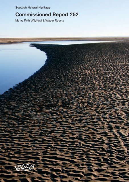
Commissioned Report 252 - Scottish Natural Heritage
Commissioned Report 252 - Scottish Natural Heritage
Commissioned Report 252 - Scottish Natural Heritage

You also want an ePaper? Increase the reach of your titles
YUMPU automatically turns print PDFs into web optimized ePapers that Google loves.
<strong>Scottish</strong> <strong>Natural</strong> <strong>Heritage</strong><br />
<strong>Commissioned</strong> <strong>Report</strong> <strong>252</strong><br />
Moray Firth Wildfowl & Wader Roosts
COMMISSIONED REPORT<br />
This report should be quoted as:<br />
<strong>Commissioned</strong> <strong>Report</strong> No.<strong>252</strong><br />
Moray Firth Wildfowl<br />
& Wader Roosts<br />
(ROAME No. F98LG20)<br />
For further information on this report please contact:<br />
Simon Cohen<br />
<strong>Scottish</strong> <strong>Natural</strong> <strong>Heritage</strong><br />
Fodderty Way<br />
Dingwall Business Park<br />
DINGWALL<br />
IV15 9XB<br />
Telephone: 01349-865 333<br />
E-mail: simon.cohen@snh.gov.uk<br />
Bob Swann, North of Scotland Ornithological Services. (2007). Moray Firth Wildfowl<br />
& Wader Roosts. <strong>Scottish</strong> <strong>Natural</strong> <strong>Heritage</strong> <strong>Commissioned</strong> <strong>Report</strong> No.<strong>252</strong> (ROAME<br />
No. F098LG02).<br />
This report, or any part of it, should not be reproduced without the permission of <strong>Scottish</strong> <strong>Natural</strong><br />
<strong>Heritage</strong>. This permission will not be withheld unreasonably. The views expressed by the author(s)<br />
of this report should not be taken as the views and policies of <strong>Scottish</strong> <strong>Natural</strong> <strong>Heritage</strong>.<br />
© <strong>Scottish</strong> <strong>Natural</strong> <strong>Heritage</strong> 2007.
COMMISSIONED REPORT<br />
Summary<br />
Moray Firth Wildfowl and Wader Roosts<br />
<strong>Commissioned</strong> <strong>Report</strong> No. <strong>252</strong> (ROAME No. F98LG20)<br />
Contractor: Bob Swann, North of Scotland Ornithological Services<br />
Year of publication: 2007<br />
Background<br />
Much of the economic activity in the Highlands is concentrated around the coastline of the<br />
Inner Moray Firth. This coastline is internationally important for its wintering shorebird<br />
populations and several Special Protection Areas have been designated to protect these<br />
interests. Development pressures along the coast require SNH staff to have detailed<br />
information on the location of shorebird feeding areas and roost sites. The information on<br />
roost sites is not available from standard sources of data such as Wetland Bird Survey<br />
counts. This report gives the location of all known shorebird roosts in the Moray Firth<br />
between Brora and Burghead. It also gives details of how the number of birds using these<br />
roosts has changed over the last 25 years and describes possible causes of these changes,<br />
particularly with regard to recreational activities.<br />
Main findings<br />
<br />
121 roosts were located in the Moray Firth between Brora and Burghead.<br />
Of these roosts 35 had shown an increase in the numbers of waders using them, whilst<br />
34 had remained unchanged and 52 had declined. Of the latter group only 7 had<br />
actually completely ceased to be used.<br />
The main reason for wader roosts declining was increased disturbance, particularly by<br />
walkers.<br />
Often this disturbance comes from a very small number of people, but these people are<br />
disturbing the site on a very regular basis. Dog walkers in particular fall into this<br />
category.<br />
Dunlin, bar-tailed godwit, common redshank, red knot and Eurasian oystercatcher<br />
appeared to be most prone to desert roosts, particularly small ‘marginal’ roosts.<br />
The main reason for wader roosts increasing in numbers was their location in areas that<br />
had difficult access, thus reducing potential disturbance.<br />
At some roost sites some wader species have become habituated to the close proximity<br />
of walkers, but these are mainly sites where some form of barrier, prevents direct<br />
disturbance.<br />
Of roosts used by ducks 22 had shown an increase in the numbers using them, whilst 19<br />
had remained unchanged and only 15 had declined.
Fewer duck roosts showed declines, due to the habit of duck just drifting offshore, when<br />
disturbed by walkers.<br />
For further information on this project contact:<br />
Simon Cohen, <strong>Scottish</strong> <strong>Natural</strong> <strong>Heritage</strong>, Fodderty Way, Dingwall Business Park, Dingwall, IV15 9XB<br />
Tel: 01349–865 333<br />
For further information on the SNH Research & Technical Support Programme contact:<br />
Policy & Advice Directorate Support, SNH, Great Glen House, Leachkin Road, Inverness, IV3 8NW.<br />
Tel: 01463 72500 or pads@snh.gov.uk
INTRODUCTION......................................................................................................... 1<br />
Local changes in wader and wildfowl numbers....................................................... 2<br />
METHODOLGY .......................................................................................................... 3<br />
Location of roosts.................................................................................................... 3<br />
Shorebird data......................................................................................................... 3<br />
Disturbance and local infrastructure........................................................................ 4<br />
RESULTS ................................................................................................................... 5<br />
DALCHAM-DORNOCH............................................................................................... 5<br />
Dalcham, Brora ....................................................................................................... 5<br />
Brora ....................................................................................................................... 5<br />
Golspie .................................................................................................................... 6<br />
Loch Fleet ............................................................................................................... 6<br />
Embo....................................................................................................................... 8<br />
DORNOCH FIRTH.................................................................................................... 10<br />
Dornoch and Cuthill Sands ................................................................................... 10<br />
Ardmore Bay ......................................................................................................... 11<br />
Edderton Sands .................................................................................................... 12<br />
Tain Bay ................................................................................................................ 13<br />
Morrich Mor ........................................................................................................... 14<br />
Inver Bay ............................................................................................................... 15<br />
Drumancroy, Portmahomack ................................................................................ 16<br />
CROMARTY FIRTH.................................................................................................. 17<br />
Nigg Ferry ............................................................................................................. 17<br />
Nigg Oil Terminal .................................................................................................. 17<br />
Nigg Bay................................................................................................................ 18<br />
Barbaraville - Saltburn........................................................................................... 19<br />
Invergordon ........................................................................................................... 21<br />
Rosskeen .............................................................................................................. 21<br />
Dalmore................................................................................................................. 22<br />
Alness Point .......................................................................................................... 22<br />
Alness Bay ............................................................................................................ 23<br />
Foulis - Ardullie ..................................................................................................... 24<br />
Inner Cromarty Firth .............................................................................................. 25<br />
Udale Bay.............................................................................................................. 26<br />
BEAULY FIRTH ........................................................................................................ 28<br />
Lentran. ................................................................................................................. 28<br />
Bunchrew .............................................................................................................. 28<br />
Muirtown Basin...................................................................................................... 29<br />
North Beauly Firth ................................................................................................. 30<br />
INVERNESS FIRTH.................................................................................................. 32<br />
Chanonry Point ..................................................................................................... 32<br />
Avoch .................................................................................................................... 32<br />
Munlochy Bay........................................................................................................ 33<br />
Kilmuir ................................................................................................................... 34<br />
Ness Mouth ........................................................................................................... 34<br />
Longman Point - Alturlie Point............................................................................... 35<br />
Castle Stuart (or Petty) Bay .................................................................................. 37<br />
Dalcross - Ardersier .............................................................................................. 38<br />
INNER MORAY FIRTH ............................................................................................. 39<br />
Fort George – Whiteness Head ............................................................................ 39<br />
Nairn Bar ............................................................................................................... 40<br />
Culbin Bar ............................................................................................................. 41<br />
Findhorn Bay......................................................................................................... 42<br />
SUMMARY OF CHANGES....................................................................................... 45<br />
DISCUSSION............................................................................................................ 46<br />
RECOMMENDATIONS............................................................................................. 47<br />
REFERENCES.......................................................................................................... 48<br />
v
List of figures page<br />
Figure 1 Moray Firth 3<br />
Figure 2 Roosts at Dalchalm and Brora 5<br />
Figure 3 Roosts in Golspie area 6<br />
Figure 4 Roosts at Loch Fleet 7<br />
Figure 5 Roosts in Embo area 8<br />
Figure 6 Dornoch Point roosts 10<br />
Figure 7 Roosts at Lonemore (Cuthill Sands) 11<br />
Figure 8 Roosts at Ardmore Bay 12<br />
Figure 9 Roosts at Edderton Bay 12<br />
Figure 10 Roosts in Tain Bay 14<br />
Figure 11 Roosts on the Morrich Mor 15<br />
Figure 12 Roosts at Inver Bay 16<br />
Figure 13 Roost area at Drumancroy 16<br />
Figure 14 Roosts at Nigg Oil Terminal and Nigg Ferry 17<br />
Figure 15 Roosts at Nigg Bay 18<br />
Figure 16 Roosts at Balintraid and Saltburn 20<br />
Figure 17 Roosts at Invergordon and Roskeen 21<br />
Figure 18 Roosts at Dalmore and Alness Point 22<br />
Figure 19 Alness Bay roosts 23<br />
Figure 20 Roosts between Foulis and Ardullie Point 24<br />
Figure 21 Roosts in Dingwall Bay 25<br />
Figure 22 Roosts on east side Inner Cromarty Firth 26<br />
Figure 23 Roosts at Udale Bay 27<br />
Figure 24 Lentran Roosts 28<br />
Figure 25 Bunchrew roosts 28<br />
Figure 26 Muirton Basin Roost 29<br />
Figure 27 Redcastle – Tarradale roosts 30<br />
Figure 28 Charlestown roost 30<br />
Figure 29 Roosts on Chanonry Point 32<br />
Figure 30 Roosts at Munlochy Bay 33<br />
Figure 31 Roosts at Kilmuir 34<br />
Figure 32 Roosts at Ness Mouth and Longman 35<br />
Figure 33 Roosts on the east side of Longman Bay 36<br />
Figure 34 Roosts at Castle Stuart (Petty Bay) 37<br />
Figure 35 Roosts in the Dalcross-Ardersier area 38<br />
Figure 36 Roosts in the Fort George – Whiteness Head area 39<br />
Figure 37 Roosts on the Nairn bar 40<br />
Figure 38 Roosts on the Culbin bars 42<br />
Figure 39 Roosts at Findhorn Bay 43<br />
vi
List of tables<br />
Table 1. Wader numbers Dalchalm, Brora.<br />
page<br />
5<br />
Table 2. Wader numbers at Brora. 6<br />
Table 3. Wader numbers at Golspie. 6<br />
Table 4. Wildfowl and Wader numbers in Loch Fleet 7<br />
Table 5. Numbers of waders using Loch Fleet roosts in recent years. 8<br />
Table 6. Wader numbers at Embo roosts. 9<br />
Table 7. Changes in wildfowl and wader numbers at Dornoch and Cuthill<br />
Sands.<br />
10<br />
Table 8. Numbers of waders using Dornoch and Cuthill Sands roosts in<br />
recent years.<br />
10<br />
Table 9. Changes in wildfowl and wader numbers at Ardmore Bay. 11<br />
Table 10. Wildfowl and wader numbers at Edderton Bay roosts. 13<br />
Table 11. Changes in wildfowl and wader numbers at Edderton Sands. 13<br />
Table 12. Changes in wildfowl and wader numbers at Tain Bay. 13<br />
Table 13. Numbers of wildfowl and waders using Tain Bay roosts in recent<br />
years.<br />
13<br />
Table 14. Changes in wildfowl and wader numbers at Morrich Mor. 14<br />
Table 15. Changes in wildfowl and wader numbers at Inver Bay. 15<br />
Table 16. Numbers of wildfowl and waders using Inver Bay roosts in recent<br />
years.<br />
15<br />
Table 17. Changes in wildfowl and wader numbers at Drumancroy. 16<br />
Table 18. Changes in wader numbers at Nigg Ferry. 17<br />
Table 19. Changes in wader numbers at Nigg oil terminal. 18<br />
Table 20. Changes in wildfowl and wader numbers at Bayfield, Nigg Bay. 19<br />
Table 21. Changes in wildfowl and wader numbers at Meddat, Nigg Bay. 19<br />
Table 22. Changes in wildfowl and wader numbers at Tarbat, Nigg Bay. 19<br />
Table 23. Changes in wader numbers at Barbaraville. 20<br />
Table 24. Changes in wader numbers at Balintraid. 20<br />
Table 25. Changes in wader numbers at Saltburn. 21<br />
Table 26. Changes in wader numbers at Invergordon. 21<br />
Table 27. Changes in wader numbers at Roskeen. 21<br />
Table 28. Changes in wildfowl and wader numbers at Dalmore. 22<br />
Table 29. Changes in wader numbers at Alness Point. 22<br />
Table 30. Changes in wildfowl and wader numbers at Alness Bay. 23<br />
Table 31. Numbers of wildfowl and waders using Alness Bay roosts in recent<br />
years.<br />
23<br />
Table 32. Changes in wildfowl and wader numbers at Foulis-Ardullie. 24<br />
Table 33. Changes in wildfowl and wader numbers in the Inner Cromarty<br />
Firth.<br />
25<br />
Table 34. Numbers of waders using Inner Cromarty Firth roosts in recent<br />
years.<br />
26<br />
Table 35. Wader numbers at Findon pre 1985. 26<br />
Table 36. Changes in wildfowl and wader numbers at Udale Bay. 27<br />
Table 37. Wader numbers at Balblair pre 1995. 27<br />
Table 38. Changes in wildfowl and wader numbers at Lentran. 28<br />
Table 39. Changes in wildfowl and wader numbers at Bunchrew. 29<br />
Table 40. Changes in wildfowl and wader numbers at and off Muirton. 29<br />
Table 41. Changes in wildfowl and wader numbers on the North Beauly. 30<br />
Table 42. Numbers of waders using North Beauly roosts in recent years. 31<br />
Table 43. Changes in wader numbers at Chanonry. 32<br />
Table 44. Changes in wader numbers at Avoch. 32<br />
Table 45. Changes in wildfowl and wader numbers at Munlochy Bay. 33<br />
Table 46. Numbers of wildfowl and waders using Munlochy Bay roosts in<br />
recent years.<br />
33<br />
Table 47. Changes in wader numbers at Kilmuir. 34<br />
vii
Table 48. Changes in wildfowl and wader numbers at Ness Mouth. 34<br />
Table 49. Changes in wildfowl and wader numbers at Longman, Inverness. 35<br />
Table 50. Numbers of waders using Longman- Alturlie roosts in recent years. 35<br />
Table 51. Changes in wildfowl and wader numbers at Alturlie, Inverness. 36<br />
Table 52. Changes in wildfowl and wader numbers at Castle Stuart (Petty<br />
Bay).<br />
37<br />
Table 53. Numbers of wildfowl and waders using Castle Stuart roosts in<br />
recent years.<br />
37<br />
Table 54. Changes in wildfowl and wader numbers in the Dalcross-Ardersier<br />
area.<br />
38<br />
Table 55. Numbers of wildfowl and waders using Dalcross - Ardersier roosts<br />
in recent years.<br />
38<br />
Table 56. Changes in wildfowl and wader numbers in the Whiteness Head<br />
area.<br />
39<br />
Table 57. Numbers of waders using Whiteness Head area roosts in recent<br />
years.<br />
40<br />
Table 58. Changes in wildfowl and wader numbers on Nairn Bar. 40<br />
Table 59. Numbers of wildfowl and waders using Nairn Bar roosts in recent<br />
years.<br />
41<br />
Table 60. Changes in wildfowl and wader numbers on Culbin Bar. 41<br />
Table 61. Numbers of wildfowl and waders using Culbin Bar roosts in recent<br />
years.<br />
42<br />
Table 62. Changes in wildfowl and wader numbers at Findhorn Bay. 42<br />
Table 63. Numbers of wildfowl and waders using Findhorn Bay roosts in<br />
recent years.<br />
44<br />
Table 64. Change in number of waders using roosts according to firth. 45<br />
Table 65. Reasons for changes in numbers at wader roosts. 45<br />
Table 66. Number of roosts where the following wader species declined or<br />
increased significantly, by at least two orders of magnitude.<br />
45<br />
Table 67. Change in number of ducks using roosts according to firth. 46<br />
viii
INTRODUCTION<br />
The Moray Firth is the most northerly estuarine complex in the United Kingdom, to<br />
hold shorebirds in nationally and internationally important numbers (Swann & Mudge<br />
1989). As such much of its shoreline has been given protection, under UK<br />
legislation, as Sites of Special Scientific Interest and more recently, under EU<br />
legislation, as Special Protection Areas (SPAs). This legislation should give<br />
protection from development to the main feeding and roosting areas.<br />
The first detailed counts of wildfowl and waders in the Moray Firth took place in early<br />
1970s as part of the British Trust for Ornithology (BTO) Birds of Estuary Enquiry.<br />
The figures from these counts were used in ‘Nature conservation within the Moray<br />
Firth Area – Revised Prospectus’ (Nature Conservancy Council 1978). In the early<br />
1980s the number and distribution of ducks and waders in the Moray Firth was<br />
monitored for Britoil PLC as part of the Beatrice Environmental Monitoring<br />
Programme. The results from this were published in a detailed report (Symonds &<br />
Langslow 1985) providing both high and low water counts throughout the Moray Firth<br />
with details of individual high tide roost sites. In January 1985 the first co-ordinated<br />
count of the entire Moray Firth from Brora to Burghead was undertaken and these<br />
have continued till present. Swann & Mudge (1989) compared the wader counts<br />
done between 1984 and 1988 with the earlier ones done between 1970 and 1975.<br />
More recently Kalejta-Summers (2006) examined changes in the distribution and<br />
numbers of waders in the Moray Firth, as shown by The Wetland Bird Survey<br />
(WeBS) high tide roost counts, between 1988 and 2003.<br />
The Highland Ringing Group (HRG) has been catching waders and ducks at high tide<br />
roosts in the Moray Firth since 1977. The origin and migration patterns of waders<br />
using the Moray Firth was described by Swann and Etheridge (1996). Rehfisch et al<br />
(2003) examined the fidelity of waders to Moray Firth high tide roosts both within and<br />
between seasons.<br />
This report aims to record the location of all shorebird roosts, both past and present,<br />
in the Moray Firth from Brora in the north to Burghead in the east. It also provides<br />
details of the species composition of these roosts and for each species the numbers<br />
(based on order of magnitude) that currently use the roost. In order to assess recent<br />
changes in species composition and abundance at these roosts information is also<br />
given on the on how numbers have changed between 1985-1994 and 1995-2006.<br />
These periods were chosen to roughly reflect the periods prior to and after the<br />
creation of SPAs on the Moray Firth. Details are also given of any changes in<br />
infrastructure, particularly recreational infrastructure that may have had an impact on<br />
the number of roosting birds.<br />
Research has shown that wader roosts are susceptible to increased disturbance from<br />
recreational activities. For instance in the Dutch Wadden Sea, walkers were shown<br />
to most often affect roosts of Eurasian oystercatcher Haematopus ostralegus, bartailed<br />
godwits Limosa lapponica and Eurasian curlew Numenius arquata (Smit &<br />
Visser 1993). Dogs and walkers were also responsible for disturbance to wader<br />
roosts (including bar-tailed godwit) on the Dee Estuary (Kirby et al. 1993). Numbers<br />
of roosting waders were significantly lower at weekends, when disturbance rates<br />
were highest.<br />
The human population of the Highlands has been increasing in recent years.<br />
Between 1994 and 2004 it rose by 1.9%. This hides rapid growth in districts like<br />
Nairn (+7%), Inverness (+5.4%) and Sutherland (+4%). This increase in population<br />
1
puts extra pressure on the coast particularly through increased disturbance from<br />
recreational activities. A survey of recreational pressure on coastal reserves<br />
managed by The Royal Society for the Protection of Birds (RSPB) in the Moray Firth<br />
conducted in winter 2005-06 (Crowther & Elliot 2006) showed that although<br />
recreational pressure was highest at weekends, it was still significant on weekdays.<br />
The report concluded that of the recreational activities recorded, dog walking had the<br />
potential to cause disturbance to wintering bird populations, and horse riding and<br />
quad biking have the potential to cause direct damage to fragile habitats.<br />
A variety of legislation covers recreational activities. For example, there is a right to<br />
public recreation on the foreshore, which includes activities such as wildfowling, dog<br />
walking and bait digging below mean high water springs. More recently the <strong>Scottish</strong><br />
Outdoor Access Code (SOAC) has given the public the general right to responsible<br />
access in the countryside, including on bicycle and horse riding, though this right<br />
does not extend to motorised vehicles such as motorbikes or quad bikes. The recent<br />
Nature Conservation Act (Scotland) introduced the principle of third party damage to<br />
designated sites as an offence. Therefore recreational activities, which cause<br />
damage to designated sites, are irresponsible and fall outwith SOAC.<br />
Increased disturbance is likely to have the greatest impact on roosting wildfowl and<br />
waders. For each major feeding area, there tends to be only a limited number of<br />
sites for safe high tide roosts (Symonds & Langslow 1986). If these are regularly<br />
disturbed the shorebirds may abandon them and therefore may be forced to fly<br />
further to find safe, undisturbed roosts.<br />
It is uncertain if energy limitations, predation, or weather are important in determining<br />
roost selection, but studies show that most species are site faithful (Rehfisch et al.<br />
2003). Over wintering shorebirds face the conflicting demands of being lean to<br />
facilitate escape from predators (Page & Whitacre 1975; Cresswell 1994) and of<br />
being fat to survive periods of cold weather. They benefit by reusing roosts that are<br />
sheltered and undisturbed rather than searching for new but potentially unsuitable<br />
roosts. The availability of safe, sheltered roosts, close to feeding sites may be critical<br />
to survival, if, as proposed by Wiersma and Piersma (1994), shorebirds wintering in<br />
temperate climes are at the limit of their metabolic requirements.<br />
Local changes in wader and wildfowl numbers<br />
Kalejta-Summers (2006) examined changes in the numbers of waders on the Moray<br />
Firth based on the WeBS counts carried out between October 1988 and February<br />
2003. She showed that there had been significant increases in the number of<br />
sanderling Calidris alba and red knot Calidris canutus present on the Moray Firth<br />
during the mid-winter period (December-February) and significant declines in the<br />
number of purple sandpiper Calidris maritima and ruddy turnstone Arenaria interpres.<br />
No other species, showed significant trends. HRG data, however, shows that<br />
northern lapwing Vanellus vanellus numbers have increased markedly over this<br />
period, particularly in late summer and early autumn (ie outwith the mid-winter period<br />
examined by Kalejta-Summers).<br />
Kalejta-Summers, B. (in prep) examined changes in duck numbers on the Moray<br />
Firth over the same time periods and showed significant increases in the number of<br />
common teal Anas crecca , but significant declines in the number of Eurasian wigeon<br />
Anas penelope and mallard Anas platyrhynchos.<br />
2
These changes should be taken into account when examining changes in numbers at<br />
individual roosts.<br />
METHODOLGY<br />
Location of roosts.<br />
Where possible field visits were made to all known (historic and current) high tide<br />
roost sites in the Moray Firth between Brora and Burghead (Figure 1). A GPS<br />
reading was taken at the core of the roost and at larger roosts other readings were<br />
taken to show the extent of the roost area. If it was impossible to access a roost (eg<br />
on an offshore bar) six figure grid references were taken from the relevant 1:25,000<br />
OS maps. If a single GPS reading was taken, roosts were marked on Figures 2-39<br />
using an arrow. If more than one GPS reading was taken the total extent of the roost<br />
is marked on Figures 2-39.<br />
Figure 1. Moray Firth<br />
Shorebird data.<br />
Data on the number of ducks and waders using individual roosts was obtained from<br />
three sources.<br />
1. WeBS data from the co-ordinated counts carried out in the Moray Firth each<br />
winter in October, December, January and February, since January 1985. This<br />
data is kept locally on a finer scale, than that submitted to BTO allowing, in many<br />
cases, counts to be allocated to specific roosts.<br />
2. Highland Ringing Group data. During attempts to cannon net shorebirds at<br />
roosts, throughout the Moray Firth, details were recorded of the birds caught and<br />
the number of birds present at each roost. The data were then extracted from<br />
Highland Ringing Group cannon net report forms, held by R.L.Swann.<br />
3
3. For some sections where data was limited the original, and if necessary present,<br />
WeBS counter was contacted and asked to provide details of roost location and<br />
species numbers over time.<br />
Orders of magnitude have been used in the individual roost accounts that follow,<br />
rather than actual numbers. There are several reasons for this. Although actual<br />
figures are available for all WeBS sections, they are not available for all individual<br />
roosts. Data from sources 2 and 3 above was often cited to the nearest 10, 50, 100<br />
etc. There was much variation from one winter to the next, and even within a nonbreeding<br />
season in usage of a particular roost. As much of the data was not<br />
normally distributed interval data, working out means and standard deviations would<br />
not have been appropriate. There was no intention to work out statistically based<br />
declines in the number of roosting birds. The overall aim was to produce a gazetteer<br />
of Moray Firth roosts and to indicate whether numbers at individual roosts had<br />
declined or increased since the creation of SPAs on the Moray Firth.<br />
The order of magnitude for each species was based on maximum counts per winter.<br />
They were averaged for the two study periods; pre 1995 (ie 1985-1994) and post<br />
1994 (ie 1995-2006). The order of magnitude scale used was 1 = 1-25, 2 = 26-50, 3=<br />
51-100, 4 =101-250, 5 = 251-500, 6 = 501-1000, 7 = 1001-2500 and 8 =2501-5000.<br />
These order of magnitude figures are used in tables 1-63. Where they are shown in<br />
red italics in the table this means that use of the roost by these species is very<br />
irregular.<br />
In the sections that follow the following abbreviations have been used in the tables.<br />
abbreviation species scientific name<br />
WN Eurasian wigeon Anas penelope<br />
T common teal Anas crecca<br />
MA mallard Anas platyrhnchos<br />
PT northern pintail Anas acuta<br />
OC Eurasian oystercatcher Haematopus ostralegus<br />
RP ringed Plover Charadrius hiaticula<br />
GP European golden Plover Pluvialis apricaria<br />
L northern lapwing Vanellus vanellus<br />
KN red knot Calidris canutus<br />
SA sanderling Calidris alba<br />
PS purple sandpiper Calidris maritima<br />
DN dunlin Calidris alpina<br />
BA bar-tailed Godwit Limosa lapponica<br />
CU Eurasian curlew Numenius arquata<br />
RK common redshank Tringa totanus<br />
TT ruddy turnstone Arenaria interpres<br />
Disturbance and local infrastructure.<br />
Visits were made to each roost site and details taken of any change in local<br />
infrastructure affecting the roost. The date of installation of any relevant<br />
infrastructure was obtained from Highland Council planning department records, if<br />
available. Observations regarding disturbance were taken from HRG cannon net<br />
report forms and personal observations.<br />
4
RESULTS<br />
DALCHAM-DORNOCH<br />
Dalcham, Brora<br />
The main roost here, mostly used by ringed plovers, dunlin and sanderling (table 1) is<br />
situated at NC91433 05400 on sand and gravel at the top of the beach, on the north<br />
side of a burn (A on Fig 2). This burn gives the birds some protection from<br />
disturbance. If disturbed the birds often fly to NC91530 05945, a similar site on the<br />
north side of the next burn (B on Fig 2). Severe disturbance from walkers results in<br />
the roost becoming fragmented and birds being found in small groups scattered all<br />
along the beach.<br />
Figure 2. Roosts at Dalchalm and Brora<br />
Based upon Ordnance Survey material with the permission of the<br />
controller of HMSO © Crown copyright (1996) Licence no. 100017908<br />
E<br />
Table 1. Wader numbers Dalchalm, Brora.<br />
OC RP SA DN BA<br />
Pre 1995 1 3 2 3 1<br />
Post 1994 1 4 2 3 1<br />
Peak numbers are usually recorded in late summer/autumn. Despite high levels of<br />
disturbance ringed plover numbers increased between the two time periods.<br />
Brora<br />
The main roost here is on a small point below the old radio station at NC90867<br />
03396 (C on Fig 2). An alternative roost is a bit further down the beach at NC90744<br />
03380 (D on Fig 2). Both sites are prone to disturbance by walkers and joggers,<br />
using the track at the top of the dunes above the shore. The birds are used to this<br />
and often remain in situ as people pass by. If they stop above the roost, or if they<br />
walk along the beach the birds will be disturbed. At NC91043 03678 small numbers<br />
D<br />
5<br />
C<br />
A<br />
B
of common redshank and purple sandpipers will occasionally roost on the rock<br />
armour and adjacent gravel beach (E on Fig 2).<br />
Table 2. Wader numbers at Brora.<br />
OC PS BA CU RK TT<br />
Pre 1995 3 2 1 2 2 2<br />
Post 1994 3 2 1 2 2 1<br />
Table 2 gives some idea of the number of birds recorded at these roosts. In addition<br />
occasional order 5 flocks of bar-tailed godwit and order 5 or 6 flocks of red knot can<br />
make use of these roosts for short periods of time (eg October 1978, February 2005).<br />
Again, despite regular disturbance, no major changes in numbers has been recorded<br />
between the two periods.<br />
Golspie<br />
The main roost here, mainly used by dunlin and ringed plover (table 3), is on the<br />
beach just north of the pier at NH82998 99643 (A on Fig 3).<br />
Figure 3. Roosts in Golspie area<br />
Based upon Ordnance Survey material with the permission of the<br />
controller of HMSO © Crown copyright (1996) Licence no. 100017908<br />
Table 3. Wader numbers at Golspie.<br />
OC RP DN BA CU RK TT<br />
Pre 1995 2 3 4 1 2 2 2<br />
Post 1994 2 3 3 1 2 2 2<br />
A<br />
B<br />
If disturbed birds tend to move further north along the beach. Most people walk on<br />
the tarmac path above the beach. It is mainly dog walkers that go down onto the<br />
beach, causing disturbance. If severely disturbed the birds will fly further south to<br />
roost on a gravel ridge at NH82195 97969 (B on Fig 3). Despite the disturbance, the<br />
only decline is a drop in dunlin numbers using the site.<br />
Loch Fleet<br />
This is the most important site for shorebirds in the section of coast. It is a large tidal<br />
basin and there are several roosts. The use of these roosts is often dependent on<br />
wind direction and disturbance, with a large amount of interchange between the<br />
roosts. Overall numbers in the bay have shown some declines (table 4) with fewer<br />
6
Eurasian wigeon, mallard, dunlin, bar-tailed godwit (all these species showing almost<br />
50% reduction in numbers), and northern lapwing. There is little evidence that these<br />
declines are due to increased disturbance. The decline in ducks, may be due to<br />
reduced feeding opportunities, following the closure of a sewage pipe leading into the<br />
upper part of the loch from the Cambussavie Hospital in the late 1980s (T Mainwood<br />
pers com).<br />
Table 4. Wildfowl and Wader numbers in Loch Fleet<br />
WN T. MA OC RP L. KN DN BA CU RK TT<br />
Pre 1995 7 4 6 7 3 4 4 6 5 5 5 1<br />
Post 1994 6 4 5 7 3 3 4 4 4 5 5 1<br />
The main roost on the north side of the loch is on the saltmarsh in Balbair Bay from<br />
NH80397 97345 to NH80127 97207, centred around NH80297 97296 (site A on Fig<br />
4). When disturbed some of the birds move to roost on a large spit on the east side<br />
of the bay at NH80507 96727 (B on Fig 4). Access to Balblair Bay is by a long<br />
bumpy track from the A9, so disturbance tends to be limited. Details of current usage<br />
of these and the other Loch Fleet roosts are given in table 5.<br />
Figure 4. Roosts at Loch Fleet.<br />
C<br />
Based upon Ordnance Survey material with the permission of the<br />
controller of HMSO © Crown copyright (1996) Licence no. 100017908<br />
On the inner part of the bay there is a small roost on the saltmarsh, centred at<br />
NH76896 97290 (site C on fig 4), where Eurasian curlew often roost, spreading out to<br />
NH76943 97133. Duck frequently haul out here. Access to this area is difficult so<br />
the birds are relatively undisturbed. On very high tides (>4.7m), the waders often<br />
roost at the mound, west of the A9.<br />
7<br />
D<br />
A<br />
E<br />
B
Table 5. Numbers of waders using Loch Fleet roosts in recent years.<br />
OC RP L. KN DN BA CU RK<br />
Roost A 6 0 0 4 4 4 4 4<br />
Roost B 2 0 0 0 0 0 2 2<br />
Roost C 3 0 0 0 0 0 4 2<br />
Roost D 5 0 3 4 4 4 3 2<br />
Roost E 6 3 0 0 0 0 0 0<br />
On the south side of the bay the main roost is at Skelbo point, centred on NH79446<br />
95339 and spreading out along the saltmarsh east to around NH79629 95214 (site D<br />
on Fig 4). Despite the close location of a nearby car park and public notice board,<br />
birds appear to be used to people. A deep channel between the car park and roost<br />
site, also reduces potential disturbance.<br />
The final roost is found on the beach on the south side of the mouth at NH81242<br />
95388 (site E on Fig 4). This roost is used almost exclusively by Eurasian<br />
oystercatcher (table 5). Ringed plover also roost on the beach though slightly further<br />
south. A nearby car park encourages lots of walkers to this general area. As the tide<br />
rises, however, a large creek fills with water, making access to this site quite difficult.<br />
Occasionally walkers come north from Embo and disturb the roost, causing the birds<br />
to return to roost D or disperse over to the beach on the north side, where<br />
disturbance is a much more regular occurrence, due to a network of tracks.<br />
Embo<br />
There is a small roost on the tip of the pier at NH82041 92105, mainly used by ruddy<br />
turnstone and purple sandpiper (A on Fig 5). If disturbed they fly to the point at<br />
NH81656 91998 (B on Fig 5), which tends to be used by Eurasian oystercatcher and<br />
Eurasian curlew (Table 6).<br />
Figure 5. Roosts in Embo area.<br />
Based upon Ordnance Survey material with the permission of the<br />
controller of HMSO © Crown copyright (1996) Licence no. 100017908<br />
B<br />
A<br />
C<br />
Disturbance here is a regular occurrence with people walking south from the caravan<br />
site at Grannies Hielan Hame. There was a small late summer – autumn roost on the<br />
shore at the north end of Dornoch Golf course at NH81233 91218 (site C on Fig 5),<br />
which was mainly used by ringed plover. Increased disturbance by walkers,<br />
8
following the coastal track bounding the golf course, led to the abandonment of this<br />
roost in the early 1990s.<br />
Table 6. Wader numbers at Embo roosts.<br />
OC RP DN PS CU RK TT<br />
Pre 1995 2 2 5 1 2 3 3<br />
Post 1994 3 0 3 1 2 1 3<br />
Overall there have been small increases in the numbers of Eurasian oystercatcher,<br />
but large declines in ringed plover, dunlin and common redshank in this area.<br />
9
DORNOCH FIRTH<br />
Dornoch and Cuthill Sands<br />
Large numbers of waders and duck feed in this area and use four main roost sites.<br />
There is considerable interchange between these roosts, depending on weather and<br />
disturbance. Overall changes are shown in Table 7. Of the duck northern pintail<br />
have increased. The only wader decline affects bar-tailed godwit, where numbers<br />
have dropped by over 60%.<br />
Table 7. Changes in wildfowl and wader numbers at Dornoch and Cuthill Sands.<br />
WN T. MA PT OC RP KN DN BA CU RK<br />
Pre 1995 8 3 5 3 5 2 6 7 6 5 4<br />
Post 1994 8 3 5 4 5 2 6 7 4 5 4<br />
Traditionally the main wader roost was on Dornoch Point around NH80200 87140 (A<br />
on Fig 6), with the saltings at NH80113 87721- NH80176 87520 being used as a<br />
secondary roost (site B on Fig 6). The roost on the point now tends to be only used<br />
by Eurasian oystercatcher. They are often disturbed and move to roost B, which has<br />
now become the main roost, or Innis Mhor. This is despite the fact that vehicular<br />
access to the point has been restricted since the late 1980s, by a line of wooden<br />
posts on the north side of the airstrip. The walk south along the beach from Dornoch<br />
to the point, however, remains very popular.<br />
Table 8. Numbers of waders using Dornoch and Cuthill Sands roosts in recent years.<br />
OC RP KN DN BA CU RK<br />
Roost A 5 0 0 0 0 0 0<br />
Roost B 5 0 6 7 4 5 4<br />
Roost C 5 2 5 6 4 5 3<br />
Roost D 5 2 5 6 4 5 3<br />
Note: Figures in red italics means only irregular use of roost.<br />
Figure 6. Dornoch Point roosts.<br />
C<br />
Based upon Ordnance Survey material with the permission of the<br />
controller of HMSO © Crown copyright (1996) Licence no. 100017908<br />
As table 8 shows some birds continue to roost at the western end of the Dornoch<br />
Sands (site C on Fig 6), concentrated on a salting point at NH77977 88254 and<br />
spilling east along the beach (particularly on neap tides,
88319. Even here, however, walkers from Dornoch, can cause disturbance,<br />
particularly at weekends. As a result of this disturbance a high percentage of the<br />
waders feeding on The Dornoch Sands flight 4-5 kilometres to roost on Innis Mhor<br />
(see Tain Bay section).<br />
At Cuthill Sands the main roosts are a series of salting points at Lonemore (site D on<br />
Fig 7). The birds move between the points, depending on disturbance, tide height<br />
and wind direction. The main points are at NH77113 88277, though this point is<br />
rapidly disappearing as a result of erosion, NH76945 88224, NH76830 88169 (often<br />
the core site) and NH76541 88053.<br />
Figure 7. Roosts at Lonemore (Cuthill Sands).<br />
D<br />
Based upon Ordnance Survey material with the permission of the<br />
controller of HMSO © Crown copyright (1996) Licence no. 100017908<br />
These Lonemore roosts are mainly used by Eurasian curlew, Eurasian oystercatcher<br />
and smaller numbers of common redshank and ringed plover. In some winters<br />
significant numbers of red knot, dunlin and bar-tailed godwit can also make use of<br />
them, for short periods of time.<br />
Ardmore Bay<br />
There are two main roost sites, the use of which depends on wind direction. The first<br />
is on the saltings at the head of the bay, just to the east of the channel, from<br />
NH70244 85752 to NH70194 86852 (site A on Fig 8). The other is on Rubha nan<br />
Sgarbh at NH70110 87963 (site B on Fig 8), which to this day is still a great<br />
cormorant Phalacrocorax carbo roost, but also holds some ducks and waders.<br />
During westerly winds the duck tend to use the beach just to the south from<br />
NH70076 87897 to NH70084 87627 (site C on Fig 8).<br />
Table 9. Changes in wildfowl and wader numbers at Ardmore Bay.<br />
WN T. MA OC L. DN CU RK<br />
Pre 1995 5 6 3 1 1 1 1 1<br />
Post 1994 6 6 4 1 1 1 1 1<br />
11
Figure 8. Roosts at Ardmore Bay.<br />
Based upon Ordnance Survey material with the permission of the<br />
controller of HMSO © Crown copyright (1996) Licence no. 100017908<br />
There has been some increase in duck numbers, particularly mallard and Eurasian<br />
wigeon. Wader numbers are very low at this site. Access to these roosts is<br />
extremely awkward, by land. In the past, however, punt gunners have come in from<br />
the firth and this has caused much disturbance.<br />
Edderton Sands<br />
There are two main roost sites here and once again their use is often dependent on<br />
wind direction.<br />
Figure 9. Roosts at Edderton Bay.<br />
B<br />
A<br />
Based upon Ordnance Survey material with the permission of the<br />
controller of HMSO © Crown copyright (1996) Licence no. 100017908<br />
The main roost, used mainly by ducks and a few waders (Table 10) is on the<br />
saltmarsh, at the west end of the bay from NH72610 84318 to NH7<strong>252</strong>9 84510 (site<br />
A on Fig 9). Some waders also use the gravel ridge at NH72422 84680 (B on Fig 9).<br />
This area forms part of the RSPB reserve and access is very awkward, so<br />
disturbance is not a major problem.<br />
12<br />
A<br />
B<br />
C<br />
C
Table 10. Wildfowl and wader numbers at Edderton Bay roosts.<br />
WN T. MA OC RP BA CU RK<br />
Roosts A+B 8 6 2 3 1 1 3 3<br />
Roost C 3 0 1 3 3<br />
The saltings on the east side of the bay from NH74323 84359- NH74338 84423 (site<br />
C on Fig 9) form a secondary roost, used particularly during periods of strong<br />
easterly winds (table 10). This site can be accessed from the Meikle Ferry road, or<br />
from a small layby on the A9. The roost does therefore get disturbed from time to<br />
time, particularly by wildfowlers, occasional walkers and the farmer.<br />
Table 11. Changes in wildfowl and wader numbers at Edderton Sands.<br />
WN T. MA OC RP BA CU RK<br />
Pre 1995 8 2 2 2 1 3 3 1<br />
Post 1994 8 6 2 3 1 1 3 3<br />
Common teal numbers, using the bay, have increased significantly in recent years<br />
(Table 11). Bar-tailed godwits now rarely use it. On rare occasions large flocks of<br />
red knot and dunlin (order 4/5) use roost C for short periods of time, if displaced from<br />
Ardjachie Bay.<br />
Tain Bay<br />
There are four main roosts located between Ardjachie and Tain (Figure 10). Overall<br />
there has been little change in the numbers using this area (Table 12), though<br />
northern pintail, red knot and Eurasian curlew have shown increases, whilst mallard<br />
have declined.<br />
Table 12. Changes in wildfowl and wader numbers at Tain Bay.<br />
WN T. MA PT OC RP L. KN DN BA CU RK<br />
Pre 1995 8 6 5 1 4 0 3 2 4 2 3 5<br />
Post 1994 8 6 4 3 4 1 3 4 4 2 4 5<br />
The roost at Ardjachie is located on the saltmarsh running south from the point at<br />
NH75518 84992 to NH75227 84694, centred around NH75318 84782 (site A on Fig<br />
10). This is the largest roost in the bay used by large numbers of duck and waders<br />
(Table 13). Access is restricted to this site, so the only disturbance tends to come<br />
from the occasional wildfowler or the local farmer feeding stock.<br />
Further east another regular roost is found on the boulder beach just east of the<br />
Morangie distillery. Ducks and waders use the area between NH77347 83367 to<br />
NH77244 83489, with the core around NH77304 83431 (site B on Fig 10). Access to<br />
this area is not easy so, apart from the occasional wildfowler, birds are seldom<br />
disturbed.<br />
Table 13. Numbers of wildfowl and waders using Tain Bay roosts in recent years.<br />
WN T MA PT OC RP KN DN BA CU RK<br />
Roost A 8 0 0 3 4 1 4 4 2 4 5<br />
Roost B 8 6 4 0 0 0 0 0 0 4 5<br />
Roost C 7 6 4 0 4 0 0 4 0 0 5<br />
Roost D 2 2 2 0 2 0 0 0 0 0 0<br />
13
Figure 10. Roosts in Tain Bay.<br />
A<br />
Based upon Ordnance Survey material with the permission of the<br />
controller of HMSO © Crown copyright (1996) Licence no. 100017908<br />
There are two roosts at Tain. The first is below the sewage works based on the<br />
salting point at NH77823 82851 (site C on Fig 10), though it can extend from the<br />
beach at NH77852 82812, just east of the sewage works outflow, to the west end of<br />
the adjacent bay at NH77693 82919. Despite being close to Tain, this roost does not<br />
suffer much disturbance from walkers. Activity at the sewage works, particularly if<br />
drivers of vehicles stop to lock or unlock the gates can cause some disturbance, and<br />
the birds move to roost at Morangie or even Ardjachie.<br />
Formerly, up to the early 1990s, there was a regular roost on the saltmarsh point at<br />
NH78474 82461 (D on Fig 10) just west of the suspension bridge on the north side of<br />
the Tain river, used mainly by common redshank (up to 300) and Eurasian<br />
oystercatchers (50+). As a result of regular disturbance by walkers and children,<br />
particularly since 1995, this roost is now only irregularly used by a few Eurasian<br />
oystercatcher and duck. Many of the birds from the latter site now use the sewage<br />
works roost.<br />
Morrich Mor<br />
This is really the outer part of Tain Bay. The main roost is nowadays located on the<br />
western tip of Innis Mhor at NH83178 86501 (site A on Fig 11), a large offshore<br />
sandbar, where birds feeding in Tain Bay and off Dornoch Point find a safe<br />
undisturbed roost site, where access is virtually impossible. On bigger tides (>4.7m)<br />
the birds disperse further east along the bar, on both sides. Ducks and a few waders<br />
roost on the saltmarsh opposite the bar at NH83333 85717 (site B on Fig 11).<br />
Formerly many birds roosted at NH81469 84341 (site C on Fig 11). This roost has<br />
been abandoned since 2000 due to disturbance from walkers and bombing range<br />
security guards. Many of the birds from this roost, now roost on the bar at Innis Mhor.<br />
Table 14. Changes in wildfowl and wader numbers at Morrich Mor.<br />
WN T. MA OC RP KN DN BA CU RK<br />
Pre 1995 7 4 5 6 1 5 6 6 4 4<br />
Post 1994 7 4 4 5 2 7 7 6 5 3<br />
B<br />
C<br />
14<br />
D
Figure 11. Roosts on the Morrich Mor.<br />
Based upon Ordnance Survey material with the permission of the<br />
controller of HMSO © Crown copyright (1996) Licence no. 100017908<br />
C<br />
A<br />
Changes in numbers are shown in table 14. Common redshank and Eurasian<br />
oystercatcher numbers have declined (partly as a result of the loss of roost C),<br />
whereas red knot and dunlin have shown large increases, partly due to many birds<br />
now roosting here, rather than at Dornoch Point.<br />
Inver Bay<br />
This bay holds large numbers of waders and duck. There is much interchange of<br />
waders (particularly red knot, dunlin and bar-tailed godwit) between this site and<br />
Morrich Mor and Dornoch Sands.<br />
Table 15. Changes in wildfowl and wader numbers at Inver Bay.<br />
WN T. MA OC RP GP L. KN DN BA CU RK<br />
Pre 1995 6 1 3 6 2 1 3 5 7 5 4 5<br />
Post 1994 6 2 1 6 3 4 5 6 8 5 4 5<br />
There have been significant changes in the number of roosting waders in Inver Bay<br />
in recent years, with ringed plover, European golden plover, northern lapwing, red<br />
knot and dunlin all showing increases (Table 15).<br />
The main roost is situated on the southern tip of the sandbar between NH87627<br />
83091 and NH87737 83167 (site A on Fig 12). There is a secondary roost on the<br />
saltmarsh around NH 87112 83503 (site B on Fig 12). Further into the bay there is a<br />
regular roost on the saltmarsh between NH85558 82878 and NH85760 83059 (site C<br />
on Fig 12). All three sites are very inaccessible, so human disturbance is very rare.<br />
There is much interchange of waders between all three roost sites.<br />
Table 16. Numbers of wildfowl and waders using Inver Bay roosts in recent years.<br />
WN T. MA OC RP GP L. KN DN BA CU RK<br />
Roosts A+B 0 0 0 6 3 4 5 6 8 5 3 3<br />
Roost C 6 2 1 4 0 0 5 6 8 5 4 5<br />
15<br />
B
Figure 12. Roosts at Inver Bay<br />
Based upon Ordnance Survey material with the permission of the<br />
controller of HMSO © Crown copyright (1996) Licence no. 100017908<br />
Up until 1990 there also used to be a roost used by common redshank, just west of<br />
the village at NH86065 82499 (D on Fig 12). A track now runs past this and regular<br />
disturbance from walkers means it is now no longer used, the birds roosting instead<br />
at site C.<br />
Drumancroy, Portmahomack<br />
The roosts here are located on sections of saltmarsh (and some large erratics)<br />
between Balnabruach and Drumancroy between NH90014 83459 and NH90275<br />
83794 centred on the large erratic at NH 90192 83636 (Figure 13).<br />
Table 17. Changes in wildfowl and wader numbers at Drumancroy.<br />
WN T. MA OC RP L. DN CU RK TT<br />
Pre 1995 2 1 2 1 1 1 2 4 3 4<br />
Post 1994 4 1 2 2 2 2 2 3 3 3<br />
This area does get regular disturbance from walkers, as a result of which curlew in<br />
particular move off inland. The decline in ruddy turnstone, may be a reflection of a<br />
UK decline in this species.<br />
Figure 13. Roost area at Drumancroy<br />
C<br />
D<br />
Based upon Ordnance Survey material with the permission of the<br />
controller of HMSO © Crown copyright (1996) Licence no. 100017908<br />
16<br />
B<br />
A
CROMARTY FIRTH<br />
Nigg Ferry<br />
There is a small roost on the boulder beach below the cliffs to the east of Nigg Ferry<br />
at NH80752 68864 (X on Fig 14).<br />
Table 18. Changes in wader numbers at Nigg Ferry.<br />
OC CU RK<br />
Pre 1995 3 1 1<br />
Post 1994 3 1 1<br />
This area is relatively undisturbed and there has been no change in use in recent<br />
years (Table 18).<br />
Nigg Oil Terminal<br />
On the outer edge of Nigg Bay land was reclaimed in the early 1980s to construct the<br />
Nigg oil terminal and Nigg fabrication yard. There are two roosts in this area. The<br />
first on a small point on reclaimed land at NH79336 71009 to the north of the terminal<br />
(A on Fig 14) and the second at NH78882 69662 on the outer wall of the oil terminal<br />
(B on Fig 14)<br />
Figure 14. Roosts at Nigg Oil Terminal and Nigg Ferry.<br />
B<br />
A<br />
Based upon Ordnance Survey material with the permission of the<br />
controller of HMSO © Crown copyright (1996) Licence no. 100017908<br />
The roost A has seen a major decline in use since 1995 and is now mainly used by<br />
small numbers of ringed plover, dunlin and Eurasian curlew. This is associated with<br />
changes in access. Formerly a locked gate restricted access. This gate is no longer<br />
locked and several boats are now moored in the ‘cove’ between the reclaim and the<br />
road. This appears to have deterred waders from using this point in recent years.<br />
17<br />
X
Site B has tended to be the main roost site. There have been major declines in use<br />
of this roost since 1995, particularly red knot, dunlin, bar-tailed godwit and common<br />
redshank (Table 19). These species seldom roost here, now apart from during spells<br />
of very cold weather, when the inner part of Nigg Bay freezes up. Eurasian<br />
oystercatchers, however still regularly roost here in large numbers.<br />
Table 19. Changes in wader numbers at Nigg oil terminal.<br />
OC RP KN DN BA CU RK TT<br />
Pre 1995 5 3 6 6 5 2 6 1<br />
Post 1994 5 2 4 4 4 1 4 1<br />
As access here is very restricted, being beyond a large fence bounding the oil<br />
terminal, disturbance is unlikely to account for the decline in numbers using this<br />
roost. Possibly it is associated with fewer birds now feeding on the mud flats<br />
adjacent to the terminal.<br />
Nigg Bay.<br />
Nigg Bay is the most important site for shorebirds in the Cromarty Firth. There are<br />
four major roost sites within the inner section of Nigg Bay. On the east side of the<br />
bay, at Bayfield, the roost is spread out along the saltmarsh, on various points and<br />
islets, from NH80316 72781 to the east side of the Arabella channel at NH80386<br />
73601 (siteA on Fig 15). The core of the roost is normally around NH80303 73423.<br />
On the west side of the Arabella channel is a continuation of this roost stretching<br />
round the large saltmarsh point from NH80015 73557 (the core of the roost) to<br />
NH79883 73675 and often including the islet at NH79804 73752 (site B on Fig 15).<br />
Figure 15. Roosts at Nigg Bay.<br />
Y<br />
D<br />
C<br />
Based upon Ordnance Survey material with the permission of the controller of HMSO © Crown copyright (1996)<br />
Licence no. 100017908<br />
18<br />
X<br />
B<br />
A
This is the most important roost site in Nigg Bay. There have been recent increases<br />
in the numbers of waders using it, particularly Eurasian oystercatcher, European<br />
golden plover, northern lapwing, red knot, dunlin and Eurasian curlew (Table 20).<br />
Table 20. Changes in wildfowl and wader numbers at Bayfield, Nigg Bay.<br />
WN MA PT OC RP GP L. KN DN BA CU RK<br />
Pre 1995 8 3 4 5 1 2 4 6 6 5 4 6<br />
Post 1994 8 1 4 6 1 6 6 7 8 5 5 6<br />
Some of these changes are due to birds relocating to this roost from Nigg oil<br />
terminal. Further west the next roost occupies the large area of saltmarsh at Meddat<br />
and extends from NH78624 73598 to NH78250 73136 (site C on Fig 15). The core<br />
of this roost is around the islet at NH78347 73359.<br />
Table 21. Changes in wildfowl and wader numbers at Meddat, Nigg Bay.<br />
WN OC RP L. KN DN BA CU RK<br />
Pre 1995 7 4 0 1 6 6 4 5 4<br />
Post 1994 6 5 1 1 7 7 7 5 5<br />
Increases in the numbers of waders (Table 21) again probably involve birds<br />
relocating from Nigg oil terminal.<br />
Just west of the Balnagown River is the fourth roost at Tarbat stretching from<br />
NH77496 72957 (core) to NH77763 72926 (site D on Fig 15).<br />
Table 22. Changes in wildfowl and wader numbers at Tarbat, Nigg Bay.<br />
WN MA OC L. KN DN BA CU RK<br />
Pre 1995 7 4 5 1 5 4 4 4 4<br />
Post 1994 8 4 5 3 5 4 2 4 4<br />
Duck numbers are very high here in October and November. Small numbers of<br />
Eurasian oystercatcher, northern lapwing, Eurasian curlew and common redshank<br />
regularly roost here, whereas red knot, dunlin and bar-tailed godwit are more erratic.<br />
The latter species having declined in recent years (Table 22).<br />
Access to these saltmarsh sites is not easy. There is a track leading down to the<br />
north edge of the bay (X on Fig 15) and another into the shore at Tarbat (Y on Fig<br />
15). Water filled channels and creeks within the saltmarsh help impede access to the<br />
shore at high tide. The saltmarsh at Meddat is particularly difficult to access being<br />
bounded by the Balnagown River, the channels leading into the coastal re-alignment<br />
section and a ditch behind the seawall at the back of the saltmarsh. The problems of<br />
access and the large areas of suitable habitat for roosting waders means that these<br />
sites have remained very important to large numbers of shorebirds. There is a great<br />
degree of interchange between these roosts, depending on wind direction, tide height<br />
and disturbance. They therefore should be considered as a whole unit when<br />
assessing species composition and numbers.<br />
Barbaraville - Saltburn<br />
The roost at Barbaraville is located on a small salting point just south of the village (Y<br />
on Fig 16) at NH74784 71887. Formerly an important roost for birds feeding off<br />
Barbaraville and down towards Balintraid, it has seen a severe reduction in use in<br />
recent years since about 1993 (Table 23). This is due to the creation of a track<br />
running south from the village to the actual point, where a seat as been installed by<br />
local residents, so that people can watch (disturb?) the local wildlife.<br />
19
Table 23. Changes in wader numbers at Barbaraville.<br />
OC L. KN DN BA CU RK TT<br />
Pre 1995 5 2 4 2 5 3 4 2<br />
Post 1994 2 0 0 0 2 2 2 2<br />
The roost at Balintraid is made up of three ‘bits’. Firstly a small gravel point below<br />
the road at NH73790 70851 (A on Fig 16) mainly used by Eurasian oystercatcher<br />
and Eurasian curlew. Secondly the old pier at NH74163 71040 (B on Fig 16) used by<br />
Eurasian oystercatchers and occasionally common redshank. Thirdly a small point<br />
by the woodland to the north at NH74179 71180 (C on Fig 16) used by common<br />
redshank in late summer and sometimes by Eurasian oystercatchers. These roosts,<br />
being close to the main B817 road and the houses at Balintraid pier are all prone to a<br />
degree of disturbance. Indeed the layby on the B817 by roost C means this roost<br />
seldom holds birds over the whole high tide period. If disturbed the birds move off<br />
into the adjacent fields, or up into Nigg Bay.<br />
Table 24. Changes in wader numbers at Balintraid.<br />
OC L. KN DN BA CU RK TT<br />
Pre 1995 5 0 0 0 0 2 4 2<br />
Post 1994 5 0 0 0 0 2 3 1<br />
Figure 16. Roosts at Balintraid and Saltburn.<br />
Based upon Ordnance Survey material with the permission of the controller of HMSO<br />
© Crown copyright (1996) Licence no. 100017908<br />
X<br />
The Saltburn roost is situated on a long gravel beach at NH73279 70401 (X on Fig<br />
16), separated from the B817 by a narrow field. Formerly an important local roost, it<br />
has seen a big reduction in use (Table 25), particularly since the establishment of a<br />
car park and picnic site at NH77763 72926 in the late 1980s by Highland Council.<br />
20<br />
A<br />
C<br />
Y<br />
B
Table 25. Changes in wader numbers at Saltburn.<br />
OC RP KN DN BA CU RK TT<br />
Pre 1995 5 3 3 2 3 2 4 2<br />
Post 1994 3 1 0 0 0 1 0 1<br />
This site attracts a lot of dog walkers, who tend to walk north along the beach,<br />
disturbing feeding and roosting shorebirds. Occasionally order 5 flocks of red knot<br />
and bar-tailed godwit will still occasionally try and roost at sites A and X, but they are<br />
invariably disturbed and move on up into Nigg Bay. There is much interchange<br />
between the Saltburn, Balintraid and Barbaraville roosts.<br />
Invergordon<br />
There is a small roost at NH69448 68943 on a small gravel beach just below the<br />
B817 just to the west of Invergordon (A on Fig 17).<br />
Table 26. Changes in wader numbers at Invergordon.<br />
OC RP CU RK TT<br />
Pre 1995 3 1 1 2 2<br />
Post 1994 3 2 1 4 1<br />
Small numbers of Eurasian oystercatcher, Eurasian curlew and ruddy turnstone<br />
regularly use the roost (Table 26). It is increasingly being used by ringed plover and<br />
common redshank, particularly in late summer, when they are disturbed from sites<br />
further south.<br />
Rosskeen<br />
The roost here is normally located at NH67971 68951 (C on Fig 17) on a gravel<br />
beach just west of the slipway. If disturbed the birds will use an alternative site just<br />
east of the slipway at NH68390 69056 (B on Fig 17). This is predominately a ringed<br />
plover roost used mainly from late summer to early winter. Ringed plovers have<br />
declined in recent years (table 27), whereas northern lapwing numbers have<br />
increased.<br />
Table 27. Changes in wader numbers at Rosskeen.<br />
OC RP L. DN CU RK TT<br />
Pre 1995 2 3 2 1 1 1 1<br />
Post 1994 2 2 4 1 1 1 1<br />
Figure 17. Roosts at Invergordon and Rosskeen.<br />
D<br />
C<br />
B<br />
Based upon Ordnance Survey material with the permission of the controller of HMSO<br />
© Crown copyright (1996) Licence no. 100017908<br />
A<br />
21
There is another roost further west on the pier at NH67332 68857 (D on Fig 17). This<br />
roost is a secondary roost, predominantly used by Eurasian oystercatcher (order 3-4<br />
flocks) and northern lapwing (order 3-4 flocks) from Dalmore Bay.<br />
Dalmore<br />
The main roost is found on the saltmarsh below the distillery from NH66442 68432 to<br />
NH66416 68276 (site C on Fig 18). This area has become increasingly prone to<br />
disturbance. Many dog walkers, walking down from the distillery towards the pier, let<br />
their dogs run out over the saltmarsh, where they disturb the roosting birds. This has<br />
led to a decline in the number of birds using this site, particularly common redshank<br />
and dunlin, where numbers have dropped by over 50%. The numbers in Table 28<br />
reflect which waders currently attempt to roost at the site. Disturbance usually<br />
results in birds moving to Balintraid Pier and Invergordon (roosts D and A on Fig 17)<br />
or to the saltmarsh south of the pier (roost B on Fig 18).<br />
Table 28. Changes in wildfowl and wader numbers at Dalmore.<br />
WN T. MA OC L. KN DN BA CU RK TT<br />
Pre 1995 4 4 3 4 2 1 5 1 4 5 2<br />
Post 1994 4 2 3 4 4 1 3 1 4 4 1<br />
Figure 18. Roosts at Dalmore and Alness Point<br />
A<br />
Based upon Ordnance Survey material with the permission of the controller of HMSO<br />
© Crown copyright (1996) Licence no. 100017908<br />
This latter roost is located on the saltmarsh between the pier at Alness point<br />
stretching from NH66042 68042 to NH66199 68130, with a core round NH66132<br />
68077 (B on Fig 18).<br />
Alness Point<br />
The roost here is situated on the north end of a long gravel spit from NH65721 67691<br />
to the tip of the point at NH65849 67837 (around A on Fig 18).<br />
Table 29. Changes in wader numbers at Alness Point.<br />
OC RP DN BA RK TT<br />
Pre 1995 5 2 5 4 4 1<br />
Post 1994 5 2 0 0 1 1<br />
B<br />
The development of the Deephaven business park between August 2000 and<br />
December 2003 has improved access to this area, although the lagoon does<br />
discourage all but the most adventurous dog walkers to go out along the spit at high<br />
tide. Numbers have, however, dropped at this site and many of the Eurasian<br />
oystercatcher now roost just inland of the spit on the edge of the lagoon.<br />
22<br />
C
Alness Bay<br />
Table 30 gives details of wildfowl and wader numbers at Alness Bay and how they<br />
have changed in recent years. There have been increases in common teal, Eurasian<br />
oystercatcher and northern lapwing, but declines in red knot, dunlin and bar-tailed<br />
godwit. The birds are split between three main roost areas (Figure 19 and table 31).<br />
Table 30. Changes in wildfowl and wader numbers at Alness Bay.<br />
WN T. MA OC RP L. KN DN BA CU RK<br />
Pre 1995 7 4 4 4 2 2 4 6 4 5 4<br />
Post 1994 7 5 4 5 2 4 1 4 3 5 4<br />
At the north end of the bay, waders and ducks regularly roost just below the A9 from<br />
the beach at NH 63766 68088 to the salting point at NH64282 68132, with the core of<br />
the roost at NH64282 68132 (site A on Fig 19). The birds appear to be used to<br />
heavy traffic, though can be flushed by very noisy vehicles. Few people walk along<br />
this busy road, so the birds are relatively undisturbed.<br />
Table 31. Numbers of wildfowl and waders using Alness Bay roosts in recent years.<br />
WN T MA OC RP L KN DN BA CU RK<br />
Roost A 6 5 3 2 2 4 0 0 0 3 4<br />
Roost B+C 6 3 1 4 2 3 1 4 3 4 4<br />
Roost D+E 5 2 3 4 0 0 0 4 3 4 4<br />
At the south end of the bay, there is a major roost on the large salting spit below the<br />
A9 at NH62950 67332 (B on Fig 19). Access is difficult, so disturbance from walkers<br />
is restricted. Most Sundays, however, the Highland Deephaven Clay Pigeon<br />
shooting club is operating and this causes much disturbance to roosting birds at sites<br />
B and C.<br />
Figure 19. Alness Bay roosts.<br />
B<br />
D<br />
C<br />
Based upon Ordnance Survey material with the permission of the controller of HMSO<br />
© Crown copyright (1996) Licence no. 100017908<br />
A<br />
E<br />
23
Further south is another spit at NH63003 66582 which is an alternative roost, along<br />
with the adjacent gravel islets at NH62980 66457 and NH62986 66372 (site C on Fig<br />
19).<br />
Although many people walk on the track behind the seawall, this tends not to disturb,<br />
the birds, unless they walk right up to the end of the track. This track now has a<br />
locked gate across it, which prevents vehicular access and has therefore probably<br />
reduced overall disturbance.<br />
Beyond the pipe fabrication yard is another area of saltmarsh. This is also used as a<br />
roost, and birds disturbed off the spits and gravel islands will use this area. It runs<br />
from NH62835 65783 to NH62910 65642 (site D on Fig 19). Common redshank and<br />
Eurasian oystercatcher will also use the tip of the old ‘pier’ at NH62984 66073 (E on<br />
Fig 19). Access to this area is very difficult. It is bounded by the fabrication yard on<br />
one side and the River Glass on the other, so the birds tend to be undisturbed.<br />
Foulis - Ardullie<br />
There are two small roosts in this section. Just north of Foulis Point at NH60401<br />
64359 (A on Fig 20) there is a site used by Eurasian oystercatcher, northern lapwing,<br />
bar-tailed godwit and Eurasian curlew, especially in late summer-early winter.<br />
Although just below the A9 it is seldom disturbed. On very high tides (>4.7m) the<br />
birds move into adjacent fields.<br />
Figure 20. Roosts between Foulis and Ardullie Point.<br />
B<br />
Based upon Ordnance Survey material with the permission of the controller of HMSO<br />
© Crown copyright (1996) Licence no. 100017908<br />
The second roost site is at Ardullie Point at NH58824 62185 (B on Fig 20). Again<br />
this is mainly used late summer- early winter and mainly by ringed plover, dunlin and<br />
common redshank.<br />
Table 32. Changes in wildfowl and wader numbers at Foulis-Ardullie.<br />
WN T. MA OC RP L. DN BA CU RK<br />
Pre 1995 3 1 3 1 3 3 2 1 1 3<br />
Post 1994 3 1 3 1 3 4 2 1 1 2<br />
24<br />
A
There has been little change in numbers, bar an increase in northern lapwing at roost<br />
A and a decrease in common redshank at roost B. The latter may have relocated to<br />
roost in the Inner Cromarty Firth.<br />
Inner Cromarty Firth<br />
Details of wildfowl and waders using the Inner part of the Cromarty Firth is shown in<br />
table 33. Although mallard have declined, waders particularly common redshank and<br />
dunlin have shown a marked increase.<br />
Table 33. Changes in wildfowl and wader numbers in the Inner Cromarty Firth.<br />
WN T. MA OC L. DN BA CU RK<br />
Pre 1995 6 4 5 4 4 0 1 4 2<br />
Post 1994 6 4 4 4 4 4 2 4 5<br />
There are five main roost sites (Figures 21 and 22). The key site currently is Dingwall<br />
Bay. The main roosts are located on the saltmarsh below the railway line from<br />
NH55682 59666 – NH55577 59482 (site A on Fig 21) and from NH55586 59343 –<br />
NH55632 59159 (site B on Fig 21). There are secondary roosts on the salting points<br />
at NH55773 59020 (C on Fig 21), NH55976 58831 (D on Fig 21) and NH56163<br />
58456 (E on Fig 21). Access to sites A and B is difficult because of the railway line<br />
and tidal creeks. Anyone walking along the railway line will, however, disturb the<br />
birds. Roosts C and E and to a lesser extent D are more susceptible to disturbance<br />
from walkers following the path along the Peffery Burn.<br />
Figure 21 Roosts in Dingwall Bay.<br />
A<br />
B C D<br />
F<br />
Based upon Ordnance Survey material with the permission of the controller of HMSO<br />
© Crown copyright (1996) Licence no. 100017908<br />
E<br />
25
The north end of the Conon islands between NH555 571 and NH556 569 (site F on<br />
Fig 24), is also used by roosting waders, including birds disturbed from Dingwall Bay<br />
(table 34).<br />
Table 34. Numbers of waders using Inner Cromarty Firth roosts in recent years.<br />
OC L DN BA CU RK<br />
Roost A-E 3 0 4 2 4 5<br />
Roost F 0 3 0 0 1 1<br />
Roost G-H 4 2 0 2 4 4<br />
Roost I 3 0 0 0 3 1<br />
The main roost on the east section of coast is on a small salting below Urquhart<br />
Church yard at NH 58009 58709 (site G on Fig 22). Birds, particularly duck and<br />
Eurasian curlew, are often scattered along this shore up to NH58307 58945. An<br />
alternative roost is on the saltings further south at NH57216 58117 (site H on Fig 22).<br />
Both these roosts appear to be alternatives for birds roosting in Dingwall Bay.<br />
Figure 22. Roosts on east side inner Cromarty Firth.<br />
H<br />
G<br />
Based upon Ordnance Survey material with the permission of the controller of<br />
HMSO © Crown copyright (1996) Licence no. 100017908<br />
In late summer birds often use a small point just south of the Cromarty Bridge, below<br />
Shoretown at NH59013 59759 (site I on Fig 22). This roost appears to be a<br />
replacement for some of the birds from the roost at Findon to the north of the<br />
Cromarty Bridge at NH59678 60552 (site J on Fig 22). This latter roost (table 35) has<br />
not been used since 1985. There is no obvious reason why this roost site was<br />
abandoned as disturbance does not appear to be an issue here.<br />
Table 35. Wader numbers at Findon pre 1985.<br />
OC L. DN CU RK<br />
Pre 1985 3 2 1 4 4<br />
Udale Bay<br />
The main roost is situated on the saltmarsh at the south edge of the inner part of the<br />
bay between NH71025 65311 and NH71212 65150, with the core around NH71208<br />
65185 (site A on Fig 23). This roost is primarily used by Eurasian wigeon, Eurasian<br />
oystercatcher and smaller numbers of other waders such as red knot, dunlin, bartailed<br />
godwit and common redshank. Access to this area is difficult as it is bounded<br />
26<br />
I<br />
J
y the river on the south side and ditches and marshy creeks to the north and west.<br />
Duck and waders often spread out over the saltmarsh up to NH70754 65703 (B on<br />
Fig 23) with Eurasian curlew, common redshank, dunlin, red knot and bar-tailed<br />
godwit gathering towards the north end of the saltmarsh, especially if they have been<br />
feeding on the north side of the bay. There has been relatively little change in the<br />
number of birds using this site in recent years (table 36). Possibly due to the<br />
protection it gets as being part of the RSPB reserve.<br />
Figure 23. Roosts at Udale Bay.<br />
C<br />
Based upon Ordnance Survey material with the permission of the controller of<br />
HMSO © Crown copyright (1996) Licence no. 100017908.<br />
Table 36. Changes in wildfowl and wader numbers at Udale Bay.<br />
WN T. MA OC L. KN DN BA CU RK<br />
Pre 1995 8 4 4 6 3 4 5 4 4 5<br />
Post 1994 8 3 3 6 3 4 5 4 4 5<br />
Traditionally there was a secondary roost at Balblair on a gravel point at NH69833<br />
67068 (C on Fig 23). This was used by Eurasian oystercatcher and common<br />
redshank (Table 37) feeding on the north side of Udale Bay, or occasionally by birds<br />
from Alness Point.<br />
Table 37. Wader numbers at Balblair pre 1995.<br />
OC RK<br />
Pre 1995 4 3<br />
It has been deserted since about 1997, possibly as a result of disturbance from the<br />
rig dismantling activities at Balblair Pier (A.Shearer pers com).<br />
27<br />
A<br />
B
BEAULY FIRTH<br />
Lentran.<br />
This is the largest roost in the Beauly Firth on a large area of saltmarsh. The main<br />
roost lies between NH57327 46053 and NH57454 45921 (site A on Fig 24). It is<br />
bounded on either side by deep channels. Birds also roost in the area between<br />
NH56659 46861 and NH566840 468526 (site B on Fig 24). Note as a result of<br />
accretion the saltmarsh has increased in size since Figure 24 was produced.<br />
Figure 24. Lentran Roosts.<br />
Based upon Ordnance Survey material with the permission of<br />
the controller of HMSO © Crown copyright (1996) Licence no. 100017908<br />
Access to this area is not easy. There are no obvious tracks and the railway forms a<br />
boundary on the southern side. As a result of this roosting birds are relatively<br />
undisturbed.<br />
Table 38. Changes in wildfowl and wader numbers at Lentran.<br />
WN T. MA PT OC RP L. KN DN BA CU RK<br />
Pre 1995 6 2 4 3 4 1 3 3 6 4 4 1<br />
Post 1994 6 4 4 4 4 1 4 3 5 3 4 4<br />
Common teal, northern pintail, northern lapwing and common redshank have<br />
increased in numbers in recent years (Table 38) whereas dunlin and bar-tailed<br />
godwit have declined.<br />
Bunchrew<br />
This bay lying between Bunchrew caravan park and Phopachy contains two roost<br />
sites. During periods of westerly winds the birds tend to roost on the small saltmarsh<br />
point on the west side of the bay at NH61131 45882 often spreading out to the north<br />
west (site A on Fig 25). During periods of southerly or easterly winds the birds prefer<br />
the stony beach at NH61589 45965 (B on Fig. 25).<br />
Figure 25. Bunchrew roosts.<br />
A<br />
B<br />
B<br />
A<br />
Based upon Ordnance Survey material with the permission of<br />
the controller of HMSO © Crown copyright (1996) Licence no. 100017908<br />
28
This bay appears to have been subject to increased disturbance in recent years.<br />
This is a reflection of the popularity of the caravan park and an increase in the<br />
number of dog walkers. The fields on the west side of the bay are regularly used by<br />
dog walkers, from nearby houses. A track now exists from the caravan park leading<br />
west towards the bay and results in regular disturbance to the birds in the bay from<br />
walkers. Possibly as a result of this Eurasian oystercatcher, northern lapwing, dunlin<br />
and bar-tailed godwits have shown a decline in numbers, though Eurasian curlew<br />
have increased (Table 39).<br />
Table 39. Changes in wildfowl and wader numbers at Bunchrew.<br />
WN T. MA PT OC L. DN BA CU RK<br />
Pre 1995 5 5 2 2 4 3 5 3 2 4<br />
Post 1994 5 5 3 2 3 2 2 1 3 4<br />
Waders disturbed from these roosts by walkers are forced to fly 4km further west to<br />
the main roost site at Lentran. Ducks just tend to drift further out into the Beauly<br />
Firth.<br />
Muirtown Basin.<br />
A series of tidal pools lie between South Kessock and Clachnaharry to the south of<br />
the railway line. This area is regularly used as a roost, particularly by common<br />
redshank, many of which flight in from feeding areas around Ness Mouth, as well as<br />
off south Kessock. The birds roost on the wall of the railway embankment at<br />
NH65036 46668 (A on Fig 26). With southerly winds they tend to roost on the north<br />
side facing the firth, with northerly or very strong westerlies they roost on the south<br />
side overlooking the pool. A temporary roost (B on Fig 26) often builds up on little<br />
islets off South Kessock, before they are inundated by the rising tide. This site can be<br />
used by Eurasian oystercatcher, Eurasian curlew and northern lapwing.<br />
Figure 26. Muirtown Basin Roost<br />
A<br />
B<br />
Based upon Ordnance Survey material with the permission of<br />
the controller of HMSO © Crown copyright (1996) Licence no. 100017908<br />
Numbers of common redshank and dunlin roosting on the wall by the lagoon have<br />
increased in recent years (Table 40).<br />
Table 40. Changes in wildfowl and wader numbers at and off Muirtown.<br />
WN T. MA OC L. DN CU RK TT<br />
Pre 1995 4 4 4 3 1 1 1 4 1<br />
Post 1994 4 3 3 2 1 4 1 5 1<br />
Despite the fairly public nature of this site, the common redshank appear to be used<br />
to people walking past the lagoon on the public footpath on the east side of the<br />
lagoon. Birds roosting on the seaward side of the wall are only rarely disturbed by<br />
people walking along the railway line.<br />
29
North Beauly Firth<br />
There are three regular roosts on the north side of the Beauly Firth. There have<br />
been major increases in the number of birds at these sites in recent years (table 41).<br />
Table 41. Changes in wildfowl and wader numbers on the North Beauly Firth.<br />
WN T. MA OC L. KN DN BA CU RK<br />
Pre 1995 4 1 5 4 3 0 2 1 3 3<br />
Post 1994 6 3 4 5 4 3 4 2 4 5<br />
Eurasian wigeon, common teal, Eurasian oystercatcher, northern lapwing, red knot,<br />
dunlin, bar-tailed godwit, Eurasian curlew and common redshank have all shown<br />
marked increases.<br />
The largest roost on the north side of the Beauly Firth is on Redcastle Pier (table 42),<br />
the tip of a long man-made promontory at NH57959 49106 (A on Fig 27). Birds roost<br />
on either side, depending on wind direction, though favour the broader western side.<br />
Figure 27. Redcastle – Tarradale roosts.<br />
Based upon Ordnance Survey material with the permission of<br />
the controller of HMSO © Crown copyright (1996) Licence no. 100017908<br />
Access to the site is quite tricky, down a small minor road, with few parking places.<br />
The local householders deter wildfowlers and discourage casual walkers. This keeps<br />
disturbance to a minimal level. If disturbed, birds fly to the second roost (site B on<br />
Fig 27) on the saltmarsh south of Acharry at NH56324 48896 to NH56173 48793.<br />
This is another relatively undisturbed sites as deep channels and reed beds restrict<br />
access.<br />
Figure 28. Charlestown roost.<br />
Based upon Ordnance Survey material with the permission of<br />
the controller of HMSO © Crown copyright (1996) Licence no. 100017908<br />
C<br />
B<br />
Further east there is a small roost (Table 42) on the saltmarsh point just to the west<br />
of Charlestown at NH63905 48296 (site C on Fig 28). It is partly hidden by the<br />
bushes surrounding the football pitch. The waders appear to be habituated to cars<br />
30<br />
A
and walkers on the road. The duck are often flushed by walkers or cyclists but soon<br />
swim back in.<br />
A car park built to the west causes little disturbance as most people who park there<br />
tend to walk further west away from Charleston, along the more open shore line.<br />
Table 42. Numbers of waders using North Beauly roosts in recent years.<br />
WN T. MA OC L. KN DN BA CU RK<br />
Achany 3 1 1 3 4 0 0 0 1 1<br />
Redcastle 5 2 2 5 0 3 4 2 3 5<br />
Charleston 4 2 4 2 2 0 0 0 2 1<br />
31
INVERNESS FIRTH<br />
Chanonry Point<br />
This large gravel point was an important roost for ringed plovers and dunlin feeding<br />
off Ardersier and Avoch. Birds roosted either side of the point, depending on wind<br />
direction and disturbance. They tended to roost on the beach around NH74808<br />
55831 on the east site of the point (site A on Fig 29). Due to disturbance they had to<br />
move up and down the beach, often concentrating on the tip of the point at NH75019<br />
55712 (site B on Fig 29). During easterly winds the main roost was on a small gravel<br />
point at NH74678 55706 (site C on Fig 29).<br />
Figure 29. Roosts on Chanonry Point.<br />
C<br />
Based upon Ordnance Survey material with the permission of<br />
the controller of HMSO © Crown copyright (1996) Licence no. 100017908<br />
This area is increasingly popular for walkers and the tip of the point, by roost B, is<br />
used by dolphin watchers. As a result this area is now used by far fewer birds (Table<br />
43). Although the mean dunlin count 1995-2006 was 639, in the last three years it<br />
was only 242 (source: local WeBS data).<br />
Table 43. Changes in wader numbers at Chanonry.<br />
OC RP DN BA CU RK TT<br />
Pre 1995 3 3 7 3 1 1 2<br />
Post 1994 4 3 6 0 2 2 2<br />
Avoch<br />
There is a small roost on the salting point on the north side of the burn at NH70149<br />
54823. The burn limits access to the site at high tide. Eurasian oystercatcher<br />
numbers have increased in recent years, but dunlin have declined (Table 44)<br />
Table 44. Changes in wader numbers at Avoch.<br />
OC RP DN CU RK TT<br />
Pre 1995 2 1 3 1 3 2<br />
Post 1994 4 1 1 1 3 2<br />
32<br />
B<br />
A
Munlochy Bay<br />
Munlochy Bay holds large numbers of waders and wildfowl. There have been major<br />
increases in the number of common teal, northern lapwing, red knot and dunlin using<br />
this site in recent years (Table 45)<br />
Table 45. Changes in wildfowl and wader numbers at Munlochy Bay.<br />
WN T. MA OC L. KN DN BA CU RK<br />
Pre 1995 7 6 4 6 4 1 4 4 5 5<br />
Post 1994 7 7 4 6 5 6 5 4 5 5<br />
The main roost is on the saltmarsh at the south side of the bay from NH66852 52630<br />
to NH67108 52486, with a core around NH66953 52558 (site A on Fig 30). Access is<br />
very difficult to this area, so the roost is relatively undisturbed, unless wildfowlers are<br />
present.<br />
Figure 30. Roosts at Munlochy Bay.<br />
D<br />
B<br />
Based upon Ordnance Survey material with the permission of<br />
the controller of HMSO © Crown copyright (1996) Licence no. 100017908<br />
A<br />
The roosts on north side of the bay are mainly used during periods of northerly<br />
winds. They are more prone to disturbance by walkers. They are situated on two<br />
small points, the inner one at NH67156 53328 (B on Fig 30) and the other further<br />
east at NH68264 53041 (C on Fig 30). At the head of the bay there is a small roost<br />
at NH 65554 53145 (D on Fig 30), used by duck and common redshank. There is<br />
much interchange between these roosts (table 46).<br />
Table 46. Numbers of wildfowl and waders using Munlochy Bay roosts in recent<br />
years.<br />
WN T. MA OC L. KN DN BA CU RK<br />
Roost A 6 6 2 6 5 6 5 4 5 5<br />
Roost B 4 4 2 5 0 5 4 4 4 5<br />
Roost C 4 2 2 5 0 6 5 4 4 5<br />
Roost D 4 4 2 0 0 0 0 0 0 5<br />
Roost E 0 0 2 0 0 0 0 0 0 0<br />
Formerly there was a large roost at NH 68110 52511 (E on Fig 30). Since the field<br />
behind it was planted with conifers (for Christmas trees), in the late 1980s, it has<br />
mostly been abandoned by waders, unless there is severe disturbance in the inner<br />
bay.<br />
33<br />
E<br />
C
Kilmuir<br />
The roost here was originally situated at the tip of the large point at NH67680 49693<br />
just north of the village (A on Fig 31). This was used by Eurasian oystercatcher and<br />
Eurasian curlew, most of which had flighted across from Ness Mouth. The point is<br />
now subject to regular disturbance by walkers and has not been used since 1985.<br />
Birds now tend to use the smaller saltmarsh points further north, particularly<br />
NH68202 50629 (B on Fig 31).<br />
Table 47. Changes in wader numbers at Kilmuir.<br />
OC L. KN BA CU RK<br />
Pre 1995 5 0 1 2 3 1<br />
Post 1994 6 1 5 4 4 1<br />
At roost B wader numbers have increased in recent years (Table 47). Birds from the<br />
south side of the Inverness Firth flight over if disturbed as do birds disturbed out of<br />
Munlochy Bay.<br />
Figure 31. Roosts at Kilmuir.<br />
Based upon Ordnance Survey material with the permission of<br />
the controller of HMSO © Crown copyright (1996) Licence no. 100017908<br />
A<br />
B<br />
Ness Mouth<br />
The roost at Ness mouth has been greatly affected over recent years by land<br />
reclamation. The nature of the adjacent mud flats has also changed significantly in<br />
recent years. The practise of discharging nutrient rich waste into this area, via<br />
sewage pipes, was discontinued in 1999, leading to a reduction in the overall number<br />
of birds feeding in this area at low tide. The original roost was on saltmarsh, by the<br />
sewage outflow pipe. This was reclaimed in 1994. The birds then roosted on the<br />
adjacent seawall at NH66465 47028 (A on Fig 32). Regular disturbance caused the<br />
abandonment of this roost. Another roost developed on the reclaimed harbour wall<br />
at NH66049 46935 (B on Fig 32). Eurasian oystercatchers and northern lapwing<br />
roosted on the top and common redshank on the side of the bank. Again disturbance<br />
from harbour activities eventually led to the abandonment of this roost, though<br />
common redshank continue to use it intermittently (table 48).<br />
Table 48. Changes in wildfowl and wader numbers at Ness Mouth.<br />
WN T. MA OC RP L. DN BA CU RK TT<br />
Pre 1995 3 5 4 4 1 3 4 1 1 5 1<br />
Post 1994 3 4 3 1 1 3 3 1 1 4 1<br />
34
Longman Point - Alturlie Point<br />
This large intertidal bay holds a large number of waders and wildfowl. The eastern<br />
end has been subject to much land reclamation over the last 30 or more years,<br />
affecting the distribution of feeding shorebirds and the location of high tide roosts.<br />
Many traditional high tide roost sites have been lost due to the reclamation.<br />
Table 49. Changes in wildfowl and wader numbers at Longman, Inverness.<br />
WN T. MA PT OC L. KN DN BA CU RK TT<br />
Pre 1995 7 5 4 2 5 2 2 4 3 4 6 2<br />
Post 1994 6 5 4 2 5 2 4 3 4 3 5 1<br />
Possibly as a result of reduced feeding opportunities (due to the reclamation) the<br />
number of Eurasian wigeon, dunlin, Eurasian curlew and common redshank have<br />
shown major declines (Table 49). Red knot and bar-tailed godwit numbers, appear<br />
to have increased, but this is an artefact of the occasional temporary appearance of<br />
large flocks in a few recent winters. They are not regular in this part of the firth.<br />
Figure 32. Roosts at Ness Mouth and Longman.<br />
A<br />
B<br />
Based upon Ordnance Survey material with the permission of<br />
the controller of HMSO © Crown copyright (1996) Licence no. 100017908<br />
Currently at the Longman the main roost site is at NH67729 47090 a small point, by<br />
an open bund and on the west shore of the landfill site (C on Fig 32), mainly used by<br />
Eurasian oystercatcher and Eurasian curlew (Table 50). There is another roost on a<br />
long gravely beach below the new sea wall centred on NH68235 46591 (D on Fig<br />
32), used by Eurasian oystercatcher, common redshank and occasionally dunlin, red<br />
knot and bar-tailed godwit (Table 50). Disturbance at both sites is rare, as this is part<br />
of the Longman landfill site, currently fenced off to restrict access.<br />
Table 50. Numbers of waders using Longman- Alturlie roosts in recent years.<br />
OC RP L. KN DN BA CU RK TT<br />
Roost C 5 0 0 0 0 0 2 2 1<br />
Roost D 4 0 0 4 3 4 1 5 1<br />
Roost E 3 0 2 0 0 0 2 4 0<br />
Roost F 0 0 0 0 0 0 4 4 1<br />
Roost G 1 0 4 0 4 1 4 4 1<br />
Roost H 4 1 4 0 0 0 1 3 2<br />
Further east there is a traditional roost site at the salting point at Screeton, centred<br />
on NH 69973 46412 (site E on Fig 33). Birds here appear to be habituated to regular<br />
walkers on the old A96 road. However, if people stop or walk onto the saltmarsh the<br />
35<br />
C<br />
D
irds are disturbed and waders fly east to Alturlie or west to the Longman, whilst<br />
duck drift out to sea. Wader numbers have declined here in recent years.<br />
At the east, or Alturlie end, of the bay there are three further roosts. Table 51 shows<br />
that there have been few changes in overall numbers in recent years, bar a decline in<br />
bar-tailed godwit and common redshank and an increase in dunlin. This hides<br />
variations between roosts.<br />
Table 51. Changes in wildfowl and wader numbers at Alturlie, Inverness.<br />
WN T. MA PT OC RP L. DN BA CU RK TT<br />
Pre 1995 7 6 4 1 4 1 4 3 2 4 5 1<br />
Post 1994 7 6 4 1 4 1 4 4 1 4 4 1<br />
A mixed wader duck roost (Table 50) is found on the gravel beach at Milton of<br />
Culloden at NH70661 46955 (site F on Fig 33). This area is relatively undisturbed as<br />
a field separates the shore from the road. Numbers have increased here in recent<br />
years, probably due to increased usage by birds displaced from roosts E and G.<br />
Figure 33. Roosts on the east side of Longman Bay.<br />
Based upon Ordnance Survey material with the permission of<br />
the controller of HMSO © Crown copyright (1996) Licence no. 100017908<br />
There has always been a major roost the Alturlie sewage works at NH71006 47339<br />
(G on Fig 33). Access is not easy here, so disturbance was originally relatively<br />
infrequent. The building of the new sewage works from November 1997 till<br />
November 1999 created more disturbance and the roost has not been used as<br />
regularly since, particularly by Eurasian oystercatcher. Common redshank and<br />
Eurasian curlew, attempting to roost at site G, are often disturbed to site F, by<br />
walkers from Milton. Eurasian oystercatcher and northern lapwing now often try to<br />
roost on the gravel road below the minor road leading to Alturlie Point, particularly<br />
round the small salting at NH71417 47997 (site H on Fig 33). Disturbance from<br />
36<br />
H<br />
F<br />
E<br />
G
vehicles and walkers is regular and usually forces them to flight inland to roost in the<br />
adjacent fields.<br />
Castle Stuart (or Petty) Bay<br />
This large sheltered, bay supports large numbers of duck and waders. The birds<br />
roost at a variety of sites, dependant on wind direction and tide height.<br />
Table 52. Changes in wildfowl and wader numbers at Castle Stuart (Petty Bay).<br />
WN T. MA OC L. KN DN BA CU RK TT<br />
Pre 1995 7 3 4 4 2 4 5 4 5 5 2<br />
Post 1994 7 2 4 4 3 4 3 1 5 4 1<br />
In recent years there has been a decline in the number of waders using this site,<br />
particularly red knot (now only irregular), dunlin, bar-tailed godwit, common redshank<br />
and ruddy turnstone (table 52).<br />
On the west end of the bay the main roost is on the stony beach by some concrete<br />
slabs at NH72902 49157 (A on Fig 34). This is the preferred roost during periods of<br />
westerly winds (table 51).<br />
Figure 34. Roosts at Castle Stuart (Petty Bay).<br />
A<br />
Based upon Ordnance Survey material with the permission of<br />
the controller of HMSO © Crown copyright (1996) Licence no. 100017908<br />
If disturbed, birds will fly up to the top end of the bay at Lonnie, where they roost in<br />
scattered groups along the beach from NH73471 49246 to the saltmarsh at NH73703<br />
49547 (site B on Fig 34). Generally speaking, disturbance levels are currently low,<br />
as there are no tracks on the west or south side of the bay, making access difficult.<br />
Outwith the bay, there is another roost on the long beach towards Balnaglach<br />
centred at NH73830 50605 (C on Fig 34). In recent years there has been an<br />
increase in the number of walkers on the stretch of shore, causing the birds to be<br />
disturbed. This disturbance is likely to increase as a result of the new golf course<br />
being constructed here.<br />
Table 53. Numbers of wildfowl and waders using Castle Stuart roosts in recent years.<br />
WN T. MA OC L. KN DN BA CU RK TT<br />
Roosts A+B 7 2 3 4 3 4 3 1 5 4 1<br />
Roost C 4 0 3 4 0 1 0 1 5 2 1<br />
37<br />
B<br />
C
Dalcross - Ardersier<br />
The long beach between Ardersier and Fisherton holds a scatter of waders and<br />
ducks. The number of waders on this stretch of coast has declined in recent years<br />
(table 54), probably as a result of frequent disturbance by walkers from Ardersier<br />
village.<br />
Table 54. Changes in wildfowl and wader numbers in the Dalcross-Ardersier area.<br />
WN MA OC L. KN DN BA CU RK TT<br />
Pre 1995 5 4 4 4 0 3 3 5 4 3<br />
Post 1994 6 3 4 4 2 3 2 4 3 1<br />
The traditional roost site is at NH76281 52661, below the water treatment plant (site<br />
A on Fig 35), used mainly by Eurasian curlew and northern lapwing (table 55). If<br />
disturbed the birds fly further along the beach, or inland to fields between the B9039<br />
and the airport.<br />
At Ardersier the main site for feeding waders and wildfowl is the bay on the southern<br />
edge of the village. A variety of birds (table 55) roost on the salting point at NH78029<br />
54281 (C on Fig 35) or on the gravel point at NH77949 54030, on the south side of<br />
the bay (B on Fig 35).<br />
Figure 35. Roosts in the Dalcross-Ardersier area.<br />
A<br />
Based upon Ordnance Survey material with the permission of<br />
the controller of HMSO © Crown copyright (1996) Licence no. 100017908<br />
Table 55. Numbers of wildfowl and waders using Dalcross - Ardersier roosts in recent<br />
years<br />
WN MA OC L. KN DN BA CU RK TT<br />
Roost A 5 2 3 4 0 0 2 4 2 1<br />
Roosts B+C 4 2 4 4 2 3 2 2 3 1<br />
The number of mallard, bar-tailed godwit, Eurasian curlew, common redshank and<br />
ruddy turnstone using these sites have declined in recent years, though red knot<br />
numbers have shown a slight increase (table 54).<br />
38<br />
C<br />
B
INNER MORAY FIRTH<br />
Fort George – Whiteness Head<br />
The sandy flats off the Fort George firing range are an important feeding area, the<br />
birds roosting on the adjacent beaches and on Whiteness Head. There have been<br />
increases in the number of common teal and ringed plover and dunlin in this area<br />
(table 56), the latter two species possibly relocating from Chanonry. Bar-tailed<br />
godwit numbers have, however, declined.<br />
Table 56. Changes in wildfowl and wader numbers in the Whiteness Head area<br />
WN T. MA OC RP L. KN DN BA CU RK TT<br />
Pre 1995 5 1 4 7 1 1 6 5 6 5 4 1<br />
Post 1994 5 4 4 7 2 1 6 6 5 5 4 1<br />
The long, sandy beach between Fort George and the fabrication yard is used by<br />
roosting waders, particularly in late summer/autumn. The main roost site, nowadays,<br />
is at NH77102 57518, above a gravel point (B on Fig 36), and is used mainly by<br />
Eurasian oystercatcher and a few Eurasian curlew. Formerly the main summer roost<br />
was above a sand bank at NH77940 57583, down to NH78145 57563 (site A on Fig<br />
36). It was mostly used by Eurasian oystercatchers and bar-tailed godwit, especially<br />
in late summer- autumn. Nowadays it is used by smaller numbers of Eurasian<br />
oystercatchers, Eurasian curlew and a small flock of ringed plover. It appears prone<br />
to disturbance from army personnel from the firing range. Details of birds using<br />
these roosts is given in table 57.<br />
Figure 36. Roosts in the Fort George – Whiteness Head area.<br />
B<br />
A<br />
Based upon Ordnance Survey material with the permission of<br />
the controller of HMSO © Crown copyright (1996) Licence no. 100017908<br />
C<br />
D<br />
The main roost now tends to be on the wide sandy beach west of the yard around the<br />
point at NH794580 (site C on Fig 36). If disturbed birds will cross to Whiteness Head<br />
and roost on the gravel ridges on the spit around NH801588 (site D on Fig 36).<br />
These two roosts are used by most of the wader species at this site, the point is the<br />
preferred roost in mid-winter. Disturbance levels are low, but the occasional dog<br />
walkers or joggers will disturb the birds on the point. There is a secondary roost<br />
further up the channel by the salmon bothy at NH816578 (site E on Fig 36). This is<br />
used by Eurasian oystercatchers, especially in late summer/autumn and also smaller<br />
numbers of dunlin and common redshank on the small area of saltmarsh.<br />
Sometimes the common redshank roost on the rock armour below the yard on the<br />
39<br />
E<br />
F
opposite side of the channel. On normal and low tides small numbers of Eurasian<br />
oystercatchers, Eurasian curlew and common redshank roost on the saltmarsh at<br />
Denies around NH819575 (site F on Fig 36). On very high tides or during periods of<br />
very strong westerly winds larger numbers of Eurasian oystercatchers, bar-tailed<br />
godwit, red knot and dunlin flight up the channel to join them. Many red knot and<br />
bar-tailed godwit tend to leave, to roost further east at Nairn bar.<br />
Table 57. Numbers of waders using Whiteness Head area roosts in recent years.<br />
OC RP KN DN BA CU RK TT<br />
Fort George A 4 2 0 0 0 2 0 0<br />
Fort George B 4 0 0 0 0 2 0 1<br />
Yard C 7 0 6 6 5 4 0 0<br />
Whiteness Head D 7 0 6 6 5 5 0 0<br />
Whiteness Head E 5 2 0 5 0 0 4 0<br />
Carse of Delnies F 5 0 4 5 4 3 4 0<br />
The duck are mostly to be found on the lagoon south of site C at NH798578, with<br />
smaller numbers occasionally on the saltmarsh at Carse of Delnies.<br />
Nairn Bar<br />
There are four roosts at this site (Figure 37). Although bar-tailed godwit and common<br />
redshank have declined in numbers (table 58), Eurasian oystercatcher, red knot,<br />
sanderling and dunlin have shown large increases.<br />
Table 58. Changes in wildfowl and wader numbers on Nairn Bar.<br />
WN T. MA OC RP L. KN SA DN BA CU RK TT<br />
Pre 1995 5 0 2 5 2 1 5 0 6 6 4 5 1<br />
Post 1994 5 1 3 7 1 1 7 3 7 5 4 4 0<br />
Figure 37. Roosts on the Nairn Bar (circles give approximate size of roosting area)<br />
A<br />
B<br />
Based upon Ordnance Survey material with the permission of<br />
the controller of HMSO © Crown copyright (1996) Licence no. 100017908<br />
C<br />
40<br />
D
The largest roost is found on the tip of the bar around NH910590 (site A on Fig 37).<br />
The exact position of this roost varies according to the shape of the point and tidal<br />
conditions, but generally is at the most westerly tip. This roost is used by most of the<br />
species frequenting this site (table 59). Site B (Fig 37) on the saltmarsh at NH918588<br />
is a secondary roost used by Eurasian oystercatcher and some red knot, dunlin and<br />
bar-tailed godwit only during very high tides or strong westerly winds. Site C (Fig 37)<br />
at NH926598 is a saltmarsh roost mostly used by common redshank and Eurasian<br />
curlew and occasionally Eurasian oystercatchers during poor weather conditions.<br />
Site D (Fig 37) at NH937606 is similar, being a saltmarsh site used by Eurasian<br />
curlew and common redshank.<br />
Table 59. Numbers of waders using Nairn Bar roosts in recent years.<br />
WN T. MA OC RP KN SA DN BA CU RK<br />
Roost A 0 0 0 7 1 7 3 7 5 0 0<br />
Roost B 0 0 0 5 0 5 0 6 3 0 0<br />
Roost C 0 0 0 5 0 0 0 0 0 3 3<br />
Roost D 5 1 3 0 0 0 0 0 0 3 3<br />
The duck are mostly found in the channel and as the tide rises get pushed up onto<br />
the saltmarsh around site D. Generally speaking access to the Nairn Bar area is quite<br />
difficult, so disturbance levels are currently low.<br />
Culbin Bar<br />
The Culbin Bars are an important roosting area for Eurasian oystercatcher, red knot<br />
and dunlin. Overall bar-tailed godwit and common redshank have declined in recent<br />
years (table 60), whereas common teal, red knot and sanderling have increased.<br />
Table 60. Changes in wildfowl and wader numbers on Culbin Bar.<br />
WN T. MA OC RP KN SA DN BA CU RK TT<br />
Pre 1995 5 1 4 7 2 5 0 7 5 4 5 1<br />
Post 1994 5 3 4 7 2 6 3 7 4 4 4 1<br />
Currently there are nine roosts located on the bars, used by a variety of species with<br />
a degree of interchange between them, dependant on weather, tide height and<br />
disturbance. Figure 39 shows the locations of roosts A to I.<br />
Roost A (NH973630), on the tip of the west spit, nowadays is the main roost for<br />
Eurasian oystercatcher and bar-tailed godwit and a secondary roost for dunlin and<br />
red knot if roost B is disturbed. Roost B (NH971638), on the tip of the east spit, is<br />
the main roost for dunlin and red knot and is also used by Eurasian oystercatcher<br />
and bar-tailed godwit disturbed off roost A. This used to be the largest roost but<br />
erosion in the late 1990s led to the Eurasian oystercatcher and bar-tailed godwit<br />
forsaking it for roost A. Roost C, on an area of saltmarsh around NH955617, is<br />
mainly used by Eurasian curlew. Roost D (NH967631) is a new roost, on a new<br />
sandy spit created in 2004 and used by grey plover and sanderling. Birds disturbed<br />
from here move to roost B. Roost G, on an area of saltmarsh and pools at the east<br />
end of The Gut around NH987637, is mainly used by Eurasian curlew and common<br />
redshank. Roosts E (NH982638), F (NH981640) and H (NH 985644) are only used<br />
during periods of bad weather, roost E by dunlin and common redshank, roost F by<br />
Eurasian curlew and Eurasian oystercatcher and roost H by Eurasian oystercatcher.<br />
Roost I (NH985633) is a small saltmarsh roost regularly used by small numbers of<br />
common redshank.<br />
41
Figure 38. Roosts on the Culbin Bar (circles give approximate size of roosting area).<br />
C<br />
Based upon Ordnance Survey material with the permission of<br />
the controller of HMSO © Crown copyright (1996) Licence no. 100017908<br />
D<br />
B<br />
Table 61. Numbers of wildfowl and waders using Culbin Bar roosts in recent years.<br />
WN T. MA OC RP KN SA DN BA CU RK TT<br />
Roost A 0 0 0 7 0 6 0 7 4 0 0 0<br />
Roost B 0 0 0 7 2 6 3 7 4 0 0 0<br />
Roost C 5 3 4 0 0 0 0 0 0 2 0 0<br />
Roost D 0 0 0 0 0 0 3 0 0 0 0 0<br />
Roost E 0 0 0 0 0 0 0 5 0 0 4 1<br />
Roost F 0 0 0 5 0 0 0 0 0 4 0 0<br />
Roost G 0 0 2 0 0 0 0 0 0 4 4 0<br />
Roost H 0 0 0 6 0 0 0 0 0 0 0 0<br />
Roost I 0 0 0 0 0 0 0 0 0 0 2 0<br />
A former order 5 Eurasian oystercatcher roost on the outer shore of the bar at<br />
NJ005648 (not shown on Fig 38) has been abandoned since 1998, due to<br />
disturbance from walkers.<br />
Findhorn Bay<br />
This very large intertidal bay holds large numbers of wildfowl and waders. In recent<br />
years common teal and mallard have increased. Waders, however, have remained<br />
stable or, like European golden plover, northern lapwing, red knot, bar-tailed godwit<br />
and common redshank, declined (table 62).<br />
Table 62. Changes in wildfowl and wader numbers at Findhorn Bay.<br />
WN T. MA OC RP GP L. KN DN BA CU RK TT<br />
Pre 1995 8 2 4 7 2 5 5 6 7 5 5 7 2<br />
Post 1994 8 6 5 7 2 4 4 5 7 4 5 6 2<br />
42<br />
A<br />
F<br />
E<br />
H<br />
I<br />
G
On the east side of the bay roosts are located on the saltmarsh islands and points<br />
around the run way lights between NJ05447 62809 and NJ05535 62299 (site A on<br />
Fig 39). If disturbed birds often move up to the NE corner of the bay around<br />
NJ04959 63373 (site B on Fig 39). Another roost also forms at the mouth of the<br />
Kinloss burn around NJ05618 61897 (site C on Fig 39). These roosts are mainly<br />
used by red knot, dunlin, common redshank, Eurasian curlew, Eurasian wigeon and<br />
common teal (table 63). There is much disturbance on this side of the bay from<br />
walkers and increasingly from sail boarders. This has led to a drop in the number of<br />
birds using these roosts.<br />
Figure 39. Roosts at Findhorn Bay.<br />
G<br />
H<br />
E<br />
Based upon Ordnance Survey material with the permission of<br />
the controller of HMSO © Crown copyright (1996) Licence no. 100017908<br />
F<br />
I<br />
On the south shore of the bay there is a roost on the saltmarsh beyond the old rifle<br />
range centred on NJ04658 61541 (site D on Fig 39), though dependant on weather<br />
and tides, birds will spill out onto the west side of the channel. This roost is favoured<br />
by red knot and common redshank and is particularly important in spring.<br />
Disturbance levels are generally low at this site. The largest duck and wader roosts<br />
are now to be found in the south west corner of the bay between the distributaries of<br />
the Findhorn from NJ025623 east to NJ029621 (site E on Fig 39). This roost has<br />
increased in importance in recent years. This is mainly due to access being<br />
extremely difficult, so birds tend to be undisturbed. Another roost is located on the tip<br />
of a sandy spit by Culbin Forest, opposite Findhorn at NJ033643 (site F on Fig 39).<br />
43<br />
B<br />
D<br />
A<br />
C
This, formerly large roost, is now mainly used by Eurasian oystercatcher and bartailed<br />
godwit. It is, however, prone to increasing levels of disturbance from walkers<br />
following the coastal path round Culbin Forest. It can also be disturbed by people<br />
undertaking ‘water borne’ recreational activities operating out of Findhorn.<br />
Table 63. Numbers of wildfowl and waders using Findhorn Bay roosts in recent<br />
years.<br />
WN T. MA OC GP L KN DN BA CU RK<br />
Roost A-C 6 4 3 0 4 3 5 6 0 3 4<br />
Roost D 4 2 3 0 0 0 5 0 0 0 4<br />
Roost E 7 5 4 5 4 3 0 6 4 4 4<br />
Roost F 0 0 2 6 0 0 0 0 4 0 0<br />
Roost G 0 0 0 6 0 0 0 0 0 0 0<br />
Roost H 0 0 0 4 0 0 0 0 4 2 0<br />
Formerly birds disturbed from this roost moved out to roost on the Culbin Forest<br />
beach at NJ020649 (G on Fig 39) or at NJ022649 (H on Fig 39) or even further west<br />
at NJ005648 (Culbin Bars site J). Nowadays they tend to flight into the bay to site E.<br />
In winter 2006/07 roost F was completely abandoned, due to disturbance. Small<br />
numbers of ringed plover and ruddy turnstone attempt to roost by the groynes on the<br />
beach at Findhorn around NJ033649 (I on Fig 39), but they are frequently disturbed.<br />
In October 2006 a roost of 400 Dunlin was discovered further east at NJ062646,<br />
possibly birds involving birds disturbed from the bay.<br />
44
SUMMARY OF CHANGES<br />
Of the 121 Moray Firth wader roosts identified in this report 35 had shown an overall<br />
increase in numbers, 52 a decrease, whilst 34 remained relatively unchanged,<br />
between the two time periods, pre 1995 and post 1994. The spatial distribution of the<br />
three categories varied significantly between the different firths (table 64)<br />
Table 64. Change in number of waders using roosts according to firth<br />
Number increased Number decreased Number no change<br />
Brora-Embo 2 8 5<br />
Dornoch Firth 8 6 6<br />
Cromarty Firth 11 15 7<br />
Beauly Firth 4 1 1<br />
Inverness Firth 6 13 1<br />
Inner Moray Firth 4 9 14<br />
The highest incidence of roost decline was on the Inverness Firth (65%), followed by<br />
Brora-Embo (53%), then the Cromarty Firth (45%). Only in the Beauly Firth and<br />
Dornoch Firth did more roosts increase in numbers, compared to those declining in<br />
numbers.<br />
Table 65. Reasons for changes in numbers at wader roosts.<br />
Declining roosts Increasing roosts<br />
Walkers 24 Difficult Access 19<br />
Other disturbance 11 Species increase 4<br />
Species decrease 3 Unknown 12<br />
Habitat change 5<br />
Unknown 9<br />
An increase in disturbance was the main cause of roosts declining in usage,<br />
particularly disturbance from walkers and especially dog walkers (Table 65). Habitat<br />
change involved reclamation of saltmarsh roosts (all in the Inverness area) and the<br />
conversion of a field, behind a large roost into a conifer plantation. A general decline<br />
in ruddy turnstone numbers led to a significant decline of three small roosts. For nine<br />
roosts that declined in numbers there was no obvious reason for the decline. At six<br />
of these roosts the decline was due to a large reduction in the number of bar-tailed<br />
godwits and dunlin using the roosts. These mobile species appear to be more prone<br />
to change roosts (table 66).<br />
Roosts that showed increases in usage were mainly those in areas of difficult access,<br />
which would reduce the risks of human disturbance (table 65). Three roosts<br />
increased due to the general increase in northern lapwings in the area and one due<br />
to an increase in sanderling. For twelve roosts, however, the reasons for the<br />
increase are not known.<br />
Table 66. Number of roosts where the following wader species declined or increased<br />
significantly, by at least two orders of magnitude.<br />
OC RP GP L. KN SA DN BA CU RK<br />
Declining roosts 11 2 0 2 9 0 18 14 2 12<br />
Increasing roosts 4 0 2 9 7 1 5 2 1 8<br />
Dunlin, bar-tailed godwit, common redshank, red knot and Eurasian oystercatcher<br />
appeared to be most prone to desert roosts (table 66). There was some evidence<br />
that these species abandoned small roosts and re-located to fewer, much larger<br />
45
oosts, in areas of lower disturbance (eg inner area of Nigg Bay, Morrich Mor, south<br />
side of Munlochy Bay, north shore of Beauly Firth, Nairn Bar. SW corner Findhorn<br />
Bay).<br />
The pattern for duck was somewhat different. Overall 22 roosts increased, 15<br />
declined and 19 remained unchanged between the two time periods. The smaller<br />
number declining is probably due to duck reacting to disturbance by swimming or<br />
flying offshore over the high tide period, so they can still be counted.<br />
Table 67. Change in number of ducks using roosts according to firth<br />
Number increased Number decreased Number no change<br />
Brora-Embo 0 4 0<br />
Dornoch Firth 10 1 1<br />
Cromarty Firth 2 4 10<br />
Beauly Firth 3 1 2<br />
Inverness Firth 5 4 5<br />
Inner Moray Firth 2 1 1<br />
Decreases were greatest in Brora-Embo area and Inverness Firth, whilst increases<br />
were greatest in the Dornoch Firth and Beauly Firth.<br />
DISCUSSION<br />
This overview of roosts, shows that although only seven have been abandoned over<br />
the review period, a large number have declined in usage. The main reason for a<br />
drop in numbers is increased levels of disturbance. This is predominately a result of<br />
disturbance from walkers and dog walkers in particular. This latter group often make<br />
use of coastal areas as their dogs can run wild and there is no necessity to collect<br />
faeces. There is also a tendency for these people to visit the same stretch of coast<br />
on a very regular basis, once or twice a day. Disturbance like this displaces roosting<br />
birds. On coastal areas where the intertidal area is quite narrow it also disturbs birds<br />
from feeding areas and from pre roost gathering areas. At some sites it may be just<br />
one individual person visiting the area on a regular basis that can be responsible for<br />
the decline of a roost.<br />
The fact that only a small number of roost sites have been completely abandoned by<br />
waders, shows that there is a strong desire for the birds to try to use traditional sites,<br />
close to good feeding areas. If disturbance levels decline birds will revert to using<br />
such sites. For instance at Saltburn, Invergordon periods of bad weather can result<br />
in a decline in dog walkers and the birds temporarily re-occupying the site, as<br />
happened in December 2006.<br />
At other sites birds can become habituated to wakers and continue to use a roost.<br />
These are usually sites where although people pass close by, an obstacle such as a<br />
fence or a ditch prevents the birds from being physically disturbed. Using this<br />
technique it may be possible to manage some roosts to prevent excessive<br />
disturbance. Some species, however, such as red knot and bar-tailed godwit are<br />
very sensitive and will not tolerate any form of disturbance. Increasingly these<br />
species are being restricted to roosts located in the least accessible parts of the<br />
Moray Firth complex.<br />
This review suggests that an increase in quite low level recreational activities is<br />
having some adverse effects on the Moray Firth SPAs by causing increased<br />
46
disturbance to roosts and forcing the birds to make longer flights to roosts more<br />
distant from their preferred feeding areas.<br />
RECOMMENDATIONS<br />
Currently data regarding shorebird numbers in the Moray Firth is gathered by<br />
volunteer WeBS counters on four days per winter. The data from these counts is<br />
summed to give counts for each section of each firth.<br />
In future it would be useful if count data could be gathered at the individual roost<br />
level.<br />
New recording systems would have to be established to implement this. This would<br />
have to be arranged locally as recently the BTO has organised on-line inputting of<br />
WeBS data and this is being done at the section level.<br />
Counters could also gather data on disturbance level. A simple recording sheet<br />
would have to be developed and issued to each counter.<br />
47
REFERENCES<br />
Cresswell W. 1994. Age-dependant choice of Redshank (Tringa totanus) feeding<br />
location: profitability or risk? J. Anim. Ecol. 63: 589-600.<br />
Crowther, Amy & Elliott, Steph. 2006. Survey of Recreational Pressure at Culbin<br />
Sands and Nigg and Udale Bays Nature Reserves. Unpublished report to RSPB<br />
North Scotland.<br />
Kalejta-Summers, B. 2006. Changes in numbers and distribution of waders in the<br />
Moray Firth. <strong>Scottish</strong> Birds 26:1-16.<br />
Kalejta-Summers, B. (in prep) Long-term changes in numbers and distribution of<br />
wintering ducks and swans in the Moray Firth, Scotland.<br />
Kirby, J.S., Clee, C. & Seager, V. (1993). Impact and extent of recreational<br />
disturbance to wader roosts on the Dee estuary: some preliminary results. Wader<br />
Study Group Bulletin 68, 53-58.<br />
Nature Conservancy Council. 1978. Nature conservation within the Moray Firth.<br />
Revised Prospectus. Unpublished report to North West (Scotland) Region.<br />
Page G. & D.F. Whitacre 1975. Raptor predation on wintering shorebirds. Condor 77:<br />
73-83.<br />
Rehfisch, M.M., Insley, H & Swann B. (2003) Fidelity of overwintering shorebirds to<br />
roosts on the Moray Basin, Scotland : Implications for predicting impacts of habitat<br />
loss. Ardea, 91, 53-70<br />
Smit, C.J. & Visser, G.J.M. (1993). Effects of disturbance on shorebirds: a summary<br />
of existing knowledge from the Dutch Wadden Sea and Delta area. Wader Study<br />
Group Bulletin 68, 6-19.<br />
Swann,R.L . & Mudge,G.P. 1989. Moray Basin wader populations. <strong>Scottish</strong> Birds 15:<br />
97-105.<br />
Swann, R.L . & Etheridge, B. 1989. Variations in mid-winter weights of Moray Basin<br />
waders in relation to temperature. Ringing and Migration. 10: 1-8.<br />
Swann, R.L . & Etheridge, B. 1996. Movements of waders to and from the Moray<br />
Firth. Ringing and Migration. 17: 111-121.<br />
Symonds, F.L. & Langslow, D.R. 1985. Shorebirds in the Moray Firth 1981-1985.<br />
Unpublished NCC report to Britoil PLC.<br />
Symonds F.L. & D.R. Langslow 1986. The distribution and local movements of<br />
shorebirds within the Moray Firth. Proc. R. Soc. Edin. 91B: 143-168.<br />
Wiersma P. & T. Piersma 1994. Effects of microhabitat, flocking, climate and<br />
migratory goal on energy expenditure in the annual cycle of Red Knots. Condor 96:<br />
257-279.<br />
48
<strong>Scottish</strong> <strong>Natural</strong> <strong>Heritage</strong> is a government body<br />
responsible to the <strong>Scottish</strong> Government.<br />
Statement of principles:<br />
<strong>Scottish</strong> <strong>Natural</strong> <strong>Heritage</strong> – the government<br />
body that looks after all of Scotland’s nature and<br />
landscapes, across all of Scotland, for everyone.<br />
Our 5 strategic priorities are:<br />
– Caring for Scotland’s nature and landscapes<br />
– Helping to address climate change<br />
– Delivering health and well being<br />
– Supporting the <strong>Scottish</strong> economy<br />
– Delivering a high quality public service<br />
Find out more at www.snh.org.uk<br />
Policy and Advice Directorate,<br />
Great Glen House,<br />
Leachkin Road,<br />
Inverness IV3 8NW<br />
www.snh.org.uk