

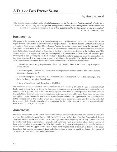
A Tale of Two Eocene Sands - San Joaquin Valley Geology
A Tale of Two Eocene Sands - San Joaquin Valley Geology
A Tale of Two Eocene Sands - San Joaquin Valley Geology

Create successful ePaper yourself
Turn your PDF publications into a flip-book with our unique Google optimized e-Paper software.
A TALE OF <strong>Two</strong> EOCENE SANDS<br />
by Henry Walrond<br />
"The hypothesis <strong>of</strong> cumulative right-lateral displacement on the <strong>San</strong> Andreas Fault <strong>of</strong> hundreds <strong>of</strong> miles since<br />
Jurassic has received very wide acceptance among earth scientists, even to the point <strong>of</strong> incorporation into<br />
a number <strong>of</strong> leading textbooks, as more-or-Iess qualified fact for the instruction <strong>of</strong> young geologists"<br />
- Gordon Oakeshott, 1965<br />
INTRODUCTION<br />
This paper is the result <strong>of</strong> a study <strong>of</strong> the relationship and possible source connection between two <strong>of</strong> the<br />
largest <strong>Eocene</strong> sand bodies in the southern <strong>San</strong> <strong>Joaquin</strong> basin - the Lower <strong>Eocene</strong> CantuaiGatchellIYokut<br />
series <strong>of</strong> the Coalinga area and the Upper <strong>Eocene</strong> Point <strong>of</strong> Rocks that extends south along the west side <strong>of</strong> the<br />
basin from Pyramid Hills to Elk Hills. It seemed to be more than coincidence that Point <strong>of</strong> Rocks deposition<br />
started almost immediately after the deposition <strong>of</strong> the Lower <strong>Eocene</strong> sands stopped in the Coalinga area. This<br />
curious sequence or apparent transfer <strong>of</strong> sand deposition from one area to the other (north to south, pre<br />
Domengine to post-Domenginel, without overlap <strong>of</strong> deposition in time, suggested a genetic connection. As<br />
this study developed, it became apparent that, in addition to the possible "<strong>Two</strong> <strong><strong>San</strong>ds</strong>" relationship, other<br />
associated sedimentary events in the basin remain controversial or as <strong>of</strong> yet unexplained:<br />
1. In addition to the intriguing sequence <strong>of</strong> the "<strong>Two</strong> <strong><strong>San</strong>ds</strong>", there is the question regarding their<br />
source terrains.<br />
2. What instigated, and what was the source and depositional environment <strong>of</strong>, the Middle <strong>Eocene</strong><br />
Domengine transgression?<br />
3. What best explains the unusual shallow/bathyl-water relationship between the Domengine and<br />
the immediately overlying Kreyenhagen?<br />
4. Why is there <strong>Eocene</strong> salt deposition at Elk Hills?<br />
This report ties the Lower <strong>Eocene</strong> Cantua/GatchellIYokut <strong>of</strong> the Coalinga area and the Upper <strong>Eocene</strong> Point <strong>of</strong><br />
Rocks located along the west side <strong>of</strong> the basin to a common westerly marine basin (La Honda) and source<br />
terrain (Gabilan granites), and at the same time it explains the transfer <strong>of</strong> sand deposition from north to south<br />
(Lower to Upper <strong>Eocene</strong>). A scenario is also <strong>of</strong>fered for the dramatic and widespread Domengine transgression<br />
that rapidly covered most <strong>of</strong> the southern <strong>San</strong> <strong>Joaquin</strong> basin to usher in the Upper <strong>Eocene</strong>, and how this relates<br />
to the juxtaposition <strong>of</strong> the shallow-water basal transgressive Domengine sand and the overlying bathyl<br />
Kreyenhagen shale. Finally, an explanation is proposed for the pre-Domengine salt section penetrated at Elk<br />
Hills in Sec.25, 1.30S, R.23E (Figure1).<br />
ANTECEDENTS<br />
Much has been written on the Lower <strong>Eocene</strong> sands in the CoalingaNaliecitos area, and whether their source<br />
was east (Sierran) (Graham and Berry, 1980; Ryall, 1974) or west (Salinian) <strong>of</strong> the <strong>San</strong> Andreas Fault System<br />
(hereafter SAFS) (Dibblee and Nilsen, 1974). Although views differ regarding the locality, a Salinian source<br />
for the Point <strong>of</strong> Rocks is generally accepted. In both instances, most investigators adhere to the concept <strong>of</strong><br />
large, right lateral movement on the SAFSfor their match-ups. Both the Coalinga Lower <strong>Eocene</strong> (for a western<br />
source proposal) and the Upper <strong>Eocene</strong> Point <strong>of</strong> Rocks sands require <strong>of</strong>fsets <strong>of</strong> as much as 200 mi. In this paper<br />
I conclude that, despite considerable fault and other tectonic activity, no significant lateral <strong>of</strong>fset occurred<br />
on the <strong>San</strong> Andreas Fault since early <strong>Eocene</strong> time.<br />
52<br />
I
Henry Walrond<br />
lA t1OPtOA<br />
(SANTA CRUl) :'>tlAS1H<br />
SANTA CRUZ-<br />
f<br />
N<br />
I 12 MILES<br />
I-------l<br />
Rgure 1<br />
INDEX MAP<br />
6 EOCENE OUTCROPS<br />
lEI BASEMENT mops<br />
Dashed Areas Show Depositional Umlts d <strong><strong>San</strong>ds</strong><br />
Figure 1. Map showing Lower and Upper <strong>Eocene</strong> sand distribution, outcrops, and subsurface limits <strong>of</strong><br />
deposition. In the La Honda basin a full and uninterrupted sequence <strong>of</strong> <strong>Eocene</strong> is present.<br />
\<br />
53
~~<br />
8-4<br />
UJ<br />
B-3<br />
54<br />
The <strong><strong>San</strong>ds</strong> (Figure 2; all paleontological designations are from Laiming, 1940)<br />
SAN JOAQUIN BASIN<br />
COALINGA AREA<br />
Lower <strong>Eocene</strong><br />
Cantua - "C" Zone<br />
Gatchell & lower McAdams - "B-2 to B-4" Zone<br />
Yokut, upper McAdams & Loescher - "B-1" Zone<br />
A <strong>Tale</strong> <strong>of</strong> <strong>Two</strong> <strong>Eocene</strong> <strong><strong>San</strong>ds</strong><br />
The Gatchell and lower McAdams are probably a more distal or basin facies <strong>of</strong> the "upper" Cantua <strong>of</strong> the<br />
Vallecitos channel.<br />
Middle <strong>Eocene</strong><br />
Domengine, Avenal & Mabury-Basal Kreyenhagen - "A-2/B-1" Zone<br />
The Domengine and the time-equivalent Mabury and Avenal sands are the basal transgressive members <strong>of</strong><br />
the Kreyenhagen formation. Although the Domengine is usually referred to as a sand, it is in most areas a<br />
thin, reworked unit that cannibalized underlying, transgressed sediments (i.e., where overlying the Yokut<br />
sand, it is a sand; farther to the east where it overlies the Paleocene siltstone, it is a grit).<br />
PYRAMID HILLS-ELK HILLS AREA<br />
Upper <strong>Eocene</strong><br />
Point <strong>of</strong> Rocks sand - A deepwater turbidite fan<br />
A facies <strong>of</strong> the Kreyenhagen shale formation - "A-1 and A-2" Zone.<br />
LA HONDA (<strong>San</strong>ta Cruz) BASIN<br />
Lower to Lower Upper <strong>Eocene</strong><br />
Butano sand - A deepwater turbidite fan - "C-1 to A-2" Zones.<br />
A-J<br />
DOMENGINE VARIOUS<br />
(SANTAElKHJLlS CRUZ) PVRAM1D- LABUTANO SAN<br />
HONDA SAND GATOiEU CAIffiJA SHALE<br />
JOAQUlN BASIN<br />
SAN lORENZO IH ~'~NnN.·. ~N~N~~~~ VAlLEaTOS (U, McADams/l_l<br />
YOKUTSAND<br />
llASlNAREAlAIMJNG<br />
(Maybury<br />
I
Henry Walrond<br />
BASIC GENERAL ASSUMPTIONS<br />
1. During <strong>Eocene</strong> time, the southern Sierra Nevada area was structurally positive, but not with sufficient<br />
rei ief to contribute significant sand to the subject areas. Exceptions, but not necessari Iy related depositionally,<br />
are the pre-Domengine Mushrush and the Kreyenhagen-equivalent Famoso sands, both <strong>of</strong> whose sources were<br />
in the southern Sierra Nevada area. These sands appear to be restricted to the southeast flank <strong>of</strong> the <strong>San</strong><br />
joaquin basin (the Famoso more widespread than the Mushrush), and they are only time related to the sands<br />
under discussion. This is also the case <strong>of</strong> the Upper <strong>Eocene</strong> sands <strong>of</strong> the Tejon area.<br />
[An aside: Fossiliferous beds in the thick, mostly nonmarine Goler Formation, located east <strong>of</strong> the southern<br />
Sierra Nevada in the EI Paso Mountains north <strong>of</strong> the Garlock fault, reportedly represent an early <strong>Eocene</strong><br />
marine transgression. If, as has been proposed, both the Mushrush (Reid, 1988) and the Goler (Cox, 1987)<br />
sands are pre-Domengine, they may be depositionally related, and the Tehachapi <strong>Valley</strong> and Sierra Tejoncrest<br />
wind gap (aligned with and located just east <strong>of</strong> the Tehachapi <strong>Valley</strong>) could be the successive uplifted,<br />
erosional remnants <strong>of</strong> a trans-Sierra seaway that connected those two deposits during early <strong>Eocene</strong> time.]<br />
2. The SAFS, a pre-Tertiary, tectonically active and mobile trend, has played a duel role. It has strongly<br />
influenced erosional patterns (as well illustrated by current topography), deposition, and the alignment <strong>of</strong><br />
basins. On the other hand, because <strong>of</strong> constant structural activity (especially pronounced on the easterly,<br />
plastic Franciscan-Cretaceous side <strong>of</strong> the fault), outcrop evidence <strong>of</strong> much <strong>of</strong> the Tertiary and especially the<br />
<strong>Eocene</strong> depositional history has been removed through long stretches <strong>of</strong> the fault. You might say that the <strong>San</strong><br />
Andreas "giveth" and the <strong>San</strong> Andreas "taketh" away.<br />
3. The main source for all <strong>of</strong> the subject <strong>Eocene</strong> sands, including the Butano <strong>of</strong> the La Honda basin, was the<br />
Gabilan granitic basement (Figure 3). It is partially exposed today, but in the past it extended from as far north<br />
as Ben Lomand on the southwest flank <strong>of</strong> the La Honda basin to as far south as the La Panza basement<br />
outcrops southeast <strong>of</strong> Paso Robles.<br />
4. The Vallecitos syncline, a relict <strong>of</strong> a northwesterly trending down warp was, via the La Honda basin, the I<br />
Lower <strong>Eocene</strong> connection between the southern <strong>San</strong> joaquin basin and the Pacific Ocean.<br />
THE PROPOSAL<br />
At the beginning <strong>of</strong> <strong>Eocene</strong> time, granitic sands from the eroding Gabilan were carried into a northerly<br />
flowing SAFS-dominated drainage system (called the <strong>San</strong> Andreas river in this paper) and discharged sand<br />
into the La Honda-Vallecitos seaway. This constricted seaway had, because <strong>of</strong> a combination <strong>of</strong> subsidence,<br />
consequent basin expansion and evaporation, a net southeasterly flow that transported the first <strong>Eocene</strong> sands<br />
into the <strong>San</strong>joaquin basin. Although the initial incursion was aerially limited, over 3000 ft <strong>of</strong> what is customarily<br />
called Cantua sand (the upper part is probably Gatchell equivalent; Ryall, 1974) accumulated in the restricted<br />
low near the mouth <strong>of</strong> the Vallecitos trough before minor amounts <strong>of</strong> sand spilled farther southeast into the<br />
<strong>San</strong> joaquin basin (Figure 3).<br />
Following the initial somewhat restricted accumulation <strong>of</strong> the "lower" Cantua sequence <strong>of</strong> the Vallecitos,<br />
coarse granitic sediments, now with the inclusion <strong>of</strong> some reworked Cretaceous (Regan, 1943), continued to<br />
pour into the channel throughout "upper" Cantua (Gatchell) time; and from there into the basin proper,<br />
forming the more widespread, north-south-trending Gatchell bar or spit. Like the Cantua, the bar reached its<br />
maximum thickness <strong>of</strong> 900 ft in or near the mouth <strong>of</strong> the channel (Figure 4).<br />
Next, with contributions now from both the Cretaceous and Franciscan, the granitic sands continued to feed<br />
the basin via a shallower Vallecitos channel throughout Yokut time. This formed a more sheetlike deltaic<br />
deposit with an isopach pattern in the north <strong>of</strong> several northwest-southeast-trending barl ike bui Idups (Figure 5).<br />
Like both the Cantua and Gatchell sands, the Yokut's thickest development <strong>of</strong> 600 ft occurs at the mouth <strong>of</strong><br />
the Vallecitos Channel. It is worth noting that all <strong>of</strong> the sands tended to trail <strong>of</strong>f to the south, suggesting a<br />
basinal low in that direction.<br />
Then, representing a momentous occurrence in California's geologic history, the easterly flow carrying the<br />
coarse Gabilan-sourced clastics suddenly ceased, marking the end <strong>of</strong> Lower <strong>Eocene</strong> sand deposition in this<br />
55
56 A <strong>Tale</strong> <strong>of</strong> <strong>Two</strong> <strong>Eocene</strong> <strong><strong>San</strong>ds</strong><br />
part <strong>of</strong> the basin. Uplift along the SAFStrend, an event telegraphed by the introduction <strong>of</strong> reworked Cretaceous<br />
and Franciscan clasts along with the sequential shallowing <strong>of</strong> the channel deposits throughout lower <strong>Eocene</strong><br />
time, effectively severed the La Honda-Vallecitos connection. Subsidence in the southern <strong>San</strong> <strong>Joaquin</strong> basin<br />
probably continued during this time.<br />
Little if any <strong>of</strong> sand entered the Coalinga area from either west or east after Yokut time. This is a key to the<br />
assumption (yet to be discussed) that the Sierra Nevada was not a likely source for most <strong>of</strong> the lower <strong>Eocene</strong><br />
sands. Events along, or related to, the much more active, plastic and mobile <strong>San</strong> Andreas trend, rather than<br />
the more stable Sierran massif, most likely accounted for the temporary interruption and eventual diversion <strong>of</strong><br />
marine flow and sedimentation.<br />
How long the <strong>San</strong> <strong>Joaquin</strong> basin was isolated from a marine source is conjectural; but it was long enough for<br />
evaporation to deplete and concentrate the remaining water in a low area to the south. The concentration <strong>of</strong><br />
FIgure 3<br />
LOWER EOCENE<br />
CANTUA SAND DISTRIBUTION<br />
o<br />
COAUNGII<br />
~.';~;'1 EOCENE OUTCROPS<br />
!:"y',V..I GRANITIC BASEMENT OUTCROPS<br />
\<br />
/<br />
o<br />
8U1'TOWWlLlO1<br />
Figure 3. Map showing the Gabilan granitic sand source, the proposed southerly flowing Early <strong>Eocene</strong><br />
La Honda-Vallecitos seaway, and the Cantua sand depositional limits in the <strong>San</strong> <strong>Joaquin</strong> basin.<br />
o
Henry Walrond 57<br />
highly saline water in the southern end <strong>of</strong> the basin would explain the precipitation <strong>of</strong> as much as 800 ft <strong>of</strong><br />
pre-Domengine salt in the Elk Hills area (Fishburn, 1990). Following the accumulation <strong>of</strong> hundreds <strong>of</strong> feet <strong>of</strong><br />
salt, the formerly inland sea became essentially a dry valley.<br />
[An aside: The concept <strong>of</strong> a dry subsea basin during mid-<strong>Eocene</strong> in the southern <strong>San</strong> <strong>Joaquin</strong> is likely<br />
incomprehensible to most California geologists. However, comparable feelings probably prevailed before it<br />
was confirmed that the Mediterranean had been a dry subsea basin five million years prior to the massive<br />
Atlantic Ocean breakthrough at Gibraltar. And, <strong>of</strong> course, California's own Salton Sea basin was once dry,<br />
and 297 ft below sea level.]<br />
The next event, in Middle <strong>Eocene</strong> or early in Upper <strong>Eocene</strong> time, was a marine breakthrough into the <strong>San</strong><br />
<strong>Joaquin</strong> <strong>Valley</strong> from the Pacific, extending southerly through the La Honda basin. This time the breakthrough<br />
was guided by the previously eroded <strong>San</strong>Andreas river valley (channel piracy). This initial flood, the Domengine<br />
Figure 4<br />
LOWER EOCENE<br />
GATCHELL SAND DISTRIBUTION<br />
""i),;
58 A <strong>Tale</strong> <strong>of</strong> <strong>Two</strong> <strong>Eocene</strong> <strong><strong>San</strong>ds</strong><br />
transgression, advanced rapidly over the dry and deep <strong>San</strong> <strong>Joaquin</strong> basin. With a then-unlimited supply <strong>of</strong><br />
water, the valley quickly filled to sea level establishing the deepwater marine environment associated with<br />
Kreyenhagen shale deposition that covered most <strong>of</strong> the basin. Meanwhile, the time-equivalent Point <strong>of</strong> Rocks<br />
sands, derived from the greater Gabi Ian and fed through the mouth <strong>of</strong> the new SAFSseaway, accumulated on<br />
the shallow westerly shore <strong>of</strong> the basin and, as a consequence <strong>of</strong> overloading and wave action, were redeposited<br />
as a turbidite fan into the deep westerly portion <strong>of</strong> the basin (Figure 6).<br />
As previously mentioned, the Famoso sand was being deposited concurrently with the Point <strong>of</strong> Rocks on the<br />
southeast flank <strong>of</strong> the basin. However, there is little evidence, based on the thick blanket <strong>of</strong> Kreyenhagen<br />
shale covering the area farther north, to suggest any significant coeval contribution <strong>of</strong> Sierran sand to the<br />
basin deep other than that expected from shoreline erosion.<br />
Figure 5<br />
LOWER EOCENE<br />
YOKUT SAND DISTRIBUTION<br />
r:,.'}:~ EOCENE OUTCROPS<br />
1;.T;'..4 GRANITIC BASEMENT OUTCROPS<br />
Figure 5. Map showing the Gabilan granitic sand source, the proposed southerly flowing Early <strong>Eocene</strong><br />
La Honda-Vallecitos seaway, and the subsurface depositional limits <strong>of</strong>Yokut-Upper McAdams sands<br />
in the <strong>San</strong> <strong>Joaquin</strong> basin.
Henry Walrond 59<br />
In the Vallecitos area, there was a renewed <strong>Eocene</strong> presence; only this time the marine advance was from the<br />
east or expanding inland sea, and the only new sand was the Domengine reworked from the Yokut during the<br />
transgression. Kreyenhagen shale was deposited during the remainder <strong>of</strong> the Late <strong>Eocene</strong>.<br />
The seemingly paradoxical juxtaposition <strong>of</strong> shallow-water Domengine sands in direct depositional contact<br />
with the overlying bathyl Kreyenhagen shale is now easily explained as the result <strong>of</strong> a massive, pervading<br />
marine transgression over the dry and deep, subsea valley followed quickly by the resumption <strong>of</strong> deepwater<br />
deposition as the basin regained sea level.<br />
iN<br />
I<br />
Figure 6<br />
UPPER EOCENE<br />
Point <strong>of</strong> Rocks <strong>San</strong>d Distribution Showing Proposed Upper <strong>Eocene</strong><br />
<strong>San</strong> Andreas Channel Connection with the Pacific via the La"Honda Basin<br />
h;:~')'fl EOCENEOUTCROPS<br />
CJ GRANITIC BASEMENT OUTCROPS<br />
Figure 6. Map showing location <strong>of</strong> the deepwater Upper <strong>Eocene</strong> Point <strong>of</strong> Rocks turbidite fan and its proposed<br />
seaway connection bordering the Gabilan source area, where it extends south along the <strong>San</strong> Andreas fault<br />
trend from the La Honda basin.<br />
o<br />
DELAIIO<br />
/lA,
60<br />
DISCUSSION<br />
Vallecitos-Coalinga Area: Lower <strong>Eocene</strong> <strong>San</strong>d Source<br />
------- -<br />
A <strong>Tale</strong> <strong>of</strong> <strong>Two</strong> <strong>Eocene</strong> <strong><strong>San</strong>ds</strong><br />
Current proposals for the origin <strong>of</strong> the Lower <strong>Eocene</strong> sands near Coalinga include a Sierran source to the east<br />
(Graham and Berry, 1980; Ryall, 1974) and a western or Salinian connection across the <strong>San</strong> Andreas Fault<br />
(Regan, 1943; Dibblee and Nilsen, 1974).<br />
Westerly Connection<br />
Consistent with prevailing opinions, most Salinian or western source proponents call on considerable rightlateral<br />
<strong>of</strong>fset (up to 200 mil on the SAFS. This requires a depositional connection between the Cantua/<br />
Gatchell and the German Rancho sands outcropping on the coast north <strong>of</strong> <strong>San</strong> Francisco, west <strong>of</strong> the SAFS.<br />
Although the German Rancho and Cantua sands are apparently the same age, their lithologies are mismatched.<br />
Despite this, a large right-lateral Lower <strong>Eocene</strong> displacement is proposed, in part to be in harmony with<br />
"previously determined <strong>of</strong>fsets" <strong>of</strong> younger and older strata (Dibblee and Nilsen, 1974).<br />
Easterly Connection<br />
A Sierran source via a submarine canyon is another postulate for the lower <strong>Eocene</strong> Cantua/Gatchell sands <strong>of</strong><br />
the Coalinga-Vallecitos area (the Yokut, for some reason, is left out). This is supported by a good compositional<br />
match between source and sand (Graham and Berry, 1980). The match does not clearly extend into the<br />
overlying shallower Gatchell, however, which consists <strong>of</strong> considerable reworked Cretaceous, nor the very<br />
shallow-water Yokut sands, which contain Franciscan-derived andalucite (Regan, 1943). In addition to the<br />
above compositional discrepancies, further examination <strong>of</strong> the individual sand bodies raises other concerns.<br />
First it must be pointed out that 3,000 ft or more <strong>of</strong> what is called "Cantua" in the Vallecitos syncline by most<br />
workers is not a uniform sand as to age or mode <strong>of</strong> deposition. Phill Ryall in his 1974 paper pointed out that<br />
the "lower" Cantua contained bathyl C-zone fauna associated with gravity-turbidite structures; while the<br />
"upper" Cantua sands were deposited in a different or shallow-water environment characterized by B-zone or<br />
Gatchell-age fauna (the channel source <strong>of</strong> the Gatchell bar).<br />
"Lower" Cantua<br />
For the deepwater "lower" Cantua channel/turbidite sands, the Sierran lithologic match is not questioned.<br />
However, embracing the complete eastern scenario for this deposit requires the acceptance <strong>of</strong> these sands<br />
being transported from a Sierran shelf across the basin by turbidity currents and then, not only being restricted<br />
to, but reaching a maximum thickness in and near the mouth <strong>of</strong> the Vallecitos. This proposal also has to adjust<br />
to the possibility that the Cantua sands extend as a channel 50 mi to the northwest where outcropping "("zone<br />
sands line up with the Vallecitos syncline just south <strong>of</strong> Hollister (Wilson, 1943).<br />
"Upper" Cantua-Gatchell<br />
In his aforementioned 1974 report, Ryall also presented a correlation section that shows the merging or<br />
connection (time equivalency) between the "upper" Cantua in the throat <strong>of</strong> the Vallecitos channel and the<br />
Gatchell <strong>of</strong> the East Coalinga Extension oil field. This correlation is a clear indication that the Gatchell is an<br />
<strong>of</strong>fshore barlike feature equivalent to, and derived from, the "upper" and shallower Cantua channel sands <strong>of</strong><br />
the Vallecitos to the west.<br />
Gatchell<br />
The Gatchell and the Cantua sands, although deposited in different environments, are usually grouped together<br />
in most reports. Although opinions <strong>of</strong>ten differ as to their relationship, there is a good reason for this because<br />
they are almost indisputably connected as revealed in the Ryall (1974) section. The controversy hinges on the<br />
nature <strong>of</strong> the connection. Recent evidence from exploratory drilling suggests a possible easterly source for<br />
some <strong>of</strong> the Gatchell sands. However, the Gatchell, unlike the Cantua, is not a turbidite. For this reason it is<br />
difficult to justify that gravity transportation led to the development <strong>of</strong> the main sand body or bar that is
Henry Walrond 61<br />
thickest and best developed on the western side <strong>of</strong> the basin just <strong>of</strong>f the mouth <strong>of</strong> the Vallecitos channel. Also,<br />
a predominantly eastern source doesn't account for the presence <strong>of</strong> recycled Cretaceous, and finally doesn't<br />
enlighten the close (merging) relationship between the Cantua and Gatchell demonstrated by the Ryall<br />
(1974) section.<br />
Yokut<br />
Although the sequential and general paleographical relationship <strong>of</strong> the three lower <strong>Eocene</strong> formations suggests<br />
a close genealogical relationship, the Yokut, for some reason, is not included in the Sierran proposal. Because<br />
it is most likely connected to a western source, this necessitates a sudden source shift from east to west just<br />
before Yokut time - a complication that does nothing to solidify the overall Sierran proposal.<br />
There is little direct or residual evidence <strong>of</strong> significant sand being derived from the east throughout all <strong>of</strong> the<br />
<strong>Eocene</strong> time, except for the aforementioned Mushrush and Famoso shelf-fringe sands. This is particularly true<br />
<strong>of</strong> the Kreyenhagen farther north in the latitude <strong>of</strong> Coalinga and Vallecitos, where it shows no sign <strong>of</strong> a major<br />
sand infusion from any direction except for minor amounts associated with shoreline erosion near the Sierra.<br />
The absence <strong>of</strong> Upper <strong>Eocene</strong> Kreyenhagen sand in the area is particularly significant because it is difficult<br />
to imagine the Sierra area debauching the great accumulation <strong>of</strong> sand through early <strong>Eocene</strong> time (that<br />
happens to be thickest in and at the mouth <strong>of</strong> the Vallecitos) and suddenly stopping in the Middle <strong>Eocene</strong>,<br />
coincident with the apparent marine cut-<strong>of</strong>f that occurred prior to the Domengine transgression.<br />
And finally, even if the Sierra Nevada provenance was the source <strong>of</strong> these older turbidite-channel sands,<br />
there is still a need for a connection between the ocean and the basin in Early <strong>Eocene</strong> time. So, if the<br />
"required" 200 mi <strong>of</strong>fset along the <strong>San</strong> Andreas is accepted, it still requires connecting the <strong>San</strong> <strong>Joaquin</strong> basin<br />
(through the Vallecitos?) with the German Rancho submarine fan area, exposed on the coast to the north for<br />
the marine avenue. Also, to bring this proposal to a conclusion, it is necessary to either disregard the discrepancy<br />
<strong>of</strong> different compositions or assume there was no depositional interchange across the fault. Therefore, advocating<br />
an easterly sand source does not eliminate the need for a western cross-fault marine connection. It merely<br />
skirts the problem <strong>of</strong> a Coalinga-German Rancho lithologic mismatch, leaving several annoying details<br />
regarding all three formations.<br />
Contrast the above-stated problems and omissions associated with both the eastern and the large <strong>of</strong>fset<br />
western source proposals with the harmonious combination <strong>of</strong> data supporting the La Honda-Vallecitos<br />
connection:<br />
1. A close and dominant granitic source extending for miles just west <strong>of</strong> the SAFS and the Vallecitos<br />
seaway was exposed throughout the <strong>Eocene</strong>.<br />
2. <strong>Eocene</strong> outcrops on both sides <strong>of</strong> the SAFS - from the La Honda-Palo Alto area, continuing<br />
southeast both above and below the town <strong>of</strong> Hollister, and then extending smoothly into the Vallecitos<br />
- make a compelling picture for a graceful, laterally unfaulted early <strong>Eocene</strong>-Vallecitos seaway<br />
connecting the <strong>San</strong> <strong>Joaquin</strong> basin with the Pacific.<br />
3. Both the ages and lithologies <strong>of</strong> the lower Butano and Coalinga sands are a good match.<br />
4. The depositional patterns and thicknesses <strong>of</strong> all the Coalinga sands not only show a strong genetic<br />
connection to each other and a Vallecitos source, but they also are consistent with the expected<br />
sequence <strong>of</strong> sediments discharged from a channel into a basin.<br />
The "Cut-<strong>of</strong>f"<br />
The next event in the proposed sequence is the sudden severing <strong>of</strong> the marine seaway at the end <strong>of</strong> early<br />
<strong>Eocene</strong> time. The critical activity and locality that seems most reasonable for the mid-<strong>Eocene</strong> "cut-<strong>of</strong>f" is tied<br />
to the Hollister area, where the Vallecitos channel appears to have narrowed as it bordered or straddled the<br />
SAFSfor about 15 mi before it connected with the La Honda basin to the west. The disruption could have been<br />
caused by a combination <strong>of</strong> emergence, faulting, and/or uplift on the easterly flank <strong>of</strong> the Vallecitos channel<br />
(effectively shifting the channel axis to the west), or possibly by the major drop in sea level reported for the<br />
end <strong>of</strong> early <strong>Eocene</strong> time (Haq and others, 1987).
62 A <strong>Tale</strong> <strong>of</strong> <strong>Two</strong> <strong>Eocene</strong> <strong><strong>San</strong>ds</strong><br />
It is reasonable to assume that, after the Vallecitos "cut <strong>of</strong>f", the Pacific Ocean was isolated from the <strong>San</strong><br />
joaquin basin for some time, leading to the aforementioned evaporation and subsequent depositional events.<br />
Regardless <strong>of</strong> the amount <strong>of</strong> time, somehow and in some way, the <strong>San</strong> joaquin marine connection was<br />
resumed in the middle <strong>of</strong> the <strong>Eocene</strong> starting with the Domengine transgression.<br />
Renewal<br />
Any combination <strong>of</strong> structural-stratigraphic events, including subsidence or rise in sea level, could have<br />
facilitated the eventual westerly seaway transfer from the uplifted head <strong>of</strong> the Vallecitos to a lower <strong>San</strong><br />
Andreas river channel. Add to this a probable regional tilt to the south, and there is a reasonable scenario for<br />
the southerly breakthrough, the follow-up channelizing <strong>of</strong> the antecedent <strong>San</strong> Andreas river valley, and the<br />
new Pacific Ocean-<strong>San</strong> joaquin basin connection, still via the La Honda basin.<br />
Probably the most difficult link in this proposed sequence <strong>of</strong> events is current evidence for the SAFS-controlled<br />
marine channel that guided the resurgent Middle <strong>Eocene</strong> breakthrough. Figure 3 shows the proposed route,<br />
which essentially conforms with the trend <strong>of</strong> the current trace <strong>of</strong> the SAFS. As previously mentioned, two <strong>of</strong><br />
the characteristics <strong>of</strong> the fault trend are its susceptibility to erosion as well as the high degree <strong>of</strong> associated<br />
structural activity and consequent removal <strong>of</strong> depositional evidence through time. For these reasons, the <strong>San</strong><br />
Andreas channel concept may seem a bit convenient, or low on evidence and high on speculation. However,<br />
considering the observable erosional and basinal alignments associated with the fault trend throughout the<br />
Tertiary, including the current landscape <strong>of</strong> the Central Coast, the concept is not unusual nor without precedent.<br />
The SAFS is associated with or has controlled:<br />
1. The current topography through the central portion <strong>of</strong> Central California. A modest rise in sea level<br />
(or subsidence) would effectively result in about a 1OO-mi-long marine arm extending from the <strong>San</strong><br />
Francisco Bay to south <strong>of</strong> Holl ister. A companion arm to the west would cover an equal distance<br />
southeast from Monterey Bay to the Cholame <strong>Valley</strong> on the SAF.<br />
2. Structural restoration <strong>of</strong> the Salinas <strong>Valley</strong> to PIio-Pleistocene time by removing the easterly upl ift<br />
<strong>of</strong> the Gabilan Mesa. This demonstrates that much <strong>of</strong> the Salinas River system flowed south and then<br />
east to join the SAFS in the vicinity <strong>of</strong> the Cholame <strong>Valley</strong>, where it then followed the northwesterly<br />
course <strong>of</strong> the fault to the Hollister area (Baldwin, 1963). Figure 7 shows the still-visible erosional<br />
course <strong>of</strong> this north-flowing Early Pleistocene segment that closely matches the same course as the<br />
postulated <strong>San</strong> Andreas channel, from Cholame to Hollister.<br />
3. The Waltham Canyon trough (the marine Pliocene connection to the <strong>San</strong> joaquin basin). With a<br />
strikingly similar configuration to the proposed channel, the trough follows the fault more than 60 mi<br />
through a portion <strong>of</strong> the same area (Figure 8) (Allen, 1946).<br />
4. The northern extension <strong>of</strong> the Upper Miocene (Bitterwater) basin deep, which straddles the fault in<br />
the same vicinity (Figure 9).<br />
5. The presence <strong>of</strong> a few hundred feet <strong>of</strong> Domengine strata penetrated in the Sunnyvale Rudolph #1<br />
well (SecA, 1.18S, R.9E) in the Bitterwater area. Although small in area, these strata have important<br />
implications in the reconstruction <strong>of</strong> Middle and Upper <strong>Eocene</strong> history because they are located<br />
within, and are supportive <strong>of</strong>, a postulated Middle <strong>Eocene</strong> channel freeway.<br />
The above examples clearly illustrate the control the SAFS had over not only erosion but, also the alignment<br />
and timing <strong>of</strong> depositional events. Regardless <strong>of</strong> specifics concerning the exact cause and course <strong>of</strong> the<br />
eventual connection, the proposed <strong>San</strong> Andreas drainage system was in place and waiting for the breakthrough<br />
to guide the subsequent Upper <strong>Eocene</strong> marine invasion into the southern <strong>San</strong> joaquin basin.<br />
The La Honda-Point <strong>of</strong> Rocks Connection<br />
The prevailing view for the Point <strong>of</strong> Rocks source terrain is essentially the greater Gabilan. This view, however,<br />
requires reconstruction <strong>of</strong> the Late <strong>Eocene</strong> paleogeology placing the La Honda basin opposite the Point <strong>of</strong><br />
Rocks-Kreyenhagen deposits - in effect assuming that these two basins now separated by 180 mi were<br />
cogenetic or cojoined as one basin in the Late <strong>Eocene</strong> (Clarke, 1973).
Henry Walrond 63<br />
Agure7<br />
EARLY PlEISTOCENE<br />
Course <strong>of</strong> the Salinas River Matches aosely the Proposed Early <strong>Eocene</strong> River (Rgure 3)<br />
Figure 7. Maps showing similarities <strong>of</strong> the proposed Early <strong>Eocene</strong> <strong>San</strong> Andreas fault-controlled drainage (top)<br />
and the Early Pleistocene <strong>San</strong> Andreas-defined Salinas river (bottom) - evidence <strong>of</strong> historical precedent for<br />
the proposed concept.
64 A <strong>Tale</strong> <strong>of</strong> <strong>Two</strong> <strong>Eocene</strong> <strong><strong>San</strong>ds</strong><br />
\ \.<br />
t<br />
• t<br />
'*<br />
tr""SANh"~<br />
J: BE/!lrtO ;l;><br />
~WALTHAI4'<br />
,~ C,I,/!lYQN<br />
. ;PUOCENE .<br />
~ TROUGH:<br />
-•• '''''.~'''.\'dO'~<br />
'Agure8<br />
iII<br />
I<br />
o<br />
p.so flOIll.llS<br />
"<br />
\ "<br />
\ "<br />
\ \ \<br />
\ \<br />
I \<br />
I \<br />
, \<br />
A> •<br />
1'& "<br />
")
Henry Walrond 65<br />
A La Honda-Point <strong>of</strong> Rocks connection is widely accepted; only the nature <strong>of</strong> the connection is disputed (i.e.,<br />
areal juxtaposition versus the seaway proposed in this paper). The juxtaposed or one-basin proposal raises<br />
several concerns. The upper <strong>Eocene</strong> Butano and Point <strong>of</strong> Rocks <strong>of</strong> the two basins correlate lithologically; but<br />
there is weak or controversial evidence <strong>of</strong> any Lower <strong>Eocene</strong> Butano in the Upper <strong>Eocene</strong> Point <strong>of</strong> Rocks<br />
depocenter (Almgren and others, 1988). Furthermore, it has not been made clear where, if not the Point <strong>of</strong><br />
Rocks area, an easterly equivalent <strong>of</strong> the Lower <strong>Eocene</strong> portion <strong>of</strong> the Butan? sand might be located.<br />
The juxtaposed or one-basin scenario should not only have a good lithologic and common source correlation,<br />
but also a similarity <strong>of</strong>, or shared, structural-stratigraphic activity. In this regard, there seems to be no crossfault<br />
tie <strong>of</strong> the Domengine between the now-severed basins. East <strong>of</strong> the fault, the basin-wide Domengine<br />
unconformity represents one <strong>of</strong> the more dramatic events in California's geologic history. However, in the La<br />
Honda basin, or proposed western portion <strong>of</strong> the <strong>San</strong><strong>Joaquin</strong> basin, deposition throughout the <strong>Eocene</strong> appears<br />
to have been uninterrupted (Cummings and others, 1962). In other words, neither the Domengine unconformity<br />
nor the Lower <strong>Eocene</strong> Butano sands have cross-fault ties that fit the 180-mi-displacement required in the onebasin<br />
proposal.<br />
Another discrepancy, or omission from most current reports, regards early and upper <strong>Eocene</strong> orphan outcrops<br />
located on the east side <strong>of</strong> the SAFS,just west <strong>of</strong> Stanford University. The age and lithology <strong>of</strong> these exposures<br />
HOlllSTEIl<br />
t<br />
N<br />
I<br />
o<br />
PASOI\08~ES<br />
Rgure9<br />
UPPER MIOCENE BASIN<br />
NOR~ EXTENSION<br />
run AKTlCLIftE<br />
Figure 9. Map showing the axis <strong>of</strong> the Late Miocene Bitterwater basin and the bisecting <strong>San</strong> Andreas<br />
fault - more evidence <strong>of</strong> the pr<strong>of</strong>ound and continuing relationship between the fault and deposition.<br />
Note that no lateral <strong>of</strong>fset <strong>of</strong> the basin is indicated.<br />
o
66 A <strong>Tale</strong> <strong>of</strong> <strong>Two</strong> <strong>Eocene</strong> <strong><strong>San</strong>ds</strong><br />
match those <strong>of</strong> the Butano directly across the fault (Dibblee, 1966; Page and Tabor, 1967; Gilbert, 1943;<br />
Mclaughlin and others, 2001); but the sands do not compare very well lithologically with the proposed<br />
German Rancho connection 200 mi to the north.<br />
The cross-fault Lower <strong>Eocene</strong> age discrepancy, the absence <strong>of</strong> a Middle <strong>Eocene</strong> Domengine unconformity in<br />
the La Honda basin, and the unexplained orphaned outcrops all represent problems associated with the.large<br />
lateral displacement proposal. These problems are all neatly resolved by embracing the existence <strong>of</strong> a Gabilansourced<br />
La Honda-Vallecitos-Coalinga seaway during the Early <strong>Eocene</strong>, followed by the renewed, rerouted<br />
southern La Honda-"<strong>San</strong> Andreas" seaway that was the marine conduit for the Middle <strong>Eocene</strong> Domengine<br />
and the Upper <strong>Eocene</strong> Point <strong>of</strong> Rocks sands.<br />
SUMMARY<br />
It is possible that some <strong>of</strong> the deepwater Cantua and some <strong>of</strong> the Gatchell sands may have been derived from<br />
the Sierra provenance, and that some <strong>of</strong> the Cantua sands were transported west by turbidity currents, as<br />
proposed by some researchers. However, this easterly scenario does not work too well for the shallower<br />
Gatchell bar and the even-shallower Yokut fan; and it also does not explain the origin <strong>of</strong> the peculiar 60-milong<br />
linear sand deposit in the Vallecitos, or the relationship <strong>of</strong> this proposed eastern source to a meaningful<br />
Lower <strong>Eocene</strong> marine connection. Nor does it address the sudden termination <strong>of</strong> the Lower <strong>Eocene</strong> sands and<br />
subsequent absence <strong>of</strong> sand through the Upper <strong>Eocene</strong>, as indicated by the presence <strong>of</strong> Kreyenhagen shale<br />
over most <strong>of</strong> this part <strong>of</strong> the basin.<br />
Most <strong>of</strong> the proposed match-ups advocating a source west <strong>of</strong> the SAFSrely on large right-lateral <strong>of</strong>fsets. Taken<br />
individually, these lateral correlations are in many cases partially compelling; but age and stratigraphic and<br />
lithologic unity between different cross-fault correlations are <strong>of</strong>ten lacking or omitted, and there seems to be<br />
a breakdown <strong>of</strong> symmetry when attempting to arrange the different connections in sequence through time.<br />
Also, neither the role <strong>of</strong> the Domengine unconformity in the proposed basin correlations nor the origin <strong>of</strong> salt<br />
has been considered in most proposals.<br />
For the basin and source connections presented here, the Lower <strong>Eocene</strong> outcrop alignments support the<br />
interpretation <strong>of</strong> an essentially unfaulted La HondaNaliecitos marine channel, with the source, lithologies,<br />
and ages <strong>of</strong> all subject sands correlating west to east across the fault and all this continuing in smooth<br />
sequence with the proposed transition <strong>of</strong> the Lower to Upper <strong>Eocene</strong> sand deposition from north to south. In<br />
addition, the close geographical association <strong>of</strong> the two proposed marine seaways with the bordering Gabilan<br />
obviates the need for any large-scale lateral fault movements to account for either a shared sand source or the<br />
proposed garden-variety structural-stratigraphic events advanced to explain the dramatic Middle <strong>Eocene</strong><br />
channel diversion that initiated the Late <strong>Eocene</strong> <strong>San</strong> <strong>Joaquin</strong> basin sedimentation. Finally, a reasonable<br />
explanation for the environment and origin <strong>of</strong> salt in the southern <strong>San</strong> <strong>Joaquin</strong> basin, the Domengine<br />
unconformity, and the extraordinary contrast in depositional depth (shoreline and bathyal) between the<br />
Domengine and overlying Kreyenhagen sediments, has been <strong>of</strong>fered as a comprehensive chapter in this "<strong>Tale</strong><br />
<strong>of</strong> <strong>Two</strong> <strong>Eocene</strong> <strong><strong>San</strong>ds</strong>."<br />
ACKNOWLEDGMENTS<br />
At the conclusion <strong>of</strong> this study, it occurred to me that any geologic report, and particularly one that involves<br />
California and the SAFS, is truly never finished - that in many ways it is really a work in progress. Consider<br />
this at least a progress report with special thanks to several <strong>of</strong> my contemporary and knowledgeable geologist<br />
friends who have given <strong>of</strong> their time and intellects to read and comment on this paper as it developed: Alvin<br />
A. Almgren, David C. Callaway, Frank B. Cressy, Jr., Nat H. Mac Kevett, Rodney Nahama, David E. Olsen,<br />
Robert H. Paschall, Phillip L. Ryall, and Otto Hackel. Their contributions were many and <strong>of</strong>ten vital. AI<br />
Almgren's guidance regarding some critical paleogeology was particularly helpful. In no instance is it implied<br />
that the acknowledged necessarily agreed with any or all <strong>of</strong> the concepts presented in this paper. Finally,<br />
regarding the work in progress aspect, I continue to welcome comments, pro or con, that might inspire or<br />
require another progress report.<br />
"
Henry Walrond<br />
REFERENCES CITED<br />
Allen, J.E., 1946, <strong>Geology</strong> <strong>of</strong> the <strong>San</strong> Juan Bautista<br />
Quadrangle, California: California Division <strong>of</strong> Mines<br />
Bulletin 133, p.9-75.<br />
Almgren, A. A., Filewicz, M. v., and Heitman, H. L., 1988,<br />
Lower Tertiary Foraminiferal and Calcareous<br />
Nannoplankton Zonation <strong>of</strong> California: An Overview<br />
and Recommendation, in Filewicz, M. V., and<br />
Squires, R. L., eds., Paleogene Stratigraphy, West<br />
Coast <strong>of</strong> North America: Pacific Section, Society <strong>of</strong><br />
Economic Paleontologists and Mineralogists,<br />
p.83-106.<br />
Baldwin, T.A., 1963, Landforms <strong>of</strong> the Salinas <strong>Valley</strong>,<br />
California, in <strong>Geology</strong> <strong>of</strong>the Salinas <strong>Valley</strong> and <strong>San</strong><br />
Andreas Fault: Pacific Sections, American<br />
Association Petroleum Geologists and Society <strong>of</strong><br />
Economic Paleontologists and Mineralogists,<br />
p.11-15.<br />
Clarke, S.H., Jr., 1973, The <strong>Eocene</strong> Point <strong>of</strong> Rocks<br />
<strong><strong>San</strong>ds</strong>tone: Provenance, Mode <strong>of</strong> Deposition, and<br />
Implications for the History <strong>of</strong> Offset along the <strong>San</strong><br />
Andreas Fault in Central California: University <strong>of</strong><br />
California, Berkeley, Ph.D. Dissertation, 302 p.<br />
Cox, B.F., 1987, Stratigraphy, Depositional Environments,<br />
and Paleotectonics <strong>of</strong> the Paleocene and <strong>Eocene</strong><br />
Goler Formation, EI Paso Mountains, California, in<br />
Cox, B.F. (ed.), Basin Analysis and Paleontology <strong>of</strong><br />
the Paleocene and <strong>Eocene</strong> Goler Formation, EI Paso<br />
Mountains, California: Pacific Section, Society <strong>of</strong><br />
Economic Paleontologists and Mineralogists, Book<br />
57, p.1-29.<br />
Cummings, J.C, Touring, R.M., and Brabb, E.E., 1962,<br />
<strong>Geology</strong> <strong>of</strong> the Northern <strong>San</strong>ta Cruz Mountains,<br />
California, in Bowen, O.E., Jr. (ed.), Geologic Guide<br />
to the Gas and Oil Fields <strong>of</strong> Northern California:<br />
California Division <strong>of</strong> Mines and <strong>Geology</strong> Bulletin<br />
181, p.179-220.<br />
Dibblee, T.w., Jr., 1966, <strong>Geology</strong> <strong>of</strong> the Palo Alto<br />
Quadrangle, <strong>San</strong>ta Clara and <strong>San</strong> Mateo Counties,<br />
California: California Division <strong>of</strong> Mines and <strong>Geology</strong><br />
Map Sheet 8, 1:62,500.<br />
Dibblee, T.w., Jr., and Nilsen, T.H., 1974, LowerTertiary<br />
Stratigraphy from Panoche Creek to Domengine<br />
Creek Area and Vallecitos Area, Cal ifornia, in Payne,<br />
M.B., and Hornaday, G.R. (eds.), The Paleogene <strong>of</strong><br />
the Panoche Creek-Cantua Creek Area: Pacific<br />
Section, Society <strong>of</strong> Economic Paleontologists and<br />
Mineralogists, Field Trip Guidebook, p.28-37.<br />
Fishburn, M.D., 1990, Results <strong>of</strong> Deep Drilling: Elk Hills<br />
Field, Kern County, California: Structure, Stratigraphy<br />
and Hydrocarbon Occurrences <strong>of</strong> the <strong>San</strong> <strong>Joaquin</strong><br />
Basin, California: Pacific Sections, Society <strong>of</strong><br />
Economic Paleontologists and Mineralogists and<br />
American Association <strong>of</strong> Petroleum Geologists,<br />
p.157-168.<br />
67<br />
Gilbert, CM., 1943, Tertiary Sediments Northeast <strong>of</strong><br />
Morgan Hill, California: American Association<br />
Petroleum Geologists Bulletin, v.27; n.5; p.640-646.<br />
Graham, S.A., and Berry, K.D., 1980, Early <strong>Eocene</strong><br />
Sediment Dispersal in the Central <strong>San</strong><strong>Joaquin</strong> <strong>Valley</strong>:<br />
Origin <strong>of</strong> the Cantua <strong><strong>San</strong>ds</strong>tone: <strong>San</strong> <strong>Joaquin</strong><br />
Geological Society, Selected Papers, v.5.<br />
Haq, B.U., Hardenbol, J., and Vail, P.R.,1987, Chronology<br />
<strong>of</strong> FIuctuati ng Sea-levels Since the Triassic: Science,<br />
v.235, p.1156-1167.<br />
Laiming, Boris, 1940, Foraminiferal Correlations in<br />
<strong>Eocene</strong> <strong>of</strong> <strong>San</strong> <strong>Joaquin</strong> <strong>Valley</strong>, California: American<br />
Association <strong>of</strong> Petroleum Geologists Bulletin, v.24,<br />
p.1923-1939.<br />
McLaughlin, R.J.,Clark, J.C, Brabb, E.E.,Helley, E.J.,and<br />
Colon, CJ., 2001, Geologic Maps and Structure<br />
Sections, Southwestern <strong>San</strong>ta Clara <strong>Valley</strong> and<br />
Southern <strong>San</strong>ta Cruz Mountains, <strong>San</strong>ta Clara and<br />
<strong>San</strong>ta Cruz Counties, California: U.S. Geological<br />
Survey Miscellaneous Field Studies Report and Map<br />
MF-2373, 13 p., 1:24,000.<br />
Oakeshott, G.B., 1965, <strong>San</strong> Andreas Fault: Predominant<br />
Lateral or Vertical Displacement?: <strong>San</strong> <strong>Joaquin</strong><br />
Geological Society, Selected Papers, v.3.<br />
Page, B.M., and Tabor, L.L., 1967, Chaotic Structure and<br />
Decollement in Cenozoic Rocks near Stanford<br />
University, California: Geological Society <strong>of</strong> America<br />
Bulletin, v.78, p.1-12.<br />
Regan, L.J., 1943, Origin <strong>of</strong> the <strong>Eocene</strong> <strong><strong>San</strong>ds</strong> <strong>of</strong> the<br />
Coalinga District, California: California Institute <strong>of</strong><br />
Technology, Ph.D. Dissertation, 73 p.<br />
Reid, S.A., 1988, Late Cretaceous and Paleogene<br />
Sedimentation along the EastSide <strong>of</strong> the <strong>San</strong> <strong>Joaquin</strong><br />
Basin, in Graham, S.A., and Olson, H.C (eds.),Studies<br />
<strong>of</strong> the <strong>Geology</strong> <strong>of</strong> the <strong>San</strong> <strong>Joaquin</strong> Basin: Pacific<br />
Section, Society <strong>of</strong> Economic Paleontologists and<br />
Mineralogists, v.60, p.157-171.<br />
Ryall, P., 1974, Upper Cantua Formation, Cantua Creek<br />
Area, Gatchell or Cantua Facies?, in The Paleogene<br />
<strong>of</strong> the Panoche Creek-Cantua Creek Area: Pacific<br />
Section, Society <strong>of</strong> Economic Paleontologists and<br />
Mineralogists Guidebook.<br />
Wilson, I.F., 1943, <strong>Geology</strong> <strong>of</strong> the <strong>San</strong> Benito Quadrangle,<br />
California: California Division <strong>of</strong> Mines and <strong>Geology</strong>,<br />
v.39, n.2, p.183-270.
68<br />
ADDITIONAL REFERENCES<br />
Dunwoody, J.A., 1969, Correlation Section Across <strong>San</strong><br />
<strong>Joaquin</strong> <strong>Valley</strong>, Kingsburg to Tejon Hills: Pacific<br />
Section, American Association <strong>of</strong> Petroleum<br />
Geologists, Geologic Names and Correlations<br />
Committee, Section 17.<br />
Enos, P., 1965, <strong>Geology</strong> <strong>of</strong> the Western Vallecitos<br />
Syncline, <strong>San</strong> Benito County, California: California<br />
Division <strong>of</strong> Mines and <strong>Geology</strong> Map Sheet 5.<br />
Graham, S.A., 1978, Role <strong>of</strong> the Salinian Block in the<br />
Evolution <strong>of</strong> the <strong>San</strong> Andreas Fault System,<br />
California: American Association <strong>of</strong> Petroleum<br />
Geologists Bulletin v.62, n.ll, p.2214-2231.<br />
Graham, SA, Stanley, R.G., Bent, J.v., and Carter, J.B.,<br />
1989, Oligocene and Miocene Paleogeography <strong>of</strong><br />
Central California and Displacement along the <strong>San</strong><br />
Andreas Fault: Geological Society <strong>of</strong> America<br />
Bulletin, v.l0l, n.5, p.711-730.<br />
Martin, B.D., and Emery, K.O., 1947, <strong>Geology</strong> <strong>of</strong> Monterey<br />
Canyon, California: American Association <strong>of</strong> Petroleum<br />
Geologists Bulletin, v.51, n.ll, p.2281-2304.<br />
Matthews, V.H., III, 1976, Correlation <strong>of</strong> Pinnacles and<br />
Neenach Volcanic Formations and their Bearing on<br />
<strong>San</strong> Andreas Fault Problem: American Association <strong>of</strong><br />
Petroleum Geologists Bulletin, v.60, n.12, p.2168-2141.<br />
McDougall, K., 1987, Foraminiferal Biostratigraphy and<br />
Paleoecology <strong>of</strong> Marine Deposits, Goler Formation,<br />
California, in Cox, B.F. (ed.), Basin Analysis and<br />
Paleontology <strong>of</strong> the Paleocene and <strong>Eocene</strong> Goler<br />
Formation, EI Paso Mountains, California: Pacific<br />
Section, Society <strong>of</strong> Economic Paleontologists and<br />
Mineralogists, p.43-67.<br />
Nilsen, TH., 1984, Offset along the <strong>San</strong> Andreas Fault <strong>of</strong><br />
<strong>Eocene</strong> Strata from the <strong>San</strong> Juan Bautista Area to the<br />
Western <strong>San</strong> Emigdio Mountains, California:<br />
Geological Society <strong>of</strong> America Bulletin, v.95,<br />
p.599-609.<br />
A <strong>Tale</strong> <strong>of</strong> <strong>Two</strong> <strong>Eocene</strong> <strong><strong>San</strong>ds</strong><br />
Nilsen, TH., Dibblee, TW., Jr.,and Simoni, TR., Jr., 1974,<br />
Stratigraphy and Sedimentation <strong>of</strong> the Cantua<br />
<strong><strong>San</strong>ds</strong>tone Member <strong>of</strong> the Lodo Formation,<br />
Vallecitos Area, California, in Payne, M.B. (ed.), The<br />
Paleogene <strong>of</strong> the Panoche Creek-Cantua Creek Area,<br />
Central California: Pacific Section, Society <strong>of</strong><br />
Economic Paleontologists and Mineralogists, Field<br />
Trip Guidebook, p.38-68.<br />
Roush, K.A., 1988, Depositional Environments <strong>of</strong> the<br />
<strong>Eocene</strong> Domengine Formation near Coalinga,<br />
Fresno County, California: <strong>San</strong> <strong>Joaquin</strong> Geological<br />
Society, Selected Papers, v.7.<br />
Seiden, H., 1964, Kettleman Hills Area: <strong>San</strong> <strong>Joaquin</strong><br />
Geological Society, Selected Papers, v.2.<br />
Stanley, R.G., 1990, Evolution <strong>of</strong> the Tertiary La Honda<br />
Basin, Central California, in Garrison, R.E., Greene,<br />
H.G., Hicks, K.R.,Weber, G.E., and Wright, TL. (eds.),<br />
<strong>Geology</strong> and Tectonics <strong>of</strong> the Central California<br />
Coast Region, <strong>San</strong> Francisco to Monterey: Pacific<br />
Section, American Association <strong>of</strong> Petroleum<br />
Geologists Volume and Guidebook GB67, p.1-29.<br />
Stinemeyer, E.H., 1974, The Biostratigraphy <strong>of</strong> the<br />
Paleocene-<strong>Eocene</strong> Lodo Formation in the Vicinity<br />
<strong>of</strong> Salt Creek, Fresno County, California, in Payne,<br />
M.B. (ed.), The Paleogene <strong>of</strong> the Panoche Creek<br />
Cantua Creek Area, Central California: Pacific<br />
Section, Society <strong>of</strong> Economic Paleontologists and<br />
Mineralogists, Field Trip Guidebook.<br />
White. R.T, 1940, <strong>Eocene</strong> Yokut <strong><strong>San</strong>ds</strong>tone North <strong>of</strong><br />
Coalinga, California: American Association <strong>of</strong><br />
Petroleum Geologists Bulletin, v.24, n.l 0, p.1722<br />
1751.