Download - Honolulu Rail Transit Project
Download - Honolulu Rail Transit Project
Download - Honolulu Rail Transit Project

You also want an ePaper? Increase the reach of your titles
YUMPU automatically turns print PDFs into web optimized ePapers that Google loves.
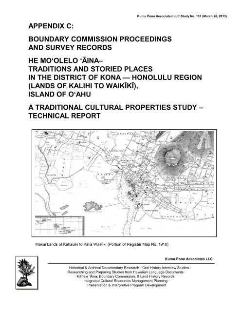
APPENDIX C:<br />
BOUNDARY COMMISSION PROCEEDINGS<br />
AND SURVEY RECORDS<br />
Kumu Pono Associated LLC Study No. 131 (March 26, 2013)<br />
HE MO‘OLELO ‘ĀINA–<br />
TRADITIONS AND STORIED PLACES<br />
IN THE DISTRICT OF KONA — HONOLULU REGION<br />
(LANDS OF KALIHI TO WAIKĪKĪ),<br />
ISLAND OF O‘AHU<br />
A TRADITIONAL CULTURAL PROPERTIES STUDY –<br />
TECHNICAL REPORT<br />
Makai Lands of Kahauiki to Kalia Waikīkī (Portion of Register Map No. 1910)<br />
Kumu Pono Associates LLC<br />
Historical & Archival Documentary Research · Oral History Interview Studies ·<br />
Researching and Preparing Studies from Hawaiian Language Documents ·<br />
Māhele ‘Āina, Boundary Commission, & Land History Records ·<br />
Integrated Cultural Resources Management Planning ·<br />
Preservation & Interpretive Program Development
APPENDIX C:<br />
BOUNDARY COMMISSION PROCEEDINGS<br />
AND SURVEY RECORDS<br />
HE MO‘OLELO ‘ĀINA–<br />
TRADITIONS AND STORIED PLACES<br />
IN THE DISTRICT OF KONA — HONOLULU REGION<br />
(LANDS OF KALIHI TO WAIKĪKĪ),<br />
ISLAND OF O‘AHU<br />
A TRADITIONAL CULTURAL PROPERTIES STUDY –<br />
TECHNICAL REPORT<br />
TMK Overview Sheets Zones 1-2, 1-5. 1-7 & 2-1, 2-3<br />
(Various parcels)<br />
PREPARED BY<br />
Kepā Maly • Cultural Historian/Resource Specialist<br />
Onaona Maly • Researcher/<strong>Project</strong> Administrator<br />
&<br />
Kawena Maly • <strong>Project</strong> Assistant<br />
PREPARED FOR<br />
SRI Foundation<br />
333 Rio Rancho Drive, Suite 103<br />
Rio Rancho, New Mexico 87124<br />
DRAFT – MARCH 26, 2013<br />
© 2013 Kumu Pono Associates LLC<br />
Historical & Archival Documentary Research · Oral History Interview Studies ·<br />
Researching and Preparing Studies from Hawaiian Language Documents ·<br />
Māhele ‘Āina, Boundary Commission, & Land History Records ·<br />
Integrated Cultural Resources Management Planning ·<br />
Preservation & Interpretive Program Development<br />
P.O. Box 631599 · Lāna‘i City, Hawai‘i 96763 · (ph.) 808.565.7174 · (e-mail) onaona@kumupono.com
TABLE OF CONTENTS<br />
APPENDIX C:<br />
SURVEYS AND PROCEEDINGS OF THE BOUNDARY COMMISSION<br />
IN THE YEARS 1865 TO 1925 1<br />
Ahupua‘a and Land Division Descriptions<br />
With Certification of Boundaries (1865-1925) 19<br />
<strong>Honolulu</strong> Ahupuaa, Ili of Kahehuna<br />
District of Kona, Island of Oahu 19<br />
<strong>Honolulu</strong> Ahupuaa, Ili of Auwaiolimu<br />
District of Kona, Island of Oahu 20<br />
<strong>Honolulu</strong> Ahupuaa, Ili of Hauhaukoi<br />
District of Kona, Island of Oahu 20<br />
<strong>Honolulu</strong> Ahupuaa, Ili o Kaakopua Ili<br />
District of Kona, Island of Oahu 22<br />
<strong>Honolulu</strong> Ahupuaa, Lele of Kaalaa in Ili of Honuakaha<br />
District of Kona, Island of Oahu 29<br />
<strong>Honolulu</strong> Ahupuaa, Ili of Kahehuna<br />
District of Kona, Island of Oahu 32<br />
<strong>Honolulu</strong> Ahupuaa , Ili of Kalawahine<br />
District of Kona, Island of Oahu 34<br />
<strong>Honolulu</strong> Ahupuaa, Ili of Kaliu<br />
District of Kona, Island of Oahu 84<br />
<strong>Honolulu</strong> Ahupuaa, Ili of Kapahaha<br />
District of Kona, Island of Oahu 111<br />
<strong>Honolulu</strong> Ahupuaa, Ili of Kapaloa<br />
District of Kona, Island of Oahu 113<br />
<strong>Honolulu</strong> Ahupuaa, Ili of Kauluwela & Kawa Fish Pond<br />
District of Kona, Island of Oahu 114<br />
<strong>Honolulu</strong> Ahupuaa, Ili of Kawaiiki<br />
District of Kona, Island of Oahu 123<br />
<strong>Honolulu</strong> Ahupuaa, Ili of Kewalo<br />
District of Kona, Island of Oahu 124<br />
<strong>Honolulu</strong> Ahupuaa, Ili of Koiuiu (Apana 8)<br />
District of Kona, Island of Oahu 136<br />
Appendix C:<br />
He Mo‘olelo ‘Āina–Traditions and Storied Places in the District of Kona,<br />
<strong>Honolulu</strong> Region (Lands of Kalihi to Waikīkī), Island of O‘ahu<br />
A Traditional Cultural Properties Study – Technical Report DRAFT March 26, 2013 ii
<strong>Honolulu</strong> Ahupuaa, Ili of Luakaha, Nuuanu Valley<br />
District of Kona, Island of Oahu 139<br />
<strong>Honolulu</strong> Ahupuaa, Lele of Nini Nuuanu Valley<br />
District of Kona, Island of Oahu 144<br />
<strong>Honolulu</strong> Ahupuaa, Lele of Puunui<br />
District of Kona, Island of Oahu 147<br />
<strong>Honolulu</strong> Ahupuaa, Ili of Waikahalulu<br />
District of Kona, Island of Oahu 150<br />
Kahauiki Ahupuaa,<br />
District of Kona, Island of Oahu 156<br />
Kalihi Ahupuaa, Portion of the Ili of Haunapo<br />
District of Kona, Island of Oahu 163<br />
Kalihi Ahupuaa, Kai o Kaliawa (Fishery of Kaliawa)<br />
District of Kona, Island of Oahu 169<br />
Kalihi Ahupuaa, Ili of Kaluapulu (also written Kaluaopulu)<br />
District of Kona, Island of Oahu 173<br />
Kalihi Ahupuaa, Lele of Maluawai, Ili of Waiaula<br />
District of Kona, Island of Oahu 183<br />
Kalihi Ahupuaa, Ili of Pohakulawaia<br />
District of Kona, Island of Oahu 195<br />
Kapalama Ahupuaa and Ili aina of Kalaepohaku<br />
District of Kona, Island of Oahu 203<br />
Kapalama Ahupuaa, the Fishing grounds of<br />
L.C. Award 7714 B to M. Kekuaiwa 214<br />
Kapalama Ahupuaa, Lele of Loko Kealia, at Iwilei 215<br />
Kapalama Ahupuaa (<strong>Honolulu</strong>), Ili of Kahawale (Apana 1)<br />
District of Kona, Island of Oahu 216<br />
(<strong>Honolulu</strong>) Kapalama Ahupuaa, Ili of Kaliu (Lipoa Portions)<br />
District of Kona, Island of Oahu 231<br />
Ili o Kapahaha. <strong>Honolulu</strong>, Oahu. 234<br />
<strong>Honolulu</strong> Ahupuaa, Ili of Kaliu (Portions)<br />
District of Kona, Island of Oahu 250<br />
Waikiki Ahupuaa, Ili of Hamohamo<br />
District of Kona, Island of Oahu 253<br />
Appendix C:<br />
He Mo‘olelo ‘Āina–Traditions and Storied Places in the District of Kona,<br />
<strong>Honolulu</strong> Region (Lands of Kalihi to Waikīkī), Island of O‘ahu<br />
A Traditional Cultural Properties Study – Technical Report DRAFT March 26, 2013 iii
FIGURES<br />
TABLES<br />
Waikiki Ahupuaa, Ili of Kaiwiokaihu (with Keaniani and Mauna Laha)<br />
District of Kona, Island of Oahu 261<br />
Waikiki Ahupuaa, Ili of Kamoku<br />
District of Kona, Island of Oahu 265<br />
Waikiki Ahupuaa, Ili of Kalia (various sections with other Ili)<br />
District of Kona, Island of Oahu 271<br />
Unnumbered Figures:<br />
Plans Filed with Boundary Commission Notes<br />
Table 1. Place Names and Resident Names Cited<br />
in Boundary Proceedings 2<br />
Appendix C:<br />
He Mo‘olelo ‘Āina–Traditions and Storied Places in the District of Kona,<br />
<strong>Honolulu</strong> Region (Lands of Kalihi to Waikīkī), Island of O‘ahu<br />
A Traditional Cultural Properties Study – Technical Report DRAFT March 26, 2013 iv
APPENDIX C:<br />
SURVEYS AND PROCEEDINGS OF THE<br />
BOUNDARY COMMISSION IN THE YEARS 1865 TO 1925<br />
Following the Māhele ‘Āina, there was a growing movement to fence off the land areas and<br />
control access to resources that native tenants had traditionally used. In the 1860s, foreign<br />
land owners and business interests petitioned the Crown to have the boundaries of their<br />
respective lands—which became the foundation for plantation and ranching interests—<br />
settled. In 1862, the King appointed a Commission of Boundaries (the Boundary<br />
Commission), and tasked them with collecting traditional knowledge of place, land<br />
boundaries, customary practices, and deciding the most equitable boundaries for each<br />
ahupua‘a that had been awarded to Ali‘i, Konohiki, and foreigners during the Māhele.<br />
The commission proceedings were conducted under the courts and as formal actions under<br />
law. As the commissioners on the various islands undertook their work, the kingdom hired<br />
or contracted surveyors to begin the surveys, and in 1874, the Commissioners of<br />
Boundaries were authorized to certify the boundaries for lands brought before them (W.D.<br />
Alexander in Thrum 1891:117-118).<br />
Records land of the region spanning from Kalihi to Kālia, Waikīkī were recorded between<br />
1865 to 1925. The records include testimonies of: (1) elder kama‘āina who were either<br />
recipients of kuleana in the Māhele; (2) holders of Royal Patent Land Grants in the<br />
ahupua‘a of interest; (3) individuals who were direct descendants of the original fee-simple<br />
title holders; (4) subsequent holders of title; residents of the land with direct knowledge of<br />
the boundaries and practices; and individuals who had learned of the lands from elder<br />
residents.<br />
The narratives that follow, include entire ahupua‘a or subdivision parcels (such as ‘ili, lele,<br />
loko, and kula) as recorded for the lands of Kahauiki (adjoining Kalihi), Kalihi, Kapālama,<br />
Nu‘uanu-<strong>Honolulu</strong>, Kālia, and Waikīkī (with neighboring lands). We have included lands<br />
beyond the specific corridor of consideration for this study, as the narratives provide readers<br />
with a larger, traditional context of the relationship Hawaiians share the honua ola (living<br />
environment).<br />
The records provide descriptions of the land, extending from ocean fisheries to the<br />
mountain peaks; traditional and customary practices; land use; changes in the landscape<br />
witnessed over the informants’ lifetime; identify various cultural features across the land;<br />
and name individuals who share lineal and/or cultural ties to traditional residents of the<br />
lands crossed by the proposed rail corridor. Through the latter names, families with interest<br />
in disposition of cultural resources and ilina of the present-day are also identified.<br />
The native witnesses usually spoke in Hawaiian, and in some instances, their testimony was<br />
translated into English and transcribed as the proceedings occurred. Other testimonies<br />
were transcribed in Hawaiian as cited in this study. The occurrence and recounting of<br />
traditional place names (a number of which are no longer in common use) in this section of<br />
the study provides present and future generations with a sense of history and value, and<br />
can help reconnect people with the culture of place.<br />
Appendix C:<br />
He Mo‘olelo ‘Āina–Traditions and Storied Places in the District of Kona,<br />
<strong>Honolulu</strong> Region (Lands of Kalihi to Waikīkī), Island of O‘ahu<br />
A Traditional Cultural Properties Study – Technical Report DRAFT March 26, 2013 1
The Boundary Commission proceedings documented more than 244 traditional place<br />
names along the boundaries of five ahupua‘a and numerous smaller land divisions, with<br />
locations extending from the sea (including fishponds and fisheries) to Ko‘olau mountain<br />
peaks). These names demonstrate Hawaiian familiarity with the resources, topography,<br />
sites and features of the entire island; sharing the broad relationship of the natural<br />
landscape to the culture and practices of the early residents in the region. Coulter (1935)<br />
observed that Hawaiians had place names for all manner of feature, ranging from<br />
“outstanding cliffs” to what he described as “trivial land marks” (Coulter 1935:10). History<br />
tells us that named locations were significant in past times: “Names would not have been<br />
given to [or remembered if they were] mere worthless pieces of topography” (Handy and<br />
Handy with Pukui, 1972:412).<br />
In ancient times, named localities signified that a variety of uses and functions occurred,<br />
including:<br />
(1) triangulation points such as ko‘a (land markers for fishing grounds and<br />
specific offshore fishing localities);<br />
(2) residences; areas of planting;<br />
(3) water sources;<br />
(4) trails and trail-side resting places (o‘io‘ina), such as a rock shelter or tree<br />
shaded spot;<br />
(5) heiau or other features of ceremonial importance;<br />
(6) may have been the source of a particular natural resource or any number<br />
of other features; or<br />
(7) the names may record a particular event or practice (e.g., use for burials,<br />
the making of ko‘i or adzes, or designation as a fishery) that occurred in a<br />
given area.<br />
Table 1 provides readers with a compendium of place names recorded from Kahauiki to<br />
Waikīkī, and names of residents, as documented in the Boundary Commission proceedings.<br />
Many of the place names remain in use on maps or among some residents, while others are<br />
no longer in use. A number of the places names are found in traditional narratives and<br />
historical accounts that are of “national” significance to the Hawaiian people and history of<br />
Hawai‘i. Any number of these “wahi pana” could be considered as Traditional Cultural<br />
Properties.<br />
Table 1. Place Names and Resident Names Cited in Boundary Proceedings<br />
Cited in Ahupua‘a Notes / Year of<br />
Place Name / Ili Testimony Resident Names Record<br />
<strong>Honolulu</strong> Ahupuaa<br />
Auwaiolimu (Ili) <strong>Honolulu</strong> Crown Land 1869<br />
Kahehuna Mahoe<br />
Kalawahine<br />
Kaloa<br />
Kewalo<br />
Waikahalulu<br />
Appendix C:<br />
He Mo‘olelo ‘Āina–Traditions and Storied Places in the District of Kona,<br />
<strong>Honolulu</strong> Region (Lands of Kalihi to Waikīkī), Island of O‘ahu<br />
A Traditional Cultural Properties Study – Technical Report DRAFT March 26, 2013 2
Table 1. Place Names and Resident Names Cited in Boundary Proceedings<br />
Cited in Ahupua‘a Notes / Year of<br />
Place Name / Ili Testimony Resident Names Record<br />
<strong>Honolulu</strong> Ahupuaa<br />
Hauhaukoi (Ili) <strong>Honolulu</strong> Crown Land 1873<br />
Kahawali J.A. Kauwa<br />
Keonekapu<br />
P.Y. Kaeo<br />
S.P. Kalama<br />
Cited in Ahupua‘a Notes / Year of<br />
Place Name / Ili Testimony Resident Names Record<br />
<strong>Honolulu</strong> Ahupuaa<br />
Kaakopua (Ili) <strong>Honolulu</strong> W.P. Leleiohoku 1873<br />
Kaakaukukui Hueu<br />
Kalawahine Kalama<br />
Kaliu Makalawelawe<br />
Kapauhi Munu<br />
Pa Pelekane Malulu<br />
Peleula Keanu<br />
Piula (Auwai) Kaawa<br />
Kahau<br />
Keliiaa<br />
Kapa<br />
Kauo<br />
Kalaau<br />
Cited in Ahupua‘a Notes / Year of<br />
Place Name / Ili Testimony Resident Names Record<br />
<strong>Honolulu</strong> Ahupuaa<br />
Kaalaa (Lele) B. Namakeha 1873<br />
Ili of Honuakaha<br />
Cited in Ahupua‘a Notes / Year of<br />
Place Name / Ili Testimony Resident Names Record<br />
<strong>Honolulu</strong> Ahupuaa<br />
Kahehuna (Ili) Crown Land 1868<br />
Auwaiolimu <strong>Honolulu</strong> R. Keelikolani<br />
Kaakopua Waikane<br />
Maii<br />
Appendix C:<br />
He Mo‘olelo ‘Āina–Traditions and Storied Places in the District of Kona,<br />
<strong>Honolulu</strong> Region (Lands of Kalihi to Waikīkī), Island of O‘ahu<br />
A Traditional Cultural Properties Study – Technical Report DRAFT March 26, 2013 3
Table 1. Place Names and Resident Names Cited in Boundary Proceedings<br />
Cited in Ahupua‘a Notes / Year of<br />
Place Name / Ili Testimony Resident Names Record<br />
<strong>Honolulu</strong> Ahupuaa<br />
Kalawahine (Ili) <strong>Honolulu</strong> A. Kealiiahonui 1872<br />
Auwaiolimu M. Kekauonohi<br />
Haumakaawe L. & A. Haalelea<br />
Ieieula Kanihina<br />
Iwilei Afong<br />
Kaakaukukui Keaha<br />
Kaalaa Mary E. Foster<br />
Kaalaa lalo Kuaana<br />
Kaalaa luna H. Kalama<br />
Koholaloa Helela<br />
Kaiwiokaihu (Por. Pawaa Govt. Land)<br />
Kapulehu Keahua<br />
Kauhopuwale Kaauhauhula<br />
Kaupo Hanunu<br />
Keoneula George Wood<br />
Kewalo Anini<br />
Kuwili Kimo<br />
Lehuahuluhulu Paele<br />
Lihue Wm. Sumner<br />
Molokohana R. Gilliland<br />
Moopili Wm. Ka<br />
Nuuanu Kaia<br />
Opu Kalaeloa<br />
Pahuniu (Heiau) Kalawahine/Makiki Ioane Akina<br />
Papaa Kamaile<br />
Papakolea John Makini<br />
Pauoa Holt Estate<br />
Pawaa Banning<br />
Piiwai Mahana Makahopu<br />
Piliamoo Kamehameha V<br />
Pukaawapuhi W.L. Moehonua<br />
Puumakani Kaena<br />
Puu Ohia Kuoi<br />
Waikahalulu P. Naone<br />
Mahoe<br />
Kaina<br />
Lahilahi<br />
Kaukoke<br />
A. Paki<br />
Keaeloahi<br />
Livingston<br />
Paahana<br />
Appendix C:<br />
He Mo‘olelo ‘Āina–Traditions and Storied Places in the District of Kona,<br />
<strong>Honolulu</strong> Region (Lands of Kalihi to Waikīkī), Island of O‘ahu<br />
A Traditional Cultural Properties Study – Technical Report DRAFT March 26, 2013 4
Table 1. Place Names and Resident Names Cited in Boundary Proceedings<br />
Cited in Ahupua‘a Notes / Year of<br />
Place Name / Ili Testimony Resident Names Record<br />
<strong>Honolulu</strong> Ahupuaa<br />
Kalawahine (Ili) (continued)<br />
Holapu<br />
Pooleho<br />
Kaupe<br />
Keino<br />
Cited in Ahupua‘a Notes / Year of<br />
Place Name / Ili Testimony Resident Names Record<br />
<strong>Honolulu</strong> (Kapalama) Ahupuaa<br />
Kaliu & Kaliu lalo (Ili) <strong>Honolulu</strong> Julia Alapai Kauwa 1872<br />
Hauahukoi Lipoa 1878<br />
Kaaipeelua Kaleikini 1881<br />
Kapaalua Liaikalani 1885<br />
Kapahaha Kapu 1916<br />
Kauluwela J. Kapena<br />
Kawaiiki Kaaukai<br />
Keoneula Mrs. Rose<br />
Kuaiula Wm. Jarrett<br />
Poohuluhulu J.E. Chapman<br />
Pualoalo H. Kaoo<br />
Puehuehu (Wailele) Lupo (w)<br />
Niupaipai Kaliu lalo Maria Peke<br />
Pepe<br />
Rosalie Tripp<br />
Kaumiumi<br />
Luka<br />
Kama<br />
Kulainanea<br />
Pehi<br />
Kalai<br />
David Kahoena<br />
Kahapii<br />
James Makua<br />
David Kukapu<br />
Kapahukepau<br />
Paki<br />
Puowaina (w)<br />
Maluaikoo<br />
Appendix C:<br />
He Mo‘olelo ‘Āina–Traditions and Storied Places in the District of Kona,<br />
<strong>Honolulu</strong> Region (Lands of Kalihi to Waikīkī), Island of O‘ahu<br />
A Traditional Cultural Properties Study – Technical Report DRAFT March 26, 2013 5
Table 1. Place Names and Resident Names Cited in Boundary Proceedings<br />
Cited in Ahupua‘a Notes / Year of<br />
Place Name / Ili Testimony Resident Names Record<br />
Kaliu (Ili) Kapalama J.A. Kauwa 1873<br />
(Lipoa Portions) M. Lipoa<br />
& Kapahaha (Ili) Elizabeth Kauwa<br />
Pualoalo Keoni Ana<br />
Wailele Puehuehu Wiliama<br />
Kauluwela Kalama<br />
Waikahalulu Kuukuu<br />
Unauna<br />
Lupe (J. Robinson)<br />
S.P. Kalama<br />
D. Kawananakoa for 1902<br />
Estate of Queen Kapiolani<br />
Cited in Ahupua‘a Notes / Year of<br />
Place Name / Ili Testimony Resident Names Record<br />
<strong>Honolulu</strong> Ahupuaa<br />
Kapahaha (Ili) <strong>Honolulu</strong> Kapiolani Est. 1902<br />
Hauhaukoi D. Kawananakoa, Tr.<br />
Kuaiula L. Kamehameha<br />
Kawaiiki Kaluau<br />
Keoneula Mikapala<br />
Kaaipeelua P. Kanoa<br />
Kapaalua Lupe (J. Robinson)<br />
Cited in Ahupua‘a Notes / Year of<br />
Place Name / Ili Testimony Resident Names Record<br />
<strong>Honolulu</strong> Ahupuaa<br />
Kapaloa (Ili) <strong>Honolulu</strong> Crown Land 1868<br />
Kewalo Kamakee & Government<br />
Kaakaukukui V. Kamamalu<br />
Auwaiolimu The King<br />
Appendix C:<br />
He Mo‘olelo ‘Āina–Traditions and Storied Places in the District of Kona,<br />
<strong>Honolulu</strong> Region (Lands of Kalihi to Waikīkī), Island of O‘ahu<br />
A Traditional Cultural Properties Study – Technical Report DRAFT March 26, 2013 6
Table 1. Place Names and Resident Names Cited in Boundary Proceedings<br />
Cited in Ahupua‘a Notes / Year of<br />
Place Name / Ili Testimony Resident Names Record<br />
<strong>Honolulu</strong> Ahupuaa<br />
Kauluwela (Ili) <strong>Honolulu</strong> V. Kamamalu 1885<br />
Iwilei C.N. Kumano<br />
Kalawahine Kalaeokekai<br />
Kaliu Wm. Sumner<br />
Kamakela Manele<br />
Kawa (Loko) Kahekili<br />
Koholaloa Kinau & Kekuanaoa<br />
Koiuiu L. Kamehameha<br />
Kukanaka R. Keelikolani<br />
Kunawai Poomanu<br />
Kuwili (Loko) Piki (w)<br />
Nini Kaluahine (w)<br />
Niukukahi Ku<br />
Nuuanu (Stream) Kapule<br />
Pakii Kauhema<br />
Puehuehu (Stream)<br />
Puunui<br />
Waihakahlulu<br />
Cited in Ahupua‘a Notes / Year of<br />
Place Name / Ili Testimony Resident Names Record<br />
<strong>Honolulu</strong> Ahupuaa<br />
Kawaiiki (Ili) <strong>Honolulu</strong> Crown Land 1873<br />
Kapukula<br />
Kapohaku<br />
Appendix C:<br />
He Mo‘olelo ‘Āina–Traditions and Storied Places in the District of Kona,<br />
<strong>Honolulu</strong> Region (Lands of Kalihi to Waikīkī), Island of O‘ahu<br />
A Traditional Cultural Properties Study – Technical Report DRAFT March 26, 2013 7
Table 1. Place Names and Resident Names Cited in Boundary Proceedings<br />
Cited in Ahupua‘a Notes / Year of<br />
Place Name / Ili Testimony Resident Names Record<br />
<strong>Honolulu</strong> Ahupuaa<br />
Kewalo (Ili) <strong>Honolulu</strong> Kamakee Piikoi 1864<br />
Auwaiolimu/Waiolimu Keanui (w) 1873<br />
Kaaihee Naone<br />
Kahulimoa Kamakau<br />
Kaiwiokaihu Mahoe<br />
Kakaepali Naihekukui<br />
Kapapakolea M. Kekauonohi<br />
Kukuluaeo Maii<br />
Kulaokahua J.P. Ii, site of a former maika playground p. 8<br />
Maia Kealiiahonui<br />
Nahunia Poo<br />
Pauoa Kaina<br />
Peleula L. Haalelea<br />
Poopoo Kaoae<br />
Puuiole Haole<br />
Puowaina/Punchbowl J.P. Ii<br />
Moo<br />
Kaauwaipaa<br />
Keawehano<br />
Hinau<br />
Kaohimaunu<br />
Kauliokamoa<br />
Kaaha<br />
Uuku<br />
Nawaaholo<br />
Keauna<br />
Makukoloe<br />
Kuoi<br />
Nania<br />
Kauinui<br />
Meheula<br />
Ihu<br />
Kekahupuu<br />
Appendix C:<br />
He Mo‘olelo ‘Āina–Traditions and Storied Places in the District of Kona,<br />
<strong>Honolulu</strong> Region (Lands of Kalihi to Waikīkī), Island of O‘ahu<br />
A Traditional Cultural Properties Study – Technical Report DRAFT March 26, 2013 8
Table 1. Place Names and Resident Names Cited in Boundary Proceedings<br />
Cited in Ahupua‘a Notes / Year of<br />
Place Name / Ili Testimony Resident Names Record<br />
<strong>Honolulu</strong> Ahupuaa<br />
Koiuiu (Ili) <strong>Honolulu</strong> Kamohai 1879<br />
Aala E.K. Nahaolelua<br />
Kamakela Puhibaka (Puhipaka)<br />
Malia Koanui<br />
Kama Aho opio<br />
H.T. Reynolds<br />
Kamohoula<br />
Kaaiawaawa<br />
Cited in Ahupua‘a Notes / Year of<br />
Place Name / Ili Testimony Resident Names Record<br />
<strong>Honolulu</strong> Ahupuaa<br />
Luakaha (Ili) / Nuuanu Valley <strong>Honolulu</strong> Crown Land 1868<br />
Hekili Keoni Ana<br />
Honopoohina Kahalehili<br />
Kaakaukukui (Ili) Niniko<br />
Kaeleuli Moamoa<br />
Kahapaakai<br />
Kahuoi<br />
Kalaheo<br />
Kalihi Ahupuaa (Boundary)<br />
Kapalama<br />
Kaumuhonu<br />
Konahuanui<br />
Lanihuli<br />
Manoa<br />
Nuuanu Pali<br />
Pauoa<br />
Waolani<br />
Cited in Ahupua‘a Notes / Year of<br />
Place Name / Ili Testimony Resident Names Record<br />
<strong>Honolulu</strong> Ahupuaa<br />
Nini (Lele) Nuuanu Valley Kalaimoku 1908<br />
Lele of Niolopa M. Kekauonohi<br />
Coney Est.<br />
Appendix C:<br />
He Mo‘olelo ‘Āina–Traditions and Storied Places in the District of Kona,<br />
<strong>Honolulu</strong> Region (Lands of Kalihi to Waikīkī), Island of O‘ahu<br />
A Traditional Cultural Properties Study – Technical Report DRAFT March 26, 2013 9
Table 1. Place Names and Resident Names Cited in Boundary Proceedings<br />
Cited in Ahupua‘a Notes / Year of<br />
Place Name / Ili Testimony Resident Names Record<br />
<strong>Honolulu</strong> Ahupuaa<br />
Puunui Kekuanui 1873<br />
Ahua (Loko) Kapolei<br />
Kaa (Loko) Kukao<br />
Kakaako Iwiula<br />
Kalokoeli Kahakai<br />
Kuaimeki M. Kekuanaoa<br />
Cited in Ahupua‘a Notes / Year of<br />
Place Name / Ili Testimony Resident Names Record<br />
<strong>Honolulu</strong> Ahupuaa<br />
Waikahalulu Nuuanu H. Kalama 1872<br />
Kunane 1880<br />
Kekaulahao<br />
M. Kamanu<br />
C. Kanaina<br />
Kuhiau<br />
Kaoo<br />
Cited in Ahupua‘a Notes / Year of<br />
Place Name / Ili Testimony Resident Names Record<br />
Kahauiki Ahupuaa Crown Land 1884<br />
Kalihi Ahupuaa (Boundary) Kainapu<br />
Kaluaoplena Bolabola<br />
Kapalaalaea Keoniholo (R.P. G. 595)<br />
Kupehau Kahaha<br />
Kapuukao Nahinu<br />
Koloalu Amona<br />
Laelae Kanahi<br />
Leaha Hoohuli<br />
Mailihalai Kekuapalau<br />
Moanalua Ahupuaa (Boundary) Kioi<br />
Mokumoa Kaunuohua<br />
Pikapu A. Adams<br />
Pohakaa C. Kanaina<br />
Pohakuaukai Uwe<br />
Punakalae Kekino<br />
Puukapina Palau<br />
Puukau<br />
Weli (loko)<br />
Appendix C:<br />
He Mo‘olelo ‘Āina–Traditions and Storied Places in the District of Kona,<br />
<strong>Honolulu</strong> Region (Lands of Kalihi to Waikīkī), Island of O‘ahu<br />
A Traditional Cultural Properties Study – Technical Report DRAFT March 26, 2013 10
Table 1. Place Names and Resident Names Cited in Boundary Proceedings<br />
Cited in Ahupua‘a Notes / Year of<br />
Place Name / Ili Testimony Resident Names Record<br />
Kalihi Ahupuaa<br />
Haunapo (Ili) Kalihi Laumaka 1885<br />
Kahoewai D.L. Kalawaia<br />
Kaliawa Piena<br />
Kaluaopalena Kaiapa<br />
Niau G. Waller<br />
Pahuiwi A. Adams<br />
Paukika Pulaa<br />
Puu Haunapo Hewahewa<br />
Umi Kahue<br />
Waimahui<br />
Kaolala<br />
H. Nolte<br />
Cited in Ahupua‘a Notes / Year of<br />
Place Name / Ili Testimony Resident Names Record<br />
Kalihi Ahupuaa<br />
Kai o Kaliawa Kalihi Fishery of Kaliawa 1890<br />
Ahu Kehookomowaa Kai o Kaliawa Geo. Beckley<br />
Ahu Kumau C. Lucas<br />
Ahu Pohaku A. Adams<br />
Apili (Loko) Lokana<br />
Aweoweonui Keamalu<br />
Halii Waialua (w)<br />
Hiiwai o Keiki Kaleiluhiole<br />
Honoku Kamehameha V<br />
Ilinui Kahuihu<br />
Kahakaaulana Lama (w)<br />
Kahuanana Kilinahe<br />
Kalaaukiei C. Kanaina<br />
Kalaenahaweli Ohule<br />
Kalaeokaoki Kahunahana<br />
Kalaeone Maka<br />
Kalaeunoa<br />
Kaluapuhi<br />
Kaluapuhinui<br />
Keahukumano<br />
Kapookamahina<br />
Keehi<br />
Laeokaiki<br />
Makaaa<br />
Makukaloa Sand Mound Burial Site of Lama’s family<br />
Appendix C:<br />
He Mo‘olelo ‘Āina–Traditions and Storied Places in the District of Kona,<br />
<strong>Honolulu</strong> Region (Lands of Kalihi to Waikīkī), Island of O‘ahu<br />
A Traditional Cultural Properties Study – Technical Report DRAFT March 26, 2013 11
Moanalua Ahupuaa (Boundary)<br />
Mokauea<br />
Table 1. Place Names and Resident Names Cited in Boundary Proceedings<br />
Cited in Ahupua‘a Notes / Year of<br />
Place Name / Ili Testimony Resident Names Record<br />
Kalihi Ahupuaa<br />
Kai o Kaliawa (continued)<br />
Mokulau<br />
Mokuoni<br />
Moleokauhola<br />
Namoku Also called Kalaeokaiki<br />
Pahou iki (Loko)<br />
Pahou nui (Loko)<br />
Pohaku Kiei<br />
Pupuawa<br />
Waiololi<br />
Cited in Ahupua‘a Notes / Year of<br />
Place Name / Ili Testimony Resident Names Record<br />
Kalihi Ahupuaa<br />
Kaluaopulu (Ili) / Kaluapulu Kalihi 1873<br />
Ananoho (Loko) A. Adams<br />
Apili Kama (T. Sams)<br />
Halekaua Kalei<br />
Haunapo J. Komoikehuehu<br />
Kaahaloa W.L. Moehonua<br />
Kahauiki Ahupuaa (Boundary) J. Kahai<br />
Kahoiwai Miliama<br />
Kaliawa Kanahi<br />
Kaluaopalena Kakaio<br />
Kauhiakanamee Kaluaikai<br />
Kauole Eliama<br />
Kekualiilii H. Hewahewa<br />
Kukahi Kama<br />
Kupehau G. Beckley<br />
Laelae Keano (Eldridge)<br />
Mokauea John Ii<br />
Niau<br />
Pahou nui (Loko / Kula)<br />
Pakaaluna<br />
Pohakuloa<br />
Pukakaewai<br />
Puuhale Pohaku<br />
Umi<br />
Wailele<br />
Appendix C:<br />
He Mo‘olelo ‘Āina–Traditions and Storied Places in the District of Kona,<br />
<strong>Honolulu</strong> Region (Lands of Kalihi to Waikīkī), Island of O‘ahu<br />
A Traditional Cultural Properties Study – Technical Report DRAFT March 26, 2013 12
Table 1. Place Names and Resident Names Cited in Boundary Proceedings<br />
Cited in Ahupua‘a Notes / Year of<br />
Place Name / Ili Testimony Resident Names Record<br />
Kalihi Ahupuaa<br />
Maluawai (Lele) of Waiaula (Ili) Kalihi V. Kamamalu 1924<br />
(Also known as Kuaiula) Kaunuohua<br />
Huea C. Kanaina<br />
Kamanaiki Kaunuohua<br />
Kapo Alex. Adams<br />
Kawaaloa Daniel Kama<br />
Kuaiula (in Kalihi uka) Sol. Kamohoalii<br />
Maluawai (Lele) Mokina<br />
Nanahele Kuamoo<br />
Nawahie<br />
Eliz. K. Hiram<br />
Kaua<br />
Kanekoa<br />
Kaneolaelae<br />
Paniohaku<br />
<strong>Honolulu</strong><br />
Pakoma Kupau<br />
Niho<br />
Kaneai<br />
Puipui<br />
Naai<br />
W.L. Moehonua<br />
Cited in Ahupua‘a Notes / Year of<br />
Place Name / Ili Testimony Resident Names Record<br />
Kalihi Ahupuaa<br />
Pohakulawaia (Ili) Kalihi Kahaha 1897<br />
(Also known as Huea) S.M. Kamakau<br />
Huea C.W. Booth<br />
Kahauiki<br />
Pohakuawaawa<br />
Waiaula<br />
Appendix C:<br />
He Mo‘olelo ‘Āina–Traditions and Storied Places in the District of Kona,<br />
<strong>Honolulu</strong> Region (Lands of Kalihi to Waikīkī), Island of O‘ahu<br />
A Traditional Cultural Properties Study – Technical Report DRAFT March 26, 2013 13
Table 1. Place Names and Resident Names Cited in Boundary Proceedings<br />
Cited in Ahupua‘a Notes / Year of<br />
Place Name / Ili Testimony Resident Names Record<br />
Kapalama Ahupuaa<br />
Kalaepohaku (Ili) Kapalama M. Kekuaiwa 1886<br />
Alewa V. Kamamalu<br />
Ananoho (Loko) R. Keelikolani<br />
Hauhaukoi Kaunuohua<br />
Iwilei M. Kekuanaoa<br />
Kahawale (Kahawali) S.M. Kamakau<br />
Kalihi Ahupuaa (Boundary) Kaui<br />
Kamanaiki Keliikuloa<br />
Kapo Luaiki Kepuohiohi<br />
Kealaaku Napua<br />
Kealia (Loko) Kaawaaua<br />
Keaneulu Nuuanu<br />
Keoneula P. Kanoa<br />
Kuwili (Loko) Paele<br />
Mokauea Wm. Harbottle<br />
Naohia Geo. Pelly<br />
Nukohe J. Meek<br />
Pohakuawaawa Wm. Sumner<br />
Pohakuwauwau<br />
Waolani<br />
Cited in Ahupua‘a Notes / Year of<br />
Place Name / Ili Testimony Resident Names Record<br />
Kapalama Ahupuaa<br />
Fishery Kapalama M. Kekuaiwa 1886<br />
Ananoho (Loko<br />
Kuwili (Loko)<br />
Mokauea<br />
Kealia (Loko) A lele of Kapalama W. Sumner<br />
Koi<br />
Appendix C:<br />
He Mo‘olelo ‘Āina–Traditions and Storied Places in the District of Kona,<br />
<strong>Honolulu</strong> Region (Lands of Kalihi to Waikīkī), Island of O‘ahu<br />
A Traditional Cultural Properties Study – Technical Report DRAFT March 26, 2013 14
Table 1. Place Names and Resident Names Cited in Boundary Proceedings<br />
Cited in Ahupua‘a Notes / Year of<br />
Place Name / Ili Testimony Resident Names Record<br />
Kapalama Ahupuaa<br />
Kahawale / Kahawali Kapalama J. Kaeo 1885<br />
Apana 1<br />
Keoneula D.W. Pua<br />
Hauhaukoi Keonekapu<br />
Luka Keonekapu<br />
Mele Pua<br />
S.M. Kaaukai<br />
Pihiliilii<br />
Kahina<br />
Cited in Ahupua‘a Notes / Year of<br />
Place Name / Ili Testimony Resident Names Record<br />
Kapalama Ahupuaa<br />
Kahawale / Kahawali Kapalama J. Kaeo 1885<br />
Apana 5 J.Y Kau<br />
Keaneulu Kuluahi<br />
Moo<br />
Loke (w)<br />
Kealakua<br />
Pekelo<br />
Jos. Gilman<br />
Joe West<br />
Paahana<br />
Kela<br />
Umi<br />
Cited in Ahupua‘a Notes / Year of<br />
Place Name / Ili Testimony Resident Names Record<br />
Kapalama Ahupuaa<br />
Kahawale / Kahawali Kapalama J. Kaeo 1891<br />
(Hiram Portion) John Hiram<br />
Hauhaukoi Fanny Kaiwi<br />
Kepi<br />
Kalanihou<br />
Levina Kapu<br />
Keonekapu<br />
Marie Coffin (Kane’s granddaughter)<br />
Mrs. Bolster (Kane’s granddaughter)<br />
Appendix C:<br />
He Mo‘olelo ‘Āina–Traditions and Storied Places in the District of Kona,<br />
<strong>Honolulu</strong> Region (Lands of Kalihi to Waikīkī), Island of O‘ahu<br />
A Traditional Cultural Properties Study – Technical Report DRAFT March 26, 2013 15
Mele Holelua (Kane’s granddaughter)<br />
Kiki<br />
Table 1. Place Names and Resident Names Cited in Boundary Proceedings<br />
Cited in Ahupua‘a Notes / Year of<br />
Place Name / Ili Testimony Resident Names Record<br />
Kapalama Ahupuaa<br />
Kahawale / Kahawali Kapalama J. Kaeo 1896<br />
(Spencer Portion) Annie Kaaoa (Malumalu)<br />
D.W. Pua<br />
Keonekapu<br />
Kane<br />
M. Kekuanaoa<br />
Napihe<br />
Naholowaa<br />
Kahina<br />
Holelua<br />
Cited in Ahupua‘a Notes / Year of<br />
Place Name / Ili Testimony Resident Names Record<br />
Waikiki Ahupuaa<br />
Hamohamo (Ili) Waikiki A. Keohokalole 1865<br />
Apuakehau W.C. Lunalilo 1920<br />
Kalia C. Kanaina<br />
Auaukai Mamala<br />
Kaluakau (Part of Kalia) Pupule<br />
Kaneloa Naihekukui<br />
Makua Aikanaka<br />
Paliki M. Kekuanaoa<br />
Keonioku C. Kapaakea<br />
Puaaliilii Pukaana<br />
Pohaku o Kauai Kamaukoli<br />
Lae Pohaku Hookaia<br />
Kukaunahi Kailio<br />
Kekio Kekupuohi<br />
Kalamanamana (Loko) Umalele<br />
Pahoa Paulokia<br />
Hoolu Kailikoli<br />
Kamookahi Piiwi<br />
Kaneloa<br />
Kahiawiawi<br />
Hanaumaikai<br />
Kailielulu<br />
Piikoi<br />
Nahalau<br />
Appendix C:<br />
He Mo‘olelo ‘Āina–Traditions and Storied Places in the District of Kona,<br />
<strong>Honolulu</strong> Region (Lands of Kalihi to Waikīkī), Island of O‘ahu<br />
A Traditional Cultural Properties Study – Technical Report DRAFT March 26, 2013 16
Hooku<br />
Kaaua<br />
Kekauluohi<br />
Mahuka<br />
Kaholoipua<br />
Table 1. Place Names and Resident Names Cited in Boundary Proceedings<br />
Cited in Ahupua‘a Notes / Year of<br />
Place Name / Ili Testimony Resident Names Record<br />
Waikiki Ahupuaa<br />
Hamohamo (Ili) (continued)<br />
Charlotte Kaholoipua Iaukea<br />
Wm. Sumner<br />
Cited in Ahupua‘a Notes / Year of<br />
Place Name / Ili Testimony Resident Names Record<br />
Waikiki Ahupuaa<br />
Kaiwiokaihu (Ili) Waikiki D. Kauliokamoa 1874<br />
Opu E. Maui<br />
Maunalaha Roke Keanui<br />
Keaniani Kaohimaunu<br />
Makiki Poloke<br />
Piikoi<br />
Cited in Ahupua‘a Notes / Year of<br />
Place Name / Ili Testimony Resident Names Record<br />
Waikiki Ahupuaa<br />
Kamoku (Ili) Wakiki W.C. Lunalilo 1873<br />
Kuilei Keolaloa<br />
Hapuna S. Kauluwailehua<br />
Maui (Loko) Kaaimoi<br />
Kalia Kauhane<br />
Kuwalu Nuhi<br />
Kaooiliili Palaualelo<br />
Kiona Kupele<br />
Papaiki o Kepahu Jos. Kawainui<br />
Kapaeli Kalaula<br />
Kaaimanu<br />
Appendix C:<br />
He Mo‘olelo ‘Āina–Traditions and Storied Places in the District of Kona,<br />
<strong>Honolulu</strong> Region (Lands of Kalihi to Waikīkī), Island of O‘ahu<br />
A Traditional Cultural Properties Study – Technical Report DRAFT March 26, 2013 17
Table 1. Place Names and Resident Names Cited in Boundary Proceedings<br />
Cited in Ahupua‘a Notes / Year of<br />
Place Name / Ili Testimony Resident Names Record<br />
Waikiki Ahupuaa<br />
Kalia (Ili) Waikiki 1882<br />
Waiaka Hookaia<br />
Mookahi Opunui<br />
Kaokapokii Nakohana<br />
Kaluaolohe Hookahi<br />
Pau Makuaole<br />
Makoku Kaleiapo<br />
Maulukikepa Haumea<br />
Alanaio (Auwai) Nauhana<br />
Kauamoa (Ili of Kalia) Kaluopo<br />
Kaaipuaa Heami<br />
Paakea Kahiki<br />
Kapahulu Elama<br />
Kookahi Kalama<br />
Kanukuaula Nakookoo<br />
Kahakai<br />
Nakai<br />
Kuaana<br />
Paukuwahie<br />
Kalaeone<br />
Kaihoolua<br />
W.K. Kawaihapai<br />
M. Kekuanaoa<br />
Keoneanea<br />
Kumoanahulu<br />
Kahiloaha<br />
Kanemakua<br />
Ainoa<br />
Kao<br />
Kawelohelii<br />
Huikau<br />
Hakau<br />
Kalakoa<br />
Pahau<br />
C. Kapaakea<br />
Paoa<br />
Appendix C:<br />
He Mo‘olelo ‘Āina–Traditions and Storied Places in the District of Kona,<br />
<strong>Honolulu</strong> Region (Lands of Kalihi to Waikīkī), Island of O‘ahu<br />
A Traditional Cultural Properties Study – Technical Report DRAFT March 26, 2013 18
Ahupua‘a and Land Division Descriptions<br />
With Certification of Boundaries (1865-1925)<br />
<strong>Honolulu</strong> Ahupuaa, Ili of Kahehuna<br />
District of Kona, Island of Oahu,<br />
Boundary Commission, Oahu, Volume No. 1, pp. 170-172<br />
Application for the settlement<br />
of Boundaries of Sundry<br />
Crown Lands.<br />
<strong>Honolulu</strong>, Nov. 23 rd 1868<br />
Hon W.P. Kamakau<br />
Komisina o na Palena Aina<br />
Apana H.K. Akahi<br />
Me Ka Mahalo<br />
Ma Ke kauoha a J.O. Dominis kekahi o na<br />
Komisina o na Aina Moi, Ke waiho aku nei au i<br />
mua ou i Keia palapala, me Ke noi aku, e hoo-<br />
ponopono Koke ia na palena o na Aina malalo nei…<br />
…5. Auwaiolimu, Aoao Kom. – Waikahalulu no H. Kalama (w)<br />
Aoao Kom. – Kahehuna no ka Moi<br />
Aoao Kom. – Kalawahine no Amoe (w)<br />
Aoao Akau – Kalawahine no Amoe (w)<br />
Aoao Hik. – Kewalo no Aupuni & Kamakee…<br />
[page 170]<br />
Ma ke Kauoha<br />
O wau no me ka mahalo,<br />
J. W. Makalena<br />
Ia L. McCully Esq<br />
Komisina Palena Aina<br />
No ka mea, ma ka huli ana<br />
o ka buke o W. P. Kamakau aole i hana ia na<br />
aina i oleloia, a hoopuka ia ka olelo hooholo.<br />
Nolaila ke waiho hou au i keia noi imua ou<br />
i keia la 30 o Iulai 1873.<br />
J. W. Makalena<br />
<strong>Honolulu</strong>, Sept. 9 th 1869…<br />
Appendix C:<br />
He Mo‘olelo ‘Āina–Traditions and Storied Places in the District of Kona,<br />
<strong>Honolulu</strong> Region (Lands of Kalihi to Waikīkī), Island of O‘ahu<br />
A Traditional Cultural Properties Study – Technical Report DRAFT March 26, 2013 19
<strong>Honolulu</strong> Ahupuaa, Ili of Auwaiolimu<br />
District of Kona, Island of Oahu<br />
Boundary Commission, Oahu, Volume 1, p. 318<br />
From general application, page 170<br />
Crown land. On Punch Bowl St. joins Kalawahine, See Certificate on page 229<br />
this volume. Kahehuna & Waikahalulu. Also Makalena says Kaloa a Crown land<br />
and Kewalo of Piikoi.<br />
Kamaainas, Name, Mahoe<br />
<strong>Honolulu</strong> Ahupuaa, Ili of Hauhaukoi<br />
District of Kona, Island of Oahu,<br />
Boundary Commission, Oahu, Volume 1, pp. 137-138<br />
Sundry Crown Lands<br />
Application for the Settlement<br />
of Boundaries of Sundry<br />
Crown Lands<br />
<strong>Honolulu</strong>, July 14 th 1873<br />
L. McCully, Esq.<br />
Komisina o na Palena Aina<br />
Apana Hookolokolo Ekahi<br />
Me ka Mahalo<br />
O ka mau nona ka inoa i<br />
Kakauia malalo, kekahi o na<br />
Komisina o na Aina Moi (Aina Lei Alii), ke waiho aku nei imua<br />
ou i keia palapala me ke noi aku. E hooponopono<br />
Koke ia na Palena o na Aina Moi ma ka<br />
Mokupuni Oahu nei e like me ia I koike ia<br />
malalo nei. Oia na Inoa…:<br />
6. Kaukahoku Ili aina ma Kapalama, Kona Oahu<br />
7. Kamookahi Ili aina ma Kapalama, Kona, Oahu<br />
8. Kumupali Ili aina ma Kapalama, Kona, Oahu<br />
9. ½ Paepaealii Ili aina ma Kapalama, Kona, Oahu<br />
10. Kawaiiki Ili aina ma <strong>Honolulu</strong>, Kona, Oahu<br />
Appendix C:<br />
He Mo‘olelo ‘Āina–Traditions and Storied Places in the District of Kona,<br />
<strong>Honolulu</strong> Region (Lands of Kalihi to Waikīkī), Island of O‘ahu<br />
A Traditional Cultural Properties Study – Technical Report DRAFT March 26, 2013 20
11. Hauhaukoi Ili aina ma <strong>Honolulu</strong>, Kona, Oahu<br />
12. ½ Kahaumakaawe Ili aina ma Manoa, Kona, Oahu… [page 137]<br />
Sundry Crown Lands.<br />
…Me ka mahalo,<br />
John O. Dominis<br />
Crown Commissioner & Land Agent [page 138]<br />
<strong>Honolulu</strong> Ahupuaa, Ili of Hauhaukoi<br />
District of Kona, Island of Oahu<br />
Boundary Commission, Oahu, Volume 2, p. 317<br />
From general application, page 137<br />
A crown land. Makalena says there are two lands of this name. Government<br />
owning one, the Crown the other. Adjoining each other on Liliha St. West side,<br />
large land not surveyed. Adjacent are H [Hauhaukoi] of the Government &<br />
Kahawale of P.Y. Kaeo sold to _________ [blank] Kapahaha of Kauwa,<br />
Kamaainas are Keonekapu, S.P. Kalama.<br />
Mr. C.J. Lyons says there are only remnants of this land.<br />
Appendix C:<br />
He Mo‘olelo ‘Āina–Traditions and Storied Places in the District of Kona,<br />
<strong>Honolulu</strong> Region (Lands of Kalihi to Waikīkī), Island of O‘ahu<br />
A Traditional Cultural Properties Study – Technical Report DRAFT March 26, 2013 21
<strong>Honolulu</strong> Ahupuaa, Ili o Kaakopua Ili<br />
District of Kona, Island of Oahu,<br />
Boundary Commission, Oahu, Volume No. 1, p, 202<br />
Boundaries of the<br />
Ili aina of Kaakopua<br />
in <strong>Honolulu</strong>, Oahu<br />
Application<br />
<strong>Honolulu</strong>, Aug. 21 st 1873.<br />
L. McCully, Komisina Palena Aina<br />
&c &c &c<br />
O ka mea nona ka inoa malalo ke nonoi<br />
aku nei, e hooponopono ia na palena o ka Ili<br />
Aina o Kaakopua ma <strong>Honolulu</strong>, Oahu.<br />
Oia ke kuleana Helu 9971 no Leleiohoku, a e hai<br />
ia ka la e hana ia‘i keia hana imua o kau<br />
aha.<br />
Me ka mahalo<br />
Jno O Dominis<br />
See also Bk. 2, pg 144 [page 202]<br />
<strong>Honolulu</strong> Ahupuaa, Ili of Kaakopua<br />
District of Kona, Island of Oahu,<br />
Boundary Commission, Oahu, Volume 2, pp. 144-151<br />
In the Matter of the Boundaries of the Ili of Kaakopua situated in <strong>Honolulu</strong>, Island<br />
of Oahu<br />
See also [Vol 1] page 202<br />
Petition<br />
Before the Boundary Commissioner for the Island of Oahu<br />
In the Matter of the Boundaries of the Ili of Kaakopua, <strong>Honolulu</strong>, Oahu<br />
To: Richard F. Bickerton, Esquire, Boundary Commissioner for the Island of<br />
Oahu<br />
The undersigned, Charles R. Bishop, of <strong>Honolulu</strong>, Island of Oahu, respectfully<br />
represents:<br />
Appendix C:<br />
He Mo‘olelo ‘Āina–Traditions and Storied Places in the District of Kona,<br />
<strong>Honolulu</strong> Region (Lands of Kalihi to Waikīkī), Island of O‘ahu<br />
A Traditional Cultural Properties Study – Technical Report DRAFT March 26, 2013 22
That he is the owner, for his wife, of the Ili of Kaakopua situated in <strong>Honolulu</strong>,<br />
Island of Oahu.<br />
That said premises were awarded by name to Leleiohoku by Land Commission<br />
Award No. 9971, Apana 26 and the boundaries of the same have never been<br />
settled. That the adjoining owners so far as known are as follows:<br />
G. Uaua, J.F. Brown, Thomas Christy Haheeheu (?), Heirs O.H.L. Sheldon,<br />
Heirs of A.W. Bush, James Campbell, Heirs of Love, Rebecca Kekulu<br />
Keaweamahi, H. Reimenschneider, Kaoo, Kaimoku, Heirs of Emma Kalilionalani<br />
[Kaleleonalani], Pakaula, Laura F. Hickson, J.A. Mehrten.<br />
That the names of the adjoining lands are Kaliu, Kahehuna, Pa Palekane,<br />
Kapauhi, Peleula, Kaakaukukui.<br />
Wherefore your petitioner prays [page 145] that the boundaries of said Land of<br />
Kaakopua may be settled, and that you will appoint a time and place to hear this<br />
petition.<br />
(Signed) Charles R. Bishop by his Attorney, S.M. Damon<br />
<strong>Honolulu</strong>, November 28, 1885<br />
Notice having been given to adjoining owners by service of Notice and<br />
advertisements as follows:<br />
Eleele<br />
Hoolaha Palena Aina<br />
He palapala noi o hooponopono ia na palena o ka “Ili o Kaakopua,” e waiho nei<br />
maloko o ka Apana o <strong>Honolulu</strong>, Mokupuni o Oahu, ua waiho ia mai imua o‘u e ka<br />
Hon. Charles R. Bihopa, ua hooholo au o ka Poakolu, oia ka la 16 o Dekemaba,<br />
1885, maloko o ko‘u keena ma <strong>Honolulu</strong>, oia ka manawa a me kahi e hoolohe ia<br />
ai ua noi la. O ka poe a pau he mau aina ko lakou e pili ana me ua “Ili nei o<br />
Kaakopua,” a me ka poe a pau i pili i keia hana, ke hoike ia aku nei e hiki ae ma<br />
ka manawa a ma kahi i hoike ia no ka hoolohe ana.<br />
Richard F. Bickerton, Komisina Palena Aina no ka Mokupuni o Oahu.<br />
P.C. Advertiser<br />
Boundary Notice<br />
A petition for the settlement of the boundaries of the “Ili of Kaakopua” situated in<br />
the District of <strong>Honolulu</strong>, island of Oahu, having been filed with me by Charles R.<br />
Bishop, I have appointed Wednesday, the 16 th day of December, 1885 at 1<br />
o’clock p.m. at my office in <strong>Honolulu</strong>, as the time and place for hearing said<br />
petition. All persons owning lands adjoining said Ili of Kaakopua and all others<br />
interested, are notified to be present at said time and place to be heard.<br />
Richard F. Bickerton, Commissioner of Boundaries for Island of Oahu.<br />
The matter came on for hearing at my office on Wednesday, December 16 th<br />
1885 at one o’clock p.m.<br />
Appendix C:<br />
He Mo‘olelo ‘Āina–Traditions and Storied Places in the District of Kona,<br />
<strong>Honolulu</strong> Region (Lands of Kalihi to Waikīkī), Island of O‘ahu<br />
A Traditional Cultural Properties Study – Technical Report DRAFT March 26, 2013 23
Present: E.D. Baldwin, F.S. Dodge, E.R. Lilikalani for Queen Kapiolani;<br />
Kamakaeha (w); F.M. Hatch for Petitioner, J.A. Mehrtens, S.B. Dole for Christley,<br />
Mr. Hatch files return of service of Notice, also map & Notes of Survey.<br />
[page 146]<br />
Served the above notice for the settlement of the boundaries of the “Ili of<br />
Kaakopua[”] on the following named persons by leaving copies thereof with<br />
them. At <strong>Honolulu</strong> by officer Holoua on the 10 th day of December A.D. 1885<br />
S. Kahimoku Allakema Naone<br />
Hana Keala Lelea on behalf of Paakaula dec’d.<br />
Kaoo Keaweamahi<br />
John Sheldon for the Sheldon heirs<br />
G. Uaua<br />
Haheeu cannot be found<br />
Rebecca Kekulu cannot be found<br />
Signed, Jno. H. Soper, Marshal<br />
Served the above notice for the settlement of the boundaries of the “Ili of<br />
Kaakopua” on the following named [page 147] persons by leaving copies thereof<br />
with them at <strong>Honolulu</strong> by Officer Fehlbher on the 10 th day of December A.D.<br />
1885<br />
J.A. Mehrtens Mrs. Laura Dickson<br />
J.F. Brown Thomas Christy<br />
Mrs. A.W. Bush Joseph Campbell or C. Brown as Attorney<br />
Mrs. W. Love H. Reimenschneider<br />
A.J. Cartwright<br />
Signed Jno. H. Soper, Marshal<br />
E.D. Baldwin, sworn, states, I am a surveyor. The survey was mostly made by<br />
Arthus Alexander who located fences. I did the office work & put in the lands.<br />
Alexander is out of the Country. I started on Emma Street and first I located all<br />
awards adjoining and inside Kaakopua. I took copies from the land office. Also<br />
deeds from the Kamehamehas beginning at Award 776 & then ran along Award<br />
10806, Apana 10, 1 st three courses, then along Award 4452 to Kalama; then<br />
along Award 556, 2 courses; then 1 course along 556 & 557 Awards; These<br />
awards are very definite in stating “to and along Kaakopua. Then along Land<br />
Commission Award 1674, Apana 1; 8 th course along same award; 9 th course<br />
caries [carries] to extreme east corner. I made that conform to Award 1673 which<br />
is in Kaakopua; 10 th course runs along Land Commission Awards 2284, apana 1;<br />
1678, apana 2 & deed from Kamehameha III to R. Armstrong, Apana 1, Land<br />
Commission Award 2144; 11 th course runs along Land Commission Award 2144;<br />
12 th course along Grant 158. I took the course from the Boundary of that Grant; it<br />
runs to Auwai Piula; 13 th course runs along Land Commission Award 1674,<br />
Apana 1 along Auwai Piula.<br />
Appendix C:<br />
He Mo‘olelo ‘Āina–Traditions and Storied Places in the District of Kona,<br />
<strong>Honolulu</strong> Region (Lands of Kalihi to Waikīkī), Island of O‘ahu<br />
A Traditional Cultural Properties Study – Technical Report DRAFT March 26, 2013 24
Course 12 is said to be along Loi “Poalima”; 14 th course runs along same; [page<br />
148] Royal Patent; Course 15 along same patent; 16 also along same; course 17<br />
along land Commission Award 556, apana 1, Courses 16-16 & 17 are made to<br />
agree with boundaries of Land Commission Award 6116, Apana 2, which is in<br />
Kaakopua; Course 18 along Land Commission Award 556, Apana 1; Course[s]<br />
19 & 20 along Land Commission Award 1600, Apana 1, which is in Kaakopua;<br />
they also adjoin land Commission Award 709, Apana 2; Courses then follow the<br />
east side of old Mahiai road, or Alanui Pehu; down to southwest corner of Land<br />
Commission Award 11076 down to and including Course 29; this conforms to<br />
boundaries of all awards along this road in Kaakopua; which all mention this road<br />
as a boundary; the awards on other side mentioned as being in Kaliu; Kaakaukui<br />
mentioned in Award 7712, apana 3 runs out to & adjoins the Mahiai road on the<br />
West side; Courses 30, 31 & 32 conform to surveys of Awards adjoining and<br />
also to Award 11076 which is in Kaakopua.<br />
Other parties present making no objection, the boundaries are settled as set<br />
forth in survey filed by Petitioner. [page 148]<br />
Judgement No. 86<br />
Number 16<br />
Certificate of Boundaries of the land<br />
of Ili of Kaakopua District of Kona island<br />
of Oahu<br />
L.C. Award No. 9971 Ap 26<br />
Commission of Boundaries<br />
1 st Judicial Circuit, R. F. Bickerton Esq Commissioner<br />
In the Matter of the Boundaries<br />
Of the Ili of Kaakopua<br />
District of Kona, Island<br />
Of Oahu.<br />
Judgment<br />
An application to decide and certify the<br />
Boundaries of the Ili of Kaakopua District of<br />
Kona, Island of Oahu having been filed<br />
with me on the 28 th day of<br />
Nov. 1885 by S.M. Damon Attorney in fact<br />
for Chas R. Bishop, in accordance with<br />
the provisions of an Act to facilitate the<br />
settlement of Boundaries &c approved on the<br />
22 nd day of June A.D. 1868; now therefore having<br />
duly received and heard all the testimony<br />
offered in reference to the said boundaries<br />
Appendix C:<br />
He Mo‘olelo ‘Āina–Traditions and Storied Places in the District of Kona,<br />
<strong>Honolulu</strong> Region (Lands of Kalihi to Waikīkī), Island of O‘ahu<br />
A Traditional Cultural Properties Study – Technical Report DRAFT March 26, 2013 25
and having endeavored otherwise to obtain<br />
all information possible to enable me to<br />
arrive at a just decision, which will<br />
more fully appear by reference to the records<br />
of this matter by me kept in Book No. 2,<br />
page 144, and it appearing to my<br />
satisfaction that the true, lawful and<br />
equitable boundaries, are as follows, viz.:<br />
Beginning at South corner of this and<br />
East corner of (L.C.A. 776 Hueu) at a point in<br />
Emma Street 3 feet out from the N.W. line<br />
of street, and 145 feet from North corner<br />
of Beretania and Emma streets, and of<br />
said point the co-ordinates on the Govt<br />
survey-station Punch Bowl Hill, are [page 149]<br />
2970 feet West 695.5 feet South and<br />
running N 63° 55’ E (True) 484 feet along<br />
Pa Pelekane (L.C.A. 10806 Ap 10);<br />
S. 36° 9’ E (True) 36 feet along Pa Pelekane (L.C.A. 10806 Ap 10);<br />
N 63° 41’ E True 98.5 feet along Pa Pelekane to extreme West<br />
of (L.C.A. 4452, H. Kalama);<br />
N 63° 25’ E 13.9 feet along Pa Pelekane of (L.C.A. 4452, H. Kalama) to<br />
S.W. & L.C.A. 556);<br />
N 68° 10’ E True 166.3 feet along (L.C.A. 556 Makalawelawe);<br />
N 70° 20’ E True 87.7 feet along L.C.A. 556 to L of fence;<br />
N 81° 22’ E True 322.5 feet along L.C.A. 556 and (L.C.A. 557<br />
Napalapala) to East L [corner or angle] (L.C.A. 1674 Ap 1);<br />
N 29° 5’ W True 8.5 feet along (L.C.A. 1674 Ap1, Munu) to S.<br />
W. (L.C.A. 1673, Malulu);<br />
N 78° 59’ E True 62 feet along L.C.A. 1673 to Northwest Malaulu;<br />
N 28° 45’ W. True 539 feet along Kahehuna to corner of fence<br />
West corner of (L.C.A. 2144C, Apii);<br />
N 64° 38’ E True 81.2 feet along Kahehuna fence to North L (L.C.A. 2144);<br />
N 30° 30’ W. True 118.75 feet along Kahehuna to auwai Piula;<br />
Appendix C:<br />
He Mo‘olelo ‘Āina–Traditions and Storied Places in the District of Kona,<br />
<strong>Honolulu</strong> Region (Lands of Kalihi to Waikīkī), Island of O‘ahu<br />
A Traditional Cultural Properties Study – Technical Report DRAFT March 26, 2013 26
S. 41° 26’ W. True 42 feet along Kaliu, auwai Piula to extreme<br />
East L of L.C.A. 1600 Ap 1, Kaawa) &<br />
South L of (L.C.A. 1674 Ap 1);<br />
N 37° 15’ W. True 82.5 feet along Kaliu to L (L.C.A. 1674 Ap 1);<br />
N 34° 00’ E True 54 feet along Kaliu to NE L (L.C.A. 6116 Ap 2, Keanu);<br />
N 6° 35’ W. True 42.5 feet along Kaliu to N L (L.C.A. 6116 Ap 2, Keanu);<br />
S. 53° 25’ W. True 171.5 feet along Kaliu to S L (L.C.A. 6116 Ap 2, Keanu);<br />
N 21° 28’ W. True 54.8 feet along Kaliu to SW L (L.C.A. 6116 Ap 2 Keanu);<br />
N 87° 35’ W. True 86 feet along Kaliu to SW L (L.C.A. 1600 Ap 1, Kaawa);<br />
N 75° 20’ W. 66.7 feet along Kaliu to W. L (L.C.A.1600 Ap 1, Kaawa) on<br />
old Garden Lane;<br />
S. 37° 30’ W. True 212 feet along old Garden lane to S.W. L<br />
(L.C.A. 1600 Ap 1, Kaawa);<br />
S. 42° 5’ W. (True) 59 feet along old Garden Lane to W. L<br />
L.C.A. 1558 Ap 1 Keliiaa; this point is in East edge of Fort street;<br />
S. 51° 38’ W. (True) 155.8 feet along old Garden Lane to L of fence on<br />
East edge of Fort Street being W. L of<br />
(L.C.A. 3379B, Kahau);<br />
S. 39° 56’ W. True 35.5 feet along Garden lane to N L (L.C.A. 1260, Kapa);<br />
S. 52° 25’ W. True 180 feet along Garden Lane to N.E. L (L.C.A. 1559 Ap 2);<br />
S. 63° 20’ W. True 141 feet along Garden lane to NE L (L.C.A. 1592 Ap 2 Kauo);<br />
S. 60° 35’ W. True 85 feet along Garden Lane to W. L (L.C.A. 1592 Ap 2 Kauo);<br />
[page 150]<br />
S. 23° 45’ E (True) 151 feet along Garden Lane to NW L (L.C.A. 11076 Kalaau);<br />
S. 57° 45’ W. True 223.7 feet along Garden Land to SW L (L.C.A. 11076<br />
Kalaau);<br />
S. 34° 58’ E True 294.5 feet along Kapauhi to L (L.C.A. 776, Hueu);<br />
N 61° 22’ E True 22.5 feet along (L.C.A. 776, Hueu);<br />
Appendix C:<br />
He Mo‘olelo ‘Āina–Traditions and Storied Places in the District of Kona,<br />
<strong>Honolulu</strong> Region (Lands of Kalihi to Waikīkī), Island of O‘ahu<br />
A Traditional Cultural Properties Study – Technical Report DRAFT March 26, 2013 27
S. 28° 20’ E True 43 feet along (L.C.A. 776 Hueu) to point of beginning<br />
Area 17.21 Acres<br />
Surveyed by<br />
E.D. Baldwin<br />
and A.C. Alexander<br />
<strong>Honolulu</strong>, Sept 30 th 1885<br />
R. F. Bickerton<br />
Commissioner of Boundaries<br />
for Island of Oahu [page 151]<br />
Appendix C:<br />
He Mo‘olelo ‘Āina–Traditions and Storied Places in the District of Kona,<br />
<strong>Honolulu</strong> Region (Lands of Kalihi to Waikīkī), Island of O‘ahu<br />
A Traditional Cultural Properties Study – Technical Report DRAFT March 26, 2013 28
<strong>Honolulu</strong> Ahupuaa, Lele of Kaalaa in Ili of Honuakaha<br />
District of Kona, Island of Oahu,<br />
Boundary Commission, Oahu, Volume 1 pp. 184-185<br />
Boundaries of the Lele of the<br />
Ili of Kaalaa in Ho-<br />
nuakaha, <strong>Honolulu</strong>.<br />
Application<br />
Ia L. McCully Esq<br />
Komisina Palena Aina<br />
O ka mea nona ka inoa malalo ke nonoi aku<br />
nei e hooponopono ia na palena o ka Lele o ka Ili aina<br />
o Kaalaa. Helu 61, no B. Namakeha malalo o na<br />
Hooko o ka Makahiki 1862, Buke 3 aoao 337 o na<br />
Buke Hooko. A i hoike ia na Palena ma ke ana<br />
a C. J. Lyons e waiho pu ia aku nei me keia noi.<br />
O ka poe e pili ana ma kona mau aoao a<br />
pau o ke Aupuni a me na Aina Lei Alii<br />
E oluolu oe e hai i ka la a me ka hola<br />
e hana ia i keia hoopii imua ou.<br />
Me ka Mahalo<br />
D. Kalakaua<br />
<strong>Honolulu</strong><br />
Aug. 18 th , 1873.<br />
Description of a Lot in Honuakaha, <strong>Honolulu</strong>,<br />
Oahu, the same being claimed by the heirs of B. Nama-<br />
kaheka, as a part of lele for the Ili of Kaalaa held<br />
under Award of Land Commission as on record on page<br />
337, Vol 3 of Land Commission Records.<br />
Beginning at the East corner, at a point eight<br />
feet S.W. of the west angle of a frame house, from which<br />
point the Punch Bowl Triangulation Station bears N 44°<br />
22’ E true. Kawaiahao Church spire N 34° 40 E true and<br />
the E point of the Government house turret N 2° 24’ W. true &<br />
running N 38° 25’ W. true 324 feet along a lot belonging to the<br />
Government; thence along and belonging to the Crown<br />
as follows:<br />
S. 46° 20’ W. true, 161 feet;<br />
Appendix C:<br />
He Mo‘olelo ‘Āina–Traditions and Storied Places in the District of Kona,<br />
<strong>Honolulu</strong> Region (Lands of Kalihi to Waikīkī), Island of O‘ahu<br />
A Traditional Cultural Properties Study – Technical Report DRAFT March 26, 2013 29
S. 14° 05’ E true, 319 feet; [page 184]<br />
N. 55° East true 293 feet to point of be-<br />
ginning and containing an area of 70,000 square<br />
feet, or 1 6/10 acres, as per Survey made by C.J. Lyons<br />
in 1873.<br />
Aug 18 th 1873<br />
C.J. Lyons<br />
Surveyor [page 185]<br />
<strong>Honolulu</strong> Ahupuaa, Kaalaa in Honuahaha<br />
District of Kona, Island of Oahu,<br />
Boundary Commission, Oahu, Volume 1 pp. 394-395<br />
No. 38 & —<br />
From Folio 185<br />
Boundaries of the Lele of the<br />
ili of Kaalaa in Honuaha-<br />
ha, <strong>Honolulu</strong><br />
Boundary Commissioner’s Office<br />
No. 23 Merchant St.<br />
Monday, Feb 16 th 1888<br />
Present Col. Judd, Crown Commissioner of<br />
Boundaries — who states that he (on behalf of the<br />
Crown land Commissioners) is satisfied with the<br />
Boundaries as laid down in survey made by C.<br />
J. Lyons. Dated, August 18 th 1873<br />
S.G. Wilder, Minister of Interior also states that<br />
he (on behalf of the Government) is satisfied with<br />
the boundaries as laid down in survey made by<br />
C.J. Lyons Dated, August 18 th 1873<br />
Certificate of boundaries of the<br />
lele<br />
Of the Ili of Kaalaa District of <strong>Honolulu</strong> Island<br />
of Oahu<br />
L.C.A. No. 61<br />
Commissioner of boundaries<br />
Esq. Commissioner<br />
Appendix C:<br />
He Mo‘olelo ‘Āina–Traditions and Storied Places in the District of Kona,<br />
<strong>Honolulu</strong> Region (Lands of Kalihi to Waikīkī), Island of O‘ahu<br />
A Traditional Cultural Properties Study – Technical Report DRAFT March 26, 2013 30
Judicial Circuit<br />
In the matter of the boundaries<br />
of the Ili of Kaalaa<br />
District of <strong>Honolulu</strong> Island<br />
of Oahu<br />
Judgement<br />
An application to decide and certify the bound-<br />
ries of the Ili of Kaalaa District of <strong>Honolulu</strong><br />
Island of Oahu having been filed with L. Mc<br />
Cully on the 18 th day of August 1873 by D.<br />
Kalakaua [page 394]<br />
in accordance with the provisions of an Act to facilitate<br />
the settlement of Boundaries &c, approved on the 22d day of<br />
June A.D. 1868; now, therefore, having duly received and<br />
heard all the testimony offered in reference to the said<br />
boundaries<br />
and having endeavored otherwise to obtain all information<br />
possible to enable me to arrive at a just decision which<br />
will more fully appear by reference to the records of this<br />
matter by me kept in Book No. 1, page 395, and it appear-<br />
ing to my satisfaction that the true, lawful and equitable<br />
boundaries, are as follows, viz.:<br />
Beginning at the East corner at a point eight feet<br />
S.W. of the west angle of a frame house from which<br />
point the Punchbowl triangulation station bears<br />
N 44° 22’ E true Kawaiahao Church spire N 34° 40’<br />
E true and the E point of the Government house then<br />
N 2° 24’ W. true and running N 38° 25’ W. true 324 feet<br />
along a lot belonging to the Government thence along<br />
land belonging to the Crown as follows:<br />
S. 46° 20’ W. true 161 feet;<br />
S. 14° 05’ E true 319 feet;<br />
N 55° East true 293 feet to point of begin-<br />
ning and containing an area of 70,000 square feet, or<br />
1 6/10 acres, as per survey made by C.J. Lyons.<br />
Dated August 18 th 1873<br />
Witness my hands, this 17 th day of<br />
February A.D. 1880<br />
Richard F. Bickerton<br />
Commissioner of Boundaries<br />
for the Island of Oahu. [page 395]<br />
Appendix C:<br />
He Mo‘olelo ‘Āina–Traditions and Storied Places in the District of Kona,<br />
<strong>Honolulu</strong> Region (Lands of Kalihi to Waikīkī), Island of O‘ahu<br />
A Traditional Cultural Properties Study – Technical Report DRAFT March 26, 2013 31
<strong>Honolulu</strong> Ahupuaa, Ili of Kahehuna<br />
District of Kona, Island of Oahu,<br />
Boundary Commission, Oahu, Volume No. 1, p. 170-172<br />
Application for the settlement<br />
of Boundaries of Sundry<br />
Crown Lands.<br />
<strong>Honolulu</strong>, Nov. 23 rd 1868<br />
Hon W.P. Kamakau<br />
Komisina o na Palena Aina<br />
Apana H.K. Akahi<br />
Me Ka Mahalo<br />
Ma Ke kauoha a J.O. Dominis kekahi o na<br />
Komisina o na Aina Moi, Ke waiho aku nei au i<br />
mua ou i Keia palapala, me Ke noi aku, e hoo-<br />
ponopono Koke ia na palena o na Aina malalo nei… [page 170]<br />
Ma ke Kauoha<br />
O wau no me ka mahalo,<br />
J. W. Makalena<br />
Ia L. McCully Esq<br />
Komisina Palena Aina<br />
No ka mea, ma ka huli ana<br />
o ka buke o W. P. Kamakau aole i hana ia na<br />
aina i oleloia, a hoopuka ia ka olelo hooholo.<br />
Nolaila ke waiho hou au i keia noi imua ou<br />
i keia la 30 o Iulai 1873.<br />
J. W. Makalena<br />
<strong>Honolulu</strong>, Sept. 9 th 1869<br />
Hon W. P. Kamakau<br />
Komisina o na Palena Aina<br />
Apana Hookolokolo Akahi<br />
Me ka Mahalo<br />
Ma ke kauoha a J. O. Dominis kekahi<br />
o na Komisina o na Aina Moi, ke waiho aku nei<br />
au imua ou i keia palapala me ke noi aku<br />
e hooponopono koke ia na palena o na<br />
aina malalo nei….<br />
…Kahehuna ma <strong>Honolulu</strong>, Aoao Akau & Hikina Auwai<br />
Appendix C:<br />
He Mo‘olelo ‘Āina–Traditions and Storied Places in the District of Kona,<br />
<strong>Honolulu</strong> Region (Lands of Kalihi to Waikīkī), Island of O‘ahu<br />
A Traditional Cultural Properties Study – Technical Report DRAFT March 26, 2013 32
o limu no ka Moi, aoao Hema & Kom.<br />
no R. Keelikolani… [page 171]<br />
…Ua manao nui ia, e pau koke keia mau<br />
aina i ka hooponopono ia o na palena, alaila e<br />
waiho hou aku no au i na aina i koe.<br />
Me ke kauoha<br />
J. W. Makalena<br />
Ia L. McCully Esq Komisina Palena Aina, No ka mea ma<br />
ka huli ana o ka Buke o W. P. Kamakau, aole i hana ia na<br />
aina i oleloia, a hoopuka ia na olelo hookolo. Nolaila<br />
ke waiho hou au i keia noi imua ou, me ka noi e hana<br />
i keia la 30 o Julai 1873<br />
J. W. Makalena [page 172]<br />
<strong>Honolulu</strong> Ahupuaa, Ili of Kahehuna<br />
District of Kona, Island of Oahu,<br />
Boundary Commission, Oahu, Volume 2, p. 320<br />
From general application, page 171<br />
Crown land. On School & Emma & Punchbowl Sts, not surveyed as the entire<br />
land probably all sold. Adjacent Auwaiolimu (Crown Land)<br />
Kaakopua (Leleohoku). Witnesses, Waiakane & Maii ad loc.<br />
Appendix C:<br />
He Mo‘olelo ‘Āina–Traditions and Storied Places in the District of Kona,<br />
<strong>Honolulu</strong> Region (Lands of Kalihi to Waikīkī), Island of O‘ahu<br />
A Traditional Cultural Properties Study – Technical Report DRAFT March 26, 2013 33
<strong>Honolulu</strong> Ahupuaa , Ili of Kalawahine<br />
District of Kona, Island of Oahu,<br />
Boundary Commission, Oahu, Volume No. 1, p. 71<br />
Ili aina o Kalawahine<br />
He Apana Aina iloko o ka Iliaina o Kalawa<br />
-hine, <strong>Honolulu</strong>, Mokupuni, Oahu<br />
No na palena o kekahi<br />
Apana Aina iloko o ka<br />
Ili o Kalawahine ma<br />
<strong>Honolulu</strong>, Mokupuni, Oahu<br />
Ma ka la 6 th September A.D.1872, ua wa-<br />
iho mai o E. Hoffmann M.D. ma o kona Loio la o A. F. Judd, he palapala nonoi e<br />
hooponopono ia na palena o kona Apana Aina iloko o ka Iliaina o Kalawahine ma<br />
<strong>Honolulu</strong> Oahu<br />
Eia ka Olelo Hoolaha a ke Komisina Palena Aina ma ka Nu-Pepa Haole,<br />
Hawaiian<br />
Boundary Commissioner’s Notice<br />
Whereas the following Application for settlement of land Boundaries have been<br />
field with me, to wit…<br />
…Application of Dr. E. Hoffmann for settlement of the Boundaries of a portion of<br />
the Ili of Kalawahine in Nuuanu Valley, <strong>Honolulu</strong>, Oahu;<br />
Application of Afong for settlement of the Boundaries of a portion of the Ili of<br />
Kalawahine in Nuuanu Valley, <strong>Honolulu</strong>, Oahu;<br />
Application of A.F. Judd for settlement of the Boundaries of a portion of the Ili of<br />
Waikahalulu in Nuuanu Valley, <strong>Honolulu</strong>, Oahu;<br />
Application of J.R. Kinney for Settlement of the boundaries of a portion of the Ili<br />
of Kalawahine, in Nuuanu Valley, <strong>Honolulu</strong>, Oahu.<br />
Kalawahine portion<br />
Application of A.F. Judd for settle-<br />
ment of the Boundaries of a portion<br />
of the Ili of Waikahalulu in Nuuanu<br />
Valley, <strong>Honolulu</strong>, Oahu;<br />
Application of J.R. Kinney for<br />
settlement of the boundaries of a portion<br />
of the Ili of Kalawahine in Nuuanu<br />
Valley, <strong>Honolulu</strong>, Oahu.<br />
Appendix C:<br />
He Mo‘olelo ‘Āina–Traditions and Storied Places in the District of Kona,<br />
<strong>Honolulu</strong> Region (Lands of Kalihi to Waikīkī), Island of O‘ahu<br />
A Traditional Cultural Properties Study – Technical Report DRAFT March 26, 2013 34
Notice is hereby given that on<br />
Thursday, October 3d A.D. 1872 at<br />
12 o’clock noon, at the Court House<br />
in <strong>Honolulu</strong>, I will hear the above<br />
application at which time and show<br />
cause, if any, they have, why the<br />
Application should not be granted.<br />
W.P. Kamakau<br />
Commissioner of Boundaries<br />
for the Island of Oahu<br />
<strong>Honolulu</strong><br />
September 21 st 1872<br />
E nana i na Olelo Hoike a J. C. Lyons<br />
a me J.W. Makalena ma ka aoao 74<br />
e pili ana i keia mau nonoi.<br />
Eia mahope iho nei ka palapala<br />
nonoi a Henry Dimond i waiho<br />
mai ai i mua o ke Komisina Palena<br />
Aina a me ke Kii puu o ka aina. [page 85]<br />
I ka Mea Hanohano, W.P. Kamakau, Komsina Palena Aina.<br />
&c, &c, &c<br />
Me ka Mahalo<br />
O ka mea nona ka inoa malalo ke nonoi aku nei imua o kau Aha Komisina<br />
Palena Aina, e hooponopono ia na Palena o kuu aina kuai e waiho ‘la ma<br />
Kalawahine, <strong>Honolulu</strong>, Mokupuni, Oahu. maloko o ka Iliaina o Kalawahine no<br />
Mrs. A. Haalelea nona ke kuleana Helu11215 no Keliiahonui. A e pili ana ia<br />
Apana Aina me ko ka poe malalo iho. Penei.<br />
Kanihina ma ka aoao ma Ewa<br />
J. Andrews ma ka aoao ma mauka<br />
Kanihina ma ka aoao ma makai<br />
Alanui Nuuanu aoao ma Waikiki<br />
E like me ke kii i hoike ia malalo, penei<br />
[Diagram: survey picture of area] Kanihina [top & left sides], J. Andrews [right<br />
side], Nuuanu St. [bottom], 670 Anana [center of picture]<br />
Appendix C:<br />
He Mo‘olelo ‘Āina–Traditions and Storied Places in the District of Kona,<br />
<strong>Honolulu</strong> Region (Lands of Kalihi to Waikīkī), Island of O‘ahu<br />
A Traditional Cultural Properties Study – Technical Report DRAFT March 26, 2013 35
E hoomaka ana ma ke kihi Akau Komohana o keia Apana ma kahi auwai ka<br />
palena o Waikahalulu a me Kalawahine. A e pili ana me ka aina o Kanihina.<br />
Alaila, e holo ana mailaila aku<br />
Hema 61°45 Hikina 135 Kapuai<br />
Akau 62°30 Hikina 8 Kapuai<br />
Hema 64°30 Hikina 30 Kapuai<br />
A hiki i ka aoao Komohana o ke alanui Nuuanu 109 kapuai a hiki i ka aina o J.<br />
Andrews<br />
Akau 59° Komohana 70 Kapuai<br />
Akau 19° Komohana 15 6/12 Kapuai<br />
Akau 81° Komohana 41 Kapuai [page 87]<br />
Akau 30°30 Komohana 10 6/12 Kapuai<br />
Akau 34° Hikina 32 9/12 Kapuai<br />
Akau 61° Komohana 23 6/12 Kapuai<br />
Appendix C:<br />
He Mo‘olelo ‘Āina–Traditions and Storied Places in the District of Kona,<br />
<strong>Honolulu</strong> Region (Lands of Kalihi to Waikīkī), Island of O‘ahu<br />
A Traditional Cultural Properties Study – Technical Report DRAFT March 26, 2013 36
Akau 52° Komohana 17 Kapuai<br />
hiki i ke kihi Hikina o ka auwai ka palena o Waikahalulu a me Kalawahine, a hiki i<br />
ke kihi Akau loa o keia Apana aina. Alaila e holo ana<br />
Hema 34°30 Hikina 61 6/12 Kapuai ma ua wahi auwai nei makai. Alaila<br />
Hema 30° Hikina ma ua wahi auwai nei a hiki i ka hoomaka ana.<br />
Ka ili 670 Anana keia like.<br />
Ke nonoi ia ku nei no hoi e kauoha ia ka pae e pili pu ana me keia aina ma ka la<br />
a me ka hora e noho ai kau Aha, a e hoike pu ia mai i ka Mea noi, i hiki ai ia ia<br />
ke hele aku me kona mau hoike a me ka makaukau.<br />
H. Dimond for J.R. Kinney<br />
<strong>Honolulu</strong>, Oahu, September 6 th 1872<br />
Olelo Hooholo No. 16 & 95<br />
Ma ka nana ana i ka Palapala hoopii a J. R. Kinnney ma o Henry Dimond la e<br />
nonoi ana e hooponopono na palena o kona aina a (pahale) iloko o ka iliaina o<br />
Kalawahine ma ke alanui Nuuanu, <strong>Honolulu</strong>, Oahu. A ua waiho pu mai no hoi me<br />
ke Ana o ua aina la e hoakaka ana ina palena.<br />
Ma ka‘u nana ana a me ka hoomaopopo ana ma na mea i puka ma ka‘u hana<br />
ana, ua hoopuka au i ka‘u Olelo Hooholo e like me ia i hoike ia malalo.<br />
E hoomaka ana ma ke kihi Akau Komohana o keia Apana ma kahi auwai ka<br />
palena o Waikahalulu a me Kalawahine [page 88] e pili ana me ka aina o E.<br />
Kanihina. Alaila, e holo ana mai laila aku<br />
Hema 61°45 Hikina 135 Kapuai<br />
Akau 62°30 Hikina 8 Kapuai<br />
Hema 64°30 Hikina 30 Kapuai<br />
A hiki i ka aoao komohana o ke alanui Nuuanu e pili ana keia mau aoao i ko E.<br />
Kanihina. Alaila, e hahai ana i ka aoao Komohana o ke alanui Nuuanu 109<br />
kapuai a hiki i ka aina o J. Andrews. Alaila<br />
Akau 59° Komohana 70 Kapuai<br />
Akau 19° Komohana 15 6/12 Kapuai<br />
Akau 81° Komohana 41 Kapuai<br />
Akau 30° 30 Komohana 10 6/12 Kapuai<br />
Appendix C:<br />
He Mo‘olelo ‘Āina–Traditions and Storied Places in the District of Kona,<br />
<strong>Honolulu</strong> Region (Lands of Kalihi to Waikīkī), Island of O‘ahu<br />
A Traditional Cultural Properties Study – Technical Report DRAFT March 26, 2013 37
Akau 52° Komohana 17 Kapuai<br />
A hiki i ke kihi Hikina o ka auwai ka palena o Waikahalulu a me Kalawahine, a<br />
hiki i ke kihi Akau loa o keia Apana aina. Alaila e holo ana<br />
Hema 30°30 Hikina 61 6/12 Kapuai ma ua wahi auwai nei makai. Alaila<br />
Hema 30° Hikina ma ua wahi auwai nei a hiki i ka hoomaka ana.<br />
Ka ili 670 Anana keia like.<br />
W.P. Kamakau, Komisina Palena Aina o ka Apana Hookolokolo Akahi o<br />
<strong>Honolulu</strong>, Oahu<br />
<strong>Honolulu</strong>, Oahu, December 23 rd , 1872<br />
<strong>Honolulu</strong> Ahupuaa, Ili of Kalawahine<br />
District of Kona, Island of Oahu,<br />
Boundary Commission, Oahu, Volume 1, pp. 76-79<br />
Kalawahine, Afong<br />
Notice is hereby given that on Thursday, October<br />
3d A.D. 1872 at 12 o’clock noon, at the Court<br />
House in <strong>Honolulu</strong>, I will hear the above<br />
Application at which time and place all<br />
persons interested may appear and show<br />
cause, if any, they have, why the Application<br />
should not be granted.<br />
W.P. Kamakau<br />
Commissioner of Boundaries<br />
for the Island of Oahu<br />
<strong>Honolulu</strong><br />
Sept 21 st 1872<br />
Iliaina o Kalawahine (Afong)<br />
He Apana Aina iloko o ka Iliaina o Kalawahine, <strong>Honolulu</strong>, Mokupuni Oahu<br />
No na palena o kekahi Apana aina iloko o ka Iliaina o Kalawahine ma <strong>Honolulu</strong>,<br />
Mokupuni Oahu<br />
Ma ka la 21 st Sept. A.D.1872, ua waiho mai o Afong ma o kona Loio la o<br />
A.F.Judd, he palapala nonoi ana e hooponoponoia ma palena o kona pa (Apana<br />
Aina) iloko o ka Iliaina o Kalawahine ma <strong>Honolulu</strong>, Oahu.<br />
Penei ka Olelo Hoolaha a ke Komisina Palena Aina<br />
Appendix C:<br />
He Mo‘olelo ‘Āina–Traditions and Storied Places in the District of Kona,<br />
<strong>Honolulu</strong> Region (Lands of Kalihi to Waikīkī), Island of O‘ahu<br />
A Traditional Cultural Properties Study – Technical Report DRAFT March 26, 2013 38
Boundary Commissioner’s Notice<br />
Whereas the following Application for settlement of Land boundaries have been<br />
filed with me, to wit…:<br />
The Ili of Kalawahine in Nuuanu Valley, <strong>Honolulu</strong>, Oahu;<br />
Application of Afong for settlement of the Boundaries of a portion of the Ili of<br />
Kalawahine in Nuuanu Valley, <strong>Honolulu</strong>, Oahu;<br />
Application of A.F. Judd for settlement of the Boundaries of a portio of the Ili of<br />
Waikahalulu in Nuuanu Valley, <strong>Honolulu</strong>, Oahu;<br />
Application of J.R. Kinney for Settlement of the boundaries of a portion of the Ili<br />
of Kalawahine, in Nuuanu Valley, <strong>Honolulu</strong>, Oahu.<br />
Kalawahine, Afong<br />
Notice is hereby given that on Thursday, October<br />
3d A.D. 1872 at 12 o’clock noon, at the Court<br />
House in <strong>Honolulu</strong>, I will hear the Above<br />
Application at which time and place all<br />
persons interested may appear and show<br />
cause, if any, they have, why the Application<br />
should not be granted.<br />
W.P. Kamakau,<br />
Commissioner of Boundaries<br />
for the Island of Oahu<br />
<strong>Honolulu</strong><br />
Sept 21 st 1872<br />
To the Honorable W.P. Kamakau, Commis-<br />
sioner of Boundaries for the First Judicial<br />
Circuit, to wit. the Island of Oahu, Hawai-<br />
ian Islands.<br />
The Application or petition of Afong of <strong>Honolulu</strong>,<br />
Island of Oahu, Hawaiian Island respect-<br />
fully represents as follows.<br />
That by the Mahele or Division of lands of<br />
1848, the late Chief A. Keliiahonui became<br />
entitled to the Ili aina of Kalawahine situated<br />
in Nuuanu Valley, island of Oahu, and that<br />
subsequently, to wit, on the 23d day of<br />
June 1854 the Board of Commissioners to<br />
Quiet Land Titles awarded the said Iliaina<br />
Appendix C:<br />
He Mo‘olelo ‘Āina–Traditions and Storied Places in the District of Kona,<br />
<strong>Honolulu</strong> Region (Lands of Kalihi to Waikīkī), Island of O‘ahu<br />
A Traditional Cultural Properties Study – Technical Report DRAFT March 26, 2013 39
of Kalawahine to the said A. Keliiahonui<br />
by Certificate or Palapala Hooko, upon<br />
Claim Number 11215.<br />
That upon the decease of the said a. Ke-<br />
liiahonui, his widow, M. Kekauonohi<br />
became entitled to the said Iliaina of<br />
Kalawahine by Will, and that upon<br />
the decease of the said M. Kekauonohi, the<br />
said Iliaina of Kalawahine became the<br />
property of the late Hon. Levi Haalelea<br />
by devise of the said M. Kekauonohi. [page 77]<br />
Kalawahine – Afong’s<br />
That the said Hon. Levi Haalelea by deed<br />
dated the 28 th day of December A.D. 1854,<br />
recorded in the Registry Office in <strong>Honolulu</strong><br />
in Liber 7, on page 1, conveyed to Wm. H. Pease<br />
a portion the said Iliaina of Kalawahine<br />
situate upon Nuuanu and School streets in<br />
<strong>Honolulu</strong>.<br />
That by virtue of various deeds of Conveyance<br />
from the said Wm. H. Pease to your petitioner<br />
and from the said Wm. H. Pease to Florens<br />
Stapenhorst, and from the said F. Stapenhorst<br />
to your petitioner is now possessed of a<br />
portion of the said Iliaina of Kalawahine.<br />
That the said portion of the said Iliaina of<br />
Kalawahine owned by your petitioner is bounded<br />
on the westerly side by Nuuanu Street, on the<br />
Northerly side by premises of Dr. Hoffmann<br />
also a portion of the Ili of Kalawahine on the<br />
Easterly side by Royal Patent Number 42<br />
to Livingston, now the property of your<br />
petitioner, and by a lane leading to Land<br />
within also in Kalawahine, and on Northerly<br />
side by School Street.<br />
That the Annexed Survey marked “Exhibit<br />
B” contains a correct description by metes<br />
and bounds of the portion of the said Iliaina<br />
of Kalawahine, as claimed by your petitioner<br />
and your petitioner respectfully prays that<br />
the said boundaries as set forth in the said<br />
“Exhibit B,” may be decided and Certified<br />
to by Your Honor Commissioner; and that<br />
Appendix C:<br />
He Mo‘olelo ‘Āina–Traditions and Storied Places in the District of Kona,<br />
<strong>Honolulu</strong> Region (Lands of Kalihi to Waikīkī), Island of O‘ahu<br />
A Traditional Cultural Properties Study – Technical Report DRAFT March 26, 2013 40
the Certificate as required by Law may<br />
issue to your petitioner, certifying the<br />
boundaries of the said portion of land as<br />
above discribed, and that a day and hour<br />
may be appointed by your Honor the<br />
Commissioner for the hearing of this Appli-<br />
cation and the proofs to be adduced, and<br />
that all parties interested may have notice.<br />
And Your petitioner will ever prays &c<br />
C. Afong.<br />
<strong>Honolulu</strong><br />
Sept. 10 th 1872<br />
A.F. Judd<br />
Atty for Petnr [page 78]<br />
Kalawahine – Afong<br />
“Exhibit B”<br />
Discription of Land belonging to Afong<br />
situated on Nuuanu Street, <strong>Honolulu</strong>,<br />
Island of Oahu, being a part of the Iliaina<br />
of Kalawahine awarded to Keliiahonui<br />
by Award dated June 23d 1854, under the<br />
Act of 1852, upon Kuleana Claim No. 11215.<br />
Beginning at the present East Angle<br />
of Nuuanu and School Streets, at a point<br />
which is South 54° East (true) 42.1 feet<br />
from Government Survey Station, Number<br />
20. <strong>Honolulu</strong>, and running thence:<br />
S. 39° 45’ East (true) 236.5 ft along School Street;<br />
N 50° 39’ East (true) 135.5 ft along a lane;<br />
N 37° 55’ West (true) 55.5 ft along Royal Patent No. 42;<br />
N 35° 00’ East (true) 48.0 ft along Royal Patent No. 42;<br />
N 43° 40’ West (true) 196.5 ft along Dr. Hoffmann’s lot;<br />
S. 41° 32’ West (true) 171.6 ft along Nuuanu Street<br />
to point of beginning. Area 41592 square feet<br />
or 0.95 acre. According with Government Survey… [page 79]<br />
Appendix C:<br />
He Mo‘olelo ‘Āina–Traditions and Storied Places in the District of Kona,<br />
<strong>Honolulu</strong> Region (Lands of Kalihi to Waikīkī), Island of O‘ahu<br />
A Traditional Cultural Properties Study – Technical Report DRAFT March 26, 2013 41
<strong>Honolulu</strong> Ahupuaa, Ili of Kalawahine (Foster)<br />
District of Kona, Island of Oahu,<br />
Boundary Commission, Oahu, Volume 3, pp. 66-70<br />
No. 111<br />
Before M.D. Monsarrat, Commissioner of Boundaries for the First Judicial Circuit,<br />
Territory of Hawaii, U.S.A.<br />
In the Matter of the Boundaries of two pieces of Kalawahine, <strong>Honolulu</strong> Kona,<br />
Oahu<br />
<strong>Honolulu</strong>, February 5th 1910<br />
Proper application having been made to me January 10, 1910 by Mary E. Foster<br />
by her attorney in fact E.H. Wodehouse for the settlement of the boundaries of<br />
two pieces of Kalawahine, <strong>Honolulu</strong>, Kona, Oahu.<br />
The application being as follows;<br />
M.D. Monsarrat, Esquire, Commissioner of Boundaries for the First Judicial<br />
Circuit of the Territory of Hawaii<br />
The undersigned hereby make application to have the boundaries of two pieces<br />
of land situated at Kalawahine, <strong>Honolulu</strong>, Oahu being portions of the land<br />
described in Land Commission Award No. 11215 to Keliiahonui, decided and<br />
certified to by you.<br />
Surveys of these two pieces of land which are respectively designated as Lot A,<br />
known as the J.H. Wood Lot and Lot B and plats of the same are hereto<br />
attached and marked Exhibit “A” and made a part hereof.<br />
The lands adjoining Lot “A” and their owners are as follows:<br />
Land Commission Award 935 to Keaha, Land Commission Award 4452 to H.<br />
Kalama; Land Commission Award 2061 apana 1 to Kuaana; [belonging to] Mary<br />
E. Foster<br />
The lands adjoining Lot “B” and their owners are as follows:<br />
Land Commission Award 4452 to H. Kalama; Land Commission Award 698,<br />
apana 1 to Helela; Land Commission Award 795 to Kaauhauhula; Land<br />
Commission Award 1336 to Keahua [belonging to] Mary E. Foster,<br />
James Finney and others unknown to your petitioner.<br />
<strong>Honolulu</strong>, January 10 th 1910<br />
Mary E. Foster<br />
By E.H. Wodehouse, her attorney in fact [page 67]<br />
Appendix C:<br />
He Mo‘olelo ‘Āina–Traditions and Storied Places in the District of Kona,<br />
<strong>Honolulu</strong> Region (Lands of Kalihi to Waikīkī), Island of O‘ahu<br />
A Traditional Cultural Properties Study – Technical Report DRAFT March 26, 2013 42
Two piece of Kalawahine continued<br />
After due notice in the P.C. Advertiser and Kuokoa newspapers and also notices<br />
in writing to the adjoining owners, as far as known, and all others interested, the<br />
notices in said newspapers being as follows:<br />
P.C. Advertiser<br />
Boundary Commissioner’s Notice<br />
Proper application having been made to me by E.H. Wodehouse, attorney in fact<br />
for Mary E. Foster, for the settlement of the boundaries of two pieces of Land<br />
situated at Kalawahine, <strong>Honolulu</strong>, Oahu. Notice is hereby given to all owners of<br />
adjoining lands and all persons interested in said boundaries that there will be a<br />
hearing for the settlement of the boundaries at my office, Waity Block, <strong>Honolulu</strong>,<br />
Saturday, February 5, 1910, at 10 o’clock a.m.<br />
M.D. Monsarrat, Commissioner of Boundaries, First Judicial Circuit<br />
3569, Jan. 14, 21, 28, Feb. 4<br />
Kuokoa<br />
Hoolaha A Ke Komisina Palena Aina<br />
Mamuli o ka waiho ponoia ana mai imua o‘u he palapala noi o E.H. Wodehouse,<br />
ka loio pilikino o Mary E. Foster, no ka hooponopono ana i na palena aina o na<br />
apana aina elua o waihoia ma Kalawahine, <strong>Honolulu</strong>, Oahu ma keia ke haawiia<br />
aku nei ka hoolaha i na ona apau loa o na aina e pili kokoke mai ana ame ka<br />
poe apau i kuleana i na palena aina i oleloia, e malamaia ana, he hoolohe ana<br />
no ka hooponopono ana i na palena aina ma kuu keena ma ke Kuea Waity,<br />
<strong>Honolulu</strong> ma ka Poaono, Febuari 5, 1910 ma ka hora 10 a.m.<br />
M.D. Monsarrat, Komikina o na Palena Aina, Apana Hookolokolo Kaapuni Ekahi.<br />
3211-Jan. 14, 21, 28, Feb. 4<br />
And the affidavit of Publication in the Pacific Commercial Advertiser being as<br />
follows:<br />
Affidavit of Publication<br />
In the matter of the Settlement of Boundaries of two pieces of Kalawahine,<br />
<strong>Honolulu</strong>, Kona, Oahu<br />
Territory of Hawaii, island and County of Oahu; SS.<br />
Edward Dekum being duly sworn, deposes and says that he is Clerk of the<br />
Hawaiian Gazette Co., Ltd, publishers of the Pacific Commercial Advertiser, a<br />
newspaper published in <strong>Honolulu</strong>, Island and County of Oahu, Territory of<br />
Hawaii; that the ordered publication as to a hearing in the above entitled matter<br />
of which the annexed is a true and correct printed notice, was published 4 times<br />
in the Pacific Commercial Advertiser, aforesaid, commencing on the 14 th day of<br />
January, 1910, and ending on the 4th day of February 1910 (both days<br />
inclusive), to wit, on January 14 th , 21 st , 28 th , February 4 th 1910 and that affiant is<br />
not a party to or in any way interested in the above entitled matter. [page 68]<br />
Appendix C:<br />
He Mo‘olelo ‘Āina–Traditions and Storied Places in the District of Kona,<br />
<strong>Honolulu</strong> Region (Lands of Kalihi to Waikīkī), Island of O‘ahu<br />
A Traditional Cultural Properties Study – Technical Report DRAFT March 26, 2013 43
Subscribed and sworn to before me this 10th day of February A.D. 1910.<br />
G.A. Seyde, (Seal), Notary Public for the First Circuit<br />
Hearing was held at my office, Room 2, Waity Block, King Street, <strong>Honolulu</strong>,<br />
Saturday, February 5 th 1910 at 10 o’clock a.m.<br />
E.H. Wodehouse, attorney in fact for Mary E. Foster appeared for her with his<br />
attorney in the above matter. J.M. Monsarrat<br />
Some days previous to the hearing I saw James Finney who stated to me that as<br />
there was an old fence between him and Mary E. Foster’s property and as the<br />
line followed that fence, he had no objections to raise in the matter.<br />
J.M. Monsarrat filed a map and notes of survey of the two pieces of Kalawahine<br />
made by M.D. Monsarrat, Surveyor, January 8 th 1910 and asked to have the<br />
boundaries of the two pieces of Kalawahine settled according to said map and<br />
notes of survey.<br />
No one appearing at the hearing of this case to contest the said boundaries of<br />
the land as claimed, I therefore decree that the boundaries of the two pieces of<br />
Kalawahine, <strong>Honolulu</strong>, Kona, Oahu are as follows:<br />
Description of two pieces of Kalawahine, <strong>Honolulu</strong>, Oahu, Land Commission<br />
Award 11215 to Keliiahonui<br />
Lot A. known as the “J.H. Wood” lot.<br />
Commencing at the East corner of this lot on Nuuanu Avenue and running:<br />
North 34° 35’ West true 185 feet along Land Commission Award 4452 to H.<br />
Kalama;<br />
South 52° 40’ West true 84 feet along same;<br />
South 36° 8’ East true 201 feet along Land Commission Award 2061, Apana 1 to<br />
Kuaana to Nuuanu Avenue; thence<br />
North 41° 30’ East true 80.5 feet along Nuuanu Avenue to initial point.<br />
Area 36/100 Acre [page 69]<br />
Two pieces of Kalawahine continued<br />
Lot B.<br />
Commencing at the West corner of this lot at corner of fence and running:<br />
North 40° 25’ East true 87.5 feet along Land Commission Award 698, apana 1 to<br />
Helela along fence to corner of same;<br />
South 38° 45’ East true 452 feet along Land Commission Award 4452 to H.<br />
Kalama;<br />
Appendix C:<br />
He Mo‘olelo ‘Āina–Traditions and Storied Places in the District of Kona,<br />
<strong>Honolulu</strong> Region (Lands of Kalihi to Waikīkī), Island of O‘ahu<br />
A Traditional Cultural Properties Study – Technical Report DRAFT March 26, 2013 44
South 59° 00’ West true 12 feet along Land Commission Award 1336 to Keahua;<br />
North 59° 55’ West true 86.5 feet along Land Commission Award 795 to<br />
Kaauhauhula;<br />
North 48° 10’ West true 84 feet along same;<br />
South 48° 40’ West true 5 feet along same; thence<br />
North 43° 25’ West true 272 feet along Land Commission Award 698, apana 1 to<br />
Helela to initial point.<br />
Area 65/100 Acre.<br />
Notes compiled from Government survey map Register No. 1715 by (signed)<br />
M.D. Monsarrat, Surveyor<br />
<strong>Honolulu</strong>, January 8, 1910<br />
I adjudge the foregoing to be the true and lawful boundaries of the two pieces of<br />
Kalawahine, <strong>Honolulu</strong>, Kona, Oahu.<br />
Given under my hand at <strong>Honolulu</strong>, Oahu, Territory of Hawaii, U.S.A. this 5 th day<br />
of February 1910<br />
W.D. Monsarrat, Commissioner of Boundaries for the First Judicial Circuit [page<br />
70]<br />
<strong>Honolulu</strong> Ahupuaa, Ili of Kalawahine (Doiron)<br />
District of Kona, Island of Oahu,<br />
Boundary Commission, Oahu, Volume 1 pp. 371-373<br />
In the matter of the<br />
Application of C. Pernet<br />
on Behalf of A. Doiron for<br />
Settlement of the boundaries<br />
of a piece of land situated<br />
at Kalawahine, <strong>Honolulu</strong><br />
Application<br />
<strong>Honolulu</strong>, December 19 th 1870<br />
R.F. Bickerton, Esq<br />
Commissioner of Boundaries<br />
Sir:<br />
Upon behalf of A. Doiron, I would<br />
apply for a settlement of the boundaries of a<br />
Appendix C:<br />
He Mo‘olelo ‘Āina–Traditions and Storied Places in the District of Kona,<br />
<strong>Honolulu</strong> Region (Lands of Kalihi to Waikīkī), Island of O‘ahu<br />
A Traditional Cultural Properties Study – Technical Report DRAFT March 26, 2013 45
certain piece of land situated at Kalawahine,<br />
<strong>Honolulu</strong>, Oahu, part of the Ili aina of Kalawa-<br />
hine awarded to Keliiahonui by Land Commission<br />
Award No. -------- and deed to A. Doiron by the late L.<br />
Haalelea by deed of record in Liber 10 on page<br />
203. Enclosed is a copy of the Survey of the<br />
premises.<br />
The adjoining owners are, The Board of Education<br />
and Mr. and Mrs. Austin<br />
Believe me Sir, very truly Yours<br />
(Signed) Ch Pernet<br />
Boundary Commission Office<br />
No. 23, Merchant St.<br />
January 22 nd 1879<br />
Due notice having been given to all parties interested<br />
the above matter came up for hearing this day.<br />
Present: Mr. Jas Smith, Secty of the Board of Education<br />
Mr. L. Austin and Chas T. Gulick.<br />
Chas T. Gulick – Sworn – I know the premises and<br />
am familiar with them, the land was surveyed<br />
some years ago, at the time of the settlement<br />
of awards of lands, Subsequently Mr. Lyons was<br />
requested to re-survey the premises, and he found<br />
the lines between the Wood property and the Doiron<br />
property on School Street to correspond exactly<br />
with the original Survey, Mr. Lyon’s Survey of April<br />
8th 1874, the said line running to the middle of [page 371]<br />
From fol. 371<br />
the stream. I produce Royal Patent No. 1234, in<br />
which is defined the said line as originally fixed.<br />
I am Trustee of the late George Woods Estate.<br />
Mr. L. Austin, sworn. I admit the line as shown<br />
by Mr. Gulick to be correct. I appear in my<br />
own and my wife’s behalf.<br />
The matter was continued, to enable applicant<br />
to have a proper Survey made by Mr.<br />
Lyons, there only being evidence as to the<br />
Appendix C:<br />
He Mo‘olelo ‘Āina–Traditions and Storied Places in the District of Kona,<br />
<strong>Honolulu</strong> Region (Lands of Kalihi to Waikīkī), Island of O‘ahu<br />
A Traditional Cultural Properties Study – Technical Report DRAFT March 26, 2013 46
line between the Doiron and Woods property.<br />
Boundary Commission Office<br />
No. 23, Merchant Street<br />
February 26 th 1879<br />
Present - C.J. Lyons, Surveyor, he being duly<br />
Sworn States, I produce a survey made<br />
by me of said premises, dated Feby 14 th<br />
1879. Made to conform with adjacent Land<br />
Commission Awards, so taken from the Land<br />
Commission records, and shown plan taken<br />
from said record, exhibiting the said lot<br />
as completely surrounded by land therein<br />
specified as Kalawahine, and leaves no<br />
doubt that said lot is in Kalawahine<br />
and has not been awarded as a private<br />
Kuleana.<br />
The boundaries are therefore fixed and<br />
awarded, as set forth in C.J. Lyon’s<br />
survey of Feby 14 th 1879.<br />
Certificate No. 48<br />
Office of the Commissioner of<br />
Boundaries for the Island of Oahu<br />
In the Matter of the<br />
Boundaries of the lot<br />
situated at Kalawahine<br />
<strong>Honolulu</strong>, conveyed by<br />
Haalelea to Doiron.<br />
Proper application having been made for the [page 372]<br />
from fol. 372<br />
settlement of the boundaries of a lot of land situated<br />
at Kalawahine, <strong>Honolulu</strong>, conveyed by Haalelea<br />
to Doiron, deed recorded in the office of the Registrar<br />
of Conveyances in Liber 10, page 421, from the proofs<br />
taken; I find and certify the boundaries of the said<br />
Lot to be as follows: to wit:<br />
Begining at the North corner of the present School<br />
House Lot (1879) and running:<br />
Appendix C:<br />
He Mo‘olelo ‘Āina–Traditions and Storied Places in the District of Kona,<br />
<strong>Honolulu</strong> Region (Lands of Kalihi to Waikīkī), Island of O‘ahu<br />
A Traditional Cultural Properties Study – Technical Report DRAFT March 26, 2013 47
1. N 38° 45’ W. true 132 feet along School Street;<br />
2. S. 69° 0’ W. true 39 feet along Apana 1 L.C.Award ____<br />
3. S. 28° 0’ E true 141 feet along L.C. Award<br />
9119 to Geo Wood, to a point 3 feet mauka<br />
of W. angle of Hanunu’s Apana 2.<br />
4. N 56° 30’ E true 62 feet along Apana 2 of<br />
L. C. Award 1037 to initial point.<br />
Area 6720 square feet.<br />
The above boundaries as from survey made by C.J.<br />
Lyons, Feby 14 th 1879, and filed in this office.<br />
Witness my hand the 26 th day of<br />
February A.D. 1879<br />
Rich. F. Bickerton<br />
Boundary Commissioner for<br />
Island of Oahu [page 373]<br />
<strong>Honolulu</strong> Ahupuaa, Ili of Kalawahine (Doiron)<br />
District of Kona, Island of Oahu,<br />
Boundary Commission, Oahu, Volume 1, pp. 371-373<br />
In the Matter of the Application of C. Bennet on Behalf of A. Doiron for<br />
settlement of the boundaries of a piece of land situated at Kalawahine, <strong>Honolulu</strong><br />
Application<br />
<strong>Honolulu</strong>, December 19 th 1870<br />
R.F. Bickerton, Esquire, Commissioner of Boundaries<br />
Sir:<br />
Upon behalf of A. Doiron, I would apply for a Settlement of the boundaries of a<br />
certain piece of land situated at Kalawahine, <strong>Honolulu</strong>, Oahu, part of the Ili aina<br />
of Kalawahine awarded to Keliiakanai [Keliihonui] by Land Commission Award<br />
No. [left blank, 11215] and deed to A. Doiron by the late L. Haalelea by deed of<br />
record in Liber 10 on page 203. Enclosed is a copy of the Survey of the<br />
premises.<br />
The adjoining owners are: The Board of Education and Mr. and Mrs. Austin<br />
Believe me Sir, very truly yours,<br />
(Signed) Charles Pernet<br />
Appendix C:<br />
He Mo‘olelo ‘Āina–Traditions and Storied Places in the District of Kona,<br />
<strong>Honolulu</strong> Region (Lands of Kalihi to Waikīkī), Island of O‘ahu<br />
A Traditional Cultural Properties Study – Technical Report DRAFT March 26, 2013 48
Boundary Commission Office, No. 23, Merchant St.<br />
January 22 nd 1879<br />
Due notice having been given to all parties interested the above matter came up<br />
for hearing this day.<br />
Present: Mr. James Smith, Secretary of the Board of Education; Mr. L. Austin<br />
and Charles T. Gulick.<br />
Charles T. Gulick, sworn, I know the premises and am familiar with the, the land<br />
was surveyed some years ago, at the time of the Settlement of awards of lands,<br />
Subsequently Mr. Lyons was requested to re-survey the premises, and he found<br />
the lines between the Wood property and the Doiron property on School Street<br />
so correspond exactly with the original Survey, Mr. Lyon’s Survey of April 8th<br />
1874, the said line running to the middle of [page 372]<br />
the stream. I produce Royal Patent No. 1234, [LCA 9119], in which is defined<br />
the said line as originally fixed. I am Trustee of the late George Woods Estate.<br />
Mr. L. Austin, sworn, I admit the line as shown by Mr. Gulick to be correct. I<br />
appear in my own and my wife’s behalf.<br />
The matter was continued, to enable applicant to have a proper Survey, made by<br />
Mr. Lyons, there only being evidence as to the line between the Doiron and<br />
Woods property.<br />
Boundary Commission Office, No. 23, Merchant Street<br />
February 26 th 1879<br />
Present: C.J. Lyons, Surveyor, he being duly sworn, stated, I produce a survey<br />
made by me of said premises, dated February 14 th 1879. Made to conform with<br />
adjacent Land Commission Awards, so taken from the Land Commission<br />
records, and shown plan taken from said records, exhibiting the said lot as<br />
completely surrounded by land therein specified as Kalawahine, and leaves no<br />
doubt that said lot is in Kalawahine and has not been awarded as a private<br />
kuleana.<br />
The boundaries are therefore, fixed and awarded, as set forth in C.J. Lyon’s<br />
survey of February 14 th 1879<br />
Certificate No. 48<br />
Office of the Commissioner of Boundaries for the Island of Oahu<br />
In the Matter of the Boundaries of the lot situated at Kalawahine, <strong>Honolulu</strong>,<br />
conveyed by Haalelea to Doiron.<br />
Appendix C:<br />
He Mo‘olelo ‘Āina–Traditions and Storied Places in the District of Kona,<br />
<strong>Honolulu</strong> Region (Lands of Kalihi to Waikīkī), Island of O‘ahu<br />
A Traditional Cultural Properties Study – Technical Report DRAFT March 26, 2013 49
Proper application having been made for the [page 373] settlement of the<br />
boundaries of a lot of land situated at Kalawahine, <strong>Honolulu</strong>, conveyed by<br />
Haalelea to Doiron, deed recorded in the office of the Registrar of Conveyances<br />
in Liber 10, page 421, from the proofs of taken; I find and certify the boundaries<br />
of the said Lot to be as follows: to wit:<br />
Begining [sic] at the North corner of the present School House Lot (1879) and<br />
running:<br />
North 38° 45’ West true 132 feet along School Street;<br />
South 69° 0’ West true 39 feet along Apana 1 Land Commission Award 1037<br />
Hanunu, apana 2;<br />
South 28° 0’ East true 141 feet along Land Commission Award 9119 to George<br />
Wood, to a point 3 feet mauka of West angle of Hanunu’s apana 2.<br />
North 56° 30’ East true 62 feet along Apana 2 of Land Commission Award 1037<br />
to initial point.<br />
Area 6720 square feet.<br />
The above boundaries as from survey made by C.J. Lyons, February 14 th 1879,<br />
and filed in this office.<br />
Witness my hand the 26 th day of February A.D. 1879<br />
Rich. F. Bickerton, Boundary Commissioner for Island of Oahu. [page 373]<br />
<strong>Honolulu</strong> Ahupuaa, Ili of Kalawahine (Beckwith)<br />
Kona District, Island of Oahu<br />
Boundary Commission, Volume 1, No. 1, p. 149-150<br />
Boundaries of a portion<br />
of Kalawahine on the<br />
Application of M.B. Beckwith<br />
Application<br />
<strong>Honolulu</strong>, June 24 th 1873<br />
To the Honorable W.P. Kamakau,<br />
Boundary Commissioner &c.<br />
Sir:<br />
This is to certify that I de-<br />
sire a Royal Patent to be granted for the lot<br />
on Nuuanu St. purchased by me of the late<br />
Hon. L. Haalelea.<br />
Appendix C:<br />
He Mo‘olelo ‘Āina–Traditions and Storied Places in the District of Kona,<br />
<strong>Honolulu</strong> Region (Lands of Kalihi to Waikīkī), Island of O‘ahu<br />
A Traditional Cultural Properties Study – Technical Report DRAFT March 26, 2013 50
Accompanying this petition, please find a<br />
description of the same, made by C.J. Lyons,<br />
for this purpose.<br />
Also in possession of the Hon. D. Kalakaua<br />
A plan of the same.<br />
Respectfully submitted,<br />
M.B. Beckwith<br />
Accompanying Description<br />
Description of that portion of the lot<br />
on Nuuanu Street, <strong>Honolulu</strong>, Oahu, now owned<br />
by M.B. Beckwith is a deed from Levi Haalelea,<br />
see Records, Lib 16, p.p. 146 & 147 (Ili Aina o<br />
Kalawahine).<br />
Beginning on the N.W. side of Nuuanu<br />
Street, 47 feet from the present corner of School<br />
Street and running as follows:<br />
I. N 41°20’ E true, 205 feet along Nuuanu St.<br />
II. N 47° 10’ W. true 100 feet along J.T. Waterhouse lot;<br />
III. N 42° 30’ W. true 98 feet along the same;<br />
IV. S. 42° 30’ W. true 56 3/10 feet along Antone’s lot;<br />
V. S. 19° 30’ W. true 27 feet along Royal Patent to Ainini;<br />
V. S. 35° 45’ W. true 128 feet along the same;<br />
VI. S. 40° 30’ E true 105 feet along property near W. Livingstone’s; [page 149]<br />
VII. N 44° 30’ E true 10 ½ feet along the same;<br />
VIII. S. 45° 30’ E true 74 feet along the same<br />
to point of beginning, and containing 38800<br />
square feet or about nine tenths of an acre as per<br />
surveys made by C.J. Lyons in 1870 and 1873.<br />
C.J. Lyons, Surveyor<br />
June 23, 1873<br />
Appendix C:<br />
He Mo‘olelo ‘Āina–Traditions and Storied Places in the District of Kona,<br />
<strong>Honolulu</strong> Region (Lands of Kalihi to Waikīkī), Island of O‘ahu<br />
A Traditional Cultural Properties Study – Technical Report DRAFT March 26, 2013 51
*Note – The above is corrected<br />
to a true meridian and to agree<br />
with titles of adjacent property.<br />
C.J.L.<br />
Gave notices to petitioner’s attorney, S.B. Dole and to J.T.<br />
Waterhouse & Dan’l Foster of hearing on July 26 th at 10 a.m.<br />
Court House <strong>Honolulu</strong><br />
July 26 th 1873 10 a.m.<br />
Present: S.B. Dole for Petitioner<br />
C.J. Lyons, sworn.<br />
Am a surveyor. Made a survey of the<br />
petn’s land, of which the portion applied for is a part.<br />
It is in Kalawahine on Nuuanu St., <strong>Honolulu</strong>; an Ili aina.<br />
The description of record in this case, was made by me from<br />
my survey. It is that part of the premises of Beckwith boun-<br />
ded by Nuuanu Street on one side and running back to an<br />
old auwai, the line between Kalawahine and Waikahalulu, and<br />
from the line of J.T. Waterhouse on the mauka side, correspond-<br />
ing with his title as awarded by survey, which I have ex-<br />
amined, on the makai side by a lot known as the Living-<br />
stone lot, which is the property of the petitioner.<br />
The line beginning on N.W. side of Nuuanu Street 47 feet<br />
from corner of School Street runs along the established street line<br />
as fenced; thence along Waterhouse’s line as fenced, correspond-<br />
ing with the award of that lot, thence along Antone’s lot as<br />
fenced and corresponding with Antone’s patent; thence along Ai-<br />
nini’s lot as determined by Patent; thence along the Livingstone line. [page 150]<br />
<strong>Honolulu</strong> Ahupuaa, Ili of Kalawahine<br />
Kona District, Island of Oahu<br />
Boundary Commission, Volume 1, No. 1, p. 153-154<br />
Kalawahine portion (M.B. Beckwith)<br />
From fol. 150<br />
Line corresponding with description in deed from L. Haalelea<br />
to Beckwith. I do not know the original title to the Living-<br />
stone lot nor whether its line on this deed has ever been<br />
awarded or patented by metes and bounds, to the point of<br />
commencement, Containing 38.800 sq feet or about 9/10 of<br />
an acre. As per courses metes & bounds in the annexed<br />
description.<br />
Appendix C:<br />
He Mo‘olelo ‘Āina–Traditions and Storied Places in the District of Kona,<br />
<strong>Honolulu</strong> Region (Lands of Kalihi to Waikīkī), Island of O‘ahu<br />
A Traditional Cultural Properties Study – Technical Report DRAFT March 26, 2013 52
I know M. B. Beckwith to be the owner of these premises<br />
at the time of my survey.<br />
I saw Mr. Waterhouse a day or two since. He made in-<br />
quiry of me and being satisfied from my report that the<br />
line here claimed is not in conflict with his line, said he<br />
should not appear.<br />
Kimo, sworn.<br />
Messenger of court house. I gave the notice from<br />
the Boundary Com to Mrs. Foster, the wife of Daniel Foster<br />
on Tuesday last or at all events, the day it was given me<br />
to serve.<br />
Testimony will be introduced to show the Livingstone title & line.<br />
C.J. Lyons<br />
Examined and sends in this addition to his statement<br />
that the survey of the Livingstone lot (and find) runs back<br />
only 55 feet from the street. So far it agrees with the sur-<br />
vey as presented, as to the remaining distance on the<br />
Livingstone line witness does not know if it has ever been<br />
ascertained by award or patent.<br />
There being no opposition the following decision was made<br />
and certificate issued.<br />
Certificate of Boundary No. 30 (revoked)<br />
Office of the Commissioner<br />
of Boundaries of Oahu<br />
In the matter of the application<br />
of M.B. Beckwith for the<br />
settlement of the boundaries of<br />
a certain lot of land in Nuuanu<br />
Street, <strong>Honolulu</strong>, a portion of the Ili Aina o Kalawahine [page 153]<br />
Proper application having been made to the Commis-<br />
sioner of Boundaries, and notice having been given to<br />
all parties concerned, the matter came on to be heard<br />
at the Court House in <strong>Honolulu</strong> on the 26 th day of<br />
July A.D. 1873, and upon the proofs taken I find the<br />
boundaries of the said lot of M.B. Beckwith to be as<br />
follows, to wit: —<br />
Appendix C:<br />
He Mo‘olelo ‘Āina–Traditions and Storied Places in the District of Kona,<br />
<strong>Honolulu</strong> Region (Lands of Kalihi to Waikīkī), Island of O‘ahu<br />
A Traditional Cultural Properties Study – Technical Report DRAFT March 26, 2013 53
In the Ili of Kalawahine, Beginning on the<br />
N.W. side of Nuuanu Street 47 feet from the present<br />
corner of School Street and running<br />
I. N. 41° 20 E. true 205 feet along Nuuanu Street<br />
II. N 47° 10’ W. true 100 ft along J.T. Waterhouse lot<br />
III. N 42° 30’ W. true 98 ft along J.T. Waterhouse lot<br />
IV. S. 42° 30’ W. true 56 3/10 ft along Antones lot<br />
V. S 19° 30’ W. true 27 ft along Roy. Pat. to Ainini<br />
V. S 35° 45’ W. true 128 ft along Roy. Pat. to Ainini<br />
VI. S 40° 30’ E true 105 ft along 66 feet from Nuuanu St<br />
is along the Livingstone lot<br />
the remainder not shown<br />
to have been determined<br />
by award<br />
VII. N 44° 30’ E true 10 ½ ft<br />
VIII. S 45° 30’ E true 74 ft to the<br />
point of beginning in Nuuanu Street and containing 38800<br />
square feet or about nine tenths of an acre the bearings<br />
(and distances) being corrected to true meridian.<br />
In witness whereof I have hereunto<br />
set my hand at <strong>Honolulu</strong> this 29 th<br />
day of July A.D. 1873<br />
Lawrence McCully<br />
Commissioner of Boundaries<br />
of Oahu.<br />
Sept 26 th 1873<br />
M. Beckwith, the above petitioner, was absent from the<br />
Kingdom at the time of the above hearing, and upon<br />
his return and before the certificate is issued to him, he<br />
applies to the commissioner to amend his application so<br />
as to include the portion between the makai side of the above<br />
described lot and School street; the same being a<br />
portion of lot sold by petitioner to D. Foster with covenant to<br />
obtain Roy. Patent.<br />
Appendix C:<br />
He Mo‘olelo ‘Āina–Traditions and Storied Places in the District of Kona,<br />
<strong>Honolulu</strong> Region (Lands of Kalihi to Waikīkī), Island of O‘ahu<br />
A Traditional Cultural Properties Study – Technical Report DRAFT March 26, 2013 54
C.J. Lyons - witness resumes –<br />
Presents the amended description and survey<br />
of the premises of Beckwith and Foster, as now occupied by them.<br />
The previous description was made on the following supposition<br />
that the conveyance of Haalelea to Beckwith embraced all the<br />
land belonging to the said Haalelea, contained in said premises<br />
234 [page 154]<br />
<strong>Honolulu</strong> Ahupuaa, Ili of Kalawahine<br />
Kona District, Island of Oahu<br />
Boundary Commission, Volume 1, No. 2, p. 234<br />
from 154<br />
It appears however that there was yet remaining a portion<br />
of said premises, included also in Kalawahine, to which no<br />
title appears except that of the konohiki, Haalelea. This<br />
amended description includes said portion of 2900 sq. feet<br />
which was considered in the original description rendered by me<br />
as the rear part of the Livingstone lot.<br />
As general description of the amended line is that it continues<br />
along the Awini patent to School Street, thence follows the mau-<br />
ka side of School Street toward Nuuanu St. to the Livingstone<br />
award, thence along said award along its N. W. & N. E.<br />
sides to the point of beginning of the former survey a<br />
complete description of the premises claimed is herewith pre-<br />
sented in my notes.<br />
The award is made accordingly in accordance with the<br />
above description and the former award is revoked.<br />
Award<br />
Office of the Commissioner<br />
of Boundaries, Oahu<br />
In the matter of the application of<br />
M.M. Beckwith for the settlement of<br />
the boundaries of a certain lot of land<br />
in Nuuanu Street <strong>Honolulu</strong>, being<br />
a portion of the Ili of Kalawahine<br />
Appendix C:<br />
He Mo‘olelo ‘Āina–Traditions and Storied Places in the District of Kona,<br />
<strong>Honolulu</strong> Region (Lands of Kalihi to Waikīkī), Island of O‘ahu<br />
A Traditional Cultural Properties Study – Technical Report DRAFT March 26, 2013 55
No. 30A<br />
Proper application having been made to the Commis-<br />
sioner of Boundaries, and notice having been given to<br />
all parties concerned, the matter came on to be heard<br />
at the Court House in <strong>Honolulu</strong> on the 26 th of July and the<br />
26 th of September 1873 and upon the proofs taken I find<br />
the boundaries of the said portion of Kalawahine as<br />
follows to wit.<br />
I. North 41° 20’ E true 205 feet along Nuuanu Street<br />
II. North 47° 00’ W. true 100 feet along J.T. Waterhouse’s<br />
III. North 42° W. true 98 feet along J.T. Waterhouse’s<br />
IV. South 42° 30’ W. true 56 3/10 feet along Antone’s<br />
V. South 19° 30’ W. true 27 feet along Roy. Pat. to Ainini<br />
VI. South 35° 45’ W. true 153 feet along Roy. Pat. to Ainini<br />
VII. South 38° 45’ W. true 107 feet along School Street<br />
VIII. North 45° 00’ E true 37 feet along Award to Livingstone<br />
IX. South 45° 30’ E true 66 feet along Award to Livingstone to point<br />
of beginning containing about 95/100 acres<br />
In Witness &c<br />
Lawrence McCully, B.C. Oahu [page 234]<br />
<strong>Honolulu</strong> Ahupuaa, Ili of Kalawahine (Haalelea portions)<br />
District of Kona, Island of Oahu<br />
Boundary Commission, Oahu, Volume No. 1, pp. 160-161<br />
Boundaries of “Kalawahine”<br />
Application of Mrs. Haalelea<br />
Application<br />
<strong>Honolulu</strong>, July 28 th 1873<br />
To Lawrence McCully, Esquire,<br />
Commissioner of Boundaries for the<br />
Island of Oahu, H.I.<br />
Appendix C:<br />
He Mo‘olelo ‘Āina–Traditions and Storied Places in the District of Kona,<br />
<strong>Honolulu</strong> Region (Lands of Kalihi to Waikīkī), Island of O‘ahu<br />
A Traditional Cultural Properties Study – Technical Report DRAFT March 26, 2013 56
The Undersigned respectfully<br />
represents that she is the owner of the Ahupuaa called<br />
Kalawahine, situated in the District of Kona, Island<br />
of Oahu, aforesaid: that the same was awarded by name<br />
to Mikahale Kekauonohi, deceased, by Land Commission<br />
Award No. 11215 that the same has not been awarded<br />
by the Land Commission, patented or conveyed by Deed<br />
from the King by boundaries described in such award,<br />
patent or deed; and therefore she respectfully requests<br />
that the boundaries of said Ahupuaa may be settled<br />
by Your Honorable Commission and to that end makes<br />
this application to have the same decided and certified<br />
by you as Commissioner of Boundaries as aforesaid.<br />
Pursuant to the requirements of the Statute, the<br />
undersigned applicant represents that the name of the<br />
land is Kalawahine, in the District of Kona, Island<br />
of Oahu, aforesaid; that the following are the names of<br />
the adjoining lands and the names of the Owners of the<br />
same, so far as known to the undersigned applicant,<br />
to wit:<br />
Ahupuaa of Auwaiolimu; Crown land<br />
Kewalo, Estate of Kamakee, deceased<br />
Kaakaukukui, Estate of His late Majesty Kamehameha V, dec’d<br />
Kaiwiokaihu<br />
Pawaa<br />
Pauoa, Valley<br />
Makiki<br />
Manoa<br />
In the Ili of Iwilei, in the Ahupuaa of Kalawahine,<br />
adjoining proprietors of kuleanas:<br />
To fol. 161 [page 160]<br />
Kalawahine<br />
Paele, William Sumner, Kuwili, Kaia and<br />
Kalaeloa<br />
Proprietors adjoining the six Lots claimed within<br />
the Ahupuaa of Kalawahine.<br />
R. Gilliland, Estate Kalama, Wm. Ka, Ioane<br />
Akina, Holt Estate, Banning, Mahana Makahopu,<br />
Kaukoka, Mrs. C.R. Bishop, Estate of H. Late M.<br />
Kamehameha V, dec’d, Kamaile & John Makini.<br />
Appendix C:<br />
He Mo‘olelo ‘Āina–Traditions and Storied Places in the District of Kona,<br />
<strong>Honolulu</strong> Region (Lands of Kalihi to Waikīkī), Island of O‘ahu<br />
A Traditional Cultural Properties Study – Technical Report DRAFT March 26, 2013 57
A full description of the boundaries as claimed<br />
is set forth as the Three (3) maps, or plots of said<br />
Ahupuaa of Kalawahine, accompanying this applica<br />
-tion and which the undersigned prays may be made<br />
a part of this, her application.<br />
Very Respectfully,<br />
A.A. Haalelea<br />
By her Atty at Law<br />
R.H. Stanley.<br />
Hoolaha Komisina Palena Aina<br />
Ke Haiia aku nei, Ua noiia mai e hooponopono a e hooiaio i na palena o ka ili o<br />
Kalawahine. E hooloheia keia noi ma ka hora 11 o ka Poaha, ka la 23 o Augate<br />
1873, ma ka Hale Hookolokolo, <strong>Honolulu</strong>, a ma ia manawa a ma ia wahi, e<br />
hooloheia na mea a pau, ke kuleana lakou.<br />
L. McCully, Komisina Palena Aina o Oahu, <strong>Honolulu</strong>, Iulai 30, 1873, 610 3t 612<br />
Boundary Commission, Oahu<br />
Notice is hereby given that application has been made to the Undersigned to<br />
define and settle the boundaries of the Ili Aina of Kalawahine, <strong>Honolulu</strong> and that<br />
the matter will be heard at 11 o’clock A.M. Thursday, the 28 th day of August,<br />
1873, at the Court House in <strong>Honolulu</strong> at which time and place all parties<br />
interested will be heard.<br />
Lawrence McCully, Boundary Commissioner of Oahu<br />
<strong>Honolulu</strong>, July 31, 1873<br />
On filing the aforesaid application and the accompanying<br />
maps, on the 30 th of July the above notices were given<br />
and published in the Gazette and Kuokoa for three weeks.<br />
Court House, <strong>Honolulu</strong><br />
August 28 th 1873<br />
Rec a note from R.H. Stanley, Esq Attorney for Petitioner<br />
dated at Maui, and asking a continuance as he could<br />
not then be present. Mr. J.H. Coney appears and asks<br />
the same. No other appearance is made.<br />
The case is therefore continued to September 17 th at 11.a.m.<br />
Notices to Gov Dominis as agent of Crown Lands, and<br />
one of the Administrators of His late Majesty Kam. V Est.<br />
To Fol. 221. [page 161]<br />
Appendix C:<br />
He Mo‘olelo ‘Āina–Traditions and Storied Places in the District of Kona,<br />
<strong>Honolulu</strong> Region (Lands of Kalihi to Waikīkī), Island of O‘ahu<br />
A Traditional Cultural Properties Study – Technical Report DRAFT March 26, 2013 58
<strong>Honolulu</strong> Ahupuaa, Ili of Kalawahine<br />
District of Kona, Island of Oahu<br />
Boundary Commission, Oahu, Volume No. 1, pp. 221-233<br />
Kalawahine Ili<br />
from Folio 161<br />
Court House, <strong>Honolulu</strong><br />
September 17 th 1873<br />
Present for the Petitioner J.H. Coney, her Agent, and R.H.<br />
Stanley, atty at law;<br />
W.D. Alexander for the Government<br />
J.N. Makalena<br />
C.J. Lyons, sworn for Pet<br />
Am a surveyor. Surveyed portion<br />
of Kalawahine, all that is supposed to remain to the Ko-<br />
nohiki, Mrs. Levi Haalelea. The tract of land called<br />
Iwilei is a part of Kalawahine. It is the portion on the<br />
sea coast, adjoining Koholaloa on the West. In making<br />
the survey I had some natives living on the land for guides,<br />
and took their united testimony. Cannot recall their names.<br />
They were agreed as to description. In making the<br />
survey I had sundry patents and awards which I en-<br />
deavored to follow, examining the land Commission records.<br />
I remember Harbottle, Uweia, Paele, Kekai and Wm Sumner<br />
and made my notes of survey according to the showing by the<br />
native witnesses and the descriptions in the awards or<br />
patents.<br />
The survey, marked A, begins at centre of a well established coral rock<br />
and comes down the middle of an old auwai; thence on old<br />
kuauna to fish pond, following Kekai’s patent; then follows outside wall of pond to<br />
Sumners board fence (the pond belonging to His late Majesty) where<br />
it meets Sumners boundary. Koholaloa, the award of which I<br />
followed. My description in notes being quoted from the Survey<br />
of said award – to a pile of stones at extreme South or S.W.<br />
corner of this lot. This line may be different as the varia-<br />
tion of compass may be taken, but I am of opinion that<br />
the proper and original line of awarded to Koholaloa, is<br />
that which brings the S.W. corner to said pile of stones for<br />
otherwise the line along the East shore of the island would<br />
extend beyond its obvious fixed natural limit. The line<br />
along said island to the W. corner is in conformity to the<br />
Appendix C:<br />
He Mo‘olelo ‘Āina–Traditions and Storied Places in the District of Kona,<br />
<strong>Honolulu</strong> Region (Lands of Kalihi to Waikīkī), Island of O‘ahu<br />
A Traditional Cultural Properties Study – Technical Report DRAFT March 26, 2013 59
Koholaloa award. Thence along a portion of the sea called<br />
Molokohana, following foundation of an ancient fish<br />
pond wall. (Molokohana is said to belong to W.L. Moehonua)<br />
to where it joins the wall of fish pond, Kuwili - well defined<br />
thence along that wall to corner of Kaia’s kuleana, between it<br />
another Harbottle kuleana, along Uweia & Paele to beginning.<br />
My particular description & survey follows records with the [page 221]<br />
Kalawahine Ili<br />
From Fol. 221<br />
foregoing general description.<br />
Kaena, sworn.<br />
I live on Kalawahine – have lived there eight<br />
years; came to Oahu when Leleiohoku died and lived<br />
at Palama. I know that Iwilei is an Ili of Kalawahine.<br />
I know its boundaries and pointed them out to Lyons surveyor<br />
(No, I was with the surveyor and was shown the boundaries)<br />
Paele & co. pointed out the boundaries. The piece of land that<br />
was surveyed was Iwilei.<br />
The testimony concerning Iwilei is here suspended<br />
and it is proceeded to examine as to the Mauka por-<br />
tion of Kalawahine; the Pauoa & Moopili sections.<br />
The surveyors map is before the commissioners.<br />
C.J. Lyons, witness.<br />
Map of the Pauoa & Moopili sections of Ka-<br />
lawahine marked B was made by me. My native<br />
kamaaina guide was P. Naone. I also asked one Mahoe<br />
& Makalena some questions. Naone pointed out the boun-<br />
daries as here laid down. I had in my possession the original<br />
draft of a plot of survey of 1851 or thereabouts of Kaakaukui by Wm Webster,<br />
which joins Kalawahine on the North, also copy of a plot<br />
filed in the Supreme Court in the Kewalo case of Kewalo<br />
by Job Kehema, by which it was shown that a portion of<br />
Kalawahine lay on the Moopili ridge.<br />
Recess from 1 to 2 p.m.<br />
Also by Websters survey it appears that it joins Kaa-<br />
kaukui on the South. Websters survey is not incur-<br />
porated in any award.<br />
Appendix C:<br />
He Mo‘olelo ‘Āina–Traditions and Storied Places in the District of Kona,<br />
<strong>Honolulu</strong> Region (Lands of Kalihi to Waikīkī), Island of O‘ahu<br />
A Traditional Cultural Properties Study – Technical Report DRAFT March 26, 2013 60
My survey is made according to the direction of Naone<br />
as kamaaina. It coincides substantially with the Web-<br />
ster survey.<br />
My survey begins at a point where a foot path coming<br />
down from Moopili, comes to bottom of gulch called<br />
Poopoo; thence goes up onto & follows Moopili Ridge<br />
till it comes to edge of Makaki Valley to point called<br />
Nahuina, along Government land Pawaa – thence along a<br />
well defined single ridge, dividing Pauoa valley from Makiki valley<br />
to the top of Puu Ohia or Tantalus.<br />
Mr. Alexander says that perhaps this line joins John Ii’s<br />
estate at this place; and Mr. Judd comes in for said Estate<br />
and says no contendere; that the line as shown by testy<br />
& awarded by the Comm will be satisfactory & will be ac<br />
cepted in the award on the appn for said est. now pending.<br />
To fol. 223 [page 222]<br />
Kalawahine Ili<br />
From fol. 222<br />
Kuoi being here called in states that John Ii’s land does not<br />
come up to Kalawahine at Tantalus, but that it is Opuu,<br />
a land of Kam V Est which goes up to Konahanui which<br />
is the head of Opuu and Kawa, Kaakaukukui both, but that<br />
John Ii’s land does touch Kalawahine at Nahuina.<br />
Lyons, resumes – I made the line cut through the<br />
crater & pool of water back of Tantalus; thence along<br />
brink of Manoa pali, to turn of a steep peak called<br />
at top Lehuahuluhulu, which is the mauka<br />
boundary of this land, to a rock at makai side of Puka<br />
Awapuhi, being the termination of a flat tract, just above<br />
Kaalaa; thence down an ancient road near middle<br />
of Pauoa valley, between this & Kaakaukukui, making<br />
the boundary by two straight lines – to the foot of spur<br />
called Papaa which divides this from the head of Auwai-<br />
olimu; thence up spur to top of main ridge (Moopili);<br />
thence to point in valley called Haumakaawe, site of an<br />
old hau grove, thence boundary follows middle of ravine<br />
(Kahawai o Poopoo) down to starting point, dividing<br />
Kalawahine from Kewalo.<br />
Naone was my guide throughout. I found Kalawa-<br />
hine on opposite side of ravine from where I expected to find it.<br />
My notes of survey are in accordance with above.<br />
Appendix C:<br />
He Mo‘olelo ‘Āina–Traditions and Storied Places in the District of Kona,<br />
<strong>Honolulu</strong> Region (Lands of Kalihi to Waikīkī), Island of O‘ahu<br />
A Traditional Cultural Properties Study – Technical Report DRAFT March 26, 2013 61
P. Naone, sworn<br />
I was born at Pauoa, before Kam. I came to Oahu.<br />
Witness is over 70 years of age. Am acquainted with boundaries<br />
of the adjacent lands. I was a luna for Haalelea of Ka-<br />
lawahine. My parents showed me the boundaries. Naihe-<br />
kukui rec’d them from Lilholiho. I showed Mr. Lyons the<br />
boundary of Kalawahine.<br />
At Papaa, Auwaiolimu is makai & Kalawahine is mauka.<br />
Between Kaakaukui & this the line is an old path begin-<br />
ning at foot of gulch to Pukaawapuhi; thence turns at<br />
an open place, formerly filled with ginger, now grass, to top of<br />
Lehuahuluhulu, a hill; thence makai along edge of Manoa<br />
Valley, through the crater, having the pond on the Opuu side.<br />
The Trig station on Tantalus is on the line; thence along top of<br />
ridge to Nahuina; thence down the ridge, which branches here<br />
down left branch, along patch, down to site of old potato patch,<br />
where Naihekukui had his settlement. House was on the<br />
boundary of Kalawahine & Makiki, continues on ridge path<br />
down to gulch; thence at gulch to Haumakaawe.<br />
So I pointed out the boundaries to the surveyor. [page 223]<br />
Kalawahine Ili<br />
from fol. 228<br />
Kahaumakaawe certainly belongs to Kalawahine.<br />
Kewalo ends below that.<br />
Adjourned to 10 o’clock 18 th Sept<br />
Sept 18 th 1873, Court House<br />
Present as before.<br />
Mahoe took an affirmation to tell the truth.<br />
I was born at Molokai. I now live at Kewalo<br />
for a long time, lived there in Kam. I time and since<br />
(Wit appears to be 70 years or thereabouts). Know boundaries<br />
between Kewalo & Kalawahine learned from ancient Kama-<br />
ainas. My father, Kaio was a Luna of Kewalo. The Poo-<br />
poo gulch is the boundary between Kewalo & Kalawahine.<br />
Nahuina is a well general name. Kewalo extends to it. The<br />
greater part of the pali is Kalawahine. The hau (Kahaumakaawe) in Poopoo<br />
gulch is in Kalawahine. Papakolea is the hollow back of<br />
Punch Bowl, a resting place – belongs to Kewalo. Auwai-<br />
olimu bounds Kewalo. Moopili is a general name. The old<br />
Appendix C:<br />
He Mo‘olelo ‘Āina–Traditions and Storied Places in the District of Kona,<br />
<strong>Honolulu</strong> Region (Lands of Kalihi to Waikīkī), Island of O‘ahu<br />
A Traditional Cultural Properties Study – Technical Report DRAFT March 26, 2013 62
chief of Kalawahine was Naihekukui. I used to see him<br />
at work with his men on the flat on the x x x [as cited in text] side – The<br />
work was in Kalawahine on Pauoa side. There was a<br />
dispute about a portion of the boundaries, subsequent to<br />
death of Naihekukui, between Piikoi & Haalelea. In N’s [Naihekukui]<br />
time no dispute about where he planted the potato patch.<br />
The Kahawai divides Kalawahine & Kewalo and Kalawahine<br />
is on the Waikiki side.<br />
Kuoi, sworn. called by Mr. Alexander.<br />
I was born at Punahou and I now live at<br />
Makiki. Know boundaries of Kewalo & Kalawahine. The<br />
spring at head of Poopoo gulch called Maia is in Kewalo.<br />
The spring is makai of the hau trees. Puumakani was where<br />
a house stood ½ in Waikiki ½ in <strong>Honolulu</strong>, on edge of Maki-<br />
ki valley. Kalawahine does not join Puumakani. Some part<br />
of Kaalaa luna lies here on the Poopoo gulch. Kaupo is on the line<br />
between Kaalaa & Pawaa. There was a settlement below Kaupo, some<br />
of the houses in Waikiki & some in Kaalaa. The place mahi<br />
by Naihekukui was Kaalaa lalo. Became Kalawahine by<br />
some means, being taken perhaps. Naihekukui only plan-<br />
ted potatoes there, which would not give him a title. Kaalaa<br />
came down. Kaalaa luna begins just makai of Puumakani op-<br />
posite the spring, below P. is Kaupo, below which a ridge<br />
in Kauhopuwale. [page 224]<br />
Kalawahine Ili<br />
From fol. 224<br />
The last two places are on boundary between Pawaa<br />
of John Ii & Kaalaa luna. Both these came down to the Kahuamaika.<br />
The gulch (Poopoo) divides Kaalaa & Kewalo.<br />
Pahuniu is an old Heau and is in Makiki. Pahuniu<br />
is situated where the paths (claimed to be easterly boundary of<br />
Kalawahine) meets the Kewalo gulch. From Kahuamaika<br />
to Pahuniu a path is the boundary between Kaalaa & Kaiwi o<br />
Kaihu, which is Pawaa Govt land.<br />
X by C.J. Lyons – at Puumakani Kewalo comes up (but I omit)<br />
Kaalaa comes up to P. There was a hau grove called<br />
Piliamoo just above the spring Maia, which hau be-<br />
longed to Kewalo, at which Haumakaawe Kewalo ends.<br />
Above this hau was a settlement Piiwai only comes<br />
to top of Pauoa pali. The settlement was on Kewalo. People from<br />
Makiki & from Kewalo lived at settlm. Kewalo takes the land<br />
Appendix C:<br />
He Mo‘olelo ‘Āina–Traditions and Storied Places in the District of Kona,<br />
<strong>Honolulu</strong> Region (Lands of Kalihi to Waikīkī), Island of O‘ahu<br />
A Traditional Cultural Properties Study – Technical Report DRAFT March 26, 2013 63
above Kaalaaluna to where the two ridges join. I don’t know of<br />
Kalawahine being there at all.<br />
On the Pauoa side of Puu Ohia in Kalawahine. I don’t know<br />
of K. being makai. Following the ridge down from Ohia, on<br />
the Waikiki side is the land Opu. The knoll Ieieula at foot of Ohia<br />
is the head of the gulch Lihue of Opu. Thence a narrow ridge<br />
to Nahuine, on Makiki side is Opu as far as the Kukui<br />
grows, on Pauoa side is Piiwai. At Ieieula, Piiwai & Opu<br />
& Kalawahine join. I don’t know the Paapaa ridge. Piiwai<br />
belonged to Kalakaua. I don’t know ancient owners in Naihe-<br />
kukui’s time. I didn’t hear formerly that Kaakaukukui &<br />
Kalawahine had any kula, but they were mountain lands.<br />
Recess to 2 ½ p.m.<br />
Paele sworn for petitioner.<br />
Lives in Iwilei, was born at Kapulehu,<br />
near Keoneula. Am kamaaina at Iwilei, lived there 20 yrs.<br />
Have a kuleana joining on Iwilei. Iwilei is of Kalawahine.<br />
A lele of it. It is a round piece. I know the boundaries are round.<br />
I showed Lyons, surveyor, the boundaries. The witness traces<br />
round the boundaries conforming to survey A. taking<br />
(says that is the whole of Iwilei) the outside lines from Sum-<br />
ners fence at corner; thence along wall to deep water which is<br />
Molokohana. [page 225]<br />
Kalawahine Ili<br />
from 225<br />
C.J. Lyons, wit.<br />
This map marked C shows a part of the <strong>Honolulu</strong> sec-<br />
tion of Kalawahine, and the lots remaining to the Konohiki<br />
at date of survey 1871.<br />
Was requested by Mrs. Haalelea to survey these lots and<br />
did so by mapping out all the adjacent land which had been<br />
already awarded, having reference in every case to the<br />
surveys in the awards and patents.<br />
Kaina (k), sworn. Examined by Lyons, surveyor, with<br />
reference to Map C. Lot No. 1, Kaauhouhulu’s lot, lying W.<br />
of Lot 1 is in Kalawahine. Helela &c the lane on makai side<br />
&c Keliikanakaole’s &c Holt lot &c Capt Berrill’s &c<br />
Lot 1 is surrounded by Kalawahine and a part of it belonging to<br />
Kalawahine. Lot No. 2, Helela, Mahana, Makahopu, Lahi-<br />
Appendix C:<br />
He Mo‘olelo ‘Āina–Traditions and Storied Places in the District of Kona,<br />
<strong>Honolulu</strong> Region (Lands of Kalihi to Waikīkī), Island of O‘ahu<br />
A Traditional Cultural Properties Study – Technical Report DRAFT March 26, 2013 64
lahi, Makapuu, surrounding No. 2 are all in Kalawahine and<br />
surround No. 2. Lot No. 3 is surrounded by Puiwa, Helela &<br />
Kaauhauhula, all Kalawahine. Lot No. 4, Helela, Mahana,<br />
Kaukoke surround it & are Kalawahine. Lot No. 5<br />
Paki on one side is in Kalawahine, Kalama &c. Kaukoke &c.<br />
Then we come to the stream which is the ancient boundary of Ka-<br />
lawahine – the whole river here belonging to it, but it has changed<br />
its course now.<br />
Lot No. 6. Makahopu, Kamaile, Ioane Ii are in Kalawahine<br />
on the S.E. side is Kaakaukui (run by survey) on makai side<br />
is Kalakini’s, of Kamakaela, on Ewa side is river.<br />
I was born at Kauai. Have lived on Kalawahine in Haa-<br />
lelea’s time.<br />
C.J. Lyons wit. I made the survey on the river side, find-<br />
ing that the river had changed its ancient bed, in such<br />
cases including & others including small portions of Ka-<br />
lawahine, to conform to the lines of the patents wherever<br />
they might reach, in no case encroaching on patented lines.<br />
Mr. Stanley refers to Book 10, page 550 L. Com. for survey and<br />
plot of Kaalaa.<br />
Adjourned at 4 ½ p.m. to 19 th .<br />
Court House, Sept 19 th 1873<br />
Present: Coney, Stanley, Dowsett, Sumner, W. Jas Smith.<br />
Mr. Stanley moves to add to his claim,<br />
the lot in Kalawahine sold by Mrs. Haalelea in 1867 to [page 226]<br />
Kalawahine, Ili<br />
From 226<br />
J.S. Lemon, with a covenant therein to furnish a<br />
Roy. Patent for the same. This lot afterwards sold by<br />
Lemon to the Board of Education.<br />
Mr. Jas. Smith, Secy. of Board of Education, says that<br />
the boundaries in said deed he believes are those of<br />
the land purchased and occupied by the Bd. of Education.<br />
It is the site of the Fort Street School. It is bounded<br />
by Fort St. & School St. on Northern & Eastern side. On the<br />
south by Wm. Buckle’s lot & Geo. Wood’s Estate on West,<br />
also by Doiron, touching.<br />
Appendix C:<br />
He Mo‘olelo ‘Āina–Traditions and Storied Places in the District of Kona,<br />
<strong>Honolulu</strong> Region (Lands of Kalihi to Waikīkī), Island of O‘ahu<br />
A Traditional Cultural Properties Study – Technical Report DRAFT March 26, 2013 65
Wm. Buckle, sworn.<br />
I am kamaaina with Kalawahine. Own<br />
a piece of land in it next Fort St. school premises, both<br />
my lot and that lot are in Kalawahine. The general descript-<br />
tion of that school lot as given in the deed is correct.<br />
My lot is the one awarded to my mother, Loiki by Index<br />
this appears to be awarded Helu 3272 & patented.<br />
Geo Woods Helu 9119 & patented. Doiron’s lot not ascertained.<br />
Iwilei (lele of Kalawahine)<br />
Dowsett & Sumner examine the map and represent their view.<br />
Exhibit Metcalf’s original survey from the Land Office. By com-<br />
parison it appears that the survey of Lyons, when it is contiguous to<br />
the Dowsett & Sumner land, quotes in terms the courses &<br />
distances from the Metcalf survey. It is said that the title of<br />
this land is a deed from Kam. III, subsequent to which the lot was<br />
awarded in Metcalf’s survey.<br />
Further information in this matter and on the Doiron lot will be<br />
given.<br />
Upon examining Land Com. Book 10, page 550, of the award<br />
survey and diagram of Helu 7260 to B. Namakeha of the<br />
Ili aina of Kaalaaluna, it appears that it contains 17 29/100 acres<br />
and lies on Nuuanu St & Nuuanu Stream and is cut off mauka<br />
by the Pauoa portion of Kewalo. Kaalaalalo lies altogether on<br />
Nuuanu St below the Pauoa road. The makai boundary of both<br />
luna and lalo is Auwaiolimu.<br />
The Doiron lot does not appear to have been patented, and as<br />
both conveyances are from Haalelea, and both in Kalawahine,<br />
it does not appear to be material to this issue to take further<br />
proofs of that small portion where it joins these School prem-<br />
ises. [page 227]<br />
Kalawahine Ili<br />
From 227<br />
Decision of the Commissioner<br />
The land which is the subject of this petition may be<br />
divided into three portions.<br />
First the Ili or Lele of Iwilei (Ili of Kalawahine)<br />
This is sufficiently proved to be a part of the Ili<br />
of Kalawahine, and the survey is proved<br />
Appendix C:<br />
He Mo‘olelo ‘Āina–Traditions and Storied Places in the District of Kona,<br />
<strong>Honolulu</strong> Region (Lands of Kalihi to Waikīkī), Island of O‘ahu<br />
A Traditional Cultural Properties Study – Technical Report DRAFT March 26, 2013 66
to follow the ancient boundaries, and the lines of contiguous<br />
awards and patents on the side of Koholaloa there is a sur-<br />
veyor’s difficulty and question as to where the assigned<br />
courses & distances may take, but the award will be made<br />
in the language quoted from the old survey of Kaholaloa.<br />
Second. The remaining lots, left of Kalawahine to the kono-<br />
hiki in <strong>Honolulu</strong>, being six in number, and a seventh<br />
now the property of the Board of Education, sold by Haalelea<br />
with a covenant to include it in patent for commutation.<br />
These are all surrounded by other, and patented or awarded lots<br />
and lines, and all within Kalawahine, except Nos 5 & 6,<br />
which touch outside lands on outside, which was formerly<br />
defined by the course of the river. My view is that the line<br />
of the adjacent surveys is now the paramount rule, notwith-<br />
standing the river has so changed its course, that it is in some<br />
cases comes very much within and in others goes without the line<br />
of its old course the statute which requires boundaries to be settled<br />
in conformity to awarded surveyed lines, controlling any rule<br />
of common law.<br />
Third. The mountain land of Kalawahine, The surveyor<br />
Lyons brings in support of his secondary evidences of the gen-<br />
eral lay & position of this land, termed by him the Moopili<br />
and Pauoa sections, the authority of a survey of Wm.<br />
Webster of Akaukukui, 1851, which places Kalawahine on<br />
the side of Akaukukui, down to Piiwai. And the survey<br />
of Kewalo used in the case in the Supreme Court, which<br />
puts a part of Kalawahine on the Moopili ridge. His<br />
survey is supported by the testy of P. Naone and Mahoe.<br />
Kuoi directly controverts the claim and places Kaalaa on<br />
most of this tract, below Puu Ohia. His testimony is not<br />
at all reconcilable with the others. Upon examination of<br />
the survey of Kaalaa I find it so remote from this neigh-<br />
borhood that I must disregard the views of Kuoi, and<br />
award according to the survey presented. [page 228]<br />
Award No. 35.<br />
Office of the Commissioner of Boundaries of Oahu<br />
In the Matter of the Application of Mrs. A.A. Haalelea for the settlement of the<br />
boundaries of the Ili of Kalawahine such portions as remain to the Konohiki<br />
See also page 318<br />
Proper application having been made to the Commissioner of Boundaries, and<br />
notice having been given to all parties concerned, the matter came on to be<br />
Appendix C:<br />
He Mo‘olelo ‘Āina–Traditions and Storied Places in the District of Kona,<br />
<strong>Honolulu</strong> Region (Lands of Kalihi to Waikīkī), Island of O‘ahu<br />
A Traditional Cultural Properties Study – Technical Report DRAFT March 26, 2013 67
heard at the Court House in <strong>Honolulu</strong>, on the 28 th day of August 1873 and by<br />
due adjournment on the 17 th , 18 th , & 19 th of September 1873, and upon the<br />
proofs taken, I find the boundaries of said remaining portions of said Ili of<br />
Kalawahine as follows, to wit:<br />
Ili of Iwilei of Kalawahine<br />
Beginning at the center of a flat coral rock where path crosses auwai in front of<br />
Paele’s house and running South 13° West (true) 272 feet down the middle of<br />
the auwai; thence<br />
South 70° East (true) 20 feet to wall of fish pond; thence down outside of said<br />
wall;<br />
South 31° 30’ West (true) 195 feet the boundary curving according to wall;<br />
thence makai of fish pond, outside of wall<br />
South 50° 6’ (true) 145 feet to board fence of William Sumner;<br />
South 11° 20’ West (true) 70 feet; thence along boundary of Kaholaloa by a line<br />
which is described by magnetic survey of T. Metcalf;<br />
South 48° 30’ West (magnetic) 17 feet;<br />
South 60° 15’ West (magnetic) 8 chains 45 feet to rock X angle<br />
South 25° 45’ West (magnetic) 2 chains 41 feet to rock in sea;<br />
South 73° West 15 32/100 chains to pile of stones on South end of small Island;<br />
thence along mauka edge of Island;<br />
North 14° West (true) 750 feet; thence along the traces of an old fish pond wall;<br />
North 28° 00’ East (true) 1435 feet to marked rock in fish pond wall of Kuwili;<br />
thence along makai side of said wall;<br />
South 62° 40’ East (true) 860 feet; thence<br />
South 51° East (true) 200 feet to the extreme mauka angle of Kaia’s kuleana;<br />
thence due East (true) 50 feet to North angle of Kalaeloa’s kuleana; thence<br />
South 46° 30’ East (true) 78 feet to east angle of same; thence<br />
South 38° 30’ East (true) 140 feet to west corner of Paele; thence<br />
South 34° 30’ East (true) 256 feet to point of beginning and containing 56 8/10<br />
acres, as per survey of C.J. Lyons in 1872.<br />
Appendix C:<br />
He Mo‘olelo ‘Āina–Traditions and Storied Places in the District of Kona,<br />
<strong>Honolulu</strong> Region (Lands of Kalihi to Waikīkī), Island of O‘ahu<br />
A Traditional Cultural Properties Study – Technical Report DRAFT March 26, 2013 68
Remainder Lots of Kalawahine in the town of <strong>Honolulu</strong>.<br />
Lot No. 1.<br />
Beginning at the South corner of William Ka’s lot at [page 230] a point which is<br />
North 35° 20’ West 299 feet from the West angle of the mauka abutment of the<br />
Nuuanu Street Bridge across the Pauoa stream and running thence<br />
North 49° 00’ East true 115 ½ feet along William Ka’s lot thence<br />
North 37° 30’ West true 6 feet along William Ka’s lot thence<br />
North 56° 30’ East true 117 feet along Ioane Akina’s, thence<br />
South 30° 30’ East 195 feet along Capt. Berril’s;<br />
South 61° 00’ West true 74 feet along Holt lot;<br />
North 35° 00’ West 15 ½ feet along Royal Patent No. 406; [Keliikanakaole]<br />
South 65° 30’ West true 77 ½ feet along Royal Patent No. 406;<br />
South 55° 30’ West true 82 feet along Royal Patent No. 406;<br />
North 27° 50’ West true 141 feet along a lane to point of beginning and<br />
containing 88/00 acre.<br />
Lot No. 2.<br />
Beginning at the South corner of William Ka’s lot at a point which is North 35° 20’<br />
West true 299 feet from west angle of mauka abutment of said Nuuanu Street<br />
bridge; thence<br />
South 49° 30’ west true 81 feet to East corner of Vineyard lot;<br />
North 35° 45’ West true 377 feet along line of Vineyard lot;<br />
North 71° 30’ East true 87 feet along Royal Patent 144; [Makahopu wahine]<br />
South 27° 40’ East true 132 feet along Mahana lot;<br />
South 39° 30’ East true 215 feet along William Ka’s lot to point of beginning<br />
containing 61/100 acre.<br />
Lot No. 3.<br />
Beginning at point which is North 15° west (true) 470 feet from said abutment of<br />
bridge; thence<br />
North 26° 20’ West true 185 feet along line of William Ka;<br />
Appendix C:<br />
He Mo‘olelo ‘Āina–Traditions and Storied Places in the District of Kona,<br />
<strong>Honolulu</strong> Region (Lands of Kalihi to Waikīkī), Island of O‘ahu<br />
A Traditional Cultural Properties Study – Technical Report DRAFT March 26, 2013 69
North 47° 00’ East true 50 feet along line of William Ka;<br />
North 85° 00’ East true 44 feet along line of William Ka;<br />
South 51° 00’ East true 73 feet along line of William Ka’s;<br />
South 30° 00’ East true 119 feet along William Ka’s;<br />
South 64° 15’ West true 130 feet along Ioane Akina to point of beginning,<br />
containing 52/100 acre.<br />
Lot No. 4.<br />
Beginning at point North 31° 40’ West true 814 feet from the said abutment, and<br />
North 25° 30’ East true 153 feet from the North corner of Vineyard lot and<br />
running thence<br />
North 45° 50’ East true 100 feet along Mahana’s lot;<br />
South 67° 00’ East true 18 feet along Mahana’s lot;<br />
North 43° 30’ East 82 feet along Mahana’s lot;<br />
South 9° 30’ West 75 feet along William Ka’s;<br />
South 24° 00’ East true 142 ½ feet along William Ka’s;<br />
South 65° 30’ West true 117 feet along Ka & Mahana;<br />
North 31° 40’ west true 158 feet along Kaukoku kuleana to point of beginning<br />
containing 54/100 acre.<br />
p. 318 [page 230]<br />
Kalawahine Ili<br />
From 230<br />
Lot No. 5<br />
Beginning at the West corner of Mrs.<br />
C.R. Bishop’s lot at a point North 16° W. (true) 227 ft.<br />
from N corner of Gilliland’s and running<br />
1.South 82° 00’ West (true) 86 ft along Roy. Pat. 1230 (Kalama)<br />
2.South 55° 00’ West (true) 59 ft along Roy. Pat. 1230 (Kalama)<br />
3.South 43° 30’ West (true) 28 ft along Roy. Pat. 1230 (Kalama)<br />
Appendix C:<br />
He Mo‘olelo ‘Āina–Traditions and Storied Places in the District of Kona,<br />
<strong>Honolulu</strong> Region (Lands of Kalihi to Waikīkī), Island of O‘ahu<br />
A Traditional Cultural Properties Study – Technical Report DRAFT March 26, 2013 70
4.South 3° 00’ West (true) 101 (true) ft to West corner of same<br />
5.South 63° West (true) 50 ft to angle of Keaweloahi<br />
6.N 28° W. (true) 125 ft to angle of Kaha, R.P. 2660<br />
7.N 24° 30’ W.. (true) 222 ft to N. angle of same in river<br />
8.North 60° East (true) 7 ft along R.P. 1759<br />
9.North 32° 15 East (true) 98 feet along R.P. 1759<br />
10.North 58° 15’ East (true) 120 feet along R.P. 1759<br />
11.North 41° East (true) 20 feet along R.P. 1759<br />
12.South 40° East (true) 35 feet along Ap. 5 of Kalakini<br />
to South corner of stone embankment – thence<br />
13.South 64° 50’ East true 211 ft to angle to A. Paki’s lot<br />
14.South 27° West true 192 ft along said lot to point of<br />
Beginning – (A lot awarded to Kalama R.P. 5662<br />
is in the interior of this lot No. 5 and not included<br />
in the content) Containing 1 9/10 acres.<br />
Lot No. 6.<br />
Beginning at a point which is<br />
N 70° 40’ E. true 219 ft from N corner of the Kaumakapili<br />
Church enclosure, and running<br />
1. N. 50° East true 13 ft to angle of Kaakaukukui<br />
2. N. 32° East true 120 ft along line of Kaakaukukui<br />
3. N. 48° 15’ East true 118 ft along line of Kaakaukukui<br />
4. N. 37° East true 46 ft along line of Kaakaukukui<br />
5. N. 71° 30’ East true 43 ft along line of Kaakaukukui<br />
6. N. 89° 30’ East true 89 ft to West corner Makini’s lot;<br />
7. N. 32° West true 44 ft across stream;<br />
8. S. 81° West true 103 ft along line of Kamaile, R.P. 1633<br />
9. N. 70° West true 183 ft along line of Kamaile R.P. 1633<br />
Appendix C:<br />
He Mo‘olelo ‘Āina–Traditions and Storied Places in the District of Kona,<br />
<strong>Honolulu</strong> Region (Lands of Kalihi to Waikīkī), Island of O‘ahu<br />
A Traditional Cultural Properties Study – Technical Report DRAFT March 26, 2013 71
10. N. 20° East true 22 ft along line of Kamaile R.P. 1633<br />
11. N. 48° East true 48 ft along line of Kamaile R.P. 1633<br />
12. N. 55° 45’ West true 200 ft along Makahopu R.P. 144<br />
13. S. 24° 30’ West true 386 ft down Nuuanu River to<br />
N corner of lot No. 4 of the St. John Estate; thence<br />
14. S. 61° 15’ East true 307 ft along line of said Estate to<br />
point of beginning & containing 2 86/100 acres.<br />
Lot No. 7<br />
Is the lot owned by the Board of<br />
Education, on the corner of Fort & School Streets, sold<br />
with a covenant to furnish Royal Patent [page 231]<br />
Kalawahine Ili<br />
From 231<br />
Commencing on the Westerly side of Fort Street at the extreme<br />
South corner of this lot, adjoining the lot belonging to Wm<br />
Buckle, running from thence N 44° 30’ W. 116 ft along Buckle’s<br />
to the George Wood lot, thence N 42° 30’ E 125 ½ feet and N. 45° W.<br />
33 ft following said Wood’s lot, thence N. 47° E. 70 ft to the<br />
Southerly side of School street bounded by land bought by A.<br />
Doiron of the Konohiki of Kalawahine, thence following the<br />
Southerly side of School Street and the Westerly side of Fort<br />
Street to point of commencement.<br />
III. The mountain portion of Kalawahine, or the Pauoa<br />
and Moopili sections, viz.<br />
Beginning at a post and marked stone on a small<br />
ridge above the ravine to the East of Punch Bowl Hill<br />
from said post the Flag staff on Punch Bowl Hill bears<br />
North 85° 40’ W. true distant 3153 feet and the North<br />
Meridian post of the Government survey S. 73° 54’ West<br />
true, distant 1866 feet, and magnetic declination at date<br />
and place is 9° 20’ East and running up said ridge<br />
and around this land as follows:<br />
1. N. 34° 17’ East true, 1235 ft along Kaiwiokaihu<br />
2. N. 45° 12’ East true 2569 ft along Kaiwiokaihu<br />
3. N. 30° 42’ East true 2132 ft along Kaiwiokaihu<br />
Appendix C:<br />
He Mo‘olelo ‘Āina–Traditions and Storied Places in the District of Kona,<br />
<strong>Honolulu</strong> Region (Lands of Kalihi to Waikīkī), Island of O‘ahu<br />
A Traditional Cultural Properties Study – Technical Report DRAFT March 26, 2013 72
4. N. 41° 19’ East true 1775 ft along Kaiwiokaihu<br />
5. N. 28° 10’ East true 1240 ft to station Nahuina<br />
6. N. 52° 30’ East true 1603 ft along narrow ridge<br />
separating Pauoa and Makiki Valleys;<br />
7. N. 85° 00’ East true 1407 ft to Govt Triangulation<br />
Station on summit of Puu Ohia (Tantalus)<br />
8. N. 46° 15’ East true, to the edge of Manoa curving<br />
to the East so as to exclude the pond in the old crater,<br />
the straight line being 1410 feet;<br />
9. N. 21° 05’ East true, 1380 ft to large Lehua tree, the<br />
boundary being edge of the pali<br />
10. N. 49° 30’ West true, 800 feet to rock marked X<br />
just above rocky hollow where the path up Pauoa<br />
Valley emerges into the open plain called Kapukaa-<br />
wapuhi;<br />
11. S. 59° 10’ West true, 3103 feet down the middle of Pauoa<br />
Valley, and along boundary of Kaakaukukui to a red wood<br />
block by the path 36 feet S 33° W. from a Koa tree;<br />
12.S 55° 40’ West true 2206 feet along Kaakaukukui to<br />
makai corner of the Pauoa section, the same being a point<br />
by the path whence the only rock capped summit on the [page 232]<br />
Kalawahine Ili<br />
Nuuanu ridge bears N 76° 50’ W. true and the <strong>Honolulu</strong><br />
Custom House Ridge Pole South 56° W. true;<br />
13. S. 19° 06’ East true, 1048 feet up Paapaa ridge<br />
along Auwaiolimu to a point N 85° W. 566 ft from<br />
Nahuina<br />
14. S. 3° 45’ East true, 513 ft along Kewalo to Ka-<br />
haumakaawe I, the head of the big hollow<br />
15. Down the middle of gulch known as “Kahawai<br />
o Ka Poopoo” along boundary of Kewalo to a marked<br />
rock which is N 24° West true, 778 ft from the initial point<br />
16. Down the same to a marked rock which is S. 83° 13’ W.<br />
180 ft from initial point;<br />
Appendix C:<br />
He Mo‘olelo ‘Āina–Traditions and Storied Places in the District of Kona,<br />
<strong>Honolulu</strong> Region (Lands of Kalihi to Waikīkī), Island of O‘ahu<br />
A Traditional Cultural Properties Study – Technical Report DRAFT March 26, 2013 73
17. N. 83° 15’ East true, 180 ft to point of beginning,<br />
and containing an area of 293 ½ acres.<br />
In witness whereof I have hereunto<br />
set my hand at <strong>Honolulu</strong>, this 24 th day<br />
of September A.D. 1873.<br />
Lawrence McCully<br />
Commissioner of Boundaries, Oahu [page 233]<br />
<strong>Honolulu</strong> Ahupuaa, Ili of Kalawahine (Hoffman)<br />
District of Kona, Island of Oahu,<br />
Boundary Commission, Oahu, Volume 1 pp. 71-75<br />
Iliaina o Kalawahine (Hoffman’s)<br />
He Apana Aina iloko o ka Iliaina o Kalawahine, <strong>Honolulu</strong>, Mokupuni, Oahu<br />
No na palena o kekahi Apana Aina iloko o ka Iliaina o Kalawahine ma <strong>Honolulu</strong>,<br />
Mokupuni Oahu<br />
Ma ka la 21 st September A.D.1872, ua waiho mai o E. Hoffmann M.D. ma o kona<br />
Loio la o A. F. Judd, he palapala nonoi e hooponopono ia na palena o kona<br />
Apana Aina iloko o ka Iliaina o Kalawahine ma <strong>Honolulu</strong> Oahu<br />
Eia ka Olelo Hoolaha a ke Komisina Palena Aina ma ka Nu-Pepa Haole,<br />
Hawaiian<br />
Boundary Commissioner’s Notice<br />
Whereas the following Application for settlement of land Boundaries have been<br />
field with me, to wit.<br />
…Application of Dr. E. Hoffmann for settlement of the Boundaries of a portion of<br />
the Ili of Kalawahine in Nuuanu Valley, <strong>Honolulu</strong>, Oahu…<br />
Kalawahine (Hoffman’s)<br />
Notice is hereby given that on Thursday, October<br />
3d A.D. 1872 at 12 o’clock noon, at the Court<br />
House in <strong>Honolulu</strong>, I will hear the Above Appli-<br />
cation at which time and place all persons<br />
interested may appear and show cause, if<br />
any, they have, why the Application should<br />
not be granted.<br />
W.P. Kamakau<br />
Commissioner of Boundaries<br />
for the Island of Oahu<br />
Appendix C:<br />
He Mo‘olelo ‘Āina–Traditions and Storied Places in the District of Kona,<br />
<strong>Honolulu</strong> Region (Lands of Kalihi to Waikīkī), Island of O‘ahu<br />
A Traditional Cultural Properties Study – Technical Report DRAFT March 26, 2013 74
<strong>Honolulu</strong><br />
Sept 21 st 1872<br />
37. 21.<br />
To the Honorable Walton Paul Kamakau,<br />
Commissioner of Boundaries for the First<br />
Judicial Circuit, to wit, the Island of Oahu,<br />
Hawaiian Islands.<br />
The Application or petition of E. Hoffmann, M.D.<br />
of <strong>Honolulu</strong>, Island of Oahu, Hawaiian Islands<br />
respectfully represent as follows:<br />
That by the Mahele or Division of Lands of<br />
1848, the late chief, A. Keliiahonui became<br />
entitled to the Ili aina of Kalawahine, situated<br />
in Nuuanu Valley, Island of Oahu, and that<br />
subsequently to wit, on the 23d day of June<br />
1854, the Board of Commissioners to Quiet<br />
Land Titles Awarded the said Iliaina of<br />
Kalawahine to the said A. Keliiahonui by<br />
Certificate or “Palapala Hooko” upon Claim<br />
Number 11215.<br />
That upon the decease of the said A. Keliia-<br />
honui, his widow, M. Kekauonohi became<br />
entitled to the said Iliaina of Kalawahine<br />
by Will, and that upon the decease of the said<br />
M. Kekauonohi, the said Iliaina of Kalawahine<br />
became the property of the late Hon. Levi Haalelea<br />
by devise of the said M. Kekauonohi.<br />
[page 72]<br />
Kalawahine Hoffman’s<br />
That the said Hon. Levi Haalelea, by deed<br />
dated the 28 th day of December A.D. 1854,<br />
recorded in the Registry Office in <strong>Honolulu</strong><br />
in Liber 7, page 1, conveyed to Wm. H. Pease,<br />
a portion of the Iliaina of Kalawahine<br />
above named, situate upon Nuuanu and<br />
School streets in <strong>Honolulu</strong>.<br />
That the said Hon. Levi Haalelea has died,<br />
leaving the remnant of the said land of Ka-<br />
lawahine to his widow, Mrs. Amoe Haalelea.<br />
That the said Wm. H. Pease, by deed dated the<br />
1 st day of July A.D. 1856, and recorded in<br />
Appendix C:<br />
He Mo‘olelo ‘Āina–Traditions and Storied Places in the District of Kona,<br />
<strong>Honolulu</strong> Region (Lands of Kalihi to Waikīkī), Island of O‘ahu<br />
A Traditional Cultural Properties Study – Technical Report DRAFT March 26, 2013 75
the Registry Office aforesaid in Liber 8,<br />
pages 535 and 536 conveyed to Your<br />
petitioner, a portion of the said Iliaina of<br />
Kalawahine.<br />
That the said portion for the said Iliaina of<br />
Kalawahine owned by Your petitioner is<br />
bounded on the westerly side of Nuuanu Street<br />
on the westerly side by Royal Patent Number<br />
2086 to Paahana, now the property of Your<br />
petitioner on the Easterly side by Royal<br />
Patent Number 42 to Livingston, now the<br />
property of Your petitioner and on the<br />
Southerly side by a portion of the Iliaina<br />
of Kalawahine, now the property of Mr. Afong.<br />
That the Annexed Survey marked “Exhibit<br />
A,” contains a correct description by metes<br />
and bounds of the portion of the said<br />
Iliaina of Kalawahine; as claimed by<br />
Your petitioner, and Your petitioner<br />
respectfully prays that the said boundaries<br />
as set forth in the said “Exhibit A” may be<br />
decided and Certified to by Your Honor the<br />
Commissioner; and that the certificate as re-<br />
quired by law, may issue to your petitioner<br />
Certifying the boundaries of the said portion<br />
of land as above described, and that a day<br />
and hour may be appointed by Your Honor<br />
the Commissioner for the hearing of this Appli-<br />
cationer and the proofs to be adduced, and<br />
that all parties interested may have Notice. [page 73]<br />
Kalawahine Hoffmann<br />
And Your petitioner will every pray &c.<br />
<strong>Honolulu</strong>,<br />
E. Hoffmann<br />
September 9 th 1872<br />
A.F. Judd, Atty for Petitioner<br />
“Exhibit A”<br />
Description of Land belonging to E. Hoffmann,<br />
M.D., situated on Nuuanu Street, <strong>Honolulu</strong>, Island<br />
of Oahu, being a part of the Iliaina of Kalawahine<br />
Appendix C:<br />
He Mo‘olelo ‘Āina–Traditions and Storied Places in the District of Kona,<br />
<strong>Honolulu</strong> Region (Lands of Kalihi to Waikīkī), Island of O‘ahu<br />
A Traditional Cultural Properties Study – Technical Report DRAFT March 26, 2013 76
awarded to Keliiahonui by Award dated June 23d<br />
1854 under the Act of 1852 upon Kuleana Claim<br />
No. 11245.<br />
Beginning at a point on the S.E. side of<br />
Nuuanu Street, which is North 55° East (true) 180.5<br />
feet from Government Survey Station Number 20, Hono-<br />
lulu, and running thence;<br />
1. S. 43° 40’ East (true) 196.5 feet along Afong’s lot;<br />
2. N. 35° 00’ East (true) 42.5 feet along Royal Patent No. 42;<br />
3. N. 33° 20’ West (true) 23.8 feet along Royal Patent No. 42;<br />
4. N. 48° 30’ East 9true) 39.6 feet along Royal Patent No. 42;<br />
5. N. 42° 20’ West (true) 143.5 feet along Royal Patent No. 2086;<br />
6. S. 41° 32’ West (true) 91.0 feet along Nuuanu Street<br />
to point of beginning. Area 16072 square feet = 0.37<br />
Acre according with Government Survey 1872.<br />
<strong>Honolulu</strong>,<br />
October 5 th 1872<br />
Hoopanee ia mai ka la 3 rd October mai<br />
C.J. Lyons, Hoohikiia,<br />
He Ana Aina ka‘u oihana, ua kamaaina<br />
au i kekahi mau Iliaina o <strong>Honolulu</strong> nei, a ua ana no hoi<br />
au i ka aina o Dr. E. Hoffmann, oia hoi ka aina o Paahana<br />
nou a ka Palapala Sila Nui Helu 2086, a me ka aina o<br />
Livingston Helu 42. O keia aina e noi ia nei, he aina ku-<br />
ai no Wm H. Pease ma ka malama o July 1 st 1856. Aia no<br />
hoi keia aina e nonoi ia nei maluna o ka Iliaina o Kalawahine.<br />
J. W. Makalena, Hoohikiia<br />
He Ana aina ko‘u oihana, ua ike au<br />
i ka Iliaina o Kalawahine ma <strong>Honolulu</strong> nei. A ua [page 74]<br />
ike au i ka Pa o Dr. E. Hoffmann, a ua hele no<br />
au e Ana i kekahi mau pa i kekahi Manawa<br />
O keia pa nae e nonoi ia nei e E. Hoffmann.<br />
Aia i loko o ka Iliaina o Kalawahine ma Hono-<br />
lulu nei. Aole he hoopaapaa o keia pa, o keia pa<br />
o H. Dimond. Aia ia iloko o Auwaiolimu, ma-<br />
Appendix C:<br />
He Mo‘olelo ‘Āina–Traditions and Storied Places in the District of Kona,<br />
<strong>Honolulu</strong> Region (Lands of Kalihi to Waikīkī), Island of O‘ahu<br />
A Traditional Cultural Properties Study – Technical Report DRAFT March 26, 2013 77
kai iho ka aina o Kalawahine a hiki i ka aoao<br />
mauka o ka pa o Forer, ma ka aoao komohana<br />
o ke alanui Nuuanu. he auwai ma ke kua iho<br />
o kahi o J.T. Waterhouse pili me Waikahalulu<br />
ma ka aoao hikina hoi ke kahawai o Pauoa.<br />
A ma ko‘u ike i ka Pa o Dr. E. Hoffmann ame<br />
ko Afong. Aia laua iloko o ka Iliaina o Kala-<br />
wahine.<br />
Olelo Hookolo No. 23<br />
Ma ka nana ana e ka Palapala Hoopii a<br />
E. Hoffmann M.D. e nonoi ana e hooponopono<br />
ia na palena o kona Pa (Apana Aina) iloko<br />
o ka Iliaina o Kalawahine. A ua waiho<br />
pu mai no hoi oia me ka Palapala e hoaka-<br />
ka ana i ke ana o ua aina la, a me na<br />
olelo pu a na hoike e pili ana i keia nonoi.<br />
Nolaila, ua hoopuka au i ka‘u Olelo<br />
Hooholo mamuli o na mea i e puka imua<br />
o‘u ma ka‘u hana ana, e like me ia e hoike ia<br />
malalo ae nei.<br />
Beginning at a point on the S.E. side of<br />
Nuuanu Street, which is North 55° East (true)<br />
185.5 feet from Government Survey Station<br />
Number 20, <strong>Honolulu</strong>, and running thence;<br />
S. 43° 40’ East (true) 196.5 feet along Afong’s lot;<br />
N. 35° 00’ East (true) 42.5 feet along Afong’s lot;<br />
N. 33° 20’ West (true) 23.8 feet along Afong’s lot;<br />
N. 48° 30’ East (true) 39.6 feet along Afong’s lot;<br />
N. 42° 20’ West (true) 173.5 feet along Royal Patent No. 2086;<br />
S. 41° 32’ West (true) 91.0 feet along Nuuanu Street<br />
to point of beginning. Area 16072 square feet<br />
= 0.37 Acre according with Government Survey<br />
1872.<br />
Walton Paul Kamakau<br />
<strong>Honolulu</strong>, Oahu<br />
Nov. 23, 1872<br />
Appendix C:<br />
He Mo‘olelo ‘Āina–Traditions and Storied Places in the District of Kona,<br />
<strong>Honolulu</strong> Region (Lands of Kalihi to Waikīkī), Island of O‘ahu<br />
A Traditional Cultural Properties Study – Technical Report DRAFT March 26, 2013 78
Komisina Palena Aina o ka<br />
Apana Hookolokolo Akahi,<br />
<strong>Honolulu</strong>, Oahu. [page 75]<br />
<strong>Honolulu</strong> Ahupuaa, Ili of Kalawahine (portion J.S. Lemon)<br />
District of Kona, Island of Oahu<br />
Boundary Commission, Oahu, Volume 1 pp. 193-194<br />
Boundaries of portions<br />
of the Ili of Kalawahine<br />
in <strong>Honolulu</strong><br />
Application<br />
<strong>Honolulu</strong>, August 19 th 1873<br />
To<br />
Lawrence McCully, Esq<br />
Commissioner of Boundaries for the<br />
Island of Oahu, H.I.<br />
The application of J.S. Lemon, of <strong>Honolulu</strong>,<br />
Island of Oahu, Hawaiian Islands, respectfully<br />
represents as follows:<br />
That by the mahele or Division of lands of 1848<br />
the late Chief A. Keliiahonui became entitled to the<br />
Ili Aina of Kalawahine, situated in Nuuanu Valley<br />
Island of Oahu, and that subsequently, to wit. on the<br />
23 rd day of June, 1854, the Board of Commissioners<br />
to Quiet Land Titles awarded the said Ili aina of<br />
Kalawahine to the said A. Keliiahonui by Certifi-<br />
cate of “Palapala Hooko” upon Claim No. 11215.<br />
That upon the decease of the said A. Keliiahonui, his<br />
widow, M. Kekauonohi became entitled to the said Ili<br />
Aina of Kalawahine by Will, and that upon the death<br />
of the said M. Kekauonohi, the said Ili aina of Ka-<br />
lawahine became the property of the late Honorable Levi<br />
Haalelea by devise of the said M. Kekauonohi.<br />
That the said Hon. Levi Haalelea, by deed dated<br />
the 24 th day of March A.D. 1864, recorded in the Registry<br />
Office in <strong>Honolulu</strong> in Liber 18 on pages 53 & 54 conveyed<br />
to James S. Lemon, Applicant a portion of the Ili Aina of<br />
Kalawahine above named situated upon Fort and School<br />
Streets in <strong>Honolulu</strong>.<br />
Appendix C:<br />
He Mo‘olelo ‘Āina–Traditions and Storied Places in the District of Kona,<br />
<strong>Honolulu</strong> Region (Lands of Kalihi to Waikīkī), Island of O‘ahu<br />
A Traditional Cultural Properties Study – Technical Report DRAFT March 26, 2013 79
That the said Hon. Levi Haalelea, died leaving the rem-<br />
nant of the said land of Kalawahine to his widow Mrs.<br />
A. Amoe Haalelea.<br />
That the said Mrs. A. Amoe Haalelea, by deed dated the<br />
31 st day of August A.D. 1868, and recorded in the Registry<br />
Office, aforesaid, in Liber 26 th on pages 270 & 271, conveyed to<br />
Your Petitioner two portions of the said Ili aina of Kalawahine<br />
and designated in the surveys of the said deed Apanas 1 & 2. [page 193]<br />
Kalawahine, portions<br />
Pursuant to the requirements of the Statute, the Undersigned ap-<br />
plicant represents that the following are the names of the adjoin-<br />
ing lands and the names of the owners of the same, so far as known<br />
to Your Undersigned applicant, to wit:<br />
The Ili Aina of Kalawahine, A.A. Haalelea<br />
The Land belonging to Holapu<br />
The Land belonging to Pooleho<br />
The Auwai, School and Fort Streets<br />
Kuahua and Kaupe & Keino<br />
The land belonging to Wm. Buckle<br />
A full description of the boundaries as claimed is set<br />
forth in the surveys, accompanying this application, and<br />
which the undersigned prays may be made a part of this<br />
his application; and the undersigned applicant further<br />
prays that a day and an hour may be appointed by<br />
Your Honor the Commissioner for the hearing of this ap-<br />
plication and that all parties interested may have notice.<br />
And Your Petitioner will ever pray &c.<br />
James S. Lemon<br />
Survey of that portion of the Ili Aina of<br />
Kalawahine sold & conveyed by Levi Haalelea<br />
and A. Amoe to J.S. Lemon on the 24 th March, 1864<br />
Commencing at the East and Southerly corner of Fort<br />
and School Streets running from thence S 48° E 75 feet<br />
following the southerly side of School Street from thence<br />
S 34° 30’ W. 32 feet and S 44° 30’ W. 48 feet to post on<br />
corner of land belonging to W. Buckle; thence S 77° 30’<br />
W. 59 feet to an auwai; thence N 54° W. 104 feet along the<br />
middle of a kuaauna to the Easterly side of Fort Street<br />
thence following Fort Street to point of commencement. [page 194]<br />
Kalawahine portions.<br />
Appendix C:<br />
He Mo‘olelo ‘Āina–Traditions and Storied Places in the District of Kona,<br />
<strong>Honolulu</strong> Region (Lands of Kalihi to Waikīkī), Island of O‘ahu<br />
A Traditional Cultural Properties Study – Technical Report DRAFT March 26, 2013 80
Surveys of all those two pieces and parcels of<br />
land, situated in Kalawahine, <strong>Honolulu</strong>, Island<br />
of Oahu, H.I. sold by A.A. Haalelea to James S.<br />
Lemon, Aug. 31 st 1868<br />
Apana 1.<br />
“Commencing on the Northerly side of School<br />
Street at a certain auwai, and at the southwest corner of<br />
this piece of land, running from thence along the northerly<br />
side of School Street a distance of Two 12/100 chains, thence<br />
N 10° W. 1 22/100 chains and N 17° 30’ W. 42 links, bounded by land<br />
belonging to Holapu; thence N 57° W. 68 links and N 18° 30’ E<br />
40 links, bounded by land belonging to Pooleho, thence by<br />
a Westerly offset 9 links to the above mentioned auwai;<br />
thence following said auwai to point of commencement.<br />
Comprising 14/100 of an acre.”<br />
Apana 2<br />
“Commencing at the extreme South corner<br />
of this piece of land, running from thence N 36° E<br />
1 22/100 chains, bounded by Kuahua; thence N 46° W.<br />
1 28/100 chains; bounded by Kaupe, from thence S 45°<br />
W. 1 15/100 chains, bounded by Keinao, from thence to<br />
point of commencement. Comprising 14/100 of an acre.”<br />
September 16 th This matter assigned for Sept 18 th and<br />
notices issued to parties as per endorsement on petition.<br />
Sept 18 th Mr. J.S. Lemon desires a continuance of this,<br />
as he is detained by the severe illness of a child.<br />
Notices to Lemon, J.H. Coney, Agt for owner of Kalawahine,<br />
Wm. Buckle, Kuahua, Houpu, Kaupe, Keina, Pooleho.<br />
No appearance made by any, except Coney, who made<br />
no objection.<br />
Court House, Dec 20 th 1873.<br />
Present: Lemon, with A.F. Judd. C.J. Lyons.<br />
Petitioner submits for proof of title, 1 st deed from Haalelea<br />
& wife, 1864, of record Lib 18 p. 53 & 54.<br />
2. Deed from Haalelea (Mrs.) 1868, pages 270 & 271 of Lib 26.<br />
Appendix C:<br />
He Mo‘olelo ‘Āina–Traditions and Storied Places in the District of Kona,<br />
<strong>Honolulu</strong> Region (Lands of Kalihi to Waikīkī), Island of O‘ahu<br />
A Traditional Cultural Properties Study – Technical Report DRAFT March 26, 2013 81
To Fol. 196 [page 195]<br />
From Fol. 195<br />
Some additional survey and plotting being re-<br />
quired, the matter is continued till further notice.<br />
L. McCully,<br />
B. C., Oahu<br />
Court House, March 20 th 1874<br />
Present: J.S. Lemon, C.J. Lyons.<br />
C.J. Lyons, I surveyed the three lots in the accompanying<br />
survey which represents them in their relative situation<br />
to each other with streets.<br />
I made the survey according to petitioners deeds.<br />
Lot No. 1.<br />
Two sides are determined by Fort & School St.<br />
the makai side conforms to buckles patent; next a<br />
short course is determined by two corners of Royal Patents and<br />
then the lot joins Petitioners own land held under Royal<br />
Patents.<br />
Lot No. 2.<br />
One side is determined by School Street. On<br />
the West side is an auwai and fence – Wood’s patent, well es-<br />
tablished line. Thence by Kuauna & fence to School Street.<br />
Lot No. 3.<br />
I verified old surveys, a survey I formerly made<br />
in presence of the adjacent owners and neighbors, and with their<br />
assent, no opposition and no doubt, followed old established<br />
lines.<br />
The lots being satisfactorily shown to me that the lots in ques-<br />
tion lie within Kalawahine, and no opposition being<br />
made, with one notice to all parties it is hereby awarded<br />
according to the terms of said survey.<br />
Award No. 28<br />
Office of the Commissioner<br />
of Boundaries for Oahu<br />
Appendix C:<br />
He Mo‘olelo ‘Āina–Traditions and Storied Places in the District of Kona,<br />
<strong>Honolulu</strong> Region (Lands of Kalihi to Waikīkī), Island of O‘ahu<br />
A Traditional Cultural Properties Study – Technical Report DRAFT March 26, 2013 82
In the matter of the Application<br />
of J.S. Lemon for Settlement of Certain<br />
Lots of Land in Kalawahine.<br />
The petitioner holds by deed<br />
from L. Haalelea and Mrs. Haalelea deriving from Kekauonohi.<br />
Notice having been given to all parties in interest the matter<br />
came on to be heard at the Court House in <strong>Honolulu</strong>, the final hear-<br />
ing being on the 20 th of March 1874. And from the proofs taken<br />
I find the boundaries of said lots as follows, to wit:<br />
No. 1. From<br />
To folio 261 [page 196]<br />
<strong>Honolulu</strong> Ahupuaa, Ili of Kalawahine (portion J.S. Lemon)<br />
District of Kona, Island of Oahu<br />
Boundary Commission, Oahu, Volume 1 pp. 261-262<br />
Kalawahine portions<br />
From fol. 196<br />
No. 1.<br />
From a point on the S.E. side of Fort Street which is<br />
S 21° 50’ W. true, 142 feet from the spire of the Fort Street<br />
Government School-House running as follows:<br />
1. N. 53° 45’ E. true 205 ft. along Fort St.<br />
2. S. 82° 30’ E. true 9 ft. on the corner<br />
3. S 38° 10’ E. true 70 ft. along School Street<br />
4. S. 44° 00’ W. true 31 ft. along R.P. 601<br />
5. S. 75° 60’ W. true 47.5 ft. along R.P. 601 (47.5)<br />
6. S. 75° 00’ W. true 66 ft. along R.P. 1118<br />
7. S. 15° 20’ W. true 76 ft. along The Kapuola lot<br />
8. N. 43° 50’ W. true 1040 ft. along R.P. 1766 to initial point.<br />
Area 15,800 sq. ft. or 36/100 of acre.<br />
No. 2.<br />
Appendix C:<br />
He Mo‘olelo ‘Āina–Traditions and Storied Places in the District of Kona,<br />
<strong>Honolulu</strong> Region (Lands of Kalihi to Waikīkī), Island of O‘ahu<br />
A Traditional Cultural Properties Study – Technical Report DRAFT March 26, 2013 83
From a point on mauka side of School Street which is<br />
N. 34° 00’ E. true 132 ft. from the spire of the Government School<br />
House running as follows:<br />
1. S. 38° 40’ E. true 144 ft. along School Street<br />
2. N. 2° 30’ W. true 105 ft. along the Halahu lot<br />
3. N. 50° W. true 40 ft. along the Pooleho lot<br />
4. N. 28° E. true 26 ft. along the Pooleho lot<br />
5. N. 40° W. true 6 ft. along the Pooleho lot<br />
6. S. 54° 30’ W. true 80 ft. to initial point<br />
Area 6336 ft or 15/100 acre<br />
No. 3.<br />
From a point at West angle of this which is N 14° 30’ E<br />
true 323 feet from the Spire of the Fort Street Government School House<br />
running as follows:<br />
1. N. 54° 30’ E true 76 ft. along Kimo<br />
2. S. 36° 30’ E true 84 ft. along Kaupe<br />
3. S. 45° 30’ W. true 81 ft. along Kuauna<br />
4. N. 34° W. true 96 ft. to initial point<br />
Area 6950 sq. feet or 16/100 Acre<br />
In witness whereof I have hereunto set my hand at <strong>Honolulu</strong><br />
this 20 th day of March A.D. 1874<br />
Lawrence McCully<br />
Boundary Commissioner of Oahu<br />
Note the Nos 1, 2, & 3 refer to the lots as they are placed on<br />
the entire survey of these lots and not as they are described<br />
in the petition.<br />
[page 261]<br />
Appendix C:<br />
He Mo‘olelo ‘Āina–Traditions and Storied Places in the District of Kona,<br />
<strong>Honolulu</strong> Region (Lands of Kalihi to Waikīkī), Island of O‘ahu<br />
A Traditional Cultural Properties Study – Technical Report DRAFT March 26, 2013 84
<strong>Honolulu</strong> Ahupuaa, Ili of Kaliu (M. Smith & Emeory portions)<br />
District of Kona, Island of Oahu<br />
Boundary Commission, Oahu, Volume 3, pp. 103-109<br />
No. 117<br />
In the matter of the Boundaries<br />
of two portions of the Ili of<br />
Kaliu, Nuuanu Valley<br />
<strong>Honolulu</strong> Oahu T.H.i<br />
Before M.D. Monsarrat<br />
Commissioner of Bound-<br />
aries for the First Judicial<br />
Circuit, T.H. U.S.A<br />
Proper application having been made to me<br />
Oct. 30 th 1916 by Mary H. Smith and Winifred P.<br />
Emeory for the settlement of the Boundaries of<br />
two portions the Ili of Kaliu Nuuanu Valley<br />
<strong>Honolulu</strong> Oahu T.H.<br />
The following is a true copy of the application.<br />
<strong>Honolulu</strong>, October 30 th 1916<br />
M.D. Monsarrat Esq<br />
Boundary Commissioner<br />
First Judicial Circuit<br />
Sir:<br />
The undersigned as being the sole<br />
owners in those certain lots “A” and “B” described<br />
in survey attached hereto and made a part<br />
there of respectfully apply for settlement of the<br />
boundaries of said lots, as portions of L.C. Award<br />
8525B to Julia Alapai Kauwa, of the Ili of<br />
Kaliu, awarded by name and the boundaries of<br />
which have not heretofore been certified.<br />
Said lots adjoin the following lands:<br />
As to Lot “A” on the South East and North East<br />
sides land of Mrs. Mary H. Smith in Ilis of<br />
Pualoalo and Kaliu<br />
On North West side by land of Mrs. Winifred P.<br />
Emeory in Ili of Kaliu;<br />
Appendix C:<br />
He Mo‘olelo ‘Āina–Traditions and Storied Places in the District of Kona,<br />
<strong>Honolulu</strong> Region (Lands of Kalihi to Waikīkī), Island of O‘ahu<br />
A Traditional Cultural Properties Study – Technical Report DRAFT March 26, 2013 85
On South West side by the mauka line of Bates Street.<br />
As to Lot “B” On North East side by land of<br />
Mrs. Mary H. Smith in Pualoalo, and Mrs. Mary<br />
I. Brown in Ili of Poohuluhulu<br />
On North East side by land of Mary I. Brown and<br />
Mrs. Laura D. Sherman in Ili of Poohuluhulu<br />
On North West and South West sides, by land of Mrs.<br />
Mary H. Smith in Ili of Kaliu<br />
Plan in accordance with existing laws is submitted<br />
here with.<br />
Your applicants would be glad to have hearing in<br />
this matter at the earliest convenience of the Commissioner.<br />
Respectfully submitted<br />
(Sg) Mary H. Smith<br />
Mrs. Winifred P. Emeory<br />
by W.L. Emeory (her husband) [page 103]<br />
Ili of Kaliu Continued<br />
The following is a copy of the descriptions<br />
of the two pieces of land filed by the petitioners<br />
with the above application.<br />
There was also a map filed.<br />
Lot “A” Beginning at a point marked by cross (+)<br />
cut in rock on mauka line of Bates Street<br />
the coordinates of this point from Government<br />
Survey Station near West corner of Nuuanu<br />
and Judd Streets being North 53 feet and<br />
West 881.6 feet thence the boundary runs<br />
by true azimuth;<br />
139° 30’ 10 feet along mauka side of Bates Street<br />
235° 30’ 95 feet along R.P. 7344 to Julia Alapai<br />
Kauwa (now Winifred P. Emeory’s land)<br />
328° 00’ 17.5 feet along said Emeory land R.P. 7344<br />
234° 10’ 74 feet along said Emeory land R.P. 7344<br />
323° 10’ 74.5 feet along land of Mrs. M.H. Smith<br />
Appendix C:<br />
He Mo‘olelo ‘Āina–Traditions and Storied Places in the District of Kona,<br />
<strong>Honolulu</strong> Region (Lands of Kalihi to Waikīkī), Island of O‘ahu<br />
A Traditional Cultural Properties Study – Technical Report DRAFT March 26, 2013 86
57° 39’ 162.5 feet along land of Mrs. M.H. Smith to<br />
mauka line of Bates Street<br />
139° 30’ 74.5 feet along mauka line of Bates Street<br />
to initial point.<br />
Area 13140 Square Feet<br />
more or less, being portion of the Ili of Kaliu<br />
L.C. Award 8525B to Julia Alapai Kauwa<br />
Lot “B” Beginning at iron pin at East angle of this<br />
lot, the coordinates of this point from Government<br />
survey station near West corner of Nuuanu and<br />
Judd Street being North 169.2 feet and West<br />
551.2 feet thence the boundary runs by true<br />
azimuths;<br />
146° 55’ 89.5 feet along land of Mrs. Mary I. Brown<br />
and of Mrs. Laura D. Sherman to an iron pin<br />
59° 10’ 127.8 feet along land of Mrs. M.H. Smith<br />
and Mrs. Winifred P. Emeory to galv iron<br />
spike in root of monkey pod tree;<br />
233° 31’ 96.3 feet along land of Mrs. Mary I. Brown<br />
to initial point.<br />
Area 11,546 square feet more or less.<br />
Being portion of L.C. Award 8525B to Julia A. Kauwa.<br />
Notes of Survey, Oct. 26 th 1916<br />
By J.F. Brown [page 104]<br />
Ili of Kaliu Continued<br />
After due notice in the P.C. Advertiser an Eng-<br />
lish newspaper published in <strong>Honolulu</strong> and<br />
in the Kuokoa a Hawaiian news paper publish-<br />
ed in <strong>Honolulu</strong> and also notices in writing<br />
sent to the adjoining owners as far as know<br />
Written notices were sent to the following persons:<br />
Walter E. Wall Territorial Surveyor<br />
B.G. Rivenbergh Commissioner of Public Lands<br />
Mrs. D. Howard Hitchcock, 25 N. Judd Street<br />
Laura D. Sherman (Mrs. Geo Sherman)<br />
Appendix C:<br />
He Mo‘olelo ‘Āina–Traditions and Storied Places in the District of Kona,<br />
<strong>Honolulu</strong> Region (Lands of Kalihi to Waikīkī), Island of O‘ahu<br />
A Traditional Cultural Properties Study – Technical Report DRAFT March 26, 2013 87
Winifred P. Emeory (Mrs. W.L. Emeory)<br />
Mary H. Smith (Mrs. W.O. Smith)<br />
J.F. Brown, Surveyor<br />
Notices posted Nov 3 rd 1916<br />
Nov 4, Mr. Geo Sherman called at my office in<br />
behalf of his wife. After looking over the description<br />
and the map and having same explained to him<br />
he stated that he was satisfied and had no objecting<br />
to make.<br />
Mar 5, the following letter was received from B.G. Rivenbergh<br />
(copy)<br />
Territory of Hawaii<br />
Office of the<br />
Commissioner of Public Lands<br />
<strong>Honolulu</strong> T.H.<br />
Nov 4 th 1916<br />
Mr. M.D. Monsarrat<br />
Commissioner of Boundaries<br />
First Judicial Circuit<br />
<strong>Honolulu</strong>, Hawaii<br />
Dear Sir,<br />
I beg to acknowledge receipt of your<br />
communication of the 3 rd of November,<br />
enclosing Boundary Commissioners Notice<br />
published in the Advertiser and Kuokoa for<br />
which I thank you.<br />
Yours very truly<br />
(Signed) B.G. Rivenbergh<br />
Commissioner of Public Lands<br />
Nov 7 the following letter was received from W.E. Wall<br />
(copy)<br />
Territory of Hawaii<br />
Office of the<br />
Hawaii Territory Survey<br />
<strong>Honolulu</strong> T.H. Nov 6 th 1916<br />
Subject Ili of Kaliu Boundary hearing<br />
Bates Street <strong>Honolulu</strong> [page 105]<br />
Appendix C:<br />
He Mo‘olelo ‘Āina–Traditions and Storied Places in the District of Kona,<br />
<strong>Honolulu</strong> Region (Lands of Kalihi to Waikīkī), Island of O‘ahu<br />
A Traditional Cultural Properties Study – Technical Report DRAFT March 26, 2013 88
Mr. M.D. Monsarrat, Commissioner of Boundaries<br />
for the First Judicial Circuit, <strong>Honolulu</strong><br />
Dear Sir,<br />
I beg to acknowledge the receipt of your letter of the 3 rd instant, enclosing copy<br />
of notice in re hearing for the settlement of the boundaries of portions of the Ili of<br />
Kaliu, Bates Street, <strong>Honolulu</strong>, Oahu to be held on the 27 th instant, and to thank<br />
you for your courtesy in the matter.<br />
Would it be possible for you to furnish this department with a blue print copy of<br />
the plan filed with the application.<br />
Very respectfully<br />
(Signed) Walter E. Wall, Survey Territory of Hawaii<br />
A blue print of the plan filed was furnished by me to the Government survey<br />
Office as requested.<br />
The following notices were published November 3, 19, 17 & 24 in the “P.C.<br />
Advertiser” and “Kuokoa”<br />
Boundary Commissioner’s Notice<br />
Proper application having been made to me by Mary H. Smith and Winifred P.<br />
Emeory for the settlement of the boundaries of portions of the Ili of Kaliu, Bates<br />
Street, Nuuanu Valley, <strong>Honolulu</strong>, Territory of Hawaii, notice is hereby given to all<br />
persons of adjoining land and all persons interested in said boundaries that there<br />
will be a hearing for the settlement of the said boundaries of the above land at<br />
my office 855 Kaahumanu Street, <strong>Honolulu</strong>, on Monday, November 27, 1916 at<br />
10 o’clock a.m.<br />
M.D. Monsarrat, Commissioner of Boundaries for the First Judicial Circuit<br />
<strong>Honolulu</strong>, November 3, 1916…<br />
…It was found out after the petition was filed that the land on the mauka side of<br />
Lot B is owned by Dr. J.S.B. Pratt and written notice was sent to him… [page<br />
107]<br />
…November 27, Dr. J.S.B. Pratt called at my office before the hearing of the<br />
above case, and after looking at the description & map filed by the petitioners,<br />
and also having them explained to him and shown that the line along his property<br />
agreed with his Land Court Petition No. 241. He stated that he was satisfied and<br />
had no objections to make.<br />
Hearing at my office 855 Kaahumanu Street on Monday morning November 27 th<br />
1916 at 10 o’clock<br />
Hearing at my office 855 Kaahumanu Street at 10 o’clock a.m. July 24 th 1915.<br />
Appendix C:<br />
He Mo‘olelo ‘Āina–Traditions and Storied Places in the District of Kona,<br />
<strong>Honolulu</strong> Region (Lands of Kalihi to Waikīkī), Island of O‘ahu<br />
A Traditional Cultural Properties Study – Technical Report DRAFT March 26, 2013 89
Present: W.O. Smith who appeared for his wife; Mary H. Smith, one of the<br />
petitioners; W.L. Emeory, who appeared for his wife, Winifred P. Emeory, the<br />
other petitioner; Henry Peter of the Public lands office, who appeared on behalf<br />
of the Territory of Hawaii; J.F. Brown, surveyor who made up the description and<br />
map that was filed with the petition.<br />
Henry Peters stated that he had examined the description and map and found<br />
that there was no Government land adjoining and that the government were only<br />
interested in Bates Street, the lines of which Mr. Brown had followed in his<br />
survey; under these circumstances he had no objections to make for the<br />
government.<br />
J.F. Brown stated that he had made up the descriptions and map furnished and<br />
he could say from his long experience as a surveyor and searcher of records,<br />
that the two pieces of land in the application for settlement of boundaries were<br />
portions of the Ili of Kaliu, Land Commission Award 8525B to Julia Alapai<br />
Kauwa, award by name and that there has never been a boundary certificate<br />
issued on them, or a Royal Patent. [page 109]<br />
I do hereby adjudge and decree that the descriptions and map filed by the<br />
petitioners are the true, lawfull [sic] and equitable boundaries of the two pieces of<br />
the Ili of Kaliu on Bates Street, Nuuanu Valley, Kona, Oahu and are a portion of<br />
Land Commission Award 8525B issued to Julia Alapai Kauwa for the Ili of Kaliu<br />
by name.<br />
Given under my hand at <strong>Honolulu</strong>, City and county of <strong>Honolulu</strong>, Territory of<br />
Hawaii, U.S.A. this 27 th day of November A.D. 1916<br />
M.D. Monsarrat, Commissioner of boundaries for the First Judicial Circuit<br />
<strong>Honolulu</strong>, November 27, 1916…<br />
<strong>Honolulu</strong>, November 28, 1916<br />
Received from M.D. Monsarrat, Commissioner of Boundaries for the First<br />
Judicial Circuit, a certified copy of the certificate of boundaries for two portions of<br />
Kaliu, Nuuanu Valley, Kona, Oahu, issued by him November 27 th 1916<br />
Commissioner of Public Lands, B.G. Rivenbergh<br />
<strong>Honolulu</strong> Ahupuaa, Ili of Kaliu (H. Smith portion)<br />
District of Kona, Island of Oahu<br />
Boundary Commission, Oahu, Volume No. 2 pp. 156-160 (No. 88)<br />
In the matter of the Boundaries of a portion of the Ili of Kaliu, situated in<br />
<strong>Honolulu</strong>, Island of Oahu<br />
Petition<br />
To: R.F. Bickerton, Commissioner of Boundaries of the District of <strong>Honolulu</strong>,<br />
island of Oahu.<br />
Appendix C:<br />
He Mo‘olelo ‘Āina–Traditions and Storied Places in the District of Kona,<br />
<strong>Honolulu</strong> Region (Lands of Kalihi to Waikīkī), Island of O‘ahu<br />
A Traditional Cultural Properties Study – Technical Report DRAFT March 26, 2013 90
The undersigned, Henry Smith of <strong>Honolulu</strong>, Oahu, shows that he is entitled to<br />
certain portion of that parcel of land situate in and near to the Ewa side of Fort<br />
Street, mauka of Kukui Street known as the Ili of Kaliu in said <strong>Honolulu</strong>, awarded<br />
to Julia A. Kauwa, by Land Commission Award No. 8525B, which said piece or<br />
portion are bounded and described as appears in the memorandum of survey<br />
hereto attached.<br />
That the lands adjoining said portion are owned so far as your petitioner knows<br />
by Kaleikini, W.H. Jarrett and Paul Jarrett, J.T. Waterhouse and Mrs. Robert<br />
Love.<br />
Wherefore, the undersigned prays that said boundaries in said memorandum of<br />
survey hereto attached may be confirmed.<br />
Henry Smith, by his Attorney L.A. Thurston<br />
<strong>Honolulu</strong>, December 19 th 1885. [page 157]<br />
Notice having been given to adjoining owners by Advertisement as follows:<br />
P.C. Advertiser<br />
Boundary Notice<br />
A petition for the settlement of the boundaries of certain portions of the Ili of<br />
Kaliu situated in the District of <strong>Honolulu</strong>, Island of Oahu, having been filed with<br />
me by W.H. Jarrett, Paul Jarrett and Henry Smith, by their attorney, L.A.<br />
Thurston, I have appointed Tuesday, the 112 day of January, 1886, at 1 o’clock,<br />
p.m., at my office, Merchant Street, <strong>Honolulu</strong>, as the time and place of hearing<br />
said petition. All persons owning lands adjoining said Ili, and all others interested,<br />
are notified to be present at said time and place to be heard.<br />
Richard F. Bickerton, Commissioner of boundaries for Island of Oahu<br />
<strong>Honolulu</strong>, December 31, 1885…<br />
…The matter came on for hearing at my office in <strong>Honolulu</strong> on Tuesday 12 th<br />
January A.D. 1886.<br />
Present: L.A. Thurston for Petitioner; Henry Smith, E.D. Baldwin (F.M. Hatch for<br />
Mrs. Rose)<br />
E.D. Baldwin, sworn, states, I am a surveyor. I made a survey of premises<br />
described in this map and Survey. I took the metes & bounds from the deed from<br />
Kamehameha IV; there was a slight discrepancy in the survey, which I corrected.<br />
All land adjoining was described as being in Kaliu; the boundaries of Kuleanas<br />
adjoining are already settled and have Royal Patents. I went on the ground and<br />
made the survey, about beginning of last month. I was directed to make survey<br />
by Thurston for Henry Smith, who is in possession.<br />
Appendix C:<br />
He Mo‘olelo ‘Āina–Traditions and Storied Places in the District of Kona,<br />
<strong>Honolulu</strong> Region (Lands of Kalihi to Waikīkī), Island of O‘ahu<br />
A Traditional Cultural Properties Study – Technical Report DRAFT March 26, 2013 91
CX. The deed is from Kamehameha IV to Liaikalani recorded in Liber 15, page<br />
328<br />
Award 8525B, Part 2 to Julia Alapai Kauwa filed by Petitioner.<br />
Henry Smith, sworn, states, I am in possession of premises under discussion. I<br />
claim title to it and was born in place & held possession ever since I am 30 years<br />
of age. I did not get any title. I claim title by adverse possession.<br />
CX. I have houses in this lot. My dwelling house is on Kuleana Land Commission<br />
Award 651. I have no deed of the piece in question; the fence between lot<br />
claimed by Mrs. Rose & lot in question has been built since last October; the<br />
outside fence I built in 1878.<br />
Petitioner rests.<br />
Mr. Hatch moves for continuance. Motion granted & matter continued to 10 th<br />
February 1886.<br />
February 10 th Messrs Hatch, Thurston & Mrs. Rose present. Mr. Hatch has<br />
nothing further to offer.<br />
The boundaries are settled according to survey annexed to Petition as follows.<br />
[page 159]<br />
No. 88<br />
Judgment – No. 18<br />
Palapala Hooiaio i na Palena o ka Aina o<br />
A portion of Kaliu, Apana o Kona, Mokupuni o Oahu.<br />
L.C.A. Kuleana Helu 8525, 8525 B.<br />
Komisina Palena Aina, Apana Hookolokolo Richard F. Bickerton Esquire,<br />
Komisina<br />
E pili ana i na palena o ka aina o a portion of Ili o Kaliu, Apana o Kona, Mokupuni<br />
o Oahu.<br />
Olelo Hooholo<br />
No ka mea, ua waiho ia mai he palapala noi, e hooholo a e hooiaio au i na<br />
palena o ka aina o a portion of Ili o Kaliu, Apana o Kona, Mokupuni o Oahu, ma<br />
ka la 19 th o December 1885.<br />
E like me ke kanawai no ka hooponopono ana i na palena aina, i aponoia ma ka<br />
la 22 o June M.H. 1868. Nolaila, ua hoolohe pono au i na olelo hoike a pau e pili<br />
Appendix C:<br />
He Mo‘olelo ‘Āina–Traditions and Storied Places in the District of Kona,<br />
<strong>Honolulu</strong> Region (Lands of Kalihi to Waikīkī), Island of O‘ahu<br />
A Traditional Cultural Properties Study – Technical Report DRAFT March 26, 2013 92
ana i na palena, a ua imi aku au ma na ano e ae, e hoomaopopo ai a e hooholo<br />
pololei ai, e like me ka mea i hoakaka lea ia ma ka moolelo o keia hana, i<br />
malama ia e au maloko o ka Buke Helu 2 aoao [page 160] a ua akaka ia‘u, o na<br />
palena oiaio, ku i ke kanawai a me ke kaulike, oia no keia.<br />
Beginning at southwest corner of this, and North corner of (Kamehameha IV to<br />
W.L.. Green) and running:<br />
North 54° 42’ East true 57 feet along (K. IV to J.E. Chapman to corner of fence<br />
North 29° 21’ West true 81 feet along (K. IV) to South corner (Land Commission<br />
Award 3427 B<br />
North 61° 45’ East true 55.4 feet along (Land Commission Award 3427 B Apana<br />
1, Kapu) along fence to corner<br />
South 34° 38’ East true 24.4 feet along (Land Commission Award 3427 B, Apana<br />
1, Kapu);<br />
North 46° 31’ East true 54 feet along (Land Commission award 3427 B) to corner<br />
of fence, corner of Land Commission Award 3427B, Apana 1, Kapu<br />
South 36° 10’ East true 85.2 feet along (Land Commission Award 1090 J.<br />
Kapena) to northwest corner; [page 160]<br />
South 43° 11’ West true 119.3 feet along (Land Commission 651 Liaikalani);<br />
South 35° 58’ East true 45.3 feet along Land Commission Award 651 Liaikalani);<br />
South 53° 15’ West true 54 feet along Land Commission Award 651 to (K. IV to<br />
W.L. Green;<br />
North 38° 30’ West true 99 feet along (K. IV to W.L. Green) to point of beginning.<br />
0.407 acres.<br />
Richard F. Bickerton, Commissioner of Boundaries for the Island of Oahu<br />
7 folio<br />
February 10, 1886<br />
<strong>Honolulu</strong> Ahupuaa, Ili of Kaliu (Jarrett, Jarrett & Smith portion)<br />
District of Kona, Island of Oahu<br />
Boundary Commission, Oahu, Volume No. 2, pp. 161-166 (No. 89)<br />
In the matter of the Boundaries of a portion of the Ili of Kaliu, situated in<br />
<strong>Honolulu</strong>, Island of Oahu<br />
Petition<br />
Appendix C:<br />
He Mo‘olelo ‘Āina–Traditions and Storied Places in the District of Kona,<br />
<strong>Honolulu</strong> Region (Lands of Kalihi to Waikīkī), Island of O‘ahu<br />
A Traditional Cultural Properties Study – Technical Report DRAFT March 26, 2013 93
To: R.F. Bickerton, Commissioner of Boundaries of the District of <strong>Honolulu</strong>,<br />
island of Oahu<br />
The undersigned, W.H. Jarrett of <strong>Honolulu</strong>, Oahu, shows that he is entitled to<br />
certain portion of that parcel of land situate in and near to the Ewa side of Fort<br />
Street, mauka of Kukui Street known as the Ili of Kaliu in said <strong>Honolulu</strong>, awarded<br />
to Julia A. Kauwa, by Land Commission Award No. 8525B, which said piece or<br />
portion are bounded and described as appears in the memorandum of survey<br />
hereto attached.<br />
That the lands adjoining said portion are owned so far as your petitioner knows<br />
by Kaleikini, Henry Smith & Paul Jarrett, J.T. Waterhouse and Mrs. Robert Love.<br />
Wherefore, the undersigned prays that said boundaries in said memorandum of<br />
survey hereto attached may be confirmed<br />
W.H. Jarrett, by his Attorney L.A. Thurston<br />
<strong>Honolulu</strong>, December 19 th 1885<br />
Notice having been given to adjoining owners by Advertisement as follows:<br />
see page 157<br />
P.C. Advertiser<br />
Boundary Notice<br />
A petition for the settlement of the boundaries of certain portions of the Ili of<br />
Kaliu situated in the District of <strong>Honolulu</strong>, Island of Oahu, having been filed with<br />
me by W.H. Jarrett, Paul Jarrett and Henry Smith, by their attorney, L.A.<br />
Thurston, I have appointed Tuesday, the 112 day of January, 1886, at 1 o’clock,<br />
p.m., at my office, Merchant Street, <strong>Honolulu</strong>, as the time and place of hearing<br />
said petition. All persons owning lands adjoining said Ili, and all others interested,<br />
are notified to be present at said time and place to be heard.<br />
Richard F. Bickerton, Commissioner of boundaries for Island of Oahu<br />
<strong>Honolulu</strong>, December 31, 1885… [page 162]<br />
The matter came on for hearing at my office in <strong>Honolulu</strong> on Tuesday 12 th<br />
January A.D. 1886.<br />
Present: L.A. Thurston for Petitioner; Henry Smith, E.D. Baldwin (F.M. Hatch for<br />
Mrs. Rose)<br />
E.D. Baldwin, sworn, states, I ran the boundaries of this piece by metes &<br />
bounds, but not on the ground. The East corner of fence agrees exactly with<br />
survey; the adjoining lands are in Kaliu, the Apana 2 as right-of-way adjoining<br />
this piece is said to be 15 feet wide; this I find to be correct on the ground.<br />
Cross-examined: I did not lay out Land Commission Award 651 on the ground;<br />
the distances agree with the deed.<br />
Appendix C:<br />
He Mo‘olelo ‘Āina–Traditions and Storied Places in the District of Kona,<br />
<strong>Honolulu</strong> Region (Lands of Kalihi to Waikīkī), Island of O‘ahu<br />
A Traditional Cultural Properties Study – Technical Report DRAFT March 26, 2013 94
Henry Smith, sworn, states, I know Petitioner; he is is [in] possession of this lot &<br />
claims title to it; he is also in possession of the right-or-way [page 163] claimant<br />
title.<br />
On Motion of Mr. Hatch, Matter continued to 10 th February 1886<br />
<strong>Honolulu</strong>, February 10 th 1886<br />
Present: L.A. Thurston, F.M. Hatch, Mrs. Rose [Rosa].<br />
Kaaukai, sworn, states.<br />
I have made a survey of Mrs. Rose lot on Fort Street, according to Royal Patent<br />
4517, Land Commission Award 651, and by a deed of the other portion, the<br />
frontage on Fort Street is in the Royal Patent. I ran out the lines on the land; it<br />
was during last year. The corner adjoining Jarrett’s lot, the fence is not straight<br />
where it comes on road; it is about 4 feet inside the line; the trees are in the line<br />
called for by the Patent.<br />
Cross-examined: I did not make a survey of the Jarrett lot. I made the survey<br />
before the suit with Henry Smith.<br />
Mrs. Rose, sworn, states.<br />
I own the lot on the street adjoining Jarrett’s lot; the fence there now is a new<br />
fence; I know where the old fence stood; the old fence stood makai in line with a<br />
tree (Mimosa tree); the trees would be about 9 feet from fence as it now stands.<br />
Cross-examined: I don’t know when new fence was built. I had a dispute with<br />
Jarrett about the fence being off the line; he said it was done to save the trees<br />
being taken off; W.L. Green had the land at time. I don’t know what Jarrett had<br />
to do with it at the time; unless he was working under Green; I did not know it<br />
was a new fence until survey was made & the line ran makai so I presumed it<br />
must be a new fence. [page 164]<br />
A certificate will be granted on an amended Survey, setting forth the line<br />
adjoining Jarrett lot according to Royal Patent 4517.<br />
Monday, March 15 th 1886<br />
M.D. Monsarrat, sworn, states, I ran the line between land Commission Award<br />
651 & this land & find the fence in the line and same as survey filed with Petition.<br />
The boundaries are settled according to survey annexed to Petition as follows.<br />
[page 165]<br />
No. 89<br />
Appendix C:<br />
He Mo‘olelo ‘Āina–Traditions and Storied Places in the District of Kona,<br />
<strong>Honolulu</strong> Region (Lands of Kalihi to Waikīkī), Island of O‘ahu<br />
A Traditional Cultural Properties Study – Technical Report DRAFT March 26, 2013 95
Judgment No. 19<br />
Certificate of Boundaries of the Land<br />
A portion of Ili of Kaliu, District of Kona, Island of Oahu.<br />
Land Commission Award 8525B<br />
Commission of Boundaries, 1 st Judicial Circuit, Richard F. Bickerton Esquire,<br />
Commissioner<br />
In the Matter of the Boundaries; a portion of the Ili of Kaliu, District of Kona,<br />
island of Oahu<br />
Judgment<br />
An application to decide and certify the Boundaries of the Land, A portion of Ili of<br />
Kaliu, District of Kona, Island of Oahu, having been filed with me on the 19 th day<br />
of December 1885 by W.H. Jarrett by his attorney, L.A. Thurston, in accordance<br />
with the provisions of an Act to facilitate the settlement of Boundaries, etc,<br />
approved on the 22 nd day of June, A.D. 1868; now, therefore, having duly<br />
received and heard all the testimony offered in reference to the said boundaries<br />
and having endeavored otherwise to obtain all information possible to enable me<br />
to arrive at a just decision, which will more fully appear by reference to the<br />
records of this matter by me kept in Book No. 2, page 161, and it appearing to<br />
my satisfaction that the true, lawful and equitable boundaries, are as follows, viz.:<br />
Beginning at South corner of this and Southeast corner of (Right of Way K. IV to<br />
William Jarrett et al.) at a point in Fort Street, one foot out from corner of fence<br />
on lower side of this piece; and of said point, the co-ordinates [page 166] on the<br />
Government survey station Punch Bowl Hill are 2545.8 feet West; 243 feet North<br />
and running:<br />
North 37° 10’ West (True) 69 feet along fence (K. IV to William Jarrett et al.);<br />
North 35° 40’ West (True) 173 feet along fence (K. IV to William Jarrett et al.);<br />
North 59° 5’ East (True) 120 feet along (K. IV to Jarrett et al) to K. IV to (E.<br />
Chapman, Lot 2)<br />
South 38° 30’ East (True) 223 feet (KIV to Liaikalani & (Land Commission Award<br />
651 Liaikalani) to L [corner or angle] of fence on Fort Street;<br />
South 50° 29’ West (True) 130 feet along Fort Street to point of beginning.<br />
0.67 Acres [sic acre]<br />
Lot 2.<br />
Appendix C:<br />
He Mo‘olelo ‘Āina–Traditions and Storied Places in the District of Kona,<br />
<strong>Honolulu</strong> Region (Lands of Kalihi to Waikīkī), Island of O‘ahu<br />
A Traditional Cultural Properties Study – Technical Report DRAFT March 26, 2013 96
Beginning at Southeast corner of this, and South L [corner or angle] of (K. IV to<br />
W.L. Green), at a point in Fort Street, one foot form corner of the fence on lower<br />
side of (K. IV to W.L. Green)<br />
And running:<br />
North 37° 10’ West (True) 69 feet along fence (K. IV to W.L. Green);<br />
North 35° 40’ West (True) 173 feet along fence (K. IV to W.L. Green);<br />
North 39° 5’ East (True) 50 feet along (K. IV to W.L. Green); to South corner of<br />
(K. IV to J.E. Chapman, Lot 2);<br />
North 28° 50’ West (True) 15 feet (K. IV to J.E. Chapman, Lot 2) to South corner<br />
of (Land Commission Award 3427 Apana 2 Kaoo);<br />
South 59° 50’ West (True) 66.2 feet (Land Commission Award 3427 Apana 2<br />
Kaoo) to L [corner or angle] of fence North L of (K. IV to J.E. Chapman, Lot 1);<br />
South 35° 35’ East (True) 188 feet North L of (K. IV to J.E. Chapman, Lot 1);<br />
South 37° 00’ East (True) 71.8 feet to point in Fort Street;<br />
North 50° 10’ East (true) 15 feet along in Fort Street to point of beginning<br />
0.10 Acres [acre]<br />
Richard F. Bickerton, Commissioner of Boundaries for the Island of Oahu<br />
9 1/2 folios<br />
March 15, 1881…<br />
<strong>Honolulu</strong> Ahupuaa, Ili of Kaliu<br />
District of Kona, Island of Oahu<br />
Boundary Commission, Oahu, Volume 1 pp. 377-379 (No. 47)<br />
In the matter of the Appli-<br />
cation of Lupo (w) for settlement<br />
of Boundaries of part of the<br />
Ili of Kaliu, L.C.A. No. 8525 B<br />
Application<br />
To. E. Preston, Esq.<br />
Commissioner of boundaries for the<br />
District of Kona, Island of Oahu.<br />
The undersigned, Lupo (w) shows that she is entitled in<br />
her own right to a certain portion off all that parcel<br />
of land awarded to J.A. Kauwa by Land Commission<br />
Appendix C:<br />
He Mo‘olelo ‘Āina–Traditions and Storied Places in the District of Kona,<br />
<strong>Honolulu</strong> Region (Lands of Kalihi to Waikīkī), Island of O‘ahu<br />
A Traditional Cultural Properties Study – Technical Report DRAFT March 26, 2013 97
Award Number 8525 B by virtue of a conveyance from<br />
Lipoa, heir of said J.A. Kauwa, being bounded and de-<br />
scribed as follows:<br />
Begining at the S. corner of the land joining the<br />
land of A. Bolster and running<br />
N. 45° 15’ West 68 ½ feet along Bolster’s land;<br />
N. 45° 30’ East 178 feet along land of Pita and Maria;<br />
S. 41° 45’ East 97 feet along land of Brown;<br />
S. 47° 30’ West 74 ½ feet along land of Brown;<br />
N. 40° West 17 ¼ feet along land of Brown;<br />
S. 50° West 97 feet along land of Brown to initial<br />
point and containing an area of 14130 sq. feet or<br />
324/1000 of an Acre.<br />
That the lands adjoining said portion are<br />
owned by Alfred Willis Bishop, of <strong>Honolulu</strong>, Maria,<br />
Peke, Pepe and A.S. Bolster.<br />
Wherefore the undersigned prays that said<br />
above mentioned boundaries may be confirmed.<br />
<strong>Honolulu</strong><br />
Aug. 9, 1878<br />
Lupo<br />
By her Attorney<br />
Alfred S. Hartwell<br />
Boundary Commissioner’s Office<br />
Nov. 23 Merchant St.<br />
Feb. 1 st 1879<br />
Due notice having been given to parties interested by<br />
service of notice in Becky (w), Maria (w), A.S. Bolster, Bishop<br />
Willis, (Pita could not be found) the above matter came<br />
in for hearing this day.<br />
Present: Lupo (w), Maria (w), Becky (w), Wm Kinney, (A.S.Hart-<br />
well’s Clerk) and H.S. Bolster [page 377]<br />
Appendix C:<br />
He Mo‘olelo ‘Āina–Traditions and Storied Places in the District of Kona,<br />
<strong>Honolulu</strong> Region (Lands of Kalihi to Waikīkī), Island of O‘ahu<br />
A Traditional Cultural Properties Study – Technical Report DRAFT March 26, 2013 98
Wm Kinney, sworn. Says, I notified Bishop Willis<br />
of this hearing and he said he could not attend<br />
but has sent his deeds which I now produce (deeds<br />
produced) also survey of Lupo’s land made by C.J. Lyons,<br />
dated February 20, 1872.<br />
Maria (w), sworn. Says my land joins Lupo’s land<br />
on the Ewa side, my land also joins Becky’s land,<br />
the line as surveyed by Mr. Lyons between my land and<br />
Lupo’s is correct and I do not dispute it.<br />
Becky (w), sworn, Says my land joins Lupo’s land<br />
on the Ewa side. It also joins Maria’s land. The lines<br />
as surveyed by Mr. Lyons between my land and<br />
Lupo’s are correct and I do not dispute them.<br />
A.S. Bolster, sworn, says, I do not know that my<br />
land joins Lupo’s land. There has been a great many<br />
disputes about the South Boundary of Lupo’s land.<br />
Matter continued until further notice. The testimony not<br />
being sufficient in which to base a judgment.<br />
The Court adjourned.<br />
July 34d 1879<br />
A.S. Bolster, being notified to be present, the Com-<br />
missioner of Boundaries went in the said land and<br />
examined the boundaries as set down in survey.<br />
Present: W.O. Smith for A.S. Hartwell and Lupo (w) being<br />
also present. A.S. Bolster failed to attend.<br />
The boundaries are therefore fixed and awarded<br />
as set forth in the survey of C.J. Lyons, dated February<br />
20 th 1872.<br />
No. 47<br />
Certificate of boundaries of the land<br />
of Lupo (w) District of <strong>Honolulu</strong>, Island<br />
of Oahu.<br />
L.C. Award No. 8525 B<br />
Commission of Boundaries<br />
Judicial Circuit, Rich. F. Bickerton, Esquire. Commissioner<br />
Appendix C:<br />
He Mo‘olelo ‘Āina–Traditions and Storied Places in the District of Kona,<br />
<strong>Honolulu</strong> Region (Lands of Kalihi to Waikīkī), Island of O‘ahu<br />
A Traditional Cultural Properties Study – Technical Report DRAFT March 26, 2013 99
In the matter of the boundaries<br />
of the land of Lupo (w)<br />
District of <strong>Honolulu</strong>, Island of<br />
Oahu [page 378]<br />
Judgment<br />
An application to decide and certify the Boundaries<br />
of part of the Ili of Kaliu, District of <strong>Honolulu</strong>, Island<br />
of Oahu, having been filed in my office on the 9 th day of<br />
August 1878 by Alfred S. Hartwell, Attorney for Lupo (w)<br />
in accordance with the provisions of an Act to facilitate the<br />
settlement of Boundaries, &c, approved on the 22d day of June<br />
A.D. 1868 now, therefore, having duly received and heard<br />
all the testimony offered in reference to the said bounda-<br />
ries and having gone on the said lands at the request of<br />
said Alfred S. Hartwell<br />
and having endeavored otherwise to obtain all informa-<br />
tion possible to enable me to arrive at a just decision, which<br />
will more fully appear by reference to the records of this<br />
matter by me kept in book No. page 377, and it<br />
appearing to my satisfaction that the true, lawful, and<br />
equitable boundaries are as follows, viz.:<br />
Beginning at the S. Corner of this land joining the land<br />
of A. Bolster and running<br />
N. 45° 15’ West 68 ½ feet along Bolster’s land;<br />
N. 45° 30’ East 178 feet along land of Pita & Maria;<br />
S. 47° 45’ East 97 feet along land of Brown;<br />
S. 47° 30’ West 74 ½ feet along land of Brown<br />
N. 40° West 17 ¼ feet along land of Brown;<br />
S. 50° West 97 feet along land of Brown to initial point.<br />
Area 324/1000 Acre.<br />
Witness my hand this 4 th day<br />
of July A.D. 1879<br />
Rich F. Bickerton<br />
Commissioner of Boundaries<br />
for island of Oahu<br />
[page 379]<br />
Appendix C:<br />
He Mo‘olelo ‘Āina–Traditions and Storied Places in the District of Kona,<br />
<strong>Honolulu</strong> Region (Lands of Kalihi to Waikīkī), Island of O‘ahu<br />
A Traditional Cultural Properties Study – Technical Report DRAFT March 26, 2013 100
<strong>Honolulu</strong> Ahupuaa, Ili of Kaliu<br />
District of Kona, Island of Oahu<br />
Boundary Commission, Oahu, Volume 2, pp. 152-155 (No. 87)<br />
In the matter of the<br />
Boundaries of a<br />
portion of the Ili of<br />
Kaliu, situated in<br />
<strong>Honolulu</strong>, Island of<br />
Oahu<br />
Petition.<br />
To: R.F. Bickerton<br />
Commissioner of Boundaries of the<br />
District of <strong>Honolulu</strong>, Island of Oahu<br />
The undersigned Paul Jarrett of<br />
<strong>Honolulu</strong> Oahu shows that he is entitled<br />
to certain portion of that parcel of land<br />
situate in and near to the Ewa side of<br />
Fort Street mauka of Kukui Street known<br />
as the Ili of Kaliu in said <strong>Honolulu</strong>,<br />
awarded to Julia A. Kauwa, by land com-<br />
mission Award No. 8525 B which said piece<br />
or portion are bounded and described as<br />
appears in the memorandum of survey here to<br />
attached. That the lands adjoining said<br />
portion are owned so far as your petitioner<br />
knows by Kaleikini, W.H. Jarret and Henry<br />
Smith, J.T. Waterhouse and Mrs. Robert Love.<br />
Wherefore the undersigned prays that said<br />
boundaries in said memorandum of survey<br />
hereto attached may be confirmed<br />
Paul Jarrett<br />
by his Attorney<br />
L.A. Thurston<br />
<strong>Honolulu</strong><br />
Dec 19 th 1885 [page 155]<br />
Notice having been given to adjoining<br />
owners by Advertisement as follows:<br />
Appendix C:<br />
He Mo‘olelo ‘Āina–Traditions and Storied Places in the District of Kona,<br />
<strong>Honolulu</strong> Region (Lands of Kalihi to Waikīkī), Island of O‘ahu<br />
A Traditional Cultural Properties Study – Technical Report DRAFT March 26, 2013 101
P.C. Advertiser<br />
Boundary Notice.<br />
A petition for the settlement of the boundaries<br />
of certain portions of the Ili of Kaliu situated in<br />
the district of <strong>Honolulu</strong>, Island of Oahu, having<br />
been filed with me by W.H. Jarrett, Paul Jarrett<br />
and Henry Smith, by their attorney, L.A. Thurston,<br />
I have appointed Tuesday, the 12 th day of Janu-<br />
ary, 1886, at 1 o’clock, p.m., at my office, Mer-<br />
chant street, <strong>Honolulu</strong>, as the time and place for<br />
hearing said petition. All persons owning lands<br />
adjoining said Ili, and all others interested, are no-<br />
tified to be present at said time and place to be<br />
heard.<br />
Richard F. Bickerton,<br />
Commissioner of Boundaries for Island of Oahu<br />
<strong>Honolulu</strong>, December 31, 1885<br />
The matter came on for hearing at my<br />
office in <strong>Honolulu</strong> on Tuesday 12 th January<br />
A.D. 1886.<br />
Present: L.A. Thurston for Petitioner;<br />
Henry Smith, E.D. Baldwin<br />
E.D. Baldwin, sworn, states.<br />
I ran this piece by the metes & bounds &<br />
found a lap of L.C.A. 3427 B Ap 2 so I<br />
amended this survey and made it conform<br />
to the Kuleana Survey, the lands adjoining<br />
on north side is in Auwaiolimu and<br />
other sides are all in Kaliu of course gave<br />
preference to adjoining Royal<br />
Patent.<br />
H. Smith, sworn, states.<br />
Mr. Jarrett has charge of this lot for his brother,<br />
Paul, claiming title from Chapman.<br />
This not being contested a certificate will<br />
be issued on the survey as filed with Petitioner. [page 153]<br />
Judgment No. 87<br />
Appendix C:<br />
He Mo‘olelo ‘Āina–Traditions and Storied Places in the District of Kona,<br />
<strong>Honolulu</strong> Region (Lands of Kalihi to Waikīkī), Island of O‘ahu<br />
A Traditional Cultural Properties Study – Technical Report DRAFT March 26, 2013 102
No. 17<br />
Certificate of Boundaries of the Land<br />
of Portion of Ili of Kaliu, District of Kona<br />
Island of Oahu<br />
L.C. Award No. 8525 B<br />
Commission of Boundaries<br />
1 st Judicial Circuit, R.F. Bickerton, Esq, Commission<br />
In the matter of the Boundaries<br />
Of a portion of the Ili of<br />
Kaliu District of Kona<br />
Island of Oahu.<br />
Judgment<br />
An application to decide and certify the<br />
Boundaries of a portion of the Ili of Kaliu<br />
District of Kona, Island of Oahu having<br />
been filed with me on the 19 th day of<br />
December 1885 by L.A. Thurston Atty for<br />
Paul Jarrett, in accordance with the provi-<br />
sions of an Act to facilitate the settlement<br />
of Boundaries, etc, approved on the 22 nd day of<br />
June, A.D. 1868; now, therefore, having duly<br />
received and heard all the testimony offered<br />
in reference to the said boundaries and<br />
having endeavored otherwise to obtain all<br />
information possible to enable me to<br />
arrive at a just decision, which will more<br />
fully appear by reference to the records of<br />
this matter by me kept in Book No. 2,<br />
page 152, and it appearing to my satis-<br />
faction that the true, lawful and equitable<br />
boundaries, are as follows, viz.:<br />
Beginning at South corner of this and<br />
N.E. corner of (Right of Way K. IV to Wm. Jarrett) and<br />
running:<br />
N. 28° 53’ W. (True) 135 feet along right of way [page 154]<br />
(16 ft to East corner of L.C.A. 3427 B, Ap 2, H. Kaoo) &<br />
along said L.C.A. 3427B Ap. 2;<br />
N. 65° 00’ E (True) 68 feet along (L.C.A. 3427 B, Ap 2 H. Kaoo);<br />
Appendix C:<br />
He Mo‘olelo ‘Āina–Traditions and Storied Places in the District of Kona,<br />
<strong>Honolulu</strong> Region (Lands of Kalihi to Waikīkī), Island of O‘ahu<br />
A Traditional Cultural Properties Study – Technical Report DRAFT March 26, 2013 103
N. 27° 28’ W. (True) 66 feet along to N L said<br />
(L.C.A. 3427 B, Ap 2);<br />
N. 71° 48’ E (True) 57 feet along Auwaiolimu, upper<br />
edge of the bank of Pauoa stream, to West<br />
corner of (L.C.A. 3427 B Ap 1 Kapu);<br />
S. 29° 21’ (True) 176.5 feet along (L.C.A. 3427 B, Ap 1) &<br />
(K. IV to Liaikalani);<br />
S. 54° 42’ W. (True) 57 feet along (K. IV to Liaikalani) to North L<br />
S. 58° 51’ W. (True) 70 feet along (K. IV to W.L. Green);<br />
0.45 Acres<br />
Richard F. Bickerton<br />
Commissioner of Boundaries<br />
for island of Oahu [page 155]<br />
Jan 12, 1886<br />
<strong>Honolulu</strong> Ahupuaa, Ili of Kaliu (Tripp portion)<br />
District of Kona, Island of Oahu<br />
Boundary Commission, Oahu, Volume 1, No. 2, pp. 424-426 (No. 60)<br />
In the matter of the Application of Rosalie Tripp for the settlement of<br />
the boundaries of the Ili of Kaliu Award. 8525 B to J. A. Kauwa<br />
Application<br />
<strong>Honolulu</strong>, August 8 th , 1881<br />
To<br />
R.F. Bickerton, Esq<br />
Boundary Commissioner for the Island of Oahu.<br />
Sir:<br />
Will you please to decide the<br />
boundaries of my piece of land in the Ili of Kaliu<br />
(Award 8525B to J.A. Kauwa) <strong>Honolulu</strong> Oahu. The<br />
adjoining owners are viz.: on makai side by Kaum-<br />
iumi now owned by Pepe (w) on mauka side by<br />
Kulainanea kuleana, on S.E. or Waikiki side by Luka<br />
now owned by Kama (k) and Pehi (w) and Kalai now<br />
owned by David Kahoena, on the N.W. or Ewa side by<br />
Kahapii, now owned by James Makua.<br />
Appendix C:<br />
He Mo‘olelo ‘Āina–Traditions and Storied Places in the District of Kona,<br />
<strong>Honolulu</strong> Region (Lands of Kalihi to Waikīkī), Island of O‘ahu<br />
A Traditional Cultural Properties Study – Technical Report DRAFT March 26, 2013 104
I herewith submit a survey of the above mentioned<br />
piece of land.<br />
I am<br />
Respectfully,<br />
Signed Rosalie Tripp<br />
Office of the Boundary Com-<br />
missioners for the Island of<br />
Oahu<br />
No. 38 Merchant St.<br />
August 11 th 1881<br />
1 p.m.<br />
Due notice having been given to adjoining owners by<br />
M.D. Monsarratt (surveyor)<br />
Present: M.D. Monsaratt (Surveyor), Lupo (w), Kama (k), David<br />
Kukapu (k) and James Makua (k).<br />
M.D. Monsarrat points out survey and map of land in<br />
question Kama is satisfied with boundary surveyed<br />
by M. D. Monsarrat, being adjoining owner; James Makua is satisfied<br />
with boundary surveyed by M.D. Monsarratt, being one adjoining<br />
owner. David Kukapu agrees as above. It is now only left to [page 424]<br />
decide the boundary on the mauka and makai sides of<br />
said land; the other adjoining owners as above having con-<br />
sented as to survey.<br />
M.D. Monsarratt, sworn, states. This original land was the<br />
Ili of Kaliu Award No. 8525 B to J.A. Kauwa. This Ili aina<br />
was divided up into six portions. Land in question being<br />
one portion. The makai boundary I followed the picket fence<br />
of Kaumiumi, and the mauka boundary I followed the taro<br />
patch bank pointed out to me by Lupo (w) who holds one of<br />
the said portions.<br />
Lupo, (w) sworn, states. I was present when M.D. Monsarrat surveyed<br />
this land and pointed out to him the boundaries, the mauka<br />
boundary along side taro patch bank; the makai boundary along picket fence.<br />
Judgment is granted as per survey.<br />
No. 60<br />
Certificate of Boundaries of the land<br />
of Kaliu (Ili), District of <strong>Honolulu</strong>, Island of Oahu.<br />
Appendix C:<br />
He Mo‘olelo ‘Āina–Traditions and Storied Places in the District of Kona,<br />
<strong>Honolulu</strong> Region (Lands of Kalihi to Waikīkī), Island of O‘ahu<br />
A Traditional Cultural Properties Study – Technical Report DRAFT March 26, 2013 105
L.C. Award 8525 B<br />
Commission of boundaries<br />
Judicial Circuit, R.F. Bickerton, Esq Commissioner<br />
In the matter of the Boundaries<br />
of the Land of Kaliu (Ili)<br />
District of <strong>Honolulu</strong> Island<br />
of Oahu<br />
Judgment<br />
An application to decide and certify the boundaries of the<br />
Land of Kaliu (Ili) District of <strong>Honolulu</strong>, Island of Oahu having<br />
been filed with me on the 11 th day of August 1881 by Rosalie Tripp,<br />
in accordance with the provisions of an Act to facilitate the settle-<br />
ment of Boundaries, &c, approved on the 22d day of June A.D. 1868<br />
now, therefore having duly received and heard all the testimony offered in<br />
reference to the said boundaries and having endeavored otherwise to<br />
obtain all information possible to enable me to arrive at a just [page 425]<br />
decision, which will more fully appear by reference to the records<br />
of this matter by me kept in Book 1, page 424, and it appearing<br />
to my satisfaction that the true, lawful, and equitable bound-<br />
aries are as follows, viz.:<br />
Commencing at the East corner of this piece, at angle of fence<br />
adjoining the North corner of Luka’s portion and running:<br />
S. 44° 38’ W. magnetic 199.4 feet along Luka’s & Kala’s<br />
purchases, along fence to Kaumiumi’s fence; thence<br />
N. 43° 50’ W. magnetic 71.9 feet along Kaumiumi’s portion<br />
along fence; thence<br />
N. 46° 32’ E magnetic 167.2 feet along Kahoopii’s portion<br />
along fence to angle of same at North corner of<br />
Kapahukepau’s thence<br />
S. 69° 34’ E magnetic 71.9 feet along Paki; Kaluainanea<br />
& Brown, along fence to initial point.<br />
Area 24/100 Acres<br />
Witness my hand this 11 th day of August 1881<br />
Richard F. Bickerton<br />
Commissioner of boundaries for the Island of Oahu. [page 426]<br />
Appendix C:<br />
He Mo‘olelo ‘Āina–Traditions and Storied Places in the District of Kona,<br />
<strong>Honolulu</strong> Region (Lands of Kalihi to Waikīkī), Island of O‘ahu<br />
A Traditional Cultural Properties Study – Technical Report DRAFT March 26, 2013 106
<strong>Honolulu</strong> Ahupuaa, Ili of Kaliu (Mellish portion), Kaliu lalo<br />
District of Kona, Island of Oahu<br />
Boundary Commission, Oahu, Volume 1, No. 1, pp. 151-152 (No. 40)<br />
Boundaries of Kaliulalo<br />
in <strong>Honolulu</strong>, Oahu<br />
Application<br />
To the Lawrence McCully, Esq, Com-<br />
missioner of Boundaries for the First Judicial<br />
Circuit, to wit, the Island of Oahu, Hawaiian Islands.<br />
The petition of John D. Robinson, Executor<br />
of the Estate of Peter J. Mellish, deceased, and<br />
guardian of the Estate of Rebecca Mellish, a minor,<br />
devisee, of <strong>Honolulu</strong>, Island of Oahu, Hawaiian<br />
Islands, respectfully represents as follows:<br />
That the said Peter J. Mellish, dec’d, did bargain<br />
and buy from Puowaina, (w) (who inherited from<br />
Maluaikoo, her husband dec’d) by deed dated the<br />
28 th day of July A.D. 1871 and recorded in the<br />
Registry Office in <strong>Honolulu</strong>, in Liber 32 on pages<br />
392 and 393, the land of Kaliulalo in <strong>Honolulu</strong><br />
Island of Oahu, aforesaid and bounded as follows:<br />
Commencing at the East corner of this lot runs<br />
South 49° 30’ West by Lupo 90 feet, return again<br />
to place of commencement, run North 43° west<br />
145 4/12 feet by Malaea’s lot; thence South 46° West<br />
92 ½ feet by Kepahukepau’s lot; containing<br />
27/100 acres.<br />
That at the time of the death of the said<br />
Peter J. Mellish, dec’d he left a will of the above<br />
described land of Kaliulalo in <strong>Honolulu</strong>, afore-<br />
said, to the said Rebecca Mellish, a minor.<br />
That Your Petitioner was duly appointed and<br />
is guardian of the Estate of the said Rebecca<br />
Mellish, a minor.<br />
That the above survey is an accurate descript-<br />
tion by metes and bounds of the said land of<br />
Kaliulalo claimed by Your Petitioner; and<br />
Your Petitioner respectfully prays that the said<br />
boundaries as set forth above, may be decided<br />
and certified to by Your Honor, the Commissioner<br />
Appendix C:<br />
He Mo‘olelo ‘Āina–Traditions and Storied Places in the District of Kona,<br />
<strong>Honolulu</strong> Region (Lands of Kalihi to Waikīkī), Island of O‘ahu<br />
A Traditional Cultural Properties Study – Technical Report DRAFT March 26, 2013 107
as the boundaries of the said land of Kaliulalo<br />
claimed by Your Petitioner and that the Certificate<br />
as required by law may issue to Your Petitioner, [page 151]<br />
Kaliulalo, portion<br />
certifying the boundaries of the said portion of land<br />
as above described, and that a day and an hour may<br />
be appointed by your Honor, the Commissioner, for the<br />
hearing of this application and that all parties<br />
interested may have notice.<br />
And Your Petitioner will ever pray, &c.<br />
John D. Robinson<br />
Guardian of<br />
Miss Rebecca Mellish<br />
<strong>Honolulu</strong>, July 25 th 1873<br />
Court House, <strong>Honolulu</strong><br />
Aug 26 th 1873<br />
Present, the petitioner<br />
W.H. Davis, sworn.<br />
By direction of the Comm of boundaries<br />
I served printed notices of the true place and sub-<br />
ject of this hearing, July 30 th 1873 on the following<br />
persons, supposed to have some interest therein. Viz.<br />
John G. Robinson, the Pet.; Lupo (w), Malaea (w) and<br />
Polly also on Puuowaina and Kama (k) and again<br />
reminded them this morning of the hearing to wit.<br />
They said there was no dispute about the boundary<br />
as claimed. I had an interest in the place, as I was a<br />
tenant of it, and pointed out the boundaries. I have<br />
since notice given, purchased the premises in question.<br />
The petitioner exhibits Award Book Index, page 18 which<br />
states Helu 8525B to J.A. Kauwa (w), Kaliu, Iliaina.<br />
The petitioner not being prepared today to prove his title<br />
from the award, will at another day produce order of the Su-<br />
preme Court to sell this piece, as sold Aug 9 th 1873, also<br />
some testimony as to the metes and bounds, the piece claimed<br />
being only a portion sold off from Kaliu.<br />
Appendix C:<br />
He Mo‘olelo ‘Āina–Traditions and Storied Places in the District of Kona,<br />
<strong>Honolulu</strong> Region (Lands of Kalihi to Waikīkī), Island of O‘ahu<br />
A Traditional Cultural Properties Study – Technical Report DRAFT March 26, 2013 108
Continued accordingly.<br />
L. McCully,<br />
Boundary Comm<br />
To folio 188 [page 152]<br />
<strong>Honolulu</strong> Ahupuaa, Ili of Kaliu (Kaliu lalo)<br />
District of Kona, Island of Oahu<br />
Boundary Commission, Oahu, Volume 1, No. 2, p. 188<br />
Kaliulalo portion<br />
From fol 152<br />
August 27 th<br />
C.J. Lyons, sworn.<br />
I traced out the boundaries of this lot<br />
according to the notes of survey and found that the survey<br />
covered the lot then occupied by Peter Mellish, with<br />
a slight exception according to the fence enclosing it. I<br />
directed where the fence runs to be set to rectify it.<br />
Puowaina (w), sworn.<br />
I live at Kaliu. Know Peter Mellish’s place.<br />
It was formerly my property. It is fenced in. We fenced<br />
it & Peter rebuilt it again, correcting it according Mr. Lyons<br />
the surveyor’s directions and this it stands now. It was<br />
over five years since we fenced it in. We fenced it in ac-<br />
cording to the direction of the kamaainas.<br />
The petitioner also exhibits an order from the Supreme<br />
Court to sell the premises in question, pursuant to which<br />
they were sold by him on the 9 th day of August.<br />
There being no opposition to the petition and the boun-<br />
dary being proved as claimed, it is awarded accordingly<br />
and the following certificate issued.<br />
Certificate No. 40<br />
Office of the Commissioner<br />
of Boundaries of Oahu<br />
In the matter of the application of John D. Robinson, Guardian<br />
of the property of Miss Rebecca Mellish for the settlement of a portion<br />
of the boundaries of Kaliu, Kona, Oahu.<br />
Appendix C:<br />
He Mo‘olelo ‘Āina–Traditions and Storied Places in the District of Kona,<br />
<strong>Honolulu</strong> Region (Lands of Kalihi to Waikīkī), Island of O‘ahu<br />
A Traditional Cultural Properties Study – Technical Report DRAFT March 26, 2013 109
Proper application having been made as above said and notice hav-<br />
ing been given to all parties concerned, the matter came on to be<br />
heard at the Court House in <strong>Honolulu</strong> on the 26 th day of August A.D.<br />
1873 and upon the proofs taken. I find the boundaries of the said<br />
lot as follows, viz. Kaliulalo in <strong>Honolulu</strong>:<br />
Commencing at the:<br />
Loko of Niupaipai and running N 49° 30’ S by Lupo 90 feet thence<br />
N 43° W. 145 4/12 feet by Malaea’s lot; thence S 46° W. 92 ½ ft. by<br />
Kapahukepau’s lot; thence along the said Loko to point of com-<br />
mencement, and containing 27/100 acre.<br />
In witness whereof I have hereunto set my had at Hono-<br />
lulu this 28 th day of August A.D. 1873<br />
Lawrence McCully<br />
Commissioner of Boundaries [page 188]<br />
Appendix C:<br />
He Mo‘olelo ‘Āina–Traditions and Storied Places in the District of Kona,<br />
<strong>Honolulu</strong> Region (Lands of Kalihi to Waikīkī), Island of O‘ahu<br />
A Traditional Cultural Properties Study – Technical Report DRAFT March 26, 2013 110
<strong>Honolulu</strong> Ahupuaa, Ili of Kapahaha<br />
District of Kona, Island of Oahu<br />
Boundary Commission, Oahu, Volume 1 pp. 443-444<br />
No. 106<br />
The Ili aina of Kapahaha, <strong>Honolulu</strong>, Island of Oahu<br />
In the matter of the settlement of the boundaries of the<br />
Ili of Kapahaha, Apana 1, <strong>Honolulu</strong>, Island of Oahu<br />
Proper application having been made to me on March the<br />
17 th 1902 by D. Kawananakoa, President of the Kap-<br />
iolani Estate, Ltd. For the settlement of the bound-<br />
aries of the Ili of Kapahaha, <strong>Honolulu</strong>, Island of Oahu.<br />
Due notice having been given in the Hawaiian Gazette<br />
and Kuakoa newspapers, also notice as far as known<br />
to the adjoining owners.<br />
Hearing at <strong>Honolulu</strong>, April 30, 1902<br />
J.F. Brown for the Kapiolani Estate filed plan<br />
and notes by J.W. Makalena and asked for the bound-<br />
aries to be settled according to said surveys.<br />
J.F. Brown stated that he had gone over the survey<br />
and found that it agreed with the adjoining lands.<br />
No other person or persons present making any ob-<br />
jection, I therefore decree that the boundaries of<br />
the Ili of Kapahaha, Apana 1, are as follows:<br />
Apana 1 He Aina Kalo<br />
E hoomaka ana e ke Ana ma ke kihi Hik Akau<br />
mauka o keia e pili ana me Hauhaukoi, a me Kuaiu-<br />
la iwaena o ka Auwai I ke pohaku I hoailonaia x A<br />
holo<br />
Akau 76° Kom 50 pauku<br />
Akau 48° Kom 137 pauku e pili ana me Hauhaukoi<br />
Hem 41° 30’ Kom 80 pauku<br />
Akau 45° Kom 114 pauku<br />
Hem 63º 45‘ Kom 57 pauku<br />
Appendix C:<br />
He Mo‘olelo ‘Āina–Traditions and Storied Places in the District of Kona,<br />
<strong>Honolulu</strong> Region (Lands of Kalihi to Waikīkī), Island of O‘ahu<br />
A Traditional Cultural Properties Study – Technical Report DRAFT March 26, 2013 111
Akau 44º Kom 152 pauku<br />
Akau 54º 15‘ Hik 86 pauku<br />
Hema 43° 15’ Hik 141 pauku<br />
Akau 50° 30’ Hik 57 pauku<br />
Akau 42° 30’ Hik 130 pauku e pili ana me ko Kalaau<br />
Akau 39° 30’ Kom 187 pauku<br />
Akau 11° 30’ Hik 30 pauku<br />
Akau 44° 30’ Komo 92 pauku e pili ana Kawaiiki, o ka Moi<br />
a pili i Kawaiiki o Mikapala oia ke kihi Akau, o keia<br />
Aina Alaila<br />
Hema 59° 30’ Kom 166 pauku [page 443]<br />
Hem 58° 30’ Kom 168 p neenee kupono Lima Hema 10 p<br />
Hem 57° 45’ Kom 220 p<br />
Hem 67° 30’ Kom 45 p<br />
Hem 24° 30’ Kom 20 p<br />
Hem 61° 30’ Kom 50 p<br />
Akau 87° 30’ Kom 35 p<br />
Hem 58° 45’ Kom 132 p e pili ana me Kawaiiki, o<br />
Mikapala a hiki i ka Auwai pili me ko L. Kamehameha<br />
aina alaila;<br />
Hem 39° Hik 315 p<br />
Hem 66° Hik 59 p<br />
Hem 31° 30’ Hik 70 p<br />
Hem 43° Hik 131 p<br />
Hem 71° Hik 78 p<br />
Hem 55° Hik 131 pauku ma ka<br />
lihi akau o ka Auwai e pili, ana me ka Aina o L. Kame-<br />
hameha, a hiki I ka auwai nui e pili ana me Keo-<br />
neula alaila<br />
Appendix C:<br />
He Mo‘olelo ‘Āina–Traditions and Storied Places in the District of Kona,<br />
<strong>Honolulu</strong> Region (Lands of Kalihi to Waikīkī), Island of O‘ahu<br />
A Traditional Cultural Properties Study – Technical Report DRAFT March 26, 2013 112
Akau 50° Hik 237 p<br />
Akau 65° 30’ Hik 197 p<br />
Akau 35° 30’ Hik 165 p e holo<br />
Ana Mawaena o ka Auwai a hiki I ke kihi I hoo-<br />
makai.<br />
Ka Ili<br />
5 Eka<br />
I hereby adjudge the foregoing to be<br />
the true and lawful Boundaries of<br />
the Ili of Kapahaha, Apana 1, at<br />
<strong>Honolulu</strong>, Island of Oahu<br />
M.D. Monsarrat<br />
Commissioner of Boundaries for<br />
the First Judicial Circuit… [page 444]<br />
<strong>Honolulu</strong> Ahupuaa, Ili of Kapaloa<br />
District of Kona, Island of Oahu<br />
Boundary Commission, Oahu, Volume 2, p. 319<br />
Kapaloa Ili, <strong>Honolulu</strong> Ahupuaa, District of Kona, Island of Oahu, Boundary<br />
Commission, Oahu, Volume 2, p. 319<br />
From general application, page 170<br />
Crown land mauka loa of Pauoa. Joins Auwaiolimu, Kaakaukui and Kewalo. Not<br />
surveyed. Note: Hame and Mahoe<br />
Appendix C:<br />
He Mo‘olelo ‘Āina–Traditions and Storied Places in the District of Kona,<br />
<strong>Honolulu</strong> Region (Lands of Kalihi to Waikīkī), Island of O‘ahu<br />
A Traditional Cultural Properties Study – Technical Report DRAFT March 26, 2013 113
<strong>Honolulu</strong> Ahupuaa, Ili of Kauluwela & Kawa Fish Pond<br />
District of Kona, Island of Oahu<br />
Boundary Commission, Oahu, Volume 2 pp. 128-135<br />
In the Matter of<br />
the Boundaries of<br />
the Ili of Kauluwela<br />
including Kawa<br />
fish pond District<br />
of Kona Oahu<br />
Petition<br />
<strong>Honolulu</strong> March 20 th 1885<br />
To: R.F. Bickerton, Esq<br />
Commissioner of Boundaries<br />
for the Island of Oahu<br />
Sir:<br />
The undersigned executors<br />
of the Estate of Mrs. B. Pauahi Bishop<br />
respectfully represent that the Ili of<br />
Kauluwela in <strong>Honolulu</strong>, Kona, Oahu<br />
belonging to the said Estate was awarded<br />
to V. Kamamalu in L.C.A. 7713 Apana<br />
49 by name without survey and that<br />
the boundaries of same have never<br />
been settled.<br />
That the Ili of Kauluwela including<br />
the Kawa fish pond is bounded by<br />
the land of Kuwili, Puunui and<br />
Kunawai, belonging to the Government<br />
by Grant 1879 and 1303 to W.L. Lee<br />
in Kaliu, belonging respectfully to Mrs.<br />
C.N. Kumano and the Board of Education<br />
by Grant 180 to Kekuapanio in Kukanaka<br />
by L.C.A. 6245 to Kalaeokekai in<br />
Kamakela by the land of Nini, L.C.A.<br />
6239 to Kalaimoku, belonging to S.M.<br />
Damon, Esq and by various other Land<br />
Commission Awards as shown in the<br />
accompanying map.<br />
Your petitioners claim that the<br />
survey herewith enclosed is a correct<br />
description of the Ili of Kauluwela<br />
Appendix C:<br />
He Mo‘olelo ‘Āina–Traditions and Storied Places in the District of Kona,<br />
<strong>Honolulu</strong> Region (Lands of Kalihi to Waikīkī), Island of O‘ahu<br />
A Traditional Cultural Properties Study – Technical Report DRAFT March 26, 2013 114
y metes and bounds, and also that<br />
a day and an hour be appointed for<br />
hearing the case, that all parties [page 128]<br />
interested may have due notice, and that<br />
the certificate of boundaries, as by law<br />
provided, be issued to your petitioners.<br />
Yours respectfully<br />
Signed Chas R. Bishop<br />
S.M. Damon<br />
Executors of the Will<br />
of B.P. Bishop<br />
<strong>Honolulu</strong>, April 15 th 1885<br />
Notice of time & place having been<br />
duly advertised as follows<br />
P.C. Advertiser<br />
Boundary Commissions’ Notice.<br />
Application having been made to<br />
the undersigned by Charles R. Bishop and<br />
S.M. Damon, executors of the will of Mrs.<br />
B. Pauahi Bishop, deceased, for the settlement of<br />
the boundaries of the Ili of Kauluwela including<br />
the Kawa fish pond, situated in <strong>Honolulu</strong>, Kona,<br />
Island of Oahu, being L.C. Award 7713, Apana<br />
49 to V. Kamamalu.<br />
Notice is hereby given to all adjoining owners,<br />
and to all parties interested in the settlement of<br />
said boundaries that the said matter will come<br />
up for hearing at my office on Merchant Street,<br />
<strong>Honolulu</strong>, on Wednesday, April 15, 1885 at 1<br />
o’clock p.m.<br />
Richard F. Bickerton<br />
Commissioner of Boundaries for Island of Oahu<br />
Dated, <strong>Honolulu</strong>, March 21, 1885<br />
Hawaii Pae Aina<br />
Hoolaha Hooponopono Pa-<br />
lena Aina<br />
Appendix C:<br />
He Mo‘olelo ‘Āina–Traditions and Storied Places in the District of Kona,<br />
<strong>Honolulu</strong> Region (Lands of Kalihi to Waikīkī), Island of O‘ahu<br />
A Traditional Cultural Properties Study – Technical Report DRAFT March 26, 2013 115
Oiai, noiia mai ka mea nona ka<br />
inoa malalo iho e Charles R. Bishop a<br />
me S.M. Damon, na Luna Hooko Ka-<br />
uoha o ka Hooilina o Mrs. B. Pauahi<br />
Bishop i make, no ka hooponopono ana<br />
i na palena o ka ili o Kauluwela ma<br />
ka loko i-a pu ma Kawa, e waiho la ma<br />
<strong>Honolulu</strong>, Kona, mokupuni o Oahu, oia<br />
ka aina Hoona Kuleana 7713 apana 49<br />
ia V. Kamamalu<br />
Ke hoikeia aku nei ka lohe i na ona<br />
o na aina a pau e pili ana, a i ka poe no<br />
a pau he kuleana ko lakou ma keia hoo-<br />
ponopono palena aina ana, e hoolahaia<br />
ana keia noi maloko o kuu Keena hana<br />
ma alanui Kalepa, <strong>Honolulu</strong>, i ka hora<br />
1 auina la Poakolu, Aperila 15, 1885<br />
Richard F. Bickerton<br />
Komisina Hooponopono Palena Aina<br />
o Oahu, <strong>Honolulu</strong>, Mar. 24, 1885<br />
The matter came in for hearing<br />
Present: S.M. Damon, J.F. Brown,<br />
A.C. Alexander, A. Rosa for<br />
Hawaiian Government<br />
J.F. Brown, sworn, states.<br />
I made this map of a portion of Kauluwela<br />
mauka part in this map the part painted<br />
pink shows the konohiki a large part of boundary<br />
is already settled by Patent of Awards all<br />
that is tinted on this map is in Kauluwela<br />
most of the information was got from old<br />
surveys of kuleanas named to be in Kauluwela,<br />
viz. L.C.A. 3155 Ap. 2 is stated to be in<br />
Kauluwela & the adjoining Kuleana [page 129]<br />
Kalaeokekai is stated to be in Kamakela<br />
that same argument applies to nearly all the<br />
boundary, that in general has guided me in<br />
locating this boundary. I also had an old<br />
survey by Wm H. Pease who died before 1870<br />
and after making this survey I found it cor-<br />
responded with Pease survey. I also had the<br />
evidence of a native who went round & showed<br />
Appendix C:<br />
He Mo‘olelo ‘Āina–Traditions and Storied Places in the District of Kona,<br />
<strong>Honolulu</strong> Region (Lands of Kalihi to Waikīkī), Island of O‘ahu<br />
A Traditional Cultural Properties Study – Technical Report DRAFT March 26, 2013 116
me the boundaries of this Ili & he agreed with<br />
this survey: A considerable part is along<br />
auwais & rivers & well established boundaries<br />
L.C.A. 1158 Ap. 4 is stated to be a kuleana of<br />
Kauluwela & states the mauka boundary<br />
to be along Puunui. I am not award of any<br />
question as to this boundary. Grant 180 join<br />
in N.W. side. This a map of “Loko Kawa” &<br />
adjoining lands which I understand to be<br />
a part of Kauluwela R.P. No. 1879 ½ adjoin on<br />
South side the Sumner award also adjoin in<br />
S.W. side — My notes of Survey filed with maps<br />
correspond with the maps; there are remains<br />
of the old wall along the Lee Patent & Ex by<br />
Rosa – The Lee Patent speaks of running<br />
along an old Fish pond wall I regard to<br />
existence of the wall. I did not examine any<br />
any witnesses in regard to it. I cannot state<br />
positively that Kawa belongs to Kauluwela,<br />
only what I was told L.C.A. 153 Sumner<br />
refered to Kawa, the kuleana’s speak of being<br />
“along the shore” & said to be in Iwilei I have<br />
not found that “Kawa” was a lele of Pakii.<br />
Awards, I have not found “Kawa”<br />
meantime as an Ili, I have not examined any<br />
witnesses as to general boundary of this portion.<br />
Pease survey also covers this ground it gives<br />
both sections of of Kauluwela. I was told<br />
by natives that the fish pond ran further<br />
down than it does now. Mauka portion<br />
I fixed by study of Kuleana said to<br />
be in Kauluwela. I do not remember names<br />
of natives that gave me information. I<br />
spoke generally with them. Kuwili is a [page 130]<br />
Loko — Puunui is an Ili it was a Govern-<br />
ment land. I don’t know if there was a Konohiki.<br />
This Government map generally corresponds with<br />
my map, there are no notes with the Gov-<br />
ernment map the name of Pease was put in<br />
in Survey Office.<br />
Manele, sworn, states.<br />
I was born before death of Kamehameha 1 st . I am kamaaina at<br />
<strong>Honolulu</strong>. I knew Loko Kawa have known it<br />
from time of Kaomi. I was a man then, I heard<br />
from Kahekili it was a lele of Kauluwela,<br />
Appendix C:<br />
He Mo‘olelo ‘Āina–Traditions and Storied Places in the District of Kona,<br />
<strong>Honolulu</strong> Region (Lands of Kalihi to Waikīkī), Island of O‘ahu<br />
A Traditional Cultural Properties Study – Technical Report DRAFT March 26, 2013 117
Kahekili was uncle of Kekaunohi. Kauluwela<br />
is near Waikalulu. Kinau & Kekuanaoa had<br />
possession of Loko Kawa at time they were living<br />
near old Fort, after that Kekauluohi, after her<br />
Kamamalu, after Kamehameha V, after Keliikolani,<br />
after her Mrs. Bishop after her Bishop & Damon.<br />
Cx. I never heard it belonged to Pauahi or<br />
Paki — Iwilei is a lele of Kalawahine<br />
where I live.<br />
Piki (w) sworn, states.<br />
My sister married Poomanu konohiki of<br />
this land they are all dead. I live in<br />
Kauluwela since 1852. I know some boun-<br />
daries that have been pointed out to me.<br />
The boundary is the river on one side. Makai<br />
boundary is Niukukahi it is the land makai<br />
of Penehasa Wood on Ewa side. It is joined by<br />
land that belonged to Mr. Pease; Kaliu joins<br />
it mauka. Kawa is a lele of Kauluwela. Cx.<br />
There was water makai of Kawa, the<br />
stream comes down there.<br />
Kaluahine (w), Sworn States.<br />
I live at Kawa loko have lived there 32<br />
years Kawa loko is a lele of Kauluwela. The<br />
old stone wall was broken down & part<br />
used on fish pond wall & part used in<br />
harbor wall. Sumner land is the boundary<br />
on the south. On Waikiki side the stream<br />
comes down the prison is built in Kawa<br />
next to road belongs to Lee. Lee owns all<br />
on Waikiki side. Kawa joins his land. [page 131]<br />
Ku (k), Sworn, states.<br />
I was a Hulumanu. I lived at Kawa<br />
& with Kamehameha III in Palace yard; born<br />
in 1810, I remember the old wall of Kawa.<br />
Dr. Judd & Kekuanaoa took it down and<br />
used it for sea wall & the wall near the Government<br />
road was never disturbed. I remember the land<br />
mauka sold to Lee. Kawa is a lele of<br />
Kauluwela in old times all inside old<br />
Appendix C:<br />
He Mo‘olelo ‘Āina–Traditions and Storied Places in the District of Kona,<br />
<strong>Honolulu</strong> Region (Lands of Kalihi to Waikīkī), Island of O‘ahu<br />
A Traditional Cultural Properties Study – Technical Report DRAFT March 26, 2013 118
wall was Kawa the wall ran in straight<br />
line to Sumner land and then to dry land.<br />
I worked on pulling down that wall by<br />
order of King. The Chiefs opposed the wall<br />
being pulled down because they wanted<br />
the fish.<br />
Kapule (k), Sworn, states.<br />
I am 87 years of age I know Kawa<br />
it is a lele of Kauluwela. I worked on<br />
pulling down the old wall. Dr. Judd<br />
had it removed, all inside that old<br />
wall was Kawa outside was Sumner’s. The Prison<br />
is built in Kawa up to where water goes<br />
is Kuwili.<br />
Adjourned to 21 st inst at 1:30 p.m.<br />
Tuesday, April 21 st , 1885, 1:30 p.m.<br />
Present: Hatch & Damon<br />
No hearing and matter<br />
continued without date.<br />
May 1885<br />
Commissioner & parties visited the Kawa<br />
fish pond, the Surveyor pointing out boun-<br />
daries as set down in map & Survey [page 132]<br />
Judgment No. 13 No. 83<br />
Palapala Hooiaio i na Palena o ka Aina<br />
O Ili o Kauluwela & Kawa fish pond, Apana o<br />
Kona Mokupuni o Oahu.<br />
L.C.A. Kuleana Helu 7713 Ap 49<br />
Komisina Palena Aina<br />
Apana Hookolokolo R. F. Bickerton Esq Komisina<br />
E pili ana i na Palena<br />
o ka aina o Ili o Kauluwela and<br />
Kawa fish pond<br />
Apana o Kona Mokupuni<br />
o Oahu.<br />
Appendix C:<br />
He Mo‘olelo ‘Āina–Traditions and Storied Places in the District of Kona,<br />
<strong>Honolulu</strong> Region (Lands of Kalihi to Waikīkī), Island of O‘ahu<br />
A Traditional Cultural Properties Study – Technical Report DRAFT March 26, 2013 119
Olelo Hooholo<br />
No ka mea, ua waiho ia mai he palapala<br />
noi, e hooholo a e hooiaio au i na palena o ka<br />
aina o Kauluwela, Apana o Kona Mokupuni o<br />
Oahu ma ka la 20 th o March 1885 e Chas<br />
R. Bishop & S. M Damon Execs of Will of B. P.<br />
Bishop. e like me ke kanawai no ka hoopo-<br />
nopono ana i na palena aina, i aponoia ma<br />
ka la 22 o Iune M.H. 1868. Nolaila ua hoolohe<br />
pono au i na olelo hoike a pau e pili ana i<br />
na palena, a ua hele kino aku au maluna<br />
o ia aina, mamuli o ke noi ana mai a<br />
S. M. Damon for Petitioners.<br />
A ua imi aku au ma na ano e ae, e<br />
hoomaopopo ai a e hooholo pololei ai, e like me<br />
ka mea i hoakaka lea ia ma ka moolelo o<br />
keia hana, i malama ia e au maloko o<br />
ka Buke Helu 2 aoao a ua akaka ia‘u<br />
o na palena oiaio, ku i ke kanawai a me<br />
ke kaulike, oia no keia.<br />
Mauka or Nuuanu portion.<br />
Beginning at a point on the makai boundary<br />
of this land joining L.C. Award 6245 Ap.1<br />
to Kalaeokekoi, from which beginning point<br />
Punch Bowl Station bears S. 60° 15’ E. true and<br />
Waolani Station N. 34° 36’ E. true thence the<br />
boundary runs by true bearings:<br />
N. 3° 30’ W. 13 feet along L.C. Award 6245 Ap. 1<br />
N. 48° 10’ W. 404 feet along L.C. Award 6245 Ap. 1 to W. cor-<br />
ner of L.C. Award 3155 Ap. 2 to Male [page 133]<br />
N. 46° 30’ E 32 feet along Kouniu<br />
N. 76° 00’ E 29 feet along Koiuiu<br />
N. 53° 15’ E 156 feet along Koiuiu<br />
N. 42° 40’ E 72 feet along Koiuiu<br />
N. 47° 50’ E 156 feet along Koiuiu<br />
N. 49° 45’ E 122 feet along Koiuiu<br />
Appendix C:<br />
He Mo‘olelo ‘Āina–Traditions and Storied Places in the District of Kona,<br />
<strong>Honolulu</strong> Region (Lands of Kalihi to Waikīkī), Island of O‘ahu<br />
A Traditional Cultural Properties Study – Technical Report DRAFT March 26, 2013 120
N. 52° 30’ E 91 feet along Kukanaka (grant 180)<br />
N. 62° 40’ E 90 feet along Kukanaka (grant 180)<br />
S. 38° 10’ E 34 feet along Kukanaka (grant 180)<br />
N. 63° 50’ E 44 feet along Kukanaka (grant 180)<br />
S. 54° 30’ E 100 feet to W. Cor of L.C.A. 2030 to Kamoa<br />
Thence following along middle of auwai<br />
which separates this land from Kukanaka<br />
to point bearing N 38° 50’ E 535 feet.<br />
Thence following ditch separating this<br />
land from Kamakela to point bearing<br />
N. 24° 10’ E 298 feet; Thence along ditch<br />
and adjoining Kamakela to point bearing<br />
N. 42° 20’ E 472 feet;<br />
Thence offset to left 10 feet<br />
N. 53° 00’ E 30 feet along Kamakela<br />
N. 26° 40’ W. 155 feet along Kamakela<br />
N. 44° 00’ E 230 feet along Kamakela<br />
N. 26° 20’ E 63 feet along Kamakela<br />
N. 46° 20’ E 280 feet to mauka side of auwai joining Puunui<br />
S. 46° 30’ E 224 feet along mauka side of auwai joining Puunui<br />
S. 35° 40’ E 110 feet along mauka side of auwai joining Puunui<br />
S. 57° 20’ W. 280 feet along Kaliu gr. 1303 to W.L. Lee<br />
S. 56° 30’ W. 380 feet along Kaliu gr. 1303 to centre of auwai<br />
joining Kauhema L.C. 7179<br />
Thence along auwai and W.L. Lee to point bearing<br />
S. 28° 30’ E 233 feet<br />
S. 42° 00’ W. 374 feet along W.L. Lee gr. 1303<br />
Appendix C:<br />
He Mo‘olelo ‘Āina–Traditions and Storied Places in the District of Kona,<br />
<strong>Honolulu</strong> Region (Lands of Kalihi to Waikīkī), Island of O‘ahu<br />
A Traditional Cultural Properties Study – Technical Report DRAFT March 26, 2013 121
S. 38° 30’ E 318 feet along auwai & Kaliu<br />
S. 30° 20’ E 118 feet along Kaliu<br />
S. 46° 10’ E 140 feet along Kaliu<br />
S. 52° 45’ E 53 feet to rock at Puehuehu Stream.<br />
Thence following down centre of stream<br />
to point bearing S 21° 00’ W. dist 344 ft.<br />
Still along stream to point bearing S 36° 10’ W. 92 ft<br />
Still along stream to point bearing S 5° 40’ E 240 feet to<br />
point in middle of Waikahalulu or Main [page 134]<br />
Nuuanu Stream. Thence following down<br />
middle of main stream to point bearing<br />
S. 56° 20’ W. 224 ft. Thence following middle<br />
of main stream to point bearing S 44° 50’ W. dist 250 ft<br />
N. 37° W. 34 feet along Kamakela to point mid-<br />
dle of auwai<br />
S. 68° W. 210 feet along auwai and Kamakela<br />
S. 83° 30 W. 230 feet along auwai and Kamakela<br />
S. 67° 40 W. 201 feet along auwai and Kamakela<br />
N. 27° 30’ W. 40 feet along Kamakela<br />
N. 48° 40’ W. 198 feet along Kamakela<br />
N. 65° 40’ W. 45 feet along Kamakela<br />
N. 41° 00’ W. 218 feet along Kamakela to initial point.<br />
Area 42 9/10 acres<br />
Makai Section<br />
Beginning at the East corner of Kawa Fish<br />
Pond from which point Gov’t Survey<br />
Station F by King W. Bridge bears<br />
S. 76° 45’ E 262 4/10 feet and the S corner of Oahu Prison Wall<br />
Appendix C:<br />
He Mo‘olelo ‘Āina–Traditions and Storied Places in the District of Kona,<br />
<strong>Honolulu</strong> Region (Lands of Kalihi to Waikīkī), Island of O‘ahu<br />
A Traditional Cultural Properties Study – Technical Report DRAFT March 26, 2013 122
N. 58° 6’ W. distant 775 3/10 thence the boundary runs:<br />
N. 23° 50’ E true bearing 232 feet along outside edge of wall<br />
N. 8° 00’ E true bearing 125 feet along outside edge of wall<br />
N. 20° 50’ E true bearing 64 feet along outside edge of wall<br />
Thence along on P. side of road leading to<br />
Oahu Prison N 66° 15’ W. 473 feet;<br />
Thence along high water mark to point<br />
bearing S 48° 40’ W. 920 feet;<br />
S. 19° 30’ W. 655 feet along Kahololoa L.C.A. 153<br />
S. 31° 30’ E 304 feet along Kahololoa L.C.A. 153<br />
N. 50° 00’ E 1358 feet along R.Pat 1879 ½ to W.L. Lee<br />
N. 24° 15’ E 27 feet to Initial point. Area 22 3/10 Acres.<br />
Richard F. Bickerton<br />
Commissioner of Boundaries<br />
for Island of Oahu. [page 135]<br />
<strong>Honolulu</strong> Ahupuaa, Ili of Kawaiiki<br />
District of Kona, Island of Oahu<br />
Boundary Commission, Oahu, Volume 1, p. 316<br />
Kawaiiki Ili, <strong>Honolulu</strong> Ahupuaa, District of Kona, Island of Oahu, Boundary<br />
Commission, Oahu, Volume 2, No. 2, p. 316<br />
from the general application, page 137<br />
This is a crown land. Preliminary and general information derived from Makalena<br />
&c. It lies near the Insane Asylum, <strong>Honolulu</strong>. There is a Survey of it by<br />
__________ [blank] in the Sur. General’s office. It appears to be of small size<br />
and to consist of remnants or perhaps Leles. It is said to adjoin land of a M.<br />
Butler of Lahiana. The name does not appear in the index of lands, but is found<br />
in the Civil Code as ½ Kawaiiki. Makalena says the real kamaainas are dead but<br />
that Kapukula and Kapohaku at Kaumakapili are witnesses.<br />
Appendix C:<br />
He Mo‘olelo ‘Āina–Traditions and Storied Places in the District of Kona,<br />
<strong>Honolulu</strong> Region (Lands of Kalihi to Waikīkī), Island of O‘ahu<br />
A Traditional Cultural Properties Study – Technical Report DRAFT March 26, 2013 123
<strong>Honolulu</strong> Ahupuaa, Ili of Kewalo<br />
District of Kona, Island of Oahu,<br />
Boundary Commission, Oahu, Volume 1 pp. 1-11<br />
Kewalo<br />
Record of Proceedings, on application<br />
of Kamakee, to decide & certify to the boundaries of<br />
that portion for Kewalo, <strong>Honolulu</strong>, unawarded by the Land Commission.<br />
Petition was recd.Nov 22, 1864 accompanied with a<br />
Plan of the land, as surveyed by Job Kahema in 1860.<br />
1864, Nov 28.<br />
Examined survey & gave notice to C.C. Harris & W.H. Kauwahi<br />
Administrators of Estate of L. Haalelea owner of Kalawahine,<br />
J.O. Dominis Esq. Agent of His Majesty, & C.G. Hopkins Esq.<br />
Minister of Interior, Kaiwiokaihu, being owned by the Gov.<br />
1865 Jan 12.<br />
The Commissioners in company with Kamakau & his kamaaina<br />
went over the boundaries of the land Kewalo, as described<br />
by survey.<br />
Jan 13.<br />
Summoned the several parties owning land adjoining<br />
Kewalo, to attend a meeting at the office of the Comm.<br />
& offer any evidence they might think proper, on Monday<br />
Jan 16 at 10 a.m.<br />
Jan 16.<br />
A meeting of the Board was held at the office, 10 a.m.<br />
Kamakau & His Exc. J.O. Dominis present.<br />
A note was recd from Hon C.C. Harris, requesting that the<br />
examination of witnesses regarding the boundaries of<br />
Kalawahine be deferred to Wednesday Jan 25.<br />
Complied with.<br />
His Exc. J.O. Dominis stated, that in conversation with<br />
the King, His Majesty was of opinion that the boundary<br />
of Kewalo, adjoining Auwaiolimu, was correct in the survey.<br />
Kamakau offered the testimony of Keanui (w) as to<br />
the boundary of Kaiwiokaihu, & Kewalo.<br />
Keanui testified that she does not know accurately<br />
the boundary of Kewalo, but she has understood<br />
from the kamaaina, that the boundary was the<br />
river, near which the fence of Kamehameha now<br />
runs, from makai to mauka.<br />
Appendix C:<br />
He Mo‘olelo ‘Āina–Traditions and Storied Places in the District of Kona,<br />
<strong>Honolulu</strong> Region (Lands of Kalihi to Waikīkī), Island of O‘ahu<br />
A Traditional Cultural Properties Study – Technical Report DRAFT March 26, 2013 124
Jan 21.<br />
The board in company with Kamakau & his witnesses,<br />
visited the land of Kewalo.<br />
Jan 25.<br />
According to previous appointment, the Board met at the<br />
office. Present Kamakau & witnesses. A note was rec’d.<br />
from C.C. Harris Esq. appointing Naone as his substitute to<br />
point out the boundaries of Kalawahine.<br />
All parties then proceeded on to the land, and [page 1]<br />
Kewalo<br />
received from the several witnesses, their opinion & knowledge<br />
of the boundary between Kewalo & Kalawahine.<br />
Feb 4<br />
A meeting of the Board, at the office. Present, Kamakau,<br />
C.C. Harris & witnesses. The following testimony was taken.<br />
Mahoe, sworn (called by Kamakau)<br />
I live on Kewalo & have lived there from time of<br />
Kamehameha I. I know the boundaries between Kewalo<br />
& Kalawahine. My father Kaio, was formerly Luna on<br />
Kewalo. The boundary of Kewalo adjoining Kalawahine<br />
commences makai on Puuiole, follows along a certain<br />
ledge of rocks on westerly side of the gulch called Poopoo<br />
up to the spring of Maia & thence on to Nahuina where<br />
the two ridges unite. The spring of Maia is on Kewalo.<br />
Cross-questioned by Mr. Harris.<br />
I live on my Kuleana on Kewalo. I learned the boundary of<br />
Kewalo from my father & for reason of trouble about planting<br />
Naihekukui was the chief of Kalawahine at that time.<br />
I do not know who was the Luna at that time.<br />
There were present three persons when the boundaries were<br />
pointed out. I do not know who was Luna on Kalawahine<br />
under Kekauonohi.<br />
Maii, sworn (called by Kamakau)<br />
I live on Waiolimu, near Punch Bowl. I have lived in<br />
<strong>Honolulu</strong> since I was a boy. I know the boundaries of Kewalo<br />
& Kalawahine from what I have learned from the old<br />
kamaainas. It is the same as Mahoe has described.<br />
I was with Mr. Webster when he examined the boundaries of<br />
Appendix C:<br />
He Mo‘olelo ‘Āina–Traditions and Storied Places in the District of Kona,<br />
<strong>Honolulu</strong> Region (Lands of Kalihi to Waikīkī), Island of O‘ahu<br />
A Traditional Cultural Properties Study – Technical Report DRAFT March 26, 2013 125
Waiolimu. Piikoi gave me charge of the Kula of Kewalo.<br />
I learned the boundaries of Kewalo from Mahoe. I did<br />
not know the boundaries before.<br />
Kapuaiwa was with Mr. Webster, when he went over the<br />
boundary of Waiolimu. I have since told other natives of<br />
that boundary as then pointed out.<br />
Naone, sworn (called by Mr. Harris)<br />
I live on Pauoa & lived there when Haalelea<br />
was alive. I am acquainted with the lands, Kewalo & Kalawahine.<br />
I knew Kealiiahonui, the former husband of Kekauonohi. I lived<br />
on Pauoa while he was alive. Kealiiahonui was the chief of<br />
Kalawahine & Poo was the Luna of the land under Kekauonohi &<br />
Kealiiahonui. Kaina was the Luna under Haalelea, after the<br />
death of Kekauonohi. He is dead. I have been Luna of the land<br />
since 1854. Kekauonohi died in Sept 1850 & Piikoi died in<br />
Sept 1859. When I went on to the land in 1854 the boundary of<br />
the land for pasturage was the mouth of Poopoo gulch, then [page 2]<br />
Kewalo<br />
up on the lapa Kamoopili near an old road.<br />
The cattle & horses on Kewalo strayed over on Kalawahine & our<br />
cattle went over on Kewalo. I made arrangements with the<br />
Lunas of Piikoi that we should not charge for trespass on our<br />
lands of the others cattle. The Lunas of Piikoi never objected<br />
to the boundaries of Kalawahine as I claimed them.<br />
Cross-questioned by Kamakau.<br />
Kaoae was the first Luna on Kewalo & Haole afterwards.<br />
I did not go up when the present King & Haalelea went up<br />
mauka on the boundary. Maii was the Luna after Haole.<br />
Kalawahine was formerly leased by the Govt & the fence<br />
was the boundary of Kalawahine & Waiolimu. Kalawahine<br />
joined John Iis land.<br />
Moo, sworn (called by Mr. Harris)<br />
I live on Kukuluaeo, on Naone’s land. I came from<br />
Molokai when I was a boy. I first lived on Peleula. I know the<br />
boundaries of Kalawahine & Kewalo. The boundary commences<br />
makai at the mouth of Poopoo gulch & follows up mauka,<br />
an old road on the lapa Kamoopili, until it reaches<br />
Nahuina, where Kewalo ends & Kalawahine runs mauka.<br />
Formerly natives lived on Kamoopili & cultivated land there.<br />
Appendix C:<br />
He Mo‘olelo ‘Āina–Traditions and Storied Places in the District of Kona,<br />
<strong>Honolulu</strong> Region (Lands of Kalihi to Waikīkī), Island of O‘ahu<br />
A Traditional Cultural Properties Study – Technical Report DRAFT March 26, 2013 126
Cx. by Kamakau.<br />
I was formerly Luna of Naone; land on Kukuluaeo,<br />
but my eyes becoming sore, I gave it up. I know Mahoe, who is<br />
present. I do not know when the King & Haalelea went up<br />
on the land.<br />
Makalena<br />
Both parties having agreed that his<br />
statement should be recd. The Comm consented<br />
about the year 1858, I went up on to the boundary of Kalawahine<br />
& Kewalo with the present King, Haalelea, Piikoi, John Ii,<br />
Kaauwaipaa, Keawehano & Hinau.<br />
We went on to Punch Bowl & Piikoi pointed out the<br />
boundary of Kewalo, agreeing with the boundary as given<br />
above by Kamakau’s natives & Haalelea claimed to the gulch<br />
of Poopoo. Nothing was settled & no agreement made.<br />
Feb 6.<br />
The board met at the office. Present: Kamakau, who<br />
offered the following testimony in regard to the easterly<br />
boundary of Kewalo, adjoining Kaiwiokaihu.<br />
Kaohimaunu, sworn.<br />
I am about 46 years of age & live at present at<br />
Punahou, I have lived in <strong>Honolulu</strong>, 32 years.<br />
I lived with & was acquainted with Kauliokamoa who<br />
was Konohiki of Kaiwiokaihu before the Mahele.<br />
I have gone over the boundary between Kewalo and<br />
Kaiwiokaihu, with Kauliokamoa when he was living [page 3]<br />
Kewalo<br />
and Kaaha & others and I know the boundaries of the<br />
lands. The boundary on the Waikiki road commenced at<br />
the stone fence which separates at present the lands<br />
occupied by Capt Luce from those on which Kamakau is<br />
living. From there it runs mauka, following the course of the<br />
outlet of the water from Poopoo gulch to the fence, on the<br />
westerly side & corner of the land on Kaiwiokaihu, owned by<br />
H. M. the King. From thence it follows up on easterly side<br />
of the gulch to a certain point where a small dry gulch<br />
enters the main ravine, at that place it runs up on that<br />
point & taking in one half of the lapa, runs up to<br />
Nahuina.<br />
Uuku was the Luna of Kaiwiokaihu under<br />
Appendix C:<br />
He Mo‘olelo ‘Āina–Traditions and Storied Places in the District of Kona,<br />
<strong>Honolulu</strong> Region (Lands of Kalihi to Waikīkī), Island of O‘ahu<br />
A Traditional Cultural Properties Study – Technical Report DRAFT March 26, 2013 127
Kauliokamoa.<br />
Feb 9.<br />
The Commissioners, in company with Kamakau & his<br />
witnesses, visited the easterly boundary of Kewalo & examined<br />
it from the Govt. road to the mauka corner on Nahuina.<br />
Kamakau was ordered to have a survey of that side<br />
made, according to the boundaries pointed out to him<br />
by the Commission & also the boundary in dispute adjoining<br />
Kalawahine.<br />
Feb 13.<br />
A meeting of the Board was held at the office. Present<br />
Kamakau and Naone on the part of Mr. C.C. Harris.<br />
Keawehano, sworn.<br />
I came from Hawaii, with Liholiho & have lived<br />
in <strong>Honolulu</strong> ever since.<br />
Naihekukui was the Konohiki of Kalawahine before<br />
Kealiiahonui. I lived with Naihekukui. At that time<br />
the natives living under Naihekukui, cultivated & planted<br />
the land on Kamoopili.<br />
John Ii, sworn.<br />
I know the boundary between Kalawahine &<br />
Kewalo. I first became acquainted with it in 1821 or 22.<br />
Liholiho about that time, gave Kalawahine to Naihekukui.<br />
Boki was Governor of Oahu. When Boki returned<br />
from England Naihekukui was dead & soon after<br />
Kalawahine was given to Kealiiahonui .<br />
The boundary was shown to me by the kamaainas<br />
soon after Kealiiahonui took possession. The kamaaina<br />
were old men now all dead. I remember the names<br />
of three. Naawaholo, Keauna & Makokuloe.<br />
The boundary commences on Kauhulimoa which<br />
is near a spring of clear white water on Poopoo.<br />
Then it runs up on the lapa of Kamoopili near an<br />
old road to Nahuina. The natives under Naihekukui [page 4]<br />
Kewalo<br />
to my certain knowledge occupied Kamoopili & planted<br />
there potatoes & wauke.<br />
Appendix C:<br />
He Mo‘olelo ‘Āina–Traditions and Storied Places in the District of Kona,<br />
<strong>Honolulu</strong> Region (Lands of Kalihi to Waikīkī), Island of O‘ahu<br />
A Traditional Cultural Properties Study – Technical Report DRAFT March 26, 2013 128
Feb 21.<br />
A meeting of the Board was held at 10 a.m.<br />
Present, Kamakau and Jas. W. Austin, who appeared<br />
on the part of the government.<br />
Enquiries were made by Mr. Austin as to the title<br />
under which Kamakau claimed Kewalo within the<br />
boundaries noted on map, as filed in the office of the<br />
board. After an informal conversation in regard to<br />
that matter, an order was given by the Board to<br />
Kamakau, to produce from the office of the Min<br />
of Interior, a certified copy of the Mahele Book, so<br />
far as any thing relating to the land of Kewalo, is<br />
concerned.<br />
Board adjourned to 23 inst.<br />
Feb 23.<br />
Board met at 10 a.m. Present Kamakau, Mr. Austin<br />
Kamakau presented a certified copy from the Mahele<br />
Book of the division of lands between H. M. Kamehameha<br />
III & Kamakee. Also Award of the Land Commission<br />
for Kewalo 7 ap. The former was placed on file.<br />
Enquiries were made by Mr. Austin relative to the<br />
name of Kulaokahua & as to whether it was an integral<br />
portion of Kewalo. Other enquiries were made but nothing<br />
satisfactory or conclusive arrived at. He sated that<br />
he depended for evidence on the Min. of Interior, who had<br />
not been able to furnish it to him. Adjournment was<br />
therefore made to March 1.<br />
March 1.<br />
Board met at 10 a.m. Present Kamakau, J.W. Austin.<br />
Mr. Austin stated that the Min. of Interior had not<br />
furnished him with any evidence, but that he had<br />
assured him that he would give orders to Mr. Smith to<br />
institute a search, over the books & papers in the Dept<br />
of the Interior, relative to any claims the Govt may<br />
hold on the portion of Kewalo for which the award<br />
of the Comm is petitioned for by Kamakee.<br />
After a conversation between the parties as to the Gov.<br />
Mahele, the Gov. attorney requested that any further<br />
examination on his part should be postponed to<br />
Mar 8 at 10 o’clock, which was granted by the Comm.<br />
Appendix C:<br />
He Mo‘olelo ‘Āina–Traditions and Storied Places in the District of Kona,<br />
<strong>Honolulu</strong> Region (Lands of Kalihi to Waikīkī), Island of O‘ahu<br />
A Traditional Cultural Properties Study – Technical Report DRAFT March 26, 2013 129
The following testimony was then taken, as to the<br />
westerly boundary of Kewalo.<br />
Kuoi, sworn.<br />
I was born on Makiki, about 65 years ago<br />
& live now near Punch Bowl. I know the boundaries<br />
of Kewalo on the west side. I learned them from [page 5<br />
Kamohai, Nania & Kauinui. I know the boundary because the son of my brother,<br />
was the Luna of Kewalo formerly. His name was Meheula, I lived with Meheula.<br />
The boundary between Kewalo & Waiolimu commenced makai, near Kaina’s<br />
house, on the Waikiki road & ran up on Punch Bowl, near where the flag staff is<br />
at present, & crossed Punch Bowl, about the centre, to a certain path, on the<br />
northerly side of Punch Bowl, & thence down the mauka side on a certain lapa to<br />
Kapapakolea. Thence on to Kakaipali & thence on to a large rock in the [illegible]<br />
Poopoo.<br />
Waiolimu ends there. The boundary then continues mauka on the side of the Pali<br />
bounding Poopoo gulch on the West, to Puuiole & thence up to Nahuina.<br />
The Board after receiving the about testimony adjourned to march 8.<br />
March 8. The Board met at 10 a.m.<br />
Present: Kamakau, Mr. Austin did not appear on the part of the Government<br />
after waiting some time, the Board adjourned to Saturday March 11.<br />
March 11. The board met at 10 a.m.<br />
Present: Kamakau & J.W. Austin, on the part of the Government.<br />
Dr. G.P. Judd, sworn (on the part of the government), I was a Government<br />
officer, or connected with the government from the year 1842 to 1853. I was<br />
appointed Minister of Finance, when that office was established. I think in 1846. I<br />
know the land of Kewalo. It is on this side of the General Miller premises, or<br />
those occupied at present by Captain Luce and makai of the Waikiki road.<br />
Before the Mahele, I offered to purchase Kewalo from the King, but finally<br />
abandoned it. During the Mahele Piikoi informed me, he was going to ask the<br />
King for Kewalo. He did so & the land of Kewalo was awarded to him. Piikoi<br />
afterwards, wished to extend his fence out to the road, & by my permission he<br />
[has] done so.<br />
Piikoi himself stated to me, that he should insist that all the land that was granted<br />
to him by the Mahele, should be awarded by Survey & that he had not accepted<br />
of an award by name of any land.<br />
Appendix C:<br />
He Mo‘olelo ‘Āina–Traditions and Storied Places in the District of Kona,<br />
<strong>Honolulu</strong> Region (Lands of Kalihi to Waikīkī), Island of O‘ahu<br />
A Traditional Cultural Properties Study – Technical Report DRAFT March 26, 2013 130
Piikoi came to me, about the time or shortly before the sale of the lot on<br />
Kulakahua, by the Government to advise with me, in regard to the purchase of a<br />
small piece of land, occupied by a white man, mauka of the road, & on<br />
Kulakahua. He purchased the lot and house on it. I know Kulakahua. It is mauka<br />
of the Government road, adjoining & mauka of Kewalo, comprising the flat land<br />
or plains up to Punch Bowl. [page 7]<br />
Keoni Ana, Piikoi & myself were in the habit of consulting together in regard to<br />
lands. I enquired of them who the plains belonged to. They said they belonged to<br />
the Government. I advised that the land should be surveyed into lots & sold for<br />
reason of the white man wanting house plots to occupy. The subject was<br />
subsequently brought up before the Privy Council & they acted on it. It was cut<br />
up & sold by order of the Privy Council. During the time of the sale, Piikoi made<br />
no objection to it.<br />
During the existence of the land Commission, some of the Konohikis, objected to<br />
surveying their lands, for reasons of the expense attending it & prepared to<br />
receive their awards by name. I urged on Piikoi to have all his lands surveyed &<br />
laid before the land Commission, as an example to others. He was the first chief<br />
of any importance who did it & frequently told me he had done so.<br />
(Cross questioned by Kamakau as follows)<br />
I do not know whether Kewalo is an Ahupuaa or Ili.<br />
The boundary of Kewalo; I know by the fence enclosing it. I never marked out<br />
the boundaries of Kewalo with Piikoi or the King or anyone else.<br />
I never saw any of Piikoi’s surveys of his lands.<br />
Piikoi was Luna for the King & also in the employ of the Government under me.<br />
He acted for Kamakee, his wife, in all matters of business.<br />
The board adjourned until the return of the Honorable John Ii from Marquesas,<br />
unless in the mean time either party should desire to introduce testimony, in<br />
which case, notice is to be given to the Board three days in advance.<br />
April 24. The board met at 12 a.m.<br />
Present: Kamakau & J.W. Austin on the part of the Government.<br />
John Ii, was sworn, I was born at Ewa; I lived with Kamehameha twelve years &<br />
was with him when the lands on Oahu, were distributed among his chiefs by him.<br />
The land of Kewalo was given to Ihu by Kamehameha I, when Ihu died, it passed<br />
into possession of his daughter Kekahupuu, who was wet nurse to Kamehameha<br />
III. From her it passed to Kamakee, her sister.<br />
Appendix C:<br />
He Mo‘olelo ‘Āina–Traditions and Storied Places in the District of Kona,<br />
<strong>Honolulu</strong> Region (Lands of Kalihi to Waikīkī), Island of O‘ahu<br />
A Traditional Cultural Properties Study – Technical Report DRAFT March 26, 2013 131
I was a member of the Privy Council in 1848 & 1849. Piikoi was also a member &<br />
continued so until he died..<br />
The boundary of Kewalo, on the East side is the River. I know that Kulaokahua is<br />
a part of Kewalo.<br />
Kulapkahua is not the name of a separate piece of land, but of a play ground,<br />
where the maika &c was played. [page 8]<br />
The Privy Council decided to sell Kulaokahua in 1848 or 49. I supposed that<br />
Kulaokahua belonged to the Government. I do not think that Piikoi objected to<br />
the sale of it. I do not know that Piikoi sold any land at Kulaokahua to the<br />
Government. I sold to the Government a portion of my land on Waikiki, to obtain<br />
a Royal Patent for the remainder. I never heard that Piikoi had given to the<br />
Government Kulaokahua for the purpose of obtaining a Royal patent.<br />
I know positively that Kewalo runs mauka from Kukuluaeo & that Kulakahua is a<br />
part of it. I never heard that Piikoi objected to the sale of it.<br />
May 10. The Board visited Waikiki for the purpose of obtaining the testimony of<br />
His Majesty, the King [Kamehameha III].<br />
After a conference with His Majesty, he certified to the following testimony, to be<br />
entered on the Records of the Commission.<br />
I have always understood from disinterested persons & from all persons that<br />
Kewalo extended mauka from the premises at present occupied by Kamakee. I<br />
have no acquaintance with the particular boundaries on either side. I have heard<br />
my brother, the late Majesty express an opinion that the boundary of Kewalo<br />
adjoining Kawaiolimu, passed up on Punch Bowl & he always, in conversations<br />
with me, took it for granted that Kewalo passed over Punch Bowl.<br />
June 8. The Board met.<br />
Present: J.W. Austin, Esquire & Kamakau.<br />
Maii, sworn for Kamakau.<br />
I am Luna of Kewalo Kula under Kamakee & Kamakau. I was appointed by<br />
Piikoi, after the lease of Kekuanaoa & John Ii, was pau & I have been Luna ever<br />
since. Soon after I was put in charge, I made arrangements with Haalelea, Luna<br />
on Kalawahine & the Luna on Makiki, to run cattle on each others’ lands, & divide<br />
the pasturage. I have collected pasturage & rent since that time, on all the land<br />
from the Waikiki Road to Kewalo mauka at Nahuina.<br />
June 10.<br />
The board met by previous arrangement to hear any argument that might be<br />
offered by counsel on either side.<br />
Appendix C:<br />
He Mo‘olelo ‘Āina–Traditions and Storied Places in the District of Kona,<br />
<strong>Honolulu</strong> Region (Lands of Kalihi to Waikīkī), Island of O‘ahu<br />
A Traditional Cultural Properties Study – Technical Report DRAFT March 26, 2013 132
Honorable C.C. Harris, after a few remarks on the case opposing the granting of<br />
a certificate to the Petitioner for any portion of the land, petitioned for on the<br />
following grounds. [page 9]<br />
The board of Commissioners to quiet Land titles, have granted or confirmed to<br />
the petitioners by survey by their award dated September 28, 1852, all of the<br />
land to which they are entitled & consequently that the decisions of the<br />
Commissioner of Boundaries should be confined to that Award.<br />
That under Section 4 of the law providing for the appointment of Boundary<br />
Commissions, they have no authority to attain surveys of Royal Patents.<br />
A portion of the land conprised within the boundaries petitioned for was sold by<br />
the Minister of Interior at Public Auction & consequently the petitioners were<br />
cognizant of it.<br />
Piikoi, the husband at the time of the sale, of Kamakee, bought from Goodale<br />
(one of the purchasers from the Government) a certain portion of the land<br />
comprised within the boundaries petitioned for & did not at that time lay any<br />
claim to the land petitioned for.<br />
In opposition to the above objections, on the part of the Government, the<br />
petitioners through their counsel, R.H. Stanley, esquire, claim that they have a<br />
right to receive from the Commissioners of Boundaries, a certificate for the<br />
boundaries of the land, for which they petition, on the following grounds:<br />
That the Ili of Kewalo, <strong>Honolulu</strong>, was granted to Kamakee, by His Majesty<br />
Kamehameha III on the 28 January 1848, as recorded in the Mahele Book.<br />
That Kamakee made proper application to the Board of Commissioners to quiet<br />
land titles, for a confirmation of said grant.<br />
That an award was made to Kamakee on the 28 th of September 852, for the Ili of<br />
Kewalo by name. [page10]<br />
December 4, 1865. The board met & placed on file the following papers.<br />
Copy of the Mahele Book, pages 10 & 12, certified by E. Spencer, clerk of Home<br />
Office.<br />
Copy of claim 10605, entered by Kamakee & Piikoi before the Board of<br />
Commissioners to quiet Land Titles. Certified by J.H. Smith, Secretary Clerk<br />
Interior.<br />
Award of Land Commission No. 10605 to Kamakee Piikoi, Certified by J.H.<br />
Smith, Interior officer.<br />
Copy of Palapala Hooko to Kamakee Piikoi, for Claim 10605.<br />
Appendix C:<br />
He Mo‘olelo ‘Āina–Traditions and Storied Places in the District of Kona,<br />
<strong>Honolulu</strong> Region (Lands of Kalihi to Waikīkī), Island of O‘ahu<br />
A Traditional Cultural Properties Study – Technical Report DRAFT March 26, 2013 133
List of Lands sold & patented on Kulaokahua by the Government. Certified by<br />
H.A. Widemann, Chief Clerk.<br />
Copy from the Records of Privy Council. Certified by D. Kalakaua, Secretary<br />
Privy Council.<br />
The Board then granted to the petitioner a certificate defining the boundaries of<br />
the land petitioned for as follows:<br />
E hoomaka o ke ana, ma ke kihi Hikina Hema makai o keia, ma ka lihi makai o<br />
ke alanui, ma ka papohaku kahi i hui ai o Kewalo ma ka pa o Gen’l. Miller, a me<br />
Kaiwiokaihu. malaila ka moe ana o kahi oioi loa o Leahi<br />
Hema 44° 30’ Hikina, a ma kahi oioi loa o ka Luakini o Kawaiahao<br />
Akau 80° Komohana, a holo<br />
Akau 4° 30’ Hikina 26 78/100 kaulahao, ma Kaiwiokaihu a hiki i Kaaihee, alaila<br />
aku Akau 4 93/100 kaulahao,<br />
Akau 44° Komohana 3 ½ kaulahao<br />
Akau 10° 30’ Hikina 7 77/100 kaulahao ma Kaihee a hiki i ka poo o ka papohaku<br />
o Makiki ma ke awawa<br />
Akau 62° Hikina 5 5/100 kaulahao,<br />
Akau 27° Hikina 9 77/100 kaulahao<br />
Akau 8° 30’ Hikina 4 93/100 kaulahao, mawaena o ke awawa, pili me ko L.<br />
Kamehameha, alaila aku<br />
Akau 8° 30’ Komohana 3 27/100 kaulahao<br />
Akau 18° Hikina 36 65/100 kaulahao, ma ke awawa, a i ka pohaku nui ma<br />
Kamoopili, alaila aku<br />
Akau 37° 30’ Hikina 23 34/100 kaulahao<br />
Akau 23° Hikina 30 kaulahao, pili ana me Kaiwiokaihu, a hiki i kahi puu, alaila<br />
Akau 34° Hikina 26 60/100 kaulahao<br />
Akau 23° 30’ Hikina 26 48/100 kaulahao, ma ka lapa e nana ai ia Makiki, a hiki i<br />
kahi i kapaia o Nahuina, alaila aku<br />
Akau 87° Komohana 2 71/100 kaulahao kupono i ke poo o ke awawa o Poopoo,<br />
alaila huli a holo<br />
Appendix C:<br />
He Mo‘olelo ‘Āina–Traditions and Storied Places in the District of Kona,<br />
<strong>Honolulu</strong> Region (Lands of Kalihi to Waikīkī), Island of O‘ahu<br />
A Traditional Cultural Properties Study – Technical Report DRAFT March 26, 2013 134
Hema 34° Komohana 48 93/100 kaulahao<br />
Hema 22° 30’ Komohana 7 50/100 kaulahao<br />
Hema 26° Komohana 20 90/100 kaulahao mawaena o ke awawa o Poopoo, a<br />
hiki i ka papohaku nui, e pili ana keia mau aoao me Kalawahine, alaila<br />
Hema 53° Komohana 63 65/100 kaulahao, ma ka lae pohaku, ma ka pohakuloa,<br />
pili me Kalawahine, a hiki i poo o ke alanui iluna mauka o Puowaina, pili me<br />
Auwaiolimu<br />
Hema 41° Komohana [?]1 15/100 kaulahao, hiki i ka Paauhae, alaila aku<br />
Hema 26° 30’ Komohana 53 23/100 kaulahao, ma Auwaiolimu, a hiki i ka pa o<br />
Kaina, ma ka lihi makai o ke alanui Alii, kokoke i ka hale pohaku o Kaina, alaila<br />
holo ma ka lihi makai o ke alanui Alii,<br />
Hema 78° 45’ Hikina 78 kaulahao hiki i ke kihi i hoomakai.<br />
Ma ia Apana 465 ½ Eka.<br />
W.H. Pease, J. W. Makalena [page 11]<br />
They then notified the parties interested, of their having granted the above<br />
certificate.<br />
December 28. Received notice of appeal to Supreme Court, from Honorable<br />
C.C. Harris, attorney General, on behalf of the Government.<br />
January 3, 1866. Filed appeal with Clerk of Supreme Court.<br />
January 6, 1866 filed Statement of the case, Copy of this Record and all the<br />
papers connected with this case, with Clerk of the Supreme Court.<br />
Court House, <strong>Honolulu</strong>, September 18 th 1873<br />
By the records of the Supreme Court it appears that the foregoing appeal came<br />
on to be heard at the January Term 1866, and a decision of the full court<br />
rendered, concluding as follows:<br />
Our decision is that the award of the Boundary Commissioners should be set<br />
aside and the petition dismissed; and that each party pay their own costs.<br />
Let judgement be entered accordingly:<br />
This entry here made by Laurence McCully, Commissioner of Boundaries, Oahu.<br />
Appendix C:<br />
He Mo‘olelo ‘Āina–Traditions and Storied Places in the District of Kona,<br />
<strong>Honolulu</strong> Region (Lands of Kalihi to Waikīkī), Island of O‘ahu<br />
A Traditional Cultural Properties Study – Technical Report DRAFT March 26, 2013 135
<strong>Honolulu</strong> Ahupuaa, Ili of Koiuiu (Apana 8)<br />
District of Kona, Island of Oahu<br />
Boundary Commission, Oahu, Volume 1 pp. 374-376<br />
In the Matter of the Appli-<br />
cation of Cecil Brown, Attor-<br />
ney for Kamohai for settle-<br />
ment of boundaries of<br />
Apana 8 in the Ili-aina<br />
of Koiuiu, <strong>Honolulu</strong>,<br />
Award No. 6236<br />
Application<br />
Boundary Commissioner’s<br />
Office<br />
No. 23, Merchant Street<br />
June 27 th 1879<br />
Due notice having been given to all parties interested<br />
by service of notice on Mrs. E.K. Nahaolelua (served<br />
by mail at Lahaina Maui) H.T. Reynolds – Puhibaka,<br />
Malia Koanui and Kama Aho opio; the above mat-<br />
ter came in for hearing this day at 2 p.m.<br />
Present – C. Brown for applicant and H.T. Reynolds,<br />
J.F. Brown, surveyor and Puhibaka.<br />
C. Brown produces survey made by J.F. Brown, dated<br />
June 14 th 1870 of the said premises, and admits bound-<br />
aries as laid down in said survey, as being correct, where<br />
said Apana 8 joins Reynolds.<br />
J.F. Brown sworn, states. I made a survey of part<br />
of the Ili aina of Koiuiu. Known as Apana 8. I<br />
had a previous survey of said apana and of land<br />
adjoining. All the adjoining lands are covered<br />
by Royal Patent excepting the Reynolds lot. This<br />
is the plan and survey made by me (survey<br />
shown to witness) of said apana and the notes<br />
thereon are the courses and distances of my sur-<br />
vey, and they agree with the description in Royal<br />
Patent of lands adjoining, excepting in a slightly<br />
and unimportant variation in the line adjoining<br />
Aala.<br />
Appendix C:<br />
He Mo‘olelo ‘Āina–Traditions and Storied Places in the District of Kona,<br />
<strong>Honolulu</strong> Region (Lands of Kalihi to Waikīkī), Island of O‘ahu<br />
A Traditional Cultural Properties Study – Technical Report DRAFT March 26, 2013 136
Puhibaka, Admits the boundary as per survey made<br />
by J.F. Brown along Kamoholua, Award 7129 to be cor-<br />
rect.<br />
The boundaries are therefore fixed and awarded, as<br />
set forth in survey of J.F. Brown, dated June 14 th<br />
A.D. 1879<br />
To Folio 375 [page 374]<br />
No. 46<br />
Certificate of boundaries of the land<br />
of Apana 8 in the Ili aina of Koiuiu, District of <strong>Honolulu</strong><br />
Island of Oahu.<br />
L.C. Award, No. 6236 [Kaaiawaawa]<br />
Commission of Boundaries<br />
Judicial Circuit, Richard F. Bickerton, Esq, Commissioner<br />
In the matter of the Boundaries<br />
of Koiuiu, District of <strong>Honolulu</strong>, Island<br />
of Oahu.<br />
Judgment<br />
An application to decide and certify the Boundaries<br />
of Apana 8, Ili aina of Koiuiu, District of <strong>Honolulu</strong><br />
Island of Oahu, having been filed with me on the 16 th<br />
day of June 1879 by Cecil Brown, Esq Attorney for Kamo-<br />
hai, in accordance with the provisions of an Act<br />
to facilitate the settlement of Boundaries &c, approv-<br />
ed on the 22 nd day of June, A.D. 1868; now, therefore, hav-<br />
ing duly received and heard all the testimony offered<br />
in reference to the said boundaries<br />
and having endeavored to obtain all information poss-<br />
ible to enable me to arrive at a just decision, which will<br />
more fully appear by reference to the records of this mat-<br />
ter by me kept in Book No. page 374, and it ap-<br />
pearing to my satisfaction that the true, lawful and<br />
equitable boundaries, are as follows, viz.:<br />
Beginning at S corner joining L.C.A. 3155<br />
thence running<br />
N. 40° E 31.7 feet along L.C.A. 3155<br />
N. 65° E 27.1 feet along L.C.A. 3155<br />
Appendix C:<br />
He Mo‘olelo ‘Āina–Traditions and Storied Places in the District of Kona,<br />
<strong>Honolulu</strong> Region (Lands of Kalihi to Waikīkī), Island of O‘ahu<br />
A Traditional Cultural Properties Study – Technical Report DRAFT March 26, 2013 137
N. 42° E 98.0 feet along L.C.A. 3155<br />
N. 43° W. 158.4 feet along L.C.A. 7129<br />
N. 41° E. 43.6 feet along L.C.A. 7129<br />
N. 46 ½° W. 95.7 feet along Reynolds<br />
S. 39° W. 203.3 feet along Liliha Street<br />
S. 45° E. 236.3 feet along R.P. 2061 and Kamakela to<br />
point of beginning Area 90/100 Acre<br />
The above boundaries, as per Survey made by J.F. Brown<br />
dated June 14 th 1879, and filed in this office.<br />
Witness my hand this 28 th day<br />
of June A.D. 1879<br />
to folio 376 [page 375]<br />
From folio 375<br />
Rich. F. Bickerton<br />
Commissioner of Boundaries<br />
for Island of Oahu<br />
Application<br />
To.R. F. Bickerton, Esq<br />
Commissioner of Boundaries for the<br />
Island of Oahu<br />
Upon behalf of Kamohai (k) I beg to make ap-<br />
plication for a settlement of the Boundaries of<br />
that piece of land situated in the Ili aina of<br />
Koiuiu, <strong>Honolulu</strong>, Oahu and more particularly<br />
described in the plan and survey submitted here-<br />
with, the same being a portion of the land<br />
awarded to Kaaiawaawa by Land Commission<br />
Award No. 6236.<br />
The owners of the adjoining lands are Mrs. E.<br />
K. Nahaolelua, H.T. Reynolds, Puhibaka, and<br />
Malia Koanui and Kama Aha opio.<br />
Dated, <strong>Honolulu</strong>, June 16 th 1879<br />
Cecil Brown<br />
Atty for Kamohai [page 576]<br />
Appendix C:<br />
He Mo‘olelo ‘Āina–Traditions and Storied Places in the District of Kona,<br />
<strong>Honolulu</strong> Region (Lands of Kalihi to Waikīkī), Island of O‘ahu<br />
A Traditional Cultural Properties Study – Technical Report DRAFT March 26, 2013 138
<strong>Honolulu</strong> Ahupuaa, Ili of Luakaha, Nuuanu Valley<br />
District of Kona, Island of Oahu<br />
Boundary Commission, Oahu, Volume 1 pp. 170-172<br />
Application for the settlement<br />
of Boundaries of Sundry<br />
Crown Lands.<br />
<strong>Honolulu</strong>, Nov. 23 rd 1868<br />
Hon W.P. Kamakau<br />
Komisina o na Palena Aina<br />
Apana H.K. Akahi<br />
Me Ka Mahalo.<br />
Ma Ke kauoha a J.O. Dominis kekahi o na<br />
Komisina o na Aina Moi, Ke waiho aku nei au i<br />
mua ou i Keia palapala, me Ke noi aku, e hoo-<br />
ponopono Koke ia na palena o na Aina malalo nei… [page 170]<br />
Sundry Crown Lands<br />
Ma ke Kauoha<br />
O wau no me ka mahalo<br />
J. W. Makalena<br />
Ia L. McCully Esqu<br />
Komisina Palena Aina<br />
No ka mea, ma ka huli ana<br />
o ka buke o W. P. Kamakau aole i hana ia na<br />
aina i oleloia, a hoopuka ia ka olelo hooholo.<br />
Nolaila ke waiho hou au i keia noi imua ou<br />
i keia la 30 o Iulai 1873.<br />
J. W. Makalena<br />
<strong>Honolulu</strong>, Sept. 9 th 1869<br />
Hon. W. P. Kamakau,<br />
Komisina o na Palena Aina<br />
Apana Hookolokolo Akahi<br />
Me ka Mahalo<br />
Ma ke kauoha a J. O. Dominis kekahi<br />
o na Komisina o na Aina Moi, ke waiho aku nei<br />
au imua ou i keia palapala me ke noi aku,<br />
e hooponopono koke ia na palena o na<br />
aina malalo nei… [page 171]<br />
Appendix C:<br />
He Mo‘olelo ‘Āina–Traditions and Storied Places in the District of Kona,<br />
<strong>Honolulu</strong> Region (Lands of Kalihi to Waikīkī), Island of O‘ahu<br />
A Traditional Cultural Properties Study – Technical Report DRAFT March 26, 2013 139
Sundry Crown Lands<br />
Luakaha ma Nuuanu, Aoao Hikina Kaakaukuikui no<br />
V. Kamamalu, aoao Hema Kaha-<br />
paakai no Ka Moi, Aoao Kom.<br />
Waolani no Dr. Rooke…<br />
Me ke kauoha<br />
J. W. Makalena<br />
Ia L. McCully Esq Komisina Palena Aina, No ka mea ma<br />
ka huli ana o ka Buke o W. P. Kamakau, aole i hana ia na<br />
aina i oleloia, a hoopuka ia na olelo hookolo. Nolaila<br />
ke waiho hou au i keia noi imua ou, me ka noi e hana<br />
i keia la 30 o Iulai 1873<br />
J. W. Makalena [page 172]<br />
<strong>Honolulu</strong> Ahupuaa, Ili of Luakaha, Nuuanu Valley<br />
District of Kona, Island of Oahu<br />
Boundary Commission, Oahu, Volume 1 p. 321<br />
Luakaha<br />
Crown land, from general app., page 172<br />
Makalena says this begins at the Nuuanu ridge & pali, coming from the<br />
pali on both sides the road, as far as to the Pelly place. There is an old<br />
survey of it on the east side is Kaakaukukui (of Kam. V) on the<br />
West side Waolani (Est D. Rooke) on the Pali side, Kaneohe, on ma-<br />
kai side, Kahapaakai.<br />
Award (or R.P.) 8515 to Keoni Ana of 81 acres in Luakaha<br />
Oct 1874. Mr. Lyons is surveying Luakaha.<br />
Aliiolani House<br />
Nov 18 th 1874<br />
Kahalehili (k).<br />
Is say 60 years old, has lived in Nuuanu<br />
Valley since small pox time or previously.<br />
Luakaha is bounded on the mauka side by the mid-<br />
dle ridge of mountains. Hekeli which is a division<br />
of Kaneohe & Kailua being on that slope & Luakaha on this slope.<br />
Luakaha takes the whole of the upper part of Nuuanu Valley<br />
to the pali. Luakaha extends to Pauoa and above it to Manoa,<br />
Appendix C:<br />
He Mo‘olelo ‘Āina–Traditions and Storied Places in the District of Kona,<br />
<strong>Honolulu</strong> Region (Lands of Kalihi to Waikīkī), Island of O‘ahu<br />
A Traditional Cultural Properties Study – Technical Report DRAFT March 26, 2013 140
joining Kaakaukukui. The Kuahiwi of Manoa joins<br />
the Kuahiwi of Luakaha. The Kuahiwi of Pauoa joins Lua-<br />
kaha. The peak Kaumuhonu is at the head of Pauoa<br />
Valley.<br />
Kahapaakai is an ili of Luakaha & Crown Land.<br />
On the west side Luakaha is bounded below by Kapalama<br />
which terminates at the junction of the ridge Holopoohina with<br />
the main ridge. Then bounded by Kalihi up to the ridge<br />
of Koolau. There is a distinct ridge between Kapalama,<br />
Kalihi & Luakaha.<br />
John H. Wood’s fence wall to spur is the boundary of Lua-<br />
kaha from Nuuanu Road to Pauoa. This lot being formerly<br />
a part of L. now patented off. Thence the boundary follows<br />
up the road to the upper corner of Niniko’s piece, thence along<br />
mauka boundary of Niniko as per C.J. Lyons map, till<br />
you strike the head of Waolani Valley. Thence along this<br />
to Kapalama. Witness is acquainted with the lines of Nini-<br />
ko piece. The chart of Mr. Lyons is correct.<br />
Moamoa (Mr. L’s guide) is a competent kamaaina.<br />
March 11 1875<br />
From the proofs taken I find and certify as follows<br />
Certificate<br />
To Folio 336 [page 321]<br />
<strong>Honolulu</strong> Ahupuaa, Ili of Luakaha, Nuuanu Valley<br />
District of Kona, Island of Oahu,<br />
Boundary Commission, Oahu, Volume 2, p. 336-337<br />
Luakaha No. 3<br />
From Folio 321<br />
Certificate<br />
Office of the Commissioner<br />
of Boundaries, Oahu<br />
In the matter of the Boundaries<br />
Of Luakaha in Nuuanu<br />
Proper application having<br />
been made and due notice given to all parties concerned<br />
upon the proofs taken I find and certify the Boundaries<br />
as follows:<br />
Appendix C:<br />
He Mo‘olelo ‘Āina–Traditions and Storied Places in the District of Kona,<br />
<strong>Honolulu</strong> Region (Lands of Kalihi to Waikīkī), Island of O‘ahu<br />
A Traditional Cultural Properties Study – Technical Report DRAFT March 26, 2013 141
Beginning at a point by the main road<br />
356 ft. S 80° W. true, from the West corner of the large Lua-<br />
kaha Bridge, said point being the East corner of the Niniko<br />
property, from which point moreover the following are<br />
azimuths bearings by the true meridian governing this<br />
survey, viz.: Konahuanui triangulation station 262° 35’<br />
Konahuanui peak nearest pali 255° 20’; Kahuoi, point<br />
on Pauoa ridge 20° 20’; and running as follows:<br />
I.S. 51° 00’ W. true 730 ft. along the Niniko lot and road<br />
to corner of stone wall; thence<br />
II. S. 41° 40’ W. true 1600 ft. along Government Lease No. 41 and<br />
road to pt. opposite J.H. Wood’s<br />
N corner; thence<br />
III. S. 65° 30’ E true 3100 ft. along John H. Wood’s land following<br />
spur to main Pauoa ridge, to a pt.<br />
which is 3950 ft. in a straight line<br />
from Kahuoi triang. station; thence<br />
IV. N. 75 ° 00’ E true 6500 ft. along Kaakaukukui in Pauoa Valley,<br />
the ridge being the boundary, to the<br />
Peak Kaumuhonu at the head<br />
of said Valley; thence<br />
V. N. 56° 40’ E true 5200 ft. along the ridge between this and<br />
Manoa Valley to Konahuanui Triang. Sta.;<br />
VI. N. 10° E true 1510 ft. along the main Konahuanui ridge,<br />
between this and Kailua, to the<br />
peak overlooking the Nuuanu Pali; thence<br />
VII. N. 3° 30’ W. true 1860 ft. along said ridge down to the junction<br />
at head of land Kaeleuli; thence<br />
VIII. N. 35° 20’ W. true 1470 ft. along the same ridge between this and<br />
Kaeleuli to next junction; thence<br />
IV. N. 60° 25’ W. true 850 ft. along the same ridge to the Nuuanu<br />
Pali triangulation signal; thence<br />
To folio 337 [page 336]<br />
Luakaha<br />
X. N. 83° 20’ W. true 4989 ft. along main ridge and Kalaheo to<br />
Lanihuli summit; Thence<br />
Appendix C:<br />
He Mo‘olelo ‘Āina–Traditions and Storied Places in the District of Kona,<br />
<strong>Honolulu</strong> Region (Lands of Kalihi to Waikīkī), Island of O‘ahu<br />
A Traditional Cultural Properties Study – Technical Report DRAFT March 26, 2013 142
XI. N. 60° 00’ W. true 760 ft. along the same and Kaneohe to Kalihi<br />
junction; Thence<br />
XII. S. 51° 40’ W. true 4470 ft along Kalihi Ridge to West corner of the<br />
Keoni Ana Award; Thence<br />
XIII. S. 66° 05’ W. true 2140 ft. along the Ridge and<br />
XIV. S. 45° 30’ W. true 1670 feet along Kapalama to the head of<br />
Waolani Valley; Thence<br />
XV. S. 24° 30’ E true 800 ft. along Waolani ridge; Thence<br />
XVI. S. 39° 00’ E true 2500 ft. along the Niniko lot to the Initial Point.<br />
Area 2220 Acres<br />
In witness whereof I hereunto set<br />
my hand this 15 th March 1875<br />
Lawrence McCully<br />
Boundary Comms<br />
For the Hawaiian Government Survey and the Commissioners of Crown Lands,<br />
C.J. Lyons, Surveyor<br />
November 20, 1874. [page 337]<br />
Appendix C:<br />
He Mo‘olelo ‘Āina–Traditions and Storied Places in the District of Kona,<br />
<strong>Honolulu</strong> Region (Lands of Kalihi to Waikīkī), Island of O‘ahu<br />
A Traditional Cultural Properties Study – Technical Report DRAFT March 26, 2013 143
<strong>Honolulu</strong> Ahupuaa, Lele of Nini Nuuanu Valley<br />
District of Kona, Island of Oahu<br />
Boundary Commission, Oahu, Volume 3 pp. 62-65<br />
No. 110<br />
In the Matter of the Boundaries<br />
of a Lele of Nini, Nuuanu Valley,<br />
<strong>Honolulu</strong> Kona, Oahu<br />
Before M.D. Monsarrat,<br />
Commissioner of Boundaries for<br />
the First Judicial Circuit<br />
Territory of Hawaii, U.S.A.<br />
<strong>Honolulu</strong>, January 30 th 1909<br />
Proper application having been made to me December<br />
30th 1908 by George Rodiek for the settlement of the<br />
boundaries of a Lele of Nini in Nuuanu Valley <strong>Honolulu</strong><br />
Kona Oahu as follows.<br />
<strong>Honolulu</strong>, Dec. 30th, 1908<br />
M.D. Monsarrat, Esq.<br />
Boundary Commissioner<br />
First Judicial Circuit T.H.<br />
Sir:<br />
I hereby make application for the settlement of the<br />
boundaries of a Lele of the Ili of Nini situated in<br />
Nuuanu Valley, <strong>Honolulu</strong>, Island of Oahu,<br />
Land Commission Award 6239 to Kalaimoku, and<br />
described in plan and survey herewith.<br />
The adjoining titles and owners as far as known<br />
to this applicant are:<br />
Land Commission Award 10613 to A. Paki, Apana 10<br />
Estate of Bernice Pauahi Bishop<br />
Land Commission Award 6325 to Kekauonohi,<br />
Apana 1 George Rodiek<br />
Respectfully<br />
(sg) Geo Rodiek… [page 62]<br />
…Hearing was held at my office, Room 2, Waity Block<br />
King Street, <strong>Honolulu</strong>, Saturday, January 30th, 1909<br />
at 10 o’clock a.m.<br />
Appendix C:<br />
He Mo‘olelo ‘Āina–Traditions and Storied Places in the District of Kona,<br />
<strong>Honolulu</strong> Region (Lands of Kalihi to Waikīkī), Island of O‘ahu<br />
A Traditional Cultural Properties Study – Technical Report DRAFT March 26, 2013 144
M.D. Monsarrat appeared for George Rodiek, as attorney<br />
and representive for him as per the following authorized<br />
letters.<br />
I, George Rodiek of <strong>Honolulu</strong> do hereby appoint<br />
J.M. Monsarrat of said <strong>Honolulu</strong>, my attorney to<br />
represent me at the hearing before the Boundary<br />
Commissioner, First Judicial Circuit, to be held<br />
on Saturday, Jan 30 th 1909 at said <strong>Honolulu</strong><br />
and at any continuance of said hearing that<br />
may be held to consider my application for<br />
the settlement of the boundaries of a lele of<br />
Nini in Nuuanu Valley, <strong>Honolulu</strong>, Kona, Oahu.<br />
<strong>Honolulu</strong>, Jan 30 th 1909<br />
(Signed) Geo Rodiek [page 63]<br />
As representive for Geo Rodiek as adjoining owner.<br />
<strong>Honolulu</strong>, T.H. Jan 28, 1909…<br />
F.S. Dodge appeared for the Estate of B.P. Bishop<br />
and stated that the boundary along the Kuauna between<br />
the Lele and the Bishop Estate was agreeable to him<br />
as representive of said Estate.<br />
M.D. Monsarrat stated that he was well acquainted<br />
with the Lele and had made a survey of same<br />
as follows:<br />
Description of a Lele of Nini at Niolopa<br />
Nuuanu Valley <strong>Honolulu</strong> Kona, Oahu.<br />
Title L.C. Award 6239 to Kalaimoku<br />
Commencing at the North corner of this piece of land<br />
at corner of fence on Kuauna and running by<br />
true azimuth as follows:<br />
1.330° 00’ 119.5 feet along Lot 6 of the Coney Estate<br />
Niolopa Lots being a portion of L.C. Award 6325 to<br />
Kekauonohi, Apana 1 along fence to corner of<br />
same; thence<br />
2.54° 00’ 215.2 feet along Lots 6, 7 and 8 of the Coney<br />
Estate Lots L.C. Award 6325, Apana 1 along fence<br />
to corner of same;<br />
3.151° 00’ 161.7 feet along Lot 9 of Coney Estate<br />
Lots, L.C. Award 6325, Apana 1 along fence<br />
to a spike 4.2 feet beyond the corner of<br />
the fence;<br />
Appendix C:<br />
He Mo‘olelo ‘Āina–Traditions and Storied Places in the District of Kona,<br />
<strong>Honolulu</strong> Region (Lands of Kalihi to Waikīkī), Island of O‘ahu<br />
A Traditional Cultural Properties Study – Technical Report DRAFT March 26, 2013 145
4.245° 21’ 211 feet along Apana 10 of L.C. Award<br />
10613 to A. Paki along Kuauna to initial<br />
point.<br />
Area 68/100 Acres<br />
M.D. Monsarrat<br />
Surveyor<br />
<strong>Honolulu</strong>, Dec 3, 1908. [page 64]<br />
…I adjudge the foregoing to be the true and<br />
lawful boundaries of a Lele of Nini Nuuanu Valley<br />
Kona, Oahu.<br />
Given under my hand at <strong>Honolulu</strong><br />
Oahu.<br />
W.D. Monsarrat<br />
Commissioner of Boundaries for<br />
the First Judicial Circuit of the<br />
Territory of Hawaii., U.S.A.<br />
<strong>Honolulu</strong>, Feby 1 st 1909… [page 463]<br />
Appendix C:<br />
He Mo‘olelo ‘Āina–Traditions and Storied Places in the District of Kona,<br />
<strong>Honolulu</strong> Region (Lands of Kalihi to Waikīkī), Island of O‘ahu<br />
A Traditional Cultural Properties Study – Technical Report DRAFT March 26, 2013 146
<strong>Honolulu</strong> Ahupuaa, Lele of Puunui<br />
District of Kona, Island of Oahu<br />
Boundary Commission, Oahu, Volume No. 1 pp. 182-183<br />
Boundaries of the Lele of Puunui in <strong>Honolulu</strong>, Hawaii<br />
Application<br />
L. McCully Esquire, Komisina Palena Aina o ka Mokupuni Oahu<br />
O ka mea nona ka inoa malalo iho ka nonoi aku nei e hooponopono ia na palena<br />
o ka Lele o Puunui. He elua Loko ia me ka aina Hana Paakai ma Kakaako,<br />
<strong>Honolulu</strong>, Oahu, a penei na palena e like me ke ana a J. W. Makalena, e waiho<br />
pu ia aku nei me keia palapala hoopii.<br />
O ka poe ma kona mau aoao, o Kukao, Ke Aupuni a me ka aina Lei Alii.<br />
E oluolu oe e hai mai i ka mea noi i ka wa e hana ia ai keia hoopii imua ou<br />
Kapolei, <strong>Honolulu</strong>, Aug. 19 th , 1873<br />
Helu ____ [79 F.L.], Kekuanui, <strong>Honolulu</strong>, Oahu<br />
Elua Loko Ia me ka aina Hana Paakai ma Kakaako, Lele o Puunui, <strong>Honolulu</strong>,<br />
Oahu.<br />
E hoomaka i ke ana ma ke kihi Hikina o keia apana, ke kihi Hikina hoi o ka Loko<br />
o Ahua, e pili ana i ke kuleana o Kukao a me na Loko o Kaa no Aupuni, a holo<br />
aku<br />
Hema 52° 30 Komohana 4 kalahao ma Kuauna me ko Kukao kuleana<br />
Hema 25° Hikina 223 pauku ma Kuauna<br />
Hema 62° Komohana 432 pauku ma ka auwai me Kuaimeki<br />
Akau 81° 30 Komohana 330 pauku ma Kuaimeki a pili i Kalokoeli<br />
Akau 45° Komohana 761 pauku ma Kalokoeli a pili i ka auwai<br />
Akau 46° 30 Hikina 448 pauku, over [page 183]<br />
Akau 61° 30 Hikina 582 pauku ma ka lihi Hikina o ka auwai a hiki i na Loko o<br />
Kaa<br />
Hema 53° 30 Hikina 234 pauku<br />
Akau 53° Hikina 72 pauku<br />
Appendix C:<br />
He Mo‘olelo ‘Āina–Traditions and Storied Places in the District of Kona,<br />
<strong>Honolulu</strong> Region (Lands of Kalihi to Waikīkī), Island of O‘ahu<br />
A Traditional Cultural Properties Study – Technical Report DRAFT March 26, 2013 147
Hema 43° 30 _____ 470 pauku ma ka auwai a hiki i ke kihi i hoomaka‘i<br />
Malaila 9 ½ Eka<br />
J. W. Makalena, Ana Aina, <strong>Honolulu</strong>, Aug. 14 th 1873.<br />
March 30 th 1874, Court House, <strong>Honolulu</strong><br />
Petitioner appears before me, without counsel or assistance and offers the<br />
following testimony.<br />
Iwiula, k., sworn.<br />
Knows Kapolei petitioner. She is the widow and heir of Kahakai k., deceased.<br />
Kekuanui was his daughter, is dead and Kahakai was her heir.<br />
I know this Lele of Puunui; it is makai of <strong>Honolulu</strong> on the salt making ground. I<br />
was present at the survey of Makalena. I know the ancient boundaries of this<br />
land. Makalena made his survey in accordance with them. I pointed them out.<br />
There was no dispute or question about them. I am one of Kahakai’s boys; have<br />
lived there since 1847. There has never been any dispute or question, and it has<br />
been occupied by the grantee and her [illegible] ever since I knew anything of it.<br />
The land is surrounded by the Estate of Kekuanaoa.<br />
Instructed petitioner to come again bringing the award to Kahakai, also<br />
Makalena, to verify his survey and to appear on behalf of the Government and<br />
other adjacent proprietors.<br />
March 31, 1873<br />
1) Petitioner exhibits a certificate from the Supreme Court of 18 th March 1853 of<br />
a petition of the property of Kekuanui, wahine, by which Kahakai, kane the uncle<br />
of deceased takes the “House lot and fish pond in <strong>Honolulu</strong>”<br />
2) the approved will of H. Kahakai, Proved June 1858 devising his property to his<br />
wife Kapolei, mentioned pahale loko ia aina paakai &c.<br />
To folio 265<br />
Puunui Lele, <strong>Honolulu</strong> Ahupuaa<br />
District of Kona, Island of Oahu<br />
Boundary Commission, Oahu, Volume No. 1, No. 2, p. 265<br />
Puunui, Lele of<br />
From folio 183<br />
April 1 st 1874<br />
Kukao appears, owner of Royal Patent 1632 which he exhibits. Says that he and<br />
the adjacent land in question are without controversy.<br />
Appendix C:<br />
He Mo‘olelo ‘Āina–Traditions and Storied Places in the District of Kona,<br />
<strong>Honolulu</strong> Region (Lands of Kalihi to Waikīkī), Island of O‘ahu<br />
A Traditional Cultural Properties Study – Technical Report DRAFT March 26, 2013 148
Mr. Bishop for Estate Kekuanaoa & Kamehameha V asks for time to ascertain if<br />
there is controversy on their part.<br />
September 5 th 1874<br />
Petitioner with W.C. Jones, Counsel<br />
R.H. Stanley, attorney general for the Government<br />
C.R. Bishop for R. Keelikolani, heiress of Kekuanaoa<br />
Mr. Stanley<br />
1 st Petitioner has a Royal Patent not including this piece and therefore excluding<br />
farther [sic] claims for it.<br />
2d. Puunui is a Fort land, any Lele belongs to the Konohiki, i.e. the Government<br />
& not to private parties.<br />
Mr. Jones asks further time to examine awards, patents & other documentary<br />
matters.<br />
Appendix C:<br />
He Mo‘olelo ‘Āina–Traditions and Storied Places in the District of Kona,<br />
<strong>Honolulu</strong> Region (Lands of Kalihi to Waikīkī), Island of O‘ahu<br />
A Traditional Cultural Properties Study – Technical Report DRAFT March 26, 2013 149
<strong>Honolulu</strong> Ahupuaa, Ili of Waikahalulu<br />
District of Kona, Island of Oahu<br />
Boundary Commission, Volume 1 pp. 406-408<br />
In the Matter of the application of Sam Damon for the Settlement of the<br />
Boundaries of a portion of the Ili Waikahalulu, <strong>Honolulu</strong>, Island of Oahu, Land<br />
Commission Award No. 4452<br />
Application<br />
<strong>Honolulu</strong>, April 1880<br />
To R.F. Bickerton, Esquire, Commissioner of Boundaries for the Island of Oahu.<br />
Sir:<br />
The undersigned, S. M. Damon, is the present owner of a portion of the Ili of<br />
Waikahalulu in <strong>Honolulu</strong>, Oahu, which ili was awarded to Hazaleleponi Kalama in<br />
Land Commission Award 4452, by name merely and without specification of<br />
metes and bounds.<br />
The adjoining lands are owned by E.O. Hall, A.F. Judd, W. Austin and by the<br />
undersigned. The undersigned declares the survey herewith submitted to be a<br />
true description by metes and bounds of that portion of Waikahalulu belonging to<br />
him and no included in a Royal Patent, and he prays that your Honor will appoint<br />
a day and an hour for hearing the case, and that the Certificate of the<br />
boundaries of the said land be issued to your petitioner, as by law provided<br />
(Signed) Samuel Damon<br />
E.O. Hall, A.F. Judd & W. Austin adjoining owners, having stated that they were<br />
satisfied with the boundaries as surveyed by J.S. Emerson and J.S. Emerson<br />
having testified that he followed the adjoining Royal Patent in making his survey<br />
dated July 1878. I hereby enter the following judgment. [page 407]<br />
No. 57<br />
Certificate of boundaries of the land of Waikahalulu, District of <strong>Honolulu</strong>, Island<br />
of Oahu.<br />
Commission of boundaries, Judicial Circuit, R.F. Bickerton, Esquire,<br />
Commissioner<br />
In the Matter of the boundaries of the land of Waikahalulu, District of <strong>Honolulu</strong>,<br />
Island of Oahu<br />
Judgment<br />
An application to decide and certify the Boundaries of the Land of Waikahalulu,<br />
District of <strong>Honolulu</strong>, Island of Oahu having been filed with me on the _____<br />
[blank] day of _____ [blank] 1880 by Sam Damon, in accordance with the<br />
Appendix C:<br />
He Mo‘olelo ‘Āina–Traditions and Storied Places in the District of Kona,<br />
<strong>Honolulu</strong> Region (Lands of Kalihi to Waikīkī), Island of O‘ahu<br />
A Traditional Cultural Properties Study – Technical Report DRAFT March 26, 2013 150
provisions of an Act to facilitate the settlement of Boundaries, &c approved on<br />
the 22d day of June, A.D. 1868; now, therefore, having duly received and heard<br />
all the Testimony offered in reference to the said boundaries, and having<br />
endeavored otherwise to obtain all information possible to enable me to arrive at<br />
a just decision, which will more fully appear by reference to the records of this<br />
matter by me kept in book 1, page 406, and it appearing to my satisfaction that<br />
the true, lawful and equitable boundaries are as follows, viz.:<br />
Beginning at a fence post at the West corner of this and the North corner of E.O.<br />
Hall’s lot, , which is Royal Patent 3615, apana 2 [LCA 727, Kunane] to the corner<br />
of this land now covered by E.O. Hall’s stable, thence<br />
North 35° 15’ East true, 52 feet along Royal Patent 7235, Lot 2, belonging to<br />
E.O. Hall and S.M. Damon and Uuna;<br />
South 43° 30’ East 70 feet, along the same to the middle of an ancient auwai;<br />
[page 409];<br />
Thence it runs North 41°15’ East 80 feet, along the middle of the auwai, which<br />
separates this land from Royal Patent 1214 [LCA 6714, Kekaulahao] and from<br />
the lot conveyed to William Wond; by Kamehameha IV to land belonging to A.F.<br />
Judd; thence<br />
North 44° 15’ west 35 feet along Royal Patent 2223 [LCA 9199];<br />
Apana 2, thence North 35° 30’ West 55 feet along the same to W. Austin’s land;<br />
thence it makes an offset to the left, South 40° West 6 feet, to the corner of the<br />
fence; and thence runs<br />
North 42° 09’ West 33 3/10 feet along Royal Patent 2223, and<br />
North 55° 50’ West 190 8/10 feet along the same to a fence post and thence<br />
North 17° 10’ West 49 3/10 feet to a fence post;<br />
North 34° 44’ West 87 feet to a fence post always along Royal Patent 2223,<br />
apana 2;<br />
And South 54° 30’ West 153 4/10 feet along a road to place of beginning;<br />
The bearings given above are all True and not magnetic bearings.<br />
Area 1 6/100 Acres<br />
Witness my hand this 22d day of December 1880<br />
Richard F. Bickerton, Commissioner of Boundaries for the Island of Oahu.<br />
Appendix C:<br />
He Mo‘olelo ‘Āina–Traditions and Storied Places in the District of Kona,<br />
<strong>Honolulu</strong> Region (Lands of Kalihi to Waikīkī), Island of O‘ahu<br />
A Traditional Cultural Properties Study – Technical Report DRAFT March 26, 2013 151
<strong>Honolulu</strong> Ahupuaa, Ili of Waikahalulu<br />
District of Kona, Island of Oahu<br />
Boundary Commission, Volume 1 pp. 81-83<br />
Iliaina o Waikahalulu<br />
He Apana Aina iloko o ka Iliaina o Waikahalulu<br />
<strong>Honolulu</strong>, Mokupuni, Oahu<br />
No na aina<br />
Apana Aina iloko o ka<br />
Ili o Waikahalulu ma<br />
<strong>Honolulu</strong> Mokupuni Oahu<br />
Ma ka la 21 st Sept. A.D. 1872, ua waiho mai<br />
o A.F. Judd he palapala e nonoi ana e mopo-<br />
nopono ia na palena o kona Aina (Loi Poalima)<br />
ikoko o ka Iliaina o Waikahalulu, <strong>Honolulu</strong><br />
Mokupuni, Oahu.<br />
Oeleo Hoolaha a ke Komisina<br />
Boundary Commissioners Notice<br />
Whereas the following Application for settlement<br />
of Land Boundaries have been filed with me,<br />
to wit…:<br />
2. Application of Dr. E. Hoffmann for<br />
Settlement of the Boundaries of a portion of<br />
the Ili of Kalawahine in Nuuanu Valley<br />
<strong>Honolulu</strong>, Oahu.<br />
3. Application of Afong for settlement<br />
of the boundaries of a portion of the Iliaina<br />
of Kalawahine in Nuuanu Valley, Hono-<br />
lulu, Oahu.<br />
4. Application of A.F. Judd for<br />
settlement of the Boundaries of a portion<br />
of the Ili of Waikahalulu in Nuuanu<br />
Valley, <strong>Honolulu</strong>, Oahu. [page 80]<br />
Waikahalulu, A.F.J. portion<br />
Application of J.R. Kinney for<br />
settlement of the Boundaries of a portion<br />
of the Ili of Kalawahine Nuuanu Valley<br />
<strong>Honolulu</strong>, Oahu.<br />
Appendix C:<br />
He Mo‘olelo ‘Āina–Traditions and Storied Places in the District of Kona,<br />
<strong>Honolulu</strong> Region (Lands of Kalihi to Waikīkī), Island of O‘ahu<br />
A Traditional Cultural Properties Study – Technical Report DRAFT March 26, 2013 152
Notice is hereby given that<br />
on Thursday, Oct 3d, A.D. 1872, at 12<br />
o’clock noon at the Court House in<br />
<strong>Honolulu</strong>. I will hear the above app-<br />
lication at which time and place all<br />
persons interested may appear and<br />
show cause, if any they have, why<br />
the application should not be granted.<br />
W.P. Kamakau<br />
Komisina Palena Aina o ka<br />
Mokupuni, Oahu<br />
To the Honorable W.P. Kamakau, Commissi-<br />
oner of Boundaries for the First Judicial<br />
Circuit, to wit, the Island of Oahu,<br />
Hawaiian Islands.<br />
The petition of A.F. Judd of <strong>Honolulu</strong>, Island<br />
of Oahu, Hawaiian islands respectfully<br />
represents as follows:<br />
That the Board of Commissioners to<br />
Quiet Land Titles did, on the 20 th day of<br />
May A.D. 1854, by Award No. 4453, Apana<br />
2 grant to Her Late Majesty, Queen Dowager,<br />
H. Kalama Kapakuhaili, the Iliaina of<br />
Waikahalulu by name, situated in Nuuanu<br />
Valley, <strong>Honolulu</strong>, island of Oahu.<br />
That the said Queen Dowager, H. Ka-<br />
lama Kapakuhaili having died, the said<br />
Iliaina of Waikahalulu became the property<br />
of Hon. Chas Kanaina by virtue of the Statute<br />
of Descent of this Kingdom;<br />
That the said Hon Chas Kanaina by<br />
deed, dated the 13 th day of January A.D. 1872<br />
recorded in the Registry Office in <strong>Honolulu</strong><br />
in Liber 34, pages 142 and 143. Conveyed<br />
to your petitioner, a portion or Loi Poalima<br />
situated in the said Ili of Waikahalulu. [page 81]<br />
Waikahalulu – portion A.F.J.<br />
That the said portion or Poalima of Waikahalulu<br />
is bounded on its Northerly, Southerly and Westerly<br />
side by the boundaries of Royal Patent Number<br />
2223 Land Commission Award No. 9119<br />
Appendix C:<br />
He Mo‘olelo ‘Āina–Traditions and Storied Places in the District of Kona,<br />
<strong>Honolulu</strong> Region (Lands of Kalihi to Waikīkī), Island of O‘ahu<br />
A Traditional Cultural Properties Study – Technical Report DRAFT March 26, 2013 153
to Kamanu, and on the Easterly side by the<br />
boundaries of Royal Patent No. 610, Land<br />
Commission Award No. 5790, Kuhiau<br />
no Kaoo, now the property of Your<br />
petitioner.<br />
That the Annexed Survey, marked<br />
“Exhibit C” is an accurate description by metes<br />
and bounds of the said portion of the said<br />
Iliaina of Waikahalulu Claimed by your<br />
petitioner, and your petitioner respectfully<br />
prays that the said boundaries as set forth<br />
in the said “Exhibit C” may be decided<br />
and certified to by Your honor, the Comm-<br />
issioner as the boundaries of the said portion<br />
of the Iliaina of Waikahalulu, claimed by your<br />
petitioners, and that the Certificate as required<br />
by law may issue to your petitioners. Cer-<br />
tifying the boundaries of the said portion<br />
of land as above described, and that a day<br />
and an hour may be appointed by Your<br />
Honor the Commissioner for the hearing of<br />
this Application and that all parties intdderested<br />
may have notice.<br />
And Your petitioner will ever prays &c<br />
A.F. Judd<br />
<strong>Honolulu</strong><br />
Sept 11 th 1872<br />
Appendix C:<br />
He Mo‘olelo ‘Āina–Traditions and Storied Places in the District of Kona,<br />
<strong>Honolulu</strong> Region (Lands of Kalihi to Waikīkī), Island of O‘ahu<br />
A Traditional Cultural Properties Study – Technical Report DRAFT March 26, 2013 154
R.P. 2223 [page 82]<br />
Waikahalulu portion<br />
(Exhibit C)<br />
Nos. 34 & 93<br />
Description of lot in Waikahalulu <strong>Honolulu</strong><br />
know as the Poalima surrounded by the Kamanu<br />
Royal Patent.<br />
Beginning at a point on the Kuauna<br />
west bank of Auwai 37 feet from present North<br />
Corner of A.F. Judd’s lot, and running South<br />
7° 30’ West (Magnetic) forty-four feet to South<br />
Corner of this in the middle of the Auwai thence<br />
along lines as described in the Royal Patent for<br />
the adjoining land viz. Number 2223 to Ka-<br />
manu as follows: (Magnetic) Variation at date<br />
of Patent 8° 45’<br />
N 53° W. 73 feet offsets at 35.0; at 60.5 to Right;<br />
N 34° 30’ W. 38 feet offsets at 20.2 to Left;<br />
N 19° 15’ E 45 feet;<br />
S 41° 00’ E 63 feet;<br />
S 49° 30’ E 40 feet<br />
to point of beginning and containing an area of<br />
4200 square feet or nearly One tenth of an acre as<br />
Survey made by C.J. Lyons in 1872.<br />
C.J. Lyons<br />
Survey<br />
January 12 th 1872<br />
Olelo Hooholo Nos 34 & 93<br />
E nana i ka “Exhibit C” maluna ae, oia<br />
na palena o keia Aina. Mamuli o na mea i<br />
puka imua o‘u a me na Olelo hoike pu e<br />
pili ana i keia Noi, Ai a ma ka Aoao 74.<br />
Oia na palena oiaio o keia Aina ma ka olelo<br />
hoike.<br />
Appendix C:<br />
He Mo‘olelo ‘Āina–Traditions and Storied Places in the District of Kona,<br />
<strong>Honolulu</strong> Region (Lands of Kalihi to Waikīkī), Island of O‘ahu<br />
A Traditional Cultural Properties Study – Technical Report DRAFT March 26, 2013 155
W.P. Kamakau<br />
Komisina Palena Aina o<br />
ka Mokupuni Oahu.<br />
<strong>Honolulu</strong>, Oahu,<br />
November 23d 1872 [page 83]<br />
Kahauiki Ahupuaa,<br />
District of Kona, Island of Oahu,<br />
Boundary Commission, Oahu, Volume 2, pp. 107-112<br />
In the Matter of the<br />
Boundaries of the<br />
Crown land of<br />
“Kahauiki”, Kona,<br />
Island of Oahu<br />
Petition<br />
<strong>Honolulu</strong>, May 14, 1884<br />
To: R.F. Bickerton, Esq<br />
Boundary Commissioner<br />
for the Island of Oahu<br />
Dear Sir:<br />
I would hereby make<br />
application for a hearing for the<br />
purpose of settling and defining<br />
the boundaries of the Crown land<br />
of “Kahauiki”, Kona, Oahu.<br />
I herewith forward map and<br />
notes of survey of said land.<br />
The persons interested as near as<br />
I can ascertain are Mrs. C.R. Bishop,<br />
owner of Moanalua and the Hawaii-<br />
an Government, owner of “Kaluaopa-<br />
lena”<br />
Hoping that you will give this<br />
matter your earliest attention<br />
I remain, Yours truly<br />
Charles F. Judd<br />
Crown Commissioner & Land Agent<br />
Appendix C:<br />
He Mo‘olelo ‘Āina–Traditions and Storied Places in the District of Kona,<br />
<strong>Honolulu</strong> Region (Lands of Kalihi to Waikīkī), Island of O‘ahu<br />
A Traditional Cultural Properties Study – Technical Report DRAFT March 26, 2013 156
<strong>Honolulu</strong>, June 6 th 1884<br />
Notice of time and place of hearing<br />
having been advertised as follows:<br />
Hoolaha Hooponopono Pa-<br />
lena Aina<br />
No ka Waihoia ana mai o ke noi kupono i ka<br />
mea nona ka inoa malalo o ka Hon. Chas. H.<br />
Judd, Agena o na Aina Lei Alii a Komisna Aina Lei<br />
Alii no ka hooponopono i na palena o ka Aina Lei Alii<br />
o Kahauiki, Kona, Mokupuni o Oahu. Nolaila, ke<br />
hoi keia aku nei ka lohe i na ona aina a pau o na aina e<br />
pili ana a me ka poe a pau i kuleana no ia hooponopo-<br />
no no palena aina, e noho ana au e hoolohe i keia noi ma<br />
kuu Keena hana ma Alanui Kalepa, <strong>Honolulu</strong>, i ka<br />
Poalima, Iune 6, holo i ka auina la.<br />
Richard F. Bickerton<br />
Komisina Hooponopono Palena Aina o Oahu<br />
<strong>Honolulu</strong> Mei 21, 1884<br />
Boundary Commissioner’s Notice<br />
Proper Application Hav-<br />
ing been made to the undersigned by Hon. Chas.<br />
H. Judd, Crown Commissioner and Land Agent, for<br />
the settlement of the boundaries of the Crown land of<br />
Kahauiki, Kona, Island of Oahu, Notice is hereby<br />
given to all owners of adjoining lands and all persons<br />
interested in the settlement of said boundaries, that<br />
the said matter will come on for hearing at my office,<br />
Merchant Street, <strong>Honolulu</strong>, on Friday, June 5 th ,<br />
1884 at 2 o’clock p.m. Richard F. Bickerton,<br />
Commissioner of Boundaries for Island of Oahu.<br />
Dated <strong>Honolulu</strong>, May 21 st , 1884 [page 107]<br />
The Matter came on for hearing<br />
Present: Col C.H. Judd; M.D. Monsarrat,<br />
Bolabola k., Kainapu, k., Amona, k.<br />
Map and notes of Survey introduced<br />
in evidence.<br />
M.D. Monsarrat Sworn, states<br />
I made the map and survey of<br />
this land, the boundary along Moana-<br />
lua was made from the Award<br />
Appendix C:<br />
He Mo‘olelo ‘Āina–Traditions and Storied Places in the District of Kona,<br />
<strong>Honolulu</strong> Region (Lands of Kalihi to Waikīkī), Island of O‘ahu<br />
A Traditional Cultural Properties Study – Technical Report DRAFT March 26, 2013 157
of that land and evidence of Kama-<br />
ainas. Kainapu, Bolabola and<br />
others on the <strong>Honolulu</strong> side I made<br />
the survey from Royal Patents, Award,<br />
grants and evidence of kamaainas<br />
and the boundary towards the sea<br />
from evidence of Kamaainas, Grant<br />
595 to Keoni Holo Ap. 1 land of Ku-<br />
pehau & survey made in April 1850<br />
by Makalena it says this land<br />
runs to top of ridge, where it joins<br />
Kahauiki, Award 5011 Ap. 2 it says<br />
Kaluapelana on N.W. sides but I<br />
find it does not join Kahauiki.<br />
These notes of Survey correspond with<br />
my map.<br />
Kainapu, k., sworn, states.<br />
I live at Kalihi lived there since<br />
1847, I know the boundaries of<br />
Kahauiki, I know “Kapuukao”<br />
the top of the ridge is the boundary.<br />
It comes down the ridge, crosses<br />
a small valley to top of ridge<br />
along down to a point called “Kiko”<br />
then down to angle of stone wall<br />
then towards <strong>Honolulu</strong>, then makai<br />
then a short distance to a Kalo<br />
patch called “Kapalaalaea” then<br />
makai along Nahinu’s kuleana<br />
to sea, that land belongs to me [page 108]<br />
Now, then along the fish pond wall<br />
of “Weli” to Island of Mokumoa along<br />
mauka side of Mokumoa to fish<br />
pond of Kahikapu, then along the<br />
wall to a big rock marked with<br />
a X Komomona belongs to Kahauiki<br />
Valley hear and joins “Kiko.”<br />
Bolabola, (k), sworn, states.<br />
I know “Puukau,” I have lived at<br />
Moanalua over 30 years, also at<br />
Kalihi, from “Puukau” the boundary<br />
runs makai following the ridge<br />
& crosses a small valley and goes<br />
to “Kiko;” then to angle of stone<br />
Appendix C:<br />
He Mo‘olelo ‘Āina–Traditions and Storied Places in the District of Kona,<br />
<strong>Honolulu</strong> Region (Lands of Kalihi to Waikīkī), Island of O‘ahu<br />
A Traditional Cultural Properties Study – Technical Report DRAFT March 26, 2013 158
wall, then runs off south then<br />
makai to patch called “Kapalaalaea”<br />
then to sea to a point called<br />
“Puukapina;” then along pond wall<br />
of “Weli” to “Mokumoa;” then to<br />
boundary of “Moanalua” along<br />
mauka side of Island, then along<br />
wall between “Kahikapu” and “Weli”<br />
ponds to large rock, Komomona<br />
belongs to Kahauiki; it is a gulch<br />
just north of & joining “Kiko.”<br />
Amona, sworn, states.<br />
I live at Kalihi and was born there.<br />
I am about 60 years of age I know<br />
“Kapuukao,” it is on the boundary<br />
of Kahauiki and Kalihi, down along<br />
the top of ridge, it goes to “Kiko” then<br />
down to angle of stone wall and turns<br />
toward <strong>Honolulu</strong>, then makai, then<br />
turns to Kapalaalaea, then to sea<br />
then along Weli wall to Mokumoa<br />
along mauka side of Island along<br />
wall dividing Weli and Kahikapu, then<br />
mauka up Moanalua boundary.<br />
I know Komomona it belongs to<br />
Kahauiki, it is a small gulch<br />
adjoining “Kiko.” Kanahi is a<br />
kamaaina but is too feeble to [page 109]<br />
come here, Hohuli is the same.<br />
No one appearing to contest this survey<br />
the boundary is fixed and settled<br />
as set forth in Survey filed with<br />
application<br />
Richard Bickerton<br />
Boundary Commissioner<br />
for Island of Oahu<br />
<strong>Honolulu</strong>, June 6 th 1884<br />
No. 9 No. 77<br />
Palapala Hooiaio o na Palena o ka Aina<br />
o “Kahauiki” Crown land, Apana o Kona<br />
Mokupuni of Oahu.<br />
Appendix C:<br />
He Mo‘olelo ‘Āina–Traditions and Storied Places in the District of Kona,<br />
<strong>Honolulu</strong> Region (Lands of Kalihi to Waikīkī), Island of O‘ahu<br />
A Traditional Cultural Properties Study – Technical Report DRAFT March 26, 2013 159
Kuleana Helu<br />
Komisina Palena Aina<br />
1 st Apana Hookolokolo<br />
R.F. Bickerton Esq Komisina<br />
E pili ana i ka palena<br />
o ka aina o Kahauiki<br />
Crown Land Apana o Kona<br />
Mokupuni o Oahu<br />
Olelo Hooholo<br />
No ka mea ua waiho ia mai he palapala<br />
noi e hooholo a e hooiaio au i ka<br />
palena o ka aina o Kahauiki Apana<br />
o Kona, Mokupuni o Oahu ma ka<br />
la 14 th , o May 1884 e Charles H. Judd<br />
Crown Commissioner par land Agent<br />
e like me ke Kanawai, no ka hoopono-<br />
pono ana i na palena aina i aponoia<br />
ma ka la 22 o June M.H. 1868; nolaila<br />
ua hoolohe pono au i na olelo hoike<br />
a pau e pili ana i na palena. a<br />
ua imi aku au ma na aina e ae e<br />
hoomapopo ai a e hooholo pololei a<br />
e like me ka mea i hoakaka lea<br />
ia ma ka moolelo o keia hana i<br />
malama ia e au maloko o ka Buke<br />
Helu 2 aoao 107 a ua akaka ia‘u<br />
o na palena oiaio, ku i ka Kanawai<br />
a me ke Kaulike, oia no keia. [page 110]<br />
Commencing at a large rock marked<br />
with a cross in the stone wall between<br />
the fish pond of Weli and Kahikapu<br />
from which rock the Government Survey<br />
Station Hauiki bears N 68° 28’ E true<br />
5348 feet and Mokauea Station bears<br />
N 86° 55’ E true 8283 feet and running:<br />
1. N 26° 15’ E true 415.8 feet along Moanalua<br />
2. N 11° 5’ E true 1168.2 feet along Moanalua<br />
to stone on mauka side of Government<br />
road marked thus x x and called Pohakuaukai<br />
3. N 1° 15’ E true 1254 feet along Moanalua<br />
Appendix C:<br />
He Mo‘olelo ‘Āina–Traditions and Storied Places in the District of Kona,<br />
<strong>Honolulu</strong> Region (Lands of Kalihi to Waikīkī), Island of O‘ahu<br />
A Traditional Cultural Properties Study – Technical Report DRAFT March 26, 2013 160
4. N 38° 15’ E true 3828 feet along Moanalua passing<br />
the hill called Pukapu thence<br />
5. N 57° 35’ E true 4751 feet along Moanalua<br />
up ridge the top of the ridge being the<br />
boundary to place called “Mailihalai;”<br />
6. N 59° 6’ East true 4003 feet along same<br />
top of ridge being the boundary<br />
7. N 77° 6’ E true 1577 feet along same the<br />
ridge being the boundary to place called “Huluena”<br />
8. N 57° 25’ E true 3460 feet along same<br />
up ridge to place called Punakalae<br />
9. N 86° 38’ E true 2020 feet along same<br />
up ridge to point on edge of Kalihi<br />
Valley. This point is the head of Kahauiki<br />
10. S 49° 38’ W. true 9280 feet along ridge<br />
separating Kahauiki from Kalihi Valley.<br />
The top of the ridge being the boundary<br />
along Kekuapalau L.C. Award 6450, Apana<br />
9 to Kaunuohua; Pohakaa Government<br />
Kioi L.C. Award 803, Apana 12 to A.<br />
Adams, Leaha L.C. Award 8559 to C.<br />
Kanaina, Koloalu, Grant 3090 to Uwe<br />
and Kekino Government Land. Palau,<br />
L.C. Award 6450, Kupehau Grant 595<br />
Apana 2 to Keone Holo, Kalaepaa Grant<br />
1894 to Field and Morris. Laelae<br />
L.C. Award 3237, Apana 8 to Hewahewa<br />
and Kapehau, Grant 595, Apana 1 to<br />
point called Kapauhau. Thence<br />
S 29° 34 W. true 2996 feet along Kupehau [page 111]<br />
Grant 595 Apana 1 and along Kalua-<br />
opalena to point at end of ridge. Thence<br />
12. S 58° 13’ W. true 2074 feet along Kalua-<br />
opalena across small valley to point<br />
on west edge of same;<br />
13. S 61° 29 W true 4137 feet along Kaluaopalena<br />
down slope passing a short distance<br />
N.W. of the Government Survey Station<br />
Hauiki to a stone marked with a<br />
cross at angle of stone wall, a flat<br />
Appendix C:<br />
He Mo‘olelo ‘Āina–Traditions and Storied Places in the District of Kona,<br />
<strong>Honolulu</strong> Region (Lands of Kalihi to Waikīkī), Island of O‘ahu<br />
A Traditional Cultural Properties Study – Technical Report DRAFT March 26, 2013 161
14. S 46° 16’ E. true 869 feet along Kaluaopalena<br />
to stone marked with a cross. Thence<br />
15. S 53° 42’ W. true 1240 feet along Kalua-<br />
opalena to angle of stone wall at<br />
path;<br />
16. S 38° 51’ E true 242 feet along Kalua-<br />
opalena along stone wall. Thence<br />
17. S 57° 20’ W. true 1941 feet along L.C. Award<br />
10498 to Nahinu cross Government road<br />
18. S 19° 15’ W. true 251 feet along same<br />
19. S 55° 22’ W. true 397 feet along same to<br />
angle of fish pond wall<br />
20. Thence along the Wall of Weli pond<br />
to the Island of Mokumoa and along<br />
the mauka side of that Island to<br />
the wall between Weli and Kahikapu<br />
ponds and along that wall to initial<br />
point.<br />
Direct distance and bearing being<br />
N 15° 18’ W. true 2103 feet.<br />
Area 1344 Acres<br />
Richard F. Bickerton<br />
Commissioner of Boundaries<br />
for Island of Oahu<br />
Dated, <strong>Honolulu</strong><br />
June 6 th 1884 [page 112]<br />
Appendix C:<br />
He Mo‘olelo ‘Āina–Traditions and Storied Places in the District of Kona,<br />
<strong>Honolulu</strong> Region (Lands of Kalihi to Waikīkī), Island of O‘ahu<br />
A Traditional Cultural Properties Study – Technical Report DRAFT March 26, 2013 162
Kalihi Ahupuaa, Portion of the Ili of Haunapo<br />
District of Kona, Island of Oahu<br />
Boundary Commission, Oahu, Volume 2, pp. 122-127<br />
In the matter of the<br />
Boundaries of the<br />
Ili of “Haunapo”<br />
Kalihi, Oahu<br />
Petition<br />
To R.F. Bickerton<br />
Commissioner of Boundaries<br />
for the Island of Oahu<br />
The undersigned David L. Kalawaia, states<br />
that he is entitled to a certain portion<br />
of all that parcel of land awarded to<br />
Laumaka by Mahele Award Number<br />
50 and being the Ili of Haunapo<br />
situated in Kalihi in said <strong>Honolulu</strong><br />
and being bounded and described in<br />
accordance with the notes of survey<br />
hereunto attached and made a part of<br />
this petition.<br />
That the land surrounding said Ili of<br />
Haunapo is the land of Kalihi –<br />
that the persons owning lands adjoining<br />
said Ili of Haunapo, so far as the<br />
same are known to your petitioner are<br />
Chas T. Gulick, Antone Piena, Kaiapa<br />
G. Waller, W.L. Wilcox, A. Herbert,<br />
Heir of the Estate of Adams (leased to<br />
Herbert) and the Hawaiian Government.<br />
Therefore the undersigned prays that a<br />
day may be appointed for hearing upon<br />
the above petition and that said above<br />
mentioned boundaries may be confirmed.<br />
Signed, D.L. Kalawaia<br />
by his Attorney<br />
L.A. Thurston<br />
<strong>Honolulu</strong><br />
Aug. 19 th 1885. [page 122]<br />
<strong>Honolulu</strong> Sept 16 th , 1885<br />
Appendix C:<br />
He Mo‘olelo ‘Āina–Traditions and Storied Places in the District of Kona,<br />
<strong>Honolulu</strong> Region (Lands of Kalihi to Waikīkī), Island of O‘ahu<br />
A Traditional Cultural Properties Study – Technical Report DRAFT March 26, 2013 163
Notice of time and place of hearing<br />
having been duly advertised as follows:<br />
Boundary Commissioner’s Notice<br />
Application having been made to the under-<br />
signed by D.L. Kalawaia for the settlement of<br />
the boundaries of the Ili of Haunapo, situated at<br />
Kalihi, District of Kona, Island of Oahu, being<br />
Land Commission Award 9967, Mahele B.<br />
Notice is hereby given to all adjoining owners<br />
and to all persons interested in the settlement of<br />
said boundaries that the said matter will come on<br />
for hearing at my office, Merchant street, Hono-<br />
lulu, on Wednesday, September 16, 1885, at 1<br />
o’clock p.m.<br />
Richard F. Bickerton<br />
Boundary Commissioner.<br />
Dated <strong>Honolulu</strong>, August 27, 1885…<br />
…The matter came on for hearing, Present:<br />
L.A. Thurston, W.L. Wilcox, J.F. Brown<br />
for Hawaiian Government.<br />
J.F. Brown, sworn, states:<br />
I made the map and survey and notes.<br />
The notes of survey conform to the maps.<br />
Apanas 1 & 2 are surrounded by Royal<br />
Patents and Gov’t road and my notes of<br />
survey conform to those Royal Patents. Those<br />
boundaries take in the kuleanas in the<br />
Ili of Apana 3 is bounded on North<br />
side by L.C.A. 3237 Ap. 2, the other<br />
boundaries are along the Gov’t<br />
land, which has been surveyed, and the<br />
government made no objection to the<br />
boundaries as set down in this survey.<br />
Apana 4, the Gov’t land survey of Niau<br />
calls this the “Puu Haunapo,” L.C.Award<br />
803 Ap. 3 does not mention what land<br />
adjoins it. Neither does Apana 4 of<br />
same award, but there is a piece of<br />
land there called Haunapo, which is<br />
not covered by survey, so I assume<br />
it belongs to this Ili. The Government [page 123]<br />
Appendix C:<br />
He Mo‘olelo ‘Āina–Traditions and Storied Places in the District of Kona,<br />
<strong>Honolulu</strong> Region (Lands of Kalihi to Waikīkī), Island of O‘ahu<br />
A Traditional Cultural Properties Study – Technical Report DRAFT March 26, 2013 164
made no objection as far as they are<br />
concerned.<br />
Pulaa, sworn, states.<br />
I live at Kalihi & was born there.<br />
My father had charge of Haunapo.<br />
There are two pieces makai, one<br />
where we lived and one near the<br />
river, the other Apana was small<br />
ponds, but they are now filled up.<br />
Adams was on mauka and makai<br />
side of that Apana. Land of Niau<br />
and Hewahewa also joined it. The<br />
other side was bounded by the<br />
river.<br />
Judgment No. 82<br />
Number 12<br />
Palapala Hooiaio i na Palena o ka<br />
Aina<br />
Ili o Haunapo Apana o Kalihi, Mokupuni<br />
o Oahu.<br />
L.C.A. Mahele B Helu 50<br />
Komisina Palena Aina<br />
Apana Hookolokolo R. F. Bickerton Esq, Komisina<br />
E pili ana i na palena<br />
o ka Ili aina o Haunapo<br />
Apana o Kalihi Mokupuni<br />
o Oahu<br />
Olelo Hooholo<br />
No ka mea, ua waiho ia mai he palapala<br />
noi, e hooholo a e hooiaio au i na palena o ka<br />
aina o Haunapo Apana o Kalihi<br />
Mokupuni o Oahu, ma ka la 19 th o August<br />
1885 e D. L. Kalawaia.<br />
E like me ke kanawai no ka hooponopono<br />
ana i na palena aina, i aponoia ma ka la<br />
22 o Iune M.H. 1868. Nolaila, ua hoolohe pono au i<br />
Appendix C:<br />
He Mo‘olelo ‘Āina–Traditions and Storied Places in the District of Kona,<br />
<strong>Honolulu</strong> Region (Lands of Kalihi to Waikīkī), Island of O‘ahu<br />
A Traditional Cultural Properties Study – Technical Report DRAFT March 26, 2013 165
na olelo hoike a pau e pili ana i na palena,<br />
a ua imi aku au ma na ano e ae e<br />
hoomaopopo ai a e hooholo pololei ai, e like [page 124]<br />
me ka mea i hoakaka lea ia ma ka mo’olelo<br />
o keia hana, i malama ia e au maloko o ka<br />
Buke Helu 2 aoao 122 a ua akaka ia‘u, o na<br />
palena oiaio, ku i ke kanawai a me ke kaulike, oia<br />
no keia.<br />
Apana 1. Mauka o main road. Beginning at the<br />
West Angle at road of L.C.A. 803, Ap. 11 (Kahue)<br />
thence running by true bearings.<br />
N. 54° 15’ E. 66 ft. along L.C.A. 803, Ap. 11<br />
S. 35° 15’ E. 45 3/10 ft. along L.C.A. 803, Ap. 11<br />
N. 49° 30’ E. 144 4/10 ft. along L.C.A. 803, Ap. 11<br />
N. 39° 40’ W. 50 2/10 ft. along L.C.A. 803, Ap. 11<br />
S. 68° 00’ W. 32 8/10 ft. along L.C.A. 803, Ap. 11<br />
N. 40° 00’ W. 22 8/10 ft. along L.C.A. 803, Ap. 11<br />
N. 45° 15’ E. 165 ft. along L.C.A. 803, Ap. 11<br />
S. 45° 00’ E. 94 ft. along L.C.A. 1752, Ap. 1 to Waimahui<br />
N. 53° 40’ E. 82 ft. along L.C.A. 1752, Ap. 1 to Waimahui<br />
S. 16° 30’ E. 65 ft. along L.C.A. 1252, Ap. 2<br />
N. 71° 00’ E. 244 ft. along L.C.A. 1252, Apana 2 to stone wall<br />
joining Grant 2922 to H. Nolte.<br />
N. 19° 00’ W. 140 ft. along Grant 2922 to H. Nolte<br />
S. 74° 45’ W. 160 ft. along L.C.A. 1740 and 10610<br />
N. 50° 10’ W. 192 ft. along L.C.A. 10610 to boundary of<br />
“Kahoewai,” L.C.A. 803 Ap. 8<br />
S. 49° 15’ W. 175 ft. along L.C.A. 803, Ap. 8<br />
N. 38° 10’ W. 30 ft. to middle Kalihi stream<br />
S. 47° 30’ W. 149 ft. along middle Kalihi stream<br />
Appendix C:<br />
He Mo‘olelo ‘Āina–Traditions and Storied Places in the District of Kona,<br />
<strong>Honolulu</strong> Region (Lands of Kalihi to Waikīkī), Island of O‘ahu<br />
A Traditional Cultural Properties Study – Technical Report DRAFT March 26, 2013 166
N. 40° 30’ W. 80 ft. along Kaliawa, L.C.A. 818<br />
N. 28° 10’ W. 106 ft. along Kaliawa, L.C.A. 818<br />
N. 13° 50’ W. 252 ft. along Kaliawa, L.C.A. 818<br />
N. 76° 40’ W. 90 ft. along Kaliawa L.C.A. 818, Ap. 2<br />
S. 1° 45’ W. 195 ft. along Kaliawa L.C.A. 818, Ap. 2<br />
S. 14° 50’ E. 105 ft. along Kaliawa L.C.A. 818, Apana 2<br />
S. 26° 45’ E. 175 ft. along Kaolala, L.C.A. 1542<br />
S. 39° 00’ E. 64 ft. along Kaolala, L.C.A. 1542<br />
to middle of stream<br />
S. 49° 45’ W. 55 ft. down middle of stream<br />
to point below mauka edge of bridge<br />
S. 44° 43’ E. 215 ft. more or less to Initial Point<br />
Total Area 4 6/10 acres<br />
Including kuleana having area<br />
of 1 7/10acres. [page 125]<br />
Apana 2 Makai of main road. Beginning<br />
at point makai side of main road at<br />
middle of stone wall joining G. Waller’s Slaughter<br />
House Premises thence running by true bearings:<br />
S. 51° 45’ W. 450 feet along Paukika L.C.A. 803 Ap. 2<br />
S. 29° 50’ E. 105 feet along Paukika L.C.A. 803 Ap. 2<br />
S. 63° 00’ W. 193 feet along Paukika L.C.A. 803 Ap. 2<br />
S. 29° 20’ E. 365 feet along Paukika L.C.A. 803 Ap. 2<br />
to middle of Kalihi Stream.<br />
Thence up middle of stream to point bearing<br />
N. 56° 40’ E. 560 feet<br />
N. 37° 30’ W. 235 feet along Pahuiwi 1 st L.C. 18 Ap. 1<br />
N. 60° 40’ E. 75 feet along Pahuiwi 1 st L.C. 18 Ap. 1<br />
N. 20° 20’ W. 130 feet along Pahuiwi 1 st L.C. 18 Ap. 1<br />
N. 11° 40’ E. 60 feet along Pahuiwi to main road 1 st L.C. 18 Ap. 1<br />
Appendix C:<br />
He Mo‘olelo ‘Āina–Traditions and Storied Places in the District of Kona,<br />
<strong>Honolulu</strong> Region (Lands of Kalihi to Waikīkī), Island of O‘ahu<br />
A Traditional Cultural Properties Study – Technical Report DRAFT March 26, 2013 167
N. 52° 00’ W. 95 feet along road to initial point.<br />
Total area 5 9/10 acres.<br />
Area of kuleana 2 2/10 acres<br />
Apana 3. Beginning at North angle joining L.C.A.<br />
3237 Ap. 2 and Govt land Kaluaopalena leased to<br />
A. Herbert; thence running by true bearings<br />
S. 73° 25’ W. 626 5/10 feet along L.C.A. 3237 Ap. 2<br />
S. 25° 2’ E. 161 9/10 feet near Gov’t land<br />
S. 60° 32’ W. 183 4/10 feet near Gov’t land<br />
S. 13° 43’ E. 106 8/10 feet near Gov’t land<br />
N. 71° 38’ E. 709 3/10 feet along Kaluaopalena<br />
N. 1° 31’ W. 229 4/10 feet along Kaluaopalena to initial point<br />
Area 4 37/100 acres.<br />
Apana 4. Beginning at East corner joining “Umi,”<br />
L.C.A. 803, Ap. 3 to A. Adams, and L.C.A.<br />
3237 Ap. 2 to Hewahewa thence running by<br />
true bearings<br />
S. 68° 00’ W. 300 feet along L.C.A. 3237 Ap. 2<br />
S. 62° 45’ W. 187 7/10 feet near Gov’t land<br />
S. 29° 40’ W. 87 5/10 feet near Gov’t land<br />
S. 16° 55’ E. 32 5/10 feet near Gov’t land<br />
S. 85° 00’ W. 54 feet near Gov’t land<br />
N. 15° 15’ W. 85 feet along L.C.A. 803 Ap. 4<br />
N. 29° 00’ E. 442 feet along L.C.A. 803 Ap. 4<br />
N. 75° 00’ E. 442 feet along L.C.A. 803 Ap. 4<br />
S. 18° 30’ W. 50 feet along “Umi” L.C.A. 803 Ap. 3<br />
S. 44° 00’ E. 145 feet along “Umi” L.C.A. 803 Ap. 3 [page 126]<br />
N. 45° 00’ E. 45 ft. along Umi L.C.A. 803 Ap. 3<br />
Appendix C:<br />
He Mo‘olelo ‘Āina–Traditions and Storied Places in the District of Kona,<br />
<strong>Honolulu</strong> Region (Lands of Kalihi to Waikīkī), Island of O‘ahu<br />
A Traditional Cultural Properties Study – Technical Report DRAFT March 26, 2013 168
S. 44° 00’ E. 105 ft. along Umi L.C.A. 803 Ap. 3 to initial point.<br />
Area 2 5/10 Acres<br />
Rich. F. Bickerton<br />
Commissioner of Boundaries<br />
for Island of Oahu<br />
October 2 nd , 1885 [page 127]<br />
Kalihi Ahupuaa, Kai o Kaliawa (Fishery of Kaliawa)<br />
District of Kona, Island of Oahu<br />
Boundary Commission, Oahu, Volume 3, pp. 3-6<br />
In the Matter of the Boundaries of the<br />
Fishery at Kalihi, Oahu, known as the<br />
Kai o Kaliawa.<br />
Before William Foster,<br />
Commissioner of Boundary<br />
for the First Judicial Circuit<br />
of the Hawaiian Islands.<br />
This matter came on for hearing before William Foster, Commission<br />
of Boundaries for the First Judicial Circuit, at the Police Court Room<br />
in <strong>Honolulu</strong>, Oahu, on Tuesday, the 21 st day of January 1890, at<br />
1 o’clock p.m.<br />
Petition of Samuel M. Damon was filed on January 13, 1890, alleging<br />
that he is the owner of a certain Fishery, known as the “Kai o<br />
Kaliawa,” situate in Kalihi, Oahu, being a portion of the Ili of<br />
Kaliawa and of the lands contained and described in Land<br />
Commission Award 818 to the Heirs of George Beckley; the metes and<br />
bounds whereof were appended to said petition, marked Exhibit A<br />
and that the names of the persons claiming lands and fish ponds<br />
adjoining said fishery are Charles Lucas, representing the Heirs of<br />
Alexander Adams: The trustees of His Majesty’s Estate; Allen Herbert<br />
and Gilbert Waller.—<br />
—Notice of Hearing on this day was served on the Respondents to<br />
above-named, and also published in the Daily Bulletin and<br />
Daily Pae Aina, newspapers in <strong>Honolulu</strong>.—<br />
Present: S.M. Damon, Petitioner and A. Rosa, his Attorney,<br />
J.H. Congdon, representing Allen Herbert, who states<br />
that he does not contest the application.<br />
Gilbert Waller, who says he makes no objection.<br />
Charles Lucas and Wm. Auld, representing Heirs of Alexander<br />
Adams, who say that they do not contest the petition<br />
Appendix C:<br />
He Mo‘olelo ‘Āina–Traditions and Storied Places in the District of Kona,<br />
<strong>Honolulu</strong> Region (Lands of Kalihi to Waikīkī), Island of O‘ahu<br />
A Traditional Cultural Properties Study – Technical Report DRAFT March 26, 2013 169
Curtis P. Iaukea, for His Majesty’s Trustees, who does not contest<br />
F.M. Hatch, Counsel for S.M. Damon, petitioner.—<br />
—A map of the Kaliawa fishery is produced by Petitioner.—<br />
Lokana, sworn, examined by Mr. Iaukea, says, I live at Kalihi-waena;<br />
know the sea-fishery of Honoku, belonging to His Majesty. I have<br />
seen the survey, filed by Mr. Damon, of the Boundaries of Kaliawa.<br />
The boundaries, as claimed on the survey and map, are correct. I<br />
know all the lands and the points on the map. The names on the<br />
map are right. I have known the place since death of Kameha-<br />
meha III.—<br />
Keamalu (w), sworn, says & examined by Mr. Rosa: I know the<br />
fishery of Kaliawa. Am a kamaaina there; have been there since<br />
1819. My sister married Waialua, a fisherman. Afterwards I was<br />
konohiki under Kaleiluhiole, who was a konohiki of Kamehameha V.<br />
He had control of the Kaliawa Fishery. Kahuihu, my father-in-<br />
law, pointed out to me the boundaries of Kaliawa, before he died in<br />
1853. It begins at Ka Poo ka Mahina, just inside breakers on <strong>Honolulu</strong> [page 3]<br />
side; comes up to a pile of rocks, Ahu Pohaku, which is there<br />
now: goes to a small ditch called Waiololi; then goes by an<br />
island called Kahakaaulana, which belongs to Ahupuaa of<br />
Mokauea; then runs to a sand hill called Kalaeunoa: then to<br />
a little hole in edge of reef, called Kaluapuhi; then to a sand<br />
hill called Kalaeone; then to corner of Pahouiki fish pond,<br />
belonging to John Ii, then to Pahounui, another pond: then to<br />
Pohakukiei; then to gate of fish pond of Apili; then to gate of<br />
fish pond called Makaaa: then it crosses over to a stone on the<br />
boundary of Kaliawa: then along Waller’s fence to the makaha<br />
of Apili pond: then it goes to Kalaeokaoki, a ledge of rocks<br />
near Island of Mokuoni, & then to a harbor called Ahu Kehookomo-<br />
waa, the harbor to the fishery of Keehi; then to Pupuawa, a<br />
drain: then to Keahukumano, a pile of rocks, still standing,<br />
then to Hiiwai o Keiki; from there to Aweoweonui, a drain:<br />
from there to rock of Kahuanana; thence to Lae o ka iki, in<br />
breakers. These were the boundaries in Kaleiluhiole’s time, and<br />
also in Ruth’s. Sometimes the Mokauea fishermen go over into<br />
Kaliawa, and sometimes the Kaliawa men go over into Mokauea,<br />
but the boundaries are well understood.—<br />
Lama (w), sworn, examined by Mr. Rosa, says: My husband<br />
was Kilinahe, a chief, one of Kanaina’s heirs, now dead. I know<br />
boundaries of Kaliawa. I was konohiki with my foster father<br />
Kahunahana. I am daughter of Ohule (k), who is now old,<br />
blind and very feeble. He was konohiki from Kahunahana.<br />
Ohule and Kahunahana told me the boundaries of Kaliawa<br />
and I was born there. Kilinahe, my husband, was konohiki<br />
Appendix C:<br />
He Mo‘olelo ‘Āina–Traditions and Storied Places in the District of Kona,<br />
<strong>Honolulu</strong> Region (Lands of Kalihi to Waikīkī), Island of O‘ahu<br />
A Traditional Cultural Properties Study – Technical Report DRAFT March 26, 2013 170
of Moanalua, the adjoining land. Ohule is so aged and<br />
feeble that he has to stay in the house. The boundaries of Kaliawa<br />
were pointed out to Fairweather. Beckley’s brother-in-law, by Kahuna-<br />
hana, Ohule and Maka. I was present: I was 14 years old then<br />
and unmarried. I was born when chiefs were working salt at<br />
Moanalua, the first time that salt was known at Alia paakai.<br />
—Poomahina is first boundary on <strong>Honolulu</strong> side: thence to a<br />
pile of rocks, then to Waiololi & from there to Kalaeunaoa,<br />
crossing Kahakaaulana: then to Kaluapuhi, a hiwai: thence<br />
to Kalaeone: from Kaluapuhi to Kaluapuhinui, another hiwai,<br />
then to Kalaeone: then to wall of Pahouiki, a fish pond:<br />
thence to Mokulau, a mound between Pahouiki and Pahounui:<br />
then along wall of Pahounui to Halii, the boundary between<br />
Pahounui and Apili: thence to Makaaa, adjoining Apili, then<br />
to Makukaloa, a sand mound where some of my relatives are<br />
buried, which separates Waller from the sea of Kaliawa: thence<br />
to Ilinui, that is the boundary between Kaliawa and Moana-<br />
lua; thence to Kalaaukiei: then to Kalaenahaweli, where<br />
they catch the fish of Keehi: thence to Kalaeokaoki,<br />
thence to Ke Ahu Kumau, otherwise Ke Ahu Kehookomowaa; [page 4]<br />
thence to Hiwai Nui then to Moleokauhola; Pupuawa adjoins.<br />
All these places are known as Moleokauhola, in the breakers: then<br />
to Namoku, otherwise known as Lae o Keiki, in the breakers.—<br />
—Jacob F. Brown, sworn, examined by Mr. Hatch, says: I am a<br />
Surveyor: made the survey, marked Exhibit A, attached to the<br />
petition in this matter, and also the map produced by Mr. Damon.<br />
I got the information from kamaainas at the locality. The<br />
boundaries of the Kaliawa Fishery, as given in said survey<br />
and map, are the true and correct boundaries of said fishery.<br />
Certificate of Boundaries<br />
Be it Remembered: that on this 21 st day of January A.D. 1890, at<br />
<strong>Honolulu</strong>, Oahu, Hawaiian Islands, on petition of Samuel M. Damon<br />
of said <strong>Honolulu</strong>, owner of the Fishery at Kalihi, <strong>Honolulu</strong>, Oahu,<br />
known as the Kai o Kaliawa being a portion of the Ili of Kali-<br />
awa and of the lands contained and described in Land Commission<br />
Award 818 to the Heirs of George Beckley. I have taken the evidence<br />
of Lokana (k). Keamalu (w) Lama (w) and Jacob F. Brown, as to<br />
the Boundaries of said Fishery of Kaliawa, and have inspected a<br />
survey and map of said Fishery produced before me by said S.M.<br />
Damon. —<br />
And at said hearing before me, the following persons, alleged<br />
by said petitioner to claim lands and fish ponds adjoining said<br />
Fishery of Kaliawa, were present, viz.: J.H. Congdon, representing<br />
Appendix C:<br />
He Mo‘olelo ‘Āina–Traditions and Storied Places in the District of Kona,<br />
<strong>Honolulu</strong> Region (Lands of Kalihi to Waikīkī), Island of O‘ahu<br />
A Traditional Cultural Properties Study – Technical Report DRAFT March 26, 2013 171
Allen Herbert; Gilbert Waller: Charles Lucas and William Auld, repre-<br />
senting the Heirs of Alexander Adams; Curtis P. Iaukea, representing His<br />
Majesty’s Trustees: all of whom severally stated that they, and<br />
the persons whom they represent, do not contest the prayer of said<br />
petition. Samuel M. Damon was also present at said hearing with<br />
his counsel, A. Rosa and F.M. Hatch.—<br />
—Wherefore I do hereby certify that the Boundaries of said Fishery<br />
of Kaliawa are as follows, viz.:<br />
Beginning at a point in breakers on East side of channel, at a<br />
point called “Ka Poo ka Mahine,” Thence running by local magnetic<br />
meridian: —<br />
N. 2º.00 W. 1150 feet along Mokauea Fishery to an Ahupohaku, from<br />
which North end of ridge on main house of Kahakaaulana bears<br />
N.2º.00’ W. and Moanalua Trig. Station N. 22º 25’ W: —<br />
Thence running N. 5º 15’ E. 1520 feet to Waiololi: —<br />
N. 21º00 W. 185 feet, along shore of Kahakaaulana; —<br />
N. 38º 30’ W. 300 feet, along shore of Kahakaaulana; —<br />
N. 5º 45’ W. 835 feet to Kalaeunaoa; —<br />
N. 13º 30’ E. 2180 feet to Hiwaiiki, (at 850 feet passing place called<br />
Kaluapuhi; —<br />
N. 1º 45’ W. 395 feet to Kaluapuhinui; [page 5]<br />
S 58º 00 W. 465 feet to Kalaeone; —<br />
N. 5º 15’ W. 725 feet to wall of Pahou iki fish pond; —<br />
Thence around outside edges of walls of Pahou iki. Pahou nui and<br />
Apili ponds, to the North corner of Apili pond;—<br />
; —<br />
N. 3º 45’ E. 1050 feet to Makaha of Wele pond; —<br />
S. 37º 20’ E. 820 feet; —<br />
S. 46º 30’ W. 1180 feet to Ka lae o Kaoki; —<br />
S. 21º 50’ W. 2120 feet to Ahu Kehookomowaa; —<br />
Appendix C:<br />
He Mo‘olelo ‘Āina–Traditions and Storied Places in the District of Kona,<br />
<strong>Honolulu</strong> Region (Lands of Kalihi to Waikīkī), Island of O‘ahu<br />
A Traditional Cultural Properties Study – Technical Report DRAFT March 26, 2013 172
S. 22º 00’ East 1660 feet to Pupuawa, and following between these points<br />
the edge of rocky ledges, left bare at low water; —<br />
S. 30º 10’ E. 1620 feet to Keahukumano; —<br />
S. 1º 40’ E. 2250 feet to Hiiwai o Keehi, from which point the North<br />
end of ridge of main house on Kahakaaulana bears S. 83º 15’ E. and<br />
North end of ridge of main house on Mokuoeo bears S. 69º 15’ W.; —<br />
Thence S. 9º 00’ E. 870 feet to Kalaeone; —<br />
N. 20º 45’ W. 1675 feet to Kahuainana awalua; —<br />
S. 24º 30’ W. 2130 feet to Lae o ka iki in breakers on West side of channel; —<br />
Thence N. 60º 30’ E. 2350 feet to the initial point.<br />
Area 290 acres, a little more or less.—<br />
Given under my hand at <strong>Honolulu</strong>, Oahu, Hawaiian islands, this<br />
21 st day of January A.D. 1890.<br />
William Foster<br />
Commissioner of Boundaries for the First Judicial Circuit… [page 6]<br />
Kalihi Ahupuaa, Ili of Kaluapulu (also written Kaluaopulu)<br />
District of Kona, Island of Oahu<br />
Boundary Commission, Oahu, Volume 1, pp. 191-192<br />
Boundaries of the Ili<br />
of Kaluapulu in<br />
Kalihi, Oahu<br />
Application<br />
Ia L. McCully ke Komisina Palena Aina<br />
o ka Mokupuni Oahu, ko Hawaii Pae Aina,<br />
Me ka Mahalo.<br />
O wau ka mea nona ka inoa malalo nei<br />
ke waiho aku nei au i mua ou no ka hoopono-<br />
pono a me ka hoomaopopo ana ina palena o kuu<br />
Ili aina o Kaluapulu ka inoa i loko o Kalihi<br />
Mokupuni Oahu, e like me ka waiho ana o na<br />
apana penei.<br />
Apana 1 - Kula o Mokauea ma ka Hikina<br />
Kula o Pahounui ma ka Akau, Kai o Kaliawa<br />
ma ke Komohana, Kula o Henoho ma ka Hema.<br />
Appendix C:<br />
He Mo‘olelo ‘Āina–Traditions and Storied Places in the District of Kona,<br />
<strong>Honolulu</strong> Region (Lands of Kalihi to Waikīkī), Island of O‘ahu<br />
A Traditional Cultural Properties Study – Technical Report DRAFT March 26, 2013 173
Apana 2 - Niau ma ka Hikina, Kula o Apili<br />
me ka Pa aina o Adams ma ka Akau, Loko o<br />
Haunapo ma ke Komohana, Kula o Niau ma<br />
ka Hema.<br />
Apana 3 - Kama ma ka Hikina, Moo Kuka-<br />
hi ma ka Akau, Kekualiilii ma ke Komohana<br />
Kahawai ma ka Hema.<br />
Apana 4 - Kukahi, Kaliawa, Hikina, Ku-<br />
kahi ma ka Akau, Kama ma ke Komohana<br />
Adams ma ka Hema.<br />
Apana 5 - Kaliawa ma ka Hikina, Ka-<br />
luaopalena ma ka Akau, Kama ma ke Komoha-<br />
na, Kaliawa ma ka Hema.<br />
Apana 6 - Mokauea ma ka Hikina, Ili o Kalaepa<br />
ma ka Akau, Kama ma ke Komohana, Kama me<br />
ke Kahawai ma ka Hema. [page 192]<br />
Apana 7 - Adams ma ka Hikina; Adams me ke Kaha-<br />
wai ma ka Akau, Kula no Adams ma ke Komohana<br />
pela ma ka Hema.<br />
Apana 8 - Aina o Kalei ma ka Hikina; Kuahiwi<br />
palena me Kahauiki ma ka Akau. Komohana<br />
Kahawai ma ka Hema.<br />
O keia na Apana aina i loko o keia Ili i hoike<br />
ia maluna, a me na mea aina e pili mai ana.<br />
A ke waiho aku nei au imua ou a e koho oe i<br />
la no ka hoolohe ana i keia palapala hoopii.<br />
No ka oiaio o keia ke kau nei au i kuu inoa<br />
i keia la 15 Aug. M.H. 1873.<br />
J. Komoikehuehu<br />
Court House, <strong>Honolulu</strong><br />
Sept 5 th 1873<br />
This case having been duly assigned for this day<br />
came on to be heard at 12 m.<br />
Present pursuant to notices: The Petitioner, W.L.<br />
Moehonua, C. Kanaina by A.F. Judd, Antone Costa<br />
by Antone Roderick (Costa is at sea). J. Kahai,<br />
Appendix C:<br />
He Mo‘olelo ‘Āina–Traditions and Storied Places in the District of Kona,<br />
<strong>Honolulu</strong> Region (Lands of Kalihi to Waikīkī), Island of O‘ahu<br />
A Traditional Cultural Properties Study – Technical Report DRAFT March 26, 2013 174
Eugene A. Saurin, Miliama, Kamohi, Kakaio,<br />
Kaluaikai, Kaanana, Eliama.<br />
The petitioner holds from the late John Ii by will<br />
presents a certified copy of award No. 3237 to H. Hewa-<br />
hewa for the Iliaina of Kaluapulu, Kalihi, under the<br />
Mahele.<br />
Presents an old survey by A. Bishop.<br />
Eugene Saurin, sworn, says he is an adjacent owner, presents Royal Patent No.<br />
70 to Thomas Sam for lot of land situated at Kaaleo<br />
in Kalihi. Also Royal Patent No. 71, to Thomas Sam. That<br />
he was present when Rev. A. Bishop made the survey<br />
of Apana 3, 4 & 6 of the present claim. It was in the<br />
year 1858 or 1859. Mr. Bishop surveyed all the kuleanas<br />
in that vicinity. I presented to Bishop the above men-<br />
tioned Roy. Patents, and the lines were laid in con-<br />
To folio 209 [page 192]<br />
Kaluapulu<br />
From Folio 192<br />
Conformity thereto.<br />
Apana 3. of this claim, beginning at the West corner<br />
runs (by the survey) along ancient auwai called Pohaku<br />
2.10 ch. N. 52° E. (agreeing with Roy. Patent No.<br />
3555 on award No. 2296, thence S. 40° E. 530 ch. Along<br />
Thomas Sams (Kama) thence job (by Pat. No. 70) 14 ½ feet<br />
course S. 41° E. thence S. 48° E. 2.80 ch. along Sams (Kama)<br />
thence S. 43° W. 1.95 ch. along an ancient auwai with<br />
stone wall (ancient) on edge. The claimant’s line was<br />
line there by the surveyor. Thence N. 48° W. by ancient<br />
wall 8 ch. along land of the Beckley Est. now owned by<br />
Waller to point of commencement. Content 1 acre<br />
and 5 40/100 chains.<br />
There are ancient auwais both at foot and head of<br />
Apana 3 & 4.<br />
Apana 4. I was present when this was surveyed<br />
by Bishop with my lands.<br />
The survey begins at the West cor. runs S. 38° E. 8 ch.<br />
along Sams (Kama) thence along stone wall and auwai<br />
N. 49° E. 2.20 ch. along Adams land thence N. 41° W. 4.27<br />
Appendix C:<br />
He Mo‘olelo ‘Āina–Traditions and Storied Places in the District of Kona,<br />
<strong>Honolulu</strong> Region (Lands of Kalihi to Waikīkī), Island of O‘ahu<br />
A Traditional Cultural Properties Study – Technical Report DRAFT March 26, 2013 175
chains along Kaliawa, part way defined by ancient wall.<br />
But Roy. Patent No. 3395 gives this course as N. 43.30 W.<br />
Saurin says this piece does not touch Apana<br />
4, but that another piece owned now by Mr. Stretz.<br />
This reserved for examination.<br />
Apana 6<br />
Saurin Wit. together with Bishop survey.<br />
Beginning at the North corner of this piece, and running along<br />
ancient auwai S. 60° W. 2.50 ch. Thence S. 28° W. 3.22 ch.<br />
by auwai; thence by ancient kuaana along Thomas Sams (Kama)<br />
as determined by Roy. Pat. No. 71, S. 49° E. 6.60 ch. S. 51° E. 1.40 ch<br />
thence N. 40° E. by river 2.70 ch. N. 18° E. 0.80 ch. by river<br />
thence N. 49° W. 3.00 ch. along Kuauna along Mokauea (W.L.M.)<br />
thence N. 50° E. on Kuauna 0.70 ch. along Mokauea; thence<br />
N. 27° W. 4.52 ch. along Mokauea to beginning.3 A. 6.83/100 ch.<br />
Ap. 6. Contained. The owners of<br />
Roy. Pa. No. 3397 present it. State that the boundary between<br />
them is determined without dispute by the ancient auwai.<br />
Major Moehonua here comes in as a party, and ap-<br />
plies for the settlement of the boundaries of Apana 1<br />
of Mokauea in Kalihi, Award page 27 of Index, No.<br />
6450 to Kaunuohua of 802 acres, 28.71 k. [kaulahao] 9 ap. And 273.37 Acres<br />
8.89 k.<br />
Will present his survey tomorrow. The boundaries of<br />
his land are in part conterminous with Kaluapulu.<br />
To folio 210 [page 209]<br />
Kaluapulu<br />
From 209<br />
Apana 1. Major Moehonua and Petitioner states<br />
that this piece is within Mokauea, and entirely sur-<br />
rounded by it, except in the side of the sea, where there<br />
is a loko, between the land and the sea, defined by an-<br />
cient stone wall. The boundary on land is now mar-<br />
ked by piles of coral stone from ancient time. The par-<br />
ties agree to place more fixed marks.<br />
Both parties, with the Commissioner, examined the sur-<br />
vey of Bishop and the accompanying map, and are sat-<br />
isfied with it and it appearing to be distinct, it is<br />
awarded accordingly, as follows (see proceedings Sept 6 th ).<br />
Appendix C:<br />
He Mo‘olelo ‘Āina–Traditions and Storied Places in the District of Kona,<br />
<strong>Honolulu</strong> Region (Lands of Kalihi to Waikīkī), Island of O‘ahu<br />
A Traditional Cultural Properties Study – Technical Report DRAFT March 26, 2013 176
The Loko of Pahouiki and the kula belonging to it.<br />
Beginning at N. corner of a stone marked X, running S. 18° E.<br />
9 ch. along Kula of Mokauea, S. 5° W. 14 ch. along Mokau-<br />
ea; S. 86 ½ W. 3.28 ch. Thence N. 81° W. 8.80 ch. along the<br />
Loko of Ananoho, belonging to Mokauea; thence S. 45° W.<br />
11.30 ch. by the attached Kula of Ananoho; thence S. 18° W.<br />
0.62 ch. S. 45° W. 0.96 chains on the fish pond wall of Pahouiki;<br />
S. 70° W. 1.70 chains; W. 50 ch. N. 63° W. 2 ch. N. 45° W. 4.82<br />
ch. N. 37 ½ W. 1.10 ch. N. 27° W. 2.10 ch. N. 11° W. 1 ch. N.<br />
11° E. 0.96 ch. N. 26° W. 2.70 ch. N. 3° W. 1.18 ch. N. 70° E.<br />
chains S. 69° 0.35 ch. N. 70° S. 2.88 N. 80° E. 2.25 being<br />
around the wall to the Kula, thence N. 88° E. 5.79 ch. By<br />
Kula of Pahounui N. 51° E. 11 ch. N. 45° E.<br />
12.80 ch. by same to the point of beginning.<br />
Adjourned to Sept. 6 th tomorrow<br />
Sept 6 th 1873<br />
The petitioner and W.L. Moehonua present.<br />
Mr. Moehonua presents award according to survey of Mo-<br />
kauea. Hence there is no case on Mokauea.<br />
Upon comparison with the survey in the award of Moe-<br />
honua there are some slight discrepancies in the courses &<br />
distances, but the additions of different metes correspond very<br />
nearly. This will be the corrected boundary of Apana 1<br />
to correspond with prior grant.<br />
Beginning at the N. corner at a stone marked X and run-<br />
ning: South 30° E. 9.50 ch. along Moehonua’s Mokauea;<br />
S. 16° W. 13.00 ch. along Moehonua’s Mokauea;<br />
North 84° W. 10.00 ch. along Moehonua’s Mokauea;<br />
South 45° W. 11.30 ch. along Moehonua’s Mokauea;<br />
S. 18° W. 0.62 ch. along Moehonua’s Mokauea;<br />
S. 64° W. 1.95 ch. along Moehonua’s Mokauea;<br />
Thence along the sea wall of fish pond Loko of Pahouiki.<br />
To folio 211 [page 210]<br />
Kaluapulu<br />
from folio 210<br />
South 18° West 0.62 ch. along sea wall of this Loko<br />
South 45° West 0.96<br />
Appendix C:<br />
He Mo‘olelo ‘Āina–Traditions and Storied Places in the District of Kona,<br />
<strong>Honolulu</strong> Region (Lands of Kalihi to Waikīkī), Island of O‘ahu<br />
A Traditional Cultural Properties Study – Technical Report DRAFT March 26, 2013 177
South 70° West 1.30<br />
West 0.50<br />
North 63° West 2<br />
North 45° 4.82<br />
North 37 ½° West 1.10<br />
North 27° West 2.10<br />
North 11° West 1<br />
North 11° East 0.96<br />
North 26° West 2.70<br />
North 3° West 1.18<br />
North 70 East 1.13 joining the Loko of Pahounui;<br />
Thence North 74° East 8.00 ch. along Loko of Pahounui;<br />
to point of commencement, containing 42 acres 1 ½ sq. ch.<br />
more or less, according to Bishop’s survey.<br />
Apana 8. Mr. Geo. Morris being shown to be an adj’s<br />
owner to one side of this, appears before the Comnr. He<br />
will come again and bring his patent.<br />
Apanas 1, 3, 4, & 6 being settled, the petitioner does<br />
not today present any further proofs, Saturday 2 ½ p.m.<br />
continued the case till further proofs are presented.<br />
Note: The maps in this case are in the custody of the<br />
government survey.<br />
The petitioner, J. Kamoikehuehu, although often re-<br />
quested has failed to complete his case, and has<br />
paid nothing on acct…<br />
See page 346 [page 211]<br />
Appendix C:<br />
He Mo‘olelo ‘Āina–Traditions and Storied Places in the District of Kona,<br />
<strong>Honolulu</strong> Region (Lands of Kalihi to Waikīkī), Island of O‘ahu<br />
A Traditional Cultural Properties Study – Technical Report DRAFT March 26, 2013 178
Kaluaopulu No. 56<br />
Office of the Commissioner of Boundaries<br />
<strong>Honolulu</strong>, Oahu<br />
In the matter of the<br />
Boundaries of the Ili<br />
of Kaluaopulu, Oahu<br />
Proper application having been made for<br />
the settlement of the boundaries of Apanas VII and VIII<br />
of the said Ili by A. Roderick and for settlement<br />
of the boundaries of the whole of the said Ili by<br />
David P. Eldridge and Keano, his wife, from<br />
the proofs taken, I find and certify the boundaries<br />
of the said Ili and the said Apanas as<br />
follows to wit.<br />
Apana 1. Loko o Pahouiki me ke kula e pili ana.<br />
E hoomaka ana ma ke kihi<br />
Komohana o ka Loko Pahouiki ma ke kiko (point)<br />
e loaa ai ka piko o kahi Kualono<br />
hikina ma ka Akau iho o Kaala Mts) Akau 59° 15 Komohana<br />
a e loaa‘i i hoi kahi kapaia Keanakamani (ma ka Akau iho o ka puu ulaula)<br />
Akau 54° 30’ Hikina ma ka pohaku P a e holo ana<br />
Akau 74° 00’ Hikina 6.21 Kaulahao, e holo ana ma ka aoao Akau o ke Kuapa, e<br />
kaawale ai na Loko elua Alaila:<br />
Hema 81° 00’ Hikina 3.27 Kaul. a hiki i ka pohaku X<br />
Akau 50° 00 Hikina 23.95 Kaul. a e ohi ana i ka lanai<br />
ma Waikiki o ka hule<br />
Hema 35° 00’ Hik. 9.50 Kaulahao<br />
Hema 16° 00’ Kom. 13.00 Kaulahao a hiki i ka paakea i hoailona ia<br />
Akau 84° Kom. 10.00 Kaulahao a kokoke i Puuhale pohaku<br />
Hema 45° Kom. 11.30 Kaulahao a hiki i ke kiko e loaa hou<br />
ai ke kualono. Akau 59° 00’ Komohana me ka puu hoi Akau 52° Hikina<br />
Hema 18° 00’ Komohana 0.62 Kaulahao a<br />
hiki i ka pelena kai nui ma uka iho o na kaha X X alaila holo hou<br />
Hema 64° Komohana 1.95 Kaulahao ma kuapa o Pahouiki alaila<br />
Appendix C:<br />
He Mo‘olelo ‘Āina–Traditions and Storied Places in the District of Kona,<br />
<strong>Honolulu</strong> Region (Lands of Kalihi to Waikīkī), Island of O‘ahu<br />
A Traditional Cultural Properties Study – Technical Report DRAFT March 26, 2013 179
Akau 53° 30’ Komohana 8.27 Kaulahao e oki ana i ka loko, a kau i kuapa, ma ka<br />
pau ana o 3.27 Kaulahao ke kiko kaawale loa iloko he 0.90 Kaulahao (offset) i ka<br />
lima hema a i ka palena oiaio, alaila, holo hou:<br />
Akau 17° 00’ Komohana 8.04 Kaulahao e oki ana i ka loko a kahi i hoomaka ai.<br />
He kanaha Pauku he kaawale oia loa iloko o keia hapa<br />
Ili 39 Eka. [page 346]<br />
Kaluaopulu<br />
Apana II. Kauole Kula, me na Puuone<br />
E hoomaka ana ma ke kihi<br />
Hikina ma ka pa pohaku e holo ana.<br />
Akau 80° 30’ Kom. 3 Kaul. ma ka pa pohaku, pili ana<br />
me Kaliawa. Akau 89° 00’ Kom. 3.83 kaulahao<br />
pili ana me Kaliawa<br />
Hema 79° 00’ Kom. 2.17 Kaul. pili ana me Apili i kapaia Umi<br />
Hema 65° 15’ Kom. 5.18 Kaul. pili ana me Apili i kapaia Umi<br />
Hema 47° 00’ Kom. 3.15 Kaul. pili ana me Apili i kapaia Umi<br />
Hema 27° 30’ Hik. 2.50 Kaul. pili ana me Haunapo<br />
Hema 31° 30’ Kom. 1.50 Kaul. pili ana me Haunapo<br />
Hema 29° 30’ Hik. 0.60 Kaul. pili ana me Haunapo<br />
Akau 58° 00’ Hiki. 3.70 Kaul. pili ana me Haunapo<br />
Hema 78° 00’ Hik. 0.96 Kaul. pili ana me Haunapo<br />
Akau 63° 30’ Hik. 12.92 Kaul. a hiki i kahi i hoomaka ai.<br />
O ka nui o ka Ili 5 65/100 Eka<br />
Apana III, Kauhiakanamee I, Mau Loi & kula<br />
E hoomaka ana ma ke kihi Kom.<br />
ma ke alanui liilii ma ka pohaku a e holo ana<br />
Hema 40° 00’ Hik. 2.92 Kaulahao ma ka pa pohaku e kaawale ai o Keakualiilii<br />
Alaila; -<br />
Hema 35° 30’ Hik. 5.18 Kaul. hiki pa pohaku<br />
Appendix C:<br />
He Mo‘olelo ‘Āina–Traditions and Storied Places in the District of Kona,<br />
<strong>Honolulu</strong> Region (Lands of Kalihi to Waikīkī), Island of O‘ahu<br />
A Traditional Cultural Properties Study – Technical Report DRAFT March 26, 2013 180
Akau 52° 00’ Hik. 2.19 Kaul. ma ka lihi akau o ka pa pohaku<br />
Akau 37° 00’ Kom. 5.49 Kaul. e oki ai ia Kahoiwai pohaku<br />
a hiki i kuauna<br />
Akau 40° 00’ Kom. 2.70 Kaul. e pili ana me Sam<br />
Hema 52° 00’ Kom. 2.10 kaul. a hiki i kahi i hoomaka ai<br />
Ili 1 75/100 Eka<br />
Apana IV Kauhiakanamee II, Mau Loi & Kula<br />
E hoomaka ana ma ke kihi<br />
Hema ma ka pohaku X ma ke kiko e loaa ai<br />
o Keanokamano Hill. Akau 61° 15’ Hik. Keonepanoe<br />
Hill Akau 24° 00’ Hik.e loaa i ka pohaku nui<br />
(rock) Hema 80° 30’ Kom. a e holo ana.<br />
Akau 49° 00’ Hikina 220 ma ka lihi Akau o ka Auwai<br />
Kahiko a hiki i ka pohaku X<br />
Akau 41° 00’ Komohana 4.27 Kaul. ma ka aoao makai<br />
o ka pa pohaku a hiki i ka pohaku hoailona kahiko<br />
Hema 50° 00’ Kom. 0.39 Kaul.<br />
Akau 43° 00’ Kom.. 3.71 Kaul. a hiki o ke Alanui liilii<br />
Hema 58° 00’ Kom. 1.38 Kaul. ma ke Alanui a hiki i ko Sam<br />
Hema 38° 00’ Hik.3.70 Kaul. ma ko Sam Aina (Offset)<br />
neenee kupono i kai 0.22 kaul. Alaila<br />
Hema 39° 45’ Hik. 4.43 kaul. ma ko Sam a hiki [page 347]<br />
Kaluaopulu<br />
i kahi i hoomaka ai<br />
Ili Apau 1 57/100 Eka<br />
Apana V Kauhiakanamee III, Mau Loi<br />
E hoomaka ana ma ke<br />
kihi Hema e kokoke ana i kahawai nui ma<br />
ka X i ka pa ala, a e holo ana. Akau 49° 00’<br />
Komohana 8.42 Kaul. me ko Sam, a hiki i<br />
ka Auwai Akau 48° 25’ Hik. 2.93 Kaul. ma ka<br />
Auwai a hiki i ke kiko e loaa‘i o Kilohana.<br />
Appendix C:<br />
He Mo‘olelo ‘Āina–Traditions and Storied Places in the District of Kona,<br />
<strong>Honolulu</strong> Region (Lands of Kalihi to Waikīkī), Island of O‘ahu<br />
A Traditional Cultural Properties Study – Technical Report DRAFT March 26, 2013 181
Akau 41° 40’ Hik. a e loaa‘i hoi o Pohakuloa<br />
Hema 26° 00’ Kom. a ma ia kiko huli holo Hema<br />
Hema 44° 30’ Hik. 8.30 Kaul. e pili ana me Apili<br />
a hiki i kahi i hoailona ia X alaila; huli a<br />
holo i ka Hema 45° 45’ Kom. 2.25 Kaul. a hiki<br />
i kahi i hoomakai ai<br />
Ili 2 10/100 Eka<br />
Apana VI Kauhiakanamee IV, Mau Loi<br />
E hoomaka ana ma ke<br />
kihi Akau mauka iki o ka pohaku X ma<br />
ka lihi Akau o ka auwai e holo ana<br />
Hema 60° 00’ Kom. 2.50 Kaul. ma ka pa pohaku<br />
Hema 37° 30’ Kom. 3.14 Kaulahao a hiki ma ke kiko e<br />
Loaa‘i o Kilohana Akau 41° 15’ Hikina e loaa i<br />
hoi o Pakaaluna. Akau 67° 30’ Hikina a ma<br />
ia kiko holo.<br />
Hema 45° 00’ Hik. 8.24 Kaul. ma ko Sam koko-<br />
ke i ka pohaku nui (rock) malaila aku huli<br />
Akau 40° 00’ Hik. 2.88 Kaul. e pili ana me ka<br />
wao.<br />
Akau 18° 00’ Hik. 0.80 Kaul. ma Kahawai a iwaena o Halekaua<br />
Akau 49° 00’ Kom. 3.00 Kaul. ma ka palena o Mokauea<br />
Akau 50° 00’ Hik. 0.70 Kaul. ma ka palena o Mokauea<br />
Akau 27° 00’ Kom. 4.52 Kaul. a hiki i kahi i hoomaka ai<br />
Ili 3 60/100 Eka<br />
Apana VII Kula o Kaahaloa<br />
E hoomaka ana ma ke kihi<br />
Akau o keia Aina ma ke kihi Hema hoi<br />
o Laelae ma ka aoao Hik. o Kahawai o<br />
ka Kalihi ma ka pohaku i hoailona ia<br />
X a e holo ana Hema 49° 40’ Hikina<br />
3.10 Kaulahao a hiki i ke kihi Akau o Apili<br />
no Alika Alaila [page 348]<br />
Appendix C:<br />
He Mo‘olelo ‘Āina–Traditions and Storied Places in the District of Kona,<br />
<strong>Honolulu</strong> Region (Lands of Kalihi to Waikīkī), Island of O‘ahu<br />
A Traditional Cultural Properties Study – Technical Report DRAFT March 26, 2013 182
Kaluaopulu<br />
Hema 40° 15’ Kom. 2.43 Kaul. pili ana me Apili<br />
Hema 31° 30’ Kom. 10.49 Kaul. pili ana me Apili<br />
Hema 42° 15’ Kom. 12.65 Kaul. pili ana me Apili<br />
Hema 66° 30’ Kom. 1.91 Kaul. a hiki i Pukakukaewai o Kalihi ma<br />
ka hoailona X ma kahawai o Kalihi malaila aku<br />
holo i uka ma kahawai a i kahi i hoomaka ai<br />
Ili 10.00 E ka<br />
Apana VIII Laelae He Kula<br />
E hoomaka ana ma ke kihi<br />
Komohana Akau o keia maluna o kualapa e<br />
pili ana me ke kihi Akau o Kupehau a<br />
holo Hema 54° 30’ Hik. 20.00 kaul. E pili ana me Kupehau<br />
Akau 63° Hikina 8.14 Kaul. e pili ana me Kaahaloa ma Kahawai<br />
Akau 54° 40’ Hikina 4.00 Kaul. ma Kahawai<br />
Akau 4° 00’ Hikina 15.00 Kaul. ma Kahawai<br />
Akau 83° 00’ Hikina 0.83 Kaul. ma a i Wailele ma ka pohaku X<br />
Akau 55° 30’ Kom. 6.60 Kaul. E pili ana me Wailele<br />
Akau 49° 00’ Kom. 7.00 Kaul. E pili ana me Wailele<br />
Akau 73° 00’ Kom. 20.00 Kaul. E pili ana me Wailele<br />
a hiki i ka Kahauiki ma ke kualapa a ma ke<br />
e pili ‘la me Kahauiki holo i kai a hiki i<br />
kahi i hoomaka ai<br />
Ili 70 26/100 Eka.<br />
Date Nov. 20, 1876, [page 349]<br />
Kalihi Ahupuaa, Lele of Maluawai, Ili of Waiaula<br />
District of Kona, Island of Oahu<br />
Boundary Commission, Oahu, Volume 4 pp, 33-41<br />
Before A.C. Alexander, Commissioner of Boundaries<br />
for the First Judicial Circuit, Territory of Hawaii<br />
In the Matter of the Settlement of the<br />
Boundaries of the Land of Maluawai,<br />
a Lele of the Ili of Waiaula, Kalihi,<br />
Oahu, Territory of Hawaii.<br />
Proceedings<br />
August 4, 1924, an application was filed by William<br />
O. Smith, E. Faxon Bishop, A.F. Judd, William Williamson<br />
and Richard H. Trent, Trustees under the Will and of the<br />
Appendix C:<br />
He Mo‘olelo ‘Āina–Traditions and Storied Places in the District of Kona,<br />
<strong>Honolulu</strong> Region (Lands of Kalihi to Waikīkī), Island of O‘ahu<br />
A Traditional Cultural Properties Study – Technical Report DRAFT March 26, 2013 183
Estate of Bernice P. Bishop, deceased, through their attorneys,<br />
Robertson and Castle, setting forth that the Ili of Waiaula<br />
in Kalihi, Kona, Oahu, was awarded to V. Kamamalu<br />
as Apana 37 of land Commission Award 7713, by name only and not survey; that<br />
said Ili of Waiaula consisted of several separate parts,<br />
one of these being the Lele known as Maluawai; that<br />
the petitioners are the owners of said Ili of Waiaula;<br />
and the petitioners are the owners of said Ili of Waiaula;<br />
and praying that the boundaries of said lele known<br />
as Maluawai be determined and certified as follows:<br />
Beginning at a point in center of ridge between the<br />
Kalihi and Kamanaiki Valleys, at the East corner of this piece,<br />
and the South corner of L.C A. 6450, Ap. 8, to Kaunuohua, and<br />
on the North side of Grant 3424 to C. P. Iaukea - Trustee, the<br />
true azimuth and distance from Government Survey Triangulation<br />
Station “Kamanaiki’ being 256° 13’ 3193.4 feet and running by<br />
true azimuths:<br />
1.Firstly following down along the center of ridge between<br />
Kalihi and Kamanaiki Valleys, along Grant 3424 to C.P.<br />
Iaukea - Trustee, the direct azimuth and distance being<br />
78° 19’ 2146.7 feet;<br />
2.175° 26’ 1972.0 feet down side of Kalihi Valley along L.C.A.<br />
8559 Ap. 3 to C. Kanaina to a + cut in large rock in<br />
the Kalihi Valley Stream: at 549.3 feet passing over a<br />
pipe on spur ridge and at 1563.4 feet passing over a<br />
second pipe on said spur ridge: from the second pipe the<br />
true azimuth and distance to a + cut in large rock being<br />
129° 42’ 113.6 feet;<br />
Thence following up the middle of the Kalihi Valley Stream on<br />
the following direct azimuths and distances;<br />
3.299° 29’ 68.4 feet to a spike in large rock near the South<br />
side of Stream;<br />
4.259° 20’ 90.1 feet to an [arrow pointing left] cut in rock in middle of Stream;<br />
5.215° 26’ 403.7 feet to a + cut in rock in middle of Stream;<br />
6.220° 28’ 351.5 feet to a point in middle of Stream:<br />
7.322° 00’ 2678.3 feet up side of Kalihi Valley, along L.C.A.<br />
6450, Ap. 8 to Kaunuohua, and passing over<br />
an old + on rock on top of bank on the<br />
South side of Kalihi Valley Road at 59.3<br />
feet to the point of beginning.<br />
Appendix C:<br />
He Mo‘olelo ‘Āina–Traditions and Storied Places in the District of Kona,<br />
<strong>Honolulu</strong> Region (Lands of Kalihi to Waikīkī), Island of O‘ahu<br />
A Traditional Cultural Properties Study – Technical Report DRAFT March 26, 2013 184
Area: 79.0 Acres,<br />
The hearing on this application was set for Septem-<br />
ber 2 nd , 1924,and the following notice was publish-<br />
ed in the <strong>Honolulu</strong> Star Bulletin and (in Hawaiian)<br />
in the Nupepa Kuokoa on August 7 th , 14 th , 21 st & 28 th . [page 33]<br />
Boundary Commissioners<br />
Notice.<br />
Land of Maluawai, Kalihi<br />
Proper application having been<br />
made to the undersigned by the<br />
Trustees under the Will of Bernice<br />
Pauahi Bishop for the settlement<br />
of the boundaries of the land of<br />
Maluawai, claimed to be a portion<br />
of the Ili of Waiaula, L.C.A. 7713,<br />
Apana 37, to V. Kamamalu, and<br />
situate in Kalihi, City and County<br />
of <strong>Honolulu</strong>, Territory of Hawaii.<br />
Notice is hereby given to all owners<br />
of adjoining lands, and all other in-<br />
terested persons that a hearing will<br />
be held for the settlement of the<br />
boundaries of the above named land<br />
at the meeting room of the Board of<br />
Harbor Commissioners in the Capi-<br />
tol building on September 2 nd , 1924,<br />
at 10:00 a.m.<br />
A map and description of the<br />
boundaries of said land as claimed<br />
by the applicants is on file and may<br />
be seen at the office of the Com-<br />
missioner of Public Lands.<br />
A.C. Alexander<br />
Commissioner of Boundaries for the<br />
First Judicial Circuit.<br />
<strong>Honolulu</strong>, August 6 th , 1924.<br />
Robertson & Castle,<br />
Attorneys for the Applicants<br />
(Aug. 7, 14, 21, 28)<br />
Copies of said notice were also mailed on August 9 th<br />
1924, to the adjoining owners and their representatives as follows:<br />
J.A. Matthewman, Attorney General representing the Territory of<br />
Hawaii<br />
Appendix C:<br />
He Mo‘olelo ‘Āina–Traditions and Storied Places in the District of Kona,<br />
<strong>Honolulu</strong> Region (Lands of Kalihi to Waikīkī), Island of O‘ahu<br />
A Traditional Cultural Properties Study – Technical Report DRAFT March 26, 2013 185
W.E. Wall, Territorial Surveyor<br />
Annie W.A. Kong<br />
Annie W.A. Kong, Trustee<br />
W.T. Rawlins, Trustee<br />
Henry Waterhouse Trust Co., Ltd, representing Francis Gay<br />
Francis Gay<br />
Rt. Rev. Libert R. Boeynaems, Bishop of Zeugma<br />
and also the representatives of the petitioners<br />
Hearing held September 2 nd , 1924 at 10 a.m.<br />
Present were: W.A. Greenwell of Robertson & Castle, attorneys for<br />
petitioners, and H.E. Newton, Assistant Territorial surveyor, rep-<br />
resenting the Territory of Hawaii.<br />
The connection of the initial point with the Government<br />
Triangulation System not being satisfactory to the Territorial<br />
Surveyor, permission was granted the petitioner to amend the<br />
map and description as follows:<br />
Strike out from the description of the initial point the<br />
words “the true azimuth and distance from Government<br />
Survey Triangulation Station “Kamanaiki” being 256° 13’<br />
3193.4 feet” and substitute therefor the words “the coordinates<br />
of said point of beginning referred to Government Survey<br />
Triangulation Station “Waolani” being 3918.3 feet North and<br />
749.4 feet East.<br />
Mr. Newton stating that the Territory was unwilling<br />
to admit without proof that the land of Maluawai was a [page 34]<br />
lele of the Ili of Waiaula, or a portion of L.C.A. 7713 to<br />
V. Kamamalu, at Mr. Greenwell’s request the hearing was<br />
continued to September 16 th , 1924, to enable him to procure<br />
and present evidence on this point.<br />
Hearing resumed on September 16 th , 1924, at 10 a.m.<br />
Present were: W.H. Greenwell, of attorneys for the petitioners<br />
and H.R. Hewitt, deputy attorney general, representing<br />
the Territory of Hawaii.<br />
At the request, presented by Mr. Greenwell, of W.T. Raw-<br />
lins, co-trustee with the Annie W.A. Kong, adjoining owners, the<br />
hearing was continued to October 25 th , 1924, at 10 a.m. to en-<br />
able Mr. Rawlins to be present.<br />
October 25 th , 1924, hearing continued to November 15 th , 1924.<br />
November 15 th , 1924, hearing continued to December 6 th , 1924.<br />
Appendix C:<br />
He Mo‘olelo ‘Āina–Traditions and Storied Places in the District of Kona,<br />
<strong>Honolulu</strong> Region (Lands of Kalihi to Waikīkī), Island of O‘ahu<br />
A Traditional Cultural Properties Study – Technical Report DRAFT March 26, 2013 186
Hearing held November 29, 1924, to take the testi-<br />
mony of Jacob F. Brown at his residence in Waikiki,<br />
<strong>Honolulu</strong> at 10:30 a.m.<br />
Present: A.C. Alexander, Commissioner of Boundaries;<br />
Mr. Greenwell<br />
Mr. Hewitt and<br />
Walter E. Wall, Territorial Surveyor<br />
J.P. Brown, sworn.<br />
Witness’s qualifications as a surveyor admitted.<br />
Questioned by Mr. Greenwell.<br />
Am a civil engineer - was so employed In 1883 under<br />
Professor Alexander in the Government Survey Office. Did<br />
a variety of work under him - largely a question of locat-<br />
ing the old surveys. Was acquainted with Kalihi Valley. Sur-<br />
veyed the whole valley in 1883 under the instructions of Prof.<br />
Alexander. Located boundaries from old surveys which gave<br />
indications of location. Also used kamaaina evidence when I<br />
could find old men who knew the lands. My field work was placed<br />
on the map almost immediately. (Witness shown map: Registered<br />
No. 1017 of Hawaii Territorial Survey).<br />
I recognize this as a map that I made in every detail.<br />
(Map offered and admitted as evidence). The name marked<br />
“Namahele on the map is the name of a land. Under this are<br />
the words -- “L.C.A. 7713 to V. Kamamalu” and after them a<br />
question mark. This means that there is a lack of certainty<br />
in the statements. Where there is no question mark it means<br />
I was certain. The word “Waiaula:” with “L.C.A. 7713 to<br />
V. Kamamalu” under it indicates that this was the land of<br />
Waiaula and a part of the said award to V. Kamamalu.<br />
“Kawaaloa, L.C.A. 803, Apana 15 to A. Adams” indicates<br />
that the land so designated was part of the land of Kawaaloa<br />
and awarded to A. Adams as belonging to that award.<br />
“Maluawai L.C.A. 7713 to V. Kamamalu” indicates the<br />
land of Maluwai as belonging to that award.<br />
Questioned by Mr. Wall<br />
If it had been brought to my attention of this (Maluawai) was a<br />
“lele” of Waiaula I probably would have indicated it on the map.<br />
I think that I obtained information that this was land awarded<br />
to V. Kamamalu but not that it was a “lele” of Waiaula.<br />
[page 35]<br />
Appendix C:<br />
He Mo‘olelo ‘Āina–Traditions and Storied Places in the District of Kona,<br />
<strong>Honolulu</strong> Region (Lands of Kalihi to Waikīkī), Island of O‘ahu<br />
A Traditional Cultural Properties Study – Technical Report DRAFT March 26, 2013 187
Questioned by Mr. Hewitt.<br />
If I had any information as to a land being a lele, ques-<br />
tionable or not, I would have noted it. No notation would mean<br />
that I had obtained no information either way.<br />
Hearing resumed December 6, 1924 at 10 a.m. A full<br />
stenographic report of this and the subsequent hearing on<br />
December 20, 1924 has been placed on file with the application,<br />
exhibits and other documents in this matter, and is made a part<br />
of these records.<br />
Appearances: W.A. Greenwell, of Castle & Robertson, attorneys<br />
for petitioners;<br />
H.R. Hewitt, deputy attorney general represent-<br />
ing the Territory of Hawaii;<br />
W.T. Rawlins, Trustee of the Estate of Isaac<br />
Trust, appearing for himself<br />
and co-trustee, Mrs. Annie W. Kong,<br />
adjoining owners.<br />
Mr. Rawlins stated that he and Mrs. Kong were willing<br />
to have the Commissioner fix the boundaries as set forth<br />
in the petitioner’s application.<br />
Mr. Greenwell introduced a statement showing<br />
the petitioner to be the successors to V. Kamamalu as<br />
owners of the Ili of Waiaula, in Kalihi, Oahu. This was<br />
admitted as evidence with the consent of the Territory<br />
and marked “Exhibit B”, and is made a part of these<br />
records.<br />
Daniel K. Kama, sworn, testified as follows:<br />
(examined by Mr. Greenwell).<br />
I was born in Kuaiula, Kalihi uka. I am 40 years<br />
old. My father was Solomon W. Kamohoalii. He lived<br />
on the land of Kuaiula. (Witness points this out on Government<br />
Survey Registered Map No. 1017 as the land marked “Waiaula,<br />
L.C.A. 7713 to V. Kamamalu”). I lived on Kuaiula twelve<br />
years. My father leased that land from the Bishop Estate.<br />
He had charge of the three places called Kuaiula, Nana-<br />
hele and Kapo. My father told me that Kuaiula belong-<br />
ed to the Bishop Estate. He told me about the land of<br />
Maluawai; said it was Bishop Estate land. He was<br />
head man. I heard my father tell other people that<br />
the land of Maluawai belonged to the Bishop Estate.<br />
(Examined by Mr. Hewitt)<br />
Appendix C:<br />
He Mo‘olelo ‘Āina–Traditions and Storied Places in the District of Kona,<br />
<strong>Honolulu</strong> Region (Lands of Kalihi to Waikīkī), Island of O‘ahu<br />
A Traditional Cultural Properties Study – Technical Report DRAFT March 26, 2013 188
They met sometimes when I was present and talked<br />
about this land (Maluawai) and a Portuguese named<br />
Antone Coelho, living there with his wife. He is living now in the [page 36]<br />
Kaiulani Trust with his wife. I do not know how he hap-<br />
pened to be living there. He was cultivating bananas. The lands<br />
that my father occupied, Waiaula, Namahele and Kapo, were<br />
all leased from the Bishop Estate. I My father told me; I never<br />
saw the lease. Maluawai was not leased by my father from<br />
the Bishop Estate. I do not know of any acts of ownership<br />
of Maluawai on the part of the Bishop Estate while I was<br />
there. I heard that the Portuguese leased Maluawai from<br />
the Bishop Estate. He told me. Prior to 1887 I saw an old man<br />
and woman on Maluawai. I don’t know who they were.<br />
They were the only ones that I remember as living there before<br />
Coelho. They had an old house there. Coelho and his<br />
wife moved on to the land of Maluawai in 1906 or 1907. I<br />
never heard Maluawai referred to as a lele of Waiaula.<br />
My father was a luna of the Bishop Estate lands in Kalihi<br />
uka. I did not know of any written contract between<br />
him and the Bishop Estate. He said he was luna of the<br />
three places, Waiaula, Namahele and Kapo. The place<br />
he leased is Kuaiula, the land marked “Waiaula,” on the<br />
map. He had no lease of Kapo or Namahele. I don’t<br />
know whether he had the care of Namahele and Kapo<br />
because they were attached to the land of Waiaula, or<br />
whether the land of Kapo is a lele of Namahele. I<br />
heard in discussions between my father and other kama-<br />
ainas living there that Kapo and Namahele were leles of<br />
the land of Waiaula. I never heard them say that<br />
Maluawai was a lele of Waiaula<br />
(Re-examined by Mr. Greenwell)<br />
I do not know the year when I saw the Portuguese<br />
Coelho on the land of Maluawai. I was about eight or<br />
nine, maybe ten years old. He may have been occupying<br />
it before that. The kamaainas whom I heard say<br />
that Namahele and Kapo were leles of Waiaula were<br />
Mokina, Kuamoo and Nawahie. They are all dead.<br />
Elizabeth K.K. Hiram, sworn, testified as follows:<br />
(Examined by Mr. Greenwell)<br />
I was born in Kamanuwai in 1853. At one time I<br />
lived in Kalihi. First in Namahele. I went there when six years<br />
old and lived with my aunt Kaua, my mother’s sister, who was<br />
married to Kanekoa. I lived there a good many years during<br />
my childhood. After leaving that place I went to Huea,<br />
Appendix C:<br />
He Mo‘olelo ‘Āina–Traditions and Storied Places in the District of Kona,<br />
<strong>Honolulu</strong> Region (Lands of Kalihi to Waikīkī), Island of O‘ahu<br />
A Traditional Cultural Properties Study – Technical Report DRAFT March 26, 2013 189
close to the land of Namahele. My aunt and her husband<br />
lived on Namahele at the request of their old relatives, Kaneolae-<br />
lae and wife Panipohaku. These old people were living when<br />
I went there. They said they lived there under the chief<br />
Victoria Kamamalu. They said the land of Waiaula belonged [page 37]<br />
to her. I knew the land of Waiaula. A man named<br />
<strong>Honolulu</strong> and his wife were living on that land. It was<br />
just next to Huea. Waiaula and Kuaiula are the same.<br />
The land of Maluawai was said at that time to be a lele<br />
of Waiaula. I heard this from <strong>Honolulu</strong>. He told me that<br />
the land of Waiaula belonged to Victoria Kamamalu, and also<br />
Maluawai. My aunt and uncle visited <strong>Honolulu</strong> at infer-<br />
quent intervals. It was during these visits that I heard the<br />
lands of Kuaiula and Maluawai mentioned. <strong>Honolulu</strong><br />
died when I was still young.<br />
(Examined by Mr. Hewitt)<br />
<strong>Honolulu</strong> is the only one I heard speak of Maluawai.<br />
He said it was a “lele” of Waiaula. I heard him refer<br />
to it as a “lele” five times. I was eight years old<br />
when I first heard it mentioned and a little over ten<br />
when I heard it mentioned last. Sometimes when it was<br />
mentioned his wife would also repeat in support of her<br />
husband’s statement. I never saw <strong>Honolulu</strong> or those<br />
under him make any use of the land of Maluawai.<br />
I never heard him refer to any other lands as leles<br />
of Waiaula. I never saw anyone living on the land<br />
of Maluawai. I have seen people – outsiders – going there<br />
to cut wood. <strong>Honolulu</strong> was ordered by the chiefs to<br />
live on Waiaula, only on Waiaula. I heard him say<br />
in my presence: “It is the chief that put me to live on<br />
the land of Waiaula.” <strong>Honolulu</strong> was told by Kamamalu<br />
to occupy the land of Waiaula only, but he was privilegded<br />
to go on other lands, not to occupy them.<br />
Hearing resumed December 20, 1924, at 10 a.m.<br />
Appearances: W.A. Greenwell, of Castle & Robertson, attorneys<br />
for petitioners;<br />
H.R. Hewitt, deputy attorney general, represent-<br />
ing the Territory of Hawaii.<br />
Walter E. Wall, sworn, testified as follows:<br />
I am the Surveyor of the Territory of Hawaii, and was<br />
such Surveyor on June 5, 1924. In compliance with the provision<br />
of Act 208 of the Session Laws of 1919, as amended by Act<br />
Appendix C:<br />
He Mo‘olelo ‘Āina–Traditions and Storied Places in the District of Kona,<br />
<strong>Honolulu</strong> Region (Lands of Kalihi to Waikīkī), Island of O‘ahu<br />
A Traditional Cultural Properties Study – Technical Report DRAFT March 26, 2013 190
155 of the Session Laws of 1923, I prepared a list of the un-<br />
surveyed ahupuaas, Iliainas and leles within the Territory<br />
of Hawaii. This list was published in the newspapers<br />
and in poster form.<br />
The following entry on page 3 of this list was offered in<br />
evidence:<br />
Island of Oahu<br />
Name of Land, L.C.A,, Awardee, District, Present Owner<br />
Waiaula or Kuaiula in Kalihi, 7713, Apana 37, V. Kamamalu, Kona, Trustees<br />
B.P. Bishop Estate and J.P. Mendonca<br />
Maluawai in Kalihi, 7713, V. Kamamalu, Kona, Trustees B.P. Bishop Estate<br />
[page 38]<br />
(Witness examined by Mr. Hewitt)<br />
I was advised by the attorney general to get what informa-<br />
tion I could and publish the list; this list would in no way tend<br />
to determine title, but would serve notice on those who had title<br />
or assumed to have title in the lands. So we simply listed<br />
these on their face value from such maps and data as we<br />
had available, without abstracting each title. The assistant<br />
doing the work was guided largely by the maps in our office.<br />
The entry introduced in evidence was based on the map by<br />
Mr. Brown that has been introduced in evidence. I do not<br />
know of any other map in our office which would indicate<br />
that Maluawai was Kamamalu’s land.<br />
(Examined by the Commissioner)<br />
The change in the map and description made by the pe-<br />
titioners, substituting for the reference of the initial point to<br />
Kamanaiki Station a reference to Waolani Station has been<br />
verified and accepted by the Territory.<br />
The following documents were offered in evidence by<br />
Mr. Greenwell.<br />
1.Power of Attorney from R. Keelikolani to Simon K. Kaai,<br />
dated May 1, 1877, recorded in Book 50, Pages 203-4 (Marked “Exhibit C”).<br />
2.Lease dated January 1, 1881 by Simon K. Kaai, agent for<br />
R. Keelikolani to Manuel Josey, Manuel Marsh and Grenner<br />
Friteis, purporting to lease the land of Maluawai in the valley<br />
of Kalihi for a term of five years with an option of renewal for<br />
five years more (Marked “Exhibit D”).<br />
Appendix C:<br />
He Mo‘olelo ‘Āina–Traditions and Storied Places in the District of Kona,<br />
<strong>Honolulu</strong> Region (Lands of Kalihi to Waikīkī), Island of O‘ahu<br />
A Traditional Cultural Properties Study – Technical Report DRAFT March 26, 2013 191
3.Lease from the Trustees under the Will of Bernice<br />
P. Bishop to Manuel Machado and Antone Cuelho de Mara,<br />
dated August 20, 1887, purporting to lease the land of Ma-<br />
luawai in Kalihi uka “being a portion of Land Commis-<br />
sion Award 7713 to V. Kamamalu” for a term of ten years<br />
from July 1, 1881 (Marked “Exhibit E”).<br />
4.Lease from the Trustees under the Will and of the<br />
Estate of Bernice P. Bishop to Antonio Cuelho de Mello, dated<br />
August 6, 1906, of all that land (part of R.P. 4475, L.C.A.<br />
7713 to V. Kamamalu) situate at Kalihi uka, known as<br />
Maluawai, for a term of ten years from January 1, 1909.<br />
Also endorsement on work surrounding this lease (marked Exhibit “F”)<br />
5.Lease from the Trustees under the Will and of the Estate<br />
of Bernice P. Bishop to John Silva Ferreira, dated November 20,<br />
1919, of all that land situate at Kalihi, known as Maluawai,<br />
being a portion of R.P. 4475, L.C.A. 7713, Ap. 37, to V. Kamamalu,<br />
for the term of ten years from January 1, 1920 (Marked “Exhibit G”).<br />
Pakoma Kapau, sworn, testified as follows:<br />
(Examined by Mr. Hewitt)<br />
I was born in Kalihi and lived in Kapo. I don’t know<br />
the date of my birth, but I am about 56 years old. I know [page 39]<br />
the land of Maluawai. I don’t know about Hawaiians being<br />
on Maluawai, but I remember Spaniards living there on<br />
another portion, a little above Maluawai. This Spaniard did<br />
milking there; his name was Antone Rosa. Maluawai at<br />
that time was covered with guava bushes and cattle roam-<br />
ed through them. My father and others were living in Kalihi<br />
Valley then and leased the lands of Kapo, Namahele and<br />
Waiaula, and also Waaloa. They never leased Maluawai.<br />
My father, Kuamoo, Niho, Kaneai, Puipui and Naai com-<br />
posed the hui. I was about ten years of age and going to<br />
school. I understood that the rent for these lands was<br />
paid to Moehonua. I don’t know by virtue of what<br />
Moehonua held these lands. I only know that my father<br />
was paying rent to him; I was only a youngster then.<br />
I knew Mrs. Hiram; she lived there. I never heard<br />
Maluawai referred to as a lele of Waiaula or Kuaiula.<br />
(Examined by Mr. Greenwell)<br />
I said that Moehonua was the konohiki of the<br />
lands of Kapo, Namahele, Waiaula or Kuaiula, and<br />
Waaloa. The rental was paid to Moehonua.<br />
Appendix C:<br />
He Mo‘olelo ‘Āina–Traditions and Storied Places in the District of Kona,<br />
<strong>Honolulu</strong> Region (Lands of Kalihi to Waikīkī), Island of O‘ahu<br />
A Traditional Cultural Properties Study – Technical Report DRAFT March 26, 2013 192
At the request of Mr. Hewitt the hearing was con-<br />
tinued threes weeks to January 10, 1925 to allow the Territory<br />
time to seek additional evidence.<br />
Hearing resumed January 10, 1925 at 9 a.m.<br />
Appearances: W.A. Greenwell of Castle & Robertson, attorneys<br />
for petitioners;<br />
H.R. Hewitt, Deputy Attorney General, representing<br />
the Territory of Hawaii.<br />
Mr. Hewitt stated that the Territory had not been able<br />
to obtain any additional evidence.<br />
After listening to arguments by the Deputy Attorney Gen-<br />
eral and the counsel for the petitioners, at their request,<br />
the hearing was continued indefinitely subject to the request<br />
of counsel for further consideration or final disposal.<br />
January 24, 1925, counsel for the petitioners filed the<br />
written approval of the map and description by Francis Gay<br />
and the Roman Catholic Church in the Territory of Hawaii,<br />
adjoining owner, dated January 8, 1925. [page 40]<br />
Maluawai Lele, Waiaula Ili, Kalihi Ahupuaa<br />
District of Kona, Island of Oahu<br />
Boundary Commission, Oahu, Volume 4 pp. 33-41<br />
# 209<br />
Before A.C. Alexander, Commissioner of Boundaries<br />
for the First Judicial Circuit, Territory of Hawaii.<br />
In the Matter of the Settlement of the<br />
Boundaries of the Land of Maluawai,<br />
a Lele of the Ili of Waiaula, Kalihi,<br />
Oahu, Territory of Hawaii.<br />
Proceedings<br />
August 4, 1924, an application was filed by William<br />
O. Smith, E. Faxon Bishop, A.F. Judd, William Williamson<br />
and Richard H. Trent, Trustees under the Will and of the<br />
Estate of Bernice P. Bishop, deceased, through their attorneys,<br />
Robertson and Castle, setting forth that the Ili of Waiaula<br />
in Kalihi, Kona, Oahu, was awarded to V. Kamamalu<br />
as Apana 37 of Land Commission Award 7713, by name only and not survey<br />
that<br />
said Ili of Waiaula consisted of several separate parts,<br />
one of these being the Lele known as Maluawai; that<br />
the petitioners are the owners of said Ili of Waiaula;<br />
Appendix C:<br />
He Mo‘olelo ‘Āina–Traditions and Storied Places in the District of Kona,<br />
<strong>Honolulu</strong> Region (Lands of Kalihi to Waikīkī), Island of O‘ahu<br />
A Traditional Cultural Properties Study – Technical Report DRAFT March 26, 2013 193
and praying that the boundaries of said lele known<br />
as Maluawai be determined and certified as follows:<br />
Beginning at a point in center of ridge between the<br />
Kalihi and Kamanaiki Valleys, at the East corner of this piece,<br />
and the South corner of L.C A. 6450, Ap. 8, to Kaunuohua, and<br />
on the North side of Grant 3424 to C. P. Iaukea - Trustee, the<br />
true azimuth and distance from Government Survey Triangulation<br />
Station “Kamanaiki’ being 256° 13’ 3193.4 feet and running by<br />
true azimuths:<br />
1. Firstly following down along the center of ridge between<br />
Kalihi and Kamanaiki Valleys, along Grant 3424 to C.P.<br />
Iaukea - Trustee, the direct azimuth and distance being<br />
78° 19’ 2146.7 feet;<br />
2. 175° 26’ 1972.0 feet down side of Kalihi Valley along L.C.A.<br />
8559 Ap. 3 to C. Kanaina to a + cut in large rock in<br />
the Kalihi Valley Stream: at 549.3 feet passing over a<br />
pipe on spur ridge and at 1563.4 feet passing over a<br />
second pipe on said spur ridge; from the second pipe the<br />
true azimuth and distance to a + cut in large rock being<br />
129° 42’ 113.6 feet;<br />
Thence following up the middle of the Kalihi Valley Stream on<br />
the following direct azimuths and distances;<br />
1. 299° 29’ 68.4 feet to a spike in large rock near the South<br />
side of Stream;<br />
2. 259° 20’ 90.1 feet to an [left arrow] cut in rock in middle of Stream;<br />
3. 215° 26’ 403.7 feet to a + cut in rock in middle of Stream;<br />
4. 220° 28’ 351.5 feet to a point in middle of Stream:<br />
5. 322° 00’ 2678.3 feet up side of Kalihi Valley, along L.C.A.<br />
6450, Ap. 8 to Kaunuohua, and passing over<br />
an old + on rock on top of bank on the<br />
South side of Kalihi Valley Road at 59.3<br />
feet to the point of beginning.<br />
Area: 79.0 Acres… [page 33]<br />
Appendix C:<br />
He Mo‘olelo ‘Āina–Traditions and Storied Places in the District of Kona,<br />
<strong>Honolulu</strong> Region (Lands of Kalihi to Waikīkī), Island of O‘ahu<br />
A Traditional Cultural Properties Study – Technical Report DRAFT March 26, 2013 194
Kalihi Ahupuaa, Ili of Pohakulawaia<br />
District of Kona, Island of Oahu<br />
Boundary Commission, Oahu, Volume 3 pp. 40-43<br />
No. 104<br />
Boundary Commissioner’s<br />
Notice<br />
Application having been made to me<br />
by Mr. C.W. Booth; for the settlement<br />
of the boundaries of the land of Po-<br />
hakulawaia, Kalihi, Kona, Oahu. No-<br />
tice is hereby given that a hearing will<br />
be granted at the office of the Govern-<br />
ment Survey, Kapuaiwa Building, on<br />
Monday, August 16, 1897, at 1:30 p.m.<br />
All persons interested in said bound-<br />
aries are notified to be present<br />
Frank S. Dodge<br />
Commissioner of Boundaries for the<br />
First Judicial Circuit<br />
“Huea”<br />
Hoolaha a Ke Komisina Hoo-<br />
ponopono Palena Aina<br />
Oiai, ua waihoia mai ia‘u e Mr. C.W.<br />
Booth, he Palapala Noi no ka hoopono-<br />
pono ana i na palena aina o Pohaka-<br />
lawaia, Kalihi, Kona, Oahu, no-<br />
laila, ke hoolahaia aku nei ma keia e<br />
noho ana ke Komisina e hoolohe i ua<br />
noi ia, ma ke Keena Ana Aina Aupuni,<br />
Kapuaiwa Hale, ma ka hora 1:30 p.m.<br />
o ka Poakahi, August 16 th 1897. Ke<br />
kauohaia aku nei na mea kuleana apau<br />
e pili ana, e hele mai ia manawa.<br />
FRANK S. DODGE,<br />
Komisina Hooponopono Palena Aina,<br />
Apana hookolokolo Ekahi.<br />
<strong>Honolulu</strong>, July 20 th , 1897<br />
In the matter of the Boundary<br />
of the Land of Pohakulawaia,<br />
Kalihi, Kona, Oahu, otherwise<br />
known as “Huea”<br />
Appendix C:<br />
He Mo‘olelo ‘Āina–Traditions and Storied Places in the District of Kona,<br />
<strong>Honolulu</strong> Region (Lands of Kalihi to Waikīkī), Island of O‘ahu<br />
A Traditional Cultural Properties Study – Technical Report DRAFT March 26, 2013 195
Before Frank S. Dodge<br />
Commissioner of Boundaries<br />
for the First Judicial Circuit<br />
July 2 nd , 1897<br />
Application for the settlement of the boundaries of<br />
this land was made to me by Mr. Wm A. Wall<br />
Attorney in fact for Mr. C.W. Booth, and the time<br />
for the hearing was appointed as given in the<br />
above notices, printed in the Hawaiian Gazette<br />
and the Kuokoa, for three successive weeks.<br />
August 12 th<br />
On the 12 th day of August, notice was served by<br />
me, personally, upon the following owners of the<br />
adjoining property, as far as known, viz.:<br />
Mr. Henry Holmes, representing the Bishop Estate<br />
Mr. J.O. Carter, representing Mrs. J.O. Dominis<br />
and Mr. J. Alfred Magoon, representing the petitioner<br />
and Mr. J.F. Brown, Commissioner of Public Lands<br />
representing the Republic of Hawaii, owning an<br />
undivided half interest in the land, by virtue<br />
of the original Mahele Award No. 56.<br />
Aug. 14 th 1897<br />
Mr. Wm A. Wall, having failed<br />
to return from Kona, and there being no oppor-<br />
tunity for him to return in time for the hearing<br />
at the appointed time and place, said hearing<br />
was indefinitely postponed, and notice sent to<br />
Mr. Wall, and to the above mentioned persons,<br />
representing the owners of adjoining lands.<br />
August 16 th<br />
Pending the appoint of a new date for<br />
a hearing, the case rests.<br />
September 6 th<br />
Notices were sent by mail to the following named<br />
persons calling a meeting at the Survey Office<br />
on Thursday, Sept. 9 th at 1:30 p.m.<br />
Appendix C:<br />
He Mo‘olelo ‘Āina–Traditions and Storied Places in the District of Kona,<br />
<strong>Honolulu</strong> Region (Lands of Kalihi to Waikīkī), Island of O‘ahu<br />
A Traditional Cultural Properties Study – Technical Report DRAFT March 26, 2013 196
C.W. Booth<br />
W.A. Wall<br />
J.A. Magoon<br />
J.F. Brown<br />
Antone Rosa<br />
J.O. Carter<br />
Henry Holmes [page 40]<br />
Land Called Pohakulawaia, Kalihi, Report by C.J. Lyons<br />
[page 1 of type-written description inserted over page 41]<br />
Copy<br />
Sir:<br />
With reference to the title to the Ili of Pohakula-<br />
waia, including the Lele of Huea, and situated in Kalihi,<br />
Oahu, which has been referred to the undersigned for Inves-<br />
tigation, I would make the following statement, in view of the<br />
application for Patent for the same by Mr. C. W. Booth:<br />
1. The mahele books Indicate, 1st. that Kahaha<br />
made a division with Kamehameha III in 1848; 2nd, that in<br />
Mahele Book 2, or Index, “1/2 Pohakulawaia” is indicated as<br />
for Kahaha and 1/2 ditto for the Government.<br />
2. The L. C. Award Books indicate that on March 30,<br />
1855, Kahaha received an award (L.C.A. 5011) for a portion of<br />
Pohakulawaia. This award consists of 5 “apanas” four of<br />
These, Nos. 2, 3 4 and 5 being small lots of from three to<br />
thirteen acres each. Apana 1 is said to be “Huea” and to<br />
contain 19 acres, and is situated near the head of the valley.<br />
As laid down on Mr. J. F. Brown’s may of Kalihi, it actually<br />
contains 65 acres. The cause of this discrepancy lies in<br />
the fact that Mr. Artemas Bishop, who made the survey for<br />
the land Commission, miscalculated the distance from the<br />
stream which forms the lower edge of the land to the top<br />
of the pali, which is stated in the notes and plan to be<br />
the limit of theland, which is also stated to join Kahauiki.<br />
The survey for the award is styled the “Mahele<br />
(or division) of the Konohiki.”<br />
At the same time Mr. Bishop had made a survey of<br />
three apanas, which were styled the “Mahele of the Aupuni”<br />
and which had been conveyed to S.M. Kamakau as a Government<br />
Land Sale in accordance with a vote of the Privy Council,<br />
under Grant 682, dated September 2, 1851.<br />
Appendix C:<br />
He Mo‘olelo ‘Āina–Traditions and Storied Places in the District of Kona,<br />
<strong>Honolulu</strong> Region (Lands of Kalihi to Waikīkī), Island of O‘ahu<br />
A Traditional Cultural Properties Study – Technical Report DRAFT March 26, 2013 197
Apparently both parties supposed that they had made<br />
a division of the land, between the two corners, viz: the<br />
Government and the Konohiki. By strict construction of the<br />
decision of the Supreme Court in the Kewalo case, Hawaiian<br />
Reports, Vol. III, Page 9, the Konohiki could claim no more,<br />
having accepted an award by survey. The Supreme Court deci-<br />
sion however was not made until 1864.<br />
Now there remained at the head of the valley, two<br />
tracts apparently overlooked, or else not deemed worth the<br />
expense of a survey. One was Immediately adjoining “Apana<br />
1” above mentioned being the remaining portion of the same<br />
Lele, viz: “Huea B” hereinafter designated. Mr. Bishop<br />
when he made the survey as above, apparently did not regard<br />
it as a part of Huea, at all, though at first sight it would<br />
appear as if he left it as the Government half of the tract.<br />
As Mr. J. F. Brown’s survey indicates it contains 48 acres,<br />
making in all 113 acres in this lele of Pohakulawaia.<br />
The second tract was further up the valley, and is<br />
likewise indicated on Mr. Brown’s Kalihi Map, and was evident-<br />
ly entirely overlooked by the Bishop survey. This in said to<br />
contain 130 acres, mostly pali land, i.e., too precipitous for<br />
ordinary cultivation. It is designated as “Huea A”.<br />
The total therefore of the Ili of Pohakulawaia is<br />
as follows:<br />
L.C. Award 5011<br />
Apana 1. 65.00 acres (“19” In L.C.A.)<br />
Apana 2. 13.37 acres<br />
Apana 3. 6.21 acres<br />
Apana 4. 3.78 acres<br />
Apana 5. 3.48 acres<br />
Total 91.34 acres<br />
Grant 681<br />
Apana 1. 1,66 acres<br />
Apana 2. 1.07 acres<br />
Apana 3. 11.48 acres<br />
Total 14.21 acres.<br />
Undisposed of:<br />
Huea B (remainder) 48.00 acres;<br />
Huea A (whole) 130.00 acres<br />
[total] 178.00 acres<br />
Appendix C:<br />
He Mo‘olelo ‘Āina–Traditions and Storied Places in the District of Kona,<br />
<strong>Honolulu</strong> Region (Lands of Kalihi to Waikīkī), Island of O‘ahu<br />
A Traditional Cultural Properties Study – Technical Report DRAFT March 26, 2013 198
[page 2 of type-written description inserted over page 41]]<br />
We have then:<br />
Award 5011 91.34 acres<br />
Sold by Government<br />
Grant 681 14.21 acres<br />
Remaining 178.00 acres<br />
Entire total 283.55 acres.<br />
Under the “Act for the Relief of Certain Konohikis”<br />
Kahaha appears to have applied for and received a secondary<br />
or supplementary award in the form of what is termed a “Mahele<br />
Award”. The then Minister of Interior, L. Kamehameha, after-<br />
wards Kamehameha V, issuing, as No. 56 and dated June 16, 1862,<br />
such award, as by said Act, for “1/2 Pohakulawaia” without<br />
survey, specifying that the title was “less then allodial”<br />
(“malalo iho a ka Alodio”) but that it would become a fee<br />
simple title by the payment of commutation according to law,<br />
but if not so commuted, the title would run for thirty years<br />
only. Now:<br />
1st. This mahele award being based on the Mahele<br />
or original division could from the nature of the case be for<br />
the Konohiki half only of the Ili. It could not and does not<br />
convey away the Government’s half, or what was left of it.<br />
Now the 14.21 acres conveyed to Kamakau was certainly not<br />
“one half” of the land, and there must certainly have been<br />
a Government Remainder. Whether the then Minister of Inte-<br />
rior was aware of the previous award or not, does not appear.<br />
Presumably Kahaha found that he had not his full half and took<br />
this method of making up the deficiency. Any way the mahele<br />
award specifies that the Government portion shall be “hoakakaia”<br />
delimited by survey.<br />
2nd. This a was previous to the decision of the Su-<br />
preme Court in the Kewalo case, Hawaiian Reports, as mentioned<br />
above. But it may be questioned whether or not said decision<br />
might effect the validity of the later award. [page 3]<br />
[page 3 of type-written description inserted over page 41]]<br />
3rd. The thirty year limit expired In 1892, and<br />
the Government by terms of the award could enter into posses-<br />
sion.<br />
During the year 1897, Mr. Charles W. Booth, claiming<br />
to be the holder of the title, applied to the Boundary Commis-<br />
Appendix C:<br />
He Mo‘olelo ‘Āina–Traditions and Storied Places in the District of Kona,<br />
<strong>Honolulu</strong> Region (Lands of Kalihi to Waikīkī), Island of O‘ahu<br />
A Traditional Cultural Properties Study – Technical Report DRAFT March 26, 2013 199
sion for a settlement of the boundaries of Huea. Mr. Brown,<br />
Government Surveyor, on the Map of Kalihi alluded, to above,<br />
probably not having given full attention to the matter had<br />
inscribed on the two tracts mentioned above, the words, “Huea,<br />
Mahele Award 56, Kahaha.” This of course is not binding on<br />
the Government, being merely the opinion of an individual mem-<br />
ber of the Survey. The Boundary Commissioner, Mr. F. S. Dodge,<br />
under the date September 13, 1897, issued a Certificate of Boundary<br />
for the two tracts, as “Huea A” and “Huea B” and in Pohakulawaia,<br />
This, while it settled the question as to the land being a part<br />
of Pohakulawaia, did not settle the question of title, which<br />
still remains open. Now Mr. Booth calls for issuance of Patent<br />
for the whole of Huea A and Huea B.<br />
It would seem that the most liberal policy possible<br />
on the part of the Land Office, would be to give a Patent for<br />
enough land to make up a reality the one half of the entire<br />
Ill as awarded.<br />
This being one half of 283.55 acres as above, or<br />
141.77 acres, would require 50.43 acres, or just about the<br />
area of the Huea B remainder, to be added to the 91.34 acres<br />
of L.C.A. 5011 to make up said one half, and the granting at<br />
this time of a Patent for said remainder Huea B would seem to<br />
be the way to carry out said policy. It might be patented<br />
free of commutation, the 2.43 acres short of an entire half<br />
making up what is really a more nominal commutation as usually<br />
appraised.<br />
[page 4 of type-written description inserted over page 41]<br />
However, under the decision of the Supreme Court in<br />
the Kewalo case it may be deemed that the Mahele Award 56 is<br />
null and void; or,<br />
Under the terms of the Award itself, limiting it to<br />
thirty years, it may be deemed to have expired, and the land<br />
to have reverted to the Government. Such a case has not been<br />
taken notice of heretofore, but there are doubtless a number<br />
of cases, similar to this in that respect.<br />
In any case I should say decidedly that the Mahele<br />
Award did not, and could not, and was not intended to convey<br />
the Government one half of Pohakulawaia.<br />
Respectfully submitted,<br />
(S) Curtis J. Lyons<br />
Assistant<br />
Appendix C:<br />
He Mo‘olelo ‘Āina–Traditions and Storied Places in the District of Kona,<br />
<strong>Honolulu</strong> Region (Lands of Kalihi to Waikīkī), Island of O‘ahu<br />
A Traditional Cultural Properties Study – Technical Report DRAFT March 26, 2013 200
Hon. Walter E. Wall,<br />
Territorial Surveyor.<br />
<strong>Honolulu</strong>, Territory of Hawaii<br />
February 20, 1903<br />
I fully concur in the foregoing statement or report<br />
and respectfully recommend that it be referred to the Attorney-<br />
General for consideration of the subject matter, with a request<br />
for an opinion on the legal points raised.<br />
(S) Walter E. Wall<br />
Surveyor, T. of H.<br />
[page 5 of type-written description inserted over page 41]<br />
September 9 th [1897]<br />
The hearing was held at the appointed time and place, there being present: Mr.<br />
William A. Wall, for the applicant, and Mr. J.P. Brown, Agent of Public Lands to<br />
represent the Government. Mr. Brown also represents the Trustees of the bishop<br />
Estate, but had no evidence to offer in their behalf.<br />
Messrs. Rosa and Carter failed to appear and the case proceeded with Mr. Wall<br />
first on the stand.<br />
Mr. William A Wall, sworn said, that he asked that the boundary be settled in<br />
accordance with the plan and survey submitted by him, as he believed they fully<br />
and correctly represented the true and lawful boundaries of the land in question.<br />
He also requests the commissioner to settle the boundaries of the unsurveyed<br />
portions of Huea, on both sides of the valley, as a portion of the land on the<br />
Northwest side had not been included in the survey originally filed by him.<br />
Mr. J.F. Brown said that he was present on behalf of the Commissioners of<br />
Public Lands and of the Trustees of the Estate of Bernice Pauahi Bishop. Mr.<br />
Brown said that he surveyed the upper end of Kalihi Valley, about 1881, as a<br />
member of the government survey staff, and located to the best of his<br />
knowledge and belief, the boundaries of the various lands in that section and<br />
that the said boundaries were shown on the Government Survey Map, Register<br />
No. 1017, which was offered in evidence Mr. Brown asked that the<br />
Commissioner limit the consideration of this case to the unsurveyed portions of<br />
the land of Huea, as there seemed to be some doubt as to the claimant’s title to<br />
the land.<br />
Judgment<br />
No. 104<br />
There being no further evidence in this case and it appearing to my satisfaction,<br />
that the above mentioned map represents the true and lawful boundaries of the<br />
said land of “Huea” I do now hereby render judgment according to said<br />
Government Survey Map, Regulation No. 1017, and if a survey is filed with me,<br />
Appendix C:<br />
He Mo‘olelo ‘Āina–Traditions and Storied Places in the District of Kona,<br />
<strong>Honolulu</strong> Region (Lands of Kalihi to Waikīkī), Island of O‘ahu<br />
A Traditional Cultural Properties Study – Technical Report DRAFT March 26, 2013 201
in accordance with said map I will issue a Certificate of boundaries upon the<br />
same.<br />
September 13 th 1897<br />
The said surveys having this day been filed with me, and said surveys<br />
conforming to the above given decision, and the above mentioned map, I do<br />
hereby certify that the true, lawful and equitable boundaries of said portions of<br />
the land of “Huea,” shall be as follows, viz:<br />
(over) [page 42]<br />
Huea “A”<br />
Beginning at the North corner of this piece, at the West corner of Namahele,<br />
Land Commission Award 7713, at the stream, and running as follows, by true<br />
meridian:<br />
South 20° 10’ East 3690 feet along Namahele, Land Commission Award 7713 to<br />
the top of Nuuanu Ridge<br />
South 61° 15’ West 520 feet along top of Nuuanu Ridge<br />
North 66° 30’ west 1505 feet along top of Ridge along Kamanaiki; grant 3424 to<br />
C.P. Iaukea, Trustee;<br />
North 11° 00’ West 450 feet along Waiaula, land Commission Award 7713;<br />
North 32° 50’ West 835 feet along Waiaula, Land Commission Award 7713;<br />
North 46° 45’ west 1310 feet along Waiaula, land Commission Award 7713 to<br />
the stream, and thence<br />
North 62° 40’ East 2310 feet to the initial point, the stream being the boundary<br />
between this land and Pohakuawaawaa, and containing an area of 130 acres.<br />
Huea “B”<br />
Beginning at the Southwest corner of this piece, at the Southeast corner of Land<br />
Commission Award 5011, apana 1, Kahaha at stream, and running as follows by<br />
true meridians:<br />
North 52° 10’ East 1080 feet along the stream, which is the boundary between<br />
this land and Waiaula;<br />
North 15° 50’ west 2260 feet along Land Commission Award 6450, Apana 10<br />
North 40° 00’ West 950 feet along Land Commission Award 6450, Apana 10 to<br />
top of ridge.<br />
Appendix C:<br />
He Mo‘olelo ‘Āina–Traditions and Storied Places in the District of Kona,<br />
<strong>Honolulu</strong> Region (Lands of Kalihi to Waikīkī), Island of O‘ahu<br />
A Traditional Cultural Properties Study – Technical Report DRAFT March 26, 2013 202
South 6° 00’ East 3580 feet along land Commission award 5011, Apana 1 to<br />
Kahaha to the initial point, and containing an area of 45 6/10 acres with a<br />
reservation of the rights of kuleanas within these boundaries.<br />
Given under my hand, at the office of the Bureau of Survey, Kapuaiwa Building,<br />
<strong>Honolulu</strong> Oahu, on this thirteenth (13 th ) day of September, Eighteen hundred and<br />
ninety-seven<br />
Frank S. Dodge, Commissioner of Boundaries, 1 st Judicial Circuit... [page 43]<br />
Kapalama Ahupuaa and Ili aina of Kalaepohaku<br />
District of Kona, Island of Oahu<br />
Boundary Commission, Oahu, Volume 2 pp. 180-189<br />
In the matter of the<br />
Boundaries of Kapalama<br />
& Ili aina of Kalaepohaku<br />
District of Kona<br />
Island of Oahu<br />
Petition<br />
Hon R.F. Bickerton<br />
Commissioner of Boundaries<br />
Island of Oahu<br />
Sir:<br />
On behalf of the Estate of Bernice<br />
P. Bishop, the owner of the ahp. of Palama<br />
L.C.A. 7741B issued to M. Kekuaiwa &<br />
inclusive of the ili-aina of Kalaepohaku L.C.A.<br />
7713 to Victoria Kamamalu, the whole now<br />
belonging to the estate of Bernice P. Bishop.<br />
We would as the Trustees of said Estate<br />
respectfully ask, that a day may be appointed<br />
for the hearing of evidence, as to the proper<br />
boundaries & settlement of same.<br />
The following are to the best of our knowledge<br />
the owners of adjoining lands.<br />
His Majesty Kalakaua owner of the ili of<br />
Mokauea – the Hawaiian government.<br />
The Est of Wm Sumner.<br />
The Est of Queen Emma – Waolani valley.<br />
The Est of Wm Harbottle – Kuleana.<br />
The Commissioners of Crown Lands.<br />
Appendix C:<br />
He Mo‘olelo ‘Āina–Traditions and Storied Places in the District of Kona,<br />
<strong>Honolulu</strong> Region (Lands of Kalihi to Waikīkī), Island of O‘ahu<br />
A Traditional Cultural Properties Study – Technical Report DRAFT March 26, 2013 203
The Est of P. Kanoa.<br />
The Est of Jno Meek.<br />
Herewith we hand you notice of Survey<br />
and maps<br />
Chas R. Bishop<br />
S.M. Damon [page 180]<br />
Notice having been given to adjoining<br />
owners by advertisement as follows:<br />
P.C. Advertiser<br />
Boundary Commissioner’s Notice<br />
Application having been made to me by Chas.<br />
R. Bishop and S.M. Damon on behalf of estate of<br />
Bernice P. Bishop, for the settlement of the boun-<br />
daries of the Ahupuaa of Palama, L.C.A. 7741B,<br />
inclusive of the Ili-aina of Kalaepohaku L.C.A.<br />
7713 both situated in the district of Kona, Island<br />
of Oahu.<br />
Notice is hereby given to all adjoining owners<br />
and to all persons interested to the settlement of<br />
said boundaries, that the said matter will come on<br />
for hearing on Wednesday, the 16 th day of<br />
June, 1886 at 1:00 p.m. at my office, Police<br />
Court building, Merchant Street, <strong>Honolulu</strong>.<br />
Richard F. Bickerton<br />
Commissioner of Boundaries of Island of Oahu<br />
Dated, <strong>Honolulu</strong>, May 23, 1886<br />
Hoolaha a ke Komisina Palena Aina<br />
Oiai a waiho ia mai ke palapala o‘u e Chas.<br />
R. Bishop a me S.M. Damon, no ka pono o ka<br />
Waiwai o Bernice P. Bishop, a hoomaopopoia na<br />
Palena o ka Ahupuaa o Kapalama Palapala Ko-<br />
Misina Hoona Ku xz 7741B i pau pono o ka<br />
Ili-aina o Kalaepohaku, Palapala Komisina<br />
Kuleana 7713, a o laua a aina a waiho nae<br />
o ka Apana o Kona, Mokupuni o Oahu.<br />
Ke hoolana ia ka nei i ka poe a pau ina o<br />
mau Kuleana ko lakou e pili ana a i ka pea a<br />
puu i Kuleana i na hooponopono i olelo o na<br />
mau palena la, e noonoo a e hooloh ia aku keia<br />
Appendix C:<br />
He Mo‘olelo ‘Āina–Traditions and Storied Places in the District of Kona,<br />
<strong>Honolulu</strong> Region (Lands of Kalihi to Waikīkī), Island of O‘ahu<br />
A Traditional Cultural Properties Study – Technical Report DRAFT March 26, 2013 204
hana imua o‘u ma ka Poakahi, oia ka la 16 o<br />
Iune, 1888 i ka hola 1:00 auwina la na ko‘u<br />
Keena, ma Hale Hookolokolo Hoomai, Alanui<br />
Kalepa, <strong>Honolulu</strong><br />
RICHARD F. BICKERTSON<br />
Komisina Palena Aina no ka Mokupuni o Oahu<br />
Kakauia ma <strong>Honolulu</strong>…<br />
The matter came on for hearing at Police<br />
Court, <strong>Honolulu</strong>, on Wednesday, June 16 th 1886.<br />
Present<br />
Mr. Whiting, J.F. Brown, S.M. Damon,<br />
and others, Wm Wond, interpreter<br />
J.F. Brown, sworn, states.<br />
I know the land of Kapalama and<br />
know the boundaries, this map represents<br />
the Ahupua of Kapalama. I surveyed<br />
Mokauea, joining this land. I surveyed<br />
the whole line between Kalihi & Kapalama<br />
the boundary makai of the Gov’t road is<br />
settled by L.C.A. 6450. Above the road<br />
for about half a mile, boundary joins<br />
L.C. Award and Grants in Kalihi,<br />
which is shown in Government map<br />
of Kalihi made by myself, that line<br />
is indicated on the map of Kapalama,<br />
from Mokauea Station to the head<br />
of Kapalama the boundary follows a<br />
sharp well known natural boundary [page 181]<br />
or ridge the whole distance, from<br />
head down to head of Alewa. I do not<br />
know the boundary, but there is a<br />
ridge all the way down the boundary<br />
along Alewa, as shown in old survey<br />
of Makalena on behalf of Hawaiian<br />
Government I approve the the boundary<br />
as indicated on this map, below<br />
Alewa on <strong>Honolulu</strong> side between Alewa<br />
and the sea line, the boundary is sub-<br />
stantialy as given in old Survey by A.<br />
Bishop and is almost entirely along<br />
Kuleanas. I am not positive of any<br />
Lele’s, but Bishops old survey shows<br />
Appendix C:<br />
He Mo‘olelo ‘Āina–Traditions and Storied Places in the District of Kona,<br />
<strong>Honolulu</strong> Region (Lands of Kalihi to Waikīkī), Island of O‘ahu<br />
A Traditional Cultural Properties Study – Technical Report DRAFT March 26, 2013 205
a small piece at Iwilei apart from main<br />
land, the fishery is indicated on the old<br />
map, joining Kapalama & loko of Ananoho.<br />
The Ili of Kalaepohaku is in Kapalama.<br />
I based my survey principally on old<br />
surveys & Grants and Kuleanas. The<br />
natives generally stated the boundary<br />
in upper portion to be correct. There<br />
are a great many Kuleanas in Kapa-<br />
lama, and on the <strong>Honolulu</strong> side assis-<br />
ted me in locating the boundaries from<br />
Mokauea station to head of the land adjoin-<br />
ing is claimed by the Government, Loko<br />
Kuwili belongs to Government. The<br />
stream above & below Government road,<br />
I consider the middle of stream the<br />
boundary. I surveyed Kapo and<br />
understood it belonged to Keeliikolani Est.<br />
S. Bishop, sworn, states.<br />
These notes of survey are mine<br />
derived from map by J.F. Brown, part my<br />
own survey, and correspond with this<br />
map, including “Kapo,” on Kalihi side.<br />
I took my survey from maps of J.F. Brown.<br />
I only visited the <strong>Honolulu</strong> side on other<br />
side there is a sharp ridge and<br />
natural boundary the lower part of<br />
boundary follows along Kuleana. [page 182]<br />
The survey notes of fishery were taken<br />
from Brown’s map & A. Bishop’s map,<br />
it is carefully defined on Bishop’s map<br />
made a little after 1850; the fish pond<br />
is also defined as lele of Kapalama in<br />
same map, the notes of survey of<br />
Kapo were taken from J.F. Brown’s map.<br />
Kaui (w), sworn, states.<br />
I was born before building of fort<br />
in Lahaina. I live at Kalihi & have<br />
for a long time. I know land at Kapo,<br />
it is a lele of Kapalama it is well<br />
known, I formerly was Konohiki,<br />
Naohia & Pohakuauaawaa join Kapo,<br />
and the Pali on other side.<br />
Appendix C:<br />
He Mo‘olelo ‘Āina–Traditions and Storied Places in the District of Kona,<br />
<strong>Honolulu</strong> Region (Lands of Kalihi to Waikīkī), Island of O‘ahu<br />
A Traditional Cultural Properties Study – Technical Report DRAFT March 26, 2013 206
Keliikuloa sworn, states.<br />
I live at Kalihi for 30 years I know<br />
lands mauka at Kapalama the<br />
mauka land in Kapo, it is a lele of<br />
Kapalama, the old residents of the place<br />
have always told me so, Luaiki Kepu-<br />
ohiohi told me, they are dead, Napua also<br />
told me, he was a kamaaina also<br />
the others. Kuanaoa was the owner in<br />
old times.<br />
There being no objection and no one<br />
contesting the survey, a certificate<br />
will issue as per notes of Survey filed<br />
with petition. [page 183]<br />
Judgement No. 97<br />
No. 22<br />
Certificate of Boundaries of the Lands<br />
of Kapalama & Ili Aina of Kapo. District of Kona, Island<br />
of Oahu<br />
L.C. Award No. 7714B.<br />
Commission of Boundaries<br />
1 st Judicial Circuit, R.F. Bickerton, Esq. Commissioner<br />
In the matter of the boundaries<br />
of the Lands of Kapalama & Ili Aina of Kapo<br />
District of Kona, Island of<br />
Oahu<br />
Judgment<br />
An application to decide and certify<br />
the boundaries of the lands of Kapalama & Ili<br />
Aina of Kapo District of Kona Island of Oahu<br />
having been filed with me on the 26 th day of<br />
May 1886 by C.R. Bishop & S.M. Damon<br />
in accordance with the provisions of an Act to<br />
facilitate the settlement of Boundaries &c,<br />
approved on the 22 nd day of June A.D. 1868, now<br />
therefore, having duly received and heard<br />
all the testimony offered in reference to the<br />
said boundaries and having endeavored<br />
otherwise to obtain all information possible<br />
Appendix C:<br />
He Mo‘olelo ‘Āina–Traditions and Storied Places in the District of Kona,<br />
<strong>Honolulu</strong> Region (Lands of Kalihi to Waikīkī), Island of O‘ahu<br />
A Traditional Cultural Properties Study – Technical Report DRAFT March 26, 2013 207
to enable me to arrive at a just decision, which<br />
will more fully appear, by reference to the records<br />
of this matter by me kept in Book No. 2 page 180,<br />
and it appearing to my satisfaction that the true,<br />
lawful and equitable boundaries are as follows,<br />
viz.:<br />
Beginning at the mauka East end of<br />
the Kuapa wall of Loko Ananoho, this boun-<br />
dary runs thence by True Meridian.<br />
N 30° 45’ E 3360 feet along ili of Mokauea<br />
in Kalihi L.C.A. 6450, Ap. 1 to Kaunuohua<br />
N 47° 20’ E 1244 feet along Ap. 1 to Kaunuohua<br />
N 50° E 371 feet along Ap. 1 to Kaunuohua<br />
N 43° 30’ E 96 feet along Ap. 1 to Kaunuohua [page 184]<br />
N 47° 15’ E 585 feet along ili of Mokauea, in Kalihi,<br />
L.C.A. 6450 Ap. 1 to Kaunuohua<br />
N 37° E 368 feet along Grant 681 to S.M. Kamakau<br />
N 48° 40’ E 140 feet along Grant 681 to S.M. Kamakau<br />
N 49° 35’ E 440 feet along Grant 681 to S.M. Kamakau<br />
N 32° 40’ E 301 feet along L.C.A. 1041 to Kaawaaua<br />
N 15° 40’ E 342 feet along L.C.A. 1051 to Kaawaaua<br />
N 47° E 511 feet along Mokauea of Kaunuohua<br />
N 39° W. 18 feet along Mokauea of Kaunuohua<br />
N 43° 20’ E 1553 feet along Mokauea of Kaunuohua to<br />
Gov’t Trig. Station on Mokauea;<br />
N 60° E 400 feet along Mokauea of Kaunuohua on<br />
the dividing ridge;<br />
N 51° 30’ E 600 feet along Mokauea of Kaunuohua, on the<br />
dividing ridge;<br />
N 72° 30’ E 550 feet along Mokauea of Kaunuohua, on the<br />
dividing ridge;<br />
Appendix C:<br />
He Mo‘olelo ‘Āina–Traditions and Storied Places in the District of Kona,<br />
<strong>Honolulu</strong> Region (Lands of Kalihi to Waikīkī), Island of O‘ahu<br />
A Traditional Cultural Properties Study – Technical Report DRAFT March 26, 2013 208
N 67° E 750 feet along Mokauea of Kaunuohua, on the<br />
dividing ridge;<br />
N 60° 40’ E 450 feet along Mokauea of Kaunuohua, on the<br />
dividing ridge;<br />
N 45° 10’ E 245 feet along Mokauea of Kaunuohua, on the<br />
dividing ridge;<br />
N 71° 15’ E 750 feet along Mokauea of Kaunuohua, on the<br />
dividing ridge;<br />
N 85° 50’ E 550 feet along Mokauea of Kaunuohua, on the<br />
dividing ridge;<br />
N 74° 20’ E 300 feet along Mokauea of Kaunuohua, on the<br />
dividing ridge;<br />
N 61° 45’ E 400 feet along Mokauea of Kaunuohua, on the<br />
dividing ridge;<br />
N 45° E 600 feet along Mokauea of Kaunuohua, on the<br />
dividing ridge;<br />
N 52° 45’ E 250 feet along Mokauea of Kaunuohua, on the<br />
dividing ridge;<br />
N 64° E 400 feet along Kamanaiki gulch<br />
(on the dividing ridge) of Aupuni;<br />
N 62° 45’ E 600 feet along Kamanaiki gulch<br />
(on the dividing ridge) of Aupuni;<br />
N 72° 40’ E 550 feet along Kamanaiki gulch<br />
(on the dividing ridge) of Aupuni;<br />
N 64° 30’ E 650 feet along Kamanaiki gulch<br />
(on the dividing ridge) of Aupuni;<br />
N 50° E 200 feet along Kamanaiki gulch<br />
(on the dividing ridge) of Aupuni;<br />
N 66° 45’ E 500 feet along Kamanaiki gulch<br />
(on the dividing ridge) of Aupuni;<br />
N 57° 30’ E 380 feet along Kamanaiki gulch<br />
(on the dividing ridge) of Aupuni;<br />
Appendix C:<br />
He Mo‘olelo ‘Āina–Traditions and Storied Places in the District of Kona,<br />
<strong>Honolulu</strong> Region (Lands of Kalihi to Waikīkī), Island of O‘ahu<br />
A Traditional Cultural Properties Study – Technical Report DRAFT March 26, 2013 209
81° E 1460 feet along Kamanaiki gulch<br />
(on the dividing ridge) of Aupuni;<br />
N 69° E 300 feet along Kamanaiki gulch<br />
(on the dividing ridge) of Aupuni;<br />
N 54° 45’ E 500 feet along Kamanaiki gulch<br />
(on the dividing ridge) of Aupuni;<br />
N 52° 30’ E 600 feet along Kamanaiki gulch<br />
(on the dividing ridge) of Aupuni;<br />
N 50° 30’ E 900 feet along Kamanaiki gulch<br />
(on the dividing ridge) of Aupuni;<br />
N 44° 30’ E 1950 feet along Kamanaiki gulch<br />
(on the dividing ridge) of Aupuni;<br />
N 73° E 1450 feet along Kamanaiki gulch<br />
(on the dividing ridge) of Aupuni to dividing ridge of Nuuanu Valley;<br />
[page 185]<br />
S 30° W. 300 feet along Luakaha of Crown<br />
on dividing ridge of Nuuanu Valley<br />
S 47° W. 950 feet along Luakaha of Crown<br />
to peak at head of Waolani Valley.<br />
S 46° 45’ W. 545 feet along Waolani dividing ridge<br />
S 40° 50’ W. 1050 feet along Waolani dividing ridge<br />
S 64° W. 450 feet along Waolani dividing ridge<br />
S 41° 15’ W. 600 feet along Waolani dividing ridge<br />
S 44° W. 600 feet along Waolani dividing ridge<br />
S 36° W. 300 feet along Waolani dividing ridge<br />
S 68° 45’ W. 300 feet along Waolani dividing ridge<br />
S 36° W. 385 feet along Waolani dividing ridge<br />
S 60° W. 330 feet along Waolani dividing ridge<br />
S 54° W. 390 feet along Waolani dividing ridge<br />
Appendix C:<br />
He Mo‘olelo ‘Āina–Traditions and Storied Places in the District of Kona,<br />
<strong>Honolulu</strong> Region (Lands of Kalihi to Waikīkī), Island of O‘ahu<br />
A Traditional Cultural Properties Study – Technical Report DRAFT March 26, 2013 210
S 75° W. 215 feet along Waolani dividing ridge<br />
to Waolani Gov’t Trig. station:<br />
S 56° 40’ W. 880 feet along Waolani dividing ridge;<br />
S 66° 40’ W. 450 feet along Waolani dividing ridge;<br />
S 58° W. 513 feet along Waolani dividing ridge;<br />
S 66° 20’ W. 400 feet along brow of Waolani Valley;<br />
S 46° W. 785 feet along brow of Waolani Valley;<br />
S 58° 30’ W. 853 feet along Alewa of Aupuni;<br />
S 50° 45’ W. 2410 feet along Alewa of Aupuni;<br />
S 37° 30’ W. 2165 feet along Alewa of Aupuni;<br />
S 5° 40’ W. 835 feet along Alewa of Aupuni;<br />
S 49° 30’ W. 1155 feet along L.C.A. 6732 to Nuuanu;<br />
S 45° 20’ W. 351 feet along L.C.A. 6732 to Nuuanu;<br />
S 55° 15’ W. 793 feet along L.C.A. 10806 to Kamehameha III;<br />
N 37° W. 89 feet along L.C.A. 29372 to W. Harbottle;<br />
S 67° 50’ W W. 215 feet along L.C.A. 29372 to W. Harbottle;<br />
N 65° W. 12 feet along L.C.A. 29372 to W. Harbottle;<br />
S 68° 30’ W. 192 feet along L.C.A. 29372 to W. Harbottle;<br />
N 32° 10’ W. 220 feet along L.C.A. 62 to G. Pelly;<br />
S 43° 10’ W. 159 feet along L.C.A. 62 to G. Pelly;<br />
S 21° 45’ W. 124 feet along L.C.A. 29372 to Wm. Harbottle;<br />
S 47° W. 143 feet along L.C.A. 29372 to Wm. Harbottle;<br />
S 59° 35’ W. 391 feet along L.C.A. 29372 to Wm. Harbottle;<br />
S 22° 35’ W. 333 feet along L.C.A. 29372 to Wm. Harbottle, along left bank of<br />
stream;<br />
Appendix C:<br />
He Mo‘olelo ‘Āina–Traditions and Storied Places in the District of Kona,<br />
<strong>Honolulu</strong> Region (Lands of Kalihi to Waikīkī), Island of O‘ahu<br />
A Traditional Cultural Properties Study – Technical Report DRAFT March 26, 2013 211
S 43° W. 226 feet along L.C.A. 61 to G. Pelly<br />
and left bank of stream;<br />
S 50° 45’ W. 281 feet along L.C.A. 8305, Ap 1 to P. Kanoa<br />
to south angle of stone bridge; [page 186]<br />
S 72° 30’ W. 62 feet along Crown lands and<br />
kuleanas on left bank of stream;<br />
S 45° 50’ W. 745 feet along Crown lands and<br />
kuleanas on left bank of stream;<br />
S 82° W. 360 feet along Crown lands and<br />
kuleanas on left bank of stream;<br />
S 57° 50’ W. 1230 feet along Crown lands and<br />
kuleanas on left bank of stream;<br />
then leaving the stream;<br />
S 33° 40’ E 207 feet along Crown land;<br />
S 56° W. 388 feet along L.C.A. 591 to J. Meek;<br />
S 54° 50’ W. 463 feet along L.C.A. 591 to J. Meek;<br />
N 56° E 322 feet along L.C.A. 591 to J. Meek;<br />
S 24° E 204 feet along Crown land;<br />
S 40° 20’ E 371 feet along Crown land and 110582 to Paele;<br />
N 62° 45’ E 66 feet along Crown land and 110582 to Paele;<br />
S 64° 50’ E 369 feet along L.C.A. 29372 to W. Harbottle;<br />
S 51° 30’ W. 262 feet along L.C.A. 153 to W. Sumner;<br />
N 63° 20’ W. 360 feet along L.C.A. 29372 to W. Harbottle;<br />
S 44° 20’ W. 160 feet along L.C.A. 29372 to W. Harbottle;<br />
West 24 feet along coral wall;<br />
N 17° 15’ E 100 feet along Kuapa wall of Loko<br />
Kuwili 2 nd ;<br />
N 11° 20’ E 160 feet along Kuapa wall of Loko<br />
Kuwili 2 nd ;<br />
Appendix C:<br />
He Mo‘olelo ‘Āina–Traditions and Storied Places in the District of Kona,<br />
<strong>Honolulu</strong> Region (Lands of Kalihi to Waikīkī), Island of O‘ahu<br />
A Traditional Cultural Properties Study – Technical Report DRAFT March 26, 2013 212
N 55° 50’ W. 430 feet along Loko Kuwili 2 nd of Aupuni;<br />
S 42° W. 77 feet along Loko Kuwili 2 nd of Aupuni;<br />
N 59° W. 690 feet along Loko Kuwili 2 nd of Aupuni;<br />
N 11° 45’ W. 337 feet along Loko Kuwili 2 nd of Aupuni;<br />
N 40° 20’ W. 304 feet along Loko Kuwili 2 nd of Aupuni;<br />
N 50° 40’ E 91 feet along Loko Kuwili 2 nd of Aupuni;<br />
N 5° 50’ E 960 feet along Loko Kuwili 2 nd of Aupuni;<br />
S 83° E 328 feet along Loko Kuwili 2 nd of Aupuni;<br />
S 47° 50’ W. 428 feet along Loko Kuwili 2 nd of Aupuni to<br />
West angle of Kuapa wall;<br />
S 85° 30’ W. 249 feet along sea shore;<br />
N 89° 40’ W. 400 feet along sea shore;<br />
S 69° 10’ W. 600 feet along sea shore;<br />
S 86° 30’ W. 730 feet along sea shore;<br />
N 5° W. 86 feet along Kuapa wall of Loko<br />
Ananoho to Initial Point<br />
comprising an area of 1279 acres, more or less.<br />
Also a lele of 7714B to M. Kekuaiwa, being<br />
the ili Aina of Kapo at the head of Kalihi Valley<br />
described as follows: [page 187]<br />
Beginning at the North angle of<br />
this piece, and running thence by True<br />
Meridian:<br />
S 51° 20’ E 935 feet, along ridge dividing from<br />
Kaneohe;<br />
S 35° 15’ E 1360 feet along ridge dividing from<br />
Kaneohe;<br />
S 20° 30’ E 760 feet along ridge dividing from<br />
Kaneohe;<br />
Appendix C:<br />
He Mo‘olelo ‘Āina–Traditions and Storied Places in the District of Kona,<br />
<strong>Honolulu</strong> Region (Lands of Kalihi to Waikīkī), Island of O‘ahu<br />
A Traditional Cultural Properties Study – Technical Report DRAFT March 26, 2013 213
S 10° 30’ E 503 feet along ridge dividing from<br />
Kaneohe;<br />
S 19° 30’ E 866 feet along ridge dividing from<br />
Kaneohe;<br />
S 53° 40’ W. 690 feet along ridge dividing from<br />
Luakaha of the Crown;<br />
S 43° 10’ W. 212 feet along ridge dividing from<br />
Luakaha of the Crown;<br />
N 60° 30’ W. 1426 feet along Naohia of Aupuni;<br />
N 40° 45’ W. 1240 feet along Naohia of Aupuni to Nukohe Peak;<br />
N 48° W. 1365 feet along Naohia of Aupuni to Nukohe Peak;<br />
N 43° 5’ E 2344 feet along Ili of Pohakuwauwau<br />
being L.C.A. 6450, Ap 10 to Kaunuohua<br />
to the Initial Point, comprising an area of<br />
187 acres, more or less<br />
Kapalama Ahupuaa, the Fishing grounds of<br />
L.C. Award 7714 B to M. Kekuaiwa, described<br />
as follows:<br />
Beginning at the junction of the East<br />
Kuapa wall of Loko Ananoho with the shore<br />
and running thence by true meridian;<br />
N 86° 30’ E 730 feet along the Sea Shore;<br />
N 69° 10’ E 600 feet along the Sea Shore;<br />
S 89° 40’ E 400 feet along the Sea Shore;<br />
N 85° 30’ E 249 feet along the Sea Shore to the<br />
West angle of Kuapa wall of Loko Kuwili 2 nd ;<br />
S 36° 30’ E 133 feet along Kuapa of Kuwili 2 nd ;<br />
S 46° 50’ E 355 feet along Kuapa of Kuwili 2 nd ;<br />
S 53° 20’ E 380 feet along Kuapa of Kuwili 2 nd ;<br />
S 59° 45’ E 400 feet along Kuapa of Kuwili 2 nd ;<br />
Appendix C:<br />
He Mo‘olelo ‘Āina–Traditions and Storied Places in the District of Kona,<br />
<strong>Honolulu</strong> Region (Lands of Kalihi to Waikīkī), Island of O‘ahu<br />
A Traditional Cultural Properties Study – Technical Report DRAFT March 26, 2013 214
S 29° 30’ W. 1428 feet along Kuwili fishery;<br />
S 87° W. 830 feet along Sea;<br />
N 62° 10’ W. 1630 feet along Mokauea fishery;<br />
N 8° E 685 feet along Kuapa wall of Loko Ananoho;<br />
N 5° 20’ W. 415 feet along Kuapa wall of Loko Ananoho to<br />
the Initial point, comprising an area of 101 acres,<br />
more or less. [page 188]<br />
Kapalama Ahupuaa, Lele of Loko Kealia, at Iwilei<br />
Also a lele of L.C. Award 7714B to M.<br />
Kekuaiwa, situated in the Ili of Iwilei<br />
and known as “Loko Kealia” and described<br />
as follows:<br />
Beginning at the South angle<br />
of this piece, and running thence by true<br />
meridian as follows;<br />
N 8° 00’ E 72 feet, along L.C.A. 153 to W. Sumner;<br />
N 59° 45’ W. 142 feet, along L.C.A. 153 to W. Sumner;<br />
N 31 30’ E 195 feet, along L.C.A. 153 to W. Sumner;<br />
N 56° 15’ E 347 feet, along L.C.A. 7163 to Koi;<br />
S 55° 45’ E 170 feet, along L.C.A. 7163 to Koi;<br />
S 18° 15’ E 142 feet along L.C.A. 153 to W. Sumner;<br />
S 59° W. 560 feet along L.C.A. 153 to W. Sumner to the<br />
Initial point, comprising an area of 3.3 Acres.<br />
Richard F. Bickerton<br />
Commissioner of Boundaries<br />
for the Island of Oahu<br />
Notice of Appeal filed July 14th 1886<br />
Notice of withdrawal of appeal filed October 30 th 1886 [page 189]<br />
Appendix C:<br />
He Mo‘olelo ‘Āina–Traditions and Storied Places in the District of Kona,<br />
<strong>Honolulu</strong> Region (Lands of Kalihi to Waikīkī), Island of O‘ahu<br />
A Traditional Cultural Properties Study – Technical Report DRAFT March 26, 2013 215
Kapalama Ahupuaa (<strong>Honolulu</strong>), Ili of Kahawale (Apana 1)<br />
District of Kona, Island of Oahu<br />
Boundary Commission, Oahu, Volume No. 2 pp. 136-139<br />
In the Matter of the Boundaries of Apana 1 of the Ili of Kahawale [also written<br />
Kahawali in early records] situated at Kapalama, Island of Oahu<br />
Petition<br />
Boundary Commission, Island of Oahu<br />
Petition of D.W. Pua to settle boundaries of the Ili of Kahawale, Kona, Oahu<br />
To the Honorable Richard F. Bickerton, Boundary Commissioner for the Island of<br />
Oahu<br />
The undersigned, D.W. Pua of <strong>Honolulu</strong>, Island of Oahu, respectfully represents:<br />
That he is the owner of Apana 1 of the Ili of Kahawale situated at Kapalama,<br />
island of Oahu.<br />
That said Ili of Kahawale was awarded by name to J. Kaeo by Land Commission<br />
Award No. 8520 and the boundaries of the same have never been determined.<br />
That the adjoining owners so far as known are Keone Kapu, Luka (w.) and this<br />
petitioner.<br />
Wherefore he prays that the boundaries of said Apana 1 of Kahawale may be<br />
settled according to the notes of survey and maps filed herewith. [page 137]<br />
<strong>Honolulu</strong>, October 30 th 1885<br />
Notice of time & place having been duly advertised as follows:<br />
Boundary Commissioner’s Notice<br />
Proper application having been made to the undersigned by D.W. Pua for the<br />
settlement of boundaries of Apana 1 of the Ili of Kahawale situated at Kapalama,<br />
Island of Oahu.<br />
Notice is hereby given to all adjoining owners and to all persons interested in the<br />
settlement of said boundaries, that the matter will come on for hearing at my<br />
office, Merchant Street, <strong>Honolulu</strong> on Friday, the 30 th day of October, 1885, at 1<br />
o’clock p.m.<br />
Richard F. Bickerton, Commission of Boundaries for island of Oahu<br />
Dated, <strong>Honolulu</strong>, October 30 th , 1885.<br />
P.C. Advertiser…<br />
Appendix C:<br />
He Mo‘olelo ‘Āina–Traditions and Storied Places in the District of Kona,<br />
<strong>Honolulu</strong> Region (Lands of Kalihi to Waikīkī), Island of O‘ahu<br />
A Traditional Cultural Properties Study – Technical Report DRAFT March 26, 2013 216
The matter came on for hearing.<br />
Present Mr. Hatch and others.<br />
Luka, wahine, sworn, states.<br />
I am acquainted with land of Kahawale. My land joins Pua’s land. His land is not<br />
fenced. It was fenced before. There is no dispute between us as to the boundary<br />
between us. Keone Kapu is on Waikiki side of Kahawale; he has loi land; there is<br />
no dispute with him.<br />
Mele Pua, wahine, sworn, states.<br />
I am kamaaina on this land about 30 years. I know the boundaries. It is same as<br />
this map. The ditch is the boundary on one side; Keonekapu joins on Waikiki<br />
side, the taro bank is the boundary & there is no dispute.<br />
November 5 th 1885<br />
S.M. Kaaukai, sworn, states.<br />
I made this survey. Keonekapu has a Royal Patent and I followed the survey<br />
[page 138]<br />
in his patent. I made this survey<br />
from my survey of the lands surrounding<br />
this Apana.<br />
No. 84<br />
Judgment<br />
Number 14<br />
Palapala Hooiaio i na Palena o ka Aina<br />
O Ili o Kahawale Apana o Kona, Mokupuni<br />
o Oahu.<br />
L.C.A. Kuleana Helu 8520<br />
Komisina Palena Aina.<br />
Apana Hookolokolo R. F. Bickerton Esq, Komisina<br />
E pili ana i na palena<br />
o ka aina o Apana 1 Ili o Kahawale<br />
Apana o Kona, Mokupuni<br />
o Oahu.<br />
Appendix C:<br />
He Mo‘olelo ‘Āina–Traditions and Storied Places in the District of Kona,<br />
<strong>Honolulu</strong> Region (Lands of Kalihi to Waikīkī), Island of O‘ahu<br />
A Traditional Cultural Properties Study – Technical Report DRAFT March 26, 2013 217
Olelo Hooholo<br />
No ka mea, ua waiho ia mai he palapala<br />
noi, e hooholo a e hooiaio au i na palena o ka<br />
aina o Ap. 1 Ili o Kahawale Apana o Kona<br />
Mokupuni o Oahu, ma ka la 28 th o September<br />
1885 e D. W. Pua.<br />
e like me ke kanawai no ka hooponopono ana<br />
i na Palena Aina, i aponoia ma ka la 22 o<br />
Iune M.H. 1868; nolaila, ua hoolohe pono au i<br />
na olelo hoike a pau e pili ana i na palena,<br />
a ua imi aku au ma na ano e ae, e hoomao-<br />
popo ai a e hooholo pololei ai, e like me ka<br />
mea i hoakaka lea ia ma ka moolelo o<br />
keia hana, i malama ia e au maloko o<br />
ka Buke Helu 2 aoao a ua akaka ia‘u,<br />
o na palena oiaio, ku i ke kanawai a me ke<br />
kaulike, oia no keia.<br />
E hoomaka i ke ana ma ke kihi<br />
Komohana makai o keia iwaena o ka<br />
auwai pili me Keoneula makai o ke [page 138]<br />
kumu inia ke kihi Akau o ka Ap 1 o ke<br />
kuleana o Pihiliilii nona ke sila nui Helu<br />
2397 a holo:<br />
1. Ak 48° Hik 497 Pauku ma ka auwai<br />
a hiki i ke kekee o ka auwai<br />
pili me ka Ap 2 o ke kuleana o Kahina<br />
R. G. 4258<br />
2. Hem 39° Hik 158 Pauku<br />
3. Ak 42° Hik 130 Pauku me Kahina no alaila<br />
4. Hem 40° Hik 125 Pauku ma Hauhaukoi<br />
malalo o ka niho pohaku<br />
5. Hem 47° 30 Kom 130 pauku ma ke kuauna<br />
me Keoni Kapu.<br />
Alaila nana kupono lima hewa 10 pauku<br />
6. Hem 44° 30 Kom 138 pauku<br />
7. Hem 32° Hik 20 pauku<br />
Appendix C:<br />
He Mo‘olelo ‘Āina–Traditions and Storied Places in the District of Kona,<br />
<strong>Honolulu</strong> Region (Lands of Kalihi to Waikīkī), Island of O‘ahu<br />
A Traditional Cultural Properties Study – Technical Report DRAFT March 26, 2013 218
8. Hem 45° Kom 200 pauku ma kuauna<br />
pili me Keone Kapu a hiki i<br />
ke kihi Hikina a ka Ap 1 o<br />
Kahina ia Mele<br />
9. Ak 47° Kom 160 pauku<br />
10. Hem 50° Kom 80 pauku me Kahina<br />
11. Hem 56° Kom 37 pauku ma ka Apana<br />
o Pihiliilii R. G. 2397<br />
12. Ak 40° Kom 155 pauku ma ka Pihiliilii<br />
a hiki i ke kihi i hoomaka i<br />
Maloko o ia Apana 1 8/10 Eka<br />
R. F. Bickerton<br />
Commissioner of Boundaries<br />
for island of Oahu,<br />
[page 139]<br />
Kapalama Ahupuaa, Ili of Kahawale (Apana 5 J.Y Kau)<br />
District of Kona, Island of Oahu<br />
Boundary Commission, Oahu, Volume 1 pp. 142-143<br />
Apana 5, Kahawale, District of Kona<br />
No. 85<br />
Judgment – No. 15<br />
Palapala Hooiaio i na Palena o ka Aina Apana 5 o Ili o Kahawale, Apana o Kona,<br />
Mokupuni o Oahu.<br />
L.C.A. Kuleana Helu 8520<br />
Komisina Palena Aina, Apana Hookolokolo R. F. Bickerton Esquire, Komisina<br />
E pili ana i na palena o ka aina o Apana 5 Ili o Kahawale, Apana o Kona,<br />
Mokupuni o Oahu.<br />
Olelo Hooholo<br />
No ka mea, ua waiho ia mai he palapala noi, e hooholo a e hooiaio au i na<br />
palena o ka aina o Apana 5 Ili o Kahawale, Apana o Kona, Mokupuni o Oahu,<br />
ma ka la 28 th o September 1885 e J. Y. Kau e like me ke kanawai no ka<br />
hooponopono ana i na palena aina, i aponoia ma ka la 22 o June M.H. 1868.<br />
Nolaila, ua hoolohe pono au i na olelo hoike a pau e pili ana i na palena, a ua imi<br />
Appendix C:<br />
He Mo‘olelo ‘Āina–Traditions and Storied Places in the District of Kona,<br />
<strong>Honolulu</strong> Region (Lands of Kalihi to Waikīkī), Island of O‘ahu<br />
A Traditional Cultural Properties Study – Technical Report DRAFT March 26, 2013 219
aku au ma na ano e ae, e hoomaopopo ai a e hooholo pololei ai, e like me ka<br />
mea i hoakaka lea ia ma ka moolelo o keia hana, i malama ia e au maloko o ka<br />
Buke Helu 2 aoao [blank space] a ua akaka ia‘u, o na palena oiaio, ku i ke<br />
kanawai a me ke kaulike, oia no keia.<br />
6 Loi. E hoomaka i ke ana ma ke [page 143]<br />
kihi Akau mauka o keia pili i ke kuleana o Kuluahi<br />
ma ka lihi Hikina o ka auwai a lolo<br />
Hema 39° 30 Hikina 284 pauku ma ko Kuluahi<br />
Hema 37° Komohana 3’ 0 pauku<br />
Hema 4° 30’ Hikina 20 pauku ma ka loi o ka Moi alaila<br />
Hema 42° Komohana 117 pauku ma ko Moo<br />
Akau 45° Komohana 347 pauku ma ko Umi a hiki i ka auwai alaila<br />
Akau 54° Hikina 210 pauku ma ka auwai o liki [sic] i ke kihi i hoomakaia.<br />
63/100<br />
R. F. Bickerton, Commissioner of Boundaries for Island of Oahu.<br />
Kapalama Ahupuaa, Kahawale Ili (Apana 5)<br />
District of Kona, Island of Oahu<br />
Boundary Commission, Oahu, Volume 2 pp. 140-143<br />
In the matter of the<br />
Boundaries of Apana 5<br />
of the Ili of Kahawale<br />
situated at Kapalama<br />
Island of Oahu<br />
Petition<br />
Boundary Commission<br />
Island of Oahu<br />
Petition of J.Y. Kau<br />
to settle boundaries of<br />
the Ili of Kahawale,<br />
Kona, Oahu<br />
To the Hon Richard F. Bickerton, Boundary<br />
Commissioner for the Island of Oahu<br />
The undersigned, J.Y. Kau of <strong>Honolulu</strong>, Island<br />
of Oahu, respectfully represents:<br />
That he is the owner of Apana 5 of the Ili<br />
of Kahawale situated at Kapalama, Island<br />
of Oahu<br />
Appendix C:<br />
He Mo‘olelo ‘Āina–Traditions and Storied Places in the District of Kona,<br />
<strong>Honolulu</strong> Region (Lands of Kalihi to Waikīkī), Island of O‘ahu<br />
A Traditional Cultural Properties Study – Technical Report DRAFT March 26, 2013 220
That said Ili of Kahawale was awarded<br />
by name to J. Kaeo by Land Commission Award<br />
N. 8520 and the boundaries of the same have<br />
never been determined.<br />
That the adjoining owners so far as known<br />
are Loke (w), Kealakua, Commis. of Crown Lands and<br />
Pekelo.<br />
Wherefore he prays that the boundaries of<br />
said Apana 5 of Kahawale may be settled<br />
according to the notes of survey and maps<br />
filed herewith. [page 140]<br />
<strong>Honolulu</strong> Oct 30 th 1885<br />
Notice of time & place having been duly<br />
advertised as follows:<br />
Boundary Commissioner’s Notice.<br />
Proper application having been made to the<br />
undersigned by J.Y. Kau for the settlement of<br />
the boundaries of Apana 5 of the Ili of Kahawale<br />
situated at Kapalama, Island of Oahu.<br />
Notice is hereby given to all adjoining owners<br />
and to all persons interested in the settlement of<br />
said boundaries, that the matter will come on for<br />
hearing at my office, Merchant Street, <strong>Honolulu</strong><br />
on Friday, the 16 th day of October, 1885, at 1<br />
o’clock p.m.<br />
Richard F. Bickerton.<br />
Commission of Boundaries for Island of Oahu<br />
Dated, <strong>Honolulu</strong>, September 20 th , 1885<br />
P.C. Advertiser<br />
Hoolaha Palena Aina<br />
Ua waiho ia mai kekahi hoi kupono<br />
i ka mea noua ka inoa malalo iho nei<br />
J.Y. Kau, e hooponopono ia na palena<br />
o ka Apana 5 o ka apana 5 o ka Ili o Kahawali, e<br />
waiho la ma Kapalama, Mokupuni o<br />
Oahu.<br />
Appendix C:<br />
He Mo‘olelo ‘Āina–Traditions and Storied Places in the District of Kona,<br />
<strong>Honolulu</strong> Region (Lands of Kalihi to Waikīkī), Island of O‘ahu<br />
A Traditional Cultural Properties Study – Technical Report DRAFT March 26, 2013 221
Ke hoolaha ia aku nei ma keia i ka<br />
poe mea aina a pau, pili ana a i ka<br />
poe a pau i kuleana i ka hooponopono<br />
ana i na palena o ua aina la i oleloia<br />
e hoolaha ia ana keia hana ma ko‘u<br />
Keena Oihana ma Alanui Kalepa<br />
<strong>Honolulu</strong>, ma ka Poalima la 16 o Oka-<br />
toba, 1885, i ka hora 1 auwina la.<br />
Richard F. Bickerton<br />
Komisina Palena Aina no ka Moku-<br />
puni o Oahu<br />
Kakauia ma <strong>Honolulu</strong>, Sepatemaba<br />
29, 1885<br />
Eleele Poakolu<br />
The matter came on for hearing.<br />
Present Hatch, Gillman and others<br />
Jos L.C. Gillman, Sworn, States.<br />
I am kamaaina with this land. I have been<br />
in charge of this apana for over 5 years. I<br />
own lot on mauka side. There is a small<br />
patch of crown land adjoining this. Joe West<br />
has a piece adjoining Kealakua, joins on makai<br />
side the stream is the boundary or other side.<br />
The whole Apana is surrounded by Kuaunas.<br />
I have no dispute about these boundaries &<br />
never heard of any, this survey is correct.<br />
I was there when made survey<br />
all owners were there except the Crown<br />
Lands representatives; it was along top of bank.<br />
Pahana (w), sworn, states.<br />
I know this land it adjoins my land<br />
the auwai “Keaneulu” runs between us.<br />
Kela’s land is also bounded by the<br />
same auwai. I was present when [page 141]<br />
he made this survey, and there<br />
is no dispute, have lived since time of<br />
Kamehameha III.<br />
Appendix C:<br />
He Mo‘olelo ‘Āina–Traditions and Storied Places in the District of Kona,<br />
<strong>Honolulu</strong> Region (Lands of Kalihi to Waikīkī), Island of O‘ahu<br />
A Traditional Cultural Properties Study – Technical Report DRAFT March 26, 2013 222
No. 85<br />
Judgement<br />
Number 15.<br />
Palapala Hooiaio i na Palena o ka Aina.<br />
O Ili o Kahawale Apana o Kona, Mokupuni<br />
o Oahu.<br />
L.C.A. Kuleana Helu 8520<br />
Komisina Palena Aina<br />
Apana Hookolokolo R. F. Bickerton Esq., Komisina<br />
E pili ana i na palena<br />
o ka aina o Apana 5 Ili o Kahawale<br />
Apana o Kona, Mokupuni<br />
o Oahu.<br />
Olelo Hooholo<br />
No ka mea, ua waiho ia mai he palapala<br />
noi, e hooholo a e hooiaio au i na palena o<br />
ka aina o Apana 5 Ili o Kahawale, Apana o Kona,<br />
Mokupuni o Oahu, ma ka la 28 th o September<br />
1885 e J. Y. Kau e like me ke kanawai no<br />
ka hooponopono ana i na Palena Aina, i<br />
aponoia ma ka la 22 o Iune M.H. 1868; nolaila, ua<br />
hoolohe pono au i na olelo hoike a pau e pili<br />
ana i na palena, a ua imi aku au ma na<br />
ano e ae, e hoomaopopo ai a e hooholo<br />
pololei ai, e like me ka mea i hoakaka<br />
lea ia ma ka moolelo o keia hana, i<br />
malama ia e au maloko o ka Buke Helu 2<br />
aoao a ua akaka ia‘u, o na palena<br />
oiaio, ku i ke kanawai a me ke kaulike,<br />
oia no keia.<br />
6 Loi — E hoomaka i ke ana ma ke [page 142]<br />
kihi Akau mauka o keia pili i ke<br />
kuleana o Kuluahi ma ka lihi Hikina o<br />
ka auwai a holo.<br />
1. Hema 39° 30 Hikina 284 Pauku ma ko Kuluahi<br />
2. Hema 37° Kom 50 pauku<br />
Appendix C:<br />
He Mo‘olelo ‘Āina–Traditions and Storied Places in the District of Kona,<br />
<strong>Honolulu</strong> Region (Lands of Kalihi to Waikīkī), Island of O‘ahu<br />
A Traditional Cultural Properties Study – Technical Report DRAFT March 26, 2013 223
3. Hema 4° 30’ Hik 20 pauku ma ka loi o ka Moi alaila<br />
4.Hema 42° Kom 117 pauku ma ko Moo<br />
5.Akau 45° Kom 347 pauku ma ko Umi a hiki<br />
i ka auwai alaila<br />
6.Akau 54° Hik 210 pauku ma ka auwai a<br />
Liki i ke kihi i hooma-kaia.<br />
R. F. Bickerton<br />
Commissioner of Boundaries<br />
for Island of Oahu [page 143]<br />
Kapalama Ahupuaa, Ili of Kahawale (Hiram Portion)<br />
District of Kona, Island of Oahu<br />
Boundary Commission, Volume 3 pp, 20-21<br />
Before William Foster, Commissioner of Boundaries for the First Judicial Circuit,<br />
Hawaiian Islands [page 20]<br />
No. 98<br />
In the Matter of the Boundaries<br />
of a Portion of the Ili of Kahawale,<br />
<strong>Honolulu</strong>, Oahu, claimed by John Hiram<br />
Before William Foster, Commis-<br />
Sioner of Boundaries for the First<br />
Judicial Circuit, Hawaiian Islands.<br />
This matter came on for hearing before William Foster, Commissioner<br />
of Boundaries for the First Judicial Circuit of the Hawaiian Islands,<br />
at the Police Court Room in <strong>Honolulu</strong>, Island of Oahu, on Tuesday,<br />
the 15 th day of December A.D. 1891, at two o’clock p.m.<br />
Petition of John Hiram, by his Attorneys Thurston & Frear, was filed<br />
on the 7 th day of December 1891, representing that said Hiram is entitled<br />
to a portion of that parcel of land situate at Kahawale, Kapalama, Oahu,<br />
awarded to Josua Kaeo by Land Commission Award 8520 by virtue of a<br />
conveyance from Fanny Kaiwi; and that the lands adjoining said<br />
portion are owned by the following named persons: Kepi (k) of Puuloa, Oahu;<br />
Kalanihou (w) of Hana, Maui, now living at Waikahalulu, Oahu; Levina<br />
Kapu (w), widow of Keone Kapu, of Ewa, Oahu; Marie Coffin of Manoa, Oahu<br />
and Mrs. Bolster of <strong>Honolulu</strong>, grandchildren of Kane (k), deceased; A.B. Silvera<br />
for whom M.S. Grinbaum & Co. are agents; Stephen Spencer for whom H.A.<br />
Widemann is agent.<br />
Appendix C:<br />
He Mo‘olelo ‘Āina–Traditions and Storied Places in the District of Kona,<br />
<strong>Honolulu</strong> Region (Lands of Kalihi to Waikīkī), Island of O‘ahu<br />
A Traditional Cultural Properties Study – Technical Report DRAFT March 26, 2013 224
Present: John Hiram, Petitioner, and Arthur M. Brown, his Attorney;<br />
Kepi alias Kipi (k), Kalanihou; W P. Bolte, representing A.B. Silvera;<br />
Antone Rosa, attorney for and with Maria Coffin and Mele Holelua and Mrs.<br />
Bolster.<br />
Counsel for Petitioner produced map and Notes of Survey of the land<br />
in question, made by J.F. Brown; and files Affidavits of service of notice in<br />
question, made by J.F. Brown; and files Affidavits of service of notice<br />
of this hearing on Levina Kapu, (w), and J.M. Dowsett, agent for<br />
Stephen Spencer.<br />
J.F. Brown, sworn, says, I am a surveyor, know the land in question,<br />
it is part of the ili of Kahawale, awarded by Land Commission Award 8520<br />
it is on the north side of Liliha Street, below School Street, <strong>Honolulu</strong>. A<br />
survey in Hawaiian, apparently made by a native surveyor, was given to<br />
me by counsel for Petitioner, and I found it substantially correct. The notes<br />
of survey, now produced by Petitioner, were made by me, and the boundary<br />
as given therein is correct. My opinion is that the boundary, as thus given,<br />
does not affect or interfere with the boundary of any adjoining land.<br />
W.S. Wond, acting as Hawaiian Interpreter, explains to Kipi and Kulani-<br />
hou the substance of the foregoing testimony; and they severally say that they<br />
make no objection. Antone Rosa and C. Bolte state that they do not contest<br />
the petition.<br />
No. 98<br />
Certificate of Boundaries<br />
Be It Remembered that on this Fifteenth day of December A.D. 1891<br />
at <strong>Honolulu</strong>, Oahu, Hawaiian islands, on petition of John Hiram for<br />
settlement of the boundaries of a portion of the Ili of Kahawale, <strong>Honolulu</strong>,<br />
Oahu, awarded on Josua Kaeo by Land Commission award 8520, I have<br />
taken the testimony of J.F. Brown, as to said boundaries, and have inspected<br />
a map and notes of survey of said land, made by said J.F. Brown, and<br />
[page 20]<br />
by said petitioner produced before me.<br />
At said hearing the said Petitioner, John Hiram, appeared before<br />
me, with Arthur M. Brown, his attorney and the following persons,<br />
alleged by said petitioner to be owners of adjoining lands, were pres-<br />
ent, viz.: Kiki (k), Kalanihou (w), A.B. Silvera, by his Agent C. Bolte;<br />
Marie Coffin and Mele Holelua, alias Mrs. Bolster, with Antone Rosa,<br />
their Attorney. Said petitioner filed affidavits of service of notice<br />
of this hearing upon Levina Kapu (w), and Stephen Spencer, by his<br />
Agent, J.M. Dowsett, who were alleged in said petition to be owners<br />
of adjoining lands, but who failed to appear at said hearing.<br />
Appendix C:<br />
He Mo‘olelo ‘Āina–Traditions and Storied Places in the District of Kona,<br />
<strong>Honolulu</strong> Region (Lands of Kalihi to Waikīkī), Island of O‘ahu<br />
A Traditional Cultural Properties Study – Technical Report DRAFT March 26, 2013 225
Wherefore I do hereby certify that the Boundaries of said Portion<br />
of the Ili of Kahawale, in <strong>Honolulu</strong>, Oahu, awarded to Josua Kaeo<br />
by Land Commission Award 8520, and now claimed by said John<br />
Hiram, are as follows, to wit:<br />
Beginning at the West angle of this piece, being also the<br />
South West angle of L.C.A. 1075 to Umi; thence the boundary runs<br />
by magnetic bearings:<br />
N 45° E 96 4/10 feet along L.C.A. 1075;<br />
S 39° E 59 4/10 feet along L.C.A. 1075;<br />
N 48° E 66 feet along L.C.A. 1075;<br />
S 47 1/2° E 143 9/10 feet along L.C.A. 1075;<br />
S 19° W. 20 5/10 feet along Land of Hauhaukoi;<br />
S 49° W. 80 2/10 feet along Land of Hauhaukoi;<br />
N 37° 50; W. 62 feet;<br />
S 45° 15’ W. 78 5/10 feet;<br />
N 42° 30’ W. 148 feet along Grant 2062, L.C.A. 6238, and L.C.A. 981<br />
to initial point.<br />
Area 50/100 acres<br />
Given under my hand at <strong>Honolulu</strong>, Oahu, Hawaiian Islands, this<br />
Fifteenth day of December, in the year Eighteen Hundred<br />
and Ninety One.<br />
William Foster<br />
Commissioner of Boundaries for the First Judicial<br />
Circuit of the Hawaiian Islands…<br />
Certified Copy certificate filed with Interior Depart, Dec 16, 1891 $1.25 Paid<br />
[page 21]<br />
Appendix C:<br />
He Mo‘olelo ‘Āina–Traditions and Storied Places in the District of Kona,<br />
<strong>Honolulu</strong> Region (Lands of Kalihi to Waikīkī), Island of O‘ahu<br />
A Traditional Cultural Properties Study – Technical Report DRAFT March 26, 2013 226
Kapalama Ahupuaa, Ili of Kahawale (Spencer Portion)<br />
District of Kona, Island of Oahu<br />
Boundary Commission, Oahu, Volume 3 pp, 32-34<br />
No. 102<br />
Hoolaha a Ke Komisina Hoo-<br />
ponopono Palena Aina<br />
Oiai, ua waihoia mai la‘u o John<br />
Spencer he palapala noi no ka<br />
hooponopono ana I na palena o kekahi<br />
hapa o ka Ili o Kahawali, Kapalama,<br />
Kona, Oahu, nolaila, ke hoolahala aku<br />
nei ma keia, e noho ana ke Komisina<br />
e hoolohe I ua noi ia, ma ke Keena<br />
Ana aina Aupuni, <strong>Honolulu</strong> ma ka<br />
hora 1:30 P.M. o ka Poalima, Nov. 6,<br />
1896. Ke kauoha pu la aku nei, na<br />
poe mea kuleana e pili ana, e hele mai<br />
la manawa.<br />
Frank S. Dogde<br />
Komisina Hooponopono Palena Aina<br />
Apana Hookolokolo Ekahi.<br />
<strong>Honolulu</strong>, Oct 13 th 1896<br />
Boundary Commissioner’s<br />
Notice.<br />
Application having been made to<br />
me by John Spencer for the settlement<br />
of the boundaries of a portion of the<br />
Ili of Kahawali, Kapalama, Kona,<br />
Oahu, notice is hereby given that a<br />
hearing will be granted, at the office<br />
of the Government Survey, <strong>Honolulu</strong><br />
on Friday, Nov. 6 th 1896, at 1:30 P.M.<br />
All persons interested in the settlement<br />
of said boundaries are notified to be<br />
present<br />
Frank S. Dodge,<br />
Commissioner of Boundaries for the<br />
First Judicial District<br />
<strong>Honolulu</strong>, Oct. 13 th 1896.<br />
In the matter of the Boundaries<br />
of a portion of the Ili of<br />
Appendix C:<br />
He Mo‘olelo ‘Āina–Traditions and Storied Places in the District of Kona,<br />
<strong>Honolulu</strong> Region (Lands of Kalihi to Waikīkī), Island of O‘ahu<br />
A Traditional Cultural Properties Study – Technical Report DRAFT March 26, 2013 227
Kahawale, Kapalama, Kona,<br />
Island of Oahu<br />
Before Frank S. Dodge<br />
Commissioner of Boundaries<br />
for the First Judicial District<br />
This matter came up for hearing before<br />
Frank S. Dodge, Commissioner of Boundaries for the<br />
First Judicial District, at the office of the Bureau<br />
of Survey in the city of <strong>Honolulu</strong>, on Friday<br />
Nov. 6 th 1896 at 1:30 p.m.<br />
Petition of John Spencer of Kapalama by<br />
his Attorney in Fact, John Pendergast, was filed<br />
with me, Oct. 10 th 1896, representing that he<br />
is the owner of a part of the Ili of Kahawale,<br />
Kapalama, Kona, Oahu, the same having been<br />
awarded by name to J. Kaeo by Land Com-<br />
Award No. 8520; that the boundaries should<br />
be settled in order that he may secure a patent<br />
on the land in question; that the adjoining<br />
lands, as far as known, are owned as follows, viz.<br />
On the mauka side by Annie Kaaoa (Malumalu)<br />
of Kapalama - on the Ewa side by the Estate of<br />
Bernice Pauahi Bishop of <strong>Honolulu</strong>; on the makai<br />
side by John Spencer, the petitioner, and D.W. Pua<br />
and on the Waikiki side by D.W. Pua, and the<br />
Estate of Keonekapu.<br />
The matter was therefore set for hearing before<br />
me, on the 6 th of Nov. 1896 at the time and place<br />
above set forth. There were present at the<br />
hearing:<br />
John Spencer and John Prendegast, his attorney<br />
J.A. Magoon, representing the Banning Estate<br />
owning land on the mauka side, and also<br />
representing Annie Kaaoa, and the Estate of [page 32]<br />
Keonekapu - owning adjoining lands and<br />
W.A. Wall representing the Bishop Estate.<br />
Return is made of service of notice of meeting<br />
on S.K. Pua and heirs of D.W. Pua, who had<br />
died since the petition was filed, but they<br />
failed to appear in person or by representative.<br />
Appendix C:<br />
He Mo‘olelo ‘Āina–Traditions and Storied Places in the District of Kona,<br />
<strong>Honolulu</strong> Region (Lands of Kalihi to Waikīkī), Island of O‘ahu<br />
A Traditional Cultural Properties Study – Technical Report DRAFT March 26, 2013 228
Statement was also made of the publication<br />
of the notice of the meeting for three suc-<br />
cessive weeks, in the Hawaiian Gazette and<br />
the Kuokoa.<br />
Mr. Pendergast offered in evidence, the map of<br />
the Bureau of Survey, Reg. No. 1640 - showing the<br />
Kunawai section of Kapalama, and the location<br />
of the land of petitioner, and the adjoining<br />
lands: and also an old survey of land in<br />
question. No evidence was offered in oppo-<br />
sition to the claim of petitioner.<br />
After a statement from all the interested parties<br />
as to their ownership of the adjoining lands,<br />
the Commissioner and the said owners, visited<br />
the locality, in order to get a better understanding<br />
of the case, and in view of the fact that<br />
the survey filed by the petitioner did not<br />
agree with the surveys of the adjoining patents<br />
a new survey by W.A. Wall, was ordered<br />
by the Commissioner, pending which the<br />
hearing was closed at 3 p.m.<br />
November 13 th 1896,<br />
No. 102<br />
Said survey having been made by Mr.<br />
Wm. A. Wall as per instructions from me, as<br />
Commissioner of Boundaries, and said survey<br />
conforming to the surveys of the adjoining lands,<br />
I do now hereby certify that the true, lawful<br />
and equitable boundaries of said land are as<br />
follows: viz.:<br />
Judgment<br />
Beginning at the west corner<br />
of L.C.A. 6238, Apana 1 to Kane, and running<br />
as follows by the Magnetic Meridian, viz.:<br />
1. N. 60° 00’ W. 16.5 feet along R.P. 4491 L.C.A.<br />
7712 to M. Kekuanaoa<br />
2. S. 66° 00’ W. 97.0 feet along the same;<br />
3. S. 46° 30’ W. 39.6 feet along the same;<br />
Appendix C:<br />
He Mo‘olelo ‘Āina–Traditions and Storied Places in the District of Kona,<br />
<strong>Honolulu</strong> Region (Lands of Kalihi to Waikīkī), Island of O‘ahu<br />
A Traditional Cultural Properties Study – Technical Report DRAFT March 26, 2013 229
4. S. 54° 00’ W. 25.0 feet along the same to the<br />
North corner of L.C.A. 771 to<br />
Wahie;<br />
5. S. 35° 00’ E. 125.0 feet along L.C.A. 771 to Wahie [page 33]<br />
6. N. 67° 00’ E. 17.5 feet to the north corner of Grant<br />
2065 to Napihe;<br />
7. S. 34° 00’ E. 135.0 feet along Grant 2065;<br />
8. S. 35° 00’ E. 16.5 feet along L.C.A. 1362 to<br />
Naholowaa;<br />
9. N. 54° 00’ E. 17.0 feet to the corner of L.C.A. 2107<br />
Ap. 2 to Kahina, and to auwai;<br />
10. N. 54° 00’ E. 66.0 feet along L.C.A. 2107, Ap. 2<br />
and along the auwai;<br />
11. N. 50° 30’ E. 67.3 feet along L.C.A. 981, Ap. 2 to<br />
Holelua, and along the auwai;<br />
12. N. 14° 00’ W. 33.0 feet along the same;<br />
13. S. 57° 00’ W. 12.0 feet along L.C.A. 6238, Ap. 1 to Kane;<br />
14. N. 34° 00’ E. 212.0 feet along L.C.A. 6238, Ap. 1 to Kane<br />
to the initial point, and containing<br />
an area of one acre.<br />
Given under my hand, at the office of the<br />
Bureau of Survey, <strong>Honolulu</strong>, Oahu, Hawaiian islands,<br />
on this Thirteenth day of Nov. eighteen hundred<br />
and ninety-six.<br />
Frank S. Dodge<br />
Commissioner of Boundaries for the<br />
First Judicial District… [page 34]<br />
Appendix C:<br />
He Mo‘olelo ‘Āina–Traditions and Storied Places in the District of Kona,<br />
<strong>Honolulu</strong> Region (Lands of Kalihi to Waikīkī), Island of O‘ahu<br />
A Traditional Cultural Properties Study – Technical Report DRAFT March 26, 2013 230
(<strong>Honolulu</strong>) Kapalama Ahupuaa, Ili of Kaliu (Lipoa Portions)<br />
District of Kona, Island of Oahu<br />
Boundary Commission, Oahu, Volume 1 pp. 112-130<br />
Kaliu Iliaina ma Kapalama, Oahu<br />
No na palena o Kaliu<br />
Iliaina Kona, <strong>Honolulu</strong><br />
Oahu he aina keia no<br />
Julia Alapai Kauwa nona<br />
ke Kuleana Helu 8525 B<br />
a ua ili mau ia Elizabeth<br />
Kauwa hooilina o M.<br />
Lipoa.<br />
Ma ka la 29 th March 1873. Ua waiho<br />
mai o John Robinson he palapala nonoi e hoopo-<br />
noponoia na palena o ka Iliaina i haiia maluna<br />
a me ka Iliaina o Kapahaha a me ka Ili ania o<br />
Waieli, Ewa Oahu. A eia malalo iho kana palapala<br />
nonoi.<br />
I ke mea Hanohano<br />
W.P. Kamakau<br />
Komisina Palena Aina<br />
Aloha oe,<br />
Ke nonoi aku nei ka<br />
mea nona ka inoa malalo e hooponoponoia na<br />
palena o ka Ili Aina o “Kaliu,” he Ili, Kona<br />
<strong>Honolulu</strong> Oahu. A i hoike ia ko lakou mau palena<br />
malalo iho. O keia aina no Julia Alapai Kauwa<br />
oia ke Kuleana Helu 8525 B. Apana 2. A<br />
ua ili mai ia Elisabeth Kauwa ka hooilina<br />
o M. Lipoa.<br />
Pela no hoi me na palena o ka Ili Aina<br />
o Kapahaha ma <strong>Honolulu</strong>, Oahu no Julia<br />
Alapai Kauwa Helu 8525 B. Apana 1. A i<br />
hoike ia no hoi kona mau palena maloko o keia<br />
Papapala Nui.<br />
Me ka Ili Aina o “Waieli” ma Ewa<br />
Oahu Kuleana Helu 8525 B. Apana 3. no<br />
Julia Alapai Kauwa a i hoike ia kona mau<br />
palena malalo iho.<br />
Appendix C:<br />
He Mo‘olelo ‘Āina–Traditions and Storied Places in the District of Kona,<br />
<strong>Honolulu</strong> Region (Lands of Kalihi to Waikīkī), Island of O‘ahu<br />
A Traditional Cultural Properties Study – Technical Report DRAFT March 26, 2013 231
Apana I, 1 Loi “Kaliu”<br />
E hoomaka ana ma ke kihi Akau<br />
Hem. 39° Hik.138 p Keoni Ana<br />
Hem. 54 ½° Kom. 10 p. Wiliama<br />
Ak. 83° Kom. 51 p. Pualoalo<br />
Ak. 55° Kom. 47 p. Pualoalo [page 112]<br />
Akau 36° Kom. 42 p. ma Pualoalo<br />
Akau Hik 149 p. Lupo a puni ka<br />
hoomaka ana<br />
Ka ili aina 18/100 Eka.<br />
Apana II. Aina Kalo & Kula “Kaliu”<br />
E hoomaka ma ke kihi Hikina ma ke Kahawai<br />
Akau 61 1/4° Kom. 212 p. Kalama<br />
Hem. 55° Kom. 32 p. Kalama<br />
Akau 64° Kom. 97 p. Kalama<br />
Akau 54° Kom. 170 p. Kalama<br />
Hem. 36 3/4° Kom. 96 p. W.L. Lee<br />
Hem. 36° Hik. 231 p. Kuukuu<br />
Hem. 42½ °Kom. 108 p. Kuukuu<br />
Akau 58° Kom. 212 p. Kuukuu<br />
Hem. 33 3/4° Kom. 97 p. W.L. Lee<br />
Hem. 22° Kom. 70 p. W.L. Lee<br />
Hem. 36° Kom. 85 p. W.L. Lee<br />
Hem. 20° Kom. 43 p. W.L. Lee<br />
Hem. 53° Hikina 219 p. Kuukuu<br />
Hem. lima hema 6 p. Unauna<br />
Hem. 49° Hik. 215 p. Unauna<br />
Appendix C:<br />
He Mo‘olelo ‘Āina–Traditions and Storied Places in the District of Kona,<br />
<strong>Honolulu</strong> Region (Lands of Kalihi to Waikīkī), Island of O‘ahu<br />
A Traditional Cultural Properties Study – Technical Report DRAFT March 26, 2013 232
Hem. 49° Kom. 119 p. Unauna<br />
Akau 52½° Kom. 209 p. Unauna<br />
Akau 60° Kom. 133 p. Kuukuu<br />
Akau 47° Kom. 64 p. Kuukuu<br />
Hem. 36° Kom. 75 p. W.L. Lee<br />
Hem. 18° Kom. 34 p. W.L. Lee<br />
Hem. 60° Hik. 140 p. W.L. Lee<br />
Hem. 23° Hik. 23 p. W.L. Lee<br />
Hem. 49° Hik. 44 p. W.L. Lee<br />
Hem. 70 1/4° Hik. 65 p. W.L. Lee<br />
Hema.51° Hik. 361 p. W.L. Lee<br />
Akau 33° Hik.460 p. Kahawai<br />
Akau 10° Hik. 398 p. a puni i ka hoomaka ana<br />
Ka Ili 4 13/100 Eka.<br />
Apana III. 9 Loi “Kaliu”<br />
E hoomaka ma ke kihi Akau Komohana kekee<br />
Hema 44° Hik. 339 p. W.L. Lee<br />
Akau 45° Hik. 70 p. W.L. Lee<br />
Akau 41 3/4° Kom. 313 p. W.L. Lee [page 113]<br />
Akau 52° Kom. 74 pauku ma ko W.L. Lee<br />
Akau 25° Kom. 21 pauku ma ko W.L. Lee<br />
Akau 61½° Kom. 107 pauku ma ko W.L. Lee<br />
Hem. 31° Kom. 207 pauku ma ko W.L. Lee<br />
Hem. 44° Hik. 91 pauku ma ko W.L. Lee<br />
Appendix C:<br />
He Mo‘olelo ‘Āina–Traditions and Storied Places in the District of Kona,<br />
<strong>Honolulu</strong> Region (Lands of Kalihi to Waikīkī), Island of O‘ahu<br />
A Traditional Cultural Properties Study – Technical Report DRAFT March 26, 2013 233
Akau 56° Hik. 158 a puni i ka hoomaka ana<br />
Ka Ili ½ Eka<br />
Apana 4. 6 Loi “Kaliu”<br />
E hoomaka ma ke kihi Akau<br />
Hem. 50° Hik. 104 pauku ma ko W.L. Lee<br />
Hem. 6½° Kom. 39 pauku ma ko W.L. Lee<br />
Hem. 45° Hik. 134 pauku ma ko W.L. Lee<br />
Akau 62° Hik. 22 pauku ma ko W.L. Lee<br />
Hem. 48° Hik. 249 pauku ma ko W.L. Lee<br />
Hem. 50½° Kom. 84 pauku Wailele Puehuehu<br />
Akau 50° Kom. 44 pauku ma Kauluwela<br />
Akau 58° Kom. 152 pauku ma Kauluwela<br />
Akau 38½° Kom. 77 pauku ma Kauluwela<br />
Akau 46½° Kom. 227 pauku ma Kauluwela<br />
Akau 39° Hik. 108 pauku ma W.L. Lee a<br />
puni i ka hoomaka ana<br />
Ka Ili 47/100 Eka<br />
Ili o Kapahaha. <strong>Honolulu</strong>, Oahu.<br />
Apana 1. He Aina Kalo.<br />
E hoomaka ana i ke Ana ma ke kihi<br />
Hik. Akau mauka o keia e pili ana me Hau-<br />
haukoi a me Kuaiula i waena o ka Auwai i<br />
ka pohaku i hoailonaia X a holo<br />
Akau 76° Kom.<br />
Akau 48° Kom.<br />
Hem. 41° 30’ Kom.<br />
Appendix C:<br />
He Mo‘olelo ‘Āina–Traditions and Storied Places in the District of Kona,<br />
<strong>Honolulu</strong> Region (Lands of Kalihi to Waikīkī), Island of O‘ahu<br />
A Traditional Cultural Properties Study – Technical Report DRAFT March 26, 2013 234
Ak. 45° Kom.<br />
Hem. 63° 45’ Kom.<br />
Akau 44° Kom.<br />
Akau 54° 15’ Hik.<br />
Hem. 43° 15’ Hik.<br />
Akau 50° 30’ Hik.<br />
Akau 42° 30’ Hik. [page 114]<br />
Akau 39° 30’ Kom. 187 pauku<br />
Akau 11° 30’ Hik. 30 pauku<br />
Akau 44° 30’ Kom. 92 pauku Kawaiiki o ka Moi<br />
a hiki i Kawaiiki o Mikapala<br />
oia ke kihi akau o keia aina. Alaila<br />
Hem. 59° 30’ Kom. 166 pauku<br />
Hem. 58° 30’ Kom. 168 pauku alaila neenee kupono lima hema<br />
Hem. 10 pauku<br />
Hem. 57° 45’ Kom. 220 pauku<br />
Hem. 67° 30’ Kom. 45 pauku<br />
Hem. 24° 30’ Kom. 20 pauku<br />
Hem. 61° 30’ Kom. 50 pauku<br />
Akau 87° 30’ Kom. 35 pauku<br />
Hem. 58° 45’ Kom. 132 pauku e pili ana me Kawaiiki o<br />
Mikapala a hiki i ka Auwai<br />
pili me ko L. Kamehameha. Alaila<br />
Hem. 39° Hik. 315 pauku<br />
Hem. 66° Hik. 57 pauku<br />
Hem. 31° 30’ Hik. 70 pauku<br />
Hem. 43° Hik. 131 pauku<br />
Appendix C:<br />
He Mo‘olelo ‘Āina–Traditions and Storied Places in the District of Kona,<br />
<strong>Honolulu</strong> Region (Lands of Kalihi to Waikīkī), Island of O‘ahu<br />
A Traditional Cultural Properties Study – Technical Report DRAFT March 26, 2013 235
Hema 71° Hikina 78 pauku<br />
Hem. 55° Hik. 131 pauku ma ka lihi akau o ka Auwai<br />
e pili ana me ka aina o L. Kamehame-<br />
ha a hiki i ka Auwai Nui e pili<br />
ana me Keoneula. Alaila<br />
Akau 50° Hik. 237 pauku<br />
Akau 65° 30’ Hik. 197 pauku<br />
Akau 35° 30’ Hik. 165 pauku e holo ana mawaena<br />
o ka Auwai a hiki i ke kihi i hoomakaai<br />
He 5 Eka.<br />
Apana 2. 1 Loi<br />
E hoomaka ana i ke ana me ke<br />
kihi Komohana makai o keia Aina, ma ka lihi Akau<br />
o ke Alanui Aupuni holo i Ewa i waena o kahi Au-<br />
wai e pili ana me ka loi Kaaipeelua a holo ka<br />
Aoao mua.<br />
Hem. 39° 30’ Hik. 186 p. ma ke Alanui Aupuni<br />
Akau 53° 45’ Hik. 212 p. ma ke Kapaalua<br />
Akau 4° Kom. 30 p. Auwai pili me Keoneula<br />
Akau 34° 45’ Kom. 189 p. Auwai pili me Keoneula<br />
Akau 46° Kom. 250 pauku Auwai e pili ana i<br />
ka loi Kaaipeelua a hiki i ke kihi i hoomakai<br />
He 48/100 Eka… [page 115]<br />
[Conintued with metes and bounds fo Fishery of Waieli, Waimalu, Ewa.]<br />
…O ka pae e pili ana ma ka palena o ka Ili Aina o “Kaliu” ma ka Apana 1. he Loi<br />
1. Keoni Ana<br />
2. William<br />
3. Mr. Bolster<br />
4. Lupe (John Robinson) [page 117]<br />
Apana 2. o ka poe e pili ana<br />
1. G. Kanaina, Waikahalulu<br />
Appendix C:<br />
He Mo‘olelo ‘Āina–Traditions and Storied Places in the District of Kona,<br />
<strong>Honolulu</strong> Region (Lands of Kalihi to Waikīkī), Island of O‘ahu<br />
A Traditional Cultural Properties Study – Technical Report DRAFT March 26, 2013 236
2. W. L. Lee<br />
3. Kuukuu<br />
4. Unauna, aia/ia S.P. Kalama<br />
Apana 3 o ka poe e pili ana<br />
1. W.L. Lee<br />
Apana 4 o ka poe e pili ana<br />
1. W.L. Lee<br />
2. Keoni Kamaki (ma o Keelikolani)<br />
Ka Ili o “Kapahaha” ka poe pili<br />
1. Moi & Aupuni (Hauhaukoi)<br />
2. Hopakini (Kuaiula)<br />
3. Kaluau<br />
4. Moi (Kawaiiki)<br />
5. Mikapala<br />
6. Atoni Perry kuai mai ia L. Kamehameha<br />
7. Lupe (John Robinson)<br />
Apana 2. 1 Loi lilo ia P. Kanoa<br />
1. Kaaipeelua Loi no M. Kekuanaoa<br />
2. Kapaalua…<br />
[Ili o “Waieli” ka poe pili…]<br />
Ua hahai aku nei ka mea hoopii i ka inoa o ka poe nona na Aina e pili ana e like<br />
me ka mea hiki kupono ia ia a ke noi nei e kauohaia keia poe e hele mai imua o<br />
kau aha i ka la au e kahea mai ai ae hoolaha ai paha ma ke Akea. A e hai pu ia<br />
[page 118a] mai no hoi ka mea noi elike me ia.<br />
Me ka Mahalo, John S. Robinson, Luna Hooponopono Waiwai o Mi L. K. Lipoa<br />
<strong>Honolulu</strong>, Hawaii, March 21 st 1873<br />
Appendix C:<br />
He Mo‘olelo ‘Āina–Traditions and Storied Places in the District of Kona,<br />
<strong>Honolulu</strong> Region (Lands of Kalihi to Waikīkī), Island of O‘ahu<br />
A Traditional Cultural Properties Study – Technical Report DRAFT March 26, 2013 237
Eia malalo iho ka Olelo Hoolaha a ke Komisina Palena Aina e kahea ana i ka<br />
poe i pili ma na aoao apuni o keia mau aina<br />
Hale Hookolokolo<br />
Hale Hookolokolo, April 19 th 1873<br />
No na palena o Kaliu, Kapahaha a me Waieli ma Ewa, Oahu<br />
Eia na mea i hiki mai<br />
John S. Robinson, Apono hoopii<br />
J.W. Makalena, Aono Aupuni & Moi<br />
“Kaliu” Apana 1. 1 Loi<br />
S.P. Kalama Sworn, Noho au ma Kunawai, Kapalama, he kamaaina au malaila,<br />
he 22 o‘u mau makahiki malaila. Ua ike au i ka Loi ma “Kaliu” lalo e pili ana me<br />
ko maua mau Loi oia ka Apana 1. o “Kaliu”. A penei ma palena [page 118]<br />
E hoomaka kihi Akau<br />
Hema 39 Hikina 138 pauku Keoni Ana<br />
Hema 54½ Komohana 107 pauku Wiliama<br />
Akau 83 Komohana 51 pauku Pualoalo<br />
Akau 55 Komohana 47 pauku Pualoalo<br />
Akau 36 Komohana 42 pauku Pualoalo, alaila<br />
Akau Hikina 149 pauku Lupe a puni i ka hoomaka ana.<br />
Ka ili aina 18/100 Eka<br />
Apana 2.<br />
Ua Ana au i keia aina me ka hookoe ae ina kuleana mawaho. A o kua ka‘u Ana<br />
e hoopuni ana i ka Apana 2. he Palapala Sila Nui ko ka Aina Aupuni ia Captain<br />
Kalama.<br />
E hoomaka kihi Hikina ma kahawai<br />
Akau 61¼ Komohana 212 pauku Kalama<br />
Hema 55 Komohana 32 pauku Kalama<br />
Appendix C:<br />
He Mo‘olelo ‘Āina–Traditions and Storied Places in the District of Kona,<br />
<strong>Honolulu</strong> Region (Lands of Kalihi to Waikīkī), Island of O‘ahu<br />
A Traditional Cultural Properties Study – Technical Report DRAFT March 26, 2013 238
Akau 64 Komohana 97 pauku Kalama<br />
Akau 54 Komohana 170 pauku Kalama a<br />
Hema 35¾ Komohana 96 pauku W. L. Lee<br />
Hema 36 Hikina 231 pauku Kuukuu<br />
Hema 42½ Komohana 108 pauku Kuukuu<br />
Akau 58 Komohana 212 pauku Kuukuu<br />
Hema 33¾ Komohana 97 pauku W.L. Lee<br />
Hema 22 Komohana 70 pauku W.L. Lee<br />
Hema 36 Komohana 85 pauku W.L. Lee<br />
Hema 20 Komohana 43 pauku W.L. Lee<br />
Hema 53 Hikina 219 pauku Kuukuu<br />
Nee lima Hema 6 pauku Unauna<br />
Hema 49 Hikina 215 pauku Unauna<br />
Hema 49 Komohana 119 pauku Unauna<br />
Akau 52½ Komohana 209 pauku Unauna<br />
Akau 60 Komohana 133 pauku Kuukuu<br />
Akau 47 Komohana 64 pauku Kuukuu<br />
Hema 36 Komohana 75 pauku W.L. Lee<br />
Hema 18 [blank] 34 pauku W.L. Lee<br />
Hema 60 Hikina 140 pauku W.L. Lee<br />
____ 23 Hikina 23 pauku W.L. Lee<br />
____ 49 Hikina 44 pauku W.L. Lee<br />
____ 70¼ Hikina 65 pauku W.L. Lee<br />
____ 51 Hikina 361 pauku W.L. Lee<br />
Akau 33 Hikina 460 pauku kahawai<br />
Appendix C:<br />
He Mo‘olelo ‘Āina–Traditions and Storied Places in the District of Kona,<br />
<strong>Honolulu</strong> Region (Lands of Kalihi to Waikīkī), Island of O‘ahu<br />
A Traditional Cultural Properties Study – Technical Report DRAFT March 26, 2013 239
____10 Hikina 398 pauku kahawai a puni i ka hoomaka ana<br />
Ka Ili 4 13/100 Eka. [page 120]<br />
Kaliu Kapahaha [&] Waieli<br />
Apana 3. 9 Loi “Kaliu”<br />
E hoomaka kihi Akau Kom. kekee<br />
Hem 44 Hik 339 p W.L. Lee<br />
Akau 45 71 p. W.L. Lee<br />
Akau 41¾ Kom. 13 p. W.L. Lee<br />
Akau 52 74 pauku W.L. Lee<br />
Akau 25 21 pauku W.L. Lee<br />
Akau 61¼ 117 pauku W.L. Lee<br />
Hem 31 207 pauku W.L. Lee<br />
Hem 44 Hik 91 pauku W.L. Lee<br />
Akau 56 Hik 158 pauku W.L. Lee a puni i ka<br />
hoomaka ana<br />
Ka Ili ½ Eka.<br />
Apana IV. 6 Loi “Kaliu”<br />
E hoomaka kihi Akau.<br />
Hem 50 Hik 104 p. W.L. Lee<br />
6½ Kom. 39 p.<br />
45 Hik 134 p.<br />
Akau 62 22 p.<br />
Hem 48 249 p.<br />
50½ Kom. 84 p. Wailele o Puehuehu<br />
Akau 50 47 p. Kauluwela<br />
58 152 p.<br />
38 77 p.<br />
46½ 227 p.<br />
39 Hik. 108 p. Wm. L. Lee a puni<br />
i ka hoomaka ana.<br />
Ka Ili 47/100 Eka.<br />
Appendix C:<br />
He Mo‘olelo ‘Āina–Traditions and Storied Places in the District of Kona,<br />
<strong>Honolulu</strong> Region (Lands of Kalihi to Waikīkī), Island of O‘ahu<br />
A Traditional Cultural Properties Study – Technical Report DRAFT March 26, 2013 240
J.W. Makalena Sworn, no “Kapahaha.”<br />
He Ana Aina ko‘u oihana. Ua ike<br />
au i ka Ili aina o Kapahaha. Ua ike au ina<br />
palena o Kapahaha kahi a‘u i Ana ai, o keia<br />
Ana paha ka hapalua o Kupahaha. A puni<br />
na palena<br />
“Kapahaha“ Ili aina ma <strong>Honolulu</strong>, Oahu<br />
Apana 1. He aina kalo<br />
E hoomaka ana i ke ana ma ke kihi Hikina<br />
Akau mauka o keia e pili ana me Hauhaukoi a me<br />
Kuaiula i waena o ka auwai i ka pohaku i<br />
Hoailona X. A e holo [page 120]<br />
Akau 76° Kom 50 pauku<br />
Akau 48° Kom 137 pauku pili me Hauhaukoi. Alaila<br />
Hem 41°30 Kom 80 pauku<br />
Akau 45° Kom 114 pauku<br />
Hem 63°45 Kom 57 pauku<br />
Akau 44° Kom 152 pauku<br />
Akau 54°15 Hik 86 pauku<br />
Hem 43°15 Hik 141 pauku<br />
Akau 50°30 Hik 57 pauku<br />
Akau 42°30 Hik 130 pauku pili me ko Kaluau. Alaila<br />
Akau 39°30 Kom 18 pauku<br />
Akau 11°30 Hik 30 pauku<br />
Akau 44°30 Kom 92 pauku pili i Kawaiiki o ka Moi a hiki<br />
i Kawaiki o Mikapala oia ke<br />
kihi Akau o keia aina. Alaila,<br />
Hem 59°30 Kom 166 pauku<br />
Hem 58°30 Kom 168 pauku alaila neenee kupono lima hema<br />
Hem 10 pauku Alaila<br />
Appendix C:<br />
He Mo‘olelo ‘Āina–Traditions and Storied Places in the District of Kona,<br />
<strong>Honolulu</strong> Region (Lands of Kalihi to Waikīkī), Island of O‘ahu<br />
A Traditional Cultural Properties Study – Technical Report DRAFT March 26, 2013 241
Hem 57°45 Kom 220 pauku<br />
Hem 67°30 Kom 45 pauku<br />
Hem 24°30 Kom 20 pauku<br />
Hem 61°30 Kom 50 pauku<br />
Akau 87°30 Kom 35 pauku<br />
Hem 58°45 Kom 132 pauku pili me Kawaiiki o Mikapala<br />
a hiki i ke auwai pili me ko<br />
L. Kamehameha Aina, Alaila<br />
Hem 39° Hik 315 p.<br />
Hem 66° Hik 57 p.<br />
Hem 31°30 Hik 70 p.<br />
Hem 43° Hik 131 p<br />
Hem 71° Hik 78 p<br />
Hem 55° Hik 131 p. ma ka lihi Akau o ka<br />
auwai e pili ana me ka<br />
aina o L. Kamehameha a<br />
hiki i ka Auwai Nui e pili<br />
ana me Keoneula. Alaila<br />
Akau 50° Hik 237 pauk<br />
Akau 65°30 Hik 197 pauk<br />
Akau 35°30 Hik 165 pauku e holo ana<br />
mawaena o ka Auwai a hiki i ke kihi i<br />
hoomaka ai.<br />
Eia kona Ili, 5 Eka. [page121]<br />
Apana 2. o “Kapahaha“ 1 Loi<br />
E hoomaka ana i ke Ana ma ke kihi Kom.<br />
makai o keia ma ka lihi Akau o ke alanui Au-<br />
puni holo i Ewa, i waena o kahi auwai e pili<br />
ana me ka Loi o Kaaipeelua. A holo ka Aoao<br />
mua<br />
Appendix C:<br />
He Mo‘olelo ‘Āina–Traditions and Storied Places in the District of Kona,<br />
<strong>Honolulu</strong> Region (Lands of Kalihi to Waikīkī), Island of O‘ahu<br />
A Traditional Cultural Properties Study – Technical Report DRAFT March 26, 2013 242
Hema 39°30 Hikina 186 pauku ma ke alanui Aupuni<br />
Akau 53°45 Hikina 212 pauku ma ko Kapaalua<br />
Akau 4° Komohana 30 pauku<br />
Akau 34°45 Komohana 189 pauku auwai pili me Keoneula<br />
Akau 46° Komohana 250 pauku ma ka auwai e pili ana i ka Loi Kaaipeelua a hiki<br />
i ke kihi i hoomaka ai.<br />
Eia kona Ili, 48/100 Eka.<br />
Hale Hookolokolo April 28 th 1873… [page 122]<br />
[Continued with description of Waieli at Waimalu.]<br />
…Olelo Hooholo. No. 41 (see No. 105)<br />
No na palena o<br />
Kaliu, Ili Aina<br />
Kona, <strong>Honolulu</strong><br />
Oahu<br />
Mamuli o ka Olelo hoike a S.P. Kalama i kona<br />
Ana ana i ka Apana o “Kaliu” he Ili Aina ma Kona,<br />
Oahu. mamuli o kona kuhikuhiia ana e ka poe<br />
kamaaina. Nolaila ua hoopuka wau i ka‘u olelo<br />
Hooholo elike me keia malalo iho nei.<br />
“Kaliu” Ili Aina Kona, <strong>Honolulu</strong>, Oahu.<br />
Apana 1. 1 Loi<br />
E hoomaka kihi Akau<br />
Hem 39° Hik 138 pauku Keoni Ana<br />
Hem 54½° Kom 107 pauku Williams<br />
Akau 83° Kom 51 pauku Pualoalo<br />
Akau 55° Kom 47 pauku Pualoalo<br />
Akau 36° Kom 42 pauku Pualoalo Alaila<br />
Akau Hik 149 pauku Lupo a hiki i ka<br />
hoomaka Ana.<br />
Appendix C:<br />
He Mo‘olelo ‘Āina–Traditions and Storied Places in the District of Kona,<br />
<strong>Honolulu</strong> Region (Lands of Kalihi to Waikīkī), Island of O‘ahu<br />
A Traditional Cultural Properties Study – Technical Report DRAFT March 26, 2013 243
Ka Ili Aina 18/100 Eka.<br />
Apana 2. Aina kalo & kula<br />
E hoomaka kihi Hik ma kahawai<br />
Akau 61 1/4° Kom 212 p. Kalama<br />
Hem 55° Kom 32 p. Kalama<br />
Akau 64° Kom 97 pa. Kalama<br />
Akau 54° Kom 170 p. Kalama<br />
Hem 35 3/4° Kom 96 p. W.L. Lee<br />
Hem 36° Hik 231 p. Kuukuu<br />
Hem 42½° Kom 108 p. Kuukuu<br />
Akau 58° Kom 212 p. Kuukuu<br />
Hema 33 3/4° Kom 97 p. W.L. Lee<br />
Hem 22° Kom 70 p. W.L. Lee<br />
Hem 36° Kom. 85 p. W.L. Lee<br />
Hem 20° Kom. 43 p. W.L. Lee<br />
Hem 53° Hik 219 p. Kuukuu<br />
Nee lima Hema 6 p. Unauna [page 125]<br />
Hema 49° Hik 215 p. Unauna<br />
Hema 49° Kom. 119 p. Unauna<br />
Akau 52½° Kom. 209 p. Unauna<br />
Akau 60° Kom. 133 p. Kuukuu<br />
Akau 47° Kom. 64 p. Kuukuu<br />
Hem 36° Kom. 75 p. W.L. Lee<br />
Hem 18° Kom. 34 p. W.L. Lee<br />
Appendix C:<br />
He Mo‘olelo ‘Āina–Traditions and Storied Places in the District of Kona,<br />
<strong>Honolulu</strong> Region (Lands of Kalihi to Waikīkī), Island of O‘ahu<br />
A Traditional Cultural Properties Study – Technical Report DRAFT March 26, 2013 244
Hem 60° Hik. 140 p. W.L. Lee<br />
Hem 23° Hik. 23 p. W.L. Lee<br />
Hem 49° Hik. 44 p. W.L. Lee<br />
Hem 70¼° Hik. 65 p. W.L. Lee<br />
Hem 51° Hik. 361 p. W.L. Lee<br />
Akau 33° Hik. 460 p. Kahawai<br />
Akau 10° Hik. 398 p. Kahawai a<br />
puni i ka hoomaka ana.<br />
Ka Ili 4 13/100 Eka.<br />
Apana 3. 9 Loi<br />
E hoomaka kihi Akau Komohana kekee<br />
Hem 44° Hik. 339 p. W.L. Lee<br />
Akau 45° Hik 71 p. W.L. Lee<br />
Akau 41 3/4° Kom. 313 p. W.L. Lee<br />
Akau 52° Kom. 74 p. W.L. Lee<br />
Akau 25° Kom. 21 p. W.L. Lee<br />
Akau 61½° Kom. 107 p. W.L. Lee<br />
Hem 31° Kom. 207 p. W.L. Lee<br />
Hem 44° Hik 91 p. W.L. Lee<br />
Akau 56 Hik. 158 p. W.L. Lee a<br />
puni o ka hoomaka ana.<br />
Ka Ili ½ Eka.<br />
Apana 4. 6 Loi<br />
E hoomaka kihi Akau<br />
Hem 50° Hik 104 p. W.L. Lee<br />
Appendix C:<br />
He Mo‘olelo ‘Āina–Traditions and Storied Places in the District of Kona,<br />
<strong>Honolulu</strong> Region (Lands of Kalihi to Waikīkī), Island of O‘ahu<br />
A Traditional Cultural Properties Study – Technical Report DRAFT March 26, 2013 245
Hem 6½° Kom 39 p. W.L. Lee<br />
Hem 45° Hik 134 p. W.L. Lee<br />
Akau 62° Hik 22 p. W.L. Lee<br />
Hem 48° Hik 22 p. W.L. Lee<br />
Hem 50½° Kom. 84 p. Wailee o Puehuehu<br />
Akau 50° Kom. 47 p. Kauluwela<br />
Akau 58° Kom. 152 p. Kauluwela<br />
Akau 38½° Kom. 77 p. Kauluwela<br />
Akau 46½° Komohana 227 pauku Kauluwela<br />
Akau 39° Hik 108 p. W.L. Lee a puni i ka [page 126]<br />
hoomaka ana<br />
Ka Ili 47/100 Eka.<br />
No 41-A<br />
No na palena o Kapahaha Ili Aina, Kona, Oahu<br />
Mamuli o ka olelo hoike a J.W. Maka-<br />
lena e pili ana ina palena o Kapahaha, Ili Aina ma<br />
Kona, <strong>Honolulu</strong>, Oahu, a me ka Ili Aina O “Waiele”<br />
ma Ewa, Oahu. Ua hoopuka au i ka‘u olelo Hoo-<br />
holo e like me na Ana i hoikeia malalo iho nei.<br />
Apana 1. He Aina Kalo<br />
E hoomaka ana i ke ana ma ke<br />
kihi Hikina Akau mauka o keia e pili ana me Hau-<br />
haukoi a me Kuaiula iwaena o ka Auwai o<br />
ka pohaku i hoailonaia X. A holo<br />
Akau 76° Komohana 50 pauku<br />
Akau 48° Komohana 137 pauku e pili ana me Hauhaukoi<br />
Hema 41°30’ Komohana 80 pauku<br />
Akau 45° Komohana 114 pauku<br />
Appendix C:<br />
He Mo‘olelo ‘Āina–Traditions and Storied Places in the District of Kona,<br />
<strong>Honolulu</strong> Region (Lands of Kalihi to Waikīkī), Island of O‘ahu<br />
A Traditional Cultural Properties Study – Technical Report DRAFT March 26, 2013 246
Hem 63°45’ Komohana 57 pauku<br />
Akau 44° Komohana 152 pauku<br />
Akau 54°15’ Hik 86 p.<br />
Hem 43°15’ Hik 141 p.<br />
Akau 50°30’ Hik 57 p.<br />
Akau 42°30’ Hik 130 p. e pili ana me ko Kalaau<br />
Akau 39°30’ Kom 187 p.<br />
Akau 11°30’ Hik 30 p.<br />
Akau 44°30’ Kom 92 p. e pili ana me Kawaiki o ka Moi<br />
a hiki i Kawaike o Mikapala oia ke kihi Akau o<br />
keia Aina. Alaila.<br />
Hem 59°30’ Kom 166 p.<br />
Hem 58°30’ Kom 168 p. neenee kupono lima hema 10 p.<br />
Hem 57°45’ Kom 220 p.<br />
Hem 67°30’ Kom 45 p.<br />
Hem 24°30’ Kom 20 p.<br />
Hem 61°30’ Kom 50 p.<br />
Akau 87°30’ Kom 35 p.<br />
Hem 58°45’ Kom 132 e pili ana me Kawaiiki<br />
o Mikapala a hiki i ka Auwai pili me ko L.<br />
Kamehameha Aina. Alaila [page 127]<br />
Hem 39° Hik 315 pauku<br />
Hem 66° Hik 59 pauku<br />
Hem 31°30 Hik 70 pauku<br />
Hem 43° Hik 131 pauku<br />
Hem 71° Hik 78 pauku<br />
Appendix C:<br />
He Mo‘olelo ‘Āina–Traditions and Storied Places in the District of Kona,<br />
<strong>Honolulu</strong> Region (Lands of Kalihi to Waikīkī), Island of O‘ahu<br />
A Traditional Cultural Properties Study – Technical Report DRAFT March 26, 2013 247
Hem 55° Hik 131 pauku ma ka<br />
lihi Akau o ka aina e pili ana me ka Aina o<br />
L. Kamehameha. A hiki i ka auwai nui e pili<br />
ana me Keoneula. Alaila<br />
Akau 50° Hik 237 pauku<br />
Akau 65°30 Hik 197 pauku<br />
Akau 35°30 Hik 165 pauku e holo<br />
ana mawaena o ka Auwai a hiki i ke kihi<br />
i hoomaka‘i<br />
Ka Ili 5 Eka.<br />
Apana 2. 1 Loi<br />
E hoomaka ana i ke Ana ma<br />
ke kihi Komohana makai o keia ma ka lihi<br />
Akau o ke Alanui Aupuni holo i Ewa waena<br />
o kahi Auwai e pili ana me ka Loi Kaaipeelua<br />
a holo ka Aoao mua<br />
Hem 39°30 Hik 186 p. ma ke Alanui Aupuni<br />
Akau 53°45 Hik 212 p. ma ke Kapaalua<br />
Akau 4° Kom 30 p<br />
Akau 34°45 Kom 189 p. Auwai pili me Keoneula<br />
Akau 46° Kom 250 p. Auwai e pili ana<br />
i ka loi Kaaipeelua, a hiki i ke kihi i hoomaka‘i.<br />
Ka Ili 48/100 Eka<br />
No. 41-B (see Bk. 3, Pg. 85) … [page 128]<br />
To page 440<br />
The Hon. W.P. Kamakau died, suddenly<br />
<strong>Honolulu</strong> on the 25 th day of June A.D. 1873<br />
The undersigned was appointed Commissioner<br />
of Boundaries for the Island of Oahu in<br />
his place July 3 rd 1873.<br />
Lawrence McCully<br />
Appendix C:<br />
He Mo‘olelo ‘Āina–Traditions and Storied Places in the District of Kona,<br />
<strong>Honolulu</strong> Region (Lands of Kalihi to Waikīkī), Island of O‘ahu<br />
A Traditional Cultural Properties Study – Technical Report DRAFT March 26, 2013 248
Haw Gazette<br />
By authority<br />
July 9 th et seg.<br />
L. McCully, Esq. has been this day appointed Com-<br />
missioner of Boundaries for the Island of Oahu in place of<br />
Hon. W.P. Kamakau, deceased.<br />
Hon. J. Moanauli has been this day appointed Commis-<br />
sioner of Private Ways and Water Privileges for the District<br />
of Kona, Oahu in place of Hon. W.P. Kamakau deceased.<br />
Edwin O. Hall, Minister of Interior.<br />
Interior Office, July 8, 1973<br />
Boundary Commissioner’s Notice<br />
The attention of all persons own-<br />
ing Ahupuaa, Ili or other Divisions of Land in the<br />
Island of Oahu conveyed by name and not surveyed is call-<br />
ed to the requirement of the law that applications to the<br />
Boundary Commissioners for the settlement of each boun-<br />
daries must be made before the 31 st day of August, 1873.<br />
The undersigned will receive and file all such applications<br />
at his Office in the Court House, <strong>Honolulu</strong>.<br />
L. McCully,<br />
Commissioner of Boundaries for Oahu<br />
Kuokoa, July 12 seg.<br />
Ma ke Kauoha<br />
I keia la, ua hookoluia aku a L. McCully, Esq. i Ko-<br />
misina no na Palena Aina o ka mokupuni o Oahu ma kahi<br />
o Hon. W. P. Kamakau i make<br />
Edwin O. Hall, Kuhina Kalaiaina<br />
Keena Kalaiaina, Julai 5 th 1873<br />
Hoolaha Komisina Palena Aina<br />
Ke kahea ia aku nei na kanaka a<br />
pau, he mau ahupuaa, ili aina a he mau mahele aole<br />
i nioe lae ke kaulahao. E nana lakou i ka makemake o ke<br />
kanawai e pili ana i ke Komisina palena aina no ka hoo-<br />
ponoponoia na palena a e hana ia mamua ae o ka la 26 th<br />
Augate 1873. E loaa no ka mea nona ka inoa malalo iho,<br />
Appendix C:<br />
He Mo‘olelo ‘Āina–Traditions and Storied Places in the District of Kona,<br />
<strong>Honolulu</strong> Region (Lands of Kalihi to Waikīkī), Island of O‘ahu<br />
A Traditional Cultural Properties Study – Technical Report DRAFT March 26, 2013 249
ma kona keena hana, na noi a me na hoopili o ia mau ana.<br />
Lawrence McCully,<br />
Komisina Palena Aina no Oahu [page 130]<br />
<strong>Honolulu</strong> Ahupuaa, Ili of Kaliu (Portions)<br />
District of Kona, Island of Oahu<br />
Boundary Commission, Oahu, Volume 1 pp. 440-441<br />
No. 105<br />
From page 130<br />
The Ili aina of Kaliu, <strong>Honolulu</strong>, Island of Oahu<br />
In the matter of the settlement of the boundaries of the Ili of Kaliu, apanas 2, 3 &<br />
4 at <strong>Honolulu</strong>, Island of Oahu.<br />
Proper application having been made to me, March 17, 1902 by D.<br />
Kawananakoa, President of the Kapiolani Estate Ltd., for the settlement of the<br />
boundaries of the Ili of Kaliu apanas 2, 3 & 4, <strong>Honolulu</strong>, Island of Oahu<br />
Due notice having been given in the Hawaiian Gazette and Kuakoa newspapers<br />
also notice as far as known to the adjoining owners<br />
Hearing at <strong>Honolulu</strong>, April 30 th 1902<br />
J.F. Brown, appearing for the Kapiolani Estate, filed plan and notes by J.W.<br />
Makalena and requested that the boundaries be settled according to said survey.<br />
J.F. Brown stated that he had gone over the surveys and found that they had<br />
agreed with the adjoining lands.<br />
No other person or persons present making any objections, I, therefore decide<br />
that the boundaries of the Ili of Kaliu, apanas 2, 3 & 4 are as follows:<br />
Apana 2, Aina kalo & kula<br />
E hoomaka kihi Hikina ma kahawai<br />
Akau 61 1/4° Komohana 212 pauku Kalama<br />
Hema 55° Komohana 32 pauku Kalama<br />
Akau 64° Komohana 97 pauku Kalama<br />
Akau 54° Komohana 170 pauku Kalama<br />
Hema 35 3/4° Komohana 96 pauku, W.L. Lee;<br />
Appendix C:<br />
He Mo‘olelo ‘Āina–Traditions and Storied Places in the District of Kona,<br />
<strong>Honolulu</strong> Region (Lands of Kalihi to Waikīkī), Island of O‘ahu<br />
A Traditional Cultural Properties Study – Technical Report DRAFT March 26, 2013 250
Hema 36° Hikina 231 pauku, Kuukuu;<br />
Hema 42 ½° Komohana 108 pauku, Kuukuu;<br />
Akau 58° Komohana 212 pauku, Kuukuu;<br />
Hema 33 3/4° Komohana 97 pauku, W.L. Lee;<br />
Hema 22° Komohana 70 pauku, W.L. Lee;<br />
Hema 36° Komohana 85 pauku, W.L. Lee;<br />
Hema 20° Komohana 43 pauku, W.L. Lee;<br />
Hema 53° Hikina 219 pauku, Kuukuu;<br />
Nee lima hema 6 pauku, Unauna;<br />
Hema 49° Hikina 215 pauku; Unauna;<br />
Hema 49° Komohana 119 pauku, Unauna;<br />
Akau 52 ½° Komohana 209 pauku, Unauna;<br />
Akau 60° Komohana 133 pauku, Kuukuu;<br />
Akau 47° Komohana 64 pauku, Kuukuu; [page 441]<br />
Hema 36° Komohana 75 pauku. W.L. Lee;<br />
Hema 18° Komohana 34 pauku, W.L. Lee;<br />
Hema 60° Hikina 140 pauku, W.L. Lee;<br />
Hema 23° Hikina 23 pauku, W.L. Lee;<br />
Hema 49° Hikina 44 pauku, W.L. Lee;<br />
Hema 70 1/4° Hikina 65 pauku, W.L. Lee;<br />
Hema 51° Hikina 361 pauku, W.L. Lee;<br />
Akau 33° Hikina 460 pauku, Kahawai;<br />
Akau 10° Hikina 398 pauku Kahawai<br />
A puni i ka hoomaka ana.<br />
Ka Ili 4 13/100 Eka.<br />
Appendix C:<br />
He Mo‘olelo ‘Āina–Traditions and Storied Places in the District of Kona,<br />
<strong>Honolulu</strong> Region (Lands of Kalihi to Waikīkī), Island of O‘ahu<br />
A Traditional Cultural Properties Study – Technical Report DRAFT March 26, 2013 251
Apana 3. 9 Loi<br />
E hoomaka kihi akau Komohana holo<br />
Hema 44° Hikina 339 pauku, W.L. Lee;<br />
Akau 45° Hikina 71 pauku, W.L. Lee;<br />
Akau 41 3/4° Komohana 313 pauku, W.L. Lee;<br />
Akau 52° Komohana 74 pauku, W.L. Lee;<br />
Akau 25° Komohana 21 pauku, W.L. Lee;<br />
Akau 61 ½° Komohana 107 pauku, W.L. Lee;<br />
Hema 31° Komohana 207 pauku, W.L. Lee;<br />
Hema 44° Hikina 91 pauku, W.L. Lee;<br />
Akau 56° Hikina 158 pauku, W.L. Lee<br />
A puni i ka hoomaka ana<br />
Ka Ili ½ Eka.<br />
Apana 4. 6 Loi<br />
E hoomaka kihi Akau<br />
Hema 50° Hikina 104 pauku, W.L. Lee;<br />
Hema 6 1/2° Komohana 39 pauku, W.L. Lee;<br />
Hema 45° Hikina 134 pauku, W.L. Lee;<br />
Akau 62° Hikina 22 pauku, W.L. Lee;<br />
Hema 48° Hikina 249 pauku, W.L. Lee;<br />
Hema 50 ½° Komohana 84 pauku, Wailele o Puehuehu;<br />
Akau 50° Komohana 47 pauku, Kauluwela;<br />
Akau 58° Komohana 152 pauku, Kauluwela;<br />
Akau 38 ½° Komohana 77 pauku, Kauluwela;<br />
Akau 46 ½° Komohana 227 pauku, Kauluwela;<br />
Appendix C:<br />
He Mo‘olelo ‘Āina–Traditions and Storied Places in the District of Kona,<br />
<strong>Honolulu</strong> Region (Lands of Kalihi to Waikīkī), Island of O‘ahu<br />
A Traditional Cultural Properties Study – Technical Report DRAFT March 26, 2013 252
Akau 39° Hikina 108 pauku, W.L. Lee<br />
A puni i ka hoomaka Ana<br />
Ka Ili 47/100 Eka.<br />
I hereby adjudge the foregoing to be the true and lawful Boundaries of the Ili of<br />
Kaliu, apanas 2, 3 & 4 at <strong>Honolulu</strong>, Island of Oahu.<br />
M.D. Monsarrat, Commissioner of Boundaries for the First Judicial Circuit<br />
April 30, 1902…[page 442]<br />
Waikiki Ahupuaa, Ili of Hamohamo<br />
District of Kona, Island of Oahu<br />
Boundary Commission, Oahu, Volume 1, pages 13-20<br />
[Excerpt provide historical overview of residency and the cultural landscape in the Ahupua‘a<br />
of Waikiki – the ili of Hamohamo is bounded by Kālia along one side.]<br />
Record of Proceedings on Application of His Excellency, John O. Dominis, to<br />
decide & certify to the boundaries of Hamohamo, Waikiki, Oahu.<br />
January 4, 1865, Received & filed application.<br />
January 5. Notified Honorable C. Kanaina & J.W. Austin, trustees of the Estate<br />
of His Royal Highness, W.C. Lunalilo, that a meeting of the Board of<br />
Commissioners would be held at the house of Keohokalole (Waikiki) on<br />
Wednesday, January 11 at 10 a.m. to examine the boundary of Hamohamo,<br />
adjoining Kaluakau.<br />
January 11. Board met at 10 a.m. at house occupied by Keohokalole at Waikiki.<br />
Present: J.O. Dominis, C. Kanaina &c.<br />
The following testimony was introduced by J.O. Dominis, Esquire.<br />
Pupule, sworn.<br />
Has lived on Hamohamo since 1840. Was Luna of the land under Keohokalole &<br />
has remained in charge of it up to the present time. He learned the boundaries of<br />
Hamohamo from Mamala, an old man now dead, who was Luna of the land<br />
under Naihe. The boundary on the <strong>Honolulu</strong> side, commenced at the muliwai of<br />
Apuakehau, then follows up then follows up a certain old auwai to the auwai Kalo<br />
of Kalia, thence following said auwai to the River Kualelua.<br />
Keohokalole, sworn.<br />
Hamohamo was my property. I received it from Aikanaka, my father, who lived<br />
on it & previous to Aikanaka, Naihe, his father, my grandfather lived also on the<br />
Appendix C:<br />
He Mo‘olelo ‘Āina–Traditions and Storied Places in the District of Kona,<br />
<strong>Honolulu</strong> Region (Lands of Kalihi to Waikīkī), Island of O‘ahu<br />
A Traditional Cultural Properties Study – Technical Report DRAFT March 26, 2013 253
land & occupied it. I lived here with my father. When I came here, Kaahumanu<br />
was living near the mouth of the muliwai, Apuakehau, in some small houses. At<br />
that time, the natives living on the present kuleana of Kekuanaoa worked under<br />
Naihe, being a part of Hamohamo.<br />
After Kaahumanu died, Kekuanaoa occupied that part of the land as a kuleana.<br />
The natives on Hamohamo had a right to take fish in the muliwai of Apuakehau.<br />
Cross-examined, I do not know who gave the name of Auaukai. [page 14]<br />
Paakea, sworn.<br />
I was married to Keohokalole in 1835. At that time Hamohamo was the property<br />
of Keohokalole. Aikanaka was living on Hamohamo. His father, Naihe sometimes<br />
lived here & a part of the time on Hawaii. After I was married I lived on<br />
Hamohamo.<br />
I learned the boundaries of Hamohamo from Puakaana & Mamala, Lunas of the<br />
land. The boundaries were at that time as laid down on the map.<br />
In 1842, Kekuanaoa came here with witnesses to the house of Kamaukoli, to<br />
arrange the boundaries to his kuleana, which he claimed as having received<br />
from Kaahumanu. I was present. When the Kanakas were all together,<br />
Kekuanaoa said this land is a Panalaau.<br />
Hookeia, sworn.<br />
I live on Hamohamo, I came from Hawaii with Naihe. I was Luna of Hamohamo &<br />
Mamala was before me. I learned the boundaries of Hamohamo from<br />
Puuakaana & other natives. This boundary was on the muliwai & ran mauka<br />
according to the map.<br />
Kailio, sworn.<br />
I live on Hamohamo, came here with Aikanaka, from Hawaii. The boundaries<br />
were well known by the natives in old times & ran up by side of the muliwai, to a<br />
certain stone wall & then followed it to an auwai & then mauka to the auwai of<br />
the kalo land. The natives of Hamohamo fished in the muliwai of Apuakahau.<br />
Kamaukoli, sworn.<br />
I came with Kaahumanu to Hamohamo. Kekupuohi, the other of Kaahumanu,<br />
gave Auaukai to Kaahumanu, Auaukai is an old name for that piece of land. I<br />
always understood that Kalia was a separate land.<br />
Umalele, sworn.<br />
I have lived five years on Hamohamo. When Mr. Pease surveyed the land,<br />
Kamaukoli was present & pointed out the boundaries of Hamohamo next to<br />
Appendix C:<br />
He Mo‘olelo ‘Āina–Traditions and Storied Places in the District of Kona,<br />
<strong>Honolulu</strong> Region (Lands of Kalihi to Waikīkī), Island of O‘ahu<br />
A Traditional Cultural Properties Study – Technical Report DRAFT March 26, 2013 254
Kaluakau. He showed the boundaries to be the same as those on the map.<br />
[page 15]<br />
Kamaukoli, recalled.<br />
I was mistaken when I pointed out the boundaries to Mr. Pease.<br />
Pauloika, sworn.<br />
I was with Mr. Pease, when he surveyed the boundary between Hamohamo &<br />
Kaluakau & Kamaukoli was with us. When we got up to the fence, Kamaukoli<br />
told us the boundary of Hamohamo ran along the fence to an auwai & then up to<br />
the auwai on the Kalo land. Mr. Pease wished to follow straight up, but he<br />
objected.<br />
Pupule, sworn.<br />
Was with Mr. Pease, when he surveyed the boundaries of Hamohamo &<br />
Kamaukoli was with us. I went mauka & carried the flag to the corner of the<br />
stone wall, where it turns & after Mr. Pease reached that point, he said<br />
(Kamaukoli) that the boundary of Hamohamo followed along an old auwai,<br />
leading off towards <strong>Honolulu</strong>.<br />
Kahiawiawi, sworn (for Kanaina).<br />
I live on Kalia & have lived there 14 years. I learned the boundaries of Kaluakau<br />
from Hanaumaikai, with whom I lived many years. He was the Luna of the land.<br />
The boundary of Kaluakau, next to Hamohamo, follows up the muliwai & river of<br />
Kalia.<br />
June 14, 1865. The Commissioners held a meeting at the residence of<br />
Keohokalole at Waikiki & the following testimony taken, as regards the boundary<br />
of the fishing grounds of Hamohamo, which adjoin the property of His Majesty,<br />
the King.<br />
Kailikoli, sworn (for H.M.).<br />
I was born on Hamohamo & live there now. I was old enough to carry sand when<br />
the fort in <strong>Honolulu</strong> was built. Piiwi was Luna on the Kaneloa in time of<br />
Kamehameha I. Kailielulu next; then Piikoi & then Nahalau. [page 16]<br />
The boundary on the beach is at a stone, from thence it runs out to a certain<br />
coral rock on the inner reef, called Makua, on the <strong>Honolulu</strong> side, the sea of<br />
Hamohamo commenced at the mouth of the muliwai of Apuakehau. I do not<br />
know the name of the makai corner of that side, but it runs to a spot, on the inner<br />
reef which is sometimes bare.<br />
Appendix C:<br />
He Mo‘olelo ‘Āina–Traditions and Storied Places in the District of Kona,<br />
<strong>Honolulu</strong> Region (Lands of Kalihi to Waikīkī), Island of O‘ahu<br />
A Traditional Cultural Properties Study – Technical Report DRAFT March 26, 2013 255
The boundary between the two makai corners follows along the inner reef &<br />
does not extend to the outer reef. The sea between the inner & outer reef<br />
belongs to Kaneloa. I learned the above boundaries from my parents & from the<br />
Lunas of the land.<br />
Hooku, sworn (for H.M.).<br />
I was konohiki of Kaneloa in 1851. I learned the boundaries of the sea of<br />
Hamohamo from Kailielulu. The boundary on the easterly side commences at a<br />
certain rock near a place called Paliki & runs out from there to a coral rock, on<br />
the inner reef. It runs along in front of Hamohamo, on edge of inner surf or reef.<br />
The sea outside of the inner reef belong to Kaneloa. Paakea, nor his Luna, did<br />
not object to my disposing of the fish caught there & Nahalau done the same<br />
when he was konohiki, without opposition.<br />
The sea next to Hamohamo on the <strong>Honolulu</strong> side, is Keonioku, belonging to<br />
Kekuanaoa.<br />
The corner of the sea of Hamohamo on that [side] is at the muliwai & runs out to<br />
a rock called Pualiilii.<br />
Pupule, sworn (for Jo. Dominis).<br />
I know the boundary of the sea between Kaneloa & Hamohamo. The easterly<br />
corner is at a certain rock on the beach & thence the boundary runs out to a<br />
coral rock on the reef inner, called Pohaku o Kauai; thence to a rock on outer<br />
reef called Lae Pohaku. On the <strong>Honolulu</strong> side it commenced at the muliwai &<br />
thence makai to a rock called Pualiilii & thence to the outer reef. I do not know<br />
the name of the corner but the boundary is straight. When Jarrett was Luna &<br />
Kailielule & Nahalau, the fish I caught were divided between the Konohikis of<br />
Kaneloa & Hamohamo; that is those caught between the inner & outer reefs.<br />
Cross-examined: I was born on Molokai & lived there till 1844 & then moved to<br />
Lahaina & lived there 4 years, then moved to Nuuanu & to Hamohamo in 1849.<br />
Mamala showed me the boundaries of the sea. [page 17]<br />
Hookaia, sworn (for J.O. Dominis).<br />
The sea of Hamohamo, on the east, commenced at a rock, makai nearby of a<br />
cattle pen, & runs out makai to a rock on outer reef & thence along outer reef to<br />
a point opposite the muliwai. I came to Hamohamo when the chiefs came from<br />
Hawaii. I lived sometimes at <strong>Honolulu</strong> & sometimes at Hamohamo. The squid<br />
taken by the women belonging to other lands, on the inner reef, were divided<br />
with the Luna of Hamohamo.<br />
The outer reef, I supposed belonged to the Government & have heard that the<br />
Konohiki of Kaneloa, claimed to a right to fish on the outer reef. I did not claim<br />
the squid taken on the outer reef. I have heard that the sea of Hamohamo is on<br />
Appendix C:<br />
He Mo‘olelo ‘Āina–Traditions and Storied Places in the District of Kona,<br />
<strong>Honolulu</strong> Region (Lands of Kalihi to Waikīkī), Island of O‘ahu<br />
A Traditional Cultural Properties Study – Technical Report DRAFT March 26, 2013 256
the inner reef & that Kaneloa runs along outside of it. The persons who told me<br />
so are dead. Kailielulu was one.<br />
Kailio, sworn.<br />
I came here from Hawaii with Aikanaka. I learned the boundaries of the sea of<br />
Hamohamo from Kapua & Aikanaka. The corner on Kaneloa is at a rock on the<br />
beach, near Paliki, & runs to a rock called Pohaku, at a fishing place.<br />
The Kuuna [net fishery] belongs to Kaneloa. On the <strong>Honolulu</strong> side the corner is<br />
at the muliwai & runs to a point on the reef. I do not know the name of [it]. I have<br />
heard that the outer reef belongs to Kaneloa. Pupule, the Luna of Hamohamo,<br />
took the squid, from only inside of the inner reef.<br />
Kaaua, sworn.<br />
I lived on Hamohamo with Naihe. The corner of the sea of Hamohamo is just<br />
beyond Paliki & runs out to a rock on the inner reef & thence along inner reef to<br />
Keonioku & thence to the mouth of the River. I have been told that the outer reef<br />
belongs to the Government.<br />
Paakea, sworn.<br />
The boundary of the sea of Hamohamo on the East is near Paliki, from thence it<br />
runs to a coral rock called Pohaku o Kauai & to a point on outer reef called<br />
Pohaku. From thence it runs to a point on inner reef called Pualiilii & thence to<br />
the muliwai. The kuuna [kuauna] near Pohaku belongs to Kaneloa.<br />
Hamohamo<br />
Jan 21, 1866.<br />
The following testimony at office in <strong>Honolulu</strong>.<br />
C. Kanaina, sworn.<br />
I came to <strong>Honolulu</strong> in 1823. I know the lands of<br />
Hamohamo & Kaluakau. They are Ilis of <strong>Honolulu</strong>.<br />
The land of Kaluakau originally belonged to Kamehameha.<br />
He gave it to Kamamalu & she gave it to Kekauluohi.<br />
The boundary of Kaluakau, commences on the sea<br />
near the koa trees & runs mauka between the church &<br />
the River & thence to a bend in the River & thence up<br />
River. The old auwai, running along the westerly<br />
boundary, as claimed by Dominis, was dug in 1854 by<br />
Kamakoli. I had a dispute with him about the<br />
above auwai & he left the auwai & went over to the<br />
river. Kamaukoli claimed the land between the<br />
Appendix C:<br />
He Mo‘olelo ‘Āina–Traditions and Storied Places in the District of Kona,<br />
<strong>Honolulu</strong> Region (Lands of Kalihi to Waikīkī), Island of O‘ahu<br />
A Traditional Cultural Properties Study – Technical Report DRAFT March 26, 2013 257
above auwai & the river, as a part of Kalia.<br />
I have never heard any dispute as regards the<br />
boundaries of Kaluakau, excepting the above.<br />
Jan 23, 1866.<br />
The Comm. met at the house of M. Kekuanaoa.<br />
M. Kekuanaoa.<br />
I do not know the boundaries of Hamohamo<br />
& Kaluakau. They do not join. Kaluakau is<br />
a part of Kalia.<br />
Jan 25, 1866.<br />
The following testimony was recd at office.<br />
Kaaua, sworn.<br />
I formerly lived with Naihe on Hamohamo.<br />
The boundary of Hamohamo at that time extended<br />
to the muliwai of Apuakehau & thence ran<br />
mauka, following the easterly side of the muliwai &<br />
auwai or river to the Loko Kalamanamana.<br />
The natives living on the land owned by Kekuanaoa<br />
on the easterly side of the muliwai lived under Naihe.<br />
Hamohamo does not cross the muliwai towards<br />
<strong>Honolulu</strong>. [page 18]<br />
Hamohamo No. 31<br />
The following award of Boundaries of<br />
Hamohamo, was issued to J.O. Dominis.<br />
see also No. 118, Bk 3, page 110<br />
Ap 1.<br />
Commencing at the sea, at the South & Easterly corner<br />
of this land, a short distance east of the mouth of the<br />
muliwai called Kukaunahi, running from thence<br />
N 35° 15’ E 30 chains, bounded by land called Kekio<br />
(this line runs to the end of a certain coral wall, which forms<br />
the northerly boundary of Kekio & 31 links beyond) thence<br />
N 45° E 74 links bounded by Kaneloa, thence N 54° E 3 92/100<br />
Appendix C:<br />
He Mo‘olelo ‘Āina–Traditions and Storied Places in the District of Kona,<br />
<strong>Honolulu</strong> Region (Lands of Kalihi to Waikīkī), Island of O‘ahu<br />
A Traditional Cultural Properties Study – Technical Report DRAFT March 26, 2013 258
chains to the middle of the auwai, which separates this land<br />
from Kaneloa, at the point which said auwai turns<br />
eastwardly, thence N 53° 30’ E 9 80/100 chains passing along the<br />
middle of said auwai to the point where said auwai<br />
turns westwardly, thence N 30° W. 1 51/100 chains & N 34° W.<br />
19 34/100 chains along the middle of the auwai separating<br />
this land from that belonging to Mahuka & the Govt<br />
to the middle of the auwai, bounding the Loko called<br />
Kalamanamana on the East, thence S 42° W. 14 09/100<br />
chains passing down the middle of said auwai<br />
to the auwai of Luakau. Thence N 62° W. 1 70/100<br />
chains N 17° West 1 80/100 chains N 55° W. 4 24/100 chains,<br />
N 81° W. 2 71/100 chains, following always the middle of<br />
the auwai to the point, where it turns southerly at the<br />
land called Kaluakau thence S 36° W. 6 50/100 chains,<br />
following along middle of the auwai separating this<br />
land from Kaluakau to a point near a coral wall<br />
which crosses said auwai at its mouth, thence S 70° W.<br />
9 10/100 chains & N 80° W. 1 chain to a stone wall crossing<br />
the muliwai, at its head, following the stream of water<br />
through it’s middle, which connects the auwai called<br />
Luakau with the muliwai called Apuakehau,<br />
Thence S 58° 30’ W. 4 78/100 chains, along the easterly side<br />
of the muliwai to the upper side of the Govt Road<br />
at the bridge, thence following along the easterly<br />
side of the muliwai of Apuakehau to the sea,<br />
thence following along the sea at low water<br />
mark to point of commencement.<br />
Ap. 2.<br />
Commencing at a stone on the easterly side<br />
of the River of Pahoa, running from thence S 35° 30’ E<br />
5 67/100 chains, bounded by land called Kaohiwai<br />
to a large coral stone, thence S 44° W. 6 52/100 chains,<br />
bounded by land called Hoolu belonging to<br />
Wahinekapu, thence N 48° W. 3 55/100 chains to the River<br />
Pahoa, bounded by land called Kamookahi, belonging to<br />
Napahi, from thence following River of Pahoa to commencement… [page 19]<br />
Appendix C:<br />
He Mo‘olelo ‘Āina–Traditions and Storied Places in the District of Kona,<br />
<strong>Honolulu</strong> Region (Lands of Kalihi to Waikīkī), Island of O‘ahu<br />
A Traditional Cultural Properties Study – Technical Report DRAFT March 26, 2013 259
Waikiki Ahupuaa, Ili of Hamohamo<br />
District of Kona, Island of Oahu<br />
Boundary Commission, Oahu, Volume 3, 110-115<br />
See Book 1, page 13<br />
Hamohamo, Waikiki, Kona Oahu<br />
No. 118<br />
Before M.D. Monsarrat, Commissioner of Boundaries for the First Judicial Circuit,<br />
Territory of Hawaii, U.S.A.<br />
In the Matter of the boundaries of two portions of the Lele of Hamohamo,<br />
Waikiki, Kona, Oahu<br />
<strong>Honolulu</strong>, September 24 th 1920<br />
Proper application having been made to me September 24 th 1920 by Curtis P.<br />
Iaukea, Esquire, Managing Trustee Liliuokalani Trust for the trustees of the<br />
Liliuokalani Trust for the settlement of the boundaries of two portions of the Lele<br />
of the Ili of Hamohamo, Waikiki, Kona, Oahu, Territory of Hawaii.<br />
The application being as follows:<br />
(Copy)<br />
Liliuokalani Trust, 314 S. Beretania<br />
Honorable A.G.M. Robertson, President, Honorable W.O. Smith, Vice President<br />
& Secretary, C.P. Iaukea, Treasurer<br />
<strong>Honolulu</strong>, September 24 th 1920<br />
Mr. M.D. Monsarrat, Commissioner of Boundaries, First Judicial Circuit,<br />
<strong>Honolulu</strong>, Territory of Hawaii<br />
Dear Sir,<br />
I desire on behalf of the Trustees of the Liliuokalani Trust to have the boundaries<br />
of certain portions of the Lele of Hamohamo at Waikiki, Oahu, decided and<br />
certified to.<br />
The portions referred to are covered by Land Commission Award 8452, Apana 3,<br />
to Keohokalole, and more particular[ly] described as Sections 4 and 5 in the<br />
accompanying map and survey. The name of the adjoining land is Hooulu, Grant<br />
2615 owned by Charlotte Kaholoipua Iaukea.<br />
Respectfully yours<br />
(Signed) Curtis P. Iaukea, Managing Trustee, Liliuokalani Trust… [page 111]<br />
Appendix C:<br />
He Mo‘olelo ‘Āina–Traditions and Storied Places in the District of Kona,<br />
<strong>Honolulu</strong> Region (Lands of Kalihi to Waikīkī), Island of O‘ahu<br />
A Traditional Cultural Properties Study – Technical Report DRAFT March 26, 2013 260
Two portions of Hamohamo continued<br />
Description of Sections 4 and 5 of Apana 3, of Land Commission Award 8452 to<br />
Keohokalole, being portions of a lele of Hamohamo, Waikiki, Kona, Oahu.<br />
Apana 3, Section 4<br />
Beginning at the South corner of this piece and the East corner of Land<br />
Commission Award 8452, Apana 3, Section 2 to Keohokalole, the coordinates of<br />
said point of beginning referred to Government Survey Trig. Station “Punchbowl”<br />
being 10390 feet South and 10930 feet East, and running by true azimuths:<br />
154° 10 315.0 feet along Land Commission Award 8452, Apana 3, Section 2 to<br />
Keohokalole, to a point in the East bank of the Pahoa stream;<br />
233° 00’ 21.6 feet along the East bank of the Pahoa Stream;<br />
324° 45’ 310.0 feet along Land Commission Award 154, Apana 2 to W. Sumner;<br />
53° 40’ 73.0 feet along Grant 2615 to Kahaloipua to the point of beginning.<br />
Area 0.34 acre<br />
Apana 3, Section 5<br />
Beginning at the East corner of this piece and the South corner of Land<br />
Commission Award 8452, Apana 3, Section 2 to Keohokalole; said point of<br />
beginning being by true azimuth and distance 53° 40’ 430.3 feet from the South<br />
corner (or initial point) of land described in Section 4, and running by true<br />
azimuths.<br />
53° 40’ 155.0 feet along Grant 2615 to Kahaloipua;<br />
323° 40’ 30.4 feet along Grant 2615 to Kahaloipua;<br />
56° 10’ 358.4 feet along Grant 2615 to Kahaloipua to a point in the East bank of<br />
the Kalia stream; thence along the East bank of the Kalia and Pahoa Streams to<br />
the West corner of Land Commission Award 8452, Apana 3, Section 2 to<br />
Keohokalole, the direct azimuth and distance being 192° 15’ 664.4 feet;<br />
321° 40’ 425.0 feet along Land Commission Award 8452, Apana 3, Section 2 to<br />
Keohokalole, to the point of beginning<br />
Area 2.80 Acres<br />
Excepting and reserving therefrom Land Commission Award 10535, Apana 2 to<br />
Napahi, within this lot, containing an area of 0.90 Acre<br />
Leaving a net area of 1.90 Acres<br />
Appendix C:<br />
He Mo‘olelo ‘Āina–Traditions and Storied Places in the District of Kona,<br />
<strong>Honolulu</strong> Region (Lands of Kalihi to Waikīkī), Island of O‘ahu<br />
A Traditional Cultural Properties Study – Technical Report DRAFT March 26, 2013 261
(Signed) H.E. Newton, Surveyor,<br />
<strong>Honolulu</strong>, Territory of Hawaii, September 21, 1920… [page 112]<br />
Waikiki Ahupuaa, Ili of Kaiwiokaihu (with Keaniani and Mauna Laha)<br />
District of Kona, Island of Oahu<br />
Boundary Commission, Oahu, Volume No. 1 pp. 263-264<br />
[This inland section of Kaiwiokaihu, is part of a larger, Lele (detached land area) that shares<br />
common boundaries with Kewalo.]<br />
In the Matter of the Application<br />
of E. Maui for settlement of the<br />
boundaries of portions of Kaiwiokaihu<br />
viz. - Keaniani, and Mauna Laha<br />
Application<br />
To L. McCully, Esq<br />
Commissioner of Boundaries for the<br />
Island of Oahu H.I.<br />
The petition of E. Maui of <strong>Honolulu</strong>,<br />
Oahu, respectfully represents as follows: That he is the present<br />
owner of two pieces of taro land belonging to the ili of Kaiwi-<br />
okaihu, and situated in Makiki Valley, known as “Keani-<br />
ani” and “Maunalaha” and that the same were awarded to<br />
the late Davida Kauliokamoa by the Minister of Interior in<br />
the Mahele Award No. 24, dated June 30 th 1862 in the following<br />
words “Ka Ili of Kaiwiokaihu, Waikiki, i paa i ka pa<br />
a me na loi iuka”.<br />
That the first mentioned land called Keani-<br />
ani, was conveyed to your petitioner by Roke Keanui widow of<br />
Kauliokamoa by a deed dated March 1st 1869 and recorded<br />
in Liber 36 page 263 and the second piece of land by a<br />
deed dated Jan. 1, 1873 and recorded on same page.<br />
That the said pieces of land are situated in Makiki Valley<br />
and are bounded by the Kula of Kawiokaihu, belonging to<br />
the Government, the Ili of Opu claimed for the Estate of<br />
Kamehameha V, and the half Ili of Poloke belonging to the Crown.<br />
(The petition has a survey annexed - and prays for an award<br />
accordingly, & that a time & place be set for the hearing &c).<br />
Signed. E. Maui<br />
Appendix C:<br />
He Mo‘olelo ‘Āina–Traditions and Storied Places in the District of Kona,<br />
<strong>Honolulu</strong> Region (Lands of Kalihi to Waikīkī), Island of O‘ahu<br />
A Traditional Cultural Properties Study – Technical Report DRAFT March 26, 2013 262
Court House, <strong>Honolulu</strong><br />
April 3d 1874<br />
Present E. Maui, the petitioner, Prof Alexander, the surveyor who<br />
represents Crown Lands, the Government & “Opu” of Kam. V Estate<br />
Kaohimaunu, sworn. (say 50 years old)<br />
Am kamaaina about Makiki. I know the place<br />
called Keaniani. It is a part of Kauliokamoa’s land. His<br />
widow sold it to petitioner, who now holds it. It is in<br />
Makiki. I went with Alexander to survey it, and pointed out<br />
the boundaries of it to him - I was a man under Kauli-<br />
o-Kamoa. He surveyed as I pointed out, and as petitioner [page 263]<br />
holds. It is bounded on the makai side by “Opu”<br />
of Kam. V - by Poloke on upper side (Ewa side) a piece of Crown<br />
Lands maheled by Piikoi as surveyed. The division being an auwai.<br />
The boundary on the Waikiki side & mauka is the Kahawai<br />
of Makiki - the other side of the stream is the Kula of Opu.<br />
Prof Alexander statement: The survey herewith presented and<br />
made by me, according to the testimony of the witness, as<br />
claimed and now held by the petitioner. I am authorized<br />
to represent the adjoining lands, and I assent to this boun-<br />
dary between them, so far as they are concerned.<br />
Mr. Judd for John Ii’s Estate assents where the corner of this<br />
land touches that Estate.<br />
Award accordingly.<br />
Mauna Laha<br />
Same witness - I was formerly in charge of this - cultivated<br />
it for Kauliokamaoa. It is up the right hand branch of<br />
Makiki valley. I pointed out the boundaries to A. Bishop<br />
who surveyed ti many years ago and pointed out the<br />
same to Prof Alexander lately. He followed the marks laid<br />
down by Mr. Bishop. They are the ancient boundaries and<br />
are as occupied now by the petitioner. We started at stone<br />
marked by Bishop; thence around to another principal corner<br />
marked along line of stone wall &c. The piece is surrounded<br />
by the land of Opu, although formerly this piece had a kula<br />
attached, now lapsed. Both pieces in this petition are<br />
leles of Kaiwiokaihu.<br />
Prof Alexander states, followed the direction of witness<br />
finding Mr. Bishop’s marks at the two principal corners<br />
and otherwise distinct lines. It is surrounded by the land claimed<br />
Appendix C:<br />
He Mo‘olelo ‘Āina–Traditions and Storied Places in the District of Kona,<br />
<strong>Honolulu</strong> Region (Lands of Kalihi to Waikīkī), Island of O‘ahu<br />
A Traditional Cultural Properties Study – Technical Report DRAFT March 26, 2013 263
as Opu, and I am authorized on part of Kam. V Estate to as-<br />
sent to the boundary as given in my survey.<br />
The two pieces are therefore awarded according to the survey<br />
presented.<br />
Award No. 15<br />
Office of the Commissioner<br />
of Boundaries Oahu<br />
In the matter of the application<br />
of E. Maui for the settlement of<br />
“Keaniani” and “Mauna Laha”<br />
Upon the foregoing application due<br />
notice having been given to all parties in interest, the matter came<br />
on to be heard on the 3d day of April A.D. 1874 at the Court House in<br />
<strong>Honolulu</strong> and it was made to appear that the pieces of land ap-<br />
To folio 268 [page 264]<br />
applied for are included in “Na loi uka” of the award of Minister of Interior No. 24<br />
to Kauliokamoa of the Ili of Kaiwiokaihu, Waikiki. And upon the proofs given I<br />
find the boundaries as follows, to wit:<br />
(the petitioner holding by deed from the widow of the Grantee)<br />
Keaniani, Maikiki<br />
Beginning at the West corner of this land adjoining Poloke, at an angle in the<br />
fence, the boundary runs:<br />
North 69° 55’ East 282 feet along Poloke, along auwai;<br />
South 27° 04’ East 86’ feet along the Kahawai<br />
South 61° 01’ West 250 feet along the Kahawai<br />
South 40° 05’ West 132 feet along Opu to place of beginning<br />
Containing 648/1000 acre<br />
Mauna Laha<br />
Beginning at a marked rock by two Hala trees near a spring the boundary runs<br />
South 57° 04’ West true 612 feet to marked rock;<br />
Appendix C:<br />
He Mo‘olelo ‘Āina–Traditions and Storied Places in the District of Kona,<br />
<strong>Honolulu</strong> Region (Lands of Kalihi to Waikīkī), Island of O‘ahu<br />
A Traditional Cultural Properties Study – Technical Report DRAFT March 26, 2013 264
North 30° 29’ West true 184 feet across valley to marked rock<br />
North 62° 44’ East true 390 feet<br />
North 67° 11’ East true 281 feet<br />
South 0° 54’ East true 116 feet to place of beginning, and containing 2 178/1000<br />
acres.<br />
In witness whereof I have hereunto set my hand at <strong>Honolulu</strong> this 8 th day of April<br />
A.D. 1874<br />
Lawrence McCully, Commissioner of Boundaries, Oahu…. [page 268]<br />
Waikiki Ahupuaa, Ili of Kamoku<br />
District of Kona, Island of Oahu<br />
Boundary Commission, Oahu, Volume 1 pp. 134-136<br />
[The ili of Kamoku shares common boundaries with the ili of Kālia.]<br />
Boundaries of Kamoku<br />
Ili aina ma Waikiki<br />
Application<br />
of Charles R. Bishop, for His Majesty<br />
Filed July 14 th 1873<br />
<strong>Honolulu</strong>, Jan’y 14 th 1873<br />
L. McCully, Esq<br />
Commissioner of Boundaries for the Island of Oahu<br />
Sir,<br />
Enclosed herewith I hand you the<br />
Plan and Notes of survey of His Majesty’s land<br />
“Kamoku,” an Ili in two pieces, at Waikiki, Kona,<br />
Oahu, and request you to define and settle the<br />
boundaries of the same, according to law.<br />
The names of the lands bounding His<br />
Majesty’s land, Kamoku, and that of the owners<br />
thereof, appear in this survey, as far as I know them.<br />
Respectfully Yours,<br />
Charles R. Bishop,<br />
Acting for His Majesty<br />
Appendix C:<br />
He Mo‘olelo ‘Āina–Traditions and Storied Places in the District of Kona,<br />
<strong>Honolulu</strong> Region (Lands of Kalihi to Waikīkī), Island of O‘ahu<br />
A Traditional Cultural Properties Study – Technical Report DRAFT March 26, 2013 265
Survey<br />
Filed with above<br />
He Moolelo o ke ana ana ia Kamoku, Ili<br />
Aina o W.C. Lunalilo ma Waikiki Waena,<br />
Kona, Mokupuni, Oahu.<br />
Apana 1.<br />
E hoomaka ana i ke ana ma ke kihi<br />
Hikina Akau, mauka o keia ma ka lihi Komohana<br />
o ke Kahawai o Kalia e pili ana me Kuilei Aina<br />
o Keolaloa, ma ka huina o ke Kahawai me ka<br />
Auwai ma ka pohaku X a holo ka aoao mua<br />
Hema 68° Kom. 220 pauku<br />
Akau 59° Kom. 2 ½ Kaulahao ma Kuilei<br />
Hem. 52° Kom. 409 pauku<br />
Hem. 58° 30’ Kom. 402 pauku<br />
Hem. 65° 30’ Kom. 402 pauku<br />
Hem. 69° 30’ Kom. 212 pauku; [page 134]<br />
Kamoku – Ili continued<br />
Hema 58° Kom. 125 pauku, ma Kuauna<br />
e pili ana me Hapuna a hiki i ke Akaakai, alaila<br />
Hem. 58° Kom. 869 pauku<br />
Hem. 61° 30; Kom. 192 pauku<br />
Hem. 41° 30’ Kom. 482 pauku ma kaha<br />
puna a hiki I ke kihi Hik. Ak. o Maui Loko<br />
alaila Ak. 59° Kom. 270 pauku<br />
Ak. 45° Kom. 62 pauku<br />
Ak. 71° Kom. 105 pauku<br />
Hem. 77° Kom. 781 pauku ma Kuilei<br />
a me Kalia a i ke Kihi Komohana loa o keia aina<br />
alaila Hem. 5° 30’ Hik. 238 pauku<br />
Appendix C:<br />
He Mo‘olelo ‘Āina–Traditions and Storied Places in the District of Kona,<br />
<strong>Honolulu</strong> Region (Lands of Kalihi to Waikīkī), Island of O‘ahu<br />
A Traditional Cultural Properties Study – Technical Report DRAFT March 26, 2013 266
Hem. 39° 30’ Hik. 357 pauku<br />
Hem. 83° Hik. 73 pauku<br />
Ak. 76° Hik. 158 pauku<br />
Hem. 58° Hik. 44 pauku<br />
Ak. 81° Hik. 342 pauku<br />
Ak. 43° 30’ Hik. 427 pauku ma Kalia<br />
Hem. 55° Hik. 3 ½ kaulahao<br />
Ak. 55° 30’ Hik. 983 pauku<br />
Ak. 51° Hik. 206 pauku<br />
Ak 61° 30’ Hik. 232 pauku<br />
Ak. 71° Hik. 160 pauku<br />
Ak. 59° Hik. 2 kaulahao<br />
Ak. 69° 45’ Hik. 51 pauku<br />
Ak. 50° 30’ Hikina 638 pauku<br />
Ak. 69° Hik. 86 pauku<br />
Ak. 86° 30’ Hik. 140 pauku<br />
Ak. 43° Hik. 160 pauku<br />
Ak. 57° Hik. 366 pauku ma Kuauna<br />
e kaawale ai o Kamoku o S. Kuluwailehua a<br />
hiki i ke Kahawai o Kalia ma ka pohaku<br />
X he 194 pauku mai ka pohaku mai i Kapa-<br />
ia o Kuwalu aliala Ak. 19° 30’ Hik. 203 pauku<br />
hiki i ke kihi i hoomakai.<br />
Oia kona Ili 18 Eka.<br />
Apana 2<br />
E hoomaka ana i ke ana ma ke<br />
kihi Komohana Hema makai o keia, ma ke lihi<br />
Hikina o ke Kahawai o Kalia ke kihi Komohana<br />
Hema hoi o ka loi I Kapaia o Kapaeli, a holo<br />
Appendix C:<br />
He Mo‘olelo ‘Āina–Traditions and Storied Places in the District of Kona,<br />
<strong>Honolulu</strong> Region (Lands of Kalihi to Waikīkī), Island of O‘ahu<br />
A Traditional Cultural Properties Study – Technical Report DRAFT March 26, 2013 267
Hema 43° 30’ Hik. 896 pauku ma ko Kaaimanu<br />
Ak. 44° 30’ Hik. 113 pauku ma Kaaimoi<br />
Ak. 36° Hik. 149 pauku ma ko Kauhane<br />
Ak. 35° Kom. 69 pauku ma ko Nuhi [page 135]<br />
Kamoku Ili continued<br />
Ak. 43° Hik. 65 pauku alaila<br />
Ak. 40° 30’ Kom. 294 pauku ma ko Kauhane<br />
Ak. 37° 30’ Kom. 460 pauku ma ko Palaualelo<br />
Alaila Hem. 57° Kom. 162 pauku<br />
Hem. 48° Kom. 243 pauku ma ka lihi<br />
luna o ke Kahawai o Kalia a hiki I ke Kihi I<br />
hoomakai.<br />
Eia Kona Ili 3 3/10 Eka.<br />
Me na Apana Elua 21 3/10 Eka<br />
J.W. Makalena<br />
Ana aina<br />
Ana ia Maraki 15 1856<br />
October 30 th 1873<br />
In company with J.W. Makalena, the former sur<br />
-veyor on behalf of petition, and Prof. Alexander in<br />
Kamooiliili, Waikiki, having with us the survey<br />
with diagram. First examined Apana 1. The corner<br />
on the Kalia stream is marked by a stone like a post<br />
and at the other mauka point by the junction of an<br />
ancient auwai. Went round the land, principally<br />
guided by Kupele, who did not however profess to<br />
be an old kamaaina. It was said they are all dead.<br />
Going down the east side of the land from stone post<br />
on the East lies the land of Kawailehua, now Jos. Kawai-<br />
nui, apparently Award No. 1281, R. P. 166 & 403, which<br />
will determine this boundary. The first part of it is mark-<br />
ed by Kuaunas between taro patches - then it strikes<br />
into rush land (just burnt over) where the line was not<br />
so apparent - below the Kawailehua land, gov’t land<br />
border this – Kalia. Gov’t land is perhaps at makai end<br />
of this, and going back on the west side. Gov’t land joins<br />
then some land said to belong to Kanaina - then W. Sumner<br />
Appendix C:<br />
He Mo‘olelo ‘Āina–Traditions and Storied Places in the District of Kona,<br />
<strong>Honolulu</strong> Region (Lands of Kalihi to Waikīkī), Island of O‘ahu<br />
A Traditional Cultural Properties Study – Technical Report DRAFT March 26, 2013 268
for Kuilei, Award No. 154 - Lines should be run out.<br />
II Apana. On makai side of stream is bounded by land<br />
of Mo’s widow, Kalaula - on East side by Kiona - on<br />
mauka side by Papaiki o Kepahi. Did not get very<br />
definite information about this piece/ Lines will have to be<br />
run & compared with adjacent Roy. Patents.<br />
The surveyor’s memory not full.<br />
To Folio 252 [page 136]<br />
Waikiki Ahupuaa, Ili of Kamoku<br />
District of Kona, Island of Oahu<br />
Boundary Commission, Oahu, Volume 1 pp. 252-253<br />
Kamoku<br />
From folio 136.<br />
Court House<br />
January 27 th 1874<br />
No adjacent proprietor appearing to contest the line as laid<br />
in the survey and the said survey having been made at a<br />
time when the boundary was more clearly defined than at<br />
present and no verification of this survey being to this date<br />
presented and from the whole result of the personal inspec-<br />
tion, and examination on the spot of the people of<br />
the vicinage, as well as from the character of the land<br />
itself. I deem it proper to award the boundary accord-<br />
ing to the terms of the survey presented in the appli-<br />
cation.<br />
Award No. 42<br />
Office of the Commissioner of<br />
Boundaries – Oahu<br />
In the Matter of the boundaries<br />
of Kamoku an Ili Aina of<br />
His Majesty – Lunalilo at Waikiki.<br />
Proper application having been made as above<br />
and notice having been given to all parties concerned upon<br />
examination of the premises, and of testimony, I find the<br />
boundaries of said Ili, in conformity with the survey—<br />
presented, and award as follows:—<br />
Appendix C:<br />
He Mo‘olelo ‘Āina–Traditions and Storied Places in the District of Kona,<br />
<strong>Honolulu</strong> Region (Lands of Kalihi to Waikīkī), Island of O‘ahu<br />
A Traditional Cultural Properties Study – Technical Report DRAFT March 26, 2013 269
E hoomaka ana i ke<br />
ana ma ke kihi Hikina Akau, mauka o keia ma ka lihi<br />
Komohana o ke Kahawai o Kalia e pili ana me Kuilei<br />
aina o Keolaloa, ma ka huina o ke Kahawai me ka<br />
auwai ma ka pohaku X a holo ka aoao mua Hem 68°<br />
Kom. 220 pauku Ak. 59° Kom. 2 ½ kaulahao ma Kuilei<br />
Hem. 52° Kom. 409 pauku Hem. 58° 30’ Kom. 402 pauku<br />
Hem. 65° 30’ Kom. 324 pauku Hem. 69° 30’ Kom. 212 pauku<br />
Hem 58° Kom. 125 pauku, ma Kuauna e pili ana me<br />
Hapuna a hiki I ke Akaakai, alaila Hem. 58° Kom. 869<br />
Pauku Hem. 61° 30’ Kom. 192 pauku Hem. 41° 30’ Kom. 482<br />
pauku ma Kahapuna a hiki I ke kihi Hikina ak. o Maui<br />
Loko, alaila Ak. 59° Kom. 270 pauku Ak. 45° Kom. 62 pauku<br />
Ak. 71° Kom. 105 pauku Hem. 77° Kom. 781 pauku ma Kuilei<br />
a me Kalia a I ke Kihi Komohana loa o keia aina, alaila<br />
Hem. 5° 30’ Hik. 238 pauku Hem. 39° 30’ Hik. 357 pauku Hem.<br />
83° Hik. 73 pauku, Ak. 76° Hik. 158 pauku. Hem. 58° Hik. 44<br />
Pauku, Ak. 81° Hik. 342 pauku, Ak. 43° 30’ Hik. 427 pauku<br />
ma Kalia Hem. 55° Hik. 3 ½ kaulahao, Ak. 55° 30’ Hik. 983 [page 252]<br />
From fol. 252<br />
Pauku, Ak. 51° Hik. 206 pauku, Ak. 61° 30’ Hik. 232<br />
Pauku Ak. 71° Hik. 160 pauku, Ak. 59° Hik. 2 Kaul.<br />
Ak. 69° 45’ Hik. 51 pauku, Akau 50° 30’ Hik. 638 pauku,<br />
Ak. 69° Hik. 86 pauku Ak. 86° 30’ Hik. 140 pauku,<br />
Ak. 43° Hik. 160 pauku, Ak. 57° Hik. 366 pauku,<br />
ma Kuauna e Kaawale ai o Kamoku o S. Kulu-<br />
wailehua a hiki i ke Kahawai o Kalia ma ka<br />
pohaku X he 194 pauku mai ka pohaku mai i<br />
Kapaia o Kuwalu Alaila Ak. 19° 30’ Hik. 203<br />
Pauku, hiki i ke kihi i hoomaka‘i.<br />
Eia kona Ili 18 Eka.<br />
Apana 2<br />
E hoomaka ana i ke ana ma ke kihi Komohana<br />
Hema makai o keia, ma ke lihi Hikina o ke Kahawai<br />
o Kalia ke kihi Komohana Hema hoi o ka loi i<br />
Kapaia o Kapaeli, a holo Hem. 43° 30’ Hik. 896<br />
Pauku ma ko Kaaimanu Ak. 44° 30’ Hik. 113 pauku<br />
ma Kaaimoi Ak. 36° Hik. 149 pauku ma ko Kauhane<br />
Ak. 35° Kom. 69 pauku ma ko Nuhi Ak. 43° Hik. 65<br />
Pauku, Alaila Ak. 40° 30’ Kom. 294 pauku ma ko Ka-<br />
uhane, Ak. 37° 30’ Kom. 460 pauku, ma ko Palaualelo,<br />
alaila Hem. 57° Kom. 162 pauku, Hem. 48° Kom. 243<br />
pauku ma ka lihi luna o ke Kahawai o Kalia a<br />
hiki i ke Kihi i hoomakai.<br />
Appendix C:<br />
He Mo‘olelo ‘Āina–Traditions and Storied Places in the District of Kona,<br />
<strong>Honolulu</strong> Region (Lands of Kalihi to Waikīkī), Island of O‘ahu<br />
A Traditional Cultural Properties Study – Technical Report DRAFT March 26, 2013 270
Eia Kona Ili 3 3/10 Eka.<br />
Ma na Apana Elua 21 3/10 Eka.<br />
J.W. Makalena<br />
Ana aina<br />
Ana ia Maraki 15, 1856<br />
In witness whereof I have hereunto set my hand<br />
this 27 th day of January A.D. 1874.<br />
Lawrence McCully<br />
Com Boundaries Oahu. [page 253]<br />
Waikiki Ahupuaa, Ili of Kalia (various sections with other Ili)<br />
District of Kona, Island of Oahu<br />
Boundary Commission, Volume 1 pp. 430-444<br />
In the matter of the<br />
application of W. Alexander for the settlement of<br />
the boundaries of the following described lands<br />
to Wit:<br />
1. Keauhou and Wahinalo, adjacent to Paakea, in two parts<br />
viz., Part I and Part II<br />
2. Waiaka, a tract adjoining Kamooiliili church<br />
3. The “Kula & Kaaipuaa” in Kalia makai of Kaluaolohe<br />
4. Tract A of Rice Land in Kalia, Waiaka and Mookahi.<br />
This includes Loi o Kaokapokii, and adjoins Pau & Kamoku<br />
5. Tract B. Rice Land in Kalia adjoins “Auwai of Alanaio<br />
6. “Kauamoa” adjoins Pau.<br />
Hon R.F. Bickerton<br />
Commissioner of Boundaries<br />
for the Island of Oahu<br />
Sir<br />
I am instructed by His Excellency the<br />
Minister of the Interior to make an application to your Honor<br />
to decide and certify the boundaries of the following pieces<br />
of Government land in Waikiki, viz.:<br />
Appendix C:<br />
He Mo‘olelo ‘Āina–Traditions and Storied Places in the District of Kona,<br />
<strong>Honolulu</strong> Region (Lands of Kalihi to Waikīkī), Island of O‘ahu<br />
A Traditional Cultural Properties Study – Technical Report DRAFT March 26, 2013 271
1. Keauhou and Wahinalo, adjacent to Paakea, in two<br />
parts<br />
2. Waiaka, a tract adjoining Kamooiliili church<br />
3. The “Kula & Kaaipuaa” in Kalia makai of Kalua-<br />
olohe<br />
4. Tract A of Rice Land in Kalia, Waiaka and Moo-<br />
kahi. This includes the “Loi o Kaokapokii,” and adjoins<br />
Pau & Makoku;<br />
5. Tract B of Rice Land in Kalia, adjoining the “Auwai<br />
of Alanaio”;<br />
6. “Kauamoa,” which adjoins Pau.<br />
As far as appears from the survey of Waikiki, the only<br />
unsettled boundaries of the above mentioned pieces of Govt<br />
land are those adjoining Paakea, awarded to V. [page 430]<br />
Kamamalu and now belonging to H.R.H. Luka Keelikolani,<br />
and the land of Pau belonging to the Estate of W.C. Luna-<br />
lilo.<br />
There are however claimants for portions of Keauhou and<br />
Mookahi.<br />
The maps and descriptions of the above mentioned pieces<br />
of land are herewith submitted, and are believed to be strictly<br />
correct, and your Honor is respectfully requested to appoint<br />
a day for the hearing of the case and that all parties in-<br />
terested may have due notice.<br />
I have the honor to be<br />
your obedient Servant<br />
(Signed) W.D. Alexander<br />
Supt of Govt Survey<br />
The above mentioned lands were surveyed by Reverend S.E. Bishop<br />
who will be in town about the end of December<br />
Office of the Boundary Com-<br />
missioner of the Island of Oahu<br />
No. 38 Merchant Street<br />
January 6 th 1882<br />
Appendix C:<br />
He Mo‘olelo ‘Āina–Traditions and Storied Places in the District of Kona,<br />
<strong>Honolulu</strong> Region (Lands of Kalihi to Waikīkī), Island of O‘ahu<br />
A Traditional Cultural Properties Study – Technical Report DRAFT March 26, 2013 272
Due notice having been given to adjoining owners:<br />
Present: S.E. Bishop, Haumea, Opunui, Mika Sole, Hookaia<br />
and Honorable S.K Kaai.<br />
Hon S.K, Kaai notified by written notice.<br />
1 st Keauhou and Waihinalo, Mr. Bishop offers map made by<br />
him from his survey dated Oct 1881.<br />
S.E. Bishop Sworn, states.<br />
I made these surveys of these two lands.<br />
The Boundaries on the North & East sides were made from former<br />
survey of adjoining lands; the boundary in the Southeast side between<br />
these lands & Paakea is given from testimony of kamaaina, viz.<br />
Hookaia, Opunui & Nakohana; these people went with me and<br />
pointed out these old Boundaries;<br />
Hookahi Sworn, states.<br />
I have lived at Waikiki since 1847 I know<br />
these lands but am not well acquainted with the Boundaries. I can<br />
not say if this survey is correct. The stone wall on Northeast side I helped<br />
to build under Kekuanaoa about 1854 & it ran down to Makuaole’s<br />
kuleana, after passing Kaleiapo’s kuleana; it ran directly to Ma-<br />
kuaole’s kuleana. I only know all this from what I have been shown.<br />
Haumea Sworn, states.<br />
I have lived at Waikiki since 1832. I can’t<br />
see this plan. I am not certain as to the Boundaries between<br />
Paakea and Wahinalo. I am the owner of Keauhou and Nau-<br />
hana was the owner of Waihinalo.<br />
Opunui Sworn, states.<br />
I have heard what the other witnesses said.<br />
One boundary of Keauhou starts from Makuaole’s kuleana & runs to<br />
Kaluopos wall. I don’t know boundaries of Waihinalo. Mahuka had [page 431]<br />
charge of Paakea. I had charge under the Kamehamehas. I always<br />
thought Kapaakea included these lands.<br />
On these lands the matter stands over, Heami then called on by the<br />
Government.<br />
2 nd Waiaka. Mr. Bishop offers a map made by him from his<br />
survey made in October 1881<br />
Appendix C:<br />
He Mo‘olelo ‘Āina–Traditions and Storied Places in the District of Kona,<br />
<strong>Honolulu</strong> Region (Lands of Kalihi to Waikīkī), Island of O‘ahu<br />
A Traditional Cultural Properties Study – Technical Report DRAFT March 26, 2013 273
Heami Sworn, states.<br />
I know Waiaka & Paakea there is the Kuleana<br />
of Kauha, the boundaries run along this kuleana to a stone, on the one<br />
side bounded by Maulukikipi & on the other side by Kiki.<br />
Mr. Kaai states he is satisfied with this survey.<br />
Certificate granted.<br />
#3 The Kula of Kaaipuaa.<br />
Mr. Bishop offers a map of this land made by him.<br />
S.E. Bishop Sworn States. I made this survey and all boundaries<br />
are taken from adjoining Royal patents the line adjoining Ka-<br />
pahulu was agreed upon between the Government and Lunalilo<br />
Estate. I found some of the original marks of adjoining lands.<br />
Certificate granted.<br />
#4 Tract A of Rice land in Kalia, Waiaka and Hookahi.<br />
Mr. Bishop offers a map made by himself.<br />
S.E. Bishop Sworn States. I made this map mainly from in-<br />
formation from kamaaina & from a thorough survey of<br />
adjoining lands, having Grants of Kuleanas adjoining be-<br />
tween this land and Crown land of Mookahi. I followed<br />
kuaunas.<br />
Mr. Kaai states he makes no objection to this survey.<br />
Certificate granted.<br />
#5 Tract B Rice land in Kalia adjoins Auwai of “Alanaio.”<br />
Mr. Bishop offers map made by him.<br />
Further time is granted to get evidence as to a portion of this land.<br />
#6 Tract B Kauamoa adjoins Pau<br />
S.E. Bishop States, I made this survey from adjoining surveys.<br />
Certificate granted.<br />
March 13 th 1882<br />
Second hearing<br />
Appendix C:<br />
He Mo‘olelo ‘Āina–Traditions and Storied Places in the District of Kona,<br />
<strong>Honolulu</strong> Region (Lands of Kalihi to Waikīkī), Island of O‘ahu<br />
A Traditional Cultural Properties Study – Technical Report DRAFT March 26, 2013 274
Present: Prof Alexander, S.K. Kaai, and others.<br />
The matter of Keauhou and Wahinalo was taken up:<br />
[name illegible] Sworn, states.<br />
I am acquainted with these<br />
lands Keauhou & Wahinalo join the mauka boundary of<br />
Wahinalo is on Beretania St. opposite a house that belongs<br />
to Kahiki, who is now dead.<br />
The Commissioner finds there is no evidence to support the<br />
survey and cannot arrive at any conclusion for want of evidence.<br />
#5 Tract B Rice Land in Kalia adjoins Auwai of Alanaio.<br />
Elama Sworn, states.<br />
I am acquainted with these lands, but am<br />
not certain as to boundaries & I know these 3 taro patches belong<br />
to Paakea, and join Hapuna; the Boundaries of these patches are the [page 432]<br />
taro banks.<br />
Certificate to be granted, not including the 3 patches marked with<br />
red line in map.<br />
No. 1 Keauhou and Wahinalo adjacent to Paakea in<br />
two parts, viz.: Part I and Part II. Judgment to wit:<br />
The Commissioner finds there is not evidence to support the survey and<br />
cannot arrive at any conclusion for want of evidence.<br />
No. 2.<br />
No. 61<br />
Certificate of Boundaries of the land<br />
of the Ili of Waiaka, District of Kona, Island of Oahu,<br />
L.C. Award<br />
Commission of Boundaries<br />
1 st Judicial Circuit, R.F. Bickerton, Esq. Commissioner<br />
In the matter of the Boundaries<br />
of the Land in the Ili of Waiaka<br />
District of Kona, Island of Oahu<br />
Appendix C:<br />
He Mo‘olelo ‘Āina–Traditions and Storied Places in the District of Kona,<br />
<strong>Honolulu</strong> Region (Lands of Kalihi to Waikīkī), Island of O‘ahu<br />
A Traditional Cultural Properties Study – Technical Report DRAFT March 26, 2013 275
Judgment<br />
An application to decide and certify the boundaries of the land<br />
in the ili of Waiaka, District of Kona, Island of Oahu, having been<br />
filed with me on the 23 rd day of November 1881 by W.D. Alexander<br />
Supt of Government Survey & in accordance with the provisions of<br />
an Act to facilitate the settlement of Boundaries & approved on the<br />
22 nd day of June A.D. 1865 now, therefore having duly received and<br />
heard all the testimony offered in reference to the said boundaries<br />
and having endeavored otherwise to obtain all information possible<br />
to enable me to arrive at a just decision, which will more fully appear<br />
by reference to the records of this matter by me kept in Book No. 1, pages<br />
433 & 434, and it appearing to my satisfaction that the true, law-<br />
ful and equitable boundaries are as follows, viz.:<br />
Beginning at the North corner of this piece, at a flat rock marked A and running<br />
thence:<br />
1. S 28° 20’ W. (true) 304 feet, along Paakea of V. Kamamalu L.C.A.<br />
7713 Apana 39 to E angle of Kaaha’s wall<br />
2. S 43° 0’ W. (true) 208 feet along L.C.A. 1816, Ap 1 of Kaaha to S angle of<br />
same<br />
3. S 36° 50’ W. (true) 69 feet along Paakea of V. Kamamalu<br />
4. S 55° 30’ E (true) 112 feet along Maulukikepa R.P. 3579 of Kalama &<br />
Nakookoo<br />
5. S 34° 0’ E (true) 694 feet along Maulukikepa R.P. 3579 of Kalama &<br />
Nakookoo<br />
6. N 59° 0’ E (true) 122 feet along L.C.A. 9001, Ap 2 of Kahakai<br />
7. N 42° 30’ W. (true) 49 feet along L.C.A. 1268 Ap 2 of Nakai<br />
8. N 47° 0 E (true) 176 feet along L.C.A. 1268,Ap 2 of Nakai<br />
9. N 47° 0’ E (true) 235 feet along L.C.A. 9001 Ap 4 of Kahakai<br />
10. N 36° 0’ W. (true) 30 feet along L.C.A. 1525 of Kuaana<br />
11. N 52° 0’ E (true) 140 feet along L.C.A. 1525 of Kuaana<br />
12. N 44° 0’ W. (true) 876 feet along L.C.A. 5937 of Paukuwahie to the<br />
initial point, containing an area of 11 2/10 Acres. [page 433]<br />
Appendix C:<br />
He Mo‘olelo ‘Āina–Traditions and Storied Places in the District of Kona,<br />
<strong>Honolulu</strong> Region (Lands of Kalihi to Waikīkī), Island of O‘ahu<br />
A Traditional Cultural Properties Study – Technical Report DRAFT March 26, 2013 276
No. 63<br />
Certificate of the Boundaries of the land<br />
in the Ili of Kalia, District of Kona, Island of Oahu,<br />
Land Commission Award No. ______ [blank]<br />
Commission of Boundaries<br />
1 st Judicial Circuit, R.F. Bickerton, Esq Commissioner<br />
In the matter of the boundaries<br />
of the land in the Ili of Kalia<br />
District of Kona, Island of Oahu<br />
Judgment<br />
An application to decide and certify the boundaries of the land<br />
in the ili of Kalia, District of Kona, Island of Oahu, having<br />
been filed with me on the 23 rd day of November 1881 by W.D.<br />
Alexander, Supt of Government Survey & in accordance with the<br />
provisions of an Act to facilitate the settlement of Boundaries &<br />
approved on the 22 nd day of June A.D. 1865; now, therefore, hav-<br />
ing duly received and heard all the testimony offered in refer-<br />
ence to the said boundaries and having endeavored otherwise<br />
to obtain all information possible to enable me to arrive at a<br />
just decision, which will more fully appear by reference to<br />
the records of this matter by me kept in Book No. 1, pages 434<br />
and it appearing to my satisfaction that the true, lawful<br />
and equitable boundaries are as follows, viz.:<br />
Beginning at the East angle of this piece, being the south angle<br />
of Kaluaolohe L.C.A. 5873 of Kahanaumaikai at a low rock<br />
marked +, whence Leahi Trig. Station bears 275° 24’ True azimuth<br />
from south and Waikiki bears 80° 17’ and running thence<br />
1. S 36° 30’ W. (true) 500 feet, along Kaluaolohe, to rock marked<br />
+ being the Et angle of Grant 2608 of<br />
W. Webster;<br />
2. S 72° 30’ W. (true) 585 feet along Grant 2608 of W.. Webster;<br />
3. S 37° 0’ E (true) 768 feet along L.C.A. 35 F.L. Ap 2 “Kanu-<br />
kuaula” of Mahuka, to flat rock<br />
marked whence large solitary<br />
rock bears S 66° W. 164 feet distant;<br />
4. N 45° 20’ E (true) 54 feet along Kapahulu of W.C. Lunalilo<br />
to initial point containing an area of 7 and 97/100 Acres.<br />
Appendix C:<br />
He Mo‘olelo ‘Āina–Traditions and Storied Places in the District of Kona,<br />
<strong>Honolulu</strong> Region (Lands of Kalihi to Waikīkī), Island of O‘ahu<br />
A Traditional Cultural Properties Study – Technical Report DRAFT March 26, 2013 277
No. 62<br />
Certificate of Boundaries of the land<br />
of Mookahi, District of Kona<br />
Island of Oahu.<br />
L.C.A.<br />
Commission of Boundaries<br />
1 st Judicial Circuit, R.F. Bickerton, Esq Commission<br />
In the matter of the Boundaries<br />
of the land of<br />
District of Kona Island of Oahu. [page 434]<br />
Judgment<br />
An application to decide and certify the Boundaries of the<br />
land of Mookahi District of Kona Island of Oahu<br />
having been filed with me on the 23 rd day of November 1881<br />
by W.D. Alexander Supt of Government Survey in accordance<br />
with the provisions of an Act to facilitate the settlement of<br />
Boundaries &c approved on the 22 nd day of June A.D. 1865 now<br />
therefore having duly received and heard all the testimony offered<br />
in reference to the said boundaries and having endeavored other-<br />
wise to obtain all information possible to enable me to arrive at<br />
a just decision which will more fully appear by reference to the<br />
records of this matter by me kept in Book No. 1 pages<br />
and it appearing to my satisfaction that the true lawful and<br />
equitable boundaries are as follows, viz.:<br />
Beginning at the North angle of this tract being the East angle<br />
of lele No. 1 of “Pau,” and the S angle of “Loko Kuilei” of W.<br />
Sumner from which point Kaimuki Trig. Station bears 284°<br />
8’ True azimuth from South and running thence as follows:<br />
1. S 43° 55’ W. (true), 363 feet along L.C.A. 8559B Apana 29 being Lele No. 1<br />
of “Pau” of W.C. Lunalilo<br />
2. S 39° 50’ W. (true) 163 feet along L.C.A. 8559B, Apana 29 being Lele No. 1<br />
of “Pau” of W.C. Lunalilo<br />
3. S 47° 30’ E (true) 384 feet along L.C.A. 1738 Ap 2 of Kalaeone<br />
4. S 44° 0’ W. (true) 160 feet along L.C.A. 1738 Ap 2 of Kalaeone<br />
5. S 45° 15’ E (true) 394 feet along L.C.A. 1515 Ap 1 of Kaihoolua<br />
Appendix C:<br />
He Mo‘olelo ‘Āina–Traditions and Storied Places in the District of Kona,<br />
<strong>Honolulu</strong> Region (Lands of Kalihi to Waikīkī), Island of O‘ahu<br />
A Traditional Cultural Properties Study – Technical Report DRAFT March 26, 2013 278
6. S 49° 0’ E (true) 262 feet along Grant 3118 of W.K. Kawaihapai<br />
7. N 41° 45’ E true 216 feet along L.C.A. 104 F.L. Ap 4, of Kekuanaoa<br />
8. S 48° 30’ E (true) 372 feet along L.C.A. 104 F.L., Apana 4, Kekuanaoa<br />
9. N 48° 45’ E (true) 187 feet along Crown Ili of Mookahi<br />
10. N 48° 45’ E (true) 132 feet along Crown Ili of Mookahi<br />
11. N 51° 0’ E (true) 400 feet along Crown Ili of Mookahi<br />
12. N 52° 0’ E (true) 256 feet along L.C.A. 2081 Ap 1 of Keoneanea<br />
13. N 43° 0’ E (true) 63 feet along L.C.A. 1442 Ap 2 Kumoanahulu<br />
14. N 43° 0’ E (true) 64 feet along L.C.A. 2083 Ap 3 Kahiloaha<br />
15. N 5° 0’ W. (true) 18 feet along L.C.A. 2083 Ap 3 Kahiloaha<br />
16. N 49° 0’ E (true) 61 feet along L.C.A. 2083 Ap 3 Kahiloaha<br />
17. N 49° 0’ E (true) 73 feet along L.C.A. 1445 Ap 4 of Kanemakua<br />
18. N 41° 0’ W. (true) 90 feet along L.C.A. 2880 of Keaka<br />
19. S 54° 30’ W. (true) 64 feet along L.C.A. 1386 Ap 2 of Ainoa<br />
20. S 54° 30’ W. (true) 84 feet along L.C.A. 4537 of Kauhao<br />
21. S 61° 30’ W. (true) 179 feet along L.C.A. 4537 of Kauhao<br />
22. S 62° 0’ W. (true 125 feet along L.C.A. 1421 Ap 1 of Kao<br />
23. S 67° 0’ W. (true) 104 feet along L.C.A. 1421 Ap 1 of Kao<br />
24. S 65° 0’ W. (true) 119 feet along L.C.A. 4942 of Kawelohelii<br />
25. N 28° 0’ W. (true) 54 feet along L.C.A. 4942 of Kawelohelii<br />
26. N 60° 0’ E (true) 44 feet along L.C.A. 4942 of Kawelohelii<br />
27. N 40° 0’ W. (true) 64 feet along L.C.A. 5937 Ap 1 of Paukuwahie<br />
28. N 60° 0’ E (true) 144 feet along L.C.A. 5937 Ap. 1 of Paukuwahie<br />
29. N 33° 0’ E (true) 104 feet along L.C.A. 1430 of Huikau<br />
Appendix C:<br />
He Mo‘olelo ‘Āina–Traditions and Storied Places in the District of Kona,<br />
<strong>Honolulu</strong> Region (Lands of Kalihi to Waikīkī), Island of O‘ahu<br />
A Traditional Cultural Properties Study – Technical Report DRAFT March 26, 2013 279
30. N 59° 0’ E (true) 102 feet along L.C.A. 1430 of Huikau [page 435]<br />
31. N 30° 0’ W. (true) 64 feet along L.C.A. 2076 Ap 1 of Kauai<br />
32. S 60° 30’ W. (true) 502 feet along L.C.A. 1281 Ap 4, being Kamoku II<br />
of Kuluwaihlehua<br />
33. N 24° 30’ W. (true) 468 feet along L.C.A. 1281 Ap 4 being Kamoku II<br />
of Kuluwaihlehua<br />
34. S 65° 30’ W. (true) 184 feet along L.C.A. 8559B being Kamoku I of W.C.<br />
Lunalilo<br />
35. N 39° 15’ W (true) 328 feet along L.C.A. 8559B being Kamoku I of W.C.<br />
Lunalilo<br />
To the Initial point, containing an Area of 24 and 57/100 Acres<br />
No. 65<br />
No. 5<br />
Certificate of Boundaries of the Land<br />
In the Ili of Kalia Govt. land District of<br />
<strong>Honolulu</strong> Island of Oahu;<br />
L.C. Award No.<br />
Commission of Boundaries<br />
1 st Judicial Circuit, R.F. Bickerton, Esq Commissioner<br />
In the matter of the Boundaries<br />
of part the Govt land in the Ili of Kalia<br />
District of <strong>Honolulu</strong> Island of Oahu<br />
Judgment<br />
An application to decide and certify the Boundaries<br />
of the land in Ili of Kalia District of <strong>Honolulu</strong> Island<br />
of Oahu having been filed with me on the 23 rd<br />
day of November 1881 by W.D. Alexander Supt of<br />
Government Survey & in accordance with the<br />
provisions of an Act to facilitate the settlement of<br />
Boundaries & approved on the 22 nd day of June<br />
A.D. 1865; now, therefore, having duly received and<br />
heard all the testimony offered in reference to<br />
the said boundaries and having endeavored<br />
otherwise to obtain all information possible to<br />
enable me to arrive at a just decision which<br />
Appendix C:<br />
He Mo‘olelo ‘Āina–Traditions and Storied Places in the District of Kona,<br />
<strong>Honolulu</strong> Region (Lands of Kalihi to Waikīkī), Island of O‘ahu<br />
A Traditional Cultural Properties Study – Technical Report DRAFT March 26, 2013 280
will more fully appear by reference to the re-<br />
cords of this matter by me kept in Book No. 1, page<br />
and it appearing to my satisfaction that<br />
the true, lawful and equitable boundaries<br />
are as follows, viz.:<br />
Beginning at the north angle of this tract at<br />
the junction of the S. W. boundary line of L.C.A.<br />
6235, Apana 1 st of C. Kapaakea, with the auwai<br />
of Alanaio and running thence:<br />
1. S 45° 10’ W. (true) 80 feet along the middle of Auwai Alanaio<br />
2. S 53° 0’ W. (true) 80 feet along the middle of Auwai Alanaio<br />
3. S 58° 0’ W. (true) 100 feet along the middle of Auwai Alanaio<br />
4. S 64° 45’ W. (true) 160 feet along the middle of Auwai Alanaio<br />
5. S 63° 0’ W. (true) 251 feet along the middle of Auwai Alanaio<br />
6. S 55° 0’ W. (true) 84 feet along the middle of Auwai Alanaio<br />
7. S 44° 45’ W. (true) 232 feet along the middle of Auwai Alanaio [page 436]<br />
8. S 52° 0’ W. (true) 168 feet along the middle of Auwai Alanaio<br />
9. S 51° 30’ W. (true) 133 feet along the middle of Auwai Alanaio<br />
10. S 28° 0’ E (true) 198 feet along L.C.A. 6716 Ap 3 of Haumea<br />
11. N 38° 30’ E (true) 120 feet along L.C.A. 4605 of Hakau<br />
12. N 74° 0’E (true) 130 feet along L.C.A. 4605 of Hakau<br />
13. S 68° 0’ E (true) 78 feet along L.C.A. 4605 of Hakau<br />
14. S 27° 0’ E (true) 196 feet along L.C.A. 4605 of Hakau<br />
15. S 50° 0’ E (true) 63 feet along L.C.A. 4605 of Hakau<br />
16. S 10° 15’ E (true) 143 feet along L.C.A. 4605 of Hakau<br />
17. N 86° 45’ E (true) 98 feet along L.C.A. 8559B Ap 29, “Pau” of W.C. Lunalilo<br />
18. N 63° 0’ E (true) 264 feet along L.C.A. 154 of W. Sumner<br />
19 .S 29° 40’ E (true) 240 feet along L.C.A. 154 of W. Sumner<br />
Appendix C:<br />
He Mo‘olelo ‘Āina–Traditions and Storied Places in the District of Kona,<br />
<strong>Honolulu</strong> Region (Lands of Kalihi to Waikīkī), Island of O‘ahu<br />
A Traditional Cultural Properties Study – Technical Report DRAFT March 26, 2013 281
20. N 56° 0’ E (true) 224 feet along L.C.A. 8559B Ap 30, Kamoku I of W.C.<br />
Lunalilo<br />
21. N 29° 30’ W. (true) 226 feet along L.C.A. 7713 Ap 39 Paakea of V.<br />
Kamamalu<br />
22. N 60° 30’ E (true) 490 feet along L.C.A. 7713 Ap 39 Paakea of V. Kamamalu<br />
23. N 77° 30’ E (true) 100 feet along L.C.A. 7713 Ap 39 Paakea of V. Kamamalu<br />
24. N 18° 0’ W. (true) 204 feet along L.C.A. 2549 Ap 2 of Luaiku<br />
25. S 65° 0’ W. (true) 14 feet along L.C.A. 1270A Ap 2 of Kalakoa<br />
26. N 31° 45’ W. (true) 77 feet along L.C.A. 1270A Ap 2 of Kalakoa<br />
27. N 66° 10’ E (true) 246 feet along L.C.A. 1270A Ap 2 of Kalakoa<br />
28. N 18° 0’ W. (true) 160 feet along feet along L.C.A. 1270A Ap 1 of Kalakoa<br />
29. N 34° 0’ W. (true) 52 feet along L.C.A. 6252 “Kaalawai” of Kukahiko<br />
30. N 42° 0’ W. (true) 22 feet along L.C.A. 2619 of Pahau<br />
31. S 67° 0’ W. (true) 366 feet along L.C.A. 6235 Ap 1 of C. Kapaakea<br />
32. N 31° 40’ W. (true) 283 feet along L.C.A. 6235 Ap 1 of C. Kapaakea to<br />
the Initial point and containing an Area of 22 22/100 Acre<br />
No. 64<br />
Certificate of Boundaries of the land<br />
of Kauamoa in the District of Kona Island<br />
of Oahu<br />
L.C. Award No.<br />
Commission of Boundaries<br />
1 st Judicial Circuit, R.F. Bickerton, Esq Commissioner<br />
In the matter of the Boundaries<br />
of the land of Kauamoa Ili of Kalia<br />
District of Kona, Island of Oahu<br />
Judgment<br />
An application to decide and certify the<br />
boundaries of the land of Kauamoa Ili of<br />
Kaila District of Kona Island of Oahu<br />
Appendix C:<br />
He Mo‘olelo ‘Āina–Traditions and Storied Places in the District of Kona,<br />
<strong>Honolulu</strong> Region (Lands of Kalihi to Waikīkī), Island of O‘ahu<br />
A Traditional Cultural Properties Study – Technical Report DRAFT March 26, 2013 282
having been filed with me on the 23 rd day of<br />
November 1881 by W.D. Alexander Supt of<br />
Government Survey & in accordance with<br />
the provisions of an Act to facilitate the<br />
settlement of Boundaries & approved on the [page 437]<br />
22 nd day of June A.D. 1865 now, therefore having<br />
duly received and heard all the testimony<br />
offered in reference to the said boundaries<br />
and having endeavored otherwise to obtain<br />
all information possible to enable me to<br />
arrive at a just decision which will more<br />
fully appear by reference to the records of<br />
this matter by me kept in Book No. 1 page<br />
and it appearing to my satisfaction<br />
that the true lawful and equitable boun-<br />
daries are as follows, viz.:<br />
Beginning at the South East angle of<br />
this piece being also the S angle of L.C.A.<br />
6716 Apana 3 of Haumea and running thence:<br />
1. N 42° 45’ W. (true) 499 ft. along L.C.A. 6716 Ap. 3 of Haumea<br />
2. S 80° 15’ W. (true) 145 ft. along the middle of auwai Alanaio<br />
3. S 12° 20’ E (true) 103 ft. along L.C.A. 1409 Ap. 2 of Nakoko<br />
4. S 38° 40’ E (true) 148 ft. along L.C.A. 1409 Ap. 2 of Nakoko<br />
5. S 43° 30’ E (true) 132 ft. along L.C.A. 1775 Ap. 2 of Paoa<br />
6. S 62° 15’ E (true) 71 ft. along L.C.A. 1775 Ap. 2 of Paoa<br />
7. S 46° 45’ E (true) 55 ft. along L.C.A. 1775 Ap. 2 of Paoa<br />
8. N 77° 0’ E (true) 178 ft. along L.C.A. 8559B Ap 29 “Pau”<br />
Lele 1 of W.C. Lunalilo to the Initial<br />
point and containing an Area of 1.97 Acres… [page 438]<br />
…Witness my hand this<br />
13 th day of March 1882<br />
Richard F. Bickerton<br />
Commissioner of Boundaries<br />
for Island of Oahu. [page 439]<br />
Appendix C:<br />
He Mo‘olelo ‘Āina–Traditions and Storied Places in the District of Kona,<br />
<strong>Honolulu</strong> Region (Lands of Kalihi to Waikīkī), Island of O‘ahu<br />
A Traditional Cultural Properties Study – Technical Report DRAFT March 26, 2013 283