GENERAL INDEX LEP – LIL - The Mineralogical Record
GENERAL INDEX LEP – LIL - The Mineralogical Record
GENERAL INDEX LEP – LIL - The Mineralogical Record
You also want an ePaper? Increase the reach of your titles
YUMPU automatically turns print PDFs into web optimized ePapers that Google loves.
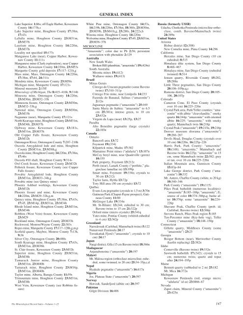
Lake Superior: 1:86s; off Eagle Harbor, Keweenaw<br />
County 14:173h,s<br />
Lake Superior mine, Houghton County 17:38m,<br />
17:43s<br />
LaSalle mine, Houghton County 23:M31m,<br />
23:M37h<br />
Laurium mine, Houghton County 14:220m,<br />
23:M37h<br />
Locality not specified 15:177s<br />
Manganese Lake (near), Copper Harbor, Keweenaw<br />
County 11:111s<br />
Manganese mine (Clark exploration), near Copper<br />
Harbor, Keweenaw County 14:220m, 23:M53s<br />
Marquette County gold deposits 17:117<strong>–</strong>121h,g<br />
Mass mine, Mass, Ontonagon County 14:220m,<br />
17:38m, 17:44, 24:311s<br />
Mendota mine, Keweenaw County 23:M58s<br />
Michigan mine, Marquette County 17:121s<br />
Mineral museums 2:15ff<br />
Mineralogy of Michigan, <strong>The</strong> 8:415<strong>–</strong>416b, 9:314b<br />
Minesota mine, Ontonagon County 14:220m,<br />
23:M30m, 23:M32<strong>–</strong>33h<br />
Minnesota fissure, Ontonagon County 23:M30m,<br />
23:M32<strong>–</strong>33h,g<br />
National mine, Ontonagon County 23:M30m,<br />
23:M33h<br />
Negaunee (near), Marquette County 17:121s<br />
North Kearsage mine, Houghton County 23:M31m,<br />
23:M36h, 23:M37h<br />
Ojibway mine, Keweenaw County 13:181s,<br />
23:M31m, 23:M37h<br />
Old Copper Falls fissure, Keweenaw County<br />
23:M32h<br />
Ontonagon River, Ontonagon County 7:207<strong>–</strong>210h<br />
Osceola Amygdaloid lode and mine, Houghton<br />
County 23:M31m, 23:M36h,g<br />
Osceola mine, Houghton County 14:220m, 17:38m,<br />
17:46s<br />
Osceola #10 shaft, Houghton County 9:314s<br />
Owl Creek fissure, Keweenaw County 23:M32h<br />
Pethrick fissure, Keweenaw County (see Copper<br />
Falls fissure)<br />
Pewabic Amygdaloid lode, Houghton County<br />
23:M31m, 23:M33<strong>–</strong>34h,g<br />
Pewabic mine (see Quincy mine)<br />
Phoenix Ashbed workings, Keweenaw County<br />
23:M32h<br />
Phoenix fissure and mine, Keweenaw County<br />
14:220m, 23:M29<strong>–</strong>32h,g,m<br />
Quincy mine, Houghton County 17:38m, 17:43s,<br />
17:45, 23:M14p, 23:M31m, 23:M34h<br />
Rhode Island mine, Houghton County 23:M31m,<br />
23:M34h<br />
Robbins (West Vein) fissure, Keweenaw County<br />
23:M29<br />
Rockland mine, Ontonagon County 23:M33h<br />
Rockwood, Monroe/Wayne County 22:383s<br />
Ropes mine, Marquette County 17:117<strong>–</strong>120h,g,m,p<br />
Scofield quarry, Maybee, Monroe County 7:13h,<br />
9:36<br />
Silver City, Ontonagon County 20:488s<br />
South Kearsage mine, Houghton County 17:43s,<br />
23:M31m, 23:M36h<br />
St. Clair fissure, Keweenaw County 23:M32h<br />
Superior mine, Houghton County 23:M31m,<br />
23:M38h<br />
Tamarack Junior mine, Houghton County<br />
23:M31m, 23:M40h<br />
Tamarack mine, Houghton County 23:M16p,<br />
23:M31m, 23:M40h<br />
Taylor mine, Alberta, Baraga County 11:59s<br />
Trimountain mine, Houghton County 23:M31m,<br />
23:M38h<br />
West Vein, Keweenaw County (see Robbins fissure)<br />
<strong>The</strong> <strong>Mineralogical</strong> <strong>Record</strong> Index—Volumes 1<strong>–</strong>25<br />
<strong>GENERAL</strong> <strong>INDEX</strong><br />
White Pine mine, Ontonagon County 14:53s,<br />
14:219h, 14:220m, 17:38m, 18:360s, 23:M30m,<br />
23:M39h, 23:M41h,g, 23:280s, 24:222s,h<br />
Winona mine, Houghton County 14:220m<br />
Wolverine mine, Houghton County 17:45, 23:M31m,<br />
23:M36<strong>–</strong>37h<br />
MICROCLINE<br />
“Amazonite”: color due to Pb 2:56; persistent<br />
association with phenakite 2:129<br />
Australia<br />
New South Wales<br />
Broken Hill (plumbian, “amazonite”) 19:(424n)<br />
South Australia<br />
Moonta mines 19:(412)<br />
Wallaroo mines 19:(413)<br />
Brazil<br />
Minas Gerais<br />
Córrego do Urucum pegmatite (some Baveno<br />
twins) 17:310<strong>–</strong>311p<br />
Córrego Frio mine, near Linópolis 14:233<br />
Fazenda do Bananal, Salinas (“amazonite”)<br />
2:12n<br />
Jaguaraçu pegmatite (“amazonite”) 25:169<br />
Santa Maria do Itabira: “amazonite” to 6.5<br />
cm 25:381n; intense green, to 10 cm<br />
23:432n<br />
Virgem da Lapa (near) 13:25p, 13:27<br />
Paraíba<br />
Alto Benedito pegmatite (large crystals)<br />
22:185n<br />
Canada<br />
Ontario<br />
Bancroft area 13:72<br />
Foymont 19:(334)<br />
Kilpatrick mine, Madoc 17:382<br />
Mamainse Point mines (“adularia”) 13:107n<br />
McCoy beryl mine, near Quadeville (green)<br />
10:155<br />
Park property, Foymont 13:212c<br />
Perth (near), Lanark County (“perthite,” plagioclase<br />
lamellae in) 13:199p<br />
Smart mine, Foymont: 19:334n; crystals to<br />
30 cm 13:212c<br />
Taylor farm, Hybla 13:72p<br />
Tory Hill area (50 cm crystals) 13:72<br />
Québec<br />
Evans-Lou pegmatite (crystals to 1.5 m) 3:70n<br />
Gatineau Park (Chaput-Payne prospect), Gatineau<br />
County 11:80<br />
McGregor Lake 19:334n<br />
Mt. St-Hilaire: 13:244; euhedral to 30 cm;<br />
Baveno twins to 15 cm 21:322p<br />
Orford mine (micro crystals) 25:341q<br />
Yates mine, Pontiac County (whitish euhedral<br />
to 4 cm) 12:362p<br />
Greenland<br />
Narssârssuk (Carlsbad, Mannebach twins) 5:122<br />
Nunarssuit Peninsula 24:17<br />
Torsukattak Fjord (“amazonite”; crystals to 10<br />
cm) 24:17<br />
Japan<br />
Naegi district, Gifu (15 cm Baveno twin) 18:366n<br />
Madagascar<br />
Anjanabonoina (“amazonite”) 20:197<br />
Malawi<br />
Mt. Malosa region (orthoclase-microcline; euhedral,<br />
some twinned, to 20 cm) 25:34<strong>–</strong>35p,c,d<br />
Nepal<br />
Hyakule pegmatite (“amazonite”) 16:417n<br />
Nigeria<br />
Jos, Plateau State (“amazonite”) 20:397<br />
Norway<br />
Hotvedt, Sandefjord (albite on) 20:397<br />
Pakistan<br />
Gilgit Division 16:406<br />
MUS <strong>–</strong> MUS<br />
Russia (formerly USSR)<br />
Udacha, Chutkotka Peninsula (microcline-orthoclase,<br />
comb. Baveno/Mannebach twins)<br />
24:389n<br />
United States<br />
Arizona<br />
Bisbee district 12:(308)<br />
New Cornelia mine, Pima County 14:296<br />
California<br />
Hercules mine, San Diego County (10 cm<br />
euhedral) 8:515<br />
Himalaya dike system, San Diego County<br />
8:466<strong>–</strong>467<br />
Himalaya mine, San Diego County (euhedral<br />
twinned) 8:514<br />
Jensen quarry, Riverside County 15:282,<br />
15:288n<br />
Little Three pegmatites, San Diego County<br />
20:106<strong>–</strong>109p,q,c<br />
Ramona district, San Diego County 20:105<strong>–</strong><br />
106, 20:107p<br />
Colorado<br />
Cameron Cone, El Paso County (crystals<br />
over 10 cm) 16:225<strong>–</strong>226n<br />
Crystal Park area, Park/Teller counties: “amazonite”<br />
with albite “cleavelandite,” smoky<br />
quartz 16:244p; “amazonite” with oriented<br />
albite 16:225; “amazonite,” with smoky<br />
quartz; Mannebach twin 16:218p<br />
Crystal Peak (“amazonite”) 19:215n, 19:216p<br />
Denver museum diorama (“amazonite”)<br />
19:266<strong>–</strong>267<br />
Devils Head, Douglas County (crystals over<br />
10 cm) 16:220n, 16:225p<strong>–</strong>226<br />
Harris Park, Park County: “amazonite”<br />
18:(148); “amazonite,” Mannebach and<br />
Baveno twins 16:225p; “amazonite” to 15<br />
cm, some Mannebach twins 22:382; grey<br />
or tan, over 10 cm 16:225<strong>–</strong>226n<br />
Italian Mountain area, Gunnison County<br />
15:83p<strong>–</strong>84<br />
Lake George district, Park County (“amazonite”)<br />
10:332<br />
Mt. Antero, Chaffee County (white, to 20 kg)<br />
10:340<strong>–</strong>346<br />
Park County (“amazonite”) 19:(115)<br />
Pikes Peak batholith (numerous localities):<br />
“amazonite” 5:185<strong>–</strong>188p; “amazonite”; fl.;<br />
source of color 10:374<strong>–</strong>386p,q; barite after<br />
10:376p; some “amazonite” 16:224<strong>–</strong><br />
226p<br />
Shavano Peak, Chaffee County (prob. id;<br />
Carlsbad, Baveno twins) 12:366p<br />
Stevens Ranch, Pikes Peak region 5:185<br />
Ten-Percenter mine (Key-hole vug), Teller<br />
County (“amazonite”) 18:148<strong>–</strong>150p<br />
Connecticut<br />
Gillette quarry, Middlesex County (some<br />
“amazonite”) 23:25<br />
Georgia<br />
Booger Bottom (near), Meriwether County<br />
(kaolin replacing) 22:382n<br />
Idaho<br />
Centerville (Baveno twins) 19:332n<br />
Sawtooth batholith: 17:(342); crystals to 15<br />
cm; numerous twins; quartz and topaz<br />
after 24:194<strong>–</strong>195p<br />
Maine<br />
Bennett quarry (subhedral to 2 m) 25:182<br />
Mt. Mica 16:372n<br />
Michigan<br />
Keweenaw Peninsula (red, orange micro;<br />
“adularia” id as) 23:M66<strong>–</strong>67<br />
Nevada<br />
Zapot claim, Mineral County (“amazonite”)<br />
23:425n<br />
147


