GENERAL INDEX LEP – LIL - The Mineralogical Record
GENERAL INDEX LEP – LIL - The Mineralogical Record
GENERAL INDEX LEP – LIL - The Mineralogical Record
You also want an ePaper? Increase the reach of your titles
YUMPU automatically turns print PDFs into web optimized ePapers that Google loves.
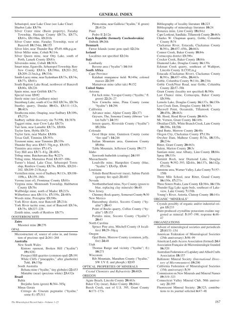
Sebastopol, near Lake Clear (see Lake Clear)<br />
Sharbot Lake 13:79s<br />
Silver Crater mine (Basin property), Faraday<br />
Township, Hastings County 13:73s, 13:77s,<br />
13:81s, 13:198m, 13:201h<br />
Silver Crater mine, Faraday Township, west of<br />
Bancroft 10:154m, 10:155<br />
Silver Islet, near Thunder Bay 17:49<strong>–</strong>60h,p,g,m<br />
Silver Miller mine, Cobalt 9:114s<br />
Silver Queen mine, near Otty Lake, south of<br />
Perth, Lanark County 13:81s<br />
Silversides mine, Cobalt 18:363s<br />
Smart mine, Eganville, Sebastopol Township, Renfrew<br />
County 13:81s, 13:198m, 13:201<strong>–</strong>202,<br />
13:209<strong>–</strong>213m,h,g, 19:334s<br />
Smith-Lacey mine, near Sydenham 13:73s, 13:74s,<br />
13:77s, 13:81s<br />
South Baptiste Lake Road, northwest of Bancroft<br />
13:80s, 13:226<br />
Spain mine, near Griffith 13:77s<br />
Special issue 13:#2<br />
Steele mine (see Lyndhurst mine)<br />
Steenburg Lake, south of Coe Hill 13:74s, 13:78s<br />
Steetley quarry, Dundas 10:42s, 13:111<strong>–</strong>112s,<br />
20:463s<br />
Strathcona mine, Onaping, near Sudbury 13:109s,<br />
17:272s<br />
Sudbury sulfide discovery site 7:159h, 11:387h<br />
Taggert mine, near Crow Lake 13:73s<br />
Tait farm, near Lamable 13:73s, 13:80s<br />
Taylor farm, Hybla 13:72s<br />
Taylor farm, near Madoc 13:80s<br />
Texas Gulf, Timmins 13:393s<br />
Texmont mine, near Timmins 25:339s<br />
Thunder Bay area 13:67<strong>–</strong>70g,m,p, 13:107s<br />
Timmins area mines 17:147s<br />
Tory Hill area 13:71<strong>–</strong>81g, 21:485s<br />
Tribag mine, Batchawana Bay 9:227s<br />
Tribag mine, Mamainse Point 13:107<strong>–</strong>108s<br />
Turner’s Island, Lake Clear, Sebastopol Township,<br />
Renfrew County 13:78s, 13:80s, 13:201<strong>–</strong><br />
202, 13:209<strong>–</strong>213h,m,p<br />
Vermilion mine, west of Sudbury 9:113s, 13:108<strong>–</strong><br />
109h,s, 13:159<strong>–</strong>160s<br />
Verona (east of), Frontenac County 13:81s<br />
Virginia mine, Monmouth Township, Haliburton<br />
County 13:76s<br />
Wallbridge mine, north of Madoc 15:215s<br />
Wilberforce area 13:111s, 17:339s, 21:485s<br />
Woods mine, Porcupine 13:396s<br />
York River skarn, near Bancroft 25:214s<br />
York River tactite zone, east of Bancroft 13:74s,<br />
13:75s, 13:227<strong>–</strong>228<br />
Zenith mine, south of Renfrew 13:77s<br />
OOSTERBOSCHITE<br />
Zaire<br />
Musonoi mine 20:276<br />
OPAL<br />
Microstructure of, source of color in, and formation<br />
of precious opal 2:261<strong>–</strong>268<br />
Australia<br />
New South Wales<br />
Kintore opencut, Broken Hill (“hyalite”)<br />
19:(428)<br />
Prospect Hill quarries (common opal) 25:191<br />
White Cliffs (“pineapples,” after glauberite)<br />
7:60, 19:378p<br />
South Australia<br />
Beltana mine (“hyalite,” tiny globules) 22:453<br />
Mintabie (near) (precious white) 23:432n<br />
Brazil<br />
Bahia<br />
Brejinho farm (green) 8:384<strong>–</strong>385q<br />
Minas Gerais<br />
Córrego do Urucum pegmatite (“hyalite,”<br />
some fl.) 17:311<br />
<strong>The</strong> <strong>Mineralogical</strong> <strong>Record</strong> Index—Volumes 1<strong>–</strong>25<br />
<strong>GENERAL</strong> <strong>INDEX</strong><br />
Pitora mine, near Galileia (“hyalite,” fl. green)<br />
21:412n<br />
Piauí<br />
Pedro II 2:12n<br />
Czech Republic (formerly Czechoslovakia)<br />
Dubnik 19:26h<br />
Denmark<br />
Færoe Islands (some gem opal) 12:24n<br />
Iceland<br />
Localities not specified 12:24n<br />
Italy<br />
Lombardy<br />
Baveno area (“hyalite”) 14:164<br />
South Africa<br />
Cape Province<br />
Kalahari manganese field: 9:149n; colored<br />
masses 22:289<br />
Mamatwan mine (after talc) 9:152<br />
United States<br />
Arizona<br />
Fat Jack mine, Yavapai County (“hyalite,” fl.<br />
green) 22:26<strong>–</strong>27<br />
New Cornelia mine, Pima County (some<br />
“hyalite”) 14:296<br />
California<br />
Advance mine, Alpine County 22:(37)<br />
Geysers, <strong>The</strong>, Sonoma County (fibrous “cotton<br />
balls”) 24:351<br />
Jensen quarry, Riverside County (“hyalite”)<br />
15:288n<br />
Colorado<br />
Good Hope mine, Gunnison County (some<br />
“fire opal”) 14:246<br />
Italian Mountain area, Gunnison County<br />
15:86n<br />
Table Mountain, Jefferson County 19:173<br />
Idaho<br />
Sawtooth batholith (coatings) 24:195<br />
Massachusetts<br />
Loudville mine, Hampshire County (blue,<br />
“hyalite”) 13:45p, 13:46<br />
Louisiana<br />
Toledo Bend Reservoir (near), Sabine Parish<br />
(gemmy fire opal) 21:483<br />
Nevada<br />
Northumberland mine, Nye County (green to<br />
blue, replacing clay minerals) 16:40<br />
New Jersey<br />
Chimney Rock quarry, Somerset County 9:30<br />
New Mexico<br />
Hansonburg district, Socorro County (“hyalite”)<br />
20:43<br />
Point of Rocks quarry, Colfax County (“hyalite”)<br />
15:153<br />
Portales mine, Socorro County (“hyalite”)<br />
20:43<br />
North Carolina<br />
Spruce Pine area, Mitchell County (8 localities)<br />
10:29<strong>–</strong>30p,q<br />
Oregon<br />
Opal Butte, Morrow County (common, jelly,<br />
fire) 24:48<br />
Utah<br />
Thomas Range and vicinity (“hyalite”; fl.)<br />
10:271<br />
Wisconsin<br />
Rib Mountain, Marathon County (“hyalite,”<br />
SW UV fl. and phosph.) 12:95<br />
OPTICAL PROPERTIES OF MINERALS<br />
Crystal Chemistry and Refractivity 20:402b<br />
OREGON<br />
Agate Beach, Lincoln County 20:463s<br />
Baker City (near), Baker County 18:(84s)<br />
Beech Creek, east of U.S. 395, Grant County<br />
6:171<strong>–</strong>173s<br />
PHI <strong>–</strong> PHO<br />
Bibliography of locality literature 18:223<br />
Bibliography of mineralogy literature 10:24<br />
Bonanza mine, Linn County 18:(84s)<br />
Cape Lookout, Sandlake, Tillamook County 20:463s<br />
Charles W. Chapman quarry, Goble, Columbia<br />
County 5:74<br />
Clackamas River, Estacada, Clackamas County<br />
8:391s, 20:457<strong>–</strong>458s, 20:463s<br />
Connor Creek, Baker County 18:84s<br />
Cornucopia district 13:396s<br />
Crocker Creek, Baker County 18:84s<br />
Diamond Lake, Douglas County 16:139s<br />
Eckman Creek quarry, southeast of Waldport,<br />
Lincoln County 1:153ff,m,g<br />
Estacada (Clackamas River), Clackamas County<br />
8:391s, 20:457<strong>–</strong>458s, 20:463s<br />
Goble, Columbia County 9:114s, 20:234s<br />
Goble Creek/Near Road, near Goble, Columbia<br />
County 22:57<strong>–</strong>58h<br />
Grant County (locality not specified) 8:390s<br />
Last Chance mine, Cornucopia, Baker County<br />
13:398s<br />
Lemolo Lake, Douglas County 16:137s, 16:150s<br />
Lost Creek Dam, Douglas County 14:367s<br />
Maxwell Point, Oceanside, Tillamook County<br />
20:458s, 20:463s<br />
Mt. Hood, Hood River County 20:463s<br />
Mt. Vernon, Grant County 16:149s<br />
Obsidian Cliffs, White Branch Creek, Lane County<br />
10:298s, 11:58h<br />
Opal Butte, Morrow County 24:48s<br />
Oregon City, Clackamas County 17:138s<br />
Owyhee Dam, Malheur County 5:74s, 18:335s,<br />
20:234s<br />
Ritter, Grant County 20:463s<br />
Salem, Marion County 20:3s<br />
Santiam mine, near Albany, Linn County 18:84s<br />
Spray 19:333s<br />
Summit Rock, near Diamond Lake, Douglas<br />
County 9:392<strong>–</strong>393, 12:44s, 16:137s, 16:142p,<br />
17:138s<br />
Sunstone area, Warner Valley, Lake County 7:157<strong>–</strong><br />
158h<br />
Three Mile School, near Ritter, Grand County<br />
16:150s, 17:271s<br />
Three Sisters Peaks, Lane County 12:384s, 16:138s<br />
Thunder Egg Lake agate beds, southeast of Lakeview,<br />
Lake County 7:158h<br />
Young’s River, Astoria, Clatsop County 18:141s<br />
ORGANIC “MINERALS”<br />
Crystals possibly of organic and/or industrial origin<br />
13:233<br />
Plant-produced crystalline potassium oxalate suggested<br />
as mineral: 5:197<strong>–</strong>198; response 6:46<strong>–</strong><br />
47<br />
ORGANIZATIONS<br />
Advent of mineralogical societies and periodicals<br />
25:H153<strong>–</strong>154<br />
American Federation of <strong>Mineralogical</strong> Societies<br />
(25th anniversary) 3:98<strong>–</strong>99<br />
American Lands Access Association (formed) 24:4<br />
Association Française de Micromineralogie founded<br />
16:320<br />
Australian Federation of Lapidary and Allied Crafts<br />
Association 18:157<br />
Baltimore Mineral Society (International Directory<br />
of Micromounters) 19:290<br />
California Federation of <strong>Mineralogical</strong> Societies<br />
(35th anniversary) 5:39<br />
Commission on New Minerals and Mineral Names<br />
19:319<strong>–</strong>323<br />
Connecticut Valley Mineral Club, 50th anniversary<br />
21:395<br />
Fluorescent Mineral Society: 20:323; contributions<br />
to its journal solicited 6:47<strong>–</strong>48<br />
167


