


You also want an ePaper? Increase the reach of your titles
YUMPU automatically turns print PDFs into web optimized ePapers that Google loves.
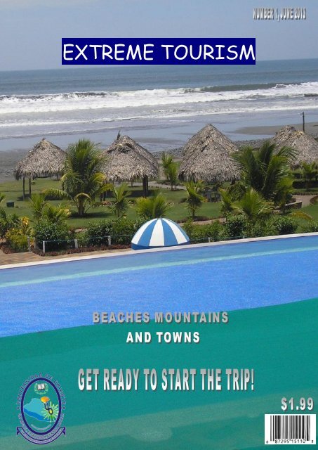
<strong>EXTREME</strong> <strong>TOURISM</strong><br />
1
Beaches<br />
INDEX<br />
Cuco Beach----------------------------------------1, 2<br />
Tunas Beach---------------------------------------3<br />
Espino Beach--------------------------------------4<br />
Towns & Lagoons<br />
Conchagua Town---------------------------------5, 6<br />
Alegria Town & Lagoon-------------------------7, 8<br />
Mountains & Volcanos<br />
Conchagua Volcano----------------------------9, 10<br />
Perkin----------------------------------------------11<br />
Chaparrastique Volcano-----------------------12<br />
2
Cuco Beach<br />
Playa el Cuco is one of the<br />
most popular and amazing<br />
beach in El Salvador. El Cuco<br />
is located in San Miguel, this<br />
is a great surf spot for<br />
beginners and it is also an<br />
ideal place where you can<br />
have a nice vacation or a<br />
break with your family,<br />
friends, etc.<br />
El Cuco offers a lot of<br />
beautiful places where you<br />
can stay, and it gives you<br />
different activities you can<br />
do while you are there. One<br />
of the most popular activities<br />
to do for tourists and<br />
Salvadoreans is the Boat<br />
Trip, another exciting<br />
activity to do in El Cuco is<br />
surfing, and you can also take<br />
3
4<br />
long walks so you can get the<br />
tan you are looking for. All<br />
this, is thanks by the large<br />
coast that El Cuco has.<br />
El Cuco is the pride and<br />
treasure for the residents of<br />
San Miguel, this beach is the<br />
most popular of the east side<br />
of the country. A lot of<br />
people visit this beautiful<br />
beach on vacation or holidays.<br />
One of its attractions is the<br />
seafood and the salty fish<br />
dried under the sun on Bambu<br />
tables. Another of its<br />
attractions is the amazing<br />
view you can have from the<br />
different places. They all<br />
give you a relax feeling. So,<br />
do not wait more to see this<br />
wonderful tourist attraction<br />
BY WILLIAM ESTRADA
Las Tunas Beach<br />
Las Tunas Beach at the province of La Unión is one of the most popular places for<br />
vacationers in east El Salvador.<br />
This beautiful black sand beach has a wide selection of fresh seafood, offered by local<br />
fishermen, such as oysters (US$ 7.00 a dozen) and various types of sundried fish, which<br />
are served over bamboo tables right on the beach at prices ranging from US$ 0.50 to<br />
US$ 1.50 per pound.<br />
Where to eat:<br />
At Las Tunas you will find great choices of restaurants and small palm huts that offer<br />
various types of food at affordable prices.<br />
One option is Rancho Las Tunas where you will savor delicious dishes just in front of<br />
the sea. Their specialties include fresh seafood, poultry, steaks and more, prices<br />
ranging from US$ 4.00 to US$ 15.00.<br />
How to get there:<br />
If you are traveling from San Salvador, drive along the Coastal Highway (CA-2) going<br />
east. After Usulután, find the diversion to “The Rave” where you must turn right. Then<br />
you will find the diversion to “El Cuco”, and to “Intipucá”, finally the one leading to “El<br />
Tamarindo” where you must turn right. At the end of this road you will find Playa Las<br />
Tunas.<br />
BY OMAR MEDINA<br />
5
Espino Beach<br />
The Beach El Espino is one of the tourist attractions preferred by the Salvadoreans<br />
since it counts with more than 10 kilometres of gray sand, along which are observed<br />
gigantic palms and rustic cabins of palm.<br />
Considered the best beach of the Central American Pacífico, its principal attraction is<br />
precisely the extensive zone of beach that it possesses, ideal to practice sports as<br />
football, handball, jogging and others that they need of wide areas. For its pleasant<br />
waters also it is ideal to practice the swimming and the fishing. So if you are a lover of<br />
the sport, it is it is necessary to to be your choice.<br />
Its impressive landscape, a sea with delicate surge, beautiful late afternoons and hot<br />
settlers wait in Beach for the Hawthorn.<br />
BY TANIA ZELAYA<br />
6
Conchagua Town<br />
This historic city, founded in<br />
1543, has strong Lenca roots;<br />
making this town rich in folklore<br />
traditions, in addition to having<br />
some important colonial remains.<br />
The name means “narrow valley”.<br />
At Conchagua there are several<br />
customs and buildings left from<br />
the Spanish colonial era. The best<br />
example is the temple located in<br />
front of the central park.<br />
This is one of the oldest churches<br />
in El Salvador, built in 1693 in<br />
honor of Santiago Apostle.<br />
It is the creation of Wenceslao<br />
Ramírez and Antonio Garcia, who<br />
used Baroque elements on the<br />
facade and Renaissance style in<br />
the interior.<br />
This architectural gem was built<br />
using a mix of materials including<br />
adobe blocks, stones and a<br />
masonry mix known as “Masonry.”<br />
Fine woods as cedar, mahogany,<br />
hujuste and tempisque where used<br />
on this temple as well.<br />
The central nave has seven<br />
columns on each side, each one<br />
carved out of a single tree trunk.<br />
These columns give support to the<br />
main frame of the roof.<br />
7
8<br />
This church houses over 15 original<br />
religious images brought by the Spanish<br />
300 years ago. They are located in the old<br />
wooden altarpieces that flank the nave.<br />
The town festivities are held every July<br />
25th and there are ceremonies dedicated<br />
to Martyr St. Stephen on January 20th.<br />
Where to eat:<br />
On one side of central park there is a<br />
“pupusódromo”, with more than 10<br />
pupuserías that offer pupusas and some<br />
other local dishes. They sell natural juices<br />
and other drinks such as cashew atol, all at<br />
low prices. Its open from 9:00 am until<br />
10:00 p.m. every day.<br />
How to get there:<br />
If you are driving from San Salvador, take<br />
the coastal highway (CA-2) heading east.<br />
After Usulutan, find the diversion to “The<br />
Rave” where you must turn right. Then you<br />
will find another diversion marked to “ El<br />
Cuco” and “La Union”. Follow the signs that<br />
lead to the village of Conchagua.<br />
BY OMAR MEDINA
El Pueblo de Alegria<br />
El Pueblo de Alegria, is one of<br />
the most visited Pueblos Vivos<br />
for the tourists and the<br />
Salvadoreans. This beautiful<br />
town, is loved because of its<br />
cold weather.<br />
The weather in Alegria is<br />
around 24° C maximum, and<br />
9<br />
15° C minimum. This is the<br />
right place to get away from<br />
the heat of San Miguel. In this<br />
place, you can walk and find<br />
beautiful view points. One of<br />
them is, The Hundred Stairs.<br />
From there you can have a<br />
great view.<br />
Alegria is also popular because<br />
of its coffee
that is cultivated by the residents from this town. Another<br />
attraction from this town is the fair it gives every weekend in the<br />
park. So this is a nice place to go with your family, and live an<br />
amazing experience together.<br />
In Alegria you can also find a Lagoon. But this is not a common one,<br />
this lagoon has a legend of a mermaid that lives in it. This lagoon is<br />
a vent of a volcano, and it has green water because of the sulfur,<br />
and many people think that this lagoon is helpful for medicative<br />
people<br />
BY WILLIAM ESTRADA<br />
10
Conchagua Volcano<br />
One of the best views of the Salvadorian<br />
coast can be seen from the Conchagua<br />
Volcano. From there you can also see the<br />
islands in the Gulf of Fonseca (Meanguera,<br />
Meanguerita, Amapala, among others) as<br />
well as the city of La Union.<br />
The Conchagua Volcano is located in the<br />
department of La Unión, in the<br />
municipality of Conchagua at<br />
approximately 190 km from the capital city<br />
of San Salvador, at 1,242 m ASL.<br />
Its name means "narrow valley" in Lenca,<br />
even though some authors relate the origin<br />
of its name to the story of a fearless<br />
woman named Comizahual, which means<br />
"flying tiger". In fact, one of the pathways<br />
on the way to the top of the volcano is<br />
called "The flying tiger".<br />
In order to get to the top of the volcano we<br />
recommend you ride a four wheel drive<br />
vehicle, since most of it is dirt road. You<br />
can access this road from the city of La<br />
Unión, or Conchagua. Drive to the town<br />
known as "El Faro" where a gate protects<br />
the entrance towards the top of the<br />
volcano. A person in charge of CODECA<br />
(Asociación Coordinadora de Comunidades<br />
para el Desarrollo de Cacahuatique) will<br />
open the gate for you. We suggest you tip<br />
him for his help. In order to prevent any<br />
delays you should try to contact with the<br />
association before taking this trip. CODECA<br />
keeps park rangers who help the<br />
preservation of the area, and also provides<br />
11
12<br />
of a safe area for camping. There are two<br />
sightspots in this area. Conchagua,<br />
according to the Salvadorian geologist<br />
Walter Hernández, is a volcano complex,<br />
which divides itself into two volcanic<br />
cones: Ocotal to the West and Banderas to<br />
the East. Ocotal is the oldest one and it's<br />
been modified by several plates; therefore<br />
does not have the perfect cone shape.<br />
Banderas on the other hand is much<br />
younger and therefore well shaped. Both<br />
volcanoes have craters but Banderas' is<br />
more evident.<br />
Local population refers to the volcanoes as<br />
"Cerro" (hill) since they elevate on a flatter<br />
surface. Much older volcanoes are<br />
sometimes not always recognized as<br />
volcanoes, due to their shape. For<br />
example, volcano Guazapa (older than<br />
Conchagua) can not be easily recognized as<br />
a volcano unless the person is related to<br />
vulcanology or geology.<br />
If the vehicle you are ridding is not a 4x4,<br />
we suggest you spend the night at the<br />
property of CODECA, which has running<br />
water, since the road to the top is too<br />
rocky and steep. Next day, wake up early<br />
and take a walk for about 1Hour 30mins to<br />
the main sightspot and in 45 more minutes<br />
to the second one, through the pathway<br />
called "el tigre que vuela".<br />
BY WILLIAM ESTRADA
PERQUIN<br />
The town of Perquín is in Morazán's department. Founded by tribes Lencas, its name<br />
means “way of the warm one ".<br />
Perquín surrounded with rivers and mountains for what it possesses an agreeable<br />
climate during the whole year. Some of the activities that it can enjoy are included by<br />
it: to climb, observe birds, treks, bicycle mountaineering, etc.<br />
Perquín was extraoffcially acquaintance as the guerrilla capital, on having visited<br />
Perquín, it cannot happen for high to visit the Museum of the Revolution in which<br />
there show themselves appliances used during the Salvadorian war 1980-1992.<br />
The Museum of the Salvadorian Revolution counts the troubled history of El Salvador<br />
from the perspective of the guerrilla warfare to way of hundreds of photos, weapon<br />
and documents. Founded on Perquín in December, 1992 for a group of guerrillas of<br />
Morazán, the Museum of the Salvadorian Revolution, Honoring to the Heroes and<br />
Martyrs tells an authentic history of 12 years of conflict armed in El Salvador across<br />
documents and original appliances<br />
The first week of August they celebrate the winter festival in the people of Perquín.<br />
They are five days of local food, sweets, cultural presentations, music, dance Folkloric,<br />
dance and theatre.<br />
BY TANIA ZELAYA<br />
13
The Volcano of San Miguel<br />
The Volcano of San Miguel, known also as Chaparrastique, is an estratovolcán formed<br />
by different caps of volcanic rocks of basaltic composition. It is located in the oriental<br />
region of the Volcanic Mountain chain of El Salvador, to 11 kilometres to the west of<br />
the city of San Miguel.<br />
It has an elevation of 2.130 m.s.n.m and is the highest third volcano of the country.<br />
Around it they find the municipalities of: San Miguel, Quelepa, Moncagua, Chinameca,<br />
San Jorge, San Rafael Orientates and The Traffic, all of the Department of San Miguel.<br />
The volcano of San Miguel is considered to be an assets, both for his historical activity<br />
and for his current activity.<br />
There is had knowledge of at least 26 eruptions during the last 304 years. In the<br />
present, it possesses a high level of seismic activity and permanent emission of gases<br />
across fumaroles. From the foundation of the city of San Miguel, in 1530, the volcano<br />
has produced eight flows of lava across fissures in the hillsides of the volcanic cone.<br />
The most remembered eruption happened in 1762, when the lava went to the city of<br />
San Miguel. The volcano also has produced of small to moderate explosions of ash,<br />
gases and warm mud across the central crater, which had been distributed in the<br />
northern part and west of the same one. The last eruptive activity with emission of<br />
lava happened in 1976 and the last small explosion with launch of ashes took place on<br />
January 16, 2002.<br />
BY TANIA ZELAYA<br />
14