
Create successful ePaper yourself
Turn your PDF publications into a flip-book with our unique Google optimized e-Paper software.
are <strong>earth</strong> <strong>elements</strong> <strong>in</strong> Wyom<strong>in</strong>g<br />
Wayne m. Sutherland, robert W. gregory,<br />
Jacob D. carnes, and Brett n. Worman<br />
report of <strong>in</strong>vestigation no. 65 • 2013<br />
Wyom<strong>in</strong>g State geological Survey<br />
thomas a. Drean, Director and State geologist
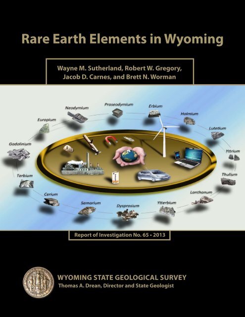
Rare Earth Elements <strong>in</strong> Wyom<strong>in</strong>g<br />
Director and State Geologist Thomas A. Drean<br />
Wyom<strong>in</strong>g State Geological Survey (WSGS) Report of Investigation No. 65, 2013.<br />
ISBN: 978-1-884589-59-1<br />
Copyright© 2013 by the WSGS. All rights reserved.<br />
Edited by:<br />
Mary Kate McCarney<br />
Design & Layout by:<br />
Chamois L. Andersen<br />
WSGS geologist Wayne Sutherland <strong>in</strong>vestigat<strong>in</strong>g the<br />
titaniferous black sandstone horizon <strong>in</strong> the Mesaverde<br />
Formation at Cottonwood Creek <strong>in</strong> the Bighorn Bas<strong>in</strong>.<br />
Photo by Judy Sutherland.<br />
The WSGS encourages the fair use of its material. We request that credit be expressly given to the “Wyom<strong>in</strong>g<br />
State Geological Survey” when cit<strong>in</strong>g <strong>in</strong>formation from this publication. Please contact the WSGS<br />
at 307-766-2286, ext. 224, or by email at wsgs.sales@wyo.gov if you have any questions about cit<strong>in</strong>g materials,<br />
prepar<strong>in</strong>g acknowledgments, or extensive use of this material. We appreciate your cooperation.<br />
Any use of trade, product, or firm names <strong>in</strong> this publication is for descriptive purposes only and does not<br />
imply endorsement or approval by the State of Wyom<strong>in</strong>g or the WSGS. Individuals with disabilities who<br />
require an alternative form of this publication should contact the WSGS (see contact <strong>in</strong>formation above).<br />
TTY relay operator 1-800-877-9975.<br />
For more <strong>in</strong>formation about the WSGS or to order publications and maps, please log on to<br />
www.wsgs.uwyo.edu, call 307-766-2286, ext. 224, or email wsgs.sales@wyo.gov.
Rare Earth Elements <strong>in</strong> Wyom<strong>in</strong>g<br />
Wyom<strong>in</strong>g State Geological Survey<br />
Report of Investigations No. 65<br />
2013<br />
Wayne M. Sutherland, Robert W. Gregory, Jacob D. Carnes, and Brett N. Worman<br />
Wyom<strong>in</strong>g State Geological Survey, Laramie, Wyom<strong>in</strong>g 82071<br />
i
Table of Contents<br />
Abstract . . . . . . . . . . . . . . . . . . . . . . . . . . . . . . . . . . . . . . . . . . . . . . . . . . . . . . . . . . 1<br />
Introduction . . . . . . . . . . . . . . . . . . . . . . . . . . . . . . . . . . . . . . . . . . . . . . . . . . . . . . . 1<br />
Scope and Results of Project . . . . . . . . . . . . . . . . . . . . . . . . . . . . . . . . . . . . . . . . 2<br />
Samples and Analyses . . . . . . . . . . . . . . . . . . . . . . . . . . . . . . . . . . . . . . . . . . . . . 3<br />
Rare Earth Elements Def<strong>in</strong>ed . . . . . . . . . . . . . . . . . . . . . . . . . . . . . . . . . . . . . . . 3<br />
REE Uses . . . . . . . . . . . . . . . . . . . . . . . . . . . . . . . . . . . . . . . . . . . . . . . . . . . . . . 7<br />
Politics and Supplies . . . . . . . . . . . . . . . . . . . . . . . . . . . . . . . . . . . . . . . . . . . . . . 7<br />
REE Prices. . . . . . . . . . . . . . . . . . . . . . . . . . . . . . . . . . . . . . . . . . . . . . . . . . . . . . 9<br />
Extraction of REE. . . . . . . . . . . . . . . . . . . . . . . . . . . . . . . . . . . . . . . . . . . . . . . 11<br />
General Geology of REE. . . . . . . . . . . . . . . . . . . . . . . . . . . . . . . . . . . . . . . . . . 11<br />
REE M<strong>in</strong>erals. . . . . . . . . . . . . . . . . . . . . . . . . . . . . . . . . . . . . . . . . . . . . . . . . . 11<br />
REE Production and Exploration <strong>in</strong> Wyom<strong>in</strong>g. . . . . . . . . . . . . . . . . . . . . . . . . . . . 14<br />
Geologic Occurrences of Wyom<strong>in</strong>g REE . . . . . . . . . . . . . . . . . . . . . . . . . . . . . . . . 15<br />
Bear Lodge Mounta<strong>in</strong>s Rare Earth Element Deposit . . . . . . . . . . . . . . . . . . . . .16<br />
Precambrian Occurrences . . . . . . . . . . . . . . . . . . . . . . . . . . . . . . . . . . . . . . . . . 21<br />
Pegmatites . . . . . . . . . . . . . . . . . . . . . . . . . . . . . . . . . . . . . . . . . . . . . . . . . . . . .21<br />
Tie Sid<strong>in</strong>g Pegmatites. . . . . . . . . . . . . . . . . . . . . . . . . . . . . . . . . . . . . . . . . .21<br />
Laramie Range Pegmatites. . . . . . . . . . . . . . . . . . . . . . . . . . . . . . . . . . . . . . 27<br />
Big Creek District . . . . . . . . . . . . . . . . . . . . . . . . . . . . . . . . . . . . . . . . . . . 29<br />
Many Values Area. . . . . . . . . . . . . . . . . . . . . . . . . . . . . . . . . . . . . . . . . . . . 32<br />
Southern Bighorn and Owl Creek Mounta<strong>in</strong>s . . . . . . . . . . . . . . . . . . . . . . 33<br />
Other Precambrian Occurrences. . . . . . . . . . . . . . . . . . . . . . . . . . . . . . . . . . . . 34<br />
Union Pass – Warm Spr<strong>in</strong>g Area. . . . . . . . . . . . . . . . . . . . . . . . . . . . . . . . . 34<br />
Clarence Wood Lode Claims. . . . . . . . . . . . . . . . . . . . . . . . . . . . . . . . . . . . 37<br />
Babbs M<strong>in</strong>e. . . . . . . . . . . . . . . . . . . . . . . . . . . . . . . . . . . . . . . . . . . . . . . . . 38<br />
Tertiary-aged Igneous Occurrences. . . . . . . . . . . . . . . . . . . . . . . . . . . . . . . . . . 39<br />
Leucite Hills . . . . . . . . . . . . . . . . . . . . . . . . . . . . . . . . . . . . . . . . . . . . . . . 39<br />
Sediment-hosted Occurrences . . . . . . . . . . . . . . . . . . . . . . . . . . . . . . . . . . . . . 39<br />
Flathead Sandstone Paleoplacers . . . . . . . . . . . . . . . . . . . . . . . . . . . . . . . . . . . 41<br />
Bald Mounta<strong>in</strong> Paleoplacers, Big Horn and Sheridan Counties . . . . . . . . . 41<br />
Rattlesnake Hills. . . . . . . . . . . . . . . . . . . . . . . . . . . . . . . . . . . . . . . . . . . . . 46<br />
Union Pass – Warm Spr<strong>in</strong>g Area. . . . . . . . . . . . . . . . . . . . . . . . . . . . . . . . . 46<br />
Mesaverde Formation Paleoplacers . . . . . . . . . . . . . . . . . . . . . . . . . . . . . . . . . . 48<br />
Separation Rim. . . . . . . . . . . . . . . . . . . . . . . . . . . . . . . . . . . . . . . . . . . . . . 49<br />
Cottonwood Creek . . . . . . . . . . . . . . . . . . . . . . . . . . . . . . . . . . . . . . . . . . 50<br />
Grass Creek . . . . . . . . . . . . . . . . . . . . . . . . . . . . . . . . . . . . . . . . . . . . . . . 50<br />
Mud Creek . . . . . . . . . . . . . . . . . . . . . . . . . . . . . . . . . . . . . . . . . . . . . . . . 51<br />
Dugout Creek . . . . . . . . . . . . . . . . . . . . . . . . . . . . . . . . . . . . . . . . . . . . . . 51<br />
Lovell. . . . . . . . . . . . . . . . . . . . . . . . . . . . . . . . . . . . . . . . . . . . . . . . . . . . . 51<br />
Other Potential Paleoplacers . . . . . . . . . . . . . . . . . . . . . . . . . . . . . . . . . . . . . . 51<br />
Frontier Formation . . . . . . . . . . . . . . . . . . . . . . . . . . . . . . . . . . . . . . . . . . . 51<br />
Stump Formation. . . . . . . . . . . . . . . . . . . . . . . . . . . . . . . . . . . . . . . . . . . . 54<br />
Other Sandstone Hosted Occurrences . . . . . . . . . . . . . . . . . . . . . . . . . . . . . . . 54<br />
iii
Deacon’s Prayer Group Claims . . . . . . . . . . . . . . . . . . . . . . . . . . . . . . . . . .55<br />
Phosphate-Rich Sedimentary Occurrences . . . . . . . . . . . . . . . . . . . . . . . . . . . . 55<br />
Uraniferous Phosphatic Horizons <strong>in</strong> the Wilk<strong>in</strong>s Peak Member of the<br />
Green River Formation. . . . . . . . . . . . . . . . . . . . . . . . . . . . . . . . . . . . . . . . 55<br />
Phosphorite Beds <strong>in</strong> Western Wyom<strong>in</strong>g. . . . . . . . . . . . . . . . . . . . . . . . . . . .60<br />
Dahllite Concretions <strong>in</strong> the Thermopolis Shale, Big Horn County . . . . . . .62<br />
Occurrences of Other Elements . . . . . . . . . . . . . . . . . . . . . . . . . . . . . . . . . . . . . . . 62<br />
Conclusion . . . . . . . . . . . . . . . . . . . . . . . . . . . . . . . . . . . . . . . . . . . . . . . . . . . . . . . 66<br />
Acknowledgements . . . . . . . . . . . . . . . . . . . . . . . . . . . . . . . . . . . . . . . . . . . . . . . . . 66<br />
References . . . . . . . . . . . . . . . . . . . . . . . . . . . . . . . . . . . . . . . . . . . . . . . . . . . . . . . . 67<br />
Index . . . . . . . . . . . . . . . . . . . . . . . . . . . . . . . . . . . . . . . . . . . . . . . . . . . . . . . . . . . 75<br />
Figures<br />
Figure 1. Sample locations . . . . . . . . . . . . . . . . . . . . . . . . . . . . . . . . . . . . . . . . . . . 17<br />
Figure 2. Sample of FMR dike at Bear Lodge REE project. . . . . . . . . . . . . . . . . . . 18<br />
Figure 3. Map of Bear Lodge REE project. . . . . . . . . . . . . . . . . . . . . . . . . . . . . . . . 20<br />
Figure 4. Locations of Precambrian samples. . . . . . . . . . . . . . . . . . . . . . . . . . . . . . 22<br />
Figure 5. Tie Sid<strong>in</strong>g area geology and samples. . . . . . . . . . . . . . . . . . . . . . . . . . . . 23<br />
Figure 6. Tie Sid<strong>in</strong>g pegmatites. . . . . . . . . . . . . . . . . . . . . . . . . . . . . . . . . . . . . . . . 24<br />
Figure 7. Allanite from the Holiday Place pegmatite. . . . . . . . . . . . . . . . . . . . . . . 27<br />
Figure 8. Big Creek area geology and samples. . . . . . . . . . . . . . . . . . . . . . . . . . . . . 30<br />
Figure 9. Samples of the Big Creek - Platt pegmatites. . . . . . . . . . . . . . . . . . . . . . . 31<br />
Figure 10. Union Pass-Warm Spr<strong>in</strong>g area geology and samples. . . . . . . . . . . . . . . . 35<br />
Figure 11. Wildcat Road, iron-rich pod- quartz monzonite contact. . . . . . . . . . . . . 36<br />
Figure 12. Photomicrograph of zircon gra<strong>in</strong> with<strong>in</strong> biotite. . . . . . . . . . . . . . . . . . . 36<br />
Figure 13. Locations of paleoplacer, placer, and other sandstone-hosted samples . . 40<br />
Figure 14. Conglomerate of the lower Flathead Sandstone. . . . . . . . . . . . . . . . . . . 41<br />
Figure 15. Bald Mounta<strong>in</strong> area geology and samples. . . . . . . . . . . . . . . . . . . . . . . 43<br />
Figure 16. Gold flake and monazite gra<strong>in</strong>s. . . . . . . . . . . . . . . . . . . . . . . . . . . . . . . 47<br />
Figure 17. Mesaverde Formation titaniferous black sandstone outcrops. . . . . . . . . 48<br />
Figure 18. Cottonwood Creek Mesaverde Formation heavy sand. . . . . . . . . . . . . . 50<br />
Figure 19. Spr<strong>in</strong>g Gap Frontier Formation outcrop and samples . . . . . . . . . . . . . . 52<br />
Figure 20. Spr<strong>in</strong>g Gap area geology and samples. . . . . . . . . . . . . . . . . . . . . . . . . . . 53<br />
Figure 21. Locations of phosphate-related samples. . . . . . . . . . . . . . . . . . . . . . . . . 56<br />
Figure 22. South Firehole Canyon lithostratigraphy and samples. . . . . . . . . . . . . . 59<br />
Figure 23. South Firehole Canyon UPZ 2a with<strong>in</strong> Wilk<strong>in</strong>s Peak Member. . . . . . . . 60<br />
Figure 24. Phosphoria Formation outcrop near Hoback. . . . . . . . . . . . . . . . . . . . . 61<br />
Figure 25. Dahllite-bear<strong>in</strong>g Thermopolis Shale. . . . . . . . . . . . . . . . . . . . . . . . . . . . 62<br />
Figure 26. Dahllite concretions. . . . . . . . . . . . . . . . . . . . . . . . . . . . . . . . . . . . . . . 63<br />
Figure 27. WSGS geologist Bob Gregory collect<strong>in</strong>g a REE sample. . . . . . . . . . . . . 66<br />
iv
Tables<br />
Table 1. Periodic table of the <strong>elements</strong> . . . . . . . . . . . . . . . . . . . . . . . . . . . . . . . . . . . 4<br />
Table 2. Estimated crustal abundances . . . . . . . . . . . . . . . . . . . . . . . . . . . . . . . . . . . 6<br />
Table 3. Uses of <strong>rare</strong> <strong>earth</strong> <strong>elements</strong>. . . . . . . . . . . . . . . . . . . . . . . . . . . . . . . . . . . . . 8<br />
Table 4. Prices of REE. . . . . . . . . . . . . . . . . . . . . . . . . . . . . . . . . . . . . . . . . . . . . . . 10<br />
Table 5. REE-bear<strong>in</strong>g m<strong>in</strong>erals <strong>in</strong> Wyom<strong>in</strong>g. . . . . . . . . . . . . . . . . . . . . . . . . . . . . . 12<br />
Table 6. Tie Sid<strong>in</strong>g pegmatites REE concentrations . . . . . . . . . . . . . . . . . . . . . . . . . 25<br />
Table 7. Weddle claims pegmatites REE concentrations. . . . . . . . . . . . . . . . . . . . . . 28<br />
Table 8. Big Creek - Platt pegmatites REE concentrations. . . . . . . . . . . . . . . . . . . 32<br />
Table 9. Allie claims pegmatites REE concentrations. . . . . . . . . . . . . . . . . . . . . . . . 34<br />
Table 10. Union Pass-Warm Spr<strong>in</strong>g area Precambrian REE concentrations. . . . . . . 37<br />
Table 11. Clarence Wood lode claims REE concentrations. . . . . . . . . . . . . . . . . . . 38<br />
Table 12. Babbs m<strong>in</strong>e Precambrian REE concentrations. . . . . . . . . . . . . . . . . . . . . 38<br />
Table 13. Leucite Hills REE concentrations. . . . . . . . . . . . . . . . . . . . . . . . . . . . . . 39<br />
Table 14. Bald Mounta<strong>in</strong> area REE concentrations. . . . . . . . . . . . . . . . . . . . . . . . . 44<br />
Table 15. Western Rattlesnake Hills Flathead Sandstone REE concentrations. . . . 46<br />
Table 16. Mesaverde Formation paleoplacers REE concentrations. . . . . . . . . . . . . . 49<br />
Table 17. Spr<strong>in</strong>g Gap paleoplacers REE concentrations. . . . . . . . . . . . . . . . . . . . . . 54<br />
Table 18. Deacon’s Prayer claim group REE concentrations. . . . . . . . . . . . . . . . . . . 55<br />
Table 19. Measured section of the lower Wilk<strong>in</strong>s Peak Member. . . . . . . . . . . . . . . . 57<br />
Table 20. Wilk<strong>in</strong>s Peak Member REE concentrations. . . . . . . . . . . . . . . . . . . . . . . 60<br />
Table 21. Phosphoria Formation near Hoback REE concentrations. . . . . . . . . . . . . 62<br />
Table 22. Concentration of the REE, P 2 O 5 , uranium, and thorium <strong>in</strong> dahllite<br />
concretions from the Thermopolis Shale near Greybull. . . . . . . . . . . . . . . . . . . 63<br />
v
AbstrAct<br />
Rare <strong>earth</strong> <strong>elements</strong> (REE) comprise a group of<br />
metals with similar physical and chemical properties<br />
that encompasses the lanthanide series <strong>elements</strong><br />
plus scandium and yttrium. Sixteen REE occur<br />
<strong>in</strong> nature, however, promethium (Pm) is highlyunstable<br />
and does not occur naturally on <strong>earth</strong>.<br />
Diverse sectors of the U.S. economy depend upon<br />
REE, <strong>in</strong>clud<strong>in</strong>g energy generation, transportation,<br />
data transmission, and national defense. Despite<br />
domestic demand for REE, the United States has<br />
produced negligible REE s<strong>in</strong>ce the early 2000s,<br />
while Ch<strong>in</strong>a has accounted for 90 to 97 percent<br />
of the global supply. Current U.S. production<br />
is <strong>in</strong>creas<strong>in</strong>g due to the reopen<strong>in</strong>g of Molycorp’s<br />
Mounta<strong>in</strong> Pass m<strong>in</strong>e <strong>in</strong> California, the only active<br />
REE m<strong>in</strong>e <strong>in</strong> the country. Exploration and development<br />
of new prospects across the United States<br />
is on-go<strong>in</strong>g and <strong>in</strong>cludes the Bear Lodge deposit <strong>in</strong><br />
northeastern Wyom<strong>in</strong>g, owned by Rare Element<br />
Resources, Ltd. The Bear Lodge deposit was not<br />
part of Wyom<strong>in</strong>g State Geological Survey (WSGS)<br />
field <strong>in</strong>vestigations s<strong>in</strong>ce it is currently under <strong>in</strong>tense<br />
exploration by private <strong>in</strong>terests.<br />
Previous <strong>in</strong>vestigations identified many potential<br />
REE occurrences <strong>in</strong> Wyom<strong>in</strong>g, but lacked complete<br />
elemental analyses. The WSGS collected samples<br />
from numerous known, suspected, and potential<br />
REE host rocks and analyzed them for REE content<br />
as well as for other potential economic metals<br />
or <strong>elements</strong>. The limited timeframe for this project<br />
precluded collect<strong>in</strong>g samples from all known or<br />
potential REE-host<strong>in</strong>g sites, however, the WSGS<br />
collected a large number of samples. Notable REE<br />
enrichment occurs <strong>in</strong> a variety of geologic environments<br />
across Wyom<strong>in</strong>g. These environments<br />
<strong>in</strong>clude carbonatites, pegmatite pods and lenses,<br />
epidosite dikes, calc-silicate pods and dikes, ironrich<br />
silicate pods, paleoplacers <strong>in</strong> marg<strong>in</strong>al mar<strong>in</strong>e<br />
sandstones, and phosphatic horizons <strong>in</strong> mar<strong>in</strong>e<br />
shales and lacustr<strong>in</strong>e mudstones. For widespread<br />
access to the results of this study, the WSGS has<br />
developed an onl<strong>in</strong>e database that conta<strong>in</strong>s locations,<br />
geologic sett<strong>in</strong>gs, and analyses for all samples.<br />
This database will aid m<strong>in</strong>eral exploration across<br />
the state, by identify<strong>in</strong>g not only REE concentrations,<br />
but other potentially economic <strong>elements</strong> and<br />
related associations as well.<br />
1<br />
IntroductIon<br />
Rare <strong>earth</strong> <strong>elements</strong> (REE) are a group of metallic<br />
<strong>elements</strong> with similar physical and chemical properties.<br />
REE are a vital resource to <strong>in</strong>dustrialized<br />
societies worldwide. Over the last 15 years, REE<br />
production and process<strong>in</strong>g have become centered<br />
<strong>in</strong> Ch<strong>in</strong>a, which by 2010 provided 95 to 97 percent<br />
of the world’s supply (Northern M<strong>in</strong>er, 2010).<br />
A 40 percent reduction <strong>in</strong> Ch<strong>in</strong>a’s REE exports <strong>in</strong><br />
2010 compared to 2009 caused world demand to<br />
exceed supply (Bradsher, 2010; Davis, 2011; Grace,<br />
2010). Although the United States’ supply issues<br />
improved dur<strong>in</strong>g 2012, secur<strong>in</strong>g REE resources is<br />
<strong>in</strong> our nation’s best <strong>in</strong>terest to ma<strong>in</strong>ta<strong>in</strong> national<br />
security; diversification of the state’s economy is <strong>in</strong><br />
the best <strong>in</strong>terest of Wyom<strong>in</strong>g.<br />
M<strong>in</strong>or amounts of REE-bear<strong>in</strong>g m<strong>in</strong>erals were<br />
reported <strong>in</strong> Wyom<strong>in</strong>g as early as the 1930s. Early<br />
exploration generally focused first on uranium and<br />
thorium, while REE were an <strong>in</strong>terest<strong>in</strong>g association.<br />
Marzell (1933) reported production of 408 kg<br />
(800 lbs) of samarskite <strong>in</strong> 1930, but gave no source<br />
location. REE m<strong>in</strong>eralization associated with thorium<br />
from the Bear Lodge Mounta<strong>in</strong>s was reported<br />
<strong>in</strong> 1949 (Rare Element Resources, 2011). Paleoplacers<br />
<strong>in</strong> the northern Bighorn Mounta<strong>in</strong>s were<br />
found to host radioactive monazite (a thorium- and<br />
REE-host<strong>in</strong>g m<strong>in</strong>eral) <strong>in</strong> 1950 (Wilson, 1951;<br />
McK<strong>in</strong>ney and Horst, 1953). These monazites were<br />
subsequently <strong>in</strong>vestigated by the U.S. Bureau of<br />
M<strong>in</strong>es (USBM) and the U.S. Atomic Energy Commission<br />
(AEC) between 1951 and 1953 (Kl<strong>in</strong>e and<br />
W<strong>in</strong>kel, 1952; McK<strong>in</strong>ney and Horst, 1953). No<br />
REE analyses were reported with these <strong>in</strong>vestigations.<br />
Allanite-bear<strong>in</strong>g ore was reportedly m<strong>in</strong>ed<br />
between 1952 and 1955 <strong>in</strong> the southern Bighorn<br />
Mounta<strong>in</strong>s (Bromley, 1955), and a small amount<br />
of REE-bear<strong>in</strong>g m<strong>in</strong>erals were m<strong>in</strong>ed from a pegmatite<br />
<strong>in</strong> Carbon County <strong>in</strong> the 1950s (K<strong>in</strong>g and<br />
Harris, 2002).<br />
Most early REE studies identified the potential<br />
for REE occurrences but did not produce detailed<br />
analyses due to high analytical costs. Modern<br />
technology has significantly reduced the cost of<br />
high quality detailed analyses, but follow up studies<br />
<strong>in</strong> Wyom<strong>in</strong>g have been slow due to time and<br />
budget constra<strong>in</strong>ts. The Wyom<strong>in</strong>g State Geological
Survey (WSGS) compiled an Open File Report<br />
on REE and yttrium <strong>in</strong> Wyom<strong>in</strong>g <strong>in</strong> 1987, which<br />
was updated <strong>in</strong> 1991 and aga<strong>in</strong> <strong>in</strong> 2002 (K<strong>in</strong>g and<br />
Harris, 1987; K<strong>in</strong>g, 1991; K<strong>in</strong>g and Harris, 2002).<br />
However, these reports were based on literature<br />
searches and did not <strong>in</strong>clude any orig<strong>in</strong>al sampl<strong>in</strong>g<br />
or analyses.<br />
Between 2009 and 2012, the WSGS began to<br />
sample and analyze potential REE host rocks<br />
with<strong>in</strong> the state. Us<strong>in</strong>g WSGS Open File Report<br />
91-3 (K<strong>in</strong>g and Harris, 2002) as a foundation,<br />
the WSGS compiled data from exist<strong>in</strong>g sources,<br />
collected and analyzed a small number of new<br />
samples, and re-analyzed some samples collected at<br />
earlier dates.<br />
In March of 2012, the Wyom<strong>in</strong>g State Legislature<br />
allocated $200,000 of Abandoned M<strong>in</strong>e Lands<br />
Reclamation (AML) funds to the WSGS to conduct<br />
a geological and geochemical <strong>in</strong>vestigation on<br />
potential REE-bear<strong>in</strong>g, as well as other potentially<br />
economic deposits <strong>in</strong> Wyom<strong>in</strong>g, catalog<strong>in</strong>g those<br />
deposits, and provid<strong>in</strong>g a report on the f<strong>in</strong>d<strong>in</strong>gs<br />
by June 1, 2013. In response to this legislative<br />
allocation, the WSGS collected 335 samples from<br />
known, potential, and suspected host rocks of REE<br />
and other m<strong>in</strong>erals, and analyzed these along with<br />
67 samples previously collected by the WSGS. Additional<br />
samples that were collected for REE analyses,<br />
or for other projects dur<strong>in</strong>g 2010 and 2011, are<br />
<strong>in</strong>cluded <strong>in</strong> the results of this study.<br />
scope and results of Project<br />
This report summarizes previous <strong>in</strong>vestigations <strong>in</strong>to<br />
the occurrences of REE <strong>in</strong> Wyom<strong>in</strong>g and provides<br />
REE and other elemental analyses where such <strong>in</strong>formation<br />
was absent or <strong>in</strong>complete. Samples were<br />
collected from numerous known, suspected, and<br />
potential REE host rocks and analyzed for REE<br />
and other potential economic metals or <strong>elements</strong>.<br />
Although a large number of samples were collected,<br />
sampl<strong>in</strong>g of all known or potential REE-host<strong>in</strong>g<br />
sites was not possible dur<strong>in</strong>g the time frame of this<br />
project.<br />
Information provided from this project will be<br />
useful for <strong>in</strong>dividuals, consultants, and <strong>in</strong>dustry as<br />
a base for <strong>in</strong>itiat<strong>in</strong>g exploration not only for REE,<br />
but for other <strong>in</strong>dustrial/economic metals and <strong>elements</strong><br />
as well. Anomalous concentrations of certa<strong>in</strong><br />
<strong>elements</strong> may be pathf<strong>in</strong>ders that lead to the<br />
discovery of other economic deposits. For example,<br />
an abundance of arsenic <strong>in</strong> some geological sett<strong>in</strong>gs<br />
is considered a pathf<strong>in</strong>der for gold. A database of<br />
the sample analyses, locations, and geologic sett<strong>in</strong>gs<br />
developed dur<strong>in</strong>g this project, may aid <strong>in</strong> exploration<br />
to identify not only REE concentrations but<br />
other, potentially economic associations.<br />
It is our hope that educational <strong>in</strong>stitutions may also<br />
use these data to better understand the often complex<br />
geologic environments <strong>in</strong> Wyom<strong>in</strong>g. Decisionmakers<br />
at state and community levels may f<strong>in</strong>d this<br />
<strong>in</strong>formation useful <strong>in</strong> identify<strong>in</strong>g potential areas of<br />
economic development or environmental concern.<br />
Results from this <strong>in</strong>vestigation <strong>in</strong>clude this written<br />
summary report and related maps, a CD with all<br />
raw analytical data <strong>in</strong> an appendix, and a publicly<br />
available onl<strong>in</strong>e database. The onl<strong>in</strong>e Wyom<strong>in</strong>g<br />
database of Geology (Wyo-DOG) <strong>in</strong>cludes all<br />
elemental analyses along with brief write-ups and<br />
photographs for most samples. Wyo-DOG makes<br />
the results of this study available to a wide audience<br />
for exploration, evaluation, and education.<br />
Data from Wyo-DOG can be displayed <strong>in</strong> several<br />
formats <strong>in</strong>clud<strong>in</strong>g ArcGIS and Google Earth.<br />
The idea for a WSGS onl<strong>in</strong>e database that presents<br />
analytical data relative to Wyom<strong>in</strong>g m<strong>in</strong>eral<br />
occurrences began <strong>in</strong> the late 1990s as discussions<br />
between W.M. Sutherland and W.D. Hausel. However<br />
allocations of budgets, hardware, software, and<br />
time were unavailable until 2009. Between 2009<br />
and 2011, an early attempt to construct this type of<br />
database was made by N.R. Jones, with assistance<br />
and <strong>in</strong>put by W.M. Sutherland and R.W. Gregory.<br />
Construction of this <strong>in</strong>itial database provided<br />
build<strong>in</strong>g blocks and useful ideas for both <strong>in</strong>terface<br />
and database structure that evolved <strong>in</strong>to Wyo-<br />
DOG. Us<strong>in</strong>g this <strong>in</strong>formation and feedback from<br />
the authors of this report, S. Parrill was able to use<br />
rapid prototyp<strong>in</strong>g (rapid application development)<br />
with iterative and <strong>in</strong>cremental development (agile<br />
software development) methodologies to construct<br />
Wyo-DOG dur<strong>in</strong>g 2012-2103.<br />
2
Wyo-DOG is a multi-tiered application us<strong>in</strong>g a<br />
structured, relational database. Data is entered via<br />
an application us<strong>in</strong>g the traditional client/server<br />
(two-tier) model. Data <strong>in</strong> the relational database<br />
can be queried directly by common model<strong>in</strong>g<br />
applications such as ESRI’s ArcDesktop or via<br />
custom, <strong>in</strong>clud<strong>in</strong>g Web-based, <strong>in</strong>terfaces. Where<br />
appropriate, data can also be made available to<br />
other model<strong>in</strong>g applications through common<br />
data exchange formats, such as CSV and XML, to<br />
facilitate a variety of uses.<br />
Wyo-DOG can be accessed from the WSGS website<br />
at www.wsgs.uwyo.edu/. Wyo-DOG was <strong>in</strong>itiated<br />
with this project to fulfill the goal of creat<strong>in</strong>g<br />
a statewide catalog of REE occurrences, as well as<br />
occurrences of other resources. It is our hope that<br />
adequate resources, <strong>in</strong>clud<strong>in</strong>g fund<strong>in</strong>g, personnel,<br />
and time, will cont<strong>in</strong>ue to be available to further<br />
expand Wyo-DOG to <strong>in</strong>clude new data types,<br />
<strong>in</strong>vestigations, and the many volumes of historical<br />
data that reside <strong>in</strong> paper files at the WSGS.<br />
samples and Analyses<br />
This <strong>in</strong>vestigation is a survey of various sites across<br />
Wyom<strong>in</strong>g based on grab samples (i.e., small, unmeasured<br />
samples, not necessarily representative of<br />
a larger volume of material). Analyses of these grab<br />
samples can neither confirm nor deny the presence<br />
or absence of economic concentrations of REE<br />
or other <strong>elements</strong>. A grab sample only represents<br />
one small piece of evidence for the occurrence of a<br />
m<strong>in</strong>eral concentration or deposit. The grab sample<br />
is not associated with, nor does it <strong>in</strong>dicate a volume<br />
of material greater than the size of the <strong>in</strong>dividual<br />
sample. The elemental concentrations associated<br />
with a grab sample may or may not extend <strong>in</strong>to the<br />
outcrop from which the sample was collected.<br />
A thorough evaluation of a deposit, as opposed to<br />
a survey of occurrences as presented <strong>in</strong> this report,<br />
requires multiple samples be evaluated across<br />
the range of geologic environments that occur at<br />
a specific location. Each of those samples must<br />
represent a specific volume of relatively uniform<br />
material such that elemental concentrations can be<br />
converted to tonnage estimates across the deposit.<br />
Only then can the economic tenor of the deposit<br />
3<br />
be estimated. No s<strong>in</strong>gle sample can def<strong>in</strong>e or elim<strong>in</strong>ate<br />
the possibility of an economic deposit.<br />
Not all samples are equal. The analysis of a panned<br />
concentrate from a placer sample is not equivalent<br />
to that of a grab sample. A panned concentrate results<br />
from wash<strong>in</strong>g disaggregated gra<strong>in</strong>s <strong>in</strong> the field<br />
with water to separate out the heavy ones from<br />
lighter ones. Analytical results may show relatively<br />
high values for some <strong>elements</strong> <strong>in</strong> the concentrate.<br />
However, to provide proper perspective, a panned<br />
concentrate analysis must be diluted to represent<br />
the orig<strong>in</strong>al larger volume of material from which<br />
the concentrate was derived. This dilution may<br />
reduce reported values by a factor of 10 to 100 or<br />
more, depend<strong>in</strong>g on techniques and equipment<br />
used <strong>in</strong> sampl<strong>in</strong>g. Placer samples are appropriately<br />
described <strong>in</strong> both the text of this report and <strong>in</strong><br />
Wyo-DOG.<br />
All sample analyses collected for this project were<br />
completed by ALS Chemex of Reno, Nevada.<br />
Analytical methods for historical samples <strong>in</strong>cluded<br />
with<strong>in</strong> Wyo-DOG or this report are referred to<br />
as generic if either the laboratory or the method<br />
of analysis is not known. Geochemical analyses<br />
on samples <strong>in</strong>cluded whole rock analyses (major<br />
element concentrations <strong>in</strong> the form of oxides) by<br />
<strong>in</strong>ductively coupled plasma (ICP), atomic emission<br />
spectrometry or mass spectrometry, and atomic<br />
adsorption. These methods, when preceded by effective<br />
preparation techniques, can generally detect<br />
most <strong>elements</strong> present <strong>in</strong> a sample from very low<br />
concentrations <strong>in</strong> the range of less than 0.1 to 5<br />
parts per million (ppm) up to ore-grade concentrations.<br />
To put this <strong>in</strong> perspective, 1.0 percent is<br />
equal to 10,000 ppm.<br />
<strong>rare</strong> Earth Elements def<strong>in</strong>ed<br />
Rare <strong>earth</strong> <strong>elements</strong> (a.k.a. <strong>rare</strong> <strong>earth</strong> metals) are<br />
a group of metallic <strong>elements</strong> with similar physical<br />
and chemical properties. Fifteen of these are<br />
listed <strong>in</strong> the periodic table (table 1) <strong>in</strong> a series<br />
from atomic numbers 57 through 71 known as the<br />
lanthanide series. However, one highly-unstable<br />
element, promethium, does not occur naturally on<br />
<strong>earth</strong>, has a half-life of 17.7 years, and decays <strong>in</strong>to
2<br />
He<br />
PERIODIC TABLE OF ELEMENTS<br />
Helium<br />
1<br />
H<br />
Hydrogen<br />
4.0026<br />
1.00794<br />
0.008<br />
1,400<br />
10<br />
9<br />
Ne<br />
F<br />
Neon<br />
8<br />
O<br />
Oxygen<br />
20.1797<br />
0.01<br />
18<br />
Ar<br />
Argon<br />
39.948<br />
3<br />
Fluor<strong>in</strong>e<br />
18.9984<br />
600<br />
17<br />
Cl<br />
Chlor<strong>in</strong>e<br />
35.4527<br />
15.9994<br />
7<br />
N<br />
Nitrogen<br />
14.00674<br />
Carbon<br />
C<br />
6<br />
Boron<br />
B<br />
5<br />
Nonmetals<br />
Alkali Metals<br />
Physical state of element<br />
@ Standard conditions<br />
0<br />
Gas Solid<br />
Liquid Unknown<br />
oC (32 oF), 101kPa (1 atm)<br />
4<br />
Be<br />
460,000<br />
16<br />
S<br />
Sulfur<br />
20<br />
32.066<br />
15<br />
P<br />
Phosphorus<br />
30.97384<br />
130<br />
300<br />
1,100<br />
12.0107<br />
200<br />
14<br />
Si<br />
Silicon<br />
28.0855<br />
280,000<br />
32<br />
10.811<br />
10<br />
13<br />
Al<br />
Alum<strong>in</strong>um<br />
Beryllium<br />
9.0122<br />
3<br />
Li<br />
Lithium<br />
6.9411<br />
20<br />
3<br />
Halogens<br />
Alkal<strong>in</strong>e Metals<br />
Noble Gases<br />
Transition Metals<br />
Color - physical state<br />
Lanthanides<br />
Other Metals<br />
Act<strong>in</strong>ides<br />
Semi-metals<br />
Au<br />
Gold<br />
79<br />
Atomic Number<br />
Element name<br />
Element symbol<br />
(red-Rare <strong>earth</strong> <strong>elements</strong>)<br />
12<br />
11<br />
Mg<br />
Na<br />
Unknown<br />
Crustal Abundance (ppm)<br />
196.9666<br />
0.004<br />
Atomic Mass - brackets ( )<br />
<strong>in</strong>dicate the mass of the most<br />
stable isotope.<br />
Magnesium<br />
Sodium<br />
26.9815<br />
36<br />
35<br />
34<br />
33<br />
31<br />
Kr<br />
Br<br />
Se<br />
As<br />
Ge<br />
Ga<br />
Krypton<br />
Brom<strong>in</strong>e<br />
83.798<br />
79.904<br />
Selenium<br />
78.96<br />
trace<br />
54<br />
Xe<br />
Xenon<br />
131.29<br />
2.5<br />
53<br />
I<br />
Iod<strong>in</strong>e<br />
126.9045<br />
0.05<br />
52<br />
Arsenic<br />
74.9216<br />
2<br />
51<br />
Te<br />
Sb<br />
Tellurium<br />
Antimony<br />
127.6<br />
121.76<br />
trace<br />
0.5<br />
0.001<br />
86<br />
85<br />
84<br />
Germanium<br />
72.61<br />
4<br />
50<br />
Sn<br />
T<strong>in</strong><br />
118.71<br />
2.1<br />
82<br />
Gallium<br />
69.723<br />
30<br />
Zn<br />
Z<strong>in</strong>c<br />
65.39<br />
70<br />
48<br />
Note: If element symbol appears as: - Then the element is Synthetic (artificially prepared)<br />
21 22 23 24 25 26 27 28 29<br />
Sc Ti V Cr Mn Fe Co Ni Cu<br />
Scandium Titanium Vanadium Chromium Manganese Iron Cobalt Nickel Copper<br />
44.9559 47.867 50.9415 51.9961 54.938 55.845 58.9332 58.6934 63.546<br />
23<br />
140 110 1,000 58,000 27 80 60<br />
41 42 43 44 45 46 47<br />
24.305<br />
22.9898<br />
83,000<br />
24,000<br />
20<br />
Ca<br />
Calcium<br />
23,000<br />
19<br />
K<br />
Potassium<br />
40.078<br />
39.0983<br />
Rn<br />
At<br />
Po<br />
Pb<br />
Hg<br />
Au<br />
4<br />
Radon<br />
Astat<strong>in</strong>e<br />
0.2<br />
83<br />
Bi<br />
Bismuth<br />
(222)<br />
(210)<br />
Polonium<br />
(209)<br />
trace<br />
118<br />
117<br />
116<br />
208.9804<br />
0.05<br />
115<br />
Lead<br />
207.2<br />
13<br />
20<br />
49<br />
In<br />
Induim<br />
114.818<br />
0.1<br />
81<br />
Tl<br />
Thallium<br />
204.3833<br />
Cd<br />
Ag<br />
Pd<br />
Rh<br />
Ru<br />
Mo<br />
Nb<br />
Cadmium<br />
112.411<br />
0.2<br />
80<br />
Silver<br />
Palladium<br />
Rhodium<br />
Ruthenium<br />
107.8682<br />
0.07<br />
79<br />
106.42<br />
102.9055<br />
101.07<br />
Technetium<br />
(98)<br />
Molybdenum<br />
95.94<br />
6,000<br />
40<br />
Zr<br />
Zirconium<br />
91.224<br />
0.6<br />
Mercury<br />
200.59<br />
0.08<br />
Gold<br />
0.01<br />
78<br />
Pt<br />
Plat<strong>in</strong>um<br />
0.001<br />
77<br />
Ir<br />
Iridium<br />
0.001<br />
76<br />
75<br />
Niobium<br />
92.9064<br />
20<br />
73<br />
39<br />
Y<br />
Yttrium<br />
88.9059<br />
42,000<br />
38<br />
Sr<br />
Strontium<br />
87.62<br />
20,000<br />
37<br />
Rb<br />
Os<br />
Re<br />
Osmium<br />
Rhenium<br />
114<br />
113<br />
112<br />
196.9666<br />
0.004<br />
111<br />
195.078<br />
0.01<br />
110<br />
192.217<br />
0.001<br />
109<br />
190.23<br />
186.207<br />
1.3<br />
74<br />
W<br />
Tungsten<br />
183.84<br />
160<br />
30<br />
380<br />
72<br />
56<br />
Rubidium<br />
85.4678<br />
90<br />
55<br />
Ta<br />
Hf<br />
57-71<br />
Ba<br />
Cs<br />
0.003<br />
0.005<br />
1.4<br />
108<br />
107<br />
106<br />
Tantalum<br />
180.9479<br />
2<br />
105<br />
Hafnium<br />
178.49<br />
3<br />
104<br />
Barium<br />
Cesium<br />
Lanthanides<br />
137.327<br />
132.9055<br />
400<br />
88<br />
89-103<br />
Ra<br />
Ununoctium<br />
Ununseptium<br />
Livermorium<br />
Ununpentium<br />
(294)<br />
(294)<br />
(293)<br />
(288)<br />
Flerovium<br />
(289)<br />
Ununtrium<br />
(286)<br />
Copernicium<br />
(285)<br />
Roentgenium<br />
Darmstadtium<br />
(281)<br />
(281)<br />
Meitnerium<br />
(278)<br />
Hassium<br />
(277)<br />
Bohrium<br />
(270)<br />
Seaborgium<br />
(269)<br />
Dubnium<br />
(268)<br />
Rutherfordium<br />
Radium<br />
(267)<br />
Act<strong>in</strong>ides<br />
(226)<br />
2<br />
87<br />
Fr<br />
Francium<br />
(223)<br />
71<br />
70<br />
69<br />
Lu<br />
Yb<br />
Tm<br />
Lutetium<br />
174.967<br />
0.6<br />
103<br />
Ytterbium<br />
173.04<br />
3<br />
102<br />
Thulium<br />
168.9342<br />
0.5<br />
101<br />
68<br />
Er<br />
Erbium<br />
167.26<br />
3<br />
100<br />
67<br />
66<br />
65<br />
64<br />
63<br />
62<br />
61<br />
60<br />
Ho<br />
Dy<br />
Tb<br />
Gd<br />
Eu<br />
Sm<br />
Nd<br />
Holmium<br />
164.9303<br />
1<br />
99<br />
Dysprosium<br />
162.50<br />
4<br />
98<br />
Terbium<br />
158.9253<br />
1<br />
97<br />
Gadol<strong>in</strong>ium<br />
157.25<br />
6<br />
96<br />
Europium<br />
151.964<br />
2<br />
95<br />
Samarium<br />
150.36<br />
6<br />
Promethium<br />
(145)<br />
Neodymium<br />
Praseodymium<br />
Pr<br />
59<br />
58<br />
57<br />
Ce<br />
La<br />
Cerium<br />
144.24<br />
94<br />
93<br />
Lawrencium<br />
(262)<br />
Nobelium<br />
(259)<br />
Mendelevium<br />
Ferium<br />
E<strong>in</strong>ste<strong>in</strong>ium<br />
Californium<br />
Berkelium<br />
Curium<br />
(258)<br />
(257)<br />
(252)<br />
(251)<br />
(247)<br />
(247)<br />
Americium<br />
(243)<br />
Plutonium<br />
(244)<br />
Neptunium<br />
(237)<br />
30<br />
92<br />
U<br />
Uranium<br />
238.0289<br />
140.9077<br />
9<br />
91<br />
140.116<br />
60<br />
90<br />
Lanthanum<br />
138.9055<br />
30<br />
89<br />
Lanthanides<br />
Pa<br />
Th<br />
Ac<br />
Protact<strong>in</strong>ium<br />
Thorium<br />
Act<strong>in</strong>ium<br />
Act<strong>in</strong>ides<br />
231.0359<br />
232.0381<br />
(227)<br />
table 1. Periodic Table of the Elements with REE outl<strong>in</strong>ed <strong>in</strong> black. (Chart by James R. Rodgers, Wyom<strong>in</strong>g State Geological Survey.)
neodymium-145 through electron capture, a type<br />
of radioactive decay.<br />
Two other <strong>elements</strong> not with<strong>in</strong> this series, scandium<br />
(atomic number 21) and yttrium (atomic<br />
number 39) are generally <strong>in</strong>cluded with<strong>in</strong> the<br />
group of REE because of their shared occurrence <strong>in</strong><br />
nature with the lanthanides. Includ<strong>in</strong>g scandium<br />
and yttrium, there are a total of 16 naturally occurr<strong>in</strong>g<br />
REE.<br />
Rare <strong>earth</strong> <strong>elements</strong> received their name from<br />
perceived scarcity dur<strong>in</strong>g the 18 th and 19 th centuries<br />
and from ‘<strong>earth</strong>’ as an obsolete term for<br />
oxide (Hedrick, 2004; Long, Van Gosen, Foley,<br />
and Cordier, 2010). REE are now known to be<br />
relatively common with<strong>in</strong> the <strong>earth</strong>’s crust. Even<br />
the two least abundant REE, thulium (Tm) and<br />
lutetium (Lu) are <strong>in</strong> the range of 140 to 180 times<br />
more common than gold. However, economically<br />
m<strong>in</strong>eable concentrations of REE are not common.<br />
REE range <strong>in</strong> crustal abundances from cerium<br />
(25th most abundant of the 78 common <strong>elements</strong><br />
<strong>in</strong> the <strong>earth</strong>’s crust at 60 parts per million, or ppm,<br />
to thulium and lutetium (least abundant REE at<br />
about 0.5 ppm). Estimates of crustal abundances<br />
vary depend<strong>in</strong>g on the reference source.<br />
REE are subdivided <strong>in</strong>to Light <strong>rare</strong> Earth Elements<br />
(LREE) and Heavy <strong>rare</strong> Earth Elements<br />
(HREE) based on their atomic weight (table 2)<br />
(Hedrick, 2004). LREE <strong>in</strong>clude the <strong>elements</strong><br />
lanthanum (atomic number 57, atomic weight<br />
138.91) through europium (atomic number 63,<br />
atomic weight 151.96) while HREE are gadol<strong>in</strong>ium<br />
(atomic number 64, atomic weight 157.25)<br />
through lutetium (atomic number 71, atomic<br />
weight 174.97).<br />
REE <strong>in</strong> their elemental form are iron-gray to silver,<br />
malleable and ductile, soft metals that are unstable<br />
<strong>in</strong> the presence of oxygen, and readily react to form<br />
metal oxides. Chemically, REE are generally trivalent,<br />
but exceptions occur with cerium, europium,<br />
and ytterbium. Cerium forms compounds with<br />
a valence of +4. Europium can be divalent and<br />
oxidizes much more readily than the trivalent REE,<br />
form<strong>in</strong>g a yellow surface coat<strong>in</strong>g of Eu (OH) with<strong>in</strong><br />
m<strong>in</strong>utes after exposure to moist air. Ytterbium<br />
5<br />
has a closed-shell electron configuration (reluctant<br />
to share electrons with oxygen or other <strong>elements</strong>)<br />
and is thus relatively <strong>in</strong>ert; it can be handled <strong>in</strong> air<br />
and rema<strong>in</strong>s stable (Borzone and others, 1999).<br />
The reactivity of most REE is problematic for<br />
shipp<strong>in</strong>g and long-term storage <strong>in</strong> elemental form.<br />
Because of this, REE are often reported <strong>in</strong> metric<br />
tons (1 tonne = 1000 kilograms [kg]) of <strong>rare</strong> Earth<br />
oxide (rEo) with all REE lumped together. The<br />
designation total <strong>rare</strong> Earth oxides (trEo) is<br />
used <strong>in</strong> m<strong>in</strong><strong>in</strong>g and exploration to describe the<br />
total REE content <strong>in</strong> a deposit or samples <strong>in</strong> an<br />
equivalent oxide form even though their m<strong>in</strong>eral<br />
occurrence may not be <strong>in</strong> the form of an oxide.<br />
By convention, TREO addresses only 14 lanthanide<br />
series <strong>elements</strong> plus yttrium; scandium is<br />
not <strong>in</strong>cluded <strong>in</strong> TREO (Rare Element Resources,<br />
2011). A mixture of REE <strong>in</strong> metallic form (usually<br />
admixed with iron) is called misch metal, or<br />
mischmetal (Hedrick, 1985).<br />
REE with even atomic numbers, such as Ce and<br />
Nd, have greater cosmic and terrestrial abundances<br />
than adjacent REE with odd atomic numbers (La<br />
and Pr; table 1). Cerium is the most abundant with<br />
a cont<strong>in</strong>ental crustal abundance of about 60 ppm,<br />
followed by lanthanum at 34 ppm and neodymium<br />
at 33 ppm. The cumulative total abundance of<br />
REE <strong>in</strong> the <strong>earth</strong>’s crust, <strong>in</strong>clud<strong>in</strong>g scandium and<br />
yttrium, ranges from about 20 ppm to 219 ppm,<br />
depend<strong>in</strong>g on the reference cited (Long, Van<br />
Gosen, Foley, and Cordier, 2010; WebElements.<br />
com, 2012).<br />
To depict low REE concentrations and compare<br />
slight deviations between samples, this report addresses<br />
elemental concentrations <strong>in</strong> ppm. However,<br />
commercial REE assay values are, by convention,<br />
reported <strong>in</strong> terms of TREO. The difference between<br />
reported ppm <strong>in</strong> assay values and reported<br />
TREO will vary with the specific geochemistry<br />
of <strong>in</strong>dividual deposits. TREO equivalents found<br />
<strong>in</strong> Rare Element Resources’ Bear Lodge project<br />
are approximately 15.6 percent higher than the<br />
comb<strong>in</strong>ed raw metal assay values (Rare Element<br />
Resources, 2011). However, us<strong>in</strong>g the Bear Lodge<br />
deposit as a general <strong>in</strong>dication, 3,000 ppm <strong>in</strong> raw<br />
metal assay would give an estimated TREO of
table 2. Rare <strong>earth</strong> <strong>elements</strong>, other <strong>elements</strong> of <strong>in</strong>terest, and estimated crustal abundances by<br />
weight.<br />
Element (chemical<br />
Symbol)<br />
Atomic<br />
Number<br />
about 0.34 percent, and 10,000 ppm would be<br />
about 1.15 percent TREO.<br />
Crustal<br />
Concentration a<br />
(ppm)<br />
Total REE values greater than 3,000 ppm may be<br />
<strong>in</strong>dicative of potential for an economic deposit,<br />
depend<strong>in</strong>g on the type of sample. The selection<br />
of 3,000 ppm results <strong>in</strong> part from study of REE<br />
reported as TREO grades <strong>in</strong> various active ex-<br />
ploration projects outside of Wyom<strong>in</strong>g (Saywell,<br />
2011; Grace, 2010). Reported TREO <strong>in</strong> exploration<br />
projects varied from 0.33 percent <strong>in</strong> drill core<br />
<strong>in</strong>tercepts (the low end of positive <strong>in</strong>dications<br />
for further exploration) to more commonly cited<br />
figures <strong>in</strong> the vic<strong>in</strong>ity of 1 percent. Values of 1 to 2<br />
percent are considered good and values greater than<br />
2 percent are great. This assumes favorable m<strong>in</strong>e-<br />
6<br />
Crustal<br />
Concentration b<br />
(ppm)<br />
Five times<br />
crustal<br />
concentrationa Element group<br />
(ppm)<br />
Lanthanum (La) 57 34 30 170<br />
Cerium (Ce) 58 60 64 300<br />
Praseodymium (Pr)<br />
Neodymium (Nd)<br />
59<br />
60<br />
8.7<br />
33<br />
7.1<br />
26<br />
43.5<br />
165<br />
LREE<br />
Promethium (Pm) 61 0 - 0<br />
Samarium (Sm) 62 6 4.5 30<br />
Europium (Eu) 63 1.8 0.88 9<br />
Gadol<strong>in</strong>ium (Gd) 64 5.2 3.8 26<br />
Terbium (Tb) 65 0.94 0.64 4.7<br />
Dysprosium (Dy) 66 6.2 3.5 31<br />
Holmium (Hm) 67 1.2 0.8 6<br />
Erbium (Er) 68 3 2.3 15 HREE<br />
Thulium (Tm) 69 0.45 0.33 2.25<br />
Ytterbium (Yb) 70 2.8 2.2 14<br />
Lutetium (Lu) 71 0.56 0.32 2.8<br />
Scandium (Sc) 21 26 13.6 130<br />
Yttrium (Y) 39 29 22 145<br />
Cumulative Total REEs 218.85 181.97 1094 REE<br />
Iron (Fe) 26 63,000.00 - 315,000<br />
Copper (Cu) 29 68 - 340<br />
Silver (Ag) 47 0.08 - 0.4<br />
Plat<strong>in</strong>um (Pt) 78 0.04 - 0.19 Associated<br />
Gold (Au) 79 0.00 - 0.02 Elements<br />
Lead (Pb) 82 10 - 50<br />
Thorium (Th) 90 6 - 30<br />
Uranium (U) 92 1.8 - 9<br />
ahttp://www.web<strong>elements</strong>.com/periodicity/abundance_crust/; described as estimates of the average<br />
composition of cont<strong>in</strong>ental crust derived by a consensus and averag<strong>in</strong>g process for data abstracted from<br />
five different references.<br />
bTaylor and McLennan (1985) apply to the upper cont<strong>in</strong>ental crust.
ability and economic factors, <strong>in</strong>clud<strong>in</strong>g sufficient<br />
deposit size and tenor, consistency of ore grades,<br />
uniform m<strong>in</strong>eralogy, favorable chemistry for metal<br />
extraction, m<strong>in</strong>e sit<strong>in</strong>g, transportation, etc.<br />
In contrast to base metals (such as copper, lead,<br />
or iron) and precious metals, REE have very little<br />
tendency to become concentrated <strong>in</strong> exploitable<br />
ore deposits (Haxel and others, 2002). LREE are<br />
more <strong>in</strong>compatible because they have larger ionic<br />
radii and are therefore more strongly concentrated<br />
<strong>in</strong> the cont<strong>in</strong>ental crust than HREE. In most <strong>rare</strong><br />
<strong>earth</strong> deposits, lanthanum, cerium, praseodymium,<br />
and neodymium constitute 80 to 99 percent of the<br />
total. Because of this, deposits conta<strong>in</strong><strong>in</strong>g relatively<br />
high grades of the less common and more valuable<br />
HREE (gadol<strong>in</strong>ium to lutetium, yttrium, and<br />
europium) are particularly desirable.<br />
rEE uses<br />
Consumer products that rely on <strong>in</strong>tegral use of<br />
REE <strong>in</strong>clude: catalytic converters, cell phones, digital<br />
cameras, and computers. Additionally, Nd, Sm,<br />
Gd, Dy, or Pr are used <strong>in</strong> high power permanent<br />
magnets where weight and space are of concern<br />
<strong>in</strong> applications rang<strong>in</strong>g from computer hard drive<br />
motors to w<strong>in</strong>d generators. A typical 2-megawatt<br />
w<strong>in</strong>d turb<strong>in</strong>e requires 60 kg (132 lbs) of dysprosium<br />
and 372 kg (820 lbs) of neodymium, which at<br />
October 2011 prices would cost $301,680 just for<br />
their REE (Grushk<strong>in</strong>, 2011). A typical hybrid car,<br />
such as a Toyota Prius, conta<strong>in</strong>s around 11.3 kg (25<br />
lbs) of REE, mostly lanthanum <strong>in</strong> its rechargeable<br />
battery (McDermott, 2009) and about 2 kg (4.5<br />
lbs) of neodymium and dysprosium <strong>in</strong> its drive<br />
motor (Grushk<strong>in</strong>, 2011).<br />
Fiber-optic cables that transmit signals over long<br />
distances require regularly spaced sections of<br />
erbium-doped fiber that function as laser amplifiers.<br />
Erbium alone possesses the required optical<br />
properties for this application. Europium is used<br />
as a phosphor activator. In a color television tube<br />
it provides the red color seen by the viewer. The<br />
light REE, lanthanum and neodymium, are used<br />
as catalysts <strong>in</strong> the ref<strong>in</strong><strong>in</strong>g of heavy crude oil <strong>in</strong>to<br />
usable forms. Gadol<strong>in</strong>ium, which has the highest<br />
7<br />
neutron capture cross section of all the <strong>elements</strong>,<br />
is the material of choice for absorb<strong>in</strong>g high-energy<br />
neutrons.<br />
Misch metal is pyrophoric; when scratched it gives<br />
off sparks capable of ignit<strong>in</strong>g flammable gases. It is<br />
used <strong>in</strong> cigarette lighters and automatic gas-light<strong>in</strong>g<br />
devices. It is also used <strong>in</strong> mak<strong>in</strong>g some types of<br />
steel, and <strong>in</strong> alum<strong>in</strong>um and magnesium alloys.<br />
The United States uses REE <strong>in</strong> a wide range of<br />
applications, <strong>in</strong>clud<strong>in</strong>g some that are critical to<br />
national security. This makes Ch<strong>in</strong>a’s control of<br />
REE a subject of concern. U.S. Department of<br />
Defense uses REE <strong>in</strong> lasers, precision-guided munitions,<br />
communications and radar systems, avionics,<br />
night-vision equipment, satellites, range f<strong>in</strong>ders,<br />
and control systems (Hedrick, 2004; 2010). Various<br />
uses of REE, listed by element are shown <strong>in</strong><br />
table 3.<br />
Politics and supplies<br />
Prior to the 1990s, the United States produced<br />
sufficient REE for domestic use. Low prices and<br />
overproduction from the mid-1990s through 2003<br />
closed most m<strong>in</strong>es and plants outside of Ch<strong>in</strong>a<br />
(Saywell, 2011). S<strong>in</strong>ce 2004, Ch<strong>in</strong>a has supplied<br />
90 to 97 percent of the world’s REE, while <strong>in</strong><br />
2010, the United States produced none (Northern<br />
M<strong>in</strong>er, 2010). In 2012, Ch<strong>in</strong>a still produced 97<br />
percent of the world’s REE (Niles, 2012). Substitutes<br />
for many REE applications are available, but<br />
they tend to be <strong>in</strong>ferior (Cordier, 2011). Alternative<br />
technologies and recycl<strong>in</strong>g of REE may help<br />
reduce market demand over the next few years<br />
(Elmquist, 2011). However, high-technology REE<br />
applications are diverse and expand<strong>in</strong>g, driv<strong>in</strong>g<br />
<strong>in</strong>creas<strong>in</strong>g technological, economic, and strategic<br />
needs <strong>in</strong> the United States (Long, Van Gosen,<br />
Foley, and Cordier, 2010). Compound<strong>in</strong>g supply<br />
problems, Ch<strong>in</strong>a drastically reduced its REE<br />
exports beg<strong>in</strong>n<strong>in</strong>g <strong>in</strong> 2010, and hiked export taxes<br />
to a range of 15 to 25 percent (Davis, 2011). These<br />
actions resulted <strong>in</strong> a scramble for these resources <strong>in</strong><br />
the rest of the world (Bradsher, 2010; Grace, 2010;<br />
Davis, 2011). In 2012, Ch<strong>in</strong>a cont<strong>in</strong>ued to restrict<br />
the world supply of REO (U.S. Geological Survey,<br />
2013).
table 3. Typical uses of the <strong>rare</strong> <strong>earth</strong> <strong>elements</strong>, after Haxel and others (2002), U.S. Department of<br />
Energy (2010), Long, Van Gosen, Foley, and Cordier (2010), Hedrick (2010), WebElements (2012).<br />
Element Typical uses<br />
Lanthanum<br />
Cerium<br />
Praseodymium<br />
Neodymium<br />
lanthanum oxide additive <strong>in</strong> optical lenses <strong>in</strong>creases light refraction and<br />
decreases dispersion, catalysts <strong>in</strong> heavy crude oil reformation, light<strong>in</strong>g<br />
phosphors, batteries, metal alloys, polish<strong>in</strong>g compounds, ceramics<br />
polish<strong>in</strong>g compounds for optical lenses, light<strong>in</strong>g phosphors, batteries,<br />
metal alloys, catalysts, glass additives, ceramics<br />
high power permanent magnets, batteries, metal alloys, catalysts,<br />
polish<strong>in</strong>g compounds, glass additives, ceramics<br />
catalysts <strong>in</strong> heavy crude oil reformation, high power permanent magnets,<br />
neodymium-yttrium-alum<strong>in</strong>um-garnet lasers, neodymium-iron-boron<br />
permanent magnets, batteries, metal alloys, glass additives, ceramics<br />
Samarium samarium-cobalt permanent magnets, batteries<br />
Europium phosphor activator for red color <strong>in</strong> a color television tube<br />
Gadol<strong>in</strong>ium<br />
Terbium<br />
high power permanent magnets, pa<strong>in</strong>t or coat<strong>in</strong>g aga<strong>in</strong>st neutron radiation,<br />
phosphors<br />
terbium iron-nickel alloy with dysprosium (Terfenol-D) used <strong>in</strong> stealth<br />
technology, light<strong>in</strong>g phosphors, high power permanent magnets<br />
Dysprosium high power permanent magnets, ceramics, nanotechnology research<br />
Holmium<br />
high power permanent magnets, nuclear control rods, lasers, optical<br />
coat<strong>in</strong>gs<br />
Erbium doped fiber laser amplifiers, metal alloys<br />
Thulium Few uses due to rarity and properties similar to other REEs<br />
Ytterbium<br />
radiation source <strong>in</strong> portable x-ray equipment, stress gauges, lasers, metal<br />
alloys, catalysts<br />
Lutetium few uses due to rarity and properties similar to other REEs<br />
Scandium high-strength light weight metallurgical applications<br />
Yttrium neodymium-yttrium-alum<strong>in</strong>um-garnet lasers, light<strong>in</strong>g phosphors, ceramics<br />
Slow economic conditions worldwide dur<strong>in</strong>g 2012,<br />
comb<strong>in</strong>ed with more efficient material usage,<br />
resulted <strong>in</strong> a decl<strong>in</strong>e <strong>in</strong> United States REE imports<br />
from 7,790 tons <strong>in</strong> 2011 to 5,700 tons <strong>in</strong> 2012.<br />
The economic slowdown also resulted <strong>in</strong> a decl<strong>in</strong>e<br />
<strong>in</strong> prices for most REE products <strong>in</strong> the aftermath<br />
of significant price <strong>in</strong>creases dur<strong>in</strong>g 2011. The<br />
value of ref<strong>in</strong>ed REE imported by the United States<br />
decreased from $802 million <strong>in</strong> 2011 to $615 million<br />
<strong>in</strong> 2012 (U.S. Geological Survey, 2013).<br />
The largest known REE deposits occur <strong>in</strong> Ch<strong>in</strong>a,<br />
Australia, and North America, with much smaller<br />
reserves found <strong>in</strong> India, Brazil, Malaysia and South<br />
Africa. Production has been dom<strong>in</strong>ated by Ch<strong>in</strong>a,<br />
with additional production from Australia, India,<br />
Malaysia, Russia, and Thailand (Hedrick, 2004).<br />
Ch<strong>in</strong>a’s reserves are the largest. Estimates project<br />
that Ch<strong>in</strong>a has the largest percentage of worldwide<br />
REE reserves at about 36 percent, compared to<br />
the United States at about 13 percent (Long, Van<br />
8<br />
Element<br />
Group<br />
LREE<br />
HREE<br />
Associated<br />
Elements
Gosen, Foley, and Cordier, 2010). The Commonwealth<br />
of Independent States (Azerbaijan, Armenia,<br />
Belarus, Georgia, Kazakhstan, Kyrgyzstan, Moldova,<br />
Russia, Tajikistan, Turkmenistan, Uzbekistan,<br />
and Ukra<strong>in</strong>e) controls about 19 percent, followed<br />
by Australia with 5.4 percent and India with 3.1<br />
percent (Long, Van Gosen, Foley, and Cordier,<br />
2010).<br />
Ch<strong>in</strong>a’s state-owned m<strong>in</strong>es kept <strong>rare</strong> <strong>earth</strong> prices<br />
artificially low dur<strong>in</strong>g most of the past 15 years,<br />
which drove other suppliers out of bus<strong>in</strong>ess. The<br />
United States had the expertise, but lacked the<br />
manufactur<strong>in</strong>g <strong>in</strong>frastructure to ref<strong>in</strong>e <strong>rare</strong> <strong>earth</strong><br />
oxides to metals. Rebuild<strong>in</strong>g the U.S. REE supply<br />
cha<strong>in</strong> has begun, but could take as long as 15 years<br />
to complete (Long, Van Gosen, Foley, and Cordier,<br />
2010; Hsu, 2010). Achiev<strong>in</strong>g a secure strategic supply<br />
of REE seems to be more important now than<br />
the economic impact of develop<strong>in</strong>g the necessary<br />
supply cha<strong>in</strong>.<br />
The only current REE producer <strong>in</strong> the United<br />
States is the Molycorp m<strong>in</strong>e, produc<strong>in</strong>g from a carbonatite,<br />
at Mounta<strong>in</strong> Pass, California. Molycorp’s<br />
production has been from previously m<strong>in</strong>ed and<br />
stockpiled material. However, completion of their<br />
ongo<strong>in</strong>g expansion and modernization project is<br />
expected to produce about 19,050 tonnes (21,000<br />
tons) of REO equivalent per year, beg<strong>in</strong>n<strong>in</strong>g <strong>in</strong><br />
mid-2013 (Molycorp, 2013). The company plans<br />
to <strong>in</strong>crease production to 40,000 tonnes (44,090<br />
tons) of REO per year when justified by demand,<br />
product pric<strong>in</strong>g, capital availability, and f<strong>in</strong>ancial<br />
returns.<br />
REE m<strong>in</strong>erals and deposits are often classified as<br />
either LREE or HREE. However, s<strong>in</strong>ce both types<br />
usually occur together, the designation is often a<br />
statement relat<strong>in</strong>g to the economic dom<strong>in</strong>ance<br />
of either the light or the heavy <strong>elements</strong>. LREE<br />
deposits are the most common and HREE are<br />
generally more valuable than LREE. Molycorp’s<br />
Mounta<strong>in</strong> Pass deposit is dom<strong>in</strong>ated by LREE<br />
(Long, Van Gosen, Foley, and Cordier, 2010).<br />
A 2010 study by the U.S. Department of Energy<br />
(DOE) addressed the supply of critical m<strong>in</strong>erals <strong>in</strong><br />
9<br />
the United States. They used the term critical as a<br />
measure of importance to the economy, availability<br />
of clean energy, and risk of supply disruption.<br />
Among other m<strong>in</strong>erals and <strong>elements</strong> addressed,<br />
they considered five REE (Dy, Nd, Tb, Eu, and<br />
Y) as most critical <strong>in</strong> the short term future of the<br />
United States.<br />
Currently, REE projects be<strong>in</strong>g <strong>in</strong>vestigated for<br />
exploration or development <strong>in</strong> the United States<br />
<strong>in</strong>clude: the Bear Lodge deposit <strong>in</strong> Wyom<strong>in</strong>g;<br />
Bokan, Alaska; La Paz, Arizona; Diamond Creek,<br />
Idaho; Lemhi Pass, Idaho and Montana; Pea Ridge,<br />
Missouri; Elk Creek, Nebraska; Thor, Nevada; and<br />
Round Top, Texas (U.S. Geological Survey, 2013).<br />
rEE Prices<br />
REE prices have risen substantially <strong>in</strong> the last decade.<br />
Between October 2009 and June 2011, prices<br />
for all REE rose 1,500 percent, then retreated<br />
significantly dur<strong>in</strong>g the latter part of 2011 (Saywell,<br />
2011). Prices retreated further dur<strong>in</strong>g 2012,<br />
but rema<strong>in</strong>ed substantially higher than <strong>in</strong> 2010<br />
(U.S. Geological Survey, 2013). Although there<br />
have been major fluctuations, prices are expected<br />
to rema<strong>in</strong> high until a cha<strong>in</strong> of supply, process<strong>in</strong>g,<br />
and manufactur<strong>in</strong>g has been established outside of<br />
Ch<strong>in</strong>a. Table 4 shows the ris<strong>in</strong>g prices along with<br />
fluctuations <strong>in</strong> 2008, 2010, and 2011.<br />
Relative market values for REE are highly variable<br />
and depend <strong>in</strong> part on the source quoted.<br />
Prices also depend on the level of purity, which is<br />
determ<strong>in</strong>ed by the specifications for any particular<br />
application (Lynas Corporation, 2011). Pric<strong>in</strong>g<br />
occasionally addresses <strong>in</strong>dividual metallic <strong>elements</strong>.<br />
However, most references cite REE <strong>in</strong> oxide form,<br />
reported as REO. REO concentrates vary <strong>in</strong> their<br />
elemental mixes based on those found <strong>in</strong> their<br />
source deposits. REO prices vary accord<strong>in</strong>gly and<br />
may not be comparable between one deposit and<br />
another. Concentrates range from near 40 percent<br />
REO to 99 percent REO. One of the best sources<br />
for current REE price <strong>in</strong>formation is Metal-Pages<br />
(www.metal-pages.com/metalprices/<strong>rare</strong><strong>earth</strong>s),<br />
which requires a subscription to view.
table 4. Prices of REO ($US/kg) raw materials from 2000 to 2012, from a variety of sources.<br />
[FOB ex-Ch<strong>in</strong>a <strong>in</strong>dicates that price <strong>in</strong>cludes Ch<strong>in</strong>ese export taxes and other fees.]<br />
Oxide<br />
Dec.<br />
2012e Oxide<br />
Jan.<br />
2012e Oxide FOB<br />
ex-Ch<strong>in</strong>a<br />
Nov. 21,<br />
2011c Oxide FOB<br />
ex-Ch<strong>in</strong>a Q3,<br />
2011c Oxide FOB<br />
ex-Ch<strong>in</strong>a Q2,<br />
2011c Oxide FOB<br />
ex-Ch<strong>in</strong>a<br />
2010c Oxide FOB<br />
ex-Ch<strong>in</strong>a<br />
Aug.5, 2010d Oxide FOB<br />
ex-Ch<strong>in</strong>a<br />
Jan.5, 2010d Oxide FOB<br />
ex-Ch<strong>in</strong>a<br />
2009c Oxide FOB<br />
ex-Ch<strong>in</strong>a<br />
2008c Oxide FOB<br />
ex-Ch<strong>in</strong>a<br />
2007c Oxide<br />
2006b Element/ M<strong>in</strong>eral Oxide<br />
2000a lanthanum 23.00 1.45 3.44 8.71 4.88 5.60 33.50 22.40 135.02 117.68 65.00<br />
cerium 19.20 3.04 4.56 3.88 4.15 33.00 21.60 138.29 118.65 55.00<br />
praseodymium 36.80 29.05 29.48 18.03 21.50 54.50 48.00 220.08 244.73 210.00<br />
neodymium 28.50 30.24 31.90 19.12 22.50 55.25 49.50 256.15 338.85 240.00 195.00 80.00<br />
promethium --samarium<br />
360.00 3.60 5.20 3.40 3.95 31.80 14.40 125.60 129.45 90.00<br />
europium 990.00 260.00 323.90 481.92 492.92 485.00 590.00 559.80 1830.00 4900.00 3800.00<br />
gadol<strong>in</strong>ium 130.00 6.75 40.00<br />
terbium 535.00 455.00 590.40 720.77 361.67 365.00 605.00 557.80 1659.20 3761.54 2820.00<br />
dysprosium 120.00 89.10 118.49 115.67 117.25 286.50 231.60 921.20 2262.31 2020.00<br />
holmium 440.00<br />
erbium 155.00<br />
thulium 2500.00<br />
ytterbium 230.00<br />
lutetium 3500.00<br />
yttrium 88.00 10.25 34.50<br />
bastnasite 5.51<br />
monazite 0.73<br />
REOf 11.59 14.87 10.32 31.35 173.20 193.21 122.45<br />
10<br />
a From Hedrick (2002)<br />
b From Northern M<strong>in</strong>er (2008)<br />
c From Lynas Corporation, Ltd (2011)<br />
d From Rare Earth m<strong>in</strong>er MCP (2010)<br />
e From U.S. Geological Survey (2013)<br />
f Avg. Mt. Weld, Aust. REE composition
Extraction of rEE<br />
Aside from generally low concentrations of REE <strong>in</strong><br />
their host rocks and m<strong>in</strong>erals, the cost of separation<br />
of the <strong>in</strong>dividual <strong>elements</strong> is quite high<br />
compared to other metals. REE ores are m<strong>in</strong>eralogically<br />
and chemically complex, and are often<br />
radioactive (Long, Van Gosen, Foley, and Cordier,<br />
2010). Because of their similar chemical properties,<br />
<strong>in</strong>dividual REE are difficult to isolate by ord<strong>in</strong>ary<br />
metallurgical means. Therefore, separation is a long<br />
and complex process that <strong>in</strong>volves multiple and<br />
repetitive steps <strong>in</strong> solvent extraction and/or ion<br />
exchange. Other extraction methods may <strong>in</strong>volve<br />
iterative fractional crystallization, fusion, volitization,<br />
or a comb<strong>in</strong>ation of selective reduction and<br />
vacuum distillation of halides (Hedrick, 1985; Uda<br />
and others, 2000).<br />
The presence of two or more m<strong>in</strong>eral phases <strong>in</strong><br />
many deposits requires a different extraction<br />
technology for each m<strong>in</strong>eral, compound<strong>in</strong>g both<br />
complexity and cost (Long, Van Gosen, Foley, and<br />
Cordier, 2010). The cost of build<strong>in</strong>g a plant to<br />
separate the <strong>in</strong>dividual REE is also high and must<br />
be tailored to the unique m<strong>in</strong>eralogy of a specific<br />
ore. Construction of a new m<strong>in</strong>e, with attached<br />
separation plant, was estimated <strong>in</strong> 2010 to cost<br />
between $500 million and $1 billion (Hsu, 2010),<br />
with a lead time up to 15 years for full-capacity<br />
completion (Long, Van Gosen, Foley, and Cordier,<br />
2010; Hsu, 2010).<br />
General Geology of rEE<br />
Awareness of the diversity of REE deposit types<br />
is beneficial to exploration efforts. Economically<br />
exploitable concentrations of REE are primarily<br />
derived from crystall<strong>in</strong>e igneous rocks (Long, Van<br />
Gosen, and Johnson, 2010). REE are more common<br />
<strong>in</strong> alkal<strong>in</strong>e igneous rocks and carbonatites<br />
than <strong>in</strong> mafic rocks (Long, Van Gosen, Foley, and<br />
Cordier, 2010). REE typically occur as trivalent<br />
cations <strong>in</strong> rock-form<strong>in</strong>g m<strong>in</strong>erals <strong>in</strong> carbonates,<br />
oxides, phosphates, and silicates (Hedrick, 2004).<br />
REE are chemically similar to thorium and are<br />
often found <strong>in</strong> m<strong>in</strong>erals and rocks <strong>in</strong> association<br />
with thorium (Hedrick and Templeton, 1990).<br />
Economic concentrations of REE host m<strong>in</strong>erals are<br />
known from alkal<strong>in</strong>e igneous rocks, carbonatites,<br />
11<br />
and from a wide variety of dikes and ve<strong>in</strong>s that<br />
cross-cut alkal<strong>in</strong>e <strong>in</strong>trusions and surround<strong>in</strong>g rocks<br />
(Long, Van Gosen, Foley, and Cordier, 2010).<br />
Sedimentary rocks that may preferentially conta<strong>in</strong><br />
REE <strong>in</strong>clude phosphatic rocks, coarse clastic rocks,<br />
and shales (Hedrick, 1985). Phosphate deposits<br />
may be sources for yttrium and lanthanum (Long,<br />
Van Gosen, and Johnson, 2010). Sediments<br />
derived from host rocks that conta<strong>in</strong> even small<br />
amounts of REE-bear<strong>in</strong>g m<strong>in</strong>erals may produce<br />
both placer and paleoplacer concentrations.<br />
Ion-adsorption clays, or laterites, developed as<br />
residuum from chemical weather<strong>in</strong>g, may be enriched<br />
<strong>in</strong> REE from <strong>in</strong>tensive leach<strong>in</strong>g of igneous<br />
and other rocks. Economic REE concentrations<br />
<strong>in</strong> ion-adsorption clays, are known from southern<br />
Ch<strong>in</strong>a and Kazakhstan (Long, Van Gosen, Foley,<br />
and Cordier, 2010). Such clays tend to have a<br />
greater enrichment <strong>in</strong> HREE than other deposit<br />
types (Hedrick, 2004).<br />
rEE M<strong>in</strong>erals<br />
Numerous m<strong>in</strong>erals are known to conta<strong>in</strong> REE<br />
as essential constituents, and a greater number<br />
conta<strong>in</strong> REE as accessory <strong>elements</strong>. However,<br />
only a few of these m<strong>in</strong>erals host large enough<br />
concentrations of REE to be considered ore<br />
m<strong>in</strong>erals (Hedrick, 1985). Worldwide, the<br />
pr<strong>in</strong>cipal commercial sources of REE are the<br />
m<strong>in</strong>erals bastnasite, loparite, monazite, and<br />
xenotime, and <strong>rare</strong>-<strong>earth</strong> ion-adsorption clays<br />
(Hedrick, 2004). When discuss<strong>in</strong>g pr<strong>in</strong>cipal<br />
REE-bear<strong>in</strong>g m<strong>in</strong>erals only <strong>in</strong> the United States,<br />
Long, Van Gosen, Foley, and Cordier (2010) omit<br />
loparite and ion adsorption clays, but add euxenite<br />
and allanite, although other REE-bear<strong>in</strong>g m<strong>in</strong>erals<br />
are also present. Table 5 lists m<strong>in</strong>erals reported <strong>in</strong><br />
Wyom<strong>in</strong>g that conta<strong>in</strong> REE. Of the pr<strong>in</strong>cipal REEbear<strong>in</strong>g<br />
m<strong>in</strong>erals, allanite, bastnasite, euxenite,<br />
monazite, and xenotime are known to occur <strong>in</strong><br />
Wyom<strong>in</strong>g (K<strong>in</strong>g and Harris, 2002). M<strong>in</strong>eral<br />
formulas shown <strong>in</strong> the follow<strong>in</strong>g discussions are<br />
variable depend<strong>in</strong>g on the source cited, and on<br />
subvarieties that may conta<strong>in</strong> differ<strong>in</strong>g elemental<br />
substitutions.
table 5. REE-bear<strong>in</strong>g m<strong>in</strong>erals that occur <strong>in</strong> Wyom<strong>in</strong>g.<br />
M<strong>in</strong>eral Chemical Formulaa,b REE as primary<br />
or accessory<br />
constituents<br />
Allanitec Ca(Ce,La,Y,Ca)Al (Fe2+,Fe3+)(SiO )(Si O )O(OH)<br />
2 4 2 7<br />
Ancylite Sr (Ce,La,Dy) (CO ) (OH) ∙3H O<br />
3 4 3 7 4 2<br />
Bastnasite (Ce,La,Y)CO F 3<br />
Brannerite (U,Ca,Y,Ce)(Ti,Fe) O 2 6<br />
Brockite (Ca,Th,Ce)PO ∙H O 4 2<br />
Burbankite (Na,Ca) (Sr,Ba,Ce) (CO3) 3 3 5<br />
Calk<strong>in</strong>site (Ce,La) (CO )∙4H O<br />
2 3 2<br />
Cerianite (CeTh)O2 Carbocerianite<br />
Euxenite<br />
Ewaldite<br />
(Ca,Na)(Sr,Ce,Ba)CO3 (Y,Er,Ce,U,Pb,Ca)(Nb,Ta,Ti) (O,OH) 2 6<br />
Ba(Ca,Y,Na,K)(CO ) 3 2<br />
M<strong>in</strong>erals with<br />
REE as essential<br />
constituents<br />
Fergusonite (Y,Er,Ce,Nd,La,Fe)(Nb,Ta,Ti)O4 Gadol<strong>in</strong>ite (Y,Ce,La,Nd) FeBe Si O 2 2 2 10<br />
Mckelveyite Ba Na(Ca,Sr,U)Y(CO ) ∙3H O<br />
3 3 6 2<br />
Parisite Ca(Ce,La) (CO ) F 2 3 3 2<br />
Monazite (Ce,La,Y,Th)PO4 Rhabdophane (Ce,La,Nd)PO ∙H O 4 2<br />
Samarskite (Y,Ce,U,Ca,Th,Fe)(Nb,Ta,Ti) (O,OH) 2 6<br />
Synchysite (Ce,La,Nd,Y)Ca(CO ) F 3 2<br />
Xenotime YPO4 Apatite Ca (PO ) (F,OH,Cl) 5 4 3 3<br />
Columbite-Tantalite (Fe,U,Ca)(Nb,Ta)O4 Fluorite CaF2 M<strong>in</strong>erals with<br />
Huttonite-thorite<br />
Pycrochlore-microlite<br />
ThSiO4 (Na,Ca) (Nb,Ta,Ti)O (OH,F)<br />
2 6<br />
REE as accessory<br />
constituents<br />
Sphene CaTiSiO5 Zircon ZrSiO4 aAfter K<strong>in</strong>g and Harris (2002); Rare Element Resources (2011), formulas vary with citation source<br />
b REEs not listed may substitute <strong>in</strong>to some formulas for specific occurrences<br />
c Chemical formula after Long and others (2010)<br />
Allanite Ca(Ce,La,Y,Ca)Al 2 (Fe 2+ ,Fe 3+ )(SiO 4 )<br />
(Si 2 O 7 )O(OH)<br />
Allanite is a member of the epidote m<strong>in</strong>eral group,<br />
where some calcium atoms are replaced by REE,<br />
particularly cerium. It is also the only member of<br />
the epidote group <strong>in</strong> which ferrous (Fe 2+ , reduced)<br />
iron is an essential constituent. Cerium- (or REE-)<br />
epidotes may conta<strong>in</strong> 0.35 to 2.23 percent radioactive<br />
components (Deer and others, 1967). The<br />
REE content of allanite is typically about 5 percent<br />
REO, but can vary widely from 3 to 51 percent,<br />
depend<strong>in</strong>g on its geologic source (Gupta and<br />
Krishnamurthy, 2005).<br />
Allanite is most commonly found as an accessory<br />
m<strong>in</strong>eral <strong>in</strong> igneous rocks, but <strong>rare</strong>ly <strong>in</strong> sufficient<br />
concentration to be economically m<strong>in</strong>ed. Typically<br />
these igneous rocks <strong>in</strong>clude granites, syenites,<br />
12
diorites, and their associated pegmatites. The<br />
m<strong>in</strong>eral usually occurs as black to dark brown and<br />
brownish-violet tabular gra<strong>in</strong>s. It has a conchoidal<br />
fracture and is often metamict (i.e., its crystal lattice<br />
is disrupted while the m<strong>in</strong>eral gra<strong>in</strong> reta<strong>in</strong>s its<br />
orig<strong>in</strong>al morphology) due to radioactive decay of<br />
thorium, which can weaken the crystal structure. A<br />
microscopic dark halo or r<strong>in</strong>g seen <strong>in</strong>side of allanite<br />
m<strong>in</strong>eral gra<strong>in</strong>s is also an effect caused by radioactivity<br />
(Long, Van Gosen, Foley, and Cordier, 2010).<br />
The specific gravity of allanite is 3.4 to 4.2 and its<br />
hardness is between 5 to 6.5 Moh’s scale (Deer and<br />
others, 1967); these characteristics suggest a possibility<br />
for placer concentrations. However, metamict<br />
varieties may weather rapidly. Weather<strong>in</strong>g of<br />
allanite produces a reddish-brown, iron-rich, <strong>earth</strong>y<br />
crust deficient <strong>in</strong> REE compared to unweathered<br />
allanite (Deer and others, 1967).<br />
Bastnasite (Ce,La,Y)CO 3 F<br />
Bastnasite, also spelled bastnaesite or bastnäsite, is<br />
an uncommon REE-bear<strong>in</strong>g carbonate m<strong>in</strong>eral (cerium-lanthanum-yttrium<br />
carbonate fluoride) that<br />
occurs <strong>in</strong> a m<strong>in</strong>eral series with hydroxyl-bastnasite<br />
[(Ce,La)CO 3 (OH,F)]. It is also closely related to<br />
parisite [Ca(Ce,La) 2 (CO 3 ) 3 F 2 ], and may form replacement<br />
crystals after allanite (Long, Van Gosen,<br />
Foley, and Cordier, 2010). Although bastnasite is<br />
not common, it is the most abundant REE-bear<strong>in</strong>g<br />
m<strong>in</strong>eral (M<strong>in</strong>Dat.org, 2011).<br />
Bastnasite is primarily m<strong>in</strong>ed from <strong>rare</strong>, carbonaterich<br />
igneous rocks called carbonatites. Carbonatites<br />
conta<strong>in</strong> greater than 50 percent carbonate m<strong>in</strong>erals<br />
and are usually associated with alkal<strong>in</strong>e igneous<br />
complexes. Bastnasite is one of the world’s primary<br />
sources for REE, and is dom<strong>in</strong>ated by LREE (Hedrick,<br />
2004). Bastnasite theoretically can conta<strong>in</strong><br />
about 75 percent REO, but averages about 60<br />
percent. Its yttrium content is generally very low at<br />
about 0.05 percent (Hedrick, 1985). In addition<br />
to be<strong>in</strong>g found <strong>in</strong> carbonatites, bastnasite is known<br />
as an accessory m<strong>in</strong>eral <strong>in</strong> some alkal<strong>in</strong>e igneous<br />
rocks and <strong>in</strong> some hydrothermal deposits (Hedrick,<br />
2004).<br />
Bastnasite may be massive or granular and typically<br />
forms small, rounded hexagonal or short prismatic<br />
crystals; it may also occur as spheres or rosettes<br />
13<br />
(Long, Van Gosen, Foley, and Cordier, 2010). It is<br />
transparent to translucent, with a vitreous to greasy<br />
or pearly luster. Its color varies from colorless to<br />
shades of yellow, reddish-brown, and p<strong>in</strong>k. Bastnasite<br />
is relatively heavy with a specific gravity of 4.7<br />
to 5.0. However, its low Moh’s hardness of 4.0 to<br />
4.5 (M<strong>in</strong>Dat.org, 2011), comb<strong>in</strong>ed with its brittleness<br />
and a prom<strong>in</strong>ent basal cleavage, suggest little<br />
possibility for placer concentrations.<br />
Euxenite (Y,Er,Ce,U,Pb,Ca)<br />
(Nb,Ta,Ti) 2 (O,OH) 6<br />
Euxenite is a slightly radioactive oxide m<strong>in</strong>eral<br />
<strong>in</strong> a series with polycrase [(Y,Ca,Ce,U,Th)<br />
(Ti,Nb,Ta) 2 O 6 ]. Euxenite has similar properties to<br />
other REE-bear<strong>in</strong>g oxide m<strong>in</strong>erals such as fergusonite<br />
and samarskite, both uranium m<strong>in</strong>erals,<br />
and to aeschynite, a m<strong>in</strong>or REE-bear<strong>in</strong>g m<strong>in</strong>eral.<br />
Euxenite is typically found <strong>in</strong> granite pegmatites <strong>in</strong><br />
association with quartz, feldspars, columbite (ferrocolumbite),<br />
tantalite (ferrotantalite or manganocolumbite),<br />
and monazite (Long, Van Gosen, Foley,<br />
and Cordier, 2010; M<strong>in</strong>Dat.org, 2011).<br />
Euxenite generally forms black to yellow- or greent<strong>in</strong>ged,<br />
greasy to submetallic, tabular to prismatic<br />
crystals. Metamict crystals are often partially<br />
amorphous. The m<strong>in</strong>eral may also be granular to<br />
massive, or may form radial aggregates. It is brittle,<br />
exhibits a conchoidal fracture, and has no cleavage.<br />
Its Moh’s hardness of 5.5 to 6.5 and specific gravity<br />
of 5.3 to 5.9 facilitate its concentration <strong>in</strong> placer<br />
deposits such as <strong>in</strong> detrital black sands (Long, Van<br />
Gosen, Foley, and Cordier, 2010; M<strong>in</strong>Dat.org,<br />
2011).<br />
Monazite (Ce,La,Y,Th)PO 4<br />
Monazite is a REE-thorium phosphate m<strong>in</strong>eral that<br />
is similar to bastnasite as a LREE ore. However, it<br />
hosts slightly more of the HREE, especially yttrium,<br />
dysprosium, and gadol<strong>in</strong>ium (Hedrick, 2004).<br />
Monazite can theoretically conta<strong>in</strong> 70 percent<br />
REO, <strong>in</strong>clud<strong>in</strong>g about 2 percent yttrium oxide. In<br />
reality, most concentrates conta<strong>in</strong> about 55 to 65<br />
percent REO (Hedrick, 1985), with typical values<br />
<strong>in</strong> the 60 to 62 percent range (Long, Van Gosen,<br />
Foley, and Cordier, 2010). Monazite’s high thorium<br />
content (4.5 to10 percent ThO 2 equivalent)<br />
and thorium’s naturally occurr<strong>in</strong>g radioactivity is
considered an impediment to m<strong>in</strong><strong>in</strong>g and process<strong>in</strong>g.<br />
Because of this, world monazite production is<br />
relatively small (Hedrick, 2004).<br />
Monazite forms translucent, brownish-red to<br />
yellow, equant to tabular prismatic crystals with<br />
wedge-shaped term<strong>in</strong>ations and a vitreous to<br />
adamant<strong>in</strong>e luster. It has a good planar cleavage,<br />
a conchoidal fracture, and may be found <strong>in</strong> both<br />
granular and massive forms. Metamict alteration<br />
due to radioactive decay of thorium is usually<br />
present <strong>in</strong> monazite and shifts its luster to res<strong>in</strong>ous<br />
(Hedrick, 2004; Long, Van Gosen, Foley, and<br />
Cordier, 2010; M<strong>in</strong>Dat.org, 2011).<br />
Monazite is a <strong>rare</strong> accessory m<strong>in</strong>eral <strong>in</strong> alkal<strong>in</strong>e<br />
igneous and metamorphic rocks such as granites,<br />
syenites, gneisses, and related pegmatites (Deer<br />
and others, 1967). However, its economic concentrations<br />
are typically <strong>in</strong> placers and paleoplacers<br />
(Hedrick, 1985). Placer occurrences derive from<br />
monazite’s high specific gravity of 4.8 to 5.5, and<br />
a Moh’s hardness of 5, which contributes a moderate<br />
resistance to weather<strong>in</strong>g. Monazite is recovered<br />
from placers as a byproduct dur<strong>in</strong>g process<strong>in</strong>g for<br />
other resistant heavy m<strong>in</strong>erals, <strong>in</strong>clud<strong>in</strong>g cassiterite,<br />
ilmenite, magnetite, rutile, and zircon (Hedrick,<br />
2004; Long, Van Gosen, Foley, and Cordier, 2010).<br />
Xenotime YPO 4<br />
Xenotime is a yttrium-dom<strong>in</strong>ated phosphate<br />
related to monazite, with possible substitutions of<br />
other REE <strong>in</strong> its structure. It can conta<strong>in</strong> about 67<br />
percent REO, most of which is HREE dom<strong>in</strong>ated<br />
by Y 2 O 3 (Hedrick, 1985; Gupta and Krishnamurthy,<br />
2005). However, xenotime concentrates average<br />
about 25 percent REO (Hedrick, 1985).<br />
Xenotime generally forms yellowish- to reddishbrown<br />
prismatic crystals with vitreous to res<strong>in</strong>ous<br />
lusters. Less commonly, it may be gray, green, or<br />
p<strong>in</strong>k and its crystal form may vary to equant, pyramidal,<br />
or radial aggregates and rosettes. Xenotime’s<br />
similarities <strong>in</strong> crystal habit and overall appearance<br />
to zircon confound identification. However, its<br />
Moh’s hardness is only 4 to 5, compared to zircon’s<br />
7.5, and xenotime has a dist<strong>in</strong>ct cleavage (Long,<br />
Van Gosen, Foley, and Cordier, 2010; M<strong>in</strong>Dat.org,<br />
2011).<br />
Xenotime occurs as an accessory m<strong>in</strong>eral <strong>in</strong> acidic<br />
and alkal<strong>in</strong>e igneous rocks, and <strong>in</strong> some mica<br />
schists and quartz-rich gneisses (Long, Van Gosen,<br />
Foley, and Cordier, 2010). As an REE ore m<strong>in</strong>eral,<br />
xenotime is a byproduct of t<strong>in</strong> m<strong>in</strong><strong>in</strong>g, and to a<br />
lesser extent, is recovered as a detrital byproduct<br />
from the m<strong>in</strong><strong>in</strong>g of heavy-m<strong>in</strong>eral sands (Hedrick,<br />
2004). Its specific gravity of 4.4 to 5.1 favors its<br />
concentration <strong>in</strong> placers.<br />
rEE ProductIon And<br />
ExPLorAtIon In<br />
WyoMInG<br />
REE m<strong>in</strong>eralization <strong>in</strong> Wyom<strong>in</strong>g was discovered <strong>in</strong><br />
the Bear Lodge Mounta<strong>in</strong>s <strong>in</strong> 1949 (Rare Element<br />
Resources, 2011). A record of a telephone conversation<br />
between H.D. Thomas and C.C. Towle of<br />
the AEC <strong>in</strong> 1951 states that the AEC exam<strong>in</strong>ed the<br />
“Sundance deposit,” which was first reported <strong>in</strong> the<br />
spr<strong>in</strong>g of 1950, and that it was “ma<strong>in</strong>ly <strong>rare</strong> <strong>earth</strong>s”<br />
and conta<strong>in</strong>ed negligible uranium content <strong>in</strong> the<br />
monazite (Thomas, 1951). Wilmarth and Johnson<br />
(1953) of the U.S. Geological Survey (USGS)<br />
found iron-manganese ve<strong>in</strong>s <strong>in</strong> two locations<br />
host<strong>in</strong>g REO as high as 12.99 percent. However,<br />
they authors concluded the limited size of the ve<strong>in</strong>s<br />
and the high cost of m<strong>in</strong><strong>in</strong>g prohibited commercial<br />
m<strong>in</strong><strong>in</strong>g of the <strong>rare</strong>-<strong>earth</strong> ore, but additional deposits<br />
were likely to be found <strong>in</strong> the area (Wilmarth<br />
and Johnson, 1953).<br />
After early <strong>in</strong>terest <strong>in</strong> the Bear Lodge deposit,<br />
exploration was renewed <strong>in</strong> 1972 by the Duval<br />
Corporation. They found high-grade copper,<br />
molybdenum, and precious- and <strong>rare</strong>-<strong>earth</strong>- metals<br />
with<strong>in</strong> an altered carbonatite-alkal<strong>in</strong>e-<strong>in</strong>trusive<br />
complex. Their drill<strong>in</strong>g encountered comb<strong>in</strong>ed<br />
REO <strong>in</strong>tercepts rang<strong>in</strong>g from 1 to 15 percent.<br />
In the 1980s, carbonatite-hosted thorium and<br />
REE deposits <strong>in</strong> the Bear Lodge Mounta<strong>in</strong>s were<br />
thought to be the largest resource of dissem<strong>in</strong>ated<br />
REE <strong>in</strong> North America (Staatz, 1983). Exploration<br />
<strong>in</strong>volv<strong>in</strong>g numerous companies cont<strong>in</strong>ued <strong>in</strong> the<br />
Bear Lodge through the mid-1990s when lower<br />
Ch<strong>in</strong>ese prices began to weaken <strong>in</strong>centive for REE<br />
exploration <strong>in</strong> the United States. In 2004, Rare<br />
Element Resources began exploration drill<strong>in</strong>g <strong>in</strong><br />
the Bear Lodge REE deposit. The Bear Lodge REE<br />
deposit northwest of Sundance is the largest known<br />
14
REE deposit <strong>in</strong> Wyom<strong>in</strong>g and is currently welladvanced<br />
<strong>in</strong> exploration, <strong>in</strong>clud<strong>in</strong>g metallurgical<br />
and environmental studies directed toward m<strong>in</strong>e<br />
development (Rare Element Resources, 2013a).<br />
Exploration <strong>in</strong> other parts of Wyom<strong>in</strong>g that<br />
eventually resulted <strong>in</strong> identification of REE or<br />
REE-bear<strong>in</strong>g m<strong>in</strong>erals similarly focused first on<br />
uranium and thorium. Paleoplacers <strong>in</strong> the Bald<br />
Mounta<strong>in</strong> area of the Bighorn Mounta<strong>in</strong>s were<br />
first exam<strong>in</strong>ed for low-grade gold <strong>in</strong> the latter half<br />
of the 19 th century. Dur<strong>in</strong>g late summer of 1950,<br />
these paleoplacers <strong>in</strong> the lower part of the Flathead<br />
Sandstone were found to host radioactive monazite<br />
and were <strong>in</strong>vestigated by the USBM <strong>in</strong> 1951 (Kl<strong>in</strong>e<br />
and W<strong>in</strong>kel, 1952). Evaluation of the Bald Mounta<strong>in</strong><br />
area paleoplacers for monazite and its thorium<br />
content by the AEC <strong>in</strong> 1952 (McK<strong>in</strong>ney and<br />
Horst, 1953) showed a significant resource, but<br />
the study concluded that it could only be m<strong>in</strong>ed<br />
economically if the price per ton for the monazite<br />
was significantly higher. No analyses for REE accompanied<br />
reports from these <strong>in</strong>vestigations. This,<br />
and other reports of early exploration, focused on<br />
uranium and thorium rather than on REE, which<br />
were hosted by some of the same m<strong>in</strong>erals but<br />
appeared to be ignored at the time. However, the<br />
USBM reported <strong>in</strong> the 1956 M<strong>in</strong>erals Yearbook<br />
that U.S. Yttrium, Inc. <strong>in</strong> Laramie, Wyom<strong>in</strong>g was<br />
conduct<strong>in</strong>g exploration and research <strong>in</strong> <strong>rare</strong> <strong>earth</strong><br />
metals <strong>in</strong> the Bald Mounta<strong>in</strong> area.<br />
M<strong>in</strong>or amounts of REE-bear<strong>in</strong>g m<strong>in</strong>erals were<br />
reportedly m<strong>in</strong>ed <strong>in</strong> Wyom<strong>in</strong>g from at least three<br />
locations. Marzell (1933) reported production of<br />
363 kg (800 lbs) of samarskite from Wyom<strong>in</strong>g <strong>in</strong><br />
1930, but left the source of the material unknown.<br />
Allanite-bear<strong>in</strong>g ore was reportedly extracted from<br />
the Beaver Creek prospect <strong>in</strong> the Bighorn Mounta<strong>in</strong>s<br />
<strong>in</strong> southern Johnson County, between 1952<br />
and 1955, but neither production nor process<strong>in</strong>g<br />
records exist (Bromley, 1955; K<strong>in</strong>g and Harris,<br />
2002). The Platt m<strong>in</strong>e <strong>in</strong> the Big Creek district<br />
on the west side of the Medic<strong>in</strong>e Bow Mounta<strong>in</strong>s,<br />
produced approximately 4,500 kg (10,000 lbs)<br />
of euxenite from a pegmatite between 1956 and<br />
1958 (Houston, 1961). Other sources reduce this<br />
figure to 1,800 kg (4,000 lbs), and state that 5,900<br />
15<br />
kg (13,000 lbs) of ore produced from this m<strong>in</strong>e <strong>in</strong><br />
1956 was for uranium (K<strong>in</strong>g and Harris, 2002).<br />
Recent REE exploration <strong>in</strong> Wyom<strong>in</strong>g, beyond the<br />
Bear Lodge deposit, began <strong>in</strong> 2009 and cont<strong>in</strong>ues<br />
to the present. Targets of renewed <strong>in</strong>terest <strong>in</strong>clude<br />
placers, paleoplacers of several ages, alkal<strong>in</strong>e igneous<br />
complexes, pegmatites, and possible carbonatites.<br />
GEoLoGIc occurrEncEs of<br />
WyoMInG rEE<br />
Reported Precambrian REE occurrences <strong>in</strong> Wyom<strong>in</strong>g<br />
are hosted by pegmatites, ve<strong>in</strong>s and dikes,<br />
faults and shear zones, metacarbonate rocks of<br />
uncerta<strong>in</strong> orig<strong>in</strong>, dissem<strong>in</strong>ated m<strong>in</strong>erals <strong>in</strong> generally<br />
alkalic igneous rocks, and <strong>in</strong> metasediments,<br />
<strong>in</strong>clud<strong>in</strong>g paleoplacers (K<strong>in</strong>g and Harris, 2002).<br />
Paleozoic and Mesozoic occurrences <strong>in</strong>clude paleoplacers<br />
<strong>in</strong> both the Cambrian Flathead Sandstone<br />
and the Cretaceous Mesaverde Formation, and dissem<strong>in</strong>ations<br />
with<strong>in</strong> phosphate rock of the Permian<br />
Phosphoria Formation. Tertiary REE concentration<br />
hosts <strong>in</strong>clude alkali igneous rocks, related carbonatite<br />
ve<strong>in</strong>s, dikes, hydrothermal zones, and some<br />
paleoplacers. Quaternary REE hosts are alluvial<br />
placers, paleoplacers, and some hot spr<strong>in</strong>g deposits.<br />
The most outstand<strong>in</strong>g REE occurrence <strong>in</strong> Wyom<strong>in</strong>g<br />
is the carbonatite-hosted Bear Lodge deposit<br />
currently under exploration by Rare Element<br />
Resources. The Bear Lodge REE deposit is centered<br />
on carbonatite dikes associated with Eocene (46 to<br />
50 Ma) alkalic <strong>in</strong>trusive rocks. In this deposit, the<br />
m<strong>in</strong>erals ancylite and bastnasite conta<strong>in</strong> most of<br />
the REE, which are dom<strong>in</strong>ated by the LREE cerium,<br />
lanthanum, neodymium, and praseodymium.<br />
However, at the Whitetail Ridge deposit and<br />
the Carbon target, HREE-enrichment primarily<br />
occurs as elevated yttrium-HREE <strong>in</strong> parasite<br />
and synchysite; at Taylor Ridge and westward,<br />
yttrium-HREE enrichment appears to occur with<strong>in</strong><br />
xenotime and an unidentified yttrium-vanadium<br />
phosphate (Jim Clark, Rare Element Resources,<br />
personal communication, April 2013). Potential<br />
exists <strong>in</strong> other parts of Wyom<strong>in</strong>g for the discovery<br />
of carbonatites that host REE.
All samples analyzed for this study are shown <strong>in</strong><br />
figure 1. This figure also shows samples with greater<br />
than five times average cont<strong>in</strong>ental crustal abundance<br />
of one or more REE. These occurrences do<br />
not imply economic deposits. However, they do<br />
<strong>in</strong>dicate sites that may be of <strong>in</strong>terest for further<br />
exploration with possibilities for locat<strong>in</strong>g previously<br />
unknown REE deposits. Many samples analyzed<br />
for this project yielded low values for REE and<br />
other <strong>elements</strong> of economic <strong>in</strong>terest and were not<br />
addressed <strong>in</strong> the text. The results of these analyses<br />
are <strong>in</strong>cluded on the CD and <strong>in</strong> the detailed site and<br />
sample descriptions <strong>in</strong> Wyo-DOG.<br />
bear Lodge Mounta<strong>in</strong>s <strong>rare</strong> Earth<br />
Element deposit, crook county,<br />
Wyom<strong>in</strong>g<br />
The Bear Lodge Mounta<strong>in</strong>s REE deposit was<br />
not <strong>in</strong>vestigated dur<strong>in</strong>g this study. However, as<br />
the most advanced REE project <strong>in</strong> Wyom<strong>in</strong>g, an<br />
overview of the deposit is appropriate to provide<br />
some perspective when compar<strong>in</strong>g other potential<br />
deposits.<br />
The Bear Lodge Mounta<strong>in</strong>s are located along the<br />
northwestern edge of the Black Hills uplift adjacent<br />
to the northeastern part of the Powder River Bas<strong>in</strong>.<br />
They are the largest of several domal uplifts <strong>in</strong> the<br />
region that are cored by exposed Tertiary alkalic<br />
<strong>in</strong>trusions and flanked by steeply dipp<strong>in</strong>g Paleozoic<br />
and Mesozoic sediments. These <strong>in</strong>trusions and result<strong>in</strong>g<br />
uplifts have exposed Precambrian crystall<strong>in</strong>e<br />
rocks both <strong>in</strong> the Bear Lodge Mounta<strong>in</strong>s and <strong>in</strong> the<br />
T<strong>in</strong>ton-M<strong>in</strong>eral Hill area near the South Dakota<br />
border. Other domes <strong>in</strong> the region, such as Green<br />
Mounta<strong>in</strong>, Strawberry Mounta<strong>in</strong>, and Lime Buttes,<br />
are thought to have unexposed igneous cores. The<br />
area is with<strong>in</strong> the WSGS 30’ x 60’ Sundance and<br />
Devils Tower geologic quadrangles (Sutherland,<br />
2007; 2008).<br />
Prospect<strong>in</strong>g <strong>in</strong> the Bear Lodge began <strong>in</strong> 1875, follow<strong>in</strong>g<br />
the discovery of gold <strong>in</strong> feldspar porphyry<br />
near Warren Peak. Recent exploration <strong>in</strong> the area<br />
has been fostered both by historically known m<strong>in</strong>eralization,<br />
and by similarities this Tertiary <strong>in</strong>trusive<br />
complex shares with Cripple Creek, Colorado.<br />
In addition to gold, historic m<strong>in</strong>eral values have<br />
<strong>in</strong>cluded Ba, Cu, Ag, Pb, Zn, Mn, Nb, Ta, Th, F,<br />
P 2 O 5 , and REE (DeWitt and others, 1986; Hausel<br />
and Sutherland, 1988; Hausel, 1989; Hausel,<br />
1997).<br />
REE m<strong>in</strong>eralization <strong>in</strong> the Bear Lodge Mounta<strong>in</strong>s<br />
is part of the Paleocene and Eocene alkalic igneous<br />
<strong>in</strong>trusive and volcanic rocks that crop out <strong>in</strong> northeastern<br />
Wyom<strong>in</strong>g. These rocks form sills, plugs,<br />
dikes, and irregular bodies <strong>in</strong>trud<strong>in</strong>g rocks rang<strong>in</strong>g<br />
from Precambrian to Cretaceous <strong>in</strong> age. These<br />
rocks crop out <strong>in</strong> the central part of the Bear Lodge<br />
Mounta<strong>in</strong>s, at Missouri Buttes and Devils Tower<br />
to the northwest, and at M<strong>in</strong>eral Hill, Black Butte,<br />
Inyan Kara Mounta<strong>in</strong>, and Sundance Mounta<strong>in</strong> to<br />
the southeast. Most of these rocks are porphyritic,<br />
exhibit flow band<strong>in</strong>g, and show evidence of shallow<br />
emplacement and rapid cool<strong>in</strong>g (Staatz, 1983).<br />
Extrusive flows and pyroclastic deposits are found<br />
<strong>in</strong> limited areas where magma reached the surface<br />
<strong>in</strong> the Bear Lodge Mounta<strong>in</strong>s.<br />
Magmatism progressed from east to west <strong>in</strong> three<br />
pulses beg<strong>in</strong>n<strong>in</strong>g <strong>in</strong> the South Dakota Black Hills<br />
about 58 Ma, with later pulses about 55-54 Ma<br />
near the Wyom<strong>in</strong>g-South Dakota statel<strong>in</strong>e, and<br />
about 50-46 Ma <strong>in</strong> the Bear Lodge Mounta<strong>in</strong>s,<br />
Devils Tower, and Missouri Buttes (Duke, 2005).<br />
Carbonatite dikes, which conta<strong>in</strong> <strong>rare</strong>-<strong>earth</strong><br />
m<strong>in</strong>eralization, represent the last phase of igneous<br />
<strong>in</strong>trusive activity <strong>in</strong> the area. Accompany<strong>in</strong>g the<br />
east to west trend is a transition from subalkalic<br />
magmatism <strong>in</strong> the east to extremely alkalic <strong>in</strong> the<br />
west. Alteration is common and <strong>in</strong>cludes fenitization,<br />
silicification, carbonate enrichment, and<br />
sericitization (Duke, 2005). The largest volume<br />
of <strong>in</strong>trusive rocks is either trachyte or phonolite,<br />
accompanied by lesser amounts of latite, syenite,<br />
nephel<strong>in</strong>e syenite, lamprophyre, pseudoleucite porphyry,<br />
agglomerate, diatremes, and other <strong>in</strong>trusive<br />
breccias, and carbonatite (Rob<strong>in</strong>son and others,<br />
1964; Staatz, 1983).<br />
Historically, one carbonatite dike that cuts <strong>in</strong>trusive<br />
breccia was exposed <strong>in</strong> an old exploration<br />
trench on top of the Bear Lodge Mounta<strong>in</strong>s <strong>in</strong> the<br />
SE¼ sec. 7 and SW¼ sec. 8, T. 52 N., R. 63 W.<br />
(Staatz, 1983; Sutherland, 2008). Carbonatite has<br />
s<strong>in</strong>ce been recognized at the surface <strong>in</strong> trenches<br />
16
17<br />
figure 1. Locations of samples collected and/or analyzed dur<strong>in</strong>g this project. Sample sites with enrichment to greater than five times crustal abundance <strong>in</strong><br />
one or more REE are shown <strong>in</strong> red.
located on Carbon Hill and on the<br />
west flank of Bull Hill (Rare Element<br />
Resources, 2011).<br />
Carbonatite is mostly calcite, but<br />
may also conta<strong>in</strong> accessory m<strong>in</strong>erals<br />
commonly associated with REE-enrichment,<br />
<strong>in</strong>clud<strong>in</strong>g strontianite, fluorite,<br />
biotite, phlogopite, sanad<strong>in</strong>e,<br />
apatite, pyrite, pyrrhotite, sphalerite,<br />
galena, and locally abundant acmite.<br />
Although Thomas (1951) mentioned<br />
monazite, the most common REEbear<strong>in</strong>g<br />
m<strong>in</strong>erals reported by Staatz<br />
(1983) were brown bastnasite and<br />
p<strong>in</strong>k ancylite. The exposed carbonatite is brown<br />
to yellowish-brown, and mottled. Unweathered<br />
carbonatite encountered <strong>in</strong> drill holes appears lightgray<br />
to white and is banded with accessory m<strong>in</strong>erals.<br />
Similar carbonatite dikes were subsequently<br />
<strong>in</strong>tersected by drill holes at other locations, and<br />
were found to occur <strong>in</strong> swarms of several closely<br />
spaced, relatively narrow dikes accompanied by one<br />
thick ma<strong>in</strong> dike (Rare Earth Elements, 2011).<br />
REE m<strong>in</strong>eralization occurs <strong>in</strong> unaltered carbonatite<br />
and <strong>in</strong> deeply weathered carbonatite dikes referred<br />
to as FMR dikes. FMR references the major ironmanganese-<strong>rare</strong>-<strong>earth</strong>-element<br />
constituents of the<br />
highly oxidized, carbonatite dikes. These f (FeO x ),<br />
M (MnO x ), and r (REE m<strong>in</strong>erals) dikes, ve<strong>in</strong>s,<br />
and stockworks range <strong>in</strong> depth from 0 to 150 m (0<br />
to 500 ft) or more as shown by exploration drill<strong>in</strong>g.<br />
Carbonatite and FMR dikes encountered <strong>in</strong> drill<br />
holes and trenches range from narrow ve<strong>in</strong>lets to<br />
almost 15 m (50 ft) <strong>in</strong> width and generally dip vertically<br />
to steeply southwest along northwest strikes<br />
(Rare Element Resources, 2011).<br />
The FMR dikes conta<strong>in</strong> altered silicates, amorphous<br />
silica, and variable amounts of REE<br />
m<strong>in</strong>erals dom<strong>in</strong>ated by bastnasite. Additionally,<br />
FMR ve<strong>in</strong>s with<strong>in</strong> the oxidized zone host REE<br />
m<strong>in</strong>eralization as cerianite [(CeTh)O 2 ], parisite<br />
[Ca(REE) 2 (CO 3 ) 3 F 2 ], and f<strong>in</strong>e-gra<strong>in</strong>ed fibrous clusters<br />
of synchysite [Ca(REE)(CO 3 ) 2 F]. FMR bodies<br />
generally have higher concentrations of REE than<br />
the carbonatites. The f<strong>in</strong>e gra<strong>in</strong> size and crystal<br />
morphology of the bastnasite group m<strong>in</strong>erals <strong>in</strong> the<br />
figure 2. Sample of FMR dike at the Bear Lodge REE project.<br />
FMR dikes makes beneficiation easier than <strong>in</strong> the<br />
unoxidized carbonatite dikes; these m<strong>in</strong>erals are<br />
amenable to attrition scrubb<strong>in</strong>g and size classification<br />
<strong>in</strong> the physical upgrade process (Jim Clark,<br />
Rare Element Resources, personal communication,<br />
April 2013). Common accessory m<strong>in</strong>erals <strong>in</strong> FMR<br />
dikes <strong>in</strong>clude barite, fluorite, apatite, with vary<strong>in</strong>g<br />
amounts of sanid<strong>in</strong>e and quartz. The FMR ve<strong>in</strong>s<br />
are typically vuggy and rusty to black <strong>in</strong> color and<br />
also occur as sheeted zones and stockworks (Rare<br />
Element Resources, 2011). Figure 2 shows a hand<br />
specimen of an FMR dike from the Bull Hill area.<br />
REE m<strong>in</strong>eralization with<strong>in</strong> the dikes ranges from<br />
about 0.25 to nearly 20 percent, and appears to be<br />
uniform both along strike and at depth. M<strong>in</strong>eralization<br />
with<strong>in</strong> the stockworks varies from about 0.5<br />
percent to 2 percent REO (Rare Element Resources,<br />
2012).<br />
The carbonatite and FMR dikes are classified as<br />
either sovite- or silico-carbonatite. REE m<strong>in</strong>eral<br />
abundances <strong>in</strong> both types reportedly range from<br />
trace amounts to greater than 50 percent. Sovitecarbonatite<br />
consists of f<strong>in</strong>e to coarse crystall<strong>in</strong>e<br />
calcite, with accessory biotite, potassium feldspar,<br />
augite, strontianite, dolomite, and sulfides. As<br />
much as 30 percent sulfide and oxide components<br />
<strong>in</strong>clude pyrite, pyrrhotite, chalcopyrite,<br />
galena, sphalerite, molybdenite, hematite, rutile,<br />
and ilmenite. Silico-carbonatite conta<strong>in</strong>s more<br />
than 30 percent silicate m<strong>in</strong>erals (biotite or<br />
phlogopite and potassium feldspar) with calcite and<br />
18
accessory aegir<strong>in</strong>e, apatite, strontianite, barite, and<br />
celestite (Rare Element Resources, 2011).<br />
LREE dom<strong>in</strong>ate the Bear Lodge deposit. However,<br />
a press release by Rare Element Resources on<br />
August 4, 2011 describes high HREE grades <strong>in</strong><br />
the northern and western portion of their project<br />
area. These localities are referred to as their Whitetail<br />
Ridge, Taylor, and Carbon target areas (fig. 3).<br />
These areas generally host grades greater than 3<br />
percent REO and are also significantly enriched <strong>in</strong><br />
europium, terbium, dysprosium, and gadol<strong>in</strong>ium,<br />
as well as yttrium (Rare Element Resources, personal<br />
communication, April 2013).<br />
On March 18, 2013, Rare Element Resources<br />
reported an NI 43-101-compliant 1 total high-grade<br />
Measured and Indicated (M&I) m<strong>in</strong>eral resource<br />
of 13.3 million tonnes (14.7 million tons) grad<strong>in</strong>g<br />
3.22 percent REO at a 1.5 percent cutoff grade,<br />
which <strong>in</strong>cluded M&I resources of 5 million tonnes<br />
(6 million tons) grad<strong>in</strong>g 4.72 percent REO at 3<br />
percent cutoff grade (Rare Element Resources,<br />
2013b). In relative order of decreas<strong>in</strong>g abundance<br />
REOs <strong>in</strong>clude Ce 2 O 3 , La 2 O 3 , Nd 2 O 3 , Pr 2 O 3 ,<br />
Sm 2 O 3 , Gd 2 O 3 , Y 2 O 3 , Eu 2 O 3 , Dy 2 O 3 , Tb 2 O 3 ,<br />
and others (Rare Element Resources, 2012). The<br />
cont<strong>in</strong>u<strong>in</strong>g expansion of the identified Bear Lodge<br />
REE deposit through drill<strong>in</strong>g seems to confirm<br />
Staatz’s 1983 claim that Bear Lodge may be the<br />
largest resource of dissem<strong>in</strong>ated <strong>rare</strong>-<strong>earth</strong> <strong>elements</strong><br />
<strong>in</strong> North America.<br />
Gold m<strong>in</strong>eralization occurs with<strong>in</strong> the same large<br />
alkal<strong>in</strong>e-igneous complex as the REE m<strong>in</strong>eralization.<br />
The Taylor target area was primarily a gold<br />
exploration area until a thick FMR zone was <strong>in</strong>tersected<br />
<strong>in</strong> 2010. One hole <strong>in</strong>tersected high-grade<br />
1 National Instrument 43-101 is a Standards of Disclosure<br />
for M<strong>in</strong>eral Projects rule issued by the Canadian<br />
Securities Adm<strong>in</strong>istrators, which governs the public disclosure<br />
of scientific and technical <strong>in</strong>formation by publicly-traded<br />
m<strong>in</strong><strong>in</strong>g companies, <strong>in</strong>clud<strong>in</strong>g oral statements,<br />
written documents, and websites. NI 43-101 requires<br />
that all disclosure be based on advice by a “qualified person”<br />
(eng<strong>in</strong>eer or geologist) who, <strong>in</strong> some cases, must be<br />
<strong>in</strong>dependent of the m<strong>in</strong><strong>in</strong>g company and the property.<br />
Its purpose is to ensure public confidence <strong>in</strong> m<strong>in</strong><strong>in</strong>grelated<br />
stocks by enhanc<strong>in</strong>g the accuracy and <strong>in</strong>tegrity of<br />
public disclosure <strong>in</strong> the m<strong>in</strong><strong>in</strong>g sector.<br />
19<br />
REE m<strong>in</strong>eralization that also averaged 1.3 g/tonne<br />
(0.038 oz/ton) gold 2 from the surface to a depth of<br />
62.5 m (205 ft). On March 15, 2011, the company<br />
released an NI 43-101-compliant <strong>in</strong>ferred<br />
m<strong>in</strong>eral resource estimate of 26,850 kg (947,000<br />
oz) of gold conta<strong>in</strong>ed <strong>in</strong> 69.3 million tonnes (76.4<br />
million tons) averag<strong>in</strong>g 0.42 ppm (0.42 g/tonne;<br />
0.122 oz/ton) us<strong>in</strong>g a 0.15 ppm (0.15 g/tonne;<br />
0.004 oz/ton) cutoff grade. A February 27, 2012<br />
news release reported some of Rare Element Resources’<br />
best gold drill<strong>in</strong>g assays that <strong>in</strong>cluded 24.4<br />
m (80 feet) of 4.5 ppm (4.5 g/tonne; 0.131 oz/<br />
ton) <strong>in</strong> one hole (Rare Element Resources, 2012).<br />
The 2011 gold drill<strong>in</strong>g results will likely expand the<br />
company’s gold resource.<br />
Rare Element Resources’ REE project totals about<br />
971.2 hectares (2,400 acres) that <strong>in</strong>cludes 90 unpatented<br />
federal lode claims and one private section<br />
of land. Between 2008 and the end of 2012, their<br />
drill hole database <strong>in</strong>cluded 216 core holes and<br />
16,920 assay samples (Rare Element Resources,<br />
2013b). On March 1, 2012, the company announced<br />
positive economic results from a prefeasibility<br />
study. Projections are for a conventional<br />
open-pit m<strong>in</strong>e and an on-site physical upgrade<br />
plant us<strong>in</strong>g a gravity separation and screen<strong>in</strong>g and<br />
wash process designed to produce up to 907 tonnes<br />
(1,000 tons) of ore material per day. Their nom<strong>in</strong>al<br />
operat<strong>in</strong>g scenario addresses production of 20,970<br />
tonnes (23,111 tons) per year of 45 percent REO<br />
concentrate for a m<strong>in</strong>e life of 19 years. However,<br />
cont<strong>in</strong>ued drill<strong>in</strong>g <strong>in</strong> outly<strong>in</strong>g areas <strong>in</strong>dicates<br />
potential for <strong>in</strong>creased LREE and HREE enrichment<br />
that could extend the life of the m<strong>in</strong>e (Rare<br />
Element Resources, 2012). In conjunction with a<br />
feasibility study commenc<strong>in</strong>g <strong>in</strong> 2013, the company<br />
plans to conduct pilot-scale metallurgical test<strong>in</strong>g<br />
on more than 19.1 tonnes (21 tons) of m<strong>in</strong>eralized<br />
material (Rare Element Resources, 2013b). Details<br />
of Rare Element Resources, Ltd. recent activity can<br />
be found on their website at http://www.<strong>rare</strong>elementresources.com.<br />
2 By convention, ounces (oz) always means Troy ounces<br />
when referr<strong>in</strong>g to gold or other precious metals.
20<br />
figure 3. Map of the Rare Element Resources, Ltd. Bear Lodge Project area. ( John Ray, Rare Element Resources, Inc.,
Precambrian occurrences<br />
Precambrian rocks across Wyom<strong>in</strong>g are potential<br />
hosts of REE. Known occurrences are present<br />
with<strong>in</strong> granitic igneous rocks and with<strong>in</strong> metamorphic<br />
rocks of various compositions (fig. 4). The<br />
most important Precambrian REE-host rocks <strong>in</strong><br />
Wyom<strong>in</strong>g are granitic pegmatites and other pods<br />
and dikes with<strong>in</strong> granitic igneous and metamorphic<br />
rocks. These <strong>in</strong>clude granitic pegmatites with<strong>in</strong> the<br />
Mesoproterozoic Sherman Granite near Tie Sid<strong>in</strong>g<br />
<strong>in</strong> southeastern Wyom<strong>in</strong>g, granitic pegmatites that<br />
cut Paleoproterozoic granite gneiss <strong>in</strong> the Big Creek<br />
district on the west flank of the Medic<strong>in</strong>e Bow<br />
Mounta<strong>in</strong>s, and calc-silicate pods and dikes with<strong>in</strong><br />
Archean granitic gneiss <strong>in</strong> the southern Bighorn<br />
Mounta<strong>in</strong>s. Secondary alteration <strong>in</strong> some pegmatites<br />
is apparently important <strong>in</strong> concentrat<strong>in</strong>g REE.<br />
Pegmatites<br />
Globally, granitic pegmatites host important deposits<br />
of strategic resources. Strategic resources are<br />
<strong>elements</strong> that are important for a country’s economy<br />
or defense, but have substantial risk of supply<br />
disruptions (Adams and others, 1980; L<strong>in</strong>nen and<br />
others, 2012). Strategic resources commonly hosted<br />
<strong>in</strong> granitic pegmatites <strong>in</strong>clude Ta, Nb, Be, Sb, W,<br />
Co, and REE. Two general types of pegmatites<br />
that are important hosts of strategic resources are:<br />
1) Lithium-Cesium-Tantalum (LCT) pegmatites,<br />
which conta<strong>in</strong> high concentrations of Li, Cs, Ta, P,<br />
B, Rb, Be, Nb, and Sn; and 2) Niobium-Yttrium-<br />
Fluor<strong>in</strong>e (NYF) pegmatites, which are enriched <strong>in</strong><br />
niobium, yttrium, and fluor<strong>in</strong>e, as well as the REE<br />
(L<strong>in</strong>nen and others, 2012). The LCT pegmatites<br />
currently have greater economic importance than<br />
the NYF pegmatites (L<strong>in</strong>nen and others, 2012).<br />
However, the economic potential of the NYF pegmatites<br />
to produce REE resources is demonstrated<br />
by the Strange Lake pegmatite <strong>in</strong> Canada, which<br />
hosts more than 140 million tonnes (154.3 million<br />
tons) of ore with an average grade of 0.9 percent<br />
TREO (Quest Rare M<strong>in</strong>erals, 2013).<br />
LCT and NYF pegmatites typically occur with<strong>in</strong><br />
granitic <strong>in</strong>trusive complexes (L<strong>in</strong>nen and others,<br />
2012). However, REE-bear<strong>in</strong>g pegmatites are also<br />
present with<strong>in</strong> metamorphic terra<strong>in</strong>s, as pods and<br />
dikes that can be discordant to foliation, as well<br />
21<br />
as small lenses concordant to foliation (Houston,<br />
1961; Adams and others, 1980).<br />
Across Wyom<strong>in</strong>g, granitic pegmatites are potential<br />
hosts for both high- and low-grade REE-m<strong>in</strong>eralization.<br />
Significant enrichment is present <strong>in</strong> the<br />
Big Creek and Tie Sid<strong>in</strong>g districts, and <strong>in</strong>terest<strong>in</strong>g<br />
REE or other element anomalies occur <strong>in</strong> the<br />
Weddle claims, the Many Values area, and <strong>in</strong> the<br />
Allie claims. For granitic pegmatites hosted with<strong>in</strong><br />
<strong>in</strong>trusive rocks, post-emplacement processes may<br />
be important factors controll<strong>in</strong>g the concentration<br />
of REE. In the Tie Sid<strong>in</strong>g area (fig. 5), post-emplacement<br />
hydrothermal activity was apparently responsible<br />
for further concentration of REE with<strong>in</strong><br />
alteration zones (fig. 6). In the Weddle claims <strong>in</strong><br />
the Laramie Range, the only notable REE-enrichment<br />
is associated with a granite dikelet, re<strong>in</strong>forc<strong>in</strong>g<br />
the importance of post-emplacement processes<br />
<strong>in</strong> concentrat<strong>in</strong>g REE. However, the secondary<br />
processes appear to be less important for REEenrichment<br />
<strong>in</strong> pegmatites hosted by metamorphic<br />
rocks. However, <strong>in</strong> the Allie claims <strong>in</strong> the southern<br />
Bighorn Mounta<strong>in</strong>s, field relations suggest that the<br />
pegmatite bodies are the product of partial melt<strong>in</strong>g<br />
of the host-rock gneiss.<br />
tie sid<strong>in</strong>g Pegmatites<br />
Pegmatite pods with<strong>in</strong> the Sherman Granite southeast<br />
of Tie Sid<strong>in</strong>g (fig. 5) can be highly radioactive<br />
and enriched <strong>in</strong> some REE (K<strong>in</strong>g and Harris,<br />
2002). The Tie Sid<strong>in</strong>g pegmatites are typically<br />
zoned, and have an overall alkali feldspar granite<br />
composition. Zonation consists of an outer zone<br />
composed of biotite, microcl<strong>in</strong>e, and quartz, a central<br />
zone that is more than 90 percent microcl<strong>in</strong>e,<br />
and an <strong>in</strong>ner core of quartz (Griff<strong>in</strong> and Warner,<br />
1982). Many of these pegmatites exhibit fresh<br />
exposures due to production of potassium feldspar<br />
<strong>in</strong> the 1940s (fig. 6) (Osterwald and others, 1966;<br />
Griff<strong>in</strong> and Warner, 1982).<br />
The REE-bear<strong>in</strong>g m<strong>in</strong>erals with<strong>in</strong> some of these<br />
pegmatites are uncerta<strong>in</strong>, but allanite is present <strong>in</strong><br />
at least one locality, and zones of elevated radioactivity<br />
(7 – 500 times background) are present at<br />
all of the studied pegmatites (Griff<strong>in</strong> and Warner,<br />
1982). The highest levels of radioactivity are associated<br />
with biotite. Griff<strong>in</strong> and Warner (1982)
22<br />
figure 4. Locations of Precambrian samples <strong>in</strong>cluded <strong>in</strong> this report. Sample sites with enrichment of greater than five times crustal abundance <strong>in</strong> one or more<br />
REE are shown <strong>in</strong> red.
23<br />
figure 5. Sample locations and geology of the Tie Sid<strong>in</strong>g area, modified from Ver Ploeg and Boyd (2007) and Hausel and others (1981).
figure 6. Tie Sid<strong>in</strong>g pegmatites. A, m<strong>in</strong><strong>in</strong>g pit that exposes the<br />
granitic pegmatite with large books of biotite of pegmatite #4. B,<br />
alteration zone with<strong>in</strong> pegmatite #3. C, Holiday Place pegmatite,<br />
exposed with<strong>in</strong> a m<strong>in</strong>e pit; an allanite nodule is present immediately<br />
left of the person. D, close-up of an allanite nodule <strong>in</strong> the Holiday<br />
Place pegmatite.<br />
suggest that the source of the radioactivity is zircon<br />
hosted with<strong>in</strong> the biotite. However, a sample of<br />
biotite (Sample 20121107JC-E) associated with<br />
high radioactivity is not itself radioactive and<br />
conta<strong>in</strong>s very little zircon. Radioactivity associated<br />
with several large biotite seams exhibits significant<br />
variability along the seam, suggest<strong>in</strong>g that the<br />
source of the radioactivity is not dissem<strong>in</strong>ated uniformly<br />
throughout the seam. Most of the high REE<br />
concentrations <strong>in</strong> the Tie Sid<strong>in</strong>g pegmatites are<br />
associated with alteration zones on the marg<strong>in</strong>s of<br />
the pegmatites. However, the highest concentration<br />
of REE is found <strong>in</strong> large, 30 to 60 cm (1- to 2-ft)<br />
diameter allanite nodules with<strong>in</strong> alkali feldspar.<br />
24<br />
Pegmatite #1, Sec. 35, T. 13 N., R. 72<br />
W. and NE¼NW¼ sec. 2, T. 12 N., R.<br />
72. W., Southern Albany County<br />
Outcrops <strong>in</strong> this area are dom<strong>in</strong>ated by<br />
p<strong>in</strong>k, very coarse-gra<strong>in</strong>ed to pegmatitic<br />
epidote pyroxene monzonite of the Sherman<br />
Granite, with moderate to abundant<br />
magnetite, and moderate hematite and<br />
limonite sta<strong>in</strong><strong>in</strong>g (Sample 20121107JC-<br />
A). This monzonite is enriched <strong>in</strong> all of<br />
the REE, as well as yttrium and niobium<br />
(table 6).<br />
Smith (1954) identified pyrochlore <strong>in</strong> this<br />
pegmatite and reported a sample with 4.1<br />
3 percent ThO , 0.35 percent cU O ,1.23<br />
2 3 8<br />
percent eU O . He also noted radioactiv-<br />
3 8<br />
ity up to 900 times background and a vitreous<br />
radioactive m<strong>in</strong>eral (Smith, 1953a).<br />
Subsequent workers were unable to locate<br />
this pegmatite (Griff<strong>in</strong> and Warner, 1982)<br />
and the reported location <strong>in</strong> sec. 35, T.<br />
13 N., R. 72 W. (Smith, 1953a; 1954)<br />
is probably <strong>in</strong>correct. However, a biotite<br />
alkali feldspar granite to granite pegmatite<br />
is exposed <strong>in</strong> a group of small prospect pits<br />
<strong>in</strong> the SE¼NW¼ sec. 2, T. 12 N., R. 72<br />
W., to the south of the location cited by<br />
Smith (1953a; 1954).<br />
Feldspars <strong>in</strong> the pegmatite exhibit graphic<br />
texture and a zone of feldspar to clay<br />
alteration (fig. 6) is associated with radioactivity<br />
up to eight times background (380 counts<br />
per m<strong>in</strong>ute [cpm] with background of 50 cpm).<br />
When isolated, a sample of this material (Sample<br />
3 Uranium concentrations are sometimes denoted<br />
by cU 3 O 8 or cU, which represent assay values as determ<strong>in</strong>ed<br />
by laboratory chemical analysis. The more frequently<br />
used denotation eU 3 O 8 , is a value represent<strong>in</strong>g<br />
radiometric equivalent U 3 O 8 , as estimated from gamma<br />
ray measurements. Together, cU 3 O 8 and eU 3 O 8 can<br />
then be used to determ<strong>in</strong>e the disequilibium of a uranium<br />
deposit. As uranium decays naturally, the result<strong>in</strong>g<br />
daughter products are often radioactive as well. That radioactivity<br />
can affect gamma ray logg<strong>in</strong>g measurements<br />
and may lead to a falsely higher estimation of uranium<br />
concentration <strong>in</strong> that deposit, and would be referred to<br />
as be<strong>in</strong>g <strong>in</strong> disequilibrium.
table 6. Concentration of the REE, niobium, uranium, and thorium <strong>in</strong> the Tie Sid<strong>in</strong>g pegmatites. Bold values<br />
<strong>in</strong>dicate concentrations greater than five times crustal abundance.<br />
Element La (ppm) Ce (ppm) Pr (ppm)<br />
Tie Sid<strong>in</strong>g pegmatites<br />
Nd (ppm) Sm (ppm) Eu (ppm) Gd (ppm) Tb (ppm) Dy (ppm) Ho (ppm)<br />
20121107JC-A 76.4 154.5 20.5 82.1 16.65 4.88 16.05 2.46 14.1 2.82<br />
20121107JC-B 2110 4670 384 1185 122.5 6.1 58.8 7.44 36.2 7.33<br />
20121107JC-C 56.2 105.5 10.4 32.7 4.34 0.75 2.96 0.45 2.6 0.53<br />
20121107JC-D 9.7 14.1 3 13.4 4.87 0.33 7.38 1.59 11.6 2.73<br />
20121107JC-E 27 32 5.2 20.8 5.3
ppm yttrium, less than 10 ppm niobium, 500 ppm<br />
zirconium, and 20 ppm cU 3 O 8 .<br />
Background radiation <strong>in</strong> the area is about 50 cpm,<br />
and about 165 cpm <strong>in</strong>side a prospect pit where the<br />
pegmatite, similar <strong>in</strong> composition to pegmatite #1,<br />
is exposed. The pegmatite is cut by a small dike of<br />
white to p<strong>in</strong>k, medium- to coarse-gra<strong>in</strong>ed biotite<br />
granite (Sample 20121107JC-G) associated with<br />
elevated radioactivity more than 15 times background<br />
(760 cpm). When isolated, this sample is<br />
not anomalously radioactive. The granite is enriched<br />
<strong>in</strong> Eu, Er, Tm, Yb, Lu, and Nb (table 6).<br />
Pegmatite #3, SW¼NE¼ sec. 6, T. 12 N. , R.<br />
71 W., Southern Albany County<br />
Smith (1953c) reported radioactivity up to 35<br />
times background and a vitreous radioactive m<strong>in</strong>eral<br />
at this location. Griff<strong>in</strong> and Warner (1982)<br />
associated the high radioactivity with biotite and<br />
reported an analysis of 50 ppm lanthanum, 1,000<br />
ppm niobium, greater than 200 ppm yttrium, and<br />
127 ppm cU 3 O 8 .<br />
This pegmatite is exposed <strong>in</strong> an abandoned quarry<br />
owned by Adventure Stone, LLC., a producer of<br />
construction aggregate and decorative stone <strong>in</strong> the<br />
1990s and early 2000s. Background radiation outside<br />
of the quarry is about 50 cpm, but <strong>in</strong>creases<br />
slightly to about 165 cpm with<strong>in</strong> the quarry. The<br />
exposed pegmatite here is similar to that of pegmatite<br />
#1, except that it hosts 2 m (6 ft) long, up<br />
to 15 cm (5.9 <strong>in</strong>) thick seams of biotite associated<br />
with hematite. High radioactivity (2,000 cpm), up<br />
to 40 times background, is associated with a large<br />
biotite seam near a granite pegmatite that exhibits<br />
clay alteration of feldspars (Sample 20121107JC-<br />
H). The sample itself is not anomalously radioactive.<br />
The contact between the granite pegmatite and<br />
enclos<strong>in</strong>g monzonite is filled by a green, f<strong>in</strong>egra<strong>in</strong>ed<br />
to aphanitic mafic dike with plagioclase<br />
phenocrysts, very-f<strong>in</strong>e gra<strong>in</strong>ed hornblende, biotite,<br />
quartz, and fracture coat<strong>in</strong>g dendritic pyrolusite<br />
(Sample 20121107JC-I). The monzonite-side marg<strong>in</strong><br />
of the mafic dike hosts a zone where feldspars<br />
have been altered to clay (Sample 20121107JC-J)<br />
(fig. 6).<br />
The altered pegmatite (Sample 20121107JC-H) is<br />
enriched <strong>in</strong> the HREE (except europium), as well<br />
as samarium, yttrium, and niobium, and conta<strong>in</strong>s<br />
greater than five times the crustal abundance of Dy,<br />
Ho, Er, Tm, Yb, Lu, and Y. The mafic dike near<br />
the marg<strong>in</strong> of the pegmatite (Sample 20121107JC-<br />
I) is enriched <strong>in</strong> all of the HREE, as well as neodymium,<br />
samarium, and yttrium. The altered zone<br />
(Sample 20121107JC-J) is enriched <strong>in</strong> all of the<br />
REE as well as yttrium and niobium; only europium<br />
and niobium are concentrated less than five<br />
times crustal abundance (table 6).<br />
Pegmatite #4, SE¼SW¼ sec. 2, T. 12 N., R. 72<br />
W., Southern Albany County<br />
High radioactivity at this location is associated with<br />
biotite, and a biotite-bear<strong>in</strong>g sample of this pegmatite<br />
conta<strong>in</strong>ed 500 ppm lanthanum, 200 ppm<br />
niobium, 150 ppm yttrium, and 57 ppm cU 3 O 8 . A<br />
sample of altered granite southwest of the pegmatite<br />
yielded 230 ppm lanthanum, 100 ppm niobium,<br />
36 ppm yttrium, and 30 ppm c U 3 O 8 , and a<br />
trace of allanite (Griff<strong>in</strong> and Warner, 1982).<br />
Background radiation outside of the pegmatite<br />
quarry is about 50 cpm, but <strong>in</strong>creases slightly to<br />
about 165 cpm with<strong>in</strong> the quarry. The pegmatite<br />
is compositionally similar to pegmatite #1, except<br />
that biotite is more abundant and, similar to<br />
pegmatite #3, occurs both as seams of biotite and<br />
hematite, and as radiat<strong>in</strong>g groups of biotite books.<br />
Elevated radioactivity (500 cpm) is present <strong>in</strong> an<br />
altered, extensively fractured part of the pegmatite<br />
associated with a biotite seam and a hematite seam<br />
(Sample 20121107JC-D). About 20 m (66 ft) east<br />
of this sample, high radioactivity (1,300 cpm) is<br />
associated with the west end of a 10 x 60 cm (4 x<br />
24 <strong>in</strong>) biotite seam (Sample 20121107JC-E). However,<br />
the biotite itself did not register above background<br />
(approximately 165 cpm); neither did a<br />
sample of biotite granite pegmatite from just above<br />
the biotite book (Sample 20121107JC-F).<br />
The biotite seam (Sample 20121107JC-E) exhibits<br />
weak to moderate HREE enrichment, with ytterbium<br />
enriched to greater than five times crustal<br />
abundance; furthermore, the biotite conta<strong>in</strong>s more<br />
than 0.05 percent niobium, the highest value for<br />
niobium of any of the samples collected from<br />
26
the Tie Sid<strong>in</strong>g pegmatites. The altered pegmatite<br />
(Sample 20121107JC-D) is enriched <strong>in</strong> all of the<br />
HREE (except europium) and yttrium. It is also<br />
enriched more than five times crustal abundance<br />
<strong>in</strong> ytterbium and lutetium and conta<strong>in</strong>s more than<br />
0.02 percent thorium and nearly 0.03 percent<br />
niobium. The unaltered biotite granite pegmatite<br />
(Sample 20121107JC-F) is enriched <strong>in</strong> the HREE<br />
(except europium) and yttrium, and conta<strong>in</strong>s more<br />
than five time crustal abundance of thulium, ytterbium,<br />
and lutetium; it also conta<strong>in</strong>s more than<br />
0.03 percent thorium (table 6, Tie Sid<strong>in</strong>g Conc).<br />
Holiday Place Pegmatite, SE¼SW¼ sec. 32, T.<br />
13 N. , R. 71 W., Southern Albany County<br />
Griff<strong>in</strong> and Warner (1982) found a trace of allanite<br />
here, and reported up to 1,000 ppm lanthanum,<br />
greater than 200 ppm yttrium, 50 ppm niobium,<br />
and 198 ppm cU 3 O 8 . This pegmatite is exposed<br />
figure 7. Allanite collected from the Holiday Place pegmatite. A, closeup<br />
of allanite; the largest sample exhibits a cut face. B, plane-polarized<br />
photomicrograph of the allanite.<br />
27<br />
<strong>in</strong> a prospect pit <strong>in</strong> a hill on the east side of Dale<br />
Creek. Background radioactivity near the pit was<br />
about 100 cpm. The pegmatite is similar to pegmatites<br />
#3 and #4, but it lacks the radiat<strong>in</strong>g biotite<br />
books and hosts 30 x 60 cm (12 x 24 <strong>in</strong>) nodules of<br />
allanite (Sample 20121107JC-K) (fig. 7).<br />
The allanite nodules exhibit radioactivity up to<br />
5,000 cpm and are centers for radial fractures that<br />
extend <strong>in</strong>to the surround<strong>in</strong>g alkali feldspar. The<br />
sampled allanite nodule conta<strong>in</strong>s more than 15<br />
percent REE and yttrium, and also conta<strong>in</strong>s nearly<br />
0.1 percent uranium and more than 0.5 percent<br />
thorium (table 6). As observed <strong>in</strong> outcrop, the<br />
nodules appear to account for 1 percent or less of<br />
the entire volume of the pegmatite.<br />
Unnamed Pegmatite, NE¼NW¼ sec. 36, T. 13<br />
N., R. 72 W., Southern Albany County<br />
A granitic pegmatite, not previously mentioned <strong>in</strong><br />
the literature, is exposed <strong>in</strong> a prospect<br />
pit at this location. This pegmatite is<br />
similar <strong>in</strong> composition to pegmatite<br />
#1, but has biotite- and hematiterich<br />
seams similar to those present<br />
<strong>in</strong> pegmatite #4. These biotite- and<br />
hematite-rich seams are associated<br />
with altered pegmatitic alkali feldspar<br />
with <strong>in</strong>clusions of hematite, biotite,<br />
and a vitreous black m<strong>in</strong>eral (Sample<br />
20121129BG-1) that is enriched to<br />
greater than five times crustal abundance<br />
<strong>in</strong> Er, Tm, Yb, and Lu, as well as<br />
Nb and Ta (table 6).<br />
Laramie range Pegmatites<br />
Areas of REE enrichment are present<br />
with<strong>in</strong> granitic rocks along the length<br />
of the Laramie Range (K<strong>in</strong>g and Harris,<br />
2002). Allanite and euxenite have<br />
been reported <strong>in</strong> granitic pegmatites<br />
with<strong>in</strong> the Sherman Granite <strong>in</strong> secs. 1<br />
and 2, T. 15 N., R. 71 W. with<strong>in</strong> the<br />
Medic<strong>in</strong>e Bow National Forest (Griff<strong>in</strong><br />
and Warner, 1982). Additionally,<br />
REE-enrichment and REE-bear<strong>in</strong>g<br />
m<strong>in</strong>erals, <strong>in</strong>clud<strong>in</strong>g allanite and xenotime,<br />
have been reported with<strong>in</strong> <strong>in</strong>trusive<br />
rocks of the Laramie Anorthosite
Complex <strong>in</strong> the middle to northern Laramie Range<br />
(K<strong>in</strong>g and Harris, 2002).<br />
Weddle Claims, Southeastern Albany County<br />
In the SE¼NE¼ sec. 2, T. 15 N., R. 71 W. and<br />
SW¼NW¼ sec. 1, T. 15 N., R. 71 W., the Mesoproterozoic<br />
Sherman Granite is cut by granitic<br />
pegmatite dikes (K<strong>in</strong>g and Harris, 2002). Samples<br />
of beryl- and possibly euxenite-bear<strong>in</strong>g pegmatite<br />
analyzed by Griff<strong>in</strong> and Warner (1982) showed up<br />
to 700 ppm lanthanum, 50 ppm niobium, 367<br />
ppm U 3 O 8 , and 70 ppm Y. High radioactivity<br />
with<strong>in</strong> the pegmatite was found to be associated<br />
with biotite. Because of the possible occurrence of<br />
euxenite and the association between radioactivity<br />
and biotite, K<strong>in</strong>g and Harris (2002) suggested<br />
that these pegmatites are related to those near Tie<br />
Sid<strong>in</strong>g.<br />
Two large prospect pits are present with<strong>in</strong> a granitic<br />
(QAP: 30% Quartz, 30% Alkali feldspar, 40%<br />
Plagioclase feldspar) pegmatite with abundant<br />
biotite <strong>in</strong> sec. 2. The pegmatite is cut by granite<br />
dikes and quartz ve<strong>in</strong>s up to 60 cm (24 <strong>in</strong>) thick.<br />
Hematite sta<strong>in</strong><strong>in</strong>g is abundant throughout the<br />
pegmatite (Sample 20120921BG-1), but unsta<strong>in</strong>ed<br />
portions are also present (Sample 20120921BG-2).<br />
In places this pegmatite is extremely biotite rich<br />
(up to 50 percent) (Sample 20120921BG-3). The<br />
cross cutt<strong>in</strong>g granite dikes are p<strong>in</strong>k, coarse-gra<strong>in</strong>ed<br />
with moderate biotite and Fe-sta<strong>in</strong><strong>in</strong>g, and m<strong>in</strong>or<br />
epidote alteration (QAP: 50% Q, 20% A, 30%<br />
P) (Sample 20120921BG-4). Two of the samples<br />
taken here (20120921BG-1 and 20120921BG-4)<br />
are slightly enriched <strong>in</strong> HREE, but the amount of<br />
enrichment found by Griff<strong>in</strong> and Warner (1982)<br />
was not encountered (table 7); neither was beryl<br />
nor euxenite observed.<br />
The pegmatite <strong>in</strong> sec. 1 is similar <strong>in</strong> composition to<br />
the one <strong>in</strong> sec. 2, but conta<strong>in</strong>s biotite pods up to<br />
about 30 cm (12 <strong>in</strong>) across and orange pegmatitic<br />
alkali feldspar (Sample 20120921BG-5). A th<strong>in</strong><br />
biotite granite dikelet that cuts both the pegmatite<br />
and a quartz ve<strong>in</strong> <strong>in</strong>cludes an unidentified, f<strong>in</strong>egra<strong>in</strong>ed<br />
black m<strong>in</strong>eral (Sample 20120921BG-6);<br />
this sample exhibits weak enrichment <strong>in</strong> HREE,<br />
notably thulium and ytterbium. A medium- to<br />
table 7. Concentration of the REE, niobium, tantalum, and thorium <strong>in</strong> the Weddle claims pegmatites. Bold values<br />
<strong>in</strong>dicate concentrations greater than five times crustal abundance.<br />
Element La (ppm) Ce (ppm) Pr (ppm)<br />
Weddle claims<br />
Nd (ppm) Sm (ppm) Eu (ppm) Gd (ppm) Tb (ppm) Dy (ppm) Ho (ppm)<br />
20120921BG-1 5.4 4.82 6.57 6.1 2.35 0.1 4.32 0.86 6.57 1.7<br />
20120921BG-2 0.8 1.14 0.14 0.4 0.09 0.09 0.1 0.02 0.14 0.03<br />
20120921BG-3 2.5 3.9 0.63 2.7 0.8 0.38 1.07 0.2 1.28 0.3<br />
20120921BG-4 2.8 3.7 0.8 3.7 1.66 0.16 2.51 0.54 3.74 0.82<br />
20120921BG-5 1.1 1.15 0.33 0.6 0.17 0.08 0.27 0.05 0.33 0.08<br />
20120921BG-6 9.5 18.5 2.34 9.4 2.99 0.27 4.79 1.2 9.09 2.21<br />
20120921BG-7 16.6 42.1 4.81 17.6 3.79 0.57 3.96 0.75 4.82 1.16<br />
Element Er (ppm) Tm (ppm) Yb (ppm) Lu (ppm) Sc (ppm) Y (ppm) Cumulative<br />
REE (ppm)<br />
Nb (ppm) Ta (ppm) Th (ppm)<br />
20120921BG-1 6.39 1.23 10.4 1.67 0.3 67.5 126.3 6.9 0.91 3.5<br />
20120921BG-2 0.12 0.02 0.17 0.03 0.2 1 4.5 0.4
coarse-gra<strong>in</strong>ed granite (QAP: 30% Q, 40% A, 30%<br />
P) at this location is weakly enriched <strong>in</strong> some of the<br />
HREE (Sample 20120921BG-7).<br />
big creek district<br />
The Big Creek pegmatite district, on the west side<br />
of the Medic<strong>in</strong>e Bow Mounta<strong>in</strong>s, was <strong>in</strong>vestigated<br />
and mapped by Houston (1961) and covers an area<br />
several miles wide and 3.2 to 10 km (2 to 6 mi)<br />
south of the Mullen Creek-Nash Fork shear zone<br />
(fig. 8). The Mullen Creek-Nash Fork shear zone<br />
is part of the Cheyenne belt suture, which represents<br />
a cont<strong>in</strong>ental-arc collision zone (Graff, 1978;<br />
Hills and Houston, 1979) separat<strong>in</strong>g the Wyom<strong>in</strong>g<br />
Prov<strong>in</strong>ce to the north from cratonized (1.7 Ga)<br />
Proterozoic basement of the Colorado Prov<strong>in</strong>ce<br />
to the south. The Colorado Prov<strong>in</strong>ce south of the<br />
Cheyenne belt consists of volcanogenic island-arc<br />
basement rocks, <strong>in</strong>trusive granites, and gabbroic<br />
complexes. The Mullen Creek complex, one of<br />
the larger layered mafic complexes <strong>in</strong> the western<br />
United States, lies along the northern edge of the<br />
Big Creek pegmatite district. The district is <strong>in</strong>cluded<br />
with<strong>in</strong> the Prelim<strong>in</strong>ary Geologic Map of<br />
the Saratoga 30’ x 60’ quadrangle (Sutherland and<br />
Hausel, 2005).<br />
Two types of granite pegmatite were described<br />
by Houston (1961) that cut Early Proterozoic<br />
amphibole gneiss <strong>in</strong> close proximity to both a<br />
medium- to coarse-gra<strong>in</strong>ed, p<strong>in</strong>k to gray foliated<br />
granite <strong>in</strong>trusion, and a well-foliated amphibolite<br />
of the 1778 ± 2 Ma, Mullen Creek layered mafic<br />
igneous complex. In the vic<strong>in</strong>ity of known REE<br />
occurrences, the amphibole gneiss is dom<strong>in</strong>ated by<br />
hornblende gneiss and schist, with lesser, alternat<strong>in</strong>g<br />
layers of feldspar-quartz-biotite gneiss.<br />
The most common pegmatite is an unzoned<br />
feldspar-quartz type that is roughly conformable<br />
<strong>in</strong> direction and attitude to the amphibole gneiss.<br />
These pegmatites tend to be long and narrow, with<br />
widths <strong>rare</strong>ly greater than 3 m (10 ft) and lengths<br />
exceed<strong>in</strong>g 0.8 km (0.5 mi). Their contacts with the<br />
country rock are sharp and exhibit no decrease <strong>in</strong><br />
gra<strong>in</strong> size toward the contacts. M<strong>in</strong>eralogy is simple<br />
and is dom<strong>in</strong>ated by feldspar accompanied by m<strong>in</strong>or<br />
quartz and accessory biotite, muscovite, garnet,<br />
magnetite, and ilmenite (Houston, 1961).<br />
29<br />
The second type of pegmatite may have poorly developed<br />
zon<strong>in</strong>g, has cross-cutt<strong>in</strong>g relationships with<br />
the amphibole gneiss, and tends to be elliptical <strong>in</strong><br />
plan view, with lengths averag<strong>in</strong>g three times their<br />
widths. Similar to the first type, these pegmatites<br />
have sharp contacts and show no decrease <strong>in</strong> gra<strong>in</strong><br />
size toward contact with the country rock. However,<br />
the m<strong>in</strong>eralogy is more complicated, and along<br />
with feldspar and quartz, <strong>in</strong>cludes garnet, biotite,<br />
muscovite, tourmal<strong>in</strong>e, fluorite, and <strong>rare</strong> monazite,<br />
allanite, euxenite, and columbite (Houston, 1961).<br />
Economically, these pegmatites can be described<br />
as either copper-bear<strong>in</strong>g or REE-bear<strong>in</strong>g. Houston<br />
(1961) noted five pegmatites <strong>in</strong> the district that<br />
are known to host one or more of the REE-bear<strong>in</strong>g<br />
m<strong>in</strong>erals, monazite, allanite, and euxenite. However,<br />
only the Platt pegmatite conta<strong>in</strong>ed economic<br />
quantities of these m<strong>in</strong>erals. Numerous other<br />
pegmatites <strong>in</strong> the district were not exam<strong>in</strong>ed and<br />
have the potential to host REE m<strong>in</strong>eralization<br />
(K<strong>in</strong>g and Harris, 2002). The nearby Big Creek<br />
m<strong>in</strong>e hosted copper m<strong>in</strong>eralization, but no primary<br />
REE m<strong>in</strong>erals or columbite. Columbite [(Fe,Mn)<br />
(Nb,Ta) 2 O 6 ] may conta<strong>in</strong> REE and uranium as<br />
accessory constituents (K<strong>in</strong>g and Harris, 2002;<br />
M<strong>in</strong>Dat.org, 2011).<br />
Platt M<strong>in</strong>e (Platt Pegmatite, Uranium K<strong>in</strong>g<br />
M<strong>in</strong>e), SW¼SE¼ sec. 3, T. 13 N., R. 81 W.,<br />
Southeastern Carbon County<br />
The Platt m<strong>in</strong>e was excavated to a depth of 23 m<br />
(75 ft) <strong>in</strong> a zoned, cross-cutt<strong>in</strong>g type pegmatite 21<br />
m wide by 49 m long (70 x 160 ft). The outer part<br />
of the pegmatite is feldspar, and the central part<br />
is quartz-mica-feldspar-<strong>rare</strong> <strong>earth</strong> m<strong>in</strong>erals. Euxenite<br />
is the most abundant REE-bear<strong>in</strong>g m<strong>in</strong>eral<br />
followed by monazite, and the least abundant,<br />
columbite (Houston, 1961). These occur as large<br />
<strong>in</strong>dividual crystals and crystal aggregates both <strong>in</strong><br />
the central pegmatite and <strong>in</strong> gash fractures. Uranium<br />
accounted for most of the production from<br />
the Platt m<strong>in</strong>e <strong>in</strong> 1956 with 12 tonnes (13 tons) of<br />
ore (K<strong>in</strong>g and Harris, 2002). Approximately 4,500<br />
kg (10,000 lbs) of euxenite were reported to be<br />
extracted from the m<strong>in</strong>e between 1956 and 1958<br />
(Houston, 1961; Adams and others, 1980), although<br />
the USBM recorded only 1,413 kg (3,115
30<br />
figure 8. Sample locations and geology of the Big Creek pegmatite district, modified from Sutherland and Hausel (2005).
lbs) for 1957 and 450 kg (1,000 lbs) for 1958<br />
(K<strong>in</strong>g and Harris, 2002).<br />
The euxenite was reported by Houston (1961) to<br />
be metamict to the extent that it gave no x-ray diffraction<br />
pattern. His x-ray fluorescence studies of<br />
the euxenite showed, <strong>in</strong> order of decreas<strong>in</strong>g abundance,<br />
the presence of Nb, Y, Fe, Ta, U, and Zr.<br />
These were accompanied by m<strong>in</strong>or amounts of Pb,<br />
Mn, Zn, Er, Eu, Ac, Ho, Ti, Th, Sm, and Rn. K<strong>in</strong>g<br />
and Harris (2002) suggested that the euxenite crystals,<br />
reported to be up to 7.6 cm (3 <strong>in</strong>) long, might<br />
have been misidentified and were probably samarskite<br />
or niobium-rich, yttrium-bear<strong>in</strong>g tantalite.<br />
X-ray fluorescence of monazite from the Platt m<strong>in</strong>e<br />
showed, <strong>in</strong> order of abundance, Ce, Nd, Y, Th, and<br />
La. These were accompanied by m<strong>in</strong>or amounts of<br />
Pr, Sm, and Gd. Although phosphorus is a major<br />
constituent of monazite, its presence could not<br />
figure 9. Samples of the Big Creek – Platt pegmatites. A, Sample<br />
20120917JC-A. B, Sample 20120917BW-A.<br />
31<br />
be shown by the type of analysis used (Houston,<br />
1961).<br />
A 1980 DOE report (Adams and others, 1980)<br />
described both euxenite and allanite <strong>in</strong> several<br />
samples from the Platt pegmatite. Sample analyses<br />
<strong>in</strong> that report did not show any lanthanum,<br />
or yttrium concentrations higher than average<br />
crustal values. Scandium exceeded five times its<br />
average crustal value at 200 ppm. No other REE<br />
were evaluated <strong>in</strong> samples from the Platt pegmatite<br />
(Adams and others, 1980).<br />
The Platt M<strong>in</strong>e pegmatite dike trends approximately<br />
50˚. A sample collected for this <strong>in</strong>vestigation<br />
(Sample 20120917JC-A) is composed of muscovite<br />
granite pegmatite dom<strong>in</strong>ated by quartz, microcl<strong>in</strong>e,<br />
and perthite, with moderate plagioclase,<br />
and hematite with limonite sta<strong>in</strong><strong>in</strong>g. It conta<strong>in</strong>s<br />
m<strong>in</strong>or garnet, dendritic pyrolusite, epidote alteration,<br />
and a glassy black m<strong>in</strong>eral, possibly euxenite<br />
or columbite-tantalite (fig. 9a). The<br />
dike <strong>in</strong>trudes granitic gneiss (Sutherland<br />
and Hausel, 2005) with m<strong>in</strong>or<br />
biotite; band<strong>in</strong>g <strong>in</strong> the gneiss trends<br />
342˚, and dips 59˚ E. Analysis<br />
of sample 20120917JC-A shows<br />
enrichment <strong>in</strong> lutetium and ytterbium<br />
greater than five time crustal<br />
abundances; HREE are slightly<br />
enriched above crustal abundances.<br />
The sample is also enriched <strong>in</strong> niobium<br />
and tantalum. The analyzed<br />
values <strong>in</strong> this sample are a m<strong>in</strong>imum<br />
estimate for concentrations <strong>in</strong> this<br />
pegmatite dike because the relatively<br />
high silica content of the sample<br />
suggests dilution by excess quartz.<br />
When the analysis is normalized to<br />
the global average silica content of<br />
granite, 72.04 percent, (Blatt and<br />
Tracy, 1996) Er, Lu, Tm, Yb and Y<br />
are enriched above five times crustal<br />
abundance, as are niobium and tantalum<br />
(table 8). The high niobium<br />
and tantalum concentrations suggest<br />
that euxenite or columbite-tantalite<br />
may be present with<strong>in</strong> the pegmatite.
table 8. Concentration of the REE, niobium, tantalum, and uranium <strong>in</strong> the Big Creek – Platt pegmatites. Bold<br />
values <strong>in</strong>dicate concentrations greater than five times crustal abundance.<br />
Element<br />
Big Creek District - Platt Pegmatites<br />
La (ppm) Ce (ppm) Pr (ppm) Nd (ppm) Sm (ppm) Eu (ppm) Gd (ppm) Tb (ppm) Dy (ppm) Ho (ppm)<br />
20120917BW-A 2 3.8 0.65 3.4 3.18 0.61 12.6 5.06 56.9 18.15<br />
20120917JC-A 27.8 39.2 7.3 28.5 6.91 0.3 6.72 1.31 9.17 2.14<br />
20120917JC-A<br />
Normalized<br />
51.4 72.5 13.5 52.7 12.8 0.6 12.4 2.4 17 4<br />
Element Er (ppm) Tm (ppm) Yb (ppm) Lu (ppm) Sc (ppm) Y (ppm) Cumulative<br />
Nb (ppm) Ta (ppm)<br />
REE (ppm)<br />
U (ppm)<br />
20120917BW-A 79.2 17.25 142 26.6 20 697 1088.4 107 17.6 35.1<br />
20120917JC-A 8.93 2.17 19.6 3.68 5 141 309.73 128.5 82.6 11<br />
20120917JC-A<br />
Normalized<br />
16.5 4 36.2 6.8 9.2 261 572.8 237.6 152.7 20.3<br />
Platt Pegmatites, T. 13 N., R. 81 W., Southeastern<br />
Carbon County<br />
Several pegmatites occur <strong>in</strong> the N½NE¼ sec. 8,<br />
T. 13 N., R. 81 W. (Houston, 1961). One of these<br />
was discussed <strong>in</strong> a 1982 DOE National Uranium<br />
Resource Evaluation report (NURE) (Dribus and<br />
Nanna, 1982). The report identified a 30- to 91cm<br />
(1- to 3-ft) wide, 30°-trend<strong>in</strong>g garnet-bear<strong>in</strong>g<br />
granite pegmatite that cut Early Proterozoic biotite<br />
schist. The pegmatite exhibited two to 17 times<br />
background radioactivity (Gesl<strong>in</strong>, 1954; Dribus<br />
and Nanna, 1982), and conta<strong>in</strong>ed black, metallic<br />
m<strong>in</strong>erals identified as euxenite and allanite with<br />
the use of Scann<strong>in</strong>g Electron Microscope-Energy<br />
Dispersive Spectroscopy (SEM-EDS). Various early<br />
analyses reported up to 0.1 percent uranium (K<strong>in</strong>g<br />
and Harris, 2002). No REE analysis is known from<br />
this location.<br />
A similar pegmatite dike <strong>in</strong> the S½ sec. 13, T. 13<br />
N., R. 81 W., cuts granitic gneiss near its contact<br />
with pelitic schist (Sutherland and Hausel, 2005).<br />
The pegmatite is exposed <strong>in</strong> a prospect pit and<br />
<strong>in</strong> outcrop. The dike is granite pegmatite with<br />
abundant biotite and hematite, moderate garnet<br />
and columbite-tantalite (or possibly euxenite),<br />
allanite, and moderate limonite sta<strong>in</strong><strong>in</strong>g (Sample<br />
20120917BW-A) (fig. 9b). This pegmatite sample<br />
is enriched <strong>in</strong> all of the HREE, except for europium.<br />
The <strong>elements</strong> Dy, Er, Ho, Lu, Tb, Tm, and<br />
Yb, as well as Y, Nb, and Ta exhibit greater than<br />
five times crustal abundances (table 8). Based on<br />
the high niobium and tantalum concentrations, the<br />
pegmatite also likely hosts euxenite or columbitetantalite.<br />
In the SE¼SW¼ sec. 2, T. 13 N., R. 81 W., a<br />
quartz ve<strong>in</strong> that cuts amphibolite is exposed <strong>in</strong><br />
a prospect pit. The ve<strong>in</strong>, about 2 m (6 ft) wide,<br />
vuggy, and exhibit<strong>in</strong>g abundant hematite and limonite<br />
sta<strong>in</strong><strong>in</strong>g was sampled dur<strong>in</strong>g this <strong>in</strong>vestigation.<br />
Sample 20120917JC-B is not significantly enriched<br />
<strong>in</strong> any economic <strong>elements</strong> or m<strong>in</strong>erals (table 8).<br />
Many Values Area<br />
The Many Values area covers the E½ sec. 32 and<br />
W½ sec. 33, T. 13 N., R. 78 W., along Forest<br />
Service Road 544 <strong>in</strong> the Medic<strong>in</strong>e Bow National<br />
Forest. Local rocks consist of Paleoproterozoic<br />
felsic gneiss <strong>in</strong>truded by Mesoproterozoic Sherman<br />
Granite, both of which are cut by granitic pegmatites<br />
(Sutherland and Hausel, 2005). Tantalum,<br />
mica, and beryl were produced from a m<strong>in</strong>e with<strong>in</strong><br />
the Many Values area <strong>in</strong> the early 1940s (K<strong>in</strong>g and<br />
Harris, 2002).<br />
Many Values M<strong>in</strong>e, SE¼NE¼ sec. 32, T. 13 N.,<br />
R. 78 W., Southwestern Albany County<br />
Two shallow shafts and several prospect pits developed<br />
<strong>in</strong> Paleoproterozoic tourmal<strong>in</strong>e-rich mica<br />
schist and gneiss host rock are cut by granite to<br />
granodiorite pegmatites strik<strong>in</strong>g 230˚ and dipp<strong>in</strong>g<br />
85˚ NW. The pegmatites are muscovite-rich,<br />
32
granite to granodiorite with rapakivi texture, m<strong>in</strong>or<br />
euhedral garnet, and m<strong>in</strong>or iron sta<strong>in</strong><strong>in</strong>g. Through<br />
the early 1940s, 18,600 kg (41,000 lbs) of mica,<br />
1.8 tonnes (2 tons) of beryl, and 39 kg (85 lbs) of<br />
tantalite were produced from two granitic pegmatites<br />
that cut Paleoproterozoic tourmal<strong>in</strong>ized mica<br />
schist and gneiss (Osterwald and others, 1966).<br />
Additionally, Adams and others (1980) found euxenite,<br />
fergusonite, allanite, and cleavelandite with<strong>in</strong><br />
the Many Values pegmatites, and noted that tantalite<br />
typically occurs as <strong>in</strong>clusions <strong>in</strong> cleavelandite.<br />
K<strong>in</strong>g and Harris (2002) described this site as an<br />
unverified occurrence. A representative sample of<br />
the Many Values pegmatite (20120911WS-D)<br />
yielded 75.8 ppm niobium (4.5 times crustal abundance)<br />
and 10.3 ppm tantalum (6.1 times crustal<br />
abundance), but no other significant enrichment is<br />
present.<br />
Many Values Prospect Pits, SE¼NE¼ sec. 32<br />
and NE¼SE¼ sec. 33, T. 13 N., R. 78 W.,<br />
Southwestern Albany County<br />
Prospect pits along US Forest Service Road 544,<br />
<strong>in</strong> the vic<strong>in</strong>ity of the Many Values m<strong>in</strong>e, expose<br />
granitic pegmatites with<strong>in</strong> Paleoproterozoic felsic<br />
gneiss and Mesoproterozoic Sherman Granite<br />
(Sutherland and Hausel, 2005). A prospect pit<br />
about 0.8 km (0.5 mi) east of the Many Values<br />
m<strong>in</strong>e exposes a granitic pegmatite that cuts gneiss;<br />
this pegmatite (Sample 20120911WS-B) is weakly<br />
graphitic and exhibits m<strong>in</strong>or epidote alteration but<br />
is not enriched <strong>in</strong> any of the REE or other <strong>elements</strong><br />
of economic <strong>in</strong>terest. A prospect pit about 107 m<br />
(350 ft) east of the Many Values m<strong>in</strong>e exposes a<br />
pegmatite that cuts Sherman Granite; the pegmatite<br />
(Sample 20120911WS-C) conta<strong>in</strong>s 62.7 ppm<br />
tantalum (36.9 times crustal abundance).<br />
southern bighorn and owl creek<br />
Mounta<strong>in</strong>s<br />
In the southern Bighorn and Owl Creek Mounta<strong>in</strong>s,<br />
as <strong>in</strong> the Laramie Range and Medic<strong>in</strong>e Bow<br />
Mounta<strong>in</strong>s, granitic pegmatites with<strong>in</strong> Precambrian<br />
crystall<strong>in</strong>e rocks are potential hosts for REE and<br />
associated <strong>elements</strong>. Allanite-bear<strong>in</strong>g pegmatites<br />
are present with<strong>in</strong> Archean gneiss <strong>in</strong> the southern<br />
Bighorn Mounta<strong>in</strong>s (K<strong>in</strong>g and Harris, 2002). Archean<br />
gneiss and tonalite <strong>in</strong> the Owl Creek Moun-<br />
33<br />
ta<strong>in</strong>s host columbite-tantalite-bear<strong>in</strong>g pegmatites<br />
(Hausel and others, 1985).<br />
Whippet and Zimmerman M<strong>in</strong>es Area,<br />
SE¼NE¼ sec. 28 and NW¼ sec. 27, T. 40 N.,<br />
R. 93 W., Northeastern Fremont County<br />
Dikes of Archean granitic rocks <strong>in</strong>trude the marg<strong>in</strong>s<br />
of an Archean supracrustal belt <strong>in</strong> the Owl<br />
Creek Mounta<strong>in</strong>s (Thaden, 1980; Hausel and others,<br />
1985). Tungsten, tantalum, beryllium, potassium<br />
feldspar, and lithium were produced from<br />
pegmatites with<strong>in</strong> these Archean granitic rocks<br />
at Whippet m<strong>in</strong>e #8 (Hausel and others, 1985).<br />
Due to lack of time and direct access, the Whippet<br />
M<strong>in</strong>e #8 was not sampled.<br />
The Zimmerman beryl m<strong>in</strong>e is 0.5 km (0.33 mi)<br />
southeast of the Whippet #8 m<strong>in</strong>e, and targeted a<br />
northeast trend<strong>in</strong>g felsic dike (Thaden, 1980; Hausel<br />
and others, 1985). At the Zimmerman m<strong>in</strong>e,<br />
the outcrop is dom<strong>in</strong>ated by white granitic rocks,<br />
mostly white to light gray, very f<strong>in</strong>e-gra<strong>in</strong>ed to pegmatitic<br />
muscovite tonalite with moderate hematite,<br />
epidote, and black tourmal<strong>in</strong>e. One <strong>in</strong>dividual<br />
tourmal<strong>in</strong>e crystal was at least 9 cm (3.5 <strong>in</strong>) long.<br />
The tonalite is banded <strong>in</strong> places, and exhibits both<br />
modal and size grad<strong>in</strong>g (quartz to plagioclase; pegmatitic<br />
to very f<strong>in</strong>e-gra<strong>in</strong>ed) (Sample 20121011JC-<br />
F). The tonalite is not significantly enriched <strong>in</strong> any<br />
of the REE, but conta<strong>in</strong>s 24 ppm tantalum (more<br />
than 14 times crustal abundance), 122.5 ppm<br />
cesium (more than 64 times crustal abundance), 12<br />
ppm tungsten (nearly 11 times crustal abundance),<br />
and 480 ppm lithium (more than 28 times crustal<br />
abundance). The high concentrations of lithium,<br />
cesium, and tantalum <strong>in</strong> this pegmatite suggest that<br />
it is an LCT-type pegmatite. If other pegmatites <strong>in</strong><br />
the Owl Creek Mounta<strong>in</strong>s are mostly LCT-type,<br />
the prospect of REE-enrichment should be considered<br />
relatively low.<br />
Allie (Parlett-Adams) Claims, SW¼NW¼ sec.<br />
12, T. 39 N., R. 88 W., Northwestern Natrona<br />
County<br />
Russell and Devore (1948) reported radioactive<br />
allanite with<strong>in</strong> lenses of granitic pegmatite enclosed<br />
<strong>in</strong> Precambrian gneiss at this locality. Radioactivity<br />
over the pegmatite lenses was reported to be two to
12 times background and the <strong>in</strong>dividual radioactive<br />
m<strong>in</strong>eral gra<strong>in</strong>s ranged from 0.6 to 7.6 cm (0.25 to<br />
3 <strong>in</strong>) long (Russell and Devore, 1948). K<strong>in</strong>g and<br />
Harris (2002) listed this site as an unverified occurrence.<br />
The dom<strong>in</strong>ant lithology <strong>in</strong> the area is p<strong>in</strong>k to gray,<br />
medium- to coarse-gra<strong>in</strong>ed biotite hornblende<br />
quartzofeldspathic gneiss with abundant small,<br />
tight folds. Small pockets of biotite granite pegmatite<br />
are common with<strong>in</strong> the gneiss and one lens of<br />
biotite granite pegmatite (QAP: 20% Q, 60% A,<br />
20% P) conta<strong>in</strong>s allanite with some gra<strong>in</strong>s up to<br />
1.3 cm (0.5 <strong>in</strong>) <strong>in</strong> length (Sample 20121017JC-<br />
D). The pegmatite lens is weakly to moderately<br />
enriched <strong>in</strong> all of the LREE and some of the HREE<br />
as shown <strong>in</strong> table 9.<br />
other Precambrian occurrences<br />
Beaver Creek Allanite Prospect, Secs. 5 and 6, T.<br />
46 N., R. 83 W. and Sec. 31, T. 47 N., R. 83<br />
W., Western Johnson County<br />
At this location <strong>in</strong> the southern Bighorn Mounta<strong>in</strong>s<br />
allanite is present <strong>in</strong> lenses, bands, and pods<br />
of metamorphic calc-silicate rocks. The rocks are<br />
composed of a complex assemblage of calcite,<br />
diopside, garnet, sodium-rich amphiboles, epidote,<br />
oligoclase, magnetite, and allanite. Allanite occurs<br />
as irregular masses that <strong>in</strong>terf<strong>in</strong>ger with epidote<br />
(Wilson, 1960). The bodies are generally concordant<br />
with the 300° trend<strong>in</strong>g foliation of the host<strong>in</strong>g<br />
Precambrian quartzofeldspathic gneiss and form a<br />
discont<strong>in</strong>uous zone vary<strong>in</strong>g from several centimeters<br />
to 2 m (a few <strong>in</strong>ches to 6 ft) wide and 1,143<br />
m (3,750 ft) long (K<strong>in</strong>g and Harris, 2002). Marble<br />
is adjacent to some of the calc-silicate bodies, and<br />
allanite tends to be more abundant <strong>in</strong> such areas.<br />
Individual allanite crystals are as long as 5 cm (2<br />
<strong>in</strong>) (K<strong>in</strong>g and Harris, 2002).<br />
Numerous prospect pits and trenches were cut<br />
<strong>in</strong> the site prior to 1960. In 1955, as much as<br />
544 tonnes (600 tons) of allanite-bear<strong>in</strong>g rock<br />
were removed from work<strong>in</strong>gs <strong>in</strong> sec. 31 (Bromley,<br />
1955; Sargent, 1960). Assays reported by Wilson<br />
(1960) yielded up to 11 percent CeO 2 , 0.7 percent<br />
thorium, and 1.5 percent other REO. Access to<br />
the Beaver Creek allanite prospect requires passage<br />
through private lands, and the WSGS was unable<br />
to ga<strong>in</strong> permission to access for this <strong>in</strong>vestigation.<br />
union Pass – Warm spr<strong>in</strong>g Area<br />
The Union Pass – Warm Spr<strong>in</strong>g area (fig. 10), is<br />
located on the north end of the W<strong>in</strong>d River Range,<br />
approximately 12 km (7.5 mi) due west of Dubois.<br />
The area is known to host placer deposits of gold<br />
and heavy m<strong>in</strong>erals, and at least one ve<strong>in</strong>- and<br />
breccia-hosted uranium deposit. Ullmer (1983)<br />
noted a north-northwest trend<strong>in</strong>g l<strong>in</strong>eament (fig.<br />
10) that <strong>in</strong>tersects the Dubois claims uranium<br />
deposit, which is hosted <strong>in</strong> a brecciated quartz ve<strong>in</strong><br />
cutt<strong>in</strong>g a magnetite- and biotite-rich pod with<strong>in</strong><br />
Archean gneiss (Granger and others, 1971; Ullmer,<br />
1983). Uranium m<strong>in</strong>eralization with<strong>in</strong> the Dubois<br />
claims was likely produced through hydrothermal<br />
alteration related to the emplacement of granitic<br />
dikes (Ullmer, 1983).<br />
Exposed <strong>in</strong> a road-cut on Wildcat Road near the<br />
northwest end of the l<strong>in</strong>eament, and similar to that<br />
on the Dubois claims, an iron-rich pod is cut by<br />
a biotite granite dike. The pod conta<strong>in</strong>s much less<br />
biotite, and is dom<strong>in</strong>antly composed of iron-rich<br />
table 9. Concentration of the REE, niobium, tantalum, and thorium <strong>in</strong> the Allie claims pegmatites. Bold values<br />
<strong>in</strong>dicate concentrations greater than five times crustal abundance.<br />
Element La (ppm) Ce (ppm) Pr (ppm)<br />
Allie claims<br />
Nd (ppm) Sm (ppm) Eu (ppm) Gd (ppm) Tb (ppm) Dy (ppm) Ho (ppm)<br />
20121017JC-D 66.8 174.5 20.6 85.8 27.4 0.85 16 1.89 7.69 1.1<br />
Element Er (ppm) Tm (ppm) Yb (ppm) Lu (ppm) Sc (ppm) Y (ppm) Cumulative<br />
REE (ppm)<br />
Nb (ppm) Ta (ppm) Th (ppm)<br />
20121017JC-D 2.67 0.38 2.54 0.39 3.4 29.6 441.6 2.6 0.45 68.7<br />
34
35<br />
figure 10. Sample locations and geology of the Union Pass-Warm Spr<strong>in</strong>g area, modified from Keefer, 1957; Dunnewald, 1958; Rohrer, 1968; Granger<br />
and others, 1971; and Ullmer, 1983.
pyroxenes and oliv<strong>in</strong>e.<br />
Iron-rich float is present<br />
along the length of<br />
the l<strong>in</strong>eament. Ullmer<br />
(1983) argues that the<br />
iron-rich composition<br />
and m<strong>in</strong>eral assemblage<br />
of the relatively unaltered<br />
rocks at the northwest<br />
end of the l<strong>in</strong>eament<br />
suggest that the iron-rich<br />
pods are metamorphosed<br />
iron formation, rather<br />
than <strong>in</strong>trusive ultramafic<br />
rocks. Granger and others<br />
(1971), and Ullmer<br />
(1983) refer to the ironrich<br />
pods as biotite gneiss<br />
and mica schist, respectively.<br />
However, neither<br />
band<strong>in</strong>g nor foliation is<br />
apparent <strong>in</strong> outcrop or hand sample.<br />
Wild Cat Road, SE¼SE¼ sec. 3, T. 41 N., R.<br />
108 W., Northwestern Fremont County<br />
This locality centers on an iron-rich, weakly<br />
altered, granular body composed of hypersthene,<br />
ferroaugite, fayalite, magnetite, and quartz, with<br />
m<strong>in</strong>or plagioclase, biotite and hornblende. The<br />
iron-rich body is on the northwest end of a northnorthwest<br />
trend<strong>in</strong>g l<strong>in</strong>eament, observable <strong>in</strong> aerial<br />
figure 11. Contact between the iron-rich pod (left) and quartz monzonite dike<br />
(right), along Wildcat Road <strong>in</strong> the Union Pass – Warm Spr<strong>in</strong>g area.<br />
figure 12. Photomicrograph of a zircon gra<strong>in</strong> with<strong>in</strong> biotite <strong>in</strong><br />
sample 20121004JC-B.1.<br />
imagery. The l<strong>in</strong>eament <strong>in</strong>tersects the magnetite-<br />
and biotite-rich pod that hosts m<strong>in</strong>eralization on<br />
the Dubois claims (Ullmer, 1983). The presence<br />
of the iron-rich end-members of mafic m<strong>in</strong>erals<br />
(i.e. hypersthene, ferroaugite, and fayalite), and<br />
the general lack of feldspars led Ullmer (1983)<br />
to conclude that this pod, as well as the altered<br />
uranium-host<strong>in</strong>g pod with<strong>in</strong> the Dubois claims,<br />
are contact-metamorphosed iron-formation, rather<br />
than ultra-mafic plugs.<br />
36<br />
The iron-rich pod (Sample 20121004JC-<br />
A) is cut by a very coarse-gra<strong>in</strong>ed to pegmatitic<br />
biotite granite dike with abundant<br />
iron-sta<strong>in</strong><strong>in</strong>g (Sample 20121004JC-B)<br />
(fig. 11). Sample 20121004JC-B was split<br />
<strong>in</strong>to two subsamples for analyses: unaltered<br />
granite (20121004JC-B.1), with<br />
radioactivity up to three times background<br />
when isolated <strong>in</strong> the lab, and altered, heavily<br />
limonite sta<strong>in</strong>ed granite (20121004JC-<br />
B.2) with no anomalous radioactivity. In<br />
the unaltered granite, zircon is present<br />
with<strong>in</strong> biotite (fig. 12), and is likely the<br />
source of the elevated radioactivity and the<br />
REE. The presence of moderately radioactive<br />
granite supports Ullmer’s (1983)<br />
assertion that m<strong>in</strong>eralization with<strong>in</strong> the
table 10. Concentration of the REE, niobium, uranium, and thorium <strong>in</strong> the Precambrian rocks of the Union Pass<br />
– Warm Spr<strong>in</strong>g area. Bold values <strong>in</strong>dicate concentrations greater than five times crustal abundance.<br />
Element<br />
Union Pass - Warm Spr<strong>in</strong>g<br />
La (ppm) Ce (ppm) Pr (ppm) Nd (ppm) Sm (ppm) Eu (ppm) Gd (ppm) Tb (ppm) Dy (ppm) Ho (ppm)<br />
20121004JC-A 32.6 57.8 5.92 19.2 3.19 0.64 3.63 0.86 7.39 2<br />
20121004JC-B.1 100.5 179 18.6 61.1 9.19 1 6.23 0.73 3.16 0.49<br />
20121004JC-B.2 3.1 4.9 0.57 1.9 0.34 0.04 0.24 0.04 0.22 0.04<br />
20121004JC-D 12.3 29.7 3.09 11.2 2.46 0.45 1.85 0.43 2.88 0.59<br />
20121004JC-E 821 1640 143 471 57.1 3.01 28.2 2.87 12.35 2.31<br />
Element Er (ppm) Tm (ppm) Yb (ppm) Lu (ppm) Sc (ppm) Y (ppm) Cumulative<br />
REE (ppm)<br />
Nb (ppm) U (ppm) Th (ppm)<br />
20121004JC-A 6.94 1.24 8.71 1.47 51 52.7 255.3 14.4 1.05 20.3<br />
20121004JC-B.1 1.17 0.15 0.91 0.14 10 12.3 404.7 22.2 3.88 91<br />
20121004JC-B.2 0.13 0.02 0.16 0.03 6 1.2 18.9 7.2 1.34 2.5<br />
20121004JC-D 1.85 0.32 2.22 0.36 14 12.4 96.1 6.5 46.4 9.31<br />
20121004JC-E 6.29 0.95 6.07 1.05 13 50.8 3259 13.9 10.45 436<br />
Dubois claims is associated with the emplacement<br />
of granitic dikes. The unaltered radioactive granite<br />
is weakly enriched <strong>in</strong> the LREE, as well as gadol<strong>in</strong>ium<br />
and terbium. The altered granite and the<br />
iron-rich pod exhibit no notable enrichment (table<br />
10).<br />
Dubois Claims, SW¼NW¼ sec. 12, T. 41 N.,<br />
R. 108 W., Northwestern Fremont County<br />
Ullmer (1983) reported that uranium m<strong>in</strong>eralization<br />
(up to 2.4 percent U 3 O 8 ) <strong>in</strong> this area is<br />
hosted <strong>in</strong> a brittle deformation zone with<strong>in</strong> an<br />
altered magnetite- and biotite-rich pod <strong>in</strong> Archean<br />
gneiss. The f<strong>in</strong>d<strong>in</strong>gs of Ullmer (1983) are <strong>in</strong><br />
agreement with Granger and others (1971), who<br />
found pitchblende with<strong>in</strong> a quartz-, hematite-, and<br />
magnetite-cemented breccia zone cutt<strong>in</strong>g biotite<br />
gneiss. Ullmer (1983) <strong>in</strong>terprets the magnetite- and<br />
biotite-rich pod as contact-metamorphosed iron<br />
formation that was hydrothermally altered. Hydrothermal<br />
alteration resulted <strong>in</strong> chlorite and sericite,<br />
as well as the growth of biotite and was likely the<br />
source of uranium enrichment (Ullmer, 1983).<br />
The host rock at the surface of the m<strong>in</strong>e site<br />
consists of a brecciated quartz ve<strong>in</strong> with moderate<br />
biotite and hornblende iron-sta<strong>in</strong><strong>in</strong>g and the<br />
occurrence of m<strong>in</strong>or to moderate opaque m<strong>in</strong>erals<br />
37<br />
(Sample 20121004JC-D). The ve<strong>in</strong> cuts an altered<br />
black magnetite- and biotite-rich pod (Sample<br />
20121004JC-E). The pod is composed of quartz,<br />
magnetite, biotite, hornblende, andradite, and<br />
allanite. The iron-rich rock is strongly enriched<br />
<strong>in</strong> the LREE, moderately enriched <strong>in</strong> gadol<strong>in</strong>ium<br />
and thorium, and weakly enriched <strong>in</strong> the rema<strong>in</strong><strong>in</strong>g<br />
REE and yttrium. The brecciated quartz ve<strong>in</strong><br />
exhibits no significant enrichment of REE or other<br />
<strong>elements</strong> (table 10).<br />
The presence of REE-enrichment at two locations<br />
on the l<strong>in</strong>eament described by Ullmer (1983) is<br />
significant, and warrants further <strong>in</strong>vestigation along<br />
its length. In particular, the relationship between<br />
the three sampled rock types requires further study<br />
to fully characterize this deposit. Enrichment is<br />
variable with<strong>in</strong> rock types and <strong>in</strong> the case of the<br />
iron-rich rocks, is apparently associated with hydrothermal<br />
activity.<br />
clarence Wood Lode claims, sW¼sW¼<br />
sec. 5, t. 29 n., r. 85 W., southern natrona<br />
county<br />
A moderately radioactive, irregularly shaped epidosite<br />
(80 percent epidote) dike is present with<strong>in</strong><br />
Archean quartz monzonite <strong>in</strong> this vic<strong>in</strong>ity (K<strong>in</strong>g<br />
and Harris, 2002). Griff<strong>in</strong> and Milton (1982) re-
table 11. Concentration of the REE, niobium, uranium, and thorium <strong>in</strong> the epidosite with<strong>in</strong> the Clarence Wood<br />
lode claim. Bold values <strong>in</strong>dicate concentrations greater than five times crustal abundance.<br />
Element La (ppm) Ce (ppm) Pr (ppm)<br />
Clarence Wood lode claims<br />
Nd (ppm) Sm (ppm) Eu (ppm) Gd (ppm) Tb (ppm) Dy (ppm) Ho (ppm)<br />
20121023WS-B 571 944 98.6 330 57.2 7.1 33.2 3.4 15.1 2.5<br />
Element<br />
Er (ppm) Tm (ppm) Yb (ppm) Lu (ppm) Sc (ppm) Y (ppm) Cumulative<br />
Nb (ppm)<br />
REE (ppm)<br />
U (ppm) Th (ppm)<br />
20121023WS-B 5.3 0.62 2.9 0.45 7.7 66 2145 5 182.5 64.4<br />
ported a sample analysis from this dike of 700 ppm<br />
La, 100 ppm Y, 200 ppm Zr, 114 ppm eU, and 70<br />
ppm eTh. The epidosite sample (20121023WS-<br />
B) showed enrichment at greater than five times<br />
crustal abundance <strong>in</strong> all of the naturally occurr<strong>in</strong>g<br />
LREE and gadol<strong>in</strong>ium, and weak to moderate<br />
enrichment <strong>in</strong> the rema<strong>in</strong><strong>in</strong>g HREE, except for ytterbium<br />
(table 11). K<strong>in</strong>g and Harris (2002) noted<br />
that similar dikes are present <strong>in</strong> the surround<strong>in</strong>g<br />
areas <strong>in</strong> Carbon, Fremont, and Natrona counties.<br />
babbs M<strong>in</strong>e, sE¼ sec. 26, t. 27 n., r. 88<br />
W., northwestern carbon county<br />
The Babbs m<strong>in</strong>e, also known as the Weidemeir<br />
m<strong>in</strong>e or Cherry Creek prospect, is located near the<br />
crest of the Ferris Mounta<strong>in</strong>s (Wilson, 1955). It<br />
consisted of two adits, three open cuts, and multiple<br />
prospect pits that targeted m<strong>in</strong>eralized quartz<br />
ve<strong>in</strong>s and silicified breccia with<strong>in</strong> Precambrian<br />
granitic country rock (Hausel, 1997). The m<strong>in</strong>e<br />
is reclaimed, but abundant cupriferous m<strong>in</strong>erals<br />
rema<strong>in</strong> <strong>in</strong> the dump piles. Malachite, chalcopyrite,<br />
azurite, and bornite m<strong>in</strong>eralization occurs <strong>in</strong> quartz<br />
ve<strong>in</strong>s; dissem<strong>in</strong>ated pyrite and chalcopyrite occur<br />
with<strong>in</strong> brecciated granite and granodiorite with<br />
a silicified matrix (Wilson, 1955; Hausel, 1997).<br />
One sulfide-bear<strong>in</strong>g-quartz ve<strong>in</strong> is hosted by a<br />
mafic dike (Hausel, 1997). Scheelite and allanite<br />
are also reported at the m<strong>in</strong>e site (Wilson, 1955).<br />
Massive crystall<strong>in</strong>e epidote with some iron sta<strong>in</strong><strong>in</strong>g,<br />
quartz, and jasper (Sample FM8112010-2) is<br />
present below the portal of one of the reclaimed<br />
adits and is strongly enriched <strong>in</strong> erbium, thulium,<br />
ytterbium, and lutetium (table 12).<br />
REE at the Babbs m<strong>in</strong>e are noteworthy, but the site<br />
also hosts significant silver and copper occurrences.<br />
A silicified, brecciated granite present at the Babbs<br />
m<strong>in</strong>e (Sample Babbs-2) conta<strong>in</strong>s 28 ppm (0.82<br />
oz/ton) silver, and 0.43 percent copper; a coppersta<strong>in</strong>ed<br />
quartz ve<strong>in</strong> (Sample Babbs-1) conta<strong>in</strong>s 4<br />
ppm (0.12 oz/ton) silver and greater than 1 percent<br />
copper.<br />
table 12. Concentration of the REE, gold, silver, and copper <strong>in</strong> the Precambrian rocks of the Babbs m<strong>in</strong>e. Bold<br />
values <strong>in</strong>dicate concentrations greater than five times crustal abundance for the REE, greater than 3.429 ppm (0.1<br />
oz/ton) gold and silver, and greater than 0.1 percent copper.<br />
Element La (ppm) Ce (ppm) Pr (ppm)<br />
Babbs m<strong>in</strong>e<br />
Nd (ppm) Sm (ppm) Eu (ppm) Gd (ppm) Tb (ppm) Dy (ppm) Ho (ppm)<br />
FM8112010-2 3.1 5.58 0.74 3.8 1.92 1.33 3.83 0.98 9.54 3.14<br />
Babbs-1 23.10 70.60 5.98 23.50 5.84 1.03 6.33 1.31 9.62 2.01<br />
Babbs-2 7.10 7.80 1.74 7.30 1.98 0.42 2.34 0.48 3.62 0.82<br />
Element<br />
Er (ppm) Tm (ppm) Yb (ppm) Lu (ppm) Sc (ppm) Y (ppm) Cumulative<br />
Au (ppm) Ag (ppm)<br />
REE (ppm)<br />
Cu (ppm)<br />
FM8112010-2 16 3.71 37.5 7.06 2.2 93.5 193.9 -- 0.19 196<br />
Babbs-1 6.50 1.13 7.47 1.10 -- 50.10 215.6 0.78 4.00 >10000<br />
Babbs-2 2.74 0.47 3.45 0.54 -- 26.60 67.4 0.07 28.00 4300<br />
38
tertiary-aged Igneous occurrences<br />
Leucite Hills<br />
The Leucite Hills <strong>in</strong> the Green River Bas<strong>in</strong> make<br />
up one of the largest lamproite fields <strong>in</strong> the world<br />
(Hausel, 2006). Lamproites are ultrapotassic, mafic<br />
to ultramafic volcanic and subvolcanic rocks that<br />
can be extremely enriched <strong>in</strong> the LREE (Kuehner,<br />
1980; Ogden, 1979). Notable REE occurrences <strong>in</strong><br />
the Leucite Hills are located on Zirkel Mesa, Pilot<br />
Butte, and South Table Mounta<strong>in</strong> (table 13). Detailed<br />
descriptions of the geology and geochemistry<br />
of the Leucite Hills are available <strong>in</strong> WSGS Report<br />
of Investigations 56 (Hausel, 2006).<br />
Zirkel Mesa, NE¼NW¼ sec. 24, T. 22 N., R.<br />
102 W., Northwestern Sweetwater County<br />
Zirkel Mesa is the largest exposure of lamproite <strong>in</strong><br />
the Leucite Hills, and is dom<strong>in</strong>antly composed of<br />
orendite, a diopside-sanid<strong>in</strong>e-phlogopite lamproite<br />
(Hausel, 2006). Wyom<strong>in</strong>gite (diopside-leucitephlogopite<br />
lamproite) from Zirkel Mesa (Sample<br />
ZM1-WY) is enriched <strong>in</strong> the LREE, europium,<br />
gadol<strong>in</strong>ium, terbium, and dysprosium; lanthanum<br />
and cerium are enriched to greater than five times<br />
crustal abundance.<br />
Pilot Butte, SE¼NE¼ sec. 10, T. 19 N., R. 106<br />
W., Northwestern Sweetwater County<br />
The Pilot Butte lamproite consists of a volcanic<br />
neck, a s<strong>in</strong>gle lobate lava flow, and two associated<br />
small dikes exposed on the southwest flank of the<br />
butte. The volcanic and subvolcanic rocks on Pilot<br />
Butte are dom<strong>in</strong>antly madupite (diopside-phlogopite-leucite<br />
lamproite) with Green River Formation<br />
39<br />
xenoliths (Hausel, 2006). The Pilot Butte madupite<br />
(Sample PB1-95) is enriched <strong>in</strong> the LREE, europium,<br />
gadol<strong>in</strong>ium, terbium, and dysprosium; La,<br />
Ce, Pr, Nd, and Sm are enriched to greater than<br />
five times crustal abundance.<br />
South Table Mounta<strong>in</strong>, SE¼SW¼ sec. 6, T. 22<br />
N., R. 102 W., Northwestern Sweetwater County<br />
South Table Mounta<strong>in</strong> is composed of oliv<strong>in</strong>e orendite,<br />
and wyom<strong>in</strong>gite. The oliv<strong>in</strong>e orendite (Sample<br />
STM-1-2010) is enriched <strong>in</strong> LREE, europium,<br />
gadol<strong>in</strong>ium, and terbium; only cerium is enriched<br />
to greater than five times crustal abundance.<br />
sediment-hosted occurrences<br />
Important REE occurrences <strong>in</strong> Wyom<strong>in</strong>g are<br />
hosted <strong>in</strong> a number of sedimentary environments.<br />
These <strong>in</strong>clude fossil beach placers (paleoplacers)<br />
with<strong>in</strong> marg<strong>in</strong>al mar<strong>in</strong>e sandstones, uranium- and<br />
phosphate-rich horizons <strong>in</strong> Eocene lacustr<strong>in</strong>e<br />
deposits <strong>in</strong> southwestern Wyom<strong>in</strong>g, and phosphorite<br />
beds <strong>in</strong> western Wyom<strong>in</strong>g (K<strong>in</strong>g and Harris,<br />
2002). M<strong>in</strong>or REE occurrences are also present<br />
with<strong>in</strong> phosphate concretions <strong>in</strong> the Bighorn Bas<strong>in</strong><br />
and <strong>in</strong> alteration zones associated with reductionoxidation<br />
fronts <strong>in</strong> central Wyom<strong>in</strong>g.<br />
Paleoplacers may host REE-bear<strong>in</strong>g m<strong>in</strong>erals, such<br />
as monazite, zircon, and apatite. The Cambrian<br />
Flathead Sandstone and the Cretaceous Mesaverde<br />
Formation are the most notable REE-bear<strong>in</strong>g<br />
paleoplacers <strong>in</strong> Wyom<strong>in</strong>g; m<strong>in</strong>or paleoplacers are<br />
also found <strong>in</strong> the Cretaceous Frontier Formation<br />
(fig. 13). Quaternary alluvial deposits host placers<br />
table 13. Concentration of the REE, niobium, uranium, thorium and zircon <strong>in</strong> lamproites from the Leucite Hills.<br />
Bold values <strong>in</strong>dicate concentrations greater than five times crustal abundance; scandium was not analyzed for these<br />
samples.<br />
Element La (ppm) Ce (ppm)<br />
Leucite Hills<br />
Pr (ppm) Nd (ppm) Sm (ppm) Eu (ppm) Gd (ppm) Tb (ppm) Dy (ppm) Ho (ppm)<br />
ZM1-WY 185.5 375 41.2 150.5 19.75 4.35 13.85 1.49 4.6 0.66<br />
PB1-95 355 700 75.4 267 33.4 7.02 23.7 2.23 6.18 0.86<br />
STM-1-2010 151 308 34 121.5 15.9 3.48 11.45 1.22 3.87 0.55<br />
Element Er (ppm) Tm (ppm) Yb (ppm) Lu (ppm) Y (ppm)<br />
Cumulative REE<br />
(ppm)<br />
Nb (ppm) U (ppm) Th (ppm) Zr (ppm)<br />
ZM1-WY 2.05 0.17 1.08 0.15 18.1 818.5 57.4 4.45 21.2 1400<br />
PB1-95 2.77 0.21 1.32 0.19 22.5 1497.8 122 8.98 40.1 1160<br />
STM-1-2010 1.67 0.14 0.87 0.13 14.8 668.6 49.4 4.76 16.55 1420
40<br />
figure 13. Location of paleoplacer, placer, and other sandstone-hosted samples <strong>in</strong>cluded <strong>in</strong> this report. Sample sites with enrichment greater than five times<br />
crustal abundance <strong>in</strong> one or more REE are shown <strong>in</strong> red.
downstream from older REE m<strong>in</strong>eral concentrations.<br />
flathead sandstone Paleoplacers<br />
The Middle Cambrian Flathead Sandstone, referred<br />
to by some early workers as the Deadwood<br />
Conglomerate, is the oldest sedimentary formation<br />
above the Precambrian <strong>in</strong> Wyom<strong>in</strong>g and has<br />
a maximum thickness of about 170 m (560 ft)<br />
(Kanizay, 1978). Figure 13 shows the locations<br />
of WSGS samples collected from the Flathead<br />
Sandstone. The Flathead is dom<strong>in</strong>antly quartz-rich,<br />
subangular, medium- to coarse-gra<strong>in</strong>ed sandstone<br />
with large-scale cross-bedd<strong>in</strong>g. Non-quartz gra<strong>in</strong>s<br />
<strong>in</strong>clude abundant feldspar and crystall<strong>in</strong>e lithic<br />
fragments typical of the underly<strong>in</strong>g granite. Most<br />
of the formation is th<strong>in</strong>- to thick-bedded and wellcemented<br />
with a predom<strong>in</strong>ant reddishbrown<br />
color that grades to purple, rustyorange,<br />
yellow, or gray. The sandstone is<br />
<strong>in</strong>terrupted by th<strong>in</strong> layers of greenishgray<br />
siltstone and shale, particularly <strong>in</strong><br />
the upper part of the formation. The<br />
Flathead represents a fluvial-mar<strong>in</strong>e<br />
transition zone along a north-south<br />
oriented shorel<strong>in</strong>e with braided stream<br />
deposits <strong>in</strong> the conglomeratic base of the<br />
formation (Middleton, 1980).<br />
The basal conglomerate (fig. 14) varies<br />
from 6 to 15 m (20 to 50 ft) <strong>in</strong> thickness<br />
(McK<strong>in</strong>ney and Horst, 1953).<br />
These braided stream deposits are<br />
quartz-rich, arkosic conglomerates with<br />
subangular to rounded clasts <strong>in</strong>dicative<br />
of both a nearby source and a lack of rework<strong>in</strong>g<br />
(Middleton, 1980). Clast sizes<br />
are up to 5 cm (2 <strong>in</strong>) <strong>in</strong> diameter with<br />
cementation vary<strong>in</strong>g from moderately<br />
silicic or limonitic to localized areas of<br />
quartzite.<br />
bald Mounta<strong>in</strong> Paleoplacers, big<br />
Horn and sheridan counties<br />
The Bald Mounta<strong>in</strong> area sits along<br />
the upper part of the west flank of the<br />
41<br />
northwest-trend<strong>in</strong>g, northern Bighorn Mounta<strong>in</strong>s<br />
at elevations between 2,600 and 2,900 m (8,600 to<br />
9,400 ft). This part of the Bighorn Mounta<strong>in</strong>s is an<br />
asymmetric, Laramide anticl<strong>in</strong>al uplift characterized<br />
by west-dipp<strong>in</strong>g monocl<strong>in</strong>es. Near-horizontal<br />
to east-dipp<strong>in</strong>g exposures of Lower Paleozoic<br />
formations unconformably overlie medium- to<br />
coarse-gra<strong>in</strong>ed, p<strong>in</strong>k to gray, Archean plutonic<br />
rocks that generally vary from granitic to quartz<br />
dioritic <strong>in</strong> composition. The granitic rocks locally<br />
conta<strong>in</strong> m<strong>in</strong>or pegmatites and are cut by more than<br />
one generation of mafic dikes (Osterwald, 1959;<br />
Hausel, 1989). Mafic dikes <strong>in</strong> the Bald Mounta<strong>in</strong><br />
area were mapped as hornblende-diorite by Card<strong>in</strong>al<br />
(1958).<br />
figure 14. Conglomerate of the lower Flathead Sandstone. A, outcrop<br />
of the basal conglomerate from which sample 20130824WS-D was<br />
collected. B, close-up of sample 20110824WS-D, conglomerate<br />
from the lower Flathead Sandstone.
Precambrian rocks <strong>in</strong> the Bald Mounta<strong>in</strong> area<br />
are not known to host significant precious metal<br />
deposits. However gold paleoplacers with<strong>in</strong> the<br />
Flathead conglomerates attracted attention around<br />
1900. The town of Bald Mounta<strong>in</strong> sprang to life<br />
for less than a year and then was abandoned when<br />
gold values proved <strong>in</strong>sufficient to support commercial<br />
m<strong>in</strong><strong>in</strong>g (McK<strong>in</strong>ney and Horst, 1953;<br />
Hausel, 1989). The last gold operation <strong>in</strong> the area<br />
of any size was a mill and jig operation work<strong>in</strong>g<br />
<strong>in</strong> dis<strong>in</strong>tegrated sandstone and granite, about 3.2<br />
km (2 mi) west of the Bald Mounta<strong>in</strong> townsite <strong>in</strong><br />
1903 (McK<strong>in</strong>ney and Horst, 1953). Paleoplacers <strong>in</strong><br />
the Bald Mounta<strong>in</strong> area occur <strong>in</strong> the basal part of<br />
the Middle Cambrian Flathead Sandstone, near its<br />
contact with Precambrian rocks.<br />
Gold <strong>in</strong> the basal Flathead Sandstone <strong>in</strong> the Bald<br />
Mounta<strong>in</strong> area occurs as f<strong>in</strong>e-gra<strong>in</strong>ed, flat flakes<br />
with jagged edges that suggest a nearby source. The<br />
paleoplacer gold is accompanied by other heavy<br />
m<strong>in</strong>erals, <strong>in</strong>clud<strong>in</strong>g ilmenite, magnetite, zircon,<br />
and monazite. The monazite attracted <strong>in</strong>terest as a<br />
source for thorium <strong>in</strong> 1951 (Wilson, 1951; McK<strong>in</strong>ney<br />
and Horst, 1953; Hausel, 1989; K<strong>in</strong>g and<br />
Harris, 2002). Heavy m<strong>in</strong>eral concentrates from<br />
some of the higher grade samples conta<strong>in</strong>ed 38.3<br />
percent ilmenite, 8.7 percent monazite, 4.0 percent<br />
magnetite, 0.2 percent zircon, and 48.8 percent<br />
other impurities (McK<strong>in</strong>ney and Horst, 1953).<br />
Monazite occurs as reddish-brown gra<strong>in</strong>s, up to a<br />
few millimeters across, with<strong>in</strong> a limonitic matrix<br />
of the basal quartz pebble conglomerate. The dense<br />
sandstones overly<strong>in</strong>g the basal conglomerate also<br />
host notable monazite, but at much lower concentrations<br />
than the basal conglomerate (Wilson,<br />
1951). The entire Flathead Sandstone conta<strong>in</strong>s<br />
some monazite, but significant concentrations are<br />
limited to the lower part. Monazite concentrations<br />
with<strong>in</strong> the basal Flathead are highly variable laterally,<br />
rang<strong>in</strong>g from trace amounts of scattered gra<strong>in</strong>s<br />
to more than 9.5 kg/tonne (19 lbs/ton). Greater<br />
amounts of monazite are generally associated with<br />
poorly cemented areas, an abundance of large<br />
quartz pebbles, and with a deep yellowish-red color<br />
result<strong>in</strong>g from the strong presence of hematite or<br />
limonite (McK<strong>in</strong>ney and Horst, 1953).<br />
The USBM drilled 92 exploration holes <strong>in</strong> 1952 to<br />
test the monazite-bear<strong>in</strong>g conglomerates (fig. 15).<br />
Drill<strong>in</strong>g totaled 615.7 m (2,020 ft) from which<br />
24,140 kg (53,214 lbs) of samples were collected<br />
for analyses. Depth of drill<strong>in</strong>g was limited by the<br />
underly<strong>in</strong>g Precambrian basement. The deepest<br />
hole was 14.8 m (48.5 ft), but the average depth<br />
was only 6.7 m (22 ft). Some holes were essentially<br />
barren, but numerous holes <strong>in</strong> the area east of<br />
Rooster Hill encountered higher-grade, monaziteenriched<br />
zones at more than one horizon, with<br />
apparent gradations between them. This re<strong>in</strong>forced<br />
the concept of a three-dimensional braided stream<br />
depositional environment.<br />
From drill<strong>in</strong>g, the USBM estimated a resource of<br />
18 million tonnes (20 million tons) that averaged<br />
1.25 kg/tonne (2.5 lbs/ton) of monazite (McK<strong>in</strong>ney<br />
and Horst, 1953; Borrowman and Rosenbaum,<br />
1962). A high-grade zone was estimated to conta<strong>in</strong><br />
612,000 tonnes (675,000 tons) of conglomerate<br />
that averaged 6.6 kg/tonne (13.2 lbs/ton) of<br />
monazite (Borrowman and Rosenbaum, 1962).<br />
The average chemical assay value for pure monazite<br />
showed 8.8 percent ThO 2 and 0.12 percent<br />
U 3 O 8 . Gold assays taken from six drill holes <strong>in</strong> the<br />
high-grade monazite area varied from 0.034 to<br />
0.172 ppm (0.001 to 0.005 oz/ton), and averaged<br />
0.103 ppm (0.003 oz/ton) (McK<strong>in</strong>ney and Horst,<br />
1953; Hausel, 1989). Ilmenite, which accounted<br />
for as much as 38.3 percent of concentrates from<br />
higher-grade portions of the deposit, was suggested<br />
by Wilson (1951) and by McK<strong>in</strong>ney and Horst<br />
(1953) as provid<strong>in</strong>g additional economic potential<br />
for the paleoplacers.<br />
Although no analyses were noted for REE <strong>in</strong> any<br />
of the early reports, McK<strong>in</strong>ney and Horst (1953,<br />
p. 30) stated that economic conditions at the time<br />
“based solely on the <strong>rare</strong>-<strong>earth</strong> content of monazite<br />
would not allow a commercial stripp<strong>in</strong>g operation,<br />
such an operation could rapidly produce a significant<br />
amount of monazite and, therefore, thorium.<br />
It is believed that this deposit could be of def<strong>in</strong>ite<br />
strategic value.” They later mentioned on page 41<br />
that the market price for monazite, at the time<br />
their report was written, “…was approximately<br />
$375.00 per ton and based solely on the <strong>rare</strong>-<strong>earth</strong><br />
42
43<br />
figure 15. Locations of 1952 USBM drill holes and WSGS Bald Mounta<strong>in</strong> and Rooster Hill samples. Drill data shows maximum grades <strong>in</strong> pounds of<br />
monazite per ton, after McK<strong>in</strong>ney and Horst, 1953. WSGS samples show total REE <strong>in</strong> ppm. Blue numbers <strong>in</strong>dicate greater than five times average crustal ppm<br />
values. Geology modified from Card<strong>in</strong>al (1958) and Love and Christiansen (1985).
content of that m<strong>in</strong>eral.” Apparently the USBM<br />
and AEC were also concerned with the availability<br />
of REE <strong>in</strong> 1953 <strong>in</strong> addition to thorium.<br />
No published analyses for REE are known for the<br />
Bald Mounta<strong>in</strong> area prior to WSGS <strong>in</strong>vestigations.<br />
However, assum<strong>in</strong>g typical values for monazite<br />
concentrates of about 61 percent REO (Long, Van<br />
Gosen, Foley, and Cordier, 2010), the average for<br />
the estimated Bald Mounta<strong>in</strong> paleoplacer resource<br />
as reported by McK<strong>in</strong>ney and Horst (1953) would<br />
be 0.7630 kg REO/tonne (1.525 lbs REO/ton) or<br />
0.076 percent REO. The high-grade paleoplacer<br />
material would be around 4.02 kg REO/tonne<br />
(8.05 lbs REO/ton) or 0.40 percent REO.<br />
K<strong>in</strong>g and Harris (2002) argue that the resource<br />
<strong>in</strong>terpretations for the paleoplacers <strong>in</strong> the Bald<br />
Mounta<strong>in</strong> area were made with the assumption of<br />
a relatively uniform, sheet-like zone of monazite<br />
enrichment <strong>in</strong> the lower Flathead beach deposits.<br />
However, the more erratic braided stream depositional<br />
environment, now believed to host most<br />
of the monazite, suggests that these numbers may<br />
be less accurate than orig<strong>in</strong>ally believed (K<strong>in</strong>g and<br />
Harris, 2002). The weakly <strong>in</strong>durated character of<br />
this paleoplacer may have some economic advantage<br />
over hard rock deposits with similar REE<br />
grades. Th<strong>in</strong> overburden and the potential for easy<br />
disaggregation and gravity concentration of highgrade<br />
material prior to shipp<strong>in</strong>g should be considered<br />
<strong>in</strong> any evaluation.<br />
In 2011, five samples were collected by the WSGS<br />
from east of Rooster Hill and three from the west<br />
end of Bald Mounta<strong>in</strong>. Samples 20110824WS-C,<br />
20110824WS-D, and 20110824WS-F showed significant<br />
REE with total REE contents of 4,714.68<br />
ppm, 6,815.69 ppm, and 2,309 ppm respectively<br />
(table 14). These samples were high <strong>in</strong> most LREE<br />
and showed elevated values for HREE and yttrium.<br />
They were also significantly high <strong>in</strong> thorium, and<br />
Table 14. Concentration of the REE, tantalum, uranium, and thorium <strong>in</strong> the Flathead Sandstone paleoplacers and<br />
one Precambrian mafic dike <strong>in</strong> the Bald Mounta<strong>in</strong> area. Bold values <strong>in</strong>dicate concentrations greater than five times<br />
crustal abundance.<br />
Element<br />
Bald Mounta<strong>in</strong><br />
La (ppm) Ce (ppm) Pr (ppm) Nd (ppm) Sm (ppm) Eu (ppm) Gd (ppm) Tb (ppm) Dy (ppm) Ho (ppm)<br />
20110824WS-A 27.5 49.8 4.9 15.7 2.2 0.4 1.4 0.2 1.0 0.2<br />
20110824WS-B 94.7 169.5 18.1 61.5 9.6 4.1 7.2 0.9 4.2 0.8<br />
20110824WS-C 1220.0 2230.0 220.0 695.0 103.5 4.6 62.0 6.6 27.9 4.6<br />
20110824WS-D 1790.0 3190.0 329.0 1045.0 150.0 5.0 77.6 7.8 36.2 5.3<br />
20110824WS-E 145.5 260.0 27.0 87.6 12.8 0.8 6.7 0.7 3.9 0.6<br />
20110824WS-F 613.0 1090.0 109.5 360.0 48.3 1.7 24.1 2.4 10.6 1.5<br />
20110824WS-G 89.6 159.0 16.0 53.0 7.3 0.7 4.0 0.4 2.2 0.3<br />
BM11211-A 21.6 43.7 4.3 15.2 2.4 0.5 1.6 0.2 1.3 0.3<br />
Element Er (ppm) Tm (ppm) Yb (ppm) Lu (ppm) Sc (ppm) Y (ppm) Cumulative<br />
Ta (ppm)<br />
REE (ppm)<br />
U (ppm) Th (ppm)<br />
20110824WS-A 0.6 0.1 0.6 0.1 0.8 6.0 111.2 0.3 1.5 17.2<br />
20110824WS-B 1.9 0.3 1.4 0.2 7.9 18.8 401.0 0.4 0.5 3.7<br />
20110824WS-C 10.3 1.4 7.3 1.1 4.0 116.5 4715 13.9 15.3 780.0<br />
20110824WS-D 11.9 1.3 8.0 1.1 4.1 153.5 6816 8.0 19.5 1110.0<br />
20110824WS-E 1.6 0.2 1.3 0.2 1.5 19.7 570.1 0.7 3.8 101.0<br />
20110824WS-F 3.2 0.3 1.8 0.3 1.9 40.9 2309 2.3 6.0 380.0<br />
20110824WS-G 0.8 0.1 0.7 0.1 2.1 9.5 345.7 0.3 6.6 46.2<br />
BM11211-A 0.8 0.1 0.9 0.2 1.6 7.6 102.1 0.2 1.9 10.8<br />
44
samples 20110824WS-C and 20110824WS-D<br />
were high <strong>in</strong> uranium. Some of the other samples<br />
showed slightly elevated LREE values, but they did<br />
not exceed five times average crustal abundances.<br />
WSGS sampl<strong>in</strong>g demonstrated the presence of<br />
significant REE concentrations, particularly the<br />
LREE, associated with thorium-bear<strong>in</strong>g monazite<br />
<strong>in</strong>vestigated by the USBM/AEC <strong>in</strong> 1952.<br />
Sample 20110824WS-A is an iron-sta<strong>in</strong>ed and partially<br />
white-banded, cross-bedded, coarse-gra<strong>in</strong>ed,<br />
arkosic sandstone and conglomerate representative<br />
of the bottom of the Flathead <strong>in</strong> what appears to<br />
be a paleochannel cut between low outcrops of Precambrian<br />
granite and a mafic dike. Only thorium<br />
with<strong>in</strong> this sample was slightly elevated.<br />
Sample 20110824WS-C is a poorly cemented,<br />
limonitic layer <strong>in</strong> the basal Flathead Sandstone,<br />
collected an unknown distance above the contact<br />
with Precambrian crystall<strong>in</strong>e rocks. The sample was<br />
collected just below a coarse conglomeratic layer<br />
exposed <strong>in</strong> the west side of an old north-trend<strong>in</strong>g<br />
exploration trench about 6 m (20 ft) deep. LREE<br />
values were significant <strong>in</strong> this sample and HREE<br />
and yttrium values were also elevated.<br />
Sample 20110824WS-D was collected near the east<br />
side of the same trench as Sample 20110824WS-<br />
C and about 18 m (60 ft) further south. It is a<br />
coarse, limonitic, quartz pebble conglomerate<br />
(fig. 14) representative of the layer above sample<br />
20110824WS-C. It showed the greatest concentration<br />
of REE and thorium of any sample taken<br />
<strong>in</strong> the area. HREE and yttrium values were also<br />
elevated <strong>in</strong> this sample.<br />
Sample 20110824WS-E is a purple, iron-rich<br />
sandstone and conglomerate collected about 6<br />
m (20 ft) higher <strong>in</strong> the Flathead than sample<br />
20110824WS-D, and at the west end of an easttrend<strong>in</strong>g<br />
trench, west of the trench from which<br />
samples 20110824WS-C and 20110824WS-D<br />
were collected. This sample hosted elevated LREE<br />
values, but none exceeded five times average crustal<br />
values. Thorium, however, was notably higher at<br />
more than 15 times average crustal values.<br />
45<br />
Sample, BM11211-A, taken from the middle part<br />
of the Flathead on the lower southwestern slope of<br />
Bald Mounta<strong>in</strong> showed no anomalous REE, but<br />
had slightly elevated thorium values.<br />
Sample 20110824WS-F was collected from the east<br />
end of an old exploration trench, about 43 m long<br />
by 8 m wide by 4 m deep (140 x 25 x 12 ft). The<br />
basal Flathead exposed <strong>in</strong> this trench is a heavily<br />
iron-sta<strong>in</strong>ed, partly limonitic, coarse sandstone to<br />
conglomerate with some very angular clasts. Common,<br />
non-magnetic, rounded black pebbles, up<br />
to 1.27 cm (0.5 <strong>in</strong>) diameter, found here crushed<br />
easily to a limonite-brown powder, which x-ray<br />
diffraction showed to be goethite [Fe 3 (OH)]. The<br />
raw sample conta<strong>in</strong>ed 2,309 ppm REE, more than<br />
10 times background crustal values. This would<br />
be an estimated TREO of about 0.27 percent. The<br />
sample was particularly enriched <strong>in</strong> La, Ce, Pr, Nd,<br />
and Sm. Although not as high, values for Eu, Gd,<br />
Tb, Dy, and Ho are elevated as well. The sample<br />
also conta<strong>in</strong>ed more than 65 times average crustal<br />
abundance of thorium.<br />
Sample 20110824WS-G was collected from<br />
excavated material near the center of a 70 m long<br />
by 1.2 m wide by 1.2 m deep (230 ft x 4 ft x 4 ft)<br />
trench. The sample comprised iron-sta<strong>in</strong>ed and<br />
limonitic sandstone and conglomerate from the<br />
lower part of the Flathead. It conta<strong>in</strong>ed n<strong>in</strong>e times<br />
average crustal abundance of thorium, but did not<br />
show REE significantly above background crustal<br />
values (table 14, p. 41).<br />
Sample 20110824WS-B is from a Precambrian<br />
mafic dike <strong>in</strong> brecciated and rehealed contact with<br />
the surround<strong>in</strong>g granitic rocks. The dike protrudes<br />
through part of the lower Flathead. The sample<br />
showed slightly elevated LREE values <strong>in</strong> the dike,<br />
which may have contributed to the later Cambrian<br />
paleoplacers.<br />
Quaternary alluvial placers <strong>in</strong> dra<strong>in</strong>ages flow<strong>in</strong>g<br />
away from the Bald Mounta<strong>in</strong> area are reported<br />
to host higher gold values than those found <strong>in</strong> the<br />
Flathead (Hausel, 1989), probably due to further<br />
concentration of the paleoplacers. These placers<br />
are also reported to host monazite (Wilson, 1951;
K<strong>in</strong>g and Harris, 2002), but no historical estimates<br />
are known for the monazite concentrations <strong>in</strong> these<br />
modern placers.<br />
Two placer samples were collected from Quaternary<br />
alluvium to test for the presence of REE.<br />
Sample 20120801WS-B came from Half Ounce<br />
Creek, northeast of Rooster Hill, and sample<br />
20120801WS-C was taken from upper Porcup<strong>in</strong>e<br />
Creek, northwest of Rooster Hill. Although the<br />
concentrates showed cumulative REE of 5,489<br />
ppm and 6,433 ppm respectively, the unconcentrated<br />
cumulative REE values were about 46 ppm<br />
for Sample 20120801WS-B, and 8 ppm for sample<br />
20120801WS-C.<br />
rattlesnake Hills<br />
Western Rattlesnake Hills, NE¼ sec. 16, T. 32<br />
N., R. 88 W., Southwestern Natrona County<br />
The Flathead Sandstone crops out at this locality<br />
<strong>in</strong> the Rattlesnake Hills; the lower Flathead here<br />
exhibits REE-enrichment. Tan to p<strong>in</strong>k conglomerate<br />
near the base of the Flathead (Sample<br />
20110429BG-A) is enriched above five times<br />
crustal abundance <strong>in</strong> lanthanum and cerium, and<br />
weakly to moderately enriched <strong>in</strong> the rest of the<br />
LREE, gadol<strong>in</strong>ium, terbium, dysprosium, and<br />
holmium. Five feet above the base of the Flathead<br />
is a red conglomerate (Sample 20120429BG-B)<br />
that is enriched to greater than five times crustal<br />
abundance <strong>in</strong> the LREE, and weakly to moderately<br />
enriched <strong>in</strong> the HREE and yttrium. Immediately<br />
overly<strong>in</strong>g the red conglomerate is dark purple<br />
conglomerate (Sample 20120429BG-C) that is enriched<br />
<strong>in</strong> the LREE, gadol<strong>in</strong>ium, terbium, dysprosium,<br />
and holmium; lanthanum, cerium, praseodymium,<br />
and neodymium are enriched to greater<br />
than five times crustal abundances (table 15).<br />
Eastern Rattlesnake Hills, SW¼, T. 32 N., R. 86<br />
W. and SE¼ T. 32 N., R. 87W., Southwestern<br />
Natrona County<br />
Flathead Sandstone also outcrops <strong>in</strong> the eastern<br />
Rattlesnake Hills. The upper part of the Flathead<br />
<strong>in</strong> the eastern Rattlesnake Hills is resistant, buff to<br />
red sandstone that is locally cemented with hematite<br />
and may conta<strong>in</strong> up to a few percent glauconite.<br />
A middle nonresistant siltstone separates the<br />
upper part of the formation from the lower part,<br />
which is a resistant, locally silicified, arkosic pebble<br />
conglomeratic, with <strong>in</strong>terbedded sandstone at<br />
the bottom (Pekarek, 1977). A sample of quartzrich,<br />
iron-sta<strong>in</strong>ed Flathead Sandstone from the<br />
SW¼NE¼ sec. 29, T. 32 N., R. 86 W. (Sample<br />
SR7-30-10-A) is not significantly enriched <strong>in</strong> any<br />
<strong>elements</strong> of economic <strong>in</strong>terest.<br />
union Pass – Warm spr<strong>in</strong>g Area,<br />
northwestern fremont county<br />
Sites with Precambrian REE enrichment are found<br />
<strong>in</strong> the Union Pass – Warm Spr<strong>in</strong>g Area (fig. 10; see<br />
p. 35). These sites were thought to have potential<br />
for paleoplacers <strong>in</strong> the Flathead, similar to those <strong>in</strong><br />
the Bald Mounta<strong>in</strong> area <strong>in</strong> the Bighorn Mounta<strong>in</strong>s.<br />
table 15. Concentration of REE, uranium, thorium and zircon <strong>in</strong> the Flathead Sandstone along the west side of the<br />
Rattlesnake Hills. Bold values <strong>in</strong>dicate concentrations greater than five times crustal abundance.<br />
Flathead Sandstone, Western Rattle Snake Hills<br />
Element La (ppm) Ce (ppm) Pr (ppm) Nd (ppm) Sm (ppm) Eu (ppm) Gd (ppm) Tb (ppm) Dy (ppm) Ho (ppm)<br />
20110429BG-A 165 333 38.1 145 22.6 1.02 13.5 1.62 7.7 1.22<br />
20110429BG-B 255 525 59.9 229 36.5 1.5 19.75 2.45 11.7 1.82<br />
20110429BG-C 195 395 45 170 27.2 1.18 14.8 1.79 8.3 1.28<br />
Element Er (ppm) Tm (ppm) Yb (ppm) Lu (ppm) Sc (ppm)<br />
Cumulative REE<br />
Y (ppm) U (ppm)<br />
(ppm)<br />
Th (ppm) Zr (ppm)<br />
20110429BG-A 2.95 0.39 2.51 0.41 2.6 33.8 771.4 7.93 125.00 904.00<br />
20110429BG-B 4.18 0.56 3.45 0.57 4.0 50.9 1206 9.51 186.50 1490.00<br />
20110429BG-C 2.87 0.39 2.35 0.4 2.7 36.3 904.6 14.05 140.50 1120.00<br />
46
Samples of the Flathead were collected <strong>in</strong> the area<br />
and analyzed for REE (Samples 20110920WS-<br />
A, 20121004JC-C). No elevated values for REE,<br />
thorium, or uranium were detected for sample<br />
20121004JC-C. Sample 20110920WS-A was only<br />
slightly elevated <strong>in</strong> thorium, but not <strong>in</strong> REE.<br />
Placer deposits along Warm Spr<strong>in</strong>g Creek, also<br />
known as the Clarks Camp-Union Pass gold placers,<br />
<strong>in</strong>clude monazite-bear<strong>in</strong>g gravels. These gravels<br />
are reported to extend 4.8 km (3 mi) up the South<br />
Fork (Wilson, 1960; Bolmer and Biggs, 1965;<br />
Osterwald and others, 1966; Rohrer, 1968; Hausel,<br />
1989). Rohrer (1968) noted that claims for REE<br />
covered the monazite-bear<strong>in</strong>g gravels. The monazite-bear<strong>in</strong>g<br />
gravel deposits along Warm Spr<strong>in</strong>g<br />
Creek range from 0.4 to 1 km (0.25 to 0.6 mi)<br />
wide, extend for about 4.8 km (3 mi) <strong>in</strong> length,<br />
and <strong>in</strong>clude high terraces more than 30 m (100 ft)<br />
above the stream bottom (Hausel, 1989).<br />
The area was mapped by Rohrer <strong>in</strong> 1968, at which<br />
time he sampled and mapped quartzite conglomerate<br />
layers <strong>in</strong> the W<strong>in</strong>d River Formation conta<strong>in</strong><strong>in</strong>g<br />
flour gold with<strong>in</strong> a matrix of f<strong>in</strong>e- to coarse-gra<strong>in</strong>ed<br />
angular quartzite and tuffaceous sandstone. These<br />
conglomerate layers, dom<strong>in</strong>ated by percussionmarked<br />
pebble- to small cobble-sized quartzite<br />
round-stones, represent four, 1.6 to 3.2 km (1 to<br />
2 mi) wide, eastward-trend<strong>in</strong>g channels. Rohrer<br />
(1968) cited gold values (less than 0.009 to 1.777<br />
g/cy (0.0003 to 0.06268 oz/cy as <strong>in</strong>terpreted from<br />
1966 gold value of $35/oz) from<br />
the conglomerates as sampled by<br />
J.C. Antweiler, but made no mention<br />
of monazite or other REEbear<strong>in</strong>g<br />
m<strong>in</strong>erals with<strong>in</strong> them.<br />
Rohrer (1968) stated that these<br />
auriferous deposits are derived<br />
from similar deposits <strong>in</strong> the P<strong>in</strong>yon<br />
Conglomerate (occurr<strong>in</strong>g about 13<br />
km (8 mi) to the west) which, Love<br />
(1973) believed to have orig<strong>in</strong>ated<br />
<strong>in</strong> the hypothetical, now vanished,<br />
Laramide (Late Cretaceous to<br />
Paleocene) Targhee uplift west of<br />
Jackson Hole.<br />
47<br />
Modern stream placers at four locations along<br />
Warm Spr<strong>in</strong>g Creek and the South Fork of Warm<br />
Spr<strong>in</strong>g Creek were sampled by the WSGS <strong>in</strong> 2010<br />
and 2011. Monazite and xenotime gra<strong>in</strong>s identified<br />
<strong>in</strong> pan samples were generally angular to subrounded,<br />
suggest<strong>in</strong>g a relatively local source, rather<br />
than be<strong>in</strong>g reworked from a secondary source <strong>in</strong><br />
the quartz cobble-rich conglomerates <strong>in</strong> the W<strong>in</strong>d<br />
River Formation or the P<strong>in</strong>yon Conglomerate to<br />
the west. Precambrian igneous rocks south of the<br />
Quaternary placers are the probable source of the<br />
monazite and xenotime.<br />
Although analyses of placer concentrates showed<br />
high cumulative REE values, the calculated values<br />
for unconcentrated bank cubic yards (BCY) of<br />
placer material were all less than crustal abundances.<br />
Sample WSC-91510-A showed calculated<br />
total REE at 37.28 g/BCY (1.32 oz/BCY), or about<br />
27 ppm, with gold content calculated at 25.3 mg/<br />
BCY (0.0009 oz/BCY). See figure 16 for typical<br />
monazite and gold flake from Warm Spr<strong>in</strong>g Creek.<br />
Sample WSC-91510-B showed calculated total<br />
REE at 3.84 g/BCY (0.136 oz/BCY), or about<br />
3 ppm, with gold content calculated at 1.9 mg/<br />
BCY (0.00007 oz/BCY). Sample WSC-91510-C<br />
showed calculated total REE at 51.92 g/BCY (1.83<br />
oz/BCY), or about 37 ppm, with gold content calculated<br />
at 2.9 mg/BCY (0.0001 oz/BCY). Sample<br />
20110921WS-B showed calculated total REE at<br />
32.5 g/BCY (1.146 oz/BCY), or about 23 ppm,<br />
with no gold.<br />
figure 16. Gold flake and monazite gra<strong>in</strong>s from sample WSC-91510-A<br />
concentrate.
Oakie Trail, S½NE¼ sec. 15, T. 40 N., R. 88<br />
W., Northwestern Natrona County<br />
The Flathead Sandstone <strong>in</strong> this area conta<strong>in</strong>s up to<br />
134 ppm thorium, but less than 5 ppm uranium,<br />
and is likely a typical Flathead Sandstone paleoplacer<br />
(Malan, 1972). The Flathead here consists<br />
of white to red, quartz pebble conglomerate and<br />
medium- to coarse-gra<strong>in</strong>ed, poorly sorted, subrounded,<br />
iron-rich subarkose, with coarse weathered<br />
limonite gra<strong>in</strong>s (Sample 20121017JC-E).<br />
In places where the Flathead Sandstone is weakly<br />
brecciated (Sample 20121017JC-F), no elevated<br />
REE or thorium values were detected.<br />
Mesaverde formation Paleoplacers<br />
Titaniferous black sandstone horizons are relatively<br />
common <strong>in</strong> the lower part of the Late Cretaceous<br />
Mesaverde Formation across Wyom<strong>in</strong>g, Colorado,<br />
and New Mexico, and <strong>in</strong> the Mesaverde Group<br />
<strong>in</strong> Arizona (Houston and Murphy, 1962; 1970).<br />
The Wyom<strong>in</strong>g deposits (fig. 13) occur at the top<br />
of the formation’s basal sandstone (Houston and<br />
Murphy, 1962). The host<strong>in</strong>g basal sandstone of the<br />
Mesaverde is typically a tan to buff, f<strong>in</strong>e-gra<strong>in</strong>ed<br />
sandstone overla<strong>in</strong> by a succession of <strong>in</strong>terbedded<br />
sandstone, shale, carbonaceous shale, and coal<br />
or, <strong>in</strong> some areas, by black shale. The Mesaverde<br />
Formation is underla<strong>in</strong> by black shale of the Cretaceous<br />
Cody Shale. Together, the Cody and the<br />
Mesaverde represent a generally regressive sequence<br />
that transitioned from a deep mar<strong>in</strong>e to near-shore<br />
terrestrial environment over the depositional history<br />
of the two units. The black shale that <strong>in</strong> places<br />
overlies the basal sandstone of the Mesaverde represents<br />
a short-lived transgressive event (Houston and<br />
Murphy, 1962). Titaniferous black sandstones at or<br />
near the top of the basal sandstone are thought to<br />
be fossil beach placers analogous to modern heavy<br />
m<strong>in</strong>eral-rich black sand beaches found <strong>in</strong> Australia<br />
(Houston and Murphy, 1962; 1970).<br />
The heavy m<strong>in</strong>erals with<strong>in</strong> the titaniferous black<br />
sandstones of the Mesaverde Formation (fig. 17)<br />
were studied <strong>in</strong> detail by Houston and Murphy<br />
(1962; 1970) and are dom<strong>in</strong>antly volcanic <strong>in</strong><br />
orig<strong>in</strong>. The heavy m<strong>in</strong>eral fraction of the black<br />
sandstone consists of 79 to 97 percent opaque m<strong>in</strong>-<br />
erals, mostly iron-titanium oxides, but a radioactive<br />
niobium-bear<strong>in</strong>g m<strong>in</strong>eral may also be present. The<br />
rema<strong>in</strong><strong>in</strong>g heavy m<strong>in</strong>eral fraction is composed of<br />
vary<strong>in</strong>g amounts of zircon, monazite, garnet, rutile,<br />
figure 17. Outcrops of titaniferous black sandstone<br />
with<strong>in</strong> the Cretaceous Mesaverde Formation. A,<br />
outcrop at Mud Creek, black sandstone overlies tan to<br />
buff sandstone of the lower Mesaverde, view is to the<br />
northeast. B, outcrop at Dugout Creek, black sandstone<br />
overlies tan to buff sandstone of the lower Mesaverde,<br />
view is to the northwest. C, outcrop at Grass Creek,<br />
north deposit, black sandstone is at the top of the cliff,<br />
view is to the northeast.<br />
48
tourmal<strong>in</strong>e, amphibole, sp<strong>in</strong>el, sphene, epidote,<br />
biotite, chlorite, staurolite, and apatite. Zircon and<br />
garnet are the most abundant of the translucent<br />
heavy m<strong>in</strong>erals (Houston and Murphy, 1962).<br />
Analyses of samples collected by the WSGS from<br />
the Mesaverde Formation <strong>in</strong> Wyom<strong>in</strong>g are presented<br />
<strong>in</strong> table 16.<br />
separation rim, sE¼nW¼ sec. 22, t. 24<br />
n., r. 89 W., northwestern carbon county<br />
49<br />
A black to dark brown, f<strong>in</strong>e-gra<strong>in</strong>ed, iron-sta<strong>in</strong>ed<br />
sandstone crops out along the ridge of a Mesaverde<br />
Formation hogback <strong>in</strong> the Separation Rim quadrangle.<br />
A sample of this black sandstone (Sample<br />
20120730WS-A) exhibits no enrichment of REE<br />
or any other element of economic <strong>in</strong>terest. This<br />
black sandstone had not been previously <strong>in</strong>vestigated.<br />
table 16. Concentration of the REE, niobium, zircon, and TiO 2 <strong>in</strong> the Mesaverde Formation paleoplacers. Bold<br />
values <strong>in</strong>dicate concentrations greater than five times crustal abundance.<br />
Element La (ppm) Ce (ppm) Pr (ppm)<br />
Mesaverde Paleoplacers<br />
Nd (ppm) Sm (ppm) Eu (ppm) Gd (ppm) Tb (ppm) Dy (ppm) Ho (ppm)<br />
20120730WS-A 13.4 23.4 3.21 12.4 2.59 0.66 3.23 0.54 3.22 0.66<br />
20120731WS-A 17.7 29.2 3.7 13.5 2.49 0.55 2.26 0.35 2.13 0.45<br />
20120731WS-B 18.5 30.7 3.95 14.4 2.53 0.55 2.18 0.34 2 0.42<br />
20120731WS-C 597 972 108 350 46.8 5.64 29.6 4.07 22.1 4.42<br />
20120731WS-F 27.3 43.4 4.95 17.2 3.04 0.6 2.67 0.43 2.55 0.54<br />
20120731WS-G 27 47.4 5.86 22.1 4.29 0.9 4.14 0.68 4.16 0.9<br />
20120731WS-H 408 669 74.9 247 35.2 3.44 23.7 3.53 20.4 4.25<br />
20120801WS-A 87.6 142.5 16.05 52.7 7.57 1 5.21 0.73 4.03 0.84<br />
20120917WS-E 10.6 20.6 2.4 8.6 1.75 0.44 2.37 0.43 3.1 0.73<br />
20120917WS-F 11.5 23.7 2.77 10.2 2.04 0.43 1.92 0.29 1.86 0.41<br />
WMS-GC1-2010 850 1505 169.5 551 80.3 6.67 76.8 10.35 55.8 12.5<br />
WMS-GC2-2010 21.9 39.4 4.5 15.2 2.6 0.37 2.41 0.32 1.61 0.33<br />
Element<br />
Er (ppm) Tm (ppm) Yb (ppm) Lu (ppm) Sc (ppm) Y (ppm) Cumulative<br />
REE (ppm) Nb (ppm) Zr (ppm) TiO 2 (%)<br />
20120730WS-A 1.81 0.25 1.46 0.24 2 23.9 93.0 2.3 114 0.1<br />
20120731WS-A 1.33 0.2 1.32 0.22 5 14.6 95.0 4.7 115 0.19<br />
20120731WS-B 1.24 0.18 1.23 0.2 3 13.2 94.6 5.1 212 0.2<br />
20120731WS-C 12.85 1.98 13.95 2.42 15 129.5 2315.3 65.3 4010 5.51<br />
20120731WS-F 1.59 0.25 1.62 0.28 4 16 126.4 8.3 366 0.31<br />
20120731WS-G 2.66 0.38 2.53 0.41 8 27.8 159.2 9.7 281 0.37<br />
20120731WS-H 12.9 2.12 14.95 2.7 31 121.5 1675 170.5 7240 12<br />
20120801WS-A 2.46 0.39 2.62 0.44 16 23.8 363.9 35.2 755 3.18<br />
20120917WS-E 2.27 0.31 1.87 0.28 4 27.1 86.9 3.3 178 0.15<br />
20120917WS-F 1.22 0.19 1.26 0.19 4 12.8 74.8 4.2 172 0.18<br />
WMS-GC1-2010 42.8 6.93 50.9 8.99 43.3 331 3802 345 10000 a >10.0<br />
WMS-GC2-2010 0.99 0.12 0.97 0.16 2 9.2 102.1 6.6 192 a0.116 a Analyzed for %Ti
cottonwood creek, sE¼sE¼ sec. 26<br />
and nE¼nE¼ sec 35, t. 45 n., r. 97 W.,<br />
northern Hot spr<strong>in</strong>gs county<br />
The titaniferous black sandstone <strong>in</strong> the Mesaverde<br />
Formation at Cottonwood Creek is a dark brown<br />
to black and rusty-brown, f<strong>in</strong>e- to mediumgra<strong>in</strong>ed,<br />
cross-bedded sandstone <strong>in</strong> discont<strong>in</strong>uous<br />
outcrops. Detailed descriptions and analyses of the<br />
deposit are found <strong>in</strong> Houston and Murphy (1962).<br />
K<strong>in</strong>g and Harris (2002) summarize those f<strong>in</strong>d<strong>in</strong>gs<br />
and <strong>in</strong>clude <strong>in</strong>formation from more recent studies.<br />
The maximum thickness of the black sandstone is<br />
reported to be 9 feet, with zircon account<strong>in</strong>g for<br />
18.5 percent of the heavy m<strong>in</strong>eral fraction, and<br />
monazite mak<strong>in</strong>g up 1.0 percent. Madsen (1978)<br />
reported that one sample from this deposit conta<strong>in</strong>ed<br />
1,687 ppm lanthanum.<br />
Sample 20120731WS-C, of this study, is enriched<br />
<strong>in</strong> all of the REE, as well as yttrium and niobium.<br />
La, Ce, Pr, Nd, Sm, and Gd with<strong>in</strong> this black<br />
sandstone (fig. 18) are enriched to greater than five<br />
times crustal abundances. Several dark brown, ironrich,<br />
f<strong>in</strong>e- to medium-gra<strong>in</strong>ed, lenticular sandstone<br />
bodies are also present <strong>in</strong> this area. However, two<br />
samples (20120731WS-A and 20120731WS-B)<br />
showed no significant enrichment <strong>in</strong> any of the<br />
REE or titanium.<br />
figure 18. Sample 20120731WS-C, dark-brown heavy sand <strong>in</strong> the<br />
Mesaverde Formation at Cottonwood Creek.<br />
Grass creek, E½sE¼ sec. 8, sW¼sW¼ sec.<br />
9, nW¼nW¼ sec. 16 (north deposit); and<br />
s½nE¼ sec. 33, s½nW¼ sec. 34 (south<br />
deposit), t. 46 n., r. 98 W., northern Hot<br />
spr<strong>in</strong>gs county<br />
The Grass Creek area is reported by Houston and<br />
Murphy (1962) to host the largest known titaniferous<br />
black sandstone deposit <strong>in</strong> Wyom<strong>in</strong>g. It is<br />
exposed <strong>in</strong> two outcrops, 4.4 km (2.75 mi) apart,<br />
on the northeast and south flanks of the Grass<br />
Creek anticl<strong>in</strong>e <strong>in</strong> Hot Spr<strong>in</strong>gs County. Like many<br />
other black sandstone deposits <strong>in</strong> the Mesaverde<br />
Formation, the Grass Creek black sandstone is<br />
hosted near the top of the basal sandstone of the<br />
Mesaverde Formation. However, this deposit differs<br />
from other Mesaverde black sandstones <strong>in</strong> that it<br />
is not overla<strong>in</strong> by mar<strong>in</strong>e sediments (Houston and<br />
Murphy, 1962).<br />
In the northern exposure, the black sandstone<br />
has a maximum width of about 207 m (680 ft), a<br />
maximum thickness of about 5 m (16 ft), and an<br />
average thickness close to 3.4 m (11 ft). Bedd<strong>in</strong>g <strong>in</strong><br />
the northern outcrop strikes 315˚, with a 15˚ NE<br />
dip. The southern outcrop strikes 100˚ and dips<br />
30˚ to 35˚ S along the south flank of the anticl<strong>in</strong>e.<br />
The black sandstone of the southern outcrop is<br />
poorly and sporadically exposed, but can be traced<br />
for more than 488 m (1,600 ft) and its maximum<br />
thickness is at least 1.5 m (5 ft)<br />
(Houston and Murphy, 1962).<br />
50<br />
A f<strong>in</strong>e-gra<strong>in</strong>ed, black to red, opaque,<br />
m<strong>in</strong>eral-rich sandstone (Sample<br />
WMS-GC1-2010), taken from the<br />
southern Grass Creek outcrop, is<br />
enriched to greater than five times<br />
crustal abundance <strong>in</strong> all of the<br />
naturally occurr<strong>in</strong>g REE, except for<br />
europium; yttrium and niobium are<br />
also present at significant levels of<br />
enrichment. A red to orange, botryoidal-appear<strong>in</strong>g<br />
sandstone (Sample<br />
WMS-GC2-2010), collected from<br />
the northern outcrop, exhibits no significant<br />
enrichment of REE or other<br />
<strong>elements</strong> of economic <strong>in</strong>terest.
Mud creek, nW¼nE¼ sec. 19, t. 44 n., r.<br />
91 W., Washakie county<br />
The black sands <strong>in</strong> the Mesaverde Formation just<br />
north of Mud Creek were described by Houston<br />
and Murphy (1962), with some details added by<br />
K<strong>in</strong>g and Harris (2002). The titaniferous black<br />
sandstone occurs <strong>in</strong> the uppermost part of the<br />
basal sandstone of the Mesaverde and has a maximum<br />
thickness of 2.3 m (7.5 ft) and an exposure<br />
width of about 460 m (1,500 ft). Houston and<br />
Murphy (1962) reported that the heavy m<strong>in</strong>eral<br />
suite conta<strong>in</strong>s 5 percent zircon. Another sample,<br />
collected by Madsen (1978), conta<strong>in</strong>ed 500 ppm<br />
lanthanum.<br />
Recent samples collected from the upper part of<br />
the Mesaverde outcrop, about 0.5 km (0.3 mi)<br />
northeast of the 1962 and 1978 samples, showed<br />
no REE enrichment. These apparently were<br />
stratigraphically higher <strong>in</strong> the formation than the<br />
titaniferous black sandstone described by Houston<br />
and Murphy (1962). Sample 20120731WS-G is<br />
a dark brown, f<strong>in</strong>e- to medium-gra<strong>in</strong>ed, iron-rich,<br />
discont<strong>in</strong>uous sandstone about 0.9 m (3 ft) thick.<br />
Its dark color is mostly due to surface coat<strong>in</strong>gs.<br />
This iron-rich sandstone is overla<strong>in</strong> by a thick,<br />
white, cross-bedded sandstone near the top of the<br />
Mesaverde Formation (Sample 20120731WS-F)<br />
that also showed no REE enrichment.<br />
dugout creek, nE¼sW¼ sec. 11, t. 44 n.,<br />
r. 89 W., Eastern Washakie county<br />
The titaniferous black sandstone <strong>in</strong> the Dugout<br />
Creek deposit is <strong>in</strong> the upper part of the basal<br />
Mesaverde Formation and is radioactive <strong>in</strong> some<br />
outcrops. The black sandstone crops out across<br />
several sections and its thickness varies from about<br />
0.9 to 7.6 m (3 to 25 ft), but averages 3.0 to 4.6 m<br />
(10 to 15 ft) (Houston and Murphy, 1962). This<br />
is the most extensive exposure of Mesaverde black<br />
sandstone <strong>in</strong> Wyom<strong>in</strong>g.<br />
Zircon makes up 5 percent of the total heavy<br />
m<strong>in</strong>eral content of the black sandstone here and<br />
monazite accounts for 1 percent. Uranium content<br />
reportedly varies from 0.001 to 0.021 percent eU,<br />
depend<strong>in</strong>g on which earlier <strong>in</strong>vestigation is cited<br />
(K<strong>in</strong>g and Harris, 2002). Madsen (1978) reported<br />
one sample that conta<strong>in</strong>ed 312 ppm lanthanum.<br />
51<br />
A recent WSGS sample from this location (Sample<br />
20120731WS-H) consists of f<strong>in</strong>e- to mediumgra<strong>in</strong>ed,<br />
dark-brown to purple and orange, crossbedded<br />
sandstone about 0.9 m (3 ft) thick that<br />
overlies a yellowish brown sandstone. The darkbrown<br />
sandstone outcrop is about 0.40 km (0.25<br />
mi) <strong>in</strong> length at this locality. A similar layer is<br />
noted about 1.6 km (1 mi) to the north and appears<br />
to be cont<strong>in</strong>uous for 0.4 to 0.8 km (0.25 to<br />
0.5 mi). Several prospect pits are found near the<br />
sample site. Sample 20120731WS-H is 12 percent<br />
TiO 2 and slightly enriched <strong>in</strong> scandium, yttrium,<br />
niobium, and all of the REE except dysprosium<br />
and holmium. The LREE, ytterbium, and niobium<br />
are enriched to greater than five times crustal<br />
abundances.<br />
Lovell, secs. 7 and 12, t. 55 n., r. 95 W.,<br />
northwestern big Horn county<br />
This slightly radioactive, titaniferous, black sandstone<br />
deposit averages 0.9 m (3 ft) thick, with a<br />
maximum thickness of 1.2 m (4 ft). The outcrop<br />
extends along an 11˚ SW dipp<strong>in</strong>g hogback for 914<br />
to 1,524 m (3,000 to 5,000 ft) (K<strong>in</strong>g and Harris,<br />
2002). Houston and Murphy (1962) reported zircon<br />
<strong>in</strong> the heavy m<strong>in</strong>eral fraction, but no monazite.<br />
A sample from this deposit by Garrand and others<br />
(1982) showed 50 ppm lanthanum, greater than 20<br />
ppm niobium, 40 ppm yttrium, 200 ppm zircon,<br />
and 8 ppm cU 3 O 8 (20 ppm eU 3 O 8 ). Madsen<br />
(1978) reported 316 ppm lanthanum <strong>in</strong> a sample<br />
from this deposit.<br />
A recent WSGS sample (20120801WS-A) from<br />
the Lovell deposit represents a dark brown to<br />
purple, th<strong>in</strong>-bedded, f<strong>in</strong>e-gra<strong>in</strong>ed sandstone up to<br />
1.2 m (4 ft) thick. Analysis of this sample showed<br />
more than 3 percent TiO 2 and weak enrichment <strong>in</strong><br />
the LREE, gadol<strong>in</strong>ium, and niobium.<br />
other Potential Paleoplacers<br />
frontier formation<br />
Frontier Formation, Spr<strong>in</strong>g Gap, SE¼NW¼ sec.<br />
30, T. 16 N., R. 117 W., U<strong>in</strong>ta County<br />
Madsen and Re<strong>in</strong>hart (1982) reported up to 1,000<br />
ppm lanthanum, 80 ppm yttrium, less than 100
figure 19. Outcrop and samples of the Frontier Formation <strong>in</strong> the southern Spr<strong>in</strong>g<br />
Gap area. A, outcrop of green to yellow barren sandstone overla<strong>in</strong> by dark-green to<br />
dark-brown radioactive, REE-rich sandstone. B, sample of the upper dark-green to<br />
dark-brown REE-rich sandstone (20121128JC-D). C, sample of the green to yellow<br />
barren sandstone (20121128JC-E).<br />
ppm niobium, and 660 ppm eTh with<strong>in</strong> altered<br />
sandstone <strong>in</strong> the Cretaceous Frontier Formation.<br />
This sandstone exhibits a m<strong>in</strong>eralogical assemblage<br />
typical of beach placer deposits and conta<strong>in</strong>s<br />
limonite, pyrite, leucoxene, and an unidentified<br />
REE-bear<strong>in</strong>g m<strong>in</strong>eral. The stratigraphy of samples<br />
reported by Madsen and Re<strong>in</strong>hart (1982) is ambiguous<br />
(K<strong>in</strong>g and Harris, 2002). Recent mapp<strong>in</strong>g<br />
(M’Gonigle and Dover, 2004) and field <strong>in</strong>vestigations<br />
from this study show that this sandstone is<br />
with<strong>in</strong> the lower third of the Frontier Formation<br />
(figs. 19 and 20).<br />
An exploration trench near the area sampled by<br />
Madsen and Re<strong>in</strong>hart (1982), exposes light green<br />
to yellow (weathered), angular to subangular,<br />
medium- to coarse-gra<strong>in</strong>ed sandstone, with approximately<br />
25 percent weathered plagioclase,<br />
40 percent quartz, 35 percent mafic m<strong>in</strong>erals, 5<br />
percent biotite, and m<strong>in</strong>or limonite and hematite<br />
sta<strong>in</strong><strong>in</strong>g (Sample 20121128JC-E). This weathered<br />
sandstone unit is overla<strong>in</strong> by a dark green to dark<br />
brown, angular, medium- to coarse-gra<strong>in</strong>ed lam<strong>in</strong>ated<br />
sandstone (fig. 19) with approximately 40<br />
percent mafic m<strong>in</strong>erals,<br />
25 percent limonite,<br />
20 percent weathered<br />
plagioclase, 10 percent<br />
quartz, 5 percent black<br />
opaque m<strong>in</strong>erals, and<br />
calcite fracture fills<br />
(Sample 20121128JC-<br />
D). In places, the mafic<br />
m<strong>in</strong>erals <strong>in</strong> the upper<br />
portion of the exposure<br />
appear to have grown<br />
around plagioclase.<br />
Background radioactivity<br />
<strong>in</strong> the area is 90<br />
cpm and the upper<br />
mafic-rich unit exhibits<br />
up to three times the<br />
background 260 cpm;<br />
the lower unit exhibits<br />
no anomalous radioactivity.<br />
The bedd<strong>in</strong>g here<br />
strikes 202˚ and dips<br />
55˚ NW. The lower, light green sandstone (Sample<br />
20121128JC-E) is not significantly enriched <strong>in</strong><br />
any of the REE. However, the upper, dark green to<br />
dark brown sandstone (Sample 20121128JC-D) is<br />
enriched <strong>in</strong> all of the REE as well as scandium, yttrium,<br />
and niobium; only europium, lutetium, and<br />
scandium are enriched at less than five times crustal<br />
abundances (table 17).<br />
Frontier Formation, Spr<strong>in</strong>g Gap, NE¼SW¼ sec.<br />
8, T. 16 N., R. 117 W., U<strong>in</strong>ta County<br />
The same altered Frontier Sandstone as that was<br />
sampled <strong>in</strong> sec. 30 crops out here and is reported<br />
by Madsen and Re<strong>in</strong>hart (1982) to conta<strong>in</strong> 650<br />
ppm lanthanum, 50 ppm yttrium, 120 ppm niobium,<br />
600 ppm eTh, 25 ppm eU, and an elemental<br />
assemblage typical of beach placer deposits. The<br />
sandstone exposed <strong>in</strong> a prospect pit at this locality<br />
is similar to that of sample 20121128JC-D. It is<br />
dark green to dark brown, angular, and medium- to<br />
very coarse-gra<strong>in</strong>ed, with approximately 40 percent<br />
mafic m<strong>in</strong>erals, 20 percent limonite, 20 percent<br />
weathered plagioclase, 10 percent quartz, 2.5 percent<br />
black opaque m<strong>in</strong>erals, 2.5 percent hematite,<br />
52
figure 20. Sample locations and geology of the Spr<strong>in</strong>g Gap area, U<strong>in</strong>ta County, modified from M’Gonigle and Dover<br />
(2004).<br />
53
table 17. Concentration of the REE, niobium, uranium, and thorium <strong>in</strong> the Spr<strong>in</strong>g Gap paleoplacers with<strong>in</strong> the<br />
Frontier Formation. Bold values <strong>in</strong>dicate concentrations greater than five times crustal abundance.<br />
Element La (ppm) Ce (ppm) Pr (ppm)<br />
Spr<strong>in</strong>g Gap<br />
Nd (ppm) Sm (ppm) Eu (ppm) Gd (ppm) Tb (ppm) Dy (ppm) Ho (ppm)<br />
20121128JC-D 2430 4110 395 1225 145.5 5.39 69.6 8.35 41.1 7.23<br />
20121128JC-E 40.8 72.8 8.49 32.7 6.4 1.7 5.66 0.85 4.88 0.98<br />
20121128JC-F 990 1650 160.5 499 57.4 3.06 25.7 2.73 12.55 2.09<br />
Element Er (ppm) Tm (ppm) Yb (ppm) Lu (ppm) Sc (ppm) Y (ppm) Cumulative<br />
Nb (ppm)<br />
REE (ppm)<br />
U (ppm) Th (ppm)<br />
20121128JC-D 18.1 2.54 14.75 2.26 85 184 8744 117 9.2 387<br />
20121128JC-E 2.76 0.41 2.38 0.36 10 29.1 220.3 14.9 1.55 5.57<br />
20121128JC-F 5.1 0.73 4.29 0.67 37 53.8 3505 68.5 7.29 186.5<br />
and calcite fracture fill<strong>in</strong>gs (Sample 20121128JC-<br />
F). Some mafic m<strong>in</strong>erals appear to have grown<br />
around plagioclase gra<strong>in</strong>s and are thus probably<br />
alteration products. Background radioactivity at<br />
this location was 65 cpm away from the outcrop,<br />
100 cpm near the outcrop, and up to five times<br />
background (330 cpm) at the po<strong>in</strong>t of sampl<strong>in</strong>g.<br />
This sample (20121128JC-F) is enriched <strong>in</strong> all of<br />
the naturally occurr<strong>in</strong>g REE, as well as scandium,<br />
yttrium, and niobium; the LREE (except promethium)<br />
are all enriched to greater than five times<br />
crustal abundances (table 17). Monazite is identifiable<br />
<strong>in</strong> th<strong>in</strong>-section <strong>in</strong> sample 20121128JC-F, and<br />
is likely present <strong>in</strong> sample 20121128JC-D.<br />
stump formation<br />
Cliff Creek, center S½S½ sec. 33, T. 38 N., R.<br />
114 W., Northwestern Fremont County<br />
In this area, the Jurassic Stump Formation is<br />
reported to be weakly radioactive, with zones of up<br />
to 90 percent heavy m<strong>in</strong>erals (Houston and Love,<br />
1956). But unlike the Late Cretaceous fossil beach<br />
placers (e.g., Mesaverde Formation, Frontier Formation),<br />
the Stump conta<strong>in</strong>s no monazite (Houston<br />
and Love, 1956). K<strong>in</strong>g and Harris (2002)<br />
noted that this unit may be favorable for REE-enrichment;<br />
however, the absence of monazite greatly<br />
reduces its potential to host REE.<br />
At this location, the Stump Formation is dark gray<br />
to red (weathered), very f<strong>in</strong>e- to coarse-gra<strong>in</strong>ed<br />
calcite cemented sandstone with multiple upwardf<strong>in</strong><strong>in</strong>g<br />
sequences, and trough cross-bedd<strong>in</strong>g with<br />
conglomerate at the base of the troughs. Gra<strong>in</strong>s<br />
are 50 percent quartz, 30 percent oolitic calcite,<br />
and the rema<strong>in</strong>der is composed of hematite,<br />
limonite, and glauconite. Sample 20121003JC-D<br />
is representative of the f<strong>in</strong>e-gra<strong>in</strong>ed material and<br />
20121003JC-E is coarse-gra<strong>in</strong>ed sandstone. Neither<br />
sample is enriched <strong>in</strong> REE.<br />
Bacon Ridge Sandstone, Dry Cottonwood Creek,<br />
SW¼SE¼ sec. 27, T. 42 N., R. 112 W., Teton<br />
County<br />
Houston and Murphy (1970) reported a fossil<br />
beach placer at this location, but gave no further<br />
<strong>in</strong>formation. K<strong>in</strong>g and Harris (2002) listed this site<br />
as a potential host of REE-bear<strong>in</strong>g heavy m<strong>in</strong>erals<br />
due to their presence <strong>in</strong> other Cretaceous beach<br />
deposits across Wyom<strong>in</strong>g. The Cretaceous Bacon<br />
Ridge Sandstone here is a white to tan, medium- to<br />
coarse-gra<strong>in</strong>ed, well-rounded, cross-bedded quartz<br />
sandstone with moderate to abundant lithic fragments<br />
and moderate limonite sta<strong>in</strong><strong>in</strong>g (Sample<br />
20121003JC-G). A gray, slope form<strong>in</strong>g bentonitic<br />
mudstone (Sample 20121003JC-H) underlies the<br />
sandstone at this location. Neither sample exhibits<br />
significant REE concentrations.<br />
other sandstone Hosted occurrences<br />
In addition to paleoplacer deposits, sandstones<br />
can potentially host REE and other m<strong>in</strong>erals <strong>in</strong><br />
reduction-oxidation fronts associated with the<br />
54
<strong>in</strong>teraction between oxidized groundwater and<br />
reduced geologic environments. Such deposits are<br />
known sources of uranium (e.g., Smith Ranch<br />
m<strong>in</strong>e, Wyom<strong>in</strong>g) and a silver and copper (e.g.,<br />
Paoli deposit <strong>in</strong> Oklahoma; Thomas and others,<br />
1991). These geological environments potentially<br />
host other metals as well.<br />
deacon’s Prayer Group claims, sE¼sE¼<br />
sec. 18, t. 32 n., r. 82 W., southern<br />
natrona county<br />
Griff<strong>in</strong> and Milton (1982) reported 90 ppm<br />
cU 3 O 8 , 250 ppm lanthanum, 70 ppm yttrium,<br />
3,000 ppm titanium, and 300 ppm zirconium<br />
with<strong>in</strong> a coarse-gra<strong>in</strong>ed to conglomeratic arkosic<br />
sandstone <strong>in</strong> the basal W<strong>in</strong>d River Formation. The<br />
area sampled by Griff<strong>in</strong> and Milton (1982) is located<br />
on private land, but the W<strong>in</strong>d River Formation<br />
crops out on adjacent public land to the north<br />
(Hunter and others, 2005).<br />
An arkosic, coarse-gra<strong>in</strong>ed sandstone <strong>in</strong>terbedded<br />
with a cobble- to boulder-conglomerate supported<br />
by a coarse gra<strong>in</strong>ed arkosic matrix crops out here<br />
on a ridge top that trends about 320˚. Clasts <strong>in</strong> the<br />
conglomerate are dom<strong>in</strong>antly felsic igneous rocks<br />
but mafic, metamorphic, and sedimentary clasts<br />
are also present. The sandstone hosts large iron<br />
concretions greater than 2 m (6 ft) across (table<br />
18). R<strong>in</strong>ds on the concretions, 10 to 20 cm (4 to<br />
8 <strong>in</strong>) thick, are composed of dark brown to yellow,<br />
very coarse-gra<strong>in</strong>ed, subangular, limonite-cemented<br />
lithic arkose (Sample 20121031JC-C). The <strong>in</strong>sides<br />
of the concretions are tan to yellow, very coarsegra<strong>in</strong>ed,<br />
subangular, calcite cemented, limo-<br />
55<br />
nitic lithic arkose (Sample 20121031JC-D). The<br />
<strong>in</strong>teriors of the concretions are not significantly<br />
enriched <strong>in</strong> any of the REE or any other <strong>elements</strong><br />
of economic <strong>in</strong>terest. However, the concretionary<br />
r<strong>in</strong>d (Sample 20121031JC-C) conta<strong>in</strong>s 152.2 ppm<br />
yttrium, greater than five times its crustal abundance,<br />
and is weakly enriched <strong>in</strong> all of the naturally<br />
occurr<strong>in</strong>g REE except europium and scandium<br />
(table 18). In addition, the r<strong>in</strong>d conta<strong>in</strong>s nearly 63<br />
ppm uranium and 0.094 percent titanium. When<br />
compared to the results of Griff<strong>in</strong> and Milton<br />
(1982), recent sampl<strong>in</strong>g <strong>in</strong>dicates that high concentrations<br />
of REE, yttrium, titanium, and uranium<br />
with<strong>in</strong> the Deacon’s Prayer claim group may be<br />
isolated occurrences.<br />
Phosphate-rich sedimentary<br />
occurrences<br />
Phosphatic shales and mudstones across Wyom<strong>in</strong>g<br />
are potential REE-hosts. Known REE occurrences<br />
are hosted by phosphatic shale and mudstone <strong>in</strong><br />
western and southwestern Wyom<strong>in</strong>g, and by phosphate<br />
concretions with<strong>in</strong> black shale <strong>in</strong> northern<br />
Wyom<strong>in</strong>g (fig. 21).<br />
uraniferous Phosphatic Horizons <strong>in</strong> the<br />
Wilk<strong>in</strong>s Peak Member of the Green river<br />
formation<br />
Love (1964) identified 32 uraniferous phosphatic<br />
horizons with<strong>in</strong> the Wilk<strong>in</strong>s Peak Member of the<br />
Green River Formation <strong>in</strong> the Green River Bas<strong>in</strong>.<br />
He also described <strong>in</strong> detail the lower 32.6 m<br />
(107 ft) of the Wilk<strong>in</strong>s Peak <strong>in</strong> a measured section<br />
on Lulu claim #2 that <strong>in</strong>cludes 13 lithologically<br />
table 18. Concentration of the REE, uranium, thorium, and titanium with<strong>in</strong> the W<strong>in</strong>d River Formation <strong>in</strong> the<br />
Deacon’s Prayer claim group. Bold values <strong>in</strong>dicate concentrations greater than five times crustal abundance.<br />
Element La (ppm) Ce (ppm) Pr (ppm)<br />
Deacon’s Prayer group<br />
Nd (ppm) Sm (ppm) Eu (ppm) Gd (ppm) Tb (ppm) Dy (ppm) Ho (ppm)<br />
20121031JC-C 66.1 111.5 13.8 48.1 11.25 1.82 19.35 3.03 18.8 4.11<br />
20121031JC-D 32.1 53.1 6.42 21.4 4.64 0.68 5.23 0.77 4.44 0.85<br />
Element Er (ppm) Tm (ppm) Yb (ppm) Lu (ppm) Sc (ppm) Y(ppm) Cumulative<br />
REE (ppm)<br />
U (ppm) Th (ppm) Ti (%)<br />
20121031JC-C 12.05 1.52 8.34 1.33 12.3 152.5 485.9 62.7 26.5 0.09<br />
20121031JC-D 2.43 0.32 1.91 0.3 7.9 26.2 168.7 35.5 14.6 0.08
56<br />
figure 21. Location of phosphate-related samples <strong>in</strong>cluded <strong>in</strong> this report. Sample sites with enrichment of greater than five times crustal abundance <strong>in</strong> one<br />
or more REE are shown <strong>in</strong> red.
dist<strong>in</strong>ct horizons (plus one unit with<strong>in</strong> the underly<strong>in</strong>g<br />
Tipton Shale Member), and four uraniferous<br />
phosphatic zones (UPZs) <strong>in</strong> the NE¼SW¼ sec.<br />
10, T. 17 N., R. 106 W. (table 19). The UPZs <strong>in</strong><br />
the lower part of the Wilk<strong>in</strong>s Peak tend to be more<br />
enriched <strong>in</strong> uranium and phosphate (up to 0.15<br />
percent uranium and 18.2 percent P 2 O 5 ) than<br />
those higher <strong>in</strong> the member. Scarce, dark green to<br />
black, REE-bear<strong>in</strong>g carbonate m<strong>in</strong>erals with<strong>in</strong> the<br />
Wilk<strong>in</strong>s Peak Member <strong>in</strong>clude burbankite, mckelveyite,<br />
and ewaldite (Milton and others, 1965;<br />
Milton, 1971). Love (1964) noted the presence<br />
of REE-bear<strong>in</strong>g m<strong>in</strong>erals <strong>in</strong> his UPZs 1, 2, and<br />
57<br />
2a (numbered from the bottom), as well as <strong>in</strong> a<br />
trona bed. The lower UPZs commonly host greater<br />
than 0.1 percent REE, but the enrichment is not<br />
homogenous and significant lateral variation is<br />
observed (K<strong>in</strong>g and Harris, 2002).<br />
UPZs are not lithologically dist<strong>in</strong>ct from the surround<strong>in</strong>g<br />
rocks and are best identified through the<br />
use of radiation detect<strong>in</strong>g equipment. A Geiger<br />
counter was not available dur<strong>in</strong>g sampl<strong>in</strong>g of the<br />
I-80 on-ramp and Lulu claims (see below); therefore,<br />
field identification at those sites was based<br />
table 19. Measured section of the lower part of the Wilk<strong>in</strong>s Peak Member of the Green River<br />
Formation by Love (1964), Lulu claim #2, southwest of Rock Spr<strong>in</strong>gs.<br />
Bed Description<br />
Thickness<br />
(m) (ft)<br />
14 Oil shale, dark-brown, lam<strong>in</strong>ated, hard; weathers white; UPZ 3 0.15 0.5<br />
13 Shale, gray, soft, fissile 3.35 11.0<br />
12 Gray, very hard, massive, medium-gra<strong>in</strong>ed sandstone; weathers rusty<br />
brown; out crops as ledge that breaks <strong>in</strong>to angular blocks that are<br />
conspicuous down slope; regionally identifiable, known as the Firehole<br />
bed.<br />
0.12 0.4<br />
11 Shale, claystone, and siltstone, gray to greenish-gray, chippy;<br />
moderately hard, but forms slope<br />
4.88 16.0<br />
10 Dolomitic marlstone, tan, slabby, hard, fissile; forms ledge 0.61 2.0<br />
9 Claystone and silstone, green, blocky, slightly radioactive near top;<br />
UPZ 2a occurs about 1 m below the top, but is not lithologically<br />
dist<strong>in</strong>ct<br />
2.74 9.0<br />
8 Dolomitic marlstone, tan, hard, slabby, fissile; weathers gray; forms<br />
ledge<br />
1.52 5.0<br />
7 Claystone and silstone, green, blocky; forms slope; UPZ 2 occurs<br />
about 1 m below top, but is not litholigically dist<strong>in</strong>ct<br />
3.35 11.0<br />
6 Shale and marlstone, greenish-gray, hard, fissile; forms slope 1.52 5.0<br />
5 Dolomitic marlstone, gray, hard, th<strong>in</strong>-bedded, fissile; weathers tan;<br />
<strong>in</strong>terbedded with gray, soft, fissile calcareous shale; forms slope<br />
broken by th<strong>in</strong> ledges<br />
9.14 30.0<br />
4 Dolomitic marlstone, bluish-gray; weathers rusty brown at top; top 1.5<br />
m forms widespread hard brown ledge that comprises most radioactive<br />
part of UPZ 1<br />
2.44 8.0<br />
3 Shale, gray, marly, soft, fissile 0.91 3.0<br />
2 Marly sandy siltstone, gray, hard slabby, fissile; weathers brown,<br />
forms weak ledge; base of Wilk<strong>in</strong>s Peak Member<br />
1.83 6.0<br />
1 Oil shale, dark brown, fissile, th<strong>in</strong> bedded; weathers gray; top of<br />
Tipton Shale<br />
4.3+ 14+
entirely on descriptions of field relations provided<br />
by Love (1964).<br />
I-80 On-ramp Area, Exit 91, East of Green<br />
River, NW¼SE¼ sec. 23, T. 18 N., R. 107 W.,<br />
Sweetwater County<br />
Mudstone and limestone of the Wilk<strong>in</strong>s Peak<br />
Member crops out at this location between the<br />
on-ramp and east-bound driv<strong>in</strong>g lane of I-80. The<br />
units exposed here match the descriptions of horizons<br />
6 through 10 on Lulu claim #2 (Love, 1964),<br />
which <strong>in</strong>clude UPZ 2 and UPZ 2a. UPZ 2 is<br />
hosted with<strong>in</strong> a green, blocky, calcareous mudstone<br />
(Sample 20120928JC-A) about 1 m (3 ft) below<br />
the base of the overly<strong>in</strong>g tan to gray, th<strong>in</strong>-bedded<br />
to lam<strong>in</strong>ated marlstone. UPZ 2a is hosted with<strong>in</strong> a<br />
green, blocky, calcareous siltstone and shale (Sample<br />
20120928JC-B), about 1 m (3 ft) below the<br />
overly<strong>in</strong>g tan, slabby, dolomitc marlstone. Neither<br />
of these samples is significantly enriched <strong>in</strong> REE or<br />
other <strong>elements</strong> of economic <strong>in</strong>terest.<br />
Lulu claims, NE¼SW¼ sec. 10, T. 17 N., R.<br />
106 W., Southern Sweetwater County<br />
In this area, the uppermost Tipton Shale Member<br />
and lower Wilk<strong>in</strong>s Peak Member of the Green<br />
River Formation are exposed. The Tipton Shale is<br />
composed of a brown to gray, well-<strong>in</strong>durated oil<br />
shale. The lower 3 m (10 ft) of the Wilk<strong>in</strong>s Peak<br />
Member consists of marly, sandy siltstone, and<br />
marly shale (horizons 2 and 3 of Love, 1964). UPZ<br />
1 is hosted <strong>in</strong> the upper 2 m (6 ft) of horizon 4,<br />
which <strong>in</strong>cludes a lower gray to red, irregularly bedded,<br />
blocky, slope form<strong>in</strong>g, dolomitic marlstone<br />
with a white powdery fracture coat<strong>in</strong>g m<strong>in</strong>eral<br />
(Sample 20120928JC-E). Horizon 4 also <strong>in</strong>cludes<br />
an upper gray to brown, <strong>in</strong>terlayered sandy siltstone<br />
and marlstone (Sample 20120928JC-C).<br />
A blocky, green mudstone to siltstone (Sample<br />
20120928JC-D) that may conta<strong>in</strong> UPZ 2 or 2a<br />
crops out about 15 m (50 ft) above horizon 4; this<br />
layer is similar to the two rock units of samples<br />
20120928JC-A and 20120928JC-B. REE enrichment<br />
is not present <strong>in</strong> any of these samples, but<br />
all three are enriched <strong>in</strong> lithium, five to 6.5 times<br />
crustal abundance.<br />
South Firehole Canyon, NW¼SE¼, sec. 20, T.<br />
16 N., R. 106 W., Southern Sweetwater County<br />
At South Firehole Canyon (fig. 22), Love (1964)<br />
reported the presence of UPZs 1, 2, 2a, 3, 3a, and<br />
possibly 4, with up to 0.016 percent eU, 0.009<br />
percent uranium and 10.56 percent P 2 O 5 <strong>in</strong> UPZ<br />
2a. The Wilk<strong>in</strong>s Peak Member here is similar to<br />
the section described by Love (1964) at Lulu claim<br />
#2, except that beds 2 through 6 (Love, 1964) are<br />
replaced by about 12 m (39 ft) of resistant ridgeform<strong>in</strong>g,<br />
gray to tan, platy to fissile, dolomitic<br />
siltstone, with th<strong>in</strong> <strong>in</strong>terbeds of non-resistant<br />
mudstone and shale. This unit exhibits lateral variations<br />
<strong>in</strong> color, <strong>in</strong>clud<strong>in</strong>g bright red and rusty areas.<br />
Background radioactivity at the site was 56 cpm.<br />
About 3 m (10 ft) above the base of the Wilk<strong>in</strong>s<br />
Peak Member is a radioactivity anomaly up to 2.5<br />
times the background (140 cpm). The anomaly<br />
is with<strong>in</strong> gray to tan (weathered), th<strong>in</strong>-bedded<br />
(about 1 cm or 0.4 <strong>in</strong>) to fissile, limonite-bear<strong>in</strong>g<br />
dolomitic siltstone (Sample 20121129JC-A); the<br />
stratigraphic position of the anomaly is equivalent<br />
to bed 4 (table 19, Love, 1964, Measured Section),<br />
which conta<strong>in</strong>s UPZ 1. Bedd<strong>in</strong>g at the sample site<br />
strikes 295˚ and dips 4˚ SW.<br />
A radioactivity anomaly up to 2.3 times background<br />
(130 cpm) occurs with<strong>in</strong> bed 7 (table 19),<br />
about 15 m (50 ft) above the base of the Wilk<strong>in</strong>s<br />
Peak Member. Bed 7 consists of green, slope form<strong>in</strong>g<br />
<strong>in</strong>terbedded mudstone and shale. The radioactivity<br />
anomaly is associated with UPZ 2, which is<br />
hosted <strong>in</strong> a layer of green, weakly calcareous shale<br />
(Sample 20121129JC-B), about 0.5 m (20 <strong>in</strong>)<br />
below the base of bed 8, which is composed of gray<br />
to tan, fissile, dolomitic siltstone.<br />
Uraniferous phosphatic zone 2a, hosted <strong>in</strong> bed 9<br />
(table 19), is associated with a radioactivity anomaly<br />
up to 10.6 times background (590 cpm) about<br />
19 m (62 ft) above the base of the Wilk<strong>in</strong>s Peak<br />
Member. Bed 9 consists of green, slope form<strong>in</strong>g,<br />
<strong>in</strong>terbedded mudstone and shale; UPZ 2a occurs<br />
with<strong>in</strong> green, blocky, noncalcareous mudstone<br />
(Sample 20121129JC-C), about 0.5 m (20 <strong>in</strong>)<br />
below the base of the gray to tan fissile calcareous<br />
siltstone of bed 10 (fig. 23).<br />
58
figure 22. Sample locations and lithostratigraphy <strong>in</strong> the South Firehole Canyon area. Beds and uraniferous phosphatic<br />
zones were identified based upon the descriptions by Love (1964). Table 19 <strong>in</strong>cludes descriptions of the <strong>in</strong>dividual<br />
lithostratigraphic units.<br />
59
figure 23. Uraniferous phosphatic zone 2a with<strong>in</strong> the Wilk<strong>in</strong>s Peak Member<br />
<strong>in</strong> the South Firehole Canyon area. A, stratigraphic position of UPZ 2a. B,<br />
sample of green, blocky, noncalcareous mudstone that comprises UPZ 2a<br />
(20121129JC-C).<br />
The next 65 to 70 m (213 to 230 ft) above bed 9<br />
consist of <strong>in</strong>terbedded ridge form<strong>in</strong>g gray to tan<br />
siltstone and dolostone and slope form<strong>in</strong>g green<br />
shale and mudstone with no anomalous radioactivity.<br />
About 88 to 90 m (289 to 295 ft) above the<br />
base of the Wilk<strong>in</strong>s Peak Member, higher than the<br />
uppermost unit <strong>in</strong> Love’s (1964) measured section<br />
(table 19), is a succession of ridge form<strong>in</strong>g <strong>in</strong>terbedded<br />
green calcareous mudstone and limestone,<br />
and green to gray, lam<strong>in</strong>ated to cross-lam<strong>in</strong>ated<br />
60<br />
siltstone overla<strong>in</strong> by a medium-<br />
to coarse-gra<strong>in</strong>ed, cross-bedded<br />
sandstone. UPZ 4 is associated<br />
with a radioactivity anomaly up<br />
to 5.9 times background (330<br />
cpm) and occurs about 1.5 m<br />
(5 ft) above the base of this<br />
<strong>in</strong>terbedded succession with<strong>in</strong> a<br />
green, well-<strong>in</strong>durated, bulbous,<br />
th<strong>in</strong>-bedded calcareous mudstone<br />
(Sample 20121129JC-D).<br />
REE enrichment is only found <strong>in</strong><br />
UPZ 2a (Sample 20121129JC-<br />
C) and is restricted to the HREE<br />
and yttrium. This is similar to<br />
Love’s (1964) results, <strong>in</strong> which<br />
he reported high concentrations<br />
of yttrium and neodymium.<br />
Notably, the enrichment of neodymium<br />
<strong>in</strong> UPZ 2a reported by Love (1964) is not<br />
present <strong>in</strong> sample 20121129JC-C. This <strong>in</strong>dicates<br />
that relative enrichment between the LREE and<br />
HREE may vary laterally or vertically across UPZ<br />
2a <strong>in</strong> the Fire Hole Canyon area (table 20).<br />
Phosphorite beds <strong>in</strong> Western Wyom<strong>in</strong>g<br />
Phosphorite beds with<strong>in</strong> the Phosphoria Formation<br />
are possible sources of REE and other metals<br />
(K<strong>in</strong>g and Harris, 2002) and some sites have been<br />
confirmed to host metal deposits (Gulbrandsen,<br />
table 20. Concentration of the REE, P 2 O 5 , uranium, and thorium <strong>in</strong> the Wilk<strong>in</strong>s Peak Member of the Green River<br />
Formation at South Firehole Canyon. Bold values <strong>in</strong>dicate concentrations greater than five times crustal abundance.<br />
Element La (ppm) Ce (ppm) Pr (ppm)<br />
South Firehole Canyon<br />
Nd (ppm) Sm (ppm) Eu (ppm) Gd (ppm) Tb (ppm) Dy (ppm) Ho (ppm)<br />
20121129JC-A 41 83.4 10 38.9 7.93 1.6 7.18 1.18 6.87 1.33<br />
20121129JC-B 42.5 80.6 9.29 33.1 5.8 1.14 4.73 0.8 5.05 1.12<br />
20121129JC-C 55.4 131.5 18.65 87 25.4 6.44 32.5 6.67 44.1 9.75<br />
20121129JC-D 24 49 6.01 22.8 4.35 0.91 4.46 0.97 8.28 2.39<br />
Element Er (ppm) Tm (ppm) Yb (ppm) Lu (ppm) Sc (ppm) Y (ppm) Cumulative<br />
REE (ppm)<br />
P O (%) 2 5 U (ppm) Th (ppm)<br />
20121129JC-A 3.63 0.52 2.9 0.42 9 41.3 257.2 0.21 13.9 44.4<br />
20121129JC-B 3.44 0.54 3.08 0.44 8 36.4 236.0 0.32 15.05 48.7<br />
20121129JC-C 29.7 4.67 28.2 4.25 13 300 797.2 8.72 90.4 373<br />
20121129JC-D 8.49 1.42 7.71 1.01 7 79.5 228.3 0.55 31.7 94
1977; Love, 1984). REE concentrations are typically<br />
correlated with phosphorus content, due to<br />
an association with apatite. Despite its promise as<br />
a host of REE, the Phosphoria Formation has been<br />
the subject of few REE analyses (K<strong>in</strong>g and Harris,<br />
2002).<br />
Hoback, SW¼NE¼ sec. 32, T. 39 N., R. 116<br />
W., Southwestern Teton County<br />
The Phosphoria Formation crops out along US 89,<br />
near the historic town site of Hoback, <strong>in</strong> extensively<br />
folded and faulted terra<strong>in</strong>, and was the target of<br />
a phosphate exploration trench (Albee, 1968). The<br />
Phosphoria overlies the Mississippian and Pennsylvanian<br />
Wells Formation and is overla<strong>in</strong> by the<br />
Triassic D<strong>in</strong>woody Formation. The northeastern<br />
marg<strong>in</strong> of this outcrop is cut by a high-angle fault<br />
that places the Phosphoria Formation <strong>in</strong> fault contact<br />
with the Wells Formation (Albee, 1968). The<br />
Astoria m<strong>in</strong>eral hot spr<strong>in</strong>g is located 340 m (1,100<br />
ft) east-southeast of this outcrop (Breckenridge and<br />
H<strong>in</strong>ckley, 1978), and <strong>in</strong>dicates that the overall area<br />
may have experienced hydrothermal activity <strong>in</strong> the<br />
past.<br />
The Phosphoria Formation <strong>in</strong> this area (fig. 24)<br />
<strong>in</strong>cludes the Meade Peak Phosphatic Shale Member<br />
and an overly<strong>in</strong>g, unnamed tan mudstone<br />
<strong>in</strong>terbedded with chert-bear<strong>in</strong>g limey mudstone<br />
(Sample 20121003JC-A). The Meade Peak Member<br />
is composed of black, moderately- to well-<strong>in</strong>durated,<br />
massive mudstone (Sample 20121003JC-B),<br />
<strong>in</strong>terbedded with black, fissile, poorly <strong>in</strong>durated<br />
shale (Sample 20121003JC-C). The Meade Peak<br />
Member is about 15 m (50 ft) thick at this locality,<br />
and the overall thickness of the Phosphoria<br />
Formation is about 55 m (180 ft). Bedd<strong>in</strong>g with<strong>in</strong><br />
the Phosphoria strikes 288˚ and dips 21˚ NW. The<br />
upper black shale of the Meade Peak Member is the<br />
most phosphatic unit sampled at this location, with<br />
10.4 percent P 2 O 5 . Significant REE-enrichment is<br />
only observed with<strong>in</strong> the black phosphatic shale at<br />
this location; lanthanum and yttrium are the only<br />
REE enriched greater than five times crustal abundances<br />
(table 21). The black shale is also enriched<br />
<strong>in</strong> various metals, most notably chromium, nickel,<br />
cadmium, and molybdenum.<br />
61<br />
figure 24. Phosphoria Formation outcrop near Hoback.<br />
A, <strong>in</strong>terbedded black mudstone, black phosphatic<br />
shale, and tan mudstone of the Meade Peak Member,<br />
overla<strong>in</strong> by <strong>in</strong>terbedded tan limestone and mudstone of<br />
the upper Phosphoria Formation. B, bed of REE-rich<br />
black phosphatic shale, underla<strong>in</strong> by black mudstone<br />
and overla<strong>in</strong> by tan mudstone; Sample 20121003JC-C<br />
location.<br />
Crystal Creek Canyon, NW¼SW¼ sec. 34, T.<br />
42 N., R. 113 W., Southern Teton County<br />
Simons and others (1988) reported samples with<br />
up to 700 ppm lanthanum, 300 ppm yttrium, and<br />
31.5 percent P 2 O 5 from the Phosphoria Formation<br />
<strong>in</strong> the Crystal Creek Canyon area. The Meade<br />
Peak Phosphatic Shale Member of the Phosphoria<br />
Formation does not appear to crop out <strong>in</strong> this area.<br />
At this location the Phosphoria consists of gray<br />
to tan, extensively fractured limestone and limey<br />
mudstone, with nodules of chert and yellow to<br />
brown, radiat<strong>in</strong>g-bladed carbonate crystals (Sample<br />
20121003JC-F). This unit is not significantly enriched<br />
<strong>in</strong> any REE or other <strong>elements</strong> of economic<br />
<strong>in</strong>terest.
table 21. Concentration of the REE and P 2 O 5 <strong>in</strong> the Phosphoria Formation near Hoback. Bold values<br />
<strong>in</strong>dicate concentrations greater than five times crustal abundance.<br />
Phosphoria Formation; Hoback, WY<br />
Element La (ppm) Ce (ppm) Pr (ppm) Nd (ppm) Sm (ppm) Eu (ppm) Gd (ppm) Tb (ppm) Dy (ppm)<br />
20121003JC-A 5.7 3.7 0.85 3.2 0.52 0.14 0.62 0.1 0.64<br />
20121003JC-B 37.4 53.2 7.48 28.3 5.6 1.1 5.09 0.81 4.69<br />
20121003JC-C 218 67.9 26.8 105.5 17.1 3.62 19.65 2.85 18.7<br />
Element Ho (ppm) Er (ppm) Tm (ppm) Yb (ppm) Lu (ppm) Sc (ppm) Y (ppm) Cumulative<br />
REE (ppm) P2O5 (%)<br />
20121003JC-A 0.14 0.47 0.07 0.45 0.08
figure 26. Dahllite concretions from the Cretaceous Thermopolis<br />
Shale near the Wyoben bentonite m<strong>in</strong>e, northwest of Greybull.,<br />
A, sample 20121018JC-E. B, <strong>in</strong>terior of a dahllite concretion.<br />
sta<strong>in</strong>ed ve<strong>in</strong> quartz, m<strong>in</strong>eralized with chalcopyrite,<br />
pyrite, bornite, malachite, and hematite, analyzed<br />
for this report yielded 17.25 ppm (0.50 oz/ton)<br />
gold, 41.3 ppm (1.20 oz/ton) silver, and 2.62<br />
percent copper.<br />
Gold Co<strong>in</strong> M<strong>in</strong>e, SW¼ sec. 11, T. 15 N., R. 87<br />
W., Southern Carbon County<br />
63<br />
The Gold Co<strong>in</strong> m<strong>in</strong>e targeted copper, lead,<br />
gold, and silver m<strong>in</strong>eralization with<strong>in</strong> a 0.3<br />
m (1.0 ft) wide quartz ve<strong>in</strong> (Beeler, 1902;<br />
Hausel, 1997). The ve<strong>in</strong> is concentrated<br />
with<strong>in</strong> a fissure that trends 75˚ and dips to<br />
the south at a high angle (Spencer, 1904).<br />
The ve<strong>in</strong> cuts the regional foliation of the<br />
host<strong>in</strong>g Late Archean black diorite (Beeler,<br />
1902; Spencer, 1904). A sample of ve<strong>in</strong><br />
quartz with abundant limonite (possibly replac<strong>in</strong>g<br />
sulfides), galena, chalcopyrite with<br />
chalcocite rims, and m<strong>in</strong>or malachite (Sample<br />
20121203WSGS-B) from the Gold<br />
Co<strong>in</strong> m<strong>in</strong>e yielded 318 ppm (9.27 oz/ton)<br />
silver, 0.11 ppm (0.003 oz/ton) gold, 0.11<br />
percent copper, and 14.6 percent z<strong>in</strong>c.<br />
Section 8 M<strong>in</strong>e, S½SE¼ sec. 8, T. 14 N.,<br />
R. 85 W., Southern Carbon County<br />
The Section 8 m<strong>in</strong>e targeted copper<br />
m<strong>in</strong>eralization hosted <strong>in</strong> pyritized banded<br />
chert with<strong>in</strong> amphibolite of the Silver<br />
Lake Metavolcanics, though the exact<br />
field relationship between the amphibolite<br />
and chert is unknown. In addition to the<br />
amphibolite, chlorite garnet schist is also<br />
present <strong>in</strong> the Silver Lake Metavolcanics<br />
<strong>in</strong> the vic<strong>in</strong>ity of the Section 8 m<strong>in</strong>e. The<br />
banded chert has a trend of 81˚ and dips<br />
52˚ SE. M<strong>in</strong>eralization is concordant with the local<br />
band<strong>in</strong>g <strong>in</strong> the chert. A sample from the m<strong>in</strong>e<br />
yielded 2.61 percent copper but no detectable gold<br />
(Hausel, 1986; 1997); no silver was reported. A<br />
sample of pyrite- and chalcopyrite-bear<strong>in</strong>g banded<br />
chert (Sample 20121203WSGS-D) yielded 27.4<br />
ppm (0.80 oz/ton) silver and 6.75 percent copper.<br />
table 22. Concentration of the REE, P 2 O 5 , uranium, and thorium <strong>in</strong> dahllite concretions from the Thermopolis Shale<br />
near Greybull. Bold values <strong>in</strong>dicate concentrations greater than five times crustal abundance.<br />
Element La (ppm) Ce (ppm) Pr (ppm)<br />
Wyo-Ben m<strong>in</strong>e dahllite<br />
Nd (ppm) Sm (ppm) Eu (ppm) Gd (ppm) Tb (ppm) Dy (ppm) Ho (ppm)<br />
20121018JC-E 65.4 135 20.1 93.2 24.4 6.32 31.9 4.83 26.7 4.96<br />
Element Er (ppm) Tm (ppm) Yb (ppm) Lu (ppm) Sc (ppm) Y (ppm) Cumulative<br />
REE (ppm)<br />
P O (%) 2 5 U (ppm) Th (ppm)<br />
20121018JC-E 10.8 1.15 5.56 0.72 9 187.5 627.5 33.6 3.75 1.03
Black Rock Gap prospect, SE¼SW¼ sec. 32, T.<br />
31 N., R. 91 W., Southeastern Fremont County<br />
The Black Rock Gap prospect is located along<br />
an east-trend<strong>in</strong>g shear zone <strong>in</strong> the north-central<br />
Granite Mounta<strong>in</strong>s. Intensive potassic and propylitic<br />
alteration surrounds the prospect with a 4.6 m<br />
(15 ft) long adit <strong>in</strong> the center of a north-trend<strong>in</strong>g<br />
antiformal structure just west of Black Rock Gap.<br />
The adit follows a 95˚ trend<strong>in</strong>g, near vertical shear<br />
zone, which cuts mafic and ultramafic rocks and<br />
granite gneiss. Brecciation accompanies shear<strong>in</strong>g<br />
<strong>in</strong> some areas. Abundant jasper and epidote are<br />
present near the adit, as is some copper sta<strong>in</strong><strong>in</strong>g.<br />
Epidotization is spread across a wide area near the<br />
prospect and is easily seen <strong>in</strong> aerial imagery. A sample<br />
of sheared ultramafic rock with copper sta<strong>in</strong><strong>in</strong>g<br />
(20121009WS-A) yielded 0.5 ppm (0.015 oz/<br />
ton) gold, 318 ppm cobalt, 516 ppm chromium,<br />
and 1.15 percent copper. A sample of iron-sta<strong>in</strong>ed<br />
fault gouge from the shear zone (20121009WS-B)<br />
yielded 0.51 ppm (0.015 oz/ton) gold, 318 ppm<br />
cobalt, 515 ppm chromium, and 1.575 percent<br />
copper. Two additional samples from the prospect,<br />
20121009WS-C (brecciated mafic rock with<br />
CaCO 3 cement) and 20121009WS-D (severely<br />
altered and brecciated felsic gneiss) yielded 1,200<br />
ppm and 1,630 ppm chromium, respectively.<br />
UT Creek - Lost Muffler Fault Prospects,<br />
NW¼NW¼ sec. 22, T. 32 N., R. 87 W., Northwestern<br />
Natrona County<br />
The UT Creek Formation is generally east-trend<strong>in</strong>g<br />
and <strong>in</strong>cl<strong>in</strong>ed steeply south to near vertical, <strong>in</strong><br />
the northern part of the Saddle Rock quadrangle<br />
(Sutherland and others, 2012). The Archean<br />
UT Creek Formation is dom<strong>in</strong>ated by f<strong>in</strong>e- to<br />
medium-gra<strong>in</strong>ed metagreywackes and tuffaceous<br />
metagreywackes separated by a relatively thick<br />
metavolcanic member that is locally dom<strong>in</strong>ated by<br />
foliated to massive, black, f<strong>in</strong>e-gra<strong>in</strong>ed to aphanitic<br />
metabasalts (Hausel, 1996).<br />
The Lost Muffler fault parallels the general east<br />
trend of the UT Creek Formation and carries<br />
anomalous gold values west of UT Creek (Hausel,<br />
1996) where it is dotted with small prospects.<br />
Near the north side of the fault, east of UT Creek,<br />
and near a contact between metabasalt and metagreywacke,<br />
a prospect pit is dug <strong>in</strong>to sheared<br />
metabasalt cut by iron-sta<strong>in</strong>ed quartz ve<strong>in</strong>s adjacent<br />
to an outcrop of m<strong>in</strong>or black schist. Sample<br />
20120607WS-B is representative of the sheared<br />
metabasalt and associated quartz ve<strong>in</strong>s. Analysis of<br />
this sample showed 1.84 ppm (0.05 oz/ton) gold<br />
and no anomalous REE.<br />
Wagon Bed Formation NW¼SE¼ sec. 30, T. 32<br />
N., R. 88 W., Southwestern Natrona County<br />
The Wagon Bed Formation crops out south of<br />
the North Granite Mounta<strong>in</strong>s Fault <strong>in</strong> the northern<br />
part of the Blackjack Ranch 7.5’ quadrangle.<br />
The Wagon Bed Formation was described by Van<br />
Houten (1964) <strong>in</strong> the Beaver Rim area, about 55<br />
km (34 mi) west of the Blackjack Ranch quadrangle.<br />
Love (1970) further described the Wagon<br />
Bed <strong>in</strong> the central Granite Mounta<strong>in</strong>s. Regionally,<br />
it varies from pale-olive and greenish-gray, tuffaceous<br />
sandstone, siltstone, and mudstone with<br />
some zeolitic ash layers to a highly variable coarse<br />
conglomerate. Outcrops of the Wagon Bed <strong>in</strong> this<br />
area are poorly exposed due to weather<strong>in</strong>g and<br />
slope wash. However, ground disturbances such as<br />
excavations or drill holes provide opportunities to<br />
exam<strong>in</strong>e the lithology of the formation. At this site,<br />
a very recent (2012) drill hole provided subsurface<br />
material from the Wagon Bed Formation. Three<br />
samples were collected here (20121031WS-E,<br />
20121031WS-F, and 20121031WS-G). Cream to<br />
greenish and rusty-orange, very-f<strong>in</strong>e gra<strong>in</strong>ed sandstone<br />
and ash (Sample 20121031WS-F) conta<strong>in</strong>ed<br />
3.15 ppm (0.09 oz/ton) gold.<br />
Wagon Bed Formation Ash Layer, NE¼SE¼ sec.<br />
32, T. 32 N., R. 87 W., Southwestern Natrona<br />
County<br />
The Wagon Bed Formation crops out <strong>in</strong> this<br />
vic<strong>in</strong>ity, where it is dom<strong>in</strong>ated by conglomerates,<br />
sandstones, and ash layers, along with m<strong>in</strong>or silicified<br />
limestone. Conglomerate typical of the Wagon<br />
Bed caps the ridge above and immediately to the<br />
northwest of this location. A tufa deposit from<br />
a paleo-hot spr<strong>in</strong>g (Sample 20120613WS-A) is<br />
underla<strong>in</strong> by 5- to 10-foot thick ash layer (Sample<br />
20120613WS-B). The tufa (Sample 20120613WS-<br />
A) conta<strong>in</strong>s 3.68 ppm (0.11 oz/ton) gold, but the<br />
ash layer conta<strong>in</strong>s no gold. No anomalous REE<br />
were detected <strong>in</strong> either sample.<br />
64
Moonstone Formation Reefs, SW¼SE¼ sec. 24<br />
and NE¼NW¼ sec. 25, T. 30 N., R. 90 W.,<br />
Southeastern Fremont County<br />
Sandy, calcareous, partly silicified tuffaceous knobs<br />
or humps that project above the relatively flat-ly<strong>in</strong>g<br />
Moonstone Formation are present <strong>in</strong> this vic<strong>in</strong>ity.<br />
Love (1961; 1970) suggested these knobs were<br />
possible algal reefs. However, they conta<strong>in</strong> no fossil<br />
material and appear to be hot-spr<strong>in</strong>gs-related tufa<br />
deposits. Several small, historical prospect pits are<br />
dug <strong>in</strong>to the mounds that exhibit radioactivity<br />
that is notably higher than the local background;<br />
the radioactivity appears to be concentrated along<br />
silicified fractures. Brecciation along apparent fractures<br />
is evident <strong>in</strong> two of the largest knobs. Sample<br />
20120918WS-D, collected from a knob <strong>in</strong> sec. 25,<br />
conta<strong>in</strong>s greater than 1,000 ppm Thorium. Sample<br />
20120918WS-G, collected from a large knob <strong>in</strong><br />
sec. 24, conta<strong>in</strong>s 213 ppm thorium. No anomalous<br />
REE were detected.<br />
Strong M<strong>in</strong>e, Sec. 4, T. 16 N., R. 71 W., Southern<br />
Albany County<br />
The orig<strong>in</strong>al m<strong>in</strong>e <strong>in</strong>cluded a 110 m (360 ft) shaft<br />
with five levels total<strong>in</strong>g at least 399 m (1,308 ft)<br />
of tunnels by 1907 (Beeler, 1907). The shaft was<br />
sunk <strong>in</strong>to fractured diabasic and gabbroic dikes<br />
hosted by layered gneiss and schist <strong>in</strong> granite and<br />
anorthosite (Hausel, 1997). Tungsten was targeted<br />
<strong>in</strong> scheelite deposits at the 106.7 m (350 ft) level.<br />
One hundred tons of scheelite ore was shipped to<br />
Boulder Colorado, and yielded 0.2 to 0.6 percent<br />
figure 27. WSGS geologist Robert Gregory collect<strong>in</strong>g<br />
sample 20120913BG-3 from altered, brecciated granite,<br />
a road cut along the Leo-Shirley Bas<strong>in</strong> Road; details are<br />
<strong>in</strong> the Appendix CD and on Wyo-DOG. Photo by Wayne<br />
M. Sutherland.<br />
65<br />
WO 3 (Hausel, 1997). Gold, silver, and nickel<br />
were also recovered from the m<strong>in</strong>e (Beeler, 1942).<br />
A grab sample of sheelite- and pyrite-bear<strong>in</strong>g<br />
quartz-potassium feldspar-biotite gneiss (Sample<br />
19710416ST-3) conta<strong>in</strong>s 5,820 ppm tungsten, but<br />
no REE enrichment.<br />
Unnamed Location, South Pass Area, SE¼ sec.<br />
23, T. 29 N., R. 98 W., Southwestern Fremont<br />
County<br />
A sample of black, very f<strong>in</strong>e- to f<strong>in</strong>e-gra<strong>in</strong>ed quartz<br />
biotite schist, cut by a white, f<strong>in</strong>e-gra<strong>in</strong>ed quartz<br />
ve<strong>in</strong> with epidote, chlorite, and scheelite (Sample<br />
20121212WSGS-B) conta<strong>in</strong>s 5,190 ppm tungsten,<br />
0.15 ppm gold (0.004 oz/ton), and 0.23 ppm<br />
(0.007 oz/ton) silver.<br />
Broadway M<strong>in</strong>e, SW¼ sec. 32, T. 13 N., R. 83<br />
W., Southeastern Carbon County<br />
Reclamation efforts at the Broadway m<strong>in</strong>e site have<br />
destroyed observable field relationships and vehicle<br />
access to the m<strong>in</strong>e site (Hausel, 1992). Production<br />
at the Broadway m<strong>in</strong>e targeted a sheared zone<br />
at the contact between granite and a complex of<br />
gneiss, amphibolite, pyroxenite, gabbro, and diorite<br />
that dips from 50° SE to 50° NW (Osterwald,<br />
1947; DeNault, 1967). Sample 20121203WSGS-<br />
A from this m<strong>in</strong>e is a green, medium- to coarse<br />
gra<strong>in</strong>ed diopside spessert<strong>in</strong>e hornfels with m<strong>in</strong>or<br />
act<strong>in</strong>olite, and moderate to abundant limonite<br />
sta<strong>in</strong><strong>in</strong>g and gra<strong>in</strong>-coat<strong>in</strong>gs. The sample conta<strong>in</strong>s<br />
2.75 percent z<strong>in</strong>c but no REE enrichment.
concLusIon<br />
This <strong>in</strong>vestigation confirms REE occurrences <strong>in</strong> a<br />
variety of geologic sett<strong>in</strong>gs across Wyom<strong>in</strong>g and<br />
provides a large amount of easily accessible analytical<br />
data through the WSGS’s new on-l<strong>in</strong>e database<br />
(Wyo-DOG). Dikes and pods that cut Precambrian<br />
igneous and metamorphic rocks host high REE<br />
concentrations <strong>in</strong> some areas. Phanerozoic coarsegra<strong>in</strong>ed<br />
sandstones and conglomerates, as well as<br />
phosphatic shales and mudstones also host localized<br />
high REE concentrations. No <strong>in</strong>terpretations<br />
resulted from this <strong>in</strong>vestigation concern<strong>in</strong>g the<br />
potential for economic development of these occurrences.<br />
However, the <strong>in</strong>formation provided to the<br />
public through Wyo-DOG will foster exploration<br />
and lead to greater knowledge and better understand<strong>in</strong>g<br />
of REE and other potentially economic<br />
m<strong>in</strong>erals <strong>in</strong> Wyom<strong>in</strong>g.<br />
AcknoWLEdGEMEnts<br />
The authors thank the follow<strong>in</strong>g people and organizations<br />
for their support and contribution throughout<br />
the creation of this report: Rep. Don Burkhart<br />
and the Wyom<strong>in</strong>g State Legislature for <strong>in</strong>itiat<strong>in</strong>g<br />
this project and allocat<strong>in</strong>g funds for it; State Geologist<br />
and WSGS Director Tom Drean, and Alan Ver<br />
Ploeg and David Lucke for their management oversight;<br />
Kathy Olson for keep<strong>in</strong>g the project on budget<br />
and mov<strong>in</strong>g <strong>in</strong> a forward direction; Scott Parrill<br />
for mak<strong>in</strong>g WyoDOG a reality—without his help<br />
the completion of this report would not have been<br />
possible; Suzanne Luhr for her hard work and dedication<br />
to edit<strong>in</strong>g the various maps <strong>in</strong> the report;<br />
Chamois Andersen for layout, design and production<br />
of the f<strong>in</strong>al report; and to Paula Atk<strong>in</strong>son and<br />
Curtis McCann for their assistance throughout the<br />
project. Many thanks are given to Judy Sutherland<br />
for her support, field assistance, and endurance for<br />
this long project; Holly Sk<strong>in</strong>ner for her ideas and<br />
assistance <strong>in</strong> the field; Mary Kate McCarney for her<br />
thorough editorial review of the publication; and<br />
for field assistance from, Don and Mary Burkhart,<br />
Deirdre Ratigan, Jerry Tastad, Glenn Laidlaw, and<br />
Tom Dewey. We greatly appreciate the <strong>in</strong>formation,<br />
comments, and the map of the Bear Lodge<br />
Mounta<strong>in</strong>s supplied by Jim Clark and John Ray of<br />
Rare Element Resources, Inc.<br />
Our thanks also to the follow<strong>in</strong>g people who allowed<br />
access to several of the sample sites for this<br />
study: Brian Murphy of the Murphy Ranch; Calv<strong>in</strong><br />
and Isabel Hoy of the Tea Kettle Ranch Bed and<br />
Breakfast; Daniel Swires of Adventure Stone LLC;<br />
J.D and Lisa Williams; Peter Hansen of the Double<br />
X Ranch; Robert Logan; Ronson Pfister; and True<br />
Ranches LLC.<br />
All maps were compiled us<strong>in</strong>g data from the follow<strong>in</strong>g<br />
sources, Bureau of Land Management, U.S.<br />
Census Bureau, U.S. Geological Survey, and the<br />
Wyom<strong>in</strong>g Geographic Information Science Center.<br />
We appreciate the use of this data.<br />
66
EfErEncEs<br />
Adams, J.W., Arengi, J.T., and Parrish, I.S., 1980,<br />
Uranium- and thorium-bear<strong>in</strong>g pegmatites of<br />
the United States: U.S. Department of Energy<br />
Report GJBX-166(80), 476 p.<br />
Albee, H.F., 1968, Geologic map of the Munger<br />
Mounta<strong>in</strong> quadrangle, Teton and L<strong>in</strong>coln<br />
counties, Wyom<strong>in</strong>g: U.S. Geological Survey<br />
Geologic Quadrangle Map GQ-705, scale<br />
1:24,000.<br />
Beeler, H.C., 1902, Report on the Gold Co<strong>in</strong><br />
prospect: Office of the State Geologist [Wyom<strong>in</strong>g<br />
State Geological Survey] M<strong>in</strong>eral Report<br />
02-20, 4 p.<br />
Beeler, H.C., 1907, A report on the Strong m<strong>in</strong>e,<br />
Leslie, Albany County, Wyom<strong>in</strong>g: Office of<br />
the State Geologist [Wyom<strong>in</strong>g State Geological<br />
Survey] M<strong>in</strong>eral Report 07-87, 16 p.<br />
Beeler, H.C., 1942, A brief statement on conditions<br />
noted at the Strong m<strong>in</strong>e 16 miles northeast<br />
of Laramie, Albany County, Wyom<strong>in</strong>g:<br />
Geological Survey of Wyom<strong>in</strong>g [Wyom<strong>in</strong>g<br />
State Geological Survey] M<strong>in</strong>eral Report 42-1,<br />
8 p.<br />
Blatt, H., and Tracy, R.J., 1996, Petrology (2nd<br />
ed.): New York, Freeman, p. 66.<br />
Bolmer, R. L., and Biggs, P., 1965, M<strong>in</strong>eral resources<br />
and their potential on Indian Lands,<br />
W<strong>in</strong>d River Reservation, Fremont and Hot<br />
Spr<strong>in</strong>gs counties, Wyom<strong>in</strong>g: U.S. Bureau of<br />
M<strong>in</strong>es Prelim<strong>in</strong>ary Report 159, 103 p.<br />
Borrowman, S.R., and Rosenbaum, J.B., 1962,<br />
Recovery of thorium from a Wyom<strong>in</strong>g ore:<br />
U.S. Bureau of M<strong>in</strong>es Report of Investigations<br />
5917, 8 p.<br />
Borzone, G., Raggio, R., and Ferro, R., 1999,<br />
Thermochemistry and reactivity of <strong>rare</strong> <strong>earth</strong><br />
metals: Physical Chemistry Chemical Physics,<br />
v. 1, p. 1487-1500.<br />
67<br />
Bradsher, K., 2010, Ch<strong>in</strong>a said to widen its<br />
embargo of m<strong>in</strong>erals: The New York Times,<br />
October 19, 2010, at http://www.nytimes.<br />
com/2010/10/20/bus<strong>in</strong>ess/global/20<strong>rare</strong>.<br />
html?_r=1, accessed October 2011.<br />
Breckenridge, R.M., and H<strong>in</strong>ckley, B.S., 1978,<br />
Thermal spr<strong>in</strong>gs of Wyom<strong>in</strong>g: Geological Survey<br />
of Wyom<strong>in</strong>g [Wyom<strong>in</strong>g State Geological<br />
Survey] Bullet<strong>in</strong> 60, 104 p.<br />
Bromley, C.P., 1955, U.S. Atomic Energy Commission<br />
Prelim<strong>in</strong>ary Reconnaissance Report,<br />
DEB-S-2-1023, 1 p. [Ramsbottom claim].<br />
Card<strong>in</strong>al, D.F., 1958, Geology of the Crystal<br />
Creek-Bald Mounta<strong>in</strong> area, Big Horn and<br />
Sheridan counties, Wyom<strong>in</strong>g: Laramie, University<br />
of Wyom<strong>in</strong>g, M.A. thesis, 114 p., 2 pls.,<br />
scale 1:20,000.<br />
Cordier, D.J., 2011, Rare Earths, <strong>in</strong> U.S. Geological<br />
Survey m<strong>in</strong>eral commodity summaries<br />
2011: U.S. Geological Survey, p. 128-129.<br />
Davis, K., 2011, Supply of critical <strong>rare</strong>-<strong>earth</strong> <strong>elements</strong><br />
about to expand: IDG News PCWorld,<br />
October 31, 2011, at http://www.pcworld.<br />
com/bus<strong>in</strong>esscenter/article/242892/supply_of_<br />
critical_<strong>rare</strong><strong>earth</strong>_<strong>elements</strong>_about_to_expand.<br />
html, accessed November 2011.<br />
Deer, W.A., Howie, R.A., and Zussman, J., 1967,<br />
Rock-form<strong>in</strong>g m<strong>in</strong>erals, non-silicates: Longmans,<br />
Green, and Co., Ltd.: London, v. 5, 371<br />
p.<br />
DeNault, K.J., 1967, Geology and distribution<br />
of copper, lead, and z<strong>in</strong>c <strong>in</strong> streams and soil –<br />
Broadway m<strong>in</strong>e area, Carbon County, Wyom<strong>in</strong>g:<br />
Laramie, University of Wyom<strong>in</strong>g, M.S.<br />
thesis, 45 p.<br />
DeWitt, E., Redden, J.A., Wilson, A.B., and<br />
Buscher, D., 1986, M<strong>in</strong>eral resource potential<br />
and geology of the Black Hills National Forest,<br />
South Dakota and Wyom<strong>in</strong>g: U.S. Geological<br />
Survey Bullet<strong>in</strong> 1580, 135 p., 4 pls., scale<br />
1:250,000.
Dribus, J.B., and Nanna, R.F., 1982, National uranium<br />
resource evaluation, Rawl<strong>in</strong>s quadrangle,<br />
Wyom<strong>in</strong>g and Colorado: U.S. Department of<br />
Energy report PGJ/F19(82), 116 p., 21 microfiche<br />
sheets.<br />
Duke, G. I., 2005, Geochemistry of Paleocene-<br />
Eocene alkalic igneous rocks, northern Black<br />
Hills, South Dakota and Wyom<strong>in</strong>g: Rapid<br />
City, South Dakota School of M<strong>in</strong>es and Technology,<br />
Ph.D. dissertation, 291 p.<br />
Dunnewald, J.B., 1958, Geology of the Fish Lake<br />
Mounta<strong>in</strong> area, Fremont County, Wyom<strong>in</strong>g:<br />
Laramie, University of Wyom<strong>in</strong>g, M.S. thesis,<br />
pl. 1, scale 1:24,000.<br />
Dyman, T.S., Porter, K.W., Tysdal, R.G., Cobban,<br />
W.A., and Obradovich, J.D., 2000, Late<br />
Albian Blackleaf and Thermopolis-Muddy sequence<br />
<strong>in</strong> southwestern Montana and correlation<br />
with time-equivalent strata <strong>in</strong> west-central<br />
Montana, <strong>in</strong> Montana Geological Society 50th<br />
Anniversary Symposium Montana/Alberta<br />
Thrust Belt and Adjacent Foreland, v. 1, p.<br />
65-82.<br />
Elmquist, S., 2011, Rare <strong>earth</strong>s fall as GE, Toyota<br />
f<strong>in</strong>d alternatives: Bloomberg News, October<br />
2, 2011, at http://www.pittsburghlive.com/x/<br />
pittsburghtrib/bus<strong>in</strong>ess/s_759771.html, accessed<br />
November 2011.<br />
Garrand, M.S., Kopp, R.S., and Cohenour, R.E.,<br />
1982, National uranium resource evaluation,<br />
Cody quadrangle, Wyom<strong>in</strong>g: U.S. Department<br />
of Energy Report PGJ/F-43(82), 63 p., 7<br />
microfiche sheets.<br />
Gesl<strong>in</strong>, H.E., 1954, U.S. Atomic Energy Commission<br />
Prelim<strong>in</strong>ary Reconnaissance Report DEB-<br />
RRD-1315, 1 p. [Bacon claims].<br />
Grace, K.M., 2010, A <strong>rare</strong> f<strong>in</strong>d <strong>in</strong> <strong>rare</strong> <strong>earth</strong>s –<br />
Commerce resources’ Eldor project could help<br />
break the Ch<strong>in</strong>ese monopoly: Resource Clips,<br />
at http://resourceclips.com/2010/12/15/a-<strong>rare</strong>f<strong>in</strong>d-<strong>in</strong>-<strong>rare</strong>-<strong>earth</strong>s/?,<br />
accessed December 2010.<br />
Graff, P.J., 1978, Geology of the lower part of the<br />
Early Proterozoic Snowy Range Supergroup,<br />
Sierra Madre, Wyom<strong>in</strong>g: Laramie, University<br />
of Wyom<strong>in</strong>g, Ph.D. dissertation, 85 p.<br />
Granger, H.C., McKay, E.J., Mattick, R.E., Patten,<br />
L.L., and McIlroy, P., 1971, M<strong>in</strong>eral resources<br />
of the Glacier Primitive Area, Wyom<strong>in</strong>g: U.S.<br />
Geological Survey Bullet<strong>in</strong> 1391-F, 113 p.,<br />
scale 1:62,500.<br />
Griff<strong>in</strong>, J.R., and Milton, E.J., 1982, National uranium<br />
resource evaluation, Casper quadrangle,<br />
Wyom<strong>in</strong>g: U.S. Department of Energy Report<br />
PGJ/F-33(82), 65 p., 10 microfiche sheets.<br />
Griff<strong>in</strong>, J.R., and Warner, A.J., 1982, National<br />
uranium resource evaluation, Cheyenne quadrangle,<br />
Wyom<strong>in</strong>g: U.S. Department of Energy<br />
Report PGJ/F-115(82), 63 p., 5 microfiche<br />
sheets.<br />
Grushk<strong>in</strong>, D., 2011, Alaska’s billion dollar mounta<strong>in</strong>:<br />
Bus<strong>in</strong>ess Week, October 27, 2011, at<br />
http://www.bus<strong>in</strong>essweek.com/magaz<strong>in</strong>e/alaskas-billion-dollar-mounta<strong>in</strong>-10272011.html,<br />
accessed November 2011.<br />
Gulbrandsen, R.A., 1977, Byproduct resources<br />
<strong>in</strong> phosphate ore of southeastern Idaho [abs]:<br />
Geological Society of America Abstracts with<br />
Programs, v. 9, no. 6, 728 p.<br />
Gupta, C.K., and Krishnamurthy, N., 2005, Extractive<br />
metallurgy of <strong>rare</strong> <strong>earth</strong>s Boca Raton,<br />
FL: Taylor and Francis e-Library, CRC Press,<br />
506 p., at http://books.google.com/ accessed<br />
December 2011.<br />
Hausel, W.D., 1986, M<strong>in</strong>eral deposits of the<br />
Encampment district, Sierra Madre, Wyom<strong>in</strong>g-<br />
Colorado, <strong>in</strong> Stone, D.S., ed., New <strong>in</strong>terpretation<br />
of northwest Colorado: Rocky Mounta<strong>in</strong><br />
Association of Geologists Guidebook, p.<br />
283-288.<br />
Hausel, W.D., 1989, The geology of Wyom<strong>in</strong>g’s<br />
precious metal lode and placer deposits: Geo-<br />
68
logical Survey of Wyom<strong>in</strong>g [Wyom<strong>in</strong>g State<br />
Geological Survey] Bullet<strong>in</strong> 68, 248 p.<br />
Hausel, W.D., 1992, Z<strong>in</strong>c-lead-copper-silver-goldmassive<br />
sulfide m<strong>in</strong>eralization at the Broadway<br />
m<strong>in</strong>e, Sierra Madre, Wyom<strong>in</strong>g: Geological<br />
Survey of Wyom<strong>in</strong>g [Wyom<strong>in</strong>g State Geological<br />
Survey] M<strong>in</strong>eral Report MR92-4, 6 p.<br />
Hausel, W.D., 1996, Geology and gold m<strong>in</strong>eralization<br />
of the Rattlesnake Hills, Granite Mounta<strong>in</strong>s,<br />
Wyom<strong>in</strong>g: Wyom<strong>in</strong>g State Geological<br />
Survey Report of Investigations 52, 28 p., scale<br />
1:24,000.<br />
Hausel, W.D., 1997, Copper, lead, z<strong>in</strong>c, molybdenum,<br />
and associated metal deposits of<br />
Wyom<strong>in</strong>g: Wyom<strong>in</strong>g State Geological Survey<br />
Bullet<strong>in</strong> 70, 229 p.<br />
Hausel, W.D., 2006, Geology and geochemistry<br />
of the Leucite Hills Volcanic Field, Wyom<strong>in</strong>g:<br />
Wyom<strong>in</strong>g State Geological Survey Report of<br />
Investigations 56, 71 p., scale 1:100,000.<br />
Hausel, W.D., Glahn, P.R., and Woodzick, T.L.,<br />
1981, Geological and geophysical <strong>in</strong>vestigations<br />
of kimberlite <strong>in</strong> the Laramie Range of<br />
southeastern Wyom<strong>in</strong>g: Geological Survey of<br />
Wyom<strong>in</strong>g [Wyom<strong>in</strong>g State Geological Survey]<br />
Prelim<strong>in</strong>ary Report 18, 13 p., scale 1:24,000.<br />
Hausl, W.D., Graff, P.J., and Albert, K.G., 1985,<br />
Economic geology of the Copper Mounta<strong>in</strong><br />
supracrustal belt, Owl Creek Mounta<strong>in</strong>s, Fremont<br />
County, Wyom<strong>in</strong>g: Geological Survey of<br />
Wyom<strong>in</strong>g [Wyom<strong>in</strong>g State Geological Survey]<br />
Report of Investigations 28, 33 p., scale<br />
1:24,000.<br />
Hausel, W.D., and Sutherland, W.M., 1988, The<br />
geology and metal resources of the Black Hills<br />
uplift, Wyom<strong>in</strong>g, <strong>in</strong> Diedrich, R.P., Dyka,<br />
M.A.K., and Miller, W.R., eds., Eastern Powder<br />
River Bas<strong>in</strong> – Black Hills: Casper, Wyo.,<br />
Wyom<strong>in</strong>g Geological Association, 39th annual<br />
field conference, Guidebook, p. 285-293.<br />
69<br />
Haxel, G.B., Hedrick, J.B., and Orris, G.J., 2002,<br />
Rare <strong>earth</strong> <strong>elements</strong>—critical resources for high<br />
technology: U.S. Geological Survey Fact Sheet<br />
087-02, 4 p.<br />
Hedrick, J.B., 1985, Rare-<strong>earth</strong> <strong>elements</strong> and<br />
yttrium, <strong>in</strong> M<strong>in</strong>eral facts and problems: U.S.<br />
Bureau of M<strong>in</strong>es Bullet<strong>in</strong> 675, p. 647-664.<br />
Hedrick, J.B., 2002, Rare <strong>earth</strong>s: U.S. Geological<br />
Survey M<strong>in</strong>erals Yearbook, 2000, v. I, p.<br />
60.1–60.17.<br />
Hedrick, J.B., 2004, Rare <strong>earth</strong>s <strong>in</strong> selected U.S.<br />
defense applications: Bloom<strong>in</strong>gton, Ind., 40th<br />
forum on the Geology of Industrial M<strong>in</strong>erals,<br />
May 2-7, 2004, 13 p., at http://www.<br />
usmagneticmaterials.com/documents/RARE-<br />
EARTHS-IN-US-DEFENSE-APPS-Hendrick.<br />
pdf.<br />
Hedrick, J.B., 2010, Rare-<strong>earth</strong> <strong>in</strong>dustry overview<br />
and defense applications [PowerPo<strong>in</strong>t Presentation]:<br />
Burke, Va., Hedrick Consultants Inc.,<br />
SME Annual Meet<strong>in</strong>g and Exhibit.<br />
Hedrick, J.B., and Templeton, D.A., 1990, Rare<br />
<strong>earth</strong> m<strong>in</strong>erals and metals, <strong>in</strong> M<strong>in</strong>erals Yearbook,<br />
metals and m<strong>in</strong>erals, 1988 edition: U.S.<br />
Bureau of M<strong>in</strong>es, v. 1, p. 779-789.<br />
Hills, F.A., and Houston, R.S., 1979, Early Proterozoic<br />
tectonics of the central Rocky Mounta<strong>in</strong>s,<br />
North America: University of Wyom<strong>in</strong>g<br />
Contributions to Geology, v. 17, no. 2, p.<br />
89-109.<br />
Houston, R.S., 1961, The Big Creek pegmatite<br />
area, Carbon County, Wyom<strong>in</strong>g: Wyom<strong>in</strong>g<br />
State Geological Survey Prelim<strong>in</strong>ary Report 1,<br />
11 p.<br />
Houston, R.S., and Love, J.D., 1956, Titaniferous<br />
sandstone <strong>in</strong> mar<strong>in</strong>e rocks of Late Jurassic age,<br />
northwestern Wyom<strong>in</strong>g, <strong>in</strong> Berg, R.R., and<br />
Strickland, J.W., eds., Jackson Hole: Casper,<br />
Wy., Wyom<strong>in</strong>g Geological Association, 11th<br />
annual field conference, Guidebook, p. 73-74.
Houston, R.S., and Murphy, J.F., 1962, Titaniferous<br />
black sandstone deposits of Wyom<strong>in</strong>g:<br />
Geological Survey of Wyom<strong>in</strong>g [Wyom<strong>in</strong>g<br />
State Geological Survey] Bullet<strong>in</strong> 49, 55 p.<br />
Houston, R.S., and Murphy, J.F., 1970, Fossil<br />
beach placers <strong>in</strong> sandstones of Late Cretaceous<br />
age <strong>in</strong> Wyom<strong>in</strong>g and other Rocky Mounta<strong>in</strong><br />
states, <strong>in</strong> Enyert, R.L., Wagner, R.L., Renfro,<br />
A.R., and Laraway, W.H., eds., Symposium on<br />
Wyom<strong>in</strong>g sandstones – their economic importance–past,<br />
present, and future: Casper, Wyo.,<br />
Wyom<strong>in</strong>g Geological Association, 22nd annual<br />
field conference, Guidebook, p. 241-249.<br />
Hsu, J., 2010, U.S. sitt<strong>in</strong>g on mother lode of <strong>rare</strong><br />
tech-crucial m<strong>in</strong>erals: TechNewsDaily Contributor,<br />
2010, LiveScience.com, March 9, 2010,<br />
accessed December 2011.<br />
Hunter, J., Ver Ploeg, A.J., and Boyd, C.S., 2005,<br />
Geologic map of the Casper 30’ x 60’ quadrangle,<br />
Natrona and Converse counties, Central<br />
Wyom<strong>in</strong>g: Wyom<strong>in</strong>g State Geological Survey<br />
Map Series 65, scale 1:100,000.<br />
Kanizay, S.P., 1978, Prelim<strong>in</strong>ary geologic map of<br />
the Sheridan area, northwestern Powder River<br />
Bas<strong>in</strong>, Wyom<strong>in</strong>g: U.S. Geological Survey Map<br />
MF-1043, scale 1:50,000.<br />
Keefer, W.R., 1957, Geology of the Du Noir area,<br />
Fremont County, Wyom<strong>in</strong>g: U.S. Geological<br />
Survey Professional Paper 294-E, pl. 26, scale<br />
1:48,000.<br />
K<strong>in</strong>g, J.K., 1991, Rare <strong>earth</strong> <strong>elements</strong> and yttrium<br />
<strong>in</strong> Wyom<strong>in</strong>g: Wyom<strong>in</strong>g State Geological Survey<br />
Industrial M<strong>in</strong>eral Report 91-3 (supersedes<br />
87-8), 125 p.<br />
K<strong>in</strong>g, J.K., and Harris, R.E., 1987, Rare <strong>earth</strong><br />
<strong>elements</strong> and yttrium <strong>in</strong> Wyom<strong>in</strong>g: Wyom<strong>in</strong>g<br />
State Geological Survey Open File Report 87-<br />
8, 43 p.<br />
K<strong>in</strong>g, J.K., and Harris, R.E., 2002, Rare <strong>earth</strong><br />
<strong>elements</strong> and yttrium <strong>in</strong> Wyom<strong>in</strong>g [revised]:<br />
70<br />
Wyom<strong>in</strong>g State Geological Survey Industrial<br />
M<strong>in</strong>eral Report 91-3 (supersedes 87-8), 125 p.<br />
Kl<strong>in</strong>e, M.H., and W<strong>in</strong>kel, W.W., 1952, Bald<br />
Mounta<strong>in</strong> conglomerates (Deadwood Formation),<br />
Sheridan and Bighorn counties,<br />
Wyom<strong>in</strong>g: U.S. Atomic Energy Commission<br />
Technical Report RMO-784, 14 p.<br />
Ladd, R.E., 1985, Geologic map of the Sheep<br />
Canyon quadrangle, Wyom<strong>in</strong>g: Wyom<strong>in</strong>g<br />
State Geological Survey Map Series 20, scale<br />
1:24,000.<br />
Kozimko, L.M., 1985, Geologic map of the Greybull<br />
North quadrangle, Wyom<strong>in</strong>g: Wyom<strong>in</strong>g<br />
State Geological Survey Map Series 19, scale<br />
1:24,000.<br />
Kuehner, S. M., 1980, Petrogenesis of ultrapotassic<br />
rocks, Leucite Hills, Wyom<strong>in</strong>g: Ontario, University<br />
of Western Ontario, M.S. thesis, 197 p.<br />
L<strong>in</strong>nen, R.L., Van Lichtervelde, M., and Cerny, P.,<br />
2012, Granitic pegmatites as sources of strategic<br />
metals: Elements, v. 8, p. 275-280.<br />
Long, K.R., Van Gosen, B.S., Foley, N.K., and<br />
Cordier, Daniel, 2010, The pr<strong>in</strong>cipal <strong>rare</strong> <strong>earth</strong><br />
<strong>elements</strong> deposits of the United States—A<br />
summary of domestic deposits and a global<br />
perspective: U.S. Geological Survey Scientific<br />
Investigations Report 2010–5220, 96 p., at<br />
http://pubs.usgs.gov/sir/2010/5220/.<br />
Long, K.R., Van Gosen, B.S., and Johnson, K.,<br />
2010, Rare <strong>earth</strong> <strong>elements</strong> <strong>in</strong> U.S. not so tare,<br />
significant deposits found <strong>in</strong> 14 states: U.S.<br />
Geological Survey, November 17, 2010 [news<br />
release] at http://www.usgs.gov/newsroom/article.asp?ID=2642&from=rss_home,<br />
accessed<br />
December 2010.<br />
Love, J.D., 1961, Split Rock Formation (Miocene)<br />
and Moonstone Formation (Pliocene) <strong>in</strong> central<br />
Wyom<strong>in</strong>g: U.S. Geological Survey Bullet<strong>in</strong><br />
1121-I, 39 p.
Love, J.D., 1964, Uraniferous phosphatic lake<br />
beds of Eocene age <strong>in</strong> <strong>in</strong>termontane bas<strong>in</strong>s of<br />
Wyom<strong>in</strong>g and Utah: U.S. Geological Survey<br />
Professional Paper 474-E, 66 p.<br />
Love, J.D., 1970, Cenozoic geology of the Granite<br />
Mounta<strong>in</strong>s area, central Wyom<strong>in</strong>g: U.S. Geological<br />
Survey Professional Paper 495-C, 154<br />
p., scale 1:125,000.<br />
Love, J.D., 1984, Gold, silver and other selected<br />
trace <strong>elements</strong> <strong>in</strong> the Phosphoria Formation of<br />
western Wyom<strong>in</strong>g, <strong>in</strong> Goolsby, J., and Morton,<br />
D., eds., The Permian and Pennsylvanian<br />
geology of Wyom<strong>in</strong>g: Casper, Wyo., Wyom<strong>in</strong>g<br />
Geological Association, 35th annual field conference,<br />
Guidebook, p. 383-388.<br />
Lynas Corporation Ltd., 2012, at http://www.<br />
lynascorp.com/page.asp?category_id=1&page_<br />
id=25, accessed December 2012.<br />
Madsen, M., 1978, A statistical analysis of heavy<br />
m<strong>in</strong>eral variations <strong>in</strong> Upper Cretaceous black<br />
sandstone deposits of the Rocky Mounta<strong>in</strong><br />
states: Laramie, University of Wyom<strong>in</strong>g, M.S.<br />
thesis, 139 p.<br />
Madsen, M.E., and Re<strong>in</strong>hart, W.R., 1982, National<br />
uranium resource evaluation Ogden<br />
quadrangle, Utah and Wyom<strong>in</strong>g: U.S. Department<br />
of Energy Report PGJ/F-124(82), 53 p.,<br />
3 sheets, microfiche.<br />
Malan, R.C., 1972, Summary report - distribution<br />
of uranium and thorium <strong>in</strong> the Precambrian of<br />
the western United States: U.S. Atomic Energy<br />
Commission AEC-RD-12, 59 p.<br />
Marzell, J.G., 1933, Sixteenth biennial report of<br />
the State Geologist: Office of the State Geologist,<br />
Cheyenne, Wy., p. 78.<br />
McDermott, M., 2009, Goodbye fossil fuel dependence,<br />
hello <strong>rare</strong> <strong>earth</strong> dependence: Science<br />
& Technology, June 5, 2009, at http://www.<br />
treehugger.com/files/2009/06/goodbye-fossilfuel-dependence-hello-<strong>rare</strong>-<strong>earth</strong>-dependence.<br />
php, accessed August 2009.<br />
71<br />
McK<strong>in</strong>ney, A.A., and Horst, H.W., 1953, Deadwood<br />
conglomerate, Bald Mounta<strong>in</strong> deposit,<br />
Sheridan and Bighorn counties, Wyom<strong>in</strong>g:<br />
U.S. Atomic Energy Commission Technical<br />
Report RMO-1546, 47 p.<br />
M’Gonigle, J.W., and Dover, J.H., 2004, Geologic<br />
map of the Kemmerer 30’ x 60’ quadrangle,<br />
L<strong>in</strong>coln, U<strong>in</strong>ta, and Sweetwater counties, Wyom<strong>in</strong>g:<br />
Wyom<strong>in</strong>g State Geological Survey Open<br />
File Report 04-7, scale 1:100,000.<br />
Middleton, L.T., 1980, Sedimentology of the<br />
Middle Cambrian Flathead Sandstone, Wyom<strong>in</strong>g:<br />
Laramie, University of Wyom<strong>in</strong>g, Ph.D.<br />
dissertation, 182 p.<br />
Milton, C., 1971, Authigenic m<strong>in</strong>erals <strong>in</strong> the<br />
Green River bas<strong>in</strong>: University of Wyom<strong>in</strong>g<br />
Contributions to Geology, v. 10, no. 1, p. 57-<br />
64.<br />
Milton, C., Ingram, B., Clark, J.R., and Dwornik,<br />
E.J., 1965, McKelveyite, a new hydrous<br />
sodium barium <strong>rare</strong>-<strong>earth</strong> uranium carbonate<br />
m<strong>in</strong>eral from the Green River Formation,<br />
Wyom<strong>in</strong>g: American M<strong>in</strong>eralogist, v. 50, p.<br />
593-612.<br />
M<strong>in</strong>Dat.org, 2011, Onl<strong>in</strong>e m<strong>in</strong>eral database, at<br />
http://www.m<strong>in</strong>dat.org, accessed December<br />
2011.<br />
Moberly, R., 1962, Lower Cretaceous history of the<br />
Bighorn Bas<strong>in</strong>, Wyom<strong>in</strong>g, <strong>in</strong> Enyert, R.L., and<br />
Currey, W.H., eds., Symposium on Early Cretaceous<br />
rocks of Wyom<strong>in</strong>g and adjacent areas:<br />
Casper, Wyo., Wyom<strong>in</strong>g Geological Association,<br />
17th annual field conference, Guidebook,<br />
p. 94-101.<br />
Molycorp, 2013, Project Phoenix, at http://www.<br />
molycorp.com/about-us/project-phoenix, accessed<br />
March 2013.<br />
Niles, T., 2012, REE dragon – Western <strong>rare</strong> <strong>earth</strong>s<br />
discoveries may just feed Ch<strong>in</strong>a, at http://<br />
resourceclips.com/2012/02/07/ree-dragon/,<br />
accessed February 2012.
Northern M<strong>in</strong>er [the], 2008, The race to f<strong>in</strong>d <strong>rare</strong><br />
<strong>earth</strong>s outside of Ch<strong>in</strong>a: The Northern M<strong>in</strong>er<br />
Daily News, October 31, 2008, at http://www.<br />
northernm<strong>in</strong>er.com/issues/Pr<strong>in</strong>terFriendly.<br />
asp?story_id=&id=91643&RType=&PC=NM<br />
&issue=10312008, accessed November 2008.<br />
Northern M<strong>in</strong>er [the], 2010, Midland Exploration<br />
explores Ytterby REE project: The Northern<br />
M<strong>in</strong>er Daily News, October 7, 2010, at<br />
http://www.northernm<strong>in</strong>er.com/issues/story.<br />
aspx?aid=1000388151&l<strong>in</strong>k_source=aypr_<br />
NM&issue=10072010&l<strong>in</strong>k_targ=DailyNews,<br />
accessed October, 2010.<br />
Ogden, P. R., Jr., 1979, The geology, major element<br />
geochemistry, and petrogenesis of the Leucite<br />
Hills volcanic rocks, Wyom<strong>in</strong>g: Laramie, University<br />
of Wyom<strong>in</strong>g, Ph.D. dissertation, 137 p.<br />
Osterwald, F.W., 1947, Report of geologic <strong>in</strong>vestigation<br />
of the Broadway lead-z<strong>in</strong>c claim, Carbon<br />
County, Wyom<strong>in</strong>g: Geological Survey of<br />
Wyom<strong>in</strong>g [Wyom<strong>in</strong>g State Geological Survey]<br />
M<strong>in</strong>eral Report 47-2, 4 p.<br />
Osterwald, F.W., 1959, Structure and petrology<br />
of the northern Big Horn [sic] Mounta<strong>in</strong>s,<br />
Wyom<strong>in</strong>g: Wyom<strong>in</strong>g State Geological Survey<br />
Bullet<strong>in</strong> 48, 47 p.<br />
Osterwald, F.W., Osterwald, D.B., Long, L.S., Jr.,<br />
and Wilson, W.H., 1966, M<strong>in</strong>eral resources<br />
of Wyom<strong>in</strong>g: Geological Survey of Wyom<strong>in</strong>g<br />
[Wyom<strong>in</strong>g State Geological Survey] Bullet<strong>in</strong><br />
50, 287 p.<br />
Pekarek, A.H., 1977, Structural geology and volcanic<br />
petrology of the Rattlesnake Hills, Wyom<strong>in</strong>g:<br />
Wyom<strong>in</strong>g Geological Association Earth<br />
Science Bullet<strong>in</strong>, v. 10, no. 4, p. 3-30.<br />
Quest Rare M<strong>in</strong>erals, 2013, Strange Lake <strong>rare</strong> <strong>earth</strong><br />
project, at http://www.quest<strong>rare</strong>m<strong>in</strong>erals.com/<br />
strangelakeproject.php, accessed March 2013.<br />
Rare Earth m<strong>in</strong>er MCP, 2010, Spot price of<br />
<strong>rare</strong> <strong>earth</strong> <strong>elements</strong> soar as much as 750%<br />
s<strong>in</strong>ce Jan. 2010, at http://seek<strong>in</strong>galpha.com/<br />
72<br />
<strong>in</strong>stablog/521936-eps100momentum/90713spot-price-of-<strong>rare</strong>-<strong>earth</strong>-<strong>elements</strong>-soar-asmuch-as-750-s<strong>in</strong>ce-jan-2010,<br />
accessed September,<br />
2010.<br />
Rare Element Resources, Ltd., 2011, [various summaries<br />
and news releases], at http://www.<strong>rare</strong>elementresources.com/s/Home.asp,<br />
accessed<br />
April - December 2011.<br />
Rare Element Resources, Ltd., 2012, [various summaries<br />
and news releases], at http://www.<strong>rare</strong>elementresources.com/s/Home.asp,<br />
accessed<br />
January - March 2012.<br />
Rare Element Resources, Ltd., 2013a, Rare element<br />
bench scale metallurgical process<strong>in</strong>g tests<br />
produce a 90+ percent REO concentrate [news<br />
release], at http://www.<strong>rare</strong>elementresources.<br />
com/i/pdf/2013-03-04-Oxalate-Process-Update.pdf,<br />
accessed March 4, 2013.<br />
Rare Element Resources, Ltd., 2013b, Rare element<br />
reports additional drill<strong>in</strong>g results high<br />
<strong>in</strong> critical <strong>rare</strong> <strong>earth</strong> <strong>elements</strong> [news release],<br />
at http://www.<strong>rare</strong>elementresources.com/i/<br />
pdf/2013-03-11_NR.pdf, accessed March 11,<br />
2013.<br />
Rob<strong>in</strong>son, C.S., Mapel, W.J., and Bergendahl,<br />
M.H., 1964, Stratigraphy and structure of the<br />
northern and western flank of the Black Hills<br />
uplift, Wyom<strong>in</strong>g, Montana, and South Dakota:<br />
U.S. Geological Survey Professional Paper<br />
404, 134 p., scale 1:96,000.<br />
Rohrer, W.L., 1968, Geologic map of the Fish Lake<br />
quadrangle, Fremont County, Wyom<strong>in</strong>g: U.S.<br />
Geological Survey Geologic Quadrangle Map<br />
GQ-724, scale 1:24,000.<br />
Russell, R.T., and Devore, G.W., 1948, Report on<br />
field exam<strong>in</strong>ation of allanite deposits, Wyom<strong>in</strong>g:<br />
Geological Survey of Wyom<strong>in</strong>g [Wyom<strong>in</strong>g<br />
State Geological Survey] M<strong>in</strong>eral Report<br />
48-2, 11 p.<br />
Sargent, K.A., 1960, Allanite occurrences <strong>in</strong> the<br />
Horn area, Bighorn Mounta<strong>in</strong>s, Wyom<strong>in</strong>g:<br />
Iowa City, State University of Iowa, Ph.D. dissertation,<br />
136 p., 5 pls.
Saywell, T., 2011, Molycorp’s Mounta<strong>in</strong> Pass: A<br />
made-<strong>in</strong>-America solution: The Northern<br />
M<strong>in</strong>er, v. 97, no. 41, 1 p.<br />
Simons, F.S., Love, J.D., Keefer, W.R., Harwood,<br />
D.S., Kulik, D.M, and Bieniewski, C.L., 1988,<br />
M<strong>in</strong>eral resources of the Gros Ventre Wilderness<br />
Study Area, Teton and Sublette counties,<br />
Wyom<strong>in</strong>g: U.S. Geological Survey Bullet<strong>in</strong><br />
1591, 65 p.<br />
Smith, E.W., 1953a, U.S. Atomic Energy Commission<br />
Prelim<strong>in</strong>ary Reconnaissance Report<br />
DEB-RRD-732, 1 p. [Pegmatite #1].<br />
Smith, E.W., 1953b, U.S. Atomic Energy Commission<br />
Prelim<strong>in</strong>ary Reconnaissance Report<br />
DEB-RRD-731, 1 p. [Pegmatite #2].<br />
Smith, E.W., 1953c, U.S. Atomic Energy Commission<br />
Prelim<strong>in</strong>ary Reconnaissance Report<br />
DEB-RRD-730, 1 p. [Pegmatite #3].<br />
Smith, E.W., 1954, Reconnaissance for uraniferous<br />
deposits <strong>in</strong> the Laramie Mounta<strong>in</strong>s, Wyom<strong>in</strong>g:<br />
U.S. Atomic Energy Commission Technical<br />
Report RME-1048, 17 p.<br />
Spencer, A.C., 1904, Copper deposits of the Encampment<br />
district, Wyom<strong>in</strong>g: U.S. Geological<br />
Survey Professional Paper 25, 107 p.<br />
Staatz, M. H., 1983, Geology and description of<br />
thorium and <strong>rare</strong>-<strong>earth</strong> deposits <strong>in</strong> the southern<br />
Bear Lodge Mounta<strong>in</strong>s, northeastern<br />
Wyom<strong>in</strong>g: U.S. Geological Survey Professional<br />
Paper 1049-D, 52 p., scale 1:24,000.<br />
Sutherland, W.M., 2007, Geologic map of the<br />
Sundance 30’ x 60’ quadrangle, Crook and<br />
Weston counties, Wyom<strong>in</strong>g and Lawrence and<br />
Penn<strong>in</strong>gton counties, South Dakota: Wyom<strong>in</strong>g<br />
State Geological Survey Map Series 78, 26 p.,<br />
scale 1:100,000.<br />
Sutherland, W.M., 2008, Geologic map of the<br />
Devils Tower 30’ x 60’ quadrangle, Crook<br />
County, Wyom<strong>in</strong>g; Butte and Lawrence<br />
counties, South Dakota; and Carter County,<br />
73<br />
Montana: Wyom<strong>in</strong>g State Geological Survey<br />
Map Series 81, 29 p., scale 1:100,000.<br />
Sutherland, W.M., and Hausel, W.D., 2005,<br />
Prelim<strong>in</strong>ary geologic map of the Saratoga 30’ x<br />
60’ quadrangle, Carbon and Albany counties,<br />
Wyom<strong>in</strong>g and Northern Colorado: Wyom<strong>in</strong>g<br />
State Geological Survey Open File Report 04-<br />
10, scale 1:100,000.<br />
Sutherland, W.M., Worman, B.N., and Luhr, S.C.,<br />
2012, Prelim<strong>in</strong>ary geologic map of the Saddle<br />
Rock quadrangle, Natrona County, Wyom<strong>in</strong>g:<br />
Wyom<strong>in</strong>g State Geological Survey Open File<br />
Report 12-1, scale 1:24,000.<br />
Taylor, S.R., and McLennan, S.M., 1985, The<br />
Cont<strong>in</strong>ental Crust – Its composition and evolution:<br />
Blackwell, Oxford, England, 312 p.<br />
Thaden, R.E., 1980, Geologic map of the Guffy<br />
Peak quadrangle show<strong>in</strong>g chromolithofacies <strong>in</strong><br />
the W<strong>in</strong>d River Formation, Fremont and Hot<br />
Spr<strong>in</strong>gs counties, Wyom<strong>in</strong>g: U.S. Geological<br />
Survey Geologic Quadrangle Map GQ-1527,<br />
scale 1:24,000.<br />
Thomas, H.D., 1951, Monazite – Sundance,<br />
Crook County [telephone conversation record<br />
with C.C. Towle, U.S. Atomic Energy Commission]:<br />
Wyom<strong>in</strong>g State Geological Survey<br />
M<strong>in</strong>eral Report 51-7, 1 p.<br />
Thomas, C.A., Hagni, R.D., and Berendsen, P.,<br />
1991, Ore microscopy of the Paoli silvercopper<br />
deposit, Oklahoma: U.S. Geological<br />
Survey Ore Geology Reviews 6, p. 229-244.<br />
Uda, T., Jacob, K.T., and Hirasawa, M., 2000,<br />
Technique for enhanced <strong>rare</strong> <strong>earth</strong> separation:<br />
Science, v. 289, no. 5488, p. 2326-<br />
2329, at http://www.sciencemag.org/content/289/5488/2326.full.<br />
Ullmer, E., 1983, Precambrian iron-rich pods and<br />
uranium m<strong>in</strong>eralization near Warm Spr<strong>in</strong>g<br />
Creek, Fremont County, Wyom<strong>in</strong>g: Contributions<br />
to Geology, University of Wyom<strong>in</strong>g,<br />
Laramie, v. 22, no. 2, p. 75-82.
U.S. Department of Energy, 2010, Critical m<strong>in</strong>erals<br />
strategy: U.S. Department of Energy, 166<br />
p., at http://energy.gov/sites/prod/files/edg/<br />
news/documents/criticalmaterialsstrategy.pdf,<br />
accessed December 2010.<br />
U.S. Geological Survey, 2013, M<strong>in</strong>eral commodity<br />
summaries 2013, <strong>rare</strong> <strong>earth</strong>s: U.S. Geological<br />
Survey, p. 128-129.<br />
Van Houten, F.B., 1964, Tertiary geology of the<br />
Beaver Rim area Fremont and Natrona counties,<br />
Wyom<strong>in</strong>g: U.S. Geological Survey Bullet<strong>in</strong><br />
1164, 99 p., 8 pls.<br />
Ver Ploeg, A.J., and Boyd, C.S., 2007, Geologic<br />
map of the Laramie 30’ x 60’ quadrangle,<br />
Albany and Laramie counties, Southeastern<br />
Wyom<strong>in</strong>g: Wyom<strong>in</strong>g State Geological Survey<br />
Map Series 77, scale 1:100,000.<br />
WebElements.com, 2012, at http://www.web<strong>elements</strong>.com/,<br />
accessed November 2011.<br />
Wilmarth, V.R., and Johnson, D.H., 1953, Prelim<strong>in</strong>ary<br />
reconnaissance survey for thorium,<br />
uranium, and <strong>rare</strong>-<strong>earth</strong> oxides, Bear Lodge<br />
Mounta<strong>in</strong>s, Crook County, Wyom<strong>in</strong>g: U.S.<br />
Geological Survey Trace Elements Investigations<br />
Report 172, 26 p., scale 1:500.<br />
Wilson, W.H., 1951, A monazite deposit <strong>in</strong> the Big<br />
Horn [sic] Mounta<strong>in</strong>s, Sheridan and Bighorn<br />
counties, Wyom<strong>in</strong>g: Geological Survey of<br />
Wyom<strong>in</strong>g [Wyom<strong>in</strong>g State Geological Survey]<br />
M<strong>in</strong>eral Report 51-6 (unpublished), 3 p.<br />
Wilson, W.H., 1955, Cherry Creek copper prospect,<br />
Carbon County, Wyom<strong>in</strong>g: Geological<br />
Survey of Wyom<strong>in</strong>g [Wyom<strong>in</strong>g State Geological<br />
Survey] M<strong>in</strong>eral Report 55-3, 10 p.<br />
Wilson, W.H., 1960, Radioactive m<strong>in</strong>eral deposits<br />
of Wyom<strong>in</strong>g: Wyom<strong>in</strong>g State Geological Survey<br />
Report of Investigations 7, 41 p.<br />
74
IndEx<br />
A<br />
Abandoned M<strong>in</strong>e Lands 2<br />
acmite 18<br />
act<strong>in</strong>olite 65<br />
aeschynite 13<br />
Albany County 24, 25, 26, 27, 28, 32, 33, 65<br />
alkal<strong>in</strong>e igneous complex 13, 15<br />
allanite 1, 11, 12, 13, 15, 21, 24, 26, 27, 29, 31, 32, 33, 34, 37, 38<br />
Allie (Parlett-Adams) claims 21, 33, 34<br />
alteration 14, 16, 21, 24, 25, 26, 28, 31, 33, 34, 37, 39, 54, 63<br />
amphibolite 29, 32, 62, 63, 65<br />
ancylite 12, 15<br />
andradite 37<br />
anorthosite 27, 65<br />
apatite 12, 18, 19, 39, 49, 61<br />
Astoria m<strong>in</strong>eral hot spr<strong>in</strong>g 61<br />
azurite 38<br />
b<br />
Babbs m<strong>in</strong>e 38<br />
Bacon Ridge Sandstone 54<br />
Bald Mounta<strong>in</strong> 15, 41, 42, 43, 44, 45, 46<br />
bastnasite 10, 11, 12, 13, 15, 18<br />
Bear Lodge 1, 5, 9, 14, 15, 16, 18, 19, 20, 66<br />
Beaver Creek allanite prospect 34<br />
beryl 28, 32, 33<br />
berylium 33<br />
Big Creek district 15, 21, 29, 30, 32<br />
Big Creek m<strong>in</strong>e 29<br />
Big Horn County 51, 61<br />
Bighorn Bas<strong>in</strong> 39, 62<br />
Bighorn Mounta<strong>in</strong>s 1, 15, 21, 33, 34, 41, 47<br />
Black Butte 16<br />
Black Hills 16<br />
Blackjack Ranch quadrangle<br />
Black Rock Gap 63<br />
black sand 13, 48, 49, 50, 51<br />
bornite 38, 62<br />
breccia 16, 34, 37, 38, 45, 48, 64, 65, 66<br />
Broadway m<strong>in</strong>e 65<br />
Bull Hill 18<br />
burbankite 12, 57<br />
75
c<br />
cadmium 61<br />
calcite 18, 34, 52, 54, 55<br />
calc-silicate 1, 21, 34<br />
Carbon County 1, 29, 31, 38, 49, 62, 63, 65<br />
Carbon Hill 18<br />
Carbon target area 19<br />
carbonatite 1, 9, 11, 13, 14, 15, 16, 18<br />
cerianite 12, 18<br />
cerium 5, 7, 8, 10 12, 13, 15, 25, 39, 46<br />
chalcopyrite 18, 38, 62, 63<br />
chert 61, 63<br />
Cheyenne Belt 29<br />
chlorite 37, 49, 64, 65<br />
chromium 61, 64<br />
Clarence Wood Lode claims 37, 38<br />
Clarks Camp-Union Pass gold placers 47<br />
cleavelandite 33<br />
Cliff Creek 54<br />
cobalt 64<br />
Cody Shale 48<br />
Colorado Prov<strong>in</strong>ce 29<br />
columbite 13, 29, 31, 32, 33<br />
conglomerate 41, 42, 45, 46, 47, 48, 54, 55, 64, 65<br />
copper 7, 14, 29, 38, 55, 62, 63, 64<br />
Cottonwood Creek 50, 54<br />
Crystal Creek Canyon 61<br />
d<br />
Dahllite 61, 62, 63<br />
Deacon’s Prayer Group claims 55<br />
Deadwood Conglomerate 41<br />
Devils Tower 16<br />
D<strong>in</strong>woody Formation 61<br />
diorite 13, 32, 38, 41, 63, 65<br />
Dry Cottonwood Creek 54<br />
Dubois Claims 34, 36, 37<br />
Dugout Creek 48, 51<br />
dysprosium 7, 8, 10, 13, 19, 39, 46, 51<br />
E<br />
epidote (also epidotization and epidosite) 1, 12, 24, 25, 28, 31, 33, 34, 37, 38, 49, 64, 65<br />
erbium 7, 8, 10, 38<br />
europium 5, 7, 8, 10, 19, 25, 26, 27, 32, 39, 50, 52, 55<br />
euxenite 11, 12, 13, 15, 27, 28, 29, 31, 32<br />
ewaldite 12, 57<br />
76
f<br />
fergusonite 12, 13, 33<br />
Ferris Mounta<strong>in</strong>s 38<br />
ferrocolumbite 13<br />
ferrotantalite 13<br />
Flathead Sandstone 15, 39, 41, 42, 44, 45, 46, 48<br />
fluorite 12, 18, 29<br />
FMR dike 18<br />
fossil beach placer 39, 48, 54<br />
Fremont County 33, 36, 37, 46, 54, 63, 64, 65<br />
Frontier Formation 39, 51, 52, 54<br />
G<br />
gadol<strong>in</strong>ium 5, 7, 8, 10, 12, 13, 19, 36, 37, 39, 46, 51, 62<br />
galena 18, 63<br />
garnet 6, 29, 31, 32, 34, 49,<br />
glauconite 46, 54<br />
goethite 45<br />
gold 2, 5, 15, 16, 19, 34, 42, 47, 62, 63, 64, 65<br />
Gold Co<strong>in</strong> m<strong>in</strong>e 63<br />
Grass Creek 48, 50<br />
Green Mounta<strong>in</strong> 16<br />
Green River Bas<strong>in</strong> 39, 55<br />
Green River Formation 39, 55, 57, 58, 60<br />
H<br />
Half Ounce Creek 46<br />
heavy <strong>rare</strong> <strong>earth</strong> <strong>elements</strong> (HREE) 5, 7, 9, 11, 13, 14 , 15, 19, 26, 27, 28, 31, 32, 34, 37, 44, 45, 46, 60<br />
hematite 18, 24, 25, 26, 27, 28, 31, 32, 33, 37, 42, 46, 52, 54, 62<br />
Hoback 61, 62<br />
Holiday Place pegmatite 24, 27<br />
holmium 8, 10, 45, 51<br />
hornblende 26, 29, 34, 36, 37, 41<br />
hornfels 65<br />
hot spr<strong>in</strong>g 15, 50, 61, 64<br />
Hot Spr<strong>in</strong>gs County 50<br />
Hub prospect 62<br />
hydrothermal alteration 34, 37<br />
I<br />
I-80 On-ramp Area, Exit 91 58<br />
Inyan Kara Mounta<strong>in</strong> 16<br />
ion adsorption clays 11<br />
iron concretion 55<br />
J<br />
jasper 38, 64<br />
Johnson County 15, 34<br />
77
L<br />
lacustr<strong>in</strong>e 1, 39<br />
lamproite 39<br />
lamprophyre 16<br />
lanthanide series 1, 3, 5<br />
lanthanum 5, 7, 8, 10, 11, 13, 15, 25, 26, 27, 28, 31, 39, 46, 50, 51, 52, 55, 61<br />
Laramie Anorthosite Complex 27<br />
Laramie Range 21, 27, 33<br />
laterites 11<br />
latite 16<br />
LCT pegmatite 21<br />
lead 6, 7, 11, 24, 63, 65<br />
Leucite Hills 39<br />
leucoxene 52<br />
light <strong>rare</strong> <strong>earth</strong> <strong>elements</strong> (LREE) 5, 7, 9, 13, 15, 19, 34, 36, 37, 39, 44, 45, 46, 51, 54, 60<br />
Lime Buttes 16<br />
limestone 58, 60, 61, 64<br />
limonite 24, 25, 31, 32, 36, 42, 45, 48, 52, 54, 55, 58, 62, 63, 65<br />
l<strong>in</strong>eament 34, 36, 37<br />
lithium 21, 33, 58<br />
loparite 11<br />
Lost Muffler fault 64<br />
Lovell 51<br />
Lulu claims 57<br />
lutetium 5, 7, 26, 27, 31, 38, 52<br />
M<br />
madupite 39<br />
mafic dike 26, 38, 41, 44, 45<br />
magmatism 16<br />
malachite 38, 62, 63<br />
manganocolumbite 13<br />
Many Values area 21, 32<br />
marble 34<br />
mar<strong>in</strong>e 1, 39, 41, 48, 50<br />
mass spectrometry 3<br />
mckelveyite 12, 57<br />
Medic<strong>in</strong>e Bow Mounta<strong>in</strong>s 15, 21, 29, 33<br />
Medic<strong>in</strong>e Bow National Forest 27, 32<br />
Mesaverde Formation 15, 39, 48, 49, 50, 51, 54<br />
metabasalt 64<br />
metagreywacke 64<br />
metamict 13, 14, 29<br />
metavolcanic 62, 63, 64<br />
microcl<strong>in</strong>e 15, 21, 29, 31, 32<br />
misch metal 5, 7<br />
Missouri Buttes 16<br />
molybdenum 14, 61<br />
Molycorp 1, 9<br />
78
monazite 1, 11, 12, 13, 14, 15, 18, 19, 29, 31, 39, 42, 43, 44, 45, 47, 49, 50, 51, 54<br />
monzonite 24, 26, 36, 37<br />
Moonstone Formation 64<br />
Moonstone Formation Reefs 64<br />
Mud Creek 48, 51<br />
mudstone 1, 54, 55, 58, 60, 61, 64, 65<br />
Mullen Creek complex 29<br />
Mullen Creek-Nash Fork shear zone 29<br />
muscovite 29, 31, 32, 33<br />
n<br />
National Uranium Resource Evaluation (NURE) 31<br />
Natrona County 33, 37, 46, 48, 55, 64<br />
neodymium 5, 7, 8, 10, 15, 26, 46, 60<br />
nephel<strong>in</strong>e syenite 16<br />
NI 43-101 19<br />
nickel 61, 65<br />
niobium 21, 24, 25, 26, 27, 28, 31, 32, 33, 48, 50, 51, 52, 54<br />
North Granite Mounta<strong>in</strong>s Fault 64<br />
NYF pegmatite 21<br />
o<br />
Oakie Trail 48<br />
oil shale 58<br />
orendite 39<br />
Owl Creek Mounta<strong>in</strong>s 33<br />
P<br />
paleoplacer 1, 11, 14, 15, 39, 40, 41, 42, 44, 45, 46, 48, 49, 51, 54<br />
parisite 12, 13, 18<br />
pegmatite 1, 13, 14, 15, 21, 24, 25, 26, 27, 28, 29, 30, 31, 32, 33, 34, 41<br />
Pegmatite #1 24, 25, 26, 27<br />
Pegmatite #2 25<br />
Pegmatite #3 24, 26<br />
Pegmatite #4 26, 27<br />
perthite 31<br />
phonolite 16<br />
phosphate 11, 13, 14, 15, 39, 55, 56, 57, 61<br />
Phosphoria Formation 15, 60, 61, 62<br />
Pilot Butte 39<br />
P<strong>in</strong>yon Conglomerate 47<br />
placer 1, 3, 11, 13, 14, 15, 34, 39, 45, 46, 47, 48, 52, 54<br />
Platt 15, 29, 31, 32<br />
polycrase 13<br />
Porcup<strong>in</strong>e Creek 46<br />
Powder River Bas<strong>in</strong> 16<br />
praseodymium 7, 8, 10, 15, 25, 46<br />
prices 7, 8, 9, 10, 14<br />
79
production 1, 7, 8, 9, 14, 15, 19, 21, 29, 65<br />
promethium 1, 3, 54<br />
pseudoleucite 16<br />
pyrite 18, 38, 52, 62, 63, 65<br />
pyrolusite 26, 31<br />
pyrrhotite 18<br />
Q<br />
quartz pebble conglomerate 42, 45, 48<br />
Quaternary alluvium 46<br />
r<br />
<strong>rare</strong> <strong>earth</strong> <strong>elements</strong> (REE) 1, 3, 5, 17, 18, 22, 28, 32, 34, 38, 39, 40, 43, 44, 46, 49, 52, 54, 55, 56, 60,<br />
61, 62, 63<br />
Rare Element Resources 1, 5, 12, 14, 15, 18, 19, 20, 65, 66<br />
Rattlesnake Hills 46<br />
reduction-oxidation front 39, 54<br />
REO 5, 7, 9, 12, 13, 14, 18, 19, 34, 44<br />
Rooster Hill 42, 43, 44, 46<br />
s<br />
Saddle Rock quadrangle 64<br />
samarium 6, 8, 10, 26<br />
samarskite 1, 8, 10, 12, 13, 15, 31<br />
sandstone 1, 39, 41, 42, 45, 46, 47, 48, 49, 50, 51, 52, 54, 55, 60, 62, 64, 65<br />
Saratoga 30’ x 60’ quadrangle 29<br />
scandium 6, 15, 31, 39, 51, 52, 54, 55<br />
scheelite 38, 65<br />
schist 14, 29, 32, 36, 63, 64, 65<br />
Section 8 m<strong>in</strong>e 63<br />
Separation Rim 49<br />
Separation Rim quadrangle 49<br />
sericite 37<br />
shale 48, 55, 58, 60, 62<br />
shear zone 15, 29, 63, 64<br />
Sheridan County<br />
Sherman Granite 21, 24, 27, 28, 32, 33<br />
silicified 38, 46, 64, 65<br />
silver 5, 6, 38, 55, 62, 63, 65<br />
Silver Lake Metavolcanics 62, 63<br />
South Firehole Canyon 58, 59, 60<br />
South Fork Warm Spr<strong>in</strong>g Creek<br />
South Table Mounta<strong>in</strong> 39<br />
sphalerite 18<br />
Spr<strong>in</strong>g Gap 51, 52, 53, 54<br />
Strange Lake pegmatite 21<br />
Strawberry Mounta<strong>in</strong> 16<br />
Strong m<strong>in</strong>e 65<br />
80
strontianite 18, 19<br />
Stump Formation 54<br />
Sundance Mounta<strong>in</strong> 16<br />
Sundance 30’ x 60’ quadrangle 16<br />
Sweetwater County 39, 58<br />
syenite 12, 14, 16<br />
synchysite 12, 15, 18<br />
t<br />
tantalite 28, 31, 32, 33, 34, 44<br />
tantalum 28, 31, 32, 33, 34, 44<br />
Taylor Target Area 19<br />
terbium 6, 8, 10, 19, 26, 27, 36, 37, 39, 46, 62<br />
Teton County 54, 61<br />
Thermopolis Shale 61, 62, 63<br />
thorium 1, 11, 13, 14, 15, 26, 27, 34, 37, 42, 44, 45, 47, 48, 65<br />
thulium 5, 6, 8, 10, 27, 28, 38<br />
Tie Sid<strong>in</strong>g 21, 23, 24, 25, 26, 27<br />
T<strong>in</strong>ton-M<strong>in</strong>eral Hill area 16<br />
Tipton Shale Member of the Green River Formation<br />
titaniferous black sandstone 48, 50, 51<br />
titanium 48, 50, 55<br />
tonalite 33<br />
tourmal<strong>in</strong>e 29, 32, 33, 49<br />
trachyte 16<br />
TREO 5, 6, 21, 45<br />
trona 57<br />
tufa 64, 65<br />
tungsten 33, 65<br />
u<br />
U.S. Atomic Energy Commission 1, 14, 44<br />
U.S. Bureau of M<strong>in</strong>es 1<br />
U.S. Department of Energy 8, 9, 31<br />
U<strong>in</strong>ta County 51, 52, 53<br />
Union Pass – Warm Spr<strong>in</strong>g Area 34, 35, 36, 37, 46, 47<br />
Unnamed Location, South Pass area 65<br />
Unnamed pegmatite 27<br />
UPZ 57, 58, 60<br />
uranium 1, 13, 14, 15, 24, 25, 27, 29, 31, 32, 26, 37, 39, 45, 47, 47, 51 62, 63<br />
uses 3, 7, 8<br />
UT Creek - Lost Muffler fault prospects 64<br />
UT Creek Formation 64<br />
W<br />
Wagon Bed Formation 64<br />
Warm Spr<strong>in</strong>g Creek 47<br />
Washakie County 51<br />
81
Weddle claims 21, 28<br />
Wells Formation 61<br />
Whippet and Zimmerman M<strong>in</strong>es Area 33<br />
Whitetail Ridge target area 15, 19<br />
Wild Cat Road 36<br />
Wilk<strong>in</strong>s Peak Member of the Green River Formation 55, 57, 58, 60<br />
W<strong>in</strong>d River Formation 47, 55<br />
W<strong>in</strong>d River Range 34<br />
Wyo-DOG 2, 3, 16, 65, 66<br />
Wyom<strong>in</strong>g Prov<strong>in</strong>ce 29<br />
wyom<strong>in</strong>gite 39<br />
x<br />
xenolith 39<br />
xenotime 11, 12, 14, 15, 27, 47<br />
y<br />
ytterbium 5, 6, 8, 10, 26, 27, 28, 31, 37, 38, 51<br />
yttrium 1, 2, 5, 6, 7, 8, 10, 11, 13, 14, 15, 19, 21, 24, 25, 26, 27, 31, 37, 44, 45, 46, 51, 51, 52, 54,<br />
55, 61, 61, 62<br />
Z<br />
z<strong>in</strong>c 63, 65<br />
zircon 12, 14, 24, 25, 36, 39, 42, 46, 49, 50, 51, 55<br />
zirconium 12, 25, 55<br />
Zirkel Mesa 39<br />
82
notes
Wyom<strong>in</strong>g Database of Geology —<br />
Analyses, write-ups, and photographs<br />
of REE and other samples.ncludll<br />
www.wsgs.uwyo.edu/research/m<strong>in</strong>erals/Rare-Earths.aspx<br />
Geology — Interpret<strong>in</strong>g the past – provid<strong>in</strong>g for the future<br />
ISBN 978-1-884589-59-1<br />
9<br />
781884<br />
589591