

Dry Creek Replacement Cleanfill, SH 58, Porirua - Hutt City Council
Dry Creek Replacement Cleanfill, SH 58, Porirua - Hutt City Council
Dry Creek Replacement Cleanfill, SH 58, Porirua - Hutt City Council

Create successful ePaper yourself
Turn your PDF publications into a flip-book with our unique Google optimized e-Paper software.
<strong>Dry</strong> <strong>Creek</strong> <strong>Replacement</strong> <strong>Cleanfill</strong>, <strong>SH</strong><br />
<strong>58</strong>, <strong>Porirua</strong><br />
Assessment of Terrestrial Ecological Effects<br />
Prepared for Winstone Aggregates<br />
21 November 2012
Document Quality Assurance<br />
This report has been prepared in accordance with Boffa Miskell quality assurance procedures, and has<br />
been reviewed and approved for release as set out below.<br />
Bibliographic reference for citation:<br />
Boffa Miskell, 2012. <strong>Dry</strong> <strong>Creek</strong> <strong>Replacement</strong> <strong>Cleanfill</strong>, <strong>SH</strong> <strong>58</strong>, <strong>Porirua</strong>: Assessment of Terrestrial Ecological<br />
Effects. Report prepared by Boffa Miskell Limited for Winstone Aggregates, Wellington.<br />
Prepared by: Matiu Park<br />
Senior Ecologist<br />
Boffa Miskell Limited<br />
Peer reviewed by: Stephen Fuller<br />
Technical Director, Ecologist<br />
Boffa Miskell Limited<br />
Status: DRAFT Revision / version: [5] Issue date: 21 November 2012<br />
Template revision: 20121121 0000<br />
© Boffa Miskell Limited 2012 (unless Boffa Miskell Limited has expressly agreed otherwise with the Client in writing).<br />
This report has been prepared by Boffa Miskell Limited on the specific instructions of our Client. It is solely for our Client’s use for the purpose<br />
for which it is intended in accordance with the agreed scope of work. Any use or reliance by any person contrary to the above, to which<br />
Boffa Miskell Limited has not given its prior written consent, is at that person's own risk.<br />
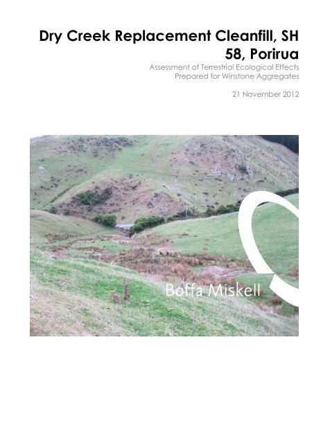
Cover photograph: View into lower section of proposed <strong>Dry</strong> <strong>Creek</strong> <strong>Replacement</strong> <strong>Cleanfill</strong>, Judgeford, © Matiu Park, 2012
CONTENTS<br />
1.0 Introduction 3<br />
2.0 Methodology 3<br />
2.1 Preliminary Assessment 3<br />
2.2 Project Shaping 4<br />
3.0 The Study Area 6<br />
3.1 History and Site Context 6<br />
3.2 Land Use and Statutory Context 7<br />
3.3 Vegetation Description 8<br />
3.4 Wildlife 9<br />
3.5 Landform and soils 10<br />
4.0 Assessment of Ecological Significance 12<br />
4.1 Introduction 12<br />
4.2 Assessment 12<br />
4.3 Summary 13<br />
5.0 Scope of Works 16<br />
6.0 Assessment of Ecological Effects 16<br />
6.1 Vegetation Clearance 16<br />
6.2 Wildlife 17<br />
6.3 Summary 17<br />
7.0 Mitigation recommendations 18<br />
7.1 Regenerating manuka and broadleaved forest 18<br />
7.2 Seepage wetlands 19<br />
7.3 Wildlife 19<br />
7.4 Monitoring Recommendations 19<br />
8.0 Conclusions 20<br />
9.0 References 21<br />
Appendices<br />
Appendix 1 Botanical Species List ....................................................................... 22<br />
Appendix 2 Site Photos .......................................................................................... 25
Figures<br />
Figure 1 Site context .......................................................................................... 5<br />
Figure 2 Vegetation Communities ................................................................ 11<br />
Figure 3 LENZ ..................................................................................................... 15<br />
<strong>Dry</strong> <strong>Creek</strong> <strong>Replacement</strong> <strong>Cleanfill</strong>, <strong>SH</strong> <strong>58</strong>, <strong>Porirua</strong> | Assessment of Terrestrial Ecological Effects
1.0 Introduction<br />
Boffa Miskell has been engaged by Winstone Aggregates to prepare a terrestrial ecological<br />
assessment for a proposed cleanfill. Resource consent is being sought for the deposition of<br />
approximately 1.75 million m³ of clean fill at a new cleanfill site approximately 4 kilometres to the<br />
northwest of the current <strong>Dry</strong> <strong>Creek</strong> site off State Highway <strong>58</strong> (<strong>SH</strong><strong>58</strong>).<br />
The cleanfill site is located on a farm property owned by Mr Malcolm Judd. This property is 336 ha<br />
in area. The cleanfill footprint will be approximately 13.9 ha in area and will be focussed within<br />
the lower sections of a large side gully of the property. The land will be leased to Winstone<br />
Aggregates as required. Figure 1 illustrates the extent of the proposed works associated with this<br />
application.<br />
The cleanfill application will fill a large area of the lower portion of the main gully and most of the<br />
smaller side gullies up to a finished contoured level, followed by formation of a new stream<br />
channel on the western side of the completed surface as described in the proposed ESCP.<br />
Following the completion of infilling, the finished surface will be re-vegetated as described in the<br />
application documentation.<br />
The proposed work includes removal of existing vegetation, topsoil stripping and bulk earthworks<br />
involving engineered filling. Associated with this work is the culverting of the side gullies as they<br />
are progressively filled.<br />
The following is an ecological assessment of the effects of the proposed cleanfill on the terrestrial<br />
ecology. The potential effects of this project on freshwater systems are the subject of a separate<br />
ecological assessment.<br />
2.0 Methodology<br />
The assessment for this project was carried out in two stages. A preliminary assessment and<br />
desktop study was carried out for a proposed cleanfill site. This assessment highlighted areas of<br />
relatively high ecological value which was discussed with the applicant. The location of the<br />
cleanfill was then revised with a view to avoiding or minimising effects on these areas. A<br />
subsequent assessment was carried out of the new site layout which is the focus of this report.<br />
2.1 Preliminary Assessment<br />
An initial familiarisation visit of the application site was undertaken with Winstone Aggregates<br />
staff, geotechnical engineering, landscape and visual and planning consultants on 24 November<br />
2011. A more detailed site visit for this ecological assessment was undertaken on 24 February<br />
2012. On this second visit the terrestrial ecology within and adjacent to the application site was<br />
described, and plant communities mapped. Pat Enright prepared the more detailed botanical<br />
species lists during the site visit (Appendix 1). The weather was fine and sunny on this site visit and<br />
followed heavy rain and NW winds in the previous 24 hours.<br />
<strong>Dry</strong> <strong>Creek</strong> <strong>Replacement</strong> <strong>Cleanfill</strong>, <strong>SH</strong> <strong>58</strong>, <strong>Porirua</strong> | Assessment of Terrestrial Ecological Effects 3
During this site visit, the main gully system including and upstream of the proposed application<br />
area were traversed, as were a number of smaller side gullies and faces to understand the<br />
varying vegetation patterns of the main gully system. Particular attention was paid to outcrops,<br />
wet areas and seepages, and gullies and faces with varying aspects. The main gully was viewed<br />
from a number of raised areas for particular vegetation characteristics and evidence of primary<br />
forest trees.<br />
The Herpetofauna Database search was reviewed to determine which species occur in the wider<br />
area, and to determine whether any species had previously been located onsite. The Database<br />
was searched for all records within a 10 km radius of the works footprint.<br />
The application site was flown by Precision Aerial Surveys to provide current aerial photographs of<br />
the area. These high-resolution aerials were used to determine the extent of indigenous<br />
vegetation and property boundaries. Google Earth, the <strong>Porirua</strong> <strong>City</strong> District Plan and <strong>Porirua</strong> <strong>City</strong><br />
<strong>Council</strong>’s ‘Inventory of Ecological Sites in <strong>Porirua</strong> <strong>City</strong>’ (prepared by Boffa Miskell) were used to<br />
provide ecological context and other considerations.<br />
2.2 Project Shaping<br />
Following the February 2012 site visit the preliminary findings were discussed with Winstone<br />
Aggregates, with particular attention to the ecological values of regenerating scrub and low<br />
forest within the main gully system. Refinements were then made to the extent of the proposed<br />
cleanfill to minimise indigenous vegetation removal in this gully. These changes led to a<br />
substantial reduction in the scale of vegetation removal required and the associated potential<br />
adverse effects on the terrestrial ecology of the site.<br />
Once the final design was developed, a further site visit was undertaken on 14 June 2012 to<br />
confirm the changes, and investigate and map all areas of terrestrial vegetation and habitat that<br />
fell within the revised project.<br />
In addition to vegetation mapping and description, manual searches were carried out for lizards<br />
focused on terrestrial refugia (e.g. pieces of deadwood, stones etc) present on-site within the<br />
main gully system and within a number of areas of potential habitat within the proposed cleanfill<br />
footprint. Manual searches were undertaken during two of the site visits in February and June<br />
2012. When the design was provided the manual searches were supplemented with the use of<br />
40 artificial refuges (ARs), which were distributed in 4 groups of 10 across and beyond the<br />
proposed site to help determine the probable distribution of herpetofauna communities within<br />
and surrounding the proposed cleanfill site. ARs were located in a range of habitat types within<br />
the pasture and rank grassland margins in and adjacent to the manuka dominated main gully<br />
system. ARs were also located within a range of vegetation communities, including manuka<br />
scrub and shrubland and the rank pasture mosaic. These ARs were left for 110 days (15 weeks)<br />
and retrieved on 14 June 2012. The ARs were formed from Onduline roofing material<br />
approximately 500 mm x 500 mm in size.<br />
A number of photographs of the application site are attached as Appendix 2.<br />
<strong>Dry</strong> <strong>Creek</strong> <strong>Replacement</strong> <strong>Cleanfill</strong>, <strong>SH</strong> <strong>58</strong>, <strong>Porirua</strong> | Assessment of Terrestrial Ecological Effects 4
! ! ! ! ! ! ! ! ! ! ! ! ! ! ! ! ! ! ! ! ! ! ! ! ! ! ! ! ! ! ! ! ! ! ! ! ! ! ! ! ! ! ! ! ! ! ! ! ! ! ! ! ! ! ! ! ! ! ! ! ! ! ! ! ! ! ! ! ! ! ! ! ! ! ! ! ! ! ! ! !<br />
! ! ! ! ! ! ! ! ! ! ! ! ! ! ! ! ! ! ! ! ! ! ! ! ! ! ! ! ! ! ! ! ! ! ! ! ! ! ! ! ! ! ! ! ! ! ! ! ! ! ! ! ! ! ! ! ! ! ! ! ! ! ! ! ! ! ! ! ! ! ! ! ! ! ! ! ! ! ! ! !<br />
! ! ! ! ! ! ! ! ! ! ! ! ! ! ! ! ! ! ! ! ! ! ! ! ! ! ! ! ! ! ! ! ! ! ! ! ! ! ! ! ! ! ! ! ! ! ! ! ! ! ! ! ! ! ! ! ! ! ! ! ! ! ! ! ! ! ! ! ! ! ! ! ! ! ! ! ! ! ! ! !<br />
! ! ! ! ! ! ! ! ! ! ! ! ! ! ! ! ! ! ! ! ! ! ! ! ! ! ! ! ! ! ! ! ! ! ! ! ! ! ! ! ! ! ! ! ! ! ! ! ! ! ! ! ! ! ! ! ! ! ! ! ! ! ! ! ! ! ! ! ! ! ! ! ! ! ! ! ! ! ! ! !<br />
! ! ! ! ! ! ! ! ! ! ! ! ! ! ! ! ! ! ! ! ! ! ! ! ! ! ! ! ! ! ! ! ! ! ! ! ! ! ! ! ! ! ! ! ! ! ! ! ! ! ! ! ! ! ! ! ! ! ! ! ! ! ! ! ! ! ! ! ! ! ! ! ! ! ! ! ! ! ! ! !<br />
! ! ! ! ! ! ! ! ! ! ! ! ! ! ! ! ! ! ! ! ! ! ! ! ! ! ! ! ! ! ! ! ! ! ! ! ! ! ! ! ! ! ! ! ! ! ! ! ! ! ! ! ! ! ! ! ! ! ! ! ! ! ! ! ! ! ! ! ! ! ! ! ! ! ! ! ! ! ! ! !<br />
! ! ! ! ! ! ! ! ! ! ! ! ! ! ! ! ! ! ! ! ! ! ! ! ! ! ! ! ! ! ! ! ! ! ! ! ! ! ! ! ! ! ! ! ! ! ! ! ! ! ! ! ! ! ! ! ! ! ! ! ! ! ! ! ! ! ! ! ! ! ! ! ! ! ! ! ! ! ! ! !<br />
! ! ! ! ! ! ! ! ! ! ! ! ! ! ! ! ! ! ! ! ! ! ! ! ! ! ! ! ! ! ! ! ! ! ! ! ! ! ! ! ! ! ! ! ! ! ! ! ! ! ! ! ! ! ! ! ! ! ! ! ! ! ! ! ! ! ! ! ! ! ! ! ! ! ! ! ! ! ! ! !<br />
! ! ! ! ! ! ! ! ! ! ! ! ! ! ! ! ! ! ! ! ! ! ! ! ! ! ! ! ! ! ! ! ! ! ! ! ! ! ! ! ! ! ! ! ! ! ! ! ! ! ! ! ! ! ! ! ! ! ! ! ! ! ! ! ! ! ! ! ! ! ! ! ! ! ! ! ! ! ! ! !<br />
! ! ! ! ! ! ! ! ! ! ! ! ! ! ! ! ! ! ! ! ! ! ! ! ! ! ! ! ! ! ! ! ! ! ! ! ! ! ! ! ! ! ! ! ! ! ! ! ! ! ! ! ! ! ! ! ! ! ! ! ! ! ! ! ! ! ! ! ! ! ! ! ! ! ! ! ! ! ! ! !<br />
! ! ! ! ! ! ! ! ! ! ! ! ! ! ! ! ! ! ! ! ! ! ! ! ! ! ! ! ! ! ! ! ! ! ! ! ! ! ! ! ! ! ! ! ! ! ! ! ! ! ! ! ! ! ! ! ! ! ! ! ! ! ! ! ! ! ! ! ! ! ! ! ! ! ! ! ! ! ! ! !<br />
! ! ! ! ! ! ! ! ! ! ! ! ! ! ! ! ! ! ! ! ! ! ! ! ! ! ! ! ! ! ! ! ! ! ! ! ! ! ! ! ! ! ! ! ! ! ! ! ! ! ! ! ! ! ! ! ! ! ! ! ! ! ! ! ! ! ! ! ! ! ! ! ! ! ! ! ! ! ! ! !<br />
! ! ! ! ! ! ! ! ! ! ! ! ! ! ! ! ! ! ! ! ! ! ! ! ! ! ! ! ! ! ! ! ! ! ! ! ! ! ! ! ! ! ! ! ! ! ! ! ! ! ! ! ! ! ! ! ! ! ! ! ! ! ! ! ! ! ! ! ! ! ! ! ! ! ! ! ! ! ! ! !<br />
! ! ! ! ! ! ! ! ! ! ! ! ! ! ! ! ! ! ! ! ! ! ! ! ! ! ! ! ! ! ! ! ! ! ! ! ! ! ! ! ! ! ! ! ! ! ! ! ! ! ! ! ! ! ! ! ! ! ! ! ! ! ! ! ! ! ! ! ! ! ! ! ! ! ! ! ! ! ! ! !<br />
! ! ! ! ! ! ! ! ! ! ! ! ! ! ! ! ! ! ! ! ! ! ! ! ! ! ! ! ! ! ! ! ! ! ! ! ! ! ! ! ! ! ! ! ! ! ! ! ! ! ! ! ! ! ! ! ! ! ! ! ! ! ! ! ! ! ! ! ! ! ! ! ! ! ! ! ! ! ! ! !<br />
! ! ! ! ! ! ! ! ! ! ! ! ! ! ! ! ! ! ! ! ! ! ! ! ! ! ! ! ! ! ! ! ! ! ! ! ! ! ! ! ! ! ! ! ! ! ! ! ! ! ! ! ! ! ! ! ! ! ! ! ! ! ! ! ! ! ! ! ! ! ! ! ! ! ! ! ! ! ! ! !<br />
! ! ! ! ! ! ! ! ! ! ! ! ! ! ! ! ! ! ! ! ! ! ! ! ! ! ! ! ! ! ! ! ! ! ! ! ! ! ! ! ! ! ! ! ! ! ! ! ! ! ! ! ! ! ! ! ! ! ! ! ! ! ! ! ! ! ! ! ! ! ! ! ! ! ! ! ! ! ! ! !<br />
! ! ! ! ! ! ! ! ! ! ! ! ! ! ! ! ! ! ! ! ! ! ! ! ! ! ! ! ! ! ! ! ! ! ! ! ! ! ! ! ! ! ! ! ! ! ! ! ! ! ! ! ! ! ! ! ! ! ! ! ! ! ! ! ! ! ! ! ! ! ! ! ! ! ! ! ! ! ! ! !<br />
! ! ! ! ! ! ! ! ! ! ! ! ! ! ! ! ! ! ! ! ! ! ! ! ! ! ! ! ! ! ! ! ! ! ! ! ! ! ! ! ! ! ! ! ! ! ! ! ! ! ! ! ! ! ! ! ! ! ! ! ! ! ! ! ! ! ! ! ! ! ! ! ! ! ! ! ! ! ! ! !<br />
! ! ! ! ! ! ! ! ! ! ! ! ! ! ! ! ! ! ! ! ! ! ! ! ! ! ! ! ! ! ! ! ! ! ! ! ! ! ! ! ! ! ! ! ! ! ! ! ! ! ! ! ! ! ! ! ! ! ! ! ! ! ! ! ! ! ! ! ! ! ! ! ! ! ! ! ! ! ! ! !<br />
! ! ! ! ! ! ! ! ! ! ! ! ! ! ! ! ! ! ! ! ! ! ! ! ! ! ! ! ! ! ! ! ! ! ! ! ! ! ! ! ! ! ! ! ! ! ! ! ! ! ! ! ! ! ! ! ! ! ! ! ! ! ! ! ! ! ! ! ! ! ! ! ! ! ! ! ! ! ! ! !<br />
! ! ! ! ! ! ! ! ! ! ! ! ! ! ! ! ! ! ! ! ! ! ! ! ! ! ! ! ! ! ! ! ! ! ! ! ! ! ! ! ! ! ! ! ! ! ! ! ! ! ! ! ! ! ! ! ! ! ! ! ! ! ! ! ! ! ! ! ! ! ! ! ! ! ! ! ! ! ! ! !<br />
! ! ! ! ! ! ! ! ! ! ! ! ! ! ! ! ! ! ! ! ! ! ! ! ! ! ! ! ! ! ! ! ! ! ! ! ! ! ! ! ! ! ! ! ! ! ! ! ! ! ! ! ! ! ! ! ! ! ! ! ! ! ! ! ! ! ! ! ! ! ! ! ! ! ! ! ! ! ! ! !<br />
! ! ! ! ! ! ! ! ! ! ! ! ! ! ! ! ! ! ! ! ! ! ! ! ! ! ! ! ! ! ! ! ! ! ! ! ! ! ! ! ! ! ! ! ! ! ! ! ! ! ! ! ! ! ! ! ! ! ! ! ! ! ! ! ! ! ! ! ! ! ! ! ! ! ! ! ! ! ! ! !<br />
! ! ! ! ! ! ! ! ! ! ! ! ! ! ! ! ! ! ! ! ! ! ! ! ! ! ! ! ! ! ! ! ! ! ! ! ! ! ! ! ! ! ! ! ! ! ! ! ! ! ! ! ! ! ! ! ! ! ! ! ! ! ! ! ! ! ! ! ! ! ! ! ! ! ! ! ! ! ! ! !<br />
! ! ! ! ! ! ! ! ! ! ! ! ! ! ! ! ! ! ! ! ! ! ! ! ! ! ! ! ! ! ! ! ! ! ! ! ! ! ! ! ! ! ! ! ! ! ! ! ! ! ! ! ! ! ! ! ! ! ! ! ! ! ! ! ! ! ! ! ! ! ! ! ! ! ! ! ! ! ! ! !<br />
! ! ! ! ! ! ! ! ! ! ! ! ! ! ! ! ! ! ! ! ! ! ! ! ! ! ! ! ! ! ! ! ! ! ! ! ! ! ! ! ! ! ! ! ! ! ! ! ! ! ! ! ! ! ! ! ! ! ! ! ! ! ! ! ! ! ! ! ! ! ! ! ! ! ! ! ! ! ! ! !<br />
! ! ! ! ! ! ! ! ! ! ! ! ! ! ! ! ! ! ! ! ! ! ! ! ! ! ! ! ! ! ! ! ! ! ! ! ! ! ! ! ! ! ! ! ! ! ! ! ! ! ! ! ! ! ! ! ! ! ! ! ! ! ! ! ! ! ! ! ! ! ! ! ! ! ! ! ! ! ! ! !<br />
! ! ! ! ! ! ! ! ! ! ! ! ! ! ! ! ! ! ! ! ! ! ! ! ! ! ! ! ! ! ! ! ! ! ! ! ! ! ! ! ! ! ! ! ! ! ! ! ! ! ! ! ! ! ! ! ! ! ! ! ! ! ! ! ! ! ! ! ! ! ! ! ! ! ! ! ! ! ! ! !<br />
! ! ! ! ! ! ! ! ! ! ! ! ! ! ! ! ! ! ! ! ! ! ! ! ! ! ! ! ! ! ! ! ! ! ! ! ! ! ! ! ! ! ! ! ! ! ! ! ! ! ! ! ! ! ! ! ! ! ! ! ! ! ! ! ! ! ! ! ! ! ! ! ! ! ! ! ! ! ! ! !<br />
! ! ! ! ! ! ! ! ! ! ! ! ! ! ! ! ! ! ! ! ! ! ! ! ! ! ! ! ! ! ! ! ! ! ! ! ! ! ! ! ! ! ! ! ! ! ! ! ! ! ! ! ! ! ! ! ! ! ! ! ! ! ! ! ! ! ! ! ! ! ! ! ! ! ! ! ! ! ! ! !<br />
! ! ! ! ! ! ! ! ! ! ! ! ! ! ! ! ! ! ! ! ! ! ! ! ! ! ! ! ! ! ! ! ! ! ! ! ! ! ! ! ! ! ! ! ! ! ! ! ! ! ! ! ! ! ! ! ! ! ! ! ! ! ! ! ! ! ! ! ! ! ! ! ! ! ! ! ! ! ! ! !<br />
! ! ! ! ! ! ! ! ! ! ! ! ! ! ! ! ! ! ! ! ! ! ! ! ! ! ! ! ! ! ! ! ! ! ! ! ! ! ! ! ! ! ! ! ! ! ! ! ! ! ! ! ! ! ! ! ! ! ! ! ! ! ! ! ! ! ! ! ! ! ! ! ! ! ! ! ! ! ! ! !<br />
! ! ! ! ! ! ! ! ! ! ! ! ! ! ! ! ! ! ! ! ! ! ! ! ! ! ! ! ! ! ! ! ! ! ! ! ! ! ! ! ! ! ! ! ! ! ! ! ! ! ! ! ! ! ! ! ! ! ! ! ! ! ! ! ! ! ! ! ! ! ! ! ! ! ! ! ! ! ! ! !<br />
! ! ! ! ! ! ! ! ! ! ! ! ! ! ! ! ! ! ! ! ! ! ! ! ! ! ! ! ! ! ! ! ! ! ! ! ! ! ! ! ! ! ! ! ! ! ! ! ! ! ! ! ! ! ! ! ! ! ! ! ! ! ! ! ! ! ! ! ! ! ! ! ! ! ! ! ! ! ! ! !<br />
! ! ! ! ! ! ! ! ! ! ! ! ! ! ! ! ! ! ! ! ! ! ! ! ! ! ! ! ! ! ! ! ! ! ! ! ! ! ! ! ! ! ! ! ! ! ! ! ! ! ! ! ! ! ! ! ! ! ! ! ! ! ! ! ! ! ! ! ! ! ! ! ! ! ! ! ! ! ! ! !<br />
! ! ! ! ! ! ! ! ! ! ! ! ! ! ! ! ! ! ! ! ! ! ! ! ! ! ! ! ! ! ! ! ! ! ! ! ! ! ! ! ! ! ! ! ! ! ! ! ! ! ! ! ! ! ! ! ! ! ! ! ! ! ! ! ! ! ! ! ! ! ! ! ! ! ! ! ! ! ! ! !<br />
! ! ! ! ! ! ! ! ! ! ! ! ! ! ! ! ! ! ! ! ! ! ! ! ! ! ! ! ! ! ! ! ! ! ! ! ! ! ! ! ! ! ! ! ! ! ! ! ! ! ! ! ! ! ! ! ! ! ! ! ! ! ! ! ! ! ! ! ! ! ! ! ! ! ! ! ! ! ! ! !<br />
! ! ! ! ! ! ! ! ! ! ! ! ! ! ! ! ! ! ! ! ! ! ! ! ! ! ! ! ! ! ! ! ! ! ! ! ! ! ! ! ! ! ! ! ! ! ! ! ! ! ! ! ! ! ! ! ! ! ! ! ! ! ! ! ! ! ! ! ! ! ! ! ! ! ! ! ! ! ! ! !<br />
! ! ! ! ! ! ! ! ! ! ! ! ! ! ! ! ! ! ! ! ! ! ! ! ! ! ! ! ! ! ! ! ! ! ! ! ! ! ! ! ! ! ! ! ! ! ! ! ! ! ! ! ! ! ! ! ! ! ! ! ! ! ! ! ! ! ! ! ! ! ! ! ! ! ! ! ! ! ! ! !<br />
! ! ! ! ! ! ! ! ! ! ! ! ! ! ! ! ! ! ! ! ! ! ! ! ! ! ! ! ! ! ! ! ! ! ! ! ! ! ! ! ! ! ! ! ! ! ! ! ! ! ! ! ! ! ! ! ! ! ! ! ! ! ! ! ! ! ! ! ! ! ! ! ! ! ! ! ! ! ! ! !<br />
! ! ! ! ! ! ! ! ! ! ! ! ! ! ! ! ! ! ! ! ! ! ! ! ! ! ! ! ! ! ! ! ! ! ! ! ! ! ! ! ! ! ! ! ! ! ! ! ! ! ! ! ! ! ! ! ! ! ! ! ! ! ! ! ! ! ! ! ! ! ! ! ! ! ! ! ! ! ! ! !<br />
! ! ! ! ! ! ! ! ! ! ! ! ! ! ! ! ! ! ! ! ! ! ! ! ! ! ! ! ! ! ! ! ! ! ! ! ! ! ! ! ! ! ! ! ! ! ! ! ! ! ! ! ! ! ! ! ! ! ! ! ! ! ! ! ! ! ! ! ! ! ! ! ! ! ! ! ! ! ! ! !<br />
! ! ! ! ! ! ! ! ! ! ! ! ! ! ! ! ! ! ! ! ! ! ! ! ! ! ! ! ! ! ! ! ! ! ! ! ! ! ! ! ! ! ! ! ! ! ! ! ! ! ! ! ! ! ! ! ! ! ! ! ! ! ! ! ! ! ! ! ! ! ! ! ! ! ! ! ! ! ! ! !<br />
! ! ! ! ! ! ! ! ! ! ! ! ! ! ! ! ! ! ! ! ! ! ! ! ! ! ! ! ! ! ! ! ! ! ! ! ! ! ! ! ! ! ! ! ! ! ! ! ! ! ! ! ! ! ! ! ! ! ! ! ! ! ! ! ! ! ! ! ! ! ! ! ! ! ! ! ! ! ! ! !<br />
! ! ! ! ! ! ! ! ! ! ! ! ! ! ! ! ! ! ! ! ! ! ! ! ! ! ! ! ! ! ! ! ! ! ! ! ! ! ! ! ! ! ! ! ! ! ! ! ! ! ! ! ! ! ! ! ! ! ! ! ! ! ! ! ! ! ! ! ! ! ! ! ! ! ! ! ! ! ! ! !<br />
! ! ! ! ! ! ! ! ! ! ! ! ! ! ! ! ! ! ! ! ! ! ! ! ! ! ! ! ! ! ! ! ! ! ! ! ! ! ! ! ! ! ! ! ! ! ! ! ! ! ! ! ! ! ! ! ! ! ! ! ! ! ! ! ! ! ! ! ! ! ! ! ! ! ! ! ! ! ! ! !<br />
! ! ! ! ! ! ! ! ! ! ! ! ! ! ! ! ! ! ! ! ! ! ! ! ! ! ! ! ! ! ! ! ! ! ! ! ! ! ! ! ! ! ! ! ! ! ! ! ! ! ! ! ! ! ! ! ! ! ! ! ! ! ! ! ! ! ! ! ! ! ! ! ! ! ! ! ! ! ! ! !<br />
! ! ! ! ! ! ! ! ! ! ! ! ! ! ! ! ! ! ! ! ! ! ! ! ! ! ! ! ! ! ! ! ! ! ! ! ! ! ! ! ! ! ! ! ! ! ! ! ! ! ! ! ! ! ! ! ! ! ! ! ! ! ! ! ! ! ! ! ! ! ! ! ! ! ! ! ! ! ! ! !<br />
! ! ! ! ! ! ! ! ! ! ! ! ! ! ! ! ! ! ! ! ! ! ! ! ! ! ! ! ! ! ! ! ! ! ! ! ! ! ! ! ! ! ! ! ! ! ! ! ! ! ! ! ! ! ! ! ! ! ! ! ! ! ! ! ! ! ! ! ! ! ! ! ! ! ! ! ! ! ! ! !<br />
! ! ! ! ! ! ! ! ! ! ! ! ! ! ! ! ! ! ! ! ! ! ! ! ! ! ! ! ! ! ! ! ! ! ! ! ! ! ! ! ! ! ! ! ! ! ! ! ! ! ! ! ! ! ! ! ! ! ! ! ! ! ! ! ! ! ! ! ! ! ! ! ! ! ! ! ! ! ! ! !<br />
! ! ! ! ! ! ! ! ! ! ! ! ! ! ! ! ! ! ! ! ! ! ! ! ! ! ! ! ! ! ! ! ! ! ! ! ! ! ! ! ! ! ! ! ! ! ! ! ! ! ! ! ! ! ! ! ! ! ! ! ! ! ! ! ! ! ! ! ! ! ! ! ! ! ! ! ! ! ! ! !<br />
! ! ! ! ! ! ! ! ! ! ! ! ! ! ! ! ! ! ! ! ! ! ! ! ! ! ! ! ! ! ! ! ! ! ! ! ! ! ! ! ! ! ! ! ! ! ! ! ! ! ! ! ! ! ! ! ! ! ! ! ! ! ! ! ! ! ! ! ! ! ! ! ! ! ! ! ! ! ! ! !<br />
! ! ! ! ! ! ! ! ! ! ! ! ! ! ! ! ! ! ! ! ! ! ! ! ! ! ! ! ! ! ! ! ! ! ! ! ! ! ! ! ! ! ! ! ! ! ! ! ! ! ! ! ! ! ! ! ! ! ! ! ! ! ! ! ! ! ! ! ! ! ! ! ! ! ! ! ! ! ! ! !<br />
! ! ! ! ! ! ! ! ! ! ! ! ! ! ! ! ! ! ! ! ! ! ! ! ! ! ! ! ! ! ! ! ! ! ! ! ! ! ! ! ! ! ! ! ! ! ! ! ! ! ! ! ! ! ! ! ! ! ! ! ! ! ! ! ! ! ! ! ! ! ! ! ! ! ! ! ! ! ! ! !<br />
! ! ! ! ! ! ! ! ! ! ! ! ! ! ! ! ! ! ! ! ! ! ! ! ! ! ! ! ! ! ! ! ! ! ! ! ! ! ! ! ! ! ! ! ! ! ! ! ! ! ! ! ! ! ! ! ! ! ! ! ! ! ! ! ! ! ! ! ! ! ! ! ! ! ! ! ! ! ! ! !<br />
! ! ! ! ! ! ! ! ! ! ! ! ! ! ! ! ! ! ! ! ! ! ! ! ! ! ! ! ! ! ! ! ! ! ! ! ! ! ! ! ! ! ! ! ! ! ! ! ! ! ! ! ! ! ! ! ! ! ! ! ! ! ! ! ! ! ! ! ! ! ! ! ! ! ! ! ! ! ! ! !<br />
! ! ! ! ! ! ! ! ! ! ! ! ! ! ! ! ! ! ! ! ! ! ! ! ! ! ! ! ! ! ! ! ! ! ! ! ! ! ! ! ! ! ! ! ! ! ! ! ! ! ! ! ! ! ! ! ! ! ! ! ! ! ! ! ! ! ! ! ! ! ! ! ! ! ! ! ! ! ! ! !<br />
! ! ! ! ! ! ! ! ! ! ! ! ! ! ! ! ! ! ! ! ! ! ! ! ! ! ! ! ! ! ! ! ! ! ! ! ! ! ! ! ! ! ! ! ! ! ! ! ! ! ! ! ! ! ! ! ! ! ! ! ! ! ! ! ! ! ! ! ! ! ! ! ! ! ! ! ! ! ! ! !<br />
! ! ! ! ! ! ! ! ! ! ! ! ! ! ! ! ! ! ! ! ! ! ! ! ! ! ! ! ! ! ! ! ! ! ! ! ! ! ! ! ! ! ! ! ! ! ! ! ! ! ! ! ! ! ! ! ! ! ! ! ! ! ! ! ! ! ! ! ! ! ! ! ! ! ! ! ! ! ! ! !<br />
! ! ! ! ! ! ! ! ! ! ! ! ! ! ! ! ! ! ! ! ! ! ! ! ! ! ! ! ! ! ! ! ! ! ! ! ! ! ! ! ! ! ! ! ! ! ! ! ! ! ! ! ! ! ! ! ! ! ! ! ! ! ! ! ! ! ! ! ! ! ! ! ! ! ! ! ! ! ! ! !<br />
! ! ! ! ! ! ! ! ! ! ! ! ! ! ! ! ! ! ! ! ! ! ! ! ! ! ! ! ! ! ! ! ! ! ! ! ! ! ! ! ! ! ! ! ! ! ! ! ! ! ! ! ! ! ! ! ! ! ! ! ! ! ! ! ! ! ! ! ! ! ! ! ! ! ! ! ! ! ! ! !<br />
! ! ! ! ! ! ! ! ! ! ! ! ! ! ! ! ! ! ! ! ! ! ! ! ! ! ! ! ! ! ! ! ! ! ! ! ! ! ! ! ! ! ! ! ! ! ! ! ! ! ! ! ! ! ! ! ! ! ! ! ! ! ! ! ! ! ! ! ! ! ! ! ! ! ! ! ! ! ! ! !<br />
! ! ! ! ! ! ! ! ! ! ! ! ! ! ! ! ! ! ! ! ! ! ! ! ! ! ! ! ! ! ! ! ! ! ! ! ! ! ! ! ! ! ! ! ! ! ! ! ! ! ! ! ! ! ! ! ! ! ! ! ! ! ! ! ! ! ! ! ! ! ! ! ! ! ! ! ! ! ! ! !<br />
! ! ! ! ! ! ! ! ! ! ! ! ! ! ! ! ! ! ! ! ! ! ! ! ! ! ! ! ! ! ! ! ! ! ! ! ! ! ! ! ! ! ! ! ! ! ! ! ! ! ! ! ! ! ! ! ! ! ! ! ! ! ! ! ! ! ! ! ! ! ! ! ! ! ! ! ! ! ! ! !<br />
! ! ! ! ! ! ! ! ! ! ! ! ! ! ! ! ! ! ! ! ! ! ! ! ! ! ! ! ! ! ! ! ! ! ! ! ! ! ! ! ! ! ! ! ! ! ! ! ! ! ! ! ! ! ! ! ! ! ! ! ! ! ! ! ! ! ! ! ! ! ! ! ! ! ! ! ! ! ! ! !<br />
! ! ! ! ! ! ! ! ! ! ! ! ! ! ! ! ! ! ! ! ! ! ! ! ! ! ! ! ! ! ! ! ! ! ! ! ! ! ! ! ! ! ! ! ! ! ! ! ! ! ! ! ! ! ! ! ! ! ! ! ! ! ! ! ! ! ! ! ! ! ! ! ! ! ! ! ! ! ! ! !<br />
! ! ! ! ! ! ! ! ! ! ! ! ! ! ! ! ! ! ! ! ! ! ! ! ! ! ! ! ! ! ! ! ! ! ! ! ! ! ! ! ! ! ! ! ! ! ! ! ! ! ! ! ! ! ! ! ! ! ! ! ! ! ! ! ! ! ! ! ! ! ! ! ! ! ! ! ! ! ! ! !<br />
! ! ! ! ! ! ! ! ! ! ! ! ! ! ! ! ! ! ! ! ! ! ! ! ! ! ! ! ! ! ! ! ! ! ! ! ! ! ! ! ! ! ! ! ! ! ! ! ! ! ! ! ! ! ! ! ! ! ! ! ! ! ! ! ! ! ! ! ! ! ! ! ! ! ! ! ! ! ! ! !<br />
! ! ! ! ! ! ! ! ! ! ! ! ! ! ! ! ! ! ! ! ! ! ! ! ! ! ! ! ! ! ! ! ! ! ! ! ! ! ! ! ! ! ! ! ! ! ! ! ! ! ! ! ! ! ! ! ! ! ! ! ! ! ! ! ! ! ! ! ! ! ! ! ! ! ! ! ! ! ! ! !<br />
! ! ! ! ! ! ! ! ! ! ! ! ! ! ! ! ! ! ! ! ! ! ! ! ! ! ! ! ! ! ! ! ! ! ! ! ! ! ! ! ! ! ! ! ! ! ! ! ! ! ! ! ! ! ! ! ! ! ! ! ! ! ! ! ! ! ! ! ! ! ! ! ! ! ! ! ! ! ! ! !<br />
! ! ! ! ! ! ! ! ! ! ! ! ! ! ! ! ! ! ! ! ! ! ! ! ! ! ! ! ! ! ! ! ! ! ! ! ! ! ! ! ! ! ! ! ! ! ! ! ! ! ! ! ! ! ! ! ! ! ! ! ! ! ! ! ! ! ! ! ! ! ! ! ! ! ! ! ! ! ! ! !<br />
! ! ! ! ! ! ! ! ! ! ! ! ! ! ! ! ! ! ! ! ! ! ! ! ! ! ! ! ! ! ! ! ! ! ! ! ! ! ! ! ! ! ! ! ! ! ! ! ! ! ! ! ! ! ! ! ! ! ! ! ! ! ! ! ! ! ! ! ! ! ! ! ! ! ! ! ! ! ! ! !<br />
! ! ! ! ! ! ! ! ! ! ! ! ! ! ! ! ! ! ! ! ! ! ! ! ! ! ! ! ! ! ! ! ! ! ! ! ! ! ! ! ! ! ! ! ! ! ! ! ! ! ! ! ! ! ! ! ! ! ! ! ! ! ! ! ! ! ! ! ! ! ! ! ! ! ! ! ! ! ! ! !<br />
! ! ! ! ! ! ! ! ! ! ! ! ! ! ! ! ! ! ! ! ! ! ! ! ! ! ! ! ! ! ! ! ! ! ! ! ! ! ! ! ! ! ! ! ! ! ! ! ! ! ! ! ! ! ! ! ! ! ! ! ! ! ! ! ! ! ! ! ! ! ! ! ! ! ! ! ! ! ! ! !<br />
! ! ! ! ! ! ! ! ! ! ! ! ! ! ! ! ! ! ! ! ! ! ! ! ! ! ! ! ! ! ! ! ! ! ! ! ! ! ! ! ! ! ! ! ! ! ! ! ! ! ! ! ! ! ! ! ! ! ! ! ! ! ! ! ! ! ! ! ! ! ! ! ! ! ! ! ! ! ! ! !<br />
! ! ! ! ! ! ! ! ! ! ! ! ! ! ! ! ! ! ! ! ! ! ! ! ! ! ! ! ! ! ! ! ! ! ! ! ! ! ! ! ! ! ! ! ! ! ! ! ! ! ! ! ! ! ! ! ! ! ! ! ! ! ! ! ! ! ! ! ! ! ! ! ! ! ! ! ! ! ! ! !<br />
! ! ! ! ! ! ! ! ! ! ! ! ! ! ! ! ! ! ! ! ! ! ! ! ! ! ! ! ! ! ! ! ! ! ! ! ! ! ! ! ! ! ! ! ! ! ! ! ! ! ! ! ! ! ! ! ! ! ! ! ! ! ! ! ! ! ! ! ! ! ! ! ! ! ! ! ! ! ! ! !<br />
! ! ! ! ! ! ! ! ! ! ! ! ! ! ! ! ! ! ! ! ! ! ! ! ! ! ! ! ! ! ! ! ! ! ! ! ! ! ! ! ! ! ! ! ! ! ! ! ! ! ! ! ! ! ! ! ! ! ! ! ! ! ! ! ! ! ! ! ! ! ! ! ! ! ! ! ! ! ! ! !<br />
! ! ! ! ! ! ! ! ! ! ! ! ! ! ! ! ! ! ! ! ! ! ! ! ! ! ! ! ! ! ! ! ! ! ! ! ! ! ! ! ! ! ! ! ! ! ! ! ! ! ! ! ! ! ! ! ! ! ! ! ! ! ! ! ! ! ! ! ! ! ! ! ! ! ! ! ! ! ! ! !<br />
! ! ! ! ! ! ! ! ! ! ! ! ! ! ! ! ! ! ! ! ! ! ! ! ! ! ! ! ! ! ! ! ! ! ! ! ! ! ! ! ! ! ! ! ! ! ! ! ! ! ! ! ! ! ! ! ! ! ! ! ! ! ! ! ! ! ! ! ! ! ! ! ! ! ! ! ! ! ! ! !<br />
! ! ! ! ! ! ! ! ! ! ! ! ! ! ! ! ! ! ! ! ! ! ! ! ! ! ! ! ! ! ! ! ! ! ! ! ! ! ! ! ! ! ! ! ! ! ! ! ! ! ! ! ! ! ! ! ! ! ! ! ! ! ! ! ! ! ! ! ! ! ! ! ! ! ! ! ! ! ! ! !<br />
! ! ! ! ! ! ! ! ! ! ! ! ! ! ! ! ! ! ! ! ! ! ! ! ! ! ! ! ! ! ! ! ! ! ! ! ! ! ! ! ! ! ! ! ! ! ! ! ! ! ! ! ! ! ! ! ! ! ! ! ! ! ! ! ! ! ! ! ! ! ! ! ! ! ! ! ! ! ! ! !<br />
! ! ! ! ! ! ! ! ! ! ! ! ! ! ! ! ! ! ! ! ! ! ! ! ! ! ! ! ! ! ! ! ! ! ! ! ! ! ! ! ! ! ! ! ! ! ! ! ! ! ! ! ! ! ! ! ! ! ! ! ! ! ! ! ! ! ! ! ! ! ! ! ! ! ! ! ! ! ! ! !<br />
! ! ! ! ! ! ! ! ! ! ! ! ! ! ! ! ! ! ! ! ! ! ! ! ! ! ! ! ! ! ! ! ! ! ! ! ! ! ! ! ! ! ! ! ! ! ! ! ! ! ! ! ! ! ! ! ! ! ! ! ! ! ! ! ! ! ! ! ! ! ! ! ! ! ! ! ! ! ! ! !<br />
! ! ! ! ! ! ! ! ! ! ! ! ! ! ! ! ! ! ! ! ! ! ! ! ! ! ! ! ! ! ! ! ! ! ! ! ! ! ! ! ! ! ! ! ! ! ! ! ! ! ! ! ! ! ! ! ! ! ! ! ! ! ! ! ! ! ! ! ! ! ! ! ! ! ! ! ! ! ! ! !<br />
! ! ! ! ! ! ! ! ! ! ! ! ! ! ! ! ! ! ! ! ! ! ! ! ! ! ! ! ! ! ! ! ! ! ! ! ! ! ! ! ! ! ! ! ! ! ! ! ! ! ! ! ! ! ! ! ! ! ! ! ! ! ! ! ! ! ! ! ! ! ! ! ! ! ! ! ! ! ! ! !<br />
! ! ! ! ! ! ! ! ! ! ! ! ! ! ! ! ! ! ! ! ! ! ! ! ! ! ! ! ! ! ! ! ! ! ! ! ! ! ! ! ! ! ! ! ! ! ! ! ! ! ! ! ! ! ! ! ! ! ! ! ! ! ! ! ! ! ! ! ! ! ! ! ! ! ! ! ! ! ! ! !<br />
Legend<br />
Application Site<br />
TA Boundaries<br />
! ! ! ! ! ! ! ! !<br />
! ! ! ! ! ! ! ! !<br />
! ! ! ! ! ! ! ! !<br />
! ! ! ! ! ! ! ! !<br />
! ! ! ! ! ! ! ! !<br />
Regional_Parks<br />
DRY CREEK REPLACEMENT<br />
Figure 1: Site Context<br />
| Date: 9 July 2012 | Revision: 0 |<br />
Plan Prepared for Winstone Aggregates by Boffa Miskell Limited<br />
file: W11091_Context_A4<br />
www.boffamiskell.co.nz<br />
0 500 m<br />
1:20,000 @ A4<br />
These plans and drawings have been produced as a result of information provided by the client and/or sourced by or provided to Boffa Miskell Limited by a third party for the purposes of providing the services. No responsibility is taken by<br />
Boffa Miskell Limited for any liability or action arising from any incomplete or inaccurate information provided to Boffa Miskell Limited (whether from the client or a third party). These plans/drawings are provided to the client for the benefit<br />
and use by the client and for the purpose for which it is intended. © Boffa Miskell Limited 2012<br />
° N
3.0 The Study Area<br />
3.1 History and Site Context<br />
The application site is located within the Sounds-Wellington Ecological Region (39) and the<br />
Wellington Ecological District (39.01). The Wellington Ecological District is characterised by steep,<br />
strongly faulted hills and ranges, and the Wellington and <strong>Porirua</strong> Harbours. The ecological district<br />
is windy with frequent NW gales, warm summers, and mild winters. Rainfall is typically between<br />
900 and 1400 mm p.a. (McEwen, 1987).<br />
The Wellington Ecological District was originally forested with fringes of salt marsh vegetation<br />
around the harbours. Near the coast rimu-rata/kohekohe forest dominated; podocarp forests<br />
(kahikatea, totara, matai) dominated on the river terraces and lower slopes; and miro-rimu/tawa<br />
forest dominated at higher altitudes. The <strong>Porirua</strong> Basin was part of the Wellington beech gap.<br />
What little beech was present (black beech and hard beech) was confined to stands which<br />
extended over the ridgelines from the extensive beech forests of the <strong>Hutt</strong> Valley on the eastern<br />
fringes of the ecological district.<br />
At the application site, a podocarp/broadleaf forest would have dominated, with rimu and<br />
northern rata emergent over a tawa dominated canopy (Boffa Miskell, 2001)1. Scattered<br />
remnants of this original forest occur some distance to the south and south-east of the site in the<br />
vicinity of the Haywards Hill Substation and on the fault escarpment above <strong>SH</strong>2. The habitat and<br />
ecological corridor values of this fault escarpment and associated forest remnants have been<br />
identified in Forest & Bird’s 1990 “Natural Wellington” report. Today this ecological district is<br />
almost entirely modified by farming and urbanisation, with pasture, plantation pine, gorse and<br />
regenerating shrublands throughout. Some small forest remnants occur.<br />
At some time during settlement of the <strong>Porirua</strong> basin all original vegetation within the application<br />
site was cleared and converted to pasture. Today the application site is still dominated by<br />
improved pasture or a rank pasture mosaic. However, regeneration is occurring in a number of<br />
areas, predominantly pioneer scrub and shrublands dominated by manuka, with small areas of<br />
regenerating low forest where mahoe and/or kanuka is emergent.<br />
A comparison of the 2011 aerial photograph with earlier images from 2005 and earlier illustrate<br />
both the lack of older vegetation present and the rapid ecological succession of the main gully<br />
system upstream of the application site - from pasture and gorse to scrub and low forest. On the<br />
dryer north facing sites kanuka regeneration is more prevalent. Regenerating broadleaved forest<br />
dominated by mahoe is more typical on the wetter south facing slopes and in sheltered gullies.<br />
The regeneration of secondary native vegetation on the inland hills and basins of the Western<br />
<strong>Hutt</strong> Hills / Belmont Hills and along the adjacent fault escarpment is part of a major landscape<br />
transformation that is occurring throughout the Wellington Region. Regenerating scrub and low<br />
forest now dominates what were steeper and less productive hillsides which were primarily<br />
pasture and gorse-covered 20-30 years ago.<br />
A Land Cover Environments of New Zealand (LENZ) analysis of the application site indicates that<br />
the vegetated upper slopes of the application area have no threat classification, while the lower<br />
areas of improved pasture within the application site are acutely threatened (LENZ Level 4). A<br />
LENZ map of the study area is attached as Appendix 3. However, given the close linkages with<br />
1 We note that the <strong>Porirua</strong> <strong>City</strong> <strong>Council</strong>’s inventory of ecological sites used a unique analysis tool for assessing significance.<br />
Because so little original indigenous vegetation remains within the District, the value of the shrublands and scrub habitat and<br />
refugia present is elevated.<br />
<strong>Dry</strong> <strong>Creek</strong> <strong>Replacement</strong> <strong>Cleanfill</strong>, <strong>SH</strong> <strong>58</strong>, <strong>Porirua</strong> | Assessment of Terrestrial Ecological Effects 6
the adjacent Belmont Regional Park, the regenerating vegetation present has a number of<br />
ecological habitat and corridor values.<br />
3.2 Land Use and Statutory Context<br />
All the land that is the subject of this application is owned by Malcolm Judd and is zoned ‘Rural’<br />
in the <strong>Porirua</strong> <strong>City</strong> District Plan. The surrounding land to the north, west, south and east is also<br />
zoned Rural and comprises similar steep farmland with gullies largely dominated by regenerating<br />
indigenous vegetation. There are a number of scattered lifestyle blocks and houses situated to<br />
the east, some 350 – 600 m distant. Many of these adjacent lifestyle blocks are similarly<br />
vegetated with a mix of pasture and regenerating indigenous vegetation, particularly within the<br />
steeper gully systems.<br />
Further to the south of the application site, beyond an adjacent property also owned by the<br />
Judd Family, is the Belmont Regional Park.<br />
Vegetation Clearance Rules<br />
The <strong>Porirua</strong> <strong>City</strong> District Plan limits clearance of vegetation in association with permitted activities<br />
in the Rural Zone. Removal of native vegetation is not permitted where:<br />
a) The area of vegetation exceeds 1 hectare with an average height of 3 metres of more, or<br />
b) The area of native vegetation is part of an area in one or more sites, which exceeds 1<br />
hectare with an average height of 3 metres or more (Rural Zone Permitted Activity Standard<br />
D4.2.1).<br />
As part of the vegetation mapping undertaken, we have attempted to delineate areas and<br />
types of vegetation with an average height of 3 m (refer Figure 2).<br />
The vegetation removal associated with the original cleanfill proposal would have required the<br />
removal of approximately 13.4 ha of indigenous vegetation with an average height of 3 metres<br />
of more. The revised proposal which is assessed here will require the removal of approximately<br />
0.7 ha of vegetation with an average height of 3 m or more from within a much larger gully<br />
system of regenerating indigenous vegetation as well as a number of smaller, separate areas of<br />
regenerating indigenous vegetation.<br />
Significant Natural Areas Survey<br />
Areas of regenerating shrubland similar to those within the application site occur in a number of<br />
locations within the <strong>Porirua</strong> Basin. In the <strong>Porirua</strong> <strong>City</strong> <strong>Council</strong>’s ‘Inventory of Ecological Sites in<br />
<strong>Porirua</strong> <strong>City</strong>’, large areas of manuka scrub in ‘unused reverting bush areas’ to the south and west<br />
of the application site were identified as being ecologically significant. These sites are listed as<br />
Eco sites PCC 217a and PCC 217d and consist of 45.153 ha of manuka scrub located in upper<br />
Harris Road. They are ranked as SES4 and considered to be ‘highly ecologically significant, but<br />
not rare or scarce in <strong>Porirua</strong> <strong>City</strong>’. There are 44 sites within the district that have an SES4 ranking.<br />
The regenerating vegetation within the application site is not listed within the ecological sites<br />
inventory.<br />
<strong>Dry</strong> <strong>Creek</strong> <strong>Replacement</strong> <strong>Cleanfill</strong>, <strong>SH</strong> <strong>58</strong>, <strong>Porirua</strong> | Assessment of Terrestrial Ecological Effects 7
3.3 Vegetation Description<br />
The application site is primarily comprised of improved pasture (9.6 ha or 69%) with areas of the<br />
upper gully and more north-facing spurs dominated by a rank pasture mosaic intermixing with<br />
gorse, tauhinu and scattered manuka scrub and shrubland and kanuka (1.46 ha or 10.5%). A<br />
small portion of the application site comprises manuka dominated low forest (0.49 ha or 3.5 %)<br />
and manuka and broadleaved gully forest (0.21 ha or 1.5%) Beyond the application area, large<br />
areas of pig fern occur, particularly on the south-facing slopes and upper gully heads.<br />
Where pasture is reverting to native vegetation, manuka is the dominant species on the wetter<br />
lower slopes, gully systems and south facing areas. On the upper slopes of the main gully system<br />
some areas are undergoing a rapid transformation to kanuka and mixed broadleaf forest. Within<br />
this upper gully species diversity is high, particularly with regard to fern species. However, with<br />
the exception of a solitary regenerating totara and a solitary tawa tree in the lower portion of the<br />
application site, there are no primary forest canopy species within the application site or<br />
immediately adjacent. This absence may be due to a number of factors including the relatively<br />
early successional age of the kanuka and mahoe forests, and/or a lack of seed carrying birds.<br />
A number of seepage wetlands are located in the small gully systems across the application site<br />
(0.16 ha of 1.2% of the site). The revised cleanfill location in the lower gully has avoided the<br />
higher value seepage wetlands which contained a greater diversity of wetland plants (refer<br />
botanical species list Appendix 1). All the seepage wetlands within the application site are<br />
induced and are subject to ongoing browsing and pugging from stock and other ungulates.<br />
Their vegetation is dominated by exotic wet pasture species and common native species.<br />
The main gully system is relatively free of invasive weed species with the exception of localised<br />
infestations of Himalayan honeysuckle, blackberry, heath, barberry, and Japanese honeysuckle.<br />
None of the species found in these successions were considered to be rare or threatened.<br />
Figure 2 illustrates the vegetation communities within and adjacent to the wider site in more<br />
detail and photos are provided in Appendix 2. Table 1 summarises the vegetation found within<br />
the project footprint. A detailed botanical species list (including common and scientific names)<br />
that includes the vegetation within the upper gully system outside of the proposed cleanfill is<br />
attached as Appendix 1.<br />
Table 1: Vegetation Descriptions<br />
MAIN HABITATS and FEATURES AREA (ha) &<br />
1. Manuka forest: Advanced seral manuka forest 3 m or more in<br />
height. Kanuka, putaputaweta, mahoe, hangehange, treefern and<br />
climbers are occasionally present in the forest canopy, with<br />
kanuka more dominant on the north-facing slopes. Understory<br />
relatively open with scattered broadleaf seedlings and a range of<br />
fern species, largely depending on aspect. Photos 1, 2 and 10.<br />
% of site.<br />
0.49<br />
(3.5%)<br />
1○native<br />
<strong>Dry</strong> <strong>Creek</strong> <strong>Replacement</strong> <strong>Cleanfill</strong>, <strong>SH</strong> <strong>58</strong>, <strong>Porirua</strong> | Assessment of Terrestrial Ecological Effects 8<br />
2○native<br />
Induced native<br />
Exotic<br />
Regen¹<br />
NAT¹<br />
Exotics¹<br />
Trend²<br />
M M L I
MAIN HABITATS and FEATURES AREA (ha) &<br />
2. Manuka and broadleaved gully forest: Gully forest typically<br />
on the wetter southern slopes and gullies. Dominated by older<br />
manuka and emergent putaputaweta and mahoe with some<br />
scattered emergent mamaku and kanuka. Also contains areas of<br />
open fern-land dominated by bracken (Pteridium esculentum) and<br />
matata (Paesia scaberula). Relative diverse understory<br />
dominated by ferns, rangiora, hangehange and tätarämoa. A<br />
variety of mosses and bryophytes. Average canopy height of 3 to<br />
5 m. Photos 1, 2, 5 and 10.<br />
3. Manuka scrub and shrubland: Typically a monoculture of<br />
young, low stature manuka and kanuka. Some scattered<br />
broadleaved species present in the understory, including<br />
hangehange, rangiora, mahoe and ferns. Occasional gorse and<br />
tauhinu present in canopy. Canopy height between 0.5 – 3 m.<br />
Photos 1, 3, 9, 10 and 12.<br />
4. Rank pasture mosaic: Large areas of rank pasture, typically<br />
on north-facing dry spurs, with a mosaic of early regeneration<br />
dominated by tauhinu, gorse, manuka, hangehange and rangiora.<br />
Photos 1, 9 and 10.<br />
5. Wet pasture with Juncus: Damp areas of improved pasture<br />
with a large proportion of exotic Juncus (predominantly Juncus<br />
effusus). Occasional Juncus pallidus and other wet pasture<br />
species present. Photos 3, 4, 7 and 8.<br />
6. Seepage wetlands: Typically induced, stock pugged wetlands<br />
of colluvium formed at the ephemeral upper gully heads and<br />
bases of smaller side gullies. Dominated by exotic Juncus,<br />
Isolepis prolifer and wet pasture species with occasional Juncus<br />
pallidus and native herbs present in varying densities. Photo 6.<br />
7. Pine or macrocarpa<br />
8. Improved pasture<br />
% of site.<br />
0.21<br />
(1.5%)<br />
1.29<br />
(9.3%)<br />
1.46<br />
10.5%)<br />
0.51<br />
3.6%)<br />
0.16<br />
(1.2%)<br />
0.12<br />
(0.9%)<br />
9.62<br />
(69.5%)<br />
TOTAL: 13.87<br />
KEY to Table:<br />
Regen / Nat / Exotics ¹ H = High, M = Medium, L = Low, A = Absent<br />
Trend ² D = Deteriorating, S = Steady, I = Improving<br />
3.4 Wildlife<br />
1○native<br />
<strong>Dry</strong> <strong>Creek</strong> <strong>Replacement</strong> <strong>Cleanfill</strong>, <strong>SH</strong> <strong>58</strong>, <strong>Porirua</strong> | Assessment of Terrestrial Ecological Effects 9<br />
2○native<br />
Induced native<br />
Exotic<br />
Regen¹<br />
NAT¹<br />
Exotics¹<br />
Trend²<br />
H M L I<br />
M M L S<br />
L L H I<br />
A L H S<br />
A L M S<br />
A A H N/A<br />
A A H N/A<br />
During the three site visits only limited birdlife was observed including black-billed gull, waxeye<br />
and fantail. However, given the sites context it is likely that other native forest birds are present<br />
either seasonally or from time to time including tui, grey warbler, kereru, kingfisher, and morepork.
The manual searches undertaken and the 40 artificial refuges deployed in a range of potential<br />
habitat areas to survey for lizards established the presence of a solitary common skink, Oligosoma<br />
polychroma, just outside the upper margins of the proposed clean fill extent. This species is not<br />
threatened according to Hitchmough et al 2010. However, we note that the lizard survey was of<br />
limited duration and did not extend to spotlighting for gecko species.<br />
There was evidence of cattle, sheep, goat browsing and pig rooting within and upstream of the<br />
application site in the main gully system. Ongoing possum control was evidenced by a number<br />
of recently baited Timm’s Traps surrounding the site and control of possums will have contributed<br />
to the high diversity within the kanuka and broadleaf forest in the upper gully system.<br />
3.5 Landform and soils<br />
In terms of landform and soils at the study area, the LUC classification is 6e6, which indicates the<br />
study area is moderately steep, to steep (21° – 35°) inland greywacke hill country in areas of<br />
moderate rainfall (1,140-1,270 mm p.a.) with seasonal soil moisture deficiencies.<br />
Soils are Makara steepland soils and Korokoro Hill soils formed from shallow patchy loess over<br />
slightly weathered greywacke and related slope deposits. Based on the LUC database, erosion<br />
for this LUC area is negligible but with the potential for moderate soil slip, scree and sheet erosion<br />
where forest cover is removed.<br />
Pastures are prone to scrub reversion and maintenance of a complete vegetation cover is<br />
necessary.<br />
<strong>Dry</strong> <strong>Creek</strong> <strong>Replacement</strong> <strong>Cleanfill</strong>, <strong>SH</strong> <strong>58</strong>, <strong>Porirua</strong> | Assessment of Terrestrial Ecological Effects 10
These plans and drawings have been produced as a result of information provided by the client and/or sourced by or provided to Boffa Miskell Limited by a third party for the purposes of providing the services. No responsibility is taken by<br />
Boffa Miskell Limited for any liability or action arising from any incomplete or inaccurate information provided to Boffa Miskell Limited (whether from the client or a third party). These plans/drawings are provided to the client for the benefit<br />
and use by the client and for the purpose for which it is intended. © Boffa Miskell Limited 2012<br />
file: W11091_Vegetation_A4<br />
Legend<br />
! ! ! ! ! ! !<br />
! ! ! ! ! ! !<br />
! ! ! ! ! ! !<br />
! ! ! ! ! ! !<br />
Application Site<br />
Regional_Parks<br />
Vegetation Type<br />
Manuka forest<br />
Manuka and broadleaved gully forest<br />
Manuka scrub<br />
www.boffamiskell.co.nz<br />
° N<br />
Rank pasture with early successional regeneration<br />
Wet pasture with Juncus<br />
Seepage wetlands<br />
Pine or macrocarpa<br />
Improved pasture<br />
0 100 m<br />
1:3,500 @ A4<br />
DRY CREEK REPLACEMENT<br />
Figure 2: Landscape Community<br />
| Date: 9 July 2012 | Revision: 0 |<br />
Plan Prepared for Winstone Aggregates by Boffa Miskell Limited
4.0 Assessment of Ecological Significance<br />
4.1 Introduction<br />
There are a range of systems for assessing the ecological significance of natural systems, many<br />
based upon work done by Norton and Roper-Lindsay in 1999 for the Ministry for the Environment 2 .<br />
Generally the criteria use some or all of the four key criteria outlined in Table 2. For the purposes<br />
of this assessment of significant indigenous ecosystems and habitat, this assessment has relied on<br />
the criteria outlined in the proposed Regional Policy Statement for the Wellington Region (Policy<br />
22).<br />
Table 2: Criteria for Assessing significant indigenous ecosystems and habitat (from Policy 22<br />
of the proposed RPS for the Wellington Region<br />
Criteria Explanation<br />
Representativeness<br />
The ecosystems or habitats that are typical and characteristic examples of the full<br />
range of the original or current natural diversity of ecosystem and habitat types in a<br />
district or region, and:<br />
(i) are no longer commonplace (less than about 30% remaining); or<br />
(ii) are poorly represented in existing protected areas (less than about 20% legally<br />
protected).<br />
Rarity The ecosystem or habitat has biological or physical features that are scarce or<br />
threatened in a local, regional or national context. This can include individual species,<br />
rare and distinctive biological communities and physical features that are unusual or<br />
rare.<br />
Diversity The ecosystem or habitat has a natural diversity of ecological units, ecosystems,<br />
species and physical features within an area.<br />
Ecological Context<br />
Tangata whenua<br />
values<br />
Ecological context of an area: the ecosystem or habitat:<br />
(i) enhances connectivity or otherwise buffers representative, rare or diverse<br />
indigenous ecosystems and habitats; or<br />
(ii) provides seasonal or core habitat for protected or threatened indigenous<br />
species.<br />
The ecosystem or habitat contains characteristics of special spiritual, historical or<br />
cultural significance to tangata whenua, identified in accordance with tikanga Maori.<br />
Under Policy 22 of the proposed RPS, an ecosystem or area of indigenous habitat only has to<br />
satisfy one or more of the criteria above to be considered to have significant biodiversity value.<br />
4.2 Assessment<br />
Table 3 provides an assessment of the plant communities with an indigenous component that lie<br />
within the proposed cleanfill footprint using the assessment criteria discussed above. This<br />
assessment of significance has also considered Policy 46 of the Wellington Regional Policy<br />
2 Norton, D.; Roper-Lindsay, J. 1999. Criteria for assessing ecological significance under Section 6(c) of the Resource<br />
Management Act 1991. Unpublished report prepared for Ministry for the Environment, Wellington, N.Z.<br />
<strong>Dry</strong> <strong>Creek</strong> <strong>Replacement</strong> <strong>Cleanfill</strong>, <strong>SH</strong> <strong>58</strong>, <strong>Porirua</strong> | Assessment of Terrestrial Ecological Effects 12
Statement which provides an interim assessment framework 3 to assist with the determination as<br />
to whether an activity may affect indigenous ecosystems and habitats or areas with significant<br />
indigenous biodiversity values.<br />
Table 3: Significance Assessment<br />
Site<br />
Manuka/kanuka forest: Advanced regenerating manuka and<br />
kanuka forest typically more than 3 m in height.<br />
Manuka and broadleaved gully forest: Gully forest dominated<br />
by older manuka and emergent putaputaweta and mahoe.<br />
Manuka scrub and shrubland: Typically a monoculture of<br />
young, low stature manuka and kanuka.<br />
Rank pasture mosaic: Large areas of rank pasture on dry spurs<br />
with early successional species.<br />
Wet pasture with Juncus: Damp areas of pasture with a large<br />
proportion of exotic Juncus (predominantly Juncus effusus).<br />
Seepage wetlands: Typically small grazed induced wetlands of<br />
colluvium formed in the ephemeral upper gully heads and bases<br />
of the smaller side gullies.<br />
Y = yes, meets criterion, N = no, does not meet criterion, NA = not assessed<br />
4.3 Summary<br />
Indigenous<br />
Y<br />
Y<br />
Y<br />
N<br />
N<br />
N<br />
Representativeness<br />
<strong>Dry</strong> <strong>Creek</strong> <strong>Replacement</strong> <strong>Cleanfill</strong>, <strong>SH</strong> <strong>58</strong>, <strong>Porirua</strong> | Assessment of Terrestrial Ecological Effects 13<br />
Rarity<br />
Diversity<br />
Ecological Context<br />
Y N Y Y<br />
Y N Y Y<br />
Y N Y Y<br />
- - - -<br />
- - - -<br />
- - - -<br />
Before assessing under the Policy 22 criteria, the first step is to determine whether or not the<br />
vegetation or habitat is indigenous. Those sites which are predominantly exotic (non-indigenous)<br />
fall outside the Policy 22 consideration outlined in Table 3 above and are therefore not habitats<br />
of significant indigenous biodiversity value.<br />
The next step in assessing significance is whether the indigenous habitat or vegetation triggers<br />
any one or more of the five assessment criteria. In summary, every indigenous vegetation<br />
community mapped falls on a Land Environment categorised by LENZ threat as being less than<br />
30% remaining and therefore all vegetation communities trigger Policy 22 (a)(i) and under this<br />
policy are considered to have significant indigenous biodiversity value.<br />
Some of the vegetation communities also trigger diversity and ecological context criteria. We did<br />
not carry out an assessment of tangata whenua values, which is one of the criteria of Policy 22,<br />
as this is not a matter of ecological consideration and is outside of our area of ecological<br />
expertise.<br />
3 Policy 46 provides an interim assessment framework based on the criteria set out in Policy 22 of the RPS (refer section 4.1 of<br />
this report). This is primarily to ensure a precautionary approach to potentially significant adverse effects on indigenous<br />
vegetation is adopted until such time as local authorities have had the opportunity to specifically identify areas of<br />
significance and incorporate those within the District Plan. Once these are identified within a District Plan, Policy 46 of the RPS<br />
ceases to have any effect.<br />
Tangata whenua<br />
NA<br />
NA<br />
NA<br />
-<br />
-<br />
-
The regenerating manuka scrub and shrubland that comprises 1.29 ha of the application area is<br />
a pioneer community that has only recently regenerated within pasture. This vegetation<br />
community lacks diversity, is a common plant community locally, does not contain rare plants or<br />
habitat for significant fauna, and does not have special ecological characteristics. It is therefore<br />
considered to be of only low ecological value. It is also not of sufficient stature to have any<br />
protection in terms of the PCC District Plan.<br />
The more advanced successional manuka forest and the mixed broadleaved gully forest<br />
together comprise approximately 0.7 ha of the application area. This vegetation is well<br />
advanced ecologically (perhaps 25 -35 years in age) and as a result of ongoing possum control<br />
and reduced stock access associated with the relatively steep slopes they have relatively good<br />
diversity. Successional species are appearing within the canopy and understorey of the manuka<br />
forest and within the gully forest there is a high diversity of ferns and seedlings on the forest floor.<br />
Both communities still lack potential forest canopy species (e.g. podocarps, rewarewa, tawa,<br />
kohekohe, hinau) and do not contain rare plants.<br />
While few native birds or lizards were recorded, these communities are sufficiently diverse and<br />
have appropriate stature to provide improving habitat for common indigenous fauna. Overall<br />
they are considered to have low to moderate ecological value with potential to improve. These<br />
communities are also of an age and stature that, for permitted activities over larger areas, have<br />
some protection in terms of the PCC District Plan.<br />
The areas of Juncus in wet pasture are induced communities formed following land clearance.<br />
The species and habitats present are predominantly exotic, tolerant of grazing, and adapted to<br />
the high nutrient content of these cattle pugged soils. These communities persist through farming<br />
activities and grazing and are not natural or representative. They lack diversity of indigenous<br />
plant species, are common plant community locally, do not contain rare plants or habitat for<br />
significant fauna, and do not have special ecological characteristics. These communities are<br />
therefore considered to be of low to negligible ecological value.<br />
Overall, only the older manuka/kanuka forest and broadleaved gully forest are considered to<br />
have local ecological importance as advanced successional stages of natural regeneration,<br />
and as habitat for plant and bird species.<br />
<strong>Dry</strong> <strong>Creek</strong> <strong>Replacement</strong> <strong>Cleanfill</strong>, <strong>SH</strong> <strong>58</strong>, <strong>Porirua</strong> | Assessment of Terrestrial Ecological Effects 14
! ! ! ! ! ! ! ! ! ! ! ! ! ! ! ! ! ! ! ! ! ! ! ! ! ! ! ! ! ! ! ! ! ! ! ! ! ! ! ! ! ! ! ! ! ! ! ! ! ! ! ! ! ! ! ! ! ! ! ! ! ! ! ! ! ! ! ! ! ! ! ! ! ! ! ! !<br />
! ! ! ! ! ! ! ! ! ! ! ! ! ! ! ! ! ! ! ! ! ! ! ! ! ! ! ! ! ! ! ! ! ! ! ! ! ! ! ! ! ! ! ! ! ! ! ! ! ! ! ! ! ! ! ! ! ! ! ! ! ! ! ! ! ! ! ! ! ! ! ! ! ! ! ! !<br />
! ! ! ! ! ! ! ! ! ! ! ! ! ! ! ! ! ! ! ! ! ! ! ! ! ! ! ! ! ! ! ! ! ! ! ! ! ! ! ! ! ! ! ! ! ! ! ! ! ! ! ! ! ! ! ! ! ! ! ! ! ! ! ! ! ! ! ! ! ! ! ! ! ! ! ! !<br />
! ! ! ! ! ! ! ! ! ! ! ! ! ! ! ! ! ! ! ! ! ! ! ! ! ! ! ! ! ! ! ! ! ! ! ! ! ! ! ! ! ! ! ! ! ! ! ! ! ! ! ! ! ! ! ! ! ! ! ! ! ! ! ! ! ! ! ! ! ! ! ! ! ! ! ! !<br />
! ! ! ! ! ! ! ! ! ! ! ! ! ! ! ! ! ! ! ! ! ! ! ! ! ! ! ! ! ! ! ! ! ! ! ! ! ! ! ! ! ! ! ! ! ! ! ! ! ! ! ! ! ! ! ! ! ! ! ! ! ! ! ! ! ! ! ! ! ! ! ! ! ! ! ! !<br />
! ! ! ! ! ! ! ! ! ! ! ! ! ! ! ! ! ! ! ! ! ! ! ! ! ! ! ! ! ! ! ! ! ! ! ! ! ! ! ! ! ! ! ! ! ! ! ! ! ! ! ! ! ! ! ! ! ! ! ! ! ! ! ! ! ! ! ! ! ! ! ! ! ! ! ! !<br />
! ! ! ! ! ! ! ! ! ! ! ! ! ! ! ! ! ! ! ! ! ! ! ! ! ! ! ! ! ! ! ! ! ! ! ! ! ! ! ! ! ! ! ! ! ! ! ! ! ! ! ! ! ! ! ! ! ! ! ! ! ! ! ! ! ! ! ! ! ! ! ! ! ! ! ! !<br />
! ! ! ! ! ! ! ! ! ! ! ! ! ! ! ! ! ! ! ! ! ! ! ! ! ! ! ! ! ! ! ! ! ! ! ! ! ! ! ! ! ! ! ! ! ! ! ! ! ! ! ! ! ! ! ! ! ! ! ! ! ! ! ! ! ! ! ! ! ! ! ! ! ! ! ! !<br />
! ! ! ! ! ! ! ! ! ! ! ! ! ! ! ! ! ! ! ! ! ! ! ! ! ! ! ! ! ! ! ! ! ! ! ! ! ! ! ! ! ! ! ! ! ! ! ! ! ! ! ! ! ! ! ! ! ! ! ! ! ! ! ! ! ! ! ! ! ! ! ! ! ! ! ! !<br />
! ! ! ! ! ! ! ! ! ! ! ! ! ! ! ! ! ! ! ! ! ! ! ! ! ! ! ! ! ! ! ! ! ! ! ! ! ! ! ! ! ! ! ! ! ! ! ! ! ! ! ! ! ! ! ! ! ! ! ! ! ! ! ! ! ! ! ! ! ! ! ! ! ! ! ! !<br />
! ! ! ! ! ! ! ! ! ! ! ! ! ! ! ! ! ! ! ! ! ! ! ! ! ! ! ! ! ! ! ! ! ! ! ! ! ! ! ! ! ! ! ! ! ! ! ! ! ! ! ! ! ! ! ! ! ! ! ! ! ! ! ! ! ! ! ! ! ! ! ! ! ! ! ! !<br />
! ! ! ! ! ! ! ! ! ! ! ! ! ! ! ! ! ! ! ! ! ! ! ! ! ! ! ! ! ! ! ! ! ! ! ! ! ! ! ! ! ! ! ! ! ! ! ! ! ! ! ! ! ! ! ! ! ! ! ! ! ! ! ! ! ! ! ! ! ! ! ! ! ! ! ! !<br />
! ! ! ! ! ! ! ! ! ! ! ! ! ! ! ! ! ! ! ! ! ! ! ! ! ! ! ! ! ! ! ! ! ! ! ! ! ! ! ! ! ! ! ! ! ! ! ! ! ! ! ! ! ! ! ! ! ! ! ! ! ! ! ! ! ! ! ! ! ! ! ! ! ! ! ! !<br />
! ! ! ! ! ! ! ! ! ! ! ! ! ! ! ! ! ! ! ! ! ! ! ! ! ! ! ! ! ! ! ! ! ! ! ! ! ! ! ! ! ! ! ! ! ! ! ! ! ! ! ! ! ! ! ! ! ! ! ! ! ! ! ! ! ! ! ! ! ! ! ! ! ! ! ! !<br />
! ! ! ! ! ! ! ! ! ! ! ! ! ! ! ! ! ! ! ! ! ! ! ! ! ! ! ! ! ! ! ! ! ! ! ! ! ! ! ! ! ! ! ! ! ! ! ! ! ! ! ! ! ! ! ! ! ! ! ! ! ! ! ! ! ! ! ! ! ! ! ! ! ! ! ! !<br />
! ! ! ! ! ! ! ! ! ! ! ! ! ! ! ! ! ! ! ! ! ! ! ! ! ! ! ! ! ! ! ! ! ! ! ! ! ! ! ! ! ! ! ! ! ! ! ! ! ! ! ! ! ! ! ! ! ! ! ! ! ! ! ! ! ! ! ! ! ! ! ! ! ! ! ! !<br />
! ! ! ! ! ! ! ! ! ! ! ! ! ! ! ! ! ! ! ! ! ! ! ! ! ! ! ! ! ! ! ! ! ! ! ! ! ! ! ! ! ! ! ! ! ! ! ! ! ! ! ! ! ! ! ! ! ! ! ! ! ! ! ! ! ! ! ! ! ! ! ! ! ! ! ! !<br />
! ! ! ! ! ! ! ! ! ! ! ! ! ! ! ! ! ! ! ! ! ! ! ! ! ! ! ! ! ! ! ! ! ! ! ! ! ! ! ! ! ! ! ! ! ! ! ! ! ! ! ! ! ! ! ! ! ! ! ! ! ! ! ! ! ! ! ! ! ! ! ! ! ! ! ! !<br />
! ! ! ! ! ! ! ! ! ! ! ! ! ! ! ! ! ! ! ! ! ! ! ! ! ! ! ! ! ! ! ! ! ! ! ! ! ! ! ! ! ! ! ! ! ! ! ! ! ! ! ! ! ! ! ! ! ! ! ! ! ! ! ! ! ! ! ! ! ! ! ! ! ! ! ! !<br />
! ! ! ! ! ! ! ! ! ! ! ! ! ! ! ! ! ! ! ! ! ! ! ! ! ! ! ! ! ! ! ! ! ! ! ! ! ! ! ! ! ! ! ! ! ! ! ! ! ! ! ! ! ! ! ! ! ! ! ! ! ! ! ! ! ! ! ! ! ! ! ! ! ! ! ! !<br />
! ! ! ! ! ! ! ! ! ! ! ! ! ! ! ! ! ! ! ! ! ! ! ! ! ! ! ! ! ! ! ! ! ! ! ! ! ! ! ! ! ! ! ! ! ! ! ! ! ! ! ! ! ! ! ! ! ! ! ! ! ! ! ! ! ! ! ! ! ! ! ! ! ! ! ! !<br />
! ! ! ! ! ! ! ! ! ! ! ! ! ! ! ! ! ! ! ! ! ! ! ! ! ! ! ! ! ! ! ! ! ! ! ! ! ! ! ! ! ! ! ! ! ! ! ! ! ! ! ! ! ! ! ! ! ! ! ! ! ! ! ! ! ! ! ! ! ! ! ! ! ! ! ! !<br />
! ! ! ! ! ! ! ! ! ! ! ! ! ! ! ! ! ! ! ! ! ! ! ! ! ! ! ! ! ! ! ! ! ! ! ! ! ! ! ! ! ! ! ! ! ! ! ! ! ! ! ! ! ! ! ! ! ! ! ! ! ! ! ! ! ! ! ! ! ! ! ! ! ! ! ! !<br />
! ! ! ! ! ! ! ! ! ! ! ! ! ! ! ! ! ! ! ! ! ! ! ! ! ! ! ! ! ! ! ! ! ! ! ! ! ! ! ! ! ! ! ! ! ! ! ! ! ! ! ! ! ! ! ! ! ! ! ! ! ! ! ! ! ! ! ! ! ! ! ! ! ! ! ! !<br />
! ! ! ! ! ! ! ! ! ! ! ! ! ! ! ! ! ! ! ! ! ! ! ! ! ! ! ! ! ! ! ! ! ! ! ! ! ! ! ! ! ! ! ! ! ! ! ! ! ! ! ! ! ! ! ! ! ! ! ! ! ! ! ! ! ! ! ! ! ! ! ! ! ! ! ! !<br />
! ! ! ! ! ! ! ! ! ! ! ! ! ! ! ! ! ! ! ! ! ! ! ! ! ! ! ! ! ! ! ! ! ! ! ! ! ! ! ! ! ! ! ! ! ! ! ! ! ! ! ! ! ! ! ! ! ! ! ! ! ! ! ! ! ! ! ! ! ! ! ! ! ! ! ! !<br />
! ! ! ! ! ! ! ! ! ! ! ! ! ! ! ! ! ! ! ! ! ! ! ! ! ! ! ! ! ! ! ! ! ! ! ! ! ! ! ! ! ! ! ! ! ! ! ! ! ! ! ! ! ! ! ! ! ! ! ! ! ! ! ! ! ! ! ! ! ! ! ! ! ! ! ! !<br />
! ! ! ! ! ! ! ! ! ! ! ! ! ! ! ! ! ! ! ! ! ! ! ! ! ! ! ! ! ! ! ! ! ! ! ! ! ! ! ! ! ! ! ! ! ! ! ! ! ! ! ! ! ! ! ! ! ! ! ! ! ! ! ! ! ! ! ! ! ! ! ! ! ! ! ! !<br />
! ! ! ! ! ! ! ! ! ! ! ! ! ! ! ! ! ! ! ! ! ! ! ! ! ! ! ! ! ! ! ! ! ! ! ! ! ! ! ! ! ! ! ! ! ! ! ! ! ! ! ! ! ! ! ! ! ! ! ! ! ! ! ! ! ! ! ! ! ! ! ! ! ! ! ! !<br />
! ! ! ! ! ! ! ! ! ! ! ! ! ! ! ! ! ! ! ! ! ! ! ! ! ! ! ! ! ! ! ! ! ! ! ! ! ! ! ! ! ! ! ! ! ! ! ! ! ! ! ! ! ! ! ! ! ! ! ! ! ! ! ! ! ! ! ! ! ! ! ! ! ! ! ! !<br />
! ! ! ! ! ! ! ! ! ! ! ! ! ! ! ! ! ! ! ! ! ! ! ! ! ! ! ! ! ! ! ! ! ! ! ! ! ! ! ! ! ! ! ! ! ! ! ! ! ! ! ! ! ! ! ! ! ! ! ! ! ! ! ! ! ! ! ! ! ! ! ! ! ! ! ! !<br />
! ! ! ! ! ! ! ! ! ! ! ! ! ! ! ! ! ! ! ! ! ! ! ! ! ! ! ! ! ! ! ! ! ! ! ! ! ! ! ! ! ! ! ! ! ! ! ! ! ! ! ! ! ! ! ! ! ! ! ! ! ! ! ! ! ! ! ! ! ! ! ! ! ! ! ! !<br />
! ! ! ! ! ! ! ! ! ! ! ! ! ! ! ! ! ! ! ! ! ! ! ! ! ! ! ! ! ! ! ! ! ! ! ! ! ! ! ! ! ! ! ! ! ! ! ! ! ! ! ! ! ! ! ! ! ! ! ! ! ! ! ! ! ! ! ! ! ! ! ! ! ! ! ! !<br />
! ! ! ! ! ! ! ! ! ! ! ! ! ! ! ! ! ! ! ! ! ! ! ! ! ! ! ! ! ! ! ! ! ! ! ! ! ! ! ! ! ! ! ! ! ! ! ! ! ! ! ! ! ! ! ! ! ! ! ! ! ! ! ! ! ! ! ! ! ! ! ! ! ! ! ! !<br />
! ! ! ! ! ! ! ! ! ! ! ! ! ! ! ! ! ! ! ! ! ! ! ! ! ! ! ! ! ! ! ! ! ! ! ! ! ! ! ! ! ! ! ! ! ! ! ! ! ! ! ! ! ! ! ! ! ! ! ! ! ! ! ! ! ! ! ! ! ! ! ! ! ! ! ! !<br />
! ! ! ! ! ! ! ! ! ! ! ! ! ! ! ! ! ! ! ! ! ! ! ! ! ! ! ! ! ! ! ! ! ! ! ! ! ! ! ! ! ! ! ! ! ! ! ! ! ! ! ! ! ! ! ! ! ! ! ! ! ! ! ! ! ! ! ! ! ! ! ! ! ! ! ! !<br />
! ! ! ! ! ! ! ! ! ! ! ! ! ! ! ! ! ! ! ! ! ! ! ! ! ! ! ! ! ! ! ! ! ! ! ! ! ! ! ! ! ! ! ! ! ! ! ! ! ! ! ! ! ! ! ! ! ! ! ! ! ! ! ! ! ! ! ! ! ! ! ! ! ! ! ! !<br />
! ! ! ! ! ! ! ! ! ! ! ! ! ! ! ! ! ! ! ! ! ! ! ! ! ! ! ! ! ! ! ! ! ! ! ! ! ! ! ! ! ! ! ! ! ! ! ! ! ! ! ! ! ! ! ! ! ! ! ! ! ! ! ! ! ! ! ! ! ! ! ! ! ! ! ! !<br />
! ! ! ! ! ! ! ! ! ! ! ! ! ! ! ! ! ! ! ! ! ! ! ! ! ! ! ! ! ! ! ! ! ! ! ! ! ! ! ! ! ! ! ! ! ! ! ! ! ! ! ! ! ! ! ! ! ! ! ! ! ! ! ! ! ! ! ! ! ! ! ! ! ! ! ! !<br />
! ! ! ! ! ! ! ! ! ! ! ! ! ! ! ! ! ! ! ! ! ! ! ! ! ! ! ! ! ! ! ! ! ! ! ! ! ! ! ! ! ! ! ! ! ! ! ! ! ! ! ! ! ! ! ! ! ! ! ! ! ! ! ! ! ! ! ! ! ! ! ! ! ! ! ! !<br />
! ! ! ! ! ! ! ! ! ! ! ! ! ! ! ! ! ! ! ! ! ! ! ! ! ! ! ! ! ! ! ! ! ! ! ! ! ! ! ! ! ! ! ! ! ! ! ! ! ! ! ! ! ! ! ! ! ! ! ! ! ! ! ! ! ! ! ! ! ! ! ! ! ! ! ! !<br />
! ! ! ! ! ! ! ! ! ! ! ! ! ! ! ! ! ! ! ! ! ! ! ! ! ! ! ! ! ! ! ! ! ! ! ! ! ! ! ! ! ! ! ! ! ! ! ! ! ! ! ! ! ! ! ! ! ! ! ! ! ! ! ! ! ! ! ! ! ! ! ! ! ! ! ! !<br />
! ! ! ! ! ! ! ! ! ! ! ! ! ! ! ! ! ! ! ! ! ! ! ! ! ! ! ! ! ! ! ! ! ! ! ! ! ! ! ! ! ! ! ! ! ! ! ! ! ! ! ! ! ! ! ! ! ! ! ! ! ! ! ! ! ! ! ! ! ! ! ! ! ! ! ! !<br />
! ! ! ! ! ! ! ! ! ! ! ! ! ! ! ! ! ! ! ! ! ! ! ! ! ! ! ! ! ! ! ! ! ! ! ! ! ! ! ! ! ! ! ! ! ! ! ! ! ! ! ! ! ! ! ! ! ! ! ! ! ! ! ! ! ! ! ! ! ! ! ! ! ! ! ! !<br />
! ! ! ! ! ! ! ! ! ! ! ! ! ! ! ! ! ! ! ! ! ! ! ! ! ! ! ! ! ! ! ! ! ! ! ! ! ! ! ! ! ! ! ! ! ! ! ! ! ! ! ! ! ! ! ! ! ! ! ! ! ! ! ! ! ! ! ! ! ! ! ! ! ! ! ! !<br />
! ! ! ! ! ! ! ! ! ! ! ! ! ! ! ! ! ! ! ! ! ! ! ! ! ! ! ! ! ! ! ! ! ! ! ! ! ! ! ! ! ! ! ! ! ! ! ! ! ! ! ! ! ! ! ! ! ! ! ! ! ! ! ! ! ! ! ! ! ! ! ! ! ! ! ! !<br />
! ! ! ! ! ! ! ! ! ! ! ! ! ! ! ! ! ! ! ! ! ! ! ! ! ! ! ! ! ! ! ! ! ! ! ! ! ! ! ! ! ! ! ! ! ! ! ! ! ! ! ! ! ! ! ! ! ! ! ! ! ! ! ! ! ! ! ! ! ! ! ! ! ! ! ! !<br />
! ! ! ! ! ! ! ! ! ! ! ! ! ! ! ! ! ! ! ! ! ! ! ! ! ! ! ! ! ! ! ! ! ! ! ! ! ! ! ! ! ! ! ! ! ! ! ! ! ! ! ! ! ! ! ! ! ! ! ! ! ! ! ! ! ! ! ! ! ! ! ! ! ! ! ! !<br />
! ! ! ! ! ! ! ! ! ! ! ! ! ! ! ! ! ! ! ! ! ! ! ! ! ! ! ! ! ! ! ! ! ! ! ! ! ! ! ! ! ! ! ! ! ! ! ! ! ! ! ! ! ! ! ! ! ! ! ! ! ! ! ! ! ! ! ! ! ! ! ! ! ! ! ! !<br />
! ! ! ! ! ! ! ! ! ! ! ! ! ! ! ! ! ! ! ! ! ! ! ! ! ! ! ! ! ! ! ! ! ! ! ! ! ! ! ! ! ! ! ! ! ! ! ! ! ! ! ! ! ! ! ! ! ! ! ! ! ! ! ! ! ! ! ! ! ! ! ! ! ! ! ! !<br />
! ! ! ! ! ! ! ! ! ! ! ! ! ! ! ! ! ! ! ! ! ! ! ! ! ! ! ! ! ! ! ! ! ! ! ! ! ! ! ! ! ! ! ! ! ! ! ! ! ! ! ! ! ! ! ! ! ! ! ! ! ! ! ! ! ! ! ! ! ! ! ! ! ! ! ! !<br />
! ! ! ! ! ! ! ! ! ! ! ! ! ! ! ! ! ! ! ! ! ! ! ! ! ! ! ! ! ! ! ! ! ! ! ! ! ! ! ! ! ! ! ! ! ! ! ! ! ! ! ! ! ! ! ! ! ! ! ! ! ! ! ! ! ! ! ! ! ! ! ! ! ! ! ! !<br />
! ! ! ! ! ! ! ! ! ! ! ! ! ! ! ! ! ! ! ! ! ! ! ! ! ! ! ! ! ! ! ! ! ! ! ! ! ! ! ! ! ! ! ! ! ! ! ! ! ! ! ! ! ! ! ! ! ! ! ! ! ! ! ! ! ! ! ! ! ! ! ! ! ! ! ! !<br />
! ! ! ! ! ! ! ! ! ! ! ! ! ! ! ! ! ! ! ! ! ! ! ! ! ! ! ! ! ! ! ! ! ! ! ! ! ! ! ! ! ! ! ! ! ! ! ! ! ! ! ! ! ! ! ! ! ! ! ! ! ! ! ! ! ! ! ! ! ! ! ! ! ! ! ! !<br />
! ! ! ! ! ! ! ! ! ! ! ! ! ! ! ! ! ! ! ! ! ! ! ! ! ! ! ! ! ! ! ! ! ! ! ! ! ! ! ! ! ! ! ! ! ! ! ! ! ! ! ! ! ! ! ! ! ! ! ! ! ! ! ! ! ! ! ! ! ! ! ! ! ! ! ! !<br />
! ! ! ! ! ! ! ! ! ! ! ! ! ! ! ! ! ! ! ! ! ! ! ! ! ! ! ! ! ! ! ! ! ! ! ! ! ! ! ! ! ! ! ! ! ! ! ! ! ! ! ! ! ! ! ! ! ! ! ! ! ! ! ! ! ! ! ! ! ! ! ! ! ! ! ! !<br />
! ! ! ! ! ! ! ! ! ! ! ! ! ! ! ! ! ! ! ! ! ! ! ! ! ! ! ! ! ! ! ! ! ! ! ! ! ! ! ! ! ! ! ! ! ! ! ! ! ! ! ! ! ! ! ! ! ! ! ! ! ! ! ! ! ! ! ! ! ! ! ! ! ! ! ! !<br />
! ! ! ! ! ! ! ! ! ! ! ! ! ! ! ! ! ! ! ! ! ! ! ! ! ! ! ! ! ! ! ! ! ! ! ! ! ! ! ! ! ! ! ! ! ! ! ! ! ! ! ! ! ! ! ! ! ! ! ! ! ! ! ! ! ! ! ! ! ! ! ! ! ! ! ! !<br />
! ! ! ! ! ! ! ! ! ! ! ! ! ! ! ! ! ! ! ! ! ! ! ! ! ! ! ! ! ! ! ! ! ! ! ! ! ! ! ! ! ! ! ! ! ! ! ! ! ! ! ! ! ! ! ! ! ! ! ! ! ! ! ! ! ! ! ! ! ! ! ! ! ! ! ! !<br />
! ! ! ! ! ! ! ! ! ! ! ! ! ! ! ! ! ! ! ! ! ! ! ! ! ! ! ! ! ! ! ! ! ! ! ! ! ! ! ! ! ! ! ! ! ! ! ! ! ! ! ! ! ! ! ! ! ! ! ! ! ! ! ! ! ! ! ! ! ! ! ! ! ! ! ! !<br />
! ! ! ! ! ! ! ! ! ! ! ! ! ! ! ! ! ! ! ! ! ! ! ! ! ! ! ! ! ! ! ! ! ! ! ! ! ! ! ! ! ! ! ! ! ! ! ! ! ! ! ! ! ! ! ! ! ! ! ! ! ! ! ! ! ! ! ! ! ! ! ! ! ! ! ! !<br />
! ! ! ! ! ! ! ! ! ! ! ! ! ! ! ! ! ! ! ! ! ! ! ! ! ! ! ! ! ! ! ! ! ! ! ! ! ! ! ! ! ! ! ! ! ! ! ! ! ! ! ! ! ! ! ! ! ! ! ! ! ! ! ! ! ! ! ! ! ! ! ! ! ! ! ! !<br />
! ! ! ! ! ! ! ! ! ! ! ! ! ! ! ! ! ! ! ! ! ! ! ! ! ! ! ! ! ! ! ! ! ! ! ! ! ! ! ! ! ! ! ! ! ! ! ! ! ! ! ! ! ! ! ! ! ! ! ! ! ! ! ! ! ! ! ! ! ! ! ! ! ! ! ! !<br />
! ! ! ! ! ! ! ! ! ! ! ! ! ! ! ! ! ! ! ! ! ! ! ! ! ! ! ! ! ! ! ! ! ! ! ! ! ! ! ! ! ! ! ! ! ! ! ! ! ! ! ! ! ! ! ! ! ! ! ! ! ! ! ! ! ! ! ! ! ! ! ! ! ! ! ! !<br />
! ! ! ! ! ! ! ! ! ! ! ! ! ! ! ! ! ! ! ! ! ! ! ! ! ! ! ! ! ! ! ! ! ! ! ! ! ! ! ! ! ! ! ! ! ! ! ! ! ! ! ! ! ! ! ! ! ! ! ! ! ! ! ! ! ! ! ! ! ! ! ! ! ! ! ! !<br />
! ! ! ! ! ! ! ! ! ! ! ! ! ! ! ! ! ! ! ! ! ! ! ! ! ! ! ! ! ! ! ! ! ! ! ! ! ! ! ! ! ! ! ! ! ! ! ! ! ! ! ! ! ! ! ! ! ! ! ! ! ! ! ! ! ! ! ! ! ! ! ! ! ! ! ! !<br />
! ! ! ! ! ! ! ! ! ! ! ! ! ! ! ! ! ! ! ! ! ! ! ! ! ! ! ! ! ! ! ! ! ! ! ! ! ! ! ! ! ! ! ! ! ! ! ! ! ! ! ! ! ! ! ! ! ! ! ! ! ! ! ! ! ! ! ! ! ! ! ! ! ! ! ! !<br />
! ! ! ! ! ! ! ! ! ! ! ! ! ! ! ! ! ! ! ! ! ! ! ! ! ! ! ! ! ! ! ! ! ! ! ! ! ! ! ! ! ! ! ! ! ! ! ! ! ! ! ! ! ! ! ! ! ! ! ! ! ! ! ! ! ! ! ! ! ! ! ! ! ! ! ! !<br />
! ! ! ! ! ! ! ! ! ! ! ! ! ! ! ! ! ! ! ! ! ! ! ! ! ! ! ! ! ! ! ! ! ! ! ! ! ! ! ! ! ! ! ! ! ! ! ! ! ! ! ! ! ! ! ! ! ! ! ! ! ! ! ! ! ! ! ! ! ! ! ! ! ! ! ! !<br />
! ! ! ! ! ! ! ! ! ! ! ! ! ! ! ! ! ! ! ! ! ! ! ! ! ! ! ! ! ! ! ! ! ! ! ! ! ! ! ! ! ! ! ! ! ! ! ! ! ! ! ! ! ! ! ! ! ! ! ! ! ! ! ! ! ! ! ! ! ! ! ! ! ! ! ! !<br />
! ! ! ! ! ! ! ! ! ! ! ! ! ! ! ! ! ! ! ! ! ! ! ! ! ! ! ! ! ! ! ! ! ! ! ! ! ! ! ! ! ! ! ! ! ! ! ! ! ! ! ! ! ! ! ! ! ! ! ! ! ! ! ! ! ! ! ! ! ! ! ! ! ! ! ! !<br />
! ! ! ! ! ! ! ! ! ! ! ! ! ! ! ! ! ! ! ! ! ! ! ! ! ! ! ! ! ! ! ! ! ! ! ! ! ! ! ! ! ! ! ! ! ! ! ! ! ! ! ! ! ! ! ! ! ! ! ! ! ! ! ! ! ! ! ! ! ! ! ! ! ! ! ! !<br />
! ! ! ! ! ! ! ! ! ! ! ! ! ! ! ! ! ! ! ! ! ! ! ! ! ! ! ! ! ! ! ! ! ! ! ! ! ! ! ! ! ! ! ! ! ! ! ! ! ! ! ! ! ! ! ! ! ! ! ! ! ! ! ! ! ! ! ! ! ! ! ! ! ! ! ! !<br />
DRY CREEK REPLACEMENT<br />
Figure 3: Land Environments<br />
| Date: 19 October 2012 | Revision: 0 |<br />
Plan Prepared for Winstone Aggregates by Boffa Miskell Limited<br />
file: W11091_LENZthreat_A4<br />
www.boffamiskell.co.nz<br />
0 100 m<br />
1:3,500 @ A4<br />
These plans and drawings have been produced as a result of information provided by the client and/or sourced by or provided to Boffa Miskell Limited by a third party for the purposes of providing the services. No responsibility is taken by<br />
Boffa Miskell Limited for any liability or action arising from any incomplete or inaccurate information provided to Boffa Miskell Limited (whether from the client or a third party). These plans/drawings are provided to the client for the benefit<br />
and use by the client and for the purpose for which it is intended. © Boffa Miskell Limited 2012<br />
° N<br />
and their Threat Classification (derived from LENZ)<br />
Application Site<br />
! ! ! ! ! !<br />
! ! ! ! ! !<br />
! ! ! ! ! !<br />
! ! ! ! ! !<br />
! ! ! ! ! !<br />
! ! ! ! ! !<br />
Regional Park<br />
All areas that meet<br />
policy 22 (a)(i)
5.0 Scope of Works<br />
The applicant, Winstone Aggregates, proposes to develop a cleanfill and associated<br />
infrastructure, to be staged over a number of years. In summary construction activities will<br />
include:<br />
Establishment of an access road from <strong>SH</strong> <strong>58</strong> to the proposed cleanfill site.<br />
A docket office and amenity building will be located at the entrance way to the site.<br />
Parking for staff and occasional visitors to the site.<br />
Vegetation Clearance<br />
The filling of the gully system will occur as a continuous development, which has been<br />
divided into a series of stages for ease of discussion ;<br />
– Shear key and toe establishment including filling to RL 142. This is referred to as<br />
Stages One and Two.<br />
– Stage Three allows filling up to RL 1<strong>58</strong> and<br />
– Stage Four allows fills to RL 200 with the establishment of a slightly sloping platform.<br />
Formation of a new stream channel on the western side of the fill as the fill is progressed.<br />
The final fill creating a contoured surface suitable for stock grazing and landscape and<br />
visual screening.<br />
6.0 Assessment of Ecological Effects<br />
The principal ecological effects of the proposal for this assessment are the removal of indigenous<br />
vegetation and the associated loss of habitat for wildlife.<br />
6.1 Vegetation Clearance<br />
Overall, we assess the ecological effects of vegetation clearance will be minor.<br />
In the context of the wider ecological district the amount of vegetation that will be removed by<br />
this proposal is very small. Although a rough tool for such estimates at this scale (noting that the<br />
LCDB2 included the entire application site in the category of gorse), a Land Cover Database2<br />
(LDCB2) analysis of the extent of manuka/kanuka forest in the Ecological District is 1,065 ha. The<br />
loss of approximately 0.7 ha of manuka/kanuka forest from the application site is therefore in the<br />
order of 0.01 percent of the wider Ecological District.<br />
The only vegetation communities with moderate ecological value (as described in Section 4.3)<br />
are the more advanced areas of manuka-kanuka and manuka-broadleaved gully forest which<br />
<strong>Dry</strong> <strong>Creek</strong> <strong>Replacement</strong> <strong>Cleanfill</strong>, <strong>SH</strong> <strong>58</strong>, <strong>Porirua</strong> | Assessment of Terrestrial Ecological Effects 16
combined have an area of 0.7 ha. The moderate diversity and connection to large areas of<br />
regenerating vegetation of similar and more advanced successional state, lead to the<br />
assessment that this vegetation has low to moderate ecological values and good potential for<br />
improvement. We therefore recommend some mitigation for the loss of this vegetation.<br />
The early successional manuka scrub and shrublands and the rank pasture mosaic with scattered<br />
tauhinu, are considered to currently have low ecological value due to low diversity, low stature<br />
and poor habitat values. This may change over time if these communities are allowed to<br />
continue regenerating, however, they are still of sufficiently low stature that they may be cleared<br />
as a permitted activity. The <strong>Porirua</strong> District Plan provisions recognise that management of the<br />
regeneration of these pioneer scrub and shrubland communities within productive pasture is<br />
considered a normal and necessary part of farm management. Overall, we assess that the effect<br />
of removing these communities on the local ecology will be negligible with no mitigation required<br />
for the loss of these communities.<br />
While wetlands are much more reduced in extent in the ecological district and ecological region,<br />
being originally rare or uncommon (Williams et al 2007), the small seepage wetlands and areas of<br />
Juncus in wet pasture within the application site are induced communities with a significant<br />
exotic component. The plant species present are a reflection of the prevailing land use,<br />
common in similar farm seepages throughout the region. Overall we assess that the effect of<br />
removing these communities on the local ecology will be negligible with no mitigation required<br />
for the loss of these communities.<br />
Two solitary totara and tawa trees are present and will be lost within the footprint. The loss of any<br />
mature tree will have some adverse effect on the local ecology, particularly with regard to loss of<br />
a seed source for ongoing regeneration of seral communities. Therefore, it is our<br />
recommendation that any mitigation package would address this loss.<br />
6.2 Wildlife<br />
Given the application site’s location close to the forested Belmont Hills Regional Park and the<br />
nearby vegetated fault escarpment, the site is likely to form part of a wider ecological corridor for<br />
bird species.<br />
However, given the early successional stage of most of the vegetation, and associated lack of<br />
diversity, and also given the application site forms a very small portion of regenerating vegetation<br />
within this wider area, it is not anticipated that the current proposal will result in a significant or<br />
measurable adverse effect on birdlife due to loss of habitat.<br />
The only herpetofauna species found was a solitary common skink, another indicator of the early<br />
successional stage of the vegetation and of vegetation that has regenerated within pasture.<br />
There will be loss of habitat and possibly loss of individuals during vegetation clearance. We have<br />
therefore recommended the use of ARs prior to vegetation removal in the upper area of the<br />
proposed cleanfill to capture and translocate any lizard species into the main gully system<br />
upstream prior to vegetation clearance.<br />
6.3 Summary<br />
It is our overall assessment that the proposed clean fill will have minor adverse effects on the local<br />
ecology, primarily through the loss of a small amount of advanced manuka and broadleaved<br />
gully vegetation, the habitat these areas of vegetation provide and the loss of long term<br />
potential for these successions. It is recommended that this vegetation removal be mitigated for<br />
through an adequate and well thought out mitigation programme at the site.<br />
<strong>Dry</strong> <strong>Creek</strong> <strong>Replacement</strong> <strong>Cleanfill</strong>, <strong>SH</strong> <strong>58</strong>, <strong>Porirua</strong> | Assessment of Terrestrial Ecological Effects 17
7.0 Mitigation recommendations<br />
7.1 Regenerating manuka and broadleaved forest<br />
Despite the assessed minor adverse effect of the proposal on local ecological values, it is our<br />
recommendation that the proposed clearance of approximately 0.7 ha of this vegetation (and<br />
associated edge effects, localised desiccation and potential weed invasion) should be subject<br />
to mitigation. As outlined above, because so little of the original indigenous vegetation remains<br />
within the <strong>Porirua</strong> District, the value of these more advanced areas of regenerating forest and<br />
scrub as habitat and refugia is elevated – particularly given the contiguous nature of the<br />
application site and the adjacent forested areas of Belmont Regional Park. I have also<br />
considered Policy 46 of the RPS in determining a recommendation of mitigation for this proposed<br />
loss of regenerating indigenous vegetation. Policy 46 is an interim framework encouraging a<br />
precautionary approach to the remediation or mitigation of adverse effects on indigenous<br />
biodiversity values where avoiding adverse effects is not practicably achievable.<br />
Any mitigation programme should take into account the relative youth and the low to moderate<br />
ecological value of the vegetation and habitat, as well as the relative proportion of these<br />
vegetation communities remaining in the ecological district. As part of determining mitigation<br />
requirements, we would recommend the preferential selection of a mitigation area that has a<br />
similar ecological potential to the area of vegetation being removed. Such an area would be<br />
expected to have similar physical and habitat characteristics, as well as protection from ungulate<br />
and browsing pests. We consider that similar areas with similar vegetation characteristics would<br />
regenerate naturally to a similar ecological value within 15 – 25 years.<br />
In considering the ecological context of this area with the terrestrial habitat loss proposed, we<br />
consider and recommend that a suitable mitigation programme for terrestrial vegetation loss<br />
could be undertaken through a combination of the following:<br />
1. Specific restoration planting of manuka, kanuka and broadleaved species in conjunction<br />
with / or as part of the permanent land retirement areas immediately adjacent to the<br />
proposed freshwater mitigation sites ;<br />
2. The 4,594 m2 of landscape and visual planting proposed on the batter slopes as part of<br />
Stage 1 be carried out in such a way (comprising predominantly manuka, kanuka and<br />
broadleaved species) that it provides ecological benefit; and<br />
3. Permanent retirement of pasture and facilitation (e.g. enhancement planting of native<br />
species) of natural regeneration of additional areas within the proposed freshwater<br />
retirement areas proposed.<br />
The restoration planting, permanent protection and associated plant and animal pest control will<br />
enhance the natural regeneration and, will contribute to long-term ecological improvements<br />
occurring in the wider area. Any area where mitigation is proposed should ideally be in close<br />
proximity to the vegetation and habitat being lost.<br />
As part of this assessment, we did not develop a mitigation package further than these<br />
recommendations on the understanding that a detailed mitigation plan was being developed<br />
by Tonkin and Taylor based on this assessment.<br />
Finally, it is proposed that a condition of consent provide for an environmental management<br />
plan to guide the protection and enhancement of both the freshwater and any potential<br />
<strong>Dry</strong> <strong>Creek</strong> <strong>Replacement</strong> <strong>Cleanfill</strong>, <strong>SH</strong> <strong>58</strong>, <strong>Porirua</strong> | Assessment of Terrestrial Ecological Effects 18
terrestrial mitigation sites. Consistent with the above terrestrial ecological mitigation<br />
recommendations, this environmental management plan should include control of invasive pest<br />
plants, and management of browsing animals through fencing and pest control mechanisms.<br />
This environmental management plan should continue for the operational life of the cleanfill. This<br />
plan should include identification of plant and animal pest species to be managed, the timing of<br />
this management, and the tools to be used.<br />
7.2 Seepage wetlands<br />
As outlined above, these wetlands are considered to have been induced as a result of historical<br />
vegetation clearance and ongoing grazing and they are highly modified from stock pugging<br />
and constant browsing pressures. We have assessed that mitigation is not required for their loss.<br />
However, the freshwater ecological assessment (MWH) requires mitigation for loss of intermittent<br />
and perennial streams. The areas identified for this mitigation includes areas of wetland<br />
seepages upstream of the project footprint which are greater in extent than those lost beneath<br />
the project footprint. These wetland areas will therefore be included within the fenced area and<br />
thus protected for as long as they are able to persist beneath a regenerating canopy.<br />
7.3 Wildlife<br />
Prior to vegetation removal associated with Stage 4 of the proposed cleanfill, we recommend<br />
manual habitat searches and the deployment of a suitable number of ARs in the rank pasture<br />
mosaic and young manuka scrub and shrubland in the upper area of the proposed cleanfill to<br />
capture any lizard species that may inhabit this area into the main gully system upstream.<br />
Any lizards caught should be identified and translocated into the main gully system a sufficient<br />
distance upstream of the upper extent of the proposed cleanfill works. The proposed<br />
translocation site will be determined as part of application to the Department of Conservation for<br />
this transfer. We note that all native lizards are afforded absolute protection under the Wildlife<br />
Act 1953 and a permit to trap and translocate lizards will be required from the Department of<br />
Conservation.<br />
7.4 Monitoring Recommendations<br />
Without management the cleanfill proposal is likely to lead to an increase in the abundance and<br />
distribution of exotic weed species, particularly on cleared faces, on exposed areas of cleanfill,<br />
and as seed transported to site.<br />
Any areas that may be re-vegetated and retired as mitigation for terrestrial habitat loss as part of<br />
this proposal will require ongoing control of browsing mammals, both stock (fencing) and animal<br />
pests such as goats and possums for the life of the clean fill operation. Without this control the<br />
levels of mitigation benefit that are required, are unlikely to be achieved.<br />
As part of the management plan, weed and animal monitoring should be undertaken to ensure<br />
the mitigation mechanisms outlined above are maintained sufficient to ensure the mitigation<br />
requirements envisaged are achieved. This should include aspects of invasive weed<br />
establishment and control (during cleanfill staging), animal pest control, fence maintenance and<br />
the establishment of enrichment plant species.<br />
<strong>Dry</strong> <strong>Creek</strong> <strong>Replacement</strong> <strong>Cleanfill</strong>, <strong>SH</strong> <strong>58</strong>, <strong>Porirua</strong> | Assessment of Terrestrial Ecological Effects 19
8.0 Conclusions<br />
The proposed cleanfill will involve the loss of approximately 0.7 ha of advanced regenerating<br />
indigenous vegetation, approximately 1.29 ha of young manuka scrub and shrubland, 1.46 ha of<br />
rank pasture mosaic, 0.51 ha of wet pasture with Juncus and the 0.16 ha of induced seepage<br />
wetlands. The new land surface will progressively be put into improved pasture and farmed,<br />
except where amenity planting for landscape and visual mitigation is proposed.<br />
With the exception of a remnant tawa tree and an established totara tree, the vegetation to be<br />
removed is entirely regenerating forest and scrub with a small number of induced seepage<br />
wetlands. While none of the plants or trees that will be removed are considered to have high<br />
ecological value, the wider area of vegetation does have some value as habitat, particularly<br />
given so little original indigenous vegetation remains in the Wellington Ecological District. The<br />
native trees and shrubs that are proposed to be removed are considered common species and<br />
there will be no significant adverse ecological effects due to their removal. Finally, the<br />
application site is not known to provide core habitat for indigenous fauna, although common<br />
native skink may inhabit the upper areas of the application site.<br />
Given the large areas of regenerating vegetation close to or adjacent to the Belmont Regional<br />
Park, the small loss of indigenous vegetation anticipated with this proposal is not expected to<br />
have any adverse effects on the wider ecological district. Overall, the effects of this vegetation<br />
removal will be localised and are assessed to be minor when one considers the large amount of<br />
this vegetation type surrounding the site, within Belmont Regional Park and in the Wellington<br />
Region.<br />
For the approximately 0.7 ha of advanced regenerating indigenous vegetation that will be lost<br />
within the cleanfill application area, a number of mitigation and rehabilitation measures are<br />
recommended as part of a precautionary approach. Mitigation is not assessed as necessary for<br />
the loss of early successional manuka scrub and shrublands, the rank pasture mosaic nor, for the<br />
areas of wet pasture with Juncus and seepages within the application area.<br />
In summary, we assess that the potential ecological effects associated with vegetation removal<br />
for this proposed cleanfill are minor and can be fully mitigated by the proposed retirement and<br />
enhancement of the areas proposed. When the terrestrial and freshwater mitigation areas are<br />
considered in total we assess that there will be ecological benefits in the medium to long term.<br />
Matiu Park<br />
Senior Ecologist / Planner<br />
Boffa Miskell Limited<br />
21 November 2012<br />
<strong>Dry</strong> <strong>Creek</strong> <strong>Replacement</strong> <strong>Cleanfill</strong>, <strong>SH</strong> <strong>58</strong>, <strong>Porirua</strong> | Assessment of Terrestrial Ecological Effects 20
9.0 References<br />
Boffa Miskell. 1998: A History of Wellington’s Vegetation. Report prepared for Wellington <strong>City</strong><br />
<strong>Council</strong>.<br />
Boffa Miskell. June. 1999: Horokiwi Quarry Stream and Gully: Assessment of Ecological Effects of a<br />
New Overburden Disposal Area. Report prepared for Horokiwi Quarries Ltd.<br />
Boffa Miskell. 1999: Horokiwi Stream Diversion and Spillway: Ecological Assessment. Report<br />
prepared for Horokiwi Quarries Ltd.<br />
Boffa Miskell. 2001: Inventory of Ecological Sites in <strong>Porirua</strong> <strong>City</strong>. Report prepared for <strong>Porirua</strong> <strong>City</strong><br />
<strong>Council</strong>.<br />
Boffa Miskell. 2011: Ecological Impact Assessment Report for Transmission Gully Motorway. Report<br />
prepared by Stephen Fuller for the New Zealand Transport Agency.<br />
de Lange, P. J., et.al. (2009). Threatened and uncommon plants of New Zealand (2008 revision).<br />
New Zealand Journal of Botany 47: 61-96.<br />
Forest and Bird. 1990 “Natural Wellington” report.<br />
Hitchmough, R.A., Hoare, J.M., Jamieson, H., Newman, D., Tocher, M.D., Anderson, P.J., Lettink,<br />
M., and Whitaker, A.H. 2010. Conservation status of New Zealand reptiles, 2009. New Zealand<br />
Journal of Zoology 37:3. P203-224.<br />
McEwen, W. M. (1887). Ecological Regions and Districts of New Zealand. Third Revised edition in<br />
Four 1:500 000 Maps. Report produced for Department of Conservation, Wellington.<br />
MWH, 2012: Draft Freshwater Assessment for DCR <strong>Cleanfill</strong>. Report prepared for Winstone<br />
Aggregates by David Cameron.<br />
Norton, D.; Roper-Lindsay, J. (1999: Criteria for assessing ecological significance under Section<br />
6(c) of the Resource Management Act 1991. Unpublished report prepared for Ministry for the<br />
Environment, Wellington, N.Z.<br />
Page, M. J. (1995). Land Use Capability Classification of the Wellington Region. Landcare<br />
Research Science Series No.6.<br />
Williams, P.A., Wiser, S., Clarkson, B., & Stanley, M.C. 2007. New Zealand’s historically rare terrestrial<br />
ecosystems set in a physical and physiognomic framework. New Zealand Journal of Ecology<br />
31(2):119-128.<br />
<strong>Dry</strong> <strong>Creek</strong> <strong>Replacement</strong> <strong>Cleanfill</strong>, <strong>SH</strong> <strong>58</strong>, <strong>Porirua</strong> | Assessment of Terrestrial Ecological Effects 21
Appendix 1 Botanical Species List<br />
List of Vascular Pants on the Judd Property, State Highway <strong>58</strong>, <strong>Porirua</strong>.<br />
Centred on Topo 50 BP32 654 445<br />
Pat Enright, Matiu Park 24/2/12 (5hrs). Up the main stream bed and up the slope on the true left<br />
and then up the slope on the true right and down the pylon access track<br />
unc = uncommon only 1 or 2 specimens seen.<br />
Dicotyledonous trees and shrubs<br />
Aristotelia serrata (unc seedling),<br />
makomako, wineberry<br />
Brachyglottis repanda rangiora<br />
Carpodetus serratus putaputawëtä, marbleleaf<br />
Coprosma grandifolia raurekau<br />
Coprosma lucida karamu<br />
Coprosma propinqua subsp. propinqua<br />
Coprosma rhamnoides<br />
Coprosma robusta karamu<br />
Coprosma propinqua x C. robusta<br />
Fuchsia excorticata kötukutuku<br />
Geniostoma ligustrifolium var. ligustrifolium,<br />
hangehange<br />
Hedycarya arborea (unc juvenile)<br />
porokaiwhiri, pigeonwood<br />
Kunzea ericoides kanuka<br />
Leptospermum scoparium manuka<br />
Monocotyledonous lianes<br />
Ripogonum scandens (unc)<br />
kareao, supplejack<br />
Dicotyledonous lianes and related trailing plants<br />
Clematis paniculata (unc), puawänanga<br />
Metrosideros diffusa akatea<br />
Metrosideros perforate akatea<br />
Muehlenbeckia australis pöhuehue<br />
Ferns<br />
Adiantum cunninghamii (unc), maidenhair fern<br />
Asplenium appendiculatum subsp apendiculatum<br />
(unc)<br />
Leucopogon fasciculatus (unc)<br />
mingimingi<br />
Macropiper excelsum subsp. excelsum (unc),<br />
kawakawa<br />
Melicytus ramiflorus subsp. ramiflorus,<br />
mähoe<br />
Metrosideros robusta (unc 1 dying specimen)<br />
rätä, northern rata<br />
Olearia solandri<br />
Ozothamnus leptophyllus tauhinu<br />
Pseudopanax arboreus (unc juveniles),<br />
whauwhaupaku, five finger<br />
Pseudopanax crassifolius (unc juveniles),<br />
horoeka, lancewood<br />
Schefflera digitata (unc), patë<br />
Urtica ferox, ongaonga tree nettle<br />
Weinmannia racemosa (unc), kamahi<br />
Parsonsia heterophylla (unc), kaihua<br />
N.Z. jasmine<br />
Rubus cissoids tätarämoa, bush lawyer<br />
Asplenium flabellifolium necklace fern<br />
Asplenium flaccidum makawe<br />
hanging spleenwort<br />
<strong>Dry</strong> <strong>Creek</strong> <strong>Replacement</strong> <strong>Cleanfill</strong>, <strong>SH</strong> <strong>58</strong>, <strong>Porirua</strong> | Assessment of Terrestrial Ecological Effects 22
Asplenium hookerianum<br />
Asplenium polyodon (unc), petako,<br />
sickle spleenwort<br />
Blechnum chambersii nini<br />
Blechnum discolor piupiu, crown fern<br />
Blechnum filiforme pänako, thread fern<br />
Blechnum fluviatile kiwakiwa<br />
Blechnum membranaceum (unc)<br />
Blechnum minus swamp kiokio<br />
Blechnum novae zelandiae kiokio<br />
Ctenopteris heterophylla comb fern<br />
Cyathea dealbata ponga, silver fern<br />
Cyathea medullaris mamaku<br />
Dicksonia squarrosa whekï<br />
Hymenophyllum demissum irirangi, filmy fern<br />
Hymenophyllum multifidum mauku<br />
Hymenophyllum sanguinolentum<br />
mauku<br />
Hymenophyllum rarum<br />
Orchids<br />
Microtis unifolia onion leaved orchid<br />
Orthoceras novae-zeelandiae<br />
Grasses<br />
Cortaderia fulvida (unc) toetoe<br />
Dichelachne crinite plume grass<br />
Microlaena stipoides meadow rice grass<br />
Sedges<br />
Carex flagellifera (unc)<br />
Carex forsteri (unc)<br />
Carex inversa<br />
Carex secta<br />
Carex virgata<br />
Eleocharis acuta spike sedge<br />
Rushes and allied plants<br />
Juncus edgariae<br />
Juncus planifolius<br />
Remaining Monocotyledonous plants<br />
Libertia grandifolia (in seed 24/2/12),<br />
mïkoikoi<br />
Hymenophyllum scabrum mauku<br />
Hypolepis lactea<br />
Hypolepis rufobarbata<br />
Lastreopsis glabella<br />
Microsorum pustulatum subsp. pustulatum<br />
köwaowao,<br />
hounds tongue<br />
Paesia scaberula matata, scented fern<br />
Pellaea rotundifolia tarawera, button fern<br />
Pneumatopteris pennigera pakauroharoha,<br />
gully fern<br />
Polystichum neozelandicum subsp. zerophyllum<br />
pikopiko<br />
Polystichum silvaticum<br />
Polystichum vestitum pünui, prickly shield fern<br />
Pteridium esculentum rauaruhe, bracken<br />
Pteris macilenta sweet fern<br />
Pyrrosia eleagnifolia ota, leather-leaf fern<br />
Thelymitra sps. (in seed)<br />
maïkuku, sun orchid<br />
Rytidosperma gracile<br />
Rytidosperma unarede<br />
Eleocharis gracilis spike sedge<br />
Isolepis distigmatosa (unc)<br />
Isolepis prolifer<br />
Schoenus apogon (unc)<br />
Schoenus maschalinus<br />
Uncinia uncinata (unc), watu, hook grass<br />
Juncus sarophorus<br />
Triglochin striata (in seed 24/2/12)<br />
<strong>Dry</strong> <strong>Creek</strong> <strong>Replacement</strong> <strong>Cleanfill</strong>, <strong>SH</strong> <strong>58</strong>, <strong>Porirua</strong> | Assessment of Terrestrial Ecological Effects 23
Daisy-like herbs (Composites)<br />
Euchiton audax cudweed<br />
Euchiton collinus cudweed<br />
Euchiton involucratus cudweed<br />
Helichrysum filicaule<br />
Dicotyledonous herbs other than Composites<br />
Acaena anserinifolia bidibidi<br />
Centella uniflora<br />
Dichondra repens<br />
Epilobium billardierianum (f 24/2/12)<br />
Epilobium brunnescens<br />
Epilobium pubens<br />
Epilobium rotundifolium<br />
Galium propinquum<br />
Geranium aff. microphyllum (f 24/2/12)<br />
Hydrocotyle heteromeria waxweed<br />
Hydrocotyle moschata<br />
Hypericum pusillum<br />
Leptinella squalida subsp. squalid<br />
(unc), button daisy<br />
Raoulia glabra scabweed<br />
Senecio minimus fireweed<br />
Leptostigma setulosa<br />
Lobelia anceps (f 24/2/12)<br />
Nertera depressa (unc)<br />
Oxalis exilis<br />
Oxalis rubens<br />
Ranunculus reflexus<br />
Solanum nodiflorum (f 24/1/12)<br />
small flowered nightshade<br />
Stellaria parviflora chickweed<br />
Urtica incise, nettle<br />
Wahlenbergia rupestris white harebell<br />
Wahlenbergia violacea blue harebell<br />
<strong>Dry</strong> <strong>Creek</strong> <strong>Replacement</strong> <strong>Cleanfill</strong>, <strong>SH</strong> <strong>58</strong>, <strong>Porirua</strong> | Assessment of Terrestrial Ecological Effects 24
Appendix 2 Site Photos<br />
<strong>Dry</strong> <strong>Creek</strong> <strong>Replacement</strong> <strong>Cleanfill</strong>, <strong>SH</strong> <strong>58</strong>, <strong>Porirua</strong> | Assessment of Terrestrial Ecological Effects 25
Photo 1: Looking upslope towards extent of proposed cleanfi<br />
ll, illustra ng nature of main vegeta on communi es within<br />
the upper gully system. Red line indicates approximate<br />
extent of Stage 4 of the proposed cleanfi ll.<br />
Photo 3: Looking across lower gully and exis ng farm access<br />
road within lower extent of proposed cleanfi ll. Improved<br />
pasture with wet pasture with Juncus in foreground and<br />
sca ered areas of manuka scrub to right of photo.<br />
W11091_<strong>Dry</strong> <strong>Creek</strong> <strong>Replacement</strong> Cleanfi ll<br />
Photo 5: Open grass, sca ered open manuka and fern species<br />
typcial of the understorey of some of the steeper side gully<br />
systems in the upper extent of the main gully.<br />
Photo 2: Close-up illustra ng canopy height of manuka forest<br />
both sides of main stream. Photo illustrates open pasture<br />
surrounding the stream in the lower por on of the main gully<br />
system.<br />
Photo 4: Looking downstream towards base of proposed<br />
cleanfi ll. Soliatary mahoe visible to right and areas of wet pasture<br />
with Juncus visible in low-lying areas in foreground.<br />
Photo 6: Typical induced seepage wetlands in pasture near<br />
proposed cleanfi ll access road. Manuka scrub surrounding.<br />
W11091_<strong>Dry</strong>_<strong>Creek</strong>_<strong>Replacement</strong>_Cleanfi ll_VEG_SitePhotos_A4.indd
Photo 7: Looking downstream of main gully system towards<br />
base of proposed cleanfi ll, illustra ng extent of wet pasture<br />
dominated by Juncus and areas of improved pasture.<br />
Photo 9: Looking across lower gully within upper extent of<br />
proposed cleanfi ll. Photo shows intermixing manuka scrub,<br />
rank pasture with early successional regenera on and areas<br />
of improved pasture.<br />
W11091_<strong>Dry</strong> <strong>Creek</strong> <strong>Replacement</strong> Cleanfi ll<br />
Photo 11: Exis ng access road with sca ered mahoe, manuka<br />
and young Coprosma regenera ng.<br />
Photo 8: Solitary remnant tawa within proposed cleanfi<br />
ll applica on area. Wet pasture with Juncus and scattered<br />
manuka and tauhinu shrubs visible in foreground.<br />
Photo 10: Looking downstream towards proposed cleanfi ll<br />
loca on showing mixture of vegeta on communi es present.<br />
Photo 12: Looking north across a side gully of manuka scrub<br />
and older pines within proposed cleanfi ll applica on area.<br />
W11091_<strong>Dry</strong>_<strong>Creek</strong>_<strong>Replacement</strong>_Cleanfi ll_VEG_SitePhotos_A4.indd