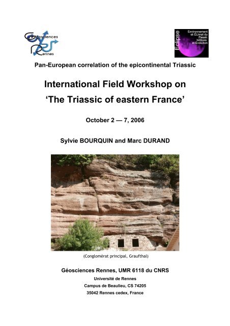
International Field Workshop on 'The Triassic of eastern France'
International Field Workshop on 'The Triassic of eastern France'
International Field Workshop on 'The Triassic of eastern France'

Create successful ePaper yourself
Turn your PDF publications into a flip-book with our unique Google optimized e-Paper software.
Pan-European correlati<strong>on</strong> <strong>of</strong> the epic<strong>on</strong>tinental <strong>Triassic</strong><br />
<str<strong>on</strong>g>Internati<strong>on</strong>al</str<strong>on</strong>g> <str<strong>on</strong>g>Field</str<strong>on</strong>g> <str<strong>on</strong>g>Workshop</str<strong>on</strong>g> <strong>on</strong><br />
‘The <strong>Triassic</strong> <strong>of</strong> <strong>eastern</strong> France’<br />
October 2 — 7, 2006<br />
Sylvie BOURQUIN and Marc DURAND<br />
(C<strong>on</strong>glomérat principal, Graufthal)<br />
Géosciences Rennes, UMR 6118 du CNRS<br />
Université de Rennes<br />
Campus de Beaulieu, CS 74205<br />
35042 Rennes cedex, France
C<strong>on</strong>tents<br />
LIST OF PARTICIPANTS ..........................................................................................................................................5<br />
EXCURSIONS ...............................................................................................................................................................6<br />
TUESDAY, 03.10 2006.................................................................................................................................................6<br />
WEDNESDAY, 04.10 2006 ...........................................................................................................................................6<br />
THURSDAY, 05.10.2006 ..............................................................................................................................................6<br />
FRIDAY, 06.10.2006 ....................................................................................................................................................6<br />
ITINERARY AND OUTCROP LOCATIONS .........................................................................................................7<br />
THE TRIASSIC OF EASTERN FRANCE................................................................................................................9<br />
I. - INTRODUCTION ......................................................................................................................................................9<br />
II. - THE BUNTSANDSTEIN.........................................................................................................................................11<br />
II.2. - Geological setting ......................................................................................................................................11<br />
II.2. – High-resoluti<strong>on</strong> sequence stratigraphy correlati<strong>on</strong> <strong>of</strong> the Lower <strong>Triassic</strong> from well-log analysis .......14<br />
II.3. – Comparis<strong>on</strong> with other parts <strong>of</strong> the German Basin .................................................................................19<br />
II.4. – C<strong>on</strong>clusi<strong>on</strong> and perspectives.....................................................................................................................21<br />
III. THE MUSCHELKALK............................................................................................................................................24<br />
III.1. -Geological setting......................................................................................................................................24<br />
III.2. - High resoluti<strong>on</strong> sequence stratigraphy from well-log analysis ..............................................................24<br />
IV. THE KEUPER........................................................................................................................................................27<br />
IV.1. - Geological setting .....................................................................................................................................27<br />
IV.2. - High resoluti<strong>on</strong> sequence stratigraphy from well-log analysis ..............................................................28<br />
IV.3. -Comparis<strong>on</strong> with the German Basin .........................................................................................................36<br />
DAY 1 — TUESDAY, 03.10 2006 .........................................................................................................................39<br />
STOP 1.1 - HAUT-BARR MIDDLE BUNTSANDSTEIN (‘GRÈS VOSGIEN’ AND ‘CONGLOMÉRAT PRINCIPAL’ FMS)....39<br />
Facies associati<strong>on</strong>: Braided rivers......................................................................................................................39<br />
Landscape rec<strong>on</strong>structi<strong>on</strong> for the early <strong>Triassic</strong> (Middle Buntsandstein).........................................................41<br />
STOP 1.2 - NIDERVILLER (METZGER QUARRY): UPPER BUNTSANDSTEIN (‘GRÈS À VOLTZIA’ FM) ......................43<br />
Landscape rec<strong>on</strong>structi<strong>on</strong> for the Anisian (Upper Buntsandstein) ....................................................................44<br />
STOP 1.3 - HÉMING (HOLCIM QUARRY): UPPER MUSCHELKALK (‘CALCAIRE À ENTROQUES’ AND ‘CALCAIRE À<br />
CÉRATITES’ FMS. .........................................................................................................................................45<br />
Facies associati<strong>on</strong> and paleogeography .............................................................................................................45<br />
STOP 1.4 - RAON-L'ETAPE (CÔTE DE BEAUREGARD): MIDDLE BUNTSANDSTEIN (‘CONGLOMÉRAT INFÉRIEUR’<br />
FM AND ‘GRÈS VOSGIEN’ FM, WITH AEOLIAN FACIES)...............................................................................46<br />
Facies associati<strong>on</strong>: braided rivers and aeolian dunes .......................................................................................47<br />
Landscape rec<strong>on</strong>structi<strong>on</strong> for the early <strong>Triassic</strong> (Middle Buntsandstein): See Stop 1.1 for the landscape<br />
rec<strong>on</strong>structi<strong>on</strong> and Fig. 3............................................................................................................................48<br />
STOP 1.5 - HOUSSERAS (‘POTERIE LORRAINE’ QUARRY): MIDDLE MUSCHELKALK (‘COUCHES ROUGES’ FM). ...49<br />
DAY 2 — WEDNESDAY, 04.10 2006 ..................................................................................................................50<br />
STOP 2.1 - DOMPAIRE-RACÉCOURT (ROAD CUTTING): LOWER KEUPER = LETTENKOHLE.....................................50<br />
STOP 2.2 - RELANGES (QUARRY ALONG D164 ROAD): MIDDLE BUNTSANDSTEIN (‘CONGLOMÉRAT PRINCIPAL’<br />
AND ‘ZONE LIMITE VIOLETTE’ FMS) ...........................................................................................................52<br />
STOP 2.3 - SURIAUVILLE (ROAD CUTTING): LOWER KEUPER (‘DOLOMIE DE VITTEL’ FM= ‘DOLOMIE<br />
INFÉRIEURE’ OF THE LETTENKOHLE) ..........................................................................................................53<br />
STOP 2.4 - CRAINVILLIERS (GULLIES IN FOREST): EO-CIMMERIAN UNCONFORMITY (‘ARGILES BARIOLÉES<br />
DOLOMITIQUES’ FM / ‘GRÈS À ROSEAUX’ FM) ...........................................................................................54<br />
STOP 2.5 - LA NEUVILLE-SOUS-CHATENOIS (OLD QUARRY): UPPER KEUPER (‘GRÈS RHÉTIENS’ FM)..................55<br />
STOP 2.6 - POUSSAY (D55 ROAD CUTTING): UPPER KEUPER (‘ARGILES DE LEVALLOIS’ FM AND TRIASSIC-<br />
JURASSIC BOUNDARY) .................................................................................................................................56<br />
STOP 2.7 - FLORÉMONT (N57-E23 ROAD CUTTINGS): MIDDLE KEUPER (‘MARNES IRISÉES MOYENNES’ AND<br />
‘MARNES IRISÉES SUPÉRIEURES’ FMS, WITH EO-CIMMERIAN UNCONFORMITY) ......................................57<br />
STOP 2.8 - XIROCOURT (S.R.D.E. QUARRY): MIDDLE KEUPER (‘DOLOMIE DE BEAUMONT’ FM).........................58<br />
STOP 2.9 - MANGONVILLE (OLD GYPSUM QUARRY): MIDDLE KEUPER (‘FORMATION SALIFÈRE’)........................59<br />
3
DAY 3 — THURSDAY, 05.10.2006 .....................................................................................................................59<br />
STOP 3.1 - SAINT-HUBERT (OLD QUARRIES AND ROAD CUT): UPPER KEUPER (‘GRÈS RHÉTIENS’ FM) .................59<br />
STOP 3.2 - HOMBOURG-BUDANGE (D978 ROAD CUTTING): MIDDLE KEUPER (‘DOLOMIE DE BEAUMONT’ FM,<br />
MARGINAL FACIES) ......................................................................................................................................60<br />
STOP 3.3 - KEMPLICH (OLD GYPSUM QUARRY): MIDDLE KEUPER (‘MARNES IRISÉES SUPÉRIEURES’ FM, WITH<br />
EO-CIMMERIAN UNCONFORMITY)...............................................................................................................61<br />
STOP 3.4 - RÉMELFANG: MIDDLE KEUPER (BASAL PART OF THE ‘GRÈS À ROSEAUX’ FM.) ...................................62<br />
STOP 3.5 - HELSTROFF (D19 ROAD CUTTING): UPPERMOST MUSCHELKALK (‘CALCAIRE À CÉRATITES’ AND<br />
DOLOMITIZED ‘CALCAIRE À TÉRÉBRATULES’ FMS)....................................................................................63<br />
STOP 3.6 - SAINT-AVOLD (N3 ROAD CUTTING): MIDDLE BUNTSANDSTEIN (‘CONGLOMÉRAT PRINCIPAL’ AND<br />
‘ZONE LIMITE VIOLETTE’ FMS) ...................................................................................................................64<br />
STOP 3.7 - SANKT-ARNUAL (CLIFFS IN STIFTSWALD): UPPER BUNTSANDSTEIN (‘COUCHES INTERMÉDIAIRES’<br />
FM.) ..............................................................................................................................................................64<br />
STOP 3.8 - GROSBLIEDERSTROFF (N61 ROAD CUTTING): HARDEGSEN UNCONFORMITY (BETWEEN MIDDLE AND<br />
UPPER BUNTSANDSTEIN).............................................................................................................................66<br />
DAY 4 — FRIDAY, 06.10.2006 ............................................................................................................................66<br />
STOP 4.1 - WEISKIRCH: LOWER MUSCHELKALK (‘GRÈS COQUILLIER’ FM, WITH BALL-AND-PILLOW<br />
STRUCTURES) ...............................................................................................................................................66<br />
STOP 4.2 - VOLMUNSTER-LENGELSHEIM: LOWER MUSCHELKALK (‘VOLMUNSTER’ FORMATION, WELLENKALK<br />
FACIES).........................................................................................................................................................68<br />
STOP 4.3 - BITCHE (N62 ROAD): HARDEGSEN UNCONFORMITY (BETWEEN MIDDLE AND UPPER<br />
BUNTSANDSTEIN).........................................................................................................................................70<br />
STOP 4.4 - BITCHE (CITADEL): MIDDLE BUNTSANDSTEIN (KARLSTAL FACIES OF THE ‘GRÈS VOSGIEN’ FM) ......73<br />
Facies associati<strong>on</strong>: Fluvio-aeolian overbank envir<strong>on</strong>ments..............................................................................73<br />
STOP 4.5 - NIEDERSTEINBACH (FOREST TRAIL): PERMIAN (‘FRENCH LOWER BUNTSANDSTEIN’ (‘GRÈS<br />
D'ANNWEILER’ FM.) ON ROTLIEGENDS) .....................................................................................................74<br />
STOP 4.6 - FLECKENSTEIN CASTLE: ‘GRÈS D'ANNWEILER’ FM. AND TRIFELS FACIES OF THE ‘GRÈS VOSGIEN’<br />
FM.................................................................................................................................................................74<br />
REFERENCES ............................................................................................................................................................77<br />
4
List <strong>of</strong> participants<br />
Full Name Pr<strong>of</strong>essi<strong>on</strong>al address e-mail<br />
Bachmann, Gerhard Halle University, Germany gerhard.bachmann@geo.uni-halle.de<br />
Barnasch, Jens Halle University, Germany jens.barnasch@geo.uni-halle.de<br />
Bourquin, Sylvie CNRS, Rennes1 University, France bourquin@univ-rennes1.fr<br />
Dittrich, Doris Landesamt für Geologie und Bergbau,<br />
Rheinland-Pfalz, Mainz, Germany<br />
doris.dittrich@lgb-rlp.de<br />
Durand, Marc Nancy, France mada.durand@wanadoo.fr<br />
Franz, Matthias Halle University, Germany matthias.franz@geo.uni-halle.de<br />
Hagdorn, Hans Ingelfingen, Germany encrinus@hagdorn-ingelfingen.de<br />
Kearsey, Timothy Plymouth University, UK timothy.kearsey@plymouth.ac.uk<br />
Kozur, Heinz Budapest, Hungry kozurh@helka.iif.hu<br />
Paul, Josef Göttingen University, Germany Jpaul@gwdg.de<br />
Szurlies, Michael GFZ Potsdam, Germany szur@gfz-potsdam.de<br />
Ptazynski, Tadeusz Poland tadeusz.ptaszynski@inetia.pl<br />
Edgar, Nitsch RPFR Landesamt für Geologie,<br />
Rohst<strong>of</strong>fe und Bergbau, Stuttgart,<br />
Germany<br />
edgar.nitsch@rpf.bwl.de<br />
Hug, Nicola Hessische Landesamt für Umwelt und<br />
Geologie, Wiesbaden, Germany<br />
n.hug@hlug.de<br />
Dersch-Hansman, Michaela Hessische Landesamt für Umwelt und<br />
Geologie, Wiesbaden, Germany<br />
m.dersch@hlug.de<br />
Niedzwiedzki, Grzegorz Poland grzegorzniedzwiedzki@yahoo.com<br />
Lepper, Jochen Niedersächsisches Landesamt für<br />
Bodenforschung, Hannover, Germany<br />
Jochen.Lepper@lbeg.niedersachsen.de<br />
Stets, Johannes B<strong>on</strong>n University, Germany schaefer@uni-b<strong>on</strong>n.de<br />
Lutz, Manfred Freiburg im Breisgau, Germany mk.lutz@t-<strong>on</strong>line.de<br />
Käding, Karl-Christian Kassel, Germany ch.kaeding@t-<strong>on</strong>line.de<br />
Deenen, Martijn Utrecht University, The Netherlands deenen@hotmail.com<br />
B<strong>on</strong>is, Nina Utrecht University, The Netherlands n.r.b<strong>on</strong>is@bio.uu.nl<br />
Ruhl, Micha Utrecht University, The Netherlands M.Ruhl@bio.uu.nl<br />
Hounslow, Mark Lancaster University, UK. m.hounslow@lancaster.ac.uk<br />
Bates, Gemma School <strong>of</strong> Envir<strong>on</strong>mental Science<br />
UEA, Norwich<br />
g.bates@uea.ac.uk<br />
Bercovici, Antoine Rennes1 University, France aberco@free.fr<br />
Sim<strong>on</strong>, Theo Germany theo.sim<strong>on</strong>@rpf.bwl.de<br />
Szulc, Joachim Poland szulcachim@vp.pl<br />
Röhling, Heinz-Gerd LBEG - Landesamt für Bergbau,<br />
Energie und Geologie, Hannover<br />
gerd.roehling@nlfb.de<br />
5
Excursi<strong>on</strong>s<br />
Tuesday, 03.10 2006<br />
Stop 1.1 Haut-Barr Middle Buntsandstein (‘Grès vosgien’ and ‘C<strong>on</strong>glomérat principal’ Fms)<br />
Stop 1.2 Niderviller (Metzger quarry): Upper Buntsandstein (‘Grès à Voltzia’ Fm)<br />
Stop 1.3 Héming (Holcim quarry): Upper Muschelkalk (‘Calcaire à entroques’ and ‘Calcaire à<br />
cératites’ Fms<br />
Stop 1.4 Ra<strong>on</strong>-l'Etape (Côte de Beauregard): Middle Buntsandstein (‘C<strong>on</strong>glomérat inférieur’ Fm<br />
and ‘Grès vosgien’ Fm, with aeolian facies)<br />
Stop 1.5 Housseras (‘Poterie lorraine’ quarry): Middle Muschelkalk (‘Couches rouges’ Fm)<br />
Wednesday, 04.10 2006<br />
Stop 2.1 Dompaire-Racécourt (road cutting): Lower Keuper = Lettenkohle<br />
Stop 2.2 Relanges (quarry al<strong>on</strong>g D164 road): Middle Buntsandstein (‘C<strong>on</strong>glomérat principal’ and<br />
‘Z<strong>on</strong>e limite violette’ Fms)<br />
Stop 2.3 Suriauville (road cutting): Lower Keuper (‘Dolomie de Vittel’ Fm= ‘Dolomie inférieure’ <strong>of</strong><br />
the Lettenkohle)<br />
Stop 2.4 Crainvilliers (gullies in forest): Eo-Cimmerian unc<strong>on</strong>formity (‘Argiles bariolées<br />
dolomitiques’ Fm / ‘Grès à roseaux’ Fm)<br />
Stop 2.5 La Neuville-sous-Chatenois (old quarry): Upper Keuper (‘Grès rhétiens’ Fm)<br />
Stop 2.6 Poussay (D55 road cutting): Upper Keuper (‘Argiles de Levallois’ Fm and <strong>Triassic</strong>-Jurassic<br />
boundary)<br />
Stop 2.7 Florém<strong>on</strong>t (N57-E23 road cuttings): Middle Keuper (‘Marnes irisées moyenne’ and<br />
‘Marnes irisées supérieures’ Fms, with Eo-Cimmerian unc<strong>on</strong>formity)<br />
Stop 2.8 Xirocourt (S.R.D.E. quarry): Middle Keuper (‘Dolomie de Beaum<strong>on</strong>t’ Fm)<br />
Stop 2.9 Mang<strong>on</strong>ville (old gypsum quarry): Middle Keuper (‘Formati<strong>on</strong> salifère’)<br />
Thursday, 05.10.2006<br />
Stop 3.1 Saint-Hubert (old quarries): Upper Keuper (‘Grès rhétiens’ Fm)<br />
Stop 3.2 Hombourg-Budange (D978 road cutting): Middle Keuper (‘Dolomie de Beaum<strong>on</strong>t’ Fm,<br />
marginal facies)<br />
Stop 3.3 Kemplich (old gypsum quarry): Middle Keuper (‘Marnes irisées supérieures’ Fm, with Eo-<br />
Cimmerian unc<strong>on</strong>formity)<br />
Stop 3.4 Rémelfang: Middle Keuper (basal part <strong>of</strong> the ‘Grès à roseaux’ Fm)<br />
Stop 3.5 Helstr<strong>of</strong>f (D19 road cutting): Uppermost Muschelkalk (‘Calcaire à cératites’ and<br />
dolomitized ‘Calcaire à térébratules’ Fms)<br />
Stop 3.6 Saint-Avold (N3 road cutting): Middle Buntsandstein (‘C<strong>on</strong>glomérat principal’ and ‘Z<strong>on</strong>e<br />
limite violette’ Fms)<br />
Stop 3.7 Sankt-Arnual (cliffs in Stiftswald): Upper Buntsandstein (‘Couches intermédiaires’ Fm)<br />
Stop 3.8 Grosbliederstr<strong>of</strong>f (N61 road cutting): Hardegsen unc<strong>on</strong>formity (between Middle and Upper<br />
Buntsandstein)<br />
Friday, 06.10.2006<br />
Stop 4.1 Weiskirch: Lower Muchelkalk (‘Grès coquillier’ Fm, with ball-and-pillow structures)<br />
Stop 4.2 Volmunster-Lengelsheim: Lower Muschelkalk (‘Volmunster’ Formati<strong>on</strong>, Wellenkalk<br />
facies)<br />
Stop 4.3 Bitche (N62 road): Hardegsen unc<strong>on</strong>formity (between Middle and Upper Buntsandstein)<br />
Stop 4.4 Bitche (Citadel): Middle Buntsandstein (Karlstal facies <strong>of</strong> the ‘Grès vosgien’ Fm)<br />
Stop 4.5 Niedersteinbach (forest trail): Permian: ‘French Lower Buntsandstein’ (‘Grès d'Annweiler’<br />
Fm) <strong>on</strong> Rotliegends<br />
Stop 4.6 Fleckenstein Castle: ‘Grès d'Annweiler’ Fm. and Trifels facies <strong>of</strong> the ‘Grès vosgien’ Fm<br />
6
Itinerary and outcrop locati<strong>on</strong>s<br />
7
I. - Introducti<strong>on</strong><br />
The <strong>Triassic</strong> <strong>of</strong> <strong>eastern</strong> France<br />
The <strong>Triassic</strong> <strong>of</strong> the Paris Basin was deposited in an intracrat<strong>on</strong>ic peri-Tethyan basin (Perrod<strong>on</strong> &<br />
Zabek, 1990) and its successi<strong>on</strong> is characterized by (Dubois and Umbach, 1974; Courel et al., 1980): (i)<br />
fluvial and playa deposits during the Early <strong>Triassic</strong>, i.e. Buntsandstein facies, (ii) evaporite and marine<br />
deposits during the Middle <strong>Triassic</strong>, i.e. Muschelkalk facies and (iii) mainly evaporite and fluvial deposits<br />
during the Late <strong>Triassic</strong>, i.e. Keuper facies. During the Early and Middle <strong>Triassic</strong>, the Paris and Bresse-Jura<br />
basins formed the western end <strong>of</strong> the Germanic Basin. The Paris Basin <strong>on</strong>ly existed as an independent basin<br />
from the Middle Carnian <strong>on</strong>wards (Bourquin and Guillocheau, 1993, 1996).<br />
The terminology used in the <strong>eastern</strong> part <strong>of</strong> the Paris Basin is indicated in the Table 1.<br />
9<br />
Table 1: Terminology used in the <strong>eastern</strong> part<br />
<strong>of</strong> the Paris Basin (after Courel et al., 1980
The study <strong>of</strong> the Paris Basin was focused until the years 1990 <strong>on</strong> outcrops data. The development <strong>of</strong><br />
sequence stratigraphy c<strong>on</strong>cept allowed to propose a sequential analysis <strong>of</strong> the Mesozoic formati<strong>on</strong>s <strong>of</strong> the<br />
Paris Basin from outcrop data (Guillocheau, 1991). Like this, this author describes during the <strong>Triassic</strong> three<br />
major stratigraphic cycles. However, the study <strong>of</strong> the <strong>Triassic</strong> outcrops does not allow to understand the<br />
evoluti<strong>on</strong> <strong>of</strong> the Paris Basin without the help <strong>of</strong> correlati<strong>on</strong>s with the central and western part, which display<br />
proximal facies (sandst<strong>on</strong>e and clay). In fact, the <strong>Triassic</strong> crops out <strong>on</strong>ly in the <strong>eastern</strong> part <strong>of</strong> the Paris<br />
Basin. The outcrops are disc<strong>on</strong>tinuous and it is sometimes very difficult to determine the stratigraphic<br />
positi<strong>on</strong>. Only well-log data can provide a c<strong>on</strong>tinuous record.<br />
The numerous well-log and core data in the Paris Basin allow to realize correlati<strong>on</strong>s from western and<br />
<strong>eastern</strong> part <strong>of</strong> the basin, and make a comparis<strong>on</strong> with outcrop data. By studying the complete set <strong>of</strong> wells in<br />
the Paris Basin, we can carry out correlati<strong>on</strong>s and propose paleogeographic rec<strong>on</strong>structi<strong>on</strong> for the <strong>Triassic</strong>. In<br />
subsurface studies, it is essential to use complete sets <strong>of</strong> log data to identify and correlate genetic sequences,<br />
especially in c<strong>on</strong>tinental envir<strong>on</strong>ments (Bourquin et al., 1990, 1993). For example, sandst<strong>on</strong>es that include<br />
large amounts <strong>of</strong> radioactive minerals (potash feldspar, heavy minerals, etc.) may produce high gamma-ray<br />
values similar to those obtained from clays. C<strong>on</strong>sequently, the use <strong>of</strong> gamma-ray and s<strong>on</strong>ic logs al<strong>on</strong>e may<br />
lead to misinterpretati<strong>on</strong>. Similarly, a density log coupled with a photo-electric factor log is required to<br />
distinguish between dolomitic and anhydritic shales. Neutr<strong>on</strong>-porosity, density and photo-electric factor logs,<br />
used with high-resoluti<strong>on</strong> logs (dipmeter or Formati<strong>on</strong> Microscanner) are necessary (1) to determine<br />
sedimentary facies, (2) to calibrate cores and outcrops with well logs and (3) to obtain correlati<strong>on</strong>s.<br />
The analysis <strong>of</strong> around 700 wells in the Paris basin has allowed (1) to define pre-<strong>Triassic</strong> topography,<br />
(2) to propose sequence stratigraphy correlati<strong>on</strong>s <strong>of</strong> the <strong>Triassic</strong> series and a comparis<strong>on</strong> with data from other<br />
west-European basins (Bourquin and Guillocheau, 1993, 1996; Bourquin et al., 1998, 2006), (3) to<br />
characterize two major disc<strong>on</strong>tinuities (Hardegsen and Eo-Cimmerian unc<strong>on</strong>formities) induced by l<strong>on</strong>g<br />
wavelength deformati<strong>on</strong>, (4) realize isopach and lithological maps to rec<strong>on</strong>struct the 3D evoluti<strong>on</strong> <strong>of</strong> the<br />
basin cycle by cycle and to investigate the influence <strong>of</strong> tect<strong>on</strong>ic movements (Bourquin et al., 1997,<br />
Guillocheau et al., 2000), (5) to estimate the influence <strong>of</strong> deformati<strong>on</strong>, eustasy and sediment supply in the<br />
Keuper stratigraphic record from 3D accommodati<strong>on</strong> variati<strong>on</strong> analysis (Bourquin et al., 2002) (6) to<br />
rec<strong>on</strong>struct paleoenvi<strong>on</strong>mental maps and climate simulati<strong>on</strong>s to investigate the impact <strong>of</strong> climate <strong>on</strong><br />
c<strong>on</strong>tinental sediment preservati<strong>on</strong> (Pér<strong>on</strong> et al, 2005). Like this, recent study (Bourquin et al., 2006) allows<br />
to recognize the Hardegdsen unc<strong>on</strong>formity and redefine the three major cycles <strong>of</strong> Guillocheau (1991): the<br />
Scythian, Anisian-Carnian, and Carnian-Liassic cycles (Fig. I.1).<br />
10
Figure I.1: Lithostratigraphic column, sedimentary envir<strong>on</strong>ment variati<strong>on</strong>s and biostratigraphic data <strong>of</strong> the<br />
<strong>Triassic</strong> successi<strong>on</strong> in the <strong>eastern</strong> part <strong>of</strong> the Paris Basin based <strong>on</strong> the Francheville well. See Fig. II.1 for<br />
locati<strong>on</strong>. After, Bourquin and Guillocheau, 1996, modified.<br />
In this document, we present in a first part the geological setting and the sequence stratigraphy<br />
correlati<strong>on</strong> results for each period <strong>of</strong> the basin evoluti<strong>on</strong>. In the sec<strong>on</strong>d part we present all the stops <strong>of</strong> the<br />
field excursi<strong>on</strong>.<br />
II. - The Buntsandstein<br />
All these results are mainly published in the paper <strong>of</strong> Bourquin et al. (2006)<br />
II.2. - Geological setting<br />
During the Early <strong>Triassic</strong>, the Paris and Bresse-Jura basins formed the western end <strong>of</strong> the Germanic<br />
Basin. In the Vosges (Fig. II.1), the Lower Buntsandstein units (Sen<strong>on</strong>es Sandst<strong>on</strong>es or Anweiller<br />
Sandst<strong>on</strong>es) can be attributed to the Uppermost Permian, i.e. Zechstein equivalents (Durand et al., 1994).<br />
Whereas in the major part <strong>of</strong> the Germanic basin the ‘Buntsandstein Group’ is separated from the<br />
11
Rotliegends by the typical-Zechstein carb<strong>on</strong>ate-evaporite facies (Uppermost Permian), in France the latter<br />
are completely lacking. This is why the French geologists place the base <strong>of</strong> their ‘Buntsandstein’ at the level<br />
<strong>of</strong> a major unc<strong>on</strong>formity between fanglomerate pr<strong>on</strong>e deposits, localised in relatively restricted basins, and<br />
widespread fluvial deposits (Courel et al. 1980). Such a c<strong>on</strong>cept <strong>of</strong> ‘Buntsandstein’ prevailed in South<br />
Germany until the adopti<strong>on</strong> <strong>of</strong> a unified lithostratigraphic scale (Richter-Bernburg, 1974). Thus, in the<br />
French sedimentary basins, deposits referred to as ‘Buntsandstein’ can be attributed either to Permian or to<br />
<strong>Triassic</strong> (Durand, 2006). Actually, the ‘Lower Buntsandstein’ <strong>of</strong> the Vosges (Sen<strong>on</strong>es Sandst<strong>on</strong>e and<br />
Anweiller Sandst<strong>on</strong>e) can be attributed to the Upper Permian, i.e. Zechstein equivalents (Durand et al.,<br />
1994).<br />
Figure II.1: (A) Locati<strong>on</strong> <strong>of</strong> the studied area and the Bockenem well (Bo) and (B) Locati<strong>on</strong> <strong>of</strong> studied wells and<br />
lower <strong>Triassic</strong> transect. B: Bertray1; G: Granville 109; M: M<strong>on</strong>tpl<strong>on</strong>e1; F: Francheville1; L: Lorettes1, S:<br />
Saulcy; J: Johansweiller; SSF: Soultz-sous-Forêts, K: Kraichgau; E: Emberménil. After Bourquin et al.,<br />
2006.<br />
Therefore, the Middle and Upper Buntsandstein units are attributed mainly to the Lower <strong>Triassic</strong>.<br />
These facies are characterized by fluvial deposits that make up the following formati<strong>on</strong>s (Fig. II.2), from<br />
base to top (Courel et al., 1980): ‘C<strong>on</strong>glomérat basal’, ‘Grès vosgiens’, ‘C<strong>on</strong>glomérat principal’, ‘Couches<br />
intermédiaires’, and ‘Grès à Voltzia’. The ‘Couches intermédiaires’ Formati<strong>on</strong> is comm<strong>on</strong>ly separated from<br />
the ‘C<strong>on</strong>glomérat principal’ by the ‘Z<strong>on</strong>e limite violette’ Formati<strong>on</strong> that is characterized by the first<br />
occurrence <strong>of</strong> <strong>Triassic</strong> soils in this area. The bed-load fluvial systems <strong>of</strong> ‘C<strong>on</strong>glomérat basal’, ‘Grès<br />
vosgiens’ and ‘C<strong>on</strong>glomérat principal’ are attributed to braided type networks developed in an arid climatic<br />
envir<strong>on</strong>ment, as indicated by the occurrence <strong>of</strong> reworked and in situ aeolian sand dunes and wind worn<br />
pebbles (Durand, 1972, 1978; Durand et al., 1994). The bed-load fluvial deposits <strong>of</strong> the ‘Couches<br />
intermédiaires’ corresp<strong>on</strong>d to low sinuosity rivers with transverse bars (Durand, 1978), and are associated<br />
with hydromorphic paleosols (Durand 1978; Durand and Meyer, 1982). The ‘Grès à Voltzia’ shows an<br />
evoluti<strong>on</strong> from low sinuosity fluvial systems in the ‘Grès à meules’, with weak marine influence, to the<br />
fluvio-marine envir<strong>on</strong>ment <strong>of</strong> the ‘Grès argileux’ (Gall, 1971; Durand, 1978; Courel et al., 1980; Durand et<br />
al., 1994). The <strong>on</strong>ly biostratigraphic evidence in this Buntsandstein series c<strong>on</strong>cerns the ‘Grès à Voltzia’,<br />
where macr<strong>of</strong>auna and palyn<strong>of</strong>lora allow the attributi<strong>on</strong> <strong>of</strong> a Lower to Middle Anisian age according to<br />
12
locati<strong>on</strong> (Durand and Jurain, 1969; Gall, 1971). Paleocurrent directi<strong>on</strong>s obtained from fluvial facies indicate<br />
a mainly eastward flow (Durand, 1978).<br />
Figure II.2: Lithostratigraphic column, sedimentary envir<strong>on</strong>ment variati<strong>on</strong>s, major and minor stratigraphic<br />
cycles for the Lower <strong>Triassic</strong> successi<strong>on</strong> in the <strong>eastern</strong> part <strong>of</strong> the Paris Basin based <strong>on</strong> Emberménil well<br />
(after Bourquin et al., 2006).<br />
The terminology used for the Buntsandstein formati<strong>on</strong>s in the Palatinate is not the same as that applied<br />
in the Paris Basin. The equivalent <strong>of</strong> the ‘Grès vosgiens’ Formati<strong>on</strong> is divided into three units, which are,<br />
from base to top: the Trifels, Rehberg, and Karlstal formati<strong>on</strong>s. These three units are characterized by<br />
increasing clay c<strong>on</strong>tent.<br />
Recent study from well-log data for the <strong>Triassic</strong> west <strong>of</strong> the Black Forest (Paris Basin, Rhine Graben<br />
and Bresse-Jura Basin) allows us to propose correlati<strong>on</strong>s and define the stratigraphic c<strong>on</strong>text <strong>of</strong> the Lower<br />
<strong>Triassic</strong> units (Bourquin et al., 2006).<br />
13
II.2. – High-resoluti<strong>on</strong> sequence stratigraphy correlati<strong>on</strong> <strong>of</strong> the Lower <strong>Triassic</strong> from well-<br />
log analysis<br />
The Lower <strong>Triassic</strong> crops out <strong>on</strong>ly in the western part <strong>of</strong> the Paris Basin, in the Vosges Massif and in<br />
the Black Forest. The outcrops are disc<strong>on</strong>tinuous and if the basal unit (with Permian-<strong>Triassic</strong> boundary) or<br />
uppermost unit (‘C<strong>on</strong>glomérat principal’) are not present, it is almost impossible to determine the<br />
stratigraphic positi<strong>on</strong>.<br />
The results <strong>of</strong> the correlati<strong>on</strong>s the 580 wells studied in the Paris basin and Rhine Grabben are<br />
summarized <strong>on</strong> a NE-SW secti<strong>on</strong> between the Rhine Graben (Soultz-sous-Forêts well) and the area south <strong>of</strong><br />
Orléans (Figs. II.1B, II.3, II.4).<br />
The transect (Figs. II.3, II.4) and the maps allow us to quantify the 3D evoluti<strong>on</strong> <strong>of</strong> the <strong>Triassic</strong> series<br />
and to characterize (1) the geometries <strong>of</strong> sedimentati<strong>on</strong> units infilling the basement topography, (2) the<br />
general <strong>on</strong>lapping <strong>of</strong> these series, (3) the retrogradati<strong>on</strong>al pattern <strong>of</strong> the playa deposits, (4) the progradati<strong>on</strong><br />
<strong>of</strong> the ‘C<strong>on</strong>glomérat principal’ Formati<strong>on</strong>, (5) the diachr<strong>on</strong>ism <strong>of</strong> the Middle Buntsandstein formati<strong>on</strong>s<br />
(Trifels, Rehberg, Karstal, ‘C<strong>on</strong>glomerat basal’, and ‘C<strong>on</strong>glomérat principal’ formati<strong>on</strong>s, Figs. II.3, II.4).<br />
Figure II.3: (A) WSW-ENE correlati<strong>on</strong>s <strong>of</strong> Lower <strong>Triassic</strong> stratigraphic cycles, between the south <strong>of</strong> Orléans<br />
(Bertray well), and the Rhine Basin (Soultz-sous-Forêts well) in the western part <strong>of</strong> the Germanic Basin. (B)<br />
Transect locati<strong>on</strong>. See figure II.1B for more details. After Bourquin et al., 2006.<br />
14
Figure II.4: A) Geometries and lithology <strong>of</strong> the Lower <strong>Triassic</strong> stratigraphic cycles, al<strong>on</strong>g the transect between<br />
the area south <strong>of</strong> Orléans (Bertray well) and the Rhine Basin (Soultz-sous-Forêts well) deduced from welllog<br />
analysis: (1) Geometries from Variscan basement or pre-<strong>Triassic</strong> deposits to the Hardegsen<br />
unc<strong>on</strong>formity (Fig. 3), (2) Geometries from the Hardegsen unc<strong>on</strong>formity to the basal anhydrite bed <strong>of</strong> the<br />
“Couches grises” Formati<strong>on</strong> defined in the <strong>eastern</strong> part <strong>of</strong> the Paris Basin (middle part <strong>of</strong> the Middle<br />
Muschelkalk, Fig. 3). (B) Transect locati<strong>on</strong>. See figure II.1B for more details. After Bourquin et al., 2006.<br />
II.2.1. - Middle Buntsandstein cycles<br />
The Middle Buntsandstein formati<strong>on</strong>s (‘C<strong>on</strong>glomérat basal’, ‘Grès vosgiens’ and ‘C<strong>on</strong>glomérat<br />
principal’) exhibit <strong>on</strong>e major cycle divided into four minor cycles (noted B1 to B4, Figs. II.1C).<br />
The correlati<strong>on</strong>s reveal the <strong>on</strong>lap <strong>of</strong> the <strong>Triassic</strong> sedimentati<strong>on</strong> <strong>on</strong>to the basement (Figs. II.3 and II.4).<br />
The bed-load fluvial sediments, attributed to braided rivers, came from the west: present-day Armorican<br />
Massif (Durand, 1978; Durand et al., 1994) and progressively filled in the topographic depressi<strong>on</strong>.<br />
Floodplain deposits are rare and characterized by clay layers a few centimetres thick. The c<strong>on</strong>glomerate<br />
deposits are mainly located in the western part <strong>of</strong> the sedimentati<strong>on</strong> area. The four minor stratigraphic cycles<br />
(B1 to B4) can be correlated across the Paris Basin up to the Rhine Graben in the east, showing that the<br />
‘C<strong>on</strong>glomérat basal’ Formati<strong>on</strong> is diachr<strong>on</strong>ous.<br />
The B1, cycle corresp<strong>on</strong>ds, in the Vosges Massif outcrops and Emberménil well, to the deposits <strong>of</strong> the<br />
‘C<strong>on</strong>glomérat basal’ Formati<strong>on</strong> (Figs. II.3 and II.4). This cycle is characterized by the vertical passage <strong>of</strong><br />
well-preserved fluvial c<strong>on</strong>glomerates into floodplain deposits. In more distal parts <strong>of</strong> the basin, the<br />
c<strong>on</strong>glomerates grade eastwards into sandst<strong>on</strong>es.<br />
The B2 and B3 cycles (Figs. II.3 and II.4), are intra – ‘Grès vosgiens’ Formati<strong>on</strong>, and record well-<br />
preserved fluvial sandst<strong>on</strong>es to floodplain deposits, the basal c<strong>on</strong>glomerate facies being located in the<br />
westernmost area. From cycles B1 to B3, we observe a general backstepping <strong>of</strong> c<strong>on</strong>glomerate facies.<br />
The isopach maps drawn up for each cycle (Figs. II.5 and II.6A) indicate the basement-sedimentati<strong>on</strong><br />
area boundary, as well as the locati<strong>on</strong> <strong>of</strong> c<strong>on</strong>glomerate facies through time and space. The more proximal<br />
15
facies are located to the west. These maps show the general backstepping <strong>of</strong> c<strong>on</strong>glomerate facies and their<br />
lateral eastward evoluti<strong>on</strong> to sandst<strong>on</strong>e deposits (Figs II.5A, II.5B and II.6A).<br />
Figure II.5: Isopach maps with superimposed lithology (%<br />
<strong>of</strong> c<strong>on</strong>glomerate) for stratigraphic cycles B1 and B2 (see<br />
Figs. II.2, II.3, II.4), c<strong>on</strong>structed from well-log data and<br />
outcrops informati<strong>on</strong>. After Bourquin et al., 2006.<br />
Figure II.6: Isopach maps with superimposed lithology (%<br />
<strong>of</strong> c<strong>on</strong>glomerate) for the B3 (A) and B4 (B) stratigraphic<br />
cycles (see Figs. II.2, II.3, II.4), c<strong>on</strong>structed from welllog<br />
data and outcrops informati<strong>on</strong> After Bourquin et al.,<br />
2006.<br />
The B4 cycle shows well-preserved fluvial sandst<strong>on</strong>es overlain by a maximum flooding episod and<br />
then prograding c<strong>on</strong>glomerates (Figs. II.3 and II.4). These c<strong>on</strong>glomerates migrate basinwards and grade<br />
laterally into sandst<strong>on</strong>es. In the Vosges Massif outcrops and Emberménil well, these c<strong>on</strong>glomerates<br />
corresp<strong>on</strong>d to the ‘C<strong>on</strong>glomérat principal’ Formati<strong>on</strong>. The lithogical map <strong>of</strong> this cycle (Fig. II.6B) shows<br />
that the c<strong>on</strong>glomerates spread across the basin. The ‘C<strong>on</strong>glomérat principal’ Formati<strong>on</strong> rarely occurs at<br />
outcrop north <strong>of</strong> the Vosges Massif, near the German Fr<strong>on</strong>tier, where it is eroded. In outcrop, the<br />
‘C<strong>on</strong>glomérat basal’ and <strong>of</strong> the ‘C<strong>on</strong>glomérat principal’ display same petrographic materials, notably<br />
16
Silurian and Proterozoic graphitic cherts that are derived from the Armorican Massif (Durand et al., 1994;<br />
Dabard, 2000), implying same provenance. The transiti<strong>on</strong> between the ‘Grès vosgiens’ and the ‘C<strong>on</strong>glomérat<br />
principal’ reflects <strong>on</strong>ly a progressive increasing in gravel c<strong>on</strong>tent and then an accelerati<strong>on</strong> <strong>of</strong> the prograding<br />
phase. The base <strong>of</strong> the ‘C<strong>on</strong>glomérat principal’ is diachr<strong>on</strong>ous: c<strong>on</strong>glomeratic facies are younger in the<br />
western part <strong>of</strong> the basin (Cycle B4, Fig. II.4).<br />
Geometrically, the correlati<strong>on</strong>s (Fig. II.3 and II.4) reveal the landward migrati<strong>on</strong> <strong>of</strong> the silty-clay<br />
facies (attributed to playa deposits <strong>of</strong> the Karlstal Formati<strong>on</strong>) into a retrogradati<strong>on</strong> trend, until the maximum<br />
flooding surface <strong>of</strong> the cycle B3, and then a progradati<strong>on</strong>al trend <strong>of</strong> sandst<strong>on</strong>e and c<strong>on</strong>glomerate deposits <strong>of</strong><br />
the ‘C<strong>on</strong>glomérat principal’ Formati<strong>on</strong>. This evoluti<strong>on</strong> characterizes a major cycle, where the period <strong>of</strong> the<br />
stratigraphic base-level rise is represented by the cycle B1 to B3 and the period <strong>of</strong> the stratigraphic base-level<br />
fall by the cycle B4 (Figs. II.3 and II.4). This cycle is located above the Permian and below the Anisian, thus<br />
it is called the Scythian cycle.<br />
The top <strong>of</strong> cycle B4 is marked by a major disc<strong>on</strong>tinuity, above a sedimentary break. This episode can<br />
be correlated with the forming <strong>of</strong> the ‘Z<strong>on</strong>e Limite Violette’ that crops out in many parts <strong>of</strong> Lorraine (Fig.<br />
II.2). The ‘Z<strong>on</strong>e Limite Violette’ overlies the ‘C<strong>on</strong>glomérat principal’ Formati<strong>on</strong> and c<strong>on</strong>tains paleosols<br />
(dolocretes and silcretes), providing evidence for very low sedimentati<strong>on</strong> rates (Durand and Meyer, 1982). In<br />
north Lorraine, the ‘Z<strong>on</strong>e Limite Violette’ and even the ‘C<strong>on</strong>glomérat principal’ are locally eroded. This is<br />
indicated locally by the occurrence <strong>of</strong> a c<strong>on</strong>glomerate c<strong>on</strong>taining ‘C<strong>on</strong>glomérat principal’ pebbles mixed<br />
with pedogenic carb<strong>on</strong>ate and cornelian pebbles reworked from the ‘Z<strong>on</strong>e Limite Violette’. This unit, known<br />
as ‘Karneolk<strong>on</strong>glomerat’ in the Palatinate (Reis and v<strong>on</strong> Amm<strong>on</strong>, 1903), corresp<strong>on</strong>ds to the ‘C<strong>on</strong>glomérat de<br />
Bitche’ defined in northern Lorraine (Ménillet et al., 1989). In additi<strong>on</strong>, well-log data allow to recognize<br />
locally c<strong>on</strong>glomerate facies above the disc<strong>on</strong>tinuity (e.g. Saulcy and Johansweiller, Fig. II.2, II.4). The<br />
erosi<strong>on</strong>al surface corresp<strong>on</strong>ds to the ‘Hardegsen unc<strong>on</strong>formity’ expressed in many parts <strong>of</strong> the Germanic<br />
basin (Durand et al., 1994).<br />
II.2.2. Upper Buntsandstein cycles<br />
The lithostratigraphic successi<strong>on</strong> comprising the Upper Buntsandstein formati<strong>on</strong>s (‘Couches<br />
intermédiaires’ and ‘Grès à Voltzia’) the Lower Muschelkalk (‘Grès coquillier’, ‘Complexe de Volmunster’,<br />
and ‘Dolomie à Myophoria orbicularis’), and the lower part <strong>of</strong> the Middle Muschelkalk (‘Couches rouges’<br />
Formati<strong>on</strong>) corresp<strong>on</strong>ds to three minor cycles (noted B5 to B7, Fig. II.2). They bel<strong>on</strong>g to the lower part <strong>of</strong><br />
the major Anisian-Carnian cycle.<br />
The sandst<strong>on</strong>e facies <strong>of</strong> the Upper Buntsandstein corresp<strong>on</strong>d to low sinuosity fluvial channels<br />
(Durand, 1978; Durand et al., 1994). The well-log data allow a quantificati<strong>on</strong> <strong>of</strong> sandst<strong>on</strong>es, floodplain<br />
and/or lake deposits and sabkha lith<strong>of</strong>acies and the expressi<strong>on</strong> <strong>of</strong> the genetic units in these depositi<strong>on</strong>al<br />
envir<strong>on</strong>ments.<br />
The well-log analyses allow to characterize the occurrence <strong>of</strong> a new depositi<strong>on</strong>al area in the western<br />
part <strong>of</strong> the Paris Basin (Figs. II.3 and II.4). Its sediments seem to be c<strong>on</strong>temporaneous with those located<br />
above the disc<strong>on</strong>tinuity in the <strong>eastern</strong> part <strong>of</strong> the basin, where the three cycles can be correlated.<br />
17
In the Lorraine outcrop area and in the Emberménil borehole, the two first cycles above the<br />
disc<strong>on</strong>tinuity (B5, B6) corresp<strong>on</strong>d to the ‘Couches intermédiaires’ Formati<strong>on</strong> (Fig. II.2). They show an<br />
evoluti<strong>on</strong> from sandst<strong>on</strong>e to clay facies (Figs. II.3 and II.4) attributed, by comparis<strong>on</strong> with outcrops data, to<br />
low sinuosity fluvial channel sandst<strong>on</strong>es to well-developed lake or floodplain fine deposits (Durand, 1978;<br />
Durand and Meyer, 1982). The facies map <strong>of</strong> these cycles (Fig. II.7A) shows the distributi<strong>on</strong> <strong>of</strong> the<br />
sandst<strong>on</strong>e and clay deposits. This distributi<strong>on</strong> could express the locati<strong>on</strong> and orientati<strong>on</strong> <strong>of</strong> the low sinuosity<br />
river and floodplain envir<strong>on</strong>ments during the c<strong>on</strong>sidered period.<br />
18<br />
Figure II.7: Paleoenvir<strong>on</strong>mental maps <strong>of</strong> the Upper<br />
Buntsandstein stratigraphic cycles, drawn up from<br />
well-log data and outcrop informati<strong>on</strong> (geological<br />
maps, scale 1/50 000, and Durand, 1978): (A)<br />
Paleoenvi<strong>on</strong>mental map <strong>of</strong> the B5 and B6 minor<br />
stratigraphic cycles (“Couches intermédiaires”<br />
Formati<strong>on</strong> at Emberménil well see Figs. II.2, II.3,<br />
II.4), (B) Paleoenvi<strong>on</strong>mental map <strong>of</strong> the lower part<br />
<strong>of</strong> the B7 minor stratigraphic cycle (“Grès à<br />
Voltzia” Formati<strong>on</strong> at Emberménil well, see Figs.<br />
II.2, II.3, II.4), and (C) Paleoenvi<strong>on</strong>mental map <strong>of</strong><br />
the upper part <strong>of</strong> the B7 minor stratigraphic cycle<br />
(“Grès coquillés” to “Couches rouges” formati<strong>on</strong>s<br />
at Emberménil well, Figs. II.2, II.3, II.4). After<br />
Bourquin et al., 2006.<br />
Cycle B7 corresp<strong>on</strong>ds to the ‘Grès à Voltzia’ Formati<strong>on</strong> up to ‘Couches rouges’ Formati<strong>on</strong> <strong>of</strong> Lorraine<br />
outcrops and Emberménil well (Fig. II.2). This cycle shows a different expressi<strong>on</strong> in the <strong>eastern</strong> and western<br />
parts <strong>of</strong> the basin. Indeed, the correlati<strong>on</strong>s dem<strong>on</strong>strate that the Upper Buntsandstein formati<strong>on</strong>s are<br />
diachr<strong>on</strong>ous (Figs. II.2 and II.8), as previously established by biostratigraphic data across the outcrop area
(Durand and Jurain, 1969; Gall, 1971). For example, the ‘Grès à Voltzia’ are located in the lower part <strong>of</strong><br />
cycle B7 in the Johansweiller well, but in the upper part <strong>of</strong> this cycle farther eastwards (Fig. II.8). Moreover,<br />
these correlati<strong>on</strong>s point out the lateral evoluti<strong>on</strong> from dolomitic and anhydritic clays, attributed to shallow<br />
marine and sabkha facies, in the <strong>eastern</strong> edge <strong>of</strong> the studied area (Gall, 1971; Durand, 1978; Courel et al.,<br />
1980, Durand et al., 1994), to sandst<strong>on</strong>es in the west. Geometrically, the transect reveals the landward<br />
migrati<strong>on</strong> - i.e to the west - <strong>of</strong> dolomitic clay facies (marine deposits) in a major retrogradati<strong>on</strong>al trend (Fig.<br />
II.3). The upper part <strong>of</strong> the cycle B7 is characterized by first occurrence <strong>of</strong> anhydritic deposits (landward<br />
equivalent <strong>of</strong> dolomitic facies observed in the Soultz-sous-Forêts well) overlying previous marine facies in a<br />
retrogradati<strong>on</strong> trend (Fig. 4). Two detailed facies maps are drawn up for this cycle, <strong>on</strong>e in its lower part,<br />
which corresp<strong>on</strong>d to the ‘Grès à Voltzia’ Formati<strong>on</strong> <strong>of</strong> Lorraine outcrops and Emberménil well (Figs. II.2<br />
and II.7), and the other in its upper part which corresp<strong>on</strong>d to the Lower Muschelkalk formati<strong>on</strong>s and<br />
‘Couches rouges’ Formati<strong>on</strong> <strong>of</strong> Lorraine outcrops and Emberménil well. These two maps show the westward<br />
migrati<strong>on</strong> <strong>of</strong> the paleoenvir<strong>on</strong>ments and the geographic distributi<strong>on</strong> <strong>of</strong> the two facies <strong>of</strong> the ‘Grès à Voltzia’<br />
(Grès à Meules’: sandst<strong>on</strong>e facies, Fig. 7B, and ‘Grès argileux’: silty clay facies, Fig. II.7B). The fluvial<br />
systems are localized mainly al<strong>on</strong>g the basin border (previous basement area) and evolved basinwards into<br />
shallow marine deposits (Fig. II.7B, C).<br />
Figure II.8: E-W correlati<strong>on</strong>s <strong>of</strong> the Upper Buntsandstein stratigraphic cycles showing the diachr<strong>on</strong>ous nature <strong>of</strong><br />
the formati<strong>on</strong>s. See locati<strong>on</strong> Fig. I.1B. After Bourquin et al., 2006.<br />
II.3. – Comparis<strong>on</strong> with other parts <strong>of</strong> the German Basin<br />
The comparis<strong>on</strong> with the central Germanic Basin cycles (Fig. II.9) is carried out by correlating the<br />
Soultz-sous-Forêts and Kraichgau 1002 wells and then the combined well-logs for Bockenem 1 and<br />
Bockenem A100 (Fig. 3 <strong>of</strong> Aigner and Bachmann, 1992).<br />
19
Figure II.9: Correlati<strong>on</strong> between the Rhine Graben (Soultz-sous-Forêts well) and the Palatinate (Kraichgau<br />
1002 well), and comparis<strong>on</strong> with stratigraphic cycles defined in the central German Basin (Bockenem, 50<br />
km SE <strong>of</strong> Hannover, from Aigner and Bachmann, 1992). See Figs. I.1A and B for locati<strong>on</strong>. After Bourquin<br />
et al., 2006.<br />
The correlati<strong>on</strong>s with the Kraichgau well, located between the Black Forest and the Odenwald, allow<br />
us to identify the Middle Buntsandstein cycles defined in the Paris Basin. However, an additi<strong>on</strong>al<br />
stratigraphic cycle is present at the base <strong>of</strong> the Lower <strong>Triassic</strong> successi<strong>on</strong>s in this part <strong>of</strong> the Germanic Basin.<br />
This cycle is attributed to the Induan by magnetostratigraphy (Junghans et al., 2002).<br />
A comparis<strong>on</strong> with the combined Bockenem wells (Aigner and Bachmann, 1992) dem<strong>on</strong>strates that.<br />
sequence 1, as defined in the Germanic Basin (Calvörde and Bernburg formati<strong>on</strong>s), would appear to have no<br />
equivalent in the Paris Basin where <strong>on</strong>ly erosi<strong>on</strong> and/or sediment transport occur at that time. The cycles B1,<br />
B2 and B3, corresp<strong>on</strong>ding to the lower part <strong>of</strong> the major cycle defined in the Paris Basin, could be equivalent<br />
to sequence 2 (Volpriehausen Formati<strong>on</strong>), and cycle B4 to sequence 3 (upper part <strong>of</strong> Volpriehausen, Detfurth<br />
and Hardegsen formati<strong>on</strong>s). The individual sequences observed in the Germanic Basin are characterized by<br />
an evoluti<strong>on</strong> from fluvial sandst<strong>on</strong>es to playa-lake deposits. The maximum flooding episode <strong>of</strong> the major<br />
stratigraphic cycle defined in the Paris Basin appears equivalent to the mfs <strong>of</strong> sequence 2 (i.e.<br />
Volpriehausen), where more or less marine fauna is present in the central part <strong>of</strong> the Germanic Basin<br />
(Richter-Bernburg, 1974, Roman, 2004). In Lorraine, the top <strong>of</strong> the cycle B4 is marked by a major<br />
20
sedimentary break period <strong>of</strong> by-pass with first development <strong>of</strong> paleosols (i.e. ‘Z<strong>on</strong>e limite violette’, Müller,<br />
1954; Ortlam, 1967; Gall et al., 1977). This episode could be equivalent <strong>of</strong> Hardegsen Formati<strong>on</strong>, where the<br />
evidence <strong>of</strong> biological activity (ichnites, rhizolites, palynomorphs) not allows a correlati<strong>on</strong> with the arid<br />
c<strong>on</strong>diti<strong>on</strong> <strong>of</strong> the ‘C<strong>on</strong>glomérat principal’ Formati<strong>on</strong>. Similary, the disc<strong>on</strong>tinuity observed in the Paris Basin<br />
corresp<strong>on</strong>ds to the Hardegsen unc<strong>on</strong>formity, representing <strong>on</strong>e <strong>of</strong> the most pr<strong>on</strong>ounced extensi<strong>on</strong>al tect<strong>on</strong>ic<br />
event observed in the German <strong>Triassic</strong> (Trusheim, 1961, 1963; Wolburg, 1968; Röhling, 1991).<br />
In the German Basin, the base <strong>of</strong> the Solling Formati<strong>on</strong> corresp<strong>on</strong>ds to the erosi<strong>on</strong>al episode <strong>of</strong> the<br />
Hardegsen unc<strong>on</strong>formity, during which 100 m <strong>of</strong> Middle Buntsandstein deposits could be locally eroded<br />
(Aigner and Bachmann, 1992). Moreover Geluk (1998) shows that the base <strong>of</strong> the Solling Formati<strong>on</strong><br />
becomes progressively younger to the west, accompanied by a decrease in thickness. In this study, this<br />
formati<strong>on</strong> appears to be missing due to n<strong>on</strong>-depositi<strong>on</strong> or erosi<strong>on</strong>. The Solling sandst<strong>on</strong>es preserved in the<br />
basin could be equivalent to an episode <strong>of</strong> sediment by-pass at the basin margin.<br />
The Röt Formati<strong>on</strong>, corresp<strong>on</strong>ding to evaporitic marine and sabkha deposits, represents the first<br />
occurrence <strong>of</strong> halite depositi<strong>on</strong> in the Germanic Basin. It could be equivalent to the B5 cycle. The cycles B6<br />
and B7 could be equivalent to the first cycle <strong>of</strong> the Muschelkalk in the central Germanic Basin.<br />
II.4. – C<strong>on</strong>clusi<strong>on</strong> and perspectives<br />
The early <strong>Triassic</strong> can be separated into two phases. The first phase, during the Scythian, is<br />
characterized by braided fluvial systems evolving laterally into lake deposits toward the central part <strong>of</strong> the<br />
Germanic Basin. At this time, the basin is a huge basin depressi<strong>on</strong> with <strong>on</strong>ly few marine c<strong>on</strong>necti<strong>on</strong>s in the<br />
<strong>eastern</strong> part. The stratigraphic cycles reflect relative lake-level fluctuati<strong>on</strong> that could be attributed to<br />
sediment supply and/or lake level variati<strong>on</strong> in an arid c<strong>on</strong>text. The sec<strong>on</strong>d phase occurs after a major<br />
sedimentary break (planati<strong>on</strong> surface and pedogenesis) followed by the formati<strong>on</strong> <strong>of</strong> the Hardegsen<br />
unc<strong>on</strong>formity. This surface is tect<strong>on</strong>ically deformed, leading to the creati<strong>on</strong> <strong>of</strong> a new sedimentati<strong>on</strong> area to<br />
the west <strong>of</strong> the basin. Above this unc<strong>on</strong>formity, the fluvial sedimentati<strong>on</strong>, attributed to the Anisian, shows an<br />
enhanced development <strong>of</strong> floodplains (with preservati<strong>on</strong> <strong>of</strong> paleosol) associated with lacustrine envir<strong>on</strong>ment.<br />
The fluvial systems are c<strong>on</strong>nected with a shallow sea in communicati<strong>on</strong> with the Tethys Ocean. In this<br />
c<strong>on</strong>text, the stratigraphic cycles are induced by variati<strong>on</strong>s in relative sea level and/or sediment supply. The<br />
fluvial deposits are preserved in an exoreic basin.<br />
In the dry climatic regime <strong>of</strong> the Lower <strong>Triassic</strong> (van der Zwan and Spaak, 1992), the first cycles<br />
could be attributed to lake and sediment supply variati<strong>on</strong>s in an arid envir<strong>on</strong>ment. During the Olenekian, the<br />
river catchment areas are mainly located in the present-day Armorican Massif, and the paleocurrents are<br />
generally oriented towards the NNE (Fig. II.10). The facies associati<strong>on</strong> are essentially composed <strong>of</strong> stacked<br />
channel-fill facies with very few flood plain deposits (< 3%) and without paleosols. Channels fills are<br />
sometimes associated with aeolian deposits. In more distal areas <strong>of</strong> the Germanic Basin, the sedimentati<strong>on</strong><br />
corresp<strong>on</strong>ds to ephemeral playa lakes or aeolian deposits (Clemmensen, 1979, Clemmensen and Tirsgaard<br />
1990; Aigner and Bachman, 1992; Ulicny, 2004). In this c<strong>on</strong>text, two hypotheses could explain the<br />
preservati<strong>on</strong> <strong>of</strong> fluvial systems. According to <strong>on</strong>e hypothesis, the siliciclastic sediment supply from the<br />
Hercynian- (Variscan) mountain was c<strong>on</strong>stant, and thus the cycles result solely from lake level fluctuati<strong>on</strong>s.<br />
21
The lake levels could be c<strong>on</strong>trolled by m<strong>on</strong>so<strong>on</strong>al activity, under the influence <strong>of</strong> sea-level fluctuati<strong>on</strong>s (van<br />
der Zwan and Spaak, 1992). Alternatively, the basin was situated in an arid envir<strong>on</strong>ment and the variati<strong>on</strong> <strong>of</strong><br />
the sediment supply was c<strong>on</strong>trolled by precipitati<strong>on</strong> in the mountain ranges. To investigate the relati<strong>on</strong>ships<br />
between sedimentati<strong>on</strong> and climate, studies are in progress to simulate Early <strong>Triassic</strong> climates. Moreover,<br />
sedimentological studies <strong>on</strong> cores and outcrops are being carried out to quantify the ephemeral character <strong>of</strong><br />
the fluvial system and quantify the occurrence <strong>of</strong> aeolian deposits.<br />
Figure II.10: Palaeogeographic maps for Scythian (245 Ma). (A) Global paleogeographic map representing a<br />
synthesis <strong>of</strong> different rec<strong>on</strong>structi<strong>on</strong>s, (B) detailed palaeogeographic map <strong>of</strong> the West-Tethys domain. After<br />
Pér<strong>on</strong> et al., 2005.<br />
In other respects, recent studies from paleoenvir<strong>on</strong>mental rec<strong>on</strong>structi<strong>on</strong>s allow us to simulate climate<br />
c<strong>on</strong>diti<strong>on</strong>s during the Olenekian period (Pér<strong>on</strong> et al., 2005). The present study is focused <strong>on</strong> Western Europe,<br />
where sedimentological and stratigraphic data can be used to check the results <strong>of</strong> climate simulati<strong>on</strong> against<br />
geological data (Fig. II.11, II.12). The main result is that climatic c<strong>on</strong>diti<strong>on</strong>s in the sedimentary basins were<br />
very arid, while the sediment and water supply came from the adjacent relief (Fig. II.10). Although these arid<br />
c<strong>on</strong>diti<strong>on</strong>s prevailed at the European scale, seas<strong>on</strong>al changes are inferred in North Africa, showing<br />
alternating periods <strong>of</strong> aridity and precipitati<strong>on</strong>. In this c<strong>on</strong>text, we can readily explain the presence <strong>of</strong> aeolian<br />
features (dunes or ventifacts) at a large scale.<br />
22
Figure II.11: Climate simulati<strong>on</strong>s for the Early <strong>Triassic</strong> (Olenekian), assuming low relief <strong>of</strong> the mountain range<br />
separating the c<strong>on</strong>tinents <strong>of</strong> Laurussia and G<strong>on</strong>dwana. After Pér<strong>on</strong> et al., 2005.<br />
Figure II.12: Detail <strong>of</strong> West-Tethys climate simulati<strong>on</strong>s during the Early <strong>Triassic</strong> (Olenekian), assuming a lowrelief<br />
scenario and for each seas<strong>on</strong>: (A) summer, (B) autumn, (C) winter (austral summer), and (D) spring<br />
(austral autumn). See figure II.11 for the locati<strong>on</strong>. After Pér<strong>on</strong> et al., 2005.<br />
Moreover the lack <strong>of</strong> typically Early <strong>Triassic</strong> fossils can be explained not <strong>on</strong>ly by slow recovery after<br />
the Permian-<strong>Triassic</strong> biologic crisis (López-Gómez et al., 2005), but also by a true stratigraphic break during<br />
the Early <strong>Triassic</strong>, i.e. Induan, and/or by climatic c<strong>on</strong>diti<strong>on</strong>s that were unfavourable for the development <strong>of</strong><br />
flora and fauna during the lower Olenekian, i.e.‘desert’ envir<strong>on</strong>ments (Bourquin et al., in press). The early<br />
23
<strong>Triassic</strong> arid episode could have a global origin as suggested by recent studies <strong>on</strong> early <strong>Triassic</strong> amm<strong>on</strong>oids<br />
(Brayard et al., 2006). Furthermore, it should be noticed that even in South Africa, last research provides<br />
evidence <strong>of</strong> a vegetated landscape during the earliest <strong>Triassic</strong>, and c<strong>on</strong>versely <strong>of</strong> an aphytic interval from that<br />
time up to the Middle <strong>Triassic</strong> (Gastaldo et al., 2005).<br />
III. The Muschelkalk<br />
III.1. -Geological setting<br />
The French Muschelkalk is divided in three groups: the Lower, Middle and Upper Muschelkalk (Table<br />
1 and Fig. I.1).<br />
The Lower Muschelkalk commences with deposits with increasingly marine influence: ‘Grès<br />
coquillier’, ‘Complexe de Volmunster’, ‘Dolomie à Myophora orbicularis’ formati<strong>on</strong>s, passing then into the<br />
evaporitic facies.<br />
The Middle Muschelkalk records for the first time evaporite sedimentati<strong>on</strong> in the Paris Basin (Ricour,<br />
1962): ‘Couches rouges’, ‘Couches grises’ and ‘Couches blanches’ formati<strong>on</strong>s. These three formati<strong>on</strong>s<br />
displays the evoluti<strong>on</strong> from clays, with sandst<strong>on</strong>e, gypseous and dolomitic thin beds, to salt and anhydritic<br />
beds with clay layers, and to dolomitic limest<strong>on</strong>es with some gypsum or anhydrite. These facies are<br />
attributed <strong>on</strong> outcrops to Upper Anisian (Adl<strong>of</strong>f et al., 1982).<br />
The Upper Muschelkalk is c<strong>on</strong>stituted <strong>of</strong> the ‘Calcaire à entroques’, Calcaire à cératites’ and ‘Calcaire<br />
à térébratules’ formati<strong>on</strong>s that represent the marine deposits <strong>of</strong> the Ladinian. The vertical evoluti<strong>on</strong> from<br />
‘Couches intermédiaires’ to these marine deposits characterizes a general backstepping trend, in which the<br />
maximum flooding surface (mfs) is located at the top <strong>of</strong> the ‘Calcaires à cératites’ Formati<strong>on</strong> dated as<br />
Ladinian (Duringer and Hagdorn, 1987, Duringer and Vecsei, 1998; Vecsei and Duringer, 2003).<br />
III.2. - High resoluti<strong>on</strong> sequence stratigraphy from well-log analysis<br />
The ‘Couches rouges’ Formati<strong>on</strong> end the cycle B7 defined previously (Fig. II.2, II.7C).<br />
The evoluti<strong>on</strong> from ‘Couches grises’ to ‘Calcaires à cératites’ shows a general evoluti<strong>on</strong> to more<br />
marine envir<strong>on</strong>ment from coastal plain to mixed marine platform. These formati<strong>on</strong>s evolve laterally<br />
westwards to fluvial deposits <strong>of</strong> the ‘Grès de D<strong>on</strong>nemarie’. The maximum flooding surface <strong>of</strong> the top <strong>of</strong> the<br />
‘Calcaires à Cératites’ is an equivalent to the ‘cycloïdes-Bank’ in the German Basin. This characterized the<br />
maximum flooding surface <strong>of</strong> the sec<strong>on</strong>d sequence defined in the Muschelkalk: Middle and Upper<br />
Muschelkalk (Aigner and Bachmann, 1992). The well-log correlati<strong>on</strong>s (Bourquin et al., 1995) allow to show<br />
the progressive <strong>on</strong>lap <strong>of</strong> the Muschelkalk <strong>on</strong> the basement and the westward transiti<strong>on</strong> between marine<br />
calcareous and fluvial deposits (Fig. III.1). The c<strong>on</strong>stant thickness <strong>of</strong> the correlati<strong>on</strong> attests no tect<strong>on</strong>ic event<br />
during this period.<br />
24
Figure III.1: (A) E-W Muschelkalk secti<strong>on</strong> between Emberménil and Saint Just Sauvage: depositi<strong>on</strong>al sequence<br />
geometries-relati<strong>on</strong>ship between time-lines and facies. (B) Wells locati<strong>on</strong>. After Bourquin et al., 1995,<br />
modified.<br />
In the western and northern part <strong>of</strong> the Paris Basin (Fig. III.2), we observed from subsurface data<br />
(well-log and core) that the lower part <strong>of</strong> the Lettenkhole c<strong>on</strong>sists <strong>of</strong> mixed terrigenous-evaporite sediments<br />
(playa floodplain and channel deposits) which thicken west <strong>of</strong> the Aire Fault (Fig. III.2a) and to the north<br />
(Fig. III.2b) (Bourquin and Guillocheau, 1993, 1996). There is no evidence <strong>of</strong> incised valleys like those<br />
described in the German Basin (‘Hauptsandstein’ Formati<strong>on</strong>, Aigner and Bachmann, 1992). In the <strong>eastern</strong><br />
part, the evoluti<strong>on</strong> from the mfs to the ‘Calcaire à térébratule’ and to the flood plain deposits <strong>of</strong> the Middle<br />
Lettenkohle attests a progradati<strong>on</strong> phase that ends this cycle.<br />
25
Figure III.2: (a) Keuper east-west stratigraphic cycle geometries, between Nancy and south-west Paris FRV:<br />
Francheville, TF: Trois F<strong>on</strong>taines, JAY: Janvry, CH17: Chaunoy 17. (b) Keuper north-south stratigraphic<br />
cycles geometries, between the Ardennes and Burgundy. VD: Vaudeville, LZV: Lezeville, LDM:<br />
Landom<strong>on</strong>t, SMB17: Saint Martin de Bossenay 17, FDB: F<strong>on</strong>tenay de Bossery, EST: Estouy. After<br />
Bourquin and Guillocheau, 1996, modified in Bourquin et al., 2002.<br />
26
IV. The Keuper<br />
IV.1. - Geological setting<br />
Classically, two areas <strong>of</strong> sedimentati<strong>on</strong> have been distinguished in the Keuper <strong>of</strong> the Paris Basin.<br />
These are an <strong>eastern</strong> area c<strong>on</strong>sisting essentially <strong>of</strong> halitic or anhydritic coastal sabkha deposits and a western<br />
area dominated by fluvial deposits (Dubois and Umbach, 1974; Courel et al., 1980; Matray et al., 1989). The<br />
Saint-Martin de Bossenay fault divides these two areas (Bourquin and Guillocheau, 1993, Fig. III.2). The<br />
Norian as never been dated in the <strong>eastern</strong> Paris Basin.<br />
IV.1.1. - Lettenkhole<br />
In the <strong>eastern</strong> part <strong>of</strong> the Paris Basin, the first facies attributed to the Keuper are characterized by<br />
dolomites and clays <strong>of</strong> the Lettenkhole. The age <strong>of</strong> this unit is well established in the <strong>eastern</strong> part <strong>of</strong> the Paris<br />
Basin (Fig. I.1): the Middle Lettenkohle is Upper Ladinan (Kozur, 1972; Adl<strong>of</strong>f et al., 1984) and the<br />
‘Dolomie limite’ is Lower Carnian (Kozur, 1972). These strata are equivalent to the Lettenkeuper deposits <strong>of</strong><br />
the German Basin (Gall et al., 1977). The Lettenkohle, which crops out in the <strong>eastern</strong> part <strong>of</strong> the Paris Basin,<br />
is composed <strong>of</strong> dolomitic-clayst<strong>on</strong>es and dolomites overlain by an anhydrite bed. It was deposited in a<br />
restricted marine envir<strong>on</strong>ment (Courel et al., 1980; Duringer and Doubinger, 1985). The upper part <strong>of</strong> the<br />
Lettenkohle ‘stage’ is characterized by lago<strong>on</strong>al-marine facies (Ainardi, 1988), followed by more marine<br />
dolomitic clayst<strong>on</strong>es which accumulated during maximum water depth.<br />
IV.1.2. - Marnes irisées<br />
The ‘Marnes irisées’ Group is divided in three parts: the ‘Marnes irisées inférieures’, ‘Marnes irisées<br />
moyennes’ and the ‘Marnes irisées supérieures’ (Table 1 and Fig. I.1).<br />
In the east <strong>of</strong> the Paris Basin, the ‘Marnes irisées inférieures’ are made up <strong>of</strong> evaporite coastal sabkha<br />
deposits (Fig. I.1): the ‘Couches à pseudomorphoses’ (anhydritic shales), ‘Formati<strong>on</strong> salifère’ (halite and<br />
shale) and ‘Couches à esthéries.’ The base <strong>of</strong> the ‘Formati<strong>on</strong> salifère’ in Lorraine is dated as Lower Carnian<br />
(Kozur, 1972; Geisler et al., 1978). These evaporite series occurred at remarkably similar times throughout<br />
the <strong>Triassic</strong> basins <strong>of</strong> western Europe, where halite deposits may be several hundred metres thick. This major<br />
<strong>Triassic</strong> evaporite ‘crisis’ corresp<strong>on</strong>ds to the ‘Unterer-Gipskeuper’ (Grabfeld Formati<strong>on</strong>) in the Germany.<br />
The ‘Marnes irisées moyennes’ are composed <strong>of</strong> three formati<strong>on</strong>s: the ‘Grès à roseaux’, the ‘Argiles<br />
bariolées intermédiaires’ and the ‘Dolomie de Beaum<strong>on</strong>t’ formati<strong>on</strong>s (Table 1 and Fig. I.1).<br />
In the Germanic Basin, evaporite sedimentati<strong>on</strong> was suddenly interrupted by the spread <strong>of</strong> fluvial<br />
deposits forming the most c<strong>on</strong>sistent lithostratigraphic marker <strong>of</strong> the entire basin: the ‘Schilfsandstein’<br />
(Dittrich, 1989) and ‘Grès à roseaux’ <strong>of</strong> northeast France (Fig. I.1). This unit is dated as Middle Carnian<br />
(Julian) (Kannegieser and Kozur, 1972; Kozur, 1993) and must have been deposited during a relatively short<br />
time (Hahn, 1984). Correlative units have been identified in several other basins: ‘Arden Sandst<strong>on</strong>e’ in Great<br />
27
Britain (Warringt<strong>on</strong> et al., 1980), ‘Areniscas de Manuel’ <strong>of</strong> the Valencia Basin in Spain (Orti-Cabo, 1982),<br />
‘Grès à Equisetum mytharum’ <strong>of</strong> the Brianç<strong>on</strong>nais. Simms and Ruffel (1990), assumed such c<strong>on</strong>sistency<br />
represents a climatic event <strong>of</strong> global scale providing, in the absence <strong>of</strong> biostratigraphic data, a valuable<br />
chr<strong>on</strong>ostratigraphic marker. The ‘Grès à Roseaux’ formati<strong>on</strong> is characterized by alluvial plain deposits with<br />
anastomosed and meandering channels (Palain, 1966; Courel et al., 1980). The ‘Grès à roseaux’ Fm grades<br />
vertically into the clayey coastal sabkha deposits <strong>of</strong> the ‘Argiles bariolées intermédiaires’ and then into the<br />
lacustrine deposits <strong>of</strong> the ‘Dolomie de Beaum<strong>on</strong>t’ within some marine influence (tempestites).<br />
In the east <strong>of</strong> the Paris Basin, the base <strong>of</strong> the ‘Marnes irisées supérieures’ c<strong>on</strong>sists <strong>of</strong> anhydritic red<br />
clays deposited in a coastal-sabkha envir<strong>on</strong>ment: ‘Argiles de Chanville’ Formati<strong>on</strong>. They are overlain by<br />
variegated dolomite-clay, playa deposits: ‘Argiles bariolées dolomitiques’ Formati<strong>on</strong> (Table 1 and Fig. I.1).<br />
IV.1.3. - Rhaetian<br />
The Rhaetian are characterized by restricted marine sandst<strong>on</strong>e deposits <strong>of</strong> the ‘Grès rhétiens'<br />
Formati<strong>on</strong> which displays some limited open marine influences. The occurrence <strong>of</strong> marine littoral fauna<br />
(pelecypods and gastropods) is attributed to the Rhaetian transgressi<strong>on</strong> (Al Khatib, 1976; Shuurmann, 1977,<br />
Gunatilaka, 1989); intercalati<strong>on</strong>s <strong>of</strong> black shales yield in many places marine micr<strong>of</strong>ossils (Rauscher et al.,<br />
1995). The sandst<strong>on</strong>es are overlain by the c<strong>on</strong>tinental deposits <strong>of</strong> the red ‘Argiles de Levallois’ (Al Khatib,<br />
1976; Roche, 1994).<br />
IV.2. - High resoluti<strong>on</strong> sequence stratigraphy from well-log analysis<br />
By high-resoluti<strong>on</strong> sequence stratigraphy based <strong>on</strong> well-logs and core data from 300 wells across the<br />
basin, the correlati<strong>on</strong> between basin-centre evaporites with basin-margin clastics allow to precise the<br />
evoluti<strong>on</strong> <strong>of</strong> the basin (Bourquin and Guillocheau, 1993; 1996) correlated. Five minor stratigraphic cycles in<br />
the Keuper, each having an average durati<strong>on</strong> <strong>of</strong> 2-10 Ma (Fig. III.2; IV.1), have been defined:<br />
(1) the Lettenkohle minor cycle or Ladinian-lower Carnian Cycle,<br />
(2) the ‘Marnes irisées inférieures’ minor cycle or Lower Carnian Cycle,<br />
(3) the ‘Grès à roseaux’ - ‘Dolomie de Beaum<strong>on</strong>t’ - base <strong>of</strong> the ‘Marnes irisées supérieures’ minor<br />
cycle or Carnian Cycle,<br />
(4) the lower ‘Marnes irisées supérieures’ minor cycle or Norian Cycle,<br />
(5) separated by the Eo-Cimmerian unc<strong>on</strong>formity from<br />
(5) the upper ‘Marnes irisées supérieures’ - Rhaetian minor cycle or Norian-Rhaetian Cycle.<br />
28
Figure IV.1: Lithostratigraphy, sedimentary envir<strong>on</strong>ment variati<strong>on</strong>s and rank <strong>of</strong> different A/S stratigraphic<br />
cycles in two wells characteristic <strong>of</strong> the <strong>eastern</strong> and western Paris Basin (after, Bourquin and Guillocheau,<br />
1996, modified). See Fig. IV.2 for locati<strong>on</strong>. After Bourquin and Guillocheau, 1996.<br />
Cycles (1) and (2) bel<strong>on</strong>g to the progradati<strong>on</strong>al hemi-cycle <strong>of</strong> the Scythian-Carnian major cycle, while<br />
cycles (3), (4) and (5) bel<strong>on</strong>g to the retrogradati<strong>on</strong>al hemi-cycle <strong>of</strong> the Carnian-Liassic major cycle (Figs. 1b<br />
and 2). These cycles are summarised in two secti<strong>on</strong>s: <strong>on</strong>e from East to West (Fig. III.2a) and the other from<br />
North to South (Fig. II.2b). In another study, detailed isopach maps <strong>of</strong> each <strong>of</strong> the five minor cycles are used<br />
to analyse the 3D evoluti<strong>on</strong> <strong>of</strong> the basin during this period (Bourquin et al., 1997). These maps show that<br />
local tect<strong>on</strong>ic activity has influenced the preservati<strong>on</strong> <strong>of</strong> the evaporitic and fluvial deposits. The major base-<br />
level cycles record variati<strong>on</strong>s in the rate <strong>of</strong> subsidence in time and space. The maximum rate <strong>of</strong> subsidence<br />
for the Scythian-Carnian cycle occurred in the east <strong>of</strong> the Paris Basin. During the Carnian-Liassic cycle, the<br />
areas <strong>of</strong> greatest subsidence shifted northwestwards. The shift marked the appearance <strong>of</strong> an independent<br />
Paris Basin which was no l<strong>on</strong>ger simply the western margin <strong>of</strong> the German Basin. This shift can be ascribed<br />
to large-scale wavelength tect<strong>on</strong>ic deformati<strong>on</strong> and produced an intra-’Marnes irisées supérieures’<br />
truncati<strong>on</strong>.<br />
4.2.1. Lettenkohle minor cycle or Ladinian - lower Carnian Cycle<br />
The Lettenkohle, which crops out in the <strong>eastern</strong> part <strong>of</strong> the Paris Basin, occur throughout the east and<br />
grade laterally into siliciclastic sediments in the extreme northeast <strong>on</strong>ly (Fig. 7). The Lettenkohle Formati<strong>on</strong><br />
grades westwards into the fluvial sediments <strong>of</strong> the D<strong>on</strong>nemarie Sandst<strong>on</strong>es, to the west <strong>of</strong> the Saint-Martin-<br />
de-Bossenay Fault (Figs. III.2, IV.1). Within these strata, are bioturbated clayst<strong>on</strong>es with occasi<strong>on</strong>al<br />
29
dolomitic or anhydritic nodules, which record short term transgressi<strong>on</strong>s to the west. These are the most<br />
marine facies <strong>of</strong> this area and are correlated with the maximum flooding deposits <strong>of</strong> the Lettenkohle.<br />
4.2.2.’Marnes irisées inférieures’ minor cycle or Lower Carnian Cycle<br />
In the east <strong>of</strong> the basin, this cycle is made up <strong>of</strong> evaporitic coastal sabkha deposits. The ‘Marnes<br />
irisées inférieures’ minor cycle starts with the anhydritic coastal sabkha deposits <strong>of</strong> the ‘Couches à<br />
pseudomorphoses’ (Anhydritic Shales Formati<strong>on</strong>, Bourquin and Guillocheau, 1996). These grade vertically<br />
into the halitic coastal sabkha envir<strong>on</strong>ments <strong>of</strong> the ‘Formati<strong>on</strong> salifère’ (Figs. III.2 and IV.1). The upper<br />
boundary <strong>of</strong> the Anhydritic Shales Formati<strong>on</strong>, defined in the east <strong>of</strong> the basin, is a diachr<strong>on</strong>ous facies<br />
boundary between anhydritic and halitic coastal sabkha deposits <strong>of</strong> the ‘Formati<strong>on</strong> salifère’ (Fig. III.2a). The<br />
halitic coastal sabkha deposits grade laterally into an anhydritic coastal sabkha envir<strong>on</strong>ment. The evaporite<br />
deposits grade westwards into the fluvial deposits <strong>of</strong> the D<strong>on</strong>nemarie Sandst<strong>on</strong>es which are overlain by<br />
anhydritic coastal sabkha deposits <strong>of</strong> the ‘Argiles intermédiaires’ Formati<strong>on</strong>. The coastal evaporite deposits<br />
migrate westwards, or landwards, while the D<strong>on</strong>nemarie Sandst<strong>on</strong>e fluvial sediments step landwards in a<br />
transgressive pattern (Fig. III.3a). Vertical aggradati<strong>on</strong> predominates towards the top <strong>of</strong> the salt formati<strong>on</strong>,<br />
with lateral transiti<strong>on</strong>s into anhydritic-shale coastal sabkha facies.<br />
During this cycle, faulting greatly influenced evaporite sedimentati<strong>on</strong> and cycle geometries by<br />
creating space where halite could accumulate. The N-S secti<strong>on</strong> (Fig. III.2b) and the maps (Fig. IV.2) show<br />
that the salt series were abruptly limited by the E-W Vittel Fault, inherited from the Hercynian, to the south<br />
and by the Ardennes, or unpublished E-W fault, to the north where they graded into anhydritic envir<strong>on</strong>ments.<br />
The reactivati<strong>on</strong> <strong>of</strong> E-W faults, inherited from the Hercynian, c<strong>on</strong>trolled the extent <strong>of</strong> halite to the north and<br />
south by creating a ‘corridor’ where subsidence was greater. The NE-SW and NW-SE faults c<strong>on</strong>trolled salt<br />
deposits within this corridor. The westward shift <strong>of</strong> the areas <strong>of</strong> subsidence was associated with the migrati<strong>on</strong><br />
<strong>of</strong> faulting to the west, which enhanced the migrati<strong>on</strong> <strong>of</strong> salt series bounded by the Saint-Martin-de-<br />
Bossenay Fault.<br />
30
Figure IV.2: (A) Maps <strong>of</strong> the retrogradati<strong>on</strong>al phase <strong>of</strong> the Lower Carnian cycle, from base to top <strong>of</strong> the<br />
Anhydritic Shales Formati<strong>on</strong>, defined in the <strong>eastern</strong> part <strong>of</strong> the basin (denoted a, Fig. III.2). (B) Maps <strong>of</strong> the<br />
retrogradati<strong>on</strong>al phase <strong>of</strong> the Lower Carnian cycle, from the base <strong>of</strong> the "Formati<strong>on</strong> salifère", defined in the<br />
East <strong>of</strong> the basin, to the maximum flooding surface within the "Formati<strong>on</strong> salifère". (denoted b, Fig. III.2).<br />
(C) Maps <strong>of</strong> progradati<strong>on</strong>al phase <strong>of</strong> the Lower Carnian cycle from the maximum flooding surface within<br />
the "Formati<strong>on</strong> salifère" to the top <strong>of</strong> the "Formati<strong>on</strong> salifère". See Figs. III.2 and IV.1 for key After<br />
Bourquin et al., 2002.<br />
31
A n<strong>on</strong>-erosi<strong>on</strong>al valley-shaped structure was formed by local flexure where the Saint-Martin-de-<br />
Bossenay and Bray Faults c<strong>on</strong>verged. This valley was filled by lenticular fluvial sediments (Sainte-Colombe-<br />
Voulzie Sandst<strong>on</strong>es, Figs. III.2) with a basal <strong>on</strong>lap. The Sainte-Colombe-Voulzie Sandst<strong>on</strong>es are part <strong>of</strong> this<br />
base-level fall cycle (Bourquin and Guillocheau, 1996). A separate map <strong>of</strong> these sandst<strong>on</strong>e deposits (Fig.<br />
IV.3) has been made to show their locati<strong>on</strong>.<br />
Figure IV.3: Maps <strong>of</strong> the Sainte-Colombe-Voulzie Sandst<strong>on</strong>es (progradati<strong>on</strong>al phase <strong>of</strong> the Lower Carnian<br />
cycle) showing the locati<strong>on</strong> <strong>of</strong> this sandst<strong>on</strong>e formati<strong>on</strong>. See Figs. III.2 and IV.1 for key. After Bourquin et<br />
al., 2002.<br />
4.2.3. ‘Grès à roseaux’ - ‘Dolomie de Beaum<strong>on</strong>t’ - base <strong>of</strong> the ‘Marnes irisées supérieures’<br />
minor cycle or Carnian Cycle<br />
This cycle started with the alluvial plain deposits (Palain, 1966; Courel et al., 1980), which<br />
accumulated during a period <strong>of</strong> base-level rise (Bourquin and Guillocheau, 1993; Bourquin and Guillocheau,<br />
1996, Figs. I.1, IV.1). Southwest <strong>of</strong> the Bray Fault these deposits grade into the anhydritic coastal sabkha <strong>of</strong><br />
the ‘Argiles intermédiaires’ Formati<strong>on</strong> (Figs. III.2). The maximum accumulati<strong>on</strong> <strong>of</strong> the ‘Grès à roseaux’ is<br />
located in the areas <strong>of</strong> greatest subsidence bounded by faults: <strong>on</strong>e in the northwestern part (north <strong>of</strong> the Bray<br />
Fault), as for the Sainte-Colombe-Voulzie Sandst<strong>on</strong>e deposits (Fig. IV.3) and <strong>on</strong>e east <strong>of</strong> basin (Fig. IV.4A).<br />
The ‘Grès à roseaux’ grade vertically into the lake deposits with marine influence <strong>of</strong> the ‘Dolomie de<br />
Beaum<strong>on</strong>t’ (Fig. III.2, IV.1). The base-level fall is represented by dolomitic coastal sabkha deposits, which<br />
occurred throughout the <strong>eastern</strong> part <strong>of</strong> the basin. Further west, the anhydritic coastal sabkha sediments,<br />
which top dolomite deposits, are thicker (Fig. IV.4B). Still further west, the base-level fall ended with the<br />
basal part <strong>of</strong> the fluvial Chaunoy Sandst<strong>on</strong>es. During the base-level fall (Fig. IV.4B), the depocentres were<br />
located in the west <strong>of</strong> the basin, and the areas <strong>of</strong> greatest subsidence north <strong>of</strong> the Bray Fault.<br />
From this time (Fig. III.2), the areas <strong>of</strong> greatest subsidence were located in the northwest <strong>of</strong> the basin<br />
and resulted from a westward shift <strong>of</strong> the Paris Basin depocenter which began with the Sainte-Colombe-<br />
Voulzie deposits. There was a marked decline in fault activity in the east.<br />
32
Figure IV.4: (A) Maps <strong>of</strong> retrogradati<strong>on</strong>al phase <strong>of</strong> the Carnian cycle. (B) Maps <strong>of</strong> progradati<strong>on</strong>al phase <strong>of</strong> the<br />
Carnian cycle. See Figs. III.2 and IV.1 for key. After Bourquin et al., 2002.<br />
4.2.4. Lower ‘Marnes irisées supérieures’ minor cycle or Norian Cycle<br />
In the east and centre <strong>of</strong> the Paris Basin, the base <strong>of</strong> the ‘Marnes irisées supérieures’ c<strong>on</strong>sists <strong>of</strong><br />
anhydritic coastal sabkha deposits (called ‘Argiles de Chanville’ <strong>on</strong> outcrops). Landward, in the extreme<br />
western part <strong>of</strong> the basin, the deposits c<strong>on</strong>sist <strong>of</strong> alluvial fan deposits <strong>of</strong> Chaunoy Sandst<strong>on</strong>es (Figs. I.1 and<br />
IV.1) exhibiting dolomitic palaeosols which are mainly well developed at the top (Bourquin et al., 1993,<br />
1998). The alluvial fan axis is oriented WSW-ENE and the terrigenous sediments were introduced from the<br />
WSW. To the east, these alluvial fan deposits pass progressively at their base into fan delta deposits in a<br />
lacustrine envir<strong>on</strong>ment, and are overlain by a braided fluvial system.<br />
This minor cycle is characterized in the west by a base-level rise in the Chaunoy Sandst<strong>on</strong>es. The<br />
maximum <strong>of</strong> the base-level rise is characterized by extensive flooding <strong>of</strong> the alluvial fan by lacustrine<br />
sediments. It is overlain by braided channel deposits or fluvio-lacustrine deposits. To the east, the base-level<br />
rise is recorded within the anhydritic coastal sabkha sediments (Figs. III.2, IV.2). The base-level fall trend,<br />
characterized in the central part <strong>of</strong> the basin by numerous well developped anhydritic strata, ends with an<br />
erosi<strong>on</strong>al disc<strong>on</strong>tinuity.<br />
33
In the northwest <strong>of</strong> the basin, the reactivati<strong>on</strong> <strong>of</strong> the Bray Fault and the Villers Fault, inherited from<br />
the Hercynian, influenced the fluvial deposits by creating tilted blocks where large quantities <strong>of</strong> sediments<br />
accumulated (Fig. IV.5). South <strong>of</strong> the Bray Fault, the areas <strong>of</strong> highest fluvial deposit accumulati<strong>on</strong> were<br />
bounded by N-S faults. Eastwards, the depositi<strong>on</strong>al envir<strong>on</strong>ment c<strong>on</strong>sisted <strong>of</strong> anhydritic coastal sabkha, and<br />
the areas <strong>of</strong> high subsidence were located in the north.<br />
Figure IV.5: (A) Maps <strong>of</strong> retrogradati<strong>on</strong>al phase <strong>of</strong> the Norian cycle. (B) Maps <strong>of</strong> progradati<strong>on</strong>al phase <strong>of</strong> the<br />
Norian cycle. See Figs. III.2 and IV.1 for key. After Bourquin et al., 2002.<br />
4.2.5. Eo-Cimmerian unc<strong>on</strong>formity<br />
A stratigraphic disc<strong>on</strong>tinuity is observed within the ‘Marnes irisées supérieures’ in the Paris Basin<br />
(Bourquin and Guillocheau, 1993; Bourquin and Guillocheau, 1996). In the east and southeast <strong>of</strong> the basin<br />
(Figs. III.2, IV.1), this disc<strong>on</strong>tinuity is an angular unc<strong>on</strong>formity within the coastal evaporites <strong>of</strong> the ‘Marnes<br />
irisées supérieures’. It separates the underlying anhydritic from the overlying dolomitic coastal playa strata.<br />
In the <strong>eastern</strong> part <strong>of</strong> the basin, erosi<strong>on</strong> associated with this unc<strong>on</strong>formity has removed much or all <strong>of</strong> the<br />
underlying minor base-level cycle deposits (Figs. III.2, IV.1). Because <strong>of</strong> this truncati<strong>on</strong>, no deposits were<br />
preserved to the southeast during the base-level rise (Fig. IV.5A) or to the east during the base-level fall (Fig.<br />
IV.5B).<br />
34
4.2.6. Upper ‘Marnes irisées supérieures’ - Rhaetian minor cycle or Norian-Rhaetian Cycle<br />
This cycle started in the east with dolomitic playa deposits grading upwards into the restricted marine<br />
deposits <strong>of</strong> the Rhaetian Sandst<strong>on</strong>es which display some limited open marine influences within a<br />
transgressive trend (Fig. III.2, IV.1). The base-level fall is recorded in the upper part <strong>of</strong> the Rhaetian,<br />
characterized by the c<strong>on</strong>tinental deposits <strong>of</strong> the ‘Argiles de Levallois’. Because <strong>of</strong> the intra-’Marnes irisées<br />
supérieures’ stratigraphic disc<strong>on</strong>tinuity, this minor cycle lies directly up<strong>on</strong> the ‘Grès à roseaux’ - ‘Dolomie<br />
de Beaum<strong>on</strong>t’ minor cycle in the east (Fig. IV.1). Further west, the dolomitic coastal sabkha deposits grade<br />
laterally into alluvial plain sediments with fluvio-lacustrine sandst<strong>on</strong>es (‘Grès d'Egrenay’, ‘Grès de Boissy’,<br />
‘Grès d'Etrechy’) where no classical Rhaetian facies are recognized (Fig. IV.6).<br />
E-W correlati<strong>on</strong>s show that the ‘Rhaetian’ boundary is a diachr<strong>on</strong>ous facies boundary between a<br />
coastal sabkha and a restricted marine envir<strong>on</strong>ment within a base-level rise (Bourquin and Guillocheau,<br />
1993; Bourquin and Guillocheau, 1996, Figs. III.2). In the southeast <strong>of</strong> the basin, the Rhaetian Sandst<strong>on</strong>es<br />
may have eroded the ‘Marnes irisées supérieures’ deposits locally.<br />
Figure IV.6: (A) Maps <strong>of</strong> retrogradati<strong>on</strong>al phase <strong>of</strong> the Norian-Rhaetian cycle (denoted d, Fig. III.2). (B) Maps<br />
<strong>of</strong> the base <strong>of</strong> the Rhaetian sandst<strong>on</strong>es for the wells located in the <strong>eastern</strong> part <strong>of</strong> the basin to the top <strong>of</strong> the<br />
<strong>Triassic</strong> (end <strong>of</strong> retrogradati<strong>on</strong>al phase and progradati<strong>on</strong>al phase <strong>of</strong> the Norian-Rhaetian cycle (denoted e,<br />
Fig. III.2). See Figs. III.2 and IV.1 for key. After Bourquin et al., 2002.<br />
35
IV.3. -Comparis<strong>on</strong> with the German Basin<br />
The coastal <strong>on</strong>lap curve <strong>of</strong> the German Keuper (Aigner and Bachmann, 1992) exhibits many<br />
similarities with the sequence evoluti<strong>on</strong> <strong>of</strong> the Paris Basin (Fig. IV.7). But the <strong>Triassic</strong> successi<strong>on</strong> is more<br />
complete in the German Basin and more cycles are observed within the Ladinian and the Norian-Rhaetian.<br />
The Lettenkohle c<strong>on</strong>tains <strong>on</strong>ly <strong>on</strong>e minor base-level cycle in the Paris Basin, whereas the equivalent<br />
Lettenkeuper lithostratigraphic unit c<strong>on</strong>tains two cycles in the German Basin. Aigner and Bachmann assume<br />
that the ‘Schilfsandstein’ deposits represente a lowstand systems tract and record a base-level fall period.<br />
Then, the ‘Saint-Colombe-Voulzie Sandst<strong>on</strong>es’ al<strong>on</strong>e could be equivalent <strong>of</strong> the ‘Schilfsandstein’ and the<br />
‘Grès à roseaux,’ marking the base level rise in the Paris Basin, could be the lateral equivalent <strong>of</strong> the ‘Dunkle<br />
Mergel’ or eventually <strong>of</strong> the upper part <strong>of</strong> the ‘Schilfsandstein’. The maximum flooding within the ‘Dolomie<br />
de Beaum<strong>on</strong>t’ is an equivalent <strong>of</strong> the ‘Hauptsteinmergel’ (Aigner and Bachmann, 1992). No biostratigraphic<br />
data exist above the ‘Grès à roseaux,’ and the intra-’Marnes irisées supérieures’ truncati<strong>on</strong> in the Paris Basin<br />
disturbs the sequence record. C<strong>on</strong>sequently it is difficult to be certain <strong>of</strong> the correlati<strong>on</strong>s <strong>of</strong> two minor base-<br />
level cycles in the Paris Basin with the three cycles in the German Basin. The major difference between these<br />
two basins during the Keuper depositi<strong>on</strong> is that the ‘Marnes irisées inférieures’ minor cycle (retrogradati<strong>on</strong><br />
and progradati<strong>on</strong>) does not have the same expressi<strong>on</strong> in the German Basin: the equivalent <strong>of</strong> the ‘Unterer<br />
Gipskeuper’ will be preserved in a progradati<strong>on</strong>al phase.<br />
Figure IV.7: (A) Comparis<strong>on</strong> <strong>of</strong> the stratigraphic records between German Basin (Aigner and Bachmann, 1992),<br />
Bresse-Jura Basin (Dromart et al., 1994, modified after oral communicati<strong>on</strong>) and Paris Basin. HSM:<br />
Hauptsteinmergel After Bourquin and Guillocheau., 1996.<br />
In the Paris basin we observed an intra-Norian disc<strong>on</strong>tinuity (intra-’Marnes irisées supérieures’<br />
Formati<strong>on</strong>, Figs. 2 and 3). This disc<strong>on</strong>tinuity has been also recognized in the Bresse-Jura Basin (Dromart et<br />
al., 1994), in the German Basin (erosi<strong>on</strong>al truncati<strong>on</strong> <strong>of</strong> the Stubensandstein), in the Barent Sea, in the<br />
36
Dolomites (Aigner and Bachmann, 1992), and in the Netherlands (Geluk, 1998). This disc<strong>on</strong>tinuity could be<br />
attributed to the Eo-Cimmerian unc<strong>on</strong>formity that occurred during the Early-Cimmerian phase, expressi<strong>on</strong> <strong>of</strong><br />
a pr<strong>on</strong>ounced extensi<strong>on</strong>al tect<strong>on</strong>ic event related to the disintegrati<strong>on</strong> <strong>of</strong> Pangea with numerous short pulses<br />
(Wolburg, 1969; Ziegler, 1990; Kockel, 1995). Moreover, the quantificati<strong>on</strong> <strong>of</strong> the Eo-Cimmerian<br />
movements in NW-Germany, by Frisch and Kockel (1999) suggest that the end <strong>of</strong> the extensi<strong>on</strong> is coeval<br />
with the Norian unc<strong>on</strong>formity (Steinmergelkeuper unc<strong>on</strong>formity, Arp et al., 2005) and not <strong>of</strong> the early<br />
Rhaetian unc<strong>on</strong>formity. In the Paris Basin, the Rhaetian-unc<strong>on</strong>formity is <strong>on</strong>ly observed <strong>on</strong> outcrops in the<br />
<strong>eastern</strong> part <strong>of</strong> the Paris Basin. This Eo-Cimmerian disc<strong>on</strong>formity can be interpreted as a change <strong>of</strong> the<br />
intraplate stress in resp<strong>on</strong>se to the early closing phases <strong>of</strong> the Black Sea back-arc Basin (Ziegler, 1990).<br />
37
Day 1 — Tuesday, 03.10 2006<br />
Stop 1.1 - Haut-Barr Middle Buntsandstein (‘Grès vosgien’ and ‘C<strong>on</strong>glomérat<br />
principal’ Fms)<br />
Figure 1: Haut-Barr outcrops (see p. 7 for locati<strong>on</strong>): Middle Buntsandstein (‘Grès vosgien’ and ‘C<strong>on</strong>glomérat<br />
principal’ Fms) located south (noted A Fig. 2)<br />
Facies associati<strong>on</strong>: Braided rivers<br />
The fluvial sandst<strong>on</strong>e facies associati<strong>on</strong> the most comm<strong>on</strong>ly observed in the ‘Grès vosgiens’<br />
Formati<strong>on</strong> (Fig. I.1), is characterized by a vertical arrangement, 2 to 5 m thick and with lateral extent in<br />
excess <strong>of</strong> about ten metres, <strong>of</strong> mainly through cross-bedded sandst<strong>on</strong>es (dm to m scale) passing upwards to<br />
planar cross-stratificati<strong>on</strong> (Fig. 1 and 2). These sandst<strong>on</strong>es are composed <strong>of</strong> sub to well rounded grains <strong>of</strong><br />
quartz (80 to 95 %) and feldspar, more ore less coarse (locally very coarse at the bottomset). In places the<br />
vertical passage up into migrating current ripples (facies Sr) marks the end <strong>of</strong> channel infilling. These<br />
channel deposits are characterized by bed-load dominated sediments and the migrati<strong>on</strong> <strong>of</strong> 3D, and more<br />
rarely 2D, dunes and barforms. Unimodal paleocurrent indicators, oriented to the NNE, suggest the channels<br />
display a low sinuosity. Within these deposits, clay facies can be observed as disc<strong>on</strong>tinuous cm to dm-thick<br />
39
layers, with frequent mud-cracks that, laterally, either grade into intraformati<strong>on</strong>al breccias or are totally<br />
eroded by sandst<strong>on</strong>es. They are interpreted as depositi<strong>on</strong> from settling in topographic hollows, located at the<br />
bottomset, after the cessati<strong>on</strong> <strong>of</strong> migrati<strong>on</strong> <strong>of</strong> fluvial barforms, during periods <strong>of</strong> either low water level or<br />
aridity. The floodplain deposits associated with these channel deposits are characterized by laminated<br />
silst<strong>on</strong>es, or fine sandst<strong>on</strong>es, al<strong>on</strong>g with red mudst<strong>on</strong>es. These deposits are thinly layered (a few cm to up to<br />
40 cm in thickness), and very sandy, with some weak bioturbati<strong>on</strong>s in places. They are composed <strong>of</strong><br />
interbedded fluvial overbank, aeolian, and flooded interdune deposits (overbank-interdunes). This facies<br />
associati<strong>on</strong>, characteristic <strong>of</strong> arid envir<strong>on</strong>ments, replaces classic floodplain facies (Langford & Chan, 1989).<br />
The occurrence <strong>of</strong> 3D dunes and barforms, as well as the unimodal paleocurrents and scarcity <strong>of</strong> floodplain<br />
deposits, indicate braided channels. The lack <strong>of</strong> root traces, and the occurrence <strong>of</strong> aeolian deposits associated<br />
within the floodplain provide evidence <strong>of</strong> an arid climate. Moreover, the channels underwent periods <strong>of</strong><br />
cessati<strong>on</strong> in their activity that could indicate the ephemeral character <strong>of</strong> some watercourses. During flood<br />
periods, the formati<strong>on</strong> <strong>of</strong> p<strong>on</strong>ds allowed the ephemeral development <strong>of</strong> subaqueous life (bioturbated facies).<br />
The fluvial c<strong>on</strong>glomerate facies associati<strong>on</strong> <strong>of</strong> the ‘C<strong>on</strong>glomerat principal’ Formati<strong>on</strong> shows vertical<br />
arrangements <strong>of</strong> trough cross-bedded, and rarely planar cross-bedded, gravel to coarse sandst<strong>on</strong>e lenses (dm<br />
to m scale) that does not exceed 3 m in thickness. This facies c<strong>on</strong>tain abundant very rounded gravels,<br />
sometimes <strong>of</strong> dm size, <strong>of</strong> extremely mature (exclusively siliceous) compositi<strong>on</strong>: quartz, quartzite, lydite.<br />
Paleocurrent measurements indicate unimodal directi<strong>on</strong>s, oriented to the NNE, that characterize low<br />
sinuosity channels. These channel deposits seem to be not markedly different from those described below.<br />
However, the lack <strong>of</strong> channel-fill ends (facies Sr), as well as the predominance <strong>of</strong> c<strong>on</strong>glomeratic facies,<br />
suggest a period <strong>of</strong> transit and/or granulometric segregati<strong>on</strong>. At outcrop, this formati<strong>on</strong> has a maximum<br />
thickness <strong>of</strong> 20 m, and shows a great lateral extent towards the <strong>eastern</strong> (Durand, 1974; Bourquin et al.,<br />
2006).<br />
The arid climate prevailing in the sedimentati<strong>on</strong> area is dem<strong>on</strong>strated by the presence <strong>of</strong> many wind-<br />
worn pebbles and cobbles (ventifacts), not <strong>on</strong>ly c<strong>on</strong>centrated in the c<strong>on</strong>glomeratic layers, but also scattered<br />
here and there throughout the ‘Grès vosgiens’ Formati<strong>on</strong>. (Durand et al., 1994).<br />
40
A<br />
Figure 2: Sedimentological log <strong>of</strong> ‘Grès vosgien’ and ‘C<strong>on</strong>glomérat prinicpal’ <strong>of</strong> the Haut Barr outcrop (after<br />
Guillocheau et al., 2002a)<br />
Landscape rec<strong>on</strong>structi<strong>on</strong> for the early <strong>Triassic</strong> (Middle Buntsandstein)<br />
The facies descripti<strong>on</strong>s allow us to characterize these deposits as resulting from braided rivers within<br />
an arid alluvial plain without vegetati<strong>on</strong> (Fig. 3). The fluvial channels seem to be very wide, and they are<br />
divided during low-water stages into numerous distributaries separated by temporary islands with aeolian<br />
deposits (See Stops 1.4, 4.6) and ephemeral p<strong>on</strong>ds that allowed <strong>on</strong>ly a very limited development <strong>of</strong><br />
subaquatic life. Moreover, many distributaries display periods <strong>of</strong> inactivity that reflect their ephemeral<br />
character. The ‘C<strong>on</strong>glomérat principal’ Formati<strong>on</strong> does not exceed a thickness <strong>of</strong> 20 m at outcrops in the<br />
Vosges, and shows a great extensi<strong>on</strong> to the east and the south. The ‘C<strong>on</strong>glomérat principal’ Formati<strong>on</strong> rarely<br />
occurs at outcrop north <strong>of</strong> the Vosges Massif, near the German Fr<strong>on</strong>tier. Here, it is truncated by a major<br />
disc<strong>on</strong>tinuity referred to as the ‘Hardegsen unc<strong>on</strong>formity’ (Stop 3.8, 4.3), which even cuts locally into the<br />
‘Grès vosgiens’ (Bourquin et al., 2006). This unc<strong>on</strong>formity expresses <strong>on</strong>e <strong>of</strong> the most pr<strong>on</strong>ounced<br />
extensi<strong>on</strong>al tect<strong>on</strong>ic events observed in the German <strong>Triassic</strong> (Trusheim, 1961 and 1963; Wolburg, 1968;<br />
Röhling, 1991).<br />
A<br />
41
Figure 3: (A) Early <strong>Triassic</strong> palaeogeographic map <strong>of</strong> southern part <strong>of</strong> the German Basin with superimposed<br />
palaeoenvir<strong>on</strong>ments and fluvial systems. (B) Paeloenvir<strong>on</strong>mental rec<strong>on</strong>structi<strong>on</strong> <strong>of</strong> the western part <strong>of</strong> the<br />
Germanic Basin. After Bourquin et al., 2006.<br />
42
Stop 1.2 - Niderviller (Metzger quarry): Upper Buntsandstein (‘Grès à Voltzia’ Fm)<br />
Figure 5: Sedimentological log <strong>of</strong><br />
‘Grès à Voltzia’ <strong>of</strong> the<br />
Adamswiller Quarry (after<br />
Guillocheau et al., 2002a)<br />
Figure 4: Outcrop <strong>of</strong> the ‘Grès à Voltzia’ <strong>of</strong> the Niderviller quarry<br />
Facies associati<strong>on</strong>: Single-channel low sinuosity rivers<br />
In this quarry (see p. 7 for locati<strong>on</strong>, Fig. 4), we observed the two<br />
facies <strong>of</strong> the ‘Grès à Voltzia’ Formati<strong>on</strong>: the ‘Grès à meules’ and the<br />
‘Grès argileux’. The facies associati<strong>on</strong> <strong>of</strong> the ‘Grès à meules’ Member<br />
(Fig. 5) is characterized by fine to very fine sandst<strong>on</strong>es with high c<strong>on</strong>tent<br />
<strong>of</strong> feldspar. They forms lenticular bodies (1,5 to 2 m thick) showing the<br />
following vertical arrangement, from base to top:<br />
- basal lag with clay clasts which sometimes c<strong>on</strong>tains bivalves,<br />
- rarely trough cross-bedding <strong>of</strong> low angle and pluri-metre l<strong>on</strong>g<br />
wavelength,<br />
- parallel laminati<strong>on</strong>, with primary current lineati<strong>on</strong> (upper flow-<br />
regime plane beds),<br />
- ripple cross laminati<strong>on</strong>,<br />
- decantati<strong>on</strong> clays beds.<br />
These facies associati<strong>on</strong> could characterize <strong>on</strong>e flooding event.<br />
The ‘Grès argileux’ Member is characterized by the same sandst<strong>on</strong>es,<br />
but in thinner and wider lenses (overbank splays) separated by thick clay<br />
layers deposited <strong>on</strong> floodplain or in p<strong>on</strong>d with some marine influence.<br />
Paleocurrent directi<strong>on</strong>s for these two members indicate low-sinuosity to<br />
straight channels (Durand, 1978) mainly oriented to the NE.<br />
43
Landscape rec<strong>on</strong>structi<strong>on</strong> for the Anisian (Upper Buntsandstein)<br />
In this quarry, we observed the ‘Grès à Voltzia’ Formati<strong>on</strong> with an evoluti<strong>on</strong> from low sinuosity<br />
fluvial systems in the ‘Grès à meules’, to the fluvio-marine envir<strong>on</strong>ment <strong>of</strong> the ‘Grès argileux’, with weak<br />
marine influence. Within outcrops, macr<strong>of</strong>auna and palyn<strong>of</strong>lora allow the attributi<strong>on</strong> <strong>of</strong> a Lower to Middle<br />
Anisian age according to locati<strong>on</strong> (Durand and Jurain, 1969; Gall, 1971). The ‘Grès à voltzia’ Formati<strong>on</strong><br />
shows an evoluti<strong>on</strong> from a low sinuosity fluvial system in the ‘Grès à meules’, with floodplain including<br />
more or less brackish p<strong>on</strong>ds, to the fluvio-marine envir<strong>on</strong>ment <strong>of</strong> the ‘Grès argileux’. Except fauna, no<br />
indicati<strong>on</strong> <strong>of</strong> marine envir<strong>on</strong>ment is recorded in these deposits. The marine shells, found in places within the<br />
'Grès argileux' are related to the arrival <strong>of</strong> marine flooding in p<strong>on</strong>ds by occasi<strong>on</strong>al break <strong>of</strong> a beach bar<br />
(Durand, 1978).<br />
The well-log correlati<strong>on</strong>s (Chapter II) allow to rec<strong>on</strong>struct the paleogeography <strong>of</strong> this <strong>Triassic</strong> period<br />
(Fig. II.7). The ‘Grès à Voltzia’ Formati<strong>on</strong> corresp<strong>on</strong>ds to a coastal fluvial envir<strong>on</strong>ment with more or less<br />
marine influence according to locati<strong>on</strong> (Fig. 6). This formati<strong>on</strong> is diachr<strong>on</strong>ous (Fig. II.8) and evolves either<br />
into fluvial envir<strong>on</strong>ment (landward) or to marine deposits (basinward). Laterally, to the east, i.e. basinward,<br />
it is the lateral equivalent <strong>of</strong> lower Muschelkalk facies <strong>of</strong> the German basin (Fig. II.9).<br />
Figure 6: During the Anisian, the fluvial systems are c<strong>on</strong>nected to the Tethys sea. After Pér<strong>on</strong> et al., 2005.<br />
44
Stop 1.3 - Héming (Holcim quarry): Upper Muschelkalk (‘Calcaire à entroques’ and<br />
‘Calcaire à cératites’ Fms.<br />
See p. 7 for locati<strong>on</strong><br />
Facies associati<strong>on</strong> and paleogeography<br />
The ‘Calcaire à entroques’ characterized a nearshore (inner ramp) envir<strong>on</strong>ment and the ‘Calcaire à<br />
cératites’ an upper <strong>of</strong>fshore (outer ramp) envir<strong>on</strong>ment dominated by storms (Fig. 7). Tempestites deposits are<br />
well observed, such as hummocky cross stratificati<strong>on</strong>, gutter casts, wave ripples cross stratificati<strong>on</strong>. From the<br />
Middle to Upper Muchelkalk we observe an evoluti<strong>on</strong> from coastal plain to mixed marine platform. The<br />
correlati<strong>on</strong>s between outcrops and well-log (Fig. 8) allow to show the westward lateral transiti<strong>on</strong>, i.e.<br />
landward, to coastal plain and alluvial plain (Fig. III.1).<br />
Figure 7: Lithostratigraphic column, sedimentary envir<strong>on</strong>ment variati<strong>on</strong>s and high resoluti<strong>on</strong> sequence<br />
stratigraphy <strong>of</strong> the lower part <strong>of</strong> the ‘Calcaires à cératites’ <strong>of</strong> the Heming quarry (after Guillocheau et al.,<br />
2002b).<br />
45
Figure 8: Correlati<strong>on</strong>s between Heming outcrops and Emberménil well-log (after Bourquin et al., 1995)<br />
Stop 1.4 - Ra<strong>on</strong>-l'Etape (Côte de Beauregard): Middle Buntsandstein (‘C<strong>on</strong>glomérat<br />
inférieur’ Fm and ‘Grès vosgien’ Fm, with aeolian facies)<br />
Figure 9: Locati<strong>on</strong> <strong>of</strong> the outcrop <strong>of</strong> Ra<strong>on</strong> l’Etape<br />
In this outcrop (Fig. 9), we can observe the ‘C<strong>on</strong>glomérat de base’ Formati<strong>on</strong>, resting <strong>on</strong> the 'Grès de<br />
Sen<strong>on</strong>es' Fm. ('Buntsandstein inférieur'), and overlain by the ‘Grès vosgien’ Formati<strong>on</strong> where aeolian facies<br />
are preserved.<br />
46
Facies associati<strong>on</strong>: braided rivers and aeolian dunes<br />
Braided rivers<br />
The lowermost fluvial c<strong>on</strong>glomerate facies associati<strong>on</strong> is located at the base <strong>of</strong> the Lower <strong>Triassic</strong>,<br />
characterizing the ‘C<strong>on</strong>glomérat basal’ Formati<strong>on</strong>. This formati<strong>on</strong>, well observed <strong>on</strong> well-logs, overlies the<br />
basement and is located in the western part <strong>of</strong> the basin. It is diachr<strong>on</strong>ous and represents the landward<br />
equivalent <strong>of</strong> the ‘Grès vosgiens’ Formati<strong>on</strong> (Bourquin et al., 2006). At outcrop, this formati<strong>on</strong> displays the<br />
same fluvial facies associati<strong>on</strong> as described above in the ‘C<strong>on</strong>glomerat principal’ Formati<strong>on</strong>, but with the<br />
development <strong>of</strong> trough cross-bedding and a typical abundance <strong>of</strong> the fine gravel fracti<strong>on</strong> (granules), as in the<br />
'Eck'sche K<strong>on</strong>glomerat' <strong>of</strong> Schwarzwald. Pebbles are generally less rounded, and some rhyolite, granite and<br />
gneiss add to the classical quartz, quartzites and lydites. The presence <strong>of</strong> many wind-worn gravels<br />
(ventifacts) attests an arid depositi<strong>on</strong>al area (Durand et al., 1994).<br />
This formati<strong>on</strong> corresp<strong>on</strong>ds to more proximal braided-river deposits that evolves in the space<br />
(laterally, i.e. eastwards) and the time (vertically) into braided river <strong>of</strong> the ‘Grès vosgiens’ (Fig. 3).<br />
Aeolian dunes and interdunes<br />
Two aeolian facies associati<strong>on</strong>s can be observed in the Lower <strong>Triassic</strong> successi<strong>on</strong> <strong>of</strong> the western part<br />
<strong>of</strong> the Germanic Basin. Only <strong>on</strong>e is exposed at this stop.<br />
At Côte de Beauregard, the associati<strong>on</strong> <strong>of</strong> sandflow strata, grainfall laminati<strong>on</strong>s and subcritically<br />
climbing translatent strata (SCTS) is interpreted as deposit <strong>of</strong> migrating aeolian dunes, and the predominance<br />
<strong>of</strong> the latter type characterizes the basal part <strong>of</strong> a large dune (Fig. 10). Each set never exceeds 1,5 m in<br />
thickness, but can attain a length about 1 km and a width <strong>of</strong> a few hundred metres that characterizes large<br />
dunes several tens <strong>of</strong> metres thick (Clemmensen & Abrahamsen, 1983; Durand et al., 1994). The analysis <strong>of</strong><br />
this dune system (Durand et al., 1994) allows rec<strong>on</strong>stituting a linear dune (seif) trending ENE-WSW, built by<br />
seas<strong>on</strong>al winds from NE (regular) and SSE (stormy).<br />
The sec<strong>on</strong>d facies associati<strong>on</strong> is composed <strong>of</strong> a vertical pattern <strong>of</strong> fine sand, with low to very-low<br />
angle mm-scale laminati<strong>on</strong>, and fine crude and irregular horiz<strong>on</strong>tal, mm-scale laminati<strong>on</strong>, <strong>of</strong> fine well sorted<br />
sand, sometimes coarse. Within these laminati<strong>on</strong>s, thin horiz<strong>on</strong>tal layers <strong>of</strong> quartz granules can be observed.<br />
(Fig. 11b). This associati<strong>on</strong> is characteristic <strong>of</strong> high wind velocities and wet episodes. It could be attributed<br />
to lateral dune deposits, and represents dry interdune envir<strong>on</strong>ments. Alternatively, such deposits could<br />
represent aeolian sand sheets within wet envir<strong>on</strong>ments, where wind regime c<strong>on</strong>diti<strong>on</strong>s and/or sand supply<br />
prevent the development <strong>of</strong> dunes (Kozureck & Niels<strong>on</strong>, 1986; Trewin, 1993).<br />
47
Figure 10: Aeolian dune facies observed within the 'Grès vosgien' Formati<strong>on</strong>. (modified after Durand et al.,<br />
1994), A) General sketch <strong>of</strong> the outcrop, B) Nearly al<strong>on</strong>g-strike secti<strong>on</strong> through aeolian tabular set, C)<br />
Close-up <strong>of</strong> vertical secti<strong>on</strong> into the adhesi<strong>on</strong>-wart level.<br />
Landscape rec<strong>on</strong>structi<strong>on</strong> for the early <strong>Triassic</strong> (Middle Buntsandstein): See Stop 1.1 for<br />
the landscape rec<strong>on</strong>structi<strong>on</strong> and Fig. 3<br />
48
Stop 1.5 - Housseras (‘Poterie lorraine’ quarry): Middle Muschelkalk (‘Couches<br />
rouges’ Fm).<br />
Figure 11: Locati<strong>on</strong> <strong>of</strong> the quarry <strong>of</strong> Housseras<br />
Figure 12: Outcrop <strong>of</strong> the Housseras quarry<br />
49<br />
Facies associati<strong>on</strong>:<br />
red and green clays with fine<br />
sandst<strong>on</strong>e laminae,<br />
gypsiferous and dolomitic<br />
thin beds<br />
Depositi<strong>on</strong>al envir<strong>on</strong>ment:<br />
coastal sebkha<br />
For the origin <strong>of</strong> cubic hopper casts (halite 'pseudomorphs'), see Durand et al. (1989) and Hauschke<br />
(1989). In this area the Lower Muschelkalk is reduced to the 'Dolomie à Myophoria orbicularis', less than 1<br />
metre thick.
Day 2 — Wednesday, 04.10 2006<br />
Stop 2.1 - Dompaire-Racécourt (road cutting): Lower Keuper = Lettenkohle<br />
Figure 13: Locati<strong>on</strong> <strong>of</strong> the outcrop <strong>of</strong> Dompaire-Rarécourt<br />
Very few secti<strong>on</strong>s <strong>of</strong> the Lettenkhole, badly exposed, can be seen en Lorraine at the moment. On this<br />
outcrop (Fig. 13) can be seen dolomite facies <strong>of</strong> its lower and upper parts, and grey to black fossiliferous<br />
shales <strong>of</strong> the Middle Lettenkhole, but bedding is partly obscured. The depositi<strong>on</strong>al c<strong>on</strong>diti<strong>on</strong>s fluctuated<br />
from restricted marine to brackish envir<strong>on</strong>ments (Fig. 14).<br />
The age <strong>of</strong> the Lettenkohle Formati<strong>on</strong> is well established in the <strong>eastern</strong> part <strong>of</strong> the basin (Fig. I.1): the<br />
Middle Lettenkohle is Upper Ladinan (Kozur, 1972; Adl<strong>of</strong>f et al., 1984) and the ‘Dolomie limite’ is Lower<br />
Carnian (Kozur, 1972). These strata are equivalent to the Lettenkeuper deposits <strong>of</strong> the German Basin (Gall et<br />
al., 1977).<br />
50
Figure 14: Sedimentological log <strong>of</strong> the Lettenkhole Formati<strong>on</strong> in the area <strong>of</strong> Epinal (after Meyer, 1973<br />
modified)<br />
51
Stop 2.2 - Relanges (quarry al<strong>on</strong>g D164 road): Middle Buntsandstein (‘C<strong>on</strong>glomérat<br />
principal’ and ‘Z<strong>on</strong>e limite violette’ Fms)<br />
At this outcrop (see p. 7 for locati<strong>on</strong>), the ‘C<strong>on</strong>glomerat principal' can be seen resting directly <strong>on</strong> the<br />
practically unweathered Varican basement (migmatites). It is overlain by the ‘Z<strong>on</strong>e limite violette’ (ZLV)<br />
Formati<strong>on</strong> (Fig. I.1, 15, 16, 17) which is characterized by the first development <strong>of</strong> <strong>Triassic</strong> palaeosols, here<br />
with development <strong>of</strong> dolomite nodules and chalced<strong>on</strong>ic crust (carnelian).<br />
Figure 16: Sedimentological<br />
log <strong>of</strong> the ZLV (Durand and<br />
Meyer 1982)<br />
Figure 15: Outcrop <strong>of</strong> Redanges<br />
Figure 17: Mean lengh <strong>of</strong> the ten largest clast <strong>on</strong> outcrops <strong>of</strong> the’ C<strong>on</strong>glomérat principal’<br />
in the souther Vosges (Durand, 1978)<br />
52
Stop 2.3 - Suriauville (road cutting): Lower Keuper (‘Dolomie de Vittel’ Fm= ‘Dolomie<br />
inférieure’ <strong>of</strong> the Lettenkohle)<br />
Figure 18: Locati<strong>on</strong> <strong>of</strong> the outcrop <strong>of</strong> Suriauville and Crainvilliers<br />
This outcrop (Fig. 18) is attributed to the restricted marine envir<strong>on</strong>ment <strong>of</strong> the ‘Dolomie inférieure’ <strong>of</strong><br />
the Lettenkhole. In this area (south <strong>of</strong> Vittel), its lower boundary becomes difficult to place owing to a<br />
progressive dolomitizati<strong>on</strong> affecting finally, to the south (towards Burgundy) the whole 'Muschelkalk<br />
supérieur' (Fig. 19).<br />
Stop 2.3<br />
53<br />
Figure 19: Diagramm showing<br />
the progressive dolomitizati<strong>on</strong><br />
affecting finally the whole<br />
'Muschelkalk supérieur'<br />
(Ainardi, 1976)
Stop 2.4 - Crainvilliers (gullies in forest): Eo-Cimmerian unc<strong>on</strong>formity (‘Argiles<br />
bariolées dolomitiques’ Fm / ‘Grès à roseaux’ Fm)<br />
In this stop (Fig. 18), we show the Eo-Cimmerian unc<strong>on</strong>formity (Fig. 20). The ‘Argiles bariolées<br />
dolomitiques’ Formati<strong>on</strong>, deposited in a playa envir<strong>on</strong>ment, overlays directly the alluvial facies <strong>of</strong> the ‘Grès<br />
à roseaux’ Formati<strong>on</strong> (Fig. I.1). Erosi<strong>on</strong>al phases are recorded by the occurrence <strong>of</strong> <strong>on</strong>e or two disc<strong>on</strong>tinuous<br />
layers (a few cm thick) <strong>of</strong> basal sedimenticlastic arenites, made up <strong>of</strong> clayst<strong>on</strong>e sand grains (and some coarse<br />
quartz) bounded by dolomite cement. This special facies was reworked in its turn, in the form <strong>of</strong> large<br />
intraclasts. For the interpretati<strong>on</strong> <strong>of</strong> the stromatolite bed within the ‘Argiles bariolées dolomitiques’<br />
Formati<strong>on</strong>, see Arp et al. (2005)<br />
The ‘Argiles de Chanville’ Fm were probably never deposited in this area because <strong>of</strong> the NW tilt <strong>of</strong><br />
the basin (See Chapter and Figs. III.2, IV.1). Some c<strong>on</strong>fusi<strong>on</strong>s occur in this part <strong>of</strong> the basin, it seems that <strong>on</strong><br />
the geological maps the dolomite beds <strong>of</strong> the ‘Argiles bariolées dolomitiques’ Formati<strong>on</strong> have been<br />
attributed to the ‘Dolomie de Beaum<strong>on</strong>t’. In fact, the Eo-Cimmerian unc<strong>on</strong>formity has never been observed<br />
before our well-log correlati<strong>on</strong> (Bourquin and Guillocheau, 1993, 1996). Only the lack <strong>of</strong> ‘Argiles de<br />
Chanville’ was noted.<br />
Figure 20: Sédimentological log <strong>of</strong> the Crainville outcrop with detail view <strong>of</strong> the Eo-Cimmerian unc<strong>on</strong>formity<br />
54
Stop 2.5 - La Neuville-sous-Chatenois (old quarry): Upper Keuper (‘Grès rhétiens’<br />
Fm)<br />
This stop (Fig. 21) shows the ‘Grès rhétien’ deposited in restricted marine envir<strong>on</strong>ment with some<br />
tidal influences. Near Gir<strong>on</strong>court-sur-Vraine, 5 km to the NE, similar facies are overlain by black shales<br />
more than 1 metre thick (Fig. 22).<br />
55<br />
Figure 21: Locati<strong>on</strong> <strong>of</strong> the outcrop <strong>of</strong> La Neuvillesous-Chatenois<br />
Figure 22: Detailed outcrop <strong>of</strong> the ‘Grès vosgien’ Fm located at Gir<strong>on</strong>court/Vraine (near La Neuville-sous-<br />
Chatenois outcrop).
Stop 2.6 - Poussay (D55 road cutting): Upper Keuper (‘Argiles de Levallois’ Fm and<br />
<strong>Triassic</strong>-Jurassic boundary)<br />
Figure 23: Locati<strong>on</strong> <strong>of</strong> the outcrop <strong>of</strong> Poussay<br />
The ‘Argiles de Levallois’ Formati<strong>on</strong> is made up exclusively <strong>of</strong> red clays, which yielded<br />
palynomorphs (Figs. 23, 24), and scarce c<strong>on</strong>chostracans (Eustheria minuta brodieana) and ostracods<br />
(Hungarella); they are interpreted as lacustrine deposits subsequently subjected to an emerging. Here the<br />
uppermost part <strong>of</strong> the 'Grès rhétiens' Fm. is represented by black shales, similar to those found below, and<br />
the boundary between the two formati<strong>on</strong>s is transiti<strong>on</strong>al.<br />
The first Jurassic formati<strong>on</strong> (Hagemann, 1967, Hanzo et al., 1990, Rauscher et al., 1995): 'Calcaire à<br />
gryphées' (Hettangian-Sinemurian), where grey fossiliferous limest<strong>on</strong>es and marls are interbedded, begins<br />
with a marly bed, 40 cm thick, devoid <strong>of</strong> macr<strong>of</strong>auna ('z<strong>on</strong>e de transiti<strong>on</strong>'). Foraminifer study indicates that<br />
the Hettangian Stage is reduced here to about 1.5 m in thickness.<br />
Figure 24: Outcrop <strong>of</strong> Poussay showing ‘Argiles de levallois’Formati<strong>on</strong>.<br />
56
Stop 2.7 - Florém<strong>on</strong>t (N57-E23 road cuttings): Middle Keuper (‘Marnes irisées<br />
moyennes’ and ‘Marnes irisées supérieures’ Fms, with Eo-Cimmerian unc<strong>on</strong>formity)<br />
In the first part <strong>of</strong> the outcrop (noted 2.7a, Fig. 25), the three units <strong>of</strong> the 'Marnes irisées moyennes'<br />
can be sampled: 'Grès à roseaux', 'Argiles bariolées intermédiaires' and 'Dolomie de Beaum<strong>on</strong>t' Fms.<br />
At the sec<strong>on</strong>d point (noted 2.7b, Fig. 25), the Eo-Cimmerian unc<strong>on</strong>formity (Fig. III.2, IV.1) can be<br />
observed, from the other side <strong>of</strong> the main road, between the anhydrite sebkha deposits <strong>of</strong> the ‘Argiles de<br />
Chanville’ Fm and the dolomite playa deposits <strong>of</strong> the ‘Argiles bariolées dolomitiques’ Fm (Fig. 26). The<br />
basal dolomite bed <strong>of</strong> the latter is, as in many other places in south Lorraine, the <strong>on</strong>ly <strong>on</strong>e displaying many<br />
quartz sand grains, about 1 mm in diameter and orange-to-pink coloured. They are coarser than those found<br />
in the 'Grès à roseaux'<br />
Figure 25: Locati<strong>on</strong> <strong>of</strong> the outcrop <strong>of</strong> Florém<strong>on</strong>t<br />
Figure 26: Panorama <strong>of</strong> Florém<strong>on</strong>t outcrop showing the Eo-Cimmerian unc<strong>on</strong>formity between the ‘Argiles de<br />
Chanvilel and the ‘Argiles bariolées dolomitiques’ formati<strong>on</strong>s.<br />
57
Stop 2.8 - Xirocourt (S.R.D.E. quarry): Middle Keuper (‘Dolomie de Beaum<strong>on</strong>t’ Fm)<br />
Figure 27: Locati<strong>on</strong> <strong>of</strong> the outcrop <strong>of</strong> Xirocourt and Mang<strong>on</strong>ville<br />
In this quarry (Fig. 27), the ‘Dolomie de Beaum<strong>on</strong>t’ can be seen in its whole thickness (about 8 m),<br />
between the 'Argiles bariolées intermédiaires' and the ‘Argiles de Chanvilles’ (Fig. I.1). The ‘Dolomie de<br />
Beaum<strong>on</strong>t’ is characterized by homogeneous microcrystalline dolomite layers with sometimes:<br />
- very thin lenses with marine fossils (Costatoria goldfussi, gastropods or ophiurids)<br />
- current structures<br />
- small sulfate dissoluti<strong>on</strong> cavities<br />
This facies was deposited in a lacustrine envir<strong>on</strong>ment ('Coor<strong>on</strong>g' type). The presence <strong>of</strong> current<br />
structures, and the occasi<strong>on</strong>al introducti<strong>on</strong> <strong>of</strong> exotic shells as well as marine water, attest high-<br />
hydrodynamics events within the calm envir<strong>on</strong>ment, which can be attributed to storms.<br />
In this outcrop the deformati<strong>on</strong>s <strong>of</strong> dolomite layers induced by salt dissoluti<strong>on</strong> in the ‘Marnes irisées<br />
inférieures’ are spectacular (Fig. 28). The ‘Argiles de Chanville’ overlain the dolost<strong>on</strong>es.<br />
Figure 28: Detail view <strong>of</strong> the deformati<strong>on</strong>s <strong>of</strong> dolomite layers induced by salt dissoluti<strong>on</strong> in the ‘Marnes irisées<br />
inférieures’ (Xirocourt quarry).<br />
58
Stop 2.9 - Mang<strong>on</strong>ville (old gypsum quarry): Middle Keuper (‘Formati<strong>on</strong> salifère’)<br />
Figure 29: Detailed view <strong>of</strong> the Mang<strong>on</strong>ville<br />
quarry (Fig. 28).<br />
In this old gypsum quarry can be studied<br />
the sebkha deposits <strong>of</strong> the ‘Formati<strong>on</strong><br />
salifère’ with red, green and black clay<br />
layers. Gypsum appears as nodular masses,<br />
<strong>of</strong> various size and more or less<br />
coalescent, and as sec<strong>on</strong>dary veins<br />
crossing several strata (Fig. 29).<br />
Day 3 — Thursday, 05.10.2006<br />
Stop 3.1 - Saint-Hubert (old quarries and road cut): Upper Keuper (‘Grès rhétiens’<br />
Fm)<br />
This locality allows to study two particular facies <strong>of</strong> the ‘Grès rhétien’ Formati<strong>on</strong>.<br />
Figure 30: Locati<strong>on</strong> <strong>of</strong> the outcrop <strong>of</strong> Saint-Hubert<br />
59
The first <strong>on</strong>e crops out in old quarries (noted 3.1a, Fig. 30) with a thickness <strong>of</strong> about 10 m, and<br />
c<strong>on</strong>stitutes three superposed units <strong>of</strong> homogeneous sandst<strong>on</strong>e, with some rare stratificati<strong>on</strong>. This could be<br />
attributed to shoreface or <strong>of</strong>fshore tidal bars.<br />
In the sec<strong>on</strong>d outcrop (noted 3.1b, Fig. 30), tidal rhaetian sandst<strong>on</strong>es are incised by a little channel<br />
filled with well rounded siliceous pebbles (white quartz and dark 'cherts') and platy black clay intraclasts<br />
(Fig. 31). This structure could be attributed to a storm channel, which carried out the detrital material from<br />
the coastal plain. Probably coeval deltaic deposits were described at Kédange, 8 km to the north (Hendricks<br />
(1982)<br />
Figure 31: Outcrop <strong>of</strong> Saint Hubert (noted 3.1b, Fig. 30) and detailed view <strong>of</strong> tidal rhaetian sandst<strong>on</strong>es are<br />
incised by a little channel filled.<br />
Stop 3.2 - Hombourg-Budange (D978 road cutting): Middle Keuper (‘Dolomie de<br />
Beaum<strong>on</strong>t’ Fm, marginal facies)<br />
This stop (see p. 7 for locati<strong>on</strong>), which exposes a particular facies <strong>of</strong> the ‘Dolomie de Beaum<strong>on</strong>t’<br />
Formati<strong>on</strong>, makes possible to realize that the disappearance <strong>of</strong> the 'Dolomie de Beaum<strong>on</strong>t' in the regi<strong>on</strong> <strong>of</strong><br />
Thi<strong>on</strong>ville corresp<strong>on</strong>ds to a primary pinching out (Fig. 32). Laterally to the north, <strong>on</strong>ly two disc<strong>on</strong>tinuous<br />
dolomitic levels crop out within red clays. This marginal facies characterizes the northward ending <strong>of</strong> playa-<br />
lake deposits. In this part <strong>of</strong> the basin the Eo-Cimmerian unc<strong>on</strong>formity doesn’t eroded the ‘Dolomie de<br />
Beaum<strong>on</strong>t’ Fm but occur above the ‘Argiles de Chanville’ Formati<strong>on</strong>, which are well developed (Fig. III.2,<br />
IV.1).<br />
60
Figure 32: Outcrop <strong>of</strong> Hombourt-Budange showing a pinching out <strong>of</strong> the 'Dolomie de Beaum<strong>on</strong>t' Fm in the<br />
regi<strong>on</strong> <strong>of</strong> Thi<strong>on</strong>ville<br />
Stop 3.3 - Kemplich (old gypsum quarry): Middle Keuper (‘Marnes irisées<br />
supérieures’ Fm, with Eo-Cimmerian unc<strong>on</strong>formity)<br />
In this stop (see p. 7 for locati<strong>on</strong>), the Eo-Cimmerian unc<strong>on</strong>formity eroded a gypsum bed that could be<br />
equivalent to the Heldburg Gypse (Fig. 33).<br />
Between the SE part <strong>of</strong> the basin to the NE the ‘Argiles de Chanvilles’ Fm is more and more<br />
developed (Fig. III.2), but less developed than in the centre part <strong>of</strong> the Paris Basin, where thicker anhydrite<br />
formati<strong>on</strong> occur.<br />
61
Figure 33: Outcrop <strong>of</strong> the old gypsum quarry <strong>of</strong> Kemplich showing the Eo-Cimmerian unc<strong>on</strong>formity at its top<br />
and paleodoline at its base.<br />
Stop 3.4 - Rémelfang: Middle Keuper (basal part <strong>of</strong> the ‘Grès à roseaux’ Fm.)<br />
Figure 34: Outcrop <strong>of</strong> the basal fluvial deposits <strong>of</strong> ‘Grès à roseaux’ Formati<strong>on</strong> at Rémelfang (see p. 7 for locati<strong>on</strong>).<br />
62
Stop 3.5 - Helstr<strong>of</strong>f (D19 road cutting): Uppermost Muschelkalk (‘Calcaire à cératites’<br />
and dolomitized ‘Calcaire à térébratules’ Fms)<br />
In this stop (see p. 7 for locati<strong>on</strong>), the upper part <strong>of</strong> the ‘Calcaires à cératites’ display a tempestite bed<br />
overlain by small Placunopsis reefs (Fig. 35). The top <strong>of</strong> the outcrop shows the ‘Calcaire à térébratules’<br />
Formati<strong>on</strong>. This characterizes an evoluti<strong>on</strong> from upper <strong>of</strong>fshore to shoreface envir<strong>on</strong>ments. The 'Calcaire à<br />
térébratules' is here pervasively dolomized and was thus included in the Lettenkohle <strong>on</strong> the "<strong>of</strong>ficial"<br />
geological map.<br />
Figure 35: Outcrop <strong>of</strong> Helstr<strong>of</strong>f and detailed view <strong>of</strong> the tempestite bed overlain by small Placunopsis reefs.<br />
63
Stop 3.6 - Saint-Avold (N3 road cutting): Middle Buntsandstein (‘C<strong>on</strong>glomérat<br />
principal’ and ‘Z<strong>on</strong>e limite violette’ Fms)<br />
The basal c<strong>on</strong>tact <strong>of</strong> the 'C<strong>on</strong>glomérat principal' <strong>on</strong> the 'Grès vosgien' (Karlstal facies) is very even<br />
(Fig. 36). Like at Relanges (Stop 2.2), the c<strong>on</strong>glomerate is overlain by the ‘Z<strong>on</strong>e limite violette’ (ZLV)<br />
Formati<strong>on</strong> which c<strong>on</strong>tains dolomite nodules and carnelian.<br />
Figure 36: Outcrop <strong>of</strong> Saint Avold (see p. 7 for locati<strong>on</strong>).<br />
Stop 3.7 - Sankt-Arnual (cliffs in Stiftswald): Upper Buntsandstein (‘Couches<br />
intermédiaires’ Fm.)<br />
This outcrop (Fig. 37) <strong>of</strong> the ‘Couches intermédiaires’ Formati<strong>on</strong> has been described by Dachroth<br />
(1972) (Fig. 38). This formati<strong>on</strong> overlain the ‘Grès vosgien’ (Karlstal facies, Fig. II.3, II.4). The cliffs shows<br />
several levels with paleosols ('violet z<strong>on</strong>es') which display nearly the same characteristic than the ‘Z<strong>on</strong>e<br />
limite violette’, but carnelian is lacking. The sandst<strong>on</strong>es (that c<strong>on</strong>tains at lot <strong>of</strong> feldspar) and c<strong>on</strong>glomeratic<br />
facies where mainly deposited as 3D and 2D megaripples forming l<strong>on</strong>gitudinal and transversal bars. The<br />
paleocurrents are mainly oriented to the NE. The depositi<strong>on</strong>al envir<strong>on</strong>ment is attributed to low sinuosity<br />
rivers, within a semi-arid to sub-humid envir<strong>on</strong>ment (temporary lakes or p<strong>on</strong>ds) like attests the presence <strong>of</strong><br />
hydromorphic sols. Even if some paleosols have the same expressi<strong>on</strong> as the ‘Z<strong>on</strong>e limite violette’, this<br />
formati<strong>on</strong> seems not to be present in these outcrops.<br />
64
Figure 37: Locati<strong>on</strong> <strong>of</strong> the outcrops <strong>of</strong> Sankt-Arnual and Grosbliederstr<strong>of</strong>f<br />
Figure 38: Sedimentological log <strong>of</strong> the ‘Couches intermédiaires’ Formati<strong>on</strong> in Sankt-Arnual outcrop (after<br />
Dachroth (1972).<br />
65
Stop 3.8 - Grosbliederstr<strong>of</strong>f (N61 road cutting): Hardegsen unc<strong>on</strong>formity (between<br />
Middle and Upper Buntsandstein)<br />
The Hardegsen unc<strong>on</strong>formity (Fig. III.2, III.3, III.4) is well marked in this outcrop (Fig. 37). The ‘Grès<br />
vosgien’ Formati<strong>on</strong> is truncated by channel like structures filled with c<strong>on</strong>glomerate facies (Fig. 39). This<br />
c<strong>on</strong>glomerate facies is attributed to the ‘C<strong>on</strong>glomérat de Bitche’, very different <strong>of</strong> the ‘C<strong>on</strong>glomérat<br />
principal’; it c<strong>on</strong>tains ‘C<strong>on</strong>glomérat principal’ pebbles mixed with pedogenic carb<strong>on</strong>ate and carnelian<br />
pebbles reworked from the ‘Z<strong>on</strong>e Limite Violette’. In some places this c<strong>on</strong>glomerate is completely lacking,<br />
and the ‘Couches intermédiaires’ Fm rests directly above the ‘Grès vosgien’ separated by the Hardegsen<br />
unc<strong>on</strong>formity. The two formati<strong>on</strong>s can be easily distinguished by the systematic presence <strong>of</strong> micas,<br />
numerous (and sometimes very coarse) feldspars and subangular quartz grains in the ‘Couches<br />
intermédiaires’ Fm.<br />
Figure 39: Outcrop <strong>of</strong> Grosbliederstr<strong>of</strong>f and detailed view <strong>of</strong> the channel like structures filled with c<strong>on</strong>glomerate<br />
facies which truncated the ‘Grès vosgien’ Formati<strong>on</strong><br />
Day 4 — Friday, 06.10.2006<br />
Stop 4.1 - Weiskirch: Lower Muschelkalk (‘Grès coquillier’ Fm, with ball-and-pillow<br />
structures)<br />
A particular structure is observed in the ‘Grès coquillier’ Fm (Table 1): ball and pillow (Figs. 40, 41).<br />
This is a particular load-cast structure, which occurs <strong>on</strong> the lower surfaces <strong>of</strong> beds <strong>of</strong> sandst<strong>on</strong>es interbedded<br />
with mudst<strong>on</strong>e, and forms pseud<strong>on</strong>odules in the sandst<strong>on</strong>e facies. In some case, there is no sign <strong>of</strong> an<br />
overlying sandst<strong>on</strong>e and the isolated pseud<strong>on</strong>odules ‘float’ in the mudst<strong>on</strong>es (Collis<strong>on</strong> and Thoms<strong>on</strong>, 1993).<br />
66
Figure 40: Locati<strong>on</strong> <strong>of</strong> the outcrops <strong>of</strong> Weiskirch and Volmunster-Lengelsheim<br />
Figure 41: Outcrop <strong>of</strong> Weiskirch and detailed views <strong>of</strong> the ball and pillow structures <strong>of</strong> the ‘Grès coquillier’ Fm.<br />
67
Stop 4.2 - Volmunster-Lengelsheim: Lower Muschelkalk (‘Volmunster’ Formati<strong>on</strong>,<br />
Wellenkalk facies)<br />
The Volmunster Formati<strong>on</strong> (Figs. 40, 42) encompasses the major part <strong>of</strong> the Lower Muschelkalk<br />
described in this area by Schumacher (1890), with the excepti<strong>on</strong> <strong>of</strong> the basal 'Grès coquillier' and the<br />
'Dolomie à Myophoria orbularis' at the top (Fig. 43). In many places lithology evolves upwards, more or less<br />
progressively, from clays and marls to dolost<strong>on</strong>es and limest<strong>on</strong>es. The particular structure <strong>of</strong> the 'Wellenkalk<br />
facies' ('calcaire <strong>on</strong>dulé'), rather badly exposed here, results not <strong>on</strong>ly from depositi<strong>on</strong>al processes but also<br />
from synsedimentary seismic activity (Schwarz, 1975).<br />
Figure 42: Outcrop <strong>of</strong> Volmunster-Lengelsheim.<br />
68
Figure 43: Lower Muschelkalk descripti<strong>on</strong> in the Volmunster-Lengelsheim area by Schumacher (1890).<br />
69
Stop 4.3 - Bitche (N62 road): Hardegsen unc<strong>on</strong>formity (between Middle and Upper<br />
Buntsandstein)<br />
In this outcrop (Fig. 44), the ‘Grès vosgien’ Fm is directly overlain by the ‘Couches intermédiaires’<br />
Fm (Fig. 45) which displays several pedogenic horiz<strong>on</strong>s ('violet z<strong>on</strong>es') like at the stop 3.7. The Hardegsen<br />
unc<strong>on</strong>formity, with a wide channel-like shape, can be observed between these two formati<strong>on</strong>s. A very<br />
different interpretati<strong>on</strong> (Fig. 46) was proposed by Bock et al. (2001).<br />
Figure 44: Locati<strong>on</strong> <strong>of</strong> rhe two outcrops <strong>of</strong> Bitche<br />
70
WNW ENE<br />
Figure 45: The Hardegsen unc<strong>on</strong>formity at the south Bitche outcrop: in general view and in detail.<br />
71
Figure 46: Sedimentary log <strong>of</strong> Bitche (Stop 4.3) by Bock et al. (2001) which differs from our observati<strong>on</strong>s. VG1 and<br />
VG2 are paleosol key-beds defined by Müller (1954)<br />
72<br />
Hardegsen<br />
unc<strong>on</strong>fromity<br />
(From this study)
Stop 4.4 - Bitche (Citadel): Middle Buntsandstein (Karlstal facies <strong>of</strong> the ‘Grès<br />
vosgien’ Fm)<br />
In this outcrop (Fig. 44), the Karlstal facies <strong>of</strong> the ‘Grès vosgien’ Formati<strong>on</strong> are well exposed (Fig.<br />
47). These facies are characterized by fluvial and aeolian deposits.<br />
Figure 47: Outcrops <strong>of</strong> Bitche Cidatel.<br />
Facies associati<strong>on</strong>: Fluvio-aeolian overbank envir<strong>on</strong>ments<br />
This facies associati<strong>on</strong> is observed in the upper ‘Grès vosgiens’ Formati<strong>on</strong>, so-called the Karlstal<br />
Formati<strong>on</strong> (Fig. II.3, II.4). This associati<strong>on</strong> is very sandy and characterized by vertical pattern, from the base<br />
to top (defined <strong>on</strong> the cores <strong>of</strong> the Soultz-sous-Forêts well):<br />
- planar laminated sands c<strong>on</strong>taining cm-thick coarse sand layers,<br />
- cm-thick planar laminati<strong>on</strong>s <strong>of</strong> fine to medium sand, that sometimes grade upward into<br />
oscillatory ripples<br />
- laminated silst<strong>on</strong>es, or fine sandst<strong>on</strong>es, al<strong>on</strong>g with red mudst<strong>on</strong>es, sometimes bioturbated.<br />
These facies can be more or less bioturbated. They form fining-upward sequences ranging in thickness<br />
from dm up to 5 m, with frequent mud-crack structures at their top. Locally, aeolian facies can be<br />
interbedded within these deposits. The first facies, interpreted as fluvial sheet flood deposit evolves vertically<br />
into wave-ripple facies that suggest flood currents entering a subaqueous envir<strong>on</strong>ment, a hypothesis<br />
73
supported by the occurrence <strong>of</strong> bioturbati<strong>on</strong>. The interbedded aeolian sand sheets, sometimes bioturbated,<br />
and mud-crack structures indicate frequent subaerial exposure. The occurrence <strong>of</strong> sheet flood deposits,<br />
aeolian sand-sheets and mudcracks in fine-grained sediments point to an ephemeral hydrologically-closed<br />
lake formed under arid c<strong>on</strong>diti<strong>on</strong> (Rogers and Astin, 1991). This facies associati<strong>on</strong> characterizes fluvio-<br />
aeolian overbank envir<strong>on</strong>ments.<br />
Stop 4.5 - Niedersteinbach (forest trail): Permian (‘French Lower Buntsandstein’<br />
(‘Grès d'Annweiler’ Fm.) <strong>on</strong> Rotliegends)<br />
In this outcrop (See p. 7 for locati<strong>on</strong>), just at the western end <strong>of</strong> Niedersteinbach, the 'French Lower<br />
Buntsandstein' is represented by the ‘Grès d’Annweiler’. In the regi<strong>on</strong> <strong>of</strong> the ep<strong>on</strong>yme locality, north <strong>of</strong><br />
Wissembourg, the basal part <strong>of</strong> the formati<strong>on</strong> yielded a marine malac<strong>of</strong>auna typical <strong>of</strong> the Zechstein I; thus<br />
the 'French Lower Buntsandstein' is Permian in age. The lith<strong>of</strong>acies are very similar to those <strong>of</strong> the ‘Couches<br />
intermédiaires’.<br />
Stop 4.6 - Fleckenstein Castle: ‘Grès d'Annweiler’ Fm. and Trifels facies <strong>of</strong> the ‘Grès<br />
vosgien’ Fm<br />
The lowermost fluvial c<strong>on</strong>glomerate facies associati<strong>on</strong> is located at the base <strong>of</strong> the Lower <strong>Triassic</strong>,<br />
characterizing the ‘C<strong>on</strong>glomérat basal’ Formati<strong>on</strong>. This formati<strong>on</strong>, well observed <strong>on</strong> well-logs, overlies the<br />
basement and is located in the western part <strong>of</strong> the basin. It is diachr<strong>on</strong>ous and represents the landward<br />
equivalent <strong>of</strong> the ‘Grès vosgiens’ Formati<strong>on</strong> (See stop 1.4). It corresp<strong>on</strong>ds to more proximal braided-river<br />
deposits, that evolve in space (laterally, i.e. eastwards) and time (vertically) into braided river <strong>of</strong> the ‘Grès<br />
vosgiens’ Formati<strong>on</strong>.<br />
In this outcrops (See p. 7 for locati<strong>on</strong>, Fig. 48), the ‘Grès vosgiens’ Formati<strong>on</strong> shows typical fluvial<br />
facies (see Stop 1.1) and in its upper part aeolian deposits (Fig. 49) well preserved between to fluvial episods<br />
(see stop 1.4 for facies descripti<strong>on</strong>).<br />
74
Aeolian dune<br />
(Fig. 49)<br />
75<br />
Figure 48: Sedimentological<br />
log <strong>of</strong> Fleckenstein Castle<br />
(after Pér<strong>on</strong>, 2004).
Figure 49: Detailed view <strong>of</strong> the aeolian deposits well preserved between to fluvial episodes <strong>of</strong> the ‘Gès vosgien’ Fm<br />
76
References<br />
Adl<strong>of</strong>f, M.C., Doubinger, J., Geisler, D. (1982). Étude palynologique et sédimentologique dans le Muschelkalk moyen<br />
de Lorraine. Sciences de la Terre, Nancy, 25, 91-104.<br />
Aigner, T., Bachmann, G.H. (1992). Sequence-stratigraphic framework <strong>of</strong> the German <strong>Triassic</strong>. Sediment. Geol., 80,<br />
115-135.<br />
Ainardi R. (1976). Etude comparée de deux ensembles marginaux littoraux. Micr<strong>of</strong>aciès, evoluti<strong>on</strong> séquentielle, paléopaysage.<br />
Le passage Muschelkalk – Keuper (Vosges occidentales), le Purbekien (Jura méridi<strong>on</strong>al). PhD thesis,<br />
Institut Nati<strong>on</strong>al Polytechnique de Lorraine, 103 p., unpublished.<br />
Ainardi R. (1988). Séquence biologique en milieu paradeltaïque, exemple de la Lettenkohle. Palaeogeogr.,<br />
Palaeoclimatol., Palaeoecol., 65: 173–181<br />
Al Khatib R. (1976) Le Rhétien de la bordure orientale du Bassin de Paris et le "Calcaire à gryphée" de la régi<strong>on</strong> de<br />
Nancy. Etude pétrographique et sédimentologique. Thesis Univ. Nancy I, 278 p., unpublished<br />
Arp G., Bielert F., H<strong>of</strong>fmann V.-E., Löffler T. (2005) Palaeoenvir<strong>on</strong>mental significance <strong>of</strong> lacustrine stromatolites <strong>of</strong><br />
the Arnstadt Formati<strong>on</strong> ("Steinmergelkeuper", Upper <strong>Triassic</strong>, N-Germany). Facies, 51, 419-441.<br />
Bachmann G. H., Kozur, H. W. (2005). The Germanic <strong>Triassic</strong>: correlati<strong>on</strong>s with the internati<strong>on</strong>al chr<strong>on</strong>ostratigraphic<br />
scale, numerical ages and Milankovitch cyclicity. Hallesches Jahrb. Geowiss., B26, 17-62.<br />
Bock H., Müller E., Muller A., Schwietering C. (2001) Erweiterung des Ablagerungsareals der Buntsandsteinsedimente<br />
am Westrand des Germanischen Triasbeckens. Zbt. Geol. Palä<strong>on</strong>t., Teil I, 1/2, 1-14.<br />
Bourquin S., Boehm C., Clerm<strong>on</strong>té J., Durand M., Serra O. (1993). Analyse faciologique et séquentielle du Trias du<br />
centre-ouest du Bassin de Paris à partir des d<strong>on</strong>nées diagraphiques. Bull. Soc. Géol. France, 2: 177–188<br />
Bourquin S., Guillocheau F. (1993). Géométrie des séquences de dépôt du Keuper (Ladinien à Rhétien) du Bassin de<br />
Paris: implicati<strong>on</strong>s géodynamiques. C. R. Acad. Sci. Paris, 317: 1341–1348<br />
Bourquin, S., Friedenberg, R., Guillocheau, F. (1995). High-resoluti<strong>on</strong> sequence stratigraphy in the <strong>Triassic</strong> series <strong>of</strong><br />
the Paris Basin: geodynamic implicati<strong>on</strong>s. Cuadernos de Geologia Ibérica, 19, 337-362.<br />
Bourquin S., Guillocheau F. (1996). Keuper stratigraphic cycles in the Paris Basin and comparis<strong>on</strong> with cycles in other<br />
Peritethyan basins (German Basin and Bresse-Jura Basin). Sediment. Geol., 105, 159-182.<br />
Bourquin S., Vair<strong>on</strong> J., Le Strat P. (1997). Three-dimensi<strong>on</strong>al evoluti<strong>on</strong> <strong>of</strong> the Keuper <strong>of</strong> the Paris Basin based <strong>on</strong><br />
detailed isopach maps <strong>of</strong> the stratigraphic cycles: tect<strong>on</strong>ic influences. Geologische Rundchau, 86, 670-685.<br />
Bourquin S., Rigollet C., Bourges P. (1998). High-resoluti<strong>on</strong> sequence stratigraphy <strong>of</strong> an alluvial fan - fan delta<br />
envir<strong>on</strong>ment: stratigraphic and geodynamic implicati<strong>on</strong>s — Example <strong>of</strong> the Chaunoy Sandst<strong>on</strong>es, Keuper <strong>of</strong> the<br />
Paris Basin. Sediment. Geology, 121, 207-237.<br />
Bourquin S., Robin C., Guillocheau F., Gaulier J.-M. (2002). Three-dimensi<strong>on</strong>al accommodati<strong>on</strong> analysis <strong>of</strong> the Keuper<br />
<strong>of</strong> the Paris Basin: discriminati<strong>on</strong> between tect<strong>on</strong>ics, eustasy, and sediment supply in the stratigraphic record, Mar.<br />
Petrol. Geol 19, 469-498.<br />
Bourquin S., Pér<strong>on</strong> S., Durand M. (2006). Lower <strong>Triassic</strong> sequence stratigraphy <strong>of</strong> the western part <strong>of</strong> the Germanic<br />
Basin (west <strong>of</strong> Black Forest): fluvial system evoluti<strong>on</strong> through time and space. Sedimentary Geology, 186, 187-<br />
211.<br />
Bourquin S., Durand M., Diez J.B., Broutin J. (in press). The Permian-<strong>Triassic</strong> boundary and the early <strong>Triassic</strong><br />
sedimentati<strong>on</strong> in the Western Peritethys basins. Journal <strong>of</strong> Iberian Geology.<br />
Brayard A., Bucher H., Escarguel G., Fluteau F., Bourquin S., Galfetti T. (2006). The Early <strong>Triassic</strong> amm<strong>on</strong>oid<br />
recovery: paleoclimatic significance <strong>of</strong> diversity gradients. Palaeogeogr., Palaeoclimatol., Palaeoecol., 239, 374-<br />
395.<br />
Clemmensen, L.B. (1979). <strong>Triassic</strong> lacustrine red-beds and palaeoclimate: The "Buntsandstein" <strong>of</strong> Helgoland and the<br />
Malmros Klint Member <strong>of</strong> East Greenland. Geol. Rundsch., 6, 748-774.<br />
Clemmensen L.B., Abrahamsen K. (1983). Aeolian stratificati<strong>on</strong> and facies associati<strong>on</strong> in desert sediments, Arran basin<br />
(Permian), Scotland. Sedimentology, 30: 311-339.<br />
Clemmensen, L.B.,Tirsgaard, H. (1990). Sand-drift surfaces: a neglected type <strong>of</strong> bounding surface. Geology, 18, 1142-<br />
1145.<br />
Collis<strong>on</strong> J.D., Thoms<strong>on</strong> D.B. (1989). Sedimentary structures. Sec<strong>on</strong>d Editi<strong>on</strong>. Chapman & Hall, 207 p.<br />
Courel, L., Durand, M., Maget, P., Maiaux, C., Menillet, F., Pareyn, C, et al. (1980). Trias. In: Mégnien, C. (Ed),<br />
Synthèse géologique du Bassin de Paris. Mém. BRGM., 101, 37–74.<br />
Dabard, M.-P. (2000). Petrogenesis <strong>of</strong> graphitic cherts in the Armorican segment <strong>of</strong> the Cadomian orogenic belt (NW<br />
France). Sedimentology, 47, 787-800.<br />
Dachroth W. (1967). Stratigraphie und Tekt<strong>on</strong>ik im Hauptbuntsandstein des östlichen Saarlandes. Ann. Universitatis<br />
Saraviensis (Sci.), 5, 173-219.<br />
Dachroth W. (1972) Der Obere Buntsandstein im Saarland. Oberrhein. geol. Abh., 21, 117-144.<br />
Dachroth, W. (1985). Fluvial sedimentary styles and associated depositi<strong>on</strong>al envir<strong>on</strong>ments in the Buntsandstein west <strong>of</strong><br />
River Rhine, in Saar area and Pfalz (F.R. Germany) and Vosges (France). In: Mader, D. (ed) Aspects <strong>of</strong> fluvial<br />
sedimentati<strong>on</strong> in the Lower <strong>Triassic</strong> Buntsandstein <strong>of</strong> Europe. Lecture Notes in Earth Sciences 4, Springer, Berlin,<br />
197-248.<br />
77
Dittrich D. (1989). Beckenanalyse der Oberen Trias der Trier-Luxemburger Bucht. Revisi<strong>on</strong> der stratigraphischen<br />
Gliederung und Rek<strong>on</strong>strukti<strong>on</strong> der Paläogeographie. Publ. Serv. Géol. Luxembourg, 26, 223 p.<br />
Dromart, G., M<strong>on</strong>ier, P., Curial, A., Moretto R., Guillocheau, F. (1994). <strong>Triassic</strong> transgressive-regressive cycles in the<br />
Bresse-Jura and adjacent Basins, <strong>eastern</strong> France. In: Mascle, A., Eds, Hydrocarb<strong>on</strong> and petroleum geology <strong>of</strong><br />
France. Springer-Verlag. Eur. Assoc. Petrol. Geol., 347-360.<br />
Dubois P., Umbach P. (1974). A propos du Trias de deux bassins sédimentaires français: le Bassin de Paris et le bassin<br />
du Sud-Est. Bull. Soc. Geol. France, 6: 796–707<br />
Durand M. (1972). Répartiti<strong>on</strong> des galets éolisés dans le Buntsandstein moyen lorrain. C.R. somm. Soc. Géol. France, 5,<br />
214-215.<br />
Durand M. (1978). Paléocourants et rec<strong>on</strong>stituti<strong>on</strong> paléogéographique: L'exemple du Buntsandstein des Vosges<br />
méridi<strong>on</strong>ales (Trias inférieur et moyen c<strong>on</strong>tinental). Sciences de la Terre, Nancy, 22, 4, 301-390.<br />
Durand M. (2006). The problem <strong>of</strong> the transiti<strong>on</strong> from the Permian to the <strong>Triassic</strong> Series in south<strong>eastern</strong> France:<br />
comparis<strong>on</strong> with other Peritethyan regi<strong>on</strong>s. In: S.G. Lucas, G. Cassinis & J.W. Schneider, Eds., N<strong>on</strong>-marine<br />
Permian biostratigraphy and biochr<strong>on</strong>ology. Geol. Soc. L<strong>on</strong>d<strong>on</strong> Sp. Publ., 265, 281–296<br />
Durand M., Jurain, G. (1969). Eléments palé<strong>on</strong>tologiques nouveaux du Trias des Vosges méridi<strong>on</strong>ales. C.R. Acad. Sci.<br />
Paris, 269 D, 1047-1049.<br />
Durand M., Meyer R. (1982). Silicificati<strong>on</strong>s (silcrètes) et évaporites dans la Z<strong>on</strong>e-limite violette du Trias inférieur<br />
lorrain. Comparais<strong>on</strong> avec le Buntsandstein de Provence et le Permien des Vosges. Sciences Géologiques, Bull.,<br />
Strasbourg, 35, 17-39.<br />
Durand M., Meyer R., Avril G. (1989) Le Trias détritique de Provence, du dôme de Barrot et du Mercantour: exemples<br />
de sédimentati<strong>on</strong> c<strong>on</strong>tinentale en c<strong>on</strong>texte anorogénique. Livret-guide de l'excursi<strong>on</strong> des 15-16-17 juin 1988.<br />
Publicati<strong>on</strong> de l'Associati<strong>on</strong> des Sédimentologistes Français, 6, 135 p.<br />
Durand M., Chrétien J.C., Poinsign<strong>on</strong> J.M. (1994). Des cônes de déjecti<strong>on</strong> permiens au grand fleuve triasique:<br />
Evoluti<strong>on</strong> de la sédimentati<strong>on</strong> c<strong>on</strong>tinentale dans les Vosges du Nord autour de – 250 Ma. Livret-guide d'excursi<strong>on</strong><br />
du C<strong>on</strong>grès nati<strong>on</strong>al de l'APBG. Editi<strong>on</strong>s Pierr<strong>on</strong>, Sarreguemines, 32 p.<br />
Duringer P., Hagdorn H. (1987). La z<strong>on</strong>ati<strong>on</strong> par cératites du Muschelkalk supérieur lorrain (Trias, Est de la France).<br />
Diachr<strong>on</strong>isme des faciès et migrati<strong>on</strong> vers l'Ouest du dispositif sédimentaire. Bull. Soc. géol. France, (8), 3, 3,<br />
601-609.<br />
Duringer P., Vecsei A. (1998). Middle <strong>Triassic</strong> shallow-water limest<strong>on</strong>es from the Upper Muschelkalk <strong>of</strong> <strong>eastern</strong><br />
France: the origin and depositi<strong>on</strong>al envir<strong>on</strong>ments <strong>of</strong> some early Mesozoic fine-grained limest<strong>on</strong>es. Sedimentary<br />
Geology, 121, 57-70.<br />
Frisch U., Kockel F. (1999). Quantificati<strong>on</strong> <strong>of</strong> Early Cimmerian movement in NW-Germany. In: G.H., Bachmann, & I.,<br />
Lerche, Epic<strong>on</strong>tinental <strong>Triassic</strong> (571-600). Zbl. Geol. Palä<strong>on</strong>t., Teil I, 7-8.<br />
Gall J.C. (1971). Faunes et paysages du Grès à Voltzia du Nord des Vosges. Essai paléoécologique sur le Buntsandstein<br />
supérieur. Mém. Serv. Carte géol. Als.-Lorr., 34, 318 p.<br />
Gall J.C., Durand M., Müller E. (1977). Le Trias de part et d'autre du Rhin: corrélati<strong>on</strong>s entre les marges et le centre du<br />
Bassin germanique. Bull. BRGM, sér. 2, sect. IV, 3, 193-204.<br />
Gastaldo R.A., Adendorff R., Bamford M., Labandeira C.C., Neveling J., Sims H. (2005). Taph<strong>on</strong>omic trends <strong>of</strong><br />
macr<strong>of</strong>loral assemblages across the Permian-<strong>Triassic</strong> boundary, Karoo Basin. Palaios, 20: 479-497.<br />
Geisler D., Adl<strong>of</strong>f M.-C., Doubinger J. (1978). Découverte d'une micr<strong>of</strong>lore du Carnien inférieur dans la série salifère<br />
lorraine. Sciences de la Terre, Nancy, 22: 391-399.<br />
Geluk M.C. (1998). Palaeogeographic and structural development <strong>of</strong> the <strong>Triassic</strong> in the Netherlands - new insights. Zbl.<br />
Geol. Palä<strong>on</strong>t., Teil I, 1, 545-570.<br />
Guillocheau F. (1991). Mise en évidence de grands cycles transgressi<strong>on</strong>-régressi<strong>on</strong> d'origine tect<strong>on</strong>ique dans les<br />
sédiments mésozoïques du Bassin de Paris. C. R. Acad. Sci. Paris, 312: 1587–1593<br />
Guillocheau F., Robin C., Allemand P., Bourquin S., Brault N., Dromart G., et al. (2000). Meso-cenozoic geodynamic<br />
evoluti<strong>on</strong> <strong>of</strong> the Paris Basin: 3D stratigraphic c<strong>on</strong>straints. Geodinamica Acta, vol. 13, 189-246.<br />
Guillocheau F., Pér<strong>on</strong> S., Bourquin S., Dagallier G., Robin C. (2002a). Les sédiments fluviatiles (faciès Buntsandstein)<br />
du Trias inférieur et moyen de l'Est du Bassin de Paris. Bull. Informati<strong>on</strong> Géol. Bassin de Paris, 39, 5-12.<br />
Guillocheau F., Pér<strong>on</strong> S., Robin C., Bourquin S., Dagallier G. (2002b). L’in<strong>on</strong>dati<strong>on</strong> marine du Trias Moyen (Calcaires<br />
à Cératites) dans l’Est du bassin de Paris. Bull. Inf. Géol. Bass. Paris, vol. 39, n° 3, 23-47.<br />
Gunatilaka A. (1989) Spheroidal dolomites – origin by hydrocarb<strong>on</strong> seepage? Sedimentology, 36: 701-710.<br />
Hagemann H.W. (1967). Umgelagerte Karb<strong>on</strong>sporen aus den Rät-Lias-Schichten SE-Luxemburgs. Publ. Serv. Géol.<br />
Luxembourg, 17, 207-221.<br />
Hanzo M., Péniguel G., Doubinger J., Adl<strong>of</strong>f M.-C. (1990). Z<strong>on</strong>ati<strong>on</strong> palynologique et analyse géochimique organique,<br />
pour préciser les paléomilieux lors de la transgressi<strong>on</strong> liasique à Cattenom (Moselle, France). Cahiers de<br />
Micropalé<strong>on</strong>tologie, Paris, N.S., 5, 55-74.<br />
Hauschke N. (1989). Steinsalzkristallmarken - Begriff, Deutung und Bedeutung für das Playa-Playasee-Faziesmodell.<br />
Zeit. deutsch. Gesell. Geowiss., 140, 355-369.<br />
Hendriks F. (1982). Ein Modell der Rätsedimentati<strong>on</strong> am Ostrand des Pariser Beckens. Untersuchungen zur<br />
Granulometrie, Schwermineralvergesellschaftung und T<strong>on</strong>geologie. Dissert., R.W.T.H., Aachen, 294 p.,<br />
unpublished.<br />
78
Junghans W.-D., Rösler W., Aigner, T., Appel, E. (2002). Magnetostratigraphie an der Perm/Trias-Grenze der Bohrung<br />
Kraichgau 1002 (SW-Deutschland). N. Jb. Geol. Palä<strong>on</strong>t. Mh., 2, 92-106.<br />
Kannegieser E., Kozur, H. (1972). Zur Micropalä<strong>on</strong>tologie des Schilfsandsteins. Geologie, Berlin, 21: 185-214.<br />
Kockel F. (1995). Structural and palaeogeographical development <strong>of</strong> the German North sea sector. Beitr. Regi<strong>on</strong> Geol<br />
der Erde, 26, 1-96.<br />
Kocurek G., Niels<strong>on</strong> J. (1986). C<strong>on</strong>diti<strong>on</strong>s favourable for the formati<strong>on</strong> <strong>of</strong> warm-climate aeolian sand sheets.<br />
Sedimentology, 33, 795-816.<br />
Kozur H. (1972). Vorläufige Mitteilung zur Parallelisierung der germanischen und tethyalen Trias sowie einige<br />
Bemerkungen zur Stufen- und Unterstufengliederung der Trias. Mitt. Ges. Geol. Bergbaustud., Innsbruck, 21, 361-<br />
412.<br />
Kozur H. W. (1993). Annoted correlati<strong>on</strong> tables <strong>of</strong> the Germanic Buntsandstein and Keuper. In: Lucas, S. G. and<br />
Morales, M. (eds): The n<strong>on</strong>marine <strong>Triassic</strong>. New Mexico Mus. Nat. Hist & Sci., Bull, 3, 243-248.<br />
Kozur H. W., Bachmann G. H. (2004). Correlati<strong>on</strong> <strong>of</strong> the Germanic <strong>Triassic</strong> with the internati<strong>on</strong>al scale. Albertiana, 32,<br />
21-34<br />
Langford R.P., Chan M.A. (1989). Fluvial-aeolian interacti<strong>on</strong>s: Part II, ancient systems. Sedimentology, 36: 1037-1051.<br />
López-Gómez J., Arche A., Marzo M., Durand M. (2005). Stratigraphical and palaeogeographical significance <strong>of</strong> the<br />
c<strong>on</strong>tinental sedimentary transiti<strong>on</strong> across the Permian - <strong>Triassic</strong> boundary in Spain. Palaeogeography,<br />
Palaeoclimatology, Palaeoecology, 229: 3-23.<br />
Matray J.M., Meunier A., Thomas M., F<strong>on</strong>tes J.C. (1989). Les eaux de formati<strong>on</strong> du Trias et du Dogger du Bassin<br />
parisien: histoire et effets diagénétiques sur les réservoirs. Bull. Centres Rech. Explor.-Prod. Elf-Aquitaine, 13:<br />
483–504<br />
Meyer R. (1973). La carte géologique au 1/ 50 000 de Rambervillers (Vosges). Présentati<strong>on</strong> générale et commentaires<br />
sédimentologiques. PhD thesis, Univ. Nancy I, 150 p., unpublished.<br />
Ménillet F., Coulombeau C., Geissert F., K<strong>on</strong>rad H.J., Schwoerer P. (1989). Notice explicative de la feuille Lembach.<br />
1:50,000 Geological map <strong>of</strong> France, BRGM, Orléans, 91 p.<br />
Müller E.M. (1954). Beiträge zur Kenntnis der Stratigraphie und Paläogeographie des Oberen Buntsandsteins im Saar-<br />
Lothringischen Raum. Ann. Universitatis Saraviensis (Sci.), 3, 176-201.<br />
Orti Cabo F. (1982). Sur les c<strong>on</strong>diti<strong>on</strong>s de dépôt, la diagenèse et la structure des évaporites triasiques dans l'Est de<br />
l'Espagne. Sciences de la Terre, Nancy, 25: 179-199.<br />
Ortlam D. (1967). Fossile Böden als Leithoriz<strong>on</strong>te für Gliederung des höheren Buntsandsteins im nördlichen<br />
Schwarzwald und südlichen Odenwald. Geol. Jahrb., 84, 485-590.<br />
Palain C. (1966). C<strong>on</strong>tributi<strong>on</strong> à l'étude sédimentologique du "Grès à roseaux" (Trias supérieur) en Lorraine. Sciences<br />
de la Terre, Nancy, 11, 245-291.<br />
Pér<strong>on</strong> S. (2004). Nature et c<strong>on</strong>trôle des systèmes fluviatiles du domaine Ouest Péri-Téthysien au Trias inférieur:<br />
sédimentologie de faciès, rec<strong>on</strong>stituti<strong>on</strong>s paléoenvir<strong>on</strong>nementales et simulati<strong>on</strong>s climatiques, Thèse Univ. Rennes1<br />
Pér<strong>on</strong> S., Bourquin S., Fluteau F., Guillocheau F. (2005). Paleoenvir<strong>on</strong>ment rec<strong>on</strong>structi<strong>on</strong>s and climate simulati<strong>on</strong>s <strong>of</strong><br />
the Early <strong>Triassic</strong>: impact <strong>of</strong> the water and sediment supply <strong>on</strong> the preservati<strong>on</strong> <strong>of</strong> fluvial system. Geodinamica<br />
Acta, 18/6, 431-446<br />
Perrod<strong>on</strong> A., Zabek J. (1990). Paris Basin. In: Interior crat<strong>on</strong>ic basins. Am. Assoc. Pet. Geol. Mem., 51: 633–679<br />
Rauscher R., Hilly J., Hanzo M., Marchal C. (1995). Palynologie des couches de passage du Trias supérieur au Lias<br />
dans l'Est du Bassin parisien. Problèmes de datati<strong>on</strong> du "Rhétien" de Lorraine. Sciences Géologiques, Bull.,<br />
Strasbourg, 48, 1-3, 159-185.<br />
Reis O.M., v<strong>on</strong> Amm<strong>on</strong> L. (1903). Erlaüterungen zu Blatt Zweibrücken der geognostischen Karte 1/100 000 des<br />
Königreiches Bayern.<br />
Richter-Bernburg, G. (1974). Stratigraphische Synopsis des deutschen Buntsandsteins. Geol. Jahrb., 25, 127-132.<br />
Ricour J. (1962). C<strong>on</strong>tributi<strong>on</strong> à une révisi<strong>on</strong> du Trias français. Mém. Carte. Geol. Fr, 63, 471 p.<br />
Roche M. (1994). Palynologie et palyn<strong>of</strong>acies du Rhaetian (Trias supérieur) du nord-est du Bassin de Paris. Thèse Univ.<br />
Liège, 138 p., unpublished.<br />
Rogers D.A., Astin T.R. (1991). Ephemeral lakes, mud pellet dunes and wind-blown sand and silt: re-interpretati<strong>on</strong>s <strong>of</strong><br />
Dev<strong>on</strong>ian lacustrine cycles in north Scotland. In: Lacustrine facies analysis, Anad<strong>on</strong>, P., Cabrera, L. et Kelts, K.<br />
(eds), IAS Special Publicati<strong>on</strong>, Oxford, 13: 199-222.<br />
Röhling H.-G. (1991). A lithostratigraphic subdivisi<strong>on</strong> <strong>of</strong> the Lower <strong>Triassic</strong> in the Northwest German Lowlands and<br />
the German sector <strong>of</strong> the North Sea, based <strong>on</strong> gamma-ray and s<strong>on</strong>ic logs. Geologisches Jahrbuch, Reihe A, 119, 3-<br />
24.<br />
Roman A. (2004). Sequenzstratigraphie und Fazies des Unteren und Mittleren Buntsandsteins im östlichen Teil des<br />
Germanischen Beckens (Deutschland, Polen). Dissertati<strong>on</strong> University <strong>of</strong> Wittenberg Halle, 140 p., unpublished.<br />
Schumacher E. (1890). Zur Kenntniss des unteren Muschelkalks im nordöslichen Deutsch-Lothringen. Mitt. Com. Geol.<br />
Landes-Untersuch. Elsass-Lothr., 2, 111-182.<br />
Schuurmann W.M.L. (1977). Aspects <strong>of</strong> Late <strong>Triassic</strong> palynology.2. Palynology <strong>of</strong> the "Grès et Schistes à Avicula<br />
c<strong>on</strong>torta and "Argiles de Levallois" (Rhaetian) <strong>of</strong> north<strong>eastern</strong> France and southern Luxembourg. Rev. Palaeobot.<br />
Palynol., 23: 159-253.<br />
Schwarz H.-U. (1975). Sedimentary structures and facies analysis <strong>of</strong> shallow marine carb<strong>on</strong>ates (Lower Muschelkalk,<br />
SW Germany). C<strong>on</strong>tributi<strong>on</strong>s to Sedimentology 3, 100 p., Scheizerbart, Stuttgart.<br />
79
Simms M.J., Ruffell A.H. (1990). Climatic and biotic change in the late <strong>Triassic</strong>. J. Geol. Soc. L<strong>on</strong>d<strong>on</strong>, 147: 321-327.<br />
Szurlies M., Bachmann G.H., Menning M., Nowaczyk N.R., Käding K.-C. (2004). Magnetostratigraphy and highresoluti<strong>on</strong><br />
lithostratigraphy <strong>of</strong> the Permian-<strong>Triassic</strong> boundary interval in Central Germany. Earth and Planetary<br />
Science Letters, 212, 263-278.<br />
Trewin N.H. (1993). Mixed aeolian sandsheet and fluvial deposits in the Tumblagooda Sandst<strong>on</strong>e, Western Australia.<br />
In: North C.P. and Prosser D.J. (eds), Characterizati<strong>on</strong> <strong>of</strong> fluvial and aeolian reservoirs. Geol Soc. Spec. Pub., 73,<br />
219-230.<br />
Trusheim F. (1961). Über Diskordanzen im mitlleren Buntsandstein Norddeutschlands zwischen Weser und Ems.<br />
Erdöl-Zeitschrift, 77, 361-367.<br />
Trusheim F. (1963). Zur Gliederung des Buntsandsteins. Erdöl-Zeitschrift, 79, 277-292.<br />
Ulicny D. (2004). A drying-upward aeolian system <strong>of</strong> the Bohdasin Formati<strong>on</strong> (Early <strong>Triassic</strong>), Sudetes <strong>of</strong> NE Czech<br />
Republic: record <strong>of</strong> seas<strong>on</strong>ality and l<strong>on</strong>g-term palaeoclimate change, Sediment. Geol., 167 17-39.<br />
van der Zwan C.J., Spaak P. (1992). Lower to Middle <strong>Triassic</strong> sequence stratigraphy and climatology <strong>of</strong> the<br />
Netherlands, a model, Palaeogeogr., Palaeoclimatol., Palaeoecol, 277-290.<br />
Vecsei A., Duringer P. (2003) Sequence stratigraphy <strong>of</strong> Middle <strong>Triassic</strong> carb<strong>on</strong>ates and terrigenous deposits<br />
(Muschelkalk and Lower Keuper) in the SW Germanic Basin: maximum flooding versus maximum depth in<br />
intracrat<strong>on</strong>ic basins. Sedimentary Geology, 160, 81-105.<br />
Warringt<strong>on</strong> G., Audley-Charles M.G., Elliott R.E., Evans W.B., Ivimey-Cook H.C., Kent P.E., Robins<strong>on</strong> P.L., Shott<strong>on</strong><br />
F.W., Taylor F.M. (1980). A correlati<strong>on</strong> <strong>of</strong> <strong>Triassic</strong> rocks in the British Isles. Geol. Soc. Spec. Rep. L<strong>on</strong>d<strong>on</strong>, 13:<br />
78.<br />
Wolburg J. (1968). Vom zyklischen Aufbau des Buntsandsteins. N. Jb. Geol. Palä<strong>on</strong>t. Mh., 9, 535-559.<br />
Wolburg J. (1969). Die epirogenetischen Phasen der Muschelkalk- und Keuper- Entwicklung Nordwest-Deutschlands,<br />
mit einem Rückblick auf den Buntsandstein. Geotekt Forsch., 32, 1-65.<br />
Ziegler P.A. (1990). Permo-<strong>Triassic</strong> development <strong>of</strong> Pangea. In: Ziegler, P.A., (Ed), Geological Atlas <strong>of</strong> Western and<br />
Central Europe. Shell <str<strong>on</strong>g>Internati<strong>on</strong>al</str<strong>on</strong>g> Petroleum Maatschappij B.V., The Hague, 68-90.<br />
80