

Further Excavations At Langtoft. Lincolnshire www - Archaeology ...
Further Excavations At Langtoft. Lincolnshire www - Archaeology ...
Further Excavations At Langtoft. Lincolnshire www - Archaeology ...

You also want an ePaper? Increase the reach of your titles
YUMPU automatically turns print PDFs into web optimized ePapers that Google loves.
i<br />
'Z.<br />
<strong>Further</strong> <strong>Excavations</strong> <strong>At</strong> <strong>Langtoft</strong>.<br />
<strong>Lincolnshire</strong><br />
The Glebe Land 2007/8<br />
CAMBRIDGE ARCHAEOLOGICAL UNIT<br />
UNIVERSITY OF CAMBRIDGE<br />
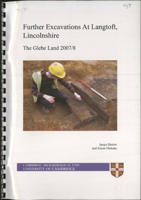
Jacqui Hutton<br />
and Alison Dickens.<br />
VI<br />
It,<br />
<strong>www</strong><br />
\A\ojJ
c ^ 1%-z-<br />
Officer Dealing:<br />
! Reply Required:<br />
Oate Replied Via:<br />
CRM Transaction No.<br />
^ q q z o s<br />
L<br />
t/tCLp-t 22/1-J7a<br />
0<br />
%<br />
<strong>Lincolnshire</strong> County Council<br />
19 FES 2010<br />
Support Services
Introduction 1<br />
Topography, Geology and Archaeological Background 2<br />
The Quarry Environs 2<br />
The Wider Landscape 4<br />
Methodology 5<br />
Results 5<br />
Middle Bronze Age 7<br />
Middle Iron Age 13<br />
Undated Features 16<br />
Discussion 16<br />
Appendix 1: Specialist Reports 19<br />
Flint Alison Dickens 19<br />
Early Prehistoric Pottery Mark Knight 19<br />
Iron Age Pottery Matt Brudenell 19<br />
Briquetage Jacqui Hutton 20<br />
Environmental Remains Anne de Vareilles 23<br />
Faunal Remains Vida Rajkovaca 23<br />
Waterlogged Wood Maisie Taylor 27<br />
Stone Alison Dickens 28<br />
Appendix 2: Feature Descriptions 29<br />
Linear Features 29<br />
Pit/wells 31<br />
Watering hole 33<br />
Postholes, small pits and other features 34<br />
Structures 40<br />
Bibliography 43
•<br />
•<br />
•<br />
•<br />
n<br />
3<br />
J<br />
3<br />
3 1.<br />
:J<br />
BLGL 08<br />
| | Quarried Areas<br />
| Previous Investigations<br />
Figure 1. Location map<br />
Baston Quarry Area A (1998)<br />
2. Baston Quarry Area B (2001)<br />
3. Baston Quarry Area C (2002)<br />
4. Baston Quarry Areas D-E (2003)<br />
5. Outgang Road Excavation (Heritage Lines, 1994.)<br />
6. Outgang Road Watching Brief (Heritage Lines.)<br />
7. Cross Road Watching Brief (1998-99)<br />
8. <strong>Langtoft</strong> Common Watching Brief (2001)<br />
9. Areas F-H The Bluebell Land (2006)<br />
10. Whitfield Land (2007)<br />
11. Glebe Land (2007)<br />
12. Freeman's Land (2007)<br />
13. Northampton Archaeological Unit (2007)
Introduction s / " ^ 5 " / ^ X .<br />
In response to a standing condition on planning permission for mineral extraction an<br />
archaeological excavation was undertaken on the Glebe Land at Hanson Aggregates<br />
Pic. Baston Quarry No. 2, <strong>Langtoft</strong>, <strong>Lincolnshire</strong> (NGR TF 154 144) in line with a<br />
WSI approved by <strong>Lincolnshire</strong> County Council <strong>Archaeology</strong> Office (Dickens 2008).<br />
The work took place in two phases: The first phase (undertaken between October<br />
2007 and January 2008, on a 5.06ha area) has already been reported upon (Hutton<br />
2008b); The current phase took place between 20 th October 2008 and 10 th January<br />
2009, on a 1.89ha area; forming a combined area of 6.95ha.<br />
In the approximate centre of the overall area excavated is the site of the 1994<br />
excavation of a Middle Iron Age saltern extending over approximately 0.34ha. This<br />
work has not been formally analysed or published, but a summary of what was found<br />
has been presented in Tom Lane's book on Fenland salterns (Heritage <strong>Lincolnshire</strong><br />
1992b, Lane 2001: 250-262). In addition to removal of topsoil across the main site, a<br />
small part of the saltern area was machine cleaned to assess the condition of the<br />
features as well as verifying their location. It was apparent that, after the 1994<br />
excavation was completed, the area had not been backfilled and was left for<br />
vegetation to grow. The previously excavated features uncovered were surveyed into<br />
the GPS grid, and their relationship with the rest of the features on the site could be<br />
assessed and spatially compared. A small number of saltern related features were<br />
observed outside the 1994 excavation limit together with three previously<br />
unexcavated features in the small re-cleaned area.<br />
Archaeological evidence from the second phase at Glebe consisted of segmented<br />
linears, pit/wells, postholes, small pits, a watering hole with timber revetment and<br />
three posthole structures. In addition features pertaining to the Middle Iron saltern<br />
site included pits, postholes and a gully associated with structures.<br />
Topography, Geology and Archaeological Background<br />
The site lies on First Terrace river gravel which overlie Oxford Clay, and is situated<br />
approximately 1.6km west of Older Marine Alluvium and Nordelph peats at the<br />
former fen edge. The geology of the area is characterised by the River Welland (the<br />
site is approximately 3km due north of the Welland) and associated interconnected<br />
alluvial belts within which are numerous palaeochannels. The site was capped by a<br />
ploughed topsoil horizon between 0.23m and 0.45m in depth; the height of the<br />
truncated natural after the topsoil horizon was removed was between 2.00m and<br />
2.60m OD. The height towards the western part of the combined excavation area was<br />
at a higher level (2.40m OD) than that towards the east (2.00m OD), highlighting the<br />
gradual sloping elevation of the area down to the fen edge towards the east. There<br />
was no indication of subsoil and there was evidence of plough-marks through the<br />
western area of the excavation. The geology was mainly gravel and sand with patches<br />
of clayey silts that became more prominent towards the eastern area of the site.<br />
The Quarry Environs<br />
Abundant archaeology is known both within the quarry environs and surrounding<br />
landscape of the fen-edge gravel in <strong>Langtoft</strong> parish. An impressive cropmark<br />
2<br />
u5Vm 7 ,<br />
Ur&s Ur .
complex extending for several kilometres across the quarry environs appears to span<br />
several periods of activity. Four probable Bronze Age barrows have been identified<br />
from aerial survey northeast of the site, close to the contemporary fen edge (Hayes et<br />
al 1992) and further attest to the extent of the later prehistoric activity within the<br />
<strong>Langtoft</strong> landscape. Extensive cropmarks attributed to the Romano-British period are<br />
also evidenced, including a northeast-southwest orientated trackway, (presumably<br />
connected to King Street, a Romano-British road), with enclosures running off at right<br />
angles from its northern side.<br />
Successive excavations by the CAU within the wider quarry have provided evidence<br />
for settlement spanning later prehistory through to the Romano-British period (Hall<br />
1998; Webley 2007; Hutton 2007a and b). The first phase of work on the Glebe Land<br />
itself revealed part of the Bronze Age fieldsystem together with a droveway and<br />
enclosed settlement. Within the fieldsystem were large pit/wells and watering holes<br />
(Hutton 2008b).<br />
An excavation carried out on the Whitfield Land tops the south of Glebe revealed<br />
linear ditches that formed part of an extensive Middle Bronze Age field system with<br />
complimentary pits with domestic debris that included a large quantity of pottery,<br />
perforated sea shells and a log ladder (Hutton 2008a). Three watching briefs carried<br />
out immediately south of the Whitfield Land in 1998 and 1999 revealed sparse<br />
archaeological remains that consisted of a small number of pits, postholes and linear<br />
ditches. None contained any dateable artefacts, with the exception of one pit which<br />
contained a sherd of prehistoric shell-tempered pottery (Higbee 1998; 1999).<br />
However, in 2001, an area adjacent to Whitfield to the south had three pits and two<br />
linear ditches. One of the pits (F.2) contained a complete ash palstave haft, and a C14<br />
date was obtained from the lower layer that produced a date of 1900-1510 CAL BC.<br />
Meanwhile extensive excavations on the Meadow Lands 2.5km southwest of the<br />
Glebe Land (in Areas A to D) have revealed Middle Bronze Age and Middle to Late<br />
Iron Age features (Hall 1998). A cluster of discrete features in the northern part of the<br />
Meadow Lands consisted of three posthole structures, eighteen large pit/wells and<br />
several small pits, all containing Deverel-Rimbury pottery. There was no evidence of<br />
lining or revetment (indicating a relatively short span of use), after the well went out<br />
of use it was left to infill gradually with episodes of silting and edge erosion with<br />
occasional deliberate dumping episodes. Finds occurred in the upper tertiary layers<br />
and represented midden redeposition. It was unclear whether these represented a<br />
single small settlement or separate episodic visitations to the area, a settlement pattern<br />
involving a certain degree of residential mobility.<br />
As referred to above a Middle Iron Age saltern was excavated in the centre of the<br />
Glebe Land in 1994. As reported it comprised sub-circular and sub-square structures<br />
along with considerable quantities of briquetage including pedestals and fragments of<br />
troughs (Lane 2001). For a fuller summary of the archaeological features and<br />
associated artefact assemblage, see below.<br />
<strong>Further</strong> Iron Age activity was revealed by a watching brief 475m to the west of Glebe,<br />
on the north side of Outgang Road (Heritage <strong>Lincolnshire</strong> 1992). A Middle to Late<br />
Iron Age site with salt production activities was recorded at Baston No. 2 Quarry, and<br />
it was suggested that this site could be linked with the one on Glebe land; although the<br />
site at Baston 2 indicates a long term habitation site (Webley 2007).<br />
3
Occupation of the area was well attested in the Romano-British period. Cropmarks<br />
highlighting field systems and enclosures are recorded to the southwest of Areas A to<br />
H and immediately adjacent to the excavation on the Freeman Land. Two Roman<br />
settlements and field system were uncovered in the excavations at Baston No. 2<br />
Quarry (Hutton 2007), and Roman pottery had been recovered during quarrying on<br />
the north side of Outgang Road, c. 1.5km northwest of the site (Petch 1961; Phillips<br />
1970). During the Early Medieval period the site lay beyond the eastern edge of<br />
civilisation, and formed part of the pasturelands of the <strong>Langtoft</strong> Common (Hallam<br />
1965). Three early maps at 1 inch to 1 mile scale, (Armstrong's Map of <strong>Lincolnshire</strong><br />
of 1778, Bryant's Map of the County of Lincoln of 1828 and C. and J. Greenwood's<br />
Map of the County of Lincoln of 1890-91) show a layout of field boundaries similar<br />
to that existing today.<br />
The Wider Landscape<br />
<strong>Excavations</strong> by the CAU at West Deeping, 7km to the southwest, revealed a Bronze<br />
Age landscape with a field system and associated settlement. The pottery assemblage<br />
suggested activity spanning from the Late Neolithic through to Romano-British, with<br />
Middle Bronze Age being the dominant period of activity. The Middle Bronze Age<br />
features comprised linear ditches forming a field system, a trackway and part of an<br />
associated enclosure, with interspersed pit/wells, cremations and inhumations. There<br />
was also a posthole alignment on the same orientation as the trackway with possible<br />
associated structures, although the structures were slight and possibly represent<br />
temporary animal pens, (Murrell forthcoming). The features recorded from West<br />
Deeping bear similarities to the features recorded at Glebe regarding the layout,<br />
structure and morphologies of the features although the linear features were on a<br />
different orientation; West Deeping was on a northeast-southwest alignment whilst<br />
Glebe was northwest-southeast aligned.<br />
Eight kilometres to the south of Glebe a Bronze Age settlement was found at Nine<br />
Bridges that consisted of ring ditches, field system and pit groups (Knight 1998). Two<br />
large pits (F.72 and F.78) had structural/reveting components in their bases in the<br />
form of wooden stakes and planks, thus enabling the centre of the pit to remain clear<br />
of gravel and clay erosions frcA&ie side. Ring ditches appeared to have influenced the<br />
location, extent and alignment of the field systems. Large pits were superimposed by<br />
droveways and located within and across the fields. The pattern of enclosure<br />
followed by settlements suggests co-ordination in the laying out of the fields with the<br />
settlements fitting in.<br />
<strong>At</strong> Eye Quarry, Peterborough, excavations carried out by the CAU from 1996 to 1998,<br />
highlighted an extensive palimpsest of archaeological occupation. On one area a<br />
Bronze Age landscape consisted of a staggered linear field system, four 4-poster<br />
structures, one round house and evidence of droveways (indicating the management<br />
of livestock), as well as pits and ovens/hearths. There was also evidence of large<br />
ramped watering holes; on example had wattle linings to aid stability, as well as part<br />
of a barrel. This feature was later cut by small 'bucket' wells, (Gibson et al 1998;<br />
McFadyen 2000). Subsequent investigations (Phases 1-3) revealed evidence of<br />
droveway and field/paddocks that super-imposed a prior ephemeral land division with<br />
complimentary pits. Several of the linear ditches were segmented which were<br />
4
interpreted as entrance ways into the fields suggesting a different function (Patten<br />
2009).<br />
<strong>Excavations</strong> at Pode Hole Farm, also at Peterborough, conducted by Birmingham<br />
University Field <strong>Archaeology</strong> Unit, and later by Network <strong>Archaeology</strong>, uncovered a<br />
systematic and organised system of fields laid in a brickwork pattern with similar<br />
features and layouts to that recorded at <strong>Langtoft</strong>, as well as Early Bronze Age barrows<br />
that attest to some of the early activity within the area (Cutter et al 2000; Network<br />
2002, Daniel 2009).<br />
Methodology<br />
The area was stripped to an archaeological level with a 360° tracked excavator with a<br />
toothless ditching bucket under careful supervision of an experienced archaeologist.<br />
The unit modified version of the MoLAS recording system was used; features were<br />
planned at 1:50, with sections drawn at 1:10. All small pits and postholes were half<br />
sectioned, and linear features were sampled at appropriate intervals. Postholes<br />
pertaining to structures were excavated 100%. Pit/wells and watering holes were<br />
primarily quarter-sectioned, with opposing quadrants excavated and recorded. If<br />
worked wood or a revetment feature was uncovered, the feature therefore merited a<br />
full 100% excavation. Archaeological features were assigned a unique number (e.g.<br />
F.001; bolded upon introduction within the text) and each stratigraphically distinct<br />
episode (e.g. a cut, a fill) was recorded with a unique context number (e.g. [001]).<br />
The numbering sequence was continued from the first phase of work. All exposed<br />
features were metal detected using a Laser Rapier metal detector.<br />
A programme of bucket sampling was carried out during the process of topsoil<br />
removal that comprised of examining 100 litres every 25m adjacent to the saltern site<br />
and covered an area of approximately 30m x 60m east by north. No artefactual<br />
evidence was recovered from this exercise. In addition, samples were taken for<br />
phosphate analysis from a series of eight transects; two across the enclosure, five<br />
across the trackway and field system and one across Structure V.<br />
All work was carried out with strict accordance with Statutory Health and Safety<br />
legislation and with recommendations with SCAUM. Hanson Quarry Safety<br />
Regulations were also followed. The site was surveyed into the Ordnance Survey<br />
Grid and Ordnance Datum by means of a RTK GPS unit in addition to a topographical<br />
survey.<br />
In total, 69 features were identified during this phase of excavation, with 347<br />
contexts. The artefacts and accompanying documentation have been complied into a<br />
stable, cross-referenced and indexed archive. The archive is currently stored at the<br />
offices of the Cambridge Archaeological Unit under the approved project code<br />
BLGL08. The <strong>Lincolnshire</strong> Accession Number is 2009.181.<br />
Results<br />
A range of features were sampled and recorded that included the continuation of the<br />
field system linears with associated pit/wells that were previously recorded on the<br />
Whitfield Land (to the south) and continued into the Glebe Land on the same<br />
5
514472/314232<br />
Figure 2. Open Area Plan.<br />
• Current excavation trench<br />
• Archaeological feature<br />
H Excavated slot<br />
514869/313854
orientation and alignment (Hutton 2008a, 2008b). Other features included a watering<br />
hole, a small 'horse-shoe' shaped posthole-structure, isolated pits and pit/wells and<br />
structural features in the form of postholes, as well as a gully and pits that were<br />
associated with the previously excavated saltern site.<br />
Artefacts included a large assemblage of pottery, faunal remains including worked<br />
bone, flint artefacts and debitage material, timber revetments and other worked wood.<br />
The majority of the features were attributed to the Middle Bronze Age, with a small<br />
amount of Early Bronze Age occupational evidence and later activity pertaining to the<br />
Middle Iron Age saltern site. The results are dealt with below in chronological order.<br />
Middle Bronze Age<br />
The feature types that were observed in the first phase on the Glebe land (for example<br />
linears, pit/wells and watering holes) were also prevalent in the current phase. The<br />
pottery recovered was predominantly Deverel-Rimbury, although the quantity was<br />
rather less than seen in the previous excavations in the area. Very little material was<br />
recovered from the linear features to the southwest of the area, with only a small<br />
amount recovered from the pit/wells.<br />
Linear Features<br />
The linear features associated with the field system were generally segmented<br />
(particularly towards the southeast of the excavation) and produced little artefactual<br />
evidence. F.1254 was a re-cut of an earlier smaller linear F.1275 that continued the<br />
northwest-southeast orientation previously observed. The northern terminal of F. 1254<br />
was cut by a pit/well (F.1265), which differs from previous examples on Whitfield,<br />
Freeman and the earlier phase of Glebe where the linear had always cut the pit. There<br />
was also slight evidence of an earlier pit (F.1270). Both of these features cut a narrow<br />
gully F.1269 that was on a north-south orientation. This was cut by pit F.1245.<br />
To the east of the area F.1060 from the previous phase continued and terminated in<br />
the current area. An additional two ditches on the same orientation (northwestsoutheast)<br />
F.1253 and F.1060; the latter feature possibly cut F.1253, but appears to<br />
terminate just east of it. Also, to the north of the area, F.1009 continued on a<br />
northeast-southwest orientation from the previous excavation and terminated about<br />
32m inside the current area. These linear features form part of the same field system<br />
that extends from the Whitfield land to the south and Freeman land to the north.<br />
Pit/wells and watering holes<br />
The pit/wells recorded during excavations at Glebe display similar general<br />
characteristics to those previously recorded elsewhere in the quarry environs. There<br />
are however, some slight distinctions in this group. As highlighted in previous<br />
excavations on Whitfield and Freeman, some of the pit/wells had log ladders<br />
abandoned in the bottom of them (Hutton 2007, 2008a). No log ladders were found<br />
during this current phase on Glebe, however here some of the pit/wells had a small<br />
'step' cut into the side, which would have made access to the water relatively easy,<br />
and there would be no need for a ladder. Those pits that did produce log ladders in<br />
the previous investigations had far steeper sides and access would have been difficult<br />
without such an aid.<br />
7
Figure 3. South-West corner Bronze Age features.<br />
metres
514696/313973<br />
Figure 4. South-East corner Bronze Age features.
Six additional pit/wells were found on the current phase of work. One, F.1248, which<br />
had a step cut onto it, also had a different profile to the rest. The upper cut was similar<br />
to the others, however iron pan formed part of the natural geology half way down the<br />
well, which resulted in the tapering of the profile with a small oval hole cut through<br />
this deposit. The natural geology below this was sandy and easily eroded, causing<br />
under-cutting of the well beneath the iron pan. This formed an hourglass shaped<br />
profile. Silting of the well, after it went out of use, sealed the lower organic layers,<br />
[2155] which allowed good preservation of hazelnut shells in the base. This pit<br />
formed part of an alignment of pits across the area on a northeast-southwest<br />
orientation, the same orientation as the wider field system. An example of one of the<br />
alignment includes pit/well F.1265 and F.1245 to the west, and incorporates F.1249,<br />
F.1248, watering hole F.1254 and ends with the large pit/well from the previous<br />
excavation F.1209 to the east. Similar alignments can be seen on the Whitfield and<br />
Freeman lands (Hutton 2007, Hutton forthcoming).<br />
More typical pit/wells included F.1245 (2.48m x 2.78m wide and 0.97m deep) that<br />
had a possible step on the north side of the cut, which would have aided access and so<br />
reduced the need for a log ladder. It was initially silted with fine sands and gravel<br />
before developing a wet muddy fill with evidence of plant growth. <strong>Further</strong> silting<br />
occurred above this deposit with material eroding from the sides. These primary<br />
deposits were re-cut, presumably to re-access the water table. Fine sands then silt<br />
developed within the re-cut before a darker organic muddy waterlogged deposit was<br />
formed followed by final silted deposits of eroded sand and gravel but more<br />
predominantly washed and slumped topsoil. Bone, pottery and burnt stone were<br />
recovered. F.1249 was another pit/well (3.90m x 3.40m wide and 1.30m deep) with a<br />
possible step on the south side of the pit. Initial periods of silting and slumping from<br />
the edge formed the primary fills, which resulted in plant growth after the well went<br />
out of use. There were three main phases of organic deposition and later backfilled<br />
with silt, which contained the majority of artefacts. F.1265 was a large pit/well, cut<br />
by ditch F.1264 and pit F.1265. Only the lower primary fill remained. F.1267 was a<br />
pit (1.40m x 1.38m wide and 0.48m deep) situated to the north of linear F.1060<br />
adjacent to its western terminal. It contained an array of fills, the topmost of which<br />
contained the most evidence of human activity. The pit was aligned with another two<br />
pits on the same alignment on the north side of the linear on an east-west orientation.<br />
F.1294 was a large circular pit (1.65m x 1.62m wide and 1.17m deep) where the<br />
upper cut was concave becoming vertical down to a flat base. There was abundant<br />
wood at the base, which appeared to have been a random dumping episode with no<br />
signs of working. The base had been gently eroded and the natural sides subsided.<br />
This pit appeared to have been associated with F.1295 and F.1296 and pit/well<br />
F.1304.<br />
Interspersed throughout the entire area of the Glebe land were six large isolated<br />
watering holes and three inter-cutting watering holes with smaller pit/wells cut into<br />
them. F.1043, F.1065, F.1071, F.1073 and F.1209 were isolated watering holes<br />
dispersed throughout the Phase 1 area, having similar morphological profiles and<br />
stratigraphic sequences. In the Phase 2 area watering hole F.1254 was similar to the<br />
previously recorded watering holes specifically in having a timber revetment. Some<br />
of the timbers were clearly not uncovered in their original positions, rather it appeared<br />
that the watering hole was abandoned and the revetment was disassembled with the<br />
upper pieces dislodged. The lower portion of revetment appeared to have remained in<br />
10
Figure 5. Plan of watering hole F. 1254.<br />
0
u u u u u u u u<br />
afeytfHB<br />
Wx..^ifi<br />
Figure 6. Photographs of watering hole F. 1254.<br />
LJuLiLIULIiJLiUUiJ
situ; the stakes were embedded into the natural gravel and the split timber plank<br />
remaining upright. Timber that has been re-used as revetment pieces in the watering<br />
holes is not an uncommon event. Previous excavations at Bradley Fen have<br />
uncovered both pit/wells and watering holes with timber revetments, including part of<br />
a dug out boat (Gibson & Knight 2006).<br />
F.1304 was a large pit (3.10m x 3.45m wide and 1.10m deep) that had similarities<br />
with both the pit/wells and a watering hole. It contained layers of silting with<br />
fragments of wood towards the base; on could possibly have been a degraded log<br />
ladder, although the northeastern side had a slight convex step.<br />
Middle Iron Age<br />
The majority of the small number of Middle Iron Age features found during this phase<br />
of excavation were located to the west and south of the 1994 saltern site (Figure 7). A<br />
small part of the 1994 area was re-cleaned by machine for the purpose of surveying<br />
any surviving features to accurately plan the layout of the site with the associated<br />
features uncovered in the current area, the published plans not permitting this to be<br />
accurately done.<br />
The 1994 excavation was preceded by an evaluation phase consisting of aerial<br />
photography, geophysical survey, field walking and trench evaluation (Heritage<br />
<strong>Lincolnshire</strong> 1992b). Based on the results from this, and on the presumption that<br />
destruction of this field by extraction was far more imminent that it actually proved to<br />
be, an area roughly 0.4 ha was fully excavated in 1994. This work revealed features<br />
and material culture evidencing a salt production site. As well as the salt related<br />
briquetage there was also a small domestic assemblage indicating occupation. The<br />
pottery was dated to the Middle Iron Age, between 4-5 1 and 1 st century BC (Knight in<br />
Lane 2001: 261-262). In the description below the 1994 features are prefixed by 'HL'<br />
to distinguish them from the current findings.<br />
Within the 1994 area were two structures in the form of segmented gullys and<br />
associated postholes (HL019 - sub square, HL009 - sub-circular) with a potential<br />
further structure to the west (HL208). There were no hearth remains, probably due to<br />
truncation by modern ploughing (although a possible hearth was suggested within<br />
structure HL009 from a magnetometer survey). To the north of the structures there<br />
were features interpreted as settling tanks and pits with linears features that possibly<br />
represented natural gullies and small streams. Feature HL076 was interpreted as an<br />
area dug into the stream to allow the water to 'pool' and collect before being added to<br />
the adjacent elongated pit. The majority of the briquetage artefacts were recovered<br />
from the vicinity of the structures indicating that the processing of the salt-water took<br />
place in that locale (Lane 2001).<br />
The 1994 briquetage assemblage consisted of three classes of artefacts; containers,<br />
supports and miscellaneous debris. The containers were sub-rectangular gutter shaped<br />
troughs which were abraded on the interior with salt stains on the exterior; salt<br />
crystals would have been scraped off the inner wall. The troughs had a flat ended<br />
convex profile. The manufacturing techniques of the troughs consisted of a<br />
cylindrical vessel was made and when leather hard it was split down the centre to<br />
form two troughs. The supports were horned pyramidal pedestals and sub-square base<br />
13
514623/314052<br />
HL295-<br />
Main area of ..—<br />
briquetage distribution<br />
(based on 1994 and 2008-9 results)<br />
HL 205<br />
HL383<br />
(See Figure 5)<br />
Current excavation trench<br />
Archaeological feature<br />
Excavated slot<br />
Figure 7. The Saltern area, showing features excavated by Heritage Lines in 1994.<br />
514705/313955
pedestals. There were no examples of spacer-clips or stabilisers (Morris in Lane<br />
2001:252-261).<br />
The fabrics of the <strong>Langtoft</strong> briquetage match those recorded at Market Deeping,<br />
although the troughs at <strong>Langtoft</strong> had thinner walls than those found at Market<br />
Deeping. There are advantages and disadvantages to the thickness of the troughs;<br />
thicker walls are good for repeated use whilst thinner walls had better heat<br />
conductivity. The troughs were often broken and discarded, whereas the pedestals<br />
were repeatedly used {ibid).<br />
The structure on Glebe appeared to have been the main focus of salt production,<br />
probably over a hearth or fire; although it appears that there was no specialised area,<br />
only a direct heating system for evaporation. None of the features recorded appeared<br />
to be furnaces, which would indicate a permanent production site, or at least one that<br />
was returned to regularly. The troughs at this site could just have been placed over an<br />
open fire which would have lain on top of the ground surface and would leave no<br />
evidence in the archaeological record.<br />
The few features that were re-sampled within the 1994 area produced further sherds of<br />
pottery and briquetage. In addition, three previously unidentified features (F.1241<br />
and F.1274 and pit F.1273) were excavated, also producing a briquetage assemblage.<br />
A single slot in structure HL019 (recorded as F.1272) recovered further fragments of<br />
briquetage.<br />
A partial structure recorded in 1994 (Feature [HL280]) was completed in the present<br />
area by gully (F.1278) with associated postholes (F.1279 & F.1281). To the<br />
southwest of these features, a pit cluster (F.1283, F.1288, F.1289, F.1290 & F.1297)<br />
was sampled and produced a large amount of briquetage material consisting of trough<br />
fragments and production furniture such as pedestals.<br />
The saltern site appeared to have been restricted to a discrete area, with only a few<br />
features located to the west of the original investigation, and none to the south, north<br />
or east. It would appear that the saltern site was limited to the immediate vicinity and<br />
was probably a temporary site for the primary production of salt. This is supported by<br />
the slight nature of the structiures, perhaps workshops, with evidence in the small<br />
domestic assemblage of occupation rather than more permanent settlement. There<br />
may be a link between this and the secondary production site recorded in an earlier<br />
phase of investigation on the Meadow Lands (Webley 2007).<br />
The faunal assemblage from the recent excavations added little additional information<br />
on species identification and other artefactual elements. The low number of animal<br />
bone recovered from both investigations also suggests that this was not a long term<br />
settled site. Additionally, the pottery evidence was limited to a few sherds that were<br />
associated with briquetage.<br />
15
Undated Features<br />
Structure V<br />
In the southeastern part of the area, there was a semi-circular arrangement of eight<br />
postholes (F.1256, 1257, 1258, 1259, 1260, 1261, 1262, 1263) that formed a threesided<br />
structure with the open end towards the north. No datable artefacts were<br />
recovered although animal bone and fragments of un-diagnostic fired clay were<br />
present. The size of this structure (2.90m x 3.11m) was fairly small (significantly<br />
smaller than the structures in the saltern area for example) and the function of the<br />
structure is uncertain. Suggestions might include that of a small pen, or, a temporary<br />
shelter of some kind. This structure is just to the north of the two perpendicular<br />
linears (F.1060 and F.1253).<br />
To the north of Structure V was a three-post structure (F.1250, F.1251, F.1252), a<br />
form observed in other of the investigations in the quarry. A second three-post<br />
structure (F.1292, F.1293, F.1306) lies immediately northeast of the terminal of ditch<br />
F.1269 towards the southeastern corner of the area. Whilst it is possible that in<br />
isolation these may represent the more familiar four-poster structures with the fourth<br />
post missing for whatever reason, this does seem to indicate a genuine feature type.<br />
Function is unclear, what are the practicalities of the stability of a three-post structure,<br />
unless they were tied together, forming a tee-pee like structure? The cuts of these<br />
postholes, however, had vertical sides with no evidence of the timbers being set at an<br />
angle.<br />
Discussion<br />
This final phase of excavation on the Glebe land has provided further evidence of the<br />
Middle Bronze Age landscape characterised by an axial or co-axial field system with<br />
interspersed pit/wells and watering holes. These were common features of Bronze<br />
Age landscapes in the region and provide evidence of mixed economy practices and<br />
occupation. In addition, work around the Middle Iron Age saltern centre in the Glebe<br />
land had provided evidence that although the complex was slightly larger than<br />
thought, the salt production site was limited in its locale, and was an isolated site.<br />
Pre-Bronze Age<br />
Early prehistoric occupation in the landscape of Langtofit was open in nature lacking<br />
cut features and leaving only ephemeral remains in the form of pottery sherds that<br />
became incorporated into later features such as the wells. There was activity here,<br />
however it appears transient.<br />
Middle Bronze Age<br />
The principal characteristic of this period is the rectilinear field system, formed from<br />
numerous ditches, which extends beyond the immediate area of the site and indeed<br />
forms part of a much larger enclosed landscape seen across tracts of the Fen edge<br />
area. This small area of excavation produced only a few fragments of the field<br />
16
system, but Phase 1 in 2007/8 had a section of droveway with and enclosed settlement<br />
area to one side of it (Hutton 2008b). The known monuments in the immediate<br />
landscape contemporary with this (five ring ditches and a cremation cemetery) are<br />
1.7km to the northwest on the Freeman Land (Hutton 2008a, Hutton forthcoming),<br />
although it should be noted that much of the area in between was subject to extraction<br />
without archaeological observation and more may have been lost.<br />
Here the main axis of this system is orientated northwest - southeast, similar to that at<br />
Pode Hole and Tower's Fen (Daniel 2009, Mudd & Pears 2008) but in contrast with<br />
that at Fengate, Thorney and West Deeping, where the main orientation is northeast -<br />
southwest, (Evans 2009,Murrell forthcoming). The Langtofit system is closer in<br />
orientation to that at Welland bank and Newborough (Pryor 2002, Evans 2009)<br />
although rather different in its form, Welland bank being what Evans describes as "an<br />
'organic' or disjointed patchwork; and neither droveways or monuments are apparent<br />
amid its irregular axes." (Evans 2009: 57) <strong>At</strong> <strong>Langtoft</strong>, similar to West Deeping, the<br />
fields appear structured "according to a series of dominant-axis/parallel, 'reave-like'<br />
droveway boundaries" (ibid). Form is more important here than orientation, the<br />
<strong>Langtoft</strong> system looks much more like the Fengate/Pode Hole/Thorney/Deeping<br />
systems than it does the Welland Bank one. It is likely that orientation in any given<br />
locality is a product of local conditions such as topography and the position of the fen<br />
edge. Evans' figure 6.9 in the Fengate volume (2009: 258) shows how a single<br />
system extends over 700sq km of Dartmoor. Whilst a direct comparison between the<br />
two is not appropriate it does indicate that what might in the fens be considered a<br />
'system' in its own right, is probably just be a small fragment of something much<br />
larger. The <strong>Langtoft</strong> 'system' may actually be part of the same much larger entity<br />
seen at Fengate/Pode Hole/Thorney/Deeping.<br />
Middle Iron Age Saltern<br />
Although within the earlier field system the Middle Iron Age saltern appears to be<br />
located away from the Bronze Age features, but this is probably coincidental. Access<br />
to the primary archive of this excavation has not yet been possible, and it is unclear<br />
from the summary in Lane's volume, concentrating quite rightly on the subject in<br />
hand, whether there is material or features of an earlier date. In considering the<br />
saltern Lane reports that no major stream channel was seen in the 1994 excavations<br />
(2001: 250) and that remains true within the much wider zone now observed around<br />
the saltern focus. However there must have been a suitable water source somewhere<br />
nearby for the saltern to have been located where it was, not only a channel, but one<br />
within reach of the tides. Some suggestion has been made that the source of the<br />
brackish water for this primary processing could have come from digging down into<br />
the gravels however, although there are several large features on the site which might<br />
have fulfilled such a purpose, they appear to be much earlier in date than the period of<br />
saltern activity and so cannot be considered. Another possibility is very shallow<br />
creeks, there were patches of silt observed in both phases of work, but these were very<br />
ephemeral. Even if it was the case and such creeks were present from where were<br />
they being fed? This remains an open question, the answers for which may lie to the<br />
east.<br />
17
Conclusions<br />
The results from the 2008/9 excavations have added to those from the earlier phase<br />
and, importantly, allowed the 1994 excavation area to be accurately located in the<br />
broader landscape. There is a wealth of material and environmental data, which<br />
would permit closer analysis of this part of the field system, particularly as it also has<br />
settlement evidence within the field system (as revealed in 2007/8).<br />
Given the question of water supply for salt making it would be immensely useful to<br />
run a series of C14 dates from the large water holes and pit/wells. Form and location<br />
would suggest that they are Middle Bronze Age in date, however briquetage was<br />
noted in two of them. This is in small quantities and most likely to be intrusive,<br />
however the features warrant closer examination.<br />
<strong>Further</strong> study is required of both the prehistoric pottery and the briquetage. The fabric<br />
of some of the briquetage is very similar to that of the earlier pottery and much closer<br />
examination is required to ensure that the two groups of material have been accurately<br />
separated.<br />
Although a relatively small portion of a much larger landscape the Glebe results are<br />
important in that they include settlement as well as fieldsystem and have provided a<br />
wealth of material, both artefacts and environmental, which warrants more detailed<br />
study. Full analysis and publication is recommended.<br />
18
Appendix 1<br />
Specialist Reports<br />
Flint Alison Dickens<br />
Eight pieces of worked flint (120g) were recovered from seven different features.<br />
Only one was burnt. Other than as a background indication of activity from the<br />
Neolithic to Bronze Age periods this assemblage in isolation does not add to the<br />
conclusions of the 71 pieces found in Phase 1. The full assemblage requires a small<br />
amount of additional analysis.<br />
Early Prehistoric Pottery Mark Knight<br />
The excavation produced a small assemblage of 18 sherds of earlier prehistoric<br />
pottery weighing 703 g. The bulk of the assemblage was made up of a single large rim<br />
fragment that weighed 200g; the rest of the assemblage comprised medium sized<br />
fragments with a mean sherd weight of 29.6g. The condition of the material was good<br />
and most of the sherds were made of a hard, durable fabric constructed out of fossilrich<br />
clay. Feature sherds included seven rim and three decorated fragments and all of<br />
the pieces belonged to very large diameter thick-walled vessels.<br />
The assemblage came from three large pit features and, with the exception of a single<br />
rim/upper collar fragment from a Collared Urn, consisted of Deverel-Rimbury type<br />
sherds.<br />
Feature Context Number Weight Fabric<br />
1242 2069 2 33 1<br />
1245 2106 7 286 1<br />
1248 2146 1 200 1<br />
1254 2158 2 24 1,2<br />
1254 2168 2 6 1<br />
1254 2170 1 16 1<br />
1254 2171 1 44 1<br />
1254 2171 2 76 1<br />
Totals: 7 18 703z 2<br />
Table 1: Assemblage Composition<br />
Pit F. 1242 produced two sherds, one of which appeared to have been burnt. The burnt<br />
sherd had a slight curvature and a flattened rim-like edge. The material from pit<br />
F.1245 included lumps of pottery and briquetage that were very difficult to tell apart.<br />
Its seven identifiable pieces (including a squared rim) differed only in that they had<br />
internal as well as external surfaces. Pit F.1254 produced four definite rim fragments<br />
including one that had been perforated post-firing. Three of the rims were typical<br />
Deverel-Rimbury types (x 2 flattened expanded and xl rounded internally expanded).<br />
The fourth rim fragment belonged to a Collared Urn and was by comparison with the<br />
rest of the assemblage recognisably abraded. One of the flattened rims was decorated<br />
with a deep vertical groove which was incised so deeply that the sherd had snapped<br />
along its line. A body sherd from the same context also had this attribute. The biggest<br />
sherd, another rim (internally bevelled), came from pit F.1248 and it also had a deeply<br />
incised vertical groove along one of its broken edges.<br />
19
All of the Deverel-Rimbury rims were from large diameter vessels (c. 34cm internal<br />
diameter) and all were made from the same hard fabric replete with fossil shell<br />
inclusions. The quantity of crushed shell was such that the sherds appeared to be more<br />
shell than clay. The Collared Urn sherd was made of the same shell-rich clay only its<br />
shell had subsequently dissolved and small lumps of rounded grog had been added as<br />
an opening material.<br />
Discussion<br />
The BLGL 07 assemblage (Hutton 2008b) was also dominated by its Deverel-<br />
Rimbury component. The BLGL 08 assemblage represents a straightforward<br />
continuation of the adjacent excavation and at the same time adds to the ever<br />
expanding and ever impressive Deverel-Rimbury domestic assemblages generated<br />
specifically by the <strong>Langtoft</strong> quarries.<br />
Iron Age Pottery Matt Brudenell<br />
Four sherds (28g) of Middle/Later Iron Age pottery were recovered from the<br />
excavations. The sherds derived from two features: F.1283 (3 sherds, 16g) and F.1297<br />
(1 sherd, 12g). The former were shoulder sherds deriving from the same vessel; two<br />
of which refitted. These had moderate to common finely crushed shell inclusions,<br />
most under 1mm in size. The body sherds from F.1297 were in a harder fabric with<br />
well-sorted moderate to common shell flecking throughout. The character of these<br />
sherds is consistent with that previously recovered from the site (Knight 2001: 261-2).<br />
Briquetage Jacqui Hutton<br />
The previously excavated site in the centre of Glebe field (known as Outgang Road)<br />
in 1994 revealed features of a salt production site dated to the Middle Iron Age in the<br />
form of pits, gullys and postholes. During the current phase complimentary features<br />
were recorded and sampled to the west and south of the area; two further features<br />
were uncovered when the Outgang Road site was partially re-machined.<br />
A large amount of briquetage material was recovered from features relating to the<br />
Middle Iron Age in the current excavation area, as well as residual finds from features<br />
within the immediate vicinity. The briquetage assemblage consisted mainly of trough<br />
fragments, some with residue still attached, and several fragments of pedestals that<br />
were similar in size and profile to those recorded in the 1994 excavation. There may<br />
also be examples of spacer-clips and stabilisers. A number of the rim sherds were cut<br />
straight and show evidence of 'smoothing' which is an indicator that the trough were<br />
cut after the clay had dried 'leather-hard'. Some of the sherds had score lines adjacent<br />
and running parallel to the rims indicating the production method previous<br />
hypothesised in the original report by Elaine Morris (Morris in Lane 2001: 252-261).<br />
Some of the trough sherds appeared to have evidence of salt staining on the exterior<br />
surface, however there was no evidence of scraping marks or extensive crusting of<br />
salt on them. This would suggest that the brine was being reduced to a paste in<br />
preparation for the second stage of the manufacturing technique. All of the artefact<br />
assemblage appeared to have been related to the first stage of the manufacture of salt.<br />
No physical evidence was found of containers used for the transportation of the<br />
20
product away from the site. However, for the ease of transportation and being more<br />
lightweight, it makes more sense that organic containers such as leather bags would<br />
have been used, which would be unlikely to survive. Alternatively, smaller vessels<br />
that may have contained the 'paste' would have been transported away from to the<br />
point of secondary processing. Again reducing the likelihood that they would survive<br />
here.<br />
Feature<br />
No.<br />
Feature Type<br />
Context<br />
No.<br />
No. Weight (g) Description<br />
1241 Posthole 2064 3 2 Briquetage trough fragments<br />
1245 Pit/well 2106 19 Briquetage trough fragments<br />
1249 Pit/well 2122 6 14 Possible pedestal fragments<br />
1254 Water Hole 2159 15 120 Possible pedestal/loomweight fragment<br />
1272 Gully 2264 7 46 Briquetage trough fragments including 2 rims<br />
1273 Saltern Pit 2266 17 62 Briquetage trough fragments<br />
1273 Saltern Pit 2267 29 126<br />
Briquetage trough sherds including 1 rim with<br />
score line<br />
1274 Posthole 2269 3 14 Briquetage trough fragments<br />
1274 Posthole 2270 25 Briquetage trough fragments<br />
1278 Gully 2273 1 1 Briquetage trough fragment<br />
1278 Gully 2275 2 4 Briquetage trough fragments<br />
1278 Gully 2277 1 78 Briquetage pedestal fragment<br />
1281 Gully 2284 1 1 Briquetage trough fragment<br />
1283 Pit cluster 2304 252 774<br />
1283 Pit cluster 2305 8 102<br />
1283 Pit cluster 2306 11 142<br />
Briquetage trough sherds including 7 rims (1<br />
with deep score line), 2 body with score lines,<br />
2 with white staining, pedestal fragment<br />
Briquetage trough sherds including 4 rims (2<br />
join) and 1 pedestal fragment<br />
Briquetage trough fragments including<br />
possible pinched out base, 1 rim, pedestal<br />
fragment<br />
1288 Pit cluster 2317 1 8 Briquetage trough sherd<br />
1289 Pit cluster 2319 14 144<br />
Briquetage trough sherds including 3 possible<br />
rims, pedestal fragments<br />
1297 Pit cluster 2332 10 74 Briquetage trough sherds, pedestal fragments<br />
1297 Pit cluster 2336 25 154<br />
1298 Pit 2351 47 130<br />
Table 2: Briquetage fragments from features<br />
Briquetage trough fragments including 1 rim,<br />
pedestal fragments<br />
Briquetage trough sherds including 2 rims, 1<br />
with score line<br />
The majority of the briquetage was recovered from pits or the structural features and<br />
there appeared to be no features directly associated with the manufacturing of the salt,<br />
such as fired areas, 'settling tanks', or gullys to collect the water as previously<br />
reported in the original excavation (Lane 2001). The limit of the site was extended<br />
slightly to the southwest but remains located in a small locale. The pit cluster to the<br />
21
southwest of the saltern site contained a large amount of briquetage that included all<br />
feature elements; trough fragment including rims, pedestal fragments and possible<br />
spacer clips. The total number recovered from these pits was 321 pieces weighing<br />
l,398g. F.1283 contained the majority; 271 pieces, 1,018g.<br />
There appears to be no evidence of the second stage salt moulds, which tend to be<br />
smaller, indicating that this site was a primary production site. Similar saltern sites in<br />
the area have also produced a higher number of briquetage fragments such as at<br />
Market Deeping.<br />
Site Pottery Animal Bone Briquetage<br />
Meadowlands 442 (7364g) 2718 (27,3 07g) 113 (4408g)<br />
Outgang Road 163 (2080g) 41 4,426 (24,948g)<br />
Glebe (CAU) 37 (177g) 44 (795g) 374 (151 Og)<br />
Market Deeping - - 4,031 (46,296g)<br />
Deeping St. James - - 59 (240g)<br />
Table 3: The number and weight of artefacts from the sites<br />
The quantity of bone and pottery from this site was small compared with the sites at<br />
Meadowlands <strong>Langtoft</strong>, whereas the quantity of briquetage differs greatly. There was<br />
considerably more briquetage at Glebe and Outgang Road combined (see Graph 1<br />
below) than at Baston, whereas there was a larger domestic assemblage at Baston.<br />
The briquetage from the Glebe land and from the Iron Age features from Baston have<br />
similar characteristics and fabric matrix indicating that they could possibly be either<br />
contemporary of that the same techniques were used for a certain length of time.<br />
However, it is not implausible to suggest that the two sites could be linked; the<br />
permanent habitation at Baston with the 'manufacturing' site at Glebe<br />
Briqeutage Quantities (weight)<br />
50,000<br />
45,000<br />
4C1000<br />
Mi 35,000<br />
gra3Q,000<br />
ms 25,000<br />
20,000<br />
15.000<br />
laooo<br />
5,000<br />
0<br />
Meadowland a ebe Mariket Deeping St.<br />
<strong>Langtoft</strong> Deeping James<br />
a Pottery<br />
H Biquetagel<br />
The archaeological evidence of features and artefacts recorded on Glebe provided<br />
further information to the nature of the site as a discrete locale for the making of salt<br />
for the use and possibly trade of the people who occupied that landscape at that time.<br />
22
Environmental Remains Anne de Vareilles<br />
A further eight samples were processed to add to the information gained in 2007. The<br />
flots were all rich in modern rootlets and some untransformed seeds of uncertain date.<br />
F. 1288 for example, contained many seeds of knotgrass and redshank which had been<br />
perforated on one side, suggesting they were probably brought in by insects that may<br />
have moved and/or destroyed small archaeological finds. The samples were not<br />
waterlogged but F.1265 and F.1264 had some dried waterlogged seeds and wood<br />
fragments indicative of an anaerobic past, reflecting the higher prehistoric water-table.<br />
Charred plant remains are scarce and unlikely to be in situ. They most likely originate<br />
from charring events that occurred further away from the features sampled, and have<br />
probably lain scattered on the ground before being randomly buried. Only one cereal<br />
remain was found: a wheat glume base (chaff) in F.1264.<br />
Sample number 1185 1187 1207 1209 1190 1214 1219 1196<br />
Context 2199 2217 2298 2294 2250 2317 2185 2284<br />
Feature 1009 1060 1275 1264 1265 1288 1254 1277<br />
B.A.<br />
B.A. LA? watering<br />
Feature type Middle Bronze Age Ditches pit/well pit/well hole B.A. pit<br />
Sample volume - Litres 4 10 14 6 7 8 14 10<br />
Flot volume - mililitres 1 5 1 4 16 5 52 5<br />
Flot fraction examined -% 100 100 100 100 100 100 100 100<br />
Charcoal >4mm - - - -<br />
2-4mm + + - + +<br />
environments not dissimilar to those observed in F.1038 from the 2007 excavations.<br />
The samples should be analysed by a malacologist for more detailed interpretations.<br />
Interestingly, fragments of sea mussels were found in the heavy residues of both<br />
F.1009 and F.1060. They, along with the marine silt snail Hydrobia ulvae found in<br />
F.1288, can be added to those found in 2007 showing the use of marine resources.<br />
The latter snails were grey, either from burning or from their habitat in marine silts.<br />
Their abundance in the Middle Bronze Age pits F.1038 and F.1203 suggests that<br />
F.1288 is of the same period.<br />
Faunal Remains Vida Rajkovaca<br />
Introduction<br />
A small assemblage of animal bone was recovered from the <strong>Langtoft</strong> Glebe site<br />
during the excavations carried out in 2008. The assemblage elicited 78 fragments<br />
recovered from 15 features scattered across the site. The bones have been hand<br />
collected and does not include sieved remains.<br />
The assemblage is predominantly made up of livestock species, but also includes<br />
some remains of the wild species (Red deer) typical of sites of this period in this type<br />
of the environment (Higbee 1998b). The assemblage represented a continuation of<br />
archaeological investigation in the area (Higbee 1998, 1999; Hall 1998; Patten 2003;<br />
Webley 2004 a, b; Hutton 2007) and builds on zooarchaeological research executed<br />
by Higbee (1998b), Swaysland (2004a, b); Seetah (2007) and Rajkovaca (2008).<br />
The majority of material has been recovered from the features dated to Middle Bronze<br />
Age with very little material coming from the features dated to Iron Age. Based on the<br />
chronology of the material, two sub sets were created and quantified in separate tables<br />
in order to study the site: Middle Bronze Age and Iron Age. Of 78 bones recorded, 76<br />
(97%) were assigned to element and only 27 (34%) to species. This report provides a<br />
brief outline of the results following zooarchaeological analyses of the material.<br />
Method<br />
The zooarchaeological investigation followed the system implemented by<br />
Bournemouth University with all identifiable elements recorded (NISP: Number of<br />
Identifiable Specimens) and diagnostic zoning (amended from Dobney & Reilly<br />
1988) used to calculate MNE (Minimum Number of Elements) from which MNI<br />
(Minimum Number of Individuals) was derived. Identification of the assemblage was<br />
undertaken with the aid of Schmid (1972) and reference material from the Cambridge<br />
Archaeological Unit. Where possible, the measurements have been taken (Von den<br />
Driesch 1976). Taphonomic criteria including indications of butchery, pathology,<br />
gnawing activity and surface modifications as a result of weathering were also<br />
recorded when evident.<br />
Preservation details<br />
The assemblage exhibited quite poor overall preservation. Of 33 contexts studied 28<br />
showed 'quite poor' to 'poor' preservation with signs of extensive weathering and<br />
bone surface exfoliation. Only five contexts were of 'moderate' preservation. Bones<br />
24
were very often vertically split possibly for marrow extraction creating a number of<br />
bones which could only be assigned to a size category (Large and Medium Mammal).<br />
If a number of fragments were discovered to refit from the same bone, they were<br />
recorded as one specimen. Some bones displayed canine gnawing marks, indicating<br />
the presence of dogs on the site and dogs have been recorded osteologically.<br />
Results<br />
Middle Bronze Age contexts<br />
The composition of this sub set is in common with most archaeologically recovered<br />
assemblages in Britain. It is dominated by the remains of the livestock species such as<br />
cattle, sheep/goat, horse and dog (Table 1). Wild fauna seems to be of very little<br />
importance on this site, as only one reed deer antler fragment has been found. It has a<br />
slight palmate shape to it and it was hard to determine which part of the antler this<br />
actually represents, but with the aid of Hillson (1999:7), it would appear that the<br />
fragment most likely represents the top end/crown of a mature red deer stag.<br />
Of 66 fragments recorded within this sub set, 27 (40%) were recovered from a large<br />
watering hole (F. 1254) where one measurable cattle metatarsal was found. Withers<br />
estimates based on this specimen were at the lower end of the range at 113 cm and<br />
they followed the conversion factors of Fock (see Von den Driesch and Boessneck<br />
1974).<br />
BLGL08-Middle Bronze Age<br />
SPECIES NISP %NISP MNI<br />
Cow (Bos taurus) 9 43 2<br />
Horse (Equus ferus 5 24 1<br />
caballus)<br />
Dog (Canis familiaris) 4 20 1<br />
Ovicaprid (Ovis 2 9 1<br />
aries/Capra hircus)<br />
Red deer (Cervus elaphus) 1 4 1<br />
ULM 20 19 (1=76) -<br />
UMM 17 17 (L=76) -<br />
UUM 8 7 (1=78) -<br />
Table 1: NISP and MNI counts for Middle Bronze Age contexts<br />
Key: UMM & ULM = Unid. Medium and Large Mammal / UUM = Unid. Fragment. NB: Species<br />
percentages are out of 21. These differ from the unidentified counts as these are calculated on the basis<br />
of element identification (for UMM & ULM) and total fragments (for UUM) (corresponding to S in<br />
brackets).<br />
Iron Age contexts<br />
Small amount of bone material was found in four features dated to Iron Age, three of<br />
which were pits (F. 1283, F. 1288; F. 1298), all within the same cluster, and one was a<br />
gully (F. 1278). This sub set has an impoverished representation of species (Table 2)<br />
and did not produce any measurable or ageable specimens.<br />
25
Conclusions<br />
The results obtained from this assemblage have proved to be in keeping with the<br />
results from the previous year's work (Rajkovaca 2008). Middle Bronze Age sub set<br />
has for its main component cattle, followed by horse, dog and ovicaprids, reflecting<br />
the importance of livestock species and especially cattle in the Bronze Age economy.<br />
Red deer is represented with only one antler fragment which could have been<br />
collected. Kill-off profile based on dental eruption and wear is needed for further<br />
studies of Bronze Age subsistence bases and also to provide the important information<br />
about the uses to which cattle in this region were put.<br />
BLGL08-Iron Age<br />
SPECIES NISP %NISP MNI<br />
Cow (Bos taurus) 4 80 1<br />
Horse (Equus ferus 1 10 1<br />
caballus)<br />
Ovicaprid (Ovis 1 10 1<br />
aries/Capra hircus)<br />
ULM 4 - -<br />
UMM 1 - -<br />
UUM 1 - -<br />
Table 2: NISP and MNI counts for Iron Age contexts<br />
Key: UMM & ULM = Unid. Medium and Large Mammal / UUM = Unid. Fragment. NB: Species<br />
percentages are out of 6.<br />
Conclusions<br />
The results obtained from this assemblage have proved to be in keeping with the<br />
results from the previous year's work (Rajkovaca 2008). Middle Bronze Age sub set<br />
has for its main component cattle, followed by horse, dog and ovicaprids, reflecting<br />
the importance of livestock species and especially cattle in the Bronze Age economy.<br />
Red deer is represented with only one antler fragment which could have been<br />
collected. Kill-off profile based on dental eruption and wear is needed for further<br />
studies of Bronze Age subsistence bases and also to provide the important information<br />
about the uses to which cattle in this region were put.<br />
Small size of the assemblages precludes any conclusions about the site in later<br />
periods. However, spatial analysis of the bone would enhance the study of the patterns<br />
of deposition on the site. The synthesis of this material and the material available from<br />
the other excavations in the area would be important if we were to understand the<br />
characteristics of the economies in the area. The study of seasonality could be<br />
extremely important and the supporting data could be obtained from the remains of<br />
the wild species.<br />
Future research should seek to synthesise the available information not only from the<br />
excavations on this site (Higbee 1998b; Swaysland 2004a; b; Seetah 2007; Rajkovaca<br />
2008), but also from the excavation of the other contemporary sites in the area (i.e.<br />
Clarke 2000; 2002a; 2002b; Clarke and Dodwell 2000; Higbee 1998b; 1998c;<br />
Swaysland 2004c; 2005).<br />
26
Waterlogged Wood Maisie Taylor<br />
52 fragments of wood were recovered from four features (F.1248, F.1249, F.1254,<br />
F.1304). Of this, however, at least 37 were from natural unworked roundwood. Of the<br />
rest a further 5 showed no signs of tool marks.<br />
Seven pieces of wood were examined and recorded in detail using pro-forma wood<br />
sheets. All the wood examined came from one feature, F.1254, a large pit or<br />
waterhole. Five of the seven pieces examined are substantial timbers or debris from<br />
substantial timbers. The other two are a length of roundwood and a piece of worked<br />
bark.<br />
Using the scoring scale developed by the Humber Wetlands Project (Van de Noort,<br />
Ellis, Taylor and Weir 1995 Table 15.1) most of the material scores 2 or 3. This<br />
condition scale is based primarily on examination of the surface of the wood and the<br />
data which was recorded from that examination. The condition score reflects whether<br />
each type of analysis might be profitably applied, it is not intended as a<br />
recommendation for various analyses or treatment. A score of 5 would mean that all<br />
or any of the processes detailed from museum conservation to species identification<br />
might be worth applying to the material. A score of 0, on the other hand would mean<br />
that the material was a right-off as far as any of the listed analysis were concerned. A<br />
score of 2 - 3 therefore, means that the material may or may not stand up to most<br />
forms of analysis but would not be suitable for museum conservation.<br />
MUSEUM TECHNLOGY WOODLAND DENDRO- SPECIES<br />
CONSERVATION ANALYSIS MANAGEMENT CHRONOLOGY IDENTIFICATION<br />
5 + + + + +<br />
4 - + + + +<br />
3 - +/- + + +<br />
2 - +/- +/- +/- +<br />
1 - - - - +/-<br />
0 - - - - -<br />
The quality of preservation of the wood is extremely variable which means that its<br />
potential also varies. Problems with the preservation include root damage, drying out<br />
and iron pan formation. [2380] is very deteriorated because it is almost entirely<br />
sapwood, which it is more vulnerable than the heartwood. This structure is very<br />
unusual for a waterhole structure. In particular the timbers are very large. It is possible<br />
that some of the timbers are re-used, or that they are left over off-cuts from reducing a<br />
large tree.<br />
The tree rings should be examined and assessed. It is unlikely that all or many will be<br />
suitable for dating but initial examination suggests some unusual patterning in the<br />
rings. The function of the structure needs consideration as well as comparanda.<br />
F.1254<br />
[2380] Timber, tangentially split, 1 end square/1 end ?joint L.1400+ x 170 x 38mm<br />
[2381] Bark, trimmed square L.390 x 330 x 33mm<br />
[2382] Roundwood, trimmed 1 end/1 direction and torn heel L.585 D.20mm<br />
[2383] Timber debris, radially split L.290 x 33 x 12mm<br />
[2395] Timber, radially split L.1270 x 150 x 32mm<br />
[2396] Timber, radially split and trimmed squarish L.1070 x 65 x 42mm<br />
[2397] Timber debris, radially split, trimmed 1 end/3 directions L.400+ x 55 x 35mm<br />
27
Stone Alison Dickens<br />
Three pieces of worked and 74 pieces of unworked stone were recovered from nine<br />
features (5492g). 56 pieces were burnt including 11 of the 19 pieces from F.1254.<br />
The three worked pieces are from features F.1009 and F.1283. From F.1009 is a<br />
single fragment (500g), faced on one side, possibly part of a quern. It is badly broken<br />
with a smooth face on one side only. The stone is a close-grained, hard possibly<br />
metamorphosed sandstone, noticeably heavy for its size. The two fragments from<br />
F.1283 join and are more clearly part of a quern stone. This is a rather coarser grained<br />
sandstone, burned following discard.<br />
Where identifiable the smaller fragments are of the coarser sandstone, many are eh<br />
burnt remnants of larger cobbles, but do not show signs of working. Given the<br />
location all stone must have been brought to the site and is therefore of significance.<br />
<strong>Further</strong> work is required to identify stone type and to attempt to locate sources where<br />
possible.<br />
Feature Total Worked Burnt Weight (g)<br />
1009 1 1 = quern 500<br />
1247 6 6 44<br />
1245 16 9 388<br />
1254 19 11 360<br />
1273 1 1 306<br />
1277 3 3 80<br />
1264 1 1046<br />
1283 27 2 = quern 26 2614<br />
1297 1 214<br />
28
Appendix 2<br />
Feature Descriptions<br />
Linear Features<br />
F.1009 was a linear on a northeast-southwest orientation and ran in length 34.00m and width ranging<br />
between 0.92-1.23m and between 0.41-0.58m deep; two 1.00m slots were sampled including the<br />
terminal. The fills consisted of;<br />
[2195] compact dark grey/black silty clay with occasional gravel inclusions and flecks of<br />
charcoal<br />
[2196] compact mid grey/brown silty clay with occasional gravel inclusions and flecks of<br />
charcoal<br />
[2197] compact mid blue/grey silty clay with occasional gravel and iron pan inclusions and<br />
flecks of charcoal<br />
[2200] cut 1.23m wide and 0.41m deep with steep concave sides with moderate break of slope<br />
and concave base<br />
[2210] compact mid yellow/grey silty clay with rare gravel inclusions and frequent flecks of<br />
charcoal<br />
[2211] compact mid yellow/grey silty clay with frequent gravel inclusions and flecks of<br />
charcoal<br />
[2212] compact light blue/grey silty clay with rare gravel inclusions and flecks of charcoal<br />
[2209] cut terminal round in plan 0.92m wide and 0.58m deep with moderately steep concave<br />
sides becoming more convex on the northwest side and sharp concave based; the southeast<br />
side was obscured by F.1268<br />
F.1060 was a linear that continued from the previous area (BLGL 07) on a northeast-southwest<br />
orientation and was 16.10m+ in length and the width was between 1.00-1.37m wide and between 0.33-<br />
0.61m deep; two 1.00m slots were sampled including the terminal. The depth of the linear was much<br />
shallower at the terminal and became much deeper with convex sides towards the east. The eastern slot<br />
of the ditch cut an earlier pit, F.1271. The lower fills were fairly similar in both sampled slots; however<br />
there was a dumping episode of mussel shells in the eastern slot. The fills consisted of;<br />
[2091] firm and moist mid grey/brown silty clay with occasional to moderate gravel inclusions<br />
and occasional flecks of charcoal<br />
[2092] firm and moist mid orange sandy clay with occasional gravel inclusions and rare flecks<br />
of charcoal<br />
[2093] cut terminal round in plan 1.37m wide and 0.33m deep with moderate concave sides<br />
with moderate break of slope and flat base<br />
[2216] moist mid grey/black silty clay with flecks of charcoal<br />
[2217] moist mid grey to black silty clay with frequent mussel shell inclusions<br />
[2218] moist light blue/grey clay<br />
[2219] re-deposited natural loose moist light grey/orange/brown silty gravel<br />
[2220] cut 1.00m wide and 0.61m deep with steep convex sides, near vertical on the northern<br />
side and moderate on south side with moderate to sharp break of slope and concave base<br />
F.1253 was a linear on a northwest-southeast orientation that had a northern terminal and continued<br />
southwards out of the current investigative area. It was 16.25m+ in length and ranged between 0.90-<br />
1.16m wide and between 0.45-0.52m deep; two 1.00m slots were sampled including the terminal.<br />
There was evidence of a re-cut in the southern slot which was placed adjacent to the terminal of<br />
F.1060, therefore re-affirming the linears, perhaps to form an enclosure to the south outside of the area.<br />
The fills consisted of;<br />
[2094] mid grey sandy clay with occasional gravel inclusions and flecks of charcoal and fired<br />
clay<br />
29
[2095] mid orange/grey sandy clay with sandy patches with moderate gravel inclusions with<br />
rare flecks of charcoal<br />
[2096] orange/pale grey sandy clay with moderate gravel inclusions<br />
[2097] cut terminal round in plan 0.90m wide and 0.45m deep with moderate sloping<br />
straight/concave sides and sharp concave base<br />
[2259] moist dark grey/black silty clay with moderate flecks of charcoal<br />
[2260] moist mid brown/orange silty gravel<br />
[2261] light grey/blue silty clay with flecks of charcoal<br />
[2262] moist mid brown/orange silty gravel<br />
[2263] cut 1.16m wide and 0.52m deep with moderately steep concave sides with moderately<br />
sharp concave base<br />
F.1264 was a linear on a northwest-southeast orientation and was approximately 36.20m in length, four<br />
1.00m slots were sampled included both terminals. The northern terminal cut into pits F.1265 and<br />
F.1270 that appeared had been partly silted which gave the impression that the linear was deeper at the<br />
terminal. There was a sequence of fills of fine sands and gravels that had eroded from the sides<br />
interspersed with waterlogged organic remains. Periods of silting occurred afterwards before the linear<br />
was re-cut which immediately formed a waterlogged organic layer, after which periods of silting<br />
continued. This linear appeared to have been re-cut an earlier small and shallow linear on the same<br />
orientation that continued southwards. The sample slot that was placed across the linear and a pit<br />
(F.1282) provided no stratigraphic evidence on their relationship, and the fills at this point was shared<br />
by both features. The fills consisted of;<br />
[2252] firm mid brown/grey silty clay with occasional gravel inclusions and frequent flecks of<br />
charcoal<br />
[2253] mixed layers of mid orange/brown silty clay with frequent gravel inclusions and<br />
orange/brown silty clay with moderate gravel inclusions and mid grey silty clay with moderate<br />
gravel inclusions<br />
[2254] firm bark brown/black silty clay with occasional gravel inclusions and organic<br />
inclusions<br />
[2255] re-cut 0.00m wide and 0.00m deep with sloping sides with sharp concave base<br />
[2256] silted deposits and lenses of loose pale yellow/grey silty sand and loose red/brown sand<br />
and lenses of firm mid orange fine gravel and dark brown/black clayey silt<br />
[2257] cut 1.30m wide and 0.90m deep with moderately steep concave sides with shallow<br />
concave base<br />
[2287] firm mid brown/grey silty clay with occasional gravel inclusions and frequent flecks of<br />
charcoal<br />
[2288] mixed re-deposited natural with firm pale brown/grey silty clay and pale orange/grey<br />
silty clay with rare gravel inclusions<br />
[2289] lenses of mid grey gravels with silty clay matrix and pale grey/white silty sand and<br />
pale orange/white silty sand with frequent gravel inclusions<br />
[2286] cut 1.05m wide and 0.61m deep with gradual concave sides and concave base<br />
[2291] firm mid brown/grey silty clay with occasional gravel inclusions and frequent flecks of<br />
charcoal<br />
[2292] firm pale brown/grey silty clay with moderate gravel inclusions<br />
[2293] mixed lenses of mid orange gravel with silty clay matrix and mid orange gravel with<br />
sand matrix and pale orange/white silty sand and pale grey/white silty sand<br />
[2272] cut 1,20m wide and 0.62m deep with steep concave sides and concave base<br />
[2294] firm mid brown/grey silty clay with moderate gravel inclusions and frequent flecks of<br />
charcoal<br />
[2295] firm pale brown/grey silty clay with occasional gravel inclusions<br />
[2296] firm mid brown/orange silty clay with frequent gravel inclusions<br />
[2297] cut southern terminal round in plan 1.20 m wide and 036m deep with steep concave<br />
sides and concave base<br />
30
F.1266 was an isolate short segmented linear of varying depth located at the southern edge of the<br />
investigation area. There were no associated features and no artefacts were recovered; both terminals<br />
were sampled and the context numbers were kept the same for both slots and these consisted of;<br />
[2201] firm brown/grey clayey silt with occasional gravel inclusions and flecks of charcoal<br />
[2207] orange/brown clayey silt with occasional gravel inclusions<br />
[2208] orange/grey clayey silt with frequent gravel inclusions<br />
[2202] cut 0.56-0.68m wide and 0.21-0.36m deep with moderately steep concave sides and<br />
concave base<br />
F.1275 was a narrow gully on a northwest-southeast orientation that was truncated by linear F.1264. It<br />
was approximately 18.50m in length and two 1.00m slots were sampled including the southern<br />
terminal. The fills were consistent in both sampled slots consisted of;<br />
[2298] firm mid brown/grey silty clay with moderate gravel inclusions and moderate flecks of<br />
charcoal<br />
[2299] cut 0.56m wide and 0.14m deep with gradual concave sides and concave base<br />
F.1280 was a narrow linear that was on a northwest-southeast orientation and was 3.00m in length and<br />
continued south out of the designated area and was on the same alignment as linears F.1264 and<br />
F.1275. The terminal was sampled and the fill consisted of;<br />
Pit/wells<br />
[2302] firm mid brown/grey silty clay with occasional gravel inclusions and flecks of charcoal<br />
[2303] cut 0.62m wide and 0.14m deep with gradual concave sides and concave base<br />
F.1245 was a pit well that was initially silted with fine sands and gravel [2108] before developing a wet<br />
muddy fill [2106] and [2107] with plant growth. More silting occurred over this deposit with material<br />
eroding from the sides 2105]. These primary deposits were re-cut [2104] presumably to re-access the<br />
water table. Fine sands [2103] then silt into the re-cut before a darker organic muddy waterlogged<br />
deposit occurred [2102] after this, final silted deposits of eroded sand and gravel but more<br />
predominantly washed and slumped topsoil. Finally backfilled deposits [2098] and [2100] occurred.<br />
Bone, pottery and burnt stone were recovered. Possibly all the upper layers were backfilled at the same<br />
time but slumped to create a dip which subsequently in-filled. There was a possible step on the north<br />
side of the cut which would have aided access and reduced the need for a log ladder.<br />
[2098] firm mid red/brown silty clay with occasional gravel inclusions and frequent flecks of<br />
charcoal<br />
[2099] firm mid grey/brown silty clay with occasional gravel inclusions and frequent fleck of<br />
charcoal<br />
[2100] firm mid orange/brown silty clay with occasional gravel inclusions and moderate<br />
flecks of charcoal<br />
[2101] various silted lenses predominantly firm brown/grey silty clay with frequent gravel<br />
inclusions, mid yellow/brown silty clay with frequent gravel inclusions, pale grey/white gravel<br />
with silty sand matrix and orange gravel with silty sand matrix<br />
[2102] firm dark red/brown silty clay with moderate organic root material and occasional<br />
gravel inclusions<br />
[2103] loose mid brown/orange sand<br />
[2104] re-cut presumably sub circular in plan 1.06m x 1.15m wide and 0.55m deep with steep<br />
concave sides becoming more uneven on the west side with slightly uneven concave base<br />
[2105] silted lenses comprising pale grey/white and orange ravel with silty sand matrix and<br />
pale brown/yellow sand and mid brown/grey silty clay with moderate gravel inclusions and<br />
mid grey /brown clay<br />
[2106] mid orange/brown silty sandy clay with lenses of dark red/brown silty clay and organic<br />
material<br />
31
[2107] firm dark red/brown silty clay with slight orange sand lensing and with organic<br />
material<br />
[2108] silted lenses of mid brown/yellow sand and pale yellow/grey gravel with sand matrix<br />
[2109] cut circular in plan 2.48m x 2.78m wide and 0.97m deep with slightly uneven sides;<br />
steep concave east-west, steep convex and stepped north-south<br />
F.1248 was a pit/well with episodes of silting and slumping and dumping of domestic material in the<br />
upper layers. The original cut encountered a layer of very compacted iron pan which resulted with the<br />
reduction of the size of the well. A small elongated oval hole was cut onto the iron pan to possibly<br />
access water. The underlying natural deposits were eroded, especially the sides from the activity of<br />
extracting water which caused undercutting beneath the layer of iron pan. The fills consisted of;<br />
[2138] friable mid brown humic peaty silt with occasional flecks of charcoal<br />
[2139] firm grey/brown clayey silt with occasional gravel inclusions and flecks of charcoal<br />
[2140] mixed deposit black/brown clayey silt with frequent flacks of charcoal with mid<br />
yellow/white clayey silty sand and brown/grey clayey silt with occasional gravel inclusions<br />
[2141] light grey/brown clayey silt with occasional gravel inclusions and flecks of charcoal<br />
[2142] firm dark brown/grey clayey silt with occasional gravel inclusions and flecks of<br />
charcoal<br />
[2143] brown/grey clayey silt with moderate gravel inclusions and flecks of charcoal<br />
[2144] light brown/grey clayey sandy sit with frequent gravel inclusions and occasional flecks<br />
of charcoal<br />
[2145] mid brown/grey clayey silt with moderate gravel inclusions and flecks of charcoal<br />
[2146] light orange/grey clayey sandy silt with frequent gravel inclusions and occasional<br />
flecks of charcoal and shell<br />
[2193] light grey clayey silt with frequent gravel inclusions<br />
[2147] firm grey clay with occasional organic matter<br />
[2148] firm grey clay with moderate organic matter<br />
[2149] light grey clayey silt with frequent gravel inclusions and occasional flecks of charcoal<br />
[2150] brown/grey silty clay with frequent gravel inclusions and organic matter<br />
[2151] compact dark brown/grey silty clay with frequent gravel inclusions and degraded stone<br />
[2152] firm brown/grey silty clay with moderate gravel inclusions and organic matter<br />
[2153] firm grey clay with occasional organic matter<br />
[2154] light grey clayey silt with frequent gravel inclusions<br />
[2155] mixed organic layers and lenses consisting of black/grey with organic matter and<br />
brown/orange iron pan and grey silty clay and grey/brown silty clay with frequent gravel<br />
inclusions<br />
[2156] cut sub-circular in plan 2.95m x 2.90m wide and approx 0.86m deep, the cut through<br />
the iron pan was 0.00m x 0.00m wide. The under-cutting of the feature could not be fully<br />
measured, although the north-south axis was approx 0.00m wide<br />
F.1249 was a pit well with the sides naturally degraded which resulted with the feature being rugged<br />
around the cut. These periods of silting and slumping from the edge formed the primary fills which<br />
resulted in plant growth after the well went out of use. There were three main phases of organic<br />
deposition [2122], [2117] and [2112] and later backfilled with [2111] and [2110]. Fill [2111]<br />
contained the majority of artefacts and could represent a dumping episode after the discontinuation of<br />
the well. There was also a possible step on the edge of the south side of the pit. The fills consisted of;<br />
[2110] moist mid grey/brown clayey silt with occasional flecks of charcoal<br />
[2111] moist mid grey/orange/brown clay silt with occasional gravel inclusions and flacks of<br />
charcoal and shell<br />
[2112] moist dark grey/black organic layer containing a dense amount of organic material<br />
towards the base of the fill<br />
[2113] moist light orange/grey silty gravel with lenses of [2112] mixed in<br />
[2114] re-deposited natural light grey silt<br />
[2115] moist mid grey clay silt with mixed organic and moderate gravel inclusions<br />
[2116] re-deposited natural mid brown/orange silty gravel<br />
[2117] moist dark grey/black organic fill with frequent charcoal inclusions and organic<br />
material<br />
[2118] re-deposited moist light grey/white silty gravel<br />
32
[2119] re-deposited natural moist mid brown/orange silty gravel<br />
[2120] re-deposited natural moist light grey/white silty gravel<br />
[2121] light grey/white sandy silt<br />
[2122] moist dark grey/black organic fill with frequent charcoal inclusions and wood<br />
[2123] re-deposited natural moist light grey/white silty gravel<br />
[2124] re-deposited natural moist light grey/white silty gravel<br />
[2125] re-deposited natural moist mid brown/orange silty gravel<br />
[2126] moist mid brown/orange silty gravel<br />
[2127] dark grey/black sandy silt with frequent root inclusions<br />
[2128] re-deposited natural moist light grey/white silty gravel<br />
[2129] compact moist mid brown/grey clayey silt with flecks of charcoal<br />
[2130] re-deposited natural loose moist mid brown/orange silty gravel<br />
[2131] loose moist light grey/white silty gravel<br />
[2132] re-deposited natural loose moist mid brown/orange silty gravel<br />
[2133] re-deposited natural loose moist midbrown/orange silty gravel<br />
[2134] re-deposited natural loose moist mid brown/orange silty gravel<br />
[2135] re-deposited natural loose moist light grey/white silty gravel<br />
[2136] dark brown/black organic material (roots)<br />
[2137] cut sub circular in plan 3.90m x 3.40m wide and 1.30m deep with steep<br />
straight/concave sides with moderate break of slope and slightly concave flat base with the<br />
south sides slightly convex at the top<br />
F.1265 was a large pit/well that was cut by a linear (F.1264) and pit (F.1265). It can be suggested that<br />
the orientation of the linear F.1264 was altered to incorporate this pit. Only the lower primary fill<br />
remained and consisted of;<br />
[2250] mixed pale grey/white sand and brown/orange gravel with silty sand matrix and lenses<br />
of mid grey/brown sandy silt and orange fine gravel and dark brown/black organic silty clay<br />
[2251] cut 2.20m x 2.17m wide and 1.05 deep with steep concave sides, moderately sharp<br />
break of slope and flat base<br />
[2203] compact mid grey/black silty clay with occasional flecks of charcoal<br />
[2204] re-deposited natural loose mid brown/orange silty gravel<br />
[2205] moist plastic light blue/grey silty clay with no inclusions<br />
[2206] cut circular in plan 1.40m x 1.38m wide and 0.48m deep with moderately steep<br />
concave sides and concave base<br />
F.1294 was a large pit where the upper cut was concave that became vertical down to a flat base.<br />
There was abundant wood at the base which appeared to have been a random dumping episode with no<br />
signs of working. The base had been gently eroded and the natural sides subsided. This pit appeared to<br />
have been associated with F.1295 and F.1296 and a pit/well F.1304. The fills consisted of;<br />
[2343] moist light grey silty clay with no inclusions<br />
[2344] moist mid grey/black silty clay with occasional flecks of charcoal<br />
[2345] moist light orange/grey silty clay<br />
[2346] moist mid brown/grey silty clay with occasional flecks of charcoal<br />
[2347] moist dark brown/black organic material with abundant wood inclusions<br />
[2348] moist sticky mid blue/grey clay<br />
[2349] moist re-deposited natural light grey/orange silty gravel<br />
[2350] cut circular in plan 1.65m x 1.62m wide and 1.17m deep with steep convex sides<br />
becoming vertical towards the base with very sharp break of slope and flat base<br />
Watering hole<br />
F.1254 was a large watering hole. With multiple fills that represented gradual silting, edge erosions and<br />
up-cast from re-cuts and the cleaning out of the base of the central area. Various pieces of worked<br />
wood were recovered included worked stakes that held split planks into place. The fills consisted of;<br />
[2157] firm light grey silty clay with occasional gravel inclusions and flecks of charcoal<br />
33
[2158] firm dark grey silty clay with occasional gravel inclusions and flecks of charcoal<br />
[2159] firm mid grey clay with orange mottling with rare gravel inclusions and occasional<br />
flecks of charcoal<br />
[2160] firm mid grey sandy clay with orange mottling with frequent gravel inclusions and<br />
occasional flecks of charcoal<br />
[2161] firm mixed pale grey/orange silty sand with frequent gravel inclusions<br />
[2162] loose lens of orange/white sand with frequent gravel inclusions<br />
[2163] compact red/orange sandy gravel and iron pan<br />
[2164] firm mixed pale grey/orange silty sand with frequent gravel inclusions<br />
[2165] firm dark grey sandy silt with moderate gravel inclusions and occasional flecks of<br />
charcoal<br />
[2166] compact red/orange gravel and iron pan slump<br />
[2167] lens of fine orange/white sand<br />
[2168] firm mixed orange sandy gravelly clay with orange iron pan with frequent gravel<br />
inclusions<br />
[2169] firm mid yellow/brown/orange sandy clay with occasional gravel inclusions<br />
[2170] firm dark brown/grey sandy clay with moderate gravel inclusions<br />
[2171] firm mixed mid grey/orange sandy silt with frequent gravel inclusions<br />
[2176] firm mottled pale grey sandy gravel with orange iron pan mottling with frequent gravel<br />
inclusions<br />
[2221] firm pale grey sandy clay with frequent gravel inclusions<br />
[2222] firm mid grey sandy clay with frequent gravel inclusions<br />
[2223] loose white/red sand with moderate gravel inclusions<br />
[2224] very compacted red/orange sandy gravel iron pan<br />
[2225] loose grey sand with moderate gravel inclusions<br />
[2226] loose white sand with occasional gravel inclusions and flecks of charcoal<br />
[2227] firm mid yellow/grey clay<br />
[2228] light yellow/grey sandy clay<br />
[2229] firm mid grey clayey sand with moderate gravel inclusions<br />
[2230] firm pale grey and mid orange clayey sand with frequent gravel inclusions<br />
[2231] mid blue/grey clay<br />
[2232] firm red sandy gravel<br />
[2233] loose mottled mid grey/orange sandy clay with frequent gravel inclusions<br />
[2234] firm mid blue/grey sand with frequent gravel inclusions<br />
[2235] dark grey sandy clay with occasional gravel inclusions and flecks of charcoal<br />
[2236] firm patchy pale grey and mid orange clayey sand with frequent gravel inclusions<br />
[2237] firm pale grey sandy clay with frequent gravel inclusions<br />
[2238] firm red gravelly sand slump<br />
[2239] mid grey clay with occasional gravel inclusions<br />
F.1304 was a large pit that had similarities with a pit/well and that of a watering hole. It contained<br />
layers of silting with fragments of wood towards the base; on could possibly have been a degraded log<br />
ladder, although the northeastern side had a slight convex step. The fills consisted of;<br />
[2374] compact dark blue/grey sandy clay with rare gravel inclusions and flecks of charcoal<br />
[2375] firm mid grey/orange silty sand with frequent gravel inclusions<br />
[2376] firm light orange/grey silty sand with frequent gravel inclusions and flecks of charcoal<br />
[2377] firm dark orange sand with frequent gravel and iron pan<br />
[2378] firm dark orange sand with frequent gravel and iron pan<br />
[2389] loose light grey/white silty sand with frequent gravel inclusions and flecks of charcoal<br />
[2390] firm dark grey/black silty clay with occasional gravel inclusions and flecks of charcoal<br />
[2379] cut circular in plan 3.10m x 3.45m wide and 1.10m deep with steep moderate convex<br />
sides with moderate break of slope and slightly uneven flat base<br />
Postholes, small pits and other features<br />
F.1240 was a tree throw with a shell rich fill.<br />
34
[2060] soft to moderately firm mid grey silty sand with frequent pea gravel inclusions and<br />
frequent land snail shells<br />
[2060] firm light yellow sand<br />
[2063] cut 2.70m x 1.48m wide and 0.28m deep with gradual sloping sides and uneven<br />
slightly concave base<br />
F.1241 was a posthole that was located with the saltern area that was previously excavated during<br />
1994. This had evidence of possible animal activity which resulted with the authenticity of the feature<br />
unclear. The fill consisted of;<br />
[2064] firm mid grey clayish silt with occasional gravel and chalk inclusions with occasional<br />
flecks of charcoal<br />
[2065] cut oval in plan 0.90m x 0.49m wide and 0.52m deep with the south being much<br />
steeper and the edge undercut with a concave base<br />
F.1242 was a large pit that was partly excavated during the excavation of the saltern site during 1994<br />
by Heritage <strong>Lincolnshire</strong>. Bushes were growing in the feature that was originally left open and not<br />
backfilled; although the feature was not fully excavated which allowed part of the pit to be excavated<br />
during this investigation as it lay the CAU's designated area. The fills consisted of;<br />
[2066] firm dark grey/brown clayish silt with occasional small stone inclusions and with rare<br />
to occasional flecks of charcoal and fired clay and evidence of modern root system<br />
[2067] firm dark blue/grey silt with rare gravel inclusions and moderate flecks of charcoal and<br />
occasional small fragments of fired clay and evidence of modern root system<br />
[2068] firm dark blue/grey silt with frequent density of charcoal and fragments of fired clay<br />
[2069] firm and crumbly light grey clayish silt with occasional orange mottling and frequent<br />
gravel inclusions<br />
[2070] cut sub oval pit c. 1,40m x 3.40m+ wide and at 0.56m+ deep with sloping concave<br />
sides and concave base<br />
F.1243 was a shallow depression adjacent to F.1241 which was probably Post Medieval and associated<br />
with F.1244. The fill consisted of;<br />
[2072] firm dark grey silty clay with occasional gravel inclusions<br />
[2073] cut 0.53m x 0.31m wide and 0.08m deep with sloping concave sides and concave base<br />
F.1244 was a short shallow linear that was probably Post Medieval and associated with F.1243. The fill<br />
consisted of;<br />
[2074] firm dark grey silty clay with occasional gravel inclusions<br />
[2075] cut 1.28m x 0.22m wide and 0.08m deep with shallow sloping sides and sharp concave<br />
base<br />
F.1246 was an isolated truncated posthole that was situated to the west of F. 1247. The fills consisted<br />
of;<br />
[2076] soft dark grey silt with rare gravel inclusions, frequent flecks of charcoal and<br />
occasional fired clay<br />
[2077] re-deposited natural mixed white and orange silty clay<br />
[2078] cut circular in plan and 0.40m x 0.33m and 0.07m deep with sloping concave sides and<br />
concave base<br />
F.1247 was a small pit that was situated to the east of F. 1247, a truncated posthole. The fills consisted<br />
of;<br />
[2079] soft dark grey silt with rare gravel inclusions, frequent flecks of charcoal and moderate<br />
fragments of fired clay<br />
[2080] re-deposited natural mixed white and orange silty clay and orange gravelly clay<br />
[2081] cut oval in plan and 1.233m x 0.98m wide and 0.29m deep with moderate concave<br />
sides and concave base<br />
35
F.1255 was a tree throw located next to the watering hole that probably predates that feature. The fills<br />
consisted of;<br />
[2173] dark grey/black silty clay with occasional gravel inclusions and frequent flecks of<br />
charcoal<br />
[2174] mottled pale grey/orange sandy clay with occasional gravel inclusions<br />
[2175] cut irregular elongated oval in plan 2.00m in length 0.70m in width and 0.25m deep<br />
with irregular concave sides and concave base<br />
F.1268 was modern disturbance that truncated the terminal of linear F.1009.<br />
F.1271 was a shallow oval pit than was adjacent to linear F.1060 that may have formed part of the<br />
natural erosions of the edge of the linear but more than likely is was an earlier shallower linear that was<br />
cut by F.1060. The fills consisted of;<br />
[2242] moist mid grey/black silty clay with flecks of charcoal and was similar to fill [2216]<br />
[2243] loose moist light grey/orange/brown silty gravel<br />
[2244] cut 0.80m wide and 0.31m deep with moderately steep concave sides and concave base<br />
F.1265 was a large pit that was initially silted with fine sands and gravel presumably from the edges.<br />
There were thin bands of silting from topsoil on the southern side with further silted material to the<br />
western extent. There was also evidence of plant growth by lenses of organic material in the fill. After<br />
this initial stage of silting and organic material it was cut by linear F.1264. The fills consisted of;<br />
[2250] mixed pale grey/white sand with brown/orange gravel with silty sand matrix with thin<br />
lenses of mid grey/brown sandy silt with orange fine gravel and dark brown/black organic<br />
silty clay<br />
[2251] cut sub-circular in plan 2.20m x 2.17m wide and 1.05m deep with steep concave sides<br />
with moderate break of slope and shallow concave base<br />
F.1269 was a narrow shallow gully that was cut by F.1245, a pit/well, as well as the later linear F.1264<br />
and possibly represents evidence of an earlier field system. Two 1.00m slots were sampled including<br />
the terminal and the linear was 7.40m in length. The fills consisted of;<br />
[2245] moderately loose mid brown/orange gravel with silty clay matrix<br />
[2246] firm pale blue/grey silty clay with frequent gravel inclusions<br />
[2247] cut terminal round in plan 0.53m wide and 0.25m deep with sloping sides and gradual<br />
break of slope with concave base<br />
F.1270 was a small shallow pit that truncates gully F.1269 at the junction with linear F.1264 and was<br />
still open when this linear was originally dug as both features silted together. There is no clear<br />
relationship with pit F.1265. The fill consisted of;<br />
[2248] mixed brown/orange sandy gravel and pale grey/white silty sands with frequent gravel<br />
inclusions<br />
[2249] cut 0.60m wide and 0.80m deep with steep concave sides with gradual break of slope<br />
and shallow concave base<br />
F.1273 was a small but relatively steep pit that consisted of two fills with numerous artefacts that<br />
consisted of pottery and was situated to the west and south of the structures excavated in 1994. The fills<br />
consisted of;<br />
[2266] firm dark grey/black clayey silt with rare gravel inclusions and flecks of charcoal<br />
[2267] firm mid grey/black clayey silt with rare gravel inclusions and flecks of charcoal<br />
[2268] cut 1.01m x 0.74m wide and 0.68m deep steep to vertical concave sides with<br />
moderately sharp break of slope and concave base<br />
F.1274 was a large isolated posthole to the west of the saltern site that contained Briquetage trough<br />
fragments. The fills consisted of;<br />
36
[2269] soft mottled light grey/yellow/white clayey silt with rare gravel inclusions and flecks<br />
of charcoal<br />
[2270] firm light blue/grey clayey silt with rare gravel inclusions and flecks of charcoal<br />
[2271] cut 0.59m x 0.62m wide and 0.17m deep with steep to vertical concave sides with<br />
slight convex to the east side with moderate break of slope and flat to concave base<br />
F.1276 was a small pit that truncated gully F.1275. The fill consisted of;<br />
[2300] firm mid brown/grey silty clay with moderate gravel inclusions and occasional flecks<br />
of charcoal<br />
[2301] cut circular in plan 0.62 x 0.60m wide and 0.40m deep with steep concave sides and<br />
concave base<br />
F.1277 was a small shallow pit that contained abundant degraded pottery and burnt material and<br />
possibly represents the remains of a midden. The top of the feature appeared to be altered by plough<br />
marks. The fill consisted of;<br />
[2281] moist dark brown/black sandy silt with frequent flecks of charcoal<br />
[2282] cut sub-oval in plan 1.05m x 0.68m wide and 0.11m deep with moderately steep<br />
concave sides and concave base<br />
F.1279 was a posthole that was adjacent to the northern terminal of gully F.1278 that formed part of a<br />
structure. The fill consisted of;<br />
[2279] firm light blue/grey clayey silt with rare gravel inclusions and flecks of charcoal<br />
[2280] cut circular in plan 0.35m x 0.31m wide and 0.03m deep with sloping concave sides<br />
with gradual break of slope and flat base<br />
F.1281 was a posthole that was probably associated with structure F.1278 and F.1279.The fill consisted<br />
of;<br />
[2284] firm mid grey/black clayey silt with rare gravel inclusions and flecks of charcoal<br />
[2285] cut sub-oval in plan 0.38m x 0.16m wide and 0.07m deep with gradual concave sides<br />
and concave base<br />
F.1282 was a shallow pit that was truncated by linear F.1264, both features silted simultaneously. The<br />
fills consisted of;<br />
[2287] firm mid brown/grey silty clay with occasional gravel inclusions and frequent flecks of<br />
charcoal<br />
[2288] mixed re-deposited natural with firm pale brown/grey silty clay and pale orange/grey<br />
silty clay with rare gravel inclusions<br />
[2289] lenses of mid grey gravels with silty clay matrix and pale grey/white silty sand and<br />
pale orange/white silty sand with frequent gravel inclusions<br />
[2290] cut sub-circular in plan 0.00m x 0.85m wide and 0.48m deep with steep straight sides<br />
with convex step on the western side with sharp break of slope and concave base<br />
F.1283 was a pit that contained a rich assemblage of pottery and fired clay and briquetage and was one<br />
feature within a cluster of pits situated to the west of the saltern site and therefore contemporary. The<br />
fills consisted of;<br />
[2304] soft black sandy silt with rare gravel inclusions and frequent flecks of charcoal<br />
[2305] firm mottled black/grey/yellow sandy clay with rare gravel inclusions and flecks of<br />
charcoal<br />
[2306] compact light yellow/grey clayey sand with rare gravel inclusions, iron pan and flecks<br />
of charcoal<br />
[2308] cut oval in plan 1.38m x 2.14m wide and 0.60m wide with steep concave sides with<br />
moderate break of slope and flat base<br />
37
F.1284 was a posthole that was in the vicinity of other postholes (F.1285 and F.1286). The fill<br />
consisted of;<br />
[2309] mottled soft drown/grey sandy silt with lenses of orange sand with frequent gravel<br />
inclusions and flecks of charcoal<br />
[2310] cut circular in plan 0.48m x 0,43m wide and 0.09m deep with gentle concave sides and<br />
concave base<br />
F.1285 was a posthole that was in the vicinity of other postholes (F.1284, F.1286 and F.1287). The fill<br />
consisted of;<br />
[2311] firm brown/grey clayey sandy silt with lenses of orange sand with occasional gravel<br />
inclusions and flecks of charcoal<br />
[2312] cut circular in plan 0.47m x 0.58m wide and 0.17m deep with gentle sloping sides with<br />
gentle break of slope and flat base<br />
F.1286 was a posthole that was in the vicinity of other postholes (F.1284 and F.1285). The fill<br />
consisted of;<br />
[2313] soft grey /brown clayey silt with occasional gravel inclusions and flecks of charcoal<br />
[2329] firm brown/grey clayey sandy silt with occasional gravel inclusions and flecks of<br />
charcoal<br />
[2330] friable red/brown silty sand with occasional flecks of charcoal<br />
[2314] cut circular in plan 0.42m x 0.45m wide and 0.18m deep with gentle concave sides and<br />
concave base<br />
F.1287 was a posthole with a postpipe evident and was in the vicinity of other postholes (F.1284,<br />
F.1285 and F.1286). The fills consisted of;<br />
[2315] soft to firm dark brown/grey sandy silt with occasional gravel inclusions<br />
[2331] firm light brown/grey sandy silt with sandy lenses with frequent gravel inclusions and<br />
flecks of charcoal<br />
[2316] cut oval in plan 0.63m x 0.75m wide and 0.18m deep with sloping concave sides with<br />
moderate break of slope and flat base<br />
F.1288 was a shallow pit that forms part of a cluster of pits and truncated the earlier pits F.1289 and<br />
F.1290. The fill consisted of;<br />
[2317] firm dark grey/black clayey silt with rare gravel inclusions and flecks of charcoal<br />
[2318] cut circular in plan 1.13m x 1.14m wide and 0.13m deep with sloping to moderate<br />
concave sides with moderate break of slope and flat base<br />
F.1289 was a pit that cuts F.1290 and was truncated by F.1288 and formed part of the cluster of pits<br />
associated with the saltern site. The fill consisted of;<br />
[2319] firm mid grey/black clayey silt with rare gravel inclusions and flecks of charcoal<br />
[2320] cut circular in plan 1.46m x 1.07m wide and 0.1 lm deep with gentle concave sides and<br />
flat base<br />
F.1290 was an oval shaped pit that was cut by F.1288 and F. 1289. The fill consisted of;<br />
[2321] firm light yellow/grey silty clay with rare gravel inclusions and flecks of charcoal<br />
[2322] cut elongated oval in plan 1.48m in length and 0.59m wide and 0.14m deep with<br />
gradual concave side and concave base<br />
F.1292 was a small possible stakehole that was associated with F.1293 and F.1306. Possibly a threepost<br />
structure. The fill consisted of;<br />
38
[2323] firm light brown/grey sandy silt with gravel inclusions and flecks of charcoal<br />
[2324] cut circular in plan 0.17 x 0.16m wide and 0.07m deep with moderately steep sides and<br />
concave base<br />
F.1293 was a small stakehole that was possibly associated with F.1292 and F.1306 which were also<br />
stakeholes. Possibly a three-post structure. The fill consisted of;<br />
[2325] loose light brown/grey sandy silt with gravel inclusions and flecks of charcoal<br />
[2326] cut circular in plan 0.12m x 0.13m wide and 0.07m deep with steep straight to concave<br />
sides and sharp concave base<br />
F.1306 was a stakehole that was associated with F.1293 and F.1292 which were also stakeholes.<br />
Possibly a three-post structure. The fill consisted of;<br />
[2327] firm light brown/grey sandy silt with occasional gravel inclusions and flecks of<br />
charcoal<br />
[2328] cut circular in plan 0.25m x 0.22m wide and 0.05m deep with sloping concave sides<br />
and concave base<br />
F.1295 was a large shallow pit which had a familiar fill to F.1296 which could represent that they were<br />
both opened and backfilled simultaneously. The fill consisted of;<br />
[2341] moist mid grey silty clay with occasional gravel inclusions<br />
[2342] cut circular in plan 1.42m x 1.39m wide and 0.23m deep with moderately steep<br />
concave sides and flat to concave base<br />
F.1296 was a small circular pit that contained no dateable artefacts and appears to be connected with<br />
two larger pits and a pit/well. The fill consisted of;<br />
[2339] moist mid grey silty clay with occasional flecks of charcoal<br />
[2340] cut circular in plan 0.46m x 0.46m wide and 0.12m deep with moderately steep<br />
concave sides and concave base<br />
F.1297 was a circular pit that cut shallow pit F.1289 that formed part of a cluster of pits to the west of<br />
the saltern site and was probably related to those features. The fills consisted of;<br />
[2332] firm dark grey/black clayey silt with rare gravel inclusions and flecks of charcoal<br />
[2333] firm light blue/grey silty clay with rare gravel inclusions and flecks of charcoal<br />
[2334] firm dark grey/black clayey silt with rare gravel inclusions and flecks of charcoal<br />
[2337] cut circular in plan 1.07m x 1.36m wide and 0.26m deep with vertical to moderate<br />
concave sides with moderate break of slope and flat base<br />
F.1298 was a pit with fills that represented the gradual silting that contained fragments of Iron Age<br />
briquetage; primarily trough sherds in the upper layer [2351], The fills consisted of;<br />
[2351] mid brown/grey sandy silt with gravel inclusions<br />
[2352] dark brown/grey sandy silt<br />
[2353] light grey clayey silt with patches of orange gravel and pieces of chalk<br />
[2354] dark brown/grey sandy silt with patches of orange gravel and pieces of chalk<br />
[2355] mixed layer of brown/grey sandy silt and orange gravel and yellow sand<br />
[2356] mid grey/brown sandy silt with frequent gravel inclusions<br />
[2357] mid grey/brown sandy silt with frequent gravel inclusions<br />
[2338] cut sub-circular in plan 2.74m x 2.88m wide and 0.78m deep with moderately steep<br />
concave and convex sides with moderate break of slope and concave to flat base<br />
F.1299 was a pit with heavily re-deposited gravel and iron pan layers that was situated between the<br />
saltern site and pit cluster but was probably dated to the Bronze Age. The fills consisted of;<br />
[2358] soft mid blue/grey silty clay with rare gravel inclusions and frequent flacks of charcoal<br />
39
[2359] soft light blue/grey sandy clay with rare gravel inclusions and flecks of charcoal<br />
[2360] firm light orange/grey clayey sand with rare gravel inclusions<br />
[2361] firm light orange/grey clayey sand with rare gravel inclusions<br />
[2362] compact dark orange clayey sand with frequent gravel inclusions and iron pan<br />
[2363] firm dark brown/orange clayey sand with occasional gravel inclusions and flecks of<br />
charcoal<br />
[2364] cut circular in plan 1.88m x 1,61m wide and 0.65m deep with steep concave sides with<br />
moderate break of slope and flat base<br />
F.1300 was an isolated posthole. The fill consisted of;<br />
[2365] firm dark brown/grey clayey sandy silt with frequent gravel inclusions with occasional<br />
flecks of charcoal<br />
[2366] cut circular in plan 0.28m x 0.28m wide and 0.26m deep with near vertical straight<br />
sides with moderate concave base<br />
F.1301 was a sub-circular posthole. The fill consisted of;<br />
[2367] dark brown/grey sandy silt with occasional gravel inclusions<br />
[2368] cut sub-circular in plan 0.33m x 0.41m wide and 0.12m deep with gradual concave<br />
sides and concave base<br />
F.1302 was an isolated pit. The fill consisted of;<br />
[2369] dark brown/grey sandy silt with occasional gravel inclusions<br />
[2370] cut sun-oval in plan 0.61m x 1.07m wide and 0.26m deep with moderately sloping<br />
concave sides with moderate break of slope and convex base<br />
F.1303 was an isolated pit. The fill consisted of;<br />
[2371] dark brown/grey sandy silt with occasional gravel inclusions<br />
[2372] light grey sandy silt with occasional gravel inclusions<br />
[2373] cut sub-oval in plan 0.53m x 1.02m wide and 0.37m deep with moderately concave<br />
sides and concave base<br />
F.1305 was an isolated posthole. The fill consisted of;<br />
Structures<br />
[2392] soft dark blue/grey clayey silt with rare gravel inclusions and flecks of charcoal<br />
[2393] soft light blue/yellow silty clay with occasional gravel inclusions<br />
[2394] cut oval in plan 0.63m x 0.36m wide and 0.09m deep with sloping concave sides and<br />
concave base<br />
F.1250 was a posthole that forms part of a possible three-post structure that was adjacent to the<br />
northeast from Structure V and associated with F.1251 and F. 1252. The fills consisted of;<br />
[2082] firm mid grey silty clay with occasional gravel inclusions flecks of charcoal and fired<br />
clay<br />
[2083] re-deposited mixed orange clayish silt with gravel<br />
[2084] cut oval in plan 0.45m x 0.35m wide and 0.09m deep with sloping to moderate<br />
concave sides and concave base<br />
F1251 was a posthole that forms part of a possible three-post structure that was adjacent to the<br />
northeast from Structure V and associated with F.1250 and F.1252. The fills consisted of;<br />
40
[2085] firm dark grey silty clay with occasional gravel inclusions and moderate flecks of<br />
charcoal and fired clay<br />
[2086] re-deposited natural orange clayish silt mixed with gravel<br />
[2087] cut sub-circular in plan 0.44m x 0.38m wide and 0.09m deep with moderate concave<br />
sides and concave base<br />
F.1252 was a posthole that forms part of a possible three-post structure that was adjacent to the<br />
northeast from Structure V and associated with F.1250 and F.1251. The fills consisted of;<br />
[2088] firm mid grey silty clay with occasional gravel inclusions flecks of charcoal and fire<br />
clay<br />
[2089] re-deposited orange clayish silt mixed with gravel<br />
[2090] cut oval in plan 0.50m x 0.34m wide and 0.09m deep with sloping concave sides and<br />
concave base<br />
Structure V<br />
A series of eight postholes formed a rough horseshoe shaped structure with the 'open'<br />
end to the north.<br />
F.1256 [2177] loose and moist dark grey/black silty clay with moderate charcoal inclusions<br />
[2178] cut sub-circular in plan 0.32m x 0.28m wide and 0.10m deep with moderate concave<br />
sides and concave base<br />
F.1257 [2179] loose light grey and black with orange mottling silty clay with occasional flecks of<br />
charcoal<br />
[2180] cut sub-circular in plan 0.44m x 0.35m wide and 0.24m deep with steep straight and<br />
slightly convex sides with sharp break of slope and flat base<br />
F.1258 [2181] loose and moist mid grey and black silty clay with occasional flecks of charcoal<br />
[2182] cut sub-circular in plan 0.46m x 0.38m wide and 0.12m deep with moderately steep<br />
concave and concave sides and sharp concave base<br />
F.1259 [2183] loose moist mid grey/black silty clay with frequent flecks of charcoal<br />
[2184] cut sub-circular in plan 0.32m x 0.25m wide ad 0.20m deep with straight vertical sides<br />
with slight undercutting to the west side with sharp break of slope and flat base<br />
F.1260 [2185] loose moist mid grey/black silty clay with moderate flecks of charcoal<br />
[2186] cut sub-circular in plan 0.34m x 0.30m wide and 0.19m deep with straight vertical<br />
sides with moderately sharp break of slope and uneven/flat base<br />
F.1261 [2187] loose moist light grey and black silty clay with occasional flecks of charcoal<br />
[2188] cut sub-circular in plan 0.31m x 0.29m wide and 0.21m deep with straight vertical<br />
sides and sharp break of slope and flat base<br />
F.1262 [2189] loose moist light grey and black silty clay with occasional flecks of charcoal<br />
[2190] cut circular in plan 0.30m x 0.30m wide and 0.24m deep with vertical straight sides<br />
with sharp break of slope and flat base<br />
F.1263 [2191] loose moist mid grey /black silty clay with frequent flecks of charcoal<br />
[2192] cut sub-circular in plan 0.33m x 0.29m wide and 0.16m deep with moderate concave<br />
sides and concave base<br />
F.1272 was a gully on a northwest-southeast orientation that formed part of a saltern structure in the<br />
area previous excavated in 1994 to recover an environmental sample of artefact recovery. The fill<br />
consisted of;<br />
[2264] firm light blue/grey clayey silt with occasional gravel inclusions and flecks of charcoal<br />
41
[2265] cut 0.70m in length, 0.39m wide and 0.06m deep with shallow concave sides and flat<br />
base<br />
F.1278 was a curved linear that formed part of a structure associated with a structure excavated in<br />
1994. This was probably a drip gully circling a structure and contained pottery and briquetage. The fills<br />
consisted of;<br />
[2273] firm light blue/grey silty clay with rare gravel inclusions and flecks of charcoal<br />
[2274] cut of southern terminal round in plan 0.00m in length and 0.17m wide and 0.10m deep<br />
with steep concave sides with concave base<br />
[2275] firm light blue/grey silty clay with rare gravel inclusions and flecks of charcoal<br />
[2276] cut 0.00m in length and 0.19m wide and 0.07m deep with gradual sloping concave<br />
sides and concave base<br />
[2277] firm light blue/grey silty clay with rare gravel inclusions and flecks of charcoal<br />
[2278] cut of northern terminal 0.00m in length and 0.17m wide and 0.06m deep with gradual<br />
sloping concave sides and concave base<br />
42
Bibliography<br />
Bamford, H. M. 1982. Beaker Domestic Sites in the Fen Edge and East Anglia. East<br />
Anglian Archaeological Report No. 16<br />
Bradley, R. 2007. The Prehistory of Britain and Ireland. Cambridge University Press.<br />
Cambridge<br />
Brown, N. 1988. A Late Bronze Age Enclosure at Lofts Farm, Essex. Proceedings of<br />
the Prehistoric Society 54; 249-302<br />
Chowne, P. 1988. Aspects of Later Prehistoric Settlement in <strong>Lincolnshire</strong>; a study of<br />
the Western Fen Margin and Bain Valley. Unpublished PHD Thesis, University of<br />
Nottingham<br />
Chowne, P, Cleal, R. M. J & A. P. Fitzpatrick. 2001. <strong>Excavations</strong> at Billingborough,<br />
<strong>Lincolnshire</strong>, 1977-78. East Anglian <strong>Archaeology</strong> Report No.94<br />
Clarke, A. and Dodwell, N. 2000. The faunal and human remains in McFadyen, L.<br />
<strong>Excavations</strong> at Eye Quarry, Peterborough: Phase 2. Cambridge Archaeological Unit<br />
Report No.355<br />
Clarke, A. 2000. The faunal remains in Garrow, D. An Archaeological Evaluation at<br />
Tanholt Farm, Eyebury Quarry, Eye, Peterborough. Cambridge Archaeological Unit<br />
Report No.401<br />
Clarke, A. 2002a. The faunal remains in Patten, R. An Archaeological Excavation at<br />
Tanholt Farm, Eyebury Quarry, Eye, Peterborough. Phase I. Cambridge<br />
Archaeological Unit Report No.464<br />
Clarke, A. 2002b. Faunal remains In Patten, R. Archaeological Evaluation on Land at<br />
West Deeping (King Street). <strong>Lincolnshire</strong>. Cambridge Archaeological Report No.478<br />
Cuttler, R. & P. Ellis. 2000. A Bronze Age Barrow and Romano-British features at<br />
Pode Hole Farm, Cambridgeshire, 1996<br />
Daniel, P. (edited by A. Richmond and G. Coates) 2009 Archaeological <strong>Excavations</strong><br />
at Pode Hole Quarry: Bronze Age Occupation on the Cambridgeshire Fen-edge BAR<br />
BS 484, Archaeopress<br />
Dobney, K., and Reilly, K., 1988. A method for recording archaeological animal<br />
bones: the use of diagnostic zones, Circaea 5 (2): 79-96<br />
English Heritage, 1991. Management of Archaeological Projects. English Heritage,<br />
London<br />
Evans, C. 2009 Fengate Revisited: <strong>Further</strong> Fen-Edge <strong>Excavations</strong>, Bronze Age<br />
Fieldsystems & Settlement and the Wyman Abbott/Leeds Archives CAU Landscape<br />
Archives: Historiography and Fieldwork (1) Cambridge Archaeological Unit<br />
43
Gibson, D. & M. Knight. 2006. Bradley Fen <strong>Excavations</strong> 2001-2004, Whittlesey,<br />
Cambridgeshire. An Archaeological Assessment Report. Cambridge Archaeological<br />
Unit Report No.733<br />
Gurney, D. 2003. Standards for Field <strong>Archaeology</strong> in the East of England. EAA<br />
Occasional Paper No. 14<br />
Hall, C. 1998. The Excavation of Terminal Bronze Age & Medieval Remains at Area<br />
A, Baston Quarry No. 2, <strong>Langtoft</strong>, <strong>Lincolnshire</strong>. Cambridge Archaeological Unit<br />
Report No.288<br />
Heritage <strong>Lincolnshire</strong> 1992a Archaeological Evaluation at The Meadows, <strong>Langtoft</strong>,<br />
<strong>Lincolnshire</strong> Heritage <strong>Lincolnshire</strong> unpublished report<br />
Heritage <strong>Lincolnshire</strong> 1992b <strong>Langtoft</strong> Outgang Road Saltern: Evaluation Report<br />
Heritage <strong>Lincolnshire</strong> unpublished report<br />
Higbee, L. 1998a. An archaeological Watching Brief at ARC Baston No. 2 Quarry,<br />
<strong>Langtoft</strong>, <strong>Lincolnshire</strong>. Cambridge Archaeological Unit Report No.271<br />
Higbee, L. 1998b. An Assessment of the Faunal Remains from Area A, Baston No.2<br />
Quarry, <strong>Langtoft</strong>. In Hall, C. The Excavation of Terminal Bronze Age & Medieval<br />
Remains at Area A, Baston Quarry No. 2, <strong>Langtoft</strong>, <strong>Lincolnshire</strong>. Cambridge<br />
Archaeological Unit Report No.288<br />
Higbee, L. 1998c. The animal bone in Gibson, D. and White, L. Archaeological<br />
<strong>Excavations</strong> of a Late Bronze to Early Iron Age Settlement and Romano-British<br />
Enclosures at Eye Quarry, Cambridgeshire. Cambridge Archaeological Report<br />
No.268<br />
Higbee, L. 1999. <strong>Further</strong> Phases of Watching Brief at ARC Baston No. 2 Quarry (TF<br />
145 135). Cambridge Archaeological Unit Report No.310<br />
Hillson, S., 1999. Mammal Bones and Teeth: An introductory Guide to Methods of<br />
Identification. University College of London: Institute for <strong>Archaeology</strong><br />
Hunn, J. R. 1994. Rectory Farm, West Deeping, <strong>Lincolnshire</strong>. Tempvs Reparatvm.<br />
Unpublished client report<br />
Hutton, J. 2007. <strong>Excavations</strong> at <strong>Langtoft</strong>: Areas F to H, Cambridge Archaeological<br />
Unit Report No.795<br />
Hutton, J. 2008a. Excavation at <strong>Langtoft</strong>, <strong>Lincolnshire</strong>: The Whitfield Land.<br />
Cambridge Archaeological Unit Report No.823<br />
Hutton, J. 2008b. <strong>Excavations</strong> at <strong>Langtoft</strong>, <strong>Lincolnshire</strong>: The Glebe Land. Cambridge<br />
Archaeological Unit Report No.837<br />
Hutton, J. 2008c. Excavation at <strong>Langtoft</strong>, <strong>Lincolnshire</strong>: The Freeman Land.<br />
Cambridge Archaeological Unit Report No.838<br />
44
Knight, D. 2001 The Iron Age pottery. In Lane, T and E. Morris A Millenium of<br />
Saltmaking: Prehistoric and Romano-British Salt Production in the Fenland'. 261-2.<br />
Lane, T and E. Morris 2001 A Millenium of Saltmaking: Prehistoric and Romano-<br />
British Salt Production in the Fenland <strong>Lincolnshire</strong> <strong>Archaeology</strong> and Heritage<br />
Reports Series No. 4<br />
Maltby, M. 2002. Salt and Animal Products: Linking Production and Use in Iron Age<br />
Britain in Maltby M. (ed) Integrating Zooarchaeology; Proceedings of the 9 th ICAZ<br />
Conference, Durham, pp 117-122<br />
Mudd, a and B. Pears (edited by A. Richmond and G. Coates) 2008 Bronze Age Field<br />
System at Tower's Fen, Thorney, Peterborough: <strong>Excavations</strong> at 'Thorney Borrow Pit'<br />
2004-2005 BAR BS 471 Archaeopress<br />
Olivier, L. & J. Kovacik. 2006. The 'Briquetage de la Seille' (Lorraine, France);<br />
proto-industrial production in the European Iron Age. Antiquity 80 pp 558-566<br />
Patten, R. 2003. Baston Quarry (No.2) <strong>Langtoft</strong>, <strong>Lincolnshire</strong>. An Archaeological<br />
Evaluation (Phases V& VI: Areas D&E), Cambridge Archaeological Unit Report<br />
No.558<br />
Rajkovaca, V. 2008. An Assessment of Animal Bone in Hutton, J. <strong>Excavations</strong> at<br />
<strong>Langtoft</strong>, <strong>Lincolnshire</strong>: The Glebe Land. Cambridge Archaeological Unit Report<br />
No. 837<br />
Schmid, E. 1972. <strong>At</strong>las of animal bones. Amsterdam: Elsevier.<br />
Seetah, K. 2007. An Assessment of the Faunal Remains in Hutton, J. <strong>Excavations</strong> at<br />
<strong>Langtoft</strong>: Areas F to H. Cambridge Archaeological Report No.795<br />
Spence, C. 1990. Archaeological Site Manual. MoLAS. London<br />
Swaysland, C. 2004a. Faunal remains in Webley, L. Bronze Age, Iron Age &<br />
Romano-British Settlement at Baston Quarry, <strong>Langtoft</strong>, <strong>Lincolnshire</strong>. Areas B to E.<br />
Cambridge Archaeological Report No.655<br />
Swaysland, C. 2004b. Faunal remains in Webley, L. Middle Bronze Age Finds at<br />
<strong>Langtoft</strong> Common, <strong>Lincolnshire</strong>. Cambridge Archaeological Report No.656<br />
Swaysland, C. 2004c. Faunal remains in Patten, R. Bronze Age & Romano-British<br />
Activity at Eye Quarry, Peterborough: Phase 3. Cambridge Archaeological Unit<br />
Report No. 63 3<br />
Swaysland, C. 2005. Animal bone in Williams, S. An Archaeological Evaluation at<br />
Land East of Tanholt Farm, Eye Quarry, Peterborough. Cambridge Archaeological<br />
Report No.674<br />
45
Van de Noort, R., Ellis, S., Taylor M. and Weir,D. 'Preservation of archeological<br />
sites' in Van de Noort,R. and Ellis, S. 1995 Wetland Heritage of Holderness - an<br />
archaeological survey Humber Wetlands Project<br />
Von den Driesch, A. 1976. A guide to the measurement of animal bones from<br />
archaeological sites, Peabody Museum Bulletin 1. Cambridge Mass., Harvard<br />
University.<br />
Webley, L. 2004a. Bronze Age, Iron Age & Romano-British Settlement at Baston<br />
Quarry, <strong>Langtoft</strong>, <strong>Lincolnshire</strong>. Areas B to E. Cambridge Archaeological Report<br />
No.655<br />
Yates, D. T. 2007. Land, Power and Prestige. Bronze Age Field Systems in Southern<br />
England. Oxbow Books. Oxford<br />
46


