


Create successful ePaper yourself
Turn your PDF publications into a flip-book with our unique Google optimized e-Paper software.
Laya - Lingzhi - Gasa Trek<br />
Day 10 Shomuthang - Robluthang, The trek begins with a climb to Jari-la pass at altitude 15,400 ft then descents<br />
to Tasharijathang Valley, the summer residence of rare Himalayan Takin (<strong>Bhutan</strong>’s national animal). After crossing the<br />
stream, the trail ascends until you reach Robluthang camp. Altitude of 13,800 ft; Distance 11 miles; Time 6-7 hours.<br />
Day 11 Roluthang - Limithang. This day is long as well as tough crossing Shinje-la (16,000 ft), the last and highest<br />
pass en route. You may be able to spot Blue Sheep high on the slopes. From Shinje-la, the descent is on a rough,<br />
rocky trail that follows a moraine into another glacial valley. The last part of the trek is very interesting with<br />
fascinating views of Mt. Gangchey Ta. Camp in a meadow. Altitude 13,500 ft; Distance 11.8 miles; Time 7-8 hours.<br />
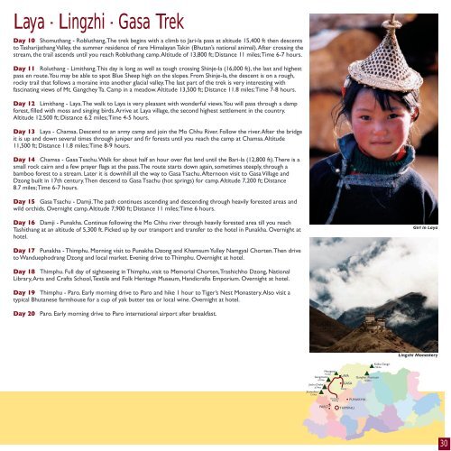
Day 12 Limithang - Laya. The walk to Laya is very pleasant with wonderful views. You will pass through a damp<br />
forest, filled with moss and singing birds. Arrive at Laya v<strong>illage</strong>, the second highest settlement in the country.<br />
Altitude 12,500 ft; Distance 6.2 miles; Time 4-5 hours.<br />
Day 13 Laya - Chamsa. Descend to an army camp and join the Mo Chhu River. Follow the river. After the bridge<br />
it is up and down several times through juniper and fir forests until you reach the camp at Chamsa. Altitude<br />
11,500 ft; Distance 11.8 miles; Time 8-9 hours.<br />
Day 14 Chamsa - Gasa Tsachu. Walk for about half an hour over flat land until the Bari-la (12,800 ft). There is a<br />
small rock cairn and a few prayer flags at the pass. The route starts down again, sometimes steeply, through a<br />
bamboo forest to a stream. Later it is downhill all the way to Gasa Tsachu. Afternoon visit to Gasa V<strong>illage</strong> and<br />
Dzong built in 17th century. Then descend to Gasa Tsachu (hot springs) for camp. Altitude 7,200 ft; Distance<br />
8.7 miles; Time 6-7 hours.<br />
Day 15 Gasa Tsachu - Damji. The path continues ascending and descending through heavily forested areas and<br />
wild orchids. Overnight camp. Altitude 7,900 ft; Distance 11 miles; Time 6 hours.<br />
Day 16 Damji - Punakha. Continue following the Mo Chhu river through heavily forested area till you reach<br />
Tashithang at an altitude of 5,300 ft. Picked up by our transport and transfer to the hotel in Punakha. Overnight at<br />
hotel.<br />
Day 17 Punakha - Thimphu. Morning visit to Punakha Dzong and Khamsum Yulley Namgyal Chorten. Then drive<br />
to Wanduephodrang Dzong and local market. Evening drive to Thimphu. Overnight at hotel.<br />
Day 18 Thimphu. Full day of sightseeing in Thimphu, visit to Memorial Chorten, Trashichho Dzong, National<br />
Library, Arts and Crafts School, Textile and Folk Heritage Museum, Handicrafts Emporium. Overnight at hotel.<br />
Day 19 Thimphu - Paro. Early morning drive to Paro and hike 1 hour to Tiger’s Nest Monastery. Also visit a<br />
typical <strong>Bhutan</strong>ese farmhouse for a cup of yak butter tea or local wine. Overnight at hotel.<br />
Day 20 Paro. Early morning drive to Paro international airport after breakfast.<br />
Masagang<br />
7165m<br />
Gangchenta<br />
6794m<br />
Jitchu Drake<br />
6794m<br />
Jhomolhari<br />
7314m<br />
PARO<br />
LAYA<br />
GASA<br />
Damji<br />
Drukgyel<br />
Dzong PUNAKHA<br />
THIMPHU<br />
Ganghar Puensum<br />
7239m<br />
Kulha Gangri<br />
7554m<br />
Girl in Laya<br />
Lingzhi Monastery<br />
30