Sentinel-3 Cal/Val plan
Sentinel-3 Cal/Val plan
Sentinel-3 Cal/Val plan
Create successful ePaper yourself
Turn your PDF publications into a flip-book with our unique Google optimized e-Paper software.
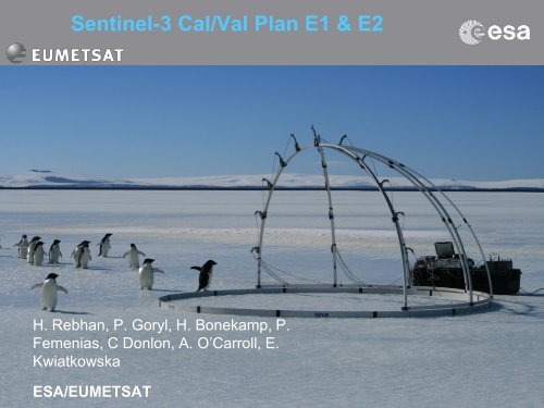
<strong>Sentinel</strong>-3 <strong>Cal</strong>/<strong>Val</strong> Plan E1 & E2<br />
H. Rebhan, P. Goryl, H. Bonekamp, P.<br />
Femenias, C Donlon, A. O’Carroll, E.<br />
Kwiatkowska<br />
ESA/EUMETSAT<br />
<strong>Sentinel</strong>-3 <strong>Cal</strong>/<strong>Val</strong> Workshop 2012<br />
We care for a<br />
safer world
• Programmatic aspects<br />
• The ESA/EUM <strong>Cal</strong>/<strong>Val</strong> Plan Concept<br />
• Outline of <strong>Cal</strong>/<strong>Val</strong> tasks definitions<br />
• Conclusion<br />
Presentation outline<br />
<strong>Sentinel</strong>-3 <strong>Cal</strong>/<strong>Val</strong> Workshop 2012<br />
We care for a<br />
safer world
<strong>Cal</strong>/<strong>Val</strong>: Organisation and Responsibility<br />
• Satellite project team (ESTEC)<br />
• conducted and organised pre-launch calibration activities<br />
• lead phase E1 (Commissioning Phase)<br />
• Establish E1 <strong>Cal</strong>/<strong>Val</strong> Teams<br />
• Ensure Level 1 product <strong>Cal</strong>/<strong>Val</strong><br />
• Payload Data Ground Segment (PDGS) teams at ESRIN/EUMETSAT<br />
• Ensure Level 2 product validation<br />
• Support to Commissioning Phase for Product <strong>Cal</strong>/<strong>Val</strong> activities.<br />
• In parallel conduct the PDGS commissioning (i.e. ensure product availability,<br />
timeliness)<br />
The phase E2 <strong>Cal</strong>/<strong>Val</strong> activities are under the responsibility of Mission<br />
Management.<br />
<strong>Sentinel</strong>-3 <strong>Cal</strong>/<strong>Val</strong> Workshop 2012<br />
We care for a<br />
safer world
<strong>Cal</strong>/<strong>Val</strong> Schedule<br />
• Data availability and data quality will follow a progressive ramp-up<br />
scenario starting at launch.<br />
• <strong>Cal</strong>/<strong>Val</strong> activities are continuous task during the mission life time.<br />
<strong>Sentinel</strong>-3 <strong>Cal</strong>/<strong>Val</strong> Workshop 2012<br />
We care for a<br />
safer world
Generic <strong>Cal</strong>/<strong>Val</strong> workflow and data streams<br />
<strong>Sentinel</strong>-3 <strong>Cal</strong>/<strong>Val</strong> Workshop 2012<br />
We care for a<br />
safer world
The <strong>Sentinel</strong>-3 <strong>Cal</strong>/<strong>Val</strong> Plan Document<br />
• Draft prepared by ESA/EUMETSAT<br />
– Based on technical input from industry partners<br />
– Considers heritage and “lessons learned” from<br />
Envisat/ERS<br />
• Draft Document has not been published before WS<br />
– Need to consolidate programmatic aspects<br />
– Need for external advise to balance technical content and<br />
priorities<br />
• -> To be published after your input has been properly<br />
considered<br />
<strong>Sentinel</strong>-3 <strong>Cal</strong>/<strong>Val</strong> Workshop 2012<br />
We care for a<br />
safer world
<strong>Cal</strong>/<strong>Val</strong> Document Concept<br />
• Concept of Traceability:<br />
– All <strong>Cal</strong>/<strong>Val</strong> activities shall be linked to Mission Requirements<br />
– Mission Requirements defined in MRD and MRTD<br />
– MRTD: numbered and classified MRD requirements<br />
• Each MRTD requirement can be linked to a product<br />
• For each product major error terms are identified<br />
– ( e.g., SST accurate to < 0.3K)<br />
• An Error tree/budget can be established for each product at the top level<br />
– (level of detail depends on resources available)<br />
• Based on Product Errors, a hierarchy of <strong>Cal</strong>/<strong>Val</strong>Tasks is defined. All task<br />
are described in standardized format.<br />
• Tasks conclude with results that categorise compliance to MRTD<br />
Requirements<br />
<strong>Sentinel</strong>-3 <strong>Cal</strong>/<strong>Val</strong> Workshop 2012<br />
We care for a<br />
safer world
Traceable <strong>Cal</strong>/<strong>Val</strong> Requirements<br />
<strong>Sentinel</strong>-3 <strong>Cal</strong>/<strong>Val</strong> Workshop 2012<br />
We care for a<br />
safer world
Traceable <strong>Cal</strong>/<strong>Val</strong> Requirements (2)<br />
• A coherent All <strong>Cal</strong>/<strong>Val</strong> Tasks description format is the basis of the <strong>Cal</strong>/<strong>Val</strong><br />
<strong>plan</strong> (i.e. what needs to be done)<br />
• Tasks define:<br />
– Which parameters shall be used in the calval activity<br />
– The necessary input data required to perform the activity<br />
– Tools required to perform the activity<br />
– A description of the activity method<br />
– Details on how the results shall be communicated<br />
– Specification of when the activity must start and end<br />
• A dynamic part of the <strong>Cal</strong>/<strong>Val</strong> <strong>plan</strong> documents how the <strong>Val</strong>idation tasks<br />
will actually be implemented, by whom and when.<br />
• Similar tasks can then be grouped together under specific activities<br />
dedicated to multiple aspects of <strong>Cal</strong>/<strong>Val</strong><br />
• e.g a ship cruise, aircraft campaign, on-orbit spectral cal etc.<br />
<strong>Sentinel</strong>-3 <strong>Cal</strong>/<strong>Val</strong> Workshop 2012<br />
We care for a<br />
safer world
Instrument<br />
Errors (I)<br />
Product Error sources<br />
Total error in <strong>Sentinel</strong>-3 Product<br />
Satelliteinstrument<br />
coupling Errors (C)<br />
Satellite<br />
Errors (S)<br />
<strong>Sentinel</strong>-3 <strong>Cal</strong>/<strong>Val</strong> Workshop 2012<br />
Processing<br />
Errors (P)<br />
• Product Errors can be classified in generic source components:<br />
• This allows us to link and classify various cal/val activities with products<br />
• Care is required to ensure that we have all of the errors identified for a<br />
comprehensive validation<br />
We care for a<br />
safer world
Derive <strong>Cal</strong>/<strong>Val</strong> Tasks: Example SST<br />
• MRTD Req: S3-MR-400 “<strong>Sentinel</strong>-3 shall provide SST measurement capability to<br />
at least the quality of AATSR on ENVISAT: SST shall be accurate to < 0.3 K @ 1<br />
km spatial resolution and with improved swath coverage. “<br />
• The example error budget for the Sea Surface Temperature product contains<br />
the following error contributions leading directly to <strong>Cal</strong>/<strong>Val</strong> tasks:<br />
• Measurement accuracy of TIR radiance data (I)<br />
– assign to <strong>Cal</strong>/<strong>Val</strong> task SLSTR-L1B-CV-200)<br />
• Uncertainty of on-board calibration sub-system (I)<br />
– assign to <strong>Cal</strong>/<strong>Val</strong> task SLSTR-L1B-CV245<br />
• Satellite position and attitude (S) (P)<br />
– assign to <strong>Cal</strong>/<strong>Val</strong> task SLSTR-L1B-CV400<br />
• SST retrieval algorithm and cloud flagging etc (P)<br />
– assign to <strong>Cal</strong>/<strong>Val</strong> task SLSTR-SST-CV-100<br />
• …<br />
<strong>Sentinel</strong>-3 <strong>Cal</strong>/<strong>Val</strong> Workshop 2012<br />
We care for a<br />
safer world
• OLCI Level 1<br />
• SLSTR Level 1<br />
• OLCI Level 2<br />
– Ocean colour<br />
– Land product<br />
• SLSTR Level 2<br />
– SST<br />
– LST<br />
• SYN Level 1<br />
<strong>Cal</strong>/<strong>Val</strong> Tasks – optical instruments<br />
• SYN Level 2<br />
– Surface reflectance and aerosol<br />
– VGT continuity<br />
<strong>Sentinel</strong>-3 <strong>Cal</strong>/<strong>Val</strong> Workshop 2012<br />
We care for a<br />
safer world
Example: OLCI Level 1<br />
<strong>Sentinel</strong>-3 <strong>Cal</strong>/<strong>Val</strong> Workshop 2012<br />
We care for a<br />
safer world
OLCI <strong>Cal</strong><strong>Val</strong> Tasks<br />
<strong>Sentinel</strong>-3 <strong>Cal</strong>/<strong>Val</strong> Workshop 2012<br />
We care for a<br />
safer world
<strong>Cal</strong>/<strong>Val</strong> Tasks – OLCI Level 1<br />
• Similar to MERIS approach – more in Ludovic Bourg / Steven Delwart<br />
presentation<br />
• OLCI on board calibration:<br />
– two radiometric diffusers – every 2 weeks / 3 months degradation monitoring<br />
– one spectral diffusers – every 3 months (or 6 months)<br />
• Spectral model derived from the on board Erbium diffuser<br />
– complemented by spectral campaign O2 and Fraunhoffer absorption (yearly?)<br />
• Vicarious calibration techniques.<br />
– Rayleigh, glint, desert/snow/ice/cloud<br />
– SNO, Reference BRF model, temporal angular matching…<br />
• Geometric calibration:<br />
– <strong>Cal</strong>ibration (mainly during commissioning phase): instrument mode<br />
– Orbit and attitude<br />
– <strong>Val</strong>idation and verification (reference image, matching correlation, coast line…)<br />
<strong>Sentinel</strong>-3 <strong>Cal</strong>/<strong>Val</strong> Workshop 2012<br />
We care for a<br />
safer world
<strong>Val</strong>idation Generic Approach<br />
• <strong>Val</strong>idation against precise in-situ measurement (few points but precise)<br />
• <strong>Val</strong>idation against in-situ measurements (more points less precise)<br />
• <strong>Val</strong>idation against others sources (satellite comparison)<br />
• <strong>Val</strong>idation against Models (data assimilation rejection statistics, integrated<br />
model analyses…)<br />
• <strong>Val</strong>idation using Level 3 data and stable source: Statistical comparison<br />
between various L-3 from various sensors constitutes an extremely useful<br />
tool (mean, median, sd, bias, RMS…. for selected zones, transects,<br />
latitudinal bands, seasonal trends… ) for a cross-validation of the products<br />
• <strong>Val</strong>idation using monitoring tools (statistic, trend, QC..Etc.)<br />
<strong>Sentinel</strong>-3 <strong>Cal</strong>/<strong>Val</strong> Workshop 2012<br />
We care for a<br />
safer world
OLCI Marine Product <strong>Val</strong>idation<br />
• OLCI marine validation performed in “different steps” :<br />
– Vicarious adjustment: NIR adjustment, Visible adjustment<br />
– <strong>Val</strong>idation mooring buoys<br />
– <strong>Val</strong>idation Aeronet Ocean Colour Network<br />
– <strong>Val</strong>idation ad-hoc campaign (international effort)<br />
– Comparison (sensors comparison, statistic, monitoring…etc…)<br />
• Tools<br />
– <strong>Val</strong>idation Match-up database (MERMAID like)<br />
– Level 3 generation<br />
– Statistic analysis, stability analysis, intercomparison<br />
– Processing and validation environment (ODESA like or <strong>Cal</strong>valus like<br />
• Protocols<br />
– Protocols NASA (Ref TBD) / MERMAID<br />
<strong>Sentinel</strong>-3 <strong>Cal</strong>/<strong>Val</strong> Workshop 2012<br />
We care for a<br />
safer world
OLCI <strong>Val</strong>idation Marine ex: matchup DB<br />
• Total number of ≈1300<br />
radiometric matchups in<br />
MERMAID with less than 50%<br />
pixels cloud, ice_haze or<br />
high_glint (transects not<br />
considered here)<br />
• This is only a global view. In situ<br />
data are by nature<br />
heterogeneous<br />
• users are free to select their<br />
matchups according to the<br />
protocol document and other<br />
choices (flags…) for their own<br />
validation activity<br />
<strong>Sentinel</strong>-3 <strong>Cal</strong>/<strong>Val</strong> Workshop 2012<br />
We care for a<br />
safer world
• OGVI - FAPAR<br />
– Comparing OGVI values to<br />
similar products generated by<br />
other independent sensors colocated<br />
and quasi<br />
simultaneously acquired data.<br />
• Comparing against groundestimates<br />
of FAPAR.<br />
• OCTI – Chlorophyl Terrestrial<br />
Index<br />
– Use of Ground data of<br />
chlorophyll<br />
– Airborne Campaigns with<br />
Spectral Imager/ Radiometer.<br />
More information in N.Gobron – J.<br />
Dash Presentation<br />
<strong>Val</strong>idation OLCI Land<br />
<strong>Sentinel</strong>-3 <strong>Cal</strong>/<strong>Val</strong> Workshop 2012<br />
We care for a<br />
safer world
SLSTR <strong>Cal</strong><strong>Val</strong> Tasks<br />
<strong>Sentinel</strong>-3 <strong>Cal</strong>/<strong>Val</strong> Workshop 2012<br />
We care for a<br />
safer world
<strong>Cal</strong>/<strong>Val</strong> Tasks – SLSTR Level 1<br />
SLSTR is a self-calibrating instrument with on-board<br />
calibration system with:<br />
– Two specially designed and highly stable blackbody<br />
– Observed at each scan<br />
– Reflecting target (VISCAL) that is illuminated once per orbit<br />
(for the VIS-SWIR channels) at the pole.<br />
•Vicarious calibration<br />
– Stable sites (Desert, snow)<br />
– used to characterize / correct<br />
the drift.<br />
•Similar to AATSR approach – more in Dave Smith<br />
presentation<br />
<strong>Sentinel</strong>-3 <strong>Cal</strong>/<strong>Val</strong> Workshop 2012<br />
We care for a<br />
safer world
<strong>Val</strong>idation SLSTR SST<br />
More information on the Gary Corlett presentation<br />
•Drifting buoys:<br />
– The global array on in situ drifting buoys providing<br />
SST measurements at depth of 0.25-0.5 m as a<br />
reference data set<br />
•“Transistion” radiometry: AATSR -> SLSTR<br />
– IR radiometers mounted on ships, also to validate L2<br />
products in specific regions.<br />
•measurement protocols for SST validation are<br />
available<br />
– heritage from the ENVISAT AATSR<br />
– Extensive inter-comparison with other infrared and<br />
visible satellite systems<br />
<strong>Sentinel</strong>-3 <strong>Cal</strong>/<strong>Val</strong> Workshop 2012<br />
We care for a<br />
safer world
<strong>Val</strong>idation SLSTR LST<br />
More information on the Gary Corlett presentation<br />
•Specific validation campaigns, and the collection of ground-based<br />
measurements.<br />
•Sites under investigation:<br />
– LSA-SAF sites: Evora, Portugal; Gobabeb, Namibia; Dahra, Senegal<br />
– ARM sites: SGP, Oklahoma, USA; Niamey, Niger.<br />
– Others: <strong>Val</strong>encia, Spain – University of <strong>Val</strong>encia; Cardington, UK – UK Met<br />
Office, Australian sites.<br />
•Level 3 analysis:<br />
– Times series of average LST and ‘monthly’ maps produced<br />
•Sensor comparisons (modis, Severi…etc…)<br />
•Auxiliary data QC:<br />
– Biomes classification, Fraction vegetation, WV, cloud masking ….<br />
<strong>Sentinel</strong>-3 <strong>Cal</strong>/<strong>Val</strong> Workshop 2012<br />
We care for a<br />
safer world
<strong>Cal</strong>/<strong>Val</strong> Tasks – Synergy Product<br />
<strong>Sentinel</strong>-3 <strong>Cal</strong>/<strong>Val</strong> Workshop 2012<br />
We care for a<br />
safer world
Inter-channel co-registration analysis<br />
(SYN-L1C-CV-200)<br />
• Task description<br />
– For the synergy product the co-registration uncertainty needs to be analysed<br />
and compared with the requirements<br />
• Methodology<br />
– This analysis uses a database of ground control points (GCP) to monitor coregistration<br />
at certain reference sub-images (“imagettes”) of OLCI and<br />
SLSTR bands….<br />
– The database contains precise geographic coordinates for a ground point<br />
together with a small high-resolution reference image of the surrounding<br />
area….<br />
• Input/Output Data need<br />
– Database of GCP<br />
• Tools<br />
– ….<br />
<strong>Sentinel</strong>-3 <strong>Cal</strong>/<strong>Val</strong> Workshop 2012<br />
We care for a<br />
safer world
<strong>Val</strong>idation Synergy Product<br />
<strong>Sentinel</strong>-3 <strong>Cal</strong>/<strong>Val</strong> Workshop 2012<br />
More on Peter North’s presentation<br />
- <strong>Val</strong>idation using AERONET<br />
-Ad-Hoc ground based campaign<br />
- Sensor comparison<br />
We care for a<br />
safer world
Vegetation Product <strong>Val</strong>idation<br />
(SYN-VGT-CV100)<br />
• Task Aim and Objectives<br />
– The objective of this task is to assess the quality to the product derived from the<br />
SYNERGY branch simulating the SPOT VGT products.<br />
• Parameters for analysis<br />
– The parameters that will be validated are the Top Of Atmosphere radiance and<br />
the bottom of atmosphere reflectance provided as the continuity of SPOT VGT. .<br />
• Methodology<br />
– Assuming availability of the previously mentioned missions at the time of the S-3<br />
operations, direct comparisons over fixed terrestrial sites of S-3 VGT like TOA<br />
radiances versus the VEGETATION and Proba-V .<br />
– Vicarious calibration tool and methodologies can be used for further assessment<br />
of the radiometric capacity after the SYN VGT L2 processing.<br />
– Subtasks aiming at the verification of the spectral interpolation, binning process<br />
and atmospheric correction process will conducted.<br />
• More on Eric Gontier’s presentation<br />
<strong>Sentinel</strong>-3 <strong>Cal</strong>/<strong>Val</strong> Workshop 2012<br />
We care for a<br />
safer world
• SRAL Level 2<br />
• MWR Correction Parameter<br />
• Precise Orbit Determination<br />
• GNSS<br />
• DORIS<br />
<strong>Cal</strong>/<strong>Val</strong> Tasks –Topography Payload<br />
<strong>Sentinel</strong>-3 <strong>Cal</strong>/<strong>Val</strong> Workshop 2012<br />
We care for a<br />
safer world
• Range<br />
Topography Mission – Performance<br />
– SWH, Sigma0 & WindSpeed<br />
<strong>Sentinel</strong>-3 <strong>Cal</strong>/<strong>Val</strong> Workshop 2012<br />
We care for a<br />
safer world
SRAL <strong>Cal</strong><strong>Val</strong> Plan Activities (1)<br />
<strong>Sentinel</strong>-3 <strong>Cal</strong>/<strong>Val</strong> Workshop 2012<br />
We care for a<br />
safer world
SRAL internal calibration characterisation<br />
(SRAL-L1B-CV-110)<br />
• In-flight characterization and cross-comparison with ground measurement<br />
• Ground processing tuning<br />
• Long term monitoring<br />
• <strong>Cal</strong>ibration Planning definition (vs data acquisition)<br />
1.1<br />
1.05<br />
1<br />
0.95<br />
0.9<br />
0.85<br />
1<br />
11<br />
21<br />
31<br />
41<br />
51<br />
61<br />
71<br />
81<br />
91<br />
101<br />
111<br />
121<br />
<strong>Sentinel</strong>-3 <strong>Cal</strong>/<strong>Val</strong> Workshop 2012<br />
IF mask On-ground<br />
IF mask 3<br />
IF mask 2<br />
IF mask 1<br />
IF mask operational<br />
e.g. CAL2 Receiver Transfer Function (IF<br />
Mask)<br />
We care for a<br />
safer world
SRAL Range and Simga-0 <strong>Cal</strong>ibration<br />
(SRAL-L2MA-CV-130)<br />
• Methodology<br />
– Monitoring of Altimeter range calibration over a dedicated<br />
site (bias and drift estimation)<br />
– Regional <strong>Cal</strong>/<strong>Val</strong> method also enables to increase the<br />
number of bias estimations and consequently reinforces<br />
the bias statistical reliability.<br />
Need for a dedicated reference <strong>Cal</strong>/<strong>Val</strong><br />
site to be assessed.<br />
-> Do we need a S-3 Venice Tower?<br />
<strong>Sentinel</strong>-3 <strong>Cal</strong>/<strong>Val</strong> Workshop 2012<br />
We care for a<br />
safer world
SRAL <strong>Cal</strong><strong>Val</strong> Plan Activities (2)<br />
<strong>Sentinel</strong>-3 <strong>Cal</strong>/<strong>Val</strong> Workshop 2012<br />
We care for a<br />
safer world
Microwave Radiometer - <strong>Cal</strong>/<strong>Val</strong> Tasks<br />
• MWR calibration characterization<br />
• MWR cross-calibration vs Envisat<br />
• <strong>Cal</strong>ibration versus simulated Brightness Temperatures (from<br />
ECMWF meteorological fields)<br />
• MWR validation & Long term monitoring<br />
• L1B: Vicarious calibration:<br />
– Statistical selection of coldest ocean TB, geographical selection<br />
of hot TB over rain forests<br />
– Comparison to models<br />
• L2: Radiosondes, Comparison to models<br />
multi-sensor<br />
comparison<br />
<strong>Sentinel</strong>-3 <strong>Cal</strong>/<strong>Val</strong> Workshop 2012<br />
We care for a<br />
safer world
Topography Mission – Additional Information<br />
• Envisat Altimetry mission alignment to S-3 STM mission shall be done as<br />
much as possible prior to S-3 launch to facilitate cross-calibration<br />
• Needs for algorithm upgrade, sensor calibration, ADF updates, <strong>Cal</strong>/<strong>Val</strong><br />
activities, format change, etc, shall be considered<br />
<strong>Sentinel</strong>-3 <strong>Cal</strong>/<strong>Val</strong> Workshop 2012<br />
We care for a<br />
safer world
Tools and Resources for <strong>Cal</strong>/<strong>Val</strong><br />
• 1.) Optical Payload<br />
– Extraction tools<br />
– Systematic extraction over area of interest<br />
– Static and dynamic areas (drifting buoys)<br />
– Post processing for vicarious calibration – METRIC type<br />
– Matchup data Base<br />
– OC DB (ex: MERMAID)<br />
– Existing DB for SST,LST and Land Products<br />
• 2.) Topographic Payload<br />
– BRAT Tool-box<br />
– Orbit-CFI (ESTEC Orbit <strong>Cal</strong>c Library)<br />
• For all instruments<br />
– Monitoring tools, analysis tool, comparison tool<br />
– Selected parameters systematically extracted and monitored<br />
– Level 3 QC tools<br />
<strong>Sentinel</strong>-3 <strong>Cal</strong>/<strong>Val</strong> Workshop 2012<br />
We care for a<br />
safer world
Radiometric vicarious calibration in the CEOS<br />
/ IVOS context<br />
• Use “CEOS agreed fixed sites”<br />
– Desert<br />
– Snow<br />
– Rayleigh<br />
– Instrumented sites (Landnet)<br />
• Use “CEOS agreed methodologies”<br />
– Share the resources / results in the CEOS community<br />
– <strong>Cal</strong>/<strong>Val</strong> portal for communication / exchanges<br />
– CEOS insitu intercomparison exercise (MIAMI3, Tuzgulu, OC AAOT<br />
workshop)<br />
• Vicarious calibration used for monitoring, characterization, uncertainty<br />
estimation, comparison with other sensors (GMES, CCI) and potential intercalibration.<br />
– need to be an international and coordinated effort (GEOSS)<br />
<strong>Sentinel</strong>-3 <strong>Cal</strong>/<strong>Val</strong> Workshop 2012<br />
We care for a<br />
safer world
CONCLUSION<br />
• Active Preparation for S3 <strong>Cal</strong>ibration & <strong>Val</strong>idation has started<br />
• Concrete steps like the definition and scope of a “Mission Performance<br />
Center” framework are under preparation<br />
• Any input and suggestions from you is appreciated!<br />
<strong>Sentinel</strong>-3 <strong>Cal</strong>/<strong>Val</strong> Workshop 2012<br />
We care for a<br />
safer world
Backup Slides<br />
<strong>Sentinel</strong>-3 <strong>Cal</strong>/<strong>Val</strong> Workshop 2012<br />
We care for a<br />
safer world
SRAL cross-comparision with in-situ data<br />
Use independent data (as Tide Gauges or Temperature/Salinity profilers) to<br />
estimate global altimeter mean sea level drift and also sea-level consistency<br />
between in-situ and altimetry data.<br />
Comparison of tide gauge and<br />
altimetry Sea Surface Height (SSH)<br />
<strong>Sentinel</strong>-3 <strong>Cal</strong>/<strong>Val</strong> Workshop 2012<br />
Comparison of T/S and altimetry<br />
Sea Surface Height (SSH)<br />
We care for a<br />
safer world
SRAL Range <strong>Cal</strong>ibration<br />
- Monitoring of Altimeter range calibration over a<br />
dedicated site (bias and drift estimation)<br />
- Regional <strong>Cal</strong>/<strong>Val</strong> method also enables to increase the<br />
number of bias estimations and consequently reinforces<br />
the bias statistical reliability.<br />
Corsica <strong>Cal</strong>ibration site<br />
Need for a dedicated reference <strong>Cal</strong>/<strong>Val</strong><br />
site to be assessed. Do we need a S-3<br />
Venice Tower?<br />
<strong>Sentinel</strong>-3 <strong>Cal</strong>/<strong>Val</strong> Workshop 2012<br />
We care for a<br />
safer world
SRAL Absolute <strong>Cal</strong>ibration<br />
• Range Absolute <strong>Cal</strong>ibration via Transponder<br />
• Sigma0 Absolute <strong>Cal</strong>ibration<br />
Keyword: Absolute calibration and long term monitoring (bias and<br />
drift estimation)<br />
Over the Envisat Phase E2, the TPD calibration showed a fairly<br />
stable gain, exhibiting drifts with maximum deviation of 0.2 dB<br />
1.80<br />
1.60<br />
1.40<br />
1.20<br />
1.00<br />
0.80<br />
0.60<br />
0.40<br />
13-feb-04<br />
12-giu-04<br />
10-ott-04<br />
suspected overestimated<br />
attenuation<br />
7-feb-05<br />
tpd failure<br />
very dew: suspected<br />
underestimated attenuation<br />
7-giu-05<br />
5-ott-05<br />
2-feb-06<br />
2-giu-06<br />
Bias Temporal Trend<br />
corrected MWR corr no tropo corr raw low res<br />
30-set-06<br />
Att.Sett. unstable<br />
1st permanent site<br />
acquisition in Low Res.<br />
TPD positioning<br />
problem<br />
28-gen-07<br />
8-mag-07<br />
25-set-07<br />
23-gen-08<br />
2-mag-08<br />
19-set-08<br />
17-gen-09<br />
7-mag-09<br />
14-set-09<br />
12-gen-10<br />
2-mag-10<br />
9-set-10<br />
<strong>Sentinel</strong>-3 <strong>Cal</strong>/<strong>Val</strong> Workshop 2012<br />
RA-2 sigma0 transponder installed on<br />
permanent site (Rome) since October<br />
2005<br />
We care for a<br />
safer world


