Porirua Harbour: Intertidal Sediment Monitoring 2011/12 - Greater ...
Porirua Harbour: Intertidal Sediment Monitoring 2011/12 - Greater ...
Porirua Harbour: Intertidal Sediment Monitoring 2011/12 - Greater ...

Create successful ePaper yourself
Turn your PDF publications into a flip-book with our unique Google optimized e-Paper software.
1. IntRoduCtIon and MEtHodS<br />
<strong>Porirua</strong> <strong>Harbour</strong> Estuary<br />
Vulnerability Assessment<br />
Identifies issues and recommends<br />
monitoring and management.<br />
Completed in 2007 (Robertson and<br />
Stevens 2007)<br />
<strong>Porirua</strong> Estuary Issues<br />
Moderate eutrophication<br />
Excessive sedimentation<br />
Habitat Loss (saltmarsh, dune and<br />
terrestrial margin)<br />
Broad Scale<br />
Mapping<br />
<strong>Sediment</strong> type<br />
Saltmarsh<br />
Seagrass<br />
Macroalgae<br />
Land margin<br />
5 -10 yearly<br />
First undertaken<br />
in 2008.<br />
Next survey 2013.<br />
<strong>Monitoring</strong><br />
Fine Scale<br />
<strong>Monitoring</strong><br />
Grain size, RPD,<br />
Organic Content<br />
Nutrients, Metals,<br />
Invertebrates,<br />
Macroalgae,<br />
<strong>Sediment</strong>ation,<br />
4yr Baseline then<br />
5 yearly<br />
3 year baseline<br />
completed 2009/10.<br />
Next survey 2015.<br />
Sedimetation, 2013.<br />
Condition Ratings<br />
Area soft mud, Area saltmarsh, Area<br />
seagrass, Area terrestrial margin, RPD<br />
depth, Benthic Community, Organic<br />
content, N and P, Toxicity,<br />
<strong>Sediment</strong>ation rate.<br />
Other Information<br />
Previous reports, Observations,<br />
Expert opinion<br />
ESTUARY CONDITION<br />
Moderate Eutrophication<br />
Excessive <strong>Sediment</strong>ation<br />
Low Toxicity<br />
Habitat Degraded (saltmarsh, terrestrial<br />
margin)<br />
Recommended Management<br />
• Limit intensive landuse.<br />
• Set nutrient, sediment guidelines.<br />
• Margin vegetation enhancement.<br />
• Manage for sea level rise.<br />
• Enhance saltmarsh.<br />
• Manage weeds and pests.<br />
Soil erosion is a major issue in New Zealand and the resulting suspended sediment<br />
impacts are of particular concern in estuaries because they act as a sink for fine<br />
sediments or muds. The main intertidal flats of developed estuaries (e.g. <strong>Porirua</strong><br />
<strong>Harbour</strong>) are usually characterised by sandy sediments reflecting their exposure to<br />
wind-wave disturbance, and are hence relatively low in mud content (2-10% mud).<br />
Recent monitoring (Robertson and Stevens 2008, 2009, 2010) showed <strong>Porirua</strong><br />
<strong>Harbour</strong> Estuary had low-moderate intertidal sedimentation rates and a benthic<br />
invertebrate community dominated by species that prefer sand or a little mud.<br />
However, the sand dominated sediments had an elevated mud content, showed a<br />
general trend of increasing muddiness, and sediments were not very well oxygenated.<br />
Based on these findings, in <strong>2011</strong> <strong>Greater</strong> Wellington Regional Council (GWRC)<br />
decided to continue annual monitoring of sedimentation rates, grain size, and RPD<br />
depth at existing intertidal sites in the estuary (e.g. Stevens and Robertson <strong>2011</strong>).<br />
In addition to intertidal areas, <strong>Porirua</strong> <strong>Harbour</strong> has also been identified as being<br />
particularly at risk from subtidal sedimentation because the main subtidal basins are<br />
rapidly infilling (Gibb and Cox 2009). Gibb and Cox predict that both estuary arms<br />
are highly likely to rapidly infill and change from tidal estuaries to brackish swamps<br />
within 145-195 years. The dominant sources contributing to increasing sedimentation<br />
rates in the estuary were identified as discharges of both bedload and suspended<br />
load from the various input streams (most notably Pauatahanui, Horokiri<br />
and <strong>Porirua</strong> Streams). Elevated inputs of nutrients from the same streams are also<br />
causing symptoms of moderate eutrophication (i.e. poor sediment oxygenation and<br />
moderate nuisance macroalgal cover) in the estuary (Stevens and Robertson 2009,<br />
2010, <strong>2011</strong>, Robertson and Stevens 2009, 2010, <strong>2011</strong>).<br />
In response to these concerns, GWRC convened a technical workshop in April <strong>2011</strong><br />
which drew on expert scientific advice, combined with existing catchment and estuary<br />
models, to highlight the areas of greatest predicted deposition. A key output<br />
was the recommendation to increase the number of intertidal plates within areas<br />
influenced by priority catchments, and to determine suitable methods and locations<br />
for the establishment of subtidal sediment plates which is where the greatest sediment<br />
deposition in the estuary is expected to occur. Work into catchment sources<br />
and loads is ongoing, particularly in relation to likely increased sedimentation to the<br />
estuary as a result of the construction of Transmission Gully motorway.<br />
The current report presents the 20<strong>12</strong> monitoring results of intertidal sedimentation<br />
rates, grain size, and RPD indicators monitored at established sites in <strong>Porirua</strong><br />
<strong>Harbour</strong> Estuary in February 20<strong>12</strong>. Condition ratings, developed for Wellington’s<br />
estuaries, are used to rate the condition of the estuary, and recommend monitoring<br />
and management actions.<br />
This report also describes the establishment of four additional intertidal sites (3 in<br />
Pauatahanui Arm and 1 in the Onepoto Arm - Figure 1), and identifies a series of sites<br />
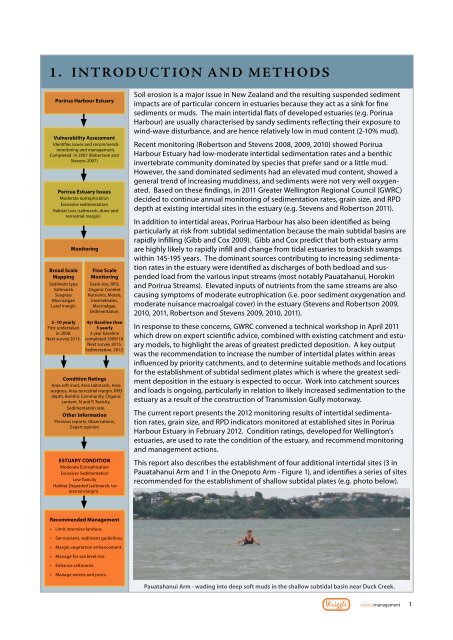
recommended for the establishment of shallow subtidal plates (e.g. photo below).<br />
Pauatahanui Arm - wading into deep soft muds in the shallow subtidal basin near Duck Creek.<br />
Wriggle<br />
coastalmanagement 1