HOW TO USE FLOODPLAINS FOR FLOOD RISK ... - SGGW
HOW TO USE FLOODPLAINS FOR FLOOD RISK ... - SGGW
HOW TO USE FLOODPLAINS FOR FLOOD RISK ... - SGGW

You also want an ePaper? Increase the reach of your titles
YUMPU automatically turns print PDFs into web optimized ePapers that Google loves.
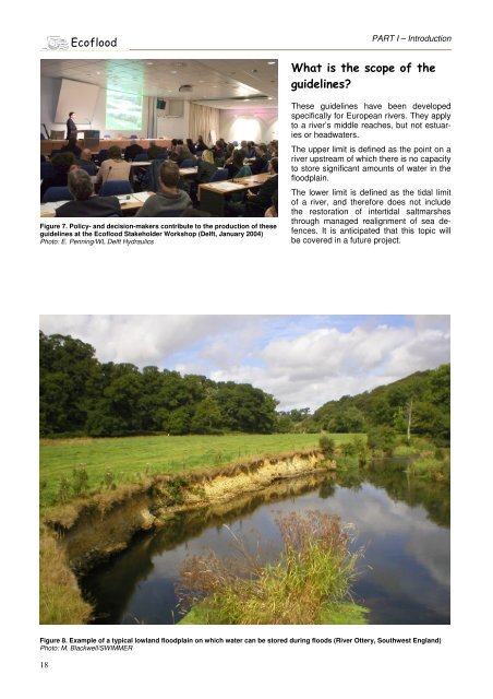
Figure 7. Policy- and decision-makers contribute to the production of these<br />
guidelines at the Ecoflood Stakeholder Workshop (Delft, January 2004)<br />
Photo: E. Penning/WL Delft Hydraulics<br />
18<br />
PART I – Introduction<br />
These guidelines have been developed<br />
specifically for European rivers. They apply<br />
to a river’s middle reaches, but not estuaries<br />
or headwaters.<br />
The upper limit is defined as the point on a<br />
river upstream of which there is no capacity<br />
to store significant amounts of water in the<br />
floodplain.<br />
The lower limit is defined as the tidal limit<br />
of a river, and therefore does not include<br />
the restoration of intertidal saltmarshes<br />
through managed realignment of sea defences.<br />
It is anticipated that this topic will<br />
be covered in a future project.<br />
Figure 8. Example of a typical lowland floodplain on which water can be stored during floods (River Ottery, Southwest England)<br />
Photo: M. Blackwell/SWIMMER<br />
-