
You also want an ePaper? Increase the reach of your titles
YUMPU automatically turns print PDFs into web optimized ePapers that Google loves.
I<br />
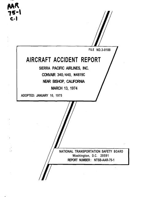
FILE ND.3-<strong>01</strong>88<br />
AIRCRAFT ACCIDENT REPORT<br />
SIERRA PACIFIC AIRLINES, INC.<br />
ADOPTED: JANUARY 10, 19<strong>75</strong><br />
CONVAIR 340/440, N4819C<br />
NEAR BISHOP, CALIFORNIA<br />
MARCH 13, 1974<br />
NATIONAL TRANSPORTATION SAFETY BOARD<br />
Washington, D.C. 20591<br />
REPORT NUMBER : <strong>NTSB</strong>-<strong>AAR</strong>-<strong>75</strong>-1
* ,* .....<br />
TECHNICAL REPORT DOCUMENTATION PAGE<br />
1. Re ort No.<br />
2.Government Accession No. 3.Recipient's Catalog NO.,<br />
N?SB-<strong>AAR</strong>-<strong>75</strong>-1<br />
I<br />
4. Title and Subtitle Aircraft Accident Re ort - 5.Report Date<br />
Sierra Pacific Airlines, Inc., Convair &0/440, January 10, 19<strong>75</strong><br />
N4819C, Near Bishop, California, March 13, 1974 6.Performing Organization<br />
Code<br />
7. Author(s) 8.Performing Organization<br />
Report No.<br />
3. Performing Organization Name and Address IO.Work Unit No.<br />
National Transportation Safety Board<br />
Bureau of Aviation Safety<br />
Washington, D. C. 20591 1<br />
1377-A<br />
I 1 .Contract or Grant No.<br />
13.Type of Report and<br />
12.Sponsoring Agency Name and Address<br />
NATIONAL TRANSPORTATION SAFETY BOARD<br />
Period Covered<br />
Aircraft Accident Report<br />
March 13, 1974<br />
Washington, D. C. 20591<br />
16.Abstract<br />
About 2028 on March 13, 1974, Sierra Pacific Airlines, Inc., Charter<br />
Flight 802, a Convair 340/440, crashed near Bishop, California. The 36<br />
occupants--32 passengers and 4 crewmembers-.-were killed. The aircraft<br />
was destroyed.<br />
The last recorded transmission from the flight was at 2024 when the crew<br />
advised the Tonapah Flight Service Station that they had departed Bishop and<br />
were climbing under visual flight rules. The aircraft crashed at the 6, 100foot<br />
level into a foothill of the White Mountains, about 5. 2 miles southeast of<br />
the Bishop .":irport.<br />
The National Transportation Safety Board is unable to determine the<br />
probable cause of this accident. The reason why the flightcrew did not<br />
maintain a safe distance from hazardous terrain during night visual flight<br />
conditions could not be established.<br />
17.Key Words 18.Distribution Statement<br />
takeoff, visual flight rules, mountainous terrain,<br />
VFR climb-out, nighttime<br />
This report is available to<br />
the public through the<br />
National Technical Informa<br />
tion Service, Springfield,<br />
Virginia 221 51<br />
19.Security Classification 20.Security Classification 21.No. of Pages 22.Price<br />
(of this report)<br />
UNCLASSIFIED<br />
(of this page)<br />
UNCLASSIFIED 30
1 .<br />
1 . 1<br />
1 . 2<br />
1 . 3<br />
1 . 4<br />
1 . 5<br />
1 . 6<br />
1 . 7<br />
1 . 8<br />
1.9<br />
1 . 10<br />
1.11<br />
1 . 12<br />
1 . 13<br />
1 . 14<br />
1 . 15<br />
1 . 16<br />
1 . 17<br />
2 .<br />
2 . 1<br />
2 . 2<br />
3 .<br />
TABLE OF CONTENTS<br />
Synopsis ........................................ 1<br />
Investigation .................................... 1<br />
History of Flight ................................. 1<br />
Injuries to Persons .............................. 4<br />
Damage to Aircraft .............................. 5<br />
Other Damage ................................... 5<br />
Crew Information ................................ 5<br />
Aircraft Information .............................. 5<br />
Meteorological Information ........................ 6<br />
Aids to Navigation ................................ 6<br />
<strong>Com</strong>munications ................................. 7<br />
Aerodrome and Ground Facilities .................. 7<br />
Flight Recorders ................................. 8<br />
Aircraft Wreckage ............................... 8<br />
Medical and Pathological Information ............... 11<br />
Fire ............................................ 11<br />
Survival Aspects ................................ 11<br />
TestsandResearch .............................. 11<br />
Other Information ................................ 13<br />
Analysis and Conclusions ......................... 13<br />
Analysis ....................................... 13<br />
Conclusions .................................... 17<br />
(a) Findings ................................... 17<br />
(b) Pro'bable Cause .............................. 18<br />
Recommendations ................................ 18<br />
Appendices<br />
Appendix A . Investigation and Hearing ......... 19<br />
Appendix B . Crew Information ................ 20<br />
Appendix C . Aircraft Information ............. 22<br />
.Appendix D . Approach Chart .................. 24<br />
Appendix E . Wreckage Distribution Chart ...... 25<br />
Appendix F . Recommendations ............... 29<br />
iii<br />
Page .<br />
.
Adopted: January 10, 19<strong>75</strong><br />
NATIONAL TRANSPORTATION SAFETY BOARD<br />
WASHINGTON, D, C. 20591<br />
AIRCRAFT ACCIDENT REPORT<br />
SIERRA PACIFIC AIRLINES, INC.<br />
CONVAIR 340/440, N4819C.<br />
NEAR BISHOP, CALIFORN~A<br />
MARCH 13, 1974<br />
SYNOPSIS<br />
About 2028 P. d. t. on March 13, 1974, Sierra Pacific Airlines, Inc.,<br />
Charter Flight 802, a Convair 340/440, crashed into a foothill of the White<br />
Mountains near Bishop, California. The 36 occupants--32 passengers and<br />
4 crewmembers--were killed. The aircraft was destroyed.<br />
The flight had been chartered by Wolper Productions, Inc., to trans-<br />
port a movie production crew from Bishop to Burbank, California. The<br />
last recorded transmission from the flight was at 2024 when the crew ad-<br />
vised the Tonapah Flight Service Station that they had departed Bishop and<br />
were climbing under visual flight rules. The aircraft crashed at the<br />
6,100-foot level into a foothill of the White Mountains, about .5. 2 miles<br />
southeast of the Bishop Airport.<br />
The National Transportation Safety Board is unable to determine<br />
the probable cause of this accident. The reason why the flightcrew did<br />
not maintain a safe distance from hazardous terrain during night visual<br />
flight conditions could not be established.<br />
As a result of this accident, the Safety Board has submitted three<br />
recommendations to the Federal Aviation Administration.<br />
1. 1 History of Flight<br />
I. INVESTIGATION<br />
On March 13, 1974, Sierra Pacific Airlines, Inc., charter Flight<br />
802, a Convsr 340/440, N4819C, was chartered by the Wolper Produc-<br />
tions, Inc., to transport a movie production crew from Mammoth Lakes<br />
Airport, California, to 'Burbank, California.
,<br />
- 2 -<br />
Originally, N4819C was to be used on a regularly scheduled passenger<br />
flight to Mammoth, which was scheduled to depart Burbank at 1545. i!<br />
The return from Mammoth was charter Flight 802. However, because of<br />
a maintenance problem on N4819C, the flight was cancelled, and its<br />
passengers were dispatched on another Sierra Pacific flight. At 1730, the<br />
maintenance problem on aircraft N4819C was corrected. However, because<br />
L_~~<br />
of the late hour, a night takeoff would have been necessary from Mammoth<br />
Lakes Airport, and since the airport is restricted to daylight visual flight rules<br />
(VFR) operations only, Flight 802 was rescheduled to pick up the Wolper<br />
Production crew at the Bishop, California, Airport. This airport is<br />
located about 45 miles south of Mammoth Lakes. The airline arranged<br />
bus transportation for the production crew from Mammoth Lakes to Bishop.<br />
Flight 802 departed Hollywood-Burbank Airport at 1814. The flight-<br />
crsw consisted of the captain, first officer, flight attendant, and an<br />
observer-pilot trainee. There were three nonrevenue passengers on board<br />
for the flight to Bishop.<br />
The flight from Burbank to Bishop was conducted under VFR co-n-<br />
ditions and at 1910, when in the vicinity of Bishop, the crew contacted<br />
the Tonapah Flight Service Station (FSS) and cancelled their VFR flight<br />
plan. The crew then "air filed" an instrument flight rules (IFR) flight<br />
plan for the return trip from Bishop to Burbank. The proposed departure<br />
time from Bishop was 2000. The proposed routing was listed as, "VFR-<br />
direct Bishop (VOR), IFR - Bishop (VOR), direct Friaat (VOR), V459<br />
Lake Hughes (VOR), V165 Lang (VOR), direct. "<br />
The flight then contacted the Bishop Airport Unicorn<br />
2/ - and re-<br />
quested traffic advisories and weather information. The aircraft landed<br />
at Bishop at 1920.<br />
While at Bishop, the aircraft was fueled with 100 gallons of 100/130<br />
aviation gasoline. No maintenance was performed on the aircraft.<br />
During the stopover, the captain telephoned the airline's dispatcher<br />
in Burbank to report his "on" and "in" times. He reported no problems<br />
with the aircraft nor any other-problems that would indicate other than a<br />
routine operation to this<br />
1/ All times herein are Pacific daylight time, based on the 24-hour clock.<br />
2-<br />
- 2/ A common communication channel used by many airports without<br />
control towers. The standard Unicorn frequency is 122.8 MHz. i i<br />
~<br />
..<br />
..<br />
f<br />
1
I<br />
!<br />
se<br />
1<br />
rules<br />
?.<br />
1<br />
. .<br />
-3-<br />
The baggage, motion picture production equipment, and film were<br />
loaded aboard the aircraft by a Sierra Pacific passenger agent and the<br />
system director of passenger service. The loading was supervised by<br />
the observer-pilot trainee. kccording to the Sierra Pacific personnel,<br />
this baggage and equipment was not weighed at BishopL'because Wolper<br />
Productions, Inc., )3.ssured them that the same items which were flown<br />
to Mammoth Lakes by a previous Sierra Pacific charter flight on March<br />
11 were being returned to Burbank with no additions or deletions.<br />
Flight 802 departed the gate at about 2020 with 36 persons on board,<br />
including a crew of 4. Before departure, the passenger agent noted that<br />
the captain was seated in'the left seat, the first officer was se,&ed-in_the<br />
right seat, and the observer-pilot was standing in the cockpit doorway<br />
behind the cockpit-observer seat.<br />
The airport manager saw the aircraft taxi north toward runwy 12.<br />
He then attempted to contact the flight on the Unicom frequency. After<br />
several unsuccessfwl attempts, he returned to the ramp area and saw<br />
the aircraft takeoff on runway 12. He stated that after the aircraft<br />
passed abeam of his position, a hangar blocked his view and that he<br />
neither saw nor heard the aircraft again.<br />
Records of the Tonapah FSS show that at 2021, the crew of Flight<br />
02 contacted the station and advised that they were taxiing for departure<br />
d requested that their IFR clearance be activated. At 2021:30, the<br />
SS requested Flight 802's IFR clearance from the Oakland Air Route<br />
raffic Control Center. The Center advised that they would have to call,<br />
ack with the clearance.<br />
At 2024 Flight 802 again contacted the Tonapah FSS on the Bishop<br />
adio frequency, 122.6 MHz, and reported that they were off Bishop at<br />
020 and were, "climbing VFR over Bishop, awaiting clearance.<br />
At 2028:40, after receiving the clearance from the Oakland Center,<br />
e Tonapah FSS spgcialist tried to radio the flight, but contact could<br />
t be established. Repeated attempts by the FSS specialist to contact<br />
he'flight were not successful.<br />
The specialist then contacted the Oakland Center and advised that<br />
light 802 had reported that it was climbing VFR over Bishop, but that<br />
was unable to establish radio communications. He also reported<br />
at he had broadcast in the blind for the flight to contact the Center on<br />
r
-4-<br />
At 2036, the manager of the Bishop Airport called Tonapah FSS<br />
and requested the status of Flight 802 and advised the FSS of an<br />
explosion and fire in the White Mountains east of the airport. In view<br />
of the circumstances, the FSS specialist assumed that an accident had<br />
occurred and initiated accident notification procedures.<br />
Several persons on the ground saw the aircraft during the last<br />
few moments before it crashed. Three of these persons, who were<br />
located near the base of the mountains to the east of the airport, stated<br />
that they saw the green and white lights of an aircraft proceeding in a<br />
southerly direction parallel to the mountain range. They then heard<br />
the engines of what they thought to be a large airplane. They stated<br />
that the engines maintained a strong, steady, and smooth sound and<br />
that the aircraft appeared to be in a gradual climb. They had observed<br />
the aircraft for about 1 minute when they saw a burst of .flames and<br />
heard an explosion.<br />
No witnesses were found who saw the aircraft immediately after<br />
takeoff or during the initial phase of the climbout. One witness, who<br />
was about 2 miles southwest of the airport, stated that he heard a<br />
large, twin engine aircraft pass nearly overhead just before the accident,<br />
but that he did not see the aircraft during this time. alpf the<br />
wusses an extremelyprk ninht, - and that there<br />
__ I<br />
was no moon. A/* -<br />
The aircraft struck a foothill in the White Mountain range, about<br />
5. 2 statute miles southeast of the Bishop Airport. The geographic<br />
coordinates of the accident site are 37O l9l 57" north latitude:<br />
Leet. 118' 16' 14" 31 west longitude. At the point of impact, the elevation was<br />
Ju<br />
The pilot of a search and rescue helicopter, who flew to the scene<br />
- mountain ridges or the skyline either from the valley before<br />
oute to the fire that marked the crash site.<br />
1. 2 Injuries to Persons<br />
Injuries - Crew Passengers<br />
shortly after the accident, stated that the night was quite dark with no<br />
moon and that the sky was partially cloud covered. Because of the<br />
darkness, neither he nor his passenger, was able to discern the<br />
E atai 4 32<br />
Nonfatal 0 0<br />
None<br />
Other -<br />
- 3/ All altitudes herein are mean sea level, unless 0th .erwise indicat ed.<br />
0<br />
0
1.3 Damage to Aircraft<br />
The aircraft was destroyed.<br />
1.4 Other Damage<br />
None.<br />
1.5 Crew Information<br />
-5-<br />
The captain, first officer, and flight attendant were certificated<br />
and qualified for the flight.<br />
The captain had flown into the Bishop Airport eight times during<br />
the 6-month period preceding the accident. Three of these flights were<br />
conducted at night and within 90 days of the accident.<br />
I" ,I<br />
The first officer had flown into the Bishop Airport five times<br />
within the last 90 days, one of which was at night. It was reported that<br />
he had been ill and bedridden with a flu virus for 4 days before reporting<br />
for duty on the day of the accident.) (See Appendix B. )<br />
The observer-pilot trainee was a pilot-in-command trainee for<br />
Sierra Pacific Airlines.and had been assigned to the flight so that he<br />
could become familiar with the Mammoth Lakes and Bishop Airports.<br />
1.6 Aircraft Information<br />
N4819C, a Convair 340/440, was owned and operated by Sierra<br />
Pacific Airlines, Inc. It was certificated and maintained in accordance<br />
'th pproved company procedures and Federal Aviation Administration<br />
regulations.<br />
PAA?<br />
The No. 1 fuel tank compensator and the No. 1 engine generator<br />
had been replaced before the aircraft departed Burbank on March 13,<br />
1974. The discrepancy was revealed during the preflight engine run-up<br />
when the No. 1 generator would not parallel properly during the electrical<br />
system check. (See Appendix C. )<br />
The computed gross takeoff weight of the aircraft was 45,480 lbs.<br />
The maximum allowable takeoff weight for the flight was 47, 000 lbs.<br />
Both the weight and the center of gravity (c. g. ) were within prescribed<br />
limit S.<br />
/
The combined weight of the baggage and cargo was shown on the<br />
Sierra Pacific weight and balance form as 2, 950 lbs., since that was<br />
. the amount shipped on March 11.<br />
The aircraft departed Bishop with 5<strong>75</strong> gallons (3,450 lbs. ) of<br />
100/130 aviation gasoline.<br />
1. 7 Meteorological Information<br />
The last official surface weather observation taken at Bishop<br />
before the accident was recorded at 1956 and was, in part, as follows:<br />
Estimated ceiling-25, 000 feet broken, visibility-30 miles,<br />
temperature-59' F., dewpoint-25O F., wind-160' at<br />
11 kn., altimeter setting-30. 03 in.<br />
No pilot weather reports were available pertinent to the time and<br />
place of this accident.<br />
Official sunset was recorded at 1905 and civil twilight at 1930.<br />
Astronomical twilight ended at 2026. The moon rose at <strong>01</strong>04 on March<br />
14, 1974.<br />
CThe flight dispatch papers show that the crew received current<br />
weather information and forecasts for the Bishop Airport before leaving<br />
Burbank. The crew also received the latest weather for Bishop from<br />
the meteorological technician on the Bishop Unicorn frequency.-'<br />
1. 8 Aids to Navigation<br />
The Bishop VOR (BIH) is located on the Bishop Airport and trans-<br />
mits on a frequency of 108.6 MHz. Bishop Airport has 4ne prescribed<br />
instrument approach procedure entitled VOR-A. There was no distance<br />
measuring equipment (DME) installed at Bishop. (See Appendix D. )<br />
The December 1, 1972, Jeppesen Approach Chart, which was current at<br />
the time of the accident, showed the airport elevation as 4, 120 feet.<br />
Circling minimums, which applied to all categories of aircraft, were:<br />
Ceiling-8, 000 feet and visibility-2 miles. To land, an arriving flight<br />
must establish visual contact with the airport before it reaches 8, 000<br />
feet and must make a visual descent to the runway if the visibility is 2<br />
miles or better. The missed approach procedure is, "Pull Up: Climb<br />
southeast bound on BIH VOR R-140 climbing to 10,000 feet, turn left,<br />
proceed BIH VOR via.inbound R-140 climbing to 13,000 feet and hold<br />
southeast. "
-7-<br />
The air carrier takeoff minimums are 2 miles visibility. The<br />
applicable IFR departure procedure is outlined on the approach chart<br />
as follows:<br />
"Climb visually within 2 NM of Bishop Airport to cross<br />
BIH VOR at or above- 8, OOO', climb southeast and on R-140 to<br />
10, OOO', turn left, proceed to BIH VOR continuing climb in a<br />
one minute holding pattern on R-140 (320O inbound), right turns<br />
to the following MCA's: Northwest and direct to Nichols Int,<br />
13,000'; north bnd direct to OAL VOR, 15, 500'; southwest bnd<br />
direct to FRA VOR 15, 000'. "<br />
Monitor equipment for the BIH VOR is located in the operations<br />
office at the Bishop Airport. Operations personnel are responsible for<br />
monitoring the operations of the VOR. On the monitor equipment,<br />
NAVAID malfunction is indicated by an aural alarm or visual alarm,<br />
or both. If an alarm is seen or heard, BIH operations personnel must<br />
notify the Tonapah FSS personnel.<br />
According to the airport manager, who was in the operations office<br />
at various times during the departure of Flight 802, no alarms were seen<br />
or heard by him nor were any reported to him before or after Flight 802<br />
departed.<br />
The BIH VOR was flight checked by the FAA following the accident.<br />
All components were found to be operating within prescribed tolerances.<br />
There was a slight out-of-toierance condition found on the ground reference<br />
check point located on the airport; however, all other phases of the facility<br />
ground check were satisfactory.<br />
The postaccident flight check report also shows that the BIH radio<br />
communication frequency 122.6 MHz and the Unicorn frequency 122.8<br />
MHz were operating satisfactorily.<br />
1. 9 <strong>Com</strong>munications<br />
There were no reported problems associated with communications<br />
between the flight and the involved air route traffic control facilities.<br />
1. 10 Aerodrome and Ground Facilities<br />
Bishop Airport is located 2 miles east of Bishop, California, at<br />
an elevation of 4, 120 feet. There are three operational runways: Run-<br />
way 07/25 is 4, 560 feet long, runway 12/30 is 7, 500 feet long, and<br />
runway 16/34 is 5,600 feet long. The runways are 150 feet wide. Run-<br />
way 16/34 is equipped with medium intensity runway lights which
- 8 -<br />
operate from dusk until dawn. Runway 12 has runway lights installed<br />
but these were not operable. There is no control tower at the airport,<br />
but weather and traffic advisories are available on the 122. 8 MHz<br />
Unicorn frequency. Bishop Radio, 122.6 MHz, is controlled by the<br />
Tonapah FSS via a remote transmitter/receiver which is located on the<br />
Bishop Airport.<br />
Bishop Airport lies in a deep funnel-shaped valley bounded on the<br />
west by the Sierra Nevada Mountains and on the east by the White<br />
Mountains. The valley to the south of Bishop is about 7 miles wide.<br />
At Bishop, and to the north, the valley widens to about 12 miles. The<br />
terrain to the east of the airport begins to rise rapidly at about 3 1/2<br />
miles and to the west of the airport, at about 8 miles. The valley<br />
floor at Bishop and to the south, is flat with an average elevation of<br />
about 4, 100 feet. The floor to the north is composed of volcanic table-<br />
land that rises slowly in elevation. The highest terrain near the air-<br />
port is the range of foothills and mountains to the east.<br />
1. 11 Flight Recorders<br />
There were no flight recorders installed on this aircraft nor were<br />
they required.<br />
1. 12 Aircraft Wreckage<br />
The aircraft struck the north slope of a mountain ridge about 5. 2<br />
statute miles southeast of the Bishop Airport and at an elevation of 6, 100<br />
feet. The top of the ridge, which runs generally east to west, is 6, 280<br />
feet. Depressions in the earth made by the right wing leading edge and<br />
the right propeller and engine showed that, at impact, the aircraft was<br />
on a heading of 1<strong>75</strong>O magnetic and in a 25O right wing-down attitude.<br />
The wreckage was scattered over an area 1,083 feet long and 120 feet<br />
wide. Parts of all major sections of the aircraft structure and flight<br />
control surfaces were found in the wreckage area. (See Appendix E. )<br />
The breakup of the aircraft was extensive in all wing and fuselage<br />
areas. Portions of the fuselage main body, center wing section, and<br />
cockpit were consumed by ground fire.<br />
The empennage had separated Irom the main fuselage body and<br />
had come to rest about 40 feet upslope from the initial impact point.<br />
The rudder was deflected to the right about 14 inches, and the trim<br />
tab was deflected to the right about 1 1/4 inches. The flight tab was<br />
in the neutral position. Both elevators were deflected upward about<br />
6 inches. The left servo tab was deflected upward 7/8 inches; the<br />
right servo tab was faired.
- 9 -<br />
Ekamination of the available control system surfaces disclosed no<br />
evidence of preimpact failure or malfunction. The landing gear and the<br />
wing flaps were in the retracted position at impact.<br />
The examination of the right engine DC generator disclosed no<br />
signs of any internal operating distress: however, there was evidence<br />
of rotational damage. The left engine DC generator was damaged<br />
severely by ground fire and no information was obtained as to its pre-<br />
impact operating condition.<br />
The two AC inverters were severely damaged by impact and ground<br />
fire, but displayed no evidence of internal operating distress. (One of<br />
the inverter cooling fan assemblies showed rotational damage. )<br />
Light bulbs were recovered from the white and red empennage lights<br />
and the right wingtip light. Ekamination of the bulbs filaments showed<br />
that these bulbs were lighted at impact. One wing landing light was re-<br />
covered; its actuator was in the retracted position.<br />
The engine fire extinguisher control panel, which was mounted on<br />
the cockpit glare shield, was recovered in the main wreckage area. The<br />
left and right engine firewall shutoff handles were in the open position<br />
and the safety wire was intact. The fire extinguishing system selector<br />
switch was in the center (off) position. The two fire extinguishing system<br />
discharge switches were in the off and guarded position.<br />
Two VOR .navigation receivers were recovered: however, their<br />
positions could not be determined. One was tuned to frequency 108. 6<br />
MHz (Bishop VOR), the other was tuned to frequency 108. (tenths<br />
missing) MHz.<br />
The No. 1 DME receiver was set at Channel 23 which is the paired<br />
frequency of the Bishop VOR. One VHR radio transmitter (position un-<br />
determined) was set at 121.6 MHz.<br />
Imprint marks found on the dials of the two master direction in-<br />
dicators (C-2 co*nPass) correlated to a heading of between 170° and<br />
172' on both instruments.<br />
One course indicator was recovered. Ejramination revealed a<br />
pointer imprint on the compass face between 170' and 180°<br />
Only one of the two altimeters was recovered from the wreckage.<br />
Ekamination of the instrument at the manufacturer's facilities showed<br />
that the barometric dial was set at 30. 05 inches. The dial face was
-<br />
- 10 -<br />
examined for marks using a 30-power binocular microscope. A small<br />
inverted "v" was noted on the inner dial element at a position between<br />
the "E" and the "T" of the "10, 000 FEET" label. This corresponded<br />
to a small pointer (10,000 feet scale) position of 6, 200 feet. Smudge<br />
marks from the 1,000-foot pointer were found on the instrument face<br />
corresponding to pointer positions of 6, 200 feet and 8, 200 feet. No<br />
marks were found on the outer dial that would correlate to the 100-foot<br />
c 3<br />
pointer position.<br />
Inspection of the altimeter mechanism revealed no evidence of<br />
preimpact internal distress.<br />
Both engines were separated from their wing mountings and were<br />
damaged severely by impact and ground fire. Examination of the engines<br />
revealed no evidence of failure or malfunction before impact.<br />
The propellers had separated from their respective engines and<br />
were recovered in the wreckage area. One propeller blade remained<br />
attached to each hub. The tips and leading edges of these blades were<br />
severely nicked and gouged. The remaining two blades of each propeller<br />
were broken off at the hub; however, only two of these blades were found<br />
in the wreckage area. These blades had incurred numerous deep nicks<br />
and gouges, and the tips were missing. Several fragments of propeller<br />
blade were also found scattered throughout the wreckage site.<br />
The two propeller hub and dome assemblies were transported to<br />
a propeller overhaul facility for disas.sembly and examination. Pro-<br />
peller blade shim-plate measurements corresponded to the following<br />
blade-angle settings at impact:<br />
No. 1 Propeller No. 2 Propeller<br />
Blade No. 1 - 39O Blade No. 1 - 39O<br />
Blade No. 2 - 45O Blade No. 2 - 45O<br />
Blade No. 3 - 46O Blade No. 3 - 40°<br />
The propeller dome cam assembly positions corresponded to blade<br />
angles of 46O for the left propeller and 40° for the right propeller.<br />
Measurements were taken between the stop motor head assembly<br />
mounting surface and the rack spring seat surface for each of the two<br />
propeller governors. The No. 1 propeller governor was found at a<br />
measurement which corresponded to a governor speed of 2,390 RPM<br />
and an engine speed of 2,479 RPM. The, No. 2 governor was found at<br />
a measurement which corresponded to a governor speed of 2,420 RPM<br />
and an engine speed of 2, 510 RPM.
- 11 -<br />
Based on the propeller blade-angle data and the engine RPM, the<br />
engine power being developed at impact was computed to be between<br />
1,700 and 1.800 brake horsepower (bhp). This bhp range corresponds<br />
to the maximum continuous power setting as outlined in the company's<br />
engine performance data. Both governor RPM speeds correspond to<br />
an RPM setting that would be associated with the alternate (high) climb<br />
power setting set forth in company engine performance procedures.<br />
1. 13 Medical and Pathological Information<br />
r<br />
All occupants of the aircraft died as a result of traumatic injuries.<br />
Post-mortem examinations were conducted on the captain, fir st<br />
officer, and the pilot-observer trainee. Toxicological tests on these<br />
crewmembers revealed no evidence of drugs, carbon monoxide, or<br />
alcohol. The first officer'E-sto.mach ,was empty.<br />
1. 14 Fire<br />
c<br />
-<br />
Post impact ground fire consumed portions of the fuselage main<br />
body, center wing section, cockpit, and nose structures.<br />
1. 15 Survival Aspects<br />
his accident was not survivable<br />
1.16 Tests and Research<br />
Flight Tests<br />
After the accident, flight tests were flown in a Piper Navajo air-<br />
craft in an attempt to simulate a possible flightpath from the Bishop<br />
Airport to the crash site. The test aircraft maintained an average<br />
climb speed of 145 KIAS and an average climb rate 500 feet per minute.<br />
The tests showed that the following series of maneuvers would<br />
result in an altitude of 7, 000 feet after takeoff from runway 12:<br />
A climb straight ahead to 500 feet, a climbing turn in<br />
either direction to come back over the Bishop VOR, then con-<br />
tinuing the climb to the crash site. The entire sequence took<br />
between 6 and 7 1/2 minutes, depending on the radius of the<br />
turn after takeoff to proceed back over the VOR.
~~~~~<br />
Aircraft Simulator Test<br />
- 12- '<br />
The Safety Board used a Convair 340/440 simulator to reproduce<br />
the possible operational. conditions of Flight 802. The primary objectives<br />
' of the study were to:<br />
1. Determine a probable flightpath which would fit within<br />
the assumed time parameters and aircraft performance<br />
capabilities for this flight.<br />
2. Examine aircraft performance under various engine<br />
power settings.<br />
3. Examine aircraft performance for various turn radii.<br />
The simulated conditions were: Gross takeoff weight-46, 000 lbs.,<br />
0<br />
flaps-15 ; c.g. - 28 percent MAC: wind-160' at 11 kn.<br />
The following engine power settings were used during the segments<br />
of climb.<br />
Takeoff 2, 800 RPM 57. 0 inHg<br />
Maximum continuous 2, 600 RPM 46. 5 inHg<br />
Alternate climb 2,400 RPM 39. 0 inHg<br />
Climb 2,300 RPM 38. 5 inHg<br />
Programed tests flown in the simulator produced various flight<br />
tracks, altitude differentials, and required-time parameters. The pre-<br />
dominant findings of the tests were as follows:<br />
1.<br />
2.<br />
After takeoff, a climb straight ahead to 500 feet, then<br />
a climbing right turn, using a 20° angle of bank, direct<br />
to the BIH VOR; then a heading of 120' to the accident<br />
site met the time and track requirements of the acci-<br />
dent flight.<br />
The climb performance of the .CV 340/440 over the<br />
assumed time (6 minutes) and flightpath, using<br />
standard operating procedures, would place the air-<br />
craft more than 1, 000 feet higher than the impact<br />
elevation.
1. 17 Other Information<br />
- 13 -<br />
c~<br />
Sierra Pacific Airline Flight Procedures<br />
No specific procedures are set forth in the Sierra Pacific Airlines'<br />
Operation Manual for a climbout from the Bishop Airport.<br />
The Safety Board questioned a number of company pilots about the<br />
procedures that they used when operating out of the Bishop Airport. It<br />
was ;he consensus of these crews that an initial right turn toward the<br />
to& of Bishop would be made after takeoff regardless of the runway used<br />
for takeoff. 3<br />
2. 1 Analysis<br />
2. ANALYSIS AND CONCLUSIONS<br />
There was no evidence of any failure or malfunction of aircraft<br />
structure, systems, or components. Examination of'the powerplants<br />
showed that they were developing high power at impact.<br />
. ~<br />
, , .. ~.. ~<br />
e e w m e<br />
the flight.<br />
m b e r<br />
..<br />
--<br />
s were certificated properly and were qualified for<br />
,, , ~. . . --..____ ' ' . ~ . _. . ._ -<br />
-<br />
According to the Tonapah FSS records, the crew of Flight 802 called<br />
that station at approximately 2024 and reported that they had departed<br />
Bishop at 2020 and were climbing VFR. However, at 2021 the crew had<br />
called the FSS and indicated that the flight was taxiing for takeoff. Based<br />
on this information, the Safety Board believes that the flight departed<br />
between 2022 and 2023. The records further show that the FSS specialist<br />
acknowledged receipt of Flight 802's IFR clearance from Oakland Center<br />
at 2028:40 and then tried to contact the flight. Since the specialist was<br />
unable to contact the flight at that time, and in the absence of any firm<br />
evidence,to confirm the time of the crash, it is reasonable to assume that<br />
the accident occurred before the specialist attempted to contact the flight<br />
at 2028. Thus, the aircraft could have been airborne for no more than<br />
6 minutes (2022 to 2028). The minimum time, allowing for the aircraft<br />
to proceed directly to the crash site, would have been about 2 minutes<br />
(2024 to 2026).<br />
Assuming a 1, 000-foot/min. rate of climb, 2 minutes would have<br />
allowed just enough time for the aircraft to takeoff, climb on the approxi-<br />
mate runway heading, start a right turn, and crash at the accident site.<br />
However, this assumed flightpath is not compatible with witnesses'<br />
observations that,' first, place the aircraft over the western edge of
- 14 -<br />
Bishop and, second, have the aircraft proceeding parallel to the mountain<br />
range for about 1 minute before the crash. Thus, considering all factors,<br />
the Safety Board believes that the flight made a turn to the right and skirted<br />
the western edge of the town of Bishop. Based on the aircraft performance<br />
data and the time parameter of the flight, the Safety Board further believes<br />
that a climbing right turn was continued so that the flight circled back over,<br />
or near, the BIH VOR and then proceeded outbound in an east-southeasterly<br />
direction. Several witnesses saw the aircraft head in a southerly direction<br />
and parallel the mountain range shortly before the crash. The imprint<br />
marks at the accident site indicate that the aircraft was on a heading of<br />
0<br />
about 1<strong>75</strong>' magnetic and in an approximate 25 bank to the right at impact.<br />
Both master direction indicators read between 170' and 174O<br />
magnetic at impact, which indicates that the crew was receiving reliable<br />
compass information. Imprint marks found on the altimeter face show a<br />
reading of about 6, 200 feet, which corresponds closely to the impact<br />
elevation.<br />
Propeller blade angle measurements and governor settings indicated<br />
that both engines were developing power in excess of rated climb power<br />
at the time of imDact. Performance data calculated for the Convair<br />
340/440 show that the aircraft, when operating in this engine power range,<br />
is capable of climbing more than the 2,000 feet that was gained during<br />
this flight. Since the airspeed and corresponding rate of climb that were<br />
maintained are not known, and because the duration of the flight could not<br />
be defined precisely, the exact altitude that the aircraft could have attained<br />
in this climbout cannot be determined.<br />
Therefore, it is difficult to conceive of any problem with the aircraft<br />
that would have caused the flight to deviate from a safe flightpath over the<br />
valley and into the mountainous area where it crashed. In fact, it is<br />
difficult to envision any type of an aircraft emergency, other than a (om-,<br />
- -.<br />
plete loss of contro-ecluded the crew f-rom-turning<br />
toward~~the 'town of Ri the valley.<br />
The mountains, which are 3 miles east of the Bishop Airport, are<br />
about 1, 000 feet above the airport elevation. Beyond 3 miles, the terrain<br />
rises rapidly to 11, 000 feet. It is, therefore, difficult to understand why<br />
the flight would have been so far to the east and in the mountainous area.<br />
This terrain, for all practical purposes, is void of ground lights, espe-<br />
cially beyond 2 nmi from the airport. EhQggh the actual visibility was
c<br />
- 15 -<br />
bhus, unless a pilot was thoroughly familiar with the terrain features<br />
in the area, he would not be able to see the mountains or to determine<br />
his proximity to them even at close range. )<br />
The prescribed IFR departure procedure requires that an aircraft<br />
climb to 8, 000 feet while remaining within 2 nmi of the Bishop Airport.<br />
The 2-mile radius is required because the terrain in the area is not<br />
safe for visual flight, either inbound or outbound, if the visibility is less<br />
than 2 miles. When the weather conditions at the airport are VFR<br />
(visibility 3 miles or more), an IFR departure procedure is not required.<br />
Presumably@& increased visibility enables the pilot to see and to<br />
avoid the mountains during the c1imbo;rf.<br />
. .<br />
In daylight VFR conditions, a visual climbout at distances beyond<br />
2 nmi can be accomplished without difficulty. The mountains to the east<br />
and west would be visible during the climb and the pilot would accept the<br />
responsibility for terrain avoidance.<br />
However,(a VFR climbout during the hours nf daa4e-e c.dmt be<br />
t .<br />
conducted with the same degree of safntv unless a y1d-k thor oughly<br />
familiar with &e location of all obstructing terrain in the area) Without<br />
such knowledge, even with good visibility, a prudent pilot wedd<br />
conduct the climbout at night in proximity to the airport, and in a<br />
manner similar to that prescribed in the published IFR departure.<br />
bince there are no specifications for a VFR departure from the<br />
Bishop Airport, the excellent visibility in the case of Flight 802, proved<br />
to be a disadvantage. If the actual visibility had been 2 nmi, an IFR<br />
departure would have been required, and the flight would have been<br />
expected to circle the airport within the limits of visibility to comply<br />
with the procedure. The crew would have known that a loss of visual<br />
contact with the airg-1.- fa-+ .. ...~ was ~. unsag<br />
Wi@ the 30,-mile visibility conditions that existed, the . clis-but could<br />
~~~<br />
/-~<br />
b$ conductedat the+&st+s alscretion, based on his familiarifp-with the<br />
Bishop area. He would3se the airport lights __ anmerground lights<br />
-..<br />
primary means of orientation?<br />
The captain had flown into Bishop Airport eight times within the<br />
of these flights were at night. The first<br />
officer had flown into Bishop five times in the previous 3 months.<br />
flown into Bishop<br />
must be conrh.de Q<br />
of the<br />
haTardous i . .<br />
-.
I<br />
r<br />
1,<br />
- 16 -<br />
It is possible, however, that the excellent visibility created a<br />
degree of crew complacency with respect to the need for strict adherence<br />
to a distance restriction on the visual climb around the airport. The<br />
crew would have had no fear of losing visual contact with the airport<br />
and this could well have created a sense of well being which could have<br />
lessened their concern over the VFR climb phase of flight.<br />
cPossil$v a distraction of some so,rt occurred during the climbout<br />
which drew t-0- crew from rhe armrmbvigilance in<br />
m0nit-e orogress of t h e m c J awever, since there was no<br />
problem with the aircraft itself, no logical reason can be perceived<br />
for the distraction of all three crewmembers to the point of neglecting<br />
the flight track of the aircraft with respect to the hazardous terrain<br />
6-<br />
nearby.<br />
The first officer had been ill for 4 days before the accident with<br />
< a flu-type virus. Because of his illness, he had cancelled a scheduled<br />
flight the day before the accident. On the morning of March 13, the<br />
first officer reported for duty at 0515 and, except for a rest period<br />
between his two scheduled flights to Mammoth Lakes and return, ihe<br />
had been in duty status for more than 15 hours before the<br />
The autopsy revealed that the first officer's stomach was empty.<br />
This factor, in comblnatlon with long duty hours and the fatiguing aiter<br />
effects of the flu, could have caused the first officer to be degraded<br />
physically and mentally unalert. ,<br />
d. I'<br />
i Since the airport and the town of Bishop were on the right side<br />
of the aircraft during the climbout, the first officer, who was seated<br />
on that side of the cockpit, would have been expected to monitor the<br />
progress of the flight, particularly with respect to the distance the<br />
aircraft was progressing from the airport. An accurate judgment of<br />
this distance, based on his perception of the ground lights alone, would<br />
have been difficult. The proximity of the mountains to the east of the<br />
airport does not leave room for substantial misjudgments of distance'.<br />
The observer-pilot trainee was on his first flight out of the<br />
Bishop Airport. Therefore, an "instructional"-type relationship<br />
possibly existed between he and the captain. Consequently, the<br />
captain could have been detracted from monitoring adequately the<br />
flightpath of the aircraft.<br />
I<br />
n<br />
2. 2
e<br />
2. 2 Conclusions<br />
i'<br />
(a) Findings<br />
1.<br />
2.<br />
3.<br />
4.<br />
5.<br />
6.<br />
7.<br />
8.<br />
9.<br />
10.<br />
11.<br />
12.<br />
- 17 -<br />
The aircraft was certificated and maintained properly.<br />
The crewmember s were certificated and qualified<br />
properly.<br />
The aircraft weight and balance were within prescribed<br />
limit S.<br />
The flight departed runway 12 and advised the Tonapah<br />
FSS that they were climbing under visual flight rules<br />
while awaiting an IFR clearance.<br />
There was no company prescribed VFR departure<br />
procedure for the Bishop Airport.<br />
The flight maintained a right-turn pattern around the<br />
airport.<br />
The aircraft struck a mountain side at an elevation of<br />
6, 100 feet and 5. 2 statute miles southeast of the Bishop<br />
Airport.<br />
Both engines were developing near maximum continuous<br />
power at impact.<br />
There was no malfunction of the aircraft or its<br />
components.<br />
The accident occurred during the hours of darkness before<br />
moon rise.<br />
The mountains to the east of Bishop were not discernible<br />
against the sky.<br />
The captain and the first officer had flown into the Bishop<br />
Airport on several occasions within the 6-month period<br />
preceding the accident.
"<br />
rl<br />
- 18 -<br />
13. The first officer was most probably in a fatigued<br />
condition as a result of the after effects of the flu<br />
virus, a long duty day, and a lack of food.<br />
(b) Probable Cause<br />
The National Transportation Safety Board is unable to determine<br />
the probable cause of this accident. The reason why the flightcrew did<br />
not maintain a safe distance from hazardous terrain during night visual<br />
flight conditions could not be established.<br />
3. RECOMMENDATIONS<br />
As a result of this accident, the Safety Board on November 5, 1974,<br />
submitted recommendations A-74-92 through 94 to the Administrator of<br />
the Federal Aviation Administration.<br />
BY THE NATIONAL TRANSPORTATION SAFETY BOARD<br />
January 10, 19<strong>75</strong><br />
JOHN H. REED<br />
Chairman<br />
FRANCIS H. McADAMS<br />
Member<br />
LOUIS M. THAY ER<br />
Member<br />
ISABEL A. BURGESS<br />
Member<br />
WILLIAM R. HALEY<br />
Member
1. Investigation<br />
- 19 -<br />
APPENDIX A<br />
INVESTIGATION AND HEARING<br />
The Safety Board was notified of the accident at 2145 on March<br />
13, 1974, by the Federal Aviation Administration. An investigation<br />
team was sent to the scene of the accident on the following day.<br />
Working groups were established for operations, air traffic control,<br />
human factors, systems, structures, powerplants, and maintenance<br />
r'ecords. Parties to the investigation included the Federal Aviation<br />
Administration, Sierra Pacific Airlines, Inc., and Convair Aircraft<br />
<strong>Com</strong>pany. The on-scene investigation was completed on March 22,<br />
1974.<br />
2. Hearing<br />
There was no public hearing.
Captain Albert J. Evans<br />
- 20 -<br />
APPENDIX B<br />
CREW INFORMATION<br />
Captain Albert J. Evans, 50, held Airline Transport Pilot<br />
Certificate No. 424834, with ratings for airplane multiengine land,<br />
Douglas DC-3, Convair 240, 340, 440, and Martin 202, 404.<br />
His first-class medical certificate was issued September 7, 1973,<br />
with the limitation that corrective glasses be worn while exercising<br />
the privileges of the airman certificate.<br />
He had accumulated 9, 902 flight-hours, including 1, 742 hours<br />
in the Convair-type aircraft. In the 90 days before the accident, he<br />
had flown 333' hours in the Convair 340/440.<br />
Captain Evans was employed by Sierra Pacific Airlines on<br />
September 9, 1973, and had successfully completed a pilot-in-command<br />
initial proficiency check and en route flight check in the Convair<br />
340/440 with an FAA inspector on October 2, 1973. During this<br />
check, Captain Evans qualified into the Bishop Airport and subse-<br />
quently flew into Bishop eight times before the accident. Three of<br />
these trips were conducted at night and three were in the 90 days<br />
before the accident.<br />
The captain had a 43-hour rest period before reporting for duty<br />
at 0515 on March 13, 1974. He had flown one round trip flight into<br />
Mammoth Lakes earlier that day and was not scheduled for any duties<br />
before the later departure for Bishop.<br />
First Officer Paul T. Dennis<br />
First Officer Paul T. Dennis, 26, held Airline Transport Pilot<br />
Certificate' No. 20078<strong>75</strong> with ratings for airplane multiengine land<br />
and the Convair 340/440.<br />
His first-class medical certificate was issued April 10, 1973,<br />
with no limitations.
~ APPENDIX<br />
B<br />
He ha d accumulated 2, 845 flight-hours, of which 2, 500 were in<br />
Convair-type aircraft. First Officer Dennis was employed by Sierra<br />
Pacific Airlines on October 15, 1973, and successfully completed a<br />
proficiency<br />
L<br />
check in the Convair 340/440 on November 23, 1973.<br />
He had flown into Bishop five times during the previous 3 months.<br />
One of these flights was conducted at night.<br />
First Officer Dennis had been ill and bedridden with flu virus<br />
for 4 days before reporting for duty at 0515 on March 13, 1974.<br />
He had flown one round trip to Mammoth Lakes on the day of the<br />
accident which departed Burbank at 0615 and returned at approximately<br />
1030. He had not been scheduled for any duties in the<br />
vening period before departing on the last flight to Bishop.<br />
Observer-Pilot Harold R. West<br />
Harold R. West, 45, occupied the cockpit jumpseat as an<br />
observer pilot on Flight 802. He was a pilot-in-command trainee<br />
for Sierra Pacific Airlines and had completed ground school and<br />
2 hours of Link training. He held Airline Transport Pilot Certificate<br />
No. 1346876, with ratings for airplane multiengine land, and<br />
Convair 240, 340, and 440 aircraft. He had 8,831 flight-hour s,<br />
of which 5, 992 hours were in Convair-type aircraft.<br />
His most recent first-class medical certificate was issued on<br />
February 15, 1974.<br />
/ /Observer West had occupied the jumpseat five times before the<br />
day of the accident, but had not flown into Bishop until the evening<br />
of March 13, 1974.:!<br />
Flight Attendant Mary Joanne Parker<br />
Flight Attendant 'Mary Joanne Parker, 19, was employed by<br />
Sierra Pacific Airlines on November 14, 1973. She completed<br />
her training on November 14, 1973. She was designated a Check<br />
Flight Attendant on January 25, 1974.
- 22 -<br />
APPENDIX C<br />
AIRCRAFT INFORMATION<br />
N4819C, a Convair 340/440-38, Serial No. 138, was purchased<br />
hy Sierra Pacific Airlines from Aspen Airways on November 11, 1973.<br />
The aircraft had 41, 112. 7 airframe hours at the time of the accident.<br />
The last major inspection, a "G" check, was accomplished on<br />
January 31, 1974, and the last mid-period check was accomplished<br />
on March 2, 1974. The last service check was accomplished in<br />
Burbank on March 13, 1974, and the last recorded maintenance on<br />
the aircraft accomplished at that time was as follows:<br />
1. The No. I fuel tank compensator was replaced.<br />
2. During the electrical system check, the No. 1 generator<br />
would not properly parallel. The following actions were<br />
taken to correct the problem:<br />
(a) The No. 1 voltage regulator was replaced -<br />
problem persisted.<br />
(b) The No. 1 generator was replaced - no voltage<br />
could be obtained. Further inspection showed<br />
the No. 1 generator circuit fuse defective.<br />
(c) The No. 1 generator circuit fuse was replaced -<br />
No. 1 generator system operated normally.<br />
(d) Original generator was bench checked - generator<br />
operated normally.<br />
A review of the aircraft flight log sheets for December 3, 1973,<br />
through March 12, 1974, showed no chronic malfunctions or dis-<br />
crepancies that would indicate an impending failure of malfunction.<br />
Two Pratt and Whitney double WASP CB 16/17 (R2800) engines<br />
were installed as follows:<br />
Po sition Serial No. Time Since Overhaul (TSO)<br />
1 P 34505 447.3 hrs.<br />
2 P 30606 806.0 hrs.
- 23 -<br />
APPENDIX C<br />
Two Hamilton Standard Type 43E6O-381 propellers were installed<br />
on the aircraft. The No. 1 propeller, serial No. 167772, had a TSO<br />
of 162.2 hours, and the No. 2 propeller, serial No. 191742 had a TSO<br />
of 367.2 hours.<br />
r
i<br />
BISHOP, CALIF. (131)<br />
BISHOP APT.<br />
flew 41 20' 37'22'N 118"22'W I<br />
2<br />
25<br />
30<br />
- 24 -<br />
APPENDIX D<br />
DEC1.72 C+%pp*scn Approach Cha,<br />
loo0 I I000 1000 I000 4000<br />
ADD!IIONAL RUNWAY INFORMAlION USEABLE LENGTHS<br />
LANDING BEYOND<br />
LIGHTING Ihre5hold I Glide Slope 1AKE OFF WID1<br />
"ILLUSTRATION ONLY - NOT TO BE USED FOR NAVIGATIONAL PURPOSES"<br />
150'<br />
150
0 NM WEST -4
LEGEND<br />
1. NOSE GEAR ASSEMBLY<br />
2. ENGINE CYLINDER<br />
3.. SECTION OF LEFT AILERON<br />
4. POINT OF IMPACT<br />
26. CRFW . _L,, (FA1 ,<br />
27. PART OF AIR STAIR<br />
28. SECTION OF WING<br />
29. SECTION OF FUSELA(<br />
5. TIP OF PROPELLER BLADE<br />
6. EMPENNAGF<br />
7. SECTION OF RIGHT WING<br />
8. RIGHT WING TIP<br />
30. SECTION OF FUSELAC<br />
31. EMERGENCY EXIT<br />
32. OBSERVERS SEAT<br />
33. COCKPIT nnnR<br />
~ ~ .. .. ---.I<br />
9. WING PANEL WITH SIGHT GAGE 34. RIGHT ENGINE<br />
10. UPPER NACELLE.FAIRING<br />
35. CABIN DOOR<br />
11. RIGHT PROPELLER<br />
36. LUGGAGE DOOR<br />
12. GEAR DOOR 37. LAVATORY DOOR<br />
13. GEAR DOOR<br />
38. EMERGENCY EXIT<br />
14. INBOARD FLAP SEGMENT 39. ENGINE COWLING<br />
15. OUTBOARD FLAP SEGMENT<br />
16. DORSAL FIN<br />
1<br />
17. ENGINE ACCESSORY SECTION<br />
18. EMERGENCY EXIT<br />
19. WING SECTION AND RIGHT GEAR<br />
!O. LEFT GEAR I<br />
!I. NOSE GEAR<br />
12. LEFT WING TIP<br />
13. ENGINE EXHAUST TUBES<br />
'4. LEFT ENGINE<br />
'5. LEFT PROPELLER<br />
I- 540'<br />
39<br />
38<br />
ROCKY TERRAIN<br />
37<br />
36<br />
35<br />
RII
\<br />
MOUNTAIN RIDGE<br />
225' -<br />
3<br />
PHOTO 'A'<br />
+IMPACT POINT 14) EL 6100'
5<br />
4<br />
ROCKY TERRAIN<br />
3<br />
PHOTO 'A'<br />
.~,<br />
2<br />
1<br />
APPENDIX E<br />
lATlONAL TRANSPORTATION SAFETY BOAR<br />
WASHINGTON, D.C.<br />
WRECKAGE DISTRIBUTION CHART<br />
SIERRA PACIFIC AIRLINES<br />
CONVAIR 340/440, N4819C<br />
DCA 74.A-18<br />
NEAR BISHOP, CALIFORNIA<br />
MARCH 13, 1974
- 29 -<br />
NATIONAL TRANSPORTATION SAFETY BOARD<br />
WASHINGTON, D.C.<br />
APPENDIX F<br />
Honorable Alexander P. Butterfield<br />
Administrator<br />
Federal Aviation Administration<br />
Washington, D. C. 20591<br />
SAFETY RECOMMENDATION(S)<br />
A-74-92 thru 94<br />
On March 13, 1974, shortly after takeoff, Sierra Pacific Airlines<br />
Charter Flight 802 crashed into a foothill of the White Mountains, % miles<br />
southeast of Bishop Airport, Bishop, California. The flight was making a<br />
visual climb in compliance with the published procedure during nighttime<br />
hours when it struck the foothill at an elevation of about 6,100 feet. The<br />
ceiling was an estimated 25,000 feet, and the surface visibility was 30 miles.<br />
Bishop lies in a deep, funnel-shaped valley bounded on the west by the<br />
Sierra Nevada Mountains and on the east by the White Mountains. The valley<br />
south of Bishop is about 7 miles wide. To the north, the valley opens to<br />
about 12 miles wide. The valley floor at Bishop, and to the south, is flat<br />
with an average elevation of about 4,100 feet m.s.1, The floor to the north<br />
is composed of volcanic tableland that rises slowly in elevation. The highest<br />
terrain near the airport is the range of foothills and mountains to the east.<br />
The terrain begins to rise from the valley floor about 2 nmi from the<br />
airport's eastern boundary; it rises to 4,400 feet m.s.1. at 2* nmi, 5,200<br />
feet m.s.1. at 2 2/3 nmi, and 6,000 feet at 3& nmi, To the west, the terrain<br />
rises to 4,400 feet m.s.1. at 3+ nmi and to 6,000 feet m.s.1. 5 nmi from the<br />
airport ~<br />
The published IFR climb procedure requires a visual climb to 8,000 feet<br />
m.s.1. within 2 nmi of the airport, This instruction implies that a , I<br />
circular flightpath should be made around the airport, maintaining a distance<br />
no greater than 2 nmi from the airport boundary. With no distance measuring<br />
equipment (DME) installed on the airport, the maintenance of the required<br />
distance becomes a matter of judgment that leaves little margin for error,<br />
especially to the east. At night, when the mountains are not visible and<br />
lights to the east of the airport are few, estimation of an aircraft's<br />
distance east of the airport is difficult. The lighted town of Bishop gives<br />
good guidance to a pilot west of the airport.<br />
1377
APPENDIX F<br />
- 30 -<br />
Honorable Alexander P. Butterfield 2<br />
Bishop is located about 30 miles southeast of the Mammoth Ski area.<br />
The area is becoming increasingly popular, and therefore, the Bishop Airport<br />
traffic will probably increase proportionately. The increased traffic will<br />
no doubt be accompanied by larger aircraft carrying larger numbers of passengers.<br />
In view of the difficulties in maintaining visually the prescribed distance<br />
from the airport, and in view of the proximity of high terrain and the traffic<br />
growth potential of the area, the National Transportation Safety Board recommends<br />
that the FAA:<br />
1. Install a DME, cochanneled and collocated with the Bishop VOR.<br />
20 Study the feasibility of an IFR climb procedure to the northwest<br />
of the Bishop VOR using a designated radid and the DME.<br />
3. Require that all nighttime departures and arrivals at 'the,<br />
Bishop Airport be conducted in accordance with the prescribed<br />
IFR procedures.<br />
REED, Chairman, THAYER, BURGESS, and HALEY, Members, concurred in the above<br />
recommendations. McADAMS, Member, did not participate.<br />
John H. Reed<br />
Chairman