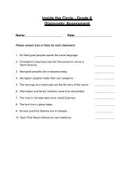
INFORMATION CARDS CANADA'S ABORIGINAL PEOPLES The ...
INFORMATION CARDS CANADA'S ABORIGINAL PEOPLES The ...
INFORMATION CARDS CANADA'S ABORIGINAL PEOPLES The ...

Create successful ePaper yourself
Turn your PDF publications into a flip-book with our unique Google optimized e-Paper software.
11) TUSCARORA - H, G, FM<br />
<strong>INFORMATION</strong>:<br />
• Canada’s most fertile region<br />
• lush, rolling land, rivers, streams<br />
• forests in the north<br />
• temperate, growing season is 140 days, therefore time to plant and cultivate<br />
crops of corn, beans, squash<br />
• animal resources used are deer, beaver, bear<br />
6. MACKENZIE / YUKON RIVER BASIN {SUBARCTIC}<br />
(Yukon, Northwest Territories, Nunavut)<br />
Principal Groups:<br />
1) CHIPEWEYAN - H - inhabited the largest amount of territory, area from northern<br />
Churchill River to Great Slave Lake<br />
2) BEAVER - H - south and west of Chipeweyan, in Peace River basin<br />
3) SLAVE (SLAVEYS) - H - between Great Slave Lake and the Mackenzie River<br />
4) YELLOWKNIFE - H - lakelands from east of Great Slave Lake to east shore of<br />
Great Bear Lake<br />
5) DOGRIB - H - southwest of the Yellowknife, land between the two Great lakes<br />
6) KUTCHIN - H, F - basins of the Pelly and Porcupine Rivers, interior Yukon<br />
7) HAN - H - southern Yukon<br />
8) TUTCHONE - H - southern Yukon<br />
9) SEKANI - H - eastern slopes of the Rocky Mountains, northern Alberta<br />
<strong>INFORMATION</strong>:<br />
• very harsh way of life<br />
• dark forests, barren land, swampy terrain (muskeg)<br />
• long, severe winters<br />
• animal resouces used are migratory animals, caribou, moose