FY2003 - Explore Nature - National Park Service
FY2003 - Explore Nature - National Park Service
FY2003 - Explore Nature - National Park Service

Create successful ePaper yourself
Turn your PDF publications into a flip-book with our unique Google optimized e-Paper software.
<strong>National</strong> <strong>Park</strong> <strong>Service</strong><br />
U.S. Department of the Interior<br />
Natural Resource Program Center<br />
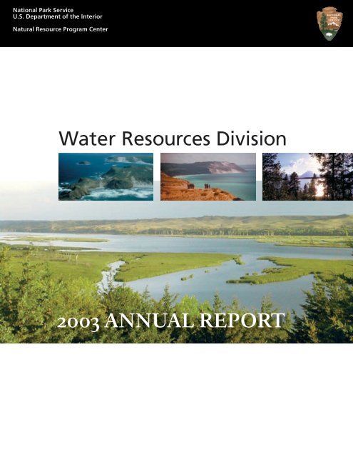
Water Resources Division<br />
2003 ANNUAL REPORT
Water Resources Division<br />
2003 ANNUAL REPORT<br />
Natural Resource Program Center<br />
1201 Oakridge Drive, Suite 250<br />
Fort Collins, CO 80525<br />
Natural Resources Report NPS/NRWRD/NRR-04/01<br />
<strong>National</strong> <strong>Park</strong> <strong>Service</strong><br />
U.S. Department of the Interior<br />
Washington, DC<br />
This entire publication, including useful embedded hyperlinks, is available in PDF format at:<br />
http://www.nature.nps.gov/water/wrdpub.htm<br />
front cover, large photo:<br />
Missouri <strong>National</strong> Recreational River (Jackson, 2003)<br />
front cover, inset photos:<br />
Channel Islands <strong>National</strong> Seashore, Sleeping Bear Dunes <strong>National</strong> <strong>Park</strong>, Grand Teton <strong>National</strong> <strong>Park</strong> (NPS)<br />
opposite: Black Canyon of the Gunnison <strong>National</strong> <strong>Park</strong> (NPS, 1993)
Flood on Clear Creek, Obed Wild and Scenic River (Hughes, 2002)<br />
The Water Resources Division of the <strong>National</strong> <strong>Park</strong> <strong>Service</strong> is responsible for<br />
providing water resources management policy and guidelines, planning, technical<br />
assistance, training, and operation support to units of the <strong>National</strong> <strong>Park</strong> System.<br />
Program areas include water rights, water resources planning, regulatory<br />
guidance and review, hydrology, water quality, watershed management,<br />
groundwater, fishery and marine resources management, and aquatic ecology.<br />
The <strong>National</strong> <strong>Park</strong> <strong>Service</strong> disseminates the results of biological, physical, and<br />
social research through the <strong>National</strong> Resources Technical Report Series. Natural<br />
resources inventories and monitoring activities, scientific literature reviews,<br />
bibliographies, and proceedings of technical workshops and conferences are also<br />
disseminated through this series.
CONTENTS<br />
A Word from the Associate Director<br />
Natural Resource Stewardship and Science.........................................................................7<br />
Comments from the Division Chief .................................................................................................... 8<br />
Washington Program Coordination Office................................................................................ 10<br />
Water Resources in <strong>National</strong> <strong>Park</strong>s Reference Collection ......................................................... 11<br />
Planning and Evaluation Branch Highlights ...................................................................... 12<br />
• Coral Reef Monuments Gain Momentum.............................................................................. 14<br />
• Wetland Mitigation Partnerships: Opportunities for Funding Wetland<br />
Restorations in <strong>National</strong> <strong>Park</strong>s................................................................................................ 15<br />
• Focus On The Future: Water Resources Planning In The Context Of Overall<br />
<strong>Park</strong> Planning........................................................................................................................... 17<br />
• Understanding Hydrologic Hazards in Wrangell-St. Elias <strong>National</strong> <strong>Park</strong> & Preserve .......... 18<br />
• Survey of Plankton in the Green River at Mammoth Cave <strong>National</strong> <strong>Park</strong> ........................... 20<br />
Water Operations Branch Highlights ................................................................................. 23<br />
• River Management on the Missouri....................................................................................... 24<br />
• Sensitivity and Detection Limits For Field Measurements .................................................... 26<br />
• Project To Develop A Summary Compendium Of Watershed Condition<br />
Assessment Methods............................................................................................................... 28<br />
• Assessing Flood Hazard in Channel Islands <strong>National</strong> <strong>Park</strong>.................................................... 29<br />
• Agency Collaboration in Support of Water Quality Monitoring ......................................... 30<br />
• WRD Completes Six Month Evaluation of Water Quality Monitoring Instruments............ 31<br />
• WRD Developing Database to Track Water Quality Performance Management<br />
for NPS and DOI Strategic Plans ............................................................................................. 33<br />
• Development of a River Bank Management Program – Cuyahoga Valley<br />
<strong>National</strong> <strong>Park</strong>........................................................................................................................... 34<br />
• <strong>Service</strong>wide Water Quality Information Management Program Update............................ 35<br />
• Baseline Water Quality Data Inventory and Analysis Report Procedures<br />
Redevelopment ....................................................................................................................... 36<br />
• NPS Partners to Create the High-Resolution <strong>National</strong> Hydrography Dataset ..................... 37<br />
Water Rights Branch Highlights ......................................................................................... 38<br />
• Pending Water Right Application – Chickasaw <strong>National</strong> Recreation Area.......................... 39<br />
• Paired Basin Study within Obed Wild and Scenic River Watershed to Assist in<br />
Determining the Impacts of Small Impoundments on Flow................................................. 40<br />
• Instream Flow Water Right for Rincon Creek at Saguaro <strong>National</strong> <strong>Park</strong>............................. 41<br />
• Collaborative Watershed Management in Progress at Sleeping Bear Dunes<br />
<strong>National</strong> Lakeshore ................................................................................................................. 43<br />
• Floodplain Decay Study on the Little Missouri River, Theodore Roosevelt<br />
<strong>National</strong> <strong>Park</strong>........................................................................................................................... 44<br />
• Status of the Black Canyon Water Right................................................................................ 46<br />
APPENDIX A - TECHNICAL ASSISTANCE.............................................................................. 49<br />
TECHNICAL ASSISTANCE - SERVICEWIDE.................................................................................... 49<br />
TECHNICAL ASSISTANCE - VITAL SIGNS MONITORING NETWORKS.......................................... 54
TECHNICAL ASSISTANCE - REGIONS AND PARKS ....................................................................... 57<br />
TECHNICAL ASSISTANCE PROVIDED BY NATURAL RESOURCE CHALLENGE<br />
AQUATIC RESOURCE FIELD PROFESSIONALS<br />
SERVICEWIDE ........................................................................................................................... 88<br />
REGION, NETWORK, AND PARK SUPPORT............................................................................. 88<br />
APPENDIX B - SUMMARY OF WATER RESOURCES DIVISION FUNDING:<br />
PROJECT AND PROGRAM ALLOCATIONS...................................................................... 97<br />
APPENDIX C – PUBLICATIONS / CONTRIBUTIONS / AWARDS ......................................... 118<br />
APPENDIX D – STAFF.......................................................................................................... 122<br />
Acadia <strong>National</strong> <strong>Park</strong> (NPS)
A Word from the Associate Director<br />
Natural Resource Stewardship and Science<br />
This annual report<br />
provides a summary of<br />
the 2003 accomplishments<br />
of the <strong>National</strong> <strong>Park</strong><br />
<strong>Service</strong>’s Water Resources<br />
Division. The Division<br />
provides <strong>Service</strong>wide<br />
program management,<br />
accountability, technical assistance,<br />
and policy guidance with respect to the<br />
preservation, protection, and management<br />
of water and aquatic resources of units of<br />
the <strong>National</strong> <strong>Park</strong> System. WRD provides<br />
its services directly to parks through a broad<br />
range of programs in the areas of water<br />
rights; water quality; floodplain management;<br />
groundwater analysis; watershed and<br />
wetlands protection and restoration; water<br />
resources management planning; fisheries<br />
and marine resources management;<br />
policy, legislative, and regulatory analysis;<br />
information management; and training. The<br />
Division’s work plan is developed from the<br />
annual <strong>Service</strong>wide Comprehensive Call and<br />
an annual technical assistance call to identify<br />
park needs, which in turn determines WRD’s<br />
priorities. In addition to direct support<br />
to parks, the Division provides day-today<br />
support to regional offices, networks,<br />
and the Washington office in addressing<br />
water resources issues facing the NPS. The<br />
Division is located in Fort Collins, Colorado,<br />
with additional offices in Denver, Colorado,<br />
and Washington, D.C.<br />
I am extremely pleased with the<br />
accomplishments of the Water Resources<br />
Division reflected in this annual report.<br />
As with each succeeding year, these<br />
accomplishments are indicative of the<br />
professionalism of the Division and of<br />
its ability to work cooperatively with<br />
Mike Soukup, Ph.D.<br />
management and staff of parks, support<br />
offices, regional offices, and the Washington<br />
office on water resource issues. I continue to<br />
believe that WRD provides a model for cost<br />
effective, centralized support for the vast<br />
majority of parks that do not have the range<br />
of water resource technical expertise they<br />
need.<br />
Much of this year’s success can be<br />
attributed to the continued significant<br />
support from Congress for the Natural<br />
Resource Challenge. The Challenge will<br />
enable the <strong>Service</strong> to make major strides in<br />
preserving, protecting and understanding<br />
water resources of the <strong>National</strong> <strong>Park</strong><br />
System. The Challenge has been effective in<br />
garnering budget increases for water quality<br />
monitoring, water resources protection and<br />
restoration projects, watershed condition<br />
assessments, and additional park-based<br />
aquatic resource professionals. I continue<br />
to be very pleased with the leadership role<br />
that the Water Resources Division has played<br />
in developing and guiding implementation<br />
of the water resources component of<br />
the Challenge and providing program<br />
accountability to Congress.<br />
And kudos for this year’s accomplishments<br />
are particularly well deserved given that Dan<br />
Kimball, a pillar of strength in the Division,<br />
has been moved to accept the challenge<br />
of new opportunities in the <strong>Service</strong>. As<br />
we “forge ahead,” a well-spoken phrase of<br />
Dan’s, we continue to miss his competent<br />
professional management style.<br />
Water Resources Division Annual Report–2003 7
8<br />
Comments from the Division Chief<br />
This past year the Water<br />
Resources Division<br />
continued to emphasize<br />
the implementation of new<br />
programs resulting from<br />
the Natural Resources<br />
Challenge. In FY 2003,<br />
a funding increase was<br />
received to support three additional<br />
aquatic resource professionals, bringing<br />
the number of new professionals in the<br />
field to a total of sixteen. Funding was also<br />
received to support watershed assessments<br />
in parks, and water quality monitoring in<br />
five additional <strong>Park</strong> Vital Signs Networks.<br />
The accomplishments achieved with these<br />
increases and previous Challenge increases<br />
are discussed throughout this report. The<br />
Division also continued to provide the<br />
highest level of support possible to parks<br />
in addressing a wide variety of water and<br />
aquatic resources-related issues. Significant<br />
accomplishments of the Division for FY 2003<br />
include:<br />
• Issued Directors Order #77-2: Floodplain<br />
Management and accompanying<br />
Procedural Manual, and re-issued<br />
Director’s Order #77-1: Wetland<br />
Protection.<br />
• Completed Water Resources<br />
Management Plans for Sleeping Bear<br />
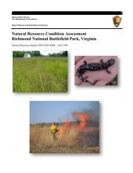
Dunes <strong>National</strong> Lakeshore, Richmond<br />
<strong>National</strong> Battlefield <strong>Park</strong>, Hagerman<br />
Fossil Beds <strong>National</strong> Monument and New<br />
River Gorge <strong>National</strong> River/Gauley River<br />
<strong>National</strong> Recreation Area/Bluestone<br />
<strong>National</strong> Scenic River, and completed<br />
Water Resources Scoping Reports for<br />
Wrangell-St. Elias <strong>National</strong> <strong>Park</strong> &<br />
Preserve, Boston Harbor Islands <strong>National</strong><br />
Recreation Area, and Petrified Forest<br />
Dan Kimball<br />
<strong>National</strong> <strong>Park</strong>.<br />
• Developed technical portions of Fisheries<br />
Management Plans for Amistad <strong>National</strong><br />
Recreation Area, Biscayne <strong>National</strong> <strong>Park</strong>,<br />
and North Cascades <strong>National</strong> <strong>Park</strong>.<br />
• Developed a technical guideline for<br />
coral reef restoration actions and a<br />
programmatic Environmental Impact<br />
Statement for reef restoration work in<br />
cooperation with the NPS Coral Reef<br />
Restoration Advisory Team.<br />
• Evaluated alternative discharge locations<br />
for the Las Vegas sewage treatment plant<br />
at Lake Mead.<br />
• Participated on a team evaluating water<br />
supply alternatives in remote areas of ten<br />
NPS units including Dinosaur <strong>National</strong><br />
Monument, Grand Teton <strong>National</strong> <strong>Park</strong>,<br />
Buffalo <strong>National</strong> River, and Capitol Reef<br />
<strong>National</strong> <strong>Park</strong>.<br />
• Provided technical and policy assistance<br />
to C & O Canal <strong>National</strong> Historical <strong>Park</strong><br />
and the <strong>National</strong> Capital Region during<br />
the permit process for discharges of the<br />
Washington Aqueduct.<br />
• Prepared technical assessments in<br />
support of numerous aquatic resource<br />
restoration projects including spring<br />
restoration (Big Bend <strong>National</strong> <strong>Park</strong>,<br />
Death Valley <strong>National</strong> <strong>Park</strong>), wetland<br />
restoration (Minuteman <strong>National</strong><br />
Historic Site, Saratoga <strong>National</strong><br />
Battlefield, Rocky Mountain <strong>National</strong><br />
<strong>Park</strong>, Grand Teton <strong>National</strong> <strong>Park</strong>, and<br />
Moores Creek <strong>National</strong> Battlefield), playa<br />
restoration (Big Bend <strong>National</strong> <strong>Park</strong>),<br />
disturbed land restoration (Golden Gate<br />
<strong>National</strong> Recreation Area), and stream<br />
restoration and stabilization (numerous<br />
parks).<br />
• Evaluated flood mitigation alternatives<br />
at Manzanita <strong>National</strong> Historic Site, and<br />
<strong>National</strong> <strong>Park</strong> <strong>Service</strong>
assisted in the development of a flood<br />
warning system at Haleakala <strong>National</strong><br />
<strong>Park</strong>.<br />
• Participated in the development of the<br />
Colorado River Annual Operating Plan.<br />
• Assisted the Department of the Interior<br />
in securing a settlement agreement that<br />
sets a course to secure water rights for the<br />
Black Canyon of the Gunnison <strong>National</strong><br />
<strong>Park</strong> in Colorado.<br />
• Secured final Snake River basin<br />
adjudication decree for water rights at<br />
City of Rocks <strong>National</strong> Preserve in Idaho.<br />
• Collaborated with other Interior and<br />
non-federal interests to advance the<br />
level of scientific information available<br />
to decision-makers for ground water<br />
systems in southern Nevada to protect<br />
resources at Lake Mead <strong>National</strong><br />
Recreation Area and Death Valley<br />
<strong>National</strong> <strong>Park</strong>.<br />
• Assisted Saguaro <strong>National</strong> <strong>Park</strong> to initiate<br />
efforts to secure protection for instream<br />
flows in Rincon Creek under Arizona law.<br />
The many new programs made possible<br />
through the Natural Resource Challenge<br />
have greatly enhanced the <strong>Service</strong>’s<br />
capabilities to address water resource<br />
management issues. They have also greatly<br />
increased WRD’s responsibility to effectively<br />
manage these programs and account for the<br />
many substantive program accomplishments.<br />
That being said, WRD’s “bread and butter”<br />
has always been the high level of technical<br />
support provided directly to parks, and<br />
we will continue to remain focused on<br />
the mission of preserving, protecting, and<br />
managing water resources in units of the<br />
<strong>National</strong> <strong>Park</strong> System.<br />
On a personal note, new opportunities<br />
with the <strong>Service</strong> have taken me away<br />
from the daily operation of the Water<br />
Resources Division. As I pursue these new<br />
opportunities, I continue to keep abreast<br />
of the Division’s activities and know that<br />
the Division is in good hands of the acting<br />
Division Chiefs Bill Jackson and Chuck<br />
Pettee.<br />
Grand Teton <strong>National</strong> <strong>Park</strong><br />
(NPS)<br />
Riverway through<br />
Sleeping Bear Dunes<br />
<strong>National</strong> Lakeshore<br />
(NPS)<br />
Death Valley<br />
<strong>National</strong> <strong>Park</strong> (NPS)<br />
Water Resources Division Annual Report–2003 9
10<br />
Washington Program Coordination Office<br />
During 2003 the Washington Program<br />
Coordination Office emphasized providing<br />
effective support to the Associate Director<br />
for Natural Resources Stewardship and<br />
Science. The Washington office continued<br />
to be excited by the opportunities provided<br />
NPS by the many new Natural Resource<br />
Challenge programs, while working closely<br />
with the parks and Regions to provide<br />
accountability for those programs to OMB<br />
and the Congress. While new programs<br />
and policy priorities present day to day<br />
challenges, we strive to maintain the<br />
preservation of park resources as our guiding<br />
focus and securing the integrity of park<br />
natural resource programs as our goal.<br />
The Program Office continued to be deeply<br />
involved in the Clean Water Act permit<br />
for the Washington Aqueduct, the water<br />
treatment facilities that provide drinking<br />
water to about one million Washington, D.C.<br />
and Northern Virginia consumers. The<br />
interpretation and use of good science and<br />
a detailed evaluation of legal options played<br />
important roles in shaping the final permit<br />
and its impact on park resources and the<br />
aquatic resources of the Potomac River.<br />
The Program Office also became immersed<br />
in a major new Departmental program<br />
called the Cooperative Conservation<br />
Initiative. The initiative brought new<br />
funding for the <strong>National</strong> <strong>Park</strong> <strong>Service</strong><br />
for cost-shared conservation projects<br />
that address unfunded natural resource<br />
restoration needs or problems. The Program<br />
Office assisted in developing guidance for<br />
program implementation and in the review<br />
of partnership projects to be funded through<br />
this new funding source.<br />
Sharon Kliwinski<br />
As the aquatic resource professional staff<br />
grew in the field, we were fortunate to<br />
welcome a new employee, Elizabeth Crisfield,<br />
to the Washington, DC staff. Elizabeth<br />
serves as the water resources liaison for<br />
Everglades <strong>National</strong> <strong>Park</strong> and will track and<br />
help on issues arising from South Florida<br />
ecosystem restoration. Elizabeth brings to<br />
the Washington office a long needed staff<br />
level professional capability focused on<br />
South Florida ecosystem restoration, one of<br />
the largest restoration projects in the world.<br />
In summary, as we work through the<br />
opportunities and challenges presented in<br />
2003 we look forward to continuing to serve<br />
the <strong>National</strong> <strong>Park</strong> <strong>Service</strong> in 2004.<br />
<strong>National</strong> <strong>Park</strong> <strong>Service</strong>
Water Resources in <strong>National</strong> <strong>Park</strong>s Reference Collection<br />
Since it’s inception in 1984, the primary<br />
function of the Collection has been to<br />
provide technical information and assistance<br />
to the Water Resources Division. This<br />
in-house Collection has proven to be an<br />
invaluable resource to WRD staff in their<br />
efforts to manage the water resources of our<br />
<strong>National</strong> <strong>Park</strong>s.<br />
This unique Collection contains individual<br />
articles, entire publications, unpublished<br />
reports, water resources management plans,<br />
water quality data, water resources scoping<br />
reports, technical reports, well logs, slides,<br />
photos, and maps. Information can be found<br />
on an individual park’s water quality, ground<br />
water resources, flood risks, and special<br />
water-related studies. This information<br />
often serves as good starting point when<br />
addressing site-specific water resources<br />
issues as well as more broadly-based water<br />
resource management planning projects.<br />
Diverse examples include:<br />
• An original copy of the 1912 Hetch Hetchy<br />
proposal for Yosemite NP;<br />
• “Hydrologic Data Collected During the<br />
1994 Lake Mills Drawdown Experiment,<br />
Elwha River, Washington” (Olympic NP);<br />
• “Hydrogeologic Investigation of Sinking<br />
Spring” (done by a volunteer at Abraham<br />
Lincoln Birthplace NHS);<br />
• a 1903 map of the original 33 springs at<br />
Platte <strong>National</strong> <strong>Park</strong> (now Chickasaw<br />
NRA); and<br />
• a wide collection of well information,<br />
including driller logs, yield tests, etc.<br />
Over the years the Collection has expanded<br />
from its original scope to include materials<br />
on marine resources and fisheries. With this<br />
expansion came a necessity to organize,<br />
Laura Harte, Collection Archivist<br />
Office of the Division Chief<br />
manage and provide reference assistance<br />
of the Collection to the Division staff. In<br />
2001, the Water Resources Division hired<br />
an Archivist to implement the necessary<br />
changes, as well as manage and maintain<br />
the collection. Since then the Collection has<br />
continued to expand its resources and its<br />
services.<br />
In 2003 Collection materials were reviewed<br />
to determine if they were within the scope of<br />
the Collection and if they were accessioned<br />
into the Collection’s database. As a result<br />
much of the Collection’s database and<br />
Collection materials have been edited,<br />
accessioned, and reorganized. Additionally,<br />
work is being conducted to incorporate the<br />
Collection’s database into the <strong>National</strong> <strong>Park</strong>’s<br />
<strong>Nature</strong>Bib database. This will enable NPS<br />
staff <strong>Service</strong>wide and partners to view the<br />
Collections holdings. Collection services<br />
provided have expanded to include research<br />
assistance to on- and off-site hydrologists,<br />
bibliographical assistance to Inter-agency<br />
and outside agencies (both nationally and<br />
internationally), and the compilation of<br />
requested materials. An inter-library loan<br />
service has been established to enable NPS<br />
staff to acquire or borrow materials from<br />
other agencies, publishers, and libraries. In<br />
the coming year, the Collection will expand<br />
further with the addition of a Collection<br />
map room. This room is being established to<br />
accommodate the ever growing Collection.<br />
The goal for 2004 is to continue to organize,<br />
expand and manage the Collection, while<br />
providing prompt, professional assistance to<br />
WRD Staff and all other inquiring parties.<br />
Water Resources Division Annual Report–2003 11
12<br />
PLANNING AND EVALUATION<br />
BRANCH HIGHLIGHTS<br />
Mark Flora, Chief<br />
Planning and Evaluation Branch<br />
Planning and Evaluation Branch (PEB)<br />
activities in FY 2003 were focused upon<br />
developing <strong>Service</strong>wide policy and guidance<br />
for the protection of wetlands, fisheries,<br />
and marine resources; developing a coastal<br />
watershed condition assessment strategy and<br />
initiating pilot coastal watershed condition<br />
assessments; providing programmatic<br />
oversight and accountability for more than 60<br />
NRPC-funded projects; and providing direct<br />
support to NPS units in the areas of water<br />
resources planning, wetlands protection and<br />
restoration, fisheries management, and marine<br />
resources conservation.<br />
In the policy and regulatory arena, PEB is<br />
pleased to report that NPS Director Fran<br />
Mainella re-issued Director’s Order #77-1<br />
on October 30, 2002. This Director’s Order<br />
provides updated guidance and procedures<br />
for wetland protection within the <strong>National</strong><br />
<strong>Park</strong> <strong>Service</strong>. During the year, PEB staff<br />
also completed the “Wetlands” section<br />
of the NPS Interim Technical Guidance<br />
on Assessing Impacts and Impairment to<br />
Natural Resources, participated in activities<br />
of the NPS Coral Reef Advisory Team to<br />
develop <strong>Service</strong>wide guidelines for coral<br />
reef restoration, and worked closely with the<br />
NPS Office of Policy and Regulation and the<br />
Department of the Interior (DOI) Solicitor<br />
on developing interim regulations reflecting<br />
critical changes for the management and<br />
protection of coral reef resources within<br />
the <strong>National</strong> <strong>Park</strong> system. PEB staff also<br />
provided Assistant Secretary Manson with<br />
a briefing paper detailing current NPS<br />
strategies to protect manatees in several<br />
NPS units, organized a meeting between<br />
NPS law enforcement and NOAA <strong>National</strong><br />
Marine Sanctuary Program personnel to<br />
facilitate greater cooperation in enforcement<br />
activities, and developed end and<br />
intermediate outcome goals and measures for<br />
the wetlands, riparian, fisheries, and marine<br />
resource elements of the DOI’s Strategic Plan.<br />
During the year, PEB staff has provided<br />
programmatic oversight, technical review<br />
and guidance for more than 60 WRD or<br />
NRPC-funded projects relating to water<br />
resources planning, wetlands protection<br />
and restoration, fisheries management, and<br />
marine resources conservation. Included<br />
in this task is providing appropriate fiscal<br />
oversight and accountability for the $4.7<br />
million of Natural Resource Challenge<br />
funding (multi-year total) allocated to<br />
support these projects.<br />
PEB staff has also provided the lead for<br />
the regulatory review and approval of 14<br />
wetlands statement of findings, <strong>Service</strong>wide<br />
review and comments on 15 EIS/EA<br />
environmental compliance documents,<br />
and NPS policy review of the water-related<br />
aspects of 28 NPS planning documents<br />
(primarily General Management Plans and<br />
Special Resource Studies).<br />
Accomplishments during the year were<br />
numerous and several are highlighted in the<br />
following articles. Of particular note, PEB’s<br />
Water Resources Planning Program was<br />
successful in completing Water Resources<br />
Management Plans for Richmond <strong>National</strong><br />
Battlefield and Hagerman Fossil Beds<br />
<strong>National</strong> Monument, as well as assisting with<br />
the completion of Water Resources Scoping<br />
Reports for Wrangell-St Elias <strong>National</strong> <strong>Park</strong><br />
and Preserve and Petrified Forest <strong>National</strong><br />
<strong>Park</strong>. PEB’s Wetlands Protection and<br />
Restoration Program participated in wetland<br />
restoration activities for the Snake River<br />
Gravel Mine (Grand Teton <strong>National</strong> <strong>Park</strong>/<br />
John D. Rockefeller, Jr., Memorial <strong>Park</strong>way),<br />
the Glacier Creek Livery (Rocky Mountain<br />
<strong>National</strong> <strong>Park</strong>), the Hidden Valley Ski Area<br />
(Rocky Mountain <strong>National</strong> <strong>Park</strong>), and the<br />
<strong>National</strong> <strong>Park</strong> <strong>Service</strong>
Pine Savanna Restoration Project (Moores<br />
Creek <strong>National</strong> Battlefield). The Fisheries<br />
Management and Marine Conservation<br />
Program has been actively overseeing<br />
fisheries population and habitat restoration<br />
activities in a number of parks, working<br />
with States in the cooperative development<br />
of several Fisheries Management Plans, and<br />
assessing and supporting opportunities for<br />
the cooperative establishment of marine<br />
protected areas.<br />
PEB staff has also provided the<br />
lead...and NPS policy review of<br />
the water-related aspects of 28<br />
NPS planning documents.<br />
In addition, the Fisheries Management and<br />
Marine Conservation Program developed a<br />
coastal watershed assessment strategy in FY<br />
2003 and initiated Phase I coastal watershed<br />
assessment pilot studies for eight South<br />
Atlantic and Gulf Coast units of the <strong>National</strong><br />
<strong>Park</strong> system, including Cape Hatteras<br />
<strong>National</strong> Seashore, Cape Lookout <strong>National</strong><br />
Seashore, Cumberland Island <strong>National</strong><br />
Seashore, Fort Pulaski <strong>National</strong> Monument,<br />
Timucuan Ecological and Historic Preserve,<br />
Gulf Islands <strong>National</strong> Seashore, and Padre<br />
Island <strong>National</strong> Seashore.<br />
PEB is also proud of the numerous<br />
opportunities we have had to serve parks<br />
directly by providing technical support<br />
at the request of park staff. More than 60<br />
opportunities to work directly with park<br />
and regional staffs in activities ranging from<br />
issues assessment and proposal development<br />
to implementation of new field techniques are<br />
summarized in a later section of this report.<br />
The Planning and Evaluation Branch is<br />
honored to be part of the <strong>National</strong> <strong>Park</strong><br />
<strong>Service</strong> and looks forward to being of<br />
continued service to the units of the <strong>National</strong><br />
<strong>Park</strong> system during FY 2004.<br />
Cape Hatteras<br />
<strong>National</strong> Seashore (NPS)<br />
Water Resources Division Annual Report–2003 13
14<br />
Coral Reef Monuments<br />
Gain Momentum<br />
Cliff McCreedy,<br />
Marine Management Specialist<br />
Planning and Evaluation Branch,<br />
Washington, D.C.<br />
On February 27, 2003, Secretary of the<br />
Interior Gale A. Norton announced that<br />
regulations to protect the new Virgin<br />
Islands Coral Reef <strong>National</strong> Monument and<br />
the expanded Buck Island Reef <strong>National</strong><br />
Monument would go forward. Her statement<br />
at the U.S. Coral Reef Task Force meeting in<br />
Washington, D.C., marked a critical change<br />
in management and protection of coral<br />
reefs in the Virgin Islands parks. The new<br />
monuments were created by Presidential<br />
Proclamations in January 2001 to restore<br />
these coral reef ecosystems and replenish<br />
fish and shellfish populations. Designed to be<br />
managed as fully protected marine reserves,<br />
the monuments finally became effective<br />
with Secretary Norton’s announcement and<br />
promulgation of regulations in May 2003.<br />
“The conservation of our coral reefs is a<br />
high priority at the Interior Department,”<br />
Secretary Norton said. “These ‘rain forests<br />
of the sea’ are not only breathtaking but they<br />
are also storehouses of immense biological<br />
wealth. We will be protecting them against<br />
damage by careless boat anchoring and<br />
all extractive uses except some traditional<br />
fishing.”<br />
WRD Marine Management Specialist Cliff<br />
McCreedy worked closely with NPS Office<br />
of Policy and Regulations on finalizing the<br />
regulations and Notices of Intent for General<br />
Management Plans for the new monuments<br />
and Virgin Islands <strong>National</strong> <strong>Park</strong>.<br />
Elkhorn coral (Acropora palmata) at Virgin Islands<br />
<strong>National</strong> <strong>Park</strong> (M. Patterson, 2002)<br />
The new 12,708-acre (5,147-ha) Virgin<br />
Islands Coral Reef <strong>National</strong> Monument was<br />
established to increase protection of marine<br />
resources adjacent to Virgin Islands <strong>National</strong><br />
<strong>Park</strong> on St. John, while the Buck Island<br />
Reef <strong>National</strong> Monument on St. Croix was<br />
expanded from 880 acres (356 ha) to more<br />
than 19,000 acres (7,695 ha). Recreational<br />
boating, snorkeling, and SCUBA diving are<br />
encouraged, but anchoring requires a permit<br />
at Buck Island Reef <strong>National</strong> Monument, and<br />
is not allowed at Virgin Islands Coral Reef<br />
<strong>National</strong> Monument. Fishing for blue runner<br />
and baitfish in limited portions of Virgin<br />
Islands Coral Reef <strong>National</strong> Monument is the<br />
only form of fishing allowed.<br />
Two recent joint studies by Dr. Caroline<br />
Rogers of the U.S. Geological Survey and Dr.<br />
Jim Beets of Jacksonville University identified<br />
low biomass and numbers of species and<br />
individuals of finfish and shellfish. Ironically,<br />
Rogers and Beets reached the conclusion<br />
that species composition and numbers of<br />
fish, lobsters, and conch are no greater inside<br />
Virgin Islands <strong>National</strong> <strong>Park</strong>, where one<br />
would expect greater species protection, than<br />
outside park boundaries.<br />
In 2003, McCreedy worked with Buck Island<br />
Reef NM Chief of Resources Zandy Hillis-<br />
Starr in developing a survey strategy and<br />
Natural Resource Preservation Program<br />
<strong>National</strong> <strong>Park</strong> <strong>Service</strong>
(NRPP) proposal to assess the condition<br />
and possible recovery of coral reef fish and<br />
invertebrates in the Buck Island Reef no-take<br />
marine reserve. Success of these new reserves<br />
greatly depends on effective monitoring,<br />
enforcement and scientific evaluation of their<br />
performance over time. Funding from the<br />
NRPP program will support the Buck Island<br />
project and its collaboration with NOAA.<br />
Biotech Kimberly Woody records sizes of conchs at<br />
Buck Island Reef <strong>National</strong> Monument (P.A. Mayor,<br />
2003)<br />
Scientific collaborations and interagency<br />
partnerships will be critically important<br />
to NPS ocean park managers. Hillis-Starr<br />
and scientists with the <strong>National</strong> Oceanic<br />
and Atmospheric Administration’s (NOAA)<br />
NCCOS Biogeography Program have been<br />
collaborating since January 1999 to map<br />
and document benthic habitats and marine<br />
species in the existing and expanded Buck<br />
Island Reef area. In 2004 they will intensify<br />
their work, using a NOAA research vessel,<br />
equipment, and scientists. Virgin Islands<br />
Coral Reef <strong>National</strong> Monument plans similar<br />
surveys of fish and invertebrate populations.<br />
These efforts will evaluate coral health,<br />
document previously harvested species of<br />
fish and marine invertebrates, and shed light<br />
on their possible recovery in the reserves.<br />
All the Virgin Islands parks are highly<br />
popular destinations for tourists to<br />
enjoy beautiful landscapes above and<br />
below water. Each is developing general<br />
management plans (GMP) beginning in<br />
2004. Development of GMPs and outreach<br />
and education will be critical to designing<br />
the future of these parks in collaboration<br />
with fishers, local communities, the tourism<br />
industry, and the Virgin Islands territorial<br />
government.<br />
Wetland Mitigation Partnerships:<br />
Opportunities for Funding<br />
Wetland Restorations in<br />
<strong>National</strong> <strong>Park</strong>s<br />
Kevin F. Noon, Ph.D. PWS<br />
Planning and Evaluation Branch<br />
There is renewed interest in improving park<br />
water resources by working beyond park<br />
boundaries, within the entire watershed, in<br />
order to effect positive changes. <strong>Park</strong>s are<br />
creating partnerships with public and private<br />
entities in efforts to tap into the constant<br />
source of compensation funding produced by<br />
the wetland protection and mitigation permit<br />
processes. Local, state, and federal wetland<br />
protection statutes require compensatory<br />
mitigation for permitted impacts to wetlands.<br />
If alternatives are shown to be ecologically<br />
superior, the permittees can compensate<br />
within the watershed, off site of where<br />
the impact occurs. If a park is in the same<br />
watershed and park resource managers are<br />
aware of their wetland restoration needs,<br />
then they can sometimes work with the<br />
permittees to complete the restoration on<br />
park property at no cost to the park.<br />
Water Resources Division Annual Report–2003 15
Manassas Battlefield: Wetland Restoration<br />
(Bryan Gorsira 6/03)<br />
The restoration being done by the<br />
Smithsonian Institute at Manassas <strong>National</strong><br />
Battlefield <strong>Park</strong> is a great example. The<br />
Institute is creating a new facility that will<br />
impact wetlands at Dulles Airport, which<br />
is within the same watershed as the park.<br />
Bryan Gorsira, Natural Resource Program<br />
Manager, worked with Institute staff to find<br />
an appropriate compensatory mitigation site<br />
within the park. The Institute has funded the<br />
complete restoration to its 1862 condition of a<br />
park-owned, 104-acre site (of which 45 acres<br />
are wetland).<br />
The Manassas project is an example of<br />
how parks can have their critical habitats<br />
restored by an individual partner in need<br />
of compensation credit. In watersheds with<br />
numerous partners in need of compensation,<br />
a third party partner can establish a<br />
mitigation bank on park land to satisfy the<br />
compensation demand.<br />
The banking concept is simple. As part<br />
of the U.S. Army Corps of Engineers 404<br />
permit process, land developers that destroy<br />
wetlands in and around the watershed are<br />
required to compensate for the loss. Wetland<br />
bank sponsors restore the physical and<br />
ecological functions of a degraded wetland<br />
within the park, and the Corps grants the<br />
sponsor credits for the improvements. Land<br />
16<br />
developers can purchase the credits they<br />
need from a bank in order to compensate for<br />
wetland losses incurred at their development<br />
sites.<br />
The advantage of this program is that it<br />
concentrates the resources that would<br />
ordinarily be dedicated to creating small,<br />
scattered, wetland restorations into one<br />
large, well planned restoration bank project.<br />
The restoration is funded, constructed,<br />
monitored, and managed for several years by<br />
the bank sponsor; the park retains ownership<br />
of the restored wetland; the park maintains<br />
controlling interest in the project design<br />
and construction; and the quality of the<br />
restoration is guaranteed by the banking<br />
process.<br />
Manassas Battlefield: Wetland Restored<br />
(Bryan Gorsira 10/03)<br />
The banking approach to restoring a park’s<br />
resources is especially applicable at Prince<br />
William Forest <strong>Park</strong>, which occupies<br />
approximately 58 percent of the Quantico<br />
Creek watershed in Prince William County,<br />
Virginia. Because of its management<br />
responsibility, the park tries to influence the<br />
change in surrounding watershed land uses<br />
in order to effect positive environmental<br />
influences on the park. George Liffert,<br />
Resource Protection Specialist, recognized<br />
the opportunity to improve the conditions<br />
of the entire watershed. George requested<br />
help from WRD in implementing a wetland<br />
<strong>National</strong> <strong>Park</strong> <strong>Service</strong>
mitigation banking program that would<br />
allow the park to improve wetland conditions<br />
in the park and in the surrounding subwatersheds<br />
that affect the park.<br />
One option is to create a wetland mitigation<br />
bank (completed by a sponsor) comprised<br />
of wetlands restored within the park, but<br />
the park does not have enough restoration<br />
area opportunity to attract a third party<br />
banker. The second option is to create a<br />
preservation bank that would be designed to<br />
use credit sale funds to preserve undeveloped<br />
adjacent land. The results would benefit<br />
the park indirectly and the watershed<br />
directly. Although preservation banks were<br />
considered, the park preferred to pursue the<br />
third option–to improve the health of the<br />
fish habitat in Quantico Creek, positively<br />
affecting the PRWI park watershed fishery.<br />
We identified an opportunity for a banker to<br />
restore 300 feet of riverine wetlands located<br />
downstream from the park and recover their<br />
construction costs and profits by selling<br />
credits.<br />
As with many of our parks, we anticipate<br />
that incremental loss of wetlands from<br />
surrounding land development will<br />
continue to adversely impact watershed<br />
health and the health of park resources.<br />
Producing successful change beyond<br />
park boundaries requires motivation and<br />
resourcefulness from park staff in their<br />
search for the right opportunities and<br />
partners. <strong>Park</strong> staff should continue to think<br />
outside the park by identifying opportunities<br />
to implement wetland banking and other<br />
collaborative partnerships with private and<br />
public entities.<br />
Focus On The Future: Water<br />
Resources Planning<br />
In The Context Of Overall <strong>Park</strong><br />
Planning<br />
David L. Vana-Miller, Water Resources<br />
Planning Program Team Leader<br />
Don P. Weeks, Hydrologist<br />
Planning and Evaluation Branch<br />
The Water Resources Planning Program has<br />
been operating essentially the same since<br />
1991 with the continued development of<br />
Water Resources Issues Overviews, Water<br />
Resources Scoping Reports, and Water<br />
Resources Management Plans (WRMPs)<br />
for units across the national park system.<br />
While this program has been successful,<br />
all programs need an opportunity for selfevaluation<br />
and to make sure that their<br />
customers are satisfied with all aspects of the<br />
program.<br />
We actually began this review with a special<br />
session at the 1999 George Wright Society.<br />
The objective of that session was to evaluate<br />
how well WRMPs satisfied the needs of<br />
particular parks (e.g., SACR, COLO, ACAD,<br />
BICY) once they were implemented over<br />
several years. The results of that session<br />
combined with our own research and<br />
evaluation since 1999 have convinced us<br />
that our small planning program must<br />
evolve to meet our customer’s needs. This<br />
realization became more evident with<br />
recent changes in NPS planning (update<br />
of <strong>Park</strong> Planning Program Standards) and<br />
resource planning (draft Director’s Order<br />
2.1: Resource Stewardship Planning). These<br />
changes propose new planning documents,<br />
such as Foundation for <strong>Park</strong> Planning and<br />
Management, Program Management Plans,<br />
Resource Stewardship Plans, and a host of<br />
new terminology to be added to the lexicon<br />
of NPS planning, such as fundamental<br />
resources and values and fundamental<br />
desired future conditions. Our review of<br />
Water Resources Division Annual Report–2003 17
these recent changes to NPS planning<br />
suggests that, on average, our products<br />
seamlessly fit in with the overall planning<br />
scheme, albeit with different emphasis and<br />
objectives. We need to flesh out further<br />
the ‘fit’ of our planning products into this<br />
new planning scheme. This may require<br />
revisions of our products to better meet<br />
goals and objectives; re-emphasizing some<br />
of our products that appear to meet the<br />
objectives of these new planning documents;<br />
and an analysis of the way(s) that our<br />
planning program dovetails with this new<br />
understanding of NPS planning.<br />
Currently, we envision that the Planning<br />
Program’s signature product will be the<br />
Water Resources Scoping Report – the Water<br />
Resources Management Plan previously<br />
had that role. The Scoping Report will<br />
have a new section that describes the<br />
recommendations for future action that<br />
address the water resource issues delineated<br />
in the report. Individual parks can then<br />
compete for funding to define a cohesive<br />
water resources management program via<br />
the development of project statements for<br />
those recommendations. Additionally, our<br />
Water Resources Issues Overview is currently<br />
underused; however, this product could be<br />
an appropriate vehicle to accommodate the<br />
objectives in the Foundation document and<br />
Resource Stewardship Plans. During this fiscal<br />
year, we hope to solidify our thoughts such<br />
that we have a schematic view of our program<br />
and how it integrates into overall park<br />
planning. This schematic view would provide<br />
the basis for the development of water<br />
resource planning program standards and,<br />
ultimately, ‘new’ water resource planning<br />
guidelines.<br />
18<br />
Understanding Hydrologic Hazards<br />
in Wrangell-St. Elias <strong>National</strong> <strong>Park</strong><br />
and Preserve<br />
Don Weeks, Hydrologist<br />
Planning and Evaluation Branch<br />
In response to a technical assistance request<br />
by Wrangell-St. Elias <strong>National</strong> <strong>Park</strong> and<br />
Preserve (WRST), the NPS Water Resources<br />
Division completed a Water Resources<br />
Scoping Report for WRST in 2003. WRST is<br />
the largest unit of the <strong>National</strong> <strong>Park</strong> system<br />
at 13.2 million acres. Here the Chugach,<br />
Wrangell, and St. Elias mountain ranges<br />
converge, producing the continent’s largest<br />
assemblage of glaciers and greatest collection<br />
of peaks above 16,000 feet (msl). These, in<br />
turn, spawn numerous fluvial systems at<br />
lower elevations. The park’s water resources<br />
are diverse and extensive, including<br />
wetlands, glaciers, icefields, marine coast,<br />
ground water, thermal springs, lakes, and<br />
large river systems.<br />
Some of the more unique water-related<br />
issues captured in the scoping report<br />
are the hazards associated with natural<br />
hydrological processes. Lake outburst floods<br />
(jökulhlaups), landslides, snow avalanches,<br />
and advancing glacial systems are scattered<br />
throughout WRST and threaten property,<br />
transportation links, and human life.<br />
In 2002, while flying in WRST with staff,<br />
we observed a flooded Tana River (Figure 1)<br />
when adjacent drainages were at relatively<br />
lower August-flow conditions. Flying<br />
upstream and over the glaciers that feed the<br />
drainage, we located the source; an empty<br />
Iceburg Lake that had just experienced<br />
a jökulhlaup, fueling the floodwaters of<br />
the Tana River. The lake is dammed by a<br />
glacier (Figure 3) with no historical record of<br />
draining prior to 1999. To witness this event<br />
from the air produced a new appreciation of<br />
the raw power, danger, and unpredictable<br />
nature of this particular hazard.<br />
<strong>National</strong> <strong>Park</strong> <strong>Service</strong>
Enlargement of the<br />
survey airplane<br />
gives a sense of scale<br />
Figure 1. Tana River at flood stage<br />
(Weeks, 2002)<br />
Figure 2. An empty Iceburg Lake (looking upgradient), where stranded icebergs<br />
outline some of the original shoreline (Weeks, 2002)<br />
Figure 3. Iceberg Lake looking down gradient toward the glacial ice dam (Weeks, 2002)<br />
Water Resources Division Annual Report–2003 19
Another hazard that occurred during the<br />
2002 field visit was the damming of Russell<br />
Fjord by the Hubbard Glacier along the<br />
coast of WRST. In the summer of 2002, the<br />
advancing glacier blocked the entrance to<br />
Russell Fjord from Disenchantment Bay,<br />
forming a 39-mile long lake. During the<br />
blockage, water continued to flow into<br />
the fjord, causing the water level to rise a<br />
half foot per day, accumulating to over 60<br />
feet behind the ice wall. If the water had<br />
continued to rise, Russell Fjord would<br />
have begun draining southward into the<br />
Situk River drainage (outside of WRST’s<br />
boundary), increasing the average river<br />
discharge tenfold, altering a world-class<br />
fishery, and inundating national forest and<br />
private lands. Fortunately, the ice dam broke<br />
in August 2002 before this could happen and<br />
released an estimated peak discharge of 1.8<br />
million cfs into Disenchantment Bay.<br />
Figure 4. Hubbard Glacier after ice-dammed waters<br />
are released from Russell Fjord into Disenchantment<br />
Bay (NPS, 2002)<br />
The NPS objective is to develop a better<br />
understanding of these natural processes<br />
in order to better protect life and property.<br />
Studies and research are being conducted<br />
on several glacier-dammed lakes in WRST<br />
to better predict outburst events. The NPS<br />
is part of two interagency teams–one team<br />
(including the U.S. Geological Survey and the<br />
U.S. Forest <strong>Service</strong>) provides research and<br />
technical expertise for the Hubbard Glacier<br />
20<br />
hazard while a second team (including<br />
the U.S. Forest <strong>Service</strong>) provides ongoing<br />
monitoring. Sharing the latest knowledge<br />
with staff and visitors on potential hazards in<br />
WRST continues to be a high priority.<br />
Survey of Plankton in the Green<br />
River at Mammoth Cave<br />
<strong>National</strong> <strong>Park</strong><br />
John Wullschleger, Fishery Biologist,<br />
Planning and Evaluation Branch, WRD<br />
J. Larry Wilson, Associate Department<br />
Head and Professor, University of<br />
Tennessee, Knoxville<br />
Justin Laughlin, Graduate Student,<br />
University of Tennessee, Knoxville<br />
Rick Olson, Ecologist, Mammoth Cave<br />
<strong>National</strong> <strong>Park</strong><br />
The Green River originates in southcentral<br />
Kentucky and flows northwest<br />
to its confluence with the Ohio River,<br />
draining about one third of the total<br />
surface area of the State. About 27 miles<br />
(43 km) of the river channel are within the<br />
boundaries of Mammoth Cave <strong>National</strong><br />
<strong>Park</strong> (MACA). Natural flow patterns have<br />
been modified by Green River Lake, an<br />
upstream impoundment, and Lock and Dam<br />
6, a structure located near the downstream<br />
boundary of the park. The former stores<br />
high flows that historically inundated<br />
floodplains and maintained the channel; the<br />
latter impounds the river within the park,<br />
resulting in conditions that are lentic (lakelike)<br />
rather than lotic (river-like).<br />
Despite these changes, the Green River<br />
within MACA supports a diverse aquatic<br />
community. Native mussels (Unionidae) are<br />
of particular interest because they exhibit a<br />
high degree of endemism and because their<br />
filter feeding is critical for maintenance of<br />
river ecosystem processes. Unfortunately,<br />
<strong>National</strong> <strong>Park</strong> <strong>Service</strong>
native mussels are threatened by the invasion<br />
of the exotic zebra mussel (Dreissena<br />
polymorpha). The zebra mussel has already<br />
been found in the Green River upstream<br />
and downstream of the park and most<br />
experts believe that it is only a matter of time<br />
before it appears in park waters. To date,<br />
there are no methods that have proven to be<br />
effective for preventing zebra mussel invasion<br />
elsewhere in the United States. The zebra<br />
mussel has typically out-competes its native<br />
counterparts, stripping the water column of<br />
plankton and causing conditions to become<br />
more oligotrophic (nutrient poor).<br />
Figure 1. Lock and Dam 6 is located on the Green River<br />
downstream of the boundary of Mammoth Cave<br />
<strong>National</strong> <strong>Park</strong> (Larry Wilson, 2002)<br />
Faced with this threat, MACA natural<br />
resource managers have supported studies<br />
to document baseline conditions for aquatic<br />
organisms in the Green River. While it may<br />
not be possible to prevent the zebra mussel<br />
from becoming established within the park,<br />
it is hoped that this information will allow<br />
NPS to assess impacts and evaluate recovery<br />
once viable methods of control have been<br />
identified.<br />
From September 2000 through June<br />
2002, researchers from the University of<br />
Tennessee, Knoxville conducted a NRPP<br />
funded survey of plankton in the Green River<br />
(a survey of aquatic invertebrates including<br />
mussels was reported by Schuster et al. 1996).<br />
Survey results are reported in a Masters<br />
Thesis (Laughlin 2003). Plankton were<br />
sampled at three sites, selected to coincide<br />
with sites from the earlier invertebrate survey<br />
and to represent the three “flow-zones”<br />
that exist within the park: the “free-flow”<br />
zone is located the farthest upstream; the<br />
impoundment-zone is the reach in which<br />
Lock and Dam 6 have created an on-channel<br />
reservoir; the transition zone is located<br />
between the free-flow and impoundment<br />
zones. Plankton samples were collected<br />
during six periods to characterize seasonal<br />
changes and the effects of dam operations on<br />
water level and flow.<br />
Zooplankton were collected by making<br />
vertical and horizontal tows with 153-micron<br />
and 80-micron mesh plankton nets (Figure<br />
2); phytoplankton were collected by filling<br />
a 1 liter bottle just above the Secchi-disk<br />
transparency level.<br />
Figure 2. Sampling zooplankton in the Green River<br />
with a horizontally towed plankton net<br />
(Justin Laughlin, 2002)<br />
Twenty taxa were identified from<br />
zooplankton samples. Many of these were<br />
not true zooplankton but benthic organisms<br />
subject to drift in rivers and streams.<br />
Density for all taxa combined ranged from<br />
0.01 to 0.46 organisms per liter. Among the<br />
true plankton, the Cladroceran, Bosmina<br />
Water Resources Division Annual Report–2003 21
longirostrus, and the Copepod, Mesocyclops<br />
edax (Figure 3), were the most abundant.<br />
Twelve phytoplankton taxa were identified<br />
over the course of the study. The genus<br />
Chorella was the most abundant comprising<br />
over 95% of the cells in all samples. Density<br />
for all phytoplankton taxa combined varied<br />
several orders of magnitude from 1.3 X 10³ to<br />
1.6 X 10⁶. The most important factor affecting<br />
density was believed to be flow.<br />
Figure 3. The Copepod Mesocyclops edax is one of the<br />
most common zooplankton found in the Green River in<br />
Mammoth Cave <strong>National</strong> <strong>Park</strong> (Justin Laughlin, 2002)<br />
Relatively low densities and evidence of<br />
limited reproduction by zooplankton,<br />
support the hypothesis that the Green River<br />
within MACA does not exhibit a true river<br />
plankton community (potamoplankton);<br />
rather, the plankton community is transient<br />
(tachyplankton) and dependent upon inputs<br />
from upstream reaches and tributaries.<br />
Characterizing this community and assessing<br />
its response to zebra mussels will require<br />
frequent sampling, scheduled to reflect the<br />
effects of variation in flow and other factors.<br />
In addition it is recommended that the park<br />
establish and maintain a long-term plankton<br />
database to support future efforts to conserve<br />
and restore native mussels.<br />
References<br />
Laughlin, J.H. 2003. Inventory and Analysis<br />
of Plankton in Green River within Mammoth<br />
22<br />
Cave <strong>National</strong> <strong>Park</strong>. Master’s Thesis,<br />
University of Tennessee, Knoxville. 53 pp +<br />
appendices.<br />
Schuster, G.A., G.J. Pond and E.J. Kimsey.<br />
1996. Handbook for the Long-term<br />
Monitoring of the Macro-invertebrate<br />
Communities of the Green River within<br />
Mammoth Cave <strong>National</strong> <strong>Park</strong>, Kentucky.<br />
70pp.<br />
<strong>National</strong> <strong>Park</strong> <strong>Service</strong>
WATER OPERATIONS BRANCH<br />
HIGHLIGHTS<br />
Bill Jackson, Ph.D., Chief<br />
Water Operations Branch<br />
As recently as six years ago, the primary<br />
role of the Water Operations Branch (WOB)<br />
was to provide senior-level technical<br />
support to parks in the areas of water<br />
quality management, hydrology, and water<br />
resources data management. Subsequently,<br />
new resources substantially increased<br />
NPS’s ability to address its water resources<br />
information and management needs,<br />
requiring WOB to assume ever greater<br />
responsibilities formulating and managing<br />
new <strong>Service</strong>wide programs.<br />
• In 1998 a new $2.4 million water quality<br />
partnership was funded by the U.S.<br />
Geological Survey specifically to assist<br />
NPS with water quality assessment needs.<br />
WOB now co-administers that program<br />
with the U.S. Geological Survey.<br />
• In 2001 an increase in the Natural<br />
Resource Challenge (NRC) enabled a new<br />
water quality monitoring program ($1.75<br />
million in FY 2003 funds) that currently is<br />
being administered by WOB through the<br />
NPS Vital Signs Monitoring Networks.<br />
• In 2001 the <strong>Service</strong>wide Inventory and<br />
Monitoring (I&M) Program began<br />
support through WOB of a “level 1”<br />
baseline water quality inventory program<br />
in parks which had poor information on<br />
water quality.<br />
• In 2002 the I&M Program initiated<br />
a project within WOB to develop a<br />
complete water bodies inventory and<br />
water bodies designated use and impaired<br />
waters classification for all parks.<br />
• In 2003 a new program supported by the<br />
I&M Program and administered by WOB<br />
provides for the acquisition, through<br />
agreement with the U.S. Geological<br />
Survey, of 1:24,000 scale <strong>National</strong><br />
Hydrographic Datasets (NHD) for all<br />
NPS units.<br />
• In FY 2003 an NRC increase was<br />
obtained to assess the condition of<br />
park watersheds, including wetlands,<br />
uplands, streams and riparian areas, and<br />
coastal and marine resources. In time<br />
this new program, to be administered by<br />
WOB, will not only enhance park-based<br />
planning and restoration programs, but<br />
will greatly enhance the <strong>Park</strong> <strong>Service</strong>’s<br />
capabilities to address reporting<br />
requirements under the DOI strategic<br />
plan.<br />
Yosemite <strong>National</strong> <strong>Park</strong> (NPS)<br />
WOB’s program leadership, management,<br />
accountability, and reporting responsibilities<br />
have increased substantially. These new<br />
programs and opportunities are exciting for<br />
all of us, and the changes are clearly for the<br />
better for the park units we serve.<br />
Even with new program management<br />
responsibilities, WOB continued to provide<br />
high-quality technical assistance to parks<br />
on issues where our specialized expertise<br />
is especially relevant. A few noteworthy<br />
examples are:<br />
Water Resources Division Annual Report–2003 23
• Issuance of a Directors Order (72-2)<br />
and Procedural Manual on Floodplain<br />
Management.<br />
• Assistance in development of personal<br />
watercraft monitoring plan for Lake<br />
Mead NRA and Glen Canyon NRA.<br />
• Technical review of studies to evaluate<br />
alternative discharge locations for the<br />
Las Vegas sewage treatment plant at Lake<br />
Mead.<br />
• Analysis of water supply alternatives in<br />
remote areas of ten NPS units, including<br />
Dinosaur NM, Grand Teton NP, Buffalo<br />
NR, Big Bend NP, and Capitol Reef NP.<br />
• Technical support to Yosemite Valley<br />
planning and Merced River restoration.<br />
• Technical support to development of<br />
a sediment management monitoring<br />
program for Elwha River dam removal at<br />
Olympic NP.<br />
• Participation on the ground water<br />
committee evaluating alternatives for<br />
management of a uranium tailings pile at<br />
Moab, UT.<br />
• Technical review of a discharge permit<br />
for the Washington, DC, water supply<br />
aqueduct.<br />
• Technical assessments in support of<br />
numerous aquatic resource restoration<br />
projects, including spring restoration<br />
(Big Bend NP, Death Valley NP), wetland<br />
restoration (Minuteman NHS, Saratoga<br />
NB, Rocky Mountain NP), playa<br />
restoration (Big Bend NP), disturbed<br />
land restoration (Golden Gate NRA),<br />
and stream restoration and stabilization<br />
(numerous parks).<br />
• Evaluation of flood mitigation alternatives<br />
at Manzanar NHS.<br />
• Support to development of a flood<br />
warning system at Haleakala NP.<br />
• Participation in the development of the<br />
Colorado River Annual Operating Plan.<br />
• Participation in the development of the<br />
DOI Strategic Plan Landscapes and<br />
Watersheds goal.<br />
24<br />
The short articles which follow elaborate on<br />
some WOB accomplishments in FY 2003.<br />
We hope you will continue to view WOB as a<br />
source of assistance in addressing your water<br />
quality, hydrology, watershed management,<br />
and water resources data management needs.<br />
And, as always, we value your feedback and<br />
suggestions.<br />
River Management on the Missouri<br />
Richard Inglis, Hydrologist<br />
Water Operations Branch<br />
Lewis and Clark would not recognize much<br />
of the modern day Missouri River. When<br />
they launched their “Corps of Discovery”<br />
in 1804 there were no lakes, dams, dikes, or<br />
revetments along the banks. One special<br />
surviving reach is managed by the <strong>National</strong><br />
<strong>Park</strong> <strong>Service</strong> as the Missouri <strong>National</strong><br />
Recreation River (MNRR), established under<br />
the Wild and Scenic Rivers Act in 1978 and<br />
1991. Since then, the <strong>Park</strong> <strong>Service</strong> and its<br />
partners have been working with the U.S.<br />
Army Corps of Engineers to preserve the<br />
outstandingly remarkable values inherit in<br />
this distinctive portion of this otherwise ever<br />
disappearing national resource.<br />
Part of the original character of the Missouri<br />
River was its multitudinous sandbars,<br />
snags, backwater areas, shifting channels,<br />
and extensive floodplains. Diverse habitats<br />
and unique species have adapted to those<br />
ecological niches. Further channelization in<br />
response to upstream dams and construction<br />
of streambank erosion control structures<br />
continue to impact the last remnant<br />
ecosystems. The river is no longer free to<br />
adjust laterally across its floodplain. Thus,<br />
old floodplain forests no longer erode freely<br />
into the river, and new floodplain sites for<br />
the establishment of new forests are no<br />
longer being created. The elimination of the<br />
fluvial processes that promote floodplain<br />
forest development, establish backwaters<br />
<strong>National</strong> <strong>Park</strong> <strong>Service</strong>
and sloughs, create islands and sandbars,<br />
and deliver large organic debris to the river<br />
are no longer operating at anything close<br />
to pre-dam scales. These processes are the<br />
backbone to the diversity of habitats that<br />
provide for a rich and abundant assortment<br />
of wildlife.<br />
Missouri River at Gavins Point Dam (Jackson, 2003)<br />
A major challenge to river managers is to<br />
reconcile the MNRR’s legislative mandates<br />
to provide for bank erosion control, but<br />
to do it in a way that preserves the river’s<br />
outstandingly remarkable values. A<br />
significant effort to address the rip-rap<br />
issue is occurring in a process called the<br />
Cumulative Effects of Bank Stabilization<br />
EIS on Section 33 of the Water Resource<br />
Development Act. The Section 33 program<br />
is a Congressional effort to mitigate impacts<br />
downstream from dams. This EIS is lead<br />
by the Corps of Engineers with NPS as a<br />
cooperative agency. Scoping sessions brought<br />
out a diverse array of issues from state and<br />
federal agencies concerned with the amount<br />
of bank stabilization continuing to be built<br />
in the river. WRD has participated from<br />
the beginning of this project by providing<br />
technical expertise in the field of hydrology<br />
and geomorphology and assisting park staff<br />
in reviewing and commenting on many<br />
proposals to modify the river environment.<br />
Multiple mandates and expectations<br />
have been assigned to the Missouri River<br />
by Congress, including navigation, flow<br />
regulation, flood control, and hydropower<br />
production. In addition, property owners<br />
along the banks need to be redressed when<br />
the river shifts its course. The Missouri River<br />
is now a regulated river that is not likely<br />
to see floods like those of a century ago,<br />
but the MNRR is still a unique place with<br />
opportunities for recreation, preservation of<br />
cultural features, and river wildlife habitats.<br />
Missouri <strong>National</strong> Recreational River (Jackson, 2003)<br />
Preserving those features and processes<br />
that support the essence of the river as it<br />
was selected by Congress as part of the Wild<br />
and Scenic River system is an overriding<br />
goal and challenge shared by WRD and<br />
MNRR. Managing a component of the<br />
Wild and Scenic River system with so<br />
many conflicting purposes is a continuous,<br />
inordinately complex process that could not<br />
have been imagined by the original “Corps of<br />
Discovery.”<br />
Water Resources Division Annual Report–2003 25
26<br />
Sensitivity and Detection Limits<br />
For Field Measurements<br />
Roy Irwin, Ph.D.,<br />
Senior Contaminants Specialist<br />
Water Operations Branch<br />
Generic guidance for the NPS Vital Signs<br />
monitoring program appropriately specifies<br />
that “statistical detection limits, given typical<br />
sample variability and chosen sample sizes,<br />
shall be low enough to insure that such<br />
threshold values or trigger points can be<br />
detected” (Outline for Vital Signs Monitoring<br />
Plans, 2003, http://science.nature.nps.gov/<br />
im/monitor/docs/monplan.doc. However,<br />
accomplishing this goal typically requires<br />
controlling sensitivity on at least two levels:<br />
1. Statistical/study design sensitivity of<br />
multiple measurements to detect a change<br />
and<br />
2. Measurement sensitivity relevant to<br />
individual measurements.<br />
This is true for water quality monitoring in<br />
general, not just for Vital Signs Monitoring.<br />
In water quality assessment, measurement<br />
sensitivity has long been considered a basic<br />
quality control data quality indicator. In<br />
chemical labs, measurement sensitivity has<br />
historically been addressed by controlling<br />
semi-quantitative detection limits that were<br />
usually rigorously defined in the context<br />
of either “99% confidence that the analyte<br />
concentration is greater than zero,” or “three<br />
times the signal-to-noise ratio of baseline<br />
noise.” In chemical labs, detection limits are<br />
considered a special case of measurement<br />
sensitivity at the lowest end of the practical<br />
measurement range and quantitative<br />
limits are 2 to 10 times higher than semiquantitative<br />
detection limits.<br />
There are logical reasons why chemical lab<br />
detection limits for very hazardous chemicals<br />
should be calculated differently and more<br />
rigorously than for other parameters. Some<br />
anthropogenic contaminants (such as<br />
dioxins, PCBs, etc.) can be hazardous even<br />
at extremely low levels. In the absence of<br />
contamination by man, there is often little<br />
or no signal that such contaminants are<br />
present. Accordingly, in relatively clean<br />
areas monitoring for these contaminants<br />
will often produce results of “less than”<br />
very low detection limits. Confidence that<br />
concentrations are really below these very<br />
low levels needs to be high for chemicals that<br />
are regulated at very low levels.<br />
Field measurements of pH, dissolved oxygen,<br />
conductivity, and temperature, present a<br />
different situation in that such measurements<br />
do not usually produce “less than” (below<br />
detection limits) results. There is usually<br />
a measurable amount of pH, conductivity,<br />
or temperature present, whether or not<br />
contamination is present. Likewise,<br />
individual biological (or habitat condition)<br />
judgments usually result in a value rather<br />
than a result of “less than” a detection limit.<br />
Although it has not been consistently done<br />
in the past, quality control basics demand<br />
that we control measurement sensitivity in<br />
all scientific measurements (including field<br />
measures).<br />
In water quality assessment,<br />
measurement sensitivity has long<br />
been considered a basic quality<br />
control data quality indicator.<br />
For most field measures or observations,<br />
the more rigorous laboratory methods to<br />
determine detection limits are often not<br />
applicable or practical. In some cases,<br />
measurement uncertainty can be used to<br />
estimate how small a change in a measured<br />
result can be believed to be a true change<br />
of the value, rather than a reflection of<br />
<strong>National</strong> <strong>Park</strong> <strong>Service</strong>
measurement errors or uncertainties.<br />
However, in other cases measurement<br />
uncertainty can also be difficult or<br />
impossible to estimate. In such cases, the<br />
only relatively simple options we have left to<br />
estimate measurement sensitivity include the<br />
following:<br />
1. For a semi-quantitative detection limit,<br />
three times the sample standard deviation<br />
of at least seven replicate precision<br />
samples at the lowest measurable<br />
concentration (or other “signal”) to<br />
estimate measurement sensitivity as a<br />
Limit of Detection (LOD) and;<br />
2. For a quantitative detection limit, ten<br />
times the sample standard deviation of at<br />
least seven replicate precision samples at<br />
the lowest measurable concentration (or<br />
other “signal”) to estimate measurement<br />
sensitivity as a Limit of Quantification<br />
(LOQ).<br />
Since these two phrases sound a bit like the<br />
more sophisticated chemical lab detection<br />
limits, the monitoring or study plan should<br />
make it clear that these detection limits are<br />
based on precision replicates only.<br />
Compared to lab analyses of hazardous<br />
chemicals, for most field measures it is less<br />
critical that technicians obtain the absolutely<br />
lowest signal value standard reference<br />
material before estimating LODs or LOQs.<br />
If all measurements are within the range<br />
of high and low calibration standards, the<br />
emphasis does not need to be on using the<br />
absolute lowest standard one might find,<br />
but rather on using one of the lower easilyavailable<br />
(and still practically useful for<br />
calibration) standards. So if it is too hard<br />
to determine which reference materials or<br />
environmental samples reflect the lowest<br />
concentrations or signals, just pick some that<br />
are relatively low or are typical of the range<br />
being measured. Perform replicate measures<br />
on those.<br />
For example, in the case of specific<br />
conductance/conductivity one might accept<br />
a readily available calibration standard (say<br />
a calibration standard of 1413 uS/cm) as a<br />
readily obtainable and reasonably relevant<br />
calibration standard on the lower end of<br />
the scale (though not the absolute lowest<br />
standard that could be found). Due to crosscontamination<br />
issues, lower standards are<br />
typically not practical for calibration use. It is<br />
therefore reasonable to use the 1413 standard<br />
for estimations of LODs and LOQs. Using<br />
a readily available and practical calibration<br />
standard makes it more likely that field<br />
measurement sensitivity will be estimated.<br />
Estimating LODs and LOQs from multiples<br />
of the standard deviation of precision<br />
samples is also possible for biological,<br />
ecological, and habitat measurements or<br />
observations, if one accepts the lower end<br />
of the range of observations as the “lowest<br />
measurable concentration” (or signal).<br />
On the level of single measurements,<br />
consideration of detection limits or<br />
alternative forms of measurement sensitivity<br />
should be factored into detailed water quality<br />
monitoring plans. On the level of multiple<br />
measurements, statistical/study design<br />
sensitivity to detect a change should also be<br />
considered. More detailed discussions of<br />
monitoring statistical design concerns can be<br />
found at http://science.nature.nps.gov/im/<br />
monitor/protocols/wqPartB.doc.<br />
Water Resources Division Annual Report–2003 27
28<br />
Project To Develop A Summary<br />
Compendium of Watershed<br />
Condition Assessment Methods<br />
Bill Jackson, Ph.D., Chief<br />
Gary Smillie, Hydrology Program<br />
Team Leader<br />
Rick Inglis, Hydrologist<br />
Water Operations Branch<br />
Through the Natural Resource Challenge,<br />
the NPS Water Resources Division received<br />
in FY 2003 a base increase to conduct<br />
Watershed Condition Assessments on<br />
a system-wide basis. First year budget<br />
allocations and program accomplishments<br />
are discussed elsewhere in this report.<br />
A major project initiated in FY 2003<br />
through cooperative agreement through<br />
the Chesapeake Watershed Cooperative<br />
Ecosystem Studies Unit and George<br />
Mason University is the development of<br />
a compendium and analysis of watershed<br />
condition assessment methods.<br />
Watershed Condition Assessment (WCA)<br />
involves applying a set of descriptive<br />
and/or quantitative indicators to describe<br />
ecosystem health at the watershed scale.<br />
Typically, methods developed to do this<br />
integrate assessments of discrete ecosystem<br />
components (such as wetlands, streams,<br />
and riparian areas) and summarize this<br />
information at a variety of landscape scales<br />
to develop broader statements of watershed<br />
condition. Methods vary in such things<br />
as purpose and scale, indicator selection,<br />
information requirements (and technical<br />
rigor), and information synthesis. Some<br />
methods, such as the Habitat Evaluation<br />
Procedure (HEP), Index of Biological<br />
Integrity (IBI), Hydrogeomorphic Approach<br />
(HGM), and Riparian Proper Functioning<br />
Condition (PFC) are in fairly common use.<br />
However, many dozens of methods also exist<br />
in the literature and are advocated by<br />
different agencies, states, etc. for evaluating<br />
such things as wetland condition, stream<br />
and riparian condition, upland watershed<br />
condition, forest and rangeland health, and<br />
water quality.<br />
The compendium and analysis of condition<br />
assessment methods will be conducted by<br />
an interdisciplinary team organized by<br />
George Mason University and comprised of<br />
5 principle investigators, each with expertise<br />
related to different watershed systems and<br />
representing different geographic regions.<br />
The team will conduct a thorough review of<br />
both the published literature and agency and<br />
foundation manuals to prepare a summary<br />
compendium of methods available to assess<br />
conditions both of specific watershed<br />
subsystems (such as wetlands, uplands, or<br />
riparian areas) and methods to develop a<br />
synthesis of watershed health at broader<br />
landscape scales. The compendium will<br />
not only summarize the methods and their<br />
appropriate use but will also contribute a<br />
professional assessment as to each method’s<br />
strengths and weaknesses and to its<br />
applicability to the <strong>National</strong> <strong>Park</strong> <strong>Service</strong>.<br />
Guidance will be developed for NPS to<br />
help select appropriate methods to address<br />
specific assessment needs. Funding for the<br />
new watershed assessment program will then<br />
become available to conduct assessments of<br />
watershed conditions in parks.<br />
Development of a program of watershed<br />
condition assessment is timely because NPS<br />
is contemplating revitalizing its resource<br />
management (stewardship) planning<br />
process. It is anticipated that a program that<br />
implements methods identified through<br />
the compendium project will contribute to<br />
higher quality plans, and enhanced condition<br />
information should assist parks in identifying<br />
priorities for resource protection and<br />
restoration.<br />
<strong>National</strong> <strong>Park</strong> <strong>Service</strong>
Assessing Flood Hazard in<br />
Channel Islands <strong>National</strong> <strong>Park</strong><br />
Kim Johnson, Hydrologist<br />
Water Operations Branch<br />
Santa Cruz Island’s Central Valley (NPS, 2003)<br />
In January 2003 Water Operations Branch<br />
staff traveled to Channel Islands <strong>National</strong><br />
<strong>Park</strong> to perform flood hazard assessments at<br />
three development locations on Santa Cruz<br />
Island–Scorpion Creek, Prisoner’s Cove, and<br />
Smugglers Creek. Flooding in the Channel<br />
Islands occurs periodically and is usually the<br />
result of a large synoptic scale winter storms<br />
that yield large amounts of rain over a period<br />
of several days. The runoff events associated<br />
with these rainstorms often carry a heavy<br />
sediment load that can exacerbate flooding.<br />
The geology of Channel Islands is quite<br />
unstable and naturally prone to flooding,<br />
mud and debris flows, and mass failure.<br />
The Scorpion Creek basin is the most<br />
geomorphically unstable of the basins<br />
visited. As a result of unstable geology and<br />
years of heavy grazing, there are many<br />
small to medium-sized slumps on hillsides<br />
throughout the watershed. As a result of<br />
mass movements and subsequent fluvial<br />
sediment transport, floods in the watershed<br />
cause rapid aggradation of the channel and<br />
loss of flow capacity. The channel has been<br />
excavated many times in the past to restore<br />
capacity after flood events. The area had<br />
received significant damage due to a large<br />
flood as recently as 1997.<br />
Cross-sections of the channel and floodplain<br />
were surveyed at a historic adobe structure,<br />
the campground, and just below the<br />
confluence with a small creek. A longitudinal<br />
profile of Scorpion Creek was also surveyed.<br />
Near the historic adobe the capacity of the<br />
channel is small relative to flood flows and<br />
the floodplain is relatively flat. As a result,<br />
the structure is well within the 100-year<br />
floodplain. Therefore, continued channel<br />
excavation after floods will likely be<br />
necessary to protect the structure and the<br />
park may have to periodically repair flood<br />
damage to the adobe.<br />
The Scorpion Creek basin is the<br />
most geomorphically unstable of<br />
the basins visited.<br />
The campground was also determined to be<br />
within the 100-year floodplain. However, risk<br />
to humans is low since floods occur in winter<br />
(when visitation is low) and heavy rainfall<br />
can be predicted fairly well. The park is<br />
developing a plan for warning and evacuating<br />
campers when flooding seems likely.<br />
At Prisoner’s Cove a visitor contact station,<br />
a campground, and a maintenance yard may<br />
be built near the pier. One site for the visitor<br />
contact station is a historic warehouse. The<br />
warehouse was determined to be within<br />
the 100-year floodplain. The maintenance<br />
yard may be constructed near an existing<br />
well house. This area is also within the 100year<br />
floodplain. No one particular site was<br />
specified for the campground, so the WOB<br />
staff offered general guidelines for placing the<br />
campground in an area with relatively low<br />
flood hazard.<br />
Water Resources Division Annual Report–2003 29
The Smugglers developed area is in a<br />
setting very similar to the Scorpion area.<br />
However, mass movements and channel<br />
sediment transport are much less prevalent<br />
here, leading to reduced risk of channel<br />
aggradation during flood events. The adobe<br />
structure in this area is not at great risk for<br />
flooding. However, a potential campground<br />
area is within the 100-year floodplain. The<br />
park will develop a plan for warning and<br />
evacuating campers when flooding seems<br />
likely if the area is indeed developed as a<br />
campground.<br />
Agency Collaboration in Support of<br />
Water Quality Monitoring<br />
30<br />
Barry Long, Hydrologist<br />
Water Operations Branch<br />
The <strong>National</strong> Water Quality Monitoring<br />
Council is a national oversight group of<br />
35 representatives from federal, state,<br />
tribal, local and municipal governments,<br />
watershed groups, academic institutions,<br />
and the private sector, including volunteer<br />
monitoring organizations. The purpose<br />
of the Council is to provide a national<br />
forum for coordination of consistent<br />
and scientifically defensible methods<br />
and strategies to improve water quality<br />
monitoring, assessment, and reporting. The<br />
Council promotes partnerships primarily<br />
to foster collaboration, advance the science,<br />
and improve management within the<br />
water quality monitoring community and,<br />
secondly, to heighten awareness, public<br />
involvement, and stewardship of our national<br />
water resources. The Council was formed<br />
in 1997 as the permanent successor to the<br />
Intergovernmental Task Force on Monitoring<br />
Water Quality. The Council is chartered<br />
as a subgroup of the Advisory Committee<br />
on Water Information under the Federal<br />
Advisory Committee Act. The Advisory<br />
Committee reports to the Secretary of the<br />
Interior. The <strong>National</strong> <strong>Park</strong> <strong>Service</strong> has been<br />
an active member of the Council since it was<br />
formed. For additional information about<br />
the Council and their activities see http://<br />
water.usgs.gov/wicp/acwi/monitoring/.<br />
During the last several years the Council has<br />
promoted and supported the establishment<br />
of state and regional monitoring councils,<br />
funded and organized four national<br />
monitoring conferences (the 4th conference<br />
is scheduled for May 2004 in Chattanooga,<br />
TN), developed a <strong>National</strong> Environmental<br />
Methods Index for method selection<br />
and comparison of method parameters,<br />
developed a recommended set of Water<br />
Quality Data Elements for reporting and<br />
comparing water quality monitoring results,<br />
and developed and promoted a position<br />
on laboratory and field accreditation<br />
in coordination with the <strong>National</strong><br />
Environmental Laboratory Accreditation<br />
Conference. In addition, the Council has<br />
published two technical reports–related to<br />
performance-based laboratory methods and<br />
data analysis considerations in producing<br />
comparable information for water quality<br />
management purposes–and adopted a<br />
resolution leading to an agreement between<br />
the Environmental Protection Agency and<br />
the U.S. Geological Survey on STORET/<br />
NWIS data exchange.<br />
Recently, the Council has been involved in<br />
developing a framework for water quality<br />
monitoring from which consistent and<br />
comparable water quality information can be<br />
produced. To facilitate the communication<br />
of the concept of a “monitoring framework,”<br />
the Council developed a graphic to convey<br />
the extent and interconnectivity of the major<br />
components involved in a larger systems<br />
view of water quality monitoring. The<br />
monitoring framework focuses on the flow<br />
of information through a series of activities<br />
that build upon the earlier steps to produce<br />
and convey water information. Council<br />
<strong>National</strong> <strong>Park</strong> <strong>Service</strong>
members and other water professionals<br />
developed a series of papers explaining these<br />
concepts that ultimately were published in<br />
the American Water Resources Association’s<br />
IMPACT journal in September 2003. It is<br />
interesting to note the similarities between<br />
the Council’s monitoring framework and the<br />
<strong>National</strong> <strong>Park</strong> <strong>Service</strong>’s Natural Resources<br />
Challenge water quality monitoring program.<br />
Many of the same components exist in both<br />
programs–by design, not coincidence.<br />
WRD Completes Six Month<br />
Evaluation of Water Quality<br />
Monitoring Instruments<br />
Pete Penoyer, Hydrogeologist<br />
Water Operations Branch<br />
The Water Resources Division (WRD) has<br />
completed a side-by-side demonstration and<br />
comparison of three of the leading vendor’s<br />
multiparameter water quality instruments<br />
(called “sondes” when bundled sensors are<br />
integrated into a single instrument). The<br />
testing included:<br />
• In-Situ MP Troll 8000 sonde<br />
• YSI 6820 (6 Series) sonde and 650 MDS<br />
handheld display<br />
• Hydrolab Datasonde 4a with Surveyor 4<br />
handheld display<br />
These tests occurred at four parks and at the<br />
Fort Collins, CO, office of WRD between<br />
August 2001 and May 2002. Testing of these<br />
higher-end, multiparameter, water quality<br />
monitoring instruments for application in<br />
continuous/synoptic monitoring modes<br />
reflected the existing technologies in<br />
widespread use at the time.<br />
Additional follow-up instrument evaluations<br />
were performed by WRD in 2003 as new<br />
products were released or vendors made<br />
available other water quality monitoring<br />
instruments in their product line. These<br />
included the Hydrolab Quanta and the<br />
YSI 600 XL, which are commonly used in<br />
synoptic monitoring, and the newly released<br />
In-Situ MP Troll 9000 with Pocket Situ<br />
hand-held display, which in 2003 replaced<br />
the MP Troll 8000 tested earlier.<br />
The five test sites in the initial side-byside<br />
comparisons were located in Indiana,<br />
Arkansas, California, and Colorado at:<br />
• Indiana Dunes <strong>National</strong> Lakeshore<br />
(INDU) - Long Lake<br />
• Buffalo <strong>National</strong> River (BUFF) - Bear<br />
Creek tributary<br />
• Whiskeytown-Shasta-Trinity <strong>National</strong><br />
Recreation Area (WHIS) - Whiskeytown<br />
Lake<br />
• Rocky Mountain <strong>National</strong> <strong>Park</strong> (ROMO)<br />
• Big Thompson River in Moraine <strong>Park</strong><br />
• Water Resources Division (FOCO) - water<br />
lab and adjacent storm water retention<br />
pond<br />
The waterbody types and monitoring<br />
conditions found at the four parks are<br />
a small, yet representative subset of the<br />
freshwater monitoring environments<br />
that NPS networks will encounter when<br />
conducting either continuous or intermittent<br />
(synoptic) water quality monitoring of<br />
the “core parameters” under the Vital<br />
Signs Monitoring Program of the Natural<br />
Resource Challenge. Test conditions<br />
involved month long (or longer) continuous<br />
deployment periods under a variety of<br />
flowing and non-flowing natural water body<br />
conditions (reservoirs, lakes, streams, and<br />
ponds). Shorter time deployment intervals<br />
(days to a week or more) under conditions of<br />
the WRD lab (sink water bath) also provided<br />
a more controlled test. Testing under<br />
marine conditions was not done but may be<br />
considered in the future. However, much<br />
of the more general information already<br />
gathered about these monitoring systems<br />
should also apply in marine monitoring.<br />
Water Resources Division Annual Report–2003 31
Instruments were evaluated for the purpose<br />
of assisting Vital Signs networks in future<br />
procurement decisions as they proceed<br />
through Phase III of the water quality<br />
component and begin to implement water<br />
quality monitoring in parks. The focus of<br />
these field evaluations was the instrument’s<br />
measurement of temperature, specific<br />
conductance (conductivity), pH, and DO–the<br />
“core” water column parameters adopted<br />
by WRD for <strong>Service</strong>wide implementation.<br />
Continuous turbidity and Chlorophyll<br />
measurements were also made at several test<br />
sites.<br />
The purpose of the instrument evaluation<br />
was to provide a first hand qualitative to<br />
semi- quantitative assessment of several<br />
components of these monitoring systems<br />
with the help of park and cooperative agency<br />
staff prior to implementation of networkbased<br />
monitoring programs. A primary goal<br />
was to determine each test participant’s<br />
overall equipment preference based on a<br />
variety of factors. These included:<br />
1) overall ease of use of each vendor’s<br />
instrument and monitoring system<br />
package (hardware and software)–<br />
participant’s likes and dislikes;<br />
2) the apparent measurement accuracy<br />
(precision and bias) and sensitivity of<br />
sensors;<br />
3) the durability, reliability, and utility of<br />
each sonde and individual sensor over<br />
time;<br />
4) overall confidence in parameter<br />
measurements (agreement of values<br />
measured) when three (or sometimes<br />
more) instruments are measuring the<br />
same parameter at the same location and<br />
time;<br />
5) sensor degradation and measurement<br />
repeatability after long periods of use;<br />
and<br />
6) quality control (or measurement checking<br />
capabilities) offered by a vendor’s<br />
software package in making each<br />
parameter measurement.<br />
32<br />
WRD anticipates compiling a list of “lessons<br />
learned” from these tests supplemented<br />
by the experiences of network staff as<br />
they deploy this equipment in their own<br />
monitoring programs. WRD continues to<br />
maintain contacts with these vendors to stay<br />
abreast of technological improvements. We<br />
hope to serve in the role of clearinghouse for<br />
a web-based sharing of the lessons learned<br />
by networks to avoid common pitfalls in the<br />
use of this equipment that can lead to lost or<br />
poor quality data, unnecessary instrument<br />
down time, or costs associated with sensor<br />
damage or shorter sensor life.<br />
WRD acknowledges and thanks the park<br />
and cooperator participants who made this<br />
evaluation effort possible through their<br />
donation of time. In-Situ Inc., Hydrolab<br />
Corporation (Hach), and YSI Inc. also made<br />
generous loans of equipment and provide<br />
calibration standards, technical support,<br />
training (including onsite instruction), and<br />
follow up support (on-line services, emails,<br />
and phone calls) to make these evaluations<br />
possible.<br />
For further information on these tests,<br />
examples of test data, copies of instrument<br />
use summaries equipment/vendor ranking<br />
results, and to obtain/share information on<br />
lessons learned in deployment of these water<br />
quality monitoring devices, please contact<br />
Pete Penoyer at 970-225-3535 or<br />
pete_penoyer@nps.gov.<br />
<strong>National</strong> <strong>Park</strong> <strong>Service</strong>
WRD Developing Database to Track<br />
Water Quality Performance<br />
Management for NPS and DOI<br />
Strategic Plans<br />
Gary Rosenlieb, Water Quality<br />
Program Team Leader<br />
John Christiansen, Research Associate<br />
Water Operations Branch<br />
The Government Performance and<br />
Results Act (GPRA) seeks to make the<br />
federal government more accountable to<br />
the American people for the tax dollars<br />
it spends and the results it achieves in<br />
attaining mission-critical work requirements<br />
of the agency. The act is implemented by<br />
federal agencies through the development<br />
of goal-based strategic plans and annual<br />
performance plans, and attainment of the<br />
goals is tracked largely through requirements<br />
for annual performance reporting. The<br />
Department of the Interior (DOI) is<br />
complying with GPRA by developing a<br />
performance management system that<br />
provides useful information to managers and<br />
promotes accountability for results. DOI and<br />
its bureaus have developed several strategic<br />
goals related to the Department’s missioncritical<br />
natural resource management<br />
responsibilities. One water resources<br />
management goal requires its bureaus to<br />
track the percent of DOI managed surface<br />
waters that are meeting Clean Water Act<br />
(CWA) water quality standards. Tracking and<br />
reporting on the performance in attaining<br />
the target for this goal requires an accurate<br />
inventory that spatially quantifies the surface<br />
water hydrography that each bureau manages<br />
and a procedure to determine and track<br />
which waterbodies are or are not meeting<br />
water quality standards.<br />
To facilitate <strong>Service</strong>wide performance<br />
management tracking and reporting for the<br />
DOI and the NPS strategic plans, the Water<br />
Resources Division (WRD) is constructing<br />
a <strong>Service</strong>wide database that contains the<br />
results of park-specific inventories of<br />
surface-water hydrography and water quality<br />
impairments. The inventory is based on the<br />
U.S. Geological Survey 1:100,000 and 1:24,000<br />
scale (when available) <strong>National</strong> Hydrography<br />
Dataset (NHD). NHD is a comprehensive set<br />
of digital spatial data representing surface<br />
water features. In addition to yielding such<br />
information as miles of streams, NHD also<br />
provides a framework for linking waterrelated<br />
data to its reaches. WRD is using<br />
this framework to house the water quality<br />
impairment portion of the water resources<br />
inventory. Section 303(d) of the CWA is<br />
currently serving as the criterion for defining<br />
water quality impairments in the inventory.<br />
Section 303(d) requires States, territories and<br />
authorized tribes to develop a list of water<br />
quality limited segments, commonly referred<br />
to as the “303(d) list.” The 303(d) impairment<br />
information in the water resources inventory<br />
is continually being updated and is mostly<br />
current through the 2002 303(d) listing cycle.<br />
As high resolution and Alaska NHD become<br />
available, WRD anticipates incorporating<br />
this data into the water resources inventory<br />
in 2004. WRD also anticipates attributing the<br />
water resources inventory for water quality<br />
standard State designated uses in 2004 as the<br />
EPA progresses with their geo-referencing<br />
efforts and to utilize data collected through<br />
the Natural Resource Challenge Water<br />
Quality Monitoring Program for tracking<br />
attainment of the water quality goal. The<br />
water resources inventory will be made<br />
available for viewing and feedback on the<br />
WRD website in early 2004. Feedback from<br />
the inventory will be used in determining<br />
the best available hydrographic statistics<br />
for inclusion in the Natural Resources<br />
Management Assessment Program (NR-<br />
MAP).<br />
Water Resources Division Annual Report–2003 33
34<br />
Development of a River Bank<br />
Management Program<br />
Cuyahoga Valley <strong>National</strong> <strong>Park</strong><br />
Gary M. Smillie,<br />
Hydrology Program Team Leader<br />
Water Operations Branch<br />
WOB has provided consultation and review<br />
in the development of a programmatic<br />
environmental assessment that evaluates<br />
the potential environmental impacts of a<br />
proposed river bank erosion management<br />
program at Cuyahoga Valley <strong>National</strong> <strong>Park</strong><br />
(CUVA). Initially established as Cuyahoga<br />
Valley <strong>National</strong> Recreation Area in 1974<br />
with redesignation to <strong>National</strong> <strong>Park</strong> status<br />
in 2000, CUVA was established to preserve<br />
and protect the historic, scenic, natural, and<br />
recreational values of the river and adjacent<br />
lands. Given this mandate, park management<br />
is tasked with balancing the need to protect<br />
cultural resources located near eroding<br />
stream banks while, at the same time,<br />
promoting natural processes and functions<br />
related to the river and floodplain.<br />
The Cuyahoga Valley was important to<br />
commerce in early American history because<br />
it provided a transportation corridor vital<br />
for the movement of products to market.<br />
However, the river itself was too swift and<br />
shallow to be passable by large boats or<br />
barges. In the 1820’s the Ohio and Erie Canal<br />
was constructed adjacent to the banks of the<br />
Cuyahoga River and provided the needed<br />
transportation conduit. Canal boats were<br />
pulled by horses or mules which walked<br />
along a towpath between the river and canal.<br />
The usefulness of the canal was short-lived,<br />
however, as a railroad was introduced to the<br />
valley in 1880. The rail line ran, for the most<br />
part, on the opposite bank of the river from<br />
the canal. Rail service in the valley continued<br />
into the twentieth century with passenger<br />
service ending in 1963 and freight<br />
service ending in 1985. The rails are still in<br />
place today and are used by the Cuyahoga<br />
Valley Line Railroad in the summer and<br />
fall for scenic, recreational service. Both<br />
the towpath and railway are listed on the<br />
<strong>National</strong> Register of Historic Places and, as<br />
such, require preservation and protection.<br />
...park management is tasked<br />
with balancing the need to protect<br />
cultural resources...<br />
while ...promoting natural<br />
processes and functions related to<br />
the river and floodplain.<br />
The Cuyahoga River within the park flows<br />
in a relatively narrow valley and is generally<br />
bounded on one side by train tracks and the<br />
other by the tow path. The river is alluvial in<br />
nature, meaning the river bank and bed are<br />
largely comprised of particles that can be<br />
mobile during high flows. As with any alluvial<br />
river, the Cuyahoga is inherently dynamic<br />
with its natural behavior characterized<br />
by migration within the confines of the<br />
valley bottom. The tendency for the river to<br />
erode banks, particularly in the outside of<br />
bends, may have been accelerated by human<br />
activities but is a natural component of river<br />
function in this environment. Unfortunately,<br />
the processes of lateral migration of the<br />
river come into conflict with the historic<br />
infrastructure located on adjacent over bank<br />
areas. Traditionally (before NPS ownership),<br />
bank hardening and stabilization were<br />
performed to protect the towpath and rail<br />
line. In recent years, the NPS has been<br />
reluctant to continue the bank stabilization<br />
process but has needed to continue this<br />
activity on a case by case basis to protect<br />
cultural resources. As a part of this effort,<br />
CUVA staff has monitored eroding portions<br />
of the bank for about ten years, resulting in a<br />
valuable record of relative rates of erosion in<br />
proximity to cultural resources.<br />
The intent of the programmatic<br />
<strong>National</strong> <strong>Park</strong> <strong>Service</strong>
environmental assessment (currently<br />
undergoing public review) is to provide<br />
a comprehensive framework by which<br />
decisions regarding bank stabilization can be<br />
made. The overriding tenet to the river bank<br />
management program is to take actions that<br />
disrupt natural river processes only when<br />
there is no other, river-sensitive alternative<br />
available. Additionally, when such actions<br />
are deemed essential, a step by step process<br />
is provided to ensure that the most minimal<br />
acceptable solution is determined and<br />
ultimately implemented. When finalized, this<br />
approach will provide a rational method to<br />
arrive at erosion solutions consistent with<br />
the balance required by park management<br />
mandates and, perhaps just as importantly,<br />
may provide a template which other NPS<br />
river parks may utilize to guide similar<br />
decisions.<br />
<strong>Service</strong>wide Water Quality<br />
Information Management<br />
Program Update<br />
Dean Tucker, Ph.D.,<br />
Information Management<br />
Program Leader<br />
Water Operations Branch<br />
Ensuring the integrity of park water quality,<br />
due to its importance in sustaining natural,<br />
aquatic park ecosystems and supporting<br />
human consumptive and recreational use, is<br />
fundamental to the mission of the <strong>National</strong><br />
<strong>Park</strong> <strong>Service</strong>. An important element in<br />
this protection strategy is tracking water<br />
quality status and trends through an active<br />
program of data collection, management,<br />
and analysis. The foundation for such a<br />
program has been established by the Natural<br />
Resource Challenge and the implementation<br />
of Vital Signs Networks to collect data on<br />
key waterbodies in parks and the adoption<br />
of the Environmental Protection Agency’s<br />
(EPA) STORET national water quality<br />
database (http://www.epa.gov/storet/) as<br />
the <strong>Service</strong>wide data archive. To further<br />
support the development of this database<br />
infrastructure, the Water Resources<br />
Division’s (WRD) Water Quality Information<br />
Management Program has undertaken<br />
several projects which will be briefly<br />
discussed below.<br />
STORET Data Migration<br />
In cooperation with the <strong>Service</strong>wide<br />
Inventory and Monitoring (I&M) Program,<br />
the WRD has uploaded historical water<br />
quality data collected by parks, contractors,<br />
or cooperators to STORET so the data can<br />
be summarized in Baseline Water Quality<br />
Data Inventory and Analysis Reports. This<br />
created a large repository of over 2.5 million<br />
water quality observations from more than<br />
17,000 locations in or near national park<br />
units. When EPA modernized STORET<br />
in 2000, the architecture of the database<br />
changed completely, rendering it somewhat<br />
incompatible with old (now called legacy)<br />
STORET. Although users of new STORET<br />
are now able to fully document the entire<br />
sampling process, from collection to analysis,<br />
that underlies each water quality result<br />
stored in the system, the EPA made the<br />
strategic decision not to convert the data in<br />
old STORET (which houses data collected up<br />
through 1998) to new STORET because of the<br />
significant metadata required to store results<br />
in the new system and other issues. Agencies<br />
with data in old STORET could convert their<br />
data to the new system if they provided the<br />
metadata and did the significant conversion<br />
themselves. In late 2001, the Water Resources<br />
Division (WRD) decided to convert its<br />
legacy data to new STORET and engaged<br />
the services of Gold Systems Inc., which<br />
had already successfully migrated legacy<br />
data from several states to new STORET.<br />
To support the technical aspects of the data<br />
migration, WRD provided information<br />
about projects, programs, sample collection<br />
procedures, analytical methods, parameters/<br />
characteristics, and other information.<br />
Water Resources Division Annual Report–2003 35
Gold Systems had never undertaken such a<br />
complicated migration. After many fits and<br />
starts, the data are finally in STORET version<br />
2 and WRD staff is reviewing the accuracy of<br />
the migration. If the migration is successful,<br />
the data should be available in new STORET<br />
(http://www.epa.gov/storet/dw_home.html)<br />
in early 2004. At this time WRD will<br />
commence uploading to new STORET a large<br />
quantity of water quality data compiled since<br />
legacy STORET stopped supporting data<br />
entry.<br />
Baseline Water Quality Data<br />
Inventory and Analysis<br />
Report Procedures Redevelopment<br />
36<br />
Dean Tucker, Ph.D., Information<br />
Management Program Leader<br />
Water Operations Branch<br />
When EPA adopted the new STORET<br />
architecture, the software and procedures<br />
that had been developed to download,<br />
format, and analyze data from old STORET<br />
and produce Baseline Data Inventory and<br />
Analysis (“Horizon”) Reports were rendered<br />
obsolete. New software and procedures<br />
were needed to download, format, and<br />
analyze data from modernized STORET,<br />
legacy STORET, the U.S. Geological Survey’s<br />
<strong>National</strong> Water Information System, and<br />
other sources in order to produce Baseline<br />
Water Quality Data Inventory and Analysis<br />
Reports for approximately 40 parks that<br />
have yet to receive a report and to update<br />
previously issued reports as desired.<br />
These reports are one aspect of the joint<br />
<strong>Service</strong>wide I&M Program and WRD effort<br />
under NPS-75 to ensure parks have water<br />
quality data for key waterbodies. In 2002, the<br />
WRD, in cooperation with the EPA, initiated<br />
a contract with Horizon Systems, Inc. and<br />
Research Triangle Institute to redevelop<br />
the report software and procedures.<br />
Unfortunately, progress has been slowed by<br />
budgetary and technical issues. In FY 2003,<br />
additional resources were allocated to this<br />
effort and the contractors have completed<br />
some of the software and procedures. With<br />
the additional resources, all the software<br />
and procedures should be completed in FY<br />
2004, enabling production of the remaining<br />
reports.<br />
Base Water Quality Data Inventory and<br />
Analysis Reports Available on Internet<br />
All Baseline Water Quality Data Inventory<br />
and Analysis (“Horizon”) Reports that have<br />
been completed to date are now available in<br />
Adobe Acrobat Portable Document Format<br />
(PDF) at http://www.nature.nps.gov/water/<br />
horizon.htm. The old report procedures<br />
resulted only in an analog document and<br />
Printer Control Language files of the tables<br />
and graphics that were included on disk<br />
with each report. Through significant<br />
programming and conversion, these files<br />
have been used to assemble the PDF version<br />
of the report which includes some features,<br />
such as color maps, that weren’t in the<br />
original analog documents.<br />
Vital Signs Water Quality Database<br />
Templates and Software<br />
Vital Signs Networks will soon be collecting<br />
water quality data on impaired, outstanding,<br />
and/or other key waterbodies in parks. The<br />
implementation plan requires that these<br />
data be entered into STORET. To support<br />
this process, WRD is developing Microsoft<br />
Access based templates to be used by the<br />
networks to enter the data in a STORET<br />
compatible format before transmitting<br />
the data to the WRD for final QA/QC<br />
and upload to new STORET. The project,<br />
station, and metadata templates are almost<br />
complete. Work will continue on these and<br />
the results template in FY 2004. During FY<br />
2003, a software tool/utility, NPSCol2Row,<br />
was created. NPSCol2Row will be used<br />
to reformat historic/legacy database and<br />
spreadsheet tables from column-major to<br />
row-major format and to insert required<br />
<strong>National</strong> <strong>Park</strong> <strong>Service</strong>
metadata in order to facilitate upload into<br />
STORET via the STORET Interface Module<br />
developed by Gold Systems for the EPA.<br />
NPS Partners to Create the High-<br />
Resolution <strong>National</strong> Hydrography<br />
Dataset<br />
Dean Tucker, Ph.D., Information<br />
Management Program Leader<br />
Water Operations Branch<br />
The <strong>National</strong> <strong>Park</strong> <strong>Service</strong>’s Water Resources<br />
Division and <strong>Service</strong>wide Inventory and<br />
Monitoring Program began partnering with<br />
the U.S. Geological Survey (USGS) and<br />
others in FY 2003 to create the <strong>National</strong><br />
Hydrography Dataset (NHD) for parks<br />
with significant resources. NHD (http:<br />
//nhd.usgs.gov/) is a geographic database<br />
that interconnects and uniquely identifies<br />
all the stream segments (or “reaches”) that<br />
comprise the nation’s surface water drainage<br />
system. Included in NHD are hydrographic<br />
features such as streams, rivers, canals,<br />
lakes, ponds, reservoirs, springs, wells, and<br />
other hydrologic phenomena. NHD sports<br />
several features that render it superior to<br />
other standard hydrographic databases for<br />
cartographic applications, modeling, and<br />
data exchange. These features include:<br />
• NHD assigns every reach (generally a<br />
stretch of stream or river from confluence<br />
to confluence) in the nation’s surface<br />
water network a unique/unchanging 14<br />
digit reach ID that enables users to link<br />
attribute data to their hydrography. These<br />
unique reach IDs (or “addresses”) allow<br />
users to exchange their attribute data<br />
with other users and to perform reach<br />
addressing of point and linear events.<br />
• NHD is a feature based dataset.<br />
• NHD is watershed based (based on the 8digit,<br />
4th level USGS subbasins), seamless,<br />
and nationally consistent.<br />
• All hydrologic features contain their<br />
federally recognized name from the<br />
USGS Geographic Names Information<br />
System.<br />
• NHD includes centerlines for twodimensional<br />
streams (those streams<br />
that have left bank and right bank<br />
representations) to facilitate network/<br />
hydrological routing. Also, twodimensional<br />
streams can be colored/<br />
hatched to make a more cartographically<br />
appealing map.<br />
• Every reach in NHD knows into which<br />
reach it flows. As a consequence, using the<br />
NHD toolkit, users can readily navigate<br />
the surface water network, selecting, for<br />
example, all reaches and/or tributaries<br />
above (or below) a certain point on the<br />
network.<br />
• NHD is the new national hydrographic<br />
standard.<br />
...high-resolution NHD already<br />
exists for more than 115 national<br />
park units.<br />
Initially, NHD was created at 1:100,000<br />
scale by the USGS and Environmental<br />
Protection Agency because source data<br />
existed nationally only at that scale. Users<br />
of this medium-resolution NHD data were<br />
quick to clamor for higher-resolution NHD,<br />
and the USGS launched an effort to create<br />
1:24,000 scale (or even larger) NHD. The<br />
Water Resources Division and <strong>Service</strong>wide<br />
Inventory and Monitoring recognized the<br />
benefits of NHD for use in managing aquatic<br />
park resources and the close fit between<br />
NHD and the NPS-75 Natural Resources<br />
Inventory and Monitoring Guideline’s<br />
recommendation that parks should have<br />
water resources inventories that, among<br />
other things, include the locations and<br />
classifications of streams, lakes, springs, and<br />
wetlands.<br />
During late spring 2003 NPS Regional GIS<br />
Coordinators were queried about priorities<br />
Water Resources Division Annual Report–2003 37
for creating NHD for parks in their regions<br />
and whether any edits had been made to their<br />
standard hydrographic coverages (typically<br />
DLG files) that should be incorporated<br />
into NHD. A national priority list was<br />
subsequently compiled from the regional<br />
lists. During the summer the USGS began<br />
working from the list to create NHD for<br />
parks. As a result NHD is now complete<br />
at Point Reyes <strong>National</strong> Seashore, Golden<br />
Gate <strong>National</strong> Recreation Area, John Muir<br />
<strong>National</strong> Historic Site, and Bighorn Canyon<br />
<strong>National</strong> Recreation Area. Work has been<br />
initiated at Saguaro <strong>National</strong> <strong>Park</strong>, Organ<br />
Pipe Cactus <strong>National</strong> Monument, and several<br />
other areas. The NPS also contributed<br />
resources to facilitate the completion of<br />
NHD for all Alaskan parks.<br />
Through the combined efforts of the U.S.<br />
Geological Survey, the U.S. Forest <strong>Service</strong>,<br />
and many states, high-resolution NHD<br />
already exists for more than 115 national park<br />
units. For the remaining parks, NHD exists<br />
in various stages of completion. These parks<br />
will be targeted for funding in FY 2004 and<br />
beyond to complete NHD for their subbasins<br />
based on the national priority list and<br />
opportunities to leverage funding with states<br />
and other agencies. In addition to standard<br />
coverage format, NHD will be available in<br />
geodatabase format in early 2004.<br />
38<br />
WATER RIGHTS BRANCH<br />
HIGHLIGHTS<br />
Chuck Pettee, Chief<br />
Water Rights Branch<br />
In 2003 the Water Rights Branch (WRB)<br />
saw milestones achieved which have<br />
strengthened partnerships and moved us<br />
closer to the resolution of contentious issues<br />
in three areas. In other parks the <strong>National</strong><br />
<strong>Park</strong> <strong>Service</strong> (NPS) is exploring new ways to<br />
protect park stream-side riparian resources<br />
using mechanisms of State law.<br />
In Nevada hearings have given way to<br />
implementation of monitoring, management,<br />
and mitigation plans which have been<br />
developed cooperatively with water<br />
development interests. Rulings issued by<br />
the Nevada State Engineer have confirmed<br />
his support for this approach to resolving<br />
issues which are created by the insufficiency<br />
of available technical data. In Colorado the<br />
NPS entered into an agreement with the<br />
Colorado Water Conservation Board, Bureau<br />
of Reclamation, and U.S. Fish and Wildlife<br />
<strong>Service</strong> which sets a path to resolve the<br />
reserved water right for the Black Canyon<br />
of the Gunnison <strong>National</strong> <strong>Park</strong>. An article<br />
that follows explains the complicated tangle<br />
of issues being scrutinized in the process.<br />
In Oklahoma the State has modified the<br />
requirements for exporting water from the<br />
Arbuckle-Simpson aquifer in a way that<br />
clarifies the intent to protect existing water<br />
uses and enhances their reliance on sound<br />
science. An article that follows describes<br />
water rights activities in the Arbuckle-<br />
Simpson aquifer which supplies water to the<br />
springs and streams at Chickasaw <strong>National</strong><br />
Recreation Area.<br />
As a part of the Black Canyon of the<br />
Gunnison <strong>National</strong> <strong>Park</strong> settlement<br />
mentioned above, the Colorado Water<br />
Conservation Board has filed for an in-<br />
<strong>National</strong> <strong>Park</strong> <strong>Service</strong>
stream flow water right that would protect<br />
high peak flows that are reasonably expected<br />
due to the operation of the Aspinall Unit<br />
reservoirs on the Gunnison River. In North<br />
Dakota, the WRB is collecting data to protect<br />
riparian resources along the Little Missouri<br />
River in Theodore Roosevelt <strong>National</strong> <strong>Park</strong>,<br />
a State-designated Scenic River. Read about<br />
this study in an article that follows.<br />
...any successes accrued by the<br />
WRB would not be possible<br />
without the professional work of<br />
park management and staff.<br />
In Arizona, the NPS has, for the first<br />
time, filed an in-stream flow water right<br />
application under State law. One of the<br />
following articles describes NPS efforts at<br />
Saguaro <strong>National</strong> <strong>Park</strong> to protect base flows<br />
in Rincon Creek under Arizona law.<br />
The NPS continues to participate in general<br />
water rights adjudications. We added a<br />
settlement agreement for Coronado <strong>National</strong><br />
Memorial (San Pedro River Adjudication)<br />
to the growing list of resolved adjudication<br />
issues.<br />
As always, any successes accrued by the<br />
WRB would not be possible without the<br />
professional work of park management and<br />
staff. We encourage field managers to call on<br />
the WRB whenever water rights issues are, or<br />
could be, affected by management decisions<br />
or proposals by park neighbors.<br />
Pending Water Right Application<br />
Chickasaw <strong>National</strong><br />
Recreation Area<br />
Jennifer Back, Hydrologist<br />
Water Rights Branch<br />
On September 17, 2002, Carolyn Sparks<br />
submitted an application for a permit to<br />
use 3,191 acre-ft of ground water from the<br />
Arbuckle Simpson aquifer in Johnston<br />
County, Oklahoma. The application<br />
identifies eleven proposed wells that will be<br />
used to irrigate a pecan orchard. The location<br />
of the proposed wells is about 6 miles east of<br />
the historic Travertine District of Chickasaw<br />
<strong>National</strong> Recreation Area. Two freshwater<br />
springs, Buffalo and Antelope Springs, are<br />
located near the eastern boundary of the<br />
park. The source of the water discharging at<br />
the springs is the Arbuckle Simpson aquifer.<br />
The <strong>National</strong> <strong>Park</strong> <strong>Service</strong> (NPS) is<br />
concerned about proposed development<br />
of the Arbuckle Simpson aquifer. The park<br />
was created to protect springs on lands once<br />
owned by the Chickasaw Nation. Past studies<br />
have indicated that withdrawals from the<br />
aquifer may affect spring flow at the park.<br />
Therefore, NPS protested the granting of the<br />
permit.<br />
This is the first water right application to<br />
come before the Oklahoma Water Resources<br />
Board (OWRB) under the authority of Senate<br />
Bill 288, which was passed by the State<br />
Legislature in June 2003. Senate Bill 288 is<br />
the first legislation in Oklahoma to recognize<br />
the connection between ground water and<br />
surface water. Under this bill, the applicant<br />
for a permit to use ground water must<br />
demonstrate that the proposed withdrawal<br />
will not reduce the natural flow of water<br />
from springs or streams that emanate<br />
from a sensitive sole source aquifer. This<br />
designation is made by the EPA for aquifers<br />
that provide the primary water supply to a<br />
Water Resources Division Annual Report–2003 39
community where there is no other viable<br />
source or supply.<br />
A hearing on the permit application was held<br />
in October 2003 and continued in January<br />
2004. NPS presented evidence demonstrating<br />
that withdrawals from the Arbuckle Simpson<br />
aquifer could cause reductions in water<br />
levels in the vicinity of Buffalo and Antelope<br />
Springs. NPS hopes that the permit will not<br />
be granted until a five year study initiated<br />
by the OWRB in cooperation with the U.S.<br />
Geological Survey is completed. A ruling on<br />
the permit application by the OWRB is not<br />
expected until March 2004.<br />
40<br />
Paired Basin Study within Obed<br />
Wild and Scenic River Watershed<br />
to Assist in Determining the<br />
Impacts of Small Impoundments<br />
on Flow<br />
Jeff Hughes, Hydrologist<br />
Water Rights Branch<br />
Brad Bryan, Hydrologist<br />
U.S. Geological Survey<br />
A proliferation of over 2,500 small to<br />
medium sized impoundments in the<br />
headwaters of Obed Wild and Scenic River<br />
(OBRI) has prompted park staff to request<br />
assistance from the Water Rights Branch<br />
(WRB) to determine the effects of these<br />
impoundments on the flow regime of OBRI’s<br />
rivers and streams. While the effects of<br />
these impoundments are largely unknown,<br />
it is possible that streamflow and OBRI’s<br />
Outstandingly Remarkable Values (ORVs)<br />
have been impacted.<br />
OBRI is located on the Cumberland Plateau<br />
of East Tennessee in an area that averages<br />
over 50 inches of precipitation per year<br />
and has abundant water resources. As the<br />
population increases on the Cumberland<br />
Plateau, so too has the number of surface<br />
water impoundments. Most of the<br />
impoundments constructed in this area are<br />
created for water supply purposes or for<br />
recreation and aesthetics and do not have the<br />
capability of controlling the release of water.<br />
Little information exists in the scientific<br />
literature documenting the effects of<br />
numerous small impoundments on the<br />
hydrologic characteristics of streams.<br />
Therefore, NPS contracted with the U.S.<br />
Geological Survey to conduct a paired basin<br />
project designed to isolate the affects of<br />
impoundments on streamflow. This project,<br />
entitled “An investigation into the affect<br />
of impoundments on flow from headwater<br />
areas of the Obed River system,” studies<br />
stream discharge characteristics of two small<br />
headwaters basins. These basins, both in the<br />
Obed River watershed, were selected because<br />
the Fox Creek basin comprises several small<br />
to medium-sized impoundments and the<br />
Elmore Creek basin contains so few and<br />
small impoundments that they are deemed<br />
inconsequential (and therefore assumed to<br />
have no effect). The basins are otherwise very<br />
similar in definitive characteristics such as<br />
geology, vegetation, soils, topography and<br />
elevation.<br />
Brad Bryan of the USGS collecting discharge<br />
measurement on Fox Creek, Obed Wild & Scenic River<br />
(Hughes, 2002)<br />
<strong>National</strong> <strong>Park</strong> <strong>Service</strong>
Instantaneous stream discharge and<br />
precipitation data were collected at<br />
monitoring stations in Fox and Elmore<br />
Creeks for two years. The stream gages<br />
measured runoff from 7.38 mi 2 of the Fox<br />
Creek basin and 7.82 mi 2 of the Elmore<br />
Creek basin. One rain gage was centrally<br />
located in each basin. The preliminary<br />
results show that during the late spring to<br />
early fall months the impoundments may<br />
affect flows significantly. The late spring<br />
to early fall period generally receives less<br />
precipitation than during the rest of the<br />
year, and therefore flow is usually low. It is<br />
thought that evaporation from water surfaces<br />
and transpiration from riparian vegetation<br />
is greater than the amount of water flowing<br />
into the impoundments, thereby causing<br />
outflow from the impoundments to cease.<br />
This theory is depicted in the attached flow<br />
duration curve which shows the difference<br />
in frequency of occurrence of discharge<br />
values recorded at the two gages. About 70%<br />
of the time Fox Creek has less water flowing<br />
than Elmore Creek. This divergence in flow<br />
usually occurs during the late spring to early<br />
fall low flow period.<br />
These results have yet to be finalized by the<br />
U.S. Geological Survey and more analysis<br />
will be completed to verify this hypothesis. If<br />
the impoundments are found to significantly<br />
reduce low flows, then flora and fauna<br />
dependent on flow that are identified as park<br />
ORV could be adversely affected.<br />
<br />
<br />
<br />
<br />
<br />
<br />
<br />
<br />
<br />
<br />
<br />
WRB plans to initiate other studies to<br />
determine the relationship between flow and<br />
specific OBRI ORV dependent on streamflow.<br />
This information will then be used to inform<br />
and influence State and Federal regulators<br />
responsible for regulating the construction<br />
of impoundments. If ORVs are already<br />
impacted, this information could be used to<br />
work with the regulators and impoundment<br />
owners to mitigate impacts to the park.<br />
Instream Flow Water Right for<br />
Rincon Creek at Saguaro<br />
<strong>National</strong> <strong>Park</strong><br />
Paul Christensen, Hydrologist, and<br />
Bill Hansen, Supervisory Hydrologist<br />
Water Rights Branch<br />
In December 2002, the <strong>National</strong> <strong>Park</strong> <strong>Service</strong><br />
(NPS) filed an application with the State of<br />
Arizona for an instream flow water right. The<br />
application is for Rincon Creek at Saguaro<br />
<strong>National</strong> <strong>Park</strong> and seeks to keep natural flows<br />
in the creek for the purpose of preserving<br />
and protecting riparian and aquatic<br />
ecosystems and recreational opportunities<br />
(Figure 1). The stream reach of interest to the<br />
NPS is located on recently acquired lands.<br />
A riparian ecosystem is an ecological<br />
community associated with a water body,<br />
including both physical and biological<br />
components. The riparian ecosystem along<br />
Rincon Creek contains the only example of<br />
riparian forest within the park. The canopy<br />
associated with the forest is one of the rarest<br />
habitat types in Arizona, and more wildlife<br />
species utilize this habitat than any other in<br />
Arizona.<br />
During the twentieth century, much of the<br />
riparian ecosystems in southern Arizona<br />
disappeared due to ground-water pumping<br />
and floodplain development. The riparian<br />
forest along Rincon Creek, which includes<br />
Water Resources Division Annual Report–2003 41
wetlands and associated wildlife, depends on<br />
the intermittent flow of Rincon Creek and a<br />
shallow water table.<br />
Private landowners and the Rincon Water<br />
Company withdraw ground water near<br />
the creek. The Company recently received<br />
permission to deliver a large amount of<br />
ground water out of the basin to a new<br />
subdivision. Nearby state lands could also<br />
be sold and developments constructed, thus<br />
requiring additional water supplies derived<br />
from local aquifers. It is unknown at this time<br />
if ground-water withdrawals have adversely<br />
affected or will adversely affect riparian<br />
and aquatic ecosystems and recreational<br />
opportunities.<br />
To perpetuate the waters along Rincon<br />
Creek, the NPS chose to pursue a water right<br />
for instream flow maintenance through the<br />
Arizona Department of Water Resources<br />
(ADWR), which administers water rights<br />
in Arizona. If obtained and sufficient, such<br />
a water right (along with a monitoring<br />
program) would protect and preserve the<br />
water-related resources along the creek<br />
as well as ensure a water supply for local<br />
residents and downstream water users. The<br />
application was filed for “wildlife, including<br />
fish” and recreation purposes as authorized<br />
by state law. Arizona does not recognize<br />
water rights for riparian vegetation. Because<br />
wildlife depends on riparian vegetation and<br />
riparian vegetation has recreational value,<br />
riparian vegetation can be tied to both<br />
wildlife and recreational purposes. ADWR<br />
has formulated rules for obtaining instream<br />
flow rights. The rules require that the<br />
applicant collect streamflow data and submit<br />
a report that supports the discharge rates<br />
requested in the application.<br />
The NPS has initiated a cooperative<br />
study to collect information and conduct<br />
investigations to support the instreamflow<br />
application. Cooperators include the<br />
Rincon Institute, private landowners and<br />
42<br />
consultants, the University of Arizona,<br />
Saguaro <strong>National</strong> <strong>Park</strong>, the Water Resources<br />
Division, and the Intermountain Region. The<br />
Rincon Institute located in Tucson, Arizona,<br />
supports the NPS’s proposed appropriation.<br />
The Institute strives to preserve and protect<br />
the natural resources of the east unit of<br />
Saguaro <strong>National</strong> <strong>Park</strong> and the Rincon Valley<br />
and was instrumental in obtaining legislation<br />
for the recent boundary expansion.<br />
Cooperators and NPS staff are conducting<br />
studies to relate biota to the occurrence<br />
of water in Rincon Creek. Biota of interest<br />
includes herpetofauna (reptiles and<br />
amphibians), riparian woody vegetation,<br />
riparian emergent vegetation, and aquatic<br />
macroinvertebrates.<br />
Figure 1. Pool in Rincon Creek, Saguaro <strong>National</strong> <strong>Park</strong><br />
(NPS, June 2003)<br />
<strong>National</strong> <strong>Park</strong> <strong>Service</strong>
Figure 2. Staff gages at pool in Rincon Creek,<br />
Saguaro <strong>National</strong> <strong>Park</strong> (NPS, June 2003)<br />
Ground-water hydrology and groundwater/surface-water<br />
relations are also being<br />
investigated. The NPS installed two gaging<br />
stations in the spring of 2003 on Rincon<br />
Creek where pool levels are measured and<br />
recorded. Figure 1 shows the pool at Site A<br />
along Rincon Creek where stage levels are<br />
measured, and Figure 2 shows staff gages at<br />
the pool.<br />
Collaborative Watershed<br />
Management in Progress at<br />
Sleeping Bear Dunes NL<br />
Jeff Albright, Hydrologist<br />
Water Rights Branch<br />
The Glen Lake/Crystal River Watershed<br />
is a small watershed (36 mi 2 ) tributary<br />
to Lake Michigan and located in the<br />
northwest part of Michigan’s Lower<br />
Peninsula. Forty percent of this watershed<br />
is managed as part of Sleeping Bear Dunes<br />
<strong>National</strong> Lakeshore (SLBE). The watershed<br />
includes lake, stream, and wetland features<br />
that are presently of high water quality<br />
and which support a diverse variety of<br />
ecological habitats. Substantial increases in<br />
development and recreational use in recent<br />
years have generated concern about the<br />
continued ability to protect the health of<br />
water-dependent resources in this system.<br />
In addition, water management issues<br />
associated with Glen Lake and the Crystal<br />
River resulted in a lawsuit and subsequent<br />
2003 court order that specified seasonal<br />
targets for Glen Lake water levels and Crystal<br />
River flows. The court order directed that an<br />
adaptive management approach, including<br />
monitoring and resource studies, be used<br />
to evaluate and modify those targets to<br />
achieve balanced protection of lake and river<br />
resources.<br />
Four townships have jurisdictions overlying<br />
portions of the watershed, and a diverse<br />
community of citizens and stakeholder<br />
groups are actively involved in local<br />
environmental education and resource<br />
management issues. NPS is working with<br />
those entities to increase our knowledge<br />
base regarding lake and river resources–and<br />
the water quantity/quality characteristics<br />
important for their continued health. For<br />
example, NPS is participating in a technical<br />
committee established by the court to<br />
examine Glen Lake and Crystal River<br />
water needs. A three year, U.S. Geological<br />
Survey funded study (initiated in FY 2004)<br />
will improve knowledge of Crystal River<br />
hydrology and habitat conditions. Also in<br />
FY 2004, NPS will work with others on<br />
an annotated bibliography of historic lake<br />
and watershed data to identify additional<br />
research needs related to watershed health.<br />
Collaboration between NPS and other Glen<br />
Lake/Crystal River stakeholders is still in a<br />
formative stage. NPS is hopeful that scientific<br />
studies and continued cooperation among<br />
stakeholders will allow a range of community<br />
interests and concerns to be addressed and<br />
will contribute to balanced protection of<br />
watershed resources.<br />
Water Resources Division Annual Report–2003 43
Floodplain Decay Study on the<br />
Little Missouri River<br />
Theodore Roosevelt <strong>National</strong> <strong>Park</strong><br />
Jeff Hughes, Hydrologist<br />
Jennifer Miller, SCEP Hydrologist Trainee<br />
Water Rights Branch<br />
A water right application filed in 2001 to<br />
withdraw water from the Little Missouri<br />
River to water a golf course initiated<br />
technical assistance from the Water Rights<br />
Branch (WRB). The proposed diversion is<br />
located less than three miles upstream of<br />
Theodore Roosevelt <strong>National</strong> <strong>Park</strong> (THRO)<br />
and would divert up to 11 cubic feet per<br />
second of surface water from the river. The<br />
NPS communicated concerns over the size<br />
of the proposed diversion, but the State<br />
granted the permit without satisfying the<br />
NPS concerns. <strong>Park</strong> and WRB staff met with<br />
the North Dakota State Engineer and his<br />
staff and discussed NPS water rights and the<br />
information needed by the State to protect<br />
NPS rights and water-dependent resources.<br />
THRO staff identified the extensive riparian<br />
forests dominated by cottonwoods as an<br />
important THRO water-dependent resource,<br />
especially in the park’s North Unit. These<br />
forests are located along the Little Missouri<br />
River where the river provides water for<br />
the trees to survive and periodic flooding<br />
plays a key role in the establishment of<br />
young cottonwoods and the development of<br />
floodplains they inhabit.<br />
Cottonwoods require a bare, sandy surface<br />
to become established and grow. Floods large<br />
enough to erode existing banks and create<br />
new floodplains have occurred periodically<br />
throughout time along the river in the North<br />
Unit. The NPS wishes to gather information<br />
on the magnitude of flow and the frequency<br />
of occurrence of such flows that create new<br />
floodplains for cottonwood establishment<br />
in order to continue natural ecological<br />
44<br />
processes. The State will use this information<br />
to protect the park against future water<br />
development that could alter these processes.<br />
Objectives: To determine the relationship<br />
between flow in the Little Missouri River and<br />
floodplain evolution and riparian vegetation<br />
dependent on flow, the NPS initiated a<br />
study with the U.S. Geological Survey<br />
that examines how past flow regimes have<br />
affected the floodplain habitat for the large,<br />
cottonwood dominated forests located in the<br />
North Unit of THRO. NPS will then compare<br />
the results at this site to similar data collected<br />
in other systems across the western United<br />
States (e.g., Scott et al. 1997; Friedman and<br />
Lee 2002; Shafroth et al. 2002).<br />
Methods: A reach of stream was chosen that<br />
includes a 2 km reach studied previously by<br />
Everitt (1968). Aerial photos were acquired<br />
in 9"x 9" format with stereo coverage of the<br />
reach for each decade since the 1930’s. Copies<br />
of the General Land Office survey notes<br />
with precise descriptions of the location of<br />
channel boundaries have also been acquired.<br />
The photos and maps will be scan-digitized,<br />
the channel boundary will be delineated<br />
on each photo and map, and these will be<br />
rectified to orthophoto quad maps using<br />
ARC/INFO. The rectified images will be<br />
combined to create a map showing ages of<br />
different portions of the floodplain. This<br />
product will be complimented by the map of<br />
tree ages prepared by Everitt (1968).<br />
From these maps NPS will determine the<br />
historic variation in the rates of channel<br />
change and forest establishment (Friedman<br />
and Lee 2002). NPS will calculate the<br />
floodplain area/decay curve and document<br />
deviations from steady state. The area/<br />
decay curve shows that the amount of area<br />
occupied by a certain age class of floodplain<br />
decreases over time (Figure 1).<br />
<strong>National</strong> <strong>Park</strong> <strong>Service</strong>
Figure 1. Area decay curve for the Little Missouri River<br />
in North Unit of Theodore Roosevelt <strong>National</strong> <strong>Park</strong>,<br />
ND (Everitt, 1968)<br />
According to Everitt, the area/decay curve<br />
of the Little Missouri River floodplain can<br />
be expressed as an exponential decay model.<br />
Assuming constant channel migration<br />
over time, the model shows that older<br />
cottonwoods make up less of the floodplain<br />
area than younger cottonwoods. Studies have<br />
shown that forest density decreases<br />
with stand age and that young and old<br />
cottonwoods are not mixed in the riparian<br />
forest structure (Friedman and Lee 2002).<br />
The rate of floodplain change calculated by<br />
Everitt shows that channel migration causing<br />
floodplain area destruction is offset by the<br />
creation of new floodplain areas in the form<br />
of point bars (Everitt 1968).This will enable<br />
NPS to relate historic variation in rate of<br />
channel movement and tree establishment to<br />
the flow regime. Results will document those<br />
aspects of the flow regime most important<br />
for maintaining channel migration and<br />
cottonwood establishment along the Little<br />
Missouri River. The study will also become<br />
part of a regional dataset that will assist the<br />
NPS in identifying flow needs for riparian<br />
ecosystems in the western United States.<br />
In addition to the study described above for<br />
the U.S. Geological Survey work, the NPS<br />
has selected representative cross sections<br />
and will make a topographic survey of the<br />
cross sections to determine a more precise<br />
indication of channel movement and<br />
floodplain aggradation and degradation.<br />
Figure 2. Young Cottonwoods growing on a bare floodplain along the Little Missouri River in Theodore Roosevelt<br />
<strong>National</strong> <strong>Park</strong> (J. Miller, 2003)<br />
Water Resources Division Annual Report–2003 45
This survey will be completed once a year<br />
for a period of at least 10 years, and the cross<br />
sections will be compared. Information<br />
derived from the annual survey will be used<br />
to corroborate the results derived from aerial<br />
photography.<br />
References:<br />
Everitt, B.L., 1968. Use of the cottonwood<br />
in an investigation of the recent history of<br />
a flood plain. American Journal of Science.<br />
266:417-439.<br />
Friedman, J.M., and V.J. Lee. 2002. Extreme<br />
floods, channel change, and riparian<br />
forests along ephemeral streams. Ecological<br />
Monographs 72:409-425.<br />
Scott, M.L., G.T. Auble, and J.M. Friedman.<br />
1997. Flood dependency of cottonwood<br />
establishment along the Missouri River,<br />
Montana, USA. Ecological Applications 7:<br />
677-690.<br />
Shafroth, P.B., J.C. Stromberg, and D.T.<br />
Patten. 2002. Riparian vegetation response<br />
to altered disturbance and stress regimes.<br />
Ecological Applications 12:107-123.<br />
46<br />
Status of the Black Canyon<br />
Water Right<br />
Chuck Pettee, Chief,<br />
Mark Wondzell, Hydrologist<br />
Water Rights Branch<br />
The Black Canyon of the Gunnison, formed<br />
by the Gunnison River, is one of the most<br />
spectacular gorges in the world. No other<br />
canyon in North America combines the<br />
narrowness, sheer walls, and startling depths<br />
offered by the Black Canyon and associated<br />
Gunnison Gorge. The river drops an average<br />
of 43 feet per mile, with local drops as great<br />
as 240 feet per mile.<br />
Black Canyon of the Gunnison <strong>National</strong> <strong>Park</strong><br />
(NPS, 1995)<br />
The unique geologic features of the Black<br />
Canyon and Gunnison Gorge attract<br />
hundreds of thousands of visitors each year.<br />
In addition to the excellent recreational<br />
opportunities for sight-seeing, hiking,<br />
camping, climbing, and wilderness solitude,<br />
the river provides outstanding opportunities<br />
for angling and whitewater boating. It is<br />
home to one of the finest trout fisheries in<br />
the world and is designated Gold Medal<br />
Water and Wild Trout Water by the Colorado<br />
Division of Wildlife.<br />
In 1982 the Colorado Supreme Court<br />
confirmed a decision by Colorado’s Division<br />
4 Water Court (Water Court) to grant the<br />
United States (US) an unquantified Federal<br />
reserved water right, with a 1933 priority date,<br />
for instream flows in the Gunnison River for<br />
<strong>National</strong> <strong>Park</strong> <strong>Service</strong>
the reservation purposes of Black Canyon<br />
of the Gunnison <strong>National</strong> Monument, now<br />
Black Canyon of the Gunnison <strong>National</strong> <strong>Park</strong><br />
(BLCA). On January 18, 2001, the Department<br />
of Justice (DOJ), on behalf of the <strong>National</strong><br />
<strong>Park</strong> <strong>Service</strong> (NPS) filed an application in<br />
Water Court to quantify the water right for<br />
the Gunnison River. This application (1)<br />
asserted the 1933 priority date; (2) claimed a<br />
year-round base flow and annual peak and<br />
shoulder flows (as a function of annual snow<br />
pack conditions); and (3) extended authority<br />
to the Secretary of the Department of the<br />
Interior (DOI) to exercise the right with<br />
full consideration of other federal bureau<br />
mandates, river management issues, and<br />
the interests of the State of Colorado (State)<br />
and other water users. The claimed flow<br />
amounts, which mimicked the ramping rates<br />
and timing, magnitude, and duration of a<br />
natural snowmelt hydrograph, are necessary<br />
to protect, maintain, and preserve the unique<br />
riverine environment, biological habitats,<br />
and the natural processes and ecosystem<br />
components of the Gunnison River.<br />
Black Canyon of the Gunnison <strong>National</strong> <strong>Park</strong><br />
(NPS, 1995)<br />
Three hundred eighty-three parties<br />
responded to the US application with all but<br />
one filing statements of opposition to the<br />
NPS quantification. The US subsequently<br />
filed (and was granted) a motion by the Water<br />
Court to stay litigation proceedings to allow<br />
the US opportunity to pursue a negotiated<br />
settlement with all interested parties. DOI<br />
instructed the federal bureaus to resolve<br />
differences internally prior to entering<br />
formal negotiations with the State and other<br />
water users. Over the next two years the<br />
U.S. Bureau of Reclamation (BOR), Western<br />
Area Power Administration (WAPA), U.S.<br />
Bureau of Land Management (BLM), and<br />
U.S. Fish and Wildlife <strong>Service</strong> (FWS) engaged<br />
in modeling efforts to assess the effects of<br />
NPS (and FWS) flow recommendations on<br />
water users and respective bureau mandates<br />
(e.g., hydropower, flood control, water<br />
development, threatened and endangered<br />
fish, recreational boating, angling, etc.).<br />
Unable to resolve differences among bureau<br />
missions (BOR and WAPA contended that<br />
NPS-requested peak and shoulder flows<br />
would jeopardize flood control, power<br />
generation, and future water development)<br />
and in response to concerns raised by the<br />
State and other water users, the DOI decided<br />
to amend the original water right application<br />
filed on behalf of the NPS.<br />
On April 2, 2003, the NPS, Colorado Water<br />
Conservation Board (CWCB), BOR, and<br />
FWS signed an agreement to change the<br />
quantification claim for the reserved right to<br />
a year round base flow of 300 cubic feet per<br />
second (cfs) or the natural inflow, whichever<br />
is less, thereby excluding peak and shoulder<br />
flows from the federal reserved right<br />
application. This agreement relied instead<br />
on peak and shoulder flows that could be<br />
“reasonably expected” to occur as a result<br />
of operations of upstream reservoirs (i.e.,<br />
BOR’s Aspinall Unit). The agreement also<br />
subordinated all but the 300 cfs base flow<br />
to full development of the Aspinall Unit.<br />
The CWCB agreed to appropriate instream<br />
flows for BLCA under state law with a 2003<br />
priority date to protect the peak and shoulder<br />
flows that are released by the Aspinall Unit<br />
during the May through July period. This<br />
protection, however, would occur only<br />
in years that Aspinall Unit reservoirs are<br />
projected to “fill and spill.” Additionally,<br />
Water Resources Division Annual Report–2003 47
the parties agreed to create an Enforcement<br />
Agreement that allows the US to enforce<br />
the conditions of the CWCB instream flow<br />
appropriation if the CWCB fails to do so.<br />
Also on April 2, 2003, the United States filed<br />
with the Water Court a motion to amend its<br />
original quantification to reflect the terms<br />
and conditions set forth in the April 2, 2003,<br />
agreement (i.e., to amend its claim to set the<br />
reserved water right at 300 cfs). Opposers<br />
filed responses requesting that the US motion<br />
to amend its claim be denied, or at least held<br />
in abeyance, until the Court can conduct a<br />
hearing, preceded by discovery, to determine<br />
“the fairness, reasonableness and prejudicial<br />
effect of the proposed amendment and<br />
settlement agreement it embodies.” The US<br />
subsequently filed a reply to those responses,<br />
arguing that the proposed “motion to<br />
amend” is not to be construed as a settlement<br />
agreement and that issues raised are beyond<br />
the Water Court’s jurisdiction. Simply<br />
put, the US position was that the Secretary<br />
was acting fully within her discretion by<br />
balancing the needs and priorities of the<br />
different federal bureaus within the basin.<br />
At the same time, and before the Water Court<br />
could rule, the environmental community<br />
filed a complaint in federal court alleging<br />
that by signing the April 2, 2003, Agreement<br />
the Secretary, the DOI, the NPS, and the<br />
Director of the NPS violated and/or failed<br />
to comply with numerous federal laws (e.g.,<br />
<strong>National</strong> <strong>Park</strong> <strong>Service</strong> Act, Administrative<br />
Procedures Act, and <strong>National</strong> Environmental<br />
Policy Act), unlawfully disposed of Federal<br />
property, and unlawfully delegated authority<br />
and responsibility for protecting BLCA<br />
to the State. The Water Court then stayed<br />
proceedings pending the outcome of the<br />
Federal Court’s decision. The US filed a<br />
motion to dismiss the Federal case on the<br />
grounds that it is fully within the Secretary’s<br />
authorized discretion to amend the original<br />
NPS quantification. A decision is expected in<br />
Spring 2004.<br />
48<br />
Meanwhile, principal water users opposed<br />
to the original NPS quantification claim filed<br />
a complaint in Colorado Supreme Court<br />
alleging that the Water Court abused its<br />
discretionary authority by staying the Water<br />
Court case until the Federal Court has had<br />
opportunity to rule. The Colorado Supreme<br />
Court decision is also expected sometime in<br />
early 2004.<br />
Finally, the CWCB is proceeding to<br />
implement the April 2, 2003, Agreement<br />
and voted on November 19, 2003, to file a<br />
water rights application in Water Court<br />
for an instream flow right for peak and<br />
shoulder flows through the BLCA. The actual<br />
application was reportedly filed with the<br />
Water Court on December 23, 2003; thus the<br />
right will hold a 2003 priority date.<br />
In summary, the water rights saga is<br />
proceeding on four fronts: (1) in Federal<br />
Court – where the environmental community<br />
has brought suit against the United States<br />
alleging failure to comply with federal laws<br />
and to adequately protect the resources of<br />
BLCA; (2) in Colorado Water Court – where<br />
the US motion to amend its original claim<br />
is officially stayed until the Federal Court<br />
issue (#1 above) is resolved; (3) in Colorado<br />
Supreme Court – where the water users are<br />
challenging the Water Court’s authority to<br />
stay the proceedings and hold the US motion<br />
to amend its claim in abeyance; and (4) the<br />
State of Colorado’s filing with the Water<br />
Court for an 2003 instream flow right. Stay<br />
tuned for further developments as 2004 will<br />
prove to be another exciting year for the<br />
Black Canyon.<br />
<strong>National</strong> <strong>Park</strong> <strong>Service</strong>
APPENDIX A<br />
TECHNICAL<br />
ASSISTANCE<br />
TECHNICAL ASSISTANCE<br />
SERVICEWIDE<br />
Assisted the NPS Budget Office in responding<br />
to requests from the Office of Management<br />
and Budget (OMB) and the General<br />
Accounting Office (GAO) relating to budget<br />
information pertaining to NPS.<br />
Prepared NPS water-related program<br />
information and funding tables for the Office<br />
of Management and Budget OMB showing<br />
funding trends over time.<br />
Prepared NPS water data tables and<br />
narratives for the General Accounting Office<br />
for a national water data survey report<br />
requested by Congress.<br />
Provided a response to a request from the<br />
Commission on Ocean Policy, including<br />
detailed information on budgets, staffing,<br />
and physical assets (vessels, aircraft, and<br />
facilities) of the 40 ocean parks that contain<br />
submerged lands identified on the <strong>National</strong><br />
Marine Managed Area Inventory.<br />
Prepared the water-related sections of the<br />
<strong>Service</strong>wide Comprehensive Call for FY 2004<br />
projects. Planned and coordinated work<br />
group meeting to review, rank, and select<br />
project proposals for funding in FY 2004.<br />
Revised Director’s Order #77-1:Wetland<br />
Protection and submitted the new version to<br />
the Director for signature. The Director reissued<br />
the Order on October 30, 2002.<br />
Developed Director’s Order #77-2 :<br />
Floodplain Management and submitted to<br />
the Director for signature. Authored the<br />
accompanying DO #77-2 procedural manual.<br />
Participated in drafting the NPS guidance<br />
document “Interim Technical Guidance<br />
on Assessing Impacts and Impairment to<br />
Natural Resources.”<br />
Provided technical information and review<br />
comments to assist development of the<br />
Department of Interior’s Strategic Plan for<br />
FY 2004-2008.<br />
Assisted in the development of the new<br />
DOI Strategic Plan for Watersheds and<br />
Landscapes.<br />
Assisted in the development of wetland and<br />
riparian elements of the Department of the<br />
Interior Strategic Plan “End and Intermediate<br />
Outcome Goals and Measures.”<br />
Assisted in the development of fisheries<br />
and marine resources elements of the<br />
Department of the Interior Strategic Plan<br />
“End and Intermediate Outcome Goals and<br />
Measures.”<br />
Supported the implementation of<br />
<strong>Service</strong>wide Goal 1a4 of the NPS Strategic<br />
Plan by continuing to provide NPS input<br />
to the Department of Interior task force<br />
working to develop a water quality goal for<br />
the Department’s Strategic Plan.<br />
Assisted AS/FWP Craig Manson’s office in<br />
developing the program and speakers for<br />
February and October 2003 meetings of U.S.<br />
Coral Reef Task Force.<br />
Developed a <strong>Service</strong>wide Watershed<br />
Condition Assessment Program Plan and<br />
initiated a cooperative project to review<br />
watershed condition assessment methods.<br />
Developed a pilot coastal watershed<br />
assessment strategy and project plan as part<br />
of the Water Resources Division <strong>Service</strong>wide<br />
strategy to assess watershed health in<br />
the <strong>National</strong> <strong>Park</strong> System and determine<br />
priorities for assessment, protection, and<br />
restoration.<br />
Water Resources Division Annual Report–2003 49
Developed an Access-based NHD Tracking<br />
Database for monitoring the status of<br />
high-resolution NHD creation for parks<br />
and initiated a Task Order with the U.S.<br />
Geological Survey to begin creating NHD<br />
data for park catalog units/subbasins.<br />
Coordinated with the U.S. Geological Survey,<br />
U.S. Forest <strong>Service</strong>, and individual parks<br />
to establish priorities and incorporate NPS<br />
hydrographic edits into NHD and provide<br />
source data.<br />
Oversaw detailed Scope of Work for<br />
contracting the redevelopment of the<br />
software procedures employed to produce<br />
Baseline Water Quality Data Inventory and<br />
Analysis Reports for parks.<br />
Coordinated the joint WRD-<strong>Service</strong>wide<br />
Inventory and Monitoring Program’s effort<br />
to produce Baseline Water Quality Data<br />
Inventory and Analysis Reports for all<br />
Inventory and Monitoring (I&M) parks.<br />
Provided overview of I&M water quality<br />
and water resource inventory themes and<br />
a tutorial at the Natural Resource Data<br />
Management Workshop in Fort Collins and<br />
provided materials for a surrogate presenter<br />
at a similar workshop in Hawaii.<br />
Continued to coordinate the NPS – U.S.<br />
Geological Survey Water Quality Assessment<br />
and Monitoring (WQAM) Partnership<br />
Program. Reviewed proposals and final<br />
work plans for 15 project proposals<br />
selected for funding in FY 2003. Facilitated<br />
communication between U.S. Geological<br />
Survey districts and parks on planned project<br />
activities.<br />
Served as official member of the <strong>National</strong><br />
Water Quality Monitoring Council,<br />
representing NPS. Attended council meeting<br />
in Baltimore, MD, and ACWI meeting in<br />
Reston, VA.<br />
50<br />
Provided guidance regarding application<br />
of Floodplains Executive Order and<br />
Directors Order to <strong>Park</strong>, Region, and WASO<br />
representatives regarding directional drilling<br />
operations for oil and gas management<br />
adjacent to park lands.<br />
Extensively revised, simplified, shortened,<br />
and improved Water Quality Vital Signs<br />
monitoring guidance for detailed study plans<br />
with QA/QC documentation.<br />
Provided programmatic oversight and<br />
technical review of draft products of the<br />
WRD-I&M effort to prepare Water Quality<br />
Designated Uses and Impairment Status<br />
Reports for parks.<br />
Participated on Colorado River Technical<br />
Work Group and in the development of the<br />
Colorado River Annual Operating Plan;<br />
assisted in briefing the Deputy Director and<br />
Assistant Secretary for Fish, Wildlife, and<br />
<strong>Park</strong>s on Colorado River management issues.<br />
Continued advising NPS pesticide use/<br />
IPM approval staff on various pesticide<br />
and chemical product issues and updating<br />
related handouts (ready to send to the parks<br />
upon request) on the subjects of deicers,<br />
dust suppressants, wood preservatives, and<br />
ammonia fate and effects.<br />
Co-authored a case study describing the<br />
impact assessment process and impairment<br />
determinations for riparian/wetland<br />
ecosystems in the Middle Salt Creek Access<br />
Plan, Canyonlands <strong>National</strong> <strong>Park</strong>, for the<br />
<strong>Service</strong>wide Resource Impairment Guideline.<br />
Developed draft response for the Director<br />
of the Department of the Interior to Phillips<br />
Environmental Products on the introduction<br />
of exotic fungus for decontamination and<br />
deodorization of human waste in pit toilets.<br />
Conducted numerous policy and technical<br />
reviews of construction projects for the<br />
Development Advisory Board.<br />
<strong>National</strong> <strong>Park</strong> <strong>Service</strong>
Collated and synthesized WRD comments<br />
on proposed Department of Interior Code of<br />
Scientific Ethics.<br />
Provided NPS peer review comments<br />
on NOAA climate and global change<br />
program proposal GC-03-397 entitled<br />
“Improving Management of Urban Water<br />
and Environmental Systems in the NE<br />
USA through Focused Analysis of Climate<br />
Variability and Change.”<br />
Provided a policy review of the NPS <strong>Park</strong><br />
Planning Program Standards (Reference<br />
Manual for DO-2).<br />
Prepared NPS comments on a proposal<br />
by the Army Corps of Engineers and the<br />
Environmental Protection Agency to narrow<br />
the regulatory definition of “waters of the<br />
United States.”<br />
Provided review and comment on draft DOI<br />
testimony on Senate Bill 525 dealing with<br />
aquatic nuisance species.<br />
Served Contracting Officer’s Technical<br />
Representative for the investigation entitled<br />
“Use of semipermeable membrane devices to<br />
assess the presence and potential impacts of<br />
Polycyclic Aromatic Hydrocarbons Resulting<br />
from Recreational Snowmobile Use in<br />
<strong>National</strong> <strong>Park</strong>s”.<br />
Developed, rebuilt, and maintained the<br />
Water Resources Division Nrintra Net Web<br />
Site.<br />
Managed and maintained Water Resources<br />
Division Inside NPS Web Site.<br />
Participated on the Natural Resources Web<br />
Team and in the redesign of the collaborative<br />
<strong>Nature</strong>Net Web Site.<br />
Created Adobe Acrobat PDF-formatted<br />
versions of all 234 Baseline Water Quality<br />
Data Inventory and Analysis Reports<br />
completed to date. The reports are available<br />
on the Internet at: ftp://gis01.nature.nps.gov/<br />
abli/data/nrdata/water/wq/docs/<br />
abliwqaa.pdf.<br />
Continued development of water quality<br />
database templates to facilitate entry of<br />
physical, chemical, and biological monitoring<br />
data at parks, networks, and WASO for<br />
upload to the US Environmental Protection<br />
Agency STORET database.<br />
Created custom software to reconstruct a<br />
local Oracle-based version of STORET’s<br />
Legacy Data System from EPA provided<br />
CDs with county level water quality data to<br />
facilitate our own national queries.<br />
Prepared documentation of water resource<br />
related data systems for the Natural Resource<br />
Data and Information Systems Handbook<br />
and several other national computer system<br />
inventories.<br />
Continued the work required to migrate the<br />
NPS water quality data in legacy STORET<br />
to new STORET by supplying estuary and<br />
ocean names for stations occurring in those<br />
environments, time zones for all sampling<br />
results with recorded times, additional<br />
remark code interpretations, and other<br />
metadata to Gold Systems, Inc.<br />
Compiled updated fish and shellfish species<br />
list from NPSpecies and began incorporating<br />
into NPS Fisheries Database.<br />
Maintained “NPS Water Right Dockets”<br />
filing system and distributed docket files in<br />
CD-ROM format to <strong>Park</strong>s, Regions, and the<br />
Office of the Solicitor on an as-requested<br />
basis.<br />
Presented Baseline Water Quality Data<br />
Inventory and Analysis Report effort at<br />
the 7th Missouri River Natural Resource<br />
Conference in Atchison, Kansas.<br />
Water Resources Division Annual Report–2003 51
Represented the Water Resources Division at<br />
the <strong>Service</strong>wide Inventory and Monitoring<br />
Program’s semi-annual Inventory and<br />
Monitoring Advisory Committee Meeting in<br />
Port Angeles, Washington.<br />
Attended ArcGIS and NHD Training hosted<br />
by the U.S. Geological Survey’s <strong>National</strong><br />
Mapping Division.<br />
Attended meeting of the U.S. Geological<br />
Survey Central Colorado Assessment Project,<br />
a multi-year effort to provide comprehensive<br />
earth resource data and interpretations<br />
to allow Federal, state, and local land<br />
management entities to make informed land<br />
use decisions in central Colorado.<br />
Toured the site of Colorado’s largest wildfire<br />
with members of GRD and BMRD to view<br />
rehabilitation techniques and discussed the<br />
appropriateness of these methods for <strong>Park</strong><br />
<strong>Service</strong> lands.<br />
Provided outreach to a local high school by<br />
assisting teacher in class demonstration of<br />
water quality instrumentation and assisting<br />
students in making field measurements.<br />
Represented NPS at the U.S. Geological<br />
Survey Hard-Rock Abandoned Mined Lands<br />
Workshop.<br />
Continued to participate on the State Of<br />
Wyoming Total Maximum Daily Load<br />
Implementation Advisory Board and on the<br />
Federal Family Coordination Committee.<br />
Represented the NPS in an interagency effort<br />
to develop common measures for wetland<br />
restoration costs across Federal agencies.<br />
Represented the NPS on the Marine<br />
Managed Area (MMA) interagency technical<br />
committee in response to Executive Order<br />
13158.<br />
52<br />
Represented the NPS in an interagency<br />
meeting of state and NOAA/NMSP staff<br />
to discuss coral reef and seagrass damage<br />
assessment and restoration techniques.<br />
Developed cooperative plans with NOAA<br />
<strong>National</strong> Marine Sanctuary Program<br />
(NMSP) and organized a meeting on<br />
cooperative enforcement between NPS Law<br />
Enforcement personnel and adjacent NOAA<br />
<strong>National</strong> Marine Sanctuary managers.<br />
Participated in NPS Coral Reef Restoration<br />
Advisory Team efforts to develop a guideline<br />
for coral reef restoration actions and a<br />
programmatic Environmental Impact<br />
Statement for reef restoration work.<br />
Participated in Coral Reef Task Force<br />
Steering Committee meetings and provided<br />
input to the Ecosystem and Science,<br />
Monitoring, and Education and Outreach<br />
working groups.<br />
Represented the NPS at an International<br />
Symposium on the management of tarpon<br />
and bonefish.<br />
Provided oversight and logistics for NPS cosponsorship<br />
of two interagency workshops:<br />
“Coral Reefs, Climate Change & Coral<br />
Bleaching” held from June 18-20, 2003, in<br />
Honolulu and “Caribbean Workshop on<br />
Managing Visitor Uses” held August 21-22,<br />
2003, in St. Croix, USVI.<br />
Organized two panels pertaining to the<br />
“Recreational Uses of Coral Reefs” and<br />
“Science and Coral Reef Management”<br />
convened at the February 2003 meeting of<br />
the U.S. Coral Reef Task Force.<br />
Drafted project plan for NPS co-sponsorship<br />
of Caribbean Marine Protected Area Science<br />
Strategy Workshop with NPS Office of<br />
International Affairs and NOAA Marine<br />
Protected Areas Science Center.<br />
<strong>National</strong> <strong>Park</strong> <strong>Service</strong>
Drafted national press release “Serious Fun<br />
in Ocean <strong>Park</strong>s in July” distributed by NPS<br />
Office of Communications to major daily<br />
newspapers nationwide, highlighting marine<br />
volunteer opportunities and programs in<br />
ocean parks.<br />
Participated on WASO panel to screen<br />
Cooperative Conservation Initiative<br />
proposals for adherence to CCI criteria prior<br />
to submitting to Department of Interior, AS/<br />
PMB Lynn Scarlett.<br />
Facilitated the <strong>Service</strong>wide Panel for<br />
the selection of the Director’s Award for<br />
Superintendent of the Year and Resource<br />
Protection through Facility Management<br />
Awards.<br />
Supported the Western Division of the<br />
American Fisheries Society by serving as cochair<br />
of the Western Native Fish Committee.<br />
This committee is undertaking a project to<br />
review the status of all native fish within the<br />
western regions of the United States and<br />
Canada, including NPS areas.<br />
Represented the NPS at a Western Division<br />
of the American Fisheries Society meeting<br />
by participating in the Division’s Executive<br />
Committee meeting and holding a meeting of<br />
the Native Fish Committee.<br />
Organized and chaired meetings of NPS<br />
wetland professionals at the George Wright<br />
Society conference, San Diego, CA.<br />
Participated in organizing four NPS marine<br />
resources planning meetings at the George<br />
Wright Society conference.<br />
Convened a round table meeting of NPS<br />
Fishery and Aquatic Biologists in attendance<br />
at the George Wright Society biennial<br />
meeting.<br />
Presented talk on water right related<br />
approaches to quantify instream flows at<br />
the <strong>National</strong> Wild and Scenic Rivers Act<br />
Interagency Training Course.<br />
Gave presentation “Understanding and<br />
Protecting the Thermal Resource” at the<br />
January 2003 NPS Energy Summit.<br />
Developed a priority list of water-related<br />
park focused volunteer opportunities for<br />
evaluation by the EASI partnership.<br />
Developed and implemented a new General<br />
Cooperative Agreement with the American<br />
Fisheries Society to foster cooperative work<br />
and assistance within units of the <strong>National</strong><br />
<strong>Park</strong> System.<br />
Reviewed and commented upon the<br />
“Scope of Work and Request for Interest/<br />
Qualifications for the Assessment of<br />
Estuarine Nutrient Enrichment in NPS<br />
Coastal <strong>Park</strong> Watersheds - Southeast Atlantic<br />
and Gulf Coast” and the draft “Coastal<br />
Watershed Assessment RFP.”<br />
Completed draft of a brochure that could<br />
be used by all parks to help educate the<br />
fishing public with regards to NPS native<br />
fish management and catch & release fishing<br />
techniques.<br />
Developed outreach display for describing<br />
and interpreting coral reef <strong>Park</strong>s and coral<br />
reef science and management issues, with<br />
Natural Resource Information Division.<br />
Worked with the Washington Office and Jean<br />
Lafitte <strong>National</strong> Historic <strong>Park</strong> and Preserve<br />
staff to have the NPS become a cooperating<br />
organization in “America’s Campaign to Save<br />
Coastal Louisiana.”<br />
Participated on an organizing committee for<br />
an “Aquatic Protected Area Symposium” at<br />
the 2003 Annual Meeting of the American<br />
Fisheries Society.<br />
Water Resources Division Annual Report–2003 53
Worked with the Isaac Walton League to cosponsor<br />
“American Wetlands Month.”<br />
Provided a presentation to the American<br />
Sport Fishing Association’s annual agency<br />
budget review on the NPS fishery program<br />
and FY 2004 funding initiatives.<br />
TECHNICAL ASSISTANCE<br />
VITAL SIGNS MONITORING<br />
NETWORKS<br />
GENERAL<br />
Participated in the Meeting of the Networks<br />
at Washington D.C. and provided two<br />
presentations: Update on the Natural<br />
Resource Challenge Water Quality<br />
Monitoring Program and Level 1 Water<br />
Quality Inventory Update.<br />
Investigated recurring Alaska park problems<br />
in obtaining stable pH measurements with<br />
multiparameter instruments in their low<br />
conductivity natural waters and coordinated<br />
response of instrument vendor.<br />
Helped finalize Marine Work Group’s<br />
recommendations for set of marine/estuarine<br />
core monitoring parameters. See http:<br />
//science.nature.nps.gov/im/monitor/<br />
COREparamMarine.doc.<br />
Continued development of draft technical<br />
guidance for water quality monitoring<br />
protocols, recommended core parameters,<br />
detailed monitoring plans (including QA/<br />
QC), and water quality data management.<br />
Continued testing of multiparameter<br />
instruments to support networks in<br />
their equipment procurement decisions.<br />
Summarized multi-parameter instrument<br />
testing results from four parks (INDU,<br />
BUFF, WHIS, and ROMO) and WRD<br />
demonstration participants<br />
Conducted internet search to identify an<br />
54<br />
exemplary state water quality monitoring<br />
protocol for network guidance. Evaluated<br />
web sites and other pertinent sources<br />
of information that may be used as key<br />
references/guidance and handy calculators to<br />
facilitate network monitoring, data gathering,<br />
and reporting to WRD.<br />
Appalachian Highlands Network<br />
Reviewed Annual Administrative Report and<br />
Work Plan and Phase I Report.<br />
Reviewed Phase II report and network<br />
annual administrative report and work plan.<br />
Reviewed and commented on Annual<br />
Administrative Report and Work Plan.<br />
Prepared Report to Congress for the<br />
network. Provided fiscal oversight and<br />
management of network funds.<br />
Central Alaska Network<br />
Reviewed and provided comments to<br />
network and region on Central Alaska<br />
Network’s Phase I Vital Signs report.<br />
Reviewed and commented on Annual<br />
Administrative Report and Work Plan.<br />
Prepared Report to Congress for network.<br />
Provided fiscal oversight and management of<br />
network funds.<br />
Cumberland/Piedmont Network<br />
Provided 4th level 8 digit subbasin shapefile<br />
for North Carolina and South Carolina,<br />
Natural Resource Conservation <strong>Service</strong><br />
14 digit subwatershed shapefile for South<br />
Carolina, and advice on hydrologic unit<br />
mapping.<br />
Reviewed and commented on Annual<br />
Administrative Report and Work Plan.<br />
Prepared Report to Congress for network.<br />
Provided fiscal oversight and management of<br />
network funds.<br />
<strong>National</strong> <strong>Park</strong> <strong>Service</strong>
Assisted other WRD staff in the review of the<br />
both Phase I report and Phase II monitoring<br />
plan.<br />
Great Lakes Network<br />
Provided digital water quality data, station<br />
locations, and Adobe Acrobat PDF versions<br />
of the Baseline Water Quality Data Inventory<br />
and Analysis Reports. Provided national<br />
water quality screening criteria.<br />
Provided national Baseline Water Quality<br />
Data Inventory and Analysis Report water<br />
quality metadata summary spreadsheet.<br />
Reviewed and commented on Annual<br />
Administrative Report and Work Plan.<br />
Prepared Report to Congress for network.<br />
Provided fiscal oversight and management of<br />
network funds.<br />
Reviewed Phase 1 report and served provided<br />
guidance on how to assess the quality of<br />
older data.<br />
Greater Yellowstone Network<br />
Provided Adobe Acrobat PDF versions of the<br />
Baseline Water Quality Data Inventory and<br />
Analysis Reports.<br />
Provided a Powerpoint presentation for<br />
use by network staff on STORET and<br />
documenting water quality data as per the<br />
<strong>National</strong> Water Quality Monitoring Council’s<br />
recommended guidelines.<br />
Assisted the network by reviewing<br />
statistical and other aspects of University of<br />
Wyoming document entitled “Water Quality<br />
Monitoring in the Greater Yellowstone<br />
Network.”<br />
Reviewed GRYN draft Phase II water<br />
quality monitoring plan and reviewed<br />
and commented on GRYN Annual<br />
Administrative Report and work plan.<br />
Gulf Coast Network<br />
Provided digital water quality data, station<br />
locations, and Adobe Acrobat PDF versions<br />
of the Baseline Water Quality Data Inventory<br />
and Analysis Reports.<br />
Heartland Network<br />
Provided digital water quality data, station<br />
locations, and Adobe Acrobat PDF versions<br />
of the Baseline Water Quality Data Inventory<br />
and Analysis Reports.<br />
Reviewed and commented on Annual<br />
Administrative Report and Work Plan.<br />
Prepared Report to Congress for the<br />
network. Provided fiscal oversight and<br />
management of network funds.<br />
Reviewed Phase 1 report and assisted the<br />
network with planning for Vital Signs<br />
monitoring.<br />
Reviewed, evaluated, and recommended<br />
changes to the model monitoring report<br />
“Inventory and Monitoring Model for<br />
the Heartland Inventory & Monitoring<br />
Network.”<br />
Mediterranean Coast Network<br />
Reviewed and commented on Annual<br />
Administrative Report and Work Plan.<br />
Prepared Report to Congress for the<br />
network. Provided fiscal oversight and<br />
management of network funds.<br />
Reviewed Phase 1 report and assisted in Vital<br />
Signs monitoring planning.<br />
<strong>National</strong> Capital Region Network<br />
Provided digital water quality data, station<br />
locations, and Adobe Acrobat PDF versions<br />
of the Baseline Water Quality Data Inventory<br />
and Analysis Reports. Provided feedback on<br />
a proposal to create water quality data input<br />
screens and analytical tools.<br />
Reviewed and commented on Annual<br />
Administrative Report and Work Plan.<br />
Water Resources Division Annual Report–2003 55
Prepared Report to Congress for the<br />
network. Provided fiscal oversight and<br />
management of network funds.<br />
Participated in network water quality<br />
workshop to determine the most important/<br />
appropriate/ feasible Vital Signs to be<br />
monitored in the network.<br />
Reviewed Maryland Biological Stream<br />
Survey (MBSS) random sampling survey<br />
study design/statistical power basics and<br />
QA/QC basics and provided peer review<br />
comments.<br />
North Coast and Cascades Network<br />
Attended network meeting in Olympia,<br />
WA, to scope aquatic resource Vital Signs<br />
monitoring program.<br />
Reviewed Phase II report and network<br />
annual administrative report and work plan.<br />
Reviewed and commented on Annual<br />
Administrative Report and Work Plan.<br />
Prepared Report to Congress for the<br />
network. Provided fiscal oversight and<br />
management of network funds.<br />
Reviewed progress report on WRD funded<br />
project entitled “Development of Stream<br />
Benthic Macroinvertebrate Biomonitoring<br />
Protocols for North Cascades <strong>National</strong> <strong>Park</strong><br />
<strong>Service</strong> Complex and Adjacent USFS Lands.”<br />
Northeast Coastal and Barrier Network<br />
Reviewed and commented on Annual<br />
Administrative Report and Work Plan.<br />
Prepared Report to Congress for the<br />
network. Provided fiscal oversight and<br />
management of network funds.<br />
Reviewed some proposed conceptual models<br />
and provided comments.<br />
Participated in Northeast Coastal & Barrier<br />
Network Conference on Marine Protected<br />
Areas and edited a white paper on NPS<br />
56<br />
marine authorities for eight NPS units<br />
located within the Northeast Region.<br />
Northeast Temperate Network<br />
Provided digital water quality data, station<br />
locations, and Adobe Acrobat PDF versions<br />
of the Baseline Water Quality Data Inventory<br />
and Analysis Reports.<br />
Reviewed and commented on Annual<br />
Administrative Report and Work Plan.<br />
Prepared Report to Congress for the<br />
network. Provided fiscal oversight and<br />
management of network funds.<br />
Northern Colorado Plateau Network<br />
Presented the <strong>Service</strong>wide perspective at<br />
network water quality monitoring workshop.<br />
Reviewed and provided comments to<br />
network and region on the network’s Phase 1<br />
report and conceptual models related to Vital<br />
Signs monitoring. Provided the network with<br />
pertinent information on diurnal changes<br />
in metals concentrations in both water and<br />
sediment.<br />
Provided digital water quality data, station<br />
locations, and Adobe Acrobat PDF and/or<br />
Microsoft Word versions of the Baseline<br />
Water Quality Data Inventory and Analysis<br />
Reports as well as a file of report references.<br />
Provided Water Quality Designated Use and<br />
Impairment Reports for Colorado parks.<br />
Reviewed WRD task order for U.S.<br />
Geological Survey data synthesis and water<br />
quality monitoring plan development.<br />
Reviewed and commented on Annual<br />
Administrative Report and Work Plan.<br />
Prepared Report to Congress for the<br />
network. Provided fiscal oversight and<br />
management of network funds.<br />
Reviewed elements of contract proposal<br />
between NCPN and U. S. Geological Survey<br />
WRD Phase III Vital Signs activities.<br />
<strong>National</strong> <strong>Park</strong> <strong>Service</strong>
Participated in the Northern Colorado<br />
Plateau I&M Network process to identify<br />
wetland and riparian indicators for Vital<br />
Signs monitoring.<br />
Northern Great Plains Network<br />
Provided digital water quality data and<br />
station locations in Microsoft Access format<br />
and Adobe Acrobat PDF versions of the<br />
Baseline Water Quality Data Inventory and<br />
Analysis Reports.<br />
Served as WRD contact and assisted the<br />
network in planning for Phase 1 report and<br />
coordinating Level 1 inventories.<br />
Pacific Island Network<br />
Provided digital water quality data and<br />
station locations in Microsoft Access format<br />
and Adobe Acrobat PDF versions of the<br />
Baseline Water Quality Data Inventory and<br />
Analysis Reports.<br />
Provided ArcView shapefiles of the study<br />
areas used in the Baseline Water Quality Data<br />
Inventory and Analysis Reports.<br />
Reviewed the network’s FY 2003 draft work<br />
plan. Met with EPA-EMAP staff in Florida<br />
in preparation for their helping the network<br />
and standardizing marine monitoring when<br />
possible.<br />
Reviewed the lengthy document entitled<br />
“Quality Management Plan for Surface<br />
Water Quality Monitoring, Appendix A,<br />
Section II: Quality Assurance Project Plan<br />
Water Quality Assays of Hawaiian Coastal<br />
Waters” and provided interpretive comments<br />
useful to the network, as well as to all Hawaii<br />
coastal parks.<br />
San Francisco Bay Area Network<br />
Provided technical peer review comments on<br />
network plan Phase 1 report and additional<br />
comments on plans to redo Phase 1 report.<br />
Sierra Nevada Network<br />
Provided digital water quality data and<br />
station locations in Microsoft Access format<br />
and Adobe Acrobat PDF versions of the<br />
Baseline Water Quality Data Inventory and<br />
Analysis Reports.<br />
Sonoran Desert Network<br />
Reviewed and commented on Annual<br />
Administrative Report and Work Plan.<br />
Prepared Report to Congress for the<br />
network. Provided fiscal oversight and<br />
management of network funds.<br />
Southern Colorado Plateau Network<br />
Reviewed Annual Administrative Report<br />
and Work Plan. Reviewed WRD task order<br />
for U.S. Geological Survey water quality data<br />
synthesis.<br />
Reviewed Phase II report and network<br />
annual administrative reports and work plan.<br />
Southwest Alaska Network<br />
Reviewed Annual Administrative Report and<br />
Work Plan.<br />
Reviewed Phase II report and network<br />
annual administrative report and work plan.<br />
TECHNICAL ASSISTANCE<br />
REGIONS AND PARKS<br />
ALASKA REGION<br />
Provided ARO technical assistance on water<br />
quality issues related to floatplanes.<br />
Provided review and comments for EIS for<br />
DES-02/0049: Proposed Outer Continental<br />
Shelf Oil & Gas Lease Sales 191 and 199 in<br />
Cook Inlet, Alaska.<br />
Cape Krusenstern <strong>National</strong> Monument<br />
Reviewed and commented on Corps of<br />
Engineers Draft Interim Feasibility Report<br />
Water Resources Division Annual Report–2003 57
addressing proposed port expansion options<br />
and navigation improvements to the Delong<br />
Mountain Harbor (Port Site).<br />
Reviewed U.S. Geological Survey progress on<br />
study to determine impacts to various media<br />
(snow, water and stream sediment) related to<br />
metals contamination from activities in the<br />
Delong Mountain Transportation System<br />
haul road corridor.<br />
Assisted in negotiations between the park<br />
and U.S. Geological Survey to facilitate<br />
progress on the Red Dog haul road project,<br />
including recommending additional<br />
sampling and reporting.<br />
Assisted in the technical review of a risk<br />
assessment for the contamination of a road to<br />
Red Dog Mine.<br />
Denali <strong>National</strong> <strong>Park</strong> and Preserve<br />
Provided technical review and comment on<br />
a draft Floodplain and Wetland Statements<br />
of Findings for the park’s Gravel Acquisition<br />
Plan.<br />
Glacier Bay <strong>National</strong> <strong>Park</strong> and Preserve<br />
Provided policy review and technical advice<br />
on the Glacier Bay <strong>National</strong> <strong>Park</strong> General<br />
Management Plan / Environmental Impact<br />
Statement Project Agreement.<br />
Provided policy review and comment on the<br />
final EIS for the Falls Creek Hydropower<br />
Station development.<br />
Provided technical assistance with park<br />
fishery issues and NRPC funded resource<br />
studies.<br />
Katmai <strong>National</strong> <strong>Park</strong> and Preserve<br />
Provided programmatic oversight and<br />
technical review of the draft Katmai<br />
<strong>National</strong> <strong>Park</strong> & Preserve Water Resources<br />
Management Plan.<br />
Kenai Fjords <strong>National</strong> <strong>Park</strong><br />
58<br />
Obtained, entered, reformatted, and quality<br />
assured/quality controlled (QA/QC)<br />
additional water quality data for upload to<br />
new STORET in preparation for producing<br />
a Baseline Water Quality Data Inventory and<br />
Analysis Report.<br />
Klondike Gold Rush <strong>National</strong> Historic Site<br />
Surveyed 12 cross-sections of the Taiya River<br />
near Dyea in support of a project to design<br />
engineered logjams for bank protection.<br />
Provided technical review and field<br />
inspection of a private bank stabilization<br />
project within park boundaries.<br />
Reviewed Floodplain Statements of Findings<br />
for Sheep Camp Campground.<br />
Lake Clark <strong>National</strong> <strong>Park</strong> and Preserve<br />
Assisted in review and design of project titled<br />
“Characterize Water Quality, Hydrology and<br />
Aquatic Biology in the Kijik River Basin”<br />
(PMIS# 46782).<br />
Sitka <strong>National</strong> Historic <strong>Park</strong><br />
Provided funding and other assistance for a<br />
water rights appraisal related to the Indian<br />
River.<br />
Provided comments to park regarding<br />
Sheldon Jackson College’s FERC license and<br />
404 dredging permit.<br />
Western Arctic <strong>National</strong> <strong>Park</strong>lands<br />
Reviewed and approved a wetland<br />
Statements of Findings for “Improvements<br />
to the NPS Fifth Avenue and Mission<br />
Street Property, Kotzebue, Alaska.” WRD’s<br />
signature certified the technical adequacy of<br />
the wetland analyses and consistency of the<br />
project with Director’s Order #77-1: Wetland<br />
Protection.<br />
Wrangell-St. Elias<br />
<strong>National</strong> <strong>Park</strong> and Preserve<br />
Provided water quality data retrievals and<br />
information.<br />
<strong>National</strong> <strong>Park</strong> <strong>Service</strong>
Obtained, entered, reformatted, and QA/<br />
QCed additional water quality data for<br />
upload to new STORET in preparation for<br />
producing a Baseline Water Quality Data<br />
Inventory and Analysis Report.<br />
Provided programmatic oversight and<br />
approved the detailed implementation plan<br />
for the WRD funded investigation of Tanada<br />
Lake limnology.<br />
Completed and published the Wrangell-<br />
St. Elias <strong>National</strong> <strong>Park</strong> and Preserve Water<br />
Resources Scoping Report (Technical Report<br />
NPS/NRWRD/NRTR-2003/315).<br />
Visited the Nabesna Mine area and<br />
Kennecott Mill area to provide assistance on<br />
stream stability and drainage issues.<br />
Reviewed and approved the final “Wetland<br />
Statement of Findings, Ellis Special<br />
Use Permit for Inholding Access Route<br />
Realignments: Mile 35.7 Nabesna Road to<br />
Jack Lake.” WRD’s signature certified the<br />
technical adequacy of the wetland analyses<br />
and consistency of the project with Director’s<br />
Order #77-1: Wetland Protection.<br />
Provided technical review and evaluation<br />
of the Environmental Assessment and the<br />
Wetland Statement of Findings for the<br />
“Relocation of Seasonal Bunkhouse and<br />
Overnight Quarters from Slana Ranger<br />
Station.” WRD’s signature certified the<br />
technical adequacy of the wetlands analyses<br />
and consistency of the project with Director’s<br />
Order #77-1: Wetland Protection.<br />
INTERMOUNTAIN REGION<br />
Assisted Region with recruitment of a<br />
Natural Resource Challenge position<br />
(groundwater hydrologist) for the Southern<br />
Plains/Heartland Network.<br />
Provided policy and technical review on a<br />
number of Upper Colorado River Recovery<br />
Implementation Program (UCRRIP)<br />
technical reports and program documents.<br />
Supported IMR staff in negotiations with<br />
other Upper Colorado River Recovery<br />
Implementation Program (UCRRIP)<br />
members to reach agreement on flow<br />
recommendations for endangered fish in the<br />
Gunnison River.<br />
Provided policy review and technical advice<br />
on the Yampa Basin Management Plan.<br />
Continued to track the Flaming Gorge Dam<br />
EIS process by maintaining contact with<br />
Bureau of Reclamation staff.<br />
Served as a member of the Colorado River<br />
technical committee.<br />
Provided comments to Department of Justice<br />
for the subflow technical report and hearing<br />
in Arizona.<br />
Provided technical review and comment<br />
on multiple documents related to the Moab<br />
Mill (UMTRA) Site, methods used in the<br />
site characterization and groundwater<br />
investigation, interim actions, and long-term<br />
cleanup alternatives.<br />
Served on the Moab Mill Site Groundwater<br />
Subcommittee and in stakeholder<br />
workgroups, attended Moab Site meetings,<br />
and assisted in the preparation of meeting<br />
minutes.<br />
Reviewed DOE Environmental Impact<br />
Statement and participated in NEPA process<br />
to determine best disposal alternatives for<br />
Moab Mill tailings.<br />
Assisted in assessing potential effects of<br />
leachate from the Atlas Mine tailings on<br />
downstream resources in the Colorado River.<br />
Water Resources Division Annual Report–2003 59
Arches NP / Canyonlands NP / Natural<br />
Bridges NM / Capitol Reef NP<br />
Provided technical review and comments on<br />
the Canyonlands NP, Arches NP, Natural<br />
Bridges NM, and Capitol Reef NP Long-<br />
Term Monitoring of Geoindicators report<br />
prepared by the NPS Geological Resources<br />
Division Southeast Utah Group<br />
Amistad <strong>National</strong> Recreation Area<br />
Researched water well records for park staff.<br />
Provided policy review and comment on the<br />
Amistad <strong>National</strong> Recreation Area General<br />
Management Plan / EIS.<br />
Provided policy review and guidance and<br />
assisted the park in the development of a<br />
three-party Fisheries Management Plan<br />
which included Mexico, Texas, and the NPS.<br />
Arches <strong>National</strong> <strong>Park</strong><br />
Developed water right settlement concepts<br />
for review by the State of Utah.<br />
Provided oversight for a hydrogeology report<br />
prepared by the Utah Geologic Survey to<br />
assist in the quantification of state and<br />
Federal reserved water rights.<br />
Provided funding and coordination for park<br />
measurement of flow at springs in Sevenmile<br />
and Courthouse Washes to assist in the<br />
quantification of state and Federal reserved<br />
water rights.<br />
Aztec Ruins <strong>National</strong> Monument<br />
Provided detailed review of a storm<br />
water management plan for a proposed<br />
development adjacent to Monument lands.<br />
Bent’s Old Fort <strong>National</strong> Historic Site<br />
Evaluated water rights applications in Water<br />
Division 2 to determine impact of diversions<br />
on park water rights.<br />
Big Bend <strong>National</strong> <strong>Park</strong><br />
Conducted technical research and<br />
60<br />
provided guidance to park staff regarding<br />
rehabilitation/ reconstruction of endangered<br />
fish pond system.<br />
Participated in technical discussions and<br />
conference calls to determine technical<br />
concerns the park might have related to a<br />
proposed drinking water treatment plant in<br />
Lajitas.<br />
Evaluated draft Texas General Land Office<br />
lease template to identify opportunities<br />
to protect NPS water resources and water<br />
rights.<br />
Big Horn Canyon <strong>National</strong> Recreation Area<br />
Submitted annual water use report for park<br />
as required by the Montana Water Rights<br />
Compact.<br />
Black Canyon of the Gunnison<br />
<strong>National</strong> <strong>Park</strong><br />
Evaluated water rights applications in Water<br />
Division 4 to determine impact of diversions<br />
on park water rights.<br />
Assisted park, Region and Deputy Director<br />
with negotiations on Federal reserved water<br />
rights to protect park resources.<br />
Assembled and authenticated disclosure<br />
index for all documents, analyses, and<br />
correspondence developed in preparation for<br />
water rights litigation.<br />
Participated in the Aspinall Unit Operations<br />
meetings to protect park resources and water<br />
rights.<br />
Assisted Department of Interior, in<br />
coordination with the State of Colorado,<br />
with development of a draft instream flow<br />
claim for the Gunnison River to protect park<br />
resources.<br />
Prepared draft synthesis report for NPS<br />
water right studies related to quantification<br />
of state and Federal reserved water rights.<br />
<strong>National</strong> <strong>Park</strong> <strong>Service</strong>
Assisted the Department of Justice with<br />
expert witness selection and coordination of<br />
their work related to water rights litigation.<br />
Bryce Canyon <strong>National</strong> <strong>Park</strong><br />
Provided on-site technical assistance and<br />
recommended mitigation and compliance<br />
alternatives associated with the “Road<br />
Project, Bryce Canyon <strong>National</strong> <strong>Park</strong><br />
Wetland Statement of Findings.” Reviewed<br />
and approved the final Statement of Findings.<br />
WRD’s signature certified the technical<br />
adequacy of the wetlands analyses and<br />
consistency of the project with Director’s<br />
Order #77-1: Wetland Protection.<br />
Canyon de Chelly <strong>National</strong> Monument<br />
Assisted the park in identifying potential<br />
water rights actions to protect riparian<br />
resources along stream channels.<br />
Canyonlands <strong>National</strong> <strong>Park</strong><br />
Obtained extension of time from State<br />
of Utah in order to assess change of well<br />
location for Squaw Well water right.<br />
Capitol Reef <strong>National</strong> <strong>Park</strong><br />
Identified potential issues related to<br />
restoration of a meander of the Fremont<br />
River that was cut off from flow by the<br />
construction of a highway.<br />
Assessed water rights and use associated<br />
with a well at Sleeping Rainbow Ranch and<br />
reviewed new well construction at Sleeping<br />
Rainbow Ranch.<br />
Participated in joint EPA-State of Utah-NPS<br />
effort to develop and implement a set of<br />
prototype sampling protocols for abandoned<br />
uranium mine lands using the Rainy Day and<br />
Duchess Mine sites.<br />
Provided programmatic oversight and<br />
technical review in the development of the<br />
Capitol Reef <strong>National</strong> <strong>Park</strong> Water Resources<br />
Management Plan.<br />
Completed change of ownership applications<br />
to initiate water rights transfer.<br />
Continued project work related to<br />
quantification of state and Federal reserved<br />
water rights.<br />
Reviewed a dam proposal on Caneville<br />
Wash to evaluate potential impacts to park<br />
resources and water rights.<br />
Carlsbad Caverns <strong>National</strong> <strong>Park</strong><br />
Provided recommendations for monitoring<br />
spring discharge and restoring natural flow at<br />
Rattlesnake Springs and funded installation<br />
of a discharge gage at the springs for the<br />
purpose of protecting park resources and<br />
water rights.<br />
Installed stage gages in Sulphur Springs<br />
and Lake of the White Roses in Lechugilla<br />
Cave to collect data in support of park water<br />
rights.<br />
Cedar Breaks <strong>National</strong> Monument<br />
Reviewed construction of a test well<br />
and provided advice on upgrading water<br />
collection system from Blowhard Spring.<br />
Chaco Culture <strong>National</strong> Historical <strong>Park</strong><br />
Prepared sections of a draft completion<br />
report for water-rights related flow and water<br />
level studies.<br />
Chickasaw <strong>National</strong> Recreation Area<br />
Provided advice to Intermountain Region<br />
staff on methods to assess the impacts of a<br />
sewage spill on the fish community.<br />
Provided technical advice and comment on<br />
the Chickasaw <strong>National</strong> Recreation Area<br />
General Management Plan / Environmental<br />
Impact Statement Project Agreement.<br />
Evaluated potential impacts to park<br />
resources from water right applications in the<br />
Arbuckle-Simpson Aquifer.<br />
Water Resources Division Annual Report–2003 61
Prepared and submitted exhibits for two<br />
Oklahoma state administrative hearings on<br />
water right applications in the Arbuckle-<br />
Simpson Aquifer.<br />
Testified on potential impacts to<br />
park resources at an Oklahoma state<br />
administrative hearing on water right<br />
applications.<br />
Presented a poster display on park water<br />
resources dependent on the Arbuckle-<br />
Simpson Aquifer at a public meeting of<br />
ground-water development stakeholders.<br />
Completed a water quality study of springs<br />
and wells in the vicinity of the park.<br />
Participated with Office of the Solicitor in<br />
exploratory discussions with water right<br />
applicant to determine opportunity for<br />
settlement of NPS protest.<br />
Installed gages to monitor water level in two<br />
wells in the Arbuckle-Simpson Aquifer and<br />
provided oversight for park operation of<br />
these gages to assist protection of park water<br />
rights.<br />
Colorado <strong>National</strong> Monument<br />
Evaluated flooding and debris flows near<br />
park boundaries with private lands and made<br />
recommendations to park management.<br />
Provided Level 1 water quality inventory<br />
oversight, review, and comment on U.S.<br />
Geological Survey draft final report “Results<br />
of the Level-1 Water-Quality Inventory<br />
and Monitoring Program at the Colorado<br />
<strong>National</strong> Monument November 2000 to<br />
November 2001.”<br />
Evaluated water rights applications in Water<br />
Division 5 to determine impact of diversions<br />
on park water rights.<br />
Coronado <strong>National</strong> Memorial<br />
Assisted Office of the Solicitor and<br />
62<br />
Department of Justice on negotiations to<br />
resolve a contested case in the San Pedro<br />
River Adjudication.<br />
Assisted Office of the Solicitor with<br />
preparation of responses to requests and<br />
motions received from the Special Master in<br />
the San Pedro River Adjudication.<br />
Assisted park with transfer of U.S. Forest<br />
<strong>Service</strong> water rights to the NPS.<br />
Completed a determination of need for<br />
the Richard’s wells and prepared claim<br />
amendments and withdrawals for the San<br />
Pedro River Adjudication.<br />
Curecanti <strong>National</strong> Recreation Area<br />
Assisted in review and design of project titled<br />
“Data Collection and Analysis of Required<br />
Water Quality Parameters; Outstanding<br />
waters designation” (PMIS# 72769).<br />
Dinosaur <strong>National</strong> Monument<br />
Participated in discussions between<br />
Northern Colorado Plateau Network staff<br />
and the park to address water quality<br />
monitoring issues, historical monitoring<br />
program, and stressors at DINO.<br />
Evaluated alternative water supplies for<br />
campground at Deerlodge <strong>Park</strong>.<br />
Investigated legal needs regarding<br />
re-initiation of well use at Deer Lodge<br />
<strong>Park</strong> Campground.<br />
Provided policy and technical review<br />
on a U.S. Fish and Wildlife <strong>Service</strong><br />
implementation plan to study interactions<br />
between nonnative channel catfish (Ictalurus<br />
punctatus), native humpback (Gila cypha),<br />
and roundtail chub (Gila elegans) in the<br />
Yampa River.<br />
Participated in a raft trip with park staff and<br />
scientists to identify research needs and<br />
priorities for the Green and Yampa Rivers.<br />
<strong>National</strong> <strong>Park</strong> <strong>Service</strong>
Evaluated water rights applications in Water<br />
Division 6 to determine impact of diversions<br />
on park water rights.<br />
Reviewed flow recommendations for<br />
Colorado River fishes with respect to park<br />
resources and water rights.<br />
El Malpais <strong>National</strong> Monument<br />
Provided coordination and review for a<br />
Colorado State University cooperative<br />
agreement contactor for the development<br />
of an environmental assessment for the<br />
restoration Aqua Fria Creek.<br />
Initiated water resources inventories for<br />
monument water use and rights.<br />
Assisted Office of the Solicitor and<br />
Department of Justice in responding to<br />
motions regarding the quiet title action and<br />
water right claim preparation for the Zuni<br />
River Adjudication.<br />
El Morro <strong>National</strong> Monument<br />
Provided assessment of hydrogeologic<br />
conditions and potential for groundwater<br />
seepage to affect inscriptions.<br />
Initiated water resources inventories related<br />
to monument water use and rights.<br />
Assisted Office of the Solicitor and<br />
Department of Justice in responding to<br />
motions regarding the quiet title action and<br />
water right claim preparation for the Zuni<br />
River Adjudication.<br />
Florissant Fossil Beds <strong>National</strong> Monument<br />
Evaluated water rights applications in Water<br />
Division 1 to determine impact of diversions<br />
on park water rights.<br />
Prepared documents for Department of<br />
Justice to support a water rights application<br />
to change the point of diversion for A-Frame<br />
well.<br />
Fort Bowie <strong>National</strong> Historic Site<br />
Conducted analysis of flow data for Apache<br />
Spring.<br />
Fort Laramie <strong>National</strong> Historic Site<br />
Provided technical advice in the<br />
interpretation of a previously completed<br />
floodplain analysis.<br />
Glacier <strong>National</strong> <strong>Park</strong><br />
Provided technical assistance related to<br />
water supplies at Granite Chalet and Walton<br />
Ranger Station and mitigation of high water<br />
table conditions at Many Glacier sewage<br />
lagoons.<br />
Obtained, entered, reformatted, and QA/<br />
QCed additional water quality data for<br />
upload to new STORET in preparation for<br />
producing a Baseline Water Quality Data<br />
Inventory and Analysis Report.<br />
Provided information on and contacts for<br />
the U.S. Geological Survey’s Hydrologic<br />
Benchmark Network Program.<br />
Provided flood hazard information to park<br />
planners involved with developing new park<br />
GMP.<br />
Reviewed Floodplain Statements of Findings<br />
related to Commercial <strong>Service</strong>s Plan.<br />
Evaluated water right applications to<br />
determine impacts on park water rights<br />
pursuant to the Montana Water Rights<br />
Compact and filed objections when needed.<br />
Submitted water use report for park as<br />
required by the Montana Water Rights<br />
Compact.<br />
Glen Canyon <strong>National</strong> Recreation Area<br />
Reviewed project proposal for developing<br />
a plan for monitoring effects of Personal<br />
Watercraft (PWC) in recreational reservoirs.<br />
Attended meeting with U.S. Geological<br />
Survey to review progress on PWC “Bridge<br />
Plan.”<br />
Water Resources Division Annual Report–2003 63
Coordinated a technical assistance request<br />
for representation on the Upper Colorado<br />
River Recovery Implementation Program<br />
and San Juan River Recovery Implementation<br />
Program; assistance will be provided by the<br />
Upper Colorado River fishery biologist.<br />
Grand Canyon <strong>National</strong> <strong>Park</strong><br />
Provided technical assistance in evaluating<br />
potential effect of developing regional water<br />
supplies on South Rim springs.<br />
Reviewed U.S. Geological Survey<br />
Investigators Annual Report for WRD<br />
funded project assessing baseline water<br />
quality parameters/land use characteristics<br />
of five Snake River headwater tributaries.<br />
Participated in settlement discussions and<br />
status conferences for the Little Colorado<br />
River Adjudication.<br />
Assisted park with a spring monitoring<br />
program on the South Rim.<br />
Provided funding to U.S. Geological Survey<br />
to map the geology for the Cameron Quad.<br />
Provided funding to U.S. Geological Survey<br />
to complete the geology map for the Valle<br />
Quad.<br />
Provided funding and review comments<br />
for the U.S. Geological Survey study<br />
“Identifications of Possible Deep Penetrative<br />
Fractures on the Southwestern Colorado<br />
Plateau.”<br />
Provided review comments for the U.S.<br />
Geological Survey publication “Chemical<br />
Characteristics of Ground-water Discharge<br />
at Selected Springs, South Rim Grand<br />
Canyon <strong>National</strong> <strong>Park</strong>, Arizona.”<br />
Assisted Office of the Solicitor and<br />
Department of Justice in preparing a general<br />
agreement with non-industrial water users in<br />
the LCR Adjudication.<br />
64<br />
Provided guidance for NPS participation<br />
on the North Central Arizona Water<br />
Supply Technical Committee and the Water<br />
Advisory Council.<br />
Assisted park and Office of the Solicitor in<br />
responding to a proposal to divert water from<br />
Jackass Canyon.<br />
Grand Teton <strong>National</strong> <strong>Park</strong><br />
Provided technical assistance regarding<br />
redevelopment of the spring supplying<br />
potable water for Triangle X Ranch and<br />
provided technical review of the wetland<br />
evaluation and adverse impacts associated<br />
with the replacement of the well pump<br />
infrastructure at the Triangle X spring area.<br />
Reviewed U.S. Geological Survey<br />
Investigators Annual Report for WRD<br />
funded project, which assessed baseline<br />
water quality parameters/land use<br />
characteristics of five Snake River headwater<br />
tributaries.<br />
Assisted park staff in developing a PMIS<br />
project statement describing the potential<br />
changes in the morphology of the Snake<br />
River due to the operation of Jackson Lake<br />
Dam.<br />
Provided advice related to protecting a well<br />
from high flows in Pilgrim Creek.<br />
Co-supervised the revegetation phase of<br />
the Snake River Gravel Mine reclamation.<br />
This phase involved planting over 35,000<br />
willow stakes and approximately 580,000<br />
sedges, grasses, and spikerushes to establish<br />
willow habitats, marshes, and wet meadows.<br />
Installed monitoring wells to evaluate<br />
project success, identified areas in need of<br />
supplemental grading work, and arranged for<br />
irrigation of new plantings.<br />
Assessed legal relationship between the park<br />
and the Teton Valley Ranch regarding water<br />
use within the park boundary.<br />
<strong>National</strong> <strong>Park</strong> <strong>Service</strong>
Provided logistical support on a park project<br />
to inventory water use locations and develop<br />
GIS-based data to assist management of park<br />
water use and water rights data.<br />
Grant-Kohrs Ranch <strong>National</strong> Historic Site<br />
Advised staff on potential issue related<br />
to arsenic mobilization associated<br />
with upstream liming efforts, Arsenic<br />
concentrations vs. liming, and metals<br />
variations with pH.<br />
Evaluated a water right application to<br />
determine impacts to park water rights.<br />
Great Sand Dunes<br />
<strong>National</strong> Monument and Preserve<br />
Provided technical advice and comment on<br />
the Great Sand Dunes <strong>National</strong> <strong>Park</strong> General<br />
Management Plan / Environmental Impact<br />
Statement Project Agreement.<br />
Evaluated water rights applications in Water<br />
Division 3 to determine impact of diversions<br />
on park water rights.<br />
Assisted park, Region and Office of the<br />
Solicitor with review of documents and<br />
proposals to acquire Baca Ranch.<br />
Guadalupe Mountains <strong>National</strong> <strong>Park</strong><br />
Provided advice regarding potential for<br />
impact to park resources from groundwater<br />
withdrawals in the Dell City area.<br />
Hovenweep <strong>National</strong> Monument<br />
Evaluated water rights applications in Water<br />
Division 7 to determine impact of diversions<br />
on park water rights.<br />
Assisted park with preparation of annual<br />
water use reports for the Colorado Water<br />
Commissioner.<br />
Hubbell Trading Post <strong>National</strong> Historic Site<br />
Participated in settlement discussions and<br />
status conferences for the Little Colorado<br />
River Adjudication.<br />
Monitored groundwater levels to protect<br />
park water rights.<br />
Assisted Office of the Solicitor and<br />
Department of Justice in preparing a general<br />
agreement with non-industrial water users in<br />
the Little Colorado River Adjudication.<br />
Lake Meredith <strong>National</strong> Recreation Area<br />
Provided technical review of wetland<br />
impacts, made recommendations, and<br />
identified the compliance requirements for a<br />
“Plan of Operations” for the maintenance of<br />
44 gas wells, the re-entry horizontal drilling<br />
of 24 wells, and drilling of one new well.<br />
Little Bighorn Battlefield<br />
<strong>National</strong> Monument<br />
Provided Baseline Water Quality Data<br />
Inventory and Analysis Report and advice<br />
to the <strong>National</strong> <strong>Park</strong>s Conservation<br />
Association’s State of the <strong>Park</strong>s Program.<br />
Provided oversight for park operation of a<br />
stream gage on the Little Bighorn River to<br />
protect park water rights.<br />
Submitted water use report for park as<br />
required by the Montana Water Rights<br />
Compact.<br />
Mesa Verde <strong>National</strong> <strong>Park</strong><br />
Evaluated hydrogeologic conditions at Spring<br />
House spring.<br />
Evaluated water rights applications in Water<br />
Division 7 to determine impact of diversions<br />
on park water rights.<br />
Provided oversight for park operation of a<br />
stream gage on the Mancos River to protect<br />
park water rights.<br />
Prepared draft implementation plan for<br />
water rights decree.<br />
Assisted park with preparation of annual<br />
water use reports for the Colorado Water<br />
Commissioner.<br />
Water Resources Division Annual Report–2003 65
Montezuma Castle <strong>National</strong> Monument<br />
Provided policy review and comment on<br />
the draft Montezuma Castle <strong>National</strong><br />
Monument / Tuzigoot <strong>National</strong> Monument<br />
General Management Plan Project<br />
Agreement.<br />
Conducted second seepage run on<br />
Beaver Creek and provided oversight<br />
for park operation of a stream gage on<br />
swallet at Montezuma Well to assist in the<br />
quantification of state and Federal reserved<br />
water rights.<br />
Compiled database of water rights claimed<br />
for Verde River Adjudication.<br />
Initiated and funded investigation to<br />
determine vulnerability of park water<br />
resources to ground-water withdrawals in<br />
the region.<br />
Completed research on administrative<br />
history at the Montezuma Well unit to<br />
support water right claims.<br />
Compiled water right records from the<br />
Arizona Department of Water Resources.<br />
Provided recommendations regarding watermonitoring<br />
system to protect park resources<br />
and water rights.<br />
Prepared draft project plan to quantify<br />
Federal reserved rights for the Verde River<br />
Adjudication.<br />
Navajo <strong>National</strong> Monument<br />
Conducted hydrogeologic assessment and<br />
provided recommendations for construction<br />
of a backup well.<br />
Provided Level 1 water quality inventory<br />
oversight and review and comment on U.S.<br />
Geological Survey prepared draft final report<br />
“Water Quality Data for Navajo <strong>National</strong><br />
Monument, Northeastern Arizona-2001-02.”<br />
66<br />
Organ Pipe Cactus <strong>National</strong> Monument<br />
Conducted assessment of hydrology and<br />
hydrogeology of Aquajita Spring.<br />
Provided advice to park staff on the<br />
construction of a park boundary fence and<br />
how it may affect arroyo processes.<br />
Assisted park staff in assessing potential<br />
wetland and riparian impacts of a proposed<br />
vehicle barrier along the U.S.-Mexico border<br />
that would pass within 100 feet of Aguajita<br />
Springs.<br />
Padre Island <strong>National</strong> Seashore<br />
Assisted park in the evaluation of Electrical<br />
Resistance Tomography as a pre- and<br />
post- site development environmental<br />
characterization tool for oil and gas sites.<br />
Reviewed Floodplain Statements of Findings<br />
for the proposed Lemon/Lemon Seed Unit<br />
Wells No. 1-1000S and No. 1-1008S and for<br />
the proposed Dunn-Peach #1 Well.<br />
Provided technical advice and comment on<br />
the Padre Island <strong>National</strong> Seashore General<br />
Management Plan / Environmental Impact<br />
Statement Project Agreement.<br />
Reviewed and approved a wetland Statement<br />
of Findings for the project “BNP Petroleum<br />
Corporation Lemon/Lemonseed Wells<br />
Pipeline.” WRD’s signature certified the<br />
technical adequacy of the wetland analyses<br />
and the project’s consistency with Director’s<br />
Order #77-1: Wetland Protection.<br />
Provided technical review of wetland impacts<br />
associated with the installation of the “BNP<br />
Peach” gas pipeline and 3,700-foot access<br />
road and identified the NPS wetland policy<br />
and compliance requirements for the project.<br />
Provided technical review and approval<br />
of the task order entitled “Assessment of<br />
Coastal Water Resources and Watershed<br />
Conditions in Padre Island <strong>National</strong><br />
<strong>National</strong> <strong>Park</strong> <strong>Service</strong>
Seashore” to be conducted by Texas A & M<br />
University.<br />
Provided technical assistance to park staff<br />
in evaluating potential management actions<br />
with regards to juvenile redfish caught in<br />
overflow ponds within the park.<br />
Parashant <strong>National</strong> Monument<br />
Conducted assessment of water supply<br />
alternatives at Shivwits Fire Camp.<br />
Petrified Forest <strong>National</strong> <strong>Park</strong><br />
Prepared draft report on hydrogeology and<br />
groundwater resources at the park.<br />
Assisted Petrified Forest <strong>National</strong> <strong>Park</strong> in the<br />
completion and publication of the Petrified<br />
Forest <strong>National</strong> <strong>Park</strong> Water Resources<br />
Scoping Report (Technical Report NPS/<br />
NRWRD/NRTR-2003/313).<br />
Participated in settlement discussions and<br />
status conferences for the Little Colorado<br />
River Adjudication.<br />
Monitored groundwater levels to protect<br />
park water rights.<br />
Assisted Office of the Solicitor and<br />
Department of Justice in preparing a general<br />
agreement with non-industrial water users in<br />
the Little Colorado River Adjudication.<br />
Pipe Spring <strong>National</strong> Monument<br />
Investigated hydrogeology related to<br />
springflow reduction.<br />
Consulted with park management on a U. S.<br />
Geological Survey geophysical investigation<br />
to determine the source of spring flow in and<br />
around the Monument.<br />
Provided input to Intermountain Region<br />
staff on alternatives for controlling<br />
nuisance aquatic vegetation using common<br />
carp (Cyprinus carpio) or grass carp<br />
(Ctenopharyngodon idella).<br />
Rocky Mountain <strong>National</strong> <strong>Park</strong><br />
Assisted in the process of removal of the<br />
remaining portions of the parking lot at<br />
Hidden Valley by providing guidance in<br />
designing a storm water and sediment<br />
control plan. Assisted a wetlands restoration<br />
project in the location of the old parking lot<br />
by collecting runoff data from snow melt.<br />
Assisted in the 19jj assessment of impacts to<br />
geomorphic conditions and processes related<br />
to the failure of the Grand Ditch.<br />
Researched well permits in the Glacier Basin<br />
area and reviewed courthouse records to<br />
determine if Glacier Basin Campground well<br />
is supported by a water right.<br />
Provided water quality station location<br />
maps to Colorado River Watch and the Big<br />
Thompson Watershed Forum during the<br />
implementation phase of the volunteer water<br />
quality monitoring program.<br />
Provided technical review and comment on<br />
the final report for the WRD funded project<br />
“Investigate Potential Willow Habitat and<br />
Restoration Needs” (research conducted by<br />
Colorado State University in Moraine and<br />
Horseshoe <strong>Park</strong>s).<br />
Provided programmatic oversight and field<br />
assistance on the WRD funded Poudre Creek<br />
Fish Barrier Project.<br />
Provided programmatic oversight for<br />
a BRMD funded project to restore a<br />
population of greenback cutthroat trout<br />
(Oncorhynchus clarki stomias) in Hidden<br />
Valley Creek.<br />
Provided programmatic oversight for a<br />
project to establish a population of Colorado<br />
River cutthroat trout (Oncorhynchus clarki<br />
pleuriticus) in Pettingell Lake.<br />
Provided technical assistance to park staff for<br />
the Glacier Creek Livery wetland restoration<br />
Water Resources Division Annual Report–2003 67
project. Assistance included analyzing 2002<br />
monitoring data, establishing a wetland<br />
“reference area” as a model for restoration,<br />
and developing plans for 2003 monitoring<br />
and preliminary restoration activities.<br />
Tested water supply wells at Hidden Valley.<br />
Provided assistance to park staff regarding<br />
hydrologic data analysis and restoration of<br />
wetland habitat as part of the “Hidden Valley<br />
Creek Wetland Restoration” project.<br />
Provided on-site technical assistance and<br />
evaluated the engineering solutions and<br />
their effects on downstream riverine and<br />
palustrine wetlands from the proposed Trail<br />
Ridge Road renovation project.<br />
Investigated Exchange Plan of St.Vrain and<br />
Left Hand Water Conservancy District to<br />
determine effect on park water rights.<br />
Researched re-use of foreign water in an<br />
Augmentation Plan.<br />
Prepared petition for reinstatement of water<br />
use from the Kawuneeche Visitor Center<br />
well.<br />
Evaluated water rights applications in Water<br />
Divisions 1 and 5 to determine impact of<br />
diversions on park water rights.<br />
Saguaro <strong>National</strong> <strong>Park</strong><br />
Provided assistance regarding potential for<br />
groundwater pumping in Avra Valley to affect<br />
the water supply well at SAGU West.<br />
Provided policy review and comment of<br />
the draft Saguaro <strong>National</strong> <strong>Park</strong> General<br />
Management Plan Project Agreement.<br />
Prepared draft project plan for instream-flow<br />
water right applications.<br />
Compiled supporting documentation for<br />
park water rights.<br />
68<br />
Assisted Office of the Solicitor in responding<br />
to a protest filed against an NPS instreamflow<br />
water right application.<br />
Provided funding and oversight for<br />
hydrologic and biologic studies and a<br />
stream gage on Rincon Creek to support the<br />
instream-flow water right application.<br />
Assessed legal status of alien water right<br />
claims within the park.<br />
Compiled database of water rights claimed<br />
for the Verde River Adjudication.<br />
Coordinated posting of notices and the<br />
affidavit of posting for water rights on Rincon<br />
Creek.<br />
Sand Creek Massacre <strong>National</strong> Historic Site<br />
Obtained, entered, reformatted, and QA/<br />
QCed additional water quality data for<br />
upload to new STORET in preparation for<br />
producing a Baseline Water Quality Data<br />
Inventory and Analysis Report.<br />
Sunset Crater Volcano <strong>National</strong> Monument<br />
Participated in settlement discussions and<br />
status conferences for the Little Colorado<br />
River Adjudication.<br />
Monitored groundwater levels to protect<br />
park water rights.<br />
Assisted Office of the Solicitor and<br />
Department of Justice in preparing a general<br />
agreement with non-industrial water users in<br />
the Little Colorado River Adjudication.<br />
Assisted park with development of a<br />
Governmental Agreement and a Technical<br />
Advisory Committee to implement the water<br />
rights agreement between the United States<br />
and the City of Flagstaff.<br />
Timpanogos Cave <strong>National</strong> Monument<br />
Revised draft settlement agreement with<br />
State of Utah for Federal reserved and state<br />
appropriative water rights.<br />
<strong>National</strong> <strong>Park</strong> <strong>Service</strong>
Coordinated review of draft water-rights<br />
settlement agreement with the U.S. Forest<br />
<strong>Service</strong>.<br />
Tumacacori <strong>National</strong> Monument<br />
Conducted assessment of “spring” in Santa<br />
Cruz River channel.<br />
Assisted Office of the Solicitor in water right<br />
negotiations for the Upper Santa Cruz River<br />
Adjudication.<br />
Prepared consumptive use estimate for<br />
the restoration of the historical orchard to<br />
assist in the quantification of water rights to<br />
protect park resources.<br />
Tuzigoot <strong>National</strong> Monument<br />
Conducted field review of water right issues<br />
associated with the acquisition of Shea<br />
Springs.<br />
Walnut Canyon <strong>National</strong> Monument<br />
Provided Level 1 water quality inventory<br />
oversight and review and comment on U.S.<br />
Geological Survey prepared draft final report<br />
“Water Quality Data for Walnut Canyon and<br />
Wupatki <strong>National</strong> Monuments, Arizona-<br />
2001-02.”<br />
Participated in settlement discussions and<br />
status conferences for the Little Colorado<br />
River Adjudication.<br />
Monitored groundwater levels to protect<br />
park water rights.<br />
Assisted park with development of a<br />
Governmental Agreement and a Technical<br />
Advisory Committee to implement the water<br />
rights agreement between the United States<br />
and the City of Flagstaff.<br />
Assisted Office of the Solicitor and<br />
Department of Justice in preparing a general<br />
agreement with non-industrial water users in<br />
the Little Colorado River Adjudication.<br />
Washita Battlefield <strong>National</strong> Historic Site<br />
Assisted in coordinating a geomorphic<br />
investigation to determine the potential<br />
in restoring Washita Creek to a condition<br />
similar to the historic period.<br />
Wupatki <strong>National</strong> Monument<br />
Provided Level 1 water quality inventory<br />
oversight and review and comment on U.S.<br />
Geological Survey prepared draft final report<br />
“Water Quality Data for Walnut Canyon and<br />
Wupatki <strong>National</strong> Monuments, Arizona-<br />
2001-02.”<br />
Participated in settlement discussions and<br />
status conferences for the Little Colorado<br />
River Adjudication.<br />
Monitored groundwater levels to protect<br />
park water rights.<br />
Assisted with the development of a General<br />
Agreement and Technical Advisory<br />
Committee to implement the water rights<br />
agreement between the United States and the<br />
City of Flagstaff.<br />
Assisted Office of the Solicitor and<br />
Department of Justice in preparing a general<br />
agreement with non-industrial water users in<br />
the Little Colorado River Adjudication.<br />
Yellowstone <strong>National</strong> <strong>Park</strong><br />
Performed a park-wide floodplain assessment<br />
of developed areas to complete overall<br />
floodplain compliance.<br />
Conducted a detailed assessment of a road<br />
deconstruction and river restoration project<br />
in the Gibbon River Canyon.<br />
Evaluated resource threats at an area of<br />
extreme bank erosion adjacent to Gibbon<br />
Meadows picnic area.<br />
Reviewed documents generated by the U.S.<br />
Forest <strong>Service</strong> and participated in multiple<br />
meetings to address surface water and<br />
Water Resources Division Annual Report–2003 69
ground water contamination and the longterm<br />
cleanup and restoration of the New<br />
World Mining District.<br />
Assessed the State of Montana’s plans for<br />
an on-site repository for McLaren Mine<br />
tailings and proposed water table monitoring<br />
to ensure repository design was appropriate<br />
under site groundwater conditions.<br />
Participated in meetings with representatives<br />
of the State of Montana and other<br />
stakeholders to discuss the final McLaren<br />
tailings Engineering Evaluation/Cost<br />
Assessment (EE/CA) and evaluate proposed<br />
alternatives.<br />
Participated in a New World Mining District<br />
geohydrologic work group and attended a<br />
technical meeting to discuss and formulate<br />
long term monitoring and groundwater and<br />
surface water remediation approaches.<br />
Reviewed and commented on the Miller<br />
Creek EE/CA as part of the New World<br />
Mining District restoration.<br />
Provided park and Washington Office staff<br />
with technical review of proposal to use a<br />
Latin American fungus, Muscodor albus, in<br />
pit and vault toilets in the park.<br />
Provided programmatic oversight and<br />
technical review in the completion of a<br />
Natural Resource Preservation Program<br />
(NRPP) funded project entitled “Protection<br />
of native Yellowstone Cutthroat Trout in<br />
Yellowstone Lake – Yellowstone <strong>National</strong><br />
<strong>Park</strong> (Wyoming).”<br />
Evaluated water right applications to<br />
determine impacts on park water rights and<br />
submitted annual water use reports to the<br />
State of Montana as required by the Montana<br />
Water Rights Compact.<br />
Assisted U.S. Forest <strong>Service</strong> legal counsel<br />
with proposed water rights transfers from<br />
Royal Teton Ranch to the United States.<br />
70<br />
Provided oversight to contractors responsible<br />
for recalibrating the upper flume on Reese<br />
Creek to measure supercritical flows.<br />
Participated in public meeting of the Cooke<br />
City-<strong>Park</strong> County Water District to discuss<br />
water supply development options available<br />
under the Montana Water Rights Compact.<br />
Transferred operation of Soda Butte Creek<br />
stream gage, used to protect park water<br />
rights, from NPS to the U.S. Geological<br />
Survey.<br />
Zion <strong>National</strong> <strong>Park</strong><br />
Provided on-site technical assistance and<br />
recommended mitigation and compliance<br />
alternatives associated with wetland impacts<br />
from the proposed Zion Canyon Scenic Drive<br />
Road renovation project.<br />
Evaluated water rights applications to<br />
determine consistency with the Zion Water<br />
Rights Agreement and to evaluate impacts of<br />
diversions on park water rights.<br />
Transferred files to park that document the<br />
studies and data used to quantify state and<br />
Federal reserved water rights.<br />
Prepared draft ARCVIEW base map for<br />
ground-water/surface-water report.<br />
MIDWEST REGION<br />
Agate Fossil Beds <strong>National</strong> Monument<br />
Conducted hydrologic inventory and<br />
developed monitoring plan.<br />
Buffalo <strong>National</strong> River<br />
Conducted assessment of source of sulfur<br />
in water from well at Erbie and investigated<br />
treatment alternatives and alternative water<br />
supply sources.<br />
Fulfilled annual report review and work<br />
plan approval responsibilities as Project<br />
Coordinator for NRPP funded project to<br />
determine “Ground- and Surface-Water<br />
<strong>National</strong> <strong>Park</strong> <strong>Service</strong>
Interactions of the Buffalo <strong>National</strong> River.”<br />
Reviewed WRD funded project to “Delineate<br />
and characterize karst ground water recharge<br />
zones.”<br />
Reviewed WRD funded project proposal<br />
related to water quality assessment and<br />
inventory of springs and perennial streams.<br />
Provided park with technical comments<br />
related to bioassessment protocols.<br />
Assisted park with request from<br />
Congressman Barry’s office regarding the<br />
NPS position on Searcy County Regional<br />
Water District’s proposal to build a dam on<br />
Bear Creek, a tributary to Buffalo River.<br />
Assisted the park, Office of the Solicitor, and<br />
Department of Justice with development of<br />
technical information and responses to the<br />
Bear Creek Dam 404 permit application by<br />
Searcy County.<br />
Provided programmatic oversight and<br />
renewed and approved the detailed<br />
implementation plan for a WRD funded<br />
study of invertebrate drift in a reach of Bear<br />
Creek that would be affected by a proposed<br />
dam.<br />
Assisted park with establishment of a<br />
Technical Group for the Bear Creek dam<br />
proposal.<br />
Provided funding and technical oversight in<br />
support of hydrologic and biologic studies on<br />
Bear Creek.<br />
Provided review comments for the U.S.<br />
Geological Survey report “Physical Stream<br />
Habitat Dynamics on Lower Bear Creek,<br />
Northern Arkansas.”<br />
Provided programmatic oversight and<br />
approved continued funding of an NRPP<br />
funded assessment of fish communities and<br />
their relation to water quality and other<br />
environmental factors.<br />
Assisted the park, Office of the Solicitor, and<br />
Department of Justice in responding to the<br />
Ozark, et al. lawsuit filed against the Corp of<br />
Engineers.<br />
Assisted the park with preparation of a draft<br />
secretarial determination for a proposed<br />
project on Brush Creek.<br />
Cuyahoga Valley <strong>National</strong> Recreation Area<br />
Provided assistance in the development of<br />
a programmatic environmental assessment<br />
that addresses the need to provide bank<br />
protection along the Cuyahoga River.<br />
Facilitated a Water Resources Scoping<br />
Workshop at Cuyahoga Valley <strong>National</strong><br />
<strong>Park</strong> as part of the initial efforts in the<br />
development of a Water Resources Scoping<br />
Report.<br />
Advised park staff regarding wetland<br />
compliance issues for the Riverbank<br />
Management Environmental Assessment and<br />
Wetland Statement of Findings.<br />
Provided technical review of a proposal titled<br />
“Developing Indicators for the Assessment<br />
of Wetland Health in the Cuyahoga Valley<br />
<strong>National</strong> <strong>Park</strong>” using the Peer Review<br />
Guidelines from the Inventory and<br />
Monitoring Program.<br />
Effigy Mounds <strong>National</strong> Monument<br />
Helped assess the need for a stream gage to<br />
monitor discharge in the Yellow River as part<br />
of Vital Signs Monitoring.<br />
Fort Union Trading Post<br />
<strong>National</strong> Historic Site<br />
Assisted with addressing issues related to<br />
a bio-engineered bank protection on the<br />
Missouri River.<br />
George Washington Carver<br />
<strong>National</strong> Monument<br />
Obtained, entered, reformatted, and QA/<br />
QCed additional water quality data for<br />
Water Resources Division Annual Report–2003 71
upload to new STORET in preparation for<br />
producing a Baseline Water Quality Data<br />
Inventory and Analysis Report.<br />
Herbert Hoover <strong>National</strong> Historic Site<br />
Reviewed an environmental assessment for a<br />
stream restoration plan for Hoover Creek for<br />
riparian and geomorphic resources.<br />
Homestead<br />
<strong>National</strong> Monument of America<br />
Provided technical summary regarding the<br />
erosion of a hiking trail and the evolution of<br />
channel entrenchment along Cub Creek.<br />
Hot Springs <strong>National</strong> <strong>Park</strong><br />
Investigated potential for contaminated<br />
groundwater from the Magcobar Mine pit to<br />
affect water resources of the park.<br />
Provided policy and technical review for the<br />
Hot Springs <strong>National</strong> <strong>Park</strong> Water Resources<br />
Scoping Report (Technical Report NPS/<br />
NRWRD/NRTR-2003/301).<br />
Isle Royale <strong>National</strong> <strong>Park</strong><br />
Served as project officer on WRD funded<br />
project entitled “Assess Hydrocarbon<br />
Threats to <strong>Park</strong> Waters.”<br />
Reviewed proposal generated outside the<br />
NPS for watershed research in the park.<br />
Provided programmatic oversight and<br />
technical review of the Isle Royale <strong>National</strong><br />
<strong>Park</strong> Water Resources Management<br />
Plan, including the coordination of an<br />
organizational meeting among the principal<br />
authors.<br />
Provided programmatic oversight and<br />
participated in Working Group Meetings<br />
for development of the Isle Royale Fish<br />
Management Plan.<br />
Knife River Indian Villages<br />
<strong>National</strong> Historic Site<br />
Assessed the risk of bank erosion to the<br />
72<br />
integrity of cultural resources at the Elbee<br />
Site.<br />
Quantified bank retreat over time from maps<br />
and survey data.<br />
Mississippi <strong>National</strong> River<br />
and Recreation Area<br />
Assisted in evaluating appropriate bank<br />
protection alternatives for Brooklyn <strong>Park</strong><br />
and reviewed the use of a HEC-2 model to<br />
evaluate a dike near the St. Paul Airport.<br />
Missouri <strong>National</strong> Recreational River<br />
Evaluated bank stabilization issues and<br />
provided extensive technical comments on<br />
the preparation of an EIS on the cumulative<br />
impacts of bank stabilization projects.<br />
Participated in a Regional Office meeting<br />
to discuss bank erosion management<br />
alternatives.<br />
Reviewed the detailed project report and<br />
design plans for the Ponca State <strong>Park</strong> Habitat<br />
Restoration Plan proposed by the Corps of<br />
Engineers.<br />
Reviewed and commented on plans for Lewis<br />
and Clark Rural Water System.<br />
Ozark <strong>National</strong> Scenic Riverways<br />
Provided assistance regarding the local<br />
hydrogeology and potential impacts of lead<br />
mining in the watershed of the park.<br />
Assisted with the interpretation of State<br />
of Missouri Water Quality Standards and<br />
Regulations and reviewed and provided<br />
comments on state developed Total<br />
Maximum Daily Load for the reduction of<br />
fecal coliform concentrations on the Jacks<br />
Fork of the Current River.<br />
Reviewed and provided technical comment<br />
on project proposal entitled “Develop<br />
monitoring protocol for assessing freshwater<br />
spring conditions utilizing aquatic<br />
<strong>National</strong> <strong>Park</strong> <strong>Service</strong>
macroinvertebrate within the Ozark <strong>National</strong><br />
Scenic Riverways, Missouri.”<br />
Visited park and provided advice related to<br />
several bank erosion issues along the Current<br />
River.<br />
Pea Ridge <strong>National</strong> Military <strong>Park</strong><br />
Provided technical advice and comment<br />
on the Pea Ridge <strong>National</strong> Military <strong>Park</strong><br />
General Management Plan / Environmental<br />
Impact Statement Project Agreement.<br />
Pictured Rocks <strong>National</strong> Lakeshore<br />
Provided programmatic oversight and<br />
approved the detailed implementation plan<br />
for a BRMD funded study of coaster brook<br />
trout (Salvelinus fontinalis) migration<br />
between Pictured Rocks <strong>National</strong> Lakeshore<br />
streams and Lake Superior.<br />
Pipestone <strong>National</strong> Monument<br />
Delineated floodplain, using data from park<br />
utility maps.<br />
Provided advice to park staff regarding flood<br />
hazard at the existing visitor center.<br />
Saint Croix <strong>National</strong> Scenic Riverway<br />
Reviewed progress report on the WRD<br />
funded project “Historical Trends in<br />
Phosphorus Loading to the St. Croix<br />
<strong>National</strong> Scenic Riverway from Permitted<br />
Point Source Discharges.”<br />
Reviewed initial study plan, helped craft<br />
a quality assurance project plan, and led a<br />
small group pre-project peer review planning<br />
session for new WRD funded project<br />
“Development of an Index for Mercury in<br />
fish tissues of St. Croix River Basin.”<br />
Scott’s Bluff <strong>National</strong> Monument<br />
Completed process to relinquish Gering-Ft.<br />
Laramie Irrigation District irrigation right.<br />
Sleeping Bear Dunes <strong>National</strong> Lakeshore<br />
Completed and published the Sleeping Bear<br />
Dunes <strong>National</strong> Lakeshore Water Resources<br />
Management Plan.<br />
Provided technical support on water rights<br />
and watershed management associated with<br />
Glen Lake and the Crystal River.<br />
Theodore Roosevelt <strong>National</strong> <strong>Park</strong><br />
Conducted assessment of well at Juniper<br />
Campground and prepared documents for<br />
construction of a new well.<br />
Provided policy review and comment of the<br />
Theodore Roosevelt <strong>National</strong> <strong>Park</strong> Boundary<br />
Expansion Environmental Assessment.<br />
Provided water right comments for<br />
Environmental Assessment for proposed<br />
Elkhorn Unit expansion.<br />
Initiated a study to assist determination of<br />
water and water rights needed to protect<br />
resources along the Little Missouri River.<br />
Voyageurs <strong>National</strong> <strong>Park</strong><br />
Reviewed progress reports and continued<br />
to serve as WRD project officer on NRPP<br />
project “Document changes in reservoir<br />
management on mercury accumulation in<br />
fish and other components of the aquatic<br />
ecosystem of Voyageurs <strong>National</strong> <strong>Park</strong>.”<br />
Provided programmatic oversight and<br />
technical review of the draft Voyageurs<br />
<strong>National</strong> <strong>Park</strong> Water Resources Management<br />
Plan.<br />
Provided technical review and comment on<br />
a draft report entitled “Synthesis of Aquatic<br />
Resources for Voyageurs <strong>National</strong> <strong>Park</strong>” by<br />
Larry Kallemeyn.<br />
Continued to track progress on a<br />
Cooperative Agreement for fishery<br />
management with the State of Minnesota.<br />
Water Resources Division Annual Report–2003 73
NATIONAL CAPITAL REGION<br />
Reviewed various draft documents and led<br />
QA/QC discussion that resulted in a detailed<br />
plan for a study entitled “Baseline water<br />
resource inventory to support aquatic and<br />
watershed management activities in <strong>National</strong><br />
Capital Region parks.”<br />
Assisted in review and design of project titled<br />
“Assess condition and identify stressors of<br />
aquatic resources in NCR” (PMIS# 89314).<br />
Catoctin Mountain <strong>Park</strong><br />
Provided data interpretation review<br />
concerning the aluminum concentrations in<br />
Owens Creek.<br />
Assisted in review and design of project<br />
titled “Evaluate Water Quality for All <strong>Park</strong><br />
Streams.”<br />
Reviewed Floodplain Statements of Findings<br />
for Wireless Telecommunications Facility.<br />
Conducted a literature review and completed<br />
a scoping meeting/site visit in preparation for<br />
the development of a water resources scoping<br />
report.<br />
Chesapeake & Ohio Canal<br />
<strong>National</strong> Historic <strong>Park</strong><br />
Provided review and comment on NPDES<br />
permits for the Washington Aqueduct.<br />
Constitution Gardens<br />
Provided policy and technical assistance<br />
in evaluating a proposal by U.S. Fish<br />
and Wildlife <strong>Service</strong> proposal to stock<br />
Constitution Gardens Lake for a <strong>National</strong><br />
Fishing Week kick off event and Kid’s Day<br />
fishing.<br />
Provided policy and technical review<br />
of the draft Constitution Gardens Lake<br />
Management Plan.<br />
74<br />
George Washington Memorial <strong>Park</strong>way<br />
Provided technical review and approved the<br />
detailed study plan for the NRPP funded<br />
Dyke Marsh restoration feasibility study.<br />
Provided technical advice and comment<br />
for the Great Falls <strong>Park</strong> Unit General<br />
Management Plan/ Environmental Impact<br />
Statement Project Agreement.<br />
Provided technical review and comment on a<br />
U.S. Geological Survey proposal for study of<br />
Potomac River shortnose sturgeon, including<br />
distribution of occurrence, habitat use, and<br />
spawning near Little Falls.<br />
Harpers Ferry <strong>National</strong> Historical <strong>Park</strong><br />
Provided technical advice and comment on<br />
the Harpers Ferry <strong>National</strong> Historical <strong>Park</strong><br />
General Management Plan / Environmental<br />
Impact Statement Project Agreement.<br />
<strong>National</strong> Capital <strong>Park</strong>s East<br />
Reviewed and approved a wetland Statement<br />
of Findings for the project “Management<br />
of Flight Obstructions to Preserve Safety<br />
at Andrews Air Force Base” at Suitland<br />
<strong>Park</strong>way. WRD’s signature certified the<br />
technical adequacy of the wetland analyses<br />
and the project’s consistency with Director’s<br />
Order #77-1: Wetland Protection.<br />
NORTHEAST REGION<br />
Provided review and comment on the<br />
Chesapeake Bay Special Resources Study<br />
EIS for possible designation of new NPS<br />
management unit.<br />
Provided review and comment on draft<br />
Harriet Tubman Special Resource Study.<br />
Acadia <strong>National</strong> <strong>Park</strong><br />
Reviewed WRD funded project to “Assess<br />
current and historic atmospheric depositions<br />
of toxic contaminants.”<br />
Reviewed draft sediment sampling plan for<br />
<strong>National</strong> <strong>Park</strong> <strong>Service</strong>
the Otter Creek Wastewater Treatment Plant<br />
outfall.<br />
Continued to provide advice and<br />
consultation on fishery management issues<br />
pertaining to the Acadia <strong>National</strong> <strong>Park</strong>’s<br />
great ponds.<br />
Allegheny Portage Railroad<br />
<strong>National</strong> Historic Site<br />
Provided technical advice to park staff<br />
on the use of volunteers for water quality<br />
monitoring and the selection of monitoring<br />
locations.<br />
Assisted park staff with “Best Management<br />
Practices” for protecting wetlands during<br />
construction projects.<br />
Assateague Island <strong>National</strong> Seashore<br />
Reviewed NRPP funded project proposal<br />
related to evaluation of water quality relative<br />
to episodic events within coastal bays.<br />
Provided technical review and comment on<br />
a draft “Wetlands Delineation Report for<br />
the Assateague Island Headquarters Area<br />
Site Development Assessment” and on a<br />
draft “Wetland Statement of Findings for<br />
Facility Improvements to the Headquarters<br />
Complex.”<br />
Boston Harbor Islands<br />
<strong>National</strong> Recreation Area<br />
Completed and published the Boston Harbor<br />
Islands <strong>National</strong> Recreation Area Water<br />
Resources Scoping Report (Technical Report<br />
NPS/NRWRD/NRTR-2002/300).<br />
Developed a poster presentation entitled<br />
“Water Resources Management Issues for the<br />
Boston Harbor Islands <strong>National</strong> Recreation<br />
Area.”<br />
Cape Cod <strong>National</strong> Seashore<br />
Provided assistance regarding potential<br />
impact of groundwater withdrawals from<br />
wells at the North Truro Air Base.<br />
Provided assessment of hydrogeologic effects<br />
of proposed salt marsh restoration in Herring<br />
River.<br />
Provided programmatic oversight and<br />
approved the detailed implementation plan<br />
for “Management of Dune Slack Wetlands at<br />
Cape Cod <strong>National</strong> Seashore” project.<br />
Colonial <strong>National</strong> Historical <strong>Park</strong><br />
Provided advice, guidance, and contacts on<br />
hydrologic unit mapping.<br />
Reviewed Jamestown 400 Long Term<br />
Ecological Monitoring Plan and reviewed<br />
and approved a Wetland Statement of<br />
Findings for “The Jamestown Project.”<br />
Reviewed and approved the Wetland and<br />
Floodplain Statements of Findings for<br />
Jamestown Island Shoreline Management<br />
Project.<br />
Provided technical assistance on best ways to<br />
minimize adverse impacts to wetlands while<br />
completing emergency bridge repairs and<br />
road restorations. Identified the compliance<br />
activities necessary to satisfy requirements in<br />
the NPS Executive Order 77-1 for emergency<br />
activities.<br />
Delaware Water Gap<br />
<strong>National</strong> Recreation Area<br />
Assisted the park in evaluating the possibility<br />
that a leaking underground storage tank<br />
from a site adjacent (down gradient) to the<br />
park could be source of groundwater impact.<br />
Assisted in review and design of project<br />
titled “Regional Point Source Management<br />
to Support Special Protection Water Quality<br />
Regulations” (PMIS# 87936).<br />
Assisted in review and design of project<br />
titled “Define Existing Water Quality for<br />
Development of Special Protection Waters<br />
Regulations” (PMIS # 97320).<br />
Water Resources Division Annual Report–2003 75
Provided review and comments on proposals<br />
to conduct a native fish inventory.<br />
Eisenhower <strong>National</strong> Historic Site<br />
Provided policy and technical review of<br />
the draft final report of a study to assess<br />
potential biological impacts of increased flow<br />
depletions and groundwater augmentation in<br />
Marsh Creek.<br />
Fort McHenry <strong>National</strong> Monument<br />
Assisted park staff and consultants<br />
in determining wetland compliance<br />
requirements for rehabilitating a historic<br />
seawall.<br />
Fredericksburg & Spotsylvania County<br />
Battlefields Memorial<br />
<strong>National</strong> Military <strong>Park</strong><br />
Provided technical advice to park staff<br />
regarding water quality metadata and the<br />
format of project, station, metadata, and<br />
result files to facilitate uploading data<br />
from their ongoing monitoring program to<br />
STORET.<br />
Gateway <strong>National</strong> Recreation Area<br />
Provided programmatic oversight and<br />
approved the detailed implementation plan<br />
for “Investigation and Restoration of the<br />
Jamaica Bay Saltmarsh Ecosystem” project.<br />
Gettysburg <strong>National</strong> Military <strong>Park</strong><br />
Provided on-site technical assistance to<br />
refine the draft Wetland Statement of<br />
Findings for a vegetation clearing project<br />
titled “Landscape Rehabilitation, First 5-<br />
Year Plan.” WRD’s signature certified the<br />
technical adequacy of the wetlands analyses<br />
and consistency of the project with Director’s<br />
Order #77-1: Wetland Protection.<br />
Provided on-site technical assistance and<br />
recommended compensatory mitigation<br />
options for wetland impacts that will result<br />
from the proposed Gettysburg Museum and<br />
Visitor Center project.<br />
76<br />
Provided on-site technical assistance by<br />
identifying and evaluating wetland impacts<br />
resulting from the proposed vegetation<br />
clearing project titled: “The Defense of<br />
the Round Tops Rehabilitation.” WRD’s<br />
signature certified the technical adequacy of<br />
the wetlands analyses and consistency of the<br />
project with Director’s Order #77-1: Wetland<br />
Protection.<br />
Hopewell Furnace <strong>National</strong> Historic Site<br />
Provided technical advice and comment on<br />
the Hopewell Furnace <strong>National</strong> Historic Site<br />
General Management Plan / Environmental<br />
Impact Statement Project Agreement.<br />
Minute Man <strong>National</strong> Historical <strong>Park</strong><br />
Evaluated the feasibility and scope of<br />
restoring both a culverted stream and the<br />
hydrology of a six-acre affected wetland area<br />
with overall objective to restore a fourteen<br />
acre parcel in the Battle Road unit to historic<br />
conditions.<br />
Morristown <strong>National</strong> Historical <strong>Park</strong><br />
Helped review potential for groundwater<br />
contamination from the Delbarton School<br />
site.<br />
Provided policy review and comment on<br />
the Morristown <strong>National</strong> Historical <strong>Park</strong><br />
General Management Plan / Environmental<br />
Impact Statement.<br />
New River Gorge <strong>National</strong> River<br />
Reviewed NRPP funded project proposal<br />
related to determining sources of fecal<br />
bacteria.<br />
New River Gorge <strong>National</strong> River/<br />
Gauley River <strong>National</strong> Recreation Area/<br />
Bluestone <strong>National</strong> River<br />
Completed and published the New River<br />
Gorge <strong>National</strong> River/Gauley River <strong>National</strong><br />
Recreation Area/Bluestone <strong>National</strong> River<br />
Water Resources Management Plan.<br />
<strong>National</strong> <strong>Park</strong> <strong>Service</strong>
Richmond <strong>National</strong> Battlefield <strong>Park</strong><br />
Assisted on a ground water seepage issue at<br />
an acquired property that formerly was a<br />
landfill.<br />
Participated in renewed efforts to assess<br />
effects and plan <strong>Park</strong> <strong>Service</strong> strategy to<br />
remediate effects of Chesterfield County<br />
municipal landfill on water resources in Fort<br />
Darling Unit.<br />
Completed and published the Richmond<br />
<strong>National</strong> Battlefield <strong>Park</strong> Water Resources<br />
Management Plan.<br />
Saratoga <strong>National</strong> Historical <strong>Park</strong><br />
Performed a hydraulic assessment of a short<br />
reach of the historic Old Champlain Canal to<br />
identify factors that may have contributed to<br />
breaching of the canal wall.<br />
Reviewed interagency documents related to<br />
General Electric Company cleanup of PCBs<br />
in the Hudson River.<br />
Provided policy review and comment on<br />
the Saratoga <strong>National</strong> Historical <strong>Park</strong> draft<br />
General Management Plan / Environmental<br />
Impact Statement.<br />
Saugus Iron Works <strong>National</strong> Historic Site<br />
Provided on-site technical assistance and<br />
assessed the feasibility of restoring the fouracre<br />
area of estuarine emergent invasive and<br />
non-native vegetation to the historic mud flat<br />
habitat.<br />
Evaluated the condition of a stone revetment<br />
which lines portions of the Saugus River and<br />
offered suggestions regarding a proposed<br />
stabilization plan.<br />
Shenandoah <strong>National</strong> <strong>Park</strong><br />
Provided technical portion of a professional<br />
presentation for a stream restoration project.<br />
Provided review and comments for the park’s<br />
“Assessment of Air Quality and Related<br />
Values in Shenandoah <strong>National</strong> <strong>Park</strong>.”<br />
Reviewed University of Virginia report on air<br />
quality impacts to water quality.<br />
Facilitated a Water Resources Scoping<br />
Workshop at Shenandoah <strong>National</strong> <strong>Park</strong> as<br />
part of the initial Water Resources Scoping<br />
Report (WRSR) efforts.<br />
Provided technical review and comment<br />
on two project proposals for the park.<br />
The proposals included an inventory and<br />
characterization of the park’s springs and<br />
seeps and a project titled “Assessment<br />
of Vegetation Communities in Relation<br />
to Ecological Units within Shenandoah<br />
<strong>National</strong> <strong>Park</strong>.”<br />
Provided technical/policy review and<br />
comments on the “Draft Wetland Statement<br />
of Findings for the Hazel River Stream<br />
Crossing.”<br />
Upper Delaware Scenic and<br />
Recreation River<br />
Provided review and comments on proposals<br />
to conduct a native fish inventory at Upper<br />
Delaware Scenic and Recreational River.<br />
Provided review and comment on the<br />
first draft of Upper Delaware Scenic<br />
and Recreational River’s NRPP Study<br />
Implementation Plan for a study of the<br />
endangered dwarf wedge mussels.<br />
Valley Forge <strong>National</strong> Historical <strong>Park</strong><br />
Reviewed draft Valley Creek watershed<br />
restoration plan and environmental<br />
assessment.<br />
Provided technical advice and comment on<br />
the Valley Forge <strong>National</strong> Historical <strong>Park</strong><br />
General Management Plan / Environmental<br />
Impact Statement Project Agreement.<br />
Water Resources Division Annual Report–2003 77
PACIFIC WEST REGION<br />
Reviewed water rights applications near<br />
California NPS units for potential to impact<br />
park rights and resources.<br />
Submitted Reports of Licensee and Progress<br />
Reports for California parks.<br />
Continued work on draft maps of California<br />
park units outlining the area of concern for<br />
new water right applications.<br />
American Memorial <strong>Park</strong><br />
Obtained, entered, reformatted, and QA/<br />
QCed additional water quality data for<br />
upload to new STORET in preparation for<br />
producing a Baseline Water Quality Data<br />
Inventory and Analysis Report.<br />
Big Hole <strong>National</strong> Battlefield<br />
Monitored flow on the North Fork Big<br />
Hole River to protect park water rights<br />
and submitted annual water use report<br />
as required by the Montana Water Rights<br />
Compact.<br />
Cabrillo <strong>National</strong> Monument<br />
Obtained, entered, reformatted, and QA/<br />
QCed additional water quality data for<br />
upload to new STORET in preparation for<br />
producing a Baseline Water Quality Data<br />
Inventory and Analysis Report.<br />
Channel Islands <strong>National</strong> <strong>Park</strong><br />
Assisted with floodplain survey and<br />
carried out hydraulic modeling to delineate<br />
floodplain at several locations on Santa Cruz<br />
Island.<br />
Provided on-site technical assistance and<br />
evaluated the existing conditions and<br />
restoration opportunities in three wetland<br />
ecosystems on Santa Cruz Island. WRD’s<br />
signature certified the technical adequacy of<br />
the wetlands analyses and consistency of the<br />
project with Director’s Order #77-1: Wetland<br />
Protection.<br />
78<br />
City of Rocks <strong>National</strong> Reserve<br />
Created affidavits and assembled documents<br />
for Department of Justice to submit to Court<br />
in support of Federal reserved water right<br />
claim.<br />
Received partial decree from the Court<br />
granting a Federal reserved water right for<br />
the Emery Canyon Well.<br />
Crater Lake <strong>National</strong> <strong>Park</strong><br />
Assisted with preparation of a water rights<br />
acquisition plan, a water rights appraisal<br />
contract, and water rights acquisition<br />
discussions with a downstream landowner.<br />
Assisted park with evaluation of risk<br />
associated with a 1902 priority date for outof-stream<br />
uses.<br />
Completed “Extension of Time” applications<br />
for Annie Creek and Sand Creek water rights.<br />
Craters of the Moon<br />
<strong>National</strong> Monument and Preserve<br />
Assisted Office of the Solicitor and<br />
Department of Justice with an ongoing<br />
review of water right documents related to<br />
the Snake River Basin Adjudication.<br />
Death Valley <strong>National</strong> <strong>Park</strong><br />
Provided on-site technical assistance and<br />
recommendations regarding wetland<br />
restoration opportunities at Texas Spring.<br />
Conducted a hydrologic and geomorphic<br />
assessment and provided specific proposals<br />
for improvement of the hydrologic conditions<br />
of Racetrack Playa.<br />
Updated park on technical issues related to<br />
ostracods and other spring resources.<br />
Evaluated Nevada water right applications<br />
for potential to impact park resources and<br />
water rights and filed protests when needed.<br />
Assisted with identification of appropriate<br />
monitoring equipment for sensitive springs.<br />
<strong>National</strong> <strong>Park</strong> <strong>Service</strong>
Provided oversight for park operation of<br />
monitoring gages at Devil’s Hole and spring<br />
flow sites, which related to protection of park<br />
water rights.<br />
Met with the Nevada State Engineer to<br />
discuss NPS concerns for the number of<br />
change applications in the Amargosa Valley,<br />
and the movement of the pumping center<br />
closer to Devil’s Hole.<br />
Met with representatives of Rockview<br />
Dairies to discuss the NPS concern for<br />
the increase in pumping in the vicinity of<br />
the dairy and in proximity to Devil’s Hole;<br />
discussed the possibility of a monitoring<br />
and management program to alleviate the<br />
concerns of the NPS.<br />
Attended the Devil’s Hole Workshop and<br />
participated in discussions of increased<br />
ground water development in the Death<br />
Valley Regional Ground-water Flow System<br />
(DVGWFS).<br />
Initiated discussions with Southern Nevada<br />
Water Authority concerning its request for<br />
issuance of ground-water permits in four<br />
hydrographic basins in the DVGWFS.<br />
Presented talk at Devil’s Hole Workshop<br />
summarizing NPS activities regarding<br />
declines of pool level and pupfish population<br />
numbers in Devil’s Hole.<br />
Participated in meetings between the<br />
NPS and U.S. Fish and Wildlife <strong>Service</strong> to<br />
coordinate Devil’s Hole pupfish recovery<br />
activities.<br />
Evaluated the recent status of the Devils<br />
Hole pupfish (Cyprinodon diabolis) issue by<br />
reviewing past fish counts and evaluation of<br />
data collected.<br />
Attended the first Amargosa Summit in<br />
Pahrump, Nevada, to coordinate with other<br />
federal agencies with land management and<br />
related responsibilities in the Amargosa River<br />
drainage area.<br />
Compiled and exchanged monitoring data<br />
with the U.S. Department of Energy and<br />
evaluated possible changes to the cooperative<br />
monitoring program, to assist protection of<br />
park water rights.<br />
Participated in a Nevada State Engineer<br />
hearing on the U.S. Department of Energy’s<br />
application for groundwater for the Yucca<br />
Mountain Project.<br />
Monitored progress of multi-year study of<br />
evapotranspiration at Grapevine Springs<br />
Area.<br />
Provided expert hydrogeology oversight<br />
to the U.S. Geological Survey Death Valley<br />
Regional Ground-water Flow Model Project<br />
to assist protection of park water rights.<br />
Continued study of regional flow potential<br />
and ground-water contributions to Death<br />
Valley from California basins to assist<br />
protection of park water rights.<br />
Golden Gate <strong>National</strong> Recreation Area<br />
Provided onsite technical assistance<br />
for a number of watershed and wetland<br />
restoration projects at the Presidio of San<br />
Francisco, Stinson Beach, and several other<br />
disturbed land sites.<br />
Obtained, entered, reformatted, and QA/<br />
QCed additional water quality data for<br />
upload to new STORET in preparation for<br />
producing a Baseline Water Quality Data<br />
Inventory and Analysis Report.<br />
Provided technical advice to park staff<br />
regarding water quality metadata and the<br />
format of project, station, metadata, and<br />
result files to facilitate uploading data<br />
from their ongoing monitoring program to<br />
STORET.<br />
Water Resources Division Annual Report–2003 79
Provided technical advice and comment on<br />
the Golden Gate <strong>National</strong> Recreation Area<br />
General Management Plan / Environmental<br />
Impact Statement Project Agreement.<br />
Provided comments on an Environmental<br />
Assessment for proposed new visitor facility.<br />
Provided programmatic oversight and<br />
approved the detailed implementation plan<br />
for the WRD funded project “Plan Rodeo<br />
Lagoon Watershed and Wetland/Riparian<br />
Restoration.”<br />
Researched legal alternatives to secure a<br />
water supply and protect park instream flow<br />
needs.<br />
Provided comments on a draft Water<br />
Management Plan for a local water district.<br />
Great Basin <strong>National</strong> <strong>Park</strong><br />
Reviewed detailed study plan, provided<br />
programmatic oversight, and approved<br />
funding for a WRD funded inventory of<br />
aquatic resources.<br />
Provided programmatic oversight and<br />
approved continued funding for an NRPP<br />
funded project to restore several populations<br />
of Bonneville cutthroat trout (Oncorhynchus<br />
clarki utah).<br />
Evaluated Nevada water right applications<br />
for potential to impact park rights and<br />
resources.<br />
Conducted field tour of park water resources<br />
and briefed management and staff on water<br />
rights issues affecting the park, status of a<br />
U.S. Geological Survey study to determine<br />
susceptibility of park resources to effects<br />
of ground-water pumping, and results of<br />
the Lehman and Baker Creek water rights<br />
analyses.<br />
Reviewed various proposed agreements to<br />
settle the Garrett Family Trust water right<br />
issue.<br />
80<br />
Monitored progress of U.S. Geological<br />
Survey multi-year study to determine areas<br />
of susceptibility to groundwater pumping<br />
impacts, and participated in seepage runs on<br />
selected park streams.<br />
Hagerman Fossil Beds<br />
<strong>National</strong> Monument<br />
Assisted in the review and publication of the<br />
Hagerman Fossil Beds <strong>National</strong> Monument<br />
Water Resources Management Plan.<br />
Haleakala <strong>National</strong> <strong>Park</strong><br />
Conducted site review and provided advice<br />
related to flood hazard at the Kipahulu<br />
Stream area.<br />
Advised park staff on wetland delineation<br />
methods and compliance requirements<br />
related to proposed construction projects.<br />
John Day Fossil Beds <strong>National</strong> Monument<br />
Completed field survey and water rights<br />
assessment for the park.<br />
John Muir <strong>National</strong> Historic Site<br />
Assisted with the review of a storm water<br />
drainage design near Mount Wanda with the<br />
county public works agency.<br />
Collected cross-section monitoring data<br />
evaluating the stability of John Muir’s<br />
gravesite near Alhambra Creek.<br />
Kaloko-Honokohau<br />
<strong>National</strong> Historical <strong>Park</strong><br />
Provided detailed review of the plan for a<br />
new project to study nutrient sources and<br />
fluxes.<br />
Reviewed generic Hawaii coastal<br />
monitoring Quality Assurance Project Plan’s<br />
requirements for QC sampling frequencies<br />
and performance standards in light of needs<br />
of park projects.<br />
Reviewed technical paper by Karen Kle of<br />
Aecos Labs that related to park resources.<br />
<strong>National</strong> <strong>Park</strong> <strong>Service</strong>
Advised park on miscellaneous contaminants<br />
and eutrophication studies.<br />
Reviewed technical documents related to<br />
a new development uphill of the park and<br />
provided the park with detailed technical<br />
comments.<br />
Provided advice on laboratories that can<br />
analyze groundwater for pharmaceutical<br />
and other endocrine active/emerging issue<br />
contaminants.<br />
Assessed the legal framework of Hawaii<br />
water law and legislation that established the<br />
park.<br />
Kalaupapa <strong>National</strong> Historical <strong>Park</strong><br />
Researched and compiled well information<br />
for park engineer.<br />
Lake Mead <strong>National</strong> Recreation Area<br />
Reviewed plan for monitoring effects of<br />
PWCs in recreational reservoirs. Attended<br />
meeting at the park with U.S. Geological<br />
Survey to review progress on PWC “Bridge<br />
Plan.”<br />
Provided technical advice and comment on<br />
the Lake Mead <strong>National</strong> Recreation Area<br />
General Management Plan / Environmental<br />
Impact Statement Project Agreement.<br />
Reviewed and advised park on the results of<br />
modeled predictions of the impacts of Las<br />
Vegas wastewater discharge alternatives into<br />
Lake Mead being developed by the Clean<br />
Water Coalition Systems Conveyance and<br />
Operations Program.<br />
Provided assistance with the interpretation<br />
of literature discussing the impacts on water<br />
quality of hydrocarbon emissions from<br />
personal watercraft.<br />
Advised park on findings of U. S. Geological<br />
Survey related to endocrine impacts and the<br />
ability of sewage treatment plants to remove<br />
endocrine disrupting compounds.<br />
Provided park staff with comments on<br />
potential environmental effects of dust<br />
palliative (Evirontec II) and other options for<br />
controlling dust.<br />
Continued discharge monitoring of Rogers<br />
and Blue Point Springs.<br />
Initiated discharge monitoring on the<br />
Virgin River and developed a cost-sharing<br />
agreement with other entities to accomplish<br />
ongoing gage operation and maintenance.<br />
Participated in seepage run on the Virgin<br />
River with the U.S. Geological Survey and<br />
parties representing water development<br />
interests in the basin.<br />
Evaluated Nevada water right applications<br />
and filed protests as needed to protect park<br />
rights and resources.<br />
Reviewed aquifer stress test study plan,<br />
presented comments and concerns for the<br />
study with Nevada State Engineer and study<br />
participants and recommended well sites for<br />
monitoring effects of aquifer test.<br />
Presented briefings to Department of the<br />
Interior bureau managers in Southern<br />
Nevada concerning regional groundwater<br />
development plans and the need for<br />
increased coordination among the bureaus<br />
to develop analytical tools to assess potential<br />
impacts.<br />
Presented a series of briefings to park<br />
management and staff on ground-water<br />
development near the park, discharge and<br />
water chemistry characteristics of park<br />
springs, hydrologic and geologic setting of<br />
the Lower Colorado Ground-water Flow<br />
System of Nevada (LCFS), status of analytical<br />
tools being developed, and recommendations<br />
for future work.<br />
Completed a regional geologic map of the<br />
LCFS and continued a geophysics study, both<br />
Water Resources Division Annual Report–2003 81
to assist protection of park water rights.<br />
Monitored progress of a U.S. Geological<br />
Survey evapotranspiration study and a LCFS<br />
numerical ground-water flow model to assist<br />
protection of park water rights.<br />
Participated in initial meeting of the<br />
Technical Review Panel for the LCFS.<br />
Presented talks at Annual Conference<br />
of Nevada Water Resources Association<br />
regarding NPS analysis of precipitation<br />
patterns and spring discharge and the effects<br />
of increased ground-water pumping in the<br />
Muddy River Springs Area.<br />
Monitored progress of chemical and<br />
isotopic composition study of aquifers in<br />
the immediate region of Rogers and Blue<br />
Point Springs and conducted regional waterquality<br />
sampling for stable isotopes.<br />
Participated in a meeting with Nevada<br />
State Engineer and representatives from<br />
Lincoln County, Vidler Water Company,<br />
and Virgin Valley Water District to initiate<br />
implementation of monitoring plan to detect<br />
effects of ground-water pumping in Tule<br />
Desert basin.<br />
Evaluated alternative locations for a Tule<br />
Desert area monitoring well and provided<br />
recommendations to the U.S. Bureau of Land<br />
Management.<br />
Lake Roosevelt <strong>National</strong> Recreation Area<br />
Reviewed project proposal related to<br />
evaluating effects of trace elements on<br />
water quality and biological health in Lake<br />
Roosevelt.<br />
Manzanar <strong>National</strong> Historic Site<br />
Evaluated conditions of drainage, past<br />
flooding, and related erosion as related<br />
to several proposed remedies to alleviate<br />
destructive conditions.<br />
82<br />
Mojave <strong>National</strong> Preserve<br />
Provided programmatic oversight and<br />
approved the detailed implementation plan<br />
for Perform Baseline Hydrologic and Biologic<br />
Inventory of Wetlands, MOJA.<br />
Participated in a Mojave tui chub (Salvelinus<br />
bicolor mohavensis) workshop hosted by<br />
Mojave <strong>National</strong> Preserve and the Desert<br />
Studies Institute in Zzyzx, California.<br />
<strong>National</strong> <strong>Park</strong> of American Samoa<br />
Obtained, entered, reformatted, and QA/<br />
QCed additional water quality data for<br />
upload to new STORET in preparation for<br />
producing a Baseline Water Quality Data<br />
Inventory and Analysis Report.<br />
North Cascades <strong>National</strong> <strong>Park</strong><br />
Compiled information on wells in the<br />
Stehekin area.<br />
Reviewed progress on project entitled<br />
“Development of Stream Benthic<br />
Macroinvertebrate Biomonitoring Protocols<br />
for North Cascades <strong>National</strong> <strong>Park</strong> <strong>Service</strong><br />
Complex and Adjacent USFS Lands.”<br />
Served on the Technical Advisory Committee<br />
for the North Cascades Lakes Management<br />
EIS; provided technical and policy input on<br />
EIS documents.<br />
Olympic <strong>National</strong> <strong>Park</strong><br />
Created actual and simulated flow duration<br />
curves for the purpose of extending period of<br />
record at stream gages.<br />
Provided continuing assistance related to the<br />
proposed removal of two dams on the Elwha<br />
River.<br />
Provided hydrologic assistance to the park on<br />
the Hoh and Quinault River basins.<br />
Participated in a value engineering analysis<br />
of dam demolition alternatives.<br />
<strong>National</strong> <strong>Park</strong> <strong>Service</strong>
Provided programmatic oversight and<br />
approved continued funding for a study<br />
of bull trout (Salvelinus confluentus)<br />
distribution in the Hoh River Basin.<br />
Oregon Caves <strong>National</strong> Monument<br />
Completed field survey and water assessment<br />
for the park.<br />
Pinnacles <strong>National</strong> Monument<br />
Assessed “conversion” to groundwater<br />
pursuant to a State of California conjunctive<br />
use statute.<br />
Point Reyes <strong>National</strong> Seashore<br />
Provided technical review and comment on<br />
a draft “Request for Proposals: Hydrologic<br />
Analysis, Giacomini Wetlands Restoration<br />
Project.”<br />
Participated in a value engineering analysis<br />
of multiple stream restoration projects.<br />
Provided programmatic oversight and<br />
approved the detailed implementation plan<br />
for the “Tomales Bay Watershed Enhanced<br />
Wetlands Inventory and Mapping Project.”<br />
Provided programmatic oversight and<br />
second year funding request for “Assessment<br />
of Oyster Farming in Drakes Estero:<br />
Ecological Impacts of Commercial Oyster<br />
Farming on the Biota of Drakes Estero.”<br />
Provided programmatic oversight and<br />
approved the detailed implementation plan<br />
for “Restoration of Horseshoe Pond to a<br />
Coastal Lagoon/Tidal Estuary” project.<br />
Provided technical assistance in the<br />
development of an implementation plan<br />
for the WRD funded Point Reyes <strong>National</strong><br />
Seashore Water Resources Management<br />
Plan.<br />
Provided policy and technical review and<br />
approved the “Enhanced Wetlands Inventory<br />
and Mapping Project, Final Report.” The<br />
project provided inventory and mapped data<br />
for use in assessing, prioritizing, protecting,<br />
and restoring wetlands in the <strong>National</strong><br />
Seashore.<br />
Initiated investigations to determine if NPS<br />
state appropriative water rights could be<br />
changed to instream flow use.<br />
Pu’uhonau O Honaunau<br />
<strong>National</strong> Historical <strong>Park</strong><br />
Discussed water quality monitoring issues<br />
with park staff. Evaluated park coral reef<br />
resources for possible future technical<br />
assistance issues.<br />
Redwood <strong>National</strong> <strong>Park</strong><br />
Coordinated a WRD funded project<br />
investigating habitat conditions for Coho<br />
Salmon in Mill Creek.<br />
Obtained, entered, reformatted, and QA/<br />
QCed additional water quality data for<br />
upload to new STORET in preparation for<br />
producing a Baseline Water Quality Data<br />
Inventory and Analysis Report.<br />
Rosie the Riveter Historical <strong>Park</strong><br />
Provided technical advice and comment on<br />
the Rosie the Riveter Historical <strong>Park</strong> General<br />
Management Plan / Environmental Impact<br />
Statement Project Agreement.<br />
San Juan Island <strong>National</strong> Historical <strong>Park</strong><br />
Provided comments on adequacy of park’s<br />
approach to conceptual models.<br />
Prepared assessment of legal framework<br />
regarding park water resources and water<br />
rights and reviewed the water rights section<br />
of the draft General Management Plan.<br />
Sequoia and Kings Canyon <strong>National</strong> <strong>Park</strong>s<br />
Provided digital water quality data, station<br />
locations, and Adobe Acrobat PDF versions<br />
of the Baseline Water Quality Data Inventory<br />
and Analysis Reports.<br />
Water Resources Division Annual Report–2003 83
War in the Pacific <strong>National</strong> Historical <strong>Park</strong><br />
Obtained, entered, reformatted, and QA/<br />
QCed additional water quality data for<br />
upload to new STORET in preparation for<br />
producing a Baseline Water Quality Data<br />
Inventory and Analysis Report.<br />
Whiskeytown-Shasta-Trinity<br />
<strong>National</strong> Recreation Area<br />
Provided funding source guidance for<br />
new projects related to the assessment of<br />
contaminants in Whiskey Creek and Clear<br />
Creek.<br />
Reviewed a water monitoring project for<br />
Willow Creek and provided technical advice<br />
on various contaminants and monitoring<br />
issues related to Willow Creek project.<br />
Coordinated initial U.S. Geological<br />
Survey Columbia Lab assistance and<br />
helped interpret initial results of sediment<br />
contaminants analyses.<br />
Assisted park in early stages of Watershed<br />
Assessment add-on project to find metals<br />
contamination hotspots from mining outside<br />
of park boundaries.<br />
Reviewed proposal for project entitled<br />
“Sampling Water & Sediments for<br />
Contaminants: Supplemental Assistance for a<br />
Cooperative Project.”<br />
Helped review final report entitled “Trace<br />
Metals in Sediments from Mine-impacted<br />
Rivers, Clear Creek, California, Project.”<br />
Yosemite <strong>National</strong> <strong>Park</strong><br />
Provided assistance to the planning process<br />
for the new trails and bridges in the Yosemite<br />
Falls area.<br />
Participated in a workshop in the park<br />
dealing with establishing ecological<br />
restoration goals in the east end of Yosemite<br />
Valley.<br />
84<br />
Provided advice related to the proposed<br />
removal of Cascade Dam.<br />
Provided technical review and approval<br />
of the Bear Creek Streambank Protection<br />
Wetland Statement of Findings. WRD’s<br />
signature certified the technical adequacy of<br />
the wetlands analyses and consistency of the<br />
project with Director’s Order #77-1: Wetland<br />
Protection.<br />
Provided on-site technical assistance and<br />
reviewed engineering strategies for the South<br />
Fork Merced River Bridge Replacement<br />
Project. WRD’s signature certified the<br />
technical adequacy of the wetlands analyses<br />
and consistency of the project with Director’s<br />
Order #77-1: Wetland Protection.<br />
Provided policy guidance and technical<br />
assistance on resolution of discrepancies in<br />
Yosemite Valley wetland delineation work<br />
being done by a contractor.<br />
Provided technical assistance in the review of<br />
several wetland restoration opportunities in<br />
Yosemite Valley.<br />
Provided policy and technical review of the<br />
draft Wetland Statement of Findings for the<br />
East Yosemite Valley Utilities Improvement<br />
Plan.<br />
Provided policy and technical review of the<br />
draft Floodplain and Wetland Statement<br />
of Findings for the Yosemite Lodge Area<br />
Redevelopment.<br />
SOUTHEAST REGION<br />
Provided a draft memorandum to Assistant<br />
Secretary/Fish, Wildlife and <strong>Park</strong>s Craig<br />
Manson regarding current NPS strategies<br />
to protect manatees in several SER <strong>Park</strong>s<br />
(Everglades <strong>National</strong> <strong>Park</strong>, Biscayne <strong>National</strong><br />
<strong>Park</strong>, Canaveral <strong>National</strong> Seashore, and<br />
Timucuan Ecological and Historic Preserve).<br />
<strong>National</strong> <strong>Park</strong> <strong>Service</strong>
Provided policy review of a proposal for the<br />
use of Rotenone for biological sampling in<br />
mangrove habitats.<br />
Canaveral <strong>National</strong> Seashore /<br />
Gulf Islands <strong>National</strong> Seashore /<br />
Timucuan Ecological and Historic Preserve<br />
Provided technical review and approval<br />
of the task order entitled: “Assessment of<br />
Coastal Water Resources and Watershed<br />
Conditions in Selected <strong>National</strong> <strong>Park</strong> Units<br />
on the Southeast Atlantic and Gulf Coast<br />
(CANA, GUIS, TIMU)” to be conducted by<br />
the University of Florida.<br />
Cape Hatteras <strong>National</strong> Seashore / Cape<br />
Lookout <strong>National</strong> Seashore / Cumberland<br />
Island <strong>National</strong> Seashore<br />
Provided technical review and approval<br />
of the task order entitled: “Assessment of<br />
Coastal Water Resources and Watershed<br />
Conditions in Selected <strong>National</strong> <strong>Park</strong> Units<br />
on the Southeast Atlantic and Gulf Coast<br />
(CAHA, CALO, CUIS)” to be conducted<br />
jointly by the University of North Carolina<br />
and University of Georgia.<br />
Virgin Islands NP, Virgin Islands Coral<br />
Reef NM, Buck Island Reef NM<br />
Worked closely with the NPS Office of<br />
Policy and Regulation and DOI Solicitor on<br />
developing interim regulations and Notices<br />
of Intent for new general management plans<br />
for Virgin Islands <strong>Park</strong>s. On February 27th DOI Secretary Gale A. Norton announced<br />
that critical changes for management and<br />
protection of coral reefs would go forward,<br />
including full protection from extractive uses<br />
in BUIS and most of VICR.<br />
Abraham Lincoln Birthplace NHS<br />
Provided technical advice and comment of<br />
the Abraham Lincoln <strong>National</strong> Birthplace<br />
General Management Plan / Environmental<br />
Impact Statement Project Agreement.<br />
Big Cypress <strong>National</strong> Preserve<br />
Provided peer review for 2003 U.S.<br />
Geological Survey report, “Water quality<br />
in Big Cypress <strong>National</strong> Preserve and<br />
Everglades <strong>National</strong> <strong>Park</strong> --- trends<br />
and spatial characteristics of selected<br />
constituents.”<br />
Big South Fork <strong>National</strong> River and<br />
Recreation Area<br />
Developed scope-of-work for completing<br />
final assessments of contaminated mine<br />
drainage.<br />
Biscayne <strong>National</strong> <strong>Park</strong><br />
Provided review and approval of the<br />
implementation plan for the WRD funded<br />
project “Develop Waterflow Needs in<br />
Biscayne NP Using Adjacent Coastal<br />
Wetlands as Indicators.”<br />
Provided advice to park staff in review of<br />
wastewater reuse plan which would provide<br />
additional water to the park.<br />
Provided advice to park staff on using remote<br />
sensing to determine areas of the bay bottom<br />
where freshwater is entering the bay.<br />
Assisted in development of a State of Florida<br />
– Biscayne <strong>National</strong> <strong>Park</strong> Cooperative<br />
Fisheries Management Plan.<br />
Continued to assist park with General<br />
Management Planning issues and draft<br />
management alternatives development.<br />
Assisted the park in developing a joint<br />
funding proposal with Dr. Jerry Ault,<br />
University of Miami, Rosenstiel School<br />
of Marine and Atmospheric Sciences, for<br />
additional tarpon and bonefish studies with<br />
the park.<br />
Assisted the park with coral reef restoration<br />
planning in response to several major<br />
shipwrecks that have damaged park reefs.<br />
Water Resources Division Annual Report–2003 85
Blue Ridge <strong>Park</strong>way<br />
Assisted park in considering Roanoke<br />
County’s request for monitoring well<br />
installation on park lands and with followup<br />
technical review of landfill closure and<br />
monitoring documents.<br />
Completed review of North Carolina water<br />
right studies for municipal water supplies.<br />
Completed review and comments for<br />
a special use permit and water supply<br />
alternatives for a town reservoir on the<br />
Moses Cone Estate.<br />
Buck Island Reef <strong>National</strong> Monument<br />
Assisted <strong>Park</strong> staff in developing survey<br />
strategy and NRPP proposal to assess<br />
condition and recovery of coral reef fish and<br />
invertebrates in no-take marine reserve in<br />
newly expanded marine area.<br />
Canaveral <strong>National</strong> Seashore<br />
Visited park and reviewed WRD funded<br />
project proposal related to developing<br />
a coordinated monitoring network in<br />
Mosquito Lagoon.<br />
Cape Hatteras <strong>National</strong> Seashore<br />
Provided information for EA to modify<br />
network of drainage ditches in the vicinity of<br />
the Cape Point Campground.<br />
Chattahoochee River <strong>National</strong><br />
Recreation Area<br />
Assisted the park, the region, and the<br />
Environmental Quality Division in<br />
determining appropriate mitigation for<br />
sediment deposition in a wetland area (a 19jj<br />
case).<br />
Provided technical assistance in developing<br />
instream flow studies to evaluate habitat<br />
availability related to water flow through<br />
the park and in assessing potential impacts<br />
of a Tri-State Water Compact that is being<br />
negotiated.<br />
86<br />
Assisted park with preparation of comments<br />
and attendance at technical meetings related<br />
to ACF Negotiations.<br />
Assisted park with preparation of research<br />
needs to develop supporting data for ACF<br />
Allocation Formula Negotiations.<br />
Reviewed and provided comments for Office<br />
of the Solicitor Opinion regarding the park’s<br />
regulation of water withdrawals within its<br />
boundaries<br />
Congaree Swamp <strong>National</strong> Monument<br />
Provided programmatic oversight and<br />
review of the completion report for an NRPP<br />
funded study to inventory and determine<br />
distribution and abundance of fish species.<br />
Cumberland Gap <strong>National</strong> Historical <strong>Park</strong><br />
Provided technical advice and comment<br />
on the Cumberland Gap <strong>National</strong><br />
Historical <strong>Park</strong> General Management Plan<br />
/ Environmental Impact Statement Project<br />
Agreement.<br />
Dry Tortugas <strong>National</strong> <strong>Park</strong><br />
Assisted <strong>Park</strong> staff in developing Marine<br />
Resource Management Plan and monitoring<br />
of newly established Research Natural Area<br />
with <strong>Park</strong> staff.<br />
Everglades <strong>National</strong> <strong>Park</strong><br />
Attended mercury issue meeting and advised<br />
the park on new findings related to the key<br />
role of sulfate in worsening methyl mercury<br />
problems. Advised park staff on the role<br />
of pH change in moving mercury between<br />
periphyton and the water column.<br />
Reviewed Vital Signs monitoring conceptual<br />
model.<br />
Reviewed Floodplain Statements of<br />
Findings for Pine Island Wastewater System<br />
Improvements and Flamingo Wastewater<br />
System Improvements.<br />
<strong>National</strong> <strong>Park</strong> <strong>Service</strong>
Fort Donelson <strong>National</strong> Battlefield<br />
Provided policy review and comment of the<br />
Fort Donelson <strong>National</strong> Battlefield draft<br />
Environmental Assessment for boundary<br />
expansion.<br />
Fort Pulaski <strong>National</strong> Monument<br />
Provided technical advice and comment<br />
of the Fort Pulaski <strong>National</strong> Monument<br />
General Management Plan / Environmental<br />
Impact Statement Project Agreement.<br />
Fort Raleigh <strong>National</strong> Historic Site<br />
Provided technical advice and comment on<br />
the Fort Raleigh General Management Plan<br />
/ Environmental Impact Statement Project<br />
Agreement.<br />
Great Smoky Mountains <strong>National</strong> <strong>Park</strong><br />
Provided detailed review and technical<br />
comments for a floodplain Statement of<br />
Findings.<br />
Provided final technical review and comment<br />
on the Draft Wetland and Floodplain<br />
Statements of Findings for a Proposed Land<br />
Exchange between the <strong>National</strong> <strong>Park</strong> <strong>Service</strong><br />
and the Eastern Band of Cherokee Indians at<br />
the Great Smoky Mountains <strong>National</strong> <strong>Park</strong>.<br />
Assisted in finding appropriate statistical<br />
analyses to detect trends in streamwater<br />
chemistry related to air pollution.<br />
Assisted with field work on a native brook<br />
trout restoration project on Bear Creek.<br />
Gulf Islands <strong>National</strong> Seashore<br />
Obtained, entered, reformatted, and QA/<br />
QCed additional water quality data for<br />
upload to new STORET in preparation for<br />
producing a Baseline Water Quality Data<br />
Inventory and Analysis Report.<br />
Met with staff at park and consulted on<br />
monitoring issues and technical assistance<br />
request on disposal of dredge spoil.<br />
Provided technical advice and comment on<br />
the Gulf Islands <strong>National</strong> Seashore General<br />
Management Plan / Environmental Impact<br />
Statement Project Agreement.<br />
Jean Lafitte<br />
<strong>National</strong> Historical <strong>Park</strong> & Preserve<br />
Reviewed U.S. Geological Survey Water<br />
Resource Investigations report related to<br />
water quality in the Barataria Preserve.<br />
Provided technical advice and comment<br />
on the Chalmette Battlefield and <strong>National</strong><br />
Cemetery General Management Plan /<br />
Environmental Impact Statement Project<br />
Agreement.<br />
Provided technical evaluation of the adverse<br />
impacts associated with the production of<br />
four new oil and gas wells adjacent to the<br />
Barataria Wetland Preserve. Reviewed and<br />
commented on the draft Environmental<br />
Assessment.<br />
Coordinated with park staff to identify<br />
an opportunity to restore marsh area in<br />
the Barataria Preserve that would serve as<br />
compensation for the wetland impacts from<br />
the Natchez Trace <strong>Park</strong>way (Stream Bank<br />
Stabilization at Big Bayou Pierre and North<br />
Fork of Coles Creek) project.<br />
Mammoth Cave <strong>National</strong> <strong>Park</strong><br />
Provided programmatic oversight and<br />
technical support, as needed, for the<br />
initiation of the Mammoth Cave <strong>National</strong><br />
<strong>Park</strong> Water Resources Management Plan.<br />
Provided technical advice to park staff<br />
regarding water quality metadata and the<br />
format of project, station, metadata, and<br />
result files to facilitate uploading data<br />
from their ongoing monitoring program to<br />
STORET.<br />
Reviewed the final report for an NRPP<br />
funded study to collect baseline data on the<br />
plankton community of the Green River.<br />
Water Resources Division Annual Report–2003 87
Moores Creek <strong>National</strong> Battlefield<br />
Provided technical specifications for a<br />
contract to reintroduce native wetland<br />
grasses at the battlefield. The revegetation<br />
work is part of an ongoing effort to restore<br />
the cultural landscape (including wet, mesic,<br />
and dry pine savanna habitats) that existed at<br />
the time of the 1776 Battle of Moores Creek<br />
Bridge.<br />
Natchez Trace <strong>Park</strong>way<br />
Provided technical evaluation of the<br />
“Wetland Statement of Findings: Stream<br />
Bank Stabilization at Big Bayou Pierre<br />
and North Fork of Coles Creek.” WRD’s<br />
signature certified the technical adequacy of<br />
the wetlands analyses and consistency of the<br />
project with Director’s Order #77-1: Wetland<br />
Protection.<br />
Obed Wild and Scenic River<br />
Coordinated presentation by the U.S.<br />
Geological Survey for park management on<br />
Obed River watershed hydrology and briefed<br />
park management and staff on feasible<br />
strategies to protect park water rights.<br />
Provided oversight on a multi-year pairedbasin<br />
study by the U.S. Geological Survey to<br />
investigate the effects of small and mediumsized<br />
impoundments on streamflow.<br />
Assisted with evaluation of a proposal to<br />
raise the height of a small dam impoundment<br />
that is used for water supply purposes.<br />
Shiloh <strong>National</strong> Military <strong>Park</strong><br />
Obtained, entered, reformatted, and QA/<br />
QCed additional water quality data for<br />
upload to new STORET in preparation for<br />
producing a Baseline Water Quality Data<br />
Inventory and Analysis Report.<br />
Timucuan Ecological and<br />
Historic Preserve<br />
Provided background on the State of<br />
Florida’s water quality data access policy and<br />
contact information for the state’s STORET<br />
coordinators.<br />
88<br />
Vicksburg <strong>National</strong> Military <strong>Park</strong><br />
Obtained, entered, reformatted, and QA/<br />
QCed additional water quality data for<br />
upload to new STORET in preparation for<br />
producing a Baseline Water Quality Data<br />
Inventory and Analysis Report.<br />
Virgin Islands <strong>National</strong> <strong>Park</strong><br />
Provided equipment logistics, data<br />
management, and downloading capability for<br />
erosion monitoring using WRD equipment.<br />
TECHNICAL ASSISTANCE<br />
PROVIDED BY NATURAL<br />
RESOURCE CHALLENGE<br />
AQUATIC RESOURCE FIELD<br />
PROFESSIONALS<br />
SERVICEWIDE<br />
Assisted the Water Resources Division the<br />
initial planning for a <strong>Service</strong>wide Watershed<br />
Condition Assessment Program.<br />
Consulted with WASO regarding NPS<br />
involvement in the <strong>National</strong> Ecological<br />
Observatory Network (NEON) proposal.<br />
Worked with Air Resources Division on a<br />
mercury vulnerability analysis using GIS<br />
based analysis.<br />
Participated on a committee to help draft<br />
<strong>Service</strong>wide electro-fishing safety guidelines.<br />
REGION, NETWORK, AND PARK<br />
SUPPORT<br />
ALASKA REGION<br />
Arctic Network<br />
Met with the Arctic Network technical<br />
committee to discuss network needs and<br />
to begin “scoping” efforts pertaining to<br />
freshwater resources and the need for a<br />
scoping workshop.<br />
<strong>National</strong> <strong>Park</strong> <strong>Service</strong>
NRC field professionals, continued<br />
Participated in discussions regarding<br />
methodologies for efficient and effective<br />
water-related data “mining.”<br />
Central Alaska Network<br />
Worked with an interdisciplinary team to<br />
develop a conceptual model for the network’s<br />
long-term monitoring program.<br />
Assisted in editing the Central Alaska<br />
Network Phase 2 Inventory and Monitoring<br />
Report.<br />
Developed a study plan for a pilot project for<br />
aquatic resources monitoring for the Central<br />
Alaska Network.<br />
Planned and conducted a pilot study to<br />
test the field sampling protocols for aquatic<br />
monitoring in the Central Arctic Network.<br />
Gates of the Arctic<br />
<strong>National</strong> <strong>Park</strong> and Preserve<br />
Developed two PMIS project proposals to<br />
conduct water-related baseline research.<br />
Monitored the progress of a large NPS<br />
– U.S. Geological Survey project to monitor<br />
groundwater quality at Anaktuvuk Pass.<br />
Reviewed literature on past work in Gates of<br />
the Arctic <strong>National</strong> <strong>Park</strong> and Preserve and<br />
edited various documents.<br />
Lake Clark <strong>National</strong> <strong>Park</strong> and Preserve<br />
Provided project oversight for the Lake Clark<br />
sockeye salmon escapement study; installed<br />
remote field camp, supervised field crew, and<br />
provided logistical support.<br />
Developed PMIS project statement submitted<br />
to the FY05-09 <strong>Service</strong>wide Comprehensive<br />
Call (BRMD) a proposal for northern pike<br />
research in the Lake Clark watershed.<br />
Coordinated with U.S. Geological Survey<br />
– BRD Alaska Science Center staff to submit<br />
a NRPP – BRD proposal for research on<br />
humpback whitefish in the Lake Clark<br />
watershed.<br />
Established a CESU agreement with the<br />
University of Idaho under which a graduate<br />
student will study the growth rate of resident<br />
fish populations within Lake Clark <strong>National</strong><br />
<strong>Park</strong> and Preserve.<br />
Sampled nine sockeye salmon spawning<br />
areas within the Lake Clark drainage for age<br />
and size data.<br />
Coordinated with U.S. Geological Survey<br />
WRD staff and NPS regional hydrologist<br />
concerning the Crescent River water quality<br />
study (PMIS # 45179).<br />
Wrote and submitted the study plan for the<br />
Kijik River watershed study (PMIS # 46782).<br />
Assisted Dr. Gordon Haas (University of<br />
Alaska) with an inventory of resident fish<br />
species in the Lake Iliamna area.<br />
Worked cooperatively with the Alaska<br />
Department of Fish and Game (ADF&G) to<br />
collect sockeye salmon genetic samples from<br />
Telaquana Lake in the northern portion of<br />
the park.<br />
Wrangell-St. Elias<br />
<strong>National</strong> <strong>Park</strong> and Preserve<br />
Worked on the vascular plant inventory<br />
by helping the park botanist and inventory<br />
coordinator select and visit wetland sites<br />
along the coastal zone near Yakutat Bay.<br />
Yukon-Charley Rivers <strong>National</strong> Preserve<br />
Wrote two PMIS proposals to conduct waterrelated<br />
baseline research.<br />
Managed a cooperative agreement to<br />
dismantle the Kandik River gauge and<br />
maintain the Nation River gauge.<br />
Water Resources Division Annual Report–2003 89
NRC field professionals, continued<br />
INTERMOUNTAIN REGION<br />
Represented NPS on the Biology Committee<br />
of the Upper Colorado River Endangered<br />
Fish Recovery Implementation Program.<br />
Participated in Biology Committee and<br />
Biology Committee Subgroup meetings<br />
of the San Juan River Basin Recovery<br />
Implementation Program.<br />
Participated in a meeting of the Virgin River<br />
Recovery Program Technical Committee.<br />
Sonoran Desert Network<br />
Participated in meetings to discuss tinaja<br />
monitoring and hydrologic studies at<br />
Saguaro <strong>National</strong> <strong>Park</strong>.<br />
Participated in vital signs selection groups for<br />
hydrology and air quality.<br />
Reviewed and commented on the Sonoran<br />
Desert Network Phase II Inventory and<br />
Monitoring Report.<br />
Southern Colorado Plateau Network<br />
Reviewed, edited, and rewrote parts of the<br />
Phase I Water Resources appendix.<br />
Coronado <strong>National</strong> Memorial<br />
Initiated a hydrologic investigation and<br />
monitoring program.<br />
Dinosaur <strong>National</strong> Monument<br />
Assisted BOR and CSU researchers with fish<br />
surveys in on the Green River in Canyon of<br />
Lodore.<br />
Fort Bowie <strong>National</strong> Historic Site<br />
Initiated a monitoring program for flow from<br />
Apache Spring.<br />
Fossil Butte <strong>National</strong> Monument<br />
Cooperated with park staff and the Wyoming<br />
Game and Fish in conducting a fish<br />
community survey.<br />
90<br />
Glen Canyon <strong>National</strong> Recreation Area<br />
Submitted a CCI proposal to evaluate<br />
Colorado pikeminnow stocking in the lower<br />
San Juan River in cooperation with the Utah<br />
Division of Wildlife Resources.<br />
Organ Pipe Cactus <strong>National</strong> Monument<br />
Investigated the need and methods for<br />
monitoring Quitobaquito Spring.<br />
Pipe Spring <strong>National</strong> Monument<br />
Provided recommendations to the park<br />
regarding options for controlling algae in<br />
ponds using fish and other methods.<br />
Saguaro <strong>National</strong> <strong>Park</strong><br />
Investigated alternative water supply sources<br />
for the Tucson Mountain Unit.<br />
Assisted with hydrologic evaluation and<br />
monitoring of the Rincon Creek watershed<br />
in support of water right application for<br />
instream flow.<br />
Tumacacori <strong>National</strong> Monument<br />
Investigated hydrology and source of water<br />
for a spring/seep area.<br />
Yellowstone <strong>National</strong> <strong>Park</strong><br />
Assisted park fisheries staff with removal of<br />
nonnative lake trout (Savelinus namaycush)<br />
from Yellowstone Lake.<br />
Zion <strong>National</strong> <strong>Park</strong><br />
Provided input to park staff on restoration of<br />
habitat in the Virgin River.<br />
MIDWEST REGION<br />
Represented NPS at meetings of the Lake<br />
Superior Technical Committee of the Great<br />
Lakes Fishery Commission.<br />
Visited and collected fisheries reports for<br />
Voyageurs <strong>National</strong> <strong>Park</strong>, Grand Portage<br />
<strong>National</strong> Monument, Apostle Islands<br />
<strong>National</strong> Lakeshore, Isle Royale <strong>National</strong><br />
<strong>Park</strong>, Pictured Rocks <strong>National</strong> Lakeshore,<br />
<strong>National</strong> <strong>Park</strong> <strong>Service</strong>
NRC field professionals, continued<br />
Sleeping Bear Dunes <strong>National</strong> Lakeshore and<br />
St. Croix <strong>National</strong> Scenic River.<br />
Compiled reports for two additional NPS<br />
units (Mississippi <strong>National</strong> River and<br />
Recreation Area and Indiana Dunes <strong>National</strong><br />
Lakeshore).<br />
Participated in Midwest regional review for<br />
the <strong>Service</strong>wide Comprehensive Call.<br />
Isle Royale <strong>National</strong> <strong>Park</strong><br />
Participated in the development of the<br />
Isle Royale Fisheries Management Plan by<br />
1) summarizing the historic and current<br />
fisheries investigations and creel survey<br />
data; 2) authoring sections on fisheries<br />
management and impacts of contaminants;<br />
3) assisting in writing a section on aquatic<br />
nuisance species; and 4) leading initial<br />
discussions pertaining to desired future<br />
conditions.<br />
Assisted the U.S. Fish and Wildlife <strong>Service</strong><br />
in conducting annual coaster brook trout<br />
sampling.<br />
Pictured Rocks <strong>National</strong> Lakeshore<br />
Participated in the annual coaster brook<br />
trout planning meeting with Michigan<br />
Department of Natural Resources, and the<br />
U.S. Fish and Wildlife <strong>Service</strong>.<br />
Assisted with fish collection from Beaver and<br />
Miner’s lakes for contaminant analysis.<br />
Saint Croix <strong>National</strong> Scenic River<br />
Participated by phone in the annual meeting<br />
with entities concerned with St. Croix River<br />
fisheries, including the states of Wisconsin<br />
and Minnesota and the Great Lakes Indian<br />
Fish and Wildlife Commission.<br />
Sleeping Bear Dunes <strong>National</strong> Lakeshore<br />
Assisted with development of study plan and<br />
sampling protocol for fisheries investigations.<br />
Voyageurs <strong>National</strong> <strong>Park</strong><br />
Participated in planning meetings for<br />
long term program to monitor lake levels<br />
monitoring and effects on fisheries resources.<br />
NATIONAL CAPITAL REGION<br />
Developed custom watershed delineations<br />
for <strong>National</strong> Capital Region (NCR) parks<br />
using GIS and GIS hydrological modeling<br />
software.<br />
Created and administered the Center for<br />
Urban Ecology (CUE) WWW site. Acted<br />
as network administrator and provided<br />
technical assistance in information<br />
technology.<br />
Participated in five year review and strategic<br />
planning for the MD/DC district office of the<br />
U.S. Geological Survey.<br />
<strong>National</strong> Capital Region Network<br />
Participated in I&M bi-monthly planning<br />
meetings as science advisor for water<br />
resources.<br />
Made 75m stream reach maps for use with<br />
MBSS monitoring.<br />
Began discussions with MBSS personnel, the<br />
data manager at Shenandoah <strong>National</strong> <strong>Park</strong>,<br />
and Dean Tucker of WRD regarding the<br />
creation of a database front-end for entering<br />
biological and physical/chemical sampling<br />
results.<br />
<strong>National</strong> Capital <strong>Park</strong>s – East<br />
Consulted on Fort Dupont hydrology.<br />
Reviewed compliance documents with the<br />
Washington Aqueduct NPDES permitting<br />
process.<br />
Catoctin Mountain <strong>Park</strong><br />
Reviewed the environmental monitoring<br />
program, including advanced statistical trend<br />
analysis of existing data.<br />
Water Resources Division Annual Report–2003 91
NRC field professionals, continued<br />
Assisted WRD in initiating a Water<br />
Resources Scoping Report.<br />
Chesapeake & Ohio Canal<br />
<strong>National</strong> Historic <strong>Park</strong><br />
Assisted in the planning for research projects<br />
regarding the Washington Aqueduct issue.<br />
Consulted on landslides on Canal Road and<br />
on wetlands on MacArthur Blvd.<br />
Clara Barton <strong>National</strong> Historic Site<br />
Consulted on bug infestations and stream<br />
water quality.<br />
George Washington Memorial <strong>Park</strong>way<br />
Attended a meeting on Dyke Marsh<br />
restoration.<br />
Monocacy <strong>National</strong> Battlefield<br />
Consulted on a polluted farm pond and<br />
polluted visitor’s center pond and analyzed<br />
water samples.<br />
Prince William Forest <strong>Park</strong><br />
Consulted on water quality monitoring<br />
efforts.<br />
Rock Creek <strong>Park</strong><br />
Consulted regarding the aquatic status<br />
of lands scheduled for land swap near<br />
Whitehaven <strong>Park</strong>way.<br />
Wolf Trap Farm <strong>Park</strong> for the<br />
Performing Arts<br />
Consulted regarding erosion problems and<br />
possible stream restoration projects.<br />
NORTHEAST REGION<br />
Northeast Coastal and Barrier Network<br />
Provided technical review and comment<br />
of the draft estuarine nutrient enrichment<br />
report.<br />
Northeast Temperate Network<br />
92<br />
Provided assistance to the U.S. Geological<br />
Survey for preparation of the network water<br />
quality monitoring plan.<br />
Allegheny Portage Railroad<br />
<strong>National</strong> Historic Site<br />
Reviewed mountain acid mine drainage<br />
treatment options.<br />
Participated in the preparation of a NPS<br />
– U.S. Geological Survey cooperative plan to<br />
procure funding to initiate background data<br />
analyses, evaluation of mitigation options,<br />
and development of a mitigation plan<br />
pertaining to acid mine drainage issues.<br />
Appalachian <strong>National</strong> Scenic Trail<br />
Provided verbal consultation regarding water<br />
resource issues.<br />
Booker T. Washington<br />
<strong>National</strong> Monument<br />
Discussed external development effects to<br />
surface waters within the park and provided<br />
a recommended course of action to the<br />
superintendent.<br />
Colonial <strong>National</strong> Historical <strong>Park</strong><br />
Provided technical review and comment on<br />
five water-related PMIS proposals.<br />
Delaware Water Gap<br />
<strong>National</strong> Recreation Area<br />
Provided technical assistance for water<br />
quality model development and bathymetric<br />
analyses related to point source management.<br />
Developed alternative water monitoring<br />
strategies for evaluating Bog Turtle habitat.<br />
Provided technical review and comment<br />
on the Delaware River Basin Commission<br />
Special Protection Waters document.<br />
Eleanor Roosevelt <strong>National</strong> Historic Site<br />
Provided a written assessment of park water<br />
issues and a technical review of a proposal<br />
for future pond dredging.<br />
<strong>National</strong> <strong>Park</strong> <strong>Service</strong>
NRC field professionals, continued<br />
Fredericksburg & Spotsylvania<br />
County Battlefields Memorial<br />
<strong>National</strong> Military <strong>Park</strong><br />
Consulted regarding stream restoration<br />
efforts.<br />
George Washington Birthplace<br />
<strong>National</strong> Monument<br />
Prepared a synthesis of natural resource<br />
issues for inclusion in the draft George<br />
Washington Birthplace NM General<br />
Management Plan.<br />
Hampton <strong>National</strong> Historic Site<br />
Provided guidance on the potential impacts<br />
of road construction to wetlands.<br />
Hopewell Furnace <strong>National</strong> Historic Site<br />
Attended a GMP planning session involving<br />
the identification of a flooding issue.<br />
Lowell <strong>National</strong> Historical <strong>Park</strong><br />
Provided consultation regarding park<br />
concerns with a minor fish kill.<br />
Marsh-Billings-Rockefeller<br />
<strong>National</strong> Historical <strong>Park</strong><br />
Evaluated the need for water resources<br />
related assistance in the FY 2004<br />
development of a forest management plan.<br />
Minute Man <strong>National</strong> Historical <strong>Park</strong><br />
Assisted with the development of potential<br />
strategies for daylighting a culverted stream<br />
and reestablishing altered wetlands.<br />
Morristown <strong>National</strong> Historical <strong>Park</strong><br />
Developed custom watershed delineations<br />
for the park, using GIS and GIS hydrological<br />
modeling software.<br />
Reviewed the environmental monitoring<br />
program with the goal of recommending<br />
park-based monitoring efforts and<br />
integrating those efforts into future I&M<br />
programs.<br />
Reviewed potential UST contamination<br />
issues associated with the DelBarton site.<br />
New River Gorge <strong>National</strong> River /<br />
Gauley River <strong>National</strong> Recreation Area<br />
Advised park regarding the construction of a<br />
new coal facility.<br />
Richmond <strong>National</strong> Battlefield <strong>Park</strong><br />
Provided an assessment of a flooding<br />
complaint on lands adjacent to the park.<br />
Sagamore Hill <strong>National</strong> Historic Site<br />
Evaluated a parking lot reconstruction<br />
project to identify potential impacts to a<br />
nearby kettle hole pond.<br />
Saint-Gaudens <strong>National</strong> Historical <strong>Park</strong><br />
Reviewed water-related resource<br />
management needs and assisted with<br />
preparation of a technical assistance request<br />
for a water resources scoping report.<br />
Saugus Iron Works <strong>National</strong> Historic Site<br />
Assisted in a site evaluation and project needs<br />
assessment for Turning Basin restoration.<br />
Shenandoah <strong>National</strong> <strong>Park</strong><br />
Maintained liaison with the Water Resources<br />
Division throughout the development of the<br />
Shenandoah <strong>National</strong> <strong>Park</strong> Water Resources<br />
Scoping Report.<br />
Provided technical advice and review<br />
regarding the restructuring of the long term<br />
water quality monitoring plan.<br />
Initiated contact with the U.S. EPA and<br />
VADEP regarding impaired water listing<br />
requirements for the waters within the park.<br />
Participated in a ten-year review of the park’s<br />
prototype monitoring program.<br />
Upper Delaware<br />
Scenic and Recreation River<br />
Assisted the park in the development of a<br />
cooperative funding proposal for flow<br />
Water Resources Division Annual Report–2003 93
NRC field professionals, continued<br />
characterization and management along the<br />
Delaware River.<br />
Worked with the <strong>Nature</strong> Conservancy and<br />
Trout Unlimited to solicit matching funding<br />
agreements for flow characterization studies<br />
within the park.<br />
Provided technical comments pertaining<br />
to the Delaware River Basin Commission<br />
Special Protection Waters document.<br />
Attended New York City reservoir release<br />
workshop to become familiar with water<br />
control system and operators.<br />
Attended DOI planning meetings for a<br />
FERC re-licensing proposal, which included<br />
requests for water quality monitoring<br />
associated with reservoir releases.<br />
Valley Forge <strong>National</strong> Historical <strong>Park</strong><br />
Reviewed water-related management<br />
issues within the park; assisted with the<br />
analysis of these issues within the context<br />
of the preparation of a new draft General<br />
Management Plan.<br />
Reviewed PMIS funded proposal to examine<br />
sediment load in Valley Creek; identified<br />
university cooperator to fulfill project needs<br />
and assisted with study plan development.<br />
PACIFIC WEST REGION<br />
Met with other Pacific West Region (PWR)<br />
water resource personnel who have multipark<br />
responsibilities to begin developing<br />
an understanding of major issues related to<br />
fluvial geomorphology the Region.<br />
Began assembling, as an on-going project,<br />
river and stream related information on<br />
select region parks with significant water<br />
resource concerns.<br />
94<br />
Reviewed regional water resources and U.S.<br />
Geological Survey Water Quality proposals<br />
for the <strong>Service</strong>wide Comprehensive Call.<br />
Reviewed and helped prioritize, as a subject<br />
matter expert, regional requests for technical<br />
assistance.<br />
Started coordinating with outside parties<br />
(Federal and state agencies, Indian Tribes,<br />
universities, and non-profit organizations) to<br />
strengthen research alliances.<br />
North Coast and Cascades Network<br />
Participated regularly in several technical<br />
committees and work groups.<br />
Assisted in field measurements of glacier<br />
mass-balance for NCCN glacier monitoring.<br />
Participated in landform mapping,<br />
documenting certain landforms to provide<br />
information on disturbance events and the<br />
history of watersheds.<br />
Provided technical oversight in multiyear<br />
project to estimate stream flow of ungauged<br />
streams.<br />
Participated in monitoring priority setting<br />
for the network.<br />
Devil’s Postpile <strong>National</strong> Monument<br />
Provided technical information in<br />
anticipation of later site visit.<br />
Prepared a vegetation monitoring report<br />
for the Soda Springs Meadows Restoration<br />
Project.<br />
Lake Roosevelt <strong>National</strong> Recreation Area<br />
Supplied technical support at a special Lake<br />
Roosevelt Water Council meeting,<br />
Mojave <strong>National</strong> Preserve<br />
Participated in a workshop to assess the<br />
status and efforts to recover the threatened<br />
Mojave tui chub (Gila bicolor mohavensis).<br />
<strong>National</strong> <strong>Park</strong> <strong>Service</strong>
NRC field professionals, continued<br />
Drafted and submitted a Mohave tui chub<br />
story suggestion for <strong>National</strong> Public Radio<br />
Earth and Sky Radio program.<br />
Reviewed and provided comments on<br />
a proposal to assess the effects of Asian<br />
tapeworm on the Mojave tui chub<br />
Mount Rainier <strong>National</strong> <strong>Park</strong><br />
Initiated and provided project coordination<br />
for borrow pit, spoils, and sand and gravel<br />
management plan to reduce impacts to<br />
aquatic resources.<br />
Managed and assisted in field work surveying<br />
lateral surface profiles of the Nisqually<br />
glacier for glacier monitoring.<br />
Initiated a river reach analysis of the lower<br />
Carbon River to inform management options<br />
after recent flooding and damage to park<br />
infrastructure.<br />
Conducted field investigations of recent<br />
glacier outburst floods (jökulhaups) in<br />
Tahoma Creek and debris flows in Kautz<br />
Creek.<br />
Assisted in floodplain and hazard assessment<br />
for site-specific park proposals.<br />
Started a rapid assessment of the adequacy of<br />
the levee at Longmire.<br />
Participated in field inspection of<br />
underground mines in the park.<br />
Started collaboration with park archeologist<br />
to estimate the spatial extent of past<br />
glaciation to aid locating cultural sites.<br />
Served on the Volcano Hazards Work Group.<br />
Olympic <strong>National</strong> <strong>Park</strong><br />
Collaborated with park, region, and national<br />
staff to develop road options for Finley<br />
Creek.<br />
Assisted in developing road options after<br />
flood damage in Graves Creek.<br />
Provided technical assistance and wrote the<br />
scope of work for a funded sediment study<br />
to determine restoration options to reverse<br />
the decline of sockeye salmon, a threatened<br />
species under the Endangered Species Act.<br />
Point Reyes <strong>National</strong> Seashore<br />
Participated in red-legged frog survey<br />
conducted by USGS BRD.<br />
Whiskeytown-Shasta-Trinity<br />
<strong>National</strong> Recreation Area<br />
Advised personnel on a road failure at Mill<br />
Creek and potential wetland restoration at<br />
Upper and Lower Clear Creek.<br />
Yosemite <strong>National</strong> <strong>Park</strong><br />
Consulted with park staff regarding ongoing<br />
restoration projects.<br />
SOUTHEAST REGION<br />
Acted as SERO management coordinator<br />
for NPS Strategic Plan Goal Ib5 Aquatic<br />
Resources. Became familiar with goal and<br />
performance management data system<br />
(PMDS) and interacted with other regional<br />
contacts.<br />
Represented NPS on Gulf States Regional<br />
Panel on Aquatic Invasive Species.<br />
Help coordinate activities between the<br />
Division of Science and Natural Resources<br />
and the Division of Rivers, Trails and<br />
Conservation Assistance regarding dam relicensing.<br />
Attended meetings of the American<br />
Fisheries Society and Cohutta Chapter Trout<br />
Unlimited.<br />
Became a member of the Southeastern<br />
Imperiled Fishes working group.<br />
Water Resources Division Annual Report–2003 95
NRC field professionals, continued<br />
Drafted manuscript on shoal bass age and<br />
growth to be submitted to North American<br />
Journal of Aquaculture.<br />
Acted as regional contact for manatee issues.<br />
Big South Fork <strong>National</strong> River<br />
and Recreation Area<br />
Provided technical assistance on white bass<br />
stocking.<br />
Biscayne <strong>National</strong> <strong>Park</strong><br />
Provided review and comment on future<br />
desired conditions, attended public scoping<br />
workshops, and participated in workgroup<br />
teleconference calls for the Biscayne<br />
<strong>National</strong> <strong>Park</strong> Fisheries Management Plan.<br />
Chattahoochee River<br />
<strong>National</strong> Recreation Area<br />
Represented NPS on FERC re-licensing<br />
issues.<br />
Represented NPS on U.S. Geological Survey<br />
Instream Flow study.<br />
Provided technical assistance on fisheries<br />
project proposals.<br />
Submitted project proposal and provided<br />
project oversight for shoal bass restoration.<br />
This project has involved a coordinated effort<br />
with the Georgia Department of Natural<br />
Resources.<br />
Conducted project on shoal bass age and<br />
growth.<br />
Coordinated and provided project oversight<br />
on joint project with U.S. Fish and Wildlife<br />
<strong>Service</strong> concerning the Asian rice eel<br />
invasion.<br />
Initiated Memorandum of Understanding<br />
between CHAT and the State of Georgia<br />
Department of Natural Resources for natural<br />
resource management.<br />
96<br />
Congaree Swamp <strong>National</strong> Monument<br />
Represented NPS on seismic dam<br />
remediation. Coordinated work on this<br />
project with the U.S. Fish and Wildlife<br />
<strong>Service</strong> and the South Carolina Department<br />
of Natural Resources.<br />
Submitted project proposal examining effects<br />
of flooding on fisheries.<br />
Everglades <strong>National</strong> <strong>Park</strong><br />
Presented workshop on multivariate<br />
statistics.<br />
<strong>National</strong> <strong>Park</strong> <strong>Service</strong>
APPENDIX B<br />
SUMMARY OF WATER RESOURCES DIVISION FUNDING:<br />
PROJECT AND PROGRAM ALLOCATIONS<br />
FY 2003 base funding for the Water Resources Division was $11,613,000 (Table 1). These funds<br />
were distributed among five principal categories: Water Resource Projects (Water Resource<br />
Protection; Competitive Projects; and Other); Water Quality Monitoring; Water Resource<br />
Protection – Aquatic Resource Professionals; Watershed Condition Assessment Program<br />
(including projects); and Water Resource Technical Assistance (Table 2).<br />
Table 1. Water Resources Program FY 2003 Funding<br />
Funding available in FY 2002 $ 7,905,000<br />
Across-the-board travel reduction -41,000<br />
Pay increase 26,000<br />
Natural Resource Challenge increases in FY 2003<br />
Monitor water quality 497,000<br />
Watershed assessment 3,080,000<br />
Expand water resource protection and restoration 200,000<br />
Across-the-board reduction -53,000<br />
Total allocation in FY 2003 $ 11,614,000<br />
Reprogramming of travel reduction -1,000<br />
Total funding available in FY 2003 Financial Plan $ 11,613,000<br />
Reprogrammed funds -366,400<br />
Total funding available in FY 2003 $ 11,246,600<br />
Table 2. Water Resources Program - FY 2003 Base Funding by Category<br />
Water Resource Projects<br />
Water Resource Protection $ 1,329,000<br />
Competitive Projects 1 380,300<br />
Other Projects 15,000<br />
Water Quality Monitoring 1,775,000<br />
Water Resource Protection – Aquatic Resource Professionals 2 1,170,100<br />
Watershed Condition Assessment Program 3 1,263,000<br />
Competitive Projects 1,102,700<br />
Critical Projects 500,000<br />
Water Resource Technical Assistance 3,711,500<br />
Total $11,246,600<br />
1 Base funding for the Water Resources Division Competitive Projects was $471,400; a one-time rescission occurred in the middle of fiscal<br />
year 2003.<br />
2 Base funding for the Aquatic Resource Professionals was $1,200,000; a one-time rescission occurred in the middle of fiscal year 2003.<br />
3 Base funding for the Watershed Condition Assessment Program (including projects) was $3,024,000; a one-time rescission occurred in the<br />
middle of fiscal year 2003.<br />
Water Resources Division Annual Report–2003 97
A summary of accomplishments derived from the FY 2003 base budget and the FY 2003<br />
increase is provided below.<br />
WATER RESOURCE PROJECTS<br />
The projects category includes three areas: Water Resource Protection Projects, WRD<br />
Competitive Projects, and Other Projects which are non-competitive. Water resource projects<br />
are funded in the areas of general water resources, water quality, wetlands protection, and<br />
water rights. In addition, the U.S. Geological Survey, through a partnership with NPS, funds<br />
water quality assessment projects in parks. These projects support park-defined issues and<br />
needs.<br />
WATER RESOURCE PROTECTION PROJECTS<br />
FY 2003 Results Due to Project Funding Increase<br />
The Natural Resource Challenge resulted in an increase of $823,000 in the water resource<br />
protection projects budget beginning in FY 2001. As shown in Table 3, FY 2003 expenditures<br />
for this budget increase expanded the NPS’s capability to fund data collection and analyses<br />
that can be used to describe surface and ground water flow regimes and investigate the<br />
dependence of park resources upon water. These efforts are targeted toward development<br />
of scientific information that will benefit decision-makers, including Federal managers,<br />
court judges, or State administrators such as State Engineers. Priorities are determined<br />
by the requirements of Federal or State law. Presentation of results may occur in State or<br />
Federal permit process documents such as rights-of-way and Clean Water Act permits, State<br />
water rights process documents such as applications, protests, or administrative hearing<br />
records, or Federal or State court process documents such as adjudication claims, objections,<br />
or court hearing records. Results are often intended to support settlement negotiations<br />
conducted to avoid contested case hearings or contested land use decisions or to support the<br />
implementation of settlements.<br />
To increase the effectiveness of its water resource protection funding, NPS partners with<br />
other non-federal entities. Some studies occur as a result of collaboration with State or private<br />
entities with common science objectives. For example, hydrologic data collected by NPS<br />
studies for Lake Mead <strong>National</strong> Recreation Area and Death Valley <strong>National</strong> <strong>Park</strong> are shared<br />
with the Nevada State Engineer, southern Nevada water purveyors and private developers,<br />
thereby contributing to the larger-scale investigation of water availability in southern Nevada.<br />
In another example, data and other science information collected at Chickasaw <strong>National</strong><br />
Recreation Area contributes to an on-going state-federal study of the Arbuckle-Simpson<br />
Aquifer in southeastern Oklahoma.<br />
98<br />
<strong>National</strong> <strong>Park</strong> <strong>Service</strong>
Table 3. Water Resource Protection Projects - FY 2003<br />
<strong>Park</strong> Region PROJECT TITLE (s)<br />
FY03 FUNDING<br />
$(000s)<br />
ALL ALL Support to the Office of the Solicitor 164.5<br />
AZ <strong>Park</strong>s IMR<br />
Hydrologic Data Collection in Support of the Adjudication of the<br />
Little Colorado River Basin in Arizona<br />
BLCA IMR Participation in the Adjudication of Colorado Water Div. #4 13.0<br />
CAVE IMR Hydrologic Investigation, Restore Streamflow 21.1<br />
CHIC IMR<br />
Hydrologic Data Collection, Participation in State<br />
Administrative Process<br />
GRCA IMR Groundwater Study, Spring Protection 65.5<br />
MEVE IMR Implementation of Water Rights Decree 1.2<br />
MOCA IMR<br />
Hydrologic Data Collection in Support of the Adjudication of the<br />
Verde River Basin in Arizona<br />
MT <strong>Park</strong>s IMR Implementation of the Montana-NPS Compact 1.8<br />
SAGU IMR Investigation of Hydrology and Water Related Values 145.9<br />
UT <strong>Park</strong>s IMR Participation in the Adjudication of Various Areas in Utah 3.0<br />
BUFF MWR Investigation of Hydrology and Water Related Values 80.0<br />
SLBE MWR Hydrologic Data Collection, Crystal River 13.0<br />
THRO MWR Investigation of Hydrology and Water Related Values 11.5<br />
CRLA PWR Assessment of Feasibility and Cost, Improve Priority Date 18.8<br />
DEVA PWR<br />
GRBA PWR<br />
LAME PWR<br />
OBRI SER<br />
Devil’s Hole and Spring Flow Monitoring, Groundwater Study,<br />
Participation in Groundwater Model Development<br />
Assessment of Hydrologic Conditions and Vulnerability of <strong>Park</strong><br />
Streams to Groundwater Development<br />
Spring Flow Monitoring, Participation in Cooperative Aquifer<br />
Stress Test, Groundwater Model Development<br />
Stream Flow Monitoring, Investigation of Hydrology and Water<br />
Related Values<br />
ALL ALL Technical and Administrative Support to All Projects 66.2<br />
Water Resources Division Annual Report–2003 99<br />
20.9<br />
111.0<br />
43.9<br />
105.1<br />
40.0<br />
329.0<br />
73.6<br />
TOTAL FOR WATER RESOURCE PROTECTION PROJECTS 1,329.00
WATER RESOURCES DIVISION COMPETITIVE PROJECTS<br />
Water Resources Division competitive projects support many park-based activities, including<br />
the design of information management systems, regulatory assessments, riparian/stream<br />
and watershed restoration and protection projects with water quality goals, or other water<br />
quality improvement projects. Projects may also include design and implementation of best<br />
management practices required to improve water quality to meet state-mandated polluted<br />
runoff or non-point source pollution control or other park water quality goals and objectives.<br />
In addition, projects may encompass one-time assessments or inventories of water quality<br />
baseline conditions or contaminants.<br />
WRD competitive project funding for FY 2003 totaled $1,483,000. This funding was derived<br />
from WRD base project funds ($380,300), and support to the backlog of watershed and<br />
water quality assessment needs currently identified in NPS-PMIS from the new Watershed<br />
Condition Assessment program before it transitions to a long-term program of systematic<br />
park-based assessments of NPS watershed conditions ($1,102,700).<br />
Fully Funded Projects: Fully funded projects are projects that received the final funding<br />
installment in FY 2003. Although these projects will not receive additional funding from WRD<br />
beyond FY 2003, fieldwork, data analysis, report writing, or peer review may continue into the<br />
next year. A total of 17 projects received their last year of funding in FY 2003. Table 4 shows<br />
projects that received their final year funding in FY 2003.<br />
100<br />
Table 4. Water Resource Division Competitive Projects<br />
Final-Year Funded Projects - FY 2003<br />
<strong>Park</strong> Region PROJECT TITLE<br />
GRTE IMR<br />
Baseline Water Quality Parameters/Land Use Characteristics of Five Snake River<br />
Headwater Tributaries<br />
FY03 Funding<br />
$(000s)<br />
ISRO MWR Develop Water Resources Management Plan 25.0<br />
SACN MWR Historical Trends in Phosphorous Loading from Permitted Point Source Discharges 25.0<br />
CATO NCR Evaluate Water Quality for all <strong>Park</strong> Streams 14.0<br />
ACAD NER Assess Current and Historic Atmospheric Deposition of Toxic Contaminants 49.5<br />
DEWA NER Develop Groundwater Monitoring 41.0<br />
MORR NER<br />
Distribution of Consumer Chemical Tracers to Evaluate Potential Septic System<br />
Sources of Fecal Bacterial Contamination<br />
LAVO PWR Restoration of Drakesbad Meadow 25.0<br />
MOJA PWR Perform Baseline Hydrologic and Biologic Inventory of Wetlands 25.0<br />
29.4<br />
42.5<br />
<strong>National</strong> <strong>Park</strong> <strong>Service</strong>
<strong>Park</strong> Region PROJECT TITLE<br />
OLYM PWR<br />
Analyze Channel Dynamics on the Hoh and Quinault Rivers to Protect Fish and<br />
Aquatic Resources<br />
FY03 Funding<br />
$(000s)<br />
OLYM PWR Lake Ozette Tributary Sediment Sources, Transport, Potential & Control 50.0<br />
PORE PWR<br />
REDW PWR<br />
Hydrologic and Ecological Impacts of Commercial Oyster Framing on the Biota of<br />
Drakes Estero<br />
Evaluate Watershed and Stream Channel Conditions Related to Disturbance History<br />
and Coho Habitat in Mill Creek<br />
REDW PWR Install Streamflow Gaging Station on Prairie Creek 14.7<br />
BISC SER<br />
Develop Waterflow Needs in Biscayne NP Using Adjacent Coastal Wetlands<br />
Indicators<br />
CANA SER Develop Water Quality Monitoring Program 50.0<br />
MOCR SER Restore Native Vegetation to Savannah Wetland 18.2<br />
Water Resources Division Annual Report–2003 101<br />
15.0<br />
25.0<br />
20.7<br />
72.3<br />
TOTAL 542.3<br />
Continuing Projects: Many WRD competitive projects receive funding for 2 years. Table 5<br />
identifies projects with funding that extend at least one year beyond FY 2003.<br />
Table 5. Water Resources Division Competitive Projects<br />
Continuing Projects - FY 2003<br />
<strong>Park</strong> Region Project Title<br />
WRST AKR<br />
CURE IMR<br />
Investigate Limnological Conditions in Tanada Lake Affecting Sockeye Salmon<br />
Production<br />
Data Collection & Analysis of Required Water Quality Parameters; Outstanding<br />
Waters Designation<br />
FY03 Funding<br />
$(000s)<br />
PEFO IMR Stream and Riparian Characterization and Analysis 26.8<br />
WABA IMR Conduct a Riparian Corridor Restoration Study at Washita Battlefield NHS 49.5<br />
BUFF MWR<br />
Table 4. continued<br />
Characterization of Macroinvertebrate Community and Drift in a Tributary of BUFF,<br />
Prior to Damming<br />
BUFF MWR Ground and Surface Water Interactions of the Buffalo <strong>National</strong> River 42.5<br />
BUFF MWR Inventory and Assess Springs and Perennial Streams Buffalo <strong>National</strong> River 50.0<br />
ISRO MWR Assess Hydrocarbon Pollution Threats to <strong>Park</strong> Waters 49.5<br />
SACN MWR Determine Groundwater Impacts to the St. Croix <strong>National</strong> Scenic Riverway 40.0<br />
17.3<br />
49.8<br />
19.2
102<br />
<strong>Park</strong> Region Project Title<br />
FY03 Funding<br />
$(000s)<br />
SACN MWR Classify Critical Aquatic Habitat for the St. Croix <strong>National</strong> Riverway 45.2<br />
NCRO NCR Capture and Assess Stream Health in Highly Fragmented <strong>Park</strong>s 52.2<br />
CACO NER Management of Dune Slack Wetlands 16.0<br />
CACO NER Pilgrim Lake Dynamics 50.0<br />
DEWA NER<br />
Regional Point Source Management to Support Special Protection Water Quality<br />
Regulations<br />
GOGA PWR Plan Rodeo Lagoon Watershed Wetland Riparian Habitat Restoration 43.5<br />
GRBA PWR Aquatic Survey and Condition Assessment of GRBA 58.5<br />
HAFO PWR Water Quality Impacts to the Snake River from Landslides 25.0<br />
PORE PWR Enhanced Wetlands Mapping for Tomales Bay Watershed 47.6<br />
PORE PWR Restoration of Horseshoe Pond to Coastal Lagoon 62.5<br />
REDW PWR Evaluate Stream Temperature Regimes for Juvenile Coho 29.1<br />
BISC SER<br />
Identify Restoration, Reservations and Minimum Flows and Level Targets for<br />
Biscayne NP<br />
MACA SER Develop Water Resource Management Plan 25.0<br />
OTHER PROJECTS<br />
Table 5. continued<br />
50.0<br />
50.0<br />
TOTAL 940.7<br />
Cooperative Academic Program for Fisheries: Because of the limited professional fishery<br />
expertise within the <strong>National</strong> <strong>Park</strong> <strong>Service</strong>, this program uses a small amount of WRD base<br />
funding to further develop and increase cooperative relationships between the academic<br />
community and the NPS fisheries program. Funds are set aside to help foster graduate student<br />
research at <strong>National</strong> <strong>Park</strong> System units and to help cooperatively fund fishery students engaged<br />
in NPS park projects. Potential high priority projects suitable for graduate student research are<br />
identified through the NPS PMIS project need data system and matched to student availability<br />
through discussions with fishery professors. The program helps introduce top caliber fishery<br />
students to <strong>National</strong> <strong>Park</strong> <strong>Service</strong> programs, as well as expanding the level of expertise made<br />
available to parks. In FY 2003, a two-year project was completed in Rocky Mountain <strong>National</strong><br />
<strong>Park</strong> to evaluate barriers to the upstream movement of non-native brook char. The successful<br />
reclamation of stream reaches for the reintroduction of native cutthroat trout depends on the<br />
permanent exclusion of competing trout species.<br />
<strong>National</strong> <strong>Park</strong> <strong>Service</strong>
WATER QUALITY MONITORING: FY 2003 Funding<br />
In FY 2003, the Water Resources Division received $1,775,000 for the Water Quality<br />
Monitoring component of the Natural Resource Challenge. This was the 3rd year of funding<br />
for a program specifically intended to track and support the attainment of water quality<br />
standards in units of the <strong>National</strong> <strong>Park</strong> System as required by the NPS and DOI Strategic<br />
Plans. Planning and design of the program continues to be implemented in full integration<br />
with the NPS <strong>Park</strong> Vital Signs Monitoring Program. This is because water quality is a key vital<br />
sign in determining overall aquatic ecosystem health.<br />
Full program funding was allocated to 17 <strong>Park</strong> Vital Signs Networks in FY 2003 (Table 6).<br />
In addition, funds supported the development of an NPS <strong>Service</strong>wide water quality data<br />
management program within the U.S. Environmental Protection Agency (EPA) STORET<br />
national water quality database. While not shown in Table 6, WRD reallocated 16 work<br />
months involving five Division staff to support program administration and the development<br />
of program technical guidance, technical protocols, detailed study plan and Quality Control/<br />
Quality Assurance Plan guidance, and database management.<br />
Table 6. Allocation of Water Quality <strong>Park</strong> Vital Signs<br />
Monitoring Funding - FY 2003<br />
Network Region Number of Affected <strong>Park</strong>s FY03 Funding $(000s)<br />
Central Alaska Alaska 5 98<br />
Heartland Midwest 15 82<br />
NE Coastal and Barrier Northeast 8 90<br />
<strong>National</strong> Capital <strong>National</strong> Capital 11 71<br />
Cumberland/Piedmont Southeast 14 59<br />
Appalachian Highlands Southeast 4 70<br />
North. Colorado Plateau Intermountain 16 108<br />
Greater Yellowstone Intermountain 3 71<br />
Sonoran Desert Intermountain 11 64<br />
North Coast & Cascades Pacific West 7 82<br />
San Francisco Bay Pacific West 6 70<br />
Mediterranean Coast Pacific West 3 76<br />
Southwest Alaska Alaska 5 139<br />
Water Resources Division Annual Report–2003 103
104<br />
Table 6. continued<br />
Network Region Number of Affected <strong>Park</strong>s FY03 Funding $(000s)<br />
Northeast Temperate Northeast 10 60<br />
Southern Colorado Plateau Intermountain 19 124<br />
Pacific Islands Pacific West 9 151<br />
Great Lakes Midwest 9 123<br />
TOTAL: 2003 Network Monitoring 7 NPS REGIONS 155 1,538<br />
<strong>Service</strong>wide Data Management 237<br />
GRAND TOTAL 1,775<br />
Vital Signs Monitoring Networks: In FY 2003, all 17 <strong>Park</strong> Vital Signs Monitoring Networks<br />
fully committed their water quality funding to compilation of background information,<br />
analysis of issues and threats, detailed program planning, and supporting synoptic-level field<br />
assessments.<br />
WATER RESOURCE PROTECTION: Aquatic Resource Professionals<br />
In FY 2003, the <strong>National</strong> <strong>Park</strong> <strong>Service</strong> received $1,200,000 to fund aquatic resource specialists<br />
in the field. The FY 2003 funding included an increase of $200,000 through the Natural<br />
Resource Challenge to support 3 additional professionals. This brings the aquatic resource<br />
specialists in the field to a total of 16 new positions funded by the Challenge. These new<br />
professional staff provide technical assistance to parks, identify and conduct technical<br />
investigations to determine the condition of park aquatic resources, determine if actions of<br />
the <strong>National</strong> <strong>Park</strong> <strong>Service</strong> or external parties impair or impact resources, assist in developing<br />
and implementing aquatic resource mitigation and restoration projects, and interpret<br />
and implement <strong>National</strong> <strong>Park</strong> <strong>Service</strong> water resource-related policies and regulations.<br />
Accomplishments stemming from these new positions are listed in Appendix A.<br />
Table 7. Water Resource Protection - Aquatic Resource Specialists<br />
FY 2002 and FY 2003 Funded Positions<br />
Region Duty Station/Discipline Status<br />
AKR YUCH/Aquatic Ecologist FY 02 funded and filled<br />
AKR LACL/Fishery Biologist FY 02 funded and filled<br />
IMR UT State Coord Office/Fishery Biologist FY 02 funded and filled<br />
IMR Sonoran Desert Network/ Groundwater Hydrologist FY 02 funded and filled<br />
IMR GRTE/Hydrologist FY 02 funded; to be filled in FY 04<br />
IMR/MWR CHIC/Groundwater Hydrologist FY 03 funded; to be filled in FY 04<br />
<strong>National</strong> <strong>Park</strong> <strong>Service</strong>
Region Duty Station/Discipline Status<br />
MWR SACN/Aquatic Ecologist FY 02 funded and filled<br />
MWR ISRO/Fishery Biologist FY 02 funded and filled<br />
NER/NCR Center for Urban Ecology/Aquatic Ecologist FY 02 funded and filled<br />
NER DEWA/Hydrologist FY 02 funded and filled<br />
NER FIIS/Marine Ecologist FY 03 funded; to be filled in FY 04<br />
PWR PORE/Aquatic Ecologist FY 02 funded and filled<br />
PWR MORA/Geomorphologist FY 02 funded and filled<br />
PWR LAME/Groundwater Hydrologist FY 03 funded; to be filled in FY 04<br />
SER CHAT/Fishery Biologist FY 02 funded and filled<br />
SER CHAT/Wetlands Ecologist FY 02 funded and filled<br />
WATERSHED CONDITION ASSESSMENT PROGRAM<br />
A $3.024 million increase to the Water Resources Division base occurred in FY 2003 as part<br />
of the Natural Resource Challenge to assess watershed conditions on a system-wide basis.<br />
The initiation of this new program is particularly timely because the nearly completed<br />
revision of the Department of the Interior Strategic Plan identifies the health of landscapes<br />
and watersheds as a key Outcome Goal, including health of uplands, wetlands, streams and<br />
riparian areas, and coastal and marine resources. The NPS currently administers programs<br />
as part of the Challenge to monitor water quality and assess water quantity conditions. The<br />
new watershed condition assessment program will integrate knowledge about water quality<br />
and quantity with new information developed about conditions of uplands, streams, riparian<br />
areas, wetlands, shorelines and coastal resources. Much of the information developed through<br />
assessments of watershed condition will support the information needs of park planning,<br />
resource protection, and resource restoration activities. Significant program accomplishments<br />
in FY 2003 are described below. Table 8 shows the budget allocation in FY 2003 for the<br />
watershed condition assessment program.<br />
Program Element<br />
Table 7. continued<br />
Table 8. Watershed Condition Assessment Program<br />
FY 2003 Budget<br />
FY04 Funding<br />
$(000s)<br />
Watershed Condition Assessment Methods Compendium 250.0<br />
Water Resources Competitive Project Program 1,102.7<br />
NPS-USGS Water Quality Assessment Partnership Program 365.0<br />
Water Resources Division Annual Report–2003 105
Program Element<br />
106<br />
Table 8. continued<br />
FY04 Funding<br />
$(000s)<br />
WRD Watershed Condition Assessment – Critical Projects 500.0<br />
Coastal <strong>Park</strong>s Phase I Watershed Condition Assessments 289.0<br />
Marine Science Advisor 170.0<br />
Other (incl. development of data systems) 189.0<br />
TOTAL 2,865.7<br />
Draft long-range program plan: An initial challenge for this new program is to define the<br />
concept of watershed condition assessment for the <strong>National</strong> <strong>Park</strong> <strong>Service</strong> and develop a<br />
framework and context for the systematic assessment of park watershed resource conditions.<br />
A five-year program plan was drafted that envisions substantial up-front investment in<br />
program planning, development of technical and program guidance, and integration with<br />
DOI strategic planning, NPS resource management planning, and NPS resource management,<br />
inventory and monitoring, and disturbed lands restoration activities. The program plan also<br />
provides support to the backlog of watershed and water quality assessment needs currently<br />
identified in NPS-PMIS before transitioning to a long-term program to support systematic<br />
park-based assessments of NPS watershed resource conditions.<br />
Watershed Condition Assessment Methods Compendium: The field of watershed condition<br />
assessment is new, and there are no standard or widely-accepted methods or approaches<br />
to conducting structured, replicable assessments of watershed resources. A cooperative<br />
interdisciplinary project with the Cooperative Ecosystem Studies Units (CESU) system was<br />
initiated in 2003 to conduct a review, evaluation and classification of condition assessment<br />
methods, and to develop a compendium of methods applicable to NPS needs as well as<br />
guidance in methods selection.<br />
Water Resources Competitive Project Program: There presently is a backlog of watershed<br />
resource and water quality assessment projects identified in NPS-PMIS. Thirty-three of<br />
these projects were funded through either the WRD Competitive Project Program process or<br />
through the NPS-USGS Water Quality Assessment Partnership Program.<br />
NPS-USGS Water Quality Assessment Partnership Program: The NPS-USGS Water Quality<br />
Assessment and Monitoring Partnership Program was initiated under the Clean Water Action<br />
Plan and is funded primarily by the U.S. Geological Survey. In FY 2003, NPS expanded the<br />
program by contributing $365,000 of Water Condition Assessment Program funds to support<br />
six multi-year partnership projects in parks. The six projects funded in FY 2003 include<br />
studies at Lake Roosevelt NRA, Rock Creek <strong>Park</strong>, Niobrara NSR, Mammoth Cave NP,<br />
Yosemite NP, and Canyonlands NP.<br />
WRD Watershed Condition Assessment – Critical Projects: In FY 2003 funding, WRD funded<br />
projects that addressed emerging, high-priority park watershed condition issues that, because<br />
<strong>National</strong> <strong>Park</strong> <strong>Service</strong>
of the applicable timeframes, could not be appropriately directed through the competitive<br />
project funding program. Examples of these projects include water quality assessments at<br />
Lakes Mead and Powell in support of a personal watercraft EIS process, and a hydrologic<br />
assessment at COSW in response to an emergency draining and repair of an upstream dam.<br />
Partnering with other Federal agencies, State agencies, and/or local watershed groups in<br />
carrying out these projects was emphasized. Table 9 shows the funding allocation for this<br />
project category.<br />
Region/State <strong>Park</strong> Project Title<br />
PW<br />
California<br />
PW/IM<br />
NV, AZ, UT<br />
PW<br />
Nevada<br />
SE<br />
Florida<br />
SE<br />
South Carolina<br />
Western states<br />
WHIS<br />
GLCA<br />
LAME<br />
GRBA<br />
BISC<br />
COSW<br />
SEKI<br />
ROMO<br />
Table 9. WRD Watershed Condition Assessment – Critical Projects<br />
Funded in FY 2003<br />
Sampling Water and Sediments for Contaminants: Supplemental<br />
Assistance for a Cooperative Project<br />
Development of a Comprehensive Water-Quality Monitoring Plan for<br />
Glen Canyon and Lake Mead <strong>National</strong> Recreation Areas<br />
Susceptibility of Great Basin NP Resources to Ground-Water<br />
Withdrawals in Cross-Boundary Ground-Watersheds<br />
Ground Water Characterization and Assessment of Contaminants in<br />
Marine Areas of Biscayne NP<br />
Effects of Modified Dam Operations and Run-of-River Flow in the<br />
Congaree River to Floodplain Hydrology<br />
Assessing Airborne Contaminants in Water, Fish and Sediment in<br />
Western U.S. <strong>Park</strong>s<br />
FY03 Funding<br />
$(000s)<br />
Water Resources Division Annual Report–2003 107<br />
24<br />
75<br />
164<br />
75<br />
68.5<br />
93.5<br />
TOTAL 500<br />
Coastal <strong>Park</strong>s Phase I Watershed Condition Assessments: Because special considerations<br />
may apply in assessing watershed conditions associated with coastal parks, a series of coastal<br />
watershed assessments were initiated in 7 coastal parks on the Southeast Atlantic and Gulf<br />
Coasts, through cooperative agreements with three CESUs. These pilot assessments will<br />
evaluate existing information on each coastal park’s water and aquatic resources and identify<br />
both watershed and marine-resource based issues and threats.<br />
Region/State <strong>Park</strong> Project Title<br />
SE<br />
GA, NC<br />
SE<br />
FL, MS<br />
IM<br />
TX<br />
CAHA<br />
CALO<br />
CUIS<br />
CANA<br />
TIMU<br />
GUIS<br />
PAIS<br />
Table 10. Pilot Coastal Watershed Condition Assessments<br />
Funded in FY 2003<br />
Assessment of Coastal Water Resources and Watershed Conditions in<br />
Cape Hatteras NS, Cape Lookout NS, and Cumberland Island NS<br />
Assessment of Coastal Water Resources and Watershed Conditions in<br />
Timucuan NEHP, Canaveral NS, and Gulf Islands NS<br />
Assessment of Coastal Water Resources and Watershed Conditions in<br />
Padre Island NS<br />
FY03 Funding<br />
$(000s)<br />
128<br />
120<br />
42
Marine Science Advisor: The program continued to support Natural Resource Stewardship<br />
and Science’s senior scientist/marine science advisor for an additional year.<br />
NPS-USGS WATER QUALITY ASSESSMENT & MONITORING<br />
PARTNERSHIP PROGRAM<br />
The NPS-USGS Water Quality Assessment and Monitoring Partnership Program was initiated<br />
under the Clean Water Action Plan and is funded primarily by the U.S. Geological Survey’s<br />
Water Resources Division, Office of Water Quality. Since 1999, more than $13 million has<br />
been allocated for partnership water quality projects in parks. Through 2003, 91 partnership<br />
projects have been initiated in 61 national park units; 71 of these projects have been completed.<br />
Nineteen partnership projects were completed in 2003, and 20 projects continue into 2004<br />
(Tables 11 and 12). Additional information on the program is available at: http://water.usgs.gov/<br />
nps_partnership/.<br />
108<br />
Table 11. USGS Water Quality Assessment and Monitoring Partnership Projects<br />
Final-Year Funded Projects - FY 2003<br />
<strong>Park</strong> Region PROJECT TITLE<br />
CAKR AKR<br />
Occurrence and Distribution of Trace Elements in Land, Streams and Aquatic<br />
Life<br />
FY03 Funding<br />
$(000s)<br />
SITK AKR Urban Impacts on the Water Quality of the Indian River 37.5<br />
BITH IMR Monitor In-Stream Biological Resources, Chemical Stressors and Land Uses 42.0<br />
GLCA IMR<br />
Evaluation of Water Quality Impacts from Visitation and Recreational Use within<br />
Side Canyons<br />
GLCA IMR Assessment of Sediment Chemistry in the Colorado River Delta 72.0<br />
WHSA IMR Synoptic Survey of Ammonium Perchlorate Presence along Lost River 42.4<br />
YELL IMR State of Montana Water Right Compact 10.0<br />
BUFF MWR Fixed-Site Streamflow and Water-Quality Monitoring for Calf Creek 42.4<br />
INDU MWR Water-Quality and Ground-Water/Surface-Water Interactions near Long Lake 84.8<br />
VOYA MWR Mercury Cycling in Small Lakes 65.0<br />
VOYA MWR<br />
ASIS NER<br />
Assessment of Effects of Changes in Reservoir Operations on Trophic-State<br />
Indicators<br />
Study Relationships between Land Use and Ground Water Quality in<br />
Chincoteague Bay Watershed<br />
CACO NER Ground-Water Nutrient Transport to Estuaries and Fresh-Water Ponds 84.9<br />
DEVA PWR Devils Hole Water and Sediment Chemistry 10.0<br />
42.5<br />
85.0<br />
42.5<br />
85.0<br />
<strong>National</strong> <strong>Park</strong> <strong>Service</strong>
<strong>Park</strong> Region PROJECT TITLE<br />
FY03 Funding<br />
$(000s)<br />
BICY SER Assessment of Nutrients and Pesticides in Barron and Turner River Canals 46.7<br />
BISO SER Effects of Oil and Gas Operations on Ground-Water Quality 67.0<br />
COSW SER Assessment of Mercury Input and Bioaccumulation 48.0<br />
JELA SER Survey of Porewater Chemistry of Floating Marshes 50.0<br />
TOTAL 957.7<br />
Table 12. USGS Water Quality Assessment and Monitoring Partnership Projects<br />
Continuing Funded Projects - FY 2003<br />
<strong>Park</strong> Region Project Title<br />
FY03 Funding<br />
$(000s)<br />
GAAR AKR Effects of Wastewater Effluent on the Water Quality of the John River 85.0<br />
LACL AKR Potential Effects of Logging on Water Quality in Crescent River Watershed 85.0<br />
BAND IMR<br />
Document Hydrologic Response to Watershed Restoration: Measure Runoff<br />
and Suspended Sediment<br />
CANY* IMR Streamflow and Water Quality Monitoring Station for Salt Creek 42.5<br />
CURE IMR<br />
GLAC IMR<br />
BUFF MWR<br />
Quality Assurance and Publication of Water Quality Data Collected from<br />
Streams, Rivers and Reservoirs<br />
Occurrence of Persistent Organic Pollutants and Current-Use Pesticides in<br />
Seasonal Snowpacks, Lake Water and Lake Sediment<br />
Determine the Dependence of Aquatic Resources on Streamflow in Response<br />
to a Proposed Tributary Impoundment<br />
NIOB* MWR Research and Monitor Water Quality of Niobrara Scenic River 82.8<br />
OZAR MWR<br />
Table 11. continued<br />
303(d) – Source Identification of Fecal Indicator Bacteria in Water and<br />
Streambed Sediments<br />
ROCR NCR Ecological Health Assessment in Riverine Faunal Communities 85.0<br />
ROCR* NCR Effects of Fungicide Runoff on Aquatic Fungal Communities on Leaf Litter 42.5<br />
ACAD NER Determine/Model Sources of Groundwater and Nutrients 85.0<br />
CACO NER Robowell: Automated Groundwater Monitoring 42.5<br />
DEWA NER Determining Impacts on Special-Protection Waters 85.0<br />
SHEN NER Develop <strong>Park</strong>-Wide Episodic Acidification Vulnerability Map 85.0<br />
Water Resources Division Annual Report–2003 109<br />
42.5<br />
18.7<br />
84.1<br />
58.6<br />
42.5
110<br />
<strong>Park</strong> Region Project Title<br />
FY03 Funding<br />
$(000s)<br />
LARO* PWR Effects of Trace Elements on Water Quality and Biological Health 85.0<br />
NOCA PWR<br />
Table 12. continued<br />
Persistent Organic Pollution and Heavy Metals in Glacial Fed Lakes and<br />
Aquatic Biota<br />
WHIS PWR Identification of Contamination Associated with Abandoned Mine Lands 85.0<br />
YOSE* PWR Risk Assessment for Aquatic Ecosystems in Wilderness Areas 70.0<br />
MACA* PWR Develop a Continuous Stream Flow Monitoring Station 42.0<br />
85.0<br />
TOTAL 1,333.7<br />
* Water Quality Partnership Projects Supported by NRC Watershed Assessment Funds<br />
<strong>National</strong> <strong>Park</strong> <strong>Service</strong>
SUMMARIES OF WATER<br />
QUALITY MONITORING<br />
PROGRAM FUNDING<br />
PARK VITAL SIGNS<br />
MONITORING NETWORKS<br />
FY 2003<br />
North Coast and Cascade Network<br />
Water quality monitoring program funds<br />
totaling $82,000 were used to: develop<br />
stream benthic macro-invertebrate<br />
monitoring protocols for Mount Rainier<br />
and Olympic <strong>National</strong> <strong>Park</strong>s; develop lake<br />
benthic macro-invertebrate protocols at<br />
Mount Rainier; develop land use maps for<br />
Ebey’s Landing NH RES, Fort Clatsop NM,<br />
Mount Rainier NP, and San Juan Island<br />
NHP; monitor water quality at Olympic NP;<br />
test synthetic stream hydrographs; develop<br />
network stream habitat and temperature<br />
monitoring protocols; and run a network<br />
stream habitat workshop. Forty-nine percent<br />
of the water quality funds were spent on<br />
personnel, and thirty-two percent were<br />
spent on cooperative agreements, including<br />
agreements with the Environmental Careers<br />
Organization to generate land use maps for<br />
four network parks, and the University of<br />
Washington (CESU) to test synthetic stream<br />
hydrographs.<br />
Northeast Coastal and Barrier<br />
In FY 2003 the network received $90,000 in<br />
water quality monitoring program funding<br />
to support the development of the network’s<br />
water quality monitoring program. A portion<br />
of these funds were used in an interagency<br />
agreement with the U.S. Geological Survey<br />
(USGS) to develop an estuarine nutrient<br />
enrichment component to the network’s vital<br />
signs and water quality monitoring program.<br />
Potential monitoring variables were selected<br />
by assembling and synthesizing information<br />
from diverse sources, including technical<br />
workshops and meetings, existing programs,<br />
and site visits to Northeast Coastal and<br />
Barrier Network and Northeast Temperate<br />
Network parks. The USGS conducted field<br />
tests of potential variables for monitoring<br />
ecosystem responses to estuarine nutrient<br />
enrichment at three network parks during<br />
FY 2003. Probabilistic sampling designs<br />
were developed in collaboration with park<br />
resource managers and the <strong>National</strong> Coastal<br />
Assessment team of the U.S. Environmental<br />
Protection Agency’s <strong>National</strong> Health<br />
and Environmental Effects Research<br />
Laboratory. A second component of this<br />
project is being completed by cooperators<br />
from the University of Rhode Island. The<br />
cooperators are developing techniques to<br />
monitor potential sources of nutrient inputs<br />
in park watersheds. Funded with network<br />
water quality monitoring funds in FY 2002,<br />
the cooperators are conducting a baseline<br />
inventory of potential sources of nutrients<br />
within watersheds of each network park.<br />
This project will provide an inventory of<br />
recent changes in nutrient loading proxies<br />
at 10-year intervals back to 1970, as well as<br />
interpretation for each park. A manual of<br />
procedures for updating this inventory at<br />
each location, including detailed data source<br />
guides, is being developed as part of the final<br />
product.<br />
Heartland Network<br />
The network received $82,000 in FY 2003<br />
for water quality monitoring. These funds<br />
were used to initiate the development of<br />
an aquatic monitoring plan and implement<br />
preliminary baseline measurements for water<br />
quality impaired Clean Water Act 303d listed<br />
waters and expanded site measurements of<br />
geothermal water temperature at Hot Springs<br />
NP. The network also purchased two YSI<br />
multi-parameter monitoring instruments and<br />
supported a portion of the interim aquatic<br />
ecologist’s salary and a seasonal position at<br />
Pipestone NM to assist in collecting water<br />
samples. An Interagency Agreement was<br />
initiated with U.S. Geological Survey (USGS)<br />
to begin a monitoring basic water quality and<br />
bacteria in a contaminated portion of the<br />
Jacks Fork River at Ozark NSR. An additional<br />
Water Resources Division Annual Report–2003 111
interagency agreement was initiated to<br />
complete the hydrologic calibration for<br />
discharge of the Yellow River as it enters<br />
Effigy Mounds NM. At Herbert Hoover<br />
NHS, USGS is calculating flood inundation<br />
patterns and water velocity at points on<br />
the creek during 5-, 10-, 25-, 50-, and 100year<br />
recurrence events. This information<br />
will be used to help determine the best<br />
sampling locations for monitoring changes<br />
in geomorphology. At a network aquatic<br />
workshop in October 2002, participants<br />
first identified impaired water bodies<br />
(303d) and recommended a monitoring<br />
strategy. Outstanding Natural Resource<br />
Waters (ONRW) and other significant<br />
water resources were considered in the<br />
context of aquatic ecosystem health and<br />
preliminary monitoring recommendations<br />
for developing protocols of ecosystem<br />
health were developed. The preliminary<br />
recommendations were validated in July<br />
2003 when the network completed their<br />
final vital signs prioritization. In addition<br />
to the water quality funding tasks, since<br />
aquatic issues were considered a high<br />
priority, additional aquatic work was done<br />
with other funds. For example, general<br />
vital signs monitoring funding contributed<br />
to monitoring of the network’s ONRW<br />
streams. Such efforts included an Interagency<br />
Agreement with USGS ($30,000) to develop a<br />
macro-invertebrate monitoring protocol for<br />
freshwater springs, and a CESU agreement<br />
with Southwest Missouri State University<br />
($68,977) to develop a quality assurance<br />
protocol for stream geomorphology<br />
monitoring of Ozark River NSR.<br />
Cumberland/Piedmont Network<br />
The Cumberland/Piedmont Network<br />
received $59,000 in water quality monitoring<br />
funds to begin water quality monitoring in<br />
five network parks. Three offices were staffed<br />
to carry out the Cumberland/Piedmont<br />
Network Water Quality Monitoring<br />
Program. Two additional field offices are<br />
located at Kings Mountain NMP and<br />
112<br />
Russell Cave NM. The field units each<br />
have a data manager trained in sampling<br />
procedures and database requirements. The<br />
three offices were equipped with portable<br />
incubators, field probes for pH, temperature,<br />
and dissolved oxygen, filtering equipment,<br />
and flow measurement rods. In addition,<br />
two small trucks were purchased to help<br />
access back-country sites. In FY 2003, field<br />
collection of water samples was activated at<br />
five parks. A laboratory Quality Assurance<br />
Plan has been written and distributed to EPA<br />
for review. Quality assurance testing of the<br />
analytical equipment was implemented with<br />
periodic performance tests purchased from<br />
Analytical Products Group. The laboratory<br />
also participated in latest performance<br />
evaluation test given by the U.S. Geological<br />
Survey. Approximately $10,000 is budgeted<br />
annually for the quality assurance program,<br />
which includes maintenance agreements,<br />
performance tests, quality controls,<br />
duplicates, spiked samples, blanks and<br />
fortified blanks.<br />
Sonoran Desert Network<br />
Continuing to build on efforts initiated<br />
with FY 2002 water quality monitoring<br />
funds, the University of Arizona Water<br />
Resources Research Center (WRRC) led<br />
an effort to identify specific water quality<br />
monitoring parameters, protocols, and sites<br />
within Sonoran Desert Network parks.<br />
Personnel and the results of this effort<br />
served as the core of the Hydrology and Soils<br />
Workgroups during Phase 2 Monitoring<br />
Plan development. In FY 2003 the network<br />
received $64,000 in water quality monitoring<br />
funds. About $32,000 was used to initiate an<br />
investigation by the University of Arizona<br />
on the use of the State of Arizona’s aquatic<br />
macro-invertebrate indices of water quality<br />
in network parks. The remainder of the<br />
water quality monitoring funds was used<br />
to support protocol development for water<br />
quality/quantity monitoring of tinajas, a<br />
leading candidate vital sign developed by<br />
the Sonoran Desert Network Hydrology<br />
<strong>National</strong> <strong>Park</strong> <strong>Service</strong>
Workgroup, and to purchase digital water<br />
quality multi-probe, flow meter and<br />
accessories to support WRRC development<br />
of water quality protocols.<br />
Central Alaska Network<br />
A portion of the water quality monitoring<br />
funding for FY 2003 ($98,000) was allocated<br />
through contract with West, Inc. to establish<br />
an integrated sample design (water quality,<br />
vegetation, fauna, physical environment)<br />
consistent with the overall landscape<br />
monitoring approach of the network. The<br />
final report from this contract will be<br />
received December 2004; the results will<br />
be used to ensure that initial protocols<br />
identified by the network for development<br />
are utilized in the overall sample design for<br />
the network. The network has prioritized<br />
its vital signs and identified these in the<br />
completed Phase II report submitted to<br />
the Washington Office. A primary goal of<br />
aquatic resource monitoring in the Central<br />
Alaska Network is to determine the key<br />
factors that affect community structure and<br />
productivity in ponds and streams and to<br />
detect changes in indices of productivity and<br />
community structure over time. Additional<br />
water quality funding was used to conduct<br />
a pilot project at Yukon-Charley Rivers<br />
<strong>National</strong> Preserve during FY 2003 as a first<br />
step in accomplishing this goal. This project<br />
assessed the level of variability in various<br />
water parameters across the landscape<br />
to help better determine a sample design<br />
for water quality monitoring. Data were<br />
collected from 9 ponds along the Yukon<br />
River at two sampling intervals, late spring<br />
and late summer. In late summer, thirteen<br />
stream sites were sampled including 8 sites<br />
along the Charley River and 5 tributaries of<br />
the Charley River.<br />
<strong>National</strong> Capital Network<br />
In FY 2003, the <strong>National</strong> Capital Network’s<br />
water quality monitoring program funding<br />
($71,000) was used for salary and benefits of<br />
a term hydrologist who is writing the Water<br />
Quality Monitoring Plan, and to purchase<br />
field sampling equipment to implement it.<br />
In FY 2003, the hydrologist completed the<br />
draft Phase 2 Water Quality Monitoring Plan<br />
and facilitated the completion of several<br />
tasks directly related to the completion<br />
of the Phase 3 monitoring plan. Surface<br />
waters within <strong>National</strong> Capital Network<br />
parks were identified and information was<br />
gathered on state-identified “impaired”<br />
(303d-listed), state-identified outstanding,<br />
and special protection waters within the<br />
parks. Information regarding monitoring<br />
efforts by Northern Virginia Soil and Water<br />
Conservation District, Fairfax County,<br />
Maryland Department of Natural Resources<br />
(MDDNR), and Montgomery County was<br />
collected. The term hydrologist accompanied<br />
park and other agency personnel during<br />
sampling efforts within network parks to<br />
compare their methods with those chosen<br />
to be used regionally. MDDNR agreed to<br />
apply their Maryland Biological Stream<br />
Survey (MBSS) sampling protocol to network<br />
streams within the state of Maryland. The<br />
NPS Inventory and Monitoring Program has<br />
contracted with Frostburg State University<br />
to adapt the MBSS protocols to Virginia<br />
streams.<br />
Northern Colorado Plateau Network<br />
In FY 2003, staff of U.S. Geological Survey-<br />
Water Resources Division; Colorado<br />
District (USGS-WRD), in cooperation with<br />
the Northern Colorado Plateau Network,<br />
developed a Microsoft Access database for<br />
management of existing and future waterquality<br />
data pertaining to network parks. On<br />
the basis of preliminary analyses of water<br />
quality data in the database, USGS-WRD<br />
prepared a data summary document to<br />
support the April 2003 Northern Colorado<br />
Plateau Network vital-signs workshop. In<br />
this workshop significant network water<br />
bodies, key water quality indicators, vital<br />
signs, and monitoring approaches were<br />
identified, discussed, and prioritized. USGS-<br />
WRD delivered to the network a provisional<br />
Water Resources Division Annual Report–2003 113
version of the database and a document<br />
describing database development and basic<br />
user instructions. They also delivered a<br />
provisional GIS database with past/existing<br />
sampling locations for water quality and<br />
quantity. The USGS-WRD is contracted to<br />
cooperate in further analyses of existing<br />
water-quality data to support design work<br />
for the water-quality component of the<br />
network’s vital-signs monitoring plan<br />
(Phase III). Narrative summaries of waterrelated<br />
management and scientific issues<br />
contained in the network’s Phase I Report<br />
were reviewed by park and network staff<br />
and finalized in FY 2003 for the Phase II<br />
report. This provided important rationale<br />
for those water-quality vital signs identified<br />
for network parks. Also during FY 2003,<br />
the Northern Colorado Plateau Network<br />
and Southern Colorado Plateau Network<br />
jointly adopted a set of integrative vital-sign<br />
categories that span the concept of ecological<br />
integrity.<br />
San Francisco Bay Network<br />
In FY 2003, the network received $70,000<br />
from the Water Resources Division for water<br />
quality monitoring. About $55,000 was used<br />
to support the salaries of the network water<br />
quality specialist and a seasonal technician.<br />
The remainder of the funds was used to<br />
support local travel, laboratory analysis and<br />
a cooperative agreement with Americorps<br />
to support water quality sampling in 2004.<br />
Network staff introduced the Long-term<br />
Water Quality Monitoring Program and<br />
feedback was solicited from each network<br />
park during planning meetings. Existing<br />
monitoring programs continued and baseline<br />
monitoring was initiated at John Muir NHS,<br />
Eugene O’Neill NHS, and Golden Gate NRA.<br />
Efforts to improve water quality in sediment<br />
and pathogen (fecal coliform) impaired<br />
water bodies were initiated. Network staff<br />
developed a water quality sampling plan (and<br />
conducted monitoring) for Olema Creek in<br />
Point Reyes <strong>National</strong> Seashore, as part of<br />
the Regional Water Quality Control Board’s<br />
114<br />
Tomales Bay Pathogen TMDL Program. In<br />
addition, a Turbidity Threshold Sampling<br />
unit was installed to monitor sediment in<br />
the Tomales Bay Watershed. The network<br />
weather monitoring program has also<br />
progressed with the installation of weather<br />
stations and creation of a weather database.<br />
Southern Appalachian Highlands Network<br />
In FY 2003, the network allocated water<br />
quality monitoring funds ($70,000) through<br />
an interagency agreement with the U.S.<br />
Geological Survey (USGS) to compile and<br />
analyze existing long-term data on physical<br />
and chemical water quality parameters<br />
for network parks. Data were organized<br />
by watershed, and trend analyses were<br />
performed at sites with sufficient data. The<br />
USGS agreement was extended to include a<br />
retrospective analysis of aquatic biological<br />
data for Big South Fork NRRA (BISO), Blue<br />
Ridge <strong>Park</strong>way, and Obed WSR (OBRI). Data<br />
will be organized in spreadsheets, linked<br />
to sampling information and mapped site<br />
locations, with generalized trend analyses<br />
conducted where data permits. Also, a<br />
network water quality monitoring plan is<br />
under development by USGS, with a draft<br />
to be completed in FY 2004. Vital signs<br />
related to aquatic resources were prioritized<br />
and ranked. Water quality attributes that<br />
ranked highly across all network parks<br />
included water quality core parameters<br />
(pH, DO, conductivity, temperature,<br />
flow), contaminants related to air quality<br />
degradation, pollutants related to coal<br />
mining and oil and gas extraction on the<br />
Cumberland Plateau, and bacteria related<br />
to impacts from upstream development and<br />
agriculture. At BISO and OBRI, several other<br />
water-related vital signs were identified as<br />
highly important vital signs: water flow/<br />
discharge because of water withdrawal<br />
concerns; proposals for impoundments<br />
in the parks’ watersheds; aquatic macroinvertebrate<br />
species because of their<br />
ecological significance and their utility as<br />
indicators of good water quality. Freshwater<br />
<strong>National</strong> <strong>Park</strong> <strong>Service</strong>
mussels were specifically identified because<br />
of their value as indicators of good water<br />
quality and because of the highly significant<br />
mussel fauna in these parks (the two<br />
parks harbor seven federally endangered<br />
freshwater mussel species).<br />
Greater Yellowstone Network<br />
With FY 2003 water quality monitoring<br />
funds, the Greater Yellowstone Network<br />
completed a summary of existing<br />
information on water quality and water<br />
quality monitoring programs; achieved<br />
substantial progress in developing a water<br />
quality GIS framework as a context for<br />
managing and analyzing water quality<br />
data; initiated a series of special studies to<br />
further characterize and define network<br />
water quality and watershed conditions<br />
and issues; and developed monitoring<br />
objectives for park-impaired waters. A report<br />
prepared under cooperative agreement<br />
with the University of Montana further<br />
analyzed available data for status, trends and<br />
variability in water quality, and compliance<br />
with state standards. The report additionally<br />
identified potential monitoring needs in<br />
relation to program objectives. Database<br />
construction is consistent with <strong>Service</strong>wide<br />
standards and is being coordinated with<br />
development of a GIS system capable of<br />
portraying data in relation to watershed<br />
boundaries, land use/land cover, surface<br />
water and watershed classification.<br />
Special studies focused on water body and<br />
watershed classification, contamination of<br />
Soda Butte Creek in Yellowstone <strong>National</strong><br />
<strong>Park</strong>, and additional macro-invertebrate<br />
characterization of park waters. Monitoring<br />
protocols were reviewed, including staterecommended<br />
protocols.<br />
Mediterranean Coast Network<br />
In FY 2003, the network spent $76,000<br />
in water quality monitoring funds. Major<br />
expenditures included $30,700 to the new<br />
Californian Cooperative Ecosystems Study<br />
Unit for a continuation of ongoing network<br />
data mining and data compilation efforts.<br />
In this case, funds will support a project to<br />
develop and organize water resource-related<br />
GIS data for the network. This project will<br />
fill a gap in the critical baseline information<br />
required to develop a comprehensive<br />
water quality monitoring program for the<br />
network. A total of $22,855 funded a portion<br />
of the salary for two aquatic biological<br />
technicians to complete the fourth year of<br />
a five-year inventory to assess the status of<br />
aquatic amphibian populations in Santa<br />
Monica Mountains NRA watersheds.<br />
This work includes field assessment and<br />
inventory of stream biological and physical<br />
characteristics. In addition, $7,000 funded<br />
technician support, lab work, and printing<br />
services for a report on a water quality<br />
monitoring project assessing vegetation and<br />
stream morphology on Santa Rosa Island<br />
(Channel Islands NP) with the goal of<br />
documenting changes in water quality since<br />
cattle were removed from the island in 1998.<br />
Remaining water quality funds covered water<br />
quality monitoring equipment for Cabrillo<br />
NM, partial funding of the network data<br />
manager’s salary, remaining office setup<br />
and supplies, and travel to a national Water<br />
Quality Monitoring workshop and a national<br />
Inventory and Monitoring Program meeting.<br />
Southwest Alaska Network<br />
Network water quality funds ($139,000)<br />
were used to begin compilation of existing<br />
water quality data from various sources for<br />
network parks. This included work done by<br />
the Alaska Department of Fish and Game in<br />
conjunction with lake fertilization studies,<br />
work by University cooperators, and reports<br />
completed by the Water Resources Division.<br />
A Freshwater Lakes and Rivers Scoping<br />
Workshop was held in November, 2002<br />
to refine conceptual models and identify<br />
candidate attributes to monitor. Also, a term<br />
Aquatic Resources Specialist was hired in<br />
November 2002.<br />
The network purchased a velocity meter and<br />
Water Resources Division Annual Report–2003 115
a multi-parameter water quality logger with<br />
probes for core parameters plus turbidity,<br />
and a seasonal water quality technician<br />
was hired to accompany the Aniakchak<br />
fish inventory crew during the summer. A<br />
contract was written with Analytica Alaska,<br />
Inc., for lab analysis of additional water<br />
quality parameters. Surface samples were<br />
collected at eight locations within Aniakchak<br />
and one lake in Katmai. Field sampling<br />
included profiles at Surprise and Meshik<br />
Lakes, and measurements at all fish inventory<br />
sites and surface sample sites. Discharges<br />
were taken at all applicable sampling sites.<br />
An Interagency Agreement was initiated with<br />
U.S. Geological Survey-Water Resources<br />
Division in Alaska for stream gaging and<br />
associated work, and a work order was<br />
written for operation of the Johnson River<br />
gaging site in Lake Clark <strong>National</strong> <strong>Park</strong>.<br />
A CESU agreement was initiated with Dr.<br />
Robert Stallard to develop hydrologic models<br />
and analysis tools for characterizing river<br />
attributes such as upstream area, channel<br />
lengths, elevation drops, and slope. River<br />
basins and boundaries will be delineated as<br />
part of this project.<br />
Northeast Temperate Network<br />
The network expended $60,000 in FY<br />
2003 to initiate water quality scoping of all<br />
network parks except for Acadia ACAD and<br />
Boston Harbors, through an interagency<br />
agreement with U.S. Geological Survey<br />
in Maine. Completed tasks include: draft<br />
descriptions of past and current inventory or<br />
monitoring related to freshwater resources;<br />
drafted conceptual models of network key<br />
ecosystems; identification of current and<br />
emerging threats for network ecosystems<br />
and important agents of change that could<br />
impact network aquatic resources; and<br />
summarization of information from State<br />
305(b) reports and 303(d) lists. The network<br />
established an interagency agreement with<br />
USGS for FY 2004 to assist in the scoping for<br />
Acadia and Boston Harbors and continued<br />
water quality monitoring development efforts<br />
116<br />
in all network parks to lay the foundations<br />
for monitoring program design. The<br />
agreement follows the phased reporting<br />
established by the NPS Inventory and<br />
Monitoring Program. The first Phase of this<br />
project was completed in September 2003<br />
and Phase II is building upon these results.<br />
Southern Colorado Plateau Network<br />
In FY 2003, the network allocated water<br />
quality monitoring funds ($124,000) to<br />
support park scoping of water resource<br />
issues and to initiate a project with U.S.<br />
Geological Survey-Water Resources Division<br />
(USGS-WRD) synthesize available water<br />
quality data. Staff of Bio-Environs, Inc.<br />
visited network parks to meet with park<br />
personnel, become familiar with individual<br />
park resources and issues, and gather waterresource<br />
related information that may not<br />
be available outside each park. The network<br />
entered into an agreement with the Colorado<br />
District of USGS-WRD to compile and<br />
summarize existing network park water<br />
quality data in an Access database. This<br />
effort follows an earlier cooperative endeavor<br />
between the Colorado District and the<br />
network to develop the Access database and<br />
populate it with network park water quality<br />
data. By extending USGS-WRD efforts<br />
to include network parks, the resulting<br />
database and data synthesis will include<br />
water quality data across entire the Colorado<br />
Plateau. Also, network conceptual models<br />
for water resources are fully integrated into<br />
the Northern Colorado Plateau Network/<br />
Southern Colorado Plateau Network<br />
conceptual model framework.<br />
Pacific Island Network<br />
In FY 2003 the network received $151,000<br />
in water quality monitoring funds and<br />
accomplished the following: 1) A water<br />
quality workshop was held to gather<br />
input from NPS (both network parks<br />
and the Water Resources Division), U.S.<br />
Environmental Protection Agency (EPA),<br />
state, U.S. Geological Survey, and non-<br />
<strong>National</strong> <strong>Park</strong> <strong>Service</strong>
governmental organization partners.<br />
A workshop report was released that<br />
summarizes recommendations for study<br />
areas, and adoption of existing monitoring<br />
protocols and programs for augmenting<br />
water quality monitoring in network parks<br />
and a general strategy and summary of issues<br />
was included in the network monitoring<br />
plan; 2) At the <strong>National</strong> <strong>Park</strong> of American<br />
Samoa, agreement was obtained to begin<br />
cooperative efforts with EPA’s EMAP<br />
program (Coastal Water Quality Assessment)<br />
to allow comparison of water quality<br />
conditions within the park with conditions<br />
in the rest of the territory; 3) A $99,630<br />
cooperative agreement was finalized with<br />
the Cooperative Ecosystems Studies Unit<br />
- University of Hawaii to hire two topical<br />
workgroup assistants who are currently<br />
gathering data and information on existing<br />
programs and methods, and providing expert<br />
assistance in planning, and monitoring;<br />
and 4) The network acquired basic field<br />
equipment for monitoring, and computers<br />
and supplies for planning and office work.<br />
Great Lakes Network<br />
The network used $123,000 of water<br />
quality monitoring funds to accomplish<br />
the following. Regional staff, working for<br />
the network, visited park libraries and read<br />
pertinent literature on past research and<br />
monitoring efforts on aquatic resources in<br />
the nine parks and prepared a brief summary<br />
of their findings in the Phase 1 Report.<br />
This will culminate in preparation of a full<br />
synthesis report by January 2004 in time for<br />
indicator selection. A private contractor was<br />
hired ($2,490) to research and summarize<br />
federal, state, and provincial water quality<br />
criteria and standards, including those<br />
under the U.S. Environmental Protection<br />
Agency and the Great Lakes Water Quality<br />
Agreement with Canada. This water quality<br />
information report was included as a<br />
supplement to the network’s Phase 1 Report<br />
and was briefly summarized in the Phase<br />
1 Report. The network allocated $46,650<br />
to the University of Minnesota, Natural<br />
Resources Research Institute (NRRI), Center<br />
for Water and the Environment, to gather<br />
all water quality monitoring data sets from<br />
the nine parks and subject them to statistical<br />
analyses. To develop a long-term means of<br />
archiving and serving water quality data,<br />
the network allocated $50,000 through the<br />
CESU to Michigan State University to build<br />
a web-based information management and<br />
data serving platform. The objective is to<br />
bring important data together in a one-stop<br />
shopping web site for the network parks. NPS<br />
Air Resources Division staff summarized<br />
air resource information for the nine parks.<br />
Network staff used the results of park<br />
conceptual models, and a list of 80 indicators<br />
from the State of the Lakes Ecosystem<br />
Conference to develop a list of aquatic<br />
candidate Vital Signs for the nine parks.<br />
Network staff contracted with NRRI, Center<br />
for Water and the Environment to conduct<br />
and evaluate water quality monitoring<br />
procedures at Apostle Islands NL. A portion<br />
of the funding went toward the salary of the<br />
network coordinator to help oversee aquatic<br />
tasks.<br />
Water Resources Division Annual Report–2003 117
118<br />
APPENDIX C<br />
PUBLICATIONS<br />
CONTRIBUTIONS<br />
AWARDS<br />
PUBLICATIONS / CONTRIBUTIONS<br />
Abbe, Tim; Bountry, Jennifer; Ward, Galen;<br />
Piety, Lucy; McBride, Maevel; and Kennard,<br />
Paul. 2003. Forest influence on Floodplain<br />
Development and Channel Migration<br />
Zones. The Geological Society of America.<br />
Presentation at 2003 Annual Meeting.<br />
Ault, J.S.; Smith, S.G.; McClellan, D.;<br />
Zurcher, N.; and Bohnsack, J.A. 2003. Aerial<br />
survey estimation of boater use in Biscayne<br />
<strong>National</strong> <strong>Park</strong>: Spring and summer seasons<br />
2003. Report to the NPS on Contract No.<br />
H500000B494-J5250020400, University of<br />
Miami, Rosenstiel School of Marine and<br />
Atmospheric Science, Miami, FL. 15 pp. +<br />
app.<br />
Bernstein, J.; Curtis, D.; Kliwinski, S.; and<br />
Rosenlieb, G. 2004. <strong>Park</strong> resources protected<br />
in Washington Aqueduct discharges. Natural<br />
Resources Year in Review – 2003. <strong>National</strong><br />
<strong>Park</strong> <strong>Service</strong>, Natural Resource Information<br />
Division, Denver, CO, and Washington, D.C.<br />
pp.70-71.<br />
Bigelow, P.E.; Koel, T. M.; Mahony, D.;<br />
Ertel, B.; Rowdon, B.; and Olliff, S.T. 2003.<br />
Protection of native Yellowstone Cutthroat<br />
Trout in Yellowstone Lake – Yellowstone<br />
<strong>National</strong> <strong>Park</strong> (Wyoming). Technical Report<br />
NPS/NRWRD/NRTR–2003/314. <strong>National</strong><br />
<strong>Park</strong> <strong>Service</strong>, Water Resources Division,<br />
Denver, CO. 12 pp.<br />
Bookless, S.F. and Soiseth, C.R. 2001. Outer<br />
Waters Vessel Activity Survey (OWVAS)<br />
Handbook: Glacier Bay <strong>National</strong> <strong>Park</strong>,<br />
Alaska. In-house Guidance Document.<br />
Resource Management Division, Glacier Bay<br />
<strong>National</strong> <strong>Park</strong> and Preserve, Gustavus, AK.<br />
27 pp.<br />
Cooper, D.J.; Gage, E.; and Dickens, J. 2003.<br />
Final Research Report: Constraints on,<br />
and Opportunities for, Riparian Willow<br />
Establishment, Rocky Mountain <strong>National</strong><br />
<strong>Park</strong>, CO. Department of Earth Resources,<br />
Colorado State University. 158 pp.<br />
Farmer, Neal and Reidel, Jon. 2003.<br />
Hagerman Fossil Beds <strong>National</strong> Monument<br />
(Idaho) Water Resources Management Plan.<br />
<strong>National</strong> <strong>Park</strong> <strong>Service</strong>, Hagerman Fossil Beds<br />
<strong>National</strong> Monument, Hagerman, ID. 77 pp.<br />
Flora, M.D. and Jacobson, Bruce. 2003. Water<br />
Resources Scoping Report – Boston Harbor<br />
Islands <strong>National</strong> <strong>Park</strong> Area. Poster presented<br />
at the Boston Harbor Islands Science<br />
Symposium, Boston, MA. October 7, 2003.<br />
Fox, S. and Montague, C. 2003. Loss of<br />
Coastal Marshes in Northeastern Florida:<br />
Assessing the Effects of Sea Level Rise and<br />
Anthropogenic Influences Using Arcview<br />
Spatial Analyst. University of Florida<br />
Dept. of Env. Engineering Sciences. Poster<br />
presented at “Coastal Geotools Conference,”<br />
Charleston, SC. January 2003.<br />
Gettings, M. 2003. Identification of<br />
Possible Deep Penetrative Fractures on the<br />
Southwestern Colorado Plateau, U.S.A.<br />
Poster presented at International Union of<br />
Geodesy and Geophysics 2003, Sapporo,<br />
Japan. June 30 – July 11, 2003.<br />
Gettings, M. 2003. A Method of Delineating<br />
Deep Penetrative Fractures in Thick<br />
Sedimentary Rock Sequences. International<br />
Union of Geodesy and Geophysics 2003,<br />
Sapporo, Japan. June 30 – July 11, 2003.<br />
Girard, L.G.; Robeson, M.D.; and Thornton,<br />
C.I. 2003. (Draft Report) Reese Creek<br />
Flume Calibration Study - Phase 3: Parshall<br />
Flume Testing. Colorado State University,<br />
<strong>National</strong> <strong>Park</strong> <strong>Service</strong>
Engineering Research Center. 42 pp.<br />
Harbin, Angelique C. 2003. Effects of Oyster<br />
Mariculture on the Benthic Invertebrate<br />
Community in Drakes Estero, Point Reyes<br />
Peninsula, California. M.S. thesis in Ecology,<br />
University of California, Davis. 45 pp.<br />
Irwin, Roy. 2003. Heads up! Uncertainty in<br />
software accuracy. <strong>Park</strong> Science. 22:1.<br />
Jones and Stokes. 2002 (revision). Delineation<br />
of Wetlands and Deepwater Habitats in the<br />
Greater Tuolumne Meadows Area, Yosemite<br />
<strong>National</strong> <strong>Park</strong>, California. Revised March<br />
2002. J&S01-406. Sacramento, CA.<br />
Kallemeyn, L.W.; Holmberg, K.L.; Perry, J.A.;<br />
and Odde, B. 2003. Aquatic Synthesis for<br />
Voyageurs <strong>National</strong> <strong>Park</strong>. U.S. Geological<br />
Survey Information and Technology Report<br />
2003-0001. 95 pp.<br />
Laughlin, J.H. 2003. Inventory and analysis<br />
of plankton in Green River within Mammoth<br />
Cave <strong>National</strong> <strong>Park</strong>. M.S. Thesis, University<br />
of Tennessee, Knoxville. 53 pp. + app.<br />
Lea, C.; Pratt, R.L.; Wagner, T.E.; Hawkes,<br />
E.W., Jr.; and Almario, A.E. 2003. Use of<br />
Submerged Aquatic Vegetation as targets<br />
for Water Quality in Maryland and Virginia<br />
Coastal Bays – Assateague Island <strong>National</strong><br />
Seashore (Maryland and Virginia). Technical<br />
Report NPS/NRWRD/NRTR–2003/316.<br />
<strong>National</strong> <strong>Park</strong> <strong>Service</strong>, Water Resources<br />
Division, Denver, CO. 44 pp.<br />
Lea, C.; Pratt, R.L.; Wagner, T.E.; Hawkes,<br />
E.W., Jr.; Almario, A.E.; and Tilmant,<br />
J.T. 2003. A comparison of methods for<br />
monitoring epiphytes on eelgrass (Zostera<br />
marina L.) – Assateague Island <strong>National</strong><br />
Seashore (Maryland and Virginia). Technical<br />
Report NPS/NRWRD/NRTR–2003/317.<br />
<strong>National</strong> <strong>Park</strong> <strong>Service</strong>, Water Resources<br />
Division, Denver, CO. 79 pp.<br />
McCreedy, C.G. 2003. Ocean <strong>Park</strong>s: Visitor<br />
Management and Empowerment. Published<br />
proceedings from Capitol Hill Oceans Week<br />
– Managing Our Marine Areas. (<strong>National</strong><br />
Marine Sanctuary Foundation) Washington,<br />
D.C. June 18, 2003. www.nmsfocean.org/<br />
chow2003.<br />
Mississippi State University Coastal Research<br />
and Extension Center. 2002. Wetland<br />
Delineation and Hydrologic/Community<br />
Survey of the Davis Bayou Area of Gulf<br />
Islands <strong>National</strong> Seashore. Final Report to<br />
Gulf Islands NS by MSU Coastal Research<br />
and Extension Center, Biloxi, Mississippi. 66<br />
pp. + app.<br />
Petersen, Adriane M. 2002. The ecology<br />
of fishes in McKittrick Creek, Guadalupe<br />
Mountains <strong>National</strong> <strong>Park</strong>, Texas. MS Thesis,<br />
Dept. of Fishery and Wildlife Biology,<br />
Colorado State University, Fort Collins, CO.<br />
25 pp. + app.<br />
Ramstad, K.M.; Woody, C.A.; Sage, G.K.; and<br />
Allendorf, F.W. (in press). Founding events<br />
influence genetic population structure of<br />
sockeye salmon (Oncorhynchus nerka) in<br />
Lake Clark, Alaska. Molecular Ecol (2004): 14<br />
pp.<br />
Rice, K.; Allen, K.; and Vana-Miller, D.<br />
2003. Water Resource Management Plan:<br />
Richmond <strong>National</strong> Battlefield <strong>Park</strong>. U.S.<br />
Department of the Interior, <strong>National</strong> <strong>Park</strong><br />
<strong>Service</strong>, Richmond, VA, and U.S. Geological<br />
Survey, Richmond, VA. 210 pp.<br />
Rueter, J.M.; Jacobson, R.B.; and Elliot, C.M.<br />
2003. Physical Stream Habitat Dynamics<br />
in Lower Bear Creek, Northern Arkansas.<br />
Biological Science Report, USGS/BRD/<br />
BSR—2003-0002. USDI – U.S. Geological<br />
Survey.<br />
Schenk, Gretchen. November 2003.<br />
Bonneville cutthroat trout reproducing well<br />
in new streams. The Midden - The Resource<br />
Water Resources Division Annual Report–2003 119
Management Newsletter for Great Basin<br />
<strong>National</strong> <strong>Park</strong>, Vol. 3:2.<br />
Schenk, Gretchen and Williams, Tod. May<br />
2003. Reintroduction of Bonneville cutthroat<br />
trout in Great Basin <strong>National</strong> <strong>Park</strong>. Poster<br />
presentation. The George Wright Society<br />
Biennial Conference, San Diego, CA. April<br />
14-18, 2003.<br />
Schirokauer, D. 2003. Enhanced Wetlands<br />
Inventory and Mapping Project, Point Reyes<br />
<strong>National</strong> Seashore: Final Report. <strong>National</strong><br />
<strong>Park</strong> <strong>Service</strong>. 26 pp.<br />
Stickman, K.; Balluta, A.; McBurney, M.;<br />
and Young, D. 2003. K’ezghlegh Nondalton<br />
traditional ecological knowledge of<br />
freshwater fish. Final Report No. FIS 01-<br />
075. U.S. Fish and Wildlife <strong>Service</strong>, Office of<br />
Subsistence Management, Fisheries Resource<br />
Monitoring Program, Anchorage, Alaska.<br />
Stimmell, S. and Leonard, J. 2003.<br />
Monitoring migratory behavior in coaster<br />
and resident brook trout in Pictured Rocks<br />
<strong>National</strong> Lakeshore, MI, using stationary<br />
passive integrated transponder (PIT)<br />
systems. Poster presented at American<br />
Fisheries Society Annual Meeting, Quebec<br />
City, Quebec, Canada. August 10-14, 2003.<br />
Tilmant, J.T. 2003. Impairment<br />
determinations with regards to fish and<br />
aquatic biological resources. Paper presented<br />
at the NPS Water Resource Professionals<br />
Meeting, Fort Collins, CO. November 19-21,<br />
2002.<br />
Tilmant, J.T. 2003. The <strong>National</strong> <strong>Park</strong><br />
<strong>Service</strong>’s role in tarpon and bonefish fishery<br />
management. Paper presented at the<br />
International Tarpon-Bonefish Symposium,<br />
2003. International Game fish Association,<br />
Dania Beach, Florida. January 9-11, 2003.<br />
Tilmant, J. T. 2003. An overview of the<br />
consumptive use of fish resources within<br />
120<br />
the <strong>National</strong> <strong>Park</strong> System. Presentation<br />
and published abstract. The George Wright<br />
Society Biennial Conference, San Diego, CA.<br />
April 14-18, 2003.<br />
Tilmant, J. T.; Canzanelli, L.; Clark,<br />
R.; Curry, R.; Graham, B.; Mayr, M.;<br />
Moulding, A.; Mulcahy, R.; Viehman, S.;<br />
and Whittington, T. (in press). Restoration<br />
of Coral Reef Habitats Within the <strong>National</strong><br />
<strong>Park</strong> System. Published paper. The George<br />
Wright Society Biennial Conference, San<br />
Diego, CA. April 14-18, 2003.<br />
Tiner, R.W.; Swords, J.Q.; and Bergquist, H.C.<br />
2003. Wetlands of the Boston Harbor Islands<br />
NRA. U.S. Fish & Wildlife <strong>Service</strong>, <strong>National</strong><br />
Wetland Inventory Program, NE Region. 26<br />
pp. + app.<br />
Vana-Miller, D. 2003. The multimetric<br />
approach to the assessment of aquatic<br />
biological integrity as a tool for vital signs<br />
monitoring. Published abstract. The George<br />
Wright Society Biennial Conference, San<br />
Diego, CA. April 14-18, 2003.<br />
Waltemyer, D.L. and Soiseth, C. 2003. An<br />
evaluation of Chinook salmon freshwater<br />
habitat use in Glacier Bay <strong>National</strong> <strong>Park</strong><br />
and Preserve. Unpublished Report to the<br />
<strong>National</strong> <strong>Park</strong> <strong>Service</strong> on cooperative studies<br />
conducted by the U.S. Geological Survey’s<br />
Alaska Biological Science Center, Anchorage,<br />
AK. August 2003. 14 pp. + tables and graphs.<br />
Wagner, J.; Cooper, D.; Martin, M.; and<br />
Haynes, S. 2003. Field Studies and Funding<br />
Partnerships Help Restore Wetlands at Snake<br />
River Gravel Pit. Natural Resources Year<br />
in Review – 2002. Publication D-2283. U.S.<br />
Department of the Interior, <strong>National</strong> <strong>Park</strong><br />
<strong>Service</strong>, Denver, CO, and Washington, D.C.<br />
pp. 73-74.<br />
Wagner, J.; Cooper, D.; and Martin, M. 2003.<br />
Restoration of Riparian-Wetland Habitats<br />
at the Abandoned Snake River Gravel Mine,<br />
<strong>National</strong> <strong>Park</strong> <strong>Service</strong>
John D. Rockefeller, Jr. Memorial <strong>Park</strong>way,<br />
Wyoming. Presentation and published<br />
abstract. The George Wright Society Biennial<br />
Conference, San Diego, CA. April 14-18, 2003.<br />
Weeks, D.P. 2002. Tools for managing<br />
water resources in Alaska’s <strong>National</strong> <strong>Park</strong>s.<br />
Published abstract. North American Lake<br />
Management Society, 22nd International<br />
Symposium, Anchorage, AK. October 30<br />
– November 2002.<br />
Weeks, D.P. 2003. Managing Water<br />
Resources in Alaska’s <strong>National</strong> <strong>Park</strong>s.<br />
Published abstract. The George Wright<br />
Society Biennial Conference, San Diego, CA.<br />
April 14-18, 2003.<br />
Weeks, D.P. 2003. Wrangell-St. Elias <strong>National</strong><br />
<strong>Park</strong> and Preserve, Alaska. Water Resources<br />
Scoping Report. Technical Report NPS/<br />
NRWRD/NRTR-2003/315. Ft. Collins, CO.<br />
100 pp.<br />
Werner, H.W. 2003. Assessment of <strong>National</strong><br />
Wetland Inventory Maps for Sequoia and<br />
Kings Canyon <strong>National</strong> <strong>Park</strong>s, 2000-2001.<br />
Sequoia and Kings Canyon <strong>National</strong> <strong>Park</strong>s,<br />
CA.<br />
Whealan, A.; Reber, J.; Flora, M.D.; and<br />
Beppler-Dorn, K. 2003. Petrified Forest<br />
<strong>National</strong> <strong>Park</strong> (Arizona) Water Resources<br />
Scoping Report. Technical Report NPS/<br />
NRWRD/NRTR–2003/313. <strong>National</strong> <strong>Park</strong><br />
<strong>Service</strong>, Water Resources Division, Denver,<br />
CO. 34 pp.<br />
Woody, C.A. 2003. Unlocking the secrets<br />
of Lake Clark Sockeye salmon. Alaska <strong>Park</strong><br />
Science. Summer 2003. pp. 33-37.<br />
Woody, C.A.; Ramstad, K.M.; Young, D.B.;<br />
Sage, G.K.; and Aallendrof, F.W. 2003. Lake<br />
Clark sockeye salmon population assessment.<br />
Memo Report to the <strong>National</strong> <strong>Park</strong> <strong>Service</strong><br />
and U.S. Geological Survey. 55 pp.<br />
Woody, C.A., Ramstad, K.M.; Young,<br />
D.B.; Sage, G.K.; and Allendorf. F.W. 2003.<br />
Population Assessment of Lake Clark<br />
Sockeye Salmon. Final Report No. FIS 00-<br />
042. U.S. Fish and Wildlife <strong>Service</strong>, Office of<br />
Subsistence Management, Fisheries Resource<br />
Monitoring Program, Anchorage, Alaska.<br />
Wullschleger, J.; Ladd, S.; and Reber, J. 2003.<br />
Managing River Ecosystems Across <strong>Park</strong><br />
Boundaries: A <strong>National</strong> <strong>Park</strong> <strong>Service</strong> Role<br />
in the Recovery of Endangered Fishes in<br />
Colorado River Basin. The George Wright<br />
Society Biennial Conference, San Diego, CA.<br />
April 14 -18, 2003.<br />
Young, D. 2003. Spawning distribution of<br />
sockeye salmon in a glacially influenced lake.<br />
Presentation at Alaska Cooperative Fish and<br />
Wildlife Research Unit Annual Meeting.<br />
Fairbanks, Alaska.<br />
Young, D.; Woody, C.; and Margraf, J. 2002.<br />
Spawning distribution of sockeye salmon in<br />
Lake Clark, Alaska. Poster presentation at<br />
Alaska Chapter of the American Fisheries<br />
Society Annual Meeting, Girdwood, AK.<br />
AWARDS<br />
Jennifer Back received a STAR Award for<br />
exceptional dedication, team cooperation,<br />
and contributions toward protecting the<br />
water rights and resources of Chickasaw<br />
NRA, Lake Mead NRA, and Death Valley<br />
NP.<br />
Paul Christensen received a STAR award for<br />
his outstanding efforts in initiating water<br />
rights and water-related resources studies<br />
simultaneously at Montezuma Castle NM,<br />
Tuzigoot NM, and Saguaro NP to support<br />
claims in the Verde River and Santa Cruz<br />
River Adjudications in Arizona.<br />
Chris Gable received a STAR award for her<br />
efforts to develop high quality technical<br />
data to accomplish branch monitoring needs<br />
Water Resources Division Annual Report–2003 121
during a period of reduced staffing support.<br />
She accomplished field and office work in<br />
support of WRB stream monitoring stations,<br />
assisted WRB staff in the use of ADAPS<br />
software, and provided logistical support to<br />
monitoring gages at Yellowstone NP, Death<br />
Valley NP, Mesa Verde NP, Chickasaw NRA,<br />
and Lake Mead NRA.<br />
Jeff Hughes received a STAR Award for<br />
exceptional dedication, team cooperation,<br />
and customer service toward protecting the<br />
water rights and resources at numerous park<br />
units, particularly Theodore Roosevelt NP<br />
and Obed WSR.<br />
William Van Liew received a STAR Award<br />
for exceptional dedication and contributions<br />
toward protecting the water rights and<br />
resources of NPS units, particularly at Death<br />
Valley NP (Devil’s Hole) and Lake Mead<br />
NRA.<br />
David Vana-Miller received a STAR Award<br />
for his efforts leading to the completion of<br />
Water Resources Management Plans for<br />
Sleeping Bear Dunes <strong>National</strong> Lakeshore,<br />
New River Gorge <strong>National</strong> River/Gauley<br />
River <strong>National</strong> Recreation Area/Bluestone<br />
<strong>National</strong> Scenic River, and Richmond<br />
<strong>National</strong> Battlefield <strong>Park</strong>.<br />
John Wullschleger was awarded a STAR<br />
award by Intermountain Region for<br />
representing Intermountain Region and<br />
several Colorado River NPS units on the<br />
Biology Committee of the Upper Colorado<br />
River Recovery Program for Endangered<br />
Fish.<br />
122<br />
APPENDIX D<br />
STAFF<br />
OFFICE OF THE DIVISION CHIEF STAFF<br />
Dan Kimball: Division Chief, MS in Water<br />
Resources Administration. Specialty<br />
areas include water and natural resources<br />
management, administration, and planning<br />
and the evaluation of natural resource<br />
development projects.<br />
Sharon Kliwinski: Water Resources<br />
Washington Liaison, BS in Environmental<br />
and Pollution Sciences. Specialty areas<br />
include environmental legislation and<br />
regulations and water and natural resource<br />
policy issues.<br />
Elizabeth Crisfield: Water Resources<br />
Washington Liaison for Everglades<br />
Restoration, BS in Physics, MS in Soil<br />
Physics. Specialty areas include Everglades<br />
soils and hydrology, Comprehensive<br />
Everglades Restoration Plan, and associated<br />
Everglades policies.<br />
Debi Cox: Program Analyst, BA in<br />
Anthropology. Specialty areas include<br />
coordination of interagency and cooperative<br />
agreements and project funding.<br />
Patty Hennessy: Secretary, BBA in<br />
Management. Specialty areas include report<br />
editing, web page development, and meeting<br />
planning.<br />
Carol Liester: Purchasing Assistant.<br />
Laura Harte: Colorado State University<br />
Archivist, M.A. in Archival Science, M.A. in<br />
Historical Archaeology, B.A. in History with<br />
specialization in environmental and western<br />
history.<br />
<strong>National</strong> <strong>Park</strong> <strong>Service</strong>
PLANNING AND EVALUATION BRANCH<br />
STAFF<br />
Mark Flora: Branch Chief. Hydrologist, MS<br />
in Environmental Science (Water Resources).<br />
Specialty areas include water resources<br />
management planning, water quality, and<br />
watershed management.<br />
Joel Wagner: Wetland Protection Program<br />
Team Leader, MS in Environmental Science<br />
(Water Resources). Specialty areas include<br />
wetlands science, hydrology, restoration, and<br />
regulatory issues.<br />
Kevin Noon: Wetland Specialist, Ph.D.<br />
in Wetland Ecology. Specialty areas<br />
include wetland evaluation, management,<br />
restoration, and regulatory issues.<br />
Jim Tilmant: Fishery Management &<br />
Marine Resources Program Team Leader,<br />
MS in Wildlife and Fisheries. Specialty<br />
areas include aquatic and marine resources<br />
management, fish biology, and population<br />
dynamics.<br />
John Wullschleger: Fisheries Biologist, MS<br />
in Fish and Wildlife Science. Specialty areas<br />
include freshwater invertebrates, marineintertidal<br />
biota, fluvial ecology, and stream<br />
habitat restoration.<br />
Cliff McCreedy: Marine Management<br />
Specialist, BA in Political Science with career<br />
emphasis on regulatory and ocean policy.<br />
Specialty areas include marine resource<br />
management and planning, marine protected<br />
areas, coral reefs, coastal watershed<br />
assessment, and interagency marine<br />
partnerships.<br />
David Vana-Miller: Water Resources<br />
Planning Program Team Leader, MS in<br />
Marine Biology. Specialty areas include water<br />
resources planning, aquatic and marine<br />
resources management, and water quality.<br />
Don Weeks: Hydrologist, MS in Geology<br />
(Hydrologeology). Specialty areas include<br />
water resources management planning,<br />
ground water monitoring, wetland<br />
management.<br />
Lael Wagner: Secretary<br />
WATER OPERATIONS BRANCH STAFF<br />
Bill Jackson: Branch Chief, Ph.D. in<br />
Hydrology. Specialty areas include<br />
sedimentation processes, fluvial<br />
geomorphology, and river assessment,<br />
restoration, and management.<br />
Gary Rosenlieb: Water Quality Program<br />
Team Leader, MS in Water Resources.<br />
Specialty areas include water quality<br />
(chemistry and microbiology), groundwater<br />
quality, and hazardous materials<br />
management.<br />
Gary Smillie: Hydrology Program Team<br />
Leader, Hydrologist/Hydraulic Engineer, MS<br />
in Civil Engineering. Specialty areas include<br />
flood-frequency analysis, open-channel<br />
hydraulics, floodplain management, and<br />
sediment transport.<br />
Dean Tucker: Information Management<br />
Program Leader, Natural Resource<br />
Specialist, Ph.D. in Forestry. Specialty areas<br />
include data management and reporting,<br />
hydrographic analysis, computer graphics,<br />
and water resources applications in GIS.<br />
Larry Martin: Hydrogeologist, MS in<br />
Hydrology. Specialty areas include groundwater<br />
management, ground-water modeling,<br />
surface-water/ground-water interactions,<br />
water supply development, and source-water<br />
protection.<br />
Pete Penoyer: Hydrogeologist, Associate<br />
in Hazardous Materials, MS in Geology,<br />
Professional Degree in Hydrogeology.<br />
Specialty areas include ground-water<br />
Water Resources Division Annual Report–2003 123
analysis, ground-water contamination, site<br />
assessments under CERCLA, and water<br />
quality monitoring.<br />
Rick Inglis: Hydrologist, BS in Watershed<br />
Science. Specialty areas include field<br />
hydrologic data collection and analysis,<br />
watershed condition and riparian zone<br />
assessment and management, and stream<br />
restoration.<br />
Michael Martin: Hydrologist, BS in<br />
Environmental Geology, MS in Watershed<br />
Science. Specialty areas include open<br />
channel flow, geomorphology, flood analysis,<br />
wetlands hydrology, geochemistry, and water<br />
quality.<br />
Barry Long: Hydrologist, BS in Watershed<br />
Sciences, MS in Forest Hydrology. Specialty<br />
areas include physical-chemical aspects of<br />
water quality.<br />
Roy Irwin: Senior Contaminants Specialist,<br />
Ph.D. in Biology. Specialist in environmental<br />
contaminants, ecological/biological aspects<br />
of water quality, monitoring study design and<br />
development, measurement uncertainty, and<br />
QA/QC issues.<br />
Kim Johnson: SCEP Hydrologist. BS in<br />
Watershed Science.<br />
Mike Matz: Colorado State University<br />
Research Associate, Water Quality Database<br />
Manager, MS in Civil Engineering. Specialty<br />
areas include water quality planning and<br />
management, inventory and monitoring, and<br />
data analysis.<br />
Caroline Goughis: Colorado State<br />
University Research Associate, STORET<br />
Database Project, MS in Marine Sciences.<br />
Steve Mackie: Colorado State University<br />
Research Associate, STORET Database<br />
Project. MS candidate in Forestry.<br />
124<br />
John Christiansen: Colorado State<br />
University Research Associate, Clean Water<br />
Act Impaired Waters Project, MS Civil<br />
Engineering.<br />
Pat Wiese: Colorado State University<br />
Administrative Assistant, BS in Biology.<br />
WATER RIGHTS BRANCH STAFF<br />
Chuck Pettee: Branch Chief Supervisory<br />
Hydrologist, MS in Watershed Science.<br />
Specialty areas include water rights<br />
establishment and protection and water<br />
resources policy.<br />
Jeff Albright: Supervisory Hydrologist,<br />
Information Management Program Leader,<br />
MS in Watershed Management. Specialty<br />
areas include surface water hydrology, water<br />
rights, and data management.<br />
Bill Hansen: Supervisory Hydrologist,<br />
Adjudication Program Leader, MS in<br />
Hydrology. Specialty areas include water<br />
rights policy and adjudications, surface water<br />
hydrology, and watershed management.<br />
Dan McGlothlin: Supervisory Hydrologist,<br />
Monitoring and Enforcement Program<br />
Leader, BS in Watershed Hydrology.<br />
Specialty areas include water rights<br />
establishment and protection and water<br />
resources policy.<br />
Jennifer Back: Hydrologist, MS in<br />
Watershed Science. Specialty areas include<br />
surface water hydrology and water law.<br />
Paul Christensen: Hydrologist, MS<br />
in Geology. Specialty areas include<br />
hydrogeology, water resources, and water<br />
rights.<br />
Kathryn Converse: Student Trainee<br />
(Hydrology), BS in Earth Sciences. MS<br />
candidate in Watershed Science.<br />
<strong>National</strong> <strong>Park</strong> <strong>Service</strong>
Paula Cutillo: Hydrologist, BA in<br />
Environmental Policy and Analysis,<br />
MS in Groundwater Hydrology, Ph.D.<br />
in Hydrogeology. Specialty areas<br />
include subsurface hydrodynamics and<br />
hydrogeologic modeling.<br />
Chris Gable: Hydrologist, BS in Watershed<br />
Science. Specialty areas include surface water<br />
hydrology, field methods, instrumentation,<br />
and data analysis.<br />
Scott Grover: Hydrologist, BS in Watershed<br />
Science. Specialty areas include surface water<br />
hydrology, field methods, and data analysis.<br />
Jim Harte: Hydrologist, BS in Forestry/<br />
Watershed Sciences. Specialty areas include<br />
surface water hydrology, sediment transport,<br />
and watershed management.<br />
Jeff Hughes: Hydrologist, MS in Watershed<br />
Sciences. Specialty areas include water rights<br />
and surface water hydrology.<br />
Jennifer Miller: Student Trainee<br />
(Hydrology), BS in Natural Resources<br />
Management. MS candidate in Watershed<br />
Science.<br />
Bill Van Liew: Hydrologist, BS in<br />
Civil Engineering and Geology, MS in<br />
Groundwater Engineering/ Environmental<br />
Hydrogeology. Specialty areas include<br />
groundwater hydrology and groundwater/<br />
surface water interactions.<br />
Mark Wondzell: Hydrologist, BS in Forestry,<br />
MS in Agricultural Engineering.<br />
Jennifer Friedman: Research Associate,<br />
Colorado State University, Monitoring and<br />
Enforcement Group, BS in Natural Resource<br />
Management (Environmental Policy).<br />
Carmia Fiechtner: Student Hourly,<br />
Colorado State University, Adjudication<br />
Group, BS in Watershed Science.<br />
Brad Gillies: Student Hourly, Colorado State<br />
University, Monitoring and Enforcement<br />
Group, BS in Watershed Science. MS<br />
Candidate in Mechanical Engineering.<br />
Eric Lord: Research Associate, Colorado<br />
State University, Monitoring and<br />
Enforcement Group, BS in Mineral Land<br />
Management, JD, MS in Forestry.<br />
Flora Romero: Colorado State University<br />
Administrative Assistant.<br />
NRC AQUATIC RESOURCE FIELD<br />
PROFESSIONALS<br />
See table on next page.<br />
Water Resources Division Annual Report–2003 125
126<br />
<br />
<br />
<br />
<br />
<br />
<br />
<br />
<br />
<br />
<br />
<br />
<br />
<br />
<br />
<br />
<br />
<br />
<br />
<br />
<br />
<br />
<br />
<br />
<br />
<br />
<br />
<br />
<br />
<br />
<br />
<br />
<br />
<br />
<br />
<br />
<br />
<br />
<br />
<br />
<br />
<br />
<br />
<br />
<br />
<br />
<br />
<br />
<br />
<br />
<strong>National</strong> <strong>Park</strong> <strong>Service</strong>
Water Resources Division<br />
2003 Annual Report<br />
June 2004<br />
Natural Resources Report NPS/NRWRD/NRR-04/01<br />
<strong>National</strong> <strong>Park</strong> <strong>Service</strong><br />
Director Fran P. Mainella<br />
Natural Resource Stewardship and Science<br />
Associate Director Michael A. Soukup<br />
Deputy Associate Director Abigail B. Miller<br />
Natural Resource Program Center<br />
Credits<br />
Chief, Air Resources Division Christine Shaver<br />
Chief, Biological Resource Management Division Loyal Mehrhoff<br />
Chief, Environmental Quality Division Jacob Hoogland<br />
Chief, Geologic Resources Division David Shaver<br />
Chief, Natural Resource Information Division Richard Gregory<br />
Chief, Water Resources Division Dan Kimball<br />
Editing Pat Wiese<br />
Layout Mark Talbot, Xplore Interpretive Design • www.xploreid.com<br />
The Water Resources Division 2003 Annual Report is published electronically on the World Wide Web.<br />
Please see www.nature.nps.gov/water/wrdpub.htm. For a printed copy write to:<br />
<strong>National</strong> <strong>Park</strong> <strong>Service</strong> <strong>National</strong> <strong>Park</strong> <strong>Service</strong><br />
Water Resources Division Technical Information Center<br />
1202 Oakridge Drive, Suite 250 Denver <strong>Service</strong> Center<br />
Fort Collins, CO 80525-5596 P.O. Box 25287<br />
Denver, CO 80225-0287<br />
Mention of trade names or commercial products does not constitute endorsement of or<br />
recommendation for use by the <strong>National</strong> <strong>Park</strong> <strong>Service</strong>.
<strong>National</strong> <strong>Park</strong> <strong>Service</strong><br />
U.S. Department of the Interior<br />
Water Resources Division<br />
<strong>National</strong> <strong>Park</strong> <strong>Service</strong><br />
1201 Oakridge Drive, Suite 250<br />
Fort Collins, CO 80525<br />
EXPERIENCE YOUR AMERICA