Training Guide in Surface Weather Observations - Multiple Choices
Training Guide in Surface Weather Observations - Multiple Choices
Training Guide in Surface Weather Observations - Multiple Choices

Create successful ePaper yourself
Turn your PDF publications into a flip-book with our unique Google optimized e-Paper software.
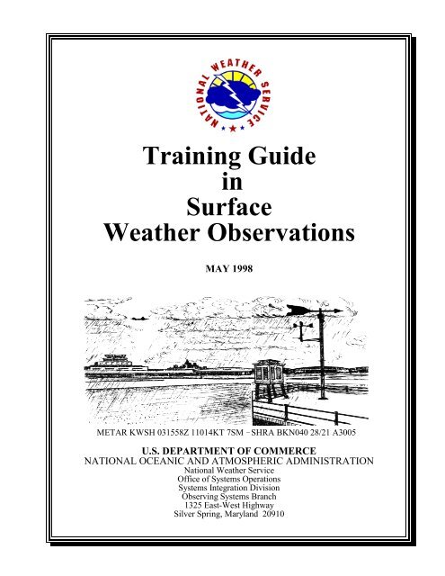
<strong>Tra<strong>in</strong><strong>in</strong>g</strong> <strong>Guide</strong><br />
<strong>in</strong><br />
<strong>Surface</strong><br />
<strong>Weather</strong> <strong>Observations</strong><br />
MAY 1998<br />
METAR KWSH 031558Z 11014KT 7SM SHRA BKN040 28/21 A3005<br />
U.S. DEPARTMENT OF COMMERCE<br />
NATIONAL OCEANIC AND ATMOSPHERIC ADMINISTRATION<br />
National <strong>Weather</strong> Service<br />
Office of Systems Operations<br />
Systems Integration Division<br />
Observ<strong>in</strong>g Systems Branch<br />
1325 East-West Highway<br />
Silver Spr<strong>in</strong>g, Maryland 20910
NATIONAL WEATHER SERVICE<br />
“Serv<strong>in</strong>g the Nation S<strong>in</strong>ce 1870”
PREFACE<br />
METAR/SPECI is the <strong>in</strong>ternational standard code for hourly and special surface weather observations.<br />
The METAR acronym roughly translates from the French as Aviation Rout<strong>in</strong>e <strong>Weather</strong> Report. A<br />
special report, SPECI, is merely a METAR-formatted report which is issued on a non-rout<strong>in</strong>e basis as<br />
dictated by chang<strong>in</strong>g meteorological conditions. The SPECI acronym roughly translates as Aviation<br />
Selected Special <strong>Weather</strong> Report.<br />
National <strong>Weather</strong> Service Observ<strong>in</strong>g Handbook No. 7, Part I (WSOH #7), and National <strong>Weather</strong> Service<br />
Observ<strong>in</strong>g Handbook No. 8 (WSOH #8) prescribe aviation weather observ<strong>in</strong>g, report<strong>in</strong>g, and cod<strong>in</strong>g<br />
procedures applicable to tak<strong>in</strong>g and report<strong>in</strong>g manual surface observations. They provide a framework<br />
with<strong>in</strong> which meteorological phenomena can be identified and reported <strong>in</strong> a standardized and<br />
understandable format. The type of station you are assigned to will determ<strong>in</strong>e which National <strong>Weather</strong><br />
Service Observation Handbook is to be used for your station’s surface weather observ<strong>in</strong>g program.<br />
WSOH #7 provides procedures and practices for NWS and NWS-contract personnel. WSOH #8<br />
prescribes procedures and practices for Supplementary Aviation <strong>Weather</strong> Report<strong>in</strong>g Stations (SAWRS).<br />
<strong>Tra<strong>in</strong><strong>in</strong>g</strong> <strong>Guide</strong> <strong>in</strong> <strong>Surface</strong> <strong>Weather</strong> <strong>Observations</strong> is designed to provide additional <strong>in</strong>formation <strong>in</strong><br />
observ<strong>in</strong>g, record<strong>in</strong>g, and cod<strong>in</strong>g of manual surface weather reports. The <strong>Tra<strong>in</strong><strong>in</strong>g</strong> <strong>Guide</strong> doesn’t <strong>in</strong>clude<br />
everyth<strong>in</strong>g you need to know. Therefore, it is necessary to use it <strong>in</strong> conjunction with your station’s<br />
WSOH.<br />
When you’ve f<strong>in</strong>ished read<strong>in</strong>g a chapter <strong>in</strong> your station’s WSOH, read the discussion <strong>in</strong> the tra<strong>in</strong><strong>in</strong>g<br />
guide. When you are confident and familiar with the contents of both, proceed to the review questions<br />
at the end of each chapter. Answer each question, but DO NOT guess at the answers. If <strong>in</strong> doubt, look<br />
up the answer <strong>in</strong> the appropriate <strong>in</strong>structions. This will help you become more familiar with the<br />
Handbooks.<br />
Correct answers to review questions can be found <strong>in</strong> Appendix A. Use these answers only after<br />
answer<strong>in</strong>g all questions <strong>in</strong> the chapter. If you made a mistake, locate the appropriate <strong>in</strong>structions and<br />
determ<strong>in</strong>e where you went wrong.<br />
Complete the Observ<strong>in</strong>g and Cod<strong>in</strong>g Exercises and the Quality Control Exercises <strong>in</strong> Chapter 9 only after<br />
all other chapters <strong>in</strong> the tra<strong>in</strong><strong>in</strong>g guide are completed. Correct answers to the exercises can be found <strong>in</strong><br />
Appendix A.<br />
Because this <strong>Tra<strong>in</strong><strong>in</strong>g</strong> <strong>Guide</strong> provides a wide spectrum of <strong>in</strong>formation on surface weather observations,<br />
some of the <strong>in</strong>formation may not be applicable to a station’s observ<strong>in</strong>g program. For example, SAWRS<br />
are not required to provide 3- and 6-hourly precipitation amounts, 24-hour precipitation amounts, snow<br />
depth on the ground, or water equivalent of snow on the ground data; so a student work<strong>in</strong>g at a SAWRS<br />
would not need to study this <strong>in</strong>formation. Therefore, students should consider only the <strong>in</strong>formation <strong>in</strong><br />
this study guide that is applicable to their station’s observ<strong>in</strong>g program.<br />
i
Table of Contents<br />
PREFACE ...................................................................... i<br />
CHAPTER 1 - GENERAL ...................................................... 1-1<br />
Content and Format of the Manual METAR/SPECI . . . . . . . . . . . . . . . . . . . . . . . . . . . . . . . . 1-2<br />
Type of Report - METAR/SPECI............................................... 1-2<br />
Station Identifier - CCCC ..................................................... 1-3<br />
Date/Time Group - YYGGggZ................................................. 1-3<br />
Report Modifier - COR....................................................... 1-4<br />
Delayed Reports ............................................................ 1-4<br />
Differences Between Transmitted Coded Report and MF1M-10 Entries . . . . . . . . . . . . . . . . 1-4<br />
Various Observational Programs ............................................... 1-4<br />
REVIEW QUESTIONS ...................................................... 1-7<br />
CHAPTER 2 - WIND .......................................................... 2-1<br />
W<strong>in</strong>d Group - dddff(f)Gfmf m(f m)KT<br />
............................................. 2-1<br />
Variable W<strong>in</strong>d Direction - dddVddd n n n x x x ......................................... 2-2<br />
W<strong>in</strong>d Shifts ............................................................... 2-2<br />
REVIEW QUESTIONS ...................................................... 2-5<br />
CHAPTER 3 - VISIBILITY ..................................................... 3-1<br />
Prevail<strong>in</strong>g Visibility ......................................................... 3-1<br />
Visibility Chart ............................................................. 3-7<br />
Runway Visual Range........................................................ 3-8<br />
REVIEW QUESTIONS ..................................................... 3-11<br />
CHAPTER 4 - PRESENT WEATHER ............................................ 4-1<br />
Cod<strong>in</strong>g of Present <strong>Weather</strong> Group(s) ............................................ 4-7<br />
REVIEW QUESTIONS ..................................................... 4-11<br />
CHAPTER 5 - SKY CONDITION ................................................ 5-1<br />
Sky Cover ................................................................. 5-2<br />
Cloud and Ceil<strong>in</strong>g Heights ................................................... 5-15<br />
Ma<strong>in</strong>tenance of Cloud Height Equipment ....................................... 5-19<br />
REVIEW QUESTIONS ..................................................... 5-23<br />
CHAPTER 6 - TEMPERATURE AND DEW POINT ................................ 6-1<br />
Difference Between Coded Report and MF1M-10 Entries . . . . . . . . . . . . . . . . . . . . . . . . . . . 6-1<br />
Report<strong>in</strong>g Temperature and Dew Po<strong>in</strong>t .......................................... 6-1<br />
The Psychrometer ........................................................... 6-2<br />
Comput<strong>in</strong>g the Dew Po<strong>in</strong>t .................................................... 6-4<br />
Obta<strong>in</strong><strong>in</strong>g Temperatures from Hygrothermometers . . . . . . . . . . . . . . . . . . . . . . . . . . . . . . . . . 6-7<br />
Liquid-In-Glass M<strong>in</strong>imum and Maximum Thermometers . . . . . . . . . . . . . . . . . . . . . . . . . . . . 6-8<br />
Correct<strong>in</strong>g Thermometer Errors ............................................... 6-14<br />
Maximum/M<strong>in</strong>imum Temperature System (MMTS) . . . . . . . . . . . . . . . . . . . . . . . . . . . . . . . 6-15<br />
REVIEW QUESTIONS ..................................................... 6-17<br />
iii<br />
Page
CHAPTER 7 - PRESSURE ...................................................... 7-1<br />
Altimeter Sett<strong>in</strong>g - APHPHPHP H ................................................. 7-1<br />
Station Elevation - H p ........................................................ 7-2<br />
Sea-Level Pressure .......................................................... 7-2<br />
Difference Between Coded Report and MF1M-10C Entries . . . . . . . . . . . . . . . . . . . . . . . . . . 7-3<br />
Altimeter Sett<strong>in</strong>g Accuracy.................................................... 7-3<br />
REVIEW QUESTIONS ...................................................... 7-5<br />
CHAPTER 8 - REMARKS ...................................................... 8-1<br />
Some of the More Important Remarks ........................................... 8-2<br />
Measur<strong>in</strong>g Precipitation ...................................................... 8-5<br />
Contractions ............................................................... 8-8<br />
Difference Between Coded Report and MF1M-10 Entries . . . . . . . . . . . . . . . . . . . . . . . . . . . 8-9<br />
REVIEW QUESTIONS ..................................................... 8-11<br />
CHAPTER 9 - REVIEW EXERCISES<br />
OBSERVING and CODING EXERCISES ....................................... 9-1<br />
QUALITY CONTROL EXERCISE............................................ 9-13<br />
APPENDIX A - ANSWERS TO CHAPTER and REVIEW EXERCISES<br />
ANSWERS TO CHAPTER QUESTIONS ...................................... A-1<br />
ANSWERS TO OBSERVING and CODING EXERCISES - CHAPTER 9 . . . . . . . . . . . . A-21<br />
ANSWERS TO QUALITY CONTROL EXERCISE - CHAPTER 9 . . . . . . . . . . . . . . . . . A-23<br />
APPENDIX B - DEW POINT TABLE ............................................B-1<br />
APPENDIX C - TRANSMISSION FORM FOR MANUAL OBSERVATIONS,<br />
WS Form B-11 .............................................................C-1<br />
APPENDIX D - ORDER OF OBSERVING ELEMENTS ............................ D-1<br />
iv<br />
Page
1<br />
CHAPTER 1<br />
GENERAL<br />
This chapter <strong>in</strong>troduces you to the Aviation <strong>Weather</strong> Observation and some of the procedures used <strong>in</strong><br />
the observ<strong>in</strong>g program.<br />
1.1 General Information<br />
1.1.1 The Aviation <strong>Weather</strong> Observation<br />
An Aviation <strong>Weather</strong> Observation is used to report the various meteorological elements that together<br />
describe the atmosphere as observed and evaluated from the observer’s position. The meteorological<br />
elements normally observed are: W<strong>in</strong>d, Visibility, Present <strong>Weather</strong>, Sky Condition, Temperature, Dew<br />
Po<strong>in</strong>t, Altimeter Sett<strong>in</strong>g, and Remarks.<br />
Learn<strong>in</strong>g what to observe and how to report your observation is described <strong>in</strong> National <strong>Weather</strong> Service<br />
Observ<strong>in</strong>g Handbooks (WSOH #7 and WSOH #8). The format of these Handbooks is such that<br />
<strong>in</strong>formation concern<strong>in</strong>g an element is conta<strong>in</strong>ed <strong>in</strong> its named chapter. A separate chapter covers cod<strong>in</strong>g<br />
<strong>in</strong>formation for all elements and <strong>in</strong>formation for entries on Meteorological Form 1M-10 (MF1M-10) for<br />
all elements provided <strong>in</strong> separate chapters.<br />
1.1.2 Meteorological Form 1M-10 (A, B, and C) 1<br />
MF1M-10 (A, B, and C) are the standard forms used to log observations. The form your station uses<br />
is the official record of observations taken and dissem<strong>in</strong>ated by your station. If you make a mistake on<br />
the form, correct the error with the same black <strong>in</strong>k used to record the observation. Whether the error was<br />
discovered before or after the dissem<strong>in</strong>ation of the observation, correct the erroneous data by clearly<br />
draw<strong>in</strong>g a s<strong>in</strong>gle l<strong>in</strong>e through the error. Do not erase or obliterate the entry by writ<strong>in</strong>g over it or by<br />
cover<strong>in</strong>g it up.<br />
The accuracy of the actual time of the observation is of the utmost importance <strong>in</strong> aviation safety<br />
<strong>in</strong>vestigations. Therefore, the station clock needs to be checked daily at part-time stations, on each shift<br />
at full-time stations, or if there is an aircraft mishap. Time checks are logged <strong>in</strong> column 65 of MF1M-10.<br />
By the second work<strong>in</strong>g day of the follow<strong>in</strong>g month, send the orig<strong>in</strong>als of all MF1M-10’s used dur<strong>in</strong>g<br />
the month to the National Climatic Data Center. SAWRS send their orig<strong>in</strong>al MF1M-10C forms used<br />
dur<strong>in</strong>g the month to the station designated by the NWS regional headquarters. This station will check<br />
the forms and advise the SAWRS of any corrections required on the forms by means of WS Form B-14,<br />
“Notice of Corrections To <strong>Weather</strong> Records.” Make corrections to the associated MF1M-10 forms that<br />
are on hand. SAWRS with more than one observer shall post the B-14 so that all observers can review<br />
it. These notices are an excellent aid for the station’s on-go<strong>in</strong>g tra<strong>in</strong><strong>in</strong>g and quality control programs.<br />
Once the MF1M-10 is reviewed, the correction notices along with the associated copies of the weather<br />
records shall be reta<strong>in</strong>ed <strong>in</strong> accordance with the local guidel<strong>in</strong>es provided by the supervis<strong>in</strong>g office. If<br />
local guidel<strong>in</strong>es were not provided, you may discard the records when they are 90 days old.<br />
The MF1M-10A, B, and C have the same column numbers and designations.<br />
1-1
1.2 Content and Format of the Manual METAR/SPECI<br />
The follow<strong>in</strong>g is an overview of the various elements <strong>in</strong> a METAR/SPECI report. Each element is<br />
described <strong>in</strong> the follow<strong>in</strong>g paragraphs and chapters. Each element or group is separated by a space <strong>in</strong><br />
a transmitted report.<br />
a. Body of report.<br />
(1) Type of Report - METAR or SPECI<br />
(2) Station Identifier - CCCC<br />
(3) Date and Time of Report - YYGGggZ<br />
(4) Report Modifier - COR<br />
(5) W<strong>in</strong>d - dddff(f)KT_dndndnVdxdxdx (6) Visibility - VVVVVSM<br />
(7) Runway Visual Range - RDD/VVVVFT R R R R R R or<br />
RDD/VVVVVVVVVFT<br />
R R N N N N X X X X<br />
(8) Present <strong>Weather</strong> - ww<br />
(9) Sky Condition - NNNhhh s s s s s s or VVhshsh s or SKC<br />
(10) Temperature and Dew Po<strong>in</strong>t - TT/TdTd (11) Altimeter - APPPP<br />
H H H H<br />
b. Remarks Section of Report - RMK<br />
(1) Manual and Pla<strong>in</strong> Language<br />
(2) Additive Data<br />
1.3 Type of Report - METAR/SPECI<br />
The type of report is the first element of the coded report.<br />
The type of report shall be METAR for a rout<strong>in</strong>e report and SPECI for a special report. Transmitted<br />
reports shall always beg<strong>in</strong> with either METAR or SPECI, entered as M or S <strong>in</strong> column 1 of MF1M-10.<br />
1.3.1 METAR<br />
METAR is a rout<strong>in</strong>e scheduled observation and is the primary observation code used <strong>in</strong> the United States<br />
to satisfy requirements for report<strong>in</strong>g surface meteorological data. METAR conta<strong>in</strong>s a report of w<strong>in</strong>d,<br />
visibility, present weather, sky condition, temperature, dew po<strong>in</strong>t, and altimeter sett<strong>in</strong>g collectively<br />
referred to as “the body of the report.” In addition, <strong>in</strong>formation that elaborates on data <strong>in</strong> the body of<br />
the report may be appended to the METAR. This significant <strong>in</strong>formation can be found <strong>in</strong> the section<br />
referred to as “Remarks.”<br />
1.3.2 SPECI<br />
SPECI is an unscheduled observation. SPECI observations are taken when specific weather conditions<br />
have been met or observed (noted). SPECI reports shall conta<strong>in</strong> all the data elements found <strong>in</strong> a<br />
METAR report (except s<strong>in</strong>gle-element special) plus additional pla<strong>in</strong> language <strong>in</strong>formation that elaborates<br />
on data <strong>in</strong> the body of the report. All SPECIs shall be made as soon as possible after the relevant special<br />
criteria are met or observed. Whenever SPECI criteria are met or observed at the time of a METAR, the<br />
type of report shall be METAR. S<strong>in</strong>gle-element special observations are authorized to be taken for<br />
tornadic activity and volcanic eruptions.<br />
1-2
There are two categories of criteria for tak<strong>in</strong>g SPECIs. The first is applicable to all stations across the<br />
United States. The second category of criteria for tak<strong>in</strong>g SPECIs is determ<strong>in</strong>ed by you the observer. It<br />
allows you to take a SPECI observation to report any phenomenon that <strong>in</strong> your op<strong>in</strong>ion is operationally<br />
significant at your station. In mak<strong>in</strong>g these SPECI reports, there are no limits. Even if no provision is<br />
made for report<strong>in</strong>g a particular occurrence, take a SPECI and report the phenomenon even if it is<br />
necessary to use pla<strong>in</strong> language <strong>in</strong> Remarks.<br />
1.4 Station Identifier - CCCC<br />
The second element of the transmitted coded aviation weather report is the Station Identifier:<br />
This is entered on MF1M-10 <strong>in</strong> the head<strong>in</strong>g block labeled SID.<br />
The METAR/SPECI uses the International Civil Aviation Organization (ICAO) four-letter station<br />
identifier. All airports <strong>in</strong> the 48 contiguous states beg<strong>in</strong> with the letter “K” followed by the three-letter<br />
identifier for the airport. Alaskan stations all beg<strong>in</strong> with “PA” for Pacific-Alaskan, Hawaiian stations<br />
beg<strong>in</strong> with “PH” for Pacific-Hawaiian. The “PA” or “PH” is followed by the <strong>in</strong>ternational two-letter<br />
identifier for that station.<br />
Stations <strong>in</strong> the Eastern Caribbean beg<strong>in</strong> with the letter “T”; Western Caribbean stations beg<strong>in</strong> with the<br />
letter “M”; Guam stations beg<strong>in</strong> with the letters “PG.”<br />
Examples: New Iberia, LA - KARA Alexandria, LA - KAEX<br />
Sugar Land, TX - KSGR Anchorage, AK - PANC<br />
Nome, AK - PAOM Honolulu, HI - PHNL<br />
Keahole Po<strong>in</strong>t, HI - PHKO<br />
1.5 Date/Time Group - YYGGggZ<br />
The third element of the coded aviation weather observation is the Date/Time group.<br />
YY - two-digit date GG - two-digit hour gg - two-digit m<strong>in</strong>utes Z - letter <strong>in</strong>dicator for UTC<br />
In the METAR/SPECI, the day and time of observation is a six-character field plus the letter “Z.” The<br />
first two digits “YY” are the day of the month and the next four digits “GGgg” are the time. The times<br />
entered are <strong>in</strong> reference to the 24-hour clock. The letter “Z” is added to the end of the group to <strong>in</strong>dicate<br />
the date and time are <strong>in</strong> Coord<strong>in</strong>ated Universal Time.<br />
The date and time are <strong>in</strong>cluded <strong>in</strong> all reports. The actual time of a METAR report is the time the last<br />
element of the observation was observed. The actual time of a SPECI report is when the criterion for<br />
a SPECI is met or noted. If the report is a correction to a previously dissem<strong>in</strong>ated report, the time of the<br />
corrected report shall be the same time used <strong>in</strong> the report be<strong>in</strong>g corrected.<br />
Examples: An observation taken on the 23rd of the month at 1955 UTC<br />
METAR KARA 231955Z<br />
An observation taken on the 1st of the month at 0550 UTC<br />
METAR KAEX 010550Z<br />
An observation taken on the 10th of the month at 0005 UTC<br />
SPECI PAOM 100005Z<br />
1-3
1.6 Report Modifier - COR<br />
An observation taken on the 20th of the month at 4:35 PM UTC<br />
SPECI PHKO 201635Z<br />
The Report Modifier falls between the “Date/Time” group and the “W<strong>in</strong>d” group when used. The only<br />
modifier for the report will be COR. COR <strong>in</strong>dicates the report is a correction to a previously<br />
transmitted report. Corrections transmitted shall consist of the entire corrected report. The orig<strong>in</strong>al date<br />
and time of the report shall be used as the date and time <strong>in</strong> the corrected report.<br />
Example of a Transmitted Corrected Report:<br />
METAR KOKC 011955Z COR 22015G25KT 3/4SM TSRA BR OVC010CB 18/16 A2992 RMK<br />
FRQ LTGIC TS OHD MOV E<br />
Corrections to a still valid observation should be given to everyone who received the erroneous data.<br />
1.7 Delayed Reports<br />
If an observation is taken but cannot be transmitted before the next regularly scheduled report, only the<br />
latest report shall be transmitted. The remark FIBI (Filed But Impractical to Transmit) shall be<br />
appended <strong>in</strong> parentheses to the report that was not transmitted to <strong>in</strong>dicate the report was not transmitted.<br />
The remark FIBI shall not be <strong>in</strong>cluded <strong>in</strong> local dissem<strong>in</strong>ation of the report.<br />
Reports of Volcanic Eruption shall be dissem<strong>in</strong>ated by any means possible, regardless of the delay.<br />
1.8 Differences Between Transmitted Coded Report and MF1M-10 Entries<br />
When review<strong>in</strong>g your station’s WSOH, you should have noticed there are some differences between<br />
the transmitted coded report and entries made <strong>in</strong> the columns on MF1M-10 (see Exhibit 1-1). The<br />
coded report conta<strong>in</strong>s certa<strong>in</strong> “letter <strong>in</strong>dicators” to show the unit of measure used, time standard used,<br />
or to separate “the body of the report” from the “remarks” section of the report, while such entries are<br />
not made on MF1M-10. This tra<strong>in</strong><strong>in</strong>g guide highlights where these differences exist <strong>in</strong> each element.<br />
Failure to place the correct “letter <strong>in</strong>dicator” <strong>in</strong> its proper location or to place a required space <strong>in</strong> the<br />
transmitted coded report may result <strong>in</strong> the report not be<strong>in</strong>g decoded properly. For example, the report<br />
will not be decoded if the “Z” is not placed after the date/time group. The observation will not make<br />
it <strong>in</strong>to hourly roundups, etc.<br />
1.9 Various Observational Programs<br />
Because of the great variety of observational programs, it is impractical to expla<strong>in</strong> <strong>in</strong> this tra<strong>in</strong><strong>in</strong>g guide<br />
how the various observations apply to each station. Therefore, you should discuss this part of the<br />
program with either the <strong>Surface</strong> Observation Specialist from the NWS regional headquarters or with<br />
a visit<strong>in</strong>g representative from the supervis<strong>in</strong>g station.<br />
1-4
TYPE<br />
M/S<br />
TIME<br />
G LST<br />
G UTC<br />
DIREC-<br />
TION<br />
(Ture)<br />
SPEED<br />
(Knots)<br />
WIND VISIBILITY PRESENT<br />
WEATHER<br />
GUST<br />
(Knots)<br />
VARIABILITY<br />
(True)<br />
SUR- TOWER RUNWAY VISUAL<br />
FACE<br />
RANGE<br />
(Feet)<br />
1-5<br />
SKY CONDITION TEMP.<br />
©<br />
DEW<br />
POINT<br />
©<br />
ALTIMETER<br />
SETTING<br />
(Ins.)<br />
REMARKS AND SUPPLEMENTAL CODED DATA<br />
(1) (2) (3) (4) (5) (6) (7a) (7b) (8) (9) (10) (11) (12) (13) (14)<br />
M 065 34 10 20 1/ -SN BLSN BKN003 -02 -05 2986 VIS NW 1/4<br />
OVC020<br />
METAR KEFD 210654Z 34010G20KT 1/2SM -SN BLSN BKN003 OVC020 M02/M05 A2986 RMK VIS NW 1/4<br />
The time <strong>in</strong> column 2 must also be checked. The block to be checked depends on the observ<strong>in</strong>g program. Most SAWRS will check UTC,<br />
but a few SAWRS are required to check the LST block. SAWRS should check with their supervis<strong>in</strong>g NWS office.<br />
Exhibit 1-1. MF1M-10 - Difference Between Form Entries and Transmitted Report.
1-6
REVIEW QUESTIONS<br />
1. What are the designators used on coded aviation weather observations for the follow<strong>in</strong>g types of<br />
reports?<br />
a. Rout<strong>in</strong>e report<br />
b. Unscheduled report<br />
2. <strong>Weather</strong> conditions be<strong>in</strong>g equal, why should you allow more time for tak<strong>in</strong>g observations at night<br />
than dur<strong>in</strong>g the day?<br />
3. If you decide at the time of an observation that the normal procedures given <strong>in</strong> your station’s<br />
Handbook are <strong>in</strong>appropriate for circumstances at hand, what should you do?<br />
4. How often should time checks be made on the official station clock used as the station standard?<br />
5. How long are you required to reta<strong>in</strong> carbon copies of MF1M-10?<br />
6. When the actual cloud height or visibility falls midway between two reportable values, which value<br />
is reported?<br />
7. The time of observation, which is entered <strong>in</strong> column 2 for most SAWRS, is <strong>in</strong>:<br />
a. UTC<br />
b. LST<br />
c. LDT<br />
d. GMT<br />
8. Under what conditions may you omit tak<strong>in</strong>g a SPECI when notified of an aircraft mishap?<br />
9. If you discover an error <strong>in</strong> column 9 after you have given the observation to the tower, you<br />
should correct the error by:<br />
a. eras<strong>in</strong>g the erroneous entry and enter<strong>in</strong>g the correct data <strong>in</strong> red<br />
b. eras<strong>in</strong>g the erroneous entry and enter<strong>in</strong>g the correct data <strong>in</strong> black<br />
c. draw<strong>in</strong>g a l<strong>in</strong>e through the erroneous entry and enter<strong>in</strong>g the correct data <strong>in</strong> red<br />
d. draw<strong>in</strong>g a l<strong>in</strong>e through the erroneous entry and enter<strong>in</strong>g the correct data <strong>in</strong> black<br />
10. All time entries <strong>in</strong> column 2 of MF1M-10 are made with reference to the hour<br />
clock.<br />
11. The primary observation code to be used <strong>in</strong> the U.S. to satisfy requirements for report<strong>in</strong>g surface<br />
meteorological data is:<br />
a. METAR<br />
b. SA<br />
c. SAWRS<br />
d. synoptic<br />
1-7
12. A METAR observation conta<strong>in</strong>s section(s), .<br />
a. 1, the body of the report<br />
b. 1, the remarks<br />
c. 2, the body of the report and the remarks<br />
d. 3, the time, the data, and the remarks<br />
13. A SPECI observation conta<strong>in</strong>s section(s), .<br />
a. 1, the body of the report<br />
b. 1, the remarks<br />
c. 3, the time, the data, and the remarks<br />
d. 2, the body of the report and the remarks<br />
14. Which of the follow<strong>in</strong>g meet SPECI criteria? (more than one answer):<br />
the w<strong>in</strong>d speed is 15 kt while the w<strong>in</strong>d direction changes by 60 degrees <strong>in</strong> 10 m<strong>in</strong>utes<br />
surface visibility drops from 2 1/2 miles to 2 miles<br />
a tornado is observed<br />
hail <strong>in</strong>tensity changes<br />
thunderstorm beg<strong>in</strong>s<br />
the ceil<strong>in</strong>g changes from 3,000 ft to 2,500 ft AGL<br />
a new cloud layer is observed below 1,000 ft AGL<br />
an aircraft mishap occurs<br />
squalls occur<br />
15. Regardless of the delay, observations conta<strong>in</strong><strong>in</strong>g which of the follow<strong>in</strong>g elements must be<br />
dissem<strong>in</strong>ated?<br />
a. volcanic eruptions<br />
b. tornadoes<br />
c. thunderstorms<br />
d. blizzards<br />
16. If SPECI criteria are met or observed at the time a METAR observation is due, it is coded as a:<br />
a. METAR<br />
b. SPECI<br />
c. RSPECI<br />
d. RS<br />
17. The station identifier is the ________ element <strong>in</strong> a METAR/SPECI coded report.<br />
a. first<br />
b. second<br />
c. third<br />
d. sixth<br />
1-8
18. The ICAO identifier uses letters.<br />
a. three<br />
b. five<br />
c. two<br />
d. four<br />
19. Which report <strong>in</strong>cludes the Date and Time group?<br />
a. METAR<br />
b. SPECI<br />
c. SA<br />
d. both METAR and SPECI<br />
20. In a METAR report, the time of the Date/Time group is:<br />
a. the time the observation is dissem<strong>in</strong>ated<br />
b. actual time of the report<br />
c. time the last element is observed<br />
d. both b and c<br />
21. In a SPECI report, the time of the Date/Time group is:<br />
a. the time the observation is dissem<strong>in</strong>ated<br />
b. the time of the last METAR report<br />
c. when the criterion for a SPECI is met or noted<br />
d. 5 m<strong>in</strong>utes before the event was noticed<br />
22. Which time will be used for the Date/Time group if the report is a corrected one?<br />
a. same time used <strong>in</strong> the report be<strong>in</strong>g corrected<br />
b. time when the error was noticed<br />
c. time when the last element was entered on the corrected report<br />
d. time of the next METAR or SPECI report<br />
23. Code the follow<strong>in</strong>g Date/Time groups. All times are <strong>in</strong> UTC.<br />
a. 1st of month at 1001<br />
b. 9th of month at 1755<br />
c. 15th of month at 2045<br />
d. 30th of month at 0113<br />
e. 7th of month at 1625<br />
24. In a manual observation, what is the only report modifier used?<br />
a. AUTO<br />
b. RMK<br />
c. TMP<br />
d. COR<br />
1-9
25. At no time shall an observation be started more than m<strong>in</strong>utes prior to the scheduled<br />
observation time.<br />
26. Corrected reports are not transmitted if they are:<br />
a. more than 15 m<strong>in</strong>utes old<br />
b. superseded by a later report<br />
c. recorded locally<br />
d. only m<strong>in</strong>or corrections<br />
27. What remark is appended to the report of a METAR or SPECI observation that is not<br />
transmitted?<br />
28. People authorized to take weather observations:<br />
a. need no tra<strong>in</strong><strong>in</strong>g or certification<br />
b. must have tra<strong>in</strong><strong>in</strong>g but not certification<br />
c. must be certified by the National <strong>Weather</strong> Service<br />
d. are not paid<br />
29. Place the follow<strong>in</strong>g groups <strong>in</strong> the order <strong>in</strong> which they occur <strong>in</strong> METAR/SPECI:<br />
date and time of report<br />
sky condition<br />
visibility<br />
type of report<br />
present weather<br />
report modifier<br />
altimeter<br />
w<strong>in</strong>d<br />
temperature and dew po<strong>in</strong>t<br />
station identifier<br />
manual and pla<strong>in</strong> language remarks<br />
30. If an element does not occur or cannot be observed, it is:<br />
a. marked miss<strong>in</strong>g<br />
b. estimated<br />
c. omitted from the report<br />
d. added from complementary data<br />
31. The time of observation, which is entered <strong>in</strong> Column 2 for the NWS, is <strong>in</strong>:<br />
a. UTC<br />
b. LST<br />
c. LDT<br />
d. GMT<br />
1-10
2.1 W<strong>in</strong>d Group - dddff(f)Gfmf m(f m)KT<br />
CHAPTER 2<br />
WIND<br />
The w<strong>in</strong>d group is the first weather element reported <strong>in</strong> a METAR/SPECI and immediately follows the<br />
Date/Time group <strong>in</strong> the transmitted coded report.<br />
Observ<strong>in</strong>g and report<strong>in</strong>g w<strong>in</strong>d speed and direction are relatively easy.<br />
2.1.1 W<strong>in</strong>d Direction - ddd<br />
The direction is reported us<strong>in</strong>g three characters. When us<strong>in</strong>g direct read<strong>in</strong>g dials, you determ<strong>in</strong>e the<br />
w<strong>in</strong>d direction by averag<strong>in</strong>g the direction over a 2-m<strong>in</strong>ute period. The true w<strong>in</strong>d direction is reported<br />
<strong>in</strong> tens of degrees us<strong>in</strong>g three digits. The third character will always be a zero. See Table 2-1, W<strong>in</strong>d<br />
Direction <strong>in</strong> Tens of Degrees.<br />
2.1.2 W<strong>in</strong>d Speed - ff(f)<br />
W<strong>in</strong>d speed is reported us<strong>in</strong>g two digits or three when necessary. If the direction was determ<strong>in</strong>ed to be<br />
variable (VRB) and the w<strong>in</strong>d speed is 6 knots or less, the speed is appended to the VRB, e.g., VRB05.<br />
However, w<strong>in</strong>d directions should be reported whenever they can be determ<strong>in</strong>ed even when the w<strong>in</strong>d<br />
speed is 6 knots or less, e.g., 14004. A calm w<strong>in</strong>d (less than 1 knot) is coded with five zeros, e.g.,<br />
00000. The transmitted coded group ends with the letters “KT” to <strong>in</strong>dicate the unit of measurement is<br />
<strong>in</strong> knots; however, it is not recorded on MF1M-10.<br />
Examples of Transmitted/Coded Data: 31015KT VRB04KT 040112KT<br />
2.1.3 W<strong>in</strong>d Gusts - Gfmf m(f m)<br />
14004KT 00000KT<br />
Report<strong>in</strong>g gusts is a bit more difficult. The w<strong>in</strong>d gust is coded <strong>in</strong> two or three digits immediately<br />
follow<strong>in</strong>g the w<strong>in</strong>d speed. The w<strong>in</strong>d data for the most recent 10 m<strong>in</strong>utes are evaluated. Gusts are<br />
<strong>in</strong>dicated by rapid fluctuations <strong>in</strong> w<strong>in</strong>d speed with a variation of 10 knots or more between peaks and<br />
lulls. The speed of the gust shall be the maximum <strong>in</strong>stantaneous w<strong>in</strong>d speed. The letter “G” is placed<br />
right before the w<strong>in</strong>d gust speed <strong>in</strong> the transmitted coded report; however, it is not recorded <strong>in</strong> column<br />
5 of MF1M-10.<br />
Examples of Transmitted/Coded Data: 31015G25KT 090115G125KT<br />
Squalls are reported <strong>in</strong> Present <strong>Weather</strong> and are also part of what makes up the w<strong>in</strong>d character. A Squall<br />
is a sudden <strong>in</strong>crease <strong>in</strong> average w<strong>in</strong>d speed of at least 16 knots and susta<strong>in</strong>ed at 22 knots or more and<br />
last<strong>in</strong>g for at least 1 m<strong>in</strong>ute. The difference between Gust and Squall is duration and <strong>in</strong>tensity of the<br />
<strong>in</strong>crease.<br />
2-1
2.1.4 Estimated W<strong>in</strong>ds<br />
Though w<strong>in</strong>ds can be estimated, there is no way to <strong>in</strong>dicate that w<strong>in</strong>d direction or speed has been<br />
estimated <strong>in</strong> the coded transmitted report.<br />
2.2 Variable W<strong>in</strong>d Direction - dndndnVdxdxd x<br />
If the w<strong>in</strong>d direction varies by 60° or more and w<strong>in</strong>d speed is >6 knots, a variable w<strong>in</strong>d group is also<br />
reported. The extreme values are coded us<strong>in</strong>g three digits for each direction (remember: tens of degrees,<br />
last digit is always a zero). A “V” separates the two extreme values.<br />
Example: 31015KT 270V340, 36012KT 330V030, 35012KT 320V020<br />
The directional variation shall be coded <strong>in</strong> a clockwise direction (remember: it can vary by more than<br />
60°).<br />
Example: If w<strong>in</strong>d is variable from 180° to 250° at 10 knots, it would be coded as:<br />
2.3 W<strong>in</strong>d Shifts<br />
21010KT 180V250<br />
W<strong>in</strong>d shifts and the time of occurrences are reported <strong>in</strong> the remarks section (RMK) of the report. A<br />
w<strong>in</strong>d shift is <strong>in</strong>dicated by a change <strong>in</strong> w<strong>in</strong>d direction of 45 degrees or more <strong>in</strong> less than 15 m<strong>in</strong>utes with<br />
susta<strong>in</strong>ed w<strong>in</strong>ds of 10 knots or more throughout the w<strong>in</strong>d shift. The time reported is the time the shift<br />
began. Only the m<strong>in</strong>utes are required if the hour can be <strong>in</strong>ferred from the report time.<br />
Example: A w<strong>in</strong>d shift occurr<strong>in</strong>g at 30 m<strong>in</strong>utes after the hour would be reported <strong>in</strong> remarks as:<br />
WSHFT 30<br />
WIND DIRECTION IN TENS OF DEGREES (TRUE)<br />
8 Po<strong>in</strong>ts of<br />
Compass<br />
N<br />
N<br />
N<br />
NE<br />
NE<br />
NE<br />
NE<br />
E<br />
E<br />
E<br />
E<br />
E<br />
SE<br />
SE<br />
SE<br />
SE<br />
S<br />
S<br />
Tens of<br />
Degrees<br />
360<br />
010<br />
020<br />
030<br />
040<br />
050<br />
060<br />
070<br />
080<br />
090<br />
100<br />
110<br />
120<br />
130<br />
140<br />
150<br />
160<br />
170<br />
2-2<br />
8 Po<strong>in</strong>ts of<br />
Compass<br />
S<br />
S<br />
S<br />
SW<br />
SW<br />
SW<br />
SW<br />
W<br />
W<br />
W<br />
W<br />
W<br />
NW<br />
NW<br />
NW<br />
NW<br />
N<br />
N<br />
Tens of<br />
Degrees<br />
180<br />
190<br />
200<br />
210<br />
220<br />
230<br />
240<br />
250<br />
260<br />
270<br />
280<br />
290<br />
300<br />
310<br />
320<br />
330<br />
340<br />
350<br />
Table 2-1. W<strong>in</strong>d Direction <strong>in</strong> Tens of Degrees
DIRECTION:<br />
OUTLINE<br />
DETERMINATION OF WIND DATA<br />
Observe the position of the direction <strong>in</strong>dicator for a full 2 m<strong>in</strong>utes and determ<strong>in</strong>e the average direction.<br />
Enter, <strong>in</strong> column 3 of MF1M-10, the w<strong>in</strong>d direction <strong>in</strong> tens of degrees to the nearest ten degrees us<strong>in</strong>g<br />
three characters, with the third character be<strong>in</strong>g zero.<br />
SPEED:<br />
Observe the position of the speed <strong>in</strong>dicator for a full 2 m<strong>in</strong>utes and determ<strong>in</strong>e the average speed. Enter,<br />
<strong>in</strong> column 4 of MF1M-10, the w<strong>in</strong>d speed to the nearest knot us<strong>in</strong>g two digits or three when the speed<br />
is 100 knots or more.<br />
GUSTS:<br />
Report gusts when the w<strong>in</strong>d speed rapidly fluctuates with variations of 10 knots or more between peaks<br />
and lulls over the last 10 m<strong>in</strong>utes. Enter, <strong>in</strong> column 5 of MF1M-10, the gust that is the maximum<br />
<strong>in</strong>stantaneous w<strong>in</strong>d speed us<strong>in</strong>g two digits or three when the gust is 100 knots or more.<br />
SHIFTS:<br />
Report w<strong>in</strong>d shifts whenever the w<strong>in</strong>d direction changes by 45 degrees or more <strong>in</strong> less than 15 m<strong>in</strong>utes<br />
with susta<strong>in</strong>ed w<strong>in</strong>ds of 10 knots or more throughout this period. Enter, <strong>in</strong> column 14 (remarks) of<br />
MF1M-10, “WSHFT” followed by a space and m<strong>in</strong>utes past the hour when the shift began.<br />
SQUALLS:<br />
Report squalls <strong>in</strong> Present <strong>Weather</strong> (column 9) if there is a sudden <strong>in</strong>crease <strong>in</strong> the average w<strong>in</strong>d speed of<br />
at least 16 knots and susta<strong>in</strong>ed at 22 knots or more and cont<strong>in</strong>u<strong>in</strong>g for at least 1 m<strong>in</strong>ute dur<strong>in</strong>g the 10<br />
m<strong>in</strong>utes prior to the time of observation.<br />
ESTIMATION:<br />
Report w<strong>in</strong>d data <strong>in</strong> the normal manner, but annotate <strong>in</strong> column 65 that the w<strong>in</strong>d data are estimated and<br />
the reason for the estimation, e.g., WIND DATA ESTIMATED - EQUIPMENT INOPERATIVE.<br />
2-3
2-4
REVIEW QUESTIONS<br />
1. How should each of the follow<strong>in</strong>g directions be recorded <strong>in</strong> column 3 of MF1M-10?<br />
a. 5° d. 93°<br />
b. 273° e. 2°<br />
c. 127° f. 357°<br />
2. Record the follow<strong>in</strong>g w<strong>in</strong>d data <strong>in</strong> columns 3, 4, and 5 below.<br />
Direction (°True) Speed (Knots) Gusts (Knots)<br />
a. 111 15 18<br />
b. 197 33 56<br />
c. 53 115 135<br />
d. 360 7 Not observed<br />
DIREC-<br />
TION<br />
(True)<br />
(3)<br />
SPEED<br />
(Knots)<br />
(4)<br />
WIND<br />
GUST<br />
(Knots)<br />
(5)<br />
2-5<br />
VARIABILITY<br />
(True)<br />
3. Code the entries made <strong>in</strong> MF1M-10 from “Review Question #2" as they would appear <strong>in</strong> a<br />
transmitted report.<br />
a.<br />
b.<br />
c.<br />
d.<br />
(6)
Code the follow<strong>in</strong>g w<strong>in</strong>d situations for a transmitted coded METAR report.<br />
4. You can detect air movement. The direction <strong>in</strong>dicator shows 250°, but the speed <strong>in</strong>dicates calm.<br />
5. The direction <strong>in</strong>dicator shows 250°; the average w<strong>in</strong>d speed is 12 knots with fluctuations between<br />
9 and 19 knots.<br />
6. The direction varies between 030 and 090°; the speed shows 4 knots.<br />
7. The direction fluctuates between 020 and 100°; the speed shows an average of 12 knots.<br />
Choose the correct answer(s) for the follow<strong>in</strong>g:<br />
8. Which of the follow<strong>in</strong>g parameters are <strong>in</strong>cluded <strong>in</strong> the body of the METAR w<strong>in</strong>d element:<br />
_____ direction<br />
_____ speed<br />
_____ squalls<br />
_____ shifts<br />
9. W<strong>in</strong>d direction and w<strong>in</strong>d speed are determ<strong>in</strong>ed by averag<strong>in</strong>g a _____ period.<br />
a. 1-m<strong>in</strong>ute<br />
b. 2-m<strong>in</strong>ute<br />
c. 5-m<strong>in</strong>ute<br />
d. 10-m<strong>in</strong>ute<br />
10. W<strong>in</strong>d direction may be considered variable whenever:<br />
_____ dur<strong>in</strong>g a 2-m<strong>in</strong>ute period, the w<strong>in</strong>d speed is 6 knots<br />
_____ the w<strong>in</strong>d direction changes by 45°<br />
_____ dur<strong>in</strong>g a 2-m<strong>in</strong>ute period, the direction varies by 60° or more and the speed is greater than<br />
6 knots<br />
11. What m<strong>in</strong>imum criteria must be satisfied for a w<strong>in</strong>d shift to occur?<br />
_____ a change <strong>in</strong> w<strong>in</strong>d direction of 45° or more<br />
_____ a change <strong>in</strong> w<strong>in</strong>d direction of 25° or more<br />
_____ the change occurs <strong>in</strong> less than 15 m<strong>in</strong>utes<br />
_____ w<strong>in</strong>d speeds dur<strong>in</strong>g the change are at least 6 knots<br />
_____ w<strong>in</strong>d speeds dur<strong>in</strong>g the change are at least 10 knots<br />
2-6
12. W<strong>in</strong>d shifts are reported:<br />
a. <strong>in</strong> the body of METAR<br />
b. <strong>in</strong> the remarks section of METAR and SPECI reports<br />
c. only <strong>in</strong> METAR, but not <strong>in</strong> SPECI<br />
d. <strong>in</strong> metric units<br />
13. A gust is reported when the w<strong>in</strong>d speed is observed to fluctuate rapidly with a variation of at least<br />
knots between peaks and lulls.<br />
14. Gusts reported <strong>in</strong> column 5, MF1M-10, must have been observed with<strong>in</strong> the m<strong>in</strong>utes<br />
prior to the actual time of observation.<br />
15. What is the appropriate unit of measure and resolution for w<strong>in</strong>d reports <strong>in</strong> an aviation weather<br />
report?<br />
a. nearest degree and meters/second<br />
b. nearest degree and miles per hour<br />
c. tens of degrees and knots<br />
d. <strong>in</strong> metric units<br />
16. A peak w<strong>in</strong>d dur<strong>in</strong>g the past hour of 36 knots from 090° occurred at 45 m<strong>in</strong>utes after the hour. At<br />
record observation time, what condition is reported <strong>in</strong> column 14?<br />
a. PK WND 0936/45KT<br />
b. PK WND 36045/09<br />
c. PK WND 09045/36KT<br />
d. PK WND 09036/45<br />
17. How would you report that an average w<strong>in</strong>d speed of 25 knots was vary<strong>in</strong>g rapidly between 20 and<br />
30 knots?<br />
a. 25<br />
b. 25 and the remark, WND 20V30<br />
c. 25G30<br />
d. 20G30<br />
18. If the w<strong>in</strong>d is from true north at 8 knots and the magnetic decl<strong>in</strong>ation is plus 10 degrees, the w<strong>in</strong>d<br />
direction and speed would be coded as:<br />
a. 35008KT<br />
b. 36008KT<br />
c. 00008KT<br />
d. 01008KT<br />
2-7
19. Which of the follow<strong>in</strong>g w<strong>in</strong>d parameters is not <strong>in</strong>cluded <strong>in</strong> the body of the METAR/SPECI w<strong>in</strong>d<br />
element?<br />
a. direction<br />
b. speed<br />
c. squalls<br />
d. variable<br />
20. A strong w<strong>in</strong>d suddenly <strong>in</strong>creases from 270° at 15 knots to 32 knots with gusts to 44 knots and<br />
persists for 3 m<strong>in</strong>utes before subsid<strong>in</strong>g. This is reported as:<br />
a. 27032G44KT<br />
b. 27044KT SQ (<strong>in</strong> present weather)<br />
c. 27015G44KT SQ (<strong>in</strong> present weather)<br />
d. 27032G44KT SQ (<strong>in</strong> present weather)<br />
21. Calm w<strong>in</strong>d is coded <strong>in</strong> the body of the report as:<br />
a. 00000KT<br />
b. VRB00KT<br />
c. 0000KT<br />
d. blank (no entry for w<strong>in</strong>d)<br />
22. The w<strong>in</strong>d direction is from 240° at 9 knots and the direction is vary<strong>in</strong>g from 210° to 260°. How<br />
would this be formatted for transmission?<br />
a. 24009KT<br />
b. 24009KT 210V260<br />
c. 24009KT 210V260KT<br />
d. VRB09KT<br />
23. If a w<strong>in</strong>d shift is accompanied by a cold frontal passage that began at 30 m<strong>in</strong>utes after the hour, the<br />
remark would be coded as:<br />
a. FROPA 30<br />
b. COLD FROPA 30<br />
c. FROPA WSHFT 30<br />
d. WSHFT 30 FROPA<br />
24. The essential difference between gusts and squalls is:<br />
a. the <strong>in</strong>tensity of precipitation with which they are associated<br />
b. the variation between peaks and lulls<br />
c. the duration of the <strong>in</strong>creased w<strong>in</strong>d speed<br />
d. their peak speed<br />
2-8
25. A variable w<strong>in</strong>d direction and a speed of 4 knots would be coded as:<br />
a. 00004KT<br />
b. 99904KT<br />
c. VRB04KT<br />
d. /04KT<br />
26. Which of the follow<strong>in</strong>g is a good method for estimat<strong>in</strong>g low surface w<strong>in</strong>d speed?<br />
a. movement of very low clouds<br />
b. pilot reports<br />
c. a non-mov<strong>in</strong>g w<strong>in</strong>d vane<br />
d. none of the above<br />
27. The w<strong>in</strong>d is from 360° at 125 knots. What would be the correct entry <strong>in</strong> Column 4 (Speed) of<br />
MF1M-10?<br />
a. 25<br />
b. 125<br />
c. 36025<br />
d. 36125<br />
28. The station anemometer is not <strong>in</strong> operation. However, the observer estimates that the w<strong>in</strong>d speed<br />
is 10 knots. The w<strong>in</strong>d speed will be reported as:<br />
a. M<br />
b. /M<br />
c. E10<br />
d. 10<br />
2-9
3.1 Visibility<br />
1<br />
CHAPTER 3<br />
VISIBILITY<br />
In the coded transmitted report this group always ends with “SM,” the <strong>in</strong>dicator for statute miles. The<br />
entries <strong>in</strong> column 7a of MF1M-10 do not conta<strong>in</strong> the “SM” <strong>in</strong>dicator.<br />
Example: 10SM<br />
Whole numbers and fractions are separated by a space.<br />
Example: 1 1/2SM<br />
Because it affects pilots approach<strong>in</strong>g or depart<strong>in</strong>g your station, visibility is one of the most important<br />
elements <strong>in</strong> the METAR observation. Make the visibility report descriptive of the actual conditions at<br />
your po<strong>in</strong>t of observation. If conditions are different over another portion of the field, and you are aware<br />
of it, describe the difference(s) us<strong>in</strong>g the Remarks section of the report.<br />
Visibility is the greatest horizontal distance at which selected objects (visibility markers) can be seen<br />
and identified. At times, however, you will be called upon to estimate visibilities for which you have<br />
no markers. Base the estimate on the sharpness with which the most distant markers can be seen. If the<br />
markers can be seen clearly, with little loss of color, and with sharp outl<strong>in</strong>es, it means that the visibility<br />
is much greater than the distance to the markers.<br />
Estimate visibility to the nearest reportable value us<strong>in</strong>g the values listed <strong>in</strong> Table 4-1 of your station’s<br />
WSOH.<br />
3.2 Prevail<strong>in</strong>g Visibility<br />
The prevail<strong>in</strong>g visibility is coded <strong>in</strong> the METAR report after the w<strong>in</strong>d group. You shouldn’t have any<br />
difficulty <strong>in</strong> determ<strong>in</strong><strong>in</strong>g prevail<strong>in</strong>g visibility if the visibility is uniform <strong>in</strong> all directions. However, if<br />
1<br />
conditions are not uniform, divide the horizon circle <strong>in</strong>to sectors of uniform visibility. When this is<br />
done, add the sector with the highest uniform visibility to the sector with the next higher visibility, etc.,<br />
until the sectors add up to at least half of the horizon circle (180° or more).<br />
The prevail<strong>in</strong>g visibility is then the visibility <strong>in</strong> the last sector added to make up 180° or more (i.e.,<br />
greatest distances you can see <strong>in</strong> at least 180° around your po<strong>in</strong>t of observation) and is reported <strong>in</strong> statute<br />
miles.<br />
5 - 45°<br />
3 - 45°<br />
2 3/4 - 45°<br />
2 1/2* - 45° *Indicates Prevail<strong>in</strong>g Visibility<br />
180°<br />
See Figures 3-1 through 3-4 for other examples.<br />
A sector represents at least one eighth of the horizon circle (45°).<br />
3-1
5 = 90° 2 = 90°<br />
3* = 90° 7/8* = 90°<br />
180° 180°<br />
2<br />
Figure 3-1. Prevail<strong>in</strong>g Visibility 3SM Figure 3-2. Prevail<strong>in</strong>g Visibility 7/8SM<br />
1 = 135°<br />
4* = 180° 5/8* = 135°<br />
270°<br />
3.2.1 Sector Visibility<br />
Figure 3-3. Prevail<strong>in</strong>g Visibility 4SM Figure 3-4. Prevail<strong>in</strong>g Visibility 5/8SM<br />
*Indicates Prevail<strong>in</strong>g Visibility<br />
Whenever the visibility is not uniform <strong>in</strong> all directions and the prevail<strong>in</strong>g visibility and/or the sector<br />
2<br />
visibility is less than 3 miles report sector visibility. Report <strong>in</strong> the remarks any sector whose visibility<br />
differs from the prevail<strong>in</strong>g visibility by one or more reportable values. To record this remark, enter the<br />
contraction VIS followed by the sector (us<strong>in</strong>g 8 po<strong>in</strong>ts of the compass) and the visibility <strong>in</strong> that sector,<br />
e.g., VIS NE 2 1/2. If more than one sector needs to be reported, code these sectors <strong>in</strong> a clockwise order<br />
start<strong>in</strong>g with north. For example, the first example (page 3-1) would be coded <strong>in</strong> column 14 as:<br />
VIS E 1 S 1 1/2 SW 2 3/4 W 3/4 NW 1/2<br />
3.2.2 Variable Prevail<strong>in</strong>g Visibility<br />
When the prevail<strong>in</strong>g visibility rapidly <strong>in</strong>creases and decreases by one or more reportable values dur<strong>in</strong>g<br />
the time of the observation, use the average of all determ<strong>in</strong>ed values as the prevail<strong>in</strong>g visibility reported<br />
<strong>in</strong> column 7a of MF1M-10C. If the average is less than 3 miles and the variation between the m<strong>in</strong>imum<br />
and maximum is 1/2 mile or more, report the limits of variability <strong>in</strong> column 14, Remarks. Make the<br />
remark by enter<strong>in</strong>g the contraction VIS followed by the lowest observed visibility, the letter V, and the<br />
highest observed visibility; e.g., VIS 1/4V1, to <strong>in</strong>dicate that the visibility is vary<strong>in</strong>g between 1/4 and 1<br />
mile. S<strong>in</strong>ce the reported visibility is the average of all observed values, it is not necessarily the average<br />
of the two values given <strong>in</strong> the remarks, but it usually turns out that way.<br />
Example: 1 1/2SM (RMK VIS 1V2)<br />
A sector visibility may also be entered if <strong>in</strong> the op<strong>in</strong>ion of the observer it is operationally significant.<br />
3-2
3.2.3 <strong>Surface</strong> and Tower Visibility<br />
<strong>Surface</strong> visibility and tower visibility differ only <strong>in</strong> the po<strong>in</strong>t of observation. <strong>Surface</strong> visibility is the<br />
prevail<strong>in</strong>g visibility reported from the usual po<strong>in</strong>t of observation. At some locations, this po<strong>in</strong>t may even<br />
be the control tower. Tower visibility is the prevail<strong>in</strong>g visibility taken from the control tower when there<br />
is another site from which the surface visibility is determ<strong>in</strong>ed.<br />
One of the more difficult problems <strong>in</strong> report<strong>in</strong>g and record<strong>in</strong>g visibility is that of surface and tower<br />
visibility. To clarify the procedures, let’s look at the record<strong>in</strong>g procedures first and then the report<strong>in</strong>g<br />
procedures.<br />
Visibility at the usual po<strong>in</strong>t of observation (surface) is always reported <strong>in</strong> the observation and, therefore,<br />
is always recorded <strong>in</strong> column 7(a), MF1M-10.<br />
Record tower visibility <strong>in</strong> column 7(b) when it is less than 4 miles and differs from the surface visibility;<br />
also enter the higher visibility value (SFC or TWR) <strong>in</strong> column 14, Remarks. Do not make an entry <strong>in</strong><br />
column 7(b) if tower visibility is equal to the surface visibility (see Figures 3-5 through 3-9).<br />
In the coded transmitted report, the lower visibility value is reported <strong>in</strong> the body and the higher visibility<br />
<strong>in</strong> the remarks section of all observations. Several examples follow:<br />
SUR-<br />
FACE<br />
VISIBILITY PRESENT<br />
WEATHER<br />
TOWER RUNWAY VISUAL<br />
RANGE<br />
(Feet)<br />
Figure 3-5. <strong>Surface</strong> Visibility 2SM<br />
SKY CONDITION TEMP.<br />
(°C)<br />
3-3<br />
DEW<br />
POINT<br />
(°C)<br />
ALTIMETER<br />
SETTING<br />
(Ins.)<br />
REMARKS AND SUPPLEMENTAL CODED DATA<br />
(7a) (7b) (8) (9) (10) (11) (12) (13) (14)<br />
2<br />
S<strong>in</strong>ce the tower visibility is 4 statute miles or greater, no entry is required for tower visibility. 2SM<br />
would be reported <strong>in</strong> the body of the transmitted report.
SUR-<br />
FACE<br />
Figure 3-6. <strong>Surface</strong> Visibility 4SM and Tower Visibility 2SM.<br />
VISIBILITY PRESENT<br />
WEATHER<br />
TOWER RUNWAY VISUAL<br />
RANGE<br />
(Feet)<br />
SKY CONDITION TEMP.<br />
(°C)<br />
Figure 3-7. <strong>Surface</strong> Visibility 2SM.<br />
3-4<br />
DEW<br />
POINT<br />
(°C)<br />
ALTIMETER<br />
SETTING<br />
(Ins.)<br />
REMARKS AND SUPPLEMENTAL CODED DATA<br />
(7a) (7b) (8) (9) (10) (11) (12) (13) (14)<br />
4 2 SFC VIS 4<br />
S<strong>in</strong>ce the tower visibility is less than 4 statute miles and less than the surface visibility, it is reported <strong>in</strong><br />
the body of the transmitted report. The remarks section of the report would conta<strong>in</strong>:<br />
RMK SFC VIS 4.
SUR-<br />
FACE<br />
VISIBILITY PRESENT<br />
WEATHER<br />
TOWER RUNWAY VISUAL<br />
RANGE<br />
(Feet)<br />
SKY CONDITION TEMP.<br />
(°C)<br />
Figure 3-8. <strong>Surface</strong> Visibility 2SM and Tower Visibility<br />
3SM.<br />
3-5<br />
DEW<br />
POINT<br />
(°C)<br />
ALTIMETER<br />
SETTING<br />
(Ins.)<br />
REMARKS AND SUPPLEMENTAL CODED DATA<br />
(7a) (7b) (8) (9) (10) (11) (12) (13) (14)<br />
2<br />
S<strong>in</strong>ce the tower visibility is 4 statute miles or greater, no entry is required for tower visibility. 2SM<br />
would be reported <strong>in</strong> the body of the transmitted report.<br />
SUR-<br />
FACE<br />
VISIBILITY PRESENT<br />
WEATHER<br />
TOWER RUNWAY VISUAL<br />
RANGE<br />
(Feet)<br />
SKY CONDITION TEMP.<br />
(°C)<br />
DEW<br />
POINT<br />
(°C)<br />
ALTIMETER<br />
SETTING<br />
(Ins.)<br />
REMARKS AND SUPPLEMENTAL CODED DATA<br />
(7a) (7b) (8) (9) (10) (11) (12) (13) (14)<br />
2 TWR VIS 3<br />
S<strong>in</strong>ce the tower visibility is less than 4 miles and greater than the surface visibility, it is reported <strong>in</strong><br />
remarks. The remarks section of the report would conta<strong>in</strong>: RMK TWR VIS 3. No entry is required <strong>in</strong><br />
Column 7b.
SUR-<br />
FACE<br />
Figure 3-9. <strong>Surface</strong> Visibility 2 1/2SM and Tower Visibility<br />
2SM.<br />
VISIBILITY PRESENT<br />
WEATHER<br />
TOWER RUNWAY VISUAL<br />
RANGE<br />
(Feet)<br />
SKY CONDITION TEMP.<br />
(°C)<br />
3-6<br />
DEW<br />
POINT<br />
(°C)<br />
ALTIMETER<br />
SETTING<br />
(Ins.)<br />
REMARKS AND SUPPLEMENTAL CODED DATA<br />
(7a) (7b) (8) (9) (10) (11) (12) (13) (14)<br />
2 1/2 2 SFC VIS 2 1/2<br />
S<strong>in</strong>ce the tower visibility is less than 4 statute miles and less than the surface visibility, it is reported <strong>in</strong><br />
the body of the transmitted report. The remarks section of the report would conta<strong>in</strong>:<br />
RMK SFC VIS 2 1/2.
3.3 Visibility Chart<br />
As an aid for determ<strong>in</strong><strong>in</strong>g visibility around the station, all stations are required to have a visibility chart.<br />
And to be most useful, this chart should be posted near the po<strong>in</strong>t from which you observe visibility. This<br />
chart should list or otherwise <strong>in</strong>dicate the location of all visibility markers, their distance from the<br />
station, and whether they are daytime or nighttime markers. It is also very important that this visibility<br />
chart be kept current. An example of the type of visibility chart used is shown <strong>in</strong> Exhibit 3-1.<br />
Although it is not required, it is useful to have a set of pictures of the visibility markers handy for ready<br />
reference. Pictures can be helpful to new observers.<br />
3-7
3.4 Runway Visual Range - RDRD R/VRVRVRVRFT R - Indicates that a runway number follows.<br />
DRD R-<br />
Runway number; if the airport comprises parallel runways, the runway number may be appended<br />
by “L” (left), “R” (right), or “C” (center).<br />
VRVRVRV R - Constant reportable value <strong>in</strong> feet.<br />
It is reported <strong>in</strong> <strong>in</strong>crements of 100 feet up to 1,000 feet, <strong>in</strong>crements of 200 feet from 1,000 feet to 3,000<br />
feet, and <strong>in</strong>crements of 500 feet above 3,000 feet to 6,000 feet.<br />
FT - Indicates the unit of measurement is <strong>in</strong> feet.<br />
When reported, runway visual range will be entered <strong>in</strong> the body of the report between the visibility and<br />
present weather groups. The runway visual range is the maximum distance at which the runway, or the<br />
specified lights or markers del<strong>in</strong>eat<strong>in</strong>g it, can be seen from a position above a specified po<strong>in</strong>t on its<br />
center l<strong>in</strong>e. This value is normally determ<strong>in</strong>ed by visibility sensors located alongside and higher than<br />
the center l<strong>in</strong>e of the runway. RVR is reported whenever the prevail<strong>in</strong>g visibility is 1 statute mile or less<br />
and/or the RVR for the designated <strong>in</strong>strument runway is 6,000 feet or less.<br />
Example: R12L/1200FT<br />
If the RVR value is less than its lowest reportable value, the lowest reportable value is encoded preceded<br />
by "M" (m<strong>in</strong>us). If the RVR value is more than its greatest reportable value, the greatest reportable value<br />
is encoded preceded by "P" (plus).<br />
Example: R12L/M0600FT R12L/P6000FT<br />
If RVR equipment is out of service or data are not available, but criteria for report<strong>in</strong>g RVR exists, the<br />
element is omitted from the body of the report and RVRNO is entered <strong>in</strong> remarks.<br />
3.4.1 Variable Runway Visual Range - DRD R/VnVnVnVnVVxVxVxVxFT In the case of variable RVR, VnVnVnVnVVxVxVxV x,<br />
is the m<strong>in</strong>imum and maximum RVR over the 10m<strong>in</strong>ute<br />
period preced<strong>in</strong>g the time of observation.<br />
THE RUNWAY VISUAL RANGE RESULTS FROM AUTOMATIC MEASUREMENTS;<br />
THEREFORE, THIS GROUP IS INCLUDED ONLY IF THE INSTRUMENTS THAT TAKE THESE<br />
AUTOMATIC MEASUREMENTS ARE AT YOUR STATION.<br />
3-8
OUTLINE<br />
DETERMINING VISIBILITY<br />
From an outside po<strong>in</strong>t where all appropriate visibility markers can be observed:<br />
1. Determ<strong>in</strong>e the most distant object visible, us<strong>in</strong>g the station visibility chart as a guide.<br />
2. Estimate the visibility <strong>in</strong> the direction of this object as follows:<br />
a. If the object is barely identifiable, consider the visibility to be the same as the distance to<br />
this object.<br />
b. If the outl<strong>in</strong>es of the object are <strong>in</strong> sharp relief, estimate the distance that can be seen<br />
beyond this object.<br />
3. Check the visibility <strong>in</strong> other directions to determ<strong>in</strong>e if the above value is representative of all<br />
directions.<br />
a. If the visibility is different <strong>in</strong> other sectors but is relatively uniform with<strong>in</strong> each sector,<br />
estimate the value <strong>in</strong> each sector <strong>in</strong> a manner similar to (2) above.<br />
b. If the visibility rapidly <strong>in</strong>creases and decreases by one or more reportable values dur<strong>in</strong>g the<br />
period of observation, use the average of all observed values as the prevail<strong>in</strong>g visibility.<br />
Entries on MF1M-10:<br />
4. Enter the prevail<strong>in</strong>g visibility <strong>in</strong> column 7(a) as follows:<br />
a. If the visibility is the same <strong>in</strong> all directions, enter this value.<br />
b. If the visibility differs <strong>in</strong> various sectors (3a), select a s<strong>in</strong>gle value that is the greatest<br />
visibility equaled or exceeded throughout at least half the horizon circle.<br />
c. If the visibility is variable (3b), enter the average value.<br />
5. If the visibility is non-uniform (3a) with the prevail<strong>in</strong>g visibility and/or the sector visibility less<br />
than 3 miles, or variable (3b) with the average visibility less than 3 miles and the variation<br />
between the m<strong>in</strong>imum and maximum 1/2 mile or more, enter remarks <strong>in</strong> column 14 <strong>in</strong><br />
accordance with sector visibility (3a) or variable prevail<strong>in</strong>g visibility (3b).<br />
6. If control tower visibility observations are taken at your station, they are entered <strong>in</strong> column 7(b)<br />
only when the visibility at the control tower is less than 4 miles and differs from the visibility<br />
at the usual po<strong>in</strong>t of observation (surface). The higher visibility value (SFC or TWR) would<br />
also be entered <strong>in</strong> column 14, Remarks.<br />
3-9
3-10
REVIEW QUESTIONS<br />
Select the best answer that will make each statement correct.<br />
1. In a METAR/SPECI report, the visibility group follows the __________ group.<br />
a. sky conditions<br />
b. w<strong>in</strong>d<br />
c. location identifier<br />
d. Time/Date<br />
2. The visibility <strong>in</strong> a METAR/SPECI transmitted coded report can be identified by ___________.<br />
a. “SM” at the end of the group<br />
b. “M” at the beg<strong>in</strong>n<strong>in</strong>g of the group at manual stations<br />
c. “M” at the end of the group when visibility is reported <strong>in</strong> meters<br />
d. “VV” for virtual visibility<br />
Code the follow<strong>in</strong>g visibility situations <strong>in</strong>to the coded transmitted METAR/SPECI report. Any entries<br />
for Remarks should <strong>in</strong>clude the contraction RMK.<br />
3. The prevail<strong>in</strong>g visibility from your po<strong>in</strong>t of observation is 12 statute miles.<br />
4. The prevail<strong>in</strong>g visibility is two and one-half statute miles.<br />
5. The prevail<strong>in</strong>g visibility from your po<strong>in</strong>t of observation varies rapidly from one and one-half to two<br />
and one-half miles.<br />
6. Prevail<strong>in</strong>g visibility is two miles except to the south. Visibility to the south is one and one-half<br />
miles.<br />
7. The prevail<strong>in</strong>g visibility from your po<strong>in</strong>t of observation is three to five miles.<br />
3-11
Code the correct visibility group for the transmitted report and required remarks of the follow<strong>in</strong>g<br />
visibilities as observed by sector. Any entries for remarks should <strong>in</strong>clude the contraction RMK.<br />
8.<br />
9.<br />
10.<br />
3-12
11.<br />
12. At the time of observation, the visibility is observed to be vary<strong>in</strong>g rapidly between 1 5/8 and 2 1/4<br />
miles with an average of 1 15/16 miles. What would the entries be <strong>in</strong> columns 7a and 14?<br />
SUR-<br />
FACE<br />
(7a)<br />
REMARKS AND SUPPLEMENTAL CODED DATA<br />
13. Visibility is a term that denotes the greatest distance at which:<br />
a. All objects can be seen and identified.<br />
b. Selected objects can be seen and identified.<br />
c. Objects can be detected but not identified.<br />
d. All objects can be detected but not identified.<br />
14. Prevail<strong>in</strong>g visibility is def<strong>in</strong>ed as:<br />
a. The m<strong>in</strong>imum visibility that is equaled or exceeded over one-half or more of the horizon circle.<br />
b. The average visibility of all sectors.<br />
c. The lowest average visibility of all sectors.<br />
d. The maximum visibility that is equaled or exceeded <strong>in</strong> 180 degrees or more of the horizon<br />
circle.<br />
15. When observed visibility is between two reportable values, visibility reported is the:<br />
a. Closest of the two values.<br />
b. Average of the two values.<br />
c. Lower of the two values.<br />
d. Higher of the two values.<br />
3-13<br />
(14)
16. Prevail<strong>in</strong>g visibility is reported <strong>in</strong>:<br />
a. Nautical miles and fractions.<br />
b. Kilometers and fractions.<br />
c. Statute miles and fractions.<br />
d. Hundreds of feet.<br />
17. Of the follow<strong>in</strong>g, the most suitable objects for determ<strong>in</strong><strong>in</strong>g nighttime visibility are:<br />
a. Unfocused lights of moderate <strong>in</strong>tensity at known distances.<br />
b. Searchlights.<br />
c. High <strong>in</strong>tensity runway lights.<br />
d. Focused lights of moderate <strong>in</strong>tensity at known distances.<br />
18. Report sector visibility <strong>in</strong> the remarks whenever it:<br />
a. Is nonuniform<br />
b. Differs from prevail<strong>in</strong>g visibility by one or more reportable values and is less than 3 miles.<br />
c. Is less than 7 miles.<br />
d. Is nonuniform and differs from prevail<strong>in</strong>g visibility.<br />
19. Prevail<strong>in</strong>g visibility is reported as variable when it rapidly <strong>in</strong>creases and decreases by 1/2 or more<br />
miles and is less than:<br />
a. 7 miles<br />
b. 3 miles<br />
c. 4 miles<br />
d. 6 miles<br />
20. The follow<strong>in</strong>g are reported changes <strong>in</strong> prevail<strong>in</strong>g visibility. Put a check mark <strong>in</strong> front of those that<br />
require a SPECI to be taken.<br />
a. 5 miles to 3 miles<br />
b. 3 miles to 2 1/2 miles<br />
c. 2 1/2 miles to 2 miles<br />
d. 2 miles to 1 mile<br />
e. 1 mile to 2 miles<br />
f. 2 miles to 2 1/2 miles<br />
g. 2 1/2 miles to 3 miles<br />
h. 3 miles to 5 miles<br />
21. What objects can be used for determ<strong>in</strong><strong>in</strong>g visibility?<br />
22. For variable visibility to be reported, which of the follow<strong>in</strong>g criteria need to be satisfied?<br />
(more than one answer):<br />
visibility is less than 3 miles<br />
visibility is between 2 and 4 miles<br />
visibility is rapidly <strong>in</strong>creas<strong>in</strong>g and decreas<strong>in</strong>g by 1/2 mile or more<br />
visibility changes by 1 mile or more<br />
3-14
23. <strong>Weather</strong> conditions be<strong>in</strong>g equal, why should you allow more time for tak<strong>in</strong>g observations at night<br />
than dur<strong>in</strong>g the day?<br />
24. Where is the RVR group reported <strong>in</strong> a METAR/SPECI report?<br />
a. after the w<strong>in</strong>d<br />
b. after the visibility<br />
c. <strong>in</strong> remarks<br />
d. with weather and obscuration<br />
25. Which of the follow<strong>in</strong>g are true of RVR reports?<br />
_____ the prevail<strong>in</strong>g visibility is 1 statute mile or less<br />
_____ the RVR is 8,000 feet or less<br />
_____ the RVR is reported <strong>in</strong> the body of a METAR/SPECI report<br />
_____ the RVR is reported even if your station does not have the RVR equipment<br />
Code the follow<strong>in</strong>g RVR values for a METAR report.<br />
26. The RVR is <strong>in</strong>dicat<strong>in</strong>g a value of 2400 feet for runway 22.<br />
27. The RVR is <strong>in</strong>dicat<strong>in</strong>g a value of 600 feet for runway 02 left.<br />
28. The RVR is <strong>in</strong>dicat<strong>in</strong>g a value of more than 6000 feet for runway 02 left. The visibility is one and<br />
one-quarter miles.<br />
29. Your station does not have runway visual range equipment and your visibility is down to one quarter<br />
mile. How is the RVR coded <strong>in</strong> the report?<br />
30. When tak<strong>in</strong>g a visibility observation, you should take the observation from:<br />
a. one fixed location.<br />
b. as many locations as practicable.<br />
c. the ma<strong>in</strong> po<strong>in</strong>t of observation.<br />
d. two locations and report the average visibility.<br />
31. The tower visibility is entered <strong>in</strong> column 7b and transmitted <strong>in</strong> the body of the observation when<br />
visibilities are:<br />
a. SFC VIS = 3, TWR VIS = 3<br />
b. SFC VIS = 3, TWR VIS = 2<br />
c. SFC VIS = 3, TWR VIS = 5<br />
d. SFC VIS = 2, TWR VIS = 4<br />
3-15
32. The RVR for runway 06 left is not function<strong>in</strong>g properly for the 10-m<strong>in</strong>ute readout, but the 1-m<strong>in</strong>ute<br />
display <strong>in</strong> the tower is report<strong>in</strong>g 1000 feet. What should be recorded <strong>in</strong> column 8 (Runway Visual<br />
Range) and/or column 14 (Remarks)?<br />
a. column 8: R06L/1000; column 14: noth<strong>in</strong>g required<br />
b. column 8: noth<strong>in</strong>g required; column 14: RVRNO<br />
c. column 8: R06L/VR1000FT; column 14: RVRNO<br />
d. column 8: noth<strong>in</strong>g required; column 14: noth<strong>in</strong>g required<br />
33. Runway Visual Range (RVR) is calculated from:<br />
a. visibility<br />
b. ambient light level<br />
c. runway light <strong>in</strong>tensity<br />
d. all of the above.<br />
34. Visibility is reported to the nearest mile when it is observed to be <strong>in</strong> the range of miles.<br />
a. 1 to 3<br />
b. 3 to 15<br />
c. 3 to 25<br />
d. 15 to 25<br />
35. A visibility of 7/16 miles would be reported as:<br />
a. 1/4<br />
b. 3/8<br />
c. 7/16<br />
d. 1/2<br />
36. If the follow<strong>in</strong>g visibility values were observed: N 3, NE 2 1/2, E 1, SE 3/4, S 2, SW 3 1/2, W 4,<br />
NW 2 3/4, what would be the prevail<strong>in</strong>g visibility?<br />
a. 3 1/2SM<br />
b. 3SM<br />
c. 2 3/4SM<br />
d. 2 1/2SM<br />
37. If the prevail<strong>in</strong>g visibility varies rapidly dur<strong>in</strong>g the observation, the prevail<strong>in</strong>g visibility is reported<br />
as:<br />
a. the average of the extremes.<br />
b. the highest observed values.<br />
c. the lowest observed values.<br />
d. the average of all observed values.<br />
3-16
38. Visibility of 2 3/8 miles is reported as:<br />
a. 2 1/2SM<br />
b. 2 1/4SM<br />
c. 2SM<br />
d. 3SM<br />
39. Which of the follow<strong>in</strong>g would not be entered as a visibility value on MF1M-10?<br />
a. 1/16<br />
b. 3/16<br />
c. 5/16<br />
d. 7/16<br />
40. When you are determ<strong>in</strong><strong>in</strong>g the prevail<strong>in</strong>g visibility, how many sectors can the horizon circle be<br />
divided <strong>in</strong>to?<br />
a. 8<br />
b. 6<br />
c. 4<br />
d. 2<br />
3-17
4.1 Present <strong>Weather</strong> - w’w’<br />
CHAPTER 4<br />
PRESENT WEATHER<br />
Present weather <strong>in</strong>cludes precipitation, obscurations, well-developed dust/sand whirls, squalls, tornadic<br />
activity, thunderstorms, sandstorms, and duststorms.<br />
The table below gives the abbreviations used to report atmospheric phenomena.<br />
INTENSITY OR<br />
PROXIMITY<br />
1<br />
Light<br />
Moderate<br />
(no symbol used)<br />
+ Heavy<br />
VC In the<br />
Vic<strong>in</strong>ity<br />
Notations for Report<strong>in</strong>g Present <strong>Weather</strong><br />
QUALIFIER WEATHER PHENOMENA<br />
DESCRIPTOR<br />
2<br />
MI Shallow<br />
PR Partial<br />
BC Patches<br />
DR Low Drift<strong>in</strong>g<br />
BL Blow<strong>in</strong>g<br />
SH Shower(s)<br />
TS Thunderstorm<br />
FZ Freez<strong>in</strong>g<br />
PRECIPITATION<br />
1 The contraction “PE” for ice pellets will change to “PL” at a future date. All observers<br />
will be notified when this change takes effect.<br />
3<br />
DZ Drizzle<br />
RA Ra<strong>in</strong><br />
SN Snow<br />
SG Snow Gra<strong>in</strong>s<br />
IC Ice Crystals<br />
1<br />
PE Ice Pellets<br />
GR Hail<br />
( 1/4 <strong>in</strong>ch)<br />
GS Small Hail<br />
and/or Snow<br />
Pellets<br />
(
When more than one type of present weather is reported at the same time, they are reported <strong>in</strong> the follow<strong>in</strong>g<br />
order:<br />
Tornadic activity, i.e., Tornado (+FC), Waterspout (+FC), or Funnel Cloud (FC).<br />
Thunderstorm(s) (TS) with or without associated precipitation.<br />
Present weather <strong>in</strong> order of decreas<strong>in</strong>g dom<strong>in</strong>ance, i.e., the most dom<strong>in</strong>ant type is reported first.<br />
-- Precipitation is always reported before obscurations.<br />
Left to right <strong>in</strong> table (column 1-5)<br />
Report<strong>in</strong>g order of precipitation, obscurations, and other: (1) Precipitation <strong>in</strong> the order of decreas<strong>in</strong>g<br />
dom<strong>in</strong>ance (maximum of 3 types with<strong>in</strong> this group) with or without qualifiers; (2) Obscuration(s) <strong>in</strong> the<br />
order of decreas<strong>in</strong>g dom<strong>in</strong>ance if more than one; (3) Other, exclud<strong>in</strong>g Funnel Cloud, Tornado, and<br />
Waterspout. No more than three weather groups shall be used to report weather phenomena at or near the<br />
station.<br />
4.1.1 Intensity and Proximity<br />
The cod<strong>in</strong>g of <strong>in</strong>tensity for weather phenomena is placed <strong>in</strong> front of the associated weather and is used only<br />
once. Intensity shall be coded with precipitation types, except ice crystals and hail, <strong>in</strong>clud<strong>in</strong>g those<br />
associated with a thunderstorm (TS) and those of a showery nature (SH). No <strong>in</strong>tensity is ascribed to the<br />
obscuration of blow<strong>in</strong>g dust (BLDU), blow<strong>in</strong>g sand (BLSA), or blow<strong>in</strong>g snow (BLSN). Only moderate or<br />
heavy <strong>in</strong>tensity is ascribed to a sandstorm (SS) or duststorm (DS).<br />
When more than one type of precipitation is coded, the <strong>in</strong>tensity refers to the first precipitation type. The<br />
precipitation is entered <strong>in</strong> the order of dom<strong>in</strong>ance, so any precipitation that follows will be of equal or lesser<br />
<strong>in</strong>tensity.<br />
Example: RA RASNDZ<br />
In METAR, the observer considers dom<strong>in</strong>ance and enters the type <strong>in</strong> that order. In the example above, the<br />
observer determ<strong>in</strong>ed the snow was more dom<strong>in</strong>ate than the drizzle, so has coded it before the drizzle.<br />
The <strong>in</strong>tensity refers to the precipitation type, NOT to the descriptor that may separate them.<br />
Example: SHSNRA<br />
When blow<strong>in</strong>g dust (BLDU) or blow<strong>in</strong>g sand (BLSA) reduces visibility to 5/8SM, it is then reported as a<br />
duststorm (DS) or sandstorm (SS), respectfively.<br />
SS (sandstorm) is reported if the visibility is 5/16SM and 5/8SM, +SS is reported if the visibility is <<br />
5/16SM. DS (duststorm) is reported if the visibility is 5/16SM and 5/8SM, +DS is reported if the<br />
visibility is < 5/16SM.<br />
The only exception to <strong>in</strong>tensity is “+” used with “FC” which means “Tornado or Waterspout” <strong>in</strong>stead of<br />
“heavy funnel cloud.”<br />
The proximity qualifier for vic<strong>in</strong>ity, VC (weather phenomena observed <strong>in</strong> the vic<strong>in</strong>ity, but not at the po<strong>in</strong>t<br />
of observation), is coded <strong>in</strong> comb<strong>in</strong>ation with fog (FG), shower(s) (SH), well-developed dust/sand whirls<br />
(PO), blow<strong>in</strong>g dust (BLDU), blow<strong>in</strong>g sand (BLSA), blow<strong>in</strong>g snow (BLSN), sandstorm (SS), and duststorm<br />
(DS). Intensity qualifiers are not coded with VC.<br />
4-2
Any type of precipitation, of any <strong>in</strong>tensity (e.g., Drizzle-DZ, Ra<strong>in</strong>-RA, Snow-SN, Snow Gra<strong>in</strong>s-SG, Ice<br />
Pellets-PE, Hail-GR or GS), not occurr<strong>in</strong>g at the po<strong>in</strong>t of observation, but with<strong>in</strong> 10 statute miles, is<br />
reported as showers <strong>in</strong> the vic<strong>in</strong>ity (VCSH). Simply stated, if it’s not fall<strong>in</strong>g on your head, report VCSH.<br />
10 SM VCSH 10SM VCSH<br />
Obscurations are reported <strong>in</strong> the vic<strong>in</strong>ity of the station (VC) when they are located between 5 and 10 statute<br />
miles of the po<strong>in</strong>t of observation.<br />
Example: VCFG is coded to report any type of fog observed between 5 and 10 statute miles of the station.<br />
VCFG<br />
Present weather coded <strong>in</strong> the body of the report as VC may be further described <strong>in</strong> remarks, e.g., direction<br />
from the station, if known. For example, the two occurrences of VCSH above could be further described<br />
<strong>in</strong> remarks as: VCSH N; or the above VCFG could have a remark of: VCFG NE.<br />
4-3
4.1.2 Descriptors<br />
Descriptors are qualifiers that further amplify weather phenomena and are used with certa<strong>in</strong> types of<br />
precipitation and obscuration. The descriptor qualifiers are: shallow, partial, patches, low drift<strong>in</strong>g, blow<strong>in</strong>g,<br />
shower(s), thunderstorm, and freez<strong>in</strong>g.<br />
(1) Shallow (MI). The descriptor shallow shall be used only to further describe fog that has little<br />
vertical extent (less than 6 feet).<br />
(2) Partial (PR) and Patches (BC). The descriptors partial and patches shall be used only to further<br />
describe fog that has little vertical extent (normally greater than or equal to 6 feet but less than<br />
20 feet) and reduces horizontal visibility, but to a lesser extent vertically. The stars may often be<br />
seen by night and the sun by day.<br />
(3) Low Drift<strong>in</strong>g (DR). When dust, sand, or snow is raised by the w<strong>in</strong>d to a height of less than 6 feet,<br />
“low drift<strong>in</strong>g” shall be used to further describe the weather phenomenon.<br />
(4) Blow<strong>in</strong>g (BL). When dust, sand, snow, and/or spray is raised by the w<strong>in</strong>d to a height of<br />
6 feet or more, “blow<strong>in</strong>g” shall be used to further describe the weather phenomenon.<br />
(5) Shower(s) (SH). When precipitation suddenly starts and stops, or there are rapid changes of<br />
<strong>in</strong>tensity, and usually characterized by rapid changes <strong>in</strong> the appearance of the sky, “showers” shall<br />
be used to further describe the weather phenomenon.<br />
(6) Thunderstorm (TS). A storm produced by a cumulonimbus cloud that is accompanied by lightn<strong>in</strong>g<br />
and/or thunder.<br />
(7) Freez<strong>in</strong>g (FZ). When fog is occurr<strong>in</strong>g and the temperature is below 0°C, “freez<strong>in</strong>g” shall be used<br />
to further describe the phenomenon. It is applied only to fog (FG), never to mist (BR). When<br />
2<br />
drizzle and/or ra<strong>in</strong> freezes upon impact and forms a “glaze” on the ground or other exposed<br />
objects, “freez<strong>in</strong>g” shall be used to further describe the precipitation.<br />
Some descriptors can precede certa<strong>in</strong> types of precipitation or obscurations. To describe blow<strong>in</strong>g snow, you<br />
comb<strong>in</strong>e “BL” from the descriptor list and “SN” from the precipitation list. Blow<strong>in</strong>g is a description of the<br />
precipitation type snow. No <strong>in</strong>tensity is ever assigned to blow<strong>in</strong>g snow.<br />
Example: 4SM BLSN<br />
When blow<strong>in</strong>g snow is observed with snow fall<strong>in</strong>g from clouds, both phenomena are reported, i.e.,<br />
“SN BLSN.” If there is blow<strong>in</strong>g snow and the observer cannot determ<strong>in</strong>e whether or not snow is also<br />
fall<strong>in</strong>g, “BLSN” is reported.<br />
Only one descriptor can be used for each group<strong>in</strong>g of weather phenomena reported. It is important to note<br />
that thunderstorm (TS) and shower (SH) are descriptors of the precipitation rather than a part of the weather<br />
phenomena category. Therefore, you will never see “TS” and “SH” <strong>in</strong> the same group. This<br />
2 "Glaze" is a coat<strong>in</strong>g of ice, generally clear and smooth, but with some air pockets. It is<br />
formed on exposed objects at temperatures below or slightly above 0°C by the freez<strong>in</strong>g of supercooled<br />
drizzle or ra<strong>in</strong>. Glaze is denser, harder, and more transparent than rime.<br />
4-4
does not mean that showers do not occur when thunderstorms are reported, e.g., the report may be “TS<br />
SHRA.” Remember, thunderstorms can be treated as weather, even though it is a descriptor.<br />
Example: TSRA or TS SHRA<br />
Remember, a thunderstorm can occur without precipitation; it is the only descriptor that can be treated as<br />
present weather and may be reported without precipitation.<br />
Example: 10SM TS<br />
When light precipitation is occurr<strong>in</strong>g along with a thunderstorm, follow<strong>in</strong>g the rule of <strong>in</strong>tensity before<br />
descriptor puts the “” before the “TS.”<br />
REMEMBER, THE INTENSITY REFERS TO PRECIPITATION, NOT THE DESCRIPTOR. THERE IS<br />
NO SUCH THING AS A LIGHT THUNDERSTORM.<br />
Example: 3SM TSRA<br />
Us<strong>in</strong>g the same pr<strong>in</strong>ciple, when a “+” is placed <strong>in</strong> front of a “TS,” it is not an <strong>in</strong>dication of a heavy<br />
thunderstorm. Aga<strong>in</strong>, the <strong>in</strong>tensity symbol relates to the precipitation, not the descriptor. An <strong>in</strong>tensity<br />
symbol is never used with “TS” if it is reported alone.<br />
There are restrictions on the use of descriptors. The most significant restriction is: Descriptors are never<br />
used with Mist (BR). A descriptor such as patches (BC) or partial (PR) used to describe fog (FG) always<br />
implies that the visibility with<strong>in</strong> the phenomenon meets the less than 5/8 statute mile criterion.<br />
4.1.3 Obscuration<br />
Obscurations when present with precipitation are <strong>in</strong> a separate group follow<strong>in</strong>g the precipitation and entered<br />
<strong>in</strong> order of dom<strong>in</strong>ance, e.g., RA BR HZ.<br />
3 4<br />
Shallow Fog (MIFG) is reported when the visibility at 6 feet above ground level is 5/8SM or more and the<br />
apparent visibility <strong>in</strong> the fog layer is less than 5/8SM. This fog has a vertical extent of less than 6 feet.<br />
3<br />
Partial Fog (PRFG) is fog cover<strong>in</strong>g part of the station, which extends to at least 6 feet above the ground,<br />
but not more than 20 feet, and apparent visibility <strong>in</strong> the fog is less than 5/8 statute mile. A substantial part<br />
of the station is covered by fog while the rema<strong>in</strong>der is clear of fog.<br />
3<br />
Patches of Fog (BCFG) are fog patches that randomly cover the station, which extend to at least 6 feet, but<br />
less than 20 feet above the ground, and apparent visibility <strong>in</strong> the fog is less than 5/8 statute mile.<br />
Freez<strong>in</strong>g Fog (FZFG) is reported when the air temperature is 0.1°C or colder. This fog may produce a<br />
deposit of ice known as rime ice. It is composed of gra<strong>in</strong>s separated by air, sometimes adorned with<br />
crystall<strong>in</strong>e branches. The visibility must also be less than 5/8 statute miles.<br />
3 These are local phenomena usually formed by radiation cool<strong>in</strong>g of the air. They often<br />
form first <strong>in</strong> low ly<strong>in</strong>g areas.<br />
4<br />
May be reported with prevail<strong>in</strong>g visibility of 7 statute miles or greater.<br />
4-5
Obscurations that stand alone, i.e., do not have a qualifier (descriptor) attached, are reported only when the<br />
visibility is less than 7 miles or deemed operationally significant by the observer. Volcanic ash (VA) is<br />
always reported when observed regardless of the visibility.<br />
Patches of Fog: Indicates that patches of fog Partial Fog: Indicates that a substantial part of the<br />
randomly cover the station. station is covered by fog while the rema<strong>in</strong>der is clear<br />
of fog.<br />
10SM BCFG<br />
4-6<br />
10SM PRFG
If any type of fog, <strong>in</strong>clud<strong>in</strong>g mist, is observed, the follow<strong>in</strong>g flow chart can be used as an aid <strong>in</strong> determ<strong>in</strong><strong>in</strong>g<br />
and report<strong>in</strong>g the various types of fog.<br />
With<strong>in</strong><br />
10 Miles?<br />
<br />
YES<br />
<br />
With<strong>in</strong><br />
5 Miles?<br />
<br />
YES<br />
<br />
6 Feet Deep<br />
or More?<br />
<br />
YES<br />
<br />
Fairly Uniform<br />
<strong>in</strong> All<br />
Directions?<br />
<br />
YES<br />
<br />
NO<br />
If “FOG” is Visible<br />
Report <strong>in</strong><br />
Remarks, e.g.,<br />
FG BNK<br />
DSNT E-S<br />
NO VCFG 1<br />
NO MIFG 1<br />
NO<br />
Visibility Less<br />
Than 7 Miles? YES<br />
<br />
NO<br />
<br />
Is <strong>in</strong> a<br />
Cont<strong>in</strong>uous<br />
Mass?<br />
Visibility Less<br />
Than 5/8<br />
Mile?<br />
<br />
NO<br />
<br />
NO BCFG 1<br />
YES PRFG 1<br />
YES<br />
4-7<br />
Temperature<br />
Below<br />
Freez<strong>in</strong>g?<br />
(0.1°C or less)<br />
<br />
NO<br />
<br />
No Report BR FG<br />
1 - Should be further described <strong>in</strong> Remarks, e.g., VCFG W-N, MIFG NW-E,<br />
BCFG S AND W, PRFG OVR RWY 18. MIFG, PRFG, and BCFG may be<br />
reported if the prevail<strong>in</strong>g visibility is 7 statute miles or greater.<br />
4.2 Cod<strong>in</strong>g of Present <strong>Weather</strong> Group(s)<br />
YES FZFG<br />
No more than three weather groups shall be used to report weather phenomena at or near the station. If more<br />
than one significant weather phenomenon is observed, separate weather phenomenon groups shall be<br />
<strong>in</strong>cluded <strong>in</strong> the report. Precipitation is always reported before obscurations. If more than one form of<br />
precipitation is observed, the appropriate abbreviations are comb<strong>in</strong>ed <strong>in</strong> a s<strong>in</strong>gle group with the dom<strong>in</strong>ant<br />
type of precipitation reported first. In such a s<strong>in</strong>gle group, the <strong>in</strong>tensity refers to the first precipitation type.<br />
The precipitation that follows will be of equal or lesser <strong>in</strong>tensity.<br />
Example: RASN FG HZ<br />
The same is true if there is more than one type of obscuration. They are entered <strong>in</strong> the order of dom<strong>in</strong>ance.<br />
An obscuration that is coded with another present weather group(s) is separated from it by a space.<br />
Examples: 3/4SM TSRA BR 1/4SM TS VCSH FG 3SM FU HZ
Question: What does an observer do if there are more than three weather groups, or more than three<br />
types of precipitation are occurr<strong>in</strong>g?<br />
Answer: The observer decides which three groups and/or precipitation types are more dom<strong>in</strong>ant<br />
than the rest. These three groups or precipitation types are then coded <strong>in</strong> the<br />
METAR/SPECI report <strong>in</strong> their order of dom<strong>in</strong>ance; the rest are not reported.<br />
Example: Occurr<strong>in</strong>g: TS RA SN BR FU HZ<br />
Thunderstorms are always reported when they occur. Moderate ra<strong>in</strong> and snow (precipitation) are considered<br />
part of the group that is coded with the thunderstorm, i.e., TSRASN or TSSNRA. This is one of the three<br />
groups that may be reported. The choice now falls between the mist, smoke, and haze. Each is considered<br />
a separate group. The observer needs to decide which is the least significant or which two are the most<br />
dom<strong>in</strong>ant.<br />
If the observer decides that smoke (FU) is least dom<strong>in</strong>ant, the present weather for this METAR report could<br />
be: TSRASN BR HZ or TSSNRA HZ BR. The smoke is not used <strong>in</strong> the report.<br />
Example: Occurr<strong>in</strong>g: TS RA SN DZ GS BR<br />
Thunderstorms are always reported when they occur. Even if four types of precipitation are occurr<strong>in</strong>g, only<br />
three can be reported. The observer must decide which of them is the least dom<strong>in</strong>ant.<br />
The choice for this observation is: TSSNRAGS BR<br />
The light drizzle was considered least dom<strong>in</strong>ate and was not reported.<br />
The “<strong>Weather</strong> Phenomena Matrix” found on the follow<strong>in</strong>g two pages gives comb<strong>in</strong>ations of weather<br />
phenomena and qualifiers (<strong>in</strong>tensity, proximity, and descriptor) that are to be used <strong>in</strong> METAR/SPECI<br />
reports.<br />
4-8
<strong>Weather</strong> Phenomena Matrix<br />
WX PHENOMENA QUALIFIER<br />
Precipitation<br />
Light<br />
<br />
Intensity or Proximity Descriptor 1<br />
Moderate Heavy<br />
+<br />
Vic<strong>in</strong>ity<br />
VC 2<br />
Shallow<br />
MI<br />
Partial<br />
PR<br />
Patches<br />
BC<br />
Low<br />
Drift<strong>in</strong>g<br />
DR 3<br />
Blow<strong>in</strong>g<br />
BL<br />
Shower(s<br />
)<br />
SH<br />
Thunderstorm<br />
TS 4<br />
Drizzle DZ DZ DZ +DZ - - - - - - - - FZDZ<br />
Ra<strong>in</strong> RA RA RA +RA - - - - - - SHRA TSRA FZRA<br />
Snow SN SN SN +SN - - - - DRSN BLSN SHSN TSSN -<br />
Snow Gra<strong>in</strong>s SG SG SG +SG - - - - - - - - -<br />
Ice Crystals 5<br />
IC - IC - - - - - - - - - -<br />
Ice Pellets PE PE PE +PE - - - - - - SHPE TSPE -<br />
Hail 5,6<br />
Small Hail 5,7<br />
GR - GR - - - - - - - SHGR TSGR -<br />
GS - GS - - - - - - - SHGS TSGS -<br />
Unknown Precipitation UP Automated Stations Only - No Intensity - - - - - - - -<br />
Thunderstorms, Showers, Freez<strong>in</strong>g, and their Intensity or Proximity Indicator - - - - - - -<br />
8<br />
TS - - TS - VCTS - - - - - - - -<br />
TSRA - TSRA TSRA +TSRA - - - - - - - - -<br />
TSSN - TSSN TSSN +TSSN - - - - - - - - -<br />
TSPE - TSPE TSPE +TSPE - - - - - - - - -<br />
TSGS - - TSGS - - - - - - - - - -<br />
TSGR - - TSGR - - - - - - - - - -<br />
9<br />
SH - - - - VCSH - - - - - - - -<br />
SHRA - SHRA SHRA +SHRA - - - - - - - - -<br />
SHSN - SHSN SHSN +SHSN - - - - - - - - -<br />
SHPE - SHPE SHPE +SHPE - - - - - - - - -<br />
SHGR - - SHGR - - - - - - - - - -<br />
SHGS - - SHGS - - - - - - - - - -<br />
FZDZ - FZDZ FZDZ +FZDZ - - - - - - - - -<br />
FZRA - FZRA FZRA +FZRA - - - - - - - - -<br />
FZFG - - FZFG - - - - - - - - - -<br />
Mist 10<br />
Fog 11<br />
Obscurations - - - - - - - - - - - -<br />
10<br />
BR - BR - - - - - - - - - -<br />
Freez<strong>in</strong>g<br />
11 12 13 14 15 16<br />
FG - FG - VCFG MIFG PRFG BCFG - - - - FZFG<br />
Smoke FU - FU - - - - - - - - - -<br />
Volcanic Ash 17<br />
17<br />
VA - VA - - - - - - - - - -<br />
Widespread Dust DU - DU - - - - - DRDU BLDU - - -<br />
Sand SA - SA - - - - - DRSA BLSA - - -<br />
Haze HZ - HZ - - - - - - - - - -<br />
Spray PY - - - - - - - - BLPY - - -<br />
Blow<strong>in</strong>g Phenomena - - - - - - - - - - - -<br />
18 BLSN - - BLSN - VCBLSN - - - - BLSN - - -<br />
BLSA - - BLSA - VCBLSA - - - - BLSA - - -<br />
BLDU - - BLDU - VCBLD - - - - BLDU - - -<br />
Other - - - - - - - - - - - -<br />
Sand/Dust Whirls PO - PO - VCPO - - - - - - - -<br />
Squalls 19<br />
SQ - SQ - - - - - - - - - -<br />
Funnel Cloud FC - FC - - - - - - - - - -<br />
Tornado/Waterspout 20<br />
Sandstorm 21<br />
Duststorm 22<br />
+FC - - +FC - - - - - - - - -<br />
SS - SS +SS VCSS - - - - - - - -<br />
DS - DS +DS VCDS - - - - - - - -<br />
FOOTNOTES ON REVERSE SIDE<br />
FZ
Footnotes for <strong>Weather</strong> Phenomena Matrix<br />
1 - Only 1 descriptor shall be <strong>in</strong>cluded for each weather phenomena group, e.g., BCFG. Only 2 exceptions exist to this rule:<br />
VCSH and VCTS.<br />
2 - Vic<strong>in</strong>ity is def<strong>in</strong>ed as >0SM (not at po<strong>in</strong>t of observation) to 10SM of the po<strong>in</strong>t of observation for precipitation. Other than<br />
precipitation (VCFG, VCBLSN, VCBLSA, VCBLDU, VCPO, VCSS, VCDS), vic<strong>in</strong>ity is 5SM to 10SM.<br />
3 - When dust, sand, or snow is raised by the w<strong>in</strong>d to less than 6 feet.<br />
4 - TS may be reported by itself if no precipitation is associated with the thunderstorm.<br />
5 - No <strong>in</strong>tensity is ever given to hail (GR/GS[snow pellets]) or ice crystals (IC).<br />
6 - Largest hailstone observed has a diameter of 1/4 <strong>in</strong>ch or more.<br />
7 - Hailstone diameter is less than 1/4 <strong>in</strong>ch. No remark is entered for hailstone size.<br />
8 - VCTS shall be used only by automated stations. Not a manual entry. If thunder is heard, TS shall be reported.<br />
9 - Showers (SH), when associated with the <strong>in</strong>dicator VC, the type and <strong>in</strong>tensity of the showery precipitation shall not be<br />
specified, i.e., +VCSHRA is not allowed; only VCSH would be reported. VCSH shall be used to report any type of<br />
precipitation not at po<strong>in</strong>t of observation, but >0 to 10SM.<br />
10 - BR (mist) shall be used only when the visibility is at least 5/8SM, but not more than 6SM.<br />
12 13 14 15<br />
11 - For FG (fog) to be reported without the qualifiers VC , MI , PR , or BC , the visibility shall be less than 5/8 SM.<br />
12 - VC is used to report any type of fog observed <strong>in</strong> the vic<strong>in</strong>ity (5-10SM) of the station.<br />
13 - For MIFG (shallow fog) to be reported, the visibility at 6 feet above ground level shall be 5/8SM or more and the apparent<br />
visibility <strong>in</strong> the fog layer shall be less than 5/8SM.<br />
14 - PRFG (partial fog) <strong>in</strong>dicates that a substantial part of the station is covered by fog while the rema<strong>in</strong>der is clear of fog.<br />
15 - BCFG (patches of fog) <strong>in</strong>dicates that patches of fog randomly cover the station.<br />
16 - FZFG is any fog consist<strong>in</strong>g predom<strong>in</strong>ately of water droplets at temperatures below 0°C, whether it is deposit<strong>in</strong>g rime or not.<br />
The visibility must be less than 5/8 statute miles.<br />
17 - Volcanic ash is always reported <strong>in</strong> the body of the METAR/SPECI when present. Visibility is not a factor.<br />
18 - SN BLSN <strong>in</strong>dicates snow fall<strong>in</strong>g from clouds with blow<strong>in</strong>g snow occurr<strong>in</strong>g. If the observer cannot determ<strong>in</strong>e whether or<br />
not snow is also fall<strong>in</strong>g from clouds, only BLSN shall be reported.<br />
19 - SQ (squall) is a sudden <strong>in</strong>crease <strong>in</strong> w<strong>in</strong>d speed of at least 16 knots, with the speed ris<strong>in</strong>g to 22 knots or more and last<strong>in</strong>g for<br />
at least one m<strong>in</strong>ute.<br />
20 - Tornadoes and waterspouts shall be reported us<strong>in</strong>g the <strong>in</strong>dicator "+", e.g., +FC.<br />
21 - SS (sandstorm) is reported if the visibility is 5/16SM and 5/8SM. Report +SS if the visibility is < 5/16SM.<br />
22 - DS (duststorm) is reported if the visibility is 5/16SM and 5/8SM. Report +DS if the visibility is < 5/16SM.<br />
No more than three weather groups shall be used to report weather phenomena at or near the station. If more than one significant<br />
weather phenomenon is observed, separate weather phenomena groups shall be <strong>in</strong>cluded <strong>in</strong> the report. If more than one form of<br />
precipitation is observed, the appropriate abbreviations shall be comb<strong>in</strong>ed <strong>in</strong> a s<strong>in</strong>gle group with the dom<strong>in</strong>ant type of precipitation<br />
reported first. In such a s<strong>in</strong>gle group, the <strong>in</strong>tensity refers to the first precipitation type reported, the follow<strong>in</strong>g precipitation types<br />
must be of equal or less <strong>in</strong>tensity than the first entry, and be reported with one or no <strong>in</strong>dicator, as appropriate; e.g., RASN BR<br />
HZ.<br />
4-10
1. The <strong>in</strong>tensity <strong>in</strong>dicators for ra<strong>in</strong> are:<br />
a. Light (), Moderate (0), Severe (+)<br />
b. Th<strong>in</strong> (), Moderate ( ), Heavy (+)<br />
c. Light (), Moderate ( ), Heavy (+)<br />
REVIEW QUESTIONS<br />
Decode the follow<strong>in</strong>g weather and obscuration portions of the listed METAR reports:<br />
2. +SHRA<br />
a. Severe snow, hail, and ra<strong>in</strong><br />
b. Severe showers of ra<strong>in</strong><br />
c. Heavy ra<strong>in</strong> showers<br />
3. MIFG<br />
a. Medium fog<br />
b. Patchy fog<br />
c. Shallow fog<br />
4. BLSN<br />
a. Blow<strong>in</strong>g snow<br />
b. Blow<strong>in</strong>g sand<br />
c. Blow<strong>in</strong>g spray<br />
5. +TSRAGR<br />
a. Heavy thunderstorm, snow, ra<strong>in</strong>, and snow gra<strong>in</strong>s<br />
b. Thunderstorm, heavy ra<strong>in</strong>, and hail<br />
c. Severe thunderstorm, ra<strong>in</strong>, and hail<br />
6. DRSN<br />
a. Low drift<strong>in</strong>g snow<br />
b. Driv<strong>in</strong>g snow showers<br />
c. Dust, ra<strong>in</strong>, and snow<br />
7. BCFG<br />
a. Breaks <strong>in</strong> the fog<br />
b. Patchy fog<br />
c. Fog bank<br />
8. VCSH<br />
a. Volcanic ash<br />
b. Showers <strong>in</strong> the vic<strong>in</strong>ity<br />
c. Snow and hail <strong>in</strong> the vic<strong>in</strong>ity<br />
4-11
9. +FZRA<br />
a. Severe freez<strong>in</strong>g ra<strong>in</strong><br />
b. Moderate freez<strong>in</strong>g ra<strong>in</strong><br />
c. Heavy freez<strong>in</strong>g ra<strong>in</strong><br />
10. TSRA HZ<br />
a. Light thunderstorm, moderate ra<strong>in</strong>, and haze<br />
b. Thunderstorm, light ra<strong>in</strong>, and haze<br />
c. Thunderstorm and light ra<strong>in</strong> showers<br />
11. TSRAPE<br />
a. Thunderstorm, ra<strong>in</strong>, and pea-size hail<br />
b. Moderate thunderstorm, ra<strong>in</strong>, and hail<br />
c. Thunderstorm, moderate ra<strong>in</strong>, and ice pellets<br />
12. TSRAGS<br />
a. Thunderstorm, ra<strong>in</strong>, and gusty w<strong>in</strong>d<br />
b. Thunderstorm, moderate ra<strong>in</strong>, and w<strong>in</strong>d gusts<br />
c. Thunderstorm, moderate ra<strong>in</strong>, and small hail<br />
13. FZRASN<br />
a. Light freez<strong>in</strong>g ra<strong>in</strong> and snow<br />
b. Light freez<strong>in</strong>g ra<strong>in</strong> showers<br />
c. Freez<strong>in</strong>g ra<strong>in</strong> and light snow showers<br />
14. VA FU<br />
a. Smoke <strong>in</strong> the vic<strong>in</strong>ity<br />
b. Volcanic ash and smoke<br />
c. Volcanic ash and fog<br />
15. DRDU<br />
a. Drift<strong>in</strong>g dust<br />
b. Driv<strong>in</strong>g dust<br />
c. Low drift<strong>in</strong>g dust<br />
16. BLSA<br />
a. Blow<strong>in</strong>g sand<br />
b. Blow<strong>in</strong>g spray<br />
c. Bl<strong>in</strong>d<strong>in</strong>g sand<br />
4-12
17. BLPY<br />
a. Blow<strong>in</strong>g spray<br />
b. Blow<strong>in</strong>g dust whirls<br />
c. Blow<strong>in</strong>g sand whirls<br />
18. SHPE<br />
a. Ice pellet showers<br />
b. Snow and ice pellets<br />
c. Moderate ice pellet showers<br />
19. PRFG<br />
a. Patchy fog<br />
b. Partial fog<br />
c. Partly foggy<br />
20. Present weather <strong>in</strong>cludes which of the follow<strong>in</strong>g? (more than one answer):<br />
_____ precipitation<br />
_____ clouds<br />
_____ obscuration<br />
_____ well-developed dust/sand whirls<br />
_____ tornadic activity<br />
_____ w<strong>in</strong>d gusts<br />
_____ sandstorm<br />
_____ duststorm<br />
21. Proximity qualifier(s) is (are):<br />
a. light, moderate, heavy<br />
b. vic<strong>in</strong>ity<br />
c. weak, strong, violent<br />
d. light, moderate, strong<br />
22. Match the follow<strong>in</strong>g def<strong>in</strong>itions to their phrase:<br />
a. “occurr<strong>in</strong>g at the station”<br />
b. “<strong>in</strong> the vic<strong>in</strong>ity of the station”<br />
c. “distant from the station”<br />
_____ precipitation occurr<strong>in</strong>g not at the po<strong>in</strong>t of observation but with<strong>in</strong> 10 statute miles<br />
_____ beyond 10 statute miles of the po<strong>in</strong>t of observation<br />
_____ between 5 and 10 statute miles from the po<strong>in</strong>t of observation for obscurations<br />
_____ with<strong>in</strong> 5 statute miles of the po<strong>in</strong>t of observation<br />
4-13
23. Volcanic ash is reported:<br />
a. when visibility is less than 7 miles<br />
b. only dur<strong>in</strong>g daylight hours<br />
c. whenever it occurs<br />
d. only if accompanied by fog or mist<br />
24. Match the follow<strong>in</strong>g code figures to the qualifier or phenomenon they represent:<br />
_____ MI a. ice pellets<br />
_____ BC b. sandstorm<br />
_____ SH c. shallow<br />
_____ PE d. showers<br />
_____ GR e. smoke<br />
_____ BR f. mist<br />
_____ FU g. spray<br />
_____ PY h. patches<br />
_____ SS i. hail<br />
Decode the follow<strong>in</strong>g present weather groups:<br />
25. RASN BR = ____________________________________________________________________<br />
26. TS SHRA SQ = ________________________________________________________________<br />
27. TS VCSH FG = ________________________________________________________________<br />
28. TS FZRA = ___________________________________________________________________<br />
29. +FC TSRA BR = ______________________________________________________________<br />
30. FZFG = ______________________________________________________________________<br />
31. Which present weather group(s) cannot be reported:<br />
_____ FZBR<br />
_____ 2SM FG<br />
_____ VCTS SHRA BR<br />
_____ +TSRA<br />
_____ FZDZ<br />
_____ FZSA<br />
_____ BLRA<br />
_____ SHPE<br />
32. What are the differences between blow<strong>in</strong>g and low drift<strong>in</strong>g snow?<br />
33. Before the obscuration mist, smoke, widespread dust, sand, haze, or spray is entered <strong>in</strong> column 9 of<br />
MF1M-10C, it must be occurr<strong>in</strong>g both at the and at the<br />
and must reduce the prevail<strong>in</strong>g visibility to less than miles.<br />
4-14
34. Precipitation is:<br />
a. any particle fall<strong>in</strong>g from the sky<br />
b. any form of water particles that fall from the atmosphere and reache the ground<br />
c. any form of water found at the earth’s surface<br />
d. water <strong>in</strong> any state (liquid, solid, vapor) mov<strong>in</strong>g through the atmosphere<br />
35. Match the follow<strong>in</strong>g precipitation types with their def<strong>in</strong>itions:<br />
drizzle a. a fall of unbranched ice crystals <strong>in</strong> the form of needles, columns,<br />
or plates<br />
ra<strong>in</strong> b. small balls or other pieces of ice<br />
snow c. mostly branched ice crystals <strong>in</strong> the form of six-po<strong>in</strong>ted stars<br />
snow gra<strong>in</strong>s d. transparent or translucent pellets of ice with diameters less than<br />
5 mm<br />
ice crystals e. f<strong>in</strong>e drops of liquid precipitation with diameters less than 0.5 mm<br />
ice pellets f. very small, white, and opaque gra<strong>in</strong>s of ice<br />
hail g. liquid precipitation drops with diameters greater than 0.5 mm<br />
snow pellets h. white, opaque gra<strong>in</strong>s of ice with diameters from 2 to 5 mm<br />
36. Match the follow<strong>in</strong>g obscurations with their def<strong>in</strong>ition:<br />
mist volcanic ash haze fog<br />
widespread dust spray smoke sand<br />
a. visible aggregate of m<strong>in</strong>ute water particles based at the earth’s surface that reduce horizontal<br />
visibility to less than 5/8 statute miles<br />
b. f<strong>in</strong>e particles of earth or other material raised or suspended <strong>in</strong> the air by the w<strong>in</strong>d<br />
c. a suspension <strong>in</strong> the air of small particles produced by combustion<br />
d. an ensemble of water droplets torn by the w<strong>in</strong>d from the surface of an extensive body of water<br />
e. visible aggregate of m<strong>in</strong>ute water particles based at the earth’s surface that reduces horizontal<br />
visibility to less than 7 statute miles but not less than 5/8 statute miles<br />
f. sand particles raised by the w<strong>in</strong>d<br />
g. f<strong>in</strong>e particles of rock power that orig<strong>in</strong>ate from a volcano<br />
h. a suspension <strong>in</strong> the air of extremely small, dry particles that give the air an opalescent<br />
appearance<br />
4-15
37. Match the follow<strong>in</strong>g present weather phenomena with their def<strong>in</strong>ition:<br />
well-developed dust/sand whirl sandstorm<br />
funnel cloud duststorm<br />
squalls<br />
a. a violent, rotat<strong>in</strong>g column of air that does not touch the earth’s surface<br />
b. particles of sand carried aloft by a strong w<strong>in</strong>d, mostly conf<strong>in</strong>ed to the lowest ten feet<br />
c. a whirl<strong>in</strong>g column of dust or sand with a small diameter and an approximately vertical axis<br />
d. a severe weather condition characterized by strong w<strong>in</strong>ds and dust-filled air over an extensive<br />
area<br />
e. sudden onset of strong w<strong>in</strong>ds <strong>in</strong> which the w<strong>in</strong>d speed <strong>in</strong>creases by at least 16 knots and is<br />
susta<strong>in</strong>ed at 22 knots or more for at least one m<strong>in</strong>ute<br />
38. For each of the follow<strong>in</strong>g descriptions, <strong>in</strong>dicate the appropriate precipitation <strong>in</strong>tensity<br />
(LGT, MOD, HVY)<br />
a ra<strong>in</strong> accumulation of 0.25 <strong>in</strong>ch/hour<br />
ra<strong>in</strong> seem<strong>in</strong>gly falls <strong>in</strong> sheets<br />
visibility is not affected by fall<strong>in</strong>g ice pellets<br />
scattered ra<strong>in</strong> drops do not completely wet an exposed surface<br />
0.05 <strong>in</strong>ch of ra<strong>in</strong> <strong>in</strong> 6 m<strong>in</strong>utes<br />
slow accumulation of ice pellets on the ground<br />
snow is observed and visibility is 3/4 mile<br />
drizzle reduces visibility to 1/8 mile<br />
39. Match the follow<strong>in</strong>g “descriptors” with the phenomenon they may be used to describe:<br />
shallow, partial a. snow raised by the w<strong>in</strong>d to a height of 6 feet or more<br />
low drift<strong>in</strong>g b. fog with little vertical extent<br />
blow<strong>in</strong>g c. drizzle that forms a glaze on the ground<br />
showers d. precipitation characterized by rapid changes <strong>in</strong> <strong>in</strong>tensity<br />
thunderstorm e. sand raised by the w<strong>in</strong>d to less than 6 feet<br />
freez<strong>in</strong>g f. local storm produced by a cumulonimbus cloud<br />
4-16
40. For each of the follow<strong>in</strong>g, <strong>in</strong>dicate the proper order for report<strong>in</strong>g:<br />
a. squalls ra<strong>in</strong> fog<br />
b. thunderstorm tornado ra<strong>in</strong><br />
c. thunderstorm snow fog<br />
41. The beg<strong>in</strong>n<strong>in</strong>g of a thunderstorm is reported when:<br />
a. thunder is heard<br />
b. lightn<strong>in</strong>g is observed but local noise prevents hear<strong>in</strong>g thunder<br />
c. lightn<strong>in</strong>g is observed at a distance but no thunder is heard<br />
d. both a and b<br />
42. The end<strong>in</strong>g of a thunderstorm is reported m<strong>in</strong>utes after the last occurrence of the event.<br />
a. 5 m<strong>in</strong>utes<br />
b. 10 m<strong>in</strong>utes<br />
c. 15 m<strong>in</strong>utes<br />
d. 30 m<strong>in</strong>utes<br />
43. The visibility at your station was reduced from 12 miles to 7 miles by mist, light snow, and haze. Wtah<br />
m<strong>in</strong>imum entry should you make <strong>in</strong> column 9 (Present <strong>Weather</strong>)?<br />
a. BR SN HZ<br />
b. SN BR HZ<br />
c. SN BRHZ<br />
d. SN<br />
44. Occassional lightn<strong>in</strong>g is observed 8 miles north of the station, but thunder is not heard. What is<br />
reported <strong>in</strong> column 9 (Present <strong>Weather</strong>) and column 14 (Remarks)?<br />
a. col. 9: noth<strong>in</strong>g; col. 14: OCNL LTG VC N<br />
b. col. 9: TS; col. 14: OCNL LTG N<br />
c. col. 9: VCTS; col. 14: OCNL LTG N<br />
d. col. 9: VCTS; col. 14 OCNL LTG 8 N<br />
45. Light drizzle (DZ) is reported when drizzle is occurr<strong>in</strong>g with fog and the visibility is:<br />
a. 1/4 to 1/2 mile.<br />
b. less than 1/4 mile.<br />
c. less than 1/2 mile.<br />
d. any of the above.<br />
4-17
46. Which of the follow<strong>in</strong>g precipitation events does not require a SPECI report?<br />
a. Ice pellets beg<strong>in</strong>.<br />
b. Hail beg<strong>in</strong>s.<br />
c. FZRA changes to FZRA.<br />
d. SN changes to +SN.<br />
47. Ice formed on exposed surfaces by freez<strong>in</strong>g ra<strong>in</strong> or freez<strong>in</strong>g drizzle is known as:<br />
a. glaze.<br />
b. frost.<br />
c. rime.<br />
d. ice pellets.<br />
48. Report thunderstorms occurr<strong>in</strong>g at your station when is/are observed with<strong>in</strong> the past 15 m<strong>in</strong>utes.<br />
a. very dark CB overhead and lightn<strong>in</strong>g <strong>in</strong> all quadrants<br />
b. heavy ra<strong>in</strong> showers and 55 knot w<strong>in</strong>ds<br />
c. heavy ra<strong>in</strong> showers and 1/2 <strong>in</strong>ch hail<br />
d. 3/4 <strong>in</strong>ch hail 20 m<strong>in</strong>utes earlier, but not at the time of the observation<br />
49. Moderate snow (SN) is reported when snow is occurr<strong>in</strong>g alone and the visibility is less than:<br />
a. 5/8 of a mile, but not less than 5/16 of a mile.<br />
b. 3/4 of a mile, but not less than 5/16 of a mile.<br />
c. 5/8 of a mile, but not less than 1/8 of a mile.<br />
d. 1 mile, but not less than 1/2 mile.<br />
50. A light <strong>in</strong>tensity symbol () is never used to report:<br />
a. ice crystals.<br />
b. ice pellets.<br />
c. snow showers.<br />
d. freez<strong>in</strong>g drizzle.<br />
51. Which of the follow<strong>in</strong>g phenomena may be classified as hav<strong>in</strong>g heavy <strong>in</strong>tensity?<br />
a. Hail<br />
b. Thunderstorm<br />
c. Funnel cloud<br />
d. Sandstorm<br />
52. If more than one obscuration is occurr<strong>in</strong>g at the same time, the obscurations are entered <strong>in</strong><br />
column 9 (Present <strong>Weather</strong>) <strong>in</strong> the order of:<br />
a. their beg<strong>in</strong>n<strong>in</strong>g.<br />
b. decreas<strong>in</strong>g dom<strong>in</strong>ance.<br />
c. <strong>in</strong>creas<strong>in</strong>g dom<strong>in</strong>ance.<br />
d. <strong>in</strong>tensity.<br />
4-18
53. A complex weather situation, represented by light ra<strong>in</strong> showers, light snow showers (dom<strong>in</strong>ant), and<br />
a thunderstorm, is present. Entries are made <strong>in</strong> the follow<strong>in</strong>g order:<br />
a. TS RASN<br />
b. TSSNRA<br />
c. TS SNRA<br />
d. TSSHSNRA<br />
54. The weather phenomena FZRASN <strong>in</strong>dicates which type of weather is occurr<strong>in</strong>g at the station?<br />
a. Light freez<strong>in</strong>g ra<strong>in</strong> and snow.<br />
b. Light freez<strong>in</strong>g ra<strong>in</strong> and moderate snow.<br />
c. Freez<strong>in</strong>g ra<strong>in</strong> and light snow showers.<br />
d. Light ra<strong>in</strong> showers and snow.<br />
55. The visibility at your station was reduced from 12 miles to 7 miles by mist, light snow, and smoke.<br />
What is the m<strong>in</strong>imum entry that should be made <strong>in</strong> column 9 (Present <strong>Weather</strong>)?<br />
a. SN<br />
b. SN BR FU<br />
c. BR<br />
d. BR SN FU<br />
56. Blow<strong>in</strong>g dust is reduc<strong>in</strong>g the prevail<strong>in</strong>g visibility to 5/8 statute mile. What would be recorded <strong>in</strong><br />
column 9 (Present <strong>Weather</strong>)?<br />
a. BLDU<br />
b. DU<br />
c. DS<br />
d. +DS<br />
57. The visibility decreased from 1 mile to 1/2 mile <strong>in</strong> fog. At the same time, the temperature decreased<br />
from 1.5°C to 0.0°C. What should be recorded <strong>in</strong> column 9 (Present <strong>Weather</strong>)?<br />
a. FZFG<br />
b. BR<br />
c. FG<br />
d. FZBR<br />
58. If light snow and blow<strong>in</strong>g snow are occurr<strong>in</strong>g at the same time and the observer can no longer determ<strong>in</strong>e<br />
if light snow is fall<strong>in</strong>g, what should be reported <strong>in</strong> column 9 (Present <strong>Weather</strong>)?<br />
a. BLSN<br />
b. SN BLSN<br />
c. SN BLSN<br />
d. BLSN<br />
4-19
59. Steady ra<strong>in</strong> is observed 4 miles NE to SE from the station. How should it be recorded?<br />
a. remarks: RA NE-SE<br />
b. remarks: VCSH<br />
c. column 9 (Present <strong>Weather</strong>): VCSH<br />
d. column 9 (Present <strong>Weather</strong>): RA, and <strong>in</strong> remarks: RA NE-SE<br />
60. Heavy ra<strong>in</strong> (+RA) is reported when the rate-of-fall is:<br />
a. more than 0.01 <strong>in</strong>ch to 0.03 <strong>in</strong>ch <strong>in</strong> 6 m<strong>in</strong>utes<br />
b. more than 0.11 <strong>in</strong>ch to 0.30 <strong>in</strong>ch per hour<br />
c. more than 0.30 <strong>in</strong>ch per hour<br />
d. more than 0.20 <strong>in</strong>ch per hour<br />
61. When more than one type of present weather is reported at the same time, present weather shall be<br />
reported <strong>in</strong> the follow<strong>in</strong>g order:<br />
a. Tornadic activity, obscurations, precipitation<br />
b. Tornadic activity, thunderstorms, precipitation, obscurations, other weather<br />
c. Thunderstorms, precipitation, obscurations, other weather<br />
d. Tornadic activity, precipitation, thunderstorms, other weather<br />
62. The <strong>in</strong>tensity of snow occurr<strong>in</strong>g alone is determ<strong>in</strong>ed accord<strong>in</strong>g to:<br />
a. the degree that it affects visibility.<br />
b. the rate of accumulation.<br />
c. whether it is showery or <strong>in</strong>termittent.<br />
d. the temperature of the dew po<strong>in</strong>t.<br />
63. For which of the follow<strong>in</strong>g is a m<strong>in</strong>us sign () used to show light <strong>in</strong>tensity?<br />
a. TS<br />
b. IC<br />
c. GS<br />
d. SG<br />
64. When is lightn<strong>in</strong>g reported <strong>in</strong> column 9 (Present <strong>Weather</strong>)?<br />
a. lightn<strong>in</strong>g is overhead<br />
b. lightn<strong>in</strong>g is observed and the w<strong>in</strong>d gusts exceed 50 knots<br />
c. hailstone size exceeds 3/4 <strong>in</strong>ch<br />
d. lightn<strong>in</strong>g is never reported <strong>in</strong> column 9<br />
65. Sand raised by the w<strong>in</strong>d to less than 6 feet is coded as:<br />
a. BLSA<br />
b. MISA<br />
c. SHSA<br />
d. DRSA<br />
4-20
66. The observer reports IC <strong>in</strong> column 9 (Present <strong>Weather</strong>). Given this report, which of the follow<strong>in</strong>g<br />
statements is correct?<br />
a. The visibility is less than one mile.<br />
b. The sky may be clear.<br />
c. The air is unstable with rapidly chang<strong>in</strong>g weather conditions.<br />
d. The observer has made an error <strong>in</strong> column 9.<br />
67. Fog that covers a substantial part of the station when the prevail<strong>in</strong>g visibility is 7 miles would be coded<br />
<strong>in</strong> the present weather as:<br />
a. BR<br />
b. PRFG<br />
c. MIFG<br />
d. BCFG<br />
68. Patches of fog randomly cover the station, but the prevail<strong>in</strong>g visibility is 7 miles. What is reported <strong>in</strong><br />
column 9 (Present <strong>Weather</strong>)?<br />
a. noth<strong>in</strong>g<br />
b. BCFG<br />
c. BR<br />
d. VCFG<br />
69. The <strong>in</strong>tensity of snow, occurr<strong>in</strong>g alone, is reported as moderate when the prevail<strong>in</strong>g visibility is 1/2 to<br />
5/16 mile. When observ<strong>in</strong>g phenomena are also present, you could not report moderate snow if the<br />
prevail<strong>in</strong>g visibility is:<br />
a. 0SM<br />
b. 1/2SM<br />
c. 1/4SM<br />
d. 3/4SM<br />
70. Which of the follow<strong>in</strong>g phenomena can be reported with an <strong>in</strong>tensity qualifier?<br />
a. drizzle<br />
b. fog<br />
c. small hail<br />
d. smoke<br />
71. Obscurations should be reported only when the prevail<strong>in</strong>g visibility is less than 7 miles, except for:<br />
a. Volcanic ash<br />
b. Partial fog<br />
c. Patches of fog<br />
d. All of the above<br />
4-21
72. Ra<strong>in</strong> showers of an unknown <strong>in</strong>tensity are observed approximately 7 to 8 miles north of the station.<br />
What should be recorded <strong>in</strong> column 9 (Present <strong>Weather</strong>) and/or column 14 (Remarks)?<br />
a. column 9: VCSH; column 14: VCSH N<br />
b. column 9: noth<strong>in</strong>g required; column 14: VCSH 7-8 N<br />
c. column 9: VCSH; column 14: RA SH UNKN N<br />
d. noth<strong>in</strong>g required <strong>in</strong> either column<br />
73. Fog/mist is responsible for lower<strong>in</strong>g the visibility to 5/8 mile. Light ra<strong>in</strong> is also occurr<strong>in</strong>g. The present<br />
weather would be coded:<br />
a. FG RA<br />
b. RA FG<br />
c. RA BR<br />
d. BR RA<br />
74. A large area of fog is observed 6 miles NE-S of the station. What is reported <strong>in</strong> column 9 (Present<br />
<strong>Weather</strong>)?<br />
a. noth<strong>in</strong>g<br />
b. VCFG<br />
c. PRFG<br />
d. BCFG<br />
4-22
5.1 Sky Condition<br />
CHAPTER 5<br />
SKY CONDITION<br />
Figure 5-1. The Celestial Dome.<br />
Sky condition is a description of the appearance of the sky (celestial dome) as seen from the weather<br />
station. The celestial dome is that part of the sky that would be visible above all natural obstructions<br />
(hills and trees) if man-made obstructions (build<strong>in</strong>gs) were not present. This means that if your view<br />
of the sky is partly obstructed by a nearby build<strong>in</strong>g, you are expected to make a reasonable effort to see<br />
or estimate what is on the other side. Note that, <strong>in</strong> Figure 5-2, the celestial dome is bounded by the hills<br />
on the left and the trees on the right but not by the build<strong>in</strong>g.<br />
5-1
5.2 Sky Cover<br />
Figure 5-2. <strong>Weather</strong> Observer’s View of Celestial Dome.<br />
The amount of sky cover is reported for each layer of clouds or obscur<strong>in</strong>g phenomena visible from the<br />
station. Clouds or obscur<strong>in</strong>g phenomena constitute a layer if their bases are at approximately the same<br />
level. Certa<strong>in</strong> types of clouds tend to spread out at higher levels. The spread<strong>in</strong>g out is reported as a<br />
separate layer if it is horizontal and at a level different from the parent cloud. In Figure 5-3, cloud “A”<br />
would be reported as two layers, one at 2,500 feet and the other at 20,000 feet; cloud “B” would be<br />
reported as one layer at 2,500 feet.<br />
Up to six layers may be reported for sky condition; reportable contractions are as follows:<br />
Reportable<br />
Contractions<br />
Mean<strong>in</strong>g<br />
5-2<br />
Summation Amount of<br />
Sky Cover<br />
VV Vertical Visibility 8/8<br />
SKC SKy Clear 0<br />
FEW FEW less than 1/8 to 2/8<br />
SCT SCaTtered 3/8 to 4/8<br />
BKN BroKeN 5/8 to less than 8/8<br />
OVC OVerCast 8/8<br />
Table 5-1. Reportable Contractions for Sky Cover
Figure 5-3. <strong>Multiple</strong> Layers vs. S<strong>in</strong>gle Layer.<br />
When only one layer is present, determ<strong>in</strong>e the amount of sky cover, <strong>in</strong> eighths, and select a Sky<br />
Condition contraction to represent the amount of sky covered, not necessarily hidden by that layer. The<br />
layer height is reported us<strong>in</strong>g three digits.<br />
Example 5-1. One Layer with <strong>Multiple</strong> Cloud Bases<br />
5-3
Example 5-2. One Layer with S<strong>in</strong>gle Cloud Base.<br />
If the layer is on the ground, the sky cover is the eighths of the sky hidden by the phenomenon. That<br />
portion of the surfaced-based layer through which the sky can be seen is not considered sky cover. In<br />
WSOH, the concept is described under “Obscurations.” An obscuration that hides part of the sky is<br />
reported <strong>in</strong> both the sky condition and remarks.<br />
<strong>Surface</strong>-based obscurations are reported <strong>in</strong> the sky condition with a height of “000.” A layer height of<br />
“000” could also mean the layer reported is 50 feet. To dist<strong>in</strong>guish between a layer aloft and an<br />
obscuration, use a remark to describe if the layer reported is really an obscuration.<br />
The amount of sky hidden (FEW, SCT, BKN) is prefixed to the height of “000,” e.g., FEW000 (
If there are no layers, the sky condition contraction SKC (mean<strong>in</strong>g sky is clear, zero sky cover) is used.<br />
SKC is never used <strong>in</strong> comb<strong>in</strong>ation with other contractions, but it can be used <strong>in</strong> conjunction with a layer<br />
below the station level, e.g., FEW/// SKC.<br />
When the sky is completely hidden by surface-based phenomena such as fog or precipitation, the height<br />
ascribed to the surface-based layer is the Vertical Visibility <strong>in</strong>to the layer.<br />
5.2.1 Sky Cover Evaluation<br />
Example 5-4. Sky Completely Hidden by <strong>Surface</strong>-based Phenomena<br />
One of your first problems will be accurately estimat<strong>in</strong>g eighths of clouds or obscur<strong>in</strong>g phenomena.<br />
Some guidance is provided by means of the Sky Cover Evaluation table. For example, if the lead<strong>in</strong>g<br />
edge of a layer advanc<strong>in</strong>g from the west reaches overhead, the sky is obviously half covered (see Figure<br />
5-4).<br />
Angle of Advanc<strong>in</strong>g or<br />
Reced<strong>in</strong>g Layer Edge<br />
Eighths of<br />
Sky Cover<br />
5-5<br />
Angular Elevation of Layer<br />
Surround<strong>in</strong>g Station<br />
0> to 50 degrees 1 0> to 10 degrees<br />
51 to 68 degrees 2 11 to 17 degrees<br />
69 to 82 degrees 3 18 to 24 degrees<br />
83 to 98 degrees 4 25 to 32 degrees<br />
99 to 112 degrees 5 33 to 41 degrees<br />
113 to 129 degrees 6 42 to 53 degrees<br />
130 to
Figure 5-4. Advanc<strong>in</strong>g Layer (sky cover 4/8).<br />
This is also <strong>in</strong>dicated by the Sky Cover Evaluation table (the value, 4/8, correspond<strong>in</strong>g to an angular<br />
elevation of 90 degrees). If the lead<strong>in</strong>g edge reaches an angle of only 45 degrees above the western<br />
horizon (see Figure 5-5), the Sky Cover Evaluation table shows the sky cover to be only 1/8.<br />
Figure 5-5. Advanc<strong>in</strong>g Cloud Layer (sky cover 1/8)<br />
Next, the layer from the west reaches a po<strong>in</strong>t 45 degrees above the eastern horizon (see Figure 5-6).<br />
From the Sky Cover Evaluation table, sky cover is determ<strong>in</strong>ed to be 7/8 (i.e., an angle of 135 degrees<br />
above the western horizon).<br />
5-6
Figure 5-6. Advanc<strong>in</strong>g Cloud Layer (sky cover 7/8).<br />
Layers completely surround<strong>in</strong>g the station and extend<strong>in</strong>g to the horizon comprise another group of<br />
idealized cases. (Imag<strong>in</strong>e this layer as a doughnut whose outer circumference rests on the horizon and<br />
whose <strong>in</strong>ner circumference co<strong>in</strong>cides with the boundaries of the cloud overhead - your station is <strong>in</strong> a<br />
hole.) Now, if the outer perimeter of the cloud layer rests on the horizon and the <strong>in</strong>ner perimeter<br />
approaches the zenith, the sky cover is more than 7/8 but less than 8/8. S<strong>in</strong>ce an overcast sky condition<br />
cannot be anyth<strong>in</strong>g less than 8/8 total sky cover, this sky condition is classified as broken (see Figure 5-<br />
7).<br />
Figure 5-7. Layer Surround<strong>in</strong>g Station (sky cover >7/8 but
5-8
If the surround<strong>in</strong>g layer reaches an angular elevation of only 60 degrees above the horizon, determ<strong>in</strong>ed<br />
from the Sky Cover Evaluation table, the sky cover is 7/8 (see Figure 5-8). Similarly, if the layer reaches<br />
an angular elevation of 30 degrees (see Figure 5-9), determ<strong>in</strong>ed from the Sky Cover Evaluation table,<br />
the sky cover is 4/8. This is even true for a surface-based layer (see Figure 5-10).<br />
Figure 5-8. Layer Surround<strong>in</strong>g Station (sky cover 7/8).<br />
Figure 5-9. Layer Surround<strong>in</strong>g Station (sky cover 4/8)<br />
5-9
Figure 5-10. <strong>Surface</strong>-base Layer Surround<strong>in</strong>g Station (sky hidden 4/8).<br />
5.2.2 Sky Cover with <strong>Multiple</strong> Layers<br />
The follow<strong>in</strong>g guides can be used to determ<strong>in</strong>e if multiple layers are present:<br />
a. If a ceil<strong>in</strong>g light is available, observe whether or not spots are visible at several different levels.<br />
Several well def<strong>in</strong>ed spots separated by relatively clear spaces <strong>in</strong>dicate multiple cloud layers (see<br />
Figure 5-11).<br />
b. If multiple layers are suspected, try to detect differences <strong>in</strong> direction of movement of various<br />
portions of the cloud layers. Although the absence of such differences <strong>in</strong> movement does not<br />
necessarily mean only one layer is present (s<strong>in</strong>ce the apparent cloud direction may be the same<br />
at several heights), this guide is usually reliable if the differences <strong>in</strong> height are great.<br />
c. Differences <strong>in</strong> color<strong>in</strong>g and shad<strong>in</strong>g are helpful <strong>in</strong> dist<strong>in</strong>guish<strong>in</strong>g layers. In general, lower layers<br />
tend to be darker.<br />
d. The types of clouds are also helpful <strong>in</strong> dist<strong>in</strong>guish<strong>in</strong>g multiple layers dur<strong>in</strong>g daylight.<br />
5-10
Figure 5-11. Use of Ceil<strong>in</strong>g Light to Detect <strong>Multiple</strong> Layers.<br />
Once you have broken the sky <strong>in</strong>to separate layers, you are expected to determ<strong>in</strong>e the sky cover, <strong>in</strong><br />
eighths, for each of the layers and select a sky cover contraction to represent each layer <strong>in</strong> the report.<br />
When multiple layers are visible, the sky cover for any given layer is the total of the sky hidden by any<br />
surface-based layer plus the amount of sky covered by all layers aloft up to and <strong>in</strong>clud<strong>in</strong>g the layer be<strong>in</strong>g<br />
evaluated.<br />
Always start evaluat<strong>in</strong>g sky cover at the lowest layer. As you evaluate the sky cover of each layer above,<br />
the amount determ<strong>in</strong>ed must be either equal to or more than the previously evaluated lower layer. For<br />
example, if the sky was completely covered by clouds <strong>in</strong> four different layers and each layer by itself<br />
covered 2/8 of the sky, the sky cover determ<strong>in</strong>ed for each of the layers would be:<br />
First layer (lowest) 2/8 sky cover<br />
Second layer 4/8 sky cover<br />
Third layer 6/8 sky cover<br />
Fourth layer 8/8 sky cover<br />
Notice that the sky cover of the highest layer is considered to be 8/8, even though (by itself) it is only<br />
cover<strong>in</strong>g 2/8 of the sky. The reason for this is that sky cover is always determ<strong>in</strong>ed with respect to an<br />
observer on the ground. Therefore, at the highest layer <strong>in</strong> Example 5-5, the sky is completely covered<br />
when viewed from the ground.<br />
5-11
Example 5-5. Four Layers.<br />
The follow<strong>in</strong>g example of sky cover evaluation <strong>in</strong>cludes a surface-based layer:<br />
Example 5-6. Four Layers.<br />
5-12
After determ<strong>in</strong><strong>in</strong>g the sky cover and sky cover contraction for each layer aloft, enter the contractions <strong>in</strong><br />
column 10, Sky Condition, of MF1M-10 <strong>in</strong> ascend<strong>in</strong>g order of height, and enter the sky cover of the<br />
highest layer <strong>in</strong> column 17, Total Sky Cover. If the contraction for the highest layer is OVC, the entry<br />
<strong>in</strong> column 17 must be 8 (for 8/8 sky cover). If the contraction for the highest layer is SCT, the entry <strong>in</strong><br />
column 17 must be either 3 or 4. If the sky is clear (mean<strong>in</strong>g no cloud or obscurations), the entry would<br />
1<br />
be SKC <strong>in</strong> column 10 and 0 <strong>in</strong> column 17.<br />
Examples 5-7 through 5-12 show how the illustrated sky condition is recorded <strong>in</strong> column 10 of MF1M-<br />
10. In each of the illustrations, note how the sky cover was determ<strong>in</strong>ed and how the contraction was<br />
selected. The sky cover contraction precedes the layer height with no space. Cloud and ceil<strong>in</strong>g height<br />
are discussed <strong>in</strong> the next section.<br />
1<br />
If less than 1/8 of the sky is covered by clouds or obscurations, a zero would still be entered <strong>in</strong><br />
column 17; however, FEW would be used as the contraction.<br />
2<br />
3<br />
4<br />
SC - Stratocumulus<br />
AC - Altocumulus<br />
CI - Cirrus<br />
2 3 4<br />
Example 5-7. Three <strong>Multiple</strong> Layers<br />
5-13
Example 5-8. One Layer.<br />
Example 5-9. Two Layers<br />
5-14
Example 5-10. Two Layers.<br />
Example 5-11. Two Layers.<br />
5-15
1<br />
CU - Cumulus<br />
1<br />
Example 5-12. <strong>Multiple</strong> Layers Composed of CB and TCU.<br />
Layers composed of cumulonimbus or tower<strong>in</strong>g cumulus shall be identified by append<strong>in</strong>g the contraction<br />
CB or TCU, respectively. These are the only two cloud types appended to a sky condition layer. In the<br />
above example, if the CB and the TCU had been at the same level, only the CB would have been<br />
reported <strong>in</strong> the Sky Condition, that is, <strong>in</strong> column 10. However, a remark <strong>in</strong> column 14 would still be<br />
made to show the TCU’s location.<br />
5.2.3 Variable Sky Condition<br />
This term describes a condition when the reportable amount of a layer varies by one or more reportable<br />
values, e.g., SCT to BKN, OVC to BKN, FEW to SCT, etc.<br />
The variable sky condition remark is used to report two operationally significant sky conditions. A “V”<br />
is used to separate the variability between the two ranges. For example, a cloud layer vary<strong>in</strong>g between<br />
broken and overcast would be coded “BKN V OVC.” If there are several layers with the same sky<br />
condition amount, the layer height of the variable layer shall also be reported. For example, if there were<br />
two scattered layers reported, one at 500 feet, the other at 1,400 feet, and the layer at 1,400 feet is<br />
vary<strong>in</strong>g between scattered and broken the remark would be coded “SCT014 V BKN.”<br />
5.3 Cloud and Ceil<strong>in</strong>g Heights<br />
When it is possible to measure the height of clouds, determ<strong>in</strong><strong>in</strong>g the height is not much of a problem.<br />
However, you will have to estimate cloud heights quite often when the clouds are beyond the limits of<br />
the system available for measur<strong>in</strong>g them, when <strong>in</strong>struments are <strong>in</strong>operative, when clouds are scattered,<br />
etc. This estimation is especially difficult for the new observer.<br />
5-16
Clouds are grouped <strong>in</strong>to three families accord<strong>in</strong>g to the height of their bases above the ground. These<br />
families are:<br />
a. Low level clouds: Stratocumulus, Stratus, Cumulus, Cumulonimbus - (to 6,500 feet) 2<br />
b. Middle level clouds: Altocumulus, Altostratus, Nimbostratus - (6,500 feet to 25,000 feet) 2<br />
c. High level clouds: Cirrus, Cirrocumulus and Cirrostratus - (10,000 feet to 60,000 feet) 2<br />
Record the height above the surface of the base of each layer aloft just after (no space) the sky cover<br />
contraction represent<strong>in</strong>g the layer. Record the heights of layers <strong>in</strong> hundreds of feet and rounded to the<br />
nearest reportable <strong>in</strong>crement. When a value falls halfway between two reportable <strong>in</strong>crements, the lower<br />
of the two shall be reported. When a layer is 50 feet or less above the surface, the height is reported as<br />
000. As stated earlier, the height of each layer is reported us<strong>in</strong>g three digits. For example, a broken<br />
layer at 23,451 feet would be recorded as BKN230. The recorded height was determ<strong>in</strong>ed by round<strong>in</strong>g<br />
23,451 feet to 23,000 feet and dropp<strong>in</strong>g the last two zeros. If the height had been 800 feet, it would be<br />
recorded as BKN008. Remember that the heights of layers are <strong>in</strong> hundreds of feet and recorded us<strong>in</strong>g<br />
three digits, so lead<strong>in</strong>g zeros may be used.<br />
Heights are not assigned to the sky cover contraction SKC, s<strong>in</strong>ce this means zero clouds are present.<br />
When the sky is completely hidden by surface-based phenomena such as fog or precipitation, the height<br />
ascribed to the surface-based layer is the Vertical Visibility <strong>in</strong>to the layer. This Vertical Visibility can<br />
be determ<strong>in</strong>ed by the distance a ceil<strong>in</strong>g light beam penetrates <strong>in</strong>to the obscur<strong>in</strong>g phenomenon (see Figure<br />
5-12), the height at which a ceil<strong>in</strong>g balloon completely fades from sight, the known heights of<br />
unobscured build<strong>in</strong>gs, control towers, etc., that are with<strong>in</strong> 1 1/2 miles from any runway, or the distance<br />
an observer on the ground can see upward <strong>in</strong>to an obscur<strong>in</strong>g phenomenon.<br />
2<br />
Figure 5-12. Determ<strong>in</strong><strong>in</strong>g Vertical Visibility With a Ceil<strong>in</strong>g Light.<br />
Besides be<strong>in</strong>g used <strong>in</strong> aid<strong>in</strong>g an observer to determ<strong>in</strong>e Vertical Visibility when the sky is totally<br />
obscured, a ceil<strong>in</strong>g balloon can also be used to determ<strong>in</strong>e the height of a layer aloft. The height for the<br />
Height range depends on latitude location.<br />
5-17
layer aloft will be considered as midway between the time the balloon beg<strong>in</strong>s to fade until the time the<br />
balloon completely disappears.<br />
Once you have determ<strong>in</strong>ed the amount and height of each layer present at the station you will know what<br />
layer the ceil<strong>in</strong>g will be. If you have learned to evaluate the sky cover and record it correctly, then<br />
determ<strong>in</strong><strong>in</strong>g the ceil<strong>in</strong>g is relatively easy. The ceil<strong>in</strong>g is the lowest layer reported as broken or overcast,<br />
or if the sky is totally obscured, the height of the vertical visibility shall be the ceil<strong>in</strong>g.<br />
When the cloud height is vary<strong>in</strong>g rapidly while you are try<strong>in</strong>g to obta<strong>in</strong> a height, report the average of<br />
all observed values as the height of the layer. If it is the ceil<strong>in</strong>g layer and the average height is less than<br />
3,000 feet and the amount of change is accord<strong>in</strong>g to the criteria given <strong>in</strong> your station’s WSOH, a remark<br />
shall be <strong>in</strong>cluded <strong>in</strong> column 14 of MF1M-10 giv<strong>in</strong>g the range of variability. For example, “CIG<br />
005V010” would <strong>in</strong>dicate a ceil<strong>in</strong>g that was vary<strong>in</strong>g between 500 and 1,000 feet.<br />
5.3.1 Methods Used When Determ<strong>in</strong><strong>in</strong>g Cloud and Ceil<strong>in</strong>g Heights<br />
Determ<strong>in</strong>ation of heights should be supplemented by visual observations and not left solely to<br />
<strong>in</strong>struments themselves. To determ<strong>in</strong>e the height of layers aloft and the vertical visibility <strong>in</strong>to surfacebased<br />
phenomena, the follow<strong>in</strong>g methods can be used.<br />
a. Ceil<strong>in</strong>g Light and Cl<strong>in</strong>ometer. At night, sky cover height and vertical visibility values may be<br />
determ<strong>in</strong>ed with a cl<strong>in</strong>ometer and a projector by us<strong>in</strong>g the follow<strong>in</strong>g procedures:<br />
1. Allow the pendant to sw<strong>in</strong>g freely; sight through the cl<strong>in</strong>ometer center<strong>in</strong>g the <strong>in</strong>tersection<br />
of the cross-hair:<br />
(a) Upon the brightest portion of the light beam spot when the sky cover layer is aloft (see<br />
Figure 5-13), or<br />
(b) On the upper limit of the light beam penetration when the sky is completely obscured<br />
by a surface-based layer (see Figures 5-12 and 5-14).<br />
2. When the pendant has come to rest, lock it <strong>in</strong> position without mov<strong>in</strong>g the cl<strong>in</strong>ometer.<br />
3. Read the <strong>in</strong>dicated angle to the nearest whole degree and release the pendant clutch.<br />
4. Repeat steps 1 through 3 three times, then determ<strong>in</strong>e an average angular read<strong>in</strong>g.<br />
5. Refer to a table appropriate for the basel<strong>in</strong>e used for the equivalent height value of this<br />
average read<strong>in</strong>g.<br />
5-18
Figure 5-13. Measured Cloud Height. Figure 5-14. Vertical Visibility.<br />
b. Ceil<strong>in</strong>g Balloons. In daytime, sky cover height and vertical visibility values may be determ<strong>in</strong>ed<br />
with a ceil<strong>in</strong>g balloon us<strong>in</strong>g the follow<strong>in</strong>g procedures:<br />
1. Choose the appropriate color of balloon; red balloons are usually best with th<strong>in</strong> clouds,<br />
blue or black balloons with other conditions.<br />
2. Inflate the balloon us<strong>in</strong>g the follow<strong>in</strong>g <strong>in</strong>structions:<br />
The balloon should be dry <strong>in</strong>side, and relatively dry outside, especially dur<strong>in</strong>g freez<strong>in</strong>g<br />
weather. Remove any trapped air by fold<strong>in</strong>g and squeez<strong>in</strong>g the balloon <strong>in</strong> your hand, then<br />
stretch the neck sufficiently to <strong>in</strong>sert the <strong>in</strong>flation nozzle. Place the nozzle so that the<br />
tub<strong>in</strong>g connect<strong>in</strong>g the nozzle to the regulator rests on a support and is not suspended from<br />
the nozzle. Inflate the balloon slowly and turn off the gas as soon as the balloon beg<strong>in</strong>s<br />
to lift the nozzle. Add or remove gas from the balloon until the nozzle is suspended just<br />
above the support when any motion of the balloon has stopped. Listen for leaks <strong>in</strong> the<br />
balloon. Tie the neck of the balloon securely just above the nozzle and remove the balloon<br />
from the nozzle. Double the end of the neck over the tied portion and either tie it or secure<br />
it with a rubber band.<br />
3. Release and watch the balloon cont<strong>in</strong>uously. Determ<strong>in</strong>e with a stop watch (or any watch<br />
hav<strong>in</strong>g a second hand) the length of time that elapses between release of the balloon and<br />
entry <strong>in</strong>to the base of the layer. The po<strong>in</strong>t of entry will be considered as midway between<br />
the time the balloon first beg<strong>in</strong>s to fade and the time of complete disappearance.<br />
4. Determ<strong>in</strong>e the reportable height above the surface correspond<strong>in</strong>g to the elapsed ascent time<br />
<strong>in</strong> the tables found <strong>in</strong> WSOH. The accuracy of the height obta<strong>in</strong>ed by the balloon will be<br />
decreased when the balloon:<br />
(a) Does not enter a representative portion of the cloud base.<br />
(b) Is used dur<strong>in</strong>g the occurrence of hail, ice pellets, any <strong>in</strong>tensity of freez<strong>in</strong>g ra<strong>in</strong>, or<br />
moderate to heavy ra<strong>in</strong> or snow.<br />
5-19
5. When a balloon is used for determ<strong>in</strong><strong>in</strong>g vertical visibility <strong>in</strong> a surface-based obscuration,<br />
the value shall be the height at which the balloon completely disappears.<br />
c. Convective Cloud Height Diagram. Use this diagram only to estimate the height of cumulus<br />
clouds formed <strong>in</strong> the vic<strong>in</strong>ity of your station. It is not used at stations <strong>in</strong> mounta<strong>in</strong>ous or hilly<br />
terra<strong>in</strong>, or to determ<strong>in</strong>e the height of other than cumulus clouds. This diagram is more accurate<br />
when used to determ<strong>in</strong>e the height of cloud bases below 5,000 feet. Obta<strong>in</strong> the estimated<br />
height of a cloud base above the po<strong>in</strong>t of observation as follows:<br />
1. Locate the po<strong>in</strong>t of <strong>in</strong>tersection of the vertical l<strong>in</strong>e correspond<strong>in</strong>g to the observed dewpo<strong>in</strong>t<br />
temperature, and the slop<strong>in</strong>g l<strong>in</strong>e correspond<strong>in</strong>g to the observed dry-bulb<br />
temperature.<br />
2. From the po<strong>in</strong>t of <strong>in</strong>tersection move horizontally to the height scale pr<strong>in</strong>ted <strong>in</strong> feet on the<br />
right side of the chart. This value is a good estimation of the height of the cloud base.<br />
d. Pilot Report. A cloud base or ceil<strong>in</strong>g height reported by a pilot (converted from height above<br />
mean sea level to height above surface) may be used <strong>in</strong> determ<strong>in</strong><strong>in</strong>g cloud heights.<br />
e. Known Heights. The known heights of unobscured portions of natural landmarks or objects<br />
(build<strong>in</strong>gs, towers, etc.) <strong>in</strong> contact with the cloud base or ceil<strong>in</strong>g layer may be used <strong>in</strong><br />
determ<strong>in</strong><strong>in</strong>g cloud and ceil<strong>in</strong>g heights.<br />
f. Experience. Cloud and ceil<strong>in</strong>g heights may be determ<strong>in</strong>ed on the basis of an observers<br />
observational experience.<br />
5.4 Ma<strong>in</strong>tenance of Cloud Height Equipment<br />
Determ<strong>in</strong><strong>in</strong>g cloud and ceil<strong>in</strong>g heights are an important part of the weather observation. The cloud<br />
height equipment your station uses to aid you <strong>in</strong> mak<strong>in</strong>g this determ<strong>in</strong>ation needs to be ma<strong>in</strong>ta<strong>in</strong>ed at<br />
a proper operat<strong>in</strong>g level. The follow<strong>in</strong>g ma<strong>in</strong>tenance checks will help you to do this.<br />
a. Ceil<strong>in</strong>g Light<br />
1. Daily Checks. At least once each day, turn on the lamp. If it is shut off by a timer,<br />
determ<strong>in</strong>e if it is operational. Dur<strong>in</strong>g daylight hours, the operation of the lamp can be<br />
observed from the office if a metal reflector is placed at the top edge of the cover. Replace<br />
the lamp if it is determ<strong>in</strong>ed to be defective.<br />
2. Weekly Checks. Clean the outside of the cover glass with water and detergent once each<br />
week or more often if the local conditions require it.<br />
3. Monthly Checks. Clean the mirror and the <strong>in</strong>side of the cover glass us<strong>in</strong>g water and<br />
detergent. Wipe both surfaces completely dry us<strong>in</strong>g a soft l<strong>in</strong>t-free cloth. CAUTION -The<br />
concentrated rays of the sun can burn the sk<strong>in</strong> or <strong>in</strong>jure the eyes of personnel and may<br />
damage equipment. Therefore, if direct rays of the sun reach the mirror, take precautions<br />
to shade the projector. If the projector has dra<strong>in</strong>age holes <strong>in</strong> the mirror or hous<strong>in</strong>g, clean<br />
the holes to ensure adequate dra<strong>in</strong>age and ventilation. With the light turned off, <strong>in</strong>spect<br />
its condition and if the envelope has darkened appreciably, replace it.<br />
5-20
. Cl<strong>in</strong>ometer<br />
Once each month, check the cl<strong>in</strong>ometer as follows:<br />
1. Exam<strong>in</strong>e the scale graduation and clean the scale if necessary.<br />
2. Test the action of the clutch and <strong>in</strong>dicator for normal operation. When unlocked, the<br />
<strong>in</strong>dicator should react freely to elevation angle changes of 1 or 2 degrees. If it does not,<br />
a drop of SAE 10 oil on the bear<strong>in</strong>gs may improve the action. When the clutch is locked,<br />
ord<strong>in</strong>ary vibrations or light shocks should not disturb the <strong>in</strong>dicator.<br />
3. Exam<strong>in</strong>e the cross wires for proper alignment.<br />
5-21
OUTLINE<br />
DETERMINING SKY COVER AMOUNTS<br />
(Summation Procedure)<br />
From as many po<strong>in</strong>ts as necessary to view the celestial dome, observe sky amounts as follows:<br />
1. Determ<strong>in</strong>e which layer is the lowest. If this layer is surface-based, only those portions that hide<br />
the sky are considered as sky cover.<br />
2. Estimate (to eighths) the amount of sky covered by the lowest layer. When practical, use the<br />
Sky Cover Evaluation table.<br />
3. Determ<strong>in</strong>e the next higher layer of clouds or obscur<strong>in</strong>g phenomenon. Estimate the eighths of<br />
sky covered by that layer <strong>in</strong> comb<strong>in</strong>ation with the lower layer.<br />
4. Repeat step 3 for each higher layer, estimat<strong>in</strong>g eighths of sky covered by that layer <strong>in</strong><br />
comb<strong>in</strong>ation with all lower layers.<br />
5. From Table 5-1 on page 5-2, select the sky cover contraction correspond<strong>in</strong>g to the eighths of<br />
each layer determ<strong>in</strong>ed <strong>in</strong> steps 2, 3, and 4.<br />
5-22
5-23
Select the correct answer.<br />
REVIEW QUESTIONS<br />
1. Cloud heights are reported <strong>in</strong> <strong>in</strong>crements of hundreds of _________________________ .<br />
a. feet<br />
b. meters<br />
c. oktas<br />
d. yards<br />
2. Types of reportable layers are _________________________ .<br />
a. X, SCT, BKN, OVC<br />
b. VV, FEW, SCT, BKN, OVC<br />
c. -X, SCT, BKN, OVC<br />
d. WW, OHD, FRQ, CON<br />
3. At manual report<strong>in</strong>g stations, the contraction for clear skies is _______________ .<br />
a. CLR<br />
b. No CLDS<br />
c. SKC<br />
d. VV<br />
4. The contraction used to describe a total ground-based obscuration is _______________ .<br />
a. W<br />
b. VV<br />
c. X<br />
d. SKC<br />
Code the follow<strong>in</strong>g sky conditions for the body of a METAR/SPECI report and <strong>in</strong>clude remarks. Any<br />
remark entries should <strong>in</strong>clude the contraction RMK.<br />
5. A layer of clouds covers four-eighths of the sky at an estimated n<strong>in</strong>e thousand feet.<br />
6. A layer of clouds covers two-eighths of the sky at one thousand feet and a higher layer of clouds<br />
covers five-eighths of the sky at twenty-five thousand feet.<br />
7. No clouds are visible.<br />
8. A layer of clouds covers three-eighths of the sky at two thousand five hundred feet, with a tower<strong>in</strong>g<br />
cumulus cloud overhead as part of this layer. A higher layer of clouds that covers five-eighths of<br />
the sky at twenty-five thousand feet is seen aloft.<br />
5-24
9. Fog is obscur<strong>in</strong>g five-eighths of the sky. A higher layer of clouds covers three-eighths of the sky<br />
at ten thousand feet.<br />
10. Fog is obscur<strong>in</strong>g all of the sky and you can see vertically <strong>in</strong>to the fog three hundred feet.<br />
11. A layer of smoke covers five-eighths of the sky at three thousand feet.<br />
12. A layer of clouds covers five-eighths of the sky vary<strong>in</strong>g from one thousand to two thousand five<br />
hundred feet.<br />
13. A layer of clouds covers four-eighths to six-eighths of the sky at two thousand feet.<br />
14. A layer of clouds covers four-eighths to six-eighths of the sky at two thousand five hundred feet.<br />
A higher layer of clouds covers the rema<strong>in</strong>der of the sky at ten thousand feet.<br />
15. The maximum number of layers coded <strong>in</strong> a manual observation is _______ .<br />
16. All cloud layers and obscurations aloft are considered to be:<br />
a. either opaque or transparent<br />
b. opaque<br />
c. translucent<br />
d. measurable<br />
17. The amount of sky cover for each layer shall be observed <strong>in</strong>:<br />
a. sectors<br />
b. quadrants<br />
c. tenths<br />
d. eighths<br />
18. A cloud layer with a base less than 50 feet is reported:<br />
a. with a height of 0 feet<br />
b. with a height of 50 feet<br />
c. with a height of 100 feet<br />
d. as an obscuration<br />
19. Match the reportable contraction with the summation amount for the layer.<br />
_____ SKC a. less than 1/8 to 2/8<br />
_____ FEW b. 0<br />
_____ SCT c. 5/8 to 7/8<br />
_____ BKN d. 8/8<br />
_____ OVC e. 3/8 to 4/8<br />
5-25
20. If a layer aloft has less than 1/8 of sky cover, the reportable contraction is:<br />
a. SKC<br />
b. FEW<br />
c. SCT<br />
d. VV<br />
21. An obscuration is the portion of sky that is by weather phenomena either surface-based<br />
or aloft.<br />
22. If all the sky is visible through a surfaced-based phenomenon cover<strong>in</strong>g 8/8 of the sky, the sky cover<br />
contraction used if no other layers are present is .<br />
23. If the sky is visible everywhere through a layer of smoke aloft that covers 8/8 of the sky, the sky<br />
cover of the layer is eighths and the sky cover contraction is .<br />
24. If the sky cannot be seen because of a layer of smoke at the surface that hides 8/8 of the sky, the sky<br />
cover of the layer is eighths and the sky cover contraction used is .<br />
25. If 8/8 of the sky is covered by a layer aloft that hides 6/8 of the sky, the sky cover layer is<br />
and the sky contraction used is .<br />
26. If 7/8 of the sky is covered by a layer aloft that hides 2/8 of the sky, the sky cover of the layer is<br />
and the sky cover contraction used is .<br />
27. Sky cover contractions are entered <strong>in</strong> column 10 of MF1M-10C <strong>in</strong> (ascend<strong>in</strong>g, descend<strong>in</strong>g) order<br />
of the height of the layers. (Circle one)<br />
28. A ceil<strong>in</strong>g is def<strong>in</strong>ed as<br />
29. How should each of the follow<strong>in</strong>g observed heights be recorded <strong>in</strong> column 10 of MF1M-10C?<br />
a. 175 feet<br />
b. 11,250 feet<br />
c. 7,750 feet<br />
d. 50 feet<br />
e. 725 feet<br />
f. 2,650 feet<br />
30. The height of all layers, <strong>in</strong>clud<strong>in</strong>g the ceil<strong>in</strong>g layer, will be recorded <strong>in</strong> column 10 of MF1M-10C<br />
<strong>in</strong> terms of feet above .<br />
31. An overcast layer of clouds is present over the field. A balloon is released and the observer notes<br />
that the balloon beg<strong>in</strong>s to fade at 1,800 feet and completely fades from view at 2,000 feet. This sky<br />
condition would be entered <strong>in</strong> column 10 of MF1M-10C as: .<br />
5-26
32. The sky is completely obscured (hidden) by a layer of fog at the surface. The observer releases a<br />
balloon to determ<strong>in</strong>e the ceil<strong>in</strong>g height and notes that the balloon starts to fade almost immediately<br />
and completely fades from view at 650 feet. This sky condition would be entered <strong>in</strong> column 10 of<br />
MF1M-10C as: .<br />
33. When several layers are reported as broken, the ceil<strong>in</strong>g is the layer <strong>in</strong> the report.<br />
34. The sky cover summation amount for any given layer is the sum of the sky cover for the layer be<strong>in</strong>g<br />
evaluated plus the sky cover of:<br />
a. all upper layers<br />
b. all lower layers exclud<strong>in</strong>g obscurations<br />
c. all lower layers <strong>in</strong>clud<strong>in</strong>g obscurations<br />
d. obscurations only<br />
35. The sky cover shall be considered variable if it:<br />
a. varies one or more reportable values<br />
b. varies one reportable value only<br />
c. conta<strong>in</strong>s more than one layer<br />
d. is fragmented by strong gusty w<strong>in</strong>ds<br />
36. The portion of the sky cover hidden by weather phenomena either surface-based or aloft describes:<br />
a. vertical visibility<br />
b. obscuration<br />
c. layer summation<br />
d. ceil<strong>in</strong>g<br />
37. Which of the follow<strong>in</strong>g may be used to determ<strong>in</strong>e the height of the sky cover?<br />
(more than one answer)<br />
a ceilometer a ceil<strong>in</strong>g balloon<br />
pilot reports observer experience<br />
a ceil<strong>in</strong>g light<br />
38. A 1500-foot ceil<strong>in</strong>g varies <strong>in</strong> height by 300 feet dur<strong>in</strong>g the period of evaluation. Would this be<br />
considered a variable ceil<strong>in</strong>g?<br />
39. At mounta<strong>in</strong> stations, a cloud layer located 200 feet below the station elevation would be reported<br />
with a height of:<br />
a. -200<br />
b. M200<br />
c. ///<br />
d. it is not reported<br />
5-27
40. Match the follow<strong>in</strong>g reportable <strong>in</strong>crements (<strong>in</strong> feet) with the range of height values of the sky cover:<br />
100 ft a. >5,000 but 10,000 ft<br />
500 ft b. 5,000 ft<br />
1000 ft c. >10,000 ft<br />
41. When the height of a layer falls halfway between two reportable values, the value is<br />
reported.<br />
a. lower<br />
b. upper<br />
c. exact<br />
42. Which of the follow<strong>in</strong>g is never reported as a ceil<strong>in</strong>g?<br />
a. a broken layer of clouds<br />
b. a layer over a layer of fog that hides more than half the sky<br />
c. a layer of fog hid<strong>in</strong>g 7/8 of the sky<br />
d. the vertical visibility <strong>in</strong>to precipitation that hides the entire sky<br />
43. When the ceil<strong>in</strong>g height is variable, the height <strong>in</strong> column 10 (Sky Condition) is the of all<br />
observed heights.<br />
a. m<strong>in</strong>imum<br />
b. maximum<br />
c. average<br />
d. sum<br />
44. A layer of smoke is observed at 900 feet obscur<strong>in</strong>g less than 1/8 sky cover. What is reported <strong>in</strong><br />
column 9 (Present <strong>Weather</strong>), column 10 (Sky Condition), and column 14 Remarks)?<br />
a. col. 9: FU; col. 10: FEW000 FEW009; col. 14: FU FEW000<br />
b. col. 9: noth<strong>in</strong>g; col. 10: FEW009; col. 14: FU FEW009<br />
c. col. 9: noth<strong>in</strong>g; col. 10: FEW000; col. 14: FU FEW000<br />
d. col. 9: FU; col. 10: FEW009; col. 14: noth<strong>in</strong>g<br />
45. The vertical visibility <strong>in</strong>to a snow shower that hides the whole sky is estimated to be 300 feet. What<br />
would be the correct entry <strong>in</strong> column 10 (Sky Condition)?<br />
a. OVC003<br />
b. VV030<br />
c. VV003<br />
d. OVC030<br />
5-28
46. If an observ<strong>in</strong>g station is so located that an unobstructed view of the sky cannot be obta<strong>in</strong>ed because<br />
of manmade structures, then for purposes of determ<strong>in</strong><strong>in</strong>g layer amount, the whole sky will be<br />
considered as:<br />
a. the whole sky <strong>in</strong>clud<strong>in</strong>g the obstructed portion<br />
b. the portion of the sky visible to the observer<br />
c. a mean area considered the percentage of sky hidden<br />
d. a mean area considered the percentage of sky visible to the observer<br />
47. The sky is covered by a comb<strong>in</strong>ation of 4/8 mist (obscur<strong>in</strong>g), 2/8 clouds at a measured 500 feet, and<br />
2/8 clouds at an estimated 4,000 feet. The correct sky condition entries on MF1M-10C are:<br />
a. SCT000 BKN005 OVC040 with the remark, BR SCT000<br />
b. SCT000 BKN005 OVC040 with no remarks<br />
c. SCT000 BKN005 BKN040 with the remark, BR SCT000<br />
d. SCT001 BKN005 OVC040 with the remark, BR SCT001<br />
48. A ceil<strong>in</strong>g is measured at 4,000 feet overcast, but it is variable from 3,500 to 4,500 feet. This is<br />
coded as:<br />
a. OVC040 and, <strong>in</strong> remarks, CIG 035V045<br />
b. OVC040<br />
c. OVC040 and, <strong>in</strong> remarks, CIG VRB 035V045<br />
d. OVC040V<br />
49. The height of an overcast layer of stratus clouds cannot be determ<strong>in</strong>ed with a:<br />
a. pilot report<br />
b. convective cloud height diagram<br />
c. ceilometer<br />
d. balloon<br />
50. Which of the follow<strong>in</strong>g is not considered a ceil<strong>in</strong>g?<br />
a. a broken layer of clouds<br />
b. a layer of mist hid<strong>in</strong>g 6/8 of the sky<br />
c. the vertical visibility <strong>in</strong>to fog that hides the entire sky<br />
d. a layer of clouds above a layer of fog that hides more than half the sky<br />
5-29
6.1 Temperature and Dew Po<strong>in</strong>t - T’T’/T’ dT’ d<br />
CHAPTER 6<br />
TEMPERATURE AND DEW POINT<br />
Temperature and dew po<strong>in</strong>t, if reported, shall be <strong>in</strong> whole degrees Celsius us<strong>in</strong>g two digits. Temperature<br />
and dew po<strong>in</strong>t are also reported <strong>in</strong> a SPECI.<br />
T’T’ - Air Temperature; / - Separator; T’ dT’ d - Dew Po<strong>in</strong>t Temperature<br />
6.1.1 Temperature. Temperature is determ<strong>in</strong>ed to the nearest tenth of a degree Celsius.<br />
6.1.2 Dew Po<strong>in</strong>t. If reported, dew po<strong>in</strong>t is determ<strong>in</strong>ed to the nearest tenth of a degree Celsius.<br />
6.2 Difference Between Coded Report and MF1M-10 Entries<br />
“M” precedes all temperatures below 0°C on the transmitted report.<br />
“” precedes all temperature below 0°C on entries made <strong>in</strong> columns 11 (TEMP) and 12 (DEW POINT)<br />
of MF1M-10.<br />
Example: Transmitted: M20/M22 Columns 11 and 12:<br />
6-1<br />
20 22<br />
Sub-zero temperatures recorded <strong>in</strong> columns 19 (Dry-bulb) and 20 (Wet-bulb) are prefixed with a m<strong>in</strong>us<br />
sign ().<br />
6.3 Report<strong>in</strong>g Temperature and Dew Po<strong>in</strong>t<br />
Temperature and dew po<strong>in</strong>t shall be reported <strong>in</strong> the body to the nearest whole degrees Celsius. SAWRS<br />
shall report dew po<strong>in</strong>t only if <strong>in</strong>structed.<br />
The temperature and dew po<strong>in</strong>t are considered to be a s<strong>in</strong>gle group separated by a solidus (“/”). If the<br />
dew po<strong>in</strong>t is not reported or is miss<strong>in</strong>g, the “/” still follows the temperature. You can report a<br />
temperature and have a miss<strong>in</strong>g dew po<strong>in</strong>t, but you cannot report a dew po<strong>in</strong>t and have a miss<strong>in</strong>g<br />
temperature.<br />
Example: M20/<br />
Question: Will a m<strong>in</strong>us zero (M00) ever be recorded?<br />
Answer: Yes!<br />
If your temperature or dew po<strong>in</strong>t reads from 31.1 to 31.9 degrees Fahrenheit, which is equivalent to<br />
m<strong>in</strong>us 0.5 to m<strong>in</strong>us 0.1 degrees Celsius, the temperature or dew po<strong>in</strong>t would be coded M00.
Though the read<strong>in</strong>g would be rounded up to zero, the M (for m<strong>in</strong>us) would show the side of zero on<br />
which the tenth value fell.<br />
-1.0 -.9 -.8 -.7 -.6 -.5 -.4 -.3 -.2 -.1 .1 .2 .3 .4 .5 .6 .7 .8 .9 1.0 C<br />
Examples: Temperature =31.7°F = 0.2°C Dew Po<strong>in</strong>t = 31.2°F = 0.4°C<br />
Coded: M00/M00<br />
Temperature = 32.3°F = 0.2°C Dew Po<strong>in</strong>t = 31.1°F = 0.5°C<br />
Coded: 00/M00<br />
An observer who is us<strong>in</strong>g Fahrenheit thermometers to obta<strong>in</strong> temperatures must convert to Celsius, but<br />
needs to read the Fahrenheit thermometers to the nearest tenth of a degree, then convert to the nearest<br />
tenth of a degree Celsius.<br />
There is also a rule when round<strong>in</strong>g negative numbers when deal<strong>in</strong>g with temperatures. If the fractional<br />
part to be dropped is greater than one-half, the preced<strong>in</strong>g digit shall be decreased by one. In all other<br />
cases, the preced<strong>in</strong>g digit shall rema<strong>in</strong> unchanged. For example, 1.5 becomes 1, 2.6 becomes 3,<br />
0.5 becomes 0.<br />
6.4 The Psychrometer (see Figure 6-1).<br />
a. If the dry-bulb temperature is above 37°F:<br />
1. Moisten the wick of the wet-bulb thermometer with clean water. When the humidity is<br />
very low, use pre-cooled water for moisten<strong>in</strong>g the wet-bulb to avert premature dry<strong>in</strong>g of<br />
the wick.<br />
2. Stand<strong>in</strong>g as far from the psychrometer as practical, ventilate it by means of the fan,<br />
whirl<strong>in</strong>g apparatus, or sl<strong>in</strong>g for approximately 10 seconds.<br />
3. Read the wet-bulb temperature to the nearest 0.1° and make a mental note of the read<strong>in</strong>g.<br />
4. Repeat steps 2 and 3 until the lowest wet-bulb read<strong>in</strong>g (<strong>in</strong>dicated by two successive<br />
read<strong>in</strong>gs of the same value) is obta<strong>in</strong>ed. At this time read both thermometers then convert<br />
to degrees Celsius to the nearest 0.1°C.<br />
5. Record the dry- and wet-bulb temperatures <strong>in</strong> columns 19 and 20 on MF1M-10.<br />
6-2
6. Obta<strong>in</strong> the difference between the dry- and wet-bulb temperatures. Use this difference and<br />
the wet-bulb to compute the dew po<strong>in</strong>t on the psychrometric calculator.<br />
b. If the dry-bulb temperature is 37°F or less:<br />
1. At least 15 m<strong>in</strong>utes before determ<strong>in</strong><strong>in</strong>g the wet-bulb temperature, immerse the wick <strong>in</strong>to<br />
water that has been kept at room temperature. Remove any excess water from the wetbulb.<br />
2. At observation time, stand as far from the psychrometer as practical and ventilate it by<br />
means of the fan, whirl<strong>in</strong>g apparatus, or sl<strong>in</strong>g for approximately 10 seconds.<br />
3. Read the wet-bulb temperature to the nearest 0.1° and make a mental note of the read<strong>in</strong>g.<br />
4. If the wet-bulb temperature is less than 32°F, exam<strong>in</strong>e the wick. If the wick is not<br />
obviously frozen, touch it with clean ice or some other cold object to cause ice to form on<br />
it.<br />
5. Repeat steps 2 and 3 until the lowest wet-bulb read<strong>in</strong>g (<strong>in</strong>dicated by two successive<br />
read<strong>in</strong>gs of the same value) is obta<strong>in</strong>ed. At this time read both thermometers then convert<br />
to degrees Celsius to the nearest 0.1°C.<br />
6. Record the dry- and wet-bulb temperatures <strong>in</strong> columns 19 and 20 on MF1M-10.<br />
7. Obta<strong>in</strong> the difference between the dry- and wet-bulb temperatures. Use this difference and<br />
the wet-bulb to compute the dew po<strong>in</strong>t on the psychrometric calculator.<br />
Figure 6-1. Psychrometer: (A) Standard Sl<strong>in</strong>g Psychrometer; (B) With Sl<strong>in</strong>g Attached.<br />
6-3
6.5 Comput<strong>in</strong>g the Dew Po<strong>in</strong>t<br />
After you have determ<strong>in</strong>ed the dry- and wet-bulb temperatures, compute the dew po<strong>in</strong>t with a<br />
psychrometeric calculator, a dew po<strong>in</strong>t table, or a psychrometic table (see Figure 6-2).<br />
To compute the dew po<strong>in</strong>t us<strong>in</strong>g a dew po<strong>in</strong>t table, locate at the top of the column the read<strong>in</strong>g<br />
correspond<strong>in</strong>g to the wet-bulb temperature. Locate at the left side of the table the read<strong>in</strong>g correspond<strong>in</strong>g<br />
to the dry-bulb temperature. Follow down the column under the wet-bulb temperature, and across from<br />
the dry-bulb temperature; at the <strong>in</strong>tersection of these two columns will be found the dew po<strong>in</strong>t.<br />
Instructions for us<strong>in</strong>g the calculator are pr<strong>in</strong>ted on it. Note that different temperature scales of the<br />
calculator will be used depend<strong>in</strong>g on whether the wet-bulb is covered with ice or water at the time of<br />
observation. When the wet-bulb temperature is 32°F or more, use the high range of the calculator.<br />
When the wet-bulb temperature is less than 32°F, use the low range, pr<strong>in</strong>ted on the reverse side of the<br />
calculator.<br />
Figure 6-2. Instrument Shelter, Psychrometric Table, and Calculator<br />
To compute the dew po<strong>in</strong>t us<strong>in</strong>g a psychrometric calculator (see Figure 6-3), first determ<strong>in</strong>e the wet-bulb<br />
depression. This is the difference between the wet-bulb and dry-bulb temperatures to the nearest 0.1°F;<br />
e.g., a dry-bulb temperature of 2.3°F and a wet-bulb temperature of 1.3°F give a depression of 3.6°F.<br />
6-4
Other examples of determ<strong>in</strong><strong>in</strong>g wet-bulb depression: Dry-Bulb - Wet-Bulb = Depression<br />
75.6 58.3 17.3<br />
38.2 37.8 0.4<br />
4.3 1.2 5.5<br />
8.7 10.2 1.5<br />
Use the wet-bulb temperature and the wet-bulb depression to obta<strong>in</strong> the dew po<strong>in</strong>t. After obta<strong>in</strong><strong>in</strong>g the<br />
depression, ignore the dry-bulb temperature. Do not make the common mistake of us<strong>in</strong>g the dry-bulb<br />
temperature <strong>in</strong> calculat<strong>in</strong>g the dew po<strong>in</strong>t.<br />
Comput<strong>in</strong>g dew po<strong>in</strong>t us<strong>in</strong>g the high range scale:<br />
(Dry-Bulb = 85.7°F) - (Wet-Bulb = 70.6°F) = (Depression = 15.1°F)<br />
1. Align the “0” <strong>in</strong>dex of the “D” scale with the wet-bulb read<strong>in</strong>g on the “DP” scale = 70.6°F<br />
2. Align the cursor with the wet-bulb depression us<strong>in</strong>g the nearest station pressure r<strong>in</strong>g of the “D”<br />
scale = 15.1<br />
3. Follow the cursor out to the “DP” scale and read the dew po<strong>in</strong>t temperature: P=30 = 63.2°F<br />
converted to Celsius = 17.3°C; entered <strong>in</strong> column 12 as 17.<br />
Comput<strong>in</strong>g dew po<strong>in</strong>t us<strong>in</strong>g the low range scale: Frozen Wick<br />
(Dry-Bulb = 30.1°F) - (Wet-Bulb = 27.8°F) = (Depression = 2.3°F)<br />
1. Align the “0" <strong>in</strong>dex of the “D” scale with the wet-bulb read<strong>in</strong>g on the “Ti” scale<br />
(<strong>in</strong>ner temperature r<strong>in</strong>g) = 27.8°F<br />
2. Align the cursor with the wet-bulb depression us<strong>in</strong>g the nearest station pressure r<strong>in</strong>g of the “D”<br />
scale = 2.3<br />
3. Follow the cursor out to the “DP” scale (outer temperature r<strong>in</strong>g) and read the dew po<strong>in</strong>t<br />
temperature: P=30 = 22.8°F converted to Celsius = 5.1; entered <strong>in</strong> column 12 as 05.<br />
Comput<strong>in</strong>g dew po<strong>in</strong>t us<strong>in</strong>g the low range scale: Unfrozen Wick<br />
(Dry-Bulb = 32.4°F) - (Wet-Bulb = 29.1°F) = (Depression = 3.3°F)<br />
1. Align the “0" <strong>in</strong>dex of the “D” scale with the wet-bulb read<strong>in</strong>g on the “DP” scale<br />
(outer temperature r<strong>in</strong>g) = 29.1°F<br />
2. Align the cursor with the wet-bulb depression us<strong>in</strong>g the nearest station pressure r<strong>in</strong>g of the “D”<br />
scale = 3.3<br />
3. Follow the cursor out to the “DP” scale (outer temperature r<strong>in</strong>g) and read the dew po<strong>in</strong>t<br />
temperature: P=30 = 23.0°F converted to Celsius = 5.0; entered <strong>in</strong> column 12 as 05.<br />
6-5
Figure 6-3. Psychrometric Calculator.<br />
Both the tables and psychrometric calculator are designed to give you the dew po<strong>in</strong>t with respect to<br />
water, which is the value always reported <strong>in</strong> the aviation weather observation. The dew po<strong>in</strong>t can also<br />
be determ<strong>in</strong>ed with respect to ice, but this will concern you only if:<br />
1. The wick of the wet-bulb is covered with ice and you cannot get a depression (the dry- and<br />
wet-bulb read<strong>in</strong>gs are the same), or<br />
2. Freez<strong>in</strong>g fog (FZFG) is present.<br />
When the wick is covered with ice and you are unable to get a depression, consider the dew po<strong>in</strong>t with<br />
respect to ice to be the same as the dry-bulb temperature and convert it to the dew po<strong>in</strong>t with respect to<br />
water. However, if this condition exists and fog (not freez<strong>in</strong>g fog) is present, assume the dew po<strong>in</strong>t with<br />
respect to water to be the same as the dry-bulb temperature. Whenever freez<strong>in</strong>g fog is present, assume<br />
that the dew po<strong>in</strong>t with respect to ice is the same as the dry-bulb temperature, and convert it to the dew<br />
po<strong>in</strong>t with respect to water. If the temperature is 30°F or below, there is no need to determ<strong>in</strong>e the wetbulb<br />
temperature.<br />
6-6
The conversion from ice to water can be made easily with the psychrometric calculator. F<strong>in</strong>d the dew<br />
po<strong>in</strong>t with respect to ice on the T i scale (A <strong>in</strong> Figure 6-4), then read the dew po<strong>in</strong>t with respect to water<br />
directly opposite it on the DP ( or Tw,DP) scale (B <strong>in</strong> Figure 6-4).<br />
Figure 6-4. Conversion of Dew Po<strong>in</strong>t.<br />
As a check on dew-po<strong>in</strong>t calculations, remember that the dew po<strong>in</strong>t will always be equal to or less than<br />
the dry-bulb and wet-bulb temperatures. If the dry- and wet-bulb temperatures are the same, the dew<br />
po<strong>in</strong>t will also be the same unless the conversion from ice to water is <strong>in</strong>volved.<br />
One f<strong>in</strong>al word of caution. Psychrometric calculators are not all the same. Each calculator is designed<br />
for use <strong>in</strong> a certa<strong>in</strong> range of pressures. Table 6-1 shows which calculator to use depend<strong>in</strong>g on the<br />
elevation of the station.<br />
Station Elevation<br />
(Feet)<br />
6-7<br />
Computer Pressure Base<br />
(Inches of Mercury)<br />
531 to +392 30<br />
393 to 1341 29<br />
1342 to 2316 28<br />
2317 to 3836 27<br />
3837 to 5976 25<br />
Above 5976 23<br />
Based on ICAO Standard Atmosphere<br />
Table 6-1. Psychrometric Calculator on Basis of Station Elevation<br />
6.6 Obta<strong>in</strong><strong>in</strong>g Temperatures from Hygrothermometers.<br />
1. Read the dry-bulb temperature and dew po<strong>in</strong>t to the nearest degree Celsius. If read<strong>in</strong>gs are <strong>in</strong><br />
Fahrenheit, convert to Celsius.
2. If the hygrothermometer is not work<strong>in</strong>g, or either the dry-bulb or dew-po<strong>in</strong>t temperature is<br />
outside the operat<strong>in</strong>g limits of the system, use the psychrometer to determ<strong>in</strong>e the miss<strong>in</strong>g data.<br />
Always use the hygrothermometer dry-bulb temperature, if with<strong>in</strong> limits, even though the dew<br />
po<strong>in</strong>t temperature is determ<strong>in</strong>ed by means of a psychrometer.<br />
3. Record the temperature <strong>in</strong> column 11 and the dew po<strong>in</strong>t <strong>in</strong> column 12 of MF1M-10.<br />
6.7 Liquid-In-Glass M<strong>in</strong>imum and Maximum Thermometers<br />
6.7.1 M<strong>in</strong>imum Thermometer - How It Works<br />
The m<strong>in</strong>imum thermometer (see Figure 6-5) has an alcohol-filled bulb, graduated at 1° <strong>in</strong>tervals. It is<br />
exposed <strong>in</strong> a slightly lower than horizontal position. The alcohol is often colored to make it easier to<br />
read. The bore conta<strong>in</strong>s a dark dumbbell-shaped object called an <strong>in</strong>dex. As the temperature rises, the<br />
alcohol expands and flows around the <strong>in</strong>dex without displac<strong>in</strong>g it. As the temperature falls the alcohol<br />
column retreats until the top of the column just touches the <strong>in</strong>dex; with further cool<strong>in</strong>g, the retreat<strong>in</strong>g<br />
column moves the <strong>in</strong>dex nearer the bulb. As the temperature rises aga<strong>in</strong>, the alcohol column moves<br />
toward the right without mov<strong>in</strong>g the <strong>in</strong>dex.<br />
6.7.2 Maximum Thermometer - How It Works<br />
The maximum thermometer (see Figure 6-5) has a mercury-filled bulb (sens<strong>in</strong>g element). It is exposed<br />
<strong>in</strong> a nearly horizontal position. Graduations at 1° <strong>in</strong>tervals are etched on the stem. The bore is<br />
constricted between the graduated portion of the stem and the bulb. As the temperature rises, some of<br />
the expand<strong>in</strong>g mercury <strong>in</strong> the bulb is forced to pass through the constricted portion <strong>in</strong>to the graduated<br />
portion. When the thermometer is lowered for read<strong>in</strong>g, the top of the mercury column <strong>in</strong>dicates the<br />
highest temperature reached.<br />
Figure 6-5. Maximum and M<strong>in</strong>imum Thermometers.<br />
6-8
a. Read right end of <strong>in</strong>dex <strong>in</strong> m<strong>in</strong>imum thermometer.<br />
b. Unlock and slowly lower maximum thermometer; read top of<br />
mercury column.<br />
c. Whirl maximum thermometer until its read<strong>in</strong>g agrees (with<strong>in</strong> 1°)<br />
with read<strong>in</strong>g at top of alcohol column on the m<strong>in</strong>imum<br />
thermometer.<br />
d. Read this temperature from maximum after it has been whirled.<br />
e. Lock maximum thermometer <strong>in</strong> its set position.<br />
f. Invert m<strong>in</strong>imum until <strong>in</strong>dex drops to end of alcohol column.<br />
g. Return m<strong>in</strong>imum to its nearly horizontal position.<br />
Figure 6-6. Read<strong>in</strong>g and Sett<strong>in</strong>g Thermometers<br />
6-9
6.7.3 Read<strong>in</strong>g and Sett<strong>in</strong>g the M<strong>in</strong>imum Thermometer<br />
The m<strong>in</strong>imum temperature is the read<strong>in</strong>g at the right end of the <strong>in</strong>dex farthest from the bulb, not the<br />
read<strong>in</strong>g on the alcohol column (see Figure 6-7).<br />
Part (a) of Figure 6-7 shows the top of the alcohol<br />
column some distance to the right of the <strong>in</strong>dex. In<br />
part (b), the alcohol column has retreated with<br />
fall<strong>in</strong>g temperature until the top just touches the<br />
<strong>in</strong>dex. Further cool<strong>in</strong>g moves the bulb (to the<br />
left). As the temperature rises aga<strong>in</strong>, the alcohol<br />
column moves toward the right without mov<strong>in</strong>g<br />
the <strong>in</strong>dex. Part (c) shows an <strong>in</strong>correct read<strong>in</strong>g with<br />
the <strong>in</strong>dex trapped <strong>in</strong> the broken alcohol column.<br />
6-10<br />
Figure 6-7. Index on M<strong>in</strong>imum Thermometer.<br />
Read the thermometer to the nearest 1/10 of a degree, before mov<strong>in</strong>g it from the almost horizontal<br />
position <strong>in</strong> which it was set at the time of the last observation and before read<strong>in</strong>g the maximum<br />
thermometer.<br />
To set the m<strong>in</strong>imum thermometer, po<strong>in</strong>t the bulb end upward. Allow the <strong>in</strong>dex to fall to the end of the<br />
alcohol column. Then turn the thermometer counterclockwise until it stops. The bulb end will now be<br />
slightly lower than horizontal.<br />
6.7.4 Read<strong>in</strong>g and Sett<strong>in</strong>g the Maximum Thermometer<br />
The highest temperature occurr<strong>in</strong>g s<strong>in</strong>ce the maximum temperature was previously set is the read<strong>in</strong>g at<br />
the top of the mercury column, taken with the bulb end lowered. Carefully release the support catch<br />
back of the clamp and lower the bulb end of the thermometer slowly until the thermometer is vertical<br />
and the mercury column is rest<strong>in</strong>g on the constriction. Stand as far from the thermometer as possible<br />
to prevent body heat from chang<strong>in</strong>g the read<strong>in</strong>gs. Do not touch the bulb of the thermometer.<br />
Be sure that the l<strong>in</strong>e of sight from your eye to the top of the mercury column is level to avoid parallax<br />
error (see Figure 6-8) and read the temperature to the nearest 1/10 of a degree.
Figure 6-8. Read<strong>in</strong>g a Thermometer to Avoid Parallax Error.<br />
To set (reset) the maximum thermometer, start with the bulb end lowered and<br />
whirl it rapidly, allow<strong>in</strong>g it to sp<strong>in</strong> freely until it comes to rest. Repeat the<br />
whirl<strong>in</strong>g if necessary until the mercury will not retreat farther <strong>in</strong>to the bulb;<br />
that is, until the column is no longer separated at or below the constriction.<br />
See Figure 6-9.<br />
Move the catch on the support until it touches the longer shaft. Carefully<br />
elevate the bulb end of the thermometer until the catch locks the shaft <strong>in</strong> place<br />
on the support. The thermometer is now “set.” It is ready to <strong>in</strong>dicate the<br />
maximum temperature that occurs before it is set aga<strong>in</strong> <strong>in</strong> the same manner.<br />
6.7.5 Report<strong>in</strong>g Procedures for Maximum and M<strong>in</strong>imum Temperatures<br />
6-11<br />
Figure 6-9. Maximum<br />
Thermometer Before and<br />
After Whirl<strong>in</strong>g<br />
At designated stations, maximum and m<strong>in</strong>imum temperatures shall be reported as additive data <strong>in</strong> the<br />
remarks section <strong>in</strong> the 0000, 0600, 1200, and 1800 UTC and 0000 LST observations. The follow<strong>in</strong>g<br />
steps are used to determ<strong>in</strong>e maximum and m<strong>in</strong>imum temperatures. Use the procedure applicable to your<br />
<strong>in</strong>struments as a guide until you are familiar with the procedures <strong>in</strong>volved. Figure 6-10 illustrates the<br />
method of record<strong>in</strong>g these temperature extremes on MF1M-10C.<br />
6.7.5.1 Report<strong>in</strong>g Maximum and M<strong>in</strong>imum Temperatures Us<strong>in</strong>g Max./M<strong>in</strong>. Thermometers<br />
1. Without disturb<strong>in</strong>g the thermometer, read the m<strong>in</strong>imum temperature to the nearest 1/10 of a<br />
degree at the end of the colored glass <strong>in</strong>dex farthest from the bulb.<br />
2. Release the catch of the maximum thermometer on the support and lower the bulb end slowly<br />
until the thermometer is vertical.<br />
3. Read the thermometer to the nearest 1/10 of a degree.<br />
4. Sp<strong>in</strong> the thermometer until its read<strong>in</strong>g is the same as the current dry-bulb temperature.
5. Lock the thermometer <strong>in</strong> its support.<br />
6. Reset the m<strong>in</strong>imum thermometer by hold<strong>in</strong>g it <strong>in</strong> a vertical position, bulb end up, until the<br />
<strong>in</strong>dex reaches the end of the column and the corrected read<strong>in</strong>g is the same as the dry-bulb<br />
temperature.<br />
7. Reset the m<strong>in</strong>imum thermometer to a horizontal position. (Note: To avoid jarr<strong>in</strong>g the <strong>in</strong>dex,<br />
always read the m<strong>in</strong>imum thermometer before the maximum thermometer, and reset it after<br />
resett<strong>in</strong>g the maximum thermometer.)<br />
8. Record the m<strong>in</strong>imum temperature to the nearest 1/10 of a degree <strong>in</strong> column 32 of MF1M-10<br />
(see Figure 6-10). Note that the temperature must be as low or lower than the lowest dry-bulb<br />
temperature recorded <strong>in</strong> the period beg<strong>in</strong>n<strong>in</strong>g at the time of the last read<strong>in</strong>g of m<strong>in</strong>imum<br />
thermometer.<br />
9. Record the maximum temperature to the nearest 1/10 of a degree <strong>in</strong> column 31 of MF1M-10<br />
(see Figure 6-10). Note that the temperature must be as high or higher than the highest drybulb<br />
temperature recorded <strong>in</strong> the period beg<strong>in</strong>n<strong>in</strong>g at the time of the last read<strong>in</strong>g of the<br />
maximum thermometer.<br />
10. If either the maximum or m<strong>in</strong>imum temperature is known to be <strong>in</strong> error, determ<strong>in</strong>e the value<br />
from the thermograph trace, if available; otherwise, use the highest or lowest dry-bulb<br />
temperature as appropriate that was recorded dur<strong>in</strong>g the applicable period.<br />
6-12
TIME<br />
G LST<br />
G UTC<br />
(2)<br />
TEMP.<br />
(°C)<br />
DEW<br />
POINT<br />
(°C)<br />
TEMP.<br />
DRY<br />
BULB<br />
(0.1°C)<br />
TEMP.<br />
WET<br />
BULB<br />
(0.1°C)<br />
(11) (12) (19) (20)<br />
0355 22 15 22.1 17.8<br />
0456 24 23 24.0 23.3<br />
0551 25 24 24.8 24.5<br />
0656 23 18 23.4 20.0<br />
0752 24 16 23.9 18.3<br />
0858 26 24 26.3 22.8<br />
0958 28 24 28.3 25.0<br />
TIM E<br />
G LST<br />
G UTC<br />
(26)<br />
M ID TO<br />
NO. PRECIP.<br />
(In s.)<br />
SNOW<br />
FALL<br />
(In s.)<br />
SNOW<br />
DEPTH<br />
(In s.)<br />
M AX.<br />
TEM P.<br />
(0 .1 ° C)<br />
MIN.<br />
TEM P.<br />
(0 .1 ° C)<br />
(27) (33) (34) (35) (31) (32)<br />
0345 26.0 18.3<br />
0345 1 28.2 17.7<br />
0945 2 29.3 21.9<br />
1545 3 30.6 28.3<br />
2145 4 33.1 24.3<br />
MID 24.3 22.5<br />
NO HYGROTHERMOMETER OR MAX./MIN. THERMOMETERS<br />
When record<strong>in</strong>g maximum and m<strong>in</strong>imum read<strong>in</strong>gs for a 6-hour<br />
period, the maximum must be as high, and the m<strong>in</strong>imum must<br />
be as low, as the dry-bulb temperature recorded <strong>in</strong> the period<br />
beg<strong>in</strong>n<strong>in</strong>g at the time of the record<strong>in</strong>g of the last 6-hourly<br />
read<strong>in</strong>gs.<br />
HYGROTHERMOMETER OR MAX./MIN. THERMOMETERS<br />
When record<strong>in</strong>g maximum and m<strong>in</strong>imum read<strong>in</strong>gs for a 6hour<br />
period, the maximum must be as high or higher, and the<br />
m<strong>in</strong>imum must be as low or lower, than the dry-bulb<br />
temperature recorded <strong>in</strong> the period beg<strong>in</strong>n<strong>in</strong>g at the time of<br />
the last read<strong>in</strong>g of the max. and m<strong>in</strong>. thermometers.<br />
Entries are not made on these l<strong>in</strong>es when midnight<br />
LST corresponds to either 0000, 0600, 1200, or 1800.<br />
Maximum Temperature M<strong>in</strong>imum Temperature<br />
Record the appropriate temperatures <strong>in</strong> tenths of degrees Celsius. Entries on l<strong>in</strong>es 1, 2, 3, and 4 are the extremes for<br />
the previous 6 hours. The entries on the l<strong>in</strong>e marked “MID TO” are the extremes dur<strong>in</strong>g the period from midnight<br />
LST to the time of the first 6-hourly observation. The entries on the l<strong>in</strong>e marked “MID” are the extremes for the<br />
peroid from the last 6-hourly observation and midnight LST.<br />
24-HR.<br />
MAXIMUM<br />
TEMP.<br />
(0.1° C)<br />
(57)<br />
24-HR.<br />
MINIMUM<br />
TEMP.<br />
(0.1° C)<br />
(58)<br />
33.1 18.3<br />
SUMMARY OF DAY<br />
24-HR.<br />
PRECIP.<br />
WATER<br />
EQUIV.<br />
(Ins.)<br />
(59)<br />
6-13<br />
24-HR.<br />
SNOWFALL<br />
UNMLTD.<br />
(Ins.)<br />
(60)<br />
1200 UTC<br />
SNOW<br />
DEPTH<br />
(Ins.)<br />
Maximum Temperature M<strong>in</strong>imum Temperature<br />
Record the extreme temperatures occurr<strong>in</strong>g between midnight and midnight LST to the nearest tenth of degree<br />
Celsius. They may be taken from the entries <strong>in</strong> columns 31 and 32, disregard<strong>in</strong>g the entries on l<strong>in</strong>e 1 if an entry has<br />
been made on the l<strong>in</strong>e captioned “MID TO.”<br />
Figure 6-10. Entry of Maximum and M<strong>in</strong>imum Temperatures on MF1M-10.<br />
(61)
6.8 Correct<strong>in</strong>g Thermometer Errors<br />
Sometimes there may be breaks <strong>in</strong> the mercury or alcohol column, the thermometer may be too difficult<br />
to reset, or it may reset itself between read<strong>in</strong>gs. The follow<strong>in</strong>g <strong>in</strong>structions tell how to correct some of<br />
these problems. If correction is impossible, replace the thermometer.<br />
6.8.1 Correct<strong>in</strong>g Maximum Thermometers<br />
The constriction may not be small enough <strong>in</strong> some thermometers to prevent the mercury from<br />
withdraw<strong>in</strong>g <strong>in</strong>to the bulb when the temperature falls after reach<strong>in</strong>g its maximum value. Sometimes<br />
rough handl<strong>in</strong>g will cause this problem. To test for this defect, place the thermometer <strong>in</strong> a vertical<br />
position. If the mercury withdraws <strong>in</strong>to the bulb without sp<strong>in</strong>n<strong>in</strong>g the thermometer, the thermoneter<br />
must be replaced.<br />
If the constriction is too small, it may require many sp<strong>in</strong>s of the thermometer to get the mercury to return<br />
to the bulb, especially at low temperatures.<br />
Sometimes a small amount of mercury will lodge <strong>in</strong> the upper end of the bore. If so, hold the<br />
thermometer vertically with the bulb upward. Tap the metal back of the thermometer gently with a<br />
f<strong>in</strong>ger until the column jo<strong>in</strong>s the mercury at the bottom. Lower the bulb, allow<strong>in</strong>g the column to slide<br />
slowly down the bore to the constriction.<br />
When the mercury cannot be united as above, remove the thermometer from the support and whirl it as<br />
<strong>in</strong> Method II of section 6.8.2. If all fails, replace the thermometer.<br />
6.8.2 Correct<strong>in</strong>g M<strong>in</strong>imum Thermometers<br />
Sometimes the alcohol column of a m<strong>in</strong>imum thermometer separates <strong>in</strong>to small parts, caus<strong>in</strong>g <strong>in</strong>correct<br />
read<strong>in</strong>gs. Separations may appear as small bubbles mak<strong>in</strong>g the column too long and read<strong>in</strong>gs too high,<br />
and trapp<strong>in</strong>g the <strong>in</strong>dex. Some alcohol may separate completely and rema<strong>in</strong> <strong>in</strong> the upper portion of the<br />
bore, result<strong>in</strong>g <strong>in</strong> read<strong>in</strong>gs too low. The thermometer should be <strong>in</strong>spected regularly for these problems.<br />
The methods described below may have to be repeated several times, tak<strong>in</strong>g 15 to 20 m<strong>in</strong>utes, before<br />
the column can be jo<strong>in</strong>ed. The thermometer should be kept <strong>in</strong> a vertical position for several hours after<br />
parts of the column have been jo<strong>in</strong>ed, <strong>in</strong> order that alcohol cl<strong>in</strong>g<strong>in</strong>g to the sides of the bore will dra<strong>in</strong><br />
down. When repeated attempts fail to jo<strong>in</strong> the alcohol column, replace the thermometer.<br />
Method I: Tapp<strong>in</strong>g<br />
Grasp the thermometer slightly below the middle<br />
with the bulb end down. Strike the edge of the<br />
metal back sharply aga<strong>in</strong>st the palm of your hand<br />
as shown <strong>in</strong> Figure 6-11. Repeat this procedure<br />
several times. The thermometer must not be held<br />
so that your f<strong>in</strong>gers or any part of your hand<br />
presses aga<strong>in</strong>st the stem.<br />
The bulb end may also be tapped on an open<br />
book.<br />
Figure 6-11. Jo<strong>in</strong><strong>in</strong>g the Alcohol Column - Tapp<strong>in</strong>g Method<br />
6-14
Method II: Centrifugal Force<br />
A short, quick sw<strong>in</strong>g of your arm is often<br />
effective <strong>in</strong> forc<strong>in</strong>g the <strong>in</strong>dex toward the bulb<br />
and reunit<strong>in</strong>g segments of the alcohol<br />
column. Grasp the thermometer firmly by<br />
the edges of the metal back a little above the<br />
midpo<strong>in</strong>t. Avoid pressure on the back. With<br />
your arm extended upward, quickly sw<strong>in</strong>g<br />
the thermometer downward through an arc of<br />
3 or 4 feet, stopp<strong>in</strong>g the motion suddenly<br />
when the thermometer is vertical.<br />
Sometimes it will be necessary to repeat this<br />
operation several times. See Figure 6-12.<br />
Figure 6-12. Jo<strong>in</strong><strong>in</strong>g Alcohol Column - Centrifugal Force Method<br />
The thermometer can also be whirled on a short cord. Pass a strong cord through the hole <strong>in</strong> the top of<br />
the metal back of the thermometer. Firmly grasp the cord 6 to 8 <strong>in</strong>ches from the thermometer and whirl<br />
it rapidly. Stand clear of all objects the thermometer might strike while whirl<strong>in</strong>g. It may take<br />
considerable practice to sp<strong>in</strong> the thermometer rapidly and stop it safely. This method will often br<strong>in</strong>g<br />
down an entrapped <strong>in</strong>dex and unite detached segments of the column. Make sure the cord is not cut by<br />
the thermometer back as it is whirled.<br />
6.9 Maximum/M<strong>in</strong>imum Temperature System (MMTS)<br />
The MMTS measures the current temperature over a range from 55°F<br />
to +125°F and compares it to the highest and lowest values stored <strong>in</strong> the<br />
memory of a microcomputer. If the current temperature exceeds the<br />
previous hour’s lowest read<strong>in</strong>g, it becomes the newest maximum or<br />
m<strong>in</strong>imum temperature.<br />
6.9.1 Initial Checkout of Instrument<br />
6-15<br />
Figure 6-13. MMTS Display Panel<br />
Show<strong>in</strong>g “HELP”<br />
Important: Always turn the electronic display unit power switch off when not <strong>in</strong> use. With the power<br />
switch on and the unit unplugged, the battery supply<strong>in</strong>g the emergency backup power will severly<br />
discharge, permanently damag<strong>in</strong>g the system.<br />
a. Connect the <strong>in</strong>strument shelter to the display unit with the fabricated cable.<br />
b. Plug the AC power cord of the display unit <strong>in</strong>to an AC outlet.<br />
c. Turn on the power switch located on the rear panel of the display unit.<br />
d. Allow one hour for the backup nickel cadmium battery to charge, then turn the display unit off<br />
and back on to reset it.<br />
e. Observe that the display shows the message “HELP.” This <strong>in</strong>dicates the microcomputer is<br />
function<strong>in</strong>g properly. See Figure 6-13.<br />
f. Depress the button labeled “RESET.” The message “HELP” will be replaced by the current<br />
temperature, e.g., 65.6.
g. Press and hold the “MAX” and “MIN” buttons simultaneously to test the fluorescent display<br />
for miss<strong>in</strong>g segments. All segments that are not already illum<strong>in</strong>ated will flash <strong>in</strong>termittently.<br />
h. The message “LO” or “HI” may appear <strong>in</strong>dicat<strong>in</strong>g an open or shorted sensor or, less likely, a<br />
temperature colder than 55°F or hotter than +125°F.<br />
6.9.2 Operation<br />
The current temperature is displayed if no buttons are pressed.<br />
Depress the “MAX” button to display the maximum temperature that occurred s<strong>in</strong>ce the MMTS was last<br />
reset. Depress the “MIN” button to do the same for the m<strong>in</strong>imum temperature.<br />
Simultaneously press the “RESET” and “MAX” buttons to reset the stored maximum temperature. Do<br />
the same with the “RESET” and “MIN” buttons to reset the m<strong>in</strong>imum temperature.<br />
Do not reset the maximum or m<strong>in</strong>imum temperature between the scheduled times of observation.<br />
Resett<strong>in</strong>g at unscheduled times is the most frequent cause of errors.<br />
Record the maximum and m<strong>in</strong>imum temperatures to the tenth of degrees Celsius even though the<br />
read<strong>in</strong>gs are displayed to the nearest tenth degree Fahrenheit.<br />
6.9.3 “HELP” and Bl<strong>in</strong>k<strong>in</strong>g Displays<br />
If the “HELP” message appears on the display, press the “RESET” button to clear it and to show the<br />
current temperature. “HELP” <strong>in</strong>dicates that an <strong>in</strong>terruption to the A.C. l<strong>in</strong>e voltage has occurred. The<br />
microcomputer enters a “power down” condition <strong>in</strong> which the <strong>in</strong>ternal backup battery is used to preserve<br />
the maximum and m<strong>in</strong>imum values stored <strong>in</strong> memory. These values are stored up to two hours without<br />
power. However, no updat<strong>in</strong>g of new maximum and m<strong>in</strong>imum temperatures occurs dur<strong>in</strong>g or after the<br />
power <strong>in</strong>terruption until the “RESET” button has been pressed.<br />
6-16
INSTRUCTIONS: Select the best answer.<br />
REVIEW QUESTIONS<br />
1. In a METAR report, the temperature/dew po<strong>in</strong>t group follows the __________ group.<br />
a. w<strong>in</strong>d<br />
b. temperature<br />
c. sky condition<br />
d. pressure<br />
2. Which character is used to separate the temperature and dew po<strong>in</strong>t?<br />
a. one space<br />
b. /<br />
c. \<br />
d. &<br />
3. If the temperature is miss<strong>in</strong>g, the group is _______________ .<br />
a. omitted<br />
b. replaced with “M”<br />
c. replaced with “MISSING”<br />
d. replaced with “?”<br />
4. Temperature is determ<strong>in</strong>ed to the nearest _____________________________ .<br />
a. whole degree Fahrenheit<br />
b. whole degree Celsius<br />
c. tenth of a degree Celsius<br />
d. tenth of a degree Fahrenheit<br />
5. If required, dew po<strong>in</strong>t is determ<strong>in</strong>ed to the nearest _________________________ .<br />
a. whole degree Fahrenheit<br />
b. whole degree Celsius<br />
c. tenth of a degree Celsius<br />
d. tenth of a degree Fahrenheit<br />
6. Temperature and dew po<strong>in</strong>t are reported <strong>in</strong> the body of the METAR/SPECI report <strong>in</strong> ______ .<br />
a. whole degrees Fahrenheit<br />
b. whole degrees Celsius<br />
c. tenths of a degree Celsius<br />
d. whole degrees Kelv<strong>in</strong><br />
6-17
7. If us<strong>in</strong>g Fahrenheit thermometers to obta<strong>in</strong> temperatures, you must read the thermometers to the<br />
nearest ____________.<br />
a. tenth of a degree Fahrenheit<br />
b. whole degree Fahrenheit<br />
c. whole degree Celsius<br />
d. tenth of a degree Celsius<br />
INSTRUCTIONS: Use your station’s psychrometric calculator to compute the dew po<strong>in</strong>t temperature,<br />
then use the temperature conversion chart located on the next page to convert the dry bulb and dew po<strong>in</strong>t<br />
temperatures to their Celsius equivalent; f<strong>in</strong>ally, code the temperature and dew po<strong>in</strong>t as they would be<br />
transmitted <strong>in</strong> a METAR/SPECI report. (The answers were computed us<strong>in</strong>g a calculator with a pressure<br />
base of 30 <strong>in</strong>ches of mercury. If you use a calculator with a different pressure base, your answers will<br />
differ slightly.)<br />
8. Dry Bulb 43.5°F Wet Bulb 38.6°F Depression Dew Po<strong>in</strong>t °F<br />
Converstion: TEMP °C DEW POINT °C Coded report:<br />
9. Unfrozen Wick:<br />
Dry Bulb 32.1°F Wet Bulb 31.4°F Depression Dew Po<strong>in</strong>t °F<br />
Converstion: TEMP °C DEW POINT °C Coded report:<br />
10. Frozen Wick:<br />
Dry Bulb 30.2°F Wet Bulb 24.9°F Depression Dew Po<strong>in</strong>t °F<br />
Converstion: TEMP °C DEW POINT °C Coded report:<br />
INSTRUCTIONS: Use the Dew Po<strong>in</strong>t Table provided <strong>in</strong> Appendix B to compute the dew po<strong>in</strong>t<br />
temperature, then use the temperature conversion chart located at the end of the chapter to convert the<br />
dry bulb and dew po<strong>in</strong>t temperatures to their Celsius equivalent; f<strong>in</strong>ally, code the temperature and dew<br />
po<strong>in</strong>t as they would be transmitted <strong>in</strong> a METAR/SPECI report.<br />
11. Dry Bulb 94.3°F Wet Bulb 71.7°F Dew Po<strong>in</strong>t °F<br />
Conversion: TEMP °C DEW POINT °C Coded report:<br />
12. Dry Bulb 43.8°F Wet Bulb Miss<strong>in</strong>g Dew Po<strong>in</strong>t °F<br />
Converstion: TEMP °C DEW POINT °C Coded report:<br />
13. Dry Bulb 31.9°F Wet Bulb 30.7°F Dew Po<strong>in</strong>t °F<br />
Converstion TEMP °C DEW POINT °C Coded report:<br />
14. Dry Bulb and Wet Bulb temperatures are miss<strong>in</strong>g. ____________________<br />
15. When ventilat<strong>in</strong>g a psychrometer, when is the dry-bulb thermometer read? Are there any exceptions<br />
to this rule?<br />
6-18
16. Under what conditions is the dew po<strong>in</strong>t reported with respect to ice?<br />
17. Under what conditions is it unnecessary to determ<strong>in</strong>e the wet-bulb temperature <strong>in</strong> order to get the<br />
dew po<strong>in</strong>t?<br />
18. Wet- and dry-bulb thermometers are read to the nearest degrees.<br />
19. When determ<strong>in</strong><strong>in</strong>g the wet- and dry-bulb temperatures, which temperatures is determ<strong>in</strong>ed first?<br />
20. How should the 24-hour maximum and m<strong>in</strong>imum temperatures be recorded <strong>in</strong> columns 57 and 58,<br />
respectively?<br />
a. whole degrees Celsius<br />
b. whole degrees Fahrenheit<br />
c. tenth of degrees Celsius<br />
d. tenth of degrees Fahrenheit<br />
6-19
°F .0<br />
°C<br />
.1<br />
°C<br />
.2<br />
°C<br />
.3<br />
°C<br />
.4<br />
°C<br />
.5<br />
°C<br />
.6<br />
°C<br />
FAHRENHEIT TO CELSIUS<br />
.7<br />
°C<br />
.8<br />
°C<br />
.9<br />
°C<br />
6-20<br />
°F .0<br />
°C<br />
.1<br />
°C<br />
.2<br />
°C<br />
.3<br />
°C<br />
.4<br />
°C<br />
.5<br />
°C<br />
.6<br />
°C<br />
.7<br />
°C<br />
.8<br />
°C<br />
.9<br />
°C
6-21<br />
+130<br />
129<br />
128<br />
127<br />
126<br />
+125<br />
124<br />
123<br />
122<br />
121<br />
+120<br />
119<br />
118<br />
117<br />
116<br />
+115<br />
114<br />
113<br />
112<br />
111<br />
+110<br />
109<br />
108<br />
107<br />
106<br />
+105<br />
104<br />
103<br />
102<br />
101<br />
+100<br />
99<br />
98<br />
97<br />
96<br />
+95<br />
94<br />
93<br />
92<br />
91<br />
+90<br />
89<br />
88<br />
87<br />
86<br />
+85<br />
84<br />
83<br />
82<br />
81<br />
+54.4<br />
53.9<br />
53.3<br />
52.8<br />
52.2<br />
+51.7<br />
51.1<br />
50.6<br />
50.0<br />
49.4<br />
+48.9<br />
48.3<br />
47.8<br />
47.2<br />
46.7<br />
+46.1<br />
45.6<br />
45.0<br />
44.4<br />
43.9<br />
+43.3<br />
42.8<br />
42.2<br />
41.7<br />
41.1<br />
+40.6<br />
40.0<br />
39.4<br />
38.9<br />
38.3<br />
+37.8<br />
37.2<br />
36.7<br />
36.1<br />
35.6<br />
+35.0<br />
34.4<br />
33.9<br />
33.3<br />
32.8<br />
+32.2<br />
31.7<br />
31.1<br />
30.6<br />
30.0<br />
+29.4<br />
28.9<br />
28.3<br />
27.8<br />
27.2<br />
+54.5<br />
53.9<br />
53.4<br />
52.8<br />
52.3<br />
+51.7<br />
51.2<br />
50.6<br />
50.1<br />
49.5<br />
+48.9<br />
48.4<br />
47.8<br />
47.3<br />
46.7<br />
+46.2<br />
45.6<br />
45.1<br />
44.5<br />
43.9<br />
+43.4<br />
42.8<br />
42.3<br />
41.7<br />
41.2<br />
+40.6<br />
40.1<br />
39.5<br />
38.9<br />
38.4<br />
+37.8<br />
37.3<br />
36.7<br />
36.2<br />
35.6<br />
+35.1<br />
34.5<br />
33.9<br />
33.4<br />
32.8<br />
+32.3<br />
31.7<br />
31.2<br />
30.6<br />
30.1<br />
+29.5<br />
28.9<br />
28.4<br />
27.8<br />
27.3<br />
+54.6<br />
54.0<br />
53.4<br />
52.9<br />
52.3<br />
+51.8<br />
51.2<br />
50.7<br />
50.1<br />
49.6<br />
+49.0<br />
48.4<br />
47.9<br />
47.3<br />
46.8<br />
+46.2<br />
45.7<br />
45.1<br />
44.6<br />
44.0<br />
+43.4<br />
42.9<br />
42.3<br />
41.8<br />
41.2<br />
+40.7<br />
40.1<br />
39.6<br />
39.0<br />
38.4<br />
+37.9<br />
37.3<br />
36.8<br />
36.2<br />
35.7<br />
+35.1<br />
34.6<br />
34.0<br />
33.4<br />
32.9<br />
+32.3<br />
31.8<br />
31.2<br />
30.7<br />
30.1<br />
+29.6<br />
29.0<br />
28.4<br />
27.9<br />
27.3<br />
+54.6<br />
54.1<br />
53.5<br />
52.9<br />
52.4<br />
+51.8<br />
51.3<br />
50.7<br />
50.2<br />
49.6<br />
+49.1<br />
48.5<br />
47.9<br />
47.4<br />
46.8<br />
+46.3<br />
45.7<br />
45.2<br />
44.6<br />
44.1<br />
+43.5<br />
42.9<br />
42.4<br />
41.8<br />
41.3<br />
+40.7<br />
40.2<br />
39.6<br />
39.1<br />
38.5<br />
+37.9<br />
37.4<br />
36.8<br />
36.3<br />
35.7<br />
+35.2<br />
34.6<br />
34.1<br />
33.5<br />
32.9<br />
+32.4<br />
31.8<br />
31.3<br />
30.7<br />
30.2<br />
+29.6<br />
29.1<br />
28.5<br />
27.9<br />
27.4<br />
+54.7<br />
54.1<br />
53.6<br />
53.0<br />
52.4<br />
+51.9<br />
51.3<br />
50.8<br />
50.2<br />
49.7<br />
+49.1<br />
48.6<br />
48.0<br />
47.4<br />
46.9<br />
+46.3<br />
45.8<br />
45.2<br />
44.7<br />
44.1<br />
+43.6<br />
43.0<br />
42.4<br />
41.9<br />
41.3<br />
+40.8<br />
40.2<br />
39.7<br />
39.1<br />
38.6<br />
+38.0<br />
37.4<br />
36.9<br />
36.3<br />
35.8<br />
+35.2<br />
34.7<br />
34.1<br />
33.6<br />
33.0<br />
32.4<br />
31.9<br />
31.3<br />
30.8<br />
30.2<br />
+29.7<br />
29.1<br />
28.6<br />
28.0<br />
27.4<br />
+54.7<br />
54.2<br />
53.6<br />
53.1<br />
52.5<br />
+51.9<br />
51.4<br />
50.8<br />
50.3<br />
49.7<br />
+49.2<br />
48.6<br />
48.1<br />
47.5<br />
46.9<br />
+46.4<br />
45.8<br />
45.3<br />
44.7<br />
44.2<br />
+43.6<br />
43.1<br />
42.5<br />
41.9<br />
41.4<br />
+40.8<br />
40.3<br />
39.7<br />
39.2<br />
38.6<br />
+38.1<br />
37.5<br />
36.9<br />
36.4<br />
35.8<br />
+35.3<br />
34.7<br />
34.2<br />
33.6<br />
33.1<br />
+32.5<br />
31.9<br />
31.4<br />
30.8<br />
30.3<br />
+29.7<br />
29.2<br />
28.6<br />
28.1<br />
27.5<br />
+54.8<br />
54.2<br />
53.7<br />
53.1<br />
52.6<br />
+52.0<br />
51.4<br />
50.9<br />
50.3<br />
49.8<br />
+49.2<br />
48.7<br />
48.1<br />
47.6<br />
47.0<br />
+46.4<br />
45.9<br />
45.3<br />
44.8<br />
44.2<br />
+43.7<br />
43.1<br />
42.6<br />
42.0<br />
41.4<br />
+40.9<br />
40.3<br />
39.8<br />
39.2<br />
38.7<br />
+38.1<br />
37.6<br />
37.0<br />
36.4<br />
35.9<br />
+35.3<br />
34.8<br />
34.2<br />
33.7<br />
33.1<br />
+32.6<br />
32.0<br />
31.4<br />
30.9<br />
30.3<br />
+29.8<br />
29.2<br />
28.7<br />
28.1<br />
27.6<br />
+54.8<br />
54.3<br />
53.7<br />
53.2<br />
52.6<br />
+52.1<br />
51.5<br />
50.9<br />
50.4<br />
49.8<br />
+49.3<br />
48.7<br />
48.2<br />
47.6<br />
47.1<br />
+46.5<br />
45.9<br />
45.4<br />
44.8<br />
44.3<br />
+43.7<br />
43.2<br />
42.6<br />
42.1<br />
41.5<br />
+40.9<br />
40.4<br />
39.8<br />
39.3<br />
38.7<br />
+38.2<br />
37.6<br />
37.1<br />
36.5<br />
35.9<br />
+35.4<br />
34.8<br />
34.3<br />
33.7<br />
33.2<br />
+32.6<br />
32.1<br />
31.5<br />
30.9<br />
30.4<br />
+29.8<br />
29.3<br />
28.7<br />
28.2<br />
27.6<br />
+54.9<br />
54.3<br />
53.8<br />
53.2<br />
52.7<br />
+52.1<br />
51.6<br />
51.0<br />
50.4<br />
49.9<br />
+49.3<br />
48.8<br />
48.2<br />
47.7<br />
47.1<br />
+46.6<br />
46.0<br />
45.4<br />
44.9<br />
44.3<br />
+43.8<br />
43.2<br />
42.7<br />
42.1<br />
41.6<br />
+41.0<br />
40.4<br />
39.9<br />
39.3<br />
38.8<br />
+38.2<br />
37.7<br />
37.1<br />
36.6<br />
36.0<br />
+35.4<br />
34.9<br />
34.3<br />
33.8<br />
33.2<br />
+32.7<br />
32.1<br />
31.6<br />
31.0<br />
30.4<br />
+29.9<br />
29.3<br />
28.8<br />
28.2<br />
27.7<br />
+54.9<br />
54.4<br />
53.8<br />
53.3<br />
52.7<br />
+52.2<br />
51.6<br />
51.1<br />
50.5<br />
49.9<br />
+49.4<br />
48.8<br />
48.3<br />
47.7<br />
47.2<br />
+46.6<br />
46.1<br />
45.5<br />
44.9<br />
44.4<br />
+43.8<br />
43.3<br />
42.7<br />
42.2<br />
41.6<br />
+41.1<br />
40.5<br />
39.9<br />
39.4<br />
38.8<br />
+38.3<br />
37.7<br />
37.2<br />
36.6<br />
36.1<br />
+35.5<br />
34.9<br />
34.4<br />
33.8<br />
33.3<br />
+32.7<br />
32.2<br />
31.6<br />
31.1<br />
30.5<br />
+29.9<br />
29.4<br />
28.8<br />
28.3<br />
27.7<br />
+80<br />
79<br />
78<br />
77<br />
76<br />
+75<br />
74<br />
73<br />
72<br />
71<br />
+70<br />
69<br />
68<br />
67<br />
66<br />
+65<br />
64<br />
63<br />
62<br />
61<br />
+60<br />
59<br />
58<br />
57<br />
56<br />
+55<br />
54<br />
53<br />
52<br />
51<br />
+50<br />
49<br />
48<br />
47<br />
46<br />
+45<br />
44<br />
43<br />
42<br />
41<br />
+40<br />
39<br />
38<br />
37<br />
36<br />
+35<br />
34<br />
33<br />
32<br />
31<br />
+26.7<br />
26.1<br />
25.6<br />
25.0<br />
24.4<br />
+23.9<br />
23.3<br />
22.8<br />
22.2<br />
21.7<br />
+21.1<br />
20.6<br />
20.0<br />
19.4<br />
18.9<br />
+18.3<br />
17.8<br />
17.2<br />
16.7<br />
16.1<br />
+15.6<br />
15.0<br />
14.4<br />
13.9<br />
13.3<br />
+12.8<br />
12.2<br />
11.7<br />
11.1<br />
10.6<br />
+10.0<br />
9.4<br />
8.9<br />
8.3<br />
7.8<br />
+7.2<br />
6.7<br />
6.1<br />
5.6<br />
5.0<br />
+4.4<br />
3.9<br />
3.3<br />
2.8<br />
2.2<br />
+1.7<br />
+1.1<br />
+0.6<br />
0.0<br />
-0.6<br />
+26.7<br />
26.2<br />
25.6<br />
25.1<br />
24.5<br />
+23.9<br />
23.4<br />
22.8<br />
22.3<br />
21.7<br />
+21.2<br />
20.6<br />
20.1<br />
19.5<br />
18.9<br />
+18.4<br />
17.8<br />
17.3<br />
16.7<br />
16.2<br />
+15.6<br />
15.1<br />
14.5<br />
13.9<br />
13.4<br />
+12.8<br />
12.3<br />
11.7<br />
11.2<br />
10.6<br />
+10.1<br />
9.5<br />
8.9<br />
8.4<br />
7.8<br />
+7.3<br />
6.7<br />
6.2<br />
5.6<br />
5.1<br />
+4.5<br />
3.9<br />
3.4<br />
2.8<br />
2.3<br />
+1.7<br />
+1.2<br />
+0.6<br />
+0.1<br />
-0.5<br />
+26.8<br />
26.2<br />
25.7<br />
25.1<br />
24.6<br />
+24.0<br />
23.4<br />
22.9<br />
22.3<br />
21.8<br />
+21.2<br />
20.7<br />
20.1<br />
19.6<br />
19.0<br />
+18.4<br />
17.9<br />
17.3<br />
16.8<br />
16.2<br />
+15.7<br />
15.1<br />
14.6<br />
14.0<br />
13.4<br />
+12.9<br />
12.3<br />
11.8<br />
11.2<br />
10.7<br />
+10.1<br />
9.6<br />
9.0<br />
8.4<br />
7.9<br />
+7.3<br />
6.8<br />
6.2<br />
5.7<br />
5.1<br />
+4.6<br />
4.0<br />
3.4<br />
2.9<br />
2.3<br />
+1.8<br />
+1.2<br />
+0.7<br />
+0.1<br />
-0.4<br />
+26.8<br />
26.3<br />
25.7<br />
25.2<br />
24.6<br />
+24.1<br />
23.5<br />
22.9<br />
22.4<br />
21.8<br />
+21.3<br />
20.7<br />
20.2<br />
19.6<br />
19.1<br />
+18.5<br />
17.9<br />
17.4<br />
16.8<br />
16.3<br />
+15.7<br />
15.2<br />
14.6<br />
14.1<br />
13.5<br />
+12.9<br />
12.4<br />
11.8<br />
11.3<br />
10.7<br />
+10.2<br />
9.6<br />
9.1<br />
8.5<br />
7.9<br />
+7.4<br />
6.8<br />
6.3<br />
5.7<br />
5.2<br />
+4.6<br />
4.1<br />
3.5<br />
2.9<br />
2.4<br />
+1.8<br />
+1.3<br />
+0.7<br />
+0.2<br />
-0.4<br />
+26.9<br />
26.3<br />
25.8<br />
25.2<br />
24.7<br />
+24.1<br />
23.6<br />
23.0<br />
22.4<br />
21.9<br />
+21.3<br />
20.8<br />
20.2<br />
19.7<br />
19.1<br />
+18.6<br />
18.0<br />
17.4<br />
16.9<br />
16.3<br />
+15.8<br />
15.2<br />
14.7<br />
14.1<br />
13.6<br />
+13.0<br />
12.4<br />
11.9<br />
11.3<br />
10.8<br />
+10.2<br />
9.7<br />
9.1<br />
8.6<br />
8.0<br />
+7.4<br />
6.9<br />
6.3<br />
5.8<br />
5.2<br />
+4.7<br />
4.1<br />
3.6<br />
3.0<br />
2.4<br />
+1.9<br />
+1.3<br />
+0.8<br />
+0.2<br />
-0.3<br />
+26.9<br />
26.4<br />
25.8<br />
25.3<br />
24.7<br />
+24.2<br />
23.6<br />
23.1<br />
22.5<br />
21.9<br />
+21.4<br />
20.8<br />
20.3<br />
19.7<br />
19.2<br />
+18.6<br />
18.1<br />
17.5<br />
16.9<br />
16.4<br />
+15.8<br />
15.3<br />
14.7<br />
14.2<br />
13.6<br />
+13.1<br />
12.5<br />
11.9<br />
11.4<br />
10.8<br />
+10.3<br />
9.7<br />
9.2<br />
8.6<br />
8.1<br />
+7.5<br />
6.9<br />
6.4<br />
5.8<br />
5.3<br />
+4.7<br />
4.2<br />
3.6<br />
3.1<br />
2.5<br />
+1.9<br />
+1.4<br />
+0.8<br />
+0.3<br />
-0.3<br />
+27.0<br />
26.4<br />
25.9<br />
25.3<br />
24.8<br />
+24.2<br />
23.7<br />
23.1<br />
22.6<br />
22.0<br />
+21.4<br />
20.9<br />
20.3<br />
19.8<br />
19.2<br />
+18.7<br />
18.1<br />
17.6<br />
17.0<br />
16.4<br />
+15.9<br />
15.3<br />
14.8<br />
14.2<br />
13.7<br />
+13.1<br />
12.6<br />
12.0<br />
11.4<br />
10.9<br />
+10.3<br />
9.8<br />
9.2<br />
8.7<br />
8.1<br />
+7.6<br />
7.0<br />
6.4<br />
5.9<br />
5.3<br />
+4.8<br />
4.2<br />
3.7<br />
3.1<br />
2.6<br />
+2.0<br />
+1.4<br />
+0.9<br />
+0.3<br />
-0.2<br />
+27.1<br />
26.5<br />
25.9<br />
25.4<br />
24.8<br />
+24.3<br />
23.7<br />
23.2<br />
22.6<br />
22.1<br />
+21.5<br />
20.9<br />
20.4<br />
19.8<br />
19.3<br />
+18.7<br />
18.2<br />
17.6<br />
17.1<br />
16.5<br />
+15.9<br />
15.4<br />
14.8<br />
14.3<br />
13.7<br />
+13.2<br />
12.6<br />
12.1<br />
11.5<br />
10.9<br />
+10.4<br />
9.8<br />
9.3<br />
8.7<br />
8.2<br />
+7.6<br />
7.1<br />
6.5<br />
5.9<br />
5.4<br />
+4.8<br />
4.3<br />
3.7<br />
3.2<br />
2.6<br />
+2.1<br />
+1.5<br />
+0.9<br />
+0.4<br />
-0.2<br />
+27.1<br />
26.6<br />
26.0<br />
25.4<br />
24.9<br />
+24.3<br />
23.8<br />
23.2<br />
22.7<br />
22.1<br />
+21.6<br />
21.0<br />
20.4<br />
19.9<br />
19.3<br />
+18.8<br />
18.2<br />
17.7<br />
17.1<br />
16.6<br />
+16.0<br />
15.4<br />
14.9<br />
14.3<br />
13.8<br />
+13.2<br />
12.7<br />
12.1<br />
11.6<br />
11.0<br />
+10.4<br />
9.9<br />
9.3<br />
8.8<br />
8.2<br />
+7.7<br />
7.1<br />
6.6<br />
6.0<br />
5.4<br />
+4.9<br />
4.3<br />
3.8<br />
3.2<br />
2.7<br />
+2.1<br />
+1.6<br />
+1.0<br />
+0.4<br />
-0.1<br />
+27.2<br />
26.6<br />
26.1<br />
25.5<br />
24.9<br />
+24.4<br />
23.8<br />
23.3<br />
22.7<br />
22.2<br />
+21.6<br />
21.1<br />
20.5<br />
19.9<br />
19.4<br />
+18.8<br />
18.3<br />
17.7<br />
17.2<br />
16.6<br />
+16.1<br />
15.5<br />
14.9<br />
14.4<br />
13.8<br />
+13.3<br />
12.7<br />
12.2<br />
11.6<br />
11.1<br />
+10.5<br />
9.9<br />
9.4<br />
8.8<br />
8.3<br />
+7.7<br />
7.2<br />
6.6<br />
6.1<br />
5.5<br />
+4.9<br />
4.4<br />
3.8<br />
3.3<br />
2.7<br />
+2.2<br />
+1.6<br />
+1.1<br />
+0.5<br />
-0.1<br />
°F .0<br />
°C<br />
.1<br />
°C<br />
.2<br />
°C<br />
.3<br />
°C<br />
.4<br />
°C<br />
.5<br />
°C<br />
.6<br />
°C<br />
.7<br />
°C<br />
.8<br />
°C<br />
.9<br />
°C<br />
°F .0<br />
°C<br />
.1<br />
°C<br />
.2<br />
°C<br />
.3<br />
°C<br />
.4<br />
°C<br />
.5<br />
°C<br />
.6<br />
°C<br />
.7<br />
°C<br />
.8<br />
°C<br />
.9<br />
°C
6-22<br />
+30<br />
29<br />
28<br />
27<br />
26<br />
+25<br />
24<br />
23<br />
22<br />
21<br />
+20<br />
19<br />
18<br />
17<br />
16<br />
+15<br />
14<br />
13<br />
12<br />
11<br />
+10 9876<br />
+5 4321<br />
+0<br />
-0 1234<br />
-5 6789<br />
-10<br />
11<br />
12<br />
13<br />
14<br />
-15<br />
16<br />
17<br />
18<br />
19<br />
-20<br />
21<br />
22<br />
23<br />
24<br />
-1.1<br />
1.7<br />
2.2<br />
2.8<br />
3.3<br />
-3.9<br />
4.4<br />
5.0<br />
5.6<br />
6.1<br />
-6.7<br />
7.2<br />
7.8<br />
8.3<br />
8.9<br />
-9.4<br />
10.0<br />
10.6<br />
11.1<br />
11.7<br />
-12.2<br />
12.8<br />
13.3<br />
13.9<br />
14.4<br />
-15.0<br />
15.6<br />
16.1<br />
16.7<br />
17.2<br />
17.8<br />
-17.8<br />
18.3<br />
18.9<br />
19.4<br />
20.0<br />
-20.6<br />
21.1<br />
21.7<br />
22.2<br />
22.8<br />
-23.3<br />
23.9<br />
24.4<br />
25.0<br />
25.6<br />
-26.1<br />
26.7<br />
27.2<br />
27.8<br />
28.3<br />
-28.9<br />
29.4<br />
30.0<br />
30.6<br />
31.1<br />
-1.1<br />
1.6<br />
2.2<br />
2.7<br />
3.3<br />
-3.8<br />
4.4<br />
4.9<br />
5.5<br />
6.1<br />
-6.6<br />
7.2<br />
7.7<br />
8.3<br />
8.8<br />
-9.4<br />
9.9<br />
10.5<br />
11.1<br />
11.6<br />
-12.2<br />
12.7<br />
13.3<br />
13.8<br />
14.4<br />
-14.9<br />
15.5<br />
16.1<br />
16.6<br />
17.2<br />
17.7<br />
-17.8<br />
18.4<br />
18.9<br />
19.5<br />
20.1<br />
-20.6<br />
21.2<br />
21.7<br />
22.3<br />
22.8<br />
-23.4<br />
23.9<br />
24.5<br />
25.1<br />
25.6<br />
-26.2<br />
26.7<br />
27.3<br />
27.8<br />
28.4<br />
-28.9<br />
29.5<br />
30.1<br />
30.6<br />
31.2<br />
-1.0<br />
1.6<br />
2.1<br />
2.7<br />
3.2<br />
-3.8<br />
4.3<br />
4.9<br />
5.4<br />
6.0<br />
-6.6<br />
7.1<br />
7.7<br />
8.2<br />
8.8<br />
-9.3<br />
9.9<br />
10.4<br />
11.0<br />
11.6<br />
-12.1<br />
12.7<br />
13.2<br />
13.8<br />
14.3<br />
-14.9<br />
15.4<br />
16.0<br />
16.6<br />
17.1<br />
17.7<br />
-17.9<br />
18.4<br />
19.0<br />
19.6<br />
20.1<br />
-20.7<br />
21.2<br />
21.8<br />
22.3<br />
22.9<br />
-23.4<br />
24.0<br />
24.6<br />
25.1<br />
25.7<br />
-26.2<br />
26.8<br />
27.3<br />
27.9<br />
28.4<br />
-29.0<br />
29.6<br />
30.1<br />
30.7<br />
31.2<br />
-0.9<br />
1.5<br />
2.1<br />
2.6<br />
3.2<br />
-3.7<br />
4.3<br />
4.8<br />
5.4<br />
5.9<br />
-6.5<br />
7.1<br />
7.6<br />
8.2<br />
8.7<br />
-9.3<br />
9.8<br />
10.4<br />
10.9<br />
11.5<br />
-12.1<br />
12.6<br />
13.2<br />
13.7<br />
14.3<br />
-14.8<br />
15.4<br />
15.9<br />
16.5<br />
17.1<br />
17.6<br />
-17.9<br />
18.5<br />
19.1<br />
19.6<br />
20.2<br />
-20.7<br />
21.3<br />
21.8<br />
22.4<br />
22.9<br />
-23.5<br />
24.1<br />
24.6<br />
25.2<br />
25.7<br />
-26.3<br />
26.8<br />
27.4<br />
27.9<br />
28.5<br />
-29.1<br />
29.6<br />
30.2<br />
30.7<br />
31.3<br />
-0.9<br />
1.4<br />
2.0<br />
2.6<br />
3.1<br />
-3.7<br />
4.2<br />
4.8<br />
5.3<br />
5.9<br />
-6.4<br />
7.0<br />
7.6<br />
8.1<br />
8.7<br />
-9.2<br />
9.8<br />
10.3<br />
10.9<br />
11.4<br />
-12.0<br />
12.6<br />
13.1<br />
13.7<br />
14.2<br />
-14.8<br />
15.3<br />
15.9<br />
16.4<br />
17.0<br />
17.6<br />
-18.0<br />
18.6<br />
19.1<br />
19.7<br />
20.2<br />
-20.8<br />
21.3<br />
21.9<br />
22.4<br />
23.0<br />
-23.6<br />
24.1<br />
24.7<br />
25.2<br />
25.8<br />
-26.3<br />
26.9<br />
27.4<br />
28.0<br />
28.6<br />
-29.1<br />
29.7<br />
30.2<br />
30.8<br />
31.3<br />
-0.8<br />
1.4<br />
1.9<br />
2.5<br />
3.1<br />
-3.6<br />
4.2<br />
4.7<br />
5.3<br />
5.8<br />
-6.4<br />
6.9<br />
7.5<br />
8.1<br />
8.6<br />
-9.2<br />
9.7<br />
10.3<br />
10.8<br />
11.4<br />
-11.9<br />
12.5<br />
13.1<br />
13.6<br />
14.2<br />
-14.7<br />
15.3<br />
15.8<br />
16.4<br />
16.9<br />
17.5<br />
-18.1<br />
18.6<br />
19.2<br />
19.7<br />
20.3<br />
-20.8<br />
21.4<br />
21.9<br />
22.5<br />
23.1<br />
-23.6<br />
24.2<br />
24.7<br />
25.3<br />
25.8<br />
-26.4<br />
26.9<br />
27.5<br />
28.1<br />
28.6<br />
-29.2<br />
29.7<br />
30.3<br />
30.8<br />
31.4<br />
-0.8<br />
1.3<br />
1.9<br />
2.4<br />
3.0<br />
-3.6<br />
4.1<br />
4.7<br />
5.2<br />
5.8<br />
-6.3<br />
6.9<br />
7.4<br />
8.0<br />
8.6<br />
-9.1<br />
9.7<br />
10.2<br />
10.8<br />
11.3<br />
-11.9<br />
12.4<br />
13.0<br />
13.6<br />
14.1<br />
-14.7<br />
15.2<br />
15.8<br />
16.3<br />
16.9<br />
17.4<br />
-18.1<br />
18.7<br />
19.2<br />
19.8<br />
20.3<br />
-20.9<br />
21.4<br />
22.0<br />
22.6<br />
23.1<br />
-23.7<br />
24.2<br />
24.8<br />
25.3<br />
25.9<br />
-26.4<br />
27.0<br />
27.6<br />
28.1<br />
28.7<br />
-29.2<br />
29.8<br />
30.3<br />
30.9<br />
31.4<br />
-0.7<br />
1.3<br />
1.8<br />
2.4<br />
2.9<br />
-3.5<br />
4.1<br />
4.6<br />
5.2<br />
5.7<br />
-6.3<br />
6.8<br />
7.4<br />
7.9<br />
8.5<br />
-9.1<br />
9.6<br />
10.2<br />
10.7<br />
11.3<br />
-11.8<br />
12.4<br />
12.9<br />
13.5<br />
14.1<br />
-14.6<br />
15.2<br />
15.7<br />
16.3<br />
16.8<br />
17.4<br />
-18.2<br />
18.7<br />
19.3<br />
19.8<br />
20.4<br />
-20.9<br />
21.5<br />
22.1<br />
22.6<br />
23.2<br />
-23.7<br />
24.3<br />
24.8<br />
25.4<br />
25.9<br />
-26.5<br />
27.1<br />
27.6<br />
28.2<br />
28.7<br />
-29.3<br />
29.8<br />
30.4<br />
30.9<br />
31.5<br />
-0.7<br />
1.2<br />
1.8<br />
2.3<br />
2.9<br />
-3.4<br />
4.0<br />
4.6<br />
5.1<br />
5.7<br />
-6.2<br />
6.8<br />
7.3<br />
7.9<br />
8.4<br />
-9.0<br />
9.6<br />
10.1<br />
10.7<br />
11.2<br />
-11.8<br />
12.3<br />
12.9<br />
13.4<br />
14.0<br />
-14.6<br />
15.1<br />
15.7<br />
16.2<br />
16.8<br />
17.3<br />
-18.2<br />
18.8<br />
19.3<br />
19.9<br />
20.4<br />
-21.0<br />
21.6<br />
22.1<br />
22.7<br />
23.2<br />
-23.8<br />
24.3<br />
24.9<br />
25.4<br />
26.0<br />
-26.6<br />
27.1<br />
27.7<br />
28.2<br />
28.8<br />
-29.3<br />
29.9<br />
30.4<br />
31.0<br />
31.6<br />
-0.6<br />
1.2<br />
1.7<br />
2.3<br />
2.8<br />
-3.4<br />
3.9<br />
4.5<br />
5.1<br />
5.6<br />
-6.2<br />
6.7<br />
7.3<br />
7.8<br />
8.4<br />
-8.9<br />
9.5<br />
10.1<br />
10.6<br />
11.2<br />
-11.7<br />
12.3<br />
12.8<br />
13.4<br />
13.9<br />
-14.5<br />
15.1<br />
15.6<br />
16.2<br />
16.7<br />
17.3<br />
-18.3<br />
18.8<br />
19.4<br />
19.9<br />
20.5<br />
-21.1<br />
21.6<br />
22.2<br />
22.7<br />
23.3<br />
-23.8<br />
24.4<br />
24.9<br />
25.5<br />
26.1<br />
-26.6<br />
27.2<br />
27.7<br />
28.3<br />
28.8<br />
-29.4<br />
29.9<br />
30.5<br />
31.1<br />
31.6<br />
-25<br />
26<br />
27<br />
28<br />
29<br />
-30<br />
31<br />
32<br />
33<br />
34<br />
-35<br />
36<br />
37<br />
38<br />
39<br />
-40<br />
41<br />
42<br />
43<br />
44<br />
-45<br />
46<br />
47<br />
48<br />
49<br />
-50<br />
51<br />
52<br />
53<br />
54<br />
-55<br />
56<br />
57<br />
58<br />
59<br />
-60<br />
61<br />
62<br />
63<br />
64<br />
-65<br />
66<br />
67<br />
68<br />
69<br />
-70<br />
71<br />
72<br />
73<br />
74<br />
-75<br />
76<br />
77<br />
78<br />
79<br />
-31.7<br />
32.2<br />
32.8<br />
33.3<br />
33.9<br />
-34.4<br />
35.0<br />
35.6<br />
36.1<br />
36.7<br />
-37.2<br />
37.8<br />
38.3<br />
38.9<br />
39.4<br />
-40.0<br />
40.6<br />
41.1<br />
41.7<br />
42.2<br />
-42.8<br />
43.3<br />
43.9<br />
44.4<br />
45.0<br />
-45.6<br />
46.1<br />
46.7<br />
47.2<br />
47.8<br />
-48.3<br />
48.9<br />
49.4<br />
50.0<br />
50.6<br />
-51.1<br />
51.7<br />
52.2<br />
52.8<br />
53.3<br />
-53.9<br />
54.4<br />
55.0<br />
55.6<br />
56.1<br />
-56.7<br />
57.2<br />
57.8<br />
58.3<br />
58.9<br />
-59.4<br />
60.0<br />
60.6<br />
61.1<br />
61.7<br />
-31.7<br />
32.3<br />
32.8<br />
33.4<br />
33.9<br />
-34.5<br />
35.1<br />
35.6<br />
36.2<br />
36.7<br />
-37.3<br />
37.8<br />
38.4<br />
38.9<br />
39.5<br />
-40.1<br />
40.6<br />
41.2<br />
41.7<br />
42.3<br />
-42.8<br />
43.4<br />
43.9<br />
44.5<br />
45.1<br />
-45.6<br />
46.2<br />
46.7<br />
47.3<br />
47.8<br />
-48.4<br />
48.9<br />
49.5<br />
50.1<br />
50.6<br />
-51.2<br />
51.7<br />
52.3<br />
52.8<br />
53.4<br />
-53.9<br />
54.5<br />
55.1<br />
55.6<br />
56.2<br />
-56.7<br />
57.3<br />
57.8<br />
58.4<br />
58.9<br />
-59.5<br />
60.1<br />
60.6<br />
61.2<br />
61.7<br />
-31.8<br />
32.3<br />
32.9<br />
33.4<br />
34.0<br />
-34.6<br />
35.1<br />
35.7<br />
36.2<br />
36.8<br />
-37.3<br />
37.9<br />
38.4<br />
39.0<br />
39.6<br />
-40.1<br />
40.7<br />
41.2<br />
41.8<br />
42.3<br />
-42.9<br />
43.4<br />
44.0<br />
44.6<br />
45.1<br />
-45.7<br />
46.2<br />
46.8<br />
47.3<br />
47.9<br />
-48.4<br />
49.0<br />
49.6<br />
50.1<br />
50.7<br />
-51.2<br />
51.8<br />
52.3<br />
52.9<br />
53.4<br />
-54.0<br />
54.6<br />
55.1<br />
55.7<br />
56.2<br />
-56.8<br />
57.3<br />
57.9<br />
58.4<br />
59.0<br />
-59.6<br />
60.1<br />
60.7<br />
61.2<br />
61.8<br />
-31.8<br />
32.4<br />
32.9<br />
33.5<br />
34.1<br />
-34.6<br />
35.2<br />
35.7<br />
36.3<br />
36.8<br />
-37.4<br />
37.9<br />
38.5<br />
39.1<br />
39.6<br />
-40.2<br />
40.7<br />
41.3<br />
41.8<br />
42.4<br />
-42.9<br />
43.5<br />
44.1<br />
44.6<br />
45.2<br />
-45.7<br />
46.3<br />
46.8<br />
47.4<br />
47.9<br />
-48.5<br />
49.1<br />
49.6<br />
50.2<br />
50.7<br />
-51.3<br />
51.8<br />
52.4<br />
52.9<br />
53.5<br />
-54.1<br />
54.6<br />
55.2<br />
55.7<br />
56.3<br />
-56.8<br />
57.4<br />
57.9<br />
58.5<br />
59.1<br />
-59.6<br />
60.2<br />
60.7<br />
61.3<br />
61.8<br />
-31.9<br />
32.4<br />
33.0<br />
33.6<br />
34.1<br />
-34.7<br />
35.2<br />
35.8<br />
36.3<br />
36.9<br />
-37.4<br />
38.0<br />
38.6<br />
39.1<br />
39.7<br />
-40.2<br />
40.8<br />
41.3<br />
41.9<br />
42.4<br />
-43.0<br />
43.6<br />
44.1<br />
44.7<br />
45.2<br />
-45.8<br />
46.3<br />
46.9<br />
47.4<br />
48.0<br />
-48.6<br />
49.1<br />
49.7<br />
50.2<br />
50.8<br />
-51.3<br />
51.9<br />
52.4<br />
53.0<br />
53.6<br />
-54.1<br />
54.7<br />
55.2<br />
55.8<br />
56.3<br />
-56.9<br />
57.4<br />
58.0<br />
58.6<br />
59.1<br />
-59.7<br />
60.2<br />
60.8<br />
61.3<br />
61.9<br />
-31.9<br />
32.5<br />
33.1<br />
33.6<br />
34.2<br />
-34.7<br />
35.3<br />
35.8<br />
36.4<br />
36.9<br />
-37.5<br />
38.1<br />
38.6<br />
39.2<br />
39.7<br />
-40.3<br />
40.8<br />
41.4<br />
41.9<br />
42.5<br />
-43.1<br />
43.6<br />
44.2<br />
44.7<br />
45.3<br />
-45.8<br />
46.4<br />
46.9<br />
47.5<br />
48.1<br />
-48.6<br />
49.2<br />
49.7<br />
50.3<br />
50.8<br />
-51.4<br />
51.9<br />
52.5<br />
53.1<br />
53.6<br />
-54.2<br />
54.7<br />
55.3<br />
55.8<br />
56.4<br />
-56.9<br />
57.5<br />
58.1<br />
58.6<br />
59.2<br />
-59.7<br />
60.3<br />
60.8<br />
61.4<br />
61.9<br />
-32.0<br />
32.6<br />
33.1<br />
33.7<br />
34.2<br />
-34.8<br />
35.3<br />
35.9<br />
36.4<br />
37.0<br />
-37.6<br />
38.1<br />
38.7<br />
39.2<br />
39.8<br />
-40.3<br />
40.9<br />
41.4<br />
42.0<br />
42.6<br />
-43.1<br />
43.7<br />
44.2<br />
44.8<br />
45.3<br />
-45.9<br />
46.4<br />
47.0<br />
47.6<br />
48.1<br />
-48.7<br />
49.2<br />
49.8<br />
50.3<br />
50.9<br />
-51.4<br />
52.0<br />
52.6<br />
53.1<br />
53.7<br />
-54.2<br />
54.8<br />
55.3<br />
55.9<br />
56.4<br />
-57.0<br />
57.6<br />
58.1<br />
58.7<br />
59.2<br />
-59.8<br />
60.3<br />
60.9<br />
61.4<br />
62.0<br />
-32.1<br />
32.6<br />
33.2<br />
33.7<br />
34.3<br />
-34.8<br />
35.4<br />
35.9<br />
36.5<br />
37.1<br />
-37.1<br />
38.2<br />
38.7<br />
39.3<br />
39.8<br />
-40.4<br />
40.9<br />
41.5<br />
42.1<br />
42.6<br />
-43.2<br />
43.7<br />
44.3<br />
44.8<br />
45.4<br />
-45.9<br />
46.5<br />
47.1<br />
47.6<br />
48.2<br />
-48.7<br />
49.3<br />
49.8<br />
50.4<br />
50.9<br />
-51.5<br />
52.1<br />
52.6<br />
53.2<br />
53.7<br />
-54.3<br />
54.8<br />
55.4<br />
55.9<br />
56.5<br />
-57.1<br />
57.6<br />
58.2<br />
58.7<br />
59.3<br />
-59.8<br />
60.4<br />
60.9<br />
61.5<br />
62.1<br />
-32.1<br />
32.7<br />
33.2<br />
33.8<br />
34.3<br />
-34.9<br />
35.4<br />
36.0<br />
36.6<br />
37.1<br />
-37.7<br />
38.2<br />
38.8<br />
39.3<br />
39.9<br />
-40.4<br />
41.0<br />
41.6<br />
42.1<br />
42.7<br />
-43.2<br />
43.8<br />
44.3<br />
44.9<br />
45.4<br />
-46.0<br />
46.6<br />
47.1<br />
47.7<br />
48.2<br />
-48.8<br />
49.3<br />
49.9<br />
50.4<br />
51.0<br />
-51.6<br />
52.1<br />
52.7<br />
53.2<br />
53.8<br />
-54.3<br />
54.9<br />
55.4<br />
56.0<br />
56.6<br />
-57.1<br />
57.7<br />
58.2<br />
58.8<br />
59.3<br />
-59.9<br />
60.4<br />
61.0<br />
61.6<br />
62.1<br />
-32.2<br />
32.7<br />
33.3<br />
33.8<br />
34.4<br />
-34.9<br />
35.5<br />
36.1<br />
36.6<br />
37.2<br />
-37.7<br />
38.3<br />
38.8<br />
39.4<br />
39.9<br />
-40.5<br />
41.1<br />
41.6<br />
42.2<br />
42.7<br />
-43.3<br />
43.8<br />
44.4<br />
44.9<br />
45.5<br />
-46.1<br />
46.6<br />
47.2<br />
47.7<br />
48.3<br />
-48.8<br />
49.4<br />
49.9<br />
50.5<br />
51.1<br />
-51.6<br />
52.2<br />
52.7<br />
53.3<br />
53.8<br />
-54.4<br />
54.9<br />
55.5<br />
56.1<br />
56.6<br />
-57.2<br />
57.7<br />
58.3<br />
58.8<br />
59.4<br />
-59.9<br />
60.5<br />
61.1<br />
61.6<br />
62.2
6-23
7.1 Altimeter Sett<strong>in</strong>g - APHPHPHPH CHAPTER 7<br />
PRESSURE<br />
A - International <strong>in</strong>dicator for altimeter coded <strong>in</strong> <strong>in</strong>ches of mercury.<br />
PHPHPHP H - Altimeter is coded <strong>in</strong> tens, units, tenths, and hundredths of <strong>in</strong>ches of mercury<br />
An altimeter sett<strong>in</strong>g is the pressure value to which an aircraft altimeter scale is set so that it will <strong>in</strong>dicate<br />
the altitude above mean sea level of an aircraft on the ground at the location for which the value was<br />
determ<strong>in</strong>ed.<br />
Figure 7-1. The Use of Altimeter Sett<strong>in</strong>gs.<br />
The altimeter sett<strong>in</strong>g is determ<strong>in</strong>ed directly from an altimeter sett<strong>in</strong>g <strong>in</strong>dicator. The follow<strong>in</strong>g is a list<br />
of common pressure-measur<strong>in</strong>g <strong>in</strong>struments:<br />
a. Precision Aneroid<br />
b. Altimeter Sett<strong>in</strong>g Indicator (ASI)<br />
c. Digital Altimeter Sett<strong>in</strong>g Indicator (DASI)<br />
d. Mercury Barometer<br />
e. Aircraft-type Altimeter [SAWRS only]<br />
f. PARASCIENTIFIC Inc., Digiquartz Pressure Transducer<br />
7-1
The altimeter sett<strong>in</strong>g shall be reported <strong>in</strong> <strong>in</strong>ches of mercury us<strong>in</strong>g four digits , e.g., A2992. The decimal<br />
is dropped. The altimeter sett<strong>in</strong>g is <strong>in</strong>cluded <strong>in</strong> all METAR and SPECI reports. THE ALTIMETER<br />
SETTING IS NEVER ESTIMATED. It shall be miss<strong>in</strong>g (not reported) if the read<strong>in</strong>g is questionable<br />
or the altimeters are out of service.<br />
Because of the large variety of <strong>in</strong>struments used <strong>in</strong> determ<strong>in</strong><strong>in</strong>g pressure data, their use will not be<br />
discussed here. You should study the applicable chapter <strong>in</strong> WSOH, and practice us<strong>in</strong>g the <strong>in</strong>struments<br />
at your station until you are thoroughly familiar with them.<br />
7.2 Station Elevation - HP<br />
The officially designated height above sea level to which station pressure perta<strong>in</strong>s. It is generally, but<br />
not always, the same as field elevation (H ) at an airport station.<br />
7.2.1 Station Pressure<br />
The atmospheric pressure at the designated station elevation.<br />
7.3 Sea-Level Pressure<br />
a<br />
The pressure value obta<strong>in</strong>ed by the theoretical reduction or <strong>in</strong>crease of barometric pressure to sea-level.<br />
Reported <strong>in</strong> hectopascals <strong>in</strong> the remarks section of a METAR report.<br />
Figure 7-2. Station Pressure Reduced to Sea Level.<br />
7-2
7.4 Difference Between Coded Report and MF1M-10C Entries.<br />
The altimeter group for the transmitted report starts with an A (the <strong>in</strong>ternational <strong>in</strong>dicator for altimeter<br />
<strong>in</strong> <strong>in</strong>ches of mercury). When the altimeter sett<strong>in</strong>g is entered <strong>in</strong> column 13 of MF1M-10, it does not<br />
conta<strong>in</strong> this designator, only the four-digit group.<br />
Example: Transmitted: A3005 Column 13:<br />
7.5 Altimeter Sett<strong>in</strong>g Accuracy.<br />
Because of accuracy requirements for the altimeter sett<strong>in</strong>g, it is important that comparison procedures<br />
described <strong>in</strong> the WSOH be followed. If, for any reason, you don’t make the required comparisons or the<br />
tolerance limits are exceeded, omit the altimeter sett<strong>in</strong>g.<br />
7-3<br />
3005
7-4
1. Altimeter sett<strong>in</strong>g is recorded <strong>in</strong>:<br />
a. hectopascals<br />
b. millibars<br />
c. <strong>in</strong>ches of mercury<br />
d. centimeters of mercury<br />
2. Altimeter sett<strong>in</strong>g is reported:<br />
REVIEW QUESTIONS<br />
a. <strong>in</strong> all METAR/SPECI reports<br />
b. <strong>in</strong> the remarks section of all METAR reports<br />
c. <strong>in</strong> METAR reports only<br />
d. <strong>in</strong> SPECI reports only<br />
3. If two aneroid <strong>in</strong>struments are used to determ<strong>in</strong>e altimeter sett<strong>in</strong>gs, how often should they be<br />
compared to each other? How often should the comparison be entered <strong>in</strong> column 65 of MF1M-10?<br />
4. When you read two <strong>in</strong>struments to determ<strong>in</strong>e the altimeter sett<strong>in</strong>g and the read<strong>in</strong>gs are different,<br />
which read<strong>in</strong>g do you use as the altimeter sett<strong>in</strong>g? Why?<br />
5. When us<strong>in</strong>g the aircraft-type altimeter to determ<strong>in</strong>e the altimeter sett<strong>in</strong>g, what height should you<br />
set it to before read<strong>in</strong>g it? How often should you reset the <strong>in</strong>dicated height?<br />
6. Pressure values are rounded to the next reportable value.<br />
a. down<br />
b. up<br />
c. either up or down<br />
d. carefully<br />
7-5
7. Sea-level pressure is an adjustment to the station pressure to compensate for:<br />
a. density variations <strong>in</strong> the vertical column<br />
b. the effect of moisture on pressure<br />
c. temperature differences over the last 12-hours<br />
d. the difference <strong>in</strong> elevation between the station and sea-level<br />
8. The 12-hour mean temperature used <strong>in</strong> the sea-level pressure adjustment is calculated from:<br />
a. the hourly temperatures for the last 12 hours<br />
b. the current ambient temperature and the ambient temperature 12 hours ago<br />
c. the high and low temperature for the day<br />
d. the high and low temperature dur<strong>in</strong>g the last 12 hours<br />
9. A pressure change remark (PRESRR or PRESFR) is reported if the pressure is ris<strong>in</strong>g or fall<strong>in</strong>g at<br />
a rate of at least <strong>in</strong>ch per hour and the pressure change totals <strong>in</strong>ch or more at the<br />
time of observation.<br />
10. The character of a pressure change is based on the observed/recorded change <strong>in</strong> pressure over the<br />
past:<br />
a. hour<br />
b. 3 hours<br />
c. 6 hours<br />
d. 24 hours<br />
11. Indicate the units used with each of the follow<strong>in</strong>g pressure parameters:<br />
Altimeter Sett<strong>in</strong>g a. millibars<br />
Sea-Level Pressure b. hectopascals<br />
Station Pressure c. <strong>in</strong>ches of mercury<br />
d. centimeters of mercury<br />
12. The barograph correction should be entered <strong>in</strong> column 38 to the nearest:<br />
a. .001<br />
b. .01<br />
c. .005<br />
d. .05<br />
13. Station pressure shall be determ<strong>in</strong>ed by adjust<strong>in</strong>g the corrected barometric pressure to compensate<br />
for the difference between the height of the barometer and the:<br />
a. designated station elevation<br />
b. sea-level pressure<br />
c. altimeter sett<strong>in</strong>g<br />
d. none of the above<br />
7-6
8.1 Remarks<br />
CHAPTER 8<br />
REMARKS<br />
Remarks will be <strong>in</strong>cluded <strong>in</strong> all METAR and SPECI reports, if appropriate.<br />
Remarks are made <strong>in</strong> accordance with the follow<strong>in</strong>g:<br />
a. Where pla<strong>in</strong> language is called for, authorized contractions, abbreviations, and symbols should<br />
be used.<br />
b. Time entries are to be made <strong>in</strong> m<strong>in</strong>utes past the hour if the time reported occurs dur<strong>in</strong>g the<br />
same hour the observation is taken. Hours and m<strong>in</strong>utes (UTC) are used if the hour of the event<br />
is different.<br />
c. Present weather coded <strong>in</strong> the body of the report as VC may be further described, i.e., direction<br />
from the station, if known. <strong>Weather</strong> phenomena beyond 10 statute miles shall be coded as<br />
distant (DSNT), followed by the direction from the station.<br />
d. Movement of clouds or weather, if known, shall be coded with respect to the direction toward<br />
which the phenomenon is mov<strong>in</strong>g.<br />
e. For directions, use the eight po<strong>in</strong>ts of the compass coded <strong>in</strong> a clockwise order.<br />
f. The follow<strong>in</strong>g is the order of remarks:<br />
1. Manual and Pla<strong>in</strong> Language Remarks<br />
Volcanic Eruptions<br />
Funnel Cloud (Tornadic Activity)<br />
Peak W<strong>in</strong>d [NA SAWRS] 1<br />
W<strong>in</strong>d Shift<br />
Tower or <strong>Surface</strong> Visibility<br />
Variable Prevail<strong>in</strong>g Visibility<br />
Sector Visibility<br />
Lightn<strong>in</strong>g<br />
Precipitation Beg<strong>in</strong>/End Times [NA SAWRS] 1<br />
Thunderstorm Beg<strong>in</strong>/End Times [NA SAWRS] 1<br />
Thunderstorm Location<br />
Hailstone Size<br />
Virga<br />
1<br />
NA SAWRS = Not Applicable for SAWRS<br />
8-1<br />
Variable Ceil<strong>in</strong>g Height<br />
Obscurations<br />
Variable Sky Condition<br />
Significant Cloud Types (CB, CBMAM,<br />
TCU, ACC, SCSL, ACSL, CCSL, ROTOR)<br />
Pressure Ris<strong>in</strong>g/Fall<strong>in</strong>g Rapidly [NA SAWRS] 1<br />
Sea-Level Pressure [NA SAWRS] 1<br />
Aircraft Mishap<br />
No SPECI Reports [NA SAWRS] 1<br />
Snow Increas<strong>in</strong>g Rapidly [NA SAWRS] 1<br />
Other Significant Information
2. Additive Data [NA SAWRS]<br />
3- and 6-Hour Precipitation Amount Hourly Temperature and Dew Po<strong>in</strong>t<br />
24-Hour Precipitation 6-Hourly Maximum Temperature<br />
Snow Depth on the Ground 6-Hourly M<strong>in</strong>imum Temperature<br />
Water Equivalent of Snow on the Ground 24-Hour Max/M<strong>in</strong> Temperature<br />
Cloud Types 3-Hourly Pressure Tendency<br />
Duration of Sunsh<strong>in</strong>e<br />
8.2 Some of the More Important Remarks<br />
You should become familiar enough with the <strong>in</strong>structions <strong>in</strong> your station’s WSOH to recognize what<br />
requires a Remark. When <strong>in</strong> doubt, you should refer to the <strong>in</strong>structions <strong>in</strong> the Handbook for details.<br />
Some of the more important Remarks are discussed <strong>in</strong> the follow<strong>in</strong>g paragraphs.<br />
8.2.1 Manual and Pla<strong>in</strong> Language Remarks<br />
8.2.1.1 Volcanic Eruptions<br />
Reports of volcanic eruption shall be dissem<strong>in</strong>ated, by any means possible, regardless of the delay. The<br />
remark shall be pla<strong>in</strong> language and conta<strong>in</strong> the follow<strong>in</strong>g, if known:<br />
1. Name of volcano.<br />
2. Latitude and longitude or the direction and approximate distance from the station.<br />
3. Date/Time (UTC) of the eruption.<br />
4. Size description, approximate height, and direction of movement of the ash cloud.<br />
5. Any other pert<strong>in</strong>ent data about the eruption.<br />
8.2.1.2 Variable Ceil<strong>in</strong>g<br />
As stated before, whenever the average height of the ceil<strong>in</strong>g is less than 3,000 feet and is vary<strong>in</strong>g rapidly<br />
accord<strong>in</strong>g to the criteria given <strong>in</strong> WSOH, a remark shall be <strong>in</strong>cluded <strong>in</strong> column 14 of MF1M-10 giv<strong>in</strong>g<br />
the range of variability. The Remark CIG 008V010 <strong>in</strong>dicates a ceil<strong>in</strong>g vary<strong>in</strong>g between 800 and 1,000<br />
feet. When enter<strong>in</strong>g this Remark, use the highest and lowest observed heights observed with<strong>in</strong> 15<br />
m<strong>in</strong>utes of the actual time of the observation..<br />
8.2.1.3 Obscuration Aloft<br />
A layer of clouds at 200 feet and a layer of smoke at 200 feet might <strong>in</strong>dicate two different situations to<br />
a pilot <strong>in</strong>bound to your station; yet, <strong>in</strong> the sky condition portion of the coded report, they would both<br />
appear as BKN002 or someth<strong>in</strong>g similar. So that the report is not mislead<strong>in</strong>g, <strong>in</strong>clude a Remark <strong>in</strong> the<br />
report to <strong>in</strong>dicate that a layer aloft consists of an obscur<strong>in</strong>g phenomenon. Enter the symbol for the type<br />
of phenomenon, a space, then the layer amount and height. For example, the Remark “FU BKN002”<br />
<strong>in</strong>dicates that the 200-foot broken layer you reported <strong>in</strong> the sky condition (column 10) is composed of<br />
smoke.<br />
8.2.1.4 <strong>Surface</strong>-based Obscuration<br />
A surface-based obscuration means that part of the sky is hidden by some surfaced-based phenomenon.<br />
This is reported us<strong>in</strong>g the sky cover amount of the obscuration (FEW, SCT, BKN) and the height of<br />
“000” <strong>in</strong> the body of the report. It is also reported <strong>in</strong> remarks. The remark shall consist of the<br />
8-2
phenomenon caus<strong>in</strong>g the obscuration, a space, then the layer amount and height. For example, the<br />
Remark “HZ SCT000” <strong>in</strong>dicates that haze at the surface is hid<strong>in</strong>g 3/8 to 4/8 of the sky.<br />
8.2.1.5 Significant Cloud Types<br />
Certa<strong>in</strong> types of clouds are of particular importance to pilots. You are expected to be able to recognize<br />
them. The direction of movement is the direction toward which the clouds are mov<strong>in</strong>g.<br />
1. Cumulonimbus (CB) with or without an anvil. These are large cumulus-type clouds with dark<br />
bases and are threaten<strong>in</strong>g <strong>in</strong> appearance. Report CB followed by direction from station, and if<br />
known, the movement of the cloud with each entry separated by a space. For example, a CB up<br />
to 10 statute miles southeast of the station mov<strong>in</strong>g toward the north would be coded “CB VC SE<br />
MOV N.” A CB more than 10 statute miles east of the station would be coded “CB DSNT E.”<br />
2. Cumulonimbus Mamma (CBMAM). This is a dark cloud with rounded protuberances hang<strong>in</strong>g<br />
downward from its base. Report CBMAM followed by the direction from the station, and if<br />
known, the direction of movement of the cloud; e.g., “CBMAM ALQDS MOV N.” Append CB<br />
to the cloud layer <strong>in</strong> the body of the report.<br />
3. Tower<strong>in</strong>g Cumulus (TCU). This cloud is similar to “fair weather cumulus” but has a dist<strong>in</strong>ctly<br />
shaded, often dark base, and strong vertical development. Report TCU followed by the direction<br />
from the station; e.g., “TCU NW” or, if a tower<strong>in</strong>g cumulus cloud is more than 10 statute miles<br />
west of the station, you would code “TCU DSNT W.”<br />
4. Altocumulus Castellanus (ACC). These clouds are similar to cumulus clouds but are at a higher<br />
level and are usually smaller. Report ACC followed by the direction from the station. For<br />
example, an altocumulus cloud 5 to 10 statute miles northeast of the station would be coded<br />
“ACC VC NE.”<br />
5. Stand<strong>in</strong>g Lenticular, stratocumulus (SCSL), altocumulus (ACSL), or cirrocumulus (CCSL).<br />
These clouds usually form <strong>in</strong> patches <strong>in</strong> the shape of plates, saucers, lenses, etc. They typically<br />
form on the lee side of mounta<strong>in</strong>s or ridges and are often observed at several levels. Report the<br />
cloud type followed by the direction from the station; entries shall be separated by a space. For<br />
example, stratocumulus stand<strong>in</strong>g lenticular clouds observed east through south of the station<br />
would be coded “SCSL E-S,” and altocumulus stand<strong>in</strong>g lenticular clouds over the station would<br />
be coded “ACSL OHD.”<br />
6. Rotor Clouds. These clouds form on the lee side of mounta<strong>in</strong>s or ridges. Report ROTOR CLD<br />
followed by the direction from the station. For example, an apparent rotor cloud 5 to 10 statute<br />
miles northwest of the station would be coded “APRNT ROTOR CLD VC NW.”<br />
8.2.2 Additive Data Remarks<br />
8.2.2.1 3- and 6-Hourly Precipitation Amount<br />
The amount of precipitation (water equivalent) accumulated <strong>in</strong> the past 3 hours is reported <strong>in</strong> the 3hourly<br />
report, and the amount accumulated <strong>in</strong> the past 6 hours is reported <strong>in</strong> the 6-hourly report. The<br />
amount of precipitation is coded <strong>in</strong> the group 6RRRR, us<strong>in</strong>g the tens, units, tenths, and hundredths of<br />
<strong>in</strong>ches. For example, 0.15 <strong>in</strong>ches of precipitation would be coded 60015. If an <strong>in</strong>determ<strong>in</strong>able amount<br />
of precipitation occurred dur<strong>in</strong>g the observ<strong>in</strong>g period, 6//// is coded. A trace is coded 60000. If no<br />
precipitation occurred dur<strong>in</strong>g the observ<strong>in</strong>g period, the group is omitted.<br />
8-3
8.2.2.2 24-Hour Precipitation Amount<br />
The 24-hour precipitation amount, 7R24R24R24R 24,<br />
is <strong>in</strong>cluded <strong>in</strong> the 1200 UTC report (or other<br />
designated time) whenever more than a trace of precipitation (water equivalent) has fallen <strong>in</strong> the past 24<br />
hours. The amount of precipitation is coded us<strong>in</strong>g the tens, units, tenths, and hundredths of <strong>in</strong>ches. For<br />
example, 10.45 <strong>in</strong>ches of precipitation (water equivalent) <strong>in</strong> the past 24 hours would be coded 71045;<br />
0.10 <strong>in</strong>ches of precipitation (water equivalent) <strong>in</strong> the past 24 hours would be coded 70010. If more than<br />
a trace (water equivalent) has fallen and the amount cannot be determ<strong>in</strong>ed, the group is coded 7////. If<br />
only a trace or no precipitation occurred <strong>in</strong> the past 24 hours, the group is omitted.<br />
8.2.2.3 Snow Depth on the Ground<br />
The total snow depth on the ground group, 4/sss, is coded <strong>in</strong> the 0000 and 1200 UTC observation<br />
whenever there is more than a trace of snow on the ground. It is also coded <strong>in</strong> the 0600 and 1800 UTC<br />
observations if there is more than a trace of snow on the ground and more than a trace of precipitation<br />
(water equivalent) occurred with<strong>in</strong> the past 6 hours. Report snow depth to the nearest whole <strong>in</strong>ch,<br />
round<strong>in</strong>g up when one-half-<strong>in</strong>ch <strong>in</strong>crements are reached. For example, a snow depth of 0.4 <strong>in</strong>ches would<br />
be considered a trace amount, the group would be omitted; a snow depth of 33.5 <strong>in</strong>ches would be coded<br />
4/034.<br />
Snow depth on the ground is taken by measur<strong>in</strong>g the total depth of snow on exposed ground by means<br />
of a permanently mounted snow stake or by tak<strong>in</strong>g the average of several depth read<strong>in</strong>gs at or near the<br />
normal po<strong>in</strong>t of observation with a measur<strong>in</strong>g stick. When us<strong>in</strong>g a measur<strong>in</strong>g stick, make sure the stick<br />
is pushed vertically <strong>in</strong>to the snow until the bottom rests on the ground. Do not mistake an ice layer or<br />
crusted snow as “ground.” The measurement should reflect the average depth of snow, sleet, and glaze<br />
ice on the ground at your usual measurement site (not disturbed by human activities). Measurements<br />
from rooftops, paved areas, and the like should not be made.<br />
When strong w<strong>in</strong>ds have blown the snow, take several measurements where the snow was least affected<br />
by drift<strong>in</strong>g and average them. If most exposed areas are blown free of snow while others have drifts, try<br />
to comb<strong>in</strong>e visual averag<strong>in</strong>g with measurements to make an estimate.<br />
8.2.2.4 Water Equivalent of Snow on the Ground<br />
The water equivalent of snow on the ground group, 933RRR, is coded each day <strong>in</strong> the 1800 UTC report<br />
if the average snow depth is 2 <strong>in</strong>ches or more. This group is the water equivalent of snow (i.e., snow,<br />
snow pellets, snow gra<strong>in</strong>s, ice pellets, ice crystals, and hail) on the ground. The water equivalent is<br />
coded us<strong>in</strong>g the tens, units, and tenths of <strong>in</strong>ches, us<strong>in</strong>g three digits. If the water equivalent of snow<br />
consists entirely of hail, the group shall not be coded. A water equivalent of 4.7 <strong>in</strong>ches of snow would<br />
be coded 933047; a water equivalent of 17.3 would be coded 933173.<br />
This measurement is made by tak<strong>in</strong>g a “snow core” of the snow on the ground with the use of the<br />
overflow can of your station’s 8-<strong>in</strong>ch non-record<strong>in</strong>g ra<strong>in</strong> gauge. Use the follow<strong>in</strong>g procedure to obta<strong>in</strong><br />
this measurement:<br />
a. F<strong>in</strong>d an area where drift<strong>in</strong>g is m<strong>in</strong>imal. This will usually be a flat area away from obstructions<br />
such as trees and build<strong>in</strong>gs, although obstructions at some distance can help drift<strong>in</strong>g.<br />
8-4
. Invert the overflow can and force it down through the snow. The rim will cut a cyl<strong>in</strong>drical<br />
vertical sample. If the snow is very deep, it may be necessary to push the can part way to the<br />
ground. Then, remove and empty the snow <strong>in</strong>to a conta<strong>in</strong>er, and <strong>in</strong>sert the can <strong>in</strong> the same hole<br />
to obta<strong>in</strong> the rest of the snow.<br />
c. Slip a piece of sheet metal or th<strong>in</strong> wood beneath the mouth of the can to prevent the snow from<br />
fall<strong>in</strong>g out.<br />
d. Take the snow <strong>in</strong>doors, melt the contents of the can (by add<strong>in</strong>g an accurately measured amount<br />
of warm water), then pour the liquid <strong>in</strong>to the funnel and smaller <strong>in</strong>ner measur<strong>in</strong>g tube of the ra<strong>in</strong><br />
gauge and measure the amount to the nearest .01 <strong>in</strong>ch. Subtract the amount of warm water added<br />
from the total liquid measurement to get your f<strong>in</strong>al liquid water equivalent of the snow on the<br />
ground.<br />
If the melted water equivalent (<strong>in</strong>clud<strong>in</strong>g any added warm water) exceeds 2 <strong>in</strong>ches (the amount<br />
the measur<strong>in</strong>g tube holds), empty the full measur<strong>in</strong>g tube and pour the rema<strong>in</strong><strong>in</strong>g liquid from the<br />
large 8-<strong>in</strong>ch can <strong>in</strong>to the emptied measur<strong>in</strong>g tube. Add the multiple measurements.<br />
Do not measure the melted precipitation directly <strong>in</strong> the overflow can of the 8-<strong>in</strong>ch gauge. Make sure the<br />
<strong>in</strong>ner measur<strong>in</strong>g tube cannot fall over when pour<strong>in</strong>g the liquid <strong>in</strong>to it.<br />
8.3 Measur<strong>in</strong>g Precipitation<br />
The most common types of gauges used to measure liquid precipitation are the 8-<strong>in</strong>ch non-record<strong>in</strong>g<br />
gauge and the universal record<strong>in</strong>g weigh<strong>in</strong>g gauge. These provide acceptable accuracy when used to<br />
measure liquid precipitation. Measur<strong>in</strong>g the most common type of solid precipitation, snow, is more<br />
difficult. You will have to use good judgement when measur<strong>in</strong>g the depth of snow and its water<br />
equivalent. The problem is compounded by the tendency of snow to drift.<br />
8.3.1 8-Inch Non-Record<strong>in</strong>g Gauge<br />
This gauge (see Figure 8-1) consists of a large diameter outer can, a smaller diameter measur<strong>in</strong>g tube<br />
<strong>in</strong>side it, a funnel that connects them, a measur<strong>in</strong>g stick, and a support. The outer can and top of the<br />
funnel are 8 <strong>in</strong>ches <strong>in</strong> diameter. The funnel directs precipitation <strong>in</strong>to the measur<strong>in</strong>g tube, which is 20<br />
<strong>in</strong>ches tall and holds exactly 2 <strong>in</strong>ches of liquid precipitation (additional ra<strong>in</strong>fall will flow <strong>in</strong>to the<br />
overflow can). This ten-to-one ratio makes it possible to read ra<strong>in</strong>fall amounts to the nearest hundredth<br />
of an <strong>in</strong>ch. The measur<strong>in</strong>g stick is marked at .01 <strong>in</strong>ch <strong>in</strong>tervals.<br />
To measure ra<strong>in</strong>fall, remove the funnel and <strong>in</strong>sert the measur<strong>in</strong>g stick <strong>in</strong>to the bottom of the measur<strong>in</strong>g<br />
tube, leav<strong>in</strong>g it there for two or three seconds. The water will darken the stick. Remove the stick and<br />
read the ra<strong>in</strong>fall amount from the top of the darkened part of the stick. Example: if the stick is darkened<br />
to three marks above the 0.80 <strong>in</strong>ch mark, the ra<strong>in</strong>fall is .83 <strong>in</strong>ch.<br />
If the measur<strong>in</strong>g tube is full (<strong>in</strong>dicat<strong>in</strong>g at least two <strong>in</strong>ches of ra<strong>in</strong>), empty the tube carefully to avoid<br />
spill<strong>in</strong>g any water back <strong>in</strong>to the overflow can. Allow a few seconds for all the water to dra<strong>in</strong> from the<br />
tube, then pour the water from the overflow can <strong>in</strong>to the measur<strong>in</strong>g tube. Measure this amount and add<br />
it to the two <strong>in</strong>ches already emptied from the tube. If more than four <strong>in</strong>ches of ra<strong>in</strong> has fallen, the<br />
measur<strong>in</strong>g tube will be filled at least twice.<br />
8-5
When f<strong>in</strong>ished, put the emptied measur<strong>in</strong>g tube<br />
back <strong>in</strong>side the empty outer can and replace the<br />
funnel on top.<br />
Dur<strong>in</strong>g the season when frozen precipitation<br />
(except hail) or freez<strong>in</strong>g temperatures are likely<br />
to occur, remove the funnel and measur<strong>in</strong>g tube<br />
from the outer can. This will allow for the<br />
measur<strong>in</strong>g of the water equivalent of frozen<br />
precipitation. Follow the procedure <strong>in</strong> paragraph<br />
8.2.2.4d to obta<strong>in</strong> this measurement.<br />
8.3.2 Universal Record<strong>in</strong>g Weigh<strong>in</strong>g Gauge<br />
The weigh<strong>in</strong>g-type record<strong>in</strong>g gauge (see Figure<br />
8-2) is designed to record the rate and amount of<br />
precipitation. These gauges consist of a receiver<br />
with an <strong>in</strong>side diameter of exactly 8 <strong>in</strong>ches that<br />
funnels precipitation <strong>in</strong>to a collector mounted on<br />
a weigh<strong>in</strong>g mechanism. The weight of the<br />
precipitation <strong>in</strong> the collector compresses a spr<strong>in</strong>g,<br />
which is connected to a pen (<strong>in</strong>k) arm. Ink from<br />
the pen leaves a trace on a paper chart, which is<br />
wrapped around a clock-driven cyl<strong>in</strong>der. The<br />
cyl<strong>in</strong>der rotates cont<strong>in</strong>uously, mak<strong>in</strong>g one<br />
revolution every 24 hours. Ink trac<strong>in</strong>gs on the<br />
chart provide a “history” of precipitation rates<br />
and amounts.<br />
8-6<br />
Figure 8-1. 8-Inch Non-Record<strong>in</strong>g Gauge.<br />
Charts are graduated to the nearest .05 <strong>in</strong>ch and may be read to the nearest .01 <strong>in</strong>ch by <strong>in</strong>terpolat<strong>in</strong>g<br />
between the graduations. The total capacity of the gauge is 12 <strong>in</strong>ches, although the chart is graduated<br />
to only 6 <strong>in</strong>ches. When the 6-<strong>in</strong>ch mark is reached, the pen of the chart reverses direction. The reverse<br />
<strong>in</strong> pen direction is commonly referred to as “dual traverse.”<br />
Dur<strong>in</strong>g the season when frozen precipitation (except hail) or freez<strong>in</strong>g temperatures are likely to occur,<br />
w<strong>in</strong>terize this gauge as follows:<br />
a. At the start of w<strong>in</strong>ter, remove the funnel from the collector. Snow r<strong>in</strong>gs (on some universal<br />
gauges) should be <strong>in</strong>stalled <strong>in</strong> place of the funnel.<br />
b. Empty the bucket or collector and replace it <strong>in</strong> the gauge.<br />
c. Turn the adjust<strong>in</strong>g knob so the pen reads zero on the chart.<br />
d. Pour one quart of propylene glycol antifreeze <strong>in</strong>to the bucket. Do not use commercial antifreeze<br />
or add water.<br />
e. Make no adjustments to the gauge after the antifreeze has been added. The pen should rest<br />
between the 1 and 2 <strong>in</strong>ch l<strong>in</strong>es after antifreeze has been added.
f. Enter a note on the<br />
chart identify<strong>in</strong>g the time and<br />
date the gauge was charged<br />
with antifreeze.<br />
8.3.3 Snow Boards<br />
Snow boards (see Figure 8-3)<br />
are laid on top of the old<br />
snow when there is any<br />
possibility of new snow<br />
fall<strong>in</strong>g. They may be made of<br />
th<strong>in</strong> lumber or other light<br />
material that will not s<strong>in</strong>k<br />
<strong>in</strong>to the snow, yet be heavy<br />
enough not to blow away.<br />
They should be pa<strong>in</strong>ted white.<br />
Push them <strong>in</strong>to the snow just<br />
far enough that the top of the<br />
board is level with the top of<br />
the snow. A 24" X 24" snow<br />
board will allow cutt<strong>in</strong>g more<br />
than one snow sample. After<br />
each observation, boards<br />
should be cleaned and placed<br />
<strong>in</strong> a new location. Because of<br />
evaporation or drift<strong>in</strong>g, they<br />
may need adjust<strong>in</strong>g daily to<br />
assure that the top of the<br />
board rema<strong>in</strong>s flush with the<br />
old snow.<br />
Figure 8-2. Universal Record<strong>in</strong>g Weigh<strong>in</strong>g Gauge.<br />
Figure 8-3. Snow Board<br />
8-7
8.3.3.1 Depth of New Snow (Snowfall)<br />
The depth of new snow (snowfall), 931nnn, is reported every six hours at 0000, 0600, 1200, and 1800<br />
UTC when any amount of snow has fallen <strong>in</strong> the past six hours. It is not <strong>in</strong>cluded <strong>in</strong> a METAR report,<br />
but it is reported by NWS stations <strong>in</strong> supplementary climatological data observations. The report<br />
represents the depth of new snow (i.e., snow, snow pellets, snow gra<strong>in</strong>s, ice pellets, ice crystals, and hail)<br />
<strong>in</strong> the past six hours reported <strong>in</strong> tens, units, and tenths of <strong>in</strong>ches, us<strong>in</strong>g three digits. The amount reported<br />
is the actual amount that has fallen, even if some (or all) of it melted by the time of observation. Trace<br />
amounts are reported as 931000. If the depth consists entirely of hail, the group is omitted.<br />
Measure the greatest amount of snowfall that has accumulated on your snow board (wooden deck or<br />
ground if board is not available) s<strong>in</strong>ce the previous snowfall observation. This measurement should<br />
reflect the greatest accumulation of new snow observed <strong>in</strong> the past six hours. If snowfall occurred<br />
several times dur<strong>in</strong>g the six-hour period, and each snowfall melted either completely or <strong>in</strong> part before<br />
the next snowfall, report the total of the greatest snow depths of each event (i.e., though the report<br />
reflects a six- hour accumulation, to obta<strong>in</strong> the greatest amount may require you to take several<br />
measurements dur<strong>in</strong>g this period). Make sure you clear the snow board or other measur<strong>in</strong>g surface no<br />
more than once every six hours. Note the follow<strong>in</strong>g examples:<br />
a. Dur<strong>in</strong>g the 6-hour period it snowed two times. The first snowfall accumulated 3.7 <strong>in</strong>ches of new<br />
snow. Before the second snow, 3.5 <strong>in</strong>ches of the new snow melts. The second snow adds<br />
another 0.8 <strong>in</strong>ches of new snow. The depth of new snow would be coded 931045.<br />
b. Dur<strong>in</strong>g the 6-hour period it snows only one time but the snowfall ends prior to the observation.<br />
The event is of long duration and adds 16.3 <strong>in</strong>ches of new snow. Between melt<strong>in</strong>g and drift<strong>in</strong>g,<br />
there are only 9.4 <strong>in</strong>ches of snow left at the time of observation. The depth of new snow would<br />
be coded 931163.<br />
If snow cont<strong>in</strong>ually melts as it lands and the accumulation never reaches 0.1 <strong>in</strong>ches on your measur<strong>in</strong>g<br />
surface, record the snowfall as a trace and record <strong>in</strong> column 65 that the snow “melted as it landed.”<br />
It is essential to measure snowfall <strong>in</strong> a location where the effects of blow<strong>in</strong>g and drift<strong>in</strong>g are m<strong>in</strong>imized.<br />
F<strong>in</strong>d<strong>in</strong>g a good location where snow accumulates uniformly simplifies all other aspects of the<br />
observation and reduces the numerous opportunities for error. In heavily forested locations, try to f<strong>in</strong>d<br />
an exposed clear<strong>in</strong>g <strong>in</strong> the trees. Measurements beneath trees are <strong>in</strong>accurate because large amounts of<br />
snow can accumulate on trees and never reach the ground.<br />
Hourly snowfall measurements may be made for local use (there is no national requirement for this<br />
<strong>in</strong>formation), but they are not to be used or totaled for climatological purposes.<br />
8.4 Contractions<br />
Authorized contractions are a shortened form of a word that is used for brevity, to conserve time and<br />
space, and should be used whenever possible. However, <strong>in</strong> no case should an essential remark be<br />
omitted for the lack of readily available contractions. In such cases, the only requirement is that the<br />
remark be clear. The follow<strong>in</strong>g is only a partial list of the authorized contractions that can be used <strong>in</strong><br />
the remarks section of the aviation weather observation. A larger list of contractions can be found <strong>in</strong><br />
Appendix A of your station’s WSOH.<br />
8-8
“VC” when used <strong>in</strong> remarks for obscurations means 5 to 10 statute miles from the station. “VC” when<br />
used with precipitation means that the precipitation (any type) is not occurr<strong>in</strong>g at the po<strong>in</strong>t of observation<br />
but is observed with<strong>in</strong> 10 statute miles.<br />
Other contractions:<br />
ACFT ................................................................. Aircraft<br />
ACFT MSHP .....................................................Aircraft Mishap<br />
ALQDS .......................................................... All Quadrants<br />
CA ............................................................... Cloud to Air<br />
CC ............................................................. Cloud to Cloud<br />
CG ............................................................ Cloud to Ground<br />
CIG....................................................................Ceil<strong>in</strong>g<br />
CLD ....................................................................Cloud<br />
CONS.............................................................. Cont<strong>in</strong>uous<br />
COR ................................................................ Correction<br />
DSNT ..................................................................Distant<br />
DSPTG............................................................. Dissipat<strong>in</strong>g<br />
E ........................................................................ East<br />
FRQ ................................................................. Frequent<br />
INTMT............................................................. Intermittent<br />
LAST ..................................... Last Observation of the Normal Work Day<br />
LOC ................................................................. Location<br />
MOV ...........................................................Mov<strong>in</strong>g, Moved<br />
MTN.................................................................Mounta<strong>in</strong><br />
N....................................................................... North<br />
NE ..................................................................Northeast<br />
NW................................................................. Northwest<br />
OBSCD .............................................................. Obscured<br />
OCNL...............................................................Occasional<br />
OHD................................................................. Overhead<br />
RGD .................................................................. Ragged<br />
RMK ................................................................. Remark<br />
RWY ................................................................. Runway<br />
S ....................................................................... South<br />
SE...................................................................Southeast<br />
SEAS .......................................................Height of Sea Waves<br />
SW ................................................................. Southwest<br />
UNKN ...............................................................Unknown<br />
VIS .................................................................. Visibility<br />
VRB ..................................................................Variable<br />
W ...................................................................... West<br />
WSHFT .............................................................W<strong>in</strong>d Shift<br />
WT .......................................................... Water Temperature<br />
8.5 Difference Between Coded Report and MF1M-10 Entries<br />
In the transmitted report, Remarks are separated from the body of the report by a space and the<br />
contraction “RMK.” If there are no remarks, the contraction “RMK” is not reported. “RMK” is never<br />
entered <strong>in</strong> column 14 of MF1M-10.<br />
8-9
8-10
Select the correct answer.<br />
REVIEW QUESTIONS<br />
1. In a METAR report, the remarks section follows the ______________ .<br />
a. temperature and dew po<strong>in</strong>t<br />
b. w<strong>in</strong>d<br />
c. altimeter<br />
d. sky condition<br />
2. The remarks section of the transmitted report always beg<strong>in</strong>s with the contraction __________ .<br />
a. RE<br />
b. RMK<br />
c. REMARKS<br />
d. METAR<br />
3. VC <strong>in</strong>dicates the location of an obscuration phenomena is _______________ .<br />
a. at the usual po<strong>in</strong>t of observation<br />
b. with<strong>in</strong> 5 miles of the observation po<strong>in</strong>t<br />
c. between 5 and 10 statute miles of the po<strong>in</strong>t of observation<br />
d. beyond 10 miles of the airport<br />
4. “DSNT” <strong>in</strong>dicates the location of weather phenomena is _____________ .<br />
a. beyond 10 miles of the airport<br />
b. beyond 20 miles of the airport<br />
c. beyond 10 statute miles of the observation po<strong>in</strong>t<br />
d. beyond 5 statute miles of the station<br />
Code the follow<strong>in</strong>g remarks of a METAR/SPECI report.<br />
5. Occasional lightn<strong>in</strong>g <strong>in</strong> the cloud and cloud to ground two miles northwest.<br />
6. Frequent lightn<strong>in</strong>g cloud to ground <strong>in</strong> the vic<strong>in</strong>ity of the station.<br />
7. Cont<strong>in</strong>uous lightn<strong>in</strong>g occurr<strong>in</strong>g cloud to cloud, to the southeast.<br />
8. Occasional lightn<strong>in</strong>g cloud to cloud and <strong>in</strong> the cloud is observed to the distant west.<br />
9. Mt. St. Helens volcano, 70 miles northeast, erupted on the 18th at 1505 Zulu. A large ash cloud is<br />
extend<strong>in</strong>g to approx. 30,000 feet, mov<strong>in</strong>g to the southeast.<br />
8-11
10. A thunderstorm is overhead, mov<strong>in</strong>g to the north.<br />
11. A thunderstorm is seven miles northeast, mov<strong>in</strong>g to the northeast.<br />
12. A thunderstorm is fifteen miles south, mov<strong>in</strong>g to the southeast.<br />
13. Cumulonimbus clouds to the west are mov<strong>in</strong>g to the east.<br />
14. Tower<strong>in</strong>g cumulus clouds are overhead.<br />
15. A lens-shaped cloud is observed at a height of 9,000 feet southwest of the station.<br />
16. Snow is fall<strong>in</strong>g from tower<strong>in</strong>g cumulus <strong>in</strong> all quadrants and is obscur<strong>in</strong>g 5/8 sky.<br />
17. For each of the follow<strong>in</strong>g, <strong>in</strong>dicate the order <strong>in</strong> which they are reported:<br />
a. Rotor cloud Sector visibility W<strong>in</strong>d shift<br />
b. Obscurations Altocumulus castellanus Virga<br />
c. Variable sky condition Variable prevail<strong>in</strong>g visibility Lightn<strong>in</strong>g<br />
d. LAST Aircraft mishap Tower<strong>in</strong>g cumulus<br />
e. Hailstone size Variable ceil<strong>in</strong>g height Variable prevail<strong>in</strong>g visibility<br />
f. W<strong>in</strong>d shift Thunderstorm location Lightn<strong>in</strong>g<br />
g. Cumulonimbus (CB) Lightn<strong>in</strong>g Obscurations<br />
h. Variable sky condition Sector visibility Variable ceil<strong>in</strong>g height<br />
i. Funnel cloud Sector visibility Thunderstorm location<br />
18. The snow depth entered <strong>in</strong> column 61 of MF1M-10 is measured at what time?<br />
19. The snow depth <strong>in</strong>creased 3 <strong>in</strong>ches <strong>in</strong> the past hour. How would this be reported <strong>in</strong> column 14 if<br />
the total depth of snow on the ground is 8 <strong>in</strong>ches?<br />
8-12
20. How is the 5appp group coded at 1200 UTC if the pressure fell unsteadily .040 <strong>in</strong>ch dur<strong>in</strong>g the past<br />
3 hours?<br />
a. 57040<br />
b. 57014<br />
c. 52040<br />
d. 52014<br />
21. Us<strong>in</strong>g the prescribed order, which of the follow<strong>in</strong>g required remarks would be the first entry <strong>in</strong><br />
column 14 (Remarks)?<br />
a. VIRGA SW<br />
b. GR 1/2<br />
c. OCNL LTGICCG VC<br />
d. WSHFT 1957<br />
22. Which of the follow<strong>in</strong>g remarks are reported <strong>in</strong> the proper order?<br />
a. WSHFT 15 VIS 1/2V2 RAB35 BKN014 V OVC ACC NW<br />
b. TSB25 RAB15 TWR VIS 3<br />
c. CIG 010V016 SLP015 PRESFR<br />
d. PK WND 28045/15 OCNL LTGIC NW VIS E-S 2 1/2<br />
23. At 1800 UTC, 0.25 <strong>in</strong>ches of precipitation occurred 12 hours ago. What is recorded <strong>in</strong> column 14<br />
(Remarks)?<br />
a. 70025<br />
b. 60025<br />
c. 71025<br />
d. no report is required<br />
24. A temperature of 18.5° Celsius and a dew po<strong>in</strong>t of 10.1° Celsius would be coded <strong>in</strong> remarks as:<br />
a. T00190010<br />
b. T01850101<br />
c. T01851101<br />
d. T00190100<br />
25. At 0600 UTC there are 21.3 <strong>in</strong>ches of snow on the ground and no precipitation fell dur<strong>in</strong>g the 6hour<br />
period. What should be reported <strong>in</strong> remarks?<br />
a. 4/021<br />
b. 4/213<br />
c. not required to be reported<br />
d. 40213<br />
8-13
26. A 6-hourly maximum temperature of 2.5° Celsius shall be coded <strong>in</strong> column 14 <strong>in</strong> the follow<strong>in</strong>g<br />
format:<br />
a. 10003<br />
b. 11025<br />
c. 10025<br />
d. 11002<br />
27. When cod<strong>in</strong>g the pressure characteristic, if the pressure is lower than 3 hours ago, the code must<br />
be chosen from one of the follow<strong>in</strong>g groups:<br />
a. 0, 6, 7, 8<br />
b. 4, 5, 6, 7<br />
c. 0, 1, 2, 3<br />
d. 5, 6, 7, 8<br />
28. The snow depth <strong>in</strong>creased 3 <strong>in</strong>ches between 1300 and 1400 UTC. How would this be reported <strong>in</strong><br />
column 14 if the depth of snow on the ground at 1200 and 1300 UTC was 6 <strong>in</strong>ches?<br />
a. SNINCR 3/9<br />
b. SNINCR 3/6<br />
c. SNINCR 3/3<br />
d. SNINCR 6/3<br />
29. If an undeterm<strong>in</strong>able amount of precipitation has occurred <strong>in</strong> the past 3-hours, what should be<br />
recorded <strong>in</strong> column 14?<br />
a. 60000<br />
b. 6////<br />
c. 3////<br />
d. miss<strong>in</strong>g data, no report is required<br />
30. A 6-hour maximum temperature of 14.5°C and a 6-hour m<strong>in</strong>imum temperature of 1.5°C should<br />
be recorded <strong>in</strong> column 14 as:<br />
a. 10145 21015<br />
b. 10015 21002<br />
c. 10014 21001<br />
d. 10145 20015<br />
31. At 1800 UTC, a trace of precipitation has fallen dur<strong>in</strong>g the past 6-hours. What should be reported<br />
<strong>in</strong> remarks?<br />
a. 60000<br />
b. 6000/<br />
c. 6////<br />
d. not required to be reported<br />
8-14
32. Which of the follow<strong>in</strong>g is a correct entry <strong>in</strong> Column 14 (Remarks)?<br />
a. FG OVC000<br />
b. FU VV005<br />
c. GS 1/2<br />
d. ACC DSNT NW<br />
33. When report<strong>in</strong>g lightn<strong>in</strong>g <strong>in</strong> remarks, which of the follow<strong>in</strong>g items is unnecessary?<br />
a. Frequency<br />
b. Type<br />
c. Location<br />
d. Beg<strong>in</strong>/end times<br />
34. In remarks, time entries will use “hours and m<strong>in</strong>utes” if the time reported occurs:<br />
a. dur<strong>in</strong>g the same hour the observation is taken<br />
b. any time with<strong>in</strong> 2 hours of observation time<br />
c. dur<strong>in</strong>g an hour that is different from the observation time hour<br />
d. any time (observer’s option)<br />
35. Which of the follow<strong>in</strong>g is a correct remark?<br />
a. GS 1/2<br />
b. PK WND 25025/37<br />
c. VIS 1/4V1/2<br />
d. RAB1458 TSB1456E31<br />
36. A remark of FRQ LTGCGCC NW <strong>in</strong> Column 14 would <strong>in</strong>dicate that flashes per m<strong>in</strong>ute were<br />
observed.<br />
a. more than 10<br />
b. 6-10<br />
c. 1-10<br />
d. 1-6<br />
37. What remark is appended to the report to <strong>in</strong>dicate that the observation was not transmitted longl<strong>in</strong>e?<br />
a. SPECI<br />
b. LAST<br />
c. FIBI<br />
d. NOSPECI<br />
38. Us<strong>in</strong>g the prescribed order, which of the follow<strong>in</strong>g required remarks would be the first entry?<br />
a. VIRGA SW<br />
b. GR 1/2<br />
c. OCNL LTGICCG VC<br />
d. WSHFT 1957<br />
8-15
CHAPTER 9<br />
REVIEW EXERCISES<br />
OBSERVING and CODING EXERCISES<br />
Complete each practice observation. First, fill <strong>in</strong> the blanks for each layer of sky cover, and visibility<br />
when required. Use the dew po<strong>in</strong>t table provided <strong>in</strong> Appendix B to compute the dew po<strong>in</strong>t temperature;<br />
also use the temperature conversion charts provided <strong>in</strong> Chapter 6. The dew po<strong>in</strong>t table is required for<br />
these exercises even though many stations use the psychrometric calculator (see Chapter 6). Then code<br />
the report as it would be transmitted <strong>in</strong> a METAR/SPECI on the l<strong>in</strong>e below. Not all stations are required<br />
to report each element; for example, a SAWRS will generally not report the dew po<strong>in</strong>t temperature <strong>in</strong><br />
the body, or the sea-level pressure and hourly temperatures <strong>in</strong> remarks. All observations are taken on<br />
the 21st of March 1997 at Alexandria, LA. The first exercise has been completed.<br />
Exercise #1 - Example:<br />
Lower layer has 3 /8ths coverage. Prevail<strong>in</strong>g visibility is 4 statute miles.<br />
Upper layer has 4 /8ths coverage. Sector visibility and direction (if any).<br />
Total sky coverage is 7 /8ths.<br />
Given:<br />
Altimeter: 29.933 <strong>in</strong>ches<br />
Sea-level pressure: 999.7 hPa<br />
W<strong>in</strong>d <strong>in</strong>dicator has direction of 230°, speed is 10 knots.<br />
Dry bulb temperature is 68.6°F; wet bulb temperature is 58.1°F<br />
Computed dew po<strong>in</strong>t is 50°F<br />
Haze is obstruct<strong>in</strong>g the visibility.<br />
The last element was observed at 1055 UTC.<br />
METAR KAEX 211055Z 23010KT 4SM HZ SCT070 BKN120 20/10 A2993 RMK SLP997<br />
T02030100<br />
9-1
Exercise #2<br />
Lower layer has ____ /8ths coverage. Prevail<strong>in</strong>g visibility is statue miles.<br />
Upper layer has_____/8ths coverage. Sector visibility and direction is (if any).<br />
Total sky coverage is ____/8ths.<br />
Given:<br />
Altimeter: 29.925 <strong>in</strong>ches<br />
Sea-level pressure: 997.5 hPa<br />
W<strong>in</strong>d <strong>in</strong>dicator has direction of 50°, speed is 3 knots.<br />
Dry bulb temperature is 74.2°F; wet bulb temperature is 65.3°F<br />
Computed dew po<strong>in</strong>t is °F.<br />
The layer at 2,500 feet is composed of smoke.<br />
The last element was observed at 1155 UTC.<br />
9-2
Exercise #3<br />
Lower layer has ____/8ths coverage. Prevail<strong>in</strong>g visibility is statute miles.<br />
Middle layer has ____/8ths coverage. Sector visibility and direction (if any).<br />
Upper layer has ____/8ths coverage.<br />
Total sky coverage is ____/8ths.<br />
Given:<br />
Altimeter: 29.839 <strong>in</strong>ches<br />
Sea-level pressure: 994.5 hPa<br />
W<strong>in</strong>d <strong>in</strong>dicator has direction of 140°, speed is 12 knots.<br />
Dry bulb temperature is 86.7°F; wet bulb temperature is 80.2°F<br />
Computed dew po<strong>in</strong>t is °F.<br />
No thunder has been heard, however, lightn<strong>in</strong>g is observed strik<strong>in</strong>g the ground approximately 6 miles<br />
North of the station at a rate of 1 to 6 flashes per-m<strong>in</strong>ute.<br />
A light ra<strong>in</strong> shower is fall<strong>in</strong>g at the station.<br />
Cumulonimbus clouds are observed overhead <strong>in</strong> the layer at 8,000 feet and are mov<strong>in</strong>g east.<br />
The last element was observed at 1254 UTC.<br />
9-3
Exercise #4<br />
Lower layer has ____/8ths coverage. Prevail<strong>in</strong>g visibility is statute miles.<br />
Upper layer has ____/8ths coverage. Sector visibility and direction is (if any).<br />
Total sky coverage is ____/8ths.<br />
Given:<br />
Altimeter: 29.871 <strong>in</strong>ches<br />
Sea-level pressure: 995.8 hPa<br />
W<strong>in</strong>d <strong>in</strong>dicator has direction of 170°, speed is 6 knots.<br />
Dry bulb temperature is 92.2°F; wet bulb temperature is 78.7°F<br />
Computed dew po<strong>in</strong>t is °F.<br />
The last element was observed at 1351 UTC.<br />
9-4
Exercise #5<br />
<strong>Surface</strong> based layer has ____/8ths coverage. Prevail<strong>in</strong>g visibility is _____ statute miles.<br />
Middle layer has ____/8ths coverage. Sector visibility and direction is (if any).<br />
Upper layer has ____/8ths coverage. _________________________________<br />
Total sky coverage is ____/8ths.<br />
Given:<br />
Altimeter: 29.808 <strong>in</strong>ches<br />
Sea-level pressure: 993.6 hPa<br />
W<strong>in</strong>d <strong>in</strong>dicator has direction as variable, speed is 2 knots.<br />
Dry bulb temperature is 65.2°F; wet bulb temperature is 64.4°F<br />
Computed dew po<strong>in</strong>t is °F .<br />
Mist is obstruct<strong>in</strong>g the visibility and part of the sky.<br />
The last element was observed at 1455 UTC.<br />
9-5
Exercise #6<br />
Total sky coverage is ____/8ths. Prevail<strong>in</strong>g visibility is statute miles.<br />
Sector visibility and direction (if any).<br />
Given:<br />
Altimeter: 29.999 <strong>in</strong>ches<br />
Sea-level pressure: 1000.6 hPa<br />
W<strong>in</strong>d <strong>in</strong>dicator has direction of 290°, speed is 0 knots.<br />
Dry bulb temperature is 72.6°F; wet bulb temperature is 58.8°F<br />
Computed dew po<strong>in</strong>t is °F.<br />
The last element was observed at 1554 UTC.<br />
9-6
Exercise #7<br />
Total sky coverage is ____/8ths. Prevail<strong>in</strong>g visibility is statute miles.<br />
Sector visibility and direction (if any).<br />
Given:<br />
Altimeter: 30.033 <strong>in</strong>ches<br />
Sea-level pressure: 1010.8<br />
W<strong>in</strong>d <strong>in</strong>dicator has direction of 50°, speed is 5 knots.<br />
Dry bulb temperature is 83.2°F; wet bulb temperature is 73.2°F<br />
Computed dew po<strong>in</strong>t is °F.<br />
The last element was observed at 1654 UTC.<br />
9-7
Exercise #8<br />
Lower layer has ____/8ths coverage. Prevail<strong>in</strong>g visibility is _____ statute miles.<br />
Upper layer has ____/8th coverage. Sector visibility and direction is (if any).<br />
Total sky coverage is ____/8ths. ______________________________________<br />
Given:<br />
Altimeter: 29.734 <strong>in</strong>ches<br />
Sea-level pressure: 991.2 hPa<br />
W<strong>in</strong>d <strong>in</strong>dicator has direction of 320°, speed is 10 knots.<br />
Dry bulb temperature is 32.8°F; wet bulb temperature is 32.3°F<br />
Computed dew po<strong>in</strong>t is °F.<br />
Heavy snow is occurr<strong>in</strong>g.<br />
The snow depth has <strong>in</strong>creased by 3 <strong>in</strong>ches <strong>in</strong> the past hour.<br />
There are currently 4 <strong>in</strong>ches of snow on the ground.<br />
The last element was observed at 1755 UTC.<br />
9-8
Exercise #9<br />
Lower layer has ____/8ths coverage. Prevail<strong>in</strong>g visibility is statute miles.<br />
Middle layer has ____/8ths coverage. Sector visibility and direction is (if any).<br />
Upper layer has ____/8ths coverage.<br />
Total sky coverage is ____/8ths.<br />
Given:<br />
Altimeter: 29.782 <strong>in</strong>ches<br />
W<strong>in</strong>d <strong>in</strong>dicator has direction of 190°, vary<strong>in</strong>g from 160° to 220°, speed has suddenly <strong>in</strong>creased from<br />
10 to 28 knots gust<strong>in</strong>g to 40 knots.<br />
Dry bulb temperature is 88.5°F; wet bulb temperature is 83.1°F<br />
Computed dew po<strong>in</strong>t is °F.<br />
Ra<strong>in</strong> is moderate and thunder was first heard at 1835 UTC.<br />
Cumulonimbus clouds are observed <strong>in</strong> the vic<strong>in</strong>ity to the southwest at 5,000 feet and tower<strong>in</strong>g cumulus<br />
are overhead <strong>in</strong> the layer at 1,800 feet. All clouds are mov<strong>in</strong>g northeast.<br />
The time of the observation is 1835 UTC.<br />
9-9
Exercise #10<br />
Total sky coverage is ____/8ths. Prevail<strong>in</strong>g visibility is 3/8 statute miles.<br />
Given:<br />
Altimeter: 29.837<br />
Sea-level pressure: 995.4<br />
W<strong>in</strong>d <strong>in</strong>dicator has direction of 70°, speed is 5 knots.<br />
Dry bulb temperature is 30.9°F; wet bulb temperature is 29.7°F<br />
Computed dew po<strong>in</strong>t is °F.<br />
Visibility is vary<strong>in</strong>g between 1/4 and 1 mile <strong>in</strong> moderate freez<strong>in</strong>g ra<strong>in</strong>.<br />
The last element was observed at 1856 UTC.<br />
9-10
Exercise #11<br />
Total sky coverage is ____/8ths. Prevail<strong>in</strong>g visibility is ________ statute miles.<br />
Sector visibility and direction is (if any).<br />
____________________________________<br />
Given:<br />
Altimeter: 29.780 <strong>in</strong>ches<br />
Sea-level pressure: 993.8 hPa<br />
W<strong>in</strong>d <strong>in</strong>dicator has direction of 10°, speed is 2 knots.<br />
Dry bulb temperature is 62.9°F; wet bulb temperature is 60.8°F<br />
Computed dew po<strong>in</strong>t is °F.<br />
Vertical visibility is 500 feet <strong>in</strong> fog.<br />
The last element was observed at 1955 UTC.<br />
9-11
Exercise #12<br />
Total sky coverage is ____/8ths. Prevail<strong>in</strong>g visibility is statute miles.<br />
Sector visibility and direction is (if any).<br />
Given:<br />
Altimeter: 29.766 <strong>in</strong>ches<br />
Sea-level pressure 1000.1 hPa<br />
W<strong>in</strong>d <strong>in</strong>dicator has direction of 290°, speed is 3 knots.<br />
Dry bulb temperature is 65.2°F; wet bulb temperature is 64.4°F<br />
Computed dew po<strong>in</strong>t is °F.<br />
Fog is obscur<strong>in</strong>g the total sky and the vertical visibility is zero.<br />
This is the Last observation of the day.<br />
The last element was observed at 2050 UTC.<br />
9-12
QUALITY CONTROL EXERCISE<br />
Each of the follow<strong>in</strong>g coded weather reports may conta<strong>in</strong> one or more errors. Most, if not all of these<br />
errors, will cause a failure <strong>in</strong> the decod<strong>in</strong>g, plott<strong>in</strong>g, and use of the data. In many cases, none of the data<br />
will be decoded. For example, forgett<strong>in</strong>g to put a “Z” after the date/time group will cause the entire<br />
observation to be elim<strong>in</strong>ated; i.e., noth<strong>in</strong>g will be decoded and the observation will not make it <strong>in</strong>to<br />
hourly roundups, etc. Determ<strong>in</strong>e the error(s) for each report. The first exercise has been completed.<br />
1. METAR KABC 041855Z VRB09KT 300V360 10SM FEW150 29/22 A2997<br />
VRB can only be reported if the speed is 6 knots or less. A direction should have been reported.<br />
2. METAR KDEF COR 292352Z 00000KT 25SM RA OVC065 33/31 A2995<br />
3. METAR KGHI 272155Z 05003KT 20SM BKN060TCU 19/11 A3003 RMK VCRA S W<br />
4. METAR KJKL 022150Z 16006KT 20SM BKN065 M/M A3033 RMK<br />
5. METAR KMNO 022045Z 08003KT 20SM TSRA OVC040 20/11 A2983 RMK TSRAB40<br />
6. METAR KPQR 232145Z 13003KT 20SM SHRA BKN050 TCU 19/14 A2985<br />
7. METAR KSTU 191150Z 0000KT 5SM BR BKN010 23/22 A2985<br />
8. METAR KVWX 282150Z 22002KT 20SM OVC035 18/10 A2992 RMK VCSHRA<br />
9. METAR KYYY 051250Z 24002KT 5SM RASH OVC040 26/17 A2999<br />
10. METAR KZZZ 142145Z 02010G18KT 20SM BKN060 18/06 A2977 RMK RA N MOV SE<br />
11. METAR KAAA 202300Z 29004KT 20SM BKN065 24/16 A3000 10294 20100 TE42<br />
9-13
12. METAR KBBB 010052Z COR 19025G35KT 160V220 6SM TSRA SQ FEW008 SCT018TCU<br />
BKN050CB 31/28 A2983 RMK WSHFT 25 TS SW TCU OHD MOV NE<br />
13. METAR KCCC 051951Z 00000KT 25SM 065BKN OVC100 29/20 A3045<br />
14. METAR KDDD 152247Z VAR04KT 15SM BKN250 30/22 A2999<br />
15. METAR KEEE 1619150Z 22007KT 7SM SCT025 BKN100 OVC200 25/20 A3002<br />
16. METAR KFFF 312148Z 36005KT 1 1/2 RA BR BKN005 62/60 A3000<br />
17. METAR KGGG 302055Z 02010G27 1/4SM RA FG SCT002 BKN030 25/25 A2966<br />
18. METAR KHHH 301945Z 05012KT 30SM SCT065 26/M A3034<br />
19. METAR KIII 300748 07005KT 15SM SKC 8/7 A3019<br />
20. METAR KJJJ 281145Z 3508KT 3SM BR BKN025 25/23 A2955<br />
9-14
21. METAR KKKK 282045Z E29006KT 7SM FEW045 SCT110 BKN200 13/10 A3005<br />
22. METAR KLLL 032150Z 18004KT 20SM BKN050 27/09 RMK A3012 VCTS RA N<br />
23. METAR KMMM 141350Z VRB03KT 21/2SM BR BKN005 20/20 A2966<br />
24. METAR KNNN 031246Z 30SM 00000KT FEW180 32/25 A3015<br />
25. METAR KOOO 161645Z VRB04KT 4SM TSHZ BKN060CB 33/28 A2997<br />
26. METAR KPPP 071247Z 00000KT 3/8SM R21S/1400 FG BKN003 OVC015 25/25 A2988<br />
27. METAR KQQQ 192050Z 13010KT 080V170 FEW080 BKN050 30/25 A2991<br />
28. METAR KRRR 271350Z 01010KT 20SM BKN080 16/12 A3013 RMK SLP192 T10580121<br />
29. METAR KSSS 051456 24012KT 3SM FG OVC006 23/22 A2984<br />
30. METAR KTTT 301250Z 06009KT 1SM BR 0VC003 24/24 A3005<br />
31. METAR KUUU 281104Z 23007KT 1/4SM RVRNO FG OVC001 27/27 A2999<br />
9-15
32. METAR KVVV 282247Z VRB05 15SM SHVC FEW20 SCT45 BKN80 BKN150 22/19 3024<br />
RMK OCN L LTGCG NE<br />
33. METAR KWWW 141447Z 11008KT 50SM FEW050 FEW180 18/21 A3021<br />
34. METAR KXXX 312150Z 35006KT 20SM FEW030 SCT070 BKN150 29/15/A3019<br />
35. METAR KYYY 071050Z 32006KT 6SM R BR SCT030 BKN050 26/24 A3006<br />
36. METAR KZZZ 022048Z 10014G21KT SHRA 25SM BKN080TCU 29/22 A2985<br />
37. METAR KAAA 261654Z 00000KT 10SM TS SCT015CB BKN035 28/23 A3009 RMK TS<br />
NE MOV E<br />
38. METAR KBBB 030945Z OOOOOKT 3SM BR HZ FEW040CU FEW100 20/ A2988 VIRGA<br />
SW FIRST<br />
39. METAR KCCC 281047Z 19003KT BCFG SCT000 BKN022 17/16 A2988 RMK SCT000<br />
VIS 1/4V3/<br />
40. METAR KDDD 032255Z VRB24G30KT 260V330 15SM BKN035 BKN100 OVC250 25/19<br />
A3045<br />
41. METAR KEEE 231850Z 00000KT 35SM TS SCT050CB SCT100 2708 A3035 RMK TS W<br />
MOV S<br />
9-16
42. METAR KFFF 302250Z 03008KT 40SM BKN070 29/18 A3024 RMK CB RA N<br />
43. METAR KGGG 052145Z 05009KT 4SM TSRA OVC020 20 A2988 TS N MOVG SE<br />
44. METAR KHHH 222347Z 07004KT 4SM TSRA 40SCT 70BKN 26/20 A3000 RMK LTGICCG<br />
TS S MOV SE<br />
45. METAR KIII 021250Z 10010KT 6SM TS RW FEW010 27/23 A3010<br />
46. METAR KJJJ 071050Z 00000KT 7SM MIBR SCT250 28/26 A2985<br />
47. METAR KKKK 311650Z VRB006KT 35SM SCT060 BKN200 22/19 A3042 RMK VIRGA<br />
NE-SE THIN BKN SLPNA T02170115<br />
48. METAR KLLL 172050Z 07004KT 20SM OVC050 24/06 A3025 RMK VCTSRA N-E MOV<br />
SE<br />
9-17
1. a. METAR<br />
b. SPECI<br />
APPENDIX A<br />
ANSWERS TO CHAPTER and REVIEW EXERCISES<br />
CHAPTER 1 - GENERAL<br />
2. You must allow time for your eyes to become adjusted to the darkness.<br />
3. If <strong>in</strong>structions are <strong>in</strong>appropriate because they are <strong>in</strong>complete or do not cover the situation observed,<br />
follow the <strong>in</strong>structions given as closely as possible but exercise your judgment as to what should<br />
be reported. WSOH #7 and #8 give m<strong>in</strong>imum requirements.<br />
4. Daily at part-time stations, or once every shift at full-time stations or if there is an aircraft mishap.<br />
5. 90 days is the m<strong>in</strong>imum. SAWRS, however, are encouraged to keep them until visited by an NWS<br />
representative. If these forms are available, the NWS representative will be better able to help you<br />
improve your observation program.<br />
6. The lower of the two reportable values. This is done <strong>in</strong> the <strong>in</strong>terest of safety.<br />
7. a. UTC<br />
8. Only if a METAR or SPECI observation was taken between the occurrences of the aircraft mishap<br />
and the time you were notified. If this should happen, it would be to your advantage to enter the<br />
time of notification, <strong>in</strong> column 65 (e.g., Notified of ACFT MSHP at 1703).<br />
9. d. draw<strong>in</strong>g a l<strong>in</strong>e through the erroneous entry and enter<strong>in</strong>g the correct data <strong>in</strong> black.<br />
10. 24-hour<br />
11. a. METAR<br />
12. c. 2, the body of the report and the remarks<br />
13. d. 2, the body of the report and the remarks<br />
14. - w<strong>in</strong>d speed is 15 kt while the w<strong>in</strong>d direction changes by 60 degrees <strong>in</strong> 10 m<strong>in</strong>utes<br />
- a tornado is observed<br />
- thunderstorm beg<strong>in</strong>s<br />
- the ceil<strong>in</strong>g changes from 3,000 ft to 2,500 ft AGL<br />
- a new cloud layer is observed below 1,000 ft AGL<br />
- an aircraft mishap occurs<br />
- squalls occur<br />
15. a. volcanic eruptions<br />
A-1
16. a. METAR<br />
17. b. second<br />
18. d. four<br />
19. d. both METAR and SPECI<br />
20. c time the last element is observed<br />
21. c. when the criteria for a SPECI are met or noted<br />
22. a. same time used <strong>in</strong> the report be<strong>in</strong>g corrected<br />
23. a. 011001Z<br />
b. 091755Z<br />
c. 152045Z<br />
d. 300113Z<br />
c. 071625Z<br />
24. d. COR<br />
25. 15<br />
26. b. superseded by a later report<br />
27. (FIBI)<br />
28. c. must be certified by the National <strong>Weather</strong> Service<br />
29. 3<br />
8<br />
6<br />
1<br />
7<br />
4<br />
10<br />
5<br />
9<br />
2<br />
11<br />
30. c. omitted from the report<br />
31. b. LST.<br />
A-2
1. a. 010<br />
2.<br />
b. 270<br />
c. 130<br />
d. 090<br />
e. 360<br />
f. 360<br />
DIREC-<br />
TION<br />
(True)<br />
(3)<br />
3. a. 11015G18KT<br />
b. 20033G56KT<br />
c. 050115G135KT<br />
d. 36007KT<br />
SPEED<br />
(Knots)<br />
(4)<br />
Chapter 2 - WIND<br />
WIND<br />
GUST<br />
(Knots)<br />
(5)<br />
110 15 18<br />
200 33 56<br />
050 115 135<br />
360 07<br />
4. 25001KT, 25002KT; also possible 00000KT<br />
5. 25012G19KT<br />
6. VRB04KT<br />
A-3<br />
VARIABILITY<br />
(True)<br />
7. 06012KT 020V100; besides 060 be<strong>in</strong>g reported for direction, variability directions between 020 and<br />
100 shall be reported.<br />
8. - speed<br />
- direction<br />
9. b. 2-m<strong>in</strong>ute<br />
10. - dur<strong>in</strong>g a 2-m<strong>in</strong>ute peroid, the w<strong>in</strong>d speed is 6 knots<br />
- dur<strong>in</strong>g a 2-m<strong>in</strong>ute peroid, the direction varies by 60 degrees or more and the speed is greater than<br />
6 knots<br />
(6)
11. - a change <strong>in</strong> w<strong>in</strong>d direction of 45 degrees or more<br />
- the change occurs <strong>in</strong> less than 15 m<strong>in</strong>utes<br />
- w<strong>in</strong>d speeds dur<strong>in</strong>g the change are at least 10 knots<br />
12. b. <strong>in</strong> the remarks section of METAR and SPECI reports<br />
13. 10<br />
14. 10<br />
15. c. tens of degrees and knots<br />
16. d. PK WND 09036/45<br />
17. c. 25G30<br />
18. b. 36008KT<br />
19. c. squalls<br />
20. d. 27032G44KT SQ (<strong>in</strong> present weather)<br />
21. a. 00000KT<br />
22. a. 24009KT<br />
23. d. WSHFT 30 FROPA<br />
24. c. the duration of the <strong>in</strong>creased w<strong>in</strong>d speed<br />
25. c. VRB04KT<br />
26. d. none of the above<br />
27. b. 125<br />
28. d. 10<br />
A-4
1. b. w<strong>in</strong>d<br />
2. a. “SM” at the end of the group<br />
3. 12SM<br />
4. 2 1/2SM<br />
5. 2SM RMK VIS 1 1/2V2 1/2<br />
6. 2SM RMK VIS S 1 1/2<br />
7. 4SM<br />
8. 4SM<br />
9. 2SM RMK VIS SW1<br />
10. 3/8SM RMK VIS E 1/4 W 1/2<br />
11. 1/2SM RMK VIS E-SE 3/4 W-NW 1/4<br />
12.<br />
SUR-<br />
FACE<br />
(7a)<br />
1 7/8 VIS 1 5/8V2 1/4<br />
CHAPTER 3 - VISIBILITY<br />
13. b. Selected objects can be seen and identified<br />
REMARKS AND SUPPLEMENTAL CODED DATA<br />
14. d. The maximum visibility that is equaled or exceeded <strong>in</strong> 180 degrees or more of the horizon<br />
circle.<br />
15. c. Lower of the two values.<br />
16. c. Statute miles and fractions.<br />
17. a. Unfocused lights of moderate <strong>in</strong>tensity at known distances.<br />
18. b. Differs from prevail<strong>in</strong>g visibility by one or more reportable values and is less than 3 miles.<br />
19. b. 3 miles<br />
20. b. 3 miles to 2 1/2 miles<br />
d. 2 miles to 1 mile<br />
e. 1 mile to 2 miles<br />
g. 2 1/2 miles to 3 miles<br />
21. ...dark objects aga<strong>in</strong>st the horizon sky<br />
A-5<br />
(14)
...unfocused lights of moderate <strong>in</strong>tensity<br />
22. visibility is less than 3 miles<br />
visibility is rapidly <strong>in</strong>creas<strong>in</strong>g and decreas<strong>in</strong>g by 1/2 mile or more<br />
23. You must allow time for your eyes to become adjusted to the darkness.<br />
24. b. after the visibility<br />
25. -the prevail<strong>in</strong>g visibility is 1 statute mile or less<br />
-the RVR is reported <strong>in</strong> the body of a METAR/SPECI report<br />
26. R22/2400FT<br />
27. R02L/0600FT<br />
28. No RVR is coded<br />
29. No RVR is coded<br />
30. b. as many locations as practicable.<br />
31. b. SFC VIS = 3, TWR VIS = 2<br />
32. b. Column 8: noth<strong>in</strong>g required; Column 14: RVRNO<br />
33. d. all of the above.<br />
34. b. 3 to 15<br />
35. b. 3/8<br />
36. c. 2 3/4SM<br />
37. d. the average of all observed values.<br />
38. b. 2 1/4SM<br />
39. d. 7/16<br />
40. a. 8<br />
A-6
1. c. Light (), Moderate ( ), Heavy (+)<br />
2. c. “Heavy ra<strong>in</strong> showers”<br />
3. c. Shallow fog<br />
4. a. Blow<strong>in</strong>g snow<br />
5. b. Thunderstorm, heavy ra<strong>in</strong>, and hail<br />
6. a. Low drift<strong>in</strong>g snow<br />
7. b. Patchy fog<br />
8. b. Showers <strong>in</strong> the vic<strong>in</strong>ity<br />
9. c. Heavy freez<strong>in</strong>g ra<strong>in</strong><br />
10. b. Thunderstorm, light ra<strong>in</strong>, and haze<br />
CHAPTER 4 - PRESENT WEATHER<br />
11. c. Thunderstorm, moderate ra<strong>in</strong>, and ice pellets<br />
12. c. Thunderstorm, moderate ra<strong>in</strong>, and small hail<br />
13. a. Light freez<strong>in</strong>g ra<strong>in</strong> and snow<br />
14. b. Volcanic ash and smoke<br />
15. c. Low drift<strong>in</strong>g dust<br />
16. a. Blow<strong>in</strong>g sand<br />
17. a. Blow<strong>in</strong>g spray<br />
18. c. Moderate ice pellet showers<br />
19. b. Partial fog<br />
20. - precipitation<br />
- obscuration<br />
- well-developed dust/sand whirls<br />
- tornadic activity<br />
- sandstorm<br />
- duststorm<br />
21. b. vic<strong>in</strong>ity<br />
A-7
22. b precipitation occurr<strong>in</strong>g not at the po<strong>in</strong>t of observation but with<strong>in</strong> 10 statute miles<br />
c beyond 10 statute miles of the po<strong>in</strong>t of observation<br />
b between 5 and 10 statute miles from the po<strong>in</strong>t of observation<br />
a with<strong>in</strong> 5 statute miles of the po<strong>in</strong>t of observation<br />
23. c. whenever it occurs<br />
24. c MI<br />
h BC<br />
d SH<br />
a PE<br />
i GR<br />
f BR<br />
e FU<br />
g PY<br />
b SS<br />
25. Light ra<strong>in</strong>, snow, and mist<br />
26. Thunderstorm with moderate ra<strong>in</strong> showers and squall<br />
27. Thunderstorm with showers <strong>in</strong> vic<strong>in</strong>ity and fog<br />
28. Thunderstorm with moderate freez<strong>in</strong>g ra<strong>in</strong><br />
29. Tornado (or waterspout), thunderstorm with moderate ra<strong>in</strong>, and mist<br />
30. Freez<strong>in</strong>g fog<br />
31. FZBR<br />
2SM FG<br />
VCTS SHRA BR<br />
FZSA<br />
BLRA<br />
32. -Drift<strong>in</strong>g snow does not restrict visibility to less than 7 miles.<br />
-Blow<strong>in</strong>g snow is raised by the w<strong>in</strong>d to heights of 6 feet or greater; low drift<strong>in</strong>g snow is raised by<br />
the w<strong>in</strong>d to less than 6 feet.<br />
33. At the station; at the time of observation; 7.<br />
34. b. any form of water particles that fall from the atmosphere and reach the ground<br />
35. e drizzle<br />
g ra<strong>in</strong><br />
c snow<br />
f snow gra<strong>in</strong>s<br />
a ice crystals<br />
d ice pellets<br />
b hail<br />
h snow pellets<br />
A-8
36. e mist g volcanic ash h haze a fog<br />
b widespread dust d spray c smoke f sand<br />
37. c well-developed dust/sand whirl b sandstorm<br />
38. MOD<br />
HVY<br />
LGT<br />
LGT<br />
HVY<br />
MOD<br />
LGT<br />
HVY<br />
a funnel cloud d duststorm<br />
e squalls<br />
39. b shallow, partial<br />
e low drift<strong>in</strong>g<br />
a blow<strong>in</strong>g<br />
d showers<br />
f thunderstorm<br />
c freez<strong>in</strong>g<br />
40. a. ra<strong>in</strong>, fog, squalls<br />
b. tornado, thunderstorm, ra<strong>in</strong><br />
c. thunderstorm, snow, fog<br />
41. d. both a and b<br />
42. c. 15 m<strong>in</strong>utes<br />
43. d. SN<br />
44. a. Col. 9: noth<strong>in</strong>g; Col. 14: OCNL LTG VC N<br />
45. d. any of the above.<br />
46. d. SN changes to +SN.<br />
47. a. glaze.<br />
48. a. very dark CB overhead and lightn<strong>in</strong>g <strong>in</strong> all quadrants<br />
49. a. 5/8 of a mile, but not less than 5/16 of a mile.<br />
50. a. ice crystals.<br />
51. d. Sandstorm<br />
A-9
52. b. decreas<strong>in</strong>g dom<strong>in</strong>ance.<br />
53. b. TSSNRA<br />
54. a. Light freez<strong>in</strong>g ra<strong>in</strong> and snow.<br />
55. a. SN<br />
56. c. DS<br />
57. c. FG<br />
58. a. BLSN<br />
59. c. Column 9 (Present <strong>Weather</strong>): VCSH<br />
60. c. more than 0.30 <strong>in</strong>ch per hour<br />
61. b. Tornadic activity, thunderstorms, precipitation, obscurations, other weather<br />
62. a. the degree that it effects visibility.<br />
63. d. SG<br />
64. d. lightn<strong>in</strong>g is never reported <strong>in</strong> Column 9<br />
65. d. DRSA<br />
66. b. The sky may be clear.<br />
67. b. PRFG<br />
68. b. BCFG<br />
69. d. 3/4SM<br />
70. a. drizzle<br />
71. d. All of the above<br />
72. a. Column 9: VCSH; Column 14: VCSH N<br />
73. c. RA BR<br />
74. b. VCFG<br />
A-10
1. a. feet<br />
2. b. VV, FEW, SCT, BKN, OVC<br />
3. c. SKC<br />
4. b. VV<br />
5. SCT090<br />
6. FEW010 BKN250<br />
7. SKC<br />
8. SCT025TCU OVC250 RMK TCU OHD<br />
9. BKN000 OVC100 RMK FG BKN000<br />
10. VV003<br />
11. BKN030 RMK FU BKN030<br />
12. BKN017 RMK CIG 010V025<br />
13. BKN020 RMK BKN V SCT<br />
14. BKN025 OVC100 RMK BKN V SCT<br />
15. 6<br />
16. b. opaque<br />
17. d. eighths<br />
18. a. with a height of 0 feet<br />
19. b SKC<br />
a FEW<br />
e SCT<br />
c BKN<br />
d OVC<br />
20. b. FEW<br />
21. hidden<br />
22. SKC<br />
23. 8 OVC<br />
CHAPTER 5 - SKY CONDITION<br />
A-11
24. 8 VV<br />
25. 8 OVC<br />
26. 7 BKN<br />
27. ascend<strong>in</strong>g<br />
28. The lowest layer aloft that is reported as broken or overcast or if the sky is totally obscured, the<br />
height of the vertical visibility.<br />
29. a. 002<br />
b. 110<br />
c. 075<br />
d. 000<br />
e. 007<br />
f. 026<br />
30. the surface<br />
31. OVC019<br />
32. VV006<br />
33. lowest broken<br />
34. c. all lower layers <strong>in</strong>clud<strong>in</strong>g obscurations<br />
35. a. varies one or more reportable values<br />
36. b. obscuration<br />
37. all<br />
38. no<br />
39. c. ///<br />
40. b 100 ft<br />
a 500 ft<br />
c 1000 ft<br />
41. a. lower<br />
42. c. A layer of fog hid<strong>in</strong>g 7/8 of the sky.<br />
43. c. average<br />
44. b. Col. 9: noth<strong>in</strong>g; Col. 10: FEW009; Col. 14: FU FEW009<br />
45. c. VV003<br />
A-12
46. a. the whole sky <strong>in</strong>clud<strong>in</strong>g the obstructed portion.<br />
47. a. SCT000 BKN005 OVC010 with the remark, BR SCT000.<br />
48. b. OVC040<br />
49. b. convective cloud height diagram.<br />
50. b. a layer of mist hid<strong>in</strong>g 6/8 of the sky<br />
A-13
A-14
1. c. sky condition<br />
2. b. /<br />
3. a. omitted<br />
4. c. tenth of a degree Celsius.<br />
5. c. tenth of a degree Celsius.<br />
6. b. whole degrees Celsius.<br />
7. a. tenth of a degree Fahrenheit.<br />
CHAPTER 6 - TEMPERATURE AND DEW POINT<br />
8. Depression 4.9°F Dew Po<strong>in</strong>t 32.1°F TEMP 6.4°C DEW POINT 0.1°C Coded report: 06/00<br />
9. Depression 0.7°F Dew Po<strong>in</strong>t 30.3°F TEMP 0.1°C DEW POINT 0.9°C Coded report :00/M01<br />
10. Depression 5.3°F Dew Po<strong>in</strong>t 10.4°F TEMP 1.0°C DEW POINT 12.0°C<br />
Coded report: M01/M12<br />
11. Dew Po<strong>in</strong>t 61°F TEMP 34.6°C DEW POINT 16.1°C Coded report: 35/16<br />
12. Dew Po<strong>in</strong>t TEMP 6.6°C DEW POINT Coded report: 07/<br />
13. Dew Po<strong>in</strong>t 29°F TEMP 0.1°C DEW POINT 1.7°C Coded report: M00/M02<br />
14. not reported<br />
15. When the lowest wet-bulb temperature is reached. Yes, when there is a driv<strong>in</strong>g ra<strong>in</strong> or snow, or if<br />
there is frost on the dry-bulb.<br />
16. Never<br />
17. When freez<strong>in</strong>g fog is present or the dry-bulb temperature is 30°F or below.<br />
18. 0.1<br />
19. Wet-bulb temperature. The dry-bulb temperature is not determ<strong>in</strong>ed until the lowest wet-bulb<br />
temperature is reached.<br />
20. c. tenth of degrees Celsius<br />
A-15
A-16
1. c. <strong>in</strong>ches of mercury<br />
2. a. <strong>in</strong> all METAR/SPECI reports<br />
CHAPTER 7 - PRESSURE<br />
3. Each time the altimeter sett<strong>in</strong>g is determ<strong>in</strong>ed. The comparison should be entered <strong>in</strong> column 65 at<br />
least once a day.<br />
4. The lower read<strong>in</strong>g. The lower read<strong>in</strong>g will cause the altimeter <strong>in</strong> an aircraft to <strong>in</strong>dicate a lower<br />
altitude, thus afford<strong>in</strong>g the pilot an extra marg<strong>in</strong> for safety.<br />
5. Set it to <strong>in</strong>dicate the actual height of the <strong>in</strong>strument. This should be done each time the altimeter<br />
sett<strong>in</strong>g is determ<strong>in</strong>ed.<br />
6. a. down<br />
7. d. the difference <strong>in</strong> elevation between the station and sea level<br />
8. b. the current ambient temperature and the ambient temperature 12 hours ago<br />
9. A pressure change remark (PRESRR or PRESFR) is reported if the pressure is ris<strong>in</strong>g or fall<strong>in</strong>g at<br />
a rate of at least .06 <strong>in</strong>ch per hour and the pressure change totals .02 <strong>in</strong>ch or more at the time of<br />
observation.<br />
10. b. 3 hours<br />
11. c Altimeter Sett<strong>in</strong>g<br />
b Sea-Level Pressure<br />
c Station Pressure<br />
12. c. .005<br />
13. a. designated station elevation<br />
A-17
A-18
1. c. altimeter<br />
2. b. RMK<br />
CHAPTER 8 - REMARKS<br />
3. c. between 5 and 10 statute miles of the po<strong>in</strong>t of observation. Note: precipitation is >0 to 10<br />
miles<br />
4. c. beyond 10 statute miles of the observation po<strong>in</strong>t.<br />
5. OCNL LTGICCG NW<br />
6. FRQ LTGCG VC<br />
7. CONS LTGCC SE<br />
8. OCNL LTGCCIC DSNT W<br />
9. MT ST HELENS VOLCANO 70 NE ERUPTED 181505 LARGE ASH CLOUD EXTENDING<br />
TO APRX 30000 FEET MOV SE<br />
10. TS OHD MOV N<br />
11. TS VC NE MOV NE 1<br />
12. TS DSNT S MOV SE<br />
13. CB W MOV E<br />
14. TCU OHD<br />
15. ACSL SW<br />
16. SN BKN000 TCU ALQDS<br />
17. a. W<strong>in</strong>d shift, Sector visibility, Rotor cloud<br />
b. Virga, Obscurations, Altocumulus castellanus<br />
c. Variable prevail<strong>in</strong>g visibility, Lightn<strong>in</strong>g, Variable sky condition<br />
d. Tower<strong>in</strong>g cumulus, Aircraft mishap, LAST<br />
e. Variable prevail<strong>in</strong>g visibility, Hailstone size, Variable ceil<strong>in</strong>g height<br />
f. W<strong>in</strong>d shift, Lightn<strong>in</strong>g, Thunderstorm location<br />
g. Lightn<strong>in</strong>g, Obscurations, Cumulonimbus (CB)<br />
h. Sector visibility, Variable ceil<strong>in</strong>g height, Variable sky condition<br />
i. Funnel cloud, Sector visibility, Thunderstorm location<br />
1 Not<strong>in</strong>g that a thunderstorm is <strong>in</strong> the “vic<strong>in</strong>ity” (VC) <strong>in</strong> Remarks is a correct remark;<br />
however, “VCTS” is not a correct entry for Present <strong>Weather</strong>, column 9 of MF1M-10, <strong>in</strong> a<br />
manual observation.<br />
A-19
18. 1200 UTC or other time modified to meet regional needs.<br />
19. SNINCR 3/8<br />
20. b. 57014<br />
21. d. WSHFT 1957<br />
22. a. WSHFT 15 VIS 1/2V2 RAB35 BKN014 V OVC ACC NW<br />
23. d. no report is required<br />
24. b. T01850101<br />
25. c. not required to be reported<br />
26. b. 11025<br />
27. d. 5,6,7,8<br />
28. a. SNINCR 3/9<br />
29. b. 6////<br />
30. a. 10145 21015<br />
31. a. 60000<br />
32. d. ACC DSNT NW<br />
33. d. Beg<strong>in</strong>/end times<br />
34. c. dur<strong>in</strong>g an hour that is different from the observation time hour.<br />
35. d. RAB1458 TSB1456E31<br />
36. d. 1-6<br />
37. c. FIBI<br />
38. d. WSHFT 1957<br />
A-20
ANSWERS to OBSERVING and CODING EXERCISES - CHAPTER 9<br />
2. Lower layer has 3 /8ths coverage. Prevail<strong>in</strong>g visibility is 8 statute miles.<br />
Upper layer has 2 /8ths coverage.<br />
Total sky coverage is 5 /8ths. Dew Po<strong>in</strong>t 60°F Converted 15.6°C<br />
METAR KAEX 211155Z 05003KT 8SM SCT025 BKN070 23/16 A2992 RMK FU SCT025 SLP975<br />
T02340156<br />
3. Lower layer has 4 /8ths coverage. Prevail<strong>in</strong>g visibility is 10 statute miles.<br />
Middle layer has 1 /8ths coverage.<br />
Upper layer has 3 /8ths coverage.<br />
Total sky coverage is 8 /8ths. Dew Po<strong>in</strong>t 78°F Converted 25.6°C<br />
METAR KAEX 211254Z 14012KT 10SM -SHRA SCT030 BKN040 OVC080CB 30/26 A2983 RMK<br />
FRQ LTGCG VC N CB OHD MOV E SLP945 T03040256<br />
4. Lower layer has 5 /8ths coverage. Prevail<strong>in</strong>g visibility is 7 statute miles.<br />
Upper layer has 1 /8ths coverage.<br />
Total sky coverage is 6 /8ths. Dew Po<strong>in</strong>t 74°F Converted 23.3°C<br />
METAR KAEX 211351Z 17006KT 7SM BKN040 BKN090 33/23 A2987 RMK SLP958 T03340233<br />
5. <strong>Surface</strong> based layer has 5 /8ths coverage. Prevail<strong>in</strong>g visibility is 2 statute miles.<br />
Upper layer has 2 /8ths coverage. Sector visibility and direction is (if any) 1 SW<br />
Total sky coverage is 7 /8ths. Dew Po<strong>in</strong>t 63°F Converted 17.2°C<br />
METAR KAEX 211455Z VRB02KT 2SM BR BKN000 BKN060 18/17 A2980 RMK VIS SW 1<br />
BR BKN000 SLP936 T01840172<br />
6. Total sky cover is 8 /8ths. Prevail<strong>in</strong>g visibility is 20 statute miles.<br />
Dew Po<strong>in</strong>t 49°F Converted 9.4°C<br />
METAR KAEX 211554Z 00000KT 20SM OVC230 23/09 A2999 RMK SLP006 T02260094<br />
7. Total sky coverage is 0 /8ths. Prevail<strong>in</strong>g visibility is 15 statute miles.<br />
Dew Po<strong>in</strong>t 69°F Converted 20.6°C<br />
METAR KAEX 211654Z 05005KT 15SM SKC 28/21 A3003 RMK SLP108 T02840206<br />
8. Lower layer has 7 /8ths coverage. Prevail<strong>in</strong>g visibility is 1/4 statute miles.<br />
Upper layer has 1 /8th coverage. Sector visibility and direction is (if any) 1/8 SW-W<br />
Total sky coverage is 8 /8ths. 1/2 NW<br />
Dew Po<strong>in</strong>t 30°F Converted -1.1°C<br />
METAR KAEX 211755Z 32010KT 1/4SM +SN BKN015 OVC030 00/M01 A2973 RMK VIS SW-W<br />
1/8 NW 1/2 SLP912 SNINCR 3/4 T00041011<br />
A-21
9. Lower layer has 1 /8ths coverage. Prevail<strong>in</strong>g visibility is 6 statute miles.<br />
Middle layer has 3 /8ths coverage.<br />
Upper layer has 2 /8ths coverage.<br />
Total sky coverage is 6 /8ths. Dew Po<strong>in</strong>t 81°F Converted 27.2°F<br />
SPECI KAEX 211835Z 19028G40KT 160V220 6SM TSRA SQ FEW008 SCT018TCU BKN050CB<br />
31/27 A2978 RMK TS CB VC SW TCU OHD MOV NE<br />
10. Total sky coverage is 8 /8ths. Dew Po<strong>in</strong>t 28°F Converted -2.2°C<br />
METAR KAEX 211856Z 07005KT 3/8SM FZRA OVC030 M01/M02 A2983 RMK VIS 1/4V1 SLP954<br />
T10061022<br />
11. Total sky coverage is 8 /8ths. Prevail<strong>in</strong>g visibility is 1/2 statute miles.<br />
Sector visibility and direction is (if any) 3/4 E-SE<br />
Dew Po<strong>in</strong>t 60°F Converted 15.6°C 1/4 W-NW<br />
METAR KAEX 211955Z 01002KT 1/2SM FG VV005 17/16 A2978 RMK VIS E-SE 3/4 W-NW 1/4<br />
SLP938 T01720156<br />
12. Total sky coverage is 8 /8ths. Prevail<strong>in</strong>g visibility is 0 statute miles<br />
Dew Po<strong>in</strong>t 63°F Converted 17.2°C<br />
METAR KAEX 212050Z 29003KT 0SM FG VV000 18/17 A2976 RMK SLP001 T01840172 LAST<br />
A-22
ANSWERS to QUALITY CONTROL EXERCISE - CHAPTER 9<br />
2. METAR KDEF COR 292352Z 00000KT 25SM RA OVC065 33/31 A2995<br />
The contraction COR goes after the date/time group. RA should be coded RA.<br />
3. METAR KGHI 272155Z 05003KT 20SM BKN060TCU 19/11 A3003 RMK VCRA S W<br />
If any type of precipitation is observed with<strong>in</strong> 10SM of the station, it shall be reported <strong>in</strong> the body<br />
as “VCSH.” It may further be described <strong>in</strong> remarks. There is no such th<strong>in</strong>g as VCRA.<br />
4. METAR KJKL 022150Z 16006KT 20SM BKN065 M/M A3033 RMK<br />
If the temperature and/or dew po<strong>in</strong>t is miss<strong>in</strong>g, noth<strong>in</strong>g is to be reported. Never use “M” to report<br />
these values. Contraction RMK not needed.<br />
5. METAR KMNO 022045Z 08003KT 20SM TSRA OVC040 20/11 A2983 RMK TSRAB40<br />
The <strong>in</strong>tensity symbol is not entered <strong>in</strong> remarks for the beg<strong>in</strong> time of precipitation.<br />
6. METAR KPQR 232145Z 13003KT 20SM SHRA BKN050 TCU 19/14 A2985<br />
A space does not go between 050 and TCU. Also, hav<strong>in</strong>g 20SM visibility with a moderate ra<strong>in</strong><br />
shower is unlikely. The observer should have reported SHRA <strong>in</strong>stead.<br />
7. METAR KSTU 191150Z 0000KT 5SM BR BKN010 23/22 A2985<br />
Calm w<strong>in</strong>ds are reported with five zeros.<br />
8. METAR KVWX 282150Z 22002KT 20SM OVC035 18/10 A2992 RMK VCSHRA<br />
VCSH should be reported <strong>in</strong> the body of the report. There is no such comb<strong>in</strong>ation of descriptors<br />
and weather as VCSHRA. You cannot comb<strong>in</strong>e two descriptors <strong>in</strong>to the same group.<br />
9. METAR KYYY 051250Z 24002KT 5SM RASH OVC040 26/17 A2999<br />
The descriptor goes before the precipitation, i.e., SHRA.<br />
10. METAR KZZZ 142145Z 02010G18KT 20SM BKN060 18/06 A2977 RMK RA N MOV SE<br />
RA N MOV SE implies that it is with<strong>in</strong> 10SM of the station and thus it should be reported as VCSH<br />
<strong>in</strong> the body. The VCSH can further be described <strong>in</strong> remarks.<br />
11. METAR KAAA 202300Z 29004KT 20SM BKN065 24/16 A3000 10294 20100 TE42<br />
The contraction RMK is miss<strong>in</strong>g.<br />
12. METAR KBBB 010052Z COR 19025G35KT 160V220 6SM TSRA SQ FEW008 SCT018TCU<br />
BKN050CB 31/28 A2983 RMK WSHFT 25 TS SW TCU OHD MOV NE<br />
No errors.<br />
13. METAR KCCC 051951Z 00000KT 25SM 065BKN OVC100 29/20 A3045<br />
The height of the layer goes after the sky cover contraction.<br />
14. METAR KDDD 152247Z VAR04KT 15SM BKN250 30/22 A2999<br />
Variable contraction is VRB.<br />
15. METAR KEEE 1619150Z 22007KT 7SM SCT025 BKN100 OVC200 25/20 A3002<br />
The date/time group conta<strong>in</strong>s too many characters. There should be only seven characters count<strong>in</strong>g<br />
the Z.<br />
A-23
16. METAR KFFF 312148Z 36005KT 1 1/2 RA BR BKN005 62/60 A3000<br />
The visibility group must end with “SM.” Temp/dew po<strong>in</strong>t are reported <strong>in</strong> Celsius not Fahrenheit.<br />
17. METAR KGGG 302055Z 02010G27 1/4SM RA FG SCT002 BKN030 25/25 A2966<br />
The “KT” is miss<strong>in</strong>g from the w<strong>in</strong>d group.<br />
18. METAR KHHH 301945Z 05012KT 30SM SCT065 26/M A3034<br />
“M” is never used <strong>in</strong> the report to <strong>in</strong>dicate a miss<strong>in</strong>g dew po<strong>in</strong>t. The group should be 26/.<br />
19. METAR KIII 300748 07005KT 15SM SKC 8/7 A3019<br />
The date/time group must end with “Z” and temp/dew po<strong>in</strong>t require two digits for each entry, i.e.,<br />
08/07.<br />
20. METAR KJJJ 281145Z 3508KT 3SM BR BKN025 25/23 A2955<br />
There are not enough characters <strong>in</strong> the w<strong>in</strong>d group. Should have been reported as 35008KT.<br />
21. METAR KKKK 282045Z E29006KT 7SM FEW045 SCT110 BKN200 13/10 A3005<br />
In METAR, estimated w<strong>in</strong>ds are not coded with a lead<strong>in</strong>g “E” <strong>in</strong> the group. This group should<br />
have been coded as 29006KT.<br />
22. METAR KLLL 032150Z 18004KT 20SM BKN050 27/09 RMK A3012 VCTS RA N<br />
The contraction VCTS is used only by automated stations. If thunder is heard (no matter what<br />
the distance), it is to be reported <strong>in</strong> the body of the report as present weather, i.e., TS. The remark<br />
RA N also <strong>in</strong>dicates that precipitation was observed with<strong>in</strong> 10SM of the station. This should have<br />
been reported <strong>in</strong> the body of the report as VCSH. The VCSH can further be described <strong>in</strong> remarks.<br />
23. METAR KMMM 141350Z VRB03KT 21/2SM BR BKN005 20/20 A2966<br />
When report<strong>in</strong>g a visibility that conta<strong>in</strong>s a whole number and a fraction, a space must separate<br />
whole miles from fractions. The group should have been reported as 2 1/2SM.<br />
24. METAR KNNN 031246Z 30SM 00000KT FEW180 32/25 A3015<br />
The w<strong>in</strong>d group goes before the visibility.<br />
25. METAR KOOO 161645Z VRB04KT 4SM TSHZ BKN060CB 33/28 A2997<br />
A space is required between the TS and HZ. HZ is NEVER appended to any descriptor. Location<br />
and movement (if known) of TS are also required <strong>in</strong> remarks.<br />
26. METAR KPPP 071247Z 00000KT 3/8SM R21S/1400 FG BKN003 OVC015 25/25 A2988<br />
Runway visual range uses the approach directions of “R” for right, “L” for left, and “C” for center;<br />
also, the group must end with “FT.”<br />
27. METAR KQQQ 192050Z 13010KT 080V170 FEW080 BKN050 30/25 A2991<br />
No visibility reported.<br />
28. METAR KRRR 271350Z 01010KT 20SM BKN080 16/12 A3013 RMK SLP192 T10580121<br />
Hourly temperature group improperly coded. The group should have been coded T01580121.<br />
29. METAR KSSS 051456 24012KT 3SM FG OVC006 23/22 A2984<br />
The date/time group must end with “Z.” You can’t have FG with 3SM. BR is used for visibilities<br />
of 5/8SM or greater.<br />
A-24
30. METAR KTTT 301250Z 06009KT 1SM BR 0VC003 24/24 A3005<br />
A number was used <strong>in</strong>stead of a letter; the entry should be OVC003.<br />
31. METAR KUUU 281104Z 23007KT 1/4SM RVRNO FG OVC001 27/27 A2999<br />
RVRNO is a remark and shall never be coded <strong>in</strong> the body.<br />
32. METAR KVVV 282247Z VRB05 15SM SHVC FEW20 SCT45 BKN80 BKN150 22/19 3024<br />
RMK OCN L LTGCG NE<br />
“KT” is miss<strong>in</strong>g from the w<strong>in</strong>d group. SHVC does not exist (should be VCSH). Cloud heights<br />
need three digits. The altimeter sett<strong>in</strong>g must be preceeded by an “A.” There is no space <strong>in</strong> OCNL.<br />
33. METAR KWWW 141447Z 11008KT 50SM FEW050 FEW180 18/21 A3021<br />
Someth<strong>in</strong>g that will never happen, the dew po<strong>in</strong>t higher than the temperature.<br />
34. METAR KXXX 312150Z 35006KT 20SM FEW030 SCT070 BKN150 29/15/A3019<br />
A solidus is not to be used to separate the dew po<strong>in</strong>t and altimeter.<br />
35. METAR KYYY 071050Z 32006KT 6SM R BR SCT030 BKN050 26/24 A3006<br />
“RA” is used to <strong>in</strong>dicate light ra<strong>in</strong>.<br />
36. METAR KZZZ 022048Z 10014G21KT -SHRA 25SM BKN080TCU 29/22 A2985<br />
Visibility goes before present weather.<br />
37. METAR KAAA 261654Z 00000KT 10SM TS SCT015CB BKN035 28/23 A3009 RMK TS NE<br />
MOV E<br />
No <strong>in</strong>tensity is applied to a TS.<br />
38. METAR KBBB 030945Z OOOOOKT 3SM BR HZ FEW040CU FEW100 20/ A2988 VIRGA SW<br />
FIRST<br />
Letters <strong>in</strong>stead of numbers were used <strong>in</strong> the w<strong>in</strong>d group. CB and TCU are the only authorized cloud<br />
contractions to be appended to a layer. Remarks must be separated from the altimeter by “RMK,”<br />
and the remark FIRST is not a valid entry <strong>in</strong> a METAR report.<br />
39. METAR KCCC 281047Z 19003KT BCFG SCT000 BKN022 17/16 A2988 RMK SCT000 VIS<br />
1/4V3/<br />
Visibility is miss<strong>in</strong>g <strong>in</strong> the body of the report. The purpose of SCT000 <strong>in</strong> remarks is not made, may<br />
be FG SCT000. A variable visibility remark does not end with a solidus.<br />
40. METAR KDDD 032255Z VRB24G30KT 260V330 15SM BKN035 BKN100 OVC250 25/19<br />
A3045<br />
A direction is required. VRB is not acceptable. VRB can be reported only if the speed is 6 knots<br />
or less.<br />
41. METAR KEEE 231850Z 00000KT 35SM TS SCT050CB SCT100 2708 A3035 RMK<br />
TS W MOV S<br />
A solidus is needed between the temp and dew po<strong>in</strong>t. This group should be reported as 27/08.<br />
42. METAR KFFF 302250Z 03008KT 40SM BKN070 29/18 A3024 RMK CB RA N<br />
CB should have been appended to the layer. The remark RA N <strong>in</strong>dicates that precipitation was<br />
observed with<strong>in</strong> 10SM of the station. This should have been reported <strong>in</strong> the body of the report as<br />
VCSH. The VCSH can further be described <strong>in</strong> remarks.<br />
A-25
43. METAR KGGG 052145Z 05009KT 4SM TSRA OVC020 20 A2988 TS N MOVG SE<br />
The <strong>in</strong>tensity symbol goes before the descriptor TS (TSRA). The temp must be followed by a<br />
solidus, even if there is no dew po<strong>in</strong>t. The contraction “RMK” must be entered whenever there are<br />
remarks.<br />
44. METAR KHHH 222347Z 07004KT 4SM TSRA 40SCT 70BKN 26/20 A3000 RMK LTGICCG<br />
TS S MOV SE<br />
Incorrect format for report<strong>in</strong>g sky condition. Amount comes before the height and the height must<br />
be three digits. Frequency (type) of lightn<strong>in</strong>g is also miss<strong>in</strong>g.<br />
45. METAR KIII 021250Z 10010KT 6SM TS RW FEW010 27/23 A3010<br />
Precipitation must be appended to the TS descriptor, e.g., TSRA. RW is from the airways code.<br />
TS implies showers <strong>in</strong> the METAR code.<br />
46. METAR KJJJ 071050Z 00000KT 7SM MIBR SCT250 28/26 A2985<br />
There is no such th<strong>in</strong>g as MIBR. MI can only be used with FG.<br />
47. METAR KKKK 311650Z VRB006KT 35SM SCT060 BKN200 22/19 A3042 RMK VIRGA NE-<br />
SE THIN BKN SLPNA T02170115<br />
There are too many characters <strong>in</strong> the w<strong>in</strong>d group (VRB06KT). Dew po<strong>in</strong>t is <strong>in</strong>correct or the “T”<br />
group is <strong>in</strong>correct. Th<strong>in</strong> broken is not METAR. No such contraction as SLPNA (use SLPNO).<br />
48. METAR KLLL 172050Z 07004KT 20SM OVC050 24/06 A3025 RMK VCTSRA N-E MOV SE<br />
There is no present weather group VCTSRA. Any precipitation observed with<strong>in</strong> 10SM of the<br />
station shall be reported <strong>in</strong> the body as VCSH, and any thunderstorm should be reported <strong>in</strong> the body<br />
of the report. TS VCSH should have been reported for present weather.<br />
A-26
WET BULB TEMPERATURES<br />
21 22 23 24 25 26 27 28 29 30<br />
APPENDIX B - DEW POINT TABLE<br />
30 31 12 1 +6 11 16 20 24 27 30 31 32 33 34 35<br />
31 23 8 +1 8 13 18 22 25 28 31<br />
32 48 16 4 +4 10 15 19 23 26 29 32<br />
33 31 12 1 +6 12 17 21 24 28 30 33<br />
34 22 7 +2 9 14 18 22 26 29 32 34<br />
35 47 16 4 +5 11 16 20 24 27 30 33 35 36 37 38 39 40<br />
DRY BULB<br />
TEMPERATURES<br />
36 30 11 0 +7 13 18 22 25 28 31 34 36<br />
37 21 6 +3 9 15 19 23 26 29 32 35 37<br />
38 42 14 2 +6 12 17 21 25 28 31 33 36 38<br />
39 27 9 +1 8 14 19 22 26 29 32 34 37 39<br />
40 18 4 +4 11 16 20 24 27 30 33 35 38 40 41 42 43 44 45<br />
41 36 12 1 +7 13 18 22 25 29 31 34 37 39 41<br />
42 23 7 +3 10 15 20 23 27 30 33 35 38 40 42<br />
43 49 15 2 +6 12 17 21 25 28 31 34 36 39 41 43<br />
44 29 9 +2 9 14 19 23 26 29 32 35 37 40 42 44<br />
45 18 4 +5 11 16 21 24 28 31 34 36 39 41 43 45<br />
HOW TO USE THE TABLE 1<br />
Locate at the top of the column (shaded area) the read<strong>in</strong>g correspond<strong>in</strong>g to the wet bulb temperature. Locate at the left side of the table (shaded area) the read<strong>in</strong>g correspond<strong>in</strong>g<br />
to the dry bulb temperature. Follow down the column under the wet bulb temperature, and across from the dry bulb temperature; at the <strong>in</strong>tersection of these two columns will<br />
be found the dew po<strong>in</strong>t (°F).<br />
1<br />
This is not a complete table and is not <strong>in</strong>tended for use with a station’s observation program. This table is valid only for the exercises conta<strong>in</strong>ed <strong>in</strong> this tra<strong>in</strong><strong>in</strong>g guide.<br />
B-1
WET BULB TEMPERATURES<br />
31 32 33 34 35 36 37 38 39 40 41 42 43 44 45 46 47 48 49 50<br />
46 35 11 0 +7 13 18 22 26 29 32 35 37 40 42 44 46<br />
47 22 6 +3 10 16 20 24 27 31 33 36 39 41 43 45 47<br />
48 45 14 2 +6 13 18 22 26 29 32 35 37 40 42 44 46 48<br />
49 27 8 +2 9 15 20 24 27 30 33 36 39 41 43 45 47 49<br />
50 17 3 +5 12 17 21 25 29 32 35 37 40 42 44 46 48 50 51 52 53 54 55<br />
DRY BULB<br />
TEMPERATURES<br />
51 33 11 +1 8 14 19 23 27 30 33 36 39 41 43 45 47 49 51<br />
52 21 5 +4 11 17 21 25 29 32 35 37 40 42 44 46 48 50 52<br />
53 42 13 1 +8 14 19 23 27 30 33 36 39 41 43 45 47 49 51 53<br />
54 25 7 +3 11 16 21 25 28 32 35 37 40 42 44 47 49 50 52 54<br />
55 57 15 2 +7 13 18 23 27 30 33 36 39 41 43 46 48 50 51 53 55 56 57 58 59 60<br />
56 29 8 +3 10 16 21 25 28 32 35 37 40 42 45 47 49 51 53 54 56<br />
57 17 3 +6 13 18 23 27 30 33 36 39 41 44 46 48 50 52 54 55 57<br />
58 33 10 +2 10 16 21 25 28 32 35 38 40 43 45 47 49 51 53 55 56 58<br />
59 19 4 +6 13 18 23 27 30 33 36 39 41 44 46 48 50 52 54 56 57 59<br />
60 38 11 +1 9 15 20 25 29 32 35 38 40 43 45 47 49 51 53 55 57 58 60<br />
WET BULB TEMPERATURES<br />
40 41 42 43 44 45 46 47 48 49 50 51 52 53 54 55 56 57 58 59 60 61 62 63 64 65<br />
61 21 4 +5 12 18 23 27 30 34 36 39 42 44 46 48 50 52 54 56 58 59 60<br />
62 44 12 +1 9 15 20 25 29 32 35 38 41 43 45 48 50 52 54 55 57 59 60 62<br />
63 23 5 +5 12 18 23 27 31 34 37 39 42 44 47 49 51 53 55 56 58 60 61 63<br />
64 50 13 0 +9 15 21 25 29 32 35 38 41 43 46 48 50 52 54 56 57 59 61 62 64 65<br />
65 25 5 +5 12 18 23 27 31 34 37 40 42 45 47 49 51 53 55 57 59 60 62 63 65 66 67 68 69 70<br />
66 57 13 0 +9 15 21 25 29 33 36 39 41 44 46 48 50 52 54 56 58 60 61 63 64 66<br />
67 26 6 +5 12 18 23 27 31 34 37 40 43 45 47 50 52 54 55 57 59 61 62 64 65 67<br />
68 14 0 +9 16 21 25 29 33 36 39 42 44 47 49 51 53 55 57 58 60 62 63 65 67 68<br />
69 26 6 +5 13 19 23 28 31 35 38 41 43 46 48 50 52 54 56 58 60 61 63 64 66 68 69<br />
B-2
D<br />
R<br />
Y<br />
B<br />
U<br />
L<br />
B<br />
T<br />
E<br />
M<br />
P<br />
S<br />
D<br />
R<br />
Y<br />
B<br />
U<br />
L<br />
B<br />
T<br />
E<br />
M<br />
P<br />
S<br />
WET BULB TEMPERATURES<br />
45 46 47 48 49 50 51 52 53 54 55 56 57 58 59 60 61 62 63 64 65 66 67 78 69 70<br />
70 14 0 +9 16 21 26 30 33 36 39 42 45 47 49 51 53 55 57 59 61 62 64 66 67 69 70 71 72 73 74 75<br />
71 26 5 +5 13 19 24 28 32 35 38 41 44 46 48 51 53 55 56 58 60 62 63 65 67 68 70 71<br />
72 13 +1 10 16 22 26 30 34 37 40 43 45 47 50 52 54 56 58 59 61 63 64 66 68 69 71 72<br />
73 26 5 +6 13 19 24 29 32 36 39 41 44 47 49 51 53 55 57 59 61 62 64 66 67 69 70 72 73<br />
74 13 +1 10 17 22 27 31 34 37 40 43 46 48 50 52 54 56 58 60 62 63 65 67 68 70 71 73 74<br />
75 25 4 +6 14 20 25 29 33 36 39 42 45 47 49 52 54 56 58 59 61 63 65 66 68 69 71 72 74 75 76 77 78 79 80<br />
76 57 12 +2 11 17 23 27 31 35 38 41 44 46 49 51 53 55 57 59 61 62 64 66 67 69 70 72 73 75 76<br />
77 23 3 +7 15 21 25 30 33 37 40 43 45 48 50 52 54 55 58 60 62 63 65 67 68 70 71 73 74 76 77<br />
78 49 11 +3 12 18 23 28 32 35 39 41 44 47 49 51 53 56 57 59 61 63 65 66 68 69 71 72 74 75 77 78<br />
79 21 2 +8 15 21 26 30 34 37 40 43 46 48 51 53 55 57 59 61 62 64 66 67 69 70 72 73 75 76 78 79<br />
80 43 9 +4 12 19 24 29 33 36 39 42 45 47 50 52 54 56 58 60 62 64 65 67 68 70 72 73 74 76 77 79 80<br />
WET BULB TEMPERATURES<br />
50 51 52 53 54 55 56 57 58 59 60 61 62 63 64 65 66 67 68 69 70 71 72 73 74 75 76 77 78 79 80 81 82 83 84 85<br />
81 19 1 +9 16 22 27 31 35 38 41 44 46 49 51 53 55 57 59 61 63 65 66 68 70 71 73 74 76 77 78 80 81<br />
82 37 7 +5 13 20 25 29 33 37 40 43 45 48 50 53 55 57 59 61 62 64 66 68 69 71 72 74 75 77 78 79 81 82<br />
83 16 0 +10 17 23 28 32 35 39 42 44 47 50 52 54 56 58 60 62 64 65 67 69 70 72 73 75 76 78 79 80 82 83<br />
84 31 6 +6 14 21 26 30 34 37 41 43 46 49 51 53 55 57 59 61 63 65 67 68 70 71 73 74 76 77 79 80 81 83 84<br />
85 14 +2 11 18 24 28 33 36 39 42 45 48 50 53 55 57 59 61 63 64 66 68 69 71 72 74 75 77 78 80 81 82 84 85<br />
86 26 4 +8 15 22 27 31 35 38 41 44 47 49 52 54 56 58 60 62 64 66 67 69 70 72 74 75 77 78 79 81 82 83 85<br />
87 11 +3 12 19 25 29 33 37 40 43 46 49 51 53 55 58 59 61 63 65 67 68 70 72 73 75 76 78 79 80 82 83 84<br />
88 22 2 +9 17 23 28 32 36 39 42 45 48 50 53 55 57 59 61 63 64 66 68 70 71 73 74 76 77 79 80 81 83 84<br />
89 45 8 +5 14 20 26 30 34 38 41 44 47 49 52 54 56 58 60 62 64 66 67 69 71 72 74 75 77 78 80 81 82 84<br />
90 17 0 +11 18 24 29 33 37 40 43 46 48 51 53 55 58 60 62 63 65 67 69 70 72 73 75 76 78 79 81 82 84<br />
91 34 5 +7 15 22 27 31 35 39 42 45 48 50 53 55 57 59 61 63 65 66 68 70 71 73 75 76 78 79 80 82 83<br />
92 13 +3 12 19 25 30 34 37 41 44 47 49 52 54 56 58 60 62 64 66 68 69 71 73 74 76 77 79 80 82 83<br />
93 26 3 +9 17 23 28 32 36 40 43 46 48 51 53 56 58 60 62 64 65 67 69 71 72 74 75 77 78 80 81 83<br />
94 10 +5 14 21 26 31 35 38 42 45 48 50 53 55 57 59 61 63 65 67 68 70 72 73 75 76 78 79 81 82<br />
B-3
WS Form B-11<br />
(12-96)<br />
Pres. by WSOH #7<br />
METAR/SPECI<br />
S<br />
P<br />
A CE<br />
RUNWAY VISUAL RANGE<br />
APPENDIX C - TRANSMISSTION FORMS FOR MANUAL OBSERVATIONS<br />
STATION ID<br />
U.S. DEPARTMENT OF COMMERCE<br />
NATIONAL OCEANIC AND ATMOSPHERIC ADMINISTRATION<br />
NATIONAL WEATHER SERVICE<br />
METAR/SPECI REPORT FOR TRANSMISSION (Manual <strong>Observations</strong>)<br />
S<br />
P<br />
A CE<br />
S<br />
P<br />
A CE<br />
DATE/TIME<br />
PRESENT WEATHER<br />
S<br />
P<br />
A CE<br />
COR<br />
S<br />
P<br />
A CE<br />
C-1<br />
WIND<br />
S<br />
P<br />
A CE<br />
DATE TIME<br />
VARIABLE DIRECTION S P ACE<br />
VISIBILITY<br />
Z KT V SM<br />
S<br />
P<br />
A CE<br />
SKY CONDITION<br />
R / FT /<br />
ALTIMETER<br />
S<br />
P<br />
A CE<br />
REMARKS S P ACE<br />
A RMK<br />
REMARKS: MANUAL, PLAIN LANGUAGE, and ADDITIVE DATA<br />
Examples of formatted reports for transmission: The underl<strong>in</strong>e character represents a required space.<br />
S<br />
P<br />
A CE<br />
S<br />
P<br />
A CE<br />
TEMPERATURE/DEW POINT S P ACE<br />
METAR_KABC_020356Z_27015KT_1_1/2SM_-SN_SCT007_OVC015_M02/M03_A2992_RMK_VIS_N_2_SNB23_T10171026<br />
SPECI_KBCD_121941Z_21012G18KT_160V240_3/4SM_R06L/3000FT_-RA_BR_BKN014_OVC022_19/_A3001<br />
METAR_KCDE_290457Z_COR_01004KT_10SM_VCSH_FEW015_BKN030_06/M01_A3010_RMK_VCSH_E-S_SLP131_T00621009<br />
METAR_KDEF_071954Z_VRB04KT_25SM_SKC_23/14_A2990_RMK_SLP086_T02330139<br />
SPECI_KEFG_252225Z_25018G26KT_7SM_TS_SCT020CB_BKN085_29/_A3002_RMK_OCNL_LTGCG_NW_TSB25_TS_NW_MOV_NE<br />
SPECI_PABC_181436Z_00000KT_1/4SM_R02L/0600V1000FT_FG_VV002_18/18_A2995<br />
METAR/SPECI CODE FORMAT: METAR/SPECI_CCCC_YYGGggZ_COR_dddff(f)Gfmf m(f m)KT_dndndnVdxdxdx_VVVVVSM_ RDRD R/VRVRVRVRFT or RDRD R/VnVnVnVnVVxVxVxVxFT_ww_NsNsNshshsh s or VVhshsh s or SKC_TT/TdTd_APPPP_<br />
H H H H<br />
RMK_Manual, Pla<strong>in</strong> Language, and Additive Data (explanation of the code format can be found <strong>in</strong> WSOH #7 or FMH-1)<br />
Remarks are reported <strong>in</strong> the follow<strong>in</strong>g order: Manual and Pla<strong>in</strong> Language; Volcanic Eruption, Tornadic Activity, Peak W<strong>in</strong>d, W<strong>in</strong>d Shift, Tower<br />
Visibility, <strong>Surface</strong> Visibility, Variable Prevail<strong>in</strong>g Visibility, Sector Visibility, Lightn<strong>in</strong>g, Beg<strong>in</strong>/End Precipitation, Beg<strong>in</strong>/End Thunderstorm,<br />
Thunderstorm Location, Hailstone Size, Virga, Variable Ceil<strong>in</strong>g Height, Obscurations, Variable Sky Condition, Significant Cloud Types, Pressure<br />
Ris<strong>in</strong>g/Fall<strong>in</strong>g Rapidly, Sea-Level Pressure, NOSPECI, SNINCR, Other Significant Information. Additive Data; 3- and 6-Hour Precipitation Amount,<br />
24-Hour Precipitation Amount, Snow Depth on the Ground, Water Equivalent of Snow on the Ground, Cloud Types, Duration of Sunsh<strong>in</strong>e, Hourly<br />
Temperature and Dew Po<strong>in</strong>t, 6-Hour Maximum Temperature, 6-Hour M<strong>in</strong>imum Temperature, 24-Hour Maximum/M<strong>in</strong>imum Temperature, 3-Hour<br />
Pressure Tendency, RVRNO.
WS Form B-11<br />
(12-96)<br />
Pres. by WSOH #8<br />
METAR/SPECI<br />
S<br />
P<br />
A CE<br />
PRESENT WEATHER<br />
U.S. DEPARTMENT OF COMMERCE<br />
NATIONAL OCEANIC AND ATMOSPHERIC ADMINISTRATION<br />
NATIONAL WEATHER SERVICE<br />
METAR/SPECI REPORT FOR TRANSMISSION (SAWRS Manual <strong>Observations</strong>)<br />
STATION ID<br />
S<br />
P<br />
A CE<br />
S<br />
P<br />
A CE<br />
REMARKS: MANUAL and PLAIN LANGUAGE<br />
DATE/TIME<br />
S<br />
P<br />
A CE<br />
COR<br />
S<br />
P<br />
A CE<br />
C-2<br />
WIND<br />
S<br />
P<br />
A CE<br />
DATE TIME<br />
VARIABLE DIRECTION S P ACE<br />
VISIBILITY<br />
Z KT V SM<br />
SKY CONDITION<br />
Examples of formatted reports for transmission: The underl<strong>in</strong>e character represents a required space.<br />
S<br />
P<br />
A CE<br />
TEMPERATURE/DEW POINT S P ACE<br />
ALTIMETER<br />
S<br />
P<br />
A CE<br />
REMARKS<br />
/ A RMK<br />
METAR_KABC_020356Z_27015KT_1_1/2SM_-SN_SCT007_OVC015_M02/M03_A2992_RMK_VIS_N_2<br />
SPECI_KBCD_121941Z_21012G18KT_160V240_3/4SM_-RA_BR_BKN014_OVC022_19/_A3001<br />
METAR_KCDE_290457Z_COR_01004KT_10SM_VCSH_FEW015_BKN030_06/M01_A3010_RMK_VCSH_E-S<br />
METAR_KDEF_071954Z_VRB04KT_25SM_SKC_23/14_A2990<br />
SPECI_KEFG_252225Z_25018G26KT_7SM_TS_SCT020CB_BKN085_29/_A3002_RMK_OCNL_LTGCG_NW_TS_NW_MOV_NE<br />
SPECI_PABC_181436Z_00000KT_1/4SM_FG_VV002_18/18_A2995<br />
METAR/SPECI CODE FORMAT: METAR/SPECI_CCCC_YYGGggZ_COR_dddff(f)Gfmf m(f m)KT_dndndnVdxdxdx_VVVVVSM_ ww_NsNsNshshsh s or VVhshsh s or SKC_TT/TdTd_APHPHPHPH_RMK_Manual and Pla<strong>in</strong> Language (explanation of the code format can be found <strong>in</strong><br />
WSOH #8 or FMH-1)<br />
Remarks are reported <strong>in</strong> the follow<strong>in</strong>g order: Manual and Pla<strong>in</strong> Language; Volcanic Eruption, Tornadic Activity, W<strong>in</strong>d Shift, Variable Prevail<strong>in</strong>g<br />
Visibility, Sector Visibility, Lightn<strong>in</strong>g, Thunderstorm Location, Hailstone Size, Virga, Variable Ceil<strong>in</strong>g Height, Obscurations, Variable Sky Condition,<br />
Significant Cloud Types, Other Significant Information.<br />
S<br />
P<br />
A CE<br />
S<br />
P<br />
A CE
C-3
APPENDIX D - ORDER OF OBSERVING ELEMENTS<br />
I. Elements Evaluated Outdoors<br />
A. Location where the sky and horizon are visible, determ<strong>in</strong>e:<br />
1. Height of clouds (to hundreds of feet).<br />
2. Amount of sky covered by clouds or obscured by other phenomena (smoke, fog, mist,<br />
etc.) <strong>in</strong> eighths.<br />
3. Visibility, i.e., the distance that you can see horizontally (<strong>in</strong> statute miles).<br />
4. Type of precipitation or obscuration (fog, mist, haze, smoke, etc.).<br />
B. At the <strong>in</strong>strument shelter, obta<strong>in</strong>:<br />
1. Dry- and wet-bulb temperatures (to nearest 0.1°C)<br />
a. Moisten the wet-bulb wick with clean water.<br />
b. Ventilate the thermometer by fac<strong>in</strong>g <strong>in</strong>to the w<strong>in</strong>d and whirl<strong>in</strong>g a sl<strong>in</strong>g<br />
psychrometer while hold<strong>in</strong>g it <strong>in</strong> front of you at arm’s length, or by the motor<br />
driven aspirator, for approximately 10 seconds, then read both thermometers (the<br />
wet-bulb first).<br />
c. Repeat step b until the lowest wet-bulb temperature has been reached. The<br />
read<strong>in</strong>gs at this time are used <strong>in</strong> the official observation.<br />
II. Elements Evaluated Indoors<br />
A. After record<strong>in</strong>g the above data (on MF1M-10), read and record similarly:<br />
1. Dew-po<strong>in</strong>t temperature: Obta<strong>in</strong> the difference between the dry- and wet-bulb<br />
thermometers, termed “depression.” Us<strong>in</strong>g this difference and the wet-bulb<br />
temperature, compute the dew-po<strong>in</strong>t temperature on the psychrometric calculator.<br />
(Instructions for the use of the calculator are pr<strong>in</strong>ted on it.)<br />
2. Observe the w<strong>in</strong>d <strong>in</strong>dicator(s) for a two-m<strong>in</strong>ute period and determ<strong>in</strong>e:<br />
a. The average direction, report <strong>in</strong> tens of degrees us<strong>in</strong>g three digits. Enter “000"<br />
when the w<strong>in</strong>d is calm.<br />
b. The average speed to the nearest knot.<br />
3. Altimeter sett<strong>in</strong>g:<br />
a. If an altimeter sett<strong>in</strong>g <strong>in</strong>dicator is used, read the altimeter sett<strong>in</strong>g directly to the<br />
nearest 0.005 <strong>in</strong>ch, estimat<strong>in</strong>g values between the graduations. Algebraically add<br />
this read<strong>in</strong>g to the posted correction, then round down the value to the next<br />
reportable value. Record this value <strong>in</strong> column 13 of MF1M-10.<br />
D-1
. If an altimeter sett<strong>in</strong>g <strong>in</strong>dicator is not used:<br />
1. Obta<strong>in</strong> the station pressure from the precision aneroid barometer,<br />
microbarograph, mercurial barometer, or Digiquartz standard.<br />
2. Us<strong>in</strong>g the above station pressure, determ<strong>in</strong>e the correspond<strong>in</strong>g altimeter<br />
sett<strong>in</strong>g by use of the pressure reduction calculator or from altimeter sett<strong>in</strong>g<br />
tables.<br />
4. Sea-level Pressure:<br />
a. If a pressure reduction calculator is available:<br />
1. Determ<strong>in</strong>e the station pressure to the nearest 0.005 <strong>in</strong>ch or 0.1 hPa.<br />
2. Compute the mean of the current temperature and the temperature 12 hours<br />
previously.<br />
3. Select the “r” value from the table furnished to your station that corresponds to<br />
the mean temperature computed above.<br />
4. Follow<strong>in</strong>g <strong>in</strong>structions pr<strong>in</strong>ted on the calculator, use the “r” value selected<br />
above and the station pressure, as determ<strong>in</strong>ed <strong>in</strong> (1) above, to calculate the<br />
sea-level pressure to the nearest 0.1 hPa.<br />
b. If a pressure reduction computer is not available:<br />
1. Determ<strong>in</strong>e the station pressure to the nearest 0.01 <strong>in</strong>ch or 0.1 hPa.<br />
2. Compute the mean of the current temperature and the temperature 12 hours<br />
previously.<br />
3. Us<strong>in</strong>g the station pressure and the mean temperature found above, determ<strong>in</strong>e<br />
the sea-level pressure to the nearest 0.1 hPa from reduction tables. (If the<br />
reduction tables are <strong>in</strong> <strong>in</strong>ches, use conversion tables to obta<strong>in</strong> hectopascals.)<br />
B. When evaluation of meteorological data has been completed, enter the follow<strong>in</strong>g nonmeteorological<br />
data on MF1M-10:<br />
1. Type of observation (column 1)<br />
2. Time of the observation (column 2)<br />
3. Your <strong>in</strong>itials (column 15)<br />
D-2